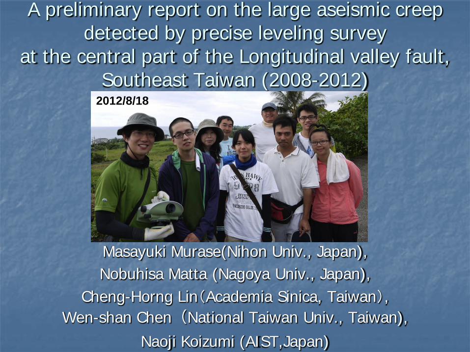
A preliminary report on the large aseismic creep detected by precise leveling survey
at the central part of the Longitudinal valley fault, Southeast Taiwan (2008-2012)
Masayuki Murase(Nihon Univ., Japan), Nobuhisa Matta (Nagoya Univ., Japan),
Cheng-Horng Lin(Academia Sinica, Taiwan), Wen-shan Chen(National Taiwan Univ., Taiwan),
Naoji Koizumi (AIST,Japan)
2012/8/18
Outline of our presentation
1. Introduction of the longitudinal valley fault (LVF) 2. Precise leveling survey in the central part of LVF 3. The vertical deformation of LVF (preliminary result)
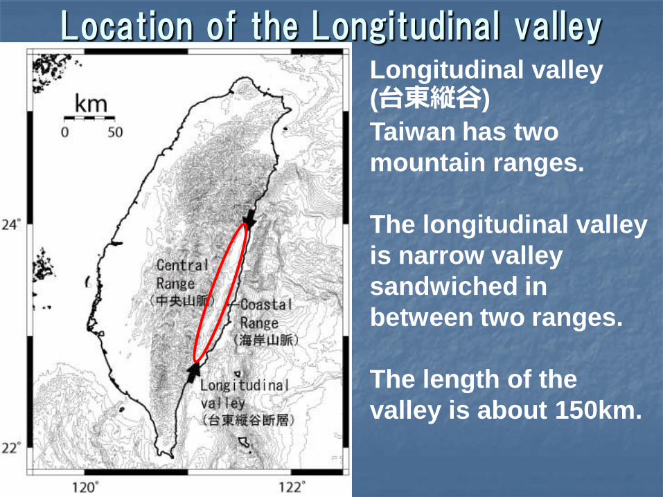
Location of the Longitudinal valley Longitudinal valley (台東縦谷) Taiwan has two mountain ranges. The longitudinal valley is narrow valley sandwiched in between two ranges. The length of the valley is about 150km.
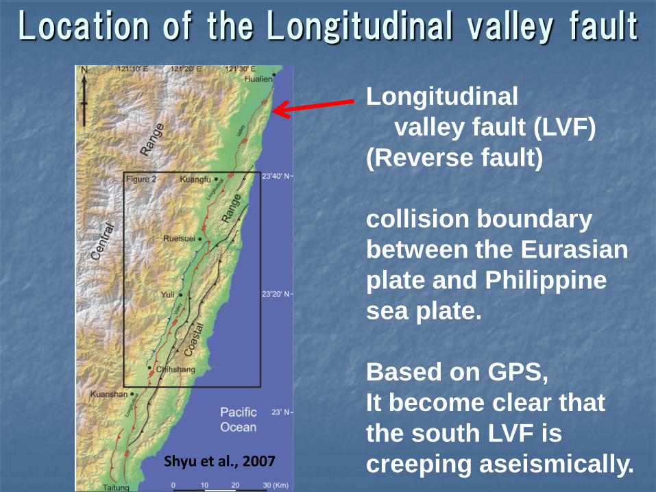
Location of the Longitudinal valley fault
Shyu et al., 2007
Longitudinal valley fault (LVF) (Reverse fault) collision boundary between the Eurasian plate and Philippine sea plate. Based on GPS, It become clear that the south LVF is creeping aseismically.
Locked section and creeping section
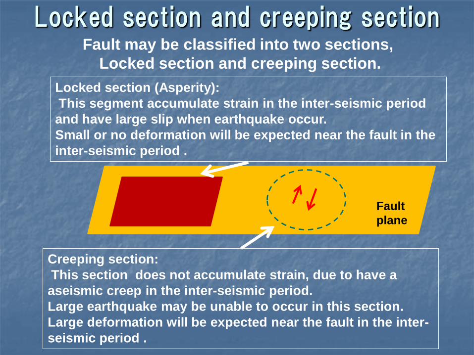
Locked section (Asperity): This segment accumulate strain in the inter-seismic period and have large slip when earthquake occur. Small or no deformation will be expected near the fault in the inter-seismic period .
Fault may be classified into two sections, Locked section and creeping section.
Creeping section: This section does not accumulate strain, due to have a aseismic creep in the inter-seismic period. Large earthquake may be unable to occur in this section. Large deformation will be expected near the fault in the inter-seismic period .
Fault plane
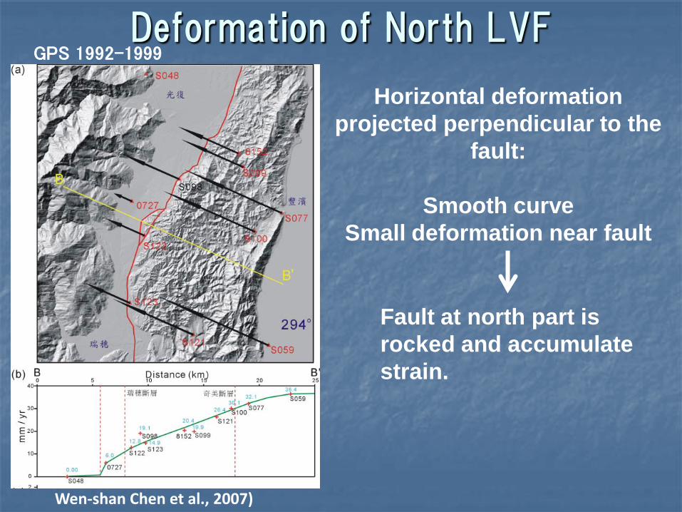
GPS 1992-1999
Wen-shan Chen et al., 2007)
Horizontal deformation projected perpendicular to the
fault:
Smooth curve Small deformation near fault
Fault at north part is rocked and accumulate strain.
Deformation of North LVF
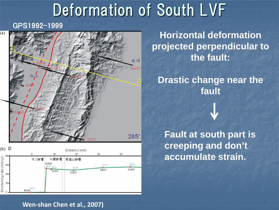
GPS1992-1999
Wen-shan Chen et al., 2007)
Horizontal deformation projected perpendicular to
the fault:
Drastic change near the fault
Fault at south part is creeping and don’t accumulate strain.
Deformation of South LVF
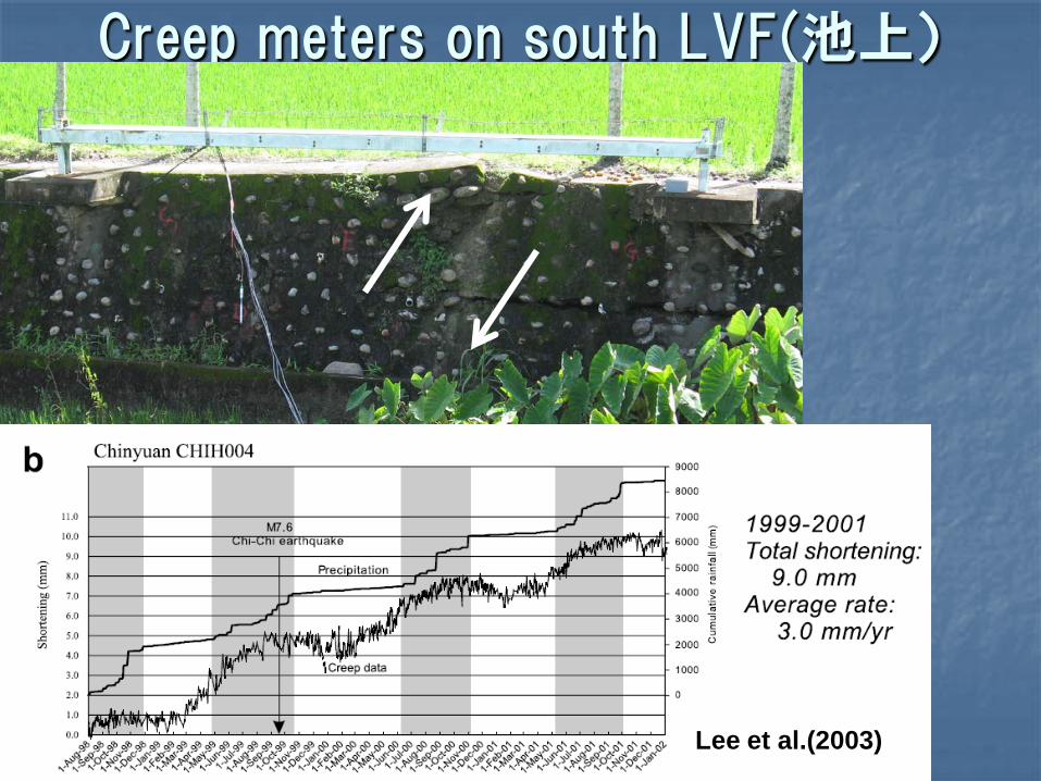
Creep meters on south LVF(池上)
Lee et al.(2003)
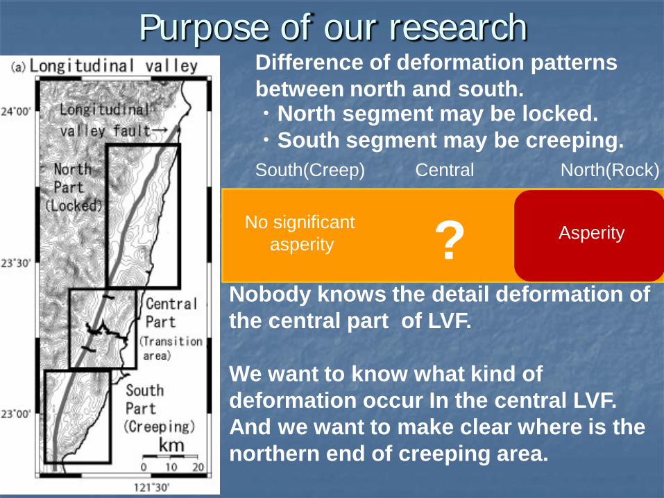
Purpose of our research Difference of deformation patterns between north and south. ・North segment may be locked. ・South segment may be creeping.
Nobody knows the detail deformation of the central part of LVF. We want to know what kind of deformation occur In the central LVF. And we want to make clear where is the northern end of creeping area.
South(Creep) North(Rock) Central
No significant asperity Asperity ?
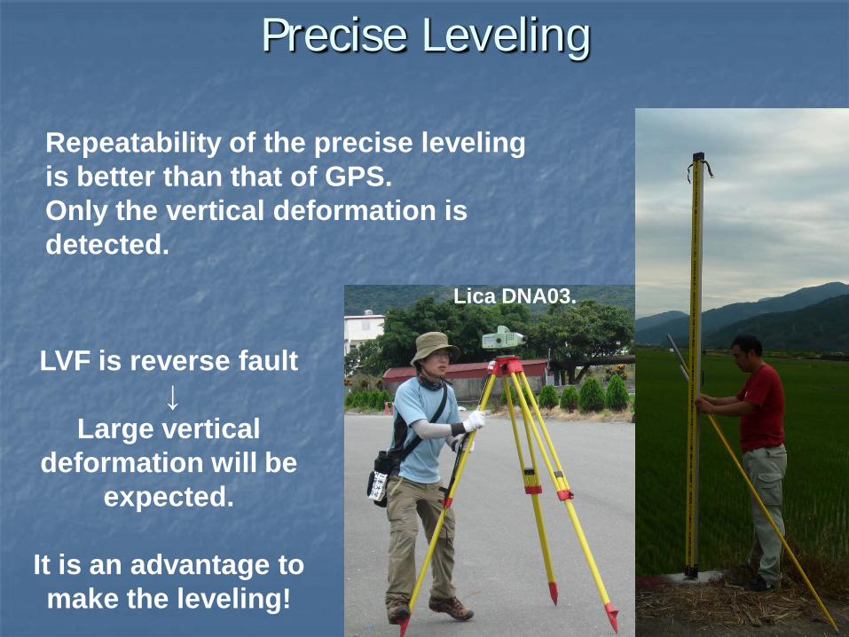
Precise Leveling
Repeatability of the precise leveling is better than that of GPS. Only the vertical deformation is detected.
Lica DNA03.
LVF is reverse fault ↓
Large vertical deformation will be
expected.
It is an advantage to make the leveling!
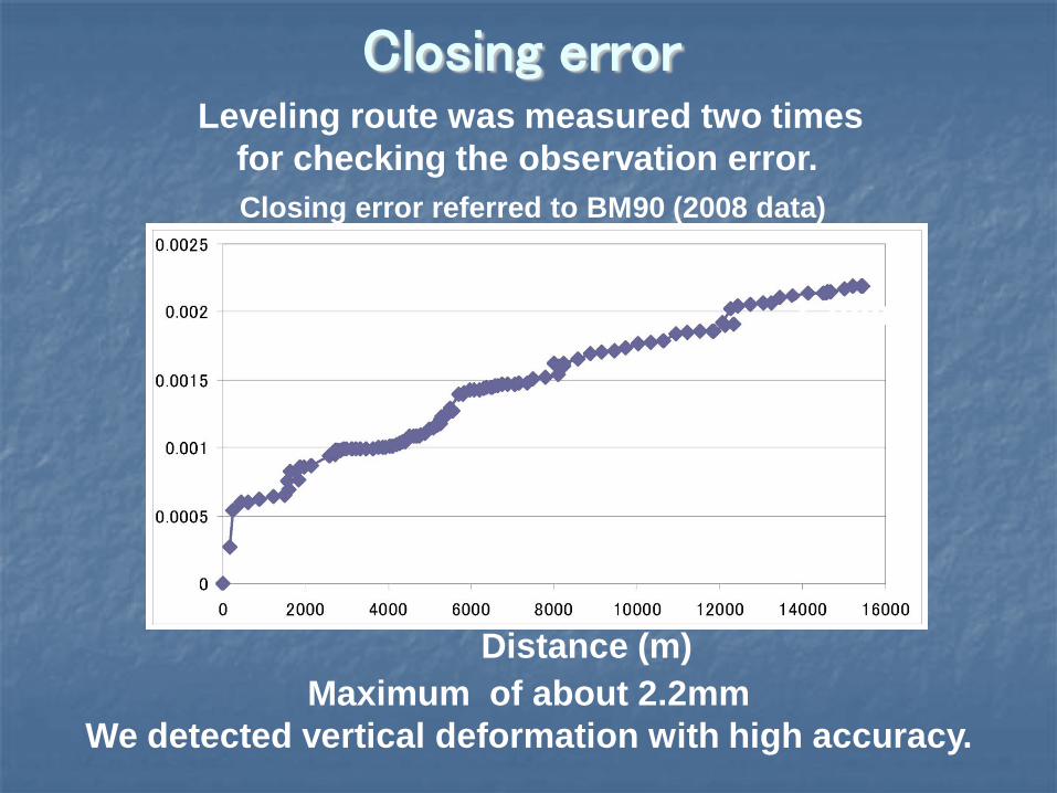
Closing error
Closing error referred to BM90 (2008 data)
2.2mm
Distance (m) Maximum of about 2.2mm
We detected vertical deformation with high accuracy.
Leveling route was measured two times for checking the observation error.

Our benchmarks The small nail was used as benchmark.
↓ It is very easy to make dense network
Yuli line ・ 123 benchmarks were installed on the Yuli line. ・The installation interval of benchmarks near the fault area is about 100 m.
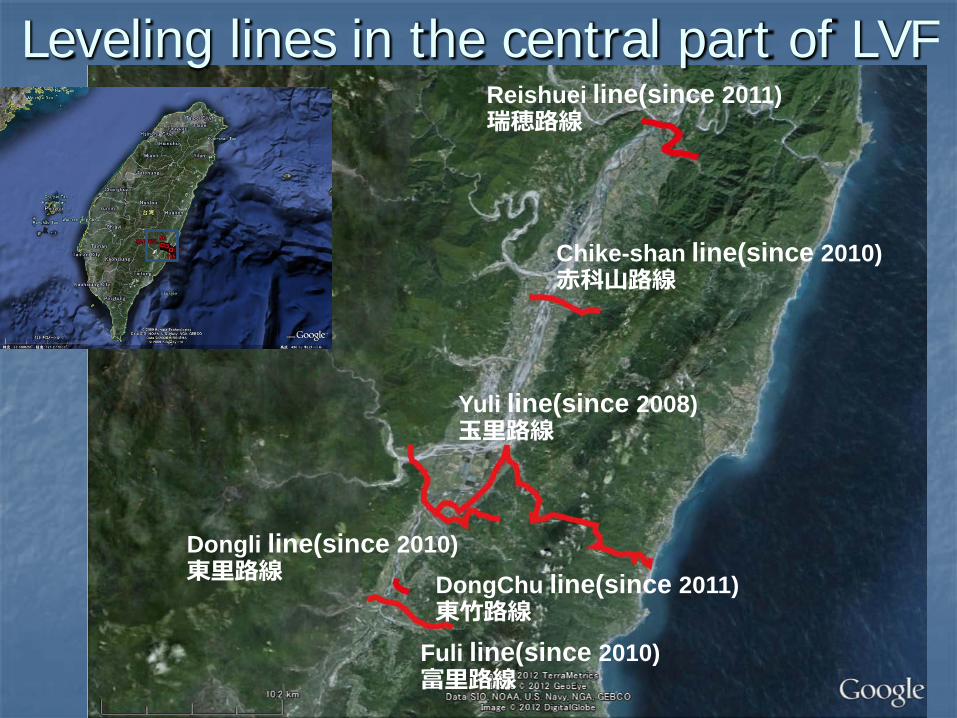
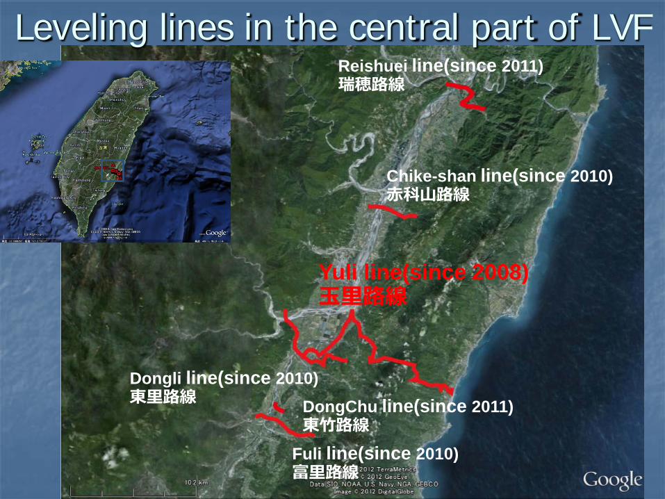
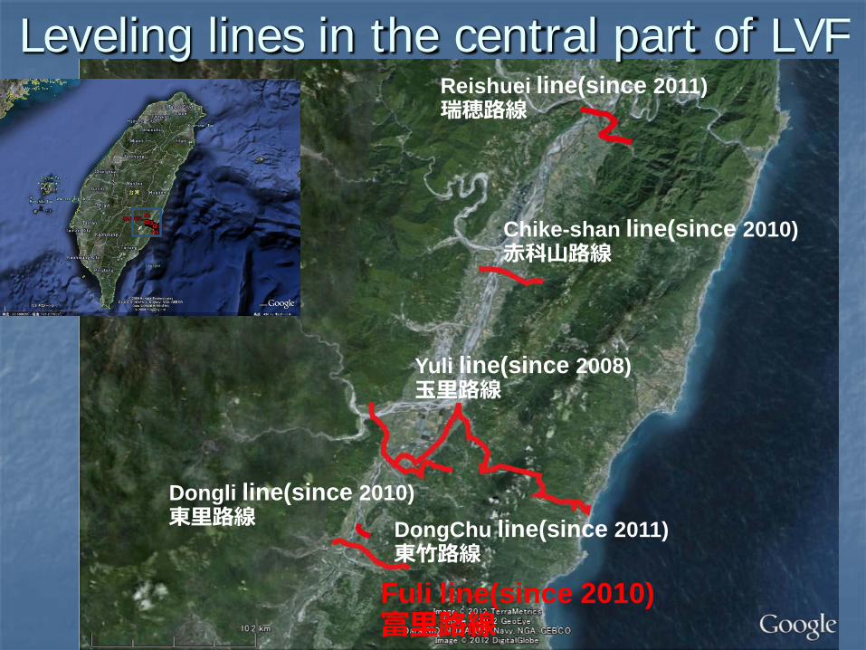
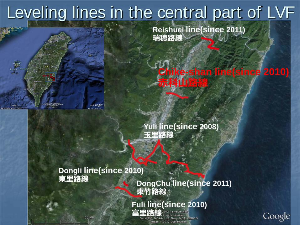
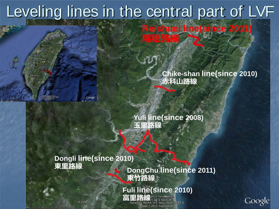
Leveling lines in the central part of LVF
Yuli line(since 2008) 玉里路線
Chike-shan line(since 2010) 赤科山路線
Dongli line(since 2010) 東里路線
Fuli line(since 2010) 富里路線
Reishuei line(since 2011) 瑞穂路線
DongChu line(since 2011) 東竹路線
Leveling lines in the central part of LVF
Yuli line(since 2008) 玉里路線
Chike-shan line(since 2010) 赤科山路線
Dongli line(since 2010) 東里路線
Fuli line(since 2010) 富里路線
Reishuei line(since 2011) 瑞穂路線
DongChu line(since 2011) 東竹路線
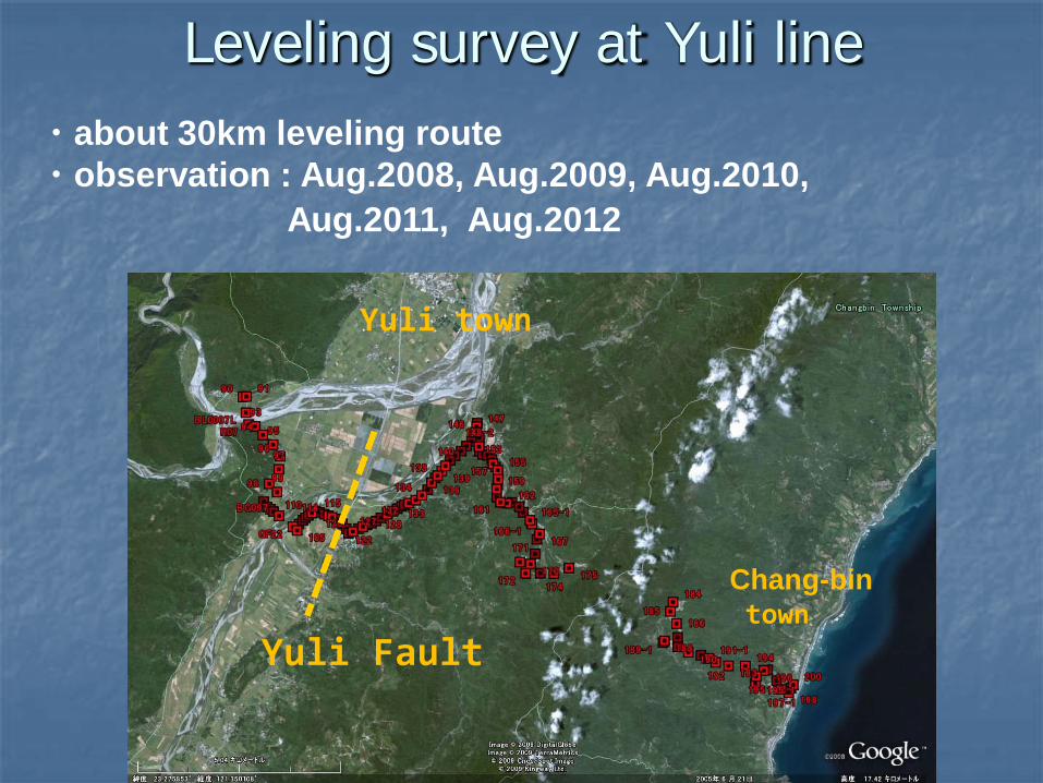
Yuli town
Yuli Fault
Chang-bin town
Leveling survey at Yuli line ・about 30km leveling route ・observation : Aug.2008, Aug.2009, Aug.2010, Aug.2011, Aug.2012
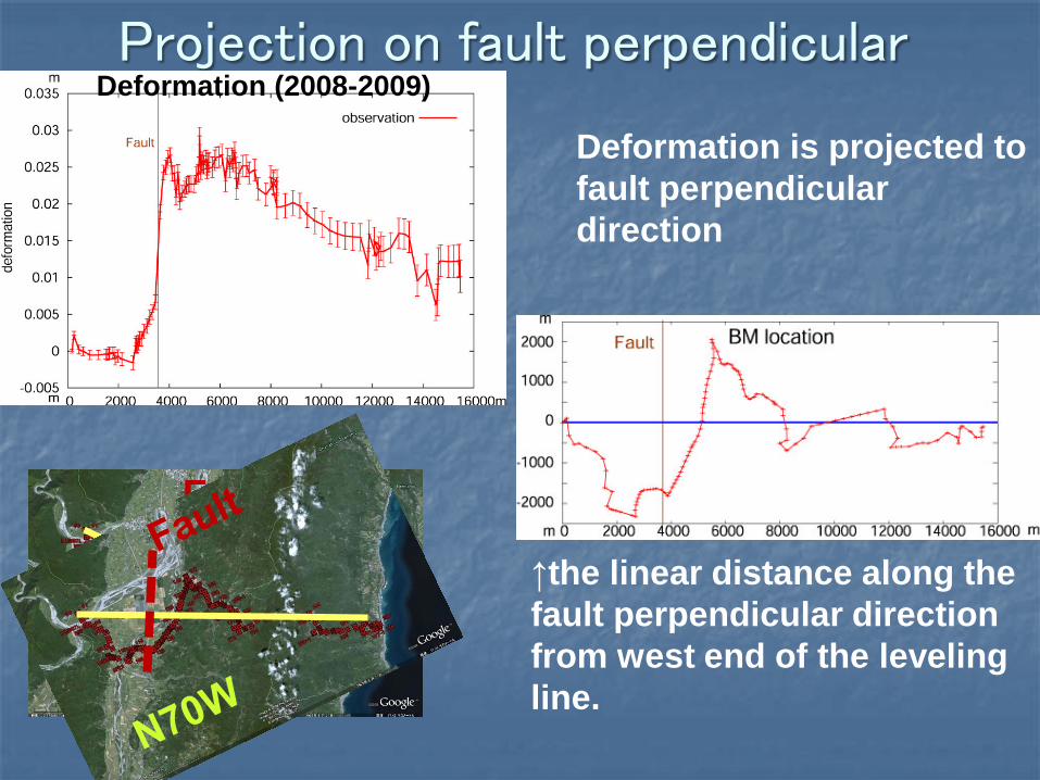
Projection on fault perpendicular
↑the linear distance along the fault perpendicular direction from west end of the leveling line.
Deformation is projected to fault perpendicular direction
Deformation (2008-2009)
N70W
Fault
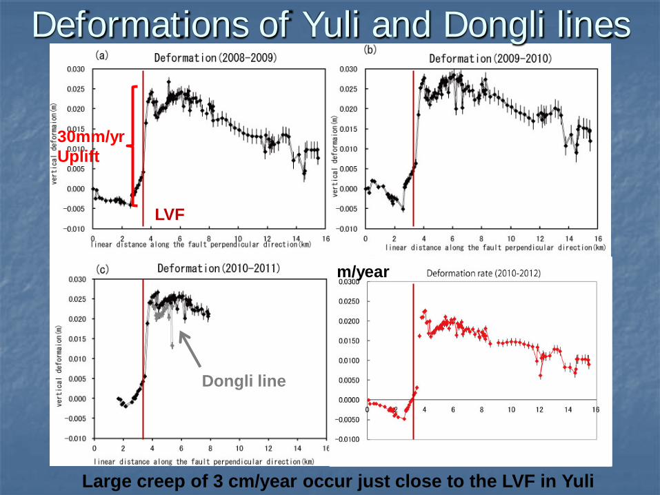
Deformations of Yuli and Dongli lines
LVF
30mm/yr Uplift
Large creep of 3 cm/year occur just close to the LVF in Yuli
Dongli line
m/year
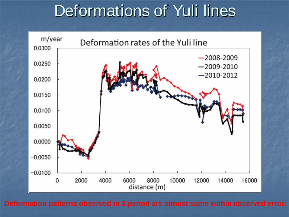
Deformations of Yuli lines
Deformation patterns observed in 3 period are almost same within observed error.
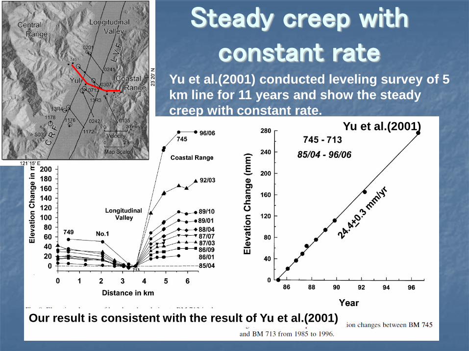
Steady creep with constant rate
Yu et al.(2001)
Yu et al.(2001) conducted leveling survey of 5 km line for 11 years and show the steady creep with constant rate.
Our result is consistent with the result of Yu et al.(2001)
Leveling lines in the central part of LVF
Yuli line(since 2008) 玉里路線
Chike-shan line(since 2010) 赤科山路線
Dongli line(since 2010) 東里路線
Fuli line(since 2010) 富里路線
Reishuei line(since 2011) 瑞穂路線
DongChu line(since 2011) 東竹路線
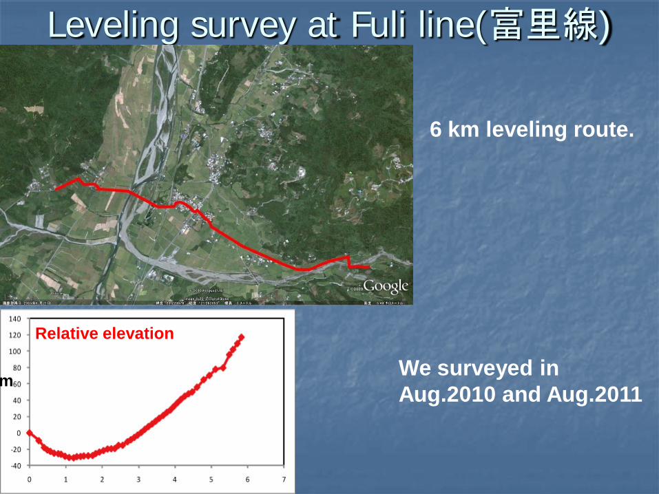
Leveling survey at Fuli line(富里線)
We surveyed in Aug.2010 and Aug.2011
6 km leveling route.
Relative elevation
m
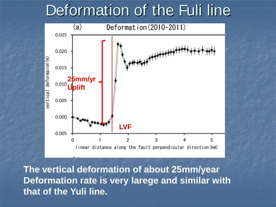
The vertical deformation of about 25mm/year Deformation rate is very larege and similar with that of the Yuli line.
LVF
25mm/yr Uplift
Deformation of the Fuli line
Leveling lines in the central part of LVF
Yuli line(since 2008) 玉里路線
Chike-shan line(since 2010) 赤科山路線
Dongli line(since 2010) 東里路線
Fuli line(since 2010) 富里路線
Reishuei line(since 2011) 瑞穂路線
DongChu line(since 2011) 東竹路線
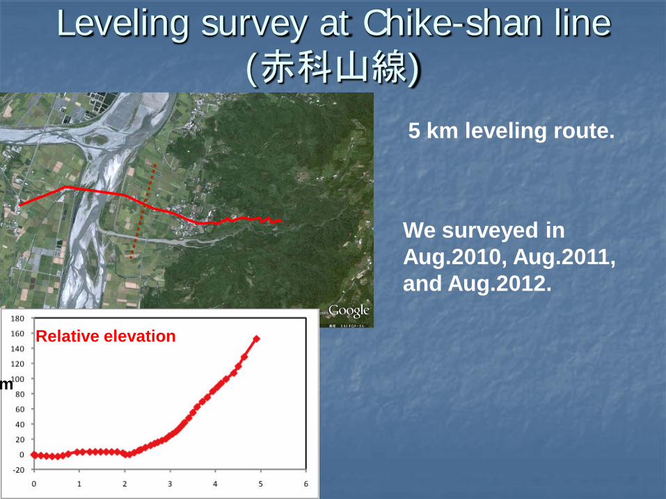
Leveling survey at Chike-shan line (赤科山線)
5 km leveling route.
We surveyed in Aug.2010, Aug.2011, and Aug.2012.
Relative elevation
m
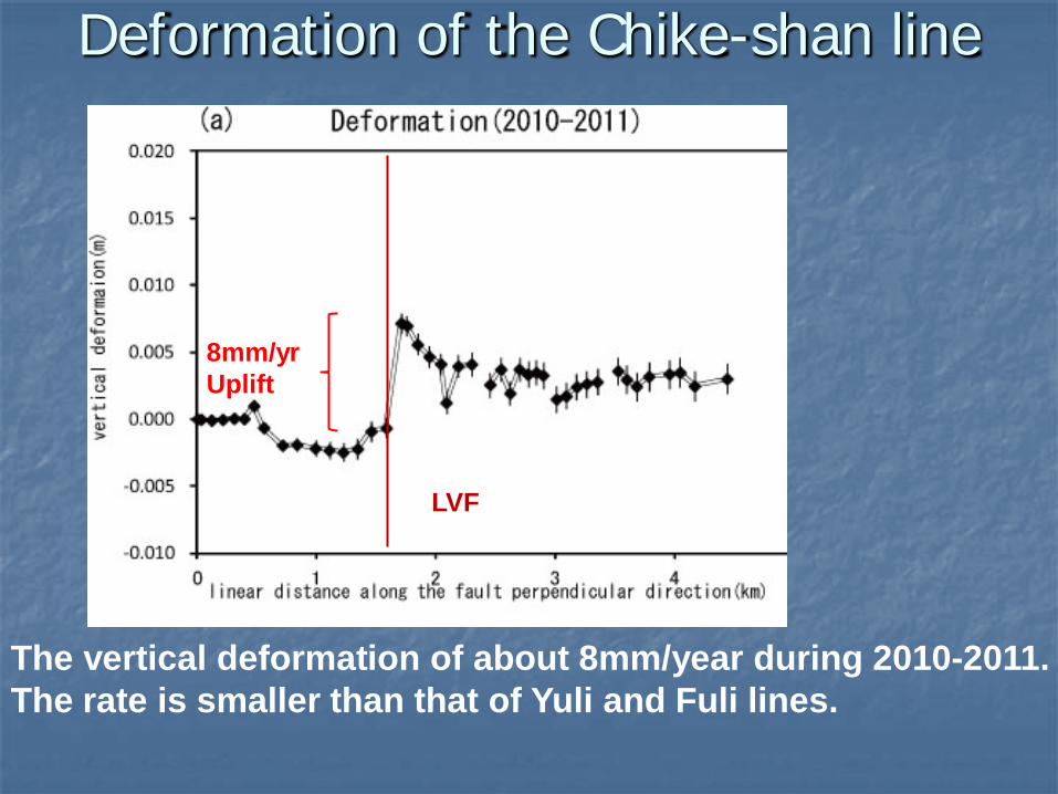
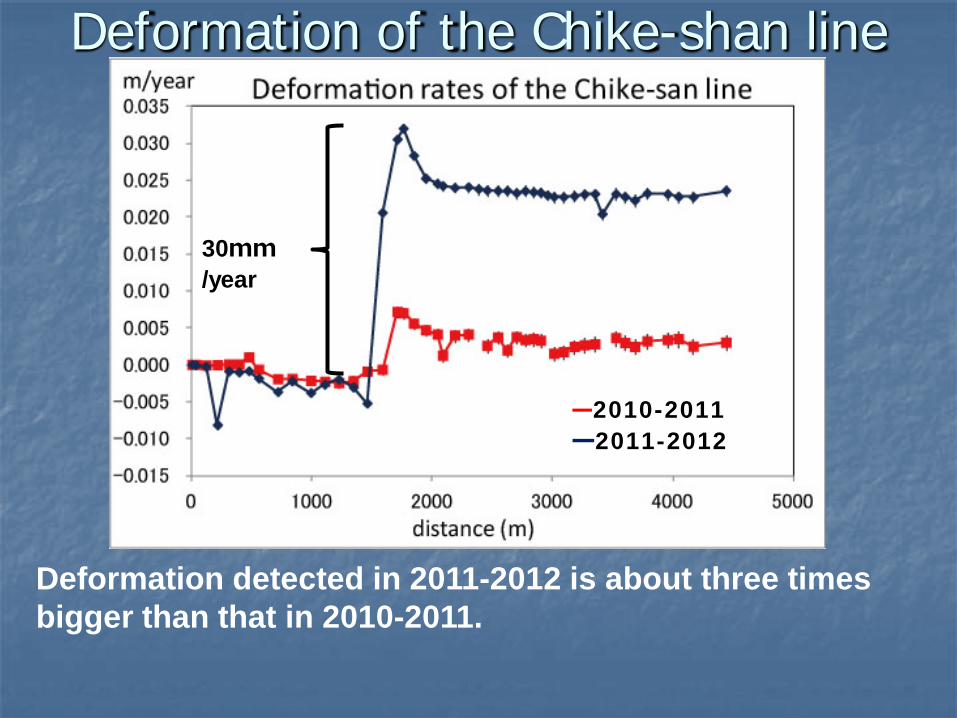
Deformation of the Chike-shan line
The vertical deformation of about 8mm/year during 2010-2011. The rate is smaller than that of Yuli and Fuli lines.
LVF
8mm/yr Uplift
Deformation of the Chike-shan line
Deformation detected in 2011-2012 is about three times bigger than that in 2010-2011.
30mm/year
―2010-2011 ―2011-2012
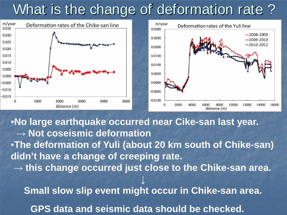
What is the change of deformation rate ?
•No large earthquake occurred near Cike-san last year. → Not coseismic deformation •The deformation of Yuli (about 20 km south of Chike-san) didn’t have a change of creeping rate. → this change occurred just close to the Chike-san area.
↓ Small slow slip event might occur in Chike-san area.
GPS data and seismic data should be checked.
Leveling lines in the central part of LVF
Yuli line(since 2008) 玉里路線
Chike-shan line(since 2010) 赤科山路線
Dongli line(since 2010) 東里路線
Fuli line(since 2010) 富里路線
Reishuei line(since 2011) 瑞穂路線
DongChu line(since 2011) 東竹路線
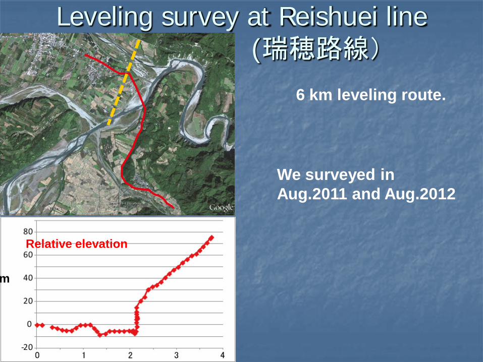
Leveling survey at Reishuei line (瑞穂路線)
6 km leveling route.
We surveyed in Aug.2011 and Aug.2012
Relative elevation
m
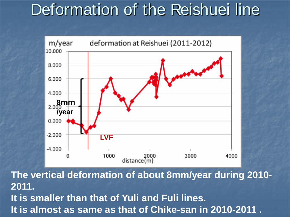
Deformation of the Reishuei line
The vertical deformation of about 8mm/year during 2010-2011. It is smaller than that of Yuli and Fuli lines. It is almost as same as that of Chike-san in 2010-2011 .
8mm/year
LVF
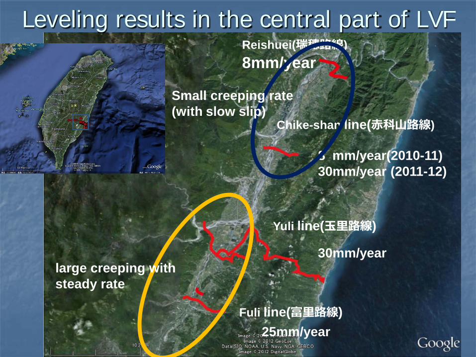
Leveling results in the central part of LVF
Yuli line(玉里路線)
Chike-shan line(赤科山路線)
Fuli line(富里路線)
Reishuei(瑞穂路線) 8mm/year
8 mm/year(2010-11) 30mm/year (2011-12)
30mm/year
25mm/year
Small creeping rate (with slow slip)
large creeping with steady rate
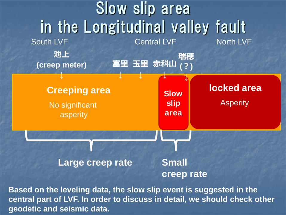
Slow slip area in the Longitudinal valley fault
South LVF North LVF Central LVF
No significant asperity
Asperity Slow slip area
赤科山 ↓
玉里 ↓
富里 ↓
Large creep rate
池上 (creep meter)
↓
Small creep rate
瑞穂 (?)
↓
Based on the leveling data, the slow slip event is suggested in the central part of LVF. In order to discuss in detail, we should check other geodetic and seismic data.
Creeping area locked area
Recommended