1
Keep one thing in mind as you go with your students on this imaginative journey: one of the essential goals of
an expedition is to make marvelous discoveries and to have a good time. It's not only the
destination, but the joy in the journey that counts.
For the following lesson you will need to display a globe or world map for students
to locate and mark the eXpeditions locations as you study them, track settings from
books, and possible destinations, by placing an X on the appropriate location. X
marks the spot! This provides an excellent opportunity to practice locating latitudes,
longitudes, calculating distances, travel time, etc.
For a more hands on/hands in method of introducing students to the world map &
identifying country locations go to: http://education.nationalgeographic.com/education/multimedia/world-political-mapmaker-kit/?ar_a=1
These maps are reusable for projects and expeditions in the future.
Once students have constructed your map, incorporate the map as an active part
of your lesson as you discuss the following information to have students identify
and locate the different locations, identify what ocean they are located in, mark the
appropriate places, etc.
Changing Latitudes Ask the class: What do explorers do? Which explorers have you heard of?
Explorers go on expeditions. Some have found new species or new places and
some have met new people, and many have crossed the ocean. The ocean and
humans are inextricably linked. Our history has illustrated that ever since
mankind existed they have been fascinated by the ocean, leading many people
throughout history to set off on ocean exploration expeditions in everything
from a balloon to a deep sea submarine.
The history of the world is filled with explorers and the voyages or expeditions they took. Ask the class:
What is an expedition? Discuss as a class or in pairs. The definition is ‘a journey with a purpose’.
Can students remember any explorers? (Columbus, Lewis & Clark & Sacajawea, etc.) Have them make a
list of every possible person they can think of that made an expedition. What did those explorers
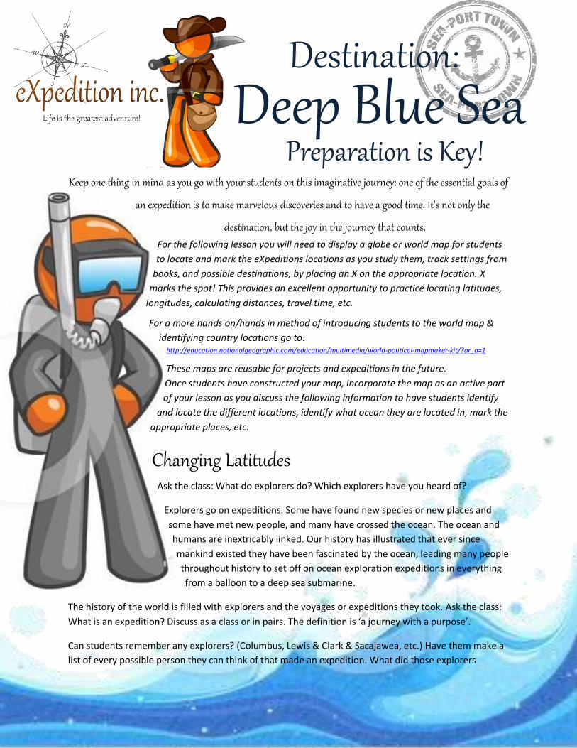
Destination: Deep Blue Sea
Preparation is Key!
2
discover? Notable explorers from all over the world including the Greeks, the Egyptians, the Polynesians
(Pacific Islanders), the Vikings, Vasco da Gama, Ferdinand Magellan, and Christopher Columbus have
explored the depths and the surfaces of the seas.
Marco Polo, a famous Italian explorer, was only seventeen when he set out for China . . . and
forty-one when he came back! He brought back many tales and goods. He left in 1271 (he was a
teenager at the time) with his father (Nicolo Polo) and uncle (Maffeo Polo); they spent about 24
years traveling on their expedition.
Vasco da Gama: In the fifteenth century, the world beyond Europe began to emerge from myth
and legend, and it was the Portuguese who led the way with many expeditions across the
endless seas and the peak of their achievement was Vasco da Gama's discovery of a sea route to
India. Still today, landmarks, coastlines and currents around the world bear Portuguese names.
Christopher Columbus is one of the most famous explorers. He made four voyages to the New
World, yet he died thinking he had reached the Indies.
The Vikings were the best shipbuilders and sailors of their time. If the direction of land was
unknown, Viking sailors would release a raven into the air and follow its course. Leif Ericson and
ancient Viking explorers discovered North America, or Vinland as they called, a thousand years
ago, long before other explorers.
Eric the Red (950?-1003 or 1004?) was a Viking explorer who was the first European to sail to
Greenland. He sailed from Iceland in 982 and led a group of colonists to Greenland in 985-986.
(Where is Greenland?)
Saint Brendan, also known as Saint Brendon, Brendan the Bold, and Brendan the Voyager (484
or 486-578) was an Irish abbot, monastery founder, and legendary sea voyager. Brendan sailed
in the Atlantic Ocean, traveling to the Hebrides (islands off the west coast of Scotland), Scotland,
and perhaps to Wales and Brittany (the northwestern coast of France along the English
Channel). He may have also sailed to the Canary Islands (off the northwest coast of Africa), the
Azores (islands far off the coast of Portugal), and Iceland. The Irish epic poem "Voyage of
Brendan" recounts his voyages.
Hannu was an ancient Egyptian explorer; he made the first recorded exploring expedition.
Hennu is said to have sailed down the Red Sea to explore the southeastern areas of the Arabian
peninsula (called Punt) around 2750 B.C (during Egypt's 2nd dynasty). He sailed to what is now
part of eastern Ethiopia and Somalia. He returned to Egypt with treasures, including myrrh (a
spice) and precious metals. Hannu wrote of his exploration in stone.
The journeys that these explorers made would be similar to any "extreme adventure" by today's
standards. They were challenging, dangerous, and most importantly, many times, had never been done
before. This same spirit of adventure is alive and well today in people who take on "extreme" challenges
3
for a variety of reasons. What kind of "extreme adventure" would students like to do? Which of the
adventures of those explorers your group has discussed would they like to be on? Why?
Travel on the surface of the ocean through the use of boats dates back to prehistoric times, but only in
modern times has extensive underwater exploration become possible. Scientific investigations began
with scientists such as James Cook, Charles Darwin, and Edmund Halley. Now ocean exploration is made
much easier with the invention and development in better sailing ships and submarine equip with
various equipment for deep sea exploration and much more. Unlike the earlier sailors, today’s scientists
can substantiate their stories of adventure with photographs, videos, and even samples for study.
Do students think everything has been discovered already about the
world? Every part explored? Not true! Explain that everyone in the class
is going to become part of an expedition.
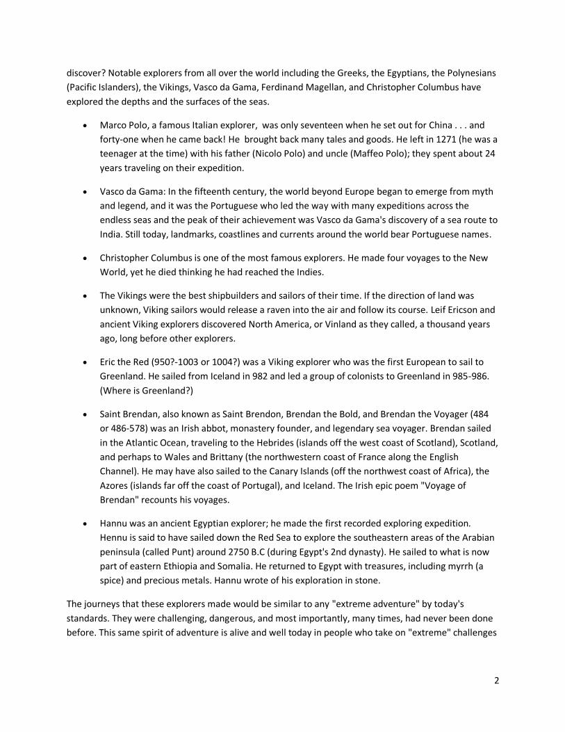
Our group has been hired by National Geographic to make an
expedition to the deepest part of the ocean, the Mariana Trench, in
order to try and find a rare glowing jellyfish and a unique large fanged
viperfish, both of which scientists believe might hold the cure for many
diseases. We have a budget of only $8 million dollars given to us by a
private sponsor and only have a three week window of time to complete
our mission!
Have the students think of this as an actual voyage and plan and teach accordingly. Let
them know that big expeditions require a lot more planning than a three-day weekend. The legwork and
planning we put in now can make our expedition safer, more enjoyable, and more likely to succeed.
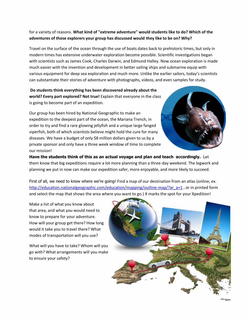
First of all, we need to know where we’re going! Find a map of our destination from an atlas (online, ex.
http://education.nationalgeographic.com/education/mapping/outline-map/?ar_a=1 , or in printed form
and select the map that shows the area where you want to go.) X marks the spot for your Xpedition!
Make a list of what you know about
that area, and what you would need to
know to prepare for your adventure.
How will your group get there? How long
would it take you to travel there? What
modes of transportation will you use?
What will you have to take? Whom will you
go with? What arrangements will you make
to ensure your safety?
4
Scout the Route Dig deep for information.
Set the Date On an expedition calendar circle trip dates, plus the lead-up period. Include start/finish dates for tasks
like grocery shopping, packing, and travel.
Highlight deadlines for permit applications, airline or shuttle booking, and holidays that might stop mail
from reaching you.
Geographically Speaking
The equator (0°) is the starting point for measuring latitude. Latitude lines run parallel to the
equator. Latitude lines above the equator are marked with an N for north, while latitude lines
running below the equator are labeled with an S for south. The prime meridian (0°) is the
starting point for measuring longitude. Longitude lines to the right of the prime meridian are
marked E for east, and those on the left are marked W for west.
Where is the Mariana Trench? (Find it on a map) What is the latitude and longitude?
Going the Distance How far away from us is it in miles?
What might the best route to get there? Where will we go through on the way? What might be some of
our stops? Play a game where you find the longitude and latitude coordinates of different states in the
continental US states and countries. Then divide students into groups or pairs with a map for each
team and challenge students to find the country that belongs with each coordinate, the team that
finds it first gets a point. Will that possibly be one of our stops? Why or why not?
Cross-reference topos, Google Maps, aerial photos, and elevation profiles to find the best route, resupply
points, and sites for the home base of our expedition. What is the latitude and longitude of each stop?
We’ll need to consider: What is the fastest route? There can be a large
difference between the best or safest route and the fastest route to get
somewhere.
How are we going to get there? Create a trip itinerary, with daily mileages, start/stop points,
cruxes, etc.
Should we fly (Northern Mariana Islands are served by
Saipan Intl Airport (Saipan, Mariana Islands)?)Have
students calculate distances, time flying, etc. How much
will it cost us to fly there? Set realistic mileage goals. Big-trip
loads are heavy and day-after-day travel exhausting!
5
Ex. According to one travel site’s Lowest Fare Summary for one person to travel to Saipan it will cost
(roundtrip), take (one way), and stop (one the way):
Delta Air Lines:
o Starting at $1959.50
o Total Travel Time: 28 hrs 45 mins (one way)
o Connect in: Atlanta, Tokyo (map it out, which way are we flying? What are the latitude
and longitude coordinates of each stop?)
Delta Air Lines
o Starting at $2991.09
o Total Travel time: 28 hrs 35 mins (one way)
o Connect in: Detroit, Seoul (Korea) (map it out, which way are we flying? What are the
latitude and longitude coordinates of each stop?)
United:
o Starting at $2820.40
o Total Travel Time: 45 hrs 19 min (one way)
o Connect in: Washington, Houston, Honolulu, Guam (map it out, which way are we
flying? What are the latitude and longitude coordinates of each stop?)
American Airlines:
o Starting at $4795.09
o Total Travel Time: 40 hrs 40 mins (one way)
o Connect in: Chicago, Tokyo, Seoul (map it out, which way are we flying? What are the
latitude and longitude coordinates of each stop?)
Will they drive part of it? What route could we possibly take?
Should we take a boat? How long would it take to sail there? Ex. Will you take the slow route via
Hawaii, the Marshall and Caroline islands? And stop by Pohnpei and Chuuk in Micronesia? From Barbers
Point, Hawaii, U.S.A., it is 3,303 miles away. If we drove across the country, from San Diego, California,
U.S.A., we would have a 5,379 mile boat ride.
Getting Ready & Staying Safe and Sound Locate gear shops near resupply points. We would need to ask the proprietors in advance to hold some
fuel for us.
If you're heading deep into the wilds these days, like we are, it's likely that we should carry both a
traditional GPS, to help us find your way, and a satellite messenger device like a SPOT, so our friends and
family can track our progress online and we can let them know if we're okay or in need of help. Since
our expedition is remote, we’ll need to carry an emergency signaling device. We have to buy or rent a
PLB, SPOT, or sat phone and know all of our latitude and longitude coordinates. How much will that
cost? Ex.
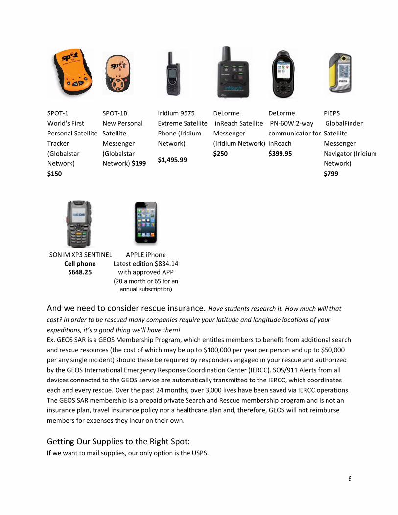
6
SPOT-1
World's First
Personal Satellite
Tracker
(Globalstar
Network)
$150
SPOT-1B
New Personal
Satellite
Messenger
(Globalstar
Network) $199
Iridium 9575
Extreme Satellite
Phone (Iridium
Network)
$1,495.99
DeLorme
inReach Satellite
Messenger
(Iridium Network)
$250
DeLorme
PN-60W 2-way
communicator for
inReach
$399.95
PIEPS
GlobalFinder
Satellite
Messenger
Navigator (Iridium
Network)
$799
SONIM XP3 SENTINEL Cell phone
$648.25
APPLE iPhone Latest edition $834.14
with approved APP (20 a month or 65 for an
annual subscription)
And we need to consider rescue insurance. Have students research it. How much will that
cost? In order to be rescued many companies require your latitude and longitude locations of your
expeditions, it’s a good thing we’ll have them!
Ex. GEOS SAR is a GEOS Membership Program, which entitles members to benefit from additional search
and rescue resources (the cost of which may be up to $100,000 per year per person and up to $50,000
per any single incident) should these be required by responders engaged in your rescue and authorized
by the GEOS International Emergency Response Coordination Center (IERCC). SOS/911 Alerts from all
devices connected to the GEOS service are automatically transmitted to the IERCC, which coordinates
each and every rescue. Over the past 24 months, over 3,000 lives have been saved via IERCC operations.
The GEOS SAR membership is a prepaid private Search and Rescue membership program and is not an
insurance plan, travel insurance policy nor a healthcare plan and, therefore, GEOS will not reimburse
members for expenses they incur on their own.
Getting Our Supplies to the Right Spot: If we want to mail supplies, our only option is the USPS.
7
Good news: Saipan is considered "Domestic" -- it's even the same domestic USPS rates and a US zip
code, SAIPAN MP 96950
Bad news: If you mail a regular package from your local post office Parcel Post (Parcel Post only travels
by surface transportation, meaning truck or boat) to Saipan it could take 2-4 weeks to arrive!
Have students go to postalcalc.usps.com and they can calculate how much it would cost to ship their
equipment. Note: You can’t ship any package that weighs over 70lbs.
For example: If you want to ship a 70lb box Express mail to Saipan it will cost you $370.20 and it will
(hopefully) be there in four days. If you ship the same box by Priority Mail, it will still (hopefully) be there in
four days, but it will only cost you $134.75. Ship it by Standard Post and it will only cost $71.84, but it will
take at least fifteen days to arrive!
And the Postal Service gives this warning, * The timeliness of service to or from destinations outside the
continental US may be affected by the limited availability of transportation. If no ship or plane is headed
that way, neither is your package.
Begin Final Countdown The day before hitting the road, we need to check all of our preparations and critical gear one last time.
We can’t forget to leave an itinerary with a family member and also the Nat. Geographic since they’ll
probably be the first to know if we miss our due-back date.
Wait, now how are we going to get down seven miles to the very bottom of the
sea and live to tell the tale? And how are we going to go about collecting that fish
when we get there and keep it alive? A bucket? A hydraulically operated, robotic
arm? Have students list their ideas and suggestions.
8
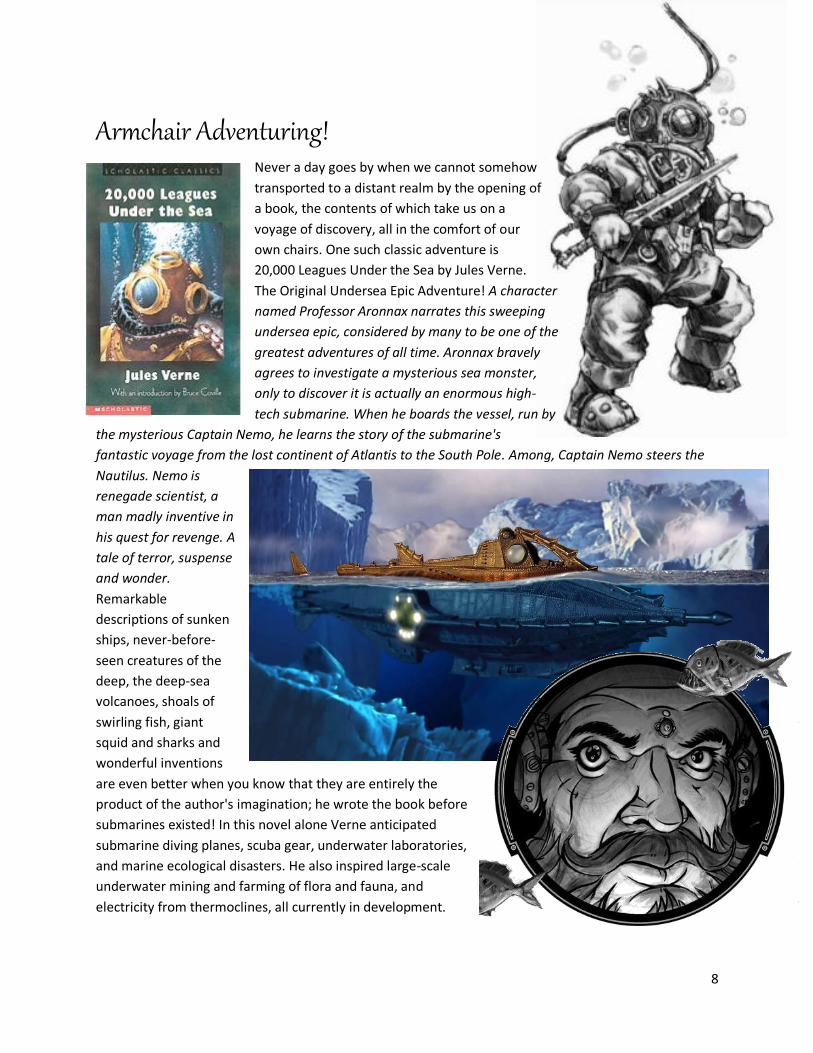
Armchair Adventuring!
Never a day goes by when we cannot somehow
transported to a distant realm by the opening of
a book, the contents of which take us on a
voyage of discovery, all in the comfort of our
own chairs. One such classic adventure is
20,000 Leagues Under the Sea by Jules Verne.
The Original Undersea Epic Adventure! A character
named Professor Aronnax narrates this sweeping
undersea epic, considered by many to be one of the
greatest adventures of all time. Aronnax bravely
agrees to investigate a mysterious sea monster,
only to discover it is actually an enormous high-
tech submarine. When he boards the vessel, run by
the mysterious Captain Nemo, he learns the story of the submarine's
fantastic voyage from the lost continent of Atlantis to the South Pole. Among, Captain Nemo steers the
Nautilus. Nemo is
renegade scientist, a
man madly inventive in
his quest for revenge. A
tale of terror, suspense
and wonder.
Remarkable
descriptions of sunken
ships, never-before-
seen creatures of the
deep, the deep-sea
volcanoes, shoals of
swirling fish, giant
squid and sharks and
wonderful inventions
are even better when you know that they are entirely the
product of the author's imagination; he wrote the book before
submarines existed! In this novel alone Verne anticipated
submarine diving planes, scuba gear, underwater laboratories,
and marine ecological disasters. He also inspired large-scale
underwater mining and farming of flora and fauna, and
electricity from thermoclines, all currently in development.
9
During your expeditionary studies, you may want to read a few short passages or sections from an
expedition based book such as 20,000 Leagues Under the Sea, Journey to the Center of the Earth, or
other appropriate book each day.
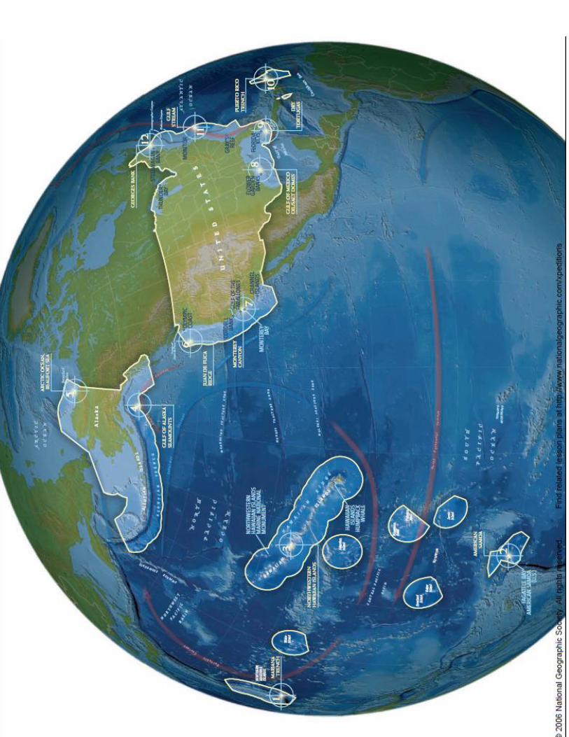
Sunken Treasure? Sunken Nation! Few of us realize it, but by one definition of what constitutes the US, more of our nation is under water
than on land! Some 4.4 million square miles of ocean floor lies within the Exclusive Economic Zone (EEZ)
over which the USA claims jurisdiction and resources. That’s compared to 3.6 million square miles of
land. Our list of America’s most extraordinary places to explore might include the Great Smoky
Mountains, the Grand Canyon, Yellowstone’s geysers, the ancient forests of the Pacific Northwest, and
Hawaii’s volcanoes. Yet equally magnificent places exist beneath the waves: the rich fishing grounds of
Georges Bank, a frozen sea that’s home to imperiled polar bears, the teeming depths of Monterey
Canyon, the Gulf of Alaska’s volcanic seamounts, or the Mariana Trench, Earth’s deepest point that
plummets nearly seven miles straight down! The Mariana
Trench is the deepest location on the entire Earth. If you
set Mt. Everest down in the Mariana Trench, there would
still be over 7,000 feet of water above it.
America’s ocean realm is made up of a wide
variety of places from icy fjords to tropical
coral reefs and deep-sea coral forests, from
sunlit shallow areas to lightless depths and ocean
currents that move more water than the Mississippi River.
These marine ecosystems are habitats for seaweeds, snails,
octopuses, fishes and whales, and places where people sail,
surf, snorkel, fish, and extract oil. They are essential to our
well-being. No other nation governs a larger or more
diverse ocean area! The following map is a new view of
America’s hidden undersea places from our
friends at the National Geographic Society.
Come on! Grab your tickets and let’s explore!
Time and tide waits for no one.
10
11
Destination: Deep Blue Sea So vast and mysterious is the ocean that we are
often tempted to view it as indestructible. While
the ocean provides great benefits, overfishing,
destructive fishing practices, pollution,
introduction of non-native species, and global
changes in climate can threaten the ocean and
the life in it if we aren’t careful. Many sharks and
other fishes are far less abundant than they
once were, but with changes other populations
are recovering, but still many others depend on
decisions we, citizens and leaders make.
Oceanographers (scientists who study the
ocean) have stated that out of 97%, only 5% of
the ocean as a whole on Earth has been
explored! We know less about the deepest
points on our planet than we do about the
surface of Mars or the Moon. If the ocean was a
gallon that would mean that we had only
explored 12.8, or a little less than 13
Tablespoons, or ¾ of a cup of it. (Show
students!) Discoveries have just begun.
With over 70% of our planet covered with water,
some historians have pondered why it was
named "Earth" when in fact the name "Ocean"
seems more fitting! Over the years, there have
been various descriptors given to our watery
surface: the "Seven Seas," conventional ocean
divisions, and most recently, the Five Basins. In
the end, although we have labels that separate
names of different regions, the Earth ultimately
has just one big ocean.
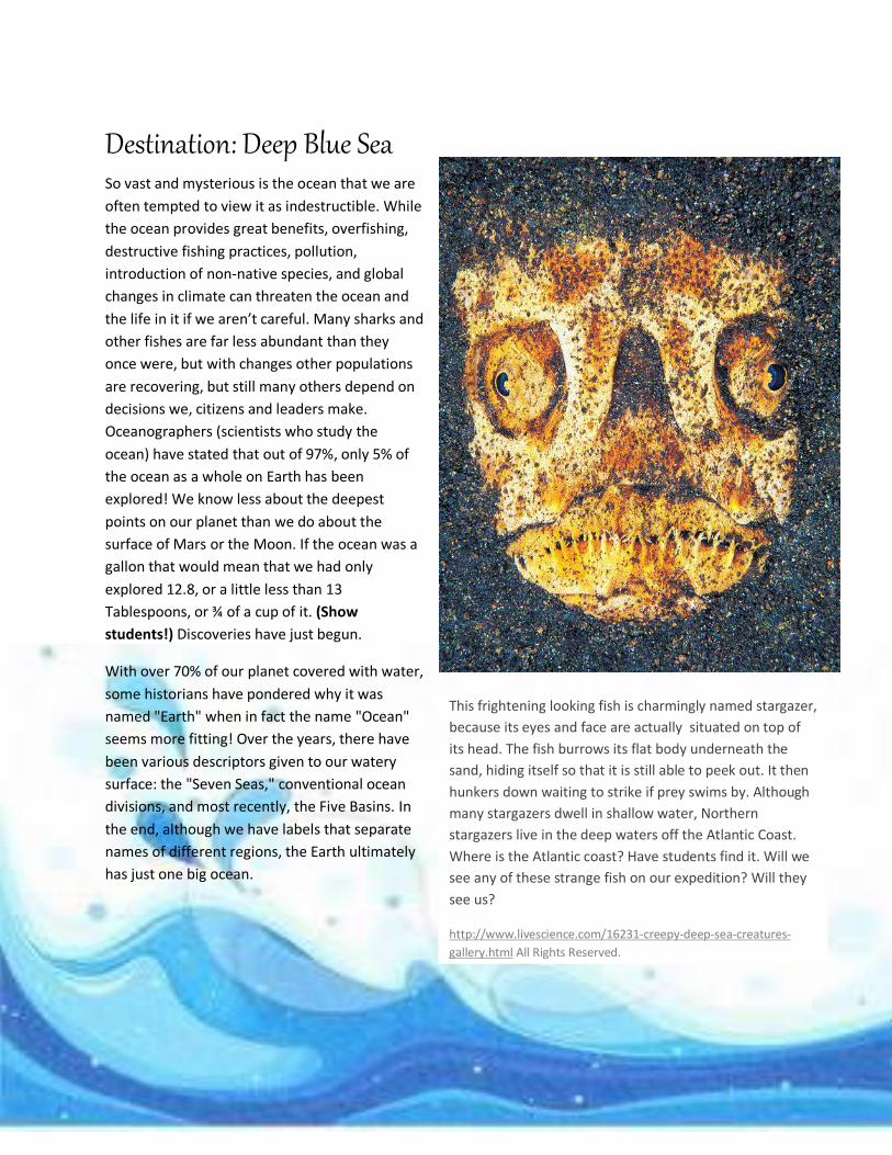
This frightening looking fish is charmingly named stargazer,
because its eyes and face are actually situated on top of
its head. The fish burrows its flat body underneath the
sand, hiding itself so that it is still able to peek out. It then
hunkers down waiting to strike if prey swims by. Although
many stargazers dwell in shallow water, Northern
stargazers live in the deep waters off the Atlantic Coast.
Where is the Atlantic coast? Have students find it. Will we
see any of these strange fish on our expedition? Will they
see us?
http://www.livescience.com/16231-creepy-deep-sea-creatures-
gallery.html All Rights Reserved.
12
Mapamoscas A large display map of the oceans and continents and the
following questions can also be used to play Mapamoscas
a.k.a. a Geography version of Matamoscas, where the
students are in two teams, and race to use fly swatters to
slap the correct ocean when asked questions like the
following, alternate, or additional questions created by the
instructor.
Sample Questions: 1. Where is the Southern Ocean?
2. Where is the Indian Ocean?
3. Where is the Mediterranean Sea?
4. Where is the Atlantic Ocean?
5. Where is the Pacific Ocean?
6. Where is the Arctic Ocean?
7. Which ocean became the 5th official ocean in the year 2000? The Southern Ocean
8. All seven continents could fit over which ocean, still leaving room for another Asia? Pacific Ocean
9. Which ocean is surrounded by the Ring of Fire, a large number of active volcanoes? Pacific Ocean
10. The Mariana Trench, the deepest known area of Earth’s oceans, having a deepest point of around
11000 metres (36000 feet) is located in what ocean? Pacific Ocean
11. Which ocean is the third largest ocean on Earth, covering around 14% of the Earth’s surface?
Indian Ocean
12. Which ocean is so deep that in some places more than 100 Statues of Liberty could be stacked on
top of one another and they would still be underwater? Pacific Ocean
13. Guide planes and ice-breaking ships have to travel with the trade ships sailing on which ocean?
Arctic Ocean
14. The Mediterranean forms the northern border of which continent? Africa
15. Which ocean is bordered by Australia to the east, Asia, to the north, and Africa to the west? Indian
Ocean
16. Which continent is famous for the Great Barrier Reef? Australia/Oceania
17. During winter which ocean is almost completely covered in sea ice? Arctic Ocean
18. In 1498 Europeans began sailing around the tip of Africa to reach which ocean? Indian Ocean
19. What ocean is the second largest ocean on Earth, covering over 21% of the Earth’s surface?
Atlantic Ocean
13
20. What is perhaps the least known body of water in the world? Arctic Ocean
21. Which ocean is the largest ocean, covering around 30% of the Earth’s surface? Pacific Ocean
22. Which ocean’s name refers to Atlas of Greek mythology, who, in myth, holds the world on his
shoulders? Atlantic Ocean
23. The Bermuda Triangle is located in which ocean? Atlantic Ocean
24. Where are there are more artifacts and remnants of history than in all of the world’s museums,
combined? The Ocean
25. Which ocean’s name has an original meaning of ‘peaceful sea’? Pacific Ocean
14
Feeling Blue
Oceans (from Ancient Greek Ὠκεανὸς
(Okeanos) are an interconnected mass of
saline or saltwater covering 70.78% of the
surface of the Earth and are immeasurably
important to all life on the planet for many
reasons. Because it is the principal
component of Earth's water sources, the
world ocean is important to all known life,
and influences climate and weather
patterns.
The total volume is approximately 1.3
billion cubic kilometers (310 million cu mi)
with an average depth of 3,682 meters (12,080 ft.). It is the habitat of 230,000 known species, although
much of the ocean's depths remain unexplored and it is
estimated that over two million marine species
exist. Some of the teeny-tiniest creatures, those plankton
mentioned earlier, are some of the most vital to human
survival. How? One species of plankton, called
prochlorococcus, produce almost half the oxygen
you breathe!
Ocean exploration is a part of oceanography
(study of the seas and oceans) describing more
generally the exploration of the ocean's surface.
The major divisions of oceanography include:
Geological Oceanography – This is the study of
the ocean floor and features.
Physical Oceanography – This is concerned
with the physical attributes of the ocean
water, such as current and temperature.
Chemical Oceanography – They focus on
the chemistry of ocean waters.
Marine Biology – they study the
ocean's oceanic flora and fauna
Meteorology – is the study of the
interaction between the atmosphere
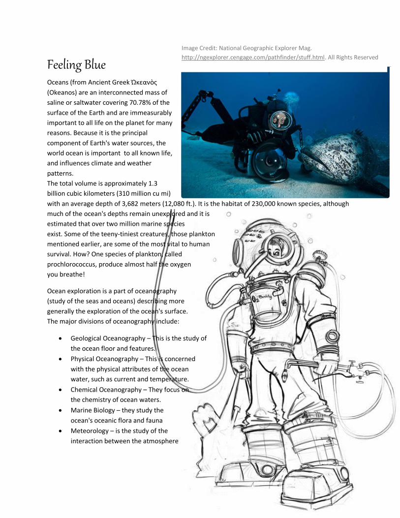
Image Credit: National Geographic Explorer Mag.
http://ngexplorer.cengage.com/pathfinder/stuff.html. All Rights Reserved
15
(the air and gases around our planet) and the ocean.
Ocean exploration is also what we call it when humans explore the ocean boundaries and the ocean
depths.
Long, long ago sailors began to spin fascinating tales of sea creatures too horrible or too beautiful to
resist. Few people actually saw such creatures, yet few doubted their existence -- until recent years. As
we learned more about the sea, mythic monsters seemed simply products of overactive imaginations
stimulated by long and frightening sea voyages.
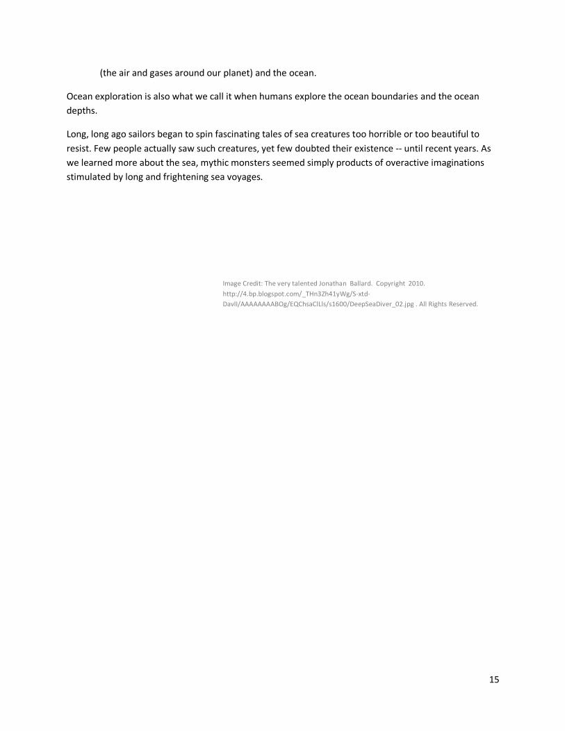
Image Credit: The very talented Jonathan Ballard. Copyright 2010.
http://4.bp.blogspot.com/_THn3Zh41yWg/S-xtd-
DavlI/AAAAAAAABOg/EQChsaClLls/s1600/DeepSeaDiver_02.jpg . All Rights Reserved.
16
21
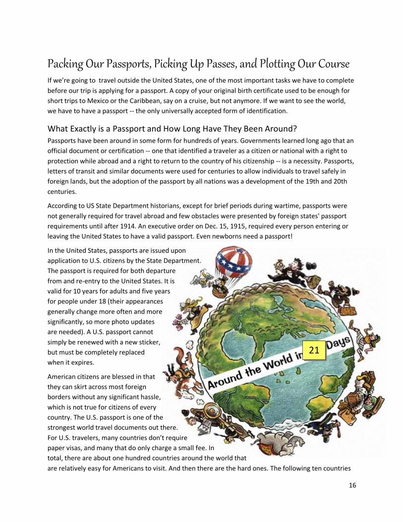
Packing Our Passports, Picking Up Passes, and Plotting Our Course
If we’re going to travel outside the United States, one of the most important tasks we have to complete
before our trip is applying for a passport. A copy of your original birth certificate used to be enough for
short trips to Mexico or the Caribbean, say on a cruise, but not anymore. If we want to see the world,
we have to have a passport -- the only universally accepted form of identification.
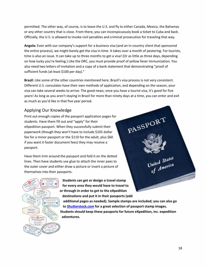
What Exactly is a Passport and How Long Have They Been Around? Passports have been around in some form for hundreds of years. Governments learned long ago that an
official document or certification -- one that identified a traveler as a citizen or national with a right to
protection while abroad and a right to return to the country of his citizenship -- is a necessity. Passports,
letters of transit and similar documents were used for centuries to allow individuals to travel safely in
foreign lands, but the adoption of the passport by all nations was a development of the 19th and 20th
centuries.
According to US State Department historians, except for brief periods during wartime, passports were
not generally required for travel abroad and few obstacles were presented by foreign states' passport
requirements until after 1914. An executive order on Dec. 15, 1915, required every person entering or
leaving the United States to have a valid passport. Even newborns need a passport!
In the United States, passports are issued upon
application to U.S. citizens by the State Department.
The passport is required for both departure
from and re-entry to the United States. It is
valid for 10 years for adults and five years
for people under 18 (their appearances
generally change more often and more
significantly, so more photo updates
are needed). A U.S. passport cannot
simply be renewed with a new sticker,
but must be completely replaced
when it expires.
American citizens are blessed in that
they can skirt across most foreign
borders without any significant hassle,
which is not true for citizens of every
country. The U.S. passport is one of the
strongest world travel documents out there.
For U.S. travelers, many countries don’t require
paper visas, and many that do only charge a small fee. In
total, there are about one hundred countries around the world that
are relatively easy for Americans to visit. And then there are the hard ones. The following ten countries
17
are currently some of the most difficult to enter for American citizens, which we’ll have to take into
account when we plan our expedition route! Have students mark each of the following countries on
our expedition map as places we might need to avoid on the way. Is there anything we need to
change about our route? (And some might add Turkmenistan (supposedly getting even more difficult),
Uzbekistan, Tajikistan, and Azerbaijan to the list of difficult countries!) Can you find them on a map?
China: China’s individual visa fee is currently $140, and they require the applicant to arrive in person at
one of six regional consulates across the U.S. to submit the forms and fees. Of course, you can pay
someone to represent you, but that bumps the price up even more.I n positive news, they have a short
turnaround time for processing. Only four days!
Russia: Russia requires a letter of invitation, written in Russian, from either an authorized tourist agency
or hotel. On the visa application, you must list all the countries you’ve visited in the last ten years, your
last two places of work, as well as a few other questions you wouldn’t normally have to answer on a visa
application. Russia is also notorious for not letting small mistakes slide–if you forget to write in block
letters, or use a different colored pen, you’re out of luck. You’ll need at least a week (often longer) for
processing time, and be prepared to pay a couple hundred dollars, depending on what type of visa you
get, and whether you go directly through the Russian Embassy or use an independent visa processing
company.
India: India’s visa rules are constantly changing, making it difficult for first-time applicants. There are
also a multitude of visa types; tourist, business, research, missionaries, journalist and conference visas
are a few of the options. In a quasi-ironic twist, the Indian government outsources their visa operations
to Travisa Outsourcing, a private company. Consular fees range between $60 and $150.
Iran: Iran does not currently have diplomatic representation in the United States. If you’re looking for a
visa, you need to go through the Pakistan Embassy in Washington D.C., which has an Iranian Interests
Section. In order to start the visa process, you must have some kind of representation within Iran that
petitions Tehran’s Foreign Ministry. That’s the most difficult step, an often fruitless request. Even after
the visa is granted, the traveler can still be detained and imprisoned on “unknown or various charges”
when entering or leaving Iran.
North Korea: Like Iran, North Korea does not have diplomatic representation within the U.S., and while
the Swedish Embassy helps U.S. travelers with the process, most sources report that a visa is not
typically granted to Americans, unless they are coming with an organized delegation. Of the countries on
this list, it’s probably the most difficult one to visit!
Saudi Arabia: If you have an Israeli stamp in your passport, forget about visiting Saudi Arabia! While
there are special visas for religious pilgrimages, or if you’re visiting family, only a limited amount of
tourist visas are alloted each year. They’re given directly to government-approved tour groups. Another
point of note; if in transit, a woman needs to be accompanied by a male relative at all times.
Cuba: As an American, the only way to fly to Cuba directly is to apply for a special license, which is only
available with just reason; visiting family, educational programs, and religious travel is generally
18
permitted. The other way, of course, is to leave the U.S. and fly to either Canada, Mexico, the Bahamas
or any other country that is close. From there, you can inconspicuously book a ticket to Cuba and back.
Officially, the U.S. is allowed to invoke civil penalties and criminal prosecution for traveling that way.
Angola: Even with our company’s support for a business visa (and an in-country client that sponsored
the entire process), we might barely get the visa in time. It takes over a month of pestering. For tourists,
time is also an issue. It can take up to three months to get a visa! (Or as little as three days, depending
on how lucky you’re feeling.) Like the DRC, you must provide proof of yellow fever immunization. You
also need two letters of invitation and a copy of a bank statement that demonstrating “proof of
sufficient funds (at least $100 per day).”
Brazil: Like some of the other countries mentioned here, Brazil’s visa process is not very consistent.
Different U.S. consulates have their own methods of application, and depending on the season, your
visa can take several weeks to arrive. The good news; once you have a tourist visa, it’s good for five
years! As long as you aren’t staying in Brazil for more than ninety days at a time, you can enter and exit
as much as you’d like in that five year period.
Applying Our Knowledge Print out enough copies of the passport application pages for
students. Have them fill out and “apply” for their
eXpedition passport. When they successfully submit their
paperwork (though they won’t have to include $105 dollar
fee for a minor passport or the $110 for the adult, plus $60
if you want it faster document fees) they may receive a
passport.
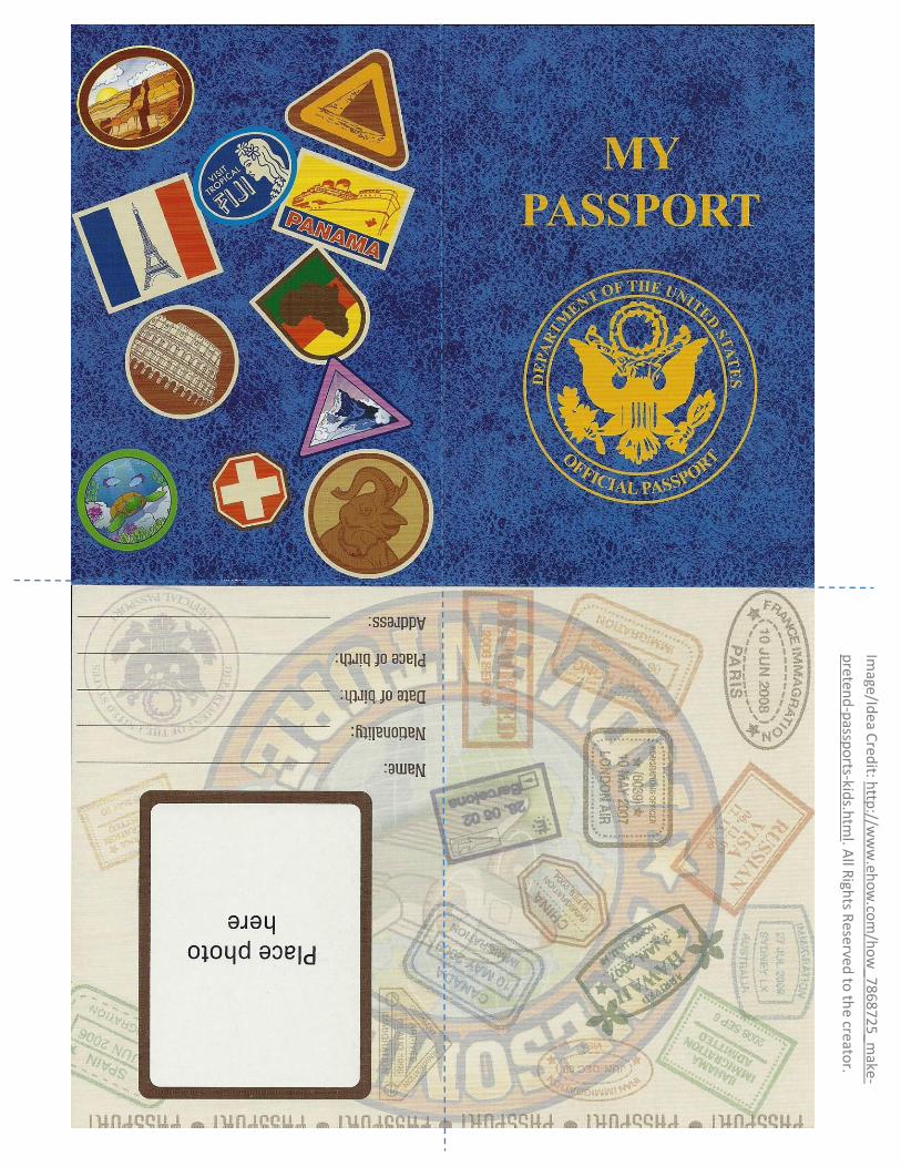
Have them trim around the passport and fold it on the dotted
lines. Then have students use glue to attach the inner paes to
the outer cover and either draw a picture or insert a picture of
themselves into their passports.
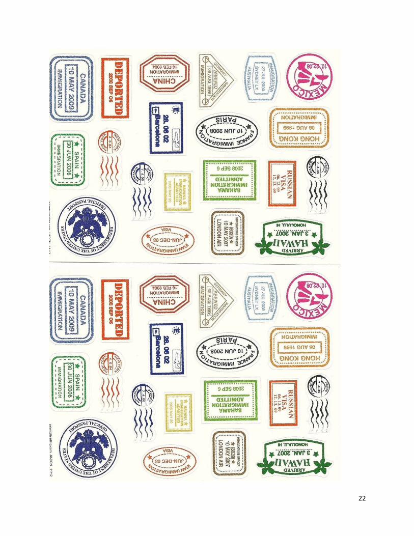
Students can get or design a travel stamp
for every area they would have to travel to
or through in order to get to the eXpedition
destinations and put it in their passports (add
additional pages as needed). Sample stamps are included; you can also go
to Shutterstock.com for a great selection of passport stamp images.
Students should keep these passports for future eXpedition, inc. expedition
adventures.
19
SAMPLE ONLY
20
SAMPLE ONLY
21
Image/Id
ea Cred
it: http
://ww
w.eh
ow
.com
/ho
w_
7868725_make
-
preten
d-p
asspo
rts-kids.h
tml. A
ll Righ
ts Rese
rved to
the creato
r.
22
23
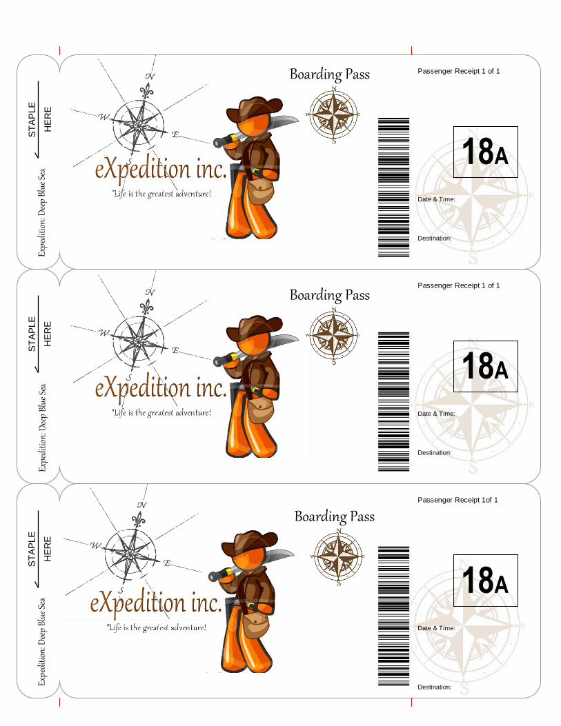
Boarding Pass
ST
AP
LE
HE
RE
ST
AP
LE
HE
RE
ST
AP
LE
HE
RE
Passenger Receipt 1 of 1
Passenger/Name
Date & Time:
Destination:
18A
Expe
ditio
n: D
eep
Blue
Sea
Passenger Receipt 1 of 1
Passenger/Name
Date & Time:
Destination:
18A
Passenger Receipt 1of 1
Passenger Name:
Date & Time:
Destination:
18A
Expe
ditio
n: D
eep
Blue
Sea
Expe
ditio
n: D
eep
Blue
Sea
Boarding Pass
Boarding Pass
24
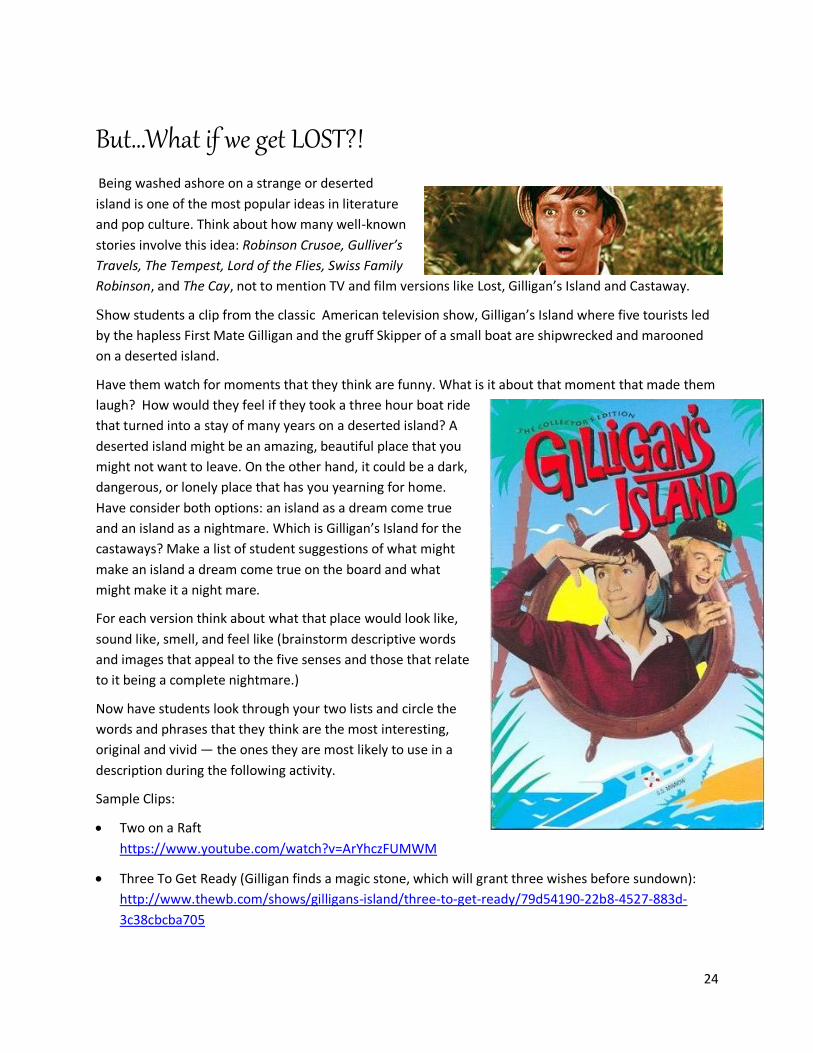
But…What if we get LOST?!
Being washed ashore on a strange or deserted
island is one of the most popular ideas in literature
and pop culture. Think about how many well-known
stories involve this idea: Robinson Crusoe, Gulliver’s
Travels, The Tempest, Lord of the Flies, Swiss Family
Robinson, and The Cay, not to mention TV and film versions like Lost, Gilligan’s Island and Castaway.
Show students a clip from the classic American television show, Gilligan’s Island where five tourists led
by the hapless First Mate Gilligan and the gruff Skipper of a small boat are shipwrecked and marooned
on a deserted island.
Have them watch for moments that they think are funny. What is it about that moment that made them
laugh? How would they feel if they took a three hour boat ride
that turned into a stay of many years on a deserted island? A
deserted island might be an amazing, beautiful place that you
might not want to leave. On the other hand, it could be a dark,
dangerous, or lonely place that has you yearning for home.
Have consider both options: an island as a dream come true
and an island as a nightmare. Which is Gilligan’s Island for the
castaways? Make a list of student suggestions of what might
make an island a dream come true on the board and what
might make it a night mare.
For each version think about what that place would look like,
sound like, smell, and feel like (brainstorm descriptive words
and images that appeal to the five senses and those that relate
to it being a complete nightmare.)
Now have students look through your two lists and circle the
words and phrases that they think are the most interesting,
original and vivid — the ones they are most likely to use in a
description during the following activity.
Sample Clips:
Two on a Raft
https://www.youtube.com/watch?v=ArYhczFUMWM
Three To Get Ready (Gilligan finds a magic stone, which will grant three wishes before sundown):
http://www.thewb.com/shows/gilligans-island/three-to-get-ready/79d54190-22b8-4527-883d-
3c38cbcba705
25
As always, watch all clips before showing them to your students to judge suitability and what parts
you want to show to your students that best fit with the direction of your activities.
Travel Writers: Painting Pictures with Words I think I'll journey out some day to wondrous lands
afar,
Or even chart a journey to a distant blazing star…
Poetry. Poetry and travel. Do they go together? Are
they best friends -- or at least good pals? The
answer's yes! An important first step of getting kids to
write poetry is to read poetry. Gather students’ ideas
about why people write poems or songs and why
people read them. Read samples of your favorite
travel related poetry and discuss them with students.
There are many excellent resources available, Ex. A
World of Wonders: Geographic Travels in Verse and
Rhyme by J. Patrick Lewis. and Let's
Travel: poems for kids
by Alice L. Bauer or
any of the above
mentioned author’s.
Example: Packed Bags
If I could pack my
suitcase and visit
another place,
I wouldn’t want to
speed along, as though
I’m in a race.
If I could pack my
suitcase I’d want to
take my time,
I like to travel leisurely,
without a cruel
deadline.
If I could pack my
suitcase and climb aboard a submarine,
I wouldn’t care how deep it took me, viewing creatures best
26
unseen.
If I could pack my suitcase and be a stranger in some land,
I think endless days would slip away, like sand falling through my
hand.
If I could pack my suitcase and 'round the world endlessly roam,
I’d probably the happiest when I finally got back home.
Example: Vacation Frustration by Ken Nesbitt
Our family vacationed in Europe.
We flew to the beaches of
Spain.
We hopped on a ferry to
England.
We traveled through France
on a train.
We lugged all our luggage
to Denmark.
We dragged all our baggage
to Greece,
We hoisted our backpacks
and handbags,
our suitcase, our trunk and
valise.
We rambled through
dozens of ruins.
We wandered through
castles galore.
We must have seen
hundreds of statues --
cathedrals and mosques by
the score.
We pored over paintings in
Paris.
We tramped through museums in Rome,
and all of the while I was thinking
how much I would rather be home.
27
At last we are done
with our travels!
We've seen every
kingdom and nation.
But we're so
completely exhausted
that we need another
vacation!
Give time; read a poem
at least twice; use open
comments to ‘help
unfold the poem’ (such
as ‘That reminds me
of…’ I wonder if…’ and
‘Tell me….’); and be
honest – if you’re not
sure of what a line
means, say so and ask
students what they
think. Invite the group to
respond. Ask them what they feel the feeling of the poem
is. Reread a line that particularly appealed. Read the
whole poem again, listening for the rhythm. Model the
whole exercise as a process of exploration, an expedition
of the mind.
Notice the rhymes used in the poems- explore different
kinds of rhyme. (Have students check the rhyming
dictionary -www.rhymer.com - for possibilities for their
own poems.) What is the tone and mood of the poem? Is
the title significant to the poem? Ex. In the poem in the
image, is the title important? Why or why not? What kinds
of terms, phrases, words, and language do the author’s
use? How do they make you want to go somewhere? How
might you get someone to stay away?
Make a list of appropriate places that are on our route.
What latitudes and longitudes are they at? Which have
interesting names that are fun to say? .
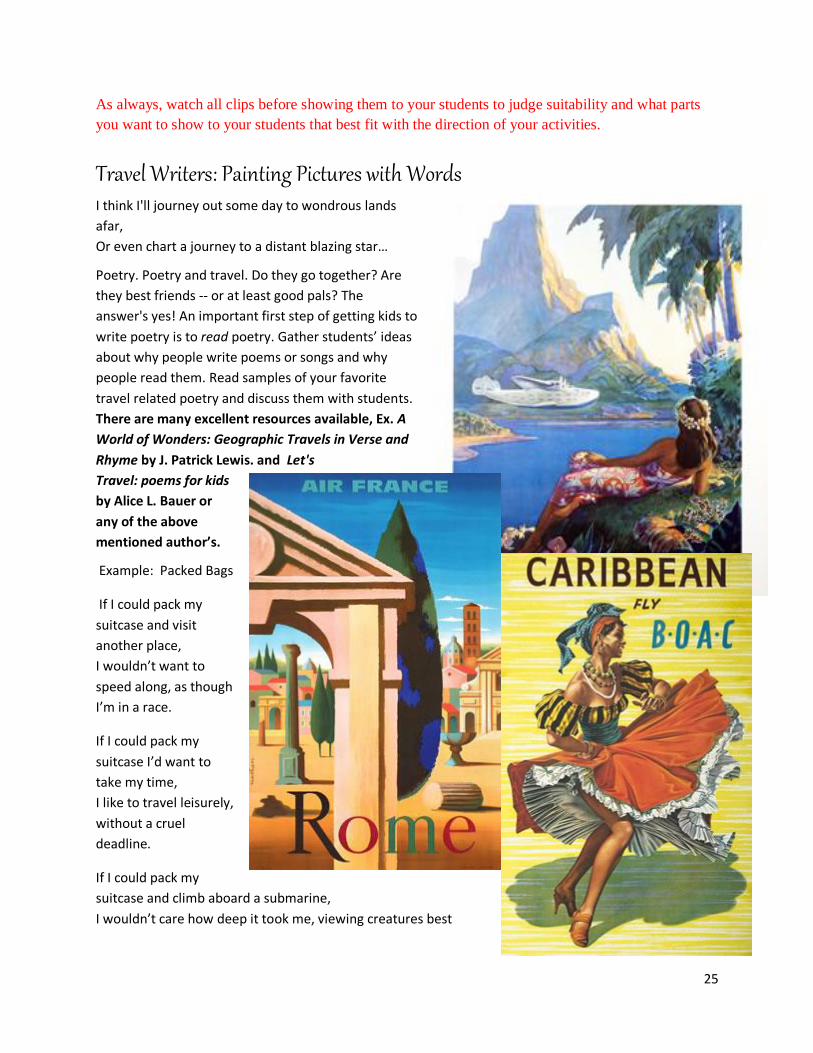
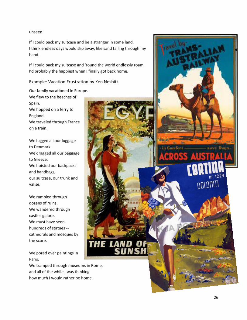
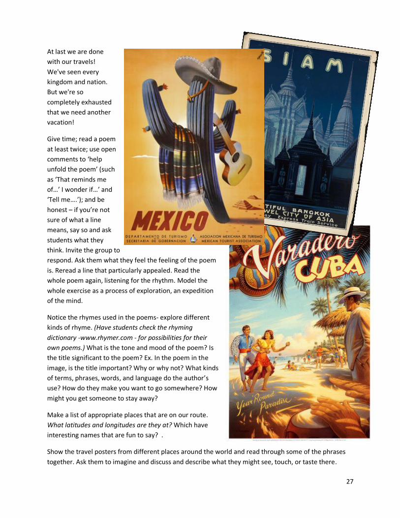
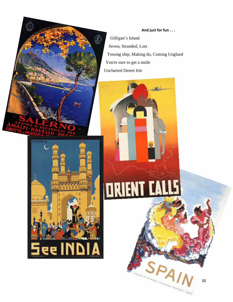
Show the travel posters from different places around the world and read through some of the phrases
together. Ask them to imagine and discuss and describe what they might see, touch, or taste there.
28
What might those places be like? What kinds of terms,
phrases, words, and language do the authors use?
How do they make you feel when you look at these posters?
What images, feelings, or words do the posters bring to your
mind? Do you want to go somewhere? List students’
thoughts on the board and circle several of your favorite
phrases, words, language, etc. on the board or in your
journals.
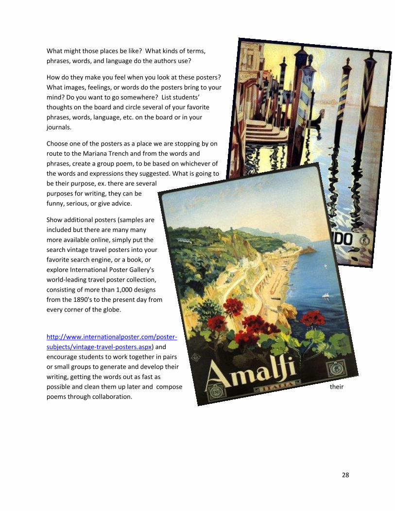
Choose one of the posters as a place we are stopping by on
route to the Mariana Trench and from the words and
phrases, create a group poem, to be based on whichever of
the words and expressions they suggested. What is going to
be their purpose, ex. there are several
purposes for writing, they can be
funny, serious, or give advice.
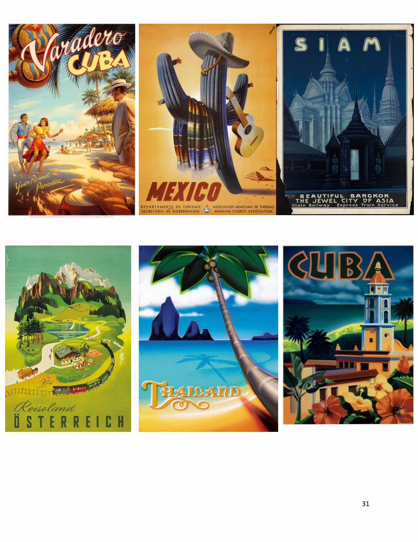
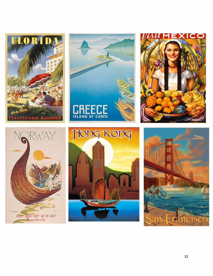
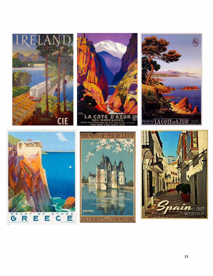
Show additional posters (samples are
included but there are many many
more available online, simply put the
search vintage travel posters into your
favorite search engine, or a book, or
explore International Poster Gallery's
world-leading travel poster collection,
consisting of more than 1,000 designs
from the 1890's to the present day from
every corner of the globe.
http://www.internationalposter.com/poster-
subjects/vintage-travel-posters.aspx) and
encourage students to work together in pairs
or small groups to generate and develop their
writing, getting the words out as fast as
possible and clean them up later and compose their
poems through collaboration.
29
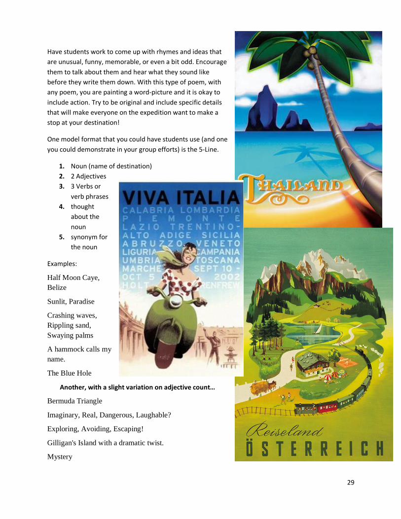
Have students work to come up with rhymes and ideas that
are unusual, funny, memorable, or even a bit odd. Encourage
them to talk about them and hear what they sound like
before they write them down. With this type of poem, with
any poem, you are painting a word-picture and it is okay to
include action. Try to be original and include specific details
that will make everyone on the expedition want to make a
stop at your destination!
One model format that you could have students use (and one
you could demonstrate in your group efforts) is the 5-Line.
1. Noun (name of destination)
2. 2 Adjectives
3. 3 Verbs or
verb phrases
4. thought
about the
noun
5. synonym for
the noun
Examples:
Half Moon Caye,
Belize
Sunlit, Paradise
Crashing waves,
Rippling sand,
Swaying palms
A hammock calls my
name.
The Blue Hole
Another, with a slight variation on adjective count…
Bermuda Triangle
Imaginary, Real, Dangerous, Laughable?
Exploring, Avoiding, Escaping!
Gilligan's Island with a dramatic twist.
Mystery
30
And just for fun . . .
Gilligan’s Island
Seven, Stranded, Lost
Tossing ship, Making do, Coming Unglued
You're sure to get a smile
Uncharted Desert Isle
31
32
33
34
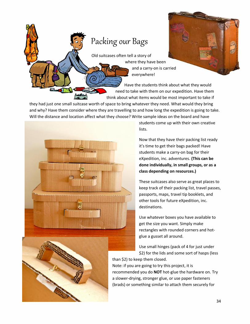
Packing our Bags Old suitcases often tell a story of
where they have been
and a carry-on is carried
everywhere!
Have the students think about what they would
need to take with them on our expedition. Have them
think about what items would be most important to take if
they had just one small suitcase worth of space to bring whatever they need. What would they bring
and why? Have them consider where they are travelling to and how long the expedition is going to take.
Will the distance and location affect what they choose? Write sample ideas on the board and have
students come up with their own creative
lists.
Now that they have their packing list ready
it’s time to get their bags packed! Have
students make a carry-on bag for their
eXpedition, inc. adventures. (This can be
done individually, in small groups, or as a
class depending on resources.)
These suitcases also serve as great places to
keep track of their packing list, travel passes,
passports, maps, travel tip booklets, and
other tools for future eXpedition, inc.
destinations.
Use whatever boxes you have available to
get the size you want. Simply make
rectangles with rounded corners and hot-
glue a gusset all around.
Use small hinges (pack of 4 for just under
$2) for the lids and some sort of hasps (less
than $2) to keep them closed.
Note: if you are going to try this project, it is
recommended you do NOT hot-glue the hardware on. Try
a slower-drying, stronger glue, or use paper fasteners
(brads) or something similar to attach them securely for
35
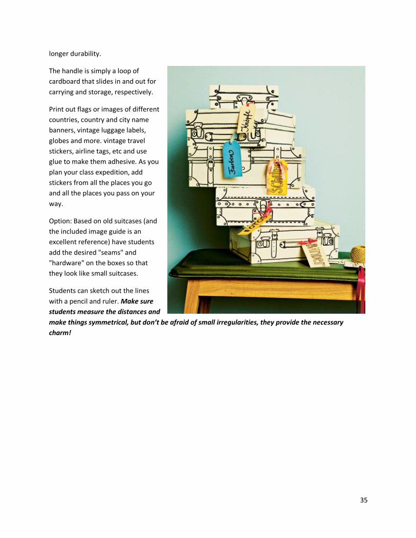
longer durability.
The handle is simply a loop of
cardboard that slides in and out for
carrying and storage, respectively.
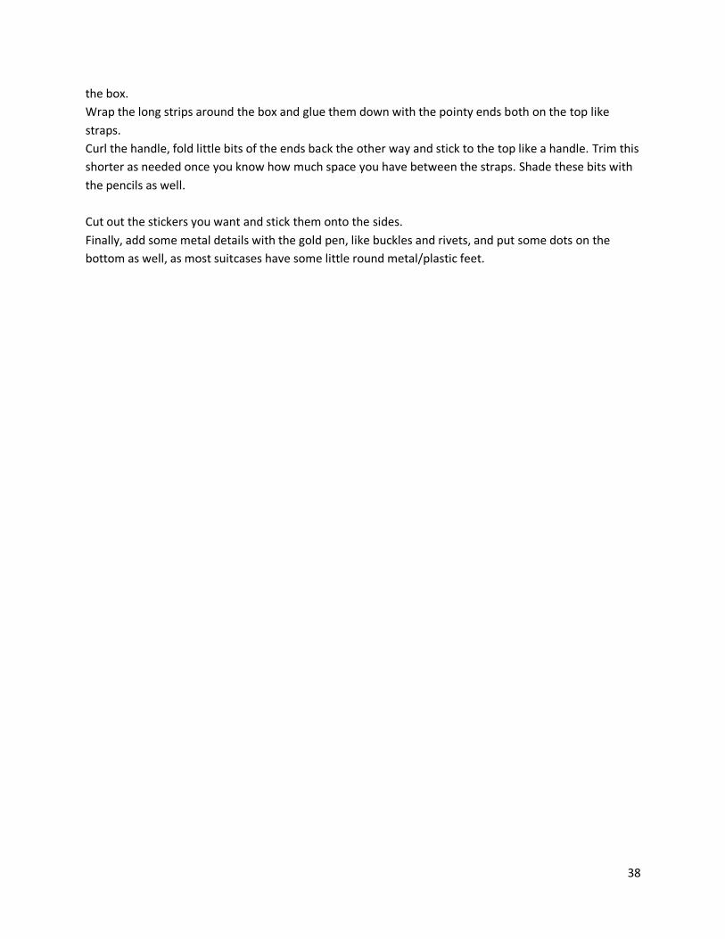
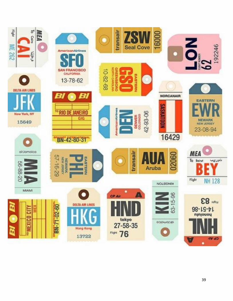
Print out flags or images of different
countries, country and city name
banners, vintage luggage labels,
globes and more. vintage travel
stickers, airline tags, etc and use
glue to make them adhesive. As you
plan your class expedition, add
stickers from all the places you go
and all the places you pass on your
way.
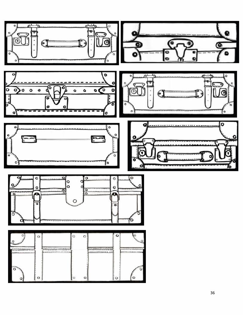
Option: Based on old suitcases (and
the included image guide is an
excellent reference) have students
add the desired "seams" and
"hardware" on the boxes so that
they look like small suitcases.
Students can sketch out the lines
with a pencil and ruler. Make sure
students measure the distances and
make things symmetrical, but don’t be afraid of small irregularities, they provide the necessary
charm!
36
37
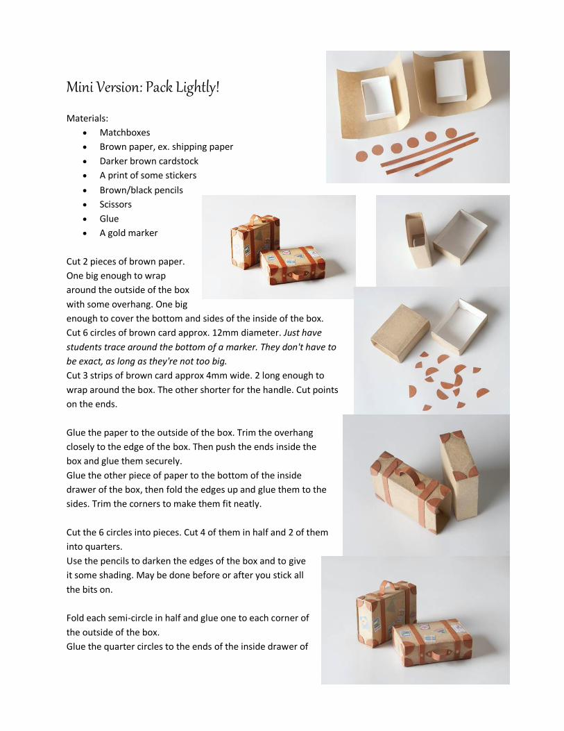
Mini Version: Pack Lightly!
Materials:
Matchboxes
Brown paper, ex. shipping paper
Darker brown cardstock
A print of some stickers
Brown/black pencils
Scissors
Glue
A gold marker
Cut 2 pieces of brown paper.
One big enough to wrap
around the outside of the box
with some overhang. One big
enough to cover the bottom and sides of the inside of the box.
Cut 6 circles of brown card approx. 12mm diameter. Just have
students trace around the bottom of a marker. They don't have to
be exact, as long as they're not too big.
Cut 3 strips of brown card approx 4mm wide. 2 long enough to
wrap around the box. The other shorter for the handle. Cut points
on the ends.
Glue the paper to the outside of the box. Trim the overhang
closely to the edge of the box. Then push the ends inside the
box and glue them securely.
Glue the other piece of paper to the bottom of the inside
drawer of the box, then fold the edges up and glue them to the
sides. Trim the corners to make them fit neatly.
Cut the 6 circles into pieces. Cut 4 of them in half and 2 of them
into quarters.
Use the pencils to darken the edges of the box and to give
it some shading. May be done before or after you stick all
the bits on.
Fold each semi-circle in half and glue one to each corner of
the outside of the box.
Glue the quarter circles to the ends of the inside drawer of
38
the box.
Wrap the long strips around the box and glue them down with the pointy ends both on the top like
straps.
Curl the handle, fold little bits of the ends back the other way and stick to the top like a handle. Trim this
shorter as needed once you know how much space you have between the straps. Shade these bits with
the pencils as well.
Cut out the stickers you want and stick them onto the sides.
Finally, add some metal details with the gold pen, like buckles and rivets, and put some dots on the
bottom as well, as most suitcases have some little round metal/plastic feet.
39
40
Recommended