MEXICO
GRANDCANYON
NATIONALPARK
PageLasVegas
Flagstaff
Phoenix
Yuma
Tucson
A R I Z O N A
Nevada Utah
Ne
w M
ex
i co
Ca
l if o
r ni a
8
89
189
89
10
10
17
4040
15
93
Lake MeadNat. Rec. Area
Colo
rado
Rive
r VideoCameraPressureCase
Flying Eyeball
“Flying Eyeball” Measures Grand Canyon Sand
Hank Chezar, USGSDave Rubin, USGSRobin Dornfest, USGSBrian Lockwood, USGSDave Topping, USGSJim Bennett, USGSIngrid Corson, USGSMargie Franseen, USGSDan Dierker, Boatman
Colorado River Grand CanyonFlying Eyeball Team
Location of GrandCanyon National Park
More information on the web: http://walrus.wr.usgs.gov/posters
1993 – 2004
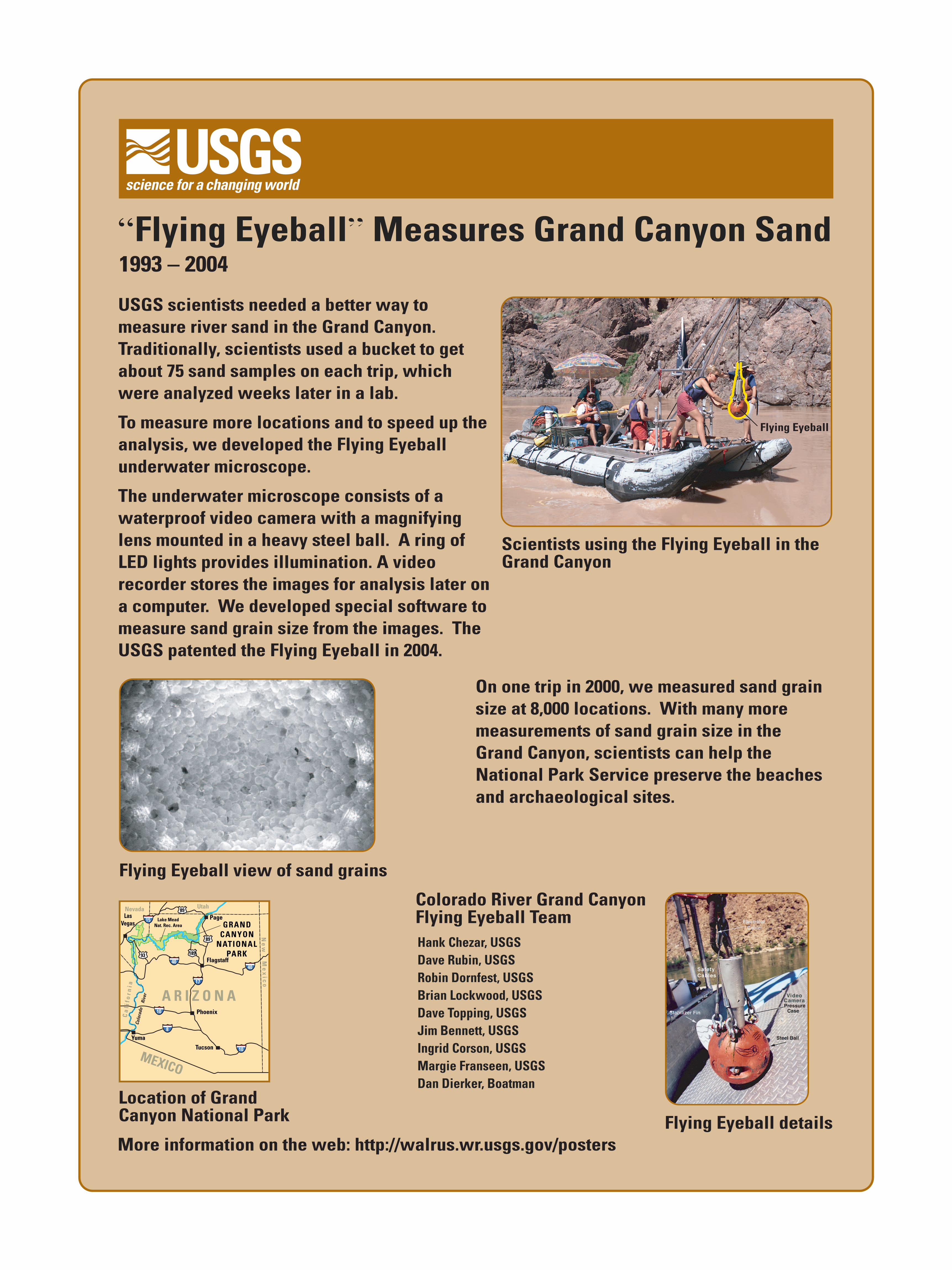
Scientists using the Flying Eyeball in the Grand Canyon
Flying Eyeball details
Flying Eyeball view of sand grains
On one trip in 2000, we measured sand grain size at 8,000 locations. With many more measurements of sand grain size in the Grand Canyon, scientists can help the National Park Service preserve the beaches and archaeological sites.
USGS scientists needed a better way to measure river sand in the Grand Canyon. Traditionally, scientists used a bucket to get about 75 sand samples on each trip, which were analyzed weeks later in a lab.
To measure more locations and to speed up the analysis, we developed the Flying Eyeball underwater microscope.
The underwater microscope consists of a waterproof video camera with a magnifying lens mounted in a heavy steel ball. A ring of LED lights provides illumination. A video recorder stores the images for analysis later on a computer. We developed special software to measure sand grain size from the images. The USGS patented the Flying Eyeball in 2004.
Recommended