(Geo)database and Data Management
An introduction to the possibilities of a centralized (spatial) data storing and access as well as its data management
constraints
(GLOWA Volta Project)
GLOWA Volta Project Phase III Inception Meeting and Workshop
Accra, Ghana, September 25th – 26th
Overview
1. Objectives within the database and data management project in phase III
2. Data within GVP
3. Data management
4. Database
5. Geodatabase
6. (Geo-)Database use scenarios
Database and data management project in GVP phase III
Objectives
• The main objective of the database project in Phase III is to buildup a database which
- reflects the research results on data level
- is completed with regard to the data actually needed
- is consistent, means that data quality is verified
- is standardized, means research outputs are compliant withthe requirements of following data users (with regard to e.g. measure units or formats)
- is well described on metadata level, so that users can find data they need easily
- has interfaces for data transmission (download, upload)
- is based on technology, which is adjusted to the technicaland scientific requirements of the transfer counterparts
1. Objectives
2. Data
3. Data manage-ment
4. Database
5. Geodatabase
6. Geodatabase use scenarios
• Due the fact that the GVP is an interdisciplinary project, the datastock is very heterogeneous
• The datastock consists of structured (e.g. tables, ASCII files, geodata) and unstructured (documents) data
• Sources of data are
- field investigations (digitized)
- measurements from monitoring stations
- research activities and own investigations
- institutions
What is the situation of the GVP Data?
Database and data management project in GVP phase III
1. Objectives
2. Data
3. Data manage-ment
4. Database
5. Geodatabase
6. Geodatabase use scenarios
What is the situation of the GVP Data?
• Data contents are
- Socio-economic data about water use, landuse, migration, income sources, agricultural production (e.g. within commonsampling frame)
- remote sensing data (rasters): e.g. clima, landcover
- Geodata as vector or raster: administrative, infrastructural, natural resources: soil, geology, vegetation, hydrography, topography, landuse
- Proprietary model data using the above mentioned data as input data and producing output data which are subjoint to the datastock
1. Objectives
2. Data
3. Data manage-ment
4. Database
5. Geodatabase
6. Geodatabase use scenarios
Database and data management project in GVP phase III
• A great part of data is georeferenced by
- textual describing (research area is in town x)
- xy-coordinates in a table
- GIS-formats as raster or vector data
• A wide range of formats used within the GVP is given (examples):
- Raster formats:
.tiff, .gif, .img, ESRI-grid, .rst, .jpeg, .bmp, .asc, .tin, .rds
- Vector formats
Shape, coverage (ESRI)
- Table or database formats
.exc, .sav, .txt, .mdb, .csv, .dbf, .dat
- Unstructured formats
.doc, .txt
1. Objectives
2. Data
3. Data manage-ment
4. Database
5. Geodatabase
6. Geodatabase use scenarios
Database and data management project in GVP phase III
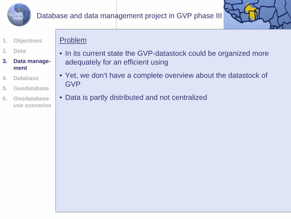
Problem
• In its current state the GVP-datastock could be organized moreadequately for an efficient using
• Yet, we don‘t have a complete overview about the datastock of GVP
• Data is partly distributed and not centralized
1. Objectives
2. Data
3. Data manage-ment
4. Database
5. Geodatabase
6. Geodatabase use scenarios
Database and data management project in GVP phase III
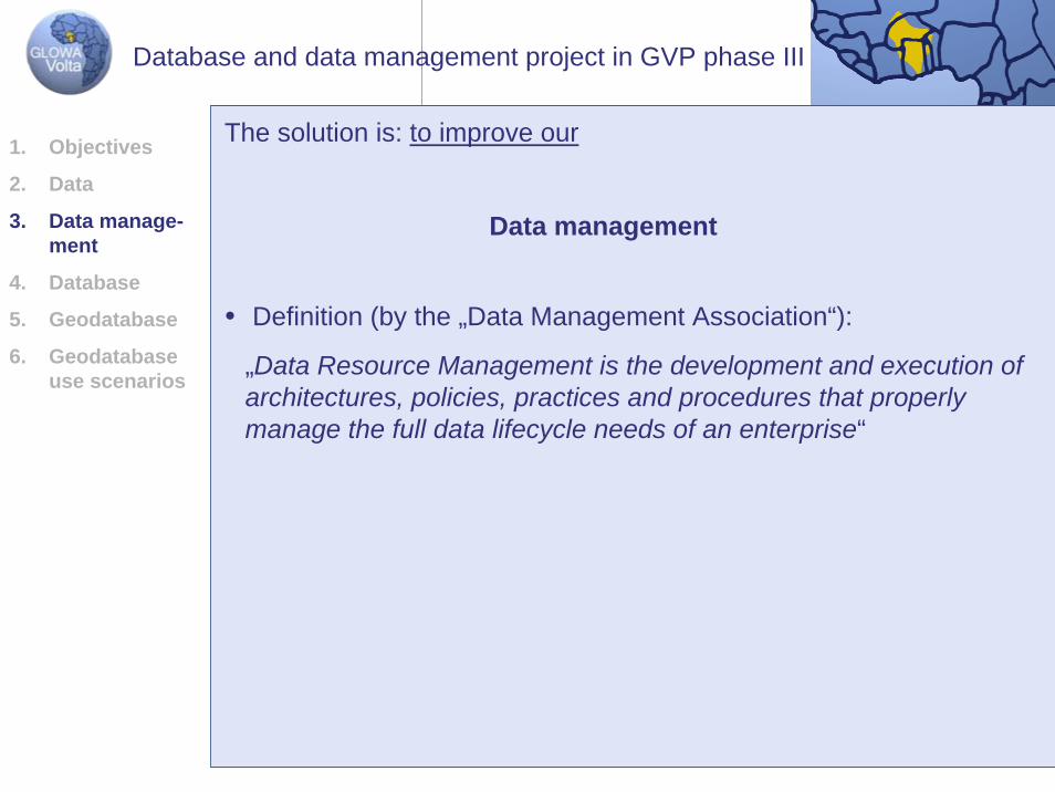
The solution is: to improve our
Data management
• Definition (by the „Data Management Association“):
„Data Resource Management is the development and execution of architectures, policies, practices and procedures that properlymanage the full data lifecycle needs of an enterprise“
1. Objectives
2. Data
3. Data manage-ment
4. Database
5. Geodatabase
6. Geodatabase use scenarios
Database and data management project in GVP phase III
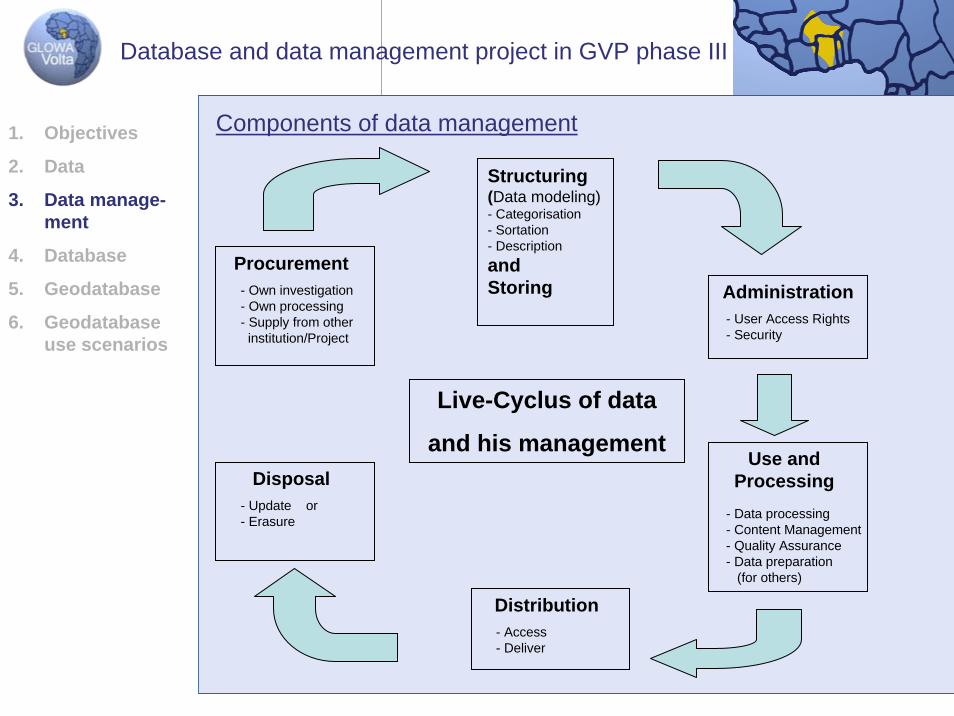
Components of data management
Procurement- Own investigation- Own processing- Supply from otherinstitution/Project
Administration- User Access Rights- Security
Use and Processing
- Data processing- Content Management- Quality Assurance- Data preparation
(for others)
Distribution- Access- Deliver
Disposal- Update or- Erasure
Structuring(Data modeling)- Categorisation- Sortation- Descriptionand Storing
Live-Cyclus of data
and his management
1. Objectives
2. Data
3. Data manage-ment
4. Database
5. Geodatabase
6. Geodatabase use scenarios
Database and data management project in GVP phase III
Data management
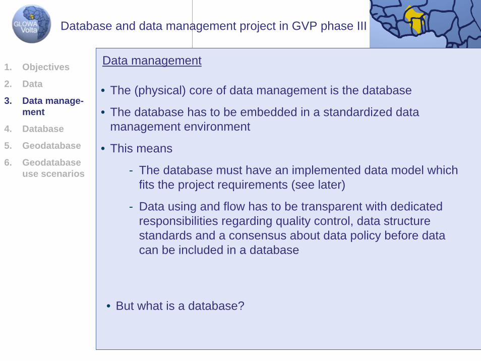
• The (physical) core of data management is the database
• The database has to be embedded in a standardized datamanagement environment
• This means
- The database must have an implemented data model whichfits the project requirements (see later)
- Data using and flow has to be transparent with dedicatedresponsibilities regarding quality control, data structurestandards and a consensus about data policy before datacan be included in a database
• But what is a database?
1. Objectives
2. Data
3. Data manage-ment
4. Database
5. Geodatabase
6. Geodatabase use scenarios
Database and data management project in GVP phase III
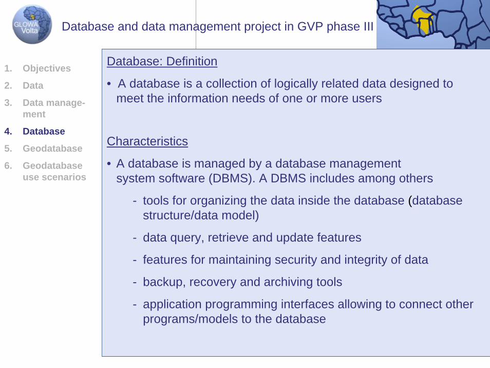
Database: Definition
• A database is a collection of logically related data designed to meet the information needs of one or more users
Characteristics
• A database is managed by a database managementsystem software (DBMS). A DBMS includes among others
- tools for organizing the data inside the database (databasestructure/data model)
- data query, retrieve and update features
- features for maintaining security and integrity of data
- backup, recovery and archiving tools
- application programming interfaces allowing to connect otherprograms/models to the database
1. Objectives
2. Data
3. Data manage-ment
4. Database
5. Geodatabase
6. Geodatabase use scenarios
Database and data management project in GVP phase III
Remarks
• database is not inevitable equal to database
• There are a lots of different databases with different DBMS
• A database can be a CD as well as a powerful and difficult to administrate database system with Oracle as DBMS
1. Objectives
2. Data
3. Data manage-ment
4. Database
5. Geodatabase
6. Geodatabase use scenarios
Database and data management project in GVP phase III
Data Model
• Creating a conceptual data model is the first step in databasedesign. It describes the objects (informations, data) that arerepresented within an organization and the relationships amongthem on an abstract level
• A conceptual model has to be devolved into a logical model whichcan be implemented into a database
1. Objectives
2. Data
3. Data manage-ment
4. Database
5. Geodatabase
6. Geodatabase use scenarios
Database and data management project in GVP phase III
Data Model
• A data model for the GVP which has to be developed, should at least meet the following criteria
- storage of different data formats orientated at the models in use
E.g. differentiated in raw data (input data), output dataand common exchange formats
- storage of basic data for research issues
- storage of research results in unstructured formats(documents)
- storage of present geodata in a structure which enhances theinformation output of the present
1. Objectives
2. Data
3. Data manage-ment
4. Database
5. Geodatabase
6. Geodatabase use scenarios
Database and data management project in GVP phase III
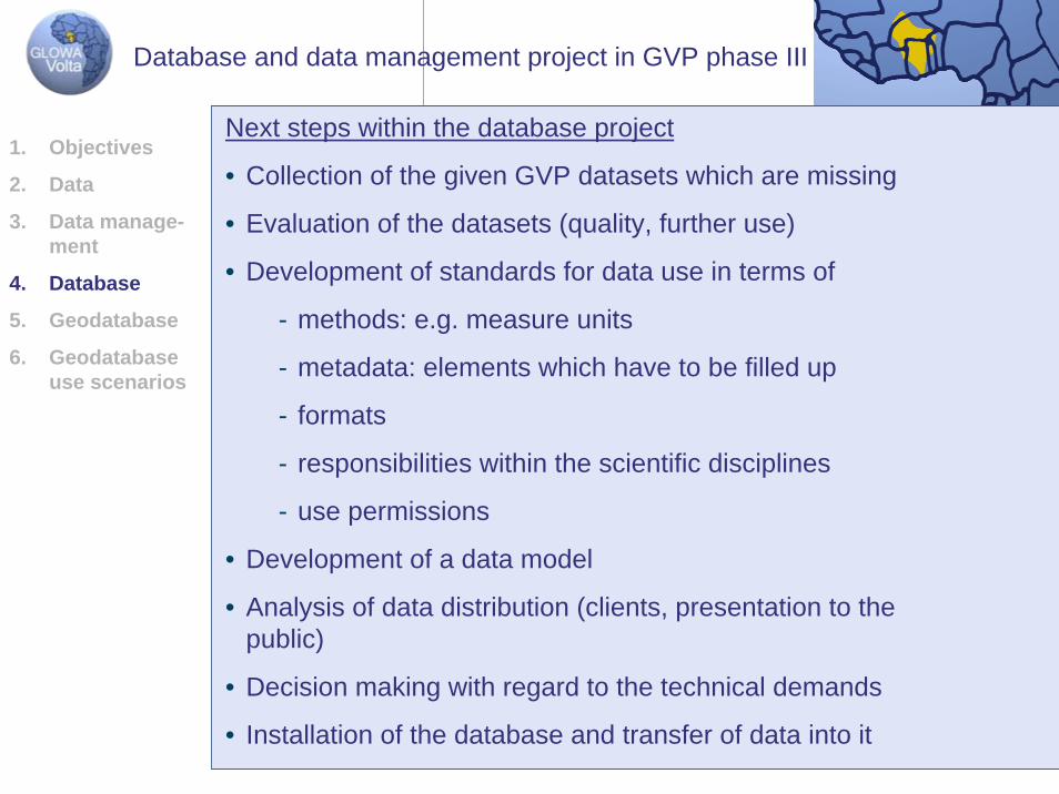
Next steps within the database project
• Collection of the given GVP datasets which are missing
• Evaluation of the datasets (quality, further use)
• Development of standards for data use in terms of
- methods: e.g. measure units
- metadata: elements which have to be filled up
- formats
- responsibilities within the scientific disciplines
- use permissions
• Development of a data model
• Analysis of data distribution (clients, presentation to thepublic)
• Decision making with regard to the technical demands
• Installation of the database and transfer of data into it
1. Objectives
2. Data
3. Data manage-ment
4. Database
5. Geodatabase
6. Geodatabase use scenarios
Database and data management project in GVP phase III
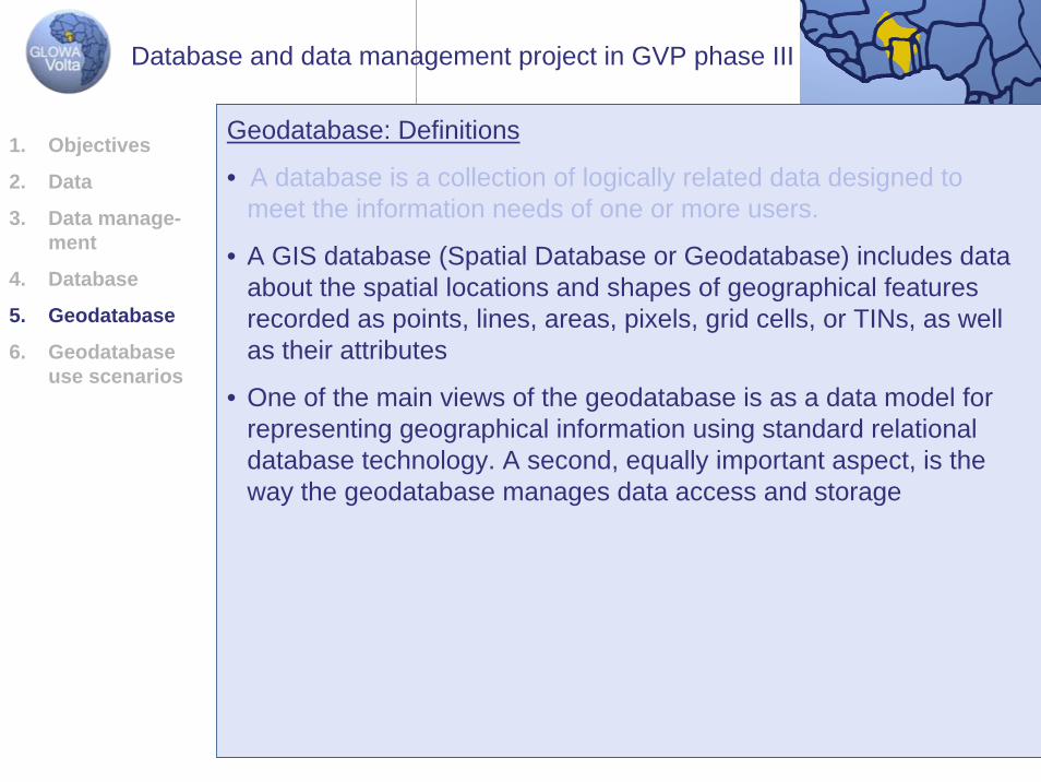
Geodatabase: Definitions
• A database is a collection of logically related data designed to meet the information needs of one or more users.
• A GIS database (Spatial Database or Geodatabase) includes dataabout the spatial locations and shapes of geographical featuresrecorded as points, lines, areas, pixels, grid cells, or TINs, as well as their attributes
• One of the main views of the geodatabase is as a data model forrepresenting geographical information using standard relational database technology. A second, equally important aspect, is theway the geodatabase manages data access and storage
1. Objectives
2. Data
3. Data manage-ment
4. Database
5. Geodatabase
6. Geodatabase use scenarios
Database and data management project in GVP phase III
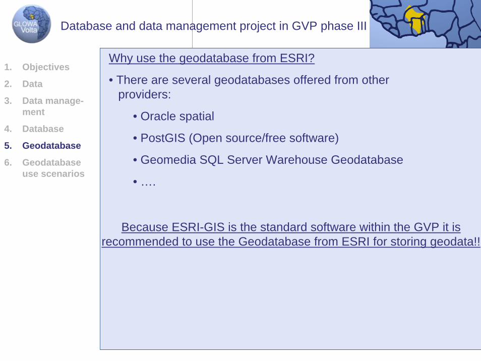
Because ESRI-GIS is the standard software within the GVP it isrecommended to use the Geodatabase from ESRI for storing geodata!!
Why use the geodatabase from ESRI?
• There are several geodatabases offered from otherproviders:
• Oracle spatial
• PostGIS (Open source/free software)
• Geomedia SQL Server Warehouse Geodatabase
• ….
1. Objectives
2. Data
3. Data manage-ment
4. Database
5. Geodatabase
6. Geodatabase use scenarios
Database and data management project in GVP phase III
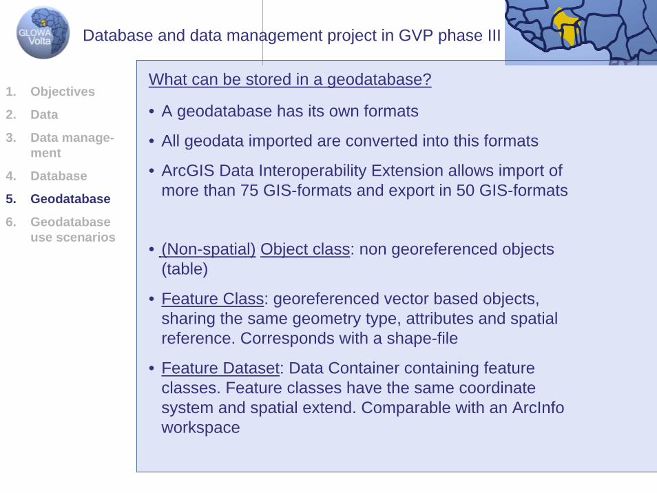
What can be stored in a geodatabase?
• (Non-spatial) Object class: non georeferenced objects(table)
• Feature Class: georeferenced vector based objects, sharing the same geometry type, attributes and spatialreference. Corresponds with a shape-file
• Feature Dataset: Data Container containing featureclasses. Feature classes have the same coordinatesystem and spatial extend. Comparable with an ArcInfoworkspace
• A geodatabase has its own formats
• All geodata imported are converted into this formats
• ArcGIS Data Interoperability Extension allows import of more than 75 GIS-formats and export in 50 GIS-formats
1. Objectives
2. Data
3. Data manage-ment
4. Database
5. Geodatabase
6. Geodatabase use scenarios
Database and data management project in GVP phase III
What can be stored in a geodatabase?
• Raster Datasets: standalone raster datasets or organizedin Raster Catalogs
• TIN Datasets: triangulate irregular networks
• Annotation Feature Class: stores text or graphics providinginformation about features or general areas of a map
• Dimension Feature Class: a dimension feature class in ArcMap shows specific lengths or distances on a map
• Geometric Network: Edge and junction features thatrepresent a linear network such as a utility or hydrologicsystem in which the connectivity of features is based on their geometric coincidence
• Locators: e.g. a table which containts x/y coordinates canbe used for creating georeferenced point-features
1. Objectives
2. Data
3. Data manage-ment
4. Database
5. Geodatabase
6. Geodatabase use scenarios
Database and data management project in GVP phase III
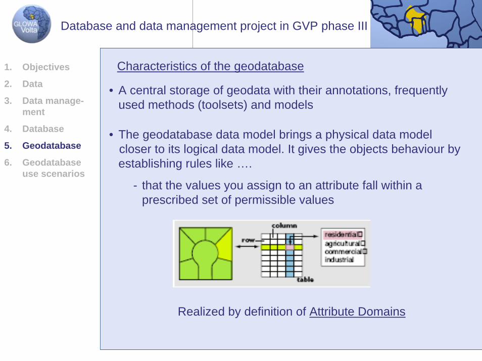
• The geodatabase data model brings a physical data modelcloser to its logical data model. It gives the objects behaviour byestablishing rules like ….
- that the values you assign to an attribute fall within aprescribed set of permissible values
Characteristics of the geodatabase
• A central storage of geodata with their annotations, frequentlyused methods (toolsets) and models
Realized by definition of Attribute Domains
1. Objectives
2. Data
3. Data manage-ment
4. Database
5. Geodatabase
6. Geodatabase use scenarios
Database and data management project in GVP phase III
3. Geodatabase
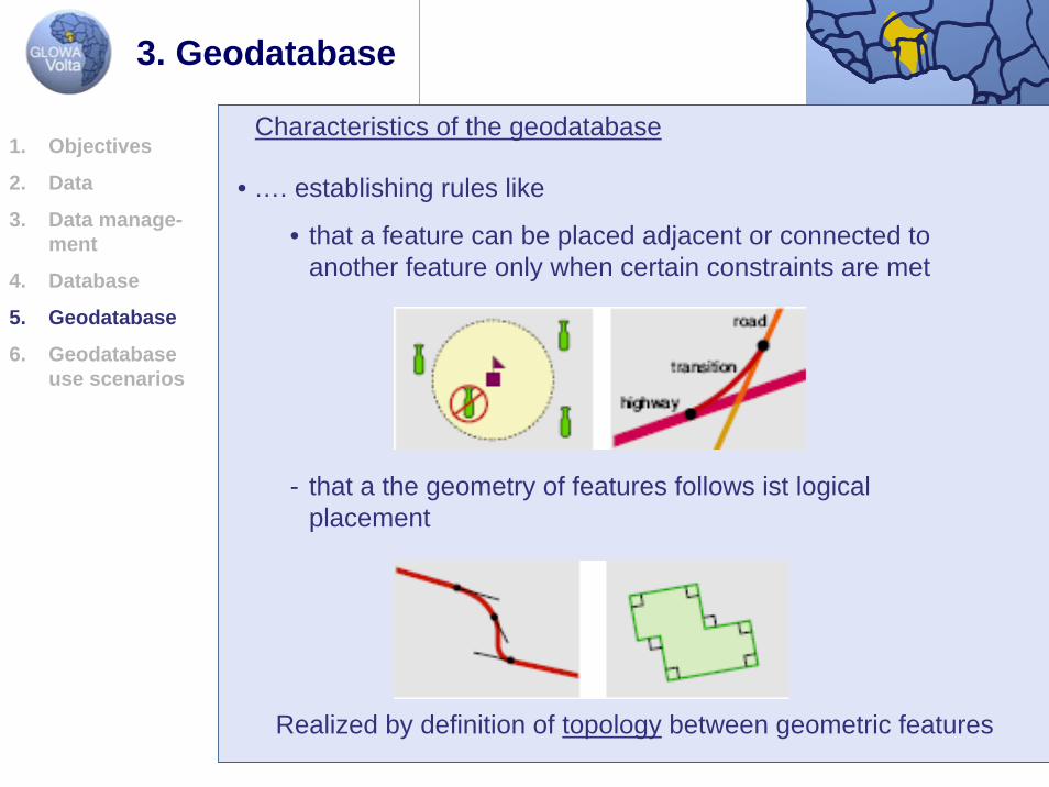
• …. establishing rules like
• that a feature can be placed adjacent or connected to another feature only when certain constraints are met
Characteristics of the geodatabase
Realized by definition of topology between geometric features
- that a the geometry of features follows ist logicalplacement
1. Objectives
2. Data
3. Data manage-ment
4. Database
5. Geodatabase
6. Geodatabase use scenarios
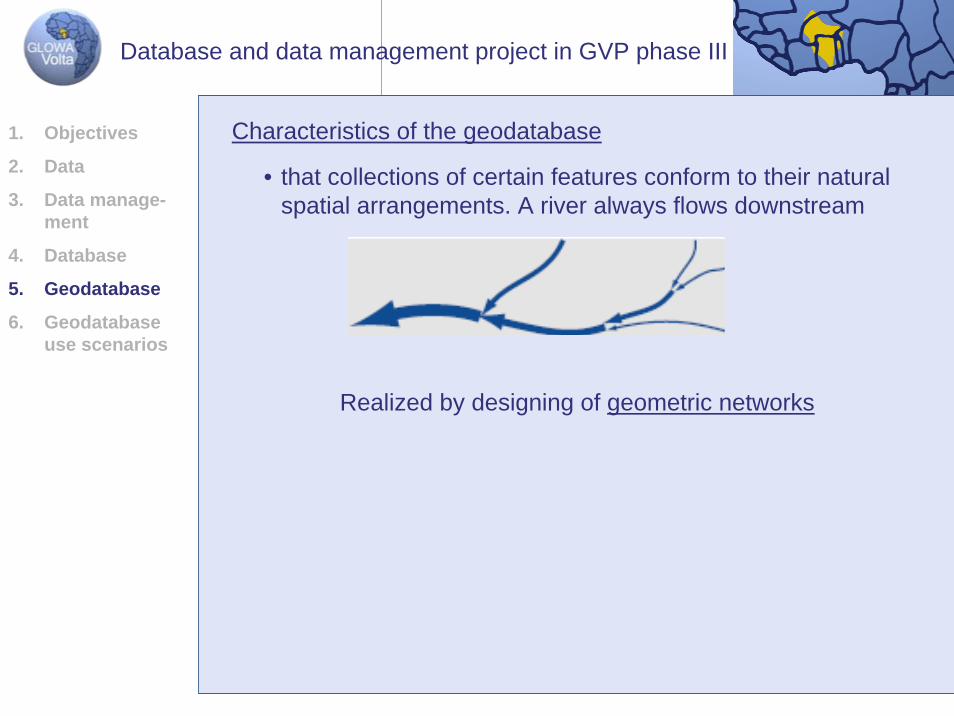
Characteristics of the geodatabase
• that collections of certain features conform to their naturalspatial arrangements. A river always flows downstream
Realized by designing of geometric networks
1. Objectives
2. Data
3. Data manage-ment
4. Database
5. Geodatabase
6. Geodatabase use scenarios
Database and data management project in GVP phase III
• Except for the Attribute Domains the other topological rulesmentioned above are based on relationships among geometricobjects
• E.g. a general relationship connects a table of census data witha feature class containing towns as point features
• Relationships not only display dependencies but also havebehaviour: e.g. when a borehole stops its water supply theconnected irrigation system should be inactivated automatically
ArcGIS provides tools for fixing topological errors within a geodatabase
Characteristics of the geodatabase
• There are two main kinds of relationships in a geodatabase
- spatial relationships (associations) among geometricfeatures
- general relationships among geometric and non-geometricfeatures (tables)
1. Objectives
2. Data
3. Data manage-ment
4. Database
5. Geodatabase
6. Geodatabase use scenarios
Database and data management project in GVP phase III
• A uniform repository of geographic data. All data can be storedand centrally managed in one database
Summary of the benefits of the geodatabase data model
• Data entry and editing is more accurate. Fewer mistakes aremade because most of them can be prevented by intelligent validation behaviour
• Features have a richer context. Topological associations and general relationships define the context of features with otherfeatures and what happens when a related feature is moved, changed or deleted
• Shapes of features are better defined by using straight lines, circular curves, elliptical curves …
• Sets of features are continuous. Geodatabases canaccommodate very large sets of features without tiles or otherspatial partitions
1. Objectives
2. Data
3. Data manage-ment
4. Database
5. Geodatabase
6. Geodatabase use scenarios
Database and data management project in GVP phase III
• A great part of the geografic data stock of GVP consists of raster data
• The possibilities of using raster data depend on thegeodatabase type personal or enterprise geodatabase(explanation see below). Personal GDB don‘t have fullfunctionality as described below!
• Main advantages of working with rasters in a geodatabase
- large data holdings can be easily built, modified, and utilized
- tiling, indexing and pyramiding storing parameters allows to get only the tiles necessary to satisfy the extent and resolution of the query
- compression makes it possible to store large, seamlessraster datasets and raster catalogs (as large as severalterabytes) and display it quickly to a client
Handling of raster data within a geodatabase1. Objectives
2. Data
3. Data manage-ment
4. Database
5. Geodatabase
6. Geodatabase use scenarios
Database and data management project in GVP phase III
• Main advantages of working with rasters in a geodatabase
- choice of creating mosaics or raster catalogs
- time series can be showed using a geodatabase rastercatalog
Handling of raster data within a geodatabase1. Objectives
2. Data
3. Data manage-ment
4. Database
5. Geodatabase
6. Geodatabase use scenarios
Database and data management project in GVP phase III
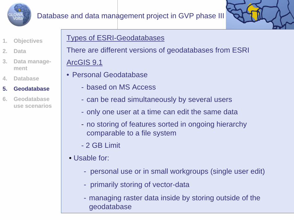
ArcGIS 9.1
• Personal Geodatabase
- based on MS Access
- can be read simultaneously by several users
- only one user at a time can edit the same data
- no storing of features sorted in ongoing hierarchycomparable to a file system
- 2 GB Limit
Types of ESRI-Geodatabases
There are different versions of geodatabases from ESRI
• Usable for:
- personal use or in small workgroups (single user edit)
- primarily storing of vector-data
- managing raster data inside by storing outside of thegeodatabase
1. Objectives
2. Data
3. Data manage-ment
4. Database
5. Geodatabase
6. Geodatabase use scenarios
Database and data management project in GVP phase III
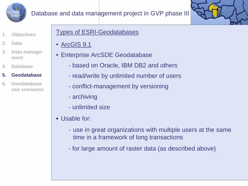
Types of ESRI-Geodatabases
• ArcGIS 9.1
• Enterprise ArcSDE Geodatabase
- based on Oracle, IBM DB2 and others
- read/write by unlimited number of users
- conflict-management by versioning
- archiving
- unlimited size
• Usable for:
- use in great organizations with multiple users at the sametime in a framework of long transactions
- for large amount of raster data (as described above)
1. Objectives
2. Data
3. Data manage-ment
4. Database
5. Geodatabase
6. Geodatabase use scenarios
Database and data management project in GVP phase III
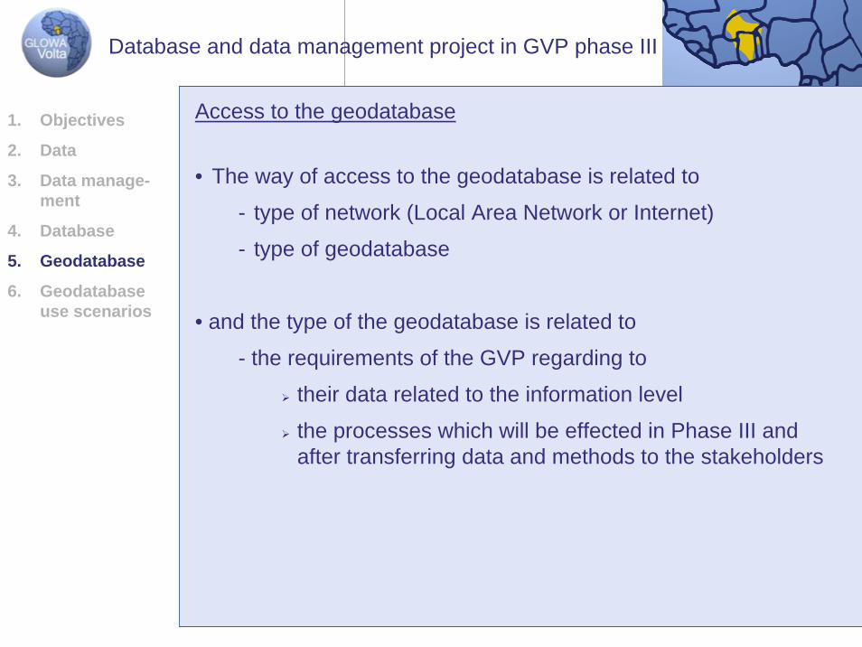
• The way of access to the geodatabase is related to
- type of network (Local Area Network or Internet)
- type of geodatabase
• and the type of the geodatabase is related to
- the requirements of the GVP regarding to
their data related to the information level
the processes which will be effected in Phase III and after transferring data and methods to the stakeholders
Access to the geodatabase1. Objectives
2. Data
3. Data manage-ment
4. Database
5. Geodatabase
6. Geodatabase use scenarios
Database and data management project in GVP phase III
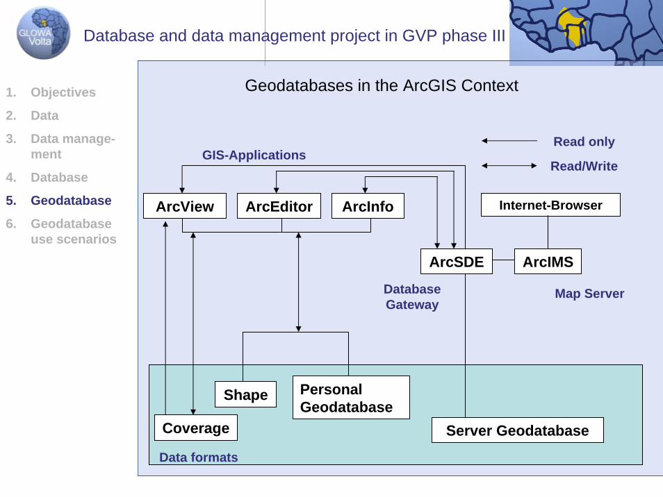
Data formats
Coverage Server Geodatabase
ArcIMS
Personal Geodatabase
Shape
ArcSDE
ArcInfoArcEditorArcView Internet-Browser
GIS-Applications
Map ServerDatabase Gateway
Read only
Read/Write
Geodatabases in the ArcGIS Context1. Objectives
2. Data
3. Data manage-ment
4. Database
5. Geodatabase
6. Geodatabase use scenarios
Database and data management project in GVP phase III
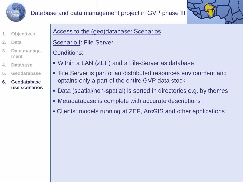
Scenario I: File Server
Conditions:
• Within a LAN (ZEF) and a File-Server as database
• File Server is part of an distributed resources environment and optains only a part of the entire GVP data stock
• Data (spatial/non-spatial) is sorted in directories e.g. by themes
• Metadatabase is complete with accurate descriptions
• Clients: models running at ZEF, ArcGIS and other applications
Access to the (geo)database: Scenarios1. Objectives
2. Data
3. Data manage-ment
4. Database
5. Geodatabase
6. Geodatabase use scenarios
Database and data management project in GVP phase III
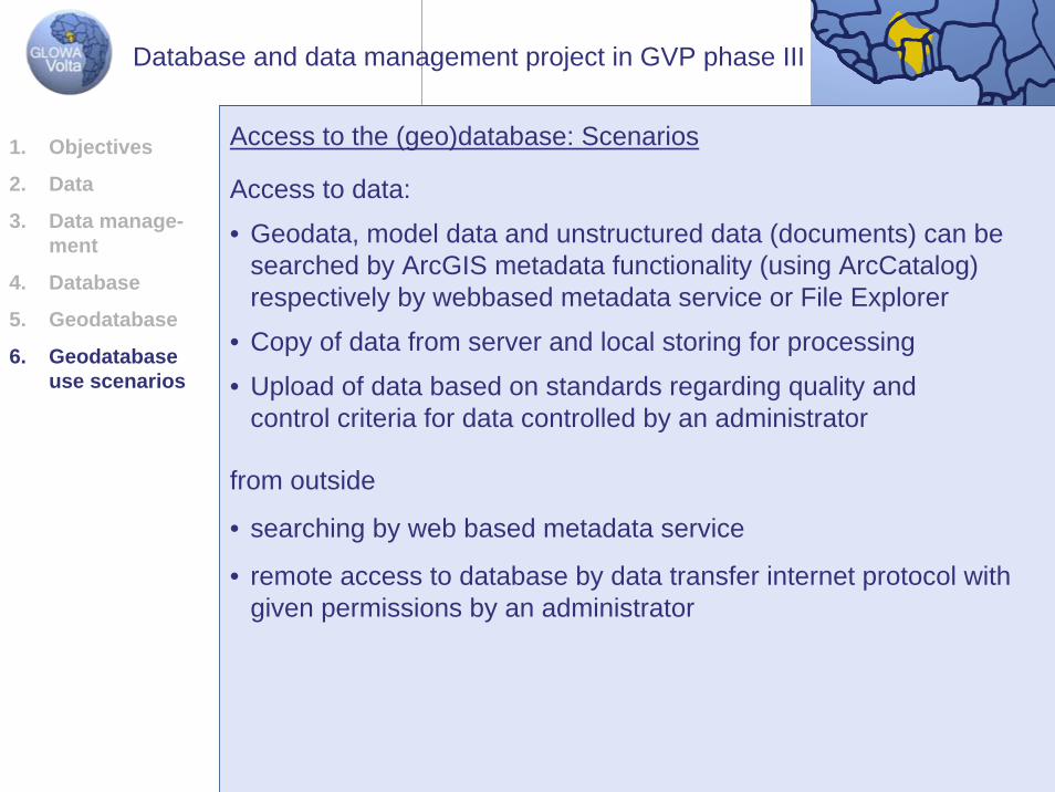
Access to the (geo)database: Scenarios
Access to data:
• Geodata, model data and unstructured data (documents) can besearched by ArcGIS metadata functionality (using ArcCatalog) respectively by webbased metadata service or File Explorer
• Copy of data from server and local storing for processing
• Upload of data based on standards regarding quality and control criteria for data controlled by an administrator
from outside
• searching by web based metadata service
• remote access to database by data transfer internet protocol withgiven permissions by an administrator
1. Objectives
2. Data
3. Data manage-ment
4. Database
5. Geodatabase
6. Geodatabase use scenarios
Database and data management project in GVP phase III
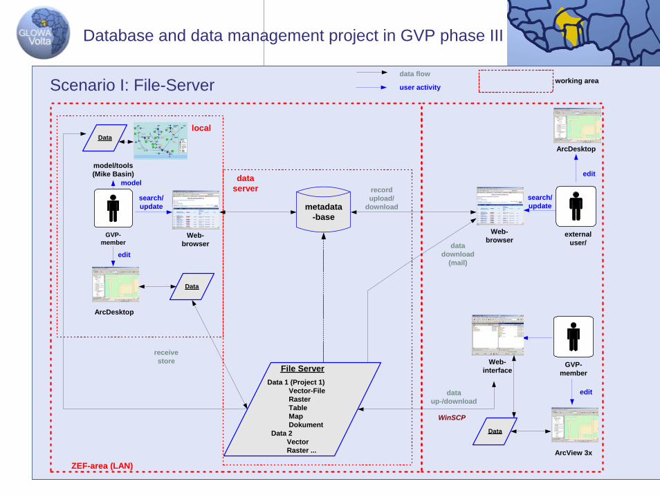
File ServerData 1 (Project 1) Vector-File Raster Table Map Dokument Data 2 Vector Raster ...
metadata-base
GVP-member
Web-browser
dataserver
ArcDesktop
local
ZEF-area (LAN)
Web-browser
externaluser/
ArcView 3x
search/update
edit
receivestore
datadownload
(mail)
ArcDesktop
GVP-member
WinSCP
dataup-/download
edit
edit
Data
model/tools(Mike Basin)
modelrecordupload/
download
Data
Web-interface
data flowworking area
user activity
search/update
Data
Scenario I: File-Server
Database and data management project in GVP phase III
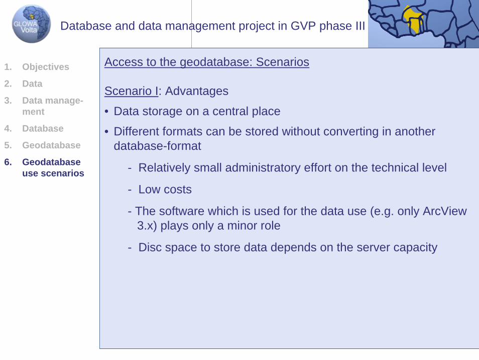
Scenario I: Advantages
• Data storage on a central place
• Different formats can be stored without converting in anotherdatabase-format
- Relatively small administratory effort on the technical level
- Low costs
- The software which is used for the data use (e.g. only ArcView3.x) plays only a minor role
- Disc space to store data depends on the server capacity
Access to the geodatabase: Scenarios1. Objectives
2. Data
3. Data manage-ment
4. Database
5. Geodatabase
6. Geodatabase use scenarios
Database and data management project in GVP phase III
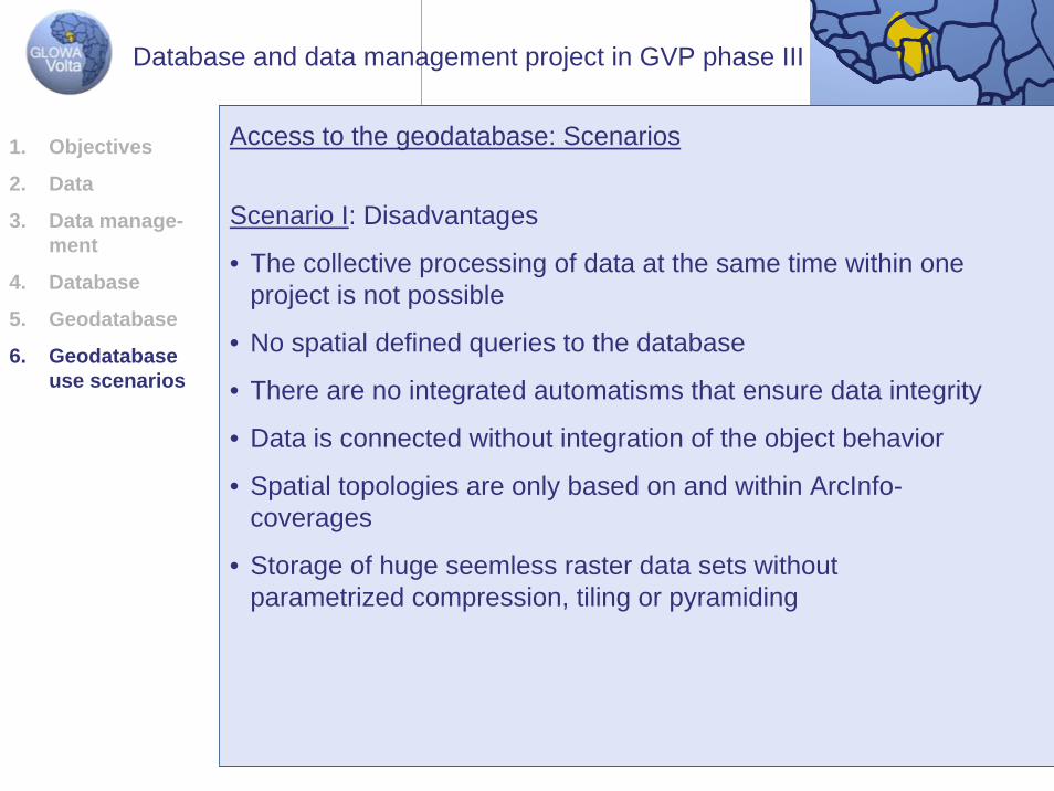
Access to the geodatabase: Scenarios
Scenario I: Disadvantages
• The collective processing of data at the same time within oneproject is not possible
• No spatial defined queries to the database
• There are no integrated automatisms that ensure data integrity
• Data is connected without integration of the object behavior
• Spatial topologies are only based on and within ArcInfo-coverages
• Storage of huge seemless raster data sets withoutparametrized compression, tiling or pyramiding
1. Objectives
2. Data
3. Data manage-ment
4. Database
5. Geodatabase
6. Geodatabase use scenarios
Database and data management project in GVP phase III
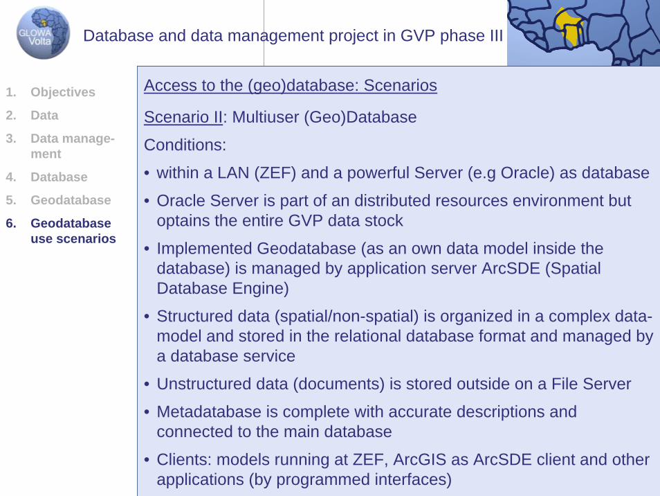
Scenario II: Multiuser (Geo)Database
Conditions:
• within a LAN (ZEF) and a powerful Server (e.g Oracle) as database
• Oracle Server is part of an distributed resources environment butoptains the entire GVP data stock
• Implemented Geodatabase (as an own data model inside thedatabase) is managed by application server ArcSDE (SpatialDatabase Engine)
• Structured data (spatial/non-spatial) is organized in a complex data-model and stored in the relational database format and managed bya database service
• Unstructured data (documents) is stored outside on a File Server
• Metadatabase is complete with accurate descriptions and connected to the main database
• Clients: models running at ZEF, ArcGIS as ArcSDE client and otherapplications (by programmed interfaces)
Access to the (geo)database: Scenarios1. Objectives
2. Data
3. Data manage-ment
4. Database
5. Geodatabase
6. Geodatabase use scenarios
Database and data management project in GVP phase III
Access to the (geo)database: Scenarios
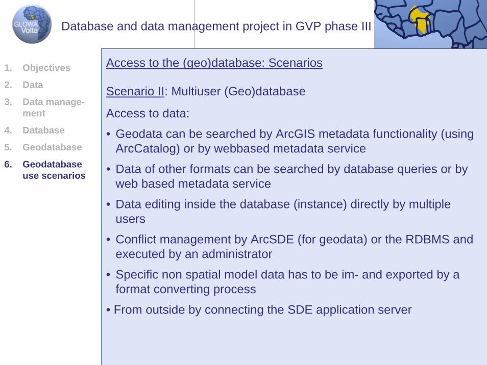
Scenario II: Multiuser (Geo)database
Access to data:
• Geodata can be searched by ArcGIS metadata functionality (usingArcCatalog) or by webbased metadata service
• Data of other formats can be searched by database queries or byweb based metadata service
• Data editing inside the database (instance) directly by multiple users
• Conflict management by ArcSDE (for geodata) or the RDBMS and executed by an administrator
• Specific non spatial model data has to be im- and exported by a format converting process
• From outside by connecting the SDE application server
1. Objectives
2. Data
3. Data manage-ment
4. Database
5. Geodatabase
6. Geodatabase use scenarios
Database and data management project in GVP phase III
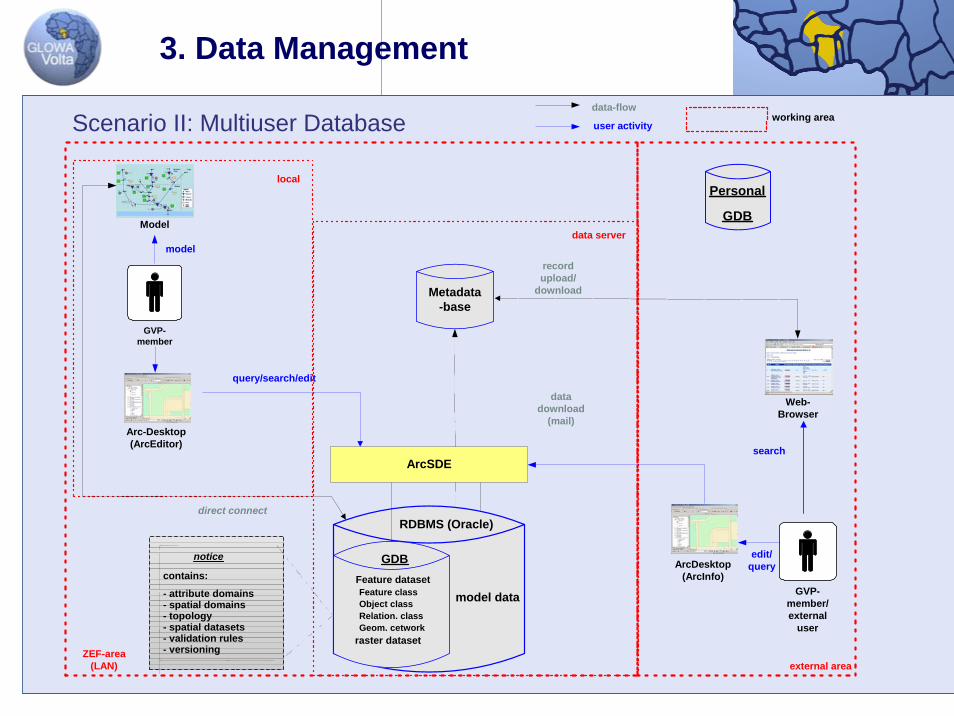
3. Data Management
Metadata-base
GVP-member
data server
Arc-Desktop(ArcEditor)
local
ZEF-area(LAN)
Web-Browser
ArcDesktop(ArcInfo)
external area
query/search/edit
datadownload
(mail)
Model
modelrecordupload/
download
notice
contains:
- attribute domains- spatial domains- topology- spatial datasets- validation rules- versioning
ArcSDE
GVP-member/external
user
model data
RDBMS (Oracle)
GDB Feature dataset Feature class Object class Relation. class Geom. cetwork raster dataset
direct connect
user activity
data-flowworking area
edit/query
search
Scenario II: Multiuser Database
Personal
GDB
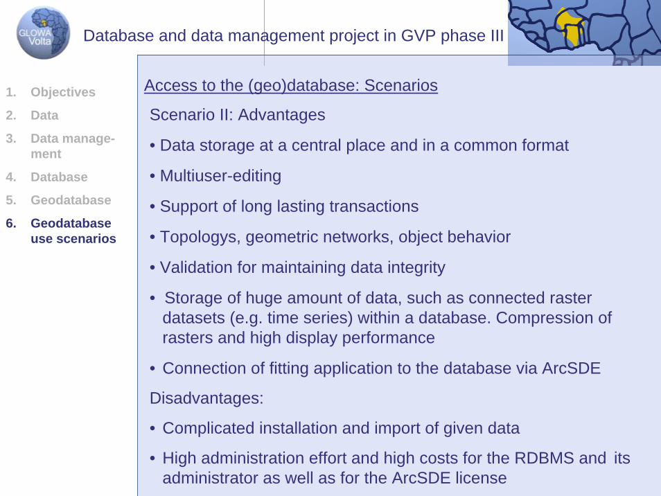
Scenario II: Advantages
• Data storage at a central place and in a common format
• Multiuser-editing
• Support of long lasting transactions
• Topologys, geometric networks, object behavior
• Validation for maintaining data integrity
• Storage of huge amount of data, such as connected rasterdatasets (e.g. time series) within a database. Compression of rasters and high display performance
• Connection of fitting application to the database via ArcSDE
Disadvantages:
• Complicated installation and import of given data
• High administration effort and high costs for the RDBMS and itsadministrator as well as for the ArcSDE license
Access to the (geo)database: Scenarios1. Objectives
2. Data
3. Data manage-ment
4. Database
5. Geodatabase
6. Geodatabase use scenarios
Database and data management project in GVP phase III
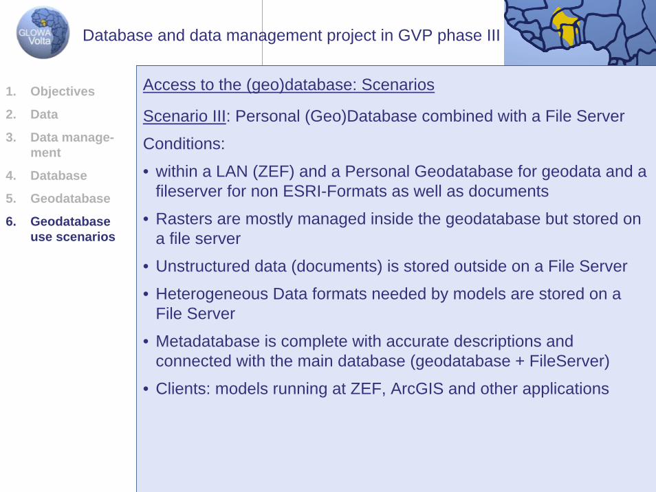
Scenario III: Personal (Geo)Database combined with a File Server
Conditions:
• within a LAN (ZEF) and a Personal Geodatabase for geodata and a fileserver for non ESRI-Formats as well as documents
• Rasters are mostly managed inside the geodatabase but stored on a file server
• Unstructured data (documents) is stored outside on a File Server
• Heterogeneous Data formats needed by models are stored on a File Server
• Metadatabase is complete with accurate descriptions and connected with the main database (geodatabase + FileServer)
• Clients: models running at ZEF, ArcGIS and other applications
Access to the (geo)database: Scenarios1. Objectives
2. Data
3. Data manage-ment
4. Database
5. Geodatabase
6. Geodatabase use scenarios
Database and data management project in GVP phase III
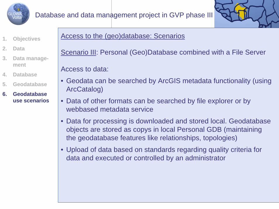
Scenario III: Personal (Geo)Database combined with a File Server
Access to data:
• Geodata can be searched by ArcGIS metadata functionality (usingArcCatalog)
• Data of other formats can be searched by file explorer or bywebbased metadata service
• Data for processing is downloaded and stored local. Geodatabase objects are stored as copys in local Personal GDB (maintainingthe geodatabase features like relationships, topologies)
• Upload of data based on standards regarding quality criteria fordata and executed or controlled by an administrator
Access to the (geo)database: Scenarios1. Objectives
2. Data
3. Data manage-ment
4. Database
5. Geodatabase
6. Geodatabase use scenarios
Database and data management project in GVP phase III
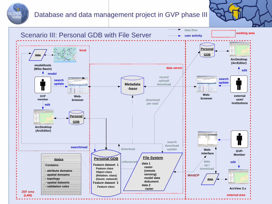
Database and data management project in GVP phase III
Metadata-base
GVPmember
Web-browser
data server
ArcDesktop(ArcEditor)
local
ZEF area(LAN)
Web-browser
externaluser/
institutions
ArcView 3.x
external area
searchupdate
edit
ArcDesktop(ArcEditor)
GVP-Member
WinSCP
dataup-/
download
editmodel
recordupload/
download
Personal
GDB
File System data 1 raster (remote sensing) model data dokument data 2 raster
Personal GDB Feature dataset 1 Feature class Object class (Relation. class) (Geom. network) Feature dataset 2 Feature class
Personal
GDB
data
Web-interface
Notice
Contains:
- attribute domains- apatial domains- topology- spatial datasets- validation rules
searchdownload
updatedownload
working area
search/read
referenced edit
searchupdate
user activity
data flow
model/tools(Mike Basin)
data
downloadper mail
Scenario III: Personal GDB with File Server
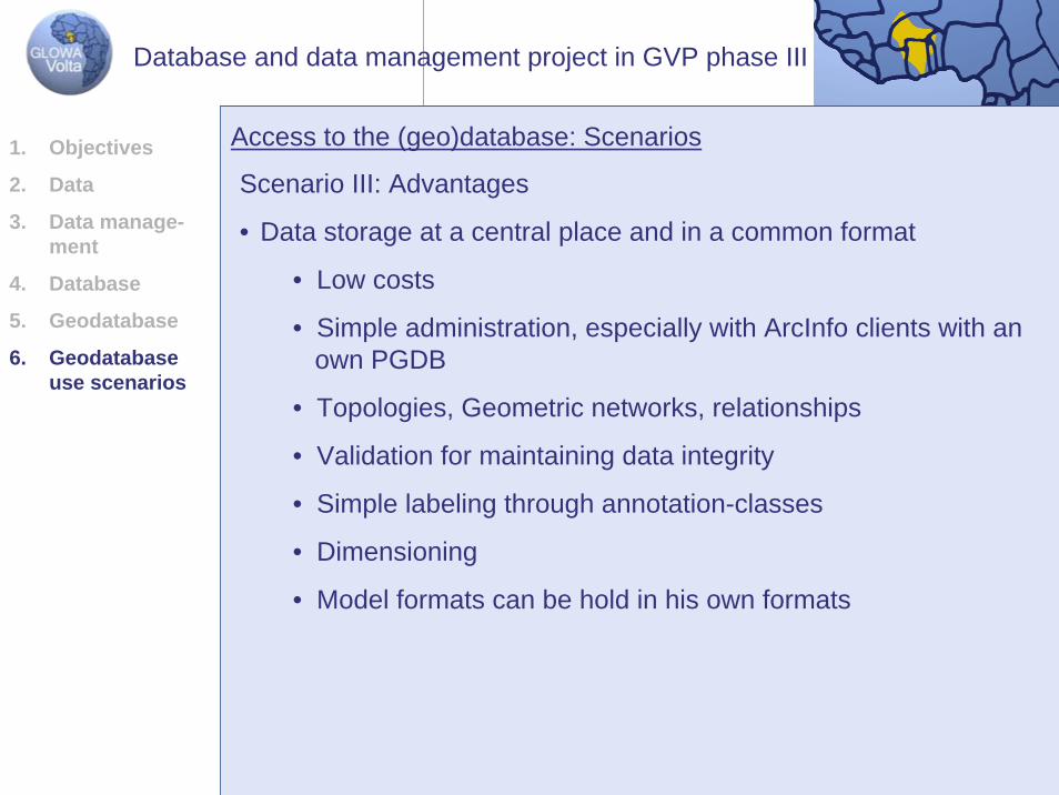
Scenario III: Advantages
• Data storage at a central place and in a common format
• Low costs
• Simple administration, especially with ArcInfo clients with anown PGDB
• Topologies, Geometric networks, relationships
• Validation for maintaining data integrity
• Simple labeling through annotation-classes
• Dimensioning
• Model formats can be hold in his own formats
Access to the (geo)database: Scenarios1. Objectives
2. Data
3. Data manage-ment
4. Database
5. Geodatabase
6. Geodatabase use scenarios
Database and data management project in GVP phase III
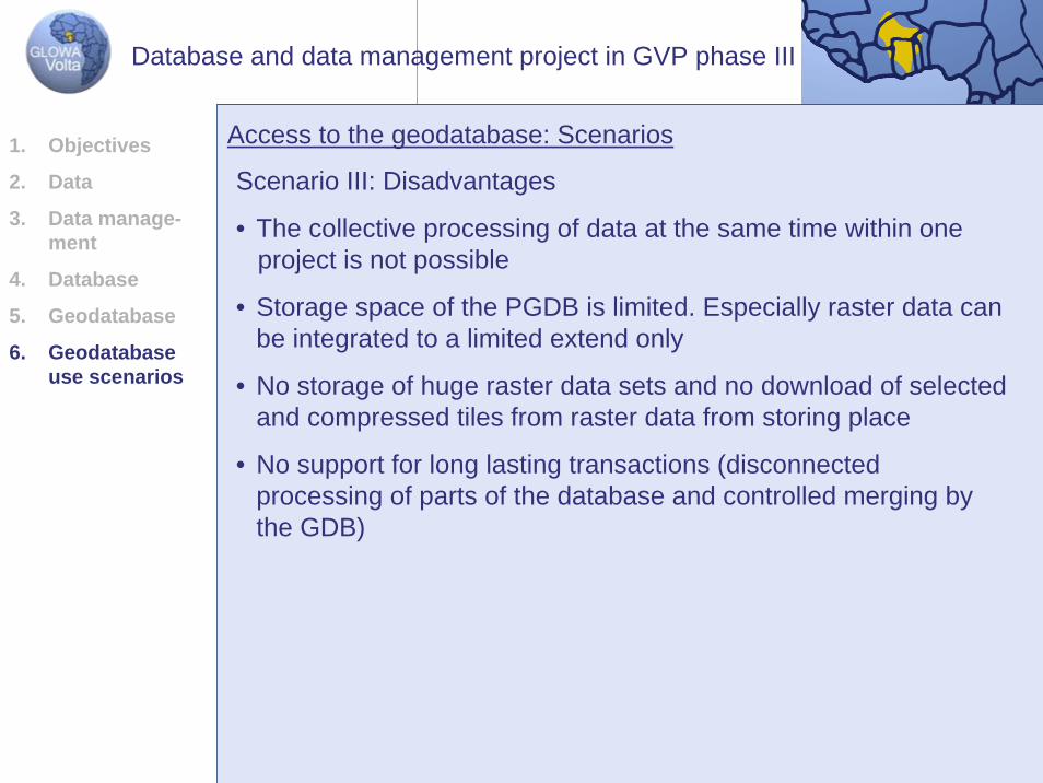
Scenario III: Disadvantages
• The collective processing of data at the same time within oneproject is not possible
• Storage space of the PGDB is limited. Especially raster data canbe integrated to a limited extend only
• No storage of huge raster data sets and no download of selectedand compressed tiles from raster data from storing place
• No support for long lasting transactions (disconnectedprocessing of parts of the database and controlled merging bythe GDB)
Access to the geodatabase: Scenarios1. Objectives
2. Data
3. Data manage-ment
4. Database
5. Geodatabase
6. Geodatabase use scenarios
Database and data management project in GVP phase III
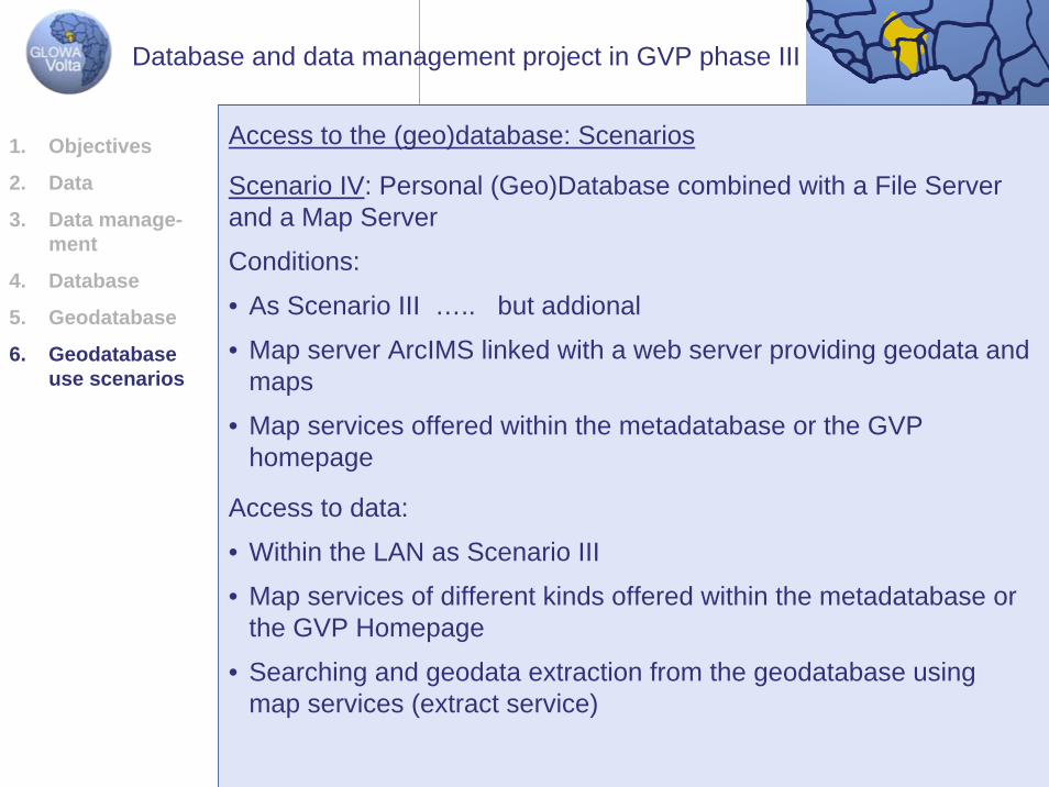
Scenario IV: Personal (Geo)Database combined with a File Server and a Map Server
Conditions:
• As Scenario III ….. but addional
• Map server ArcIMS linked with a web server providing geodata and maps
• Map services offered within the metadatabase or the GVP homepage
Access to the (geo)database: Scenarios
Access to data:
• Within the LAN as Scenario III
• Map services of different kinds offered within the metadatabase orthe GVP Homepage
• Searching and geodata extraction from the geodatabase usingmap services (extract service)
e-
rios
1. Objectives
2. Data
3. Data managment
4. Database
5. Geodatabase
6. Geodatabase use scena
Database and data management project in GVP phase III
ArcIMS + Webserver
Mapsdata
external institution/project: biota, DLR
author tools(ArcMap-Server)
ArcIM
S + Webserver
maps
ArcDesktop(ArcEditor)
ArcReaderArcExplorer
HTML/Java-viewer
file system shape coverage raster documents
Personal GDB Feature dataset 1 Feature class Object class Relation. class Geom. network Raster dataset
localdata GVP
member
ZEF: server area
ArcMap Image-Service
search
edit
data extraction
externalUser
ZEF: local area
view
data upload (mail, ftp ...)
stake-holder
view
external area
FeatureService
Image Service
GVP-Homepageprovide Map Services
Catalog Service
data flow
working area
user activity
HTML/Java-viewer
Database and data management project in GVP phase III
Database and data management project in GVP phase III
Scenario IV: Advantages:
• GVP results can be presented in a cartographical demonstrative way to a broad audience
• Data users get an overview over existing maps and data and canorder or download diverse geodata
• Maps and data from other producers, who also offer internet mapservices can be integrated in ArcDesktop products and thus becombined and processed together with data of the GVP projectand/or local data
• A metadata catalog can be implemented besides the existingmetadatabase
1. Objectives
2. Data
3. Data manage-ment
4. Database
5. Geodatabase
6. Geodatabase use scenarios
Recommended