vers. 20100604
national spatial data infrastructure training program
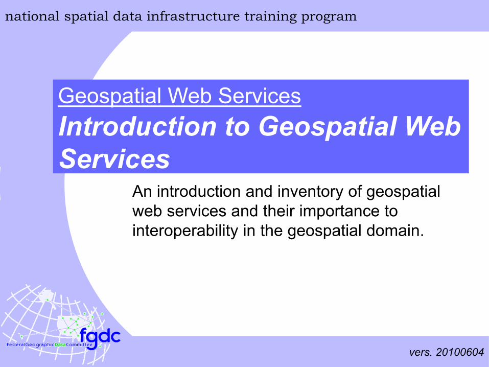
Introduction to Geospatial Web Services
Geospatial Web Services
An introduction and inventory of geospatial web services and their importance to interoperability in the geospatial domain.
national spatial data infrastructure training program
Introduction to Geospatial Web Services
1
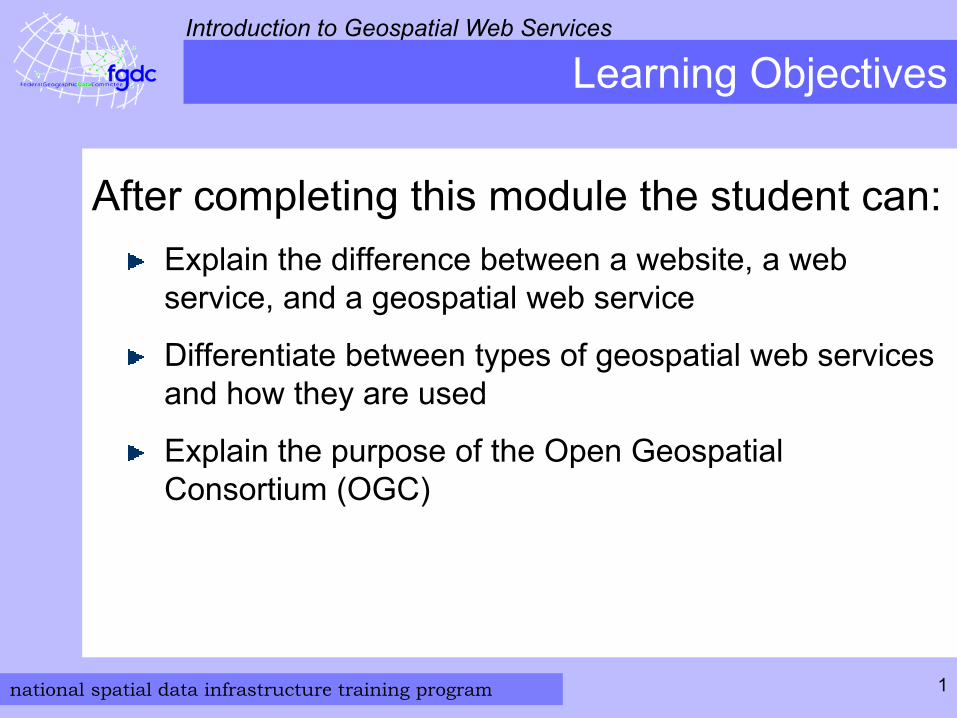
Learning Objectives
After completing this module the student can:Explain the difference between a website, a web service, and a geospatial web service
Differentiate between types of geospatial web services and how they are used
Explain the purpose of the Open Geospatial Consortium (OGC)
national spatial data infrastructure training program
Introduction to Geospatial Web Services
2
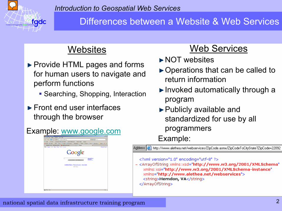
Differences between a Website & Web Services
Websites Provide HTML pages and forms for human users to navigate and perform functions
Searching, Shopping, Interaction
Front end user interfaces through the browser
Example: www.google.com
Web Services NOT websites Operations that can be called to return informationInvoked automatically through a program Publicly available and standardized for use by all programmers
Example:
national spatial data infrastructure training program
Introduction to Geospatial Web Services
3
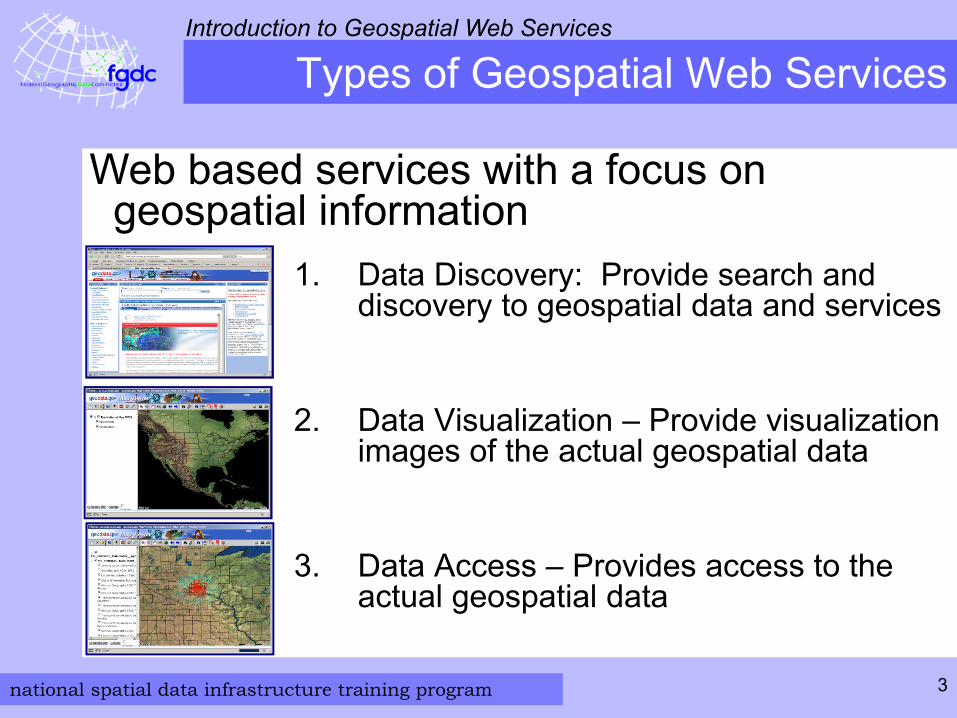
Types of Geospatial Web Services
1. Data Discovery: Provide search and discovery to geospatial data and services
2. Data Visualization – Provide visualization images of the actual geospatial data
3. Data Access – Provides access to the actual geospatial data
Web based services with a focus on geospatial information
national spatial data infrastructure training program
Introduction to Geospatial Web Services
4
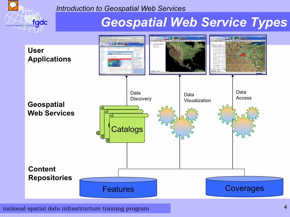
Geospatial Web Service Types
User Applications
Data Discovery
CatalogCatalogCatalogs
Geospatial Web Services
Features
ContentRepositories
Coverages
Data Visualization
Data Access
national spatial data infrastructure training program
Introduction to Geospatial Web Services
5
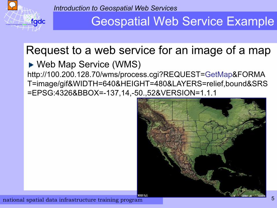
Geospatial Web Service Example
Request to a web service for an image of a mapWeb Map Service (WMS)
http://100.200.128.70/wms/process.cgi?REQUEST=GetMap&FORMAT=image/gif&WIDTH=640&HEIGHT=480&LAYERS=relief,bound&SRS=EPSG:4326&BBOX=-137,14,-50.,52&VERSION=1.1.1
national spatial data infrastructure training program
Introduction to Geospatial Web Services
6
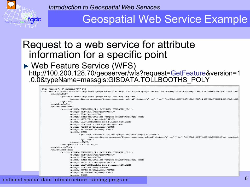
Geospatial Web Service Example
Request to a web service for attribute information for a specific pointWeb Feature Service (WFS)
http://100.200.128.70/geoserver/wfs?request=GetFeature&version=1.0.0&typeName=massgis:GISDATA.TOLLBOOTHS_POLY
national spatial data infrastructure training program
Introduction to Geospatial Web Services
7
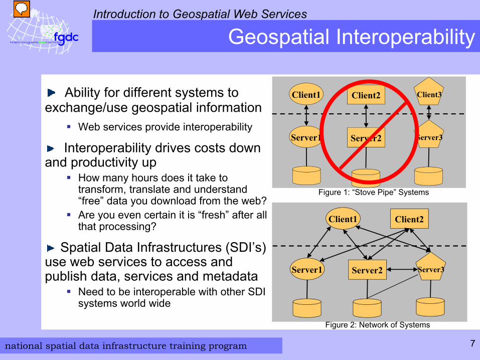
Geospatial Interoperability
Client1 Client2 Client3
Server1 Server2 Server3
Client1
Server1 Server2 Server3
Client2
Figure 1: “Stove Pipe” Systems
Figure 2: Network of Systems
Ability for different systems to exchange/use geospatial information
Web services provide interoperability
Interoperability drives costs down and productivity up
How many hours does it take to transform, translate and understand “free” data you download from the web?Are you even certain it is “fresh” after all that processing?
Spatial Data Infrastructures (SDI’s) use web services to access and publish data, services and metadata
Need to be interoperable with other SDI systems world wide
national spatial data infrastructure training program
Introduction to Geospatial Web Services
8
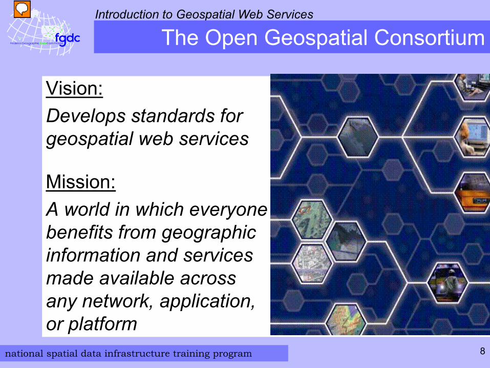
The Open Geospatial Consortium
Vision:Develops standards for geospatial web services
Mission: A world in which everyone benefits from geographic information and services made available across any network, application, or platform
national spatial data infrastructure training program
Introduction to Geospatial Web Services
9
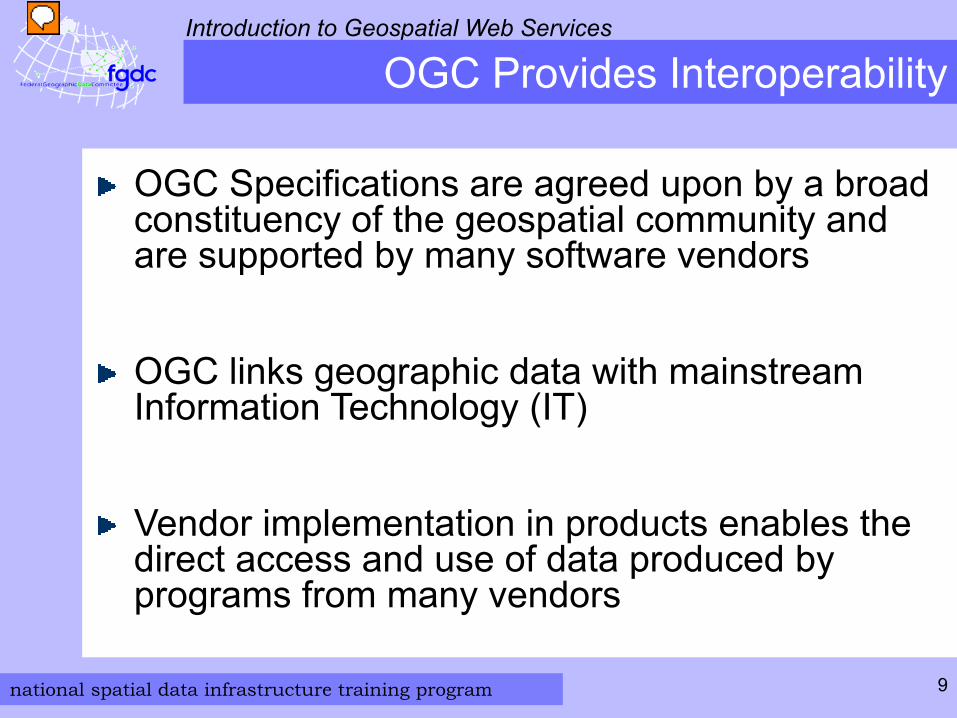
OGC Provides Interoperability
OGC Specifications are agreed upon by a broad constituency of the geospatial community and are supported by many software vendors
OGC links geographic data with mainstream Information Technology (IT)
Vendor implementation in products enables the direct access and use of data produced by programs from many vendors
national spatial data infrastructure training program
Introduction to Geospatial Web Services
10
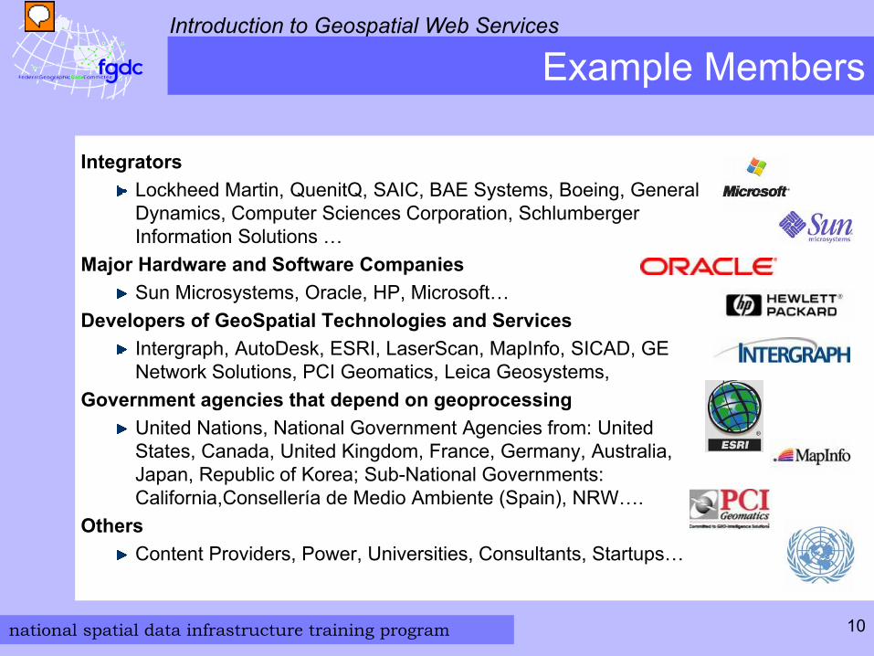
Example Members
Integrators Lockheed Martin, QuenitQ, SAIC, BAE Systems, Boeing, General Dynamics, Computer Sciences Corporation, Schlumberger Information Solutions …
Major Hardware and Software Companies Sun Microsystems, Oracle, HP, Microsoft…
Developers of GeoSpatial Technologies and ServicesIntergraph, AutoDesk, ESRI, LaserScan, MapInfo, SICAD, GE Network Solutions, PCI Geomatics, Leica Geosystems,
Government agencies that depend on geoprocessing United Nations, National Government Agencies from: United States, Canada, United Kingdom, France, Germany, Australia, Japan, Republic of Korea; Sub-National Governments: California,Consellería de Medio Ambiente (Spain), NRW….
OthersContent Providers, Power, Universities, Consultants, Startups…
national spatial data infrastructure training program
Introduction to Geospatial Web Services
11
OGC and Standards Organizations
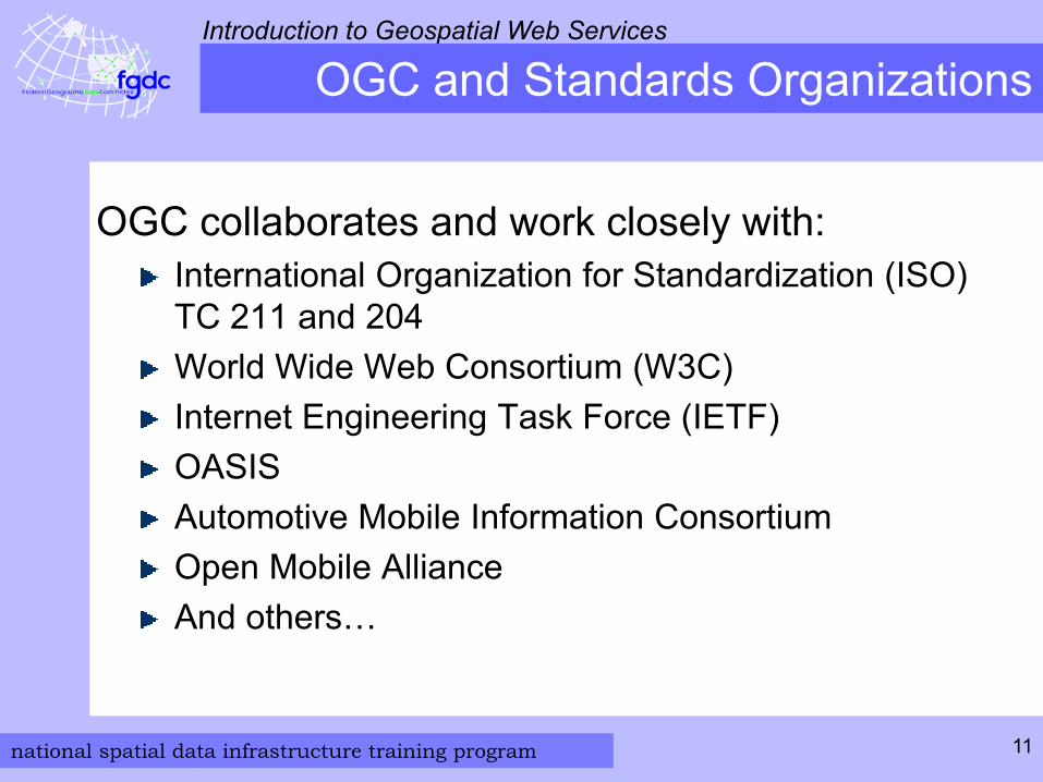
OGC collaborates and work closely with:International Organization for Standardization (ISO) TC 211 and 204World Wide Web Consortium (W3C)Internet Engineering Task Force (IETF)OASISAutomotive Mobile Information ConsortiumOpen Mobile AllianceAnd others…
national spatial data infrastructure training program
Introduction to Geospatial Web Services
12
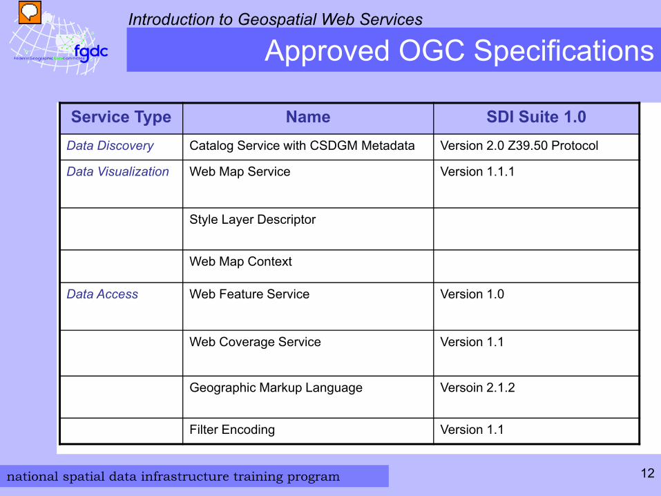
Approved OGC Specifications
Service Type Name SDI Suite 1.0Data Discovery Catalog Service with CSDGM Metadata Version 2.0 Z39.50 Protocol
Data Visualization Web Map Service Version 1.1.1
Style Layer Descriptor
Web Map Context
Data Access Web Feature Service Version 1.0
Web Coverage Service Version 1.1
Geographic Markup Language Versoin 2.1.2
Filter Encoding Version 1.1
national spatial data infrastructure training program
Introduction to Geospatial Web Services
13
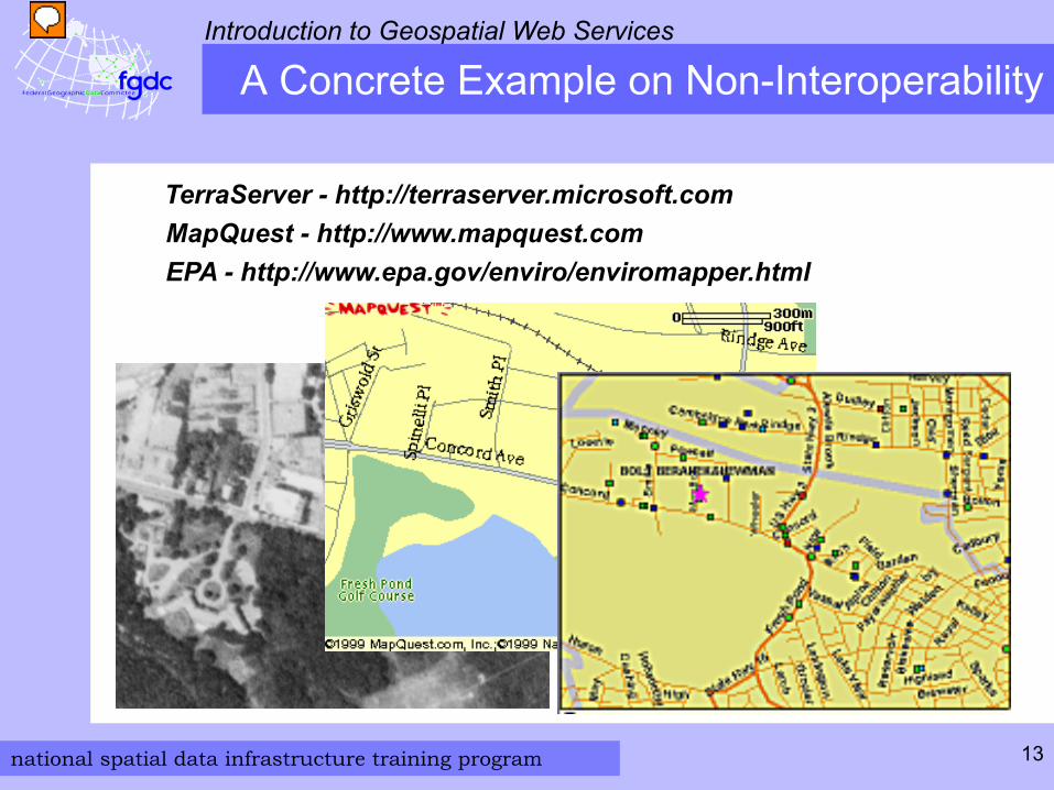
TerraServer - http://terraserver.microsoft.com
A Concrete Example on Non-Interoperability
MapQuest - http://www.mapquest.comEPA - http://www.epa.gov/enviro/enviromapper.html

national spatial data infrastructure training program
Introduction to Geospatial Web Services
14
A Concrete Example of Interoperability
national spatial data infrastructure training program
Introduction to Geospatial Web Services
15
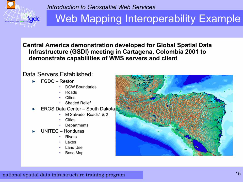
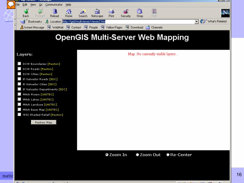
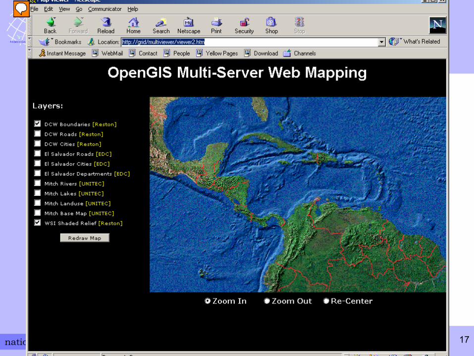
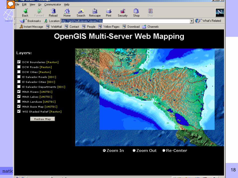
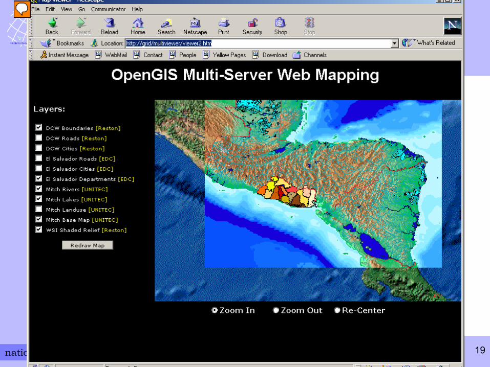
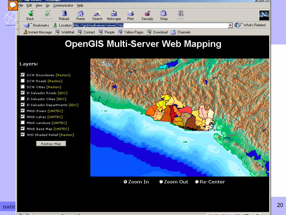
Web Mapping Interoperability Example
Central America demonstration developed for Global Spatial Data Infrastructure (GSDI) meeting in Cartagena, Colombia 2001 to demonstrate capabilities of WMS servers and client
Data Servers Established:FGDC – Reston
• DCW Boundaries• Roads• Cities• Shaded Relief
EROS Data Center – South Dakota• El Salvador Roads1 & 2• Cities• Departments
UNITEC – Honduras• Rivers• Lakes• Land Use• Base Map
national spatial data infrastructure training program
Introduction to Geospatial Web Services
16
national spatial data infrastructure training program
Introduction to Geospatial Web Services
17
national spatial data infrastructure training program
Introduction to Geospatial Web Services
18
national spatial data infrastructure training program
Introduction to Geospatial Web Services
19
national spatial data infrastructure training program
Introduction to Geospatial Web Services
20
national spatial data infrastructure training program
Introduction to Geospatial Web Services
21
What Does All This Do for You?
‘Near instant’ data interoperabilityAccess and exploit a wide variety of spatial data on-demandNo more time spent translating files to your format or projection
Supports web based services architectureGet your GIS over the web. Choice of web-based toolsLocate information across a distributed environment using different vendor applications, different projections
No more data configuration managementGet your answer from the latest data when you need itReduce data maintenance costs. Access and maintain only the data you care about
national spatial data infrastructure training program
Introduction to Geospatial Web Services
22
Summary
This is the conclusion of: Introduction to Geospatial Web Services.
You should be able to:Explain the difference between a website, a web service, and a geospatial web service
Differentiate between types of geospatial web services and how they are used
Explain the purpose of the Open Geospatial Consortium (OGC)
national spatial data infrastructure training program
Introduction to Geospatial Web Services
23
The FGDC invites you to visit
http://www.fgdc.gov/training/nsdi-training-program/online-lessons
for additional lessons.
Additional Lessons
Recommended