Long
Hollow
Cougar
Draw
Rattlesnake
Ridge
Sears Canyon
Rodgers Table
RodgersR idge
Hewi tson Ridge Thompson
Bench
Rattl esnake Draw
Rodgers
Draw
New Canyon
Double
Wood
Pole
Transmission
Line
Seam
ons
Place
Schraeder Road Rattle
snake
Draw
Ranch
Road GI
Ranch Road
Buck Creek Road 4200
4600
5000
5300
4200
4500
4700
4800
4800
5600
4300
5500
4800
4800
4800
5400
4600
4600
5900
5800
5000
4800
4500
5700
5500
4800
4900
4900
5400
5800
4700
4500
5600
5300
5500
5400
5700
5400
5700
4300
4200
5300
4500
4400
4400
4700
5300
5200 51
00
5 000
4600 4700
5 000
5100
4900
4800
5200
5600
4900
5500
4500
5400
5 000
5300
5100
5200
4900
4400
4300
4500
4600
4200 4700
4800
Buck Creek
So
th Fork
Crooke d Rive
r
Lizard Creek
31
27
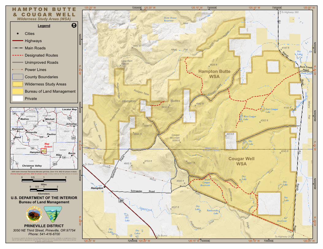
H A M P T O N B U T T Eamp C O U G A R W E L L
12025deg W 725000E
Wilderness Study Areas (WSA)Legend
12020deg W 12015deg W 730000E 12010deg W 735000E 12005deg W
Cities HighwaysMain Roads
Stone HouseReservoir
To Highway 380
UniPower Li
Designated Roumproved Roads
tes
nes County Boundaries Wilderness Study Areas Bureau of Land Management Private
WASCO26 97
Locator Map
JEFFERSONMadras
WHEELER
Mitchell 395
26Redmond
Prinevill
26 John Day
e Bend 380
PauliGRANT
na CROOK
395
97
DESCHUTES 20 MapExtent
4370
deg N
4845
000N
4375
deg N48
5000
0N
GI 5482 ft
Alkali Flat 4197 ft
Long Barn5984 ft 4826
DryLakes
4850
000N
ft
Hampton ButteWSA
4375
deg N
Hampton Buttes 5432 f
4992 ft t 4182 f
Lake t CougarEas t u
Misery
WestLake
Cougar
5381 ft 4302 ft
Flat
4845
000N
4995 ft CougarMountai
5598 n
4613 ft
ft DryLake
Hampton HARNEY
Burns CROOK COUNTY
DESCHUTES COUNTY 4245 ft 4370
deg N
Riley
KLAM
ATH
LAKE
Christmas Valley 395 To Bend 4665
4900
ft 4703 ft 5341 ft
5000 meter Universal Transverse Mercator grid ticks Zone 10 N NAD 83 (shown in black)Decimal Degrees grid ticks NAD 83 (shown in red) Contour Interval 20 feet (shown in brown
0 05 1 2
0 05 Miles1
4840
000N)
2 Hampton
Cougar WellWSA
20
4200
Sout4598 ft Cougarh
Reservoir
DryLake
KilometersUS DEPARTMENT OF THE INTERIOR
Bureau of Land Management 20
DryLake
DryLake
4537 ft DryLake Rattlesnake
Lake
PRINEVILLE DISTRICT3050 NE Th rd Stree Prineville OR 97754
541-416-6700
4365
deg N DryLake
iPhone
t DryLake
DryLakes
IntReservoir
4365
deg N
4840
000N
To Burns No warranty is made by the Bureau of Land Management as to the accuracy reliability or completeness of thesedata for individual or aggregate use with other data Original data were compiled from various sources and may
be updated without notification 12025deg W 725000E 12020deg W 12015deg W 730000E ghway 20
12010deg W 735000E 12005deg W To Hi
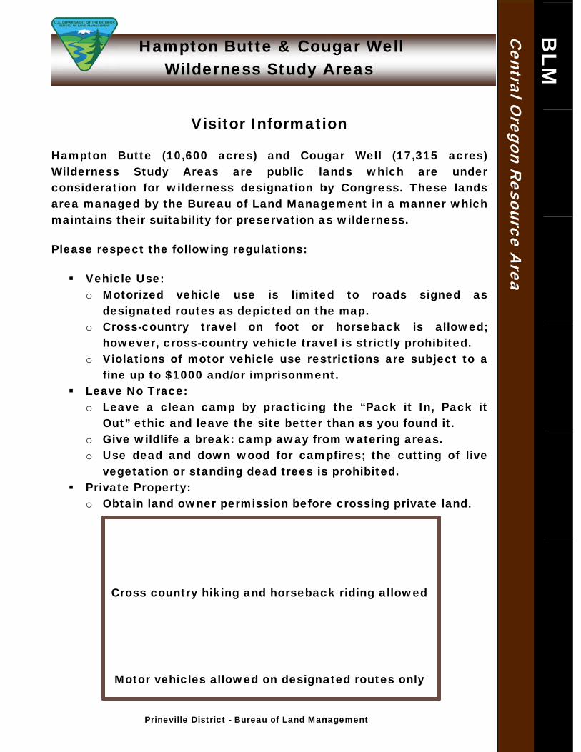
Hamptonn Buttee amp Couugar WWell
Wilderrness SStudy AAreas
Visitor Infformatiion
HHampton Butte ((10600 acres) aand Couggar Welll (173155 acres) WWildernesss Studyy Areass are ppublic laands whhich aree under cconsideraation for wilderneess desiggnation bby Congreess Thesse lands aarea mannaged by the Bureaau of Lannd Managgement inn a manneer which mmaintainss their suuitability ffor preserrvation as wildernness
PPlease reespect thee followinng regulaations
Vehhicle Use o MMotorizedd vehiclee use is limiteed to rooads siggned as
ddesignateed routes as depic ted on thhe map o CCross-couuntry traavel on foot or horsebaack is allowed
hhowever cross-couuntry vehhicle travvel is stricctly prohiibited o VViolationss of motoor vehiclee use resstrictions are subjject to a
fiine up to $1000 anndor impprisonmennt Leavve No Traace
o LLeave a cclean cammp by prracticingg the ldquoPaack it In Pack it OOutrdquo ethicc and leavve the sitte better than as yyou foundd it
o GGive wildllife a breaak campp away froom waterring areass o UUse dead and dowwn wood for campfires thhe cutting of live
vvegetationn or standding deadd trees iss prohibited Privvate Propeerty
o OObtain lannd owner permissiion beforee crossinng privatee land
Cross coountry hikking and hhorsebacck riding aallowed
BLM
BLM
Central O
regon Resource A
rea
Motor veehicles allowed onn designaated routes only
Prineville Districct - Bureau oof Land Mannagement
Recommended