Main Heading
Henley Conservation Area
Character AppraisalThe conservation area character appraisal - this sets
the context for the proposals contained in Part 2.
Part 1 was adopted by Council in September and
is included for information only.
September 2004

Henley Conservation Area Character Appraisal
The Council first published the Henley Conservation Area Character Appraisal in draft form in July 2004. Following a period of public consultation, including a public meeting held on 3rd August 2004, the Council approved the Character Appraisal on 2nd September 2004.

Prepared by
The Conservation Studio
1 Querns Lane
Cirencester
Gloucestershire
GL7 1RL
Tel: 01285 642428
Fax: 01285 642488
Email: theconservationstudio.co.uk
March 2004
Thanks to Henley Archaeological
and Historical Group who
commented in detail on the draft
document.

Contents
Executive summary . . . . . . . . . . . . . . . . . . . . . . . . . . . . . . . . . . . . .1
Part 1 Conservation Area Appraisal
Chapter 1 Introduction . . . . . . . . . . . . . . . . . . . . . . . . . . . . . . . . . . . . . .2
Statutory background . . . . . . . . . . . . . . . . . . . . . . . . . . . . . . . .2
Planning background . . . . . . . . . . . . . . . . . . . . . . . . . . . . . . . .2
Chapter 2 Location . . . . . . . . . . . . . . . . . . . . . . . . . . . . . . . . . . . . . . . . .2
Topography and setting . . . . . . . . . . . . . . . . . . . . . . . . . . . . . .2
Geology . . . . . . . . . . . . . . . . . . . . . . . . . . . . . . . . . . . . . . . . . .3
Chapter 3 History . . . . . . . . . . . . . . . . . . . . . . . . . . . . . . . . . . . . . . . . . .3
Archaeology . . . . . . . . . . . . . . . . . . . . . . . . . . . . . . . . . . . . . . .3
The development of Henley . . . . . . . . . . . . . . . . . . . . . . . . . . .3
Chapter 4 The character and appearance of the
Henley Conservation Area . . . . . . . . . . . . . . . . . . . . . . . . . . .6
General description . . . . . . . . . . . . . . . . . . . . . . . . . . . . . . . . .6
Activity and uses . . . . . . . . . . . . . . . . . . . . . . . . . . . . . . . . . . .7
Noise and quiet . . . . . . . . . . . . . . . . . . . . . . . . . . . . . . . . . . . .7
Townscape: morphology . . . . . . . . . . . . . . . . . . . . . . . . . . . . . .7
The effect of historical development on plan form . . . . . . . . . . .9
Boundaries and building plots . . . . . . . . . . . . . . . . . . . . . . . . .10
Trees, landscape and open spaces . . . . . . . . . . . . . . . . . . . .10
Views and vistas, including focal points . . . . . . . . . . . . . . . . . .11
Public realm audit . . . . . . . . . . . . . . . . . . . . . . . . . . . . . . . . . .11
Chapter 5 Character Areas . . . . . . . . . . . . . . . . . . . . . . . . . . . . . . . . . .13
Area 1: The Fair Mile and Northfield Road . . . . . . . . . . . . .13
Area 2: The northeast: Marlow Road, the playing fields,
riverside and Phyllis Court . . . . . . . . . . . . . . . . . . .14
Area 3: The town centre: Bell Street, part of New Street,
Hart Street, Market Place, Friday Street
and Duke Street . . . . . . . . . . . . . . . . . . . . . . . . . . .14
Area 4: The western edges: West Street, Gravel Hill,
Kings Road, Hop Gardens and Friar Park . . . . . . . .17
Area 5: The riverside: Wharf Lane, part of New Street,
Henley Bridge,Thames Side
and part of Station Road . . . . . . . . . . . . . . . . . . . . .18
Area 6: Edwardian suburbs: Greys Road, Albert Road,
Greys Hill, Church Street, Norman Avenue,
part of Duke Street and Queen Street . . . . . . . . . . .19
Area 7: St Mark’s Road, St Mary’s Road, Vicarage Road
and St Andrew’s Road . . . . . . . . . . . . . . . . . . . . . .20
HENLEY CONSERVATION AREA CHARACTER APPRAISAL
South Oxfordshire District Councili
Part 1
ii HENLEY CONSERVATION AREA CHARACTER APPRAISAL
South Oxfordshire District Council
Chapter 6 The Buildings of the Henley Conservation Area . . . . . . . . .20
Introduction . . . . . . . . . . . . . . . . . . . . . . . . . . . . . . . . . . . . . .20
Listed buildings . . . . . . . . . . . . . . . . . . . . . . . . . . . . . . . . . . .21
Buildings of Townscape Merit . . . . . . . . . . . . . . . . . . . . . . . . .23
Materials . . . . . . . . . . . . . . . . . . . . . . . . . . . . . . . . . . . . . . . .24
Building style and plan form . . . . . . . . . . . . . . . . . . . . . . . . . .26
Architectural details . . . . . . . . . . . . . . . . . . . . . . . . . . . . . . . .28
Shopfronts . . . . . . . . . . . . . . . . . . . . . . . . . . . . . . . . . . . . . . .28
Part 2
Issues . . . . . . . . . . . . . . . . . . . . . . . . . . . . . . . . . . . . . . . . . .29
Conservation Area boundary review . . . . . . . . . . . . . . . . . . . .29
Negative features - sites, buildings and open spaces . . . . . . .30
Pedestrian and traffic management . . . . . . . . . . . . . . . . . . . .30
New development . . . . . . . . . . . . . . . . . . . . . . . . . . . . . . . . .31
Potential development sites . . . . . . . . . . . . . . . . . . . . . . . . . .31
Chapter 1 The future management of the Henley Conservation Area .32
Introduction . . . . . . . . . . . . . . . . . . . . . . . . . . . . . . . . . . . . . .32
Buildings of Townscape Merit . . . . . . . . . . . . . . . . . . . . . . . . .32
Article 4 Directions . . . . . . . . . . . . . . . . . . . . . . . . . . . . . . . . .32
The protection of trees . . . . . . . . . . . . . . . . . . . . . . . . . . . . . .33
Local Plan policies . . . . . . . . . . . . . . . . . . . . . . . . . . . . . . . . .34
Chapter 2 Design Guidance for New Development . . . . . . . . . . . . . . .34
Introduction . . . . . . . . . . . . . . . . . . . . . . . . . . . . . . . . . . . . . .34
The need for contextual design . . . . . . . . . . . . . . . . . . . . . . . .34
Urban grain . . . . . . . . . . . . . . . . . . . . . . . . . . . . . . . . . . . . . .34
Scale and density . . . . . . . . . . . . . . . . . . . . . . . . . . . . . . . . . .35
Height and massing . . . . . . . . . . . . . . . . . . . . . . . . . . . . . . . .36
Appearance, materials and detailing . . . . . . . . . . . . . . . . . . . .36
Boundary treatments . . . . . . . . . . . . . . . . . . . . . . . . . . . . . . .37
Extensions to existing buildings . . . . . . . . . . . . . . . . . . . . . . .37
Site specific recommendations: . . . . . . . . . . . . . . . . . . . . . . .38
Market Place Mews . . . . . . . . . . . . . . . . . . . . . . . . . . . . . . . .38
Improvements to the public realm . . . . . . . . . . . . . . . . . . . . . .38
Chapter 3 Conclusions . . . . . . . . . . . . . . . . . . . . . . . . . . . . . . . . . . . . .40
How residents and other property owners can help . . . . . . . . .40
Supplementary Planning Guidance . . . . . . . . . . . . . . . . . . . . .40
Further information . . . . . . . . . . . . . . . . . . . . . . . . . . . . . . . . .40
HENLEY CONSERVATION AREA CHARACTER APPRAISAL
South Oxfordshire District Council1
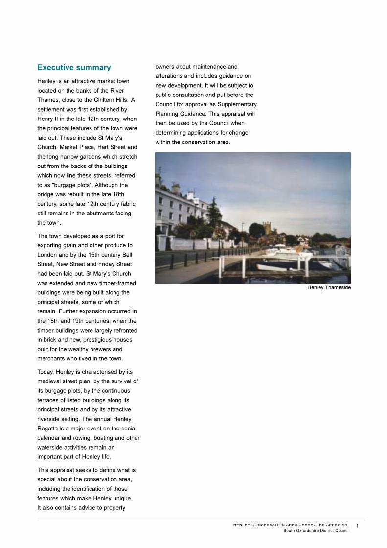
Executive summary
Henley is an attractive market town
located on the banks of the River
Thames, close to the Chiltern Hills. A
settlement was first established by
Henry II in the late 12th century, when
the principal features of the town were
laid out. These include St Mary's
Church, Market Place, Hart Street and
the long narrow gardens which stretch
out from the backs of the buildings
which now line these streets, referred
to as "burgage plots". Although the
bridge was rebuilt in the late 18th
century, some late 12th century fabric
still remains in the abutments facing
the town.
The town developed as a port for
exporting grain and other produce to
London and by the 15th century Bell
Street, New Street and Friday Street
had been laid out. St Mary's Church
was extended and new timber-framed
buildings were being built along the
principal streets, some of which
remain. Further expansion occurred in
the 18th and 19th centuries, when the
timber buildings were largely refronted
in brick and new, prestigious houses
built for the wealthy brewers and
merchants who lived in the town.
Today, Henley is characterised by its
medieval street plan, by the survival of
its burgage plots, by the continuous
terraces of listed buildings along its
principal streets and by its attractive
riverside setting. The annual Henley
Regatta is a major event on the social
calendar and rowing, boating and other
waterside activities remain an
important part of Henley life.
This appraisal seeks to define what is
special about the conservation area,
including the identification of those
features which make Henley unique.
It also contains advice to property
owners about maintenance and
alterations and includes guidance on
new development. It will be subject to
public consultation and put before the
Council for approval as Supplementary
Planning Guidance. This appraisal will
then be used by the Council when
determining applications for change
within the conservation area.
Henley Thameside
Conservation AreaAppraisal
Chapter 1
Introduction
Statutory background.
The designation of areas (rather than
individual buildings) of special
architectural or historic interest was
first set out in the Civic Amenities Act
1967 and since then over 9,000
conservation areas have been
designated in England and Wales.
More recent legislation has expanded
on these early principles and Section
69 of the Planning (Listed Buildings
and Conservation Areas) Act 1990
obliges local planning authorities to
determine which parts of their areas
are of special architectural or historic
interest and to designate them as
conservation areas. Section 72 of the
same Act also specifies that it is the
general duty of local planning
authorities, in the exercise of their
planning functions, to pay special
attention to the desirability of
preserving or enhancing the character
or appearance of these conservation
areas.
Policies which aim to achieve this are
set out in each Council's Local Plan
and in government guidance including,
most importantly, Planning Policy
Guidance (PPG) 15, Planning and the
Historic Environment.
Planning background.
All local authorities have an approved
Local Plan which sets out each
Council's policies and which is used
extensively for development control
purposes. These plans are almost
permanently under review, as central
government guidance changes rapidly
and local economic and social
conditions require adjustments to the
Council's policies. The relevant
document for the Henley Conservation
Area is the South Oxfordshire Local
Plan adopted in 1997.
South Oxfordshire District Council has
70 conservation areas and about 3,500
listed buildings. Policies which seek
their preservation and enhancement
are set out in the Local Plan in Section
4 - The Historic Environment,
particularly on pages 42-62.
The advice on the control of
conservation areas, including new
development, provided in the Local
Plan is inevitably quite general. In Part
2 of this appraisal can be found more
detailed policy guidance which will be
of interest to owners of buildings and
sites within the Henley Conservation
Area.
Chapter 2
Location
Topography and setting.
Henley is situated on the west bank of
the River Thames, with the Chiltern
Hills rising steeply to the east and
further wooded hills surrounding the
town to the north and west. The town
lies on ancient ridgeway routes across
2
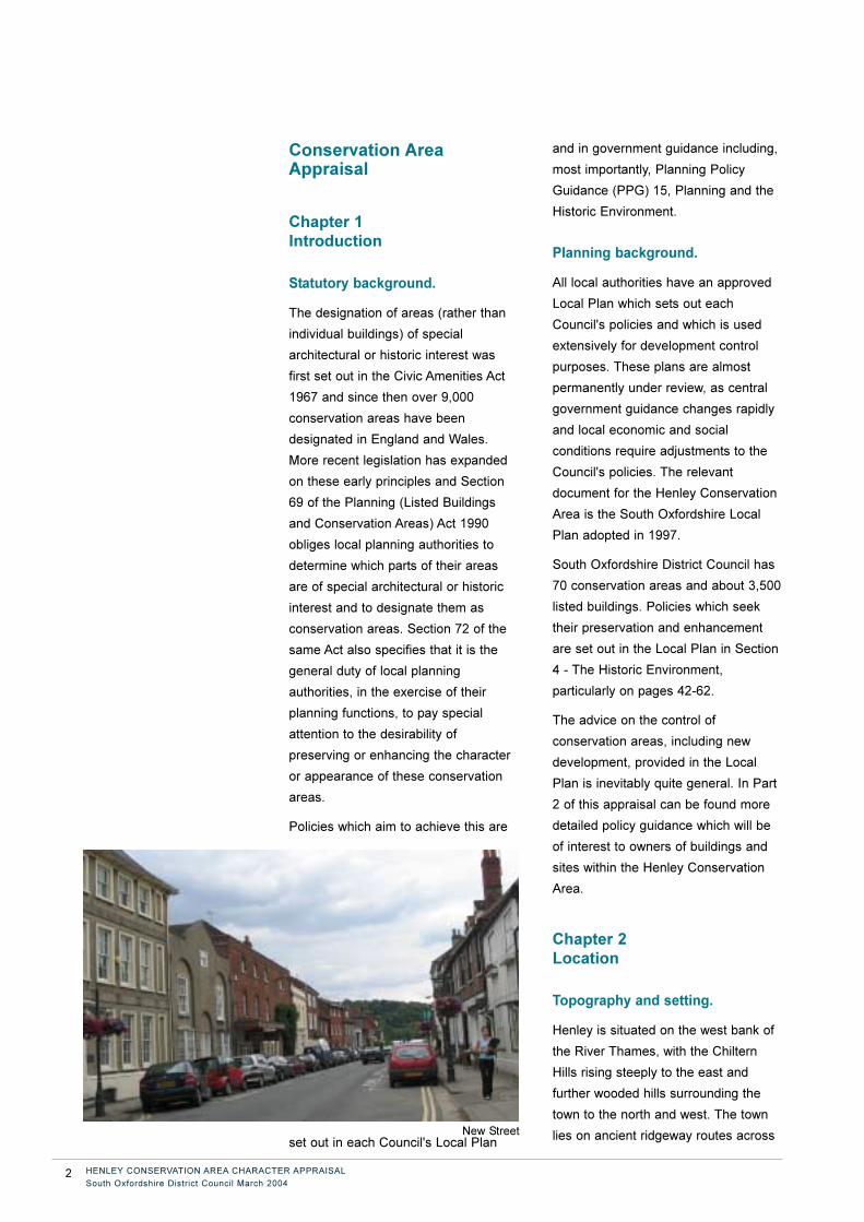
New Street
HENLEY CONSERVATION AREA CHARACTER APPRAISAL
South Oxfordshire District Council March 2004
these hills, where they crossed a
natural ford. Above Henley, the river is
not easily navigable and this provided
an impetus for development in the late
medieval period as a riverside port,
particularly for the export of grain.
Geology.
Henley lies close to the Chiltern Hills,
notable for their chalk which provides
lime and flint for building materials. To
the north around Oxford can be found a
honey-coloured limestone and also a
friable chalk/limestone stone called
clunch, sometimes used for building.
Local clays, suitable for brick making,
can be found in the river valleys and
these provided the raw material for the
brick and tile-making industries which
developed during the 18th and 19th
centuries.
Chapter 3
History
Archaeology.
The historic core of the town includes
medieval burgage plots, the Parish
Church and the site of the Manor
House. A number of archaeological
excavations that have taken place
within the historic core have confirmed
the intensive occupation of burgage
plots including frontage buildings and
typical backlands, during the 13th to
15th centuries. Evidence from the
redevelopment of Waitrose site also
produced the first evidence from
Henley town centre of a substantial
Roman building. Activity in the Roman
period is also reflected in isolated finds
of Roman coins. The prehistoric period
is poorly represented by current
evidence though stone, bronze and iron
weapons have all been found close to
Henley Bridge where in ancient times a
natural ford over the river provided an
impetus for early settlement. A late
Saxon spearhead and an axe of Viking
type have been found in the Thames.
The development of Henley.
Henley is notable as an example of a
planned medieval town and for the
survival of its burgage plots, which lie
to either side of the main streets.
Thame, located a few miles to the
north-east, is another such town, laid
out by the Bishop of Lincoln, also in the
late 12th century. There was a
medieval manor at Phyllis Court, on the
northern edges of the conservation
area, but there is no mention of a
settlement before 1179 when it is
recorded that Henry II "had bought land
in Henley for making buildings" . It has
been suggested that he created a new
town and that the burgage plots which
can still be plotted off Hart Street and
the Market Place all date from this
period. However, the discovery of the
old bridge in 1984 showed that the
bridge, alongside the present bridge on
the south side, was dated to c.1170.
Since it was not aligned to any main
street it is assumed that the town pre-
dated the bridge. Hart Street leads to
the church not the bridge. So the town
and church may date from c.1130s. On
the south side of the settlement, the
burgage plots terminate in a softly
curving boundary which once marked
the line of the town ditch, still shown as
such on early 20th century maps.
In 1199 King John granted to Robert
Harcourt the manor of Benson and "the
town and manor of Henley". In 1205
the town received a pavage grant and
in 1234 a bridge over the Thames is
first recorded. A market existed by
1269 although the first market charter
which survives is dated 1568. St Mary's
Church was originally a chapelry of
Benson and is first mentioned in 1204
HENLEY CONSERVATION AREA CHARACTER APPRAISAL
South Oxfordshire District Council3
although the standing fabric dates
mainly to the 13th and the 15th
centuries. Its location, centrally
positioned at the head of the main
street, suggests that the church and the
town were established at much the
same time.
By the late 13th century it is probable
that the street pattern of the town was
laid out as we see it today, with a wide
market area which can still be seen in
the layout of the Market Place, Gravel
Hill and West Street. The road north to
south through the town probably pre-
dates the town. New Street, which
marks the northern boundary of the late
12th century burgage plots facing Hart
Street and Friday Street, to the
southern edges, is first mentioned in
deeds of 1305.
Throughout the 14th and 15th centuries
Henley flourished as a market centre
being particularly important for the
export of grain which was grown in the
Upper Thames valley and then moved
on boats down the river to London.
Other goods, including stone from
further west, were also shipped from
Henley and there are records of
warehouses in the town during the 14th
century and later. The merchant guild,
in existence from 1269, was an
important influence within the town,
providing its local government,
superseded by an elected Mayor,
Bridgeman and Burgesses by early
14th century. In 1883 this system was
replaced by an elected corporation.
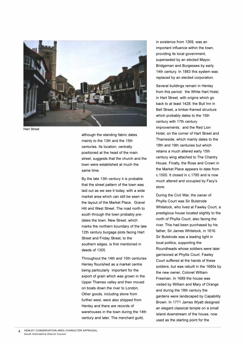
Several buildings remain in Henley
from this period: the White Hart Hotel,
in Hart Street, with origins which go
back to at least 1428; the Bull Inn in
Bell Street, a timber-framed structure
which probably dates to the 15th
century with 17th century
improvements; and the Red Lion
Hotel, on the corner of Hart Street and
Thameside, which mainly dates to the
18th and 19th centuries but which
retains a much altered early 15th
century wing attached to The Chantry
House. Finally, the Rose and Crown in
the Market Place appears to date from
c.1500. It closed in c.1785 and is now
much altered and occupied by Facy’s
store.
During the Civil War, the owner of
Phyllis Court was Sir Bulstrode
Whitelock, who lived at Fawley Court, a
prestigious house located slightly to the
north of Phyllis Court, also facing the
river. This had been purchased by his
father, Sir James Whitelock, in 1616.
Sir Bulstrode was a leading light in
local politics, supporting the
Roundheads whose soldiers were later
garrisoned at Phyllis Court. Fawley
Court suffered at the hands of these
soldiers, but was rebuilt in the 1680s by
the new owner, Colonel William
Freeman. In 1689 the house was
visited by William and Mary of Orange
and during the 18th century the
gardens were landscaped by Capability
Brown. In 1771 James Wyatt designed
an elegant classical temple on a small
island downstream of the house, now
used as the starting point for the
4 HENLEY CONSERVATION AREA CHARACTER APPRAISAL
South Oxfordshire District Council
Hart Street
Henley Regatta races. Despite its
close proximity to Henley, Fawley Court
lies within the neighbouring county of
Buckinghamshire.
Phyllis Court was also damaged during
the war and was extensively rebuilt in
1648. During the 18th century the
house changed hands several times,
one owner being the Bradshaw family.
Alderman Bradshaw was responsible
for the demolition of the old Market
Place Guildhall and Gaol in 1795 and
the building of a new Town Hall which
he designed himself. During this period
Phyllis Court always remained an
important element of Henley's social
scene. In 1837 it was demolished
entirely and rebuilt to its present
appearance. More recently, it has been
extended and is now used as a country
club, being particularly important during
the week of the Henley Regatta. Of
special interest is the moat, of
uncertain date, now connected to the
river and used for as a mooring for
boats. This may be a reworked
fragment of a medieval moat or it could
be part of the Civil War defences of the
house or even an 18th or 19th century
landscape feature.
After the conflicts and uncertainties of
the 17th century, the following two
centuries brought periods of intense
growth for Henley. The most important
industries were brewing and the
exporting of goods along the river to
London. Hotels and inns were built to
provide accommodation for the many
travellers who used the coach services
between Oxford and London and new
red brick buildings were built or the old
timber-framed hostelries were refronted
and modernised. The Catherine Wheel
in Hart Street and the former Bell Inn in
Northfield End both have evidence of
building from this period and the Red
Lion in Hart Street was extensively
rebuilt and extended.
In 1786 a new bridge over the Thames
was completed and at about this time
Middle Row, a group of cottages in the
middle of Hart Street, were demolished
to improve the highway. A new
workhouse (now part of Townlands
Hospital) was provided in 1790, under
the supervision of William Bradshaw, a
member of the family who owned
Phyllis Court. Typically, this was built
on the outskirts of the town, in what
was then open fields to the north of the
western end of the Market Place.
Brewing and malting became
increasingly important and during the
early 19th century a number of local
breweries were amalgamated into
Brakspear's Brewery in New Street,
which reached its zenith in the late 19th
century by which time it had become
the most important brewery in the town.
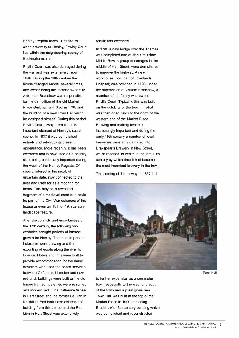
The coming of the railway in 1857 led
to further expansion as a commuter
town, especially to the west and south
of the town and a prestigious new
Town Hall was built at the top of the
Market Place in 1900, replacing
Bradshaw's 18th century building which
was demolished and reconstructed
HENLEY CONSERVATION AREA CHARACTER APPRAISAL
South Oxfordshire District Council5
Town Hall
elsewhere as a private house.
The commencement of the annual
Regatta in 1839 added to Henley's
attractions and by the end of the
century the town was notable for its
many boathouses, rowing clubs and
hotels. This period of intense building
activity has left a very distinct mark on
Henley and has provided the town with
a number of prestigious buildings, such
as the Imperial Hotel in Station Street,
built in 1897. Henley also boasts a
number of attractive Victorian buildings,
usually arranged in long terraces, such
as Albert Road and Queen Street. In the
1890s, the corporation also "improved"
the town centre by demolishing some of
the buildings at the more narrow road
junctions. Duke Street was widened in
1870 when the whole west side was
demolished and rebuilt. 1-7 Greys Road
are the result of similar improvements
dating to 1896. They bear the notation:
"Road Widening Corporation".
In the 1890s more houses were built
beyond the railway station to the west
side of Reading Road. St Mark's Road
and St. Andrew's Road contain a
number of detached or semi-detached,
well-detailed, red brick houses. After
1900, more modest terraces were built
on the east side of the road and
towards Harpsden Road: Niagara Road,
Boston Road, Marmion Road, Grange
Road and Park Road.
More recently, the building of the M4
provided a fast route into London which
led to the construction of new housing
estates on the western and southern
edges of the town in the 1960s and
1970s.
Today, facilities for the Regatta and
other boating events are always evident
along the river: the grandstand in the
grounds of Phyllis Court, the various
rowing boats and pleasure boats which
are moored along the riverside and the
many hotels, restaurants and public
houses throughout the town. On the
Remenham side of the river, facing
Henley, lies the Leander Rowing Club
and the Regatta Clubhouse, adding to
the interest of the riverside.
There is constant pressure for new
commercial development in the town,
particularly for shopping, which has to a
degree been controlled by the
designation of a large conservation
area, covering the historic town centre,
large areas of the surrounding suburbs
and some of the fields to the north.
Chapter 4
The character and
appearance of the Henley
Conservation Area
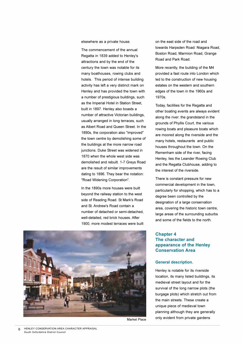
General description.
Henley is notable for its riverside
location, its many listed buildings, its
medieval street layout and for the
survival of the long narrow plots (the
burgage plots) which stretch out from
the main streets. These create a
unique piece of medieval town
planning although they are generally
only evident from private gardens
6 HENLEY CONSERVATION AREA CHARACTER APPRAISAL
South Oxfordshire District Council
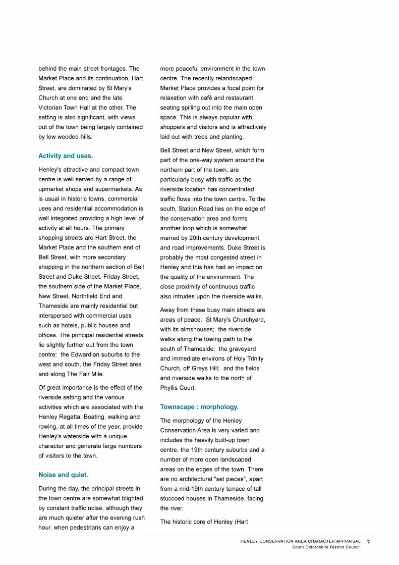
Market Place
behind the main street frontages. The
Market Place and its continuation, Hart
Street, are dominated by St Mary's
Church at one end and the late
Victorian Town Hall at the other. The
setting is also significant, with views
out of the town being largely contained
by low wooded hills.
Activity and uses.
Henley's attractive and compact town
centre is well served by a range of
upmarket shops and supermarkets. As
is usual in historic towns, commercial
uses and residential accommodation is
well integrated providing a high level of
activity at all hours. The primary
shopping streets are Hart Street, the
Market Place and the southern end of
Bell Street, with more secondary
shopping in the northern section of Bell
Street and Duke Street. Friday Street,
the southern side of the Market Place,
New Street, Northfield End and
Thameside are mainly residential but
interspersed with commercial uses
such as hotels, public houses and
offices. The principal residential streets
lie slightly further out from the town
centre: the Edwardian suburbs to the
west and south, the Friday Street area
and along The Fair Mile.
Of great importance is the effect of the
riverside setting and the various
activities which are associated with the
Henley Regatta. Boating, walking and
rowing, at all times of the year, provide
Henley's waterside with a unique
character and generate large numbers
of visitors to the town.
Noise and quiet.
During the day, the principal streets in
the town centre are somewhat blighted
by constant traffic noise, although they
are much quieter after the evening rush
hour, when pedestrians can enjoy a
more peaceful environment in the town
centre. The recently relandscaped
Market Place provides a focal point for
relaxation with café and restaurant
seating spilling out into the main open
space. This is always popular with
shoppers and visitors and is attractively
laid out with trees and planting.
Bell Street and New Street, which form
part of the one-way system around the
northern part of the town, are
particularly busy with traffic as the
riverside location has concentrated
traffic flows into the town centre. To the
south, Station Road lies on the edge of
the conservation area and forms
another loop which is somewhat
marred by 20th century development
and road improvements. Duke Street is
probably the most congested street in
Henley and this has had an impact on
the quality of the environment. The
close proximity of continuous traffic
also intrudes upon the riverside walks.
Away from these busy main streets are
areas of peace: St Mary's Churchyard,
with its almshouses; the riverside
walks along the towing path to the
south of Thameside; the graveyard
and immediate environs of Holy Trinity
Church, off Greys Hill; and the fields
and riverside walks to the north of
Phyllis Court.
Townscape : morphology.
The morphology of the Henley
Conservation Area is very varied and
includes the heavily built-up town
centre, the 19th century suburbs and a
number of more open landscaped
areas on the edges of the town. There
are no architectural "set pieces", apart
from a mid-19th century terrace of tall
stuccoed houses in Thameside, facing
the river.
The historic core of Henley (Hart
HENLEY CONSERVATION AREA CHARACTER APPRAISAL
South Oxfordshire District Council7
Street, Market Place, Friday Street, Bell
Street, New Street and Northfield End)
is defined by the rows of properties
which lie on the backs of the
pavements, creating continuous
terraces of mainly listed buildings.
These are varied in height, materials
and detailing, with two or three storeys
predominating. The character is
generally domestic as the majority of
the buildings were built as houses
although they have since been
converted into shops or offices. Many
of these buildings date from the 16th or
17th centuries and are timber-framed.
Their scale is modest and they are
characterised by steeply pitched peg
tiled roofs and substantial brick
chimney stacks. There are also a
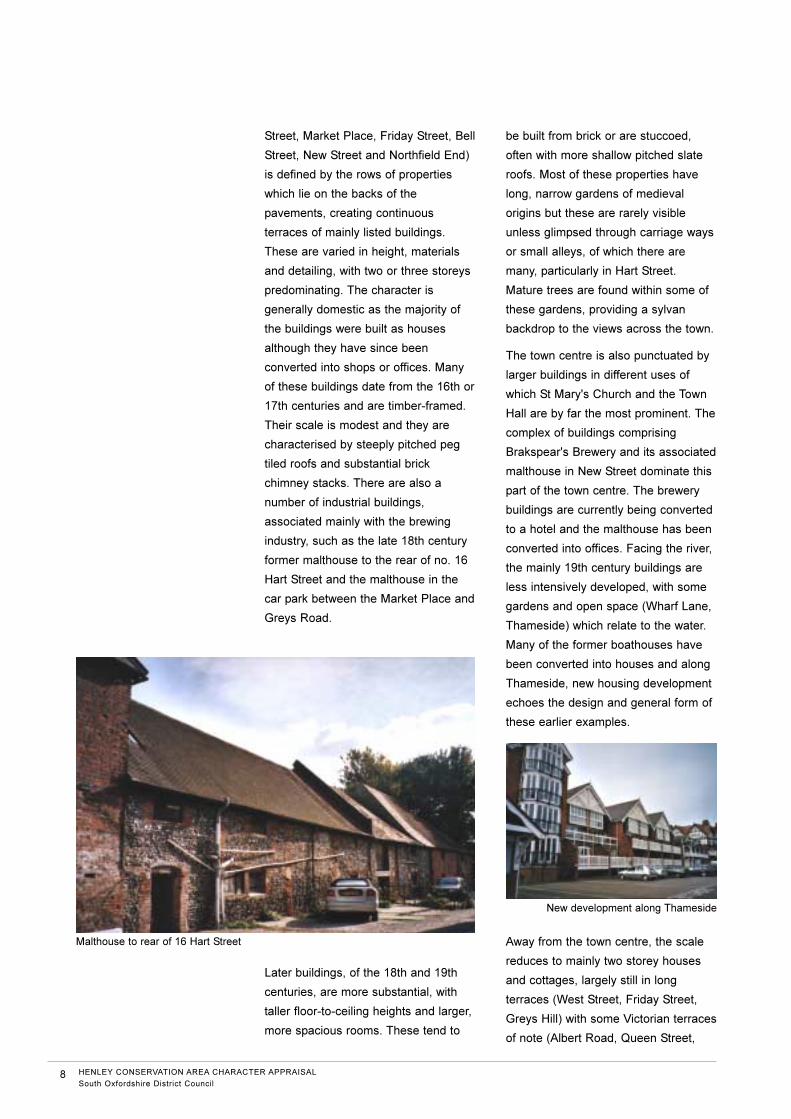
number of industrial buildings,
associated mainly with the brewing
industry, such as the late 18th century
former malthouse to the rear of no. 16
Hart Street and the malthouse in the
car park between the Market Place and
Greys Road.
Later buildings, of the 18th and 19th
centuries, are more substantial, with
taller floor-to-ceiling heights and larger,
more spacious rooms. These tend to
be built from brick or are stuccoed,
often with more shallow pitched slate
roofs. Most of these properties have
long, narrow gardens of medieval
origins but these are rarely visible
unless glimpsed through carriage ways
or small alleys, of which there are
many, particularly in Hart Street.
Mature trees are found within some of
these gardens, providing a sylvan
backdrop to the views across the town.
The town centre is also punctuated by
larger buildings in different uses of
which St Mary's Church and the Town
Hall are by far the most prominent. The
complex of buildings comprising
Brakspear's Brewery and its associated
malthouse in New Street dominate this
part of the town centre. The brewery
buildings are currently being converted
to a hotel and the malthouse has been
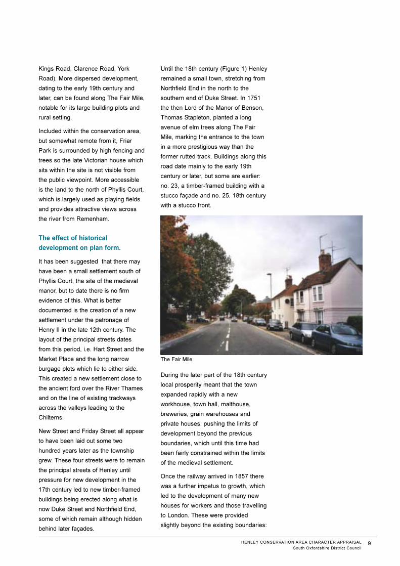
converted into offices. Facing the river,
the mainly 19th century buildings are
less intensively developed, with some
gardens and open space (Wharf Lane,
Thameside) which relate to the water.
Many of the former boathouses have
been converted into houses and along
Thameside, new housing development
echoes the design and general form of
these earlier examples.
Away from the town centre, the scale
reduces to mainly two storey houses
and cottages, largely still in long
terraces (West Street, Friday Street,
Greys Hill) with some Victorian terraces
of note (Albert Road, Queen Street,
8 HENLEY CONSERVATION AREA CHARACTER APPRAISAL
South Oxfordshire District Council
Malthouse to rear of 16 Hart Street
New development along Thameside
Kings Road, Clarence Road, York
Road). More dispersed development,
dating to the early 19th century and
later, can be found along The Fair Mile,
notable for its large building plots and
rural setting.
Included within the conservation area,
but somewhat remote from it, Friar
Park is surrounded by high fencing and
trees so the late Victorian house which
sits within the site is not visible from
the public viewpoint. More accessible
is the land to the north of Phyllis Court,
which is largely used as playing fields
and provides attractive views across
the river from Remenham.
The effect of historical
development on plan form.
It has been suggested that there may
have been a small settlement south of
Phyllis Court, the site of the medieval
manor, but to date there is no firm
evidence of this. What is better
documented is the creation of a new
settlement under the patronage of
Henry II in the late 12th century. The
layout of the principal streets dates
from this period, i.e. Hart Street and the
Market Place and the long narrow
burgage plots which lie to either side.
This created a new settlement close to
the ancient ford over the River Thames
and on the line of existing trackways
across the valleys leading to the
Chilterns.
New Street and Friday Street all appear
to have been laid out some two
hundred years later as the township
grew. These four streets were to remain
the principal streets of Henley until
pressure for new development in the
17th century led to new timber-framed
buildings being erected along what is
now Duke Street and Northfield End,
some of which remain although hidden
behind later façades.
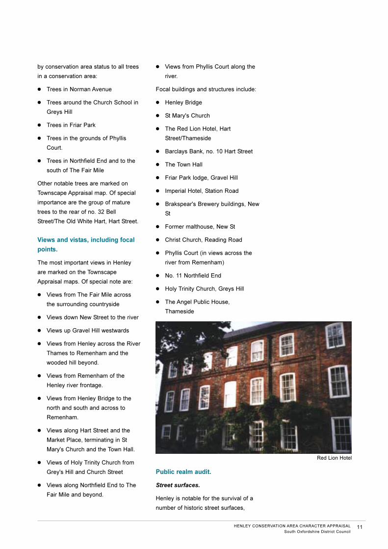
Until the 18th century (Figure 1) Henley
remained a small town, stretching from
Northfield End in the north to the
southern end of Duke Street. In 1751
the then Lord of the Manor of Benson,
Thomas Stapleton, planted a long
avenue of elm trees along The Fair
Mile, marking the entrance to the town
in a more prestigious way than the
former rutted track. Buildings along this
road date mainly to the early 19th
century or later, but some are earlier:
no. 23, a timber-framed building with a
stucco façade and no. 25, 18th century
with a stucco front.
During the later part of the 18th century
local prosperity meant that the town
expanded rapidly with a new
workhouse, town hall, malthouse,
breweries, grain warehouses and
private houses, pushing the limits of
development beyond the previous
boundaries, which until this time had
been fairly constrained within the limits
of the medieval settlement.
Once the railway arrived in 1857 there
was a further impetus to growth, which
led to the development of many new
houses for workers and those travelling
to London. These were provided
slightly beyond the existing boundaries:
HENLEY CONSERVATION AREA CHARACTER APPRAISAL
South Oxfordshire District Council9
The Fair Mile

Grey's Hill, Grey's Road, West Street
and along The Fair Mile. The railway
terminated just to the south of the
town, so the construction of the new
trackway and station was achieved
without any adverse effect on existing
buildings.
However the largest expansion of the
town took place around 1900 when
long terraces or groups of Victorian
and Edwardian houses were built
(Albert Road, Queen Street, York
Road, Clarence Road, King's Road and
Norman Avenue). Expansion to the
west was constrained by Friar Park
(1889) with its large gardens and park
and to the north by Phyllis Lodge and
its lands, but between the 1880s and
1910 many of the fields which
surrounded the town to the south and
west were developed.
More recently, new housing has been
provided to the south and partly to the
west of Henley, but to the north, the
land has remained in agricultural use,
or as playing fields, so this part of
Henley still feels very rural. The river,
to the east, has also provided a natural
limit to expansion.
Boundaries and building plots.
Henley is notable for the survival of its
late 12th century plan form and
burgage plots. These long, narrow
gardens which lie behind most of the
properties which face Hart Street and
the Market Place are a rare and
valuable archaeological feature which
must be preserved though in parts
these have been substantially altered
or lost. They also define the character
of the conservation area as, although
not readily visible from the public
viewpoint, most of the houses in these
two streets still retain their early garden
layout. From some vantage points,
such as the car park behind no.18 Hart
Street, the long parallel lines of flint
walls which mark these historic plots
can very clearly be seen.
This form of development, or "urban
grain", provides a distinctive townscape
which can best be appreciated from St
Mary's Church tower. From here, it can
be seen how the medieval layout has
produced a succession of buildings
with long, parallel ridges at right angles
to the principal buildings along the
street frontage. The line of these rear
extensions is then continued by the
various boundary walls, driveways and
alleys which link the streets with the
rear gardens.
Trees, landscape and open
spaces.
Trees make a major contribution to
views out of the town and are also
significant in town centre gardens,
where they can be glimpsed over the
roofs of buildings or through
carriageways or alleys.
The following groups of trees are of
special merit and are protected by Tree
Preservation Orders, in addition to the
statutory protection which is provided
10 HENLEY CONSERVATION AREA CHARACTER APPRAISAL
South Oxfordshire District Council
Norman Avenue
c. 1200
c. 1500
c. 1800
c. 1900
by conservation area status to all trees
in a conservation area:
● Trees in Norman Avenue
● Trees around the Church School in
Greys Hill
● Trees in Friar Park
● Trees in the grounds of Phyllis
Court.
● Trees in Northfield End and to the
south of The Fair Mile
Other notable trees are marked on
Townscape Appraisal map. Of special
importance are the group of mature
trees to the rear of no. 32 Bell
Street/The Old White Hart, Hart Street.
Views and vistas, including focal
points.
The most important views in Henley
are marked on the Townscape
Appraisal maps. Of special note are:
● Views from The Fair Mile across
the surrounding countryside
● Views down New Street to the river
● Views up Gravel Hill westwards
● Views from Henley across the River
Thames to Remenham and the
wooded hill beyond.
● Views from Remenham of the
Henley river frontage.
● Views from Henley Bridge to the
north and south and across to
Remenham.
● Views along Hart Street and the
Market Place, terminating in St
Mary's Church and the Town Hall.
● Views of Holy Trinity Church from
Grey's Hill and Church Street
● Views along Northfield End to The
Fair Mile and beyond.
● Views from Phyllis Court along the
river.
Focal buildings and structures include:
● Henley Bridge
● St Mary's Church
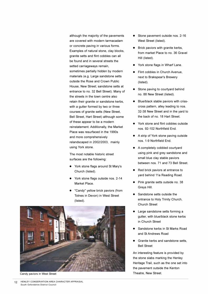
● The Red Lion Hotel, Hart
Street/Thameside
● Barclays Bank, no. 10 Hart Street
● The Town Hall
● Friar Park lodge, Gravel Hill
● Imperial Hotel, Station Road
● Brakspear's Brewery buildings, New
St
● Former malthouse, New St
● Christ Church, Reading Road
● Phyllis Court (in views across the
river from Remenham)
● No. 11 Northfield End
● Holy Trinity Church, Greys Hill
● The Angel Public House,
Thameside
Public realm audit.
Street surfaces.
Henley is notable for the survival of a
number of historic street surfaces,
HENLEY CONSERVATION AREA CHARACTER APPRAISAL
South Oxfordshire District Council11
Red Lion Hotel
although the majority of the pavements
are covered with modern tarmacadam
or concrete paving in various forms.
Examples of natural stone, clay blocks,
granite setts and flint cobbles can all
be found and in several streets the
setted carriageways remain,
sometimes partially hidden by modern
materials (e.g. Large sandstone setts
outside the Rose and Crown Public
House, New Street; sandstone setts at
entrance to no. 32 Bell Street). Many of
the streets in the town centre also
retain their granite or sandstone kerbs,
with a gutter formed by two or three
courses of granite setts (New Street,
Bell Street, Hart Street) although some
of these appear to be a modern
reinstatement. Additionally, the Market
Place was resurfaced in the 1990s
and more comprehensively
relandscaped in 2002/2003, mainly
using York stone.
The most notable historic street
surfaces are the following:
● York stone flags around St Mary's
Church (listed).
● York stone flags outside nos. 2-14
Market Place.
● "Candy" yellow brick paviors (from
Totnes in Devon) in West Street
(listed).
● Stone pavement outside nos. 2-16
West Street (listed).
● Brick paviors with granite kerbs,
from market Place to no. 36 Gravel
Hill (listed).
● York stone flags in Wharf Lane.
● Flint cobbles in Church Avenue,
next to Brakspear's Brewery
(listed).
● Stone paving to courtyard behind
no. 88 New Street (listed).
● Blue/black stable paviors with criss-
cross pattern, alley leading to nos.
32-38 New Street and in the yard to
the back of no. 18 Hart Street.
● York stone and flint cobbles outside
nos. 92-102 Northfield End.
● A strip of York stone paving outside
nos. 1-9 Northfield End.
● A completely cobbled courtyard
using pink and grey sandstone and
small blue clay stable paviors
between nos. 71 and 73 Bell Street.
● Red brick paviors at entrance to
yard behind 11a Reading Road.
● Pink granite setts outside no. 38
Greys Hill.
● Sandstone setts outside the
entrance to Holy Trinity Church,
Church Street
● Large sandstone setts forming a
gutter, with blue/black stone kerbs
in Church Street
● Sandstone kerbs in St Marks Road
and St Andrews Road
● Granite kerbs and sandstone setts,
Bell Street
An interesting feature is provided by
the stone slabs marking the Henley
Heritage Trail, such as the one set into
the pavement outside the Kenton
Theatre, New Street.
12 HENLEY CONSERVATION AREA CHARACTER APPRAISAL
South Oxfordshire District Council
Candy paviors in West Street
Street furniture.
There are varied examples of modern
seating, street signs and litter bins
throughout the conservation area,
generally of a unified design, providing
a welcome simplicity. Direction signs
are modern but are similar to historic
finger posts, usually using white letters
on a black background. Generally the
streets are remarkably untouched by
"street clutter" and the absence of
overhead wires and cabling is
particularly noticeable in the town
centre.
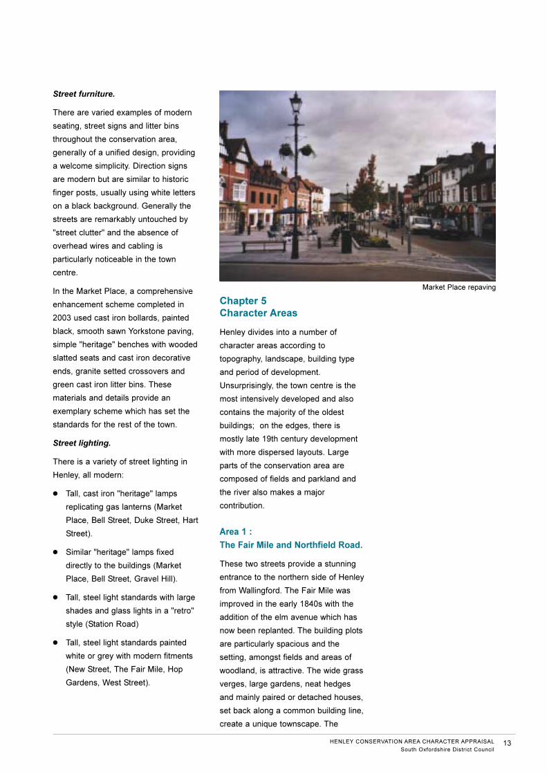
In the Market Place, a comprehensive
enhancement scheme completed in
2003 used cast iron bollards, painted
black, smooth sawn Yorkstone paving,
simple "heritage" benches with wooded
slatted seats and cast iron decorative
ends, granite setted crossovers and
green cast iron litter bins. These
materials and details provide an
exemplary scheme which has set the
standards for the rest of the town.
Street lighting.
There is a variety of street lighting in
Henley, all modern:
● Tall, cast iron "heritage" lamps
replicating gas lanterns (Market
Place, Bell Street, Duke Street, Hart
Street).
● Similar "heritage" lamps fixed
directly to the buildings (Market
Place, Bell Street, Gravel Hill).
● Tall, steel light standards with large
shades and glass lights in a "retro"
style (Station Road)
● Tall, steel light standards painted
white or grey with modern fitments
(New Street, The Fair Mile, Hop
Gardens, West Street).
Chapter 5
Character Areas
Henley divides into a number of
character areas according to
topography, landscape, building type
and period of development.
Unsurprisingly, the town centre is the
most intensively developed and also
contains the majority of the oldest
buildings; on the edges, there is
mostly late 19th century development
with more dispersed layouts. Large
parts of the conservation area are
composed of fields and parkland and
the river also makes a major
contribution.
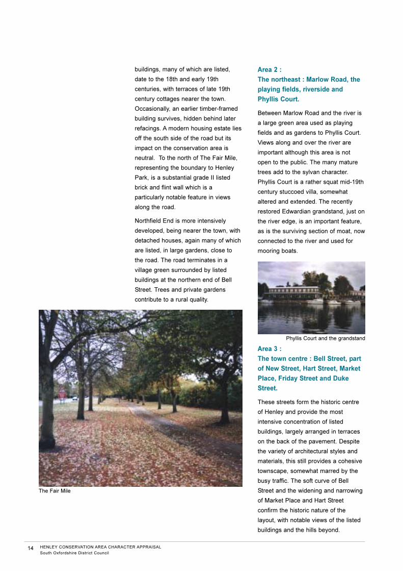
Area 1 :
The Fair Mile and Northfield Road.
These two streets provide a stunning
entrance to the northern side of Henley
from Wallingford. The Fair Mile was
improved in the early 1840s with the
addition of the elm avenue which has
now been replanted. The building plots
are particularly spacious and the
setting, amongst fields and areas of
woodland, is attractive. The wide grass
verges, large gardens, neat hedges
and mainly paired or detached houses,
set back along a common building line,
create a unique townscape. The
HENLEY CONSERVATION AREA CHARACTER APPRAISAL
South Oxfordshire District Council13
Market Place repaving
buildings, many of which are listed,
date to the 18th and early 19th
centuries, with terraces of late 19th
century cottages nearer the town.
Occasionally, an earlier timber-framed
building survives, hidden behind later
refacings. A modern housing estate lies
off the south side of the road but its
impact on the conservation area is
neutral. To the north of The Fair Mile,
representing the boundary to Henley
Park, is a substantial grade II listed
brick and flint wall which is a
particularly notable feature in views
along the road.
Northfield End is more intensively
developed, being nearer the town, with
detached houses, again many of which
are listed, in large gardens, close to
the road. The road terminates in a
village green surrounded by listed
buildings at the northern end of Bell
Street. Trees and private gardens
contribute to a rural quality.
Area 2 :
The northeast : Marlow Road, the
playing fields, riverside and
Phyllis Court.
Between Marlow Road and the river is
a large green area used as playing
fields and as gardens to Phyllis Court.
Views along and over the river are
important although this area is not
open to the public. The many mature
trees add to the sylvan character.
Phyllis Court is a rather squat mid-19th
century stuccoed villa, somewhat
altered and extended. The recently
restored Edwardian grandstand, just on
the river edge, is an important feature,
as is the surviving section of moat, now
connected to the river and used for
mooring boats.
Area 3 :
The town centre : Bell Street, part
of New Street, Hart Street, Market
Place, Friday Street and Duke
Street.
These streets form the historic centre
of Henley and provide the most
intensive concentration of listed
buildings, largely arranged in terraces
on the back of the pavement. Despite
the variety of architectural styles and
materials, this still provides a cohesive
townscape, somewhat marred by the
busy traffic. The soft curve of Bell
Street and the widening and narrowing
of Market Place and Hart Street
confirm the historic nature of the
layout, with notable views of the listed
buildings and the hills beyond.
14 HENLEY CONSERVATION AREA CHARACTER APPRAISAL
South Oxfordshire District Council
The Fair Mile
Phyllis Court and the grandstand
Many of these buildings retain their
long, narrow burgage plots, defined by
brick and flint walls, which are still used
as gardens. Sometimes, such as to the
rear of no. 18 Hart Street, these old
boundaries have been removed and
car parking inserted, much to the
detriment of the environment. Modern
development is generally confined to
the area around the Waitrose
Supermarket, where the burgage plots
have also been removed to create car
parking. This land has been excluded
from the conservation area although it
lies very close to the historic core of
the town. Similarly, Radnor Close, a
1980s group of houses, is excluded
from the conservation area. The area
to the rear of 23-31 Bell Street is
visually of poor quality.
The most important buildings are the
parish church of St Mary the Virgin, the
Town Hall, Brakspear's Brewery and
the associated malthouse. The most
important spaces are the Market Place,
the churchyard and to a lesser extent,
the area around the northern end of
Northfield Road, where it widens into a
triangular space.
St Mary's Church dates in part to the
early 13th century although the tower
was not added until 1540, probably by
John Longland, Bishop of Lincoln. It is
particularly noticeable for its use of
brick and flint and for its location at the
end of Hart Street, connecting the town
to the river Thames. To the rear of the
church, facing the churchyard, is the
Chantry House, the oldest secular
building in Henley. It is constructed
from timber and it is said that it was
built for the Chantry priests, who sang
masses for the local inhabitants. It
dates from the late 15th century and
has recently been extensively restored
with the help of a grant from English
Heritage.
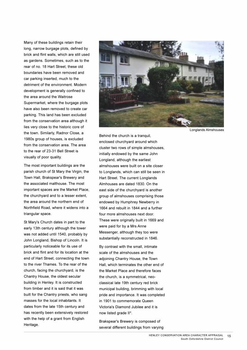
Behind the church is a tranquil,
enclosed churchyard around which
cluster two rows of simple almshouses,
initially endowed by the same John
Longland, although the earliest
almshouses were built on a site closer
to Longlands, which can still be seen in
Hart Street. The current Longlands
Almhouses are dated 1830. On the
east side of the churchyard is another
group of almshouses comprising those
endowed by Humphrey Newberry in
1664 and rebuilt in 1844 and a further
four more almshouses next door.
These were originally built in 1669 and
were paid for by a Mrs Anne
Messenger, although they too were
substantially reconstructed in 1846.
By contrast with the small, intimate
scale of the almshouses and the
adjoining Chantry House, the Town
Hall, which terminates the other end of
the Market Place and therefore faces
the church, is a symmetrical, neo-
classical late 19th century red brick
municipal building, brimming with local
pride and importance. It was completed
in 1901 to commemorate Queen
Victoria's Diamond Jubilee and it is
now listed grade II*.
Brakspear's Brewery is composed of
several different buildings from varying
HENLEY CONSERVATION AREA CHARACTER APPRAISAL
South Oxfordshire District Council15
Longlands Almshouses
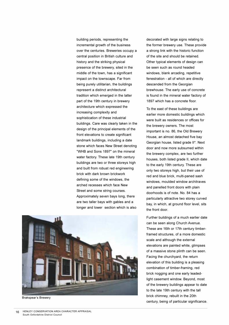
building periods, representing the
incremental growth of the business
over the centuries. Breweries occupy a
central position in British culture and
history and the striking physical
presence of the brewery, sited in the
middle of the town, has a significant
impact on the townscape. Far from
being purely utilitarian, the buildings
represent a distinct architectural
tradition which emerged in the latter
part of the 19th century in brewery
architecture which expressed the
increasing complexity and
sophistication of these industrial
buildings. Care was clearly taken in the
design of the principal elements of the
front elevations to create significant
landmark buildings, including a date
stone which faces New Street denoting
"WHB and Sons 1897" on the mineral
water factory. These late 19th century
buildings are two or three storeys high
and built from robust red engineering
brick with dark brown brickwork
defining some of the windows, the
arched recesses which face New
Street and some string courses.
Approximately seven bays long, there
are two taller bays with gables and a
longer and lower section which is also
decorated with large signs relating to
the former brewery use. These provide
a strong link with the historic function
of the site and should be retained.
Other typical elements of design can
be seen such as round headed
windows, blank arcading, repetitive
fenestration - all of which are directly
descended from the Georgian
brewhouse. The early use of concrete
is found in the mineral water factory of
1897 which has a concrete floor.
To the east of these buildings are
earlier more domestic buildings which
were built as residences or offices for
the brewery owners. The most
important is no. 86, the Old Brewery
House, an almost detached five bay
Georgian house, listed grade II*. Next
door and now more subsumed within
the brewery complex, are two further
houses, both listed grade II, which date
to the early 19th century. These are
only two storeys high, but their use of
red and blue brick, multi-paned sash
windows, moulded window architraves
and panelled front doors with plain
doorhoods is of note. No. 84 has a
particularly attractive two storey curved
bay, in which, at ground floor level, sits
the front door.
Further buildings of a much earlier date
can be seen along Church Avenue.
These are 16th or 17th century timber-
framed structures, of a more domestic
scale and although the external
elevations are painted white, glimpses
of a massive stone plinth can be seen.
Facing the churchyard, the return
elevation of this building is a pleasing
combination of timber-framing, red
brick nogging and one early leaded-
light casement window. Beyond, most
of the brewery buildings appear to date
to the late 19th century with the tall
brick chimney, rebuilt in the 20th
century, being of particular significance.
16 HENLEY CONSERVATION AREA CHARACTER APPRAISAL
South Oxfordshire District Council
Brakspear’s Brewery
To either side of the brewery are long
courtyards, glimpsed from New Street
behind iron gates, the smaller of which
lies between nos. 84 and 86 New
Street. This is notable for the various
architectural features associated with
the lifting and storage of beer and for
the view of the brick chimney beyond.
The larger courtyard, which lies to the
western boundary of the brewery, is
more generously sized, reflecting its
use as a garden to nos. 37 and 39 Hart
Street until at least 1925. The buildings
facing the driveway through to the rear
are also built from the red and blue
brick of the late 19th century frontage
buildings, as is the boundary wall with
no. 76. This courtyard faces a very
interesting row of late medieval
cottages - nos. 58-76 New Street.
This once common form of architecture
is becoming increasingly rare. The
1960s saw the closure of many
breweries and the widespread
indifference to Victorian architecture at
that time meant that many brewery
buildings were simply demolished. This
means that those surviving, such as
Henley Brewery, have important
historical significance.
Also significant within Area 3 are the
several remaining former coaching inns
: the Catherine Wheel, the Red Lion
and the Old White Hart, all in Hart
Street. These are a reminder of the
importance of the town as a stopping
point on one of the main routes to
London from Oxford as well its position
as a main market town in the upper
Thames Valley.
The pedestrian priority area in the
centre of the Market Place provides an
appropriate setting to the Town Hall
and has been carefully landscaped.
This is the most important public open
space in Henley and is surrounded by
various cafes and restaurants, which
give the area a vitality and which is
particularly popular with visitors and
residents alike.
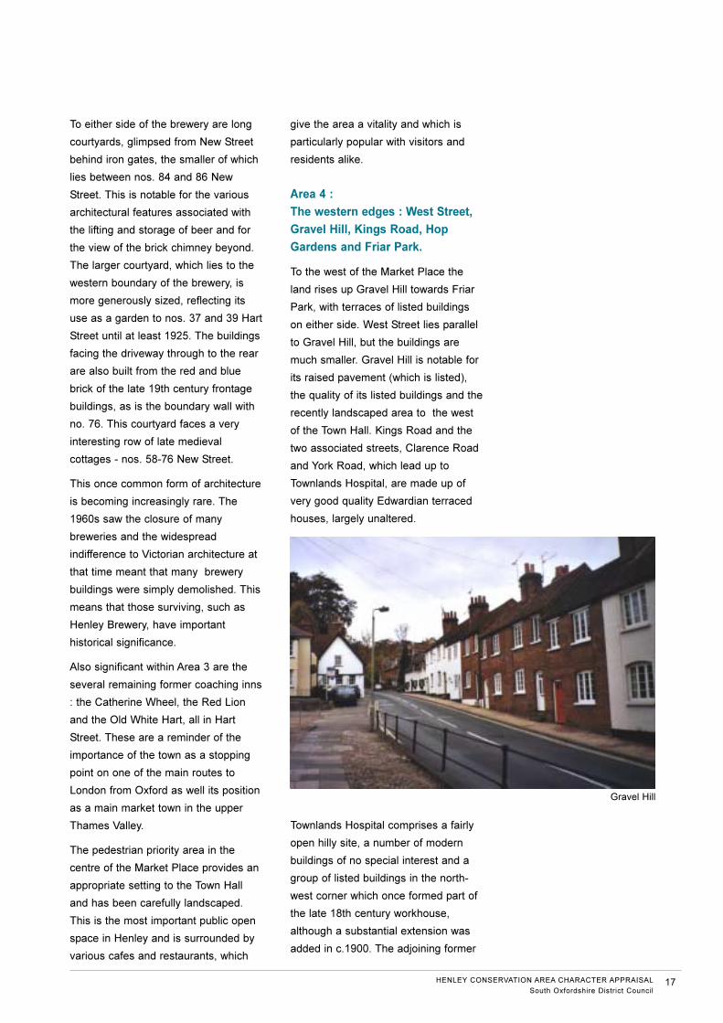
Area 4 :
The western edges : West Street,
Gravel Hill, Kings Road, Hop
Gardens and Friar Park.
To the west of the Market Place the
land rises up Gravel Hill towards Friar
Park, with terraces of listed buildings
on either side. West Street lies parallel
to Gravel Hill, but the buildings are
much smaller. Gravel Hill is notable for
its raised pavement (which is listed),
the quality of its listed buildings and the
recently landscaped area to the west
of the Town Hall. Kings Road and the
two associated streets, Clarence Road
and York Road, which lead up to
Townlands Hospital, are made up of
very good quality Edwardian terraced
houses, largely unaltered.
Townlands Hospital comprises a fairly
open hilly site, a number of modern
buildings of no special interest and a
group of listed buildings in the north-
west corner which once formed part of
the late 18th century workhouse,
although a substantial extension was
added in c.1900. The adjoining former
HENLEY CONSERVATION AREA CHARACTER APPRAISAL
South Oxfordshire District Council17
Gravel Hill
school buildings are of a similar age,
recently listed. Their current neglected
appearance is of concern. The recently
listed pest house dating from the late
19th century, lies in the centre of the
site, isolated from the main buildings.
This is a significant survival
demonstrating an early application of
medical knowledge on the spread of
infectious diseases. The site is
proposed for some redevelopment.
Hop Gardens is a long straight road
defined on its western side by the
boundary of Friar Park. To the east of
Hop Gardens are a number of late 19th
century houses and cottages, mainly
listed, the most significant of which are
the six pairs of cottages, built for Friar
Park estate workers. Fonthill dates to
1881 and forms a group with no. 2 and
Surrey Lodge, all of which are listed.
The gardens are spacious with mature
trees and shrubbery, with good views
eastwards across to the Chiltern hills
beyond the river.
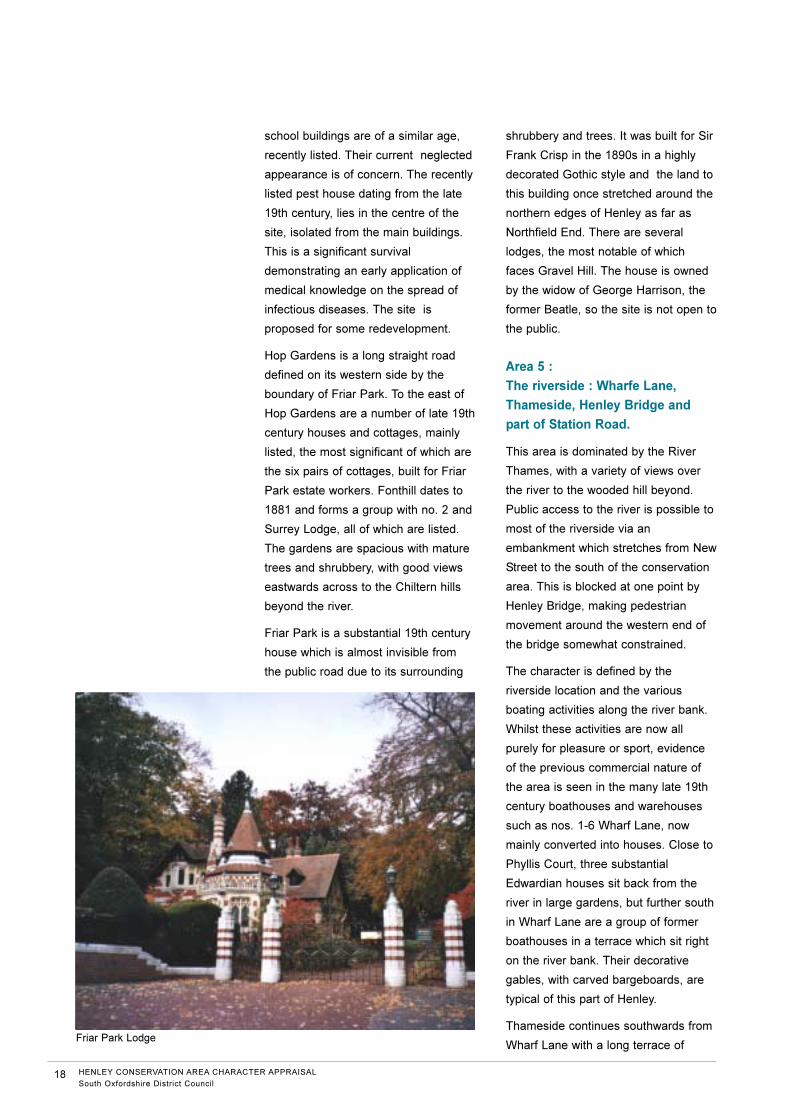
Friar Park is a substantial 19th century
house which is almost invisible from
the public road due to its surrounding
shrubbery and trees. It was built for Sir
Frank Crisp in the 1890s in a highly
decorated Gothic style and the land to
this building once stretched around the
northern edges of Henley as far as
Northfield End. There are several
lodges, the most notable of which
faces Gravel Hill. The house is owned
by the widow of George Harrison, the
former Beatle, so the site is not open to
the public.
Area 5 :
The riverside : Wharfe Lane,
Thameside, Henley Bridge and
part of Station Road.
This area is dominated by the River
Thames, with a variety of views over
the river to the wooded hill beyond.
Public access to the river is possible to
most of the riverside via an
embankment which stretches from New
Street to the south of the conservation
area. This is blocked at one point by
Henley Bridge, making pedestrian
movement around the western end of
the bridge somewhat constrained.
The character is defined by the
riverside location and the various
boating activities along the river bank.
Whilst these activities are now all
purely for pleasure or sport, evidence
of the previous commercial nature of
the area is seen in the many late 19th
century boathouses and warehouses
such as nos. 1-6 Wharf Lane, now
mainly converted into houses. Close to
Phyllis Court, three substantial
Edwardian houses sit back from the
river in large gardens, but further south
in Wharf Lane are a group of former
boathouses in a terrace which sit right
on the river bank. Their decorative
gables, with carved bargeboards, are
typical of this part of Henley.
Thameside continues southwards from
Wharf Lane with a long terrace of
18 HENLEY CONSERVATION AREA CHARACTER APPRAISAL
South Oxfordshire District Council
Friar Park Lodge
varied buildings, mainly listed, ending
in the Red Lion Hotel and, just around
the corner, St Mary's Church. Other
important hotels include the Little
White Hart Hotel, an early 20th century
replacement of a much earlier hotel on
the site and the Angel Hotel, an 18th
century hostelry overlooking Henley
Bridge. The histories of these and
other public houses and hotels in
Henley are amply described in Ann
Cottingham's book.
Henley's riverside location also
provided the perfect setting for the
annual Henley Royal Regatta, which
takes place at the end of June. It
started in 1829 when Oxford and
Cambridge Universities held a boat-
race from Hambleden to Henley. The
popularity of the event led to the first
Regatta being held in 1839, with royal
patronage being established in 1851
when Prince Albert attended. Today,
the week-long series of rowing races,
parties and general socialising is a
major part of the social calendar and
brings huge numbers of visitors into the
town.
The second section of Thameside
contains more 18th and 19th century
houses and cottages facing the water.
Nos. 7-19 Thameside are a group of
tall, stuccoed houses, the only
example of a prestigious, purpose-built
terrace in Henley. The enjoyment of
this area is somewhat spoilt by the
busy traffic but the riverside location,
including the walkways next to the river
bank, provides an attractive
environment.
Beyond the turning into Station Road,
there are more Edwardian boathouses,
similar to those on the northern fringes
of this area, but set back from the river
bank with a wide, pedestrian-only
walkway. Modern development has
been successfully provided, marrying-
in extremely well with the existing
buildings.
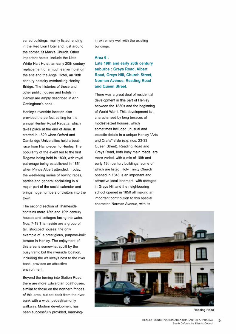
Area 6 :
Late 19th and early 20th century
suburbs : Greys Road, Albert
Road, Greys Hill, Church Street,
Norman Avenue, Reading Road
and Queen Street.
There was a great deal of residential
development in this part of Henley
between the 1880s and the beginning
of World War I. This development is ,
characterised by long terraces of
modest-sized houses, which
sometimes included unusual and
eclectic details in a unique Henley "Arts
and Crafts" style (e.g. nos. 23-33
Queen Street). Reading Road and
Greys Road, both busy main roads, are
more varied, with a mix of 18th and
early 19th century buildings, some of
which are listed. Holy Trinity Church
opened in 1848 is an important and
attractive local landmark, with cottages
in Greys Hill and the neighbouring
school opened in 1850 all making an
important contribution to this special
character. Norman Avenue, with its
HENLEY CONSERVATION AREA CHARACTER APPRAISAL
South Oxfordshire District Council19
Reading Road
trees and quiet location, provides some
more interesting late 19th century
buildings, also listed. The United
Reformed Church is notable as the
resting place of the brother of the
famous painter Thomas Gainsborough.
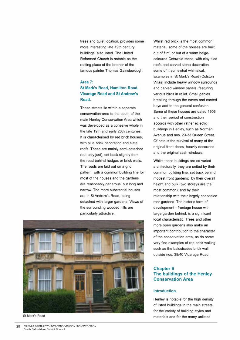
Area 7:
St Mark's Road, Hamilton Road,
Vicarage Road and St Andrew's
Road.
These streets lie within a separate
conservation area to the south of the
main Henley Conservation Area which
was developed as a cohesive whole in
the late 19th and early 20th centuries.
It is characterised by red brick houses,
with blue brick decoration and slate
roofs. These are mainly semi-detached
(but only just), set back slightly from
the road behind hedges or brick walls.
The roads are laid out on a grid
pattern, with a common building line for
most of the houses and the gardens
are reasonably generous, but long and
narrow. The more substantial houses
are in St Andrew's Road, being
detached with larger gardens. Views of
the surrounding wooded hills are
particularly attractive.
Whilst red brick is the most common
material, some of the houses are built
out of flint, or out of a warm beige-
coloured Cotswold stone, with clay tiled
roofs and carved stone decoration,
some of it somewhat whimsical.
Examples in St Mark's Road (Colston
Villas) include heavy window surrounds
and carved window panels, featuring
various birds in relief. Small gables
breaking through the eaves and canted
bays add to the general confusion.
Some of these houses are dated 1906
and their period of construction
accords with other rather eclectic
buildings in Henley, such as Norman
Avenue and nos. 23-33 Queen Street.
Of note is the survival of many of the
original front doors, heavily decorated
and the original sash windows.
Whilst these buildings are so varied
architecturally, they are united by their
common building line, set back behind
modest front gardens; by their overall
height and bulk (two storeys are the
most common); and by their
relationship with their largely concealed
rear gardens. The historic form of
development - frontage house with
large garden behind, is a significant
local characteristic. Trees and other
more open gardens also make an
important contribution to the character
of the conservation area, as do some
very fine examples of red brick walling,
such as the balustraded brick wall
outside nos. 38/40 Vicarage Road.
Chapter 6
The buildings of the HenleyConservation Area
Introduction.
Henley is notable for the high density
of listed buildings in the main streets,
for the variety of building styles and
materials and for the many unlisted
20 HENLEY CONSERVATION AREA CHARACTER APPRAISAL
South Oxfordshire District Council
St Mark's Road
buildings, mainly dating to the late
19th or early 20th centuries, which also
make a very positive contribution to the
character of the conservation area.
These are called "Buildings of
Townscape Merit" and these and all of
the listed buildings are marked on the
Townscape Appraisal maps.
The survival of the medieval street
pattern and adjoining burgage plots
has ensured that development within
the town centre has largely followed
the historic template, so most buildings
are modest in size (two or three
storeys) often with long outshuts to the
back. These are usually accessed by
carriageways through the buildings,
providing glimpses of cobbled
courtyards, as in Hart Street (no. 16,
no. 18, the Catherine Wheel Hotel,
nos. 27-29 and no. 39).
Roofs are invariably fairly steeply
pitched, with local handmade tiles
typical on buildings up to the mid 19th
century. After then, improved
communications provided easier
access to materials from further afield
and Welsh slate can often be found on
buildings dating from the latter part of
the 19th century. Red brick, often
mixed with a silvery-blue brick, was
very popular between 1700 and the
early 19th century. After then the
enthusiasm for Italianate architecture
led to the use of painted stucco, often
lined out to replicate stone. More
recently, timber-framed buildings of the
16th and 17th centuries have been
discovered and in some cases
revealed by removing more modern
refacings. A typical example are nos.
33 and 35 Duke Street, a grade II listed
building with an old peg tiled roof
where the recent removal of the
rendering to the side elevation has
revealed timber frame, possibly dating
from the 16th century.
Listed buildings.
There are approximately 378 listed
buildings in the Henley Conservation
Area. The statutory list was drawn up
in 1974 and it includes a much greater
variety of buildings than is usual,
including many late 19th century
buildings such as the highly decorated
houses in Norman Avenue.
The earliest buildings were mainly
timber-framed, but after about 1700
brick became more fashionable and
cheaper so many of the existing
timber-framed structures were either
refronted or else demolished and
rebuilt. Many of the listed buildings in
Henley's principal streets are therefore
either timber-framed or refaced in
brick, with Georgian details. In the
early 19th century, stucco, often lined
out to imitate stone, was considered to
be the most desirable building material
and examples can be found in Bell
Street particularly.
There is one grade I listed building in
the conservation area, the Chantry
House, which is located behind the
Red Lion Hotel, facing the churchyard.
This is a timber-framed building dating
c.1400-1500. It was said to have
housed the Chantry priests. Later it
became a school until 1846. It was
referred to as ‘The Old School’ until
1920s and is now owned by the church
and used for community purposes and
has recently been extensively restored
with the help of English Heritage.
In addition, there are 13 grade II* listed
buildings, as follows:
● St Mary's Church, Hart Street (13th,
15th and 19th century)
● The Town Hall in the Market Place
(Architect Henry T Hare, completed
1900).
HENLEY CONSERVATION AREA CHARACTER APPRAISAL
South Oxfordshire District Council21
● No. 32 Bell Street (18th century
house).
● Nos. 86 and 88 Bell Street (18th
century house).
● The Old White Hart, nos. 19B, 21
and 23 Hart Street (possibly 13th
century cellar, late 15th or early
16th century timber-framing).
● Nos. 74, 76, 78 Bell Street (which
have been dendrodated to 1406).
● 18 Hart Street (18th century front,
earlier building behind)
● Longlands, no. 39 Hart Street (18th
century front to older house, which
contains magnificent 18th century
staircase)
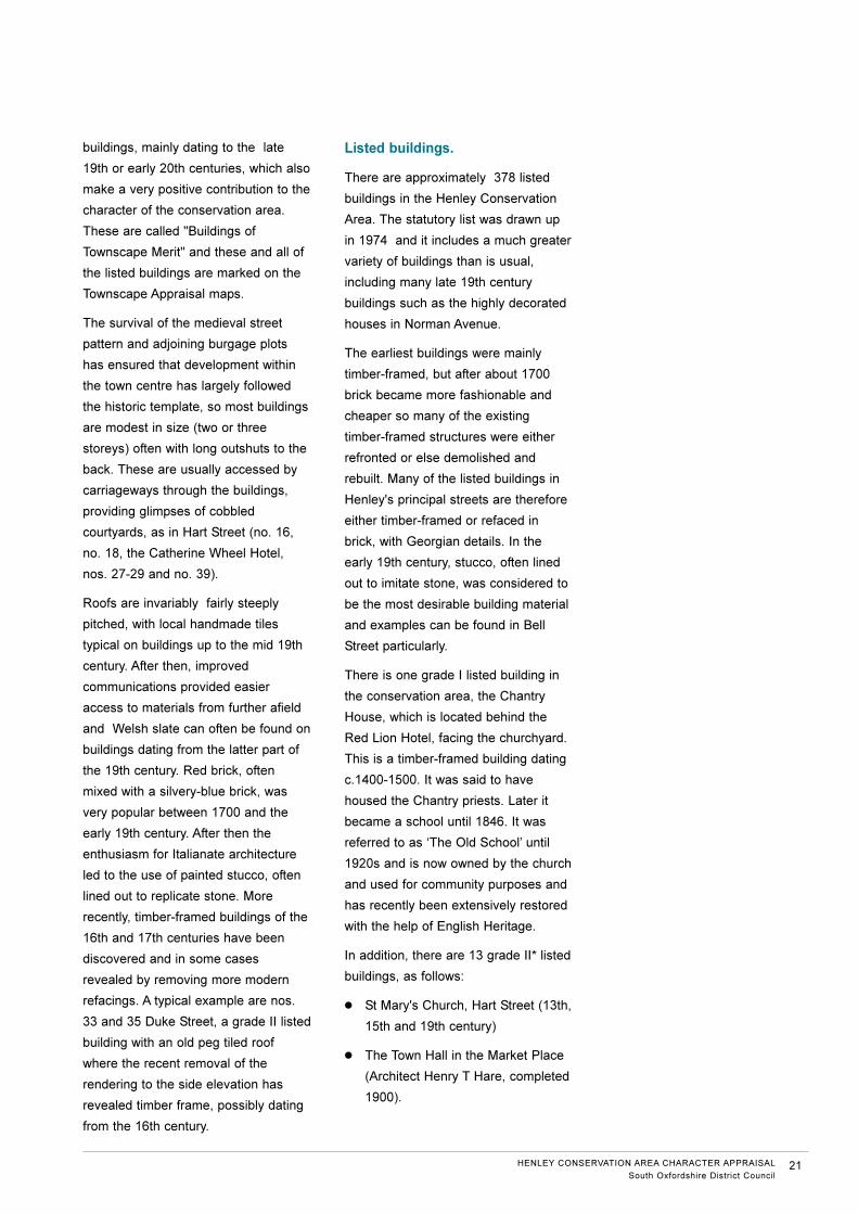
● Old Brewery House, no. 86 New
Street (18th century)
● Northfield House, no. 11 Northfield
End (18th century)
● Former Bell Inn, now 3 houses (Elm
House, Ruperts Elm and Ruperts
Guard), Northfield End (17th/18th
century coaching inn, later the
Royal Grammar School)
● The Rectory, no. 17 Thameside
(c.1700)
● Phyllis Court Lodge and gates,
Marlow Road (late 18th century,
possibly by James Wyatt)
Henley also retains a great number of
early timber-framed buildings, although
it is very likely that more await to be
discovered behind later façades. Of
note are the several examples dating
to the 15th century, some of which
appear to have contained open halls
(nos. 2 and 4 Reading Road and no.
76 Bell Street). These buildings
represent a building type of the late
medieval period, when halls open to
the roof and heated by a central hearth
were ubiquitous. Changes in social and
cultural values after the mid-16th
century combined with improvements
in housing technology led to a decline
in the open hall. Brick chimneys were
inserted and the open halls were
floored over to create additional
accommodation. Their existence can
sometimes be confirmed by the
evidence of smoke-blackened roof
timbers, resulting from the use of open
fires in the hall below.
Most of the listed buildings in Henley
were built for domestic purposes and
these form the majority of the buildings
in Hart Street, Market Place, Bell Street,
New Street and Friday Street. However,
there are also a number of other listed
buildings of note which were built for
religious, commercial or community
uses. The most important are:
● St Mary's Church, Hart Street (13th
century nave, 15th and 19th
century).
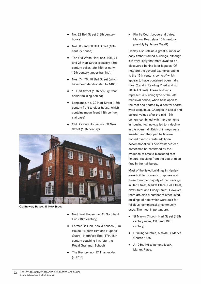
● Drinking fountain, outside St Mary's
Church 1885.
● A 1930s K6 telephone kiosk,
Market Place.
22 HENLEY CONSERVATION AREA CHARACTER APPRAISAL
South Oxfordshire District Council
Old Brewery House, 86 New Street
● Henley Bridge was largely rebuilt in
1786 to the designs of William
Hayward alongside the 12th
century bridge, the arches of which
remain on both sides of the river.
This possibly dates to Henry II's
setting out of the new town in the
1170s. Keystones of Thamesis and
Isis carved by sculptress Mrs
Damer at the time of construction.
● Former Workhouse and Pest
House, Townlands Hospital 1790
● Holy Trinity Church, Church Street
1848 by Benjamin Ferrey
● Former school building, Gravel Hill
1879.
● Main building at South Oxfordshire
Technical College. Mid 19th century
Jacobean style using knapped flint,
stone quoins and window dressings
tiled roofs.
● Friar Park 1889. Architect M Clarke
Edwards for Sir Frank Crisp.
● Old School House, Hart Street
1856. Architect James Brooks, now
a house.
● Henley Baptist Church, Market
Place 1878.
● Grandstand in grounds of Phyllis
Court (probably 1913 by G F
Sainsbury).
● Kenton Theatre, nos. 19 and 21
New Street. A rare example of an
early 19th century purpose-built
theatre, still in use. This is the third
oldest working theatre in the
country.
● Malthouse to Henley Brewery, New
Street. A late 19th double
malthouse with two prominent
towers.
● Brakspear's Brewery , New Street.
An extremely interesting former
brewery with some 16th century
timber framed buildings and a
grade II* brewer's house facing the
street.
● Christ Church, Hall and Manse
1907. Architect Hampden Pratt.
● R C Church of the Sacred Heart,
Vicarage Road 1936. Architect A S
G Butler designed to incorporate an
alter, mensa and pulpit by A W
Pugin and a reredos by E W Pugin.
Buildings of Townscape Merit.
Within Henley there are a large number
of unlisted Buildings of Townscape
Merit, which make a positive
contribution to the character and
appearance of the conservation area.
They include 19th century shops
(where they still retain the majority of
their original details) and groups of
good quality late Victorian and
Edwardian houses. These buildings
have been identified as part of the
appraisal process and are marked on
the Townscape Appraisal map.
HENLEY CONSERVATION AREA CHARACTER APPRAISAL
South Oxfordshire District Council23
Philimore Fountain, Hart Street
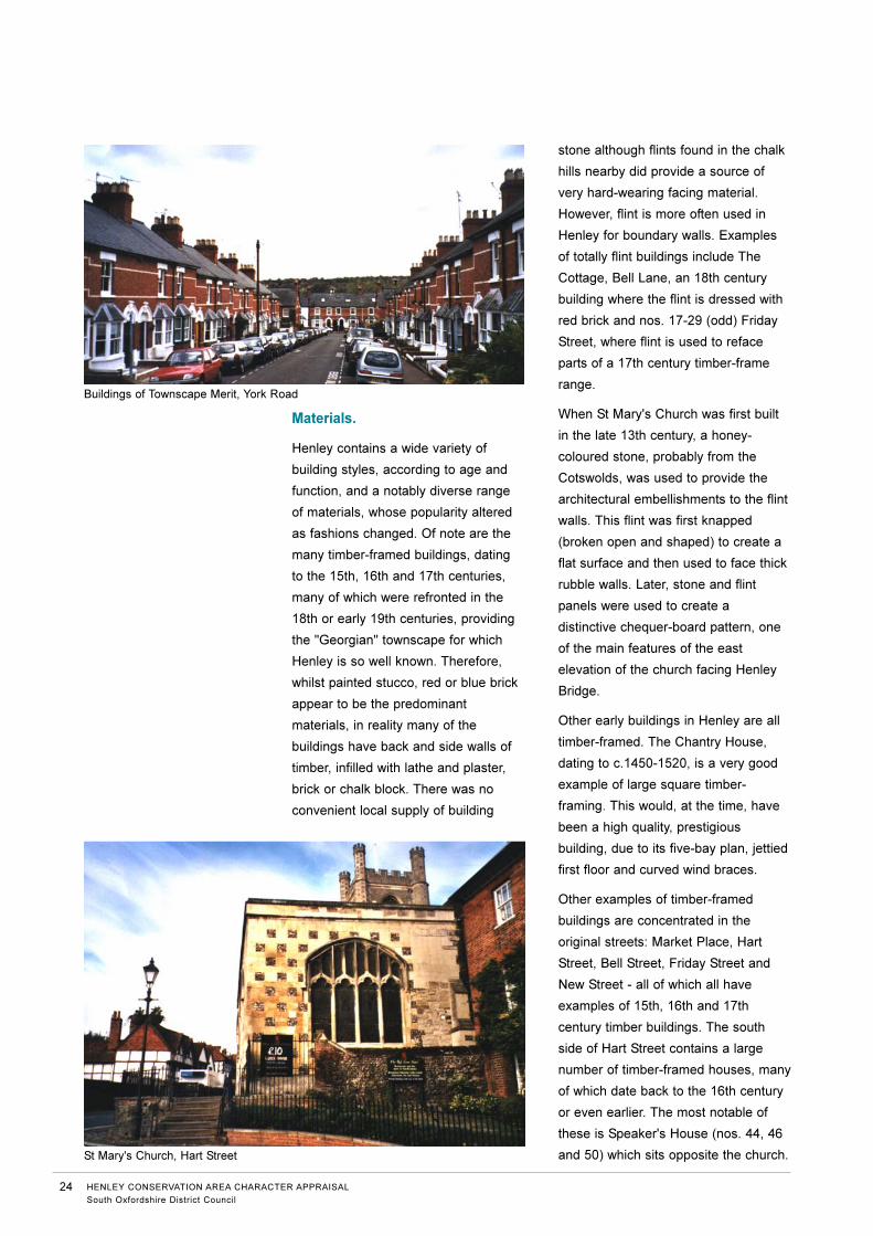
Materials.
Henley contains a wide variety of
building styles, according to age and
function, and a notably diverse range
of materials, whose popularity altered
as fashions changed. Of note are the
many timber-framed buildings, dating
to the 15th, 16th and 17th centuries,
many of which were refronted in the
18th or early 19th centuries, providing
the "Georgian" townscape for which
Henley is so well known. Therefore,
whilst painted stucco, red or blue brick
appear to be the predominant
materials, in reality many of the
buildings have back and side walls of
timber, infilled with lathe and plaster,
brick or chalk block. There was no
convenient local supply of building
stone although flints found in the chalk
hills nearby did provide a source of
very hard-wearing facing material.
However, flint is more often used in
Henley for boundary walls. Examples
of totally flint buildings include The
Cottage, Bell Lane, an 18th century
building where the flint is dressed with
red brick and nos. 17-29 (odd) Friday
Street, where flint is used to reface
parts of a 17th century timber-frame
range.
When St Mary's Church was first built
in the late 13th century, a honey-
coloured stone, probably from the
Cotswolds, was used to provide the
architectural embellishments to the flint
walls. This flint was first knapped
(broken open and shaped) to create a
flat surface and then used to face thick
rubble walls. Later, stone and flint
panels were used to create a
distinctive chequer-board pattern, one
of the main features of the east
elevation of the church facing Henley
Bridge.
Other early buildings in Henley are all
timber-framed. The Chantry House,
dating to c.1450-1520, is a very good
example of large square timber-
framing. This would, at the time, have
been a high quality, prestigious
building, due to its five-bay plan, jettied
first floor and curved wind braces.
Other examples of timber-framed
buildings are concentrated in the
original streets: Market Place, Hart
Street, Bell Street, Friday Street and
New Street - all of which all have
examples of 15th, 16th and 17th
century timber buildings. The south
side of Hart Street contains a large
number of timber-framed houses, many
of which date back to the 16th century
or even earlier. The most notable of
these is Speaker's House (nos. 44, 46
and 50) which sits opposite the church.
24 HENLEY CONSERVATION AREA CHARACTER APPRAISAL
South Oxfordshire District Council
St Mary's Church, Hart Street
Buildings of Townscape Merit, York Road
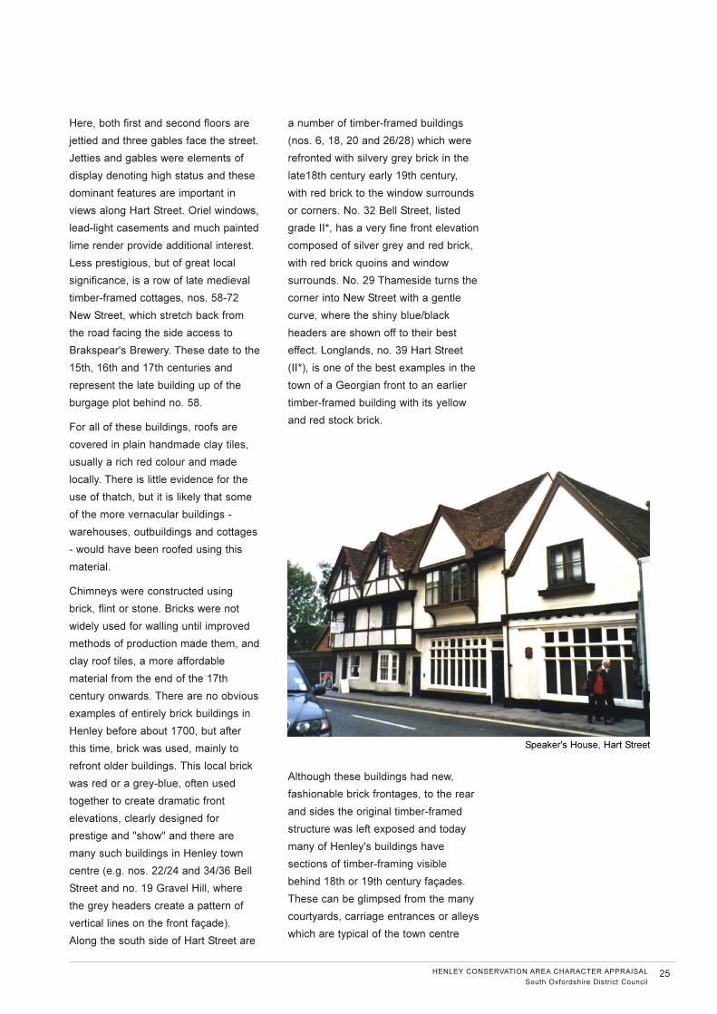
Here, both first and second floors are
jettied and three gables face the street.
Jetties and gables were elements of
display denoting high status and these
dominant features are important in
views along Hart Street. Oriel windows,
lead-light casements and much painted
lime render provide additional interest.
Less prestigious, but of great local
significance, is a row of late medieval
timber-framed cottages, nos. 58-72
New Street, which stretch back from
the road facing the side access to
Brakspear's Brewery. These date to the
15th, 16th and 17th centuries and
represent the late building up of the
burgage plot behind no. 58.
For all of these buildings, roofs are
covered in plain handmade clay tiles,
usually a rich red colour and made
locally. There is little evidence for the
use of thatch, but it is likely that some
of the more vernacular buildings -
warehouses, outbuildings and cottages
- would have been roofed using this
material.
Chimneys were constructed using
brick, flint or stone. Bricks were not
widely used for walling until improved
methods of production made them, and
clay roof tiles, a more affordable
material from the end of the 17th
century onwards. There are no obvious
examples of entirely brick buildings in
Henley before about 1700, but after
this time, brick was used, mainly to
refront older buildings. This local brick
was red or a grey-blue, often used
together to create dramatic front
elevations, clearly designed for
prestige and "show" and there are
many such buildings in Henley town
centre (e.g. nos. 22/24 and 34/36 Bell
Street and no. 19 Gravel Hill, where
the grey headers create a pattern of
vertical lines on the front façade).
Along the south side of Hart Street are
a number of timber-framed buildings
(nos. 6, 18, 20 and 26/28) which were
refronted with silvery grey brick in the
late18th century early 19th century,
with red brick to the window surrounds
or corners. No. 32 Bell Street, listed
grade II*, has a very fine front elevation
composed of silver grey and red brick,
with red brick quoins and window
surrounds. No. 29 Thameside turns the
corner into New Street with a gentle
curve, where the shiny blue/black
headers are shown off to their best
effect. Longlands, no. 39 Hart Street
(II*), is one of the best examples in the
town of a Georgian front to an earlier
timber-framed building with its yellow
and red stock brick.
Although these buildings had new,
fashionable brick frontages, to the rear
and sides the original timber-framed
structure was left exposed and today
many of Henley's buildings have
sections of timber-framing visible
behind 18th or 19th century façades.
These can be glimpsed from the many
courtyards, carriage entrances or alleys
which are typical of the town centre
HENLEY CONSERVATION AREA CHARACTER APPRAISAL
South Oxfordshire District Council25
Speaker's House, Hart Street
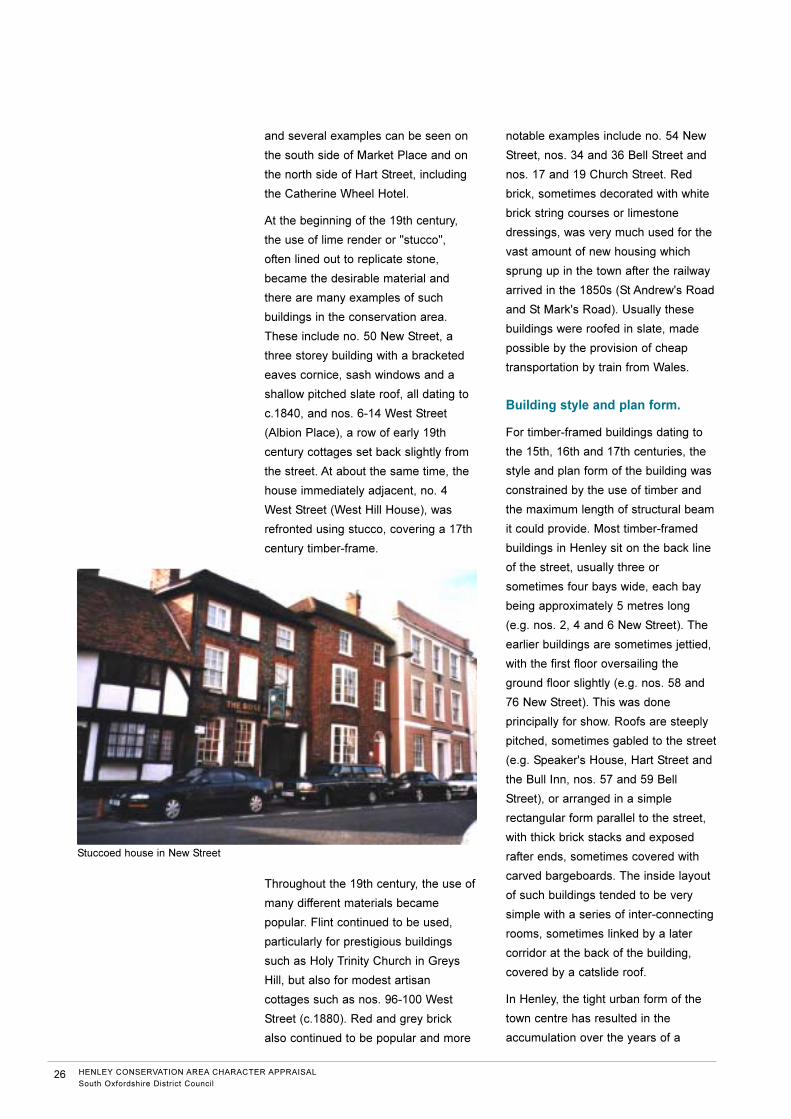
and several examples can be seen on
the south side of Market Place and on
the north side of Hart Street, including
the Catherine Wheel Hotel.
At the beginning of the 19th century,
the use of lime render or "stucco",
often lined out to replicate stone,
became the desirable material and
there are many examples of such
buildings in the conservation area.
These include no. 50 New Street, a
three storey building with a bracketed
eaves cornice, sash windows and a
shallow pitched slate roof, all dating to
c.1840, and nos. 6-14 West Street
(Albion Place), a row of early 19th
century cottages set back slightly from
the street. At about the same time, the
house immediately adjacent, no. 4
West Street (West Hill House), was
refronted using stucco, covering a 17th
century timber-frame.
Throughout the 19th century, the use of
many different materials became
popular. Flint continued to be used,
particularly for prestigious buildings
such as Holy Trinity Church in Greys
Hill, but also for modest artisan
cottages such as nos. 96-100 West
Street (c.1880). Red and grey brick
also continued to be popular and more
notable examples include no. 54 New
Street, nos. 34 and 36 Bell Street and
nos. 17 and 19 Church Street. Red
brick, sometimes decorated with white
brick string courses or limestone
dressings, was very much used for the
vast amount of new housing which
sprung up in the town after the railway
arrived in the 1850s (St Andrew's Road
and St Mark's Road). Usually these
buildings were roofed in slate, made
possible by the provision of cheap
transportation by train from Wales.
Building style and plan form.
For timber-framed buildings dating to
the 15th, 16th and 17th centuries, the
style and plan form of the building was
constrained by the use of timber and
the maximum length of structural beam
it could provide. Most timber-framed
buildings in Henley sit on the back line
of the street, usually three or
sometimes four bays wide, each bay
being approximately 5 metres long
(e.g. nos. 2, 4 and 6 New Street). The
earlier buildings are sometimes jettied,
with the first floor oversailing the
ground floor slightly (e.g. nos. 58 and
76 New Street). This was done
principally for show. Roofs are steeply
pitched, sometimes gabled to the street
(e.g. Speaker's House, Hart Street and
the Bull Inn, nos. 57 and 59 Bell
Street), or arranged in a simple
rectangular form parallel to the street,
with thick brick stacks and exposed
rafter ends, sometimes covered with
carved bargeboards. The inside layout
of such buildings tended to be very
simple with a series of inter-connecting
rooms, sometimes linked by a later
corridor at the back of the building,
covered by a catslide roof.
In Henley, the tight urban form of the
town centre has resulted in the
accumulation over the years of a
26 HENLEY CONSERVATION AREA CHARACTER APPRAISAL
South Oxfordshire District Council
Stuccoed house in New Street
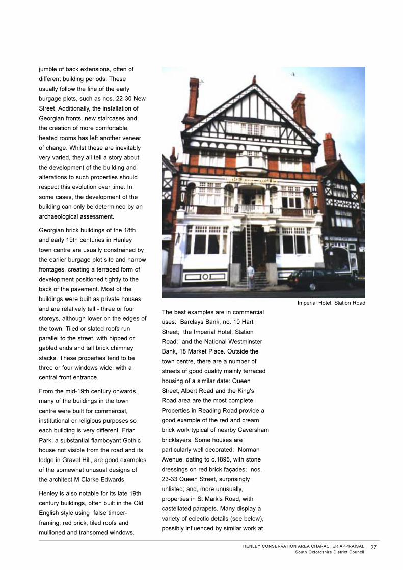
jumble of back extensions, often of
different building periods. These
usually follow the line of the early
burgage plots, such as nos. 22-30 New
Street. Additionally, the installation of
Georgian fronts, new staircases and
the creation of more comfortable,
heated rooms has left another veneer
of change. Whilst these are inevitably
very varied, they all tell a story about
the development of the building and
alterations to such properties should
respect this evolution over time. In
some cases, the development of the
building can only be determined by an
archaeological assessment.
Georgian brick buildings of the 18th
and early 19th centuries in Henley
town centre are usually constrained by
the earlier burgage plot site and narrow
frontages, creating a terraced form of
development positioned tightly to the
back of the pavement. Most of the
buildings were built as private houses
and are relatively tall - three or four
storeys, although lower on the edges of
the town. Tiled or slated roofs run
parallel to the street, with hipped or
gabled ends and tall brick chimney
stacks. These properties tend to be
three or four windows wide, with a
central front entrance.
From the mid-19th century onwards,
many of the buildings in the town
centre were built for commercial,
institutional or religious purposes so
each building is very different. Friar
Park, a substantial flamboyant Gothic
house not visible from the road and its
lodge in Gravel Hill, are good examples
of the somewhat unusual designs of
the architect M Clarke Edwards.
Henley is also notable for its late 19th
century buildings, often built in the Old
English style using false timber-
framing, red brick, tiled roofs and
mullioned and transomed windows.
The best examples are in commercial
uses: Barclays Bank, no. 10 Hart
Street; the Imperial Hotel, Station
Road; and the National Westminster
Bank, 18 Market Place. Outside the
town centre, there are a number of
streets of good quality mainly terraced
housing of a similar date: Queen
Street, Albert Road and the King's
Road area are the most complete.
Properties in Reading Road provide a
good example of the red and cream
brick work typical of nearby Caversham
bricklayers. Some houses are
particularly well decorated: Norman
Avenue, dating to c.1895, with stone
dressings on red brick façades; nos.
23-33 Queen Street, surprisingly
unlisted; and, more unusually,
properties in St Mark's Road, with
castellated parapets. Many display a
variety of eclectic details (see below),
possibly influenced by similar work at
HENLEY CONSERVATION AREA CHARACTER APPRAISAL
South Oxfordshire District Council27
Imperial Hotel, Station Road
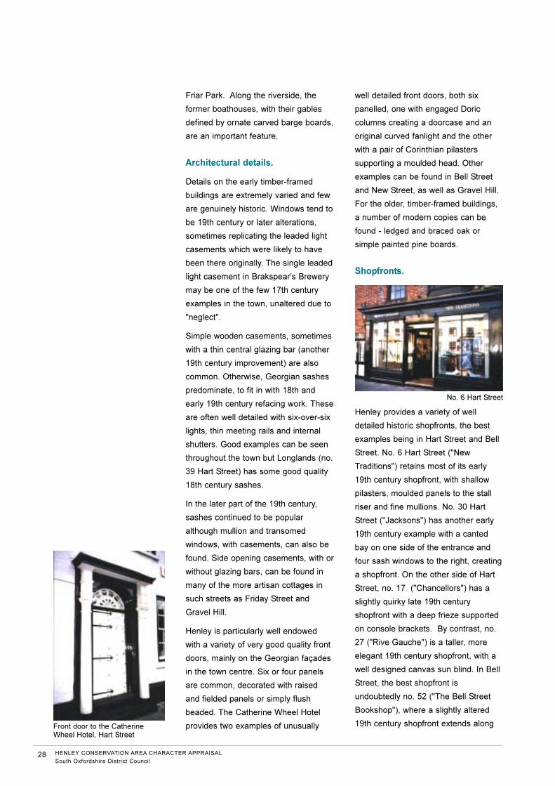
Friar Park. Along the riverside, the
former boathouses, with their gables
defined by ornate carved barge boards,
are an important feature.
Architectural details.
Details on the early timber-framed
buildings are extremely varied and few
are genuinely historic. Windows tend to
be 19th century or later alterations,
sometimes replicating the leaded light
casements which were likely to have
been there originally. The single leaded
light casement in Brakspear's Brewery
may be one of the few 17th century
examples in the town, unaltered due to
"neglect".
Simple wooden casements, sometimes
with a thin central glazing bar (another
19th century improvement) are also
common. Otherwise, Georgian sashes
predominate, to fit in with 18th and
early 19th century refacing work. These
are often well detailed with six-over-six
lights, thin meeting rails and internal
shutters. Good examples can be seen
throughout the town but Longlands (no.
39 Hart Street) has some good quality
18th century sashes.
In the later part of the 19th century,
sashes continued to be popular
although mullion and transomed
windows, with casements, can also be
found. Side opening casements, with or
without glazing bars, can be found in
many of the more artisan cottages in
such streets as Friday Street and
Gravel Hill.
Henley is particularly well endowed
with a variety of very good quality front
doors, mainly on the Georgian façades
in the town centre. Six or four panels
are common, decorated with raised
and fielded panels or simply flush
beaded. The Catherine Wheel Hotel
provides two examples of unusually
well detailed front doors, both six
panelled, one with engaged Doric
columns creating a doorcase and an
original curved fanlight and the other
with a pair of Corinthian pilasters
supporting a moulded head. Other
examples can be found in Bell Street
and New Street, as well as Gravel Hill.
For the older, timber-framed buildings,
a number of modern copies can be
found - ledged and braced oak or
simple painted pine boards.
Shopfronts.
Henley provides a variety of well
detailed historic shopfronts, the best
examples being in Hart Street and Bell
Street. No. 6 Hart Street ("New
Traditions") retains most of its early
19th century shopfront, with shallow
pilasters, moulded panels to the stall
riser and fine mullions. No. 30 Hart
Street ("Jacksons") has another early
19th century example with a canted
bay on one side of the entrance and
four sash windows to the right, creating
a shopfront. On the other side of Hart
Street, no. 17 ("Chancellors") has a
slightly quirky late 19th century
shopfront with a deep frieze supported
on console brackets. By contrast, no.
27 ("Rive Gauche") is a taller, more
elegant 19th century shopfront, with a
well designed canvas sun blind. In Bell
Street, the best shopfront is
undoubtedly no. 52 ("The Bell Street
Bookshop"), where a slightly altered
19th century shopfront extends along
28 HENLEY CONSERVATION AREA CHARACTER APPRAISAL
South Oxfordshire District Council
Front door to the CatherineWheel Hotel, Hart Street
No. 6 Hart Street

the full width of the building, being
supported midway by two moulded
cast iron pillars.
Most of the historic shopfronts in
Henley are located in listed buildings
and are therefore protected from
unsympathetic alterations. The least
attractive shopfronts are in Bell Street,
in the unlisted buildings such as nos.
10 and 12 ("Anthony Paul" and
"Franciscos") where the fascia is far
too prominent.
HENLEY CONSERVATION AREA CHARACTER APPRAISAL
South Oxfordshire District Council29

Recommended