NOAA IDPNWS Ground Readiness Project
Brian GockelNWS Office of Science and Technology
IDP Ground Readiness Project
June 4, 2014
NOAA Satellite Proving Groundand User Readiness Meeting
2
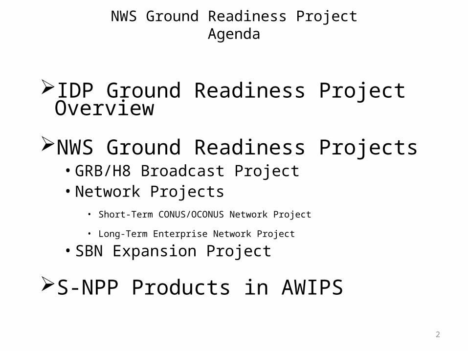
NWS Ground Readiness ProjectAgenda
IDP Ground Readiness Project Overview
NWS Ground Readiness Projects• GRB/H8 Broadcast Project• Network Projects
• Short-Term CONUS/OCONUS Network Project
• Long-Term Enterprise Network Project
• SBN Expansion Project
S-NPP Products in AWIPS
3
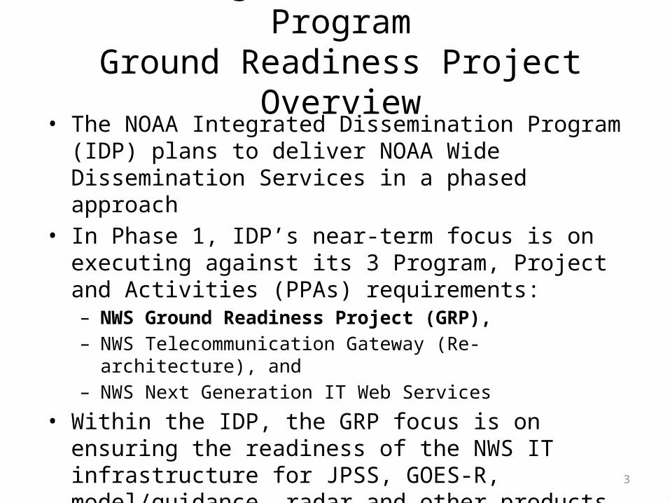
NOAA Integrated Dissemination ProgramGround Readiness Project Overview
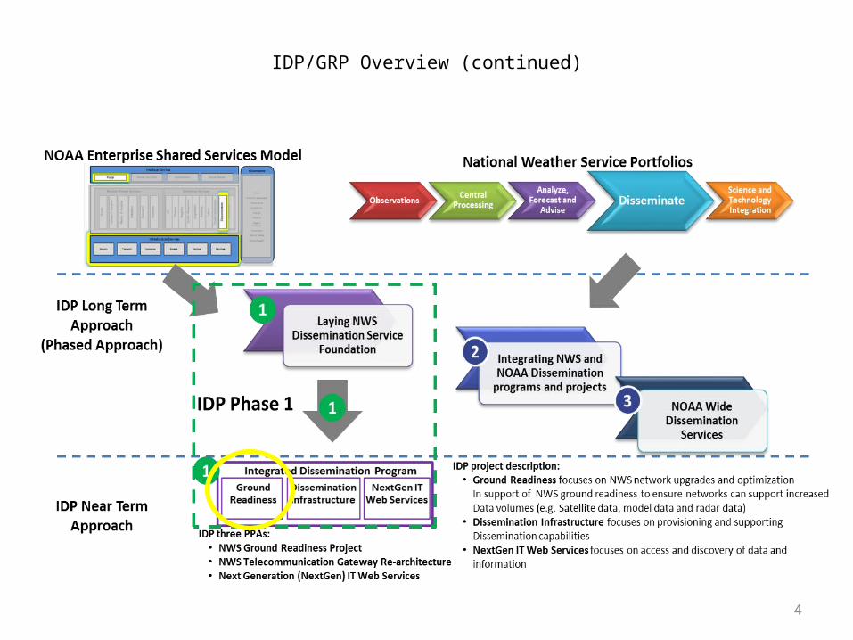
• The NOAA Integrated Dissemination Program (IDP) plans to deliver NOAA Wide Dissemination Services in a phased approach
• In Phase 1, IDP’s near-term focus is on executing against its 3 Program, Project and Activities (PPAs) requirements:– NWS Ground Readiness Project (GRP),– NWS Telecommunication Gateway (Re-architecture), and– NWS Next Generation IT Web Services
• Within the IDP, the GRP focus is on ensuring the readiness of the NWS IT infrastructure for JPSS, GOES-R, model/guidance, radar and other products
3
4
IDP/GRP Overview (continued)
5
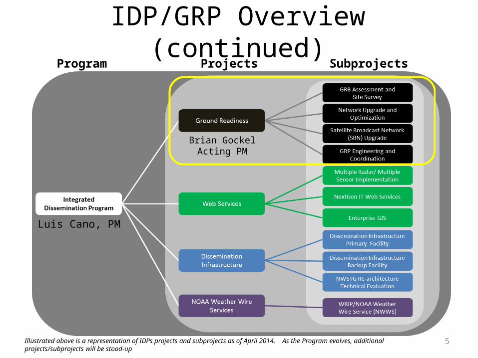
IDP/GRP Overview (continued)Program SubprojectsProjects
Illustrated above is a representation of IDPs projects and subprojects as of April 2014. As the Program evolves, additional projects/subprojects will be stood-up
Luis Cano, PM
Brian GockelActing PM
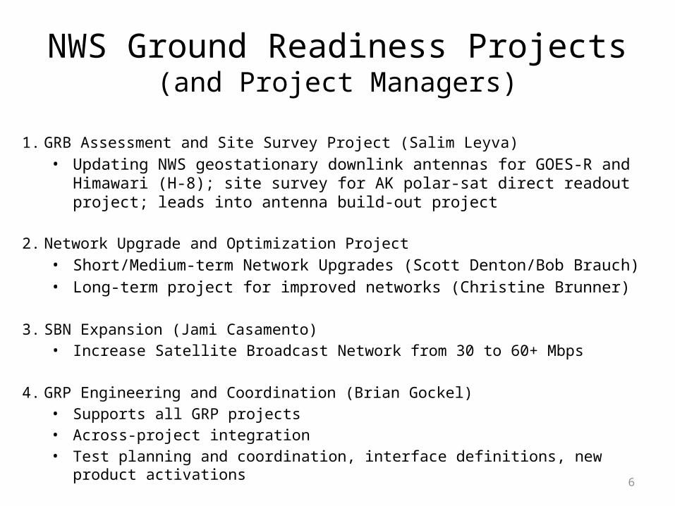
NWS Ground Readiness Projects(and Project Managers)
1. GRB Assessment and Site Survey Project (Salim Leyva)• Updating NWS geostationary downlink antennas for GOES-R and
Himawari (H-8); site survey for AK polar-sat direct readout project; leads into antenna build-out project
2. Network Upgrade and Optimization Project
• Short/Medium-term Network Upgrades (Scott Denton/Bob Brauch)• Long-term project for improved networks (Christine Brunner)
3. SBN Expansion (Jami Casamento)• Increase Satellite Broadcast Network from 30 to 60+ Mbps
4. GRP Engineering and Coordination (Brian Gockel)• Supports all GRP projects• Across-project integration• Test planning and coordination, interface definitions, new product
activations 6
7
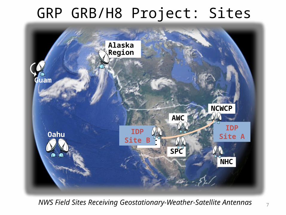
GRP GRB/H8 Project: Sites
Guam
Oahu
Alaska Region
SWPCSPC
AWCNCWCP
NHC
IDP Site B IDP Site A
NWS Field Sites Receiving Geostationary-Weather-Satellite Antennas
8
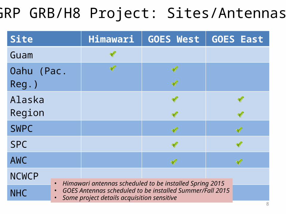
Site Himawari GOES West GOES East
Guam
Oahu (Pac. Reg.)
Alaska Region
SWPC
SPC
AWC
NCWCP
NHC
• Himawari antennas scheduled to be installed Spring 2015• GOES Antennas scheduled to be installed Summer/Fall 2015• Some project details acquisition sensitive
GRP GRB/H8 Project: Sites/Antennas
9
Process
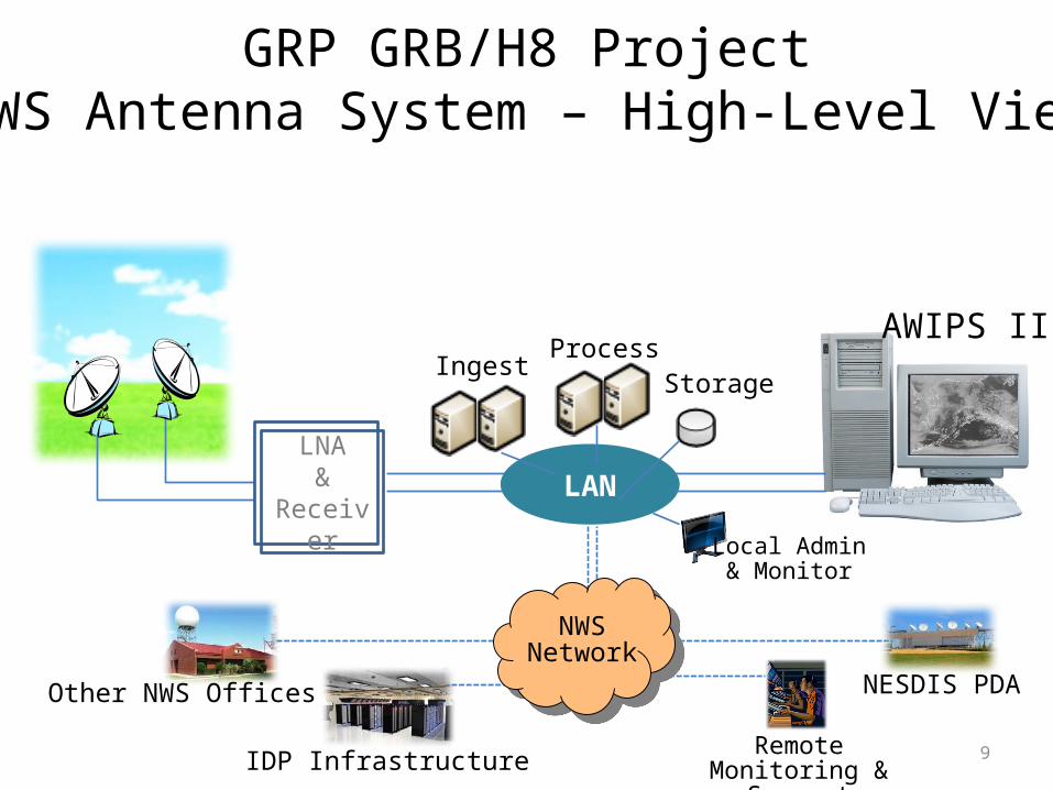
GRP GRB/H8 ProjectNWS Antenna System – High-Level View
LNA&
ReceiverLAN
IngestStorage
AWIPS II
RemoteMonitoring & SupportIDP Infrastructure
Other NWS Offices
Local Admin& Monitor
NWSNetwork
NESDIS PDA
10
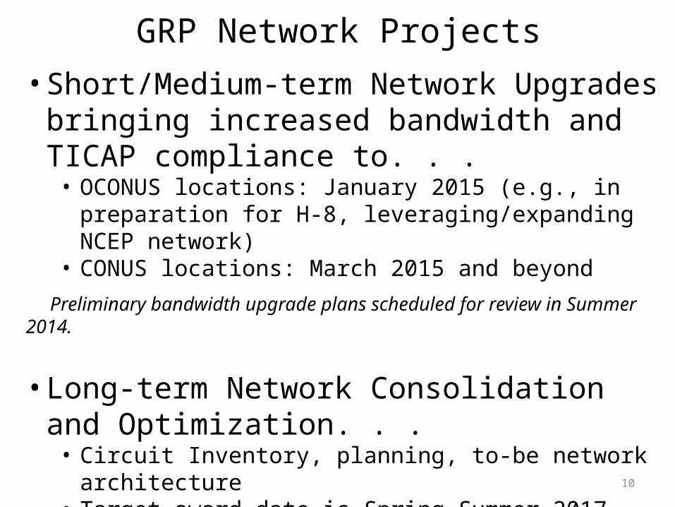
GRP Network Projects• Short/Medium-term Network Upgrades bringing
increased bandwidth and TICAP compliance to. . . • OCONUS locations: January 2015 (e.g., in preparation for H-8,
leveraging/expanding NCEP network)• CONUS locations: March 2015 and beyond
Preliminary bandwidth upgrade plans scheduled for review in Summer 2014.
• Long-term Network Consolidation and Optimization. . .
• Circuit Inventory, planning, to-be network architecture• Target award date is Spring-Summer 2017 (e.g., under new GSA
Enterprise Infrastructure Solutions vehicle)• Network transition (to new vehicle): 2017-2019• Increased bandwidth
11
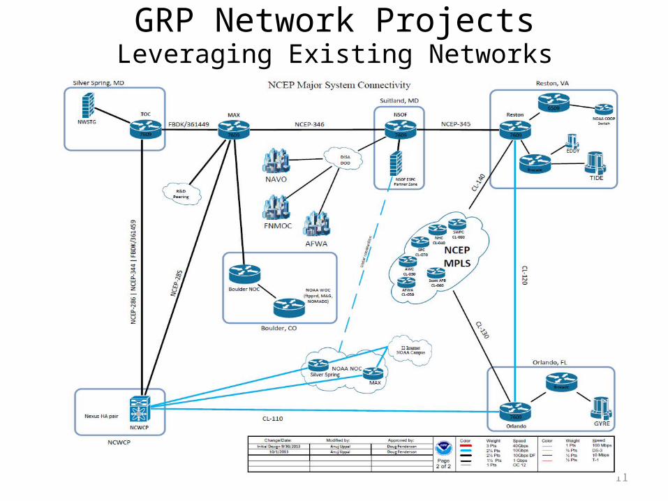
GRP Network ProjectsLeveraging Existing Networks

12
GRP Network ProjectsNESDIS-to-NWS Baseline GOES-R Imagery Data-Flow Plan*
* Only primary pathway is shown (backup path uses NESDIS Fairmont site and BNCF).
13
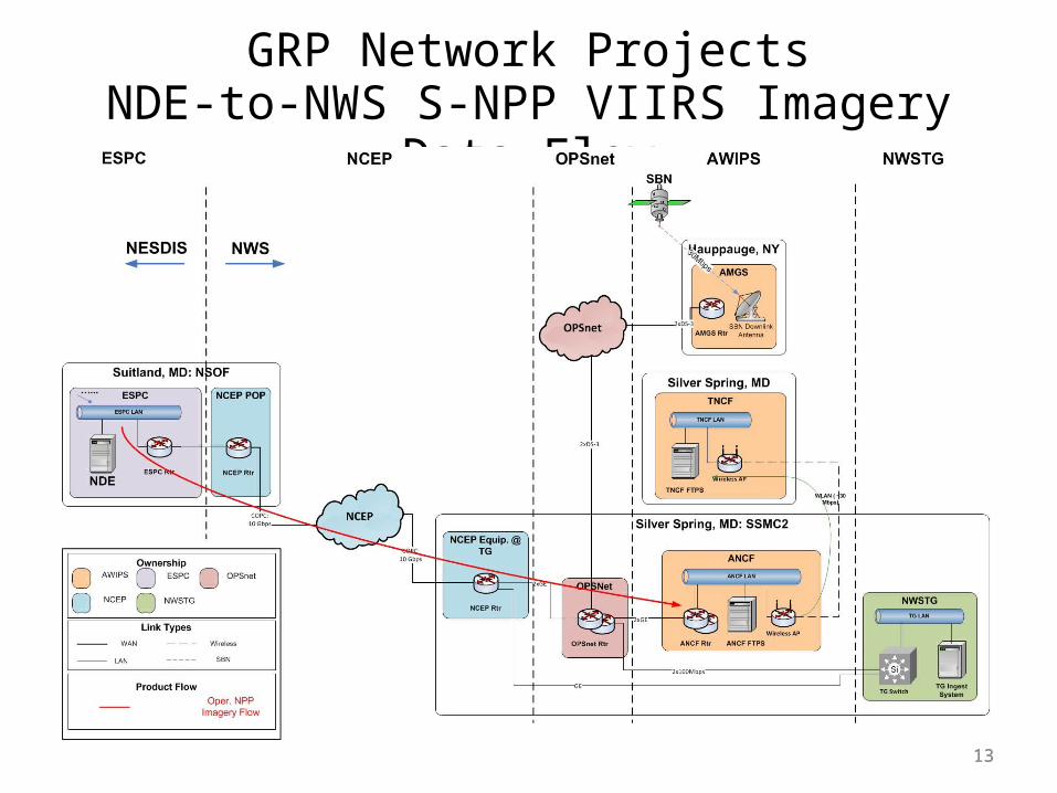
GRP Network ProjectsNDE-to-NWS S-NPP VIIRS Imagery Data Flow
13
1414
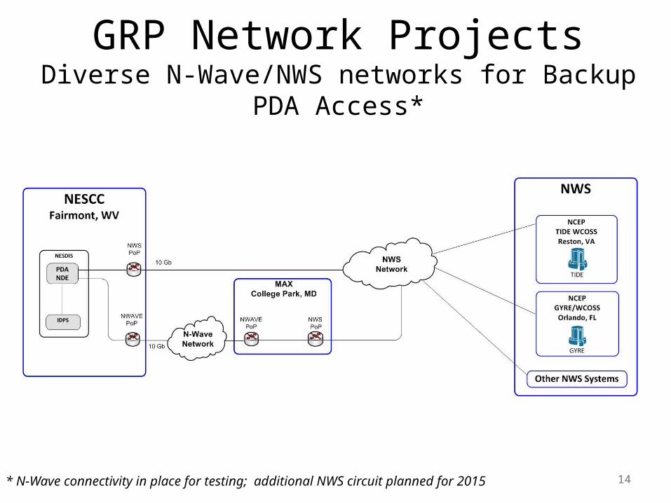
GRP Network ProjectsDiverse N-Wave/NWS networks for Backup PDA Access*
* N-Wave connectivity in place for testing; additional NWS circuit planned for 2015
151515
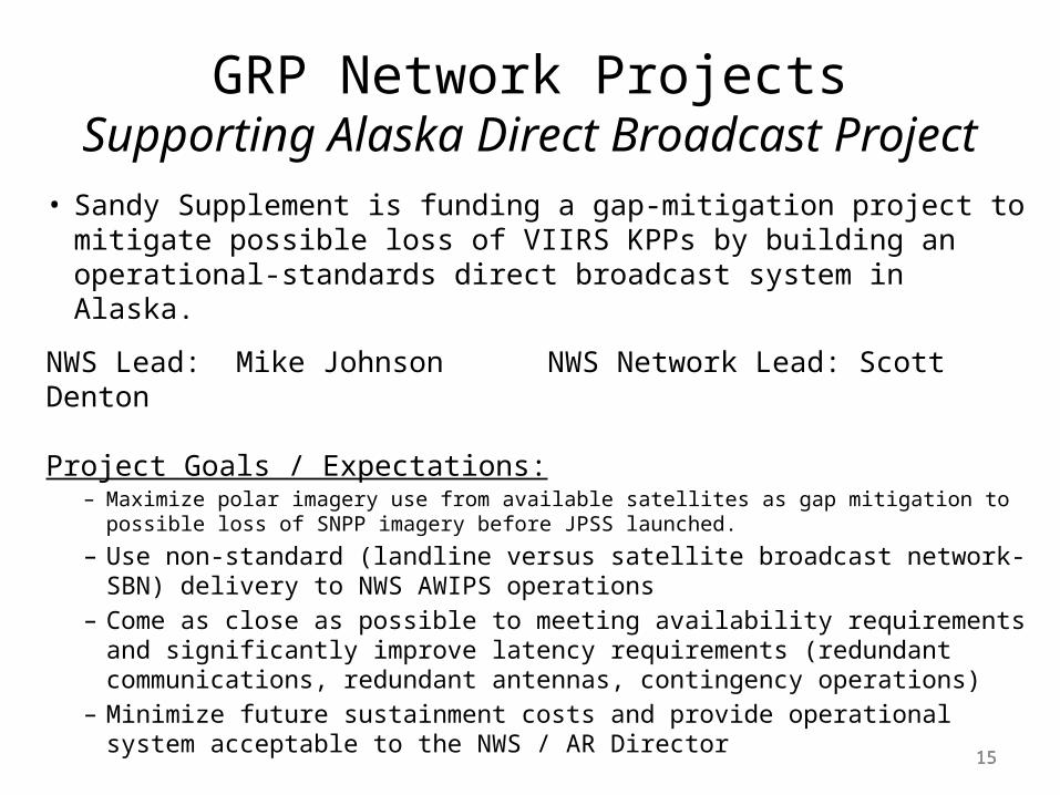
• Sandy Supplement is funding a gap-mitigation project to mitigate possible loss of VIIRS KPPs by building an operational-standards direct broadcast system in Alaska.
NWS Lead: Mike Johnson NWS Network Lead: Scott Denton
Project Goals / Expectations:– Maximize polar imagery use from available satellites as gap mitigation to possible loss
of SNPP imagery before JPSS launched.
– Use non-standard (landline versus satellite broadcast network- SBN) delivery to NWS AWIPS operations
– Come as close as possible to meeting availability requirements and significantly improve latency requirements (redundant communications, redundant antennas, contingency operations)
– Minimize future sustainment costs and provide operational system acceptable to the NWS / AR Director
GRP Network ProjectsSupporting Alaska Direct Broadcast Project

161616
GRP Network Project: Supporting AK Direct Readout
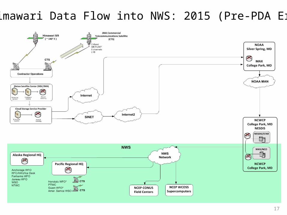
Himawari Data Flow into NWS: 2015 (Pre-PDA Era)
17
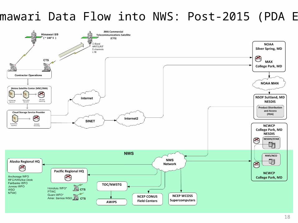
Himawari Data Flow into NWS: Post-2015 (PDA Era)
18
19
GRP/AWIPS SBN Expansion ProjectSatellite Broadcast Network ~ “NOAAPort”
GOES POES/S-NPP
NOAA/NESDIS
NOAA/NWS
DC
S
VIIR
S Im
ag
ery
So
un
din
gs e
tc.
GV
AR
NCEP
Hydromet Sensor Products (e.g., radar, ASOS,
Profiler, River Gages)
TOCNWSTG
SatelliteProduct
Generation
AWIPSNCF
Guidance &Model
Products
Satellite imagery
Other EnvironmentalSatellite Products
SES-1Satellite
SBN UplinkFacility (NY)
WFO/RFC/NC Forecasts,
Watches Warnings
SBN Users – includesNWS-internal (AWIPS)
and externals• The SBN disseminates satellite, model, radar and
other products to NWS AWIPS field nodes• SBN under expansion from 30 Mbps to 60+ Mbps• Only SBN-related product flows shown
SBN
OPSNet
SBN Rec.Antennas
20
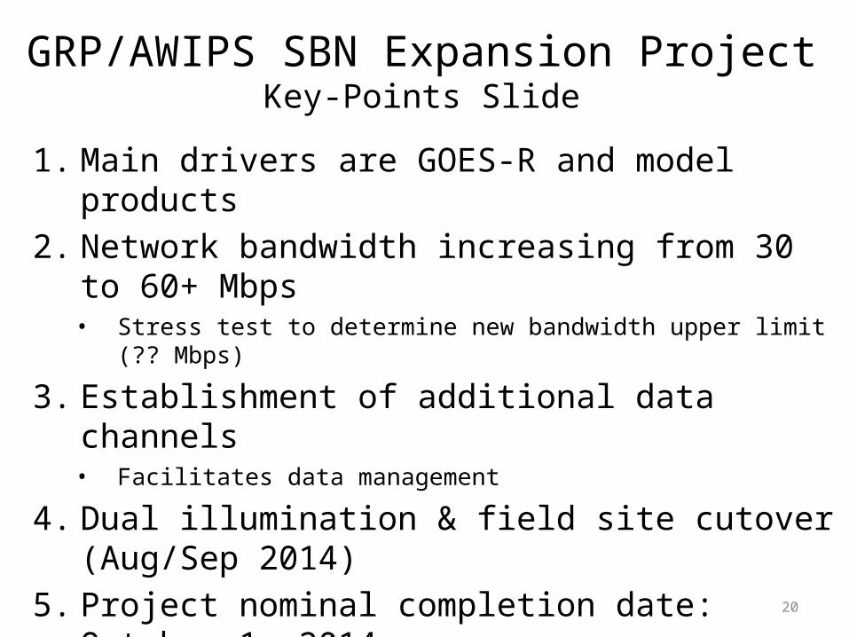
GRP/AWIPS SBN Expansion ProjectKey-Points Slide
1. Main drivers are GOES-R and model products2. Network bandwidth increasing from 30 to 60+ Mbps
• Stress test to determine new bandwidth upper limit (?? Mbps)
3. Establishment of additional data channels• Facilitates data management
4. Dual illumination & field site cutover (Aug/Sep 2014)5. Project nominal completion date: October 1, 2014
• limited product additions to be scheduled for late CY 2014
6. Concomitant ANCF/BNCF/TNCF, AMGS/BMGS and network upgrades underway
7. Outreach to users (bulletins and web pages)
21
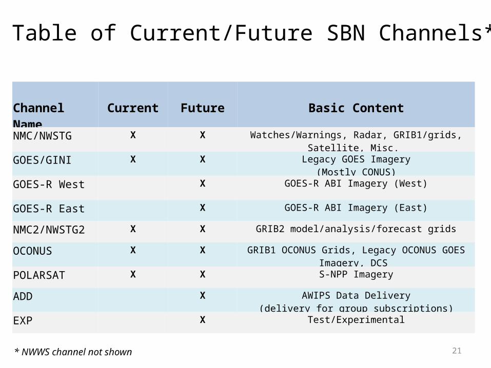
Table of Current/Future SBN Channels*
Channel Name Current Future Basic ContentNMC/NWSTG X X Watches/Warnings, Radar, GRIB1/grids, Satellite, Misc.
GOES/GINI X X Legacy GOES Imagery(Mostly CONUS)
GOES-R West X GOES-R ABI Imagery (West)
GOES-R East X GOES-R ABI Imagery (East)
NMC2/NWSTG2 X X GRIB2 model/analysis/forecast grids
OCONUS X X GRIB1 OCONUS Grids, Legacy OCONUS GOES Imagery, DCS
POLARSAT X X S-NPP Imagery
ADD X AWIPS Data Delivery(delivery for group subscriptions)
EXP X Test/Experimental
* NWWS channel not shown
22
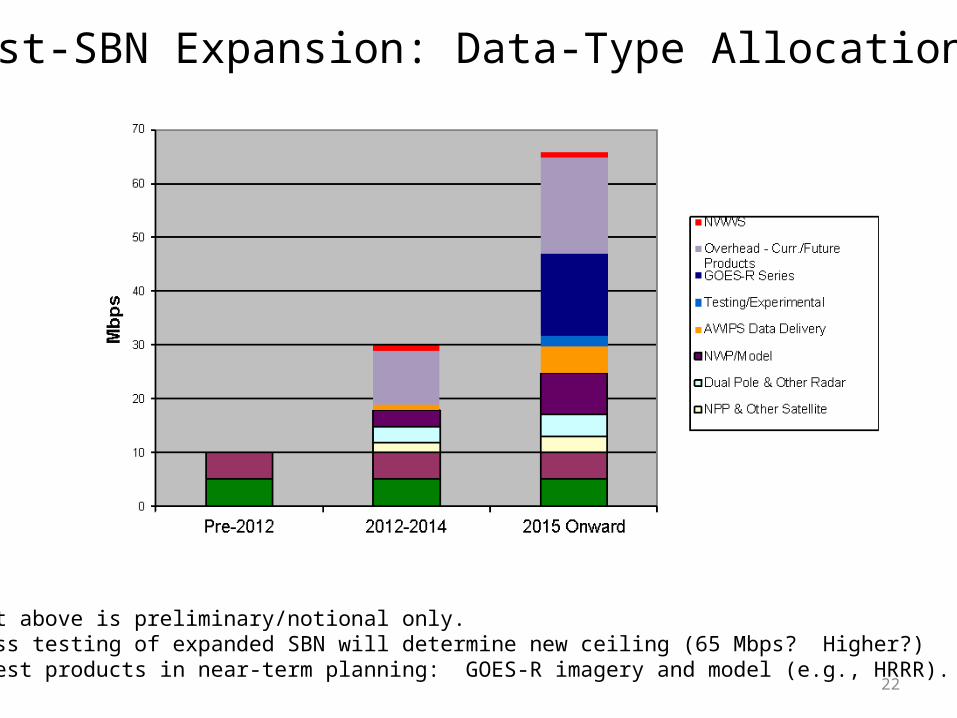
Post-SBN Expansion: Data-Type Allocations*
* Notes1. Chart above is preliminary/notional only.2. Stress testing of expanded SBN will determine new ceiling (65 Mbps? Higher?)3. Largest products in near-term planning: GOES-R imagery and model (e.g., HRRR).
23
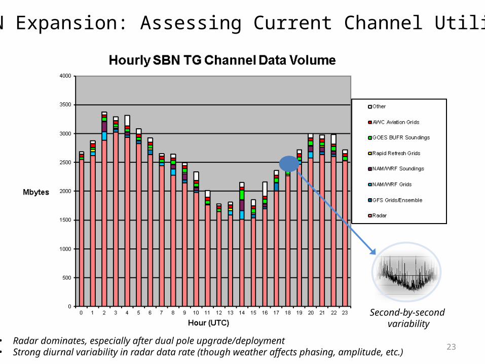
Post-SBN Expansion: Assessing Current Channel Utilizations
• Radar dominates, especially after dual pole upgrade/deployment• Strong diurnal variability in radar data rate (though weather affects phasing, amplitude, etc.)
Second-by-second variability
24
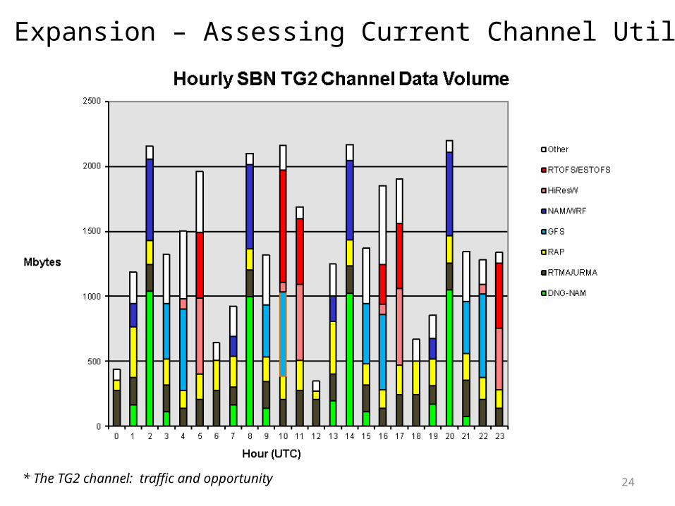
Post-SBN Expansion – Assessing Current Channel Utilizations
* The TG2 channel: traffic and opportunity
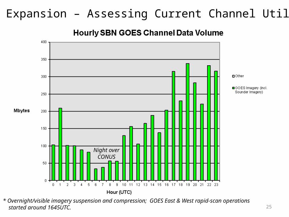
25* Overnight/visible imagery suspension and compression; GOES East & West rapid-scan operations started around 1645UTC.
Night overCONUS
Post-SBN Expansion – Assessing Current Channel Utilizations

26
S-NPP/GCOM Products Planned for AWIPS Baseline
* Two dissemination options exist: local direct-readout-based ingest in NWS, AK Region and/or NDE generation followed by SBN dissemination.
1. S-NPP - VIIRS Imagery (for AK for chans 1,4,5)* – done
2. NUCAPS – done
3. S-NPP VIIRS Near-Constant Contrast (NCC)- sector to be added to SBN and AWIPS baseline
for all geographical areas (AK, Pacific, CONUS, and Puerto Rico)4. GCOM - AMSR2 - Sea Surface Winds
from NESDIS ESPC DDS then PDA5. S-NPP VIIRS 1.6 µm VIIRS imagery – likely for AK only (I3 channel) 6. S-NPP VIIRS-based Active Fires product
27
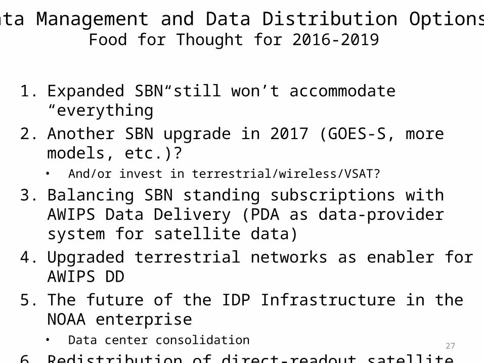
Data Management and Data Distribution OptionsFood for Thought for 2016-2019
1. Expanded SBN still won’t accommodate “everything”2. Another SBN upgrade in 2017 (GOES-S, more models, etc.)?
• And/or invest in terrestrial/wireless/VSAT?
3. Balancing SBN standing subscriptions with AWIPS Data Delivery (PDA as data-provider system for satellite data)
4. Upgraded terrestrial networks as enabler for AWIPS DD5. The future of the IDP Infrastructure in the NOAA enterprise
• Data center consolidation
6. Redistribution of direct-readout satellite products from NWS sites with antennas to NWS field sites without antennas
Recommended