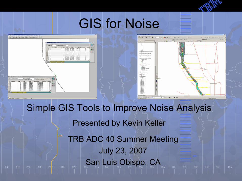
GIS for Noise
Simple GIS Tools to Improve Noise AnalysisPresented by Kevin Keller
TRB ADC 40 Summer Meeting July 23, 2007
San Luis Obispo, CA
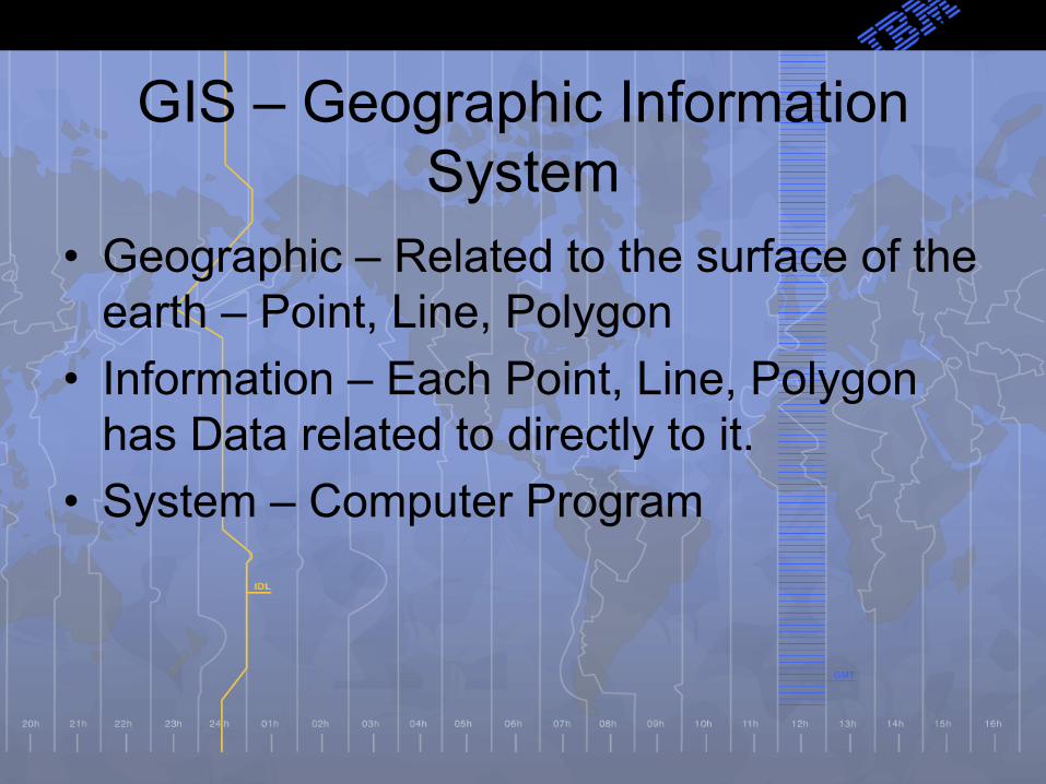
GIS – Geographic Information System
• Geographic – Related to the surface of the earth – Point, Line, Polygon
• Information – Each Point, Line, Polygon has Data related to directly to it.
• System – Computer Program

GIS Computer Software
• ESRI (ArcView)– Has the most users – 90 % of the GIS market - most public agencies in the U.S. are users.
• CADD system can be set up to work like a GIS system
• Google Earth, MSN Live Search• Noise Model Software:TNM, LIMA,
Soundplan, CANDA, ETC.
How can this improve Noise Analysis?

GIS Data• Land Use Data – Zoning, Parcel
– Use to plan field work, placement of model sites, address and building information
• Air Photos– Use to plan field work, placement of model sites, measuring
distance, graphics
• Topographical – USGS DEM, CADD Contour Lines– Use to build 3d surface of project area, which is used to
calculated elevations of roadways, receivers, and barriers.

Screening Level
• Distance – Buffer, Overlay
• Sensitive Land Uses
• Potential Affected Population


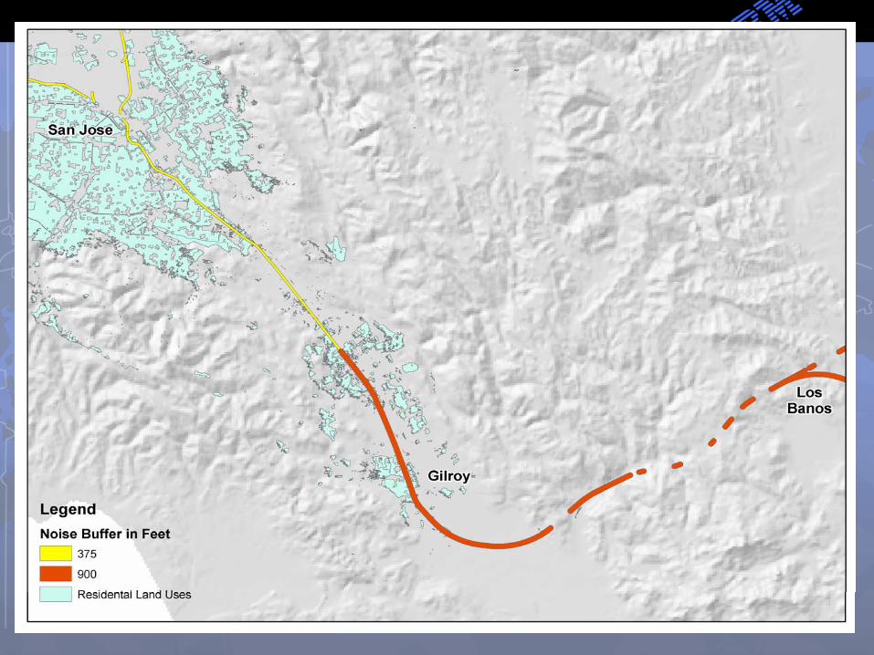

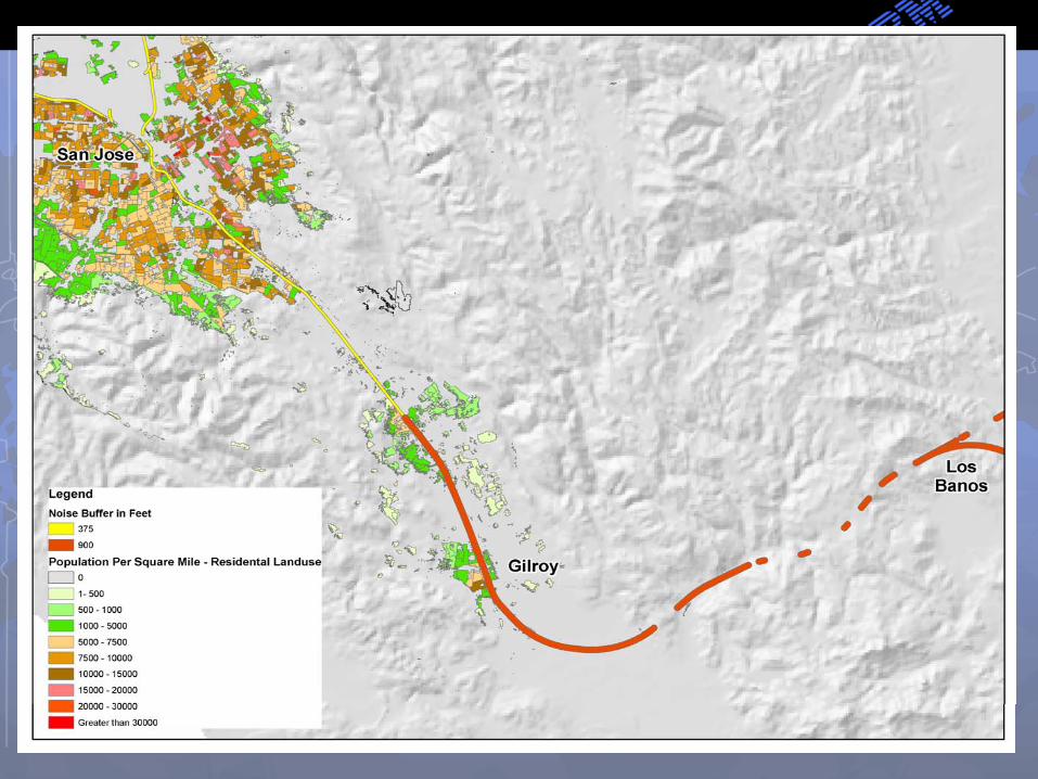


Impact Metric = (#Res. Population Impacts/Mile) + (0.3 x(#MU Population Impacts/Mile)) + ((100 X # Hospitals)/Mile) + (250 x # Schools)/Mile)
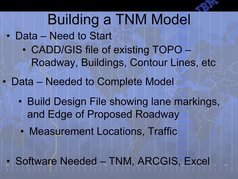
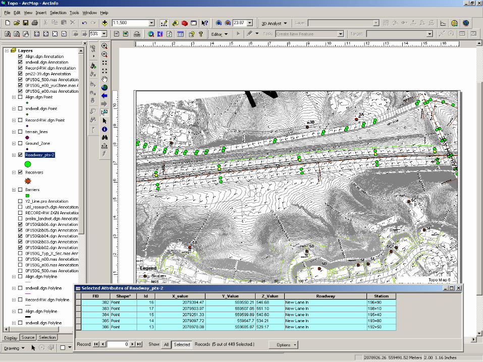
Building a TNM Model• Data – Need to Start
• CADD/GIS file of existing TOPO –Roadway, Buildings, Contour Lines, etc
• Data – Needed to Complete Model
• Measurement Locations, Traffic
• Build Design File showing lane markings, and Edge of Proposed Roadway
• Software Needed – TNM, ARCGIS, Excel
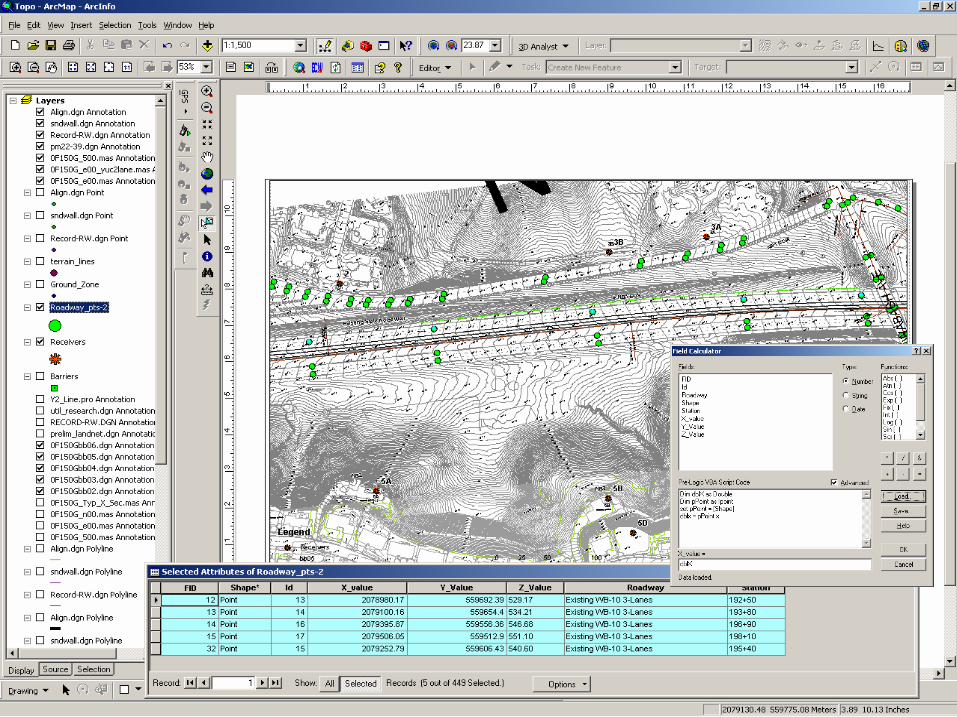


• Other Data –
• Air Photos, Design Files in 3d, Elevation Points used for Design
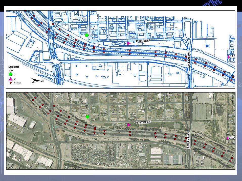
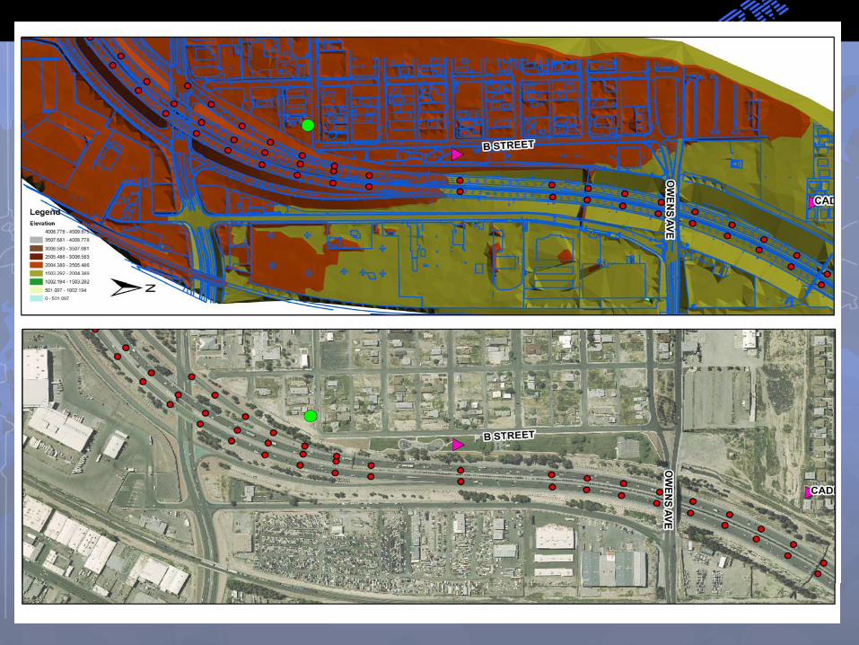
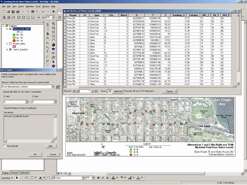
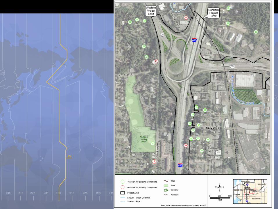
Output - Graphics


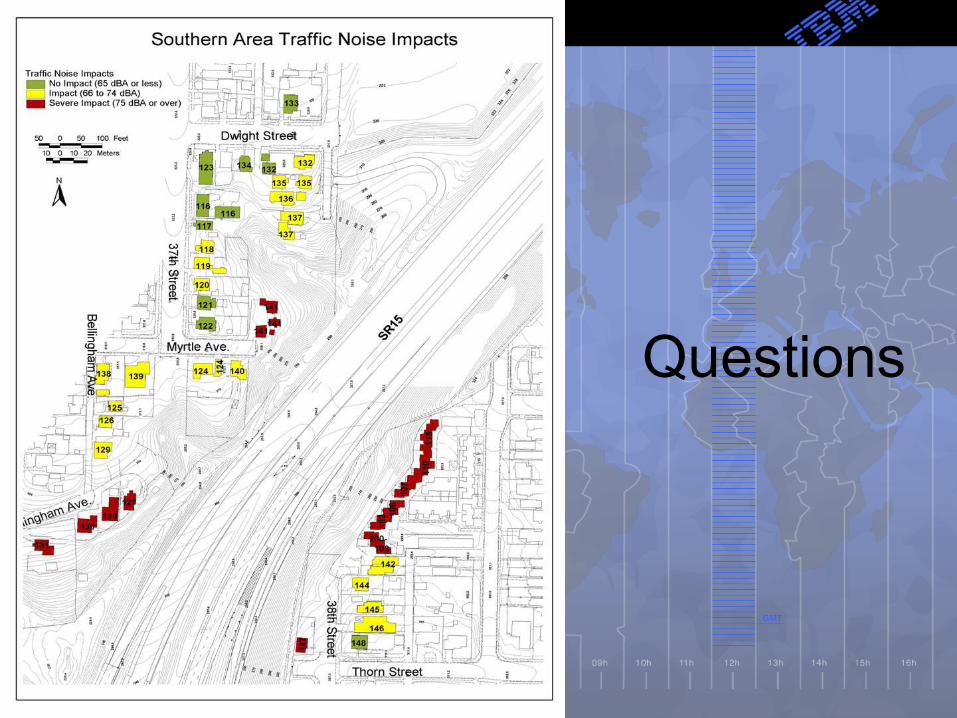
Questions
Recommended


![Development of GIS based Air Pollution Information System ...jkais99.org/journal/Vol16No6/p67/3tc/3tc.pdf · Reference Model”을 제정하였다[6]. 또한 센서기술 기반 의](https://img.pdfslide.net/doc/110x75/5e41a23cdcaf3c7173629b56/development-of-gis-based-air-pollution-information-system-reference-modela.jpg)