Title vs. Survey
~ ~ ~
Statutes, Standards and
Boundary Law Principles
~ ~ ~
New York State Association of
Professional Land Surveyors
Verona, New York
Presented by
Gary R. Kent, P.S.
The Schneider Corporation
January 21, 2016
© 2015, Gary R. Kent, PS The Schneider Corporation Indianapolis, Indiana
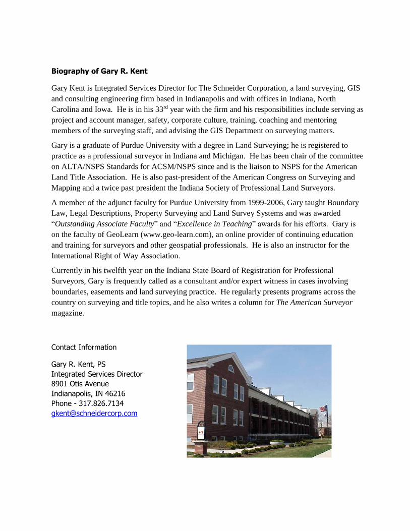
Biography of Gary R. Kent
Gary Kent is Integrated Services Director for The Schneider Corporation, a land surveying, GIS
and consulting engineering firm based in Indianapolis and with offices in Indiana, North
Carolina and Iowa. He is in his 33rd year with the firm and his responsibilities include serving as
project and account manager, safety, corporate culture, training, coaching and mentoring
members of the surveying staff, and advising the GIS Department on surveying matters.
Gary is a graduate of Purdue University with a degree in Land Surveying; he is registered to
practice as a professional surveyor in Indiana and Michigan. He has been chair of the committee
on ALTA/NSPS Standards for ACSM/NSPS since and is the liaison to NSPS for the American
Land Title Association. He is also past-president of the American Congress on Surveying and
Mapping and a twice past president the Indiana Society of Professional Land Surveyors.
A member of the adjunct faculty for Purdue University from 1999-2006, Gary taught Boundary
Law, Legal Descriptions, Property Surveying and Land Survey Systems and was awarded
“Outstanding Associate Faculty” and “Excellence in Teaching” awards for his efforts. Gary is
on the faculty of GeoLearn (www.geo-learn.com), an online provider of continuing education
and training for surveyors and other geospatial professionals. He is also an instructor for the
International Right of Way Association.
Currently in his twelfth year on the Indiana State Board of Registration for Professional
Surveyors, Gary is frequently called as a consultant and/or expert witness in cases involving
boundaries, easements and land surveying practice. He regularly presents programs across the
country on surveying and title topics, and he also writes a column for The American Surveyor
magazine.
Contact Information
Gary R. Kent, PS
Integrated Services Director
8901 Otis Avenue
Indianapolis, IN 46216
Phone - 317.826.7134
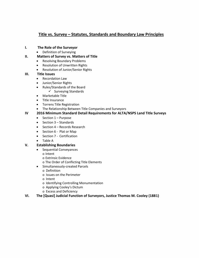
Title vs. Survey – Statutes, Standards and Boundary Law Principles
I. The Role of the Surveyor Definition of Surveying
II. Matters of Survey vs. Matters of Title Resolving Boundary Problems Resolution of Unwritten Rights Resolution of Junior/Senior Rights
III. Title Issues Recordation Law Junior/Senior Rights Rules/Standards of the Board
Surveying Standards Marketable Title Title Insurance Torrens Title Registration The Relationship Between Title Companies and Surveyors
IV 2016 Minimum Standard Detail Requirements for ALTA/NSPS Land Title Surveys Section 1 – Purpose
Section 3 – Standards
Section 4 – Records Research
Section 6 - Plat or Map
Section 7 - Certification
Table A V. Establishing Boundaries
Sequential Conveyances o Intent o Extrinsic Evidence o The Order of Conflicting Title Elements
Simultaneously-created Parcels o Definition o Issues on the Perimeter o Intent o Identifying Controlling Monumentation o Applying Cooley‘s Dictum o Excess and Deficiency
VI. The [Quasi] Judicial Function of Surveyors, Justice Thomas M. Cooley (1881)
1
The Role of the Land Surveyor in Boundary Determinations
The Regulation of Land Surveying
The definition of surveying in all states allows the registered surveyor to rely upon the work of
unlicensed subordinates working under his or her direct supervision. There are relatively few
registered surveyors in the United States (probably on the order of 40,000).
The practice of Land Surveying is, in all states, regulated by a state board. Some states, like West
Virginia, Maine, New Hampshire and Indiana, have boards that regulate only Land Surveyors.
Many other states, however, have “joint” boards that regulate more than one profession –
typically engineering and surveying.
Surveying is part Science, part Law and part Art
The science aspect is generally the science of measurement – using angle measuring devices
(theodolites, total stations), distance measuring devices (electronic distance measuring
instruments, steel tapes) and GPS (global positioning system which uses satellites).
The law aspects relate to the interpretation and resolution of legal descriptions and boundaries.
There are no statutes or legislated laws that tell surveyors how to determine boundaries; the rules
for that are from a body of common law derived from hundreds of years of court cases related to
boundary disputes and legal descriptions. Surveyors cannot make proper boundary
determinations without studying and understanding what the “weight of authority” has been in
case law.
The art aspect could be said to apply to the judgments and decisions in the field related to where,
and to what extent, to look for evidence, and how that information is all presented. For example,
having a gut feeling on where to dig to try and find a stone marker set in 1840, or how to most
effectively run a survey line from one location across a ravine and river and through the trees to
another location.
Surveying can also be seen as part “doing” and part “thinking.” It’s one thing to make a
measurement; with today’s technologies, virtually anyone can make very precise survey-grade
measurements. But it’s an entirely different thing to understand where to make the measurements
from, and to what, and how to apply those measurements to the facts and evidence at hand so a
defensible boundary opinion can be made.
The retracement of a boundary is the professional opinion of the surveyor. That opinion is based
on the evidence available to the surveyor; and if that evidence changes, the opinion may well
change. Evidence comes in many forms – from the writings, from what is found in the field, from
verbal and written statements, from measurements and from historical information.
Two competent surveyors faced with the same evidence will generally come to the same opinion,
although there are occasions when the surveyors will simply have differing opinions as to how to
interpret or weigh certain pieces of evidence. This can result in the two surveyors arriving at
different conclusions as to a boundary location. If the surveyors cannot resolve the differences
satisfactorily, and if the affected owners are inclined to litigate, a final determination will be made
by a court.
2
New York Definition of Land Surveying1
The practice of the profession of land surveying is defined as practicing that branch of the
engineering profession and applied mathematics which includes the measuring and plotting of the
dimensions and areas of any portion of the earth, including all naturally placed and man- or
machine-made structures and objects thereon, the lengths and directions of boundary lines, the
contour of the surface and the application of rules and regulations in accordance with local
requirements incidental to subdivisions for the correct determination, description, conveying and
recording thereof or for the establishment or reestablishment thereof.
The Issues of the Surveyor – Matters of Survey vs. Matters of Title
With respect to boundaries, the surveyor deals with matters of survey, primarily location – the
“where” of a boundary. Sometimes the boundary location is not in question – the deed
description is unambiguous and there are no issues with the adjoiners. Many times, however, the
description(s) require interpretation to eliminate or resolve the ambiguities. Either way, we are in
the realm of “where” which falls in the authority of the surveyor.
Alternatively, the law deals with “what” that boundary line is – in essence, what the boundary
represents with respect to title (ownership). These concepts of “where” and “what” are often,
however, not mutually exclusive. The best example of that is with unwritten rights.
‘What constitutes the line, is a matter of law; where it is, is a matter of fact.' McCanless v.
Ballard, 222 N.C. 701, 703, 24 S.E.2d 525; Jenkins v. Trantham, 244 N.C. 422, 426, 94
S.E.2d 311. Smothers v. Schlosser, 163 SE 2d 127 - NC: Court of Appeals 1968
The vocation of a surveyor is limited to the ascertainment of definite lines. He may
ascertain where the lines and corners specified in the description of the given tract of real
estate actually are. He does not have the power to determine what the terms of such
description ought to be.
Where the line lies, and where its corners are, is a question, and on which the surveyor, on
account of his superior facilities for doing so, may be called upon to officially determine.
What the lines and corners are is a matter of law, which courts can alone declare. Wilson
v. Powell, (1905) 37 Ind.App. 44, 70 N.E. 611.
There are a number of means by which boundaries can be established by unwritten means. Yet
each of these doctrines would seem to be contrary to the otherwise inviolate Statute of Frauds,
which requires that conveyances of real property must be in writing. The courts have found a way
around this conundrum; however, by determining that these doctrines do not transfer title, but rather
merely fix what were otherwise uncertain lines.
Everyone can agree that the doctrine of adverse possession falls in the realm of title, not survey.
The necessary elements typically include all, most, or some version of, the following: adverse or
hostile, open and notorious, visible, actual, exclusive and with a claim of right or color of title.
Some states also require payment of the property taxes due on the area being claimed. The
statutory period varies from 3 to 21 years depending on the state, with some states providing for
1 State of New York Education Law, Title VIII, Article 145, Section 7203
3
shorter periods if the claimant can show color of title, that the taxes had been paid, and/or if the
nature of the possession was especially open.
Courts do not look kindly on the doctrine of adverse possession which is why every single
element most be proven - typically by “clear and convincing” evidence. Failure to prove only one
of the elements is enough to defeat the entire claim. However, when a claim of unwritten rights is
perfected in a court of law, it (1) confirms that the line of ownership changed from the original
written title line, and (2) creates marketable title to the ownership line.
With a few exceptions, the states view the unwritten boundary doctrines of acquiescence,
practical location, and – obviously – parol agreement, as being manifestations of prior boundary
line agreements, contrary to adverse possession which arises out of contentious situations. Even
the doctrines of estoppel and repose could be seen as representing boundary line agreements – in
essence, inverse agreements, whereby the inaction of one party can be taken as an implied
acceptance of a claim by an adjoiner.
Each of the various unwritten boundary doctrines has its own set of specific requirements that
must be met in order for a court to perfect the claim. Some requirements are problematic in that
they require a look inside the mind of the claimant; and some requirements are counterintuitive.
As an example of the former, in some states a claim of adverse possession is defeated if it can be
shown that the claimant did not intend to possess someone else’s land (i.e., it was ‘by mistake”).
With regard to the latter, in some states, a parol agreement between two parties to set a common
line is not valid if there is no conflict in the written title or if a survey would have otherwise
resolved the uncertainty.
All of the doctrines that alter boundary lines by unwritten means are matters of title, not survey.
And title by unwritten means can only be perfected by a court. If a surveyor decides to act on his
or her opinion that unwritten rights have operated and move a written boundary line to conform
with that opinion, he or she has stepped over the line - out of survey and into title. However,
Thomas Cooley, Chief Justice of the Michigan Supreme Court in 1881, wrote “Surveyors are not
and cannot be judicial officers, but in a great many cases they act in a quasi-judicial capacity with
the acquiescence of parties concerned…”
Thus, if the surveyor can bring the affected parties together and convince them to acquiesce to the
line that represents surveyor’s opinion (which was most often a long-established, and ostensibly a
long-agreed upon line anyway), then the surveyor might have ‘cover’ to survey to the agreed-
upon line. In such cases, however, it is virtually a given that the surveyor, after preparing such a
survey, should also prepare descriptions and an exhibit showing and describing to the agreed upon
line, and then go no further until the owners engage an attorney or attorneys to see that the proper
written documents are prepared and recorded memorializing and providing notice of the agreed-
upon line. Otherwise, what may have been an agreement in the moment could easily devolve into
a dispute later on which the surveyor will most assuredly be dragged into.
Additionally, there are very important, but not always obvious, issues such as the treatment of
mortgages that might be affected by the new line which must be properly vetted by an attorney.
Also, if the elements of whatever doctrine the surveyor relied on as the basis for his or her opinion
were not met (including those elements that impossibly require one to climb inside the head of
one or both of the parties), the surveyor is at great risk if the written title line was disregarded and
there was no acquiescence by the parties to the surveyed line.

4
But the surveyor may be uncomfortable or concerned about violating standards, practicing law or
determining a matter of title. Or perhaps, despite an attempt, the neighbor and client simply could
not be convinced to agree to the line that represents the surveyor’s opinion. Either way, the
surveyor will be left with surveying to the written title line and showing any conflicts with
adjoiners’ deeds or with occupation/possession. Except in a few states, this is actually what is
expected of surveyors, and/or required by state statutes or administrative code/rule (standards).
Either way, no matter what line the surveyor decides to go with, there must be clear
communication of the necessary information so the client does not act ill-advisedly and cause a
problem with an adjoiner. For example, perhaps there is a five foot overlap with an adjoiner and
your client’s written title line falls five feet over the neighbor’s fence. If you deem it necessary to
monument that location (or if the parties could not otherwise be brought to agreement), you had
better clearly understand what is going on and advise the client accordingly. Why? Because the
client will most assuredly assume that she owns to the rebar and take steps to exercise domain
over to that line (5 feet over the fence) to the detriment of the adjoiner’s rights.
Junior/Senior Rights
In most public land survey states and in many of the colonial states, surveyors do not routinely
attempt to resolve junior/senior conflicts. Rather they simply report the potential conflict, which
is what the ALTA/ACSM Standards require.
In some states like in New England and Texas; however, surveyors must attempt to ‘resolve’
junior/senior relationships in order to comply with their respective states’ laws.
Some surveyors around the country, outside New England or Texas, would suggest that there is
only one boundary; and in order to properly determine its location, the surveyor must resolve the
junior senior relationship. This argument creates an interesting dichotomy in attitudes towards
title. No knowledgeable surveyor would suggest that title should or could be resolved by a
surveyor when it is potentially affected by unwritten rights (e.g., adverse possession,
acquiescence) because they know it is the purview of the courts to ascertain whether or not such
rights have been successfully achieved, and to perfect written title if they have.
Yet, most real estate attorneys would assert that resolving junior/senior rights is also a title issue,
not a survey issue. The ALTA/ACSM Survey Standards ever since 1962 and in the 2011 version,
in particular, also take this stance. When preparing an ALTA/ACSM Land Title Survey, the
surveyor is to disclose the gap or overlap to the title company and client prior to delivering the
final survey “for determination of a course of action concerning junior/senior rights.” 2
Aside from boundaries per se, surveyors do get indirectly involved in title when performing an
ALTA/ACSM Land Title Survey. The primary purpose of the ALTA/ACSM Survey Standards is
for the surveyor to locate and show those conditions observed that could adversely affect title to
the property being surveyed. Such conditions would include potential prescriptive easements and
adverse claims by others. By virtue of a proper and complete Land Title Survey, the title
company is appropriately informed of such conditions and can, by virtue of listing them in the
title commitment, likewise inform the interested parties, and help facilitate responses or solutions
2 2011 Minimum Standard Details Requirements for ALTA/ACSM Land Title Surveys, Section 6.B.vii.
5
that will eventually aid in a successful real estate transaction.
Junior/Senior Rights – New York3
Section 5
A. Research
The surveyor should develop, determine, and substantiate with reasonable certainty a professional
opinion and provide a product that adequately addresses and reflects the historical development of
the subject property or project. For the purposes of this section, a record is any documentary
material filed in public repositories that maintain information about the location of real property.
1. For Boundary, Title or Similar Surveys:
Research of records and record sources should be performed with sufficient scope and
depth to identify with reasonable certainty:
a. The location of the clients record boundaries;
b. Conflicting record and ownership boundary locations within, abutting or affecting
the client's property or access to the same; and,
c. Exceptions, easements, encumbrances, rights of way, privileges, restrictions and
reversions affecting the client property or access to the same in so far as they affect
he professional determinations to be made be the surveyor.
Note: None of the above is intended to require the surveyor to perform the title search. It
is common practice for the surveyor to rely on title search information prepared by others
qualified to do so.
[emphasis added]
It is noted, however, notwithstanding the research guideline above, that the Practice Guidelines do
not specifically state that gaps or overlaps with adjoiners should be indicated on the survey map.
As an aside, (1) the allowance that the client can opt out of the setting of monuments, and (2) the
fact that there is no apparent requirement that a survey map shall be prepared is, in this writer’s
opinion, irresponsible given that all surveyors know the primary responsibility of the surveyor in
retracing boundaries is to follow in the footsteps of the original surveyor. If the surveyor leaves
no monuments and no survey map, how is that critical charge achievable?
3 Land Surveying Practice Guidelines – February 2000 http://www.op.nysed.gov/prof/pels/lsurvguide.htm#s5
6
.
7
8
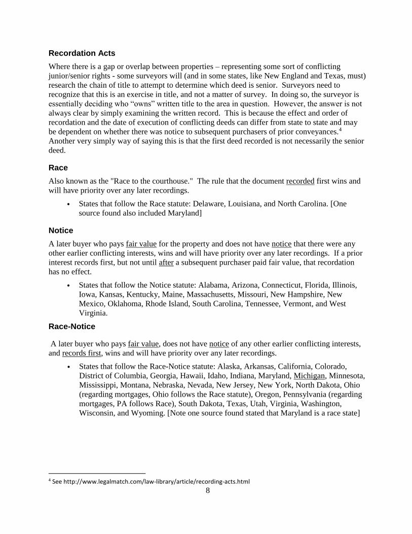
Recordation Acts
Where there is a gap or overlap between properties – representing some sort of conflicting
junior/senior rights - some surveyors will (and in some states, like New England and Texas, must)
research the chain of title to attempt to determine which deed is senior. Surveyors need to
recognize that this is an exercise in title, and not a matter of survey. In doing so, the surveyor is
essentially deciding who “owns” written title to the area in question. However, the answer is not
always clear by simply examining the written record. This is because the effect and order of
recordation and the date of execution of conflicting deeds can differ from state to state and may
be dependent on whether there was notice to subsequent purchasers of prior conveyances.4
Another very simply way of saying this is that the first deed recorded is not necessarily the senior
deed.
Race
Also known as the "Race to the courthouse." The rule that the document recorded first wins and
will have priority over any later recordings.
• States that follow the Race statute: Delaware, Louisiana, and North Carolina. [One
source found also included Maryland]
Notice
A later buyer who pays fair value for the property and does not have notice that there were any
other earlier conflicting interests, wins and will have priority over any later recordings. If a prior
interest records first, but not until after a subsequent purchaser paid fair value, that recordation
has no effect.
• States that follow the Notice statute: Alabama, Arizona, Connecticut, Florida, Illinois,
Iowa, Kansas, Kentucky, Maine, Massachusetts, Missouri, New Hampshire, New
Mexico, Oklahoma, Rhode Island, South Carolina, Tennessee, Vermont, and West
Virginia.
Race-Notice
A later buyer who pays fair value, does not have notice of any other earlier conflicting interests,
and records first, wins and will have priority over any later recordings.
• States that follow the Race-Notice statute: Alaska, Arkansas, California, Colorado,
District of Columbia, Georgia, Hawaii, Idaho, Indiana, Maryland, Michigan, Minnesota,
Mississippi, Montana, Nebraska, Nevada, New Jersey, New York, North Dakota, Ohio
(regarding mortgages, Ohio follows the Race statute), Oregon, Pennsylvania (regarding
mortgages, PA follows Race), South Dakota, Texas, Utah, Virginia, Washington,
Wisconsin, and Wyoming. [Note one source found stated that Maryland is a race state]
4 See http://www.legalmatch.com/law-library/article/recording-acts.html
9
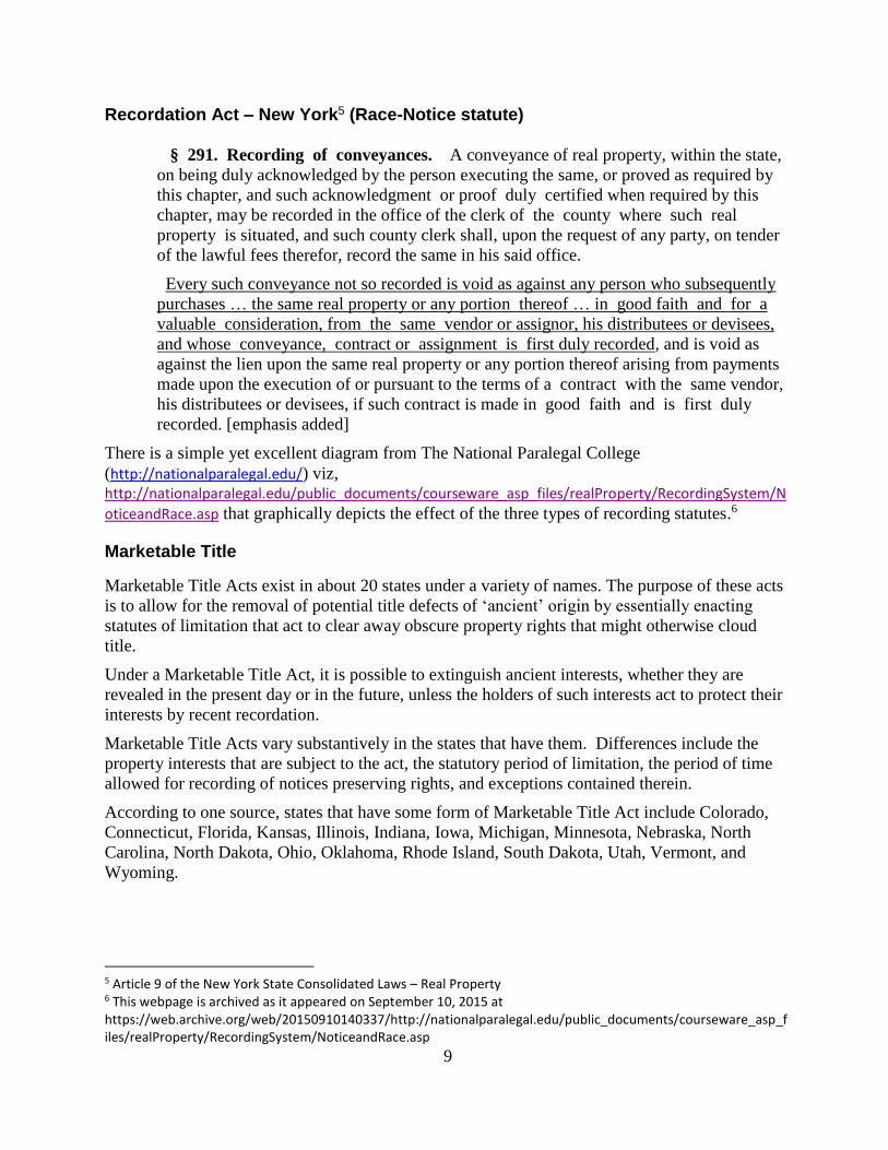
Recordation Act – New York5 (Race-Notice statute)
§ 291. Recording of conveyances. A conveyance of real property, within the state,
on being duly acknowledged by the person executing the same, or proved as required by
this chapter, and such acknowledgment or proof duly certified when required by this
chapter, may be recorded in the office of the clerk of the county where such real
property is situated, and such county clerk shall, upon the request of any party, on tender
of the lawful fees therefor, record the same in his said office.
Every such conveyance not so recorded is void as against any person who subsequently
purchases … the same real property or any portion thereof … in good faith and for a
valuable consideration, from the same vendor or assignor, his distributees or devisees,
and whose conveyance, contract or assignment is first duly recorded, and is void as
against the lien upon the same real property or any portion thereof arising from payments
made upon the execution of or pursuant to the terms of a contract with the same vendor,
his distributees or devisees, if such contract is made in good faith and is first duly
recorded. [emphasis added]
There is a simple yet excellent diagram from The National Paralegal College
(http://nationalparalegal.edu/) viz, http://nationalparalegal.edu/public_documents/courseware_asp_files/realProperty/RecordingSystem/N
oticeandRace.asp that graphically depicts the effect of the three types of recording statutes.6
Marketable Title
Marketable Title Acts exist in about 20 states under a variety of names. The purpose of these acts
is to allow for the removal of potential title defects of ‘ancient’ origin by essentially enacting
statutes of limitation that act to clear away obscure property rights that might otherwise cloud
title.
Under a Marketable Title Act, it is possible to extinguish ancient interests, whether they are
revealed in the present day or in the future, unless the holders of such interests act to protect their
interests by recent recordation.
Marketable Title Acts vary substantively in the states that have them. Differences include the
property interests that are subject to the act, the statutory period of limitation, the period of time
allowed for recording of notices preserving rights, and exceptions contained therein.
According to one source, states that have some form of Marketable Title Act include Colorado,
Connecticut, Florida, Kansas, Illinois, Indiana, Iowa, Michigan, Minnesota, Nebraska, North
Carolina, North Dakota, Ohio, Oklahoma, Rhode Island, South Dakota, Utah, Vermont, and
Wyoming.
5 Article 9 of the New York State Consolidated Laws – Real Property 6 This webpage is archived as it appeared on September 10, 2015 at https://web.archive.org/web/20150910140337/http://nationalparalegal.edu/public_documents/courseware_asp_files/realProperty/RecordingSystem/NoticeandRace.asp
10
However, another source7 categorically states that “Colorado … has [not] enacted a Marketable
Record Title Act…” and in preparation for this program, none was found by this author. Yet
another source did not include Rhode Island.
Example of a Marketable Title Act – Connecticut8
Sec. 47-33b. Marketable record title. Definitions. As used in sections 47-33b to 47-
33l, inclusive:
(a) "Marketable record title" means a title of record which operates to extinguish such
interests and claims, existing prior to the effective date of the root of title, as are stated in
section 47-33e;
…
(e) "Root of title" means that conveyance or other title transaction in the chain of
title of a person, purporting to create or containing language sufficient to transfer the
interest claimed by such person, upon which he relies as a basis for the marketability of
his title, and which was the most recent to be recorded as of a date forty years prior to the
time when marketability is being determined. The effective date of the root of title is the
date on which it is recorded;…
Sec. 47-33c. Chain of title for not less than forty years creates marketable record
title. Any person having the legal capacity to own land in this state, who has an unbroken
chain of title to any interest in land for forty years or more, shall be deemed to have a
marketable record title to that interest, subject only to the matters stated in section 47-33d.
A person has such an unbroken chain of title when the land records of the town in which
the land is located disclose a conveyance or other title transaction, of record not less than
forty years at the time the marketability is to be determined, which conveyance or other
title transaction purports to create such interest in land, or which contains language
sufficient to transfer the interest, either in (1) the person claiming that interest, or (2) some
other person from whom, by one or more conveyances or other title transactions of record,
the purported interest has become vested in the person claiming the interest; with nothing
appearing of record, in either case, purporting to divest the claimant of the purported
interest.
Title Insurance
In the United States, the system of land tenure does not, in and of itself, provide for a definitive
guarantee or even assurance of ownership, except in the half dozen states where title registration
is available (and even in those states it is not required and is seldom used).
Thus we rely on title insurance companies to provide for the continuity, confidence and
permanence in title that is necessary for a functioning society. Because the system does not
inherently provide the necessary assurances, title companies conduct searches and risk analyses
and then provide insurance, so conveyances, mortgages, and other actions and transactions
7 Title Curative for Colorado, Wyoming, Montana and North Dakota, Susan J. Alfson, President, Alfson Energy Land, (presented to the National Association of Division Order analysts, October 25, 2010. 8 Connecticut General Statutes, Title 47 “Land and Land Titles” Chapter 821 “Land Titles”
11
involving real estate can take place generally without the concern or liability associated with
finding that someone else owns the property that you paid for and thought was yours.
Because of its importance and ubiquity in real estate conveyancing title insurance is relatively
heavily regulated in most states.
Title Insurance – New York9 (selected sections of New York Statutes)
§6401. Definitions. In this article, the following definitions apply except as otherwise
specified:
(a) "Title insurance corporation" means a corporation exercising any of the powers
described in paragraph one or two of subsection (b) of section six thousand four hundred
three of this article.
(b) "Title insurance policy" means any policy or contract insuring or guaranteeing the
owners of real property and chattels real and other persons interested therein, or having
liens thereon, against loss by reason of encumbrances thereon and defective titles.
§ 6402. Organization; financial requirements. A title insurance corporation may be
organized and licensed in the manner prescribed in subsection (e) of section one
thousand one hundred two and section one thousand two hundred one of this chapter,
except as hereinafter prescribed, to do the kind of insurance business, and with the
incidental powers, specified in section six thousand four hundred three of this article,
with a paid-in capital of at least five hundred thousand dollars and a paid-in initial
surplus at least equal to fifty percent of its paid-in capital, and it shall at all times
thereafter maintain a capital at least equal to five hundred thousand dollars, except that
any such corporation organized before July first, nineteen hundred eighty-two, shall at all
times maintain a minimum capital of two hundred fifty thousand dollars.
§6403. Management and powers of title insurance corporation. (a) The business and
affairs of every title insurance corporation shall be managed under the direction of its
board of directors.
(b) Every title insurance corporation shall, subject to the exceptions and restrictions
contained in this chapter, have power to do, in addition to the powers granted by the
business corporation law, only the following kinds or any of the kinds of business, of
which those specified in paragraphs one and two hereof shall be deemed doing an
insurance business:
(1) To make and to guarantee the correctness of searches for all instruments affecting
titles to real property, chattels real, and cooperative units and proprietary leases, and for
all liens or charges affecting the same.
(2) To issue title insurance policies.
(3) To examine titles to real property and chattels real and to procure and furnish
information in relation thereto and to personal property used in connection therewith.
* * *
§6405. Reserves. (a) Every title insurance corporation organized and
9 Articles 64 and 23 of the New York State Consolidated Laws - Insurance Code
12
doing an insurance business under this article shall establish, segregate and
maintain a reinsurance reserve during the period and for the uses and purposes hereinafter
provided which shall at all times and for all purposes be deemed and shall constitute
unearned portions of the original premiums and shall be charged as a reserve liability of
such corporation in determining its financial condition.
§6409. Filing of policy forms; rates; classification of risks; commissions and
rebates prohibited. (a) No title insurance policy shall be issued or delivered in this state,
unless it has been filed with the superintendent in accordance with article twenty-three of
this chapter.
(b) Title insurance rates and rate filings shall be subject to article twenty-three of this
chapter.
(c) Notwithstanding any other provision of this article, every title insurance
corporation shall offer, at or prior to title closing, an optional policy form that insures
the title of owner-occupied real property used predominantly for residential purposes
that consists of not more than four dwelling units for an amount equal to the market
value of the property at the time a loss is discovered. Such policy form shall be filed
with, and approved by, the superintendent in accordance with article twenty-three of this
chapter. Rates for such coverage shall be filed and approved pursuant to article twenty-
three of this chapter.
§ 2303. Standards for rates. Rates shall not be excessive, inadequate, unfairly
discriminatory, destructive of competition or detrimental to the solvency of insurers. In
determining whether rates comply with the foregoing standards, the superintendent shall
include all income earned by such insurer and any insurer controlling or controlled by
such insurer or under common control by or with such insurer on all its investments of
any kind and wherever located. The superintendent shall further determine whether any
component of such rates represent an effort on the part of the insurer to recover losses
incurred in another state due to any referendum, law or regulation which requires a
general reduction in rates for the kinds of insurance described in section two thousand
three hundred two of this article. Such a finding shall be deemed unfairly discriminatory
for the purposes of this article.
§ 2305. Rates or rating plans; no prior approval; prior approval.
* (a) Except as otherwise provided in subsection (b) hereof or section two thousand
three hundred eight of this article, prior approval of rates, rating plans, rating rules and
rate manuals by the superintendent shall not be required.
* NB Expires July 1, 2017
(b) rate filings for:
…
(7) title insurance;
…
shall be filed with the superintendent and shall not become effective unless either the
filing has been approved or thirty days, which the superintendent may with cause
extend an additional thirty days and with further cause extend an additional fifteen days,
have elapsed and the filing has not been disapproved as failing to meet the
requirements of this article, including the standard that rates be not otherwise
unreasonable. After a rate filing becomes effective, the filing and supporting information
13
shall be open to public inspection.
Title Registration (“Torrens”)
Torrens Title Registration is a system of registering land titles whereby the state essentially
guarantees an indefeasible title to those included in the register. Once title to real estate is
registered, it is transferred not by the traditional deed, but rather through the written registration.
In short, in an “abstract system” of title, the abstract is evidence of title. In the Torrens system, the
Certificate of Title is the title.
The primary advantage of title registration is that it simplifies conveyances of real property and
provides for a state guarantee as to the ownership of absolute title. It is very common in many
parts of the world; however, in the United States the only states that provide for some form of title
registration are Colorado, Georgia, Hawaii, Massachusetts, Minnesota, New York, North
Carolina, Ohio, Pennsylvania, Virginia and Washington. It is not widely used in any state.
Illinois repealed its registration of title law a few years ago. At one time, twenty states had
statutes authorizing title registration.10
Disadvantages of title registration include the time and costs involved in the preparation and
review of a complete abstract of title and survey, the remedying of any deficiencies and the cost
and time involved in removing property from the registry later, if desired..
Title Registration - Colorado11
38-36-101. Application to register title - by whom made The owner of any estate or interest in land, whether legal or equitable, except unpatented land, may apply as provided in this article to have the title of said land registered. The application may be made by the applicant personally, or by an agent thereunto lawfully authorized in writing, which authority shall be executed and acknowledged in the same manner and form as is now required as to a deed, and shall be recorded in the office of the county clerk and recorder in the county in which the land, or the major portion thereof, is situated before the making of the application by such agent. A corporation may apply by its authorized agent, and an infant or any other person under disability by his legal guardian. Joint tenants and tenants in common shall join in the application. The person in whose behalf the application is made shall be named as applicant.
38-36-102. Lesser estates - when registered It shall not be an objection to bringing land under this article that the estate or interest of the applicant is subject to any outstanding lesser estate, mortgage, lien, or charge. No mortgage, lien, charge, or lesser estate than a fee simple shall be registered unless the estate in fee simple to the same land is registered. Every such lesser estate, mortgage, lien, or charge shall be noted upon the certificate of title and the duplicate thereof, and the title or interest certified shall be subject only to such estates, mortgages, liens, and charges as are so noted, except as provided in this article.
38-36-103. When tax title may be registered No title derived through sale for any tax or assessment or special assessment shall be entitled to be registered unless it appears that the title of the applicant, or those through whom he claims title, has
10 Reference is made to http://www.inversecondemnation.com/inversecondemnation/2010/04/land-court-schmand-court-state-disregards-torrens-title-claiming-unstated-preexisting-rights.html 11 Colorado Revised Statutes, Title 38 – Real and {Personal Property, Article 36 – Torrens Title Registration Act
14
been adjudicated by a court of competent jurisdiction, and a decree of such court duly made and recorded decreeing the title of the applicant, or that the applicant or those through whom he claims title have been in the actual and undisputed possession of the land under such title at least seven years immediately prior to the application, and has paid all taxes and assessments legally levied thereon during said time; unless the same is vacant and unoccupied lands or lots, in which case, where title is derived through sale for any tax or assessments or special assessment for any such vacant and unoccupied lands or lots and the applicant, or those through whom he claims title, have paid all taxes and assessments legally levied thereon for eight successive years immediately prior to the application, in which case such lands and lots shall be entitled to be registered as other lands provided for by this section.
38-36-104. Contents of application (1) The application shall be in writing and shall be signed and verified by the oath of the applicant or the person acting in his behalf. It shall set forth substantially: (a) The name and place of residence of the applicant, and if the application is by one acting in behalf of another, the name and place of residence and capacity of the person so acting; (b) Whether the applicant (except in the case of a corporation) is married or not, and if married, the name and residence of the husband or wife, and the age of the applicant; (c) The description of the land and the valuation for assessment thereof, exclusive of improvements, according to the last official assessment, the same to be taken as a basis for the payments required under sections 38-36-186 and 38-36-198 (1) (a); (d) The applicant's estate or interest in the same, and whether the same is subject to homestead exemption; (e) The names of all persons or parties who appear of record to have any title, claim, estate, lien, or interest in the lands described in the application for registration; (f) Whether the land is occupied or unoccupied, and if occupied by any other person than the applicant, the name and post-office address of each occupant and what estate or interest he has or claims in the land; (g) Whether the land is subject to any lien or encumbrance, and, if any, the nature and amount of the same, and if recorded, the book and page of record, and the name and post-office address of each holder thereof; (h) Whether any other person has any estate or claims any interest in the land, in law or equity, in possession, remainder, reversion, or expectancy, and, if any, the name and post-office address of every such person and the nature of his estate or claim; (i) In case it is desired to settle or establish boundary lines, the names and post-office addresses of all the owners of the adjoining lands that may be affected thereby, so far as the applicant is able upon diligent inquiry to ascertain the same; (j) If the application is on behalf of a minor, the age of such minor shall be stated; (k) When the place of residence of any person whose residence is required to be given is unknown, it may be so stated if the applicant also states that upon diligent inquiry he has been unable to ascertain the same.
38-36-116. Abstract of title filed with application The applicant shall also file with the clerk, at the time the application is made, an abstract of title such as is now commonly used, prepared, and certified to by the county clerk and recorder of the county, or by a person, firm, or corporation regularly engaged in the abstract business, having satisfied the district court that they have a complete set of abstract books and are in existence and doing business at the time of the filing of the application under this article.
15
38-36-113. Examiner of titles - compensation - oath - bond The judges of the district court in and for the judicial districts for which they are elected or appointed shall appoint a competent attorney in each county within their district as examiner of titles and legal adviser of the registrar. The examiner of titles in each county shall be paid in each case by the applicant such compensation as the judge of the district court determines. Every examiner of titles shall, before entering upon the duties of his office, take and subscribe an oath of office to faithfully and impartially perform the duties of his office, and shall also give a bond in such amount and with such sureties as shall be approved by the judge of the district court, payable in like manner and with like conditions as required of the registrar. A copy of the bond shall be entered upon the records of said court and the original shall be filed with the registrar.
38-36-133. Certificate of title insures freedom from encumbrance - exceptions (1) Every person receiving a certificate of title in pursuance of a decree of registration and every subsequent purchaser of registered land who takes a certificate of title for value and in good faith shall hold the same free from all encumbrances, except only such estates, mortgages, liens, charges, and interests as may be noted in the last certificate of title in the registrar's office, and except any of the following rights or encumbrances subsisting, namely: (a) Any existing lease for a period not exceeding three years, when there is actual occupation of the premises under the lease; (b) All public highways embraced in the description of the land included in the certificates shall be deemed to be excluded from the certificate, and any subsisting right-of-way or other easement for ditches or water rights upon, over, or in respect to the land; (c) Any tax or special assessment for which a sale of the land has not been had at the date of the certificate of title; (d) Such right of appeal, or right to appear and contest the application, as is allowed by this article; (e) Liens, claims, or rights, if any, arising or existing under the constitution or laws of the United States, and which the statutes of this state cannot or do not require to appear of record in the office of the county clerk and recorder.
38-36-136. Registered land to remain under this article unless removed from registration (1) Unless removed from registration in the manner stated in this section, the obtaining of a decree of registration and receiving of a certificate of title shall be deemed an agreement running with the land and binding upon the applicant and the successors in title that the land is and remains registered land and subject to the provisions of this article and of all amendments thereto. All dealings with the land or any estate or interest therein after the same has been brought under this article, and all liens, encumbrances, and charges upon the same shall be made only subject to the terms of this article. The owner, or his agent or attorney, of any real property registered under the terms of this article may, at any time, withdraw said real property registration from the operation of this article by surrendering to the registrar his duplicate certificate of ownership, duly endorsed with a signed and acknowledged request for such withdrawal.
38-36-137. No title by prescription or adverse possession No title to registered land in derogation of that of the registered owner shall ever be acquired by prescription or adverse possession.
38-36-138. Title to be registered - register of titles Immediately upon the filing of the decree of registration in the office of the registrar of titles, the registrar shall proceed to register the title or interest pursuant to the terms of the decree in the manner provided in this section. The registrar shall keep a book known as the "register of titles", wherein he shall enter all first and subsequent original certificates of title by binding or recording them therein in the
16
order of their numbers, consecutively, beginning with number one, with appropriate blanks for entry of memorials and notations allowed by this article. Each certificate, with such blanks, shall constitute a separate page of such book. All memorials and notations that may be entered upon the register shall be entered upon the page whereon the last certificate of title of the land to which they relate is entered. The term "certificate" or "title" used in this article includes all memorials and notations thereon.
38-36-139. Contents and form of certificate of registration The certificate of registration shall contain the name of the owner, a description of the land and of the estate of the owner, and shall by memorial or notation contain a description of all encumbrances, liens, and interest to which the estate of the owner is subject. It shall state the residence of the owner and, if a minor, give his age; if under disability, it shall state the nature of the disability; it shall state whether married or not, and if married, the name of the husband or wife. In case of a trust, condition, or limitation, it shall state the trust, condition, or limitation, as the case may be. It shall contain and conform in respect to all statements in the certified copy of the decree of registration filed with the registrar of titles as provided in section 38-36-134, and shall be in a form substantially as follows: FIRST CERTIFICATE OF TITLE. Pursuant to order of district court of ........... county. STATE OF COLORADO) ) ss. County of .....................................) This is to certify that A ....... B ....... of .............., county of .............., state of ............. is now the owner of an estate (describe the estate) of, and in (describe the land), subject to the encumbrances, liens, and interests noted by the memorial underwritten or endorsed thereon, subject to the exceptions and qualifications mentioned in section 38-36-133. (Here note all statements provided herein to appear upon the certificate.) In witness whereof, I have hereunto set my hand and affixed the official seal of my office this ....... day of ...................., A.D. 20... . (Seal) ...................................... Registrar of Titles.
The Relationship between Surveying and the Title industry
Because title companies rely on ALTA/ACSM (soon to be ALTA/NSPS) Land Title Surveys to
be of consistent quality and completeness, it is important that the surveying profession and the
title industry work together to achieve their common goals. In order to do this, surveyors and title
professionals need to understand each other’s roles, obligations and challenges. The 2016
Minimum Standard Detail Requirements for ALTA/NSPS Land Title Surveys (which go into
effect on February 23rd of 2016) address these needs by outlining responsibilities of the surveyor
and client with regard to research and of the surveyor in performing the survey and preparing the
plat or map.
Surveyors are the eyes of the title company, and – for that matter – of the lender and attorneys and
often the buyer, with respect to issues on the ground that could adversely affect title to the
property being surveyed. The requirements contained within the Minimum Standard Detail
Requirements for ALTA/NSPS Land Title Surveys are aimed at providing guidance to the
surveyor so that the data is collected and presented in a manner that serves the needs of the title
company, lender and buyer with respect to those potential title problems.
17
It is this writer’s opinion that Surveyors and title professionals should take every opportunity to
have dialogue about their common interests, expectations and needs. Surveyors would be well-
served to hand-deliver Land Title Surveys to title companies so they can sit down and go over the
results, particularly when the survey has any complexity to it.
Title and the 2016 ALTA/NSPS Survey Standards
The American Land Title Association and the National Society of Professional Surveyors
promulgated the latest version of the Minimum Standard Detail Requirements for ALTA/NSPS
Land Title Surveys in the fall of 2015. This version is to become effective February 23, 2016 and
represents the first revision to the major rewrite of the standards that took place in 2011.
The 2016 Standards retain the structure of the 2011 Standards - 8 sections, together with 20 items
in Optional Table A - and are organized as follows:
Section 1 – Purpose
Section 2 – Request for Survey
Section 3 – Surveying Standards and Standards of Care
Section 4 – Records Research
Section 5 – Field work
Section 6 – Plat or Map
Section 7 – Certification
Section 8 – Deliverables
Table A - Optional/Negotiable Items
The following discussion relates primarily to the ALTA/NSPS Standards as they relate
specifically to the title company/surveyor interaction on a Land Title Survey.
Section 1 – Purpose
Members of the American Land Title Association® (ALTA®) have specific needs, unique to title insurance matters, when asked to insure title to land without exception as to the many matters which might be discoverable from survey and inspection, and which are not evidenced by the public records.
For a survey of real property, and the plat, map or record of such survey, to be acceptable to a title insurance company for the purpose of insuring title to said real property free and clear of survey matters (except those matters disclosed by the survey and indicated on the plat or map), certain specific and pertinent information must be presented for the distinct and clear understanding between the insured, the client (if different from the insured), the title insurance company (insurer), the lender, and the surveyor professionally responsible for the survey.
In order to meet such needs, clients, insurers, insureds, and lenders are entitled to rely on surveyors to conduct surveys and prepare associated plats or maps that are of a professional quality and appropriately uniform, complete, and accurate. To that end, and in the interests of the general public, the surveying profession, title insurers, and abstracters, the ALTA and the
18
NSPS jointly promulgate the within details and criteria setting forth a minimum standard of performance for ALTA/NSPS Land Title Surveys. A complete 2016 ALTA/NSPS Land Title Survey includes:
(i) the on-site fieldwork required pursuant to Section 5, (ii) the preparation of a plat or map pursuant to Section 6 showing the results of the
fieldwork and its relationship to documents provided to or obtained by the surveyor pursuant to Section 4,
(iii) any information from Table A items requested by the client, and the certification outlined in Section 7.
The Standard Survey Exception
Title policies normally contain coverage exceptions in addition to the standard coverage
exclusions. The exceptions are generally set forth on Schedule B of the policy and can consist of
standard printed exceptions (which differ regionally) and specific additional exceptions based on
relevant facts.
One standard exception, which may be removed, insured over or modified if a current survey (or
in certain cases, relevant affidavits or other documents) is provided, is the “survey exception.”
The standard survey exception negates insurance for encroachments, overlaps, boundary line
disputes or other matters which would be disclosed by an accurate survey or inspection of the
premises. The precise wording of the standard survey exception differs from region to region and
from insurer to insurer, but typical language might be: “Rights or claims of parties in possession,
boundary line disputes, overlaps, encroachments, and any matters not shown by the public
records which would be disclosed by an accurate survey and inspection of the land described in
Schedule A.”
A shorter form of exception might be: ”Encroachments, overlaps, boundary line disputes, or
other matters which would be disclosed by an accurate survey and inspection of the premises.”
If an older survey is provided, the insurer may rewrite the exception as: ”Such state of facts
occurring subsequent to [date of prior survey] as would be disclosed by a current accurate survey
and inspection of the premises,” although it is becoming more frequent that lenders put pressure
on title companies to remove exceptions to matters that occurred even after the date of a survey.
If a current acceptable survey is provided, the insurer will replace the standard survey exception
with language keyed to the survey, such as: ”Matters shown on survey of the premises prepared
by [Surveyor] dated [Date].” A better and more frequently used approach is for the insurer to
review the survey and write specific exceptions for each potential title problem revealed on the
survey, for example: “Encroachment upon the insured premises of garage along the west line as
shown on survey prepared by [Surveyor] dated [Date].”
The best approach for the insured is to have the survey exception deleted in its entirety if there are
no apparent problems disclosed by a survey.
19
Section 2 - Request for Survey
The client shall request the survey, or arrange for the survey to be requested, and shall provide a written authorization to proceed from the person or entity responsible for paying for the survey. Unless specifically authorized in writing by the insurer, the insurer shall not be responsible for any costs associated with the preparation of the survey. The request shall specify that an "ALTA/NSPS LAND TITLE SURVEY" is required and which of the optional items listed in Table A, if any, are to be incorporated. Certain properties or interests in real properties may present issues outside those normally encountered on an ALTA/NSPS Land Title Survey (e.g., marinas, campgrounds, trailer parks; easements, leases, other non-fee simple interests). The scope of work related to surveys of such properties or interests in real properties should be discussed with the client, lender, and insurer, and agreed upon in writing prior to commencing work on the survey. The client may need to secure permission for the surveyor to enter upon the property to be surveyed, adjoining properties, or offsite easements..
The order for an ALTA/NSPS Land Title Surveys may come from a title company, attorney,
owner, buyer, real estate broker or other interested party. In any event, it is incumbent on the
surveyor to identify who is actually responsible for payment and to secure a contract with that
party. This section of the 2016 Standards specifies that there shall be a written authorization - and
the best form of that is a written contract.
While many surveyors perform surveys without benefit of a written contract, surveyors would be
well-advised to recognize that every project they undertake involves a contract. They should
understand, however, that if a problem is encountered, without a written contract, (1) a judge will
be the one who interprets what the surveyor’s responsibility was under the oral contract, and (2)
the statute of limitations under an oral contract may differ from that under a written one.
The contract or correspondence regarding the request shall specify that an ALTA/NSPS Land
Title Survey is being requested and which of the optional items listed in Table A, if any, are to be
incorporated. It is strongly encouraged that the client be actively involved in the selection of the
Table A items. In this way, the client will have a better sense of the standards, and this also
affords the surveyor an opportunity to make a connection between Table A items and the fee for
the survey. Some surveyors even analyze the costs associated with each Table A item for a given
survey and, when they provide Table A for the client’s consideration, the associated costs are
already itemized.
As spelled out in Section 2, certain properties like trailer parks and non-fee interests present
issues that fall outside the realm of those normally encountered on an ALTA/NSPS Land Title
Survey. The 2016 Standards suggest that the scope of work related to such properties should be
discussed with the client, lender and title insurance company, and agreed upon in writing prior to
requesting the survey. For example, trailers themselves are generally (but not always) personal
property, not real property. Do any of the parties have an expectation that the surveyor will be
locating and showing all of the trailers?
20
Section 4 – Records Research
It is recognized that for the performance of an ALTA/NSPS Land Title Survey, the surveyor will be provided with appropriate and, when possible, legible data which can be relied upon in the preparation of the survey. The request for an ALTA/NSPS Land Title Survey shall set forth the current record description of the property to be surveyed or, in the case of an original survey prepared for purposes of locating and describing real property that has not been previously separately described in documents conveying an interest in the real property, the current record description of the parent parcel that contains the property to be surveyed.
In order to complete an ALTA/NSPS Land Title Survey, the surveyor must be provided with complete copies of the most recent title commitment or, if a title commitment is not available, other title evidence satisfactory to the title insurer. In addition, the surveyor must be provided with the following:
(i) The following records established under state statutes for the purpose of imparting constructive notice of matters relating to real property (public records): (a) The current record descriptions of any adjoiners to the property to be surveyed,
except where such adjoiners are lots in platted, recorded subdivisions; (b) Any recorded easements benefitting the property; (c) Any recorded easements, servitudes, or covenants burdening the property;
(ii) Any unrecorded documents affecting the property being surveyed and containing information to which the survey shall make reference, if desired by the client.
Except, however, if the documents outlined above in (i) and (ii) of this section are not provided to the surveyor or if non-public or quasi-public documents are required to complete the survey, the surveyor shall be required to conduct only that research which is required pursuant to the statutory or administrative requirements of the jurisdiction where the property being surveyed is located and that research (if any) which is negotiated and outlined in the terms of the contract between the surveyor and the client.
In order for the surveyor to meet the needs and expectations of the title industry regarding the
location and existence of easements, the relationship with adjoiners, the width and locations of
rights of way, etc., the American Land Title Association has, since 1962 by adoption of the
ALTA/ACSM (or ALTA/NSPS) Standards, understood and agreed that the insurer (title
company) should provide the appropriate documents to the surveyor for use in preparing the
survey. However, an ALTA/NSPS Land Title Survey is performed pursuant to a contract
(preferably written, but an unwritten contract is just as valid), and that contract cannot impose any
responsibilities on third parties. So, contractually the responsibility for providing documents falls
to the client, but from a practical standpoint, everyone knows and understands that the title
company will be the entity that provides them.
The request for an ALTA/NSPS Land Title Survey is to include the current record description of
the property to be surveyed or, in the case of an original survey,12 the current record description of
12 For clarity and to draw a distinction from original surveys of the public lands performed by or for the Bureau of Land Management, when performing an ALTA/NSPS Land Title Survey an “original survey” is defined in Section 4 as a “survey prepared for purposes of locating and describing real property that has not been previously separately described in documents conveying an interest in the real property.”
21
the parent parcel that contains the property to be surveyed. The provider of this information is not
specified, but contractually it is the client.
In the 2016 Standards, the term ’Record Documents’ which had been used in every version of the
Standards since 1992 has been deleted in favor of simply referencing the documents that are to be
‘provided to the surveyor.’
The range of those documents has not been expanded with the 2016 Standards, but
responsibilities have been clarified, particularly when those documents are, in fact, not provided.
Normally there will be a title company involved and someone will provide the surveyor with a
copy of the title commitment. There are, however, occasions when someone simply decides they
want an ALTA/NSPS Land Title Survey even though there is no pending conveyance or
financing, and in that case, there may not be a title company. Nevertheless, ALTA and NSPS
agreed in 2011 that title work needed to be provided to the surveyor or an ALTA/ACSM Land
Title Survey could not be performed. The wording in the 2011 Standards, however, was a bit
narrow and the 2016 Standards now state that the surveyor must be provided with ‘the most
recent title commitment, or if a title commitment is not available, other title evidence satisfactory
to the title insurer.’ Thus, between the client and the surveyor, some sort of resolution to the title
work will need to be negotiated because a Land Title Survey cannot be completed without title
work. Worst case, the surveyor could perform a survey to the 2016 Standards, but he or she could
not entitle it an “ALTA/NSPS Land Title Survey” and neither could the ALTA/NSPS certification
be used or other reference to the Standards made.
Other than title work, the documents to be provided to the surveyor include certain documents
such as record descriptions of adjoiners (except when in platted, recorded subdivisions),
easements benefitting the property being surveyed, easements, servitudes and covenants
burdening the property being surveyed, and unrecorded documents to which the survey is to make
reference.
Prior versions of the Standards purposely ignored what to do if those documents were not
provided, under the presumption that Section 3.B. would provide the necessary guidance. With
the 2016 Standards, in order to prevent any confusion and to provide better guidance to surveyors,
this issue has been specifically addressed. The 2016 Standards state that if the listed documents
are not forthcoming, or if there are other non-public or quasi-public documents required to
complete the survey, the surveyor’s responsibility is limited to the statutory and administrative
requirements of the jurisdiction where the property being surveyed is located and any other
research that may have been negotiated in the contract between the surveyor and client.
Surveyors should note that that there is nothing in the 2016 Standards to suggest that these
documents need to be provided at no cost. Most abstractors/title companies will, but some may
want to charge a fee.
Also, surveyors should be prepared to deal with the fact that – particular in urban areas – title
companies may not want to provide adjoiner descriptions. This is due primarily to liability
concerns and the practical aspects of searching title with a computerized title plant. Surveyors will
22
need to determine (or likely have already determined) what documents the title companies they
deal with will provide, and what documents they will not, and be ready to address that in their
contract.
Some surveyors think the requirement as to adjoiner deeds requires a title search of each
adjoiner. There is, however, no such wording in the Standards and this is not contemplated by the
Standards. The requirement simply says “current record descriptions of any adjoiners.”
Section 5 – Field Work
The survey shall be performed on the ground (except as otherwise negotiated pursuant to Table A, Item 15 below, if selected by the client). The fieldwork shall include the following, located to what is, in the surveyor’s professional opinion, the appropriate degree of precision based on (a) the planned use of the property, if reported in writing to the surveyor by the client, lender, or insurer, or (b) the existing use, if the planned use is not so reported:…
Section 6. – Plat or Map
A plat or map of an ALTA/NSPS Land Title Survey shall show the following information. Where dimensioning is appropriate, dimensions shall be annotated to what is, in the surveyor’s professional opinion, the appropriate degree of precision based on (a) the planned use of the property, if reported in writing to the surveyor by the client, lender,
or insurer, or (b) existing use, if the planned use is not so reported.
Section 6.A. – Evidence and locations outlined in Section 5
The evidence and locations gathered, and the monuments and lines located during the fieldwork pursuant to Section 5 above, with accompanying notes if deemed necessary by the surveyor or as otherwise required as specified below.
Section 6.B. - Boundary, descriptions, dimensions and closures
Section 6.B.i. – Descriptions
(a) The current record description of the surveyed property, or (b) In the case of an original survey, the current record description of the parent tract that contains the surveyed property
As has been required for the past few versions of the ALTA/ACSM Standards, the record
description of the surveyed property is to appear on the face of the plat/map. The committees
understand that this is not the typical practice in some areas, but feel it is appropriate so the
parties relying on the survey know exactly what real estate parcel was the subject of the survey.
If the survey is an original survey (defined in Section 4 as one “prepared for purposes of locating
and describing real property that has not been previously separately described in documents
conveying an interest in the real property”), then the description of the parent tract is to appear on
the face of the plat/map.
23
Section 6.B.ii. – New Descriptions
Any new description of the surveyed property that was prepared in conjunction with the survey, including a statement explaining why the new description was prepared. Except in the case of an original survey, preparation of a new description should be avoided unless deemed necessary or appropriate by the surveyor and insurer. Preparation of a new description should also generally be avoided when the record description is a lot or block in a platted, recorded subdivision. Except in the case of an original survey, if a new description is prepared, a note shall be provided stating (a) that the new description describes the same real estate as the record description or, if it does not, (b) how the new description differs from the record description.
When the surveyor and the title company deemed it appropriate, and a new description was
therefore prepared, that description is to also appear on the plat or map - with an explanation as to
why the new description was prepared.
Generally speaking, preparing a new description for a property that was otherwise adequately
described in the record is not necessary, appropriate or even desirable. Additionally, it is usually
inappropriate, unnecessary and even confusing to the chain of title to prepare a new description
when the record description is a lot or block in a platted, recorded subdivision, thus surveyors are
advised to resist such requests.
When a new description of an existing parcel is prepared, it is necessary that the title company
know if that description describes exactly the same real estate as the record (i.e, the surveyor
merely “modernized” it), and, if it does not, then it needs to know how it differs. For example in
a development situation, the client may wish to quitclaim away an area of overlap along a
boundary line in order to eliminate the possibility of a problem.
Section 6.B.vii. – Relationship with Adjoiners
The relationship of the boundaries of the surveyed property with its adjoiners (e.g., contiguity, gaps, overlaps), where ascertainable from documents provided to or obtained by the surveyor pursuant to Section 4 and/or from field evidence gathered during the process of conducting the fieldwork. If the surveyed property is composed of multiple parcels, the extent of any gaps or overlaps between those parcels shall be identified. Where gaps or overlaps are identified, the surveyor shall, prior to or upon delivery of the final plat or map, disclose this to the insurer and client.
Where the relationships of the boundaries of the surveyed property with its various adjoiners can
be determined from the record documents and from the field work performed as part of the survey
of the property that is the subject of the ALTA/ACSM Land Title Survey, these relationships
must be identified.
Additionally, if the surveyed property is composed of multiple parcels, any gaps or overlaps
between those parcels shall be identified.
24
Where gaps or overlaps are identified, the surveyor shall disclose this information to the title
company and client prior to issuing the final plat, so a determination can be made on a related
course of action.
Section 6.B.viii. – Explanatory Notes (Boundary Resolution)
When, in the opinion of the surveyor, the results of the survey differ significantly
from the record, or if a fundamental decision related to the boundary resolution is
not clearly reflected on the plat or map, the surveyor shall explain this information
with notes on the face of the plat or map.
Where the relationships of the boundaries of the surveyed property with its various adjoiners can
be determined from the record documents and/or from the field work performed as part of the
survey of the property that is the subject of the ALTA/NSPS Land Title Survey, these
relationships must be identified.
Additionally, if the surveyed property is composed of multiple parcels, any gaps or overlaps
between those parcels shall be identified.
Where gaps or overlaps are identified, the surveyor shall disclose this information to the title
company and client prior to or upon issuance of the final plat/map.
Gaps between multiple parcels, overlaps on the perimeter and significant gaps on the perimeter
are of particular concern to the title company, the owner, and the lender because of the potential
for third parties to have a claim over a part of what the buyer/lender believe to be “theirs.”
Normally, the title company will write a Schedule B exception for such conditions (“as shown on
the survey…”) unless the lender can convince them – or they can convince themselves – that the
risk of a claim is minimal, in which case they may take the risk and insure over the condition.
Section 6.B.viii. – Explanatory Notes (Boundary Resolution)
When, in the opinion of the surveyor, the results of the survey differ significantly from the record, or if a fundamental decision related to the boundary resolution is not clearly reflected on the plat or map, the surveyor shall explain this information with notes on the face of the plat or map.
We know that the results of many boundary retracements will differ from the written record
dimensions, sometimes significantly. If it is the surveyor’s opinion that the differences are, in
fact, significant, a note shall appear on the plat/map explaining the differences.
For example, a description in the public land states that runs from section corner to quarter corner
and calls the distance to be 2,640 feet, was obviously written by someone who knows no better.
The actual length of the quarter line will most assuredly not be 2,640 feet and, in fact, it could
vary significantly from that. A brief explanation would help the title company understand the
source of the difference.
Likewise, a description calling 250 feet to the center of stream which has slowly and
imperceptibly moved further way by accretion may be found by survey to now be 325 feet. This
25
is easily explained with a note that will help the reviewer of the survey understand why such a
difference exists.
As noted in 6.B.ii., what is deemed “significant” will differ from surveyor to surveyor.
Finally, in order that the resolution of the boundary on an ALTA/NSPS Land Title Survey be
documented for reference by future surveyors and surveyors of adjoining properties (who should
be interested in following the previous surveyor’s footsteps), when a fundamental decision related
to that resolution (e.g. how a controlling monument applied or how an apparent conflict in the
record description was resolved) cannot be clearly explained by virtue of the drawing on the
plat/map, the surveyor shall provide a note or notes to explain these facts.
Section 6.B.xii. – Explanatory Notes (source of title work)
A note on the face of the plat or map identifying the source of the title commitment or other title evidence provided pursuant to Section 4, and the effective date and the name of the insurer of same.
The plat/map must identify the title commitment/policy number or whatever other title
work was provided pursuant to Section 4. The effective date and name of the insurer are
valuable information for the reviewers of the survey and provide protection for the
surveyor in the event someone claims that he or she did not show some particular
easement, but, in fact, it did not appear in the title work provided.
Section 6.C. – Easements, Servitudes, Rights of Way, Access and Record Documents
Section 6.C.i. – Documentation of Plottable Rights of Way, Easements and Servitudes
The location, width, and recording information of all plottable rights of way, easements, and servitudes burdening and benefitting the property surveyed, as evidenced by
documents provided to or obtained by the surveyor pursuant to Section 4.
Easements that benefit the surveyed property are typically listed in Schedule A of the title
commitment as an interest that the title company is insuring. Thus, the location, width and
documentation for such easements must be shown on the plat/map if the information is provided.
Likewise, the title company will typically take exception to easements that burden the property
being surveyed and list them in Schedule B2 of the title commitment. The location, width and
recording information of those easements also need to be shown on the plat/map.
It is important to note, however, that a title commitment is not an abstract of title, so it does not
necessarily represent the actual condition of title to the surveyed property. What a commitment is
actually, is an offer to insure title to property subject to certain conditions. As such, it is not
particularly unusual that an easement may affect a particular property, and yet not be listed in
Schedule B2. This happens when the title company makes a business decision (typically at the
‘encouragement’ of the lender) to essentially pretend that an easement doesn’t exist and remove it
from Schedule B2. If a claim ends up occurring related to that easement, the title company will
have to defend title or indemnify according to the terms of the policy.
26
As noted previously (see Sections 3.B. and 3.C.), laws or standards in some states and regions
may require such information be shown regardless of whether or not the documents were
provided. In addition, if surveyors are aware of easements that they believe burden the property,
yet not listed in Schedule B2, they should contact the title company to inquire. Normally one of
three things has occurred in such situations. First, the title company may have agreed to insure
over the easement as described above and should be able to tell that to the surveyor. Second, the
title company may have simply missed the easement in its search, in which case they will
appreciate the surveyor bringing it to their attention. Lastly, the title company may have
information related to a release of that easement, in which case, a copy of that document can be
provided to the surveyor to for his or her documentation.
If the title company made a business decision to insure over an otherwise valid easement,
surveyors need to recognize that this does not mean the easement is no longer legally in effect and
burdening the surveyed property. This can become an issue when a lender contacts the surveyor
and requests that a particular easement be removed from the plat/map because it no longer
appears in Schedule B2 of the title commitment. If the easement in question was merely insured
over, it may still be a valid, legal easement and because the surveyors is aware of its existence he
or she may have an obligation to show it. This can lead to a contentious situation pitting the
lender’s wish to reflect a title company’s business decision against a surveyor’s possible
obligation to show valid encumbrances.
Note that this section does not require that Schedule A easements actually be surveyed as if they
were part of the fee parcel. They simply need to be shown and identified. Only if Table A item 19
has been selected, is the easement subject to all of the terms of Sections 5 and 6 of the Standards.
Section 6.C.ii. – Explanatory Notes (Easements and Servitudes)
A summary of all rights of way, easements and servitudes burdening the property surveyed and identified in the title evidence provided to or obtained by the surveyor pursuant to Section 4. Such summary shall include the record information of each such right of way, easement or servitude, a statement indicating whether or not it is shown on the plat or map, and a related note if:
(a) the location cannot be determined from the record document; (b) there was no observed evidence at the time of the fieldwork; (c) it is a blanket easement; (d) it is not on, or does not touch, the surveyed property; (e) it limits access to an otherwise abutting right of way; (f) the documents are illegible; or (g) the surveyor has information indicating that it may have been released or otherwise
terminated.
In cases where the surveyed property is composed of multiple parcels, indicate which of such parcels the various rights of way, easements, and servitudes cross or touch.
The 2016 Standards require that the surveyor provide some sort of organized summary of the
easements burdening the property when documentation was either provided to the surveyor or
27
otherwise obtained pursuant to Section 4. Such a summary is very helpful to the reviewer and
should result in fewer calls to surveyors asking for clarification on easement matters.
The summary needs to provide the recording information for each easement and indicate whether
or not the easement is shown on the plat/map. In addition, certain conditions – see subsections (a)
through (g) above - related to the easement must be identified. Again, this information is
exceptionally helpful to the title company and others reviewing the survey who need to
understand exactly what the situation is related to each easement. Again, thorough notes should
result in fewer unnecessary (at least in the surveyor’s eyes) phone calls and emails asking for
clarification on easement issues.
Note that subsection (d) avoids the use of the phrase “affects the surveyed property.” This is
probably the most commonly used term that surveyors use when providing information relating to
easements. However, surveyors would be well to remember that whether or not an easement
“affects” a property is a matter of title, not a matter of survey. ‘Where the easement is’ is the
survey issue, whether or not that easement “affects” the property is not a matter of survey.
Section 6.C.iii. – Explanatory Note (Physical Access)
A note if no physical access to a public way was observed in the process of conducting the fieldwork.
As previously mentioned, access is a very important issue to title insurers, thus, if no physical
access was observed while conducting the survey, the surveyor must provide a note to that effect.
Section 6.C.iv. – Width of Rights of Way
The locations and widths of rights of way abutting or crossing the surveyed property, and the source of such information, (a) where available from the controlling jurisdiction, or (b) where disclosed in documents provided to or obtained by the surveyor pursuant to Section 4.
Again, emphasizing the importance of access issues, the plat or map of the survey shall document
the width and location of the rights of way abutting or crossing the surveyed property where they
were disclosed in documents provided to or obtained by the surveyor pursuant to Section 4. If no
such documents were provided or obtained, the surveyor needs to contact the controlling
jurisdiction to see if such information is available.
In some areas, a “Thoroughfare Plan” documenting existing rights of way may be published. In
many areas, though, the jurisdiction may be unable to document rights of way, or may even
decline to provide such information. The surveyor could readily document his or her investigation
by disclosing any conversations had, requests made or searches undertaken.
28
Section 6.C.v. – Identifying Titles and Recording/Filing Data of Referenced Documents
The identifying titles of all recorded plats, filed maps, right of way maps, or similar documents which the survey represents, wholly or in part, with their recording or filing data.
The titles of any documents represented by or on the survey, such as those listed in this sub-
section, together with their recording or filing data, must be identified on the plat or map. As with
a number of other Section 6 subsections, this helps any reviewer of the survey to more readily
understand what is represented.
Section 6.C.vi. – Adjoiners
For non-platted adjoining land, recording data identifying adjoining tracts according to current public records. For platted adjoining land, the recording data of the subdivision plat.
Where adjoiners are non-platted properties, the recording data (from current public records) for
those adjoiners is to be provided on the plat/map. Where adjoiners are parts of a subdivision plat,
only the recording data for that plat, not for individual lots within the plat, need be provided.
Surveyors should note that with the 2016, the names of adjoiners is no longer required, although
some states’ standards may require them (refer to Section 3.B.).
Section 6.C.vii. – Setback Lines
Platted setback or building restriction lines which appear on recorded subdivision plats or which were disclosed in documents provided to the surveyor.
Where setback or restriction lines are identified on recorded subdivision plats or in documents
provided to the surveyor, such lines shall be depicted on the plat/map.
Section 6.D. – Presentation
Section 6.D.ii. – Drafting Standards
The plat or map shall include:
(a) The boundary of the surveyed property drawn in a manner that distinguishes it from other lines on the plat or map.
(b) If no buildings were observed on the surveyed property in the process of conducting the fieldwork, a note stating “No buildings observed.”
(c) A north arrow (with north to the top of the drawing when practicable). (d) A legend of symbols and abbreviations. (e) A vicinity map showing the property in reference to nearby highway(s) or major street
intersection(s). (f) Supplementary or detail diagrams when necessary.
29
(g) Notes explaining any modifications to Table A items and the nature of any additional Table A items (e.g., 21(a), 21(b), 21(c)) that were negotiated between the surveyor and client.
(h) The surveyor’s project number (if any), and the name, registration or license number, signature, seal, street address, telephone number, company website, and email address (if any) of the surveyor who performed the fieldwork.
(i) The date(s) of any revisions made by the surveyor who performed the fieldwork. (j) Sheet numbers where the plat or map is composed of more than one sheet.
The caption “ALTA/NSPS Land Title Survey.”
As Section 1 stated, title companies and others reviewing and relying on surveys have the right to
expect some level of standardization on ALTA/NSPS Land Title Surveys and the accompanying
plats and maps. Subsection 6.D.ii. outlines a number of drafting standards aimed at accomplishing
that standardization.
Several items are brought to the surveyor’s attention in particular.
Subsection (a) requires that the boundary be drawn is a way that is distinctive from other
lines shown on the plat/map.
Subsection (b) requires a note if the surveyor did not observe any buildings on the
surveyed property.
Subsection (e) requires a vicinity map
Section (g) requires an explanation of any Table A items that were negotiated or qualified
in a manner that differentiates them from how those item were represented in Table A. It
also specifies that any extra Table A items also be explained and that such items must all
fall under an item 21. If there is more than one additional item, they shall be identified as
sub-items 21(a), 21(b), 21(c), etc., not as 21, 22, 23, etc.
Subsection (h) also has a new requirement (company website, if any)
Section 7 – Certification
The plat or map of an ALTA/NSPS Land Title Survey shall bear only the following certification, unaltered, except as may be required pursuant to Section 3.B. above:
To (name of insured, if known), (name of lender, if known), (name of insurer, if known), (names of others as negotiated with the client):
This is to certify that this map or plat and the survey on which it is based were made in accordance with the 2016 Minimum Standard Detail Requirements for ALTA/NSPS Land Title Surveys, jointly established and adopted by ALTA and NSPS, and includes Items of Table A thereof. The fieldwork was completed on ___________[date].
Date of Plat or Map:_____ (Surveyor’s signature, printed name and seal with Registration/License Number)
30
Section 8 - Deliverables
The surveyor shall furnish copies of the plat or map of survey to the insurer and client and as otherwise negotiated with the client. Hard copies shall be on durable and dimensionally stable material of a quality standard acceptable to the insurer. A digital image of the plat or map may be provided in addition to, or in lieu of, hard copies pursuant to the terms of the contract. When required by law or requested by the client, the plat or map shall be produced in recordable form and recorded or filed in the appropriate office or with the appropriate agency.
Boundary Law
Land surveyors have a responsibility to conduct a survey in accordance with their state rules and
regulations and the normal standard of care. To this writer’s knowledge, no state’s statutes or
regulations address the actual process of resolving a boundary, thus the resolution of a boundary
can only be based, as they always have been, on principles derived from common law precedent.
Over hundreds of years – dating back to Roman law – the courts have laid out principles related
to the retracement and establishment of boundaries and the interpretation of legal descriptions.
These principles are constantly reiterated in various court decisions; in some cases, they evolve
over time as courts revisit prior decisions.
Section 3.D. of the 2016 Minimum Standard Detail Requirements for ALTA/NSPS Land
Title Surveys say this regarding boundary resolution,
The boundary lines and corners of any property being surveyed as part of an ALTA/NSPS Land Title Survey shall be established and/or retraced in accordance with appropriate boundary law principles governed by the set of facts and evidence found in the course of performing the research and fieldwork.
The surveyor’s role is, in virtually every case, to determine the intentions of the parties to a
conveyance and to establish the boundaries in accordance with that intent. The problem that
continually plagues surveyors is how to determine that intent, and the courts, again, have provided
guidance. For example:
Contracts, such as deeds, are subject to the parol evidence rule, which precludes the use of
extrinsic evidence when interpreting unambiguous contractual language, but ambiguous
contracts open the door to the admission of extrinsic evidence to establish the actual intent
of the parties. Shay v Aldrich, 487 Mich 648, 667; 790 NW2d 629 (2010). An ambiguity
can be either patent or latent, and the Shay Court further elaborated:
This Court has held that extrinsic evidence may not be used to identify a patent
ambiguity because a patent ambiguity appears from the face of the document.
However, extrinsic evidence may be used to show that a latent ambiguity exists....
A latent ambiguity exists when the language in a contract appears to be clear and
intelligible and suggests a single meaning, but other facts create the "`necessity for
interpretation or a choice among two or more possible meanings.'" To verify the
existence of a latent ambiguity, a court must examine the extrinsic evidence
presented and determine if in fact that evidence supports an argument that the
31
contract language at issue, under the circumstances of its formation, is susceptible
to more than one interpretation. Then, if a latent ambiguity is found to exist, a
court must examine the extrinsic evidence again to ascertain the meaning of the
contract language at issue. [Id. at 667-668 (citations omitted).]
There being no ambiguity in this deed, it follows that what the grantor, or grantees
understood by its terms, or in what manner they subsequently treated it, has no bearing
upon the construction thereof. Wilkins, et al v. Young, 144 Ind. 1 (1895).
The vocation of a surveyor is limited to the ascertainment of definite lines. He may
ascertain where the lines and corners specified in the description of the given tract of real
estate actually are. He does not have the power to determine what the terms of such
description ought to be. Where the line lies, and where its corners are, is a question, and
on which the surveyor, on account of his superior facilities for doing so, may be called
upon to officially determine. What the lines and corners are is a matter of law, which
courts can alone declare. Wilson v. Powell, (1905) 37 Ind.App. 44, 70 N.E. 611
The grantor’s intention controls, and the question for the court is not what the parties
meant to say, but what they meant by what they did say. Pointer v. Lucas (1960) 131
Ind.App. 10, 169 N.E.2nd 196
Unless they are establishing the boundaries for newly-created parcels, surveyors are typically
‘retracing’ boundaries of parcels that already exist by virtue of a legal instrument. It is through
this retracement process that they apply the appropriate boundary law principles to determine
what they believe to the intentions of the parties and then to recreate those intentions in corners
and lines on the ground.
Properties are divided into two types – those created by virtue of sequential conveyances
(conveyances which involved junior/senior relationships between adjoiners), and those created
simultaneously (parcels which were created in the same legal instant by the same person, persons
or agency, and by the same instrument). The common law principles addressing boundaries differ
based on the type of property involved.
Sequential Conveyances
While the principles with regard to intent are clear, the problem often faced by the surveyor is
how to properly interpret the written intentions when the writings contain patent or latent
conflicts.
While the courts have, by virtue of hundreds of years of rulings, developed a weight of authority
to be given to the various elements of a description - what Curtis Brown called the “Order of
Conflicting Title Elements” in Boundary Control and Legal Principles - the exact application of
those rules is highly dependent on the individual set of facts and evidence for the given boundary.
The courts have held that, notwithstanding the weight of authority, the elements of the deed will
be applied in a manner that best express the intentions of the parties. Thus, a call for what would
normally be a higher ranking element may be overridden by an ostensibly lower ranking element
if it can be shown, for example, that the higher ranking element was used in error. In keeping
with this, all of the terms of a description must be considered in light of each other when
attempting to resolve what the intent actually was.
32
The application of intent to resolve boundaries has a major qualification – intent is applicable
only to the parties of the conveyances, it cannot affect third parties. Therefore, even when the
intent is expressly understood, that intent may be otherwise altered by facts and circumstances
outside the realm of the parties to the conveyance itself – in particular, unwritten rights and senior
rights.
The Order of Conflicting Title Elements13
1. Right of Possession (unwritten conveyance)
2. Senior rights (in the event of an overlap)
3. Written Intentions of parties
a. Call for a survey or an actual survey on which the conveyance is based
b. Call for monuments
a. Natural
b. Artificial
c. Call for adjoiners
d. Call for direction and distance
e. Call for direction or distance
f. Call for area (quantity)
Unwritten Rights
Adverse Possession
Everyone can agree that the doctrine of adverse possession falls in the realm of title, not survey.
The necessary elements typically include all, most, or some version of, the following: adverse or
hostile, open and notorious, visible, actual, exclusive and with a claim of right or color of title.
Some states also require payment of the property taxes due on the area being claimed. The statutory
period varies from 3 to 21 years depending on the state, with some states providing for shorter
periods if the claimant can show color of title, that the taxes had been paid, and/or if the nature of
the possession was especially open.
Courts do not look kindly on the doctrine of adverse possession which is why every single
element most be proven - typically by “clear and convincing” evidence. Failure to prove only one
of the elements is enough to defeat the entire claim. However, when a claim of unwritten rights is
perfected in a court of law, it (1) confirms that the boundary of the ownership has changed from
the original written title line, and (2) creates marketable title to the ownership line.
Adverse Possession – New York
The elements of common law adverse possession in New York have been spelled out in hundreds
of cases, e.g.,
Adverse possession must be proven by clear and convincing evidence (Ray v Beacon
Hudson Mtn. Corp., 88 NY2d 154, 159 [1996]). "Where there has been an actual
continued occupation of premises under a claim of title, exclusive of any other right, but
not founded upon a written instrument or a judgment or decree, the premises so actually
occupied, and no others, are deemed to have been held adversely" (RPAPL 521).
13 Brown’s Boundary Control and Legal Principles, Sixth Edition, Curtis Brown, Walter Robillard and Donald Wilson
33
To establish a claim of adverse possession, the following five elements must be proved:
Possession must be (1) hostile and under claim of right; (2) actual; (3) open and notorious;
(4) exclusive; and (5) continuous for the required period (Belotti v Bickhardt, 228 NY 296,
302 [1920]; see also Van Valkenburgh v Lutz, 304 NY 95, 99 [1952]; Spiegel v Ferraro,
73 NY2d 622, 624 [1989]; Ray v Beacon Hudson Mtn. Corp., 88 NY2d at 159). Here the
required period is at least 10 years (see Ray at 159).]
"Adverse possession, although not a favored method of procuring title, is a recognized
one. It is a necessary means of clearing disputed titles and the courts adopt it and enforce
it, because, when adverse possession is carefully and fully proven, it is a means of settling
disputed titles and this is desirable" (Belotti v Bickhardt, 228 NY at 308; see generally
Hindley v Manhattan Ry. Co., 185 NY 335, 355-356 [1906]).
Walling v. Przybylo, 851 NE 2d 1167 - NY: Court of Appeals 2006
New York Statute also addresses adverse possession14, viz.,
1. Section 501 of the real property actions and proceedings law, as added by chapter 312
of the laws of 1962, is amended to read as follows:
S 501. {Action after entry. An entry upon real property is not sufficient or valid as a
claim unless an action is commenced thereupon within one year after the making thereof
and http://co.cook.mn.us/index.php/viagra-canada-generic within ten years after the time
when the right to make it descended or accrued.} ADVERSE POSSESSION;
DEFINED. FOR THE PURPOSES OF THIS ARTICLE:
1. ADVERSE POSSESSOR. A PERSON OR ENTITY IS AN "ADVERSE POSSESSOR"
OF REAL PROPERTY WHEN THE PERSON OR ENTITY OCCUPIES REAL PROPERTY
OF ANOTHER PERSON OR ENTITY WITH OR WITHOUT KNOWLEDGE OF THE
OTHER`S SUPERIOR OWNERSHIP RIGHTS, IN A MANNER THAT WOULD GIVE THE
OWNER A CAUSE OF ACTION FOR EJECTMENT.
2. ACQUISITION OF TITLE. AN ADVERSE POSSESSOR GAINS TITLE TO THE
OCCUPIED REAL PROPERTY UPON THE EXPIRATION OF THE STATUTE OF
LIMITATIONS FOR AN ACTION TO RECOVER REAL PROPERTY PURSUANT TO
SUBDIVISION (A) OF SECTION TWO HUNDRED TWELVE OF THE CIVIL PRACTICE
LAW AND RULES, PROVIDED THAT THE OCCUPANCY, AS DESCRIBED IN
SECTIONS FIVE HUNDRED TWELVE AND FIVE HUNDRED TWENTY-TWO OF THIS
ARTICLE, HAS BEEN ADVERSE, UNDER CLAIM OF RIGHT, OPEN AND
NOTORIOUS, CONTINUOUS, EXCLUSIVE, AND ACTUAL.
3. CLAIM OF RIGHT. A CLAIM OF RIGHT MEANS A REASONABLE BASIS FOR THE
BELIEF THAT THE PROPERTY BELONGS TO THE ADVERSE POSSESSOR OR
PROPERTY OWNER, AS THE CASE MAY BE. NOTWITHSTANDING ANY OTHER
PROVISION OF THIS ARTICLE, CLAIM OF RIGHT SHALL NOT BE REQUIRED IF
THE OWNER OR OWNERS OF THE REAL PROPERTY THROUGHOUT THE
STATUTORY PERIOD CANNOT BE ASCERTAINED IN THE RECORDS OF THE
14 As amended in July 2008 by S.7915-C/A.11574-A. All caps indicate new text by virtue of the 2008 law; {brackets}
indicate text removed by the same law. Tompkins County Bar Association webpage: http://www.tcbaweb.com/index.php?option=com_content&view=article&catid=902:law-in-the-news&id=61:real-property-law-update&Itemid=53
34
COUNTY CLERK, OR THE REGISTER OF THE COUNTY, OF THE COUNTY WHERE
SUCH REAL PROPERTY IS SITUATED, AND LOCATED BY REASONABLE MEANS.
2. Section 511 of the real property actions and proceedings law, as added by chapter 312
of the laws of 1962, is amended to read as follows:
S 511. Adverse possession under written instrument or judgment. Where the occupant or
those under whom {he} THE OCCUPANT claims entered into the possession of the
premises under claim of {title} RIGHT, exclusive of any other right, founding the claim
upon a written instrument, as being a conveyance of the premises in question, or upon the
decree or judgment of a competent court, and there has been a continued occupation and
possession of the premises included in the instrument, decree or judgment, or of some part
thereof, for ten years, under the same claim, the premises so included are deemed to have
been held adversely; except that when they consist of a tract divided into lots, the
possession of one lot is not deemed a possession of any other lot.
3. Section 512 of the real property actions and proceedings law, as added by chapter 312
of the laws of 1962, is amended to read as follows:S 512. Essentials of adverse possession
under written instrument or judgment. For the purpose of constituting an adverse
possession {by a person claiming a title}, founded upon a written instrument or a
judgment or decree, land is deemed to have been possessed and occupied in {either} ANY
of the following cases:
1. Where {it has been usually cultivated or improved} THERE HAS BEEN ACTS
SUFFICIENTLY OPEN TO PUT A REASONABLY DILIGENT OWNER ON NOTICE.
2. Where it has been protected by a substantial {inclosure} ENCLOSURE, EXCEPT AS
PROVIDED IN SUBDIVISION ONE OF SECTION FIVE HUNDRED FORTY-THREE
OF THIS ARTICLE.
3. Where, although not {inclosed} ENCLOSED, it has been used for the supply of fuel or
of fencing timber, either for the purposes of husbandry or for the ordinary use of the
occupant. Where a known farm or a single lot has been partly improved, the portion of
the farm or lot that has been left not cleared or not {inclosed} ENCLOSED, according to
the usual course and custom of the adjoining country, is deemed to have been occupied for
the same length of time as the part improved and cultivated.
4. Section 521 of the real property actions and proceedings law, as amended by chapter
116 of the laws of 1965, is amended to read as follows:
S 521. Adverse possession {under claim of title not written} NOT UNDER WRITTEN
INSTRUMENT OR JUDGMENT. Where there has been an actual continued occupation
of premises under a claim of {title} RIGHT, exclusive of any other right, but not founded
upon a written instrument or a judgment or decree, the premises so actually occupied, and
no others, are deemed to have been held adversely.
5. Section 522 of the real property actions and proceedings law, as added by chapter 312
of the laws of 1962, is amended to read as follows:
S 522. Essentials of adverse possession {under claim of title not 52 written} NOT
UNDER WRITTEN INSTRUMENT OR JUDGMENT. For the purpose of constituting
an adverse possession {by a person claiming title} not founded upon a written instrument
35
or a judgment or decree, land is deemed to have been possessed and occupied in either of
the following cases, and no others:
1. Where {it has been usually cultivated or improved} THERE HAVE BEEN ACTS
SUFFICIENTLY OPEN TO PUT A REASONABLY DILIGENT OWNER ON NOTICE.
2. Where it has been protected by a substantial {inclosure} ENCLOSURE, EXCEPT AS
PROVIDED IN SUBDIVISION ONE OF SECTION FIVE HUNDRED FORTY-THREE
OF THIS ARTICLE.
6. Section 531 of the real property actions and proceedings law, as amended by chapter
375 of the laws of 1975, is amended to read as follows:
S 531. Adverse possession, how affected by relation of landlord and tenant. Where the
relation of landlord and tenant has existed {between any persons}, the possession of the
tenant is deemed the possession of the landlord until the expiration of ten years after the
termination of the tenancy; or, where there has been no written lease, until the expiration
of ten years after the last payment of rent; notwithstanding that the tenant has acquired
another title or has claimed to hold adversely to his landlord. But this presumption shall
cease after the periods prescribed in this section and such tenant may then commence to
hold adversely to his landlord.
7. Section 541 of the real property actions and proceedings law, as amended by chapter
375 of the laws of 1975, is amended to read as follows:
S 541. Adverse possession, how affected by relation of tenants in common. Where the
relation of tenants in common has existed {between any persons}, the occupancy of one
tenant, personally or by his servant or by his tenant, is deemed to have been the possession
of the other, notwithstanding that the tenant so occupying the premises has acquired
another title or has claimed to hold adversely to the other. But this presumption shall
cease after the expiration of ten years of continuous exclusive occupancy by such tenant,
personally or by his servant or by his tenant, or immediately upon an ouster by one tenant
of the other and http://www.odontiatrika.gr/pfizer-levitra-canada such occupying tenant
may then commence to hold adversely to his cotenant.
8. The real property actions and proceedings law is amended by adding a new section 543
to read as follows:S 543. ADVERSE POSSESSION; HOW AFFECTED BY ACTS
ACROSS A BOUNDARY LINE.
1. NOTWITHSTANDING ANY OTHER PROVISION OF THIS ARTICLE, THE
EXISTENCE OF DE MINIMUS NON-STRUCTURAL ENCROACHMENTS INCLUDING,
BUT NOT LIMITED TO, FENCES, HEDGES, SHRUBBERY, PLANTINGS, SHEDS AND
NON-STRUCTURAL WALLS, SHALL BE DEEMED TO BE PERMISSIVE AND NON-
ADVERSE.
2. NOTWITHSTANDING ANY OTHER PROVISION OF THIS ARTICLE, THE ACTS OF
LAWN MOWING OR SIMILAR MAINTENANCE ACROSS THE BOUNDARY LINE OF
AN ADJOINING LANDOWNER`S PROPERTY SHALL BE DEEMED PERMISSIVE AND
NON-ADVERSE.
9. This act shall take effect immediately, and shall apply to claims filed on or after such
effective date.
36
Acquiescence, Parol Agreement, Practical Location, Estoppel and Repose
As suggested above, with a few exceptions, the courts view other unwritten boundary doctrines -
acquiescence, practical location and parol agreement - as being either manifestations of prior
boundary line agreements or the best evidence of an otherwise ambiguous intent. This is contrary
to adverse possession which arises out of contentious situations. Even the doctrines of estoppel
and repose could be seen as representing boundary line agreements – in essence, inverse
agreements, whereby the inaction of one party can be taken as an implied acceptance of a claim
by an adjoiner.
Each of the various unwritten boundary doctrines has its own set of specific requirements that
must be met in order for a court to perfect a claim of title. Some requirements are problematic in
that they require a look inside the mind of the claimant; and some requirements are
counterintuitive. As an example of the former, in some states a claim of adverse possession is
defeated if it can be shown that the claimant did not intend to possess someone else’s land (i.e., it
was ‘by mistake”). With regard to the latter, in some states, a parol agreement between two
parties to set a common line is not valid if there is no conflict in the written title or if a survey
would have otherwise resolved the uncertainty.
Acquiescence
Acquiescence is also sometimes looked at as a form of estoppel or the manifestation of an old
parol agreement. It is also closely related to and, in some states, a form of the doctrine of practical
location. In some states, the simple long-standing acquiescence in an apparently agreed-upon line
is good enough evidence in and of itself to define a line by acquiescence.
Acquiescence in the boundary line for the statutory period required for adverse possession
is sufficient to establish ownership marked by that line (see, Fisher v Mac Vean, 25 AD2d
575). Where the statutory period has not been established, acquiescence for "a
considerable period of time provides conclusive evidence as to the true location of the
boundary" (Sarfaty v Evangelist, supra, at 996; see, Allen v Cross, supra, at 292).
Markowski v. Ferrari, 174 AD 2d 793 - NY: Appellate Div., 3rd Dept. 1991.
The doctrine holds that "the practical location of a boundary line and an acquiescence of
the parties therein for a period of more than [the statutory period governing adverse
possession] is conclusive of the location of the boundary line" (Kaneb v. Lamay, 58
A.D.3d 1097, 1098 [3rd Dept., 2009]). "[A]pplication of the doctrine requires a clear
demarcation of a boundary line and proof that there is mutual acquiescence to the
boundary by the parties such that it is definitely and equally known, understood and
settled" (Jakubowicz v. Solomon, 107 A.D.3d 852, 853 [2nd Dept., 2013] [internal
quotation marks and citations omitted]). The doctrines of adverse possession (or "title by
prescription") and practical location, while distinct, are closely related. It has been noted
that, with respect to the doctrine of practical location, the "evidence of the agreement or
acquiescence under which such location is established seems to be only another mode of
proof of the adverse possession necessary to a title by prescription" (Eldridge v. Kenning,
59 Hun 615, 12 N.Y.S. 693 [Sup. Ct., Monroe, Co., January 23, 1891]). Owens v.
ANDRUSCHAT, 2015 NY Slip Op 30087 - NY: Supreme Court, Wyoming 2015.
A practical location of a boundary line and an acquiescence therein for more than the
statutory period is conclusive of the location of such boundary (Wentworth v. Braun, 78
App. Div. 634, affd. 175 N.Y. 515; Van Dusen v. Lomonaco, 24 Misc 2d 878). It is
37
conclusive although such line may not in fact be the true line according to the calls of the
deeds of the adjoining owners (Fallone v. Gochee, 9 A D 2d 569, mot. for lv. to app. den.
7 N Y 2d 708; Quigg v. Treadway, 222 App. Div. 164, affd. 249 N.Y. 543; Katz v. Kaiser,
154 N.Y. 294; 6 N. Y. Jur., Boundaries, § 82). "And a boundary once located and openly
adhered to by contiguous owners cannot be disturbed and relaid by a subsequent owner."
(Smith v. Stacey, 68 App. Div. 521, 527.). Fisher v. MacVean, 25 AD 2d 575 - NY:
Appellate Div., 3rd Dept. 1966.
More than 70 years ago, we articulated the requirements of the doctrine of practical
location as well as its derivation. "[It] was originally derived from a long acquiescence by
the parties in a line known and understood between them * * *. [T]o be effectual, [it]
`must be an act of the parties, either express or implied; and it must be mutual, so that both
parties are equally affected by it. It must be definitely and equally known, understood and
settled.' * * * Where land is unimproved and uncultivated, the mere running of a line
through the woods, ex parte, by one of the owners, so long as such line is not settled upon
and mutually adopted by the adjoining owners as a division line, is an immaterial fact. In
such a case, until the adjoining owner shows his assent to it, it would amount to a mere
expression of the individual opinion of the owner who ran the line" (Adams v Warner, 209
App Div 394, 397, quoting Hubbell v McCulloch, 47 Barb 287, 299). Riggs v. Benning,
290 AD 2d 716 - NY: Appellate Div., 3rd Dept. 2002.
Acquiescence does not appear to be an independent unwritten title doctrine in some states like
North Carolina, but the concept is mentioned in the context of parol agreements and it is also
allowed as evidence of a an otherwise ambiguous boundary.
[I]n American Law Reports in an annotation entitled "Fence as Factor in Fixing Location
of Boundary Line—Modern Cases," it is stated:
"[W]here the fence was built by both the party opposing, and the party claiming the fence,
as the boundary, by the predecessors of both parties, or by a common predecessor of both
parties, the courts have generally held that the fence had become the boundary by
acquiescence or agreement." Annot., 7 A.L.R. 4th 53, § 2[a] at 61 (1981) (emphasis
added). Lilly v. Palmer, 495 So. 2d 522 - Ala: Supreme Court 1986.
Parol Agreement
In general, parol agreements to set boundaries between adjoining landowners have effect only
when there is an uncertainty or dispute as to the true location of the line; however, the exact
requirements vary state-to-state and the doctrine is more stringently viewed in some states. In
other states, the doctrine, on its own, is seen as violating the statute of frauds and it exists only in
concert with other doctrines like acquiescence or practical location.
Estoppel
Estoppel is rooted in the courts’ propensity to prevent unjust enrichment and boundaries can be
established based on this doctrine.
The doctrine of equitable estoppel is designed "to prevent the infliction of unconscionable
injury and loss upon one who has relied on the promise of another" (supra, at 718). Plaintiff
has failed to demonstrate that its predecessors in title … detrimentally relied on any oral
representations by Greenberg. Jokay, Inc. v. Lagarenne, 138 AD 2d 778 - NY: Appellate
Div., 3rd Dept. 1988.
38
Practical Location
Boundary by practical location does not appear as an independent unwritten title doctrine in most
states, but it is addressed in other states. In those states, it seems to be a doctrine that relates to
other unwritten boundaries such as those by acquiescence, parol agreement and estoppel.
"Practical location of a boundary line, to be effectual, `must be an act of the parties, either
express or implied; and it must be mutual, so that both parties are equally affected by it. It
must be definitely and equally known, understood and settled. If unknown, uncertain, or
disputed, it cannot be a line practically located.' (Hubbell v. McCulloch, 47 Barb. 287,
299.) Where land is unimproved and uncultivated, the mere running of a line through the
woods, ex parte, by one of the owners, so long as such line is not settled upon and
mutually adopted by the adjoining owners as a division line, is an immaterial fact. In such
a case, until the adjoining owner 240*240 shows his assent to it, it would amount to a
mere expression of the individual opinion of the owner who ran the line" (Adams v
Warner, 209 App Div 394, 397; see also, 1 NY Jur 2d, Adjoining Landowners, § 142).
Hadix v. Schmelzer, 186 AD 2d 239 - NY: Appellate Div., 2nd Dept. 1992
"A party can establish a boundary by practical location in three ways: (1) by acquiescing
in the boundary for a sufficient period of time to bar a right of entry under the statute of
limitations; (2) by expressly agreeing with the other party on the boundary and then by
acquiescing to that agreement; or (3) by estoppel." Slindee, 760 N.W.2d at 907 (citing
Theros v. Phillips, 256 N.W.2d 852, 858 (Minn. 1977)).
To establish a boundary by practical location through acquiescence, "a person must show
by evidence that is clear, positive, and unequivocal that the alleged property line was
acquiesced in for a sufficient length of time to bar a right of entry under the statute of
limitations," which is 15 years in Minnesota. "The acquiescence required is not merely
passive consent but conduct from which assent may be reasonably inferred." Id. Besides
arguing that respondents acquiesced in the gravel road as the boundary line because they
knew about the garage, concrete slab, and shrubs on the land in dispute and did not object,
appellants did not present any evidence of conduct on the part of respondents from which
to infer that they acquiesced in the new boundary line. Accordingly, the district court did
not err in determining that appellants failed to provide evidence of direct conduct, as
opposed to mere passive consent, from which assent could be reasonably inferred.
To establish a boundary by practical location through express agreement, a person must
prove that "an express agreement between the landowners set an `exact, precise line'
between [their properties] and that the agreement had been acquiesced to `for a
considerable time.'" "Without a specific discussion identifying the boundary line or a
specific boundary-related action clearly proving that the parties or their predecessors in
interest had agreed to a specific boundary, a boundary is not established by practical
location based on express agreement." "[A]n express agreement requires more than
unilaterally assumed, unspoken and unwritten mutual agreements corroborated by neither
word nor act." Appellants argue that the district court "failed to recognize the specific
boundary-related actions of the parties, including [their] maintenance of the yard up to the
road, the construction of a garage, and the placement of a cement slab up to the road, all
with no objection by [r]espondents." But again, appellants failed to present evidence that
39
respondents agreed to the new boundary line beyond their passive failure to object to
appellants' use of the disputed land.
Finally, to establish a boundary by practical location through estoppel, a person must show
that "the parties whose rights are to be barred . . . silently looked on, with knowledge of
the true line, while the other party encroached upon it or subjected himself to expense in
regard to the land which he would not have had the line been in dispute." "[E]stoppel
requires knowing silence on the part of the party to be charged and unknowing detriment
by the other." Because neither party claims to have had knowledge of the true boundary
line between their properties prior to the 2001 survey, the district court correctly
determined that appellants' estoppel claim fails as a matter of law.
Watkins v. Patch, Minn: Court of Appeals 2013 (Memorandum Decision, not for
publication) [internal citations and quotation marks omitted]
Senior Rights
See discussion earlier in this handout regarding Junior/Senior Rights.
Many surveyors will research the junior/senior relationship to resolve a gap or overlap even
though senior rights are clearly issues of title, not survey. It may be that the availability of a
written record (chain of title) gives surveyors confidence in attempting to resolve such issues,
although documents outside the normal chain, the order of conveyance or whether a subsequent
buyer had notice could also impact title. Additionally, some colonial and metes and bounds states
require that surveyors resolve the issue.
In some New England states, it is required of surveyors to conduct such research by law. In
Texas, the Board of Professional Surveyors has adopted the following administrative rule:
§663.16. Boundary Construction15
(a) When delineating a property or boundary line as an integral portion of a survey, the land surveyor shall respect junior/senior property rights, footsteps of the original land surveyor, the record, the intent as evidenced by the record, the proper application of the rules of dignity or the priority of calls, and applicable statutory and case law of Texas.
Written Intentions of the Parties16
The concept of the written intentions must be taken liberally because a survey that is not
specifically called for in the record can still control as long as it can be determined that the lines
run on that survey were considered as the lines of the transaction (see below). Thus, since the
lines described in the record were initially located based on the survey, then the survey - in
essence and indirectly - becomes a part of the written record; and retracing the footsteps of that
original surveyor represents the most clear representation of the written intentions of the parties.
Call for a Survey
The lines marked and surveyed have force only where:
15 General Rules of Procedures and Practices, Texas Board of Professional Land Surveying 16 Also discussed above under “Boundary law”

40
• the lines as run were considered as the lines of the transaction
• the lines can be identified
• the lines do not encroach on a senior right
• the lines run are not for the purpose of meandering a body of water, and
• the lines run are called for in the deed (in most states)
Monuments
In deeds written without benefit of a survey, calls for monuments are presumed to reflect the
intentions of the parties or they would not have been inserted. An uncalled for monument cannot;
however, in most cases, be considered controlling when in conflict with other elements.
Monuments are ranked by their certainty – the likelihood of being confused or destroyed. Thus,
natural are highest in ranking followed by artificial monuments and then record monuments (calls
to adjoiners).
Distance and Direction
There can be some debate, when analyzing a deed, over which will control when there is a
conflict – distance or direction. It is most important to analyze the specific situation and rely on
distance or direction as most appropriate when determining the intent of the parties, than it is to
blindly apply the rule, although it is critical to understand the common law in the specific state.
At least one state (Texas) has even legislated the issue.
Area
Area controls only in two cases. First, when it clearly represents the intentions of the parties as
with an area description (e.g., ten acres off the entire south end of the half-quarter section). And
second, when the description is so ambiguous that area must be relied upon to clarify other
elements higher in the order.
Coordinates
Coordinates have historically been a function of direction and distance, thus they could not be
above them in the hierarchy. However, with the pervasive use of GPS, where directions and
distances may have been derived from coordinates, this may change. Time will tell.
Simultaneously-created Boundaries
Lots created by virtue of an executed subdivision plat are the most commonly thought of
examples of simultaneously-created parcels. However, there are other ways that parcels can be
created simultaneously – by partition, for example.
Often, particularly in older subdivisions, there is a dearth of documented monumentation and the
surveyor is forced to rely on monuments – or less – of less than desirable integrity. In order to
assure that the resulting lot lines and corners will withstand the scrutiny of other surveyors’ work
or the courts, the surveyor must be familiar with the weight of authority in resolving subdivision
lines. As always, these rules are aimed at the best evidence vis-à-vis the intent of the parties.
41
The order of importance of monuments found within a subdivision is as follows, although, as is
always the case in boundary retracement, the contrary can be shown, particularly when strictly
applying the order appears to conflict with the intention of the parties.17
1. Original Natural Monuments.
2. Original Artificial Monuments set within the subdivision.
3. Original Monuments set to mark the boundary lines of a subdivision will yield to
senior rights in the event of an overlap. In the event of a gap … the lines marked
and surveyed will control over the call for an adjoiner.
4. Uncalled for monuments may become controlling by common report, and/or
acceptance.
5. A series of boundary improvements built soon after the original stakes were set, in
agreement one another and long-acquiesced to by adjoining owners, are sometimes
better evidence of original survey lines that are measurements of angles and
distances from other points.
6. When two monuments, otherwise equal are in conflict, the one in harmony with
distance, angle or area becomes controlling.
7. Judicial decisions affecting that particular subdivision.
A monument by common report is the common acceptance by numerous surveyors of a
monument which is reputed to correct, whose history is lost in antiquity, and the integrity of
whose position cannot be proved nor disproved.
When simultaneously-created boundaries are found to not measure in accordance with the record,
a proration may be applied so that each parcel is awarded its fair share of the excess or deficiency.
Proration, however, is by no means always the correct solution to shortages or overages.
It is important in this definition to note that the mere reputation of being correct or even used by
numerous surveyors is not enough to allow a monument to hold by common report if it can, in
fact, be proven to be incorrect. This is consistent with several of Justice Thomas Cooley’s
statements in his famous treatise The [Quasi] Judicial Function of Surveyors (see appendix) in
which he stated “He [the surveyor] has no right to mislead, and he may rightfully express his
opinion that an original monument was at one place, when at the same time he is satisfied that
acquiescence has fixed the rights of the parties as if it were at another.” This statement is equally
valid when the surveyor is reduced to relying on improvements such as fences.
There are also guidelines when the evidence is so sparse or questionable as cause the surveyor to
consider improvements as the best evidence of the boundaries.
For possession to be considered evidence of original survey lines18:
1. There must have been an early survey that, if located, is controlling the line between the
adjoiners
17 Brown’s Boundary Control and Legal Principles, 6th Edition, Brown, Robillard and Wilson, P. 372. 18 Evidence and Procedures for Boundary Location, 4th Edition, Robillard, Wilson and Brown, P. 96
42
2. Lines of possession are along the lines surveyed or presumed to have been surveyed by the
surveyor
3. Usually, but not always, a series of possessions in agreement with one another,
substantiate one another
4. The possession is an ancient matter of a former generation
5. Possession has the reputation of being on the correct survey lines
Excess and Deficiency
We generally think about prorating any excess and deficiency; however, such a decision is often
premature. Proration should actually be a last resort. If the difference from the record is large, it
is likely there is an error in the description, survey or plat.
Such intention will be indicated, not by what the surveyor intended to do and thought he
had done, but by what, in fact, he did do. In other words, where did he actually locate the
lines and corners of the survey made by him? And not simply where did he intend to
locate the same with reference to some other survey? This is to be done by ascertaining as
best we can, which of the contradictory calls was inserted by mistake, and by rejecting
such mistaken call. Findlay v. State, Tex.Civ. App., 238 S.W. 956, 971, affirmed 113
Tex. 30, 250 S.W. 651. [emphasis added]
Alternatively, if the difference is small, while a proration may be appropriate, the results could
also be similar to mathematically adjusting a traverse. The final result may give the appearance
that the survey was better than it actually was.
43
THE JUDICIAL FUNCTIONS OF SURVEYORS19 by Justice Thomas M. Cooley, Michigan Supreme Court January, 1881
When a man has had a training in one of the exact sciences, where every problem within its purview is supposed to be susceptible of accurate solution, he is likely to be not a little impatient when he is told that, under some circumstances, he must recognize inaccuracies, and govern his action by facts which lead him away from the results which theoretically he ought to reach. Observation warrants us in saying that this remark may frequently be made of surveyors.
In the State of Michigan all our lands are supposed to have been surveyed once or more, and permanent monuments fixed to determine the boundaries of those who should become proprietors. The United States, as original owner, caused them all to be surveyed once by sworn officers, and as the plan was simple, and was uniform over a large extent of territory, there should have been, with due care, few or no mistakes; and long rows of monuments should have been perfect guides to the place of any one that chanced to be missing. The truth unfortunately is that the lines were very carelessly run, the monuments inaccurately placed; and, as the recorded witnesses to these were many times wanting in permanency, it is often the case that when the monument was not correctly placed, it is impossible to determine by the record with the aid of anything on the ground, where it was located. The incorrect record of course becomes worse than useless when the witnesses it refers to have disappeared.
It is, perhaps, generally supposed that our town plats were more accurately surveyed, as indeed they should have been, for in general there can have been no difficulty in making them sufficiently perfect for all practical purposes. Many of them, however, were laid out in the woods; some of them by proprietors themselves, without either chain or compass, and some by imperfectly trained surveyors, who, when land was cheap, did not appreciate the importance of having correct lines to determine boundaries when land should have become dear. The fact probably is that town surveys are quite as inaccurate as those made under the authority of the general government.
Recovering Lost Corners
It is now upwards of fifty years since a major part of the public surveys in what is now the State of Michigan were made under authority of the United States. Of the lands south of Lansing, it is now forty years since the major part were sold, and the work of improvement begun. A generation has passed away since they were converted into cultivated farms, and few if any of the original corners and quarter stakes now remain.
The corner and quarter stakes were often nothing but green sticks driven into the ground. Stones might be put around or over these if they were handy, but often they were not, and the witness trees must be relied upon after the stake was gone. Too often the first settlers were careless in fixing their lines with accuracy while monuments remained, and an irregular brush fence, or something equally untrustworthy, may have been relied upon to keep in mind where the blazed line once was. A fire running through this might sweep it away, and if nothing was substituted in its place, the adjoining proprietors might in a few
19 This is the text of a presentation by Justice Thomas M. Cooley delivered to the second meeting of the Michigan Association of
Surveyors and Civil Engineers in Lansing, Michigan in January, 1881. It was subsequently reprinted in the Journal of the Michigan Association of Surveyors and Civil Engineers.
44
years be found disputing over their lines, and perhaps rushing into litigation, as soon as they had occasion to cultivate the land along the boundary.
If now the disputing parties call in a surveyor, it is not likely that any one summoned would doubt or question that his duty was to find, if possible, the place of the original stakes which determined the boundary line between the proprietors. However erroneous may have been the original survey, the monuments that were set must nevertheless govern, even though the effect be to make one half-quarter section ninety acres and the adjoining seventy; for parties buy or are supposed to buy in reference to these monuments, and are entitled to what is within their lines and no more, be it more or less. While the witness trees remain, there can generally be no difficulty in determining the locality of the stakes. When the witness trees are gone, so that there is no longer record evidence of the monuments, it is remarkable how many there are who mistake altogether the duty that now devolves upon the surveyor.
It is by no means uncommon that we find men, whose theoretical education is thought to make them experts, who think that when the monuments are gone, the only thing to be done is to place new monuments where the old ones should have been, and would have been if placed correctly. This is a serious mistake. The problem is now the same that it was before: To ascertain by the best lights of which the case admits, where the original lines were. The mistake above alluded to, is supposed to have found expression in our legislation; though it is possible that the real intent of the act to which we will refer is not what is commonly supposed.
An act passed in 1869, Compiled Laws 593, amending the laws respecting the duties and powers of county surveyors, after providing for the case of corners which can be identified by the original field notes or other unquestionable testimony, directs as follows: Second. Extinct interior section corners must be reestablished at the intersection of two right lines joining the nearest known points on the original section lines east and west and north and south of it.
Third. Any extinct quarter-section corner, except on fractional lines, must be established equidistant and in a right line between the section corners; in all other cases at its proportionate distance between the nearest original corners on the same line. The corners thus determined the surveyors are required to perpetuate by noting bearing trees when timber is near."
To estimate properly this legislation, we must start with the admitted and unquestionable fact that each purchaser from the government bought such land as was within the original boundaries, and unquestionably owned it up to the time when the monuments became extinct. If the monument was set for an interior section corner, but did not happen to be at the intersection of two right lines joining the nearest known points east and west and north and south of it it nevertheless determined the extent of his possessions, and he gained or lost according as the mistake did or did not favor him.
Extinct Corners
It will probably be admitted that no man loses title to his land or any part thereof merely because the evidences become lost or uncertain. It may become more difficult for him to establish it as against an adverse claimant, but theoretically the right remains; and it remains a potential fact so long as he can present better evidence than any other person. And it may often happen that notwithstanding the loss of all trace of a section corner or quarter stake, there will still be evidence from which any surveyor will be
45
able to determine with almost absolute certainty where the original boundary was between the government subdivisions.
There are two senses in which the word extinct may be used in this connection: one is the sense of physical disappearance: The other the sense of loss of all reliable evidence. If the statute speaks of extinct corners in the former sense, it is plain that a serious mistake was made in supposing that surveyors could be clothed with authority to establish new corners by an arbitrary rule in such cases. As well might the statute declare that if a man loses his deed, he shall lose his land altogether.
But if by extinct corner is meant one in respect to the actual location of which all reliable evidence is lost, then the following remarks are pertinent.
1. There would undoubtedly be a presumption in such a case that the corner was correctly fixed by the government surveyor where the field notes indicated it to be.
2. But this is only a presumption, and may be overcome by any satisfactory evidence showing that in fact it was placed elsewhere.
3. No statute can confer upon a county surveyor the power to establish corners, and thereby bind the parties concerned. Nor is this a question merely of conflict between State and federal law; it is a question of property right. The original surveys must govern, and the laws under which they were made must govern, because the land was bought in reference to them; and any legislation, whether state or federal, that should have the effect to change these, would be inoperative, because it would disturb vested rights.
4. In any case of disputed lines, unless the parties concerned settle the controversy by agreement, the determination of it is necessarily a judicial act, and it must proceed upon evidence, and give full opportunity for a hearing. No arbitrary rules of survey or evidence can be laid down whereby it can be adjudged.
The Facts of Possession
The general duty of a surveyor in such a case is plain enough. He is not to assume that a monument is lost until after he has thoroughly sifted the evidence and found himself unable to trace it. Even then he should hesitate long before doing anything to the disturbance of settled possessions. Occupation, especially if long continued, often affords very satisfactory evidence of the original boundary when no other is attainable; and the surveyor should inquire when it originated, how, and why the lines were then located as they were, and whether a claim of title has always accompanied the possession, and give all the facts due force as evidence. Unfortunately, it is known that surveyors sometimes, in supposed obedience to the state statute, disregard all evidences of occupation and claim of title, and plunge whole neighborhoods into quarrels and litigation by assuming to establish corners at points with which the previous occupation cannot harmonize.
It is often the case when one or more corners are found to be extinct, all parties concerned have acquiesced in lines which were traced by the guidance of some other corner or landmark, which may or may not have been trustworthy; but to bring these lines into discredit when the people concerned do not question them not only breeds trouble in the neighborhood, but it must often subject the surveyor
46
himself to annoyance and perhaps discredit, since in a legal controversy the law as well as common sense must declare that a supposed boundary long acquiesced in is better evidence of where the real line should be than any survey made after the original monuments have disappeared. Stewart vs Carleton, 31 Mich. Reports, 270; Diehl vs. Zanger, 39 Mich. Reports, 601. And county surveyors, no more than any others, can conclude parties by their surveys.
The mischiefs of overlooking the facts of possession most often appear in cities and villages. In towns the block and lot stakes soon disappear; there are no witness trees, and no monuments to govern except such as have been put in their places, or where their places were supposed to be. The streets are likely to be soon marked off by fences, and the lots in a block will be measured off from these, without looking farther. Now it may perhaps be known in a particular case that a certain monument still remaining was the starting point in the original survey of the town plat; or a surveyor settling in the town may take some central point of departure in his surveys, and assuming the original plat to be accurate, he will then undertake to find all streets and all lots by course and distance according to the plat, measuring and estimating from his point of departure. This procedure might unsettle every line and every monument existing by acquiescence in the town; it would be very likely to change the lines of streets, and raise controversies everywhere. Yet this is what is sometimes done; the surveyor himself being the first person to raise the disturbing questions.
Suppose, for example, a particular village street has been located by acquiescence and used for many years, and the proprietors in a certain block have laid off their lots in reference to this practical location. Two lot owners quarrel, and one of them calls in a surveyor that he may make sure his neighbor shall not get an inch of land from him. This surveyor undertakes to make his survey accurate, whether the original was so or not, and the first result is, he notifies the lot owners that there is an error in the street line, and that all fences should be moved, say one foot to the east. Perhaps he goes on to drive stakes through the block according to this conclusion. Of course, if he is right in doing this, all the lines in the village will be unsettled; but we will limit our attention to the single block. It is not likely that the owners generally will allow the new survey to unsettle their possessions, but there is always a probability of finding someone to do so. We shall have a lawsuit; and with what result?
Fixing Lines by Acquiescence
It is a common error that lines do not become fixed by acquiescence in less time than twenty years. In fact, by statute, road lines may become conclusively fixed in ten years; and there is no particular time that shall be required to conclude private owners, where it appears that they have accepted a particular line as their boundary, and all concerned have cultivated and claimed up to it. Public policy requires that such lines be not lightly disturbed, or disturbed at all after the lapse of considerable time. The litigant, therefore, who in such a case pins his faith on the surveyor is likely to suffer for his reliance, and the surveyor himself to be mortified by a result that seems to impeach his judgment.
Of course nothing in what has been said can require a surveyor to conceal his own judgment, or to report the facts one way when he believes them to be another. He has no right to mislead, and he may rightfully express his opinion that an original monument was at one place, when at the same time he is satisfied that acquiescence has fixed the rights of the parties as if it were at another. But he would do mischief if he were to attempt to establish monuments which he knew would tend to disturb settled rights; the farthest he has a right to go, as an officer of the law, is to express his opinion where the monument should be, at the same time that he imparts the information to those who employ him, and who might otherwise be misled, that the same authority that makes him an officer and entrusts him to make
47
surveys, also allows parties to settle their own boundary lines, and considers acquiescence in a particular line or monument, for any considerable period, as strong if not conclusive evidence of such settlement. The peace of the community absolutely requires this rule. It is not long since, that in one of the leading cities of the State an attempt was made to move houses two or three rods into a street, on the ground that a survey under which the street had been located for many years, had been found in a more recent survey to be erroneous.
The Duty of the Surveyor
From the foregoing it will appear that the duty of a surveyor where boundaries are in dispute must be varied by the circumstances.
1. He is to search for original monuments, or for the places where they were originally located, and allow these to control if he finds them, unless he has reason to believe that agreements of the parties, express or implied, have rendered them unimportant. By monuments in the case of government surveys we mean of course the corner and quarter stakes: blazed lines or marked trees on the lines are not monuments: they are merely guides or finger posts, if we may use the expression, to inform us with more or less accuracy where the monuments may be found.
2. If the original monuments are no longer discoverable, the question of location becomes one of evidence merely. It is merely idle for any State statute to direct a surveyor to locate or establish a corner, as the place of the original monument, according to some inflexible rule. The surveyor, on the other hand, must inquire into all the facts; giving due prominence to the acts of parties concerned, and always keeping in mind, first, that neither is opinion nor his survey can be conclusive upon the parties concerned; and, second, that courts and juries may be required to follow after the surveyor over the same ground, and that it is exceedingly desirable that he govern his action by the same lights and the same rules that will govern theirs.
It is always possible when corners are extinct that the surveyor may usefully act as a mediator between parties, and assist in preventing legal controversies by settling doubtful lines. Unless he is made for this purpose an arbitrator by legal submission, the parties, of course, even if they consent to follow his judgment, cannot on the basis of mere consent, be compelled to do so; but if he brings about an agreement, and they carry it into effect by actually conforming their occupation to his lines, the action will conclude them. Of course, it is desirable that all such agreements be reduced to writing; but this is not absolutely indispensable if they are carried into effect without.
…
I have thus indicated a few of the questions with which surveyors may now and then have occasion to deal, and to which they should bring good sense and sound judgment. Surveyors are not and cannot be judicial officers, but in a great many cases they act in a quasi-judicial capacity with the acquiescence of parties concerned; and it is important for them to know by what rules they are to be guided in the discharge of their judicial functions. What I have said cannot contribute much to their enlightenment, but I trust will not be wholly without value.
[NOTE - The remainder of Cooley’s paper dealt with meander lines; this portion is not reprinted here]
Recommended