Training Program Elements
Rick Koehler, Ph.D.NOAA – NWS – Training DivisionBoulder, CO
January13, 2010
NOAA NOAA
for Marine and Coastal Weather Services
Recognize training program elements Understand general Instructional System Design (ISD) concepts
Identify training priorities
Develop training requirements
Tracking and documentation
Example training presentation
GIS issues for Marine and Coastal Services
Questions
Goals
NOAA

NSTEP – National Strategic Training and Education PlanOrganizational training needs identified
Summary of proposed training, justification, cost estimate
Priority ranking by regional and NWSHQ offices
Available budget reviewed
Key training identified and funded
FY2010Separate training needs identified = 141
Training requirements funded = 83 (~ 59%)
Identifying NWS Training Priorities
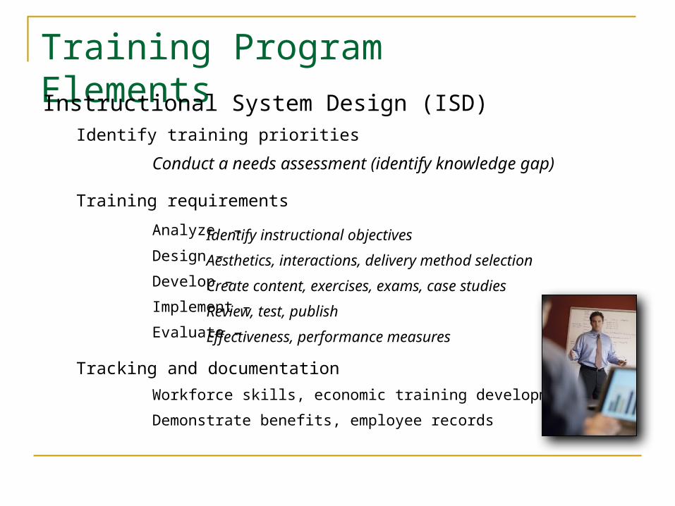
Training Program ElementsInstructional System Design (ISD)
Identify training priorities
Conduct a needs assessment (identify knowledge gap)
Training requirements
Analyze –
Design –
Develop –
Implement –
Evaluate –
Tracking and documentation
Workforce skills, economic training development
Demonstrate benefits, employee records
Identify instructional objectives
Aesthetics, interactions, delivery method selection
Create content, exercises, exams, case studies
Review, test, publish
Effectiveness, performance measures
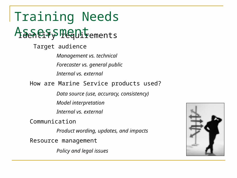
Identify requirements Target audience
Management vs. technical
Forecaster vs. general public
Internal vs. external
How are Marine Service products used?
Data source (use, accuracy, consistency)
Model interpretation
Internal vs. external
Communication
Product wording, updates, and impacts
Resource management
Policy and legal issues
Training Needs Assessment
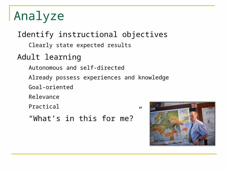
Identify instructional objectivesClearly state expected results
Adult learningAutonomous and self-directed
Already possess experiences and knowledge
Goal-oriented
Relevance
Practical
“What’s in this for me?”
Analyze

Example:Instructional objectives for NWS e-learning module
Kris Lander, PENWS Central Region HQ
NOAA
.
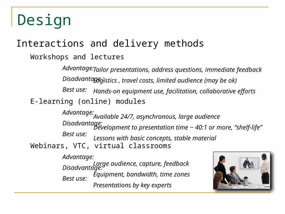
DesignInteractions and delivery methods
Workshops and lectures
Advantage:
Disadvantage :
Best use:
E-learning (online) modules
Advantage:
Disadvantage:
Best use:
Webinars, VTC, virtual classrooms
Advantage:
Disadvantage:
Best use:
Tailor presentations, address questions, immediate feedback
Logistics , travel costs, limited audience (may be ok)
Hands-on equipment use, facilitation, collaborative efforts
Available 24/7, asynchronous, large audience
Development to presentation time ~ 40:1 or more, “shelf-life”
Lessons with basic concepts, stable material
Large audience, capture, feedback
Equipment, bandwidth, time zones
Presentations by key experts
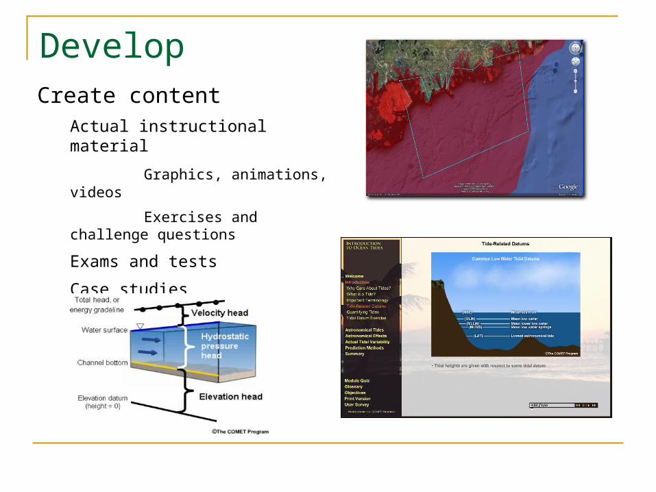
Create content Actual instructional material
Graphics, animations, videos
Exercises and challenge questions
Exams and tests
Case studies
Develop
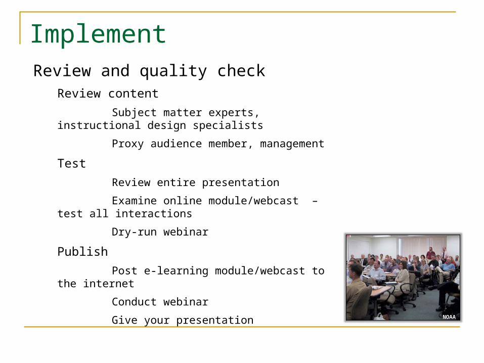
Review and quality checkReview content
Subject matter experts, instructional design specialists
Proxy audience member, management
Test
Review entire presentation
Examine online module/webcast – test all interactions
Dry-run webinar
Publish
Post e-learning module/webcast to the internet
Conduct webinar
Give your presentation
Implement
NOAA
Evaluate
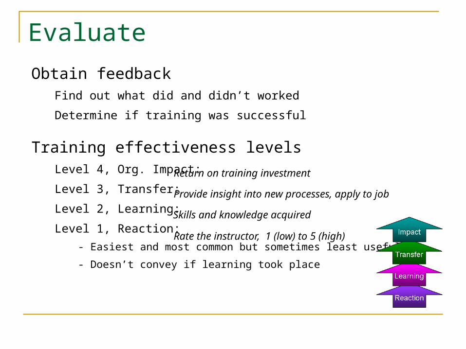
Obtain feedbackFind out what did and didn’t worked
Determine if training was successful
Training effectiveness levelsLevel 4, Org. Impact:
Level 3, Transfer:
Level 2, Learning:
Level 1, Reaction:
- Easiest and most common but sometimes least useful
- Doesn’t convey if learning took place
Rate the instructor, 1 (low) to 5 (high)
Return on training investment
Provide insight into new processes, apply to job
Skills and knowledge acquired
Tracking and DocumentationEnsure workforce skills to meet NOAA mission goals
Be economical in training developmentRapidly changing forecast and operational environmentLinks back to design decisions“Shelf life” of training, modification overhead
Show the benefits of trainingEnhance office expertiseAddress performance goalsJustify training budget
Employee records (OPM requirement)Training certificates, content, and history
Important for job competence

Example Presentation
“GIS Issues for Marine and Coastal Services”
Examine training principles we just discussedAnalyze
ObjectivesAdult learning
DesignAesthetics
DevelopContent
NOAA

GIS Issues for Marine and Coastal ServicesWhy is this presentation even needed?
• Tie the presentation to the NWS mission, customers and policies
Tie to NWS mission to protect life and property – Provide warnings and forecasts that are accurate, timely and verifiable with regard to both the science and the precise location of the products
Necessary skills - Understand how geospatial data are critical to useful, accurate and verifiable NWS products
Ties to customers and national policies – Products are based on geospatial data Require higher precisions and formats used within GIS.
Thus, training in geospatial data and management of that data is vital to the success of the NWS mission.

Increase awareness of GIS issues
Identify basic geospatial concepts
Understand key definitions
Appreciate changes taking place outside the agency
Recognize key management issues
Identify impacts on products
Manage programs with geospatial issues
Objectives
NOAA
GIS Issues for Marine and Coastal Services
• This is the “contract” with the audience

• Show the existing quality of geospatial data
NOAA
Why Care?

Long Island, NY
• Select a well known site
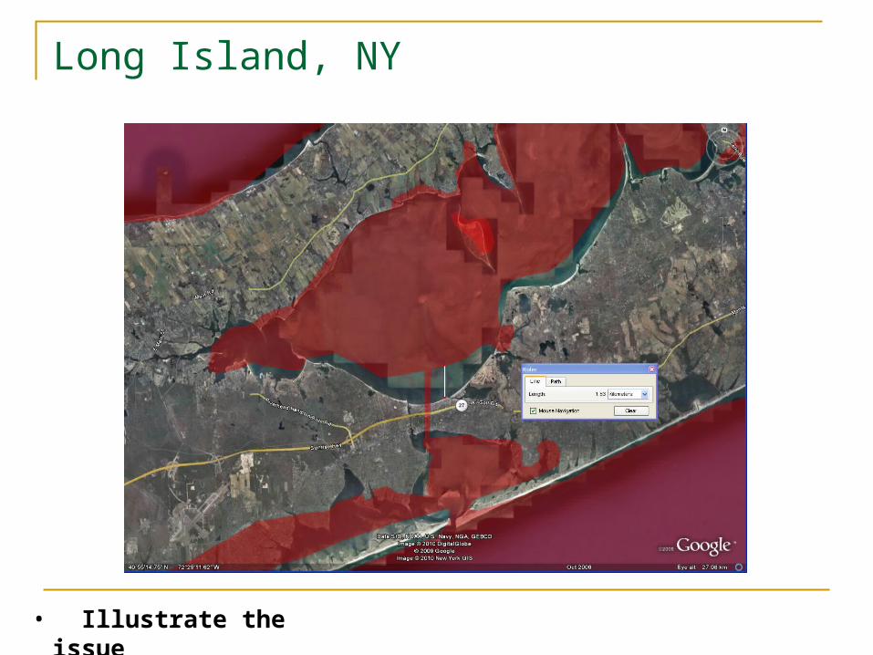
Long Island, NY
• Illustrate the issue
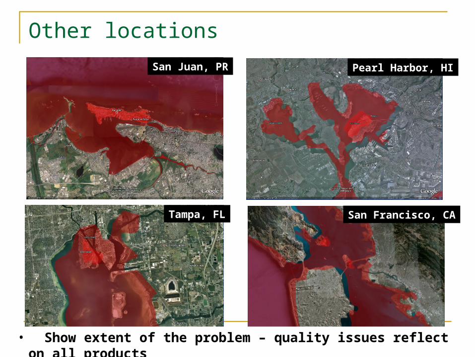
Other locations
San Francisco, CA
Pearl Harbor, HI
Tampa, FL
San Juan, PR
• Show extent of the problem – quality issues reflect on all products
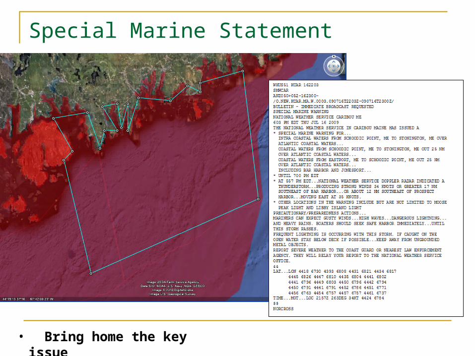
Special Marine Statement
• Bring home the key issue
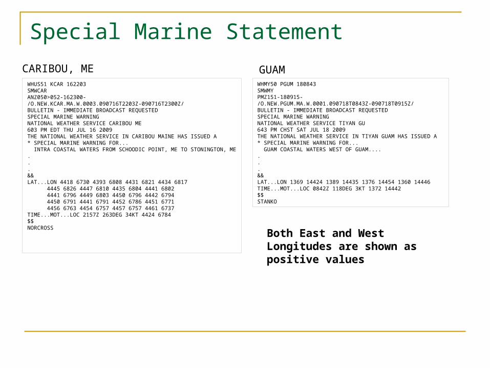
WHMY50 PGUM 180843SMWMY PMZ151-180915-/O.NEW.PGUM.MA.W.0001.090718T0843Z-090718T0915Z/BULLETIN - IMMEDIATE BROADCAST REQUESTEDSPECIAL MARINE WARNINGNATIONAL WEATHER SERVICE TIYAN GU643 PM CHST SAT JUL 18 2009THE NATIONAL WEATHER SERVICE IN TIYAN GUAM HAS ISSUED A* SPECIAL MARINE WARNING FOR... GUAM COASTAL WATERS WEST OF GUAM.......&&LAT...LON 1369 14424 1389 14435 1376 14454 1360 14446TIME...MOT...LOC 0842Z 118DEG 3KT 1372 14442$$STANKO
WHUS51 KCAR 162203SMWCARANZ050>052-162300-/O.NEW.KCAR.MA.W.0003.090716T2203Z-090716T2300Z/BULLETIN - IMMEDIATE BROADCAST REQUESTEDSPECIAL MARINE WARNINGNATIONAL WEATHER SERVICE CARIBOU ME603 PM EDT THU JUL 16 2009THE NATIONAL WEATHER SERVICE IN CARIBOU MAINE HAS ISSUED A* SPECIAL MARINE WARNING FOR... INTRA COASTAL WATERS FROM SCHOODIC POINT, ME TO STONINGTON, ME...&&LAT...LON 4418 6730 4393 6808 4431 6821 4434 6817 4445 6826 4447 6810 4435 6804 4441 6802 4441 6796 4449 6803 4450 6796 4442 6794 4450 6791 4441 6791 4452 6786 4451 6771 4456 6763 4454 6757 4457 6757 4461 6737TIME...MOT...LOC 2157Z 263DEG 34KT 4424 6784$$NORCROSS
Special Marine StatementCARIBOU, ME GUAM
Both East and West Longitudes are shown as positive values
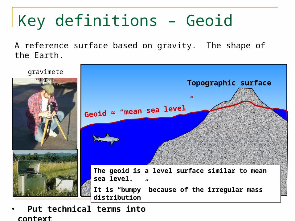
A reference surface based on gravity. The shape of the Earth.
Topographic surface
Geoid ≈ “mean sea level”
The geoid is a level surface similar to mean sea level.
It is “bumpy” because of the irregular mass distribution
gravimeter
Key definitions – Geoid
• Put technical terms into context
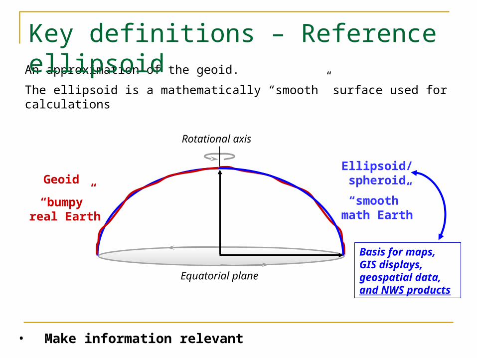
An approximation of the geoid.
The ellipsoid is a mathematically “smooth” surface used for calculations
Key definitions – Reference ellipsoid
• Make information relevant
Basis for maps, GIS displays, geospatial data, and NWS products
GeoidEllipsoid/ spheroid
“smooth” math Earth
Rotational axis
Equatorial plane
“bumpy” real Earth
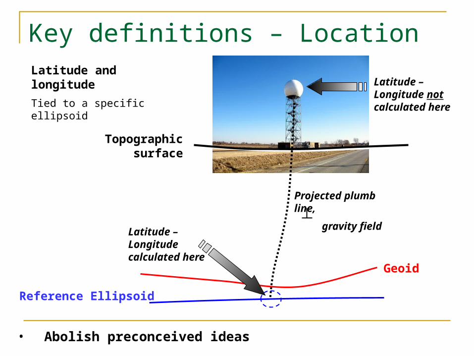
Geoid
Reference Ellipsoid
Topographic surface
Latitude – Longitude calculated here
Latitude and longitude
Tied to a specific ellipsoid
• Abolish preconceived ideas
Key definitions – Location
Latitude – Longitude not calculated here
Projected plumb line,
gravity field
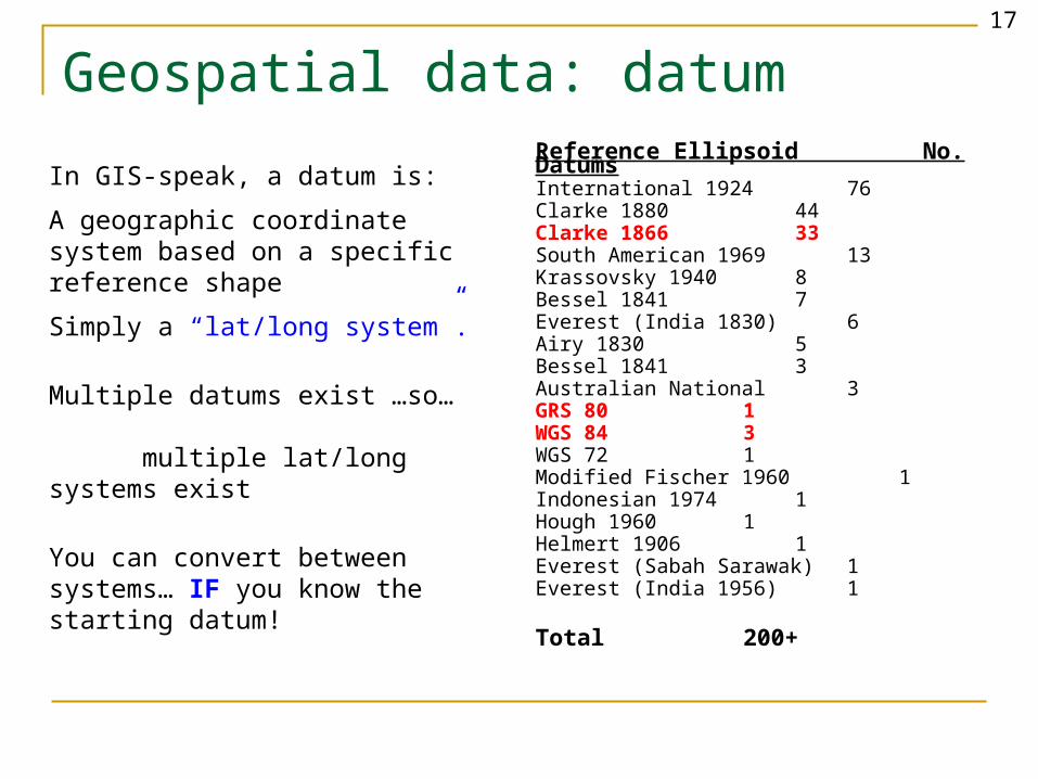
Reference Ellipsoid No. DatumsInternational 1924 76Clarke 1880 44Clarke 1866 33South American 1969 13Krassovsky 1940 8Bessel 1841 7Everest (India 1830) 6Airy 1830 5Bessel 1841 3Australian National 3GRS 80 1WGS 84 3WGS 72 1Modified Fischer 1960 1Indonesian 1974 1Hough 1960 1Helmert 1906 1Everest (Sabah Sarawak) 1Everest (India 1956) 1
Total 200+
In GIS-speak, a datum is:
A geographic coordinate system based on a specific reference shape
Simply a “lat/long system”.
Multiple datums exist …so… multiple lat/long systems exist
You can convert between systems… IF you know the starting datum!
Geospatial data: datum17
Changes outside the agency Key elements for future modernized projects
Provide critical support for NOAA’s Mission
- Provide information for safe, efficient, and environmentally sound transportation
Ocean and coastal resource protection, restoration, and management
Serve society’s needs for weather and water information
Support the Nation’s commerce
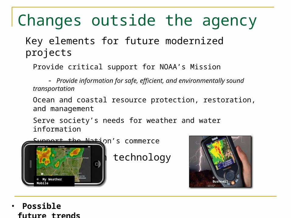
Keep pace with technology
• Possible future trends
© Bushnell© My Weather Mobile
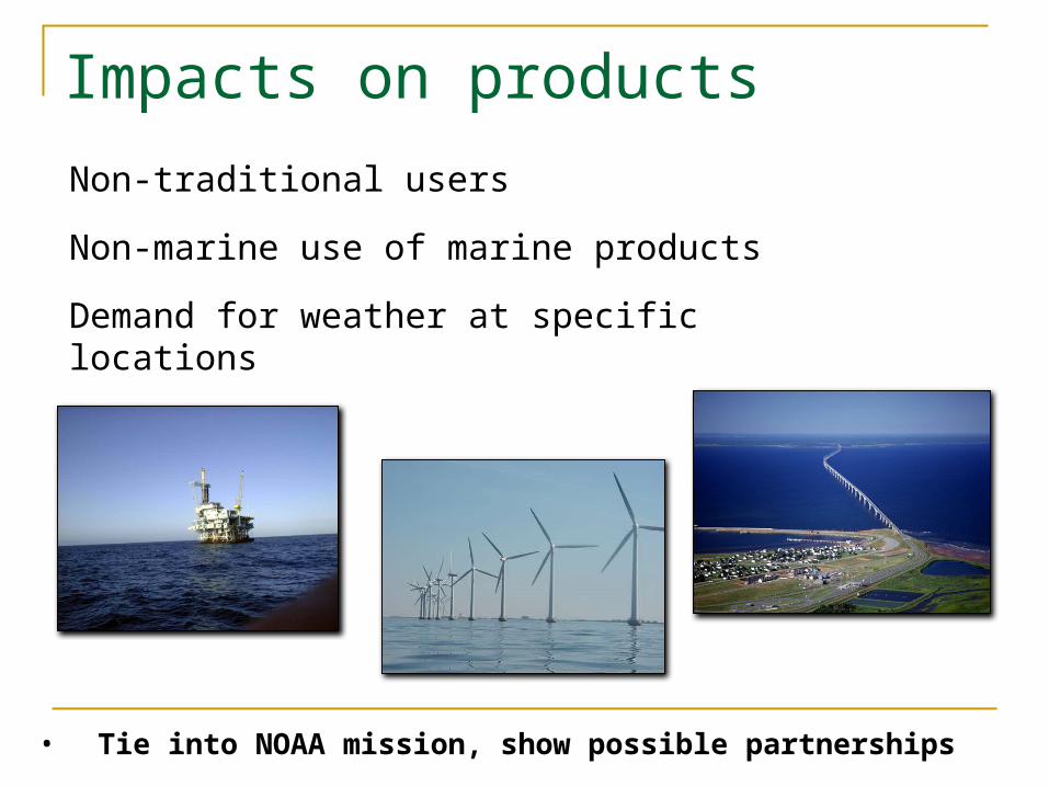
Impacts on productsNon-traditional users
Non-marine use of marine products
Demand for weather at specific locations
• Tie into NOAA mission, show possible partnerships
Manage Resource Allocation
Programs affectedAny GIS/geospatial related projects
Any operational product with location information
Cooperative efforts with other agencies
Timeframes and budgetsFuture customer driven products and services
Training needed on software, equipment, techniques
• Key take-away, geospatial is here and will become more important

SummaryTraining program elements
Instructional System Design (ISD) principles
Training needs assessment
Define training requirements
Analyze, Design, Develop, Implement, Evaluate
Tracking and documentation
Geospatial issuesNeed for awareness
Understand key concepts
Changes taking place outside the agency
Key management issuesGo Rainier!
Finally
Questions
Thank you
Recommended