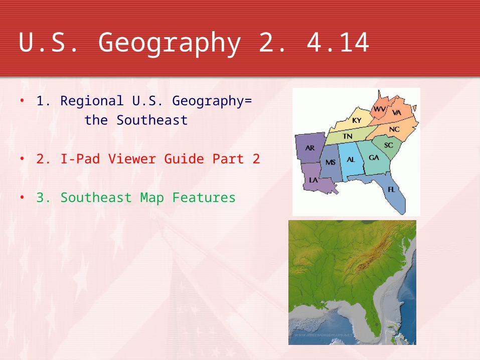
U.S. Geography 2. 4.14
• 1. Regional U.S. Geography=the Southeast
• 2. I-Pad Viewer Guide Part 2
• 3. Southeast Map Features
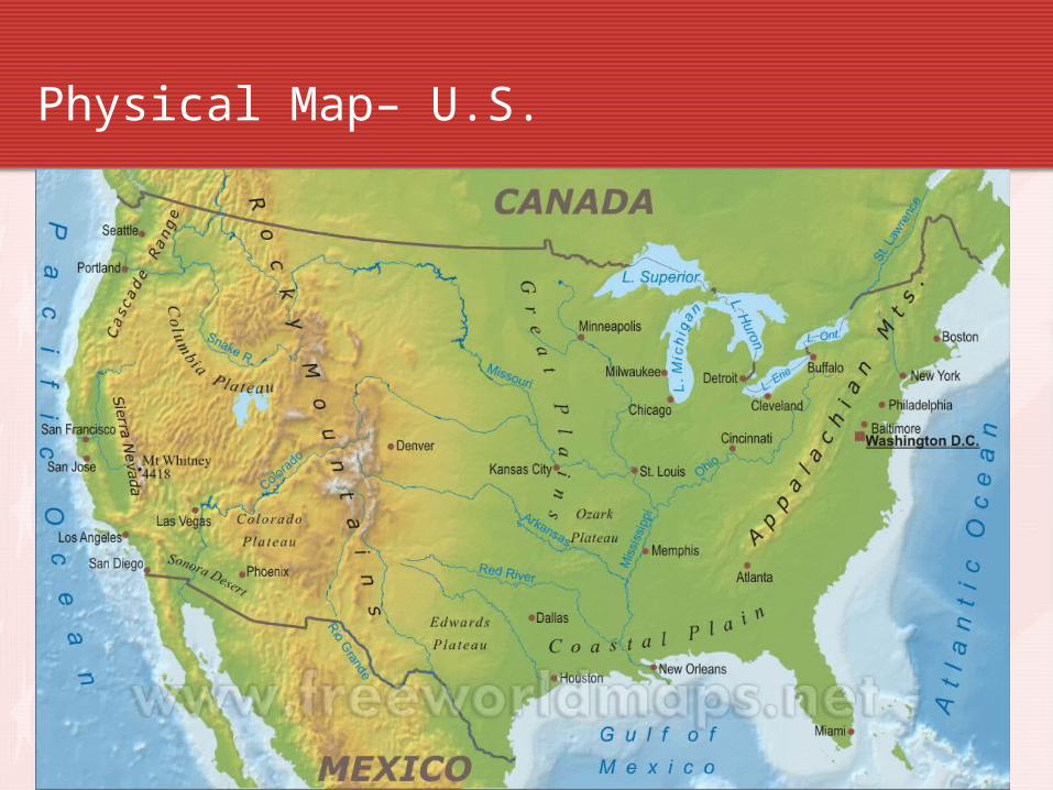
Physical Map– U.S.
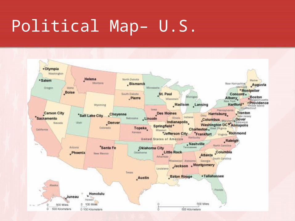
Political Map– U.S.
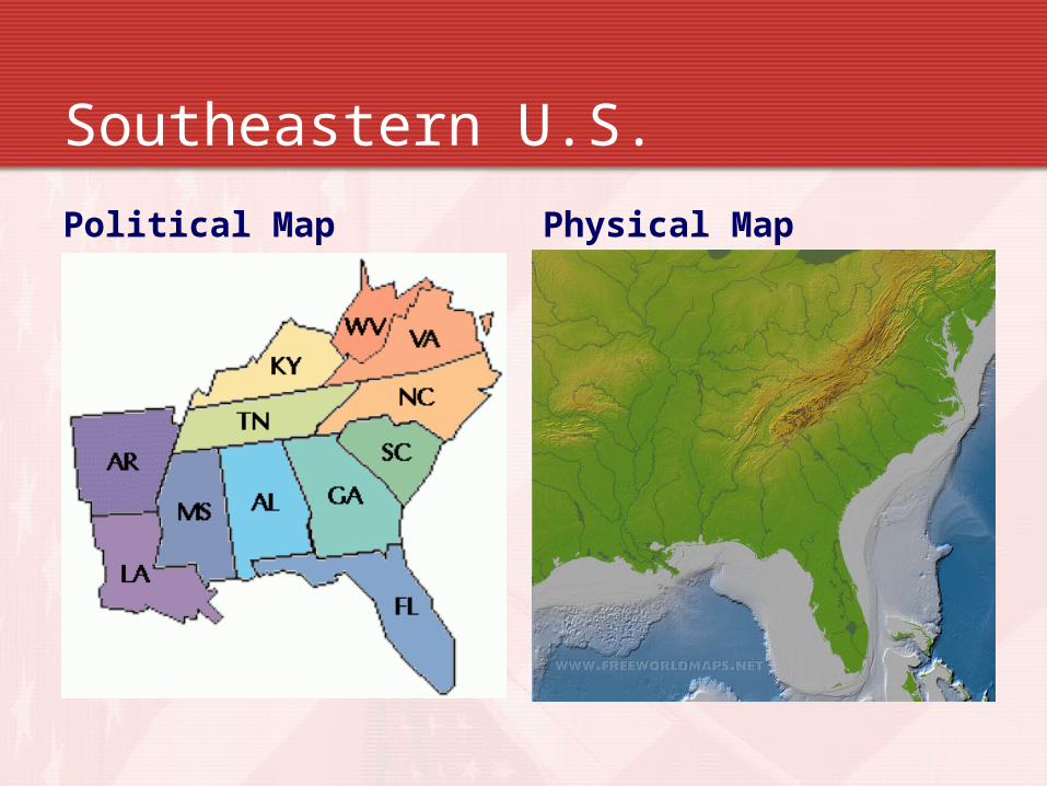
Southeastern U.S.
Political Map Physical Map
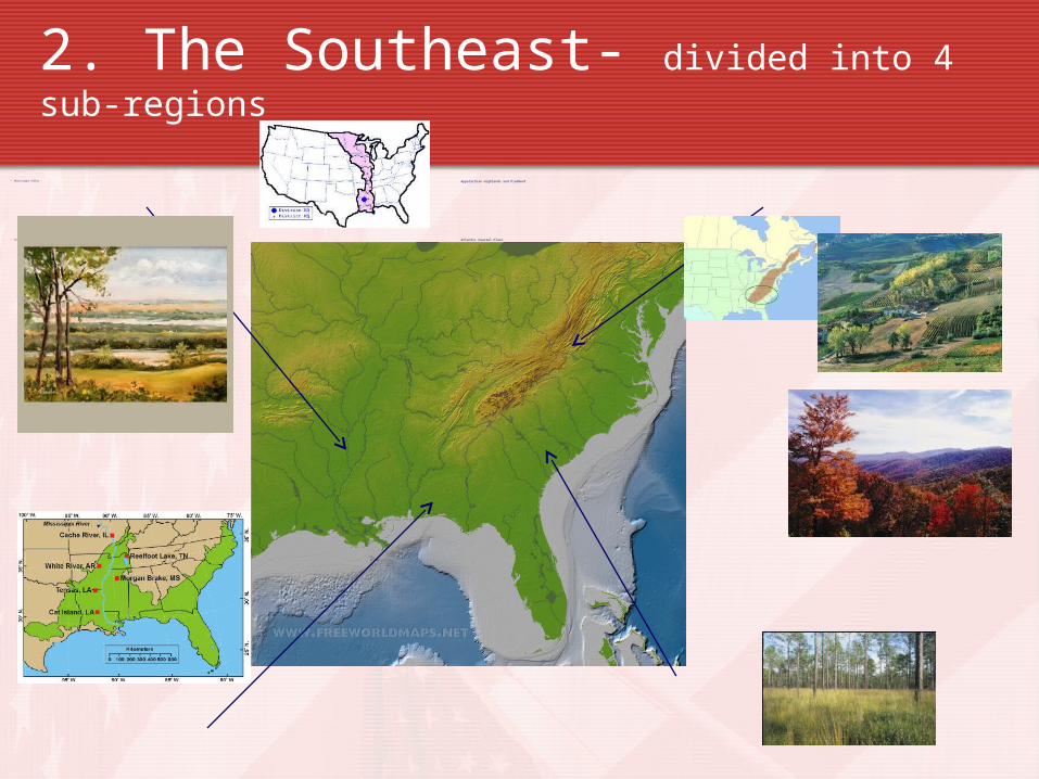
2. The Southeast- divided into 4 sub-regions
Appalachian Highlands and Piedmont
Atlantic Coastal Plain
• Mississippi Valley
• Gulf Coastal Plain
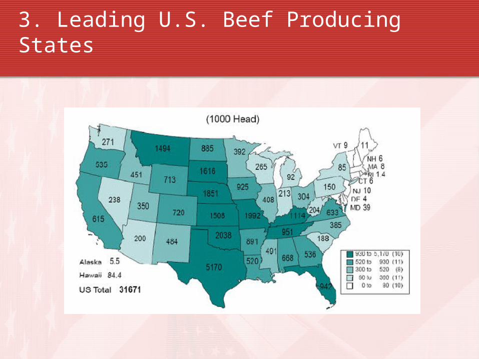
3. Leading U.S. Beef Producing States
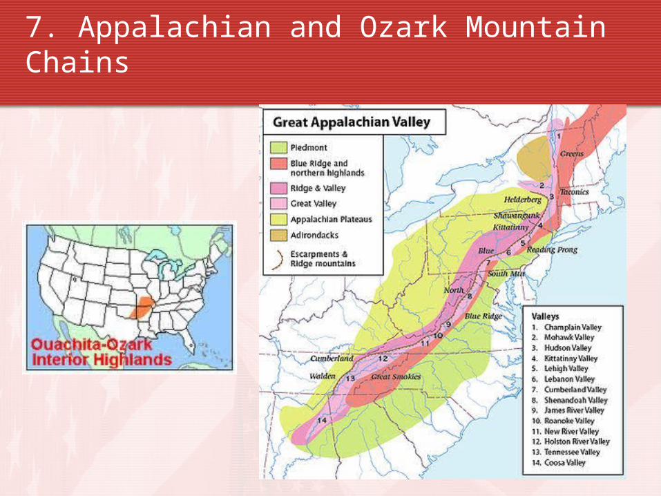
7. Appalachian and Ozark Mountain Chains
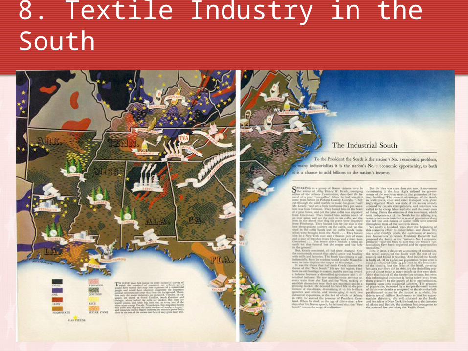
8. Textile Industry in the South
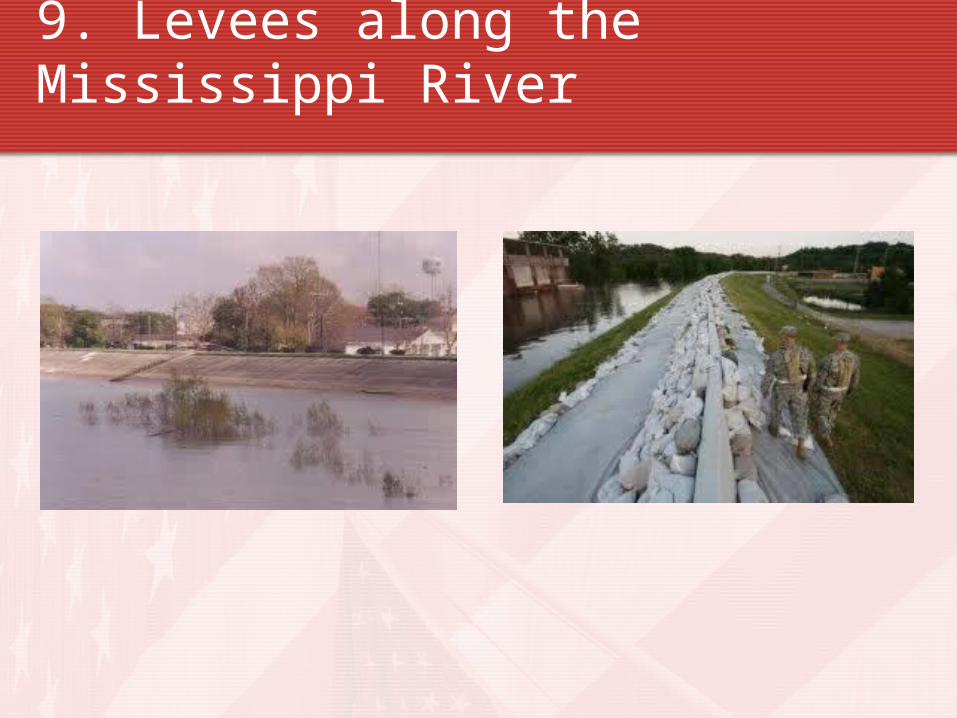
9. Levees along the Mississippi River
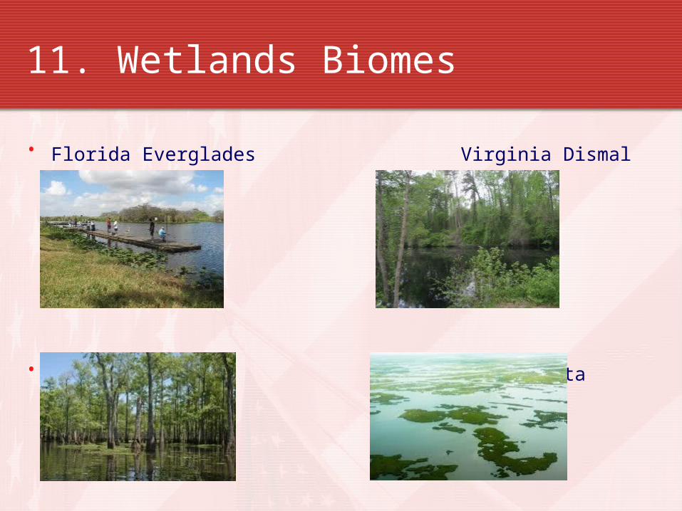
11. Wetlands Biomes
• Florida Everglades Virginia Dismal Swamp
• Louisiana Bayou Mississippi Delta
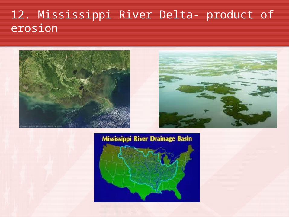
12. Mississippi River Delta- product of erosion
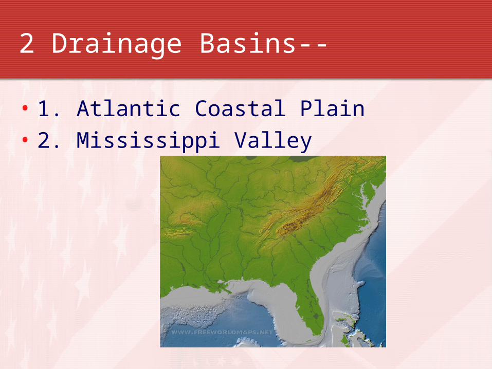
2 Drainage Basins--
• 1. Atlantic Coastal Plain• 2. Mississippi Valley
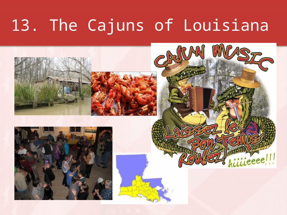
13. The Cajuns of Louisiana
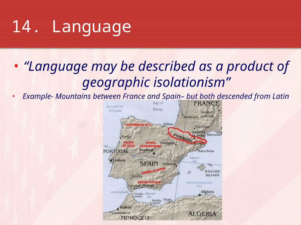
14. Language
• “Language may be described as a product of geographic isolationism”
• Example- Mountains between France and Spain– but both descended from Latin
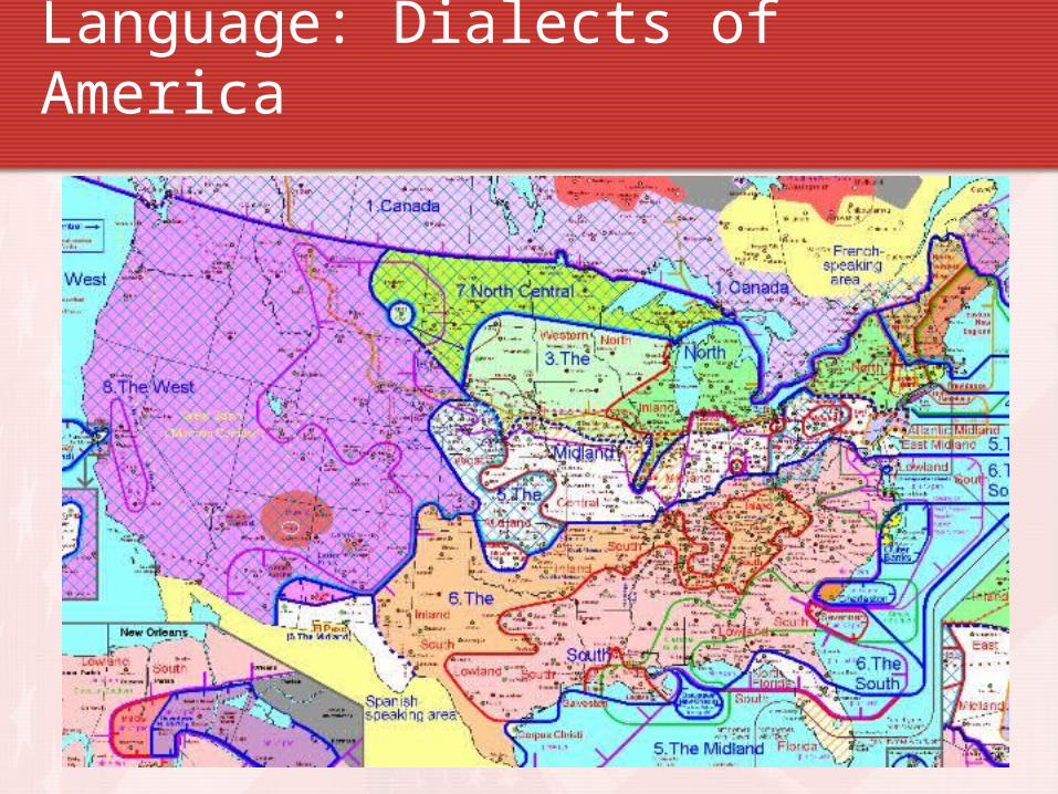
Language: Dialects of America
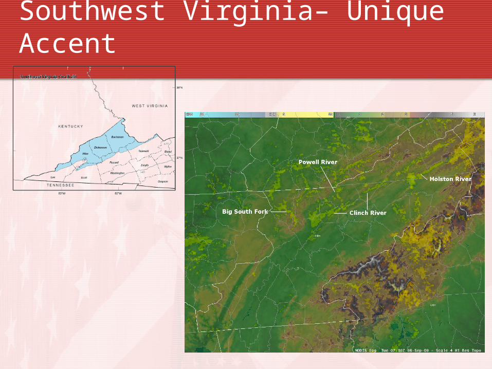
Southwest Virginia– Unique Accent

• Click on…. A State and City of the Southeastern United States– Your Choice
15. http://www.city-data.com/
Recommended