Embed Size (px)
Citation preview

Maps are not just for Geographers!Use cases for getting the most out of Digimap
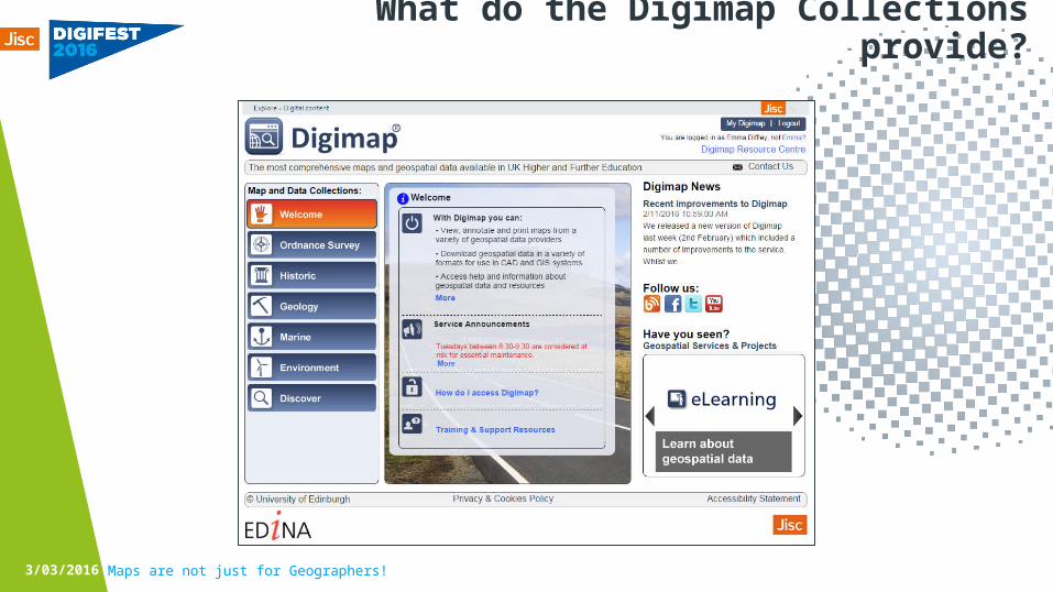
What do the Digimap Collections provide?
3/03/2016 Maps are not just for Geographers!
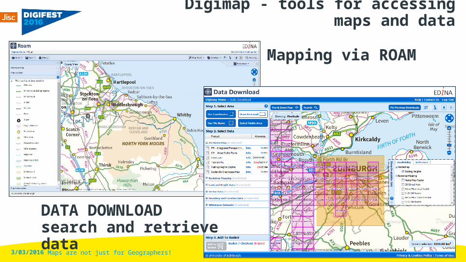
Digimap - tools for accessing maps and data
Mapping via ROAM
3/03/2016 Maps are not just for Geographers!
DATA DOWNLOAD search and retrieve data
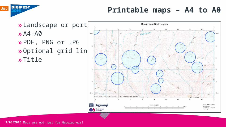
Printable maps – A4 to A0»Landscape or portrait»A4-A0»PDF, PNG or JPG»Optional grid lines»Title
3/03/2016 Maps are not just for Geographers!
Maps are not just for Geographers!
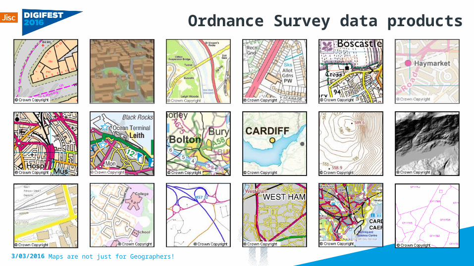
Ordnance Survey data products
3/03/2016
Maps are not just for Geographers!
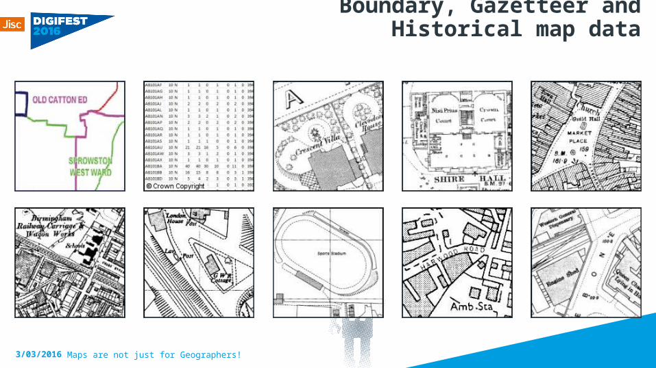
Boundary, Gazetteer and Historical map data
3/03/2016
Maps are not just for Geographers!
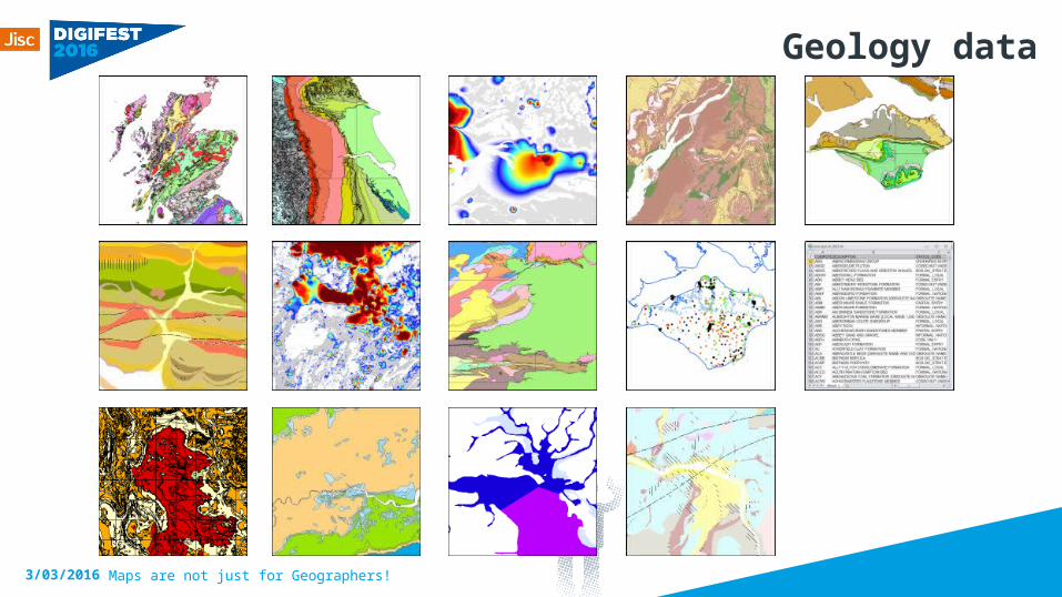
Geology data
3/03/2016
Maps are not just for Geographers!
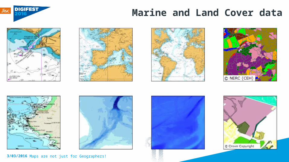
Marine and Land Cover data
3/03/2016
Maps are not just for Geographers!
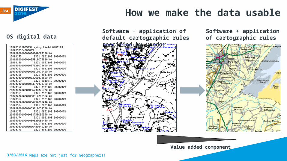
How we make the data usable
3/03/2016
Software + application of cartographic rules
Software + application of default cartographic rules specified by vendor
Value added component
11000152100913Playing Field 0901103 120001016400000%2100000010001004040097130 0%15000155 0321 0901103 0000000%2100000010001055810075820 0%15000156 0321 0901103 0000000%2100000010001057130076690 0%15000157 0321 0901103 0000000%2100000010001060110075460 0%15000158 0321 0901103 0000000%2100000010001063260074650 0%15000159 0321 8010619 0000000%2100000010001063370071760 0%15000160 0321 0901103 0000000%2100000010001066730076700 0%15000161 0321 0901103 0000000%2100000010001058910068550 0%15000162 0321 0901103 0000000%2100000010001064490069040 0%15000164 0321 0901103 0000000%2100000010001055710052730 0%15000173 0321 0901103 0000000%2100000010001058730050390 0%15000174 0321 0901103 0000000%2100000010001059520050430 0%15000175 0321 0901103 0000000%2100000010001056430049210 0%15000176 0321 0901103 0000000%
OS digital data
Maps are not just for Geographers!
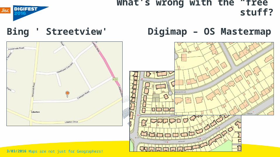
What’s wrong with the “free” stuff?
Bing ' Streetview' Digimap – OS Mastermap
3/03/2016
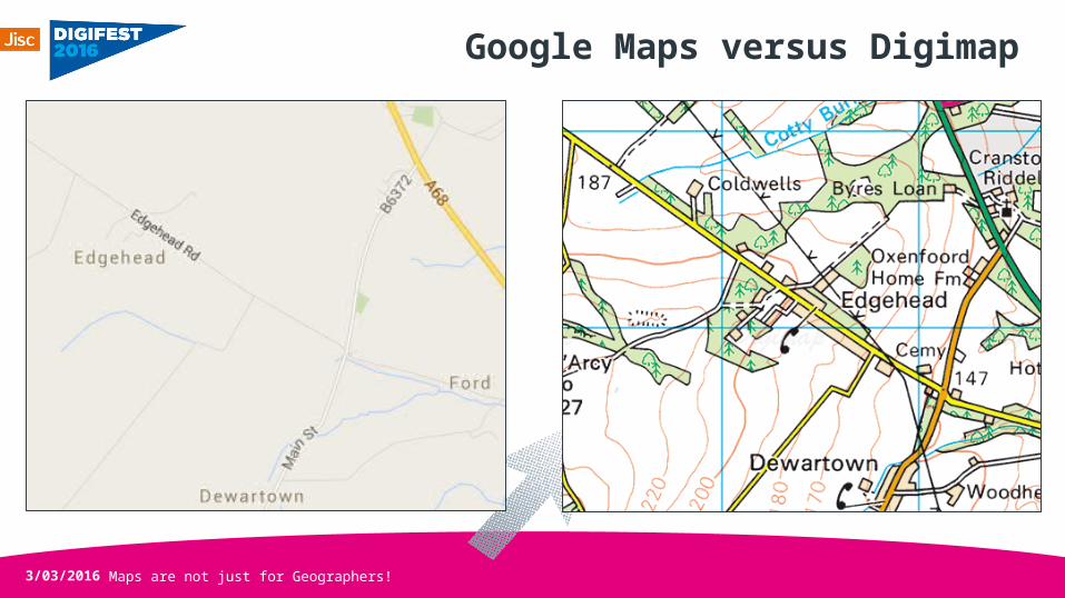
Google Maps versus Digimap
3/03/2016 Maps are not just for Geographers!
Demo
3/03/2016 Maps are not just for Geographers!
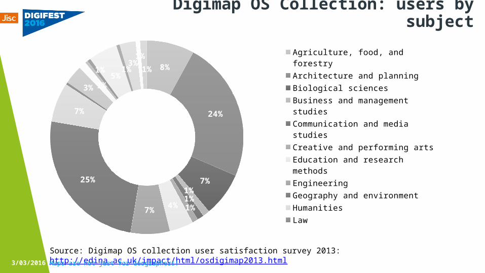
Surely maps are just for geographers?
»Far from it»Digimap has been operating since 2000 and the number of
geographers has been consistent since then at around 20-25% of all users
»Full range of disciplines represented across 65,000 users»Staff and students, research and teaching all represented
3/03/2016 Maps are not just for Geographers!
Maps are not just for Geographers!
Digimap OS Collection: users by subject
Source: Digimap OS collection user satisfaction survey 2013: http://edina.ac.uk/impact/html/osdigimap2013.html3/03/2016
8%
24%
7%1%1%1%4%7%
25%
7%
3% 1%
1%5%
1%3%1%
1%
Agriculture, food, and forestryArchitecture and planningBiological sciencesBusiness and management studiesCommunication and media studiesCreative and performing artsEducation and research methodsEngineeringGeography and environmentHumanitiesLawMathematics and computer scienceMedicine including dentistryModern languages and area studiesNursing, midwifery and allied healthPhysical sciencesPsychologySocial sciencesVeterinary medicineOther
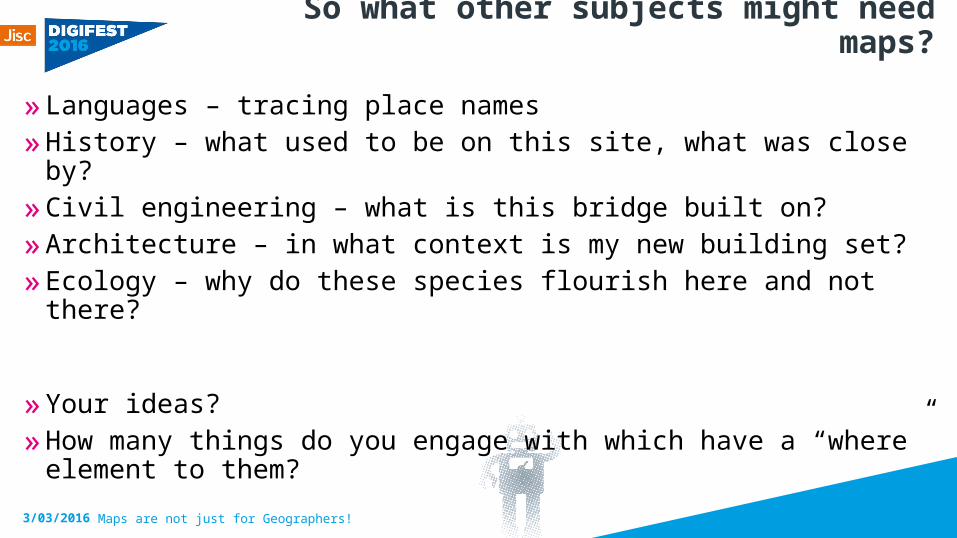
So what other subjects might need maps?
»Languages – tracing place names»History – what used to be on this site, what was close by?»Civil engineering – what is this bridge built on?»Architecture – in what context is my new building set? »Ecology – why do these species flourish here and not there?
»Your ideas?»How many things do you engage with which have a “where”
element to them?
3/03/2016 Maps are not just for Geographers!
Maps are not just for Geographers!
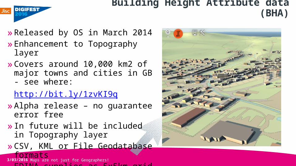
Building Height Attribute data (BHA)
»Released by OS in March 2014»Enhancement to Topography
layer»Covers around 10,000 km2 of
major towns and cities in GB - see where:http://bit.ly/1zvKI9q
»Alpha release – no guarantee error free
» In future will be included in Topography layer
»CSV, KML or File Geodatabase formats
»EDINA supplies as 5x5km grid tiles
3/03/2016
Maps are not just for Geographers!
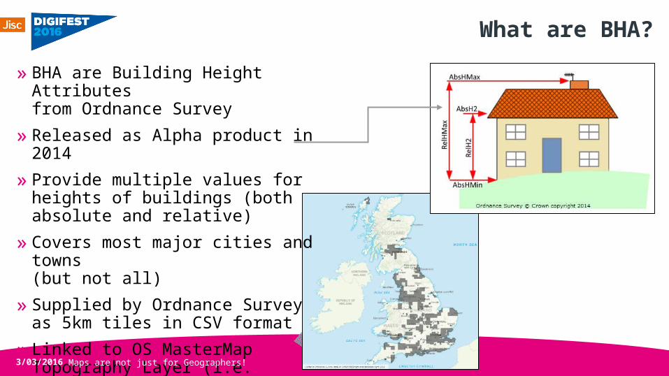
What are BHA?» BHA are Building Height
Attributes from Ordnance Survey
» Released as Alpha product in 2014
» Provide multiple values for heights of buildings (both absolute and relative)
» Covers most major cities and towns (but not all)
» Supplied by Ordnance Survey as 5km tiles in CSV format
» Linked to OS MasterMap Topography Layer (i.e. building footprints) by TOID
3/03/2016
Maps are not just for Geographers!
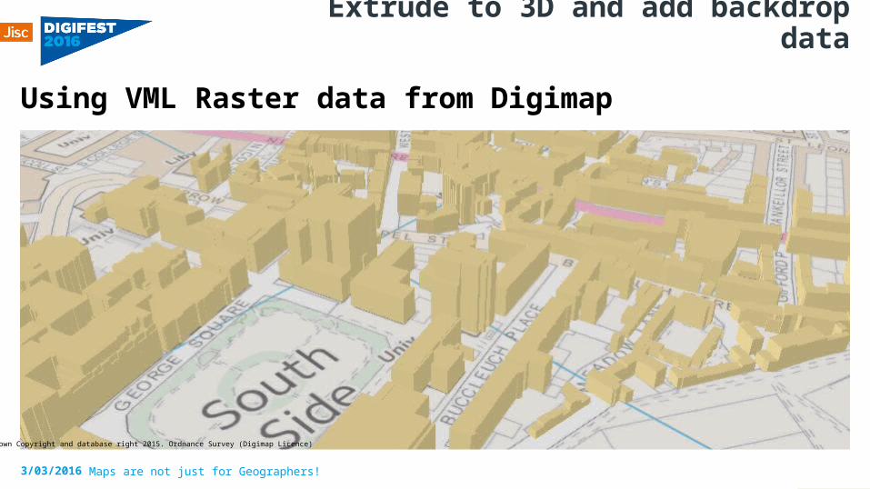
Extrude to 3D and add backdrop data
Using VML Raster data from Digimap
3/03/2016
© Crown Copyright and database right 2015. Ordnance Survey (Digimap Licence)
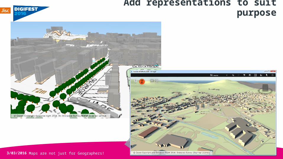
Add representations to suit purpose
3/03/2016 Maps are not just for Geographers!
Maps are not just for Geographers!
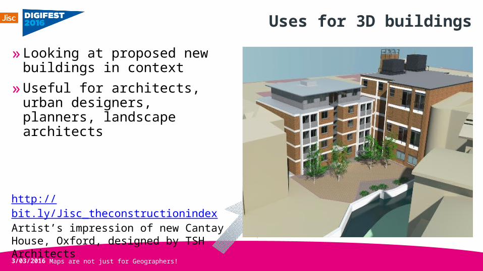
Uses for 3D buildings»Looking at proposed new
buildings in context»Useful for architects, urban
designers, planners, landscape architects
3/03/2016
http://bit.ly/Jisc_theconstructionindexArtist’s impression of new Cantay House, Oxford, designed by TSH Architects
Maps are not just for Geographers!
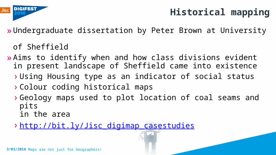
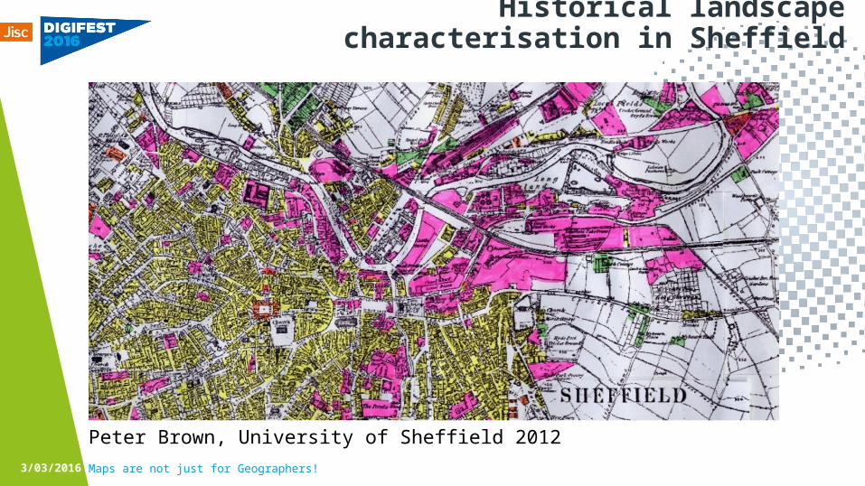
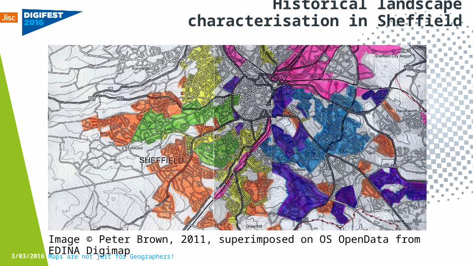
Historical mapping»Undergraduate dissertation by Peter Brown at University
of Sheffield»Aims to identify when and how class divisions evident in present
landscape of Sheffield came into existence› Using Housing type as an indicator of social status› Colour coding historical maps› Geology maps used to plot location of coal seams and pits
in the area› http://bit.ly/Jisc_digimap_casestudies
3/03/2016
Maps are not just for Geographers!
Historical landscape characterisation in Sheffield
Click to icon to add image
Peter Brown, University of Sheffield 20123/03/2016
Maps are not just for Geographers!
Historical landscape characterisation in Sheffield
Click to icon to add image
Image © Peter Brown, 2011, superimposed on OS OpenData from EDINA Digimap 3/03/2016
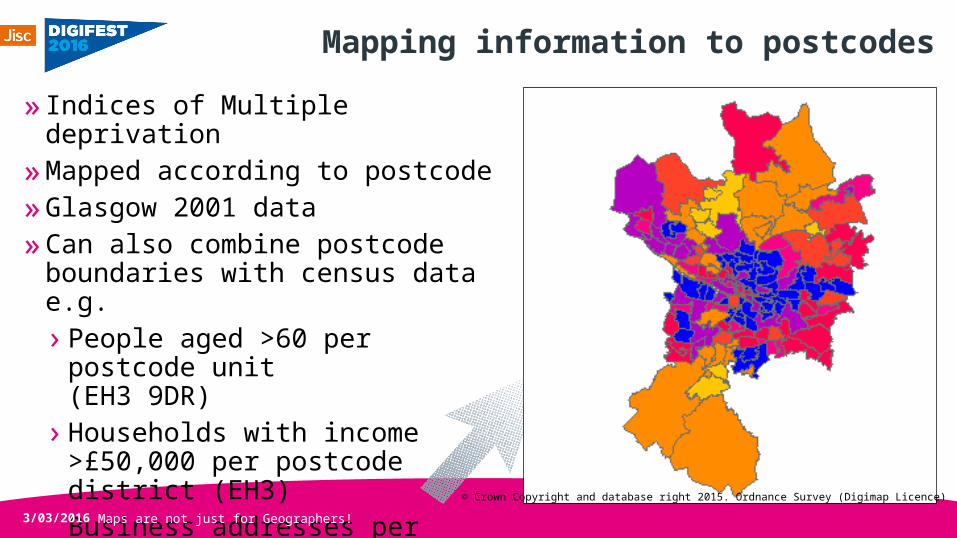
Mapping information to postcodes» Indices of Multiple deprivation »Mapped according to postcode»Glasgow 2001 data»Can also combine postcode
boundaries with census data e.g.› People aged >60 per postcode
unit (EH3 9DR)
› Households with income >£50,000 per postcode district (EH3)
› Business addresses per postcode sector (EH3 9)
3/03/2016 Maps are not just for Geographers!© Crown Copyright and database right 2015. Ordnance Survey (Digimap Licence)
Maps are not just for Geographers!
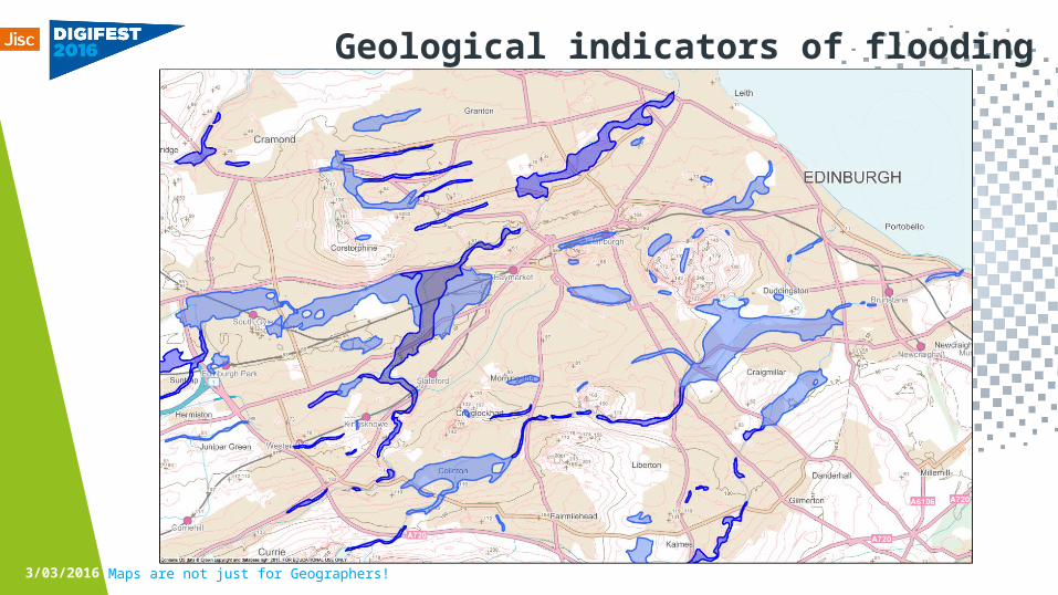
Geological indicators of flooding
3/03/2016
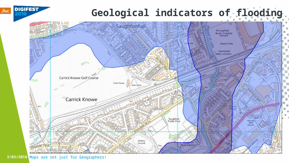
Maps are not just for Geographers!
Geological indicators of flooding
Click to icon to add image
3/03/2016
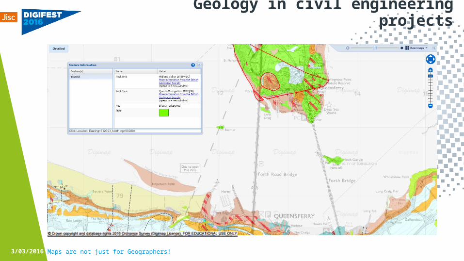
Maps are not just for Geographers!
Geology in civil engineering projects
Click to icon to add image
3/03/2016

Forth Crossing analysis»Create a cross section to
analyse water depth using bathymetry data
3/03/2016 Maps are not just for Geographers!© Crown Copyright and database right 2015. Ordnance Survey (Digimap Licence)
Maps are not just for Geographers!
Training materials and case studies
» More case studies in the Digimap Resources Centre› http://bit.ly/Jisc_digimap_resources
»Training exercises with detailed instructions› http://bit.ly/Jisc_digimap_training
»Workshop materials› http://bit.ly/Jisc_digimap_workshopmaterials
3/03/2016

jisc.ac.uk
Any questions?
ContactEmma DiffleyEDINA, University of EdinburghHelpdesk: [email protected] 650 3302http://digimap.edina.ac.uk
3/03/2016 Maps are not just for Geographers!


![WELCOME [faculty.umb.edu]faculty.umb.edu/david.tenenbaum/eeos265/eeos265-whatisgis.pdf · •Primarily, geographers make maps •maps of place names •maps of human population and](https://img.pdfslide.net/doc/110x75/5e83f3521413ed57513366bd/welcome-aprimarily-geographers-make-maps-amaps-of-place-names-amaps-of.jpg)