Embed Size (px)
Citation preview
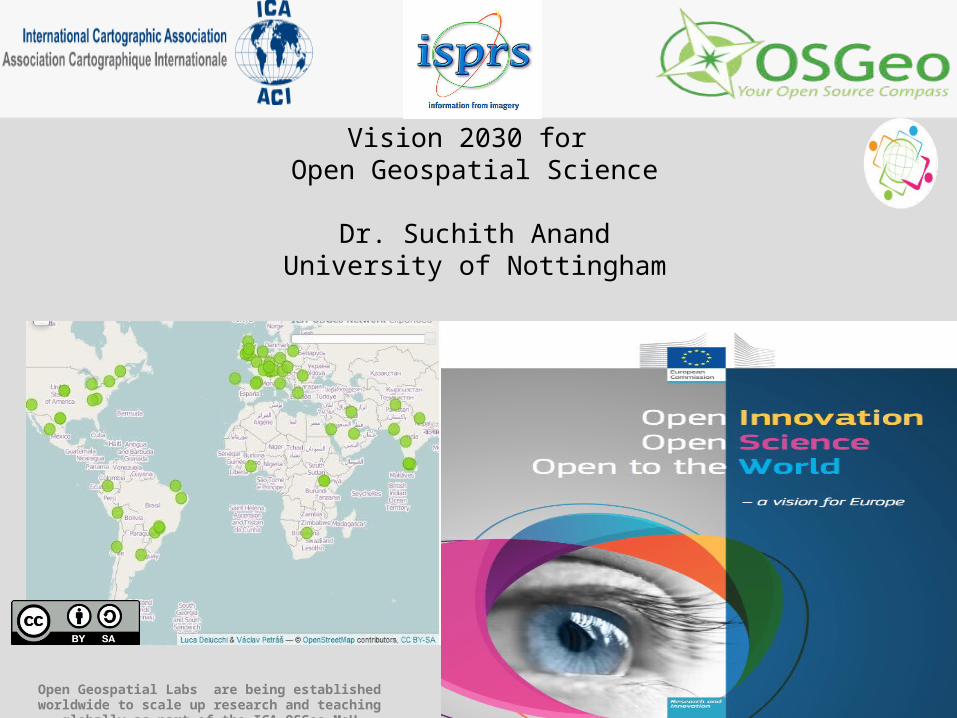
Vision 2030 for Open Geospatial Science
Dr. Suchith AnandUniversity of Nottingham
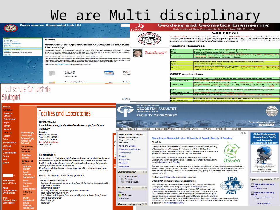
Open Geospatial Labs are being established worldwide to scale up research and teaching globally as part of the ICA-OSGeo MoU
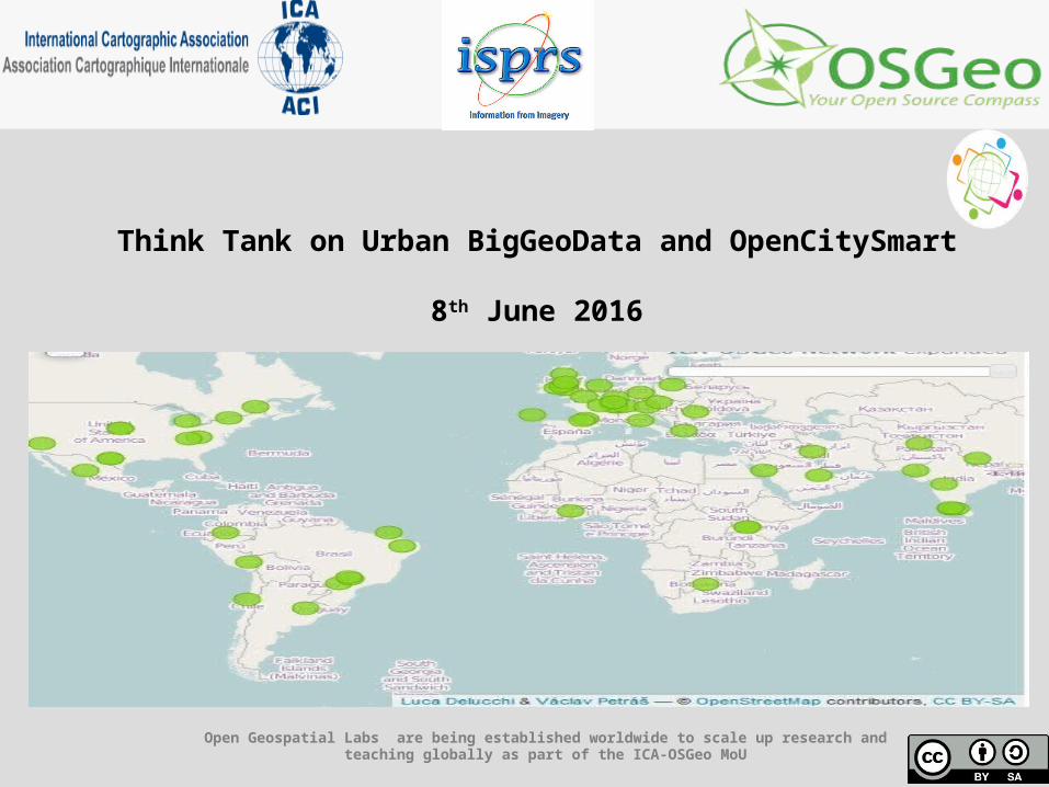
Think Tank on Urban BigGeoData and OpenCitySmart
8th June 2016
Open Geospatial Labs are being established worldwide to scale up research and teaching globally as part of the ICA-OSGeo MoU
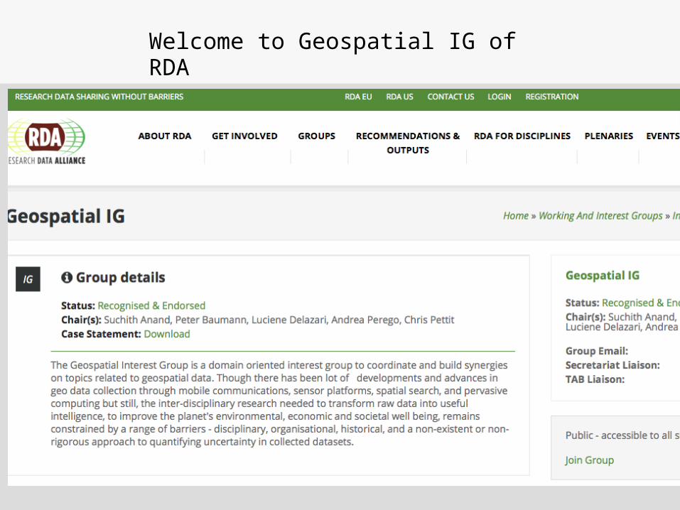
Welcome to Geospatial IG of RDA
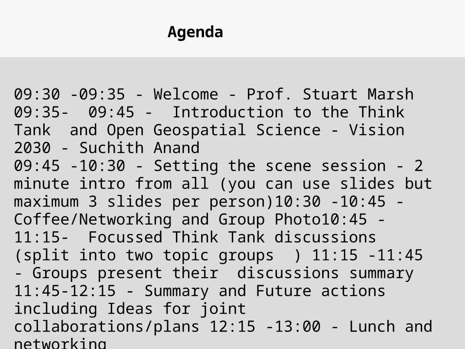
Agenda
09:30 -09:35 - Welcome - Prof. Stuart Marsh 09:35- 09:45 - Introduction to the Think Tank and Open Geospatial Science - Vision 2030 - Suchith Anand 09:45 -10:30 - Setting the scene session - 2 minute intro from all (you can use slides but maximum 3 slides per person)10:30 -10:45 - Coffee/Networking and Group Photo10:45 -11:15- Focussed Think Tank discussions (split into two topic groups ) 11:15 -11:45 - Groups present their discussions summary 11:45-12:15 - Summary and Future actions including Ideas for joint collaborations/plans 12:15 -13:00 - Lunch and networking
http://bookshop.europa.eu/en/open-innovation-open-science-open-to-the-world-pbKI0416263/
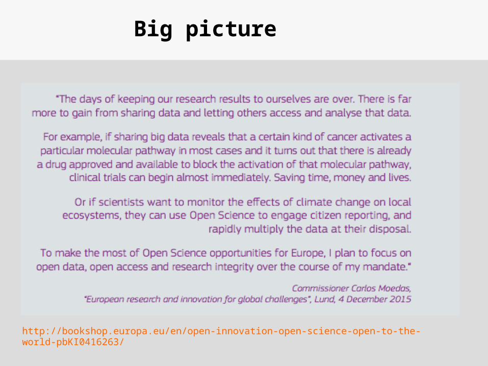
Big picture
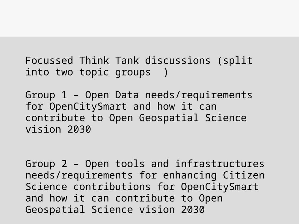
Focussed Think Tank discussions (split into two topic groups )
Group 1 – Open Data needs/requirements for OpenCitySmart and how it can contribute to Open Geospatial Science vision 2030
Group 2 – Open tools and infrastructures needs/requirements for enhancing Citizen Science contributions for OpenCitySmart and how it can contribute to Open Geospatial Science vision 2030
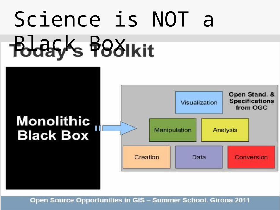
Science is NOT a Black Box
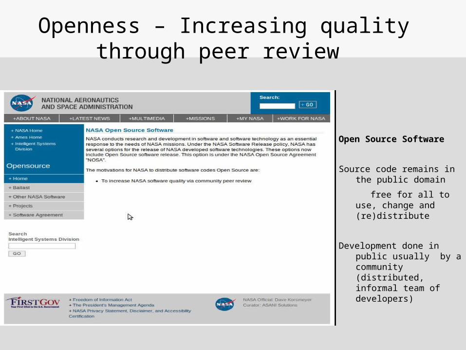
Openness – Increasing quality through peer review
Open Source Software
Source code remains in the public domain
free for all to use, change and (re)distribute
Development done in public usually by a community (distributed, informal team of developers)
Open Geospatial Science builds upon the idea of Open science that scientific knowledge of all kinds are able to be develop more rapidly and in a more productive manner if openly shared (as early as is practical in the discovery process).
The key ingredients to make Open Geospatial Science possible is Open Principles (open source geospatial software, open data, open standards and open access to research publications) .
There are many dimensions to “Open”
• Open source software.
• Open data.
• Open standards.
• Open access to research publications.
• Open education resources
But fundamentally it is based on Open Principles
An example of the impact of Openness - GODAN
Impact is the positive changes to the lives of people
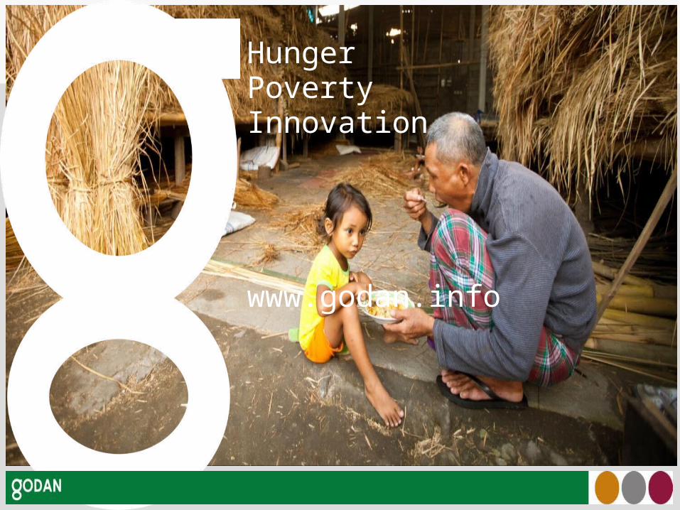
HungerPovertyInnovation
www.godan.info
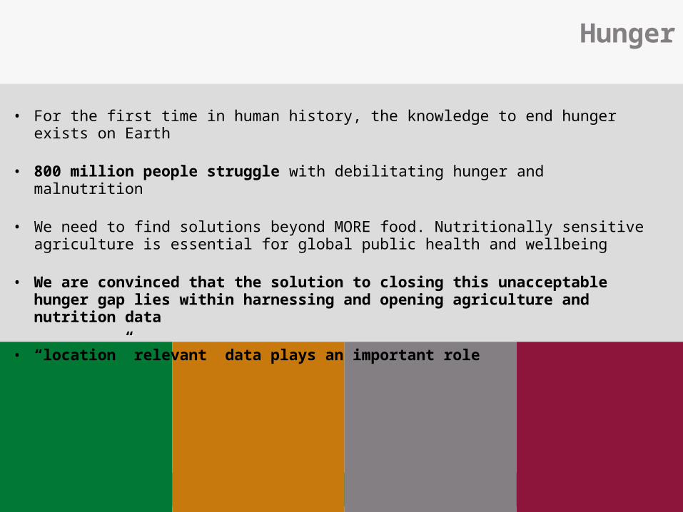
Hunger
• For the first time in human history, the knowledge to end hunger exists on Earth
• 800 million people struggle with debilitating hunger and malnutrition
• We need to find solutions beyond MORE food. Nutritionally sensitive agriculture is essential for global public health and wellbeing
• We are convinced that the solution to closing this unacceptable hunger gap lies within harnessing and opening agriculture and nutrition data
• “location” relevant data plays an important role
Making Geospatial education and opportunities
accessible to all
“Geo for All”
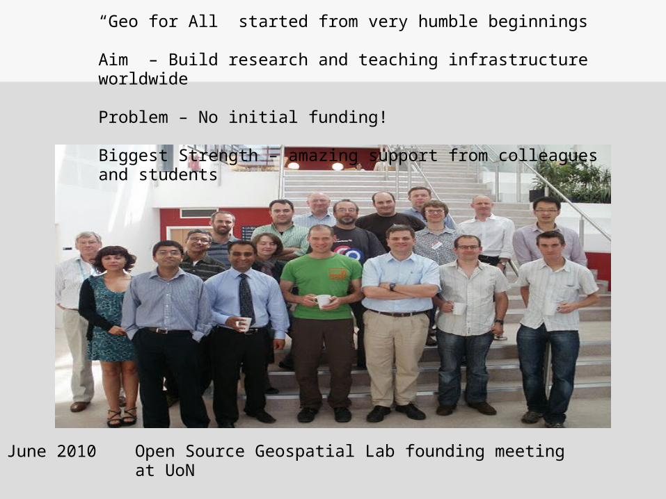
June 2010
“Geo for All” started from very humble beginnings
Aim – Build research and teaching infrastructure worldwide
Problem – No initial funding!
Biggest Strength – amazing support from colleagues and students
Open Source Geospatial Lab founding meeting at UoN
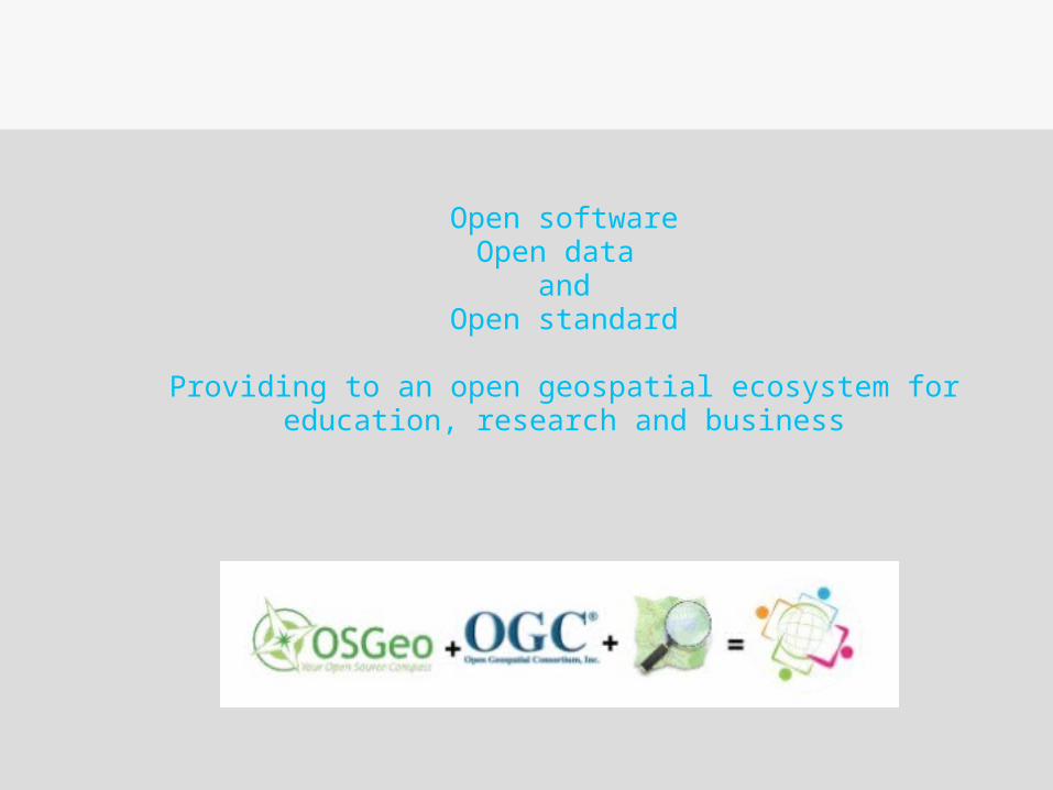
Open softwareOpen data
andOpen standard
Providing to an open geospatial ecosystem for education, research and business
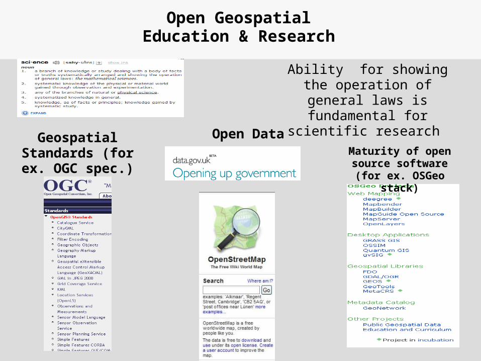
Open Geospatial Education & Research
Geospatial Standards (for ex. OGC spec.)
Maturity of open source software (for
ex. OSGeo stack)
Open Data
Ability for showing the operation of general laws
is fundamental for scientific research
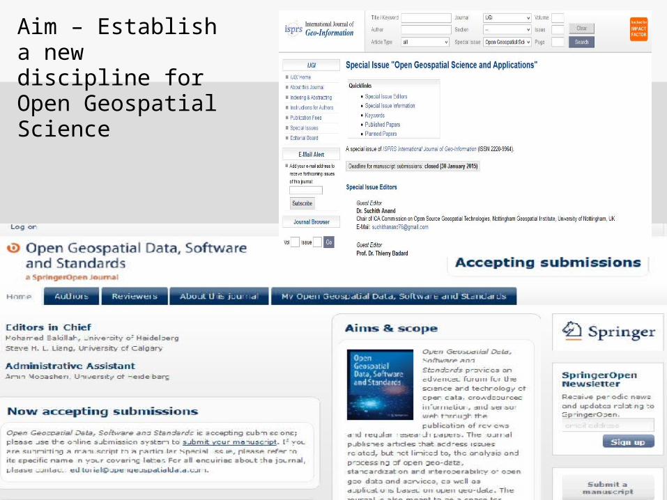
Aim – Establish a new discipline for Open Geospatial Science
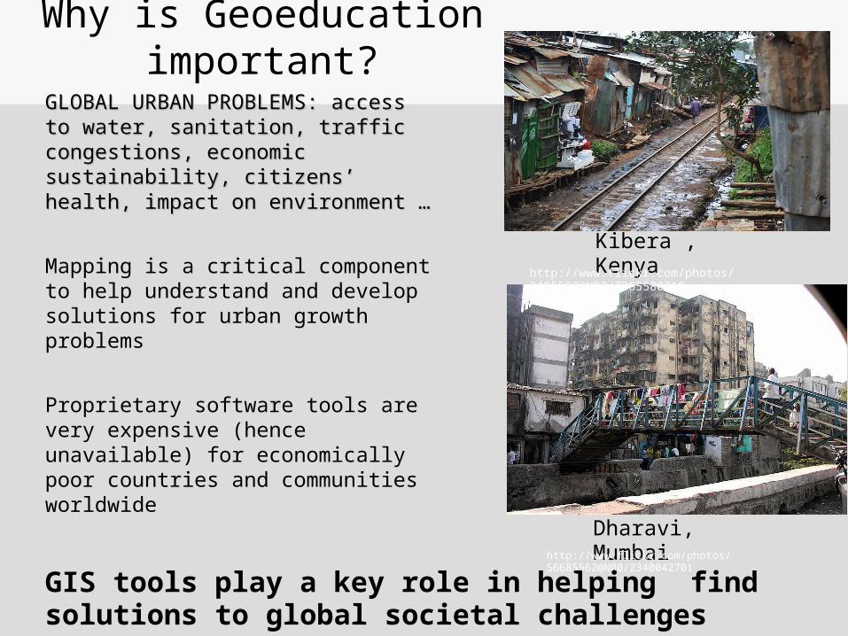
GLOBAL URBAN PROBLEMS: GLOBAL URBAN PROBLEMS: access to water, sanitation, traffic access to water, sanitation, traffic congestions, economic sustainability, congestions, economic sustainability, citizenscitizens’’ health, impact on health, impact on environment …environment …
Mapping is a critical component to help understand and develop solutions for urban growth problems
Proprietary software tools are very expensive (hence unavailable) for economically poor countries and communities worldwide
Why is Geoeducation important?
Kibera , Kenya
Dharavi, Mumbaihttp://www.flickr.com/photos/56685562@N00/2340042701
http://www.flickr.com/photos/8485582@N07/7365580810
GIS tools play a key role in helping find solutions to global societal challenges
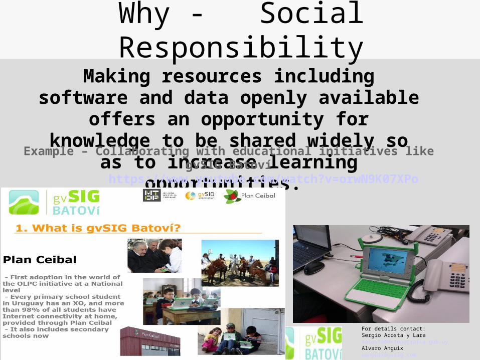
Why - Social ResponsibilityMaking resources including software and
data openly available offers an opportunity for knowledge to be shared widely so as to
increase learning opportunities. Example – Collaborating with educational initiatives like gvSIG Batoví
For details contact:Sergio Acosta y [email protected] Alvaro [email protected]
https://www.youtube.com/watch?v=orwN9K07XPo
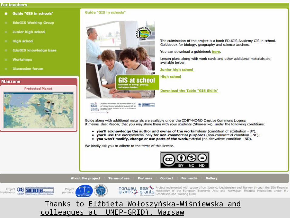
Thanks to Elżbieta Wołoszyńska-Wiśniewska and colleagues at UNEP-GRID), Warsaw
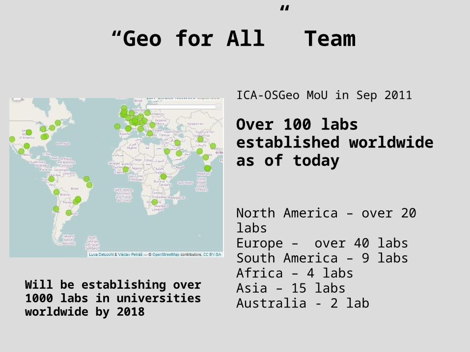
“Geo for All” Team
ICA-OSGeo MoU in Sep 2011
Over 100 labs established worldwide as of today
North America – over 20 labsEurope – over 40 labsSouth America – 9 labsAfrica – 4 labsAsia – 15 labsAustralia - 2 lab
Will be establishing over 1000 labs in universities worldwide by 2018
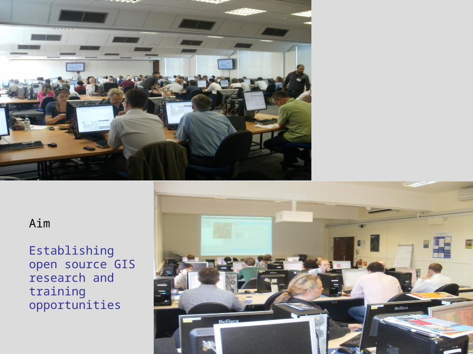
Aim
Establishing open source GIS research and training opportunities
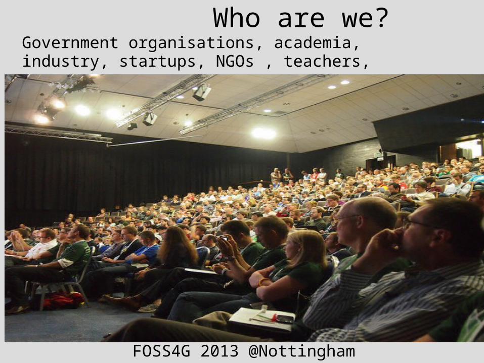
Who are we?Government organisations, academia, industry, startups, NGOs , teachers, students, …
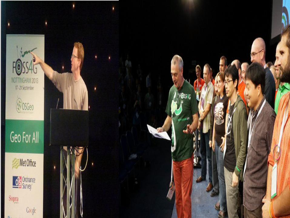
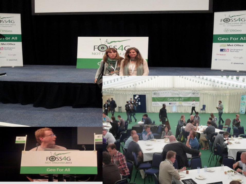
FOSS4G 2013 @Nottingham
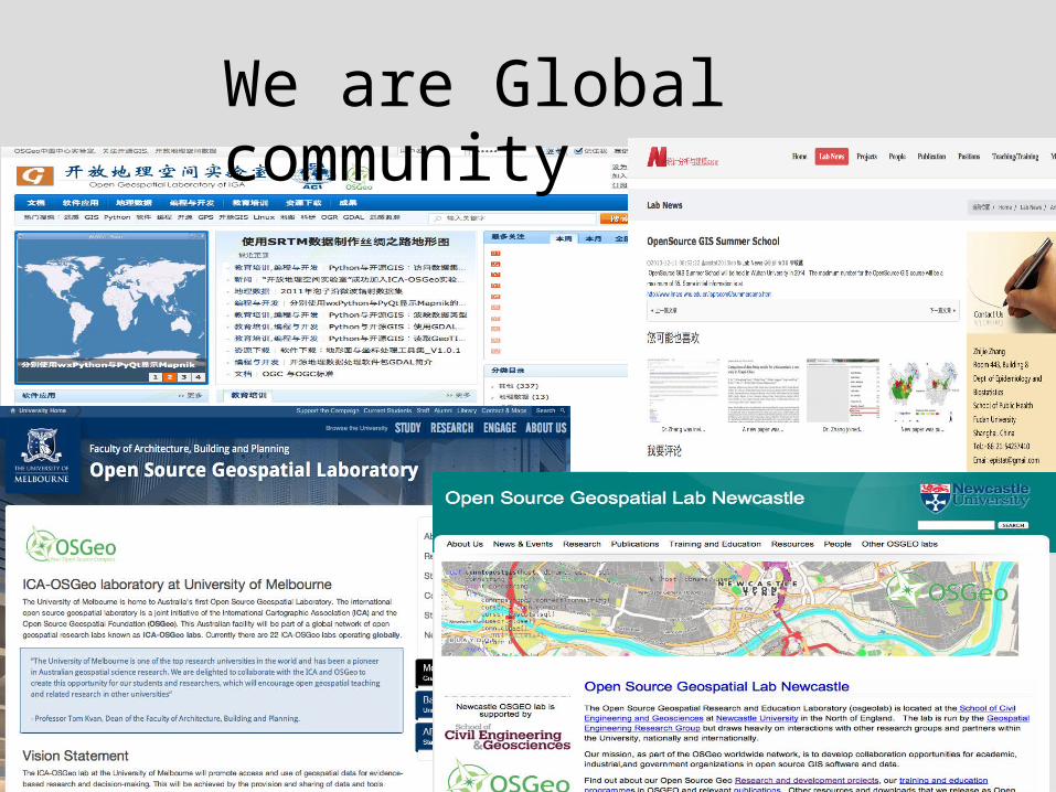
We are Global community
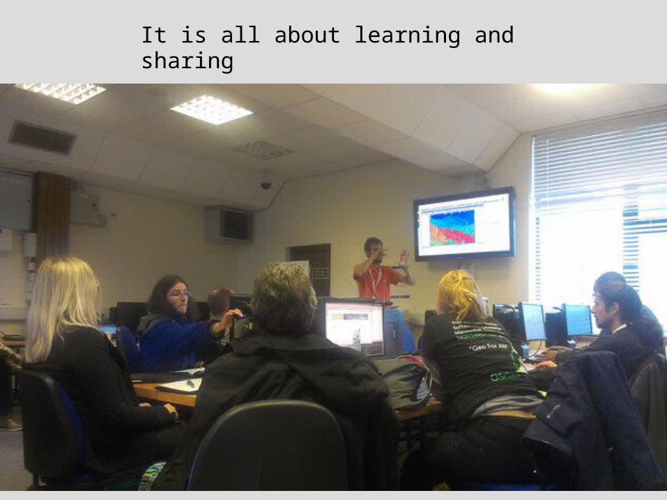
It is all about learning and sharing

Open GIS Summer School in Girona
We are Multi disciplinary
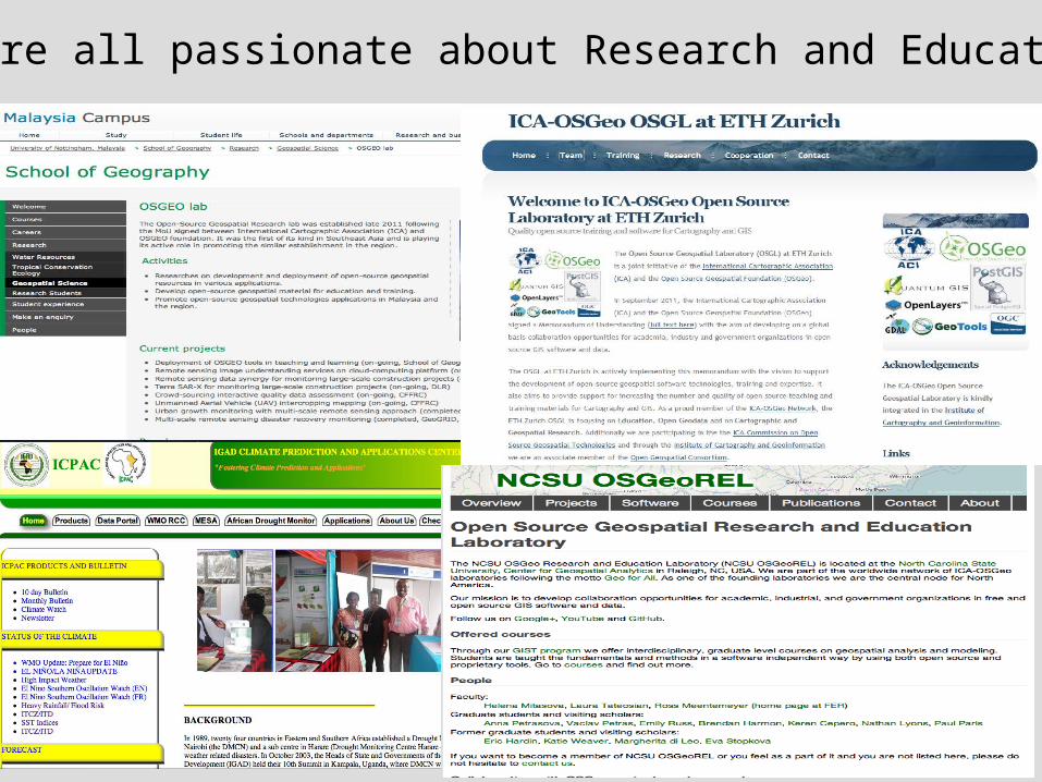
We are all passionate about Research and Education
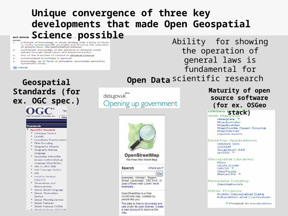
Geospatial Standards (for ex. OGC spec.)
Maturity of open source software (for
ex. OSGeo stack)
Open Data
Ability for showing the operation of general laws
is fundamental for scientific research
Unique convergence of three key developments that made Open Geospatial Science possible
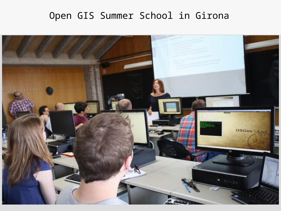
Open GIS Summer School in Girona
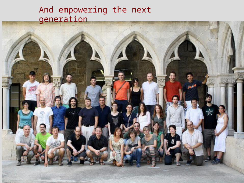
And empowering the next generation
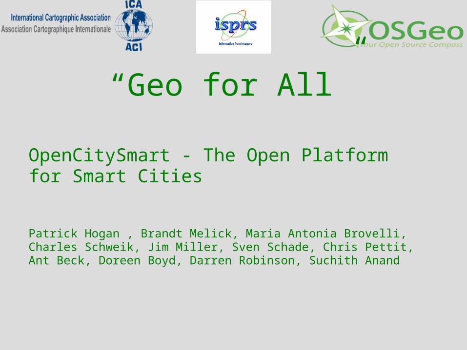
“Geo for All”
OpenCitySmart - The Open Platform for Smart Cities
Patrick Hogan , Brandt Melick, Maria Antonia Brovelli, Charles Schweik, Jim Miller, Sven Schade, Chris Pettit, Ant Beck, Doreen Boyd, Darren Robinson, Suchith Anand
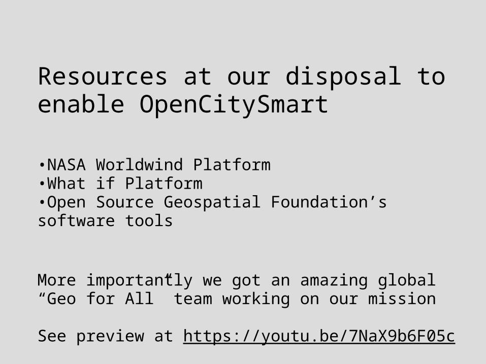
Resources at our disposal to enable OpenCitySmart
•NASA Worldwind Platform•What if Platform•Open Source Geospatial Foundation’s software tools
More importantly we got an amazing global “Geo for All” team working on our mission
See preview at https://youtu.be/7NaX9b6F05c
http://bookshop.europa.eu/en/open-innovation-open-science-open-to-the-world-pbKI0416263
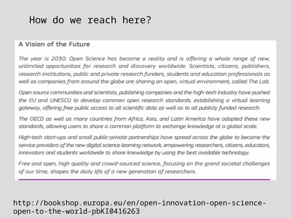
How do we reach here?
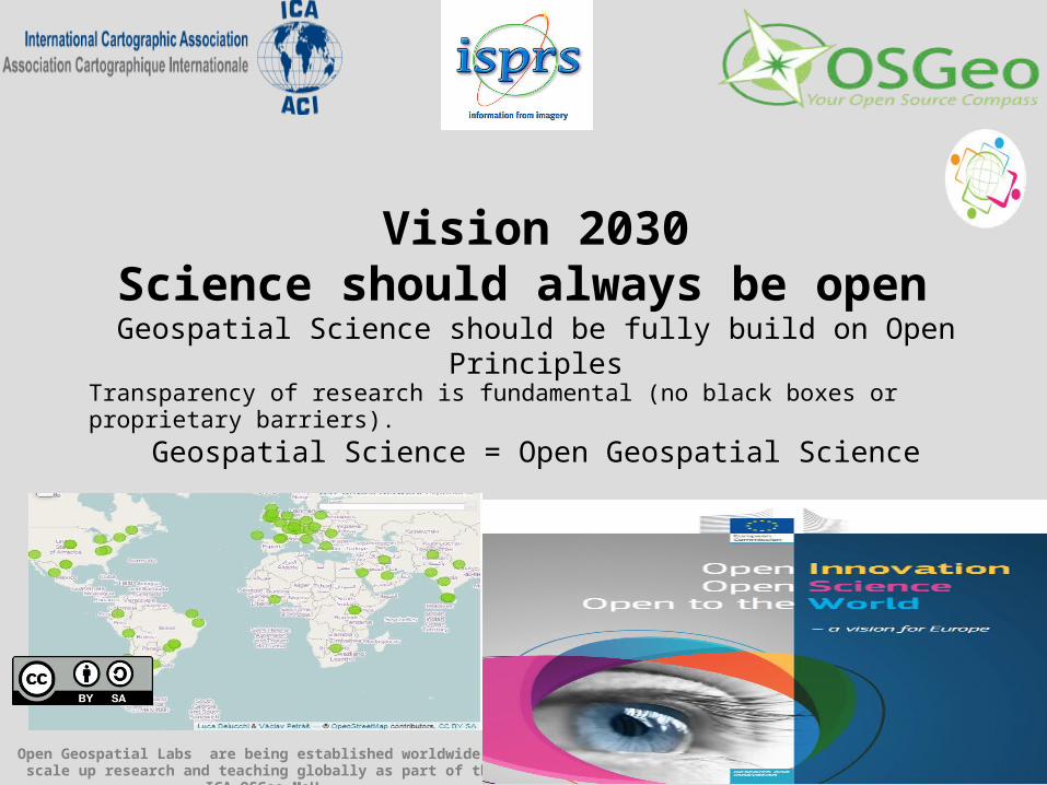
Vision 2030Science should always be open
Geospatial Science should be fully build on Open PrinciplesTransparency of research is fundamental (no black boxes or proprietary barriers).
Geospatial Science = Open Geospatial Science
Open Geospatial Labs are being established worldwide to scale up research and teaching globally as part of the ICA-OSGeo MoU
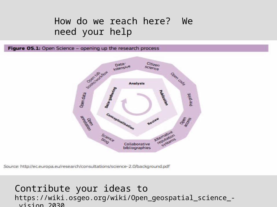
How do we reach here? We need your help
Contribute your ideas to https://wiki.osgeo.org/wiki/Open_geospatial_science_-_vision_2030
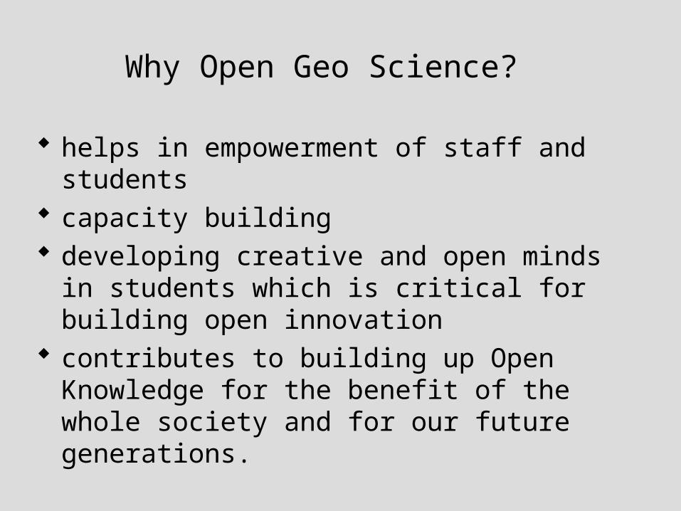
Why Open Geo Science?
helps in empowerment of staff and students
capacity building developing creative and open minds in
students which is critical for building open innovation
contributes to building up Open Knowledge for the benefit of the whole society and for our future generations.
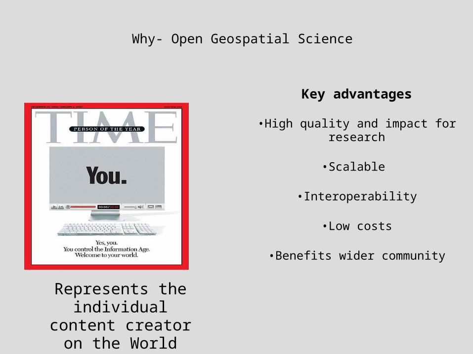
Represents the individual content
creator on the World Wide Web
Why- Open Geospatial Science
Key advantages
•High quality and impact for research
•Scalable
•Interoperability
•Low costs
•Benefits wider community
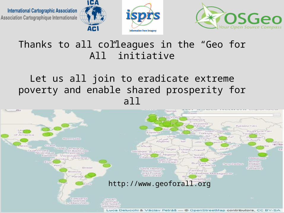
Thanks to all colleagues in the “Geo for All” initiative
Let us all join to eradicate extreme poverty and enable shared prosperity for all
http://www.geoforall.org
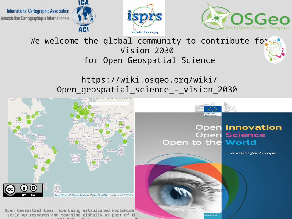
We welcome the global community to contribute for Vision 2030 for Open Geospatial Science
https://wiki.osgeo.org/wiki/Open_geospatial_science_-_vision_2030
Open Geospatial Labs are being established worldwide to scale up research and teaching globally as part of the ICA-OSGeo MoU


![VISION 2030[1]](https://img.pdfslide.net/doc/110x75/55c2ed71bb61eb8e708b4813/vision-20301.jpg)