Embed Size (px)
Citation preview
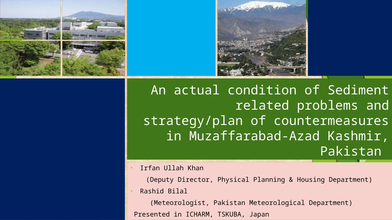
An actual condition of Sediment related problems and strategy/plan
of countermeasures in Muzaffarabad-Azad Kashmir, Pakistan
• Irfan Ullah Khan (Deputy Director, Physical Planning & Housing Department)• Rashid Bilal (Meteorologist, Pakistan Meteorological Department) Presented in ICHARM, TSKUBA, Japan

Sequence of Presentation Objectives Study Area Information Natural and Social Conditions in Azad Kashmir Hazardous areas and sediment-related phenomena Landslide related Issues Causes Recommended Countermeasures Countermeasures in Practice
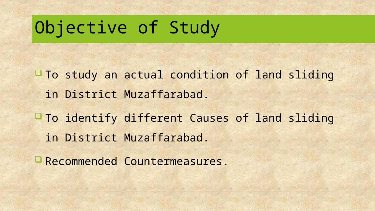
Objective of Study
To study an actual condition of land sliding in District Muzaffarabad.
To identify different Causes of land sliding in District Muzaffarabad.
Recommended Countermeasures.
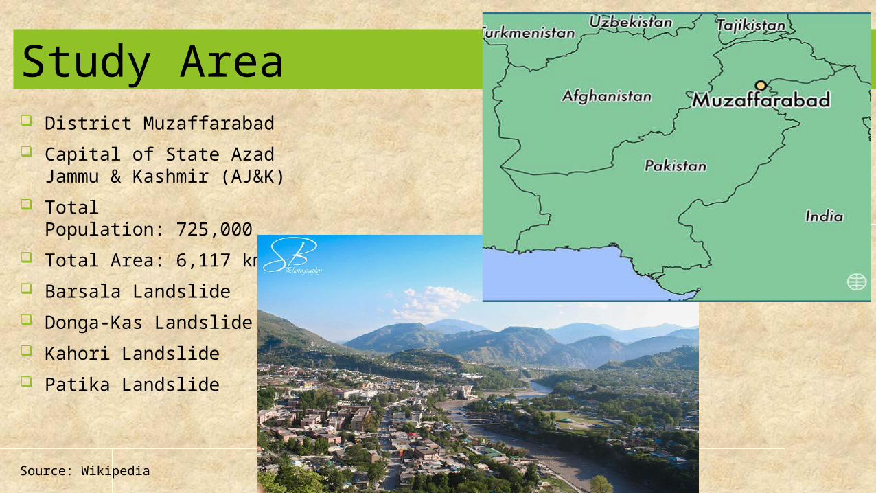
Study Area District Muzaffarabad Capital of State Azad Jammu
& Kashmir (AJ&K) Total Population: 725,000 Total Area: 6,117 km2
Barsala Landslide Donga-Kas Landslide Kahori Landslide Patika Landslide
Source: Wikipedia
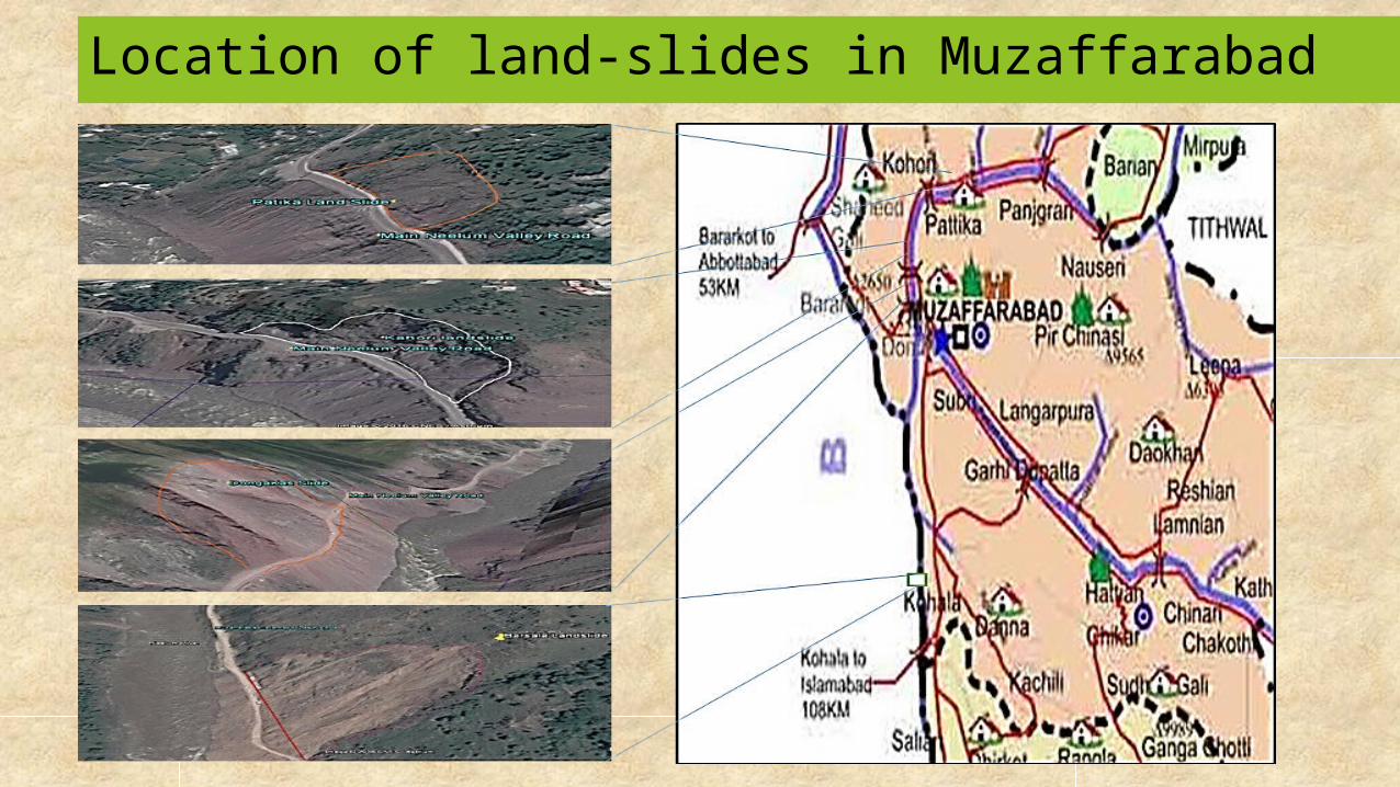
Location of land-slides in Muzaffarabad
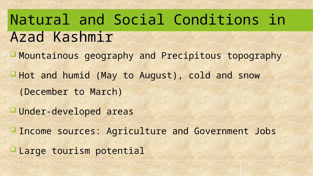
Natural and Social Conditions in Azad Kashmir Mountainous geography and Precipitous topography Hot and humid (May to August), cold and snow (December to
March) Under-developed areas Income sources: Agriculture and Government Jobs Large tourism potential

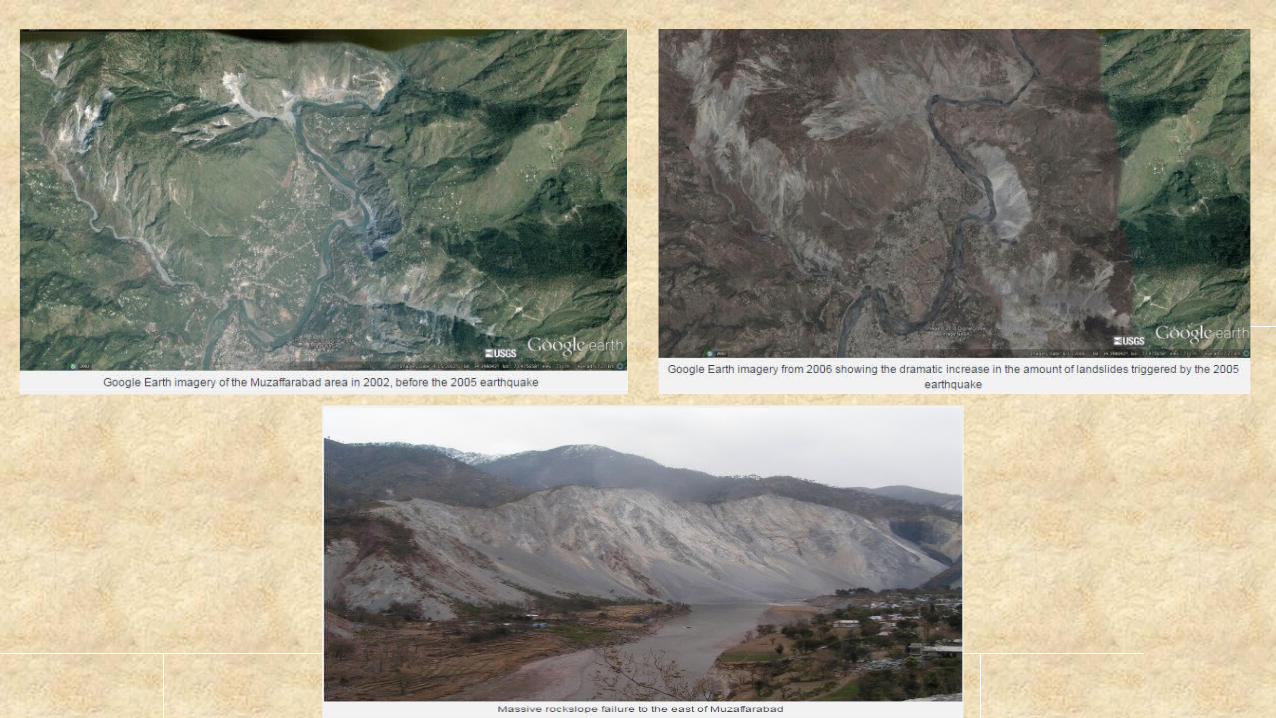
Hazardous areas and sediment-related phenomena Major and minor landslides are located throughout the region Most vulnerable landslides developed after massive
earthquake of October 08, 2005 Sr. No. Districts Total No. of
landslides1. Neelum 132. Muzaffarabad 533. Hattian Bala 174. Bagh 155. Poonch/Rawalakot 136. Pallandri 37. Mirpur/Kotli 6
Total 120
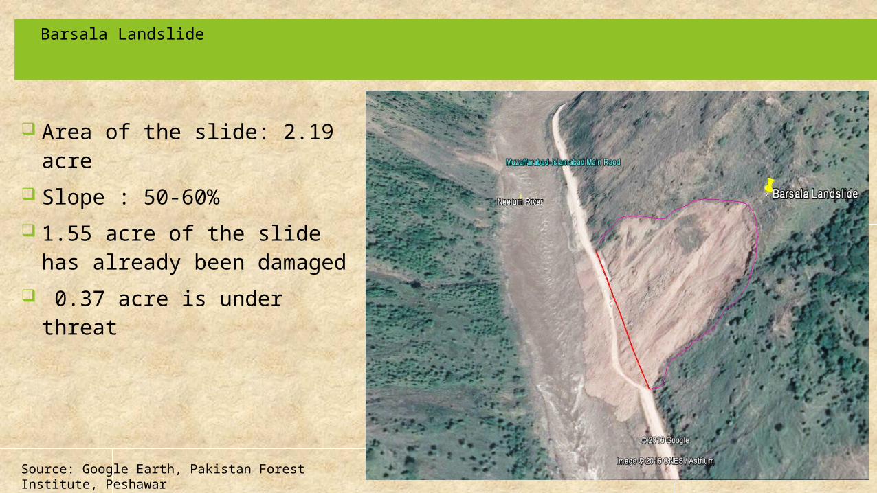
Barsala Landslide
Area of the slide: 2.19 acre Slope : 50-60% 1.55 acre of the slide has
already been damaged 0.37 acre is under threat
Source: Google Earth, Pakistan Forest Institute, Peshawar

Donga-Kas Landslide Area of the landslide : 293.4
acre Slope :25-35% 121.14 acre of the slide has
already been damaged 172.26 acre is under threat
Source: Google Earth, Pakistan Forest Institute, Peshawar
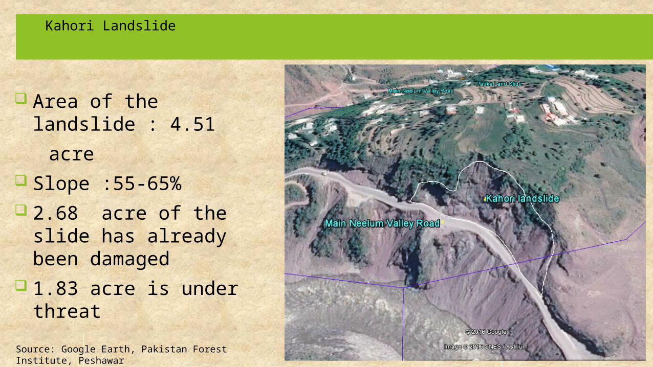
Area of the landslide : 4.51
acre Slope :55-65% 2.68 acre of the slide
has already been damaged
1.83 acre is under threat
Kahori Landslide
Source: Google Earth, Pakistan Forest Institute, Peshawar
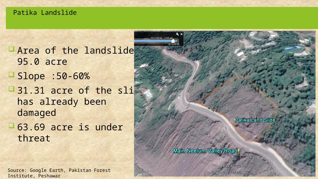
Area of the landslide : 95.0 acre
Slope :50-60% 31.31 acre of the slide has
already been damaged 63.69 acre is under threat
Patika Landslide
Source: Google Earth, Pakistan Forest Institute, Peshawar
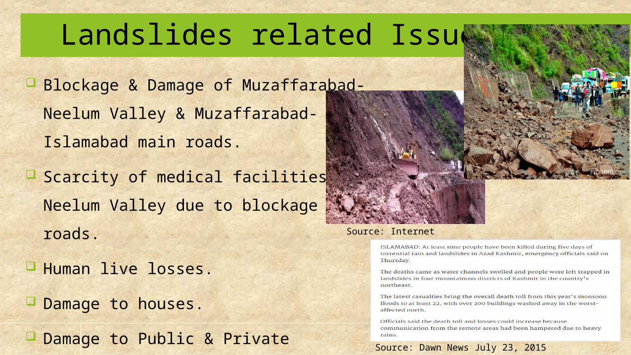
Landslides related Issues Blockage & Damage of Muzaffarabad-
Neelum Valley & Muzaffarabad-Islamabad main roads.
Scarcity of medical facilities in Neelum Valley due to blockage of roads.
Human live losses. Damage to houses. Damage to Public & Private vehicles. Depletion of forests due to erosion.
Source: Internet
Source: Dawn News July 23, 2015

Causes
Natural causes Heavy Rainfall Average annual precipitation 1511 millimeters. Heavy rainfall events especially in August and
September Seismic Activities Collapse of steep rock walls Coseismal mass movements Steep topography and Soil Erosion Original slopes of area are steep and prone to mass
movement
Social causes
Anthropogenic activities (cutting of slopes for construction of houses and roads)
Less awareness Deforestation Absence of land use plans Less Government Priority towards countermeasures
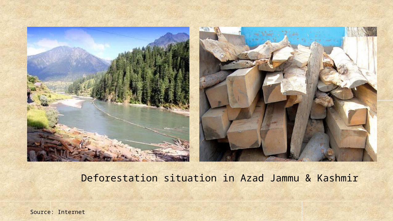
Deforestation situation in Azad Jammu & Kashmir
Source: Internet
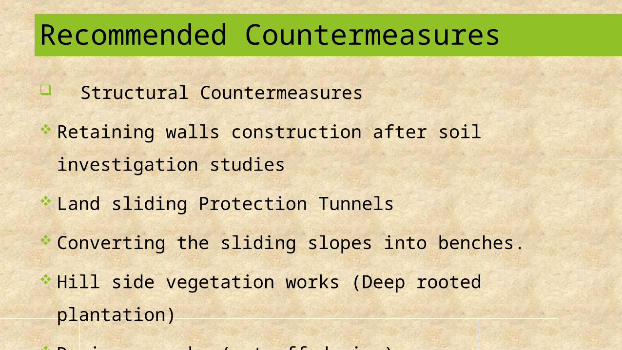
Recommended Countermeasures Structural Countermeasures Retaining walls construction after soil investigation
studies Land sliding Protection Tunnels Converting the sliding slopes into benches. Hill side vegetation works (Deep rooted plantation) Drainage works (cut off drains) Concrete grouting or bio engineering meshes

Source: Internet
Typical Land sliding countermeasures
Surface Drains
Masonry Surface Drains
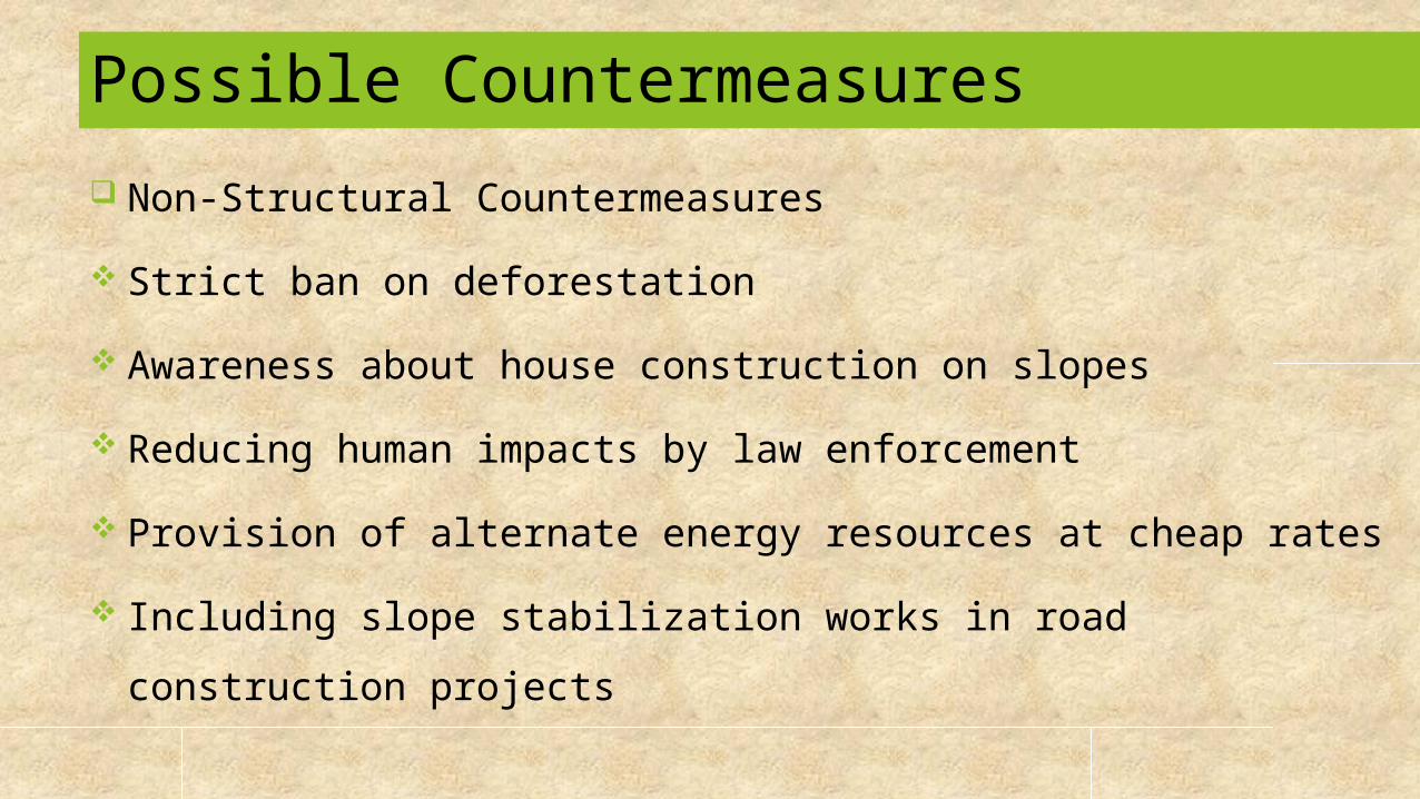
Non-Structural Countermeasures Strict ban on deforestation Awareness about house construction on slopes Reducing human impacts by law enforcement Provision of alternate energy resources at cheap rates Including slope stabilization works in road construction
projects
Possible Countermeasures
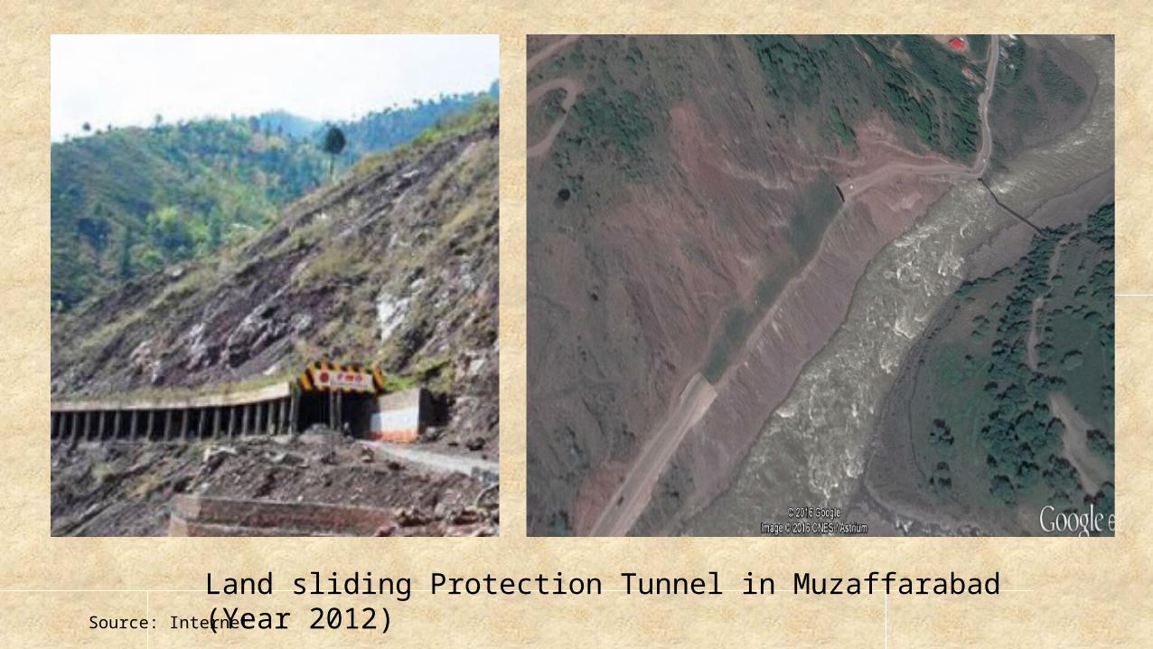
Land sliding Protection Tunnel in Muzaffarabad (Year 2012)Source: Internet
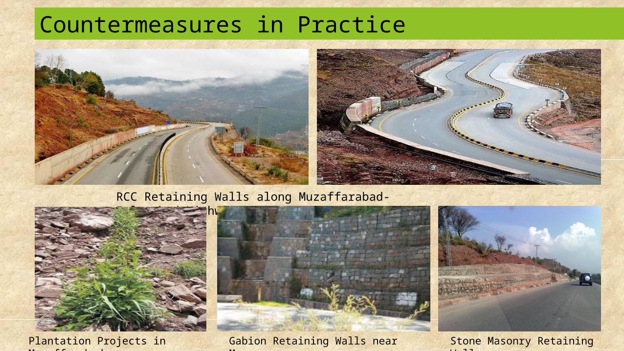
Countermeasures in Practice
RCC Retaining Walls along Muzaffarabad-Islamabad Highway
Gabion Retaining Walls near Murree
Stone Masonry Retaining Walls
Plantation Projects in Muzaffarabad
Thank youQ&A Session