Embed Size (px)
Citation preview

HASMUKH GOSWAMI COLLEGE OF
ENGINEERING

PRESENTATION ON FLOOD
Subject: Disaster ManagementSubject Code: 2150003 Class : Mech-A (5th Sem.) Guided by: Prof. Paresh
Patel

GROUP MEMBERS:1.Koshti Shubham (130240119043)
2.Makwana Maulik (130240119047)
3.Mehta Hitechhu (130240119054)
4.Moghariya Ghanshyam (130240119060)

TOPICS:• Introduction to FLOOD• Hazardous by FLOOD• Disaster Management for FLOOD in
India• Future directions & STRATEGIES
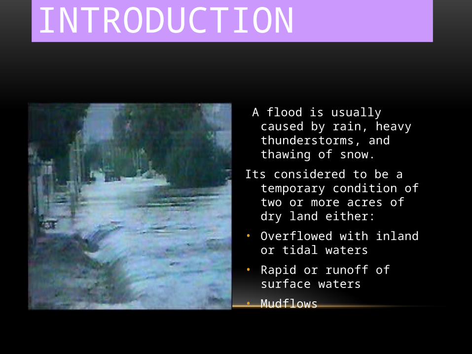
INTRODUCTION
A flood is usually caused by rain, heavy thunderstorms, and thawing of snow.
Its considered to be a temporary condition of two or more acres of dry land either:
• Overflowed with inland or tidal waters
• Rapid or runoff of surface waters
• Mudflows

HOW DOES FLOODING START AND END?
The shore or land by or surrounding a body of water erodes and this erosion causes waves currents that result in a flood.
Flood disasters have been increased because of the expansion of settlements and growth in floodplains.
Floods could be slow or fast but usually occur over a matter of days.
After the water eventually goes down or dries up. On coastal floods, low tides and high tides makes a change in heights.

WHY DOES IT OCCUR??
A flood is too much water in the wrong place.
Sometimes a flood occurs from :
• Sewer (drain) backup
• Collapse of land along the shore of a lake or another body of water. This results in waves or currents during a flood
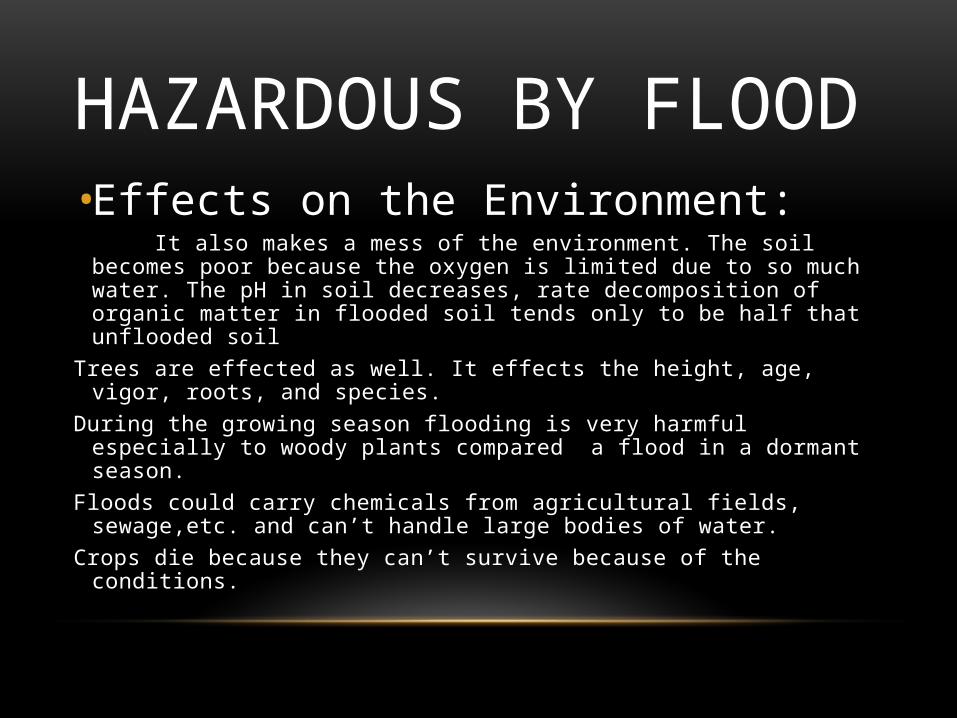
HAZARDOUS BY FLOOD• Effects on the Environment: It also makes a mess of the environment. The soil becomes poor because
the oxygen is limited due to so much water. The pH in soil decreases, rate decomposition of organic matter in flooded soil tends only to be half that unflooded soil
Trees are effected as well. It effects the height, age, vigor, roots, and species.During the growing season flooding is very harmful especially to woody plants
compared a flood in a dormant season.Floods could carry chemicals from agricultural fields, sewage,etc. and can’t
handle large bodies of water.Crops die because they can’t survive because of the conditions.
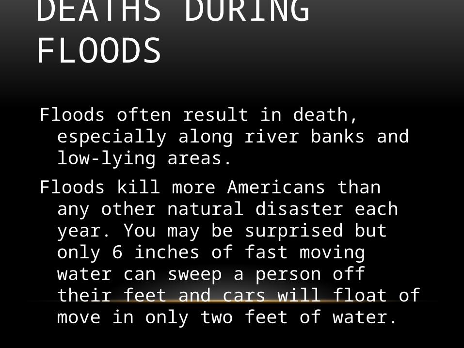
DEATHS DURING FLOODS
Floods often result in death, especially along river banks and low-lying areas.
Floods kill more Americans than any other natural disaster each year. You may be surprised but only 6 inches of fast moving water can sweep a person off their feet and cars will float of move in only two feet of water.

HERE ARE THE SOME PICTURES SHOWS HAZARDOUS:
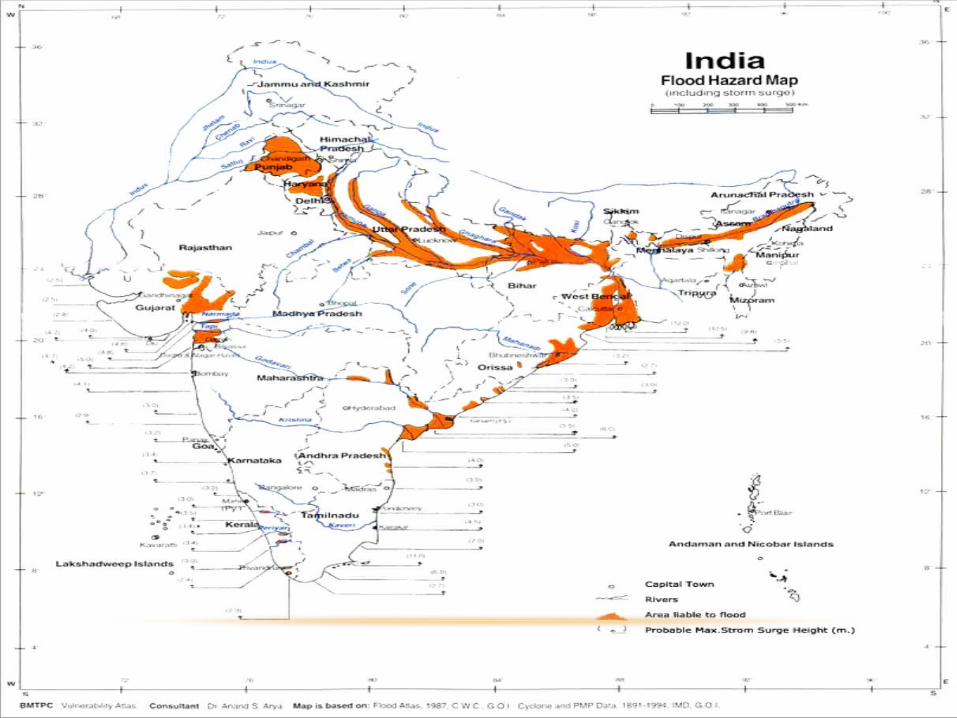

DISASTER MANAGEMENT IN INDIAGEOGRAPHICAL 328
FLOOD PRONE 40 12%
PROTECTABLE 32 80%
PROTECTED 16.4 45%
FLOOD AFFECTED
• AVERAGE 7.7
• MAXIMUM 17.5(1978)
• MINIMUM 1.5(1965)
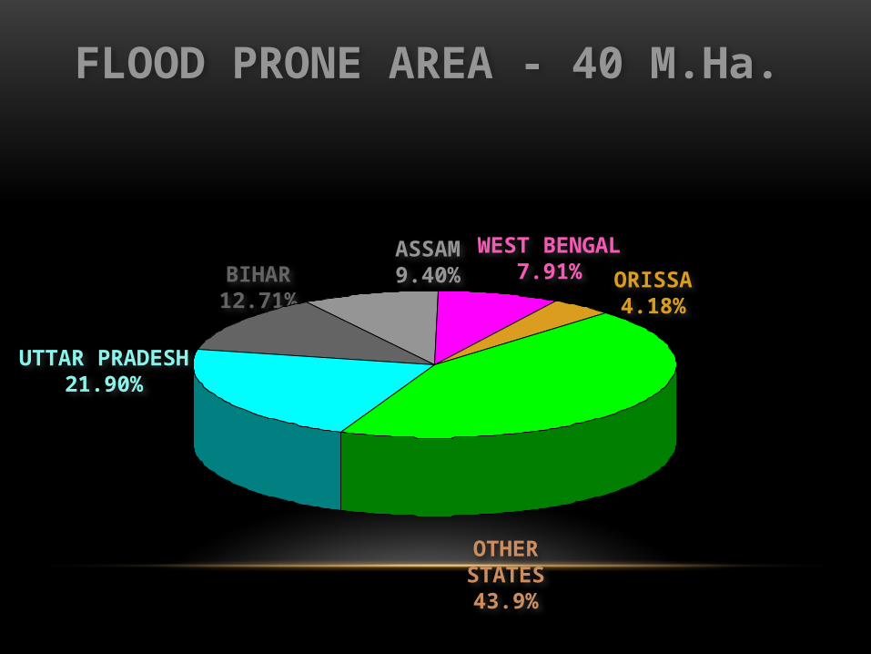
FLOOD PRONE AREA - 40 M.Ha.
OTHERSTATES43.9%
UTTAR PRADESH21.90%
BIHAR12.71%
ASSAM9.40%
WEST BENGAL7.91% ORISSA
4.18%
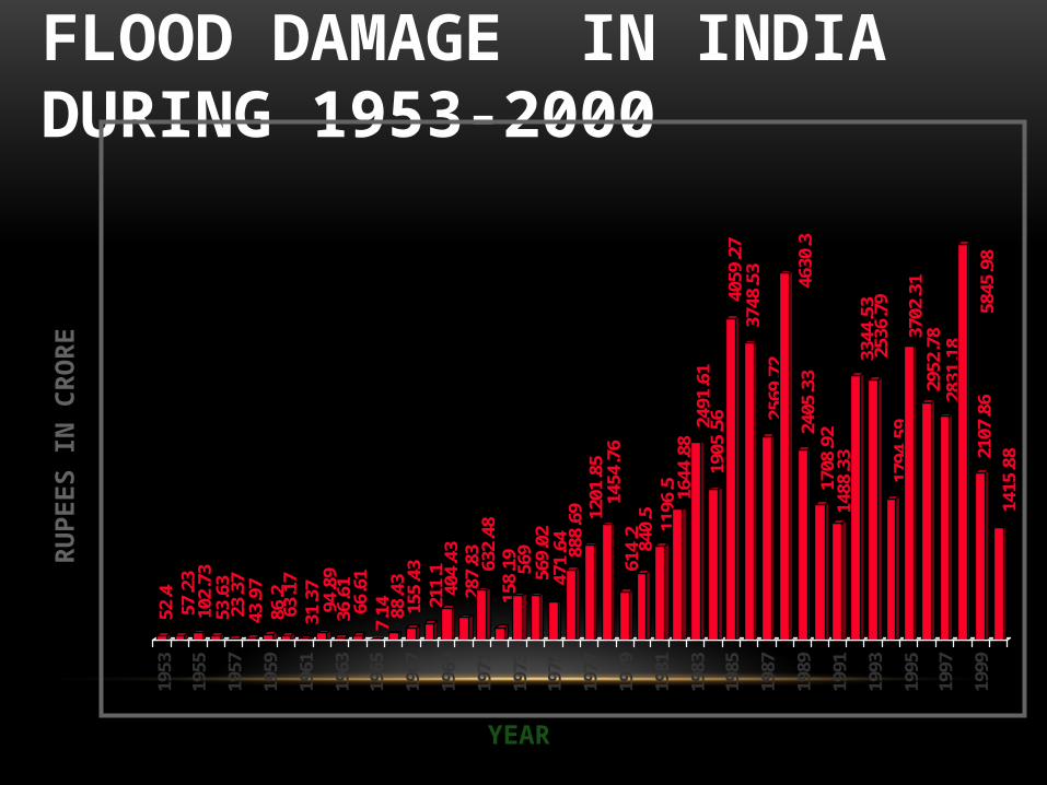
FLOOD DAMAGE IN INDIA DURING 1953-2000
52.4
57.2
310
2.73
53.6
323
.37
43.9
786
.263
.17
31.3
794
.89
36.6
166
.61
7.14 88
.43
155.
4321
1.1
404.
4328
7.83 63
2.48
158.
19 569
569.
0247
1.64 88
8.69 12
01.8
514
54.7
661
4.2
840.
511
96.5 16
44.8
824
91.6
119
05.5
640
59.2
737
48.5
325
69.7
2
4630
.324
05.3
317
08.9
214
88.3
333
44.5
325
36.7
917
94.5
937
02.3
129
52.7
828
31.1
8
5845
.98
2107
.86
1415
.88
1953
1955
1957
1959
1961
1963
1965
1967
1969
1971
1973
1975
1977
1979
1981
1983
1985
1987
1989
1991
1993
1995
1997
1999
RU
PEES
IN C
RO
RE
YEAR

INDISCRIMINATE ENCROACHMENT INCREASING ECONOMIC AND DEVELOPMENTAL ACTIVITIES
IN FLOOD PLAINS
LACK OF REGULATIONS
INADEQUATE DRAINAGE SYSTEM
INADEQUATE MAINTENANCE
LACK OF DISASTER PREPAREDNESS
INCREASED VULNERABILITY
CAUSES

• FLOODS CAN NOT BE ABSOLUTELY CONTROLLED
• FLOODS CAN ONLY BE MANAGED TO REDUCE FLOOD LOSSES
FLOOD MANAGEMENT
APPROACH
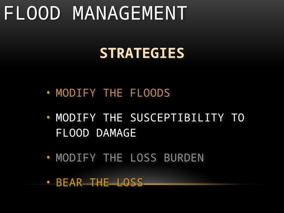
• MODIFY THE FLOODS
• MODIFY THE SUSCEPTIBILITY TO FLOOD DAMAGE
• MODIFY THE LOSS BURDEN
• BEAR THE LOSS
FLOOD MANAGEMENT
STRATEGIES

FLOOD MANAGEMENTORGANISATIONS:
• STATE FLOOD CONTROL DEPARTMENTS
• CENTRAL WATER COMMISSION
• GANGA FLOOD CONTROL COMMISSION
• BRAHMAPUTRA BOARD
• MHA - NDM DIVISION
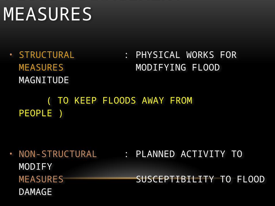
• STRUCTURAL : PHYSICAL WORKS FOR MEASURES MODIFYING FLOOD MAGNITUDE
( TO KEEP FLOODS AWAY FROM PEOPLE )
• NON-STRUCTURAL : PLANNED ACTIVITY TO MODIFYMEASURES SUSCEPTIBILITY TO FLOOD DAMAGE
( TO KEEP PEOPLE AWAY FROM FLOODS )
FLOOD MANAGEMENT MEASURES
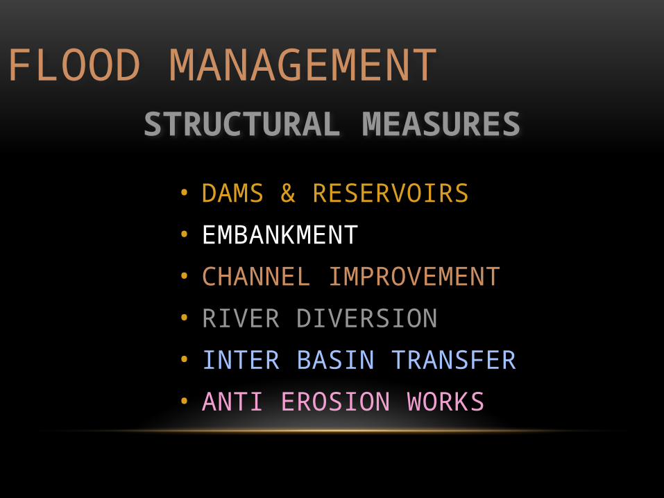
• DAMS & RESERVOIRS
• EMBANKMENT
• CHANNEL IMPROVEMENT
• RIVER DIVERSION
• INTER BASIN TRANSFER
• ANTI EROSION WORKS
FLOOD MANAGEMENTSTRUCTURAL MEASURES
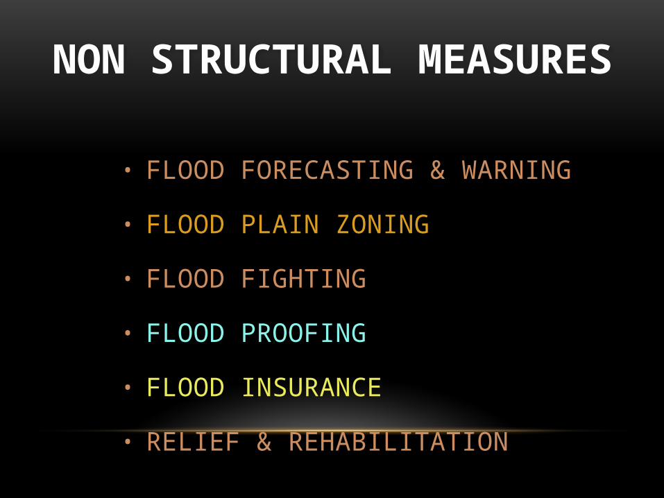
• FLOOD FORECASTING & WARNING
• FLOOD PLAIN ZONING
• FLOOD FIGHTING
• FLOOD PROOFING
• FLOOD INSURANCE
• RELIEF & REHABILITATION
NON STRUCTURAL MEASURES
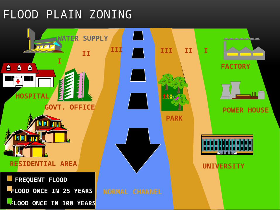
FLOOD PLAIN ZONING
WATER SUPPLY
FACTORY
POWER HOUSE
UNIVERSITYRESIDENTIAL AREA
GOVT. OFFICE
HOSPITAL
NORMAL CHANNEL
PARK
FREQUENT FLOOD
FLOOD ONCE IN 25 YEARS
FLOOD ONCE IN 100 YEARS
III IIII III I
I

FLOOD PLAIN ZONING
PROHIBITIVERESTRICTIVEWARNING WARNINGRESTRICTIVE
I II III II I
RIVER CHANNEL

FLOOD FORECASTING
BEGINNING
• STARTED BY CENTRAL WATER COMMISSION
• YEAR 1958
• RIVER YAMUNA
• FORECASTING STATION DELHI RAILWAY BRIDGE
INDIA

FLOOD FORECASTING AND WARNING
DATA COLLECTION
DATA TRANSMISSION
DATA ANALYSIS & FORECAST FORMULATION
DISSEMINATION OF FORECAST
STEPS

FLOOD FORECASTING
• HYDROLOGICAL
RIVER WATER LEVEL RIVER DISCHARGE
• HYDROMETEOROLGICAL
RAINFALL OTHER RECIPITATION eg. SNOW, HAIL ETC.
DATA COLLECTION
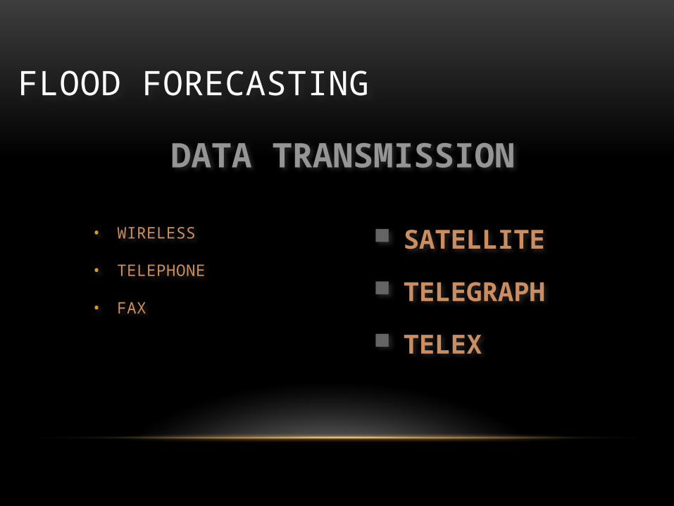
FLOOD FORECASTING
• WIRELESS
• TELEPHONE
• FAX
DATA TRANSMISSION
SATELLITE
TELEGRAPH
TELEX
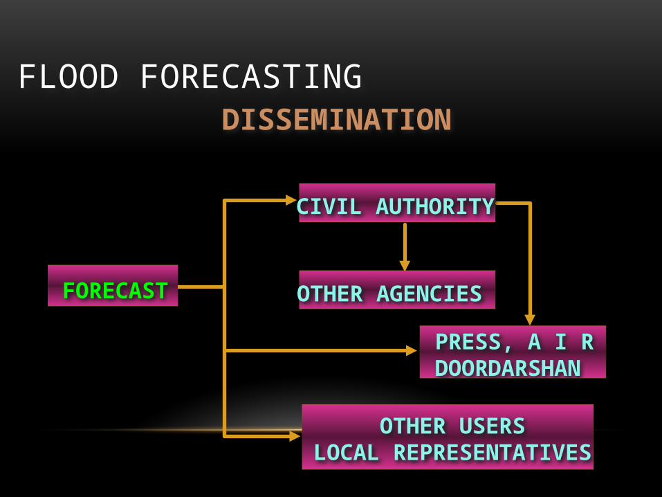
FLOOD FORECASTINGDISSEMINATION
FORECAST
CIVIL AUTHORITY
OTHER AGENCIES
PRESS, A I RDOORDARSHAN
OTHER USERSLOCAL REPRESENTATIVES
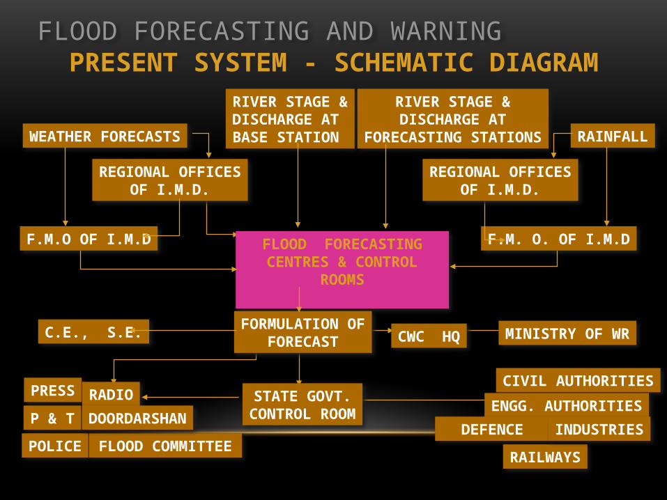
FLOOD FORECASTING AND WARNINGPRESENT SYSTEM - SCHEMATIC DIAGRAM
WEATHER FORECASTS
RIVER STAGE &DISCHARGE ATBASE STATION
RIVER STAGE &DISCHARGE AT
FORECASTING STATIONS RAINFALL
F.M. O. OF I.M.DFLOOD FORECASTINGCENTRES & CONTROL ROOMS
FORMULATION OFFORECAST
C.E., S.E.
STATE GOVT.CONTROL ROOM
PRESS RADIO
P & T
POLICE FLOOD COMMITTEE
CIVIL AUTHORITIES
ENGG. AUTHORITIES
DEFENCE
RAILWAYS
INDUSTRIES
F.M.O OF I.M.D
REGIONAL OFFICESOF I.M.D.
REGIONAL OFFICESOF I.M.D.
DOORDARSHAN
CWC HQ MINISTRY OF WR

NEW DIRECTIONS FOR DISASTER MANAGEMENT IN INDIA
• The National Disaster Management Authority (NDMA) has been set up as the apex body for Disaster Management in India, with the Prime Minister as its Chairman.
• Disaster Management Authorities will be set up at the State and District Levels to be headed by the Chief Ministers and Collectors/Zilla Parishad Chairmen respectively.

FLOOD MANAGEMENTSCOPE
• Use of Remote Sensing and GIS
• Research and Development
• Weather / Rainfall Forecasting
• FF Modelling
• Capacity Building
• International Cooperation

FLOOD FORECASTING NETWORK
• COVERS MAJOR AND INTER STATE RIVER
BASINS.
166 STATIONS :- INFLOW 27 & STAGE 139
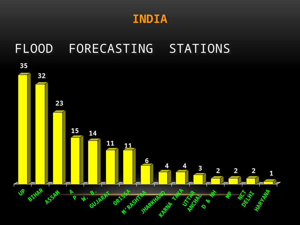
INDIA

FLOOD FORECASTING STATIONS
INDIA
GANGA B’PUTRA WESTFLOWING
GODAVARI EASTERNRIVERS
KRISHNA MAHANADI BARAK
85
27
17 159 8
3 2
FLOOD FORECASTING STATIONS
INDIA
BIHARUP
ASSAMW. B
.AP
ORISSA
GUJARAT
M’RASHTRA
KARNA TAKA
MP
D & N
H
HARY
ANA
35
32
23
1415
11 11
64 3 2 12
NCT
DELH
I
42
UTTA
RAN
CHAL
JHARKHAND

MANAGEMENT ACTIVITIES
Pre flood
During flood
Post flood
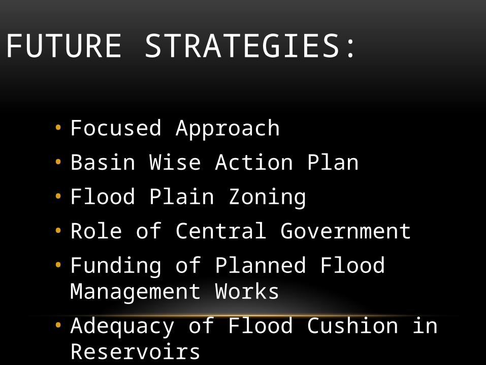
FUTURE STRATEGIES:
• Focused Approach
• Basin Wise Action Plan
• Flood Plain Zoning
• Role of Central Government
• Funding of Planned Flood Management Works
• Adequacy of Flood Cushion in Reservoirs

CONTINUE….• Encourage and consolidate knowledge networks
• Mobilise and train disaster volunteers for more effective preparedness, mitigation and response (NSS, NCC, Scouts and Guides, NYK, Civil Defence, Home guards)
• Increased capacity building leads to faster vulnerability reduction.
• Learn from best practices in disaster preparedness, mitigation and disaster response

Thank you…