Embed Size (px)
Citation preview
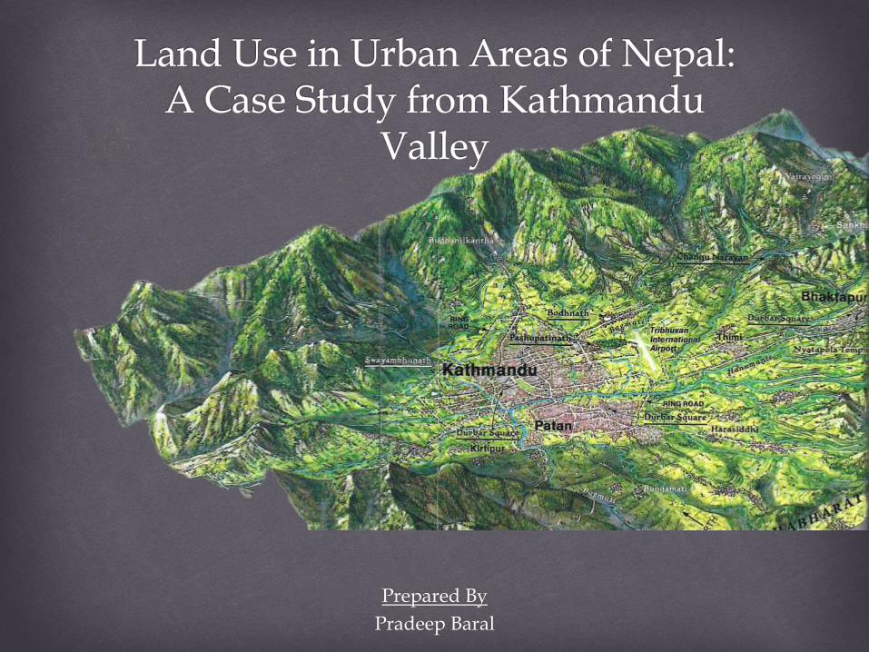
Prepared By
Pradeep Baral
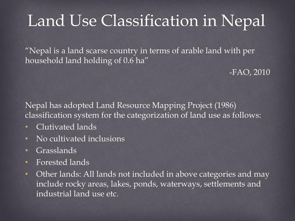
“Nepal is a land scarse country in terms of arable land with per household land holding of 0.6 ha”
-FAO, 2010
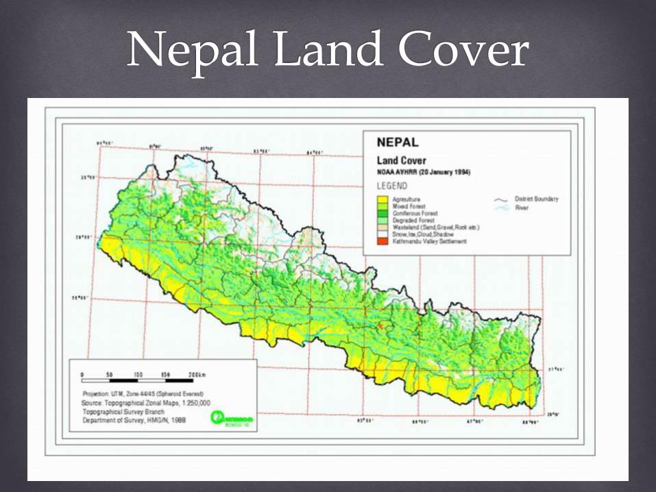
Nepal has adopted Land Resource Mapping Project (1986) classification system for the categorization of land use as follows:
• Clutivated lands
• No cultivated inclusions
• Grasslands
• Forested lands
• Other lands: All lands not included in above categories and may include rocky areas, lakes, ponds, waterways, settlements and industrial land use etc.
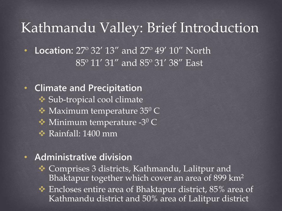
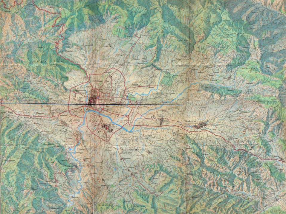
• Location: 27º 32’ 13” and 27º 49’ 10” North
85º 11’ 31” and 85º 31’ 38” East
• Climate and Precipitation
Sub-tropical cool climate
Maximum temperature 350 C
Minimum temperature -30 C
Rainfall: 1400 mm
• Administrative division
Comprises 3 districts, Kathmandu, Lalitpur and Bhaktapur together which cover an area of 899 km2
Encloses entire area of Bhaktapur district, 85% area of Kathmandu district and 50% area of Lalitpur district
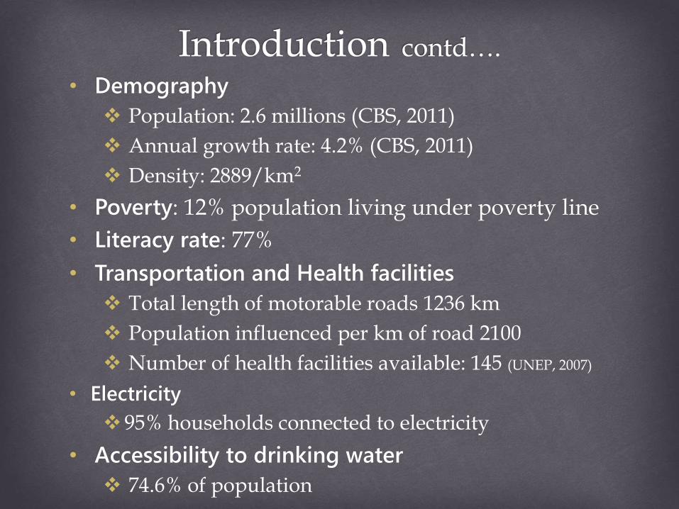
• Demography
Population: 2.6 millions (CBS, 2011)
Annual growth rate: 4.2% (CBS, 2011)
Density: 2889/km2
• Poverty: 12% population living under poverty line
• Literacy rate: 77%
• Transportation and Health facilities
Total length of motorable roads 1236 km
Population influenced per km of road 2100
Number of health facilities available: 145 (UNEP, 2007)
• Electricity
95% households connected to electricity
• Accessibility to drinking water
74.6% of population
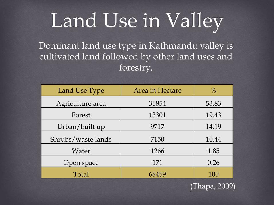
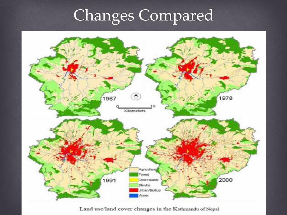
Dominant land use type in Kathmandu valley is cultivated land followed by other land uses and
forestry.
(Thapa, 2009)
Land Use Type Area in Hectare %
Agriculture area 36854 53.83
Forest 13301 19.43
Urban/built up 9717 14.19
Shrubs/waste lands 7150 10.44
Water 1266 1.85
Open space 171 0.26
Total 68459 100
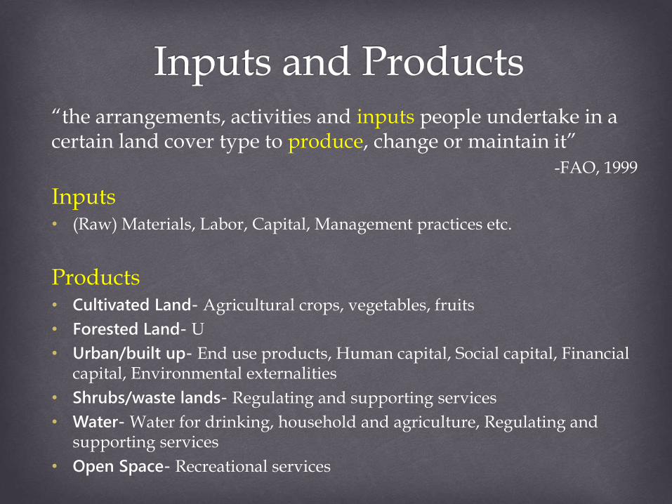
“the arrangements, activities and inputs people undertake in a certain land cover type to produce, change or maintain it”
-FAO, 1999
Inputs• (Raw) Materials, Labor, Capital, Management practices etc.
Products• Cultivated Land- Agricultural crops, vegetables, fruits
• Forested Land- U
• Urban/built up- End use products, Human capital, Social capital, Financial capital, Environmental externalities
• Shrubs/waste lands- Regulating and supporting services
• Water- Water for drinking, household and agriculture, Regulating and supporting services
• Open Space- Recreational services
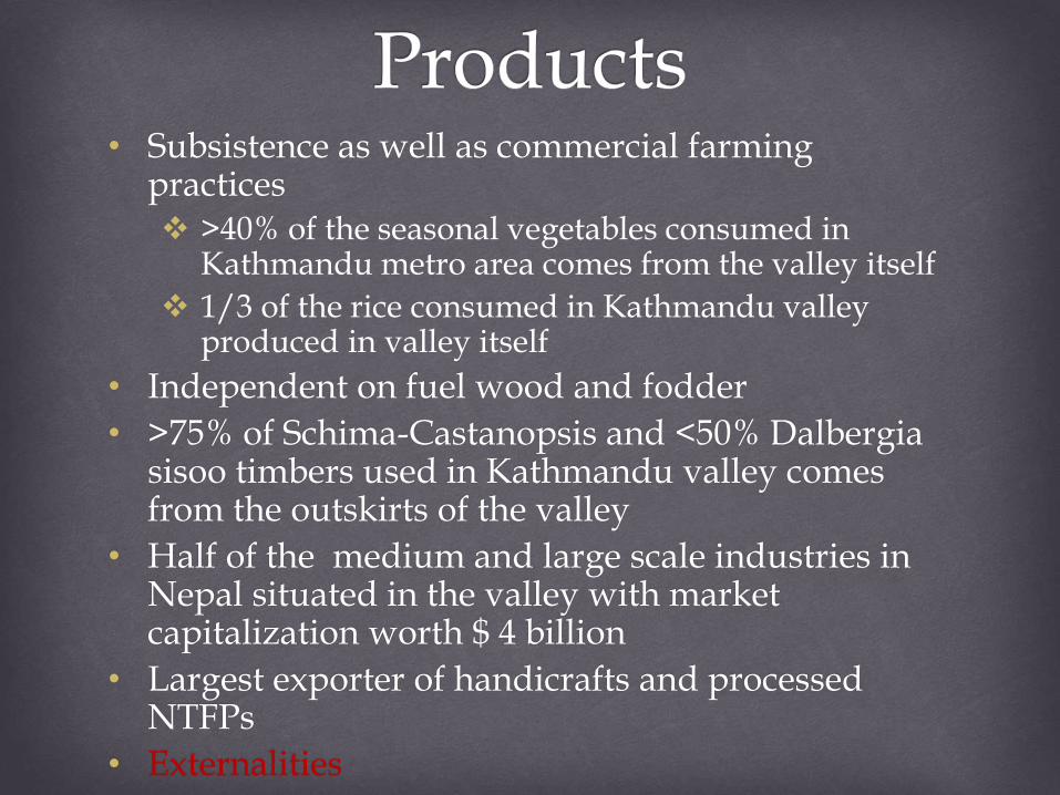
• Subsistence as well as commercial farming practices >40% of the seasonal vegetables consumed in
Kathmandu metro area comes from the valley itself
1/3 of the rice consumed in Kathmandu valley produced in valley itself
• Independent on fuel wood and fodder
• >75% of Schima-Castanopsis and <50% Dalbergiasisoo timbers used in Kathmandu valley comes from the outskirts of the valley
• Half of the medium and large scale industries in Nepal situated in the valley with market capitalization worth $ 4 billion
• Largest exporter of handicrafts and processed NTFPs
• Externalities
(Thapa, 2009)
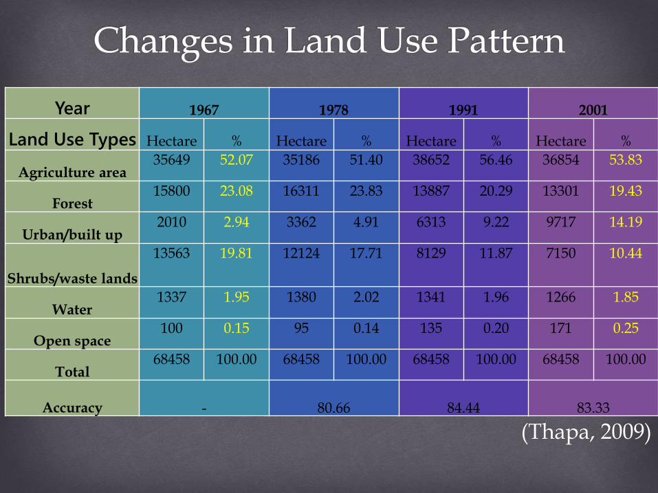
Year 1967 1978 1991 2001
Land Use Types Hectare % Hectare % Hectare % Hectare %
Agriculture area35649 52.07 35186 51.40 38652 56.46 36854 53.83
Forest15800 23.08 16311 23.83 13887 20.29 13301 19.43
Urban/built up2010 2.94 3362 4.91 6313 9.22 9717 14.19
Shrubs/waste lands
13563 19.81 12124 17.71 8129 11.87 7150 10.44
Water1337 1.95 1380 2.02 1341 1.96 1266 1.85
Open space100 0.15 95 0.14 135 0.20 171 0.25
Total68458 100.00 68458 100.00 68458 100.00 68458 100.00
Accuracy - 80.66 84.44 83.33
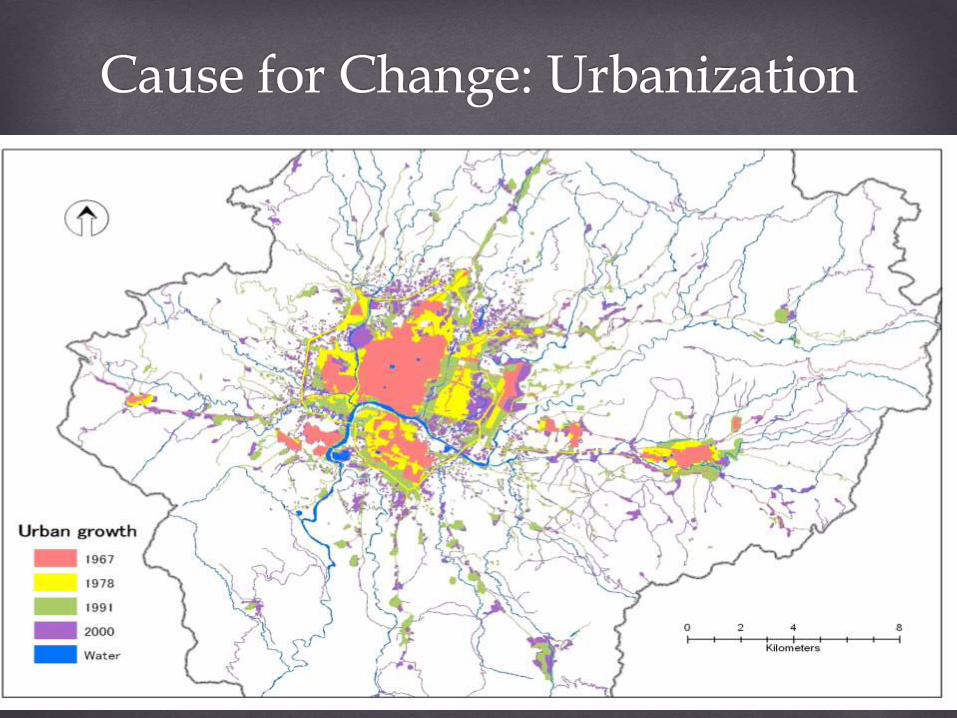
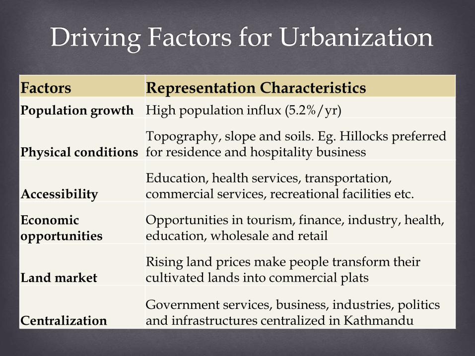
Factors Representation Characteristics
Population growth High population influx (5.2%/yr)
Physical conditionsTopography, slope and soils. Eg. Hillocks preferred for residence and hospitality business
AccessibilityEducation, health services, transportation, commercial services, recreational facilities etc.
Economic opportunities
Opportunities in tourism, finance, industry, health, education, wholesale and retail
Land marketRising land prices make people transform their cultivated lands into commercial plats
CentralizationGovernment services, business, industries, politics and infrastructures centralized in Kathmandu
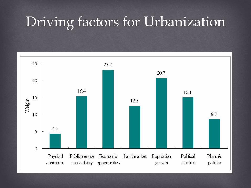
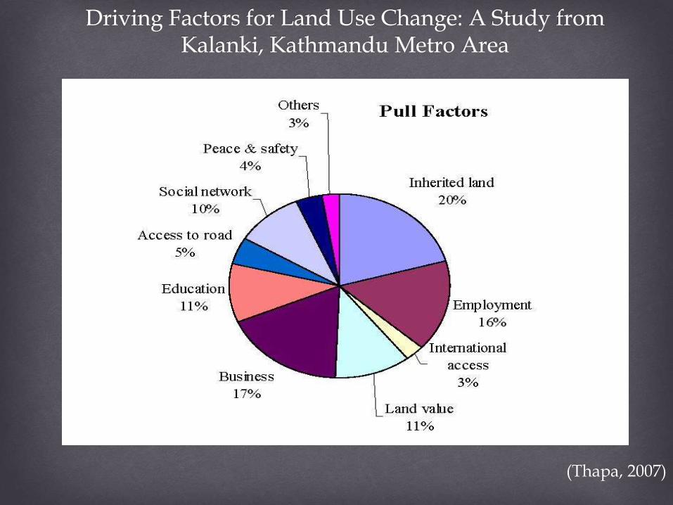
(Thapa, 2007)
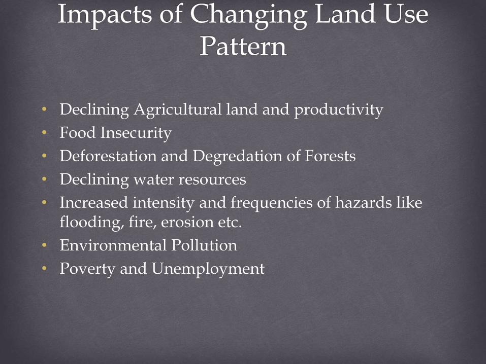
• Declining Agricultural land and productivity
• Food Insecurity
• Deforestation and Degredation of Forests
• Declining water resources
• Increased intensity and frequencies of hazards like flooding, fire, erosion etc.
• Environmental Pollution
• Poverty and Unemployment
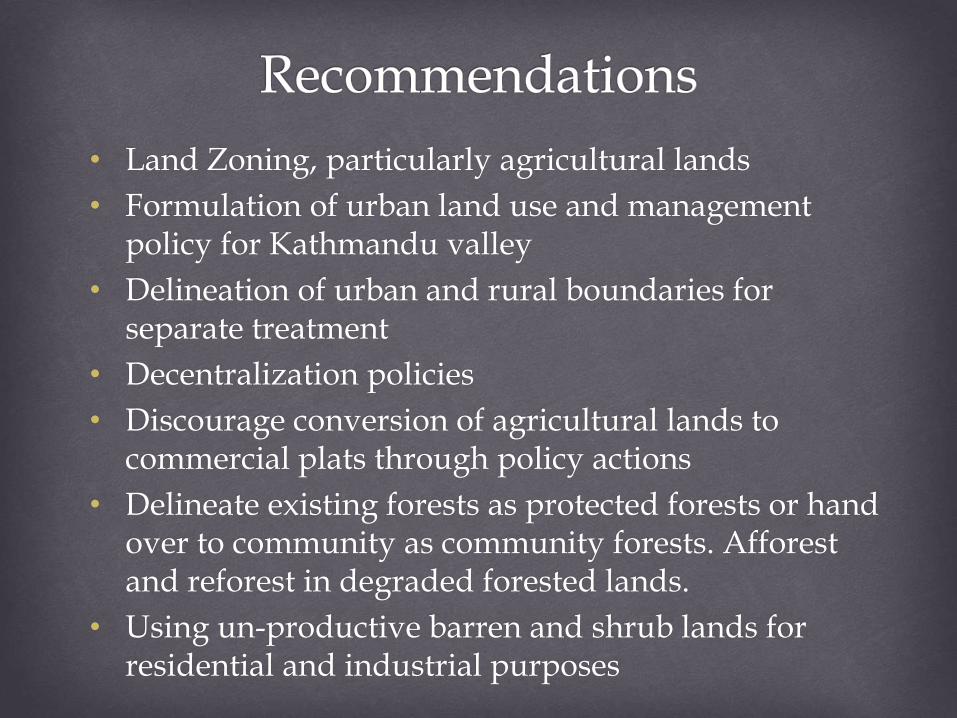
• Land Zoning, particularly agricultural lands
• Formulation of urban land use and management policy for Kathmandu valley
• Delineation of urban and rural boundaries for separate treatment
• Decentralization policies
• Discourage conversion of agricultural lands to commercial plats through policy actions
• Delineate existing forests as protected forests or hand over to community as community forests. Afforest and reforest in degraded forested lands.
• Using un-productive barren and shrub lands for residential and industrial purposes

Feedback??


![For a Cleaner and Greener Kathmandu Valley · CMC-1 INSTITUTEOFCURRENTWORLDAPA1RS OTFOR PUBLICATION] WITHOUTWRITER’SCONSENT ForacleanerandgreenerKathmanduValley Kathmandu,Nepal](https://img.pdfslide.net/doc/110x75/5f8d69b78a59e65a1925ce3f/for-a-cleaner-and-greener-kathmandu-cmc-1-instituteofcurrentworldapa1rs-otfor-publication.jpg)


![[The] Kathmandu Valley Development Authority Act, 2045 B.S](https://img.pdfslide.net/doc/110x75/61bda1d044379d7d7c16c12b/the-kathmandu-valley-development-authority-act-2045-bs-.jpg)