Embed Size (px)
Citation preview
Greater Bridgeport Regional CouncilTree Canopy in the Greater
Bridgeport Region
Prepared by: Jarlath O’Neil-Dunne Mark Goetz

• Council of Governments: Chief Elected Officers serve as the GBRC Board of Directors
• Federally Designated Transportation Planning Organization
• Provide services to the six member municipalities (Bridgeport, Easton, Fairfield, Monroe, Stratford & Trumbull)
ORGANIZATION

SERVICES
• Planning Studies & Project Management
• Comprehensive and Strategic Plans
• Transportation Demand Modeling
• Transit System Analysis
• GIS Mapping & municipal map scanning
• Economic Development/ Demographic/ Market Analysis
• Grant applications, submissions and administration of federal/state programs

• 2013 Basemapping Flight
• 3 inch pixel color and infrared
• Lidar
• Planimetric compilation
• Contours
• RTK GPS
• Parcel Migration and Conversion
Regional Database Development
Funded through State of Connecticut Regional Performance Incentive Program
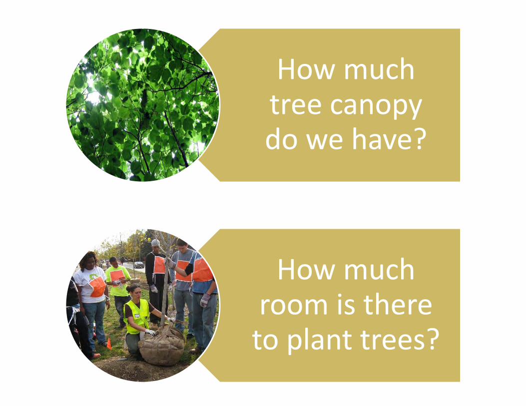
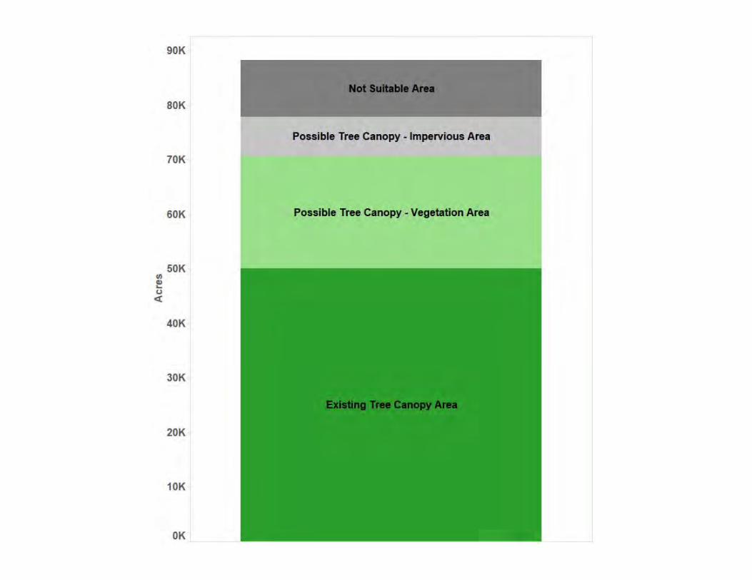
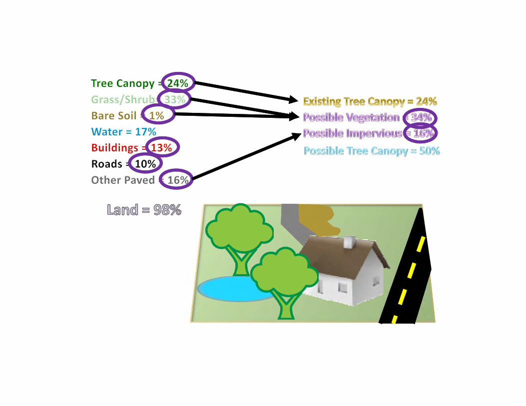
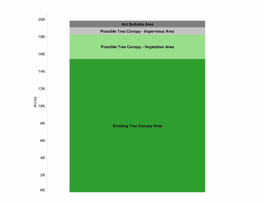
How much tree canopy do we have?
How much room is there to plant trees?

Environmental Justice
Stewardship
Master Plans
Regulatory
Goal Setting
Targeted Plantings
Prioritization
Awareness
Long Term Monitoring
Correlation
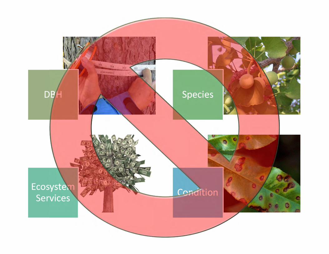
DBH Species
Ecosystem Services Condition


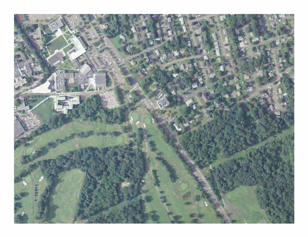
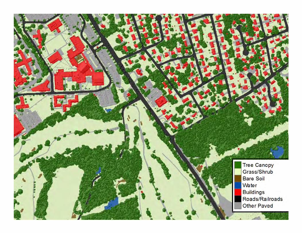
Buildings
Roads/Railroads
Other Paved
Tree Canopy
Grass/Shrub
Bare Soil
Water


Tree Canopy Existing Percent
6% - 15%
16% - 30%
31% - 42%
43% - 56%
57% - 81%

Tree CanopyPossible Percent
17% - 24%
25% - 34%
35% - 44%
45% - 57%
58% - 74%

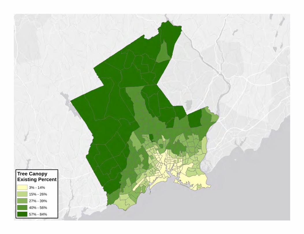
Tree Canopy Existing Percent
3% - 14%
15% - 26%
27% - 39%
40% - 56%
57% - 84%

Tree CanopyPossible Percent
15% - 28%
29% - 39%
40% - 48%
49% - 59%
60% - 77%


Tree Canopy Existing Percent
14% - 26%
27% - 43%
44% - 67%
68% - 77%
78% - 93%

Tree Canopy Possible Percent
7% - 14%
15% - 25%
26% - 32%
33% - 47%
48% - 62%

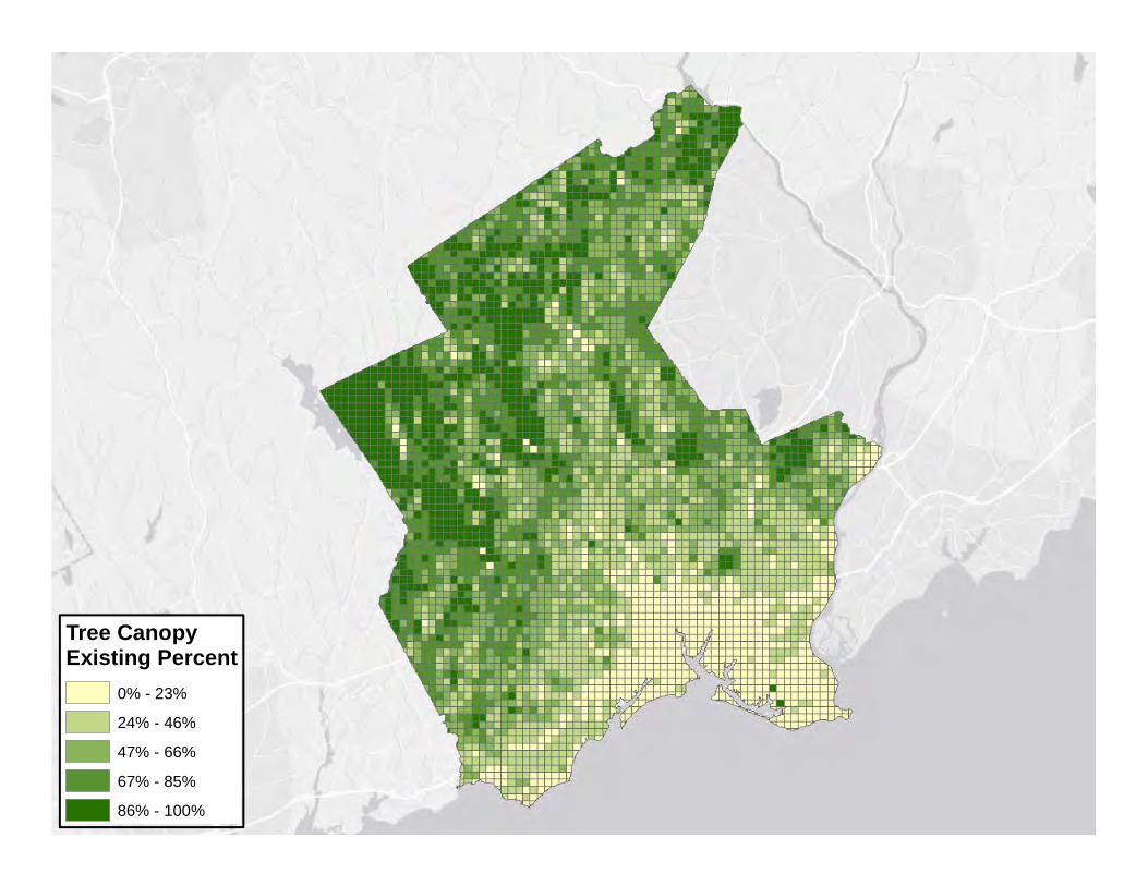
Tree CanopyExisting Percent
0% - 23%
24% - 46%
47% - 66%
67% - 85%
86% - 100%

Surface Temperature
58 - 61
62 - 63
64 - 66
67 - 70
71 - 80


UrbanizationPrincipal Urban Centers
Metro Cities
Suburban
Urban Outskirts


• Parcels• Road Rights-of-Way
• Municipal• State
• Council Districts