
CERTIFICATION
Pursuant to Executive Proclamations JBE 2020-30 and 2020-33 this shall serve as certification that in
light of the spread of COVID-19 the Kenner City Council was unable to operate due to quorum
requirement in compliance with La. R.S. 42:19 and will be meeting via videoconference on Friday,
September 18, 2020 at 11:00 a.m. The virtual meeting will be viewable on Zoom video teleconferencing,
as well as YouTube at www.youtube.com/kennertvonline and City of Kenner Facebook page at
www.facebook.com/officialcityofkennergovernment. The Kenner City Council Meeting will be conducted
via video conference in compliance with Proclamation Numbers JBE 2020-30 and 2020-33 issued by
Governor John Bel Edwards. Public comments will be accepted prior to the meeting by phone {504)468-
7254 and by email to [email protected] .us. The Council Clerk shall read thee-mails into the record
relating to items posted to the agenda or any other subject matters. Please submit email questions by
Thursday, September 17, 2020 at 3:30p.m. Public comments will also be accepted in real time during
the appropriate time of the Council Meeting by joining the conference and using the hand raise function
in the app.
(directions available at www.kenner.la .us and www.facebook.com/officialcityofkennergovernment)
Information on joining the teleconference will provided 24 hours in advance at www.kenner.la.us and
www.facebook.com/officialcityofkennergovernment

REGULAR MEETING OF THE KENNER CITY COUNCIL
SEPTEMBER 18, 2020 – 11:00 A.M.
COUNCIL CHAMBER - KENNER CITY HALL
POSTED < 3:00 P.M. SEPTEMBER 14, 2020
IN ACCORDANCE WITH COUNCIL RESOLUTION NO. B-14550, PLEASE BE ADVISED THAT ALL CELLULAR TELEPHONES AND OTHER DEVICES OF THIS NATURE MUST BE DEACTIVATED OR SILENCED THROUGHOUT THE COUNCIL MEETING MEETING CALLED TO ORDER INVOCATION/PLEDGE OF ALLEGIANCE ROLL CALL – COUNCILMEMBERS
RESOLUTIONS, MOTIONS, AND OTHER ITEMS FROM THE FLOOR
________________________________________________________________________________
CONSENT AGENDA ________________________________________________________________________________ 1. APPROVAL OF MINUTES, the regular Council Meeting of September 3, 2020. 2. APPROVAL OF ALCOHOLIC BEVERAGE PERMIT APPLICATIONS 3. APPROVAL OF BINGO AND PUBLIC GATHERING APPLICATIONS 4. CORRESPONDENCE: REPORTS FROM MAYOR, CAO OR DEPARTMENT HEADS
4-A. At the request of the Administration, a report from Mayor Zahn. 5. ACCEPTANCE/REJECTION OF BIDS REQUIRING AN EXPENDITURE OF LESS THAN
FIVE THOUSAND DOLLARS ($5,000.00) 6. CHANGE ORDERS REQUIRING AN EXPENDITURE OF LESS THAN FIVE THOUSAND
DOLLARS ($5,000.00) 7. ACCEPTANCE OF COMMITTEE FINDINGS (FINAL PASSAGE) 8. RESUBDIVISION ORDINANCES (FINAL PASSAGE) 8-A. Summary Ordinance No. 12,747, an ordinance approving the plan of resubdivision
of Lots 8, 9, 10, 11, 12, 13, 14, 15, 16, 17, & 18, Square 113 into Lots 8-A and 11-A, Square 113, Kenner Heights Subdivision, Kenner, Jefferson Parish, Louisiana. Case P-11-20
8-B. Summary Ordinance No. 12,748, an ordinance approving the plan of resubdivision
of Lots 18 through 28 and Part of Lots 1 through 13, Square 1-A into Lots A, B and C, Square 1-A, Kenner Heights Subdivision, Kenner, Jefferson Parish, Louisiana. Case P-12-20
PUBLIC APPEARANCE AGENDA ________________________________________________________________________________ 9. PUBLIC HEARINGS AND FINAL PASSAGE 9-A. A PUBLIC HEARING regarding Summary Ordinance No. 12,746, an ordinance
granting a construction servitude to the Department of Transportation and Development of the State of Louisiana for the State Project No. H.011670, I-10 / Loyola Interchange Improvement, Route I-10, Jefferson Parish, Louisiana.
10. OPENING OF BID 11. RECLASSIFICATION OF ZONING (FINAL PASSAGE) 12. OTHER ORDINANCES (FINAL PASSAGE) 13. RESOLUTIONS AND MOTIONS BY COUNCILMEMBERS

14. ITEMS REMOVED FROM THE CONSENT AGENDA 15. ACCEPTANCE OF CONTRACTS AND SIMILAR MATTERS APPROVED BY THE MAYOR 15-A. Summary Ordinance No. 12,749, an ordinance approving an agreement with
Tunnell-Spangler & Associates, Inc. d/b/a TSW for professional services in accordance with RFP 20-6550 for an amount not to exceed $153,000.00.
15-B. A resolution approving Amendment No. 2 to the agreement with Meyer Engineers,
LTD. regarding the Kenner FEMA Street Renovation Project PW20831 for an increase of $65,355.00 for the Department of Public Works.
16. ORDINANCES/RESOLUTIONS IN SUMMARY (FIRST READING) 16-A. An ordinance approving the plan of resubdivision of Lots 1, 2, 3 and 7 through 62,
Square 142, Lincoln Manor Subdivision, which lots are owned by the Kenner Housing Authority, into new Lots 1A, 10A, 20A and 40A; and approving a planned unit development to allow the new construction of ten (10) senior living units on new Lot 40A, the construction of a new 32 unit apartment complex and community bulding on new Lot 20A, the construction of a new Kenner Housing Authority Office Building on new Lot 10A, and the conversion of an existing building into a maintenance building on new Lot 1A, all in Square 142, Lincoln Manor Subdivision, Kenner, Louisiana. Case PUD-1-20
16-B. An ordinance approving the plan of resubdivision of Lots 15 through 20, and Lots
93 through 98, into Lot 98-A , Square 178, Veterans Heights Subdivision, Kenner, Louisiana. Case P-10-20
16-C. An ordinance accepting the lowest responsive bid received from Consolidated
Traffic Controls, Inc. to provide solar power flashing school zone speed limit signs in accordance with Letter Bid No. 20-1963 in an amount not to exceed $5,400.00 for the Department of Public Works.
16-D. An ordinance accepting the lowest responsive bid received from Polydyne, Inc. for
a contract to provide polymer on an as needed basis in accordance with Sealed Bid No. 20-6559 in an amount not to exceed $74,175.00 for the Department of Wastewater.
16-E. An ordinance adopting a superseding and amending Operating Budget for the City
of Kenner for the fiscal year beginning July 1, 2020 and ending July 30, 2021 and providing for related matters. ** To view the referenced Operating Budget.. please click link below**
http://www.kenner.la.us/2/proposed_2021_budget_amended.pdf 17. REPORTS FROM THE COUNCIL AND/OR SPECIAL COMMITTEES 18. NEW BUSINESS 18-A. At the request of the Finance Department, the clerk will read a Public Notice
regarding the March 20, 2021 Election. This notice is to advise the public that the Kenner City Council intends to vote on resolutions to authorize the calling of special elections for the renewal of the levy and collection of special taxes in the City of Kenner, State of Louisiana. The Kenner City Council will vote on these resolutions at the Council meeting to be held on Friday, October 16, 2020, beginning at 11:00 A.M. in the Council Chambers in the City Hall Building located at 1801 Williams Boulevard, Kenner, Louisiana 70062. The tentative date for this election is Saturday, March 20, 2021.
19. UNFINISHED BUSINESS AND/OR MOTIONS TO RECONSIDER OR REMOVE FROM A
TABLED POSITION
20. 20. PERSONS WISHING TO ADDRESS THE COUNCIL ON SPECIAL SUBJECT MATTERS
21. MOTION TO ADJOURN

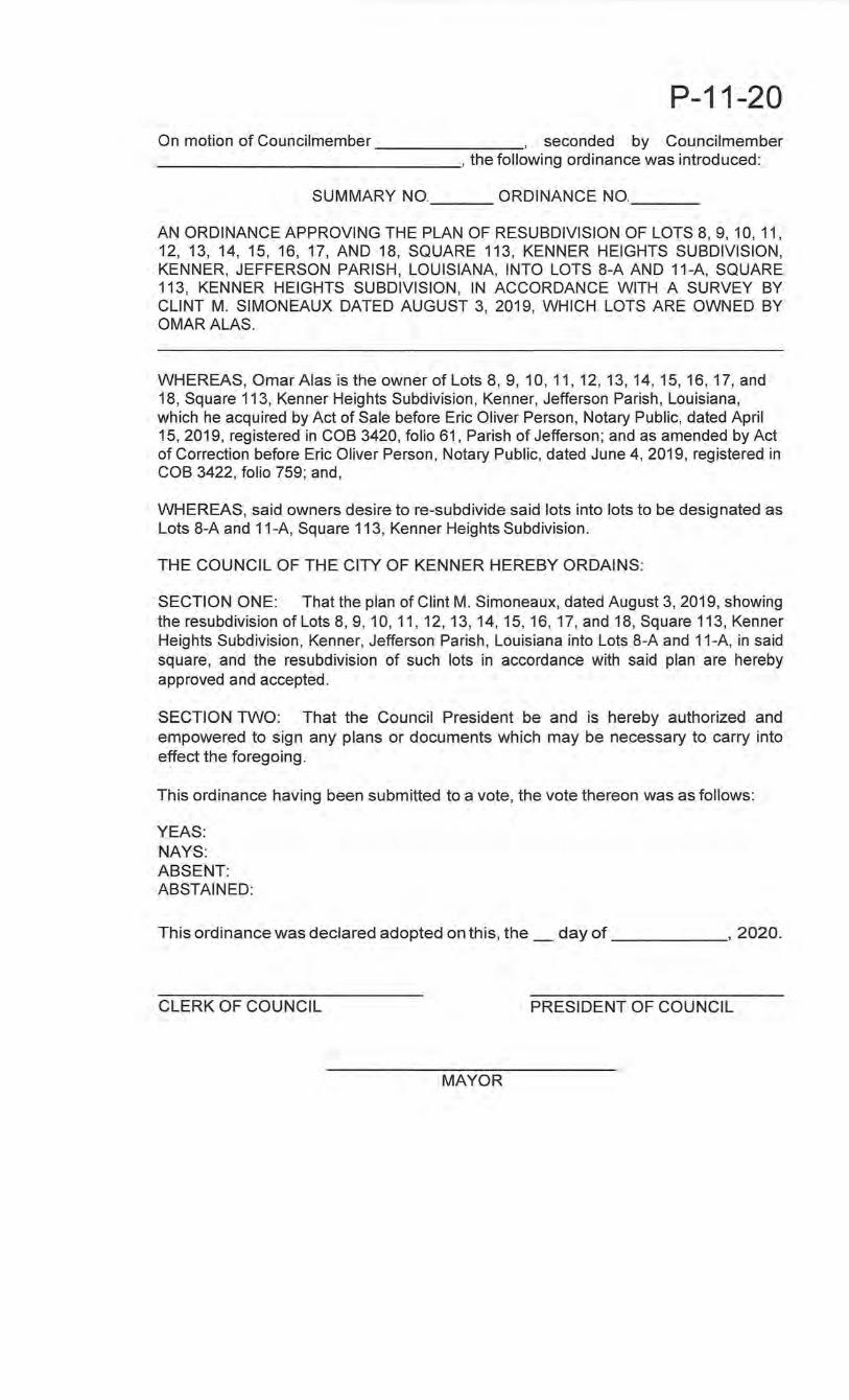
P-11-20 On motion of Councilmember , seconded by Councilmemberi ________________ , the following ordinance was introduced:
SUMMARY NO. 12,747 ORDINANCE NO __ _
AN ORDINANCE APPROVING THE PLAN OF RESUBDIVISION OF LOTS 8, 9, 10, 11, 12, 13, 14, 15, 16, 17, AND 18, SQUARE 113, KENNER HEIGHTS SUBDIVISION, KENNER, JEFFERSON PARISH, LOUISIANA, INTO LOTS 8-A AND 11-A, SQUARE 113, KENNER HEIGHTS SUBDIVISION, IN ACCORDANCE WITH A SURVEY BY CLINT M. SIMONEAUX DATED AUGUST 3, 2019, WHICH LOTS ARE OWNED BY OMARALAS.
WHEREAS, Omar Alas is the owner of Lots 8, 9, 10, 11, 12, 13, 14, 15, 16, 17, and 18, Square 113, Kenner Heights Subdivision, Kenner, Jefferson Parish, Louisiana, which he acquired by Act of Sale before Eric Oliver Person, Notary Public, dated April 15,2019, registered in COB 3420, folio 61, Parish of Jefferson; and as amended by Act of Correction before Eric Oliver Person, Notary Public, dated June 4, 2019, registered in COB 3422, folio 759; and,
WHEREAS, said owners desire tore-subdivide said lots into lots to be designated as Lots 8-A and 11-A, Square 113, Kenner Heights Subdivision.
THE COUNCIL OF THE CITY OF KENNER HEREBY ORDAINS:
SECTION ONE: That the plan of Clint M. Simoneaux, dated August 3, 2019, showing the resubdivision of Lots 8, 9, 10, 11, 12, 13, 14, 15, 16, 17, and 18, Square 113, Kenner Heights Subdivision, Kenner, Jefferson Parish, Louisiana into Lots 8-A and 11-A, in said square, and the resubdivision of such lots in accordance with said plan are hereby approved and accepted.
SECTION TWO: That the Council President be and is hereby authorized and empowered to sign any plans or documents which may be necessary to carry into effect the foregoing.
This ordinance having been submitted to a vote, the vote thereon was as follows:
YEAS: NAYS: ABSENT: ABSTAINED:
Thisordinancewasdeclared adopted on this, the_ day of , 2020.
CLERK OF COUNCIL PRESIDENT OF COUNCIL
MAYOR
8A L -- - - •.
Page 11
DEPARTMENT OF PLANNING Kenner, Louisiana
Land Use & Zoning Report
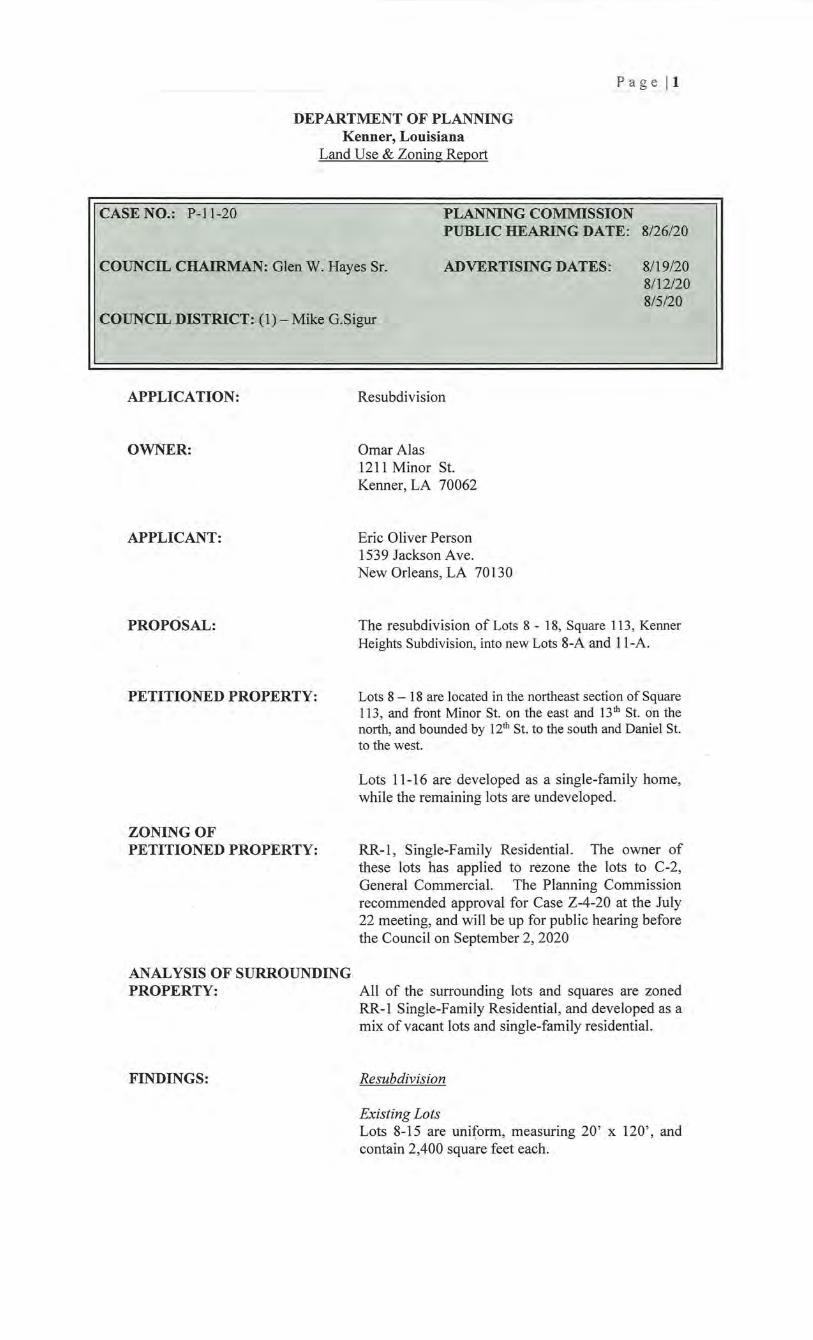
CASE NO.: P-11 -20 PLANNING COMMISSION PUBLIC HEARING DATE: 8/26/20
COUNCIL CHAIRMAN: Glen W. Hayes Sr. ADVERTISING DATES: 8/19/20 8/12/20 8/5/20
COUNCIL DISTRICT: (1)- Mike G.Sigur
APPLICATION:
OWNER:
APPLICANT:
PROPOSAL:
PETITIONED PROPERTY:
ZONING OF PETITIONED PROPERTY:
ANALYSIS OF SURROUNDING PROPERTY:
FINDINGS:
Resubdivision
Omar Alas 1211 Minor St. Kenner, LA 70062
Eric Oliver Person 1539 Jackson Ave. New Orleans, LA 70130
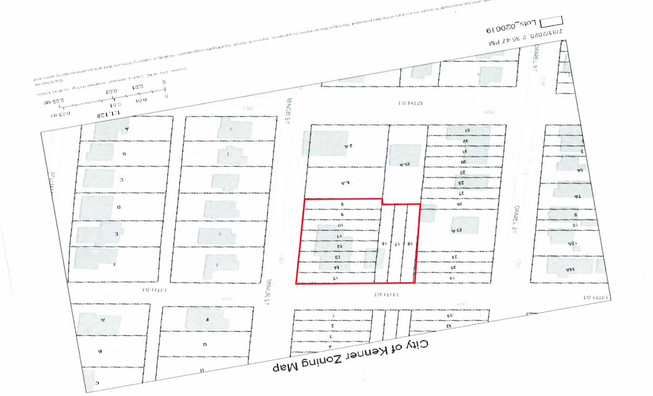
The resubdivision of Lots 8 - 18, Square 113, Kenner Heights Subdivision, into new Lots 8-A and 11 -A.
Lots 8 - 18 are located in the northeast section of Square 113, and front Minor St. on the east and 13th St. on the north, and bounded by 12th St. to the south and Daniel St. to the west.
Lots 11 -16 are developed as a single-family home, while the remaining lots are undeveloped.
RR-1, Single-Family Residential. The owner of these lots has applied to rezone the lots to C-2, General Commercial. The Planning Commission recommended approval for Case Z-4-20 at the July 22 meeting, and will be up for public hearing before the Council on September 2, 2020
All of the surrounding lots and squares are zoned RR-1 Single-Family Residential, and developed as a mix of vacant lots and single-family residential.
Resubdivision
Existing Lots Lots 8-15 are uniform, measuring 20' x 120', and contain 2,400 square feet each.

PLANNING COMMISSION RECOMMENDATION:
Pa g e 12
Lots 16-18 are uniform, measuring 20 ' x 150', and contain 3,000 square feet each.
New Lots New Lot 8-A measures 60 ' x 120', and includes 7,200 square feet.
New Lot 11-A is an irregular shaped lot measuring 100' x 180' x 150' x 50 ' x 120', and includes 21 ,000 square feet.
Utilities
Utility companies have no objection to the resubdivision.
This resubdivision meets all of the requirements of a simple resubdivision, including no new public services or easements of access needed
Approval
P-11-20 On motion of Councilmember , seconded by Councilmember ----------------' the following ordinance was introduced:
SUMMARY NO ORDINANCE NO __ _
AN ORDINANCE APPROVING THE PLAN OF RESUBDIVISION OF LOTS 8, 9, 10, 11, 12, 13, 14, 15, 16, 17, AND 18, SQUARE 113, KENNER HEIGHTS SUBDIVISION, KENNER, JEFFERSON PARISH, LOUISIANA, INTO LOTS 8-A AND 11-A, SQUARE 113, KENNER HEIGHTS SUBDIVISION, IN ACCORDANCE WITH A SURVEY BY CLINT M. SIMONEAUX DATED AUGUST 3, 2019, WHICH LOTS ARE OWNED BY OMARALAS.
WHEREAS, Omar Alas is the owner of Lots 8, 9, 10, 11, 12, 13, 14, 15, 16, 17, and 18, Square 113, Kenner Heights Subdivision, Kenner, Jefferson Parish, Louisiana, which he acquired by Act of Sale before Eric Oliver Person, Notary Public, dated April 15, 2019, registered in COB 3420, folio 61, Parish of Jefferson; and as amended by Act of Correction before Eric Oliver Person, Notary Public, dated June 4, 2019, registered in COB 3422, folio 759; and,
WHEREAS, said owners desire tore-subdivide said lots into lots to be designated as Lots 8-A and 11-A, Square 113, Kenner Heights Subdivision.
THE COUNCIL OF THE CITY OF KENNER HEREBY ORDAINS:
SECTION ONE: That the plan of Clint M. Simoneaux, dated August 3, 2019, showing the resubdivision of Lots 8, 9, 10, 11, 12, 13, 14, 15, 16, 17, and 18, Square 113, Kenner Heights Subdivision, Kenner, Jefferson Parish, Louisiana into Lots 8-A and 11-A, in said square, and the resubdivision of such lots in accordance with said plan are hereby approved and accepted.
SECTION TWO: That the Council President be and is hereby authorized and empowered to sign any plans or documents which may be necessary to carry into effect the foregoing.
This ordinance having been submitted to a vote, the vote thereon was as follows:
YEAS: NAYS: ABSENT: ABSTAINED:
This ordinance was declared adopted on this, the_ day of , 2020.
CLERK OF COUNCIL PRESIDENT OF COUNCIL
MAYOR
I'·'.~ ~.-.: ''' . -·
.:1 J ______________ }
--------------------~-------~
·I
----, I ------1
··'-' ·-•11 ;: .. , .•• [ ·-··
: ,. '
I -------~-~----l
~-----------
r--1---- --/ _____________ )
- - - -----
u •
------------- ----~
::1 !
'" I
,_ . .. ~-... ~' ,_.. .j L.~ V •.• I
• "'·llj'.l"
------------- --Q l
L \ [l\
-·~
L_ ___ :::___
... 0
·" I -------3 , ~
----- --'=-~---.
- - ----- t --- -------._ _____ .,_~ _' _____ .__,;.._ ...... _ ..... 1---~----f._ _______ j
~ " ~ ----- -------(.\ ,__.. ___ ___,____ _______ .::_ __ _
..,, -----------~----~---
t1 f: l
,,,,
[----- ----------- --r-· ----- ---· ---------
?: ------- ------- -.-1:
-- ----~------- ~1,\ 8 J~uu~)'\ ~0 ·
2 ~ __ 7 4:1 , - tv·
L o t s _o zo6 19 z o o i f'\1 - JP c - \
\. ' -: ' ' .. p... ~ .' ~- r.
CitY ot Kenner zonin9 MaP
lit: ... _. '
9
&- A I I
1. ·
: .. -! r ~ - ~ f-:. r
o \ 9 R R- \
t r t1
t"'"-' . I 1
II
, · I . •-( I__., ,. \ ~ .. _ , ,.-
,.-.1 I I•, , ;ot, · • ,.~n ·•' '''
n cr.
,f.}
.i.'
r
\ • ,,,
~ . ~· \ c
• • u L<"'· c:~· ·=··~ ,_, ol"' 0 oO
,•
•·' , ·,r-••\
, '"'' , .. , , .. ""' ' ''' ,. ,,, ., "
l
' ·."\ . \ 28 r· 'J3
, . :• \ ., ..... ~---"-., - l ' J .::: s:i .t.fl~
( • J 3 \_ ' :.....>
. , .e-·_p.;··p ~~
1.~ ·' ' ' \ .~~ -- · · --·'"" '.~.
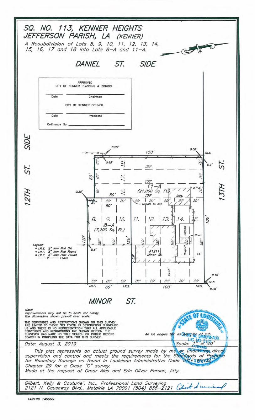
SQ. NO. 113, KENNER HEIGHTS JEFFERSON PARISH, LA {KENNER) A Resubdivision of Lots 8, 9, 10, 11, 12, 13, 7 4, 15, 16, 17 and 18 Into Lots 8-A and 11-A.
~ (;)
DANIEL ST.
APPROVED CITY OF KENNER PLANNING & ZONING
Dote -ChoiFmon
CITY OF KENNER COUNCIL
Dote President
Ordinance No. ------------------
0.25'
SIDE
0.08' 150' ~ II.R.S. 1/ u
~:;, "\.
~ (/)
~ ~ ~
Legend: • I.R.S. • I.R.F. o I.P.F.
0.35;
~·J 0.65'
~ --c:::t .~: ;, (() ~·J
I:- --
'
50'
-:::;, ('IJ
l*;.y ...... I Bt~' I
I 60' I
'"'' , ... , , ..... .
r'< , ... _,
\t~ , ..... , E~?'
" I ,-, I A.~ >-< -J I I I ~ .... , _,, ..! \.,,,
8-A {7, ~00 Sq., Ft.)
'~ ,., ti" 0.3
.2'5t~' ---- ---- ---- ---- ---- ---- _J
15~]'
' "=::i i:'IJ
- 11-A -:_~---,--....,---P~{.-J. {21, 000 Sq. Ft . .
i5t~' '/
k f•;, ·i' a"'-/..,...f-__.L_____c_~ A. . ' ~..!. I t ::-~ , __ , I Ar Jl • A 1 '-~' l 1 A.,a., LA':~.
.. ::, I';'JJ
' ~ -I I ~ /17/ ~I II / /, G Room
<:, I / <:, I <:, I / <:, / I <:, .. ,._ '='•J t•J '='•.:11 ; ,. t•J ~~~ , I <:,I c:::t
~;~ ('11 ~ • I X Q I )( 17 >' / _y···· "•> ~-· ... ,
/ 1 #12111 1/ ~ 1 . ~ Minor St. G I 14 ,.; / /
/'/" /' / / "
'n .. , X Q
Jr Iron Rod Set I 0.5· I I ;r Iron Rod Found ]I" Iron Pipe Found -Fence
I I
~ (/)
;:t:: !-;::: fit) ~
I I "" ~ o.o' ! o~ ~ ~" ! =' !(,a ts' .. - --- '-""" .&....; .. • '-"'" L.."'· '-"'· J.P.F.
100' I.R.S.
I I El?' I Bt' I E[!'
I.R.F. I.R.s. 60'
MINOR ST. Note: Improvements may not be to scale for clarity. The dimensions shown prevat'l over scale.
THE SERVITUDES AND RESTRICTIONS SHOWN ON THIS SURVEY ARE LIMITED TO THOSE SET FORTH IN DESCRIPTION FURNISHED US AND THERE IS NO REPRESENTATION THAT ALL APPLICABLE SERVITUDES AND RESTRICTIONS ARE SHOWN HEREON. THE SURVEYOR HAS MADE NO TITLE SEARCH OR PUBLIC RECORD SEARCH IN COMPILING THE DATA FOR THIS SURVEY.
Date: August .3, 2019
All lot angles
This plat represents an actual ground survey made by m't1~~r supervision and control and meets the requirements for the sfitZ~ for Boundary Surveys as found in Louisiana Administrative Code Chapter 29 for a Class 't'" survey. Made at the request of Omar Alas and Eric Oliver Person, Atty.
0.25'
Gilbert, Kelly & Couturie: Inc., Professional Land Surveying /\., • 1 1 , LJ 2121 N. Causeway Blvd., Metairie LA 70001 (504) 836--2121 ~,.tJ ""----,-< -r
149199 149999
Notary Public
ERIC OLIVER PERSON Attorney-at-Law
1539 Jackson Avenue Suite 100
New Orleans, Louisiana 70130
July 25, 2020
Telephone (504) 561-8612 (800) 850-8890 Facsimile (504) 561-8615 eric@eoplaw.. net
Wendel P. Dufour, Jr., Director City of Kenner, Department of Planning 1801 Williams Boulevard Bldg. B I 1st Floor Kenner, Louisiana 70062
Dear Mr. Dufour:
RE: Resubdivision Request -Lots 8-18, Square No. 113, Kenner Heights S/D, Jefferson Parish, LA 1211 Minor Street Kenner, LA
My client, Omar Alas, is applying for a resubdivision of Lots 8-18, Square No. 113, Kenner Heights Subdivision, Jefferson Parish, LA into two lots to be designated as Lot 8-A and Lot 11-A all as more fully shown on the attached survey by Gilbert, Kelly & Couturie, Inc., dated August 3, 2019 and as described in the attached description of property. The purpose of this resubdivision is to permit the construction of a single-family residence on the proposed Lot 8-A. The structure on Lot 11-A will remain a dwelling as shown on the referenced survey.
All 11 lots were acquired by Omar Alas from the M & T Lacour Grandchildren's Class Trust by act before Eric Oliver Person, Notary, dated April 15,2019 and registered in Instrument #11917825, COB 3420, folio 61 on April 18, 2019. I have included a copy of this Cash Sale as well as a copy of an Act of Correction executed before Eric Oliver Person, Notary, dated June 4, 2019 and registered in Instrument #11928307, COB 3422, folio 759 on June 18, 2019. This Act of Correction clarifies the descriptions of the 11 lots acquired by Mr. Alas.
In compliance with the requirements of Kenner's Resubdivision Application, I have included the following items:
1) The required boundary survey and property description; 2) A hard copy of the proposed ordinance which has also been
e-mailed to your attention; 3) The required letters from utility companies; 4) The completed Statement of Ownership form; and, 5) A check for $200.00 for the application fee.
Page Two July 25, 2020 Resubdivision by Omar Alas
I ask that this resubdivision be placed for consideration on the August 26, 2020 agenda of the Planning Commission. Should you have any questions or need additional information, please do not hesitate to contact me. I can be reached at my office at (504) 894-8890 or on my cell phone at (504) 782-7401.
Thanking you for your kind
EOP/php Attachments
with this matter, I remain
r:&~~;~~~-. rot·'· ~ ··c~· ·~"' · -.,~~~ ' { 't /. ~· -:'o~;-':;;~\ \ , ·. ti ~\-. · ,:,, ' I
~
CITY OF KENNER DEPARTMENT OF PLANNING 1801 WILLIAMS BOULEY ARD BUILDING "B", 1ST FLOOR
KENNER, LOUISIANA 70062 PHONE (504) 468-7280
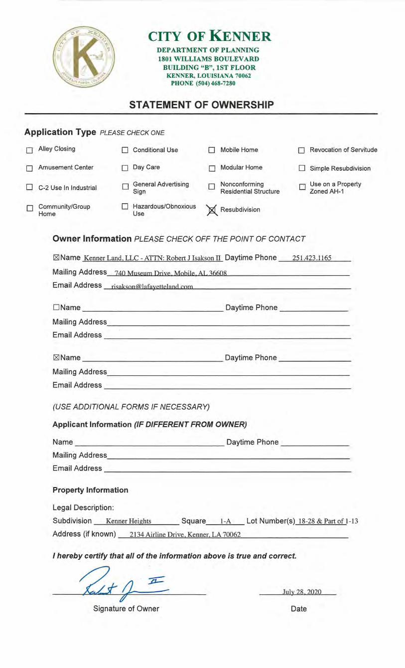
STATEMENT OF OWNERSHIP
Application Type PLEASE CHECK ONE
0 Alley Closing 0 Conditional Use 0 Mobile Home 0 Revocation of Servitude
0 Amusement Center 0 Day Care 0 Modular Home 0 Simple Resubdivision
0 C-2 Use In Industrial 0 General Advertising Sign
0 Nonconforming Residential Structure
O Use on a Property Zoned AH-1
0 Community/Group 0 Hazardous/Obnoxious X Resubdivision Home Use
Owner Information PLEASE CHECK OFF THE POINT OF CONTACT
)~~Name OfY)/\R. ALAS Daytime Phone ._'?0</-&09-cJb 23 Mailing Address i21{ fVJ IN0f2,..S7-:; t:::..G!V;VE/2 . LA 7CJ00 Z
? ; Email Address (J/Yl~-~ ~ ct.-la-s,. <f: ... uct-hoo .- r?.r7m
I
D Name Daytime Phone ______ _
Mailing Address. _________________________ _
Email Address ----------------------------------DName Daytime Phone---------
Mailing Address. _____________________________ _
Email Address-----------------------------
(USE ADDITIONAL FORMS IF NECESSARY)
Applicant Information (IF DIFFERENT FROM OWNER) Wzt)_%1-f?Gi::> UrF~ ~
Name P.-rh ()LJ Ua /££st)}l) Daytime Phone /6zx;:) 722 -?'/Of {t~/) . . e.N&Y- A- I .-L.:;:<f=i{) ·- -If p ...
Ma1hng Aadress A5"3~ :rttc c~c${)AJ /?rUJ?IVU.~ /L>~~ AJi'JiJ ae4C~. t4-7oi3D
Email Address e,ct e . E- e_flp icu.u , Y) e-f
Property Information
Legal Description:
Subdivision (§JVNe;e.. !&Gtc~'Scfuare /1.,.3 Lot Number(s) ~ ~'JtlO;/I,/f:/1:5/)~ . . . . ' . . '!7:rt.~
Address (1f known) /:2-/) !fJlNVft2.. S 7 /~/1/eR,?{ . /::5) ~' . ' /Db~Q_..
I hereby certify that all of the information above is true and correct.
-/~~ Oe-fobe.r /61 20/CJ {/'. . /
Signature of Owner Date
JEFFERSON PARISH Department of Engineering
Public Works
MichaelS. Yenni Parish President ·
October 17, 2019 Mark R. Drewes, P.E.
ERIC OLIVER PERSON, Attorney-at-Law 15.39 Jackson Avenue, Suite 100 New Orleans, Louisiana 70130
Director
RE: Resubdivision of Lots 8 Thru 18 Into Lots 8-A and 11-A, Square 113, Kenner Heights Subdivision - K_enner
Dear Mr. Person:
This is in response to your email dated October 17, 2019 regarding the subject matter. Jefferson Parish has no objection to the proposed resubdivision since there are no mains, utilities or servitudes located within the · referenced properties and there is . no future need for the properties. There is a 6" water line along the north side of 131h Street and a 6"water line along the east side of Minor Street that are available for service.
· If you have any further questions, please contact me at 736-6820 at _your earliest .. convenience.
Sincerely,
~ Kenneth Schexnayder, P.E. Department of Engineering Jefferson Parish
1221 Elmwood Park Bouleva rd- Suite 802- Jefferson, LA 70123
Office 504.736.6500 - Fax ~04. 736.6526
·I I I I
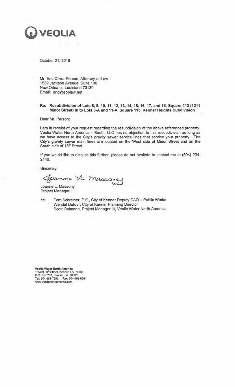
G)veouA
October21, 2019
Mr. Eric Oliver Person, Attorney-at-Law 1539 Jackson Avenue, Suite 100 New Orleans, Louisiana 70130 Email: [email protected]
Re: Resubdivision of Lots 8, 9, 10, 11, 12, 13, 14, 15, 16, 17, and 18, Square 113 (1211 Minor Street) in to Lots 8-A and 11-A, Square 113, Kenner Heights Subdivision
Dear Mr. Person:
I am in receipt of your request regarding the resubdivision of the above referenced property. Veolia Water North America - South, LLC has no objection to this resubdivision as long as we have access to the City's gravity sewer service lines that service your property. The City's gravity sewer main lines are located on the West side of Minor Street and on the South side of 131
h Street.
If you would like to discuss this further, please do not hesitate to contact me at (504) 234-2146.
Sincerely,
~'*'-~ Joanne L. Massony Project Manager I
cc: Tom Schreiner, P.E., City of Kenner Deputy CAO- Public Works Wendel Dufour, City of Kenner Planning Director Scott Oalmann, Project Manager Ill, Veolia Water North America
Veolia Water North America 1 West 30th Street, Kenner. lA 70065 P.O. Box 730, Kenner. lA 70063 Tel: 504-468-7292 Fax: 504-468-6661 www.veolianorthamerica.com
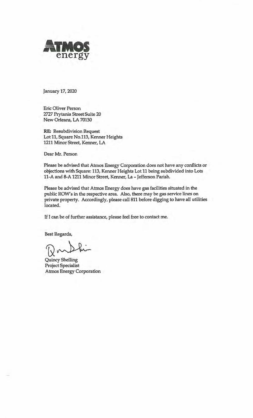
ATMOS energy
January 17, 2020
Eric Oliver Person 2727 Prytania Street Suite 20 New Orleans, LA 70130
RE: Resubdivision Request Lot 11, Square No.l13, Kenner Heights 1211 Minor Street, Kenner, LA
Dear Mr. Person
Please be advised that Atn10s Energy Corporation does not have any conflicts or objections with Square: 113, Kenner Heights Lot 11 being subdivided into Lots 11-A and 8-A 1211 Minor Street, Kenner, La -Jefferson Parish.
Please be advised that Atmos Energy does have gas facilities situated in the public ROW's in the respective area. Also, there may be gas service lines on private property. Accordingly, please call811 before digging to have all utilities located.
If I can be of further assistance, please feel free to contact me.
Best Regards,
~VV'-~ Quincy Shelling Project Specialist Atmos Energy Corporation
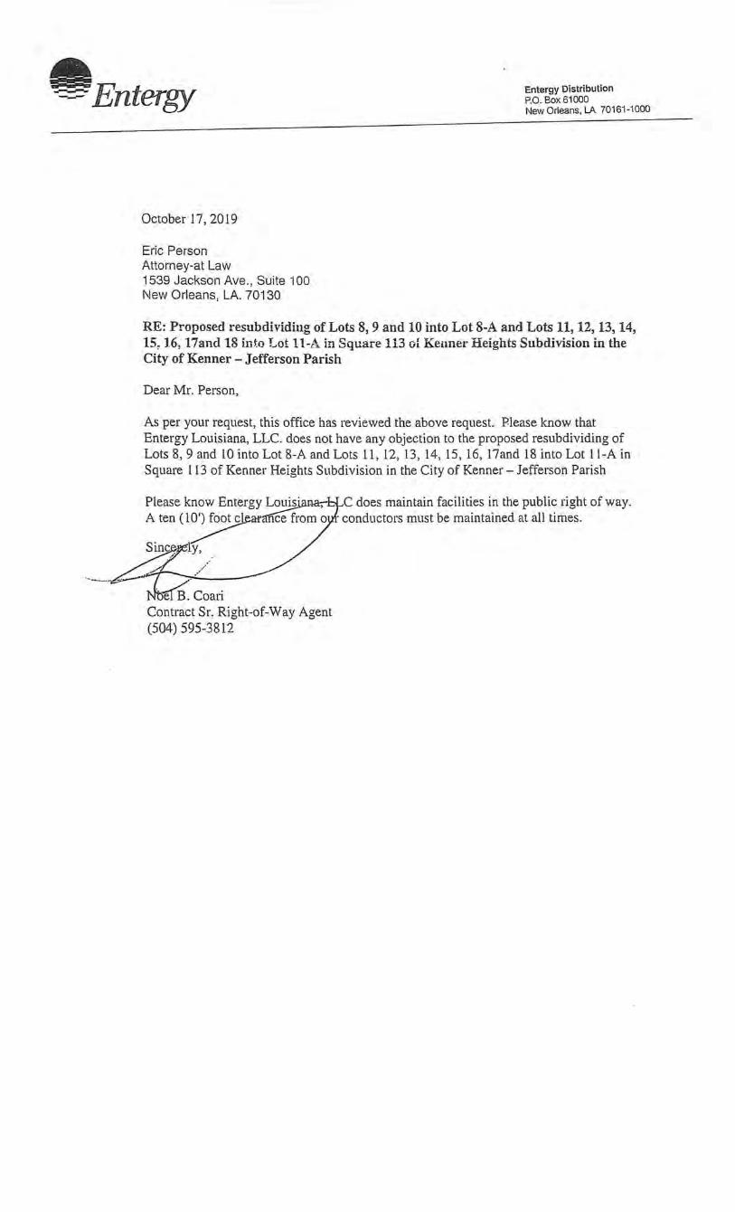
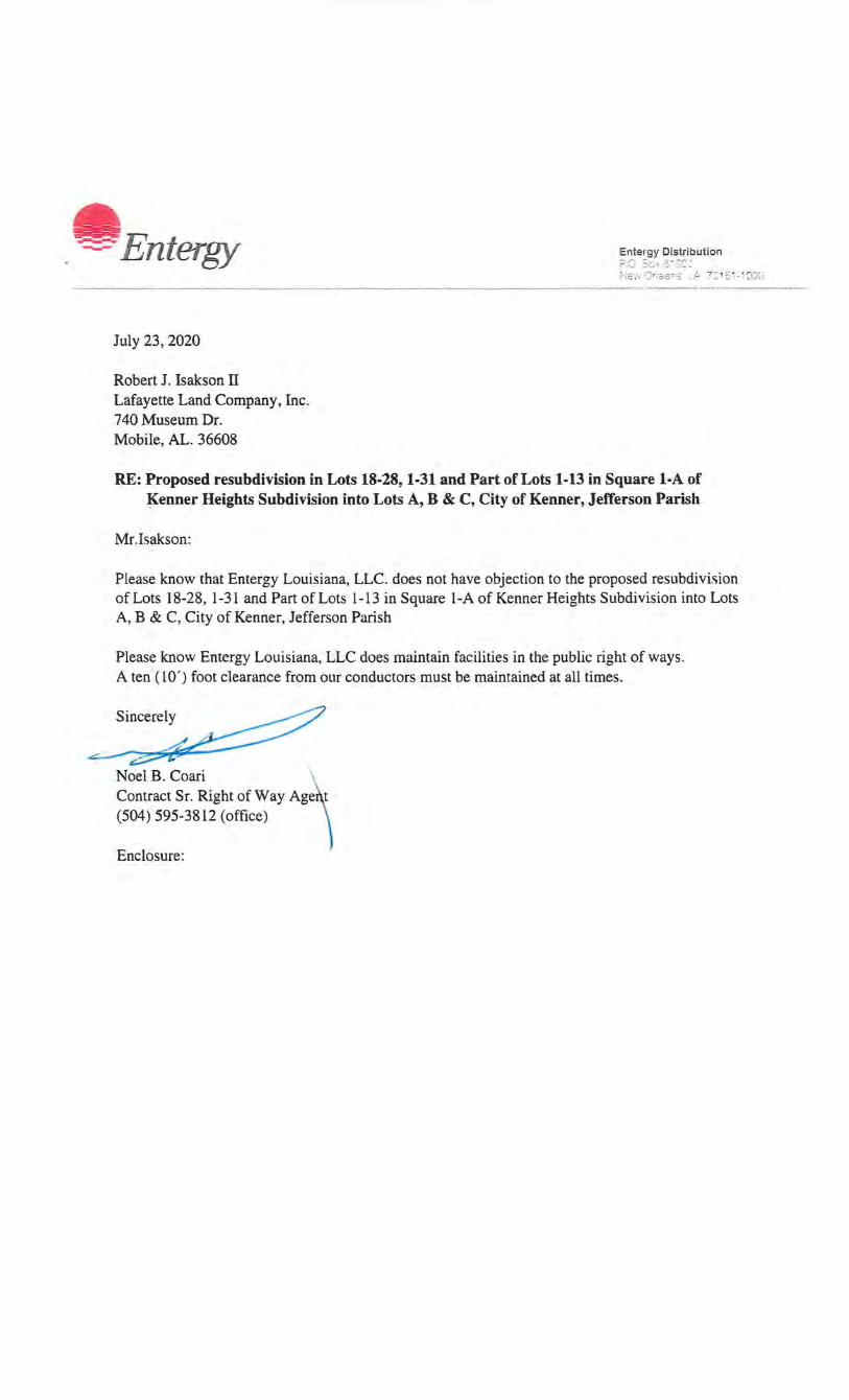
-Entergy
October 17,2019
Eric Person Attorney-at Law 1539 Jackson Ave., Suite 100 New Orleans, LA. 70130
Entergy Distribution P.O. Box 61000 New Orleans, LA 70161-1000
RE: Proposed resubdividing of Lots 8, 9 and 10 into Lot 8-A and Lots 11, 12, 13, 14, 15, 16, 17and 18 i.nto Lot 11-A in Square 113 of Kennet· Heights Subdivision in the City of Kenner- Jefferson Parish
Dear Mr. Person,
As per your request, this office has reviewed the above request. Please know that Entergy Louisiana, LLC. does not have any objection to the proposed resubdividing of Lots 8, 9 and 10 into Lot 8-A and Lots 11, 12, 13, 14, 15, 16, l7and 18 into Lot 11-A in Square 113 of Kenner Heights Subdivision in the City of Kenner- Jefferson Parish
Please know Entergy Lo~arur,-. A ten ( 1~r<l'fiCe from o
Sinc:~p;ly, .
e Contract Sr. Right-of-Way Agent
. (504) 595-3812
C does maintain facilities in the public right of way. · conductors must be maintained at all times.
~·
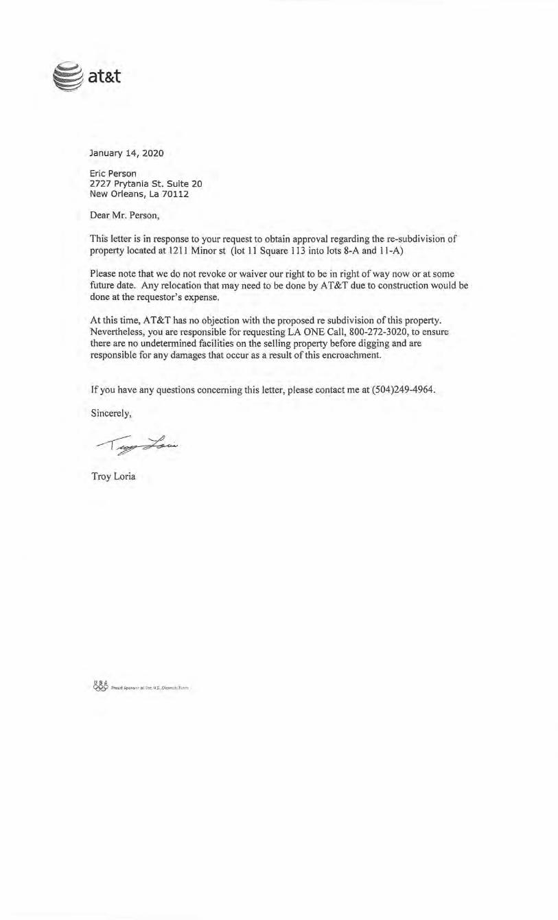
~ at&t
January 14, 2020
Eric Person 2727 Prytania St. Suite 20 New Orleans, La 70112
Dear Mr. Person,
This letter is in response to your request to obtain approval regarding the re-subdivision of property located at 1211 Minor st (lot 11 Square I I 3 into lots 8-A and 11-A)
Please note that we do not revoke or waiver our right to be in right of way now or at some future date. Any relocation that may need to be done by AT&T due to construction would be done at the requestor's expense.
At this time, AT&T has no objection with the proposed re subdivision of this property. Nevertheless, you are responsible for requesting LA ONE Call, 800-272-3020, to ensure there are no undetermined facilities on the selling property before digging and are responsible for any damages that occur as a result of this encroachment.
If you have any questions concerning this letter, please contact me at (504)249-4964.
Sincerely,
---r-~
Troy Loria
USA ~ Proud Spot\S.!U ol !he U.S. Olyrt~p:t f \."',,1":'1
E. "BEN" ZAHN, III MAYOlt
Sent Via Email
Mr. Eric Person 1211 Minor Street Kenner, LA Email: [email protected]
CITY OF KENNER DEPARTMENT OF PUBLIC WORKS
January 8, 2020
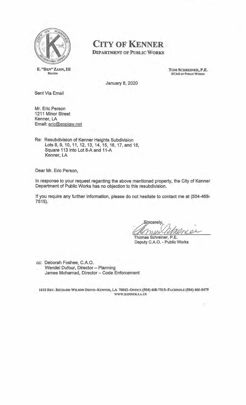
Re: Resubdivision of Kenner Heights Subdivision Lots 8, 9, 10, 11, 12, 13, 14, 15, 16, 17, and 18, Square 113 into Lot 8-A and 11-A Kenner, LA
Dear Mr. Eric Person,
TOM SCHREINER,P.E. DCAO OF PUBLIC WORI<S
In response to your request regarding the above mentioned property, the City of Kenner Department of Public Works has no objection to this resubdivision.
If you require any further information, please do not hesitate to contact me at (504-468-7515).
Thomas Schreiner, P.E. Deputy C.A.O. - Public Works
cc: Deborah Foshee, C.A.O. Wendel Dufour, Director- Planning James Mohamad, Director- Code Enforcement
1610 REV. RICHARI> WILSON DRIVE-KENNER, LA 70062-0f<JilCE (504) 468-7515-FACSII\IILE (504) 466-5479 WWW.I<ENNER.LA.US
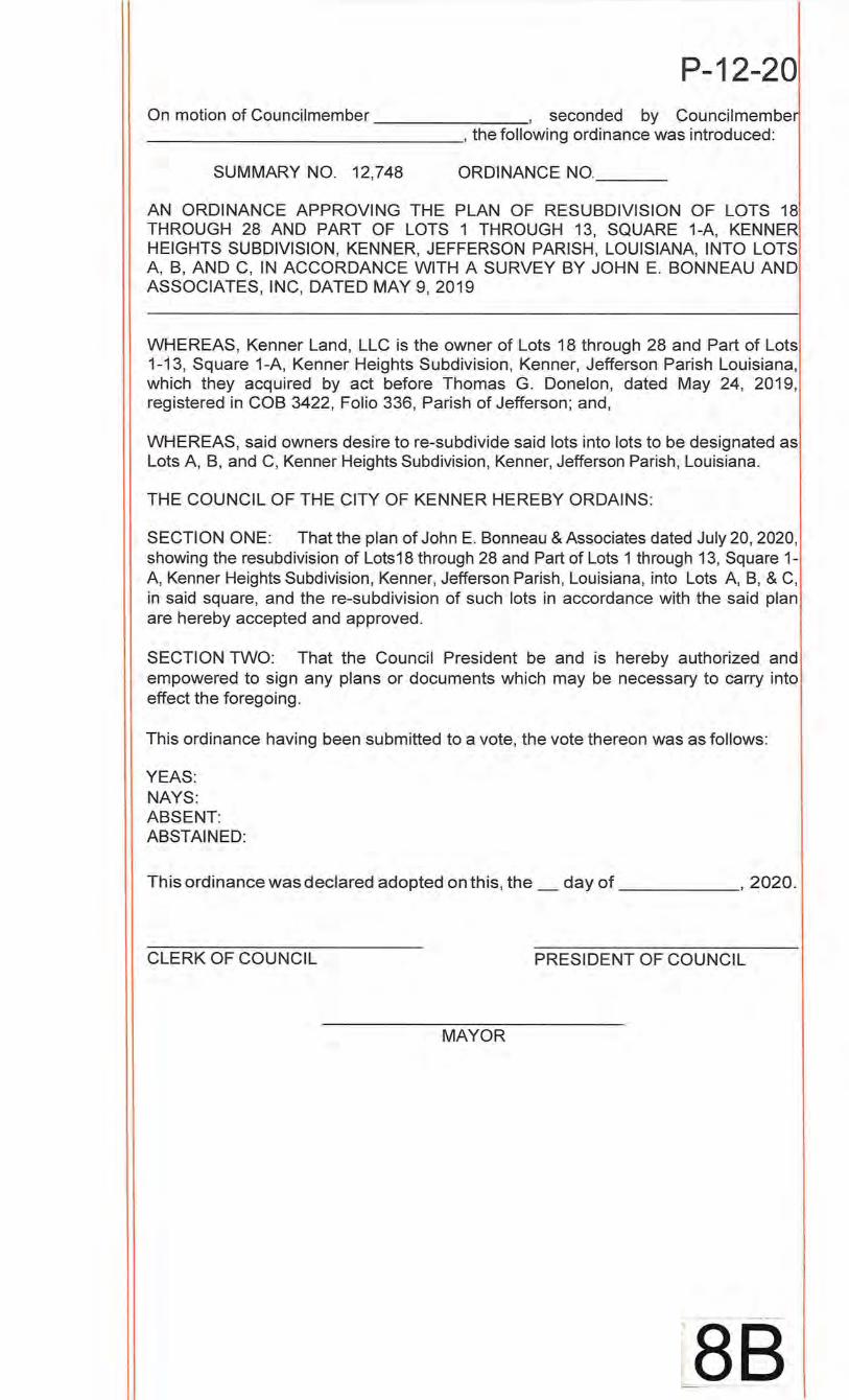
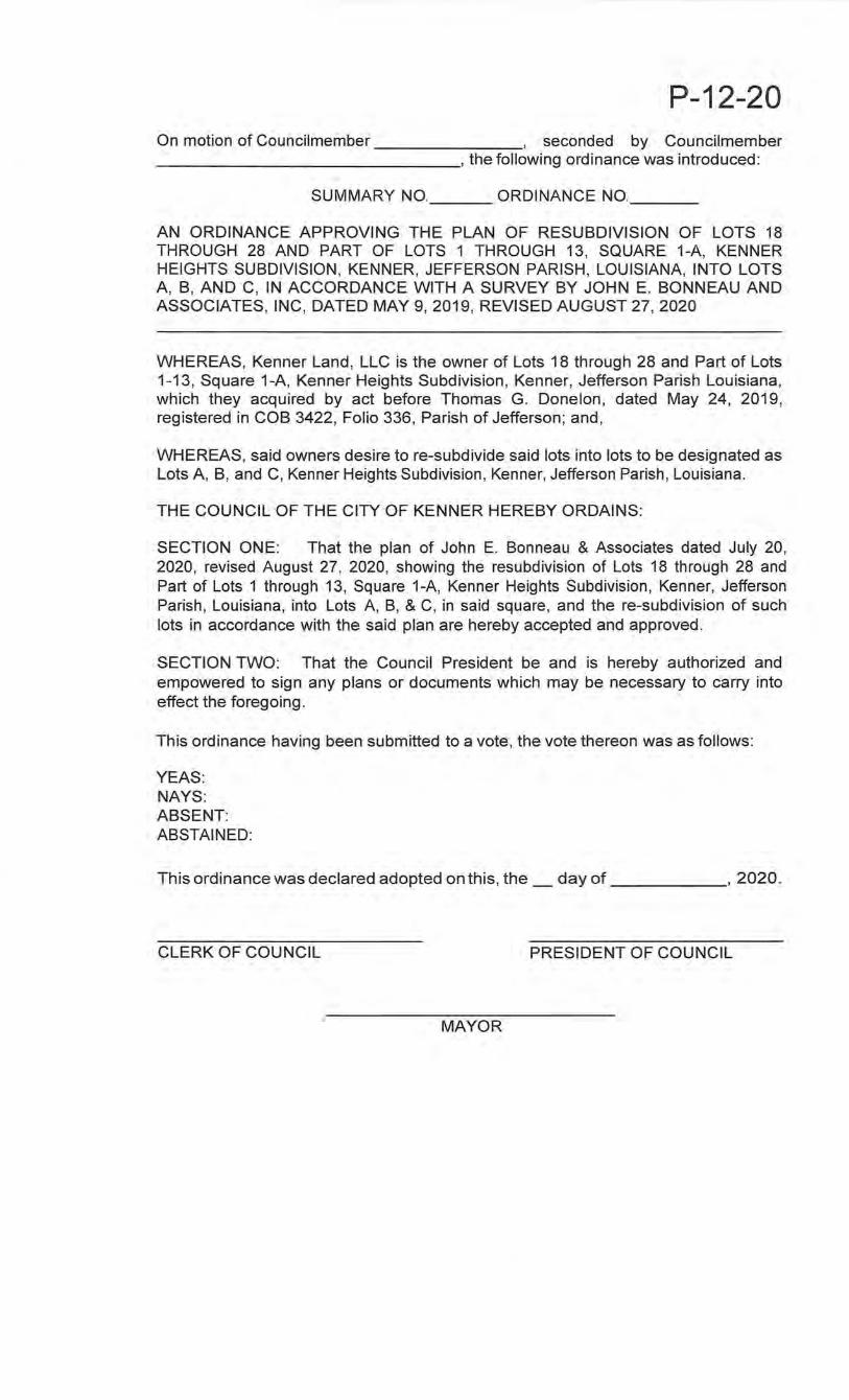
P-12-20 On motion of Councilmember , seconded by Councilmembe ________________ , the following ordinance was introduced:
SUMMARY NO. 12,748 ORDINANCE NO. __ _
AN ORDINANCE APPROVING THE PLAN OF RESUBDIVISION OF LOTS 18 THROUGH 28 AND PART OF LOTS 1 THROUGH 13, SQUARE 1-A, KENNER HEIGHTS SUBDIVISION, KENNER, JEFFERSON PARISH, LOUISIANA, INTO LOTS A, B, AND C, IN ACCORDANCE WITH A SURVEY BY JOHN E. BONNEAU AND ASSOCIATES, INC, DATED MAY 9, 2019
WHEREAS, Kenner Land, LLC is the owner of Lots 18 through 28 and Part of Lots 1-13, Square 1-A, Kenner Heights Subdivision, Kenner, Jefferson Parish Louisiana, which they acquired by act before Thomas G. Donelan, dated May 24, 2019, registered in COB 3422, Folio 336, Parish of Jefferson; and,
WHEREAS, said owners desire tore-subdivide said lots into lots to be designated as Lots A, B, and C, Kenner Heights Subdivision, Kenner, Jefferson Parish, Louisiana.
THE COUNCIL OF THE CITY OF KENNER HEREBY ORDAINS:
SECTION ONE: That the plan of John E. Bonneau & Associates dated July 20, 2020, showing the resubdivision of Lots18 through 28 and Part of Lots 1 through 13, Square 1-A, Kenner Heights Subdivision, Kenner, Jefferson Parish, Louisiana, into Lots A, B, & C, in said square, and the re-subdivision of such lots in accordance with the said plan are hereby accepted and approved.
SECTION TWO: That the Council President be and is hereby authorized and empowered to sign any plans or documents which may be necessary to carry into effect the foregoing.
This ordinance having been submitted to a vote, the vote thereon was as follows:
YEAS: NAYS: ABSENT: ABSTAINED:
This ordinance was declared adopted on this, the_ day of , 2020.
CLERK OF COUNCIL PRESIDENT OF COUNCIL
MAYOR
-
~ 88
Pa gel l
DEPARTMENT OF PLANNING Kenner, Louisiana
Land Use & Zoning Report
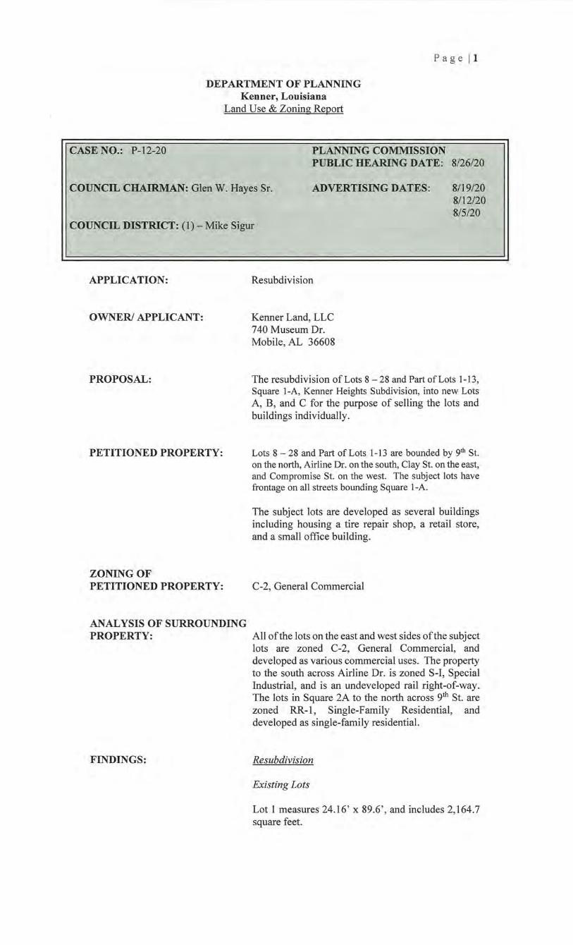
CASE NO.: P-12-20 PLANNING COMMISSION PUBLIC HEARING DATE: 8/26/20
COUNCIL CHAIRMAN: Glen W. Hayes Sr. ADVERTISING DATES: 8119/20 8112/20 8/5/20
COUNCIL DISTRICT: (1)- Mike Sigur
APPLICATION:
OWNER/ APPLICANT:
PROPOSAL:
PETITIONED PROPERTY:
ZONING OF PETITIONED PROPERTY:
ANALYSIS OF SURROUNDING PROPERTY:
FINDINGS:
Resubdivision
Kenner Land, LLC 740 Museum Dr. Mobile, AL 36608
The resubdivision of Lots 8-28 and Part of Lots 1-13, Square 1-A, Kenner Heights Subdivision, into new Lots A, B, and C for the purpose of selling the lots and buildings individually.
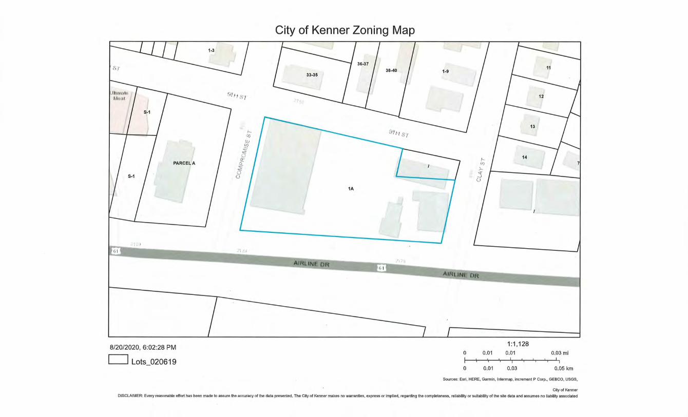
Lots 8 - 28 and Part of Lots 1-13 are bounded by 9th St. on the north, Airline Dr. on the south, Clay St. on the east, and Compromise St. on the west. The subject lots have frontage on all streets bounding Square 1-A.
The subject lots are developed as several buildings including housing a tire repair shop, a retail store, and a small office building.
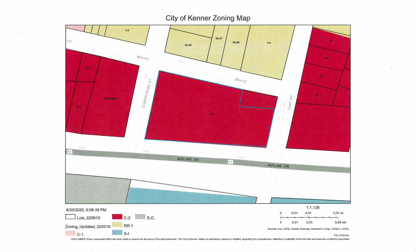
C-2, General Commercial
All of the lots on the east and west sides of the subject lots are zoned C-2, General Commercial, and developed as various commercial uses. The property to the south across Airline Dr. is zoned S-1, Special Industrial, and is an undeveloped rail right-of-way. The lots in Square 2A to the north across 9th St. are zoned RR-1 , Single-Family Residential, and developed as single-family residential.
Resubdivision
Existing Lots
Lot 1 measureS 24.16' x 89.6' , and includes 2,164.7 square feet.
PLANNING COMMISSION RECOMMENDATION:
P age 12
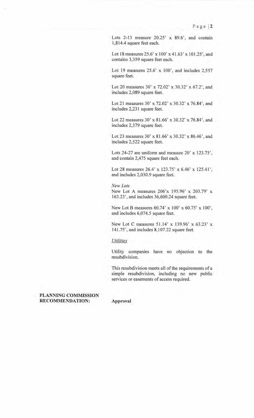
Lots 2-13 measure 20.25 ' x 89.6' , and contain 1,814.4 square feet each.
Lot 18 measures 25.6' X 100' x41.63 ' X 101.25' , and contains 3,359 square feet each.
Lot 19 measures 25.6 ' x 1 00' , and includes 2,557 square feet.
Lot 20 measures 30' x 72.02 ' x 30.32' x 67.2', and includes 2,089 square feet.
Lot 21 measures 30' x 72.02' x 30.32' x 76.84', and includes 2,231 square feet.
Lot 22 measures 30' x 81.66 ' x 30.32' x 76.84 ', and includes 2,379 square feet.
Lot 23 measures 30' x 81.66 ' x 30.32' x 86.46' , and includes 2,522 square feet.
Lots 24-27 are uniform and measure 20' x 123.75' , and contain 2,475 square feet each.
Lot 28 measures 26.4' x 123 .75 ' x 6.46' x 125.41 ', and includes 2,030.9 square feet.
New Lots New Lot A measures 206 'x 195.96' x 203.79' x 163.23' , and includes 36,600.24 square feet.
New Lot B measures 60.74 ' x 100' x 60.75' x 100', and includes 6,074.5 square feet.
New Lot C measures 51.14 ' x 139.96' x 63.23 ' x 141.75 ', and includes 8,107.22 square feet.
Utilities
Utility companies have no objection to the resubdivision.
This resubdivision meets all of the requirements of a simple resubdivision, including no new public services or easements of access required.
Approval
P-12-20 On motion of Councilmember , seconded by Councilmember ________________ , the following ordinance was introduced:
SUMMARY NO. ORDINANCE NO. __ _
AN ORDINANCE APPROVING THE PLAN OF RESUBDIVISION OF LOTS 18 THROUGH 28 AND PART OF LOTS 1 THROUGH 13, SQUARE 1-A, KENNER HEIGHTS SUBDIVISION, KENNER, JEFFERSON PARISH, LOUISIANA, INTO LOTS A, B, AND C, IN ACCORDANCE WITH A SURVEY BY JOHN E. BONNEAU AND ASSOCIATES, INC, DATED MAY 9, 2019, REVISED AUGUST 27,2020
WHEREAS, Kenner Land, LLC is the owner of Lots 18 through 28 and Part of Lots 1-13, Square 1-A, Kenner Heights Subdivision, Kenner, Jefferson Parish Louisiana, which they acquired by act before Thomas G. Donelan, dated May 24, 2019, registered in COB 3422, Folio 336, Parish of Jefferson; and,
WHEREAS, said owners desire tore-subdivide said lots into lots to be designated as Lots A, B, and C, Kenner Heights Subdivision, Kenner, Jefferson Parish, Louisiana.
THE COUNCIL OF THE CITY OF KENNER HEREBY ORDAINS:
SECTION ONE: That the plan of John E. Bonneau & Associates dated July 20, 2020, revised August 27, 2020, showing the resubdivision of Lots 18 through 28 and Part of Lots 1 through 13, Square 1-A, Kenner Heights Subdivision, Kenner, Jefferson Parish, Louisiana, into Lots A, B, & C, in said square, and the re-subdivision of such lots in accordance with the said plan are hereby accepted and approved.
SECTION TWO: That the Council President be and is hereby authorized and empowered to sign any plans or documents which may be necessary to carry into effect the foregoing.
This ordinance having been submitted to a vote, the vote thereon was as follows:
YEAS: NAYS: ABSENT: ABSTAINED:
This ordinance was declared adopted on this, the_ day of , 2020.
CLERK OF COUNCIL PRESIDENT OF COUNCIL
MAYOR
E--.
~ ~ ~
~ ~ ~ 8
-' w
~ 0
' eo :C m ~ &0 ~ 0) ~ ....
9TH STREET
LOT 24 2,4 75 SO.FT.
""123:75-,-
LOT 25 2, 4 75 SO .FT.
-- - - ""123:75-,-
LOT 26 2.4 75 SO.FT.
""123:75-.
LOT 27 2,4 75 SO.FT
IJI ~ I
~l<o _ji
~I
I l<o "'
LOT 23 1
00
2,522 SO.FT. I
I 30.0 •' \.d) , ()Cl~
I
1-.. IX)
LOT 22 1:e LOT 2,379 SQ.FT I 2,23 1
I -----1 -~ 1 LO I ;,
139.96 lOO.O LOT 19 LOT. C ~ 2,557 so.FT--.
C"'! ~ . N~ BUILDING - - - -., "": ~ f:"' 1 ~~ ' ' _ 100.0· ~ i ~~ ~ 1~ 9s I /:;;_ #2151 ~ ~ ;;;0.
- _ BUILDING . #2134 ""123:75-,
LOT 2B 2,030.9 SQ.FT.
\ 25 .4, . ~ I____, -.---1 T 2~ 120.25 zo .zs
~ (Js.soo.T.soA I , 1\\1-- ('j . - .FT. ) \_, ~~· !')
g '... "'·"· p;S y,"· ~.'" 20 _~5 ~~5·
2"0!15 "~ \ G~ , I 20 .25' 20.25
¢ 0 '\ 20 .25 o 0 r'Y o ·
,_s« I I I J I'" '"I <tl
~ ~ ~ ~
~ I I I_ I_
1~ ~~ I~ I~ LOT 2 I LOT 3 I LCiT 4 I
1, 79 2 SO .FT. 1, 792 SO .FT. 1.792 SO .FT.
~ ~ Q
LOT B I LOT 9 I LOT 10 1 ,792 so FT 1 ,792 so FT I' ,792 SO.FT . I .. 0
I , 6 I ' .I •. >' )'
jJ = UGHT POLE b = FIRE HYDRANT
CONCRETE
NOTE: PROPERTY CORNERS TO BE SU AFTER PARISH APPROVAL OF PLAT .
---------------___---n REVISED: 08/27/20(0FFlCE)
SCRIBED
BUILDING SETBACKS FRONT: N/A
COPYRIGKT C) 2020 ALL RIGHTS RESERVED
JOHN E. BONNEAU &: ASSOCIATES, INC.
REFERENCE SURYEY: The Recorded Subdivision Map.
BASIS FOR BEARINGS/ANGLES· The Reference Survey.
. 0~.,---- . ~· e = I /2" IRON ROD SET SIDE: N/A SIDE STREET: N/ A
NQIE;, Th is is to certify that I have done on actual ground survey and found that no encroachments exist either way across any property lines except os shown.
A RESUBDIVISION MAP OF LOTS 18-28 & PART OF LOTS 1-13, SQ. 1-A. KENNER HEIGHTS,
into
LOTS A. 8, & C, SQ. 1-A, KENNER HEIGHTS, in
CITY OF KENNER in
Jefferson Parish for
KENNER LAND, FIRST BANK & TRUST -
LLC, NEW ORLEANS
FLOODZONE NOTE: This is to certify that I hove consulted the Federal Insurance Administration Flood Hazard Boundary Maps and found the property described is located in Flood Zone(a) "X" with a Base Flood · Elevation of N/A in accordance with Community Panel No. 22051C01BOF ; Revised: FEBRUARY 02, 2010
THIS IS TO CERTIFY THAT THIS SURVEY WAS DONE UNDER MY DIRECT SUPERVISION AND CONTROL; AND THAT THE SURVEY WAS DONE ON THE GROUND AND IS IN ACCORDANCE WITt\ \Tftlj: I frft~I~JDARDS OF PRACTICE FOR BOUNDARY SURVEYS" AS ADOPTED BY THE STATE OF LOUI~I~~A:o'~.Ot~01 1 rf!l,;. REGISTRATION FOR PROFESSIONAL ENGINEERS AND LAND SURVEYORS FOR A..._,"&~~ ~ 'S\:J "'1{///
Survey No. 2019 191A Drown by: JCW Scale: 1" = 30'
Dote: MAY 9, 2019 Revised: 06/04/19IOFFICE). 07 /20/20(RESUB)
PARCEL A
,j· t
--
8/20/2020, 6:02:28 PM
D Lots_020619
, '] ~. I
City of Kenner Zoning Map
1A
.:' 1 '..J
AIRLINE DR B - AIRLIN R
0
0
0.01
0.01
14
1:1,128 0.01
0.03
0.03 mi
0.05 km
Sources: Esri, HERE, Garmln, lntermap, Increment P Corp., GEBCO, USGS,
City of Kenner
DISCLAIMER: Every reasonable effort has been made to assure the accuracy of the data presented. The City of Kenner makes no warranties, express or implied, regard ing the completeness, reliability or suitability of the site data and assumes no liability associated
8/20/2020, 6:08:39 PM
c=J Lots_020619
Zoning_Updated_022019
C-1
.. C-2
RR-1
.. S-1
City of Kenner Zoning Map
Dl..-,' S r
•11 .~ I
s.o. 0
0
-----~-~--DR
0.01
0.01
1:1,128 0.01
0.03
0.03 mi
0.05 km
Sources: Esri, HERE. Garmln. lntermap. Increment P Corp .• GEBCO. USGS •
City of Kenner
DISCLAIMER: Every reasonable effort has been made to assure the accuracy of the data presented. The City of Kenner makes no warranties, express or implied, regarding the completeness, reliability or suitability of the site data and assumes no liability associated
CITY OF KENNER DEPARTMENT OF PLANNING 1801 WILLIAMS BOULEVARD
BUILDING "B", 1ST FLOOR KENNER, LOUISIANA 70062
PHONE (504) 468-7280
STATEMENT OF OWNERSHIP
Application Type PLEASE CHECK ONE
0 Alley Closing D Conditional Use D Mobile Home D Revocation of Servitude
D Amusement Center D Day Care D Modular Home D Simple Resubdivision
D C-2 Use In Industrial 0 General Advertising D Nonconforming D Use on a Property Sign Residential Structure Zoned AH-1
D Community/Group D Hazardous/Obnoxious )8{, Resubdivision Home Use
Owner Information PLEASE CHECK OFF THE POINT OF CONTACT
~Name Kenner Land, LLC- ATTN: Robert J Isakson II Daytime Phone 251.423.1165
Mailing Address 740 Museum Drive, Mobile, AL 36608
Email Address rjsakson@lafayetteland com
DName Daytime Phone _______ _
Mailing Address _________________________ _
Email Address ----------------------------
~Name Daytime Phone _______ _
Mailing Address _________________________ ~
Email Address----------------------------
(USE ADDITIONAL FORMS IF NECESSARY)
Applicant Information (IF DIFFERENT FROM OWNER)
Name Daytime Phone ______ _
Mailing Address _________________________ _
Email Address----------------------------
Property Information
Legal Description :
Subdivision Kenner Heights Square 1-A Lot Number(s) 18-28 & Part of 1-13
Address (if known) 2134Airline Drive Kenner LA 70062
I hereby certify that all of the information above is true and correct.
z~ Julv 28. 2020 #
Signature of Owner Date
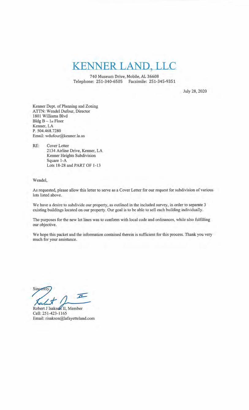
KENNER LAND, LLC 740 Museum Drive, Mobile, AL 36608
Telephone: 251-340-6505 Facsimile: 251-345-9351
Kenner Dept. of Planning and Zoning ATTN: Wendel Dufour, Director 1801 Williams Blvd Bldg B -1st Floor Kenner, LA P. 504.468.7280 Email: [email protected]. us
RE: Cover Letter 2134 Airline Drive, Kenner, LA Kenner Heights Subdivision Square 1-A Lots 18-28 and PART OF 1-13
Wendel, .
July 28, 2020
As requested, please allow this letter to serve as a Cover Letter for our request for subdivision of various lots listed above.
We have a desire to subdivide our property, as outlined in the included survey, in order to separate 3 existing buildings located on our property. Our goal is to be able to sell each building individually.
The purposes for the new lot lines was to conform with local code and ordinances, while also fulfilling our objective.
We hope this packet and the information contained therein is sufficient for this process. Thank you very much for your assistance.
~ ·
·~ ~ Robel;!~ Cell:251-423-1165 Email: [email protected]
CITY OF KENNER DEPARTMENT OF PUBLIC WORKS
E. "BENl' ZAHN, ill \l-\YOR
Sent Via Email
Attn: Robert Isakson, II Lafayette Land Company, Inc. Kenner, LA Email: [email protected]
July 29, 2020
Re: Resubdivision of Kenner Heights Subdivision Lots 18-28 & Part of Lots 1-13, Square 1-A, Into Lots A, B, & C, Square 1-A Kenner, LA
Dear Robert Isakson II,
TOM SCHREINER, P.E. DCAO OF PUBLIC WORKS
In response to your request regarding the above mentioned property, the City of Kenner Department of Public Works has no objection to this resubdivision.
If you require any further information, please do not hesitate to contact me at (504-468-7515).
~rely~ omassc~ner~
Deputy C.A.O. - Public Works
cc: Deborah Foshee, C.A.O. Wendel Dufour, Director- Planning James Mohamad, Director- Code Enforcement
1610 REV. RlCH..<UU> WILSON DRIVE- KENNER, LA 70062-0FFICE (504) 468-7515-FACSIMILE (504) 466-5479 WWW.KENNER.LA.US
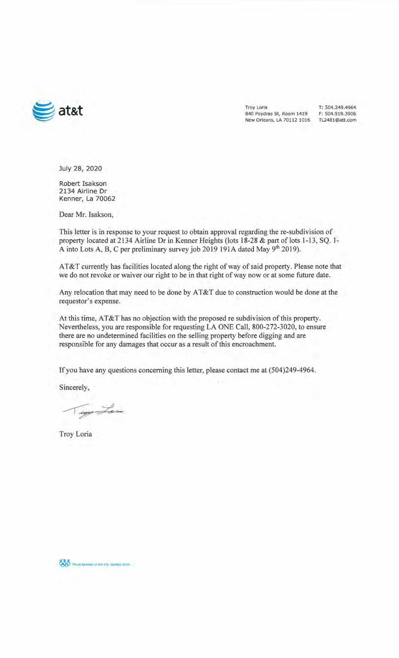
~
~j at&t Troy Loria T: 504.249.4964 840 Poydras St, Room 1419 F: 504.919 .3906 New Orleans, LA 70112 1016 [email protected]
July 28, 2020
Robert I sa kson 2134 Airline Dr Kenner, La 70062
Dear Mr. Isakson,
This letter is in response to your request to obtain approval regarding the re-subdivision of property located at 2134 Airline Dr in Kenner Heights (lots 18-28 & part oflots 1-13, SQ. IA into Lots A, B, C per preliminary survey job 2019 191A dated May 9th 20 19).
AT&T currently has facilities located along the right of way of said property. Please note that we do not revoke or waiver our right to be in that right of way now or at some future date.
Any relocation that may need to be done by AT&T due to construction would be done at the requestor's expense.
At this time, AT&T has no objection with the proposed re subdivision of this property. Nevertheless, you are responsible for requesting LA ONE Call, 800-272-3020, to ensure there are no undetermined facilities on the selling property before digging and are responsible for any damages that occur as a result of this encroachment.
If you have any questions concerning this letter, please contact me at (504)249-4964.
Sincerely,
~~
Troy Loria
~ Proud Sponsor of the U.S. Olympic Team
Robert Isakson II Tuesday, July 28, 2020 at 10:34:18 Central Daylight Time
Subject:
Date:
From:
To:
RE: Kenner- Utility Company Letter- Flood Authority
Thursday, July 23, 2020 at 12:04:36 PM Central Daylight Time
Deborah Abu Naser
Robert Isakson, II
Attachments: imageOOl.png
Deborah Abu Naser Engineering/Permitting Department 6920 Franklin Avenue New Orleans, Louisiana 70122 504.286.3105 (Office)
From: Robert Isakson, II [mailto:[email protected]] Sent: Thursday, July 23, 2020 12:03 PM To: Deborah Abu Naser <[email protected]> Subject: Kenner- Utility Company Letter- Flood Authority
CAUTION: This email originated from outside of the organization. Do not click links or open attachments unless you recognize the sender and know the content is safe.
Deborah,
I am performing a resubdivision in Kenner and have been asked by their planning and zoning department for a utility letter from your company.
ADDRESS: 2134 Airline Dr, Kenner, LA 70062 (1 Block East of Airline @ Williams Blvd, North side of Airline Dr)
Page 1 of 2
Attached is the proposed survey showing 3 existing buildings.
Your timeliness in response is very much appreciated . Thank you!- Bobby
Sincerely,
Robert J Isakson II Lafayette Land Company, Inc. Cell: 251-423-1165 Developing Commercial & Industrial Real Estate since 1982
Please be advised any information provided to the Southeast Louisiana Flood Protection Authority-East, or its member districts (Orleans Levee District, East Jefferson Levee District and Lake Borgne Basin Levee District) may be subject to disclosure under the Louisiana Public Records Law. Information contained in any correspondence, regardless of its source, may be a public record subject to public inspection and reproduction in accordance with the Louisiana Public Records Law, La . Rev. Stat. 44:1 et seq. If you have received this electronic mail transmission in error, please delete it from your system without copying it, and notify the sender by reply e-mail, so that our address record can be corrected .
Page 2 of 2
Robert Isakson II Tuesday, July 28, 2020 at 10:33:30 Central Daylight Time
Subject:
Date:
Re: Kenner- Utility Company Letter- Jefferson Parish Engineering
Friday, July 24, 2020 at 10:06:31 AM Central Daylight Time
From: Ken Schexnayder
To: Robert Isakson, II
Attachments: 19-191 resubd.[S].pdf
Jefferson Parish maintains an 8" water line along Airline Drive and 6" water lines along Clay Street and Compromise Street on the west side which is not shown on the survey.
Ken Schexnayder, P.E. Jefferson Parish Department of Engineering
From: Robert Isakson, II <[email protected]> Sent: Thursday, July 23, 2020 11:56 AM To: Ken Schexnayder <[email protected]> Subject: Kenner- Utility Company Letter- Jefferson Parish Engineering
Dear Sir/Ma'am,
I am performing a resubdivision in Kenner and have been asked by their planning and zoning department for a utility letter from your company.
ADDRESS: 2134 Airline Dr, Kenner, LA 70062 (1 Block East of Airline @ Williams Blvd, North side of Airline Dr)
Attached is the proposed survey showing 3 existing buildings.
Your timeliness in response is very much appreciated. Thank you!- Bobby
Sincerely,
Robert J Isakson II Lafayette Land Company, Inc. Cell: 251-423-1165 Developing Commercial & Industrial Real Estate since 1982
TPW logo
Any information provided to Jefferson Parish Government may be subject to disclosure under the Louisiana Public Records Law. Information contained in any correspondence, regardless of its source, may be a public record subject to public inspection and reproduction in accordance with the Louisiana Public Records Law, La . Rev. Stat. 44:1 et seq .
---. Entergy Entergy Distribution P.Q C,~x 6 # cc;; i'Js··:J O"is2.ns _fl "?C: 6 ~:- i OOD
·---------------·--·-----------·---·····----
July 23,2020
Robert J. Isakson II Lafayette Land Company, Inc. 740 Museum Dr. Mobile, AL. 36608
RE: Proposed resubdivision in Lots 18-28, 1-31 and Part of Lots 1-13 in Square 1-A of Kenner Heights Subdivision into Lots A, B & C, City of Kenner, Jefferson Parish
Mr.Isakson:
Please know that Entergy Louisiana, LLC. does not have objection to the proposed resubdivision of Lots 18-28, 1-31 and Part of Lots 1-13 in Square 1-A of Kenner Heights Subdivision into Lots A, B & C, City of Kenner, Jefferson Parish
Please know Entergy Louisiana, LLC does maintain facilities in the public right of ways. A ten (10') foot clearance from our conductors must be maintained at all times.
Sincerely
Noel B. Coari \ Contract Sr. Right of Way Age t (504) 595-3812 (office)
Enclosure:
COARI, NOEL B
From: Sent: To: Subject: Attachments:
Robert Isakson, II <[email protected]> Thursday, July 23, 2020 11:58 AM COARI, NOEL B Kenner - Utility Company Letter - Entergy Louisiana 19-191 resubd.[5][1][1][1].pdf
EXTERNAL SENDER. DO NOT click links, or open attachments, if sender is unknown, or the message seems suspicious in any way. DO NOT provide your user ID or password.
Noel,
I am performing a resubdivision in Kenner and have been asked by their planning and zoning department for a utility letter from your company.
ADDRESS: 2134 Airline Dr, Kenner, LA 70062 (1 Block East of Airline @ Williams Blvd, North side of Airline Dr)
Attached is the proposed survey showing 3 existing buildings.
Your timeliness in response is very much appreciated. Thank you!- Bobby
Sincerely,
Robert J Isakson II Lafayette Land Company. Inc. Cell: 251-423-1165 Developing Commercial & Industrial Heal Estale since 1982
'I v\ ~ '{'\ \1\ ~ ~ "'Y-\ \ )~"'~ <) "') '-.l...., ~\.- 3 \, \. ()~
1
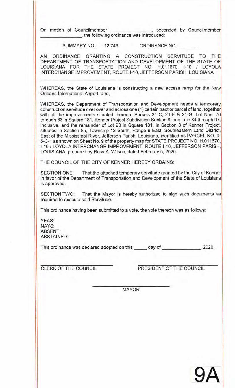
On motion of Councilmember , seconded by Councilmembe ________ , the following ordinance was introduced:
SUMMARY NO. 12,746 ORDINANCE NO. __ _
AN ORDINANCE GRANTING A CONSTRUCTION SERVITUDE TO THE DEPARTMENT OF TRANSPORTATION AND DEVELOPMENT OF THE STATE OF LOUISIANA FOR THE STATE PROJECT NO. H.011670, 1-10 I LOYOLAI INTERCHANGE IMPROVEMENT, ROUTE 1-10, JEFFERSON PARISH, LOUISIANA
WHEREAS, the State of Louisiana is constructing a new access ramp for the New Orleans International Airport; and,
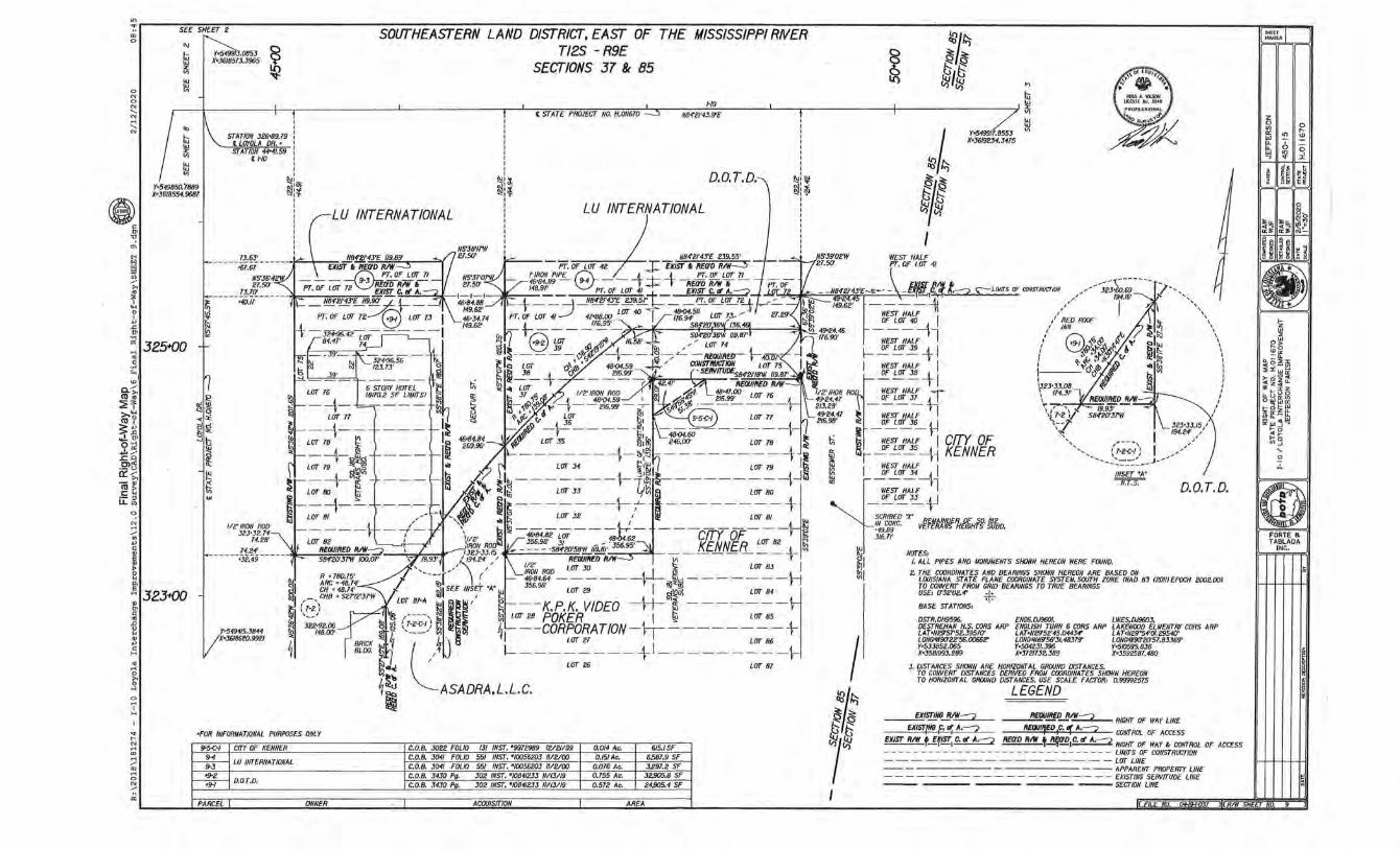
WHEREAS, the Department of Transportation and Development needs a temporary construction servitude over over and across one (1) certain tract or parcel of land, together with all the improvements situated thereon, Parcels 21-C, 21-F & 21-G, Lot Nos. 76 through 83 in Square 181, Kenner Project Subdivision Section 8, and Lots 84 through 97, inclusive, and the remainder of Lot 98 in Square 181, in Section 8 of Kenner Project, situated in Section 85, Township 12 South, Range 9 East, Southeastern Land District, East of the Mississippi River, Jefferson Parish, Louisiana, identified as PARCEL NO. 9-5-C-1 as shown on Sheet No.9 of the property map for STATE PROJECT NO. H.011670, 1-10 I LOYOLA INTERCHANGE IMPROVEMENT, ROUTE 1-10, JEFFERSON PARISH, LOUISIANA, prepared by Ross A. Wilson, dated February 5, 2020.
THE COUNCIL OF THE CITY OF KENNER HEREBY ORDAINS:
SECTION ONE: That the attached temporary servitude granted by the City of Kenner in favor of the Department of Transportation and Development of the State of Louisiana is approved.
SECTION TWO: That the Mayor is hereby authorized to sign such documents as required to execute said Servitude.
This ordinance having been submitted to a vote, the vote thereon was as follows:
YEAS: NAYS: ABSENT: ABSTAINED:
This ordinance was declared adopted on this day of , 2020.
CLERK OF THE COUNCIL PRESIDENT OF THE COUNCIL
MAYOR
_9A
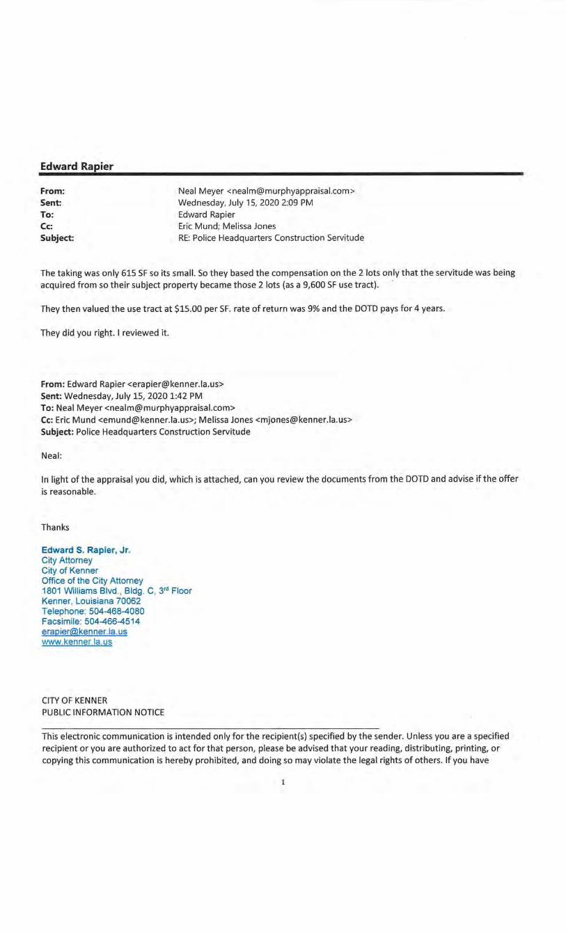
Edward Rapier
From: Sent:
Neal Meyer <[email protected]> Wednesday, July 15, 2020 2:09 PM
To: Edward Rapier Cc: Eric Mund; Melissa Jones Subject: RE: Police Headquarters Construction Servitude
The taking was only 615 SF so its small. So they based the compensation on the 2 lots only that the servitude was being acquired from so their subject property became those 2 lots (as a 9,600 SF use tract) .
They then valued the use tract at $15.00 per SF. rate of return was 9% and the DOTD pays for 4 years.
They did you right. I reviewed it.
From: Edward Rapier <[email protected]> Sent: Wednesday, July 15, 2020 1:42 PM To: Neal Meyer <[email protected]> Cc: Eric Mund <[email protected]>; Melissa Jones <[email protected]> Subject: Police Headquarters Construction Servitude
Neal:
In light ofthe appraisal you did, which is attached, can you review the documents from the DOTD and advise ifthe offer is reasonable.
Thanks
Edward S. Rapier, Jr. City Attorney City of Kenner Office of the City Attorney 1801 Williams Blvd., Bldg. C, 3rd Floor Kenner, Louisiana 70062 Telephone: 504-468-4080 Facsimile: 504-466-4514 [email protected]. us www.kenner.la.us
CITY OF KENNER PUBLIC INFORMATION NOTICE
This electronic communication is intended only for the recipient(s) specified by the sender. Unless you are a specified recipient or you are authorized to act for that person, please be advised that your reading, distributing, printing, or copying this communication is hereby prohibited, and doing so may violate the legal rights of others. If you have
1
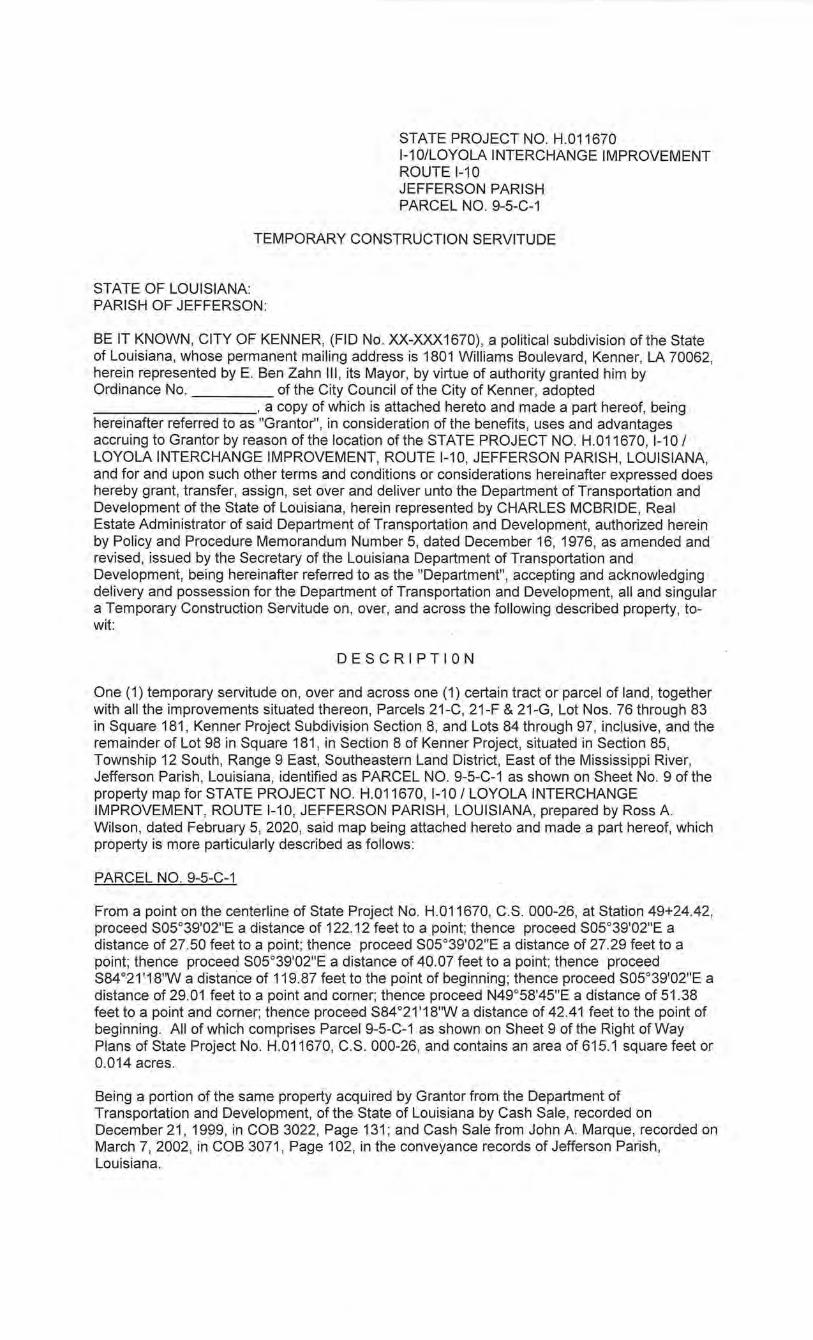
STATE PROJECT NO. H.011670 1-101LOYOLA INTERCHANGE IMPROVEMENT ROUTE 1-10 JEFFERSON PARISH PARCEL NO. 9-5-C-1
TEMPORARY CONSTRUCTION SERVITUDE
STATE OF LOUISIANA: PARISH OF JEFFERSON:
BE IT KNOWN, CITY OF KENNER, (FlO No. XX-XXX1670) , a political subdivision of the State of Louisiana, whose permanent mailing address is 1801 Williams Boulevard , Kenner, LA 70062, herein represented by E. Ben Zahn Ill , its Mayor, by virtue of authority granted him by Ordinance No. of the City Council of the City of Kenner, adopted _________ , a copy of which is attached hereto and made a part hereof, being hereinafter referred to as "Grantor", in consideration of the benefits, uses and advantages accruing to Grantor by reason of the location of the STATE PROJECT NO. H.011670, 1-10 I LOYOLA INTERCHANGE IMPROVEMENT, ROUTE 1-10, JEFFERSON PARISH, LOUISIANA, and for and upon such other terms and conditions or considerations hereinafter expressed does hereby grant, transfer, assign, set over and deliver unto the Department of Transportation and Development of the State of Louisiana, herein represented by CHARLES MCBRIDE, Real Estate Administrator of said Department of Transportation and Development, authorized herein by Policy and Procedure Memorandum Number 5, dated December 16, 1976, as amended and revised, issued by the Secretary of the Louisiana Department of Transportation and Development, being hereinafter referred to as the "Department", accepting and acknowledging delivery and possession for the Department of Transportation and Development, all and singular a Temporary Construction Servitude on , over, and across the following described property, towit:
DESCRIPTION
One (1) temporary servitude on , over and across one (1) certain tract or parcel of land, together with all the improvements situated thereon, Parcels 21 -C, 21-F & 21-G, Lot Nos. 76 through 83 in Square 181 , Kenner Project Subdivision Section 8, and Lots 84 through 97, inclusive, and the remainder of Lot 98 in Square 181 , in Section 8 of Kenner Project, situated in Section 85, Township 12 South, Range 9 East, Southeastern Land District, East of the Mississippi River, Jefferson Parish , Louisiana, identified as PARCEL NO. 9-5-C-1 as shown on Sheet No. 9 of the property map for STATE PROJECT NO. H.011670, 1-10 I LOYOLA INTERCHANGE IMPROVEMENT, ROUTE 1-10, JEFFERSON PARISH, LOUISIANA, prepared by Ross A. Wilson, dated February 5, 2020, said map being attached hereto and made a part hereof, which property is more particularly described as follows:
PARCEL NO. 9-5-C-1
From a point on the centerl ine of State Project No. H.011670, C.S. 000-26, at Station 49+24.42, proceed S05°39'02"E a distance of 122.12 feet to a point; thence proceed S05°39'02"E a distance of 27.50 feet to a point; thence proceed S05°39'02"E a distance of 27.29 feet to a point; thence proceed S05°39'02"E a distance of 40.07 feet to a point; thence proceed S84 °21'18"W a distance of 119.87 feet to the point of beginning ; thence proceed S05°39'02"E a distance of 29.01 feet to a point and corner; thence proceed N49°58'45"E a distance of 51 .38 feet to a point and corner; thence proceed S84°21'18"W a distance of 42.41 feet to the point of beginning. All of which comprises Parcel 9-5-C-1 as shown on Sheet 9 of the Right of Way Plans of State Project No. H.011670, C.S. 000-26, and contains an area of 615.1 square feet or 0.014 acres.
Being a portion of the same property acquired by Grantor from the Department of Transportation and Development, of the State of Louisiana by Cash Sale, recorded on December 21 , 1999, in COB 3022, Page 131 ; and Cash Sale from John A. Marque, recorded on March 7, 2002, in COB 3071 , Page 102, in the conveyance records of Jefferson Parish, Louisiana.
The Department is hereby authorized, in the construction and maintenance of said project, to remove from the property herein described earth and other material in accordance with usual construction and maintenance policies.
The Department shall pay unto Grantor for the temporary construction servitude hereby conveyed, upon approval by the Department of Grantor's title to the hereinabove property, free and clear of all encumbrances of any kind or nature whatsoever, and in full settlement and satisfaction of any and all claims for damages resulting from the grant of said temporary construction servitude, the price and sum of THIRTEEN THOUSAND FIVE HUNDRED FORTY AND N0/1 00 ($13,540.00) DOLLARS.
Grantor acknowledges and agrees that the consideration provided herein constitutes full and final settlement for the temporary construction servitude herein granted and for any and all diminution in the value of Grantor's remaining property as a result of the granting of this temporary right of way for transportation purposes.
It is agreed and understood that prior to completion of the said project, the property upon which the hereinabove described temporary construction servitude is located shall be left free of all construction scars.
The temporary construction servitude hereby granted shall be for a term of four (4) years at ONE THOUSAND FORTY-SIX AND N0/100 ($1 ,046.00) DOLLARS per year and shall commence upon the date a work order is issued to the contractor, for construction of the respective construction project for which the servitude is required.
Should the above recited term not be sufficient to complete construction activities, the Grantor grants to the Department the option to extend the servitude for an additional one (1) year at the same terms, conditions and rental as herein specified. This extension shall be automatic and without additional compensation unless Grantor notifies the Department.
It is further agreed and understood that the Department's rights to the said construction servitude shall terminate upon the date of completion and final acceptance of the said project and the fee simple title to the said property shall remain vested in the Grantor.
IN TESTIMONY WHEREOF, the parties hereto have signed and executed and
acknowledged this instrument as their free and voluntary acts, in triplicate originals in the
presence of the undersigned competent witnesses, as of the day of _____ _
2020.
WITNESSES:
STATE OF LOUISIANA:
PARISH OF JEFFERSON:
BY:
CITY OF KENNER
~E.~B~E~N~ZA~H~N~I~II--------------
MAYOR
DEPARTMENT OF TRANSPORTATION AND DEVELOPMENT OF THE STATE OF LOUISIANA
CHARLES MCBRIDE REAL ESTATE ADMINISTRATOR
AFFIDAVIT
BEFORE ME, the undersigned authority, duly qualified in and for the aforesaid Parish and
State, personally came and appeared E. Ben Zahn Ill of the full age of majority and personally
known to me, Notary, who, by me having been duly sworn, declared and acknowledged: Thathe
signed the above and foregoing instrument on the date thereof for the objects and purposes
therein expressed, and acknowledged the same as his voluntary act and deed.

IN FAITH THEREOF, Appearer executed this acknowledgment in the Parish of Jefferson,
State of Louisiana, on this day of , 2020.
WITNESSES:
CITY OF KENNER
BY: =-~~------------------E. BEN ZAHN Ill MAYOR
NOTARY PUBLIC
Stantec 1-10/ Loyola Interchange Improvement
State Project No. H.011670 GILCHRIST COHSIIUCTIOI< ~OM,AHY
State Project No. H.011670 F.A.P. No. H011670 1-1 0/Loyola Interchange Improvement Design-Build Project Jefferson Parish
Attn: Ed Rapier City of Kenner 1801 Williams Blvd Kenner, LA 70062
Re: Parcel No. 9-5-C-1 City of Kenner
Dear Mr. Rapier:
July 13, 2020
The Department of Transportation and Development is acquiring the property rights necessary to construct the above captioned project. In the interest of developing and maintaining an effective transportation system, it is imperative that acquisition be completed as soon as possible.
According to the conveyance records of Jefferson Parish, Louisiana, you are a 100% interest owner of Parcel No. 9-5-C-1, which is required to improve the highway.
Property you own lies within the area needed for this project and must be acquired by the Department of Transportation anc:l Development. The Department of Transportation and Development, through this letter and enclosures, is hereby formally making an offer to purchase the required area.
Enclosed for your consideration are the following:
1. The Department's Just Compensation Offer Letter, which makes a firm monetary offer and explains the area required and any improvements which may be affected. ·
2. Summary of Just Compensation, which summarizes the Just Compensation Offer.
3. The Department's Brochure, explaining acquisition, negotiations, relocation assistance, improvement control, expropriation, the non-discrimination policy and
Ciry of Kenner July 13, 2020 Page 2
the right to appeal certain incidental expenses, such as notary fees, and certain legal transfer fees.
4. Right of Way and Construction plans of this project, which show aspects of right of way and construction.
After you have received the offer and the enclosures, it would be appreciated if you would contact me at 225-363-4969 so that we may discuss the offer.
Should you find the offer acceptable, a Temporary Construction Servitude will be forwarded to you for execution. ·
If you decide to refuse the Department's offer, the property will be acquired through the expropriation process under the State's Eminent Domain Laws.
Thank you for your consideration of this project.
Enclosures
Sincerely,
M~;f~ Micah Fremin
Right of Way Agent
Stantec 1-10/loyola Interchange Improvement . State Project No. H.Ol1670
GILCHRIST 'O"SJRUC110N COMrAH~
State Project No. H.011670 F.AP. No. H011670 1-1 0/Loyola Interchange Improvement Design-Build Project Jefferson Parish
Attn: Ed Rapier City of Kenner 1801 Williams Blvd Kenner, LA 70062
Subject: Parcel No. 9-5-C-1 City of Kenner
Dear Mr. Rapier:
July 13, 2020
State Project No. H.011670 has been programmed for construction and the property rights bearing Parcel No. 9-5-C-1 shown on the project right of way plans are required for construction of the project.
The plans for the project were approved by the Louisiana Department of Transportation and Development In accordance with public announcements. The property rights comprising Parcel No. 9-5-C-1 have been valued according to established procedures consistent with legal requirements, and the Just Compensation for the parcel has been determined to be $13,540.00.
Just Compensation is based upon appraisals and other factual data of record used to determine total consideration and recommended offer. The appraisal approach used in this matter is the Sates Comparison approach.
The Department of Transportation and Development of the State of Louisiana does hereby make a firm offer of $13,540.00 for the use of Parcel No. 9-5-C-1 on a rental basis during construction of the project. It is the responsibi lity of the property owner to clear any mortgages, judgments, liens or other encumbrances. The summary of the offer is attached.
So that you may have the complete information regarding the Department's offer, the following information is being provided to you with respect to the Estimate of Just Compensation made on the subject property:
James P. Roy 5008 Pecan Lane Jarreau, LA 70749
Louisiana State Certified General Real Estate Appraiser License# G2792
GILCHRIST C 0 N 51 R U C T I 0 N . C: 0 M, A l'f 1
Bush G. Benton. MAl 4403 Zenith Street Metairie, LA 70001
Stantec 1-10/ Loyola Interchange Improvement State Project No. H.011670
Louisiana State Certified General Real Estate Appraiser License# G0847
Driveways which you presently have and/or any mesh and barbed wire fencing will be replaced during construction only to the extent consistent with state law and the Department's policies. If applicable, the exact location of these items will be discussed with you by the Department's representatives who meet with you.
Our representatives who meet with you wi ll freely discuss with you any questions you have concerning the project requirements. For any commitments and/or agreements to be considered as valid and binding upon the Department, such commitments and/or agreements must be set forth in writing.
Should the proposal not be acceptable, the Department will have no alternative other than to acquire the property rights through expropriation in accordance with applicable state law.
Discussion of expropriation procedures by . the Department can be found in the brochure Acquisition of Right of Way and Relocation Assistance, a copy of which is included with the presentation of the Department's proposal to acquire the ownership.
Yours very truly.
#~~-Micah Fremin Right of Way Specialist
GILC:HRIST CON$UUCTION CO!o4fANY
Stantec 1-10/ Loyola Interchange Improvement State Project No. H.011670
SUMMARY OF JUST COMPENSATION
VALUE OF PARCEL TAKEN DAMAGES
$ 13,540.00 $ 0
TOTAL AMOUNT OF OFFER $ 13,540.00
LAND:
Parcel No.
9-5-C-1
IMPROVEMENTS:
1. The following items are considered as real property and are included in the above value:
30'x42'x2' gravel pad. 42.41 linear feet rear 6-foot vinyl fencing & 29.01 linearfeet side 6-foot vinyl fencing
REMARKS:
NOTES:
Area
615.1 Sq. Ft.
2. The following items are considered as personal property and are not included in the above value:
Shipping containers, equipment & vehicles
The amount of the offer as snown above:
1. is based on the just compensation for the property, 2. is the approved value of the property, and
STATE PROJECT NO. H.011670 PARCEL NO. 9-5-C-1
Interest Acquired
Construction Servitude
3. The following items of real property are located outside tne required RJW and are not included in the above value:
Two (2) 8'x4' asphalt ramps
4. The following items are owned by others and are not included in the above value:
None
3. disregards any decrease or increase in the value of the property caused by the project for wh ich the property is being acquired.
STATE PROJECT NO. H.011670 1-1 OILOYOLA INTERCHANGE IMPROVEMENT ROUTE 1-10 JEFFERSON PARISH PARCEL NO. 9-5-C-1
TEMPORARY CONSTRUCTION SERVITUDE
STATE OF LOUISIANA: PARISH OF JEFFERSON:
BE IT KNOWN, CITY OF KENNER, (FlO No. XX-XXX1670), a political subdivision of the State of Louisiana, whose permanent mailing address is 1801 Williams Boulevard, Kenner, LA 70062, herein represented by E. Ben Zahn Ill, its Mayor, by virtue of authority granted him by Ordinance No. of the City Council of the City of Kenner, adopted ---------' a copy of which is attached hereto and made a part hereof, being hereinafter referred to as "Grantor", in consideration of the benefits, uses and advantages accruing to Grantor by reason of the location of the STATE PROJECT NO. H.011670, 1-10 I LOYOLA INTERCHANGE IMPROVEMENT, ROUTE 1-10, JEFFERSON PARISH, LOUISIANA, and for and upon such other terms and conditions or considerations hereinafter expressed does hereby grant, transfer, assign, set over and deliver unto the Department of Transportation and Development of the State of Louisiana, herein represented by CHARLES MCBRIDE, Real Estate Administrator of said Department of Transportation and Development, authorized herein by Policy and Procedure Memorandum Number 5, dated December 16, 1976, as amended and revised, issued by the Secretary of the Louisiana Department of Transportation and Development, being hereinafter referred to as the "Department", accepting and acknowledging delivery and possession for the Department of Transportation and Development, all and singular a Temporary Construction Servitude on, over, and across the following described property, towit:
DESCRIPTION
One (1) temporary servitude on , over and across one (1) certain tract or parcel of land, together with all the improvements situated thereon, Parcels 21-C, 21-F & 21-G, Lot Nos. 76 through 83 in Square 181, Kenner Project Subdivision Section 8, and Lots 84 through 97, inclusive, and the remainder of Lot 98 in Square 181, in Section 8 of Kenner Project, situated in Section 85, Township 12 South, Range 9 East, Southeastern Lahd District, East of the Mississippi River, Jefferson Parish, Louisiana, identified as PARCEL NO. 9-5-C-1 as shown on Sheet No. 9 of the property map for STATE PROJECT NO. H.011670, 1-10 I LOYOLA INTERCHANGE IMPROVEMENT, ROUTE 1-10, JEFFERSON PARISH, LOUISIANA, prepared by Ross A Wilson, dated February 5, 2020, said map being attached hereto and made a part hereof, which property is more particularly described as follows:
PARCEL NO. 9-5-C-1
From a point on the centerline of State ProjectNo. H.011670, C.S. 000-26, at Station 49+24.42, proceed S05°39'02"E a distance of 122.12 feet to a point; thence proceed S05°39'02"E a distance of 27.50 feet to a point; thence proceed S05°39'02"E a distance of 27.29 feet to a
point; thence proceed S05°39'02"E a distance of 40.07 feet to a point; thence proceed S84°21'18"W a distance of 119.87 feet to the point of beginning; thence proceed S05°39'02"E a distance of 29.01 feet to a point and corner; thence proceed N49°58'45"E a distance of 51.38 feet to a point and corner; thence proceed S84°21'18"Wa distance of 42.41 feet to the point of beginning. All of which comprises Parcel 9-5-C-1 as shown on Sheet 9 of the Right of Way Plans of State Project No. H.011670, C.S. 000-26, and contains an area of 615.1 square feet or 0.014 acres.
Being a portion of the same property acquired by Grantor from the Department of Transportation and Development, of the State of Louisiana by Cash Sale, recorded on December 21, 1999, in COB 3022, Page 131; and Cash Sale from John A. Marque, recorded on March 7, 2002, in COB 3071, Page 102, in the conveyance records of Jefferson Parish, Louisiana.
The Department is hereby authorized, in the construction and maintenance of said project, to remove from the property herein described earth and other material in accordance with usual construction and maintenance policies.
The Department shall pay unto Grantor for the temporary construction servitude hereby conveyed, upon approval by the Department of Grantor's title to the hereinabove property, free and clear of all encumbrances of any kind or nature whatsoever, and in full settlement and satisfaction of any and all claims for damages resulting from the grant of said temporary construction servitude, the price and sum of THIRTEEN THOUSAND FIVE HUNDRED FORTY AND N0/1 00 ($13,540. 00) DOLLARS.
Grantor acknowledges and agrees that the consideration provided herein constitutes full and final settlement for the temporary construction servitude herein granted and for any and all diminution in the value of Grantor's remaining property as a result of the granting of this temporary right of way for transportation purposes.
It is agreed and understood that prior to completion of the said project, the property upon which the hereinabove described temporary construction servitude is located shall be left free of all construction scars.
The temporary construction servitude hereby granted shall be for a term of four (4) years at ONE THOUSAND FORTY-SIX AND N0/1 00 ($1 ,046.00) DOLLARS per year and shall commence upon the date a work order is issued to the contractor, for construction of the respective construction project for which the servitude is required.
Should the above recited term not be sufficient to complete construction activities, the Grantor grants to the Department the option to extend the servitude for an additional one (1) year at the same terms, conditions and rental as herein specified. This extension shall be automatic and without additional compensation unless Grantor notifies the Department.
It is further agreed and understood that the Department's rights to the said construction servitude shall terminate upon the date of completion and final acceptance of the said project and the fee simple title to the said property shall remain vested in the Grantor.
AFFIDAVIT
STATE OF LOUISIANA:
PARISH OF JEFFERSON:
BEFORE ME, the undersigned authority, duly qualified in and for the aforesaid Parish
and State, personally came and · appeared E. Ben Zahn Ill of the full age of majority and
personally known to me, Notary, who, by me having been duly sworn, declared and
acknowledged: That he signed the above and foregoing instrument on the date thereof for the
objects and purposes therein expressed, and acknowledged the same as his voluntary act and
deed.
IN FAITH THEREOF, Appearer executed this acknowledgment in the Parish of Jefferson,
State of Louisiana, on this __ day of , 2020.
WITNESSES:
CITY OF KENNER
BY: --------------E. BEN ZAHN Ill MAYOR
NOTARY PUBLIC
Stantec 1-10/ Loyola Interchange Improvement State Project No. H.011670
GILCHRIST CONSUUCTION COMPANY
90-Da~· Leller - Personoll Propen:r U11di11ed: 12/18120 13
State Project No. H.Ol 1670 F.A.P. No. H011670 l-1 0/Loyola Interchange Improvement Design-Build Project Jefferson Parish
Attn: Ed Rapier City of Kenner 1801 WiiJiams Blvd, Bldg C, 3rd Fl Kenner, LA 70062
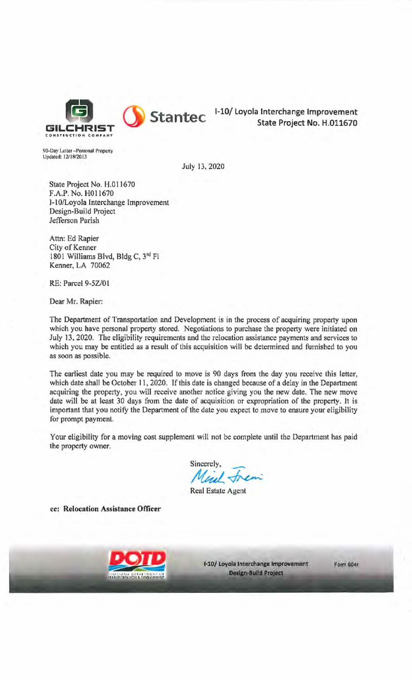
RE: Parcel 9-SZ/0 I
bear Mr. Rapier:
July n, 2020
The Department of Transpm1ation and Development is in the process of acquiring propetty upon which you have personal property stored. Negotiations to purchase the property were initiated on July 13, 2020. The eligibility requirements and the relocation assistance payments and services to which you may be entitled as a result of this acquisition will be determined and furnished to you as soon as possible.
The earliest date you may be required to move is 90 days from tl1e day you receive this lettel', which date shall be October 11, 2020. If this date is changed because of a delay in the Department acquiring the prope1ty, you will receive another notice giving you the new date. The new move date will be at least 30 days from the date of acquisition or expropriation of the property. It is important that you notify the Department of the date you expect to move to ensure your eligibility for prompt payment.
Yom· eligibility for a moving cost supplement will not be complete until the Department has paid the property owner.
Sincerely, _
!lfkd~ Real Estate Agent
ce: Relocation Assistance Officer
FOII'n 60~r
~ 1 m ....
2 SOlffHEASTERN LAND DISTRICT, EAST OF THE MISSISSIPPI RfVER !ilf~:J 1,
1 ''
TI2.S - R9E ~ ~/f: "' 0
l\J Y•549!1)3,01153 Q
0
~ N
' N rl
' N
0
N rl /
0 rl I
H
SECTIONS 37 & 85 C/G ~~
~ ~ ill "'
X•3618573.3965 ';'
~ "'
I I I
~ I s 1·10 I I 1:,:
I ~ I I I I (57 ATE PROJECT NO. H.0/1670 N8o('21'43.!1'E I 7 ~ i:l
I I
I . I .,
~ ~
~ Y•5498SOJ889 X•36/8554.9687
57AT/ON 326•89.79 : (LOYOLA DR. • I
57ATION 44"11.59 : lNO I
I I
~:0) ~l't' -n·-
1 I
I I I I I I I I I I I I I I I
I !)!1~
~!~ I
"'Ia; ~!~ S§
Y•549911'.8553 X•36/9234.3475
I I I
LU INTERNATIONAL I I I I I I I I I I I
LU INTERNATIONAL
· ~ NU21'4J'E 239.55'
I I I I
' I
~~ ~1:~ ~~
32.5+00
32.3+()()
•67.67
N5"36'4, 27.50'.
I I I I I I
73.7(1 )j,.:j,;,..· ._. _ .. ==;;,-;,;; •4(},1(
~ •nn•cc_•nnu---- ,._.,,..,,, ""
;!:
~
211~ """' _,. ~§1 -'b
!!J ~ ~ ~ "'
//!!'IRON ROD 323·32.74
74.28'
74.24' ------~~49 _____ _
Y•549415.3844 'X•36/86f0.9921
"'1 Z,;/~%J4.
~I CH • 48.74'' ~~ ,-, cHB • szrt2'3rw i' I I \)!1 1 7·2 I
~ ~-;;.92.06 [:? ~~.orr
11
- Ff. OF LOT 42 :r fK/!il' ' IIEI1D RIW:::::::3
~J~~~~IP£ e: __ -t :t:- -+ /iE:o· ~~La,: !!_
I I I I I
I
_ -NM21'4J'E--s-·- _ UIE t,_IJJ f.-:;2 c-::;uu/Ts OF coNsrRucr/ON ,/--;~~-~;---- J',, :)l!; H8.97 PT. OF LOT 41 EK/57 C. af A. ---"7 l--;lll_;, __ ,_-t..,--- _ --\ _..!!8o('2J'4J'E 239.57t_-_ _ PT. Ot:.J,q[_Jt.t
PT. OF LOT 41 __; 47-88.00 LOT 40 T f?r;~;>B LOT !3.- ~ .
;___ . ~{~,-+,.. / 194./6' s ',
~ 149.62' --- -i / 1 ',, ~~ WEST HALF ,/ \ lllit;: Of LOT 40~ I I RED ROOF ~ I j_ /76,95' so 20 /36,
rnr-~ IQ ----- 5M2 36'W 119.87' .., \!3J LOT ~ f>'* 16.58' ...-'-"- , ' LOT 74
(!) 49-24.-46 -- - l / INN ~ , \ ') 176.riJ WE57 HALF / Q <?o'>_ ~'v Q!lt\j \
I I I Of LOT 39 -+ I I \!.!).~~-'&~.f. .\" ~~~ \ lS)I~--- _.!!._,Y>\~'1,~ -t-- j~ ---;;~ - - IIEOOII!Eu- t-40.07' ~~<> LOT tf II>' ~>04.59 ..J.;. ' CON571ff}(JT/OII LOT 75 ~~~___:8_-+ ~~ _ _ 216.99' _ ' S[If(ffU~8o('2J'/IlW 1/9,87' 10 LOT t ~42.41 REQUI/IEO RIW " "' 37 a Ill!' IRON ROO ~ -1-t\ ~"17.00 LOT 76
l;i
-l ~ r---- ~ I ~ ' it':'T (f II! Ia I
I. I WE57HALF I : ~-!:t.:./<,,9 ~&:: \ Of LOT 38 -+ I I <Yr:~~ Ia Iii l
1323•33,011 ~ 1;j I 112' IRON ROQ WEST HALF -f"' r 174.31' I
49-24.47 ~ WE57 HALF I \(1·2 \/ suiw3rw /
~ ... ~ ~
I;; ~-, ~ ~>{)4,59 I "' A~~' 216.99' "'-IP':':>q. ~· --zt699·-.- ,.~.,.~~ ·------14l •' • 6 r . , '< .,-· <,\• ~ <f'. (t LOT ~: !f-5-c-/ LOT 77
--;.:~ -t~--- --1;;:_ -~>04.60------t jt-~ LOT 35 ~~~ 246,00 LOT 78 oi!
------~-~ --------~ ~ LOT 34 !;:1~! LOT 79 ll!j
~ ~~~ ---LOT3-; --t-t~ ------- LOT:-{j_jCj ~'tr ~~---- ---}-:- ---------+
-u ' , ~ ~ LOT 32 I LOT 8/ '~ • t>i t: ~ ...
\ ~af:? -46•8482 OT--- - ----------~ ~ \Ill!' 111 356.98' ~I - 18 ·6~ CfTY OF LOT 82 .,
_JIRON. ROD ---- ·58o('21J'5BW t/9.8/' 356.95 KENNER + Ill -----132333./5 -- --------
19.93' Jr ' 194.24' ' REQUIRED 11/W !'>
49-24.47 Of LOT 37 J_J \ REQU/RiiO RIW I 2JJ,29' ----Tl ~ ,- ' J99Y- I
216.98' ~ OF LOT 36 A I \-j' !t ----r. \"
l;i !; WEST HALF I CfTY OF ',, ----, f5 1oir ~_:_or__::; -{-j KENNER '-,',,,_~!~:!) _j__/ ill WEST HALF I ------
~~~ =~:A::-tl ¥I# _OF LOT ~v
SCRIBED 'X" l f I ~~9~:c. vM!A:&!'M!GHfg. slfi'BD. J/6.7/'
~ NOTES, ~~ /.ALL PIPES AND UONUMENTS SHONN HEREON WERE FOUND.
D.O.T.D.
'----~' ,/~ // :~~ ROD LOT 30 I ~ LOT 83 I l . r ( 46·84.64 ------~--~--.., ·-------H
10 • 35698' ~ I ~:x:&l , ~~SEE INSET 'A' "-' . LOT 29 ;:j~(i\ LOT 84 j i,;l 2. THE COORDINATES AND BEARINGS SHrNIN HEREON ARE BASEO ON
"' LOUISIANA STATE PLANE COORDINATE SYSTEM, SOUTH ZONE .INAO 83 120111 EPOCH 2002.001 TO COWERT FROU GRID BEARINGS TO TRUE BEARINGS
I LOT
87-A "'~lll!j/ ~ - -K.P.K. VIDEO -t+"'~ -------
i!! ,----, ~ ~ Ill LOT 28 POKER I ~ LOT 85
~~ \!~:!) ~ ~ ~ --CORPORAT/ON-}-1---------t -11 ~ . I LOT 27 LOT 86
~ l . L--- ,w-;; - --+~-- -- ---~-;;-
1~ ASADRA.L.L.C. ~
USE, rT32'02.4' * BASE STATIONS•
DSTR,D/19596. DESTREHAN H.S. CORS ARP LAT-112!15r52.3957rT LONG>'/1911'21!'56.00662' Y•SJ3852.065 X•358/993.289
ENG6,DJ961J/, ENGLISH TURN 6 CORS ARP LAT•N2!152'45.04434' LONG'/189'56'31.~379' Y•504231. 396 X•3721732.389
3. DISTANCES SHrNIN ARE HORIZONTAL GROUND D/57ANCES.
LWES,OJ9603, LAKEWOOD ELMENTRY CORS ARP LAT•N29'54'01. 2954(1 LONIWI911'2057.8336!1' Y•510595.836 X•3592587. 480
TO COWERT 0/57ANCES DERNEO FROM COORDINATES SHONN HEREON TO HORIZONTAL GROUND DISTANCES, USE SCALE FACTOR• 0.99992575
LEGEND 12/~:J ~lr
;! •FOR INFORUATIONAL PURPOSES ONLY tJ § !::: !f-5-<:-/ CffY OF KENNER C.O. B. 3022 FOLIO 131 /N57. '9972989 IV21199 0.014 Ac. 615./SF ~Vj
EXIsrtHIJ fi/J!::::::2_ ~!J!!D...P,~ R/GifT Of WAY LINE --;x;;,.iiiilc.;, A.-:J /i£0UI'fO f• "f A.--:7 . CONTROL OF ACCESS
EXI!iT' RIW f_Iff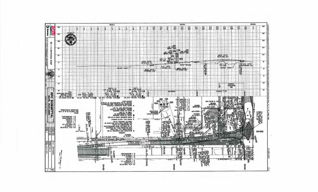
'SliiiUOI1Y1S 3!lYNJYIIQ UD~ 1£ 'II o; SU3HS 331
'310N
0
~rr
'II ,t;;~H., .~
If N
1131~~&1 °~ottfUfJt~~lld H3JHHW8 AMDH IJJ ~0~ e
01 NOit~Mttl'l:,~ H31HHWII AMOH IJ; ~03H •
113110~ 'II 811fl0 U3JHUY8 ~03Y m 103MW8 H1d30 Tll~ 0.03Y •
'NY1d 10H1NOO OU~WHL Nl 0300'10NI ~1d NOI11'101130 338
'30Y1d Nl 03N00~8Y HD NOI1011HLINOO HLIM 101'\oiNOO Nl ~I
OlAOrtJH 38 111M 80NI01108 YO~ 131111110 ,1Y '03NSI10rt30
38 01 Slld~O ONW IONI01111B • ON3031
... ~
~
~ ... A
N
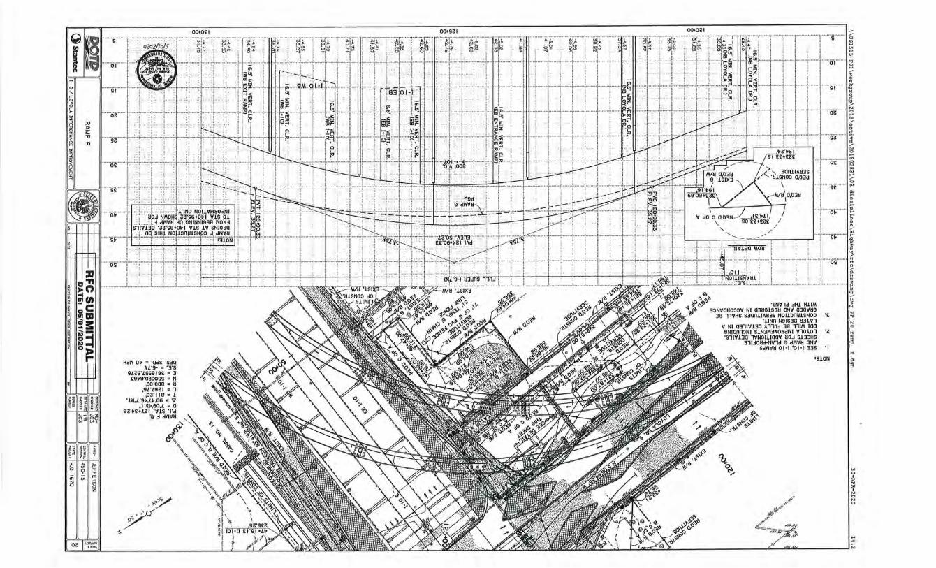
1-
Hdt'l 01> = 'OdS 'S30 XL'9- = ' 3 'S
9!ZS'LSS9 19£ = 3 £91>9'0ZOOSS = N
,oo·ooe = ll ,9L'L9C!I = 1
,0<!'119 = 1 '11l,L'9v,Lv.os • v
,I '£!>,60.L = 0 9C! 'v£+!ZI 'VlS 'I'd
ll .:1 dt'lVIl
/ ' \ .
/ / Cl
"' ... ::-: "' ·ff .. :.: ... ;.: ....... L: ..... :.;.: ... : ... :.:.: ..... ;. : ....... : ......... j.~j~J··· ff ·· .J.~;~ i····· ··· · i· ········i········· l········· '·········l···· · · ft ·; ········ l 3
w 0
~ ::' N 0 N 0
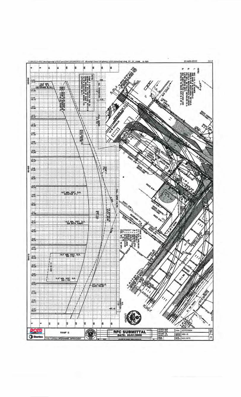
30-APR-2020
(II "' - z • • • 0
~111!;!!:~!::;1« !:1 "'''lf'I;:::I-<G;gPI ~s!D!P-~=-• ....... .-:.•:..-.... lil,...~ ... ifiP I <:;::~l~o.! ~ zoz.,.o•j!!''"'t. ~ ~"'-=Fili8 .. 'f ~ l dg~~~3~i ~ ~!!l - ljl?i~"''" ~~~~ ~~1!~ ni F~li:"' ~»- ~5~ :.Z z%r" • o ,._o!O.
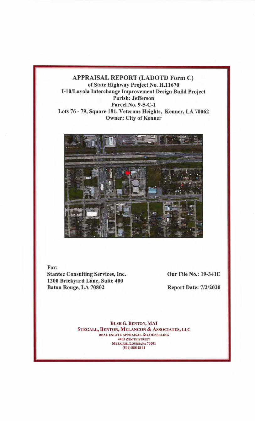
For:
APPRAISAL REPORT (LADOTD Form C) of State Highway Project No. H.11670
1-10/Loyola Interchange Improvement Design Build Project Parish: Jefferson
Parcel No. 9-5-C-1 Lots 76- 79, Square 181, Veterans Heights, Kenner, LA 70062
Owner: City of Kenner
Stantec Consulting Services, Inc. 1200 Brickyard Lane, Suite 400 Baton Rouge, LA 70802
Our File No.: 19-341E
Report Date: 7/2/2020
BUSH G. BENTON, MAl STEGALL, BENTON, MELANCON & ASSOCIATES, LLC
REAL ESTATE APPRAISAL & COUNSELING 4403 ZENlTH STREET
METAIRIE, LOUISIANA 70001 (504) 888-8161
STEGALL, BENTON, MELANCON & ASSOCIATES, LLC REAL ESTATE APPRAISAL & COUNSELING
4403 ZENITH STREET • METAIRIE, LOUISIANA 70001 (504) 888-8161 • FAX (504) 888-8683
STEVEN R. STEGALL, MAl, SRPA
Ms. Cindy Hall, P .E. Principal Stantec Consulting Services, Inc. 1200 Brickyard Lane, Suite 400 Baton Rouge, LA 70802
BUSH G. BENTON, MAl
July 2, 2020
DAVID 0. MELANCON, MAl
Re: Appraisal Report of 9-5-C-1
Dear Ms. Hall:
State Highway Project No. H.11670 I-10/Loyola Interchange Design Build Project Lots 76- 79, Square 181, Veterans Heights Kenner, LA 70062 (City of Kenner) Our File No. 19-341E
An Appraisal Report of the Market Value of the Acquisition for the above captioned property is herein submitted for your review. This appraisal is based on the enclosed assumptions and limiting conditions. All of the data considered pertinent in arriving at an estimate of the Market Value of the Fee Simple Interest in the Larger Parcel has been considered. This in turn has been analyzed and the resulting Market Value of the Acquisition for the proposed project acquisition subsequently rendered. This valuation estimate has been made as of June 12, 2020. The appraiser will determine the impact on the Larger Parcel of the proposed taking associated with the I-10/Loyola Interchange Improvement Design Build Project. In this instance, a 615.10 SF triangular portion of Lots 76 and 77 of the Larger Parcel is being affected. The appraiser have been provided State ofLouisiana, Department ofTransportation and Development, Right ofWay Maps dated February 6, 2020 showing the proposed temporary construction servitude for a period of 4 years. The appraiser will base the temporary construction servitude as delineated within the provided information. The temporary construction servitude is affecting lots 76 and 77. The Larger Parcel will be viewed as Lots 76-79 (9,600 SF) of the Whole Ownership (±54,960 SF). The appraiser will then fully describe the Larger Parcel associated with the temporary construction servitude 9-5 -C-1 . Next, the appraiser will determine the Market Value associated with the Larger Parcel. Lastly, a Market Rent will be determined for the temporary construction servitude.
STEGALL, BENTON, MELANCON & ASSOCIATES, LLC REAL ESTATE APPRAISAL & COUNSELING
"Fair Market Value" is defined by The Louisiana Supreme Court as "as the price a buyer is willing to pay after considering all of the uses that the property may be put to where such uses are not speculative, remote or contrary to law." Exxon Pipeline Co. v. Hill, 2000-2535 (La. 5/15/01, 8), 788 So.2d 1154, 1160; St. Bernard Port, Harbor & Terminal Dist. v. Violet Dock Port, Inc., LLC, 2017-0434 (La. 1/30/18, 13), 239 So.3d 243 , 253, cert. denied, 139 S.Ct. 375 (2018).
Parcel 9-5-C-1 consists of a triangular shaped parcel that is to be acquired for a 4 year temporary construction servitude in conjunction with the I-10/Loyola Interchange Improvement Design Build Project. Upon review of the February 6, 2020 Right ofWay Map, the 4 year temporary construction servitude (Parcel 9-5-C-1) consists of a triangular shaped parcel containing 615.10 SF. This parcel is primarily associated with a portion of land lying within the northwest comer of the Larger Parcel (Lots 76-79). Currently, the Larger Parcel contains ±9,600 SF or 0.11 acres and is vacant, cleared with a gravel pad, some vinyl perimeter fencing and two asphalt ramps. It is the appraiser opinion there are no severance damages to the Remainder Parcel.
Based upon my investigations, analyses, and value conclusions, compensation for the real property located within the required right-of-way and damages to the remaining property as of June 12, 2020, is as follows:
Land Site Improvements Land Rent (Construction Servitude) Total Value of the Required Areas Damages Cost to Cure Compensation to Others Total Recommended Compensation Due
$0 $7,023 $3,322 10,345
Q 2,155
Q $12,500
This is to certify that I have no interest, present or contemplated, in the appraised property. This is to certify that this appraisal was not made contingent upon a minimum value or range of values.
Transmitted herein is an appraisal report showing the value conclusions and techniques used in arriving at those conclusions. This report is prepared in accordance with my interpretation of current Appraisal Foundation standards which state that the level of detail within the report must be commensurate with the complexity of the real estate appraised. This valuation is also predicated on the Assumptions and Limiting Conditions found herein. This report also notes all requests from the client. Please note that the signatories of this report do not have a debt relationship with the client.
This appraisal report follows the law of expropriation/eminent domain of the State of Louisiana and the guidelines of the Uniform Standards of Professional Appraisal Practice of the Appraisal Standards Board of the Appraisal Foundation. This appraisal
STEGALL, BENTON, MELANCON & ASSOCIATES, LLC REAL ESTATE APPRAISAL & COUNSELING
report has also been prepared in conformity with, and subject to, the reporting requirements of the Code ofProfessional Ethics and Standards ofProfessional Appraisal Practice of the Appraisal Institute. This report is in compliance with USPAP and the statement of Appraisal Standards No. 2-2(a), effective January 1, 2020 through December 31 , 2021.
Thank you very much for the opportunity to be of service to you. If you have any questions or comments with regard to any of the enclosed information, please do not hesitate to contact us.
\i\_\~~ .~~ Bush G. Benton, MAl Louisiana Certified General Real Estate Appraisal License No. G0847
Sincerely yours,
TABLE OF CONTENTS
Summary of Salient Facts and Conclusions Basis for Summary of Just Compensation Title Data Discussion of the Appraisal Problem Scope of Services Larger Parcel Photographs City Data and Analysis Neighborhood Data and Analysis Site Data and Analysis Zoning Highest and Best Use Analysis Estimate of Site Value by the Sales Comparison Approach Compensation Cost to Cure Analysis Site Data - After Acquisition
Addenda
Certification of the Appraiser(s) Assumptions and Limiting Conditions Site Survey Right-of-Way Map Cover Page Right-of-Way Map Vicinity, Strip and Remainder Map Zoning Map FIRM Map Property Inspection Report Owner Notification Letter Qualifications of the Appraiser( s) Letter ofEngagement
1 3 4 5 6
11 13 15 16 18 19 20 32 33 34
SUMMARY OF SALIENT FACTS AND CONCLUSIONS:
PROPERTY ADDRESS:
PROPERTY OWNERSHIP:
LEGAL DESCRIPTION:
PURPOSE OF THE APPRAISAL:
PROPERTY RIGHTS APPRAISED:
ZONING:
FLOOD ZONE:
SITE SIZE:
PROPERTY USE:
PROPERTY DESCRIPTION:
OFN 19-341E
Lots 76-79, Square 181, Veterans Heights Subdivision, Kenner, LA
City of Kenner
Lots 76-79, Square 181, Veterans Heights Subdivision, Kenner, LA
To estimate the "market rent" associated with the temporary construction servitude.
Fee Simple Estate (Full Ownership Less Mineral Rights)
C-2, General Commercial District
X&AE
Larger Parcel: Acquired Parcel CTCS): Remainder Parcel:
Vehicle and container storage.
9,600.00 SF 615.10 SF
9,600.00 SF
Parcel 9-5-C-1 consists of a triangular shaped parcel that is to · be acquired for a 4 year temporary construction servitude in conjunction with the I-1 0/Loyola Interchange Improvement Design Build Project. Upon review of the February 6, 2020 Right of Way Map, the 4 year temporary construction servitude (Parcel9-5-C-1) consists of a triangular shaped parcel containing 615.10 SF. This parcel is primarily associated with a portion of land lying within the northwest comer of the Larger Parcel (Lots 76-79). Currently, the Larger Parcel contains ±9,600 SF or 0.11 acres and is vacant, cleared with a gravel pad, some vinyl perimeter fencing and two asphalt ramps.
1
SUMMARY OF SALIENT FACTS AND CONCLUSIONS (Con't):
EFFECTIVE DATE OF VALUE: June 12, 2020
DATE OF REPORT: July 2, 2020
RIGHT-OF-WAY MAP DATED February 5, 2020
R-0-W MAP LAST REVISED: February 5, 2020
DATE OF NOTIFICATION LETTER: May 26, 2020
INSPECTION DATE:
VALUE ESTIMATES:
Land Site Improvements Land Rent (Construction Servitude) Total Value of the Required Areas Damages Cost to Cure Compensation to Others
June 12, 2020
Total Recommended Compensation Due
APPRAISER: Bush G. Benton, MAl
OFN 19-341E
$0 $7,023 $3,322 10,345
.Q 2,155
.Q $12,500
2
BASIS FOR SUMMARY OF JUST COMPENSATION: Parcel9-5-C-1
Land:
Parcel # Area Required (SF) Interest Required
9-5-C-1 ±615.10 SF . Temporary Construction Servitude
The Larger Parcel, prior to the acquisition, contains a total contiguous land area of ±9,600 SF or ±.22 acres. The Larger Parcel is similar to the typical use tracts that exist in the immediate area and will therefore be utilized in this appraisal report as the use parcel.
Improvements:
1. The following items are considered real property and are located wholly or partially within the temporary construction servitude and are included in the estimate of just compensation:
Depreciable Site Improvements: 1- 30' x 42 ' x 2' Gravel Pad, 29.01 LF of side vinyl fencing and 42.41 LF of rear vinyl fencing
Non-Depreciable Site Improvements: None
2. The following items are considered moveable, personal property and are located wholly or partially with in the required right-of-way: Three ·storage containers and other miscellaneous equipment and vehicles.
3. The following items are considered real property and located outside of the required right-of-way and are included in the estimate of just compensation:
Depreciable Site Improvements: 2- 8' x 4' Asphalt Ramps
Non Depreciable Site Improvements: None
4. The following items are in the ownership of others and are located within the required right-of-way: None
Trees and Landscaping within Right-of-Way:
There are some native grasses within the right-of-way which are deemed to have no · additional contributory value.
Remarks:
Parcel9-5-C-1 consists of a 615.10 SF triangular shaped portion of the site at the northwest comer of the Larger Parcel.
OFN 19-341E 3
TITLE DATA (as per Louisiana DOTD Title Report)
Property Owner: City of Kenner
Owner's Address: 1801 Williams Boulevard, Kenner, LA 70062
Location of the Property: Lots 76 -79, Square 181, Veterans Heights, Kenner, LA 70062
Five Year Transaction History (Transactions of any type, including leases):
There have been no sales of the Whole Property within the five years preceding the effective date of value herein. This is vacant land owned by the City of Kenner that is used for vehicle and container storage
Real Estate assessment and tax policy in Louisiana was established by the revised constitution that became effective in 1978. As per the state Constitution, the amount of real estate tax is determined by multiplying the property's "Market Value" by the Assessment Ratio times the appropriate Millage Rate. In theory, the assessment is to be based on market value. In practice, most properties are assessed at some percentage of market value. In Jefferson Parish taxes are due and payable in arrears. In Orleans Parish taxes are due and payable in advance. Assessors are elected officials and the whole taxation process is still political.
Bill# Land lmprov. Total Market Value via Taxes Assessment Assessment Assessment Assessor
9920028620 $6,530 $0 $6,530 $65,300 $0.00
The land is assessed for $6,530. The total market value of the Parcels via the Assessor is $65,300 ($6,530/10%). The Larger Parcel is owned by the City of Kenner and is exempt from ad valorem taxation. The above assessment also includes other lots within the square.
OFN 19-341E 4
DISCUSSION OF THE APPRAISAL PROBLEM
General Based on the premise of this appraisal assignment, no unusual or particular appraisal problems were encountered in the scope of this assignment. Parcel9-5-C-1 is one of several parcels to be acquired in conjunction with the I-1 0/Loyola Interchange Improvement Project. Specifically, this project is to expand and enhance ingress/egress to the airport via Loyola Drive.
Larger Parcel Tracts Whole ownership consists of several additional lots and 54,960 SF. The acquisition parcel is valued according to its contribution to the entire Larger Parcel, and not as a "stand alone" parcel of record. Depending on circumstances such as the size, topography, and uses of Larger Parcel; a typical sized use parcel or "Economic Use Tract" may be utilized as the assumed Larger Parcel for a particular parcel within this project.
In this case, the proposed temporary construction servitude is ±615.10 SF from a±9,600 SF Larger Parcel. The Larger Parcel is similar to the typical use tracts that exist in the immediate area and will therefore be utilized as the use tract in this appraisal report.
Improvements This parcel is vacant land with related site improvements including some asphalt ramps, gravel pads, fencing, etc.
Severance Damages The temporary construction servitude is small in relation to the Larger Parcel (6%) and the overall utility and highest and best use of the remainder will not be affected by the acquisition. Therefore, it is reasonable to conclude that there are no severance damages that accrue to the remainder. In cases where there may be severance damages as a result of the acquisition, the format of this report (LADOTD Form C) will be requested of the appraiser by the client, and is deemed to be appropriately utilized herein.
OFN 19-341E 5
SCOPE OF SERVICES
Intended Use of the Appraisal
The intended use of this appraisal report is exclusively assist the client, Stantec Consulting Services, the Louisiana Department ofTransportation and Development and/ or their assigns, in establishing the market value and just compensation associated with the temporary construction servitude. This report is intended to be used only by the clients. Use of the report by others is not intended by the appraiser.
Purpose of the Appraisal
The purpose of this report is to establish the fair market value of the Fee Simple Interest in the parcel in order to determine the total real property compensation for the required temporary construction servitude due to the owner of the Larger Parcel (market value of the acquisition) .
"Fair Market Value" is defmed by The Louisiana Supreme Court as "as the price a buyer is willing to pay after considering all of the uses that the property may be put to where such uses are not speculative, remote or contrary to law." Exxon Pipeline Co. v.Hill, 2000-2535 (La. 5115/01, 8), 788 So.2d 1154, 1160; St. Bernard Port, Harbor & Terminal Dist. v. Violet Dock Port, Inc., LLC, 2017-0434 (La. 1/30/18, 13), 239 So.3d 243, 253, cert. denied, 139 S.Ct. 375 (2018).
The term "Just Compensation" is defined in the Dictionary of Real Estate Appraisal, 6th Edition as follows:
"In Condemnation, the amount ofloss for which a property owner is compensated when his or her property is taken. Just compensation should put the owner is as good a position pecuniarily as he or she would have been if the property had not been taken.
The term"Damages" is defined in the Dictionary of Real Estate Appraisal, 6th Edition as follows :
"In condemnation, the loss in value of the remainder in a partial taking of property. Generally, the difference between the value of the whole property before the taking and the value of the remainder after the taking is the measure of the value of the part taken and the damages to the remainder. Note that different regions ofthe country and different courts may use terms such as consequential damages and severance damages differently."
INTEREST VALUED: The teim "Fee Simple Estate" is defined in the Dictionary of Real Estate Appraisal, 6th Edition as follows:
"Absolute ownership unencumbered by any other interest or estate; subject only to the limitations imposed by the governmental powers of taxation, eminent domain, police power, and escheat."
OFN 19-341E 6
Market Rent is defined as "The most probable rent that a property should bring in a competitive and open market reflecting the conditions and restrictions of the specified lease agreement including the rental adjustment and revaluation, permitted uses, use restrictions, expense obligations, term, concessions, renewal and purchase options, and tenant improvements (TI's); the lessee and lessor each acting prudently and knowledgeably, and assuming consummation of a lease contract as of a specified date and the passing of the leasehold from lessor to lessee under conditions whereby:
1. Lessee and lessor are typically motivated; 2. Both parties are well informed or well advised, and acting in what they consider
their best interests; 3. A reasonable time is allowed for exposure in the open market; 4. The rent payment is made in terms of cash in US dollars, and is expressed as an
amount per time period consistent with the payment schedule of the lease contract; and
5. The rent amount represents the normal consideration for the property leased unaffected by special fees or concessions granted by anyone associated with the transaction."
EFFECTIVE DATE OF VALUE: June 12,2020 .
. DATE OF REPORT: July 2, 2020.
Marketing Time
Marketing time is defined as "an estimate of the amount of time it might take to sell a property interest in real estate at the estimated Market Value during the period immediately after the effective date (valuation date) of the appraisal." (Source: USP AP Advisory Opinion G-7). Throughout this report, the assumption for the interest appraised is that it can be marketed in the future within a period of about one year Further inherent in this assumption is the idea that all factors relating to the property appraised (both physical and economic) remain the same. Please be aware that past marketing times reported by the sales information is not necessarily indicative of future marketing times . Again, there is no such thing as a perfect time indicator. Each property sells based on its own unique characteristics within the marketplace. Marketing times and values are based on conversations with local buyers and sellers along with discussions with real estate professionals. Furthermore, the appraiser(s) paid attention to the marketing history of the comparables utilized. The estimated marketing time for the Larger Parcel is up to one year.
Exposure Time
Exposure time is defined in the Uniform Standards ofProfessional Appraisal Practice as "the estimated length of time the property interest beirig appraised would have been offered on the market prior to the hypothetical consummation of a sale at market value on the effective date of the appraisal; a retrospective estimate based upon an analysis of past events assuming a competitive and open market". This estimate is based on the property being exposed for sale on the open market at a price in line with the market value estimate shown herein and
OFN 19-341E 7
with the property being aggressively marketed by a quality/experienced brokerage finn (allowing for high visibility and a determined marketing effort).
Exposure time is a theoretical concept included in this report solely because of its requirement by USP AP. Real estate by its physical characteristics is an illiquid commodity. Real estate markets in general are imperfect by their very nature. Individual parcels of real estate are each inherently different with their own specific characteristics. An extraordinary sales effort at any point in time (even when supply and demand of the market is present) might not result in a rapid sale. Further, a quick turn around can occur for an unusual piece of property with little or no marketing effort when a specific buyer desires a particular piece of property at a given point of time. The reader of this report should not rely in any way on the exposure time estimate herein in conjunction with any decision making process.
Based upon all of the information contained in this report, as well as information gathered through the appraisal process (which includes interviews with brokers, tenants, property owners, local government officials, etc.), it is the appraiser's opinion that the subject of this appraisal within the surrounding environment (both macro and micro economic factors considered) would have had an exposure time of about one year (with up to two years as possible).
The scope of work (type and extent of research and analysis) is based on what is required to produce creditable assignment results in the context of the intended use. Creditable results are defined as "results that require support by relevant evidence and logic, to the degree necessary for the intended use. The results must be in compliance with the appraiser's peers." The appraiser's peers are defined as "those appraisers who have expertise and competency in a similar type assignment."The Scope of the Appraisal describes the extent of the appraisal process, i.e., collecting, confirming and reporting data. These three categories are discussed below.
Collecting Data
This appraisal has been based upon a review of comparable sales, listings, etc. Market information includes comparable sales, etc. The appraiser also researched the local MLS and Deedfax, discussions with agents, buyers, sellers, conveyance records, as well as the University ofNew Orleans' Real Estate Market Analysis. The appraiser has also discussed the parcel with agents, brokers and other real estate professionals familiar with the competing market, etc. The appraiser also utilized data from LADOTD Ownership Title Data, LADOTD Right-of-way Maps, LADOTD Construction Maps, etc.
To perform the scope of work the appraiser researched to produce accurate information for valuing the property. The conclusions in this report include various appraisal techniques in order to produce an unbiased conclusion of value for the Larger Parcel. All comparables presented within this report have been personally inspected by the appraiser. Additionally, overall market supply/demand conditions have been researched. My perception ofthe market has been combined with specific comparable data in order to determine present levels of demand, current price structure, and overall occupancy. This in turn was translated into an estimate of market value.
OFN 19-341E 8
Confirming Data
Physical information was confirmed during inspections. The ownership of the property, as well as its taxes, were confirmed with the Parish Assessor's Office and courthouse records .
. All office file sales information has been verified with no less than one of the associated parties and the courthouse.
Reporting Data
The appraisal report contains two major sections which are described below. The manner in which the material will be presented and analyzed is discussed at greater length throughout the report. Please note that any and all Assumptions and Limiting Conditions will be listed in the section of the report with that title.
Subsequent to a brief outline of the underlying factors upon which this appraisal has been prepared, the first phase of the report contains an identification of the Larger Parcel and a review of the three year past history of sales. An Area Analysis and Neighborhood Analysis set forth the relationship of the city and neighborhood to the Larger Parcel. The site condition, etc. are described in detail. The Larger Parcel zoning classification and its implementations, and the Larger Parcel's conformity thereto, are presented. The real estate assessment, levy and parity are discussed. The improvements are then discussed followed by a Highest and Best Use section. After which, all pertinent approaches to value are utilized to estimate the current market value of the Larger Parcel.
The appraiser inspected the Larger Parcel and Parcel9-5-C-1 from Bessemer St.; however, no inspection was done to the structural systems, etc. Noticeable conditions were noted. Unknown conditions may exist but the appraiser has only made a general inspection and only those noted were considered when valuing the property. If unknown problems do exist, there may be cause for reconsideration of the value conclusion. This appraisal assumes no title problems exist and/or deed restrictions, mineral leases, surface rights, easements, servitudes, etc. This also applies to the structural components of the property as the appraiser is not an engineer. This appraisal considers the property to be free and clear of any environmental and hazardous problems. "
The three steps specific to the appraisal process as defined by USP AP are: (1) identify the problem to the solved; (2) determine and perform the scope of work necessary to develop assignment results; and (3) disclose the scope of work in the report.
The scope of work necessary
The Larger Parcel is identified by legal descriptions, surveys, and personal inspection. The property was inspected and photographed by the appraiser(s).
OFN 19-341E 9
Disclose the scope of work
Parcel 9-5-C-1 consists of a triangular shaped parcel that is to be acquired for a 4 year temporary construction servitude in conjunction with the I-10/Loyola Interchange Improvement Design Build Project. Upon review of the February 6, 2020 Right ofWay Map, the 4 year temporary construction servitude (Parcel 9-5-C-1) consists of a triangular shaped parcel containing 615.10 SF. This parcel is primarily associated with a portion ofland lying within the northwest comer of the Larger Parcel (Lots 76-79). Currently, the Larger Parcel contains ±9,600 SF or 0.11 acres and is vacant, cleared with a gravel pad, some vinyl perimeter fencing and two asphalt ramps. It is the appraiser opinion there are no severance damages to the Remainder Parcel.
In order to comply with the assignment, the parcel was inspected to determine its physical condition, construction quality and current occupancy level. In order to value the Larger Parcel, the appraiser will utilize the Sales Comparison Approach to value. The Cost and Income Approaches to value are not germane to this assignment. This Appraisal Report is a brief recapture of some of the appraiser's data, analyses and conclusions as discussed in the Letter of Transmittal. A significant amount of other comparables were reviewed and analyzed for the purpose of this report. However, the comparables chosen in the analysis are considered most applicable in the valuation of the Larger Parcel. Supporting documentation is retained in the appraiser's files.
THE EFFECTIVE DATE OF VALUE FOR THE SUBJECT PROPERTY IS JUNE 12,2020. THIS DATE IS WITHIN ONGOING CORONA VIRUS PANDEMIC. THE VALUES CONCLUDED HEREIN ARE BASED UPON MARKET DATA, NEIGHBORHOOD, AND ECONOMIC CONDITIONS WHICH WERE IN PLACE PRIOR TO THE ONSET OF THE PANDEMIC. THE VALUE CONCLUSIONS DO NOT INCLUDE ANY CONSIDERATION OF THE PRESENT OR FUTURE EFFECTS OF THE PANDEMIC ON VALUE. THE USER OF THIS REPORT SHOULD APPROPRIATELY CONSIDER THIS CIRCUMSTANCE.
OFN 19-341E 10
LARGERPARCELPHOTOGRAPHS
View of the Larger Parcel from Bessemer Street facing northwest (Taken by Daniel Diodene, 6/ 12/2020)
OFN 19-341E
Street scene of Bessemer Street looking south (Taken by Daniel Diodene, 6112/2020)
......
11
Parcel 9-5-C-1 Phonographs
View of the temporary construction servitude from Bessemer Street facing northwest (Taken by Daniel Diodene, 6/ 12/2020)
OFN 19-341E 12
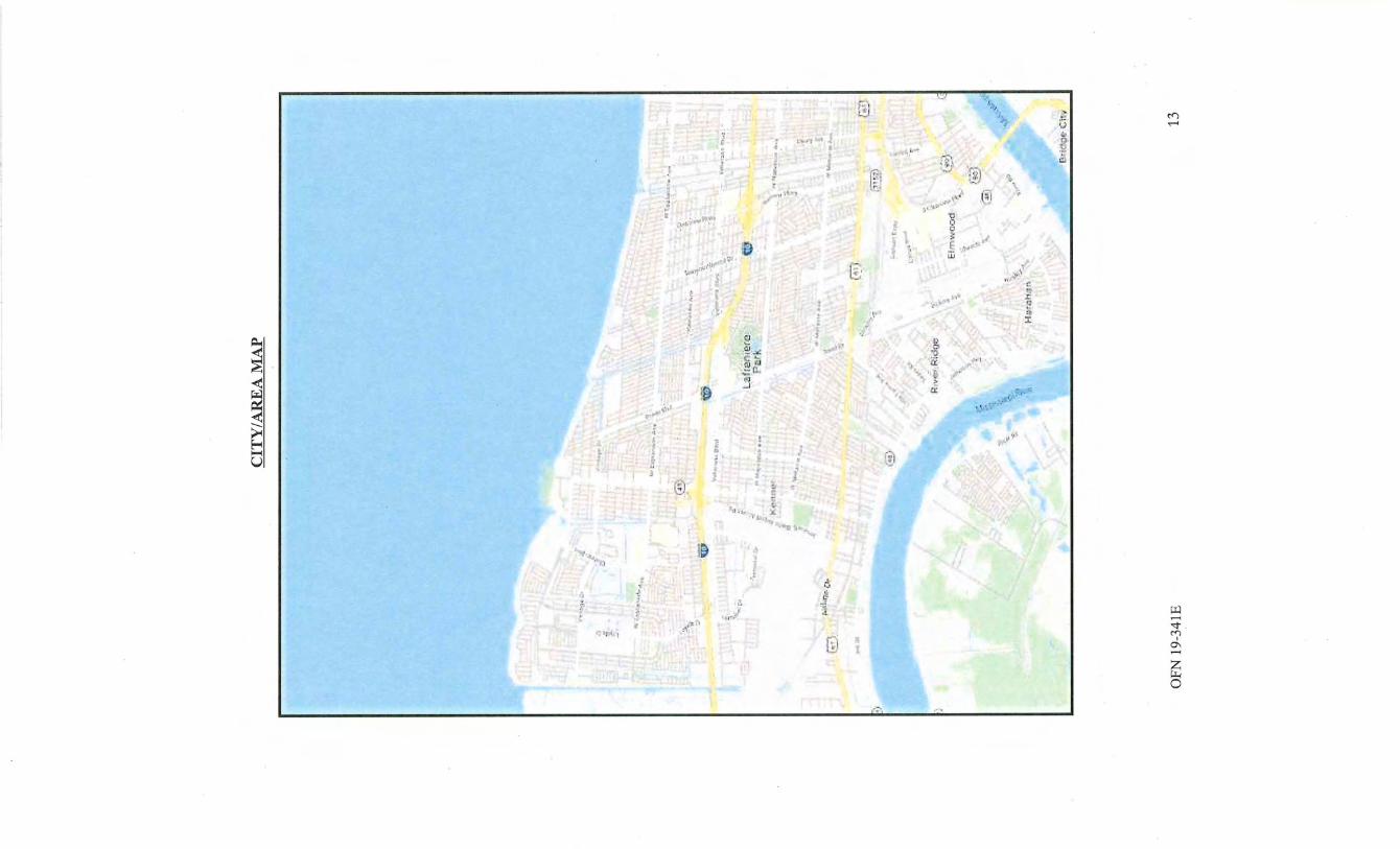
1 ,,
~
, J
t ;a.~.t.·~ .... ,. "'' ' .
16 ~'l)l '
·,n•'l'}.:•' ', s.
~ ' l ~ ~
~
r · ~ '
;':!•.;:,!
: ~\I
,9 3
. ;~t>'
~ E-< ...... u
:,
f I ., !
E ii ~ I
• ~
@. ;.
\1 ~1+
\' ·' 1, !& ..
.. , :c
_; • .,
. ~ .
I ~ 1 "!'1.:/!'0
~ ~ j]t' I ~
. ,,~ .
0 I
• ' II
7 ,.
r
r."l.
: . !
J
! ,
c:. 1
[ i
'"
I J.
... ..
..
I I
, . ..
~I
·'.
.: •. ;1,.\'f
~" I
~-.r.: !D ~ · I
CITY AND AREA DATA
The Larger Parcel is located on the east bank of the Mississippi River in the City of Kenner which is located in northwest Jefferson Parish. Rapid growth characterized Kenner in the 1970s and early 1980s with the westernmost commercial development of Veterans Boulevard. Dense commercial development along Veterans Blvd. (in the City ofKenner) prompted new development along Williams Blvd., primarily north ofl-10 towards Lake Pontchartrain.
The primary commercial/retail development in Jefferson Parish has been concentrated along Veterans Blvd. Major commercial developments (i.e., shopping centers, mid-rise office towers, etc.) are generally situated at the major interchanges of Veterans Blvd. Improvements along Veterans Blvd. comprise a mixture of high density commercial, retail, service and office properties. Veterans Blvd. is located south of the Williams Blvd./I-1 0 interchange.
By far, the largest land usage in the neighborhood is the New Orleans International Airport. The airport uses approximately 1,750 acres oflandjust south of the Larger Parcel. A new, approximately $1 billion, North Terminal expansion including± 30 gates with direct access from Veterans Blvd./Loyola Drive was completed in late 2019.
Other land uses in the neighborhood range from residential subdivisions, recreational parks, schools, hospitals, multi-family residential, retirement facilities, freestanding retail commercial, strip centers, neighborhood, community and regional shopping centers, and gaming. Large scale commercial development is typically oriented to the quadrants formed by either north to south and east to west thoroughfares or the I-10 interchanges. There is a 910,000 square foot former Esplanade Mall, as well as other large shopping centers including The Pavilion at Esplanade, a 263,000 square foot center located at the corner of West Esplanade Avenue and Chateau Boulevard, Kenner Marketplace, a 90,429 square foot center located at the corner of Williams Boulevard and Vintage Drive and the Kenner Center, a 77,709 square foot 11 strip 11 shopping center located at the southeast corner ofW est Esplanade Avenue and Loyola Drive. A Super Wal-Mart is located at the northeast corner ofLoyola and W. Esplanade Avenue.
The general neighborhood is considered to be in a stable phase with average potential anticipated from a long-term perspective. Demand for commercial improvements within the Larger Parcel's immediate area is considered average/good over the foreseeable future.
OFN 19-341E 14
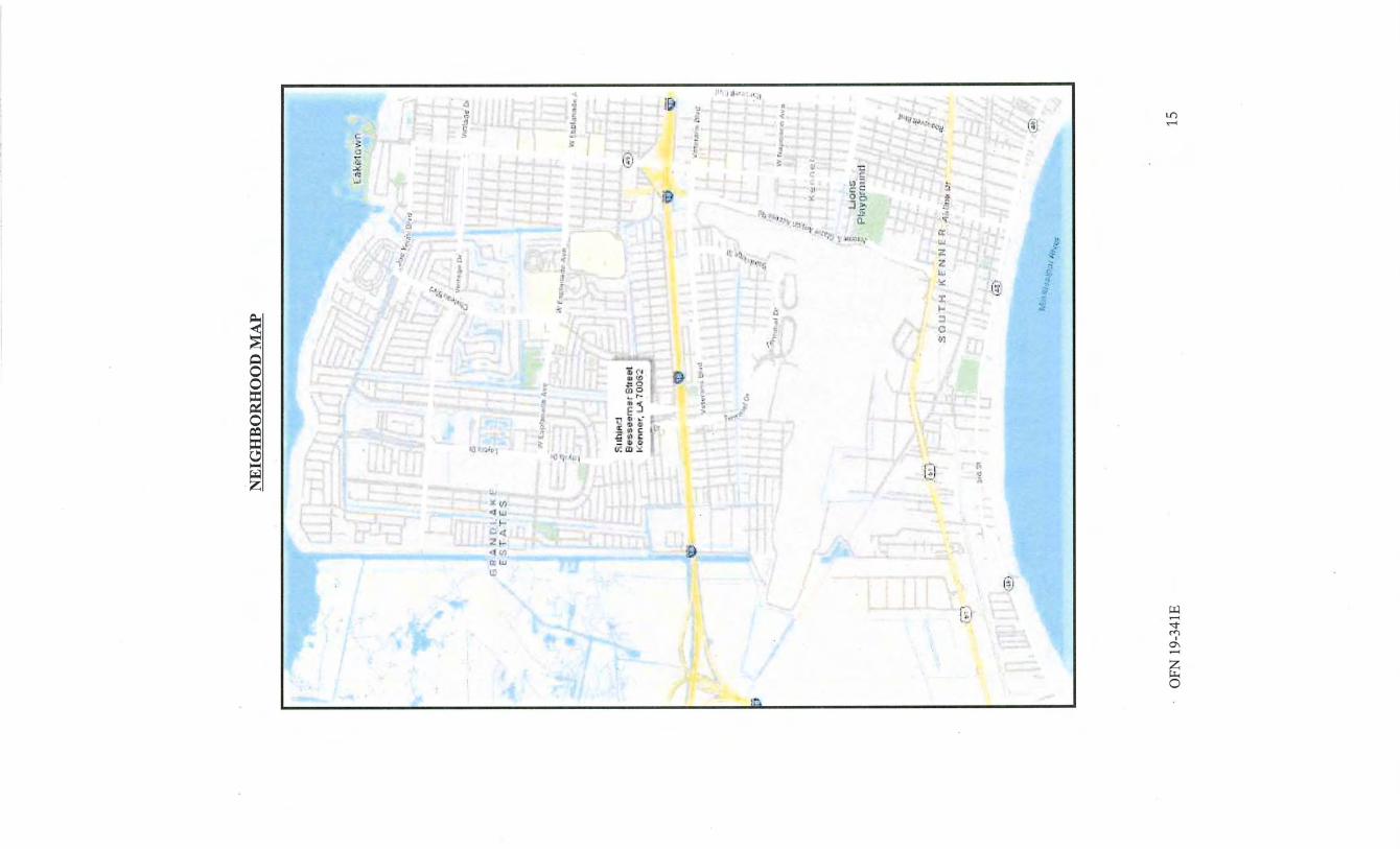
-.
. ' ~~ I ., ~ .
'r • •'J ~ ,,, . J '-
1' , J . I
•.;
"
~ 0
NEIGHBORHOOD DATA
The neighborhood is described as being bounded by the Interstate 10 Highway (I-1 0) to the north, Williams Boulevard to the east, the Airport to the south, and the St. Charles Parish line to the west. The Larger Parcel is oriented just north of the airport and is located along the northern side of Veterans Boulevard with additional street frontages along Loyola Drive and Decatur Street.
The neighborhood encompasses consistent and complimentary industrial land uses interspersed with some low to moderate level residential and commercial uses. As previously mentioned, the largest land usage in the neighborhood is the New Orleans International Airport. The airport uses approximately 1,750 acres oflandjust south of the Larger Parcel. A new, approximately $1 billion, North Terminal expansion including± 3 0 gates with direct access from Veterans Blvd./Loyola Drive was completed in late 2019. Loyola Drive, which will provide access to the new terminal, is currently being expanded. Concepts for a new I-1 0/Loyola interchange are currently under review with a completion date anticipated to be some time around 2028.
The commercial and office buildings in the neighborhood are of various designs and sizes. Most commercial uses are limited to small convenience and retail stores not exceeding 5,000 SF in size; however, several larger, or neighborhood shopping centers are situated near Williams Boulevard and Veterans Highway. There are also a handful of office buildings in the area.
The immediate neighborhood is about 75% developed. Approximately 65% of the improved industrial properties are owner occupied, with the balance rented to tenants . The residential areas of the neighborhood provide a source oflabor for these businesses. These residents are mostly skilled and unskilled, blue collar oriented laborers. Additional labor and professional workers can be found throughout other areas of Kenner and neighboring Metairie. The appraiser believes that this submarket is stabilized with quality demand existing for proprietary uses. Investment demand for light industrial uses is considered average.
The main access routes to the neighborhood are Veterans Highway, I-10, and Williams Boulevard. I-10 is by far the most important route, as it provides linkages to virtually all parts of the metropolitan area. Veterans Highway is the primary east-west artery through the neighborhood. Williams Boulevard is a six lane, bi-directional north to south thoroughfare. South of the Larger Parcel is Airline Highway, a four-lane thoroughfare that is one ofthe primary traffic arteries connecting New Orleans, Metairie and Kenner, as well as St. Charles Parish and Baton Rouge to the airport.
OFN 19-341E 16
SITE DATA
Larger Parcel: 9,600.00 SF Temporary Construction Servitude Parcel9-5-C-1: 615.10 SF Remaining Area: 9,600.00 SF
The Larger Parcel is rectangular shaped parcel that fronts the western side ofBessemer Street just north of it's intersection with Veterans Boulevard in Kenner. LA. Visibility and accessibility from Bessemer Street is considered good. Bessemer Street is a minor, bi-
. directional, neighborhood thoroughfares with rolled curbs, overhead street lights, subsurface drainage, etc.
As per the legal description, the Larger Parcel is known as Lots 76 - 79, Square 181, Veterans Heights Subdivision, Section 8, City of Kenner, Jefferson Parish, LA. This is a rectangular shaped, interior parcel and measures 80 ' front along Bessemer Street, by an equal rear width, by a depth of 120 ' between equal and parallel lines. Per the appraiser's calculations, the Larger Parcel contains ±9,600 SF or 0.22 acres.
The Larger Parcel site is vacant and cleared with some related site improvements. The site is generally level and ±1' above street grade. The site's overall utility is average. The overall visibility and accessibility of the site is considered to be good. All municipal utilities are believed to be available to the site including electricity, water, and sewer.
According to FEMA (Community Panel# 22051 C0095F), dated 2/2/18, the majority of the site lies within Flood Zone "X" which is not in a flood hazard area. The eastern and western border of the site appears to lie within Flood Zone "AE" which is in a flood zone area. This appraisal assumes that adverse flooding problems do not exist. A subsoil study was not provided to the appraiser. Evidence of soil problems were not noted. This report assumes that foundation and soil problems do not exist.
The appraiser was not provided with a survey of the Larger Parcel. Upon inspection, the appraiser noted no adverse conditions, easements are encroachments deemed detrimental to the property.
Current Use: The Larger Parcel is vacant and currently used for vehicle and equipment storage.
Description of the Temporary Construction Servitude: Parcel No. 9-5-C-1 consists of a triangular shaped parcel containing 615.10 SF lying within lots 76 & 77, located in the northwest comer of the Larger Parcel. This is a small portion (±6%) of the Larger Parcel.
The surrounding land use history of the adjacent properties is unknown, however, many of the adjacent properties are developed. This report assumes that the market value of the Whole Ownership will not be adversely impacted by any type of past or present liability from adjoining property parcels (see Assumptions section). The environmental history of the Larger Parcel is not known, as well as the history of the surrounding sites. Environmental hazards were not noted or suspected. The appraiser is not an experts in this field. Experts
OFN 19-341E 17
should be consulted, if desired.
At the time of inspection, the site was vacant, cleared with related site improvements. No other known hazards, adverse conditions, restrictions, encroachments, servitudes, easements, nuisances, or other encumbrances are known to exist which would adversely affect the value of the site that have not already been discussed.
OFN 19-341E 18
ZONING
Zoning is a legal restriction on the use of the site. The highest and best use of the property must generally conform to the uses permitted within the zoning ordinances. The reader is asked to refer to the Zoning Map, which appears in the addendum section of this report.
According to the most recent City of Kenner zoning maps, the Larger Parcel is zoned "C-2, General Commercial District". This district shall provide for the retailing of goods and the · furnishing of major services on a larger scale than the Neighborhood Commercial District.
These districts are generally located along major streets and at the intersections of major streets and should expand in depth rather than strip-like extensions along major streets. It is not the intent of this district to provide for any residential uses.
Permitted uses include any uses permitted inC-1, Neighborhood Commercial District as well as automotive and boat sales, reception halls, public recreational facilities , bars/nightclubs, gas stations, funeral homes, etc. Height restrictions regulate a maximum of 65'. Setback regulations are 20 1 in the front, 10 1 on the side yards abutting the comer, and no rear yard requirement. A minimum lot size of 5,000 SF with a minimum width of 50 1 is required.
OFN 19-341E 19
IDGHEST AND BEST USE
Highest and Best Use is defined in The Dictionary of Real Estate Appraisal, 6th Edition, as "The reasonably probable and legal use of vacant land or an improved property, which is physically possible, appropriately supported, financially feasible, and that results in the · highest value. The four criteria the highest and best use must meet are legal permissibility, physical possibility, financial feasibility, and maximum productivity."
As Vacant: Based on the above analysis and a study of the surrounding land use patterns, existing zoning laws, financiaVprofit maximization principles, etc., the appraiser believes that the highest and best use of the Larger Parcel "as if vacant" would be for some form of commercial use. The Larger Parcel is a rectangular shaped, interior parcel that contains ±9,600 SF or ±0.22 acres. The overall utility is good. the Larger Parcel is zoned "C-2, General Commercial District. This zoning designation for a myriad of commercial developments. The third test in this analysis questions the site's financial feasibility. The fourth and final test is the maximum productivity of the proposed use. The appraiser has
. generally discussed the site with regard to what physical and legally permissible uses would maximize productivity. Therefore, it is the appraiser's opinion that some type of commercial use would likely be developed on the Larger Parcel and is considered the highest and best use "as vacant".
OFN 19-341E 20
ESTIMATE OF SITE VALUE BY THE SALES COMPARISON APPROACH
There are six recognized techniques to estimate the value of land. The appropriateness of each is dependent upon the specific site and the data available. These six techniques are briefly described below.
1. The Sales Comparison Approach--in this technique sales of parcels ofland similar to the subject site are analyzed, compared and adjusted to provide a value indication for the land being appraised. By analyzing market transactions the appraiser can determine the applicable units of comparison and elements of comparison. For example, a site may be valued by the front foot, the square foot, the square yard, the acre or other unit used by the market. Elements of comparison are the characteristics of land that cause the prices paid to vary. Examples of elements of comparison are the site's size, shape, frontage, topography, and location. The sales comparison technique is the most common method of valuing land and is the preferred method when comparable sales are available.
2. Allocation--this technique is based on the premise that there is a normal or typical ratio of land value to property value for specific categories of real estate in specific locations. The allocation method does not produce conclusive value indications, but it can be used to establish land value when the number of vacant land sales is inadequate.
3. Extraction--this technique is a variant of the allocation method. The land value is extracted from the sale price of an improved property by deducting the value contribution of the improvements. The value contribution of improvements can be estimated from their depreciated costs and, in some cases, paired sales.
4. Subdivision Development--this technique is .appropriate when subdivision and development represent the highest and best use of the subject parcel of land. In this technique the number of potential sites is determined, the timing and amount of income flows from site sales and the expenses associated with these sales is estimated, and the resulting cash flows are discounted into a present value estimate.
5. Land Residual--this technique is applicable when the building value is known or can be accurately estimated, when stabilized annual net operating income to the property is known or can be accurately estimated, and when both building and land capitalization rates can be extracted from the market. The technique . involves allocating the net operating income between the building and land components and capitalizing the income attributable to the land by a land capitalization rate. This technique may be most useful in testing the feasibility of alternate uses of a particular site.
OFN 19-341E 21
6. Ground Rent Capitalization--in this technique ground rents are capitalized at a market derived land capitalization rate to indicate the market value of a site. This procedure is useful when an analysis of comparable sales ofleased land indicate a range of rents and capitalization rates.
In the case of the subject property adequate market transactions have occurred to rely solely on the sales comparison approach. This approach was selected as it most directly reflects the actions and motivations of buyers and sellers in this market and because of the quality and quantity of the data available to apply this technique .
. The location ofthe subject property and the comparable sales is depicted on the following Comparable Land Sales Map.
OFN 19-341E 22

-"9
LAND SALES MAP
.-. 1 :. ··,; il J. c. 1·: r [ ~;T .. ~. ~~.-
v
OFN 19-341E
i'.l t .. -ol...i-:-··· 4 1 -
~.J I.ll bJ~CO EiE s:~erner Stfl2E1 · K r:nner, u.. llllllii2
....... , .....
:;; ·~ompat·able S<l!e 1' a.<~ o :·2~1h s·1r~at •:.::L;nnF.:~;r, Lf.. 0.6·9 mil,; s ·5E
r·-,
li.:. •I
~ • . I . ... -·!
;::' 1·,. ••
-~ ~ 'j\ • 1 '!.. · ·f~-. .,
·· · · ~<
0.: VniiJ;;,r<Jb Ill ;5.J It" 4 Fli!rtda lo.•1enue V...Bnn>!r , L"-. l.'J -1 mn~·rr NE
'· l.'t ·., •• ... -: .. . •.!. r,s;
ll.. <tJo;~tC• IV<l
'i · - ).' !., ,
r.·.l·L-pl:.l•·t·Jc. •!. ro .·
;) n·
l' .. ·,
tJj
Co~;::~ ·;m;,b le 8ale Ji r:lorida .ow~r:nJ:;i · I<:~.Jmcr,l.,.!l 'I .60 " l '<l&s· ~oE:
~nmr:u;.raln:~P. :'<eiP. ? :r41h.Si:"eet · if<etnine-·r, L4 :0'.79 rntles 8-E
::.r _.3 ... :;'" __ -:
I · ~···!" !"I
L lvr.n' Ylaygrii umt
•r -' · ~~ .t'l.. •• ~ •. -
;
.:r--
,. ~-
s·.rJ ru T ri f:. ;:;· ~.; i-·1 a: r.t ~ ,; 1 ..... , u t' ~~·
" ~-•:'·.
:t~
~ ..... , ·~}
·'
~
ll .. ' ~:- ~; ·t G ,l!t. 1'
23
COMPARABLE LAND SALE NO. 1 fuspection Date: 6/10/2020
LOCATION:
DATE:
RECORDATION:
VENDOR:
VENDEE:
SALE PRICE:
LEGAL DESCRIPTION:
DIMENSIONS :
LAND AREA:
ZONING:
UNIT SALE PRICE:
COMMENTS:
VERIFICATION:
PHOTOGRAPH:
OFN 19-341E
840 24111 Street, Kenner, LA
January 5, 2018
fustrument #11820259
Cap Properties, fuc., represented by Philip Capitano
Jendar Enterprises, LLC, represented by Darryl M. Senia
$78,000 cash (Ann's Length-Unrelated)
Lot 7-A, Square 82, Section 4, Bainbridge Office & Industrial Park, City of Kenner, Jefferson Parish, LA
±60 ' (24th) X 120'
±7,200 SF
L-I, Light fudustrial District
$10.83 PSF
This sale consists of a vacant and cleared interior parcel that is slightly above street grade. All utilities are assumed available to the site. The site was purchased for an owner/user office warehouse. Per FEMA flood maps, the site is zoned AE.
Courthouse records and Vendee, Darryl M. Senia, 985-507-9233 Verified by Bush Benton on 5/12/2020
24
COMPARABLE LAND SALE NO. 2 Inspection Date: 6/10/2020
LOCATION:
DATE:
RECORDATION:
VENDOR:
VENDEE:
SALE PRICE:
DESCRIPTION:
DIMENSIONS:
LOT AREA:
UNIT PRICE:
ZONING:
COI\1MENTS:
VERIFICATION:
PHOTOGRAPH:
OFN 19-341E
Southeast Comer of24111 and Augusta Streets, Kenner, LA
January 18, 2018
Instrument #11803082
Vicari Golden, LLC, represented by John Golden
Frost Investments, LLC, represented by Jack Frost
$96,000 cash (Atm's Length-Unrelated)
Lot 3A1, Square 90, Bainbridge Office & Industrial Park, City of Kenner, Jefferson Parish, LA
50'(24th) x 120' (Augusta)
±6,000 SF
$16.00 PSF
H-I, Heavy Industrial District
This sale consists of a vacant and cleared comer parcel that is ±1' above street grade. All utilities are assumed available to the site. The site is currently used in conjunction with a concrete company. Per FEMA flood maps, the site is zoned AE and X.
Courthouse records and Vendor, John Golden, 504-289-7320 Verified by Bush Benton 5/12/2020
25
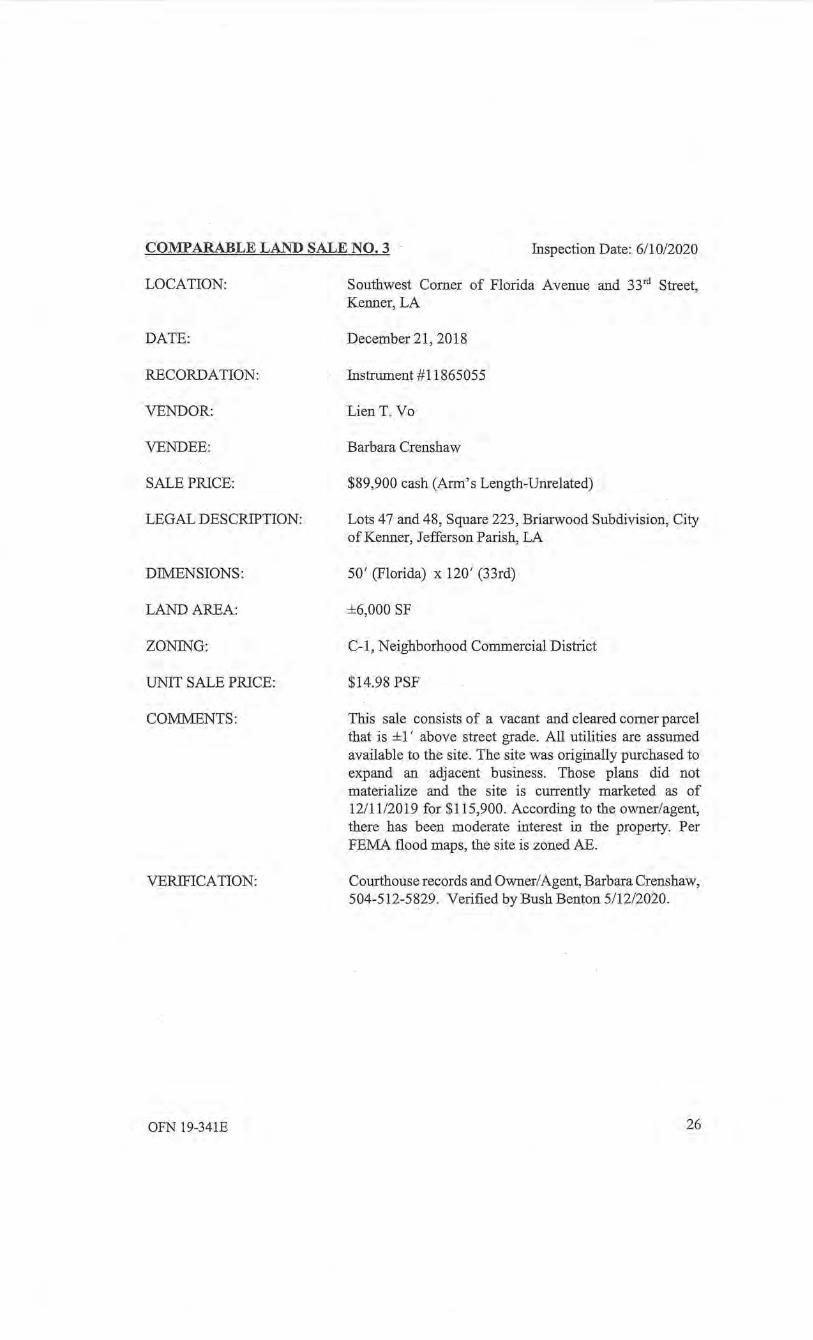
COMPARABLE LAND SALE NO.3 Inspection Date: 6/10/2020
LOCATION:
DATE:
RECORDATION:
VENDOR:
VENDEE:
SALE PRICE:
LEGAL DESCRIPTION:
DThffiNSIONS:
LAND AREA:
ZONING:
UNIT SALE PRICE:
CO:MI\1ENTS:
VERIFICATION:
OFN 19-341E
Southwest Corner of Florida Avenue and 33rct Street, Kenner, LA
December 21, 2018
Instrument #11865055
Lien T. Vo
Barbara Crenshaw
. $89,900 cash (Arm's Length-Unrelated)
Lots 47 and 48, Square 223, Briarwood Subdivision, City of Kenner, Jefferson Parish, LA
50' (Florida) x 120' (33rd)
±6,000 SF
C-1, Neighborhood Commercial District
$14.98 PSF
This sale consists of a vacant and cleared corner parcel that is ±1 ' above street grade. All utilities are assumed available to the site. The site was originally purchased to expand an adjacent business. Those plans did not materialize and the site is currently marketed as of 12/11/2019 for $115,900. According to the owner/agent, there has been moderate interest in the property. Per FEMA flood maps, the site is zoned AE.
Courthouse records and Owner/ Agent, Barbara Crenshaw, 504-512-5829. Verified by Bush Benton 5/12/2020.
26
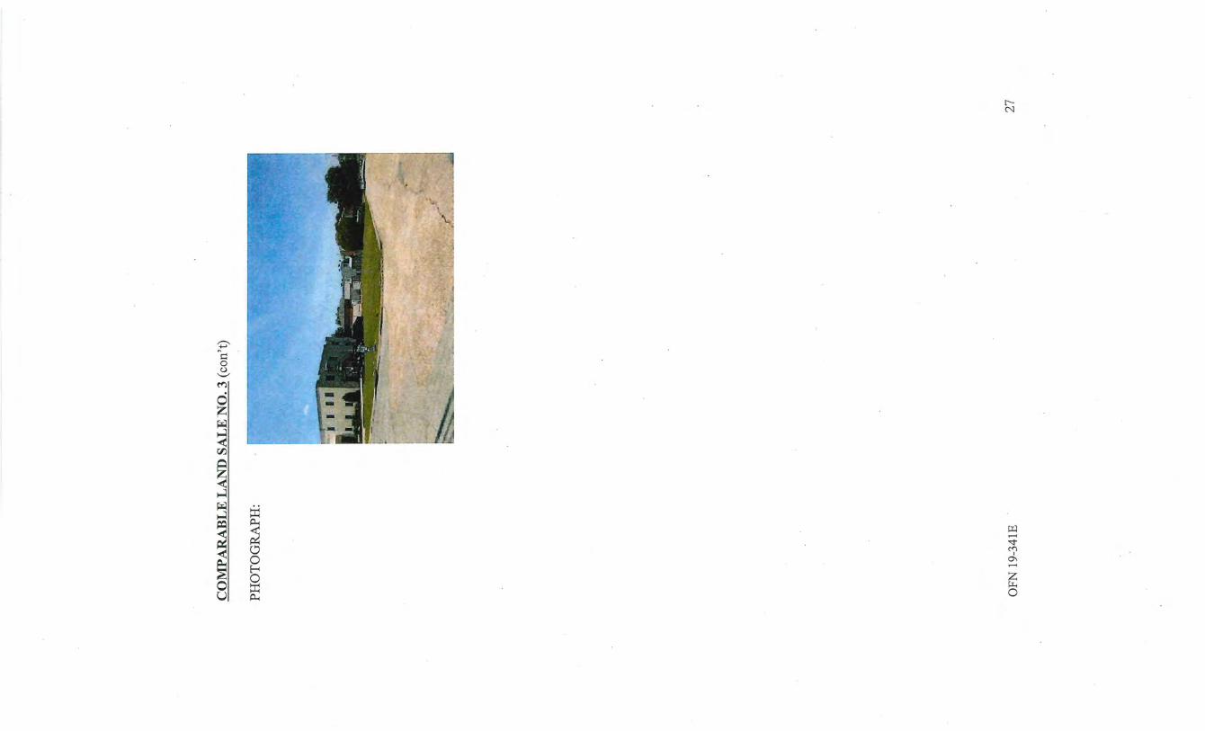
~ ~~
0 <.) ..........
M
0 z ~
~ rJ1
~ ~ ~ ~
~
~
~ ..-;
~
"'<t ~ ("(") I
0\ < tJ ..-;
~ 0
~ f-< 0
0 0 ~ u A..
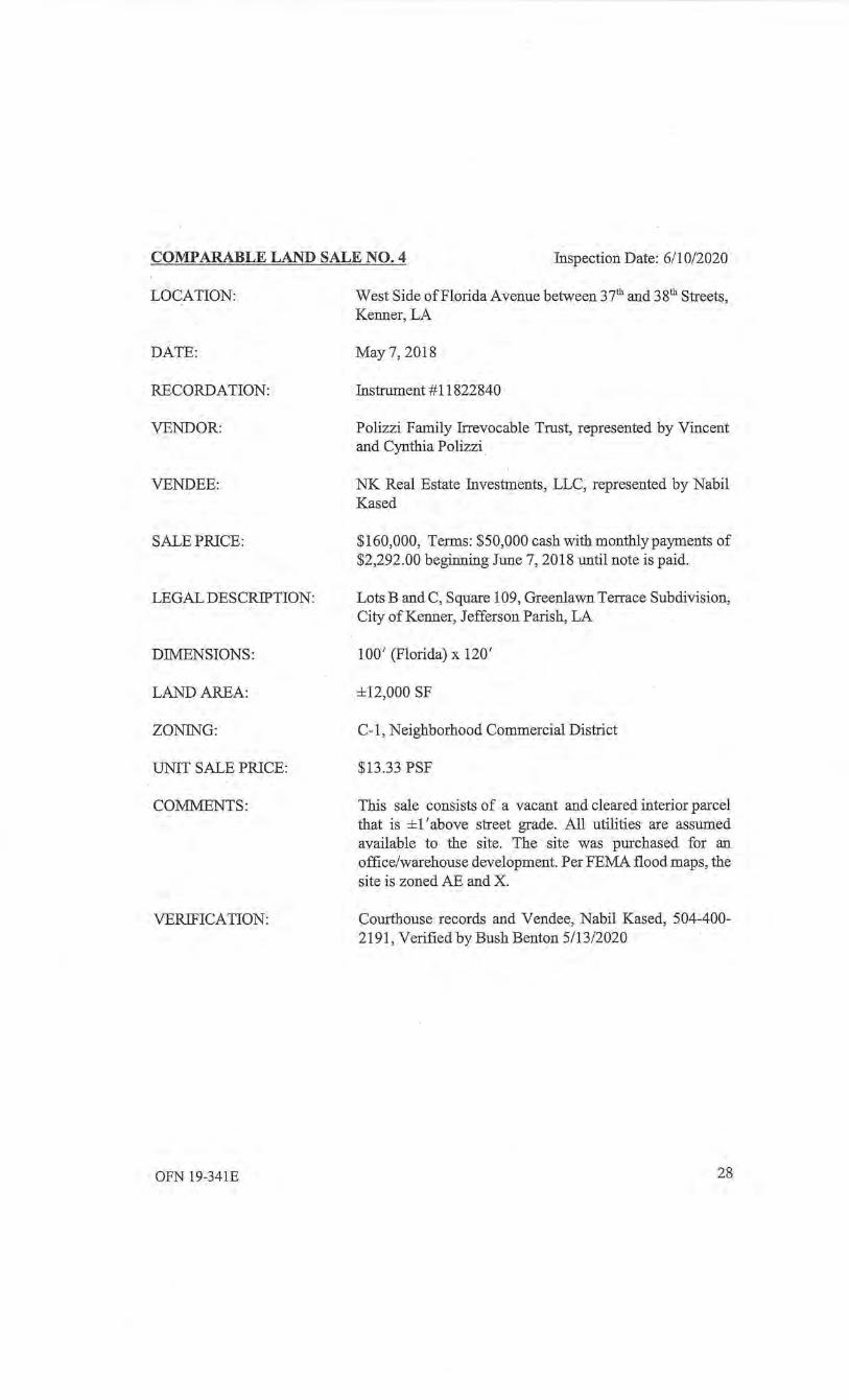
COMPARABLE LAND SALE NO.4 Inspection Date: 6/10/2020
LOCATION:
DATE:
RECORDATION:
VENDOR:
VENDEE:
SALE PRICE:
LEGAL DESCRIPTION:
DIMENSIONS:
LAND AREA:
ZONING:
UNIT SALE PRICE:
COMMENTS:
VERIFICATION:
OFN 19-341E
West Side of Florida A venue between 3 7111 and 3 8111 Streets, Kenner, LA
May 7, 2018
Instniment # 11822840
Polizzi Family Irrevocable Trust, represented by Vincent and Cynthia Polizzi .
NK Real Estate Investments, LLC, represented by Nabil Kased
$160,000, Terms: $50,000 cash withmonthlypayments of $2,292.00 beginning June 7, 2018 until note is paid.
Lots B and C, Square 109, Greenlawn Terrace Subdivision, City of Kenner, Jefferson Parish, LA
100' (Florida) x 120'
±12,000 SF
C-1, Neighborhood Commercial District
$13.33 PSF
This sale consists of a vacant and cleared interior parcel that is ±1 'above street grade. All utilities are assumed available to the site. The site was purchased for an office/warehouse development. Per FEMA flood maps, the site is zoned AE and X.
Courthouse records and Vendee, Nabil Kased, 504-400-2191, Verified by Bush Benton 5/13/2020
28
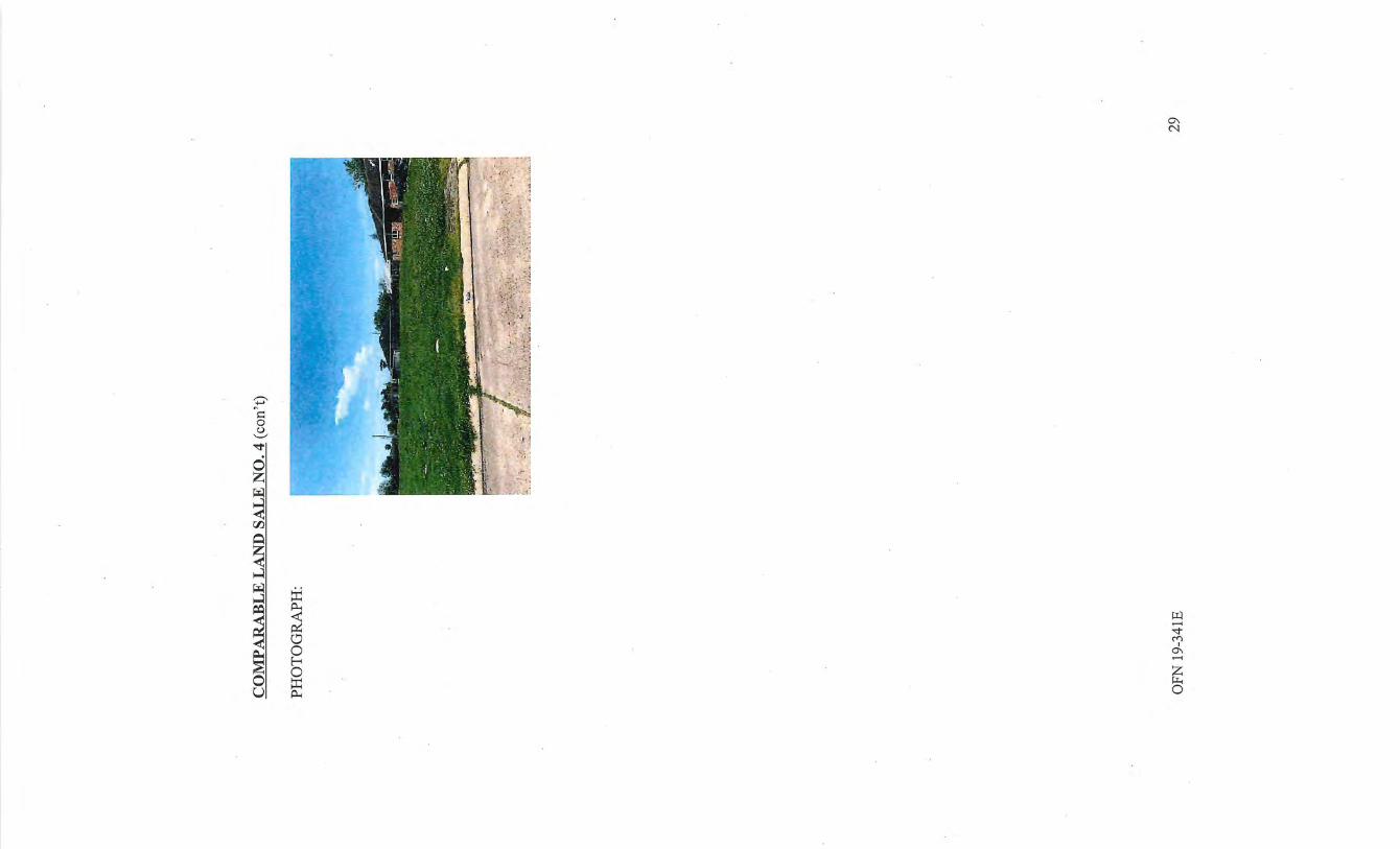
~ 1=: 0 (.) '-' -.:!'
0 z ~ ....:l < 00.
~
~ ....:l ~ :IJ
~
....:l ~ ~
,......
~ "<!" ~ ('f) I
0\ < ..-< ~
0 z E-< >I-.
0 0
0 ::r: u ~
LAND VALUE ANALYSIS AND CONCLUSIONS-BEFORE ACQUISITION
The appraiser has conducted a thorough examination of comparable land sales within the competing area. The appraiser is familiar with the Larger Parcel area and have extensive experience in the marketplace. The Larger Parcel consists of a rectangular shaped, interior parcel ofland containing ±9,600 SF or ±0.22 acres.
Comparing the Larger Parcel with the comparables, the appraiser made adjustments to compensate for differences in the sales. In the analysis, a paired sales technique was attempted. The paired sales technique helped support the appraiser's conclusions. Ultimately, the market value adjustments and the resulting value conclusions and the resulting value condusions are still the opinion of the appraiser. Statistical analysis is not possible. Nevertheless, a reasonable marketing pattern can be ascertained from the sales presented. A reasonable market value estimate for the Larger Parcel "as if vacant" is presented as follows:
The appraiser has considered transactional and property adjustments. Transactional adjustments considered were property rights conveyed, financing, condition of sales and market conditions (time). Property adjustments considered were location, size and physical characteristics.
Transactions Adjustments
Property Rights Conveyed
Property rights conveyed considers the real property rights transferred in each sale. This adjustment typically reflects the difference between a Fee Simple Estate and a Leased Fee Estate. In this analysis, all sales represented Fee Simple Estate transactions. Thus, no adjustment was made.
Financing
. Financing adjustments consider non-market financing and the need of cash equivalency calculations. All sales utilized were cash purchases or were within market parameters. Therefore, no adjustments were required.
Conditions of Sale
A condition of sale adjustment reflects atypical sale conditions or motivation. Such conditions or motivations may include adjacent ownerships, lack of exposure on the open market, plottage, tax considerations, eminent domain in proceedings, etc. No conditions of sale adjustments were warranted in this analysis.
Market Conditions-Time
The sales in this analysis took place between January2018 and December 2018. A matched paired sales analysis shows that time adjustments are difficult to prove. Thus, no market
OFN 19-341E 30
conditions adjustments were applied.
Property Adjustments
Location Adjustments
Location appears to be the most significant influence on land values in most sections of the city. A significant amount ofland sales are retained in the appraiser's data base. Please note that sales of land on quality thoroughfares can sometimes influence value. The precise amount of influence is difficult to ascertain. Sales 1 and 2 are inferior in location requiring positive adjustments. Sale 3 is superior in location warranting a negative adjustment. No location adjustment was necessary for Sale 4.
Size Adjustments
The appraiser is aware of the ramifications of size when comparing the Larger Parcel site to the sales. In this particular instance, the Larger Parcel site consists of a ±9,600 SF or ±0.22 interior parcel fronting Bessemer Street. . The comparable land sales utilized in this analysis range from 6,000 SF to 12,000 SF. Size adjustments are made in order to reconcile differences in size based on a matched pair analysis. For example, larger sites generally sell for lower unit values than smaller sites, all other factors being equal. No size adjustments were warranted.
Physical Adjustments
The appraiser will establish the market value for the site that is vacant, cleared, and filled. The Larger Parcel is an interior parcel with average utility. Sales 2 and 3 warranted negative adjustments for being comer lots.
Zoning Adjustments
Zoning adjustments must be considered for sites that have a zoning designation in place that could hinder potential development options. The Larger Parcel is currently zoned C-2, General Commercial District These designations allows for an array of potential development options. As such, the appraiser does not believe that zoning adjustment is required in this instance, as the zoning/overlays associated are not believed to affect its value.
OFN 19-341E 31
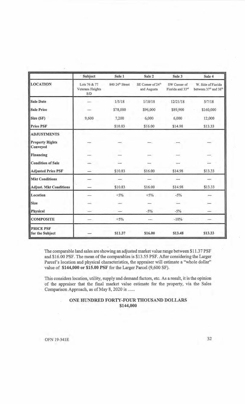
· Subject Sale 1 Sale 2 Sale3 Sale 4
LOCATION Lots 76 & 77 840 24'h Street SE Comer of24'h SWComerof W. Side ofFlorida Veterans Heights and Augusta Florida arid 3 3 'd between 37'h and 38'h
SID
Sale Date --- 1/5/18 1118/18 12/21/18 5/7/18
Sale Price --- $78,000 $96,000 $89,900 $160,000
Size (SF) 9,600 7,200 6,000 6,000 12,000
Price PSF $10.83 $16.00 $14.98 $13 .33
ADJUSTMENTS
Property Rights --- --- --- --- ---Conveyed
Financing --- --- --- --- ---
Condition of Sale --- --- --- --- ---
Adjusted Price PSF --- $10.83 $16.00 $14.98 $13.33
Mkt Conditions --- --- --- --- ---
Adjust. Mkt Conditions --- $10.83 $16.00 $14.98 $13 .33
Location --- +5% +5% -5% ---
Size --- --- --- --- ---
Physical --- --- -5% -5% ---
COMPOSITE --- +5% --- -1 O'Yo ---
PRICE PSF for the Subject --- $11.37 $16.00 $13.48 $13.33
The comparable land sales are showing an adjusted market value range between $11.3 7 PSF and $16.00 PSF. The mean of the comparables is $13.55 PSF. After considering the Larger Parcel's location and physical characteristics, the appraiser will estimate a "whole dollar" value of $144,000 or $15.00 PSF for the Larger Parcel (9,600 SF).
This considers location, utility, supply and demand factors, etc. As a result, it is the opinion of the appraiser that the final market value estimate for the property, via the Sales Comparison Approach, as of May 8, 2020 is .. ... .
OFN 19-341E
ONE HUNDRED FORTY-FOUR THOUSAND DOLLARS $144,000
32
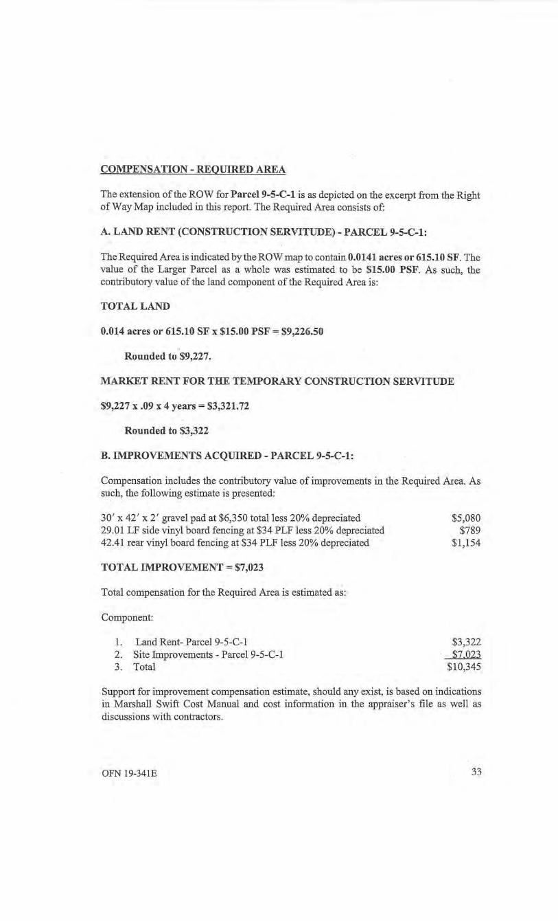
COMPENSATION- REQUIRED AREA
The extension of the ROW for Parcel9-5-C-1 is as depicted on the excerpt from the Right of Way Map included in this report. The Required Area consists of:
A. LAND RENT (CONSTRUCTION SERVITUDE)- PARCEL 9-5-C-1:
The Required Area is indicated by the ROW map to contain 0.0141 acres or 615.10 SF. The value of the Larger Parcel as a whole was estimated to be $15.00 PSF. As such, the contributory value of the land component of the Required Area is:
TOTAL LAND
0.014 acres or 615.10 SF x $15.00 PSF = $9,226.50
Rounded to $9,227.
MARKET RENT FOR THE TEMPORARY CONSTRUCTION SERVITUDE
$9,227 x .09 x 4 years= $3,321.72
Rounded to $3,322
B. IMPROVEMENTS ACQUIRED- PARCEL 9-5-C-1:
Compensation includes the contributory value of improvements in the Required Area. As such, the following estimate is presented:
30' x 42' x 2' gravel pad at $6,350 total less 20% depreciated 29.01 LF side vinyl board fencing at $34 PLF less 20% depreciated 42.41 rear vinyl board fencing at $34 PLF less 20% depreciated
TOTAL IMPROVEMENT= $7,023
Total compensation for the Required Area is estimated as:
Component:
1. Land Rent- Parcel9-5-C-1 2. Site Improvements - Parcel 9-5-C-1 3. Total
$5,080 $789
$1,154
$3,322 $7,023
$10,345
Support for improvement compensation estimate, should any exist, is based on indications in Marshall Swift Cost Manual and cost information in the appraiser's file as well as discussions with contractors.
OFN 19-341E 33
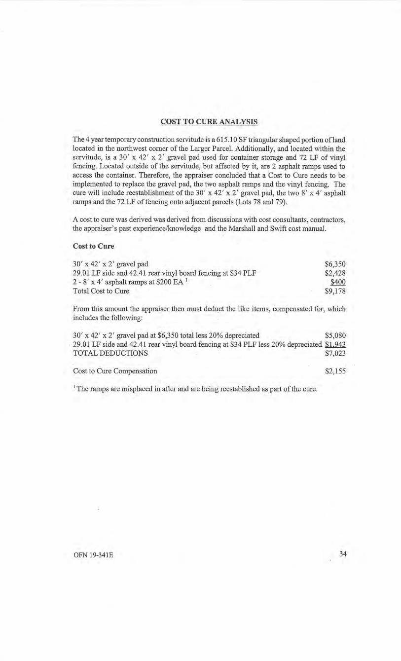
COST TO CURE ANALYSIS
The 4 year temporary construction servitude is a 615.10 SF triangular shaped portion ofland located in the northwest corner of the Larger Parcel. Additionally, and located within the servitude, is a 30' x 42' x 2' gravel pad used for container storage and 72 LF of vinyl fencing. Located outside of the servitude, but affected by it, are 2 asphalt ramps used to access the container. Therefore, the appraiser concluded that a Cost to Cure needs to be implemented to replace the gravel pad, the two asphalt ramps and the vinyl fencing. The cure will include reestablishment of the 30' x 42 ' x 2 ' gravel pad, the two 8' x 4' asphalt ramps and the 72 LF of fencing onto adjacent parcels (Lots 78 and 79).
A cost to cure was derived was derived from discussions with cost consultants, contractors, the appraiser's past experience/knowledge and the Marshall and Swift cost manual.
Cost to Cure
30' x 42 ' x 2' gravel pad 29.01 LF side and 42.41 rear vinyl board fencing at $34 PLF 2 - 8' x 4 ' asphalt ramps at $200 EA 1
Total Cost to Cure
$6,350 $2,428
$400 $9,178
From this amount the appraiser then must deduct the like items, compensated for, which includes the following:
30' x 42 ' x 2' gravel pad at $6,350 total less 20% depreciated $5,080 29.01 LF side and 42.41 rear vinyl board fencing at $34 PLF less 20% depreciated $1,943 TOTAL DEDUCTIONS $7,023
Cost to Cure Compensation $2,155
1 The ramps are misplaced in after and are being reestablished as part of the cure.
OFN 19-341E 34
SITE DATA- AFTER ACQUISITION
After the acquisition, there will be a single remainder containing 0.22 acres or 9,600 SF. This remainder tract is more or less rectangular shaped and fronts the western side of Bessemer Street.
In the "after" status, the appraiser has concluded that the Highest and Best use of the Remainder Tract will continue to be for multi-family residential use. Other general and specific site features (i.e. elevation, utilities, zoning, etc.) should not be changed by the project.
OFN 19-341E 35
Thank you very much for the opportunity to complete this appraisal assignment. I trust my findings will prove to be of a beneficial nature to you. If you have any questions or comments, please do not hesitate to call.
Q p ', -\\~:~\'\ c:~ . lJ_Sl_\iW;y'"')
Bush G. Benton, MAI Louisiana Certified General Real Estate Appraisal License No. G0847
OFN 19-341E
Sincerely yours,
36

CERTIFICATION
I/we certify that, to the best of my/our lmowledge and belief:
-the statements of fact contained in this report are true and correct. However, no responsibility is assumed for the accuracy of such infonnation as survey, title information, measurements, and other infom1ation such as comparable and other data furnished by others.
- the reported analyses, opinions and conclusions are limited only by the reported assumptions and limiting conditions and are my/ourpersonal, unbiased professional analyses, opinions and conclusions. The report may also be limited by the market value premise imposed by the tenns of the assignment (any limitation is clearly stated).
- I/we have no present or prospective personal interest in the property which is the subject of this report.
- I/we have no personal bias with respect to the property that is the subject of this report or to the pa1ties involved in this assignment.
- my/our cori1pensation is not contingent upon an action or event resulting from the analyses, opinions or conclusions in, or the use of, this report. This appraisal assignment was not based on a requested minimum valuation, a specific valuation, or the approval of a loan.
-the report analyses, opinions and conclusions were developed, and this report has been prepared in conformity with the requirements of the Appraisal Institute's Code of Professional Ethics and Standards of Professional Appraisal Practice, which include the Unifonn Standards of Professional Appraisal Practice. The fee for making this report does not include any comt testimony or pre-trial conferences.
- the use of this report is subject to the requirements of the Appraisal Institute relating to review by its duly authorized representatives, as well as the requirements of the State of Louisiana relating to review by the Real Estate Appraisal Subcommittee of the Louisiana Real Estate Cmmnission.
-Bush G. Benton is currently certified under the Appraisal Institute and is Louisiana Certified General Real Estate Appraisal License No. G0847.
-as of the date of this report, Bush G. Benton has completed the requirements of the continuing education program ofthe Appraisal Institute.
- I/we have made a personal inspection of the prope1ty that is the subject of this report and have inspected all comparables utilized in this report (unless otherwise noted).
- Daniel Diodene provided significant professional appraisal assistance to the person or persons signing this report other than the person( s) already prmninently mentioned at the appropriate section of the report where the nature of the contribution was noted.
- I/we have not perfonned appraisal services regarding the property that is the subject of this report within a three-year period immediately preceding acceptance of this assignment. I/we have not performed any other services pertaining to the subject property within the past three years .
l ' ;.1_, ,_\ \' D L ~-1 .,jJ\~\ <:~, . tll:V'\:·W y. 1 Bush G. Benton, MAI Louisiana Certified General Real Estate Appraisal License No. G0847
ASSUMPTIONS AND LIMITING CONDITIONS
1. This report is subject to the following conditions and to such specifications and limiting conditions that also might be set forth in this report. These conditions affect the analyses; opinions, and value conclusions contained in this report.
2. It is assumed that the property is owned in Fee Simple Title. Fee Simple Title implies that the property is owned free and clear, unencumbered and unless otherwise specified. There are to be no leases, liens, easements, encroachments or other encumbrances on the subject property that have not been specified in this report.
3. No responsibility is assumed for matters of a legal nature affecting the appraised property or title. This appraisal assumes that the subject property is presented with a good.andmarketabletitleunless otherwise specified. The appraiser(s) has not rendered an opinion as to the title and does not have the expertise to do so. Data on ownership and legal descriptions were obtained from sources generally considered reliable.
4. The property is appraised assuming it is to be under responsible ownership and competent management. Unless otherwise specified, the property is assumed to be available for its highest and best use.
5. Any survey contained in this report is assumed to be true and correct, and it is also assumed that there are no hidden encroachments upon the property appraised except as noted. Any sketch prepared by the appraiser(s) and included in this report may show approximate dimensions and is included to assist the reader in visualizing the property only. The appraiser( s) has not made a survey of the property and does not warrant any surveys or other presented plans or sketches.
6. The appraiser(s) assumes that there are no hidden or unapparent conditions of the property, subsoil, or other structures, which would render it more or less valuable. The appraiser(s) assumes no responsibility for such conditions or for engineering which might be required to discover these factors. This includes the presence of unusual/extraordinary mineral deposits or subsurface rights not typically transferred with normal comparable data (i.e., valuable mineral rights associated with oil/gas production, etc., are not part of this assignment).
7. Any distributions of the valuation of the report between land and improvements apply only under the existing program of utilization. The separate valuation for land and building must not be used in conjunction with any other appraisal and are invalid if used in conjunction with any other appraisal.
8. No responsibility is assumed for changes in matters that are legal, political, social, or economic which could affect real estate values· that take place after the effective date of this valuation.
9. Information, estimates, and opinions furnished to the appraiser, and contained in the report, were obtained from sources considered reliable and believed to be true and correct. However, no responsibility for the accuracy of such information furnished to the appraiser(s) during the appraisal process is warranted by the appraiser(s). The
appraiser(s) assumes no responsibility for the accuracy of such information as measurements, survey, title information, and other information furnished by comparable sales data found in courthouse records and information obtained from realtors and other parties during any type of comparable s'urvey.
10. This report is predicated upon the assumption that the property has reached a stabilized occupancy as of the date ofvaluation, unless otherwise noted.
11. On all appraisals, subject to satisfactory completion, repairs, or alterations, the appraisal report and value conclusion are contingent upon completion ofthe improvements in a workmanlike manner and in accord with the referred to plans and specifications.
12. The appraiser(s) is not required to give testimony or appear in court because of having made the appraisal with reference to the property in question unless arrangements have previously been made therefore with additional compensation typically required.
13. Disclosure of the contents of this appraisal report is governed by the By-Laws and Regulations of the Appraisal Institute.
14. Neither all nor any part of the contents of this report, especially any conclusions as to value, identity of the appraiser(s) or the firm with which he (they) is connected or any reference to the Appraisal Institute shall be disseminated to the public through advertising media, public relations media, news media, sales media, or any other public means of communication without prior consent of the undersigned. Fmiher, if this report is released to a third party for review (even with the knowledge of the appraisers), warranty of the report's content is not considered transferred. The appraisers owe a contractual duty only to the original client as to the accuracy of the ultimate value conclusions found in the report for which they have been paid a fee. Reliance on this report's accuracy by a third party in any decision making process is done so at the SOLE RISK of the Third Party unless the appraiser(s) has been recontracted.
15. It is assumed that the subject property is in full compliance with all applicable federal, state, and local environmental regulations unless non-compliance is stated and otherwise considered.
16. Unless otherwise stated in this report, the existence of hazardous material, which may or may not be present on the property, was not observed by the appraiser(s). The appraiser( s) has no knowledge of the existence of such materials on or in the property. The appraiser(s), however, is not qualified to detect such substances. The presence of substances such as asbestos, urea-formaldehyde foam insulation, or other potentially hazardous materials or gases may affect the value of the property. The value estimate is predicted on the assumption that there is no such material on or in the property that would cause a loss in value. No responsibility is assumed for such conditions, or for any expertise or engineering knowledge required to discover them. The client is urged to retain an expert in this field, if desired. This report further assumes that there are no under/ above ground storage tanks of any kind on the property (unless otherwise noted). Possible leakage problems have not been addressed. The site history of the subject property has not been explored, nor has the historical land use patterns of surrounding
properties been investigated. Again, the appraiser( s) has not addressed any environmental issues that might affect value. This report assumes that no such issues of any kind are present or affecting the Fee Simple Value in any manner (unless otherwise noted). The appraiser(s) urges the client to retain an outside environmental expert to determine the subject property's status from this perspective.
17. The appraiser(s) has personally inspected the property and fmds no obvious evidence of structural deficiencies except as stated in the report. However, no responsibility for hidden or unnoticed defects is assumed. No responsibility for conformity to specific governmental requirements (such as fire, building and safety, earthquake, or occupancy codes) can be assumed without provisions of specific professional or governmental inspections.
18. The appraiser(s), again, has personally inspected the subject property and found no evidence of termite damage or infestation (unless otherwise noted). No termite inspection report was made available to the appraiser(s). The appraiser(s) is not responsible for damages resulting from a:ny type of insect infestation whatsoever. This is beyond the scope of the appraisal assignment.
19. No consideration in this appraisal assignment has been given to personal property placed on the premises, or to the cost of moving or relocating such personal property. Only the value of real estate has been considered. The appraiser( s) has no knowledge of the liquidation value of personal property and is not an expert in determining the contributory value of the FF&E with regard to the going concern value. For this type of valuation, separate reports must be rendered by experts in the field.
20 . . The Americans with Disabilities Act ("ADA") became effective January 26, 1992. I (we) have not made a specific compliance survey and analysis of this property to determine whether it is in conformity with the various detailed requirements of the ADA. We may (at our discretion) address some likely problems associated with the new law. This should in no way be construed as a complete, full compliance survey or study of the subject property. It is possible that a full compliance survey of the property, together with a detailed analysis of the requirements ofthe ADA, could reveal that the property is not in compliance. If so, this fact might have a negative effect upon · the value of the property. I (we) generaliy did not consider possible non-compliance with the requirements of ADA in estimating the value of the property. We are not qualified to determine compliance or non-compliance. We do not warrant any consultant's report found addressing this problem. We have taken into account in this valuation both the fact that no professional compliance survey has been completed on the subject building and that the status of compliance or non-compliance of the comparable sales used herein is unknown when forming our opinion of value. We take no responsibility for the precise accuracy of the handling of this matter.
21 . The EPA will soon ban production ofCFCs (chlorofluorocarbon coolants). As a result, other types of refrigerants will have to be used in existing air conditioning systems (coolants such as HCFCs, hydrochlorofluorocarbons) and HFCs (hydrofluorocarbons ). The appraisers have not addressed problems concerning retrofitting of air conditioning systems within the subject. Most buildings will switch slowly to HCFCs and this appraisal assumes that no problems will occur within the subject property for this type of compliance (when and if it happens).

22. Flood hazard information is reported for information purposes only. The appraisers assume this to be the latest flood zone information and maps. The appraiser is not engineers or experts in this field. If the clientwants an exact flood zone determination, the client is responsible for obtaining an expert in the field.
23. Insurable Replacement Cost Estimates are done to the best of the appraiser's abilitY. The appraiser is not contractors or cost consultants. These values are estimates only and more precise values should be provided by an expert. This should be understood by the client.
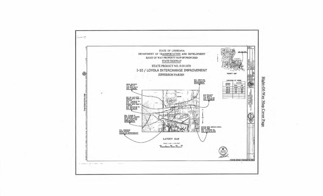
··- ------::
Ci). ~
l ; ,', ~ • g.:;
~a. ~ ~ .... . ~f
~! ~ ~ s:~ 1!: ~
i.
j ? 1
,,.
STATE OF LOlJJSIA!\A DEPARTMEI'\T 0 1' TRA.t\ISPORTAT10N AND DEVE.LOP!'>'IENT
RlGUT 01' V.'AY PROPERTY MAP OF.PROPOSED STATE HIGHWAY
STATE PROJECT NO. H.Ol1670
1-10 / LOYOlA INTERCHANGE IMPROVEMENT .ffiFFERSON PARISH
S.P. NO. H.Dt 1670 [!!=UOGE SITE1 R.Af.IP F 2979.0<1 ST A.. t I O.Tit22 TO !i'J oL 140>55,22 eRIDGE SITEJ RAMP G 2194,00' . .STA. 20<>-1:0;1;0 TO ST.\. 221"'9~.00
- c:_~ STJ,, J~'9..(o& . IZ END AlfWOHT ACt:E9S RO lMFROVEMEIITS BEGIN LOlOLA ·Dil lo\lPROv-~~1-lTS
C::::_-------.L~ Ho\. 3COHJ0.00 BEGIN AIIIJ'atl
·~~~~s
LAY<t}UT MAP
;u_L,;_, I .N.:h • T:rtrl ft.U
k •• L ,t-- \ ·f
STt.. !.5B't.J4.00 EIIO LOYOI..A OR IIAPA-OVELIENTS -
T
_, "6:t-15
~
"" W.a. W>. --
a ~~
3~~~ ··~il: ;~~~ ~!:~ :r~~ t;~
@ . ,, ~-, - ! I ; _,;@. II '. I ~ ~ ,J• atc4 &if'lulhi pi II 11i(
(!)
;·~~-~=~,~~rr~,,,------------~S~~~'~H~E~A~5T~E~RiliN~L~A~N~O'Dwtsr~m~cr~.<E~A~ST~Ofr1T~H~E~AwHS~S~~~S~~~pufR~~mEO.R>. ------------~~~~~------------------------~~-,
-~ r· ;~~"'"' g TI2S - R9E 8 ~~~ & '''""''""'"' ~ SECT/0115 37 & 85 ·.·~ ~/!:J ~ (,j"'
~--i..--------t-T-- _ ___ __c__ ----,-·-~ <s:~rf f.'r..o:aot~!~owu""'. ~s~--'-"'"'-- - -'--..--- ---t------ - i
~-!-f?.·~i.·~-"<,fl)
~~ " ~ ~ it i ~ ~ 325.00 ~ -n
'\-'f:~r;;.~it': ! ~Ji ~
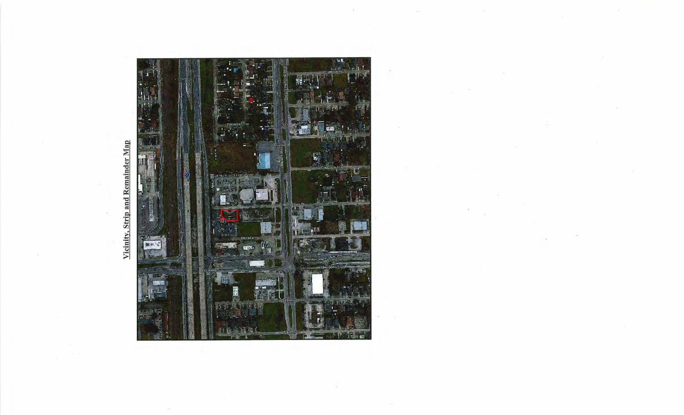
.... = .... Col
>
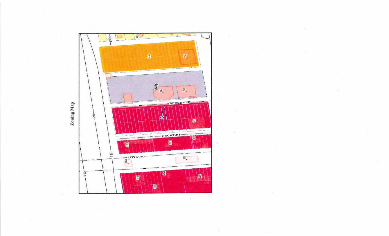
= .... = ~
FIRM Map
Suhjf;t;t 8!!<S~eemer Street J<.eo 11~r; LA 700(;)2
I'
~ ·/
FlOOD INFORMIATiiON l.EGEN:o
·C"'''·u"'unhy: City of Ke.n~t~et ii"rcpiirt \" i ii 1'>lf.JT 1f11i. FEMA Sp"cl;ol F;;::.C<ll H>UIOid A<lli"
M'iJP N'••rnib>.1 r: 22tl!)100019Sf
l"'a•'l-e-1: 22'·051 GW~!S -zc,n od! : X
M.., ~;~ 01 .... ~"''· 02·02·20 ~ B IF liPS' 22.0511 Sourf,:r;;; ; FEMADFIRM
•!p i ' .r .- s:· • •• ~ •. · •· !' _ ,-.--: , ·.• ...... -L . , ...._:: (, .. .:r~ • J ~
Sky Flr;~<od""
. .. ~ I ~ .:
l I ~ " I
.. , r t:.r .. ! I .:J f. t . .;.... I 1 -.~~~.l , .... . :: \ t-ri /i_,-, .. ,1 · - 1-tr: :J I ~~ : -
- r.::. J u. w Ml ' •...! ~ .. h,· -,t ·11 ~~;~ , ~-' ~·!-.
t~i:aul vr ...... .-
r.;; P·:. -... ~· .",1 1 J fJ •I
•- ' t· - · .- J •· . ... -- . · ; • ,c • ·: .,-,r.c >! !' •~ ·--.- :-a J·:; l"l'
<f'' ' '" .,., t.- !1 • ., I o·.· J• t ! ll · , ,, , ' ·· · • , • 1 lJ •J
' 1 ' ' ! ' . .. t• 1 - ... "! 1 I
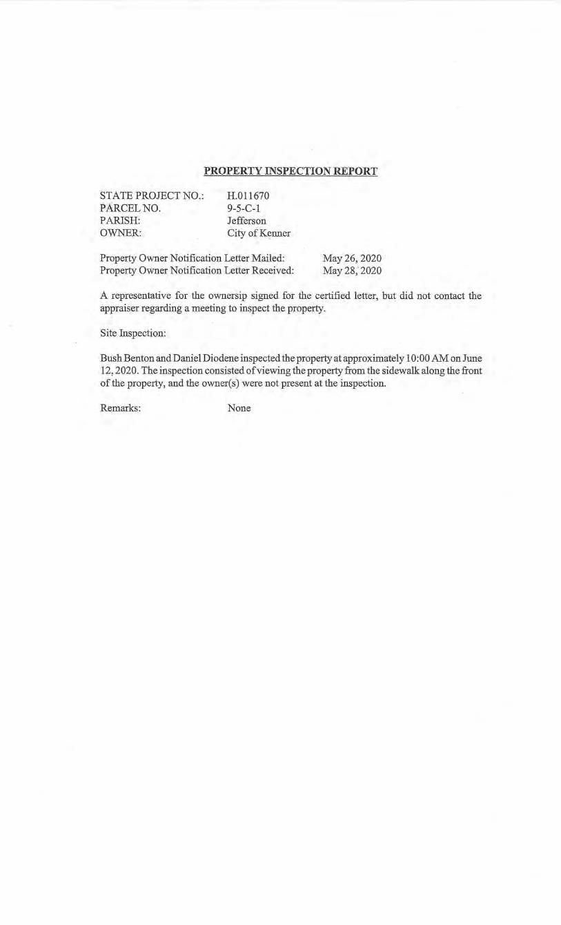
PROPERTY INSPECTION REPORT
STATE PROJECT NO.: PARCEL NO. PARJSH: OWNER:
H.011670 9-5-C-1 Jefferson City of Kenner
Property Owner Notification Letter Mailed: Property Owner Notification Letter Received:
May26, 2020 May28,2020
A representative for the ownersip signed for the certified letter, but did not contact the appraiser regarding a meeting to inspect the property.
Site Inspection:
Bush Benton and Daniel Diodene inspected the property at approximately 10:00 AM on June 12, 2020. The inspection consisted of viewing the property from the sidewalk along the front of the property, and the owner( s) were not present at the inspection.
Remarks: None
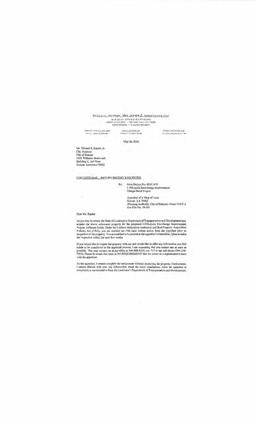
S 'l r.G;\LL., Bt<:'l'fO!'\, )1l"LAl\"C:O"' & ASSOCIATES, J.U:: Nt'.. IL L:.!l:Jn: .·1/"1·'1-:..i f.'..U & <.'fi ( .'.".'."J',\ U :\.Yi
~-lt\3 z ·.I'. !Ti l S' !V~[· I • i\lr-1 .,;:~11'. 1.( II 1 . •. : -\:~·.-1. 1(.1 (:1) I (5t1J} t:rllt-:\ 161 • F•\S t:m I) H ~~;;..:v; ~:;
n r: .. -:- ·~, -!\ ~-rw tJ.L t.t>"-1, :ii;P.-~
.... ; r : : ~~ ~~ ,flt i.O.. .U<L'rloJK.tm~
:•l ~ -1 1 \.i.!J.:}ITC'N. M-",1
- ~.~ • ,, ,,,,. ••·!.· ~•u.E ... '-~X~. .(IJ~·.
11.-\'-'IO(J. t.r~_.,_ •:co•t, ~tAl
.-,•...-... ~~· ru: . ~--~•l'- ·.1.1.-l ' ' '~ -"' n ·~-1
'Mr. F.dwi>rd S. Rapier, Jr. Cily Alturncy City ofKollllcr 180 I 'l>'iUiams J:!uulevarJ Building C. 3rd Floor Kenner, Louisiona 700_62
)vlny-26, 202(/
Q;)\'IJEIED MAIL- RETtJRI',!J~ECElPT HP.OllP.STED
Dear Mr. Rapier:
Rc: Stale l'ruicct No. 1·1.0!1670 I-!OiLoy~la lnlcrchange Improvement Design-BuiJ~ Prujccl
t\pprdis~l of a Strip· of Land Kc1111er. L<\ 700.62 (Housing A4thoriiy, City of Kenner)- l'arccl 9-S~.c:l Our File No. 19-341
As you mny h•·nware.the Slate ofLouisiana's.Dcparltti<IltofTmusportrttinn and Development may nc.quire lhe ahnvc rdi:ren.:ed property for the · proposed T"!O/Loyoli• lnkrohangc lmpmvemeni Project. Jefferson Parish. Under the U nilonn Relocation :\ssi•wncc !llld Rc"UI Property Acquisition lloJicic!i .A.cl (UR/\). you arc cutitled rcn ( 1 0) days .,,·rincn nc.1Licc from cbc il;>pmiser priur lri in >pecticm ofthcpropeny. You arc entitled to be present nt tbenppmiscr"s inspcotion. I plan to make tlw inspecliDn willa..in Lhe m:xt fcv,.· weeks.
lf you would like to inspect the property with m~ clrid would Uke .. to offer nny inforrn:ilinn you feel needq to ~e ~un:sjdcrc:d iu the appraisal ·process. I mn requesting that you corita~l me m:i suon as J>Msihlc. Yoc !nay cunla"' Inc al my oHicc ut504-888-B 1 Gl , cxL 117 or my cell phon~ (504 ·236· 7691). Please b~ owurc that there is NO REQUIREMENT thnt the (IWttcror ~representative mu~t ~~·ith the appraiser.
As the .appr&iscr, l ·eannot complel'<' rht•as.<ignmcril' without inspecting lhe pwpcrty . .l.'·urthcnnorc; I c\lnnot diicuss wilh you, [IllY iuformniion ahout tl1c valu;:: c.:onclusions. Alh .. T lbc appr .. Ii~al js ..:ompld~:d~ a rcprc::~cnlntivc from tlw Loubiann. ~~ n~pn.nmcm ofTrunsportalion ant.! D~"elopmcut,
lvk Edwards. Rapier. Jr. 'VIay 26, 2020 · Pagc·2
on heir i!.<"igns will contact.you1n provide a copy ofU1c properly w be Hcquircd. and mal:.c ~m uOh ofjus1 comp~nsatio_n.
Th:mk you very mud1 for .meelinglcpoperatin!: wilh !l)e/u~ rcganlinll Lhis assigumcitl.
Since1ely yours~
'• \ .\···. ·:_~. _ · ·>~ · ·~···, Bu~ll G. Beu\<•14 lvlfil
Louisiana Cettified Gcucral Real E~\att Appraisal
l..icense No. GOS47
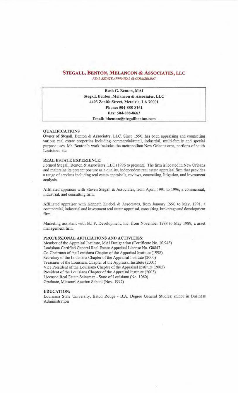
STEGALL, BENTON, MELANCON & ASSOCIATES, LLC REAL ESTATE APPRAISAL & COUNSELING
QUALIFICATIONS
Bush G. Benton, MAl
Stegall, Benton, Melancon & Associates, LLC
4403 Zenith Street, Metairie, LA 70001
Phone: 504-888-8161
Fax: 504-888-8683
Email: [email protected]
Owner of Stegall, Benton & Associates, LLC. Since 1990, has been appraising and counseling various real estate properties including comrnerciallretail, industrial, multi-family and special purpose uses. Mr. Benton's work includes the metropolitan New Orleans area, portions of south Louisiana, etc.
REAL ESTATE EXPERIENCE: Formed Stegall, Benton & Associates, LLC (1996 to present). The fnm is located in New Orleans and maintains its present posture as a quality, independent real estate appraisal firm that provides a range of services including 1:eal estate appraisals, reviews, counseling, litigation, and investment analysis.
Affiliated appraiser with Steven Stegall & Associates, from April, 1991 to 1996, a commercial, industrial, and consulting finn.
Mfiliated appraiser with Kenneth Knebel & Associates, from January 1990 to May, 1991, a commercial, industrial and investment real estate appraisal, consulting, brokerage and development filiD.
Marketing assistant with B.J.F. Development, Inc. from November 1988 to May 1989, a asset management fi1m. ·
PROFESSIONAL AFFILIATIONS AND ACTIVITIES: Member of the Appraisal Institute, MAl Designation (Certificate No. 10,943) Louisiana Certified General Real Estate Appraisal License No. G0847 . Co-Chairman of the Louisiana Chapter of the Appraisal Institute (1998) Secretary of the Louisiana Chapter of the Appraisal Institute (2000) Treasurer ofthe Louisiana Chapter of the Appraisal Institute (2001) Vice President of the Louisiana Chapter ofthe Appraisal Institute (2002) President of the Louisiana Chapter ofthe Appraisal Institute (2003) Licensed Real Estate Salesman- State of Louisiana (No. 1080) Graduate, Missomi Auction School (Nov. 1997)
EDUCATION: Louisiana State University, Baton Rouge - B.A. Degree General Studies; minor in Business Administration
Bush G. Benton, MAl Qualifications Page 2 of3
· Successful completion of the following courses and examinations:
APPRAJSALINSTITUTE Course lA-1: Real Estate Appraisers Principles, Tuscaloosa, AL Course lA-2: Basic Valuation Procedures, Jackson, MS Course SSP: Standards of Professional Practice, Baton Rouge, LA Course lEA: Capitalization Theory and Techniques, Pt. A, Austin, TX Course lBB: Capitalization Theory and Techniques, Pt. B, Houston, TX Course 550: Advanced Applications, Houston, TX Course 540: Report Writing & Valuation Analysis, Athens, GA
COURT TESTIMONY/ARBITRATION/MISCELLANEOUS:
1990 1990 1991 1991 1992 1993 1994
Approved and testified as an Expert Real Estate Appraiser for the Louisiana Tax Commission hearings. Testified in 1999 regarding high-rise CBD office buildings in New Orleans. Testified in behalf of201 St. Charles Avenue (Capital One Building), June 2014.
Arbitration work between Equity Developments Systems, LTD., Slidell, LLC and Steven N. Sirgler v. The City of Slidell, Louisiana, et al. May 2003. U.S. Dishict Court, Eastern District.
8000 Lakeshore Drive, New Orleans, LA Arbitration case between Landry's Seafood House-New Orleans, Inc v. The Board of Commissioners of the Port of New Orleans Levee District. June 2005. Court of Appeal of Louisiana, Fourth Circuit.
2525 St. Bernard A venue, New Orleans, LA Prepared appraisal for U.S. District Court, Section "C". Doussan Properties, LLC v. Doussan Gas and Supply, LLC. June 2006.
2600 Gravier Street, New Orleans, LA Orleans Parish Civil District Court. Boes Corporation Inc. v. Larry Hamm and Falstaff Inc. Provided appraisal (March 2009) and testified May 2009.
1826-34 Canal Street, New Orleans, LA. Board of Supervisors Louisiana State University and Agriculture and Mechanical College v. Tukandu, et, al, Appraisal (November 2009) and deposition (April2014) .
Appraisal (March 2011) and deposition (August 2014) The Department of Transportation and Development v. Centre at Westbank. 24u' Judicial Court, Jefferson Parish.
Levy Gardens Partners 2007, LP v. Lewis Title Insurance Company Inc. Eastern District Court, Section N, Orleans Parish. AppraisaVDeposition (August 2011) and triaL
723 Toulouse Street, New Orleans, LA Peterson Yokum, et al. v. 544 Funky, LLC, et al. Appraisal (September 2013) and Deposition (October 2013).
Commercial heating officer for Orleans Parish Real Estate Tax Appeals, 2011-2014.
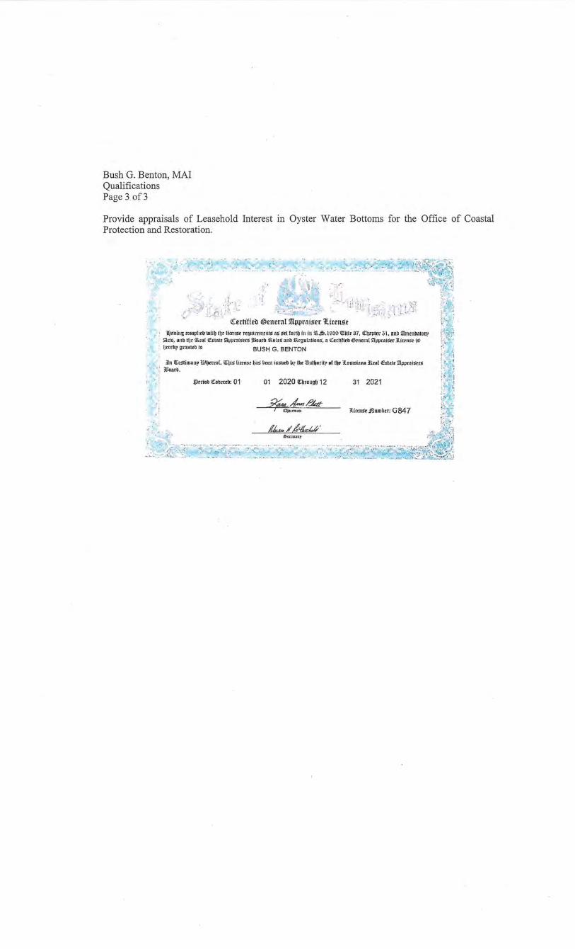
Bush G. Benton, MAl Qualifications Page 3of3
Provide appraisals of Leasehold Interest in Oyster Water Bottoms for the Office of Coastal Protection and Restoration.
; ·' -~ -~~~~ ... ' .. ~ ... ::.~: :
, , ,,·,• \ , , I , H ; ':;;;;: ~~>!· ~ i ~~g'~~#~· 1 ~ j
;:'_;_!! ;\ i'; . i, Jl·: 1 ·c : ~~- ! /l I - •·'' •
,r -,
... .. , _:,;Lr~ ~ .. : ··:... ,, !,', •:;_.,,:.,;: .... ~:\ . .
· · <!i:ertifieb ®en era! ~\1\IL'iliS'H 1l.irens.e ,. , jl)tibing to!nphrb·wllb tur lil<n~r rrnuimlltllfg ns grL fol'lb in illl:.'.~.l950 l!i:lllr 37, l(ljaptrr 31, nn.n :!TriltltbatoQ>
· S.ttG, anb t[Jc i\ral fli"!nntt kippl'tliSN~ ~Hontb 3Ti.•llrS nnb: i\rg-u(ation.5'. 11 ~crt~f1rb tlrncml kiiJpcaiStr .i.itrru:l'.t 1!1· !Jrrrb!• grnnttb to BUSH G. BENTON
.lin !!tcgti!llollp Ulbtteof. <lrbio litrn" ba.J ~"" i•Gurb bJ! lilt autbotff!• of tltr 1lomsinnn i'tol f.:&talr iawroigr<B · •,: l!Jonrb. .
r· , .. .Prriob ~~rrrb: 01 01 2020 U::~rounb 12 31 2021
.if'Md.-d-- /!kr C~;um1all !litrns'e ,flumber: G 84 7
~-; '1. '
:~;: t:_; ~ ~~~ ~ - : · - ~ ·, ~- - :;~:·.:
~;_}=:,: · ..: .!
n: ~~:;
l~ . :•' '· ·.-;~
,&.r,rtl.np
'}j.!)}'S i:'lik';~·:t~£t~ ._, .. , :
:/ 'l .t&v- II d<fftM'
- .:D~~·~c: .:~~· :· ... ~~ ·}j-.?~i::.~ :/.· 5:·~ ::? ·· j · ~; !
·••. :...-.:· ~
JAMESP.ROY Louisiana State Certified
General Real Estate Appraiser License # G2792
5008 Pecan Lane Jarreau, LA 70749
(225) 939-0207 [email protected]
SPN: H.0011670 I-10/LOYOLA INTERCHANGE
ROUTE LAI-10 JEFFERSON PARISH
DESIGN BUILD PROJECT
(STANTECH PROJECT NUMBER 201802831)
PARCEL NO: 9-5-C-1 OWNER: CITY OF KENNER
(APPRAISAL FORMAT C)
APPRAISAL
OF
CAPTIONED PROPERTY
FOR
CINDY M. HALL P.E. REPRESENTATIVE
ATTENTION: DON BERNARD
FOR
STANTEC CONSULTING SERVICES INC. 1200 BRICKYARD LANE SUITE 400
BATON ROUGE, LA 70802
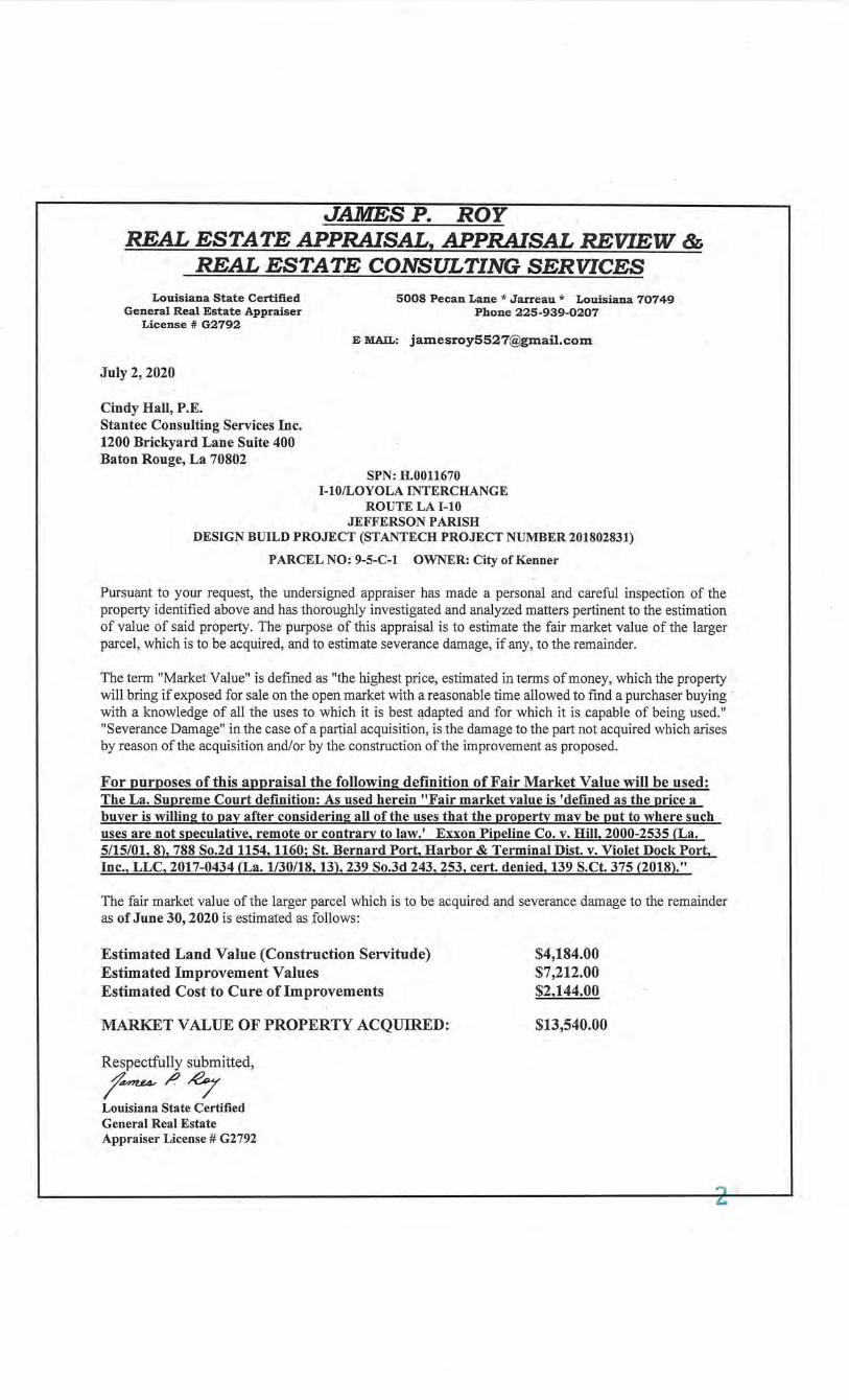
JAMESP. ROY REAL ESTATE APPRAISAL, APPRAISAL REVIEW &
REAL ESTATE CONSULTING SERVICES Louisiana State Certified
General Real Estate Appraiser License # G2792
5008 Pecan Lane* Jarreau* Louisiana 70749 Phone 225-939-0207
E MAIL: [email protected]
July 2, 2020
Cindy Hall, P.E. Stantec Consulting Services Inc. 1200 Brickyard Lane Suite 400 Baton Rouge, La 70802
SPN: H.0011670 I-10/LOYOLA INTERCHANGE
ROUTE LA I-10 JEFFERSON PARISH
. DESIGN BUILD PROJECT (STANTECH PROJECT NUMBER 201802831)
PARCEL NO: 9-5-C-1 OWNER: City of Kenner
Pursuant to your request, the undersigned appraiser has made a personal and careful inspection of the property identified above and has thoroughly investigated and analyzed matters pertinent to the estimation of value of said property. The purpose of this appraisal is to estimate the fair market value of the larger parcel, which is to be acquired, and to estimate severance damage, if any, to the remainder.
The term "Market Value" is defined as "the highest price, estimated in terms of money, which the property will bring if exposed for sale on the open market with a reasonable time allowed to find a purchaser buying · with a knowledge of all the uses to which it is best adapted and for which it is capable of being used." "Severance Damage" in the case of a partial acquisition, is the damage to the part not acquired which arises by reason of the acquisition and/or by the construction of the improvement as proposed.
For purposes of this appraisal the following definition of Fair Market Value will be used: The La. Supreme Court definition: As used herein "Fair market value is 'defined as the price a buyer is willing to pay after considering all of the uses that the property may be put to where such uses are .not speculative, remote or contrary to law.' Exxon Pipeline Co. v. Hill, 2000-2535 (La. 5/15/01, 8), 788 So.2d 1154, 1160; St. Bernard Port, Harbor & Terminal Dist. v. Violet Dock Port, Inc., LLC, 2017-0434 (La. 1130/18, 13), 239 So.3d 243, 253, cert. denied, 139 S.Ct. 375 (2018)."
The fair market value of the larger parcel which is to be acquired and severance damage to the remainder as of June 30, 2020 is estimated as follows:
Estimated Land Value (Construction Servitude) Estimated Improvement Values Estimated Cost to Cure of Improvements
MARKET VALUE OF PROPERTY ACQUIRED:
Respectfully submitted,
t~/)~ Louisiana State Certified General Real Estate Appraiser License# G2792
$4,184.00 $7,212.00 $2,144.00
$13,540.00
TABLE OF CONTENTS
TITLE PAGE-----------------------------------------------------------------------------------------1
LETTER 0 F TRANSMITTAL--------------------------------------------------------------------2
TABLE OF CONTENTS--------------------------------------------------------------------------3
LARGER PARCEL PH 0 TOG RA H S ----------------------------------------------------------4-5
SUMMARY OF SALIENT FACTS & CONCLUSIONS----------~------------------------6-9
BASIS FOR SUMMARY OF FAIR MARKET VALUE------------------------------------1 0
TITLE DA TA-----------------------------------------------------------------------------------------11-12
SITE DATA -------------------------------------------------------------------------------------------13
LARGER PARCEL FLOOD MAP --------------------------------------------------------------14
LARGER PARCEL ZONING MAP & REGULATIONS-----------------------------------15-21
HIGHEST AND 8 EST USE----------------------------------------------------------------------22-23
DISCUSSION OF THE APPRAISAL PROBLEM------------------------------------------24
REG ION AND NEIGHBORHOOD DATA ----------------------------------------------------25-32
MARKET DATA APPROACH & ESTIMATE OF LAND VALUE----------------------33-53
COST APPROACH ----------------------------------------------·---------------------------------54
WHOLE PROPERTY MARKET APPROACH TO VALUE------------------------------54
INCOME APPROACH TO WHOLE PROPERTY VALUE-------------------------------54
ANALYSIS, INTERPRETATION AND CORRELATION OF VALUES---------------55
VALUE 0 F REQUIRED PARCEL --------·-----------------------------------------------------56
COST TO CURE ANALYSIS--------------------------------------------------------------------57
ANALYSIS OF ADDITIONAL COMPENSATION------------------------------------------58
C E RTI FICA TE 0 F APPRAISER----------------------------------------------------------------59
LIMITING CONDITIONS--------------------------------------------------------------------------60-62
PROPERTY OWNER NOTIFICATION LETTER -------------------------------------------63-64
PROPERTY OWNER INSPECTION REPORT ----------------------------------------------65
ADDENDUM (PAGES 66-72)
PROJECT MAPS APPRAISER'S QUALIFICATIONS APPRAISER'S CERTIFICATION
3
LARGER PARCEL PHOTOGRAPHS
Date Taken 6-30-2020 Southeast along Bessemer Street Parcel 9-5-C-1
Date Taken 6-30-2020 Westerly at Larger Parcel 9-5-C-1
4
SUMMARY OF SALIENT FACTS & CONCLUSIONS
ADDRESS OF PROPERTY: West side of Bessemer approximately 67.36' feet south of the 1-10 right of way and on ramp from Loyola Drive and North ofVeterans Highway in Kenner, LA
OWNERSHIP: City of Kenner
,LEGAL DESCRIPTION: Lots 76 through 83 Square 181 Veterans Heights SID
PURPOSE OF APPRAISAL: To estimate market value of all parcels acquired,
and severance damage, if any to the remainder.
RIGHT OR INTEREST BEING APPRAISED: Fee; Less Mineral Rights
X Temporary Construction Servitude
Permanent Drainage Servitude
ESTIMATED VALUE OF ALL LAND ACQUIRED:
(Construction Servitude Rental for 4 Years)
ESTIMATED VALUE OF IMPROVEMENTS ACQUIRED:
6' Vinyl Fencing 71.42 linear feet 32 sf Asphalt Pad
2,520 sf Gravel Pad
SEVERANCE DAMAGE TO REMAINDER:
("Cost-to-Cure" items only)
ADDITIONAL COMPENSATION:
TOTAL ESTIMATED JUST COMPENSATION:
DATE OF VALUE ESTIMATE: June 30, 2020
July 2, 2020
$4,184.00
$7,212.00
$2,144.00
$0.00
$13,540.00
DATE OF REPORT
DATE OF INSPECTION June 30,2020 previous inspection dates 2-11-20,3-10-2020 & 5-14-20
DATE OF RIGHT OF WAY MAP: 02-05-2020.
RIGHT OF WAY MAP APPROVED: 02-18-2020.
DATE OWNER NOTIFIED: 1122/2020 & 6115/2020
6
REMARKS: The referenced project will require the acquisition for a construction servitude for a period ofF our ( 4) years of a portion of the larger pared. This appraisal will use the Format (Form C) as partial ownership of the land and all improvements required. This report will include the Market Data Approach to Value to determine estimated value of the larger parcel. The Cost Approach and Income Approach are used when applicable.
No severance damages were noted for the larger parcel. This parcel is a construction servitude area and all fee simple rights will return to the owner after completion of the project.
ASSIGNMENT CONDITION This appraisal has been prepared in conformity with the Uniform Standards of Professional Appraisal Practice (USP AP). The Jurisdictional Exception regarding Standard 8-3(f) applies herein. · In most instances, this standard requires the appraiser to consider the effect of an anticipated public improvement on the appraised property. However, current jurisprudence regarding acquisitions for roadway projects requires the appraiser to estimate the before value of the property without considering the effect of the project. Therefore, this Standard Rule is not considered applicable in this instance and this . omission is permissible by the USPAP.
Extraordinary Assumption An assignment-specific assumption, as of the effective date regarding uncertain information used in an analysis, which, if found to be false, could alter the appraiser's opinions or conclusions.
Comment: Uncertain information might include physical, legal, or economic characteristics of the larger parcel property; or conditions external to the property, such as market conditions or trends; or the integrity of data used in an analysis.
Hypothetical Condition A condition, directly related to a specific assignment, which is contrary to what is known by the appraiser to exist on the effective date of the assignment results but is used for the purpose of analysis.
Comment: Hypothetical conditions are contrary to known facts about physical, legal, or economic characteristics of the larger parcel property; or about conditions external to the property, such as market conditions or trends; or about the integrity of data used in an analysis.
Limitation Statement
The effective date of value for the larger parcel property is June 30, 2020. This date is several weeks after the onset of the current state and nationwide business and social shutdowns required as a result of the ongoing corona virus pandemic. The values concluded herein are based upon market data, neighborhood, and economic conditions which were in place prior to the onset of the pandemic. The value conclusions do not include any consideration of the present or future effects of the pandemic on value.
7
PURPOSE OF THE APPRAISAL
The purpose of the appraisal is to ESTIMATE THE MARKET VALUE OF THE FEE SIMPLE ESTATE, LESS MINERALS of all parcels acquired and the RENTAL FOR THE CONSTRUCTION SERVITUDE AT A FOUR YEAR RENTAL PERIOD, and severance damage, if any, to the remainder, as of June 30, 2020and to determine the estimate of just compensation for the property rights required from the ownership of this designated parcel. The larger parcel acquisition is a construction servitude required for the project involving improvements to the I-10/Loyola Project, JEFFERSON PARISH, LOUISIANA. Access to the larger parcel will not be obstructed during construction although there may be minor inconvenience associated with the construction that will be typical throughout the project. Construction drawings indicate that driveways will not be affected to the remainder property in similar proximity to the driveways which existed prior to construction. Additional driveways may be obtained from LDOTD, if permissible, by requests from affected property owners. .
SCOPE OF THE APPRAISAL
In the preparation of this appraisal report, the appraiser has made a physical inspection of the larger parcel site and improvements (if any, including measuring the improvements, if needed) and physically walking the site and taking sufficient photographs to adequately characterize the property appraised. The site was originally inspected on 3-10-2020. Met with Micah Freemin, Robert Aguilar and Bush Benton on site. The site was then re-inspected on June 30, 2020 for update.
The larger parcel neighborhood was also inspected to assist the appraiser's determination of the neighborhood characteristics. Research was also undertaken to collect information on the area. This information was analyzed in order to document the various environmental, social, governmental, and economic factors that influence the value of the property appraised.
Sales of comparable vacant tracts of land were collected and verified with the knowledgeable party. All of the significant activity was further researched by the appraiser, depicting those transactions that were most indicative of the value of the property appraised.
The valuation ofthe property included the Direct Sales (Market) Approach. A final estimate of the market value was calculated by the appraiser. The Cost, Market Approach for Improved sites and the Income Approaches were not used as the larger parcel site has no permanent improvements located on the site nor within the construction servitude and these approaches are not applicable. The parcel area did contain 6' vinyl fencing along the property lines and asphalt surface ramp at the C-Cans This fencing and asphalt are valued in the report. C-Can containers and various police department equipment are located in or near the parcel area. These improvements are considered movable and were not valued in this report.
8
FUNCTION OF THE APPRAISAL The function of this appraisal is for the proposed project involving the improvements to I-10/LOYOLA INTERCHANGE, JEFFERSON PARISH, LOUISIANA.
PROPERTY RIGHTS APPRAISED: (Drainage and/or Construction Servitudes noted when applicable) . The property is appraised in fee simple ownership. Fee simple ownership is defined as: "Absolute ownership unencumbered by any other interest or estate; subject only to the limitations ot eminent domain, escheat, police power, and taxation." 1
The client of for report is Stantec Consulting Services Inc. The intended users are Stantec Consulting Services Inc.; Gilchrist Construction C., L.L.C. and LADOTD. The intended use of the appraisal is for the compensation of required parcels of property on the following Project:
SPN: H.0011670, 1-10/LOYOLA INTERCHANGE, ROUTE LA 1-10, JEFFERSON PARISH, LA, DESIGN BUILD PROJECT, (STANTECH PROJECT NUMBER 201802831).
DATE OF THE APPRAISAL
The date on which this value estimate applies is June 30, 2020.
ENVIRONMENTAL ISSUES The reader is advised that according to the National Flood Insurance Program Flood Insurance Rate Map of JEFFERSON PARISH, Louisiana. The larger parcel lies within Flood Zone X, outside the 500-year flood plain and AE which is inside the 1 00-year flood plain. This appraisal, its findings, conclusions, and value estimate assume the site is able to be developed to its highest and best use without any extraordinary compliance costs. Should conditions be, otherwise, I reserve the right to re-evaluate the value reported. JEFFERSON PARISH is mapped under the National Flood Insurance Program by the Federal Emergency Management Agency (FEMA). No soil or subsoil tests were requested nor supplied for the appraisers use. Sub and sub-soil conditions appear to be typical of the general area and no adverse soil conditions are known. No knowledge of hazardous materials that exist on the property. However, this appraiser does not have the expertise in making such a determination.
DEFINITION OF MARKET VALUE For purposes of this appraisal the following definition of Fair Market Value will be used: The La. Supreme Court definition: As used herein "Fair market value is 'defined as the price a buyer is willing to pay after considering all of the uses that the property may be put to where such uses are not speculative, remote or contrary to law.' Exxon Pipeline Co. v. Hill, 2000-2535 (La. 5/15/01, 8), 788 So.2d 1154, 1160; St. Bernard Port, Harbor & Terminal Dist. v. Violet Dock Port, Inc., LLC, 2017-0434 (La. 1/30/18, 13), 239 So.3d 243, 253, cert. denied, 139 S.Ct. 375 (2018)."
lAmerican Institute of Real Estate Appraisers, The Dictionary of Real Estate, (Chicago, 1984), p. 179.
9
BASIS FOR SUMMARY OF FAIR MARKET VALUE
LAND:
Parcel No. Area Interest Acquired
9-5-C-1 615.1 Sf Construction Servitude Rental
IMPROVEMENTS:
1. The following items are considered as real property and are located within the required right of way:
Vinyl fencing, Gravel surfacing.
2. The following items are considered as moveable/personal property located within the required right of way and were not considered for valuation:
C-Cans and other moveable equipment
3. The following items are considered real property are located outside the required right-ofway and are not included in the valuation analysis:
Asphalt Pad Ramps @ C-Cans
4. The following items are considered real property in the ownership of others and are located . within the required right of way:
None
REMARKS: This is a construction servitude parcel which will be leased at a fouryear lease period. The required construction servitude is located at the northwest corner oflots 76 and 77 as shown on the right of way map in the addenda of this report.
10
TITLE DATA
OWNERSHIP OF RECORD: City of Kenner
LEGAL DESCRlPTION: * • * • • • • * * • • *
DESCRIPTlON OF THE PROPERTY
TRACT I
One (1) certain lract or pan:c:l of land, and all of the improvement<~ situated wholly or partially thereon, and all of lh.e rights, ways, servitudes, privileges and advantages thueWlto belonging or in anywise appertaining, situated in Square 181, Kenner Project Subdivision Section 8, Jefferson Parish, State oflouisiana, which square is bounded by Bessemer, Decatur Street and Veterans Hlghway and being more particularly described as follows:
PARCEL NOS. 2l·C 21-F 7 21-G
Lot Nos. 76 through 83, Square 181; Lot 83 lines near to and commences at a distance of 298 feet from the intersection of VeteranS Memorial Highway and Bessemer Street, and measures thence 20 feet front on Bessemer Street, same in width in rear, by a depth of 120 feet between equal and parallel lines; Lots 16 through 82 adjoin Lot 83, and likewise measure 20 feet ellCh front on Bessemer Street, same in width in the rear, by a depth of 120 feet bttween equal and pllf1ll.lellines as shown on plans attached hereto and made a part hereof
TRACT II
TIIOSE PORTIONS OF GROUND, tog~ther with all of the buildings and improvements thereon, and all the rights, ways, privileges, servitudes, appurtenances and advantages thereunto belonging or anywise appertaining, situated in the City of KeMer. Parish of Jefrerson, State of Louisiana, in Settion 8 of Kenner Project, in Square 181 thereof, bowtded by Bessemer and Decatur Streets, Veterans Boulevard and Interstate Highway No. 10, and designated as Lots 84 through 97, inclusive, and the remainder of Lot 9&.
According to a plan of survey by JJ.Krebs & Sons, Inc., dated November 19, 1965, said portions of ground are described as follows:
Lots 84 through 97, both inclusive, each measure 20' front on Bessemer Street, same "~dth in the rear, by a depth of 120' feeL between equal and parallel lines. Lol 97 lies nearer to and commenc~s at a distance of 18' from the comer of Bessemer Slrecet and Veterans Boulevani. Remainder of Lot 98 forms the comer of Bessemer Street and Veterans Boulevard, 1111d measl,ll'e 18' front on Bessemer Street the same in width in the rear, by a depth of 120' between cqUilllllld parallel lines.
11
ASSESSMENTS:
Land Value: $-0-Improvement Value: $-0-Total: $-0-Total Tax: $~0-
This property is Tax Exempt for it is a publicly owned property based on title work provided. Looking through Jefferson Parish Tax rolls the larger parcel property did not show up on the tax rolls. The Title work provided to the appraiser did not supply a tax bill # to assess with the tax rolls.
PROPERTY TRANSACTIONS DURING THE LAST FIVE YEARS:
None
VERIFICATION: Title Research Report is insufficient and no info could be obtained by the appraiser on the Jefferson Parish Tax Roll.
12
SITE DATA
SIZE OF THE WHOLE: 54,960.00 SF
SIZE OF THE CONSTRUCTION SERVITUDE: 615.10 SF
SIZE OF THE REMAINDER:
General Description:
Frontage:
Configuration:
Topography:
Flood Zone:
Street Improvements:
Utilities:
Zoning:
Easements/Encroachments:
Landscaping:
Current Use:
Pre-existing Servitudes:
54,960.00 SF
West side of Bessemer Street between Veterans Blvd. and Interstate 10. This is a dead-end Street at 1-10.
Rectangular 458' x 120' Lots 76-98 comprise the Larger Parcel
Level
X outside the 500-year flood plain and AE; Inside the 1 00-year flood plain
Two-lane concrete road gutters along both sides of the road.
All public available
C-2, General Commercial
None appear abnormal. See right of way maps.
None
City of Kenner equipment storage yard for Police Dept.
Any pre-existing servitudes within the existing or required area are noted on the right of way maps. Upon survey or staking, · compensation due the property could change. It is assumed that · no existing servitude would affect required servitudes, if so, any public utility will be relocated by the utility contractor.
13
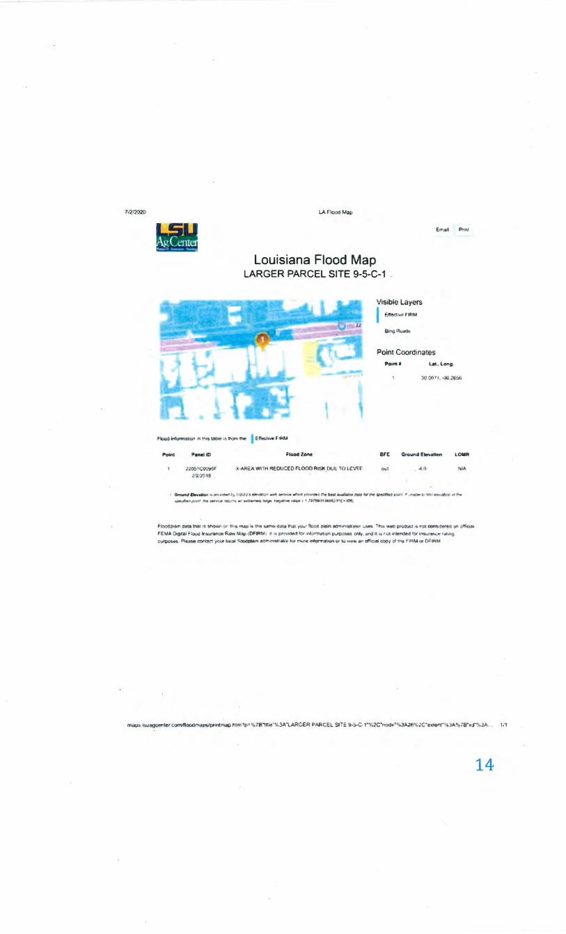
71712'020 LA r-IOO<J Map
Louisiana Flood Map LARGER PARCELSITE 9-5-C-1
Visible Layers I ., ............. F IRM
llor<j Ru.ad•
E.flbi •l P-.nt
Point Coordinates
"""". Ln. l.oniJ-
:lQ (j(tll, -',tO .~
Flood lnh:rrT\."IllQ!'I ~ ':\11.$ YOl!!! :tlrom thf! I E-rTecl.v. flRJ.t
Poll'tt P....,I ID
z:ro~ 1 CfJ Ct::t5F
~ ~·'J~ I B
FloodZ.....
)(.~ WITH RfOUCE D flOOO RISK.DU£ ~0 LCV£f
arE GJQund E~v-.IGft LOMM
•)UJ ...... o >t/A
t ~Dr••lob.l• • ••;n••'t""'·' ~ 1 1 :;..;:;-,~l'~~ .. f'...:.O~f'T'"'""'' ' .... o.if •••JetNo~'tv l"tl' ·~u~ ,. ""'l'Ct-t rf1r:TI •d~•r """
:--::f.-·1111_, 1'\e~e'"I'IC" 'W!.IM"• •• ••~ ~- ~"4 ·~ 1 I NJTI!Jj 11 .l4.Hirl' l • l('!llt;-
FIOQ.Il p&Ain 48101 L"l~1 tlii loJ'IOWf• 0 " u-., m _.., t.1he Wm4 ~a111 lhlll -,uw• 'l:x;O ;IUtJn _...,,.ntll8li..IJI '- loP. l twl ,.._,0 t•OU.uet .-. n~ .;:or.;N(i'~ II" cffio al
t::' E.V.A ()oaili F~ lr~n=e R.tw Uap (0F1At.A1 1t • pra'Ade1 frJ~•ntornat (VI J!\.!~ 1;1111 . e~ld ll • rwt •rtr.ndrd ~<Jr lnJUf"dllt;r llltfiQ
CUIW& ~!o • . i:lleoa• ~~ 'p'( :u r l tx::t~l ~:n oa<:.'f" ·n •titrilh:W 101' m.,.e •nhJr.,.-~on Qf i.U .,.,.._, tlr' af'tl;om,J cup·; oJ ff\1 F IH M ot Of:fH.U
ma o$ :,)U80"""'"' con\otiDOdi'"'L.YPI'ntmat> ntm?p- %7B1JIIe ..... 3A "lARGER PARCH SIT E 9-~·C· I "'J.I:l(; "nod•"~.l.AJ6"X: "ellten t"% JA'I;, 78••d.,.,3A.. \It
14
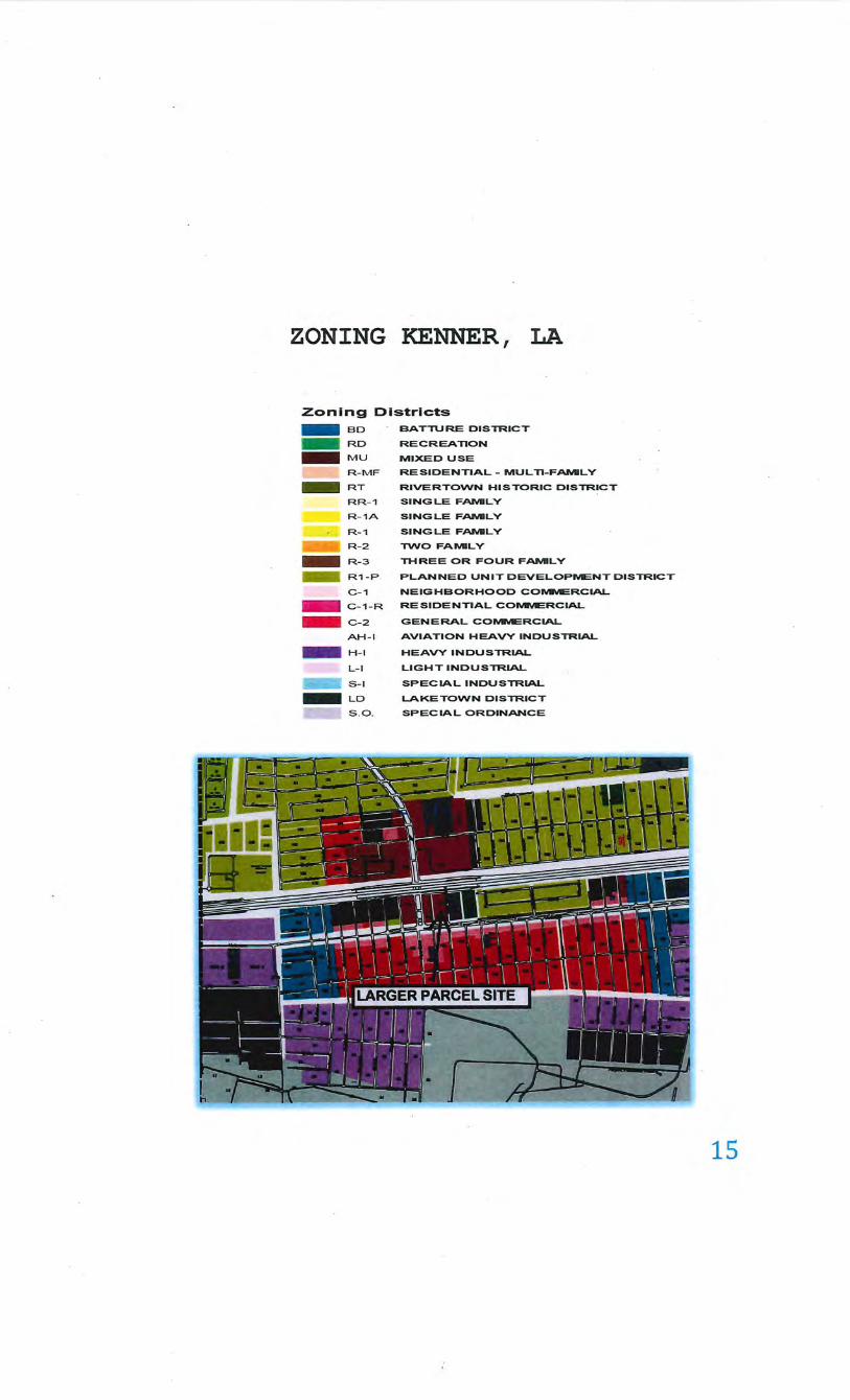
ZONING KENNER, LA
Zoning Districts
- BD BATTURE DISTRICT
- RD RECREAnON
- MU MIXED USE
R-MF --- RT
RR-1
R-1A
R- 1
R-2 ---- R-3
- R1-P.
C-1
- C-1-R
- C-2
AH-1
- H - I -- L-1
S-1 ----LD ---
S . O .
RESIDENTIAL- MUL Tl-F~LY
RIVERTOVVN HISTORIC DISTRICT
SINGLE F~LY
SINGLE F~LY
SINGLE F~LY
TVVO FAIIIIILY
THREE OR FOUR F~LY
PLANNED UNIT DEVELOPMENT DISTRICT
NEIGHBORHOOD COMMERCIAL
RESIDENTIAL COMMERCIAL
GENERAL COMMERCIAL
AVIATION HEAVY INDUSTRIAL
HEAVY I NDUSTRIAL
LIGHT INDUSTRIAL
SPECIAL INDUSTRIAL
LAKETOVVN DISTRICT
SPECIAL ORDINANCE
15
City of Kenner Ordinance No. 11,062 VI-113 Article VI Unified Development Code Zoning
(b) General Commercial ( C-2):
(1) Purpose: This district shall provide for the retailing of goods and the furnishing of
major services on a larger scale than the Neighborhood Commercial District. These
districts are generally located along major streets and at the intersections of major
streets and should expand in depth rather than strip-like extensions along major
streets. It is not the intent of this district to provide for any residential uses.
(2) Permitted Uses:
a.
b. c.
d.
e.
Any use permitted in a C-1 Neighborhood Commercial District
Reception Halls
Pool Halls
. Recreation Facility, Commercial
Recreation Facility, Public
f. Automobile, motorcycle, boat and trailer sales, new, used, and rentals (see Article XII, Section 12.11 Special Regulations for Automobile Sales Establishments: New, Used, and Rental)
g. Bars, nightc1~bs, and similar establishments: Such uses shall be located a minimum of three hundred (300) feet from any residential zoned district, church, school, public library, nursery, day care center or recreational facili,ties as
measured from the closest boundary line of the
residential zoned district or the closest
property line of the church, school, public
library, nursery, day care center,
recreational facility or premises licensed as
a barroom, nightclub, liquor store, lounge or
establishment offering or featuring exotic
dancers or dancing
h. Check Cashing Establishment
16
i. Funeral homes, mortuaries and undertaking establishments
j. Gas Station Minimart
k. Gas Station, Limited-Service
I. Hospice
m. Hotels and Motels
n. Veterinary clinic, small animal clinic (no open kennels are permitted on the premises).
o. Nurseries and Garden Centers
p. Educational Facility, vocational
q. Theaters
~ Pet Day Care Center
s. Drive-Thru Establishments
t. Children's Amusement Place
u. Tattoo Parlor
v. Bingo Halls, provided the following criteria are met to the satisfaction and approval of the head of the regulatory section of the public works department:
i. The bingo hall is not located within one thousand (1,000) feet of another bingo hall.
17
ii. The bingo hall will not have the propensity to downgrade the immediate neighborhood.
iii. The bingo hall will not produce any demonstrable noise.
~- The bingo hall will not generat~ significant vehicular or pedestrian traffic.
v. The bingo hall is not in close proximity to any residential district more restrictive than RM.
~- The bingo hall is not in contravention of any other regulations governing its location and operation.
w. Accessory buildings, such as warehouses and other uses customarily pertinent to the above uses when located on the same lot and
provided that Articles or materials are not stored in an open
area outside the buildings unless the area is enclosed within a solid fence of such height to adequately screen the area from public view.
(3) Conditional Uses:
a. Car Washes
b. Automobile Repair, Minor
c. Assisted Living
d. Places of Worship
i.Churches, temples, synagogues and other places of worship by organized religious sects which have a tax-exempt status granted by the United States Internal Revenue Service, provided such uses are located no less than three hundred (300) feet from any existing barroom, nightclub, l~quor store, lounge, and exotic dance land use, as measured in ~ straight line from the nearest point of the property line of the place of worship to the nearest point of the property line of the adult licensed premises.
18
ii. Residential uses, private school, recreational development, and
licensed adult care that are not normally associated with worship
are prohibited. Where a place of worship and/or the adult
licensed establishment are part of a multi-use development the
minimum distance requirement shall be a straight-line
measurement from the nearest point of the main entrance of the
place of worship to the nearest point of the main entrance of the
adult licensed establishment. The minimum lot area when combined or incorporated in a building of mixed use shall be consistent with the minimum lot area of the C-2, General .
Commercial District. The minimum lot area for freestanding places of worship shall be no less than ten thousand (10,000)
square feet.
e. Amusement Places
[ Hospital (PUD process) may be permitted but shall comply with the provisions and procedures of Section 6.03 (f) of this ordinance.
g. Pawnshop:
i. Upon review and approval in accordance with 6.03 (g) Conditional Use Permits Procedures, subject to, but not limited to the following requirements:
ii. No pawnshop use may be located closer thi:tn three hundred (300) feet from any parcel used or zoned for residential use. In addition, no pawnshop use may be located closer than one thousand (1,000) feet from any other pawnshop use. Distances shall be calculated in a straight airline measurement from the closest point of the lots upon which the structures are located without regard to intervening obstacles.
iii. In cases where an multi-unit building, criteria shall be entrance of the use.
establishment the distance
measured from
occupies a separation the main
iv. A maximum of one (1) pawnshop is allowed within any single commercial center.
19
v. At least fifty (50) percent of the public space in the store shall be dedicated to the display of items for sale.
vi. No outdoor display, sales, or storage of any merchandise shall be permitted.
vii. Sale or display of firearms is prohibited.
h. Retail Goods Establishment: Stores or shops, except adult book/video stores, for the conduct of a retail business exceeding twenty-five thousand (25,000) square feet of floor area may be approved by the City Council when they are satisfied that such an increase will not impact the intent of the district. Such stores or shops conducting retail business may conduct wholesale operations, provided that wholesale operations do not constitute more twenty- five (25) percent of their annual revenues.
also such than
gross
I. ·Existing nonconforming single-family dwelling, twofamily dwelling, three-family dwelling, and fourfamily dwelling may be enlarged, expanded, or altered, provided the following criteria are met:
i. The property owner must verify written documentation that the residential structure existed prior to December 4, 1978, or a change in zoning classification occurred after the structure was constructed .
ii. The applicant shall submit a notarized affidavit indicating the property has not been vacant for more than six (6) months.
iii. The applicant shall submit records from utility companies indicating usage for the past twelve (12) months for all meters on the property.
20
(4) Site Development Regulations:
a. Height: No building or structure shall exceed sixty-five (65) feet in height, except where structures abut a residential district or structure the height limitation shall be fifty (50) feet.
b. Area Regulations:
i. Front yard:
1) There shall be a front yard having a depth of twenty (20) feet
providing, however, that where structures located within fifty (50) feet on both sides of the proposed use have observed a
front yard line of less than twenty (20) feet, then the
proposed use may be located in line with tl1e most rearward
of d1e two (2) adjacent structures, but not less tl1a11 ten (10)
feet
21
HIGHEST AND BEST USE
Highest and Best Use is briefly defined as "that reasonable, legal and most probable use which would result in the greatest residual return to the land." Highest and Best Use is governed by economic, legal and physical utility.
In determining the highest and best use of a parcel of real property, two concepts are involved. The first is the highest and best use of land or site as though vacant and available to be put to its optimum use. Second. is the highest and best use of the improved property as a unit. These may differ somewhat at times when the improvements are not an appropriate use but do make a contribution to total property value in excess of the site value.
Highest and best use is defined as "The reasonably probable and legal use of vacant land or an improved property, which is physically possible, appropriately supported, financially feasible, and that results in the highest value. The four criteria the highest and best use must meet are legal permissibility, physical possibility, financial feasibility, and maximum profitability."
The definition applies specifically to the highest and best use of land. It is to be recognized that in cases where a site has existing improvements on it, the highest and best use may very well be determined to be different from the existing use. Implied within these definitions is recognition of the contribution of that specific property use to the community environment or to the community development goals in addition to the wealth maximization of individual property owners. Also implied is that the determination of highest and best use results from the appraiser's judgment and analytical skill.
In the context of most probable selling price (market value) another appropriate term to reflect highest and best use would be most probable use.
In the context of investment value an alternative term would be most profitable use.
The following tests must be passed in determining highest and best use:
1. The use must be legal. 2. The use must be physically possible, not speculative or conjectural. 3. The use must be financially feasible and profitable. 4. The use must be maximally productive.
22
The larger parcel site is zoned C-2, General Commercial The site contains 54,960 square feet and measures 458'along the wes~ side ofBessemer Street with a depth of 120'. Bessemer Street extends north from Veterans Blvd. and dead ends at Interstate 10. The size of the lot is sufficient for development with residential or commercial use. The larger parcel is are located at the corner of Veterans Blvd. and Bessemer Street. The frontage on Veterans Blvd. is 120' with 458' along Bessemer Street. The lots are oriented to Bessemer a side street. The immediate area of the larger parcel is developed with commercial businesses including, an adjacent motel, fast food, convenience stores, auto repair, restaurants, strip centers and office buildings etc. Furthermore, Veterans Blvd is a major thoroughfare in the area along with Loyola Drive. These two main arteries have been developed over the years with predominantly commercial development.
The Financial feasibility of the larger parcel would require minimal curative cost to prepare the site for development. There is an active market in the area for vacant commercial sites and this would be the mostly likely alternative for development. Along with the size of the site and its frontage to depth ratio would limit the development to a secondary type improvement such as a . strip center or office building etc. Residential development is possible but not likely due to its location and current development adjacent to the larger parcel site.
Based on the location, current zoning as well as the physical characteristics of the larger parcel site, the highest and best use for the property As Vacant is for commercial or office development.
The larger parcel site is presently unimproved and is used as a storage yard for the City of Kenner. The present use is not considered the most profitable nor productive use of the land. The highest and best use as improved would be for development with commercial or office type improvements. This is based on its location and physical attributes.
23
DISCUSSION OF THE APPRAISAL PROBLEM
According to the legal description and maps provided by LADOTD, the required construction servitude consists of approximately 615.1 square feet of property located on the west side of Bessemer. Street. The site is currently vacant and is used. for storage of equipment for the City of Kenner. The highest and best use is for commercial development.
Type of Acquisition:
The required right-of-way needed for the improvements to I-10/Loyola Interchange involves the rental of a construction servitude for a four ( 4) year lease period. The required parcel area of 615.1 square feet will return to the owner after completion of the project. It is assumed by the appraiser that all necessary steps will be applied to put the parcel area back to its current condition as before the servitude lease.
THE APPRAISAL PROBLEM
The appraisal problem is solved by effective application of the Appraisal Process, a logical framework ofthree steps common to the appraisal of real property as well as to scientific research and economic analysis, in general.
The steps are: 1) Definition ofthe problem 2) Data Collection 3) Analysis and Conclusion
The definition is necessary to identify the unique realty interests considered, establish the date of appraisal, set forth the appraisal objective and clearly state the type value under consideration, together with conditions and assumptions, if any. Data collection must be properly focused and successfully collected in order to produce accurate and representative information from objective, unbiased sources.
Analysis and conclusion entail the application of various economic techniques together with appraisal judgment in consideration of pertinent data, producing a final objective unbiased conclusion for the real estate that is the subject of this appraisal report.
24
GENERAL LOUISIANA & CITY DATA
Louisiana is located in the southern United States, on the Gulf of Mexico and the Mississippi River. Louisiana is richly endowed with such nonrenewable minerals as oil, natural gas, sulfur, and salt. In addition to mining, the state has flourishing agricultural, lumbering, and fishing industries. These activities provide the basis for much of the manufacturing in Louisiana. Baton Rouge is the capital of Louisiana. New Orleans is the largest city. A succession ofNative American cultures occupied the area of Louisiana beginning as long as 12,000 years ago. Many were local societies sustained by hunting and gathering or subsistence agriculture, but others, such as the Poverty Point Culture centered along Bayou Macon in northeastern Louisiana, had regional influence and trading networks. The French were the original European colonizers of Louisiana, beginning in the early 18th century. After a period of Spanish control, it reverted to France. During this colonial period other European and African cultures were introduced into the area. Most of Louisiana was bought by the United States in 1803 as part ofthe Louisiana Purchase; the rest came as a result of the West Florida Rebellion of 1810. Louisiana entered the Union on April30, 1812, as the 18th state. Initially, in the colonial period, the locality was known as Louisiane. This name was given by the French explorer Rene-Robert Cavelier, sieur de La Salle, who journeyed down the Mississippi River in 1682 and claimed a vast area for France, naming it for the French king, Louis XIV. The Spanish version of the name was Luisiana. From these forms evolved the present name of Louisiana. The most popular nickname for Louisiana is the Pelican State, after the native coastal bird. Other nicknames are the Creole State, after the descendants of early French and Spanish settlers, and the Bayou State, for the many lush, slowmoving waterways found in the state. Louisiana, which ranlcs 31st in size among the states, covers 49,650 square miles, including 4,153 square miles of inland water and 1,931 square miles of coastal water over which it has Jurisdiction. It has a maximum length, from north to south, of about 275 miles and a maximum width of about 300 miles. Elevations range from 8 feet below sea level, at New Orleans, to 535 feet above sea level, at Mount Driskill, in northwestern Louisiana. It has an average elevation of only about 100 feet and is one of the three lowest states.
The climate of all the major regions of Louisiana is characterized by short mild winters and long, hot, and generally humid summers.
Average January temperatures range from less than 46° in northwestern Louisiana to more than 55° in the southeastern delta country. Temperatures in below 0° have been recorded, but prolonged periods of cold weather are extremely rare. July averages are in the lower 80°s throughout the state. Daytime highs are rarely more than 95°, but the constantly high relative humidity causes some discomfort. In the coastal areas the high temperatures and relative · humidity are tempered by cool breezes that blow inshore from the Gulf. Nighttime lows are generally in higher 70°s during much of the summer.
Total annual precipitation, mostly in the form of rain, ranges from about 48 inches in northwestern Louisiana to more than 60 inches in the southeast. Snow, ice and hail are rare in Louisiana. Thunderstorms are frequent in July, which is the wettest month, and tropical storms and hurricanes sometimes strike the coast, usually between July and September. Droughts are seldom severe. Ice storms are an infrequent but dangerous event.
25
SURROUNDING AREA DATA
The State ofLouisiana is divided into four (4) distinctive geo-economic areas. The economy around Lake Pontchatrain and New Orleans is primarily influenced by tourism and the import/export industries. The area west ofNew Orleans extending to Lake Charles and north to Baton Rouge is economically driven by the petrochemical and oil/gas exploration and production industries. The central portion of the state is primarily involved in agri-business, while north Louisiana relies on both agricultural and manufacturing for its economic development.
South Louisiana is a region of diverse people and industries. Geographically, it ranges from farm and pastureland to busy city landscapes. The economy ranges from the farming and cattle · industry to modem industries attracted to the by abundant supplies of raw materials, energy sources, transportation facilities and skilled labor. The Port of Baton Rouge, a deep-water port, is a leading exporter in the United States, while the Port of Iberia and Morgan City are manufactures of offshore oil/gas drilling rigs and production platforms. Agriculture and forestry accompany heavy industry along the path of economic progress. South Louisiana is important as a soybean, rice, fur, fish and forestry center, as well as a petrochemical hub.
Area analysis is a review of the relevant historic, geographic and political data that collectively influences the larger parcel. No appraisal adequately supports its conclusion without consideration of the applicable historic and geographic data, or the economic character of the area of influence within which the larger parcel real estate is located. This discussion includes some elementary data of interest about the State of Louisiana, some demographic data specific to the state, the region, the parish and the city, and data about the oil and gas industry and the impact that industry has had on the regional economy. A conclusion is reached concerning the geographic area of influence and the economic potential of the markets affecting the property appraised.
The real estate that is the larger parcel of this value analysis is located in the southern part of the State of Louisiana, which is centrally located in the Southeastern United States on the northcentral shore of the Gulf of Mexico. The State of Louisiana was created out of the Louisiana Territory which was ratified by the United States Senate October 19, 1803, and the territory was formally received into United States possession on December 20, 1803. Louisiana's first state constitution was adopted on January 22, 1812, and the state was formally admitted as the eighteenth state of the union on April30. 1812. The state capital is Baton Rouge.
The original Louisiana Territory stretched from the Gulf of Mexico to Canada; it included approximately 900,000 square miles, or 576,000,000 acres, and all or part of thirteen states. The State of Louisiana has a north/south dimension of+/- 280 miles, and an east/west dimension of +/- 300 miles; its land area is approximately 44,521 square miles, which ranks it 31st among the states in size. It is roughly divided into three geographic regions, the features of which are controlling factors in the uses of the land. The regions are the Mississippi Floodplain and Coastal Marsh to the east and south, the Upland Terraces of South-Central Louisiana, and the Hills region ofNorthwest Louisiana. Geologic forces that created these regions also influenced the makeup of the soils and the character of the land in each region, arid in a general way determined the subsequent land uses throughout the state.
26
Louisiana's climate is humid subtropical; the summers are warm, the winters are mild, and abundant precipitation is well distributed throughout the year. South Louisiana has fewer temperature extremes than North Louisiana and consequently experiences a much longer growing season. The average annual temperature for South Louisiana is 68.5F; along the coastline the temperature rarely climbs to 100 degrees or drops below 32 degrees. The average annual rainfall is 60" in the region southwest ofNew Orleans to a low of 48" in the northwest region of the state around Shreveport; the average maximum rainfall is 6.7' during July, and the average minimum rainfall is 3.6" during October. The length of the growing season within the state ranges from 350 days in the Delta region south of New Orleans, to 220 days in the higher elevations of North Central Louisiana. The 1990 census showed the Louisiana population to be 4,219,973 --an increase of only 0.33% over the 1980 census, which ranked Louisiana 19th among the states. The current population density is 94.78 persons per square mile.
The largest geopolitical subdivisions in Louisiana are called "parishes"; the geographic counterparts in all other states in the Union are called counties. Parishes are so named because the original divisions ofthe state coincided with the ecclesiastical jurisdictions of Roman Catholic · Church, which are "church parishes". Louisiana's geopolitical subdivisions are listed below.
The Impact of the Oil & Gas Industry Oil and gas production has been established in all 64 Louisiana Parishes. Crude oil was first produced in 1902; natural gas was first produced in 1905. As ofDecember 31, 1990, 190,005 wells had been drilled in Louisiana; 85,557 were oil wells, and 71,610 were dry holes; 37,342 wells continue to produce. The severance tax contribution to the state treasury was $971,677,000.00 in 1982; it was $414,887,000.00 in 1990. The reduced collections have caused severe cutbacks in state services, and an increased tax burden for all Louisiana citizens.
Baton Rouge is second largest city in Louisiana and the only majormetropolitan area in East Baton Rouge. It is the center of the Oil and Gas industry in Louisiana. Sometimes between the beginning of the third quarter of 1989 and the end of the first quarter of 1990 the size of the workforce in the Baton Rouge MSA grew significantly and there was increased activity in both residential and industrial construction in Jefferson Parish. During the same time period, the world price of crude oil began increasing; 2000 ended with the U.S. average price being+/$30.00 per barrel. It appears that Louisiana business is continuing its romance with the oil and gas industry. Louisiana is located in the western third of the Southeastern United States, and has access to regional markets by interstate highway, air and water transportation. The state economy is slowly improving after six years of decline. The gains being made in the workforce population are at least in part attributable to resurgence in the oil and gas industry. The Acadiana region of the state has recovered from the declines created by the collapse ofthe oil and gas industry and the banking and construction industries in 1984-1989. The process of improvement began sometime during the interval between the beginning of the third quarter or 1989 and the end of the first quarter of 1990. The A cadi ana economy led the state in growth through the ninety's decade and into the new millennium. The growth and prosperity have continued through this year.
27
JEFFERSON PARISH
Jefferson Parish, Louisiana was established in 1825 and was named in honor of Thomas Jefferson, commemorating his role in purchasing the Louisiana territory from France in 1803 . The Parish originally extended from present day Felicity Street in New Orleans, Louisiana, to the St. Charles Parish line. As Orleans Parish grew, it annexed from Jefferson Parish such established areas as the Garden District, Lafayette, Jefferson, and Carrollton. The present boundary was set in 187 4, and in 18 84 the seat of Parish government was transferred to the West Bank, Gretna, where it has remained.
Once a largely rural area of farms, dairies and vast tracts of undeveloped land, Jefferson Parish today is New Orleans' first suburb - a bedroom community west of the city that received the first great migration of middle-class .families from the 1950's to the 1970's.
The parish's largest community is Metairie, an unincorporated area that comprises almost all of East Jefferson. Smaller unincorporated areas include River Ridge and Jefferson. Jefferson Parish is divided by the Mississippi River into the West Bank and East Bank areas. East Jefferson cities include Kenner and Harahan, while Gretna, Westwego, and Lafitte are in West Jefferson.
28
ROADWAYS &RAILWAYS
ROADWAYS ..._.,.. __ .. "" __ _ p_ .. _..,._ .. __ ""''l"t~·-SAIA U~ Cron Road c . ... ~ Do-iS~---~~ F..:!Eo Raa-ay Souttoeastern l\4ooor Uneo lnp le G l-•
\J '"·~ \
' ' ..... ~#.,....,
-- -- - ~ ~--- --.... -::. ~~ ~ -~ ¥!~~~ ~~ ,. .. , ...
..
RAILWAYS
..... ---~ . ' ~ ' ~_..... . - - - -..::::::.- ..;.'\. - ~ j I __,...- ... . j • ' ...... . I
. - - • 4 ' ,. ' 't , . ' ... . e t\ \ '_.,........., '•
.·
·.
' .
.!5
······· ·· .. .. .... .... :
t.b1 (ry
····· ··.New O~ea-n~
·"''"' w.-
....... ... . et .li~
29
WATERWAYS & PORTS ,....,.,. • .,.. c ~ IOCntdllft,..hMnOI' ... ...,...~..,.~~~"'"'-*"" _._., __ ....,._ _____ , ___ . _.,. _____ ... ___ _
1,.._., __ , '"-~ s-"'-- -._~ =~-- 4 ....... ~ li.._._.... ·---
~1
~ .. l. -- .. 1~ ~~.
-t- 1-.. ~ "" '' •: r
New Orleans .- t· l,......r' l t •·
• .. v ~ G..t, ·· • n· ' ''
~ , .... (. Qi f ln! ll'U~·. f!J"
•,•,· ·::-:J \-'! 7~: ::.
,.,..,,_ .... .. ... ~!~:·.~~: ..
G~-• r
;;l',
~ J I '
Approximately 27.9% of the parish population and 33 .1% of the MSA population, ages 25 or older, have a bachelor's degree or higher compared to approximately 23% for the State of Louisiana. Approximately 84.5% of parish residents ages 25 and older have at least a high school diploma or equivalent. 30.8% of parish residents, ages 25 or older, have an associate degree or higher. ESRI Estimates Jefferson Parish's 2018 Population as 436,359 persons, making Jefferson Parish one of the most populated parishes
Kenner
The City of Kenner is the 8th largest city in Louisiana with a population of 66,364 as of July 1, 2019. Kenner ranks in the upper quartile for Population Density and DiversitY Index when compared to the other cities, towns and Census Designated Places (CDPs) in Louisiana The primary coordinate point for Kenner is located at latitude 29.9941 and longitude -90.2417 in Jefferson Parish. The formal boundaries for the City of Kenner encompass a land area of 14.87 sq. miles and a water area of 0.24 sq. miles. Jefferson Parish is in the Central time zone (GMT-6). The elevation is 0 feet.
The City of Kenner) has a Cl Census Class Code which indicates an active incorporated place that does not serve as a county subdivision equivalent. It also has a Functional Status Code of "A" which identifies an active government providing primary general-purpose functions.
30
KENNER NEIGHBORHOOD ANALYSIS
Definition:
A neighborhood may be characterized by such uses as residential, commercial, industrial,
recreational, agricultural, cultural, and civic activities, or a mixture of these uses. Analysis of the
neighborhood in which a particular property is located is important due to the fact that the various
economic, social, physical, and political forces which affect that neighborhood also directly
influence the individual properties located within it. A discussion of these various factors as they
affect the value of the larger parcel is presented as follows:
Population, Employment, and Economic Trends:
The Kenner economy is experiencing an average economic growth compared to the other areas of
Louisiana. This part of Kenner is one of the areas experiencing a steady growth, as is the southern
portion of the parish.
Location and Boundaries:
The larger parcel is located in the northern portion of Jefferson Parish. This is a steady growing area
with commercial activity situated near major intersections.
The neighborhood boundaries are selected by the appraiser to delineate the geographic area to be
studied and analyzed with regard to the four forces that create, maintain, and destroy the value ofthe ·
property appraised. Larger parcel neighborhood is considered as good corridor.
Characterization:
The surrounding area where larger parcel is located is composed of commercial properties. There
is some residential and some vacant land along the roadways. This corridor is a mix of commercial
and light industrial facilities including retail, strip shopping centers, convenience stores with gasoline
pumps, auto repair shops, branch banks, fast food restaurants, etc. There are some established
subdivisions in the area.
31 .
Geographical Features:
The surrounding land features are fairly level with adequate drainage. The area has not experienced
any negative influences from the surrounding geographical features.
Access, Transportation, and Linkage:
Access to other areas may be accomplished via 1-10, Veterans Blvd and US 61 and other local
connecting Parish and state roads. The larger parcel neighborhood is adequately located for access
to highway linkage. This area is close proximity to the New Orleans Airport.
Municipal Services:
Sewer service is provided by the city of Kenner. Electricity, natural gas, water, telephone and cable
are provided by regulated utility companies such as Entergy & Demeo (electricity) and ATT
(telephone), with local cable providers.
Police protection is provided by the parish Sheriffs Department and Louisiana State Police, while
fire protection is provided by the parish fire departments.
Amenities and Support Facilities:
Within the larger parcel neighborhood area are the typical amenities and support facilities found
in most residential areas, such as groceries, bank branches, gas stations, restaurants, etc.
32
MARKET DATA APPROACH COMPARABLE SALES & ESTIMATE OF LAND VALUE
The estimate of value of the larger parcel takes into consideration physical features, geographic, economic, and social factors. Consideration is given to trends and other factors having a bearing on value of the larger parcel as determined by the market.
The estimate of value is based on the highest and best use of the larger parcel which is as commercial property. The property is located in a residential subdivision and is subject to the subdivision restrictions.
LAND VALUATION
Site Valuation Using the Market Comparison Approach
The most accurate method of site valuation is the Market Comparison Approach. This technique calls for comparing, weighing and relating sales data to the hmd being appraised. Greatest weight is placed on actual sales of similar land made at times relatively current with the date of the appraisal and under comparable conditions.
The Market Approach is based on the principle of substitution; that is, the upper limit of value of a property tends to be set by the cost of acquisition of an equally desirable substitute, providing there are no costly delays effecting the substitution.
Sources of Data
Clerk of Court Records LDOTD Right of Ways Maps Construction Plans Appraiser's File Records
FEMA Flood Zone Data
.· Units of Com paris on
Ownership Title Reports Multiple Listing Services On-site Inspection of the Property
Discussions with real estate brokers, other appraisers, and the Jefferson Parish courthouse revealed several transactions that were directly comparable to the larger parcel. Pertinent information on each sale was collected and is presented in detail in this section of the report. Individual sales were compared to ascertain the differences in the unit price paid relative to the financial, physical, and market conditions affecting the value of each property. The unit of comparison that best correlates to this type of property is the sales price per square foot of land area.
33
SUMMARY OF LAND SALES
Sale Date Consideration Size . $Per Sq. Ft. Zoning
1 01/18/19 $1,250,000 61,921 sf $20.19/sf C-2 Commercial
2 04/24/18 $856,000 47,250 sf $18.12/sf C-1 Commercial
3 04/06/18 $6,500,000 320,625 sf $20.27/sf C-2 Commercial
4 02/01/17 $718,000 70,125 sf $10.24/sf C-2 Commercial
5 11/02116 $1,380,000 38,250 sf $36.08/sf C-2 Commercial
6 05/12116 $350,000 25,500 sf $13.73/sf C-2 Commercial
7 10/20115 $3,300,000 97,625 sf $33.80/sf C-2 Commercial
Larger 06/30/20 54,960 sf C-2 General Commercial Parcel
-
The above listed comparable sales were found through research of the large parcel market area. Comparable Sales 1, 2, 4 and 6 were selected for comparison to the larger parcel and were considered to be the most similar in characteristics for this analysis of land value.
34
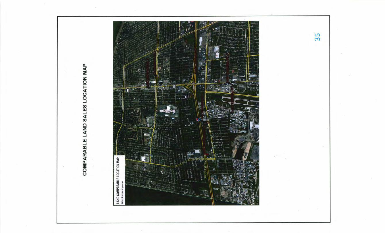
a. <C :! • z 0 i= <C 0 0 ...J t/) w
·~ t/)
c z :5 w ...J m t:! <C a. :! 0 0
lf)
M
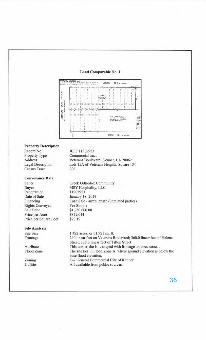
Land Comparable No. 1
E£RSON PARISH.· LA • .• •.. .• HElENII sr. 9 ·· , .. , <" ;';.~~--~ ... ~~~,:;., •~ ·;::v;;,.~·;:,:;,';;,;{.,:';,:~, ; •, M I
Property Description Record No. Property Type Address Legal Description Census Tract
Conveyance Data Seller Buyer
. Recordation Date of Sale Financing Rights Conveyed Sale Price Price per Acre Price per Square Foot
Site Analysis Site Size Frontage
Attribute Flood Zone
Zoning Utilities
f.
'· ;;
§i ill
"' ~ ~
...... , . ... :_~ 1 .~:· ·~;-~ . .----, -~.:: · c.: r-.·=- ~ .!~ :r ~·• ::·
! I I i I i I ! I i I I I I I I I I ! I I I I i ! 1St-A I I I I ~ , 1· 1 rr':.:~~-~~-~-~~ 1 1
I I I I i I I I i I
I I I I I I I I I I I I
"'· 1"·· ; ; ;·. I ~~'· k ·. '"''· I'·"· lc:£. k-' ft'; I='·' I•''" 1-c · :a•. l -'· 1.:< 1 . .:. i ''"
~
I I I l I I I I i I I I I I I •· ~H~ ;· :?-4 ::~ !-~ J.!;:~ :~- :-:~ +-~~ 1:.:- ' '"~~ I .... . I :. · · I .:t· ~ ., ~ - I ., . ! - - ' , • . I .. :•
I I I i ,., · "'·I,., I'" 1·.,,. · ' ·'' · :•-1 . . ,.,
I I I I I '~
I I I I I I I I I
···~.1 l
~:.- I ,'.' I ::• , :,.
t:.r' ---.:•
JEFF 11902953 Commercial tract
u.r :~ .,_,~., :"4 " /.1>1~ / Iii tM1 J,J >, I(J.~ :-. f t
'"" 'J 1111~ .. .":4!~1 :"1 .•• t<>r t tTJ .r. •Ms.,. n.
nFTON ST. ~o· 1\ ... .:c I' .....
Veterans Boulevard, Kenner, LA 70062 Lots 15A of Veterans Heights, Square 134 206
Greek Orthodox Community MSY Hospitality, LLC 11902953 January 18, 2019
1-;.:·;·:
~ ~~; i ::;:,;. \ }~-~
1.:~:-:
Cash Sale- arm's length (unrelated parties) Fee Simple $1,250,000.00 $879,044 $20.19
1.422 acres, or 61,921 sq. ft. 240 linear feet on Veterans Boulevard; 360.0 linear feet of Helena Street; 128.0 linear feet of Tifton Street This comer site is L-shaped with frontage on three streets. The site lies in Flood Zone A, where ground elevation is below the base flood elevation. C-2 General Commercial City of Kenner All available from public sources.
36
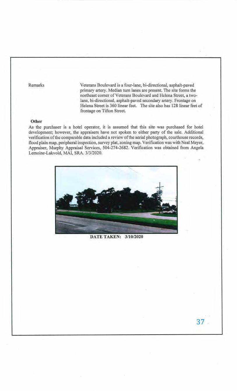
Remarks
Other
Veterans Boulevard is a four-lane, bi-directional, asphalt-paved primary artery. Median turn lanes are present. The site forms the northeast corner of Veterans Boulevard and Helena Street, a twolane, bi-directional, asphalt-paved secondary artery. Frontage on Helena Street is 360 linear feet. The site also has 128 linear feet of frontage on Tifton Street.
As the purchaser is a hotel operator, it is assumed that this site was purchased for hotel development; however, the appraisers have not spoken to either party of the sale. Additional verification of the comparable data included a review of the aerial photograph, courthouse records, flood plain map, peripheral inspection, survey plat, zoning map. Verification was with Neal Meyer, Appraiser, Murphy Appraisal Services, 504-274-2682. Verification was obtained from Angela Lemoine-Lakvold, MAl, SRA. 3/3/2020.
DATE TAKEN: 3/10/2020
37 .
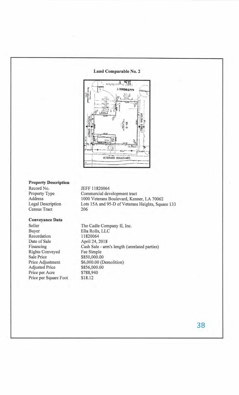
Property Description Record No. Property Type Address Legal Description Census Tract
Conveyance Data Seller Buyer Recordation Date of Sale Financing Rights Conveyed Sale Price Price Adjustment Adjusted Price Price per Acre Price per Square Foot
Land Comparable No.2
-~~ ;'. ---~ ~:~ ll'lit r<SI~T0§ 1(1 f."3 i!.it ) - ---. 1-- c . (
_ r '--- ___ _._ <-,--- l ·-l:B0~~9C) ~·--,~ ; ; ~ . I ··.,\ l· ~.'::~~ I .r·. __ .> .- :2 7 \ :{/ l .. ... , ... ; ' .. , . ' "'. , . ., . "" -----............,.. .. [I I
' - . - --2~- - -~ . , I::OU.<Y.: ·, • :-.
• ~ - - ,.,.!.., :::·, . -,~f.'---' . ··.fl. l I ;;- ~~f.4 -:~ d ---!~ i.: I
1, ' ~ ·'l:r: l I • ~ ~ . )> 5 .... .,. -!""~ 1 r.; ; C~ ft 'it • ~I z ~,. 1 =~ (Q ~. > r ~ ~ lll__ ;~e 'f' 81 "' 1-
J.>- jrii~ ~: 0 ~~ '
1 tn !-; ~ ':: ' f'Tl II I ~ j ·~ I I ...,
, ::: I.Ji~~~- I I il ·~d .. "'"'":'.' ~ · ~ } II t· . . 1 ~000' }/t .,-F-- -=-----..·..~ : _ ~ : . ... . ··- .... ~~~.. r- . ·-.;....,. - --- " ,...:!. r-""'·- - ~ . ..,.l., -
' --L" ' · ·. I ---r~-- VE~~ii ;;ULEVA~-;-.=-_j__. '-·:, - J
JEFF 11820064 Commercial development tract 1 000 Veterans Boulevard, Kenner, LA 70062 Lots 15A and 95-D ofVeterans Heights, Square 133 206
The Cadle Company II, Inc. Ella Rolls, LLC 11820064 April 24, 2018 Cash Sale- arm's length (unrelated parties) Fee Simple $850,000.00 $6,000.00 (Demolition) $856,000.00 $788,940 $18.12
38
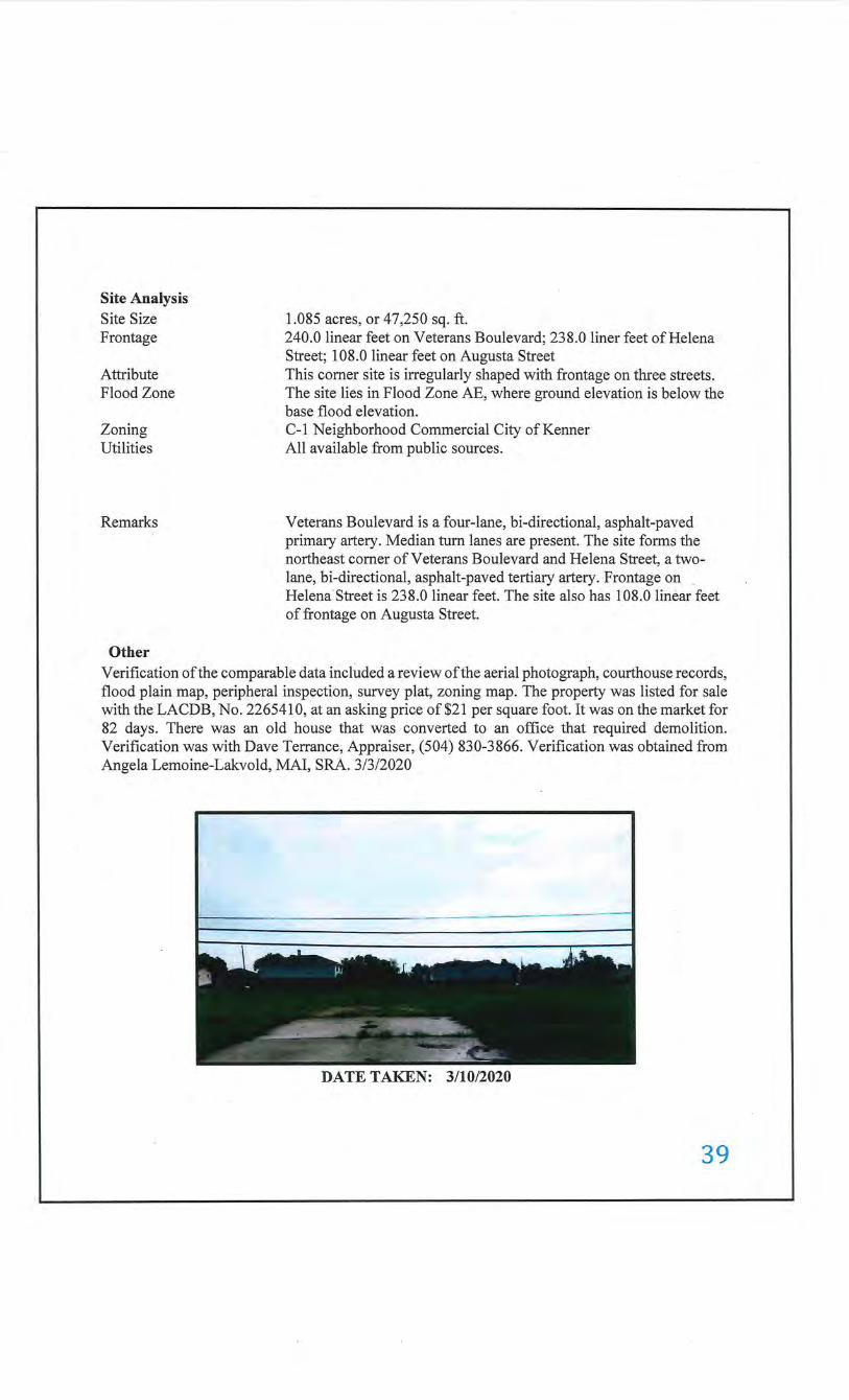
Site Analysis Site Size Frontage
Attribute Flood Zone ·
Zoning Utilities
Remarks
Other
1.085 acres, or 47,250 sq. ft. 240.0 linear feet on Veterans Boulevard; 238.0 liner feet of Helena Street; 108.0 linear feet on Augusta Street This comer site is irregularly shaped with frontage on three streets. The site lies in Flood Zone AE, where ground elevation is below the base flood elevation. C-1 Neighborhood Commercial City ofKenner All available from public sources.
Veterans Boulevard is a four-lane, bi-directional, asphalt-paved primary artery. Median tum lanes are present. The site forms the northeast comer of Veterans Boulevard and Helena Street, a twolane, bi-directional, asphalt-paved tertiary artery. Frontage on Helena Street is 238.0 linear feet. The site also has 108.0 linear feet of frontage on Augusta Street.
Verification of the comparable data included a review of the aerial photograph, courthouse records, flood plain map, peripheral inspection, survey plat, zoning map. The property was listed for sale with the LACDB, No. 2265410, at an asking price of$21 per square foot. It was on the market for 82 days. There was an old house that was converted to an office that required demolition. Verification was with Dave Terrance, Appraiser, (504) 830-3866. Verification was obtained from Angela Lemoine-Lakvold, MAl, SRA. 3/3/2020
DATE TAKEN: 3/10/2020
39
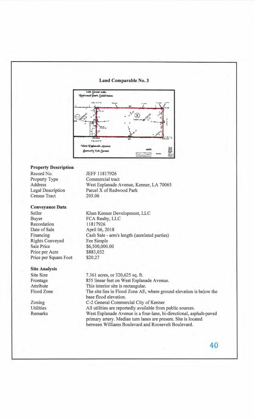
Land Comparable No. 3
3•11h &rrd (!.i.fe)
~"'"""" ~ 5""'fr>ioi011
l .. ~ •0.):"• .. _~_i
f'\ i'
··--- ··- ,--1. J ~-~ a ~
~H ' .y r.:) {: ."? '
\';:_~~:1-~i -:--:!~~.----
.·~ ~ ,f\ . •1!1 ~ ' ·~·,~'· c; -------;~~ii :.
Property Description Record No. Property Type Address Legal Description Census Tract
Conveyance Data Seller Buyer Recordation Date of Sale Financing Rights Conveyed Sale Price Price per Acre Price per Square Foot
Site Analysis Site Size Frontage Attribute Flood Zone
Zoning Utilities
· Remarks
o•·
i:W<'SI II:spf..,al• A,-...,~•
lf""'"""y 3Sih Slrnll
JEFF 11817926 Commercial tract
\ \ p'·' ,, __...._
..11:0:.
.-- - :::::::==:::J
·n • • ..til
• _,.,.-.... lil t
.r ....., ~ ·~
-· -.
~I
West Esplanade A venue, Kenner, LA 70065 Parcel X of Redwood Park 205.06
Khan Kenner Development, LLC FCA Realty, LLC 11817926 April 06, 2018 Cash Sale- arm's length (unrelated parties)
.Fee Simple $6,500,000.00 $883,032 $20.27
7.361 acres, or 320,625 sq. ft. 855 linear feet on West Esplanade Avenue. This interior site is rectangular. The site lies in Flood Zone AE, where ground elevation is below the base flood elevation. C-2 General Commercial City of Kenner All utilities are reportedly available from public sources. West Esplanade Avenue is a four-lane, bi-directional, asphalt-paved primary artery. Median tum lanes are present. Site is located between Williams Boulevard and Roosevelt Boulevard.
40
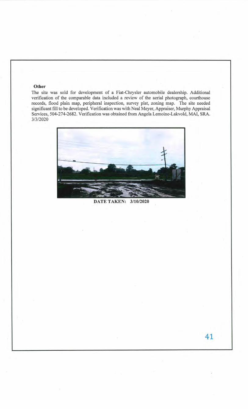
Other The site was sold for development of a Fiat-Chrysler automobile dealership. Additional verification of the comparable data included a review of the aerial photograph, courthouse records, flood plain map, peripheral inspection, survey plat, zoning map. The site needed significant fill to be developed. Verification was with Neal Meyer, Appraiser, Murphy Appraisal Services, 504-274-2682. Verification was obtained from Angela Lemoine-Lakvold, MAl, SRA. 3/3/2020
DATE TAKEN: 3/10/2020
41
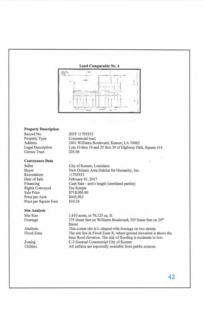
Property Description Record No. Property Type Address Legal Description Census Tract
Conveyance Data ·seller · Buyer Recordation Date of Sale Financing Rights Conveyed Sale Price Price per Acre Price per Square Foot
Site Analysis Site Size Frontage
Attribute Flood Zone
Zoning Utilities
Land Comparable No.4 I :r.• . .r. ~l l
I
I :~~;~· '" '•" ·' '''"· ''"•' ... ------.... --- {.-....,.........-·.·,- r:·! .. -: . , - , ,...... I
I .: •:; ·. ' . . .' . ~
"'· . ' 1 I ' ! 1 1r. 1 ·, ~ I ~ I 1 o l o r:,
. ~-:-=:--:~-: -~ :·~ · - .. ·,..=_~~~ : ·--:. :; -. -; ·:- __::
~l'!i f ·" ~ ·t Tl 'i'1
".
~-~ - - ~--~~~) . ~ --J_! 1 . -~ ! --
JEFF 11705553 Commercial tract 2401 Williams Boulevard, Kenner, LA 70062 Lots 10 thru 16 and 25 thru 39 of Highway Park, Square 414 205.06
City of Kenner, Louisiana New Orleans Area Habitat for Humanity, Inc. 11705553 . February 01,2017 Cash Sale- arm's length (unrelated parties) Fee Simple $718,000.00 $445,963 $10.24
1.610 acres, or 70,125 sq. ft. 375 linear feet on Williams Boulevard; 255 linear feet on 24th Street. This comer site is L-shaped with frontage on two streets. The site lies in Flood Zone X, where ground elevation is above the base flood elevation. The risk of flooding is moderate to low. C-2 General Commercial City ofKenner All utilities are reportedly available from public sources.
42
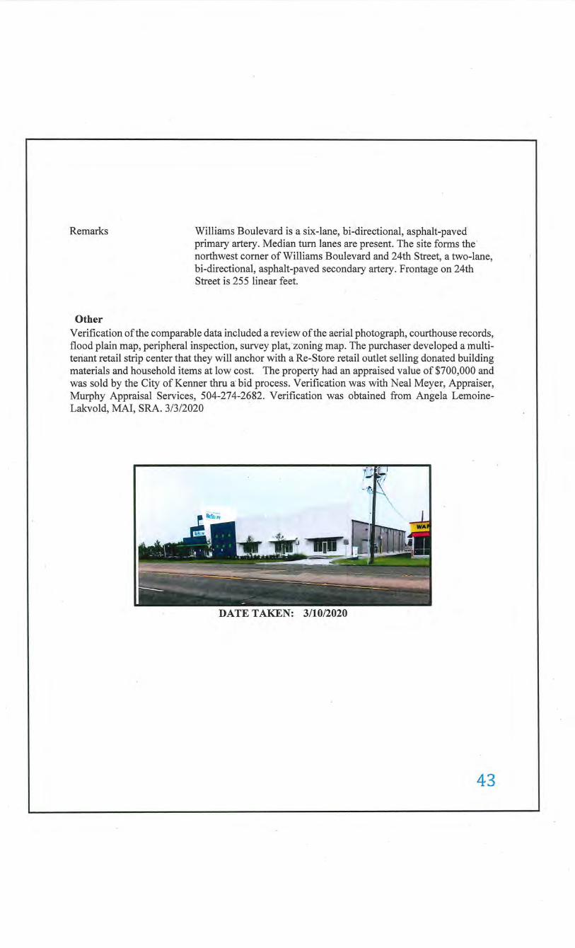
Remarks
Other
Williams Boulevard is a six-lane, bi-directional, asphalt-paved primary artery. Median tum lanes are present. The site forms the · northwest comer of Williams Boulevard and 24th Street, a two-lane, bi-directional, asphalt-paved secondary artery. Frontage on 24th Street is 255 linear feet.
Verification of the comparable data included a review of the aerial photograph, courthouse records, flood plain map, peripheral inspection, survey plat, zoning map. The purchaser developed a multitenant retail strip center that they will anchor with a Re-Store retail outlet selling donated building materials and household items at low cost. The property had an appraised value of $700,000 and was sold by the City of Kenner thru a bid process. Verification was with Neal Meyer, Appraiser, Murphy Appraisal Services, 504-274-2682. Verification was obtained from Angela LemoineLakvold, MAl, SRA. 3/3/2020
. DATE TAKEN: 3/10/2020
43
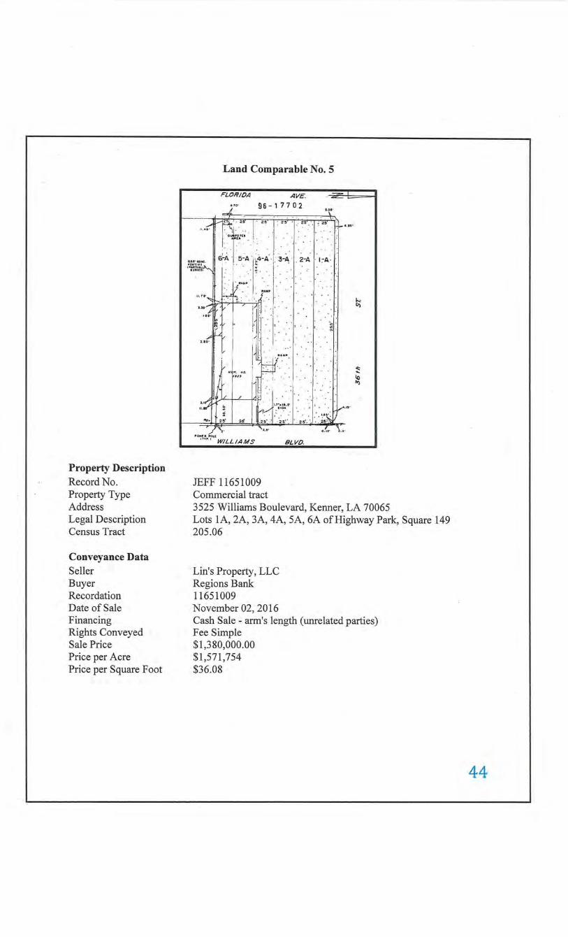
Property Description Record No. Property Type Address Legal Description Census Tract
Conveyance Data Seller Buyer Recordation Date of Sale Financing Rights Conveyed Sale Price Price perAcre Price per Square Foot
Land Comparable No. 5
FLORIOA AVE.
,,. 96-17702
1--::tr, I , I , I , I , .... f I . g I"H'U 1
5 ,01'
\
.. '
6~A. 5-A . ·4-A· I' 3-A 'I 2-A I I~A· II'CIDTUU • I , 110 ""'w"'(ji • , IIIAJITI•U. "'
""'"' 1 . . . : . ~ ... . ~ ·.· . . 11 ... .
. '"'"' . 11 . 15' . .• . .
I . ., ..... ~ . .1'1: i'
I, ~ , , . . L ~ · jL{ I r · N
'·"'II L :~· : · v . I ! ! : . . """"' . . I I .. :.·.' ·. · ·.
"'(;· .. . . ·.,· .
ufftfl"' ) )td~ ""'•' / .. , . ... I'J -,,.. u.a : . : ,,~,. . · . . , . . •.u: W""
.... .;. 25 .• ~ . ·J .. ~ ... : .••.. · .. · . .'.2~ ~ -- • '1.11' ~- b .5'
"0"£ 11 ~ou
'""·' WILLIAMS
JEFF 11651009 Commercial tract
BLVO.
k li)
"" .. 10 IW)
3525 Williams Boulevard, Kenner, LA 70065 Lots 1A, 2A, 3A, 4A, 5A, 6A ofHighway Park, Square 149 205.06
Lin's Property, LLC Regions Bank 11651009 November 02, 2016 Cash Sale- arm's length (unrelated parties) Fee Simple $1,380,000.00 $1,571,754 $36.08
44
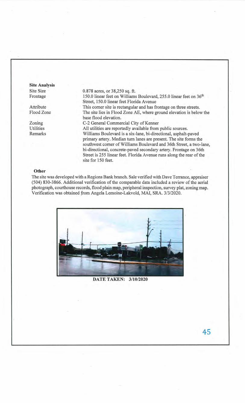
Site Analysis Site Size Frontage
Attribute Flood Zone
Zoning Utilities Remarks
Other
0.878 acres, or 38,250 sq. ft. 150.0 linear feet on Williams Boulevard, 255.0 linear feet on 36th Street, 150.0 linear feet Florida Avenue This comer site is rectangular and has frontage on three streets. The site lies in Flood Zone AE, where ground elevation is below the base flood elevation. C-2 General Commercial City of Kenner All utilities are reportedly available from public sources. Williams Boulevard is a six-lane, bi-directional, asphalt-paved primary artery. Median tum lanes are present. The site forms the southwest comer of Williams Boulevard and 36th Street, a two-lane, bi-directional, concrete-paved secondary artery. Frontage on 36th Street is 255 linear feet. Florida Avenue runs along the rear of the site for 150 feet.
The site was developed with a Regions Bank branch. Sale verified with Dave Terrance, appraiser (504) 830-3866. Additional verification of the comparable data included a review ofthe aerial photograph, courthouse records, flood plain map, peripheral inspection, survey plat, zoning map. Verification was obtained from Angela Lemoine-Lakvold, MAl, SRA. 3/3/2020.
DATE TAKEN: 3/10/2020
45
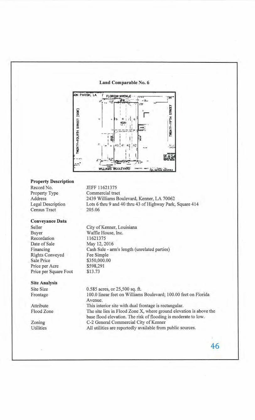
Land Comparable No.6
~- PA~ISH, LA. i FL~ID*-*'\"ENiiE-· - r-··· '1E'• •. .:.;':':""'"~~ ~-~; : - - - - ::;;.~- •• ___1 ~
i ~ 1-1&.1 ... e: .n jE a:: => e ~ i
L:'"' r•····
Property Description Record No. Property Type Address Legal Description Census Tract
Conveyance Data Seller Buyer Recordation Date of Sale Financing Rights Conveyed Sale Price Price per Acre Price per Square Foot
Site Analysis Site Size Frontage
Attribute Flood Zone
Zoning Utilities
I : ' · i . : ~ : ; I - rn
., ··"' "' : ... ~. .; :; r -t 40A~ 1 [ __ 5f ·-· • I I' ! ..--:-:--; )-
__ , ___ ;__!._L,. :. ~<- ~ ~~ _ ... -.... " ...... . ... _. E
I llgl' I I I ; ~'li I 1 !l~. I - · I •I '
" ~ ·· I • ,L'C!" ·; :·',, , _,
1 .••• ~rt···~::-_.L ,.~<._ ...... "' .. ·""-.:-,.~, ___ ,.._ ... ._....,.t:-: -
~; :. ) ,"
. :.•:.::
........... P'W 'JI' u'A
~.':#. --W!Li.JAMSBOULEV~t)' ,_.... •.• _ ·-~ ,;;.··a..-;,"UU.: ;;;,·...,...
JEFF 11621375 Commercial tract 2439 Williams Boulevard, Kenner, LA 70062 Lots 6 thru 9 and 40 thru 43 of Highway Park, Square 414 205.06
City of Kenner, Louisiana Waffle House, Inc. 11621375 May 12,2016 Cash Sale- arm's length (unrelated parties) Fee Simple $350,000.00 $598,291 $13.73
0.585 acres, or 25,500 sq. ft. 100.0 linear feet on Williams Boulevard; 100.00 feet on Florida Avenue. This interior site with dual frontage is rectangular. The site lies in Flood Zone X, where ground elevation is above the base flood elevation. The risk of flooding is moderate to low. C-2 General Commercial City ofKenner All utilities are reportedly available from public sources.
46
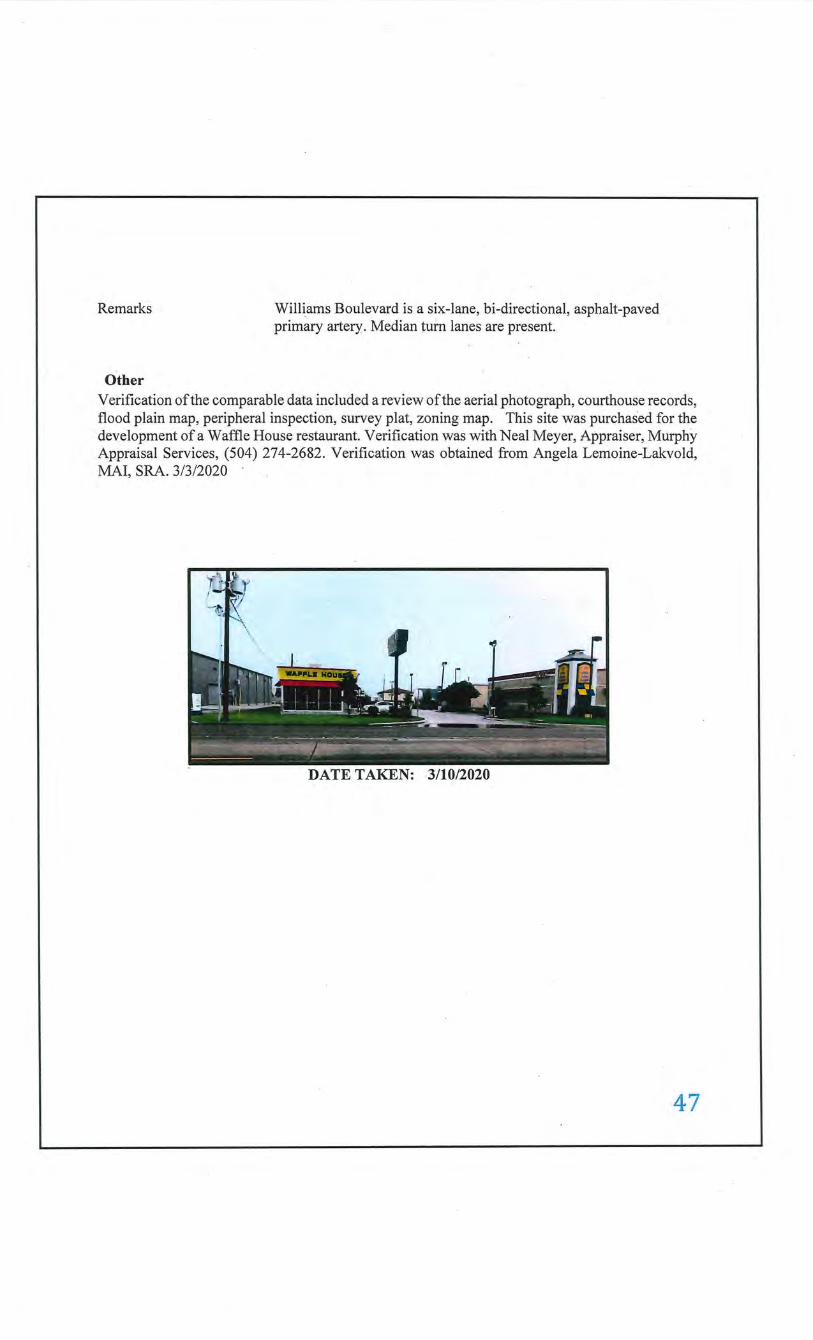
Remarks
Other
Williams Boulevard is a six-lane, bi-directional, asphalt-paved primary artery. Median turn lanes are present.
Verification of the comparable data included a review of the aerial photograph, courthouse records, flood plain map, peripheral inspection, survey plat, zoning map. This site was purchased for the development of a Waffle House restaurant. Verification was with Neal Meyer, Appraiser, Murphy Appraisal Services, (504) 274-2682. Verification was obtained from Angela Lemoine-Lakvold, MAl, SRA. 3/3/2020
DATE TAKEN: 3/10/2020
47
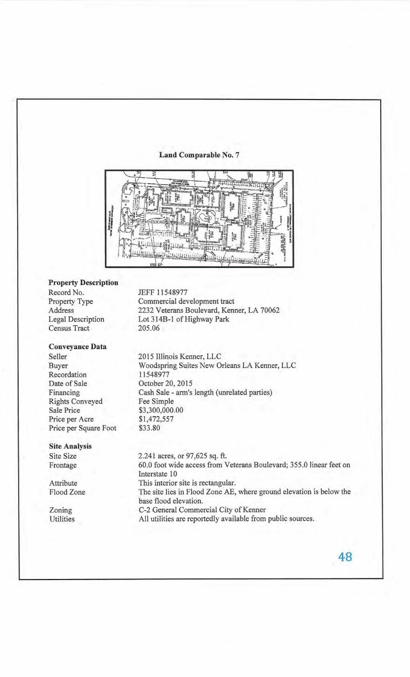
~I ~ ts
Property Description Record No. Property Type Address Legal Description Census Tract
Conveyance Data Seller Buyer Recordation Date of Sale Financing Rights Conveyed Sale Price Price per Acre Price per Square Foot
Site Analysis Site Size Frontage
Attribute Flood Zone
Zoning Utilities
Land Comparable No.7
JEFF 11548977 Commercial development tract 2232 Veterans Boulevard, Kenner, LA 70062 Lot 314B-1 of Highway Park 205.06
2015 Illinois Kenner, LLC Woodspring Suites New Orleans LA Kenner, LLC 11548977 October 20, 2015 Cash Sale- arm's length (unrelated parties) Fee Simple $3,300,000.00 $1,472,557 $33.80
2.241 acres, or 97,625 sq. ft. 60.0 foot wide access from Veterans Boulevard; 355.0 linear feet on Interstate 1 0 This interior site is rectangular. The site lies in Flood Zone AE, where ground elevation is below the base flood elevation. C-2 General Commercial City ofKenner All utilities are reportedly available from public sources.
48
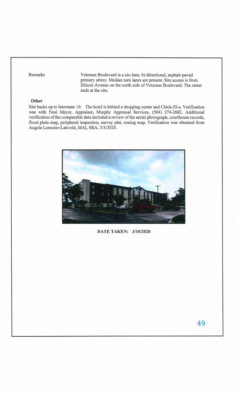
Remarks
Other
Veterans Boulevard is a six-lane, bi-directional, asphalt-paved primary artery. Median turn lanes are present. Site access is from Illinois A venue on the north side of Veterans Boulevard. The street ends at the site.
Site backs up to Interstate 10. The hotel is behind a shopping center and Chick-fil-a. Verification was with Neal Meyer, Appraiser, Murphy Appraisal Services, (504) 274-:2682. Additional verification of the comparable data included a review of the aerial photograph, courthouse records, flood plain map, peripheral inspection, survey plat, zoning map. Verification was obtained from Angela Lemoine-Lakvold, MAl, SRA. 3/3/2020.
DATE TAKEN: 3/10/2020
49
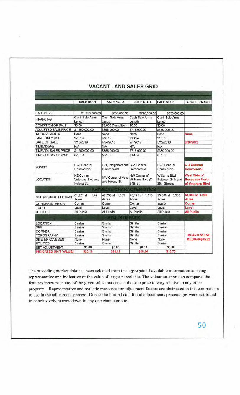
VACANT LAND SALES GRID
C-2, General Commercial
Williams Blvd
C-2 General Co!TVTlercial
WestSide of
MEAN= $15.57 MEDIAN=$15.92
The preceding market data has been selected from the aggregate of available information as being representative and indicative of the value of larger parcel site. The valuation approach compares the features inherent in any of the given sales that caused the sale price to vary relative to any other property. Representative and realistic measures for adjustment factors are abstracted in this comparison to use in the adjustment process. Due to the limited data found adjustments percentages were not found to conclusively narrow down to any one characteristic.
so
The following are some of the trends which were found to be prevalent in the larger parcel area as of the date ofvaluation.
LANDSALESCOMPAruSON
The preceding adjustment grid includes the land sales that were generally considered to be satisfactorily comparable to the larger parcel land. However, in analyzing the sales, some differences may exist which may have a bearing on value. Adjustments to the comparable sales were considered for the following factors after comparison to the larger parcel. These adjusted values reflect an indicated range ofvalue of the larger parcel.
In comparing the four sales, a unit of comparison was established. The unit of comparison most typically used in the market area for tracts similar to the larger parcel is price per square foot of land area.
The accuracy of sales data was verified to determine the reliability of each transaction. Only those sales which were found to represent fair market transactions were considered.
Adjustments to the unit price of each comparable are made to equate the positive or negative dissimilarities between each comparable and the property appraised. These adjustments are applied in a dollar amount for the property rights conveyed, financing, and conditions of sale, and percentage amounts for market condition (time) and all ofthe possible physical differences.
The amount and direction of an adjustment is determined by and derived from the market behavior of buyers as reflected in sales price differentials.
PROPERTY RIGHTS CONVEYED. A sale of property is always dependent on the property rights conveyed to the purchaser. Because the earning potential of a property can be affected by the terms of an existing le'ase, the appraiser must determine the difference between the contract rent and the market rent and measure how this difference impacts the market value. The property rights of each sale included a transfer of the fee simple estate. This means that each purchaser received the full property rights, and no adjustment is necessary.
FINANCING. The price of two identical properties may differ because of the different financing arrangements. Below market financing terms have the tendency of increasing the prices paid for real property. All of the land sales included in this analysis were cash transactions, or on terms believed to be typically obtainable in the market, therefore, no adjustment was warranted for financing terms.
CONDITIONS OF SALE. Adjustments for the conditions of sale generally reflect the motivations of the buyer and seller. The motivations of an overanxious seller and extremely motivated buyer can often distort the prices paid for property. These distortions must be considered in the analysis of the market. All of the sales were verified to be arms-length transactions. Therefore, no adjustments for conditions of the sales were required. However, in most cases, it is
. unlikely that an accurate adjustment could be derived for such a condition.
51
MARKET CONDITIONS (TIME). Because of the supply and demand for real estate fluctuates, the appraiser must study the historic trends of price levels. The economic conditions controlling the Louisiana and local economy have been steadily increasing through the past few years until a recent stabilization. Jefferson Parish and especially the Kenner area have been experiencing a steady growth rate. Prices had been steady. The most recent sales which could be found were used which were believed to be affected by similar market conditions. An adjustment for time was not found to reflect any increase or decrease in prices from the date of the sale to the inspection date of June 30, 2020.
LOCATION. A location adjustment is required when the location characteristics of a comparable property differ significantly for the property appraised. Location adjustments are expressed as a percentage that reflect the increase or decrease in the value attributable to the property's location. All sales were located within the same neighborhood parameters as the larger parcel site. No. location adjustment was warranted.
PHYSICAL CHARACTERISTICS. Each of the physical dissimilarities between the larger parcel and the comparable property must be analyzed to determine if an adjustment to the comparable is indicated. The physical differences considered in this appraisal include topography, size, shape/utility, comer influence, and flood zone.
TOPOGRAPHY. Differences in topography include the contour of the land, natural drainage, soil conditions, view and general physical usefulness. The larger parcel and the comparable sales were felt to have somewhat similar topographies.
LOT SIZE. Adjustments are usually made on the basis that per unit values decrease as the size of the property increases. The appraiser compares prices for smaller properties to those paid for larger properties, and then establishes a proper adjustment which would reflect the unit value differences in lot size. No paired sales analysis readily revealed an adjustment for size between these sales and the larger parcel.
SHAPE/UTILITY. The shape of a property governs its access, exposure, and usability. Useable shapes are usually considered the most useful but irregular shapes are not considered as big of a disadvantage in these properties. No adjustments were needed for shape/utility. ·
CORNER. The sales data did not produce a significant difference for comer site location. Sales 1, 2 and 4 are all comer sites. Sale 6 is an interior site. The larger parcel is a comer site. No adjustment for comer was made for Sale 6 for this reason.
IMPROVEMENTS. Any improvements such as an old residences or structures are considered no contributory value. Sale No. 2 required a $6,000.00 upward adjustment for demolition of old improvements.
ZONING. All zoning is similar
52
VALUATION ANALYSIS & CONCLUSION
By applying the adjustment process for all significant characteristics of a comparable sale an adjusted sale price should result which will provide a range of unit values. Generally, comparable sales requiring the least adjustment are the ones on which the heaviest reliance will be placed. These four sales are the most recent and similar sales as could be found, in the larger parcel's neighborhood. All of these sales are within the same subdivision and zoning footprint as the larger parcel site. Based on these sales and in comparison, with the larger parcel site a time adjustment was found necessary for application in this process. There was not enough data found to make adjustments as all of the physical differences were considered similar to slightly superior to the larger parcel. Comparable Sale 6 is the most similar to the larger parcel site as shown on the sales data grid.
The larger parcel site consists of lots 76-98. It contains 54,960 square feet and measures 120' on Veterans with a 458' along Bessemer Street which dead ends at 1-10. The lots are oriented to Bessemer Street.
The range of indicated unit values are $10.24 to $20.19 per square foot. Comparable Sales 1 and 2 are located on Veterans Blvd. Comparable 4 and 6 are located on Williams Blvd. Comparable 1, 2 and 4 are corner sites. The Summary of Lands Sales were not of a sufficient data size to extract a corner influence although, corner sites usually sell at a higher unit value than interior sites with all other characteristics being equal. After analyzing these four ( 4) sales, a unit value estimate of $17.00 per square foot is the result. Consideration is given to the larger parcel being a corner site but, the majority of the site is oriented to Bessemer Street which is a side street.
Thus $17.00/sf x 54,960.00/sf = $934,320.00
53
COST APPROACH
Procedure and Methodology
The Cost Approach technique is a method of estimating market value by comparing the cost to replace the building improvements with one that is equally desirable and usable. The primary theory behind this approach is that the buyer would not pay more for an existing improved property than the cost to purchase land and build a new improvement that is equally desirable.
Larger Parcel Improvements
There are no major improvements developed on the larger parcel site. It is presently used for equipment storage of utility trailers and C-Cans as shown in the photographs.
This approach is not necessary nor utilized in the appraisal.
Minor improvements within the required construction servitude include vinyl fencing which the appraiser assumes will be replaced at the completion of the project.
WHOLE PROPERTY VALUE BY MARKET APPROACH
The Sales Comparison Approach is an appraisal technique were market value estimates are based on actual market transactions of improved properties. The Appraisal Form C is utilized and there are no major improvements located on the larger parcel site. This approach is not utilized in this report.
THE INCOME APPROACH
With no improvements developed on the larger parcel site the Income Approach is not utilized in the appraisal of the larger parcel.
54
ANALYSIS, INTERPRETATION & CORRELATION OF VALUE
INDICATION OF VALUE BY COST APPROACH: N/A
INDICATION OF VALUE BY MARKET DATA APPROACH: $934,320.00
INDICATION OF VALUE BY INCOME DATA APPROACH: N/A
After analyzing all of the market data found for comparison with the larger parcel the estimated land value is $326,400.00.
The larger parcel is a vacant tract of land fronting on Bessemer Street north of Veterans Blvd. and dead ending at 1-10. With the absence of major improvements on the site The Cost, Market for Improved properties and the Income Approaches were not required in this evaluation of the larger parcels.
Thus, the final estimated value of the larger parcel is for land only. The fee simple (less mineral rights) "as is" market value, as of June 30, 2020 of the larger parcel is:
$934,320.00
55
VALUE OF REQUIRED PARCEL
L4.ND:
9U -C-1 615.1 sf@ $17.00/sf@ 10% interest= $1,046.00 ® $1,046.00 x 4-year rental period = $4,184.00
E&tiMATED VALUE OF C~STRUCTION SERVITUDE RENTAL:
I~FROVEMENTS:
E~tiMATED VALUE OF IMPROVEMENTS:
6' N'inyl Fencing (Side) 42.41 lf@ $38.00/lfless 20% depreciation = $1,290.00
6' N'inyl Fencing (Rear) 29.01 lf@ $38.00/lf less 20% depreciation= $ 882.00
GrWvel Pad 30' x 42' x 2' depth for C-Can foundation ,520 sf@ $2.50/sf less 20% depreciation = $5,040.00
$4,184.00
T<)!rAL IMPROVEMENT VALUE $7,212.00
(l\llarshall Valuation Service Sec. 66 Page 5 (12/20 17)
Tij:)3: TOTAL ESTIMATED VALUE OF THE CONSTRUCTION s J!iJjtVITUDE RENTAL AND IMPROVEMENTS, IS:
~PITIONAL COMPENSATION: None
TJ k AL RECOMMENDED COMPENSATION:
$11,396.00
$ 0.00
$11,396.00
56
COST TO CURE ANALYSIS
The parcel consists of a rectangular shaped construction servitude containing 615.10 square feet of land area. Improvements within the required parcel area include 6' Vinyl paneled fencing, 2-asphalt ramps for C-Cans and gravel pad site under the C-Cans. The cost new to re-establish these items is as follows:
6' Vinyl Fencing 72.0 lf@ $38.00/lf =
Asphalt Ramps 2- 8' x 4' pads 64.0 sf@ $5.00/sf =
Gravel Pad 30' x 42' x 2' 2,520 sf@ $2.50/sf=
Total
The depreciated cost of the like improvements paid for previously on page 43 must now be deducted to establish the estimated cost to cure amount.
Total Cost to Cure Compensation
$2,736.00
$ 320.00
$6,300.00
$9,356.00
$7,212.00
$2,144.00
The asphalt ramps are not in the required parcel area but, are attached to the C-Cans. They are misplaced improvements in the after rental status and are being re-established in the cure.
After the acquisition for the 9-5-C-1 rental area the remaining site will continue to possess the same land area as before the rental. The highest and best use for commercial development will continue. The property will not suffer any adverse effects from the project as proposed.
57
ANALYSIS OF ADDITIONAL COMPENSATION
In addition to estimating just compensation for real property rights required in connection with this project, consideration must be given to the "full extent of the owner's loss" pursuant to the 197 4 Louisiana Constitution. The measure is commonly referred to as just compensation which may be defined as an amount of money required to place the owner of an affected property in the same pecuniary (financial) position after the acquisition equal to the pecuniary (financial) position that existed in the property before the acquisition.
The recommended compensation for property within the required right of way was estimated at $13,540.00 for the construction servitude rental period of 4 years.
In view of the foregoing, total recommended compensation for real property losses amounts to $13,540.00
Regarding other possible losses beyond realty, the property is not operated as an "owneroccupied" business facility and no consideration of business loss is required. Losses relating to relocation costs of tenant or owner-occupied dwellings will be handled separately under the Department's Relocation Assistance Program, if necessary.
In view of the foregoing and the scope of this appraisal assignment, no additional compensation is required to reflect any additional compensation. This parcel in its entirety is required for the project and there is no remainder.
Additional Compensation Required ..................................................................................... $ 0.00
58
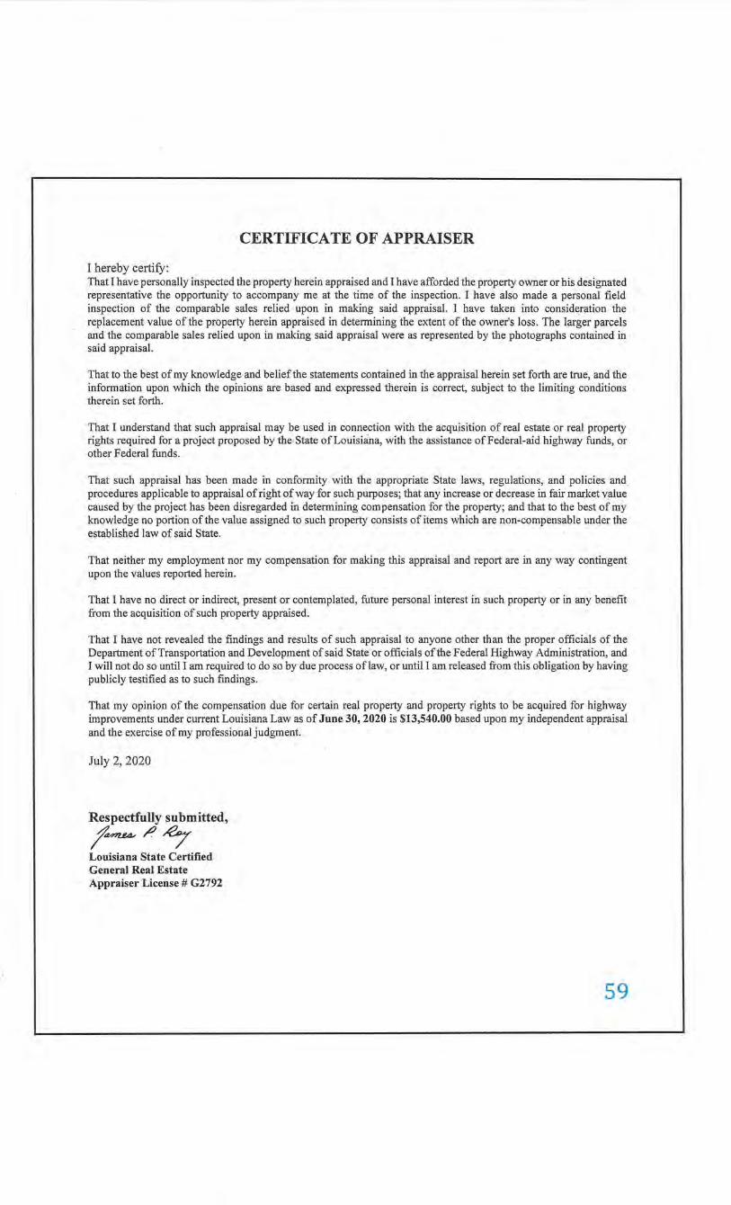
CERTIFICATE OF APPRAISER
I hereby certify: That I have personally inspected the property herein appraised and I have afforded the property owner or his designated representative the opportunity to accompany me at the time of the inspection. I have also made a personal field inspection of the comparable sales relied upon in making said appraisal. I have taken into consideration the replacement value of the property herein appraised in determining the extent of the owner's loss. The larger parcels and the comparable sales relied upon in making said appraisal were as represented by the photographs contained in said appraisal.
That to the best of my knowledge and belief the statements contained in the appraisal herein set forth are true, and the information upon which the opinions are based and expressed therein is correct, subject to the limiting conditions therein set forth.
That I understand that such appraisal may be used in connection with the acquisition of real estate or real property rights required for a project proposed by the State of Louisiana, with the assistance of Federal-aid highway funds, or other Federal funds .
That such appraisal has been made in conformity with the appropriate State laws, regulations, and policies and procedures applicable to appraisal of right of way for such purposes; that any increase or decrease in fair market value caused by the project has been disregarded in determining compensation for the property; and that to the best of my knowledge no portion of the value assigned to such property consists of items which are non-compensable under the established law of said State.
That neither my employment nor my compensation for making this appraisal and report are in any way contingent upon the values reported herein.
That I have no direct or indirect, present or contemplated, future personal interest in such property or in any benefit from the acquisition of such property appraised.
That I have not revealed the findings and results of such appraisal to anyone other than the proper officials of the Department of Transportation and Development of said State or officials of the Federal Highway Administration, and I will not do so until I am required to do so by due process of law, or until I am released from this obligation by having publicly testified as to such findings.
That my opinion of the compensation due for certain real property and property rights to be acquired for highway improvements under current Louisiana Law as of June 30, 2020 is $13,540.00 based upon my independent appraisal and the exercise of my professional judgment.
July 2, 2020
Respectfully submitted,
t~/)~ Louisiana State Certified General Real Estate Appraiser License# G2792
59

LIMITING CONDITIONS
1. Limit of Liability: The liability of JAMES P. ROY and employees is limited to the fee collected. There is no accountability, obligation, or liability to any third party. The Appraiser assumes no responsibility for any costs incurred to discover or correct any deficiencies present in the property.
2. Copies, Publication, Distribution, Use of Report : Possess10n of this report or any copy thereof does not carry with it the right of J?Ublication, nor may it be used for other than its intended use; the physical report(s) remain the property of the appraiser for the use of the client, the fee being for the analytical services only.
The Bylaws and Regulations of the Appraisal Foundation Therefore, except as hereinafter provided, the party for whom this appraisal report was prepared may distribute copies of this appraisal report, in its entirety, to such third parties as may be selected by the party for whom this appraisal report was prepared; however, selected portions of this appraisal report shall not be given to third parties without the prior written consent of the signatories of this appraisal report. Further, neither all nor any part of this appraisal report shall be disseminated to the general public by the use of advertising media, public relations media, news media, sales media, or other media for public communication without the prior written consent.
3. Confidentiality: The appraiser may not divulge the material (evaluation) contents of the report, analytical findin15s or conclusions, or give a copy of the report to anyone other than the client or his representative as specified in writmg except as may be required for ethics enforcement, or by a court of law or body with the power of subpoena.
The appraisal is to be used only in its entirety and no part is to be used without the whole report. All conclusions and opinions concerning analysis as set forth in the report were prepared by the Appraiser(s) whose signature(s) appear on the appraisal report, unless indicated as "Review Appraiser". No change of any item m the report shall be made by anyone other than the Appraiser and/or officer of the firm. The Appraiser and firm shall have no responsibility if any such unauthorized change is made.
4. Trade Secrets: . This appraisal was obtained from JAMES P. ROY or related companies and/or its individuals or related independent contractors and consists of "trade secrets and commercial or financial information" which is privileged and confidential and exempted from disclosure under 5 U.S.C. 552 (b) (4). Notify the appraiser(s) signing the report or an agent of JAMES P. ROY, of any request to reproduce this appraisal m whole or part.
5. Information Used: No responsibility is assumed for accuracy of information furnished by or from others, the client, his representative; or .public records. We are not liable for such information or the work of possible subcontractors. Be advised that some of the people associated with JAMES P. ROY and possibly signing the report are inder.endent contractors. The comparable data relied upon in this report has been confirmed with one or more parties familiar with the transaction or from affidavit; all are considered appropriate for inclusion to the best of our factual judgment and knowledge.
6. Testimony, Consultation, Completion of Contract for Appraisal Services: The contract for appraisal, consultation or analytical service, are fulfilled and the total fee payable upon completion of the report. The appraiser(s) or those assisting in preparation of the report will not be asked or required to g ive testimony in court or hearing because of having made the appraisal, in full or in part, nor engage in post appraisal consultation with client or third parties except under separate and special arrangement and at additional fee.
7. Exhibits: . The sketches and maps in this report are included to assist the reader in visualizin~ the property and are not necessarily to scale. Various photos, if any, are included for the same purpose and are not mtended to represent the property in other than actual status, as of the date of the photos. Site plans are not surveys unless shown from separate surveyor.
8. Legal, En~neering, Financial, Structural, or Mechanical Nature of Hidden Components, Soil: · No responsibility is assumed for matters legal in character or nature, nor matters of survey, nor of any architectural, structural, mechanical, or en~ineering nature. No opinion is rendered as to the title, which is presumed to be good and merchantable. The property IS appraised as if free and clear, unless otherwise stated in particular parts of the report.
The legal description is assumed to be correct as used in this report as furnished by the client, his representative, or as derived by the appraiser.
60
The appraiser has inspected as far as possible, by observation, the land and the improvements thereon; however, it was not possible to personally observe conditions beneath the soil or hidden structural, or other components. We have not critically inspected mechanical components within the improvements and no representations are made herein as to these matters unless specifically stated and considered in the report. The value estimate considers there being
no such conditions that would cause a loss of value. The land or the soil of the area being appraised appears firm, however, subsidence in the area is unknown. The appraiser(s) do not warrant against this condition or occurrence of problems arising from soil conditions.
The appraisal is based on there being no hidden, unapparent, or apparent, conditions of the property site, subsoil, or structures which would render it more or less valuable. No responsibility is assumed for any such conditions or for any expertise or engineering required to discover them. All mechanical components are assumed to be in operable condition and status standard for properties of the larger parcel type. Conditions of heating, cooling, ventilating, electrical and plumbing equipment is considered to be commensurate with the condition of the balance of the . improvements unless otherwise stated. No judgment is made as to adequacy of insulation, type of insulation, or energy efficiency of the improvements or equipment.
If the Appraiser has not been supplied with termite inspection, survey, or occupancy permit; no responsibility or representation is assumed or made for any costs associated with obtaining same or for any deficiencies discovered before or after they are obtained. No representation or warranties are made concernmg obtaining the abovementioned items.
The Appraiser assumes no responsibility for any costs or consequences arising due to the need, or the lack of need for flood hazard insurance. An Agent for The Federal Flood Insurance Program should be contacted to determine the actual need for Flood Hazard Insurance.
9. Legality of Use: The appraisal is based on the premise that; there is full compliance with all applicable federal, state and local environmental regulations and laws unless otherwise stated in the report; further that all applicable zoning, building and use regulations and restrictions of all types have been complied with unless otherwise stated in the report; further, it is assumed that all required licenses, consents, permits, or other legislative or administrative authority, local, state, federal and/or private entity or organization have been or can be obtained or renewed for any use considered in the value estimate.
10. Coml!onent Value: . The distribution of the total valuation in this report between land and improvements applies only under the existing program of utilization. The separate valuations for land and building must not be used in conjunction with any other appraisal and are invalid if so used.
11. Auxiliary and Related Studies: No environmental or impact studies, special market study or analysis, highest and best use analysis study or feasibility study has been requested or made unless otherwise specified in an agreement for services or in the report. The appraiser reserves the unlimited right to alter, amend, revise or rescind any of the statements, findings, opinions, values, estimates, or conclusions upon any subsequent such study or analysis or previous study or analysis subsequently becoming known to him. .
12. Dollar Values, Purchasing Power: The market value estimated, and the costs used are as of the date of the estimate of value. All dollar amounts are based on the purchasing power and price of the dollar as of the date ofthe value estimate.
13. Inclusions: Furnishings and equipment or business operations except as specifically indicated and typically considered as a part of real estate, have been disregarded with only the real estate being considered in the value estimate, unless otherwise stated.
14. Proposed Improvements, Conditioned Value: · Improvements proposed, if any, on or off-site, as well as any repairs required, are considered, for purposes of this appraisal, to be completed in a good and workmanlike manner according to information submitted and/or considered by the appraisers. In cases of proposed construction, the appraisal is subject to change upon inspection of property after construction is completed. Tliis estimate of market value is as of the date shown, as proposed, as if completed and operating at levels shown and projected.
61
15. Value Change, Dynamic Market, Influences:
The estimated market value is subject to change with market changes over time: value is highly related to exposure, time, promotional effort, terms, motivation, and conditions surrounding the offering. The value estimate considers the productivity and relative attractiveness of the property physically and economically in the marketplace.
The "Estimate of Market Value" in the appraisal report is not based in whole or in part upon the race, color, creed, or national origin of the owners, past, present, or future, of the larger parcel, or owners or occupants of the properties in the vicinity of the property appraised.
In cases of appraisals involving the capitalization of income benefits, the estimate of market value is a reflection of such benefits and the appraiser's interpretation of income and yields and other factors derived from general and specific market information. Such estimates are as of the date of the estimate of value; they are thus subject to change as the market is naturally dynamic. ·
The Appraiser reserves the right to alter the opinion of value on the basis of any information withheld or not discovered in the normal course of a diligent investigation.
16. Management of the Property: It is assumed that the property which is the larger parcel of this report will be under prudent and competent ownership and management; neither inefficient nor superefficient.
17. Continuing Education: JAMES P ROY is current on all continuing education required by the State of Louisiana.
18. Fee: The fee for this appraisal or study is for the service rendered and not for the time spent on the physical report.
19. Authentic Copies: Authentic copies of this report are only available from JAMES P. ROY and must be signed in Blue Ink. A copy that is not authenticated is unauthorized and may have been altered.
20. Insulation; Lead-based Paints; Other Hazardous Materials: Unless otherwise stated in this report, the appraiser(s) signing this report have no knowledge concerning the presence or absence of urea-formaldehyde foam insulation, asbestos insulation, lead-based paints, or any other hazardous materials, in existing improvements; if such materials are present, the value of the property may be adversely affected, and re-appraisal at additiOnal cost necessary to estimate the effects of such materials will be necessary.
21. Acceptance of, and/or use of, this appraisal report constitutes acceptance of the above conditions.
22. This appraisal and analysis were obtained from JAMES P. ROY and consists of "Trade Secrets & Commercial or Financial Information" which is privileged and confidential and exempted from disclosure under 5 U.S.C. 552 (B) (4). Please notify JAMES P. ROY of any request for reproduction of this report. The physical report(s) remain the property of JAMES P. ROY for the use of the client only.
23. Neither all nor any part of the contents of this report shall be conveyed to any person or entity, other than the appraiser' s or firm's client, through advertising, solicitation materials, public relatiOns, news, sales, or other medial without the written consent and approval of the author(s), particularly as to valuation conclusions, the identi~ of the appraiser or firm with which the appraiser is connected. Further, the appraiser or firrn assumes no obligation, liability, or accountability to any third party. If this report is placed in the hands of anyone but the client, client shall make such party aware of all the assumptions and limiting conditions of the assignment.
62
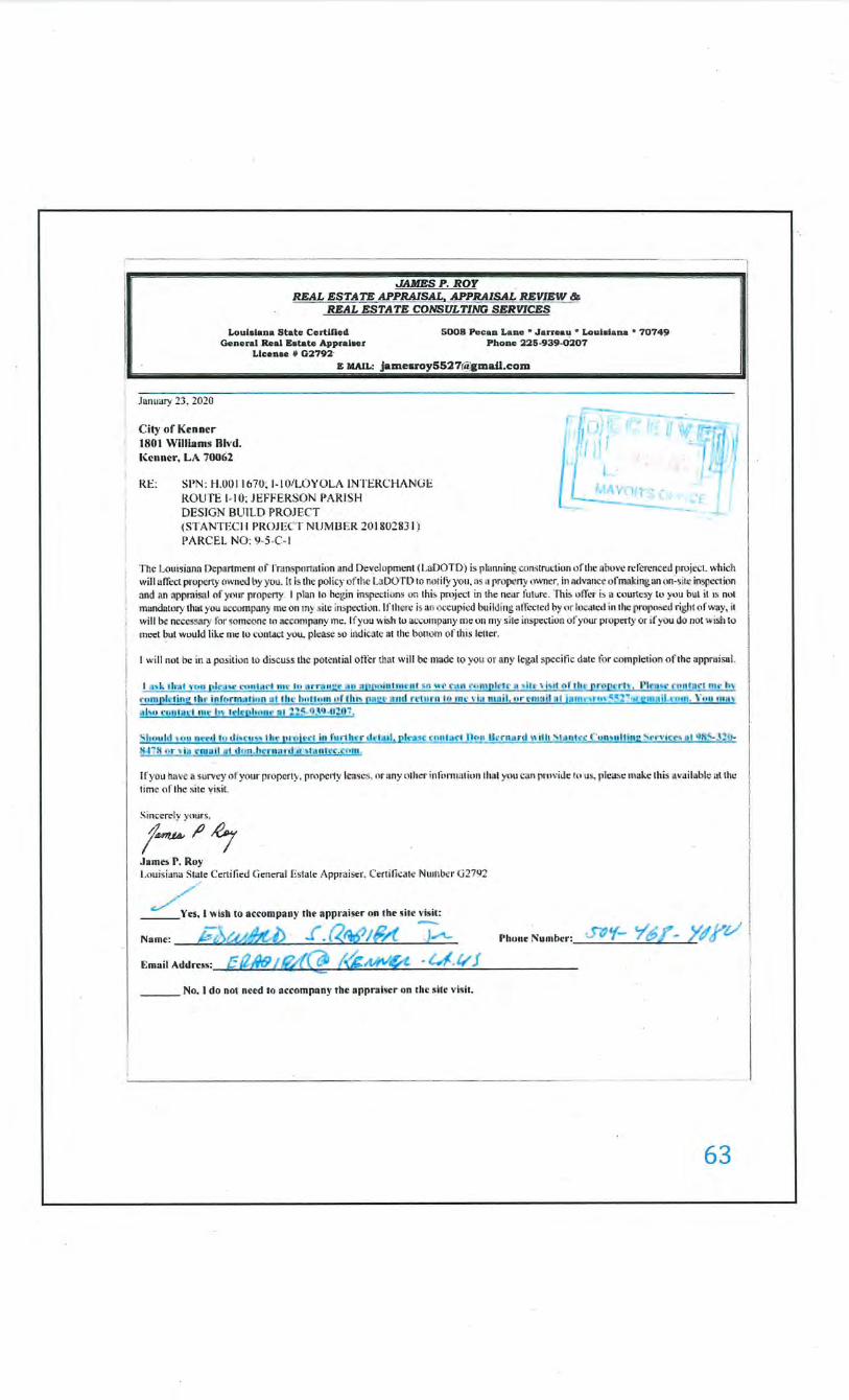
Loulalana State Ccrtlftcd 5008 Pe~aa Z..ac ~ Jarreau • Louiala na • 70749 General Real Eetate Appraleer Phone l25-939-0:107
January 23, 2020
City of Kenner 1801 WiUiams Rlvd. Kenner, LA 70062
Llcenae 41 02792· E lllAIL: jamearoy5527r<i;cmail.com
RE: SI'N: H.OOI I 67U~ 1-IOiLOYOLA INTERCHANUE ROUTE 1- 10; JEFFERSON PA RISH DESIGN BUILD PROJECT (ST ANTECII PROJ ECT NlJM UER 201802831 I PARCEL NO: '1-5-C-1
- ---1
The Louis inn~ Dcj)llrt.mcnr o fTrans~mat ion and Development ( LaDOT D) is plimning construction uf thc obow rcfercnced llR>j l'Cl. which will affect propeny own("(( by you. It is the policy of tile l J1DOT D ro not if)· you. ns n property owner, in ad,·ancc ofm;1kJ ng. :m on~s it<' in5pccr ion and an npprniSOJ I of your property . I phm to hcgin inspections on this pmj ect in 1hc ncar future. The. on·cr i~ u courtesy tu you but it IS not mundutury that you ~t'Ulmpany rnc on Ill)' site inSileCtion. If there is an o:x'Cupicd building alli::ctcd by (11' lo; ;ucd in the prow~Scd right o f w ;1y , it willllO: ncccss."U)· lor •omc<mc to :,ct:QITI(l., ny me. If you .,.,; sh to ac.:umpan)' me on my site inspection of your pi'Operty or if you do not wish to meet but would like me to contact you. please so indic•ltc nt the bouom of th is lcllcr.
I will not be in a po~ition to discuss the potential otlcrtllat will be nmdc to you or any fcgol ,;pccitic date for completion o f the upprnisul.
" huu ld , ,,.. nrt1l I<• <II'"'"~ tlw JUOjt r l in fur1 h.-r dt•lil il, pin<~ u m lart llon lknusrd " ilh ' '"ntcc ( 'un~ultiru: St·n· icr~ HI Qlt~310-!j41 !1 or- ' i11 r ma ll at dnn.hn n:u d a • lalllr~.~nnr .
If you hn\•e a surw y of you.r properly, propc•ty le-ases, nr any olhcr inti>nmil ion tlmt ~nu cnnpnwitle tu us. please make this a'•a ilab l~ ulthc time of the site yisil
Sinccrt:l )· ynurs,
~~~~ James P. Roy Louis iana Sta_te Certified Gem:ral Estate Appr>Jiser, Certi li~ate Nulll b~ r G 2792
Name: e: ' f ,I""'S'("t< V'r< - . , ..,. . .. v , ,.. , ~ A"- - Phone: Num ber: • .....- " c
Email Addm~: [; /tNft l f(Ll \ C111 f'(i!'i;.MV~ • l..4/f'.v J - c::
___ No. I do not need to accompany the up praiser on the site \'i~it.
63
JAMESP. ROY REAL ESTATE APPRAISAL, APPRAISAL REVIEW &
REAL ESTATE· CONSULTING SERVICES
Louisiana State Certified 5008 Pecan Lane* Jarreau* Louisiana*
225-939-0207
70749 General Real Estate Appraiser
License # G2792
Phone
EMAIL: [email protected]
June 15, 2020
City of Kenner 1801 Williams Blvd. Kenner, LA 70062
RE: SPN: H.0011670; I-10/LOYOLA INTERCHANGE ROUTE 1-10; JEFFERSON PARISH DESIGN BUILD PROJECT (STANTECH PROJECT NUMBER 201802831) PARCEL NO: 9-5-C-1
The Louisiana Department of Transportation and Development (LaDOTD) is planning construction of the above referenced project, which will affect property owned by you. It is the policy of the LaDOTD to notify you, as a property owner, in advance of making an on-site inspection and an appraisal of your property. I plan to begin inspections on this project in the near future. This offer is a courtesy · to you, but it is not mandatory that you accompany me on my site inspection. If there is an occupied building affected by or located in the proposed right of way, it will be necessary for someone to accompany me. If you wish to accompany me on my site inspection of your property or if you do not wish to meet but would like me to contact you, please so indicate at the bottom of this letter.
I will not be in a position to discuss the potential offer that will be made to you or any legal specific date for completion of the appraisal. ·
I ask that you please contact me to arrange an appointment so we can complete a site visit of the propertv. Please contact me by completing the information at the bottom of this page and return to me via mail, or email at jamesroy5527{a),gmail.com. You may also contact me by telephone at 225-939-0207.
Should you need to discuss the project in further detail, please contact Don Bernard with Stantec Consulting Services at 985-320-8478 or via email at [email protected].
If you have a survey of your property, property leases, or any other information that you can provide to us, please make this available at the time of the site visit.
Sincerely yours,
t~jJ~ James P. Roy · Louisiana State Certified General Estate Appraiser, Certificate Number G2792
____ Yes, I wish to accompany the appraiser on the site visit:
Name: ----------------------------------------------Phone Number: ____________ _
Email Address: ___________________________ _;_ ____ _
___ No, I do not need to accompany the appraiser on the site visit.
64
PROPERTY OWNER INSPECTION REPORT PARCEL 9-5-C-1 CITY OF KENNER
Property Owner Notification Letter (Mailed): 1-22-2020 and 6-15-2020
Property Owner Notification Letter (Returned): 2-4-2020 by email
Desires to Meet: Yes X No_
Remarks: The Property Owner Letter was returned on 2/4/2020 via email from Mr. Ed Rapier representative for the City of Kenner. Spoke with Mr. Rapier on 2-6-2020 and set inspection for 2-11-2020 for 11 :OOam. Spoke that morning 2-11-2020 and he had a meeting to attend and could not meet. Called him on 3-9-2020 left message with his assistant but, he has not returned my call. Have made several
calls to Mr. Rapier to set up a time to meet.
Telephone Contact
Person Notified: Mr. Ed Rapier (504) 468-4080 erapier @kenner-la.us
Remarks:
Site Inspections
Date: 6-30-2020 re-inspected for update !2:45pm
Person(s) Accompanying Appraiser: None
Date: 5-14-2020 ll:OOam Person(s) Accompanying Appraiser:
None
Date: 3/10/2020 11:30 am Person(s) Accompanying Appraiser:
Robert Aguilar Micah Freemin
Date: 2111 /2020 11 :00 am Person(s) Accompanying Appraiser:
None
65
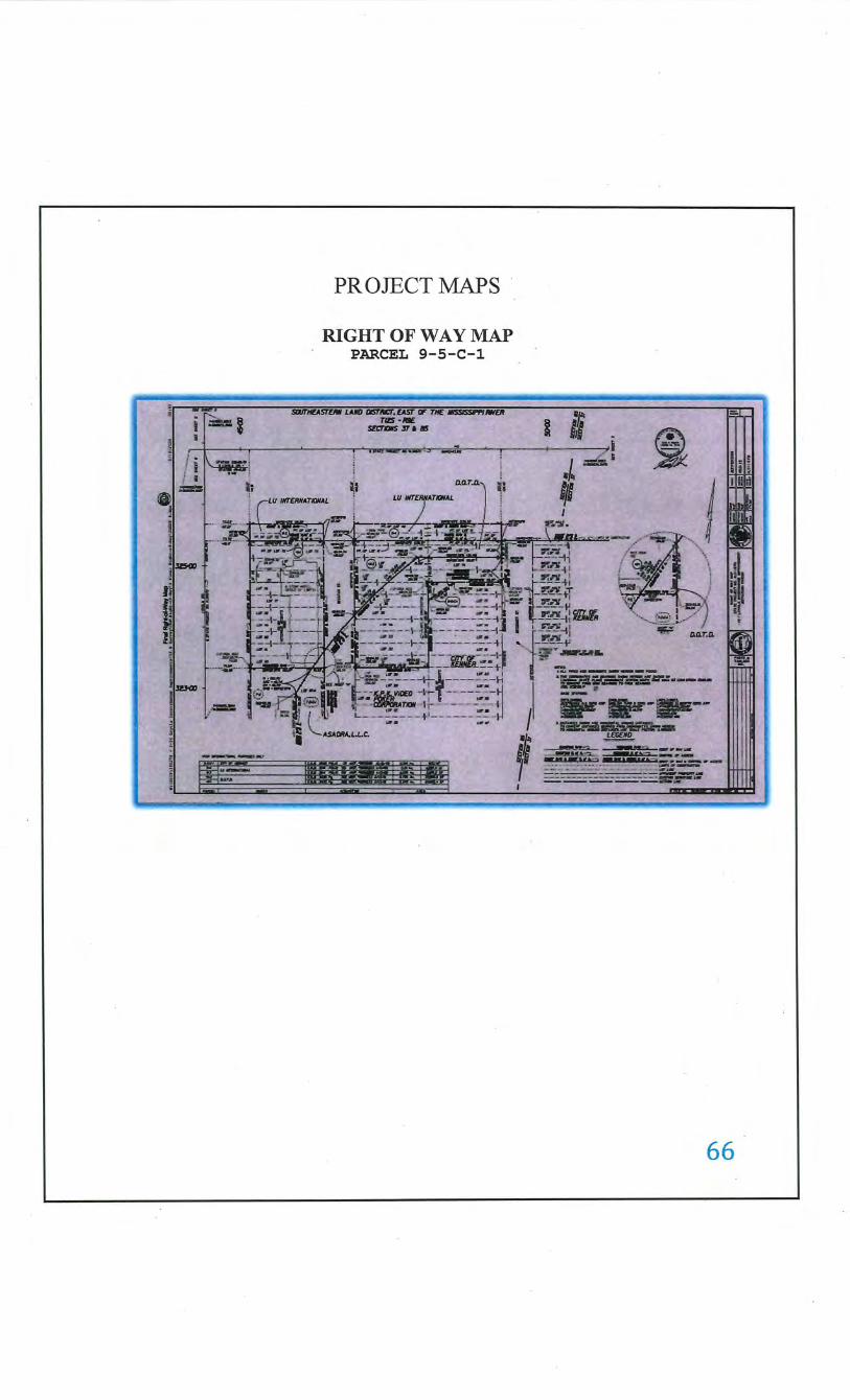
PROJECT MAPS
RIGHT OF WAY MAP PARCEL 9-5- C- 1
~~
1115 -lfl£ !ZI:TIIIS 'Sf a •
f'~.- r .,...Jr")t . .---••• ~- .-. t '_._ _ . •- c. _ c. ___ ~- J. r _..:..a.,._..___"- c a.- rw• _., ... l ., _ _.1. ___ , __ ...___~~· _J.A
I • r.~ I"- r -- .L"W._':I ...
D.O.T.D.· ~; !
I i .L ljl
_r~-1~ ~o !"'-!!_. ,
• r..nr 1 11 !!...1!-tl -~~tT
D" ?-..f.Y_~
I ----hm&
fl -~ .... , ......... D.O.T.D.
' ----+' •::-::-.: ___ _ ·~p;r-C!E.a-.:.--
1 ~---------/ ...... ~ ;~:a
66
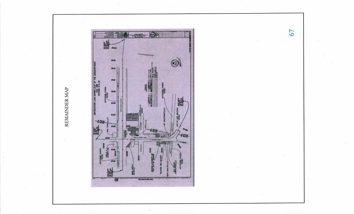
APPRAISER'S QUALIFICATIONS JAMESP.ROY 5008 Pecan Lane Jarreau, LA 70749
(225) 939-0207 jamesroy5527 @gmail.com
LOUISIANA STATE CERTIFIED GENERAL REAL ESTATE APPRAISER LICENSE# G2792
(2020-2021) Member International Right-of-Way Association. (lRWA)
Graduate ofRedemptorist High School Baton Rouge, LA 1977
Certified licensed appraiser with recognized expertise in valuation of partial and unique interests in real property. Over 40 years of experience in real estate appraisal, and right-of-way project management, consulting and appraisal and appraisal review.
Worked for L.J. Roy Realtor/Appraiser July 1979-March 1991. Helped prepare appraisals for right of way acquisition and condemnation. Prepared appraisal reports for residential and commercial mortgage loans.
Began Employment with LADOID in March of 1991 and Retired March 2017, with 28 Years of experience as an Appraiser, Review Appraiser and Project Supervisor.
Prepared appraisal reports and reviewed fee appraiser reports for right of way acquisition and condemnation. Supervised federal and state road projects throughout the State of Louisiana including hiring of fee appraisers, cost, timber and business valuation consultants along with and various other experts as needed. Set up appraisal plans to determine types of appraisals required and completion dates for all appraisals and appraisal reviews.
Supervised parish road projects funded by the State of Louisiana. Supervised projects for the Army Corp of Engineers through LADOID (Comite Diversion Canal).
Supervised appraiser trainees for completion of required hours and appraisal experience to become a state certified appraiser.
Assisted LADOTD Legal Department Attorneys for condemnation proceedings both pre-trial and trial appraisal testimony.
Successful completion of the following Educational Courses:
AMERICAN INSTITUTE OF REAL ESTATE APPRAISERS:
Course I 0 !-Introduction of Apprising Real Property (1991)
Course I 02-Appl ied Residential Property valuation (1991)
Appraisal Institute lEA-Introduction to Income Capitalization (1992).
Appraisal Institute !BE-Applied Income Capitalization (1992).
Appraisal Institute Course 310-Basic Income Capitalization (1993).
Appraisal Institute Course 510-Advanced Income Capitalization (1993).
Appraisal Institute Course Partial Interest Valuation-Divided (1995)
Appraisal Institute Course Marketability Studies (11 /2012) ·
Appraisal Institute Course National US PAP Update (05/20 16)
· 78 Hours.
39 Hours.
30 Hours
30 Hours
39 Hours
33 Hours
7 Hours
7 Hours
7 Hours
68
BURK BARKER SCHOOL OF REAL ESTATE:
Standards ofProfessional Practice (USPAP) Course 105 June 1993 15 Hours
Appraisal Principles Course 101 August2004 · 30 Hours
Appraisal Practice Part I Course 102 September 2004 30 Hours
Appraisal Practice Part II Course 103 October 2004 30 Hours
Appraisal Statistics and Math Course 104 November 2004 15 Hours
Standard of Professional Practice (USP AP) Course 105 September 2004 15 Hours
General Appraisal Course Course 201 February 2005 60 Hours
Standard of Professional Practice (USP AP) Course 105 August2007 15 Hours
NATIONAL ASSOCIATION OF INDEPENDENT FEE APPRAISERS (NAIF A):
Comprehensive Income Property Appraising July 1994 30 Hours
NATIONAL HIGHWAY INSTITUTE:
Appraisal and Appraisal Review for Federal-Aid Highway Programs August 16, 2007 6 Hours
Appraisal and Appraisal Review for Federal-Aid Highway Programs January 1994 32 Hours
INTERNATIONAL RIGHT OF WAY ASSOCIATION:
The Appraisal of Partial Acquisitions Course 401 May 1994 40 Hours
Relocation Assistance Course 501 January 1996 24 Hours
Business Relocation Course 502 November 2002 16 Hours
Principles of Real Estate Engineering Course 900 May 1999 16 Hours
Conflict Management Course 213 April2006 8 Hours
Computing Replacement Course 504 April2006 16 Hours Housing Payments
Advanced Business Relocation Course 506 April2006 16 Hours
Easement Valuation Course 403 December 2006 8 Hours
Engineering Plan Development & Application Course 901 December 2008 8 Hours
Property Descriptions Course 902 December 2008 8 Hours
Principles of Land Acquisition Course 100 January 2011 32 Hours
Ethics and the Right of Way Course 103 September 20 II 8 Hours Profession
Communication in Real Estate Course201 September 20 II 24 Hours Acquisition
Managing the Consultant Process Course 303 October 2012 16 Hours
The Valuation of Partial Acquisition Course 421 April2014 32 Hours
69
NATIONAL ASSOCIATION OF ENVIRONMENTAL RISK AUDITORS
Environmental Risk Screener
Appraising Environmentally Impacted Properties
Course I 0 I & 102
Course 401
(NXRA)
June 1996
January 1997
LOUISIANA STATE UNIVERSITY (DIVISION OF CONTINUING EDUCATION)
Environmental Site Assessments November 1999
LOUISIANA CHAPTER OF THE APPRAISAL INSTITUTE
Partial Interest Valuation March2001
Marketability Studies Process and Applications November2012
National USPAP Update Course May 2016 7 Hours
National USPAP Update Course May 2019 8 Hours
MCKISSOCK APPRAISAL COURSE
Appraising Manufactured Homes October 2013
Deriving and Supporting Adjustments November2013
Construction Details and Trends November 2013
Supervisor-Trainee Course July 2016
The Dirty Dozen Common Errors in Appraising December 2017
Land and Site Valuation December2017
Expert Witness Testimony for Commercial Appraisers December 20 17
Supporting Adjustments November2019
How to Raise Quality and Reduce Risk November2019
Identifying & Correcting Appraisal Failures November2019
CONTINUING EDUCATION
Yearly participation at various seminars of real property, appraisal, appraisal review
and other resources required for Certifications License and maintenance of professional
appraisal designations.
ATTENDED SEMINARS FOR:
Eminent Domain Training for Attorneys and Appraisers. Environmental Site Assessments and Audits.
24 Hours
16 hours
21 Hours
7 Hours
7 Hours
7 Hours
3 Hours
7 Hours
4 Hours
3 Hours
7 Hours
7 Hours
7 Hours
7 Hours
7 Hours
Successfully Completed Courses at the Louisiana Department of State Civil Service and Governor's Office Division of Administration through
the Public Management Program Louisiana State University in Managing Work Time Effectively and Developing Effective Teams, Part I, Part 2,
and Part 3. Have completed a course in Developing Teams, Part III in the Management Development Program. Successfully ·completed a Course
in Conducting An Effective Job Interview, Developing An Effective Planning Process and Civil Service Essentials For Supervisors. Effective
Writing for Managers, and Effective Conflict Resolution Strategies.
70
REAL ESTATE SERVICES AND APPRAISALS ACCEPTED BY
State of Louisiana Department of Transportation and Development
United States Federal Highway Administration
United States Army Corp of Engineers
City of Zachary Louisiana
East Baton Rouge Parish Government
City of New Roads
Town of St. Francisville
Various Corporations .
Various Law Firms
Various Individuals
REAL ESTATE APPRAISAL EXPERIENCE IN THE FOLLOWING PARISHS
Acadia East Feliciana Orleans St. Landry
Avoyelles Jefferson Ouachita St. Martin
Bossier Jefferson Davis Pointe Coupee St. Tammany
Caddo Lafayette Rap ides Terrebonne
Desoto Lafourche Sabine Vermillion
East Baton Rouge Livingston St. Charles Vernon
West Baton Rouge
West Feliciana
REAL ESTATE APPRAISAL & REVIEW EXPERIENCE WITH THE FOLLOWING PROPERTY TYPES
Agricultural
Timberland
Light Industrial
Recreational
Residential- Single Family, Multi-Family, Apartment, and Subdivision Development
Commercial- Single and Multi-Tenant Offices, Retail and Vacant Commercial Land
71

APPRAISER CERTIFICATION
~_: .;..-• •'t•-••tc•••-•• •·-•-•ll"•,~•--·•--~·•· •,..•~~"--~~·Y.lli:l-•--·~·-·.._.,."'"'..,.. .. . . __ • ._.aiZ""•u•••....,.,~ • • --•~-.--. .: '1.• •
jl;Jauin~ romp!irll wub tl)r lirrnsr rrqmrrmrnts as set forti) in 111 1\.5-.1950 l!:itlr 37, Q:l)illltrr 51. illlll ~mrnlliltoq•
I. ~rts, illtll tl)r !\rill Qlsriltr ~ppriliSrrs jljoilrll 1\nlrs illtll l\qptlilrions, il O!:rrrifirll ~rnrml ~pratser l!.irrnsr ts
. IJrrrll!' ~rilntrll ro JAMES PATRICK ROY
31n tersrimon!• WIJrrrof, lrlJtS ltrrnsr IJil!i llrrn issurll 11!• r~r ~lltiJDrtf!' of riJr l!.omStilllil 1\r.ll Q;stiltr ~priliSrrs ~Dilrll.
~rrioll CCoumll: 0 1 01 2020 l!:l)rDII!I~ 12 31 2021
~/I~~ I fl:fJ,urm.m l!.trrnsr .Bnm!Jrr: G2792
ikklll~~' Srcn:l,lf!'
72

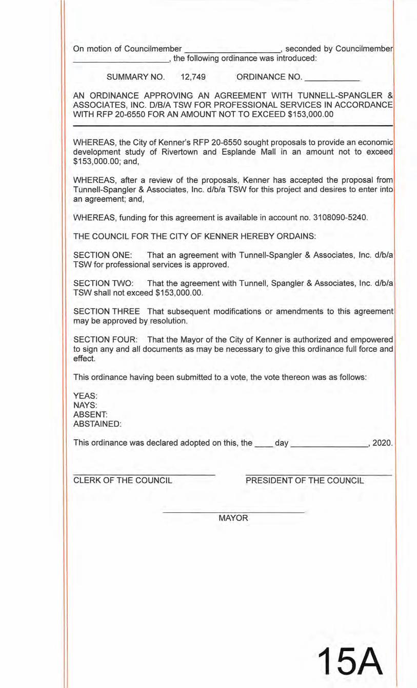
On motion of Councilmember , seconded by Councilmember __________ ,the following ordinance was introduced:
SUMMARY NO. 12,749 ORDINANCE NO. ____ _
AN ORDINANCE APPROVING AN AGREEMENT WITH TUNNELL-SPANGLER & ASSOCIATES, INC. D/B/A TSW FOR PROFESSIONAL SERVICES IN ACCORDANCE WITH RFP 20-6550 FOR AN AMOUNT NOT TO EXCEED $153,000.00
WHEREAS, the City of Kenner's RFP 20-6550 sought proposals to provide an economic development study of Rivertown and Esplande Mall in an amount not to exceed $153,000.00; and,
WHEREAS, after a review of the proposals, Kenner has accepted the proposal from Tun nell-Spangler & Associates, Inc. d/b/a TSW for this project and desires to enter into an agreement; and,
WHEREAS, funding for this agreement is available in account no. 3108090-5240.
THE COUNCIL FOR THE CITY OF KENNER HEREBY ORDAINS:
SECTION ONE: That an agreement with Tunneii-Spangler & Associates, Inc. d/b/a TSW for professional services is approved.
SECTION TWO: That the agreement with Tunnell, Spangler & Associates, Inc. d/b/a TSW shall not exceed $153,000.00.
SECTION THREE That subsequent modifications or amendments to this agreement may be approved by resolution.
SECTION FOUR: That the Mayor of the City of Kenner is authorized and empowered to sign any and all documents as may be necessary to give this ordinance full force and effect.
This ordinance having been submitted to a vote, the vote thereon was as follows:
YEAS: NAYS: ABSENT: ABSTAINED:
This ordinance was declared adopted on this, the __ day , 2020.
CLERK OF THE COUNCIL PRESIDENT OF THE COUNCIL
MAYOR
15A
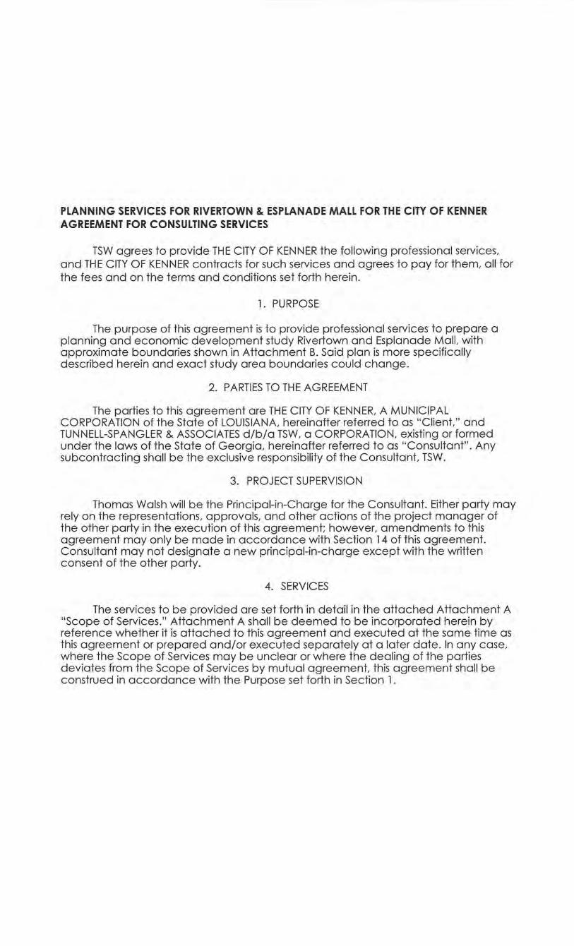
PLANNING SERVICES FOR RIVERTOWN & ESPLANADE MALL FOR THE CITY OF KENNER AGREEMENT FOR CONSULTING SERVICES
TSW agrees to provide THE CITY OF KENNER the following professional services, and THE CITY OF KENNER contracts for such services and agrees to pay for them, all for the fees and on the terms and conditions set forth herein.
1. PURPOSE
The purpose of this agreement is to provide professional services to prepare a planning and economic development study Rivertown and Esplanade Mall, with approximate boundaries shown in Attachment B. Said plan is more specifically described herein and exact study area boundaries could change.
2. PARTIES TO THE AGREEMENT
The parties to this agreement are THE CITY OF KENNER, A MUNICIPAL CORPORATION of the State of LOUISIANA, hereinafter referred to as "Client, " and TUNNELL-SPANGLER & ASSOCIATES d/b/a TSW, a CORPORATION, existing or formed under the laws of the State of Georgia, hereinafter referred to as "Consultant" . Any subcontracting shall be the exclusive responsibility of the Consultant, TSW.
3. PROJECT SUPERVISION
Thomas Walsh will be the Principal-in-Charge for the Consultant. Either party may rely on the representations, approvals, and other actions of the project manager of the other party in the execution of this agreement; however, amendments to this agreement may only be made in accordance with Section 14 of this agreement. Consultant may not designate a new principal-in-charge except with the written consent of the other party.
4. SERVICES
The services to be provided are set forth in detail in the attached Attachment A "Scope of Services." Attachment A shall be deemed to be incorporated herein by reference whether it is attached to this agreement and executed at the same time as this agreement or prepared and/or executed separately at a later date. In any case, where the Scope of Services may be unclear or where the dealing of the parties deviates from the Scope of Services by mutual agreement, this agreement shall be construed in accordance with the Purpose set forth in Section 1 .
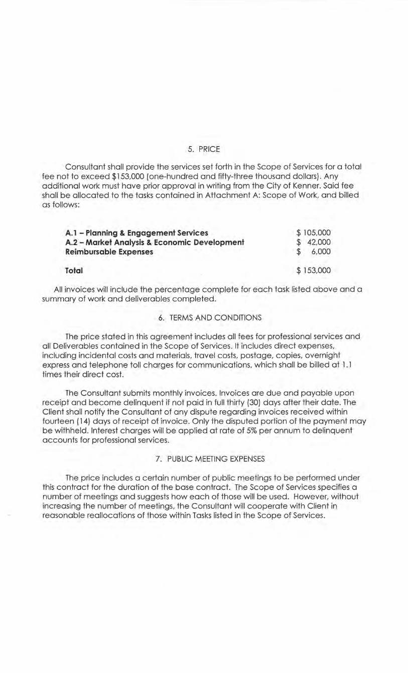
5. PRICE
Consultant shall provide the services set forth in the Scope of Services for a total fee not to exceed $153,000 (one-hundred and fifty-three thousand dollars). Any additional work must have prior approval in writing from the City of Kenner. Said fee shall be allocated to the tasks contained in Attachment A: Scope of Work, and billed as follows:
A.l - Planning & Engagement Services A.2 - Market Analysis & Economic Development Reimbursable Expenses
Total
$ 105,000 $ . 42,000 $ 6,000
$ 153,000
All invoices will include the percentage complete for each task listed above and a summary of work and deliverables completed.
6. TERMS AND CONDITIONS
The price stated in this agreement includes all fees for professional services and all Deliverables contained in the Scope of Services. It includes direct expenses, including incidental costs and materials, travel costs, postage, copies, overnight express and telephone toll charges for communications, which shall be billed at 1 . 1 times their direct cost.
The Consultant submits monthly invoices. Invoices are due and payable upon receipt and become delinquent if not paid in full thirty (30) days after their date. The Client shall notify the Consultant of any dispute regarding invoices received within fourteen ( 14) days of receipt of invoice. Only the disputed portion of the payment may be withheld . Interest charges will be applied at rate of 5% per annum to delinquent accounts for professional services.
7. PUBLIC MEETING EXPENSES
The price includes a certain number of public meetings to be performed under this contract for the duration of the base contract. The Scope of Services specifies a number of meetings and suggests how each of those will be used. However, without increasing the number of meetings, the Consultant will cooperate with Client in reasonable reallocations of those within Tasks listed in the Scope of Services.
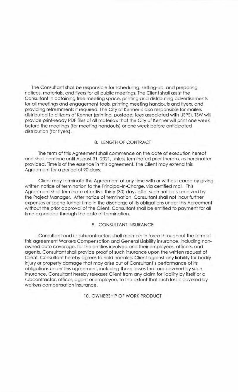
The Consultant shall be responsible for scheduling, setting-up, and preparing notices, materials, and flyers for all public meetings. The Client shall assist the Consultant in obtaining free meeting space, printing and distributing advertisements for all meetings and engagement tools, printing meeting handouts and flyers, and providing refreshments if required. The City of Kenner is also responsible for mailers distributed to citizens of Kenner (printing, postage, fees associated with USPS). TSW will provide print-ready PDF files of all materials that the City of Kenner will print one week before the meetings (for meeting handouts) or one week before anticipated distribution (for flyers).
8. LENGTH OF CONTRACT
The term of this Agreement shall commence on the date of execution hereof and shall continue until August 31, 2021, unless terminated prior thereto, as hereinafter provided. Time is of the essence in this agreement. The Client may extend this Agreement for a period of 90 days.
Client may terminate this Agreement at any time with or without cause by giving written notice of termination to the Principal-In-Charge, via certified mail. This Agreement shall terminate effective thirty (30) days after such notice is received by the Project Manager. After notice of termination, Consultant shall not incur further expenses or spend further time in the discharge of its obligations under this Agreement without the prior approval of the Client. Consultant shall be entitled to payment for all time expended through the date of termination.
9. CONSULTANT INSURANCE
Consultant and its subcontractors shall maintain in force throughout the term of this agreement Workers Compensation and General Liability insurance, including nonowned auto coverage, for the entities involved and their employees, officers, and agents. Consultant shall provide proof of such insurance upon the written request of Client. Consultant hereby agrees to· hold harmless Client against any liability for bodily injury or property damage that may arise out of Consultant's performance of its obligations under this agreement, including those losses that are covered by such insurance. Consultant hereby releases Client from any claim for liability by itself or a subcontractor, officer, agent or employee, to the extent that such loss is covered by workers compensation insurance.
10. OWNERSHIP OF WORK PRODUCT
All documents and materials prepared pursuant to this agreement are the property of Client and the concerned funding agencies, although Consultant may retain physical possession of them for convenience of Client. Client shall have the unrestricted authority to publish, disclose, distribute and otherwise use, in whole or in part, any reports, data or other materials prepared under this agreement. Unless otherwise specified in writing by Client, Consultant may presume that any document delivered to Client is a public document
11. REMEDIES- LEGAL AND EQUITABLE
In case of the default of either party under this agreement, the other party, after offering the defaulting party any right to cure provided hereunder within ten ( 1 0) days, may seek any legal or equitable remedies otherwise available, including but not limited to payment, damages, rescission, and/or specific performance. Such remedies shall exist notwithstanding the termination of the agreement. The remedies for default shall survive the termination of the agreement, although a right of specific performance shall not survive a termination in accordance with the terms of this agreement.
12. CONSTRUCTION
This agreement shall be reasonably construed under the laws of the State of Louisiana to give effect to its purpose. Words shall be given in their common ordinary meanings unless the context clearly otherwise requires. The singular shall include the plural, as the context may suggest and words of one gender shall include such other gender(s) as the context may suggest.
13. NOTICES Any notice required by this agreement shall be sent by certified mail, with return
receipt requested .
14. COMPLETE AGREEMENT I AMENDMENTS
In contracting with Consultant the Client warrants that funds are available to compensate Consultant for the total amount of services and expenses contracted, and that these funds are neither encumbered nor contingent upon subsequent approvals, permits, or financing commitments by lending institutions or other parties.
Account delinquency longer than forty-five (45) days may result in the stoppage of work on the job by Consultant and any sub-consultants. Seven (7) days notice will
be given prior to stoppage of work to enable accounts to be brought current. Work will recommence upon payment of all fees and service charges due. In some cases additional fees will be required to stop and start work because of account delinquency.
This agreement, together with Attachment A Scope of Services, Attachment B, Study Boundaries, and Attachment C, City of Kenner's Terms and Conditions, and any other attachments specifically enumerated herein, constitutes the complete agreement between parties. It may be amended only in writing and executed by the Principal-in-Charge and upon approval of the Client Project Manager or designee. This agreement may be executed in multiple counterparts, each of which shall be considered an original. When this agreement has been signed by both parties, it shall constitute a binding agreement and shall be binding upon and inure to the benefit of the parties and their respective successors and assigns.
IN WITNESS WHEREOF, the parties have executed the specific services in the Scope of Services contained in agreement separately, on the dates indicated by their respective signature blocks below. If the date of this agreement becomes material for any reason, the date of execution by Client shall be considered to be the date of the agreement.
ATTACHMENT A: Scope of Work
TASK 1: SCOPING SESSION & TEAM MEETINGS
l. Hold an Initial Virtual Scoping and Consultation Session with City of Kenner staff to finalize: • Points of contact and protocol for communication. • A vail able data resources. Should additional base materials be needed, determine
who will be responsible for gathering materials. City of Kenner will provide GIS shap efiles for the TSW Team to use.
• Study area boundaries. • Stakeholder Committee members. • Detailed schedule and tentative dates for meetings, review periods, and
deliverables. • Public engagement plan. • Roles and responsibilities.
2. Collect available data from locaL regional, state, and private resources as determined in the Initial Scoping and Consultation Session. Note: City of Kenner to provide GIS data.
3. Conduct an assessment of any existing planning studies to avoid duplication of efforts and build on the work already accomplished. Note: City of Kenner 1!2_provide all e.lans to review.
4. Project Management Team Meetings. The TSW Team and City staff will meet once monthly to review the project schedule, public engagement materials, and other deliverables to ensure we are on the same page. Most of these will occur via video conference, but if they can be aligned with site visits, such as during public meeting trips, we will schedule an in-person team meeting. In addition to these meetings, the TSW project manager will be in consistent contact with City staff to ensure the project moves forward according to schedule.
TASK 2: PUBLIC ENGAGEMENT PLAN
The TSW Team will refine the Public Engagement Plan during the Initial Scoping and Consultation Session. The full strategy will include both in-person and virtual methods for each meeting. We anticipate consistent coordination with City staff, the Main Street Board, and Economic Development Advisory Board to ensure that we are on track w ith our analysis and recommendations. Although two separate plans will be created, we will conduct a streamlined public engagement process including both study areas. Based on our current project understanding and limitations from the COVID-19 pandemic, the team anticipates the following Public Engagement activities:
- 6 -

1. Public Kick-off Meeting will be conducted at the beginning of the project to introduce the planning process, discuss plan goals, provide dates for key opportunities for public input, and gather and document comments regarding study area strengths, weaknesses, opportunities, and threats (SWOT Analysis). This meeting will occur inperson or via video conference with interactive polling and activities on Social PinPoint (see number 5).
2. Property Owner and Stakeholder Interviews I Focus Groups with public sector officials/agencies and private sector stakeholders to better understand the needs and opportunities of the two sites. With the help of Lynda Nugent-Smith and TSW, the City will identify all the stakeholders that should have individual interviews. The City and Lynda Nugent-Smith will the set up all interviews. These will occur via video conference and I or on the same trip as the Public Kick-off Meeting.
3. Work Sessions with Main Street Board and Economic Development Advisory Board. The TSW Team will coordinate with the Main Street Board and Economic Development Advisory Board up to three (3) times at key points in the process. These boards will serve as the steering committee. The meetings will occur during the Public Kick-off trip, Charrette trip, and virtually before the Final Public Open House or right before City Council Adoption. Note: the TSW Team reserves· the right to host all these meetings via video conference due to limitations from the COVID-19 pandemic.
4. Project Website. TSW will provide project materials and information to be uploaded to the City 's website.
5. Virtual Engagement. TSW Team will host up to all public meetings and engagement techniques using virtual engagement tools, including but not limited to video conferencing software and Social PinPoint. We will use Social PinPoint as the host site for the effort, which will include the following tools to choose from:
• Interactive Mapping • Idea Walls • Surveys • Discussion Forums • Virtual Meeting Integrations • Participatory Budgeting
The City 's website page dedicated to this planning effort will link directly to Social PinPoint. In addition to the above tools, we can use this platform for "intercept surveys" by placing signs in areas where people are walking or visiting that link to specific questions on Social PinPoint.
6. Conduct a Charrette. TSW's typical charrette is three (3) days of work sessions engaging planners, architects, landscape architects, engineers, market analysts, City staff and
- 7 -
officials, and various stakeholders to begin developing a cohesive vision. We will work as a whole group for some activities and in specified teams for others.
• Two (2) days of the Charrette will conclude with a Public Open House or Education Session. The Open Houses will be an opportunity for the TSW Team to present background information and preliminary recommendations and gather feedback.
• The TSW Team will develop a contingency plan for a virtual charrette.
7. Conduct a Final Public Open House. At the Final Open House, the TSW Team will present our final recommendations and provide next steps for implementation. This Open House can be tied with Social PinPoint for participatory budgeting and other activities to help prioritize key projects.
8. City Council Adoption. TSW will develop and give the final presentation for City Council adoption. However, this will not be the first time we engage with City Council. We would like to meet with councilmembers during the focus groups I stakeholder interviews and at the charrette to keep them informed of the project's progress.
9. Public Engagement Advertising. Aside from the project website (number 4), the City will advertise public meetings through all appropriate channels. The Consultant shall be responsible for scheduling, setting-up, and preparing notices, materials, and flyers for all public meetings. The Client shall assist the Consultant in obtaining free meeting space, printing and distributing advertisements for all meetings and engagement tools, printing meeting handouts and flyers, and providing refreshments if required. The City of Kenner is also responsible for mailers distributed to citizens of Kenner (printing, postage, fees associated with USPS) . TSW will provide print-ready PDF files of all materials that the City of Kenner will print one week before the meetings (for meeting handouts) or one week before anticipated distribution (for flyers). Lynda Nugent-Smith will help advertise the meetings and identify the best methods for advertisement.
TASK 3: INVENTORY AND ANALYSIS
1. Site Visits. The TSW Team will visit the Rivertown and Esplanade Mall sites to gather information for the site analysis. Some of the critical areas we will try to better understand include:
• Site context - How do the surrounding neighborhoods interface with the current development? Are any other large projects planned in the immediate area?
• Current and future circulation needs. o Vehicle o Pedestrian o Bike o Are there any trail connections planned for the property for surrounding
neighborhoods? • Existing development- What is the life cycle of the existing buildings? Are the
buildings currently leased up?
- 8 -
• How many vacancies exist? Are current rental rates competitive? Are most leases short- or long-term?
• Are there any current plans for the sites? We need to explore with land owners what their long-term outlook goals are_.
• Physical constraints, if any.
2. Existing Conditions and Mapping. TSW will review and analyze existing land uses, zoning, GIS data, aerial photos, utility plans and data, list of regulatory agencies with legal jurisdiction that could be involved in the project, and current and past planning and programming studies and documents. TSW will develop mapping and supporting narrative for Rivertown and Esplanade Mall, highlighting trails, rivers, streams, utility easements, jurisdictional boundaries, property setbacks and buffers, zoning classifications, and major landmarks. (Should the provided GIS data not provide said information, the City will determine if additional surveys or data gathering is needed at additional cost to the project).
3. Market Analysis. Building on the existing retail and hotel market analyses conducted in 2019, Noell Consulting Group (NCG) and Randy Gibbs will prepare an assessment of Kenner real estate to better understand the market overall, including price points, lease rates, absorption, etc. to help determine the scale of development potential and the risk/reward potential for multiple development options at each site. This work has two major objectives:
• Conducting a market analysis to identify specific redevelopment opportunities for the study area through:
o Understanding the market audiences fueling demand for residential and commercial real estate products in and around the study area and the greater area, including an examination of population, household, and employment growth in an applicable Competitive Market Area and the larger market, the size and growth of major economic drivers, growth by employment type, small business growth, and other potential audiences that could create demand (commuters, visitors, and shoppers), etc.;
o Surveying current businesses and potential business prospects for thoughts on market conditions;
o Quantifying demand potential for real estate products created by these audiences and the ways this demand potential can be best captured;
o Reviewing the previous studies for the area, including the 2019 Retail and Hotel Market Analyses;
o Placing the study areas in the context of greater market trends; o Preparing a matrix summarizing the key land uses examined, current and
likely future trends, suitability for the study area, demand potential in the coming years, desired/appropriate formats, intensity characteristics, and key barriers that must be addressed to feasibly deliver the products; and
- 9-
o Identifying the lifestyle proposition, mix of products, and market position the study area/site can offer to maximize its market potential and attractiveness in the market.
• Identifying key barriers to realizing these opportunities, including market, financial, and physical barriers, and understanding how these barriers can be eliminated to maximize potential for success (described more in Task 4).
TASK 4: CONCEPT PLANS & IMPLEMENTATION PLAN
1. Prepare Concept Plans & Proformas. TSW will develop concept plans for both the Rivertown and Esplanade Mall sites based on findings from the analysis and engagement process. This process will uncover a vision and a set of goals and principles, which the design and planning recommendations will reflect. Each plan will have a distinctive feel to the solution, addressing unique factors to each study area, and be guided by the following parameters:
• A strong community vision that stems from the public engagement process • Recommendations that can attract private investment • Concept plans that show mixed-use environments with housing, retail, businesses,
and public space • Recommendations that can help grow retail sales and sales tax revenues • Step-by-step implementation action plans.
The TSW team will create up to two (2) draft concept plans for both Rivertown and Esplanade Mall. One ( 1) final concept plan for each site will be created based on public feedback, City review, and comments from the Main Street and Economic Development Advisory Boards.
Final concept plans will show building footprints, uses, street layout, parking, and amenities. They will include a narrative description, programming data, and rough order of magnitude costs. As part of the concept plan development process, Noell Consulting Group and Randy Gibbs will work with TSW to verify feasibility and calculate comparative cost I benefit for the draft scenarios. Each draft concept will be tested for each site to determine the best outcome. One ( 1) final proforma for the final concept plan will be created that indicates general feasibility under market conditions.
2. Prepare Implementation and Action Plans. The implementation section will describe action steps for how to implement the plans and spur economic development in the study areas. The Implementation Plan describes the organizational structure and process that will be used to help ensure the Action Plan items are implemented. The team will focus on collaboration opportunities with other organizations and strategies to ensure continued support from local elected officials, citizens, and businesses. The Action Plan will include policy, regulatory, and project recommendations developed during the process that detail timeframe, phasing, rough order of magnitude cost estimates, responsible parties I partnership opportunities, and potential funding sources.
- 10 -
The economic development components will include: • Creating back-of-the-envelope financial analyses to understand the financial
feasibility of the recommendations. We will identify potential financial gaps that must be addressed.
• Conducting interviews with developers to understand the barriers they encounter, their perspectives on developing in the study areas, and how the City and other key entities can aid in their process.
• Suggest new policies and programs, or recommend adjustments to existing ones, that will maximize potential for delivery of identified projects.
3. Develop additional maps, visioning graphics, and tables/charts as needed to support ·plan recommendations not noted above, including:
• Streetscape section renderings for nearby or internal streets • 3D perspective renderings for Rivertown and Esplanade Mall [up to three (3) per
site]
TASK 5: FINAL DELIVERABLES TSW will prepare a final document that includes the following:
1 . Overall Project Chapters: • Overall existing conditions report, including inventory and analysis mapping,
affecting both study areas • Market conditions affecting both study areas • Public engagement results for both Rivertown and Esplanade Mall
2. Separate Chapters for Rivertown and Esplanade Mall (that can be "pull-out" documents) that include: • Site-specific existing conditions maps and narrative • Market specifics for each site • One ( 1) illustrative concept plan • One ( 1) Programming and Land Use Summary • Up to three (3) 3D perspective renderings showing what the concept plans could
look like • Rough order of magnitude costs for each conceptual plan • Pro formas, including ROL for each conceptual plan • Economic development strategy for each site • Implementation Action Plan for each site ·
TSW will provide the PDF and Adobe lnDesign versions of the final document and all digital files used and created for the project. TSW will provide up to three (3) printed copies of the final report.
- 11 -

V)
z 0 !:: c z 0 u c z N
<( V)
a.. :e o=::
<( w :e ~
V) V) i:rr:: w w o=:: z <( z c w z ~
. :J u.. 0 0 lllQ >-w !:: !:: u V) .. . lllQ u ~ ~ z z w w :e :e ::I: ::I: u u <( <( ~ I= ~ <( <(
Attachment B
Esplanade Mall Area
:>
< --· ·-- .., vv masong Apan:mems
Walgreens
ll1r Ln
It Ln
~ ~ ~ ~ ~
<J
Ubra Ln
.n
·on Ct
al Number rwelve
Regal Grand 5 Esplanade & GPX .:= Standard venue for..
"0 ..:t a:: "0
'0 cr c
"0 .:,
~ 0:: m u .c. ii .. "-I") .. c (I)
"' u
~ tl) .,. 0 )lo :=! c: ;::: c J( s·
)> C>
!2 a ~ ~ 0 ~ , VI ::I
.0
0 !:) 0 ~~ g
~ ""' - :J: > a; I
:::1 g
'? ~ (I) ~ c '!) - ~ til ~ ~ - ,.,
::i e.>
~
-w U'
..
0 ~ 0
~
"" ..., Ul c::: r:l 36th St
Esplanade Mall ~ ..:t
~ngRd
11.1 > <t
'a Q
The Esplanade Mall with ice skating & a Target
0 0 u
Harbor Seafood 32nd sr & Oyster Bar
c. ' ,O carMax ::r 0
lfl c ';:)
ll :.t St n . Used car dealer ~
s d}
~ ~ I· lO Srv Rd
I!! '!:.~
Foe
32nd St
1::1
® > ~ < Q
E> 0 dJ
(!)
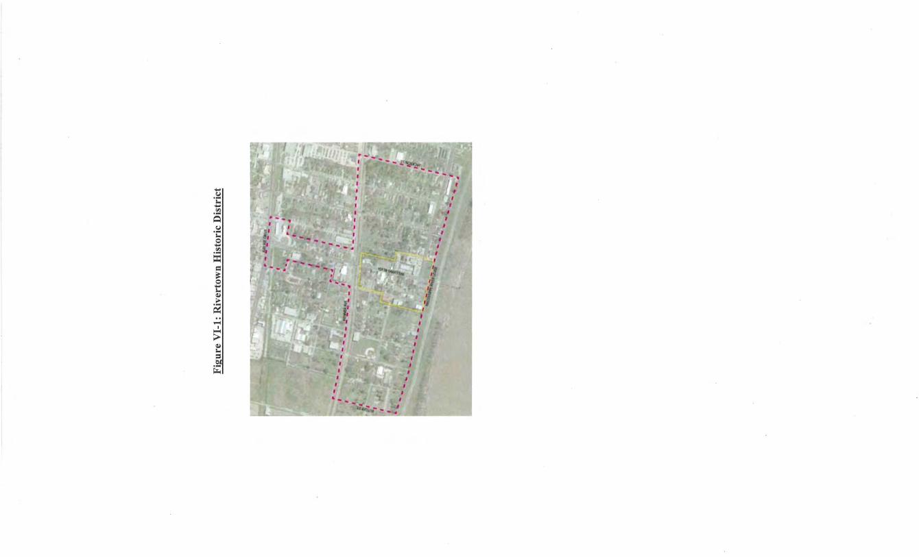
Attachment C Kenner Terms and Conditions
Conflict of Interest: By signing this Agreement, the Consultant covenants that there is no public or private interest, direct or indirect, and shall not acquire directly or indirectly in the future any such interest which does or may conflict in any manner with the performance of services rendered by the Consultant or obligations under this Agreement. Any conflicts shall be timely disclosed to Client and Client shall determine whether the conflict is cause for non-execution or termination of this Agreement. The Consultant further covenants that, in the performance of this Agreement, no person having such an interest as described above shall be employed by the Consultant.
Discrimination: The Consultant agrees to abide by the requirements of the following as applicable: Title VI and VII of the Civil Rights Act of 1964, as amended by the Equal Opportunity Act of 1972, Federal Executive Order 11246, the Federal Rehabilitation Act of 1973, as amended, the Vietnam Era Veteran's Readjustment Assistance Act of 1974, Title IX of the Education Amendments of 1972, the Age Act of 1975, and Consultant agrees to abide by the requirements of the Americans with Disabilities Act of 1990. Consultant agrees to provide a work environment free of potential harassment and not to discriminate in its employment practices, and will render services under this Agreement without regard to race, color, religion, sex, sexual orientation, national origin, veteran status, political affiliation, or disabilities. Any act of discrimination committed by Consultant, or failure to comply with these statutory obligations when applicable shall be grounds for termination of this Agreement.
Audit: When applicable, it is agreed that Client or its designee shall have the option of auditing all accounts of the Consultant, which relate to this Agreement.
Non-assignability: Consultant shall not assign any interest in this Agreement and shall not transfer any interest in the same (whether by assignment or novation), without the prior written consent of Client thereto, provided, however, that claims for money due or to become due to the Consultant from Client under this Agreement may be assigned to a bank, trust company, or other financial institution without such approval. Notice of any such assignment or transfer shall be promptly furnished to Client.
Taxes: Consultant hereby agrees that the responsibility for payment of taxes from the funds thus received under this Agreement and/or council appropriation shall be said Consultant's obligation as per La. R. S. 47:301 et seq., all governmental bodies are excluded from payment of sales taxes to any Louisiana taxing body.
Independent Contractor: While in the performance of providing services or carrying out obligations under this Agreement, Consultant and/or its employees shall be acting in the capacity of independent Consultant(s) and not as employee(s) of Client. Client shall not be obligated to any person, Consultant, corporation, or other entity for any obligation of the Consultant arising from performance of services under this Agreement. Consultant herein expressly acknowledges
and agrees that nothing contained in this Agreement shall be construed in any manner as creating or establishing the relationship of employer/employee between the Consultant and Client. It is further expressly declared and acknowledged between the parties entering into this Agreement that the Consultant and/or its employees are independent Consultant(s) and as such shall not receive nor be entitled to any benefits from Client, including but not limited to benefits relating to life and/or medical insurance, workers' compensation coverage, accrued sick or annual leave, retirement, FICA, social security, or unemployment compensation coverage. Sole compensation consists of fees earned in connection with the scope of work described above and the terms of payment agreed to by the parties.
Hold Harmless: Consultant agrees to protect, defend, indemnify, save and hold harmless the Client, all Client Departments, Agencies, Boards and Commissions, its officers, agents, servants and employees, including volunteers, from and against any and all claims, demands, expense and liability arising out of injury or death to any person or the damage, loss or destruction of any property which may occur or in any way grow out of any act or omission of the Consultant, its agents, servants, and employees or any and all costs, expenses and/or attorney fees incurred by the Consultant as a result of any claim, demands, and/or causes of action except for those claims, demands, and/or causes of action arising out of the negligence of the Client, all Client Departments, Agencies, Boards, Commissions, its agents, representatives, and/or employees. Consultant agrees to investigate, handle, respond to, provide defense for and defend any such claims, demand, or suit at its sole expenses and agrees to bear all other costs and expenses related thereto, even if it (claims, etc.) is groundless, false or fraudulent.
Fiscal Funding: This Agreement is subject to and contingent upon the continued availability and appropriation of funds to fulfill the requirements of the Agreement by the Kenner City Council. If the Council fails to appropriate sufficient funds to provide for the continuation of the Agreement, or if such appropriation is reduced by the veto of the Mayor or by any means provided for in the Kenner Charter to prevent the total appropriation for the year from exceeding the revenues for that year, or for any other lawful purpose, and the effect of such reduction is to provide insufficient funds for the continuation of the Agreement, the Agreement shall terminate on the date of the beginning of the fiscal year for which funds are not appropriated. It is the responsibility of the Consultant to advise Client in advance if Agreement funds or Agreement terms may be insufficient to complete Agreement objectives.
Code of Ethics: The Consultant acknowledges that La. R. S. 42 :1101 et seq., Code of Governmental Ethics applies to the Consultant in the performance of services and work called for in this Agreement. The Consultant agrees to immediately notify Client if potential violations of the Code of Governmental Ethics arise at any time during the term of this Agreement.
Severability: The parties to this Agreement understand and agree that the provisions, shall, between them, have the effect oflaw, but in reference to matters not provided, the Agreement shall be governed by the regulations of the United States and the laws of the State of Louisiana. If any provision of this Agreement is held to be illegal, invalid, or unenforceable under present or future
laws effective during the term of this Agreement, such provision is fully severable, and this Agreement must be construed and enforced as if such illegal, invalid, or unenforceable provisions never comprised a part of this Agreement; and the remaining provisions of this Agreement remain in full force and effect and may not be affected by the illegal, invalid, or unenforceable provision or its severance from this Agreement.
Applicable Law and Venue: This Agreement shall be consummated in the State of Louisiana and shall be governed and/or construed in accordance with the laws of the State of Louisiana. The parties agree that the sole and exclusive venue for any suit or proceeding brought pursuant to this Agreement will shall be in the Twenty-Fourth · Judicial District Court; and by entering this Agreement, the Consultant expressly waives any objections to jurisdiction and venue, regardless of the Consultant's residence or domicile. In the event that either Client or the Consultant commences a legal proceeding to enforce or interpret any of the terms of this Agreement or to terminate this Agreement, the prevailing party in any such suit shall receive from the other a reasonable sum as attorney's fees and court costs as may be fixed by the court.
Federal Clauses: Consultant agrees to the following miscellaneous terms and provisions for all federally funded and reimbursable agreements:
Consultant shall comply with Executive Order 11246 of September 24, 1965, entitled, "Equal Employment Opportunity", as amended by Executive Order 11375 of October 13, 1967, and as supplemented in Department of Labor Regulations ( 41 CFR Chapter 60).
Consultant shall comply with the Copeland "Anti-Kickback" Act of (18 U.S.C. 874) as supplemented in Department of Labor Regulations (29 CFR Part 3).
Consultant shall comply with Sections 1 03 and 107 of the Agreement Work Hours and Safety Standards Act (40 U.S.C. 327-330) as supplemented by Department of Labor Regulations (29 CRF Part 5).
Consultant shall comply with all notices of awarding agency requirements and regulations pertaining to reporting .
. Consultant shall comply with all notice of awarding agency requirements and regulations pertaining to patent rights with respect to any discovery or invention, which arises or is developed in the course of or under such Agreement.
Consultant shall comply with all awarding agency requirements and regulations pertaining to copyrights and rights in data.
Consultant shall provide access by the State of Louisiana, Kenner, United States of America, FEMA, the Controller General of the United States, or any of their duly authorized representatives, to any books, documents, papers and records of the Consultant

which are directly pertinent to this specific Agreement for the purpose of making audit, examination or excepts, and transcriptions.
Consultant shall retain all required records for a period of at least three years after the State of Louisiana or Client has made final payments and all other pending matters are closed.
Consultant shall comply with all applicable standards, orders or requirements issued under Section 306 ofthe Clean Air Act (42 U.S.C. 1857(h)). Section 508 ofthe Clean Water Act (33 U.S.C. 1368), Executive Order 11738, Environmental Protection Agency Regulations (40 CFR Part 15).
Consultant shall comply with all mandatory standards and policies relating to energy efficiency which are contained in the State Energy Conservation Plan issued in compliance with the Energy Policy and Conservation Act (Public Law 93-163, 89 STAT 871).
Consultant certifies that Consultant will not and has not used any Federal funds to influence an employee or member of Congress in obtaining any federal award (Byrd Anti-Lobbying Amendment).
Consultant declares that Consultant, its principles or affiliates, are not currently disqualified as a result of debarment or suspension.

On motion of Councilmember , seconded by Councilmember __________ , the following resolution was offered:
RESOLUTION NO. ___ _
A RESOLUTION APPROVING AMENDMENT NO. 2 TO THE AGREEMENT WITH MEYER ENGINEERS, LTD. REGARDING THE KENNER FEMA STREETI RENOVATION PROJECT PW20831 FOR AN INCREASE OF $65,355.00 FOR THE DEPARTMENT OF PUBLIC WORKS
WHEREAS, on August 30, 2019, the City of Kenner entered into an agreement with Meyer Engineers LTD. for the Kenner FEMA Street Renovation project seeping and evaluation phase in an amount not to exceed $75,000.00; and,
WHEREAS, on April 7, 2020, the City of Kenner entered into Amendment No. 1 for an increase of $155,612.00 for additional services; and,
WHEREAS, additional funding is needed to accommodate expanded locations; and,
WHEREAS, funding is available in Account No. 35430301-5716-20831.
THE COUNCIL FOR THE CITY OF KENNER HEREBY RESOLVES:
SECTION ONE: That Amendment No. 2 to the agreement with Meyer Engineers LTD. dated August 30, 2019 for the Kenner FEMA Street Renovation Project PW20831 is hereby approved.
SECTION TWO: That any additional amendments to this agreement may be approved by resolution.
SECTION THREE: That the mayor of the City of Kenner is authorized to execute any and all documents as may be necessary to fulfill the intent of this resolution.
This resolution having been submitted to a vote, the vote thereon was as follows:
YEAS: NAYS: ABSENT: ABSTAINED:
This resolution was declared adopted on this, the day of 2020.
CLERK OF THE COUNCIL PRESIDENT OF THE COUNCIL
MAYOR
SUBMITTED BY: Thomas M. Schreiner, PW DCAO
158
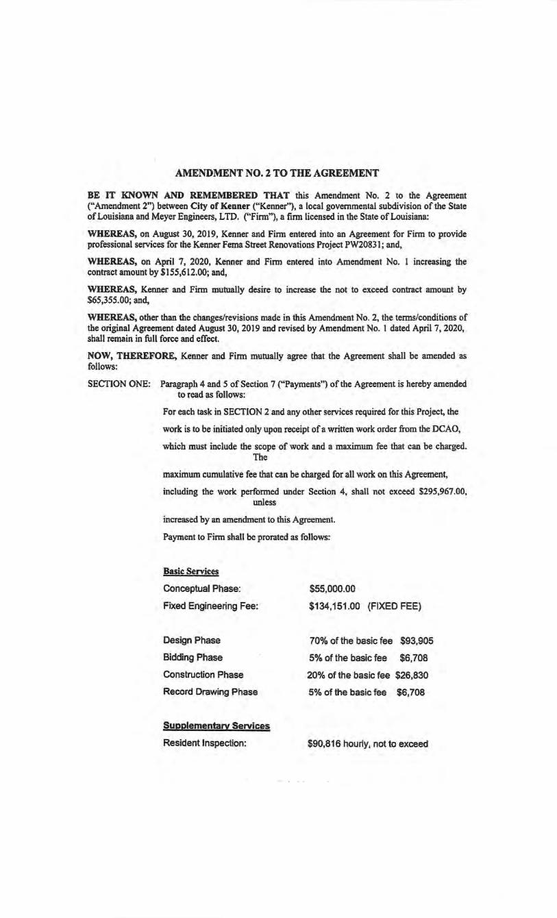
AMENDMffiNTN0.2TOTHEAGREEMENT
BE IT KNOWN AND REMEMBERED THAT this Amendment No. 2 to the Agreement ("Amendment 2") between City of Kenner ("Kenner"), a local governmental subdivision of the State of Louisiana and Meyer Engineers, LTD. ("Firm,.), a firm licensed in the State of Louisiana:
WHEREAS, on August 30, 2019, Kenner and Firm entered into an Agreement for Firm to provide professional services for the Kenner Fema Street Renovations Project PW20831; and,
WHEREAS, on April 7, 2020, Kenner and Finn entered into Amendment No. 1 increasing the contract amount by $155,612.00; and, ·
WHEREAS, Kenner and Finn mutually desire to increase the not to exceed contract amount by $65,355.00; and,
WHEREAS, other than the changes/revisions made in this Amendment No. 2, the terms/conditions of the original Agreement dated August 30, 2019 and revised by Amendment No. I dated April?, 2020, shall remain in full force and effect.
NOW, THEREFORE, Kenner and Firm mutually agree that the Agreement shall be amended as follows:
SECfiON ONE: Paragraph 4 and 5 of Section 7 ("Payments") of the Agreement is hereby amended to read as follows:
For each task in SECTION 2 and any other services required for this Project, the
work is to be initiated only upon receipt of a written work order from the DCAO,
which must include the scope of work and a maximum fee that can be charged. The
maximum cumulative fee that can be charged for all work on this Agreement,
including the work performed under Section 4, shall not exceed $295,967.00, unless
increased by an amendment to this Agreement.
Payment to Firm shall be prorated as follows:
Basic Services
Conceptual Phase:
Fixed Engineering Fee:
Design Phase
Bidding Phase
Construction Phase
Record Drawing Phase
Supplementary Services
Resident Inspection:
$55,000.00
$134,151.00 (FIXED FEE)
70% of the basic fee $93,905
5% of the basic fee $6,708
20% of the basic fee $26,830
5% of the basic fee $6,708
$90,816 hourly, not to exceed

SECTION TWO:
Geotechnical Engineering
Topographic Survey
$3,500
$12,500
That Kenner and Firm also agree to the following:
• Amendment 2 may be executed in counterparts, each of which shall be deemed to be an original, but all of which, taken together, shall constitute Amendment 2.
• The recitals stated above are incorporated herein and expressly made part of this Amendment 2.
INTENDING TO BE LEGALLY BOUND, the parties have signed this Amendment 2 to the Agreement on the dates indicated below.
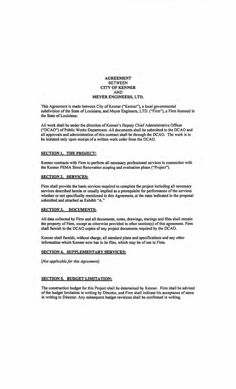
AGREEMENT BETWEEN
CITY OF KENNER AND
MEYER ENGINEERS, LTD.
This Agreement is made between City of Kenner ("Kenner"), a local governmental subdivision of the State of Louisiana, and Meyer Engineers, L TO. ("Firm"), a Firm licensed in the State of Louisiana:
All work shall be under the direction of Kenner's Deputy Chief Administrative Officer ("DCAO") of Public Works Department. All documents shall be submitted to the DCAO and all approvals and administration of this contract shall be through the DCAO. The work is to be initiated only upon receipt of a written work order from the DCAO.
SECTION 1. THE PROJECT:
Kenner contracts with Firm to perform all necessary professional services in connection with the Kenner FEMA Street Renovation scoping and evaluation phase ("Project").
SECTION 2. SERVICES!
Finn shall provide the basic services required to complete the project including all necessary services described herein or usually implied as a prerequisite for performance of the services whether or not specifically mentioned in this Agreement, at the rates indicated in the proposal submitted and attached as Exhibit "A."
SECTION 3. DOCUMENTS:
All data collected by Firm and all documents, notes, drawings, tracings and files shall remain the property of Firm, except as otherwise provided in other section(s) of this agreement. Firm shall furnish to the DCAO copies of any project documents required by the DCAO.
Kenner shall furnish, without charge, all standard plans and specifications and any other information which Kenner now has in its files, which may be of use to Firm.
SECTION 4. SUPPLEMENTARY SERVICES:
[Not applicable for this Agreement]
SECTIONS. BUDGET LIMITATION:
The construction budget for this Project shall be determined by Kenner. Firm shall be advised ofthe budget limitation in writing by Director, and Firm shall indicate his acceptance of same in writing to Director. Any subsequent budget revisions shall be confirmed in writing.
If, at the completion of the Preliminary or Design Phases, Firm does not concur with the construction budget, then Firm shall so notify Director. Firm and Kenner shall mutually agree on a revised construction budget prior to the commencement of work on the Design Phase.
If no bid is received within the budget limitation and a redesign ofProject is required by Kenner, such redesign shall be accomplished by Finn at no additional. cost to Kenner. However, if the receipt ofbids is for any reason delayed beyond a period of six (6) months from the date of the completion of the Design Phase, the amount stated as the construction budget shall be adjusted immediately prior to the time bids are received by use of a construction cost index acceptable to Kenner and Firm.
SECTION 6. NOTICE TO PROCEED:
Kenner, through the DCAO, shall notify Firm in writing to undertake the services stated in SECTION 2, and Firm shall commence the services within ten (10) days after receipt of such notification.
Firm will be given time extensions for delays beyond Firm's control or for those caused by tardy approvals of work in progress by various official agencies, but no additional compensation shall be allowed for such delays.
SECTION 7. PAYMENTS:
All invoices submitted shall contain an acknowledgement that no subcontractors or persons, excluding full time employees of the firm, have been added to work on this project without prior written approval from Kenner.
Work will be on an hourly rate, Kenner shall compensate Firm on the basis of the rates set out in Exhibit "A".
For each task in SECTION 2 and any other services required for this project, the work is to be initiated only upon receipt of a written work order form the DCAO, which must include the scope of work and a maximum fee that can be charged. The maximum cumulative fee that can be charged for all work on this Agreement, including the work performed under SECTION 4, shall not exceed seventy five thousand and 00/100 dollars ($75,000.00) unless increased by contract amendment approved by the Council for Kenner.
SECTION 8. FISCAL FUNDING:
Payment to Firm under this Agreement shall be contingent upon the availability of funds, as established in Kenner's budget.
SECTION 9. TERMINATION OR SUSPENSION:
The terms of this contract shall be binding upon the parties hereto until the work has been completed and accepted by Kenner and all payments required to be made to Finn have been made; but this contract may be terminated under any or all of the following conditions:
1. By mutual agreement and consent of the parties hereto. 2. By Kenner as a consequence of the failure of Firm to comply with the terms, progress
or quality of work in a satisfactory manner, proper allowance being made for circumstances beyond the control of Firm.
3. By either party upon failure of the other party to fulfill its obligations as set forth in their contract. ·
4. In the event of the abandonment of the Project by Kenner. 5. In the event Firm does not maintain a valid Louisiana Firming License. 6. Upon thirty (30) days written notice by Kenner to Firm.
This agreement shall automatically terminate upon satisfactory completion of all services and obligations described herein or two (2) years from the date of its execution, whichever event occurs first.
Upon termination, Firm shall be paid for actual work performed prior to the notice of termination on a pro-rata share of the basic fee based on the phase or percentage of work actually completed.
Upon termination under Item 2 above, Firm shall deliver to Kenner all original documents, notes, drawings, tracings, computer files, and files except Firm's personal and administrative files.
Should Kenner desire to suspend the work, but not definitely terminate the contract, this may be done by thirty (30) days written notice from DCAO to Firm, and the work may be
. reinstated and resumed in full force and effect upon receipt by Firm of thirty (30) days written notice from the DCAO. Firm shall receive no additional compensation.
Kenner shall terminate this professional services agreement in the event false or misleading information is given to Kenner in the professional services affidavit, or in the acknowledgement submitted with each invoice that no subcontractors or persons, excluding full time employees of the firm, have been added without prior approval by Kenner.
SECTION 10. INSURANCE: Finn shall secure and maintain, at its own expense, insurance coverage in accordance with the attached "Professional Engineering or Architect Services With $1,000,000 Professional Liability Limit Contract Insurance Specifications" attached as Exhibit "B".
SECTION II. GENERAL:
Finn shall, at all times during the term of this agreement, maintain a valid Louisiana Firming License.
The professional and technical adequacy and accuracy of designs, drawings, specifications, documents, and other work products furnished under this agreement will be conducted in a manner consistent with that level of care and skill ordinarily exercised by members of the profession. Where Kenner must have work done by change order or addition resulting from an
error or omission by Firm, Firm shall provide, at no costs to Kenner, all professional services attributable to the change order. This is in addition to Kenner's right to recover from Firm damages for Finn's errors and omissions.
Firm warrants that he has not employed or retained any company or person, other than a bonafide employee working solely for Firm, to solicit or secure this agreement, and that they have not paid or agreed to pay any company or person, other than bona-fide employees working solely for Firm, any fee, commission, percentage, brokerage fee, gifts, or any other consideration, contingent upon or resulting from the award or making of this contract. For breach or violation of this warranty, Kenner shall have the right to annul this agreement without liability. This agreement shall be binding upon the successors and assigns for the parties hereto. This agreement being for the personal services of Firm shall not be assigned or subcontracted in whole or in part by Firm as to the services to be performed hereunder without the written consent of Kenner.
This agreement shall be deemed to be a contract made under the laws of the State of Louisiana, and for all purposes shall be interpreted in its entirety in accordance with the laws of said state. Firm hereby agrees and consents to the jurisdiction of the courts of the State of Louisiana over its person. The parties hereto agree that the sole and exclusive venue for any suit or proceeding brought pursuant to this contract shall be the 241h Judicial District Court for the Parish of Jefferson, State of Louisiana.
SECTION 12. INDEPENDENT CONTRACTOR:
It is understood and agreed by the parties hereto that Firm is entering into this agreement in the capacity of an independent contractor. While in the performance of services or carrying out other obligations under this agreement, Firm shall be acting in the capacity of independent contractors and not as employees of Kenner. Kenner shall not be obliged to any person, firm or corporation for any obligations of Firm arising from the performance of their services under this agreement Firm shall be authorized to represent Kenner with respect to services being performed, dealings with other agencies, and administration and control of construction agreements as intended by the provisions of SECTION 2 hereof.
SECTION 13. INDEMNIFICATION: Firm shall indemnify and hold harmless Kenner against any and all claims, demands, suits, costs, liabilities or judgments for sums of money, and fines or penalties asserted by any party, firm or organization for loss of life or injury or damages to person or property, growing out of, resulting from, or by reason of any negligent acts, errors, and/or omissions, by Firm, its agents, servants or employees, while engaged upon or in connection with the services required to be performed by Firm under this agreement. Further, Firm hereby agrees to indemnifY Kenner for all reasonable· expenses and attorneys' fees incurred by or imposed upon Kenner in connection therewith for any loss, damage, injury or other casualty pursuant to this section. Finn further agrees to pay all reasonable expenses and attorneys' fees incurred by Kenner in establishing the right to indemnity pursuant to the provision of this section.
The above indemnification shall not apply to those claims, demands, and/or case of action arising out of the negligence of Kenner, its Departments, Agencies, Boards, Commissions, its agents, representatives and/or employees.
SECTION 14. FEDERAL CLAUSES: Firm agrees to the following miscellaneous terms and provisions, if applicable, for all federally funded and reimbursable contracts:
A.) Firm shall comply with Executive Order 11246 of September 24, 1965, entitled, "Equal Employment Opportunity", as amended by Executive Order 11375 ofOctober 13, 1967, and as supplemented in Department of Labor Regulations (41 CFR Chapter 60). B.) Firm shall comply with the Copeland "Anti-Kickback" Act ( 18 U.S.C. 874) as supplemented in Department of Labor Regulations (29 CFR Part 3). C.) Finn shall comply with Sections 103 and 107 of the Agreement Work Hours and Safety Standards Act (40 U.S.C. 327-330) as supplemented by Department ofLabor Regulations (29 CFR Part 5). D.) Firm shall comply with all notices of awarding agency requirements and regulations pertaining to reporting. E.) Firm shall comply with all notice of awarding agency requirements and regulations
pertaining to patent rights with respect to any discovery or invention which arises or is developed in the course of or under such agreement. F.) Firm shall comply with all awarding agency requirements and regulations pertaining to copyrights and rights in data. G.) Firm shall provide access by the State of Louisiana, Kenner, United States of America, FEMA, the Controller General of the United States, or any of their duly authorized representatives, to any books, documents, papers and records of the Firm which are directly pertinent to this specific Agreement for the purpose of making audit, examination or excepts, and transcriptions. H.) Firm shall retain all required records for a period of at least three years after the State of Louisiana or Kenner has made final payments and all other pending matters are closed. 1.) Firm shall comply with all applicable standards, orders or requirements issued under Section 306 of the Clean Air Act (42 U.S.C. 1857(h)), Section 508 of the Clean Water Act (33 U .S.C. 1368), Executive Order 11738, Environmental Protection Agency Regulations ( 40 CFR Part 1 5). J.) Firm shall comply with all mandatory standards and policies relating to energy
efficiency which are contained in the State Energy Conservation Plan issued in compliance with the Energy Policy and Conservation Act (Public Law 94-163, 89 STAT 871 ). K.) Firm certifies that Firm will not and has not used any Federal funds to influence an employee or member of Congress in obtaining any federal award (Byrd Anti-Lobbying Amendment). L.) Firm declares that Firm, its principles or affiliates (subcontractors), are not currently disqualified as a result of debarment or suspension.
SECTION IS. DISCRIMINATION CLAUSE:
Firm agrees to abide by the requirements of the following as applicable: Title VI and VII of the Civil Rights Act of 1964, as amended by the Equal Opportunity Act of 1972, Federal Executive Order 11246, the Federal Rehabilitation Act of 1973, as amended, the Vietnam Era Veteran's Readjustment Assistance Act of 1974, Title IX of the Education Amendments of 1972, the Age Discrimination Act of J 975, and Firm agrees to abide by the requirements of the Americans with Disabilities Act of 1990. Firm agrees to provide a work environment free of potential harassment and not to discriminate in its employment practices, and will render services under this Agreement without regard to race, color, religion, sex, sexual orientation,
national origin, veteran status, political affiliation, or disabilities. Any act of discrimination committed by Finn, or failure to comply with these statutory obligations when applicable shall be grounds for termination of this agreement.
SECTION 16. AUDITOR'S CLAUSE:
It is hereby agreed that Kenner or its designee shall have the option of auditing all accounts of Firm which relate to this agreement. Kenner shall give Firm reasonable prior notice of its intent to conduct such an audit.
SECTION 17. CODE OF ETHICS: Firm acknowledges that Chapter 15 of Title 42 of the Louisiana Revised Statutes of 1950 (R.S. 42:1101 et seq., Code of Governmental Ethics) applies to the actions of Firm in the performance of services called for in this Agreement. Finn agrees to immediately notify Kenner if potential or actual violations of the Code of Governmental Ethics arise at any time during the term of this agreement.
SECTION 18. ATTACHMENTS REOUIRED: The following attachments are required for this agreement:
• In accordance with Kenner Ordinance No. 9480, upon execution of this Agreement, Finn is required to execute an affidavit, disclosing specific information to Kenner.
• Finn-Architect Insurance Requirements described in Exhibit "B". • Exhibits as referenced herein.
This agreement represents the entire agreement between Kenner and Firm. This agreement may be amended only by authority of Kenner in a writing, signed by both Kenner and Finn.
IN TESTIMONY WHEREOF, Kenner and Finn have signed this Agreement on the dates indicated below.

Meyer Engineers, LTD
Richard Meyer
President
~j~
Signatures
Signed on 2019-0B-29 15:45:04 GMT
City of Kenner
E. Ben Zahn Ill
Mayor
{,J~~ S•gned on 2019-08-30 14:37:31 GMT
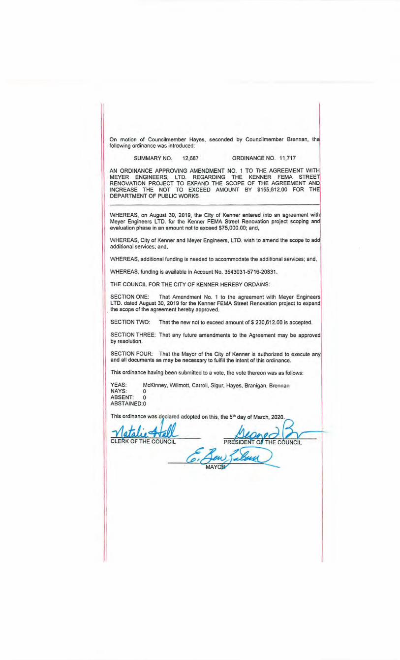
On motion of Councilmember Hayes. seconded by Councilmember Brennan, following ordinance was introduced:
SUMMARY NO. 12,687 ORDINANCE NO. 11,717
AN ORDINANCE APPROVING AMENDMENT NO. 1 TO THE AGREEMENT WIT~ MEYER ENGINEERS. L TO. REGARDING THE KENNER FEMA STREE :_t RENOVATION PROJECT TO EXPAND THE SCOPE OF THE AGREEMENT AND. INCREASE THE NOT TO EXCEED AMOUNT BY $155,612.00 FOR TH DEPARTMENT OF PUBLIC WORKS
WHEREAS, on August 30, 2019, the City of Kenner entered into an agreement with Meyer Engineers L TO. for the Kenner FEMA Street Renovation project seeping and evaluation phase in an amount not to exceed $75,000.00; and,
1 WHEREAS, City of Kenner and Meyer Engineers, L TO. wish to amend the scope to add additional services; and,
WHEREAS, additional funding is needed to accommodate the additional services ; and ,
WHEREAS, funding is available In Account No. 3543031-5716-20831.
THE COUNCIL FOR THE CITY OF KENNER HEREBY ORDAINS:
SECTION ONE: That Amendment No. 1 to the agreement with Meyer Engineers L TO. dated August 30, 2019 for the Kenner FEMA Street Renovation project to expand
. the scope of the agreement hereby approved.
SECTION TWO: That the new not to exceed amount of$ 230,612.00 is accepted .
SECTION THREE: That any future amendments to the Agreement may be approved by resolution .
SECTION FOUR: That the Mayor of the City of Kenner is authorized to execute any and all documents as may be necessary to fulfill the intent of this ordinance.
This ordinance having been submitted to a vote, the vote thereon was as follows:
YEAS: McKinney, Willmott, Carroll . Sigur. Hayes. Branigan. Brennan NAYS: 0 ABSENT: 0 ABSTAINED:O
This ordinance was d~clared adopted on this. the 51h day of March, 2020.
~4Jl ~¥' " CLE i<OFTHE COUNCIL ::;:::::=::: .. -
MAYW
AMENDMENT NO. I TO THE AGREEMENT
There is an Agreement between City of Kenner ("Kenner"), a local governmental subdivision of the State of Louisiana, represented by E. Ben Zahn III, Mayor, acting pursuant to authority vested in him by the Charter of the City of Kenner, and Meyer Engineers, L TO. ("Firm"), licensed in the State of Louisiana, dated August 30, 2019 ("Previous Agreement"). Having completed the evaluation phase, the Previous Agreement needs to be amended to expand the scope to complete the project.
The parties agree to enter into this Agreement on the date indicated below as the new and controlling agreement among the parties. In any areas where this Agreement conflicts with the Previous Agreement this Agreement will prevail.
Scope of Work: Kenner hereby agrees wi.th Firm to perform all necessary professional services in connection with the following project ("Project"):
Kenner FEMA Street Renovation
All work shall be under the direction of the Deputy Chief Administrative Officer of the Department of Public Works ("DCAO"). All plans, specifications, and related documentation shall be submitted to the DCAO, and all approvals and administration of this Agreement shall be through the DCAO.
Section l. Services: Firm shall provide all basic services required to complete the Project including all necessary services described herein or usually implied as a prerequisite for performance of the services whether or not specifically mentioned in this Agreement, including attendance by Firm at Project conferences and public hearing(s) (as necessary).
A. Preliminary Phase:
I . Assist Kenner in the establishment of scope of work for supplementary services such as, but not limited to surveying, geotechnical, traffic engineering, and electrical engineering, as necessary. 2. Coordinate all topographic survey(s) and other investigations as may be require<:{ to prepare construction plans. Investigations and/or surveys shall locate existing utilities (private and public) affected by the Project and shall locate and define such utilities sufficiently to enable proper plans to be made to relocate/adjust such utilities as necessary to fit the Project. 3. Prepare a program of borings and other soil investigations that may be required for proper planning and design. 4. Plot information obtained from surveyor on proper plan in accordance with governing agency requirements. 5. Prepare preliminary layouts and sketches as required to develop design criteria. 6. Prepare an itemized preliminary construction cost estimate outlining all expected items of work and current unit prices for those items. 7. Assist Kenner with the preparation of state and federal grant applications (as necessary).
8. Provide written notice to all utility companies (private and public) regarding the Project and request utility "as-built" information from them. 9. Attend meetings as necessary with Kenner and other entities. 1 0. Visit the Project site to observe conditions, potential problem areas/conflicts, condition of topography, etc.
On projects that are being financed partially or completely with state and/or federal funds, all necessary work associated with services such as, but not limited to topographic surveys, right-of-way maps, drainage maps, and geotechnical documentation, shall be performed in accordance with the most current standards dictated by the governing state/federal agency. This includes plan preparation requirements. Firm shall be responsible for obtaining all necessary information from applicable state/federal agency regarding requirements for performance of work associated with any necessary supplementary services.
B. Design Phase:
1. entities for Project.
Review survey and geotechnical information submitted by other accuracy and compliance with scope of work established for the
2. Prepare detailed construction plans, specifications and contract documents. These plans are to include locations of all private and public utilities (underground or overhead) affected, and ownership and taking lines of rights-of-way where required. The existence and ownership of any existing utilities shall be determined by contacting each utility provider in writing to obtain such records as may be available and information obtained from the topographic survey conducted by the surveyor. Upon receipt by Firm of comments by DCAO, and other entities as dictated by the Project, Firm shall revise and complete the plans. The same conditions will apply to advance plan reviews and Project specifications. 3. At the earliest time at which the state of completion of the plans will allow an effective review of the design work, sufficient sets of plans and specifications shall be furnished to DCAO and appropriate parish/state/federal agency(s) for review and distribution to other parties/entities associated with the Project. 4. Prepare necessary applications for permits for submission to and approval oflocal, state, and federal authorities (as applicable). 5. Prepare a detailed itemized Final Construction Cost Estimate. 6. Coordinate with proper utility companies (private and public) the adjustment, relocation, de-energization or removal of existing utility lines and structures within the Project limits that are in conflict with or affected by the proposed improvements. 7. Attend meetings as necessary with Kenner and other entities. 8. Visit the Project site to check on accuracy of topographic survey and develop guidelines for necessary design requirements.
On projects that are being financed partially or completely with state and/or federal funds, Firm shall design the project and prepare plans/specifications/special provisions in accordance with the most current standards dictated by the governing state/federal agency. This includes plan preparation requirements. Firm shall be responsible for
obtaining all necessary infonnation from applicable state/federal agency regarding requirements for perfonnance of work prior to commencement of design.
C. Bidding Phase:
I . Furnish sufficient sets of plans and specifications for the bid process. 2. Assist Kenner in obtaining bids. This includes, but not limited to attending
pre-bid and bid opening meetings, responding to bidder's questions and requests for clarifications and/or additional infonnation, preparation and distribution of all necessary addenda, analysis of bids received, preparation of bid tabulation which is to include all bids received and Finn's final construction cost estimate.
3. Recommend acceptance of a bidder and render assistance in award of contract.
D. Construction Phase:
1. Prepare fonnal contract documents for the execution of the construction contract.
2. As dictated by Kenner, provide a competent Project Engineer and such assistants as may be required to administer the construction contract and to observe and inspect the materials and construction procedures at the site of the work as it progresses. This shall not include the furnishing of inspection services, but shall include periodic job visits as are necessary.
3. Assist in the establishment of construction monuments, Project baseline, and benchmarks as necessary.
4. Coordinate with owners of utility companies (private and public) the need for relocation/adjustment/de-energization of their facilities (as necessary) to clear the site for construction.
5. Advise Kenner on acceptability of substitute materials and equipment proposed by contractor.
6. Review shop drawings and samples for confonnance with the design concept of the Project and for compliance with the result required in the contract documents.
7. Prepare detailed drawings as necessary to supplement the construction drawings.
*8. Review tests of materials necessary for the Project. *9. Detennine contract pay quantities, including necessary materials checking. •to. VerifY and approve contractor's pay estimates and submit same to DCAO with proper recommendation. •tt. VerifY and approve estimate laboratory pay estimates and submit same toDCAO. .
* 12. Prepare progress reports for DCAO when requested. *13. Prepare written recommendation for all required changes to plans and specifications during construction.
* 14. Prepare all necessary documentation required for construction change orders. * 15. Attend Council meetings and other meetings as necessary to discuss issues
associated with the Project. * 16. Perfonn final inspection and make a recommendation for acceptance. 17. Finn is not responsible for construction means, methods, techniques, sequences
or procedures, or for safety precautions and programs in connection with the work, except as may be expressly indicated in the plans and specifications prepared by Finn. ·
18. Provide advice to Kenner as to the acceptability of subcontractors.
• These items of work will not apply to the terms of this Agreement if a separate engineering finn is selected to perform resident inspection services for the · Project.
E. Record Drawings:
I. Based upon information provided by the construction contractor and/or the assigned Resident Inspector, Firm shall furnish "RECORD" drawings on CD in AutoCAD, PDF Full Size and PDF Half Size formats. Firm shall also furnish three (3) sets of Full Size prints of"RECORD" drawings.
Section 3. Documents:
Firm shall furnish to DCAO and appropriate parish/state/federal agency(s) sufficient sets of drawings, specifications and contract documents for checking and approval at each review stage of the Project and eight (8) sets for Kenner's records after receipt of bids. Firm shall also furnish sufficient sets of plans, specifications and contract documents for the receipt of competitive bids and the construction of the Project.
All data collected by Firm and all documents, notes, drawings, tracings, and files shall remain the property of Firm except as otherwise provided in other section(s) of this Agreement. Firm shall furnish to the DCAO copies of any Project documents requested by DCAO.
Kenner shall furnish without charge all standard plans and specifications and any other information, which Kenner now has in its files, which may be of use to Firm.
Firm shall use the most current. version of the standard forms of documents adopted and specified by Kenner and/or applicable parish/state/federal agency in the performance of the Design Phase and Bidding Phase of this Agreement. These documents include, but shall not be limited to, the Agreement, the General and Supplementary Conditions, the Invitation to Bid, the Instruction to Bidders, bid forms, and any other related documents specified by Kenner for a particular project. This obligation with respect to Kenner's contract documents is subject to the indemnity provisions contained in Section 13. Notwithstanding anything to the contrary in this Section 3 or in any other provision of this Agreement, none ofthe contract documents provided by Kenner are or will become the property of Firm, but shall remain the property of Kenner to the extent Kenner has a property interest therein.
Section 4. Supplementary Services:
Firm shall provide, when requested in writing by DCAO, supplementary services not included in the basic services.
Such supplementary services shall include, but are not limited, to the following:
A. Topographic Survey. B. Soils investigations. C. Traffic Engineering. D. Preparation of Environmental Assessment documents · and/or
Environmental Pennits. E. Right-of-Way, easement and property acquisition surveys, plats, maps
and documents. F. Any major revisions, for which the Finn is not responsible, that are
authorized by the Kenner after the completion and approval of either the preliminary or final plans and specifications.
G. Services concerning replacement of any work damaged by fire or other causes during construction.
H. Services made necessary by the default of the contractor in the performance of the construction contract.
I. Serving as an expert witness in connection with court proceedings. J. If all or part of the work is to be financed by a federal or state grant,
Finn shall assist Kenner in the preparation of the grant application and with the grant administration.
When perfonned by Finn's personnel or sub-consultants, the compensation to Finn for the above supplementary services shall be made on an hourly rate basis or a fixed fee basis, or a combination of both depending on scope and complexity of work. Kenner reserves the right to detennine method of payment.
For hourly rate contracts/services, Finn shall be compensated on the basis of reasonable certified and itemized salary costs, plus an acceptable fee to cover overhead cost and profit.
All fees shall be negotiated with Finn by appropriate City user-department personnel and shall be mutually agreeable to both parties. All costs associated with the Project shall be subject to Kenner review and Mayor's approval.
In each case the work is to be initiated only upon receipt of a written work order from DCAO, which must include the scope of work and a maximum fee that can be charged.
K. Resident Inspection. If resident inspection services are required to be furnished by Finn, then DCAO shall so direct Finn in writing. Finn shall assign personnel, acceptable to DCAO, at a fee acceptable to Kenner. The fee shall be on the basis of the actual time of personnel used at the then currently approved hourly rates. The resident inspection may be discontinued at any time upon thirty (30) days written notice from DCAO to Finn.
All invoices submitted covering services rendered on an hourly basis shall include time sheets showing actual hours worked by each individual, their classifications, brief description of the work perfonned and pre-approved hourly rate. All other supplementary services being paid on a fixed fee basis shall be invoiced monthly according to percentage of work completed.
Payments to Finn for supplementary services shall be made monthly upon presentation
of the invoice for work performed during the preceding month.
Section S. Budget Limitation:
The construction budget for this Project shall be determined by Kenner. Firm shall be advised of the budget limitation in writing by DCAO, and Firm shall indicate his acceptance of same in writing to DCAO. Any subsequent budget revisions shall be confirmed in writing.
If, at the completion of the Preliminary or Design Phases, Firm does not concur with the construction budget, then Firm shall so notifY DCAO. Firm and Kenner shall mutually agree on a revised construction budget prior to the commencement of work on the Design Phase.
If no bid is received within the budget limitation and a redesign of Project is required by Kenner, such redesign shall be accomplished by Firm at no additional cost to Kenner. However, if the receipt of bids is for any reason delayed beyond a period of six (6) months from the date of the completion of the Design Phase, the amount stated as the construction budget shall be adjusted immediately prior to the time bids are received by use of a construction cost index acceptable to Kenner and Firm.
Section 6. Notice to Proceed:
Kenner, through DCAO, shall notifY Firm in writing to undertake the services stated in SECTION 2, and Firm shall commence the services within ten (I 0) days after receipt of such notification. The work necessary for the completion of the final construction plans and specifications as required herein shall be completed within sixty (60) days following the issuance of a Notice to Proceed by Kenner.
If DCAO desires to divide Project into various parts/phases, a Notice to Proceed shall be issued for each part/phase, and DCAO and Firm shall mutually agree upon the period of time within which services for each part/phase of the Project shall be performed.
Firm will be given time extensions for delays beyond Firm's control or for those caused by tardy approvals of work in progress by various official agencies. However, no additional compensation to Firm shall be allowed for such delays.
Section 7. Payments:
All invoices submitted shall contain an acknowledgement that no subcontractors or persons, excluding full time employees of the firm, have been added to work on this Project without the prior written approval of Kenner.
For hourly rate agreements/services, Kenner shall compensate Firm on the basis of reasonable certified and itemized salmy cost plus an acceptable fee to cover overhead cost and profit.
For fixed fee agreements, Kenner shall pay Firm a basic fixed fee that is mutually agreeable.
For each task in SECTION 2 and any other services required for this Project, the work
--- .. - - --
is to be initiated only upon receipt of a written work order from the DCAO, which must include the scope of work and a maximum fee that can be charged. The maximum cumulative fee that can be charged for all work on this Agreement, including the work perfonned under SECTION 4, shall not exceed $230,612.00, unless increased by an amendment to this Agreement.
Payment to Finn shall be prorated as follows:
Basic Services
Fixed Engineering Fee:
Design Phase Bidding Phase Construction Phase Record Drawing Phase
Supplementaey Services
Resident Inspection Geotechnical Engineering Topographic Survey
$88,796 (Fixed Fee)
70% ofthe basic fee 5% ofthe basic fee 20% of the basic fee 5% of the basic fee
$62,158 $4,440 $17,759 $4,440
$50,816 hourly, not to exceed $3,500 $12,500
All invoices submitted covering services rendered on an hourly basis shall include time sheets showing actual hours worked by each individual, their classification, brief description of the work perfonned, and pre-approved hourly rate.
All invoices submitted covering services rendered on a fixed fee basis shall be based on percentage of work completed. Payment is to be made in monthly installments.
Payment to Finn shall become due and payable as follows:
Preliminary Phase:
In monthly installments, upon DCAO's approval of the applicable parts of SECTION 2.
Design Phase:
Payments shall be in monthly installments proportionate to the progress of Firm. It is mutually agreed that these monthly payments are for Finn's convenience only, and they do not imply acceptance by Kenner of any work perfonned by Firm.
Biddine: Phase:
Upon receipt of acceptable construction bids and the award of the construction contract within the budget limitations of Project.
Construction Phase:
Monthly based on the percentage of the total cost of the construction work completed during the preceding month.
Record Drawing:
On the receipt of approved "Record Drawing" documentation as specified in SECTION 2.
Section 8. Fiscal Funding:
Payment to Firm under this Agreement shall be contingent upon the availability of funds, as established in Kenner's budget.
Section 9. Termination or Suspension:
The terms of this Agreement shall be binding upon the parties hereto until the work has been completed and accepted by Kenner and all payments required to be made to Firm have been made; but this Agreement may be terminated under any or all of the following conditions:
I. By mutual agreement and consent ofthe parties hereto. 2. By Kenner as a consequence of the failure of Firm to comply with the terms,
progress or quality of work in a satisfactory manner, proper allowance being made for circumstances beyond the control of Finn.
3. By either party upon failure of the other party to fulfill its obligations as set forth in this Agreement.
4. At the completion of the Preliminary Phase, if Kenner and Finn do not mutually agree on the construction budget limitation as indicated in SECTION 5. .
5. In the event of the abandonment of the Project by the Kenner. 6. In the event Firm does not maintain a valid Louisiana Engineering License. 7. Upon thirty (30) days written notice by Kenner to Firm.
This Agreement shall automatically terminate upon satisfactory completion of all services and obligations described herein or three (3) years from the date of its execution, whichever event occurs first.
Upon termination, Firm shall be paid for actual work performed prior to the notice of termination on a pro-rata share of the basic fee based on the phase or percentage of work actually completed.
Upon termination pursuant to Item 2, above, Firm shall deliver to Kenner all original documents, notes, drawings, tracings, computer files, and files except Firm's personal and administrative files.
Should Kenner desire to suspend the work, but not definitely terminate the Agreement, this may be accomplished by DCAO providing Firm with thirty (30) days written notice of said suspension. The work may be reinstated and resumed in full force and effect upon Firm's receipt from DCAO of thirty (30) days written notice to that effect. Firm shall receive no additional compensation as a result of such a suspension/resumption ofthe work.

Kenner shall tenninate this Agreement in the event false or misleading infonnation is given to Kenner in any required affidavit or in the acknowledgement submitted with each invoice that no subcontractors or persons, excluding full time employees of the finn, have been added without the prior approval of Kenner.
IN TESTIMONY WHEREOF, this Agreement has been executed on the date written below.
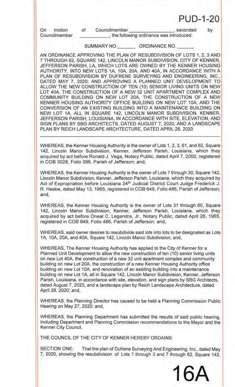
PUD-1-20 On motion of Councilmember , seconded by Councilmember ______ , the following ordinance was introduced:
SUMMARY NO. __ _ ORDINANCE NO. __ _
AN ORDINANCE APPROVING THE PLAN OF RESUBDIVISION OF LOTS 1, 2, 3 AND 7 THROUGH 62, SQUARE 142, LINCOLN MANOR SUBDIVISION, CITY OF KENNER, JEFFERSON PARISH, LA, WHICH LOTS ARE OWNED BY THE KENNER HOUSING AUTHORITY, INTO NEW LOTS 1A, 10A, 20A, AND 40A, IN ACCORDANCE WITH A PLAN OF RESUBDIVISION BY DUFRENE SURVEYING AND ENGINEERING, INC., DATED MAY 7, 2020; AND APPROVING A PLANNED UNIT DEVELOPMENT TO ALLOW THE NEW CONSTRUCTION OF TEN (1 0) SENIOR LIVING UNITS ON NEW LOT 40A, THE CONSTRUCTION OF A NEW 32 UNIT APARTMENT COMPLEX AND COMMUNITY BUILDING ON NEW LOT 20A, THE CONSTRUCTION OF A NEW KENNER HOUSING AUTHORITY OFFICE BUILDING ON NEW LOT 1 OA, AND THE CONVERSION OF AN EXISTING BUILDING INTO A MAINTENANCE BUILDING ON NEW LOT 1A, ALL IN SQUARE 142, LINCOLN MANOR SUBDIVISION, KENNER, JEFFERSON PARISH, LOUISIANA, IN ACCORDANCE WITH SITE, ELEVATION, AND SIGN PLANS BY SBG ARCHITECTS, DATED AUGUST 7, 2020, AND A LANDSCAPE PLAN BY REICH LANDSCAPE ARCHTECTURE, DATED APRIL 28, 2020
WHEREAS, the Kenner Housing Authority is the owner of Lots 1, 2, 3, 61, and 62, Square 142, Lincoln Manor Subdivision, Kenner, Jefferson Parish, Louisiana, which they acquired by act before Ronald J. Vega, Notary Public, dated April 7, 2000, registered in COB 3028, Folio 396, Parish of Jefferson; and,
WHEREAS, the Kenner Housing Authority is the owner of Lots 7 through 30, Square 142, Lincoln Manor Subdivision, Kenner, Jefferson Parish, Louisiana, which they acquired by Act of Expropriation before Louisiana 24th Judicia l District Court Judge Frederick J. R. Heebe, dated May 13, 1965, registered in COB 649, Folio 486, Parish of Jefferson; and,
WHEREAS, the Kenner Housing Authority is the owner of Lots 31 through 60, Square 142, Lincoln Manor Subdivision, Kenner, Jefferson Parish, Louisiana, which they acquired by act before Oneal C. Legendre, Jr., Notary Public, dated April 26, 1965, registered in COB 649, Folio 486, Parish of Jefferson; and,
WHEREAS, said owner desires to resubdivide said lots into lots to be designated as Lots 1A, 10A, 20A, and 40A, Square 142, Lincoln Manor Subdivision; and ,
WHEREAS, The Kenner Housing Authority has applied to the City of Kenner for a Planned Unit Development to allow the new construction of ten (1 0) senior living units on new Lot 40A, the construction of a new 32 unit apartment complex and community building on new Lot 20A, the construction of a new Kenner Housing Authority office building on new Lot 1 OA, and renovation of an existing building into a maintenance building on new Lot 1A, all in Square 142, Lincoln Manor Subdivision, Kenner, Jefferson Parish, Louisiana, in accordance with site, elevation, and sign plans by SBG Architects, dated August 7, 2020, and a landscape plan by Reich Landscape Architecture, dated April 28, 2020; and,
WHEREAS, the Planning Director has caused to be held a Planning Commission Public Hearing on May 27, 2020; and,
WHEREAS, the Planning Department has submitted the results of said public hearing, including Department and Planning Commission recommendations to the Mayor and the Kenner City Council.
THE COUNCIL OF THE CITY OF KENNER HEREBY ORDAINS:
SECTION ONE: That the plan of Dufrene Surveying And Engineering, Inc., dated May 7, 2020, showing the resubdivision of Lots 1 through 3 and 7 through 62, Square 142,
16A
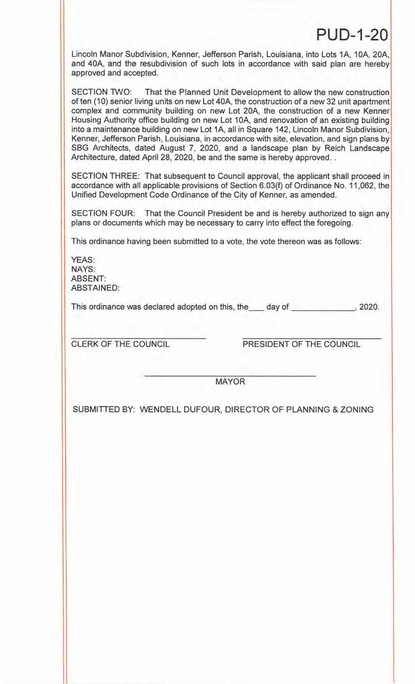
PUD-1-20 Lincoln Manor Subdivision, Kenner, Jefferson Parish, Louisiana, into Lots 1A, 10A, 20A, and 40A, and the resubdivision of such lots in accordance with said plan are hereby approved and accepted.
SECTION TWO: That the Planned Unit Development to allow the new construction of ten (1 0) senior living units on new Lot 40A, the construction of a new 32 unit apartment complex and community building on new Lot 20A, the construction of a new Kenner Housing Authority office building on new Lot 1 OA, and renovation of an existing building into a maintenance building on new Lot 1A, all in Square 142, Lincoln Manor Subdivision, Kenner, Jefferson Parish, Louisiana, in accordance with site, elevation, and sign plans by SBG Architects, dated August 7, 2020, and a landscape plan by Reich Landscape Architecture, dated April 28, 2020, be and the same is hereby approved ..
SECTION THREE: That subsequent to Council approval, the applicant shall proceed in accordance with all applicable provisions of Section 6.03(f) of Ordinance No. 11,062, the Unified Development Code Ordinance of the City of Kenner, as amended.
SECTION FOUR: That the Council President be and is hereby authorized to sign any plans or documents which may be necessary to carry into effect the foregoing.
This ordinance having been submitted to a vote, the vote thereon was as follows:
YEAS: NAYS: ABSENT: ABSTAINED:
This ordinance was declared adopted on this, the __ day of , 2020.
CLERK OF THE COUNCIL PRESIDENT OF THE COUNCIL
MAYOR
SUBMITIED BY: WENDELL DUFOUR, DIRECTOR OF PLANNING & ZONING
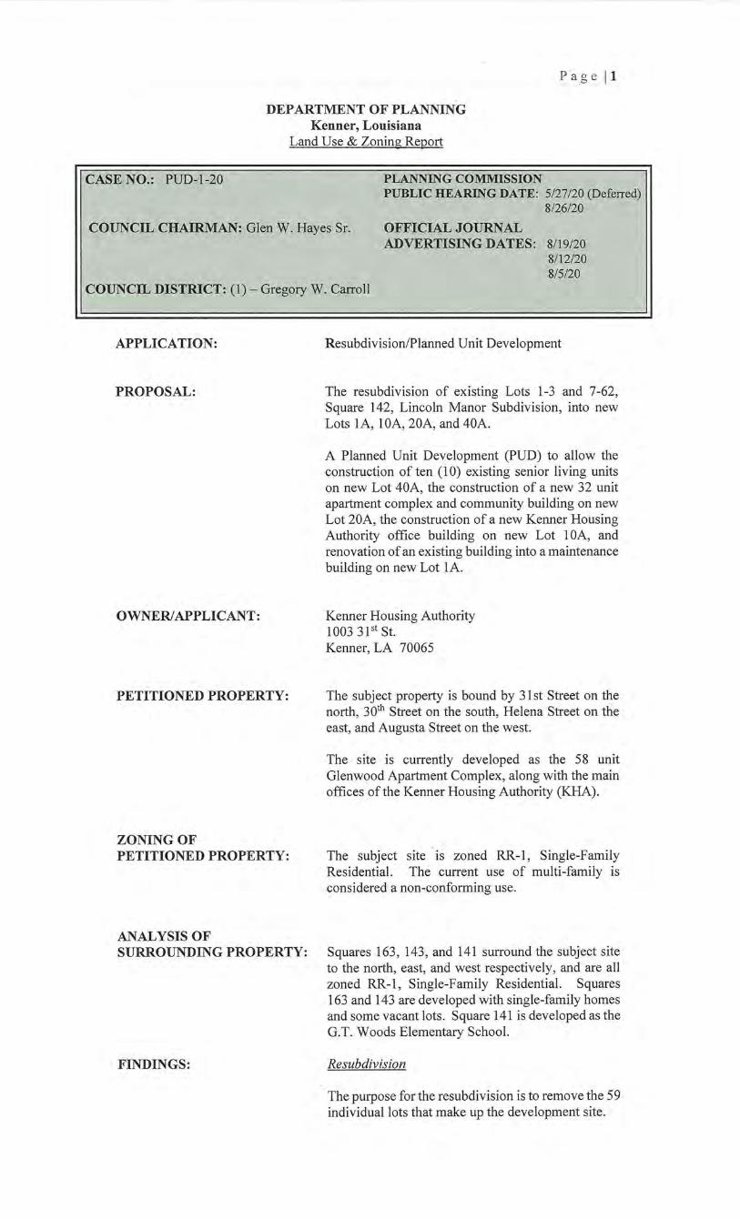
P ag e 11
DEPARTMENT OF PLANNING Kenner, Louisiana
Land Use & Zoning Report
CASE NO.: PUD-1-20 PLANNING COMMISSION PUBLIC HEARING DATE: 5/27/20 (Deferred)
8/26/20
COUNCIL CHAIRMAN: Glen W. Hayes Sr. OFFICIAL JOURNAL ADVERTISING DATES: 8/19/20
8/12/20 8/5/20
COUNCIL DISTRICT: (I)- Gregory W. Carroll
APPLICATION:
PROPOSAL:
OWNER/APPLICANT:
PETITIONED PROPERTY:
ZONING OF PETITIONED PROPERTY:
ANALYSIS OF SURROUNDING PROPERTY:
FINDINGS:
Resubdivision/Planned Unit Development
The resubdivision of existing Lots 1-3 and 7-62, Square 142, Lincoln Manor Subdivision, into new Lots lA, lOA, 20A, and 40A.
A Planned Unit Development (PUD) to allow the construction of ten (1 0) existing senior living units on new Lot 40A, the construction of a new 32 unit apartment complex and community building on new Lot 20A, the construction of a new Kenner Housing Authority office building on new Lot 1 OA, and renovation of an existing building into a maintenance building on new Lot lA.
Kenner Housing Authority 1003 3 pt St. Kenner, LA 70065
The subject property is bound by 31st Street on the north, 30th Street on the south, Helena Street on the east, and Augusta Street on the west.
The site is currently developed as the 58 unit Glenwood Apartment Complex, along with the main offices of the Kenner Housing Authority (KHA).
The subject site is zoned RR-1, Single-Family Residential. The current use of multi-family is considered a non-conforming use.
Squares 163, 143, and 141 surround the subject site to the north, east, and west respectively, and are all zoned RR-1, Single-Family Residential. Squares 163 and 143 are developed with single-family homes and some vacant lots. Square 141 is developed asthe G.T. Woods Elementary School.
Resubdivision
The purpose for the resubdivision is to remove the 59 individual lots that make up the development site.
Pa ge 12
Existing Parcels
Lots 1-3, 7-36, and 39-62 are uniform lots measuring 20' x 120', and contain 2,400 square feet each.
Lot 37 is an irregular shaped lot measuring 37.24' x 120'and consisting of 4,468.8 square feet.
Lot 38 is an irregular shaped lot measuring 36.75' x 120'and consisting of 4,410 square feet.
Proposed Lots
Lot 1A measures 60' x 120', and contains 7,200 square feet.
Lot lOA measures 114' x 120', and contains 13,680 square feet.
Lot 20A is an irregular shaped lot measuring 363' x 120' x 6' x 120' x 357' x 240, and contains 86,400 square feet.
Lot 40A is an irregular shaped lot measuring 160.24' x 240' x 159.75' x 240', and contains 38,399 square feet.
The proposed resubdivision meets the criteria for a simple resubdivision based on no new street or easement of access, or the extension or creation of any public improvements being required at this time.
Planned Unit Development
The applicant is proposing the following changes to the existing Glenwood Apartment and KHA Office site:
1. The renovation of the existing 1, 7 54 sq/ft Kenner Office building into a maintenance building for the site, on new Lot 1A;
2. The construction of a new 5,994 sq./ft. office building for the KHA on new Lot 1 OA;
3. The demolition of the existing 48-unit Glenwood Apartment complex and the construction of a new 37,368 sq./ft., four building, 32-unit apartment complex; and construction of a new 2,236 sq./ft. Community Building, all on new Lot 20A;
4. The demolition of the existing two five-unit senior living buildings, and new construction of two new 3,456 square foot five-unit senior living buildings, on new Lot 40A;
5. The demolition of two additional maintenance buildings.
The new Glenwood Apartment complex will consist of four separate apartment buildings and two renovated elderly living buildings as outlined below:
Pa ge 13
• New buildings I and II are 8,890 sq./ft. each, and include eight (8) 2BR/2BA units in each unit.
• New buildings III and IV are 9,794 sq./ft. each, and include four (4) 2BR/2BA and four (4) 3BR/2BA units in each building.
• Renovated buildings V and VI include two, 3,006 sq./ft. structures, with five elderly living units in each building.
The total number of units after construction will be twenty-four (24) 2BR/2BA units, eight (8) 3BR/2BA units, and ten (1 0) elderly living units.
Off-Street Parking Requirements
The overall renovation and new construction reduces the total living units on the Glenwood Apt. site from a total of 58 units to a total of 42 units. The minimum parking required for 42 units is 63 spaces, and the applicant is providing 66 spaces, including 8 handicapped spaces.
Additionally, a new Community Building and office for KHA will be developed on the site, requiring 27 spaces. The proposal includes 34 spaces, including 3 handicapped spaces.
Two of the parking spaces will be provided along Augusta Street, and three spaces will be located along 31st Street. All of these spaces are planned as on-site parallel parking spaces with direct access to Augusta and 31st Streets.
Ingress/Egress
There are three separate ingress and egress points proposed to access the site, one off of 301
h Street, one off Augusta Street, and one off of Helena Street. All three sites are sufficient to allow adequate vehicular access and flow to and from the site, including any small moving vans or trucks typically associated with apartment development, as well as service the community building and KHA offices.
Pedestrian Access
The applicant is proposing to retain the existmg perimeter sidewalks where practicable, as well as construct new accessible sidewalks where necessary around the perimeter of the site. Where the perimeter sidewalks cross ingress/egress points the applicant will provide ADA · approved transitions. The proposal also includes an extensive amount of internal accessible sidewalks and ADA approved transitions to allow smooth pedestrian flow within the site, including marked crosswalks where necessary.
Pa ge 14
Dumpsters
There will be a total of three (3) dumpsters located on the site. These will be located one each along Helena, 301
h, and Augusta Streets. These will all be accessed from the street and not require internal access to the site for servicing.
All three (3) dumpsters will be enclosed by the wrought iron fencing and accessed from the street through the swinging gate.
Perimeter Fencing
The residential buildings and community building located on Lots 20A and 40A, along with the maintenance building on Lot IA, will be enclosed with a 6' tall wrought iron fence. The fence will be held up with a combination of 2 1/2" wrought iron posts, as well as brick veneered 1' 4" posts where appropriate at vehicular and pedestrian gate access points. The fence will go behind and around the dumpsters.
Minimum Loading Spaces
There will be one standard loading zone located off of Augusta Street between the maintenance building and building II of the apartments. It will be appropriately striped and will not interfere with any of the parking p
Buildings
The new construction of the four apartment buildings and renovation of the elderly facilities will be done in a similar craftsmen architectural style. The exterior of the buildings will be a combination of brick veneer and cement fiber lap siding. The small porches of each building will resemble a typical craftsmen style, with wood columns framing the porches on a brick veneer base, with cement fiber shake siding on the front of the elderly buildings, and the front and side exteriors of the new apartment buildings. The railings on all the porches will be wood.
The new KHA office building will be a more modem design with exterior finishes that include some brick walls, some cement fiber walls and fascia, and a combination of shingle and metal roofing.
All of the buildings on site meet the minimum height requirements ofthe M-F, Multi-Family district.
Landscape & Buffering
The proposed landscape for the site includes 49 Class A trees, 61 Class B trees, and 439 shrubs. A 3' hedge will be planted around the parking perimeter within the site. There will be extensive amounts of green space/lawn within the site, particularly around the elderly living buildings.
PLANNING COMMISSION RECOMMENDATION:
Page [5
After review by the City' s Landscape Plan Reviewer, the proposed landscape plan meets the minimum landscape requirements of the City.
Signage
One new monument sign is proposed for the development and will be located along 31st Street in front of the new KHA office building. The sign will be 4' 10 W' tall, including the brick base, and will face 31st Street with no signage on the rear facing the KHA office.
The sign will read Glenwood Apartments in 3" tall metal lettering, and include below that:
• An ADA symbol on the left side below Glenwood Apartments
• The equal housing opportunity symbol and "Equal Housing Opportunity" text in %" tall metal lettering on the right side below Glenwood
. Apartments
• The address of the site will be centered just above the brick base and read "1 031 31st Street" in 1 W' tall metal lettering.
Utilities
Utility companies have indicated that there are facilities in the area and that service is available to this site to support the development.
Approval
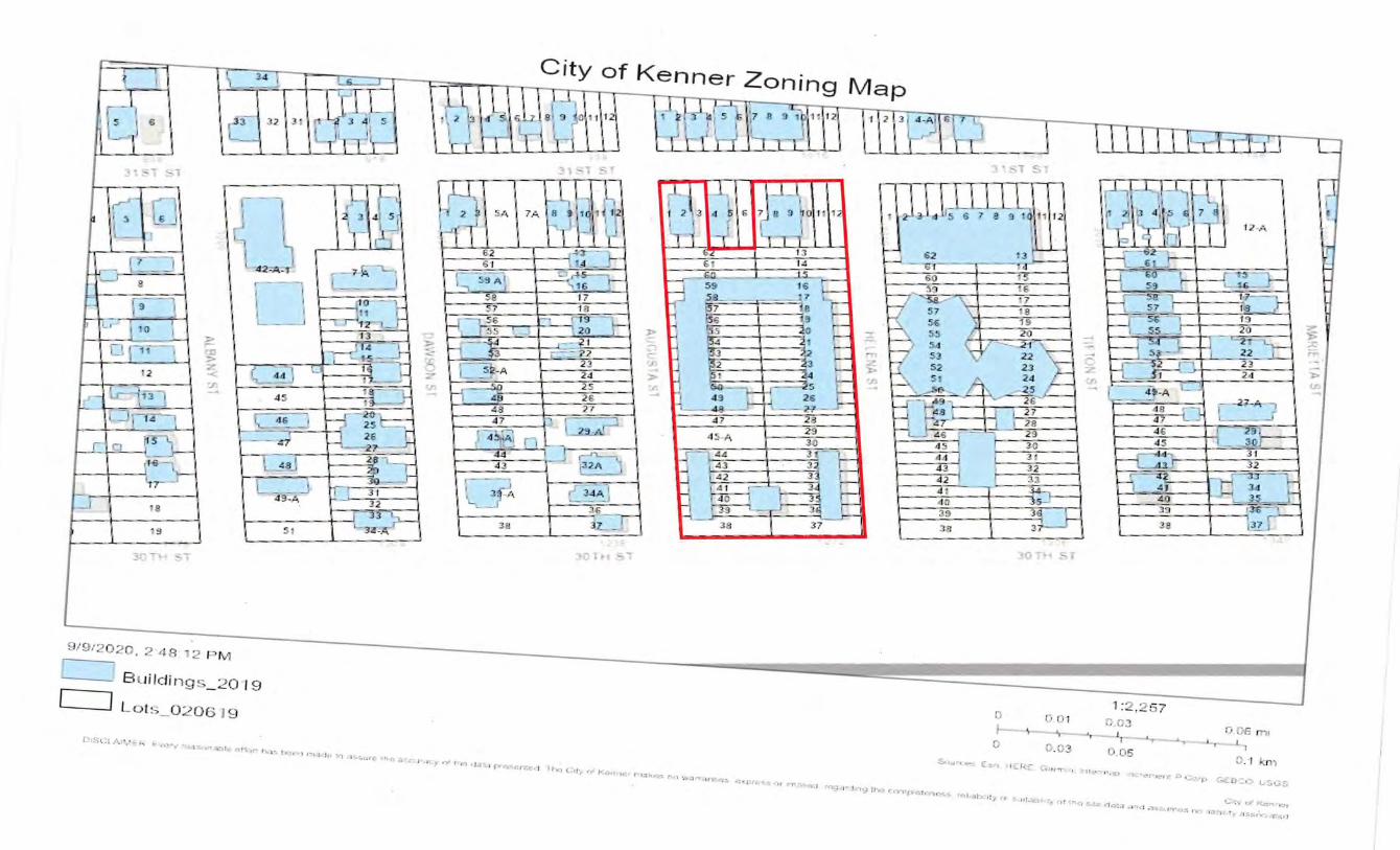
rv1
-- _ 2 0 •1 9
[ J L o ts_ 0 2 06 19
City of Kenner Zoning Map
"""" ~-... .. ...... "'""~'· ' -~- • ., ........ ""'"" ............. ··~ , .... '" '•• ..... '""'"''· ' .. ; '"" • ~ ...... . """= ... ....... ~ ... "'"" " •.. ,._, ~ .. ...... ," ......... .
1:2,25 7 r. I) 0 1 0.03 0 C6 ~c -..., "'•- I _ ... , ..... ,.._i,.,_ ,, I c r. f"'. o":)
0 .0 5 ''._ I •r:n)
~>~'· •. , c._,., >l £: f<;: :"; w r· ' . II.·· , .• _., -. • . •. ,..,~, :• · ~::.·p "''-U'=•:· L!:.c::.:,
C:· ... · ~~ Koe.,-l..:!r •·ol rh •I_, ,... • w.-.., :, ,.,, '"-<: •. ·" .;, ,,_, " "' I ''''-' ' T-<>,; • •O '"' u,- .,.,.,: .. , -.:, .. ,
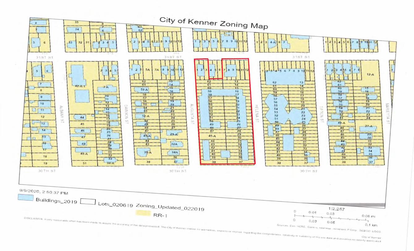
2 -. . ~7 M
20 19 [ J
City of Kenner Zoning Map
t-1
ots _ 0206 19 Zonina_ U pdated_ 0 220 1 n
R R- 1 1;·1!-i• . ..:t ,~,_.,• .• : · J-o< ,..._ ~•"':~"l "<~;"l!",.,f,-," .. nl.
>r '"' '• ' '·"'' '"''"''·'" ., .... . , .. ·~ ... ·" ..-. .... '":-" ..... ' '" •J .>'.I PY. ~"n:t:.1 n., ,:,_,. .-, O<...,,,.,r:. "'"
~'l .. .,.;,"Y, l m.:'!~ ~:~n:.~~.-,, rno¥-t·t 1a-.1.-,g tt·.':J r..~-r,.. . ~. .,
c
c ~tu,- , ·~" C!"o.
"()- ' ,. ,,,
0 0 1 ~.!}2 0 ._;c rr,, ', _,._,._..,._ ,~
I C.C3 0 0 5
:::•. 1 !L f..:. L :::.. ,,.n ~ '· r t• .c...·-' ''·.o ,-.:f,_· ~IC:'r . ;:; •.:::::T-•
G::o ~ · """~ LS..:iS
•..;-;--..; •.:F Ke""--11:: 1 "loltl""'''" '"<> (, ..... •1•r.;-o , , o, , ,,,..., l'r.n:; ,,., ' I :'J!»• "r•>C.~<Y. """'J
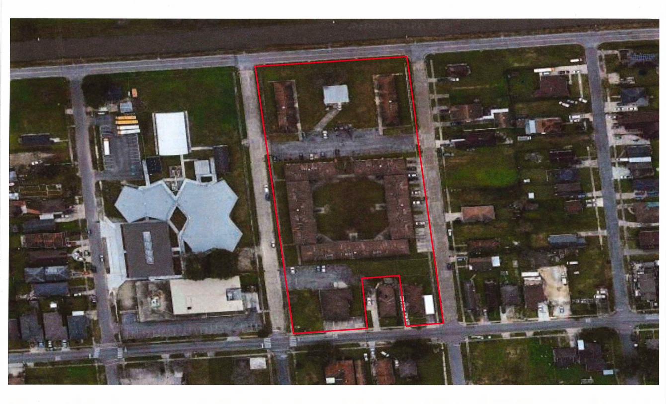
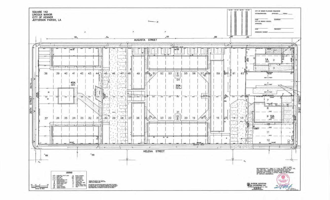
SQUARE 142 LINCOLN MANOR CITY OF KENNER JEFFERSON PARISH, LA
I I
~ ... :.·,· ..... , ... · ~~
"
-~~.-,.,-~:-·-:.;t~~-...,-
· ... ·,· .
CITY Of KENNER PLANNING COtr.IMISSlON
RECOMtr.IENDATlON: APPROVED DENIAl:
DATE GIAIRtr.IAN
-+-:z CITY OF KENNER COUNCIL
APPROVED:
DATE PRESIDENT
" " ORDINANCE NUI.!BER ----------
.. ~· ·. -~40.:~·-c·~ .. -.-:7&"", _,c:._,_,.-:.c._,--'-'-::--,---~~--:',
a>< •. II n~ I n~ I nw I - I nw I nw nw .•. nw J·· n~ J I nw~ IJ . I~WJ ., ll·nwf J Fi ll J . ~n1 -ll~lfT'llFl] r~F[l'"'j ,, ... ~Til j w r I r-· ! IIZ'Z\'\'\.~\\~ .• ~ ; ,~ •••. ,. ~ . : ·<.";;·::.·:, ··~ \ _n r 1 J t?.• , ·. ~~ ~ ~ ~· 11 ~ ~~ wh-G .W:W •.········. 1.1 ~·- • ~~~""'\\\' ~~ ~ I CI
j_ J I I I I I I. : ·,. ·l ~ ! I I I I I I I I I I l I I '!• -t: . \,,~ , ~ , ~~ 1 ~ 1==-.r r I I 1 1l ·· .... l.::;zt : rr .I '· [T T T T -1 'I I r] ···· I .1 . . I ~ ~ ~ I 1A l ~ J il
:. ,. ~~,~~~~;~:t~1 .:~;~ ~:j::. l ~~ : .. : ~,;; 52~ ;, ~ ihl ~ 55 ~ 56 ~ 5~r : , : ~1 ., : .)t· J :!~., 2.~ ~ ~I '' h ·'',,,, .. ,.,,,",,•• : · ... · .. ··:.··. .·
54 ··. NOTAPART I
i : I I I 4oA I I I . I:~L \ .:· I .. ".. ·· ·· I" i I I > I I I I I I I I I . --~ f-It
b : I I I ~'::~ I I b- :::.;·/:·1··: ···t·~ :. J J •. I I I I ~2~1 I I I · .. I I I I I . NOTAPART -""-~ . ·.· . . . · '·
~ ~f · eJ I l l I~T - I ~~~~ (: ~:··.:::'' l .<.·:.,:. l ··:,.:: .. :~.f 2-~L ~ ' I I . I I I I uw-•1 I I r±>: I I I ~ No~!PART I :~n~--t;:j .i ~p- --.:;;ro - 1 -;o:H-L~-AW-1 ~~~A~>~~:: nw----"1 ·~~ · ~,, . 1 .,,, :,; •• 1 ·,.,·:~.:--1· .. 1 f'-i::•f ··~.· .. ·: ·~;r.-1 nw 1 nw 1 aw ~~ 1---;;w-1 -~-~ tt 1 aw-1 P.., kw . nw !;;' ! "t 11400• . ~J' ~ ~ :-. ~ w I J :~.. . · .. ".. .. .. .. .. ... ".. I I . I ' ..... ,, '~ [ 7 } ; .. lk: ~ i ' : ' r-:- · '' '' "'' ·:. '' ·:, ',; ,, ·~ .. ·. · ........ ·. : • • - " " " ,'' ","';, _ omw -"" _ ...;_~ · .· · .· . . :: .. ~
I I I I > .. . ~~ ... :·.I ~ T T •. ~. I I I I I I I I ·.• I I ,, .. 1 ... · .,· .. ··~~ -=u· 1~ ->: 1 ~b .. . ... ~· ,~.o:.;·· F=: • •· .... ····.: .:.~ · .. ~ . ·.· - .. -.. ······· rt < s I:.,, .. J I • ~n 0 j I I I I I :: .. ~ ''"I'• -~~ I ···~~ I I .·. I I I 21 I I I .·.· .. ··. I I I ~- ,. ".r- ·;F-- ~- -+ ····.·: >·:'--·:. !'.. ;;; l'"l I \(.R:~ " ·• .:' ···~··" ·· · . . ·, ·. ·. .··.··.· .. ·· ~" ·· .... ·'>'~ .; 9 10A > ~i,
37 I 361 3sl 341 331 321 31 . . ~~1.:· .. 2: :J .. ~a:· l·· 2 I 261 ~~ ·.· .. 1 23 l 22l ro l2o l19 1 . 1~~ I 16 I J5 ;~4~1; ··. ~ .. 3 .·~~~ __ ~~:___ j :~*;;! ~~· . h~.·~~~~ · 22 •· ............ _~"· .. ~ I I ·•.: r ~ .. I · -~: ··· -1' ~1' ·.· ~~ .. ···~I' · .·. · I .. J} I I"" ......... ·:.: 1.:· .. :~ .. ::.·-~!f( ~ · · ... ·.······· ····· .. ! if: .· .. ; .... ,_TI . - [1 I I I I lj I· '., ·· 1··4 I I >I I I I I I I 1 ·•.~ I I ~t;·.,-·.:· r ·r .. : ~ ~~ - ~- -r---.~··
., ·· ,, ,, .. .. · ' I I J J J J ··. .·. ·· ... . .. ·r~ : 11 • ~
~.. 0 0024' ~ ' :.:: ::,,' '', ";. •• .. , . ~' > • : .. : • "" "" ~ , • ~> I I 0
I " ..... :· "~ ... ,,.,·.,'' ll~ - - 1-;---11~=-- -. ~ ~ ~ J J J J J ........ I ~ . J J .. I J . : ·. · . . ·.· .. ·.· .· .· ·.·.·.·: ~· ,, .. j=;r-::;: ·- t I
~.~' ~·: nw I nw . ~' aw I n I .1 • _ ~w '' ~w )., ft ~w II -~HJi I ~~ , I m~ I - I aw I »~; I,,•.:.,Joo.;:;,.l I •~, I, ~~ .. ~ ~~:,: ~w -"',' ,,'' ;, " . ro onw B -- -<t....r-1 r ..,. .. - , ·~
I I I +-1 -I
--- -·---6-----.,._
+~
Wl.Wll
20 to o
~ SCALE IN FEET
-+-o'oU!HDOUTIJtTIJHtS __.__ SE:J.ER UNE
==~~~~£ -•- COIIJNHICMl~ UHE
0 OfiAIK r.t AHHOIL • SOUAA£MAJHIHI.£f G ROJNDORNH ltiiLf
oil G,t,St.rElER 20 I D CA"IQIBASIN
J s: ~::~~T
e WAlER WAHHOIL .,G W.\TDI lol[l[JI WO WA1ER VAI..'o£ ~ mEHYDAAHT
• m."'"'"''" I ~--~K~-· IS PoYoERPO.J: _,.._.fi:SftmiOTitaiOJ!IIlOC. -< AHOlCJI/GUY 'IIIRE a.l3iD 010 .-s onJN•IICI'Is.
~ ~M'~a:POST ===':f'~~-=-,:..~-:.~ .. ~~ 11 <I SQOAREF"DIC£PGST /OO~I,.._TH>IIIII.~IIJniMDMCI~
)I 510'1 ~~~":,=~~~n~=. "'
'T I I I I
-----$-----1 I '
HELENA STREET T I I I
,,, :~ -;,,
----i----- .,._ I I
T : I I I I
---~---
MAY 7, 2D2D RESUBDI\1SION Of 1 niRU J, 7 lHRU 62 INTO LOTS 1A, 10A, 20A, AND 40A. SURVEYED IN ACCORDANCE 'Mlli lHE LOUISIANA STANDARDS Of PRACTICE FOR BOUNDARY
~R~l\4~ ~G~~IN~.S\JRVEY, ~:;>:~~;;;~E REQUEST
#'-'···<.."'< ,1'4~- ""~~ §• ·~ ~ TUlOLI.IUf'I>LA ~ ~ ~Pia.oal '"'
~DUFRENE SURVEYING \~,.:::~~/ ~.t: ENGINEERING INC. "") . '"1" , '""
II.HIIIHl.l.l'TNIIO.U'INC.IWM'f,LA- ~J
~ru. T-5932-L ... -· ... - --~-............
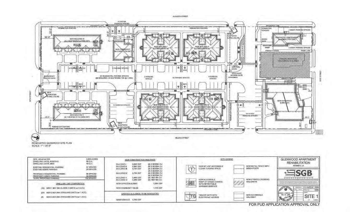
PERIMETER FENCING
30'-0"
30'-5"
PERIMETER FENCING
RENOVATED GLENWOOD SITE PLAN SCALE: 1" = 20'-0''
SITE, RENOVATED DWELLING UNITS, EXISTING DWELLING UNITS, NEW
EXISTING RESIDENTIAL PARKING EXISTING ADMIN PARKING
PROPOSED RESIDENTIAL PARKING PROPOSED ADMIN PARKING
3.069ACRES 58 D.U. 42D.U.
57 SPACES 29 SPACES
56 SPACES 34 SPACES
TOTAL PROPOSED PARKING 100SPACES
DWELLING UNIT COMPOSITION
(10) NEW 1 BD/1 BA ELDERLY UNITS (w/ 2 ACC)
(24) NEW 2 BD/2BA STANDARD UNITS (w/1 ACC)
(8) NEW 3 BD/2BA STANDARD UNITS (w/1 ACC)
--
AUGUSTA STREET
PERIMETER FENCING
HELENA STREET
NEW CONSTRUCTION BUILDINGS SITE LEGEND
BUILDING I 8,890 GSF (8) 2 BD/2BA DU BUILDING II 8,890 GSF (8) 2 BD/2BA DU
~ NEW 60" x 60" ACCESSIBLE B BUILDING Ill 9,794 GSF (4) 2 BD/2BA DU CLEAR TURNING SPACE
(4) 3 BD/2BA DU BU ILDING IV 9,794 GSF (4) 2 BD/2BA DU
(4) 3 BD/2BA DU BUILDING V 3,466 GSF (5) 1 BD/1 BA DU BUILDING VI 3,466 GSF (5) 1 BD/1 BA DU
~ NEW ACCESSIBLE
~ RAMP AT GRADE CHANGE NEW OFFICE BU ILDING 5,994 GSF WITH DETECTABLE
WARNING SURFACE NEW COMMUNITY BLDG 1,735 GSF
EXISTING BUILDINGS TO BE RENOVATED
bit~ ~ TENANT GATE WITH ELECTRONIC ACCESS
MAINTENANCE 1,754 GSF
I
177 PERIMETER FENCING
:':J ~ MAINT PARKING SPACES
"'"'"'""~'""""'"'"' ~
~ !SWING I GATE I
' ~ ~IY"cZCCG""""MCl...J
RAMP 3 MAINT PARKING SPACES
PRIVACY FENCE PROP. LINE
-Iii '--
1
I~,
~CE E~OR
NEW KHI\OFFICE (5,9941\SF)
T~ PROJECT
~"-~1
~ Iii w 0:
0 0 M
'-----------______1../ 00000
II GLENWOOD APARTMENT REHABILITATION
NEW METAL FENCE WITH KENNER, LA
BRICK POSTS
~SGB A R C II I T E C T S, L. L. c.
NEW STRIPED CROSSING WALKWAYS I ::::::.::::::.~::.:::::l;:;;::..;;::::.;:;~.:::.~: .. -i..~~~~-:.:::;::;.::. 1
IC>\TE AUG 07, 202(j
l#''o~ REV ISI01lS
NQ. 01\TE IFRDJ.r:o 1Q06J ~.
ARTHUR J. SCHULDT, JR. SHEET
NEW ACCESSIBLE A£G. No. 2.586
SITE 1 WALKWAY ~~ 0' SHEETS
FOR PUD APPLICATION APPROVAL ONLY
PERIMETER SECURITY FENCING & GATES SCALE: 1/2" = 1'·0"
DUMPSTER ENCLOSURE SCALE: 1/4" = 1'·0"
CM' COI.IJ~WII'Ifll1 IIOI'!.SHRNI. GROUT
A.'IOTAPERTOCRAIN
Hill I ',',I "'OTE:I'ROVIOESTEELH'<GES •. A:Si
1\EO'D(I ~Oni COOR,{l i'ER
0 =E~,%;;t~~re~
c.\lEf.lEVA TION QCt.I~IPSnR
TI\EATEOZM'5
~""" GAI.V.POSTW t D.I me·.()·o.c. ~·
S'" STEEl?IPE • FLlYlfll1
CO"CRE'T'EAIIO
;:7 1~
.t---.r H 1'-2" 1'..(1'
iECTIOU IW\ SECllOUII-fi
r m!!!!!!!!!!!!!!!!!!~~~
P,li!B.,t..NC _ _..-
21!Z'.Y.l.\YROII(ltfT I~II
~"
IV~~~~
~ .• 1
"~ "'' 0
GLENWOOD APARTMENT REHABILITATION
KENNER, LA
~SGB
EXTERIOR ELEVATION - TYPE I & TYPE II , FRONT (REAR OPP. HAND) SCALE: 3/16" = 1'-0"
EXTERIOR ELEVATION- TYPE I & TYPE II, SIDES SCALE: 3/16" = 1'-0"
-----5 .... ROOFSHINGLES oo~ooooo~~•
EXTERIOR ELEVATION- TYPE Ill & TYPE IV, FRONT (REAR OPP. HAND) SCALE: 3/16" = 1'-0"
EXTERIOR ELEVATION- TYPE Ill & TYPE IV, SIDES SCALE: 3/16" = 1'-0"
GLENWOOD APARTMENT REHABILITATION
KENNER, LA
~SGB AR C IIITE C TS. L L C
f<EVISICUS ljDATEAUG 07, 202Q
I ~>ROJ. /lO, 10061
. r~IM-----il ELEV1
FOR PUD APPLICATION APPROVAL ONLY
TOP PlATE aev.g.q
~OClfi_ ELEV.r:t.Q'
EXTERIOR ELEVATION- TYPE V & TYPE VI, FRONT SCALE: 3/16" = 1'-0"
EXTERIOR ELEVATION- TYPE V & TYPE VI, REAR SCALE: 3/16" = 1'-0"
lll£WlL_ ELEV.Y-0
~ m R:Jt11 II ELEV.O'.Q'
EXTERIOR ELEVATION- NEW COMMUNITY CENTER, FACING NORTH SCALE: 3/16" = 1'-0"
EXTERIOR ELEVATION- NEW COMMUNITY CENTER, FACING EAST SCALE: 3116" = 1'-0"
" 51/""
EXTERIOR ELEVATION- NEW COMMUNITY CENTER, FACING AUGUSTA ST. SCALE: 3/16" = 1'-0"
" 51/""
EXTERIOR ELEVATION- NEW COMMUNITY CENTER, FACING SOUTH SCALE: 3/16" = 1'-0"
COUBLEPAIIE LO'f\I.E\o\lNOOV/5
Bf!IC!<VEUEER
FIRESPRCLOSET SHO't\N FOR BLOO VI {OPPE11001 18LOOV REFERTOSIT EPlA/'1)
EXTERIOR ELEVATION- TYPE V & TYPE VI, SIDES SCALE: 3116" = 1'-0"
GLENWOOD APARTMENT REHABILITATION
KENNER, LA
~SGB ARCUI T EC T S.l.LC
FOR PUD APPLICATION APPROVAL ONLY
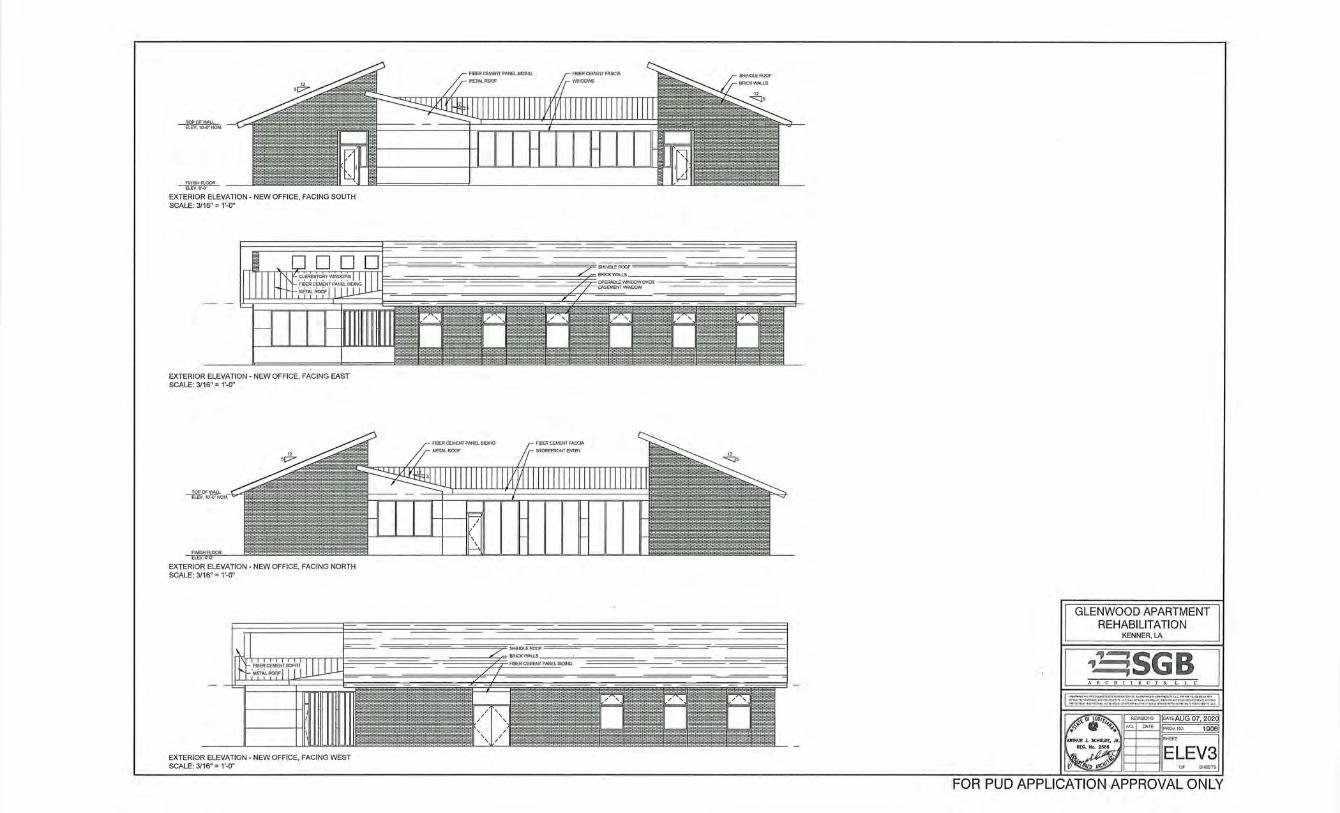
~ ELEV. \0'-0' t.j()M,
FINISH FLOOR Etev.aq
EXTERIOR ELEVATION- NEW OFFICE, FACING SOUTH SCALE: 3/16" = 1'-0"
EXTERIOR ELEVATION- NEW OFFICE, FACING EAST SCALE: 3/16" = 1'-0"
EXTERIOR ELEVATION- NEW OFFICE, FACING NORTH SCALE: 3/16" = 1'-0"
EXTERIOR ELEVATION- NEW OFFICE, FACING WEST SCALE: 3/16" = 1'-0"
GLENWOOD APARTMENT REHABILITATION
KENNER, LA
~SGB
FOR PUD APPLICATION APPROVAL ONLY
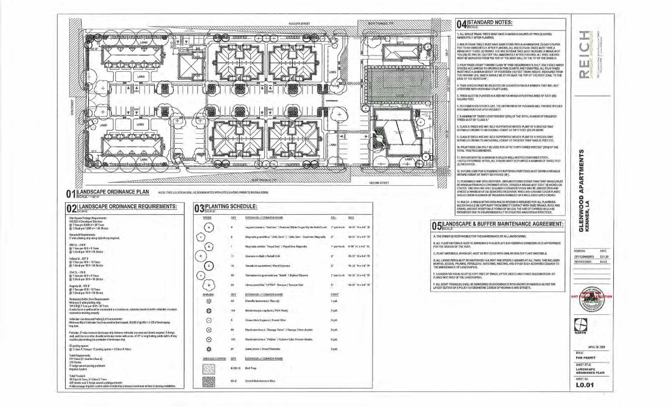
AUGUSTA STREET
NOTE: TREE LOCATIONS WILL BE COORDINATED WITH SITE LIGHTING PRIOR TO INSTAllATION.
Q2L~~~DSCAPE ORDINANCE REQUIREMENTS:
S~e Square Foo!Bge Requirements: 145,633siDevelopedSiteArea @1Treeper5,000sf=29Trees @ 1Shrubper1,000sf=146Shrubs
GreenbekRequiremenb: 5'wide plantingsbipalongright-of·I'Yayrequired.
30thSL·240W @1Treeper4011=6Trees @1Shrubper10H=24Shrubs
HelenaSL · 637U @1Treep&r4011=16Trees @1Shrubper10H=64Shrubs
31stSL·180H @1Treeper4011=5Trees @1Shrubper10H=18Shrubs
A~.~gustaSL·63711
@1Treep&r4011=16Trees @1Shrubper1011=64Shrubs
Residential Burrer Zone Requiements: Minimum5'nideplantin9s1rip. 300.511'@ 1Treeper1011=3!1Trees Asolidfenceornalmustbeconstructedinacontinuous,unbtokenbarrieftobulfervehicularuseweas exposedtoabuttingproperty.
Vehicular Use Area and Parking Lot Requirements: Minimum 8%ol Vehicular Use Area must be landscaped. 39,060 sf@ 8%= 3,125 sf landscaping required.
Perimier: 3' wide minlnum landscape strip beii'Yeen vehicu!M use area end streets required. A hedge, wall, eirlh berm or other dlKable landscape barrier w~h a min. of 36" in height aloog pub~ rights of WflY mustbeplacedalongtheperimeteroflandscapestrip.
95p<rkingspaces @ 1 Clau A Tree per 12 parking spaces= 8 Class A Trees
Total Requirements: 11DTrees(27mustbeCiassA) 316Shrubs 3'hedgearoundparkingpefimeter Irrigation System
Total Provided; 49 Class A Trees, 61 Class B Trees 439Shrubsand3'hedgefl'oundparkingperimetec AfuDcovefageirigationsystemwilbeinstalledbya~censedcnntractorattimeofplantinginstallation.
Q3 1~"~~NTING SCHEDULE:
TREES OTY BOTANICAL f COMMON NAME
0 9 le.gerst10emta x 'Natchez' I Natchez While Crape Myrtle MultJ... Trunk
0 6 Magnol!agrandiftora 'Uttle Gem' I 'Uttle Gem' Southern Magnolia
8 M11gnol!a stell!lta ·Roy~ Star' I Roy !!I St&t Magnolia
8 11 Ollercusnutt~lii/Nuttaii Oak
0 " TModium ascendens/ Pond Cyptess
0 45 Ternstroemls gymnnnlhera '&tall' I Bigfoot Cleyera
G 20 Ulmus pllfVifolla ' UPTMF' Bosque I Bosque Elm
SHRUBS .QTI BOTANICAL I COMMON NAME
0 53 D!Btlellatasme.nlca / AaxUiy
0 164 MuhlenbeJgtacaplltarls/PlnkMuhty
0 3 Osman thus lregrens I Sweet Olive
0 66 Rhododend1on x 'Georga Teber' I George Teber Azalea
0 169 Rhododendron X 'Robles' I Autumn l.Jlac Encore Azalea
~ 37 Sabel minor I Dwarf Palmetto
GROUND COVERS OTY BOTANICAL/ COMMON NAME
~ 8,090sf Bed Prep
II 69sf Gravel Malntene.nceSirlp
HELENA STREET
CAL SIZE
! " per trunk 10.12 ' Hx4-6'W
2" 10.12 ' H X46' W
1' perlrunk 8-10' H.x4·6'W,
2' 10.12' Hlo:s.8'W
2" t0.12 ' Hlo:4-6' W
! "per trunk t0.12 ' Hx4-6'W
2" 10.t2 'Hx4-6'W
CONT
!gal.
3gal.
3gal.
3gel.
3gal.
3gal.
Q41~r~~NDARD NOTES:
1. All SINGLE TRUNK TREES MUST KO.VE A MINIMUM CALIPER OF TWO (2) INCHES IMMEDIATELY AFTER PlANTlNG.
2. MULTI·TRUNK TREES MUST KO.VE t.WN STEMS WITH A MINIMUM ONE (1) INCH CAUPER PER TRUNK IMMEDIATELY AFTER PLANTING. All MUL Tl·TRUNK TREES MUST KO.VE A MINIMUM OF THREE (3) TRUNKS. THE MUL Tl·TRUNK TREE MUST MEASURE A ~NIMUM OF TEN !JD)TO TWELVE (12) FEETTALLIMMEDIATEL Y AFTER PlANTlNG. All TREE HEIGHTS MUST BE MEASURED FROM THE TOP OF THE ROOT BALL TO THE TIP OF THE BRANCH.
3. PALMTREESCOUNTTOWARD ClASS "B"TREE REQUIREMENTS ONLY. ONLY COLD HARDY SPECIES ACCUWITEO TO GROWING IN THIS CLIWITE ARE PERMITTED. All PALM TREES MUST HAVE A MINIMUM HEIGHT OF FOURTEEN (14) FEET TRUNK HEIGHT, MEASURED FROM THE GROUND LINE, WHICH SHOULD BEAT OR NEAR THE TOP OF THE ROOT ZONE, TO THE BASE OF THE HEARREAF.
4. TREE SPECIES MUST BE SELECTED OR LOCATED IN SUCH A IIANNER THAT Will NOT INTERFERE WITH OVERHEAD lffiUTY ll~IES.
5. TREES MUST BE PLANTED IN A BED WITH A MINIMUM PLANTING AREA OF SIXTY (60) SQUARE FEET.
6. RECO"-WENDED SPECIES LIST. THE DEPARTMENT OF PLANNING WILL PROVIDE SPECIES RECOMMENDATIONS UPON REQUEST.
7. A MINIMUM OF TWENTY .fiVE PERCENT (25%) OF THE TOTAL NUMBER OF REQUIRED TREES MUST BE "CLASS A"
8. CLASS A TREES ARE ANY SELF..SUPPORTING WOODY PLANT OF A SPECIES THAT NORMALLY GROWS TO AN OVERALL HEIGHT OF FIFTY FEET (50) OR MORE.
9. CLASS B TREES ARE ANY SELF..SUPPORTING WOODY PLANT OF A SPECIES THAT NORMALLY GROWS TO AN OVERALL HEIGHT OF GREATER THAN TWELVE FEET (12).
\0. PALM TREES CAN miL Y BE USED FOR UP TO THIRTY·THREE PERCENT (33%) OF THE TOTAL TREE REQUIREMENTS.
II. SHRUBS MUST BE A MINIMUM 3-GALLON WEll·ROOTEO CONTAINER STOCK. UNLESS OTHERWISE NOTED, All SHRUBS MUST BE PlAnTED A MIMMUM OF THREE FEET (3') ON CENTER.
12. SHRUBS USED FOR SCREENING OR BUFFERING PURPOSES MUST OBTAIN A MINIMUM IMTURE HEIGHT OF THIRTY .SIX INCHES (36").
13. PERENNIALS AND GROUNDCOVER: GROUNDCOVERS (OTHER THAN TURF GRASS) MUST BE MINIMUM FOUR..jNCH CONTAINER STOCK, SPACED A MAXIMUM OF EIGHT (8) INCHES ON CENTER. 'MD AND ONE-HALF (2Y•) INCH CONTAINER STOCK MAY BE SUBSTITUTED AND SPACED A 1/AXIMUM OF SIX (6) INCHES ON CENTER. VINES AND GROUND COVER PLANTS SHOULD SHOW A NUMBER OF VIGOROUS RUNNERS OR A WELL-DEVELOPED CROWN.
14. MULCH; A MINIMUM lWO..jNCH MULCH DRESSING REQUIRED FOR All PlANTINGS. MULCH SHOULD BE KEPT AWAY FROM DIRECT CONTACT WITH TREE TRUNKS. ROCK .A.NO GRAVEL ARE NOT ACCEPTABLE FORMS OF MULCH. THE USE OF CYPRESS MULCH IS PROHIBITED DUE TO ENVIRONMENTAllY DESTRUCTIVE HARVESTING PRACTICES.
OSI;~~DSCAPE & BUFFER MAINTENANCE AGREEMENT:
A THE OWNER IS RESPONSIBLE FOR THE .YAJNTENANCE OF All lANDSCAPING.
B. All PLANT MA.TERIALS MUST BE MAINTAINED IN A HEALTHY AND GROWING CONDITION AS IS APPROPRIATE • FOR THE SEASON OF THE YEAR.
C. PLANT MATERIALS, WHICH DIE, MUST BE REPLACED WITH SltlllAR HEAL THY PLANT MATERIALS.
D. All LANDSCAPING MUST BE MAINTAINED IN A NEAT AND ORDERLY IMNNER AT All TIMES. THIS INCLUDES WOWING, EDGING, PRUNING, FERTILIZING, WATERING, WEEDING, AND OTHER SUCH ACTIVITIES CO/M«JN TO THE IMINTENANCE OF LANDSCAPING.
E. LANDSCAPED AREAS MUST BE KEPT FREE OF TRASH. UTIER, WEEDS AND OTHER SUCH Mo\TERIAL OR PLANTS NOT PART OF THE lANDSCAPING.
F. All SIGHT TRIANGLES SHAll BE IMINTAINED IN ACCORDANCE WITH AASifro STANDARDS AS PER THE lATEST EDITION OF A POLICY ON GEOMETRIC DESIGN OF HIGHWAYS AND STREETS.
:c)'i g ::J R! t; ~.1
u~ l~ ~ £l <( ·-- UJ i:?.
W6 1 ~ 0::8 H z -
~ g
In 1-z w ~
t: <1: a. <1: Cl 0<1: 0 ... 3:1i zw w~ ..lw c,:):C
REVISION DATE
CITY COMMENTS 5-2\.20
REVISED BASE S..7·20
~:1. NOT r::~'fiON
~~ ·~ ReG.ifo.R.iti' E'}
"'~::~:~":::~v ,, ..................
EB NORTH
APRIL28.2020
ISSUE
FOR PERMIT
SHEET fil E
LANDSCAP E ORDINANCE PLAN
SHEET NO.
L0.01
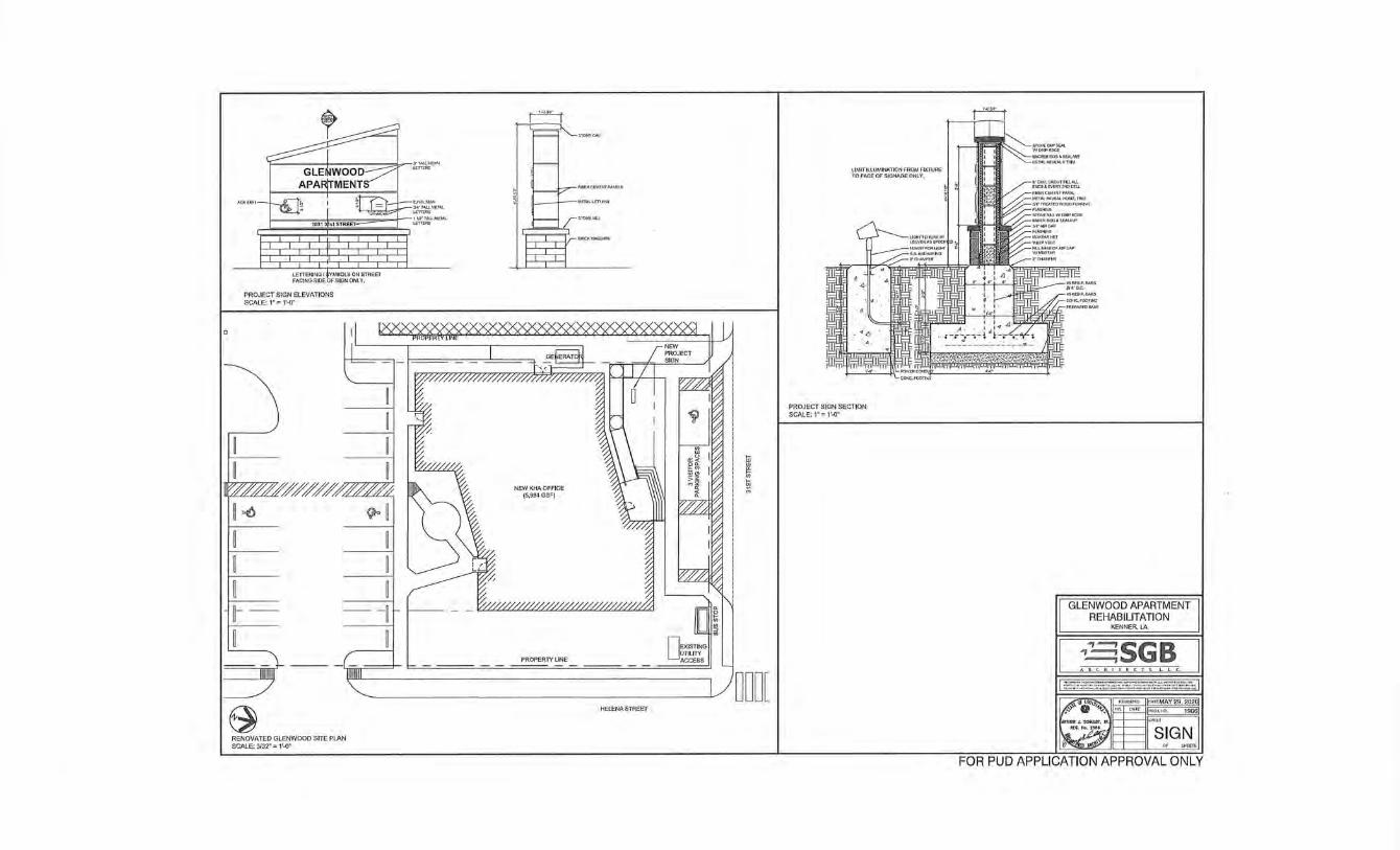
r-----::+':":":-::-::---::=.J,.--~1~1\L
PROJECT SIGN ELEVATIONS SCALE: 1" = 1'-0"
~~_.J..--~~METAL
~AIEIAL
II I~,M////////oc.
~ ~
t-
~ RENOVATED GLENWOOD SITE PlAN SCALE: 3/32~ = 1'-0"
NEW KHA OFFICE (5,994 GSF)
PROPERTY LINE
i ~
HELENA STREET
LIMIT ILLUMINATION FROM FIXTURE TO FACE OF SIGNAGE ONLY.
PROJECT SIGN SECTION SCALE: 1" = 1'-0"
GLENWOOD APARTMENT REHABILITATION
KENNER, LA
CSGB 29, 202ij
lSI
SIGN
FOR PUD APPLICATION APPROVAL ONLY
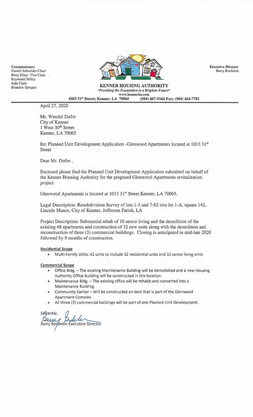
Commissioners Darrell Schneider-Chair Betty Riley- Vice Chair Raymond Stilley
Executive Director Barry Bordelon
Jude Clark Brandon Sprague KENNER HOUSING AUTHORITY
"Providing the Foundation to a Brighter Future" www.kennerha.com
1003 31'1 Street; Kenner, LA 70065 (504) 467-9166 Fax: (504) 464-7781
April27,2020
Mr. Wendal Dufor City of Kenner 1 West 30th Street Kenner, LA 70065
Re: Planned Unit Development Application -Glenwood Apartments located at 1013 31st Street
Dear Mr. Dufor ,
Enclosed please find the Planned Unit Development Application subrhitted on behalf of the Kenner Housing Authority for the proposed Glenwood Apartments revitalization project.
Glenwood Apartments is located at 1013 3P1 Street Kenner, LA 70065.
Legal Description: Resubdivision Survey oflots 1-3 and 7-62 into lot 1-A, square 142, Lincoln Manor, City of Kenner, Jefferson Parish, LA
Project Description: Substantial rehab of 10 senior living and the demolition of the existing 48 apartments and construction of 32 new units along with the demolition and reconstruction of three (3) commercial buildings. Closing is anticipated in mid-late 2020 followed by 9 months of construction.
Residential Scope • Multi-Family Units: 42 units to include 32 residential units and 10 senior living units
Commercial Scope • Office Bldg.- The existing Maintenance Building will be demolished and a new Housing
Authority Office Building will be constructed in this location. • Maintenance Bldg.- The existing office will be rehabb and converted into a
Maintenance Building. • Community Center- Will be constructed on land that is part of the Glenwood
Apartment Complex. • All three (3) commercial buildings will be part of one Planned Unit Development.
~ elt~ Executive Director
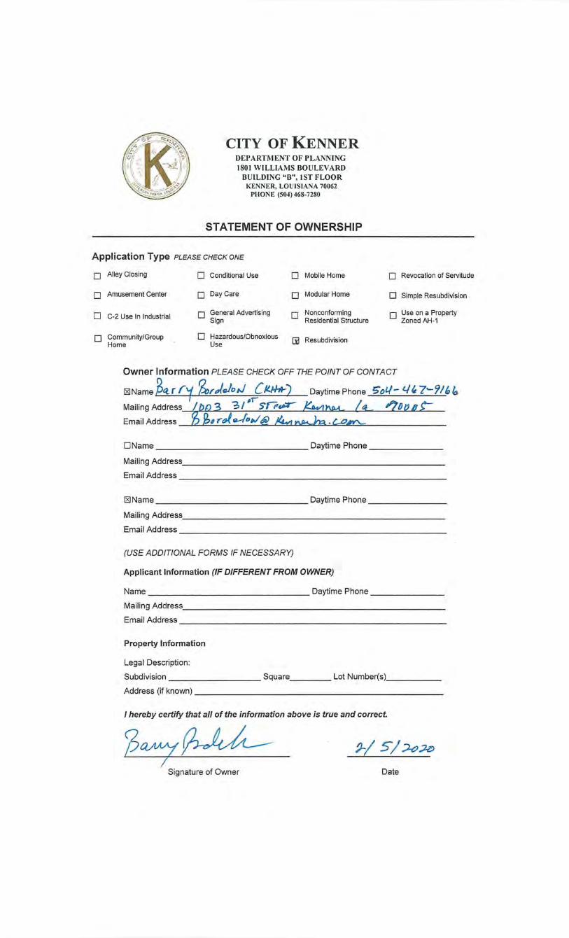
CITY OF KENNER DEPARTMENT OF PLANNING 1801 WILLIAMS BOULEVARD
BULLDlNG "B", 1ST FLOOR KENNER, LOUISIANA 70062
PHONE (504) 468-7280
STATEMENT OF OWNERSHIP
Application Type PLEASE CHECK ONE
0 Alley Closing 0 Conditional Use 0 Mobile Home 0 Revocation of Servitude
0 Amusement Center 0 Day Care · 0 Modular Home 0 Simple Resubdivision
0 C-2 Use In Industrial 0 General Advertising 0 Nonconforming 0 Use on a Property Sign Residential Structure Zoned AH-1
0 Community/Group 0 Hazardous/Obnoxious [1l Resubdivision Home Use
Owner Information PLEASE CHECK OFF THE POINT OF CONTACT
f25JName z~ f rf ~r)e/o,J ( /1./Ht-) Daytime Phone '5fJtl- c..J' 7-- 'J!I, /o Mailing Address FJ!JE 3 "3 / -• Sflr~ ~!:; '70/J Q L Email Address 4 rof-!Dw@ !4vr .
DName Daytime Phone-------
Mailing Address. ________________________ _
Email Address-------------------------
f25JName Daytime Phone--------
Mailing Address _________________________ _
Email Address----------------------- ---
(USE ADDITIONAL FORMS IF NECESSARY)
Applicant Information (IF DIFFERENT FROM OWNER)
Name Daytime Phone--------
Mailing Address ___________ -'----------------
Email Address---------------------------
Property Information
Legal Description:
Subdivision Square Lot Number(s) ____ _
Address(rrknown) ______________________ __
I hereby certify that all of the information above is true and correct.
2ry~ ~/ 5/~~
Signature of Owner Date
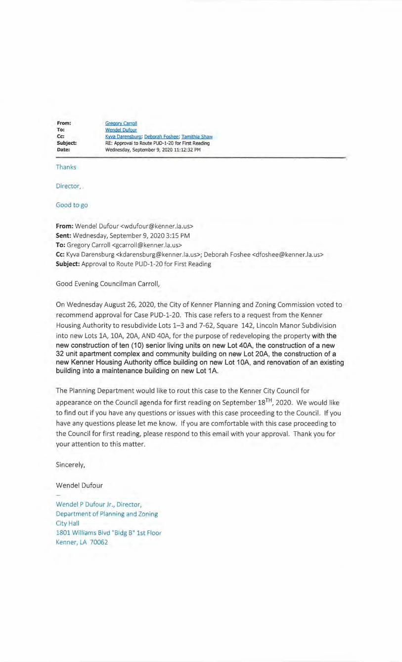
From: To: Cc: Subject: Date:
Thanks
Director,
Good to go
Greaory Carroll
Wendel Dufour
Kwa Darensburg : Deborah Foshee; Tamithia Shaw
RE: Approval to Route PUD-1-20 for First Reading
Wednesday, September 9, 2020 11:12:32 PM
From: Wendel Dufour <[email protected]>
Sent: Wednesday, September 9, 2020 3:15PM
To: Gregory Carroll <[email protected]>
Cc: Kyva Darensburg <[email protected]>; Deborah Foshee <[email protected]>
Subject: Approval to Route PUD-1-20for First Reading
Good Evening Councilman Carroll,
On Wednesday August 26, 2020, the City of Kenner Planning and Zoning Commission voted to
recommend approval for Case PUD-1-20. This case refers to a request from the Kenner
Housing Authority to resubdivide Lots 1-3 and 7-62, Square 142, Lincoln Manor Subdivision
into new Lots lA, lOA, 20A, AND 40A, for the purpose of redeveloping the property with the new construction of ten (1 0) senior living units on new Lot 40A, the construction of a new 32 unit apartment complex and community building on new Lot 20A, the construction of a new Kenner Housing Authority office building on new Lot 1 OA, and renovation of an existing building into a maintenance building on new Lot 1A.
The Planning Department would like to rout this case to the Kenner City Council for
appearance on the Council agenda for first reading on September 18TH, 2020. We would like
to find out if you have any questions or issues with this case proceeding to the Council. If you
have any questions please let me know. If you are comfortable with this case proceeding to
the Council for first reading, please respond to this email with your approval. Thank you for
your attention to this matter.
Sincerely,
Wendel Dufour
Wendel P Dufour Jr., Director,
Department of Planning and Zoning
City Hall
1801 Williams Blvd "Bldg B" 1st Floor
Kenner, LA 70062

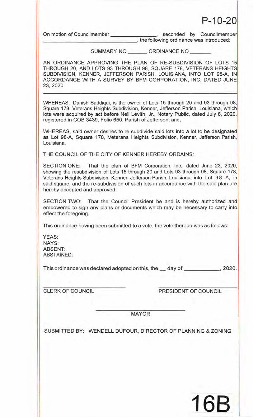
P-1 0-20 On motion of Councilmember , seconded by Councilmember ________________ , the following ordinance was introduced:
SUMMARY NO. ORDINANCE NO. __ _
AN ORDINANCE APPROVING THE PLAN OF RE-SUBDIVISION OF LOTS 15 THROUGH 20, AND LOTS 93 THROUGH 98, SQUARE 178, VETERANS HEIGHTS SUBDIVISION, KENNER, JEFFERSON PARISH, LOUISIANA, INTO LOT 98-A, IN ACCORDANCE WITH A SURVEY BY BFM CORPORATION, INC, DATED JUNE 23, 2020
WHEREAS, Danish Saddiqui, is the owner of Lots 15 through 20 and 93 through 98, Square 178, Veterans Heights Subdivision, Kenner, Jefferson Parish, Louisiana, which lots were acquired by act before Neil Levith, Jr., Notary Public, dated July 8, 2020, registered in COB 3439, Folio 650, Parish of Jefferson; and,
WHEREAS, said owner desires to re-subdivide said lots into a lot to be designated as Lot 98-A, Square 178, Veterans Heights Subdivision, Kenner, Jefferson Parish, Louisiana.
THE COUNCIL OF THE CITY OF KENNER HEREBY ORDAINS:
SECTION ONE: That the plan of BFM Corporation, Inc., dated June 23, 2020, showing the resubdivision of Lots 15 through 20 and Lots 93 through 98, Square 178, Veterans Heights Subdivision, Kenner, Jefferson Parish, Louisiana, into Lot 9 8- A, in said square, and the re-subdivision of such lots in accordance with the said plan are hereby accepted and approved.
SECTION TWO: That the Council President be and is hereby authorized and empowered to sign any plans or documents which may be necessary to carry into effect the foregoing.
This ordinance having been submitted to a vote, the vote thereon was as follows:
YEAS: NAYS: ABSENT: ABSTAINED:
This ordinance was declared adopted on this, the_ day of , 2020.
CLERK OF COUNCIL PRESIDENT OF COUNCIL
MAYOR
SUBMITTED BY: WENDELL DUFOUR, DIRECTOR OF PLANNING & ZONING
168
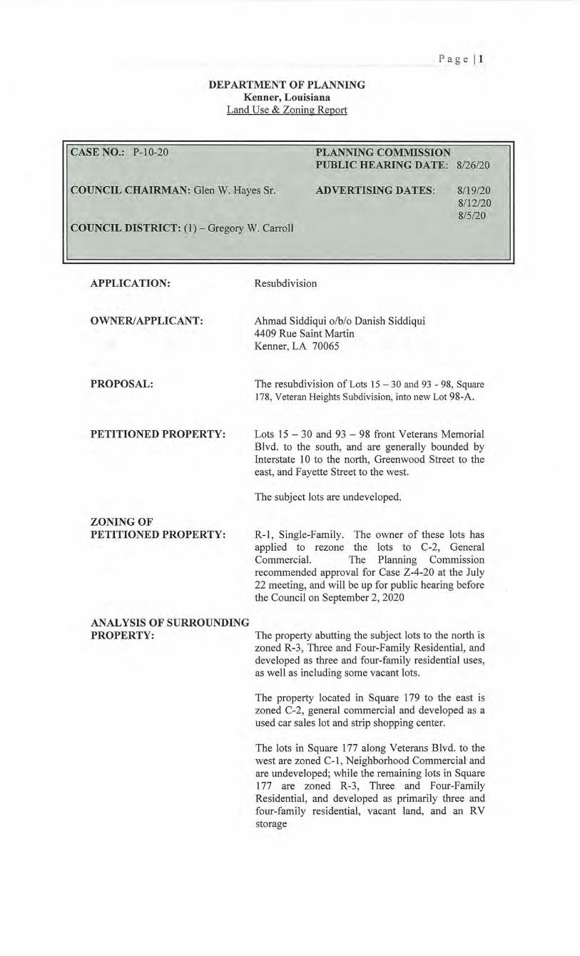
Pa ge ll
DEPARTMENT OF PLANNING Kenner, Louisiana
Land Use & Zoning Report
CASE NO.: P-1 0-20 PLANNING COMMISSION PUBLIC HEARING DATE: 8/26/20
COUNCIL CHAIRMAN: Glen W. Hayes Sr. ADVERTISING DATES: 8/19/20 8112/20 8/5/20
COUNCIL DISTRICT: (1)- Gregory W. Carroll
APPLICATION:
OWNER/APPLICANT:
PROPOSAL:
PETITIONED PROPERTY:
ZONING OF PETITIONED PROPERTY:
ANALYSIS OF SURROUNDING PROPERTY:
Resubdivision
Ahmad Siddiqui o/b/o Danish Siddiqui 4409 Rue Saint Martin Kenner, LA 70065
The resubdivision of Lots 15 - 30 and 93 - 98, Square 178, Veteran Heights Subdivision, into new Lot 98-A.
Lots 15- 30 and 93- 98 front Veterans Memorial Blvd. to the south, and are generally bounded by Interstate 1 0 to the north, Greenwood Street to the east, and Fayette Street to the west.
The subject lots are undeveloped.
R-1, Single-Family. The owner of these lots has applied to rezone the lots to C-2, General Commercial. The Planning Commission recommended approval for Case Z-4-20 at the July 22 meeting, and will be up for public hearing before the Council on September 2, 2020
The property abutting the subject lots to the north is zoned R-3 , Three and Four-Family Residential, and developed as three and four-family residential uses, as well as including some vacant lots.
The property located in Square 179 to the east is zoned C-2, general commercial and developed as a used car sales lot and strip shopping center.
The lots in Square 177 along Veterans Blvd. to the west are zoned C-1 , Neighborhood Commercial and are undeveloped; while the remaining lots in Square 177 are zoned R-3 , Three and Four-Family Residential, and developed as primarily three and four-family residential, vacant land, . and an RV storage
FINDINGS:
PLANNING COMMISSION RECOMMENDATION:
P~ge [2
The lots in Square 189 to the south across Veterans Blvd. are zoned R-2, two-family residential and developed as a church.
Resubdivision
Existing Lots Lots 16-20 and 93-97 are uniform, measuring 20' x 120', and contain 2,400 square feet each.
Lots 15 and 98 are uniform lots measuring 18' x 120', and contain 2,160 square feet each.
New Lot 98-A measures 118' x 240', and includes 28,320
Utilities
Utility companies have no objection to the resubdivision.
This resubdivision meets all of the requirements of a simple resubdivision, including no new public services or easements of access needed
Approval
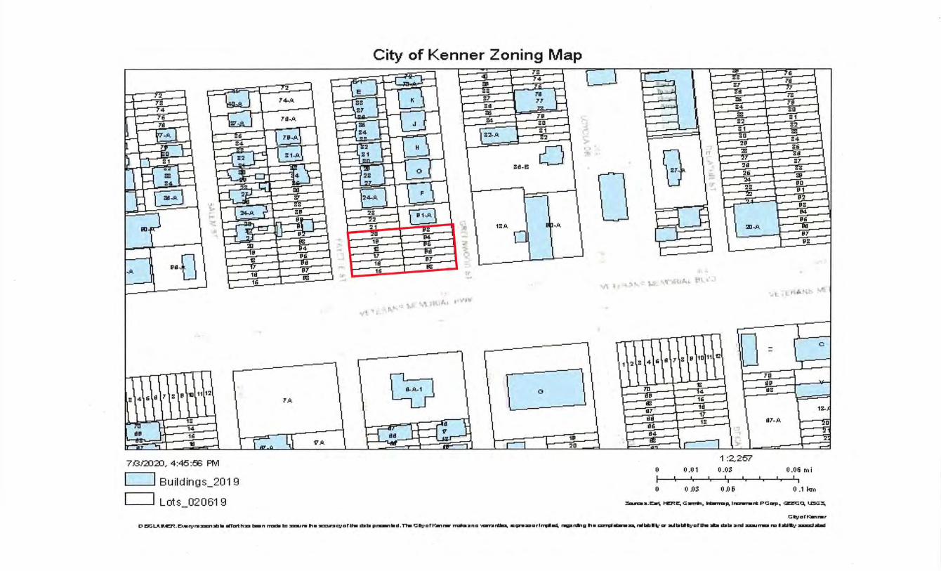
City of Kenner Zoning Map
:J i= 41 m
'l ;rs /4 76
j CJ J=j -
t- Xi l if;3 s7• ;rs
"""[ /2 ] ;rs /4
"76 :=)
,:~ r 74-A
7S~il. l
Ts z;r Bd ~ 84
~ ~ ~
!:6 711 -A :::4 ~-' \ ___:__,J
r=fi2 t1 ~~~
, r-2.-A
~t: Q 2 4-A 03
I
EO~ 1 2:<.: ~ ~ = •22 ~
21 : J! ""2"0'
\
.. D) ~
-A
1
-'II r- 2D ~ 111 014 1E 1::: 96 1::: ....
1'T 1.111 11 "l"s l 111 97 - 111 117 ~ 16 ~ 'I 1f; ~ I
. ·- Jll_'i.f"t. l , ,.,-- ,
f , I
'l r I
~\ 7A \-ffi\ill\1~ 18
'If IIIII "''iT
it r 1d
3 ::..l \ l-=~ 1J 17A
I
~J 7.Gl'2D2J, 4:46 :56 Ff\~
I I Buildings_201 9
I I Lots_02061 9
(
.....!.
r-
:i:S-8
1B n = 711 Eil 81
"T2
0
hl
-
----------------~ \ 0
!,
19 r-1 r 20 1
~
r-n
r---1'11 -a; 34 zz z:z ll1
""So 29
23 "T7
29 - •.--- 26
'1M 23 ~
,_...r'
g ~ \ 20-A
L 'I c
.• .1- .. ~ ~ f,l . ·'
_._. ro fill
ffi\·\~· lllln 7\~S[IIIrtr
1:::
s:;:
4 1ii
18 :::3 lilT
~ 1 :2,.257
0 0.01 o.os I . I
I I I
I I I I I I 0 0 .OS 0.06
;ra --l 711
OlD 31 !:2
!:4 86 .. s 37 -n m liD 111 i2 j
l liZ ll4 IHi
"1111 117
l-- p:;: ~
·.,t· . i... ~ \ : .. h
c
dB ·as
1&-
97-A To 1-- '!:
-~:
-::::::;
0.06 mi I I I
I I
0 .1 l<rrl
~ll.e:::.'\, ~I!. G.,..,, lir'Dnra.P. lrw:::J'W'1Wr* Pt;mp,. ~0. ~..Chi~
Ci b..• a r r.:.n,. r o r;t;:L.A • . c:rt . eM~r..•,....,Jiba. .m::.th:a a-n rnm. b:t ...,,. 11• a::z:uoacyarthllbb P'-'•d.n. -==~·arKin,_. ~»nD ...-n~,...._ ~:aarf~• I"''IIIP.,.,II 11• ~-----. ,.W:I•t.to cr -'bblto..•artt. lib! dati »I'd a:~~~~.~ rna,.,,_...._, ~-.s
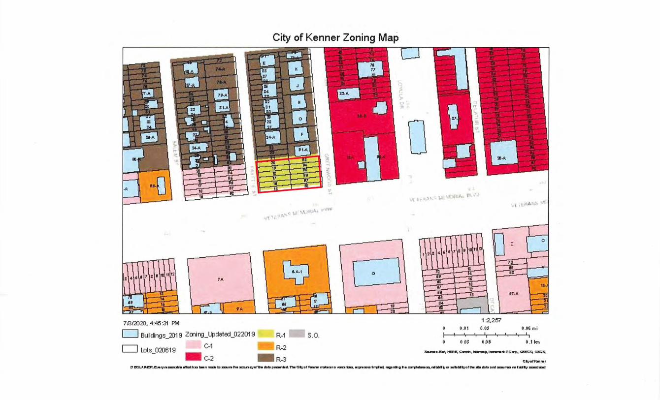
7/3f2)2fJ, 4:46 :3'1 A'o/1
c=J· BL~Idings_Xl19 Zrnirg_l_pdated_022019
c=J Lots_02J619 C-1
C-2
City of Kenner Zoning Map
'• , '
C;5J
R-1
R-2
.. R-3
S.O.
0
0 .... '.J
1'1 J .. M:t'·
1 :2,257 0 0 .01 o.os 0.06 mi
I I I I I I I I I I I I I I
I I I
0 0 .OS O.Oii 0 .1 I<Jn
3a.n31:. .e:':Jrfr. t"En~ c;_,.,, tWnap.l~rt PCcrp. ~0. l..04~
Cl:uart:-.,rwr
t' rlt:lU•.cn . ~:~. • ...,,......,..,., om.thD -· ..-111 I"'""" 11• .,.,......,arh dlb p,_,lod. n. C!t!o•art<ororw -•no _,.,n~~a, "''""aarl,...-, --~ 11• """""'-."" iWbtil~ or a.lbiUyarh- dlb •nd _,,..no llll:il.,.' --
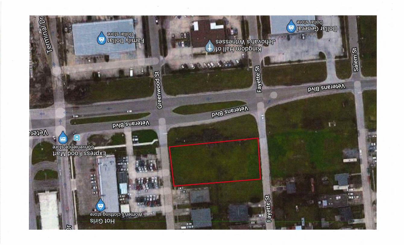
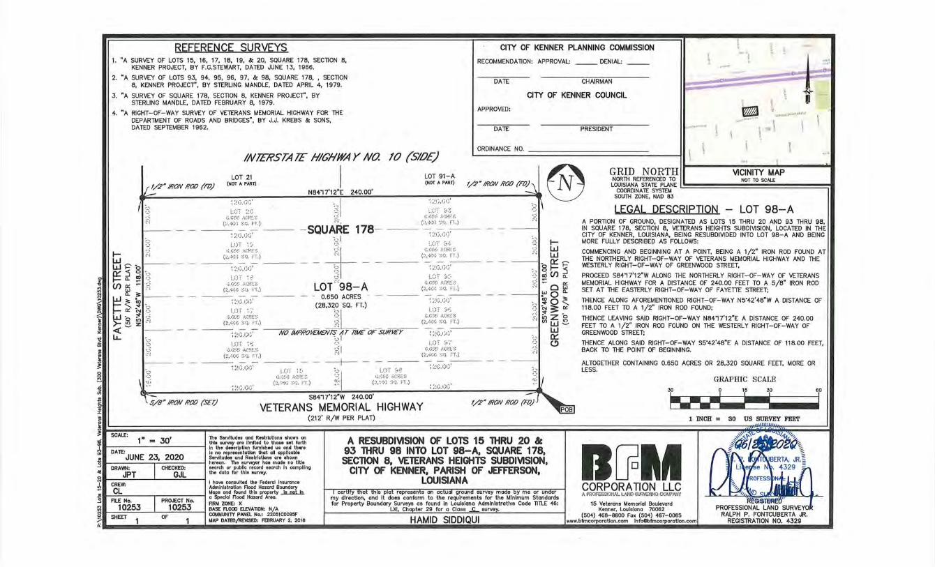
REFERENCE SURVEYS CITY OF KENNER PLANNING COMMISSION ~ 1. "A SURVEY OF LOTS 15, 16, 17, 18, 19, & 20, SQUARE 178, SECTlON 8,
KENNER PROJECT, BY F.G.STEWART, DATED JUNE 13, 1966.
2. "A SURVEY OF LOTS 93, 94, 95, 96, 97, & 98, SQUARE 178, , SECTlON 8, KENNER PROJECT", BY STERLING MANDLE, DATED APRIL 4, 1979.
RECOMMENDATION: APPROVAL:
DATE
DENIAL:
CHAIRMAN
\ .. ........
..... (Li
;,
9
3. "A SURVEY OF SQUARE 178, SECTlON 8, KENNER PROJECT'', BY STERLING MANDLE, DATED FEBRUARY 8, 1979.
CITY OF KENNER COUNCIL
4. "A RIGHT-OF-WAY SURVEY OF VETERANS MEMORIAL HIGHWAY FOR THE DEPARTMENT OF ROADS AND BRIDGES", BY J.J. KREBS & SONS, DATED SEPTEMBER 1962.
IN!ERSTA!E HIGHWAY NO. 10 (SlOE)
APPROVED:
DATE PRESIDENT
ORDINANCE NO. l
i
j
• I
~ ~ . .-._,., ·(
\'rl f'G'." I'' rtl'ol~l ll'•lt
l
I N84'17'12"E 240.00'
LOT 21
1/2~ IRON ROO (m) (NOT A PART)
~ :~G.(JG' :-;I
LOT 91-A (NOT A PART)
~ ;~t) ,f)f} I ® GRID N 0 RTH II VICINITY MAP I NORTH REFERENCED TO NOT TO SCAL£
LO~b~~~I~A5.J:A~J~NE 1
SOUTH ZONE, NAD 83
;, r3
~~ t~Pb ~ :5 C! ·,_.)
a.. (JJ (~
(/) f5 :: :cj 0.. :;= --w .
t- ~ ~ ~_) t- a:: ('j '-"
w b;;; ·~ >-ez " <( I.J... ;,
'3
,~
f.(;
l.CT ;~G r;.r;t··l·· ,..._::;;.~::: ~~
- SQUARE 178-(:~.-~ r) r ) ~::~ . FT.)
~ ;!G.GG'
-4--LOT C'98-A
u::T ~8 ~~-~;~·.:_--. ..'•.Gf.~E~~
(:~.4tjrJ :::r:;, FT. )
~ :~G . I)t} '
LCT ~ ~ r;,r)~--~~ :\CRE::~
(:~.·~r)tJ ::;fJ. FT.)
· 0.650 ACRES -
. _ ., •. , (28,320 SQ. FT.) ~:~G. (~1)'
(::~::~~~-' ;;~_;;:~.) ~~I ---~:~ 1}.;; 1 ;-;- NOIMPROmtENT.f,1T T1ME- OF- SURI£Y
:.:::-:· ~" ~I l],l;t·-~- /•.(:;.:f.:·.~
( : ~.-aJ(i ::,; Q, FT.)
~ ~~l},IJI}'
~ :~I).GG '
L.UT ~ ~-. •J.G~~c; ACRE:-.:
(:~ . ~~~:. ::.~cJ. FT.) '~ '"'
LOT ~>;: t;.c;~~G i•.C1--:E ::_:
(:~. ~ ~~; ::.~ ri. FT.)
S8417'12"W 240.00'
U)T 8:~ r;.G~~~-· l•.GRE:::
(:~ ,4-t.il} ::~(!. l:l.)
~ :~ I) ' 1 ~1)'
U)T ~,.~
G,r;~~!:· i•.(:P.!·. :: (:~ . ·l(;(i :::q, F!.)
~ :~t} . !Jr)'
LOT 8~-.
G.ti!.""•!."· A(:f.:E::~
(:,,-;.;.; C: Q. ;c;·.)
~ ;~G.Gt;'
l.(:T 8~: r},l)~~t• .·\C:f..~E::.~
(:~.-~GG :::r~. FT.)
~ :~tJ ,1)1} '
LOT 8",' IJ.IJ~--t·· /•.J::RE :~
(:<,.;.;.; ''''l. FT.)
~ ~~G.(Jt)'
~ ;~1;.GG'
5/8N IRON ROO (SET) VETERANS MEMORIAL HIGHWAY
(212' R/W PER PLAT)
;3 t,_; w c' W
--- bO::::p ;, 0 t- :5 ·=' <Xi (/) 0..
;,-j :: Q f5 ---- ~00..
;, ~ 0 ~ ':: ~ 3: a:: ~ ~z ~ w~ -- w
-1 0:::: :~ C) ~J
I 1.. _ JO' I Tho 5..-.ftudoo and Rootrlctlono ohown on en - thle survey ore limited to those eet forth 1 In the description furnished ue and there
Ia no representation that all applicable -"I __ . ·- __ , ---- I 5..-.ftudoo and Rootrlc!Jono oro ohown o hereon. The surveyor has mode no title . I CHECKED: ooorch or publlc rocord ooorch In compiling
GJL tho dolo for lido ourwy. 2 VI I
I hove consulted the federal Insurance
A RESUBDIVISION OF LOTS 15 THRU 20 &: 93 THRU 98 INTO LOT 98-A, SQUARE 178, SECTION 8, VETERANS HEIGHTS SUBDIVISION,
CITY OF KENNER, PARISH OF JEFFERSON, LOUISIANA
Administration Aood Hazard Boundary
~I _._ I I ~0~e~l~~ ~O:O~d ~~!~r~'Ar:.y __ia_ruU_1n.
FlRM ZONE: X
tQI ,., .... ......, 1 ,., .... .,., I ~u~~P~A~~-~: 2%~1coosSF MAP DA1Eil/RE'IISED: Fl'BRUARY 2, 2018
LEGAL DESCRIPTION - LOT 98-A A PORTION OF GROUND, DESIGNATED AS LOTS 15 THRU 20 AND 93 THRU 98, IN SQUARE 178, SECTlON 8, VETERANS HEIGHTS SUBDIVISION, LOCATED IN THE CITY OF KENNER, LOUISIANA, BEING RESUBDIVIDED INTO LOT 98-A AND BEING MORE FULLY DESCRIBED AS FOLLOWS:
COMMENCING AND BEGINNING AT A POINT, BEING A 1/2" IRON ROD FOUND AT THE NORTHERLY RIGHT-OF-WAY OF VETERANS MEMORIAL HIGHWAY AND THE WESTERLY RIGHT-OF-WAY OF GREENWOOD STREET,
PROCEED S8417'12" W ALONG THE NORTHERLY RIGHT-OF-WAY OF VETERANS MEMORIAL HIGHWAY FOR A DISTANCE OF 240.00 FEET TO A 5/8" IRON ROD SET AT THE EASTERLY RIGHT-OF-WAY OF FAYETTE STREET;
THENCE ALONG AFOREMENTIONED RIGHT-OF-WAY N5'42'48" W A DISTANCE OF 118.00 FEET TO A 1/2" IRON ROD FOUND;
THENCE LEAVING SAID RIGHT-OF-WAY N8417'12"E A DISTANCE OF 240.00 FEET TO A 1/2" IRON ROD FOUND ON THE WESTERLY RIGHT-OF-WAY OF GREENWOOD STREET;
THENCE ALONG SAID RIGHT-OF-WAY S5"42'48"E A DISTANCE OF 118.00 FEET, BACK TO THE POINT OF BEGINNING.
ALTOGETHER CONTAINING 0.650 ACRES OR 28,320 SQUARE FEET, MORE OR LESS.
GRAPHIC SCALE 15 30 60
~--· ~ I 1 INCH = 30 US SURVEY FEET
D[foll CORPORATION LLC A PAOFESSIONAl. L..ANJ> ~~ COIJf'Mi'f
PROFESSIONAL LAND RALPH P. FONTCUBERTA JR.
REGISTRATION NO. 4329
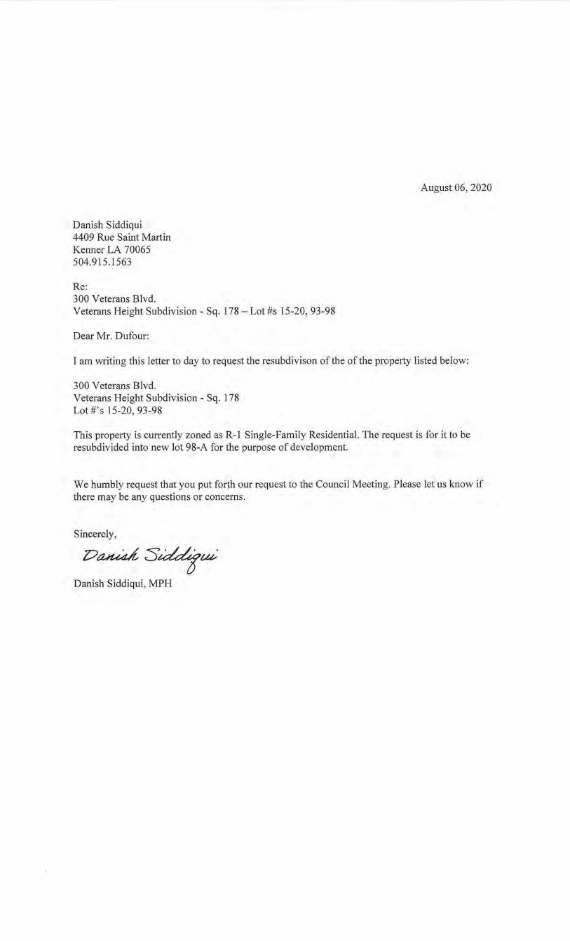
Danish Siddiqui 4409 Rue Saint Martin Kenner LA 70065 504.915.1563
Re: 300 Veterans Blvd. Veterans Height Subdivision- Sq. 178- Lot #s 15-20, 93-98
Dear Mr. Dufour:
August 06, 2020
I am writing this letter to day to request the resubdivison of the of the property listed below:
300 Veterans Blvd. Veterans Height Subdivision- Sq. 178 Lot #'s 15-20, 93-98
This prope1ty is currently zoned as R-1 Single-Family Residential. The request is for it to be resubdivided into new lot 98-A for the purpose of development.
We humbly request that you put forth our request to the Council Meeting. Please let us know if there may be any questions or concerns.
Sincerely,
DaMdS~uv·
Danish Siddiqui, MPH
CITY OF KENNER DEPARTMENT OF PLANNING 1801 WILLIAMS BOULEVARD
BUILDING "B", 1ST FLOOR KENNER, LOUISIANA 70062
PHONE (504) 468-7280
STATEMENT OF OWNERSHIP
Application Type PLEASE CHECK ONE
D Alley Closing D Conditional Use D Mobile Home D Revocation of Servitude
D Amusement Center D Day Care D Modular Home D Simple Resubdivision
D C-2 Use In Industrial 0 General Advertising D Nonconforming D Use on a Property Sign Residential Structure Zoned AH-1
0 Community/Group D Hazardous/Obnoxious ~ Resubdivision
Home Use
Owner Information PLEASE CHECK OFF THE POINT OF CONTACT
~Name Danish Siddiqui Daytime Phone 504-812-1852
Mailing Address 4409 Rue Saint Martin Kenner LA 70065
Email Address [email protected]
DName Daytime Phone ______ _
Mailing Address _________________________ _
Email Address-----,-------------------------
~Name Daytime Phone _______ _
Mailing Address _________________________ _
Email Address ---------------------------
(USE ADDITIONAL FORMS IF NECESSARY)
Applicant Information (IF DIFFERENT FROM OWNER)
Name Daytime Phone ______ _
Mailing Address _________________________ _
Email Address ----------------------------
Property Information
Legal Description:
Subdivision Veterans Height Square 178 Lot Number(s) 15-20, 93-98
Address (if known) 300 Veterans Blvd.
I hereby certify that all of the information above is true and correct.
Da;u;d S~uv· August06,2020 l)
Signature of Owner Date
From: To: Subject: Date:
Gregory Carroll
Wendel Dufour
RE: Approval to Route PUD-1-20 for First Reading
Thursday, September 10, 2020 2:25:45 PM
Yes .. I good with that one also.
Please let me know if
Gregory
From: Wendel Dufour <wdufour@kenner. la.us>
Sent: Thursday, September 10, 2020 9:40AM
To: Gregory Carroll <[email protected]>
Subject: Re: Approval to Route PUD-1-20 for First Reading
Thanks councilman! Did you see the one for Mr. Siddiqui's resubdivision? We sent it to you on
August 26. I can resend if you can't find it.
Wendel
Wendel P Dufour Jr., Director
Department of Planning and Zoning
City Hall
1801 Williams Blvd "Bldg B" 1st Floor
Kenner, LA 70062
p 504-468-7280
f 504-468-7587
From: Gregory Carroll <[email protected] a.us>
Sent: Wednesday, September 9, 2020 11:12 PM
To: Wendel Dufour
Cc: Kyva Darensburg; Deborah Foshee; Tamithia Shaw
Subject: RE: Approval to Route PUD-1-20 for First Reading
Thanks
Director,
Good to go
From: Wendel Dufour <wdufour@kenner Ia us>
Sent: Wednesday, September 9, 2020 3:15 PM To: Gregory Carroll <gcarro ll @kenner Ia us>
Cc: Kyva Darensburg <kdarensburg@kenner la.us>; Deborah Foshee <[email protected]> Subject: Approval to Route PUD-1-20 for First Reading
Good Evening Councilman Carroll,
On Wednesday August 26, 2020, the City of Kenner Planning and Zoning Commission voted to
recommend approval for Case PUD-1-20. This case refers to a request from the Kenner
Housing Authority to resubdivide Lots 1-3 and 7-62, Square 142, Lincoln Manor Subdivision
into new Lots lA, lOA, 20A, AND 40A, for the purpose of redeveloping the property with the
new construction of ten (1 0) senior living units on new Lot 40A, the construction of a new 32 unit apartment complex and community building on new Lot 20A, the construction of a new Kenner Housing Authority office building on new Lot 1 OA, and renovation of an existing building into a maintenance building on new Lot 1A.
The Planning Department would like to rout this case to the Kenner City Council for
appearance on the Council agenda for first reading on September 18TH, 2020. We would like
to find out if you have any questions or issues with this case proceeding to the Council. If you
have any questions please let me know. If you are comfortable with this case proceeding to
the Council for first reading, please respond to this email with your approval . Thank you for
your attention to this matter.
Sincerely,
Wendel Dufour
Wendel P Dufour Jr., Director,
Department of Planning and Zoning
City Hall
1801 Williams Blvd "Bldg B" 1st Floor
Kenner, LA 70062
p 504-468-7280
f 504-468-7587
CITY OF KENNER PUBLIC INFORMATION NOTICE
This electronic communication is intended only for the recipient(s) specified by the sender. Unless you are a specified recipient or you are authorized to act for that person, please be advised that your reading, distributing, printing, or copying this communication is hereby

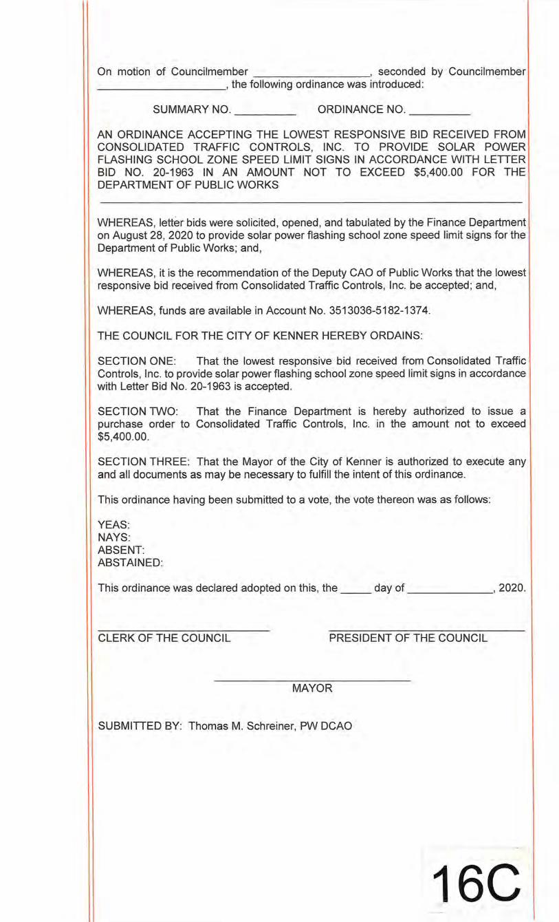
On motion of Councilmember , seconded by Councilmember __________ ,the following ordinance was introduced:
SUMMARY NO. ______ _ ORDINANCE NO. ______ _
AN ORDINANCE ACCEPTING THE LOWEST RESPONSIVE BID RECEIVED FROM CONSOLIDATED TRAFFIC CONTROLS, INC. TO PROVIDE SOLAR POWER FLASHING SCHOOL ZONE SPEED LIMIT SIGNS IN ACCORDANCE WITH LETTER BID NO. 20-1963 IN AN AMOUNT NOT TO EXCEED $5,400.00 FOR THE DEPARTMENT OF PUBLIC WORKS
WHEREAS, letter bids were solicited, opened, and tabulated by the Finance Department on August 28, 2020 to provide solar power flashing school zone speed limit signs for the Department of Public Works; and,
WHEREAS, it is the recommendation of the Deputy GAO of Public Works that the lowest responsive bid received from Consolidated Traffic Controls, Inc. be accepted; and,
WHEREAS, funds are available in Account No. 3513036-5182-1374.
THE COUNCIL FOR THE CITY OF KENNER HEREBY ORDAINS:
SECTION ONE: That the lowest responsive bid received from Consolidated Traffic Controls, Inc. to provide solar power flashing school zone speed limit signs in accordance with Letter Bid No. 20-1963 is accepted.
SECTION TWO: That the Finance Department is hereby authorized to issue a purchase order to Consolidated Traffic Controls , Inc. in the amount not to exceed $5,400.00.
SECTION THREE: That the Mayor of the City of Kenner is authorized to execute any and all documents as may be necessary to fulfill the intent of this ordinance.
This ordinance having been submitted to a vote, the vote thereon was as follows:
YEAS: NAYS: ABSENT: ABSTAINED:
This ordinance was declared adopted on this, the day of , 2020.
CLERK OF THE COUNCIL PRESIDENT OF THE COUNCIL
MAYOR
SUBMITTED BY: Thomas M. Schreiner, PW DCAO
16C
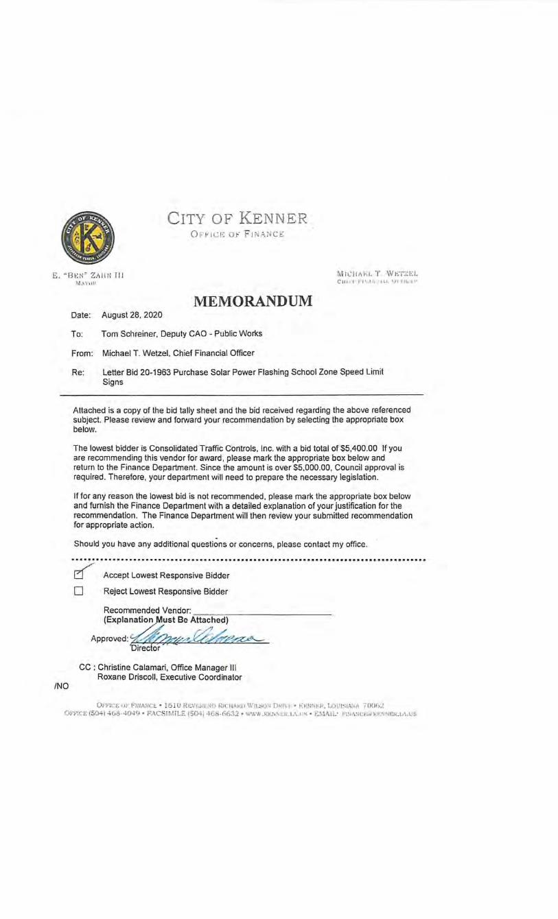
CITY OF K E NNER O FrtC f•: O F F lN .~. N C E
E. '' BEN " Z ll l l N Il l M,\ Y\J P
Mit.:l ii\1·: 1. T . WET Z t:;L C H U.I-' F J' ,,\ lH ~ l .1 '.11 rh .. ' f:f'
/NO
MEMORANDUM Date: August 28. 2020
To: Tom Schreiner. Deputy CAO- Public Works
From: Michael T. Wetzel. Chief Financial Officer
Re: letter Bid 20-1963 Purchase Solar Power Flashing School Zone Speed limit Signs
Attached is a copy of the bid tally sheet and the bid received regarding the above referenced subject. Please review and forward your recommendation by selecting the appropriate box below.
The lowest bidder is Consolidated Traffic Controls, Inc. with a bid total of $5,400.00 If you are recommending this vendor for award, please mark the appropriate box below and return to the Finance Department. Since the amount is over $5.000.00, Council approval is required. Therefore, your department will need to prepare the necessary legislation.
If for any reason the lowest bid is not recommended , please mark the appropriate box below and furnish the Finance Department with a detailed explanation of your justification for the recommendation. The Finance Department will then review your submitted recommendation for appropriate action.
Should you have any additional questions or concerns, please contact my office .
.......•.........•...................•.••••••••.........••••••••••••••••••••••••••••••
~ 0
Accept Lowest Responsive Bidder
Reject Lowest Responsive Bidder
Recommended Vendor:.---:---:-:----------(Explanation,Must Be Attached)
Approved: e--'Af'~c?.X .. =f,;,Cl'Y~"-
CC : Christine Calamari, Office Manager Ill Roxane Driscoll, Executive Coordinator
01'1'lt:f~ vF,FiriANCi; • !610 RLVI·.J<niO RJCIIIIlW Wu..sur; ()f.(J\1. • Kt-:11:~~;1(. I...Ol'!ooiA~.I\ 70062 OF'I·lCE (504)4 68·40·l •j • F-'ACSIMILE (50.11 •161:!-66.32 • \\WW . Kr..l. \EIU.A.I'S · ~:MAIL: F'lN:.::<:~'l(ll·.:t·: r;:-: r:Jl..L.\ . US
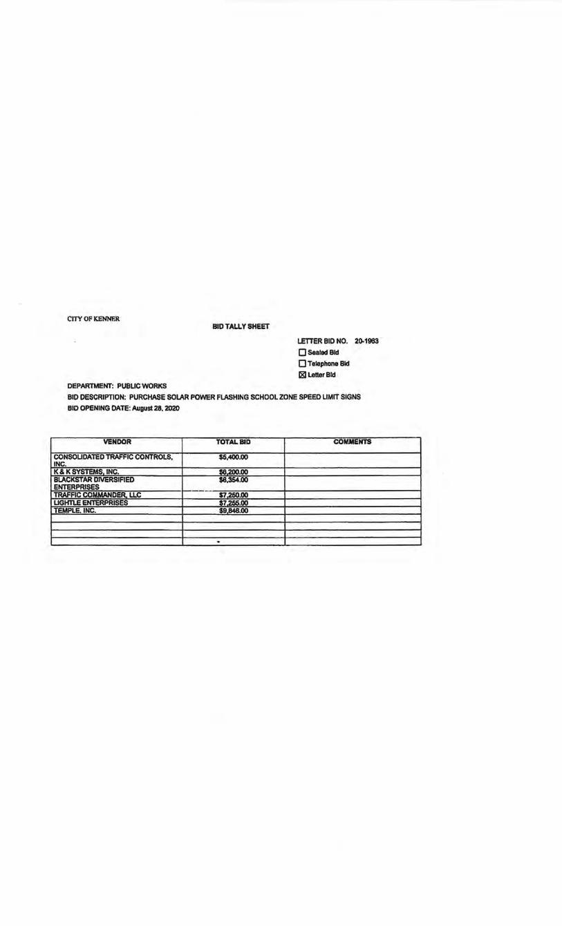
CITY OF KENNER BID TALLY SHEET
DEPARTMENT: PUBUCVVORKS
LETTER BID NO. 20-1963 .
QSealedBid
0 Telephone Bid
181 Letter Bid
BID DESCRIPTION: PURCHASE SOlAR POWER FLASHING SCHOOL ZONE SPEED LIMIT SIGNS
BID OPENING DATE: August 28. 2020
VENDOR TOTAL BID COMMENTS
CONSOUDATED TRAFFIC CONTROLS, $5,400.00 INC. K& K SYSTEMS INC. $6.200.00 BLACKSTAR DIVERSIAED $8,354.00 ENTERPRISES -TRAFFIC COMMANDER. LLC $7.250.00 LIGHTLE ENTERPRISES $7,255.00 TEMPLE, INC. $9848.00
L___, _____ - -----
E . "BEN" ZAHN III MAYO II
AUGUST 20, 2020
RE: LETTER BID 20-1963
DEAR BIDDER:
CITY OF KENNER OFFICE OF FINANCE
MICHAEL T. WETZEL CIIII: F FINAN<;fi\f, 0J71'1CI>fl
ATTACHED PLEASE FIND THE FOLLOWING BID PACKAGE FOR THE CITY OF KENNER CONCERNING:
PURCHASE SOLAR POWER FLASHING SCHOOL ZONE SPEED LIMIT SIGNS
FOR THE CITY OF KENNER DEPARTMENT OF PUBLIC WORKS
PLEASE REVIEW THE PACKAGE AND INSURE ALL NECESSARY FORMS ARE SIGNED AND RETURNED PER THE BID CHECK LIST. SHOULD YOU HAVE ANY QUESTIONS REGARDING THE PACKAGE, YOU MAY CONTACT THE FINANCE DEPARTMENT AT (504) 4q8-7261 , BETWEEN THE HOURS OF 8:30A.M. AND 4:30P.M. DAILY, EXCEPT SATURDAYS, SUNDAYS AND HOLIDAYS.
BIDS WILL BE RECEIVED UNTIL THE HOUR OF 9:45A.M., FRIDAY, AUGUST 28, 2020 IN THE FINANCE DEPARTMENT, 1610 REV. RICHARD WILSON DRIVE, BUILDING D, KENNER, LOUISIANA 70062. BIDS RECEIVED AFTER THIS TIME WILL NOT BE ACCEPTED. BIDS WILL BE OPENED THE SAME DAY VIA ZOOM, AT 10:00 A.M. IF INTRESTED IN PARTICIPATING IN THE OPENING, PLEASE EMAIL [email protected] FOR DEATILS.
SINCERELY,
MICHAEL T. WETZEL CHIEF FINANCIAL OFFICER
/no
ATTACHMENTS
Of'FICE OF FINANCE • 1610 REVEREND RICHARD WILSON DRIVE • KENNER, LOUISIANA 70062 OFFICE (504) 468-4049 • FACSIMILE (504)468-6632 • WWW.I\ENNER.I.A.US • EMAIL: FINANCE@I<ENNER.I.A.US
Bid No. 20..1963
INVITATION TO BID
CITY OF KENNER mNANCEDEPARTMENT
1610 REV. RICHARD WILSON DRIVE KENNER, LA 70062
504-468-7161
Bid Description: Purchase Solar Power Flashing School Zone Speed Limit Signs Bid Opening Date: Friday, August 28, 2020 LATE BIDS WILL NOT BE ACCEPTED
NOTE: ONLY ONE (1) BID PER VENDOR IS ALLOWED. ONLY BIDS WRITTEN IN INK OR TYPEWRITTEN, AND PROPERLY SIGNED BY A MEMBER OF THE FIRM OR AUTHORIZED REPRESENTATIVE, WILL BE ACCEPTED.
INSTRUCTIONS FOR BIDDERS THE FOLLOWING INSTRUCTIONS APPLY TO ALL BIDS
ALL BIDS SUBMITIED ARE SUBJECT TO THESE GENERAL CONDITIONS, ADDITIONAL REQUIREMENTS, AND ANY SPECIALCONDmONS AND SPECIFICATIONS CONTAINED HEREIN, ALL OF WHICH ARE MADE PART OF THE BID PROPOSAL.
RESPONSE TO INVITATION: Bidders, who are unable to bid on this request, are asked to state your reason for not submitting a bid on the Bid Fonn and return the same to this office before bid opening date. Failure to do so may result in your name being removed from the vendor list.
Questions on this bid are to be emailed to FINcontractsCrokenner.la.us no later than FIVE (S) working days prior to bid opening. Please reference bid number in all requests.
Any corrections to portions of the bid form that are completed by the bidder must be initialed.
The City of Kenner reserves the right to accept or reject any and all bids, in whole or in part, and waive infonnalities. However, the provisions and requirements of the Louisiana Public Bid law, those stated in the advertisement for bids, those provided in the bid fonn and written specifications shall not be considered as infonnalities and shall not be waived by the City of Kenner.
The City of Kenner will accept one price for each item unless otherwise indicated. Two or more prices for one item will result in bid rejection.
Where brand names and stock numbers are specified, it is for the purpose of establishing certain minimum standards of quality. Bids may be submitted for products of equal quality provided brand names and stock numbers are specified. Complete product data of equal products may be required prior to award.
All materials and/or products must be new and of current manufacturer, unless otherwise stated. Any product or service bid shall confonn to all applicable federal and state laws and regulations, and the specifications contained in the solicitation.
Preference is hereby given to materials, supplies and provisions produced, manufactured or grown in Louisiana, quality being equal to articles offered by competitors outside the state. Vendor must request this preference (LSA- R. S. 38:2251-2261).
A W AIID OF CONTRACf: The City of Kenner reserves the right to award contracts or place orders with the lowest responsive bidder, on a lump sum or individual item basis or such combination as shall in its judgment be in the best interest of the city. Awards wiU be based on compliance with the specifications and the delivery and/or completion date.
All orders/services must be delivered/provided within the time specified in the Bid Specifications.
PRICBS: All prices shall be quoted in the unit of measure specified, and unless otherwise specified, shall be exclusive of State and Parish taxes. As per LSA-RS 47:301 et seq., all governmental bodies are excluded from payment ofsales taxes to any Louisiana taxing body.
Page llof3
Freight charges should be included in total cost when quoting. If not quoted FOB DELIVERED, freight must be quoted as a separate item. Bid may be disqualified if not quoted FOB DELIVERED or if freight charges are not indicated on bid fonn.
Quantities listed are for bidding purposes only. Actual requirements may be more or less than quantities listed.
The City of Kenner requires a firm price, unless otherwise stated.
lD case of an extension error, the unit price shaD prevail.
All bids submitted shall remain binding and may not be withdrawn for a period of forty-five (45) days after the scheduled closing date for receiving bids.
CANCELLATION OF CONTRACT: The City of Kenner reserves the right to cancel all or any part if not shipped promptly. The order must not be filled at a higher price than quoted.
The City of Kenner reserves the right to cancel any contract at any time and for any reason by issuing a THIRTY (30) day written notice to the contractor.
MISCELLANEOUS: For good cause and as consideration for executing a binding contract with the City of Kenner, vendor conveys, sells assigns and transfers to City of Kenner or its assigns all rights, title and interest in and to all causes of action it may now or hereafter acquire under the antitrust laws of the Unites States and the State of Louisiana, relating to the particular good or services purchased or acquired by City of Kenner.
Bidders agree to abide by the requirements of the following as applicable: Title VI and VII of the Civil Rights Act of 1964, as amended by the Equal Opportunity Act of 1972, Federal Executive Order 11246, the Federal Rehabilitation Act of 1973, as amended, the Vietnam Era Veteran's Readjustment Assistance Act of 1974, Title IX of the Education Amendments of 1972, the Age Act of 1975, and contractor agrees to abide by the requirements of the Americans with Disabilities Act of 1990. Bidder also agrees not to discriminate in its employment practices, and will render services under this contract without regard to race, color, religion, sex, sexual orientation, national origin, veteran status, political affiliation, or disabilities. Any act of discrimination committed by bidder, or failure to comply with these statutory obligations when applicable shall be grounds for termination of this contract.
New construction or renovation projects must comply with Section 504 of the 1973 Rehabilitation Act, as amended, in accordance with the American National Standard Institute's specifications (ANSI All7.1-1961).
ADDITIONAL REQUIREMENTS FOR THIS BID Please match the numbers printed in this box with the corresponding instructions below.
I. All awards in excess of$5000 for labor and materials will be reduced to a fonnal contract and/or purchase order.
2. By signing the bid, the bidder certifies compliance with all instructions for bidders, terms, general conditions and specifications, and further certifies that the person signing the bid is a current corporate officer, partnership member or other individual; or that the person is an individual authorized to bind the vendor company. If the bid exceeds, $25,000 and the bidder is an agency, corporation, partnership, or other legal entity, the president, vic~president, secretary/treasurer, or an authorized agent, shall sign the proposal, and satisfactory evidence of the authority of the person signing for the agency, corporation, partnership, or other legal entity shall be attached to the proposal. "FaUure to indude a copy of the appropriate signature authorization, if required, may result in the rejection of the bid unless bidder has complied with La. R.S. 38:llll(A)(l)(C) or La. R.S. 38:2lll(O)."
3. All bidders for the contracts for purchase of materials and supplies and/or furnish and install must complete and submit with their bid the "Bidder's Statement of Non-Collusion" Fonn attached hereto.
Pagel2or3
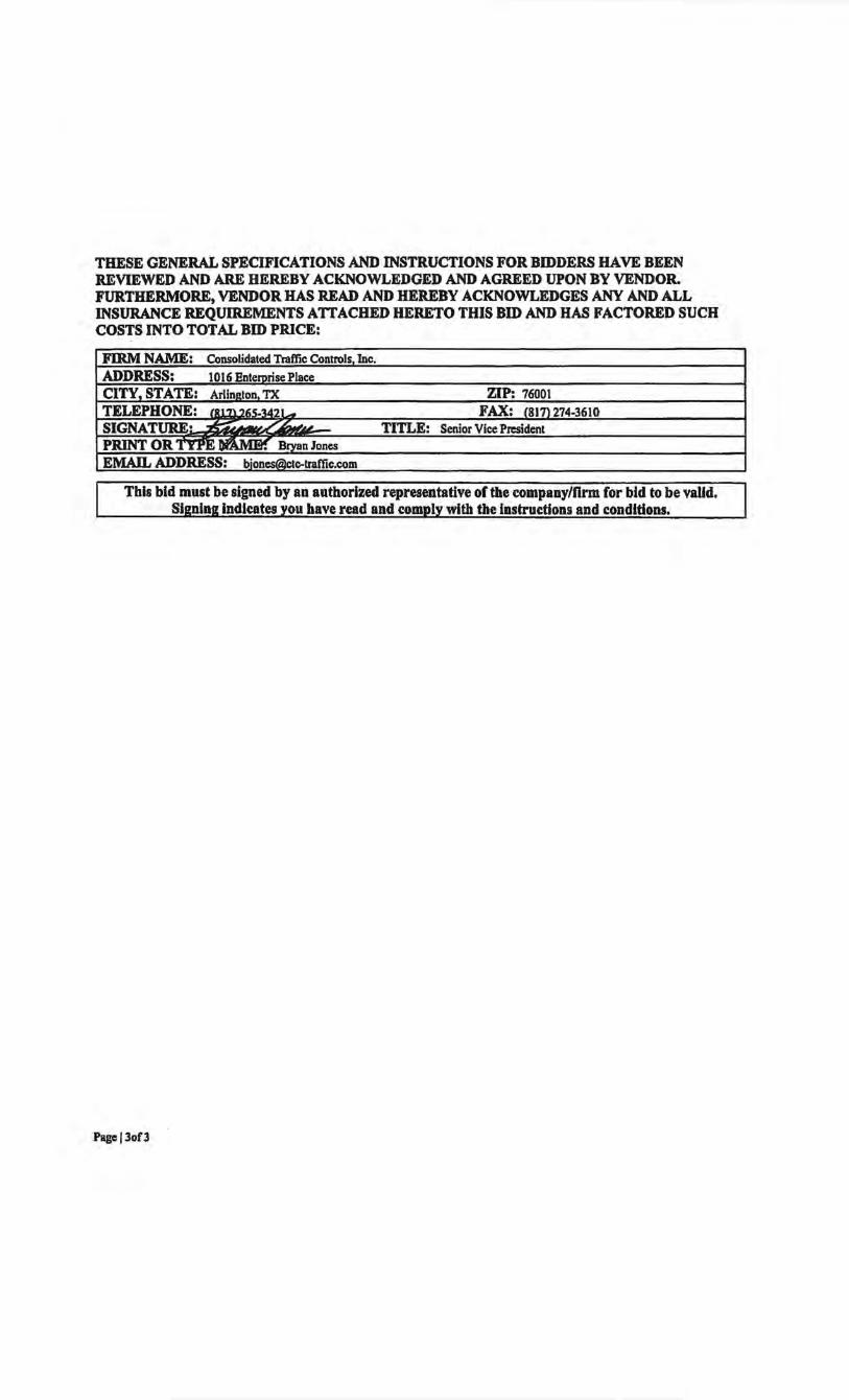
THESE GENERAL SPECIFICATIONS AND INSTRUCTIONS FOR BIDDERS HAVE BEEN REVIEWED AND ARE HEREBY ACKNOWLEDGED AND AGREED UPON BY VENDOR. FURTHERMORE, VENDOR HAS READ AND HEREBY ACKNOWLEDGES ANY AND ALL INSURANCE REQUIREMENTS ATTACHED HERETO THIS BID AND HAS FACTORED SUCH COSTS INTO TOTAL BID PRICE:
FIRM NAME: Consolidated Traffic Controls Inc. ADDRESS: 1016 EntemrisePlace CITY, STATE: Arlineton TX ZIP: 76001 TELEPHONE: fRt'7\?~~u·u- FAX: _(8J'll274-3610 SIGNATURE• ~ ~ ~~d TITLE: Senior Vice President PRINT OR TYPE n.Jl Mw.' Bryan Jones EMAIL ADDRESS: [email protected]
~-
This bid must be signed by an authorized representative of the company/firm for bid to be valid. Sieninelndlcates vou have read and comolv with the instructions and conditions.
Pagej3of3
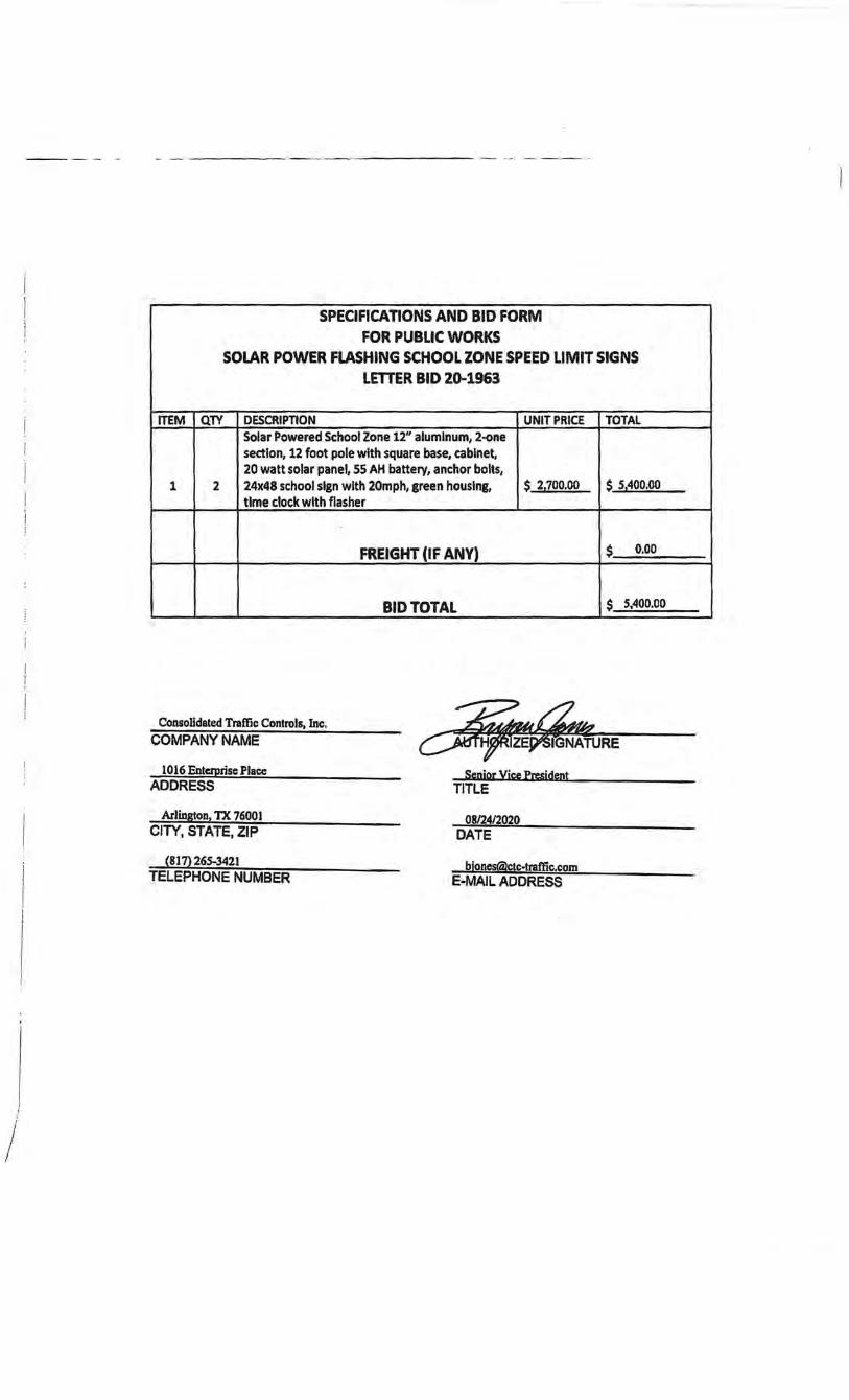
----- ··- -· - ------· ---- ~·---- ----- --- ~ --·- - -
SPECIFICATIONS AND BID FORM FOR PUBLIC WORKS
SOLAR POWER FLASHING SCHOOL ZONE SPEED LIMIT SIGNS LmER BID 20-1963
ITEM QTY DESCRIPTION UNIT PRICE TOTAL Solar Powered School Zone 12" aluminum, 2-one section, 12 foot pole with square base, cabinet, 20 watt solar panel, 55 AH battery, anchor bolts,
1 2 24x48 school sign with 20m ph, green housing, $ 21700.00 $ 51400.00 time clock with flasher
FREIGHT (IF ANY) $ 0.00
BID TOTAL $ Sz400.00 I -
Consolidated Traffic Controls, Inc. COMPANY NAME
1016 Enterprise Place ADDRESS
Senior Vice President TITLE
Arlington, TX 76001 08124/2020 CITY, STATE, ZIP DATE
(817) 265-3421 TELEPHONE NUMBER
blones<ilctc-traftic.com E-MAIL ADDRESS
I
J
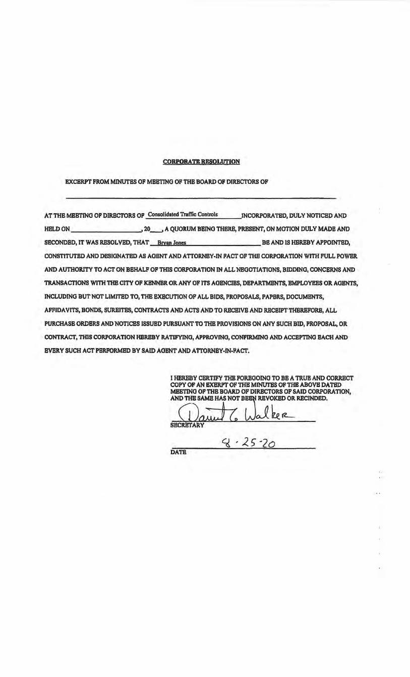
CORPORATE R£SOLUTION
EXCERPT FROM MINUTES OF MBBTINO OF THB BOARD OF DIRECTORS OF
AT THB MBBTINO OF DIRECTORS OP Consolidated Traffic Controls INCORPORATED, DULY NOTICED AND
HBLD ON 20_, A QUORUM BBINO THBRB, PRBSBNT, ON MOTION DULY MADB AND
SBCONDBD, IT WAS RBSOL VBD, THAT Bryan Jones BB AND IS HBRBBY APPOINTED,
CONSTITUTED AND DBSIONATBD AS AGENT AND ATTORNBY·IN PACT OF THE CORPORATION WITH FULL POWBR
AND AUTHORITY TO ACT ON BEHALF OF THIS CORPORATION IN ALL NEOOTIATIONS, BIDDING, CONCERNS AND
TRANSACTIONS WITH THB CITY OF KBNNBR OR ANY OF ITS AOBNCIBS, DEPARTMENTS, EMPLOYEES OR AOBNTS,
INCLUDING BUT NOT LIMITBD TO, THB EXECUTION OP ALL BIDS, PROPOSALS, PAPBRS, DOCUMENTS,
AFFIDAVITS, BONDS, SURBITBS, CONTRACTS AND ACTS AND TO RBCBIVB AND RBCBIPT THBRBFORB, ALL
PURCHASE ORDERS AND NOTICES ISSUED PURSUANT TO THB PROVISIONS ON ANY SUCH BID, PROPOSAL, OR
CONTRACT, THIS CORPORATION HBRBBY RATIFYING, APPROVING, CONFIRMJNG AND ACCEPTING BACH AND
BVBRY SUCH ACT PBRFORMBD BY SAID AGENT AND ATTORNEY-IN-PACT.
I HBRBBY CERTIFY THB FOREGOING TO BB A TRUB AND CORRECT COPY OF AN EXBRPT OF THB MINtTI'BS OF THB ABOVB DATBD MBETINO OFTHB BOARD OF DIRECTORS OF SAID CORPORATION, AND THB SAME HAS NOT BE, REVOKED OR RBCINDBD.
G1:J c: wJ ~ (L_ SBCRBTARY
q ·25-2o DATB
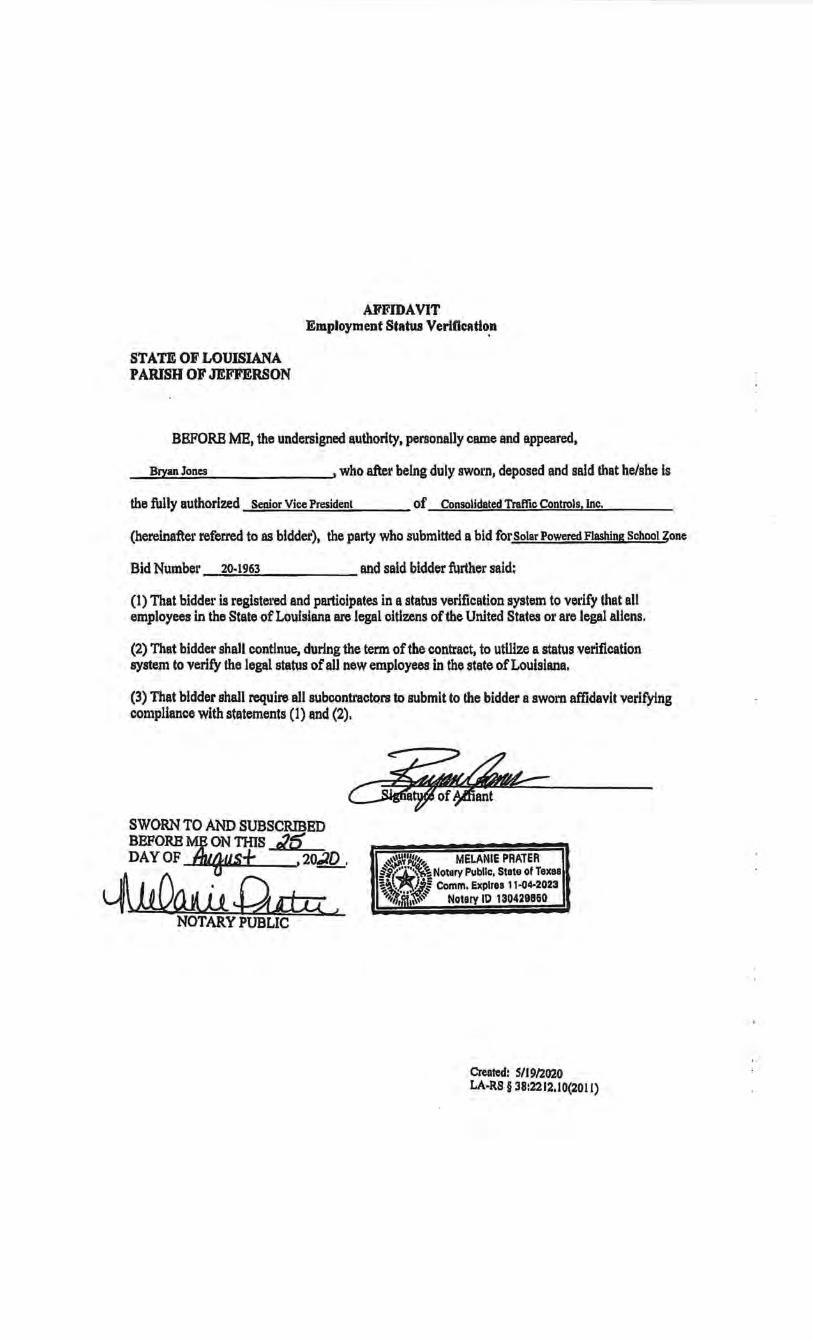
AII'FIDAVIT Employment Status Verlficatio.n
STATE OF LOUISIANA PARISH OF JEFFERSON
BEFORE ME, the undersigned authority, personally came and appeared,
Bryan Jones , who after being duly swo•·n, deposed and said that he/she is
the fully authorized Senior Vice President of Consolidated Traffic Controls, Inc.
(hereinafter referred to as bidder), the party who submitted a bid for Solar Powered Flashing School Zone
Bid Number 20-1963 and said bidder further said:
(1) That bidder is registered and participates in a status verification system to vel'ify that all employees in the State of Louisiana are legal citizens of the United States Ol' are legal aliens.
{2) That bidder shall continue, during the term of the contract, to utillze a status verification system to verify the legal status of all new employees in the state of Louisiana.
(3) That bidder shall require all subcontractors to submit to the bidder a swom affidavit verifying compliance with statements (1) and (2).
SWORN TO AND SUBSCRIBED BEFORE~ ON TinS Jf5 DAY OF ~us+ , 20.10 ,
~~. NOTARY PUBLIC
~~ ~~we:=:
~~~ MELANIE PRATER ·· h(~~ Notary Public, State of Taxaa ~~~l'~ Comm. Explrea 11·04-2023 '~-+""tf,jjj;~~ Notary ID 130429860
Created: S/19/2020 LA-RS§ 38:2212.10(2011)
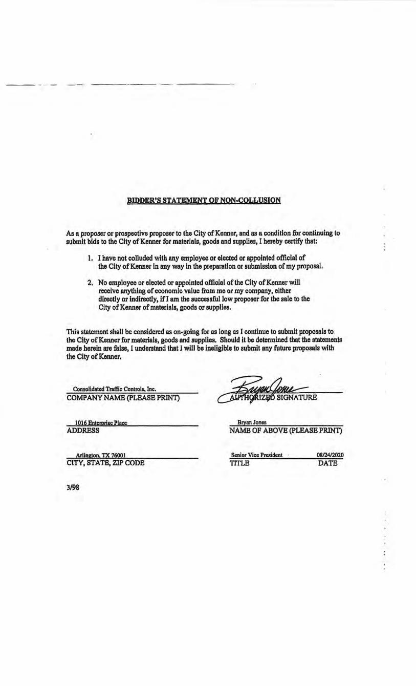
BIDDER'S STATEMENT OF NON-COLLUSION
A3 a proposer or prospective proposer to the City of Kenner, and as a condition for continuing to submit bids to the City of Kennet• for materials, goods and supplies, I hereby certify that:
1. I have not colluded with any employee or elected or appointed official of the City of Kennel' in any way in the preparation ot• submission of my proposal.
2. No employee or elected or appointed official of the City of Kenner will receive anything of economic value from me or my company, either directly or indirectly, if I am the successful low proposer for the sale to the Clty of Kenner of materials, goods or supplies.
This statement shall be considered as on-going for as long as I continue to submit proposals to the City of Kenner for materials, goods and suppUes. Should it be determined that the statements made herein are false, 1 understand that 1 will be ineligible to submit any future proposals with the City of Kenner. ·
Consolidated Traffic Controls, Inc. ~ COMPANY NAME (PLEASE PRINT) ~9fiZijt5 SIGNATURE
1016 Entemrise Place Bryan Jones ADDRESS NAME OF ABOVE (PLEASE PRINT)
Arlinaton. TX 76001 Senior Vice President 08124/2020 CITY, STATE, ZIP CODE TITLE DATE
3/98

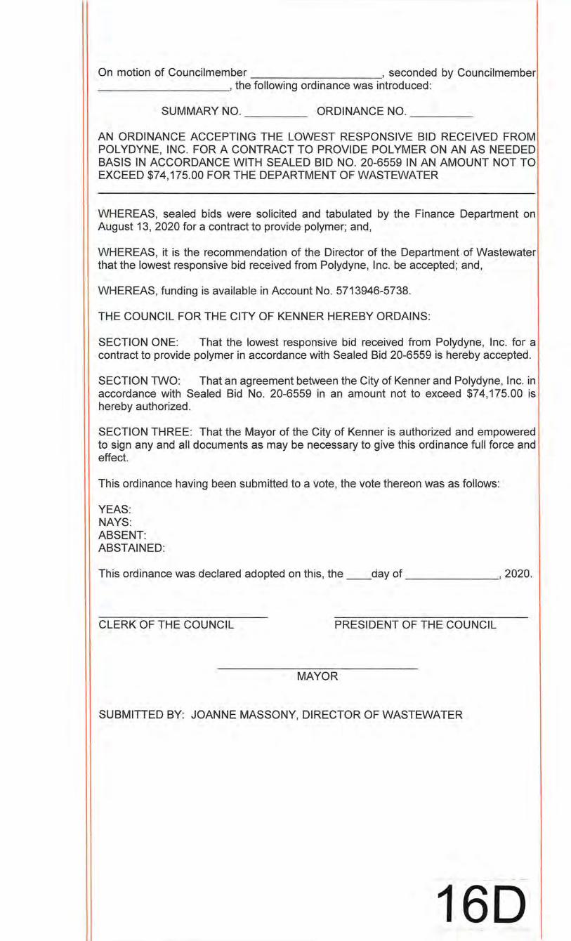
On motion of Councilmember , seconded by Councilmember __________ ,the following ordinance was introduced:
SUMMARY NO. ___ _ ORDINANCE NO. _____ _
AN ORDINANCE ACCEPTING THE LOWEST RESPONSIVE BID RECEIVED FROM POL YDYNE, INC. FOR A CONTRACT TO PROVIDE POLYMER ON AN AS NEEDED BASIS IN ACCORDANCE WITH SEALED BID NO. 20-6559 IN AN AMOUNT NOT TO EXCEED $74,175.00 FOR THE DEPARTMENT OF WASTEWATER
WHEREAS, sealed bids were solicited and tabulated by the Finance Department on August 13, 2020 for a contract to provide polymer; and,
WHEREAS, it is the recommendation of the Director of the Department of Wastewater that the lowest responsive bid received from Polydyne, Inc. be accepted; and,
WHEREAS, funding is available in Account No. 5713946-5738.
THE COUNCIL FOR THE CITY OF KENNER HEREBY ORDAINS:
SECTION ONE: That the lowest responsive bid received from Polydyne, Inc. for a contract to provide polymer in accordance with Sealed Bid 20-6559 is hereby accepted.
SECTION TWO: That an agreement between the City of Kenner and Polydyne, Inc. in accordance with Sealed Bid No. 20-6559 in an amount not to exceed $74,175.00 is hereby authorized.
SECTION THREE: That the Mayor of the City of Kenner is authorized and empowered to sign any and all documents as may be necessary to give this ordinance full force and effect.
This ordinance having been submitted to a vote, the vote thereon was as follows:
YEAS: NAYS: ABSENT: ABSTAINED:
This ordinance was declared adopted on this, the __ day of , 2020.
CLERK OF THE COUNCIL PRESIDENT OF THE COUNCIL
MAYOR
SUBMITIED BY: JOANNE MASSONY, DIRECTOR OF WASTEWATER
160
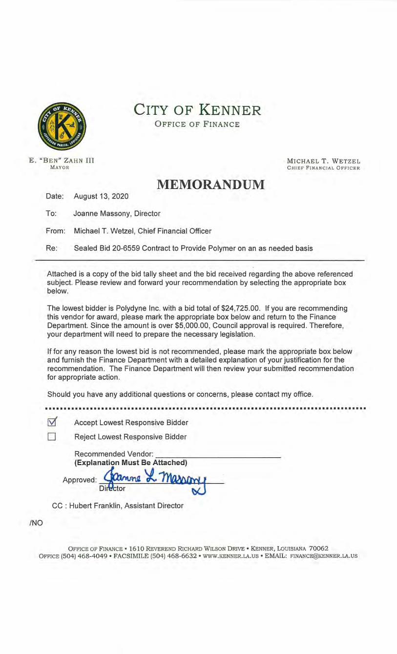
CITY OF KENNER OFFICE OF FINANCE
E. "BEN" ZAHN III M AYOR
MICHAEL T. WETZEL C HIEF FI NANC IA L O FF ICER
/NO
MEMORANDUM Date: Augu~13,2020
To: Joanne Massony, Director
From: Michael T. Wetzel, Chief Financial Officer
Re: Sealed Bid 20-6559 Contract to Provide Polymer on an as needed basis
Attached is a copy of the bid tally sheet and the bid received regarding the above referenced subject. Please review and forward your recommendation by selecting the appropriate box below.
The lowest bidder is Polydyne Inc. with a bid total of $24,725.00. If you are recommending this vendor for award, please mark the appropriate box below and return to the Finance Department. Since the amount is over $5,000.00, Council approval is required. Therefore, your department will need to prepare the necessary legislation.
If for any reason the lowest bid is not recommended, please mark the appropriate box below and furnish the Finance Department with a detailed explanation of your justification for the recommendation. The Finance Department will then review your submitted recommendation for appropriate action.
Should you have any additional questions or concerns, please contact my office .
••••••••••••••••••••••••••••••••••••••••••••••••••••••••••••••••••••••••••••••••••••••
[SZ( Accept Lowest Responsive Bidder
D Reject Lowest Responsive Bidder
Recommended Vendor: _____________ _ (Explanation Must Be Attached)
Approved: ~ 'l. ~ D~ -w
CC : Hubert Franklin, Assistant Director
OFFICE OF FINANCE • 1610 REVEREND RICHARD WILSON DRIVE • KENNER, LOUISIANA 70062 OFFICE (504) 468-4049 • FACSIMILE (504) 468-6632 • WWW.KENNER.LA.US • EMAIL: [email protected]
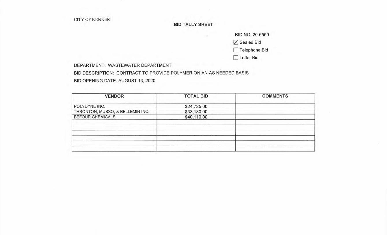
CITY OF KENNER
DEPARTMENT: WASTEWATER DEPARTMENT
BID TALLY SHEET
BID NO: 20-6559
cgj Sealed Bid
0 Telephone Bid
0 Letter Bid
BID DESCRIPTION: CONTRACT TO PROVIDE POLYMER ON AN AS NEEDED BASIS
BID OPENING DATE: AUGUST 13, 2020
VENDOR TOTAL BID COMMENTS
POL YDYNE INC. $24,725.00 THRONTON, MUSSO, & BELLEMIN INC. $33,180.00 BEFOUR CHEMICALS $40,110.00
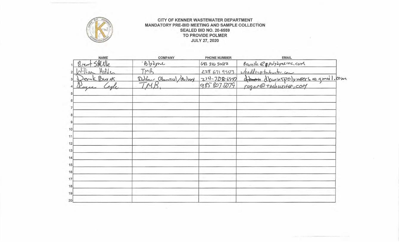
2
3
4
5
6
7
8
9
10
11
12
13
14
15
16
17
18
19
20
NAME
CITY OF KENNER WASTEWATER DEPARTMENT MANDATORY PRE-BID MEETING AND SAMPLE COLLECTION
SEALED BID NO. 20-6559 TO PROVIDE POLMER
JULY 27, 2020
COMPANY PHONE NUMBER EMAIL
o/yJ..y"ff.,L H1C.., C,:, '~'-'\.
'OW\
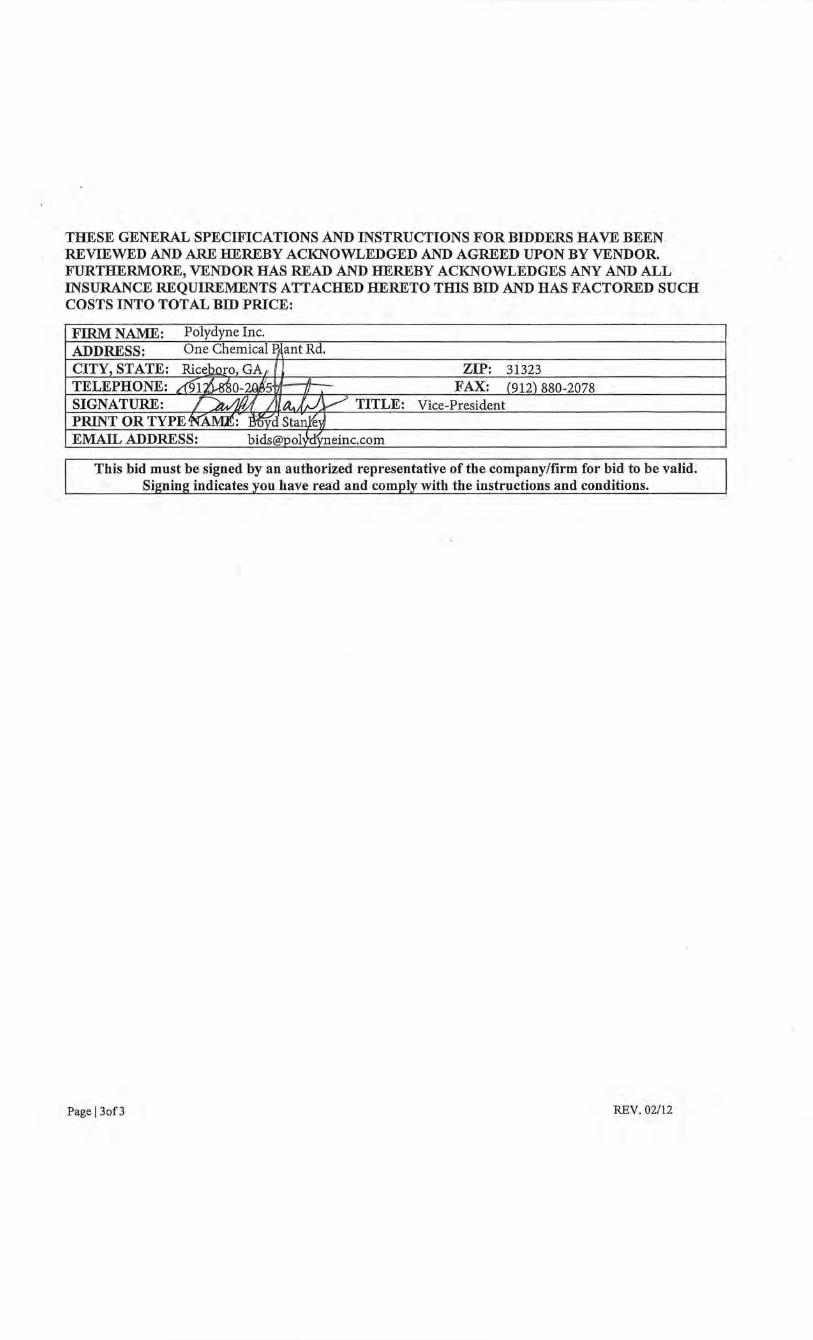
THESE GENERAL SPECIFICATIONS AND INSTRUCTIONS FOR BIDDERS HAVE BEEN REVIEWED AND ARE HEREBY ACKNOWLEDGED AND AGREED UPON BY VENDOR. FURTHERMORE, VENDOR HAS READ AND HEREBY ACKNOWLEDGES ANY AND ALL INSURANCE REQUIREMENTS ATTACHED HERETO TIDS BID AND HAS FACTORED SUCH COSTS INTO TOTAL BID PRICE:
FIRM NAME: Polydyne Inc.
ADDRESS: One Chemical PAant Rd.
CITY, STATE: Ric~o, GA 11 ZIP: 31323 TELEPHONE: 69J.~o-2Ql5llr 11 FAX: (912) 880-2078 SIGNATURE: ~A7Jltt.f;JV' TITLE: Vice-President PRINT OR TYPEN"AM.E:- MfdSta~~ EMAIL ADDRESS: [email protected]
This bid must be signed by an authorized representative of the company/firm for bid to be valid. Silminl! indicates vou have read and comnlv with the instructions and conditions.
Page l3of3 REV. 02/12
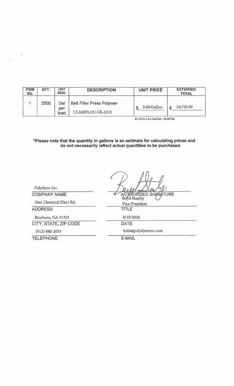
ITEM QTY. UNIT DESCRIPTION UNIT PRICE EXTENDED NO. DESC TOTAL
1 2500 Gal Belt Filter Press Polymer per $ 9.89/Gallon $ 24,725.00
load CLARIFLOC CE-2215
$1.15/Lb. x 8.6 Lbs/Gal = $9.89/Gal
*Please note that the quantity in gallons is an estimate for calculating prices and do not necessarily reflect actual quantities to be purchased.
Polydyne Inc.
COMPANY NAME
One Chemical Plant Rd.
ADDRESS
Riceboro, GA 31323
CITY, STATE, ZIP CODE
(912) 880-2035
TELEPHONE
Vice-President TITLE
8/10/2020
DATE
1.0 GENERAL:
Specifications for a two-year contract for a supply of cation ic polymer for the City of Kenner Department of wastewater. The quantity shown on th is bid represents an approximate quantity to be purchased over the two-year period. Actual usage will be on an as needed basis. The contract will be effective July 1, 2020 till June 30, 2022.
1.1 The City of Kenner Wastewater Department is operating a 15.2 MGD activated sludge treatment plant, located at 1 West 301h Street, Kenner, LA. From the treatment process, Mixed Liquor Suspended Solids (MLSS) are cultivated in the aerations basins, where their concentrations range from (2,000 mg/L- 5,000 mg/L). Eventually, the MLSS are discharged to the digesters where further concentration thickening occurs (15 ,000 mg/L - 25,000 mg/L) before being pumped to the belt press. The wastewater plant has to dewater the sludge to meet the state regulations. Polymer is an essential and required part of the dewatering process. During the dewatering process, polymer is used to cause the MLSS to coagulate, allowing the water to be removed. The end result is a sludge cake, which is disposed at a landfill. The City of Kenner wastewater sludge cake ranges between (13-22% solids). The average polymer usage last three to four months. An order of 2,500 gallons per load is placed at a frequency of three to four months. The chosen company will be required to perform bench testing , in order to determine the optimum polymer for the sludge, and to follow the City of Kenner safety policies. ·
2.0 PRODUCT SPECIFICATIONS:
The polymer furn ished under these specifications will be used for the dewatering of sewerage sludge via belt filter presses.
2.1 The polymer supplied under these specifications must be a liquid cationic emulsified solution of a high molecular weight flocculant.
2 .2 The polymer must have good mixing characteristics and produce a minimum of nuisance conditions, such as floating scum or foam.
2.3 The polymer shall be suitable for storage in plastic vessels and shall have a shelf life in the storage tank of no less than six months. The freeze-thaw recovery ofthe polymer shall be at least 90%. The polymer should be mixable with water in all dilutions, and should be able to be diluted to any ratio desired to meet the chemical feed capacity.
2.4 The polymer shall have the following general properties: appearance -viscous liquid solubility- soluble in water in all proportions
2.5 The polymers application shall decidedly improve the operation of the belt
filter press, and attain the following performance: • feed solids- 1.5%- 3.5% • hydraulic loading- 100-200 gpm • minimum cake solids -13 %capture- 85% • filtrate quality- less than 1,000 mg/L TSS
3.0 TESTING PROCEDURE:
Note: The City of Kenner reserves the right to require or omit polymer testing based upon polymer performance. If testing is deemed necessary, the following procedures must be adhered to.
3.1 The polymers must be compatible with the present feed system at the facility.
3.2 Only cationic liquid emulsion polymer products will be accepted for the plant. Anionic or neutral charge, dry solid polymer, and water solution polymers will not be accepted.
3.3 The bidder shall use the polymer equipment provided by the department for conducting polymer trial work on the belt filter press.
3.4 Samples from each belt press will be collected for all bench testing.
3.5 The bidder must supply the sample containers and necessary supplies needed to perform the bench testing. Samples shall be provided by the bidder at no cost to the City of Kenner.
3.6 The trial will provide data to estimate polymer dosage, captured solids, filtrate clarity, cake dryness, and also provide operational characteristics of the belt filter press when using the test polymers.
3. 7 Since the Wastewater Department has a hauling contract for which the cost of hauling is based on the number of loads hauled, the performance factor will include an adjustment to reflect cake solids and polymer per ton of solids captured .
3.8 At the department's request, the bidder must provide additional testing during the contract period, should performance of polymer become an issue. ·Additional testing will only be required if the performance requirements are not met. The bidder must be willing to adjust and supply the optimal polymer to meet performance requirements.
4.0 PLANT PERFORMANCE:
4.1 If the polymer consumption during normal operations exceeds the original pounds of polymer per ton of dry solids for the qualifications trial by 20%, the
supplier shall respond to such problems at no additional cost to the department.
4.2 The City of Kenner reserves the right to cancel the contract and re-bid if the corrective action exceeds the original dosage rate by 20% for the ten-day period.
4.3 The department reserves the right to run laboratory and/or plant trials of other polymers during the contract period.
5.0 TECHNICAL INFORMATION:
5.1 The bidder shall submit OSHA safety data sheets and polymer products sheets within 1 0 days after the bid opening.
5.2 Upon request, the bidder shall provide the department with a laboratory procedure to determine total active solids in their product during the contract period.
5.3 The bidder shall provide the department with technical assistance to develop and maintain optimum dewatering of the sludge with the belt filter presses, while using a minimal polymer dosage. ·
6.0 DELIVERY:
6.1 . Shipments and partial shipments shall be made by tank truck to the following location:
City of Kenner Wastewater Treatment Plant 1 West 30th Street Kenner, LA 70065 504-468-7292
6.2 Deliveries to the City of Kenner plant are typically 2500 gallons a truckload.
6.3 Deliveries must be made no later than 14 days after orders are placed.
6.4 The bidder shall supply the necessary transfer pump and/or equipment to unload the polymer from the tank truck into the storage tanks in a safe and efficient manner.
6.5 Certified weight scale tickets attached to the invoices shall substantiate the amount of material delivered.
6.6 Invoices with purchase order number, copy of delivery tickets with date of delivery, and copy of weight scale tickets should be sentto:
City of Kenner Department of Wastewater

....: 0 c 0 CJ)
~ "E co
..c (J
(2C\I CD
-oO . c 0
Q)l'--,_ Q)<(
~ ~-Q)
0 c ...-c coQJ
---~
E. "BEN" ZAHN III MAYOR
CITY OF KENNER OFFICE OF FINANCE
EMAIL AND POSTED
JULY 21, 2020
ADDENDUM 4 SEALED BID 20-6559
CONTRACT TO PROVIDE POLYMER ON AN AS NEEDED BASIS
FOR THE CITY OF KENNER DEPARTMENT OF WASTEWATER
MICHAEL T. WETZEL CHJEP FINANCIA~ 0PFICER
BY WAY OF THIS ADDENDUM, PLEASE NOTE FOLLOWING ANSWER TO QUESTIONS:
Q. What is the procedure/process for the bench test?
A. The Vendors will have to show up with (2) 5gallon sample containers so that they can run a Mixed Liquor Suspended Solids/Mixed Liquor Volatile Suspended Solids test. The sample that wi/1 be provided from one of the Digesters at the Plant. Also, they will need a 500mL container to collect cake from both belt press's for them to run a percent solids test. If any company have any questions about lab sampling/analysis they should contact their contract laboratory.
OFFICE OF FINANCE • 1610 REVEREND RICHARD WILSON DRIVE • KENNER, LOUISIANA 70062 OFFICE (504) 468-4049 • FACSIMILE (504) 468-6632 • WWW.I<ENNER.LA.US • EMAIL: [email protected]

E. "BEN" ZAHN III MAYOR
CITY OF KENNER OFFICE OF FINANCE
EMAIL AND POSTED
JULY 21, 2020
ADDENDUM 3 SEALED BID 20-6559
CONTRACT TO PROVIDE POLYMER ON AN AS NEEDED BASIS
FOR THE CITY OF KENNER DEPARTMENT OF WASTEWATER
BY WAY OF THIS ADDENDUM, PLEASE NOTE FOLLOWING:
MICHAEL T. WETZEL CHJE F FJNA NCIAI.. O!'I'ICER
-This bid has been extended until August 13, 2020 at 9:45 am. Bids will be open same day via Zoom at 10:00 am. To get information on the virtual meeting please email [email protected] .us.
-The Bench testing (trail) is scheduled for July 27, 2020 at 10:00 am. This is a mandatory meeting and all prospective bidders will have to be present at the plant to collect their samples from the same batch of sludge.
OFFICE OF FINANCE • 1610 REVEREND RICHARD WILSON DRIVE • KENNER, LOUISIANA 70062 OFFICE (504) 468-4049 • FACSIMILE (504) 468-6632 • WWW.KENNER.LA.US • EMAIL; [email protected]
E. "BEN" ZAHN III MAYOR
CITY OF KENNER OFFICE OF FINANCE
EMAIL AND POSTED
JUNE 25, 2020
ADDENDUM 2 SEALED BID 20-6559
CONTRACT TO PROVIDE POLYMER ON AN AS NEEDED BASIS
FOR THE CITY OF KENNER DEPARTMENT OF WASTEWATER
MICHAEL T . WETZEL CHIEF FINANCIAL O F FI CER
BYWAY OF THIS ADDENDUM, PLEASE NOTE THE FOLLOWING ANSWERS TO QUESTIONS:
Q. Would you be able to find out what the current product is that is being used?
A. TMB-838/Ia/lb Wastewater Flocculantllb Item LA Contract #4400015052 item #160.
Q. Regarding (3.7), How will the performance factor be calculated, is there a specific formula for $/dry ton produced?
A. Unfortunately, we do not have an exact formula for the performance factor yet.
Q. What is the latest date for running trail? If our Polymer is currently being used can we just come in one day to get the necessary date?
A. The bench-testing (trail) will be conducted towards the middle to end of July. All prospective bidders will have to be present at the plant at a designated date and time to collect their samples from the same batch of sludge. We will not allow samples to be taken before or after that date. At this time, we are still waiting on parts for the sludge conveyor; therefore, we cannot process any sludge at this time.
Q. I am looking for your current vendor, polymer name, and your current pricing.
A. Thorton, Musso & Bellemin. Wastewater Flocculant, and $2.60 per lb.
OFFICE OF FINANCE • 1610 REVEREND RICHARD WILSON DRIVE • KENNER, LOUISIANA 70062 OFFICE (504) 468-4049 • FACSIMILE (504) 468-6632 • WWW.KENNER.LA.US • EMAIL: [email protected]
E. "BEN" ZAHN III MAYOR
CITY OF KENNER OFFICE OF FINANCE
EMAIL AND POSTED
JUNE 18, 2020
ADDENDUM 1 SEALED BID 20-6559
CONTRACT TO PROVIDE POLYMER ON AN AS NEEDED BASIS
FOR THE CITY OF KENNER DEPARTMENT OF WASTEWATER
MICHAEL T. WETZEL CHIEF FINANCIAL OFFICER
BY WAY OF THIS ADDENDUM, PLEASE NOTE THE FOLLOWING CHANGE:
- THE DATE FOR THIS BID HAS BEEN EXTENDED TO AUGUST 6, 2020.
END OF ADDENDUM 1
OFFICE OF FINANCE • 1610 REVEREND RICHARD WILSON DRIVE • KENNER, LOUISIANA 70062 OFFICE (504) 468-4049 • FACSIMILE (504) 468-6632 • WWW.KENNER.LA.US • EMAIL: [email protected]
E. "BEN" ZAHN III MI\YOR
JUNE 10, 2020
RE: SEALED BID 20-6559
DEAR BIDDER:
CITY OF KENNER OFFICE OF FINANCE
MICHAEL T. WETZEL CHIEI' FJNI\NCit\L OI'I'ICER
ATTACHED PLEASE FIND THE FOLLOWING BID PACKAGE FOR THE CITY OF KENNER CONCERNING:
CONTRACT TO PROVIDE POLYMER ON AN AS NEEDED BASIS
FOR THE CITY OF KENNER DEPARTMENT OF WASTEWATER
PLEASE REVIEW THE PACKAGE AND INSURE ALL NECESSARY FORMS ARE SIGNED AND RETURNED PER THE BID CHECK LIST. SHOULD YOU HAVE ANY QUESTIONS REGARDING THE PACKAGE, YOU MAY CONTACT THE FINANCE DEPARTMENT AT (504) 468-7261 OR [email protected], BETWEEN THE HOURS OF 8:30 A.M. AND 4:30 P.M. DAILY, EXCEPT SATURDAYS, SUNDAYS AND HOLIDAYS.
BIDS WILL BE RECEIVED UNTIL THE HOUR OF 9:45A.M., THURSDAY, JUNE 25, 2020 IN THE FINANCE DEPARTMENT, 1610 REV. RICHARD WILSON DRIVE, BUILDING D, KENNER, LOUISIANA 70062. BIDS RECEIVED AFTER THIS TIME WILL NOT BE ACCEPTED. BIDS WILL BE OPENED THE SAME DAY AND READ ALOUD, AT 10:00 A.M. IN THE AUDITORIUM, 1610 REV. RICHARD WILSON DRIVE, BUILDING D, KENNER, LA 70062.
MICHAEL T. WETZEL CHIEF FINANCIAL OFFICER
/NO
ATTACHMENTS
OFFICE OF FINANCE • 1610 REVEREND RICHARD WILSON DRIVE • KENNER, LOUISIANA 70062 OFFICE (504) 468-4049 • FACSIMILE (504) 468-6632 • WWW.KENNER.LA.US • EMAIL: [email protected]
r
Bid No. 20-6559
INVITATION TO BID
CITY OF KENNER FINANCE DEPARTMENT
1610 REV. RICHARD WILSON DRIVE KENNER, LA 70062
504-468-7261
Bid Description: Contract to Provide Polymer Bid Opening Date: Thursday, June 25, 2020
LATE BIDS WILL NOT BE ACCEPTED
NOTE: . ONLY ONE (1) BID PER VENDOR IS ALLOWED. ONLY BIDS WRITTEN IN INK OR TYPEWRITTEN, AND PROPERLY SIGNED BY A MEMBER OF THE FIRM OR AUTHORIZED REPRESENTATIVE, WILL BE ACCEPTED.
INSTRUCTIONS FOR BIDDERS THE FOLLOWING INSTRUCTIONS APPLY TO ALL BIDS
ALL BIDS SUBMITTED ARE SUBJECT TO THESE GENERAL CONDITIONS, ADDITIONAL REQUIREMENTS, AND ANY SPECIAL CONDITIONS AND SPECIFICATIONS CONTAINED HEREIN, ALL OF WIDCH ARE MADE PART OF THE BID PROPOSAL.
RESPONSE TO INVITATION: Bidders, who are unable to bid on this request, are asked to state your reason for not submitting a bid on the Bid Form and return the same to this office before bid opening date. Failure to do so may result in your name being removed from the vendor list.
Questions on this bid are to be emailed to [email protected] no later than FIVE (5) working days prior to bid opening. Please reference bid number in all requests.
Any corrections to portions of the bid form that are completed by the bidder must be initialed.
The City of Kenner reserves the right to accept or reject any and all bids, in whole or in pa1t, and waive infonnalities. However, the provisions and requirements of the Louisiana Public Bid law, those stated in the adve1tisement fOI' bids, those provided in the bid form and written specifications shall not be considered as informalities and shall not be waived by the City ofKenner.
The City of Kenner will accept one price for each item unless otherwise indicated. Two or more prices for one item will result in bid rejection.
Where brand names and stock numbers are specified, it is for the purpose of establishing certain minimum standards of quality. Bids may be submitted for products of equal quality provided brand names and stock numbers are specified. Complete product data of equal products may be required prior to award.
All materials and/or products must be new and of current manufacturer, unless otherwise stated. Any product or service bid shall conform to all applicable federal and state laws and regulations, and the specifications contained in the solicitation.
Preference is hereby given to materials, supplies and provisions produced, manufactured or grown in Louisiana, quality being equal to ruticles offered by competitors outside the state. Vendor must request this preference (LSA- R. S. 38:2251-2261).
A WARD OF CONTRACT: The City ofKe1mer reserves the right to award contracts or place orders with the lowest responsive bidder, on a lump sum or individual item basis or such combination as shall in its judgment be in the best interest ofthe city. Awards will be based on compliance with the specifications and the delivery and/or completion date.
All orders/services must be delivered/provided within the time specified in the Bid Specifications.
PRICES: All prices shall be quoted in the unit of measure specified, and unless otherwise specified, shall be exclusive of State and Parish taxes. As per LSA-RS 47:301 et seq., all governmental bodies are excluded from payment of sales taxes to any Louisiana taxing body.
Page llof3 REV. 02/12
/
/ I
_,tlt charges should be included in total cost when quoting. If not quoted FOB DELIVERED, freight must be quoted d separate item. Bid may be disqualified if not quoted FOB DELIVERED or if freight charges are not indicated on bid
ibrm.
Quantities listed are for bidding purposes only. Actual requirements may be more or less than quantities listed.
The City of Kenner requires a firm price, unless otherwise stated.
In case of an extension error the unit price shall prevail.
All bids submitted shall remain binding and may not be withdrawn for a period offorty-five ( 45) days after the scheduled closing date for receiving bids.
CANCELLATION OF CONTRACT: The City of Kenner reserves the right to cancel all or any patt if not shipped promptly. The order must not be filled· at a higher price than quoted.
The City of Kenner reserves the right to cancel any contract at any time and for any reason by issuing a THIRTY (30) day written notice to the contractor.
MISCELLANEOUS: For good cause and as consideration for executing a binding contract with the City of Kenner, vendor conveys, sells assigns and transfers to City of Kermer or its assigns all rights, title and interest in and to all causes of action it may now or hereafter acquire under the antitrust laws of the Unites States and the State of Louisiana, relating to the particular good or services purchased or acquired by City of Kenner.
Bidders agree to abide by the requirements of the following as applicable: Title VI and VII of the Civil Rights Act of 1964, as amended by the Equal Opportunity Act of 1972, Federal Executive Order 11246, the Federal Rehabilitation Act of 1973, as amended, the Vietnam Era Veteran's Readjustment Assistance Act of 1974, Title IX of the Education Amendments of 1972, the Age Act of 1975, and contractor agrees to abide by the requirements of the Americans. with Disabilities Act of 1990. Bidder also agrees not to discriminate in its employment practices, and will render services under this contract without regard to race, color, religion, sex, sexual orientation, national origin, veteran status, political affiliation, or disabilities. Any act of discrimination committed by bidder, or failure to comply with these statutory obligations when applicable shall be grounds for termination of this contract.
New construction or renovation projects must comply with Section 504 of the 1973 Rehabilitation Act, as amended, in accordance with the American National Standard Institute's specifications (ANSI Al17.1-1961).
ADDITIONAL REQUIREMENTS FOR THIS BID
1. By signing the bid, the bidder cettifies compliance with all instructions for bidders, terms, general conditions and specifications, and further certifies that the person signing the bid is a current corporate officer, pattnership member or other individual; or that the person is an individual authorized to bind the vendor company. If the bid exceeds, $25,000 and the bidder is an agency, corporation, partnership, or other legal entity, the president, vice-president, secretary/treasurer, or an authorized agent, shall sign the proposal, and satisfactory evidence of the authority of the person signing for the agency, corporation, pattnership, or other legal entity shall be attached to the proposal. "Failure to include a copy of the appropriate signature authorization, if required, may result in the rejection of the bid unless bidder has complied with La. R.S. 38:2212(A)(l)(C) or La. R.S. 38:2212(0)."
2. All bidders for the contracts for purchase of materials and supplies and/or furnish and install must complete and submit with their bid the "Bidder's Statement of Non-Collusion" Form attached hereto.
4. Per La. R.S. 38:2222 each change order to a public works contract or to a contract for materials and supplies which adds an amount often percent or more of the original contract amount and which additional amount is at least ten thousand dollars shall be recorded in the Mortgage Office of the Jefferson Parish Clerk of Court.
Page l2of3 REV. 02/12
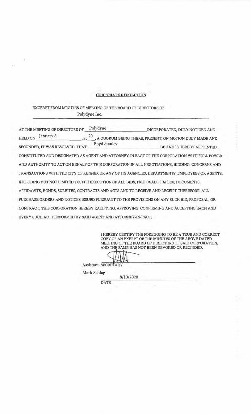
CORPORATE RESOLUTION
EXCERPT FROM MINUTES OF MEETING OF THE BOARD OF DIRECTORS OF
Polydyne Inc.
·AT THE MEETING OF DIRECTORS OF Polydyne IN CORPORA TED, DULY NOTICED AND
HELD ON January 8 , 20
20 , A QUORUM BEING THERE, PRESENT, ON MOTION DULY MADE AND
Boyd Stanley SECONDED, IT WAS RESOLVED, THAT BE AND IS HEREBY APPOINTED,
CONSTITUTED AND DESIGNATED AS AGENT AND ATTORNEY-IN FACT OF THE CORPORATION WITH FULL POWER
AND AUTHORITY TO ACT ON BEHALF OF THIS CORPORATION IN ALL NEGOTIATIONS, BIDDING, CONCERNS AND
TRANSACTIONS WITH THE CITY OF KENNER OR ANY OF ITS AGENCIES, DEPARTMENTS, EMPLOYEES OR AGENTS,
INCLUDING BUT NOT LIMITED TO, THE EXECUTION OF ALL BIDS, PROPOSALS, PAPERS, DOCUMENTS,
AFFIDAVITS, BONDS, SUREITES, CONTRACTS AND ACTS AND TO RECEIVE AND RECEIPT THEREFORE, ALL
PURCHASE ORDERS AND NOTICES ISSUED PURSUANT TO THE PROVISIONS ON ANY SUCH BID, PROPOSAL, OR
CONTRACT, THIS CORPORATION HEREBY RATIFYING, APPROVING, CONFIRMING AND ACCEPTING EACH AND
EVERY SUCH ACT PERFORMED BY SAID AGENT AND ATTORNEY-IN-FACT.
I HEREBY CERTIFY THE FOREGOING TO BE A TRUE AND CORRECT COPY OF AN EXERPT OF THE MINUTES OF THE ABOVE DATED MEETING OF THE BOARD OF DIRECTORS OF SAID CORPORATION, AND THE SAME HAS NOT BEEN REVOKED OR RECINDED.
Mark Schlag 8/10/2020
DATE
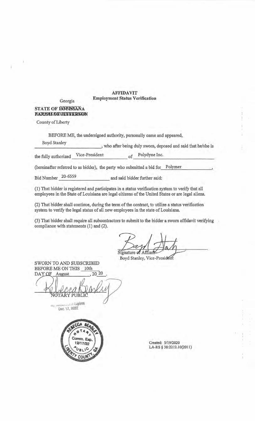
Georgia
STATEOF:OO:~A ~~
AFFIDAVIT Employment Status Verification
County of Liberty
BEFORE ME, the undersigned authority, personally came and appeared,
Boyd Stanley , who after being duly sworn, deposed and said that he/she is
the fully authorized Vice-President of Polydyne Inc. -----------------------------
(hereinafter referred to as bidder), the party who submitted a bid for __ P_o_l.f_ym_e_r _______ ,
Bid Number 20-6559 and said bidder further said:
(1) That bidder is registered and participates in a stat1..1s verification system to verify that all employees in the State of Louisiana are legal citizens ofthe United States or are legal aliens,
(2) That bidder shall continue, during the term of the contract, to utilize a status verification system to verify the legal status of all new employees in the state of Louisiana.
(3) That bidder shall require all subcontractors to submit to the bidder a sworn affidavit verifying compliance with statements (1) and (2).
SWORN TO AND SUBSCRIBED BEFORE ME ON THIS lOth ~August --, 20~.
, . 71 ~V1· . . ~TARY P~LI J
. . .· •·•·i(· ..... l~ i.?Vj ·•l.o'ltHtl·~··#··• ' ... ""f'l
·· t)ec. \7,2\122
Created: 5/19/2020 LA-RS§ 38:2212.10(2011)
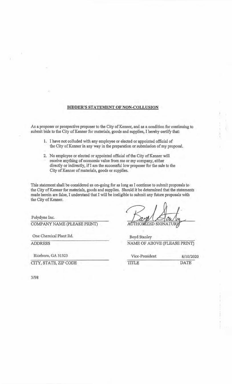
BIDDER'S STATEMENT OF NON-COLLUSION
As a proposer or prospective proposer to the City of Kenner, and as a condition for continuing to submit bids to the City of Kenner for materials, goods and supplies, I hereby cettify that:
1. I have not colluded with any employee or elected or appointed official of the City of Kenner in any way in the preparation or submission of my proposal.
2. No employee m· elected or appointed official of the City of Kenner will receive anything of economic value from me or my company, either directly or indirectly, ifl am the successful low proposer for the sale to the City of Kenner of materials, goods or supplies.
This statement shall be considered as on-going for as long as I continue to submit proposals to the City ofKetmer for materials, goods and supplies, Should it be detel'mined that the statements made herein are false, I understand that I will be ineligible to submit any future proposals with the City of Kenner.
Polydyne Inc.
COMPANY NAME (PLEASE PRINT)
One Chemical Plant Rd.
ADDRESS
Riceboro, GA 31323
CITY, STATE, ZIP CODE
3/98
Boyd Stanley
NAME OF ABOVE (PLEASE PRINT)
Vice-President
TITLE
8/10/2020
DATE
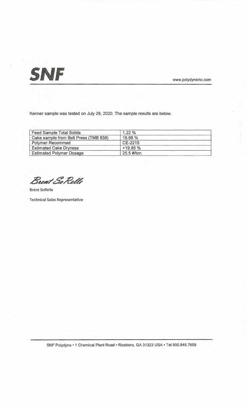
SNF www. polydyneinc.com
Kenner sample was tested on July 28, 2020. The sample results are below.
Feed Sample Total Solids 1.22% Cake sample from Belt Press (TMB 838) 16.66% Polymer Recommed CE-2215 Estimated Cake Dryness +19.85% Estimated Polymer Dosage 25.5 #/ton
,8~&~ Brent SoRe lie
Technical Sales Representative
SNF Polydyne • 1 Chemical Plant Road • Riceboro, GA 31323 USA • Tel 800.848.7659
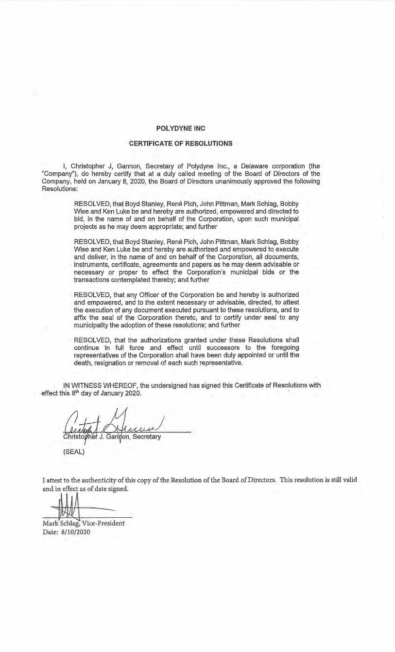
POL YDYNE INC
CERTIFICATE OF RESOLUTIONS
I, Christopher J, Gannon, Secretary of Polydyne Inc., a Delaware corporation (the "Company"), do hereby certify that at a duly called meeting of the Board of Directors of the Company, held on January 8, 2020, the Board of Directors unanimously approved the following Resolutions:
RESOLVED, that Boyd Stanley, Rene Pich, John Pittman, Mark Schlag, Bobby Wise and Ken Luke be and hereby are authorized, empowered and directed to bid, in the name of and on behalf of the Corporation, upon such municipal projects as he may deem appropriate; and further
RESOLVED, that Boyd Stanley, Rene Pich, John Pittman, Mark Schlag, Bobby Wise and Ken Luke be and hereby are authorized and empowered to execute and deliver, in the name of and on behalf of the Corporation, all documents, instruments, certificate, agreements and papers as he may deem advisable or necessary or proper to effect the Corporation's municipal bids or the transactions contemplated thereby; and further
RESOLVED, that any Officer of the Corporation be and hereby is authorized and empowered, and to the extent necessary or advisable, directed, to attest the execution of any document executed pursuant to these resolutions, and to affix the seal of the Corporation thereto, and to certify under seal to any municipality the adoption of these resolutions; and further
RESOLVED, that the authorizations granted under these Resolutions shall continue ·in full force and effect until successors to the foregoing representatives of the Corporation shall have been duly appointed or until the death, resignation or removal of each such representative.
IN WITNESS WHEREOF, the undersigned has signed this Certificate of Resolutions with effect this 81h day of January 2020. .
J (SEAL)
I attest to the authenticity of this copy of the Resolution of the Board of Directors. This resolution is still valid
an:jas of dat~ed
Mark Schlag, Vice-President Date: 8/10/2020
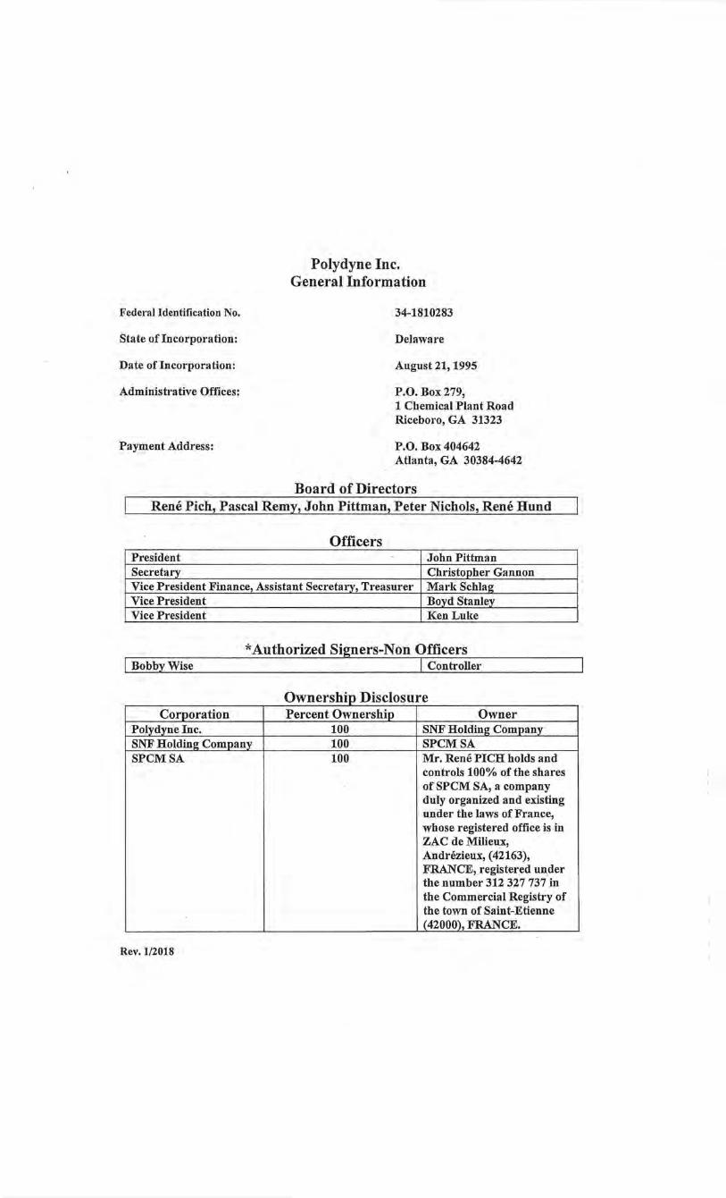
Federal Identification No.
State of Incorporation:
Date of Incorporation:
Administrative Offices:
Payment Address:
Polydyne Inc. General Information
34-1810283
Delaware
August 21, 1995
P.O. Box 279, 1 Chemical Plant Road Riceboro, GA 31323
P.O. Box 404642 Atlanta, GA 30384-4642
Board of Directors r Rene Pich, Pascal Remy, John Pittman, Peter Nichols, Rene Hund I
Officers President John Pittman Secretary Christopher Gannon Vice President Finance, Assistant Secretary, Treasurer Mark Schlag Vice President Boyd Stanley
'--Yice Pres!!lent Ken Luke
*Authorized Si!mers-Non Officers Controller
Ownershin Disci Corporation Percent Ownership Owner
Polydy_ne Inc. 100 SNF Holding Company SNF Holding Company 100 SPCMSA SPCMSA 100 Mr. Rene PICH holds and
controls 100% of the shares of SPCM SA, a company duly organized and existing under the laws of France, whose registered office is in ZAC de Milieux, Andrezieux, (42163), FRANCE, registered under the number 312 327 737 in the Commercial Registry of the town of Saint-Etienne (42000), FRANCE.
Rev.l/2018
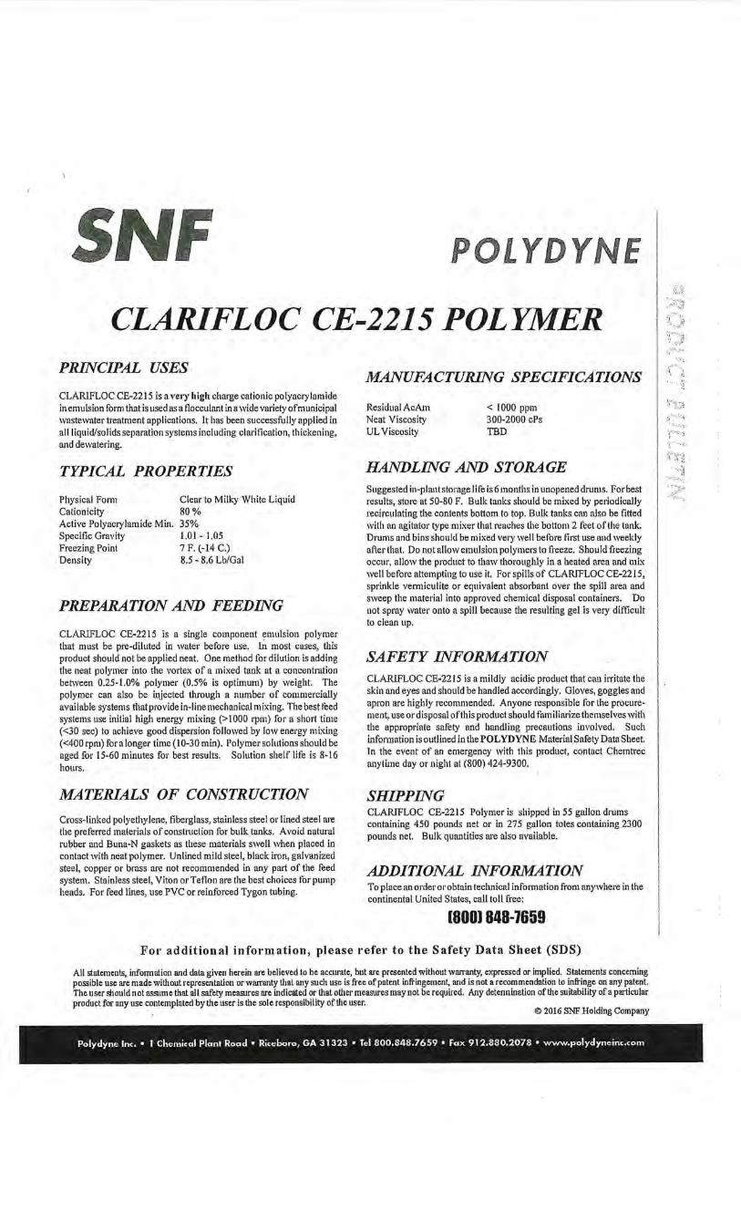
SNF POLYDYNE
CLARIFLOC CE-2215 POLYMER PRINCIPAL USES
CLARlFLOC CE-2215 is a ve•-y high charge cationic polyacrylamide in emulsion form that is used as a tlocculant ina wide variety of municipal wastewater treatment applications. It has been successfully applied in all liquid/solids separation systems including clarification, thickening, and dewatering.
TYPICAL PROPERTIES
Physical Form Cnlionicity Active Polyacrylamide Min. Specific Gravity Freezing Point Density
Clear to Milky White Liquid 80% 35% 1.0 I - 1.05 7 F. (-14 C.) 8.5- 8.6 Lb/Gal
PREPARATION AND FEEDING
CLARIFLOC CE-2215 is a single component emulsion polymer that must be pre-diluted in water before use. ln most cases, this product should not be applied neat. One method for dilution is adding the neat polymer into the vortex of a mixed tank at a concentration between 0.25-1.0% polymer (0.5% is optimum) by weight. The polymer can also be injected through a number of commercially available systems that provide in-line mechanical mixing. The best teed systems use initial high energy mixing (> 1000 rpm) for a short time (<30 sec) to achieve good dispersion followed by low energy mixing (<400 rpm) for a longer time ( 10-30 min). Polymer solutions should be aged for 15-60 minutes for best results. Solution shelf life is 8-16 hours.
MATERIALS OF CONSTRUCTION
Cross-linked polyethylene, tiberglass, stainless steel m·lined steel are the preferred materials of construction for bulk tanks. Avoid natural rubber and Buna-N gaskets as these materials swell when placed in contact with neat polymer. Unlined mild steel, black iron, galvanized steel, coppe1' or brass are not recommended in any part of the feed system. Stainless steel, Viton or Teflon are the best choices for pump heads. For feed lines, use PVC or reinforced Tygon tubing.
MANUFACTURING SPECIFICATIONS
Residual AcAm Neat Viscosity UL Viscosity
< 1000 ppm 300-2000 cPs TBD
HANDLING AND STORAGE Suggested in-plant storage life is 6 months in unopened drums. For best results, store at 50-80 F. Bulk tanks should be mixed by pedodically recirculating the contents bottom to top. Bulk tanks can also be fitted with an agitator type mixer that reaches the bottom 2 teet of the tank. Drums and bins should be mixed very well belbre first use and weekly after that. Do not allow emulsion polymers to tl'eeze. Should freezing occur, allow the product to thaw thoroughly in a heated area and mix well before attempting to use it. For spills of CLARIFLOC CE-2215, sprinkle vermiculite or equivalent absorbant ove1· the spill area and sweep the material into approved chemical disposal containers. Do not spray water onto a spill because the resulting gel is very difficult to clean up.
SAFETY INFORMATION CLARIFLOC CE-2215 is a mildly acidic product that can irritate the skin and eyes and should be handled accordingly. Gloves, goggles and apron are highly recommended. Anyone responsible for the procurement, use or disposal ofthis product should familiarize themselves with the appropriate safety and handling precautions involved. Such information is outlined in the POL YD YNE Material Safety Data Sheet. ln the event of an emergency with this product, contact Chemtrec anytime day or night at (800) 424-9300.
SHIPPING CLARIFLOC CE-2215 Polymer is shipped in 55 gallon drums containing 450 pounds net or in 275 gallon totes containing 2300 pounds net. Bulk quantities are also available.
ADDITIONAL INFORMATION To place an order or obtain technical information from anywhere in the continental United States, call toll free:
[8001 848-1659
For additional information, please refer to the Safety Data Sheet (SDS)
All statements, infonnation and data given herein arc believed to be accurate, but are presented without warranty, expressed or implied. Statements concerning possible usc arc made wiU10ut representation or warranty that any such usc is free of patent infringement, and is not a recommendation to infringe on any patent. The user mould not assume that all safety measures are indicated or that other measures may not be required. Any detennination of the suitability of a particular product for any use contemplated by the user is the sole responsibility of the user.
© 2016 SNF Holding Company
Polydyne Inc. • 1 Chemical Plant Road • Riceboro, GA 31323 • Tel 800,848.7659 • Fax 912.880.2078 • www.polydyneinc.com
··:•:t
I I I. I I
{SNF 8iZ•li2•12~1W/
SAFETY DATA SHEET According to U.S. Code of Federal Regulations 29 CFR 1910.1200, Hazard Communication.
SECTION 1: Identification of the substance/mixture and of the company/undertaking
1.1. Product identifier
Product name: CLARIFLOC CE-2215
Type of product: Mixture.
1.2. Relevant Identified uses of the substance or mixture and uses advised against
Identified uses: Processing aid for industrial applications.
Uses advised against: None.
7 .3. Details of the supplier of the safety data sheet
Company:
Telephone:
Telefax:
E-mail address:
7.4. Emergency telephone number
24-hour emergency number:
SECTION 2: Hazards identification
Polydyne Inc.
1 Chemical Plant Road
PO BOX 279, Riceboro, GA 31323
United States
1-800-848-7659
(912)-884-8770
1-800-424-9300
2.1. Classification of the substance or mixture
Classification according to paragraph (d) of 29 CFR 1910.1200:
Not classified.
2.2. Label elements
Labelling according to paragraph W of 29 CFR 1910.1200:
Print Date: 22/06/2020 Revision date: 05/18/2020 Page: 1/15
SAFETY DATA SHEET
Hazard symbol(s):
Signal word:
Hazard statement(s):
Precautionary statement(s):
2.3. Other hazards
Spills produce extremely slippery surfaces.
For explanation of abbreviations see Section 16.
SECTION 3: Composition/information on ingredients
3.1. Substances Not applicable, this product is a mixture.
3.2. Mixtures
Hazardous components
Distillates (petroleum), hydrotreated light
Concentration! -range:
CAS Number:
Classification according to paragraph (d) of 29 CFR 1910.1200:
Notes
CLARIFLOC CE-.2215
None.
None.
None.
None.
20-30%
64742-47-8
Asp. Tox. l;H304
Does not result in classification of the mixture if the kinematic viscosity is greater than 20.5 nun2/s measured at 40°C.
Poly(oxy-1, 2 -ethanediyl), a-tridecyl-w-hydro).y-, branched
Concentration! -range:
CAS Number:
Classification according to paragraph (d) of 29 CFR 1910.1200:
Notes
For explanation of abbreviations see section 16
Print Date: 22/06/2020
<5%
69011-36-5
Acute Tox. 4;H302, Eye Dam. l;H318
Revision date: 05/18/2020 Page: 2 I 15
SAFETY DATA SHEET
SECTION 4: First aid measures
4. 7. Description of first aid measures
Inhalation: Move to ft·esh air. No hazards which require special first aid measures.
Skin contact:
CLARIFLOC CE-2215
Wash off immediately with soap and plenty of water while removing all contaminated clothes and shoes. In case of persistent skin irritation, consult a physician.
Eye contact: Rinse immediately with plenty of water, also under the eyelids, for at least 15 niinutes. Get medical attention immediately.
Ingestion: Rinse mouth with water. Do NOT induce vomiting. Call a physician or poison control centre immediately.
4.2. Most Important symptoms and effects, both acute and delayed
None under normal use.
4.3. Indication of any immediate medical attention and special treatment needed
None reasonably foreseeable.
Other information: None.
SECTION 5: Firefighting measures
5. 7. Extinguishing media
Suitable extinguishing media: Water. Water spray. Foam. Carbon dioxide (C02). Dry powder. Warning! Spills produce extremely slippery surfaces.
Unsuitable extinguishing media: None known.
5.2. Special hazards arising from the substance or mixture
Hazardous decomposition products: Thermal decomposition may produce: hydrogen chloride gas, nitrogen oxides (NOx), carbon oxides (COx). Ammonia (NH3). Hydrogen cyanide (hydrocyanic acid) may be produced in the event of combustion in an oxygen deficient atmosphere.
5.3. Advice for firefighters
Protective measures: Wear self-contained breathing apparatus and protective suit.
Print Date: 22(06(2020 Revision date: 05/18/2020 Page: 3/15
SAFETY DATA SHEET CLARIFLOC CE-2215
Other information: Spills produce extremely slippery surfaces.
SECTION 6: Accidental release measures
6.1. Personal precautions, protective equipment and emergency procedures
Personal precautions: Do not touch or walk through spilled material. Spills produce extremely slippery surfaces.
Protective equipment: Wear adequate personal protective equipment (see Section 8 Exposure Controls/Personal Protection).
Emergency procedures: Keep people away from spill/leak. Prevent further leakage or spillage if safe to do so.
6.2. Environmental precautions
As with all chemical products, do not flush into surface water.
6.3. Methods and material for containment and cleaning up
Small spills: Do not flush with water. Soak up with inert absorbent material. Sweep up and shovel into suitable containers for disposal.
Large spills: Do not flush with water. Dam up. Soak up with inert absorbent material. Clean up promptly by scoop or vacuum.
Residues: After cleaning, flush away traces with water.
6.4. Reference to other sections
SECTION 7: Handling and storage; SECTION 8: Exposure controls/personal protection; SECTION 13: Disposal considerations;
SECTION 7: Handling and storage
7.1. Precautions for safe handling
Avoid contact with skin and eyes. Renders smfaces extremely slippery when spilled. When using, do not eat, drink or smoke.
7.2. Conditions for safe storage, including any Incompatibilities
Keep away from heat and somces of ignition. Freezing will affect the physical condition and may damage the material. Incompatible with oxidizing agents.
7.3. Specific end use(s)
This information is not available.
SECTION 8: Exposure controls/personal protection
Print Date: 22/06/2020 Revision date: 05/18/2020 Page: 4/15
SAFETY DATA SHEET
SECTION 8: Exposure controls/personal protection 8.1. Control parameters
Occupational exposure limits:
Distillates (petroleum), hydrotreated light
ACGIH: 200 mg/m3 (8 hours) (vapors)
8.2. Exposure controls
Appropriate engineering controls:
CLARIFLOC CE-2215
Ensure adequate ventilation, especially in confmed areas. Use local exhaust if misting occurs. Natural ventilation is adequate in absence of mists.
Individual protection measures. such as personal protective equipment:
a) Eye/face protection: Safety glasses with side-shields.
b) Skin protection: i) Hand protection: PVC or other plastic material gloves. ii) Other: Wear coveralls and/or chemical apron and rubber footwear where physical contact can occur.
c) Respiratory protection: No personal respiratory protective equipment normally required.
d) Additional advice: Wash hands before breaks and immediately after handling the product. Wash hands before breaks and at the end of workday. Handle in accordance with good industrial hygiene and safety practice.
Environmental exposure controls:
Do not allow uncontrolled discharge of product into the environment.
SECTION 9: Physical and chemical properties
9.1. Information on basic physical and chemical properties
a) Appearance:
b) Odour:
c) Odour Threshold:
d) pH:
e) Melting point/freezing point:
~ Initial boiling point and boiling range:
Print Date: 22/06/2020
Viscous liquid, Milky.
Aliphatic.
No data available.
Not applicable.
<5°C
> 1oooc
Revision date: 05/18/2020 Page: 5/15
SAFETY.DATA SHEET
g) Flash point:
h) Evaporation rate:
i) Flammability (solid, gas):
j) Upper/lower flammability or explosive limits:
k) Vapour pressure:
I) Vapour density:
m) Relative density:
n) So/ubility(ies):
o) Partition coefficient:
p) Autoignition temperature:
q) Decomposition temperature:
r) Viscosity:
s) Explosive properties:
t) Oxidizing properties:
9.2. Other information
None.
SECTION 10: Stability and reactivity
1 o. 7. Reactivity
Stable under recommended storage conditions.
10.2. Chemical stability
Stable under recommended storage conditions.
10.3. Possibility of hazardous reactions
Oxidizing agents may cause exothermic reactions.
10.4. Conditions to avoid
Protect from frost, heat and sunlight.
10.5. Incompatible materials
Oxidizing agents.
10.6. Hazardous decomposition products
Print Date: 22/06/2020
CLARIFLOC CE-2215
Does not flash.
No data available.
Not applicable.
Not expected to create explosive atmospheres.
2.3 kPa@ 20°C
0.804 giL @ 20°C
1.0 - 1.2 (See Technical Bulletin or Product Specifications for a more precise value, if available)
Completely miscible.
Not applicable.
Not applicable.
> 150°C
> 20.5 mm2/s @ 40°C
Not expected to be explosive based on the chemical structure.
Not expected to be oxidising based on the chemical structure.
Revision date: 05/18/2020 Page: 6/15
SAFETY DATA SHEET CLARIFLOC CE-2215
Thermal decomposition may produce: hydrogen chloride gas, nitrogen oxides (NOx), carbon oxides (COx). Ammonia (NH3). Hydrogen cyanide (hydrocyanic acid) may be produced in the event of combustion in an oxygen deficient atmosphere.
SECTION 11: Toxicological information
11.1. Information on toxicological effects
Information on the product as supplied:
Acute oral toxicity:
Acute dermal toxicity:
Acute inhalation toxicity:
Skin corrosion/irritation:
Serious eye damage/eye irritation:
Respiratory/skin sensitisation:
Mutagenicity:
Carcinogenicity:
Reproductive toxicity:
STOT- Single exposure:
STOT- Repeated exposure:
Aspiration hazard:
LD50/orallrat > 5000 mg/kg (Estimated)
LD50/dermal/rat > 5000 mg/kg. (Estimated)
The product is not expected to be toxic by inhalation.
Non-irritating to skin.
Not irritating. (OECD 437)
Not sensitizing.
Not mutagenic.
Not carcinogenic.
Not toxic for reproduction.
No known effects.
No known effect.
Due to the viscosity, this product does not present an aspiration hazard.
Relevant information on the hazardous components:
Distillates (petroleum), hydrotreated light
Acute oral toxicity: LD50/orallrat > 5000 mg/kg (OECD 401)
Acute dermal toxicity: LD50/dermallrabbit > 5000 mg/kg (OECD 402)
Acute inhalation toxicity: LCO/inhalation/4 hours/rat>= 4951 mg/mJ (OECD 403) (Based on results obtained from tests on analogous products)
Skin corrosion/irritation: Not irritating. (OECD 404) Repeated exposure may cause skin dryness or cracking.
Serious eye damage/eye irritation: Not irritating. (OECD 405)
Print Date: 22/06/2020 Revision date: 05/18/2020 Page: 7 I 15
SAFETY DATA SHEET
Respiratory/skin sensitisation:
Mutagenicity:
Carcinogenicity:
Reproductive toxicity:
STOT- Single exposure:
STOT- Repeated exposure:
Aspiration hazard:
CLARIFLOC CE-2215
By analogy with similar products, this product is not expected to be sensitizing. (OECD 406)
Not mutagenic. (OECD 471, 473, 474, 476, 478, 479)
Carcinogenicity study in rats (OECD 451): Negative.
By analogy with similar substances, this substance is not expected to be toxic for reproduction. NOAEL/rat = 300 ppm. (OECD 421)
No known effects.
Based on available data, product is not expected to demonstrate chronic toxic effects. NOAEL/oral/rat/90 days >= 3000 mg/kg/day (OECD 408) (Based on results obtained fi:om tests on analogous products)
May be fatal if swallowed and enters airways.
Poly(oxy-1, 2-ethanediyl), a-tridecyl-w-hydroxy-, branched
Acute oral toxicity:
Acute dermal toxicity:
Acute inhalation toxicity:
Skin corrosion/irritation:
Serious eye damage/eye irritation:
Respiratory/skin sensitisation:
Mutagenicity:
Carcinogenicity:
Print Date: 22/06/2020
LD50/oral/rat = 500 - 2000 mg/kg
LD50/dermal/rabbit > 2000 mg/kg
No data available.
Not irritating. (OECD 404)
Causes serious eye irritation. (OECD 405)
The results of testing on guinea pigs showed this material to be non-sensitizing.
In vitro tests did not show mutagenic effects. In vivo tests did not show mutagenic effects.
Based on the absence of mutagenicity, it is unlikely that the substance is carcinogenic.
Revision date: 05/18/2020 Page: 8/15
SAFETY DATA SHEET
Reproductive toxicity:
STOT- Single exposure:
STOT- Repeated exposure:
Aspiration hazard:
SECTION 12: Ecological information
12.1. Toxicity
Information on the product as supplied:
Acute toxicity to fish:
Acute toxicity to invertebrates:
Acute toxicity to algae:
Chronic toxicity to fish:
Chronic toxicity to invertebrates:
Toxicity to microorganisms:
Effects on terrestrial organisms:
Sediment toxicity:
CLARIFLOC CE-2215
Based on available data, product is not expected to be toxic for reproduction. Two-Generation Reproduction Toxicity (OECD 416) - NOAEL/rat > 250 mg/kg/day Prenatal Development Toxicity Study (OECD 414) - NOAEL/Maternal toxicity/rat> 50 mg/kg/day - NOAEL/Developmental toxicity/rat > 50 mg/kg/day
No known effects.
Based on available data, product is not expected to demonstrate chronic toxic effects. NOAEL/oral/rat/600 days= 50 mg/kg/day
No known effects.
LC50/Fish/96 hours= 10- 100 mg/L (Estimated)
EC50/Daphnia magna/48 hours= 10- 100 mg/L (Estimated)
Algal inhibition tests are not appropriate. The flocculation characteristics of the product interfere directly in the test medium preventing homogenous distribution which invalidates the test.
No data available.
No data available.
No data available.
No data available.
No data available.
Relevant information on the hazardous components:
Distillates (petroleum), hydrotreated light
Acute toxicity to fish: LCO/Oncorhynchus mykiss/96 hours> 1000 mg/L (OECD 203)
Acute toxicity to invertebrates: ECO/Daphnia magna/48 hours > 1000 mg/L (OECD 202)
Acute toxicity to algae: ICO/Pseudokirchneriella subcapitata/72 hours> 1000 mg/L. (OECD 201)
Print Date: 22/06/2020 Revision date: 05/18/2020 Page: 9/15
SAFETY DATA SHEET CLARIFLOC CE-2215
Chronic toxicity to fish: NOEC/Oncorhynchus myk.iss/28 days > 1000 mg/L
Chronic toxicity to invertebrates: NOEC/Daphnia magna/21 days > 1000 mg/L
Toxicity to microorganisms: EC50/Tetrahymena pyriformis/ 48h > 1000 mg/L.
Effects on terrestrial organisms: No data available.
Sediment toxicity: No data available. Readily biodegradable, exposure to sediment is unlikely.
Poly(o:q-1, 2-ethanediyl), a-tridecyl-w-hydro>.y-, branched
Acute toxicity to fish:
Acute toxicity to invertebrates:
Acute toxicity to algae:
Chronic toxicity to fish:
Chronic toxicity to invertebrates:
Toxicity to microorganisms:
Effects on terrestrial organisms:
Sediment toxicity:
12.2. Persistence and degrad?bility
Information on the product as supplied:
Degradation:
Hydrolysis:
Photolysis:
LC50/Cyprinus carpio/96 hours= 1 - 10 mg/L (OECD 203)
ECSO/Daphnia/48 hours= 1- 10 mg/L (OECD 202)
IC50/Desmodesmus subspicatus/72 hours= 1- 10 mg/L (OECD 201)
No data available.
NOEC/Daphnia magna/21 days> 1 mg/L (OECD 202)
ECIO/activated sludge/17 hours> 10000 mg/L (DIN 38412-8)
No data available.
No data available.
Based on degradation data of components, this product is expected to be readily (bio )degradable.
At natural pHs (>6) the polymer degrades due to hydrolysis to more than 70% in 28 days. The hydrolysis products are not harmful to aquatic organisms.
No data available.
Relevant information on the hazardous components:
Distillates (petroleum), hydrotreated light
Print Date: 22/06/2020 Revision date: 05/18/2020 Page: 10/15
SAFETY DATA SHEET CLARIFLOC CE-2215
Degradation: Readily biodegradable. 67.6% I 28 days (OECD 301 F); 68.8% I 28 days (OECD 306); 61.2% I 61 days (OECD 304 A)
Hydrolysis: Does not hydrolyse.
Photolysis: No data available.
Poly(oxy-1,2-ethanediyl), a-tridecyl-w-hydro).y-, branched
Degradation:
Hydrolysis:
Photolysis:
12.3. 8/oaccumulat/ve potential
Information on the product as supplied:
Readily biodegradable. > 60% I 28 days (OECD 301 B)
Does not hydrolyse.
No data available.
The product is not expected to bioaccumulate.
Partition co-efficient (Log Pow): Not applicable.
Bioconcentration factor (BCF): No data available.
Relevant information on the hazardous components:
Distillates (petroleum), hydrotreated light
Partition co-efficient (Log Pow): 3 - 6
Bioconcentration factor (BCF): No data available.
Poly(oxy-1, 2-ethanediyl), a-tridecyl-w-hydroxy-, branched
Partition co-efficient (Log Pow): > 3 .
Bioconcentration factor (BCF): No data available.
12.4. Mobility in soil
Information on the product as supplied:
No data available.
Print Date: 22/06/2020 Revision date: 05/18/2020 Page: 11/15
SAFETY DATA SHEET CLARIFLOC CE-2215
Relevant information on the hazardous components:
Distillates (petroleum), hydrotreated light
Koc: No data available.
Poly(o:xy-1 ,2-ethanediyl), a-tridecyl-w-hydroxy-, branched
Koc: > 5000
12.5. Other adverse effects
None known.
SECTION 13: Disposal considerations
13.1. Waste treatment methods
Waste from residues/unused products:
Dispose in accordance with local and national regulations.
Contaminated packaging:
Rinse empty containers with water and use the rinse-water to prepare the working solution. If recycling is not practicable, dispose of in compliance with local regulations. Can be landfilled or incinerated, when in compliance with local regulations.
Recvcling:
Store containers and offer for recycling of material when in accordance with the local regulations.
SECTION 14: Transport information
Land transport (DOT)
Not classified.
Sea transport (JMDG)
Not classified.
Air transport (/A TA)
Not classified.
SECTION 15: Regulatory information
15.1. Safety, health and environmental regulations/legislation specific for the substance or mixture
Information on the product as supplied:
Print Date: 22/06/2020 Revision date: 05/18/2020 Page: 12/15
SAFETY DATA SHEET CLARIFLOC CE-2215
TSCA Chemical Substances Inventory:
All components of this product are either listed as active on the inventory or are exempt from listing.
US SARA Reporting Requirements:
SARA (Section 311/312) hazard class: Not concerned.
SARA Title Ill Sections:
Section 302 (TPQ) - Reportable Quantity: Not concerned.
Section 304 - Reportable Quantity: Not concerned.
Section 313 (De minimis concentration): Not concerned.
Clean Water Act
Section 311 Hazardous Substances (40 CFR 117.3)- Reportable Quantity: Not concerned.
Clean Air Act
Section 112(r) Accidental release prevention requirements (40 CFR 68)- Reportable Quantity: Not concerned.
CERCLA
Hazardous Substances List (40 CFR 302.4)- Reportable Quantity: Not concerned.
RCRA status :
Not RCRA hazardous.
California Proposition 65 Information:
WARNING! This product contains a chemical known to the State of California to cause cancer and birth defects or other reproductive harm, Acrylamide
SECTION 16: Other information
NFPA and HMIS Ratinas:
NFPA:
Print Date: 22106/2020 Revision date: 05/18/2020 Page: 13/15
SAFETY DATA SHEET
Health: Flammability: Instability:
HMIS:
Health: Flammability: Physical Hazard: PPE Code:
0 1 0
0 1 0 B
This data sheet contains changes from the previous version in section(s):
CLARIFLOC CE-2215
SECTION 5. Fire-fighting measures, SECTION 8. Exposure controls/personal protection, SECTION 16. Other Information. .
Kev or legend to abbreviations and acronvms used in the safetv data sheet:
Acronyms STOT = Specific target organ toxicity
Abbreviations Acute Tox. 4 =Acute toxicity Category Code 4 Asp. Tox. 1 =Aspiration hazard Category Code 1 Eye Dam 1 = Serious eye damage/eye irritation Category Code 1
Hazard statements H3 02 - Harmful if swallowed H304- May be fatal if swallowed and enters airways H318 - Causes serious eye damage
Training advice:
Do not handle until all safety precautions have been read and understood.
This SDS was prepared in accordance with the following:
U.S . Code ofFederal Regulations 29 CFR 1910.1200
Version: 20.01.a
ENCC046
Print Date: 22/06/2020 Revision date: 05/18/2020 Page: 14 I 15
SAFETY DATA SHEET CLARIFLOC CE-2215
The information provided in this Safety Data Sheet is correct to the best of our knowledge, information and belief at the date of its publication. The information given is designed only as a guidance for safe handling, use, processing, storage, transportation, disposal and release and is not to be considered a warranty or quality specification. The information relates only to the specific material designated and may not be valid for such material used in combination with any other materials or in any process, unless specified in the text.
Print Date: 22/06/2020 Revision date: 05/1 B/2020 Page: 15/15
\' \ · _ _/ . · ·._--. . __ -\ ---~ \ · !\..,--~~ - ' .
\\ "' "' -o "' Vl :, ~..-.. j, o:.o:.ao:.t;; · 1 ! ~~~~s .·
... (\) (lt n» ........ 1l i ::>='"'Ot-JtP ~ I :::\;;1~'&,0 ; · \\ ' ~ lO 3 't;\ ~ ,. " " co 1.0 n · ~ ~ ~£e.~ O's ; 1 > '(t, ~ Vl
d ~- g\3 \ \• '7 '(:', " . ,• '> tv ,.... ' \1' 0 ., \ 1 .. '\'\ ~ \ \ 0
H n \-~ ·~ \\
\~~~ \. 1 ' \. \ · , .
~:·\ ~ \ \\ \ , l · r r.~ ~ '
l ·
v~ ~. ~~ ·,
~ %
l' '~ ~
l r " \\
-·-
1 \f
~ ~ .
i 1 {~.l ~
~
~ t ~ ·y, l ~ ~
~ ~ :-.:
\ ~~
~-
~ ! ·§
1l -~ ~ .!3
j ] 8 ~
1 :::::
!
>< .a " .b ~
~~~~~g;;~mlEY (912) 881).8013
~~~~?cAL PLANT RD.
O~N~8~~A~i0123 ro FINANCE DEPARTMENT
CITY OF KENNER
SHIP DATE: 10AUG20 ACTWGT: 0,50 LB CAD: 111521948nNET4280
BILL SENDER
1610 REV. RICHARD WILSON DRIVE BUILDING D KENNER LA 70062
~~)468-7281 REf':SEI'lEOBIJFORPOL\'MER
PO:
lRKH mill 77121508 2206
XH MSYA
I
DEPT:
TUE -11 AUG 10:30A PRIORITY OVERNIGHT
70062 LA-US MSY
I
\ol~t~~~~IQ) -~ ~~- ~ue 112020 g:;s~m
CITY OF KENNER 1'-'t\\11\NCE DEPARTMENT
\ '· ! ~ . ·i
\
.. \nse( l s\li99ing document \1e(e.
' - -\ ~ / I .'f
~
' i i
I
.I !
~~ ~'I-
i""' \ §,
g .g "' "'
·,
..., S.. · If
\\ \
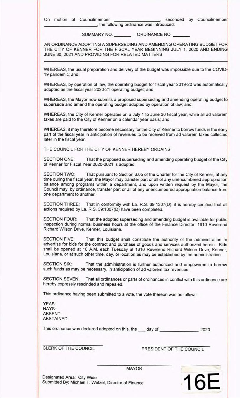
On motion of Councilmember , seconded by Councilmembe ----------' the following ordinance was introduced:
SUMMARY NO. __ _ ORDINANCE NO. __ _
AN ORDINANCE ADOPTING A SUPERSEDING AND AMENDING OPERATING BUDGET FO THE CITY OF KENNER FOR THE FISCAL YEAR BEGINNING JULY 1, 2020 AND ENDING JUNE 30, 2021 AND PROVIDING FOR RELATED MATTERS
WHEREAS, the usual preparation and delivery of the budget was impossible due to the COVID 19 pandemic; and,
WHEREAS, by operation of law, the operating budget for fiscal year 2019-20 was automatically adopted as the fiscal year 2020-21 operating budget; and,
WHEREAS, the Mayor now submits a proposed superseding and amending operating budget to supersede and amend the operating budget adopted by operation of law; and,
WHEREAS, the City of Kenner operates on a July 1 to June 30 fiscal year, while all ad valorem taxes are paid to the City of Kenner on a calendar year basis; and,
WHEREAS, it may therefore become necessary for the City of Kenner to borrow funds in the early part of the fiscal year in anticipation of revenues to be received from ad valorem taxes collected later in the fiscal year.
THE COUNCIL FOR THE CITY OF KENNER HEREBY ORDAINS:
SECTION ONE: That the proposed superseding and amending operating budget of the City of Kenner for Fiscal Year 2020-2021 is adopted.
SECTION TWO: That pursuant to Section 6.05 of the Charter for the City of Kenner, at any time during the fiscal year, the Mayor may transfer part or all of any unencumbered appropriation balance among programs within a department, and upon written request by the Mayor, the Council may, by ordinance, transfer part or all of any unencumbered appropriation balance from one department to another.
SECTION THREE: That in conformity with La. R.S. 39:1307(D), it is hereby certified that all actions required by La. R.S. 39:1307(D) have been completed.
SECTION FOUR: That the adopted superseding and amending budget is available for public inspection during normal business hours at the office of the Finance Director, 1610 Reverend Richard Wilson Drive, Kenner, Louisiana.
SECTION FIVE: That this budget shall constitute the authority of the administration to advertise for bids for the contract and purchase of goods and services authorized herein. Bids shall be opened at 10 A.M. each Tuesday at 1610 Reverend Richard Wilson Drive, Kenner, Louisiana, or at such other time, day, or location as may be established by the administration.
SECTION SIX: That the administration is further authorized and empowered to borrow such funds as may be necessary, in anticipation of ad valorem tax revenues.
SECTION SEVEN: That all ordinances or parts of ordinances in conflict with this ordinance are hereby expressly rescinded and repealed.
This ordinance having been submitted to a vote, the vote thereon was as follows:
YEAS: NAYS: ABSENT: ABSTAINED:
This ordinance was declared adopted on this, the _day of _______ , 2020.
CLERK OF THE COUNCIL PRESIDENT OF THE COUNCIL
MAYOR
Designated Area: City Wide Submitted By: Michael T. Wetzel , Director of Finance ·16E
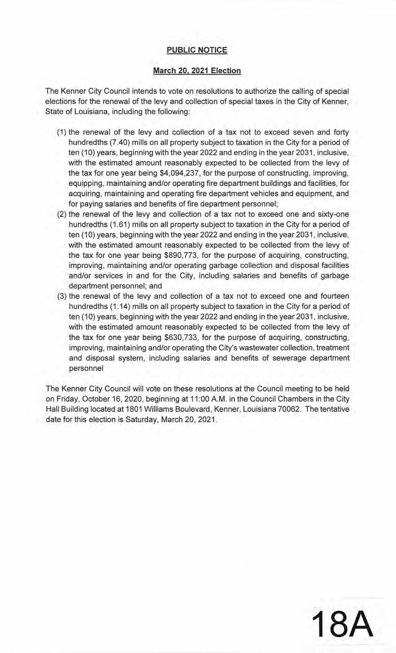
PUBLIC NOTICE
March 20, 2021 Election
The Kenner City Council intends to vote on resolutions to authorize the calling of special elections for the renewal of the levy and collection of special taxes in the City of Kenner, State of Louisiana, including the following:
(1) the renewal of the levy and collection of a tax not to exceed seven and forty hundredths (7.40) mills on all property subject to taxation in the City for a period of ten (10) years, beginning with the year 2022 and ending in the year 2031, inclusive, with the estimated amount reasonably expected to be collected from the levy of the tax for one year being $4,094,237, for the purpose of constructing, improving, equipping, maintaining and/or operating fire department buildings and facilities , for acquiring, maintaining and operating fire department vehicles and equipment, and for paying salaries and benefits of fire department personnel;
(2) the renewal of the levy and collection of a tax not to exceed one and sixty-one hundredths (1.61) mills on all property subject to taxation in the City for a period of ten (10) years, beginning with the year 2022 and ending in the year 2031, inclusive, with the estimated amount reasonably expected to be collected from the levy of the tax for one year being $890,773, for the purpose of acquiring, constructing, improving, maintaining and/or operating garbage collection and disposal facilities and/or services in and for the City, including salaries and benefits of garbage department personnel ; and
(3) the renewal of the levy and collection of a tax not to · exceed one and fourteen hundredths (1.14) mills on all property subject to taxation in the City for a period of ten (1 0) years, beginning with the year 2022 and ending in the year 2031, inclusive, with the estimated amount reasonably expected to be collected from the levy of the tax for one year being $630,733, for the purpose of acquiring, constructing, improving, maintaining and/or operating the City's wastewater collection, treatment and disposal system, including salaries and benefits of sewerage department personnel
The Kenner City Council will vote on these resolutions at the Council meeting to be held on Friday, October 16, 2020, beginning at 11:00 A.M. in the Council Chambers in the City Hall Building located at 1801 Williams Boulevard, Kenner, Louisiana 70062. The tentative date for this election is Saturday, March 20, 2021.
18A

Recommended


