Embed Size (px)
Citation preview
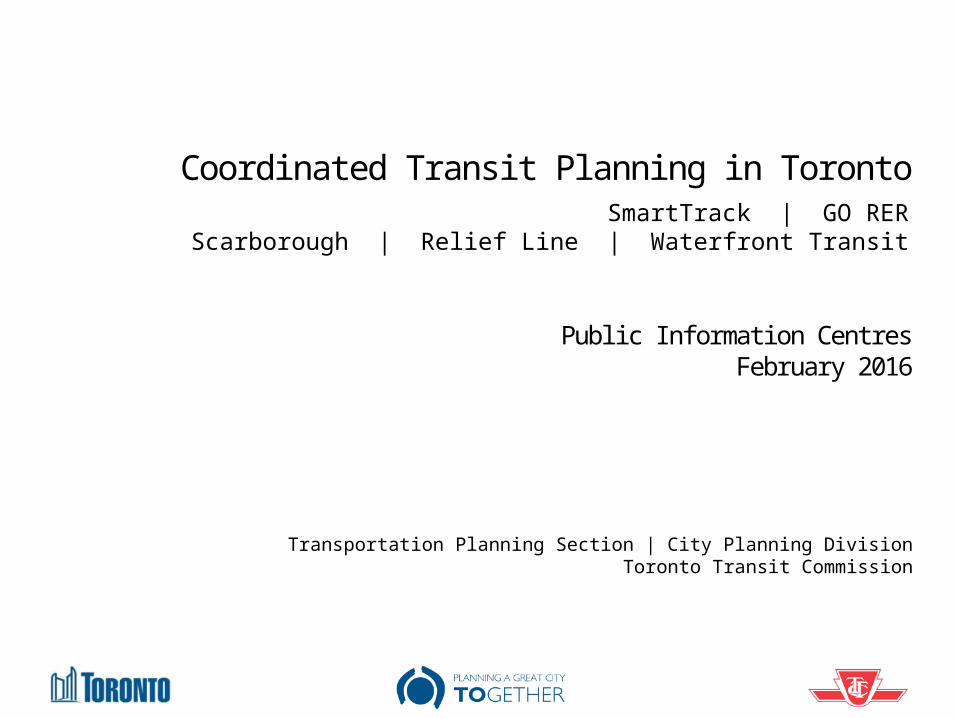
Coordinated Transit Planning in Toronto
Public Information CentresFebruary 2016
Transportation Planning Section | City Planning DivisionToronto Transit Commission
SmartTrack | GO RERScarborough | Relief Line | Waterfront Transit
2
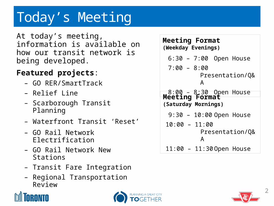
Today’s MeetingAt today’s meeting, information is available on how our transit network is being developed.Featured projects:
– GO RER/SmartTrack– Relief Line– Scarborough Transit Planning– Waterfront Transit ‘Reset’– GO Rail Network Electrification– GO Rail Network New Stations– Transit Fare Integration– Regional Transportation Review
Meeting Format(Weekday Evenings)
6:30 – 7:00 Open House7:00 – 8:00 Presentation/Q&A8:00 – 8:30 Open House
Meeting Format (Saturday Mornings)
9:30 – 10:00 Open House
10:00 – 11:00Presentation/Q&A
11:00 – 11:30 Open House
3
Scarborough Optimized Transit
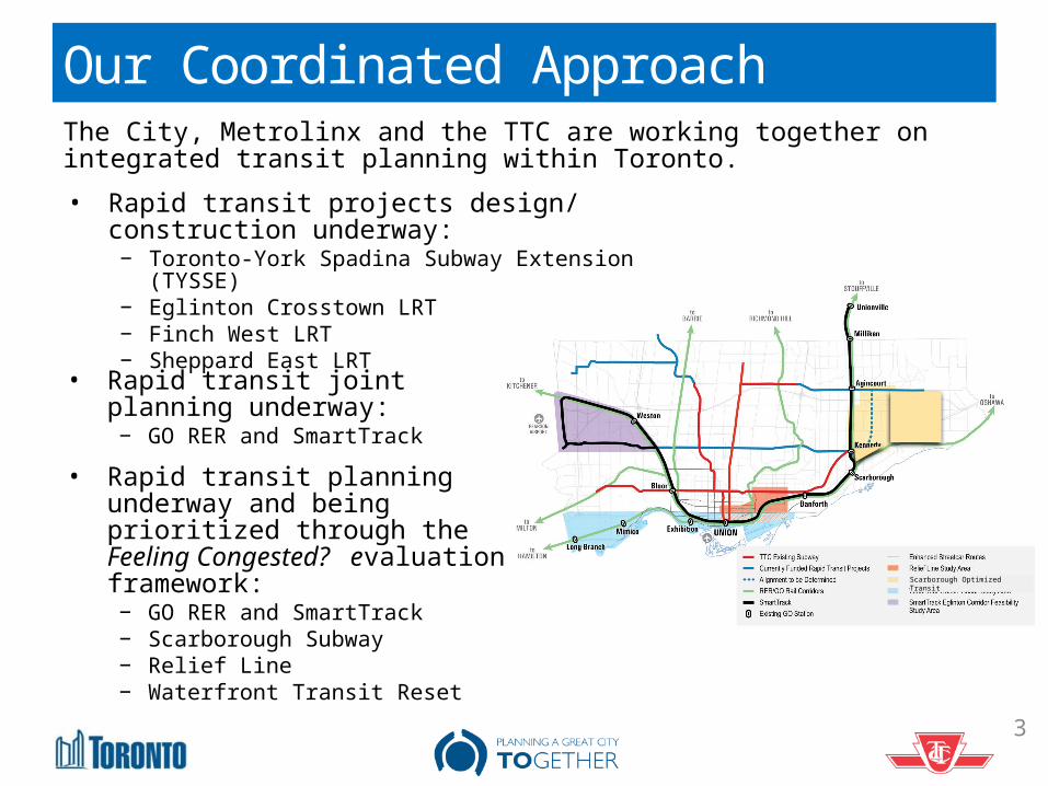
Our Coordinated ApproachThe City, Metrolinx and the TTC are working together on integrated transit planning within Toronto.• Rapid transit projects design/
construction underway:− Toronto-York Spadina Subway Extension
(TYSSE)− Eglinton Crosstown LRT− Finch West LRT− Sheppard East LRT
• Rapid transit joint planning underway:− GO RER and SmartTrack
• Rapid transit planning underway and being prioritized through the Feeling Congested? evaluation framework:− GO RER and SmartTrack− Scarborough Subway− Relief Line− Waterfront Transit Reset
4
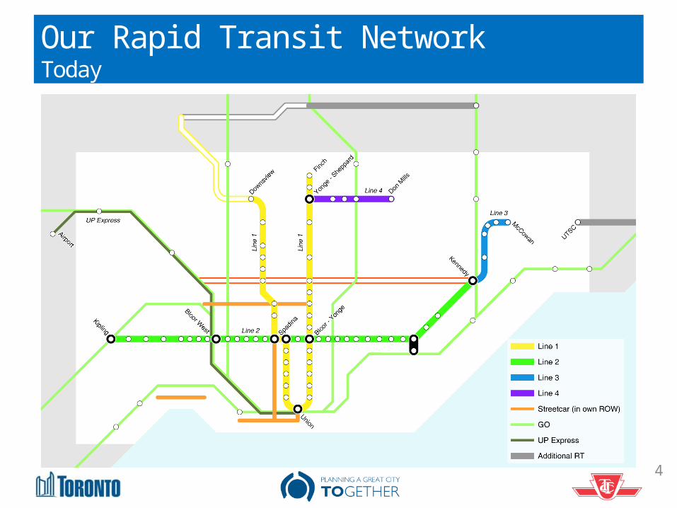
Our Rapid Transit NetworkToday
5
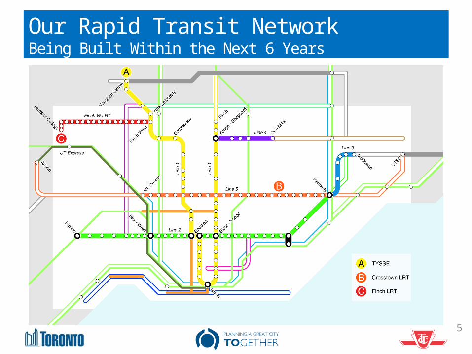
Our Rapid Transit NetworkBeing Built Within the Next 6 Years
6
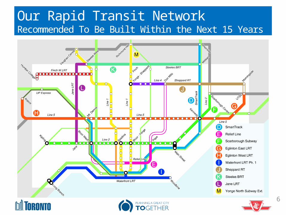
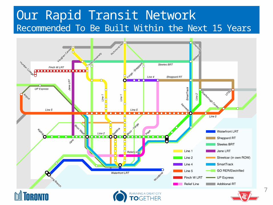
Our Rapid Transit Network Recommended To Be Built Within the Next 15 Years
7
Our Rapid Transit NetworkRecommended To Be Built Within the Next 15 Years
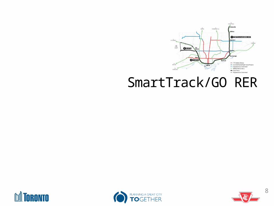
SmartTrack/GO RER
8
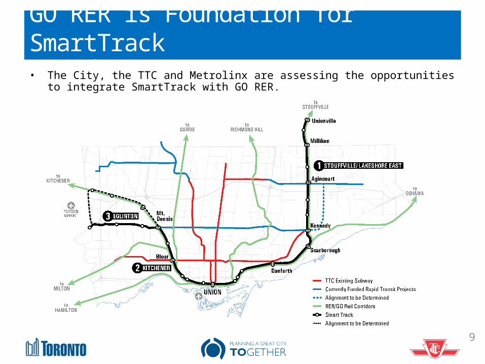
GO RER is Foundation for SmartTrackSmartTrack / GO RER• The City, the TTC and Metrolinx are assessing the opportunities to integrate
SmartTrack with GO RER.
9
10
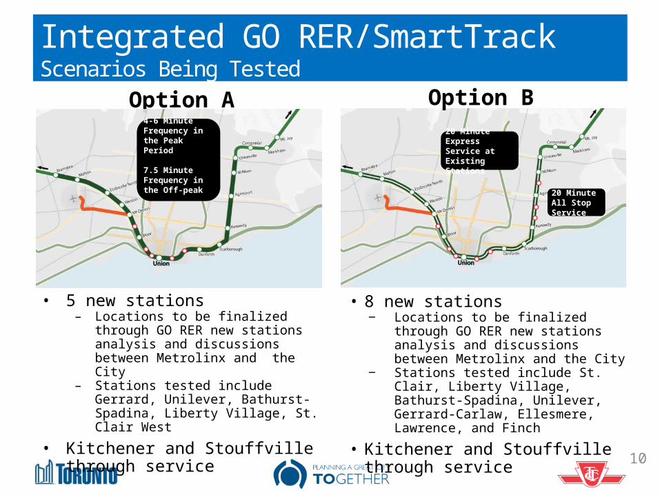
• 5 new stations– Locations to be finalized through
GO RER new stations analysis and discussions between Metrolinx and the City
– Stations tested include Gerrard, Unilever, Bathurst-Spadina, Liberty Village, St. Clair West
• Kitchener and Stouffville through service
Integrated GO RER/SmartTrackScenarios Being Tested
Option BOption A4-6 Minute Frequency in the Peak Period
7.5 Minute Frequency in the Off-peak
20 Minute Express Service at Existing Stations
20 Minute All Stop Service
• 8 new stations‒ Locations to be finalized through
GO RER new stations analysis and discussions between Metrolinx and the City
‒ Stations tested include St. Clair, Liberty Village, Bathurst-Spadina, Unilever, Gerrard-Carlaw, Ellesmere, Lawrence, and Finch
• Kitchener and Stouffville through service
11
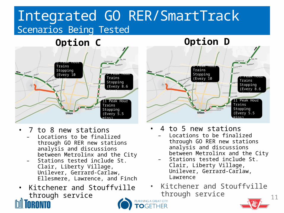
Integrated GO RER/SmartTrackScenarios Being Tested
Option DOption C
• 7 to 8 new stations– Locations to be finalized through
GO RER new stations analysis and discussions between Metrolinx and the City
– Stations tested include St. Clair, Liberty Village, Unilever, Gerrard-Carlaw, Ellesmere, Lawrence, and Finch
• Kitchener and Stouffville through service
• 4 to 5 new stations – Locations to be finalized through
GO RER new stations analysis and discussions between Metrolinx and the City
– Stations tested include St. Clair, Liberty Village, Unilever, Gerrard-Carlaw, Lawrence
• Kitchener and Stouffville through service
6 Peak Hour Trains Stopping(Every 10 mins)
7 Peak Hour Trains Stopping(Every 8.6 mins)
11 Peak Hour Trains Stopping (Every 5.5 mins)
6 Peak Hour Trains Stopping(Every 10 mins) 7 Peak Hour
Trains Stopping(Every 8.6 mins)
11 Peak Hour Trains Stopping (Every 5.5 mins)
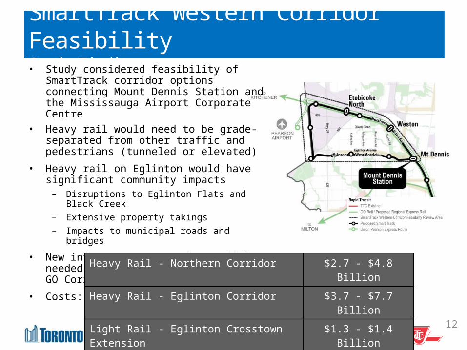
SmartTrack Western Corridor FeasibilityStudy Findings• Study considered feasibility of SmartTrack
corridor options connecting Mount Dennis Station and the Mississauga Airport Corporate Centre
• Heavy rail would need to be grade-separated from other traffic and pedestrians (tunneled or elevated)
• Heavy rail on Eglinton would have significant community impacts
– Disruptions to Eglinton Flats and Black Creek
– Extensive property takings– Impacts to municipal roads and bridges
• New infrastructure/tracks would be needed along Eglinton and Kitchener GO Corridor
• Costs:
12
Heavy Rail - Northern Corridor $2.7 - $4.8 BillionHeavy Rail - Eglinton Corridor $3.7 - $7.7 BillionLight Rail - Eglinton Crosstown Extension
$1.3 - $1.4 Billion
SmartTrack Western Corridor FeasibilityRecommended Direction• Further due diligence on heavy rail option for the SmartTrack
Western Corridor is not advised:– Significant community impact– Higher cost– Lower projected ridership compared to the LRT
• Eglinton West LRT extending the Crosstown along Eglinton to Mississauga Airport Corporate Center and Pearson Airport would provide excellent rapid transit service for this part of the City.
• City staff are recommending the LRT option (Eglinton West LRT)– Requesting further direction from Council to collaborate with
Metrolinx on an optimized LRT extension (to be referred to as Eglinton West LRT).
13
Scarborough Transit Expansion
14
Scarborough Transit ExpansionBackground • In October 2013 City Council confirmed support for the
extension of the Bloor-Danforth Subway (Line 2) to Scarborough
• Since then, City Planning and TTC have been conducting a detailed assessment to determine a preferred alignment
• Contextual changes have occurred:– Development of GO RER– Introduction of SmartTrack– Pause on the Sheppard East LRT
• Therefore we needed to re-examine how best to address the rapid transit needs of Scarborough
• Two key transit priorities:– Regional connectivity– Local access
15
Scarborough Transit Expansion Refined Transit Priorities
16
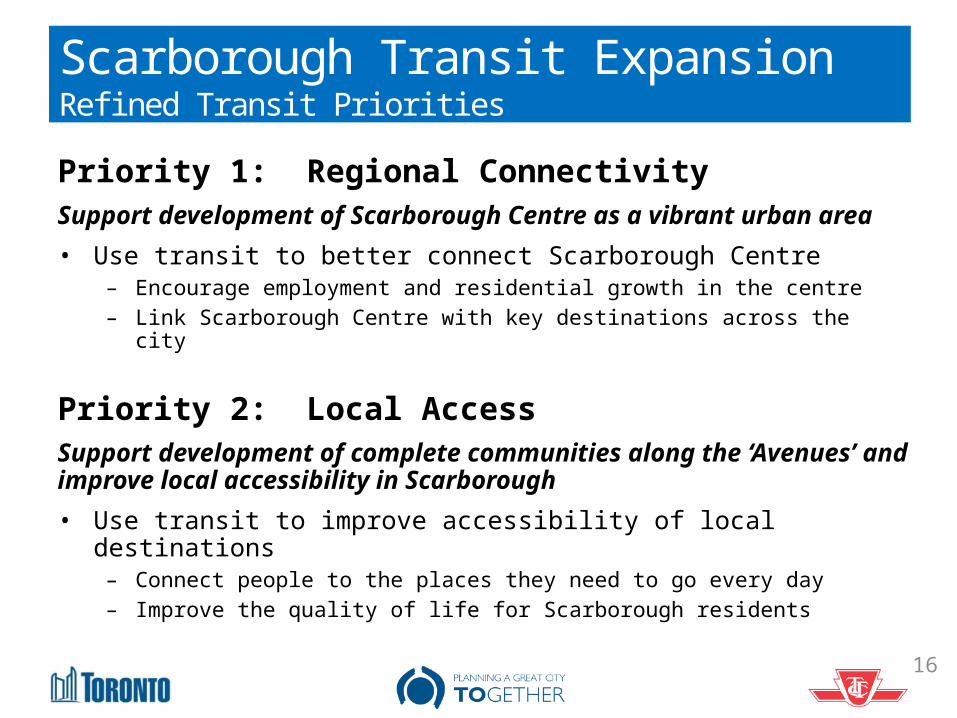
Priority 1: Regional ConnectivitySupport development of Scarborough Centre as a vibrant urban area• Use transit to better connect Scarborough Centre
– Encourage employment and residential growth in the centre– Link Scarborough Centre with key destinations across the city
Priority 2: Local AccessSupport development of complete communities along the ‘Avenues’ and improve local accessibility in Scarborough• Use transit to improve accessibility of local destinations
– Connect people to the places they need to go every day– Improve the quality of life for Scarborough residents
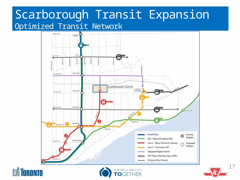
Scarborough Transit Expansion Optimized Transit Network
17
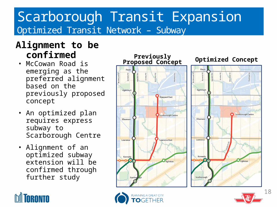
Scarborough Transit Expansion Optimized Transit Network – Subway
• McCowan Road is emerging as the preferred alignment based on the previously proposed concept
• An optimized plan requires express subway to Scarborough Centre
• Alignment of an optimized subway extension will be confirmed through further study
Previously Proposed Concept Optimized Concept
Alignment to be confirmed
18
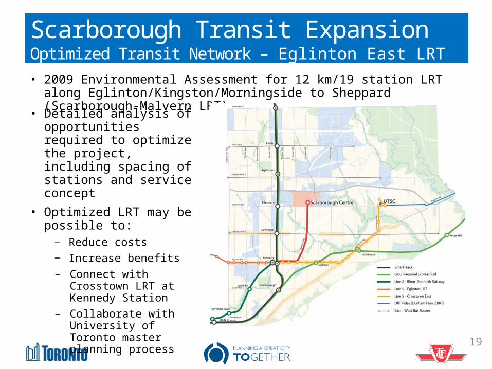
Scarborough Transit Expansion Optimized Transit Network – Eglinton East LRT• 2009 Environmental Assessment for 12 km/19 station LRT along
Eglinton/Kingston/Morningside to Sheppard (Scarborough-Malvern LRT)
19
• Detailed analysis of opportunities required to optimize the project, including spacing of stations and service concept
• Optimized LRT may be possible to:
‒ Reduce costs‒ Increase benefits– Connect with
Crosstown LRT at Kennedy Station
– Collaborate with University of Toronto master planning process
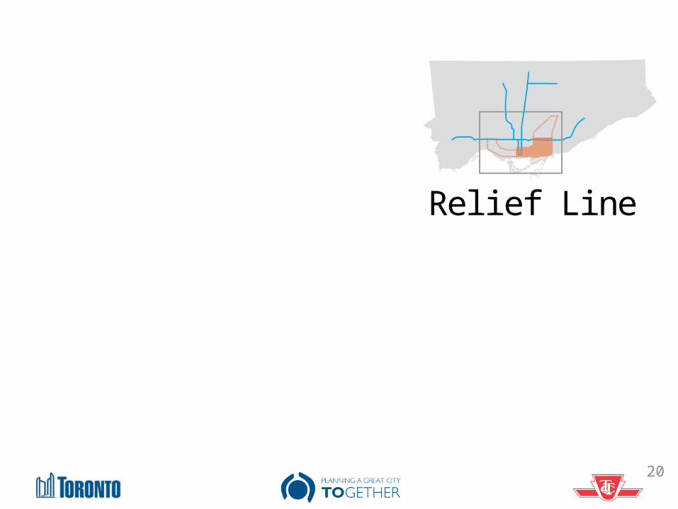
Relief Line
20
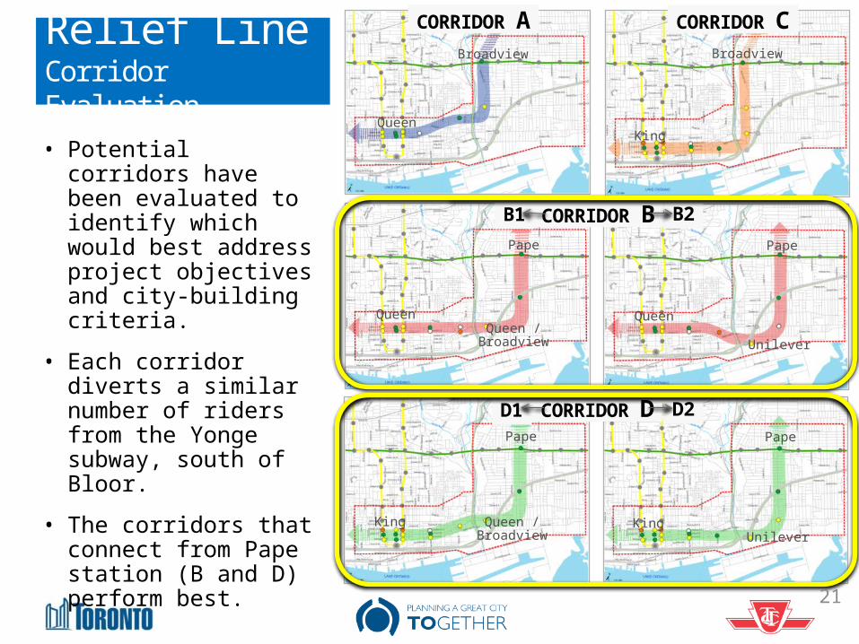
Relief LineCorridor Evaluation
B1 B2
D2D1
CORRIDOR CCORRIDOR A
CORRIDOR B
CORRIDOR D
Broadview Broadview
Pape
Pape
Queen
KingQueen
King
Pape
Pape
Queen
King
Queen / Broadview
Queen / Broadview Unilever
Unilever
• Potential corridors have been evaluated to identify which would best address project objectives and city-building criteria.
• Each corridor diverts a similar number of riders from the Yonge subway, south of Bloor.
• The corridors that connect from Pape station (B and D) perform best.
21
22
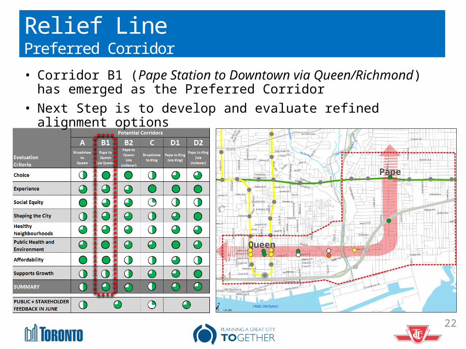
Relief LinePreferred Corridor• Corridor B1 (Pape Station to Downtown via Queen/Richmond)
has emerged as the Preferred Corridor• Next Step is to develop and evaluate refined alignment
options
Pape
Queen
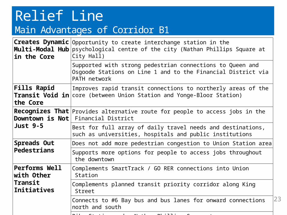
Creates Dynamic Multi-Modal Hub in the Core
Opportunity to create interchange station in the psychological centre of the city (Nathan Phillips Square at City Hall) Supported with strong pedestrian connections to Queen and Osgoode Stations on Line 1 and to the Financial District via PATH network
Fills Rapid Transit Void in the Core
Improves rapid transit connections to northerly areas of the core (between Union Station and Yonge-Bloor Station)
Recognizes That Downtown is Not Just 9-5
Provides alternative route for people to access jobs in the Financial District
Best for full array of daily travel needs and destinations, such as universities, hospitals and public institutions
Spreads Out Pedestrians
Does not add more pedestrian congestion to Union Station areaSupports more options for people to access jobs throughout the downtown
Performs Well with Other Transit Initiatives
Complements SmartTrack / GO RER connections into Union StationComplements planned transit priority corridor along King StreetConnects to #6 Bay bus and bus lanes for onward connections north and southBike Station under Nathan Phillips Square to open soon
Supports Social Equity
Closest to Regent Park Neighbourhood Improvement Area (5 minute walk)
Closest to Moss Park at Queen & Sherbourne Lowest Projected Cost
Avoids costly soil stabilization needs for crossing Don River south of Queen
Requires a shorter crossing of the Don River
Relief LineMain Advantages of Corridor B1
23
Waterfront Transit ‘Reset’
24
Waterfront Transit ‘Reset’ Background• In November 2015 City Council directed staff to work with TTC
and Waterfront Toronto to review waterfront transit options and report back early 2016
• Why Waterfront Transit ‘Reset’?– A comprehensive transit network approach is needed, rather than
the incremental approach of the past– Significant new development has been taking place along the
Waterfront corridor with the promise of public transit– These developments have been built, but public transit has not yet
materialized.– In the context of the Gardiner Expressway Environmental
Assessment, the need for improved Waterfront transit was raised repeatedly
– Appropriate transit services need to be developed to reflect existing and projected demand
25
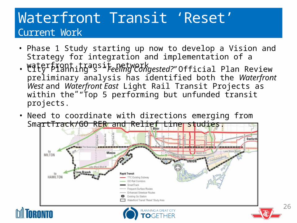
Waterfront Transit ‘Reset’Current Work• Phase 1 Study starting up now to develop a Vision and Strategy
for integration and implementation of a waterfront transit network• City Planning’s “Feeling Congested?” Official Plan Review preliminary analysis has identified both the Waterfront West and Waterfront East Light Rail Transit Projects as within the “Top 5 performing but unfunded transit projects.”
• Need to coordinate with directions emerging from SmartTrack/GO RER and Relief Line studies.
26
27
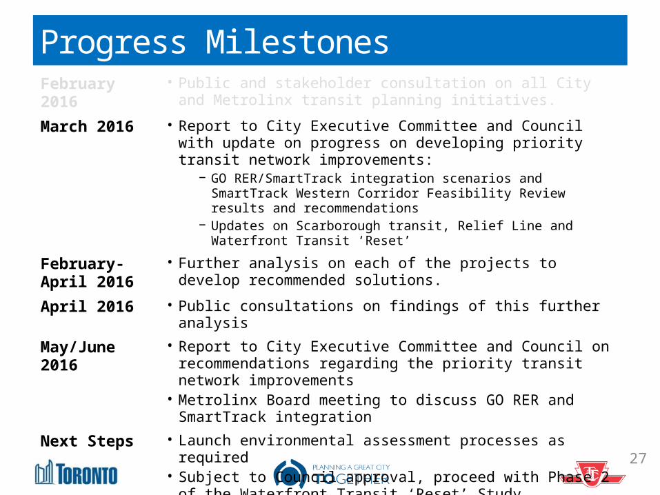
Progress MilestonesFebruary 2016
• Public and stakeholder consultation on all City and Metrolinx transit planning initiatives.
March 2016 • Report to City Executive Committee and Council with update on progress on developing priority transit network improvements:
−GO RER/SmartTrack integration scenarios and SmartTrack Western Corridor Feasibility Review results and recommendations
−Updates on Scarborough transit, Relief Line and Waterfront Transit ‘Reset’
February-April 2016
• Further analysis on each of the projects to develop recommended solutions.
April 2016 • Public consultations on findings of this further analysisMay/June 2016
• Report to City Executive Committee and Council on recommendations regarding the priority transit network improvements
• Metrolinx Board meeting to discuss GO RER and SmartTrack integration
Next Steps • Launch environmental assessment processes as required• Subject to Council approval, proceed with Phase 2 of the
Waterfront Transit ‘Reset’ Study
Questions?
28