Embed Size (px)
Citation preview


Stakeholder Engagement
To GIVE information about the project, so that stakeholders can make informed comment.
To GATHER stakeholder thoughts about the future and issues, challenges and opportunities.

Imagine Tomorrow ….Toowoomba Region Local Plan Program
Current priority areas include:1.Highfields/Meringandan/ Meringandan West (complete)2.West Toowoomba (current)3.Gowrie Junction/Kingsthorpe4.Drayton/Wyreema5.Hodgson Vale6.City Centre Master Plan (complete)
1
2
3
45
Urban Footprint
6
Area Pop’n 2011
Pop’n 2036
TRC 155,444 216,269
Greater Toowoomba 126,426 182,937
West Toowoomba 11,737 33,254

• In 2100 the number of people aged 100 and over in Australia will increase from 4,500 to 129,000. 1.1 million will be over 90 with a total population of over 53 million (abs – med series).
• The babies being born today will be 85 in the year 2100.• Planning for the year 2100 doesn’t mean we are planning for
distant generations.• Planning for the next 100 years means planning for people
who are here now.
Imagine Tomorrow ….
15, 25, 50 or 100 years?

What is a Local Plan? Provide a vision (blueprint) for future
development and investment that will occur over many years
Plans can help:o guide growth and change, and facilitate
economic developmento coordinate new and/or improved infrastructure,o guide style of development to create liveable communities, o protect locally valuable features and enhance the character of the
area,o address locally specific issues and opportunities that influence the
future of the area.
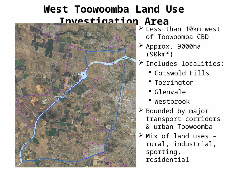
West Toowoomba Land Use Investigation Area Less than 10km west of
Toowoomba CBD Approx. 9000ha (90km²) Includes localities:
Cotswold Hills Torrington Glenvale Westbrook
Bounded by major transport corridors & urban Toowoomba
Mix of land uses – rural, industrial, sporting, residential

Why West Toowoomba?
Airport
Intermodal freight terminal
TSRC and Connections
New refuse transfer facility
Charlton Sports park
Inland Rail
Glenvale
Cotswold
Hills
Torrington
Westbrook
Population GrowthHousing demandEmployment
growthNew major
infrastructureRegional facilitiesAgricultural valuesLocal
environmental values
Development activity

Key Project Objectives• Investigate long-term growth opportunities and
options;
• Strategic directions plan - a long-term vision for land use and settlement pattern to guide change over several decades;
• Neighbourhood plans for smaller areas – more detailed and will guide urban form, infrastructure and development over the next 20-25 years;
• Work collaboratively with stakeholders, community and Council.

Project Stages
February to May 2015 May to July 2015 August to November 2015
November 2015 to February 2016
March to April 2016
Gathering background information and data.
Confirming key issues and opportunities
Investigating potential of study area.
Determining an agreed long-term future land
use direction.
Detailed planning and design for key
neighbourhoods –form, function and character,
growth capacity and infrastructure.
Confirming key directions and
implementation strategy.
Community review.
Final plan document.
Commence process to include plan in the
Toowoomba Regional Planning Scheme.

Communications

Westbrook
Glenvale
Torrington
Cotswold Hills
• Whole study area• Long-term plan• Land capacity and
infrastructure • Growth options • Broad land uses • Preferred settlement
form
Phase 2 – Strategic Directions Plan

Westbrook
Glenvale
Torrington
Cotswold Hills• Focus on existing
communities • Short to medium time (2036)• Refine preferred land use,
urban pattern and form• Directions about what new
development looks like & where
• Direction for infrastructure (inform LGIP/capital works)
Phase 3 – Neighbourhood Plans

Regional Planning FrameworkSEQ Regional Plan Boundary
South East Qld Regional Plan 2009-2031 – Urban Footprint
Darling Downs Regional Plan – Priority Agricultural Area
Darling Downs Regional Plan Boundary

Toowoomba Region Population Growth

Toowoomba Region Employment Growth

West Toowoomba Land Use Investigation Area – Growth
2011 2031 2036 Change
Population (QGSO medium series)
11,737 27,208 33,254 283%
Population (TRC adopted)
11,737 24,355 - 111%
Workforce (TRC adopted – including CWEA)
3,878 11,440 - 193%

Studies so far……Currently available… Current underway…
• Toowoomba Regional Planning Scheme – and previous planning studies (2009)
• Greater Western Toowoomba Water Supply Study (2014)
• Westbrook Sewerage Study (2014)• Industrial Land Supply Update Study
(2014)• Commercial and Retail Land Needs
Update Study (2013)• Sustainable Agriculture Study (2013)• Toowoomba Regional Housing
Strategy (2013)• Toowoomba Region Sustainable
Transport Strategy (2014)
• Scenic amenity and landscape assessment
• Community facilities infrastructure analysis
• Demographic projections, and market profile assessment
• Flood extension study • Urban stormwater catchment plans –
Spring Creek & Dry Creek (Westbrook Creek to commence July)
• Draft Greater Toowoomba Sewerage Study
• Urban design & master planning

Issues
• Natural environment • Landscape character / scenic amenity• Agricultural production • Open space, parks and recreation• Essential infrastructure – water, sewerage and
drainage• Transport and movement• Brisbane ‘West Wellcamp’ Airport• Housing choice and built form• Economic Development

Dat
a +
map
ping
≠ m
aste
rpla
n

Avoi
d sq
ueez
ing
deve
lopm
ent l
ike
toot
hpas
te b
etw
een
cons
trai
nts!

Nat
ural
Env
ironm
ent
Nat
ural
Env
ironm
ent

Land
scap
e Ch
arac
ter &
Sce
nic
Amen
ity -
Hill
s +
Ridg
es

“Agr
icul
tura
l Pro
ducti
on A
reas
”“A
gric
ultu
ral P
rodu
ction
Are
as”

“Agr
icul
tura
l Pro
ducti
on A
reas
”“A
gric
ultu
ral P
rodu
ction
Are
as”
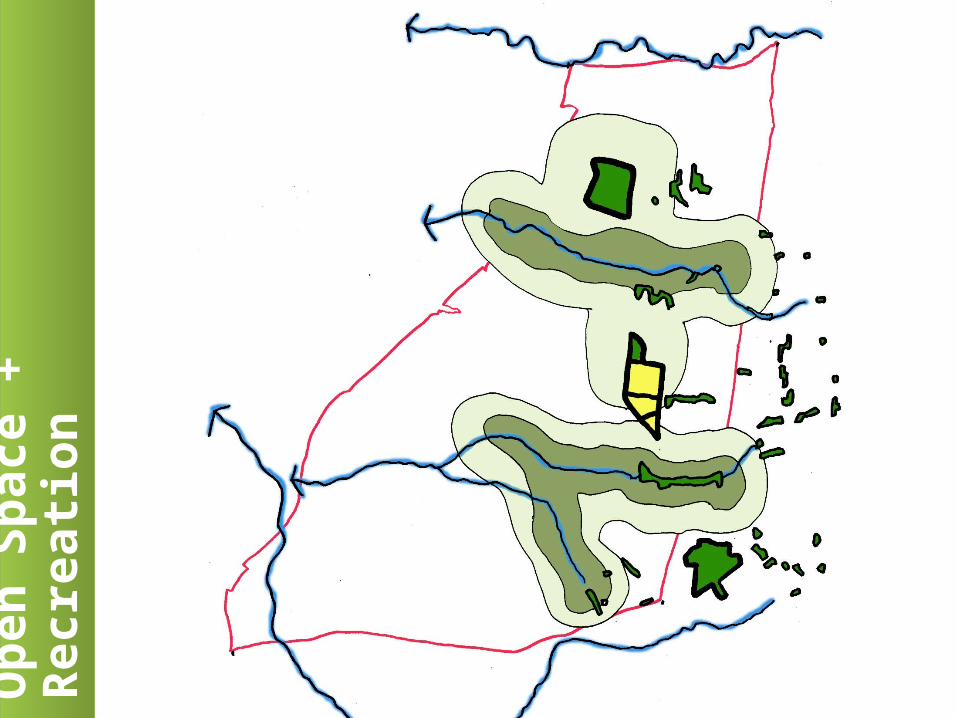
Ope
n Sp
ace
+ Re
crea
tion

Esse
ntial
Infr
astr
uctu
re: S
torm
wat
er

Esse
ntial
Infr
astr
uctu
re: W
ater
+ S
ewer
age
Esse
ntial
Infr
astr
uctu
re: W
ater
+ S
ewer
age
Informs:•Capital works plans•Local Government Infrastructure Plan (LGIP)
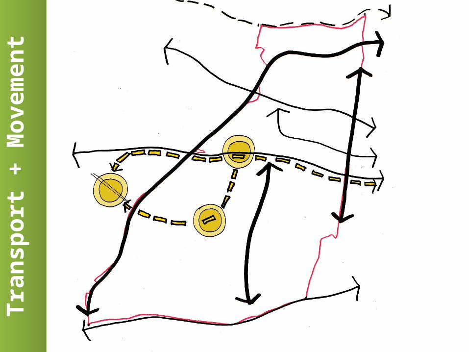
Tran
spor
t + M
ovem
ent
Tran
spor
t + M
ovem
ent

Bris
bane
Wes
t Wel
lcam
p Ai
rpor
tBr
isba
ne W
est W
ellc
amp
Airp
ort

Hou
sing
Cho
ice
+ Bu
ilt F
orm

Existing IndustryEc
onom
ic D
evel
opm
ent
Economic activity existing
Economic expansion
Residential growth
pressure

Key
influ
ence
s on
futu
re p
lann
ing
Key
influ
ence
s on
futu
re p
lann
ing
1. Green infrastructure
network
2. Economic development
land
3. Manage land use impacts 4. CBD-Airport
PT + north-south roads

Questions

Imagine Tomorrow…
“Someone's sitting in the shade today because someone planted a tree a long time ago.” (Warren Buffett 1930-)

Vision…..
• You are a passenger on a plan about to land at the Brisbane West Wellcamp airport
• Picture the view from your window
• What type of place do you see?
Imagine 50 years from now………..

Issues & Ideas

Next StepsPhase 2 - Strategic Directions Plan
•Project team continue investigations for long- term growth options and develop some scenarios, including consideration of your comments today.
•Think Tank 2 – review of scenarios (long-term options) and stakeholder feedback on the options.
•TRC will then determine a preferred direction considering feedback received, which will inform Phase 3.

How can you be involved? Multiple opportunities to provide input throughout
the investigation.
‘Meet a Planner’ o Appointments available 15 & 16 Juneo Phone 131 872 (131 TRC)
On-line ‘Have your say’o launching 23 June 2015http://yoursay.toowoombarc.qld.gov.au/imaginetomorrowo Instagram challenge, survey etc
Think Tank 2 – late July/early August 2015