Embed Size (px)
Citation preview

Unravelling an Iron Age Landscape in theCampine area of Flanders (Belgium).
Meylemans E., Bastiaens J., De Bie M.Flanders Heritage Agency
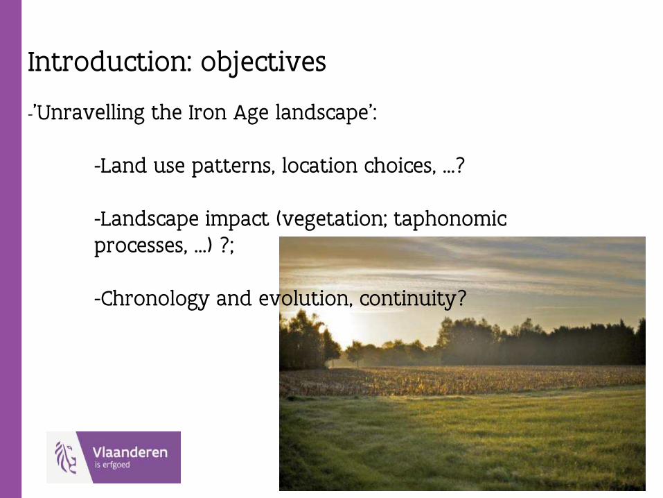
Introduction: objectives
-’Unravelling the Iron Age landscape’:
-Land use patterns, location choices, …?
-Landscape impact (vegetation; taphonomicprocesses, …) ?;
-Chronology and evolution, continuity?
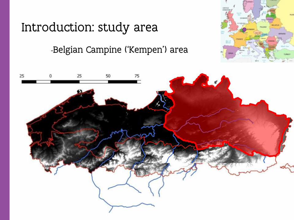
Introduction: study area
-Belgian Campine (‘Kempen’) area
Introduction: study area
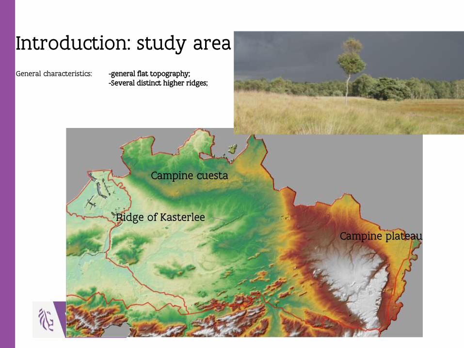
General characteristics: -general flat topography;-Several distinct higher ridges;
Campine cuesta
Ridge of Kasterlee
Campine plateau
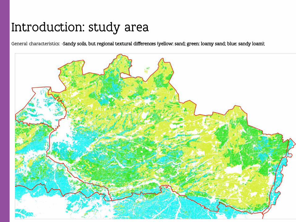
Introduction: study areaGeneral characteristics: -Sandy soils, but regional textural differences (yellow: sand; green: loamy sand; blue: sandy loam);
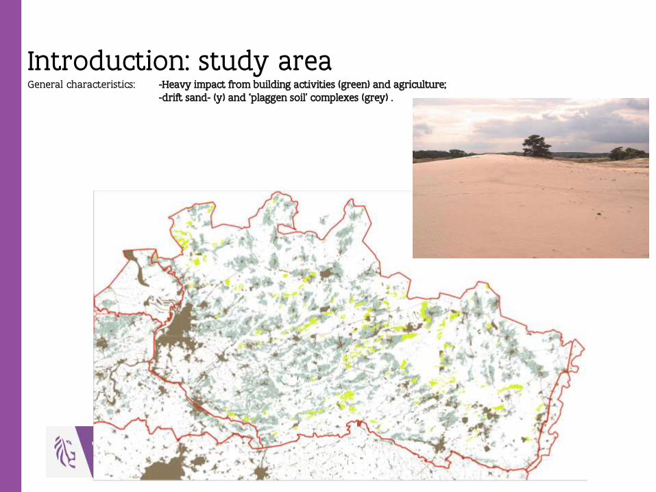
Introduction: study areaGeneral characteristics: -Heavy impact from building activities (green) and agriculture;
-drift sand- (y) and ‘plaggen soil’ complexes (grey) .

Introduction: study areaGeneral characteristics: -Heavy impact from building activities (green) and agriculture;
-drift sand- (y) and ‘plaggen soil’ complexes (grey) .
Introduction: materials and methods
-Remote sensing data (Lidar analysis);
-Archaeological data (Central Archaeological Inventory; preventivearchaeology);
-Palaeo-environmental analysis (natural and archaeological contexts);
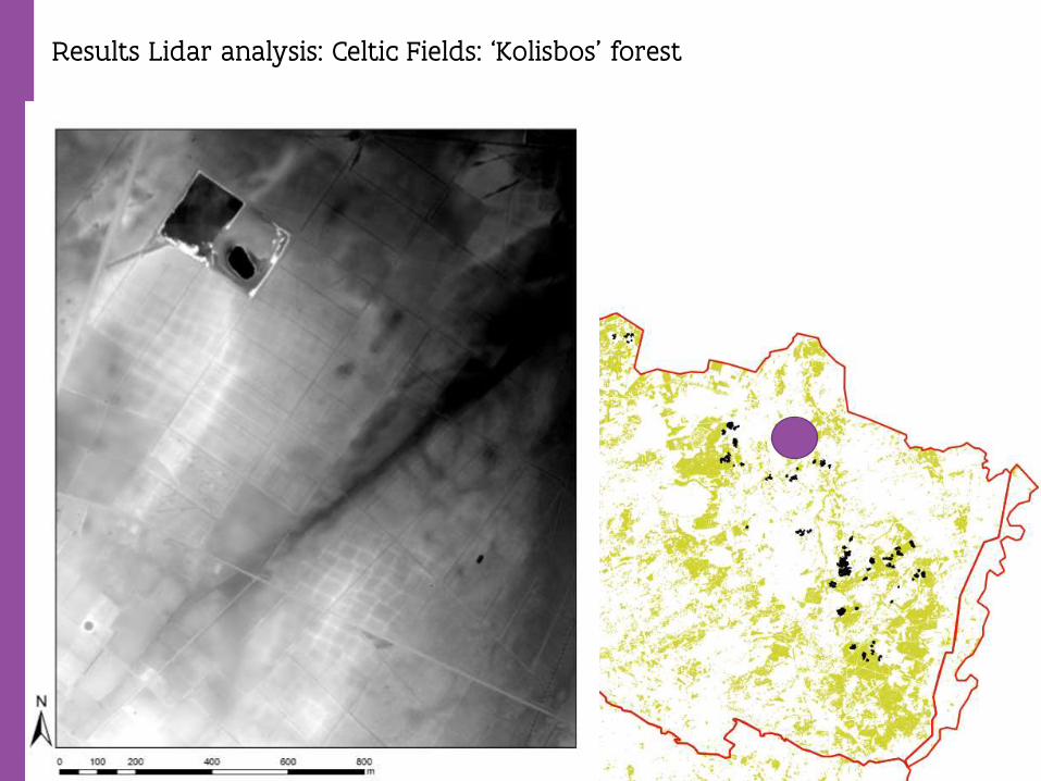
Results Lidar analysis: Celtic Fields: ‘Kolisbos’ forest
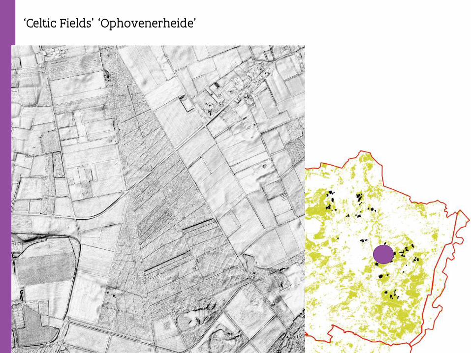
‘Celtic Fields’ ‘Ophovenerheide’

‘Celtic Fields’ Historical park ‘De Hees’
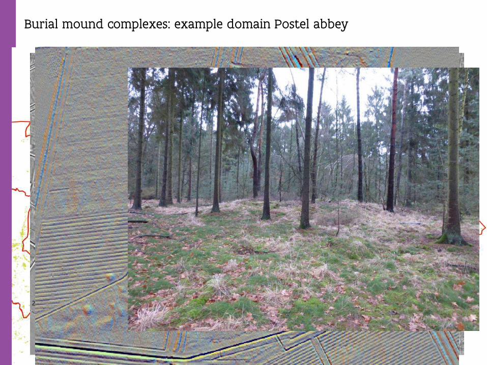
Burial mound complexes: example domain Postel abbey
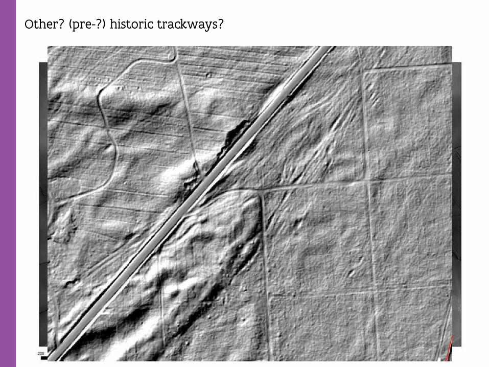
Other? (pre-?) historic trackways?
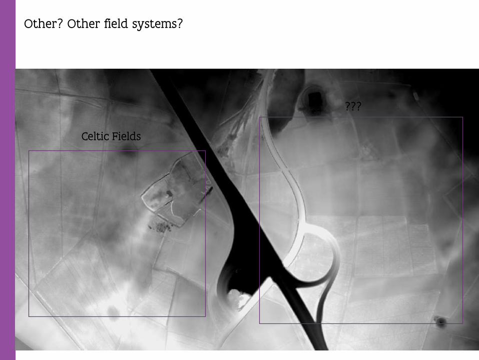
Other? Other field systems?
Celtic Fields
???
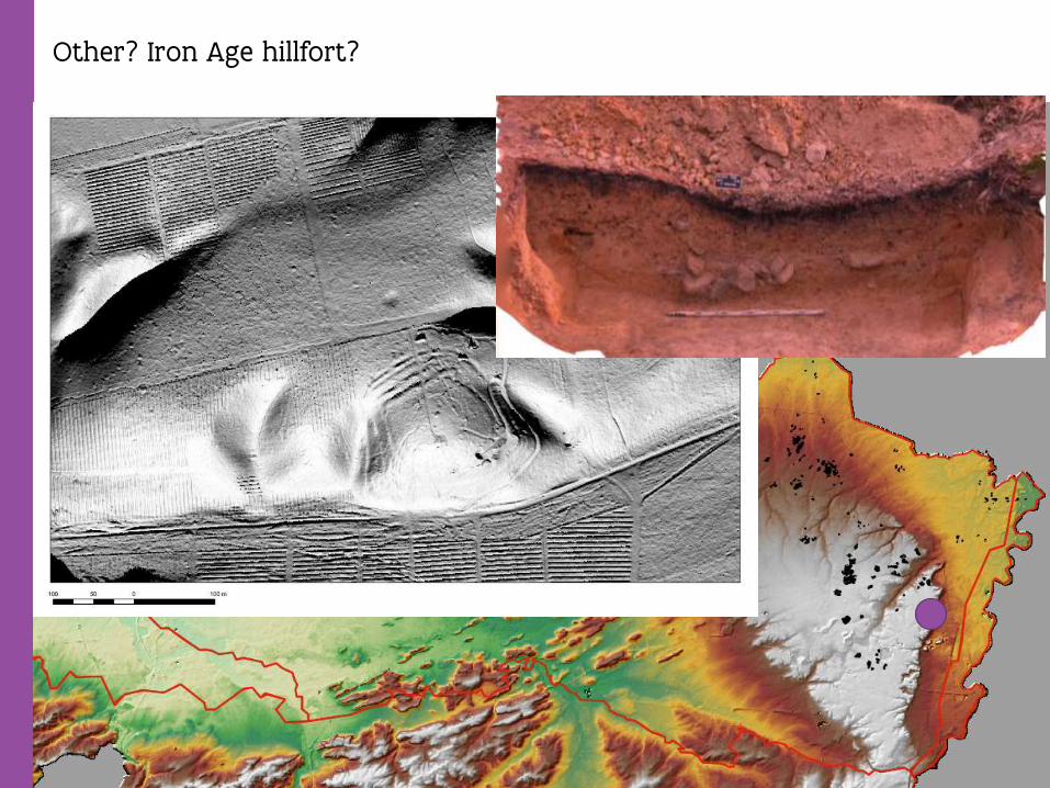
Other? Iron Age hillfort?
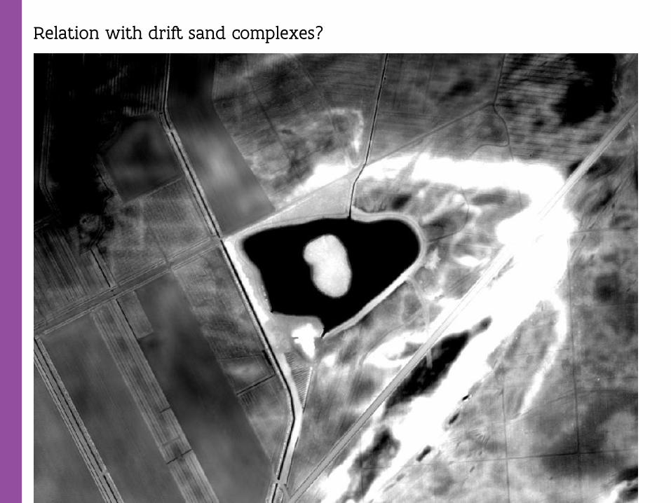
Relation with drift sand complexes?

Results: spread of CF based on Lidar
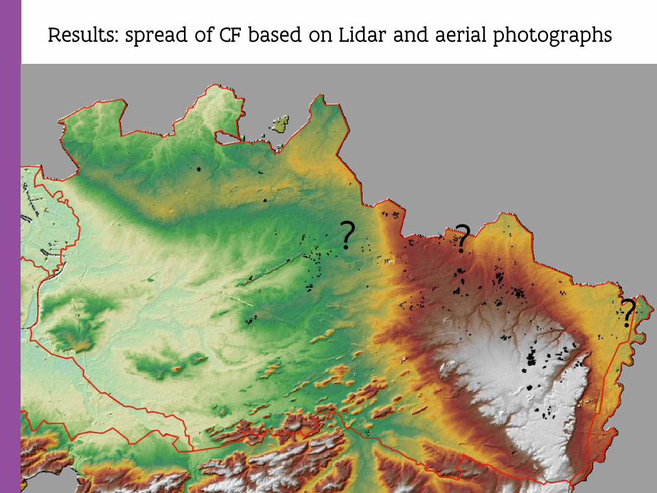
Results: spread of CF based on Lidar and aerial photographs
? ?
?

Results: relation spread of Celtic Fields (Lidar) and ‘historical’ forests
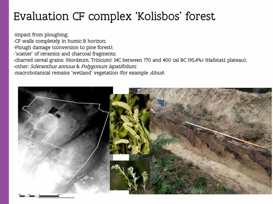
Evaluation CF complex ‘Kolisbos’ forest
-impact from ploughing;-CF walls completely in humic B horizon;-Plough damage (conversion to pine forest);-’scatter’ of ceramics and charcoal fragments;-charred cereal grains: (Hordeum, Triticum): 14C between 770 and 400 cal BC (95,4%) (Hallstatt plateau); -other: Scleranthus annuus & Polygonum lapatifolium;-macrobotanical remains ‘wetland’ vegetation (for example Alnus).
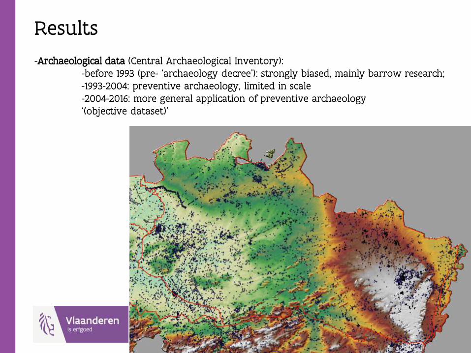
Results
-Archaeological data (Central Archaeological Inventory): -before 1993 (pre- ‘archaeology decree’): strongly biased, mainly barrow research;-1993-2004: preventive archaeology, limited in scale-2004-2016: more general application of preventive archaeology‘(objective dataset)’
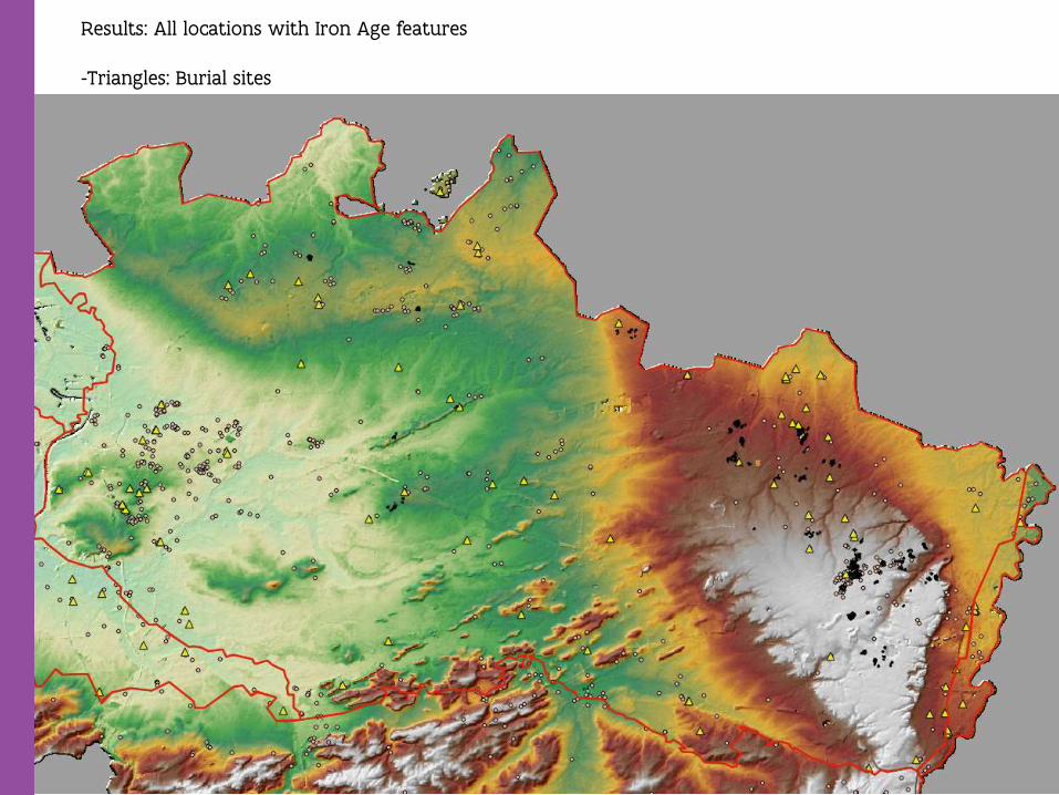
Results: All locations with Iron Age features
-Triangles: Burial sites

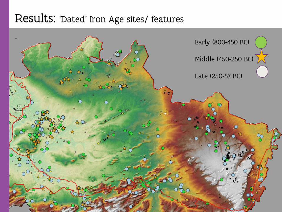
Results: ‘Dated’ Iron Age sites/ features
-Early (800-450 BC)
Middle (450-250 BC)
Late (250-57 BC)
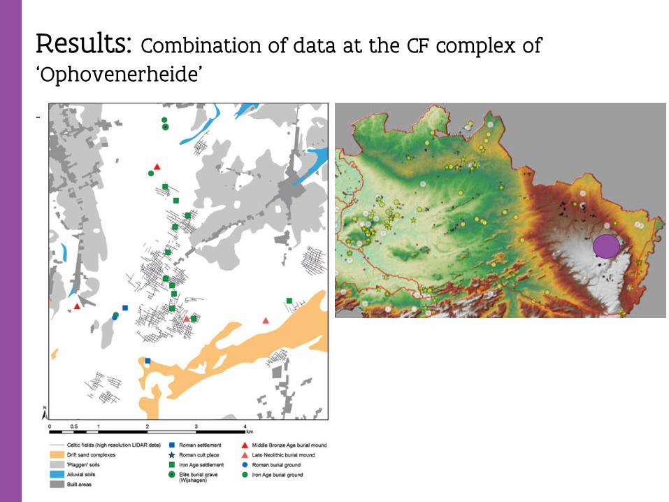
Results: Combination of data at the CF complex of
‘Ophovenerheide’
-

Results: Example Retie-Molenakkers (Schurmans et. Al in press: Bewoningssporen uit de Vroege en Midden- Ijzertijd in een geaccidenteerd landschap.)
-
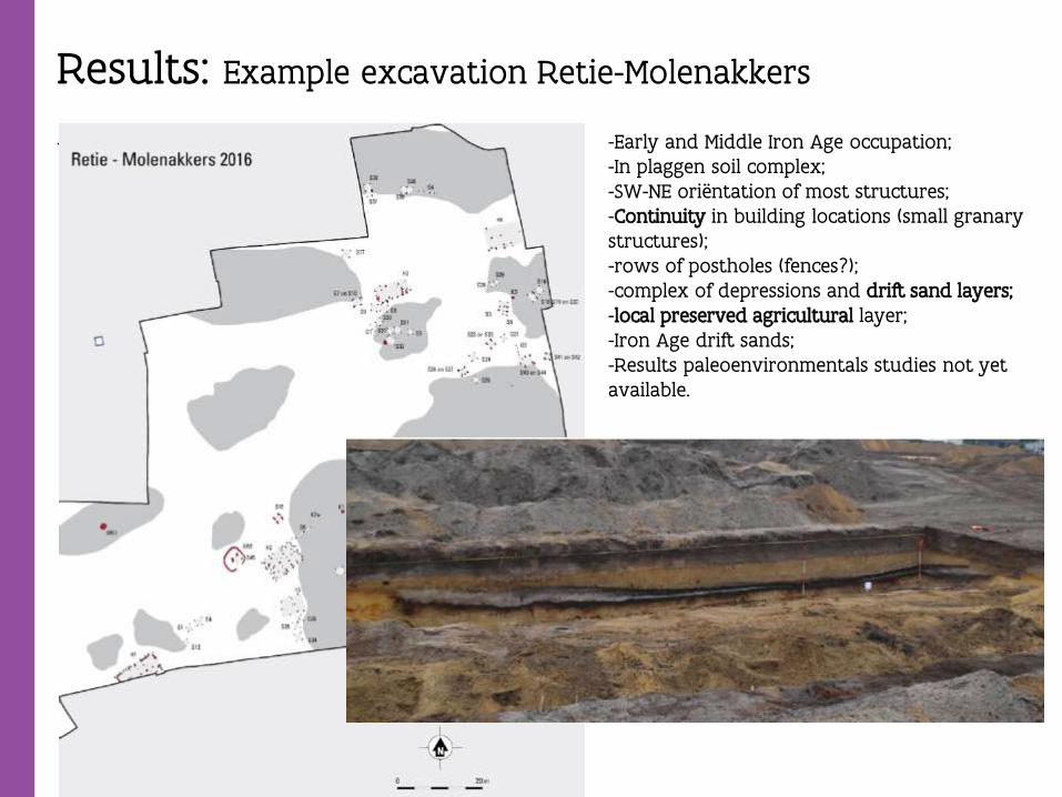
Results: Example excavation Retie-Molenakkers
- -Early and Middle Iron Age occupation;-In plaggen soil complex;-SW-NE oriëntation of most structures;-Continuity in building locations (small granarystructures);-rows of postholes (fences?);-complex of depressions and drift sand layers;-local preserved agricultural layer;-Iron Age drift sands;-Results paleoenvironmentals studies not yetavailable.
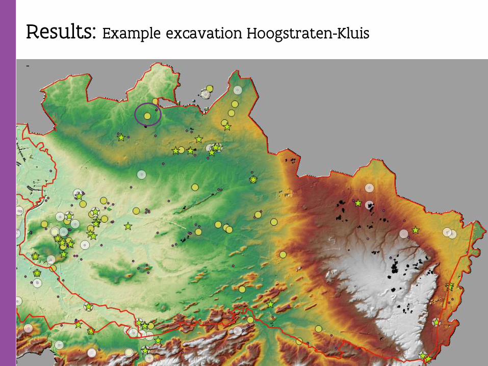
Results: Example excavation Hoogstraten-Kluis
-
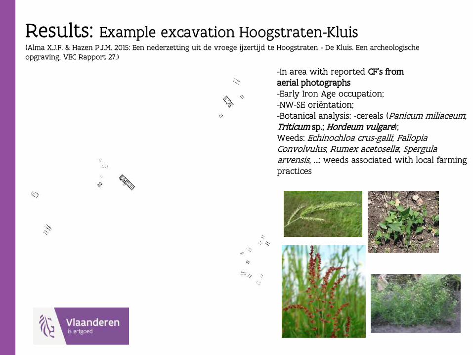
Results: Example excavation Hoogstraten-Kluis(Alma X.J.F. & Hazen P.J.M. 2015: Een nederzetting uit de vroege ijzertijd te Hoogstraten - De Kluis. Een archeologische opgraving, VEC Rapport 27.)
--In area with reported CF’s fromaerial photographs-Early Iron Age occupation;-NW-SE oriëntation; -Botanical analysis: -cereals (Panicum miliaceum;Triticum sp.; Hordeum vulgare); Weeds: Echinochloa crus-galli; FallopiaConvolvulus; Rumex acetosella; Spergulaarvensis, …: weeds associated with local farmingpractices
Results:
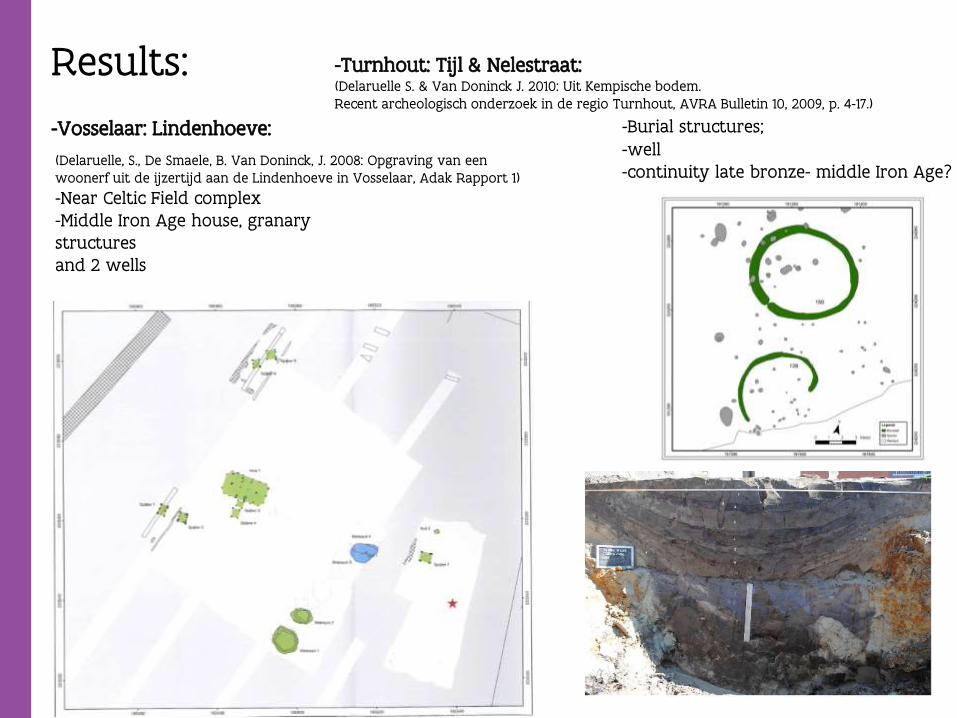
-Vosselaar: Lindenhoeve:
(Delaruelle, S., De Smaele, B. Van Doninck, J. 2008: Opgraving van een woonerf uit de ijzertijd aan de Lindenhoeve in Vosselaar, Adak Rapport 1)
-Near Celtic Field complex-Middle Iron Age house, granarystructuresand 2 wells
-Turnhout: Tijl & Nelestraat: (Delaruelle S. & Van Doninck J. 2010: Uit Kempische bodem. Recent archeologisch onderzoek in de regio Turnhout, AVRA Bulletin 10, 2009, p. 4-17.)
-Burial structures;-well-continuity late bronze- middle Iron Age?
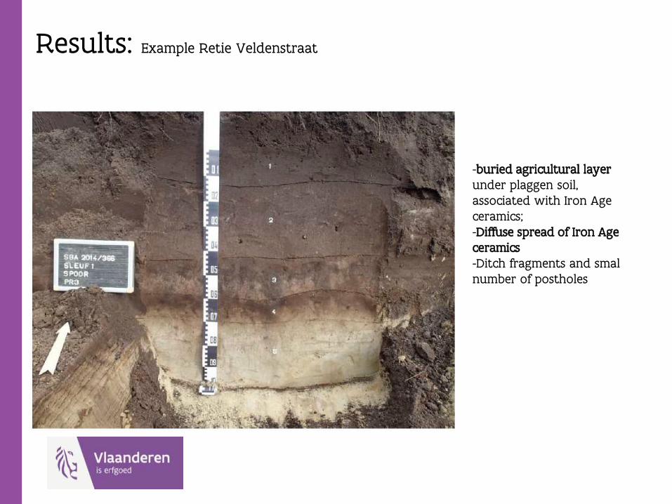
Results: Example Retie Veldenstraat
-buried agricultural layerunder plaggen soil, associated with Iron Age ceramics;-Diffuse spread of Iron Age ceramics-Ditch fragments and smal number of postholes
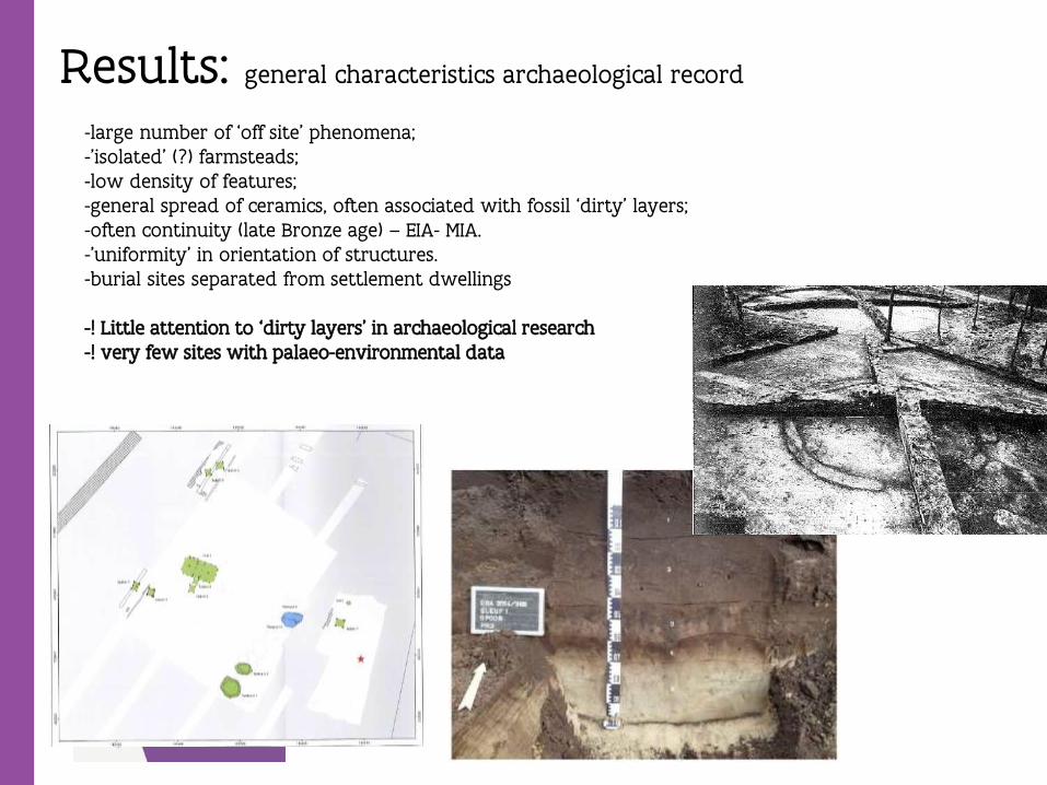
Results: general characteristics archaeological record
-large number of ‘off site’ phenomena;-’isolated’ (?) farmsteads;-low density of features;-general spread of ceramics, often associated with fossil ‘dirty’ layers;-often continuity (late Bronze age) – EIA- MIA. -’uniformity’ in orientation of structures. -burial sites separated from settlement dwellings
-! Little attention to ‘dirty layers’ in archaeological research-! very few sites with palaeo-environmental data
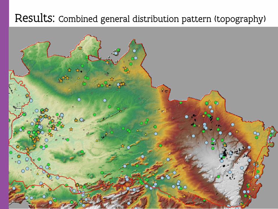
Results: Combined general distribution pattern (topography)
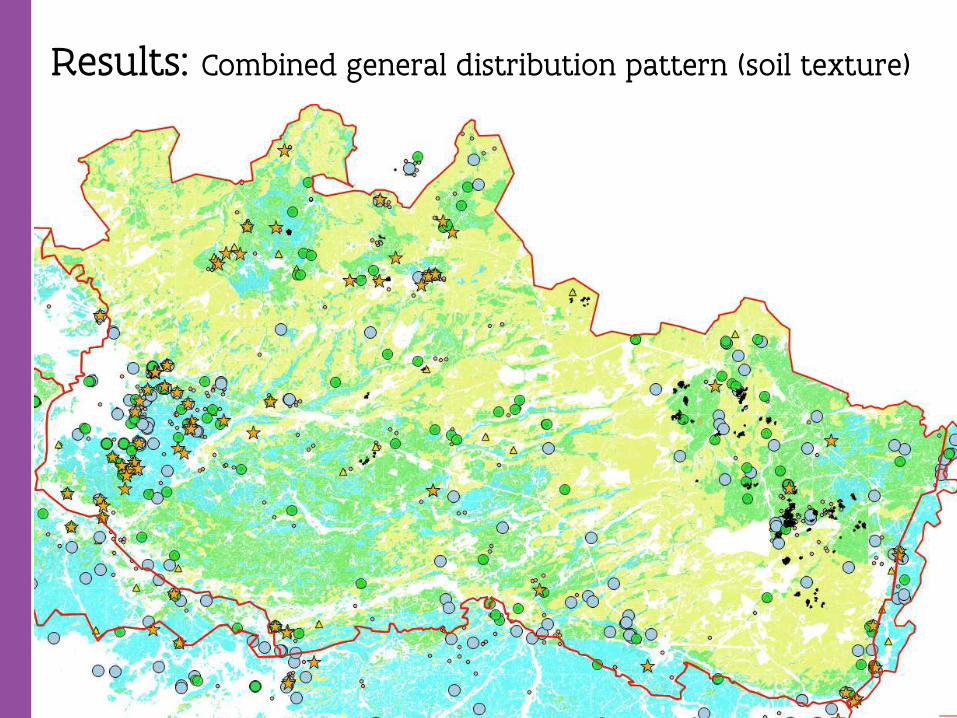
Results: Combined general distribution pattern (soil texture)
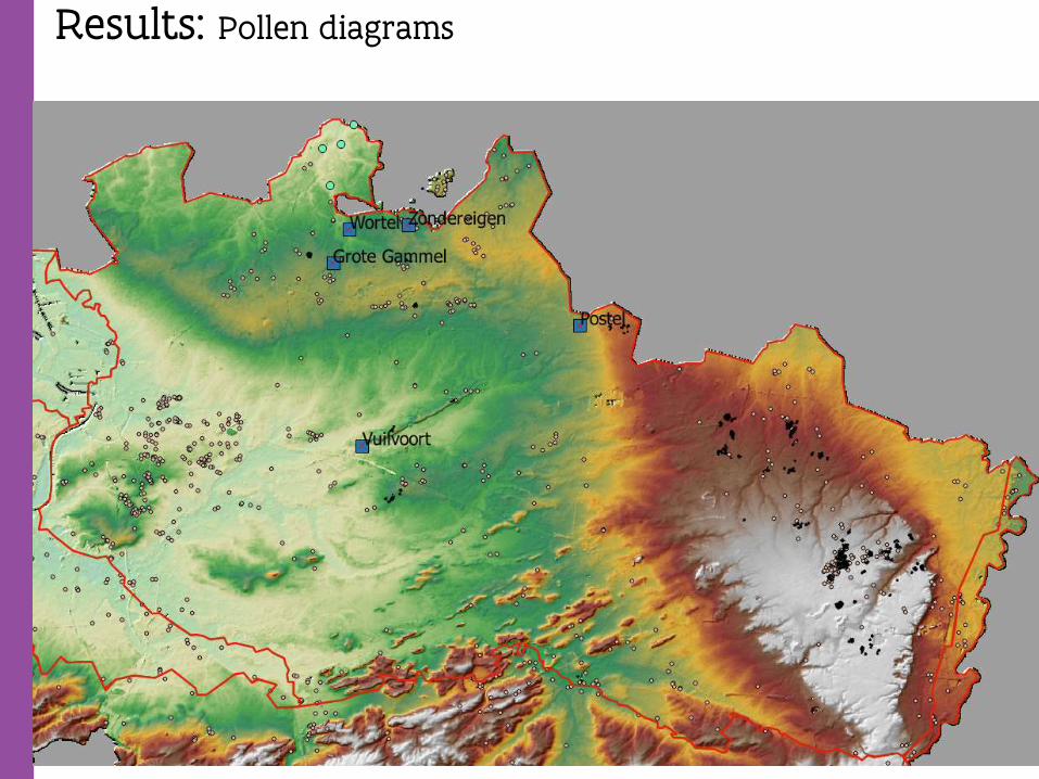
Results: Pollen diagrams
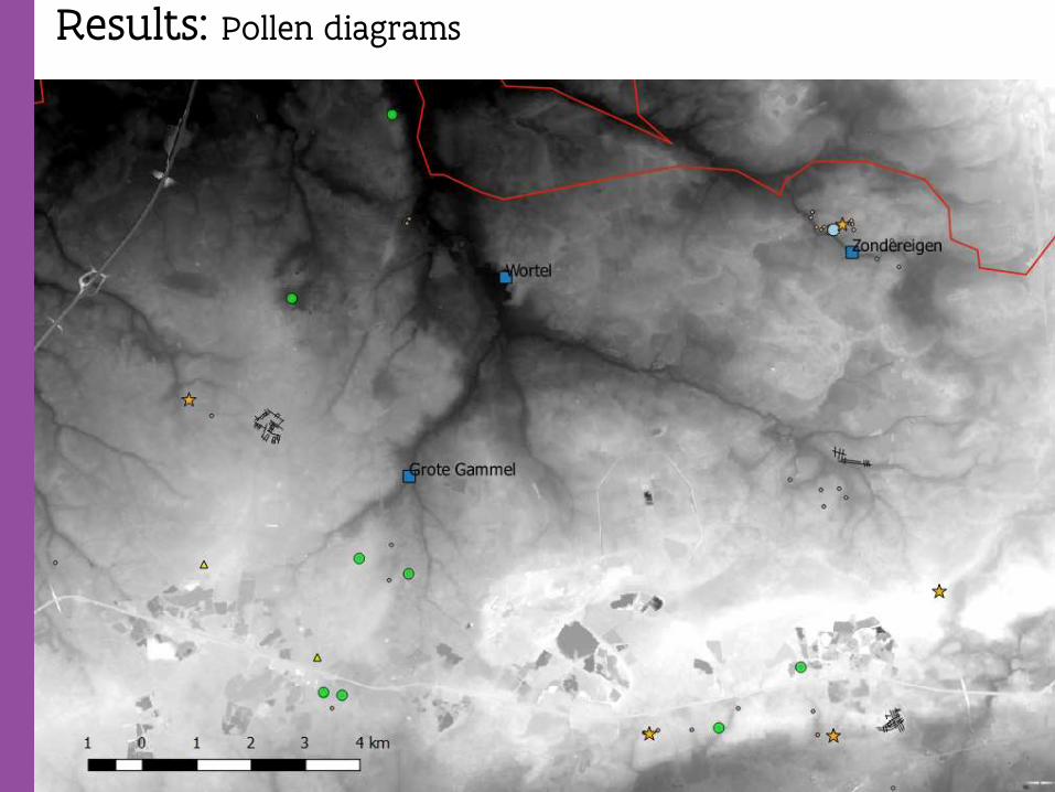
Results: Pollen diagrams
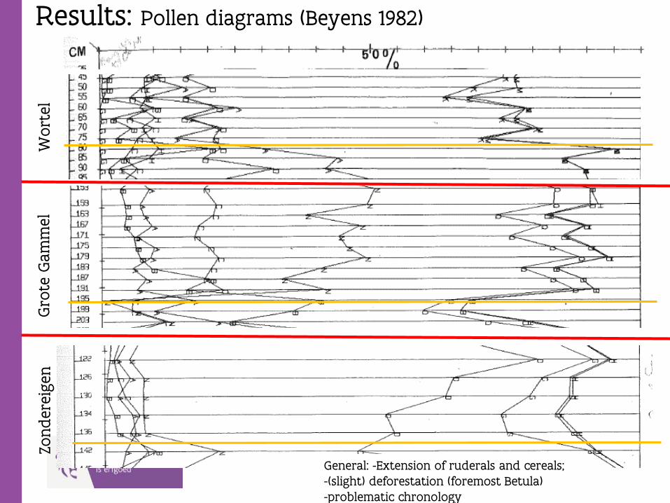
Results: Pollen diagrams (Beyens 1982)W
ort
elG
rote
Gam
mel
Zonder
eigen
General: -Extension of ruderals and cereals;-(slight) deforestation (foremost Betula) -problematic chronology
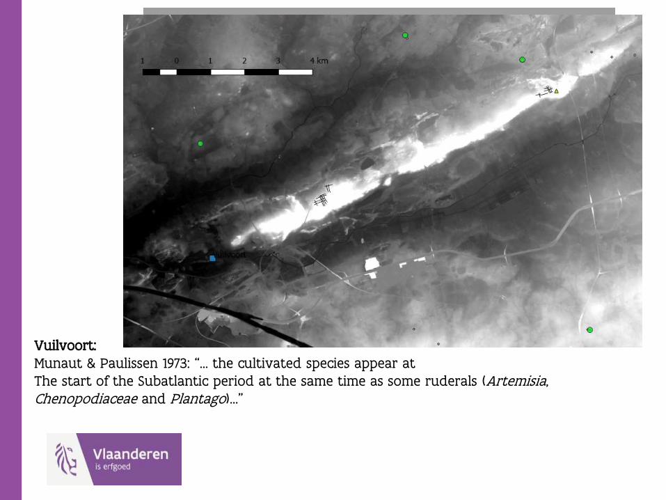
Vuilvoort:Munaut & Paulissen 1973: “… the cultivated species appear at The start of the Subatlantic period at the same time as some ruderals (Artemisia, Chenopodiaceae and Plantago)…”
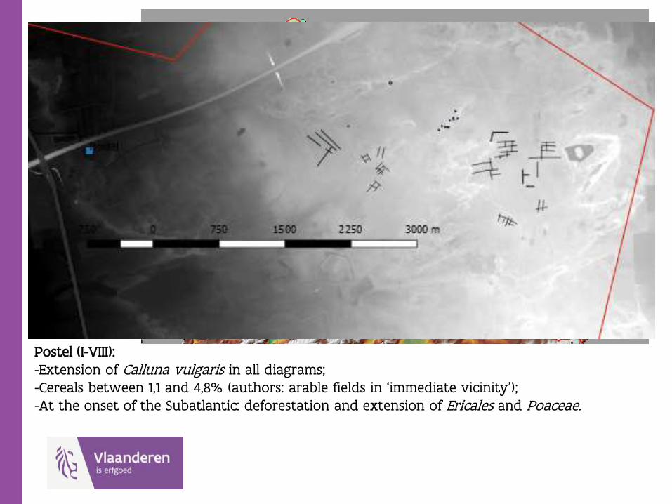
Postel (I-VIII):-Extension of Calluna vulgaris in all diagrams;-Cereals between 1,1 and 4,8% (authors: arable fields in ‘immediate vicinity’);-At the onset of the Subatlantic: deforestation and extension of Ericales and Poaceae.
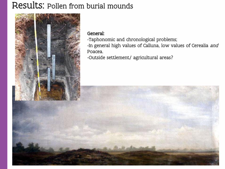
Results: Pollen from burial mounds
General:-Taphonomic and chronological problems;-In general high values of Calluna, low values of Cerealia andPoacea.-Outside settlement/ agricultural areas?

Synthesis & conclusions:
-On a macroregional scale: EIA and MIA occupation preferentiallyOn higher ridges and on soils with higher loam content;
-Chronological continuity EIA > MIA; to a lesser extend into LIA;
-In these areas intensive occupation, with signs of deforestation; Widespread occurrence of CF’s. ‘Open’ deciduous forest on the higher grounds; high percentages of Alnus on the lower grounds;
-’Celtic Field style’ of agriculture on sandy soils with higher loamcontent, but not on soils where loam is dominant texture?
-Low density pattern of settlements and off site phenomena >‘wandering farmsteads’ (Gerritsen 2003).
-Uniform orientation of structures and fossil agricultural soil layersIndication of presence of ‘Celtic Fields’? Cf. For example site of Bursch(Scheele & Arnoldussen 2017);
-Exploitation triggered the development of drift sands, at leaston a local scale;
-Burial grounds separated from the field systems and settlements?

Synthesis & conclusions:
-In current archaeological practice: -too little attention for fossil agricultural layers and -too little attention for palaeoenvironmental analysis.
-Further evaluation of and fieldwork within Celtic Field Complexes is needed.
-Relation with drift sand complexes? Are some of thesecontemporary with Iron Age exploitation?
-Further research based on lidar data (CF’s, burial sites, trackways, …) is needed.
-…