Embed Size (px)
Citation preview

Orange County’s Infill and Redevelopment Conference
Using Spatial Analyst to Identify
Potential Infill Development
March 27th, 2008
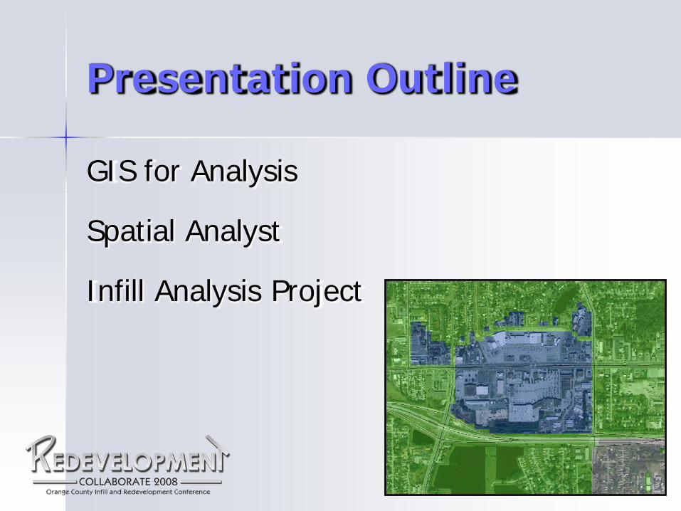
Presentation Outline
GIS for Analysis
Spatial Analyst
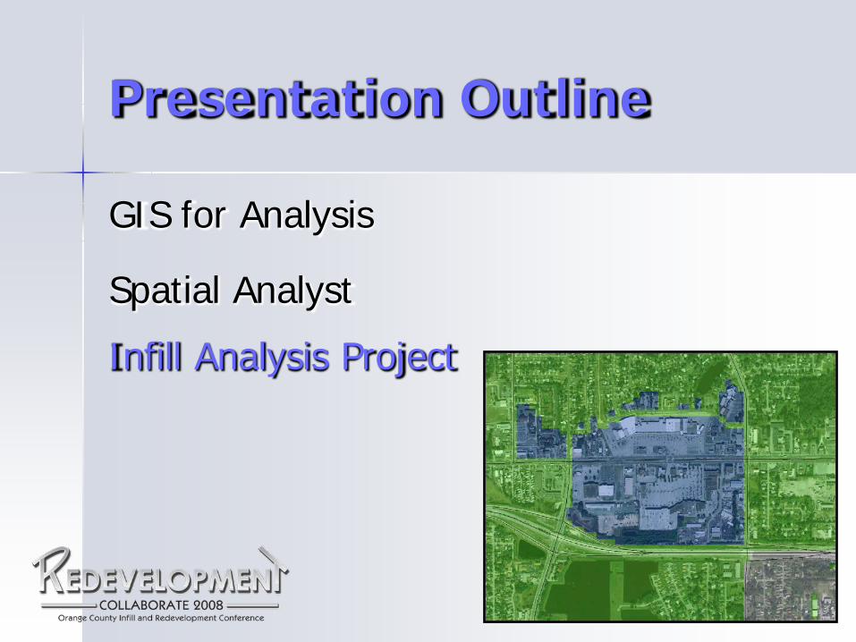
Infill Analysis Project

Presentation Outline
GIS for Analysis
Spatial Analyst
Infill Analysis Project
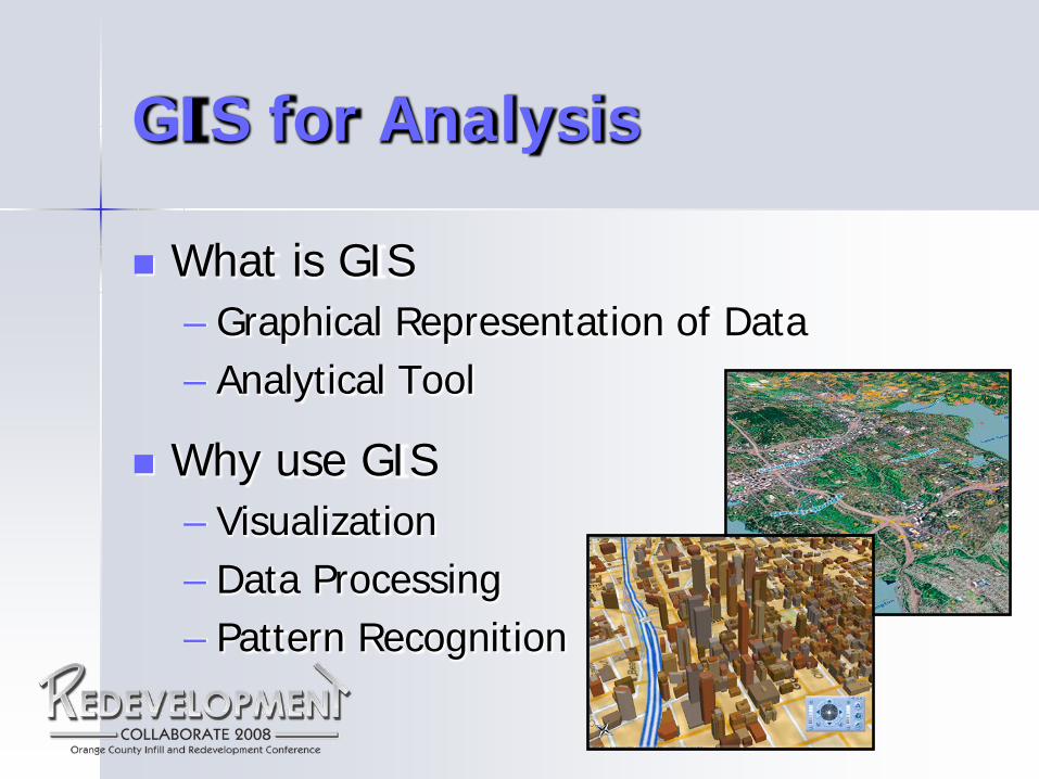
GIS for Analysis
What is GIS – Graphical Representation of Data – Analytical Tool
Why use GIS – Visualization – Data Processing – Pattern Recognition
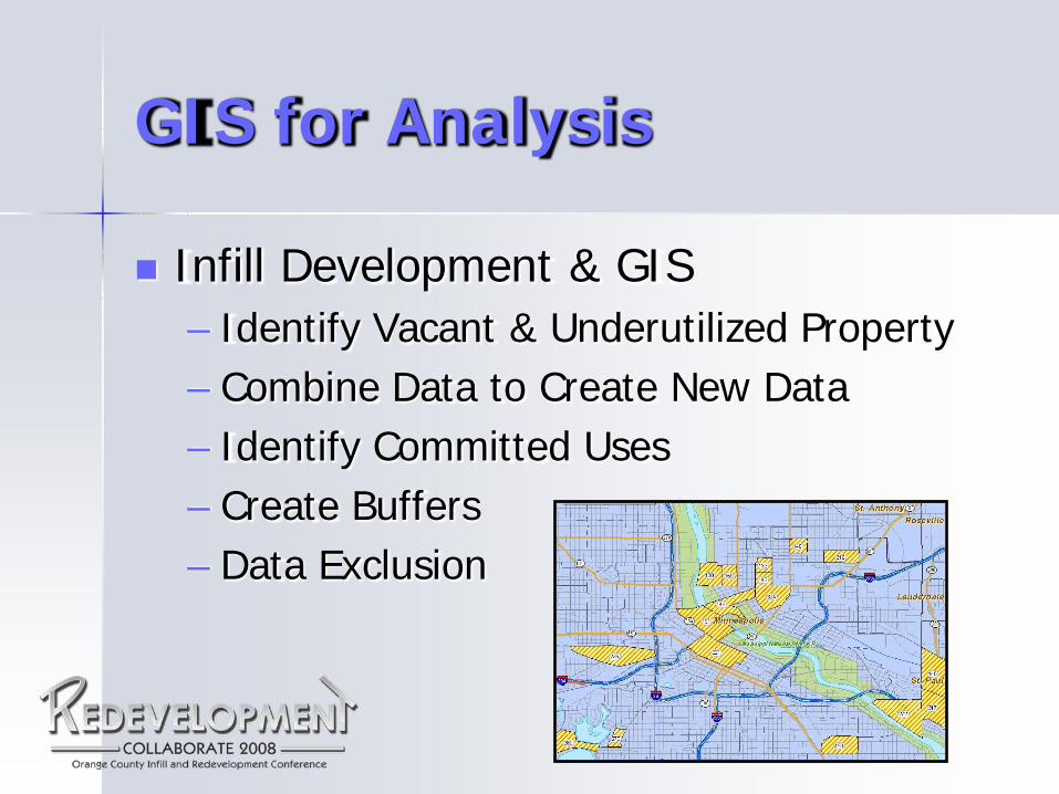
GIS for Analysis
Infill Development & GIS – Identify Vacant & Underutilized Property – Combine Data to Create New Data – Identify Committed Uses – Create Buffers – Data Exclusion

Presentation Outline
GIS for Analysis
Spatial Analyst
Infill Analysis Project
Spatial Analyst
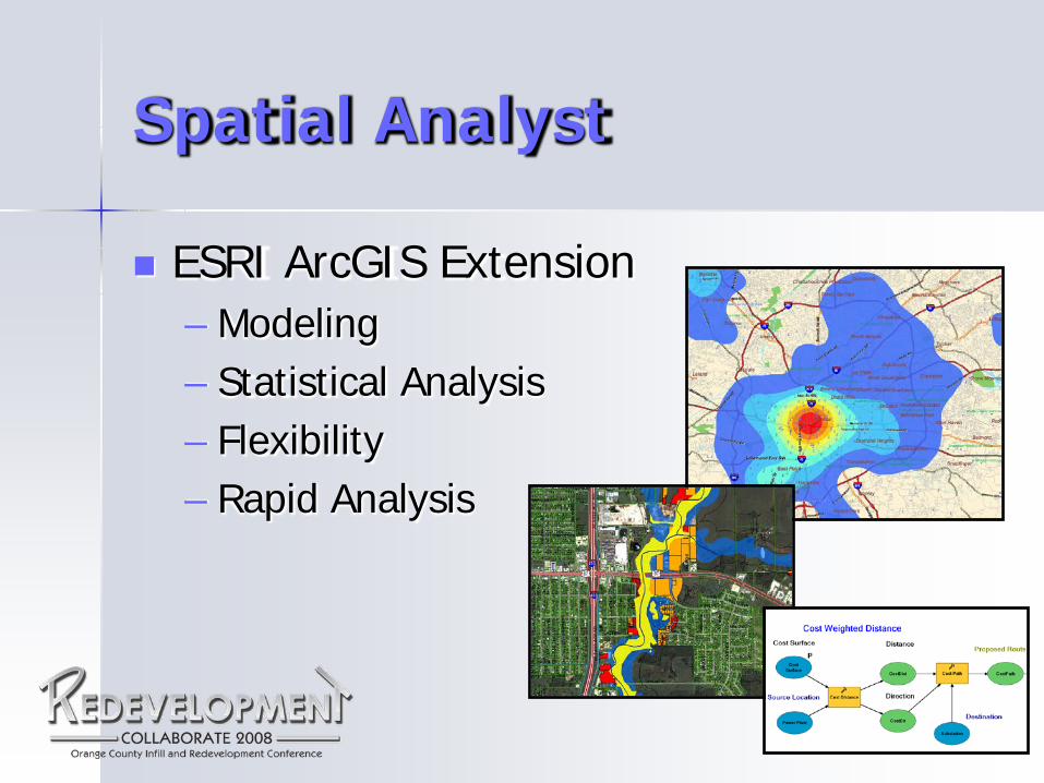
ESRI ArcGIS Extension – Modeling – Statistical Analysis – Flexibility – Rapid Analysis
Spatial Analyst
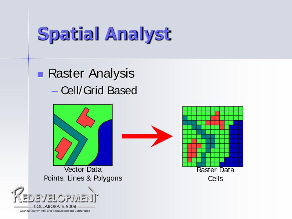
Raster Analysis – Cell/Grid Based
Vector Data Points, Lines & Polygons
Raster Data Cells
Spatial Analyst
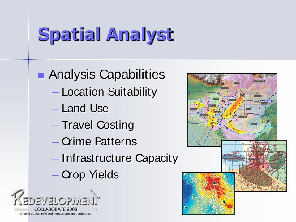
Analysis Capabilities – Location Suitability – Land Use – Travel Costing – Crime Patterns – Infrastructure Capacity – Crop Yields
Presentation Outline
GIS for Analysis
Spatial Analyst
Infill Analysis Project
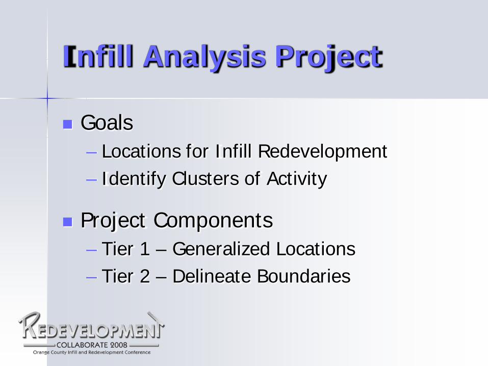
Infill Analysis Project
Goals – Locations for Infill Redevelopment – Identify Clusters of Activity
Project Components – Tier 1 – Generalized Locations – Tier 2 – Delineate Boundaries
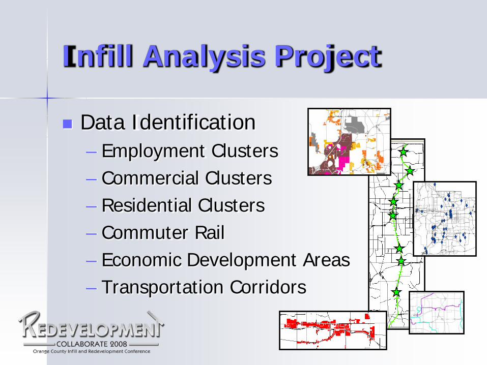
Infill Analysis Project
Data Identification – Employment Clusters – Commercial Clusters – Residential Clusters – Commuter Rail – Economic Development Areas – Transportation Corridors
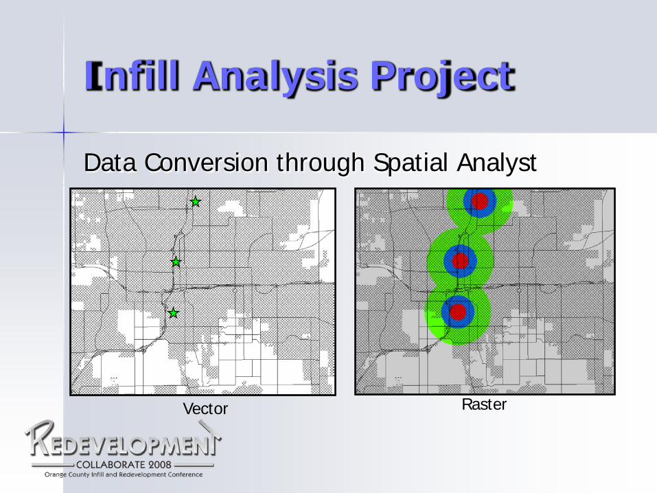
Infill Analysis Project
Data Conversion through Spatial Analyst
Vector Raster
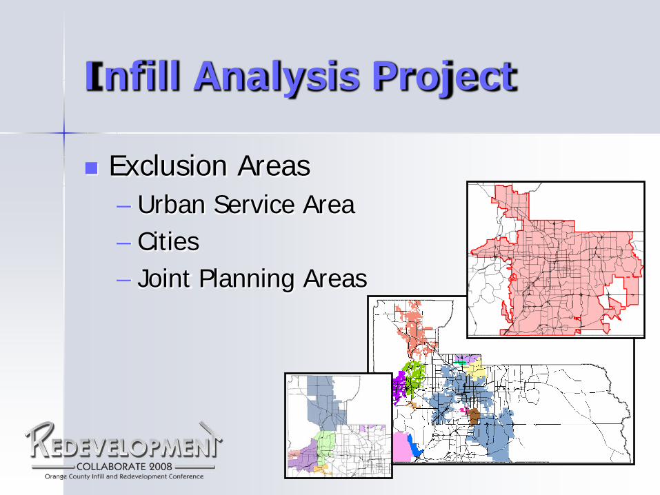
Infill Analysis Project
Exclusion Areas – Urban Service Area – Cities – Joint Planning Areas

Infill Analysis Project
Point Assignment – Determine Weights – Apply Values to Each Classification
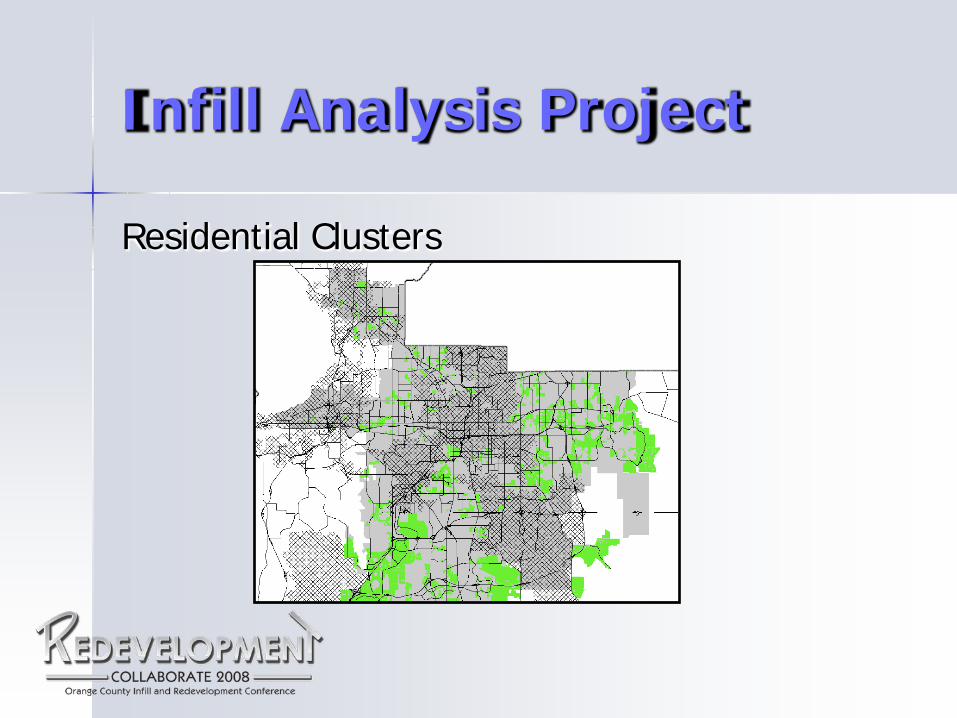
Infill Analysis Project
Residential Clusters
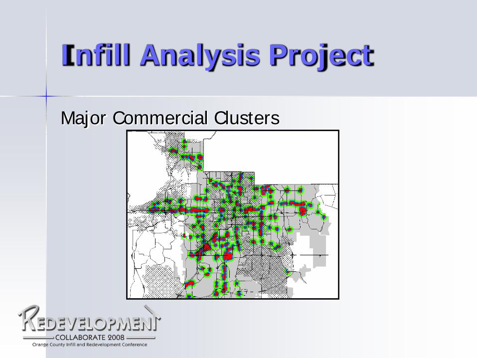
Infill Analysis Project
Major Commercial Clusters
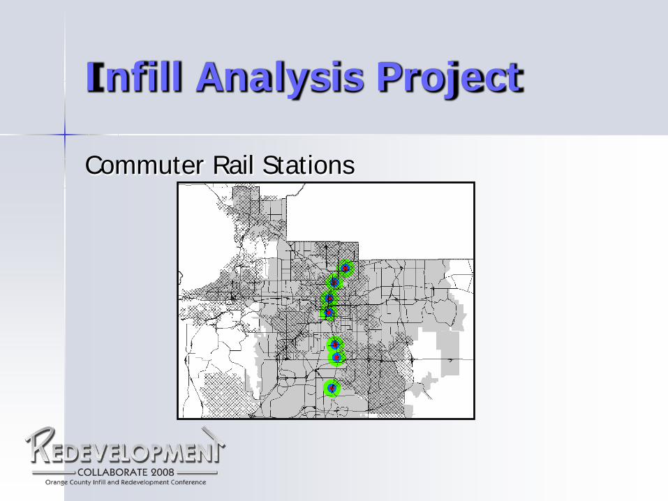
Infill Analysis Project
Commuter Rail Stations

Infill Analysis Project
Existing & Proposed Trails
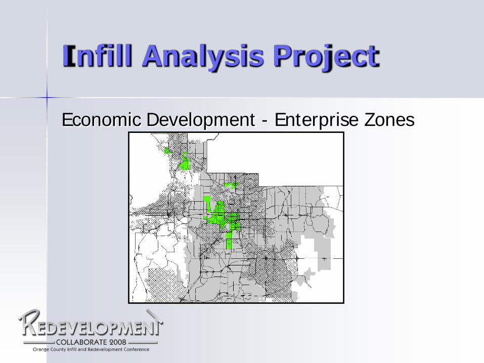
Infill Analysis Project
Economic Development - Enterprise Zones
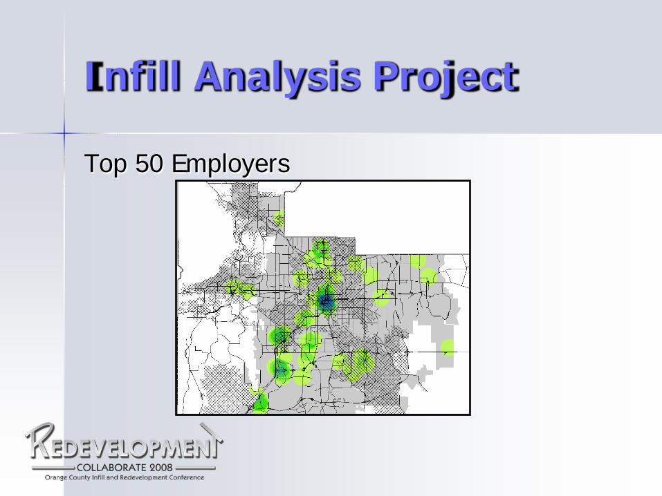
Infill Analysis Project
Top 50 Employers
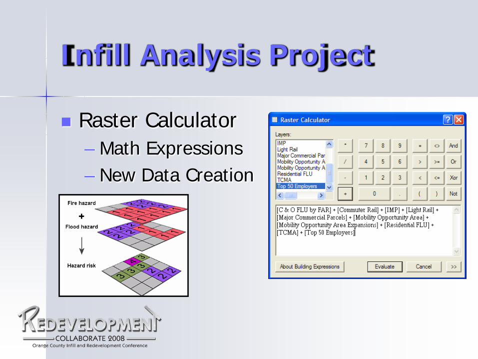
Infill Analysis Project
Raster Calculator – Math Expressions – New Data Creation
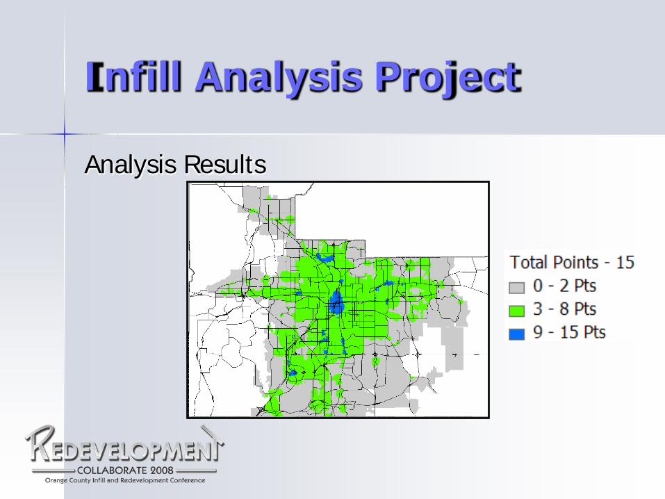
Infill Analysis Project
Analysis Results
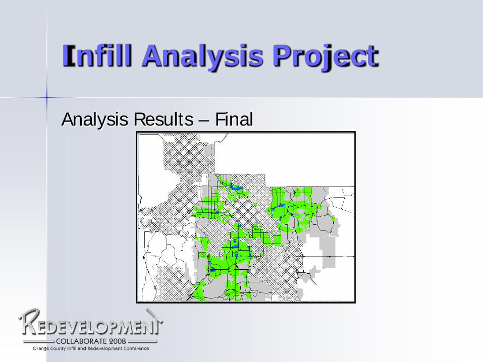
Infill Analysis Project
Analysis Results – Final
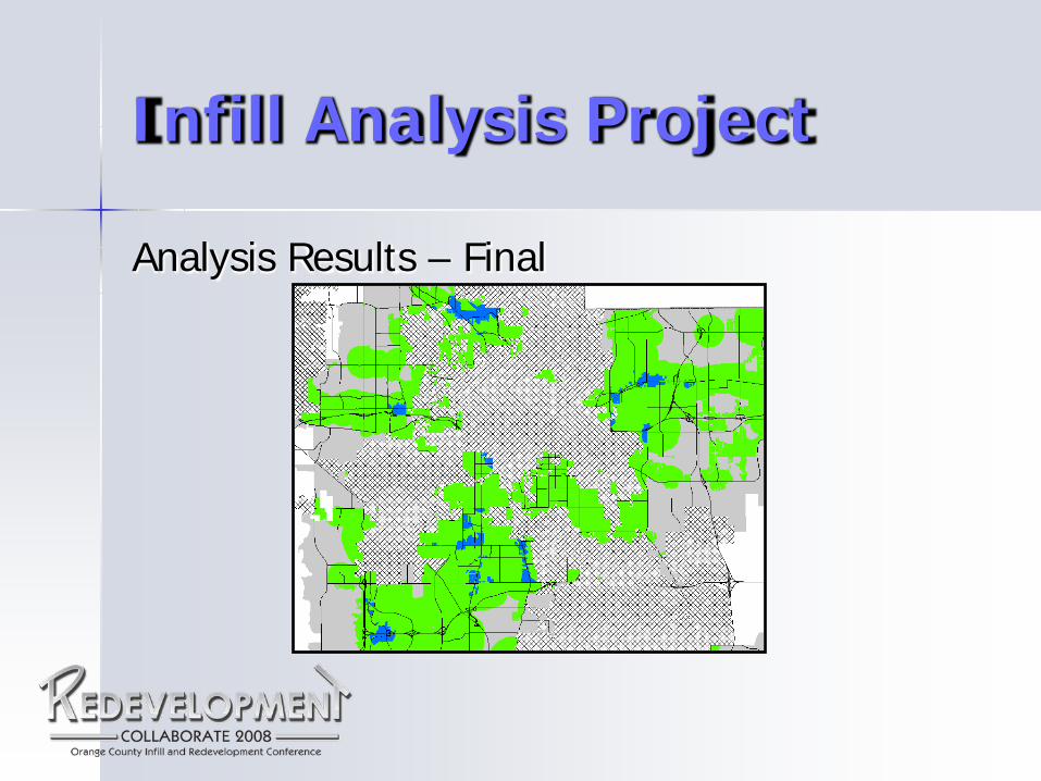
Infill Analysis Project
Analysis Results – Final
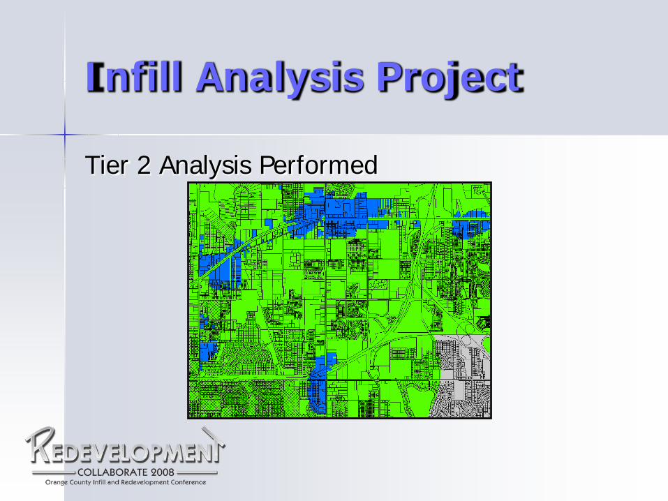
Infill Analysis Project
Tier 2 Analysis Performed
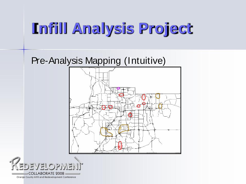
Infill Analysis Project
Pre-Analysis Mapping (Intuitive)
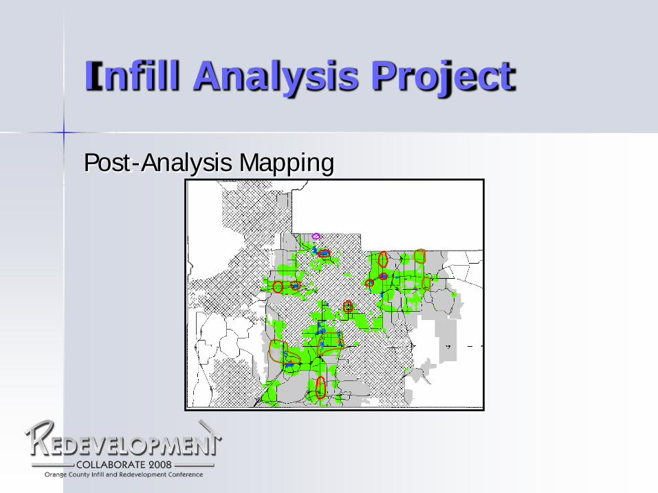
Infill Analysis Project
Post-Analysis Mapping
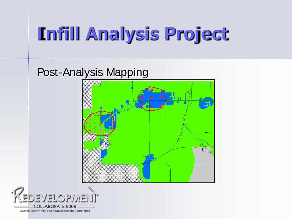
Infill Analysis Project
Post-Analysis Mapping

Orange County’s Infill and Redevelopment Conference
Scott Skraban
Information Systems Administrator
Ph: 407-836-5363 [email protected]
March 27th, 2008