Embed Size (px)
Citation preview
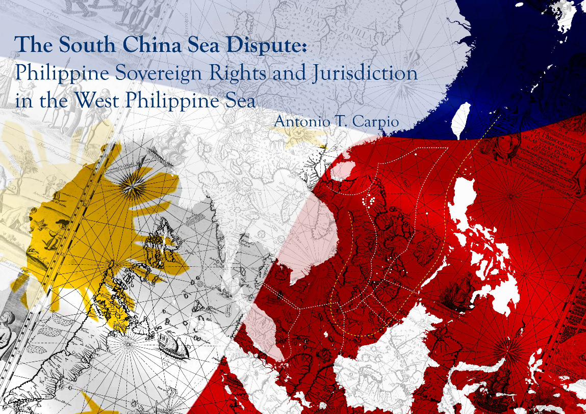

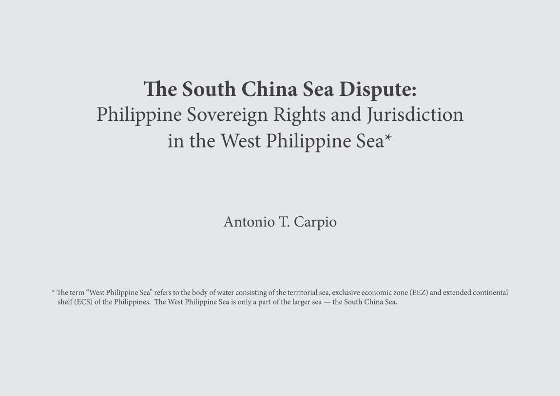
The South China Sea Dispute:Philippine Sovereign Rights and Jurisdiction
in the West Philippine Sea*
Antonio T. Carpio
* The term “West Philippine Sea” refers to the body of water consisting of the territorial sea, exclusive economic zone (EEZ) and extended continental shelf (ECS) of the Philippines. The West Philippine Sea is only a part of the larger sea — the South China Sea.
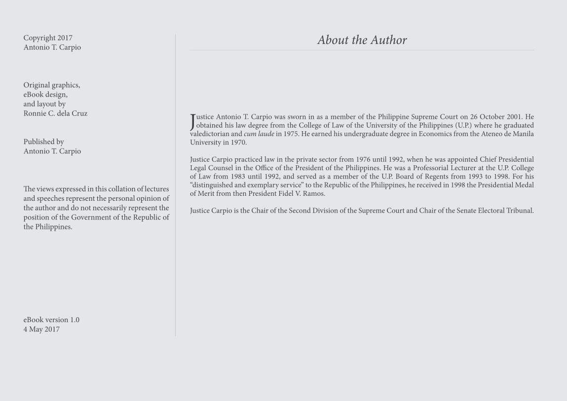
Copyright 2017Antonio T. Carpio
Original graphics,eBook design,and layout byRonnie C. dela Cruz
Published byAntonio T. Carpio
The views expressed in this collation of lectures and speeches represent the personal opinion of the author and do not necessarily represent the position of the Government of the Republic of the Philippines.
About the Author
Justice Antonio T. Carpio was sworn in as a member of the Philippine Supreme Court on 26 October 2001. He obtained his law degree from the College of Law of the University of the Philippines (U.P.) where he graduated
valedictorian and cum laude in 1975. He earned his undergraduate degree in Economics from the Ateneo de Manila University in 1970.
Justice Carpio practiced law in the private sector from 1976 until 1992, when he was appointed Chief Presidential Legal Counsel in the Office of the President of the Philippines. He was a Professorial Lecturer at the U.P. College of Law from 1983 until 1992, and served as a member of the U.P. Board of Regents from 1993 to 1998. For his “distinguished and exemplary service” to the Republic of the Philippines, he received in 1998 the Presidential Medal of Merit from then President Fidel V. Ramos.
Justice Carpio is the Chair of the Second Division of the Supreme Court and Chair of the Senate Electoral Tribunal.
eBook version 1.04 May 2017
ii
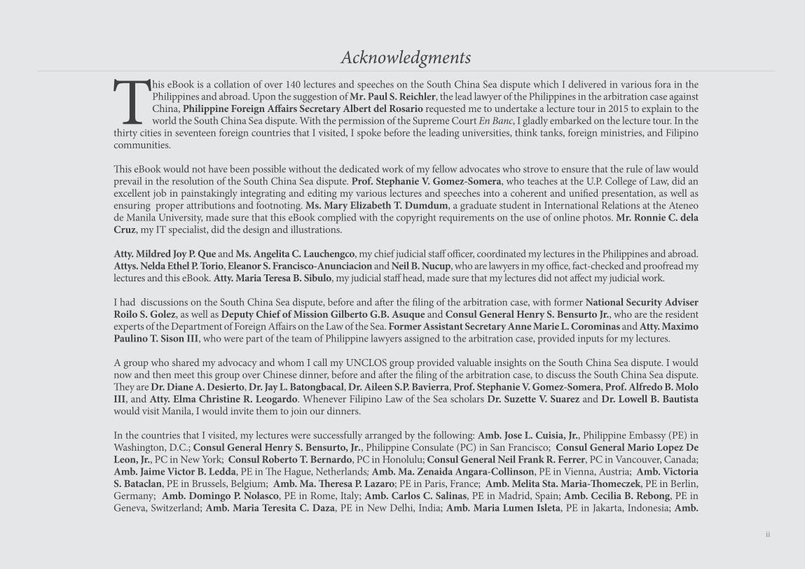
This eBook is a collation of over 140 lectures and speeches on the South China Sea dispute which I delivered in various fora in the Philippines and abroad. Upon the suggestion of Mr. Paul S. Reichler, the lead lawyer of the Philippines in the arbitration case against China, Philippine Foreign Affairs Secretary Albert del Rosario requested me to undertake a lecture tour in 2015 to explain to the world the South China Sea dispute. With the permission of the Supreme Court En Banc, I gladly embarked on the lecture tour. In the
thirty cities in seventeen foreign countries that I visited, I spoke before the leading universities, think tanks, foreign ministries, and Filipino communities.
This eBook would not have been possible without the dedicated work of my fellow advocates who strove to ensure that the rule of law would prevail in the resolution of the South China Sea dispute. Prof. Stephanie V. Gomez-Somera, who teaches at the U.P. College of Law, did an excellent job in painstakingly integrating and editing my various lectures and speeches into a coherent and unified presentation, as well as ensuring proper attributions and footnoting. Ms. Mary Elizabeth T. Dumdum, a graduate student in International Relations at the Ateneo de Manila University, made sure that this eBook complied with the copyright requirements on the use of online photos. Mr. Ronnie C. dela Cruz, my IT specialist, did the design and illustrations.
Atty. Mildred Joy P. Que and Ms. Angelita C. Lauchengco, my chief judicial staff officer, coordinated my lectures in the Philippines and abroad. Attys. Nelda Ethel P. Torio, Eleanor S. Francisco-Anunciacion and Neil B. Nucup, who are lawyers in my office, fact-checked and proofread my lectures and this eBook. Atty. Maria Teresa B. Sibulo, my judicial staff head, made sure that my lectures did not affect my judicial work.
I had discussions on the South China Sea dispute, before and after the filing of the arbitration case, with former National Security Adviser Roilo S. Golez, as well as Deputy Chief of Mission Gilberto G.B. Asuque and Consul General Henry S. Bensurto Jr., who are the resident experts of the Department of Foreign Affairs on the Law of the Sea. Former Assistant Secretary Anne Marie L. Corominas and Atty. Maximo Paulino T. Sison III, who were part of the team of Philippine lawyers assigned to the arbitration case, provided inputs for my lectures.
A group who shared my advocacy and whom I call my UNCLOS group provided valuable insights on the South China Sea dispute. I would now and then meet this group over Chinese dinner, before and after the filing of the arbitration case, to discuss the South China Sea dispute. They are Dr. Diane A. Desierto, Dr. Jay L. Batongbacal, Dr. Aileen S.P. Bavierra, Prof. Stephanie V. Gomez-Somera, Prof. Alfredo B. Molo III, and Atty. Elma Christine R. Leogardo. Whenever Filipino Law of the Sea scholars Dr. Suzette V. Suarez and Dr. Lowell B. Bautista would visit Manila, I would invite them to join our dinners.
In the countries that I visited, my lectures were successfully arranged by the following: Amb. Jose L. Cuisia, Jr., Philippine Embassy (PE) in Washington, D.C.; Consul General Henry S. Bensurto, Jr., Philippine Consulate (PC) in San Francisco; Consul General Mario Lopez De Leon, Jr., PC in New York; Consul Roberto T. Bernardo, PC in Honolulu; Consul General Neil Frank R. Ferrer, PC in Vancouver, Canada; Amb. Jaime Victor B. Ledda, PE in The Hague, Netherlands; Amb. Ma. Zenaida Angara-Collinson, PE in Vienna, Austria; Amb. Victoria S. Bataclan, PE in Brussels, Belgium; Amb. Ma. Theresa P. Lazaro; PE in Paris, France; Amb. Melita Sta. Maria-Thomeczek, PE in Berlin, Germany; Amb. Domingo P. Nolasco, PE in Rome, Italy; Amb. Carlos C. Salinas, PE in Madrid, Spain; Amb. Cecilia B. Rebong, PE in Geneva, Switzerland; Amb. Maria Teresita C. Daza, PE in New Delhi, India; Amb. Maria Lumen Isleta, PE in Jakarta, Indonesia; Amb.
Acknowledgments
iii
Manolo M. Lopez and Deputy Chief of Mission Gilberto G.B. Asuque, PE in Tokyo, Japan; Amb. Jose Eduardo E. Malaya, PE in Kuala Lumpur, Malaysia; Amb. Antonio A. Morales, PE in Singapore; Amb. Belen F. Anota, PE in Canberra, Australia, Consul General Anne Jalando-on Louis and Consul Marford M. Angeles, PC in Sydney, Australia; and Amb. Virginia H. Benavidez, PE in Wellington, New Zealand. In Manila, Undersecretary Evan P. Garcia of the Department of Foreign Affairs saw to it that my lecture tours proceeded smoothly.
Gen. Jose T. Almonte, former National Security Adviser during the Ramos Administration, gave me a comprehensive overview of the geopolitics in the Asia-Pacific region. In the two decades since China seized Mischief Reef from the Philippines in 1995, Gen. Almonte has enlightened me, over monthly or bi-monthly dinners at his house, on the national security issues facing the Philippines from the time of the Vietnam War until the present and in the near future.
In mid-2011, I asked Gen. Almonte which shoal or reef would China seize from the Philippines next. He immediately answered without any hesitation: Scarborough Shoal. I completely agreed with him for two reasons. First, Scarborough Shoal is essential for China to complete a triangle of airbases to impose an Air Defense Identification Zone (ADIZ) in the South China Sea. Second, an air and naval base in Scarborough Shoal will allow China to protect the Bashi Channel, which is China’s outlet to the Pacific for its nuclear-armed submarines. Such an air and naval base is a dagger pointed at Manila.
My long-running conversations with Gen. Almonte made me decide to embark on an advocacy — to convince the Philippine Government to question the validity of China’s nine-dashed line before an UNCLOS tribunal. On 29 October 2011, I launched my advocacy with a speech entitled The Rule of Law as the Great Equalizer before the Ateneo de Davao University College of Law. Before the end of the following year 2012, China seized Scarborough Shoal from the Philippines — the act that finally convinced the Philippine Government to file the arbitration case against China.
The Philippines could not have engaged a more brilliant group of foreign lawyers in the arbitration case. These well-known experts in international law have shown utmost dedication and loyalty to the cause of the Philippines. Their pleadings were exceptional, and their presentations during the oral arguments were outstanding. They are Messrs. Paul S. Reichler, Lawrence H. Martin and Andrew B. Loewenstein of Foley Hoag LLP, and Profs. Bernard H. Oxman, Philippe Sands and Alan Boyle.
My wife Ruth, who hails from Vietnam, never wavered in encouraging me to undertake the grueling travel across continents, within a very tight schedule, for the sake of informing the world about the real issues on the South China Sea dispute. My daughter Audrey, one of the editors of a local magazine, did the final copyedit of this eBook.
I am deeply indebted to all these wonderful people for their ideas and support that made possible my lectures and this eBook. Any error or omission in my lectures or in this eBook is mine alone.
To inform and educate a wider audience about the South China Sea dispute, this eBook is downloadable for free at the website of the Institute for Maritime and Ocean Affairs (https://www. imoa.ph). Antonio T. Carpio
iv
Our country owes an incalculable debt of gratitude to Senior Associate Justice Antonio T. Carpio. He is a dedicated public servant, an eminent jurist, an outstanding scholar, and an ardent patriot in promoting and defending our nation’s rights as enshrined in the Law of the Sea. Through his writings and speeches, he has been our staunchest defender of our country’s position in the disputes over the South China Sea.
For his remarkable efforts, including traveling around the world to inform, edify and persuade as many people as possible, we salute Justice Carpio. He used his vision, wisdom and expertise towards helping our country forge our legal strategy for the South China Sea, situating it firmly within the framework of the United Nations Convention on the Law of the Sea (UNCLOS) and the body of international law. As early as 2011, he correctly foresaw the unilateralist path on which Beijing would embark in its attempts to control the South China Sea, and he pointed to and proactively advised on the use of international law as the best and most peaceful means of securing our own position on the basis of universally recognized global norms and principles.
This eBook is the latest significant contribution to his public advocacy on the Law of the Sea. The eBook, entitled The South China Sea Dispute: Philippine Sovereign Rights and Jurisdiction in the West Philippine Sea, is a treasure trove of research and wisdom that clearly presents the issue. Easy to read and vividly illustrated, Justice Carpio’s eBook is an important work of scholarship on an issue of grave public concern.
Justice Carpio successfully recapitulates the main themes of our national position on the West Philippine Sea. He stresses the central importance of international law, the peaceful resolution of disputes and of upholding the rights of all nations, large and small. He reemphasizes the necessity of defending our rights through peaceful international legal action. The success of the Philippines in its international arbitration case will stand forever, not only as a triumph of Philippine foreign policy, but as a stellar Philippine contribution in defense of the rule of law in managing international relations.
Beyond all of this, however, is an even larger and more enduring message. As a responsible member of the international community and as a state situated in a region facing security uncertainties and tensions, the Philippines cannot sit back and let its fate be decided by other nations. The arbitration case showed that our country can take action on its own. Now, we must band together with others inside and outside Southeast Asia to build a security architecture that will take the needs of all into proper account. The Philippines will hopefully be able to make further progress towards this end during its Chairmanship this year of ASEAN.
A truly independent foreign policy calls on us to be friends with all who would be friendly; to develop our bilateral, regional and global relationships on the basis of equality and mutual benefit; and to construct a system of international relations that will not be unfairly dominated by the strong alone. This means a firm commitment that we promote and respect the rule of law, the peaceful settlement of disputes, the common pursuit of peace, progress and justice, and other principles that enhance security and stability in the international system.
In short, right and not might, should be our guiding light for international cooperation.
Foreword
Albert del RosarioPhilippine Secretary of Foreign Affairs
February 2011-March 2016
v
On 29 October 2011, Senior Associate Justice Antonio T. Carpio delivered a speech before the Ateneo de Davao University College of Law on its 50th Founding Anniversary. Entitled The Rule of Law as the Great Equalizer, the speech signaled the beginning of his advocacy to protect the maritime entitlements of the Philippines in the West Philippine Sea as conferred by international law. In that speech, Justice Carpio declared:
This battle to defend our EEZ from China, the superpower in our region, is the 21st century equivalent of the battles that our forebears waged against Western and Eastern colonizers from the 16th to the 20th century. The best and the brightest of our forebears fought the Western and Eastern colonizers, and even sacrificed their lives, to make the Philippines free. In this modern- day battle, the best and the brightest legal warriors in our country today must stand up and fight to free the EEZ of the Philippines from foreign encroachment. In this historic battle to secure our EEZ, we must rely on the most powerful weapon invented by man in the settlement of disputes among states – a weapon that can immobilize armies, neutralize aircraft carriers, render irrelevant nuclear bombs, and level the battlefield between small nations and superpowers.
That weapon – the great equalizer – is the Rule of Law. Under the Rule of Law, right prevails over might.
This eBook is a collation of Justice Carpio’s lectures and speeches on the South China Sea dispute and the historic arbitral award rendered in favor of the Philippines. Totaling more than 140 lectures and speeches and spanning a period of more than five years, or from October 2011 to March 2017, these presentations were made in various fora, both in the Philippines and abroad. An earlier collation of his lectures and speeches was published in Antonio T. Carpio, Historical Facts, Historical Lies, and Historical Rights in the West Philippine Sea, 88 Phil. L.J. 389 (2014).
This ebook is interactive — if you click on a map or photo, or on the underlined name of the source of a photo or illustration, it will bring you to its online source.
Preface
vi
Land Dominates the SeaSummary of and Response to China’s Position PaperMajor Issues in the Arbitration
China’s Historic Rights ClaimThe Arbitral Award on China’s Historic Rights ClaimFallacy of China’s Historic Rights ClaimChina’s “Abundant Historical Evidence”
Planting of Antedated Markers in the ParacelsPlanting of Antedated Markers in the Spratlys
Kuomintang Compilation of Historical Archives on the South China Sea Maps and Historic RightsSouthernmost Territory of China in Ancient Chinese Maps
Ancient Maps of China by Chinese Dynasties or Authoritiesand by Chinese IndividualsAncient Maps of China by Foreigners
Southernmost Territory of China Based on Official DocumentsChina’s Own ConstitutionsChina’s Official DeclarationThe Submerged Border Stretching Beyond the High Seas
Historical and Geopolitical MisconceptionsChina’s “Century of Humiliation” The 1823 Monroe Doctrine as Justification for the Nine-Dashed LineContainment of China by the US
Geologic Features in the SpratlysThe Arbitral Award on Geologic Features in the SpratlysChina’s Claim to the Spratlys and Scarborough ShoalThe Spratlys in Ancient MapsItu Aba
China-Occupied Geologic Features in the SpratlysThe Arbitral Award on China-Occupied Geologic FeaturesChina’s Island Building in the Spratlys
Reclamations on High-Tide ElevationsReclamations on Low-Tide ElevationsReclamations in the High Seas
Grand Theft of the Global CommonsChina’s Fishery Regulations in the High Seas
iiiivv
viiiix
25
1517
19212324
262730
31323435383940
4548
50
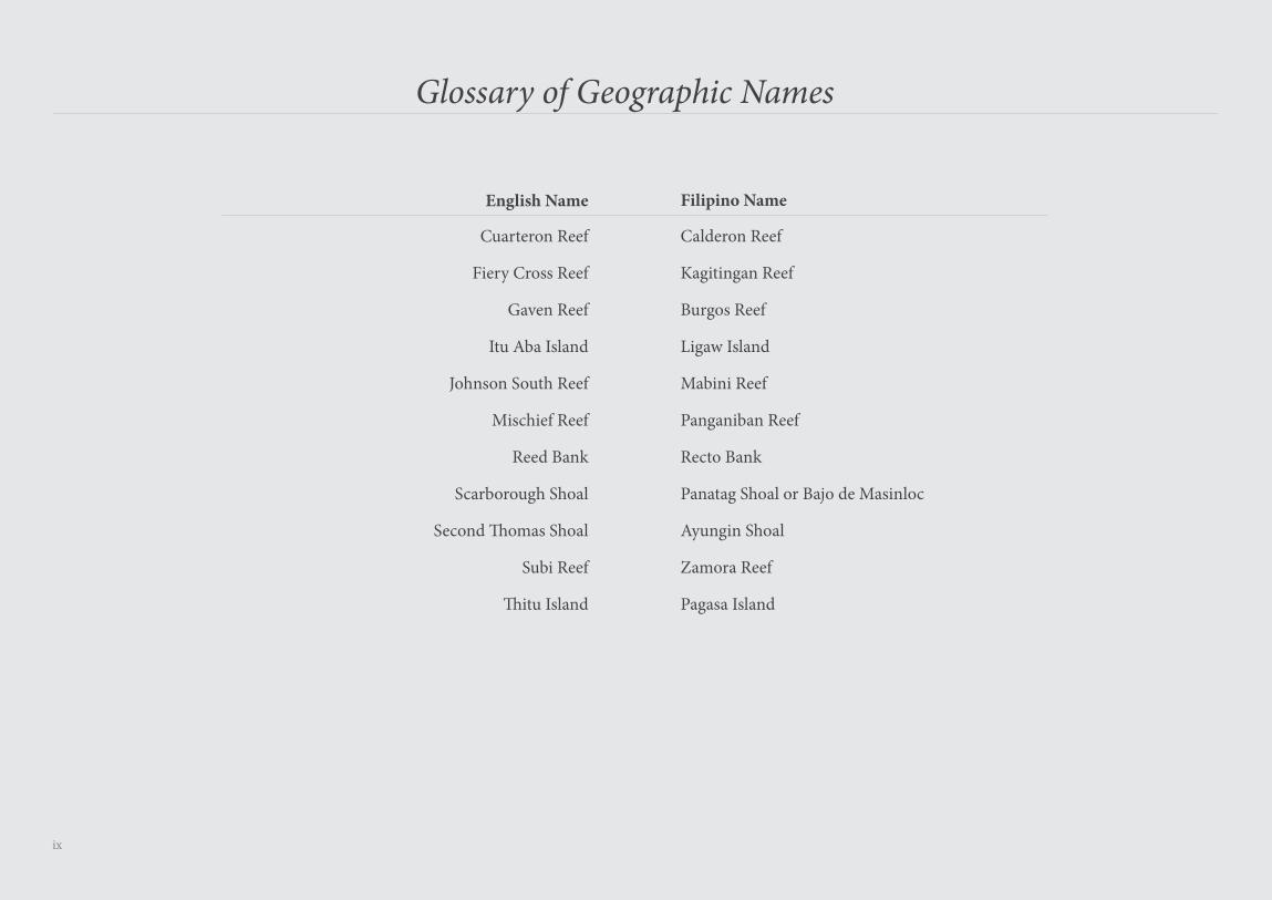
About the AuthorAcknowledgmentsForewordPrefaceList of AcronymsGlossary of Geographic Names
The South China Sea and the AustronesiansThe Austronesian MigrationFrom the Champa Sea to the South China Sea — Islands Named “Pulo”Rise of the Majapahit EmpireSeven Voyages of Admiral Zheng He
United Nations Convention on the Law of the Sea (UNCLOS) Constitution for the Oceans and Seas of Our PlanetGeologic Features in the SeaBaselines for Measuring the Breadth of the Territorial SeaArchipelagic Baselines of the Philippines
Root Cause of the South China Sea DisputeThe Nine-Dashed Line Claim of ChinaMain Driver of the South China Sea DisputeRamifications of China’s “National Boundary” as Delineated by Its Nine-Dashed Line Core Dispute Between China and the Philippines: China’s Claim to Eighty Percent of Philippine EEZCreeping Expansion of China in the South China SeaChina’s “Malacca Dilemma”China Claims Resources and Geologic Features in the South China SeaChina’s Grand Design in the South China Sea“Separated by a Narrow Body of Water”China’s Militarization of the South China Sea
Inter-State Disputes in the South China SeaTerritorial Disputes Maritime Disputes
South China Sea Arbitration Case: Republic of the Philippines v. People’s Republic of China
The Arbitration Case
Table of Contents
515255
5758606162636465
65828888909293939495
979899
143
146147147153156157157
vii
Macclesfield BankRules on Boundary Delimitation
Scarborough ShoalThe Arbitral Award on Scarborough ShoalChina’s Claim to Scarborough ShoalScarborough Shoal in Ancient MapsScarborough Shoal as Philippine Territory under the Philippine-U.S. Mutual Defense Treaty
Harm to the Marine Environment
The Arbitral Award on Harm to the Marine EnvironmentIllegal Reclamations and Harvesting of Endangered Species
Other Issues Raised in the ArbitrationOther Issues Resolved by the Arbitral TribunalIssues the Arbitral Tribunal Refused to Rule On
Enforcement of the Arbitral AwardDisputed Area Before and After the AwardEnforcement of the Award by World Naval PowersEnforcement of the Award by the PhilippinesExtended Continental Shelf from LuzonEntrenchment of the Rulings in Subsequent CasesWorld Powers and Rulings of International Tribunals
The Arctic Sunrise Case (Kingdom of Netherlands v. Russia)Chagos Marine Protected Area Arbitration (Mauritius v. United Kingdom)Military and Paramilitary Activities In and Against Nicaragua (Nicaragua v. United States of America)
China’s Three WarfaresIssues Affecting Joint Development between China and the PhilippinesThe Spratlys as an International Marine Peace Park
Final WordA Caveat on Unilateral Declarations and Acquiescence
EndnotesReference List of MapsReference List of Figures
158159
162163164
203
207208
210211
213215216217218219220221
222223224225
227
228236243
viii
List of Acronyms
ADIZ
ASEAN
CLCS
CMS
CNOOC
ECS
EEZ
ICJ
ISA
ITLOS
KIG
LTE
NM
PLA
SC
UN
UNCLOS
UNESCO
U.S.
Air Defense Identification Zone
Association of Southeast Asian Nations
Commission on the Limits of the Continental Shelf
China Marine Surveillance
China National Offshore Oil Company
Extended Continental Shelf
Exclusive Economic Zone
International Court of Justice
International Seabed Authority
International Tribunal for the Law of the Sea
Kalayaan Island Group
Low-Tide Elevation
Nautical Miles
People’s Liberation Army
Service Contract
United Nations
United Nations Convention on the Law of the Sea
United Nations Educational, Scientific and Cultural Organization
United States (of America)
ix
Glossary of Geographic Names
English Name Filipino Name
Cuarteron Reef
Fiery Cross Reef
Gaven Reef
Itu Aba Island
Johnson South Reef
Mischief Reef
Reed Bank
Scarborough Shoal
Second Thomas Shoal
Subi Reef
Thitu Island
Calderon Reef
Kagitingan Reef
Burgos Reef
Ligaw Island
Mabini Reef
Panganiban Reef
Recto Bank
Panatag Shoal or Bajo de Masinloc
Ayungin Shoal
Zamora Reef
Pagasa Island
x
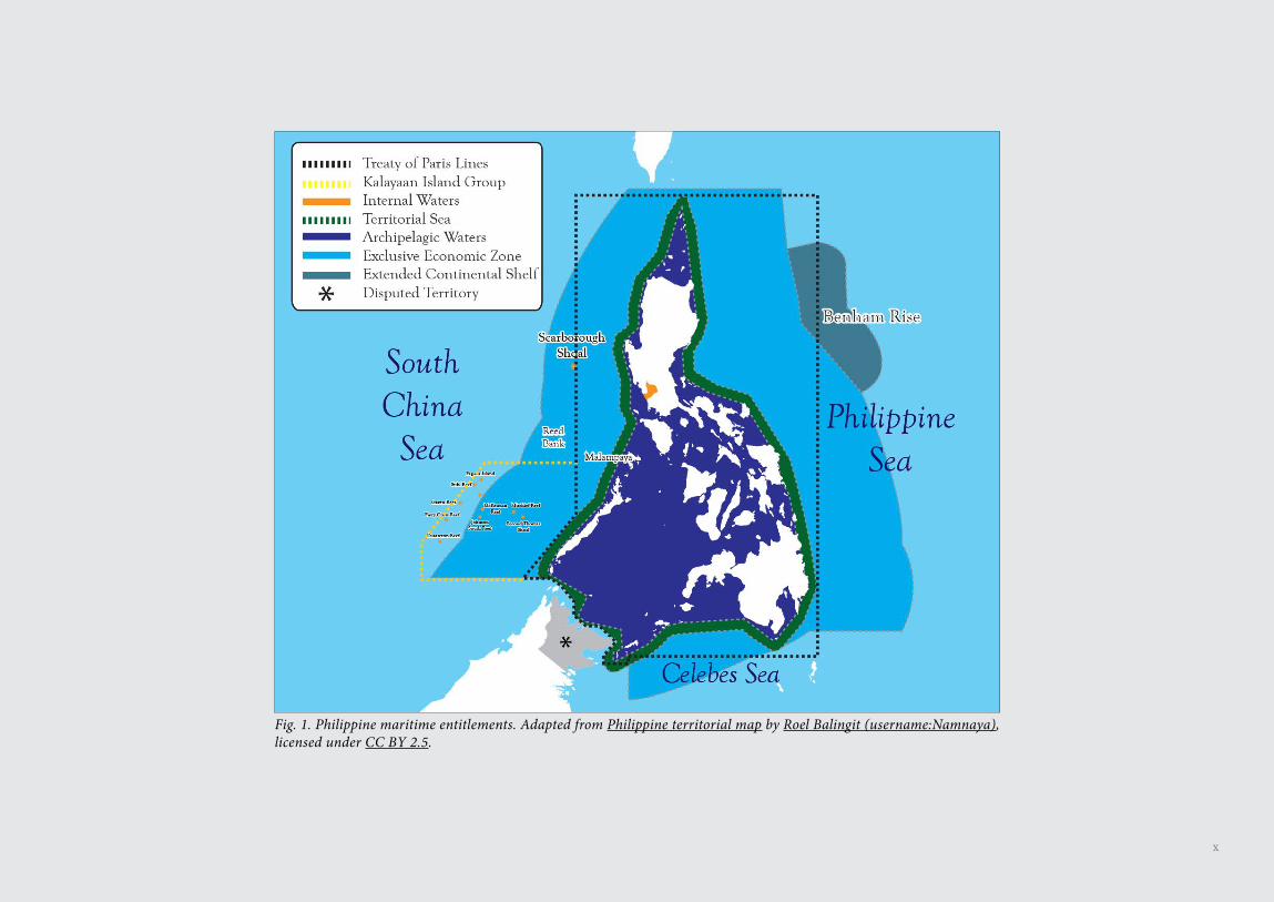
Fig. 1. Philippine maritime entitlements. Adapted from Philippine territorial map by Roel Balingit (username:Namnaya),licensed under CC BY 2.5.
This eBook is dedicated to the Filipino youth who will carry on the inter-generational struggle to defend and protect Philippine maritime entitlements in the West Philippine Sea.

The South China Seaand the Austronesians
2
The South China Sea Dispute: Philippine Sovereign Rights and Jurisdiction in the West Philippine Sea
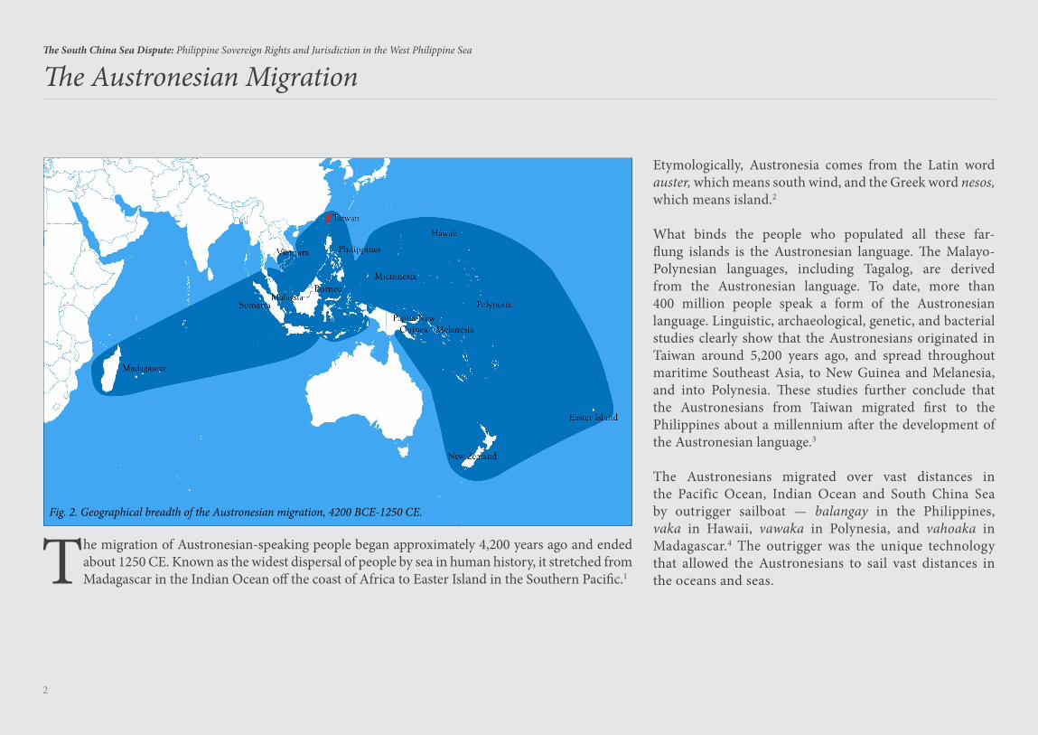
The Austronesian Migration
The migration of Austronesian-speaking people began approximately 4,200 years ago and ended about 1250 CE. Known as the widest dispersal of people by sea in human history, it stretched from Madagascar in the Indian Ocean off the coast of Africa to Easter Island in the Southern Pacific.1
Fig. 2. Geographical breadth of the Austronesian migration, 4200 BCE-1250 CE.
Etymologically, Austronesia comes from the Latin word auster, which means south wind, and the Greek word nesos, which means island.2
What binds the people who populated all these far-flung islands is the Austronesian language. The Malayo-Polynesian languages, including Tagalog, are derived from the Austronesian language. To date, more than 400 million people speak a form of the Austronesian language. Linguistic, archaeological, genetic, and bacterial studies clearly show that the Austronesians originated in Taiwan around 5,200 years ago, and spread throughout maritime Southeast Asia, to New Guinea and Melanesia, and into Polynesia. These studies further conclude that the Austronesians from Taiwan migrated first to the Philippines about a millennium after the development of the Austronesian language.3
The Austronesians migrated over vast distances in the Pacific Ocean, Indian Ocean and South China Sea by outrigger sailboat — balangay in the Philippines, vaka in Hawaii, vawaka in Polynesia, and vahoaka in Madagascar.4 The outrigger was the unique technology that allowed the Austronesians to sail vast distances in the oceans and seas.
3
The South China Sea Dispute: Philippine Sovereign Rights and Jurisdiction in the West Philippine Sea
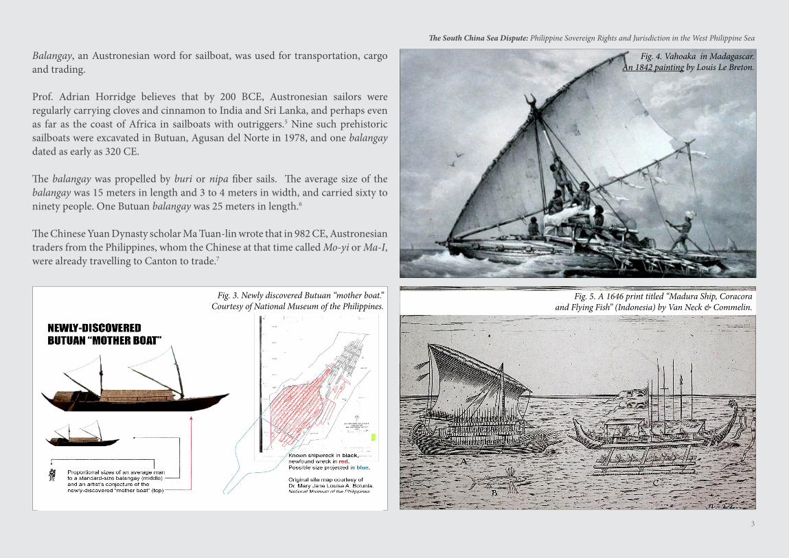
Balangay, an Austronesian word for sailboat, was used for transportation, cargo and trading.
Prof. Adrian Horridge believes that by 200 BCE, Austronesian sailors were regularly carrying cloves and cinnamon to India and Sri Lanka, and perhaps even as far as the coast of Africa in sailboats with outriggers.5 Nine such prehistoric sailboats were excavated in Butuan, Agusan del Norte in 1978, and one balangay dated as early as 320 CE.
The balangay was propelled by buri or nipa fiber sails. The average size of the balangay was 15 meters in length and 3 to 4 meters in width, and carried sixty to ninety people. One Butuan balangay was 25 meters in length.6
The Chinese Yuan Dynasty scholar Ma Tuan-lin wrote that in 982 CE, Austronesian traders from the Philippines, whom the Chinese at that time called Mo-yi or Ma-I, were already travelling to Canton to trade.7
Fig. 5. A 1646 print titled “Madura Ship, Coracora and Flying Fish” (Indonesia) by Van Neck & Commelin.
Fig. 4. Vahoaka in Madagascar.An 1842 painting by Louis Le Breton.
Fig. 3. Newly discovered Butuan “mother boat.”Courtesy of National Museum of the Philippines.
4
The South China Sea Dispute: Philippine Sovereign Rights and Jurisdiction in the West Philippine Sea
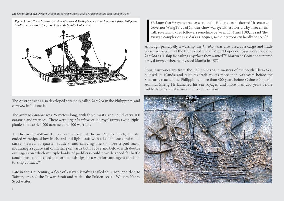
The Austronesians also developed a warship called karakoa in the Philippines, and coracora in Indonesia.
The average karakoa was 25 meters long, with three masts, and could carry 100 oarsmen and warriors. There were larger karakoas called royal joangas with triple-planks that carried 200 oarsmen and 100 warriors.
The historian William Henry Scott described the karakoa as “sleek, double-ended warships of low freeboard and light draft with a keel in one continuous curve, steered by quarter rudders, and carrying one or more tripod masts mounting a square sail of matting on yards both above and below, with double outriggers on which multiple banks of paddlers could provide speed for battle conditions, and a raised platform amidships for a warrior contingent for ship-to-ship contact.”8
Late in the 12th century, a fleet of Visayan karakoas sailed to Luzon, and then to Taiwan, crossed the Taiwan Strait and raided the Fukien coast. William Henry Scott writes:
Fig. 6. Raoul Castro’s reconstruction of classical Philippine caracoa. Reprinted from Philippine Studies, with permission from Ateneo de Manila University.
We know that Visayan caracoas were on the Fukien coast in the twelfth century. Governor Wang Ta-yu of Ch’uan-chow was eyewitness to a raid by three chiefs with several hundred followers sometime between 1174 and 1189; he said “the Visayan complexion is as dark as lacquer, so their tattoos can hardly be seen.”9
Although principally a warship, the karakoa was also used as a cargo and trade vessel. An account of the 1565 expedition of Miguel Lopez de Legazpi describes the karakoa as “a ship for sailing any place they wanted.”10 Martin de Goiti encountered a royal joanga when he invaded Manila in 1570.11
Thus, Austronesians from the Philippines were masters of the South China Sea, pillaged its islands, and plied its trade routes more than 500 years before the Spaniards reached the Philippines, more than 400 years before Chinese Imperial Admiral Zheng He launched his sea voyages, and more than 200 years before Kublai Khan’s failed invasion of Southeast Asia.
Fig. 7. Coracora – 9th Century Bas Relief in Borobudur, Indonesia.Photo by Michael J. Lowe under CC BY SA 2.5.
5
The South China Sea Dispute: Philippine Sovereign Rights and Jurisdiction in the West Philippine Sea
From the Champa Sea to the South China Sea - Islands Named “Pulo”
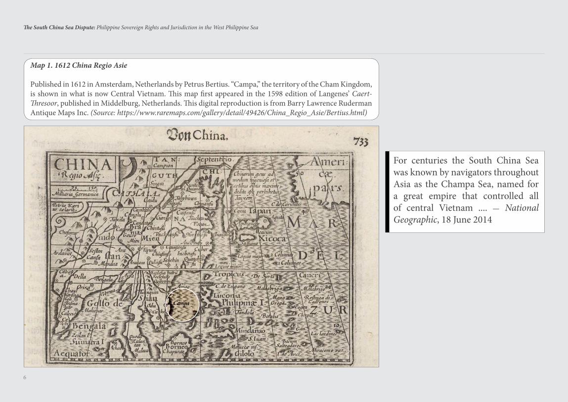
Before Portuguese navigators coined the name South China Sea, the sea was known to Asian and Arab navigators as the Champa Sea, after the Cham people who established a great maritime kingdom in central Vietnam from the late 2nd to the 17th century.12
The Chams had sailboats with outriggers, similar to the sailboats of the Austronesians. The ancestors of the Chams spoke a Malayo-Polynesian language, derived from the Austronesian language. The early Chams are believed to have migrated by sea from Borneo to central Vietnam starting in 500 BCE.13
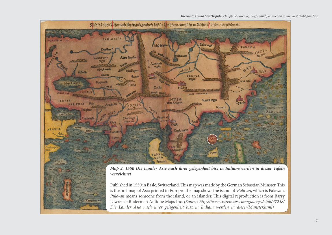
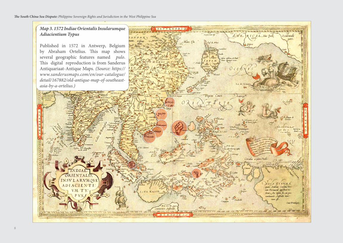
The islands in the Champa Sea were called pulo. In Filipino, the Philippine national language, which is also derived from the Austronesian language, pulo means an “island, isolated place.”14 When the Portuguese reached the Champa Sea, they learned that the inhabitants called their islands pulo. This explains why early European maps depicting this sea prefix the names of the islands with the word pulo.
The ancient Chinese named the sea Nan Hai or the South Sea. The ancient Chinese never called this sea the South China Sea.
The ancient Malays also called this sea Laut Chidol or the South Sea, as recorded by Pigafetta in his account of Ferdinand Magellan’s circumnavigation of the world from 1519 to 1522. In Malay, which is likewise derived from the Austronesian language, laut means sea and kidol means south.15
6
The South China Sea Dispute: Philippine Sovereign Rights and Jurisdiction in the West Philippine Sea
Map 1. 1612 China Regio Asie
Published in 1612 in Amsterdam, Netherlands by Petrus Bertius. “Campa,” the territory of the Cham Kingdom, is shown in what is now Central Vietnam. This map first appeared in the 1598 edition of Langenes’ Caert-Thresoor, published in Middelburg, Netherlands. This digital reproduction is from Barry Lawrence Ruderman Antique Maps Inc. (Source: https://www.raremaps.com/gallery/detail/49426/China_Regio_Asie/Bertius.html)
For centuries the South China Sea was known by navigators throughout Asia as the Champa Sea, named for a great empire that controlled all of central Vietnam .... — National Geographic, 18 June 2014
7
The South China Sea Dispute: Philippine Sovereign Rights and Jurisdiction in the West Philippine Sea
Map 2. 1550 Die Lander Asie nach ihrer gelegenheit bisz in Indiam/werden in dieser Tafeln verzeichnet
Published in 1550 in Basle, Switzerland. This map was made by the German Sebastian Munster. This is the first map of Asia printed in Europe. The map shows the island of Pulo-an, which is Palawan. Pulo-an means someone from the island, or an islander. This digital reproduction is from Barry Lawrence Ruderman Antique Maps Inc. (Source: https://www.raremaps.com/gallery/detail/47238/Die_Lander_Asie_nach_ihrer_gelegenheit_bisz_in_Indiam_werden_in_dieser/Munster.html)
8
The South China Sea Dispute: Philippine Sovereign Rights and Jurisdiction in the West Philippine Sea
Map 3. 1572 Indiae Orientalis Insularumque Adiacientium Typus
Published in 1572 in Antwerp, Belgium by Abraham Ortelius. This map shows several geographic features named pulo. This digital reproduction is from Sanderus Antiquariaat-Antique Maps. (Source: https://www.sanderusmaps.com/en/our-catalogue/detail/167882/old-antique-map-of-southeast-asia-by-a-ortelius.)
9
The South China Sea Dispute: Philippine Sovereign Rights and Jurisdiction in the West Philippine Sea
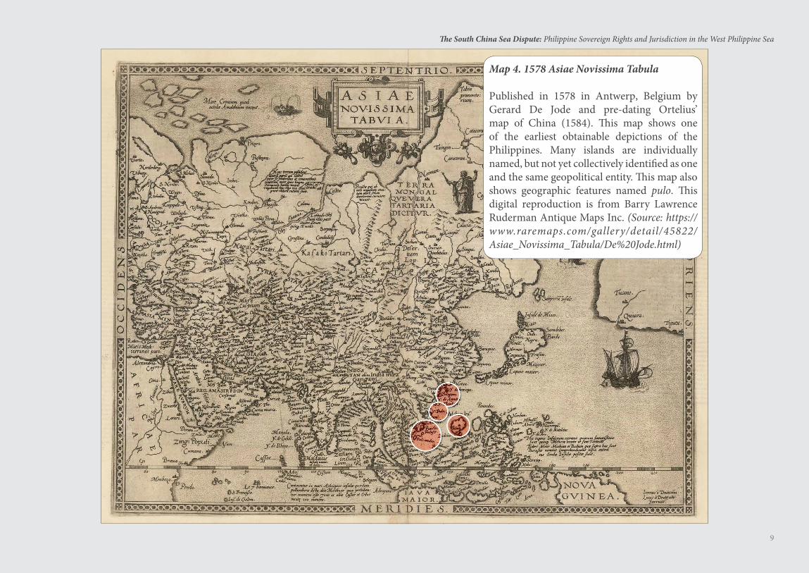
Map 4. 1578 Asiae Novissima Tabula
Published in 1578 in Antwerp, Belgium by Gerard De Jode and pre-dating Ortelius’ map of China (1584). This map shows one of the earliest obtainable depictions of the Philippines. Many islands are individually named, but not yet collectively identified as one and the same geopolitical entity. This map also shows geographic features named pulo. This digital reproduction is from Barry Lawrence Ruderman Antique Maps Inc. (Source: https://www.raremaps.com/gallery/detail/45822/Asiae_Novissima_Tabula/De%20Jode.html)
10
The South China Sea Dispute: Philippine Sovereign Rights and Jurisdiction in the West Philippine Sea
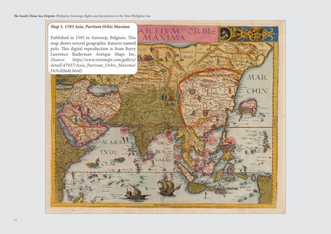
Map 5. 1593 Asia, Partium Orbis Maxima
Published in 1593 in Antwerp, Belgium. This map shows several geographic features named pulo. This digital reproduction is from Barry Lawrence Ruderman Antique Maps Inc. (Source: https://www.raremaps.com/gallery/detail/47937/Asia_Partium_Orbis_Maxima/De%20Jode.html)
11
The South China Sea Dispute: Philippine Sovereign Rights and Jurisdiction in the West Philippine Sea
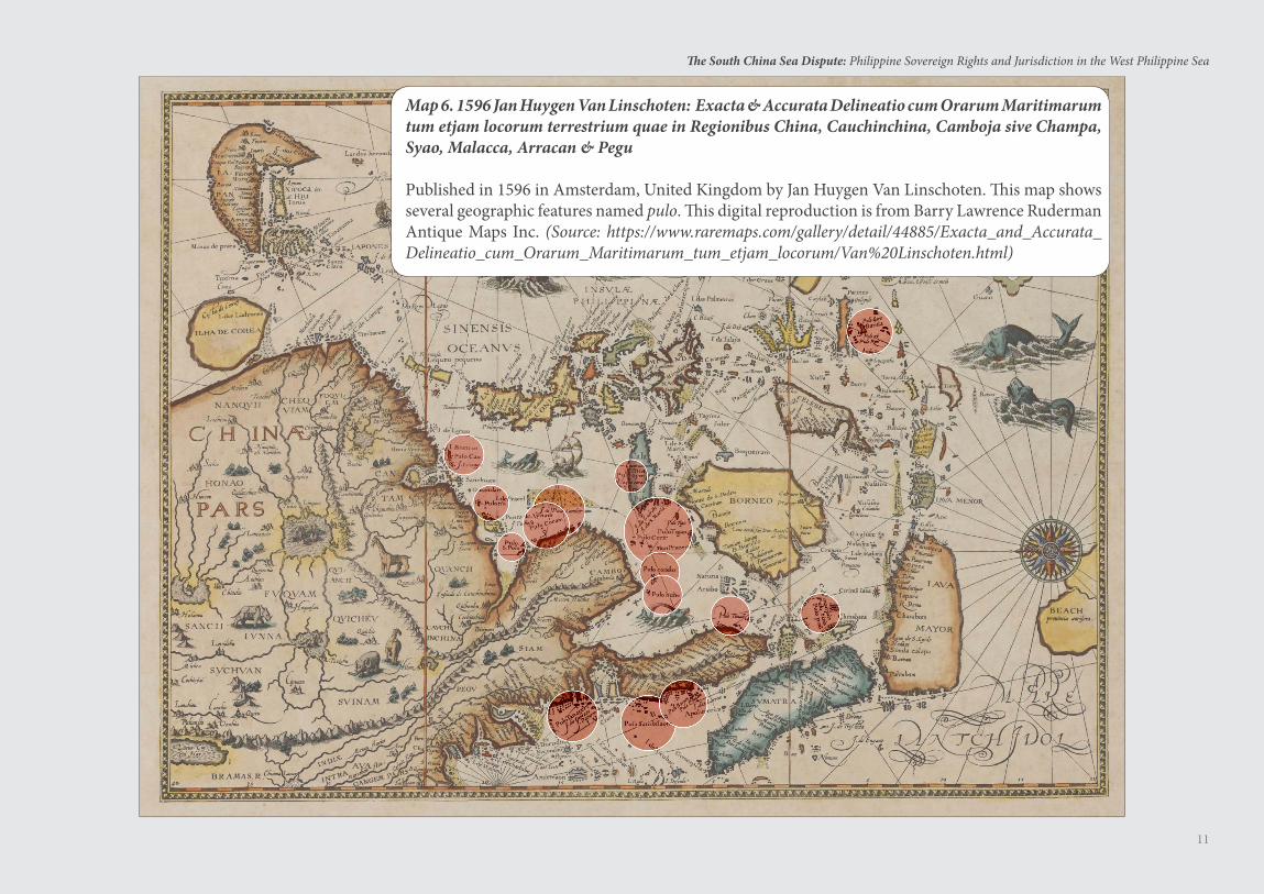
Map 6. 1596 Jan Huygen Van Linschoten: Exacta & Accurata Delineatio cum Orarum Maritimarum tum etjam locorum terrestrium quae in Regionibus China, Cauchinchina, Camboja sive Champa, Syao, Malacca, Arracan & Pegu
Published in 1596 in Amsterdam, United Kingdom by Jan Huygen Van Linschoten. This map shows several geographic features named pulo. This digital reproduction is from Barry Lawrence Ruderman Antique Maps Inc. (Source: https://www.raremaps.com/gallery/detail/44885/Exacta_and_Accurata_Delineatio_cum_Orarum_Maritimarum_tum_etjam_locorum/Van%20Linschoten.html)
12
The South China Sea Dispute: Philippine Sovereign Rights and Jurisdiction in the West Philippine Sea
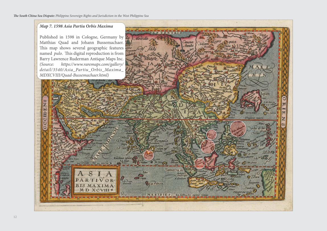
Map 7. 1598 Asia Partiu Orbis Maxima
Published in 1598 in Cologne, Germany by Matthias Quad and Johann Bussemachaer. This map shows several geographic features named pulo. This digital reproduction is from Barry Lawrence Ruderman Antique Maps Inc. (Source: https://www.raremaps.com/gallery/detail/3540/Asia_Partiu_Orbis_Maxima_MDXCVIII/Quad-Bussemachaer.html)
13
The South China Sea Dispute: Philippine Sovereign Rights and Jurisdiction in the West Philippine Sea
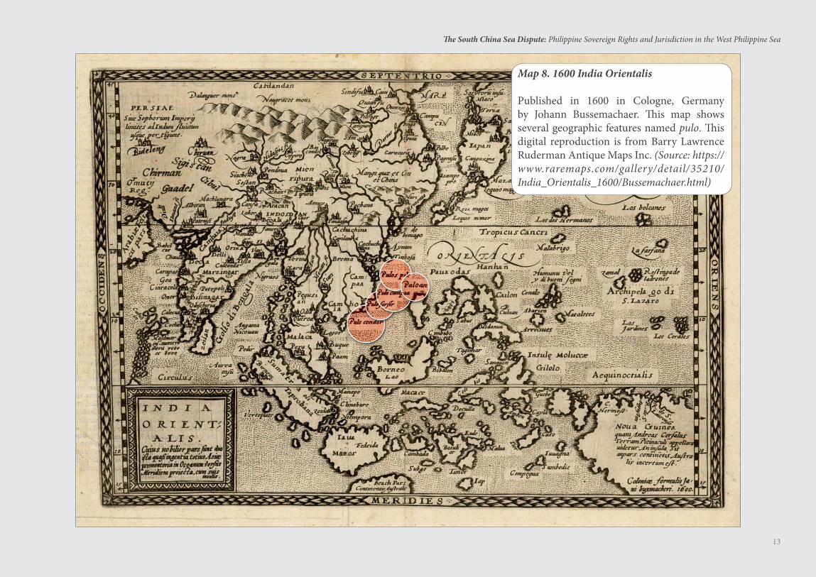
Map 8. 1600 India Orientalis
Published in 1600 in Cologne, Germany by Johann Bussemachaer. This map shows several geographic features named pulo. This digital reproduction is from Barry Lawrence Ruderman Antique Maps Inc. (Source: https://www.raremaps.com/gallery/detail/35210/India_Orientalis_1600/Bussemachaer.html)
14
The South China Sea Dispute: Philippine Sovereign Rights and Jurisdiction in the West Philippine Sea
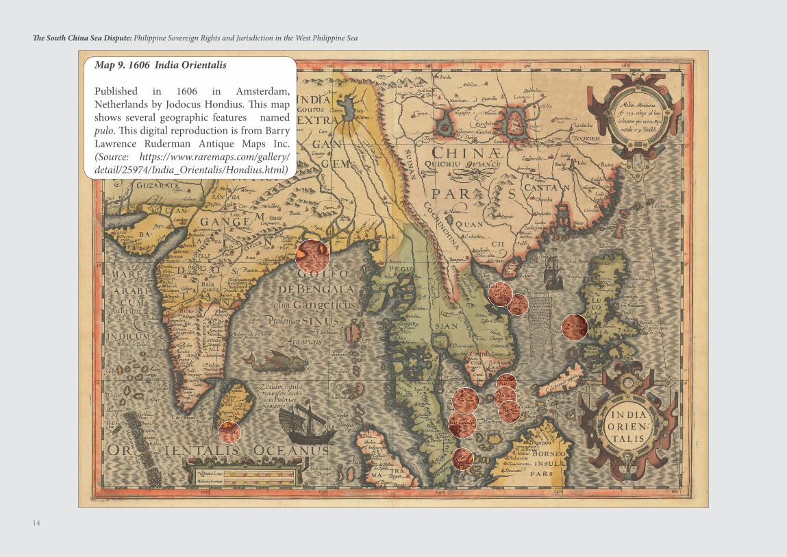
Map 9. 1606 India Orientalis
Published in 1606 in Amsterdam, Netherlands by Jodocus Hondius. This map shows several geographic features named pulo. This digital reproduction is from Barry Lawrence Ruderman Antique Maps Inc. (Source: https://www.raremaps.com/gallery/detail/25974/India_Orientalis/Hondius.html)
15
The South China Sea Dispute: Philippine Sovereign Rights and Jurisdiction in the West Philippine Sea
In 1289, Emperor Kublai Khan, founder of the Yuan Dynasty, sent envoys to various states inviting their rulers to send tributary trade missions to China. Offended by the suggestion, King Kertanegara of Singhasari, Java branded the Chinese envoy’s face with a hot iron, cut off his ears and sent him back to Kublai Khan.
Enraged, Kublai Khan sent a force of 20,000 troops in 1,000 ships to Java, led by his veteran commander Shi-pi. When the Mongol-Chinese expedition arrived in Java, Kertanegara had already died, having been killed in a rebellion by Jayakatwang, who proclaimed himself king. Kertanegara’s son-in-law, Raden Wijaya, allied himself with Shi-pi’s Mongol-Chinese forces to defeat Jayakatwang. But Wijaya then turned against the Mongol-Chinese forces, defeated them in battle and forced Shi-pi to sail back to China after losing 3,000 elite soldiers.
Author John Man considers Kublai Khan’s misadventure to Java as an example of the law of unintended consequences. Kublai Khan’s aim was to punish Kertanegara and set an example for other neighboring nations. But Kublai Khan only helped in establishing the Majapahit Empire, antagonistic to China and which ruled Java, Bali and Sumatra for the next 200 years.
Wijaya founded the city of Majapahit, after which the Majapahit Empire was named, with himself as the first ruler.
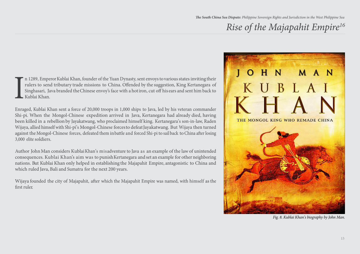
Rise of the Majapahit Empire16
Fig. 8. Kublai Khan’s biography by John Man.
16
The South China Sea Dispute: Philippine Sovereign Rights and Jurisdiction in the West Philippine Sea
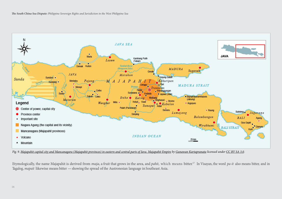
Etymologically, the name Majapahit is derived from maja, a fruit that grows in the area, and pahit, which means bitter.17 In Visayan, the word pa-it also means bitter, and in Tagalog, mapait likewise means bitter — showing the spread of the Austronesian language in Southeast Asia.
Fig. 9. Majapahit capital city and Mancanagara (Majapahit provinces) in eastern and central parts of Java. Majapahit Empire by Gunawan Kartapranata licensed under CC BY SA 3.0.
17
The South China Sea Dispute: Philippine Sovereign Rights and Jurisdiction in the West Philippine Sea
Early in the 15th century, from 1405 to 1433, during the Ming Dynasty under the Yongle and Xuande Emperors, China sent the eunuch Admiral Zheng He on seven voyages to Malacca, Thailand, Sri Lanka, India, Yemen, Saudi Arabia,
and Kenya. His expeditions were aimed primarily to promote trade and to project the power of the Ming Dynasty.
Upon arrival at a foreign state, Zheng He first read out an imperial decree and then bestowed gifts of jewelry, silk and porcelain on the local ruler.18 To formalize a tributary trade system, Zheng He invited the local ruler to send tributary trade missions to China.
Under the tributary trade system, the vassal states were obligated to pay tributes although nothing would happen to them if they failed to do so. However, the benefits of sending tributary missions far exceeded that of not sending. Besides receiving gifts of gold, silver and other valuables, they had the Ming Empire as patron to protect them. Numerous rulers of foreign states, big and small, came to pay tribute to the emperor. As a result, the Ming Dynasty maintained peace with them and treated them well. Thus, under this political system, the suzerain was only symbolic. At most, the system had satisfied the ego of the feudal emperor.19
From the standpoint of the trading customs of that time, the tribute was a tax imposed on those who wished to sell or buy merchandise in China, similar to the import or export taxes imposed by countries today. Certainly, the foreign rulers who sent tributes to the Chinese emperor did not think of making themselves subjects or subordinates of the emperor. Apparently, they did not mind if the tributes also fed the ego of the Chinese emperor.
During his voyages, Zheng He never left a single soldier, ship, outpost, or colony in any of the places he visited. Rather, he had several of the legendary “treasure ships” laden with precious gifts, which he gave to the rulers of the states he visited. Indeed, Zheng He became popular because he brought precious gifts to the local rulers. This is because at that time, the voyages were meant to promote trade with China and project in a friendly manner the Ming Dynasty’s power, nothing else.
Zheng He never claimed for China any of the territories he visited, certainly not the oceans and seas he traversed. After being gifted with precious jewelries and
merchandise, the rulers of the states Zheng He visited welcomed him and played along with the extravaganza.20
Zheng He never visited the Philippines. The accounts saying that he did were certainly unfounded, as pointed out by Prof. Hsu Yun-Ts’iao.21 When Prof. Chiao-min Hsieh of the Catholic University of America wrote that Zheng He supposedly visited the Philippines, he thought that Chan Cheng, which appeared in accounts written by members of Zheng He’s expedition, was an old Chinese name for the Philippines. However, the word Chan Cheng was actually the Ming Dynasty name for a Malay state in Indo-China.
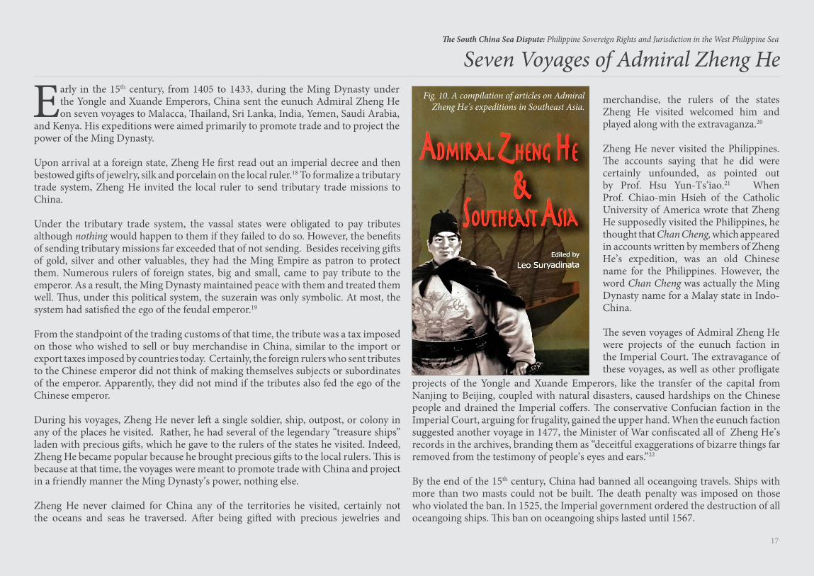
The seven voyages of Admiral Zheng He were projects of the eunuch faction in the Imperial Court. The extravagance of these voyages, as well as other profligate
Seven Voyages of Admiral Zheng HeFig. 10. A compilation of articles on Admiral
Zheng He’s expeditions in Southeast Asia.
projects of the Yongle and Xuande Emperors, like the transfer of the capital from Nanjing to Beijing, coupled with natural disasters, caused hardships on the Chinese people and drained the Imperial coffers. The conservative Confucian faction in the Imperial Court, arguing for frugality, gained the upper hand. When the eunuch faction suggested another voyage in 1477, the Minister of War confiscated all of Zheng He’s records in the archives, branding them as “deceitful exaggerations of bizarre things far removed from the testimony of people’s eyes and ears.”22
By the end of the 15th century, China had banned all oceangoing travels. Ships with more than two masts could not be built. The death penalty was imposed on those who violated the ban. In 1525, the Imperial government ordered the destruction of all oceangoing ships. This ban on oceangoing ships lasted until 1567.
United Nations Convention on the Lawof the Sea (UNCLOS)23
19
The South China Sea Dispute: Philippine Sovereign Rights and Jurisdiction in the West Philippine Sea
Constitution for the Oceans and Seas of Our Planet
The United Nations Convention on the Law of the Sea or UNCLOS is the constitution for the oceans and seas of our planet. UNCLOS governs maritime disputes among member states. UNCLOS codified customary international law, introduced novel concepts like the exclusive economic zone and the extended continental shelf, and institutionalized the common heritage of mankind. It is considered the most comprehensive treaty ever devised by man — with its own dispute settlement mechanism. UNCLOS was adopted on 10 December
1982 and entered into force on 16 November 1994. To date, UNCLOS has been ratified by 167 states and the European Union. All the states involved in the South China Sea dispute have ratified UNCLOS.
The well-entrenched doctrine in the Law of the Sea is that “land dominates the sea.” Simply put, all maritime zones or entitlements are measured from the coast of continental land, island or rock above water at high tide (Articles 3, 57 & 76, UNCLOS). As stated in the North Sea Continental Shelf Cases (Germany v. Denmark, Germany v. Netherlands),24 “the land is the legal source of the power which a State may exercise over territorial extensions to seaward.” The rights of a coastal state over the continental shelf do not depend on occupation, effective or notional, or on any express proclamation [Article 77(3), UNCLOS]. If the coastal state does not explore the continental shelf or exploit its natural resources, no one may undertake such activities without the express consent of the coastal state [Article 77(2), UNCLOS].
20
The South China Sea Dispute: Philippine Sovereign Rights and Jurisdiction in the West Philippine Sea
1
2
34
6
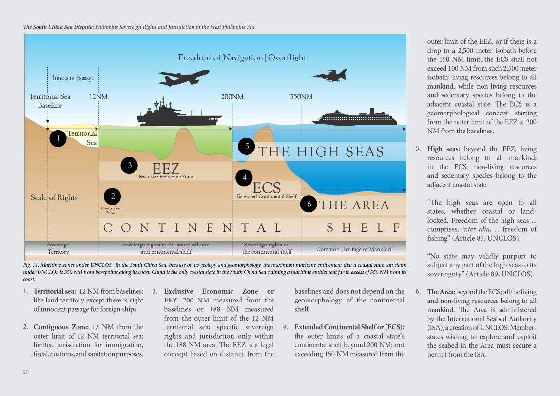
5
Territorial sea: 12 NM from baselines; like land territory except there is right of innocent passage for foreign ships.
Contiguous Zone: 12 NM from the outer limit of 12 NM territorial sea; limited jurisdiction for immigration, fiscal, customs, and sanitation purposes.
Exclusive Economic Zone or EEZ: 200 NM measured from the baselines or 188 NM measured from the outer limit of the 12 NM territorial sea; specific sovereign rights and jurisdiction only within the 188 NM area. The EEZ is a legal concept based on distance from the
baselines and does not depend on the geomorphology of the continental shelf.
Extended Continental Shelf or (ECS): the outer limits of a coastal state’s continental shelf beyond 200 NM; not exceeding 150 NM measured from the
outer limit of the EEZ, or if there is a drop to a 2,500 meter isobath before the 150 NM limit, the ECS shall not exceed 100 NM from such 2,500 meter isobath; living resources belong to all mankind, while non-living resources and sedentary species belong to the adjacent coastal state. The ECS is a geomorphological concept starting from the outer limit of the EEZ at 200 NM from the baselines.
High seas: beyond the EEZ; living resources belong to all mankind; in the ECS, non-living resources and sedentary species belong to the adjacent coastal state.
“The high seas are open to all states, whether coastal or land-locked. Freedom of the high seas ... comprises, inter alia, ... freedom of fishing” (Article 87, UNCLOS). “No state may validly purport to subject any part of the high seas to its sovereignty” (Article 89, UNCLOS).
The Area: beyond the ECS; all the living and non-living resources belong to all mankind. The Area is administered by the International Seabed Authority (ISA), a creation of UNCLOS. Member-states wishing to explore and exploit the seabed in the Area must secure a permit from the ISA.
1.
2.
3.
4.
5.
6.
Fig. 11. Maritime zones under UNCLOS. In the South China Sea, because of its geology and geomorphology, the maximum maritime entitlement that a coastal state can claim under UNCLOS is 350 NM from basepoints along its coast. China is the only coastal state in the South China Sea claiming a maritime entitlement far in excess of 350 NM from its coast.
21
The South China Sea Dispute: Philippine Sovereign Rights and Jurisdiction in the West Philippine Sea
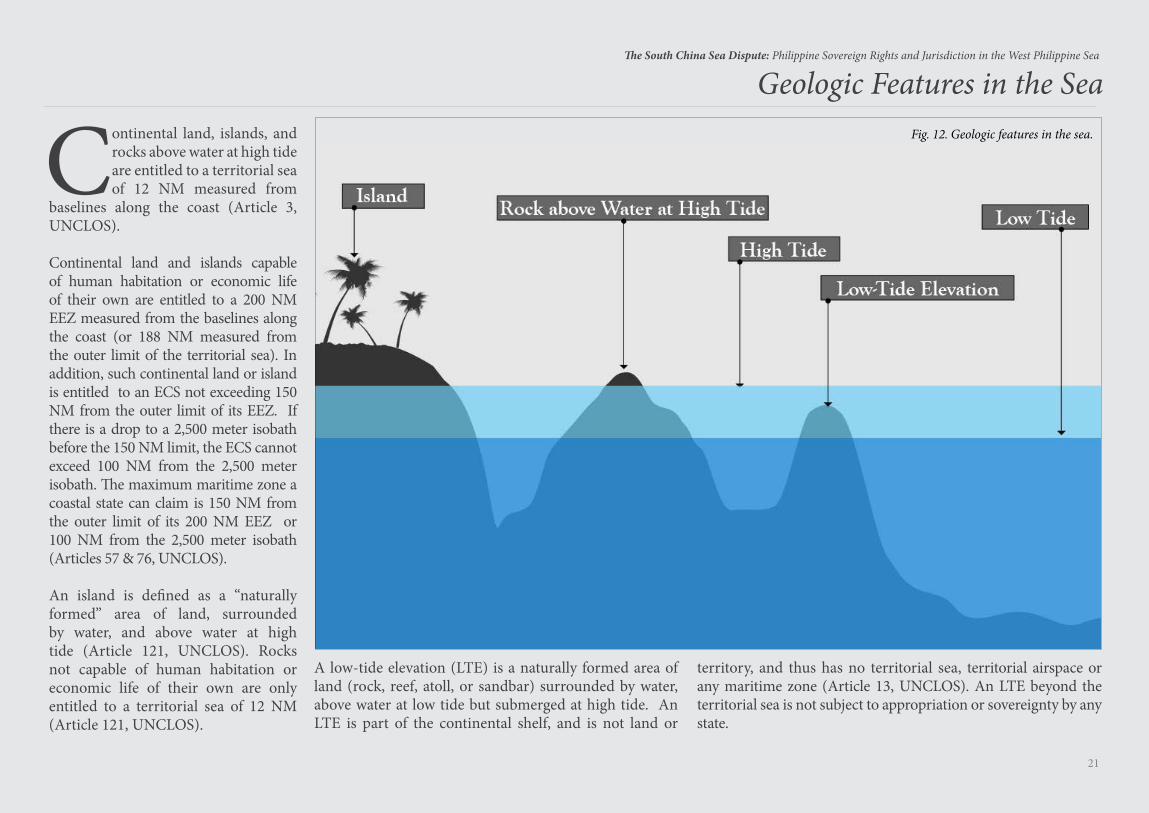
Geologic Features in the SeaFig. 12. Geologic features in the sea.Continental land, islands, and
rocks above water at high tide are entitled to a territorial sea of 12 NM measured from
baselines along the coast (Article 3, UNCLOS).
Continental land and islands capable of human habitation or economic life of their own are entitled to a 200 NM EEZ measured from the baselines along the coast (or 188 NM measured from the outer limit of the territorial sea). In addition, such continental land or island is entitled to an ECS not exceeding 150 NM from the outer limit of its EEZ. If there is a drop to a 2,500 meter isobath before the 150 NM limit, the ECS cannot exceed 100 NM from the 2,500 meter isobath. The maximum maritime zone a coastal state can claim is 150 NM from the outer limit of its 200 NM EEZ or 100 NM from the 2,500 meter isobath (Articles 57 & 76, UNCLOS).
An island is defined as a “naturally formed” area of land, surrounded by water, and above water at high tide (Article 121, UNCLOS). Rocks not capable of human habitation or economic life of their own are only entitled to a territorial sea of 12 NM (Article 121, UNCLOS).
A low-tide elevation (LTE) is a naturally formed area of land (rock, reef, atoll, or sandbar) surrounded by water, above water at low tide but submerged at high tide. An LTE is part of the continental shelf, and is not land or
territory, and thus has no territorial sea, territorial airspace or any maritime zone (Article 13, UNCLOS). An LTE beyond the territorial sea is not subject to appropriation or sovereignty by any state.
22
The South China Sea Dispute: Philippine Sovereign Rights and Jurisdiction in the West Philippine Sea
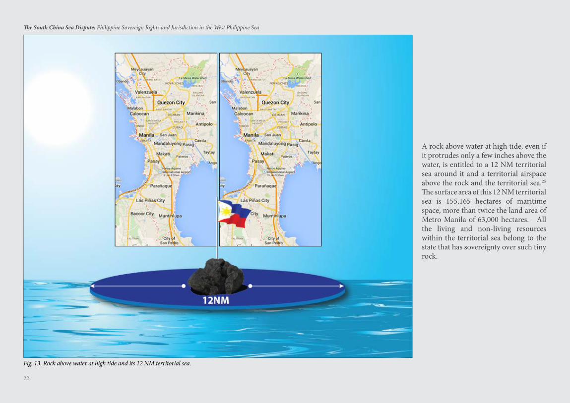
A rock above water at high tide, even if it protrudes only a few inches above the water, is entitled to a 12 NM territorial sea around it and a territorial airspace above the rock and the territorial sea.25 The surface area of this 12 NM territorial sea is 155,165 hectares of maritime space, more than twice the land area of Metro Manila of 63,000 hectares. All the living and non-living resources within the territorial sea belong to the state that has sovereignty over such tiny rock.
Fig. 13. Rock above water at high tide and its 12 NM territorial sea.
23
The South China Sea Dispute: Philippine Sovereign Rights and Jurisdiction in the West Philippine Sea
Baselines for Measuring the Breadth of the Territorial Sea
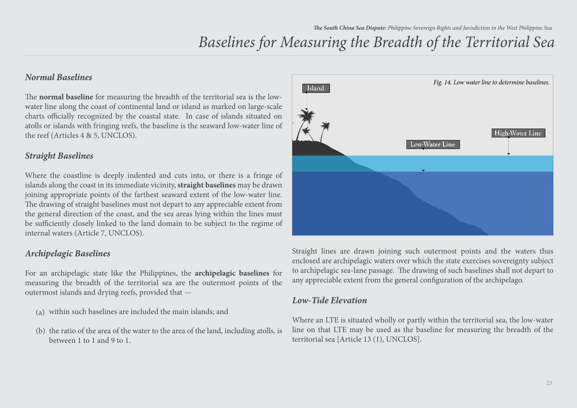
Normal Baselines
The normal baseline for measuring the breadth of the territorial sea is the low- water line along the coast of continental land or island as marked on large-scale charts officially recognized by the coastal state. In case of islands situated on atolls or islands with fringing reefs, the baseline is the seaward low-water line of the reef (Articles 4 & 5, UNCLOS).
Straight Baselines
Where the coastline is deeply indented and cuts into, or there is a fringe of islands along the coast in its immediate vicinity, straight baselines may be drawn joining appropriate points of the farthest seaward extent of the low-water line. The drawing of straight baselines must not depart to any appreciable extent from the general direction of the coast, and the sea areas lying within the lines must be sufficiently closely linked to the land domain to be subject to the regime of internal waters (Article 7, UNCLOS).
Archipelagic Baselines
For an archipelagic state like the Philippines, the archipelagic baselines for measuring the breadth of the territorial sea are the outermost points of the outermost islands and drying reefs, provided that —
within such baselines are included the main islands; and
the ratio of the area of the water to the area of the land, including atolls, is between 1 to 1 and 9 to 1.
(a)
(b)
Straight lines are drawn joining such outermost points and the waters thus enclosed are archipelagic waters over which the state exercises sovereignty subject to archipelagic sea-lane passage. The drawing of such baselines shall not depart to any appreciable extent from the general configuration of the archipelago.
Low-Tide Elevation
Where an LTE is situated wholly or partly within the territorial sea, the low-water line on that LTE may be used as the baseline for measuring the breadth of the territorial sea [Article 13 (1), UNCLOS].
Fig. 14. Low water line to determine baselines.
24
The South China Sea Dispute: Philippine Sovereign Rights and Jurisdiction in the West Philippine Sea
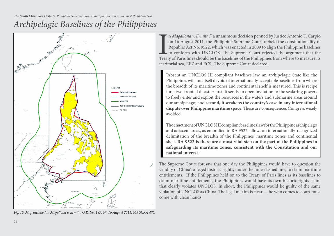
In Magallona v. Ermita,26 a unanimous decision penned by Justice Antonio T. Carpio on 16 August 2011, the Philippine Supreme Court upheld the constitutionality of Republic Act No. 9522, which was enacted in 2009 to align the Philippine baselines to conform with UNCLOS. The Supreme Court rejected the argument that the
Treaty of Paris lines should be the baselines of the Philippines from where to measure its territorial sea, EEZ and ECS. The Supreme Court declared:
“Absent an UNCLOS III compliant baselines law, an archipelagic State like the Philippines will find itself devoid of internationally acceptable baselines from where the breadth of its maritime zones and continental shelf is measured. This is recipe for a two-fronted disaster: first, it sends an open invitation to the seafaring powers to freely enter and exploit the resources in the waters and submarine areas around our archipelago; and second, it weakens the country’s case in any international dispute over Philippine maritime space. These are consequences Congress wisely avoided.
The enactment of UNCLOS III compliant baselines law for the Philippine archipelago and adjacent areas, as embodied in RA 9522, allows an internationally-recognized delimitation of the breadth of the Philippines’ maritime zones and continental shelf. RA 9522 is therefore a most vital step on the part of the Philippines in safeguarding its maritime zones, consistent with the Constitution and our national interest.”
The Supreme Court foresaw that one day the Philippines would have to question the validity of China’s alleged historic rights, under the nine-dashed line, to claim maritime entitlements. If the Philippines held on to the Treaty of Paris lines as its baselines to claim maritime entitlements, the Philippines would have its own historic rights claim that clearly violates UNCLOS. In short, the Philippines would be guilty of the same violation of UNCLOS as China. The legal maxim is clear — he who comes to court must come with clean hands.
Fig. 15. Map included in Magallona v. Ermita, G.R. No. 187167, 16 August 2011, 655 SCRA 476.
Archipelagic Baselines of the Philippines
Root Cause of the South China Sea Dispute
26
The South China Sea Dispute: Philippine Sovereign Rights and Jurisdiction in the West Philippine Sea
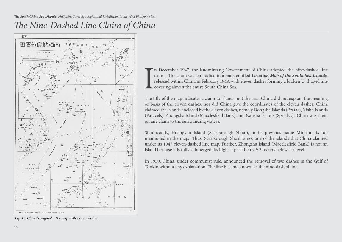
The Nine-Dashed Line Claim of China
In December 1947, the Kuomintang Government of China adopted the nine-dashed line claim. The claim was embodied in a map, entitled Location Map of the South Sea Islands, released within China in February 1948, with eleven dashes forming a broken U-shaped line covering almost the entire South China Sea.
The title of the map indicates a claim to islands, not the sea. China did not explain the meaning or basis of the eleven dashes, nor did China give the coordinates of the eleven dashes. China claimed the islands enclosed by the eleven dashes, namely Dongsha Islands (Pratas), Xisha Islands (Paracels), Zhongsha Island (Macclesfield Bank), and Nansha Islands (Spratlys). China was silent on any claim to the surrounding waters.
Significantly, Huangyan Island (Scarborough Shoal), or its previous name Min’zhu, is not mentioned in the map. Thus, Scarborough Shoal is not one of the islands that China claimed under its 1947 eleven-dashed line map. Further, Zhongsha Island (Macclesfield Bank) is not an island because it is fully submerged, its highest peak being 9.2 meters below sea level.
In 1950, China, under communist rule, announced the removal of two dashes in the Gulf of Tonkin without any explanation. The line became known as the nine-dashed line.
Fig. 16. China’s original 1947 map with eleven dashes.
27
The South China Sea Dispute: Philippine Sovereign Rights and Jurisdiction in the West Philippine Sea
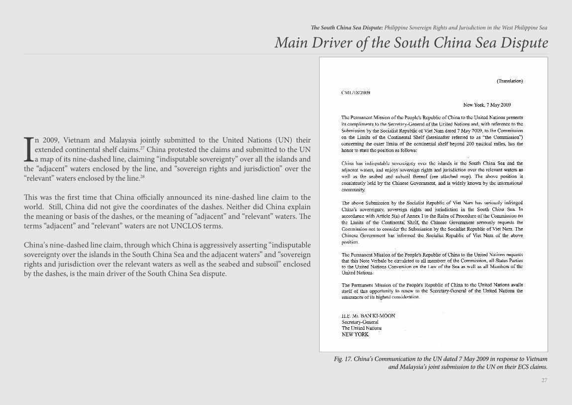
In 2009, Vietnam and Malaysia jointly submitted to the United Nations (UN) their extended continental shelf claims.27 China protested the claims and submitted to the UN a map of its nine-dashed line, claiming “indisputable sovereignty” over all the islands and
the “adjacent” waters enclosed by the line, and “sovereign rights and jurisdiction” over the “relevant” waters enclosed by the line.28
This was the first time that China officially announced its nine-dashed line claim to the world. Still, China did not give the coordinates of the dashes. Neither did China explain the meaning or basis of the dashes, or the meaning of “adjacent” and “relevant” waters. The terms “adjacent” and “relevant” waters are not UNCLOS terms.
China’s nine-dashed line claim, through which China is aggressively asserting “indisputable sovereignty over the islands in the South China Sea and the adjacent waters” and “sovereign rights and jurisdiction over the relevant waters as well as the seabed and subsoil” enclosed by the dashes, is the main driver of the South China Sea dispute.
Main Driver of the South China Sea Dispute
Fig. 17. China’s Communication to the UN dated 7 May 2009 in response to Vietnam and Malaysia’s joint submission to the UN on their ECS claims.
28
The South China Sea Dispute: Philippine Sovereign Rights and Jurisdiction in the West Philippine Sea
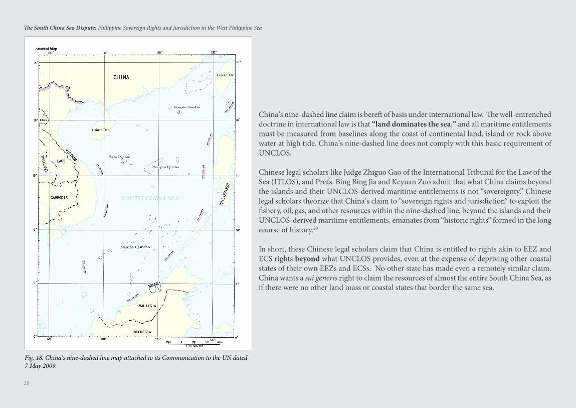
China’s nine-dashed line claim is bereft of basis under international law. The well-entrenched doctrine in international law is that “land dominates the sea,” and all maritime entitlements must be measured from baselines along the coast of continental land, island or rock above water at high tide. China’s nine-dashed line does not comply with this basic requirement of UNCLOS.
Chinese legal scholars like Judge Zhiguo Gao of the International Tribunal for the Law of the Sea (ITLOS), and Profs. Bing Bing Jia and Keyuan Zuo admit that what China claims beyond the islands and their UNCLOS-derived maritime entitlements is not “sovereignty.” Chinese legal scholars theorize that China’s claim to “sovereign rights and jurisdiction” to exploit the fishery, oil, gas, and other resources within the nine-dashed line, beyond the islands and their UNCLOS-derived maritime entitlements, emanates from “historic rights” formed in the long course of history.29
In short, these Chinese legal scholars claim that China is entitled to rights akin to EEZ and ECS rights beyond what UNCLOS provides, even at the expense of depriving other coastal states of their own EEZs and ECSs. No other state has made even a remotely similar claim. China wants a sui generis right to claim the resources of almost the entire South China Sea, as if there were no other land mass or coastal states that border the same sea.
Fig. 18. China’s nine-dashed line map attached to its Communication to the UN dated 7 May 2009.
29
The South China Sea Dispute: Philippine Sovereign Rights and Jurisdiction in the West Philippine Sea
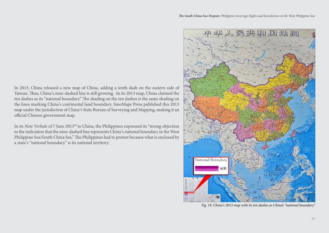
In 2013, China released a new map of China, adding a tenth dash on the eastern side of Taiwan. Thus, China’s nine-dashed line is still growing. In its 2013 map, China claimed the ten dashes as its “national boundary.” The shading on the ten dashes is the same shading on the lines marking China’s continental land boundary. SinoMaps Press published this 2013 map under the jurisdiction of China’s State Bureau of Surveying and Mapping, making it an official Chinese government map.
In its Note Verbale of 7 June 201330 to China, the Philippines expressed its “strong objection to the indication that the nine-dashed line represents China’s national boundary in the West Philippine Sea/South China Sea.” The Philippines had to protest because what is enclosed by a state’s “national boundary” is its national territory.
Fig. 19. China’s 2013 map with its ten dashes as China’s “national boundary.”
30
The South China Sea Dispute: Philippine Sovereign Rights and Jurisdiction in the West Philippine Sea
China’s nine-dashed line claim encloses about 85.7 percent of the entire South China Sea, equivalent to 3 million square kilometers of the 3.5 million square kilometers total surface area of the South China Sea.31 Just
over one-half of the world’s seaborne trade passes through the South China Sea, valued at US$5.3 trillion annually.32
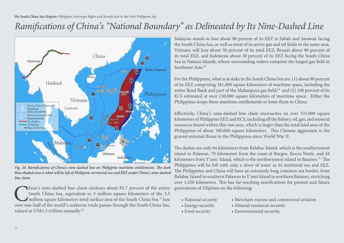
Ramifications of China’s “National Boundary” as Delineated by Its Nine-Dashed Line
Fig. 20. Ramifications of China’s nine-dashed line on Philippine maritime entitlements. The dark blue shaded area is what will be left of Philippine territorial sea and EEZ under China’s nine-dashed line claim.
Malaysia stands to lose about 80 percent of its EEZ in Sabah and Sarawak facing the South China Sea, as well as most of its active gas and oil fields in the same area. Vietnam will lose about 50 percent of its total EEZ, Brunei about 90 percent of its total EEZ, and Indonesia about 30 percent of its EEZ facing the South China Sea in Natuna Islands, whose surrounding waters comprise the largest gas field in Southeast Asia.33
For the Philippines, what is at stake in the South China Sea are: (1) about 80 percent of its EEZ comprising 381,000 square kilometers of maritime space, including the entire Reed Bank and part of the Malampaya gas field;34 and (2) 100 percent of its ECS estimated at over 150,000 square kilometers of maritime space. Either the Philippines keeps these maritime entitlements or loses them to China.
Effectively, China’s nine-dashed line claim encroaches on over 531,000 square kilometers of Philippine EEZ and ECS, including all the fishery, oil, gas, and mineral resources found within this vast area, which is larger than the total land area of the Philippines of about 300,000 square kilometers. This Chinese aggression is the gravest external threat to the Philippines since World War II.
The dashes are only 64 kilometers from Balabac Island, which is the southernmost island in Palawan, 70 kilometers from the coast of Burgos, Ilocos Norte, and 44 kilometers from Y’ami Island, which is the northernmost island in Batanes.35 The Philippines will be left with only a sliver of water as its territorial sea and EEZ. The Philippines and China will have an extremely long common sea border, from Balabac Island in southern Palawan to Y’ami Island in northern Batanes, stretching over 1,550 kilometers. This has far-reaching ramifications for present and future generations of Filipinos on the following:
• National security • Merchant marine and commercial aviation• Energy security • Mineral resources security• Food security • Environmental security.
31
The South China Sea Dispute: Philippine Sovereign Rights and Jurisdiction in the West Philippine Sea
The core dispute between China and the Philippines is obvious — China wants to grab 80 percent of Philippine EEZ in the South China Sea. But to obfuscate matters, China is re-framing the South China Sea dispute as
a contest between China and the U.S., with the U.S. containing or constraining the rise of China, and the Philippines having allied itself with the U.S.
As a world naval power, the paramount national interest of the U.S. is freedom of navigation and over-flight so its military vessels and aircraft can sail and fly, and conduct military activities, in the high seas and EEZs of the world, including the South China Sea. On the other hand, China asserts that foreign military vessels and aircraft cannot conduct military activities in China’s EEZ without China’s prior permission. This is the dispute between China and the U.S. in the South China Sea. The Philippines has no interest in this dispute as the Philippines has no blue-water navy or long-range air force that can sail and fly in the high seas and EEZs of the world.
The paramount national interest of the Philippines in the South China Sea is to protect its EEZ from Chinese encroachment. This is why the Philippines filed the arbitration case against China. Obviously unable to match China’s military might, the Philippines brought China to an UNCLOS tribunal, where the legality of China’s encroachment could be resolved peacefully by arbitration solely in accordance with the Law of the Sea. The UNCLOS tribunal is a forum where warships, warplanes and nuclear bombs do not count.
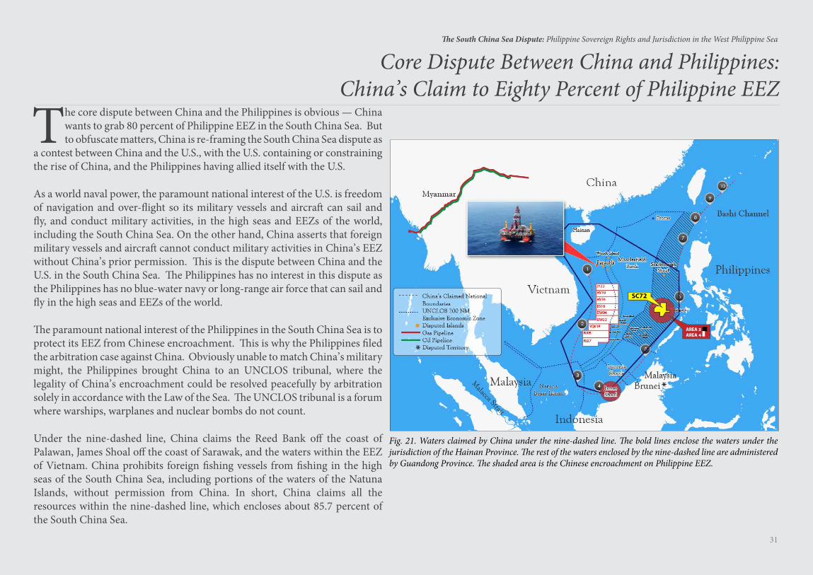
Under the nine-dashed line, China claims the Reed Bank off the coast of Palawan, James Shoal off the coast of Sarawak, and the waters within the EEZ of Vietnam. China prohibits foreign fishing vessels from fishing in the high seas of the South China Sea, including portions of the waters of the Natuna Islands, without permission from China. In short, China claims all the resources within the nine-dashed line, which encloses about 85.7 percent of the South China Sea.
Core Dispute Between China and Philippines:China’s Claim to Eighty Percent of Philippine EEZ
Fig. 21. Waters claimed by China under the nine-dashed line. The bold lines enclose the waters under the jurisdiction of the Hainan Province. The rest of the waters enclosed by the nine-dashed line are administered by Guandong Province. The shaded area is the Chinese encroachment on Philippine EEZ.
32
The South China Sea Dispute: Philippine Sovereign Rights and Jurisdiction in the West Philippine Sea
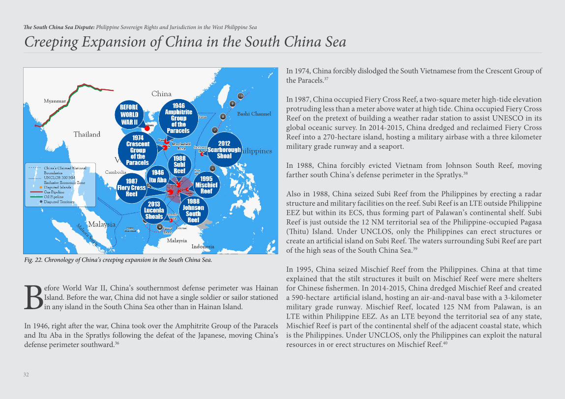
Creeping Expansion of China in the South China Sea
Before World War II, China’s southernmost defense perimeter was Hainan Island. Before the war, China did not have a single soldier or sailor stationed in any island in the South China Sea other than in Hainan Island.
In 1946, right after the war, China took over the Amphitrite Group of the Paracels and Itu Aba in the Spratlys following the defeat of the Japanese, moving China’s defense perimeter southward.36
Fig. 22. Chronology of China’s creeping expansion in the South China Sea.
In 1974, China forcibly dislodged the South Vietnamese from the Crescent Group of the Paracels.37
In 1987, China occupied Fiery Cross Reef, a two-square meter high-tide elevation protruding less than a meter above water at high tide. China occupied Fiery Cross Reef on the pretext of building a weather radar station to assist UNESCO in its global oceanic survey. In 2014-2015, China dredged and reclaimed Fiery Cross Reef into a 270-hectare island, hosting a military airbase with a three kilometer military grade runway and a seaport.
In 1988, China forcibly evicted Vietnam from Johnson South Reef, moving farther south China’s defense perimeter in the Spratlys.38
Also in 1988, China seized Subi Reef from the Philippines by erecting a radar structure and military facilities on the reef. Subi Reef is an LTE outside Philippine EEZ but within its ECS, thus forming part of Palawan’s continental shelf. Subi Reef is just outside the 12 NM territorial sea of the Philippine-occupied Pagasa (Thitu) Island. Under UNCLOS, only the Philippines can erect structures or create an artificial island on Subi Reef. The waters surrounding Subi Reef are part of the high seas of the South China Sea.39
In 1995, China seized Mischief Reef from the Philippines. China at that time explained that the stilt structures it built on Mischief Reef were mere shelters for Chinese fishermen. In 2014-2015, China dredged Mischief Reef and created a 590-hectare artificial island, hosting an air-and-naval base with a 3-kilometer military grade runway. Mischief Reef, located 125 NM from Palawan, is an LTE within Philippine EEZ. As an LTE beyond the territorial sea of any state, Mischief Reef is part of the continental shelf of the adjacent coastal state, which is the Philippines. Under UNCLOS, only the Philippines can exploit the natural resources in or erect structures on Mischief Reef.40
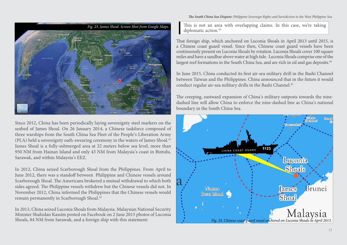
33
The South China Sea Dispute: Philippine Sovereign Rights and Jurisdiction in the West Philippine Sea
Fig. 24. Chinese coast guard vessel anchored on Luconia Shoals in April 2013.
Fig. 23. James Shoal. Screen Shot from Google Maps.
Since 2012, China has been periodically laying sovereignty steel markers on the seabed of James Shoal. On 26 January 2014, a Chinese taskforce composed of three warships from the South China Sea Fleet of the People’s Liberation Army (PLA) held a sovereignty oath-swearing ceremony in the waters of James Shoal.41
James Shoal is a fully-submerged area at 22 meters below sea level, more than 950 NM from Hainan Island and only 43 NM from Malaysia’s coast in Bintulu, Sarawak, and within Malaysia’s EEZ.
In 2012, China seized Scarborough Shoal from the Philippines. From April to June 2012, there was a standoff between Philippine and Chinese vessels around Scarborough Shoal. The Americans brokered a mutual withdrawal to which both sides agreed. The Philippine vessels withdrew but the Chinese vessels did not. In November 2012, China informed the Philippines that the Chinese vessels would remain permanently in Scarborough Shoal.42
In 2013, China seized Luconia Shoals from Malaysia. Malaysian National Security Minister Shahidan Kassim posted on Facebook on 2 June 2015 photos of Luconia Shoals, 84 NM from Sarawak, and a foreign ship with this statement:
This is not an area with overlapping claims. In this case, we’re taking diplomatic action.43
That foreign ship, which anchored on Luconia Shoals in April 2013 until 2015, is a Chinese coast guard vessel. Since then, Chinese coast guard vessels have been continuously present on Luconia Shoals by rotation. Luconia Shoals cover 100 square miles and have a sandbar above water at high tide. Luconia Shoals comprise one of the largest reef formations in the South China Sea, and are rich in oil and gas deposits.44
In June 2015, China conducted its first air-sea military drill in the Bashi Channel between Taiwan and the Philippines. China announced that in the future it would conduct regular air-sea military drills in the Bashi Channel.45
The creeping, eastward expansion of China’s military outposts towards the nine-dashed line will allow China to enforce the nine-dashed line as China’s national boundary in the South China Sea.
34
The South China Sea Dispute: Philippine Sovereign Rights and Jurisdiction in the West Philippine Sea
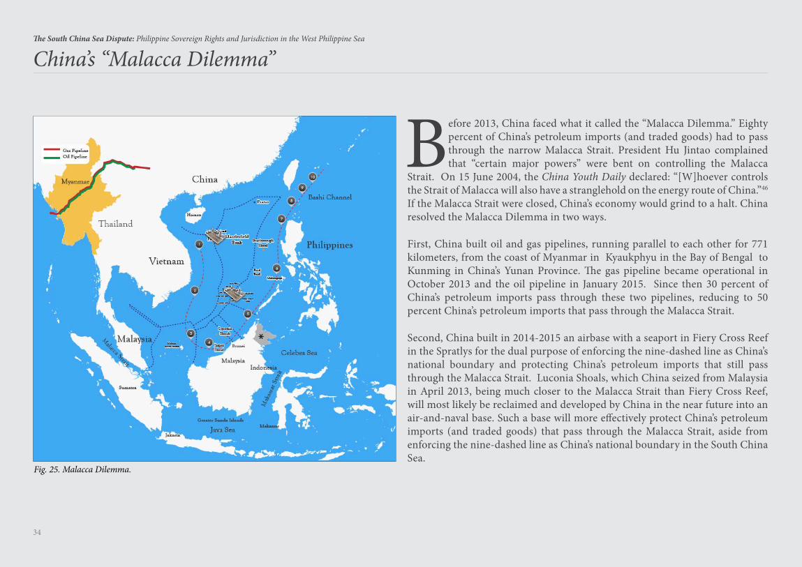
Before 2013, China faced what it called the “Malacca Dilemma.” Eighty percent of China’s petroleum imports (and traded goods) had to pass through the narrow Malacca Strait. President Hu Jintao complained that “certain major powers” were bent on controlling the Malacca
Strait. On 15 June 2004, the China Youth Daily declared: “[W]hoever controls the Strait of Malacca will also have a stranglehold on the energy route of China.”46 If the Malacca Strait were closed, China’s economy would grind to a halt. China resolved the Malacca Dilemma in two ways.
First, China built oil and gas pipelines, running parallel to each other for 771 kilometers, from the coast of Myanmar in Kyaukphyu in the Bay of Bengal to Kunming in China’s Yunan Province. The gas pipeline became operational in October 2013 and the oil pipeline in January 2015. Since then 30 percent of China’s petroleum imports pass through these two pipelines, reducing to 50 percent China’s petroleum imports that pass through the Malacca Strait.
Second, China built in 2014-2015 an airbase with a seaport in Fiery Cross Reef in the Spratlys for the dual purpose of enforcing the nine-dashed line as China’s national boundary and protecting China’s petroleum imports that still pass through the Malacca Strait. Luconia Shoals, which China seized from Malaysia in April 2013, being much closer to the Malacca Strait than Fiery Cross Reef, will most likely be reclaimed and developed by China in the near future into an air-and-naval base. Such a base will more effectively protect China’s petroleum imports (and traded goods) that pass through the Malacca Strait, aside from enforcing the nine-dashed line as China’s national boundary in the South China Sea.
China’s “Malacca Dilemma”
Fig. 25. Malacca Dilemma.
35
The South China Sea Dispute: Philippine Sovereign Rights and Jurisdiction in the West Philippine Sea
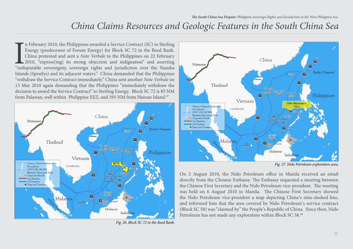
In February 2010, the Philippines awarded a Service Contract (SC) to Sterling Energy (predecessor of Forum Energy) for Block SC 72 in the Reed Bank. China protested and sent a Note Verbale to the Philippines on 22 February 2010, “express[ing] its strong objection and indignation” and asserting
“indisputable sovereignty, sovereign rights and jurisdiction over the Nansha Islands (Spratlys) and its adjacent waters.” China demanded that the Philippines “withdraw the Service Contract immediately.” China sent another Note Verbale on 13 May 2010 again demanding that the Philippines “immediately withdraw the decision to award the Service Contract” to Sterling Energy. Block SC 72 is 85 NM from Palawan, well within Philippine EEZ, and 595 NM from Hainan Island.47
On 2 August 2010, the Nido Petroleum office in Manila received an email directly from the Chinese Embassy. The Embassy requested a meeting between the Chinese First Secretary and the Nido Petroleum vice-president. The meeting was held on 6 August 2010 in Manila. The Chinese First Secretary showed the Nido Petroleum vice-president a map depicting China’s nine-dashed line, and informed him that the area covered by Nido Petroleum’s service contract (Block SC 58) was “claimed by” the People’s Republic of China. Since then, Nido Petroleum has not made any exploration within Block SC 58.48
China Claims Resources and Geologic Features in the South China Sea
Fig. 26. Block SC 72 in the Reed Bank.
Fig. 27. Nido Petroleum exploration area.
36
The South China Sea Dispute: Philippine Sovereign Rights and Jurisdiction in the West Philippine Sea
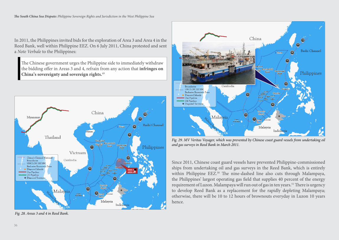
In 2011, the Philippines invited bids for the exploration of Area 3 and Area 4 in the Reed Bank, well within Philippine EEZ. On 6 July 2011, China protested and sent a Note Verbale to the Philippines:
The Chinese government urges the Philippine side to immediately withdraw the bidding offer in Areas 3 and 4, refrain from any action that infringes on China’s sovereignty and sovereign rights.49
Since 2011, Chinese coast guard vessels have prevented Philippine-commissioned ships from undertaking oil and gas surveys in the Reed Bank, which is entirely within Philippine EEZ.50 The nine-dashed line also cuts through Malampaya, the Philippines’ largest operating gas field that supplies 40 percent of the energy requirement of Luzon. Malampaya will run out of gas in ten years.51 There is urgency to develop Reed Bank as a replacement for the rapidly depleting Malampaya; otherwise, there will be 10 to 12 hours of brownouts everyday in Luzon 10 years hence.
Fig. 28. Areas 3 and 4 in Reed Bank.
Fig. 29. MV Veritas Voyager, which was prevented by Chinese coast guard vessels from undertaking oil and gas surveys in Reed Bank in March 2011.
37
The South China Sea Dispute: Philippine Sovereign Rights and Jurisdiction in the West Philippine Sea
In 2012, China publicized for international bidding concession blocks within the EEZ of Vietnam. In 2014, China placed the $1 billion HD 981 oil rig some 130 NM from Vietnam’s coast, well within Vietnam’s EEZ. In protest, Vietnamese workers in export processing zones in Vietnam rioted, burning several Chinese factories. A Vietnamese fishing boat sank near the oil rig after being rammed by a Chinese vessel.52
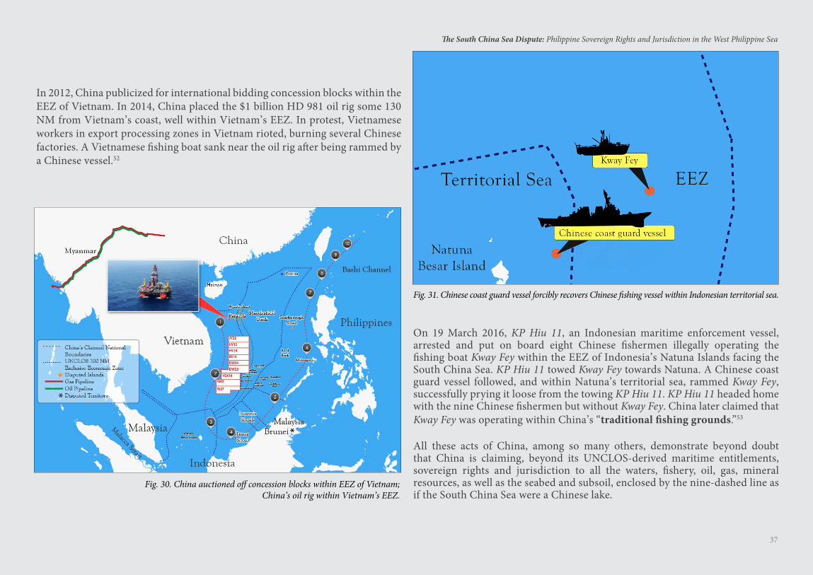
On 19 March 2016, KP Hiu 11, an Indonesian maritime enforcement vessel, arrested and put on board eight Chinese fishermen illegally operating the fishing boat Kway Fey within the EEZ of Indonesia’s Natuna Islands facing the South China Sea. KP Hiu 11 towed Kway Fey towards Natuna. A Chinese coast guard vessel followed, and within Natuna’s territorial sea, rammed Kway Fey, successfully prying it loose from the towing KP Hiu 11. KP Hiu 11 headed home with the nine Chinese fishermen but without Kway Fey. China later claimed that Kway Fey was operating within China’s “traditional fishing grounds.”53
All these acts of China, among so many others, demonstrate beyond doubt that China is claiming, beyond its UNCLOS-derived maritime entitlements, sovereign rights and jurisdiction to all the waters, fishery, oil, gas, mineral resources, as well as the seabed and subsoil, enclosed by the nine-dashed line as if the South China Sea were a Chinese lake.
Fig. 30. China auctioned off concession blocks within EEZ of Vietnam;China’s oil rig within Vietnam’s EEZ.
Fig. 31. Chinese coast guard vessel forcibly recovers Chinese fishing vessel within Indonesian territorial sea.

38
The South China Sea Dispute: Philippine Sovereign Rights and Jurisdiction in the West Philippine Sea
China’s Grand Design in the South China Sea
China’s grand design is to control the South China Sea for economic and military purposes. China wants all the fishery, oil, gas, and mineral resources within the nine-dashed line. In the 1990s, China was taking only 20 percent of the annual fish catch in the South China Sea. Today, China is taking 50 percent (and growing) of the annual fish catch in the South China Sea as more than 80 percent of its coastal waters are
already polluted.54 China has the largest fishing fleet in the world, with some 220,000 sea-going vessels, about 2,600 of which go all the way to East Africa.55 China’s fish consumption is the highest in the world considering its 1.4 billion population.56
China is the largest net importer of petroleum in the world.57 China wants the lion’s share of the oil and gas in the South China Sea. The Chinese estimate that the South China Sea holds 130 billion barrels of oil,58 and if this is correct, the South China Sea has more oil than either Kuwait or the United Arab Emirates.59 A reserve of 130 billion barrels of oil can supply China’s oil needs for 22 years.60
The South China Sea is also rich in methane hydrates — said to be one of the fuels of the future. China wants to secure all these methane hydrates, which can fuel China’s economy for 130 years.61
China also wants the South China Sea as a sanctuary for its nuclear-armed submarines — free from surveillance by U.S. submarine-hunting Poseidon aircraft or U.S. nuclear-powered attack submarines. China wants a second-strike nuclear capability, joining the ranks of the U.S. and Russia.
A second-strike capability means a nuclear power, after its land-based nuclear weapons are obliterated in a pre-emptive first-strike by a nuclear-armed enemy, can still retaliate with its nuclear-armed ballistic missile submarines. This second-strike capability deters an enemy from making a pre-emptive first strike.
39
The South China Sea Dispute: Philippine Sovereign Rights and Jurisdiction in the West Philippine Sea
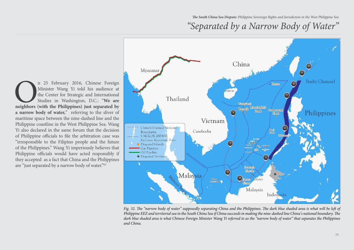
On 25 February 2016, Chinese Foreign Minister Wang Yi told his audience at the Center for Strategic and International Studies in Washington, D.C.: “We are
neighbors (with the Philippines) just separated by a narrow body of water,” referring to the sliver of maritime space between the nine-dashed line and the Philippine coastline in the West Philippine Sea. Wang Yi also declared in the same forum that the decision of Philippine officials to file the arbitration case was “irresponsible to the Filipino people and the future of the Philippines.” Wang Yi imperiously believes that Philippine officials would have acted responsibly if they accepted as a fact that China and the Philippines are “just separated by a narrow body of water.”62
Fig. 32. The “narrow body of water” supposedly separating China and the Philippines. The dark blue shaded area is what will be left of Philippine EEZ and territorial sea in the South China Sea if China succeeds in making the nine-dashed line China’s national boundary. The dark blue shaded area is what Chinese Foreign Minister Wang Yi referred to as the “narrow body of water” that separates the Philippines and China.
“Separated by a Narrow Body of Water”
40
The South China Sea Dispute: Philippine Sovereign Rights and Jurisdiction in the West Philippine Sea
China’s Militarization of the South China Sea
Fig. 33. Chinese HQ-9 launcher. Photo by Jian Kang licensed under CC BY 3.0.
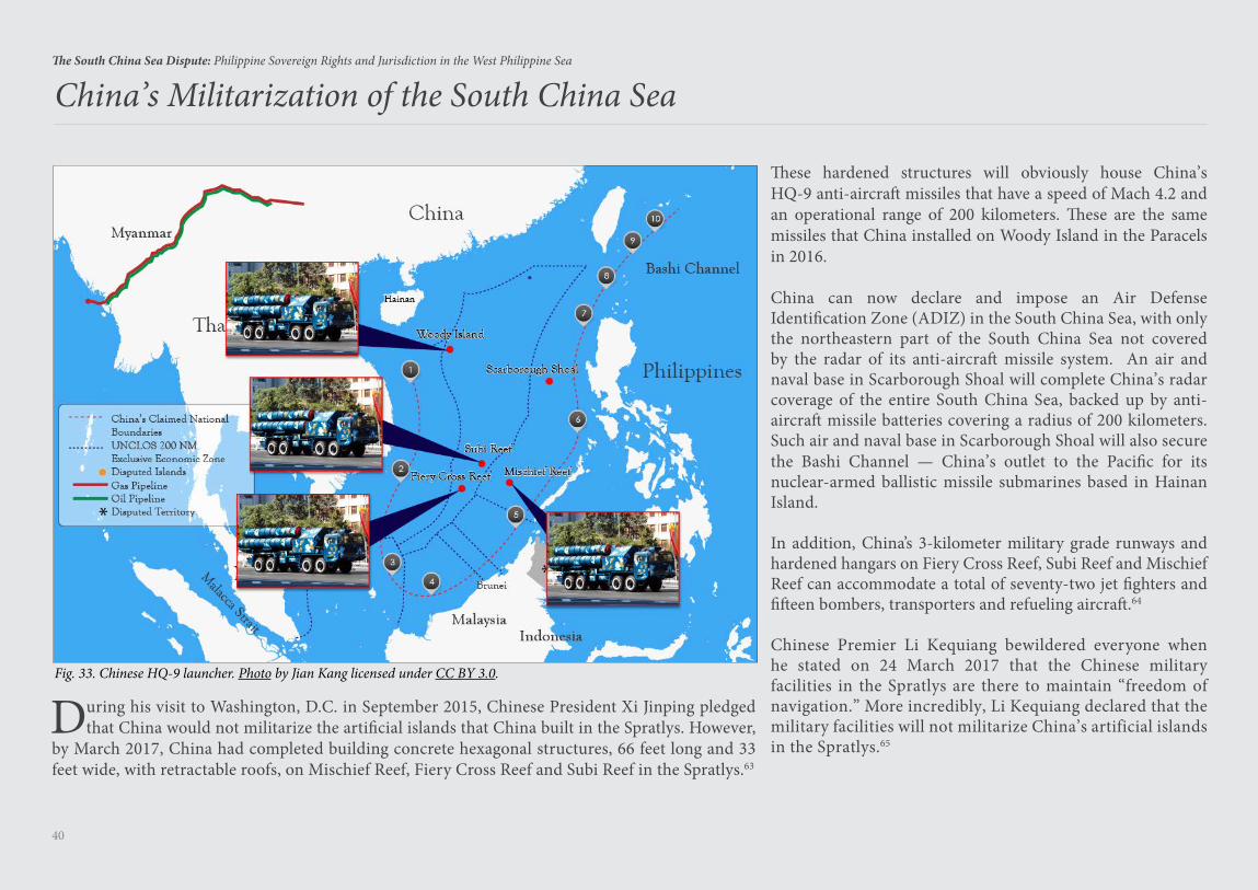
During his visit to Washington, D.C. in September 2015, Chinese President Xi Jinping pledged that China would not militarize the artificial islands that China built in the Spratlys. However,
by March 2017, China had completed building concrete hexagonal structures, 66 feet long and 33 feet wide, with retractable roofs, on Mischief Reef, Fiery Cross Reef and Subi Reef in the Spratlys.63
These hardened structures will obviously house China’s HQ-9 anti-aircraft missiles that have a speed of Mach 4.2 and an operational range of 200 kilometers. These are the same missiles that China installed on Woody Island in the Paracels in 2016.
China can now declare and impose an Air Defense Identification Zone (ADIZ) in the South China Sea, with only the northeastern part of the South China Sea not covered by the radar of its anti-aircraft missile system. An air and naval base in Scarborough Shoal will complete China’s radar coverage of the entire South China Sea, backed up by anti-aircraft missile batteries covering a radius of 200 kilometers. Such air and naval base in Scarborough Shoal will also secure the Bashi Channel — China’s outlet to the Pacific for its nuclear-armed ballistic missile submarines based in Hainan Island.
In addition, China’s 3-kilometer military grade runways and hardened hangars on Fiery Cross Reef, Subi Reef and Mischief Reef can accommodate a total of seventy-two jet fighters and fifteen bombers, transporters and refueling aircraft.64
Chinese Premier Li Kequiang bewildered everyone when he stated on 24 March 2017 that the Chinese military facilities in the Spratlys are there to maintain “freedom of navigation.” More incredibly, Li Kequiang declared that the military facilities will not militarize China’s artificial islands in the Spratlys.65
41
The South China Sea Dispute: Philippine Sovereign Rights and Jurisdiction in the West Philippine Sea
Under its 2015 China Military Strategy (CMS), China is shifting from offshore waters defense to combined offshore waters defense and open seas protection. The CMS declares that the traditional mentality that land outweighs the sea must be abandoned. Instead, the CMS attaches great importance to managing the seas and oceans and “protecting maritime rights and interests.”66 The phrase “protecting maritime rights and interests” means enforcing the nine-dashed line as China’s national boundary.
China’s coast guard is the largest blue water coast guard fleet in the world. China has more coast guard vessels than Japan, Vietnam, Indonesia, Malaysia, and the Philippines combined. In 2016, China deployed its second 10,000-ton coast guard vessel, the world’s largest blue water coast guard vessels.
Fig. 34. Chinese coast guard vessel.Photo by Indian Navy licensed under CC BY 2.5 in
China has a maritime militia consisting of hundreds of thousands of fishermen who are well-trained to spy on foreign warships, harass foreign fishing vessels, and act as eyes and ears for the PLA Navy. Their fishing vessels, numbering about 20,000, are equipped with China’s Beidou satellite navigation and communications system. Their fuel is subsidized by the Chinese Government. The PLA’s official newspaper declared: “Putting on camouflage these fishermen qualify as soldiers, taking off the camouflage they become law-abiding fishermen.”67
Fig. 35. Chinese Fishing Boats. Photo by AFP.
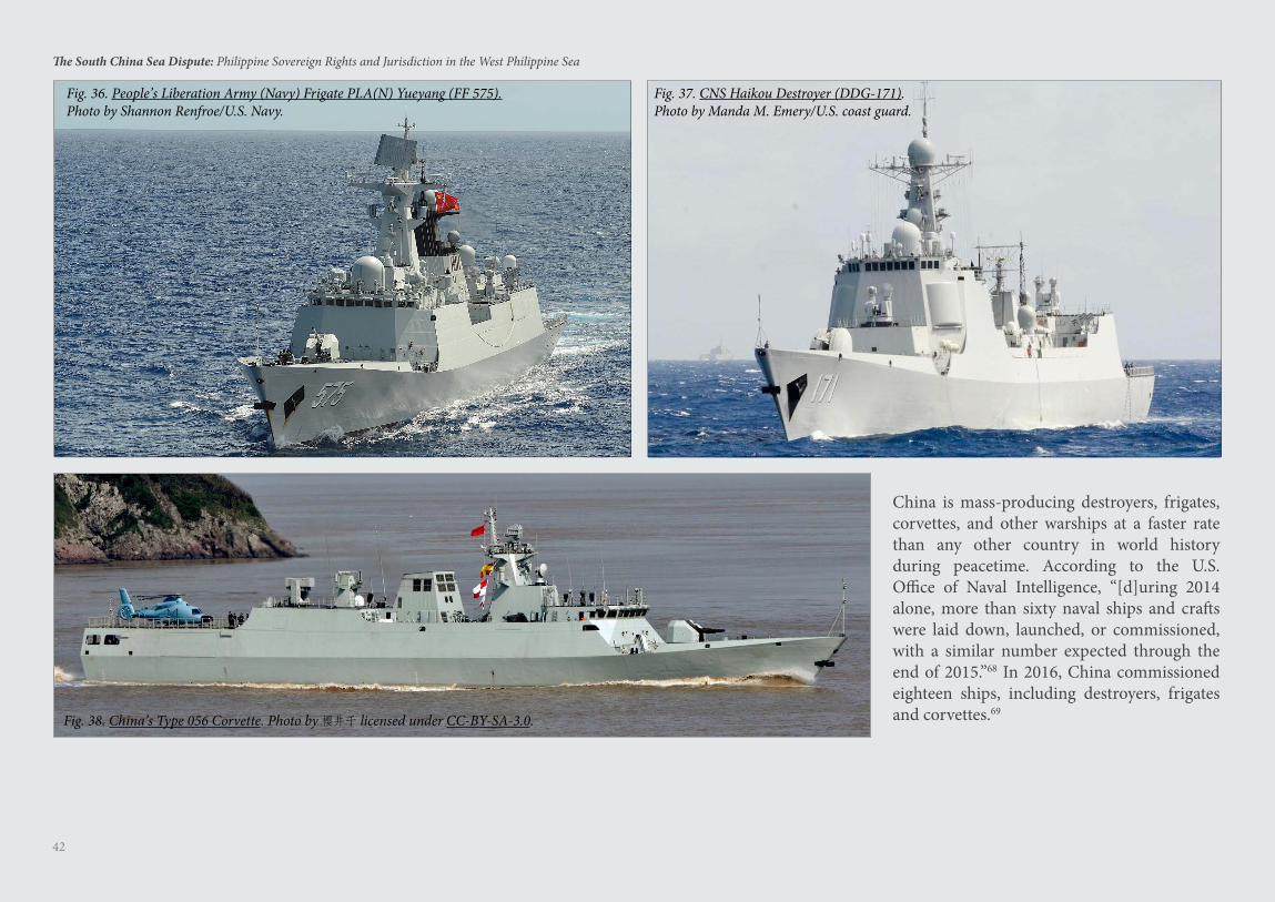
42
The South China Sea Dispute: Philippine Sovereign Rights and Jurisdiction in the West Philippine Sea
China is mass-producing destroyers, frigates, corvettes, and other warships at a faster rate than any other country in world history during peacetime. According to the U.S. Office of Naval Intelligence, “[d]uring 2014 alone, more than sixty naval ships and crafts were laid down, launched, or commissioned, with a similar number expected through the end of 2015.”68 In 2016, China commissioned eighteen ships, including destroyers, frigates and corvettes.69
Fig. 36. People’s Liberation Army (Navy) Frigate PLA(N) Yueyang (FF 575).Photo by Shannon Renfroe/U.S. Navy.
Fig. 37. CNS Haikou Destroyer (DDG-171).Photo by Manda M. Emery/U.S. coast guard.
Fig. 38. China’s Type 056 Corvette. Photo by 樱井千 licensed under CC-BY-SA-3.0.
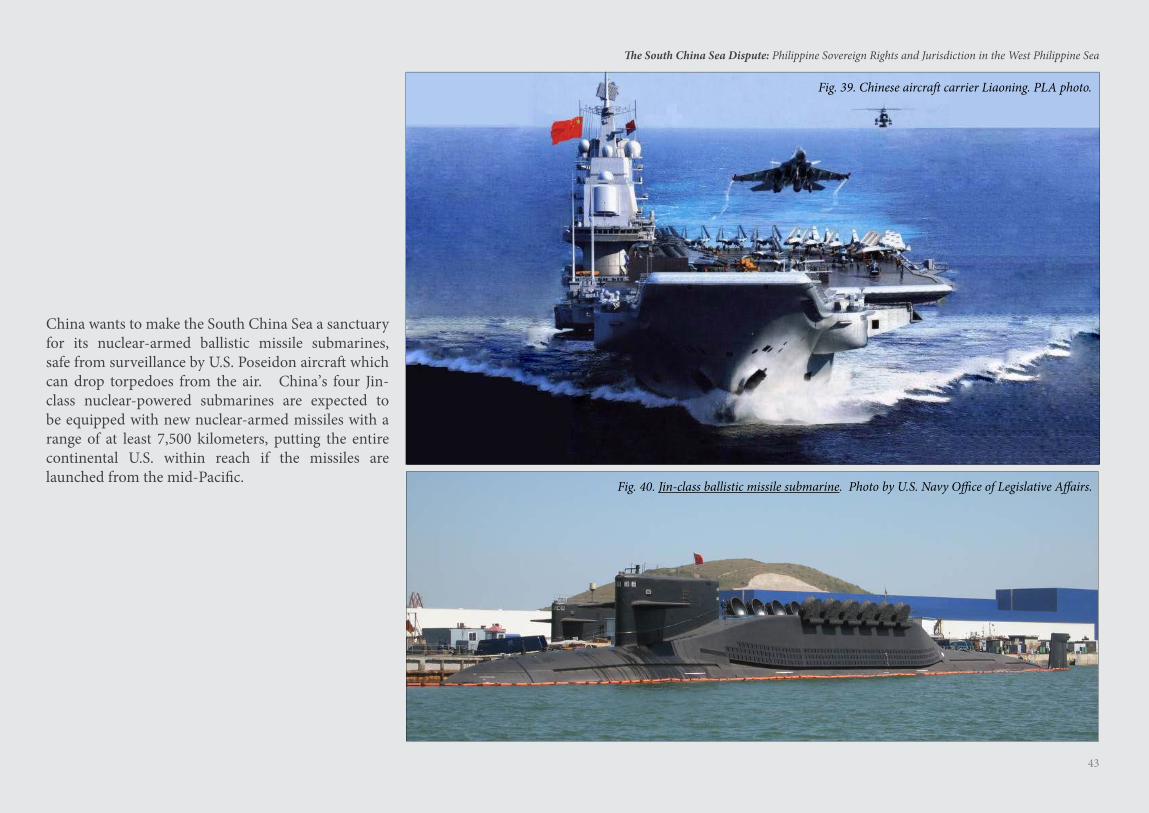
43
The South China Sea Dispute: Philippine Sovereign Rights and Jurisdiction in the West Philippine Sea
China wants to make the South China Sea a sanctuary for its nuclear-armed ballistic missile submarines, safe from surveillance by U.S. Poseidon aircraft which can drop torpedoes from the air. China’s four Jin-class nuclear-powered submarines are expected to be equipped with new nuclear-armed missiles with a range of at least 7,500 kilometers, putting the entire continental U.S. within reach if the missiles are launched from the mid-Pacific.
Fig. 39. Chinese aircraft carrier Liaoning. PLA photo.
Fig. 40. Jin-class ballistic missile submarine. Photo by U.S. Navy Office of Legislative Affairs.
Inter-State Disputes in the South China Sea
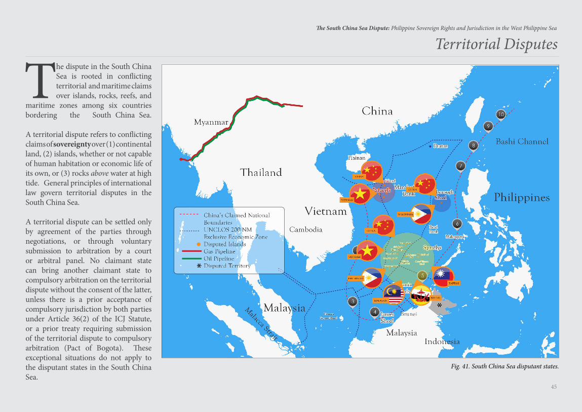
45
The South China Sea Dispute: Philippine Sovereign Rights and Jurisdiction in the West Philippine Sea
Territorial Disputes
The dispute in the South China Sea is rooted in conflicting territorial and maritime claims over islands, rocks, reefs, and
maritime zones among six countries bordering the South China Sea.
A territorial dispute refers to conflicting claims of sovereignty over (1) continental land, (2) islands, whether or not capable of human habitation or economic life of its own, or (3) rocks above water at high tide. General principles of international law govern territorial disputes in the South China Sea.
A territorial dispute can be settled only by agreement of the parties through negotiations, or through voluntary submission to arbitration by a court or arbitral panel. No claimant state can bring another claimant state to compulsory arbitration on the territorial dispute without the consent of the latter, unless there is a prior acceptance of compulsory jurisdiction by both parties under Article 36(2) of the ICJ Statute, or a prior treaty requiring submission of the territorial dispute to compulsory arbitration (Pact of Bogota). These exceptional situations do not apply to the disputant states in the South China Sea.
Fig. 41. South China Sea disputant states.
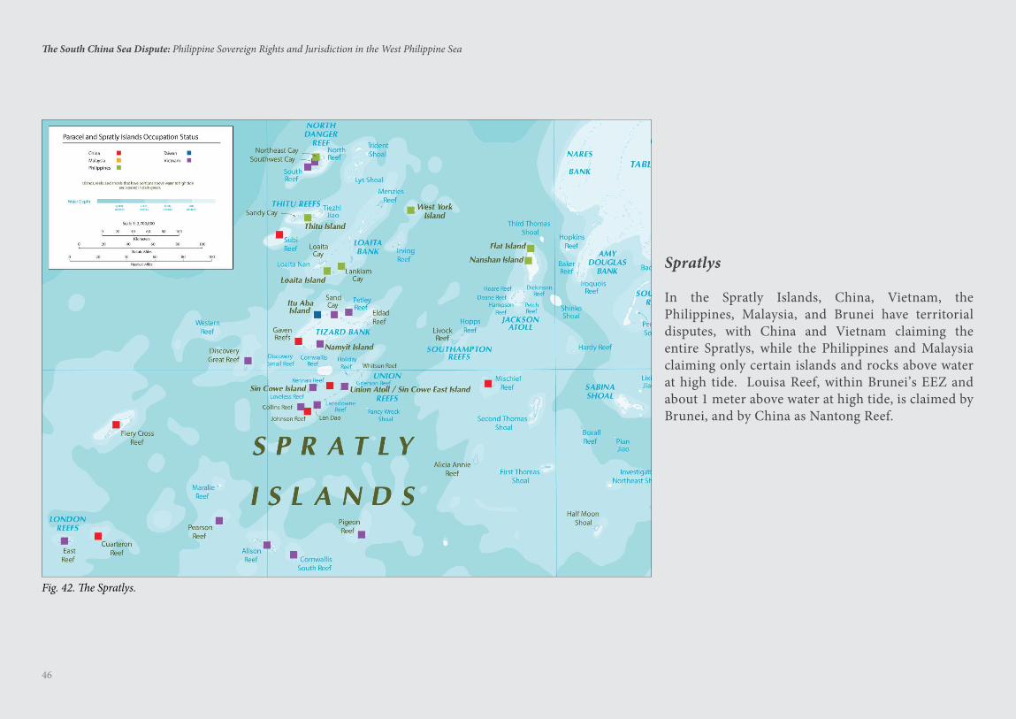
46
The South China Sea Dispute: Philippine Sovereign Rights and Jurisdiction in the West Philippine Sea
Spratlys
In the Spratly Islands, China, Vietnam, the Philippines, Malaysia, and Brunei have territorial disputes, with China and Vietnam claiming the entire Spratlys, while the Philippines and Malaysia claiming only certain islands and rocks above water at high tide. Louisa Reef, within Brunei’s EEZ and about 1 meter above water at high tide, is claimed by Brunei, and by China as Nantong Reef.
Fig. 42. The Spratlys.
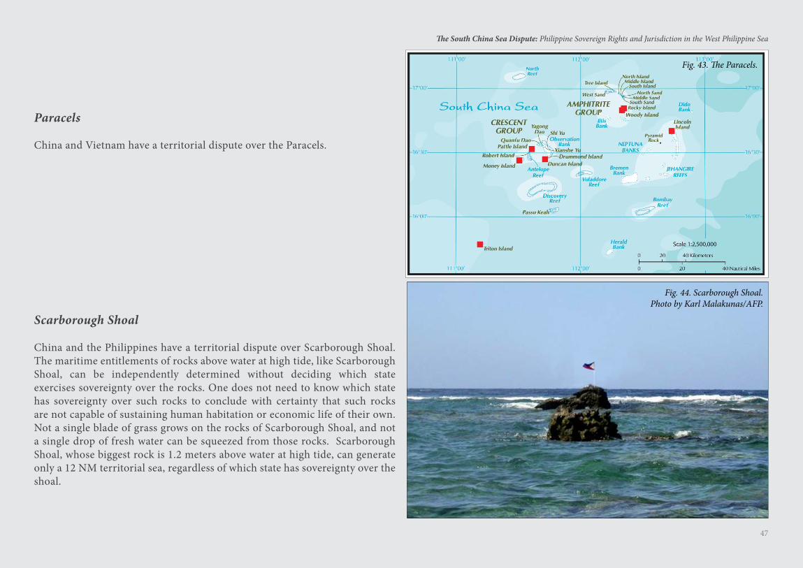
47
The South China Sea Dispute: Philippine Sovereign Rights and Jurisdiction in the West Philippine Sea
Scarborough Shoal
China and the Philippines have a territorial dispute over Scarborough Shoal. The maritime entitlements of rocks above water at high tide, like Scarborough Shoal, can be independently determined without deciding which state exercises sovereignty over the rocks. One does not need to know which state has sovereignty over such rocks to conclude with certainty that such rocks are not capable of sustaining human habitation or economic life of their own. Not a single blade of grass grows on the rocks of Scarborough Shoal, and not a single drop of fresh water can be squeezed from those rocks. Scarborough Shoal, whose biggest rock is 1.2 meters above water at high tide, can generate only a 12 NM territorial sea, regardless of which state has sovereignty over the shoal.
Paracels
China and Vietnam have a territorial dispute over the Paracels.
Fig. 43. The Paracels.
Fig. 44. Scarborough Shoal.Photo by Karl Malakunas/AFP.
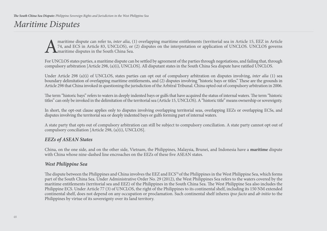
48
The South China Sea Dispute: Philippine Sovereign Rights and Jurisdiction in the West Philippine Sea
A maritime dispute can refer to, inter alia, (1) overlapping maritime entitlements (territorial sea in Article 15, EEZ in Article 74, and ECS in Article 83, UNCLOS), or (2) disputes on the interpretation or application of UNCLOS. UNCLOS governs maritime disputes in the South China Sea.
For UNCLOS states parties, a maritime dispute can be settled by agreement of the parties through negotiations, and failing that, through compulsory arbitration [Article 298, (a)(i), UNCLOS]. All disputant states in the South China Sea dispute have ratified UNCLOS.
Under Article 298 (a)(i) of UNCLOS, states parties can opt out of compulsory arbitration on disputes involving, inter alia (1) sea boundary delimitation of overlapping maritime entitlements, and (2) disputes involving “historic bays or titles.” These are the grounds in Article 298 that China invoked in questioning the jurisdiction of the Arbitral Tribunal. China opted out of compulsory arbitration in 2006.
The term “historic bays” refers to waters in deeply indented bays or gulfs that have acquired the status of internal waters. The term “historic titles” can only be invoked in the delimitation of the territorial sea (Article 15, UNCLOS). A “historic title” means ownership or sovereignty.
In short, the opt-out clause applies only to disputes involving overlapping territorial seas, overlapping EEZs or overlapping ECSs, and disputes involving the territorial sea or deeply indented bays or gulfs forming part of internal waters.
A state party that opts out of compulsory arbitration can still be subject to compulsory conciliation. A state party cannot opt out of compulsory conciliation [Article 298, (a)(i), UNCLOS].
EEZs of ASEAN States
China, on the one side, and on the other side, Vietnam, the Philippines, Malaysia, Brunei, and Indonesia have a maritime dispute with China whose nine-dashed line encroaches on the EEZs of these five ASEAN states.
West Philippine Sea
The dispute between the Philippines and China involves the EEZ and ECS70 of the Philippines in the West Philippine Sea, which forms part of the South China Sea. Under Administrative Order No. 29 (2012), the West Philippines Sea refers to the waters covered by the maritime entitlements (territorial sea and EEZ) of the Philippines in the South China Sea. The West Philippine Sea also includes the Philippine ECS. Under Article 77 (3) of UNCLOS, the right of the Philippines to its continental shelf, including its 150 NM extended continental shelf, does not depend on any occupation or proclamation. Such continental shelf inheres ipso facto and ab initio to the Philippines by virtue of its sovereignty over its land territory.
Maritime Disputes
The South China Sea Arbitration Case:Republic of the Philippines v. People’s Republic of China71
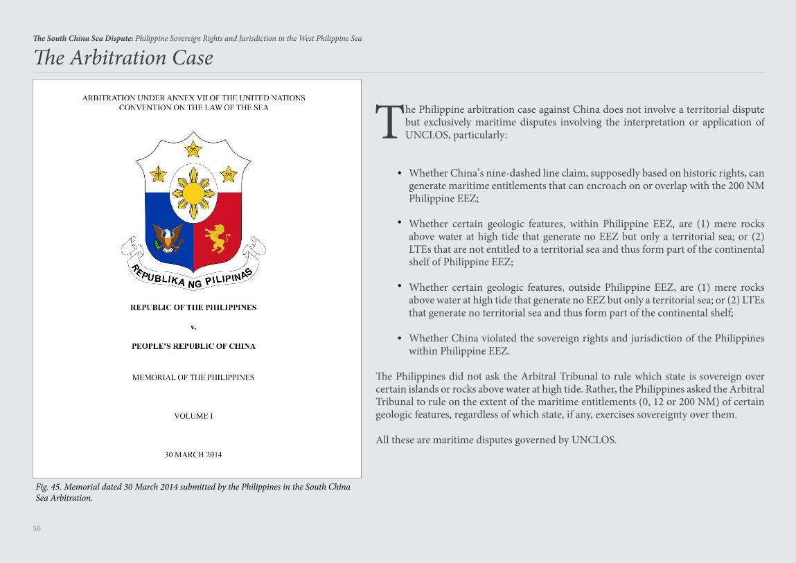
50
The South China Sea Dispute: Philippine Sovereign Rights and Jurisdiction in the West Philippine Sea
The Philippine arbitration case against China does not involve a territorial dispute but exclusively maritime disputes involving the interpretation or application of UNCLOS, particularly:
Whether China’s nine-dashed line claim, supposedly based on historic rights, can generate maritime entitlements that can encroach on or overlap with the 200 NM Philippine EEZ;
Whether certain geologic features, within Philippine EEZ, are (1) mere rocks above water at high tide that generate no EEZ but only a territorial sea; or (2) LTEs that are not entitled to a territorial sea and thus form part of the continental shelf of Philippine EEZ;
Whether certain geologic features, outside Philippine EEZ, are (1) mere rocks above water at high tide that generate no EEZ but only a territorial sea; or (2) LTEs that generate no territorial sea and thus form part of the continental shelf;
Whether China violated the sovereign rights and jurisdiction of the Philippines within Philippine EEZ.
The Philippines did not ask the Arbitral Tribunal to rule which state is sovereign over certain islands or rocks above water at high tide. Rather, the Philippines asked the Arbitral Tribunal to rule on the extent of the maritime entitlements (0, 12 or 200 NM) of certain geologic features, regardless of which state, if any, exercises sovereignty over them.
All these are maritime disputes governed by UNCLOS.
•
•
•
•
The Arbitration Case
Fig. 45. Memorial dated 30 March 2014 submitted by the Philippines in the South China Sea Arbitration.
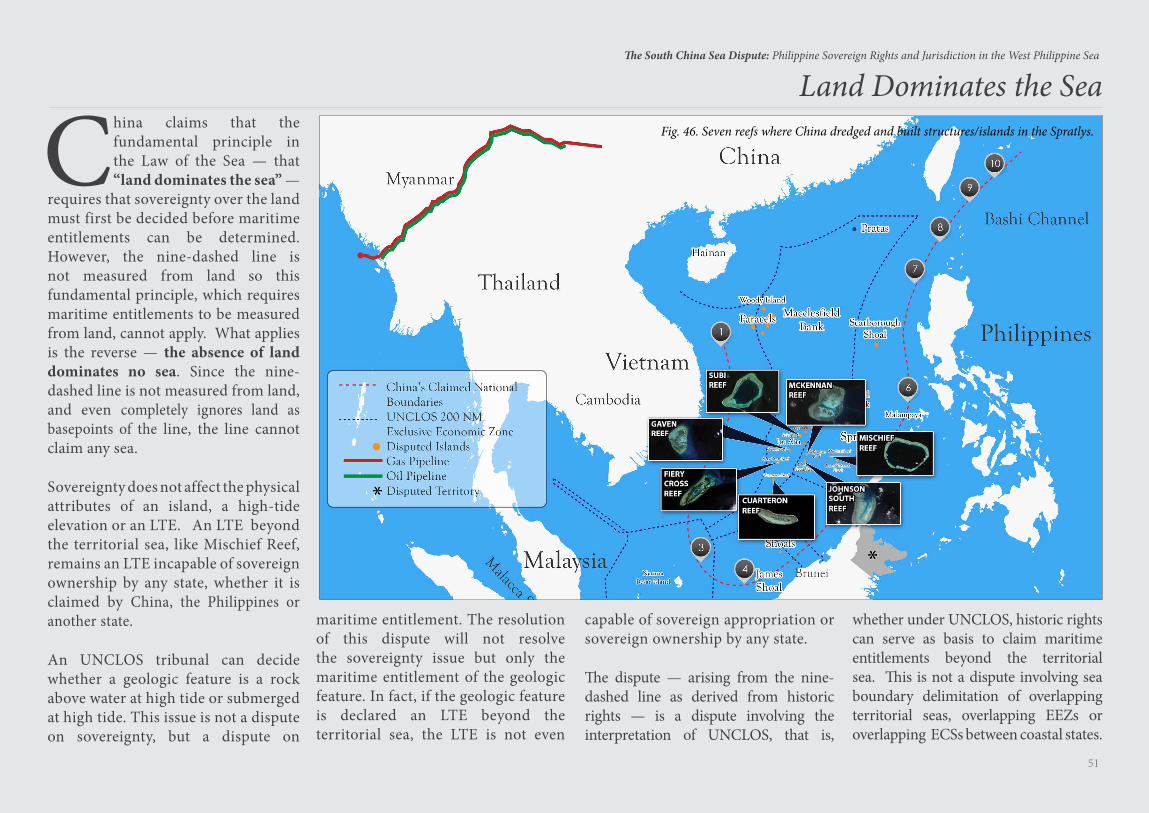
51
The South China Sea Dispute: Philippine Sovereign Rights and Jurisdiction in the West Philippine Sea
China claims that the fundamental principle in the Law of the Sea — that “land dominates the sea” —
requires that sovereignty over the land must first be decided before maritime entitlements can be determined. However, the nine-dashed line is not measured from land so this fundamental principle, which requires maritime entitlements to be measured from land, cannot apply. What applies is the reverse — the absence of land dominates no sea. Since the nine-dashed line is not measured from land, and even completely ignores land as basepoints of the line, the line cannot claim any sea.
Sovereignty does not affect the physical attributes of an island, a high-tide elevation or an LTE. An LTE beyond the territorial sea, like Mischief Reef, remains an LTE incapable of sovereign ownership by any state, whether it is claimed by China, the Philippines or another state.
An UNCLOS tribunal can decide whether a geologic feature is a rock above water at high tide or submerged at high tide. This issue is not a dispute on sovereignty, but a dispute on
maritime entitlement. The resolution of this dispute will not resolve the sovereignty issue but only the maritime entitlement of the geologic feature. In fact, if the geologic feature is declared an LTE beyond the territorial sea, the LTE is not even
capable of sovereign appropriation or sovereign ownership by any state.
The dispute — arising from the nine-dashed line as derived from historic rights — is a dispute involving the interpretation of UNCLOS, that is,
whether under UNCLOS, historic rights can serve as basis to claim maritime entitlements beyond the territorial sea. This is not a dispute involving sea boundary delimitation of overlapping territorial seas, overlapping EEZs or overlapping ECSs between coastal states.
Fig. 46. Seven reefs where China dredged and built structures/islands in the Spratlys.
Land Dominates the Sea
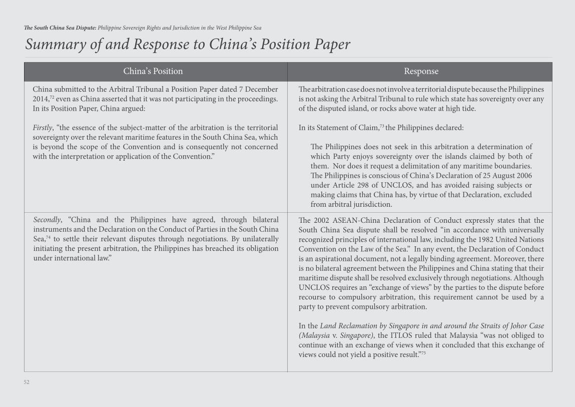
52
The South China Sea Dispute: Philippine Sovereign Rights and Jurisdiction in the West Philippine Sea
Summary of and Response to China’s Position PaperChina’s Position Response
The arbitration case does not involve a territorial dispute because the Philippines is not asking the Arbitral Tribunal to rule which state has sovereignty over any of the disputed island, or rocks above water at high tide.
In its Statement of Claim,73 the Philippines declared:
The Philippines does not seek in this arbitration a determination of which Party enjoys sovereignty over the islands claimed by both of them. Nor does it request a delimitation of any maritime boundaries. The Philippines is conscious of China’s Declaration of 25 August 2006 under Article 298 of UNCLOS, and has avoided raising subjects or making claims that China has, by virtue of that Declaration, excluded from arbitral jurisdiction.
Secondly, “China and the Philippines have agreed, through bilateral instruments and the Declaration on the Conduct of Parties in the South China Sea,74 to settle their relevant disputes through negotiations. By unilaterally initiating the present arbitration, the Philippines has breached its obligation under international law.”
The 2002 ASEAN-China Declaration of Conduct expressly states that the South China Sea dispute shall be resolved “in accordance with universally recognized principles of international law, including the 1982 United Nations Convention on the Law of the Sea.” In any event, the Declaration of Conduct is an aspirational document, not a legally binding agreement. Moreover, there is no bilateral agreement between the Philippines and China stating that their maritime dispute shall be resolved exclusively through negotiations. Although UNCLOS requires an “exchange of views” by the parties to the dispute before recourse to compulsory arbitration, this requirement cannot be used by a party to prevent compulsory arbitration.
In the Land Reclamation by Singapore in and around the Straits of Johor Case (Malaysia v. Singapore), the ITLOS ruled that Malaysia “was not obliged to continue with an exchange of views when it concluded that this exchange of views could not yield a positive result.”75
China submitted to the Arbitral Tribunal a Position Paper dated 7 December 2014,72 even as China asserted that it was not participating in the proceedings. In its Position Paper, China argued:
Firstly, “the essence of the subject-matter of the arbitration is the territorial sovereignty over the relevant maritime features in the South China Sea, which is beyond the scope of the Convention and is consequently not concerned with the interpretation or application of the Convention.”
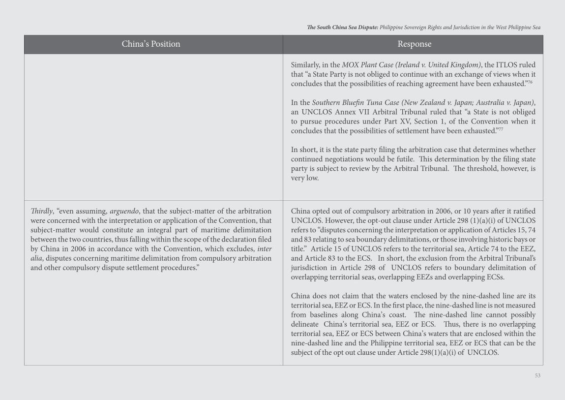
53
The South China Sea Dispute: Philippine Sovereign Rights and Jurisdiction in the West Philippine Sea
China’s Position Response
Thirdly, “even assuming, arguendo, that the subject-matter of the arbitration were concerned with the interpretation or application of the Convention, that subject-matter would constitute an integral part of maritime delimitation between the two countries, thus falling within the scope of the declaration filed by China in 2006 in accordance with the Convention, which excludes, inter alia, disputes concerning maritime delimitation from compulsory arbitration and other compulsory dispute settlement procedures.”
China opted out of compulsory arbitration in 2006, or 10 years after it ratified UNCLOS. However, the opt-out clause under Article 298 (1)(a)(i) of UNCLOS refers to “disputes concerning the interpretation or application of Articles 15, 74 and 83 relating to sea boundary delimitations, or those involving historic bays or title.” Article 15 of UNCLOS refers to the territorial sea, Article 74 to the EEZ, and Article 83 to the ECS. In short, the exclusion from the Arbitral Tribunal’s jurisdiction in Article 298 of UNCLOS refers to boundary delimitation of overlapping territorial seas, overlapping EEZs and overlapping ECSs.
China does not claim that the waters enclosed by the nine-dashed line are its territorial sea, EEZ or ECS. In the first place, the nine-dashed line is not measured from baselines along China’s coast. The nine-dashed line cannot possibly delineate China’s territorial sea, EEZ or ECS. Thus, there is no overlapping territorial sea, EEZ or ECS between China’s waters that are enclosed within the nine-dashed line and the Philippine territorial sea, EEZ or ECS that can be the subject of the opt out clause under Article 298(1)(a)(i) of UNCLOS.
Similarly, in the MOX Plant Case (Ireland v. United Kingdom), the ITLOS ruled that “a State Party is not obliged to continue with an exchange of views when it concludes that the possibilities of reaching agreement have been exhausted.”76
In the Southern Bluefin Tuna Case (New Zealand v. Japan; Australia v. Japan), an UNCLOS Annex VII Arbitral Tribunal ruled that “a State is not obliged to pursue procedures under Part XV, Section 1, of the Convention when it concludes that the possibilities of settlement have been exhausted.”77
In short, it is the state party filing the arbitration case that determines whether continued negotiations would be futile. This determination by the filing state party is subject to review by the Arbitral Tribunal. The threshold, however, is very low.
54
The South China Sea Dispute: Philippine Sovereign Rights and Jurisdiction in the West Philippine Sea
China’s Position Response
Fourthly, “China has never accepted any compulsory procedures of the Convention with regard to the Philippines’ claims for arbitration. The Arbitral Tribunal shall fully respect the right of the States Parties to the Convention to choose the means of dispute settlement of their own accord, and exercise its competence to decide on its jurisdiction within the confines of the Convention. The initiation of the present arbitration by the Philippines is an abuse of the compulsory dispute settlement procedures under the Convention. There is a solid basis in international law for China’s rejection of and non-participation in the present arbitration.”
China ratified, and therefore is bound by, UNCLOS. Article 286, section 2 on Compulsory Procedures Entailing Binding Decisions, provides that “subject to section 3 (on Limitations and Exceptions to Applicability of section 2), any dispute concerning the interpretation or application of this Convention shall, where no settlement has been reached by recourse to section 1 (on Exchange of Views), be submitted at the request of any party to the dispute to the court or tribunal having jurisdiction under this section.” In short, states that ratified UNCLOS gave their consent, in advance, to compulsory arbitration with respect to any dispute falling under Article 298 (1)(a) of UNCLOS. There is no need to secure again a state party’s consent to compulsory arbitration when a dispute arises in the future.
If UNCLOS does not apply to the South China Sea dispute, as when China’s nine-dashed line is allowed to gobble up the EEZs of coastal states as well as the high seas, then UNCLOS, the constitution for the oceans and seas, cannot also apply to any maritime dispute in the rest of the oceans and seas of our planet. It will be the beginning of the end of UNCLOS. The rule of the naval cannon will prevail in the oceans and seas of our planet, and no longer the rule of law. There will be a naval arms race among coastal countries. It is the duty of all citizens of the world to prevent such a catastrophe.
In fact, China claims that the waters enclosed by the nine-dashed line are “sui generis” waters, admitting that these waters are neither territorial sea, EEZ nor ECS. Article 309 of the UNCLOS mandates that no reservations or exceptions may be made to UNCLOS unless expressly permitted by its other provisions. Article 310 of UNCLOS provides that declarations or statements made by a state upon signing or ratification cannot “modify the legal effect of the provisions of this Convention in their application to that State.” China’s claim of sui generis waters, which is not expressly allowed under any provision of UNCLOS, has no legal effect and cannot serve as basis to assert any maritime entitlement.
55
The South China Sea Dispute: Philippine Sovereign Rights and Jurisdiction in the West Philippine Sea
The five major issues that the Philippines raised in the arbitration are:
1. China’s Historic Rights Claim — China’s claim to historic rights beyond its territorial sea is contrary to UNCLOS. The nine-dashed line has no legal basis and cannot generate any maritime entitlement (territorial sea, exclusive economic zone or extended continental shelf).
2. Geologic Features in the Spratlys — No geologic feature in the Spratlys is capable of human habitation or economic life of its own so as to generate a 200 NM EEZ that can overlap with Palawan’s EEZ.
3. China-Occupied Geologic Features in the Spratlys — The Arbitral Tribunal has jurisdiction to rule on the maritime entitlement and status (whether LTE or High-Tide Elevation) of geologic features. These are not sovereignty disputes. A claim to an EEZ is not a claim to sovereignty because a state cannot exercise sovereignty over its EEZ, which is a maritime entitlement first created and governed by UNCLOS. The status of an LTE beyond the territorial sea cannot involve any sovereignty dispute because such LTE is incapable of sovereign ownership. Moreover, maritime entitlement is separate from sea boundary delimitation because a geologic feature’s maritime entitlements do not always or necessarily overlap with the maritime entitlements of another state.
4. Scarborough Shoal — Scarborough Shoal is a rock above water at high tide, and is entitled only to a 12 NM territorial sea. Filipino fishermen have traditional fishing rights in the territorial sea of Scarborough Shoal, regardless of which state exercises sovereignty over the shoal.
5. Harm to the Marine Environment — China caused severe harm to the marine environment.
Major Issues in the Arbitration78
China’s Historic Rights Claim
57
The South China Sea Dispute: Philippine Sovereign Rights and Jurisdiction in the West Philippine Sea
On China’s historic rights claim, the Arbitral Tribunal upheld the Philippine position that:
1. The nine-dashed line cannot serve as legal basis to claim any maritime entitlement (territorial sea, EEZ or ECS) under UNCLOS. In short, “there is no legal basis for any Chinese historic rights, or sovereign rights and jurisdiction beyond those provided for in the Convention in the waters of the South China Sea encompassed by the ‘nine-dash line.’”79
2. China’s maritime entitlements, just like those of other coastal states, cannot extend beyond the limits prescribed under UNCLOS, which requires maritime entitlements to be claimed only from baselines along the coast of continental land, island or rock above water at high tide.
3. All historic rights in the EEZ, ECS and high seas were extinguished upon effectivity of UNCLOS:
[A]ny historic rights that China may have had to the living and non-living resources within the ‘nine-dash line’ were superseded, as a matter of law and as between the Philippines and China, by the limits of the maritime zones provided for by the Convention.80
4. Moreover:
[T]here was no evidence that China had historically exercised exclusive control over the waters [of the South China Sea] or their resources.
[T]he Tribunal concludes that China’s claim to historic rights to the living and non-living resources within the ‘nine-dash line’ is incompatible with the Convention to the extent that it exceeds the limits of China’s maritime zones as provided for by the Convention.81
The Arbitral Award on China’s Historic Rights Claim
58
The South China Sea Dispute: Philippine Sovereign Rights and Jurisdiction in the West Philippine Sea
Historical facts, even if true, relating to discovery and exploration in the Age of Discovery (early 15th century until the 17th century) or even earlier, have no bearing whatsoever in the resolution of maritime disputes under UNCLOS. Neither Spain nor Portugal can revive its
15th century claims to ownership of oceans and seas of our planet, despite the 1481 Papal Bull confirming the division of the then undiscovered world between Spain and Portugal.82 Similarly, the sea voyages of the Chinese Imperial Admiral Zheng He, from 1405 to 1433, can never be the basis of any claim to the South China Sea. Neither can historical names serve as basis for claiming the oceans and seas.
The South China Sea was not even named by the Chinese but by European navigators and cartographers. To the Chinese during the period of the dynasties, and later the Republic of China and the People’s Republic of China, the sea was simply the “South Sea” (Nan Hai) without the word “China.”83 India cannot claim the Indian Ocean, and Mexico cannot claim the Gulf of Mexico, in the same way that the Philippines cannot claim the Philippine Sea, just because historically these bodies of water have been named after these countries.
Neither can ancient conquests be invoked under international law to claim territories. Greece cannot claim Egypt, Iran, Turkey, and the land stretching up to Pakistan just because Alexander the Great conquered that part of the world from 334-323 BCE.84 Neither can Mongolia claim China just because Genghis Khan conquered China, with his grandson Kublai Khan founding the Yuan Dynasty of Mongols that ruled China from 1279 to 1368 CE.85 Neither can Italy claim the land conquered and ruled by the Roman Empire from 27 BCE to 476 CE, stretching from Europe to the Middle East.86
Under international law, as held in the Island of Palmas Case (The United States of America v. The Netherlands),87 a state cannot maintain title to territory based on discovery alone where subsequent to such discovery another state has shown “continuous and peaceful display of territorial sovereignty” over the same territory. Since the 19th century, the rule in international law has been that discovery alone
Fallacy of China’s Historic Rights Claimdoes not vest title, which can arise only if followed within a reasonable period by continuous and peaceful display of sovereignty through “effective occupation.” Even in the 16th century, actual possession within a reasonable time was necessary to maintain title to territory acquired through discovery.88
Under UNCLOS, a state can only invoke “historic” rights to claim a territorial sea or internal waters in deeply indented bays or gulfs along the coast of the mainland, like in the Gulf of Fonseca89 (Article 10, UNCLOS). Historic rights or historic title cannot be invoked to claim EEZs or ECSs. The creation of the EEZ under Article 56 of UNCLOS with “sovereign rights,” which means supreme rights, accorded to the adjacent coastal state, extinguished all historic rights or claims by other states to the EEZ of a coastal state. The word “exclusive” in the term EEZ means the economic exploitation of the zone is exclusive to the adjacent coastal state. No one may exploit the natural resources in the EEZ without the express consent of the coastal state [Article 77(3), UNCLOS].
By virtue of its sovereignty over land, a coastal state has ipso facto and ab initio inherent right to a continental shelf.90 A coastal state’s right to a continental shelf does not depend on any occupation or proclamation [Article 77(3), UNCLOS].
China actively participated in the negotiations of UNCLOS from 1973 to 1982. China aligned itself with the developing coastal countries that demanded a 200 NM EEZ where the coastal state has exclusive sovereign rights to exploit the EEZ. China never claimed that historic rights could be an exception to the exclusive sovereign rights of coastal states in their EEZs. In fact, the 200 NM EEZ was agreed upon on the clear understanding that all historic claims of other states in the EEZ of a coastal state were deemed extinguished.91
China made the following formal declaration upon its ratification of UNCLOS on 7 June 1996: “In accordance with the provisions of the United Nations Convention on the Law of the Sea, the People’s Republic of China shall enjoy sovereign rights and jurisdiction over an exclusive economic zone of 200 nautical miles and the continental shelf.”92
59
The South China Sea Dispute: Philippine Sovereign Rights and Jurisdiction in the West Philippine Sea
Upon ratification, China did not claim any historic rights or jurisdiction beyond its entitlements under UNCLOS. In fact, China expressly aligned its declared maritime rights in accordance with what UNCLOS prescribed for the EEZ and the continental shelf.
The first time that a Chinese law mentioned “historical rights” in relation to China’s maritime claims was in China’s 1998 Act on the EEZ and Continental Shelf, after China signed in 1982 and ratified in 1996 UNCLOS. Article 14 of the 1998 Act enigmatically states: “No provision of this Law can prejudice historical rights of the People’s Republic of China.” There was no explanation of the nature, basis or scope of these “historical rights.”93
Even assuming, quod non, historic rights can be claimed beyond the territorial sea, the following conditions must first be satisfied for historic rights to be valid under international law:
First, the state actually exercised authority over the area where it claims historic rights;
Second, the state exercised that authority continuously and for a long period of time; and Third, other states either acquiesced in or failed to oppose the exercise of such authority.94
China’s nine-dashed line claim fails to satisfy any of these conditions.
Despite the irrelevance of historical facts, such as ancient discovery, exploration or conquests, to present-day maritime claims under UNCLOS, China persists in invoking “historical facts” as basis for its nine-dashed line claim. China, however, does not specify what these historical facts are.95
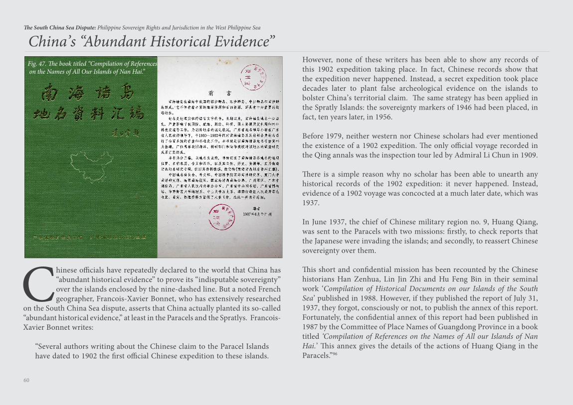
60
The South China Sea Dispute: Philippine Sovereign Rights and Jurisdiction in the West Philippine Sea
Chinese officials have repeatedly declared to the world that China has “abundant historical evidence” to prove its “indisputable sovereignty” over the islands enclosed by the nine-dashed line. But a noted French geographer, Francois-Xavier Bonnet, who has extensively researched
on the South China Sea dispute, asserts that China actually planted its so-called “abundant historical evidence,” at least in the Paracels and the Spratlys. Francois-Xavier Bonnet writes:
“Several authors writing about the Chinese claim to the Paracel Islands have dated to 1902 the first official Chinese expedition to these islands.
China’s “Abundant Historical Evidence” Fig. 47. The book titled “Compilation of References on the Names of All Our Islands of Nan Hai.”
However, none of these writers has been able to show any records of this 1902 expedition taking place. In fact, Chinese records show that the expedition never happened. Instead, a secret expedition took place decades later to plant false archeological evidence on the islands to bolster China’s territorial claim. The same strategy has been applied in the Spratly Islands: the sovereignty markers of 1946 had been placed, in fact, ten years later, in 1956.
Before 1979, neither western nor Chinese scholars had ever mentioned the existence of a 1902 expedition. The only official voyage recorded in the Qing annals was the inspection tour led by Admiral Li Chun in 1909.
There is a simple reason why no scholar has been able to unearth any historical records of the 1902 expedition: it never happened. Instead, evidence of a 1902 voyage was concocted at a much later date, which was 1937.
In June 1937, the chief of Chinese military region no. 9, Huang Qiang, was sent to the Paracels with two missions: firstly, to check reports that the Japanese were invading the islands; and secondly, to reassert Chinese sovereignty over them.
This short and confidential mission has been recounted by the Chinese historians Han Zenhua, Lin Jin Zhi and Hu Feng Bin in their seminal work ‘Compilation of Historical Documents on our Islands of the South Sea’ published in 1988. However, if they published the report of July 31, 1937, they forgot, consciously or not, to publish the annex of this report. Fortunately, the confidential annex of this report had been published in 1987 by the Committee of Place Names of Guangdong Province in a book titled ‘Compilation of References on the Names of All our Islands of Nan Hai.’ This annex gives the details of the actions of Huang Qiang in the Paracels.”96
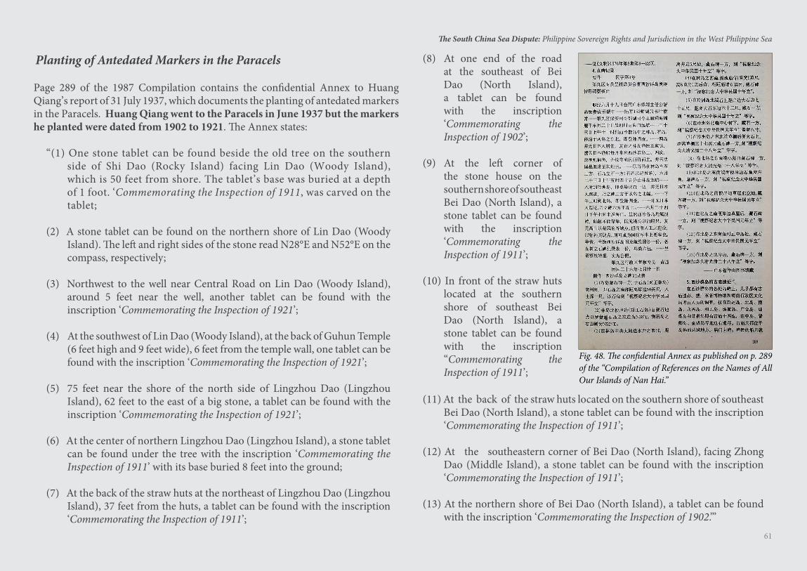
61
The South China Sea Dispute: Philippine Sovereign Rights and Jurisdiction in the West Philippine Sea
Page 289 of the 1987 Compilation contains the confidential Annex to Huang Qiang’s report of 31 July 1937, which documents the planting of antedated markers in the Paracels. Huang Qiang went to the Paracels in June 1937 but the markers he planted were dated from 1902 to 1921. The Annex states:
“(1) One stone tablet can be found beside the old tree on the southern side of Shi Dao (Rocky Island) facing Lin Dao (Woody Island), which is 50 feet from shore. The tablet’s base was buried at a depth of 1 foot. ‘Commemorating the Inspection of 1911, was carved on the tablet;
(2) A stone tablet can be found on the northern shore of Lin Dao (Woody Island). The left and right sides of the stone read N28°E and N52°E on the compass, respectively;
(3) Northwest to the well near Central Road on Lin Dao (Woody Island), around 5 feet near the well, another tablet can be found with the inscription ‘Commemorating the Inspection of 1921’;
(4) At the southwest of Lin Dao (Woody Island), at the back of Guhun Temple (6 feet high and 9 feet wide), 6 feet from the temple wall, one tablet can be found with the inscription ‘Commemorating the Inspection of 1921’;
(5) 75 feet near the shore of the north side of Lingzhou Dao (Lingzhou Island), 62 feet to the east of a big stone, a tablet can be found with the inscription ‘Commemorating the Inspection of 1921’;
(6) At the center of northern Lingzhou Dao (Lingzhou Island), a stone tablet can be found under the tree with the inscription ‘Commemorating the Inspection of 1911’ with its base buried 8 feet into the ground;
(7) At the back of the straw huts at the northeast of Lingzhou Dao (Lingzhou Island), 37 feet from the huts, a tablet can be found with the inscription ‘Commemorating the Inspection of 1911’;
Planting of Antedated Markers in the Paracels
Fig. 48. The confidential Annex as published on p. 289 of the “Compilation of References on the Names of All Our Islands of Nan Hai.”
(8) At one end of the road at the southeast of Bei Dao (North Island), a tablet can be found with the inscription ‘Commemorating the Inspection of 1902’;
(9) At the left corner of the stone house on the southern shore of southeast Bei Dao (North Island), a stone tablet can be found with the inscription ‘Commemorating the Inspection of 1911’;
(10) In front of the straw huts located at the southern shore of southeast Bei Dao (North Island), a stone tablet can be found with the inscription “Commemorating the Inspection of 1911’;
(11) At the back of the straw huts located on the southern shore of southeast Bei Dao (North Island), a stone tablet can be found with the inscription ‘Commemorating the Inspection of 1911’;
(12) At the southeastern corner of Bei Dao (North Island), facing Zhong Dao (Middle Island), a stone tablet can be found with the inscription ‘Commemorating the Inspection of 1911’;
(13) At the northern shore of Bei Dao (North Island), a tablet can be found with the inscription ‘Commemorating the Inspection of 1902.’”
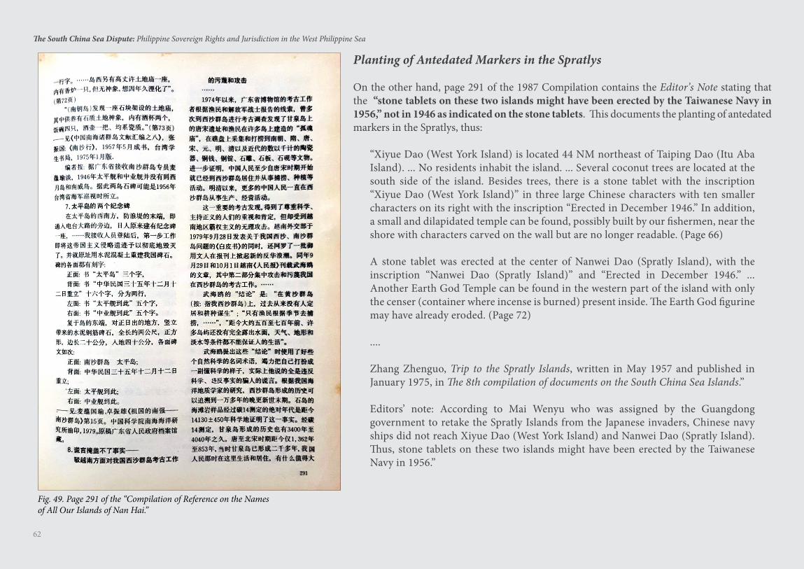
62
The South China Sea Dispute: Philippine Sovereign Rights and Jurisdiction in the West Philippine Sea
Planting of Antedated Markers in the Spratlys
On the other hand, page 291 of the 1987 Compilation contains the Editor’s Note stating that the “stone tablets on these two islands might have been erected by the Taiwanese Navy in 1956,” not in 1946 as indicated on the stone tablets. This documents the planting of antedated markers in the Spratlys, thus:
“Xiyue Dao (West York Island) is located 44 NM northeast of Taiping Dao (Itu Aba Island). ... No residents inhabit the island. ... Several coconut trees are located at the south side of the island. Besides trees, there is a stone tablet with the inscription “Xiyue Dao (West York Island)” in three large Chinese characters with ten smaller characters on its right with the inscription “Erected in December 1946.” In addition, a small and dilapidated temple can be found, possibly built by our fishermen, near the shore with characters carved on the wall but are no longer readable. (Page 66)
A stone tablet was erected at the center of Nanwei Dao (Spratly Island), with the inscription “Nanwei Dao (Spratly Island)” and “Erected in December 1946.” ... Another Earth God Temple can be found in the western part of the island with only the censer (container where incense is burned) present inside. The Earth God figurine may have already eroded. (Page 72)
....
Zhang Zhenguo, Trip to the Spratly Islands, written in May 1957 and published in January 1975, in The 8th compilation of documents on the South China Sea Islands.”
Editors’ note: According to Mai Wenyu who was assigned by the Guangdong government to retake the Spratly Islands from the Japanese invaders, Chinese navy ships did not reach Xiyue Dao (West York Island) and Nanwei Dao (Spratly Island). Thus, stone tablets on these two islands might have been erected by the Taiwanese Navy in 1956.”
Fig. 49. Page 291 of the “Compilation of Reference on the Namesof All Our Islands of Nan Hai.”
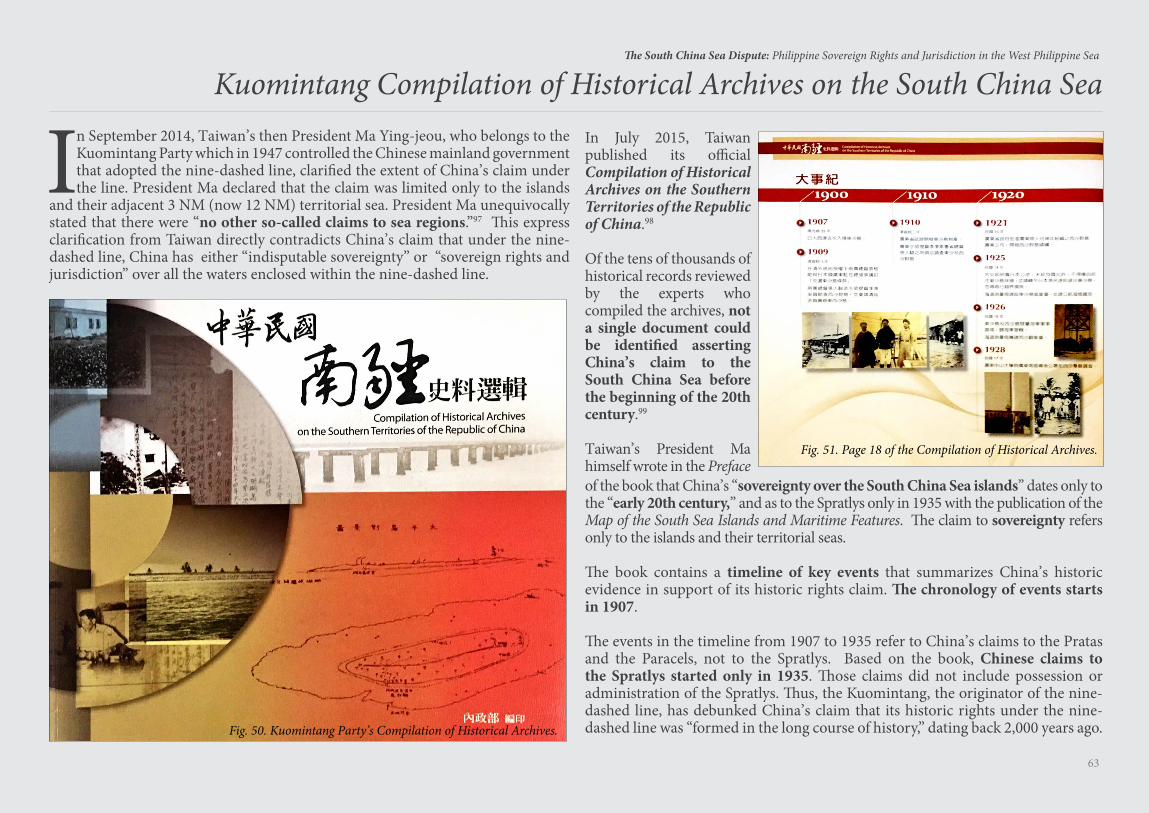
63
The South China Sea Dispute: Philippine Sovereign Rights and Jurisdiction in the West Philippine Sea
In July 2015, Taiwan published its official Compilation of Historical Archives on the Southern Territories of the Republic of China.98
Of the tens of thousands of historical records reviewed by the experts who compiled the archives, not a single document could be identified asserting China’s claim to the South China Sea before the beginning of the 20th century.99
Taiwan’s President Ma himself wrote in the Preface
Kuomintang Compilation of Historical Archives on the South China Sea
In September 2014, Taiwan’s then President Ma Ying-jeou, who belongs to the Kuomintang Party which in 1947 controlled the Chinese mainland government that adopted the nine-dashed line, clarified the extent of China’s claim under the line. President Ma declared that the claim was limited only to the islands
and their adjacent 3 NM (now 12 NM) territorial sea. President Ma unequivocally stated that there were “no other so-called claims to sea regions.”97 This express clarification from Taiwan directly contradicts China’s claim that under the nine-dashed line, China has either “indisputable sovereignty” or “sovereign rights and jurisdiction” over all the waters enclosed within the nine-dashed line.
Fig. 50. Kuomintang Party’s Compilation of Historical Archives.
Fig. 51. Page 18 of the Compilation of Historical Archives.
of the book that China’s “sovereignty over the South China Sea islands” dates only to the “early 20th century,” and as to the Spratlys only in 1935 with the publication of the Map of the South Sea Islands and Maritime Features. The claim to sovereignty refers only to the islands and their territorial seas.
The book contains a timeline of key events that summarizes China’s historic evidence in support of its historic rights claim. The chronology of events starts in 1907.
The events in the timeline from 1907 to 1935 refer to China’s claims to the Pratas and the Paracels, not to the Spratlys. Based on the book, Chinese claims to the Spratlys started only in 1935. Those claims did not include possession or administration of the Spratlys. Thus, the Kuomintang, the originator of the nine-dashed line, has debunked China’s claim that its historic rights under the nine-dashed line was “formed in the long course of history,” dating back 2,000 years ago.
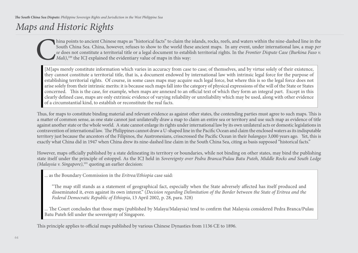
64
The South China Sea Dispute: Philippine Sovereign Rights and Jurisdiction in the West Philippine Sea
Maps and Historic Rights
China points to ancient Chinese maps as “historical facts” to claim the islands, rocks, reefs, and waters within the nine-dashed line in the South China Sea. China, however, refuses to show to the world these ancient maps. In any event, under international law, a map per se does not constitute a territorial title or a legal document to establish territorial rights. In the Frontier Dispute Case (Burkina Faso v. Mali),100 the ICJ explained the evidentiary value of maps in this way:
[M]aps merely constitute information which varies in accuracy from case to case; of themselves, and by virtue solely of their existence, they cannot constitute a territorial title, that is, a document endowed by international law with intrinsic legal force for the purpose of establishing territorial rights. Of course, in some cases maps may acquire such legal force, but where this is so the legal force does not arise solely from their intrinsic merits: it is because such maps fall into the category of physical expressions of the will of the State or States concerned. This is the case, for example, when maps are annexed to an official text of which they form an integral part. Except in this clearly defined case, maps are only extrinsic evidence of varying reliability or unreliability which may be used, along with other evidence of a circumstantial kind, to establish or reconstitute the real facts.
Thus, for maps to constitute binding material and relevant evidence as against other states, the contending parties must agree to such maps. This is a matter of common sense, as one state cannot just unilaterally draw a map to claim an entire sea or territory and use such map as evidence of title against another state or the whole world. A state cannot enlarge its rights under international law by its own unilateral acts or domestic legislations in contravention of international law. The Philippines cannot draw a U-shaped line in the Pacific Ocean and claim the enclosed waters as its indisputable territory just because the ancestors of the Filipinos, the Austronesians, crisscrossed the Pacific Ocean in their balangays 3,000 years ago. Yet, this is exactly what China did in 1947 when China drew its nine-dashed line claim in the South China Sea, citing as basis supposed “historical facts.”
However, maps officially published by a state delineating its territory or boundaries, while not binding on other states, may bind the publishing state itself under the principle of estoppel. As the ICJ held in Sovereignty over Pedra Branca/Pulau Batu Puteh, Middle Rocks and South Ledge (Malaysia v. Singapore),101 quoting an earlier decision:
... as the Boundary Commission in the Eritrea/Ethiopia case said:
“The map still stands as a statement of geographical fact, especially when the State adversely affected has itself produced and disseminated it, even against its own interest.” (Decision regarding Delimitation of the Border between the State of Eritrea and the Federal Democratic Republic of Ethiopia, 13 April 2002, p. 28, para. 328)
... The Court concludes that those maps (published by Malaya/Malaysia) tend to confirm that Malaysia considered Pedra Branca/Pulau Batu Puteh fell under the sovereignty of Singapore.
This principle applies to official maps published by various Chinese Dynasties from 1136 CE to 1896.
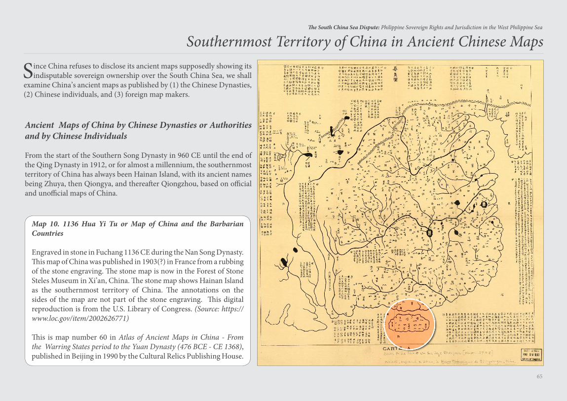
65
The South China Sea Dispute: Philippine Sovereign Rights and Jurisdiction in the West Philippine Sea
Ancient Maps of China by Chinese Dynasties or Authorities and by Chinese Individuals
From the start of the Southern Song Dynasty in 960 CE until the end of the Qing Dynasty in 1912, or for almost a millennium, the southernmost territory of China has always been Hainan Island, with its ancient names being Zhuya, then Qiongya, and thereafter Qiongzhou, based on official and unofficial maps of China.
Southernmost Territory of China in Ancient Chinese Maps
Since China refuses to disclose its ancient maps supposedly showing its indisputable sovereign ownership over the South China Sea, we shall
examine China’s ancient maps as published by (1) the Chinese Dynasties, (2) Chinese individuals, and (3) foreign map makers.
Map 10. 1136 Hua Yi Tu or Map of China and the Barbarian Countries
Engraved in stone in Fuchang 1136 CE during the Nan Song Dynasty. This map of China was published in 1903(?) in France from a rubbing of the stone engraving. The stone map is now in the Forest of Stone Steles Museum in Xi’an, China. The stone map shows Hainan Island as the southernmost territory of China. The annotations on the sides of the map are not part of the stone engraving. This digital reproduction is from the U.S. Library of Congress. (Source: https://www.loc.gov/item/2002626771)
This is map number 60 in Atlas of Ancient Maps in China - From the Warring States period to the Yuan Dynasty (476 BCE - CE 1368), published in Beijing in 1990 by the Cultural Relics Publishing House.
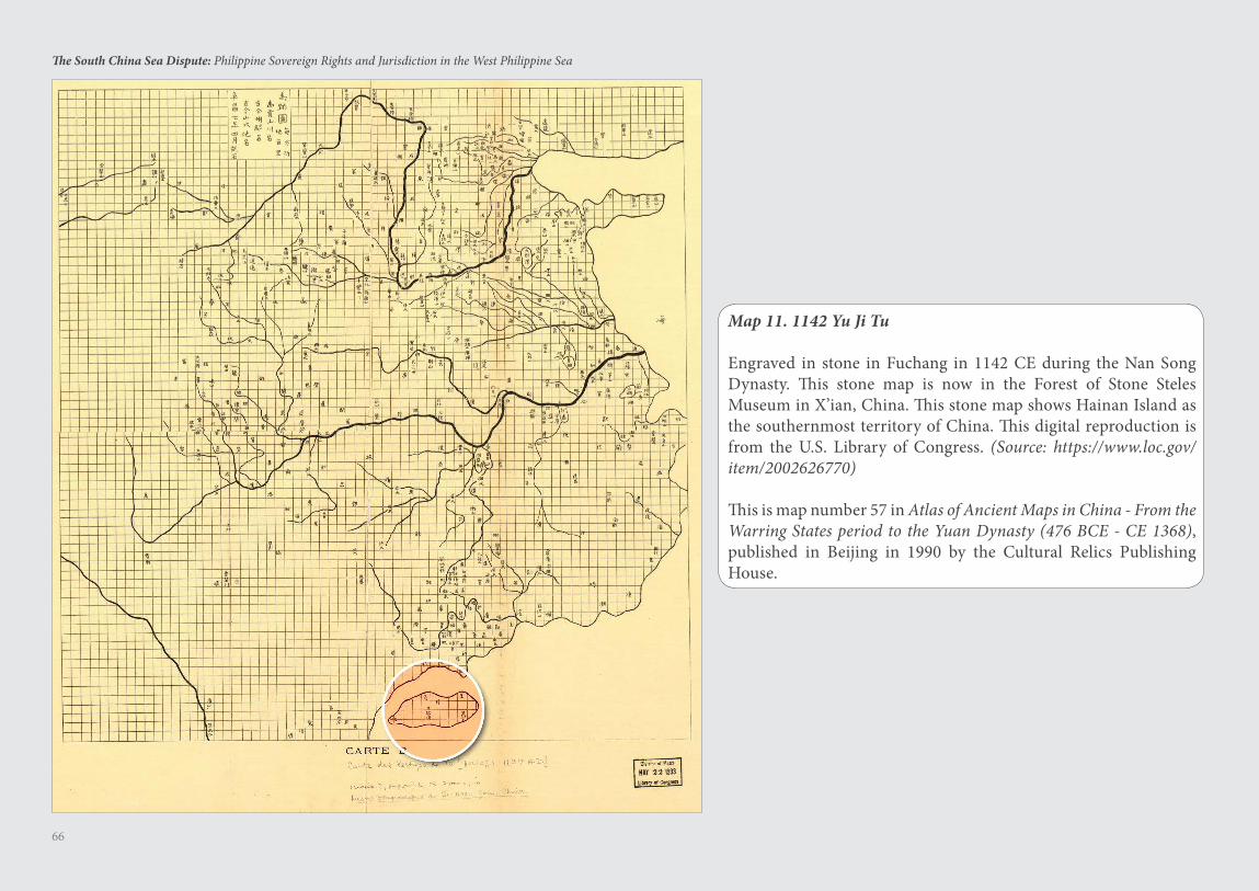
66
The South China Sea Dispute: Philippine Sovereign Rights and Jurisdiction in the West Philippine Sea
Map 11. 1142 Yu Ji Tu
Engraved in stone in Fuchang in 1142 CE during the Nan Song Dynasty. This stone map is now in the Forest of Stone Steles Museum in X’ian, China. This stone map shows Hainan Island as the southernmost territory of China. This digital reproduction is from the U.S. Library of Congress. (Source: https://www.loc.gov/item/2002626770)
This is map number 57 in Atlas of Ancient Maps in China - From the Warring States period to the Yuan Dynasty (476 BCE - CE 1368), published in Beijing in 1990 by the Cultural Relics Publishing House.
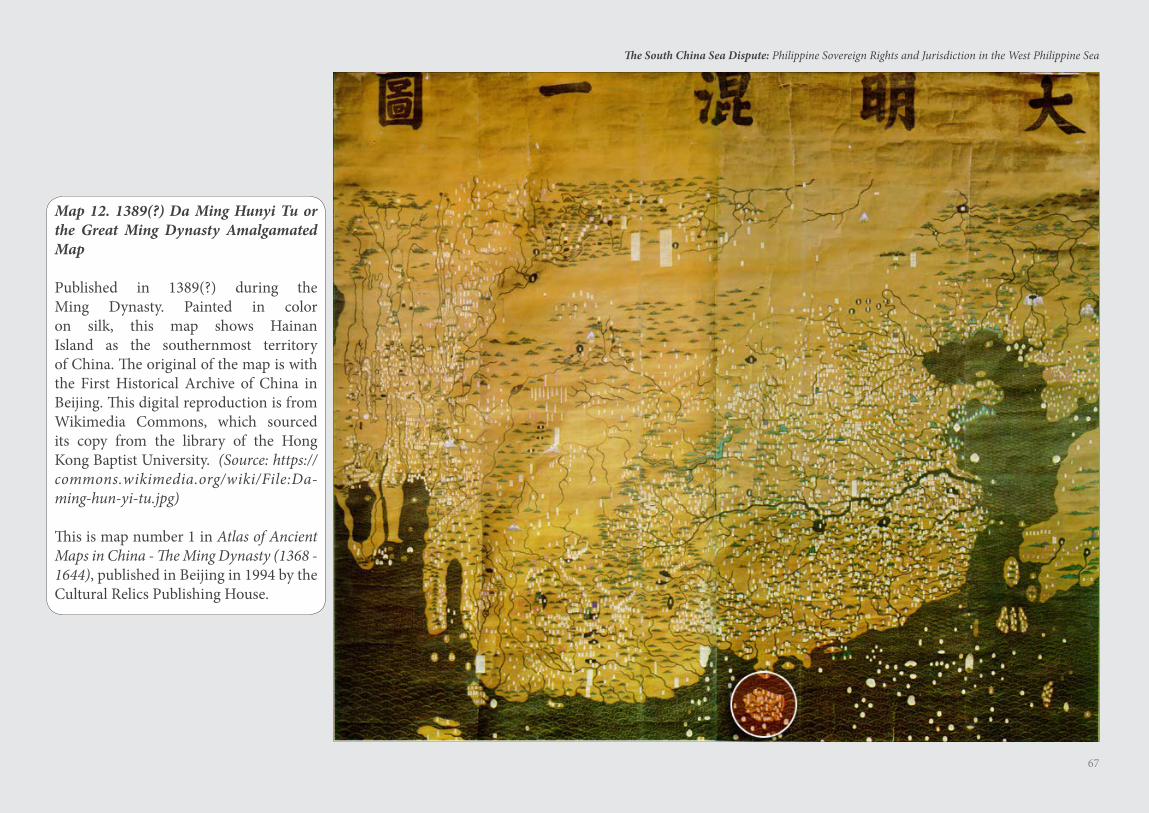
67
The South China Sea Dispute: Philippine Sovereign Rights and Jurisdiction in the West Philippine Sea
Map 12. 1389(?) Da Ming Hunyi Tu or the Great Ming Dynasty Amalgamated Map
Published in 1389(?) during the Ming Dynasty. Painted in color on silk, this map shows Hainan Island as the southernmost territory of China. The original of the map is with the First Historical Archive of China in Beijing. This digital reproduction is from Wikimedia Commons, which sourced its copy from the library of the Hong Kong Baptist University. (Source: https://commons.wikimedia.org/wiki/File:Da-ming-hun-yi-tu.jpg)
This is map number 1 in Atlas of Ancient Maps in China - The Ming Dynasty (1368 - 1644), published in Beijing in 1994 by the Cultural Relics Publishing House.
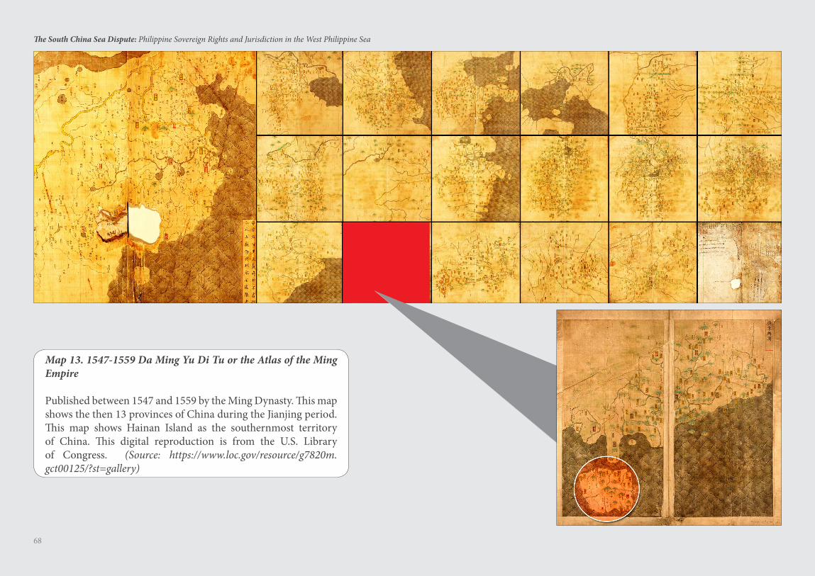
68
The South China Sea Dispute: Philippine Sovereign Rights and Jurisdiction in the West Philippine Sea
Map 13. 1547-1559 Da Ming Yu Di Tu or the Atlas of the Ming Empire
Published between 1547 and 1559 by the Ming Dynasty. This map shows the then 13 provinces of China during the Jianjing period. This map shows Hainan Island as the southernmost territory of China. This digital reproduction is from the U.S. Library of Congress. (Source: https://www.loc.gov/resource/g7820m.gct00125/?st=gallery)
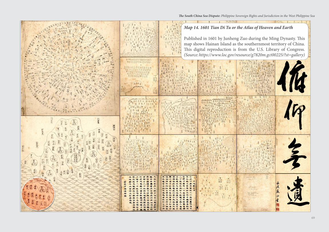
69
The South China Sea Dispute: Philippine Sovereign Rights and Jurisdiction in the West Philippine Sea
Map 14. 1601 Tian Di Tu or the Atlas of Heaven and Earth
Published in 1601 by Junheng Zuo during the Ming Dynasty. This map shows Hainan Island as the southernmost territory of China. This digital reproduction is from the U.S. Library of Congress. (Source: https://www.loc.gov/resource/g7820m.gct00225/?st=gallery)
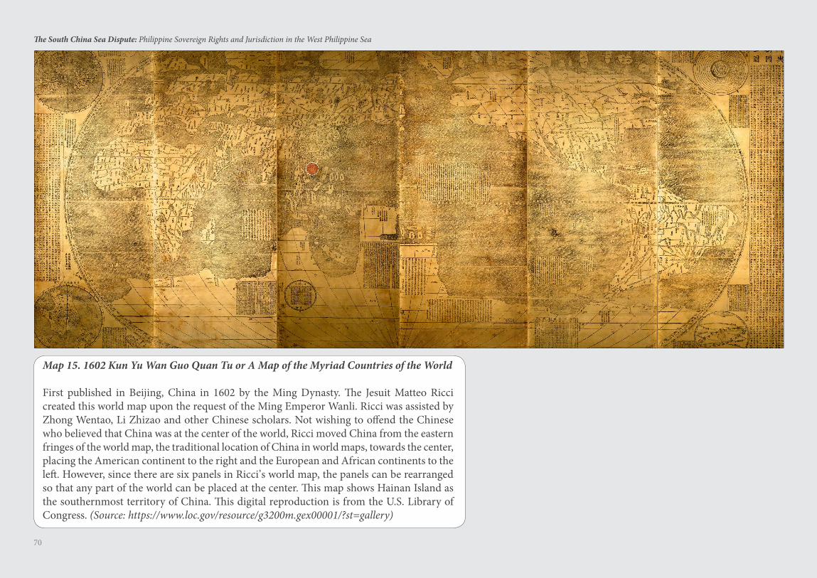
70
The South China Sea Dispute: Philippine Sovereign Rights and Jurisdiction in the West Philippine Sea
Map 15. 1602 Kun Yu Wan Guo Quan Tu or A Map of the Myriad Countries of the World
First published in Beijing, China in 1602 by the Ming Dynasty. The Jesuit Matteo Ricci created this world map upon the request of the Ming Emperor Wanli. Ricci was assisted by Zhong Wentao, Li Zhizao and other Chinese scholars. Not wishing to offend the Chinese who believed that China was at the center of the world, Ricci moved China from the eastern fringes of the world map, the traditional location of China in world maps, towards the center, placing the American continent to the right and the European and African continents to the left. However, since there are six panels in Ricci’s world map, the panels can be rearranged so that any part of the world can be placed at the center. This map shows Hainan Island as the southernmost territory of China. This digital reproduction is from the U.S. Library of Congress. (Source: https://www.loc.gov/resource/g3200m.gex00001/?st=gallery)
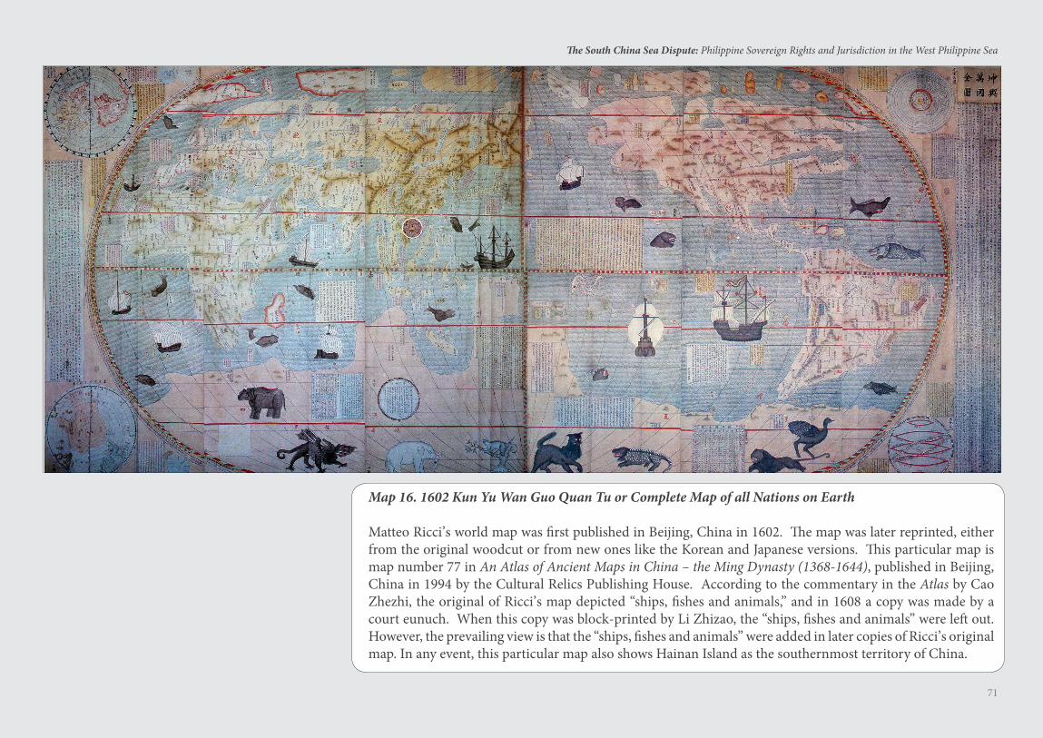
71
The South China Sea Dispute: Philippine Sovereign Rights and Jurisdiction in the West Philippine Sea
Map 16. 1602 Kun Yu Wan Guo Quan Tu or Complete Map of all Nations on Earth
Matteo Ricci’s world map was first published in Beijing, China in 1602. The map was later reprinted, either from the original woodcut or from new ones like the Korean and Japanese versions. This particular map is map number 77 in An Atlas of Ancient Maps in China – the Ming Dynasty (1368-1644), published in Beijing, China in 1994 by the Cultural Relics Publishing House. According to the commentary in the Atlas by Cao Zhezhi, the original of Ricci’s map depicted “ships, fishes and animals,” and in 1608 a copy was made by a court eunuch. When this copy was block-printed by Li Zhizao, the “ships, fishes and animals” were left out. However, the prevailing view is that the “ships, fishes and animals” were added in later copies of Ricci’s original map. In any event, this particular map also shows Hainan Island as the southernmost territory of China.
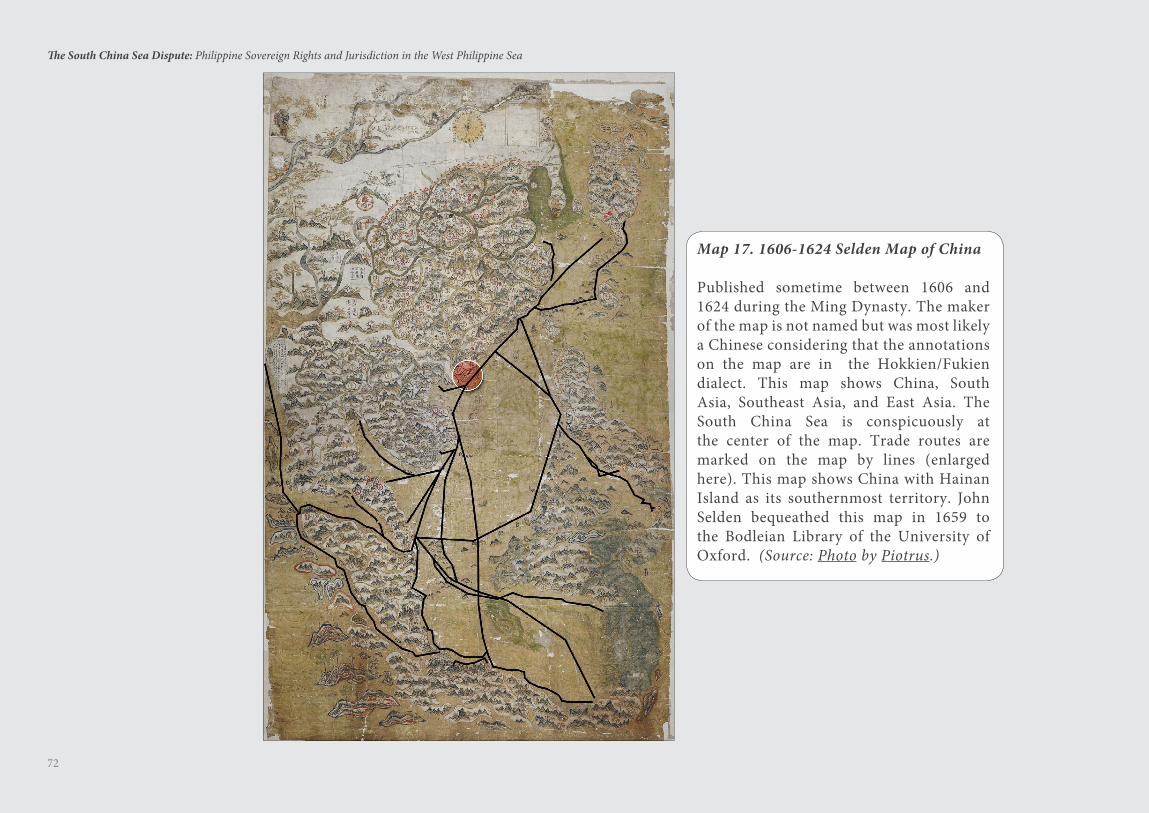
72
The South China Sea Dispute: Philippine Sovereign Rights and Jurisdiction in the West Philippine Sea
Map 17. 1606-1624 Selden Map of China
Published sometime between 1606 and 1624 during the Ming Dynasty. The maker of the map is not named but was most likely a Chinese considering that the annotations on the map are in the Hokkien/Fukien dialect. This map shows China, South Asia, Southeast Asia, and East Asia. The South China Sea is conspicuously at the center of the map. Trade routes are marked on the map by lines (enlarged here). This map shows China with Hainan Island as its southernmost territory. John Selden bequeathed this map in 1659 to the Bodleian Library of the University of Oxford. (Source: Photo by Piotrus.)
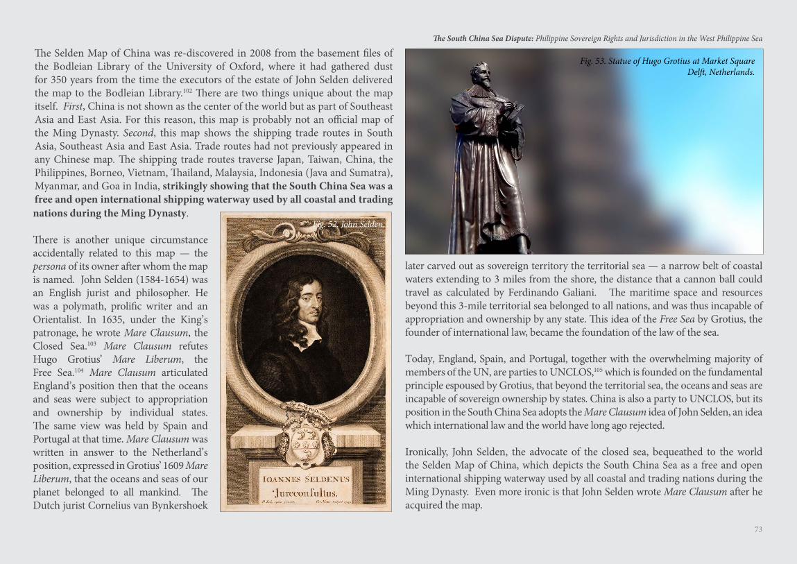
73
The South China Sea Dispute: Philippine Sovereign Rights and Jurisdiction in the West Philippine Sea
The Selden Map of China was re-discovered in 2008 from the basement files of the Bodleian Library of the University of Oxford, where it had gathered dust for 350 years from the time the executors of the estate of John Selden delivered the map to the Bodleian Library.102 There are two things unique about the map itself. First, China is not shown as the center of the world but as part of Southeast Asia and East Asia. For this reason, this map is probably not an official map of the Ming Dynasty. Second, this map shows the shipping trade routes in South Asia, Southeast Asia and East Asia. Trade routes had not previously appeared in any Chinese map. The shipping trade routes traverse Japan, Taiwan, China, the Philippines, Borneo, Vietnam, Thailand, Malaysia, Indonesia (Java and Sumatra), Myanmar, and Goa in India, strikingly showing that the South China Sea was a free and open international shipping waterway used by all coastal and trading
Fig. 53. Statue of Hugo Grotius at Market Square Delft, Netherlands.
nations during the Ming Dynasty.
There is another unique circumstance accidentally related to this map — the persona of its owner after whom the map is named. John Selden (1584-1654) was an English jurist and philosopher. He was a polymath, prolific writer and an Orientalist. In 1635, under the King’s patronage, he wrote Mare Clausum, the Closed Sea.103 Mare Clausum refutes Hugo Grotius’ Mare Liberum, the Free Sea.104 Mare Clausum articulated England’s position then that the oceans and seas were subject to appropriation and ownership by individual states. The same view was held by Spain and Portugal at that time. Mare Clausum was written in answer to the Netherland’s position, expressed in Grotius’ 1609 Mare Liberum, that the oceans and seas of our planet belonged to all mankind. The Dutch jurist Cornelius van Bynkershoek
later carved out as sovereign territory the territorial sea — a narrow belt of coastal waters extending to 3 miles from the shore, the distance that a cannon ball could travel as calculated by Ferdinando Galiani. The maritime space and resources beyond this 3-mile territorial sea belonged to all nations, and was thus incapable of appropriation and ownership by any state. This idea of the Free Sea by Grotius, the founder of international law, became the foundation of the law of the sea.
Today, England, Spain, and Portugal, together with the overwhelming majority of members of the UN, are parties to UNCLOS,105 which is founded on the fundamental principle espoused by Grotius, that beyond the territorial sea, the oceans and seas are incapable of sovereign ownership by states. China is also a party to UNCLOS, but its position in the South China Sea adopts the Mare Clausum idea of John Selden, an idea which international law and the world have long ago rejected.
Ironically, John Selden, the advocate of the closed sea, bequeathed to the world the Selden Map of China, which depicts the South China Sea as a free and open international shipping waterway used by all coastal and trading nations during the Ming Dynasty. Even more ironic is that John Selden wrote Mare Clausum after he acquired the map.
Fig. 52. John Selden.
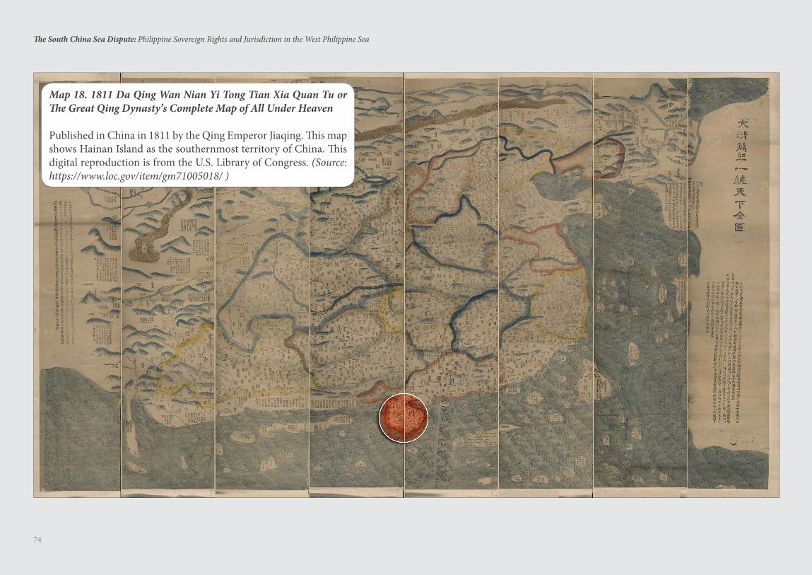
74
The South China Sea Dispute: Philippine Sovereign Rights and Jurisdiction in the West Philippine Sea
Map 18. 1811 Da Qing Wan Nian Yi Tong Tian Xia Quan Tu or The Great Qing Dynasty’s Complete Map of All Under Heaven
Published in China in 1811 by the Qing Emperor Jiaqing. This map shows Hainan Island as the southernmost territory of China. This digital reproduction is from the U.S. Library of Congress. (Source: https://www.loc.gov/item/gm71005018/ )
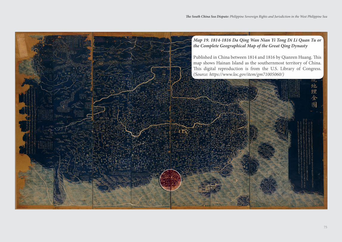
75
The South China Sea Dispute: Philippine Sovereign Rights and Jurisdiction in the West Philippine Sea
Map 19. 1814-1816 Da Qing Wan Nian Yi Tong Di Li Quan Tu or the Complete Geographical Map of the Great Qing Dynasty
Published in China between 1814 and 1816 by Qianren Huang. This map shows Hainan Island as the southernmost territory of China. This digital reproduction is from the U.S. Library of Congress. (Source: https://www.loc.gov/item/gm71005060/)
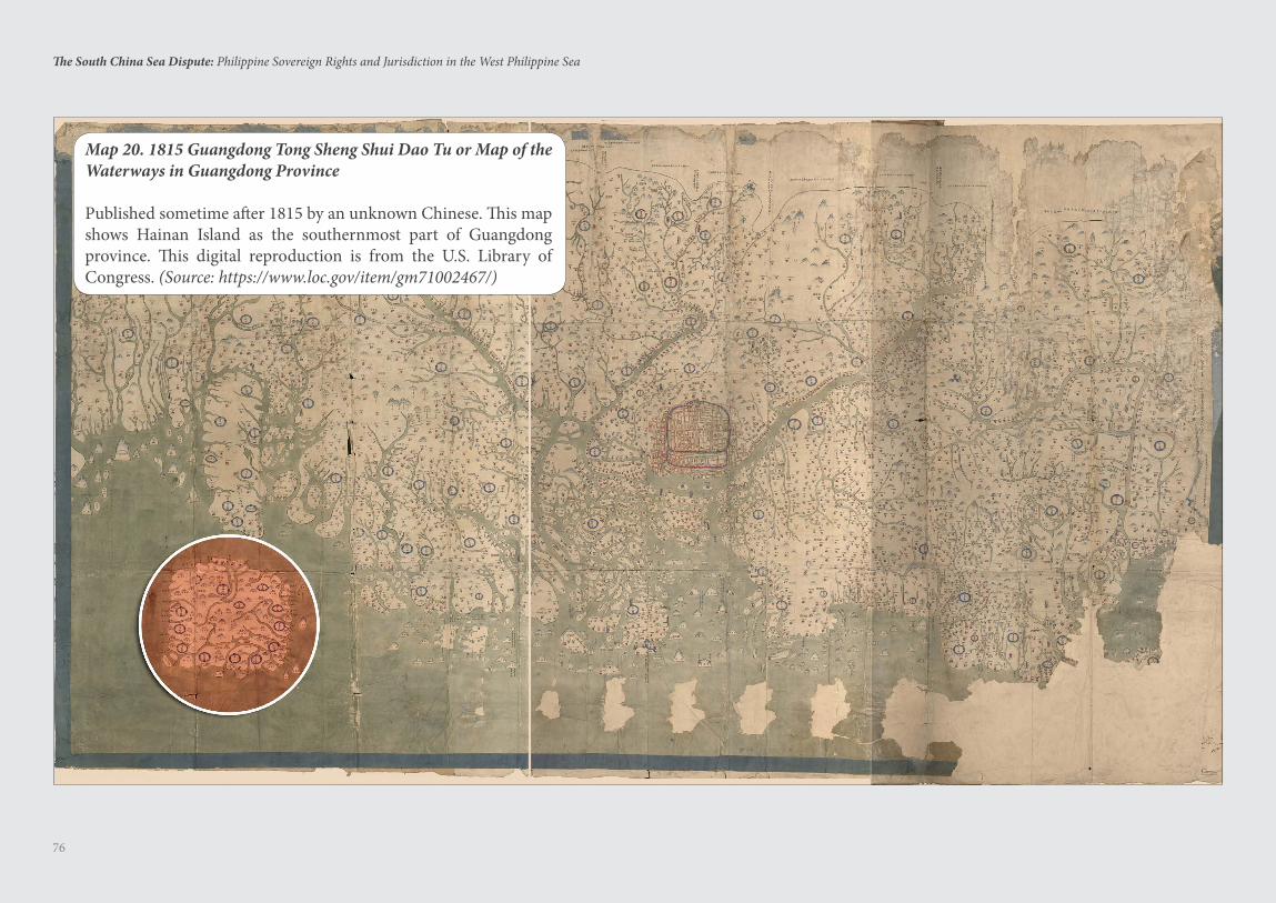
76
The South China Sea Dispute: Philippine Sovereign Rights and Jurisdiction in the West Philippine Sea
Map 20. 1815 Guangdong Tong Sheng Shui Dao Tu or Map of the Waterways in Guangdong Province
Published sometime after 1815 by an unknown Chinese. This map shows Hainan Island as the southernmost part of Guangdong province. This digital reproduction is from the U.S. Library of Congress. (Source: https://www.loc.gov/item/gm71002467/)
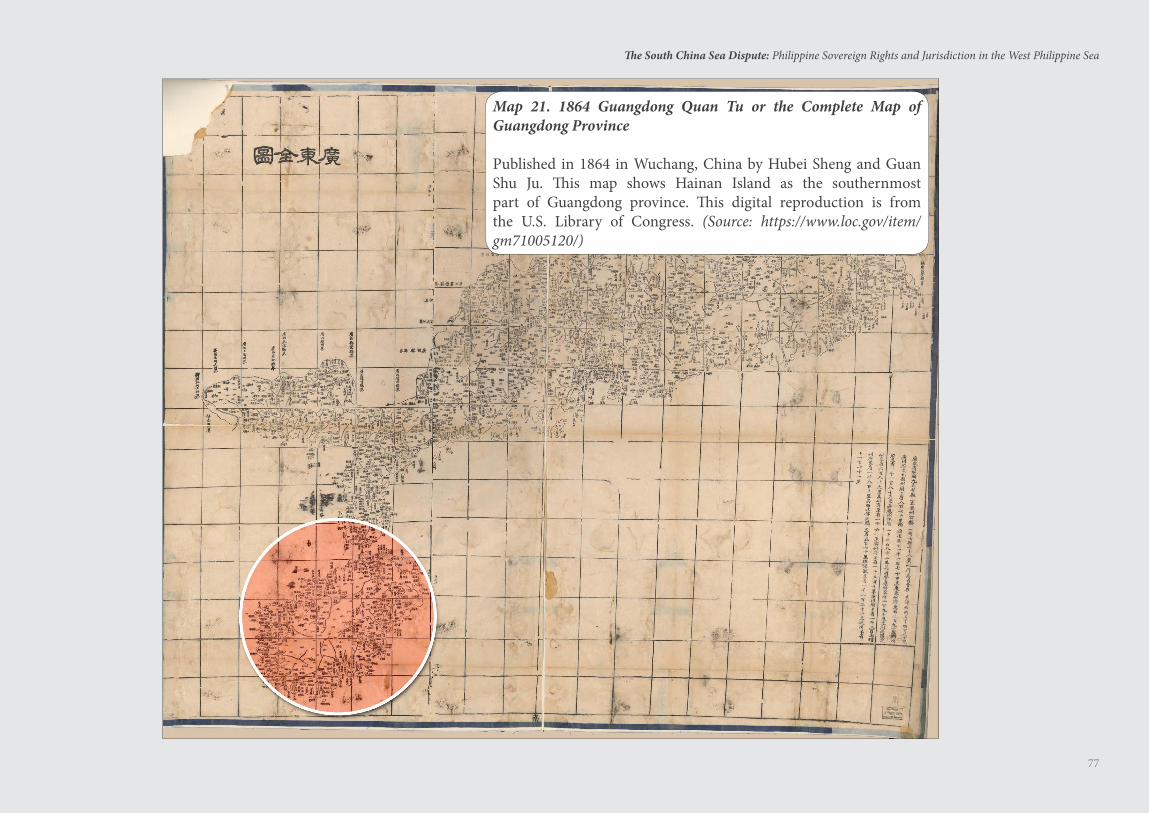
77
The South China Sea Dispute: Philippine Sovereign Rights and Jurisdiction in the West Philippine Sea
Map 21. 1864 Guangdong Quan Tu or the Complete Map of Guangdong Province
Published in 1864 in Wuchang, China by Hubei Sheng and Guan Shu Ju. This map shows Hainan Island as the southernmost part of Guangdong province. This digital reproduction is from the U.S. Library of Congress. (Source: https://www.loc.gov/item/gm71005120/)
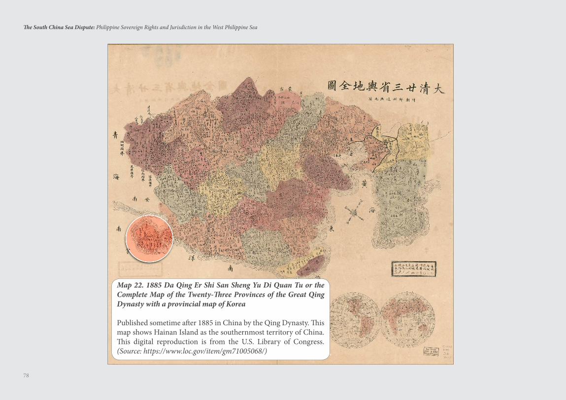
78
The South China Sea Dispute: Philippine Sovereign Rights and Jurisdiction in the West Philippine Sea
Map 22. 1885 Da Qing Er Shi San Sheng Yu Di Quan Tu or the Complete Map of the Twenty-Three Provinces of the Great Qing Dynasty with a provincial map of Korea
Published sometime after 1885 in China by the Qing Dynasty. This map shows Hainan Island as the southernmost territory of China. This digital reproduction is from the U.S. Library of Congress. (Source: https://www.loc.gov/item/gm71005068/)
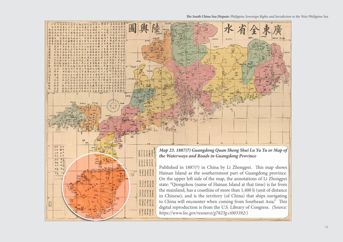
79
The South China Sea Dispute: Philippine Sovereign Rights and Jurisdiction in the West Philippine Sea
Map 23. 1887(?) Guangdong Quan Sheng Shui Lu Yu Tu or Map of the Waterways and Roads in Guangdong Province
Published in 1887(?) in China by Li Zhongpei. This map shows Hainan Island as the southernmost part of Guangdong province. On the upper left side of the map, the annotations of Li Zhongpei state: “Qiongzhou (name of Hainan Island at that time) is far from the mainland, has a coastline of more than 1,400 li (unit of distance in Chinese), and is the territory (of China) that ships navigating to China will encounter when coming from Southeast Asia.” This digital reproduction is from the U.S. Library of Congress. (Source: https://www.loc.gov/resource/g7823g.ct003392/)
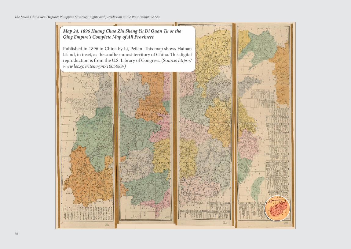
80
The South China Sea Dispute: Philippine Sovereign Rights and Jurisdiction in the West Philippine Sea
Map 24. 1896 Huang Chao Zhi Sheng Yu Di Quan Tu or the Qing Empire’s Complete Map of All Provinces
Published in 1896 in China by Li, Peilan. This map shows Hainan Island, in inset, as the southernmost territory of China. This digital reproduction is from the U.S. Library of Congress. (Source: https://www.loc.gov/item/gm71005083/)
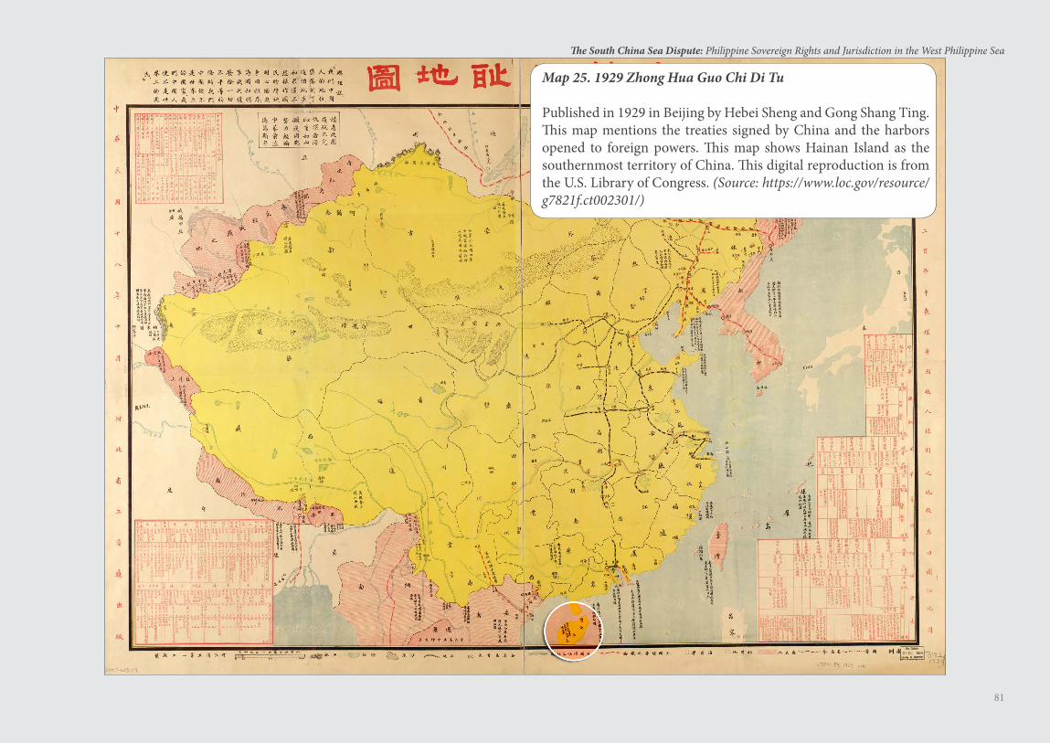
81
The South China Sea Dispute: Philippine Sovereign Rights and Jurisdiction in the West Philippine Sea
Map 25. 1929 Zhong Hua Guo Chi Di Tu
Published in 1929 in Beijing by Hebei Sheng and Gong Shang Ting. This map mentions the treaties signed by China and the harbors opened to foreign powers. This map shows Hainan Island as the southernmost territory of China. This digital reproduction is from the U.S. Library of Congress. (Source: https://www.loc.gov/resource/g7821f.ct002301/)
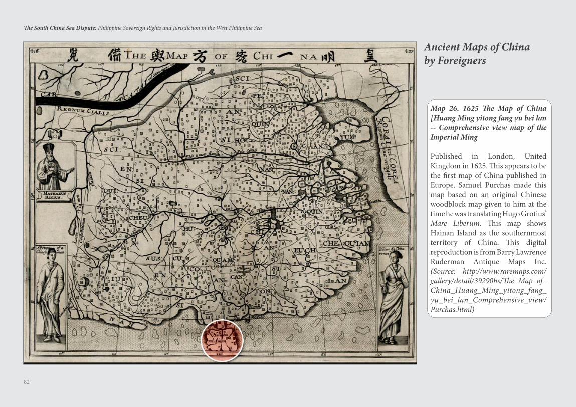
82
The South China Sea Dispute: Philippine Sovereign Rights and Jurisdiction in the West Philippine Sea
Map 26. 1625 The Map of China [Huang Ming yitong fang yu bei lan -- Comprehensive view map of the Imperial Ming
Published in London, United Kingdom in 1625. This appears to be the first map of China published in Europe. Samuel Purchas made this map based on an original Chinese woodblock map given to him at the time he was translating Hugo Grotius’ Mare Liberum. This map shows Hainan Island as the southernmost territory of China. This digital reproduction is from Barry Lawrence Ruderman Antique Maps Inc. (Source: http://www.raremaps.com/gallery/detail/39290hs/The_Map_of_China_Huang_Ming_yitong_fang_yu_bei_lan_Comprehensive_view/Purchas.html)
Ancient Maps of Chinaby Foreigners
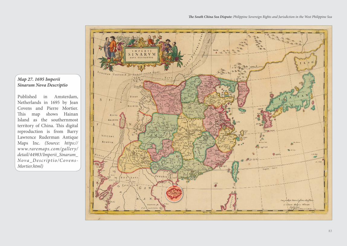
83
The South China Sea Dispute: Philippine Sovereign Rights and Jurisdiction in the West Philippine Sea
Map 27. 1695 Imperii Sinarum Nova Descriptio
Published in Amsterdam, Netherlands in 1695 by Jean Covens and Pierre Mortier. This map shows Hainan Island as the southernmost territory of China. This digital reproduction is from Barry Lawrence Ruderman Antique Maps Inc. (Source: https://www.raremaps.com/gallery/detail/44983/Imperii_Sinarum_Nova _ D es c r ipt io / C ove n s -Mortier.html)
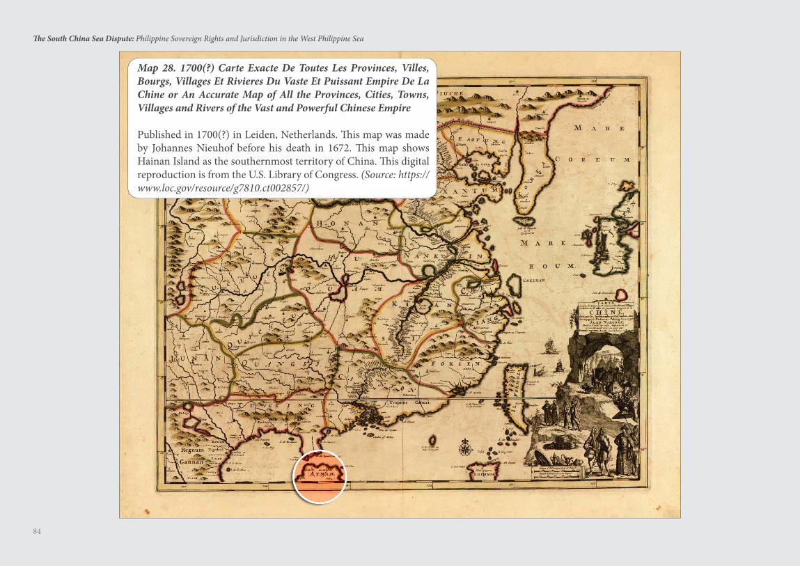
84
The South China Sea Dispute: Philippine Sovereign Rights and Jurisdiction in the West Philippine Sea
Map 28. 1700(?) Carte Exacte De Toutes Les Provinces, Villes, Bourgs, Villages Et Rivieres Du Vaste Et Puissant Empire De La Chine or An Accurate Map of All the Provinces, Cities, Towns, Villages and Rivers of the Vast and Powerful Chinese Empire
Published in 1700(?) in Leiden, Netherlands. This map was made by Johannes Nieuhof before his death in 1672. This map shows Hainan Island as the southernmost territory of China. This digital reproduction is from the U.S. Library of Congress. (Source: https://www.loc.gov/resource/g7810.ct002857/)
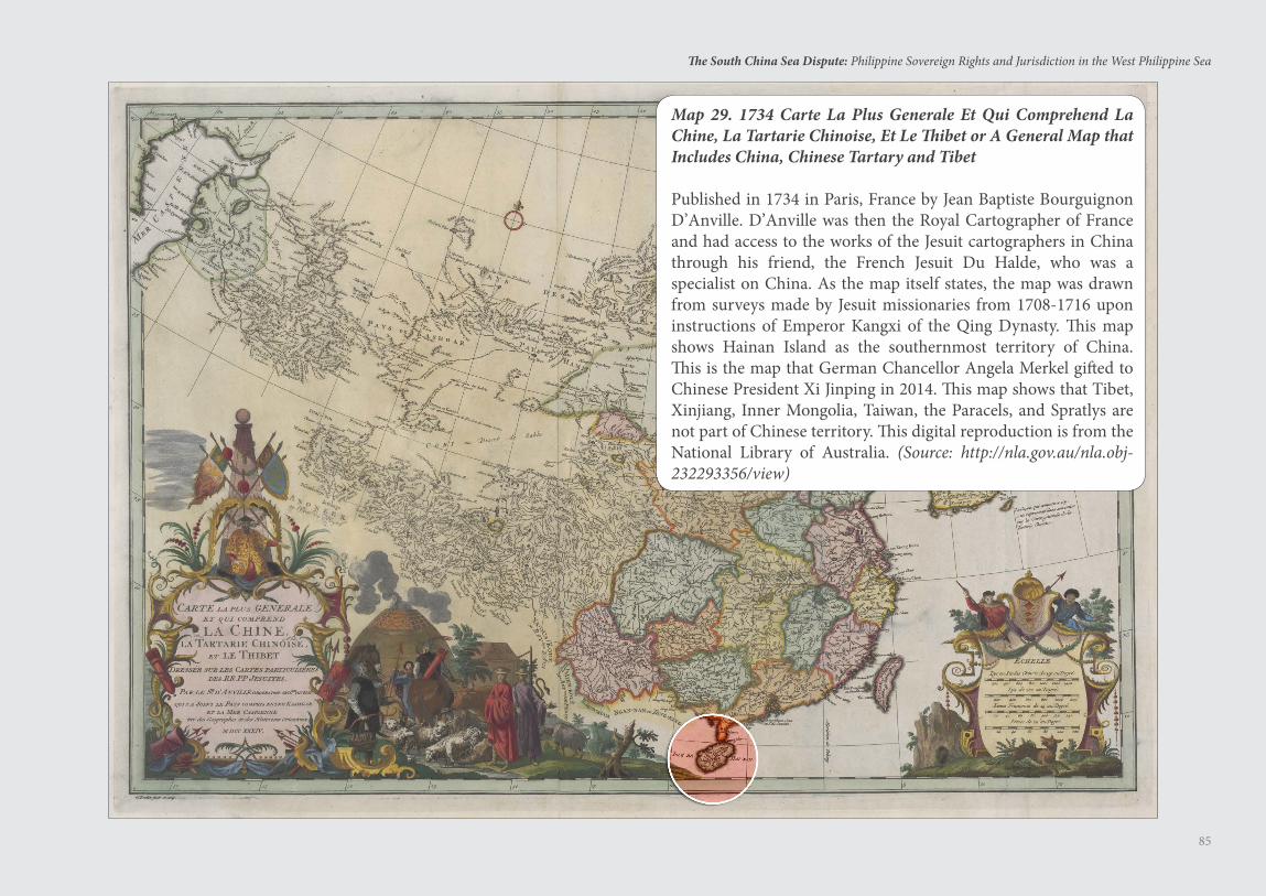
85
The South China Sea Dispute: Philippine Sovereign Rights and Jurisdiction in the West Philippine Sea
Map 29. 1734 Carte La Plus Generale Et Qui Comprehend La Chine, La Tartarie Chinoise, Et Le Thibet or A General Map that Includes China, Chinese Tartary and Tibet
Published in 1734 in Paris, France by Jean Baptiste Bourguignon D’Anville. D’Anville was then the Royal Cartographer of France and had access to the works of the Jesuit cartographers in China through his friend, the French Jesuit Du Halde, who was a specialist on China. As the map itself states, the map was drawn from surveys made by Jesuit missionaries from 1708-1716 upon instructions of Emperor Kangxi of the Qing Dynasty. This map shows Hainan Island as the southernmost territory of China. This is the map that German Chancellor Angela Merkel gifted to Chinese President Xi Jinping in 2014. This map shows that Tibet, Xinjiang, Inner Mongolia, Taiwan, the Paracels, and Spratlys are not part of Chinese territory. This digital reproduction is from the National Library of Australia. (Source: http://nla.gov.au/nla.obj-232293356/view)
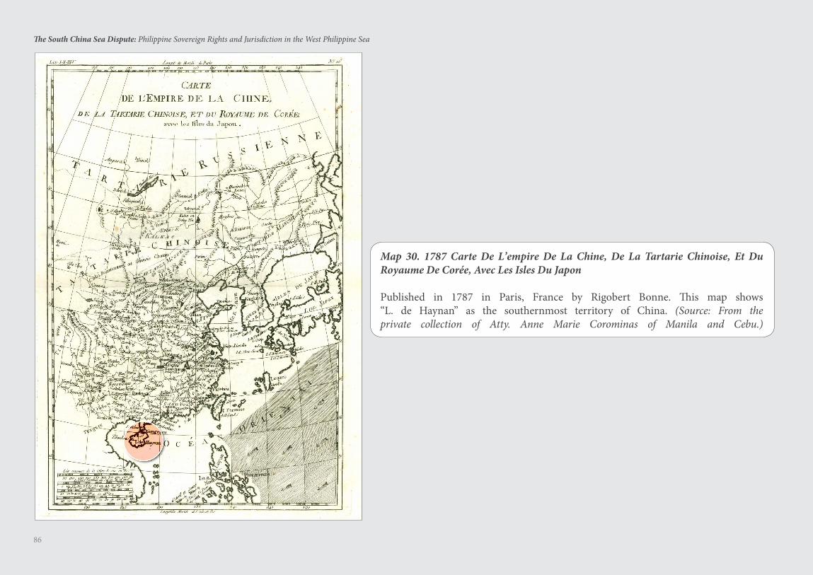
86
The South China Sea Dispute: Philippine Sovereign Rights and Jurisdiction in the West Philippine Sea
Map 30. 1787 Carte De L’empire De La Chine, De La Tartarie Chinoise, Et Du Royaume De Coree, Avec Les Isles Du Japon
Published in 1787 in Paris, France by Rigobert Bonne. This map shows “L. de Haynan” as the southernmost territory of China. (Source: From the private collection of Atty. Anne Marie Corominas of Manila and Cebu.)
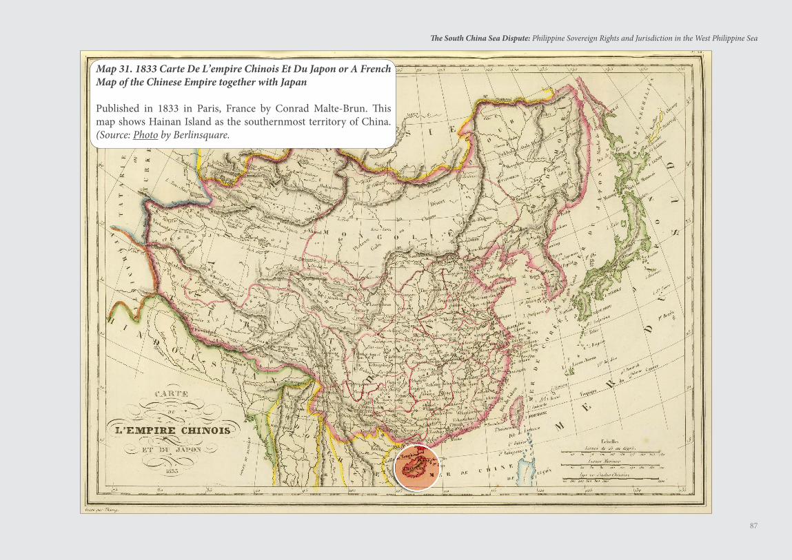
87
The South China Sea Dispute: Philippine Sovereign Rights and Jurisdiction in the West Philippine Sea
Map 31. 1833 Carte De L’empire Chinois Et Du Japon or A French Map of the Chinese Empire together with Japan
Published in 1833 in Paris, France by Conrad Malte-Brun. This map shows Hainan Island as the southernmost territory of China. (Source: Photo by Berlinsquare.
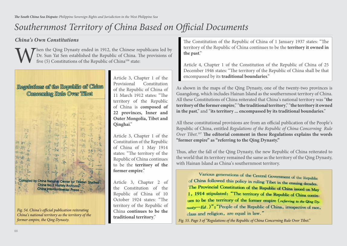
88
The South China Sea Dispute: Philippine Sovereign Rights and Jurisdiction in the West Philippine Sea
China’s Own Constitutions
When the Qing Dynasty ended in 1912, the Chinese republicans led by Dr. Sun Yat Sen established the Republic of China. The provisions of five (5) Constitutions of the Republic of China106 state:
Southernmost Territory of China Based on Official Documents
Fig. 54. China’s official publication reiterating China’s national territory as the territory of the former empire, the Qing Dynasty. Fig. 55. Page 3 of “Regulations of the Republic of China Concerning Rule Over Tibet.”
Article 3, Chapter 1 of the Provisional Constitution of the Republic of China of 11 March 1912 states: “The territory of the Republic of China is composed of 22 provinces, Inner and Outer Mongolia, Tibet and Qinghai.”
Article 3, Chapter 1 of the Constitution of the Republic of China of 1 May 1914 states: “The territory of the Republic of China continues to be the territory of the former empire.”
Article 3, Chapter 2 of the Constitution of the Republic of China of 10 October 1924 states: “The territory of the Republic of China continues to be the traditional territory.”
The Constitution of the Republic of China of 1 January 1937 states: “The territory of the Republic of China continues to be the territory it owned in the past.”
Article 4, Chapter 1 of the Constitution of the Republic of China of 25 December 1946 states: “The territory of the Republic of China shall be that encompassed by its traditional boundaries.”
As shown in the maps of the Qing Dynasty, one of the twenty-two provinces is Guangdong, which includes Hainan Island as the southernmost territory of China. All these Constitutions of China reiterated that China’s national territory was “the territory of the former empire,” “the traditional territory,” “the territory it owned in the past,” and “its territory ... encompassed by its traditional boundaries.”
All these constitutional provisions are from an official publication of the People’s Republic of China, entitled Regulations of the Republic of China Concerning Rule Over Tibet.107 The editorial comment in these Regulations explains the words “former empire” as “referring to the Qing Dynasty.”
Thus, after the fall of the Qing Dynasty, the new Republic of China reiterated to the world that its territory remained the same as the territory of the Qing Dynasty, with Hainan Island as China’s southernmost territory.
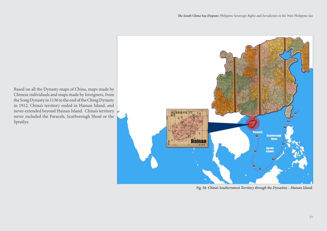
89
The South China Sea Dispute: Philippine Sovereign Rights and Jurisdiction in the West Philippine Sea
Based on all the Dynasty maps of China, maps made by Chinese individuals and maps made by foreigners, from the Song Dynasty in 1136 to the end of the Ching Dynasty in 1912, China’s territory ended in Hainan Island, and never extended beyond Hainan Island. China’s territory never included the Paracels, Scarborough Shoal or the Spratlys.
Fig. 56. China’s Southernmost Territory through the Dynasties – Hainan Island.
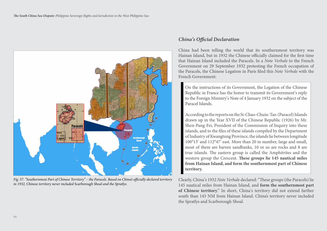
90
The South China Sea Dispute: Philippine Sovereign Rights and Jurisdiction in the West Philippine Sea
China’s Official Declaration
China had been telling the world that its southernmost territory was Hainan Island, but in 1932 the Chinese officially claimed for the first time that Hainan Island included the Paracels. In a Note Verbale to the French Government on 29 September 1932 protesting the French occupation of the Paracels, the Chinese Legation in Paris filed this Note Verbale with the French Government:
On the instructions of its Government, the Legation of the Chinese Republic in France has the honor to transmit its Government’s reply to the Foreign Ministry’s Note of 4 January 1932 on the subject of the Paracel Islands.
According to the reports on the Si-Chao-Chuin-Tao (Paracel) Islands drawn up in the Year XVII of the Chinese Republic (1926) by Mr. Shen-Pang-Fei, President of the Commission of Inquiry into these islands, and to the files of these islands compiled by the Department of Industry of Kwangtung Province, the islands lie between longitude 100°13’ and 112°47’ east. More than 20 in number, large and small, most of them are barren sandbanks, 10 or so are rocks and 8 are true islands. The eastern group is called the Amphitrites and the western group the Crescent. These groups lie 145 nautical miles from Hainan Island, and form the southernmost part of Chinese territory.
Clearly, China’s 1932 Note Verbale declared: “These groups (the Paracels) lie 145 nautical miles from Hainan Island, and form the southernmost part of Chinese territory.” In short, China’s territory did not extend farther south than 145 NM from Hainan Island. China’s territory never included the Spratlys and Scarborough Shoal.
Fig. 57. “Southernmost Part of Chinese Territory” – the Paracels. Based on China’s officially declared territory in 1932, Chinese territory never included Scarborough Shoal and the Spratlys.
91
The South China Sea Dispute: Philippine Sovereign Rights and Jurisdiction in the West Philippine Sea
In the Nuclear Tests Case (Australia v. France),108 the ICJ declared:
It is well recognized that declarations made by way of unilateral acts, concerning legal or factual situations, may have the effect of creating legal obligations. Declarations of this kind may be, and often are, very specific. When it is the intention of the State making the declaration that it should become bound according to its terms, that intention confers on the declaration the character of a legal undertaking, the State being henceforth legally required to follow a course of conduct consistent with the declaration. An undertaking of this kind, if given publicly, and with an intent to be bound, even though not made within the context of international negotiations, is binding. In these circumstances, nothing in the nature of a quid pro quo nor any subsequent acceptance of the declaration, nor even any reply or reaction from other States, is required for the declaration to take effect, since such a requirement would be inconsistent with the strictly unilateral nature of the juridical act by which the pronouncement by the State was made.
Under international law, the 1932 Note Verbale of China to France is an official declaration that is binding on China, in the same way that China’s definition of its national territory in its five Republican Constitutions from 1912 to 1946 is binding on China.
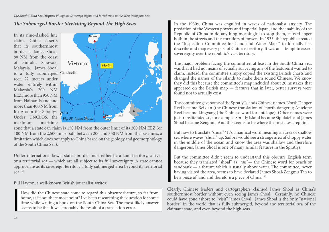
92
The South China Sea Dispute: Philippine Sovereign Rights and Jurisdiction in the West Philippine Sea
zone that a state can claim is 150 NM from the outer limit of its 200 NM EEZ (or 100 NM from the 2,500 m isobath between 200 and 350 NM from the baselines, a limitation which does not apply to China based on the geology and geomorphology of the South China Sea).
Under international law, a state’s border must either be a land territory, a river or a territorial sea — which are all subject to its full sovereignty. A state cannot appropriate as its sovereign territory a fully submerged area beyond its territorial sea.109
Bill Hayton, a well-known British journalist, writes:
How did the Chinese state come to regard this obscure feature, so far from home, as its southernmost point? I’ve been researching the question for some time while writing a book on the South China Sea. The most likely answer seems to be that it was probably the result of a translation error.
In the 1930s, China was engulfed in waves of nationalist anxiety. The predation of the Western powers and imperial Japan, and the inability of the Republic of China to do anything meaningful to stop them, caused anger both in the streets and the corridors of power. In 1933, the republic created the “Inspection Committee for Land and Water Maps” to formally list, describe and map every part of Chinese territory. It was an attempt to assert sovereignty over the republic’s vast territory.
The major problem facing the committee, at least in the South China Sea, was that it had no means of actually surveying any of the features it wanted to claim. Instead, the committee simply copied the existing British charts and changed the names of the islands to make them sound Chinese. We know they did this because the committee’s map included about 20 mistakes that appeared on the British map — features that in later, better surveys were found not to actually exist.
The committee gave some of the Spratly Islands Chinese names. North Danger Reef became Beixian (the Chinese translation of “north danger”); Antelope Reef became Lingyang (the Chinese word for antelope). Other names were just transliterated so, for example, Spratly Island became Sipulateli and James Shoal became Zengmu. And this seems to be where the mistakes crept in.
But how to translate “shoal”? It’s a nautical word meaning an area of shallow sea where waves “shoal” up. Sailors would see a strange area of choppy water in the middle of the ocean and know the area was shallow and therefore dangerous. James Shoal is one of many similar features in the Spratlys.
But the committee didn’t seem to understand this obscure English term because they translated “shoal” as “tan”— the Chinese word for beach or sandbank — a feature which is usually above water. The committee, never having visited the area, seems to have declared James Shoal/Zengmu Tan to be a piece of land and therefore a piece of China.110
In its nine-dashed line claim, China asserts that its southernmost border is James Shoal, 80 NM from the coast of Bintulu, Sarawak, Malaysia. James Shoal is a fully submerged reef, 22 meters under water, entirely within Malaysia’s 200 NM EEZ, more than 950 NM from Hainan Island and more than 400 NM from Itu Aba in the Spratlys. Under UNCLOS, the maximum maritime
The Submerged Border Stretching Beyond The High Seas
Clearly, Chinese leaders and cartographers claimed James Shoal as China’s southernmost border without even seeing James Shoal. Certainly, no Chinese could have gone ashore to “visit” James Shoal. James Shoal is the only “national border” in the world that is fully submerged, beyond the territorial sea of the claimant state, and even beyond the high seas.
Fig. 58. James Shoal.
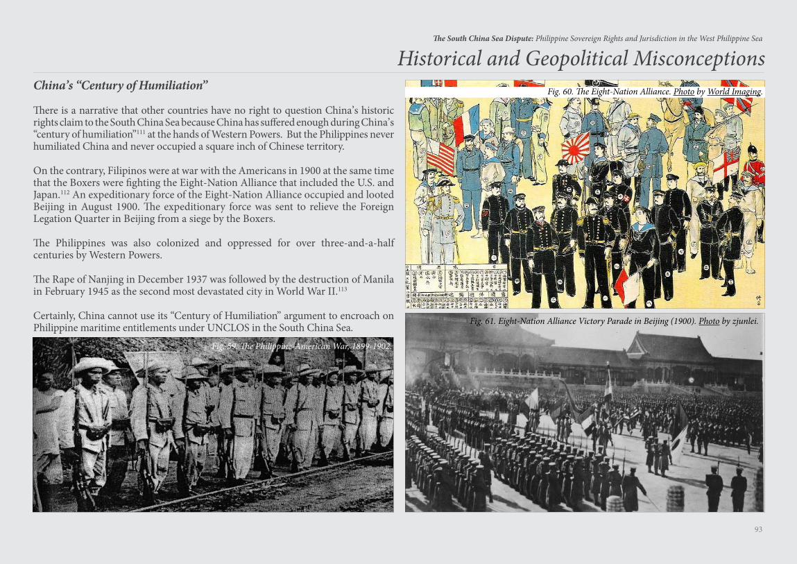
93
The South China Sea Dispute: Philippine Sovereign Rights and Jurisdiction in the West Philippine Sea
China’s “Century of Humiliation”
There is a narrative that other countries have no right to question China’s historic rights claim to the South China Sea because China has suffered enough during China’s “century of humiliation”111 at the hands of Western Powers. But the Philippines never humiliated China and never occupied a square inch of Chinese territory.
On the contrary, Filipinos were at war with the Americans in 1900 at the same time that the Boxers were fighting the Eight-Nation Alliance that included the U.S. and Japan.112 An expeditionary force of the Eight-Nation Alliance occupied and looted Beijing in August 1900. The expeditionary force was sent to relieve the Foreign Legation Quarter in Beijing from a siege by the Boxers.
The Philippines was also colonized and oppressed for over three-and-a-half centuries by Western Powers.
The Rape of Nanjing in December 1937 was followed by the destruction of Manila in February 1945 as the second most devastated city in World War II.113
Certainly, China cannot use its “Century of Humiliation” argument to encroach on Philippine maritime entitlements under UNCLOS in the South China Sea.
Historical and Geopolitical Misconceptions
Fig. 59. The Philippine-American War, 1899-1902.
Fig. 61. Eight-Nation Alliance Victory Parade in Beijing (1900). Photo by zjunlei.
Fig. 60. The Eight-Nation Alliance. Photo by World Imaging.
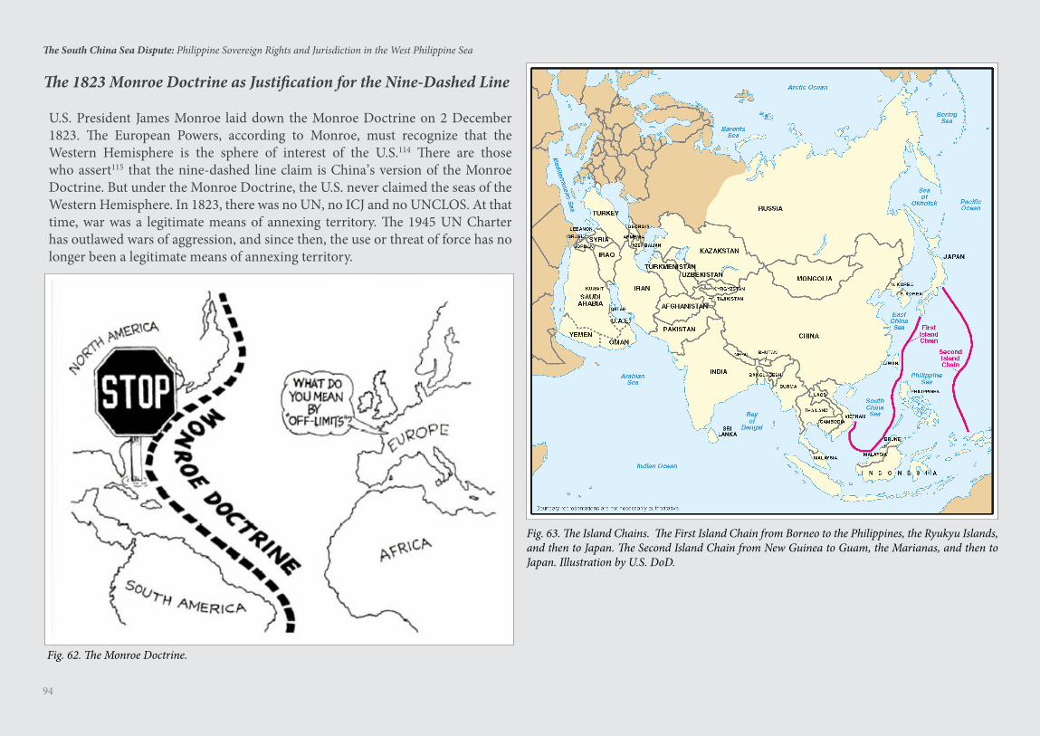
94
The South China Sea Dispute: Philippine Sovereign Rights and Jurisdiction in the West Philippine Sea
The 1823 Monroe Doctrine as Justification for the Nine-Dashed Line
U.S. President James Monroe laid down the Monroe Doctrine on 2 December 1823. The European Powers, according to Monroe, must recognize that the Western Hemisphere is the sphere of interest of the U.S.114 There are those who assert115 that the nine-dashed line claim is China’s version of the Monroe Doctrine. But under the Monroe Doctrine, the U.S. never claimed the seas of the Western Hemisphere. In 1823, there was no UN, no ICJ and no UNCLOS. At that time, war was a legitimate means of annexing territory. The 1945 UN Charter has outlawed wars of aggression, and since then, the use or threat of force has no longer been a legitimate means of annexing territory.
Fig. 63. The Island Chains. The First Island Chain from Borneo to the Philippines, the Ryukyu Islands, and then to Japan. The Second Island Chain from New Guinea to Guam, the Marianas, and then to Japan. Illustration by U.S. DoD.
Fig. 62. The Monroe Doctrine.
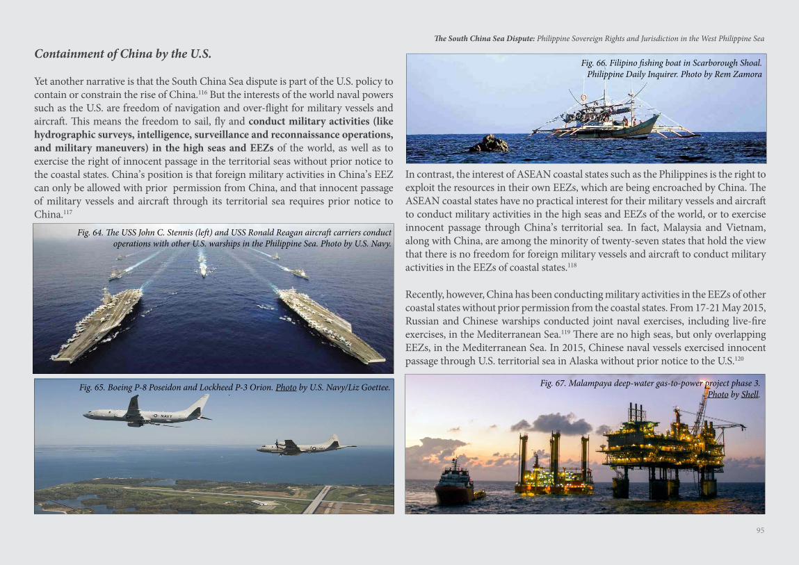
95
The South China Sea Dispute: Philippine Sovereign Rights and Jurisdiction in the West Philippine Sea
Containment of China by the U.S.
Yet another narrative is that the South China Sea dispute is part of the U.S. policy to contain or constrain the rise of China.116 But the interests of the world naval powers such as the U.S. are freedom of navigation and over-flight for military vessels and aircraft. This means the freedom to sail, fly and conduct military activities (like hydrographic surveys, intelligence, surveillance and reconnaissance operations, and military maneuvers) in the high seas and EEZs of the world, as well as to exercise the right of innocent passage in the territorial seas without prior notice to the coastal states. China’s position is that foreign military activities in China’s EEZ can only be allowed with prior permission from China, and that innocent passage of military vessels and aircraft through its territorial sea requires prior notice to China.117
In contrast, the interest of ASEAN coastal states such as the Philippines is the right to exploit the resources in their own EEZs, which are being encroached by China. The ASEAN coastal states have no practical interest for their military vessels and aircraft to conduct military activities in the high seas and EEZs of the world, or to exercise innocent passage through China’s territorial sea. In fact, Malaysia and Vietnam, along with China, are among the minority of twenty-seven states that hold the view that there is no freedom for foreign military vessels and aircraft to conduct military activities in the EEZs of coastal states.118
Recently, however, China has been conducting military activities in the EEZs of other coastal states without prior permission from the coastal states. From 17-21 May 2015, Russian and Chinese warships conducted joint naval exercises, including live-fire exercises, in the Mediterranean Sea.119 There are no high seas, but only overlapping EEZs, in the Mediterranean Sea. In 2015, Chinese naval vessels exercised innocent passage through U.S. territorial sea in Alaska without prior notice to the U.S.120
Fig. 66. Filipino fishing boat in Scarborough Shoal. Philippine Daily Inquirer. Photo by Rem Zamora
Fig. 67. Malampaya deep-water gas-to-power project phase 3.Photo by Shell.
Fig. 64. The USS John C. Stennis (left) and USS Ronald Reagan aircraft carriers conduct operations with other U.S. warships in the Philippine Sea. Photo by U.S. Navy.
Fig. 65. Boeing P-8 Poseidon and Lockheed P-3 Orion. Photo by U.S. Navy/Liz Goettee.

Geologic Features in the Spratlys
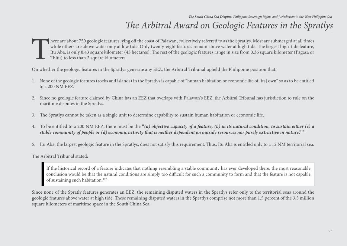
97
The South China Sea Dispute: Philippine Sovereign Rights and Jurisdiction in the West Philippine Sea
There are about 750 geologic features lying off the coast of Palawan, collectively referred to as the Spratlys. Most are submerged at all times while others are above water only at low tide. Only twenty-eight features remain above water at high tide. The largest high-tide feature, Itu Aba, is only 0.43 square kilometer (43 hectares). The rest of the geologic features range in size from 0.36 square kilometer (Pagasa or Thitu) to less than 2 square kilometers.
On whether the geologic features in the Spratlys generate any EEZ, the Arbitral Tribunal upheld the Philippine position that:
1. None of the geologic features (rocks and islands) in the Spratlys is capable of “human habitation or economic life of [its] own” so as to be entitled to a 200 NM EEZ.
2. Since no geologic feature claimed by China has an EEZ that overlaps with Palawan’s EEZ, the Arbitral Tribunal has jurisdiction to rule on the maritime disputes in the Spratlys.
3. The Spratlys cannot be taken as a single unit to determine capability to sustain human habitation or economic life.
4. To be entitled to a 200 NM EEZ, there must be the “(a) objective capacity of a feature, (b) in its natural condition, to sustain either (c) a stable community of people or (d) economic activity that is neither dependent on outside resources nor purely extractive in nature.”121
5. Itu Aba, the largest geologic feature in the Spratlys, does not satisfy this requirement. Thus, Itu Aba is entitled only to a 12 NM territorial sea.
The Arbitral Tribunal stated:
If the historical record of a feature indicates that nothing resembling a stable community has ever developed there, the most reasonable conclusion would be that the natural conditions are simply too difficult for such a community to form and that the feature is not capable of sustaining such habitation.122
Since none of the Spratly features generates an EEZ, the remaining disputed waters in the Spratlys refer only to the territorial seas around the geologic features above water at high tide. These remaining disputed waters in the Spratlys comprise not more than 1.5 percent of the 3.5 million square kilometers of maritime space in the South China Sea.
The Arbi tral Award on Geologic Features in the Spratlys
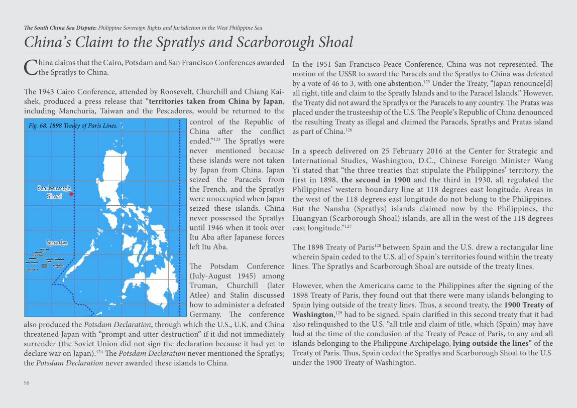
98
The South China Sea Dispute: Philippine Sovereign Rights and Jurisdiction in the West Philippine Sea
China claims that the Cairo, Potsdam and San Francisco Conferences awarded the Spratlys to China.
The 1943 Cairo Conference, attended by Roosevelt, Churchill and Chiang Kai-shek, produced a press release that “territories taken from China by Japan, including Manchuria, Taiwan and the Pescadores, would be returned to the
China’s Claim to the Spratlys and Scarborough Shoal
Fig. 68. 1898 Treaty of Paris Lines. control of the Republic of China after the conflict ended.”123 The Spratlys were never mentioned because these islands were not taken by Japan from China. Japan seized the Paracels from the French, and the Spratlys were unoccupied when Japan seized these islands. China never possessed the Spratlys until 1946 when it took over Itu Aba after Japanese forces left Itu Aba.
The Potsdam Conference (July-August 1945) among Truman, Churchill (later Atlee) and Stalin discussed how to administer a defeated Germany. The conference
also produced the Potsdam Declaration, through which the U.S., U.K. and China threatened Japan with “prompt and utter destruction” if it did not immediately surrender (the Soviet Union did not sign the declaration because it had yet to declare war on Japan).124 The Potsdam Declaration never mentioned the Spratlys; the Potsdam Declaration never awarded these islands to China.
In the 1951 San Francisco Peace Conference, China was not represented. The motion of the USSR to award the Paracels and the Spratlys to China was defeated by a vote of 46 to 3, with one abstention.125 Under the Treaty, “Japan renounce[d] all right, title and claim to the Spratly Islands and to the Paracel Islands.” However, the Treaty did not award the Spratlys or the Paracels to any country. The Pratas was placed under the trusteeship of the U.S. The People’s Republic of China denounced the resulting Treaty as illegal and claimed the Paracels, Spratlys and Pratas island as part of China.126
In a speech delivered on 25 February 2016 at the Center for Strategic and International Studies, Washington, D.C., Chinese Foreign Minister Wang Yi stated that “the three treaties that stipulate the Philippines’ territory, the first in 1898, the second in 1900 and the third in 1930, all regulated the Philippines’ western boundary line at 118 degrees east longitude. Areas in the west of the 118 degrees east longitude do not belong to the Philippines. But the Nansha (Spratlys) islands claimed now by the Philippines, the Huangyan (Scarborough Shoal) islands, are all in the west of the 118 degrees east longitude.”127
The 1898 Treaty of Paris128 between Spain and the U.S. drew a rectangular line wherein Spain ceded to the U.S. all of Spain’s territories found within the treaty lines. The Spratlys and Scarborough Shoal are outside of the treaty lines.
However, when the Americans came to the Philippines after the signing of the 1898 Treaty of Paris, they found out that there were many islands belonging to Spain lying outside of the treaty lines. Thus, a second treaty, the 1900 Treaty of Washington,129 had to be signed. Spain clarified in this second treaty that it had also relinquished to the U.S. “all title and claim of title, which (Spain) may have had at the time of the conclusion of the Treaty of Peace of Paris, to any and all islands belonging to the Philippine Archipelago, lying outside the lines” of the Treaty of Paris. Thus, Spain ceded the Spratlys and Scarborough Shoal to the U.S. under the 1900 Treaty of Washington.
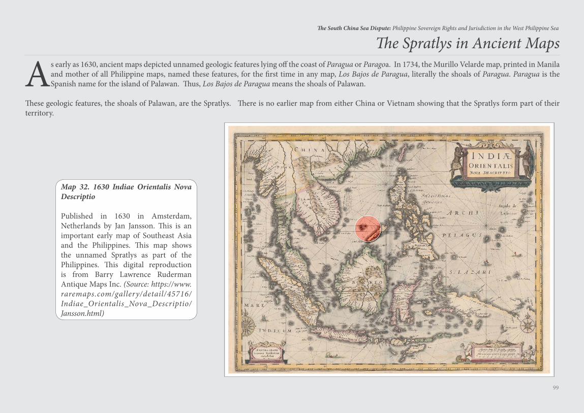
99
The South China Sea Dispute: Philippine Sovereign Rights and Jurisdiction in the West Philippine Sea
As early as 1630, ancient maps depicted unnamed geologic features lying off the coast of Paragua or Paragoa. In 1734, the Murillo Velarde map, printed in Manila and mother of all Philippine maps, named these features, for the first time in any map, Los Bajos de Paragua, literally the shoals of Paragua. Paragua is the Spanish name for the island of Palawan. Thus, Los Bajos de Paragua means the shoals of Palawan.
These geologic features, the shoals of Palawan, are the Spratlys. There is no earlier map from either China or Vietnam showing that the Spratlys form part of their territory.
The Spratlys in Ancient Maps
Map 32. 1630 Indiae Orientalis Nova Descriptio
Published in 1630 in Amsterdam, Netherlands by Jan Jansson. This is an important early map of Southeast Asia and the Philippines. This map shows the unnamed Spratlys as part of the Philippines. This digital reproduction is from Barry Lawrence Ruderman Antique Maps Inc. (Source: https://www.raremaps.com/gallery/detail/45716/Indiae_Orientalis_Nova_Descriptio/Jansson.html)
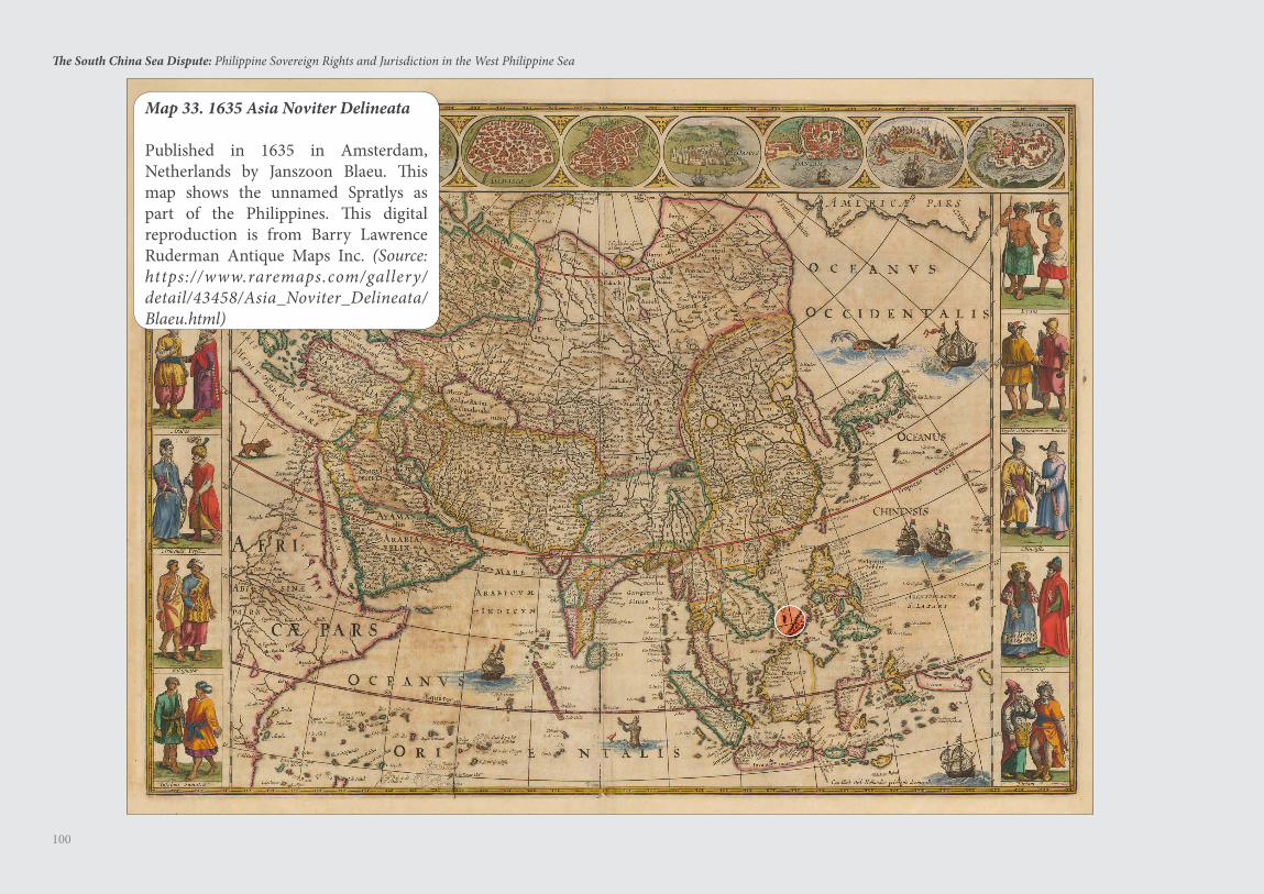
100
The South China Sea Dispute: Philippine Sovereign Rights and Jurisdiction in the West Philippine Sea
Map 33. 1635 Asia Noviter Delineata
Published in 1635 in Amsterdam, Netherlands by Janszoon Blaeu. This map shows the unnamed Spratlys as part of the Philippines. This digital reproduction is from Barry Lawrence Ruderman Antique Maps Inc. (Source: https://www.raremaps.com/gallery/detail/43458/Asia_Noviter_Delineata/Blaeu.html)
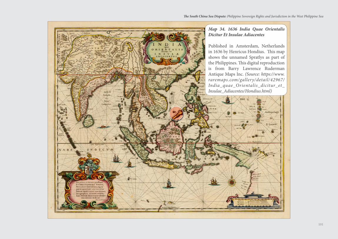
101
The South China Sea Dispute: Philippine Sovereign Rights and Jurisdiction in the West Philippine Sea
Map 34. 1636 India Quae Orientalis Dicitur Et Insulae Adiacentes
Published in Amsterdam, Netherlands in 1636 by Henricus Hondius. This map shows the unnamed Spratlys as part of the Philippines. This digital reproduction is from Barry Lawrence Ruderman Antique Maps Inc. (Source: https://www.raremaps.com/gallery/detail/42967/India_quae_Orientalis_dicitur_et_Insulae_Adiacentes/Hondius.html)
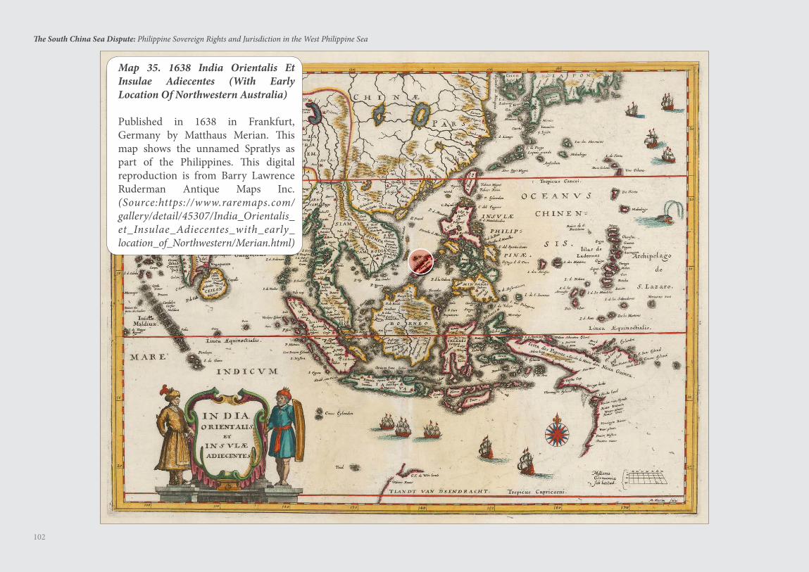
102
The South China Sea Dispute: Philippine Sovereign Rights and Jurisdiction in the West Philippine Sea
Map 35. 1638 India Orientalis Et Insulae Adiecentes (With Early Location Of Northwestern Australia)
Published in 1638 in Frankfurt, Germany by Matthaus Merian. This map shows the unnamed Spratlys as part of the Philippines. This digital reproduction is from Barry Lawrence Ruderman Antique Maps Inc. (Source:https://www.raremaps.com/gallery/detail/45307/India_Orientalis_et_Insulae_Adiecentes_with_early_location_of_Northwestern/Merian.html)
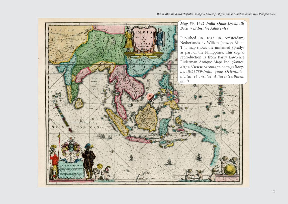
103
The South China Sea Dispute: Philippine Sovereign Rights and Jurisdiction in the West Philippine Sea
Map 36. 1642 India Quae Orientalis Dicitur Et Insulae Adiacentes
Published in 1642 in Amsterdam, Netherlands by Willem Janszon Blaeu. This map shows the unnamed Spratlys as part of the Philippines. This digital reproduction is from Barry Lawrence Ruderman Antique Maps Inc. (Source: https://www.raremaps.com/gallery/detail/23789/India_quae_Orientalis_dicitur_et_Insulae_Adiacentes/Blaeu.html)
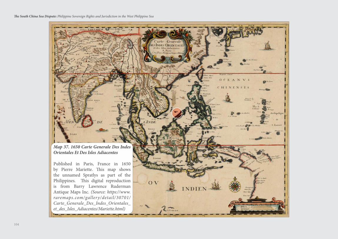
104
The South China Sea Dispute: Philippine Sovereign Rights and Jurisdiction in the West Philippine Sea
Map 37. 1650 Carte Generale Des Indes Orientales Et Des Isles Adiacentes
Published in Paris, France in 1650 by Pierre Mariette. This map shows the unnamed Spratlys as part of the Philippines. This digital reproduction is from Barry Lawrence Ruderman Antique Maps Inc. (Source: https://www.raremaps.com/gallery/detail/30701/Carte_Generale_Des_Indes_Orientales_et_des_Isles_Adiacentes/Mariette.html)
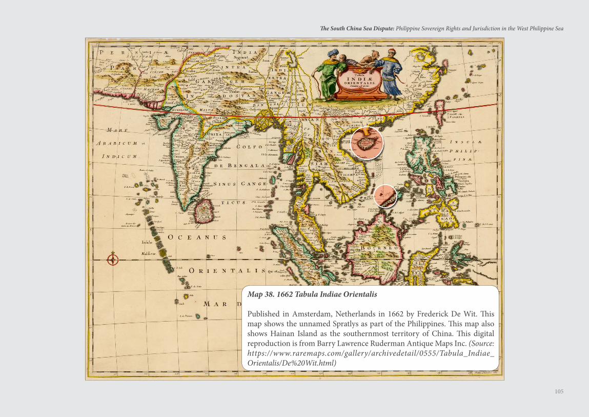
105
The South China Sea Dispute: Philippine Sovereign Rights and Jurisdiction in the West Philippine Sea
Map 38. 1662 Tabula Indiae Orientalis
Published in Amsterdam, Netherlands in 1662 by Frederick De Wit. This map shows the unnamed Spratlys as part of the Philippines. This map also shows Hainan Island as the southernmost territory of China. This digital reproduction is from Barry Lawrence Ruderman Antique Maps Inc. (Source: https://www.raremaps.com/gallery/archivedetail/0555/Tabula_Indiae_Orientalis/De%20Wit.html)
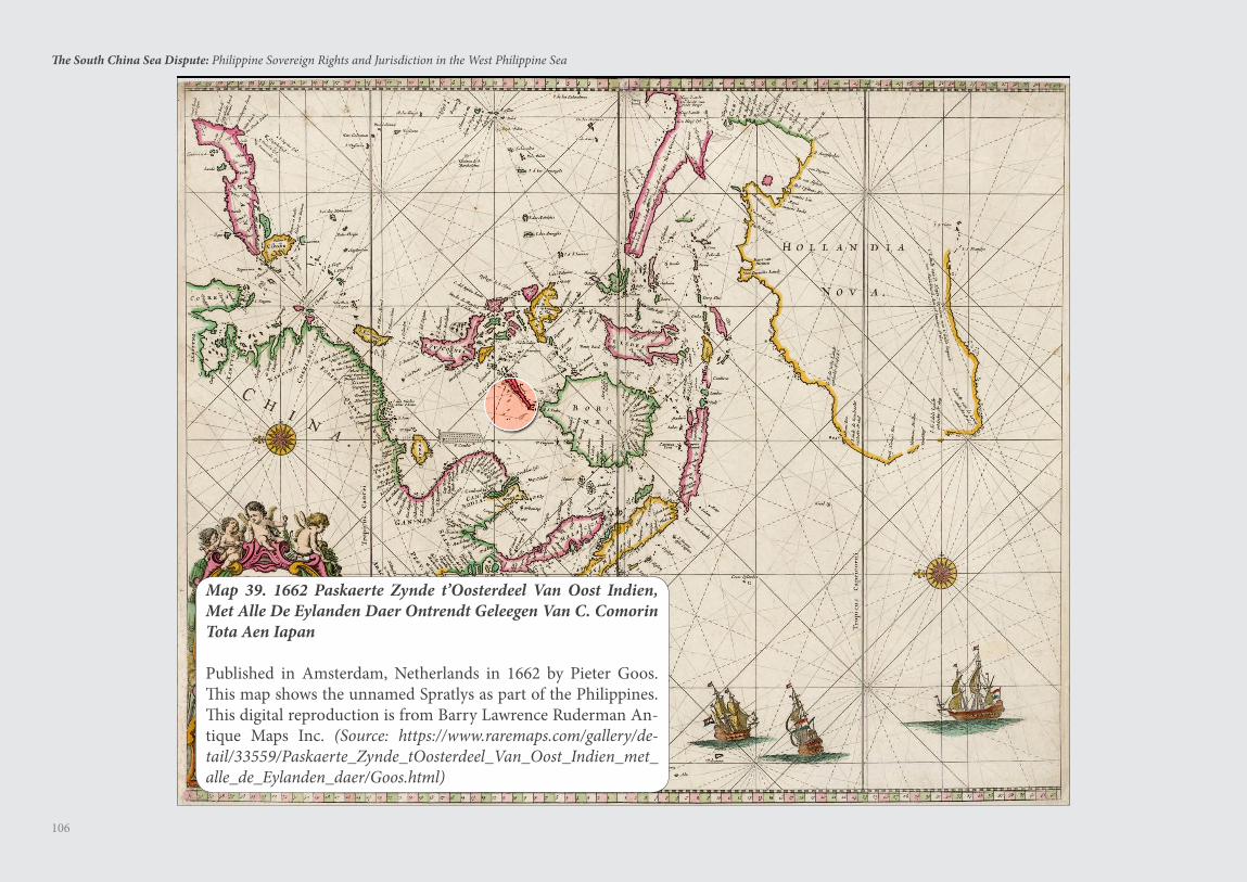
106
The South China Sea Dispute: Philippine Sovereign Rights and Jurisdiction in the West Philippine Sea
Map 39. 1662 Paskaerte Zynde t’Oosterdeel Van Oost Indien, Met Alle De Eylanden Daer Ontrendt Geleegen Van C. Comorin Tota Aen Iapan
Published in Amsterdam, Netherlands in 1662 by Pieter Goos. This map shows the unnamed Spratlys as part of the Philippines. This digital reproduction is from Barry Lawrence Ruderman An-tique Maps Inc. (Source: https://www.raremaps.com/gallery/de-tail/33559/Paskaerte_Zynde_tOosterdeel_Van_Oost_Indien_met_alle_de_Eylanden_daer/Goos.html)
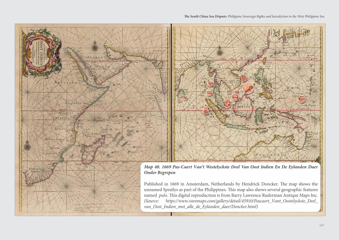
107
The South China Sea Dispute: Philippine Sovereign Rights and Jurisdiction in the West Philippine Sea
Map 40. 1669 Pas-Caert Van’t Westelyckste Deel Van Oost Indien En De Eylanden Daer Onder Begrepen
Published in 1669 in Amsterdam, Netherlands by Hendrick Doncker. The map shows the unnamed Spratlys as part of the Philippines. This map also shows several geographic features named pulo. This digital reproduction is from Barry Lawrence Ruderman Antique Maps Inc. (Source: https://www.raremaps.com/gallery/detail/45910/Pascaert_Vant_Oostelyckste_Deel_van_Oost_Indien_met_alle_de_Eylanden_daer/Doncker.html)
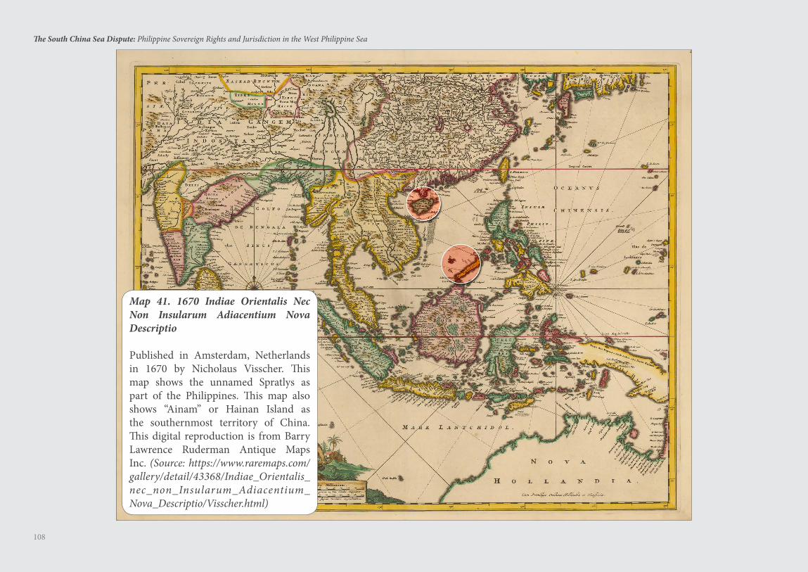
108
The South China Sea Dispute: Philippine Sovereign Rights and Jurisdiction in the West Philippine Sea
Map 41. 1670 Indiae Orientalis Nec Non Insularum Adiacentium Nova Descriptio
Published in Amsterdam, Netherlands in 1670 by Nicholaus Visscher. This map shows the unnamed Spratlys as part of the Philippines. This map also shows “Ainam” or Hainan Island as the southernmost territory of China. This digital reproduction is from Barry Lawrence Ruderman Antique Maps Inc. (Source: https://www.raremaps.com/gallery/detail/43368/Indiae_Orientalis_nec_non_Insularum_Adiacentium_Nova_Descriptio/Visscher.html)
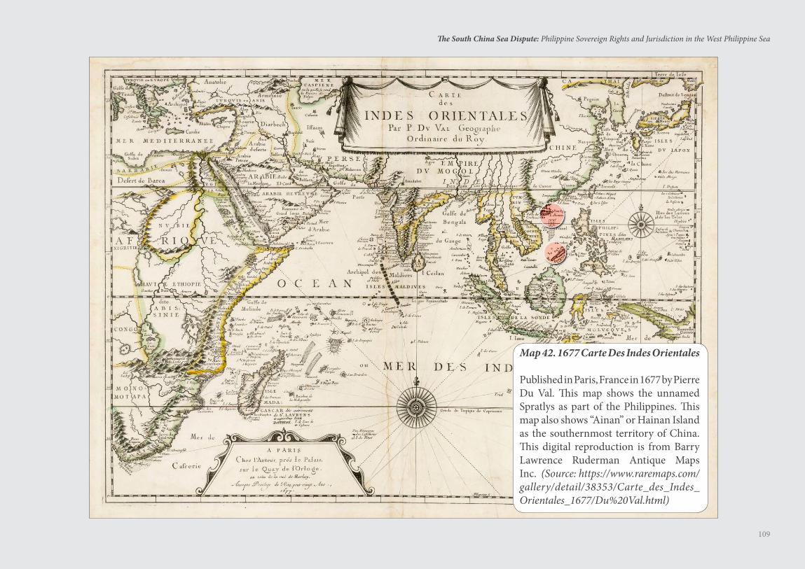
109
The South China Sea Dispute: Philippine Sovereign Rights and Jurisdiction in the West Philippine Sea
Map 42. 1677 Carte Des Indes Orientales
Published in Paris, France in 1677 by Pierre Du Val. This map shows the unnamed Spratlys as part of the Philippines. This map also shows “Ainan” or Hainan Island as the southernmost territory of China. This digital reproduction is from Barry Lawrence Ruderman Antique Maps Inc. (Source: https://www.raremaps.com/gallery/detail/38353/Carte_des_Indes_Orientales_1677/Du%20Val.html)
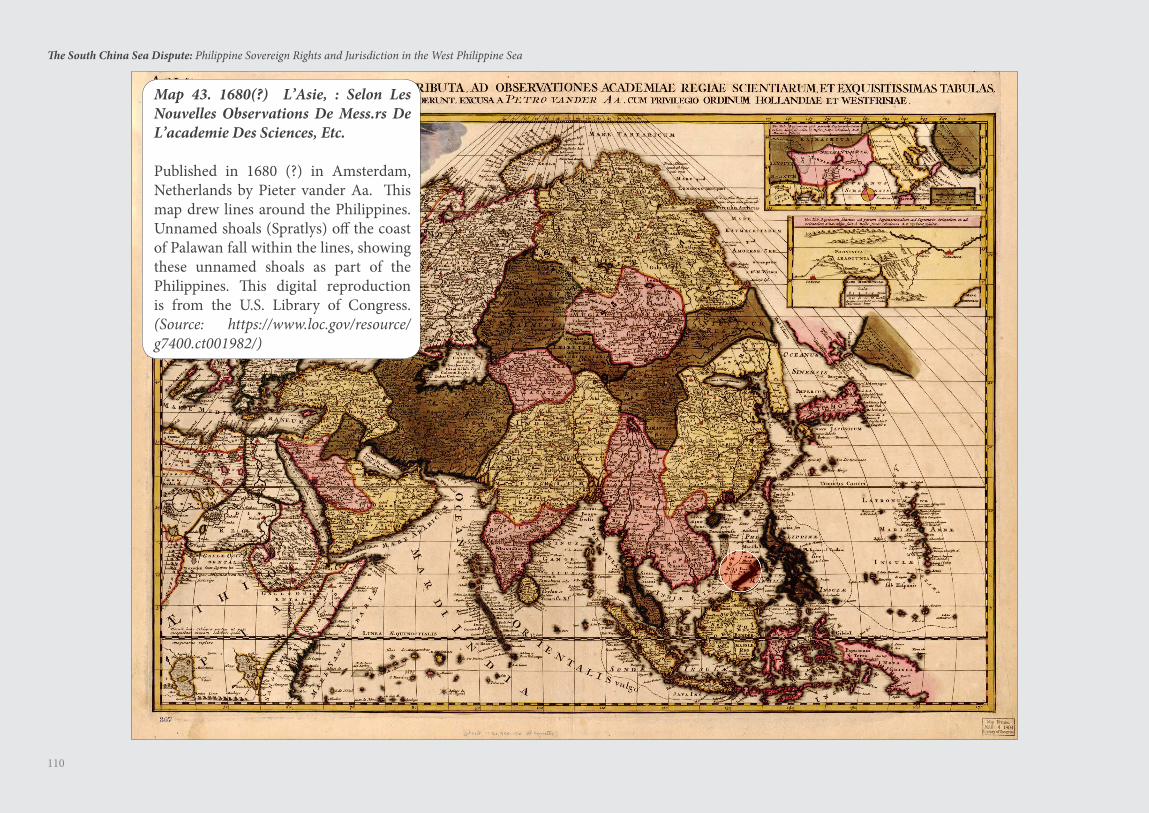
110
The South China Sea Dispute: Philippine Sovereign Rights and Jurisdiction in the West Philippine Sea
Map 43. 1680(?) L’Asie, : Selon Les Nouvelles Observations De Mess.rs De L’academie Des Sciences, Etc.
Published in 1680 (?) in Amsterdam, Netherlands by Pieter vander Aa. This map drew lines around the Philippines. Unnamed shoals (Spratlys) off the coast of Palawan fall within the lines, showing these unnamed shoals as part of the Philippines. This digital reproduction is from the U.S. Library of Congress. (Source: https://www.loc.gov/resource/g7400.ct001982/)
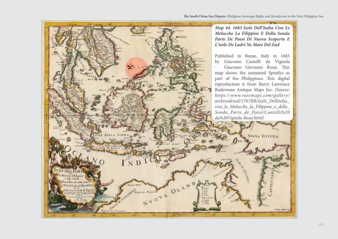
111
The South China Sea Dispute: Philippine Sovereign Rights and Jurisdiction in the West Philippine Sea
Map 44. 1683 Isole Dell’India Cioe Le Molucche La Filippine E Della Sonda Parte De Paesi Di Nuova Scoperta E L’isole De Ladri Ne Mare Del Zud
Published in Rome, Italy in 1683 by Giacomo Cantelli da Vignola - Giacomo Giovanni Rossi. This map shows the unnamed Spratlys as part of the Philippines. This digital reproduction is from Barry Lawrence Ruderman Antique Maps Inc. (Source: https://www.raremaps.com/gallery/archivedetail/1767RB/Isole_DellIndia_cioe_le_Molucche_la_Filippine_e_della_Sonda_Parte_de_Paesi/Cantelli%20da%20Vignola-Rossi.html)
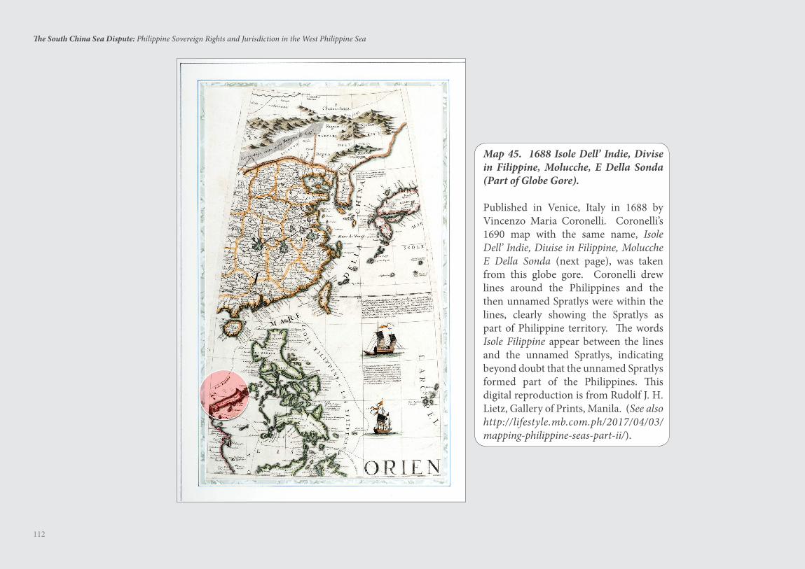
112
The South China Sea Dispute: Philippine Sovereign Rights and Jurisdiction in the West Philippine Sea
Map 45. 1688 Isole Dell’ Indie, Divise in Filippine, Molucche, E Della Sonda (Part of Globe Gore).
Published in Venice, Italy in 1688 by Vincenzo Maria Coronelli. Coronelli’s 1690 map with the same name, Isole Dell’ Indie, Diuise in Filippine, Molucche E Della Sonda (next page), was taken from this globe gore. Coronelli drew lines around the Philippines and the then unnamed Spratlys were within the lines, clearly showing the Spratlys as part of Philippine territory. The words Isole Filippine appear between the lines and the unnamed Spratlys, indicating beyond doubt that the unnamed Spratlys formed part of the Philippines. This digital reproduction is from Rudolf J. H. Lietz, Gallery of Prints, Manila. (See also http://lifestyle.mb.com.ph/2017/04/03/mapping-philippine-seas-part-ii/).
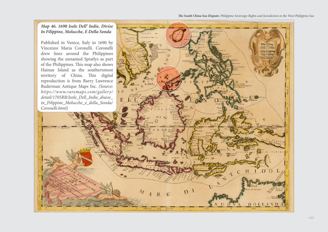
113
The South China Sea Dispute: Philippine Sovereign Rights and Jurisdiction in the West Philippine Sea
Map 46. 1690 Isole Dell’ Indie, Divise In Filippine, Molucche, E Della Sonda
Published in Venice, Italy in 1690 by Vincenzo Maria Coronelli. Coronelli drew lines around the Philippines showing the unnamed Spratlys as part of the Philippines. This map also shows Hainan Island as the southernmost territory of China. This digital reproduction is from Barry Lawrence Ruderman Antique Maps Inc. (Source: https://www.raremaps.com/gallery/detail/1705RB/Isole_Dell_Indie_diuise_in_Filippine_Molucche_e_della_Sonda/Coronelli.html)
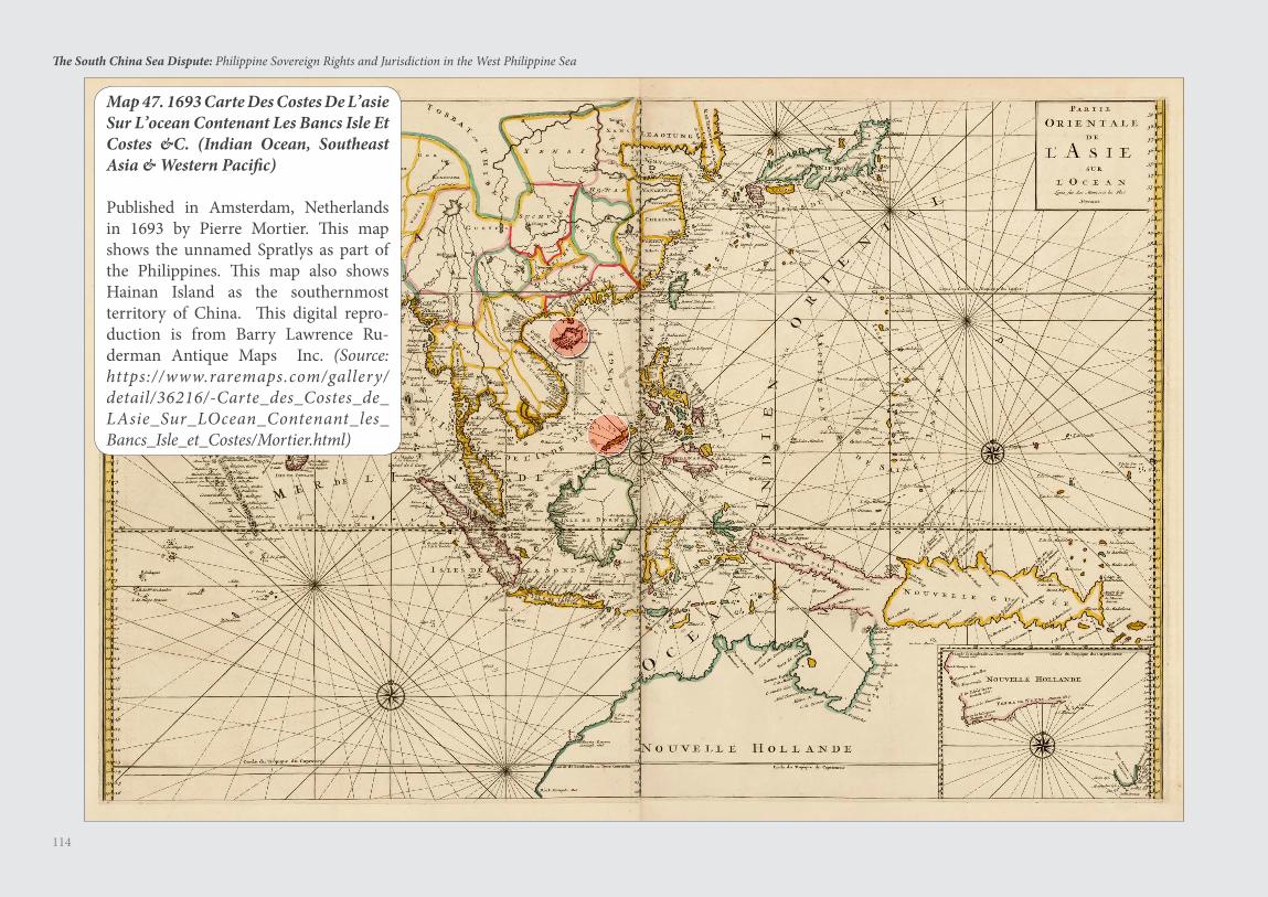
114
The South China Sea Dispute: Philippine Sovereign Rights and Jurisdiction in the West Philippine Sea
Map 47. 1693 Carte Des Costes De L’asie Sur L’ocean Contenant Les Bancs Isle Et Costes &C. (Indian Ocean, Southeast Asia & Western Pacific)
Published in Amsterdam, Netherlands in 1693 by Pierre Mortier. This map shows the unnamed Spratlys as part of the Philippines. This map also shows Hainan Island as the southernmost territory of China. This digital repro-duction is from Barry Lawrence Ru-derman Antique Maps Inc. (Source: https://www.raremaps.com/gallery/detail/36216/-Carte_des_Costes_de_LAsie_Sur_LOcean_Contenant_les_Bancs_Isle_et_Costes/Mortier.html)
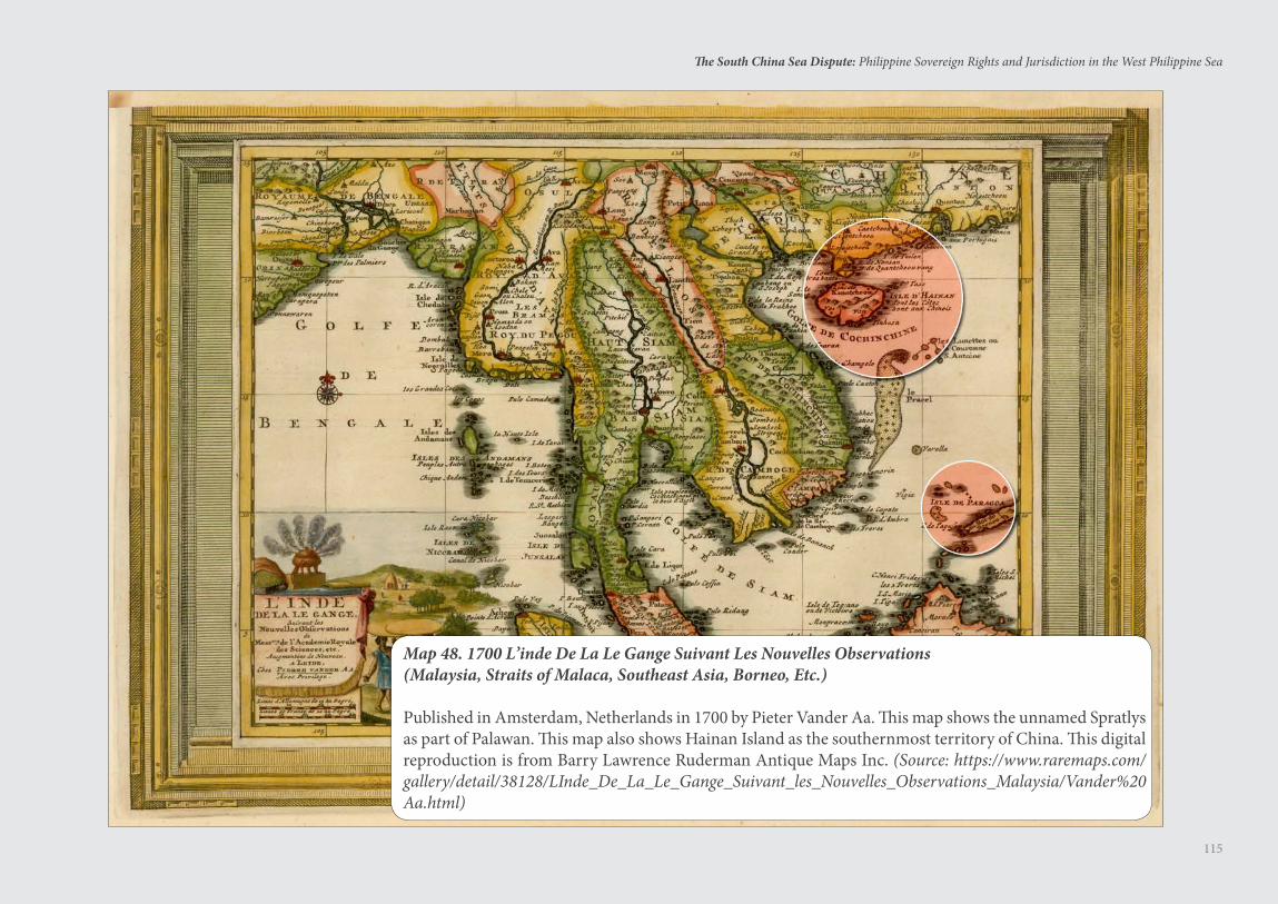
115
The South China Sea Dispute: Philippine Sovereign Rights and Jurisdiction in the West Philippine Sea
Map 48. 1700 L’inde De La Le Gange Suivant Les Nouvelles Observations(Malaysia, Straits of Malaca, Southeast Asia, Borneo, Etc.)
Published in Amsterdam, Netherlands in 1700 by Pieter Vander Aa. This map shows the unnamed Spratlys as part of Palawan. This map also shows Hainan Island as the southernmost territory of China. This digital reproduction is from Barry Lawrence Ruderman Antique Maps Inc. (Source: https://www.raremaps.com/gallery/detail/38128/LInde_De_La_Le_Gange_Suivant_les_Nouvelles_Observations_Malaysia/Vander%20Aa.html)
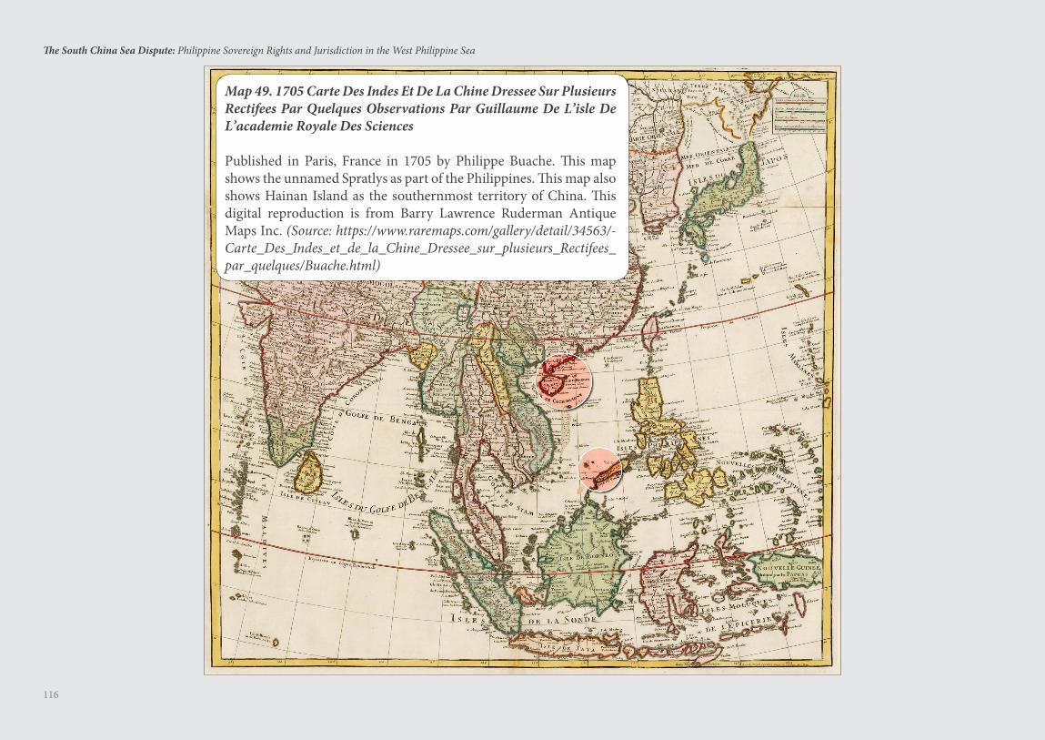
116
The South China Sea Dispute: Philippine Sovereign Rights and Jurisdiction in the West Philippine Sea
Map 49. 1705 Carte Des Indes Et De La Chine Dressee Sur Plusieurs Rectifees Par Quelques Observations Par Guillaume De L’isle De L’academie Royale Des Sciences
Published in Paris, France in 1705 by Philippe Buache. This map shows the unnamed Spratlys as part of the Philippines. This map also shows Hainan Island as the southernmost territory of China. This digital reproduction is from Barry Lawrence Ruderman Antique Maps Inc. (Source: https://www.raremaps.com/gallery/detail/34563/-Carte_Des_Indes_et_de_la_Chine_Dressee_sur_plusieurs_Rectifees_par_quelques/Buache.html)
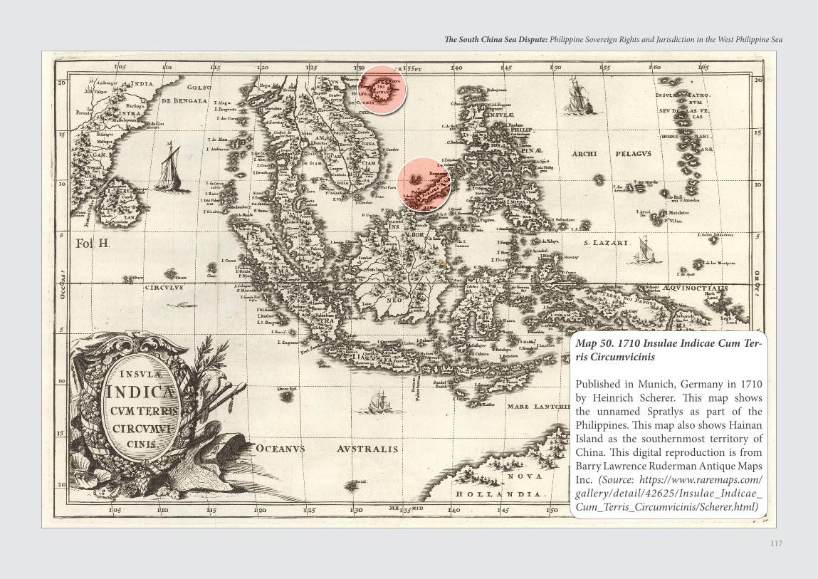
117
The South China Sea Dispute: Philippine Sovereign Rights and Jurisdiction in the West Philippine Sea
Map 50. 1710 Insulae Indicae Cum Ter-ris Circumvicinis
Published in Munich, Germany in 1710 by Heinrich Scherer. This map shows the unnamed Spratlys as part of the Philippines. This map also shows Hainan Island as the southernmost territory of China. This digital reproduction is from Barry Lawrence Ruderman Antique Maps Inc. (Source: https://www.raremaps.com/gallery/detail/42625/Insulae_Indicae_Cum_Terris_Circumvicinis/Scherer.html)
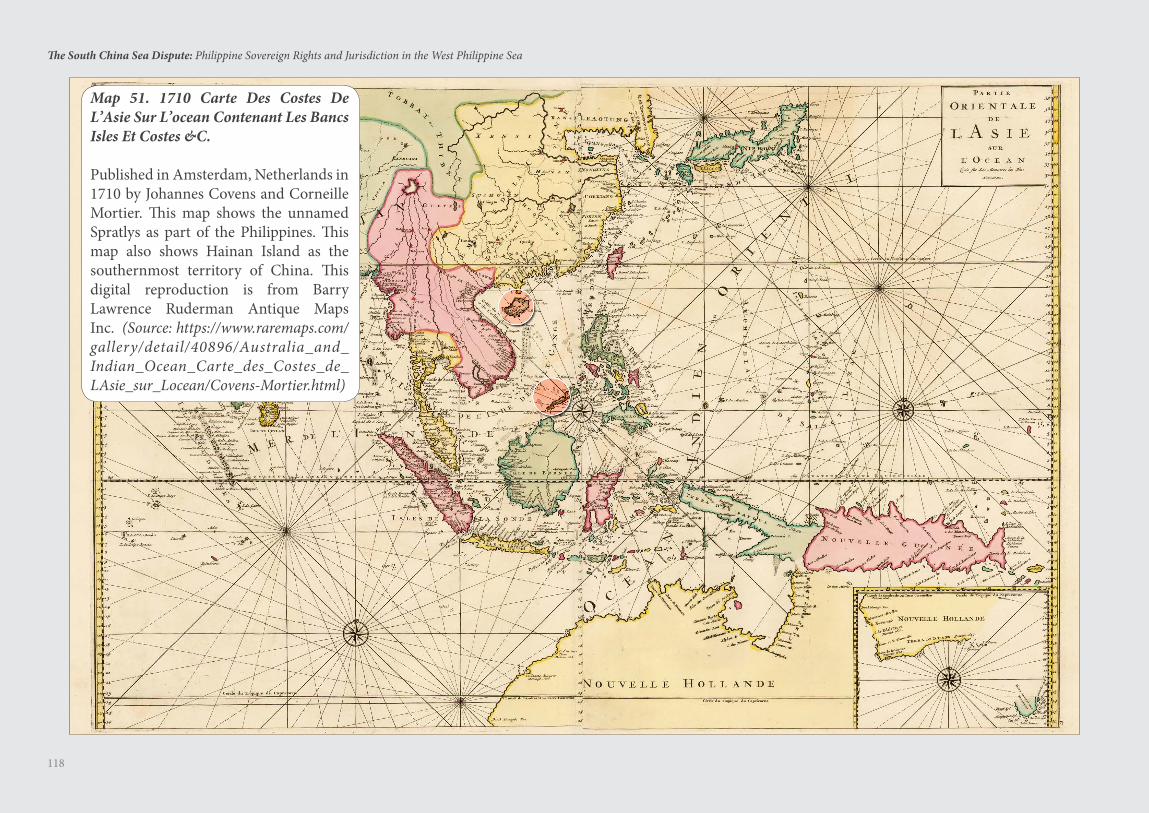
118
The South China Sea Dispute: Philippine Sovereign Rights and Jurisdiction in the West Philippine Sea
Map 51. 1710 Carte Des Costes De L’Asie Sur L’ocean Contenant Les Bancs Isles Et Costes &C.
Published in Amsterdam, Netherlands in 1710 by Johannes Covens and Corneille Mortier. This map shows the unnamed Spratlys as part of the Philippines. This map also shows Hainan Island as the southernmost territory of China. This digital reproduction is from Barry Lawrence Ruderman Antique Maps Inc. (Source: https://www.raremaps.com/gallery/detail/40896/Australia_and_Indian_Ocean_Carte_des_Costes_de_LAsie_sur_Locean/Covens-Mortier.html)
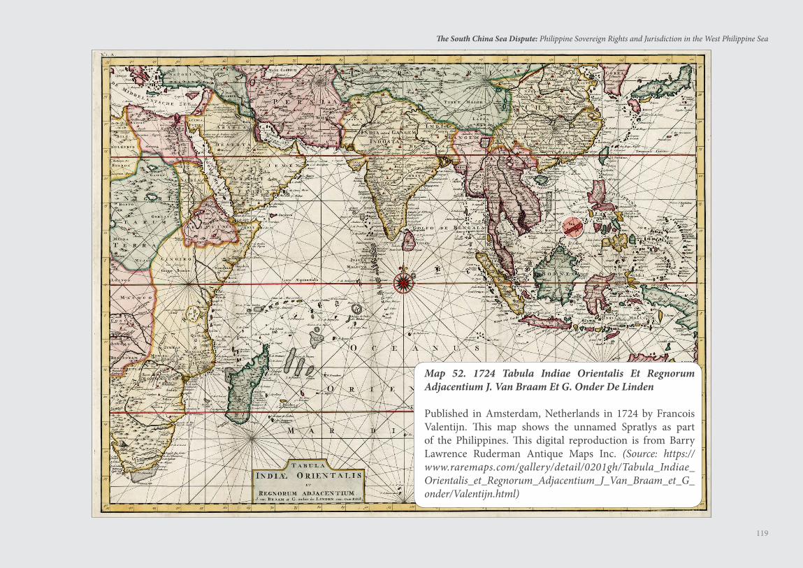
119
The South China Sea Dispute: Philippine Sovereign Rights and Jurisdiction in the West Philippine Sea
Map 52. 1724 Tabula Indiae Orientalis Et Regnorum Adjacentium J. Van Braam Et G. Onder De Linden
Published in Amsterdam, Netherlands in 1724 by Francois Valentijn. This map shows the unnamed Spratlys as part of the Philippines. This digital reproduction is from Barry Lawrence Ruderman Antique Maps Inc. (Source: https://www.raremaps.com/gallery/detail/0201gh/Tabula_Indiae_Orientalis_et_Regnorum_Adjacentium_J_Van_Braam_et_G_onder/Valentijn.html)

120
The South China Sea Dispute: Philippine Sovereign Rights and Jurisdiction in the West Philippine Sea
Map 53. 1730 India Orientalis Cum Adjacentibus Insulis Nova Delineatione Ob Oculos Posita
Published in Augsberg, Germany in 1730 by Matthaeus Seutter. This map shows the unnamed Spratlys as part of the Philippines. This map also shows “Ainam” or Hainan Island as the southernmost territory of China. This digital reproduction is from Barry Lawrence Ruderman Antique Maps Inc. (Source: https://www.raremaps.com/gallery/archivedetail/3499/India_Orientalis_cum_Adjacentibus_Insulis_Nova_Delineatione_ob_oculos_posita…/Seutter.html)
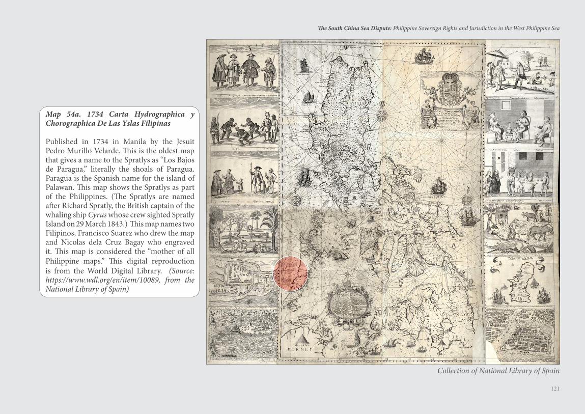
121
The South China Sea Dispute: Philippine Sovereign Rights and Jurisdiction in the West Philippine Sea
Map 54a. 1734 Carta Hydrographica y Chorographica De Las Yslas Filipinas
Published in 1734 in Manila by the Jesuit Pedro Murillo Velarde. This is the oldest map that gives a name to the Spratlys as “Los Bajos de Paragua,” literally the shoals of Paragua. Paragua is the Spanish name for the island of Palawan. This map shows the Spratlys as part of the Philippines. (The Spratlys are named after Richard Spratly, the British captain of the whaling ship Cyrus whose crew sighted Spratly Island on 29 March 1843.) This map names two Filipinos, Francisco Suarez who drew the map and Nicolas dela Cruz Bagay who engraved it. This map is considered the “mother of all Philippine maps.” This digital reproduction is from the World Digital Library. (Source: https://www.wdl.org/en/item/10089, from the National Library of Spain)
Collection of National Library of Spain
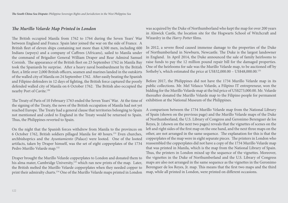
122
The South China Sea Dispute: Philippine Sovereign Rights and Jurisdiction in the West Philippine Sea
The Murillo Velarde Map Printed in London
The British occupied Manila from 1762 to 1764 during the Seven Years’ War between England and France. Spain later joined the war on the side of France. A British fleet of eleven ships containing not more than 4,500 men, including 600 Indians (sepoys) and a company of Caffrees (Africans), sailed to Manila under the command of Brigadier General William Draper and Rear Admiral Samuel Cornish. The appearance of the British fleet on 23 September 1762 in Manila Bay took the Spaniards by surprise. After a heavy naval bombardment by the British fleet, a little over 2,000 British officers, seamen and marines landed in the outskirts of the walled city of Manila on 24 September 1762. After easily beating the Spanish and Filipino defenders in 12 days of fighting, the British force captured the poorly defended walled city of Manila on 6 October 1762. The British also occupied the nearby Port of Cavite.130
The Treaty of Paris of 10 February 1763 ended the Seven Years’ War. At the time of the signing of the Treaty, the news of the British occupation of Manila had not yet reached Europe. The Treaty had a general clause that territories belonging to Spain not mentioned and ceded to England in the Treaty would be returned to Spain. Thus, the Philippines reverted to Spain.
On the night that the Spanish forces withdrew from Manila to the provinces on 6 October 1762, British soldiers pillaged Manila for 40 hours.131 Even churches, archbishoprics and the Ayuntamiento (Palace) were looted. One of the looted artifacts, taken by Draper himself, was the set of eight copperplates of the 1734 Pedro Murillo Velarde map.132
Draper brought the Murillo Velarde copperplates to London and donated them to his alma mater, Cambridge University,133 which ran new prints of the map. Later, the British melted the Murillo Velarde copperplates when they needed copper to print their admiralty charts.134 One of the Murillo Velarde maps printed in London
was acquired by the Duke of Northumberland who kept the map for over 200 years in Alnwick Castle, the location site for the Hogwarts School of Witchcraft and Wizardry in the Harry Potter films.
In 2012, a severe flood caused immense damage to the properties of the Duke of Northumberland in Newburn, Newcastle. The Duke is the largest landowner in England. In April 2014, the Duke announced the sale of family heirlooms to raise funds to pay the 12 million pound repair bill for the damaged properties. One of the heirlooms for sale was the Murillo Velarde map, to be auctioned off by Sotheby’s, which estimated the price at US$32,000.00 – US$48,000.00.135
Before 2017, the Philippines did not have the 1734 Murillo Velarde map in its public collections. Mr. Mel Velasco Velarde, a Filipino IT entrepreneur, won the bidding for the Murillo Velarde map at the bid price of US$273,000.00. Mr. Velarde thereafter donated the Murillo Velarde map to the Filipino people for permanent exhibition at the National Museum of the Philippines.
A comparison between the 1734 Murillo Velarde map from the National Library of Spain (shown on the previous page) and the Murillo Velarde maps of the Duke of Northumberland, the U.S. Library of Congress and Geronimo Berenguer de los Reyes, Jr. (shown on the next two pages) reveals that the vignettes of scenes on the left and right sides of the first map on the one hand, and the next three maps on the other, are not arranged in the same sequence. The explanation for this is that the copperplates of the map were in eight separate pieces. The printers in London who reassembled the copperplates did not have a copy of the 1734 Murillo Velarde map that was printed in Manila, which is the map from the National Library of Spain. Thus, the printers in London mixed up the sequence of the vignettes. Moreover, the vignettes in the Duke of Northumberland and the U.S. Library of Congress maps are also not arranged in the same sequence as the vignettes in the Geronimo Berenguer de los Reyes, Jr. map. This means that the first two maps and the third map, while all printed in London, were printed on different occasions.
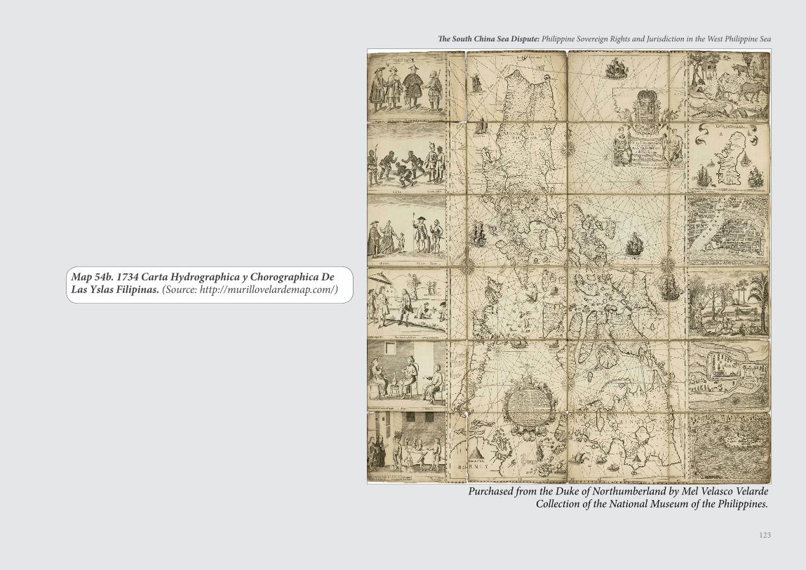
123
The South China Sea Dispute: Philippine Sovereign Rights and Jurisdiction in the West Philippine Sea
Map 54b. 1734 Carta Hydrographica y Chorographica De Las Yslas Filipinas. (Source: http://murillovelardemap.com/)
Purchased from the Duke of Northumberland by Mel Velasco VelardeCollection of the National Museum of the Philippines.
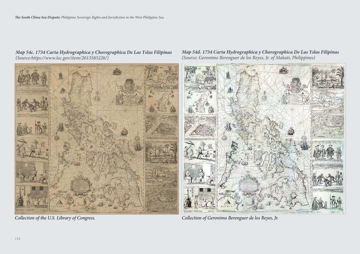
124
The South China Sea Dispute: Philippine Sovereign Rights and Jurisdiction in the West Philippine Sea
Map 54c. 1734 Carta Hydrographica y Chorographica De Las Yslas Filipinas(Source:https://www.loc.gov/item/2013585226/)
Map 54d. 1734 Carta Hydrographica y Chorographica De Las Yslas Filipinas(Source: Geronimo Berenguer de los Reyes, Jr. of Makati, Philippines)
Collection of the U.S. Library of Congress. Collection of Geronimo Berenguer de los Reyes, Jr.
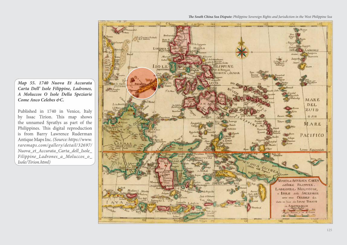
125
The South China Sea Dispute: Philippine Sovereign Rights and Jurisdiction in the West Philippine Sea
Map 55. 1740 Nuova Et Accurata Carta Dell’ Isole Filippine, Ladrones, A Moluccos O Isole Della Speziarie Come Anco Celebes &C.
Published in 1740 in Venice, Italy by Issac Tirion. This map shows the unnamed Spratlys as part of the Philippines. This digital reproduction is from Barry Lawrence Ruderman Antique Maps Inc. (Source: https://www.raremaps.com/gallery/detail/32697/Nuova_et_Accurata_Carta_dell_Isole_Filippine_Ladrones_a_Moluccos_o_Isole/Tirion.html)
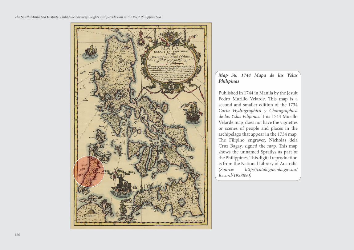
126
The South China Sea Dispute: Philippine Sovereign Rights and Jurisdiction in the West Philippine Sea
Map 56. 1744 Mapa de las Yslas Philipinas
Published in 1744 in Manila by the Jesuit Pedro Murillo Velarde. This map is a second and smaller edition of the 1734 Carta Hydrographica y Chorographica de las Yslas Filipinas. This 1744 Murillo Velarde map does not have the vignettes or scenes of people and places in the archipelago that appear in the 1734 map. The Filipino engraver, Nicholas dela Cruz Bagay, signed the map. This map shows the unnamed Spratlys as part of the Philippines. This digital reproduction is from the National Library of Australia (Source: http://catalogue.nla.gov.au/Record/1958890)
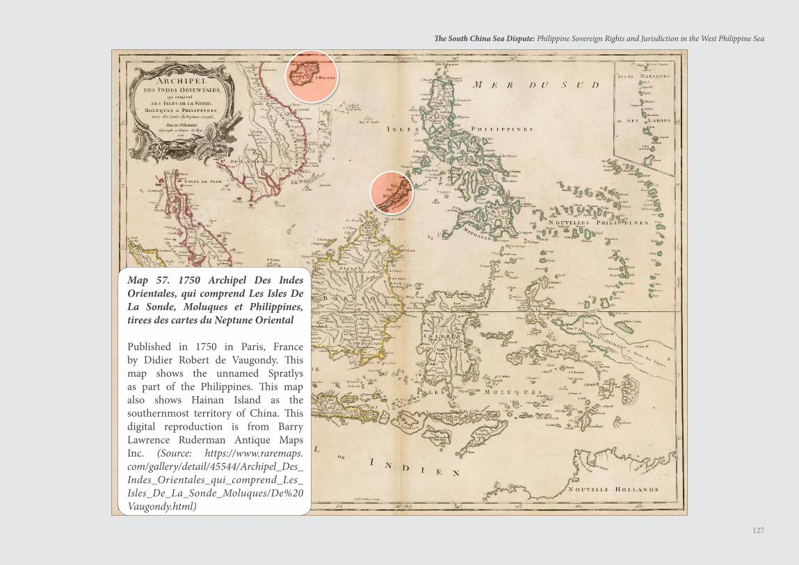
127
The South China Sea Dispute: Philippine Sovereign Rights and Jurisdiction in the West Philippine Sea
Map 57. 1750 Archipel Des Indes Orientales, qui comprend Les Isles De La Sonde, Moluques et Philippines, tirees des cartes du Neptune Oriental
Published in 1750 in Paris, France by Didier Robert de Vaugondy. This map shows the unnamed Spratlys as part of the Philippines. This map also shows Hainan Island as the southernmost territory of China. This digital reproduction is from Barry Lawrence Ruderman Antique Maps Inc. (Source: https://www.raremaps.com/gallery/detail/45544/Archipel_Des_Indes_Orientales_qui_comprend_Les_Isles_De_La_Sonde_Moluques/De%20Vaugondy.html)
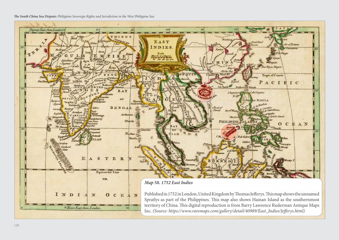
128
The South China Sea Dispute: Philippine Sovereign Rights and Jurisdiction in the West Philippine Sea
Map 58. 1752 East Indies
Published in 1752 in London, United Kingdom by Thomas Jefferys. This map shows the unnamed Spratlys as part of the Philippines. This map also shows Hainan Island as the southernmost territory of China. This digital reproduction is from Barry Lawrence Ruderman Antique Maps Inc. (Source: https://www.raremaps.com/gallery/detail/40989/East_Indies/Jefferys.html)
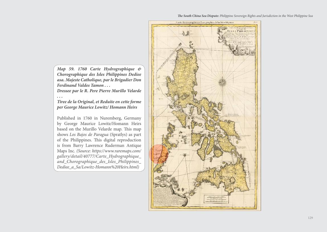
129
The South China Sea Dispute: Philippine Sovereign Rights and Jurisdiction in the West Philippine Sea
Map 59. 1760 Carte Hydrographique & Chorographique des Isles Philippines Dediee asa. Majeste Catholique, par le Brigadier Don Ferdinand Valdes Tamon . . .Dressee par le R. Pere Pierre Murillo Velarde . . .Tiree de la Original, et Reduite en cette forme per George Maurice Lowitz/ Homann Heirs
Published in 1760 in Nuremberg, Germany by George Maurice Lowitz/Homann Heirs based on the Murillo Velarde map. This map shows Los Bajos de Paragua (Spratlys) as part of the Philippines. This digital reproduction is from Barry Lawrence Ruderman Antique Maps Inc. (Source: https://www.raremaps.com/gallery/detail/40777/Carte_Hydrographique_and_Chorographique_des_Isles_Philippines_Dediee_a_Sa/Lowitz-Homann%20Heirs.html)
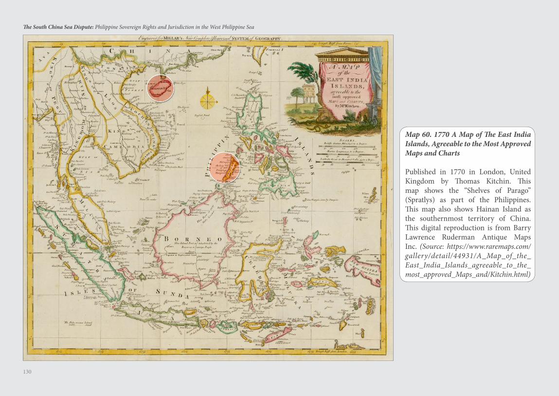
130
The South China Sea Dispute: Philippine Sovereign Rights and Jurisdiction in the West Philippine Sea
Map 60. 1770 A Map of The East India Islands, Agreeable to the Most Approved Maps and Charts
Published in 1770 in London, United Kingdom by Thomas Kitchin. This map shows the “Shelves of Parago” (Spratlys) as part of the Philippines. This map also shows Hainan Island as the southernmost territory of China. This digital reproduction is from Barry Lawrence Ruderman Antique Maps Inc. (Source: https://www.raremaps.com/gallery/detail/44931/A_Map_of_the_East_India_Islands_agreeable_to_the_most_approved_Maps_and/Kitchin.html)
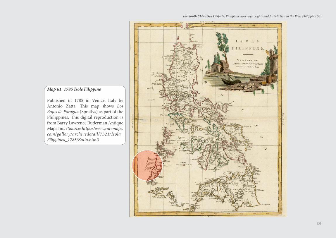
131
The South China Sea Dispute: Philippine Sovereign Rights and Jurisdiction in the West Philippine Sea
Map 61. 1785 Isole Filippine
Published in 1785 in Venice, Italy by Antonio Zatta. This map shows Los Bajos de Paragua (Spratlys) as part of the Philippines. This digital reproduction is from Barry Lawrence Ruderman Antique Maps Inc. (Source: https://www.raremaps.com/gallery/archivedetail/7321/Isola_Filippinea_1785/Zatta.html)
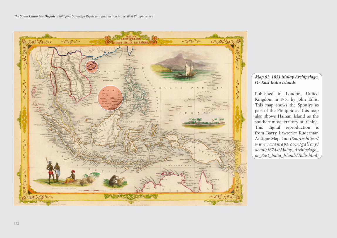
132
The South China Sea Dispute: Philippine Sovereign Rights and Jurisdiction in the West Philippine Sea
Map 62. 1851 Malay Archipelago, Or East India Islands
Published in London, United Kingdom in 1851 by John Tallis. This map shows the Spratlys as part of the Philippines. This map also shows Hainan Island as the southernmost territory of China. This digital reproduction is from Barry Lawrence Ruderman Antique Maps Inc. (Source: https://w w w.raremaps . com/gal l e r y /detail/36744/Malay_Archipelago_or_East_India_Islands/Tallis.html)
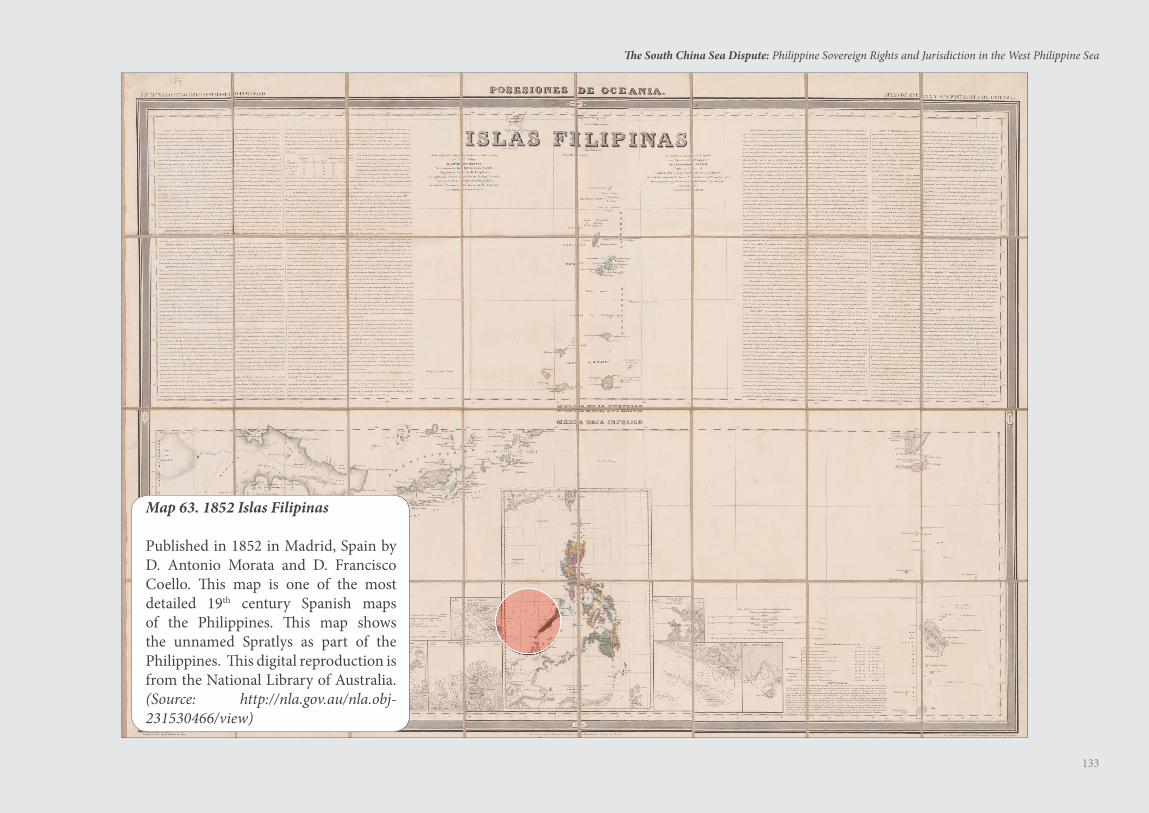
133
The South China Sea Dispute: Philippine Sovereign Rights and Jurisdiction in the West Philippine Sea
Map 63. 1852 Islas Filipinas
Published in 1852 in Madrid, Spain by D. Antonio Morata and D. Francisco Coello. This map is one of the most detailed 19th century Spanish maps of the Philippines. This map shows the unnamed Spratlys as part of the Philippines. This digital reproduction is from the National Library of Australia. (Source: http://nla.gov.au/nla.obj-231530466/view)
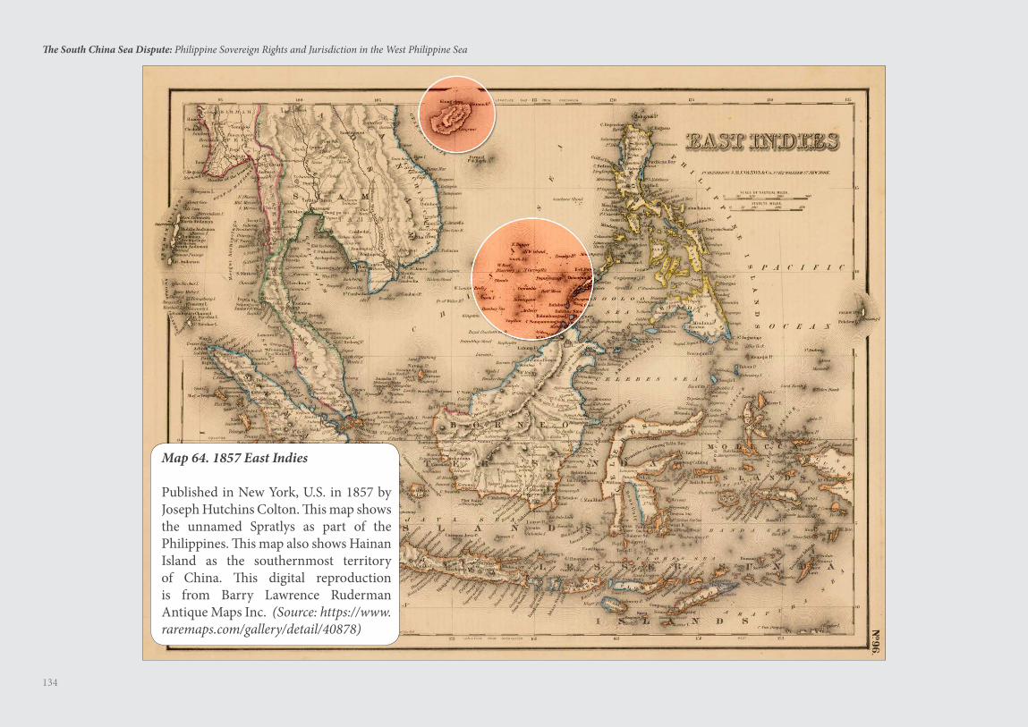
134
The South China Sea Dispute: Philippine Sovereign Rights and Jurisdiction in the West Philippine Sea
Map 64. 1857 East Indies
Published in New York, U.S. in 1857 by Joseph Hutchins Colton. This map shows the unnamed Spratlys as part of the Philippines. This map also shows Hainan Island as the southernmost territory of China. This digital reproduction is from Barry Lawrence Ruderman Antique Maps Inc. (Source: https://www.raremaps.com/gallery/detail/40878)
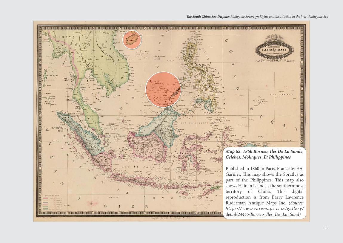
135
The South China Sea Dispute: Philippine Sovereign Rights and Jurisdiction in the West Philippine Sea
Map 65. 1860 Borneo, Iles De La Sonde, Celebes, Moluques, Et Philippines
Published in 1860 in Paris, France by F.A. Garnier. This map shows the Spratlys as part of the Philippines. This map also shows Hainan Island as the southernmost territory of China. This digital reproduction is from Barry Lawrence Ruderman Antique Maps Inc. (Source: https://www.raremaps.com/gallery/detail/24445/Borneo_Iles_De_La_Sond)
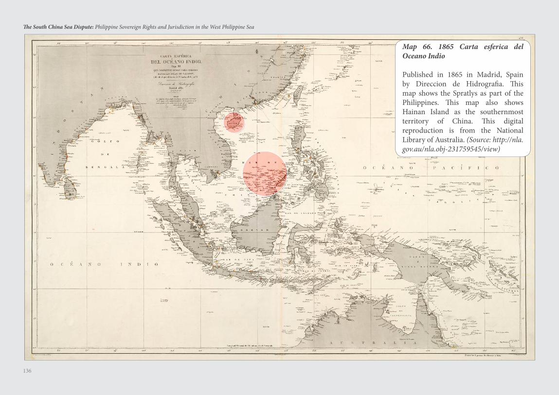
136
The South China Sea Dispute: Philippine Sovereign Rights and Jurisdiction in the West Philippine Sea
Map 66. 1865 Carta esferica del Oceano Indio
Published in 1865 in Madrid, Spain by Direccion de Hidrografia. This map shows the Spratlys as part of the Philippines. This map also shows Hainan Island as the southernmost territory of China. This digital reproduction is from the National Library of Australia. (Source: http://nla.gov.au/nla.obj-231759545/view)
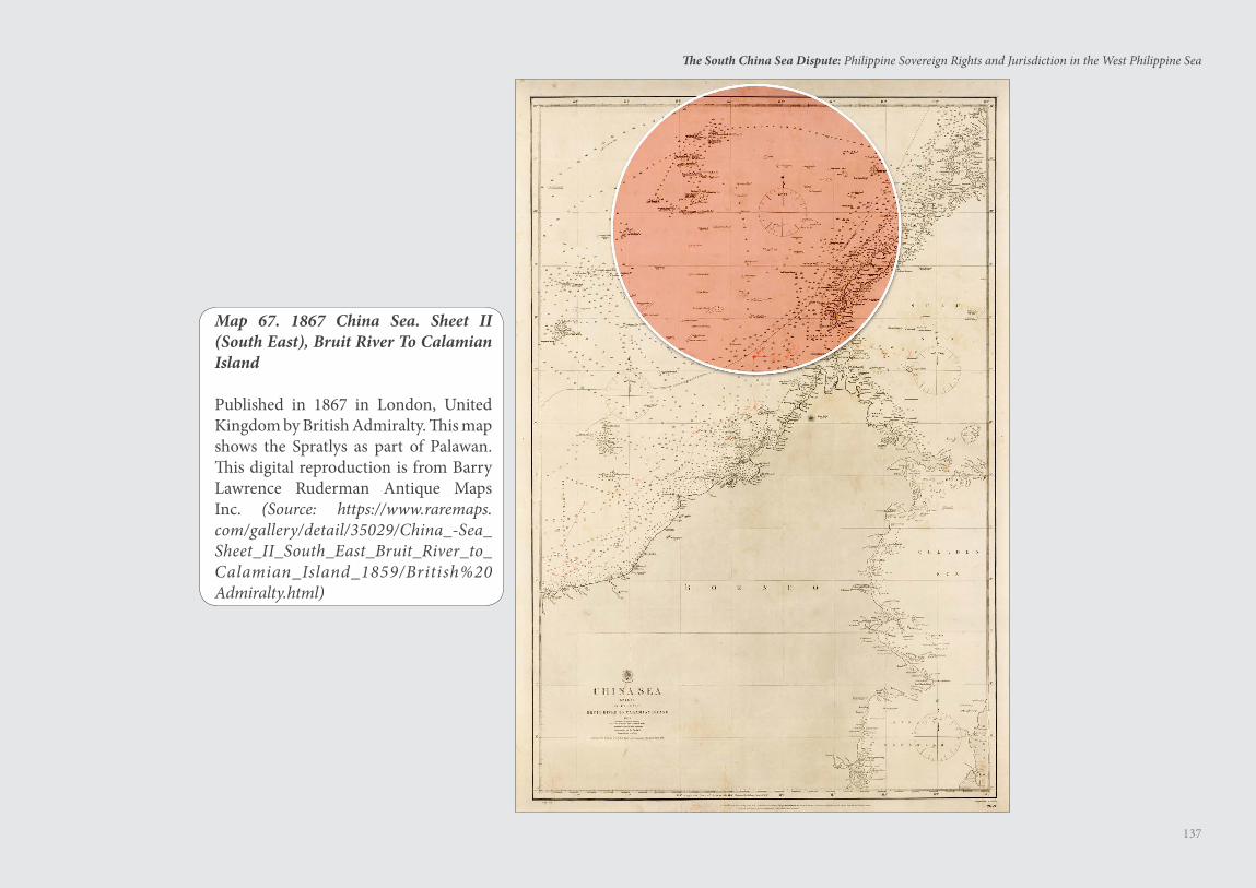
137
The South China Sea Dispute: Philippine Sovereign Rights and Jurisdiction in the West Philippine Sea
Map 67. 1867 China Sea. Sheet II (South East), Bruit River To Calamian Island
Published in 1867 in London, United Kingdom by British Admiralty. This map shows the Spratlys as part of Palawan. This digital reproduction is from Barry Lawrence Ruderman Antique Maps Inc. (Source: https://www.raremaps.com/gallery/detail/35029/China_-Sea_Sheet_II_South_East_Bruit_River_to_Calamian_Island_1859/British%20Admiralty.html)
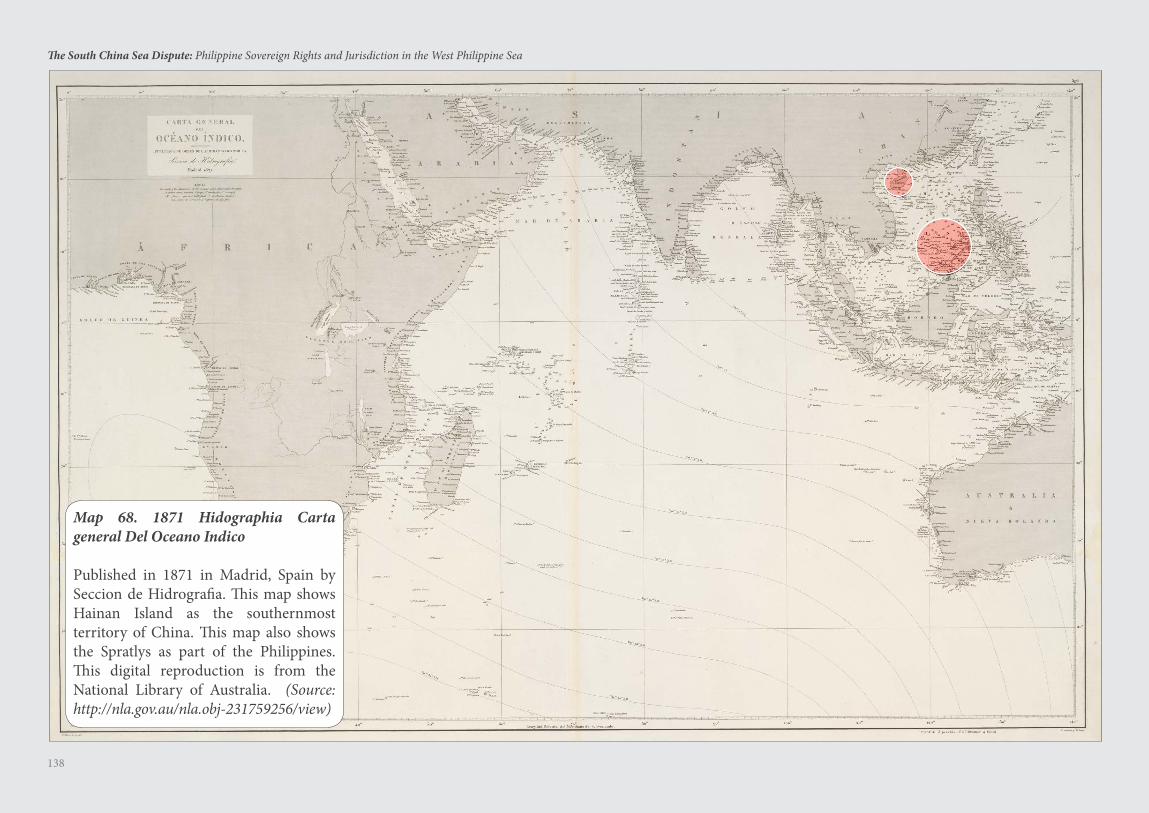
138
The South China Sea Dispute: Philippine Sovereign Rights and Jurisdiction in the West Philippine Sea
Map 68. 1871 Hidographia Carta general Del Oceano Indico
Published in 1871 in Madrid, Spain by Seccion de Hidrografia. This map shows Hainan Island as the southernmost territory of China. This map also shows the Spratlys as part of the Philippines. This digital reproduction is from the National Library of Australia. (Source: http://nla.gov.au/nla.obj-231759256/view)
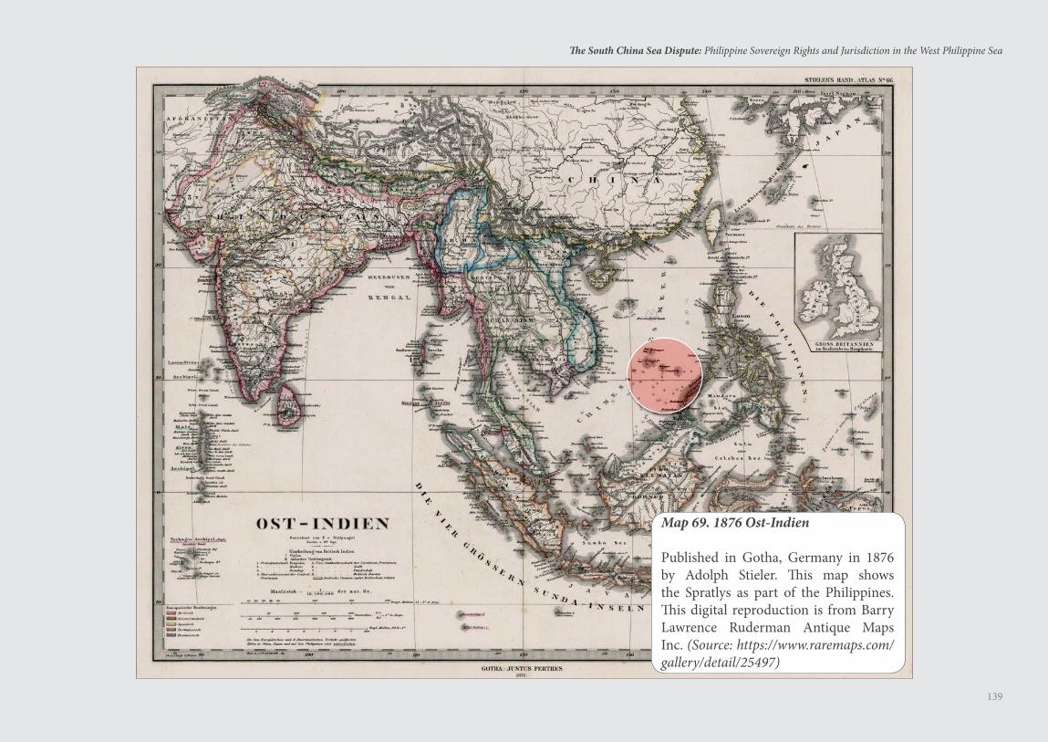
139
The South China Sea Dispute: Philippine Sovereign Rights and Jurisdiction in the West Philippine Sea
Map 69. 1876 Ost-Indien
Published in Gotha, Germany in 1876 by Adolph Stieler. This map shows the Spratlys as part of the Philippines. This digital reproduction is from Barry Lawrence Ruderman Antique Maps Inc. (Source: https://www.raremaps.com/gallery/detail/25497)
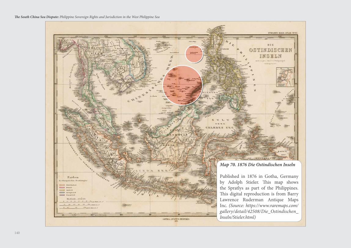
140
The South China Sea Dispute: Philippine Sovereign Rights and Jurisdiction in the West Philippine Sea
Map 70. 1876 Die Ostindischen Inseln
Published in 1876 in Gotha, Germany by Adolph Stieler. This map shows the Spratlys as part of the Philippines. This digital reproduction is from Barry Lawrence Ruderman Antique Maps Inc. (Source: https://www.raremaps.com/gallery/detail/42508/Die_Ostindischen_Inseln/Stieler.html)
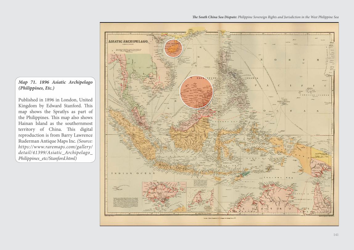
141
The South China Sea Dispute: Philippine Sovereign Rights and Jurisdiction in the West Philippine Sea
Map 71. 1896 Asiatic Archipelago (Philippines, Etc.)
Published in 1896 in London, United Kingdom by Edward Stanford. This map shows the Spratlys as part of the Philippines. This map also shows Hainan Island as the southernmost territory of China. This digital reproduction is from Barry Lawrence Ruderman Antique Maps Inc. (Source: https://www.raremaps.com/gallery/detail/41399/Asiatic_Archipelago_Philippines_etc/Stanford.html)
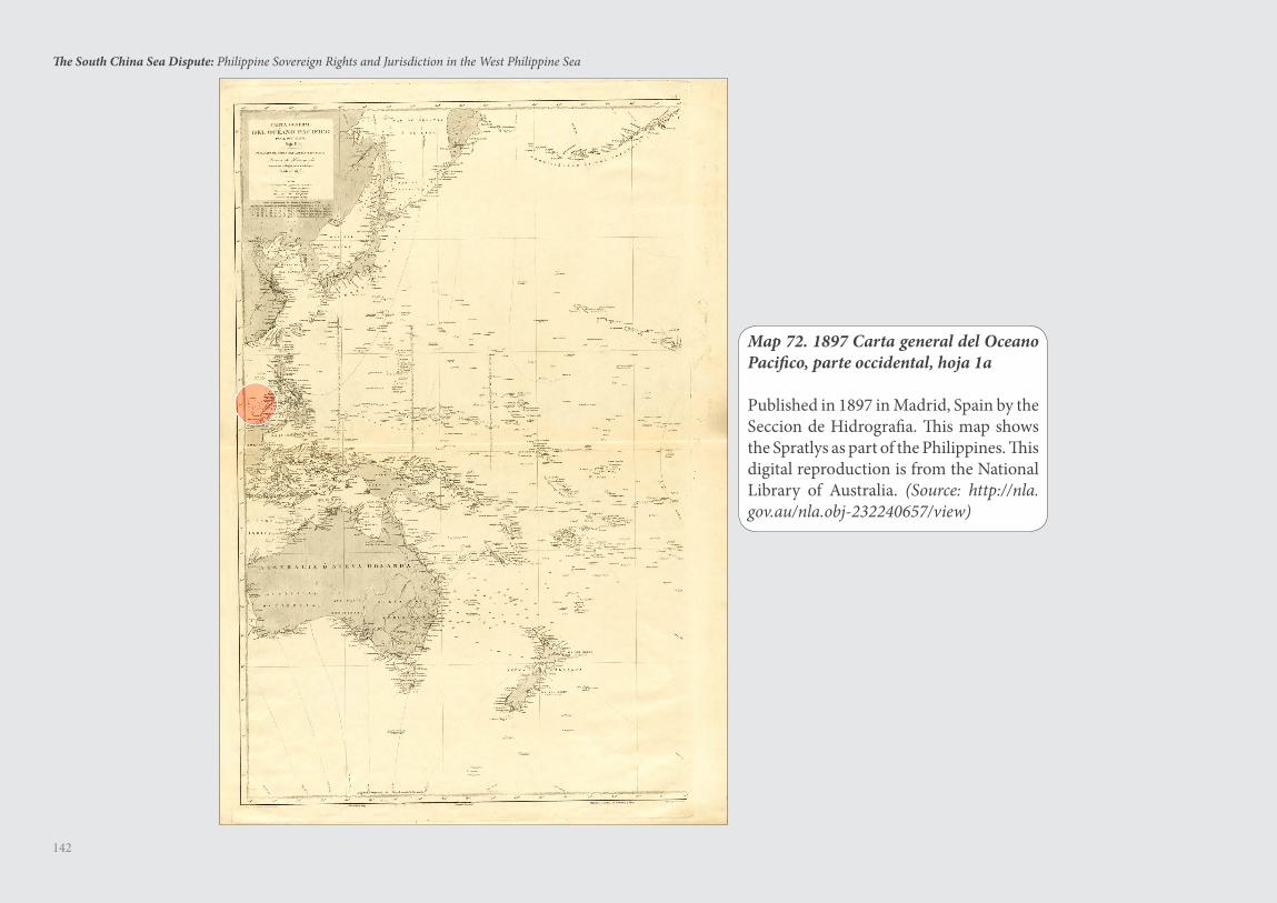
142
The South China Sea Dispute: Philippine Sovereign Rights and Jurisdiction in the West Philippine Sea
Map 72. 1897 Carta general del Oceano Pacifico, parte occidental, hoja 1a
Published in 1897 in Madrid, Spain by the Seccion de Hidrografia. This map shows the Spratlys as part of the Philippines. This digital reproduction is from the National Library of Australia. (Source: http://nla.gov.au/nla.obj-232240657/view)
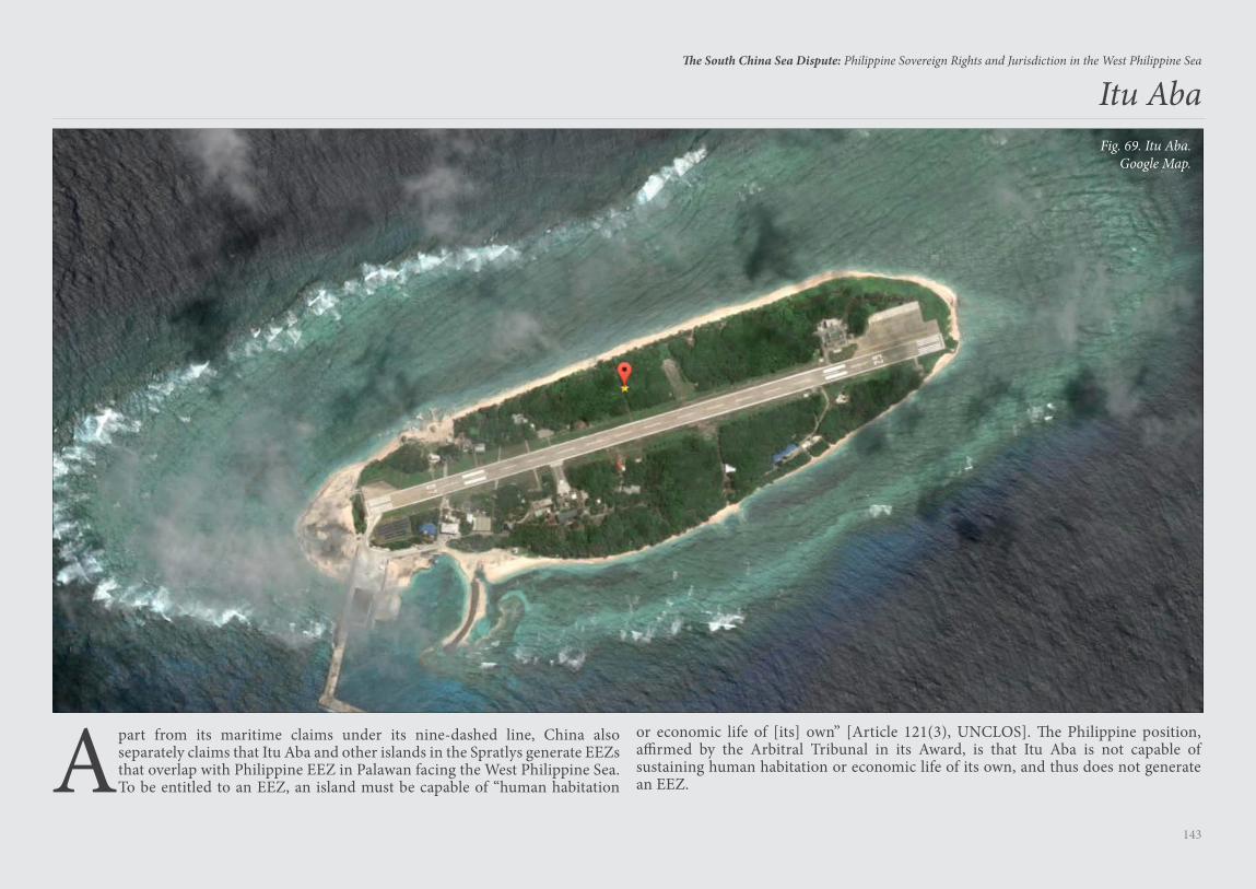
143
The South China Sea Dispute: Philippine Sovereign Rights and Jurisdiction in the West Philippine Sea
Apart from its maritime claims under its nine-dashed line, China also separately claims that Itu Aba and other islands in the Spratlys generate EEZs that overlap with Philippine EEZ in Palawan facing the West Philippine Sea. To be entitled to an EEZ, an island must be capable of “human habitation
Itu Aba
or economic life of [its] own” [Article 121(3), UNCLOS]. The Philippine position, affirmed by the Arbitral Tribunal in its Award, is that Itu Aba is not capable of sustaining human habitation or economic life of its own, and thus does not generate an EEZ.
Fig. 69. Itu Aba.Google Map.
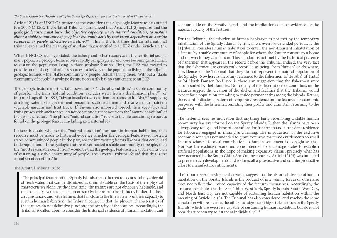
144
The South China Sea Dispute: Philippine Sovereign Rights and Jurisdiction in the West Philippine Sea
Article 121(3) of UNCLOS prescribes the conditions for a geologic feature to be entitled to a 200 NM EEZ. The Arbitral Tribunal summarized that Article 121(3) requires that the geologic feature must have the objective capacity, in its natural condition, to sustain either a stable community of people or economic activity that is not dependent on outside resources or purely extractive in nature.136 This is the first time that an international tribunal explained the meaning of an island that is entitled to an EEZ under Article 121(3).
When UNCLOS was negotiated, the fishery and other resources in the territorial seas of many populated geologic features were rapidly being depleted and were becoming insufficient to sustain the population living in those geologic features. Thus, the EEZ was created to provide more fishery and other resources exclusively to the population living in the adjacent geologic features – the “stable community of people” actually living there. Without a “stable community of people,” a geologic feature necessarily has no entitlement to an EEZ.
The geologic feature must sustain, based on its “natural condition,” a stable community of people. The term “natural condition” excludes water from a desalination plant137 or imported topsoil. In 1993, Taiwan installed two desalination plants on Itu Aba,138 supplying drinking water to its government personnel stationed there and also water to maintain vegetable gardens and fruit trees. If Taiwan also imported topsoil, then vegetables and fruits grown with such topsoil do not constitute sustenance from the “natural condition” of the geologic feature. The phrase “natural condition” refers to the life-sustaining resources found on the geologic feature, including its territorial sea.
If there is doubt whether the “natural condition” can sustain human habitation, then recourse must be made to historical evidence whether the geologic feature ever hosted a stable community of people in the past, absent intervening factors like war that could lead to depopulation. If the geologic feature never hosted a stable community of people, then the “most reasonable conclusion” would be that the geologic feature is incapable on its own of sustaining a stable community of people. The Arbitral Tribunal found that this is the actual situation of Itu Aba.
The Arbitral Tribunal ruled:
“The principal features of the Spratly Islands are not barren rocks or sand cays, devoid of fresh water, that can be dismissed as uninhabitable on the basis of their physical characteristics alone. At the same time, the features are not obviously habitable, and their capacity even to enable human survival appears to be distinctly limited. In these circumstances, and with features that fall close to the line in terms of their capacity to sustain human habitation, the Tribunal considers that the physical characteristics of the features do not definitively indicate the capacity of the features. Accordingly, the Tribunal is called upon to consider the historical evidence of human habitation and
economic life on the Spratly Islands and the implications of such evidence for the natural capacity of the features. ....For the Tribunal, the criterion of human habitation is not met by the temporary inhabitation of the Spratly Islands by fishermen, even for extended periods. ... the [T]ribunal considers human habitation to entail the non-transient inhabitation of a feature by a stable community of people for whom the feature constitutes a home and on which they can remain. This standard is not met by the historical presence of fishermen that appears in the record before the Tribunal. Indeed, the very fact that the fishermen are consistently recorded as being ‘from Hainan,’ or elsewhere, is evidence for the Tribunal that they do not represent the natural population of the Spratlys. Nowhere is there any reference to the fishermen ‘of Itu Aba’, ‘of Thitu,’ or ‘of North Danger Reef ’ nor is there any suggestion that the fishermen were accompanied by their families. Nor do any of the descriptions of conditions on the features suggest the creation of the shelter and facilities that the Tribunal would expect for a population intending to reside permanently among the islands. Rather, the record indicates a pattern of temporary residence on the features for economic purposes, with the fishermen remitting their profits, and ultimately returning, to the mainland. ....The Tribunal sees no indication that anything fairly resembling a stable human community has ever formed on the Spratly Islands. Rather, the islands have been a temporary refuge and base of operations for fishermen and a transient residence for labourers engaged in mining and fishing. The introduction of the exclusive economic zone was not intended to grant extensive maritime entitlements to small features whose historical contribution to human settlement is as slight as that. Nor was the exclusive economic zone intended to encourage States to establish artificial populations in the hope of making expansive claims, precisely what has now occurred in the South China Sea. On the contrary, Article 121(3) was intended to prevent such developments and to forestall a provocative and counterproductive effort to manufacture entitlements.
The Tribunal sees no evidence that would suggest that the historical absence of human habitation on the Spratly Islands is the product of intervening forces or otherwise does not reflect the limited capacity of the features themselves. Accordingly, the Tribunal concludes that Itu Aba, Thitu, West York, Spratly Islands, South-West Cay, and North-East Cay are not capable of sustaining human habitation within the meaning of Article 121(3). The Tribunal has also considered, and reaches the same conclusion with respect to, the other, less significant high-tide features in the Spratly Islands, which are even less capable of sustaining human habitation, but does not consider it necessary to list them individually.”139
145
The South China Sea Dispute: Philippine Sovereign Rights and Jurisdiction in the West Philippine Sea
China-Occupied Geologic Features in the Spratlys
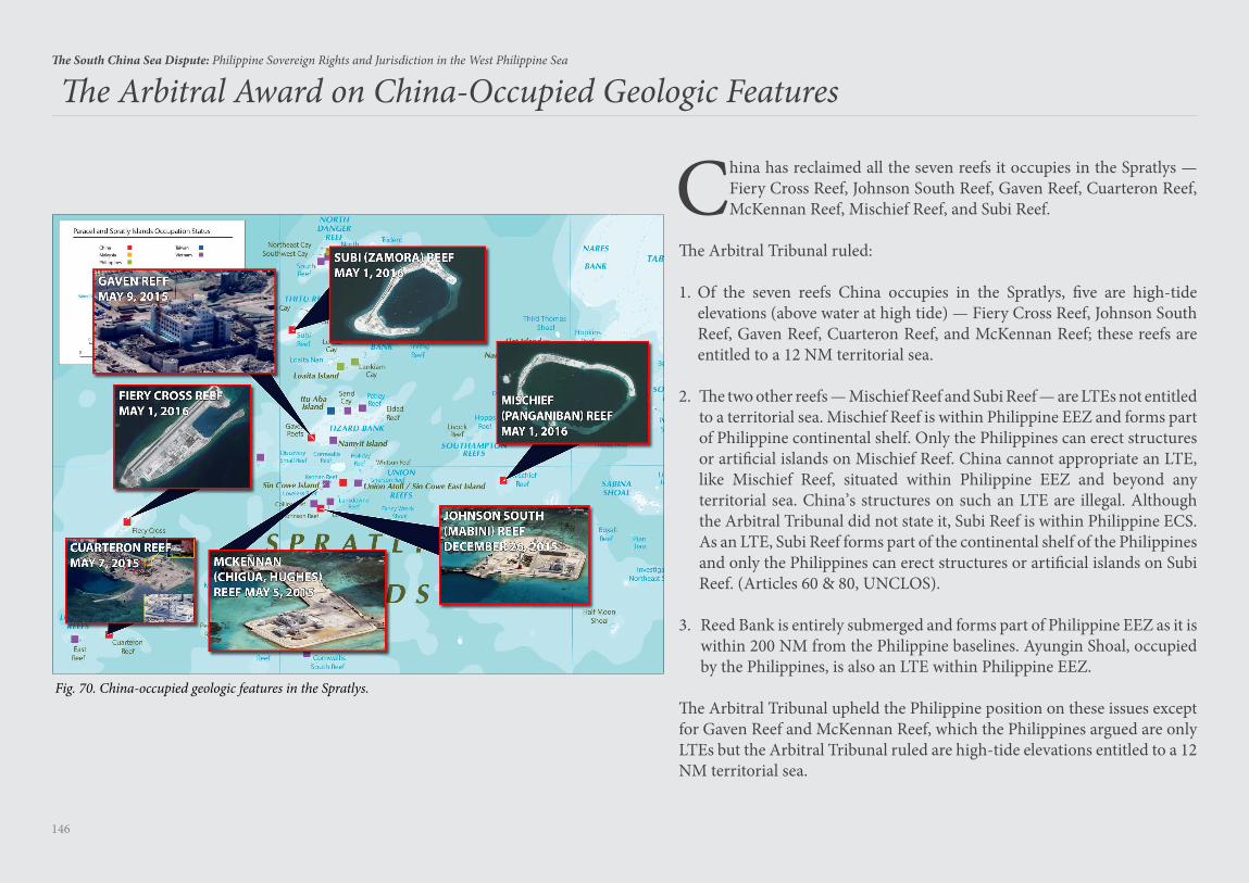
146
The South China Sea Dispute: Philippine Sovereign Rights and Jurisdiction in the West Philippine Sea
China has reclaimed all the seven reefs it occupies in the Spratlys — Fiery Cross Reef, Johnson South Reef, Gaven Reef, Cuarteron Reef, McKennan Reef, Mischief Reef, and Subi Reef.
The Arbitral Tribunal ruled:
1. Of the seven reefs China occupies in the Spratlys, five are high-tide elevations (above water at high tide) — Fiery Cross Reef, Johnson South Reef, Gaven Reef, Cuarteron Reef, and McKennan Reef; these reefs are entitled to a 12 NM territorial sea.
2. The two other reefs — Mischief Reef and Subi Reef — are LTEs not entitled to a territorial sea. Mischief Reef is within Philippine EEZ and forms part of Philippine continental shelf. Only the Philippines can erect structures or artificial islands on Mischief Reef. China cannot appropriate an LTE, like Mischief Reef, situated within Philippine EEZ and beyond any territorial sea. China’s structures on such an LTE are illegal. Although the Arbitral Tribunal did not state it, Subi Reef is within Philippine ECS. As an LTE, Subi Reef forms part of the continental shelf of the Philippines and only the Philippines can erect structures or artificial islands on Subi Reef. (Articles 60 & 80, UNCLOS).
3. Reed Bank is entirely submerged and forms part of Philippine EEZ as it is within 200 NM from the Philippine baselines. Ayungin Shoal, occupied by the Philippines, is also an LTE within Philippine EEZ.
The Arbitral Tribunal upheld the Philippine position on these issues except for Gaven Reef and McKennan Reef, which the Philippines argued are only LTEs but the Arbitral Tribunal ruled are high-tide elevations entitled to a 12 NM territorial sea.
The Arbitral Award on China-Occupied Geologic Features
Fig. 70. China-occupied geologic features in the Spratlys.
147
The South China Sea Dispute: Philippine Sovereign Rights and Jurisdiction in the West Philippine Sea
China’s Island Building in the Spratlys
China’s reclamations violate not only UNCLOS but also the 2002 ASEAN-China Declaration of Conduct,140 which states that the parties undertake to exercise self-restraint, including “refraining from ... inhabiting presently uninhabited islands, reefs, shoals, cays and other features.”
Reclamations on High-Tide Elevations
A rock above water at high tide is land territory that generates a 12 NM territorial sea and territorial airspace above the land and its territorial sea. Reclamations made on a rock above water at high tide are expansions of insular land territory and are valid under UNCLOS.
A state cannot be faulted for reclaiming on its own sovereign territory — and a rock above water at high tide is sovereign territory with a 12 NM territorial sea and territorial airspace. However, a state doing massive reclamation must consult its coastal neighbors,141 “protect and preserve the marine environment,”142 and thus must not destroy or harm the marine environment. Pending resolution of the territorial dispute, China cannot be faulted for its reclamations on rocks above water at high tide, except for its failure to consult its neighbors and for the massive destruction to the marine environment. However, China has also reclaimed on LTEs, such as Mischief Reef and Subi Reef, which are not land territory and do not have a territorial sea and territorial airspace. China is the only claimant state reclaiming on LTEs beyond the territorial sea and within the EEZ and ECS of another coastal state — the Philippines. This is a violation of UNCLOS. The Philippines has reclaimed only small areas on real islands above water at high tide, and it cannot be faulted for such minor reclamations on land territory.
The South China Sea is a semi-enclosed sea as it consists primarily of territorial seas and EEZs of coastal states (Article 122, UNCLOS).
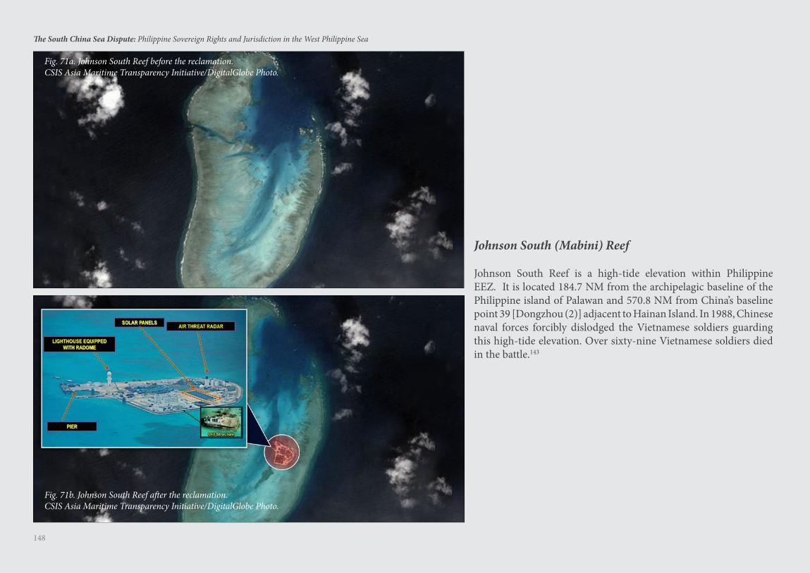
148
The South China Sea Dispute: Philippine Sovereign Rights and Jurisdiction in the West Philippine Sea
Fig. 71a. Johnson South Reef before the reclamation.CSIS Asia Maritime Transparency Initiative/DigitalGlobe Photo.
Fig. 71b. Johnson South Reef after the reclamation.CSIS Asia Maritime Transparency Initiative/DigitalGlobe Photo.
Johnson South (Mabini) Reef
Johnson South Reef is a high-tide elevation within Philippine EEZ. It is located 184.7 NM from the archipelagic baseline of the Philippine island of Palawan and 570.8 NM from China’s baseline point 39 [Dongzhou (2)] adjacent to Hainan Island. In 1988, Chinese naval forces forcibly dislodged the Vietnamese soldiers guarding this high-tide elevation. Over sixty-nine Vietnamese soldiers died in the battle.143
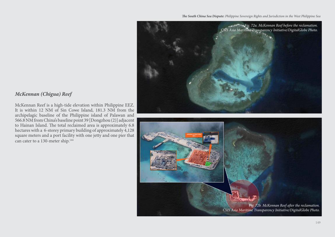
149
The South China Sea Dispute: Philippine Sovereign Rights and Jurisdiction in the West Philippine Sea
McKennan (Chigua) Reef
McKennan Reef is a high-tide elevation within Philippine EEZ. It is within 12 NM of Sin Cowe Island, 181.3 NM from the archipelagic baseline of the Philippine island of Palawan and 566.8 NM from China’s baseline point 39 [Dongzhou (2)] adjacent to Hainan Island. The total reclaimed area is approximately 6.8 hectares with a 6-storey primary building of approximately 4,128 square meters and a port facility with one jetty and one pier that can cater to a 130-meter ship.144
Fig. 72a. McKennan Reef before the reclamation.CSIS Asia Maritime Transparency Initiative/DigitalGlobe Photo.
Fig. 72b. McKennan Reef after the reclamation.CSIS Asia Maritime Transparency Initiative/DigitalGlobe Photo.
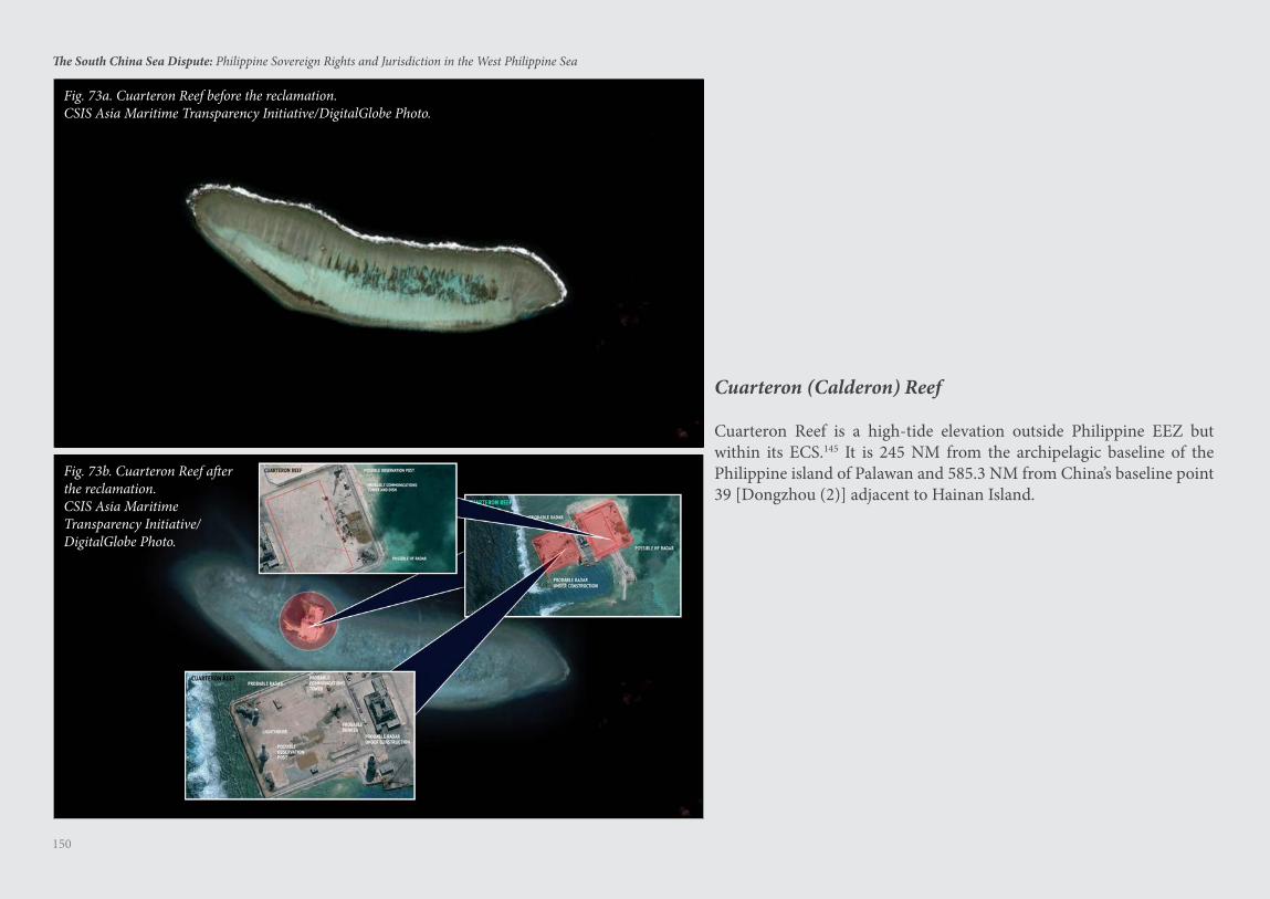
150
The South China Sea Dispute: Philippine Sovereign Rights and Jurisdiction in the West Philippine Sea
Cuarteron (Calderon) Reef
Cuarteron Reef is a high-tide elevation outside Philippine EEZ but within its ECS.145 It is 245 NM from the archipelagic baseline of the Philippine island of Palawan and 585.3 NM from China’s baseline point 39 [Dongzhou (2)] adjacent to Hainan Island.
Fig. 73a. Cuarteron Reef before the reclamation.CSIS Asia Maritime Transparency Initiative/DigitalGlobe Photo.
Fig. 73b. Cuarteron Reef after the reclamation.CSIS Asia Maritime Transparency Initiative/DigitalGlobe Photo.
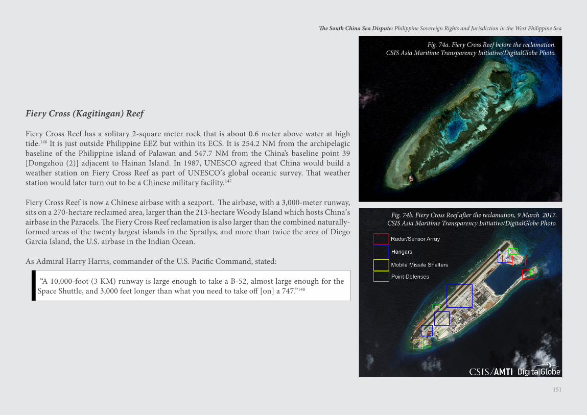
151
The South China Sea Dispute: Philippine Sovereign Rights and Jurisdiction in the West Philippine Sea
Fiery Cross (Kagitingan) Reef
Fiery Cross Reef has a solitary 2-square meter rock that is about 0.6 meter above water at high tide.146 It is just outside Philippine EEZ but within its ECS. It is 254.2 NM from the archipelagic baseline of the Philippine island of Palawan and 547.7 NM from the China’s baseline point 39 [Dongzhou (2)] adjacent to Hainan Island. In 1987, UNESCO agreed that China would build a weather station on Fiery Cross Reef as part of UNESCO’s global oceanic survey. That weather station would later turn out to be a Chinese military facility.147
Fiery Cross Reef is now a Chinese airbase with a seaport. The airbase, with a 3,000-meter runway, sits on a 270-hectare reclaimed area, larger than the 213-hectare Woody Island which hosts China’s airbase in the Paracels. The Fiery Cross Reef reclamation is also larger than the combined naturally-formed areas of the twenty largest islands in the Spratlys, and more than twice the area of Diego Garcia Island, the U.S. airbase in the Indian Ocean.
As Admiral Harry Harris, commander of the U.S. Pacific Command, stated:
“A 10,000-foot (3 KM) runway is large enough to take a B-52, almost large enough for the Space Shuttle, and 3,000 feet longer than what you need to take off [on] a 747.”148
Fig. 74b. Fiery Cross Reef after the reclamation, 9 March 2017.CSIS Asia Maritime Transparency Initiative/DigitalGlobe Photo.
Fig. 74a. Fiery Cross Reef before the reclamation.CSIS Asia Maritime Transparency Initiative/DigitalGlobe Photo.
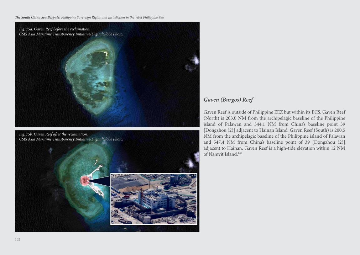
152
The South China Sea Dispute: Philippine Sovereign Rights and Jurisdiction in the West Philippine Sea
Fig. 75a. Gaven Reef before the reclamation.CSIS Asia Maritime Transparency Initiative/DigitalGlobe Photo.
Fig. 75b. Gaven Reef after the reclamation.CSIS Asia Maritime Transparency Initiative/DigitalGlobe Photo.
Gaven (Burgos) Reef
Gaven Reef is outside of Philippine EEZ but within its ECS. Gaven Reef (North) is 203.0 NM from the archipelagic baseline of the Philippine island of Palawan and 544.1 NM from China’s baseline point 39 [Dongzhou (2)] adjacent to Hainan Island. Gaven Reef (South) is 200.5 NM from the archipelagic baseline of the Philippine island of Palawan and 547.4 NM from China’s baseline point of 39 [Dongzhou (2)] adjacent to Hainan. Gaven Reef is a high-tide elevation within 12 NM of Namyit Island.149
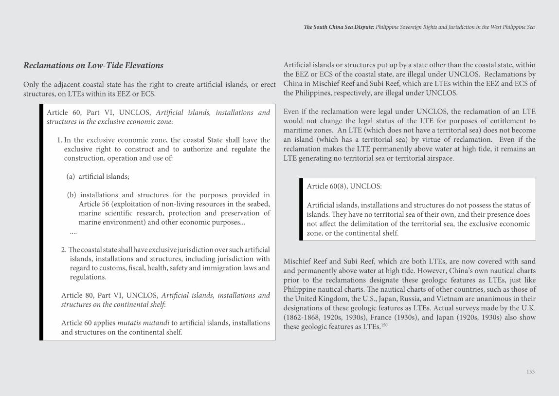
153
The South China Sea Dispute: Philippine Sovereign Rights and Jurisdiction in the West Philippine Sea
Reclamations on Low-Tide Elevations
Only the adjacent coastal state has the right to create artificial islands, or erect structures, on LTEs within its EEZ or ECS.
Article 60, Part VI, UNCLOS, Artificial islands, installations and structures in the exclusive economic zone:
1. In the exclusive economic zone, the coastal State shall have the exclusive right to construct and to authorize and regulate the construction, operation and use of:
(a) artificial islands;
(b) installations and structures for the purposes provided in Article 56 (exploitation of non-living resources in the seabed, marine scientific research, protection and preservation of marine environment) and other economic purposes...
....
2. The coastal state shall have exclusive jurisdiction over such artificial islands, installations and structures, including jurisdiction with regard to customs, fiscal, health, safety and immigration laws and regulations.
Article 80, Part VI, UNCLOS, Artificial islands, installations and structures on the continental shelf:
Article 60 applies mutatis mutandi to artificial islands, installations and structures on the continental shelf.
Artificial islands or structures put up by a state other than the coastal state, within the EEZ or ECS of the coastal state, are illegal under UNCLOS. Reclamations by China in Mischief Reef and Subi Reef, which are LTEs within the EEZ and ECS of the Philippines, respectively, are illegal under UNCLOS.
Even if the reclamation were legal under UNCLOS, the reclamation of an LTE would not change the legal status of the LTE for purposes of entitlement to maritime zones. An LTE (which does not have a territorial sea) does not become an island (which has a territorial sea) by virtue of reclamation. Even if the reclamation makes the LTE permanently above water at high tide, it remains an LTE generating no territorial sea or territorial airspace.
Article 60(8), UNCLOS:
Artificial islands, installations and structures do not possess the status of islands. They have no territorial sea of their own, and their presence does not affect the delimitation of the territorial sea, the exclusive economic zone, or the continental shelf.
Mischief Reef and Subi Reef, which are both LTEs, are now covered with sand and permanently above water at high tide. However, China’s own nautical charts prior to the reclamations designate these geologic features as LTEs, just like Philippine nautical charts. The nautical charts of other countries, such as those of the United Kingdom, the U.S., Japan, Russia, and Vietnam are unanimous in their designations of these geologic features as LTEs. Actual surveys made by the U.K. (1862-1868, 1920s, 1930s), France (1930s), and Japan (1920s, 1930s) also show these geologic features as LTEs.150
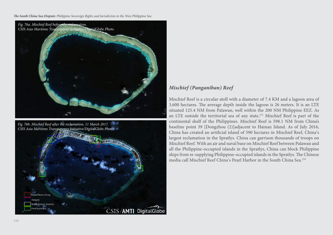
154
The South China Sea Dispute: Philippine Sovereign Rights and Jurisdiction in the West Philippine Sea
Fig. 76a. Mischief Reef before the reclamation.CSIS Asia Maritime Transparency Initiative/DigitalGlobe Photo.
Fig. 76b. Mischief Reef after the reclamation, 11 March 2017.CSIS Asia Maritime Transparency Initiative/DigitalGlobe Photo.
Mischief (Panganiban) Reef
Mischief Reef is a circular atoll with a diameter of 7.4 KM and a lagoon area of 3,600 hectares. The average depth inside the lagoon is 26 meters. It is an LTE situated 125.4 NM from Palawan, well within the 200 NM Philippine EEZ. As an LTE outside the territorial sea of any state,151 Mischief Reef is part of the continental shelf of the Philippines. Mischief Reef is 598.1 NM from China’s baseline point 39 [Dongzhou (2)]adjacent to Hainan Island. As of July 2016, China has created an artificial island of 590 hectares in Mischief Reef, China’s largest reclamation in the Spratlys. China can garrison thousands of troops on Mischief Reef. With an air and naval base on Mischief Reef between Palawan and all the Philippine-occupied islands in the Spratlys, China can block Philippine ships from re-supplying Philippine-occupied islands in the Spratlys. The Chinese media call Mischief Reef China’s Pearl Harbor in the South China Sea.152
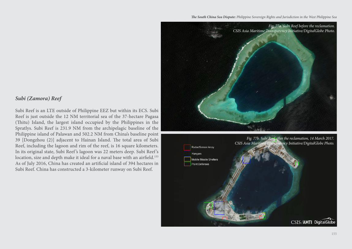
155
The South China Sea Dispute: Philippine Sovereign Rights and Jurisdiction in the West Philippine Sea
Subi (Zamora) Reef
Subi Reef is an LTE outside of Philippine EEZ but within its ECS. Subi Reef is just outside the 12 NM territorial sea of the 37-hectare Pagasa (Thitu) Island, the largest island occupied by the Philippines in the Spratlys. Subi Reef is 231.9 NM from the archipelagic baseline of the Philippine island of Palawan and 502.2 NM from China’s baseline point 39 [Dongzhou (2)] adjacent to Hainan Island. The total area of Subi Reef, including the lagoon and rim of the reef, is 16 square kilometers. In its original state, Subi Reef ’s lagoon was 22 meters deep. Subi Reef ’s location, size and depth make it ideal for a naval base with an airfield.153
As of July 2016, China has created an artificial island of 394 hectares in Subi Reef. China has constructed a 3-kilometer runway on Subi Reef.
Fig. 77a. Subi Reef before the reclamation.CSIS Asia Maritime Transparency Initiative/DigitalGlobe Photo.
Fig. 77b. Subi Reef after the reclamation, 14 March 2017.CSIS Asia Maritime Transparency Initiative/DigitalGlobe Photo.
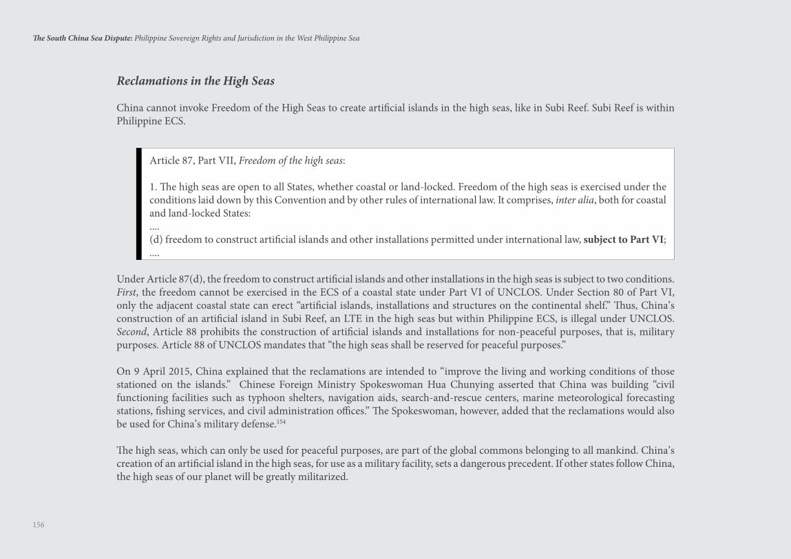
156
The South China Sea Dispute: Philippine Sovereign Rights and Jurisdiction in the West Philippine Sea
Reclamations in the High Seas
China cannot invoke Freedom of the High Seas to create artificial islands in the high seas, like in Subi Reef. Subi Reef is within Philippine ECS.
Article 87, Part VII, Freedom of the high seas:
1. The high seas are open to all States, whether coastal or land-locked. Freedom of the high seas is exercised under the conditions laid down by this Convention and by other rules of international law. It comprises, inter alia, both for coastal and land-locked States: ....(d) freedom to construct artificial islands and other installations permitted under international law, subject to Part VI;....
Under Article 87(d), the freedom to construct artificial islands and other installations in the high seas is subject to two conditions. First, the freedom cannot be exercised in the ECS of a coastal state under Part VI of UNCLOS. Under Section 80 of Part VI, only the adjacent coastal state can erect “artificial islands, installations and structures on the continental shelf.” Thus, China’s construction of an artificial island in Subi Reef, an LTE in the high seas but within Philippine ECS, is illegal under UNCLOS. Second, Article 88 prohibits the construction of artificial islands and installations for non-peaceful purposes, that is, military purposes. Article 88 of UNCLOS mandates that “the high seas shall be reserved for peaceful purposes.”
On 9 April 2015, China explained that the reclamations are intended to “improve the living and working conditions of those stationed on the islands.” Chinese Foreign Ministry Spokeswoman Hua Chunying asserted that China was building “civil functioning facilities such as typhoon shelters, navigation aids, search-and-rescue centers, marine meteorological forecasting stations, fishing services, and civil administration offices.” The Spokeswoman, however, added that the reclamations would also be used for China’s military defense.154
The high seas, which can only be used for peaceful purposes, are part of the global commons belonging to all mankind. China’s creation of an artificial island in the high seas, for use as a military facility, sets a dangerous precedent. If other states follow China, the high seas of our planet will be greatly militarized.
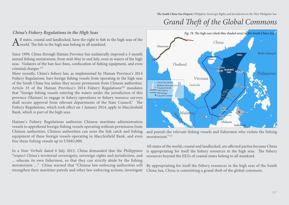
157
The South China Sea Dispute: Philippine Sovereign Rights and Jurisdiction in the West Philippine Sea
All states, coastal and landlocked, have the right to fish in the high seas of the world. The fish in the high seas belong to all mankind.
Since 1999, China through Hainan Province has unilaterally imposed a 3-month annual fishing moratorium, from mid-May to end July, even in waters of the high seas. Violators of the ban face fines, confiscation of fishing equipment, and even criminal charges.155
More recently, China’s fishery law, as implemented by Hainan Province’s 2014 Fishery Regulations, bars foreign fishing vessels from operating in the high seas of the South China Sea unless they secure permission from Chinese authorities. Article 35 of the Hainan Province’s 2014 Fishery Regulations156 mandates that “foreign fishing vessels entering the waters under the jurisdiction of this province (Hainan) to engage in fishery operations or fishery resource surveys shall secure approval from relevant departments of the State Council.” The Fishery Regulations, which took effect on 1 January 2014, apply to Macclesfield Bank, which is part of the high seas.
Hainan’s Fishery Regulations authorize Chinese maritime administration vessels to apprehend foreign fishing vessels operating without permission from Chinese authorities. Chinese authorities can seize the fish catch and fishing equipment of these foreign vessels operating in Macclesfield Bank, and even fine these fishing vessels up to US$83,000.
In a Note Verbale dated 6 July 2015, China demanded that the Philippines “respect China’s territorial sovereignty, sovereign rights and jurisdiction, and ... educate its own fishermen, so that they can strictly abide by the fishing moratorium ....” China warned that “Chinese law-enforcing authorities will strengthen their maritime patrols and other law-enforcing actions, investigate
Grand Theft of the Global Commons
and punish the relevant fishing vessels and fishermen who violate the fishing moratorium.”157
All states of the world, coastal and landlocked, are affected parties because China is appropriating for itself the fishery resources in the high seas. The fishery resources beyond the EEZs of coastal states belong to all mankind.
By appropriating for itself the fishery resources in the high seas of the South China Sea, China is committing a grand theft of the global commons.
China’s Fishery Regulations in the High Seas Fig. 78. The high seas (dark blue shaded area) in the South China Sea.
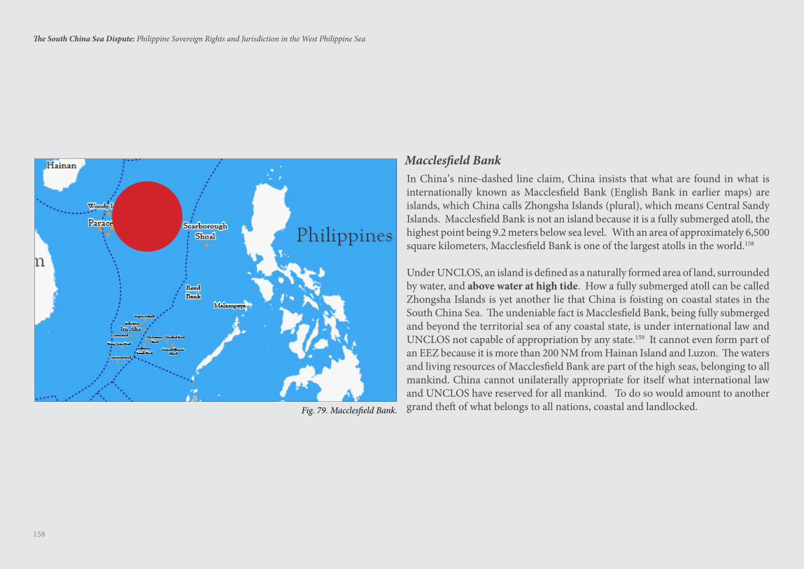
158
The South China Sea Dispute: Philippine Sovereign Rights and Jurisdiction in the West Philippine Sea
In China’s nine-dashed line claim, China insists that what are found in what is internationally known as Macclesfield Bank (English Bank in earlier maps) are islands, which China calls Zhongsha Islands (plural), which means Central Sandy Islands. Macclesfield Bank is not an island because it is a fully submerged atoll, the highest point being 9.2 meters below sea level. With an area of approximately 6,500 square kilometers, Macclesfield Bank is one of the largest atolls in the world.158
Under UNCLOS, an island is defined as a naturally formed area of land, surrounded by water, and above water at high tide. How a fully submerged atoll can be called Zhongsha Islands is yet another lie that China is foisting on coastal states in the South China Sea. The undeniable fact is Macclesfield Bank, being fully submerged and beyond the territorial sea of any coastal state, is under international law and UNCLOS not capable of appropriation by any state.159 It cannot even form part of an EEZ because it is more than 200 NM from Hainan Island and Luzon. The waters and living resources of Macclesfield Bank are part of the high seas, belonging to all mankind. China cannot unilaterally appropriate for itself what international law and UNCLOS have reserved for all mankind. To do so would amount to another grand theft of what belongs to all nations, coastal and landlocked.
Macclesfield Bank
Fig. 79. Macclesfield Bank.
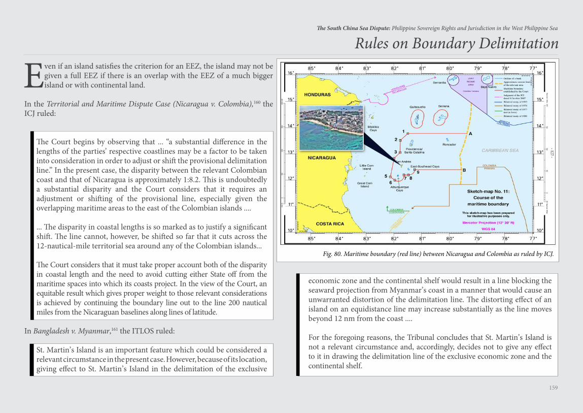
159
The South China Sea Dispute: Philippine Sovereign Rights and Jurisdiction in the West Philippine Sea
Even if an island satisfies the criterion for an EEZ, the island may not be given a full EEZ if there is an overlap with the EEZ of a much bigger island or with continental land.
In the Territorial and Maritime Dispute Case (Nicaragua v. Colombia),160 the ICJ ruled:
The Court begins by observing that ... “a substantial difference in the lengths of the parties’ respective coastlines may be a factor to be taken into consideration in order to adjust or shift the provisional delimitation line.” In the present case, the disparity between the relevant Colombian coast and that of Nicaragua is approximately 1:8.2. This is undoubtedly a substantial disparity and the Court considers that it requires an adjustment or shifting of the provisional line, especially given the overlapping maritime areas to the east of the Colombian islands ....
... The disparity in coastal lengths is so marked as to justify a significant shift. The line cannot, however, be shifted so far that it cuts across the 12-nautical-mile territorial sea around any of the Colombian islands...
The Court considers that it must take proper account both of the disparity in coastal length and the need to avoid cutting either State off from the maritime spaces into which its coasts project. In the view of the Court, an equitable result which gives proper weight to those relevant considerations is achieved by continuing the boundary line out to the line 200 nautical miles from the Nicaraguan baselines along lines of latitude.
In Bangladesh v. Myanmar,161 the ITLOS ruled:
St. Martin’s Island is an important feature which could be considered a relevant circumstance in the present case. However, because of its location, giving effect to St. Martin’s Island in the delimitation of the exclusive
Rules on Boundary Delimitation
economic zone and the continental shelf would result in a line blocking the seaward projection from Myanmar’s coast in a manner that would cause an unwarranted distortion of the delimitation line. The distorting effect of an island on an equidistance line may increase substantially as the line moves beyond 12 nm from the coast ....
For the foregoing reasons, the Tribunal concludes that St. Martin’s Island is not a relevant circumstance and, accordingly, decides not to give any effect to it in drawing the delimitation line of the exclusive economic zone and the continental shelf.
Fig. 80. Maritime boundary (red line) between Nicaragua and Colombia as ruled by ICJ.
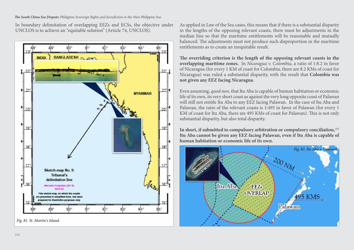
160
The South China Sea Dispute: Philippine Sovereign Rights and Jurisdiction in the West Philippine Sea
In boundary delimitation of overlapping EEZs and ECSs, the objective under UNCLOS is to achieve an “equitable solution” (Article 74, UNCLOS).
As applied in Law of the Sea cases, this means that if there is a substantial disparity in the lengths of the opposing relevant coasts, there must be adjustments in the median line so that the maritime entitlements will be reasonable and mutually balanced. The adjustments must not produce such disproportion in the maritime entitlements as to create an inequitable result.
The overriding criterion is the length of the opposing relevant coasts in the overlapping maritime zones. In Nicaragua v. Colombia, a ratio of 1:8.2 in favor of Nicaragua (for every 1 KM of coast for Colombia, there are 8.2 KMs of coast for Nicaragua) was ruled a substantial disparity, with the result that Colombia was not given any EEZ facing Nicaragua.
Even assuming, quod non, that Itu Aba is capable of human habitation or economic life of its own, its very short coast as against the very long opposite coast of Palawan will still not entitle Itu Aba to any EEZ facing Palawan. In the case of Itu Aba and Palawan, the ratio of the relevant coasts is 1:495 in favor of Palawan (for every 1 KM of coast for Itu Aba, there are 495 KMs of coast for Palawan). This is not only substantial disparity, but also total disparity.
In short, if submitted to compulsory arbitration or compulsory conciliation,162 Itu Aba cannot be given any EEZ facing Palawan, even if Itu Aba is capable of human habitation or economic life of its own.
Fig. 82. Itu Aba v. Palawan
Fig. 81. St. Martin’s Island.

161
The South China Sea Dispute: Philippine Sovereign Rights and Jurisdiction in the West Philippine Sea
Scarborough Shoal
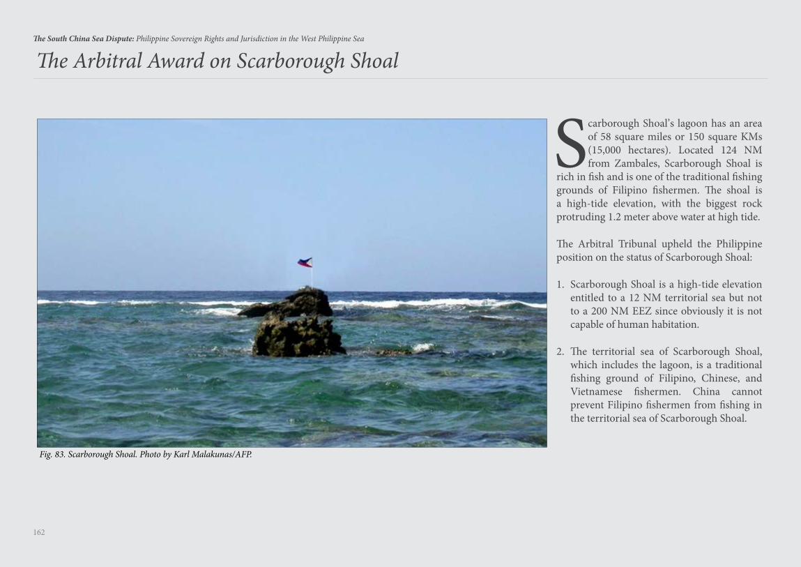
162
The South China Sea Dispute: Philippine Sovereign Rights and Jurisdiction in the West Philippine Sea
The Arbitral Award on Scarborough Shoal
Fig. 83. Scarborough Shoal. Photo by Karl Malakunas/AFP.
Scarborough Shoal’s lagoon has an area of 58 square miles or 150 square KMs (15,000 hectares). Located 124 NM from Zambales, Scarborough Shoal is
rich in fish and is one of the traditional fishing grounds of Filipino fishermen. The shoal is a high-tide elevation, with the biggest rock protruding 1.2 meter above water at high tide.
The Arbitral Tribunal upheld the Philippine position on the status of Scarborough Shoal:
1. Scarborough Shoal is a high-tide elevation entitled to a 12 NM territorial sea but not to a 200 NM EEZ since obviously it is not capable of human habitation.
2. The territorial sea of Scarborough Shoal, which includes the lagoon, is a traditional fishing ground of Filipino, Chinese, and Vietnamese fishermen. China cannot prevent Filipino fishermen from fishing in the territorial sea of Scarborough Shoal.
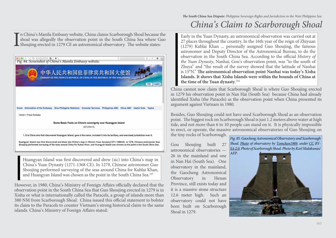
163
The South China Sea Dispute: Philippine Sovereign Rights and Jurisdiction in the West Philippine Sea
Early in the Yuan Dynasty, an astronomical observation was carried out at 27 places throughout the country. In the 16th year of the reign of Zhiyuan (1279) Kublai Khan ... personally assigned Guo Shoujing, the famous astronomer and Deputy Director of the Astronomical Bureau, to do the observation in the South China Sea. According to the official History of the Yuan Dynasty, Nanhai, Gou’s observation point, was “to the south of Zhuya” and “the result of the survey showed that the latitude of Nanhai is 15°N.” The astronomical observation point Nanhai was today’s Xisha Islands. It shows that Xisha Islands were within the bounds of China at the time of the Yuan dynasty.164
China’s Claim to Scarborough Shoal
In China’s Manila Embassy website, China claims Scarborough Shoal because the shoal was allegedly the observation point in the South China Sea where Guo Shoujing erected in 1279 CE an astronomical observatory. The website states:
Huangyan Island was first discovered and drew (sic) into China’s map in China’s Yuan Dynasty (1271-1368 CE). In 1279, Chinese astronomer Guo Shoujing performed surveying of the seas around China for Kublai Khan, and Huangyan Island was chosen as the point in the South China Sea.163
However, in 1980, China’s Ministry of Foreign Affairs officially declared that the observation point in the South China Sea that Guo Shoujing erected in 1279 is in Xisha or what is internationally called the Paracels, a group of islands more than 380 NM from Scarborough Shoal. China issued this official statement to bolster its claim to the Paracels to counter Vietnam’s strong historical claim to the same islands. China’s Ministry of Foreign Affairs stated:
Fig. 84. Screenshot of China’s Manila Embassy website.
China cannot now claim that Scarborough Shoal is where Guo Shoujing erected in 1279 his observation point in Nan Hai (South Sea) because China had already identified Xisha (the Paracels) as the observation point when China presented its argument against Vietnam in 1980.
Besides, Guo Shoujing could not have used Scarborough Shoal as an observation point. The biggest rock on Scarborough Shoal is just 1.2 meters above water at high tide, and not more than 6 to 10 people can stand on it. It is physically impossible to erect, or operate, the massive astronomical observatories of Guo Shoujing on the tiny rocks of Scarborough.
Fig. 85. Gaocheng Astronomical Observatory and Scarborough Shoal. Photo of observatory by Tomchen1989, under CC BY-SA 2.0, Photo of Scarborough Shoal. Photo by Karl Malakunas/AFP.
Gou Shoujing built 27 astronomical observatories — 26 in the mainland and one in Nan Hai (South Sea). One observatory in the mainland, the Gaocheng Astronomical Observatory in Henan Province, still exists today and it is a massive stone structure 12.6 meter high. Such an observatory could not have been built on Scarborough Shoal in 1279.
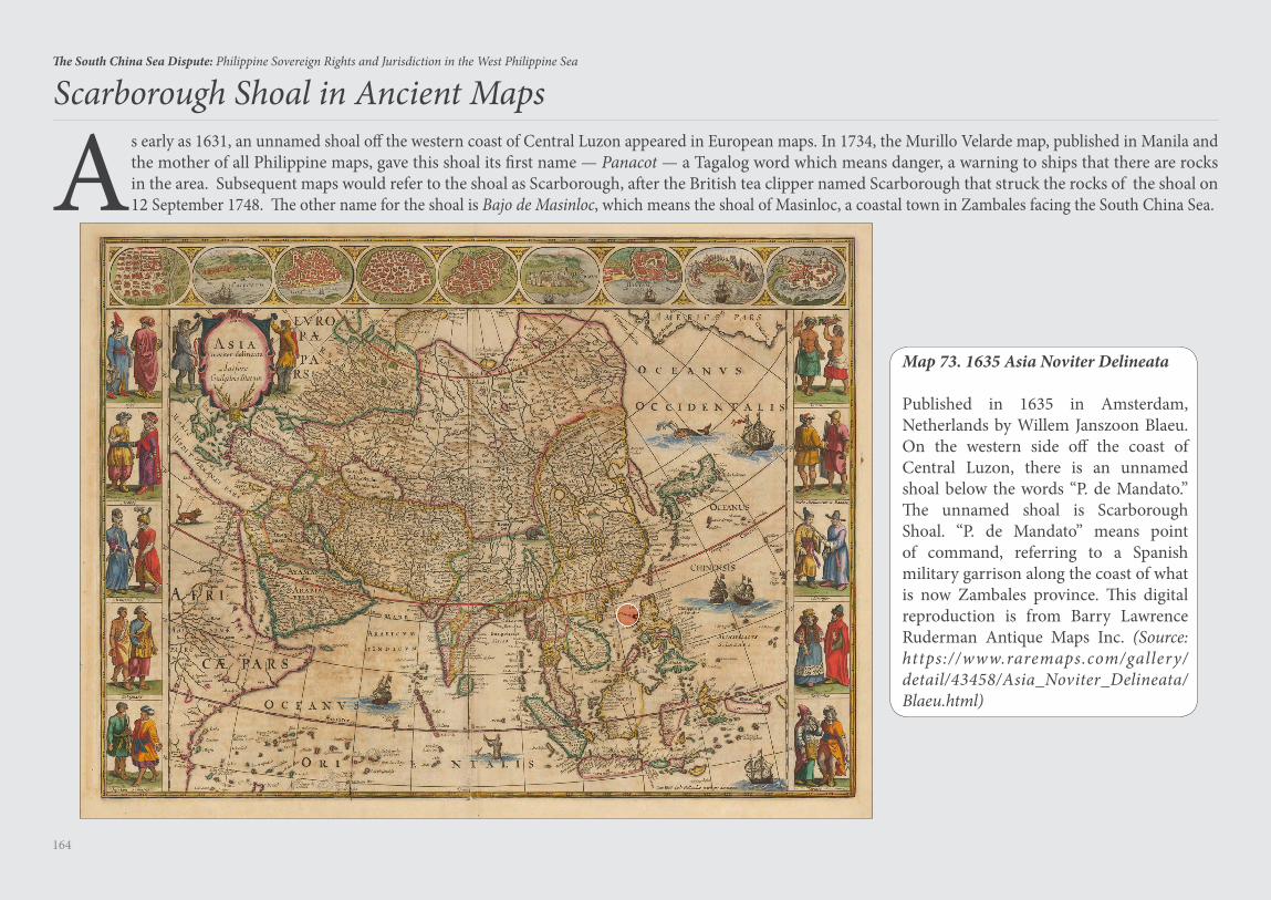
164
The South China Sea Dispute: Philippine Sovereign Rights and Jurisdiction in the West Philippine Sea
Scarborough Shoal in Ancient Maps
As early as 1631, an unnamed shoal off the western coast of Central Luzon appeared in European maps. In 1734, the Murillo Velarde map, published in Manila and the mother of all Philippine maps, gave this shoal its first name — Panacot — a Tagalog word which means danger, a warning to ships that there are rocks in the area. Subsequent maps would refer to the shoal as Scarborough, after the British tea clipper named Scarborough that struck the rocks of the shoal on 12 September 1748. The other name for the shoal is Bajo de Masinloc, which means the shoal of Masinloc, a coastal town in Zambales facing the South China Sea.
Map 73. 1635 Asia Noviter Delineata
Published in 1635 in Amsterdam, Netherlands by Willem Janszoon Blaeu. On the western side off the coast of Central Luzon, there is an unnamed shoal below the words “P. de Mandato.” The unnamed shoal is Scarborough Shoal. “P. de Mandato” means point of command, referring to a Spanish military garrison along the coast of what is now Zambales province. This digital reproduction is from Barry Lawrence Ruderman Antique Maps Inc. (Source: https://www.raremaps.com/gallery/detail/43458/Asia_Noviter_Delineata/Blaeu.html)
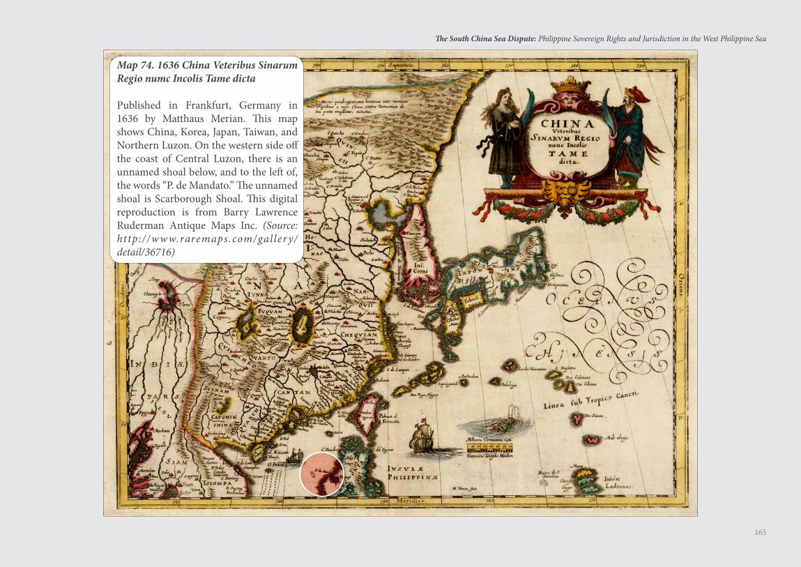
165
The South China Sea Dispute: Philippine Sovereign Rights and Jurisdiction in the West Philippine Sea
Map 74. 1636 China Veteribus Sinarum Regio numc Incolis Tame dicta
Published in Frankfurt, Germany in 1636 by Matthaus Merian. This map shows China, Korea, Japan, Taiwan, and Northern Luzon. On the western side off the coast of Central Luzon, there is an unnamed shoal below, and to the left of, the words “P. de Mandato.” The unnamed shoal is Scarborough Shoal. This digital reproduction is from Barry Lawrence Ruderman Antique Maps Inc. (Source: http://www.raremaps.com/gallery/detail/36716)
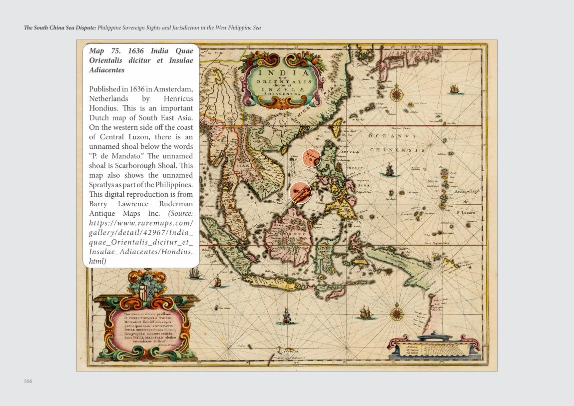
166
The South China Sea Dispute: Philippine Sovereign Rights and Jurisdiction in the West Philippine Sea
Map 75. 1636 India Quae Orientalis dicitur et Insulae Adiacentes
Published in 1636 in Amsterdam, Netherlands by Henricus Hondius. This is an important Dutch map of South East Asia. On the western side off the coast of Central Luzon, there is an unnamed shoal below the words “P. de Mandato.” The unnamed shoal is Scarborough Shoal. This map also shows the unnamed Spratlys as part of the Philippines. This digital reproduction is from Barry Lawrence Ruderman Antique Maps Inc. (Source: https ://www.raremaps.com/gallery/detail/42967/India_quae_Orientalis_dicitur_et_Insulae_Adiacentes/Hondius.html)
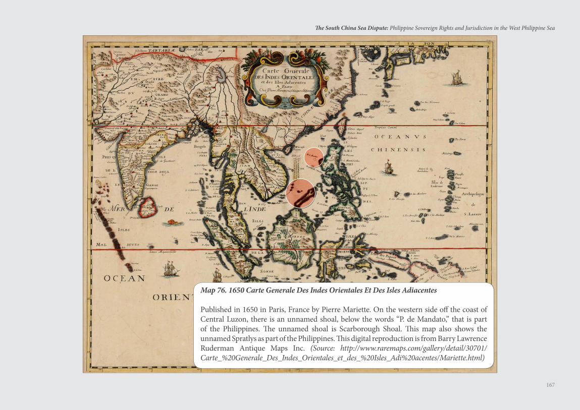
167
The South China Sea Dispute: Philippine Sovereign Rights and Jurisdiction in the West Philippine Sea
Map 76. 1650 Carte Generale Des Indes Orientales Et Des Isles Adiacentes
Published in 1650 in Paris, France by Pierre Mariette. On the western side off the coast of Central Luzon, there is an unnamed shoal, below the words “P. de Mandato,” that is part of the Philippines. The unnamed shoal is Scarborough Shoal. This map also shows the unnamed Spratlys as part of the Philippines. This digital reproduction is from Barry Lawrence Ruderman Antique Maps Inc. (Source: http://www.raremaps.com/gallery/detail/30701/Carte_%20Generale_Des_Indes_Orientales_et_des_%20Isles_Adi%20acentes/Mariette.html)
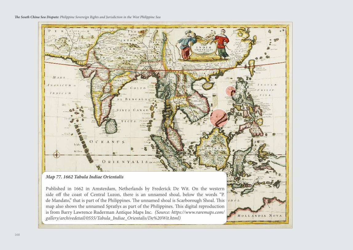
168
The South China Sea Dispute: Philippine Sovereign Rights and Jurisdiction in the West Philippine Sea
Map 77. 1662 Tabula Indiae Orientalis Published in 1662 in Amsterdam, Netherlands by Frederick De Wit. On the western side off the coast of Central Luzon, there is an unnamed shoal, below the words “P. de Mandato,” that is part of the Philippines. The unnamed shoal is Scarborough Shoal. This map also shows the unnamed Spratlys as part of the Philippines. This digital reproduction is from Barry Lawrence Ruderman Antique Maps Inc. (Source: https://www.raremaps.com/gallery/archivedetail/0555/Tabula_Indiae_Orientalis/De%20Wit.html)
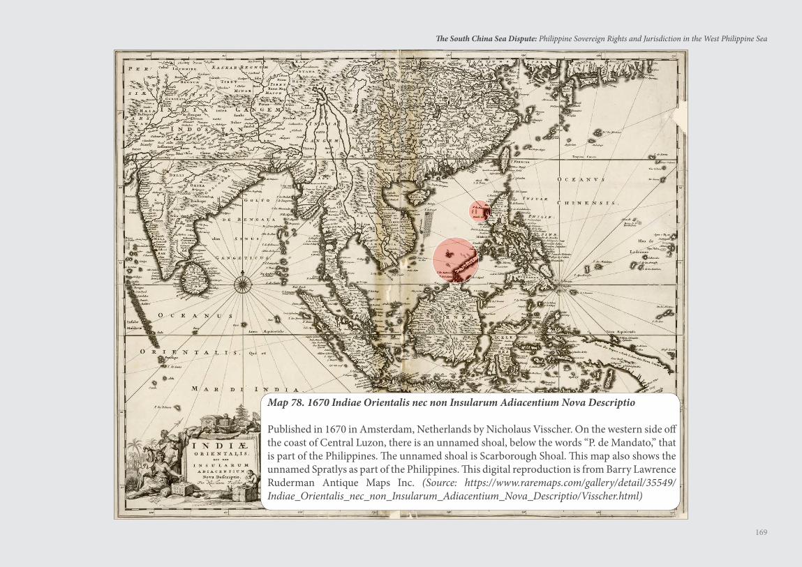
169
The South China Sea Dispute: Philippine Sovereign Rights and Jurisdiction in the West Philippine Sea
Map 78. 1670 Indiae Orientalis nec non Insularum Adiacentium Nova Descriptio
Published in 1670 in Amsterdam, Netherlands by Nicholaus Visscher. On the western side off the coast of Central Luzon, there is an unnamed shoal, below the words “P. de Mandato,” that is part of the Philippines. The unnamed shoal is Scarborough Shoal. This map also shows the unnamed Spratlys as part of the Philippines. This digital reproduction is from Barry Lawrence Ruderman Antique Maps Inc. (Source: https://www.raremaps.com/gallery/detail/35549/Indiae_Orientalis_nec_non_Insularum_Adiacentium_Nova_Descriptio/Visscher.html)
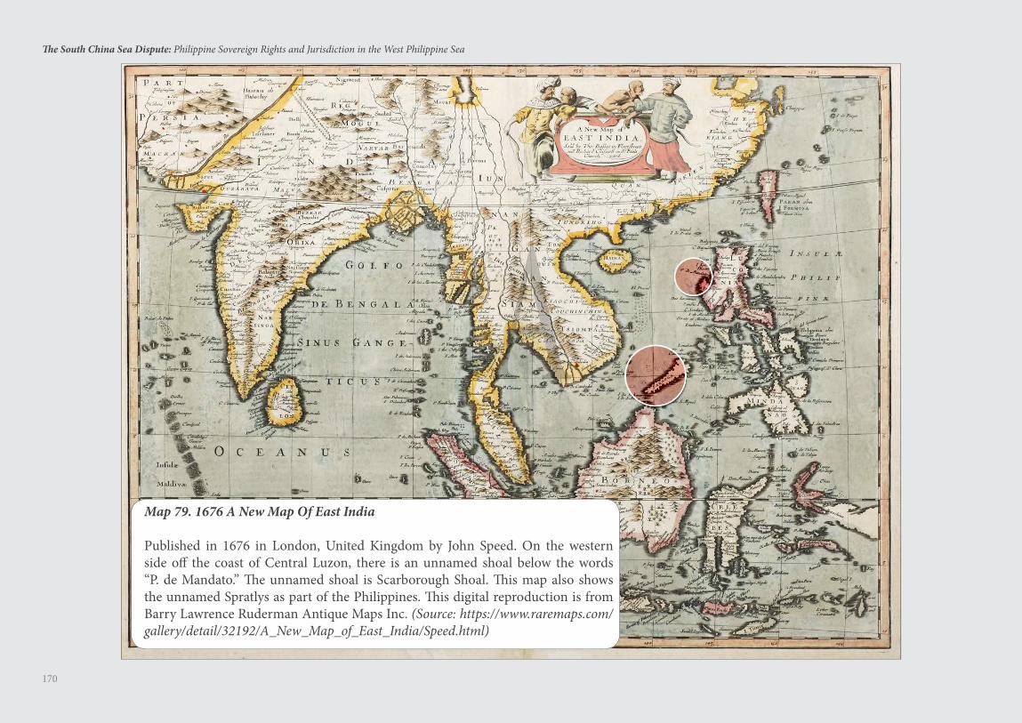
170
The South China Sea Dispute: Philippine Sovereign Rights and Jurisdiction in the West Philippine Sea
Map 79. 1676 A New Map Of East India
Published in 1676 in London, United Kingdom by John Speed. On the western side off the coast of Central Luzon, there is an unnamed shoal below the words “P. de Mandato.” The unnamed shoal is Scarborough Shoal. This map also shows the unnamed Spratlys as part of the Philippines. This digital reproduction is from Barry Lawrence Ruderman Antique Maps Inc. (Source: https://www.raremaps.com/gallery/detail/32192/A_New_Map_of_East_India/Speed.html)
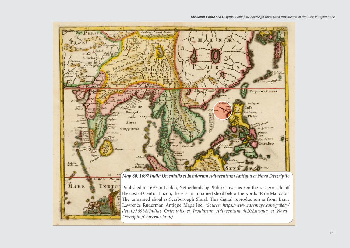
171
The South China Sea Dispute: Philippine Sovereign Rights and Jurisdiction in the West Philippine Sea
Map 80. 1697 India Orientalis et Insularum Adiacentium Antiqua et Nova Descriptio
Published in 1697 in Leiden, Netherlands by Philip Cluverius. On the western side off the cost of Central Luzon, there is an unnamed shoal below the words “P. de Mandato.” The unnamed shoal is Scarborough Shoal. This digital reproduction is from Barry Lawrence Ruderman Antique Maps Inc. (Source: https://www.raremaps.com/gallery/detail/36938/Indiae_Orientalis_et_Insularum_Adiacentum_%20Antiqua_et_Nova_Descriptio/Cluverius.html)
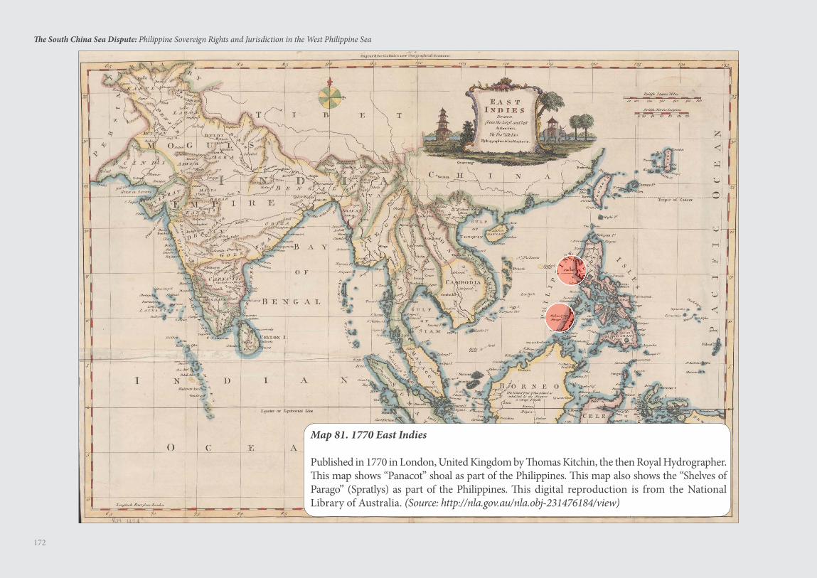
172
The South China Sea Dispute: Philippine Sovereign Rights and Jurisdiction in the West Philippine Sea
Map 81. 1770 East Indies
Published in 1770 in London, United Kingdom by Thomas Kitchin, the then Royal Hydrographer. This map shows “Panacot” shoal as part of the Philippines. This map also shows the “Shelves of Parago” (Spratlys) as part of the Philippines. This digital reproduction is from the National Library of Australia. (Source: http://nla.gov.au/nla.obj-231476184/view)
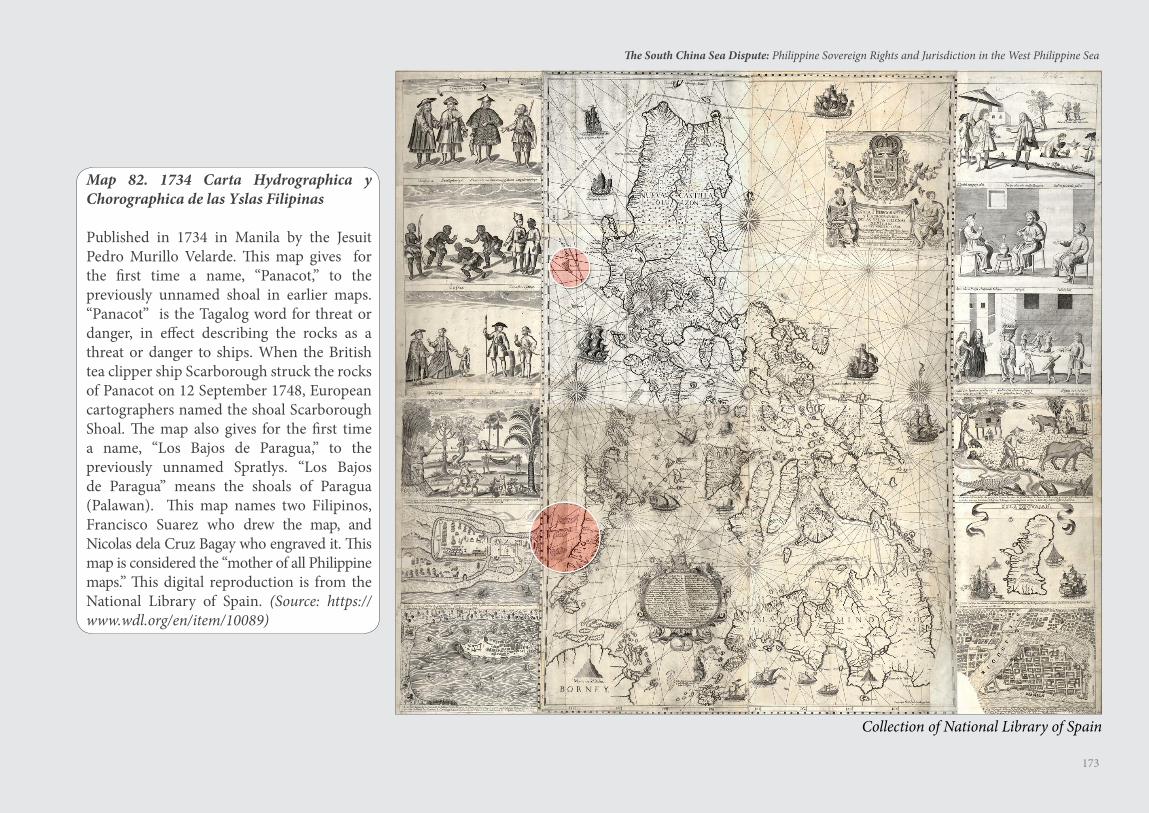
173
The South China Sea Dispute: Philippine Sovereign Rights and Jurisdiction in the West Philippine Sea
Map 82. 1734 Carta Hydrographica y Chorographica de las Yslas Filipinas
Published in 1734 in Manila by the Jesuit Pedro Murillo Velarde. This map gives for the first time a name, “Panacot,” to the previously unnamed shoal in earlier maps. “Panacot” is the Tagalog word for threat or danger, in effect describing the rocks as a threat or danger to ships. When the British tea clipper ship Scarborough struck the rocks of Panacot on 12 September 1748, European cartographers named the shoal Scarborough Shoal. The map also gives for the first time a name, “Los Bajos de Paragua,” to the previously unnamed Spratlys. “Los Bajos de Paragua” means the shoals of Paragua (Palawan). This map names two Filipinos, Francisco Suarez who drew the map, and Nicolas dela Cruz Bagay who engraved it. This map is considered the “mother of all Philippine maps.” This digital reproduction is from the National Library of Spain. (Source: https://www.wdl.org/en/item/10089)
Collection of National Library of Spain
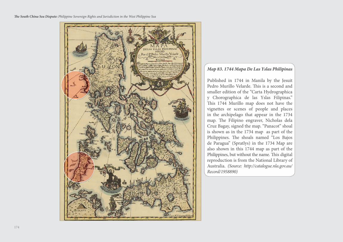
174
The South China Sea Dispute: Philippine Sovereign Rights and Jurisdiction in the West Philippine Sea
Map 83. 1744 Mapa De Las Yslas Philipinas
Published in 1744 in Manila by the Jesuit Pedro Murillo Velarde. This is a second and smaller edition of the “Carta Hydrographica y Chorographica de las Yslas Filipinas.” This 1744 Murillo map does not have the vignettes or scenes of people and places in the archipelago that appear in the 1734 map. The Filipino engraver, Nicholas dela Cruz Bagay, signed the map. “Panacot” shoal is shown as in the 1734 map as part of the Philippines. The shoals named “Los Bajos de Paragua” (Spratlys) in the 1734 Map are also shown in this 1744 map as part of the Philippines, but without the name. This digital reproduction is from the National Library of Australia. (Source: http://catalogue.nla.gov.au/Record/1958890)
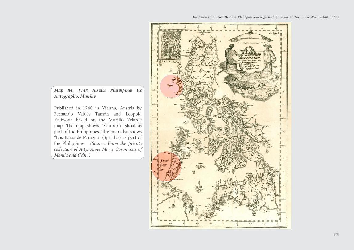
175
The South China Sea Dispute: Philippine Sovereign Rights and Jurisdiction in the West Philippine Sea
Map 84. 1748 Insulæ Philippinæ Ex Autographo, Manilæ
Published in 1748 in Vienna, Austria by Fernando Valdes Tamon and Leopold Kaliwoda based on the Murillo Velarde map. The map shows “Scarboro” shoal as part of the Philippines. The map also shows “Los Bajos de Paragua” (Spratlys) as part of the Philippines. (Source: From the private collection of Atty. Anne Marie Corominas of Manila and Cebu.)
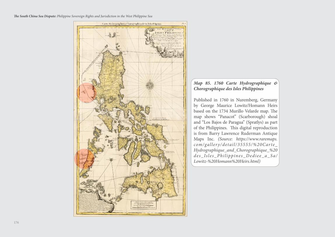
176
The South China Sea Dispute: Philippine Sovereign Rights and Jurisdiction in the West Philippine Sea
Map 85. 1760 Carte Hydrographique & Chorographique des Isles Philippines
Published in 1760 in Nuremberg, Germany by George Maurice Lowitz/Homann Heirs based on the 1734 Murillo Velarde map. The map shows “Panacot” (Scarborough) shoal and “Los Bajos de Paragua” (Spratlys) as part of the Philippines. This digital reproduction is from Barry Lawrence Ruderman Antique Maps Inc. (Source: https://www.raremaps.com/gal ler y/detai l /35555/%20Car te_Hydrographique_and_Chorographique_%20d es _ Is l e s _ Phi l ipp ines _ D edi ee _ a _ S a /Lowitz-%20Homann%20Heirs.html)
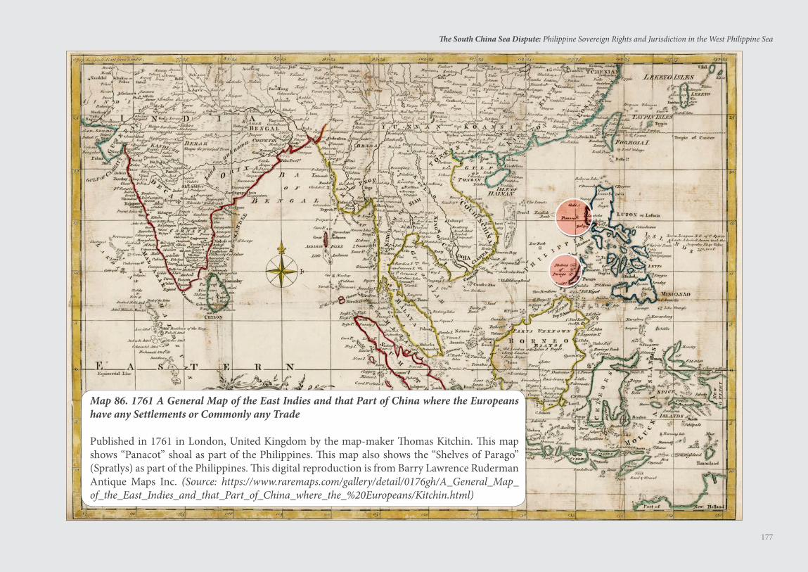
177
The South China Sea Dispute: Philippine Sovereign Rights and Jurisdiction in the West Philippine Sea
Map 86. 1761 A General Map of the East Indies and that Part of China where the Europeans have any Settlements or Commonly any Trade
Published in 1761 in London, United Kingdom by the map-maker Thomas Kitchin. This map shows “Panacot” shoal as part of the Philippines. This map also shows the “Shelves of Parago” (Spratlys) as part of the Philippines. This digital reproduction is from Barry Lawrence Ruderman Antique Maps Inc. (Source: https://www.raremaps.com/gallery/detail/0176gh/A_General_Map_of_the_East_Indies_and_that_Part_of_China_where_the_%20Europeans/Kitchin.html)
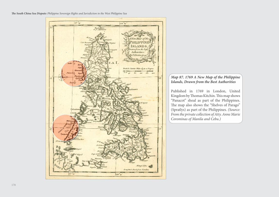
178
The South China Sea Dispute: Philippine Sovereign Rights and Jurisdiction in the West Philippine Sea
Map 87. 1769 A New Map of the Philippine Islands, Drawn from the Best Authorities
Published in 1769 in London, United Kingdom by Thomas Kitchin. This map shows “Panacot” shoal as part of the Philippines. The map also shows the “Shelves of Parago” (Spratlys) as part of the Philippines. (Source: From the private collection of Atty. Anne Marie Corominas of Manila and Cebu.)
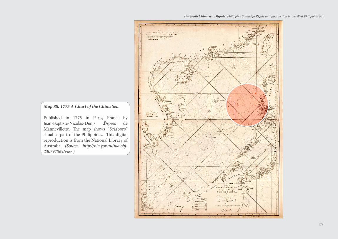
179
The South China Sea Dispute: Philippine Sovereign Rights and Jurisdiction in the West Philippine Sea
Map 88. 1775 A Chart of the China Sea
Published in 1775 in Paris, France by Jean-Baptiste-Nicolas-Denis d’Apres de Mannevillette. The map shows “Scarboro” shoal as part of the Philippines. This digital reproduction is from the National Library of Australia. (Source: http://nla.gov.au/nla.obj-230797069/view)
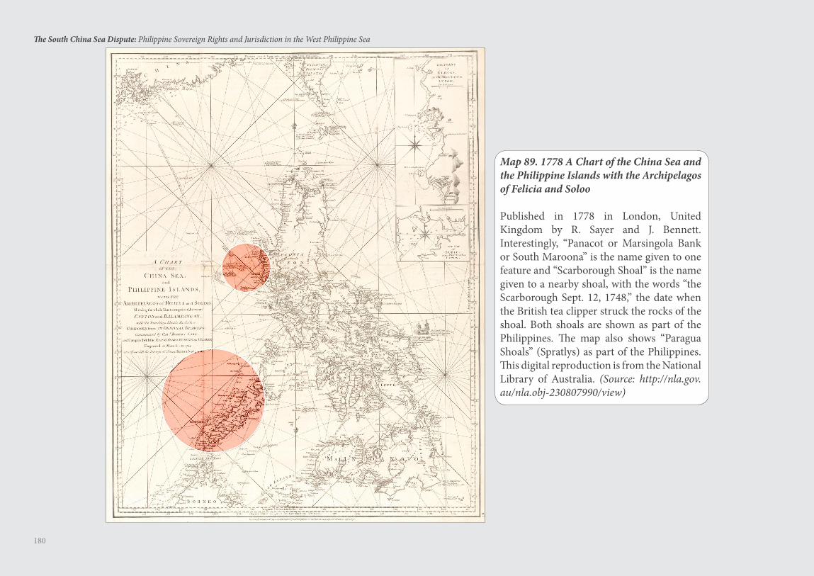
180
The South China Sea Dispute: Philippine Sovereign Rights and Jurisdiction in the West Philippine Sea
Map 89. 1778 A Chart of the China Sea and the Philippine Islands with the Archipelagos of Felicia and Soloo
Published in 1778 in London, United Kingdom by R. Sayer and J. Bennett. Interestingly, “Panacot or Marsingola Bank or South Maroona” is the name given to one feature and “Scarborough Shoal” is the name given to a nearby shoal, with the words “the Scarborough Sept. 12, 1748,” the date when the British tea clipper struck the rocks of the shoal. Both shoals are shown as part of the Philippines. The map also shows “Paragua Shoals” (Spratlys) as part of the Philippines. This digital reproduction is from the National Library of Australia. (Source: http://nla.gov.au/nla.obj-230807990/view)
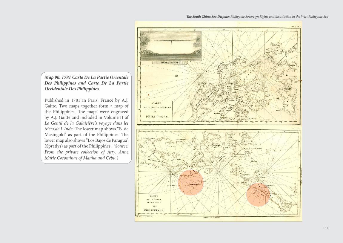
181
The South China Sea Dispute: Philippine Sovereign Rights and Jurisdiction in the West Philippine Sea
Map 90. 1781 Carte De La Partie Orientale Des Philippines and Carte De La Partie Occidentale Des Philippines
Published in 1781 in Paris, France by A.J. Gaitte. Two maps together form a map of the Philippines. The maps were engraved by A.J. Gaitte and included in Volume II of Le Gentil de la Galaisiere’s voyage dans les Mers de L’Inde. The lower map shows “B. de Masingolo” as part of the Philippines. The lower map also shows “Los Bajos de Paragua” (Spratlys) as part of the Philippines. (Source: From the private collection of Atty. Anne Marie Corominas of Manila and Cebu.)
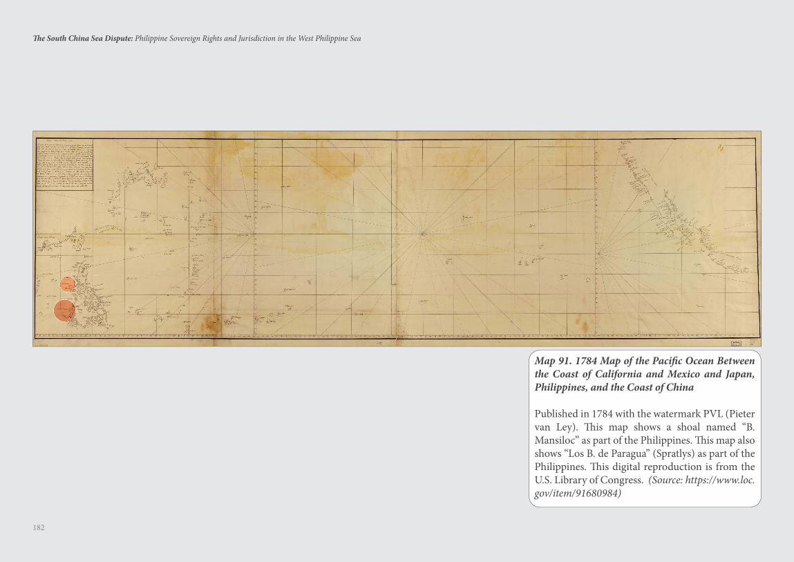
182
The South China Sea Dispute: Philippine Sovereign Rights and Jurisdiction in the West Philippine Sea
Map 91. 1784 Map of the Pacific Ocean Between the Coast of California and Mexico and Japan, Philippines, and the Coast of China
Published in 1784 with the watermark PVL (Pieter van Ley). This map shows a shoal named “B. Mansiloc” as part of the Philippines. This map also shows “Los B. de Paragua” (Spratlys) as part of the Philippines. This digital reproduction is from the U.S. Library of Congress. (Source: https://www.loc.gov/item/91680984)
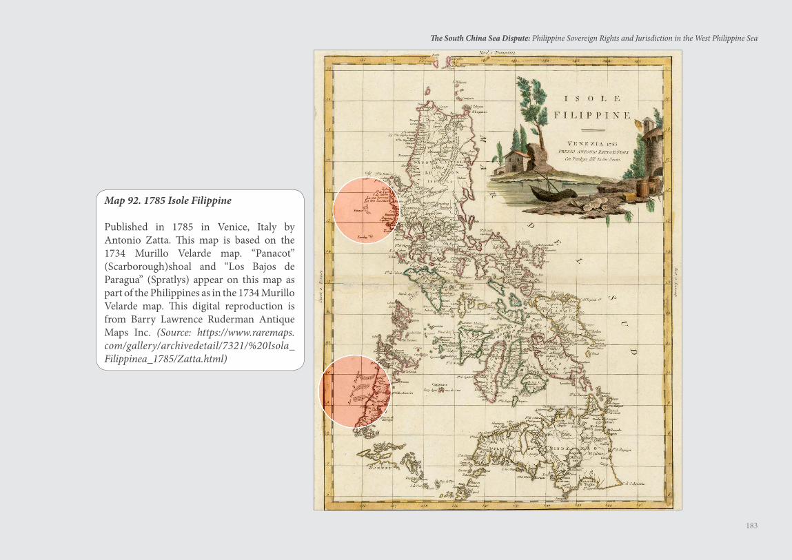
183
The South China Sea Dispute: Philippine Sovereign Rights and Jurisdiction in the West Philippine Sea
Map 92. 1785 Isole Filippine
Published in 1785 in Venice, Italy by Antonio Zatta. This map is based on the 1734 Murillo Velarde map. “Panacot” (Scarborough)shoal and “Los Bajos de Paragua” (Spratlys) appear on this map as part of the Philippines as in the 1734 Murillo Velarde map. This digital reproduction is from Barry Lawrence Ruderman Antique Maps Inc. (Source: https://www.raremaps.com/gallery/archivedetail/7321/%20Isola_Filippinea_1785/Zatta.html)
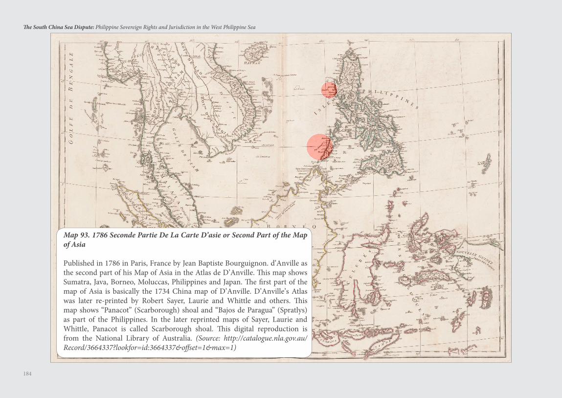
184
The South China Sea Dispute: Philippine Sovereign Rights and Jurisdiction in the West Philippine Sea
Map 93. 1786 Seconde Partie De La Carte D’asie or Second Part of the Map of Asia
Published in 1786 in Paris, France by Jean Baptiste Bourguignon. d’Anville as the second part of his Map of Asia in the Atlas de D’Anville. This map shows Sumatra, Java, Borneo, Moluccas, Philippines and Japan. The first part of the map of Asia is basically the 1734 China map of D’Anville. D’Anville’s Atlas was later re-printed by Robert Sayer, Laurie and Whittle and others. This map shows “Panacot” (Scarborough) shoal and “Bajos de Paragua” (Spratlys) as part of the Philippines. In the later reprinted maps of Sayer, Laurie and Whittle, Panacot is called Scarborough shoal. This digital reproduction is from the National Library of Australia. (Source: http://catalogue.nla.gov.au/Record/3664337?lookfor=id:3664337&offset=1&max=1)
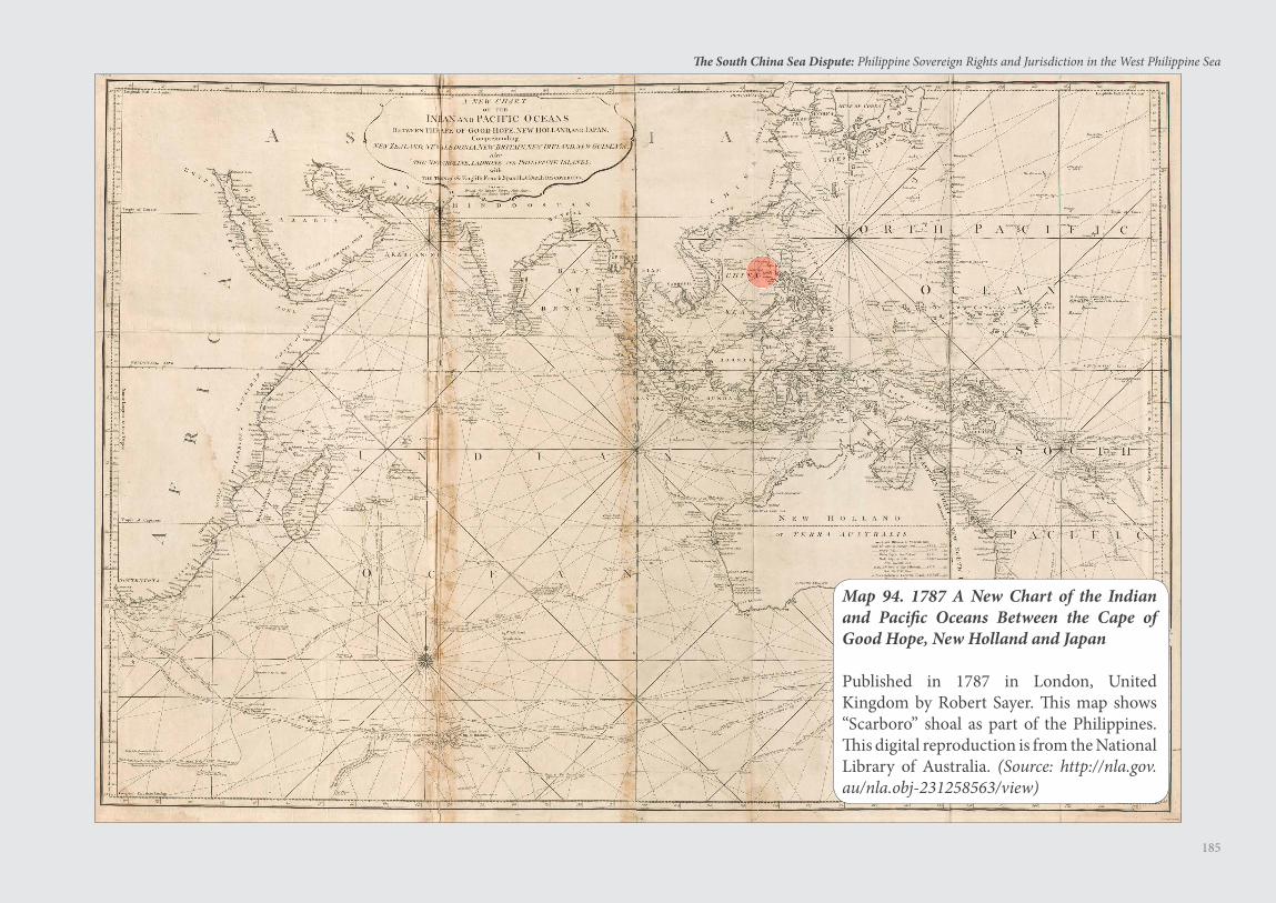
185
The South China Sea Dispute: Philippine Sovereign Rights and Jurisdiction in the West Philippine Sea
Map 94. 1787 A New Chart of the Indian and Pacific Oceans Between the Cape of Good Hope, New Holland and Japan
Published in 1787 in London, United Kingdom by Robert Sayer. This map shows “Scarboro” shoal as part of the Philippines. This digital reproduction is from the National Library of Australia. (Source: http://nla.gov.au/nla.obj-231258563/view)
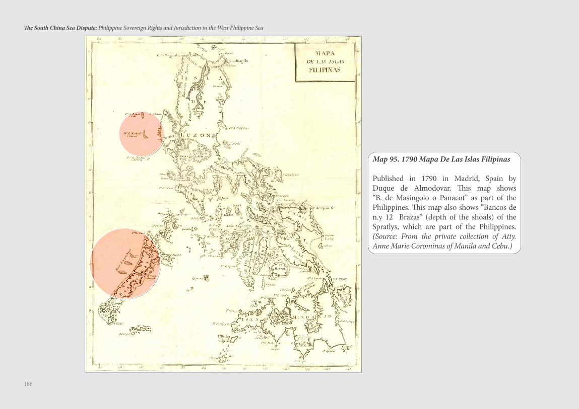
186
The South China Sea Dispute: Philippine Sovereign Rights and Jurisdiction in the West Philippine Sea
Map 95. 1790 Mapa De Las Islas Filipinas
Published in 1790 in Madrid, Spain by Duque de Almodovar. This map shows “B. de Masingolo o Panacot” as part of the Philippines. This map also shows “Bancos de n.y 12 Brazas” (depth of the shoals) of the Spratlys, which are part of the Philippines. (Source: From the private collection of Atty. Anne Marie Corominas of Manila and Cebu.)
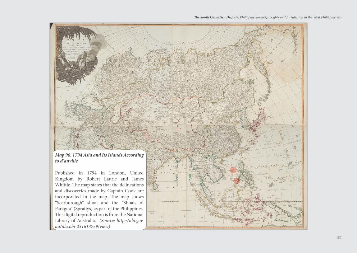
187
The South China Sea Dispute: Philippine Sovereign Rights and Jurisdiction in the West Philippine Sea
Map 96. 1794 Asia and Its Islands According to d’anville
Published in 1794 in London, United Kingdom by Robert Laurie and James Whittle. The map states that the delineations and discoveries made by Captain Cook are incorporated in the map. The map shows “Scarborough” shoal and the “Shoals of Paragua” (Spratlys) as part of the Philippines. This digital reproduction is from the National Library of Australia. (Source: http://nla.gov.au/nla.obj-231613759/view)
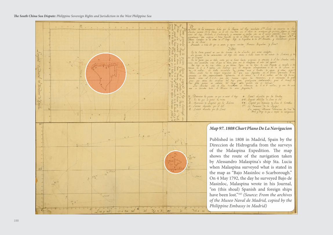
188
The South China Sea Dispute: Philippine Sovereign Rights and Jurisdiction in the West Philippine Sea
Map 97. 1808 Chart Plano De La Navigacion
Published in 1808 in Madrid, Spain by the Direccion de Hidrografia from the surveys of the Malaspina Expedition. The map shows the route of the navigation taken by Alessandro Malaspina’s ship Sta. Lucia when Malaspina surveyed what is stated in the map as “Bajo Masinloc o Scarborough.” On 4 May 1792, the day he surveyed Bajo de Masinloc, Malaspina wrote in his Journal, “on (this shoal) Spanish and foreign ships have been lost.”165 (Source: From the archives of the Museo Naval de Madrid, copied by the Philippine Embassy in Madrid)
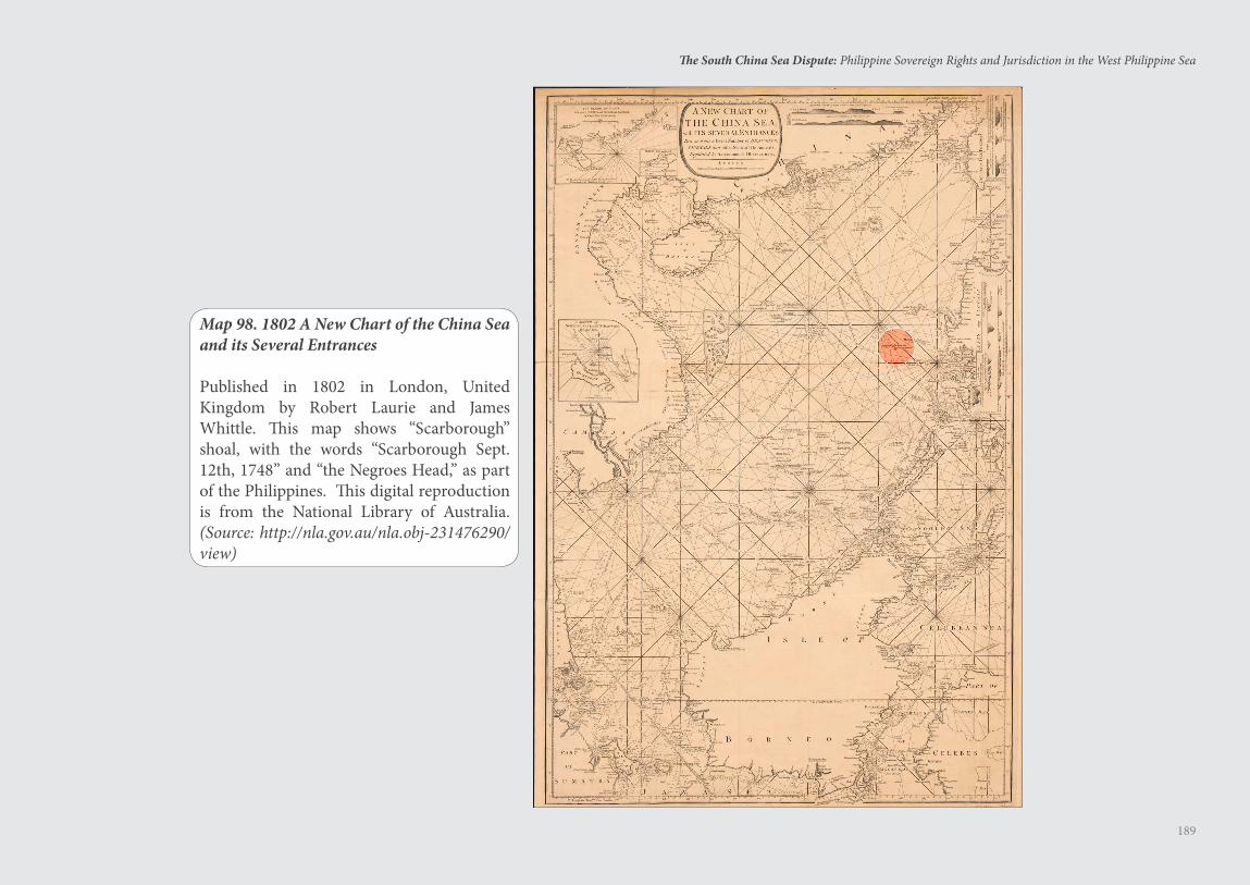
189
The South China Sea Dispute: Philippine Sovereign Rights and Jurisdiction in the West Philippine Sea
Map 98. 1802 A New Chart of the China Sea and its Several Entrances
Published in 1802 in London, United Kingdom by Robert Laurie and James Whittle. This map shows “Scarborough” shoal, with the words “Scarborough Sept. 12th, 1748” and “the Negroes Head,” as part of the Philippines. This digital reproduction is from the National Library of Australia. (Source: http://nla.gov.au/nla.obj-231476290/view)
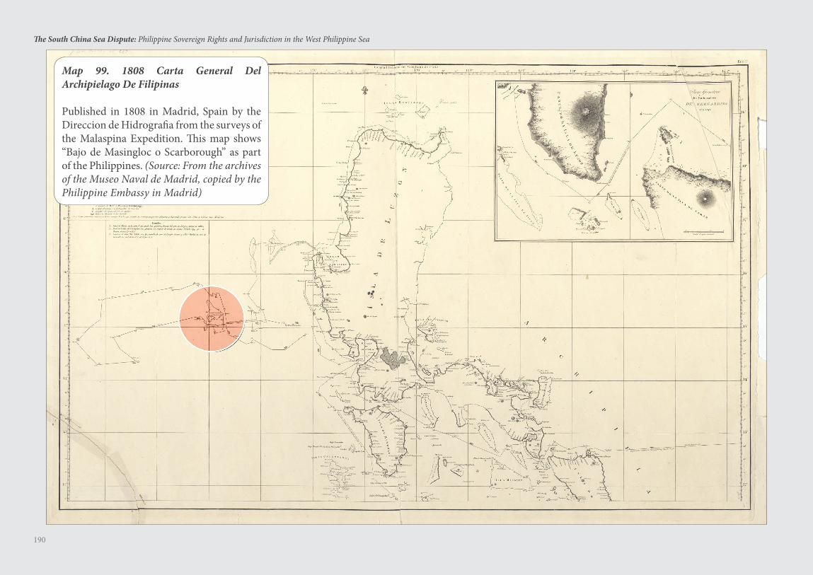
190
The South China Sea Dispute: Philippine Sovereign Rights and Jurisdiction in the West Philippine Sea
Map 99. 1808 Carta General Del Archipielago De Filipinas
Published in 1808 in Madrid, Spain by the Direccion de Hidrografia from the surveys of the Malaspina Expedition. This map shows “Bajo de Masingloc o Scarborough” as part of the Philippines. (Source: From the archives of the Museo Naval de Madrid, copied by the Philippine Embassy in Madrid)
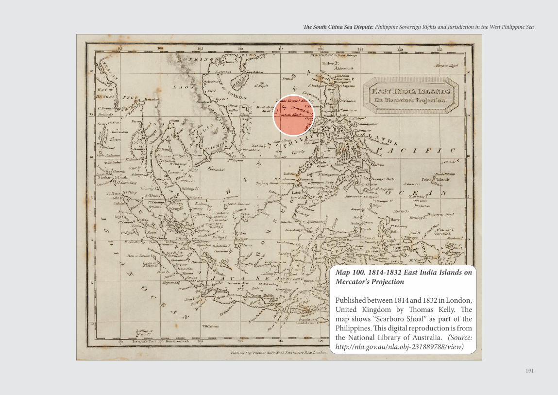
191
The South China Sea Dispute: Philippine Sovereign Rights and Jurisdiction in the West Philippine Sea
Map 100. 1814-1832 East India Islands on Mercator’s Projection
Published between 1814 and 1832 in London, United Kingdom by Thomas Kelly. The map shows “Scarboro Shoal” as part of the Philippines. This digital reproduction is from the National Library of Australia. (Source: http://nla.gov.au/nla.obj-231889788/view)
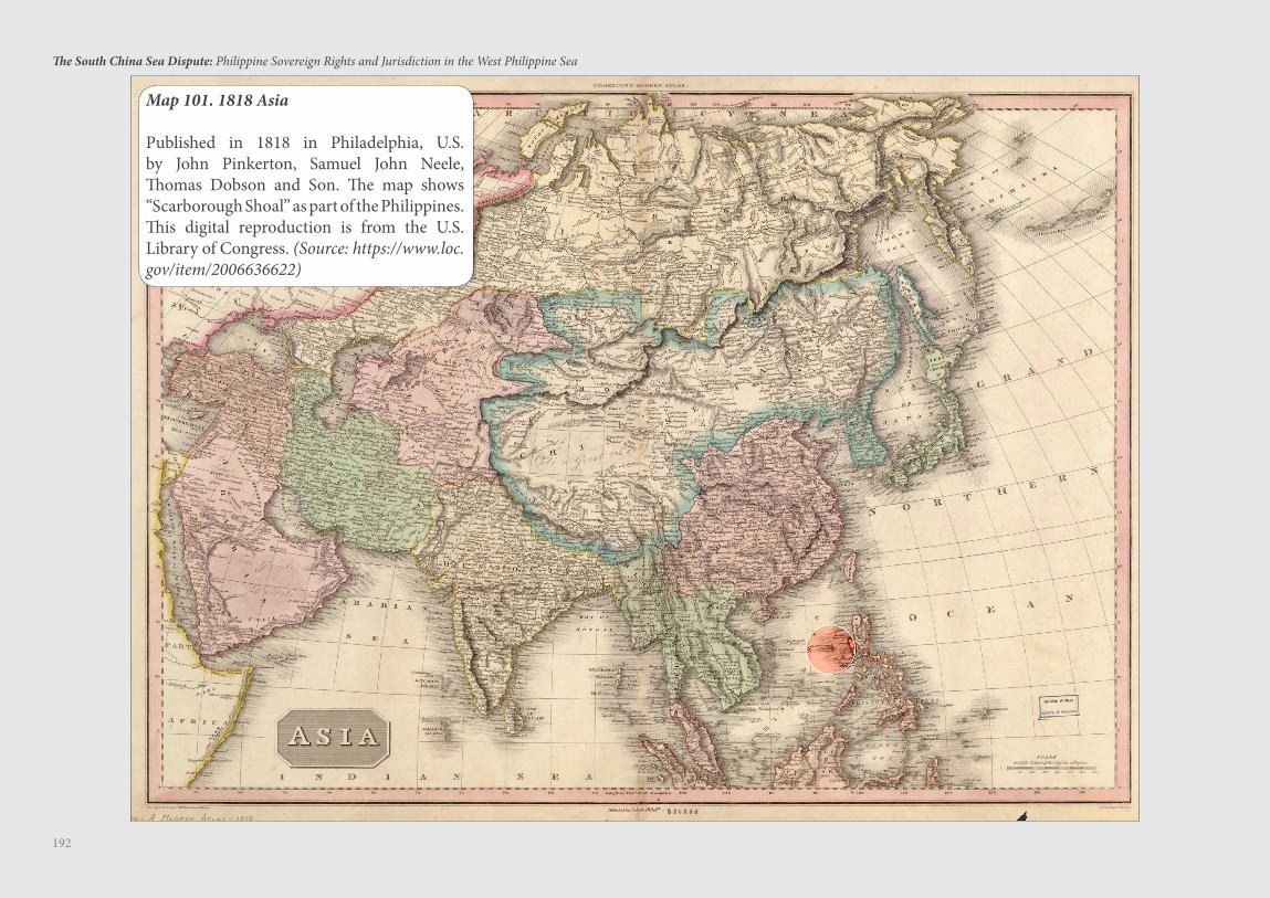
192
The South China Sea Dispute: Philippine Sovereign Rights and Jurisdiction in the West Philippine Sea
Map 101. 1818 Asia
Published in 1818 in Philadelphia, U.S. by John Pinkerton, Samuel John Neele, Thomas Dobson and Son. The map shows “Scarborough Shoal” as part of the Philippines. This digital reproduction is from the U.S. Library of Congress. (Source: https://www.loc.gov/item/2006636622)
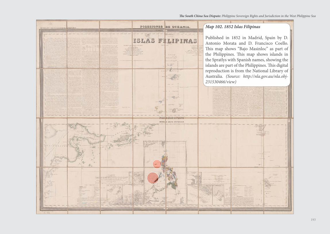
193
The South China Sea Dispute: Philippine Sovereign Rights and Jurisdiction in the West Philippine Sea
Map 102. 1852 Islas Filipinas
Published in 1852 in Madrid, Spain by D. Antonio Morata and D. Francisco Coello. This map shows “Bajo Masinloc” as part of the Philippines. This map shows islands in the Spratlys with Spanish names, showing the islands are part of the Philippines. This digital reproduction is from the National Library of Australia. (Source: http://nla.gov.au/nla.obj-231530466/view)
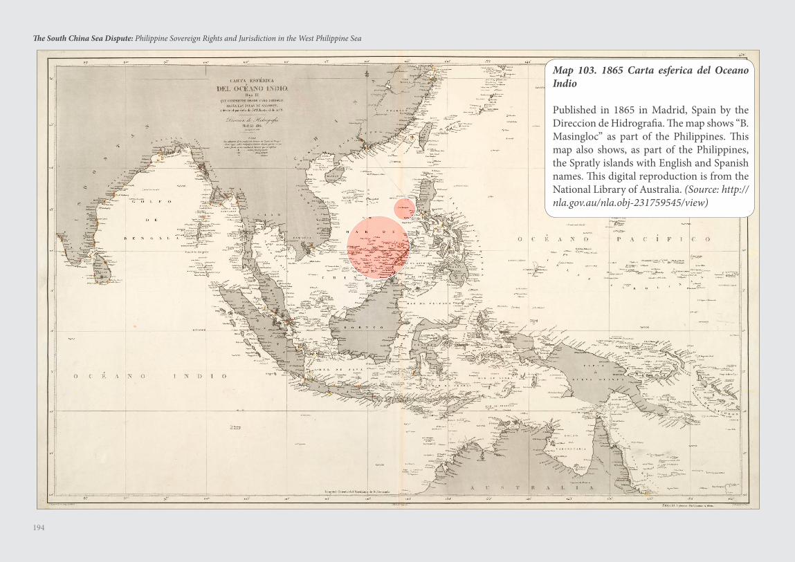
194
The South China Sea Dispute: Philippine Sovereign Rights and Jurisdiction in the West Philippine Sea
Map 103. 1865 Carta esferica del Oceano Indio
Published in 1865 in Madrid, Spain by the Direccion de Hidrografia. The map shows “B. Masingloc” as part of the Philippines. This map also shows, as part of the Philippines, the Spratly islands with English and Spanish names. This digital reproduction is from the National Library of Australia. (Source: http://nla.gov.au/nla.obj-231759545/view)
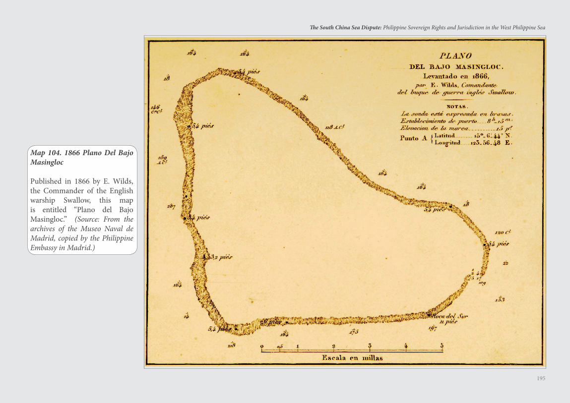
195
The South China Sea Dispute: Philippine Sovereign Rights and Jurisdiction in the West Philippine Sea
Map 104. 1866 Plano Del Bajo Masingloc
Published in 1866 by E. Wilds, the Commander of the English warship Swallow, this map is entitled “Plano del Bajo Masingloc.” (Source: From the archives of the Museo Naval de Madrid, copied by the Philippine Embassy in Madrid.)
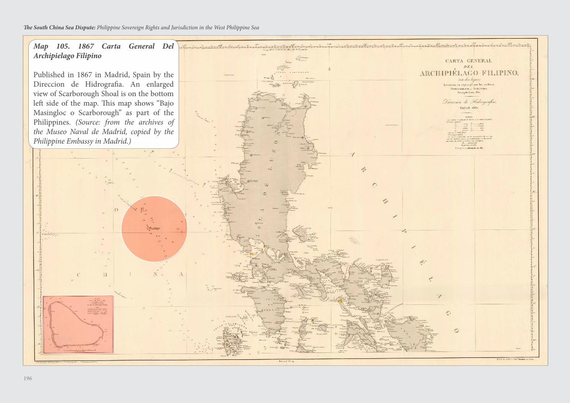
196
The South China Sea Dispute: Philippine Sovereign Rights and Jurisdiction in the West Philippine Sea
Map 105. 1867 Carta General Del Archipielago Filipino
Published in 1867 in Madrid, Spain by the Direccion de Hidrografia. An enlarged view of Scarborough Shoal is on the bottom left side of the map. This map shows “Bajo Masingloc o Scarborough” as part of the Philippines. (Source: from the archives of the Museo Naval de Madrid, copied by the Philippine Embassy in Madrid.)
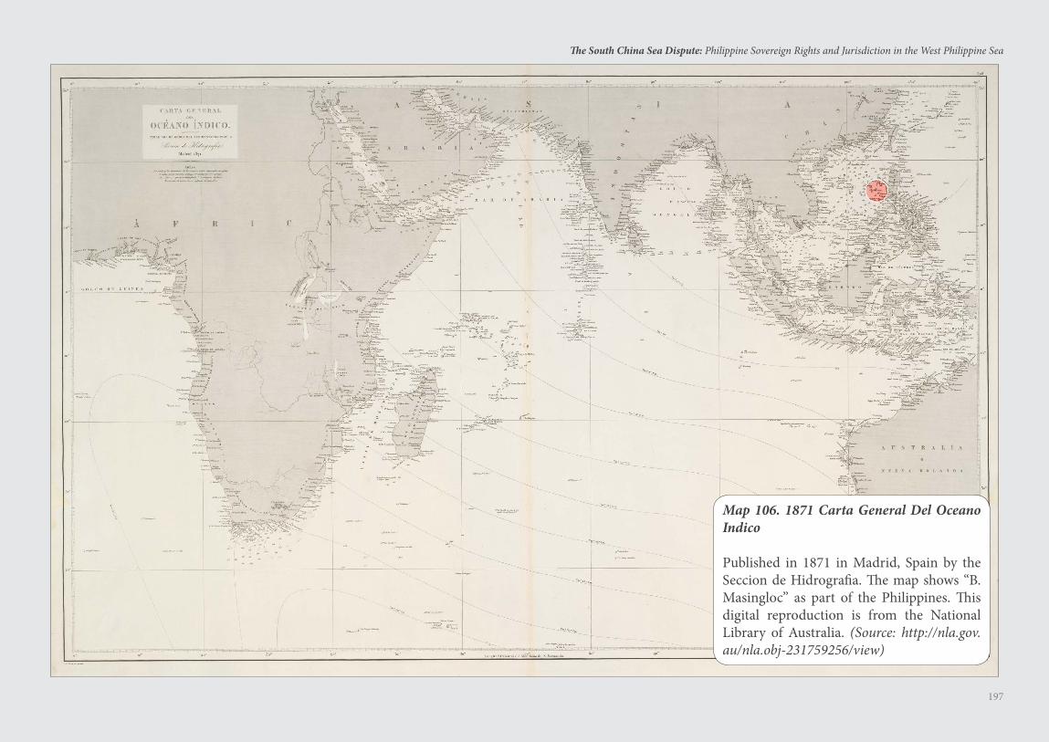
197
The South China Sea Dispute: Philippine Sovereign Rights and Jurisdiction in the West Philippine Sea
Map 106. 1871 Carta General Del Oceano Indico
Published in 1871 in Madrid, Spain by the Seccion de Hidrografia. The map shows “B. Masingloc” as part of the Philippines. This digital reproduction is from the National Library of Australia. (Source: http://nla.gov.au/nla.obj-231759256/view)
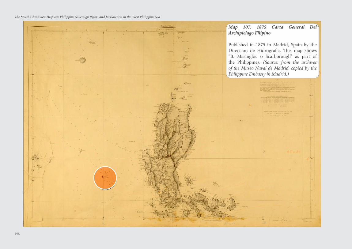
198
The South China Sea Dispute: Philippine Sovereign Rights and Jurisdiction in the West Philippine Sea
Map 107. 1875 Carta General Del Archipielago Filipino
Published in 1875 in Madrid, Spain by the Direccion de Hidrografia. This map shows “B. Masingloc o Scarborough” as part of the Philippines. (Source: from the archives of the Museo Naval de Madrid, copied by the Philippine Embassy in Madrid.)
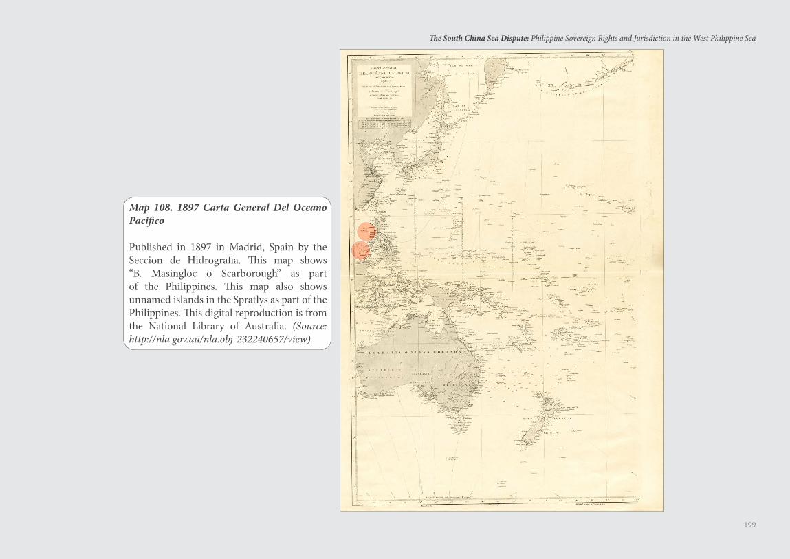
199
The South China Sea Dispute: Philippine Sovereign Rights and Jurisdiction in the West Philippine Sea
Map 108. 1897 Carta General Del Oceano Pacifico
Published in 1897 in Madrid, Spain by the Seccion de Hidrografia. This map shows “B. Masingloc o Scarborough” as part of the Philippines. This map also shows unnamed islands in the Spratlys as part of the Philippines. This digital reproduction is from the National Library of Australia. (Source: http://nla.gov.au/nla.obj-232240657/view)
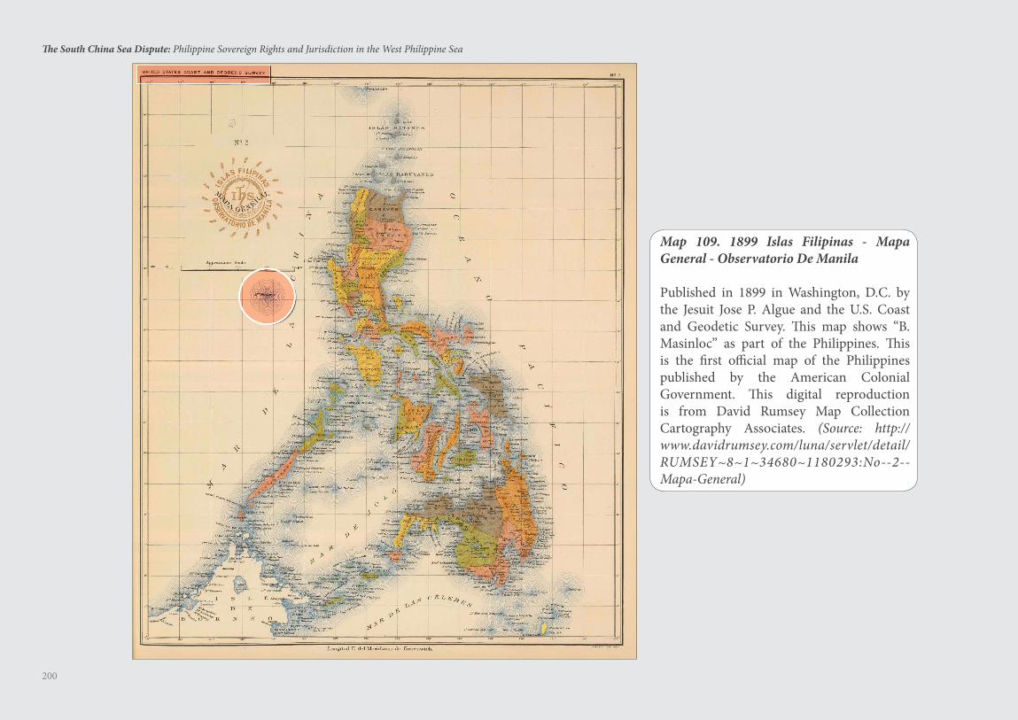
200
The South China Sea Dispute: Philippine Sovereign Rights and Jurisdiction in the West Philippine Sea
Map 109. 1899 Islas Filipinas - Mapa General - Observatorio De Manila
Published in 1899 in Washington, D.C. by the Jesuit Jose P. Algue and the U.S. Coast and Geodetic Survey. This map shows “B. Masinloc” as part of the Philippines. This is the first official map of the Philippines published by the American Colonial Government. This digital reproduction is from David Rumsey Map Collection Cartography Associates. (Source: http://www.davidrumsey.com/luna/servlet/detail/RUMSEY~8~1~34680~1180293:No--2--Mapa-General)
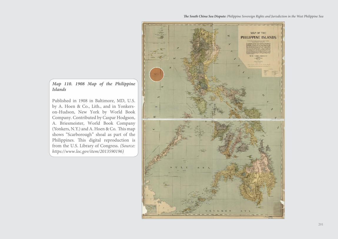
201
The South China Sea Dispute: Philippine Sovereign Rights and Jurisdiction in the West Philippine Sea
Map 110. 1908 Map of the Philippine Islands
Published in 1908 in Baltimore, MD, U.S. by A. Hoen & Co., Lith., and in Yonkers-on-Hudson, New York by World Book Company. Contributed by Caspar Hodgson, A. Briesmeister, World Book Company (Yonkers, N.Y.) and A. Hoen & Co. This map shows “Scarborough” shoal as part of the Philippines. This digital reproduction is from the U.S. Library of Congress. (Source: https://www.loc.gov/item/2013590196)
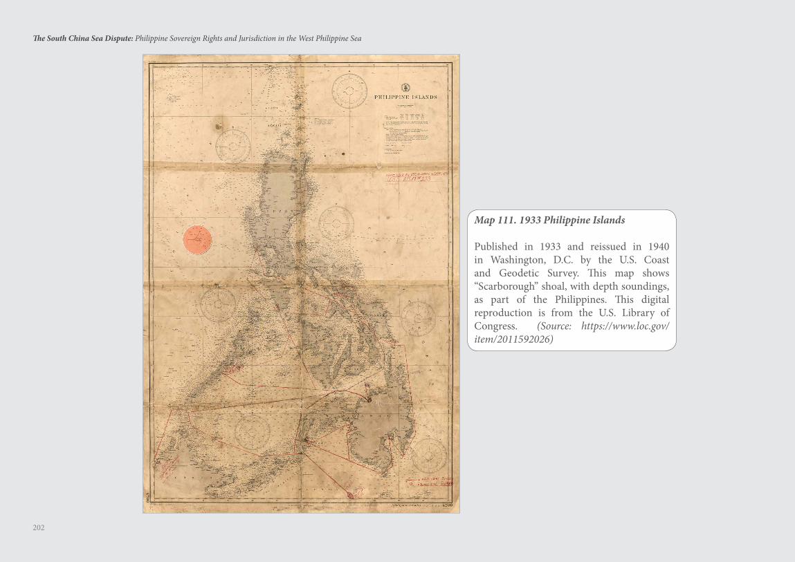
202
The South China Sea Dispute: Philippine Sovereign Rights and Jurisdiction in the West Philippine Sea
Map 111. 1933 Philippine Islands
Published in 1933 and reissued in 1940 in Washington, D.C. by the U.S. Coast and Geodetic Survey. This map shows “Scarborough” shoal, with depth soundings, as part of the Philippines. This digital reproduction is from the U.S. Library of Congress. (Source: https://www.loc.gov/item/2011592026)
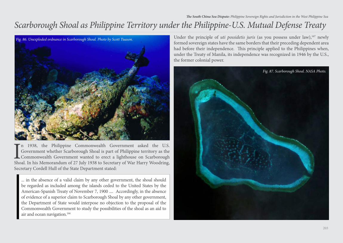
203
The South China Sea Dispute: Philippine Sovereign Rights and Jurisdiction in the West Philippine Sea
Scarborough Shoal as Philippine Territory under the Philippine-U.S. Mutual Defense Treaty
In 1938, the Philippine Commonwealth Government asked the U.S. Government whether Scarborough Shoal is part of Philippine territory as the Commonwealth Government wanted to erect a lighthouse on Scarborough
Shoal. In his Memorandum of 27 July 1938 to Secretary of War Harry Woodring, Secretary Cordell Hull of the State Department stated:
... in the absence of a valid claim by any other government, the shoal should be regarded as included among the islands ceded to the United States by the American-Spanish Treaty of November 7, 1900 .... Accordingly, in the absence of evidence of a superior claim to Scarborough Shoal by any other government, the Department of State would interpose no objection to the proposal of the Commonwealth Government to study the possibilities of the shoal as an aid to air and ocean navigation.166
Fig. 86. Unexploded ordnance in Scarborough Shoal. Photo by Scott Tuason. Under the principle of uti possidetis juris (as you possess under law),167 newly formed sovereign states have the same borders that their preceding dependent area had before their independence. This principle applied to the Philippines when, under the Treaty of Manila, its independence was recognized in 1946 by the U.S., the former colonial power.
Fig. 87. Scarborough Shoal. NASA Photo.
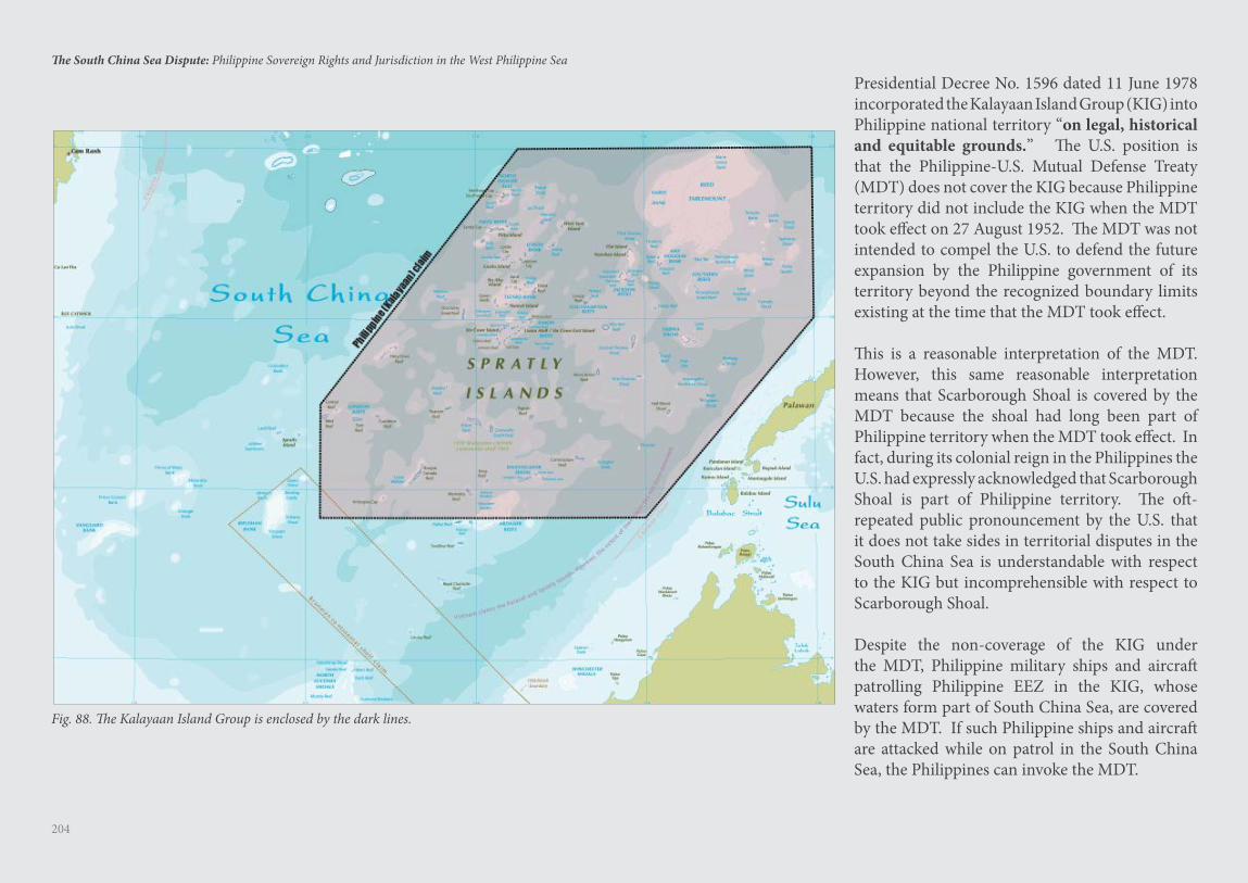
204
The South China Sea Dispute: Philippine Sovereign Rights and Jurisdiction in the West Philippine Sea
Presidential Decree No. 1596 dated 11 June 1978 incorporated the Kalayaan Island Group (KIG) into Philippine national territory “on legal, historical and equitable grounds.” The U.S. position is that the Philippine-U.S. Mutual Defense Treaty (MDT) does not cover the KIG because Philippine territory did not include the KIG when the MDT took effect on 27 August 1952. The MDT was not intended to compel the U.S. to defend the future expansion by the Philippine government of its territory beyond the recognized boundary limits existing at the time that the MDT took effect.
This is a reasonable interpretation of the MDT. However, this same reasonable interpretation means that Scarborough Shoal is covered by the MDT because the shoal had long been part of Philippine territory when the MDT took effect. In fact, during its colonial reign in the Philippines the U.S. had expressly acknowledged that Scarborough Shoal is part of Philippine territory. The oft-repeated public pronouncement by the U.S. that it does not take sides in territorial disputes in the South China Sea is understandable with respect to the KIG but incomprehensible with respect to Scarborough Shoal.
Despite the non-coverage of the KIG under the MDT, Philippine military ships and aircraft patrolling Philippine EEZ in the KIG, whose waters form part of South China Sea, are covered by the MDT. If such Philippine ships and aircraft are attacked while on patrol in the South China Sea, the Philippines can invoke the MDT.
Fig. 88. The Kalayaan Island Group is enclosed by the dark lines.
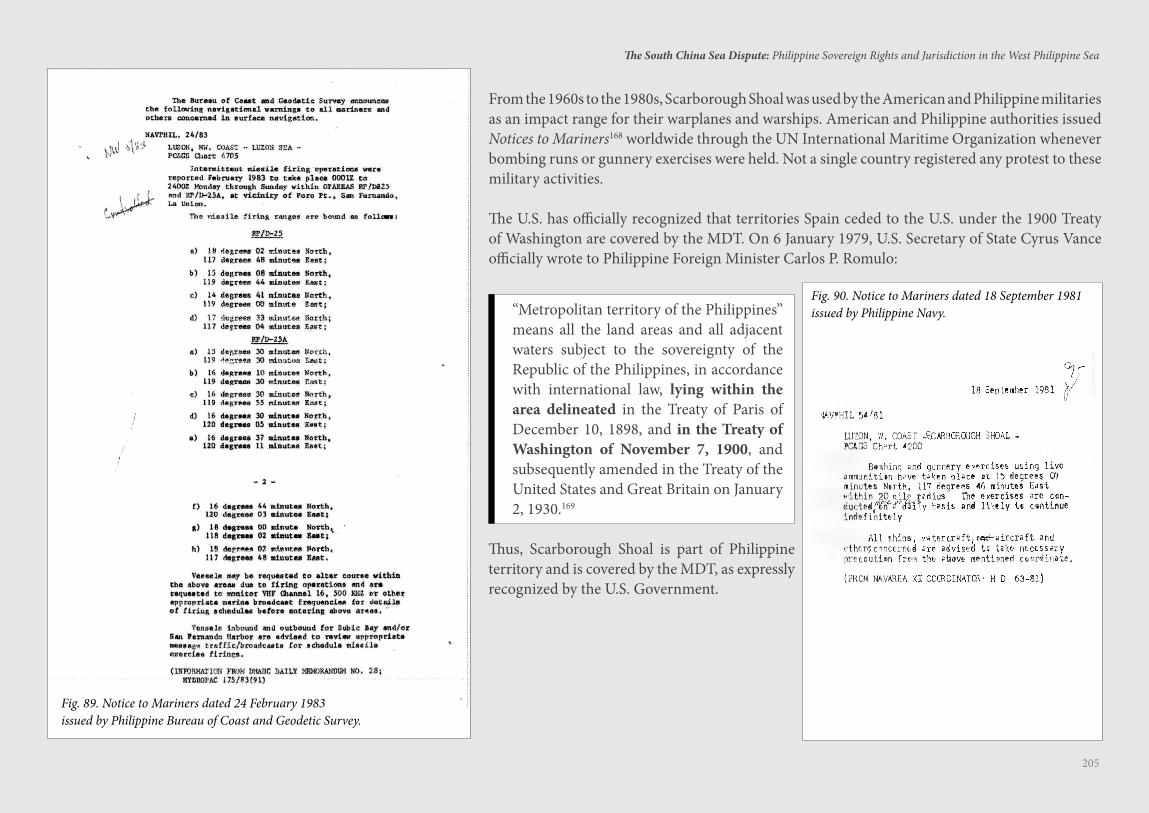
205
The South China Sea Dispute: Philippine Sovereign Rights and Jurisdiction in the West Philippine Sea
From the 1960s to the 1980s, Scarborough Shoal was used by the American and Philippine militaries as an impact range for their warplanes and warships. American and Philippine authorities issued Notices to Mariners168 worldwide through the UN International Maritime Organization whenever bombing runs or gunnery exercises were held. Not a single country registered any protest to these military activities.
The U.S. has officially recognized that territories Spain ceded to the U.S. under the 1900 Treaty of Washington are covered by the MDT. On 6 January 1979, U.S. Secretary of State Cyrus Vance officially wrote to Philippine Foreign Minister Carlos P. Romulo:
“Metropolitan territory of the Philippines” means all the land areas and all adjacent waters subject to the sovereignty of the Republic of the Philippines, in accordance with international law, lying within the area delineated in the Treaty of Paris of December 10, 1898, and in the Treaty of Washington of November 7, 1900, and subsequently amended in the Treaty of the United States and Great Britain on January 2, 1930.169
Thus, Scarborough Shoal is part of Philippine territory and is covered by the MDT, as expressly recognized by the U.S. Government.
Fig. 90. Notice to Mariners dated 18 September 1981 issued by Philippine Navy.
Fig. 89. Notice to Mariners dated 24 February 1983issued by Philippine Bureau of Coast and Geodetic Survey.
Harm to the Marine Environment
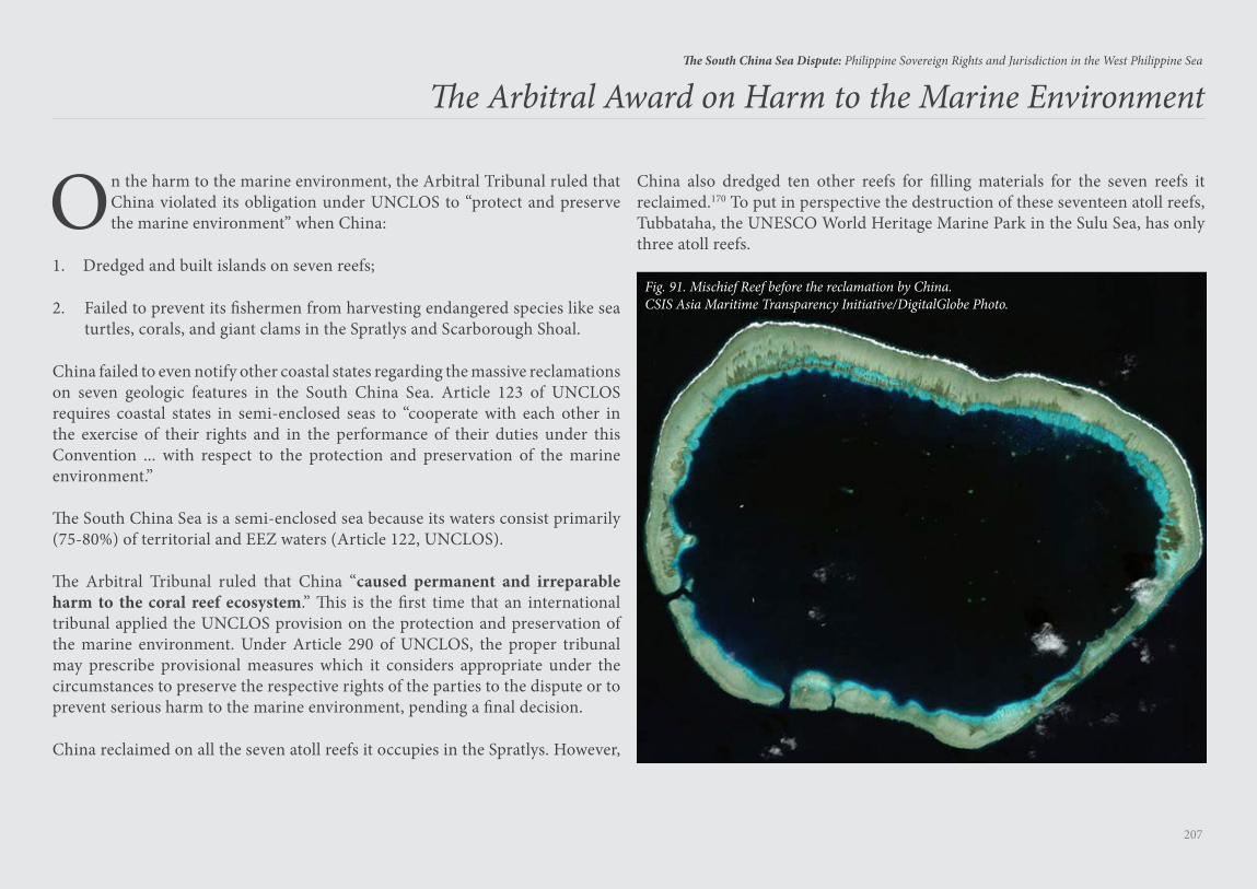
207
The South China Sea Dispute: Philippine Sovereign Rights and Jurisdiction in the West Philippine Sea
The Arbitral Award on Harm to the Marine Environment
On the harm to the marine environment, the Arbitral Tribunal ruled that China violated its obligation under UNCLOS to “protect and preserve the marine environment” when China:
1. Dredged and built islands on seven reefs;
2. Failed to prevent its fishermen from harvesting endangered species like sea turtles, corals, and giant clams in the Spratlys and Scarborough Shoal.
China failed to even notify other coastal states regarding the massive reclamations on seven geologic features in the South China Sea. Article 123 of UNCLOS requires coastal states in semi-enclosed seas to “cooperate with each other in the exercise of their rights and in the performance of their duties under this Convention ... with respect to the protection and preservation of the marine environment.”
The South China Sea is a semi-enclosed sea because its waters consist primarily (75-80%) of territorial and EEZ waters (Article 122, UNCLOS).
The Arbitral Tribunal ruled that China “caused permanent and irreparable harm to the coral reef ecosystem.” This is the first time that an international tribunal applied the UNCLOS provision on the protection and preservation of the marine environment. Under Article 290 of UNCLOS, the proper tribunal may prescribe provisional measures which it considers appropriate under the circumstances to preserve the respective rights of the parties to the dispute or to prevent serious harm to the marine environment, pending a final decision.
China reclaimed on all the seven atoll reefs it occupies in the Spratlys. However,
Fig. 91. Mischief Reef before the reclamation by China.CSIS Asia Maritime Transparency Initiative/DigitalGlobe Photo.
China also dredged ten other reefs for filling materials for the seven reefs it reclaimed.170 To put in perspective the destruction of these seventeen atoll reefs, Tubbataha, the UNESCO World Heritage Marine Park in the Sulu Sea, has only three atoll reefs.
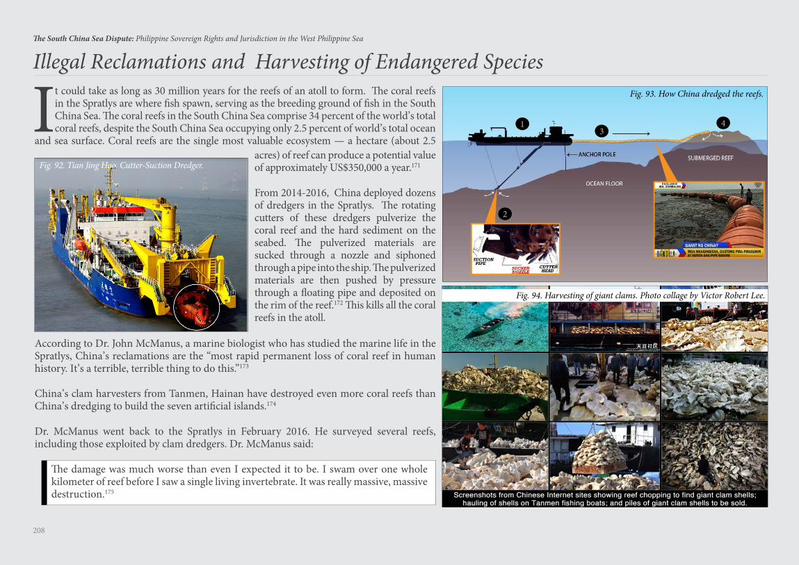
208
The South China Sea Dispute: Philippine Sovereign Rights and Jurisdiction in the West Philippine Sea
Illegal Reclamations and Harvesting of Endangered Species
It could take as long as 30 million years for the reefs of an atoll to form. The coral reefs in the Spratlys are where fish spawn, serving as the breeding ground of fish in the South China Sea. The coral reefs in the South China Sea comprise 34 percent of the world’s total coral reefs, despite the South China Sea occupying only 2.5 percent of world’s total ocean
and sea surface. Coral reefs are the single most valuable ecosystem — a hectare (about 2.5 acres) of reef can produce a potential value of approximately US$350,000 a year.171
From 2014-2016, China deployed dozens of dredgers in the Spratlys. The rotating cutters of these dredgers pulverize the coral reef and the hard sediment on the seabed. The pulverized materials are sucked through a nozzle and siphoned through a pipe into the ship. The pulverized materials are then pushed by pressure through a floating pipe and deposited on the rim of the reef.172 This kills all the coral reefs in the atoll.
According to Dr. John McManus, a marine biologist who has studied the marine life in the Spratlys, China’s reclamations are the “most rapid permanent loss of coral reef in human history. It’s a terrible, terrible thing to do this.”173
China’s clam harvesters from Tanmen, Hainan have destroyed even more coral reefs than China’s dredging to build the seven artificial islands.174
Dr. McManus went back to the Spratlys in February 2016. He surveyed several reefs, including those exploited by clam dredgers. Dr. McManus said:
The damage was much worse than even I expected it to be. I swam over one whole kilometer of reef before I saw a single living invertebrate. It was really massive, massive destruction.175
Fig. 92. Tian Jing Hao, Cutter-Suction Dredger.
Fig. 93. How China dredged the reefs.
Fig. 94. Harvesting of giant clams. Photo collage by Victor Robert Lee.
1
2
34
Other Issues Raised in the Arbitration
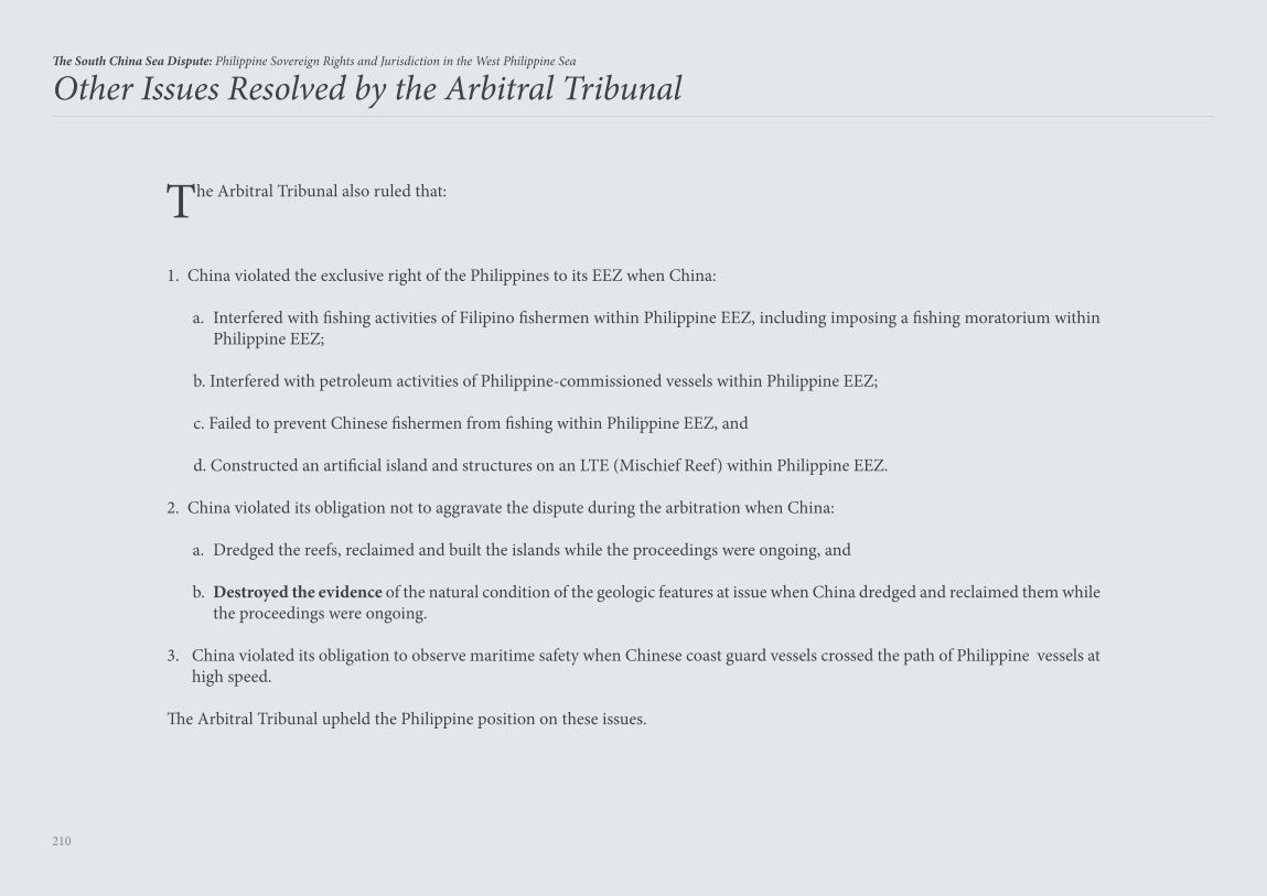
210
The South China Sea Dispute: Philippine Sovereign Rights and Jurisdiction in the West Philippine Sea
The Arbitral Tribunal also ruled that:
1. China violated the exclusive right of the Philippines to its EEZ when China:
a. Interfered with fishing activities of Filipino fishermen within Philippine EEZ, including imposing a fishing moratorium within Philippine EEZ;
b. Interfered with petroleum activities of Philippine-commissioned vessels within Philippine EEZ;
c. Failed to prevent Chinese fishermen from fishing within Philippine EEZ, and
d. Constructed an artificial island and structures on an LTE (Mischief Reef) within Philippine EEZ.
2. China violated its obligation not to aggravate the dispute during the arbitration when China:
a. Dredged the reefs, reclaimed and built the islands while the proceedings were ongoing, and
b. Destroyed the evidence of the natural condition of the geologic features at issue when China dredged and reclaimed them while the proceedings were ongoing.
3. China violated its obligation to observe maritime safety when Chinese coast guard vessels crossed the path of Philippine vessels at high speed.
The Arbitral Tribunal upheld the Philippine position on these issues.
Other Issues Resolved by the Arbitral Tribunal
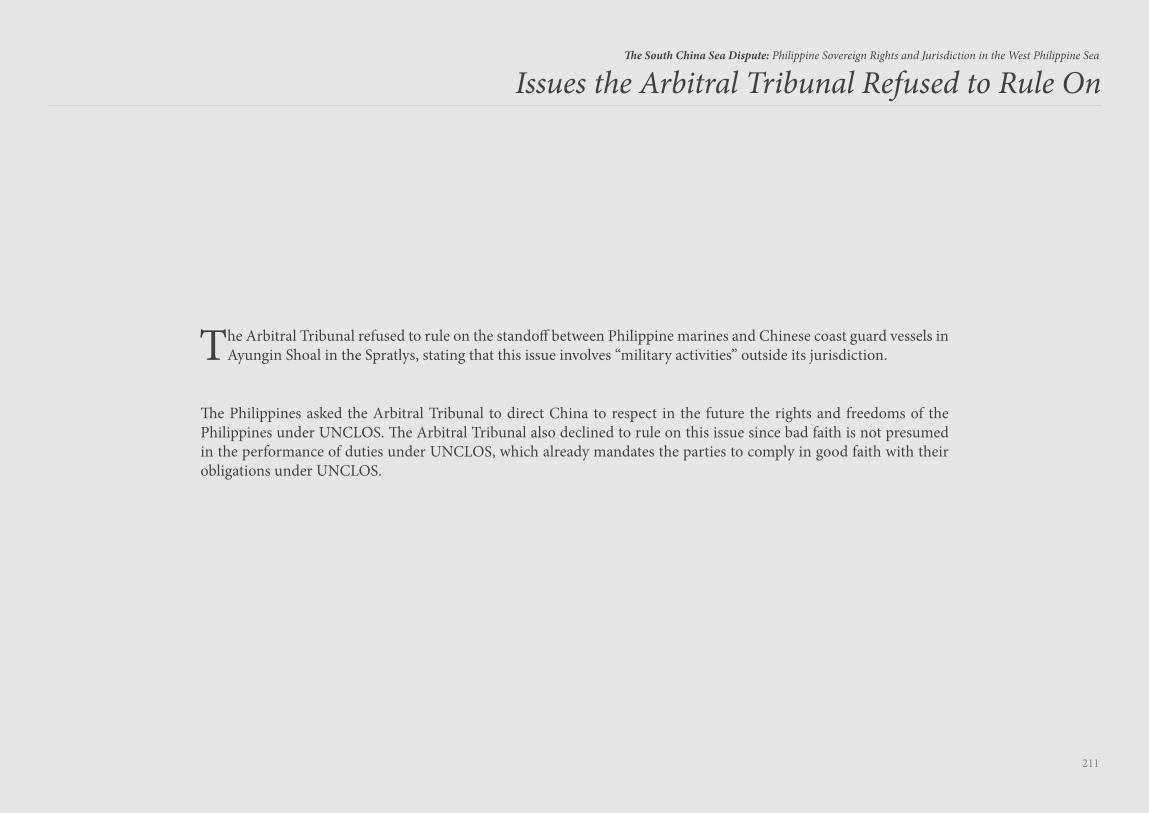
211
The South China Sea Dispute: Philippine Sovereign Rights and Jurisdiction in the West Philippine Sea
The Arbitral Tribunal refused to rule on the standoff between Philippine marines and Chinese coast guard vessels in Ayungin Shoal in the Spratlys, stating that this issue involves “military activities” outside its jurisdiction.
The Philippines asked the Arbitral Tribunal to direct China to respect in the future the rights and freedoms of the Philippines under UNCLOS. The Arbitral Tribunal also declined to rule on this issue since bad faith is not presumed in the performance of duties under UNCLOS, which already mandates the parties to comply in good faith with their obligations under UNCLOS.
Issues the Arbitral Tribunal Refused to Rule On
Enforcement of the Arbitral Award
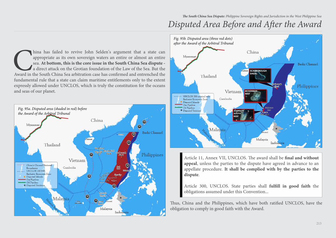
213
The South China Sea Dispute: Philippine Sovereign Rights and Jurisdiction in the West Philippine Sea
China has failed to revive John Selden’s argument that a state can appropriate as its own sovereign waters an entire or almost an entire sea. At bottom, this is the core issue in the South China Sea dispute - a direct attack on the Grotian foundation of the Law of the Sea. But the
Award in the South China Sea arbitration case has confirmed and entrenched the fundamental rule that a state can claim maritime entitlements only to the extent expressly allowed under UNCLOS, which is truly the constitution for the oceans and seas of our planet.
Disputed Area Before and After the Award
Fig. 95a. Disputed area (shaded in red) beforethe Award of the Arbitral Tribunal
Fig. 95b. Disputed area (three red dots)after the Award of the Arbitral Tribunal
Article 11, Annex VII, UNCLOS. The award shall be final and without appeal, unless the parties to the dispute have agreed in advance to an appellate procedure. It shall be complied with by the parties to the dispute.
Article 300, UNCLOS. State parties shall fulfill in good faith the obligations assumed under this Convention...
Thus, China and the Philippines, which have both ratified UNCLOS, have the obligation to comply in good faith with the Award.
214
The South China Sea Dispute: Philippine Sovereign Rights and Jurisdiction in the West Philippine Sea
McKennan Reef, Johnson South Reef and Scarborough Shoal are now the only three disputed land features occupied by China within the entire Philippine EEZ. Mischief Reef is not a land feature.
The Arbitral Tribunal ruled that these three land features generate only a 12 NM territorial sea, with no EEZ.
The Philippine EEZ in the South China Sea has an area of about 381,000 square kilometers. Deducting the 4,650 square kilometers total territorial seas of McKennan Reef, Johnson South Reef and Scarborough Shoal, the Philippines has an EEZ of about 376,350 square kilometers in the South China Sea free from any Chinese claim.
This maritime area is larger than the total land area of the Philippines of about 300,000 square kilometers. All the living and non-living resources in this maritime area — the fish, oil, gas, and other minerals — belong exclusively to the Philippines.
Paragraph 2, Section 2, Article XII, 1987 Philippine Constitution provides:
“The State shall protect the nation’s marine wealth in its archipelagic waters, territorial sea, and exclusive economic zone, and reserve its use and enjoyment exclusively to Filipino citizens.”
The Philippines is mandated by the Constitution to protect Philippine EEZ in the West Philippine Sea as affirmed by the Arbitral Tribunal in the Award. The Constitution has tasked the Armed Forces of the Philippines “to secure the sovereignty of the State and the integrity of the national territory.”176 The President, as Commander-in-Chief of the Armed Forces and Chief Architect of the foreign policy of the Philippines, is duty-bound to carry out this mandate of the Constitution.
Thus, the Philippines must conduct naval and aerial patrols in its EEZ in the West Philippine Sea. The Philippines must also always assert its sovereign rights and jurisdiction over its EEZ in the West Philippine Sea in all its relations and dealings with foreign states.
There are two aspects in the enforcement of the Award:
1. Enforcement of the Award by the world’s naval powers with respect to freedom of navigation and overflight for military vessels and aircraft, including the conduct of military activities, in the high seas and EEZs of the South China Sea. Such freedom of navigation and over-flight is a paramount national interest of the world’s naval powers.
2. Enforcement of the Award by the Philippines with respect to its exclusive right to exploit the resources of its EEZ in the South China Sea.
215
The South China Sea Dispute: Philippine Sovereign Rights and Jurisdiction in the West Philippine Sea
The world naval powers will enforce the Award by sailing and flying, and conducting military activities, in the high seas and EEZs of the South China Sea:
1. The U.S. has declared that its military forces will continue to operate in the South China Sea in accordance with international law. The U.S. Chief of Naval Operations John Richardson stated: “The U.S. Navy will continue to conduct routine and lawful operations around the world, including in the South China Sea, in order to protect the rights, freedoms and lawful uses of sea and airspace guaranteed to all. This will not change.”177
2. France has urged the 27-nation European Union to coordinate naval patrols in the South China Sea to ensure a “regular and visible” presence in the disputed waters illegally claimed by China. French Defense Minister Jean-Yves Le Drian said that the protection of freedom of the seas is vital from an economic standpoint and is concerned a loss of this right in the South China Sea might lead to similar problems in the Arctic Ocean or Mediterranean Sea.178 Russia has recently adopted regulations requiring all foreign vessels to secure prior permission from Russia before sailing through its “water area” in the North Sea Route. Russia’s “water area” includes its EEZ.179
3. British Ambassador to the U.S. Kim Darroch disclosed that British Typhoon fighter jets that visited Japan in October 2016 flew over the South China Sea in their return flight to assert freedom of overflight. He added: “Certainly, as we bring our two new aircraft carriers on-stream in 2020, and as we renew and update our defense forces, they will be seen in the Pacific. And we absolutely share the objective of this U.S. administration, and the next one, to protect freedom of navigation and to keep sea routes and air routes open.”180
Enforcement of the Award by World Naval Powers
216
The South China Sea Dispute: Philippine Sovereign Rights and Jurisdiction in the West Philippine Sea
The resolution of the South China Sea dispute is certainly not limited to an option of either “war or talk” with China. The successful arbitration case filed by the Philippines against China proves that the “war or talk” thinking is just too naïve. There is a menu of options available to the Philippines to enforce the Award, such as:
1. The Philippines can sue in a jurisdiction that ratified UNCLOS in case China installs oil or gas platforms within Philippine EEZ. The Philippines can ask the court having jurisdiction to attach the assets, located in its jurisdiction, owned by Chinese entities involved in installing or operating these platforms.
2. The Philippines can recover damages from China in the proper forum for severe harm to the marine environment in the Spratlys as ruled in the Award.
3. The Philippines can move before the ISA for the suspension of China’s exploration permits in the Area until China complies with the Award, on the ground that China is accepting benefits from the seabed provisions of the Convention but is refusing to comply with its obligations under the dispute settlement provisions of the Convention. The framers call UNCLOS a “package deal” of rights and obligations. A state party cannot cherry pick, that is, avail of the rights without complying with the obligations.
4. The Philippines can likewise move before the U.N. Commission on the Limits of the Continental Shelf (CLCS) for the suspension of China’s application for an ECS in the East China Sea until China complies with the Award.
5. The Philippines can negotiate its maritime boundaries with Malaysia (EEZ and ECS) and Vietnam (ECS), applying the Arbitral Tribunal’s ruling that no geologic feature in the Spratlys generates an EEZ and that the nine-dashed line has no legal effect on maritime entitlements. This will result in state practice adopting the rulings in the Award.
6. The Philippines can delineate its ECS from Luzon and file its claim with the CLCS, there being no legal impediment from the nine-dashed line. China, the only opposite coastal state, can raise two grounds to oppose the Philippine ECS claim. First, China can again raise its nine-dashed line claim but the CLCS is bound by the Award of the Arbitral Tribunal. Second, China can claim that the Philippine ECS overlaps with China’s ECS, but this means China accepts that the Philippines has an EEZ from Luzon. If China does not oppose the Philippine claim to an ECS, then the CLCS will recommend to the Philippines the adoption of its ECS. This is the dilemma that China will face if the Philippines files an ECS claim.
7. Philippine navy and coast guard vessels and aircraft can continue to patrol Philippine EEZ in the West Philippine Sea. Under the Philippine-U.S. Mutual Defense Treaty181 (MDT), any armed attack on a Philippine public vessel (navy or coast guard) in the Pacific area (clarified to include the South China Sea)182 is a ground to invoke the MDT. Thus, the MDT covers Philippine navy and coast guard vessels and aircraft patrolling Philippine EEZ in the West Philippine Sea. The U.S. has declared that China must comply with the ruling of the Arbitral Tribunal, recognizing the right of the Philippines to patrol the West Philippine Sea.
UNCLOS is a convention that provides for both rights and obligations. A state party cannot cherry pick, that is, avail of the rights without complying with the obligations.
Enforcement of the Award by the Philippines
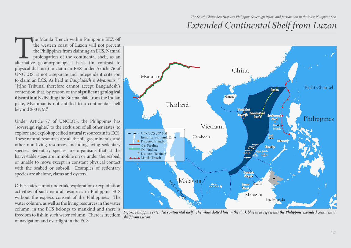
217
The South China Sea Dispute: Philippine Sovereign Rights and Jurisdiction in the West Philippine Sea
Extended Continental Shelf from Luzon
The Manila Trench within Philippine EEZ off the western coast of Luzon will not prevent the Philippines from claiming an ECS. Natural prolongation of the continental shelf, as an
alternative geomorphological basis (in contrast to physical distance) to claim an EEZ under Article 76 of UNCLOS, is not a separate and independent criterion to claim an ECS. As held in Bangladesh v. Myanmar,183 “[t]he Tribunal therefore cannot accept Bangladesh’s contention that, by reason of the significant geological discontinuity dividing the Burma plate from the Indian plate, Myanmar is not entitled to a continental shelf beyond 200 NM.”
Under Article 77 of UNCLOS, the Philippines has “sovereign rights,” to the exclusion of all other states, to explore and exploit specified natural resources in its ECS. These natural resources are all the oil, gas, minerals, and other non-living resources, including living sedentary species. Sedentary species are organisms that at the harvestable stage are immobile on or under the seabed, or unable to move except in constant physical contact with the seabed or subsoil. Examples of sedentary species are abalone, clams and oysters.
Other states cannot undertake exploration or exploitation activities of such natural resources in Philippine ECS without the express consent of the Philippines. The water column, as well as the living resources in the water column, in the ECS belongs to mankind and there is freedom to fish in such water column. There is freedom of navigation and overflight in the ECS.
Fig 96. Philippine extended continental shelf. The white dotted line in the dark blue area represents the Philippine extended continental shelf from Luzon.
218
The South China Sea Dispute: Philippine Sovereign Rights and Jurisdiction in the West Philippine Sea
Over time, the Award in the Philippines-China arbitration case will be followed by other international arbitral tribunals, cementing the rulings as principles of international law. For example, the standard for what constitutes an island capable of human habitation or economic life of its own would most likely be applied in succeeding cases. Also, the extinguishment of historic claims in the EEZ, ECS and high seas
would certainly be reiterated in succeeding cases. Coastal states that stand to benefit from the rulings will naturally invoke and apply these rulings. This will create a body of legal literature fortifying the rulings as the authoritative interpretation of UNCLOS.
Entrenchment of the Rulings in Subsequent Cases
219
The South China Sea Dispute: Philippine Sovereign Rights and Jurisdiction in the West Philippine Sea
World Powers and Rulings of International Tribunals
Dr. Graham Allison, Director of the Harvard Kennedy School’s Belfer Centre for Science and International Affairs, has argued that World Powers ignore the rulings of international tribunals:
When the Netherlands sued Russia (The Arctic Sunrise Case) .... (Russia) ignored the tribunal’s (ITLOS) order that the crew be released while the dispute was being resolved ....
[A]n Arbitral Tribunal (in the Chagos Marine Protected Area Arbitration) ruled for Mauritius and against Britain ... The British government disregarded the ruling ....
In the Nicaragua case (Military and Paramilitary Activities in and Against Nicaragua), when the court (ICJ) found in favor of Nicaragua and ordered the U.S. to pay reparations, the U.S. refused.184
But an analysis of the facts of these cases reveals a more complicated reality. The winning state in an international arbitration does not have to humiliate the losing state in exacting compliance with the award. Language can be found to allow the losing state to comply with the award without admitting fault or wrongdoing, or losing face, as long as the winning state secures a satisfactory result. The award of “reparations” can be paid as “economic aid.” After all, a rose by any other name smells as sweet as a rose; compliance by any other name is as satisfactory as compliance.
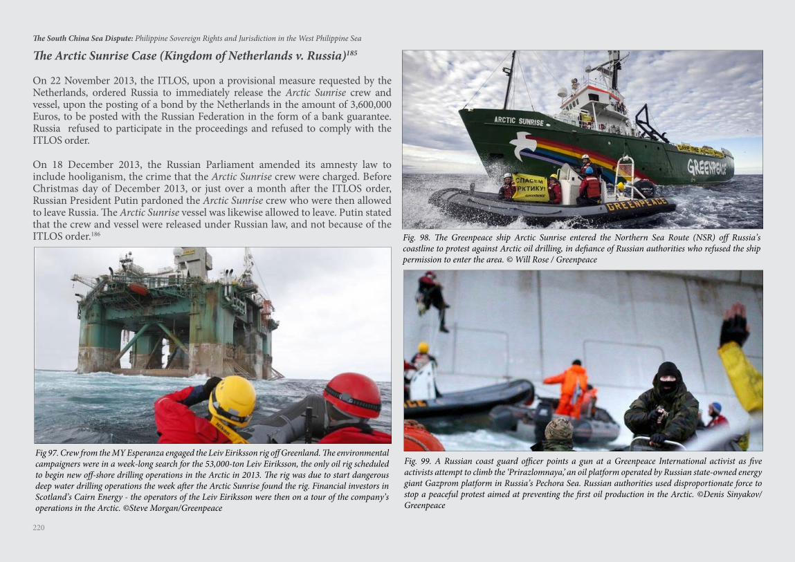
220
The South China Sea Dispute: Philippine Sovereign Rights and Jurisdiction in the West Philippine Sea
Fig. 99. A Russian coast guard officer points a gun at a Greenpeace International activist as five activists attempt to climb the ‘Prirazlomnaya,’ an oil platform operated by Russian state-owned energy giant Gazprom platform in Russia’s Pechora Sea. Russian authorities used disproportionate force to stop a peaceful protest aimed at preventing the first oil production in the Arctic. ©Denis Sinyakov/Greenpeace
Fig 97. Crew from the MY Esperanza engaged the Leiv Eiriksson rig off Greenland. The environmental campaigners were in a week-long search for the 53,000-ton Leiv Eiriksson, the only oil rig scheduled to begin new off-shore drilling operations in the Arctic in 2013. The rig was due to start dangerous deep water drilling operations the week after the Arctic Sunrise found the rig. Financial investors in Scotland’s Cairn Energy - the operators of the Leiv Eiriksson were then on a tour of the company’s operations in the Arctic. ©Steve Morgan/Greenpeace
The Arctic Sunrise Case (Kingdom of Netherlands v. Russia)185
On 22 November 2013, the ITLOS, upon a provisional measure requested by the Netherlands, ordered Russia to immediately release the Arctic Sunrise crew and vessel, upon the posting of a bond by the Netherlands in the amount of 3,600,000 Euros, to be posted with the Russian Federation in the form of a bank guarantee. Russia refused to participate in the proceedings and refused to comply with the ITLOS order.
On 18 December 2013, the Russian Parliament amended its amnesty law to include hooliganism, the crime that the Arctic Sunrise crew were charged. Before Christmas day of December 2013, or just over a month after the ITLOS order, Russian President Putin pardoned the Arctic Sunrise crew who were then allowed to leave Russia. The Arctic Sunrise vessel was likewise allowed to leave. Putin stated that the crew and vessel were released under Russian law, and not because of the ITLOS order.186 Fig. 98. The Greenpeace ship Arctic Sunrise entered the Northern Sea Route (NSR) off Russia’s
coastline to protest against Arctic oil drilling, in defiance of Russian authorities who refused the ship permission to enter the area. © Will Rose / Greenpeace
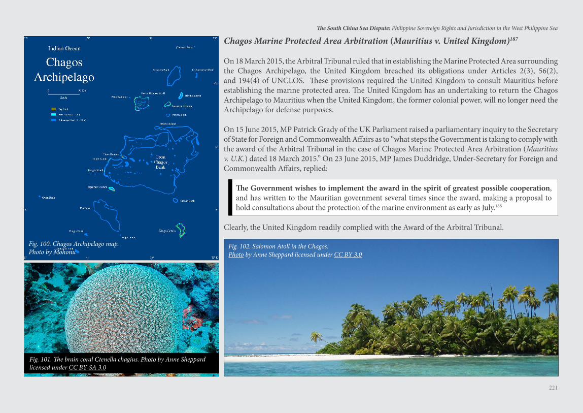
221
The South China Sea Dispute: Philippine Sovereign Rights and Jurisdiction in the West Philippine Sea
Fig. 100. Chagos Archipelago map.Photo by Mohonu
Fig. 102. Salomon Atoll in the Chagos.Photo by Anne Sheppard licensed under CC BY 3.0
Fig. 101. The brain coral Ctenella chagius. Photo by Anne Sheppard licensed under CC BY-SA 3.0
Chagos Marine Protected Area Arbitration (Mauritius v. United Kingdom)187
On 18 March 2015, the Arbitral Tribunal ruled that in establishing the Marine Protected Area surrounding the Chagos Archipelago, the United Kingdom breached its obligations under Articles 2(3), 56(2), and 194(4) of UNCLOS. These provisions required the United Kingdom to consult Mauritius before establishing the marine protected area. The United Kingdom has an undertaking to return the Chagos Archipelago to Mauritius when the United Kingdom, the former colonial power, will no longer need the Archipelago for defense purposes.
On 15 June 2015, MP Patrick Grady of the UK Parliament raised a parliamentary inquiry to the Secretary of State for Foreign and Commonwealth Affairs as to “what steps the Government is taking to comply with the award of the Arbitral Tribunal in the case of Chagos Marine Protected Area Arbitration (Mauritius v. U.K.) dated 18 March 2015.” On 23 June 2015, MP James Duddridge, Under-Secretary for Foreign and Commonwealth Affairs, replied:
The Government wishes to implement the award in the spirit of greatest possible cooperation, and has written to the Mauritian government several times since the award, making a proposal to hold consultations about the protection of the marine environment as early as July.188
Clearly, the United Kingdom readily complied with the Award of the Arbitral Tribunal.
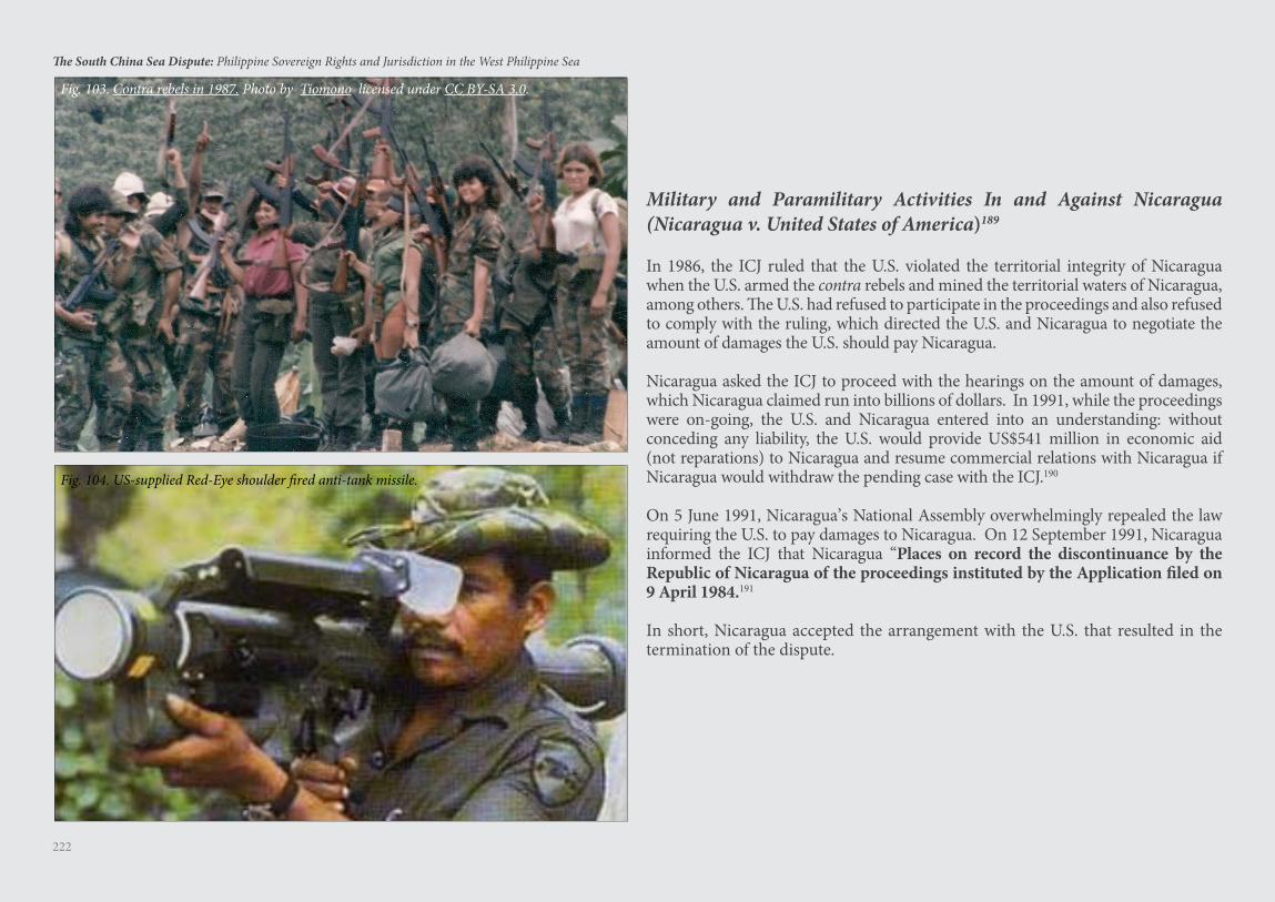
222
The South China Sea Dispute: Philippine Sovereign Rights and Jurisdiction in the West Philippine Sea
Military and Paramilitary Activities In and Against Nicaragua (Nicaragua v. United States of America)189
In 1986, the ICJ ruled that the U.S. violated the territorial integrity of Nicaragua when the U.S. armed the contra rebels and mined the territorial waters of Nicaragua, among others. The U.S. had refused to participate in the proceedings and also refused to comply with the ruling, which directed the U.S. and Nicaragua to negotiate the amount of damages the U.S. should pay Nicaragua.
Nicaragua asked the ICJ to proceed with the hearings on the amount of damages, which Nicaragua claimed run into billions of dollars. In 1991, while the proceedings were on-going, the U.S. and Nicaragua entered into an understanding: without conceding any liability, the U.S. would provide US$541 million in economic aid (not reparations) to Nicaragua and resume commercial relations with Nicaragua if Nicaragua would withdraw the pending case with the ICJ.190
On 5 June 1991, Nicaragua’s National Assembly overwhelmingly repealed the law requiring the U.S. to pay damages to Nicaragua. On 12 September 1991, Nicaragua informed the ICJ that Nicaragua “Places on record the discontinuance by the Republic of Nicaragua of the proceedings instituted by the Application filed on 9 April 1984.191
In short, Nicaragua accepted the arrangement with the U.S. that resulted in the termination of the dispute.
Fig. 103. Contra rebels in 1987. Photo by Tiomono licensed under CC BY-SA 3.0.
Fig. 104. US-supplied Red-Eye shoulder fired anti-tank missile.
223
The South China Sea Dispute: Philippine Sovereign Rights and Jurisdiction in the West Philippine Sea
China’s Three Warfares192
In 2003, China’s Communist Party, Central Committee and Central Military Commission approved the strategy of the Three Warfares193 — a strategy designed to control the South China Sea for economic and military purposes without firing a single shot.
China will avoid an armed attack on Philippine military vessels and aircraft in the South China Sea considering the defense treaty obligation of the U.S. to the Philippines. The last thing China will do is to force the U.S. to intervene militarily in the South China Sea dispute. Thus, China has adopted the Three Warfares strategy — a strategy to win the war without waging a kinetic war.
First Warfare: Historic Right to South China Sea
In its Position Paper of 7 December 2014, China makes this startling claim: “Chinese activities in the South China Sea date back to over 2,000 years ago. China was the first country to discover, name, explore, and exploit the resources of the South China Sea Islands and the first to continuously exercise sovereign powers over them.”
But the Arbitral Tribunal ruled:
The Tribunal sees no evidence that, prior to the Convention, China ever established a historic right to the exclusive use of the living and non-living resources of the waters of the South China Sea, whatever use it may have made of the Spratly Islands themselves.194
This First Warfare of China is now dead in the water.
Second Warfare: Legal Exception to UNCLOS China claims that its historic right to the South China Sea waters predates UNCLOS and therefore cannot be governed by UNCLOS. In short, the narrative is that China’s historic right is an exception to UNCLOS. China has sent hundreds of scholars to the U.S., Canada, and Europe to take up graduate studies in the Law of the Sea and International Relations. These scholars have written numerous articles and dissertations justifying China’s historic right as an exception to UNCLOS.
But the Arbitral Tribunal ruled that all historic rights in the EEZ and ECS were extinguished upon effectivity of UNCLOS:
[T[he Tribunal concludes that China’s claim to historic rights to the living and non-
living resources within the ‘nine-dash line’ is incompatible with the Convention. ... [A]ny historic rights that China may have had to the living and non-living resources within the ‘nine-dash line’ were superseded, as a matter of law and as between the Philippines and China, by the limits of the maritime zones provided for by the Convention.
This Second Warfare of China has been declared incompatible with UNCLOS and is now also dead in the water.
Third Warfare: Huge Naval and Air Bases Will Intimidate other Claimant States
China’s three huge air and naval bases in the Spratlys project overwhelming power. This will intimidate other claimant states into submission, allowing China to enforce the nine-dashed line as its national boundary.
But the Arbitral Tribunal ruled that the nine-dashed line cannot serve as legal basis to claim maritime entitlements, and thus there are high seas and EEZs in the South China Sea. China’s air and naval bases built on low-tide elevations have no territorial sea or territorial airspace. The world naval powers will sail and fly, and conduct military activities, in the high seas and EEZs of the South China Sea. They may even sail in the waters around, and fly in the airspace above, these air and naval bases built on artificial islands.
Furthermore, the Arbitral Tribunal ruled that the Philippines has exclusive sovereign rights to its EEZ. The Philippines will have to lead in fighting the battle to enforce its exclusive right to its EEZ. This battle involves:
1. Marshaling support from other ASEAN states prejudiced by the nine-dashed line;
2. Using world opinion to convince the Chinese people to comply with international law as embodied in the Award. Understandably, China’s Government will not comply with the Award if the Chinese people do not understand that the nine-dashed line has no historical or legal basis;
3. Convincing UNCLOS coastal states that it is to their best interest to help protect the Philippines’ right to its EEZ; otherwise, in the future their more powerful neighbors might also covet their EEZs;
4. Adopting a credible anti-access, area denial military strategy; and
5. Creatively resorting to lawfare.
224
The South China Sea Dispute: Philippine Sovereign Rights and Jurisdiction in the West Philippine Sea
Issues Affecting Joint Development between China and the Philippines
All disputant states should follow UNCLOS by respecting the 200 NM EEZ of each coastal state. Beyond the EEZs, disputant states can agree on joint development of the mineral resources in any overlapping maritime zone, while shelving the sovereignty issue over the islands
and rocks. China can even be given a bigger share in the joint development of the disputed areas beyond the EEZs of coastal states.
But China’s proposal for joint development in the EEZs of all coastal states — except China’s EEZ — is a case of what is mine is mine alone but what is yours belongs to both of us.
China’s Precondition for Joint Development
China has one precondition for joint development — that other states concede China’s sovereignty over all geologic features and waters within the nine-dashed line. Any state that agrees to such precondition will have to immediately vacate, and turn over to China, any island or rock such state presently occupies. Not a single ASEAN disputant state has accepted China’s offer.
In explaining the concept of joint development, China has officially declared that the concept of ‘setting aside dispute and pursuing joint development’ has the following four elements:
1. The sovereignty of the territories concerned belongs to China.
2. When conditions are not ripe to bring about a thorough solution to territorial dispute, discussion on the issue of sovereignty may be postponed so that the dispute is set aside. To set aside dispute does not mean giving up sovereignty. It is just to leave the dispute aside for the time being.
3. The territories under dispute may be developed in a joint way.
4. The purpose of joint development is to enhance mutual understanding through
cooperation and create conditions for the eventual resolution of territorial ownership.195
Joint development under China’s definition is only within the EEZ of the Philippines and EEZs of other coastal states, never within China’s EEZ. In short, joint development is not reciprocal. Joint development is not on territory, but on the EEZ. A dispute over the EEZ is not a territorial dispute but a maritime dispute. To accept China’s contrary definition that there is a territorial dispute over the EEZ is to admit that the subject matter of the Arbitral Tribunal’s Award is a territorial dispute, making the Award null and void since the Arbitral Tribunal has no jurisdiction over territorial disputes.
Philippine Constitutional Constraints
For China, that their “sovereignty” over the Reed Bank is acknowledged by the Philippines is “fundamental” to any joint development. Philex Petroleum learned this firsthand during its May 2012 negotiations with China National Offshore Oil Company (CNOOC) over the Reed Bank.196 This, of course, is not possible under the Philippine Constitution.
The Philippine Constitution defines National Territory as “territories over which the Philippines has sovereignty or jurisdiction ... including ... the seabed, the subsoil ... and other submarine areas.”197 Under UNCLOS, as affirmed by the Arbitral Tribunal, the Philippines has “sovereign rights and jurisdiction” over its EEZ in the West Philippine Sea.
Moreover, the Constitution specifically provides that:
The State shall protect the nation’s marine wealth in its ... exclusive economic zone, and reserve its use and enjoyment exclusively to Filipino citizens.198
In short, to accept China’s offer of joint development is not only iniquitous, it also violates the Philippine Constitution.
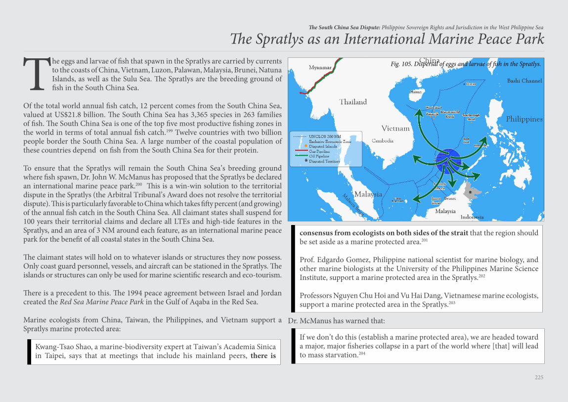
225
The South China Sea Dispute: Philippine Sovereign Rights and Jurisdiction in the West Philippine Sea
The Spratlys as an International Marine Peace Park
The eggs and larvae of fish that spawn in the Spratlys are carried by currents to the coasts of China, Vietnam, Luzon, Palawan, Malaysia, Brunei, Natuna Islands, as well as the Sulu Sea. The Spratlys are the breeding ground of fish in the South China Sea.
Of the total world annual fish catch, 12 percent comes from the South China Sea, valued at US$21.8 billion. The South China Sea has 3,365 species in 263 families of fish. The South China Sea is one of the top five most productive fishing zones in the world in terms of total annual fish catch.199 Twelve countries with two billion people border the South China Sea. A large number of the coastal population of these countries depend on fish from the South China Sea for their protein.
To ensure that the Spratlys will remain the South China Sea’s breeding ground where fish spawn, Dr. John W. McManus has proposed that the Spratlys be declared an international marine peace park.200 This is a win-win solution to the territorial dispute in the Spratlys (the Arbitral Tribunal’s Award does not resolve the territorial dispute). This is particularly favorable to China which takes fifty percent (and growing) of the annual fish catch in the South China Sea. All claimant states shall suspend for 100 years their territorial claims and declare all LTEs and high-tide features in the Spratlys, and an area of 3 NM around each feature, as an international marine peace park for the benefit of all coastal states in the South China Sea.
The claimant states will hold on to whatever islands or structures they now possess. Only coast guard personnel, vessels, and aircraft can be stationed in the Spratlys. The islands or structures can only be used for marine scientific research and eco-tourism.
There is a precedent to this. The 1994 peace agreement between Israel and Jordan created the Red Sea Marine Peace Park in the Gulf of Aqaba in the Red Sea.
Marine ecologists from China, Taiwan, the Philippines, and Vietnam support a Spratlys marine protected area:
Kwang-Tsao Shao, a marine-biodiversity expert at Taiwan’s Academia Sinica in Taipei, says that at meetings that include his mainland peers, there is
Fig. 105. Dispersal of eggs and larvae of fish in the Spratlys.
consensus from ecologists on both sides of the strait that the region should be set aside as a marine protected area.201
Prof. Edgardo Gomez, Philippine national scientist for marine biology, and other marine biologists at the University of the Philippines Marine Science Institute, support a marine protected area in the Spratlys.202
Professors Nguyen Chu Hoi and Vu Hai Dang, Vietnamese marine ecologists, support a marine protected area in the Spratlys.203
Dr. McManus has warned that:
If we don’t do this (establish a marine protected area), we are headed toward a major, major fisheries collapse in a part of the world where [that] will lead to mass starvation.204

226
The South China Sea Dispute: Philippine Sovereign Rights and Jurisdiction in the West Philippine Sea
Final Word
227
The South China Sea Dispute: Philippine Sovereign Rights and Jurisdiction in the West Philippine Sea
There is a well-recognized rule of international law that:
Declarations publicly made and manifesting the will to be bound may have the effect of creating legal obligations. When the conditions for this are met, the binding character of such declarations is based on good faith; States concerned may then take them into consideration and rely on them; such States are entitled to require that such obligations be respected.205
Such unilateral declarations may be made by the head of state or government, or by the minister of foreign affairs.206
The leaders of the nation must exercise utmost deliberation, consistency, and perseverance in seeking ways to enforce what the Arbitral Tribunal has finally awarded to the Philippines as its own EEZ in the West Philippine Sea. This is in compliance with the mandate of the Constitution that the “State shall protect the nation’s marine wealth in its ... exclusive economic zone.”
There is no room for error — for allowing any waiver, express or implied, of the sovereign rights and jurisdiction of the Philippines over its vast EEZ in the West Philippine Sea, an area larger than the total land area of the Philippines.
Every act, declaration and statement of the leaders of the nation on the enforcement of the Award of the Arbitral Tribunal must be carefully studied and weighed to prevent any opposing state from claiming that the Philippines has abandoned, expressly or impliedly, what it has won in the arbitration case.
Likewise, the ICJ has stated that “silence may also speak ... if the conduct of the other state calls for a response.”207 Acquiescence is “equivalent to tacit recognition manifested by unilateral conduct which the other party may interpret as consent.”208 In international law, the oft-quoted definition of acquiescence is —
[T]he inaction of a State which is faced with a situation constituting threat or infringement of its rights ... Acquiescence thus takes the form of silence or absence of protest in circumstances which generally call for a particular reaction signifying an objection.209
Silence or inaction can be interpreted as a state’s acceptance of a factual or legal situation.210
Thus, any violation or infringement of the Award or of Philippine territory by other states, such as exploration activities by other states within Philippine EEZ or the installation of facilities on LTEs within Philippine EEZ, or on high-tide elevations forming part of Philippine territory, must be promptly protested formally to prevent any opposing state from claiming acquiescence by the Philippines.211
Failure to heed this caveat, for any reason, is unforgiveable.
A Caveat on Unilateral Declarations and Acquiescence
228
The South China Sea Dispute: Philippine Sovereign Rights and Jurisdiction in the West Philippine Sea
1 See generally Adrian Horridge, The Austronesian Conquest of the Sea – Upwind, in The Austronesians: Historical and Comparative Perspectives 143-60 (Bellwood, Fox & Tryon eds., 2006).
2 Ross Clark, Austronesian Languages, in The World’s Major Languages 781 (Bernard Comrie ed., 2009).
3 See R. D. Gray, A. J. Drummond & S. J. Greenhill, Language Phylogenies Reveal Expansion Pulses and Pauses in Pacific Settlement, 323 Science 479 (2009); Y. Moodley, et al., The Peopling of the Pacific from a Bacterial Perspective, 323 Science 527 (2009); Ed Young, Bacteria and languages reveal how people spread through the Pacific, Nat’l Geographic (Jan. 22, 2009), http://phenomena.nationalgeographic.com/2009/01/22/bacteria-and-languages-reveal-how-people-spread-through-the-pacific; Mark Lipson, et al., Reconstructing Austronesian Population History in Island Southeast Asia, Nat. Commun. 5:4689 doi: 10.1038/5689 (2014). See also Ancient Chicken DNA Reveals Philippines Home to Polynesians, Philstar.com (Mar. 18, 2014), http://www.philstar.com/news-feature/2014/03/18/1302318/ancient-chicken-dna-reveals-philippines-home-polynesians.
4 Horridge, supra note 1.5 Id. at 146. 6 See Butuan Boat, Nationalmuseum.gov.ph (last modified Feb. 10, 2014), http://
www.nationalmuseum.gov.ph/nationalmuseumbeta/Collections/Archaeo/Butuan.html.
7 Ma Tuan-lin, A General Investigation of the Chinese Cultural Sources (1322) (rep. in 1935).
8 William Henry Scott, Boat-building and Seamanship in Classic Philippine Society, 30 Phil. Stud. 335, 340 (1982), http://www.philippinestudies.net/files/journals/1/articles/1696/public/1696-3504-1-PB.pdf.
9 Id. at 366. See Nobuo Muroga, The Philippines in Old Chinese Maps, 2 Phil. Historical Rev. 265, 265 (1969), citing T. Fujita, Nanban Shurai ni truite (On the Invasion of the Southern Barbarians), in Tozai Koshosi no Kenkyu (Researches on the History of the Intercourse between East and West) 399-405 (1932) and Sei Wada, Mindai izen no Shinajin ni shiraretaru Philippine Shoto (The
Philippine Islands as Known by the Chinese before the Ming Period), in Toashi Ronso (Collection of Essays on the History of Eastern Asia) 507-44 (1942).
10 Scott, supra note 8, at 340.11 Id. at 351.12 Adam Bray, The Cham: Descendants of Ancient Rulers of South China Sea
Watch Maritime Dispute from Sidelines, Nat’l Geographic (Jun. 18, 2014), http://news.nationalgeographic.com/news/2014/06/140616-south-china-sea-vietnam-china-cambodia-champa.
13 Joachim Schliesinger, The Kingdom of Phamniet: An Early Port State in Modern Southeastern Thailand 27 (2017).
14 Pulo, Tagalog-Dictionary.com, https://www.tagalog-dictionary.com/search?word=pulo (last visited Dec. 29, 2016).
15 B. C. Donaldson, In Search of a Sea: the Origins of the Name Mare Lantchidol, 10 The Great Circle 136-48 (1988).
16 See generally John Man, Kublai Khan (2006).17 See Majapahit, Wikipedia (last updated Apr. 9, 2017), http://en.wikipedia.org/
wiki/Majapahit. 18 Tan Ta Sen, Did Zheng He Set Out to Colonize Southeast Asia, in Admiral
Zheng He and Southeast Asia 44 (Leo Suryadinata ed., 2005). 19 Id. at 53.20 Id. at 52-5.21 Hsu Yun-Ts’iao, Did Admiral Cheng Ho Visit the Philippines?, in Admiral
Zheng He and Southeast Asia, supra note 18, at 136-41. 22 Anthony Pagden, Peoples and Empires: A Short History of European
Migration, Exploration and Conquest, from Greece to the Present 57 (2007).
23 United Nations Convention on the Law of the Sea, Dec. 10, 1982, 1833 U.N.T.S. 397 [hereinafter “UNCLOS”], http://www.un.org/depts/los/convention_agreements/texts/unclos/unclos_e.pdf.
24 North Sea Continental Shelf (Ger./Den. & Neth.), Judgment, 1969 I.C.J. 3, ¶ 96 (Feb. 20), http://www.icj-cij.org/docket/files/52/5561.pdf.
Endnotes
229
The South China Sea Dispute: Philippine Sovereign Rights and Jurisdiction in the West Philippine Sea25 Territorial and Maritime Dispute (Nicar. v. Colom.), Judgment, 2012 I.C.J. 624,
¶ 37 (Nov. 19), http://www.icj-cij.org/docket/files/124/17164.pdf.26 G.R. No. 187167, 655 SCRA 476 (Aug. 16, 2011) (Phil.), http://sc.judiciary.gov.
ph/jurisprudence/2011/august2011/187167.html. 27 On 6 May 2009, Malaysia and the Socialist Republic of Vietnam submitted jointly
to the CLCS, in accordance with Article 76, paragraph 8 of UNCLOS, information on the limits of the continental shelf beyond 200 NM from the baselines from which the breadth of the territorial sea is measured in respect of the southern part of the South China Sea. See http://www.un.org/depts/los/clcs_new/submissions_files/submission_mysvnm_33_2009.htm.
28 On 7 May 2009, China submitted to the CLCS its communication with regard to the joint submission made by Malaysia and Vietnam. See http://www.un.org/depts/los/clcs_new/submissions_files/mysvnm33_09/chn_2009re_mys_vnm_e.pdf.
29 Zhiguo Gao & Bing Bing Jia, The Nine-Dash Line in the South China Sea: History, Status and Implications, 107 Am. J. Int’l L. 98, 108-10 (2013); Zou Keyuan, China’s U-Shaped Line in the South China Sea Revisited, 43 Ocean Dev. & Int’l L. 18 (2012).
30 Michaela del Callar, China’s New 10-Dash Line Map Eats into Philippine Territory, GMA News Online (July 26, 2013), http://www.gmanetwork.com/news/story/319303/news/nation/china-s-new-10-dash-line-map-eats-into-philippine-territory.
31 Estimate by author.32 US$1.2 Trillion bound for the U.S.33 Area enclosed by nine-dashed line estimated by author.34 Area of EEZ taken from Merits Hr’g Tr. 58:6-11, Nov. 24, 2015, South China
Sea Arbitration (Phil. v. China), Case No. 2013-19 (Perm. Ct. Arb. 2016) [hereinafter “South China Sea Arbitration”], http://www.pcacases.com/web/sendAttach/1547. Area of ECS estimated by author.
35 U.S. State Department, China: Maritime Claims in the South China Sea, Limits in the Seas No. 143, at 5 (Dec. 5, 2014), https://www.state.gov/documents/organization/234936.pdf.
36 See Paracel Islands, Encyclopædia Brittanica, https://www.britannica.com/place/Paracel-Islands (last updated July 20, 1998).
37 Id.
38 Joe Hung, Chinese expansion of Spratly reefs, The China Post (Oct. 27, 2014), http://www.chinapost.com.tw/commentary/china-post/joe-hung/2014/10/27/420373/Chinese-expansion.htm.
39 See Subi Reef Tracker, Asia Maritime Transparency Initiative, https://amti.csis.org/subi-reef-tracker (last visited Dec. 30, 2016).
40 Michael Richardson, Chinese Gambit: Seizing Spratly Reef Without a Fight, N.Y. Times (Feb. 17, 1995), http://www.nytimes.com/1995/02/17/news/17iht-sprat_1.html.
41 Stuart Grudgings, Insight - China’s Assertiveness Hardens Malaysian Stance in Sea Dispute, Reuters (Feb. 26, 2014), http://uk.reuters.com/article/uk-malaysia-china-maritime-insight-idUKBREA1P1Z020140226.
42 Greg Torode, Filipino Albert del Rosario, A Lone Asean Voice Taking on China, South China Morning Post (Dec. 9, 2012), http://www.scmp.com/news/asia/article/1100795/filipino-albert-del-rosario-lone-asean-voice-taking-china.
43 Jason Ng & Trefor Moss, Malaysia Toughens Stance with Beijing over South China Sea, The Wall Street Journal (June 8, 2015), http://www.wsj.com/articles/malaysia-toughens-stance-with-beijing-over-south-china-sea-1433764608.
44 Id.45 See Ben Blanchard, Manuel Mogato & J.R. Wu, China Military Conducts Drills
Near Taiwan, Philippines, Reuters (June 10, 2015), http://www.reuters.com/article/us-china-defence-drills-idUSKBN0OQ0YC20150610.
46 Ian Storey, China’s Malacca Dilemma, China Brief (Apr. 12, 2006), https://jamestown.org/program/chinas-malacca-dilemma.
47 Note Verbale from the Embassy of the People’s Republic of China in Manila to the Department of Foreign Affairs, Republic of the Philippines (Feb. 22, 2010), Annex 195 of the Philippines’ Memorial, vol. 6, Mar. 30, 2014, in South China Sea Arbitration, supra note 34.
48 Memorandum from Rafael E. Seguis, Undersecretary for Special and Ocean Concerns, Department of Foreign Affairs, Republic of the Philippines, to the Secretary of Foreign Affairs of the Republic of the Philippines (July 30, 2010); Letter from Anthony P. Ferrer, Country Representative, Nido Petroleum, to the Office of the Undersecretary, Department of Energy of the Republic of Philippines (Oct. 7, 2013).
49 Note Verbale from the Embassy of the People’s Republic of China in Manila to the Department of Foreign Affairs, Republic of the Philippines (July 6, 2011), Annex 202 of the Philippines’ Memorial, vol. 6, Mar. 30, 2014, in South China Sea Arbitration, supra note 34.
230
The South China Sea Dispute: Philippine Sovereign Rights and Jurisdiction in the West Philippine Sea50 See Chichi Conde, Karl John C. Reyes & Abigail Kwok, Malacanang: Reed Bank is
80 Miles from Palawan, 500 Miles from China, Interaksyon.com (June 9, 2011), http://interaksyon.com/article/5323/malacanang-reed-bank-is-80-miles-from-palawan-500-miles-from-china.
51 See Malampaya Gas Field Can Fuel Plants after 2030, Rappler (Sept. 29, 2014), http://www.rappler.Com/business/industries/173-power-and-energy/70470-malampaya-fuel-plants-2030.
52 Paul J. Leaf, Learning from China’s Oil Rig Standoff with Vietnam, The Diplomat (Aug. 30, 2014), http://thediplomat.Com/2014/08/learning-from-chinas-oil-rig-standoff-with-vietnam.
53 Ristian Atriandi Supriyanto, Breaking the Silence: Indonesia vs China in the Natuna Islands, The Diplomat (Mar. 23, 2016), http://thediplomat.com/2016/03/breaking-the-silence-indonesia-vs-china-in-the-natuna-islands/.
54 Adam Minter, The Cost to Doing Nothing in the South China Sea, Bloomberg View (Nov. 16, 2015), https://www.bloomberg.com/view/articles/2015-11-16/the-cost-to-doing-nothing-in-the-south-china-sea.
55 Zhang Hongzhou, China’s Fishing Industry: Current Status, Government Policies, and Future Prospects, Paper Presented at the China as a Maritime Power Conference in CNA Conference Facility, Arlington, Virginia (July 28-29, 2015), https://www.cna.org/cna_files/pdf/China-Fishing-Industry.pdf.
56 China Tops World in Catch and Consumption of Fish, Nat’l Geographic (Sept. 22, 2010), http://press.nationalgeographic.com/2010/09/22/china-tops-catch-consumption-fish.
57 Candace Dunn, China is Now the World’s Largest Importer of Petroleum and Other Liquid Fuels, Today in Energy (Mar. 24, 2014), http://www.eia.gov/todayinenergy/detail.php?id=15531.
58 Robert D. Kaplan, Why the South China Sea is So Crucial, Business Insider Australia (Feb. 20, 2015), http://www.businessinsider.com.au/why-the-south-china-sea-is-so-crucial-2015-2.
59 Top 10 Countries With The World’s Biggest Oil Reserves, Global European Anticipation Bulletin, http://geab.eu/en/top-10-countries-with-the-worlds-biggest-oil-reserves (last visited Apr. 2, 2017).
60 In 2016, China’s oil consumption was 1.7 billion barrels. Assuming an annual increase in consumption of 10%, 130 billion barrels of oil will last for 22 years.
61 Tim Maverick, Motive Behind South China Sea Takeover, Wall Street Daily (Oct. 5,
2015), https://www.wallstreetdaily.com/2015/10/05/methane-hydrate-south-china-sea.62 Wang Yi, Minister of Foreign Affairs, People’s Republic of China, Address at
the Statesmen’s Forum about Chinese Foreign Policy and U.S.-China Relations (Feb. 25, 2016) https://www.csis.org/events/statesmens-forum-wang-yi-minister-foreign-affairs-prc.
63 Center for Strategic and International Studies, A look at China’s shelters in the Spratlys, Asia Maritime Transparency Initiative (Feb. 23, 2017), https://amti.csis.org/chinas-sam-shelters-spratlys; China can deploy warplanes on artificial islands any time: Think Thank, Reuters (Mar. 27, 2017), http://www.cnbc.com/2017/03/27/china-can-deploy-warplanes-on-artificial-islands-any-time-think-tank.html.
64 Michael Brady, China’s South China Sea ambitions require a diplomatic response, Asia Times (Apr. 1, 2017), http://www.atimes.com/china-continues-militarization-south-china-sea.
65 Colin Packham, China: Even if we’re putting missiles on South China Sea islands, we’re not militarizing them, Reuters (Mar. 25, 2017), http://www.businessinsider.com/china-even-if-were-putting-missiles-on-south-china-sea-islands-were-not-militarizing-them-2017-3.
66 See China’s Military Strategy, China Daily (May 26, 2015), http://www.chinadaily.com.cn/china/2015-05/26/content_20820628.htm.
67 Christopher P. Cavas, Little Blue Men Take Navy’s Place in Disputes, Defense News (Nov. 2, 2015), http://www.defensenews.com/story/defense/naval/2015/11/02/china-lassen-destroyer-spratly-islands-south-china-sea-andrew-erickson-naval-war-college-militia-coast-guard-navy-confrontation-territorial-dispute/75070058.
68 Alexander Sullivan & Andrew S. Erickson, The Big Story Behind China’s New Military Strategy, The Diplomat (June 5, 2015), http://thediplomat.com/2015/06/the-big-story-behind-chinas-new-military-strategy.
69 Worried by Trump, China Plays Catch-Up with US Navy, World Is One News (Feb. 26, 2017), https://www.wionews.com/world/worried-by-trump-china-plays-catch-up-with-us-navy-12803.
70 In the arbitration case, the Philippines did raise the issue of China’s encroachment of Philippine EEZ although China’s nine-dashed line encroaches on Philippine ECS.
71 South China Sea Arbitration, supra note 34.72 Ministry of Foreign Affairs of the People’s Republic of China, Position Paper of
the Government of the People’s Republic of China on the Matter of Jurisdiction
231
The South China Sea Dispute: Philippine Sovereign Rights and Jurisdiction in the West Philippine Sea
in the South China Sea Arbitration Initiated by the Republic of the Philippines, Fmprc.gov.cn (Dec. 7, 2014), http://www.fmprc.gov.cn/mfa_eng/zxxx_662805/t1217147.shtml.
73 Notification and Statement of Claim, ¶ 7, Jan. 22, 2013, https://www.dfa.gov.ph/images/UNCLOS/Notification%20and%20Statement%20of%20Claim%20on%20West%20Philippine%20Sea.pdf.
74 Declaration on the Conduct of Parties in the South China Sea, Nov. 4, 2002 [hereinafter “2002 Declaration on the Conduct of Parties in the South China Sea”], http://cil.nus.edu.sg/rp/pdf/2002%20declaration%20on%20the%20conduct%20of%20parties%20in%20the%20south%20china%20sea-pdf.pdf.
75 Case No. 12, Provisional Measures, Order of Oct. 8, 2003, 2003 ITLOS Rep. 10, ¶ 48. See https://www.itlos.org/cases/list-of-cases/case-no-12.
76 Case No. 10, Provisional Measures, Order of Dec. 3, 2001. See https://www.itlos.org/cases/list-of-cases/case-no-10.
77 Case Nos. 3 & 4, Provisional Measures, Order of Aug. 27, 1999. See https://www.itlos.org/cases/list-of-cases/case-no-3-4.
78 South China Sea Arbitration (Phil. v. China), Case No. 2013-19, Award (Perm. Ct. Arb. 2016) [hereinafter “Final Award”], http://www.pcacases.com/pcadocs/PH-CN%20-%2020160712%20-%20Award.pdf.
79 Id. ¶ 631.80 Id. ¶ 262.81 Id. ¶ 261.82 Papal Bull, New World Encyclopedia, http://www.newworldencyclopedia.
org/entry/papal_bull (last modified Mar. 20, 2015, 3:15 PM).83 Bill Hayton, The South China Sea: The Struggle for Power in Asia 701
(2014). 84 Frank W. Walbank, Alexander the Great: King of Macedonia, Encyclopædia
Brittanica, https://www.britannica.com/biography/Alexander-the-Great (last updated Apr. 7, 2015).
85 Man, supra note 16. 86 Roman Empire, Encyclopædia Brittanica, https://www.britannica.com/
place/Roman-Empire (last updated Oct. 24, 2016).87 Island of Palmas (U.S. v. Neth.), 2 R.I.A.A. 829 (Perm. Ct. Arb. 1928), https://
pcacases.com/web/view/94.88 Id.
89 Land, Island and Maritime Frontier Dispute (El Sal./Hond.), Judgment, 1992 I.C.J. 351, ¶¶ 409-20 (Sept. 11), http://www.icj-cij.org/docket/index.Php?Sum=390&p1=3&p2=3&case=75&p3=5.
90 North Sea Continental Shelf, supra note 24, ¶ 19.91 Final Award, supra note 78, ¶ 278; Wu Shicun & Keyuan Zou, Arbitration
Concerning the South China Sea: Philippines versus China 128 (2016); Zheng Wang, China and UNCLOS: An Inconvenient History, The Diplomat (July 11, 2016), http://thediplomat.com/2016/07/china_and_unclos_an_inconvenient-history; Haryo Budi Nugroho, Chinese Leadership on the Law of the Sea: Then and Now, The Jakarta Post (July 20, 2016), http://www.thejakartapost.com/academia/2016/07/20/chinese-leadership-on-the-law-of-the-sea-then-and-now.html.
92 UN Office of Legal Affairs, Treaty Section, Multilateral Treaties Deposited with the Secretary-General, at 450, ¶ 1, U.N. Doc. ST/LEG/SER.E/26 (Apr. 1, 2009).
93 Law of the People’s Republic of China on the Exclusive Economic Zone and the Continental Shelf, art. 14 (1998), http://www.asianlii.org/cn/legis/cen/laws/lotprocoteezatcs790/.
94 UN Secretariat, Juridical Regime of Historic Waters, Including Historic Bays, ¶ 80, U.N. Doc No. A/CN.4/143 (Mar. 9, 1962), http://legal.un.org/ilc/documentation/english/a_cn4_143.pdf.
95 Wang Yi, Wang Yi Press Conference, Voltaire Network (Mar. 8, 2014), http://www.voltairenet.org/article182652.html.
96 François-Xavier Bonnet, Archeology and Patriotism: Long-Term Chinese Strategies in the South China Sea, Paper Presented at the Southeast Asia Sea Conference in Ateneo Law Center, Makati City (Mar. 27, 2015), http://www.imoa.ph/wp-content/uploads/2015/04/ARCHEOLOGY-AND-PATRIOTISM.pdf.
97 Banyan, Joining the Dashes, The Economist (Oct. 4, 2014), http://www.economist.com/news/asia/21621844-south-china-seas-littoral-states-will-fight-museums-archives-and.
98 Ministry of Interior of the Republic of China, Compilation of Historical Archives on the Southern Territories of the Republic of China (2015).
99 Final Award, supra note 78, ¶ 197.100 Frontier Dispute (Burk. Faso/Mali), Judgment, 1986 I.C.J. 554, ¶ 54 (Dec. 22),
http://www.icj-cij.org/docket/files/69/6447.pdf.101 Sovereignty over Pedra Branca/Pulau Batu Puteh, Middle Rocks and South
232
The South China Sea Dispute: Philippine Sovereign Rights and Jurisdiction in the West Philippine Sea
Ledge (Malay./Sing.), Judgment, 2008 I.C.J. 12, ¶¶ 271-72 (May 23), http://www.icj-cij.org/docket/files/130/14492.pdf.
102 The Selden Map of China, http://seldenmap.bodleian.ox.ac.uk.103 John Selden, Of the Dominion of, or, Ownership of the Sea (Marchamont
Nedham trans., 1972) (1635).104 Hugo Grotius, The Freedom of the Seas 6-8 (Ralph Van Deman Magoffin
trans., 1916) (1609).105 One-hundred sixty-seven countries, plus the European Union, are parties to
UNCLOS, supra note 23. States-parties to UNCLOS comprise 86% of the total 193 UN Member-States.
106 Regulations of the Republic of China Concerning Rule over Tibet, China No. 2 History Archives (Jan. 1, 1999).
107 Id.108 Nuclear Tests (Austl. v. Fr.), Judgment, 1974 I.C.J. 253, 267 (Dec. 20), http://
www.icj-cij.org/docket/files/58/6093.pdf.109 Final Award, supra note 78, ¶ 1040.110 Bill Hayton, How a Non-Existent Island Became China’s Southernmost Territory, South
China Morning Post (Feb. 9, 2013), http://www.scmp.com/comment/insight-opinion/article/1146151/how-non-existent-island-became-chinas-southernmost-territory.
111 See Matt Schiavenza, How Humiliation Drove Modern Chinese History, The Atlantic (Oct. 25, 2013), http://www.theatlantic.com/china/archive/2013/10/how-humiliation-drove-modern-chinese-history/280878/.
112 See Philippine-American War, New World Encyclopedia, http://www.newworldencyclopedia.org/entry/philippine-american_war (last modified Apr. 26, 2015, 4:47 PM); Boxer Rebellion, New World Encyclopedia, http://www.newworldencyclopedia.org/entry/Boxer_Rebellion (last modified Sept. 10, 2008, 4:29 PM).
113 See Scarred by History: The Rape of Nanjing, BBC News, http://news.bbc.co.uk/2/hi/asia-pacific/223038.stm (last updated Apr. 11, 2005); Ricardo C. Morales, The Americans Destroyed Manila in 1945, Rappler (Feb. 4, 2015), http://www.rappler.com/newsbreak/iq/82850-americans-destroyed-manila-1945.
114 Monroe Doctrine (1823), Ourdocuments.gov, https://www.ourdocuments.gov/doc.php?flash=true&doc=23 (last visited Apr. 2, 2017).
115 See Robert D. Kaplan, Asia’s Cauldron: The South China Sea and the End of a Stable Pacific (2014).
116 See Shannon Tiezi, Yes, the US Does Want to Contain China (Sort of), The
Diplomat (Aug. 8, 2015), http://thediplomat.com/2015/08/yes-the-us-does-want-to-contain-china-sort-of.
117 James W. Houck & Nicole M. Anderson, The United States, China, and Freedom of Navigation in the South China Sea, 13 Wash. U. Global Stud. L. Rev. 441, 447 (2014).
118 Id.119 Franz-Stefan Gady, China and Russia Conclude Naval Drill in Mediterranean,
The Diplomat (May 22, 2015), http://thediplomat.com/2015/05/china-and-russia-conclude-naval-drill-in-mediterranean.
120 Gordon G. Chang, Chinese Warships Sail into American Waters, World Affairs (Sept. 10, 2015), http://www.worldaffairsjournal.org/blog/gordon-g-chang/chinese-warships-sail-american-waters.
121 Press Release, Permanent Court of Arbitration, The South China Sea Arbitration (The Republic of the Philippines v. The People’s Republic of China), at 9 (July 12, 2016), https://www.pcacases.com/web/sendAttach/1801.
122 Final Award, supra note 78, ¶ 549.123 See U.S. Department of State, The Cairo Conference, 1943, U.S. Department
of State, https://2001-2009.state.gov/r/pa/ho/time/wwii/107184.htm (last accessed Dec. 29, 2016).
124 See The Potsdam Conference, 1945, Office of the Historian, https://history.state.gov/milestones/1937-1945/potsdam-conf (last accessed Dec. 29, 2016).
125 U.S. Department of State Publication, Record of Proceedings of Conference for the Conclusion and Signature of the Treaty of Peace with Japan 119, 292 (1951).
126 David Lai, Document No. 1: Asia-Pacific: A Strategic Assessment, in The Rise of China 51-2 (Douglas C. Lovelace, Jr. ed, 2013).
127 Wang Yi, Supra note 62.128 Treaty of Peace, U.S.-Spain, art. 3, Dec. 10, 1898, http://avalon.law.yale.edu/19th_
century/sp1898.asp.129 Treaty of Cession of Outlying Islands of the Philippines, U.S.-Spain, Nov. 7,
1900, http://www.gov.ph/1900/11/07/the-philippine-claim-to-a-portion-of-north-borneo-treaty-between-the-kingdom-spain-and-the-united-states-of-america-for-cession-of-outlying-islands-of-the-philippines-1900.
130 Shirley Fish, When Britain Ruled the Philippines, 1762-1764: The Story of the 18th Century British Invasion of the Philippines during the Seven Years War 105, 131, 137-38, (2003).
233
The South China Sea Dispute: Philippine Sovereign Rights and Jurisdiction in the West Philippine Sea131 Id. at 130-2.132 Id.133 Id. at 132. 134 Renato Perdon, British Pillaged, Looted Manila for 40 Hours, Bayanihan (Mar.
12, 2014), http://bayanihannews.com.au/2014/03/12/british-pillaged-looted-manila-for-40-hours/, citing Filipino historian Gregorio Zaide.
135 See http://www.sothebys.com/en/auctions/ecatalogue/2014/travel-atlases-maps-natural-history-l14405/lot.183.html.
136 See Press Release, supra note 121. 137 Final Award, supra note 78, ¶ 511.138 Final Transcript, Day 4, Merits Hearing of 30 November 2015, p. 28. 139 Final Award, supra note 78, ¶¶ 616, 618, 621-22. 140 2002 Declaration on the Conduct of Parties in the South China Sea, supra note 74.141 Article 123, UNCLOS reads : “States bordering an enclosed or semi-enclosed
sea should cooperate with each other in the exercise of their rights and in the performance of their duties under this Convention. To this end they shall endeavor, directly or through an appropriate regional organization: (a) to coordinate the management, conservation, exploration and exploitation of the living resources of the area; (b) to coordinate the implementation of their rights and duties with respect to the protection and preservation of the marine environment; x x x.”
142 Art. 192, UNCLOS, supra note 23.143 Final Award, supra note 78, ¶ 287; Hung, supra note 38.144 Final Award, supra note 78, ¶¶ 287, 382. 145 Id. ¶¶ 285, 339.146 Id, ¶ 341.147 Id. ¶¶ 286, 343; James Brown, China’s Interests in the South China Sea, 66 United
Service 21 (2014).148 See Kevin Baron, China’s New Islands are Clearly Military, U.S. Pacific Chief Says,
Defense One (July 24, 2015), http://www.defenseone.com/threats/2015/07/chinas-new-islands-are-clearly-military/118591.
149 Final Award, supra note 78, ¶¶ 288, 365. 150 Id. ¶¶ 327-32.151 Id. ¶ 378.152 Chan Kai Yee, China to Turn Mischief Reef into “Pearl Harbor of the South
China Sea”, China Daily Mail (June 23, 2015), https://chinadailymail.
com/2015/06/23/china-to-turn-mischief-reef-into-pearl-harbor-of-the-south-china-sea.
153 Id. ¶ 368.154 Foreign Ministry Spokesperson Hua Chunying’s Regular Press Conference on
9 April 2015, Fmprc.gov.cn (Apr. 9, 2015), http://www.fmprc.gov.cn/mfa_eng/xwfw_665399/s2510_665401/t1253488.shtml.
155 Final Award, supra note 78, ¶ 210.156 Isaac Kardon, Hainan Revises Fishing Regulations in the South China Sea; New
Language, Old Ambiguities, 14 China Brief 3 (2014), https://jamestown.org/wp-content/uploads/2014/01/China_Brief_Vol_14_Issue_2_.pdf.
157 Final Award, supra note 78, ¶ 710, fn. 733. 158 Jerry Esplanada & Norman Bordadora, Philippines Protests China’s Moving In
on Macclesfiled Bank, Inquirer.Net (July 6, 2012), http://globalnation.Inquirer.Net/43171/philippines-protests-china’s-moving-in-on-macclesfield-bank.
159 Final Award, supra note 78, ¶ 1040.160 Territorial and Maritime Dispute, supra note 25, ¶¶ 209, 211, 233, 236.161 Delimitation of the Maritime Boundary between Bangladesh and Myanmar in
the Bay of Bengal (Bangl. v. Myan.), Case No. 16, Judgment of Mar. 14, 2012, https://www.itlos.org/fileadmin/itlos/documents/cases/case_no_16/c16_judgment_14_03_2012_rev.pdf.
162 A state that has opted out of compulsory arbitration on sea boundary delimitation or on historic bays or title can still be subjected to compulsory conciliation. The framers of UNCLOS made sure that all maritime disputes on sea boundary delimitation or on historic bays or title would be resolved through compulsory process under the UNCLOS dispute settlement mechanism. See art. 298, 1, (a)(i), UNCLOS, supra note 23.
163 See http://ph.china-embassy.org/eng.164 Chinese Ministry of Foreign Affairs, China’s Sovereignty over Xisha and Zhongsa
Islands is Indisputable, Beijing Rev. (Feb. 18, 1980). 165 II The Malaspina Expedition 1789-1794: Journal of the Voyage by
Alejandro Malaspina 353 (Andrew David ed., 2004).166 Mark E. Rosen, Philippine Claims in the South China Sea: A Legal Analysis,
https://www.cna.org/cna_files/pdf/IOP-2014-U-008435.pdf, citing François-Xavier Bonnet, The Geopolitics of Scarborough Shoal, IRASEC Discussion Papers No. 14, http://www.irasec.com.
167 See Territorial and Maritime Dispute, supra note 25; Frontier Dispute, supra note 100.
234
The South China Sea Dispute: Philippine Sovereign Rights and Jurisdiction in the West Philippine Sea168 National Mapping and Resource Information Authority & U.P.
Institute for Maritime Affairs and Law of the Sea, Bajo de Masinloc 80-1 (2104).
169 Letter of U.S. Secretary of State Cyrus Vance to Philippine Foreign Minister Carlos P. Romulo (Jan. 6, 1979).
170 J. Ashley Roach, China’s Shifting Sands in the Spratlys, VietNamNet (July 28, 2015), http://english.vietnamnet.vn/fms/marine-sovereignty/137126/china-s-shifting-sands-in-the-spratlys.html.
171 Rudolf de Groot, et al., Global Estimates of the Value of Ecosystems and Their Services in Monetary Units, 1 Ecosystem Services 50 (2012), http://www.sciencedirect.com/science/article/pii/S2212041612000101.
172 Derek Watkins, What China Has Been Building in the South China Sea, N.Y. Times (Oct. 27, 2015), http://www.nytimes.com/interactive/2015/07/30/world/asia/what-china-has-been-building-in-the-south-china-sea.html?_r=0; Matthew Fisher, China Building Artificial Island in the Pacific Stoking Tensions with Neighbors, Nat’l Post (Apr. 9, 2015), http://news.nationalpost.com/news/world/china-building-artificial-islands-in-the-pacific-stoking-tensions-with-neighbours.
173 Christina Larson, China’s Island Building is Destroying Reefs, 349 Science 1434 (2015).
174 See Victor Robert Lee, Satellite Imagery Shows Ecocide in the South China Sea, The Diplomat (Jan. 15, 2016), http://thediplomat.com/2016/01/satellite-images-show-ecocide-in-the-south-china-sea; Rachael Bale, Critical Reefs Destroyed in Poachers’ Quest for World’s Biggest Clams, Nat’l Geographic (Aug. 30, 2016), http://news.nationalgeographic.com/2016/08/wildlife-giant-clam-poaching-south-china-sea-destruction.
175 Stuart Leavenworth, In South China Sea Case, Ruling on Environment Hailed as Precedent, The Christian Science Monitor (July 20, 2016), http://www.csmonitor.com/world/asia-pacific/2016/0720/in-south-china-sea-case-ruling-on-environment-hailed-as-precedent.
176 Const.(1987), art. II, § 3 (Phil.).177 See US Navy Says It Will Operating in South China Sea, PressTV (July 20, 2016),
http://www.presstv.ir/detail/2016/07/20/476110/us-navy-south-china-sea.178 See Arhur Dominic Villasanta, France Urges European Union to Join It in
Patrolling the South China Sea, Yibada (July 31, 2016), http://en.yibada.com/
articles/147065/20160731/france-urges-european-union-join- patrolling-south-china-sea.htm.
179 Sally de Boer & Sean Fahey, Arctic Security and Legal Issues in the 21st Century, The Maritime Executive (Mar. 1, 2017), http://www.maritime-executive.com/editorials/arctic-security-and-legal-issues-in-the-21st-century.
180 See David Brunnstrom, British Fighters to Overfly South China Sea, Carriers in Pacific after 2020: Envoy, Reuters (Dec. 2, 2016), http://www.reuters.com/article/us-britain-southchinasea-fighters-idUSKBN13R00D.
181 Article IV of the MDT provides: “Each Party recognizes that an armed attack in the Pacific area on either of the Parties would be dangerous to its own peace and safety and declares that it would act to meet the common dangers in accordance with its constitutional processes. . . . .”
182 Letter of U.S. Secretary of State Cyrus Vance to Philippine Secretary of Foreign Affairs Carlos P. Romulo (Jan. 6, 1979); Letter of U.S. Ambassador to the Philippines Thomas C. Hubbard to Foreign Secretary Domingo L. Siazon (May 24, 1999).
183 Delimitation of the Maritime Boundary between Bangladesh and Myanmar in the Bay of Bengal, supra note 161.
184 Graham Allison, Heresy to Say Great Powers Don’t Bow to Tribunals on Law of the Sea?, The Straits times (July 16, 2016), http://www.straitstimes.com/opinion/heresy-to-say-great-powers-dont-bow-to-international-courts.
185 https://www.itlos.org/cases/list-of-cases/case-no-22.186 See Greenpeace Arctic Sunrise: Russia “Frees Protest Ship”, BBC News (June 6,
2014), http://www.bbc.com/news/world-europe-27736927.187 https://www.pcacases.com/web/view/11.188 British Indian Ocean Territory: Marine Protected Areas, Written Question
2407 Asked by MP Patrick Gray and Answered by MP James Duddridge, June 23, 2015, http://www.parliament.uk/written-questions-answers-statements/written-question/commons/2015-06-15/2407.
189 http://www.icj-cij.org docket/?sum=367&p1=3&p2=3&case=70&p3=5.190 “Diplomats and officials quoted in the press indicated that U.S. officials had stressed
to Mrs. Chamorro that U.S. aid depended on her willingness to drop the case,” as quoted from Human Rights Watch, Fitful Peace: Human Rights and Reconciliation in Nicaragua under the Chamorro Government 52 (1991).
191 http://www.icj-cij.org/docket/files/70/9635.pdf.192 Stearn Halper, China: The Three Warfares, Paper Prepared for Andy Marshall,
235
The South China Sea Dispute: Philippine Sovereign Rights and Jurisdiction in the West Philippine Sea
Director, Office of Net Assessment, Office of the Secretary of Defense, Washington, D.C., May 2013.
193 Timothy A. Walton, China’s Three Warfares, Delex Special Report, Jan. 18, 2012, P.A.; Office of the Secretary of Defense, Annual Report to Congress - Military and Security Developments Involving People’s Republic of China 20 (2011).
194 Final Award, supra note 78, ¶ 631.195 See Ministry of Foreign Affairs of the People’s Republic of China, Set Aside
Dispute and Pursue Joint Development, Fmprc.gov.cn, http://www.fmprc.gov.cn/mfa_eng/ziliao_665539/3602_665543/3604_665547/t18023.shtml (last accessed Dec. 29, 2016).
196 Aide Memoire, Meeting between CNOOC and PHILEX Petroleum, Beijing, Wednesday, 2nd May 2012, addressed to the President of the Philippines from MV Pangilinan; Theresa Marterlino-Reyes/Vera Files, Chinese firm rejects MVP offer for share in PH project in Reed Bank, ABS-CBN News (Mar. 9, 2017), http://news.abs-cbn.com/business/03/09/14/chinese- firm-rejects- mvp-offer-share-ph-project-reed- bank.
197 Const. (1987), art. I. (Phil.).198 Const., (1987) art. XII, § 2, ¶ 2. (Phil).199 U. Rashid Sumaila & William W.L. Cheung, Boom or Bust: The Future of Fish in
the South China Sea, Ocean Recovery Alliance (Nov. 5, 2015), http://www.oceanrecov.org/news/ocean-recovery-alliance-news/boom-or-bust-the-future-of-fish-in-the-south-china-sea.html.
200 John W. Mcmanus, The Spratly Islands: A Marine Peace Park?, 23 Ambio 181 (1994). See John W. Mcmanus, Kwang-Tsao Shao & Szu-Yin Lin, Toward Establishing a Spratly Islands International Marine Peace Park: Ecological Importance and Supportive Collaborative Activities with an Emphasis on the Role of Taiwan, 41 Ocean Dev. & Int’l L. 270 (2010), http://www.tandfonline.Com/doi/abs/10.1080/00908320.2010.499303?Journalcode=uodl20.
201 David Cyransoki, South China Sea Ruling Sparks Conservation Fears, Nature Research (July 20, 2015), http://www.nature.com/news/south-china-sea-ruling-sparks-conservation fears-1.20279.
202 James Borton, Marine Peace Park Plan Offers Promise for South China Sea, Geopoliticalmonitor.com (Oct. 25, 2015), https://www.geopoliticalmonitor.com/marine-peace-park-plan-offers-promise-for-south-china-sea.
203 Nguyen Chu Hoi & Vu Hai Dang, Building a Regional Network and Management
Regime of Marine Protected Areas in the South China Sea for Sustainable Development, 18 J.Int’l Wildlife L. & Pol’y 128 (2015).
204 See Julie Makinen, China Has Been Killing Turtles, Coral and Giant Clams in the South China Sea, Tribunal Finds, Los Angeles Times (July 13, 2016), http://www.latimes.com/world/asia/la-fg-south-china-sea-environment-20160713-snap-story.html.
205 International Law Commission, Guiding Principles Applicable to Unilateral Declarations of States Capable of Creating Legal Obligations, with Commentaries Thereto (2006). See also Nuclear Tests Case, supra note 108.
206 Id. Guiding Principle 4.207 Sovereignty over Pedra Branca/Pulau Batu Puteh, Middle Rocks and South Ledge,
supra note 101, ¶ 120.208 Id.209 Ian C. MacGibbon, The Scope of Acquiescence in International Law, 31 Brit. Y.B.
Int’l L. 143 (1954).210 Sophia Kopela, The Legal Value of Silence as State Conduct in the Jurisprudence
of International Tribunals, 29 Aust. Y.B. Int’l L. 87 (2010).211 See Arts. 4 & 5, Final Draft Articles on State Responsibility, International Law
Commission.
236
The South China Sea Dispute: Philippine Sovereign Rights and Jurisdiction in the West Philippine Sea
Map 1. Petrus Bertius. 1612. China Regio Asie. Barry Lawrence Ruderman Antique Maps Inc., Online, last viewed Apr. 2, 2017, <https://www.raremaps.com/gallery/detail/49426/China_Regio_Asie/Bertius.html>.
Map 2. Sebastian Munster. 1550. Die Lander Asie nach ihrer gelegenheit bisz in Indiam/werden in dieser Tafeln verzeichnet. Barry Lawrence Ruderman Antique Maps Inc., Online, last viewed Apr. 2, 2017, <https://www.raremaps.com/gallery/detail/47238/Die_Lander_Asie_nach_ihrer_gelegenheit_bisz_in_Indiam_werden_in_dieser/Munster.html>.
Map 3. Abraham Ortelius. 1572. Indiae Orientalis Insularumque Adiacientium Typus. Sanderus Antiquariaat-Antique Maps, Online, last viewed Apr. 2, 2017, <https://www.sanderusmaps.com/en/our-catalogue/detail/167882/old-antique-map-of-southeast-asia-by-a-ortelius>.
Map 4. Gerard De Jode. 1578. Asiae Novissima Tabula. Barry Lawrence Ruderman Antique Maps Inc., Online, last viewed Apr. 2, 2017, <https://www.raremaps.com/gallery/detail/45822/Asiae_Novissima_Tabula/De%20Jode.html>.
Map 5. 1593. Asia, Partium Orbis Maxima. Barry Lawrence Ruderman Antique Maps Inc., Online, last viewed Apr. 2, 2017, <https://www.raremaps.com/gallery/detail/47937/Asia_Partium_Orbis_Maxima/De%20Jode.html>.
Map 6. Jan Huygen Van Linschoten. 1596. Jan Huygen Van Linschoten: Exacta & Accurata Delineatio cum Orarum Maritimarum tum etjam locorum terrestrium quae in Regionibus China, Cauchinchina, Camboja sive Champa, Syao, Malacca, Arracan & Pegu. Barry Lawrence Ruderman Antique Maps Inc., Online, last viewed Apr. 2, 2017, <https://www.raremaps.com/gallery/detail/44885/Exacta_and_Accurata_Delineatio_cum_Orarum_Maritimarum_tum_etjam_locorum/Van%20Linschoten.html>.
Map 7. Matthias Quad & Johann Bussemachaer. 1598. Asia Partiu Orbis Maxima. Barry Lawrence Ruderman Antique Maps Inc., Online, last viewed Apr. 2, 2017, <https://www.raremaps.com/gallery/detail/3540/Asia_Partiu_Orbis_Maxima_MDXCVIII/Quad-Bussemachaer.html>.Map 8. Johann Bussemachaer. 1600. India Orientalis. Barry Lawrence Ruderman
Antique Maps Inc., Online, last viewed Apr. 2, 2017, < https://www.raremaps.com/gallery/detail/35210/India_Orientalis_1600/Bussemachaer.html >.
Map 9. Jodocus Hondius. 1606. India Orientalis. Barry Lawrence Ruderman Antique Maps Inc., Online, last viewed Apr. 2, 2017, <https://www.raremaps.com/gallery/detail/25974/India_Orientalis/Hondius.html >.
Map 10. 1136. Hua Yi Tu (Map of China and the Barbarian Countries). U.S. Library of Congress, Online, last viewed Apr. 2, 2017, <https://www.loc.gov/item/2002626771>.
Map 11. 1142. Yu Ji Tu. U.S. Library of Congress, Online, last viewed Apr. 2, 2017, <https://www.loc.gov/item/2002626770>.
Map 12. 1389(?). Da Ming Hunyi Tu (Great Ming Dynasty Amalgamated Map). Wikimedia Commons. Online, last viewed Apr. 2, 2017, <https://commons.wikimedia.org/wiki/File:Da-ming-hun-yi-tu.jpg>.
Map 13. 1547-1559. Da Ming Yu Di Tu (Atlas of the Ming Empire). U.S. Library of Congress, Online, last viewed Apr. 2, 2017, <https://www.loc.gov/resource/g7820m.gct00125/?st=gallery>.
Map 14. Junheng Zuo. 1601. Tian Di Tu (Atlas of Heaven and Earth). U.S. Library of Congress. Online, last viewed Apr. 2, 2017, <https://www.loc.gov/resource/g7820m.gct00225/?st=gallery>.
Map 15. Matteo Ricci. 1602. Kun Yu Wan Guo Quan Tu (Map of the Myriad Countries of the World). U.S. Library of Congress, Online, last viewed Apr. 2, 2017, <https://www.loc.gov/resource/g3200m.gex00001/?st=gallery>.
Map 16. Kun Yu Wan Guo Quan Tu or Complete Map of all Nations on Earth, Cultural Relics Publishing House, Beijing.
Map 17. 1606-1624. Selden Map of China. Wikimedia Commons, Online, last viewed Apr. 2, 2017, <https://commons.wikimedia.org/wiki/File:Selden_map.jpg>
Reference List of Maps
237
The South China Sea Dispute: Philippine Sovereign Rights and Jurisdiction in the West Philippine Sea
Map 18. 1811. Da Qing Wan Nian Yi Tong Tian Xia Quan Tu (The Great Qing Dynasty’s Complete Map of All Under Heaven). U.S. Library of Congress, Online, last viewed Apr. 2, 2017, <https://www.loc.gov/item/gm71005018>.
Map. 19. Qianren Huang. 1814-1816. Da Qing Wan Nian Yi Tong Di Li Quan Tu (Complete Geographical Map of the Great Qing Dynasty). U.S. Library of Congress, Online, last viewed Apr. 2, 2017, <https://www.loc.gov/item/gm71005060>.
Map 20. 1815. Guangdong Tong Sheng Shui Dao Tu (Map of the Waterways in Guangdong Province). U.S. Library of Congress, Online, last viewed Apr. 2, 2017, <https://www.loc.gov/item/gm71002467>.
Map 21. Hubei Sheng & Guan Shu Ju. 1864. Guangdong Quan Tu (Complete Map of Guangdong Province). U.S. Library of Congress, Online, last viewed Apr. 2, 2017, <https://www.loc.gov/item/gm71005120>.
Map 22. Qing Dynasty. 1885. Da Qing Er Shi San Sheng Yu Di Quan Tu (Complete Map of the Twenty-Three Provinces of the Great Qing Dynasty with a provincial map of Korea). U.S. Library of Congress, Online, last viewed Apr. 2, 2017, <https://www.loc.gov/item/gm71005068>.
Map 23. Li Zhongpei. 1887(?). Guangdong Quan Sheng Shui Lu Yu Tu (Map of the Waterways and Roads in Guangdong Province). U.S. Library of Congress, Online, last viewed Apr. 2, 2017, <https://www.loc.gov/resource/g7823g.ct003392>.
Map 24. Li, Peilan. 1896. Huang Chao Zhi Sheng Yu Di Quan Tu (Qing Empire’s Complete Map of All Provinces). U.S. Library of Congress, Online, last viewed Apr. 2, 2017, <https://www.loc.gov/item/gm71005083>.
Map 25. Hebei Sheng & Gong Shang Ting. 1929. Zhong Hua Guo Chi Di Tu. U.S. Library of Congress, Online, last viewed Apr. 2, 2017, <https://www.loc.gov/resource/g7821f.ct002301>.
Map 26. Samuel Purchas. 1625. The Map of China [Huang Ming yitong fang yu bei lan -- Comprehensive view map of the Imperial Ming. Barry Lawrence Ruderman Antique Maps Inc., Online, last viewed Apr. 2, 2017, <http://www.raremaps.com/gallery/detail/39290hs/The_Map_of_China_Huang_Ming_yitong_fang_yu_bei_lan_Comprehensive_view/Purchas.html>.
Map 27. Jean Covens & Pierre Mortier. 1695. Imperii Sinarum Nova Descriptio. Barry Lawrence Ruderman Antique Maps Inc., Online, last viewed Apr. 2, 2017, <https://www.raremaps.com/gallery/detail/44983/Imperii_Sinarum_Nova_Descriptio/Covens-Mortier.html>.
Map 28. Johannes Nieuhof. 1700(?). Carte Exacte De Toutes Les Provinces, Villes, Bourgs, Villages Et Rivieres Du Vaste Et Puissant Empire De La Chine (Accurate Map of All the Provinces, Cities, Towns, Villages and Rivers of the Vast and Powerful Chinese Empire). U.S. Library of Congress, Online, last viewed Apr. 2, 2017, <https://www.loc.gov/resource/g7810.ct002857>.
Map 29. Jean Baptiste Bourguignon D’Anville. 1734. Carte La Plus Generale Et Qui Comprehend La Chine, La Tartarie Chinoise, Et Le Thibet (General Map that Includes China, Chinese Tartary and Tibet). National Library of Australia, Online, last viewed Apr. 2, 2017, <http://nla.gov.au/nla.obj-232293356/view>.
Map 30. Rigobert Bonne, 1787. Carte De L’empire De La Chine, De La Tartarie Chinoise, Et Du Royaume De Coree, Avec Les Isles Du Japon. Private collection of Atty. Anne Marie Corominas of Manila and Cebu.
Map 31. Conrad Malte-Brun. 1833. Carte De L’empire Chinois Et Du Japon (A French Map of the Chinese Empire together with Japan). Wikimedia Commons, Online, last viewed Apr. 2, 2017, <http://en.wikipedia.org/wiki/File:L%27Empire_Chinois_et_du_Japon_%281833%29.jpg>.
Map 32. Jan Jansson. 1630. Indiae Orientalis Nova Descriptio. Barry Lawrence Ruderman Antique Maps Inc., Online, last viewed Apr. 2, 2017, <https://www.raremaps.com/gallery/detail/45716/Indiae_Orientalis_Nova_Descriptio/Jansson.html>.
Map 33. Janszoon Blaeu. 1635. Asia Noviter Delineata. Barry Lawrence Ruderman Antique Maps Inc., Online, last viewed Apr. 2, 2017, <https://www.raremaps.com/gallery/detail/43458/Asia_Noviter_Delineata/Blaeu.html>.
Map 34. Henricus Hondius. 1636. India Quae Orientalis Dicitur Et Insulae Adiacentes. Barry Lawrence Ruderman Antique Maps Inc., Online, last viewed Apr. 2, 2017, <https://www.raremaps.com/gallery/detail/42967/India_quae_Orientalis_dicitur_et_Insulae_Adiacentes/Hondius.html>.
238
The South China Sea Dispute: Philippine Sovereign Rights and Jurisdiction in the West Philippine Sea
Map 35. Matthaus Merian. 1638. India Orientalis Et Insulae Adiecentes (With Early Location Of Northwestern Australia). Barry Lawrence Ruderman Antique Maps Inc., Online, last viewed Apr. 2, 2017, <https://www.raremaps.com/gallery/detail/45307/India_Orientalis_et_Insulae_Adiecentes_with_early_location_of_Northwestern/Merian.html>.
Map 36. Willem Janszon Blaeu. 1642. India Quae Orientalis Dicitur Et Insulae Adiacentes.Barry Lawrence Ruderman Antique Maps Inc., Online, last viewed Apr. 2, 2017, <https://www.raremaps.com/gallery/detail/23789/India_quae_Orientalis_dicitur_et_Insulae_Adiacentes/Blaeu.html>.
Map 37. Pierre Mariette. 1650. Carte Generale Des Indes Orientales Et Des Isles Adiacentes. Barry Lawrence Ruderman Antique Maps Inc., Online, last viewed Apr. 2, 2017, <https://www.raremaps.com/gallery/detail/30701/Carte_Generale_Des_Indes_Orientales_et_des_Isles_Adiacentes/Mariette.html>.
Map 38. Fredrick De Wit. 1662. Tabula Indiae Orientalis. Barry Lawrence Ruderman Antique Maps Inc., Online, last viewed Apr. 2, 2017, <https://www.raremaps.com/gallery/archivedetail/0555/Tabula_Indiae_Orientalis/De%20Wit.html>.
Map 39. Pieter Goos. 1662. Paskaerte Zynde t’Oosterdeel Van Oost Indien, Met Alle De Eylanden Daer Ontrendt Geleegen Van C. Comorin Tota Aen Iapan. Barry Law-rence Ruderman Antique Maps Inc., Online, last viewed Apr. 2, 2017, <https://www.raremaps.com/gallery/detail/33559/Paskaerte_Zynde_tOosterdeel_Van_Oost_Indi-en_met_alle_de_Eylanden_daer/Goos.html>.
Map 40. Hendrick Doncker. 1669. Pas-Caert Van’t Westelyckste Deel Van Oost Indien En De Eylanden Daer Onder Begrepen. Barry Lawrence Ruderman Antique Maps Inc., Online, last viewed Apr. 2, 2017, <https://www.raremaps.com/gallery/detail/45910/Pascaert_Vant_Oostelyckste_Deel_van_Oost_Indien_met_alle_de_Eylanden_daer/Doncker.html>.
Map 41. Nicholaus Visscher. 1670. Indiae Orientalis Nec Non Insularum Adiacentium Nova Descriptio. Barry Lawrence Ruderman Antique Maps Inc., Online, last viewed Apr. 2, 2017, <https://www.raremaps.com/gallery/detail/43368/Indiae_Orientalis_nec_non_Insularum_Adiacentium_Nova_Descriptio/Visscher.html>.
Map 42. Pierre Du Val. 1677. Carte Des Indes Orientales. Barry Lawrence Ruderman Antique Maps Inc., Online, last viewed Apr. 2, 2017, <https://www.raremaps.com/gallery/detail/38353/Carte_des_Indes_Orientales_1677/Du%20Val.html>.
Map 43. Pieter vander Aa. 1680(?). L’Asie, Selon Les Nouvelles Observations De Mess.rs De L’academie Des Sciences, Etc. U.S. Library of Congress, Online, last viewed Apr. 2, 2017, <https://www.loc.gov/resource/g7400.ct001982/>.
Map 44. Giacomo Cantelli da Vignola. 1683. Isole Dell’India Cioe Le Molucche La Filippine E Della Sonda Parte De Paesi Di Nuova Scoperta E L’Isole De Ladri Ne Mare Del Zud. Barry Lawrence Ruderman Antique Maps Inc., Online, last viewed Apr. 2, 2017, <https://www.raremaps.com/gallery/archivedetail/1767RB/Isole_DellIndia_cioe_le_Molucche_la_Filippine_e_della_Sonda_Parte_de_Paesi/Cantelli%20da%20Vignola-Rossi.html>.
Map 45. Vincenzo Maria Coronelli. 1688. Isole Dell’ Indie, Divise in Filippine, Molucche, E Della Sonda (Part of Globe Gore). Rudolf J. H. Lietz, Gallery of Prints, Manila. Also available online, last viewed Apr. 24, 2017, <http://lifestyle.mb.com.ph/2017/04/03/mapping-philippine-seas-part-ii/>.
Map 46. Vincenzo Maria Coronelli. 1690. Isole Dell’ Indie, Divise In Filippine, Molucche, E Della Sonda. Barry Lawrence Ruderman Antique Maps Inc., Online, last viewed Apr. 2, 2017, <https://www.raremaps.com/gallery/detail/1705RB/Isole_Dell_Indie_diuise_in_Filippine_Molucche_e_della_Sonda/Coronelli.html>.
Map 47. Vincenzo Mortier. 1693. Carte Des Costes De L’Asie Sur L’ocean Contenant Les Bancs Isle Et Costes &C. (Indian Ocean, Southeast Asia & Western Pacific). Barry Lawrence Ruderman Antique Maps Inc., Online, last viewed Apr. 2, 2017, <https://www.raremaps.com/gallery/detail/36216/-Carte_des_Costes_de_LAsie_Sur_LOcean_Contenant_les_Bancs_Isle_et_Costes/Mortier.html>.
Map 48. Pieter Vander Aa. 1700. L’inde De La Le Gange Suivant Les Nouvelles Ob-servations (Malaysia, Straits of Malaca, Southeast Asia, Borneo, Etc.). Barry Law-rence Ruderman Antique Maps Inc., Online, last viewed Apr. 2, 2017, <https://www.raremaps.com/gallery/detail/38128/LInde_De_La_Le_Gange_Suivant_les_Nou-velles_Observations_Malaysia/Vander%20Aa.html>.
239
The South China Sea Dispute: Philippine Sovereign Rights and Jurisdiction in the West Philippine Sea
Map 49. Philippe Buache. 1705. Carte Des Indes Et De La Chine Dressee Sur Plusieurs Rectifees Par Quelques Observations Par Guillaume De L’Isle De L’academie Royale Des Sciences. Barry Lawrence Ruderman Antique Maps Inc., Online, last viewed Apr. 2, 2017, <https://www.raremaps.com/gallery/detail/34563/-Carte_Des_Indes_et_de_la_Chine_Dressee_sur_plusieurs_Rectifees_par_quelques/Buache.html>.
Map 50. Heinrich Scherer. 1710. Insulae Indicae Cum Terris Circumvicinis. Barry Lawrence Ruderman Antique Maps Inc., Online, last viewed Apr. 2, 2017, <https://www.raremaps.com/gallery/detail/42625/Insulae_Indicae_Cum_Terris_Circumvicinis/Scherer.html>.
Map 51. Johannes Covens & Corneille Mortier. 1710. Carte Des Costes De L’Asie Sur L’ocean Contenant Les Bancs Isles Et Costes &C. Barry Lawrence Ruderman Antique Maps Inc., Online, last viewed Apr. 2, 2017, <https://www.raremaps.com/gallery/detail/40896/Australia_and_Indian_Ocean_Carte_des_Costes_de_LAsie_sur_Locean/Covens-Mortier.html>.
Map 52. Francois Valentijn. 1724. Tabula Indiae Orientalis Et Regnorum Adjacentium J. Van Braam Et G. Onder De Linden. Barry Lawrence Ruderman Antique Maps Inc., Online, last viewed Apr. 2, 2017, <https://www.raremaps.com/gallery/detail/0201gh/Tabula_Indiae_Orientalis_et_Regnorum_Adjacentium_J_Van_Braam_et_G_onder/Valentijn.html>.
Map 53. Matthaeus Seutter. 1730. India Orientalis Cum Adjacentibus Insulis Nova Delineatione Ob Oculos Posita. Barry Lawrence Ruderman Antique Maps Inc., Online, last viewed Apr. 2, 2017, <https://www.raremaps.com/gallery/archivedetail/3499/India_Orientalis_cum_Adjacentibus_Insulis_Nova_Delineatione_ob_oculos_posita…/Seutter.html>.
Map 54a. Pedro Murillo Velarde. 1734. Carta Hydrographica y Chorographica De Las Yslas Filipinas. World Digital Library, Online, last viewed Apr. 2, 2017, <https://www.wdl.org/en/item/10089, from the National Library of Spain>.
Map 54b. Pedro Murillo Velarde. 1734. Carta Hydrographica y Chorographica De Las Yslas Filipinas. Online, last viewed Apr. 2, 2017, <https://www.http://murillovelardemap.com>.
Map 54c. Pedro Murillo Velarde. 1734. Carta Hydrographica y Chorographica
De Las Yslas Filipinas. Online, last viewed Apr. 2, 2017, <https://www.loc.gov/item/2013585226>.
Map 54d. Pedro Murillo Velarde. 1734. Carta Hydrographica y Chorographica De Las Yslas Filipinas. Geronimo Berenguer de los Reyes, Jr. of Makati, Philippines.
Map 55. Issac Tirion. 1740. Nuova Et Accurata Carta Dell’ Isole Filippine, Ladrones, A Moluccos O Isole Della Speziarie Come Anco Celebes &C. Barry Lawrence Ruderman Antique Maps Inc., Online, last viewed Apr. 2, 2017, <https://www.raremaps.com/gallery/detail/32697/Nuova_et_Accurata_Carta_dell_Isole_Filippine_Ladrones_a_Moluccos_o_Isole/Tirion.html>.
Map 56. Pedro Murillo Velarde. 1744. Mapa de las Yslas Philipinas. National Library of Australia, Online, last viewed Apr. 2, 2017, <http://catalogue.nla.gov.au/Record/1958890>.
Map 57. Didier Robert de Vaugondy. 1750. Archipel Des Indes Orientales, qui comprend Les Isles De La Sonde, Moluques et Philippines, tirees des cartes du Neptune Oriental. Barry Lawrence Ruderman Antique Maps Inc., Online, last viewed Apr. 2, 2017, <https://www.raremaps.com/gallery/detail/45544/Archipel_Des_Indes_Orientales_qui_comprend_Les_Isles_De_La_Sonde_Moluques/De%20Vaugondy.html>.
Map 58. Thomas Jefferys. 1752. East Indies. Barry Lawrence Ruderman Antique Maps Inc., Online, last viewed Apr. 2, 2017, <https://www.raremaps.com/gallery/detail/40989/East_Indies/Jefferys.html>.
Map 59. George M. Lowitz/Homann Heirs. 1760. Carte Hydrographique & Chorographique des Isles Philippines Dediee asa. Majeste Catholique, par le Brigadier Don Ferdinand Valdes Tamon . . . Dressee par le R. Pere Pierre Murillo Velarde . . . Tiree de la Original, et Reduite en cette Forme Per George Maurice Lowitz/Homann Heirs. Barry Lawrence Ruderman Antique Maps Inc., Online, last viewed Apr. 2, 2017, <https://www.raremaps.com/gallery/detail/40777/Carte_Hydrographique_and_Chorographique_des_Isles_Philippines_Dediee_a_Sa/Lowitz-Homann%20Heirs.html>.
Map 60. Thomas Kitchin. 1770. A Map of the East India Islands, agreeable to the most
240
The South China Sea Dispute: Philippine Sovereign Rights and Jurisdiction in the West Philippine Sea
Approved Maps and Charts. Barry Lawrence Ruderman Antique Maps Inc., Online, last viewed Apr. 2, 2017, <http://www.raremaps.com/gallery/detail/44931/A_Map_of_the_East_India_Islands_agreeable_to_the_most_approved_Maps_and/Kitchin.html>.
Map 61. Antonio Zatta. 1785. Isole Filippine. Barry Lawrence Ruderman Antique Maps Inc., Online, last viewed Apr. 2, 2017, <https://www.raremaps.com/gallery/archivedetail/7321/Isola_Filippinea_1785/Zatta.html>.
Map 62. John Tallis. 1851. Malay Archipelago, Or East India Islands. Barry Lawrence Ruderman Antique Maps Inc., Online, last viewed Apr. 2, 2017, <https://www.raremaps.com/gallery/detail/36744/Malay_Archipelago_or_East_India_Islands/Tallis.html>.
Map 63. D. Antonio Morata & D. Francisco Coello. 1852. Islas Filipinas. National Library of Australia, Online, last viewed Apr. 2, 2017, <http://nla.gov.au/nla.obj-231530466/view>.
Map 64. Joseph Hutchins Colton. 1857. East Indies. Barry Lawrence Ruderman Antique Maps Inc., Online, last viewed Apr. 2, 2017, <https://www.raremaps.com/gallery/detail/40878>.
Map 65. F.A. Garnier. 1860. Borneo, Iles De La Sonde, Celebes, Moluques, Et Philippines. Barry Lawrence Ruderman Antique Maps Inc., Online, last viewed Apr. 2, 2017, <https://www.raremaps.com/gallery/detail/24445/Borneo_Iles_De_La_Sond>.
Map 66. Direccion de Hidrografia. 1865. Carta Esferica Del Oceano Indio. National Library of Australia, Online, last viewed Apr. 2, 2017, <http://nla.gov.au/nla.obj-231759545/view>.
Map 67. British Admiralty. 1867. China Sea. Sheet II (South East), Bruit River To Calamian Island. Barry Lawrence Ruderman Antique Maps Inc., Online, last viewed Apr. 2, 2017, <https://www.raremaps.com/gallery/detail/35029/China_-Sea_Sheet_II_South_East_Bruit_River_to_Calamian_Island_1859/British%20Admiralty.html>.
Map 68. Seccion de Hidrografia. 1871. Hidographia Carta general Del Oceano Indi-co. National Library of Australia, Online, last viewed Apr. 2, 2017, <http://nla.gov.au/nla.obj-231759256/view>.
Map 69. Adolph Stieler. 1876. Ost-Indien. Barry Lawrence Ruderman Antique Maps Inc., Online, last viewed Apr. 2, 2017, <https://www.raremaps.com/gallery/detail/25497>.
Map 70. Adolph Stieler. 1876. Die Ostindischen Inseln. Barry Lawrence Ruderman Antique Maps Inc., Online, last viewed Apr. 2, 2017, <https://www.raremaps.com/gallery/detail/42508/Die_Ostindischen_Inseln/Stieler.html>.
Map 71. Edward Stanford. 1896. Asiatic Archipelago (Philippines, etc.). Barry Lawrence Ruderman Antique Maps Inc., Online, last viewed Apr. 2, 2017, <https://www.raremaps.com/gallery/detail/41399/Asiatic_Archipelago_Philippines_etc/Stanford.html>.
Map 72. Seccion de Hidrografia. 1897. Carta general del Oceano Pacifico, parte occidental, hoja 1a. National Library of Australia, Online, last viewed Apr. 2, 2017, <http://nla.gov.au/nla.obj-232240657/view>.
Map 73. Janszoon Blaeu. 1635. Asia Noviter Delineata. Barry Lawrence Ruderman Antique Maps Inc., Online, last viewed Apr. 2, 2017, <https://www.raremaps.com/gallery/detail/43458/Asia_Noviter_Delineata/Blaeu.html>.
Map 74. Matthaus Merian. 1636. China Veteribus Sinarum Regio numc Incolis Tame dicta. Barry Lawrence Ruderman Antique Maps Inc., Online, last viewed Apr. 2, 2017, <http://www.raremaps.com/gallery/detail/36716>.
Map 75. Henricus Hondius. 1636. India Quae Orientalis dicitur et Insulae Adiacentes. Barry Lawrence Ruderman Antique Maps Inc., Online, last viewed Apr. 2, 2017, <https://www.raremaps.com/gallery/detail/42967/India_quae_Orientalis_dicitur_et_Insulae_Adiacentes/Hondius.html>.
Map 76. Pierre Mariette. 1650. Carte Generale Des Indes Orientales et des Isles Adiacentes. Barry Lawrence Ruderman Antique Maps Inc., Online, last viewed Apr. 2, 2017, <http://www.raremaps.com/gallery/detail/30701/Carte_%20Generale_Des_Indes_Orientales_et_des_%20Isles_Adi%20acentes/Mariette.html>.
Map 77. Frederick De Wit. 1662. Tabula Indiae Orientalis. Barry Lawrence Ruderman Antique Maps Inc., Online, last viewed Apr. 2, 2017, <https://www.raremaps.com/gallery/archivedetail/0555/Tabula_Indiae_Orientalis/De%20Wit.html>.
241
The South China Sea Dispute: Philippine Sovereign Rights and Jurisdiction in the West Philippine Sea
Map 78. Nicholaus Visscher. 1670. Indiae Orientalis nec non Insularum Adiacentium Nova Descriptio. Barry Lawrence Ruderman Antique Maps Inc., Online, last viewed Apr. 2, 2017 <https://www.raremaps.com/gallery/detail/35549/Indiae_Orientalis_nec_non_Insularum_Adiacentium_Nova_Descriptio/Visscher.html>.
Map 79. John Speed. 1676. A New Map Of East India. Barry Lawrence Ruderman Antique Maps Inc., Online, last viewed Apr. 2, 2017, <https://www.raremaps.com/gallery/detail/32192/A_New_Map_of_East_India/Speed.html>.
Map 80. Philip Cluverius. 1697. India Orientalis et Insularum Adiacentium Antiqua et Nova Descriptio. Barry Lawrence Ruderman Antique Maps Inc., Online, last viewed Apr. 2, 2017, <http://www.raremaps.com/gallery/detail/36938/Indiae_Orientalis_et_Insularum_Adiacentum_%20Antiqua_et_Nova_Descriptio/Cluverius.html>.
Map 81. Thomas Kitchin. 1770. East Indies. National Library of Australia, Online, last viewed Apr. 2, 2017, <http://nla.gov.au/nla.obj-231476184/view>.
Map 82. Pedro Murillo Velarde. 1734. Carta Hydrographica y Chorographica de las Yslas Filipinas. Collection of National Library of Spain, Online, last viewed Apr. 2, 2017, <Source: https://www.wdl.org/en/item/10089>.
Map 83. Pedro Murillo Velarde. 1744. Mapa De Las Yslas Philipinas. National Library of Australia, Online, last viewed Apr. 2, 2017, <http://catalogue. nla.gov.au/Record/1958890>.
Map 84. Fernando Valdes Tamon & Leopold Kaliwoda. 1748. Insulæ Philippinæ Ex Autographo, Manilæ, Private collection of Atty. Anne Marie Corominas of Manila and Cebu.
Map 85. George M. Lowitz/Homann Heirs. 1760. Carte Hydrographique & Chorographique des Isles Philippines. Barry Lawrence Ruderman Antique Maps Inc., Online, last viewed Apr. 2, 2017, <https://www.raremaps.com/gallery/detail/35555/%20Carte_Hydrographique_and_Chorographique_%20des_Isles_Philippines_Dediee_a_Sa/Lowitz-%20Homann%20Heirs.html>.
Map 86. Thomas Kitchin. 1761. A General Map of the East Indies and that Part
of China where the Europeans have any Settlements or Commonly any Trade. Barry Lawrence Ruderman Antique Maps Inc., Online, last viewed Apr. 2, 2017, <https://www.raremaps.com/gallery/detail/0176gh/A_General_Map_of_the_East_Indies_and_that_Part_of_China_where_the_%20Europeans/Kitchin.html>.
Map 87. Thomas Kitchin. 1769. A New Map of the Philippine Islands, Drawn from the best Authorities. Private collection of Atty. Anne Marie Corominas of Manila and Cebu.
Map 88. Jean-Baptiste-Nicolas-Dens d’Apres de Mannevillette. 1775. A Chart of the China Sea. National Library of Australia, Online, last viewed Apr. 2, 2017, <http://nla.gov.au/nla.obj-230797069/view>.
Map 89. R. Sayer and J. Bennett. 1778. A Chart of the China Sea and the Philippine Islands with the Archipelagos of Felicia and Soloo. National Library of Australia, Online, last viewed Apr. 2, 2017, <http://nla.gov.au/nla.obj-230807990/view>.
Map 90. A.J. Gaitte. 1781. Carte De La Partie Orientale Des Philippines and Carte De La Partie Occidentale Des Philippines. Private collection of Atty. Anne Marie Corominas of Manila and Cebu.
Map 91. Pieter van Ley. 1784. Map of the Pacific Ocean between the Coast of California and Mexico and Japan, Philippines, and the Coast of China. U.S. Library of Congress, Online, last viewed Apr. 2, 2017, <https://www.loc.gov/item/91680984>.
Map 92. Antonio Zatta. 1785. Isole Filippine. Barry Lawrence Ruderman Antique Maps Inc., Online, last viewed Apr. 2, 2017, <https://www.raremaps.com/gallery/archivedetail/7321/%20Isola_Filippinea_1785/Zatta.html>.
Map 93. Jean Baptiste B. D’Anville 1786. Seconde Partie De La Carte D’asie or Second Part of the Map of Asia. National Library of Australia, Online, last viewed Apr. 2, 2017, <http://catalogue.nla.gov.au/Record/3664337?lookfor=id:3664337&offset=1&max=1>.
Map 94. Robert Sayer. 1787. A New Chart of the Indian and Pacific Oceans Between the Cape of Good Hope, New Holland and Japan. National Library of Austalia, Online, last viewed Apr. 2, 2017, <http://nla.gov.au/nla.obj-231258563/view>.
242
The South China Sea Dispute: Philippine Sovereign Rights and Jurisdiction in the West Philippine Sea
Map 95. Duque de Almodovar. 1790. Mapa De Las Islas Filipinas, Private collection of Atty. Anne Marie Corominas of Manila and Cebu.
Map 96. Robert Laurie & James Whittle. 1794. Asia and Its Islands According to d’anville. National Library of Australia, Online, last viewed Apr. 2, 2017, <http://nla.gov.au/nla.obj-231613759/view>.
Map 97. Direccion de Hidrografia. 1808. Chart Plano De La Navigacion, Archives of the Museo Naval de Madrid, copied by the Philippine Embassy in Madrid.
Map 98. Robert Laurie & James Whittle. 1802. A New Chart of the China Sea and its Several Entrances. National Library of Australia, Online, last viewed Apr. 2, 2017, <http://nla.gov.au/nla.obj-231476290/view>.
Map 99. Direccion de Hidrografia. 1808. Carta General Del Archipielago De Filipinas, Archives of the Museo Naval de Madrid, copied by the Philippine Embassy in Madrid.
Map 100. Thomas Kelly. 1814-1832. East India Islands on Mercator’s Projection. This National Library of Australia, Online, last viewed Apr. 2, 2017, <http://nla.gov.au/nla.obj-231889788/view>.
Map 101. John Pinkerton. 1818. Asia. U.S. Library of Congress, Online, last viewed Apr. 2, 2017, <https://www.loc.gov/item/2006636622>.
Map 102. D. Antonio Morata & D. Francisco Coello. 1852. Islas Filipinas. National Library of Australia, Online, last viewed Apr. 2, 2017, <http://nla.gov.au/nla.obj-231530466/view>.
Map 103. Direccion de Hidrografia. 1865. Carta esferica del Oceano Indio. National Library of Australia, Online, last viewed Apr. 2, 2017, <http://nla.gov.au/nla.obj-231759545/view>.
Map 104. E. Wilds. 1866. Plano Del Bajo Masingloc. Archives of the Museo Naval de Madrid, copied by the Philippine Embassy in Madrid.
Map 105. Direccion de Hidrografia. 1867. Carta General Del Archipielago Filipino,
Archives of the Museo Naval de Madrid, copied by the Philippine Embassy in Madrid.
Map 106. Seccion de Hidrografia. 1871. Carta General Del Oceano Indico. National Library of Australia, Online, last viewed Apr. 2, 2017, <http://nla.gov.au/nla.obj-231759256/view>.
Map 107. Direccion de Hidrografia. 1875. Carta General Del Archipielago Filipino, Archives of the Museo Naval de Madrid, copied by the Philippine Embassy in Madrid.
Map 108. Seccion de Hidrografia. 1897. Carta General Del Oceano Pacifico. National Library of Australia, Online, last viewed Apr. 2, 2017, <http://nla.gov.au/nla.obj-232240657/view>.
Map 109. Jose P. Algue & U.S. Coast and Geodetic Survey. 1899. Islas Filipinas - Mapa General - Observatorio De Manila. David Rumsey Map Collection Cartography Associates, Online, last viewed Apr. 2, 2017, <http://www.davidrumsey.com/luna/servlet/detail/RUMSEY~8~1~34680~1180293:No--2--Mapa-General>.
Map 110. Caspar Hodgson. 1908. Map of the Philippine Islands. U.S. Library of Congress, Online, last viewed Apr. 2, 2017, <https://www.loc.gov/item/2013590196>.
Map 111. U.S. Coast and Geodetic Survey. 1933. Philippine Islands. U.S. Library of Congress, Online, last viewed Apr. 2, 2017, <https://www.loc.gov/item/2011592026>.
243
The South China Sea Dispute: Philippine Sovereign Rights and Jurisdiction in the West Philippine Sea
Reference List of FiguresFig. 1. Carpio, A. (2017). Philippine maritime entitlements. [digital image] Adapted from Roel Balingit (2007). Territorial map claimed by the Philippines. [digital image] Licensed under CC BY 2.5. https://commons.wikimedia.org/wiki/File:Ph_Territorial_Map.png [Last accessed Apr. 2, 2017]. Fig. 2. Carpio, A. (2017). Geographical breadth of the Austronesian migration, 4200 BCE-1250 CE. [digital image] Unpublished illustration. Fig. 3. National Museum of the Philippines (2013). Newly-discovered Butuan “mother boat.” [digital sketch] Available at: http://mandirigma.org/?p=1902 [Last accessed Mar. 10, 2017]. Fig. 4. Le Breton, L. (1842). Pirogue des naturels de Balahou (Iles Viti). [lithograph] Available at: https://commons.wikimedia.org/wiki/File:Urville-Viti-ship.jpg [Last accessed Mar. 10, 2017]. Fig. 5. Van Neck, J. & Commelin, I. (1646). A. A war ship of Madura. B. Flying fish. C. Galley or coracora of the King of Ternate, Indonesia. [image] Private collection of Antonio T. Carpio. also Available at: http://www.theprintscollector.com/Article/Antique-Print-MADURA-SHIP-CORACORA-FLYING-FISH-INDONESIA-van-Neck-Commelin-1646 [Last accessed Mar. 10, 2017]. Fig. 6. Scott, W. (1982). Boat-Building and Seamanship in Classic Philippine Society. Philippine Studies, [online] Volume 30(3), pp. 342-43. Reprinted with permission from Ateneo de Manila University. Available at: http://www.philippinestudies.net/files/journals/1/articles/1696/public/1696-3504-1-PB.pdf [Last accessed Mar. 10, 2017]. Fig. 7. Lowe, M. (2005). Relief panel of a ship at Borobudur. [relief] Licensed under CC BY-SA 2.5. Available at: https://commons.wikimedia.org/wiki/File:Borobudur_ship.JPG [Last accessed Mar. 10, 2017].
Fig. 8. Man, J. (2006). Kublai Khan. London: Bantam Press, cover page.
Fig. 9. Kartapranata, G. (2016). The map depicting Majapahit main area, which consist of Nagara Agung (core realm/capital city) and Mancanagara (provinces) in
Central Java, East Java, Madura and Bali. [digital image] Licensed under CC BY-SA 4.0. Available at: https://commons.wikimedia.org/wiki/File:Majapahit_Core_and_Provinces.svg [Last accessed Mar. 10, 2017]. Fig. 10. Suryadinata, L. (2005). Admiral Zheng He & Southeast Asia. Singapore: International Zheng He Society, cover page.
Fig. 11. Carpio, A. (2017). Maritime zones under UNCLOS. [digital image] Unpublished illustration. Fig. 12. Carpio, A. (2017). Geologic features in the sea. [digital image] Unpublished illustration. Fig. 13. Carpio, A. (2017). Rock above water at high tide and its 12 NM territorial sea. [digital image] Unpublished illustration.
Fig. 14. Carpio, A. (2017). Low water line to determine baselines. [digital image] Unpublished illustration. Fig. 15. Philippine archipelagic baselines. [image] In Magallona v. Ermita, G.R. No. 187167, Aug. 16, 2011, 655 SCRA 476. Available at: http://sc.judiciary.gov.ph/jurisprudence/2011/august2011/187167.html [Last accessed Apr. 2, 2017].
Fig. 16. Secretariat of Government of Guangdong Province, Republic of China (1947). Map of the South China Sea. [image] Available at: https://commons.wikimedia.org/wiki/File:1947_Nanhai_Zhudao.png [Last accessed Mar. 10, 2017].
Fig. 17. The Permanent Mission of the People’s Republic of China to the UN (2009). China’s Note Verbale dated 7 May 2009 addressed to H.E. Mr. Ban Ki-Moon, Secretary-General of the United Nations [online]. Available at: http://www.un.org/depts/los/clcs_new/submissions_files/vnm37_09/chn_2009re_vnm.pdf [Last accessed Mar. 10, 2017]. Fig. 18. The Permanent Mission of the People’s Republic of China to the UN, (2009). Attached Map to China’s Note Verbale dated 7 May 2009 addressed to H.E. Mr. Ban Ki-Moon, Secretary-General of the United Nations. [online]. Available at: http://
244
The South China Sea Dispute: Philippine Sovereign Rights and Jurisdiction in the West Philippine Sea
www.un.org/depts/los/clcs_new/submissions_files/vnm37_09/chn_2009re_vnm.pdf [Last accessed Mar. 10, 2017].
Fig. 19. Sinomaps Press (2013). The new vertical-format maps of China showing more than 130 islands and islets in the South China Sea. [image] Available at: http://www.china.org.cn/china/2013-01/12/content_27665192.htm. [Last accessed Mar. 10, 2017].
Fig. 20. Carpio, A. (2017). Ramifications of China’s nine-dashed line on Philippine maritime entitlements. [digital image] Unpublished illustration.
Fig. 21. Carpio, A. (2017). Waters claimed by China under the nine-dashed line. [digital image] Unpublished illustration. Fig. 22. Carpio, A. (2017). Chronology of China’s creeping expansion in the South China Sea. [digital image] Unpublished illustration.
Fig. 23. Google Maps. James Shoal. [Last accessed Mar. 10, 2017].
Fig. 24. Carpio, A. (2017). Chinese coast guard vessel anchored at Luconia Shoals in April 2013. [digital image] Unpublished illustration. Fig. 25. Carpio, A. (2017). China’s “Malacca Dilemma.” [digital image] Unpublished illustration.8
Fig. 26. Carpio, A. (2017). Block SC-72 in the Reed Bank. [digital image] Unpublished illustration. Fig. 27. Carpio, A. (2017). Nido Petroleum exploration area. [digital image] Unpublished illustration. Fig. 28. Carpio, A. (2017). Areas 3 and 4 in Reed Bank. [digital image] Unpublished illustration. Fig. 29. Poulsen, B. (2009). Veritas Voyager. [photo] Available at: http://www.shipspotting.com/gallery/photo.php?lid=812628 [Last accessed Mar. 10, 2017].
Fig. 30. Tinmoi, (2014). 981 rig — “money machine” and the real purpose of China.
[photo] Available at: http://www.tinmoi.vn/gian-khoan-981-co-may-ngon-tien-va-muc-dich-thuc-su-cua-trung-quoc-011306178.html [Last accessed Mar. 10, 2017].
Fig. 31. Carpio, A. (2017). Chinese coast guard vessel forcibly recovers Chinese fishing vessel within Indonesian territorial sea. [digital image] Unpublished illustration.
Fig. 32. Carpio, A. (2017). The “narrow body of water” supposedly separating China and the Philippines. [digital image] Unpublished illustration.
Fig. 33. Jian Kang (2009). Chinese HongQi 9 [HQ-9] launcher during China’s 60th anniversary parade, 2009. [photo] Licensed under CC BY 3.0. Available at: https://commons.wikimedia.org/wiki/File:Chinese_HQ-9_launcher.jpg [Last accessed Mar. 10, 2017].
Fig. 34. Indian Navy (2015). Chinese coast guard ship during the ASEAN Regional Forum Disaster Relief Exercise (DiREx) 2015 in Penang, Northern Malaysia from 24-28 May 2015. [photo] Licensed under CC BY 2.5 IN. https://commons.wikimedia.org/wiki/File:Chinese_Coast_Guard_ship_during_DiREx-15.jpg [Last accessed Mar. 10, 2017].
Fig. 35. AFP. Chinese Fishing Boats [photo].
Fig. 36. Shannon Renfroe/U.S. Navy (2014). People’s Republic of China, People’s Liberation Army (Navy) frigate PLA(N) Yueyang (FF 575) steams in formation with 42 other ships and submarines representing 15 international partner nations during Rim of the Pacific (RIMPAC) Exercise 2014. [photo] Available at: https://commons.wikimedia.org/wiki/File:People’s_Liberation_Army_(Navy)_frigate_PLA(N)_Yueyang_(FF_575)_steams_in_formation_with_42_other_ships_and_submarines_during_Rim_of_the_Pacific_(RIMPAC)_Exercise_2014.jpg [Last accessed Mar. 10, 2017].
Fig. 37. Manda M. Emery/U.S Coast Guard (2014). A boarding team from the People’s Liberation Army (Navy) Haikou (DD 171) makes way toward the U.S. Coast Guard Cutter Waesche (WMSL 751) July, 16, 2014, during a Maritime Interdiction Operations Exercise (MIOEX) as part of Rim of the Pacific (RIMPAC) Exercise 2014. [photo] Available at: https://commons.wikimedia.org/wiki/File:CNS_Haikou_(DDG-171)_in_Rim_of_the_Pacific_(RIMPAC)_Exercise_2014.jpg [Last accessed Mar. 10, 2017].
245
The South China Sea Dispute: Philippine Sovereign Rights and Jurisdiction in the West Philippine Sea
Fig. 38. (2013). Type 056 corvette. [photo] Licensed under CC BY-SA 3.0. Available at: https://commons.wikimedia.org/wiki/File:Type_056_corvette_%EF%BC%9F.jpg [Last accessed Mar. 10, 2017].
Fig. 39. PLA (n.d.). Undated photo of Chinese aircraft carrier Liaoning. [photo] Available at: https://news.usni.org/2016/01/04/officials-confirm-construction-of-first-domestic-chinese-aircraft-carrier [Last accessed Mar. 10, 2017].
Fig. 40. U.S. Navy Office of Legislative Affairs (2010). Jin (Type 094) class ballistic missile submarine. [photo] Available at: https://commons.wikimedia.org/wiki/File:Jin_(Type_094)_Class_Ballistic_Missile_Submarine.JPG [Last accessed Mar. 10, 2017]. Fig. 41. Carpio, A. (2017). South China Sea disputant states. [digital image] Unpublished illustration.
Fig. 42. Centre for International Law-National University of Singapore (2011). The Spratlys. [digital image] Available at: http://cil.nus.edu.sg/wp/wp-content/uploads/2011/06/75967_South-China-Sea-1.pdf [Last accessed Mar. 10, 2017].
Fig. 43. Centre for International Law-National University of Singapore (2011). Paracels. [digital image] Available at: http://cil.nus.edu.sg/wp/wp-content/uploads/2011/06/75967_South- China-Sea-1.pdf [Last accessed Mar. 10, 2017].
Fig. 44. Malakunas, K./AFP (2016). The Philippine flag is planted on a part of Scarborough Shoal. [photo] Available at: http://interaksyon.com/article/132218/qa-on-scarborough-shoal-a-flashpoint-in-asia [Last accessed Mar. 10, 2017].
Fig. 45. Government of the Republic of the Philippines (2014). Memorial of the Philippines dated 30 March 2014 [scanned image].
Fig. 46. Carpio, A. (2017). Seven reefs China dredged and built structures/islands in the Spratlys. [digital image] Unpublished illustration. Photos courtesy of Asia Maritime Transparency Initiative/Center for Strategic and International Studies.
Fig. 47. Committee of Place Names of the Guangdong Province (1987). Compilation of References of the Names of All the South Sea Islands [scanned image] Guangzhou: Guangdong Map Publishing Company, cover page.
Fig. 48. Committee of Place Names of Guangdong Province (1987). Compilation of References on the Names of All Our Islands of Nan Hai. [scanned image] Guangzhou: Guangdong Map Publishing Company, p. 289. Fig. 49. Committee of Place Names of Guangdong Province (1987). Compilation of References on the Names of All Our Islands of Nan Hai. [scanned image] Guangzhou: Guangdong Map Publishing Company, p. 291.
Fig. 50. Ministry of the Interior of the Republic of China (2015). Compilation of Historical Archives on the Southern Territories of the Republic of China. Taipei: Ministry of the Interior, cover page. Fig. 51. Ministry of the Interior of the Republic of China (2015). Compilation of Historical Archives on the Southern Territories of the Republic of China. Taipei: Ministry of the Interior, p. 18. Fig. 52. Peter Lely (1726). Portrait of John Selden. [painting] Available at: https://commons.wikimedia.org/wiki/File:John-Selden-David-Wilkins-Joannis-Seldeni-jurisconsulti-Opera_omnia_MG_0668.tif [Last accessed Mar. 10, 2017].
Fig. 53. Carpio, A. (2017). Statue of Hugo Grotius at Marketsquare Delft, Netherlands. [photo] Unpublished illustration.
Fig. 54. China National Center for Tibetan Studies (1999). Regulations of the Republic of China Concerning Rule Over Tibet. Beijing: China Intercontinental Press, cover page.
Fig. 55. China National Center for Tibetan Studies (1999). Regulations of the Republic of China Concerning Rule Over Tibet. Beijing: China Intercontinental Press, p. 3.
Fig. 56. Carpio, A. (2017). China’s Southernmost Territory through the Dynasties — Hainan Island. [digital image] Unpublished illustration.
Fig. 57. Carpio, A. (2017). “Southernmost Part of Chinese Territory” — the Paracels. [digital image] Unpublished illustration.
Fig. 58. Carpio, A. (2017). James Shoal. [digital image] Unpublished illustration.
246
The South China Sea Dispute: Philippine Sovereign Rights and Jurisdiction in the West Philippine Sea
Fig. 59. Leon Wolff (1961), Little Brown Brother: How the United States Purchased and Pacified the Philippines. New York: Doubleday, p. 49. In: Kramer, P. (2006). Race-Making and Colonial Violence in the U.S. Empire: The Philippine-American War as Race War. Asia-Pacific Journal, [online] Volume 4(6). Available at: http://apjjf.org/-Paul-A--Kramer/1745/article.pdf [Last accessed Mar. 10, 2017]. Fig. 60. World Imaging (2005). Western and Japanese troops during the Boxer Rebellion. [image] Available at: https://commons.wikimedia.org/wiki/File:BoxerTroops.jpg [Last accessed Mar. 10, 2017].
Fig. 61. Zjunlei (n.d.). Celebration ceremony after signing of the Treaty. [photo] Available at: https://en.wikipedia.org/wiki/File:EightNationsCrime02.jpg [Last accessed Mar. 10, 2017].
Fig. 62. The Monroe Doctrine (2015). [image] Available at: http://mrsericksonhistory.weebly.com/monroe-doctrine-political-cartoon-analysis.html [Last accessed Mar. 10, 2017]. Fig. 63. Annual Report to Congress: Military Power of People’s Republic of China (2007). [online] Available at: http://www.globalsecurity.org/military/library/report/2007/2007-prc-military-power04.htm [Last accessed Mar. 10, 2017]. Fig. 64. U.S. Navy (2016). Coordinated Operations. The Nimitz-class aircraft carriers USS John C. Stennis and USS Ronald Reagan conduct dual carrier flight operations in support of security and stability in the Indo-Asia-Pacific region. The activities mark the US Navy’s continued presence throughout the area of responsibility. [photo] Available at: http://globalnation.inquirer.net/140285/us-aircraft-carriers-start-drills-off-philippines [Last accessed Mar. 10, 2017].
Fig. 65. Liz Goettee/U.S. Navy (2010). The U.S. Navy’s newest maritime patrol and reconnaissance test aircraft, P-8A Poseidon flies with a P-3C Orion alongside, prior to landing at Naval Air Station Patuxent River, Md., on April 10. [image] Available at: https://commons.wikimedia.org/wiki/File:P_8_and_P_3_over_Pax_River.jpg [Last accessed Mar. 10, 2017]. Fig. 66. Zamora, R./Inquirer (2016). A “mother boat” of Filipino fishermen is anchored near the shoal. [photo] Available at: http://newsinfo.inquirer.net/845902/panatag-journal-sea-shoal-and-a-supermoon [Last accessed Mar. 10, 2017].
Fig. 67. Shell Exploration Philippines B.V. (2015). Malampaya deep-water gas-to-power project phase 3, The Philippines. [image] Available at: https://www.flickr.com/photos/royaldutchshell/19496589281/in/album-72157655157169369 [Last accessed Mar. 10, 2017].
Fig. 68. Carpio, A. (2017). 1898 Treaty of Paris Map. [digital image] Unpublished illustration.
Fig. 69. Google Map (2016). Itu Aba. [image] [Last accessed Mar. 10, 2017]. Fig. 70. Carpio, A. (2017). China-occupied geologic features in the Spratlys. [digital image] Unpublished edited illustration. Photos courtesy of Asia Maritime Transparency Initiative/Center for Strategic and International Studies .
Fig. 71a. Asia Maritime Transparency Initiative/Center for Strategic and International Studies (2013). Johnson South Reef before the reclamation. [photo] Available at: https://amti.csis.org/island-tracker/chinese-occupied-features/ [Last accessed Mar. 10, 2017].
Fig. 71b. Asia Maritime Transparency Initiative/Center for Strategic and International Studies (2013). Johnson South Reef after the reclamation. [photo] Available at: https://amti.csis.org/chinas-big-three-near-completion/ [Last accessed 10 March 2017].
Fig. 72a. Asia Maritime Transparency Initiative/Center for Strategic and International Studies (2013). McKennan Reef before the reclamation. [photo] Available at: https://amti.csis.org/island-tracker/chinese-occupied-features/ [Last accessed Mar. 10, 2017].
Fig. 72b. Asia Maritime Transparency Initiative/Center for Strategic and International Studies (2013). McKennan Reef after the reclamation. [photo] Available at: https://amti.csis.org/island-tracker/chinese-occupied-features/ [Last accessed Mar. 10, 2017].
Fig. 73a. Asia Maritime Transparency Initiative/Center for Strategic and International Studies (2013). Cuarteron Reef before the reclamation. [photo] Available at: https://amti.csis.org/island-tracker/chinese-occupied-features/ [Last accessed Mar. 10, 2017].
247
The South China Sea Dispute: Philippine Sovereign Rights and Jurisdiction in the West Philippine Sea
Fig. 73b. Asia Maritime Transparency Initiative/Center for Strategic and International Studies (2013). Cuarteron Reef after the reclamation. [photo] Available at: https://amti.csis.org/island-tracker/chinese-occupied-features/ [Last accessed Mar. 10, 2017].
Fig. 74a. Asia Maritime Transparency Initiative/Center for Strategic and International Studies (2013). Fiery Cross Reef before the reclamation. [photo]Available at: https://amti.csis.org/island-tracker/chinese-occupied-features/ [Last accessed Mar. 10, 2017].
Fig. 74b. Asia Maritime Transparency Initiative/Center for Strategic and International Studies (2013). Fiery Cross Reef after the reclamation. [photo] Available at: https://amti.csis.org/island-tracker/chinese-occupied-features/ [Accessed date Mar. 10, 2017]. Fig. 75a. Asia Maritime Transparency Initiative/Center for Strategic and International Studies (2013). Gaven Reef before the reclamation. [photo] Available at: https://amti.csis.org/island-tracker/chinese-occupied-features/ [Last accessed Mar. 10, 2017]. Fig. 75b. Asia Maritime Transparency Initiative/Center for Strategic and International Studies (2013). Gaven Reef after the reclamation. [photo] Available at: https://amti.csis.org/island-tracker/chinese-occupied-features/ [Last accessed Mar. 10, 2017].Fig. 76a. Asia Maritime Transparency Initiative/Center for Strategic and International Studies (2013). Mischief Reef before the reclamation. [photo] Available at: https://amti.csis.org/island-tracker/chinese-occupied-features/ [Last accessed Apr. 2, 2017].
Fig. 76b. Asia Maritime Transparency Initiative/Center for Strategic and International Studies (2013). Mischief Reef after the reclamation. [photo] Available at: https://amti.csis.org/chinas-big-three-near-completion/ [Last accessed Apr. 2, 2017].
Fig. 77a. Asia Maritime Transparency Initiative/Center for Strategic and International Studies (2013). Subi Reef before the reclamation. [photo] Available at: https://amti.csis.org/island-tracker/chinese-occupied-features/ [Last accessed Apr. 2, 2017].
Fig. 77b. Asia Maritime Transparency Initiative/Center for Strategic and International Studies (2013). Subi Reef after the reclamation. [photo] Available at: https://amti.csis.org/chinas-big-three-near-completion/ [Last accessed Apr. 2, 2017]. Fig. 78. Carpio, A. (2017). The high seas in the South China Sea. [digital image] Unpublished illustration.
Fig. 79. Carpio, A. (2017). Macclesfield Bank. [digital image] Unpublished illustration. Fig. 80. International Court of Justice (2012). Territorial and Maritime Dispute (Nicaragua v. Colombia) (Unofficial Press Release). [online] Available at: http://www.icj-cij.org/docket/files/124/17162.pdf [Last accessed Mar. 10, 2017]. Fig. 81. International Tribunal for the Law of the Sea (2012). Dispute Concerning Delimitation of the Maritime Boundary between Bangladesh and Myanmar in the Bay of Bengal (Bangladesh/Myanmar). [online] Available at: https://www.itlos.org/fileadmin/itlos/documents/press_releases_english/pr_175_engf.pdf [Last accessed Mar. 10, 2017].
Fig. 82. Carpio, A. (2017). Itu Aba v. Palawan. Unpublished illustration. Fig. 83. Malakunas, K./AFP (2016). The Philippine flag is planted on a part of Scarborough Shoal. [photo] Available at: http://interaksyon.com/article/132218/qa-on-scarborough-shoal-a-flashpoint-in-asia [Last accessed Mar. 10, 2017].
Fig. 84. Embassy of the People’s Republic of China in the Republic of the Philippines (2012). Some Basic Facts on China’s sovereignty over Huangyan Island. [online] Available at: http://ph.china-embassy.org/eng/xwfb/t922578.htm. Fig. 85. Takwing Kwong (2010). Gaocheng astronomical laboratory. [photo] Licensed under CC-BY SA 2.0 Available at: https://commons.wikimedia.org/wiki/File:Dengfeng_Observatory.jpg [Last accessed Mar. 10, 2017]. Photo of Scarborough Shoal courtesy of Malakunas, K./AFP (2016). Fig. 86. Tuason, S. (n.d.). Unexploded ordnance in Scarborough Shoal. [image].
Fig. 87. National Aeronautics and Space Administration (n.d.). Scarborough Shoal. [photo] Available at: https://news.usni.org/2017/02/10/manila-predicts-beijing-will-build-base-on-scarborough-shoal [Last accessed Mar. 10, 2017].
248
The South China Sea Dispute: Philippine Sovereign Rights and Jurisdiction in the West Philippine Sea
Fig. 88. Centre for International Law-National University of Singapore (2011). The Spratlys. [digital image] Available at: http://cil.nus.edu.sg/wp/wp-content/uploads/2011/06/75967_South-China-Sea-1.pdf [Last accessed Mar. 10, 2017].
Fig. 89. University of the Philippines Institute for Maritime Affairs and Law of the Sea & National Mapping and Resource Information Authority (2014). Bajo de Masinloc: Maps and Documents. Quezon City, p. 81. Fig. 90. University of the Philippines Institute for Maritime Affairs and Law of the Sea & National Mapping and Resource Information Authority (2014). Bajo de Masinloc: Maps and Documents. Quezon City, p. 80.
Fig. 91. Asia Maritime Transparency Initiative/Center for Strategic and International Studies (2013). Mischief Reef before the reclamation by China. [photo] Available at: https://amti.csis.org/island-tracker/chinese-occupied-features/ [Last accessed Mar. 10, 2017]. Fig. 92. Tian Jing Hao, Cutter-Suction Dredge. [photo] Available at: http://opil.ouplaw.com/view/10.1093/law:icgj/495pca16.case.1/law-icgj-495pca16 [Last accessed Mar. 10, 2017].
Fig. 93. Carpio, A. (2017). Dredger Graphic . Unpublished illustration. Floating Pipeline. (n.d.). [video] ABS-CBN News Channel.
Fig. 94. Lee, V. (2016). Harvesting of Giant Clams. [image] Available at: http://thediplomat.com/2016/01/satellite-images-show-ecocide-in-the-south-china-sea/ [Last accessed Mar. 10, 2017].
Fig. 95a. Carpio, A. (2017). Disputed EEZ Area Before the Ruling of Arbitral Tribunal. [digital image] Unpublished illustration.
Fig. 95b. Carpio, A. (2017). Disputed EEZ Area After the Ruling of Arbitral Tribunal. [digital image] Unpublished illustration.
Fig. 96. Carpio, A. (2017). Philippine extended continental shelf from Luzon. [digital image] Unpublished illustration.
Fig. 97. Steve Morgan/Greenpeace (2007). Crew from the MY Esperanza engage with the Leiv Eiriksson rig off Greenland. [photo] Available at: http://www.
greenpeace.org/international/en/news/Blogs/makingwaves/arctic-standoff-two-greenpeace-ships-confront/blog/34908/ [Last accessed Mar. 10, 2017]. Fig. 98. Will Rose/Greenpeace (2007). The Greenpeace ship Arctic Sunrise enters the Northern Sea Route (NSR) off Russia’s coastline to protest against Arctic oil drilling, in defiance of Russian authorities who this week refused the ship permission to enter the area. [photo] Available at: http://www.greenpeace.org/international/en/multimedia/photos/Arctic-Sunrise-enters-the-Northern-Sea-Route-/ [Last accessed Mar. 10, 2017].
Fig. 99. Denis Sinyakov/Greenpeace (2007). A Russian coast guard officer is seen pointing a gun at a Greenpeace International activist as five activists attempt to climb the ‘Prirazlomnaya,’ an oil platform operated by Russian state-owned energy giant Gazprom platform in Russia’s Pechora Sea. [photo] Available at: http://www.greenpeace.org/eastasia/magazines/issue05/arctic30/ [Last accessed Mar. 10, 2017].
Fig. 100. Mohonu (2007). Map of Chagos archipelago. [image] Available at: https://commons.wikimedia.org/wiki/File:Chagos_map.PNG [Last accessed Mar. 10, 2017].
Fig. 101. Sheppard, A. (2010). The brain coral Ctenella chagius. [photo] Licensed under CC BY-SA 3.0. Available at: https://commons.wikimedia.org/wiki/File:Ctenella.jpg [Last accessed Mar. 10, 2017].
Fig. 102. A. Sheppard & C. Sheppard (2010). Salomon atoll in the Chagos. [photo] Licensed under CC BY 3.0. Available at: https://commons.wikimedia.org/wiki/File:Salomons_Atoll_in_the_Chagos.jpg [Last accessed Mar. 10, 2017]
Fig. 103. Tiomono (1987). Contra commandas in 1987. [photo] Licensed under CC BY-SA 3.0. Available at: https://en.wikipedia.org/wiki/File:Contra_commandas_1987.jpg [Last accessed Mar. 10, 2017].
Fig. 104. Reagan and the Sandinistas. (2015). A Nicaraguan Contra rebel with Redeye missile supplied by the U. S. [Blog] devlaamsekust.inf. Available at: http://devlaamsekust.info/?p=1056 [Last accessed Mar. 10, 2017]. Fig. 105. Carpio, A. (2017). Eggs and larvae of fish deployment in Spratlys. [digital image] Unpublished illustration.

249
The South China Sea Dispute: Philippine Sovereign Rights and Jurisdiction in the West Philippine Sea
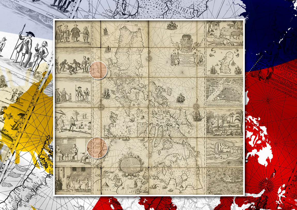
250
The South China Sea Dispute: Philippine Sovereign Rights and Jurisdiction in the West Philippine Sea