Embed Size (px)
Citation preview

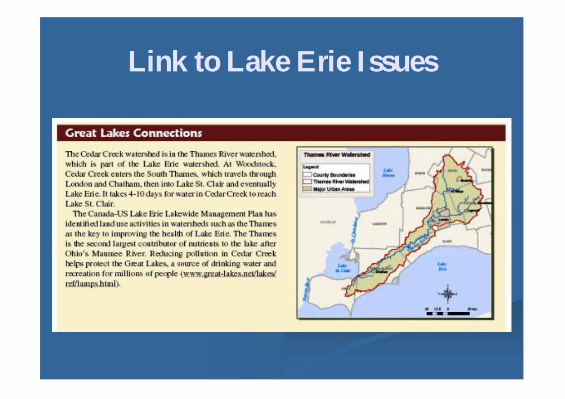
Turning Information Into Action:Turning Information Into Action:Conservation Authority Watershed
Report CardsReport Cards
Lake ErieLake Erie BinationalBinational Public Forum MeetingPublic Forum MeetingNiagara Falls, Ontario, September 10&11, 2010Niagara Falls, Ontario, September 10&11, 2010
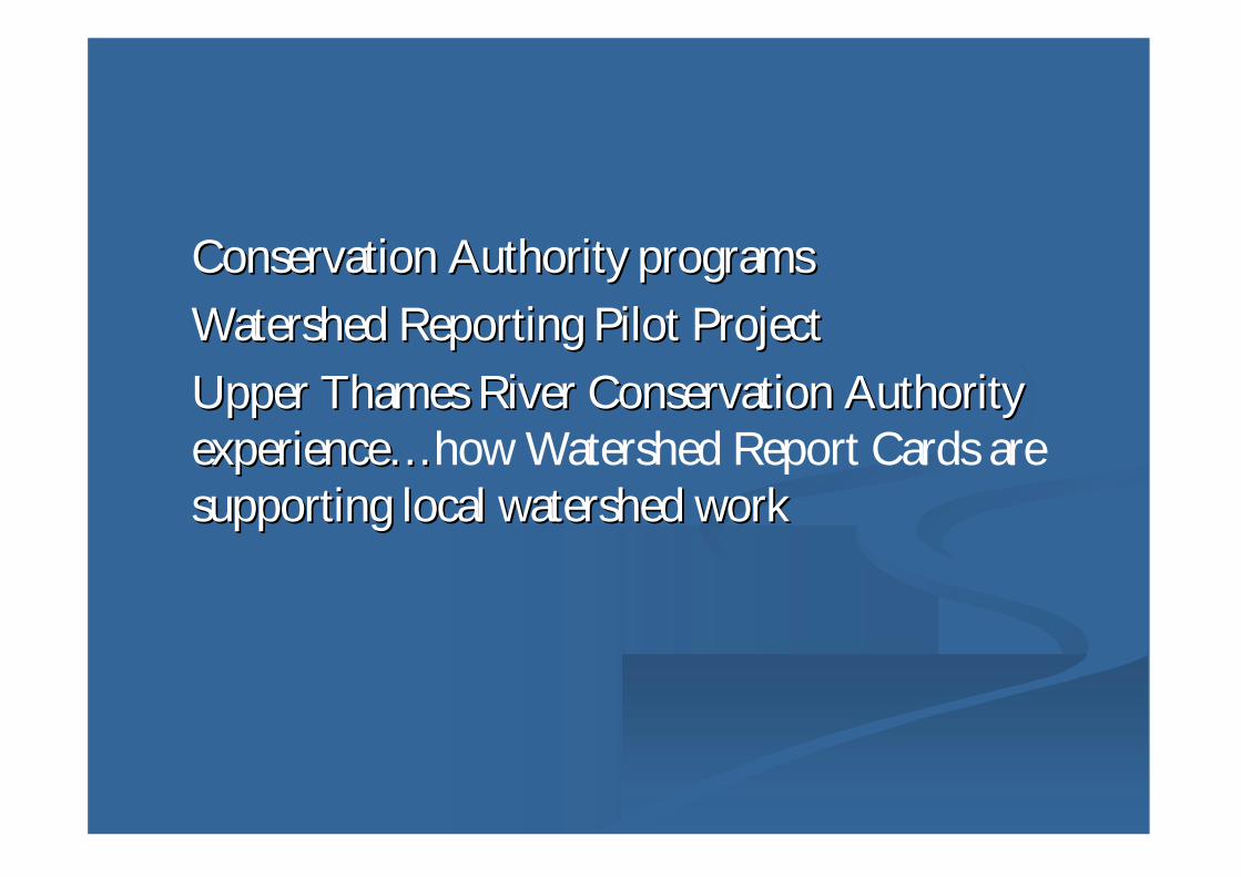
Conservation Authority programsConservation Authority programs Watershed Reporting Pilot ProjectWatershed Reporting Pilot Project Upper Thames River Conservation AuthorityUpper Thames River Conservation Authority
experienceexperience……how Watershed Report Cards aresupporting local watershed worksupporting local watershed work

Watershed-basedagency with amandate toensure theconservation ofOntario’s water,land and naturalhabitats.
Governed byBoard ofDirectorsselected byMemberMunicipalities
36 Ontario Conservation36 Ontario ConservationAuthoritiesAuthorities

Deliver LocalDeliver LocalWatershed ProgramsWatershed Programs
Flood Control Land Stewardship programs Land Use Planning and Regulation Environmental Monitoring Education and Public Involvement Natural Heritage protection
Recreation others

Watershed Planning Approach
CommunityAction
Understanding – ScienceResearch, Mapping
Plan for theWatershed
Implement the Plan
Monitor andReport

Need for Improved ReportingNeed for Improved Reporting In 2003 highly publicized issues around drinking water risks and
drought/climate issues Public demand growing for environmental information Good scientific data through established monitoring programs

Watershed Reporting Pilot ProjectProject Goal To standardize watershed reporting among
Conservation Authorities
Developed by Conservation Authorities,provincial and federal ministries, other
Uses environmental indicators to measurewatershed health
http://http://www.conservationontario.ca/prwww.conservationontario.ca/projects/watershed_pp.htmlojects/watershed_pp.html

Standardized Reporting ComponentsStandardized Reporting Components Purpose: Standardized reporting of baseline environmental data for
watershed municipalities, organizations, and public
Scale: watersheds at locally meaningful scale (average 150 sq km)
Format: Watershed Report Card for each subwatershed
Frequency: Every 5 years, starting 2007
Indicators:Long-term monitoring, responsive to change
Additional Information

Indicators and ScoringIndicators and Scoring
BenthicInvertebrates
Score
TotalPhosphorus
(mg/L)
E.coli(#/100 ml)
Point Score Grade
<5.005.00 – 5.755.76 – 6.506.51 – 7.25
>7.25
<0.030.03 – 0.100.11 – 0.170.18 – 0.24
>0.24
0 – 1011 – 100
101 – 10001001 – 10000
>10000
54321
ABCDF
Surface Water Quality
Groundwater Quality•E. coli•Nitrate + Nitrite•Chloride

Indicators and ScoringIndicators and Scoring
% ForestCover
% ForestInterior
Point Score Grade
>25.625.6 – 18.818.7 – 11.911.8 – 5.0
<5.0
>7.75.7 – 7.73.7 – 5.61.7 – 3.6
<1.7
54321
ABCDF
Forest Conditions
•Environment Canada recommendations for sustainability insouthern Ontario•GIS calculations using air photography
% ForestCover
% ForestInterior
Point Score Grade
>25.625.6 – 18.818.7 – 11.911.8 – 5.0
<5.0
>7.75.7 – 7.73.7 – 5.61.7 – 3.6
<1.7
54321
ABCDF
% ForestCover
% ForestInterior
Point Score Grade
>25.625.6 – 18.818.7 – 11.911.8 – 5.0
<5.0
>7.75.7 – 7.73.7 – 5.61.7 – 3.6
<1.7
54321
ABCDF

Local WatershedLocal WatershedScaleScale
In 2000 adopted a smallerIn 2000 adopted a smallerwatershed approach towatershed approach towatershed planning,watershed planning,monitoring, implementation,monitoring, implementation,reportingreporting
28 watersheds28 watersheds
Scale that has communityScale that has communityvaluevalue
Measure environmentalMeasure environmentalchangechange
London
Stratford
Woodstock
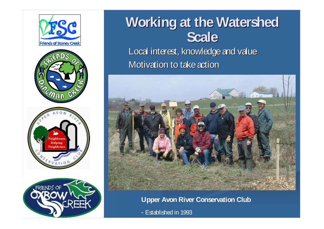
Local interest, knowledge and valueLocal interest, knowledge and value Motivation to take actionMotivation to take action
Upper Avon River Conservation Club
- Established in 1993
Working at the WatershedWorking at the WatershedScaleScale
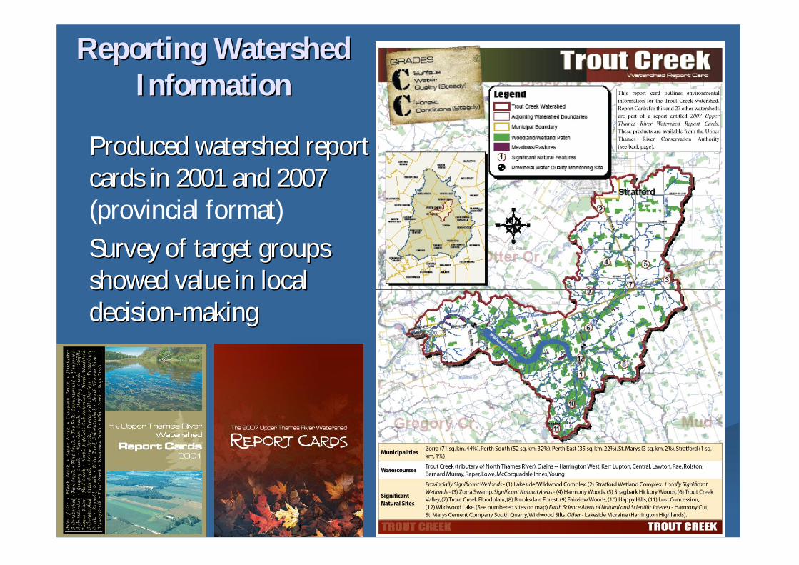
Produced watershed reportProduced watershed reportcards in 2001 and 2007cards in 2001 and 2007(provincial format)
Survey of target groupsSurvey of target groupsshowed value in localshowed value in localdecisiondecision--makingmaking
Reporting WatershedReporting WatershedInformationInformation

Surface WaterSurface WaterQuality GradesQuality Gradesby Watershedby Watershed

Watershed Features
• Population7.5% increase in watershedStoney Creek: +38% (+4500)Mud Creek: - -700)
Watershed %Agriculture
%Urban
%Forest
NorthMitchell
93 2 5
Forks 4 78 13
• Land Use
• Highly Erodible LandMiddle Thames: 21%Whirl Creek: 1%

Address increasedspills in PottersburgCreek
Protection andmanagement of ElliceSwamp, most significantnatural area in thewatershed

Tracking Progress Each conservation project isEach conservation project is
stored as a point of wherestored as a point of wherethe project was completedthe project was completedegeg. tree planting, manure. tree planting, manurestorage, erosion control,storage, erosion control,septic system improvementsseptic system improvements
Using an internal webUsing an internal webmapping application staffmapping application staffcan collect a x, y coordinatecan collect a x, y coordinateand populate a databaseand populate a database

CommunityCommunity--based Watershed Strategy:based Watershed Strategy:DingmanDingman Creek Watershed Example1. 2001 report card: ranked Dingman poorest in water quality2. Local group wanted to address problem3. Public meeting – municipalities, stakeholders, CA, etc.
5. Coordinator hired (funding)6. Detailed technical information (TAC)7. Plan developed8. Actions implemented9. 2007 report cards measure change
improves from C to B in 5 years

DingmanDingman Creek:Creek:onon--thethe--ground projects
• 29 conservation stewardship projects
• 10,000 trees, 2100 wildflowers
• 5550 students and community involved
• Dingman Creek weir removed
• Dingman Pumping Station upgrades
• Murray Marr Stormwater Managementfacility
•Dingman Creek subwatershed study andimplementation in community plans

Target WatershedsTarget Watersheds Based on the outcome of 2007Based on the outcome of 2007
watershed report cards 4watershed report cards 4communitycommunity--based watershedbased watershedprojectsprojects started in 2008started in 2008
Involving the communityInvolving the communityprovides the best strategy andprovides the best strategy andlonglong--term commitmentterm commitment
Early action…

Future DirectionsFuture Directions
Today 25 Conservation Authorities have watershed report cardsToday 25 Conservation Authorities have watershed report cardsusing standardized indicatorsusing standardized indicators
Conservation Ontario effort to review indicators and guidelinesConservation Ontario effort to review indicators and guidelines
2012 is the next target for watershed report cards2012 is the next target for watershed report cards
Thank you!Thank you!
KarenKaren MaaskantMaaskantUpper Thames River Conservation AuthorityUpper Thames River Conservation Authority
London, OntarioLondon, Ontariowww.thamesriver.on.cawww.thamesriver.on.ca
Conservation OntarioConservation Ontariowww.conservationontario.cawww.conservationontario.ca