Embed Size (px)
Citation preview
NSW Seamless Geology Project: Progress to date and what’s next?
Glen Phillips Regional Mapping
Contact: [email protected]

Talk Content
1. Overview and Aims of the Seamless Geology Project
3. Some novel applications
4. What’s next?
2. Building the Geodatabase & Data management
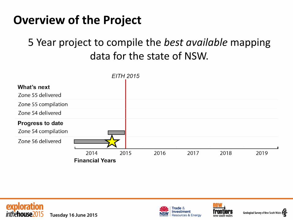
Overview of the Project
5 Year project to compile the best available mapping data for the state of NSW.

http://www.resourcesandenergy.nsw.gov.au/miners-and-explorers/geoscience-information/products-and-data/geoscience-data-resources/geoscience-data-packages/data/seamless-geology-data-package-zone-56 Easier to GOOGLE: GSNSW Seamless Geology

Overview of the Project
5 Year project to compile the best available mapping data for the state of NSW.
*Project is ahead of schedule*
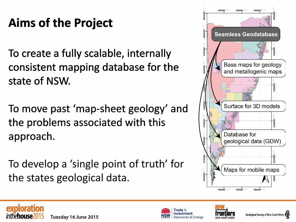
Aims of the Project To create a fully scalable, internally consistent mapping database for the state of NSW.
Aims of the Project To create a fully scalable, internally consistent mapping database for the state of NSW. To move past ‘map-sheet geology’ and the problems associated with this approach. To develop a ‘single point of truth’ for the states geological data.
Aims of the Project To create a fully scalable, internally consistent mapping database for the state of NSW. To move past ‘map-sheet geology’ and the problems associated with this approach.
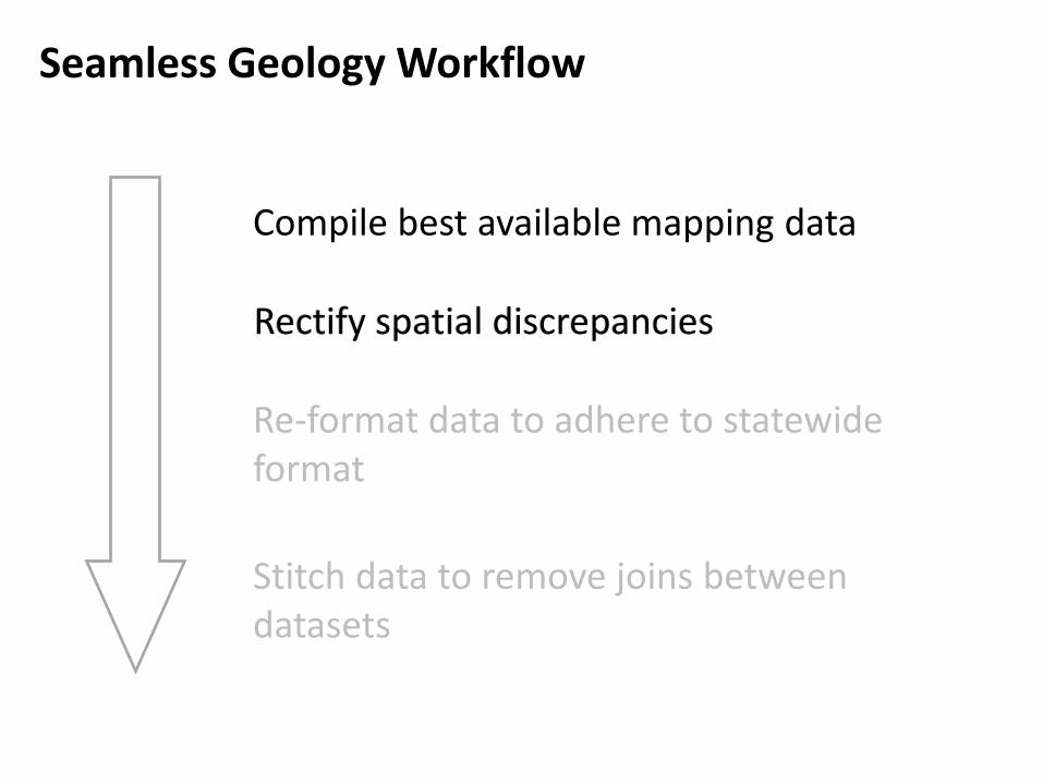
Compile best available mapping data
Rectify spatial discrepancies
Re-format data to adhere to statewide format
Stitch data to remove joins between datasets
Seamless Geology Workflow
Rectify spatial discrepancies

Improving the spatial accuracy of our data
Old map data on modern base map
• As data is compiled into the Seamless Geology format, spatial accuracy is checked against modern base maps.
• Vector data often shows considerable discrepancies due to the older base data that the original geology was compiled on.
• Vector data is spatially rectified before bringing into the Seamless Geodatabase.
Seamless Geology Workflow

Compile best available mapping data
Rectify spatial discrepancies
Re-format data to adhere to statewide format
Stitch data to remove joins between datasets
Seamless Geology Workflow
Rectify spatial discrepancies
Re-format data to adhere to statewide format

Most importantly, assign data a ‘layer’
Seamless Geology Workflow

Compile best available mapping data
Rectify spatial discrepancies
Re-format data to adhere to statewide format
Stitch data to remove joins between datasets
Seamless Geology Workflow
Rectify spatial discrepancies
Re-format data to adhere to statewide format
Stitch data to remove joins between datasets

Seamless Geology Workflow
1. Connect line mismatches 2. Harmonize stratigraphic
units 3. Interpret undercover for
solid basement maps

Attribution is extremely important: • This is particularly the case for solid geology maps, as
linework comprises a compilation of mapped geology and geophysical interpretation.
• All line data is attributed, so users can carry out QA/QC on the data.
• Data lineage is also preserved so users can return to the source.
Data management
Attribution is extremely important: • This is particularly the case for solid geology maps, as
linework comprises a compilation of mapped geology and geophysical interpretation.
• All line data is attributed, so users can carry out QA/QC on the data.
• Data lineage is also preserved so users can return to the source.

Attribution example 1
Attribute data includes: • Line last edited by • Data capture method • Capture scale • Geological feature and confidence • Description • Structure name • The source of the data

Attribution example 2 - QA/QC by simple query
Query for ‘faults: position accurate’

Applications: Rock Unit attributes
Unit Name
Rock Type
Igneous type i.e. S-, I-, A-type
Age information

Applications: Rock Units by a simple query All data
Query – granite; S-type Export S-type granites

~ 70, 000 points of structural data across the state.
Includes bedding, facing information, foliation & lineation.
Applications: Structural Data

Plot structural data using third party software (Stereonet by Allmendinger)
Plot a sub-set of the data to analyse structural geometry.
Applications
Bedding data isolated from database by searching data-type attribute
1% area contour plot of poles to bedding: girdle
defines fold profile and
calculated plunge

What’s next?
Business as usual
1. Seamless Geodatabase for Zone 54.
To also include: 1. Fact map of Broken Hill
Domain based on 25 000 map series.
2. Seamless Geology of the Curnamona Province (with GSSA).

Outcrop Geology Map
Solid Geology map gives false perception of the amount of outcrop
What’s next?
Southern Clarence Moreton Basin

FieldObs CSIRO Soils map Outcrop Map
What’s next?
Outcrop Geology Map

Solid Geology map gives false perception of the amount of outcrop
What’s next?
Outcrop Geology Map Outcrop geology map provides an overview of where rocks are most likely to be exposed

What’s next? Seamless – 3D integration

What’s next?
Stratigraphic Unit Tables

What’s next?
Seamless Geology in the GSNSW Map
Viewer
Map Viewer currently shows
1:1 500 000 geology
Contact: [email protected] http://www.geoscience.nsw.gov.au/phonemaps/
Will be updated with Seamless Geology
when available


![L’ARENGARIO STUDIO BIBLIOGRAFICO...ANDERSON Laurie [Laura Phillips Ander-son] (Glen Ellyn, Illinois 1947) Big Science New York, Warner, 1982, 31x31 cm, copertina illu-strata con](https://img.pdfslide.net/doc/110x75/614204072035ff3bc76266b3/laarengario-studio-anderson-laurie-laura-phillips-ander-son-glen-ellyn.jpg)