Embed Size (px)
Citation preview
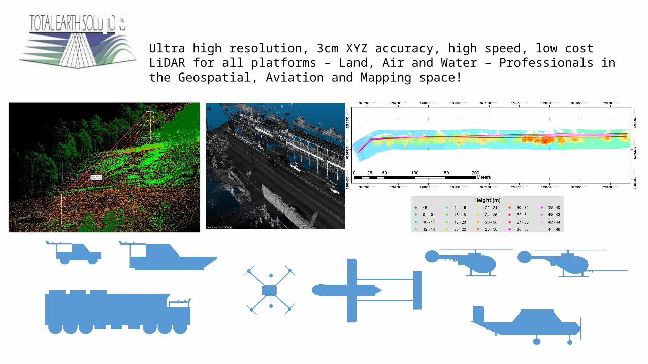
TESScan 3200 – LiDAR Mapping SystemUltra high resolution, 3cm XYZ accuracy, high speed, low cost LiDAR for all platforms – Land, Air and Water – Professionals in the Geospatial, Aviation and Mapping space!
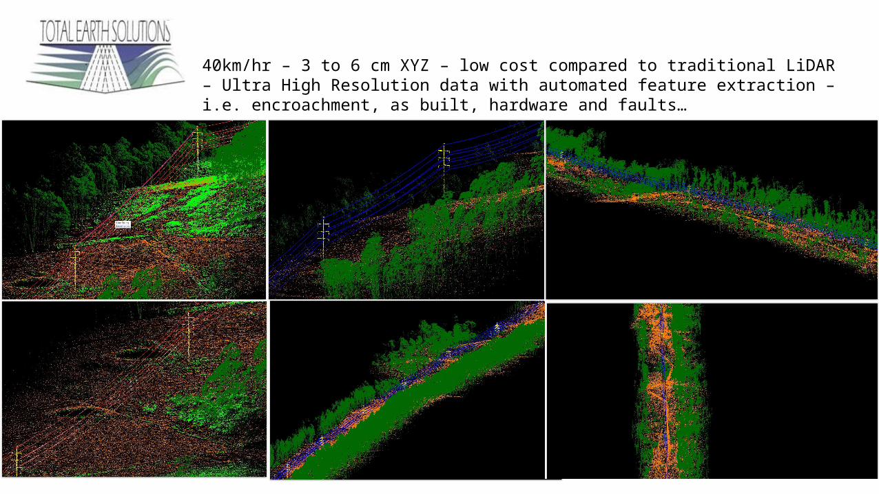
TESScan 3200 – Powerline Mapping40km/hr – 3 to 6 cm XYZ – low cost compared to traditional LiDAR – Ultra High Resolution data with automated feature extraction – i.e. encroachment, as built, hardware and faults…
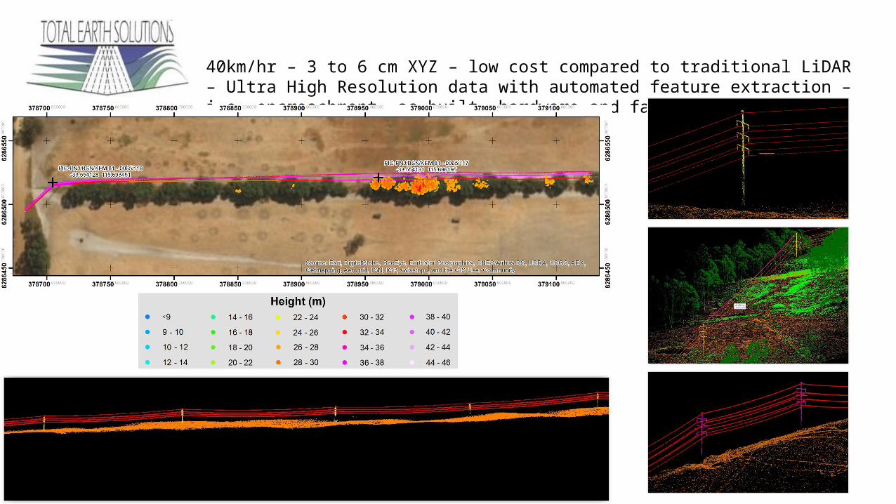
TESScan 3200 – Powerline Mapping40km/hr – 3 to 6 cm XYZ – low cost compared to traditional LiDAR – Ultra High Resolution data with automated feature extraction – i.e. encroachment, as built, hardware and faults…
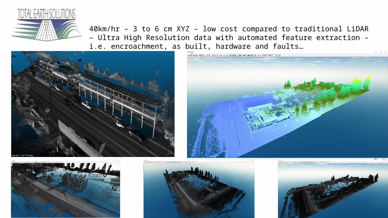
TESScan 3200 – Street Mapping40km/hr – 3 to 6 cm XYZ – low cost compared to traditional LiDAR – Ultra High Resolution data with automated feature extraction – i.e. encroachment, as built, hardware and faults…
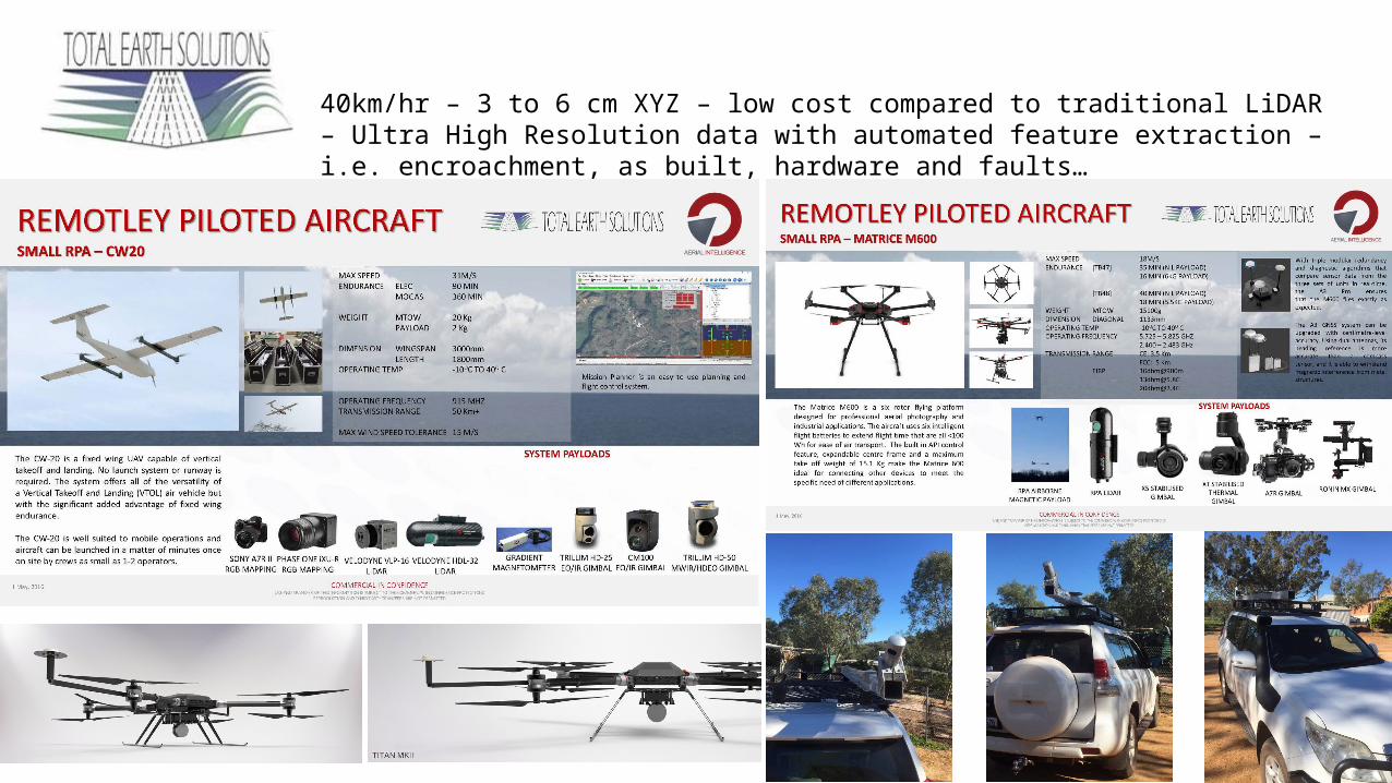
TESScan 3200 – Capture Platforms40km/hr – 3 to 6 cm XYZ – low cost compared to traditional LiDAR – Ultra High Resolution data with automated feature extraction – i.e. encroachment, as built, hardware and faults…