Embed Size (px)
Citation preview
collanasentierid’autore 44
ISBN: 978-88-97299-45-5
9 788897 299455 > € 23,00 idea Montagnaeditoria e alpinismo
Ferrate dell’Alto GardaKlettersteige am GardaseeVia Ferratas in Lake Garda
Ferr
ate
dell’
Alto
Gar
daid
ea M
on
tag
na
edit
ori
a e
alp
inis
mo
Fabio Della CasaNato a Bassano del Grappa (VI) nel 1977, vive a Limena (PD).Di professione tecnico antincendio, si è appassionato in età adulta alla montagna alla quale dedica gran parte del suo tempo libero nei week-end.Ha scritto minuziosamente diversi diari delle sue ascensioni in parete, consolidando la passione per la scrittura di itinerari alpinistici. Scalatore da un decennio, ha ripetuto buona parte delle vie classiche nelle Dolomiti, compiendo anche qualche prima salita a Punta della Croce sui Colli Euganei e sulla Torre di Pietramurata in Valle del Sarca.Istruttore regionale di Alpinismo del Club Alpino Italiano dal 2011, si dedica con passione alla Scuola di Alpinismo Franco Piovan del CAI di Padova, dove si è formato e continua a farlo anche attraverso l’insegnamento.
Fabio D
ella
Casa
9
l Indice / Inhalt / Contents
• PREFAZIONE / VORWORT / PREFACE 4• INTRODUZIONE / EINLEITUNG / INTRODUCTION 6• L’ALTO GARDA / DER NORDEN DES GARDASEE/ UPPER LAKE GARDA 10 Inquadramento geografico / Geografische Lage / Geographic situation 10 Geologia /Geologie / Geology 14 Aspetti ecologici e naturalistici / Naturwissenschaftliche und ökologische Aspekte / 16 Ecological and Naturalistic Aspects • BIBLIOGRAFIA 22• 10 REGOLE E CONSIGLI / 10 REGELN UND TIPPS / 10 RULES AND TIPS 24• SCALA DELLE DIFFICOLTÀ / SCHWIERIGKEITSGRADE / GRADING SYSTEM 26• INTERVISTA AL SOCCORSO ALPINO DI RIVA DEL GARDA / 30 INTERVIEW MIT DER BERGRETTUNG VON RIVA / MOUNTAIN RESCUE INTERVIEW• ARCO DI TRENTO 34• RINGRAZIAMENTI 34
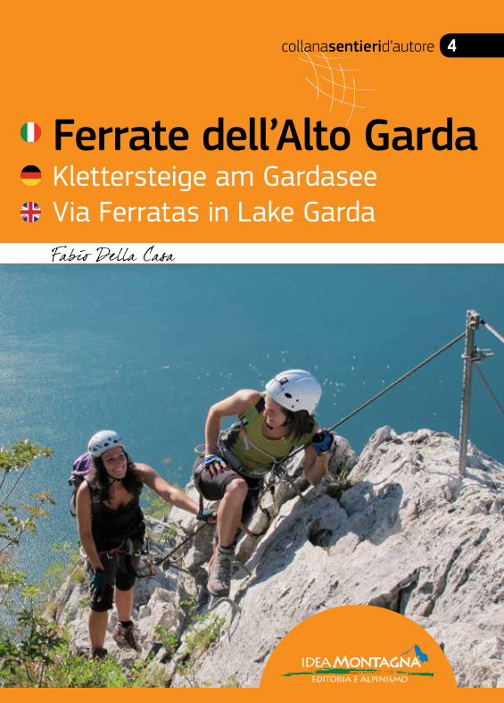
001a • Spigolo della Bandiera - Monte Spino 37001b • Ferrata Ernesto-Franco - Monte Spino 43002 • Il Tracciolino - Percorso Alpinistico al Dos de Cala 51003 • Sentiero Attrezzato Mora-Pellegrini - Monte Corno 61004 • Ferrata Susatti e Cima Rocca - Cima Capi e Cima Rocca 67005 • Ferrata dell’Amicizia o del Centenario - La Rocchetta 81006 • Via del 92° Congresso - Monte Baone 91007 • Ferrata del Colodri - Monte Colodri 97008 • Sentiero Attrezzato degli Scaloni - Coste dell’Anglone 105009 • Ferrata Rio Sallagoni - Castel Drena 113010 • Percorso Alpinistico delle Lastiele - Coste Massampia 121011 • Ferrata Che Guevara - Monte Casale 127012 • Sentiero Artpinistico - Croz delle Niere 137013 • Ferrata Rino Pisetta - Monte Garzolet 143014 • Ferrata Burrone Giovannelli - Cime di Vigo 155015 • Ferrata Favogna - Cime di Vigo 165016 • Ferrata Rio Secco - Monti di Cembra 173017 • Ferrata Giordano Bertotti - Monte Chegul 181018 • Sentiero Attrezzato delle Stel - Coste di Gazzo 187019 • Ferrata Giulio Segata - Dosso d’Abramo 193020 • Ferrata del Somator - Monte Biaena 203021 • Ferrata Monte Albano 209022 • Sentiero Attrezzato delle Vipere - Cima Corna Piana 219023 • Ferrata Gerardo Sega - Monte Coalaz 225024 • Ferrata delle Taccole - Coal Santo 233
INDICE / INHALT / CONTENTS
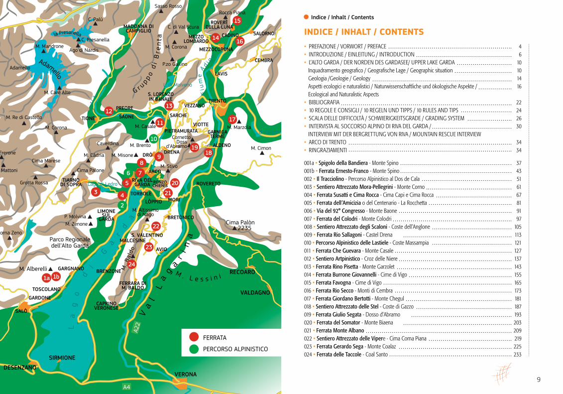
M. Corona
Parco Regionaledell’Alto Garda
Adamello
M. Frerone
M. Mattoni
Grotta Rossa
M. Alberelli
Corna Zeno
P. MolvinaM. Zenone
Cima Marese
Cima Palone
Lago di Ledro
M. Càdria
M. Altissimodi Nago
Caverdina
M. Casale
M. Brento
M. Misone
M. Stivo
L. di Caldonazzo
L. di Molveno
M. Marzola
CornettoDoss
d’Abramo M. Cimon
Cima Palòn2235
M. Re di Castello
M. Mandrone
M. Carè Alto
Ago di Nardis
C. Presanella
C. Palù
Sasso Rosso
C. di Val Scura
Rocca Piana
M. Corona
P.zo Gallino
TRENTO
RIVA DELGARDA RONZO
CHIENIS
ARCO
TORBOLEMORILÒPPIO
BRETÒNICO
S. VALENTINO
TIARNODI SOPRA
DRÒ DRENA
GARDONE
GARGNANO
TOSCOLANO
SALÒ
SIRMIONE
DESENZANOVERONA
VEZZANO
PIETRAMURATA
PREORE
S. LORENZOIN BANALE
SAONE
ALDENO
SARCHETIONE
MEZZOLOMBARDO
MEZZOCORONA
CADINO
CEMBRA
LAVIS
SALORNO
ROVERÈDELLA LUNA
ROVERETO
MALCESINE
AVIO
BRENZONE
CAPRINOVERONESE
FERRARA DIM. BALDO
LIMONESUL
GARDA
RECOARO
VALDAGNO
MADONNA DICAMPIGLIO
Adamello
la Presanella
G r u p p o d
i B
r en
ta
M . L e s s i n i
La
go
d
i
Ga
rd
aM
. Bal
do
Va
l
La
g
a
ri
na
VIOTTEGARNIGATERME
Fiu
me
A
d i ge
Sarc
a
A4
A22
10
22
21
1b
12
3
2
1a
23
18
24
20
11
4
5
6
13
98
7
19
15
1614
17
FERRATA
PERCORSO ALPINISTICO
112 113
Sentieri d’autore l Ferrate dell’Alto Garda
Höhenunterschied: 210 m
HöhenunterschiedKlettersteig: 170 m
Schwierigkeit: I 3
Exposition: West
Zeiten: 2 h
Total ascent: 210 m
Total ascent on ferrata: 170 m
Grade: I 3
Aspect: West
Duration: 2h
009
Dislivello tot. salita: 210 m
Dislivello in ferrata: 170 m
Difficoltà: I 3
Esposizione: ovest
Tempi: 2 h
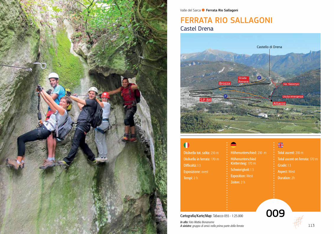
FERRATA RIO SALLAGONI Castel Drena
Attacco
Brozza
S.P. 84
Strada Romana
Uscita emergenza
Var. Nassiriya
P
Castello di Drena
P
Valle del Sarca l Ferrata Rio Sallagoni
Cartografia/Karte/Map: Tabacco 055 - 1:25.000
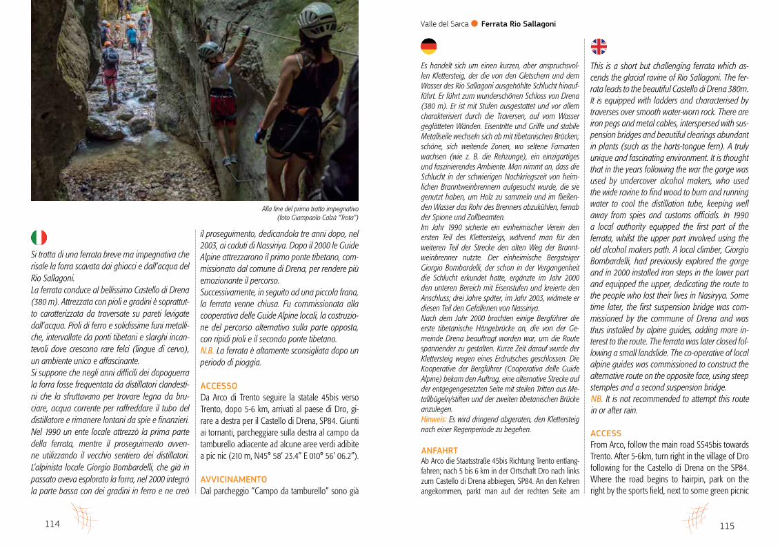
In alto: foto Mattia BonanomeA sinistra: gruppo di amici nella prima parte della ferrata
114 115
Sentieri d’autore l Ferrate dell’Alto Garda
Es handelt sich um einen kurzen, aber anspruchsvol-len Klettersteig, der die von den Gletschern und dem Wasser des Rio Sallagoni ausgehöhlte Schlucht hinauf-führt. Er führt zum wunderschönen Schloss von Drena (380 m). Er ist mit Stufen ausgestattet und vor allem charakterisiert durch die Traversen, auf vom Wasser geglätteten Wänden. Eisentritte und Griffe und stabile Metallseile wechseln sich ab mit tibetanischen Brücken; schöne, sich weitende Zonen, wo seltene Farnarten wachsen (wie z. B. die Rehzunge), ein einzigartiges und faszinierendes Ambiente. Man nimmt an, dass die Schlucht in der schwierigen Nachkriegszeit von heim-lichen Branntweinbrennern aufgesucht wurde, die sie genutzt haben, um Holz zu sammeln und im fließen-den Wasser das Rohr des Brenners abzukühlen, fernab der Spione und Zollbeamten. Im Jahr 1990 sicherte ein einheimischer Verein den ersten Teil des Klettersteigs, während man für den weiteren Teil der Strecke den alten Weg der Brannt-weinbrenner nutzte. Der einheimische Bergsteiger Giorgio Bombardelli, der schon in der Vergangenheit die Schlucht erkundet hatte, ergänzte im Jahr 2000 den unteren Bereich mit Eisenstufen und kreierte den Anschluss; drei Jahre später, im Jahr 2003, widmete er diesen Teil den Gefallenen von Nassiriya.Nach dem Jahr 2000 brachten einige Bergführer die erste tibetanische Hängebrücke an, die von der Ge-meinde Drena beauftragt worden war, um die Route spannender zu gestalten. Kurze Zeit darauf wurde der Klettersteig wegen eines Erdrutsches geschlossen. Die Kooperative der Bergführer (Cooperativa delle Guide Alpine) bekam den Auftrag, eine alternative Strecke auf der entgegengesetzten Seite mit steilen Tritten aus Me-tallbügeln/stiften und der zweiten tibetanischen Brücke anzulegen. Hinweis: Es wird dringend abgeraten, den Klettersteig nach einer Regenperiode zu begehen.
ANFAHRTAb Arco die Staatsstraße 45bis Richtung Trento entlang-fahren; nach 5 bis 6 km in der Ortschaft Dro nach links zum Castello di Drena abbiegen, SP84. An den Kehren angekommen, parkt man auf der rechten Seite am
This is a short but challenging ferrata which as-cends the glacial ravine of Rio Sallagoni. The fer-rata leads to the beautiful Castello di Drena 380m. It is equipped with ladders and characterised by traverses over smooth water-worn rock. There are iron pegs and metal cables, interspersed with sus-pension bridges and beautiful clearings abundant in plants (such as the harts-tongue fern). A truly unique and fascinating environment. It is thought that in the years following the war the gorge was used by undercover alcohol makers, who used the wide ravine to find wood to burn and running water to cool the distillation tube, keeping well away from spies and customs officials. In 1990 a local authority equipped the first part of the ferrata, whilst the upper part involved using the old alcohol makers path. A local climber, Giorgio Bombardelli, had previously explored the gorge and in 2000 installed iron steps in the lower part and equipped the upper, dedicating the route to the people who lost their lives in Nasiryya. Some time later, the first suspension bridge was com-missioned by the commune of Drena and was thus installed by alpine guides, adding more in-terest to the route. The ferrata was later closed fol-lowing a small landslide. The co-operative of local alpine guides was commissioned to construct the alternative route on the opposite face, using steep stemples and a second suspension bridge.NB. It is not recommended to attempt this route in or after rain.
ACCESSFrom Arco, follow the main road SS45bis towards Trento. After 5-6km, turn right in the village of Dro following for the Castello di Drena on the SP84. Where the road begins to hairpin, park on the right by the sports field, next to some green picnic
Si tratta di una ferrata breve ma impegnativa che risale la forra scavata dai ghiacci e dall’acqua del Rio Sallagoni.La ferrata conduce al bellissimo Castello di Drena (380 m). Attrezzata con pioli e gradini è soprattut-to caratterizzata da traversate su pareti levigate dall’acqua. Pioli di ferro e solidissime funi metalli-che, intervallate da ponti tibetani e slarghi incan-tevoli dove crescono rare felci (lingue di cervo), un ambiente unico e affascinante.Si suppone che negli anni difficili dei dopoguerra la forra fosse frequentata da distillatori clandesti-ni che la sfruttavano per trovare legna da bru-ciare, acqua corrente per raffreddare il tubo del distillatore e rimanere lontani da spie e finanzieri.Nel 1990 un ente locale attrezzò la prima parte della ferrata, mentre il proseguimento avven-ne utilizzando il vecchio sentiero dei distillatori. L’alpinista locale Giorgio Bombardelli, che già in passato aveva esplorato la forra, nel 2000 integrò la parte bassa con dei gradini in ferro e ne creò
il proseguimento, dedicandola tre anni dopo, nel 2003, ai caduti di Nassiriya. Dopo il 2000 le Guide Alpine attrezzarono il primo ponte tibetano, com-missionato dal comune di Drena, per rendere più emozionante il percorso.Successivamente, in seguito ad una piccola frana, la ferrata venne chiusa. Fu commissionata alla cooperativa delle Guide Alpine locali, la costruzio-ne del percorso alternativo sulla parte opposta, con ripidi pioli e il secondo ponte tibetano. N.B. La ferrata è altamente sconsigliata dopo un periodo di pioggia.
ACCESSODa Arco di Trento seguire la statale 45bis verso Trento, dopo 5-6 km, arrivati al paese di Dro, gi-rare a destra per il Castello di Drena, SP84. Giunti ai tornanti, parcheggiare sulla destra al campo da tamburello adiacente ad alcune aree verdi adibite a pic nic (210 m, N45° 58’ 23.4” E 010° 56’ 06.2”).
AVVICINAMENTODal parcheggio ”Campo da tamburello” sono già
Valle del Sarca l Ferrata Rio Sallagoni
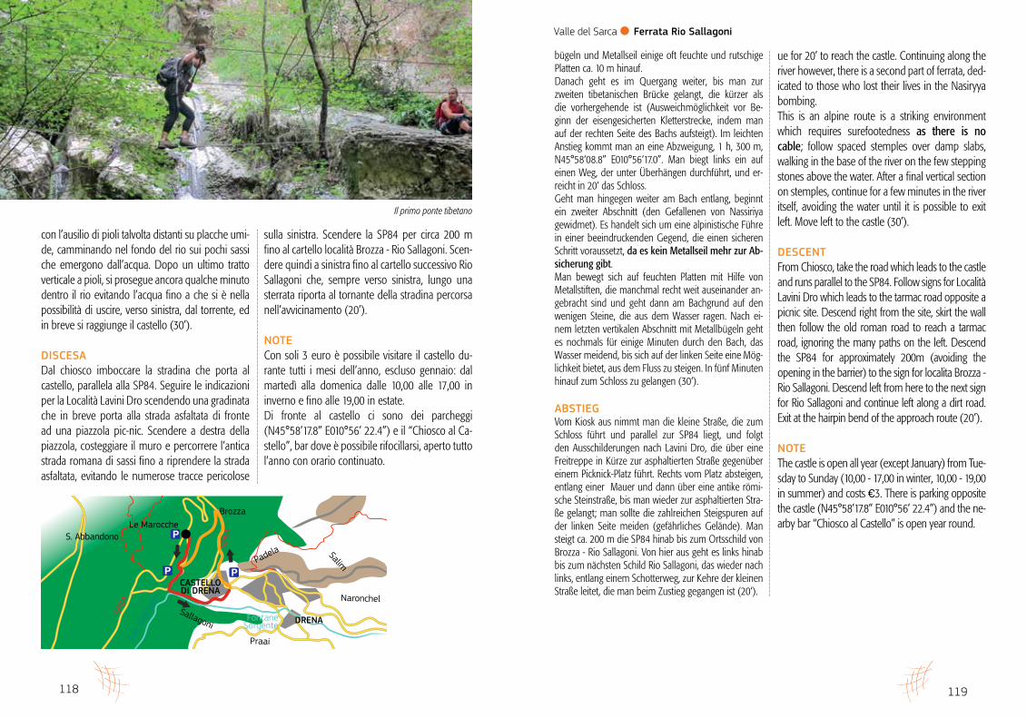
Alla fine del primo tratto impegnativo(foto Giampaolo Calzà “Trota”)
117
Sportplatz (ein Tamburello-Platz), der an einige Grünflä-chen mit Picknick-Tischen grenzt. 210 m, N45°58‘23.4” E010°56‘06.2”.
ZUSTIEGAm Parkplatz ”Campo da tamburello” gibt es Ausschil-derungen zum Klettersteig “Ferrata Sallagoni” und sie leiten rechts auf der Schotterstraße zwischen Oli-ven- und Feigenbäumen nach einem leichten Abstieg in fünf Minuten zum Einstieg. 170 m, N45°58‘12.2” E010°56‘03.9” (10‘).
WEGVERLAUFDer Steig beginnt auf der linken Seite des Bachs, auf vom Wasser geglätteten Platten. Die Metallbügel verlau-fen schräg von links nach rechts und werden zusätzlich von einem Metallseil begleitet, an dem man sich sichern kann. Die anfänglich senkrechte und dann leicht über-hängende Strecke erfordert auf jeden Fall große Vorsicht und einige Schritte. Nach dem senkrechten Anfangsstück verläuft der Klet-tersteig vor allem quer, in konstanter Exponiertheit etwa 10 m über dem Wasser. Nach nur 10’ vom Einstieg gibt es einen Notausstieg, nach einer Passage unterhalb eines eingeklemmten Felsblocks (wenige Meter auf Metallbügeln hinauf bis zum gleich oberhalb liegenden Wald, wo man auf der linken Seite eine Spur findet, die in einer Minute hinab zum Einstieg führt).Der Quergang verlagert sich von der linken zur rechten Wand und führt über einige dutzend Meter weiter, bis an eine weite, breitere Stelle am Bach. Das bezaubern-de Gelände, reich an Pflanzen und “Rehzungen”, und die zahlreichen dekorativen Steinmännchen geleiten zu einem weiteren beeindruckenden Abschnitt der Tour, einer ca. 15 m langen tibetanischen Brücke (man kann sie meiden indem man die rechte Seite des Canyon auf Stufen hochsteigt). Dieser Abschnitt macht es möglich, auf die rechte Seite des rio Sallagoni zu queren. Jetzt steigt man an Metall-bügeln hinauf und kommt an zwei Engstellen vorbei, die von zwei riesigen Steinen gebildet werden, die par-allel zur Wand liegen. Die Schlucht wird erneut breiter, und inmitten von gro-ßen Felsblöcken und Pflanzen gelangt man zum zwei-ten schwierigen Teil des Klettersteigs. Auf der linken Seite steigt man jetzt mit Hilfe von Metall-
areas. 210m, N45°58’23.4” E010°56’06.2”.
APPROACHFrom the “Campo da tamburello” car-park, pick up signs for the “Ferrata Sallagoni” which lead right on a dirt road. Descend slightly through olive vines and fig trees for 5 minutes to reach the start of the route. 170m, N45°58’12.2” E010°56’03.9” (10’).
ROUTEBegin on the left side of the river on smooth wa-ter-worn slabs. Follow the stemples from left to right following the wire. This section is initially ver-tical before becoming slightly overhanging, requir-ing concentration and some quite reachy moves. After the first vertical section the ferrata traverses ten metres above the water. There is an escape route after ten minutes, after a move through a chockstone (a stemple ladder leads to the woods above then a path descends back to the start of the route). Cross onto the right wall and climb a few dozen metres to a clearing by the river. This enchanting spot is rich is flora and the rare harts-tongue fern. Follow decorative cairns to another enjoyable section. Cross a 15m suspension bridge (avoidable by as-cending the right side of the canyon). This leads onto the right side of the Rio Sallagoni. Climb stem-ples, passing through two narrow sections formed by huge boulders parallel to the face. The gorge widens again and continue through large boulders and vegetation to reach the second difficult part of the route. Climb wet and slippery slabs on the left on stem-ples and wire for a few metres. Then traverse to the second, shorter suspended bridge (avoidable by as-cending right of the river). Ascend slightly to reach a fork. 1 h, 300m, N45°58’08.8” E010°56’17.0”. Go left following a path below overhangs and contin-
116
Sentieri d’autore l Ferrate dell’Alto Garda
evidenti i cartelli per “Ferrata Sallagoni”. A destra la strada sterrata tra ulivi e fichi porta, dopo una leggera discesa, in cinque minuti all’attacco 170 m, N45°58’12.2” E010°56’03.9” (10’).
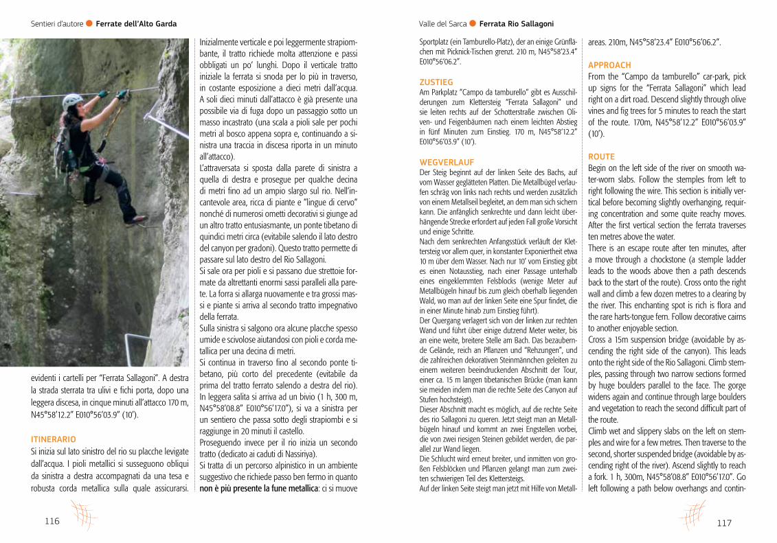
ITINERARIOSi inizia sul lato sinistro del rio su placche levigate dall’acqua. I pioli metallici si susseguono obliqui da sinistra a destra accompagnati da una tesa e robusta corda metallica sulla quale assicurarsi.
Inizialmente verticale e poi leggermente strapiom-bante, il tratto richiede molta attenzione e passi obbligati un po’ lunghi. Dopo il verticale tratto iniziale la ferrata si snoda per lo più in traverso, in costante esposizione a dieci metri dall’acqua. A soli dieci minuti dall’attacco è già presente una possibile via di fuga dopo un passaggio sotto un masso incastrato (una scala a pioli sale per pochi metri al bosco appena sopra e, continuando a si-nistra una traccia in discesa riporta in un minuto all’attacco). L’attraversata si sposta dalla parete di sinistra a quella di destra e prosegue per qualche decina di metri fino ad un ampio slargo sul rio. Nell’in-cantevole area, ricca di piante e ”lingue di cervo” nonché di numerosi ometti decorativi si giunge ad un altro tratto entusiasmante, un ponte tibetano di quindici metri circa (evitabile salendo il lato destro del canyon per gradoni). Questo tratto permette di passare sul lato destro del Rio Sallagoni. Si sale ora per pioli e si passano due strettoie for-mate da altrettanti enormi sassi paralleli alla pare-te. La forra si allarga nuovamente e tra grossi mas-si e piante si arriva al secondo tratto impegnativo della ferrata.Sulla sinistra si salgono ora alcune placche spesso umide e scivolose aiutandosi con pioli e corda me-tallica per una decina di metri. Si continua in traverso fino al secondo ponte ti-betano, più corto del precedente (evitabile da prima del tratto ferrato salendo a destra del rio). In leggera salita si arriva ad un bivio (1 h, 300 m, N45°58’08.8” E010°56’17.0”), si va a sinistra per un sentiero che passa sotto degli strapiombi e si raggiunge in 20 minuti il castello. Proseguendo invece per il rio inizia un secondo tratto (dedicato ai caduti di Nassiriya). Si tratta di un percorso alpinistico in un ambiente suggestivo che richiede passo ben fermo in quanto non è più presente la fune metallica: ci si muove
Valle del Sarca l Ferrata Rio Sallagoni
119
bügeln und Metallseil einige oft feuchte und rutschige Platten ca. 10 m hinauf. Danach geht es im Quergang weiter, bis man zur zweiten tibetanischen Brücke gelangt, die kürzer als die vorhergehende ist (Ausweichmöglichkeit vor Be-ginn der eisengesicherten Kletterstrecke, indem man auf der rechten Seite des Bachs aufsteigt). Im leichten Anstieg kommt man an eine Abzweigung, 1 h, 300 m, N45°58‘08.8” E010°56‘17.0”. Man biegt links ein auf einen Weg, der unter Überhängen durchführt, und er-reicht in 20‘ das Schloss. Geht man hingegen weiter am Bach entlang, beginnt ein zweiter Abschnitt (den Gefallenen von Nassiriya gewidmet). Es handelt sich um eine alpinistische Führe in einer beeindruckenden Gegend, die einen sicheren Schritt voraussetzt, da es kein Metallseil mehr zur Ab-sicherung gibt. Man bewegt sich auf feuchten Platten mit Hilfe von Metallstiften, die manchmal recht weit auseinander an-gebracht sind und geht dann am Bachgrund auf den wenigen Steine, die aus dem Wasser ragen. Nach ei-nem letzten vertikalen Abschnitt mit Metallbügeln geht es nochmals für einige Minuten durch den Bach, das Wasser meidend, bis sich auf der linken Seite eine Mög-lichkeit bietet, aus dem Fluss zu steigen. In fünf Minuten hinauf zum Schloss zu gelangen (30‘).
ABSTIEGVom Kiosk aus nimmt man die kleine Straße, die zum Schloss führt und parallel zur SP84 liegt, und folgt den Ausschilderungen nach Lavini Dro, die über eine Freitreppe in Kürze zur asphaltierten Straße gegenüber einem Picknick-Platz führt. Rechts vom Platz absteigen, entlang einer Mauer und dann über eine antike römi-sche Steinstraße, bis man wieder zur asphaltierten Stra-ße gelangt; man sollte die zahlreichen Steigspuren auf der linken Seite meiden (gefährliches Gelände). Man steigt ca. 200 m die SP84 hinab bis zum Ortsschild von Brozza - Rio Sallagoni. Von hier aus geht es links hinab bis zum nächsten Schild Rio Sallagoni, das wieder nach links, entlang einem Schotterweg, zur Kehre der kleinen Straße leitet, die man beim Zustieg gegangen ist (20‘).
ue for 20’ to reach the castle. Continuing along the river however, there is a second part of ferrata, ded-icated to those who lost their lives in the Nasiryya bombing. This is an alpine route is a striking environment which requires surefootedness as there is no cable; follow spaced stemples over damp slabs, walking in the base of the river on the few stepping stones above the water. After a final vertical section on stemples, continue for a few minutes in the river itself, avoiding the water until it is possible to exit left. Move left to the castle (30’).
DESCENTFrom Chiosco, take the road which leads to the castle and runs parallel to the SP84. Follow signs for Località Lavini Dro which leads to the tarmac road opposite a picnic site. Descend right from the site, skirt the wall then follow the old roman road to reach a tarmac road, ignoring the many paths on the left. Descend the SP84 for approximately 200m (avoiding the opening in the barrier) to the sign for localita Brozza - Rio Sallagoni. Descend left from here to the next sign for Rio Sallagoni and continue left along a dirt road. Exit at the hairpin bend of the approach route (20’).
NOTEThe castle is open all year (except January) from Tue-sday to Sunday (10,00 - 17,00 in winter, 10,00 - 19,00 in summer) and costs €3. There is parking opposite the castle (N45°58’17.8” E010°56’ 22.4”) and the ne-arby bar “Chiosco al Castello” is open year round.
118
Sentieri d’autore l Ferrate dell’Alto Garda
con l’ausilio di pioli talvolta distanti su placche umi-de, camminando nel fondo del rio sui pochi sassi che emergono dall’acqua. Dopo un ultimo tratto verticale a pioli, si prosegue ancora qualche minuto dentro il rio evitando l’acqua fino a che si è nella possibilità di uscire, verso sinistra, dal torrente, ed in breve si raggiunge il castello (30’).
DISCESADal chiosco imboccare la stradina che porta al castello, parallela alla SP84. Seguire le indicazioni per la Località Lavini Dro scendendo una gradinata che in breve porta alla strada asfaltata di fronte ad una piazzola pic-nic. Scendere a destra della piazzola, costeggiare il muro e percorrere l’antica strada romana di sassi fino a riprendere la strada asfaltata, evitando le numerose tracce pericolose
sulla sinistra. Scendere la SP84 per circa 200 m fino al cartello località Brozza - Rio Sallagoni. Scen-dere quindi a sinistra fino al cartello successivo Rio Sallagoni che, sempre verso sinistra, lungo una sterrata riporta al tornante della stradina percorsa nell’avvicinamento (20’).
NOTECon soli 3 euro è possibile visitare il castello du-rante tutti i mesi dell’anno, escluso gennaio: dal martedì alla domenica dalle 10,00 alle 17,00 in inverno e fino alle 19,00 in estate.Di fronte al castello ci sono dei parcheggi (N45°58’17.8” E010°56’ 22.4”) e il “Chiosco al Ca-stello”, bar dove è possibile rifocillarsi, aperto tutto l’anno con orario continuato.
DRENA
CASTELLODI DRENA
S. Abbandono
BrozzaLe Marocche
Padela Salim
Naronchel
Praai
CroneBanale
Sallagoni
Torr.
Sal
lago
ni
FontaneSorgente
SP84
SP84
Valle del Sarca l Ferrata Rio Sallagoni
Il primo ponte tibetano