Embed Size (px)
Citation preview
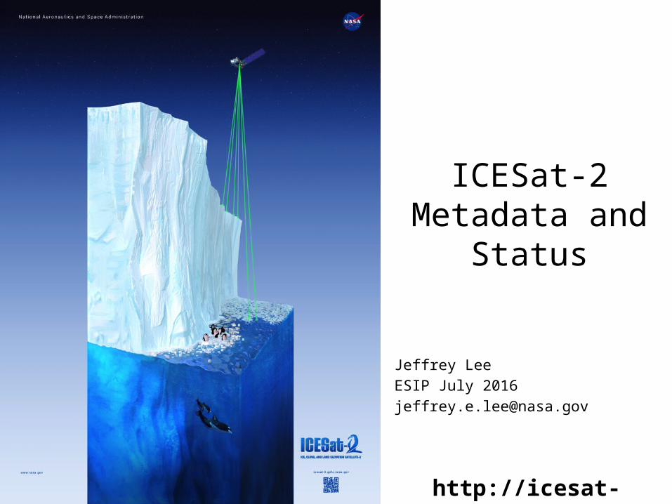
ICESat-2 Introduction
ICESat-2: next generation laser altimeter designed to measure ice elevation and sea ice thickness.
Scheduled for launch in December 2017.Will use photon-counting strategy.
Science Objectives:• Quantify polar ice-sheet contributions to current and recent sea-level change and the
linkages to climate conditions• Quantify regional signatures of ice-sheet changes to assess mechanisms driving those
changes and improve predictive ice sheet models; this includes quantifying the regional evolution of ice sheet change, such as how changes at outlet glacier termini propagate inward.
• Estimate sea-ice thickness to examine ice/ocean/atmosphere exchanges of energy, mass and moisture;
• Measure vegetation canopy height as a basis for estimating large-scale biomass and biomass change.
ICESat-2 Measurement Concept
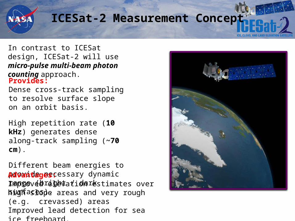
In contrast to ICESat design, ICESat-2 will use micro-pulse multi-beam photon counting approach.
Provides:Dense cross-track sampling to resolve surface slope on an orbit basis.
High repetition rate (10 kHz) generates dense along-track sampling (~70 cm).
Different beam energies to provide necessary dynamic range (bright / dark surfaces).
Advantages:Improved elevation estimates over high slope areas and very rough (e.g. crevassed) areasImproved lead detection for sea ice freeboard.
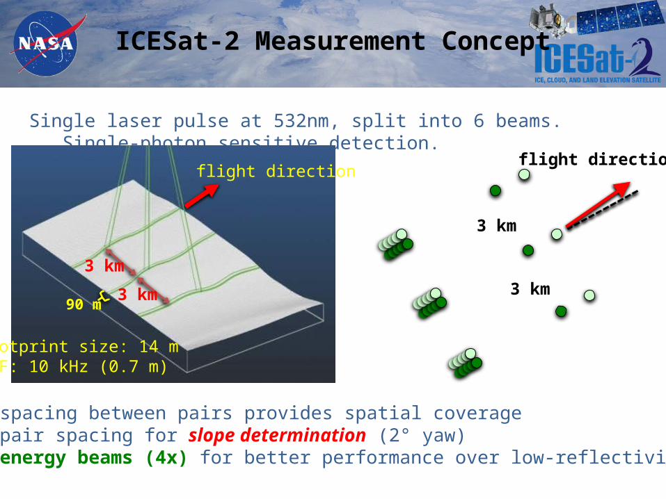
Single laser pulse at 532nm, split into 6 beams. Single-photon sensitive detection.
3 km
3 km
90 m
Footprint size: 14 m PRF: 10 kHz (0.7 m)
flight direction
3 km
3 km
3 km spacing between pairs provides spatial coverage90 m pair spacing for slope determination (2° yaw)high-energy beams (4x) for better performance over low-reflectivity targets.
flight direction
ICESat-2 Measurement Concept
ICESat-2 Measurement Concept
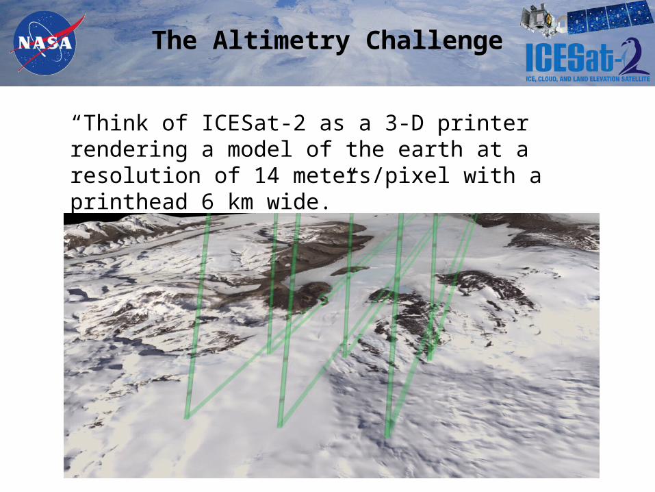
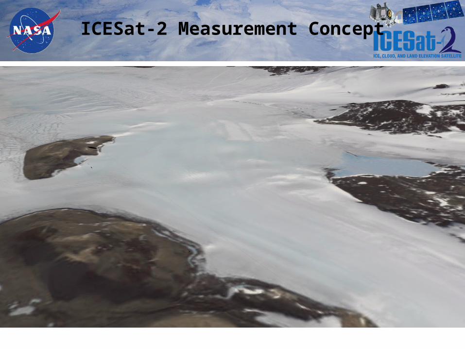
The Altimetry Challenge
“Think of ICESat-2 as a 3-D printer rendering a model of the earth at a resolution of 14 meters/pixel with a printhead 6 km wide.”
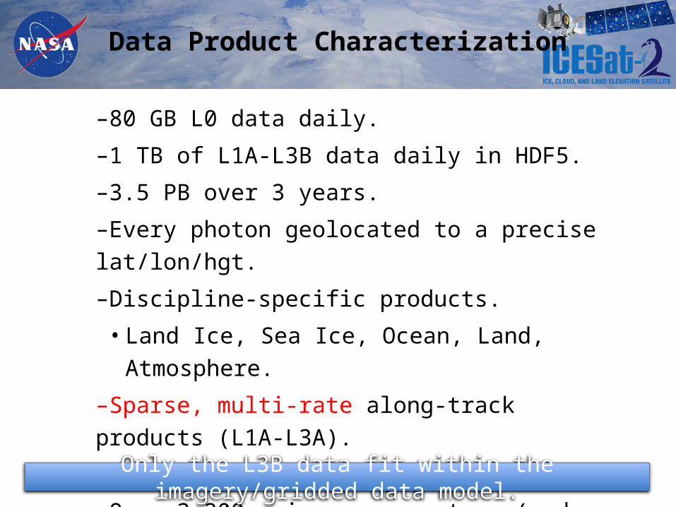
Data Product Characterization
–80 GB L0 data daily.–1 TB of L1A-L3B data daily in HDF5.–3.5 PB over 3 years.–Every photon geolocated to a precise lat/lon/hgt.–Discipline-specific products.
• Land Ice, Sea Ice, Ocean, Land, Atmosphere.–Sparse, multi-rate along-track products (L1A-L3A).–Gridded products (L3B).–Over 3,200 science parameters (and counting…)
Only the L3B data fit within the imagery/gridded data model.
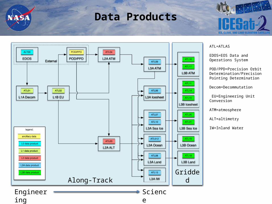
Data Products
GriddedAlong-Track
Engineering Science
ATL=ATLAS
EDOS=EOS Data and Operations System
POD/PPD=Precision Orbit Determination/Precision Pointing Determination
Decom=Decommutation
EU=Engineering Unit Conversion
ATM=atmosphere
ALT=altimetry
IW=Inland Water
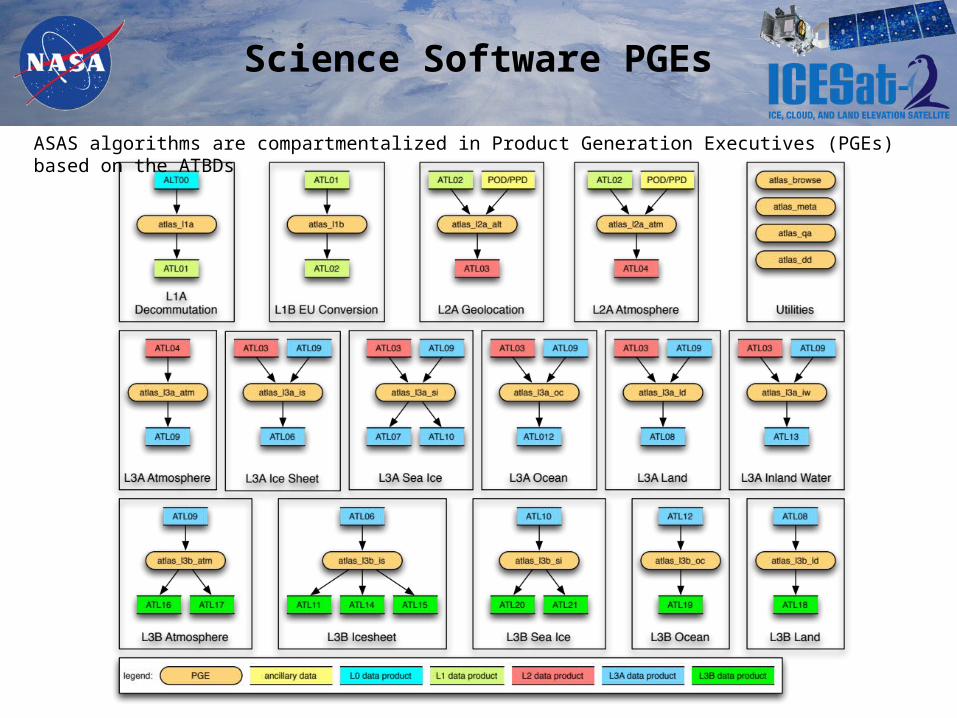
Science Software PGEs
ASAS algorithms are compartmentalized in Product Generation Executives (PGEs) based on the ATBDs
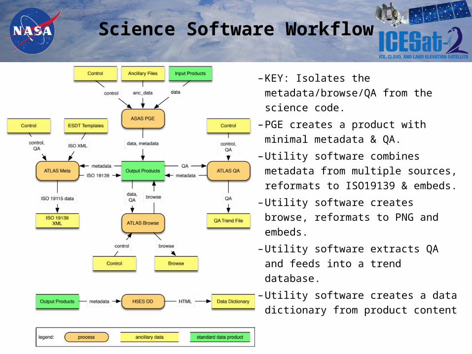
Science Software Workflow
– KEY: Isolates the metadata/browse/QA from the science code.
– PGE creates a product with minimal metadata & QA.
– Utility software combines metadata from multiple sources, reformats to ISO19139 & embeds.
– Utility software creates browse, reformats to PNG and embeds.
– Utility software extracts QA and feeds into a trend database.
– Utility software creates a data dictionary from product content
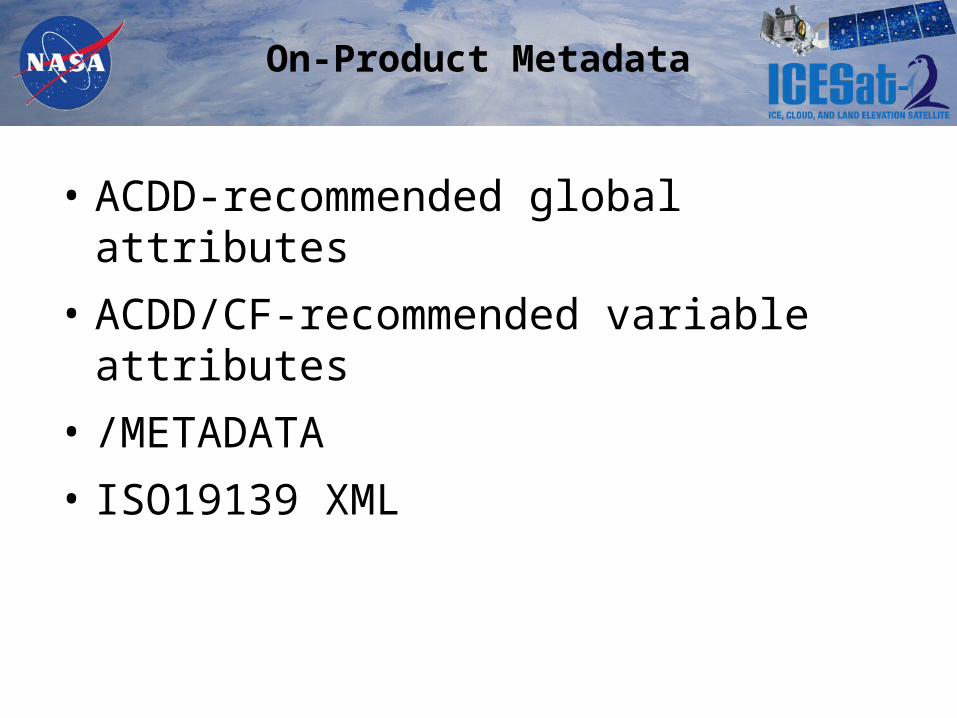
On-Product Metadata
• ACDD-recommended global attributes• ACDD/CF-recommended variable attributes• /METADATA• ISO19139 XML
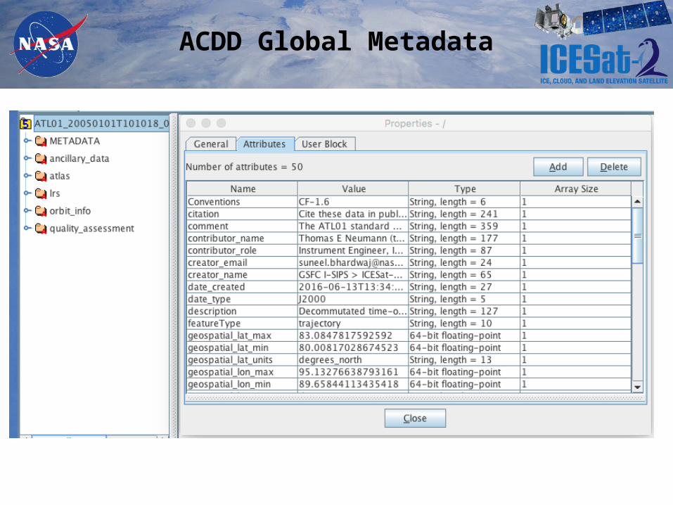
ACDD Global Metadata
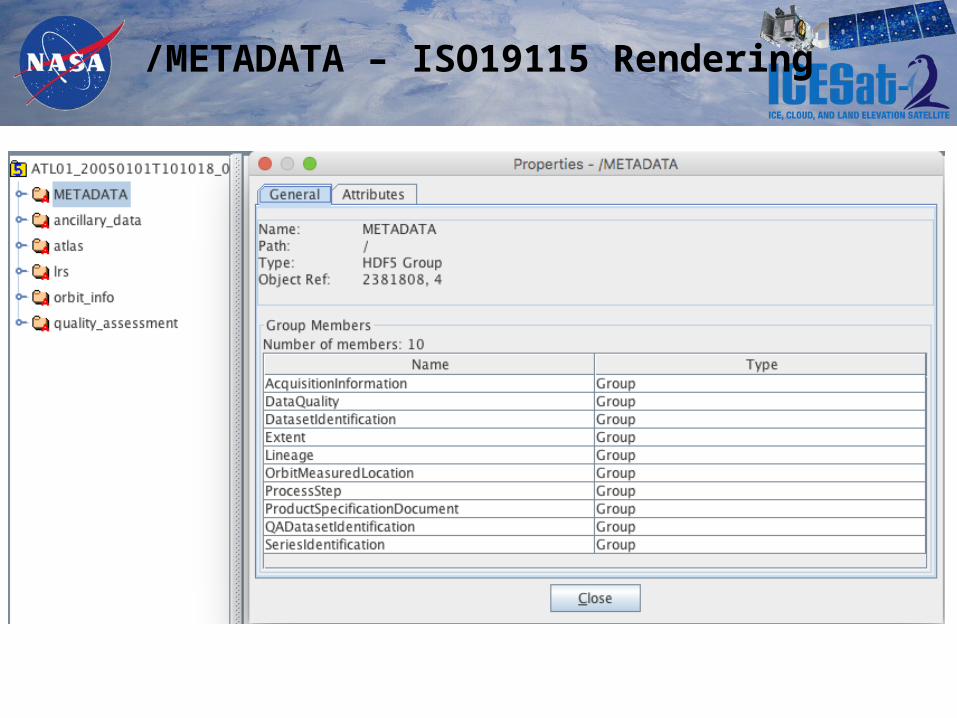
/METADATA – ISO19115 Rendering
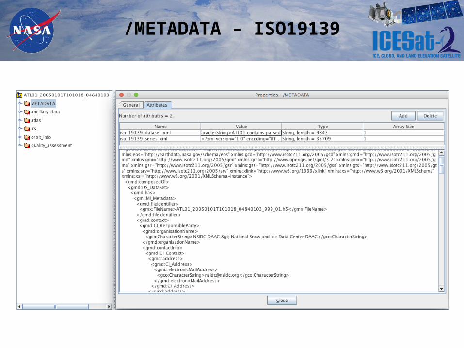
/METADATA – ISO19139

ACDD/CF Variable Metadata
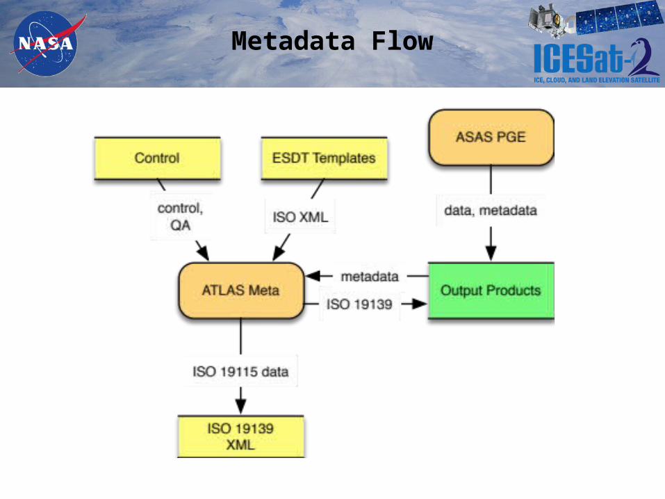
Metadata Flow
Pieces of the Puzzle
• PGEs
Supply dynamic metadata information – time, location bounds, processing info, etc.
• H5ES Product Templates
• Supply minimal product-specific metadata and all variable-level metadata.
• H5ES Metadata Template
Supplies HDF5-based rendering of ISO19115 structures.
• atlas_meta
Processes the metadata to create filled ISO19139 XML
• ESDT Templates (dataset and series)
Supply ISO19139 structure and static metadata information. Used as the interface by which ICESat-2 and ESDIS exchange updated metadata content.
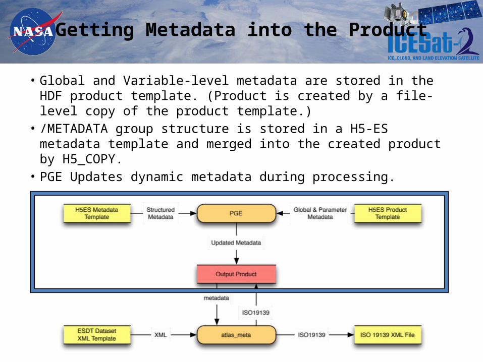
Getting Metadata into the Product
• Global and Variable-level metadata are stored in the HDF product template. (Product is created by a file-level copy of the product template.)
• /METADATA group structure is stored in a H5-ES metadata template and merged into the created product by H5_COPY.
• PGE Updates dynamic metadata during processing.
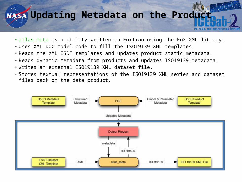
Updating Metadata on the Product
• atlas_meta is a utility written in Fortran using the FoX XML library.• Uses XML DOC model code to fill the ISO19139 XML templates.• Reads the XML ESDT templates and updates product static metadata.• Reads dynamic metadata from products and updates ISO19139 metadata. • Writes an external ISO19139 XML dataset file.• Stores textual representations of the ISO19139 XML series and dataset files back on
the data product.
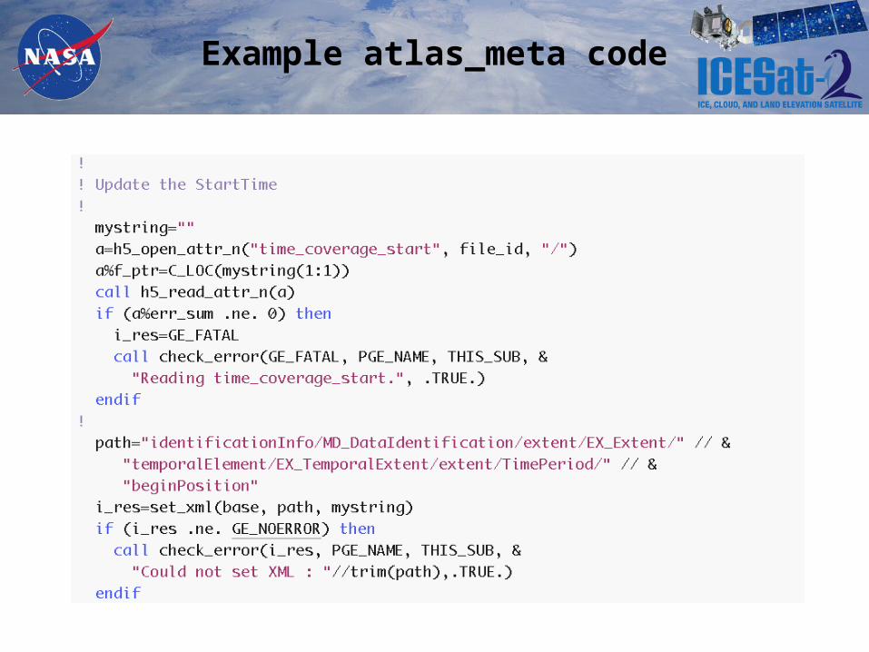
Example atlas_meta code
How This Shakes Out
• Most static information (both dataset and series) is maintained within a single set of files (ESDT XMLs) that can be exchanged between ESDIS and ICESat-2.
• Static information provided within the ESDT XMLs (including Release and Version information) can be used to update the Product metadata without changing software.
• The /METADATA structure is a superset of the current ISO-19115 content, which allows for future extension of the ICESat-2 metadata model.
• This allows us to focus initial development on the NSIDC-required ISO information but provides the ability to support increasingly richer metadata as we go along. (ie: lineage, QA)
• The /METADATA information is somewhat easier to parse with human eyes than the ISO 19139 XML.
• Although output metadata information is duplicated in several places, the source data is stored in a single place and software manages the duplication process.
Backup
Why HDF5?
• Quality• Completeness• Flexibility
The CRAZY Things I’ve Done with HDF5
• Developed the first prototype of Product Designer.• Use HDF5 “templates” as the basis for products and metadata.• Use H5copy to copy generic instances of groups/datasets into specific
instances.• Use HDF5 for big endian -> little endian conversion (L1A->L1B).• Virtualized a calibrations file/directory structure within a single HDF5 file.• Embedded hundreds of GMTED 2010 tiles (geotiffs) within a single
geographically - indexed HDF5 file (same with EGM2008 & GIMP). • Wrote independent columns of ragged 1D data into a 2D dataset.• Wrote software to recursively walk a generic HDF5 file and compute
statistics for every dataset it finds.• Wrote software to recursively walk a generic HDF5 file and create a data
dictionary describing all the groups and datasets.• DEEPLY exploited the HDF5/Fortran 2003 interface.