Embed Size (px)
Citation preview
Introduction Case study Results Future work
Geospatial Reference Information processingImproving the usability of the Information system of land
cover in Spain (SIOSE)
Benito Zaragozí
University of Alicante
129th EuroSDR Board of DelegatesWednesday, 19 October 2016
Geospatial Reference Information processing Benito Zaragozí
Introduction Case study Results Future work
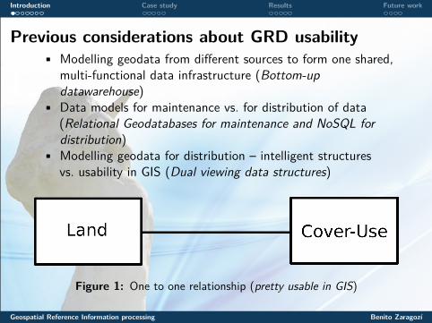
Previous considerations about GRD usability• Modelling geodata from different sources to form one shared,
multi-functional data infrastructure (Bottom-updatawarehouse)
• Data models for maintenance vs. for distribution of data(Relational Geodatabases for maintenance and NoSQL fordistribution)
• Modelling geodata for distribution – intelligent structuresvs. usability in GIS (Dual viewing data structures)
Figure 1: One to one relationship (pretty usable in GIS)
Geospatial Reference Information processing Benito Zaragozí
Introduction Case study Results Future work
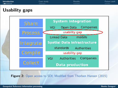
Usability gaps
Figure 2: Open access to SDI; Modified from Thorben Hansen (2015)
Geospatial Reference Information processing Benito Zaragozí
Introduction Case study Results Future work
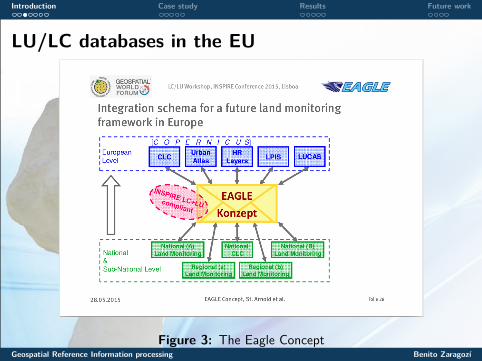
LU/LC databases in the EU
Figure 3: The Eagle ConceptGeospatial Reference Information processing Benito Zaragozí
Introduction Case study Results Future work
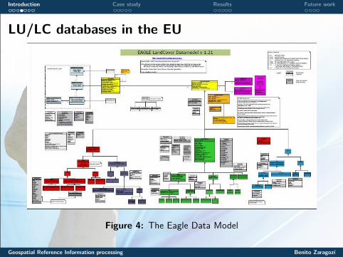
LU/LC databases in the EU
Figure 4: The Eagle Data Model
Geospatial Reference Information processing Benito Zaragozí
Introduction Case study Results Future work
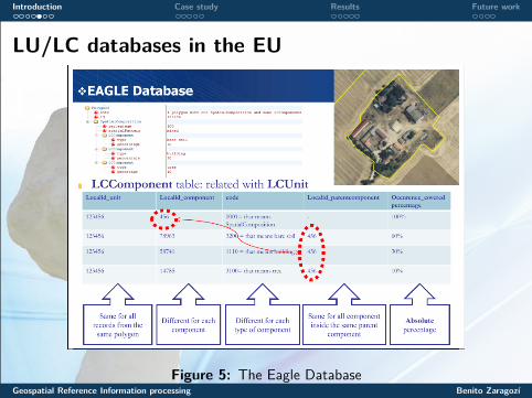
LU/LC databases in the EU
Figure 5: The Eagle DatabaseGeospatial Reference Information processing Benito Zaragozí
Introduction Case study Results Future work
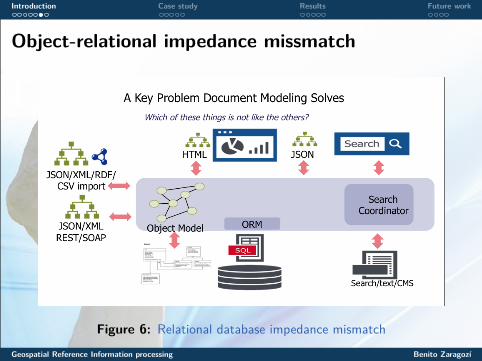
Object-relational impedance missmatch
Figure 6: Relational database impedance mismatch
Geospatial Reference Information processing Benito Zaragozí
Introduction Case study Results Future work
Research question
Figure 7: Follow the doiGeospatial Reference Information processing Benito Zaragozí
Introduction Case study Results Future work
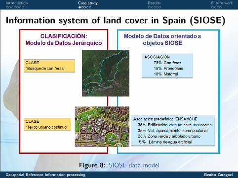
Information system of land cover in Spain (SIOSE)
Figure 8: SIOSE data modelGeospatial Reference Information processing Benito Zaragozí
Introduction Case study Results Future work
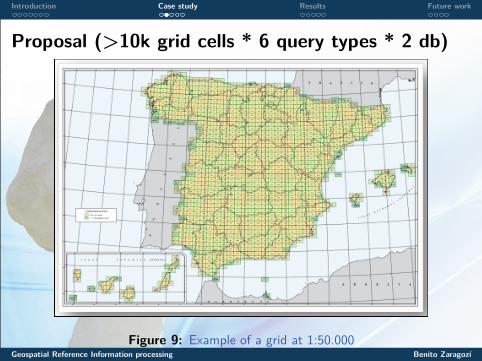
Proposal (>10k grid cells * 6 query types * 2 db)
Figure 9: Example of a grid at 1:50.000Geospatial Reference Information processing Benito Zaragozí
Introduction Case study Results Future work
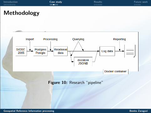
Methodology
Figure 10: Research “pipeline”
Geospatial Reference Information processing Benito Zaragozí
Introduction Case study Results Future work
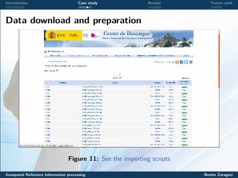
Data download and preparation
Figure 11: See the importing scripts
Geospatial Reference Information processing Benito Zaragozí
Introduction Case study Results Future work
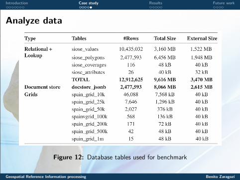
Analyze data
Figure 12: Database tables used for benchmark
Geospatial Reference Information processing Benito Zaragozí
Introduction Case study Results Future work
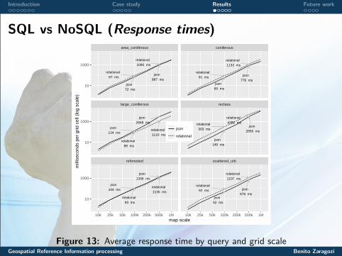
SQL vs NoSQL (Response times)
relational 87 ms
relational 1090 ms
json 72 ms
json 987 ms
relational 91 ms
relational 1133 ms
json 776 ms
json 60 ms
relational 89 ms
relational 1110 ms
json 2668 ms
json 124 ms
relational 303 ms
relational 4382 ms
json 2856 ms
json 140 ms
relational 93 ms
relational 1135 ms
json 104 ms
json 1346 ms
relational 1107 ms
relational 92 ms json
676 msjson
52 ms
area_coniferous coniferous
large_coniferous reclass
reforested scattered_urb
10
1000
10
1000
10
1000
10k 25k 50k 100k 200k 500k 1M 10k 25k 50k 100k 200k 500k 1Mmap scale
mill
isec
onds
per
grid
cel
l (lo
g sc
ale)
json
relational
Figure 13: Average response time by query and grid scaleGeospatial Reference Information processing Benito Zaragozí
Introduction Case study Results Future work
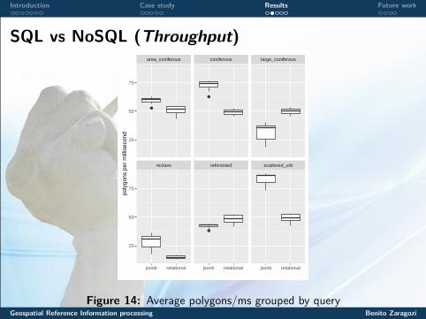
SQL vs NoSQL (Throughput)
●
●
●
area_coniferous coniferous large_coniferous
reclass reforested scattered_urb
25
50
75
25
50
75
jsonb relational jsonb relational jsonb relational
poly
gons
per
mill
isec
ond
Figure 14: Average polygons/ms grouped by queryGeospatial Reference Information processing Benito Zaragozí
Introduction Case study Results Future work
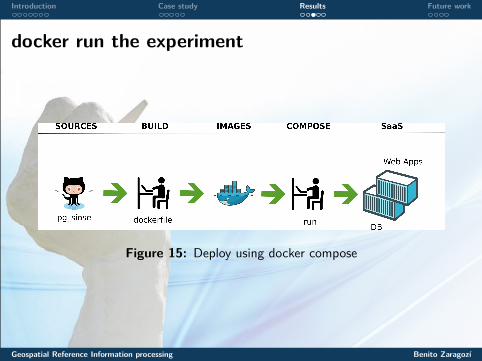
docker run the experiment
Figure 15: Deploy using docker compose
Geospatial Reference Information processing Benito Zaragozí
Introduction Case study Results Future work
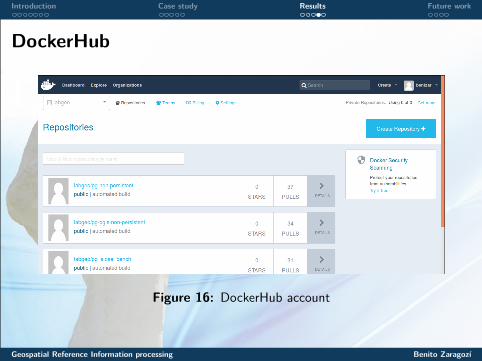
DockerHub
Figure 16: DockerHub account
Geospatial Reference Information processing Benito Zaragozí
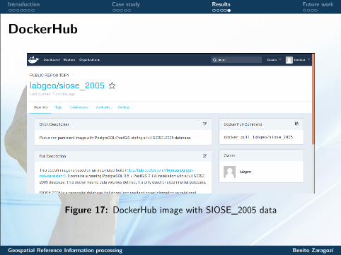
Introduction Case study Results Future work
DockerHub
Figure 17: DockerHub image with SIOSE_2005 data
Geospatial Reference Information processing Benito Zaragozí
Introduction Case study Results Future work
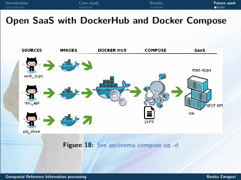
Open SaaS with DockerHub and Docker Compose
Figure 18: See asciinema compose up -d
Geospatial Reference Information processing Benito Zaragozí
Introduction Case study Results Future work
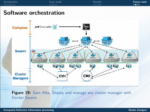
Software orchestration
Figure 19: Sam Alba, Deploy and manage any cluster manager withDocker Swarm
Geospatial Reference Information processing Benito Zaragozí
Introduction Case study Results Future work
SIOSE-INNOVA project
• Title: “Technical and methodological innovations in the LandCover and Use Information System of Spain (SIOSE) and itsapplication in geographical studies”
• Funding: Ministry of Economy and Competitiveness• Keywords: land use and cover, corine land cover, inspire,
standards, siose, object-oriented modeling, geodatabases, nosql,environment, sustainability
• Duration: 3 years (2017-2020 aprox)• Website: very soon
Geospatial Reference Information processing Benito Zaragozí
Introduction Case study Results Future work
Any questions?
Please feel free to contact me at anytime at benito-zaragozi.com;)
Geospatial Reference Information processing Benito Zaragozí