Embed Size (px)
Citation preview
Workshop on the ‘Role of Crisis Informatics in Disaster Management: The Case of Nepal Earthquake’Kahtmandu, August 9 2015
Pierre Béland, Humanitarian OpenStreetMap VolunteerCoordinator, HOT/OSM Activations
OpenstreetMap Response - 2015 Nepal Earthquake
OpenstreetMap Response - 2015 Nepal Earthquake
The role of HOT in Disaster Management● Interface between the OSM community and the humanitarian organizations● Flexible coordination with the UN Agencies, international organizations and
GIS teams - We adapt rapidly to the particularity of each region and disaster
Quick response to support the first responders – The BaseMap (road network and villages outline) is the first priority
● Imagery Acquisition, Process Hosting : Support from Imagery providers and HOT volunteers
● Imports,Tutorials. Validations● Define Tasks with partners, monitor progress
Humanitarian OpenStreetMap Team
OpenstreetMap Response - 2015 Nepal Earthquake
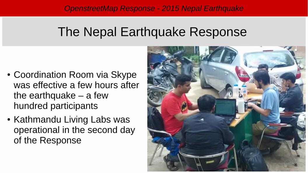
● Coordination Room via Skype was effective a few hours after the earthquake – a few hundred participants
● Kathmandu Living Labs was operational in the second day of the Response
The Nepal Earthquake Response
OpenstreetMap Response - 2015 Nepal Earthquake
● Humanitarian OpenStreetMap Team● Kathmandu Living Labs● UN agencies● International organizations (MSF, Red Cross, etc)● Digital Humanitarian Network● Imagery providers● Organizations involved in Post-Disaster Assessments
- UNOSAT, DigitalGlobe● Various specialists
Coordination of the mapping response
OpenstreetMap Response - 2015 Nepal Earthquake
● Pre Disaster : Bing Imagery available for most of the area. HIU provided an image to complete the coverage
● Post-Disaster : Activation by the International Charter – Satellites re-oriented to quickly provide new images
● With the bad meteo of the first week, only a images of Kathmandu valley were acquired. OSM did quickly locate the informal camps from these images.
● Support from DigitalGlobe, AirBus Defence & Space, HIU (US State Department), MapBox, Google
Imagery acquisition, process, hosting
OpenstreetMap Response - 2015 Nepal Earthquake
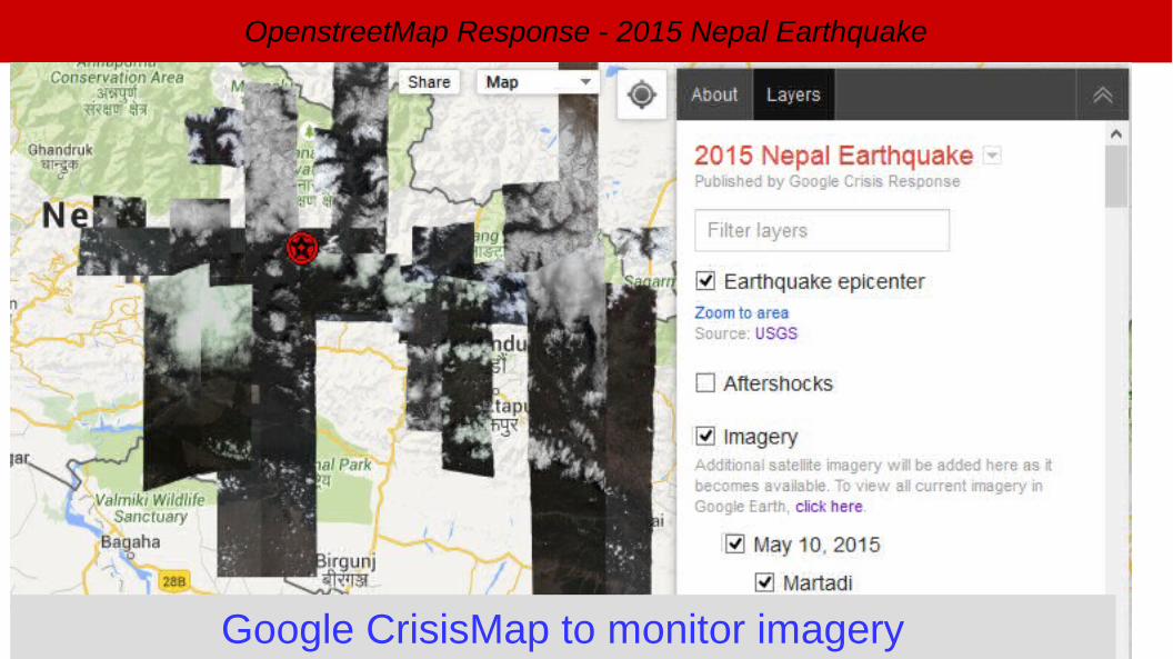
Google CrisisMap to monitor imagery
OpenstreetMap Response - 2015 Nepal Earthquake
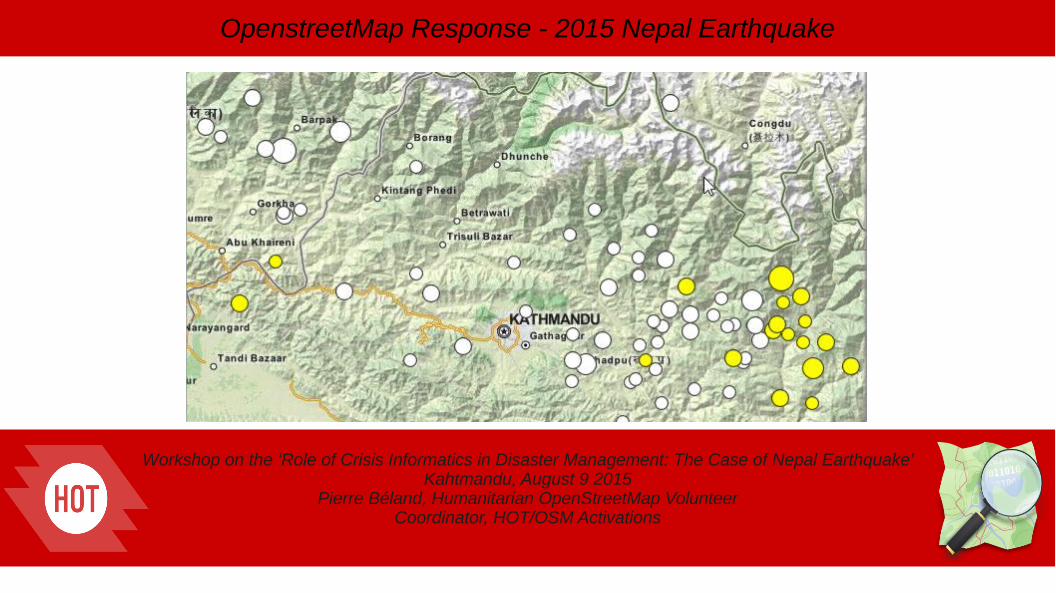
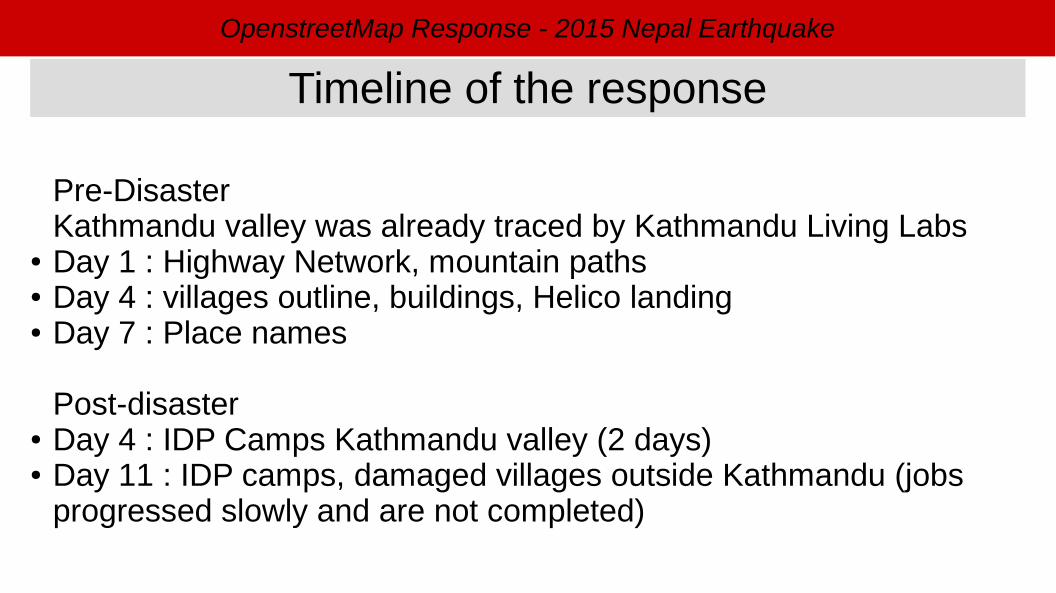
Pre-DisasterKathmandu valley was already traced by Kathmandu Living Labs
● Day 1 : Highway Network, mountain paths● Day 4 : villages outline, buildings, Helico landing● Day 7 : Place names
Post-disaster● Day 4 : IDP Camps Kathmandu valley (2 days)● Day 11 : IDP camps, damaged villages outside Kathmandu (jobs
progressed slowly and are not completed)
Timeline of the response
OpenstreetMap Response - 2015 Nepal Earthquake
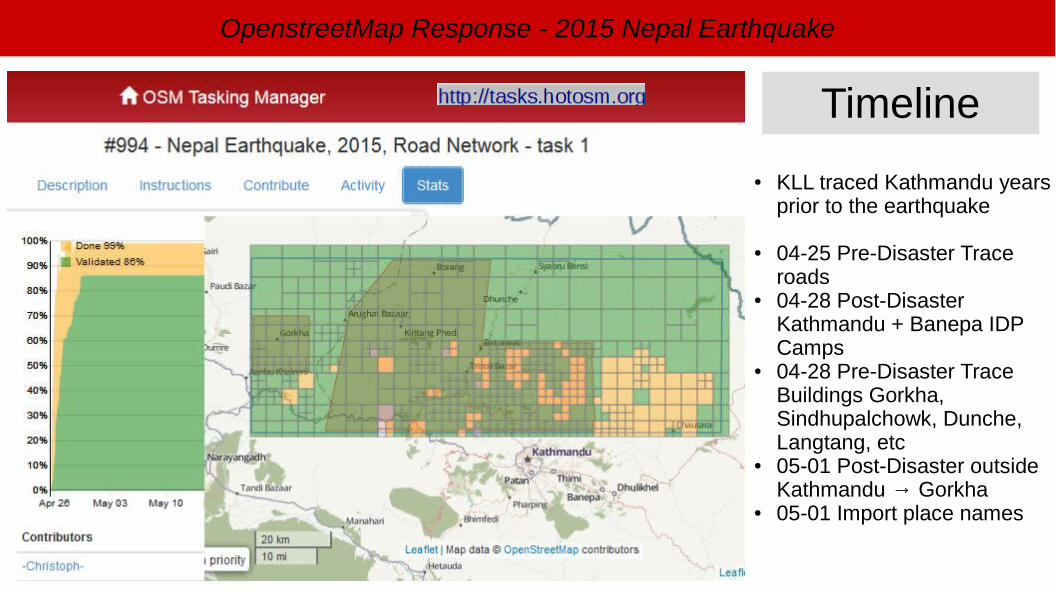
● KLL traced Kathmandu years prior to the earthquake
● 04-25 Pre-Disaster Trace roads
● 04-28 Post-Disaster Kathmandu + Banepa IDP Camps
● 04-28 Pre-Disaster Trace Buildings Gorkha, Sindhupalchowk, Dunche, Langtang, etc
● 05-01 Post-Disaster outside Kathmandu → Gorkha
● 05-01 Import place names
Timeline
OpenstreetMap Response - 2015 Nepal Earthquake
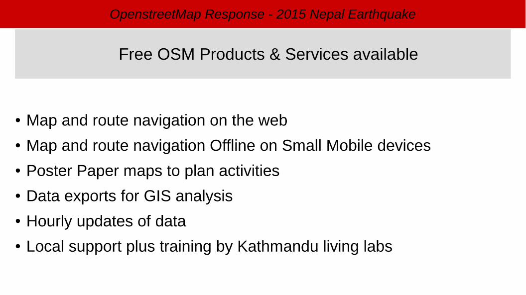
● Map and route navigation on the web● Map and route navigation Offline on Small Mobile devices● Poster Paper maps to plan activities● Data exports for GIS analysis● Hourly updates of data● Local support plus training by Kathmandu living labs
Free OSM Products & Services available
OpenstreetMap Response - 2015 Nepal Earthquake
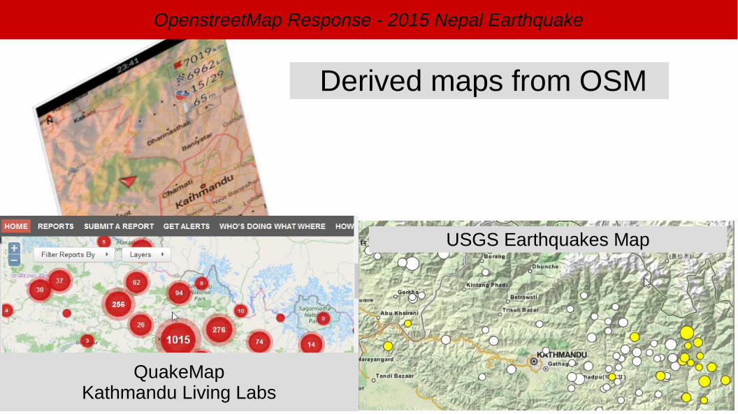
Derived maps from OSM
QuakeMapKathmandu Living Labs
USGS Earthquakes Map
OpenstreetMap Response - 2015 Nepal Earthquake
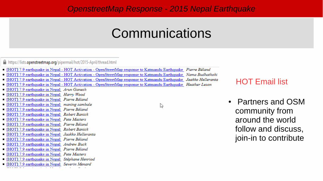
HOT Email list
● Partners and OSM community from around the world follow and discuss, join-in to contribute
Communications
OpenstreetMap Response - 2015 Nepal Earthquake
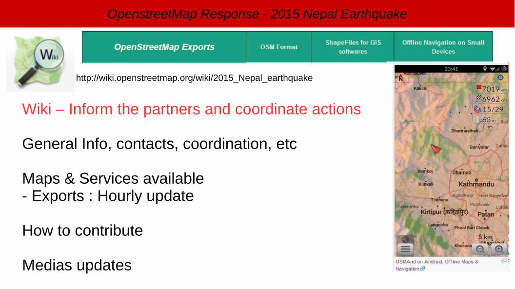
http://wiki.openstreetmap.org/wiki/2015_Nepal_earthquake
Wiki – Inform the partners and coordinate actions
General Info, contacts, coordination, etc
Maps & Services available- Exports : Hourly update
How to contribute
Medias updates
OpenstreetMap Response - 2015 Nepal Earthquake
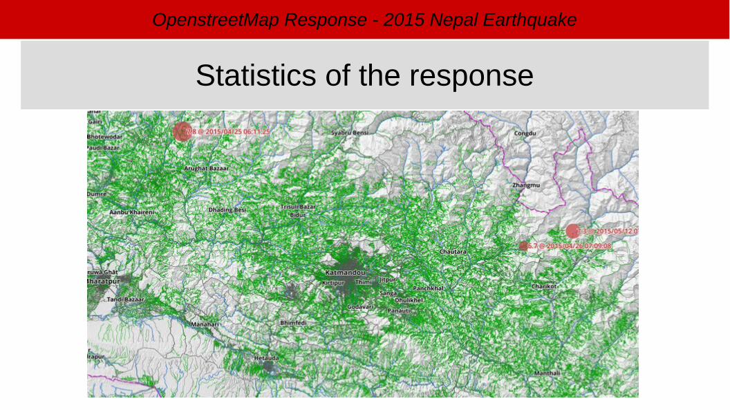
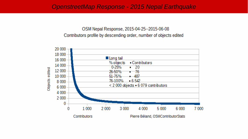
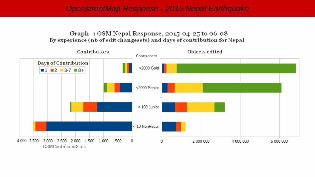
Statistics of the response
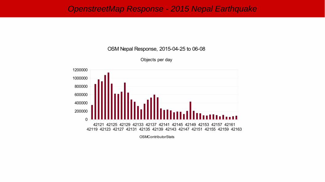
OpenstreetMap Response - 2015 Nepal Earthquake
4211942121
4212342125
4212742129
4213142133
4213542137
4213942141
4214342145
4214742149
4215142153
4215542157
4215942161
42163
0
200000
400000
600000
800000
1000000
1200000
OSM Nepal Response, 2015-04-25 to 06-08
Objects per day
OSMContributorStats
OpenstreetMap Response - 2015 Nepal Earthquake
OpenstreetMap Response - 2015 Nepal Earthquake
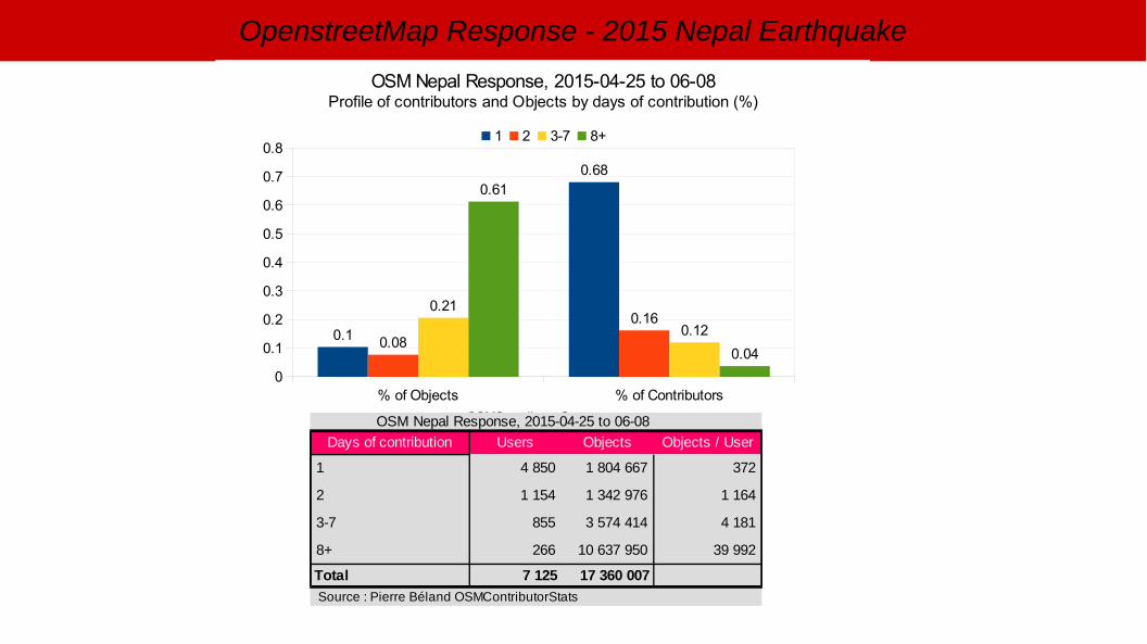
% of Objects % of Contributors0
0.1
0.2
0.3
0.4
0.5
0.6
0.7
0.8
0.1
0.68
0.08
0.160.21
0.12
0.61
0.04
OSM Nepal Response, 2015-04-25 to 06-08Profile of contributors and Objects by days of contribution (%)
1 2 3-7 8+
OSMContributorStats OSM Nepal Response, 2015-04-25 to 06-08
Days of contribution Users Objects Objects / User
1 372
2
3-7 855
8+ 266
Total
4 850 1 804 667
1 154 1 342 976 1 164
3 574 414 4 181
10 637 950 39 992
7 125 17 360 007
Source : Pierre Béland OSMContributorStats
OpenstreetMap Response - 2015 Nepal Earthquake
OpenstreetMap Response - 2015 Nepal Earthquake
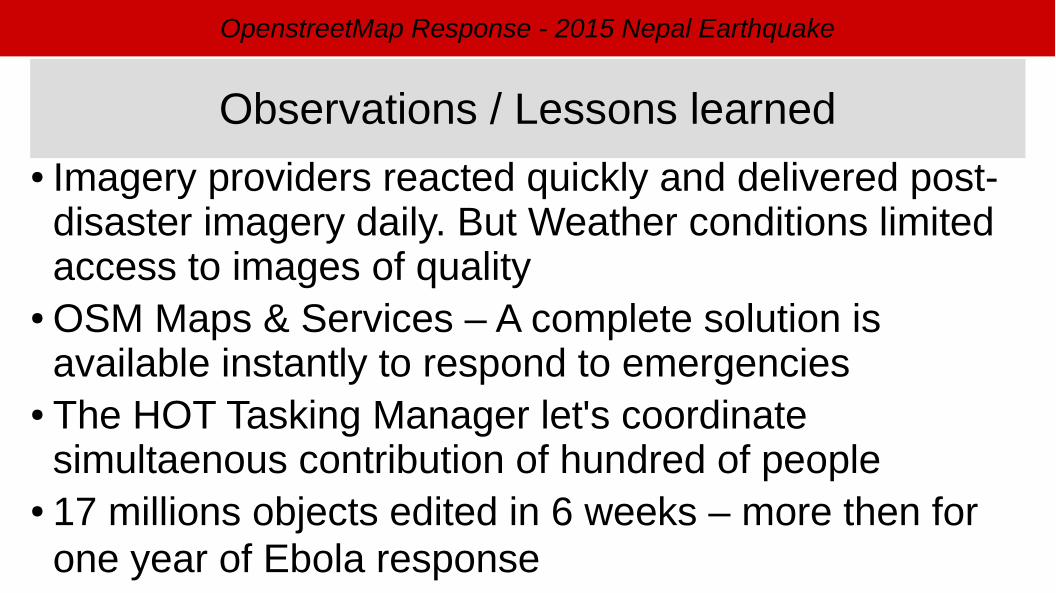
● Imagery providers reacted quickly and delivered post-disaster imagery daily. But Weather conditions limited access to images of quality
● OSM Maps & Services – A complete solution is available instantly to respond to emergencies
● The HOT Tasking Manager let's coordinate simultaenous contribution of hundred of people
● 17 millions objects edited in 6 weeks – more then for one year of Ebola response
Observations / Lessons learned
OpenstreetMap Response - 2015 Nepal Earthquake
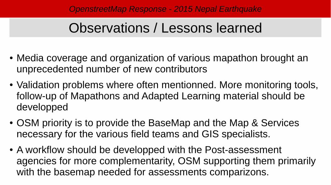
● Media coverage and organization of various mapathon brought an unprecedented number of new contributors
● Validation problems where often mentionned. More monitoring tools, follow-up of Mapathons and Adapted Learning material should be developped
● OSM priority is to provide the BaseMap and the Map & Services necessary for the various field teams and GIS specialists.
● A workflow should be developped with the Post-assessment agencies for more complementarity, OSM supporting them primarily with the basemap needed for assessments comparizons.
Observations / Lessons learned
OpenstreetMap Response - 2015 Nepal Earthquake
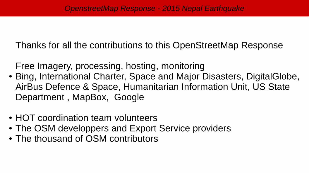
Thanks for all the contributions to this OpenStreetMap Response
Free Imagery, processing, hosting, monitoring● Bing, International Charter, Space and Major Disasters, DigitalGlobe,
AirBus Defence & Space, Humanitarian Information Unit, US State Department , MapBox, Google
● HOT coordination team volunteers● The OSM developpers and Export Service providers● The thousand of OSM contributors