Embed Size (px)
Citation preview
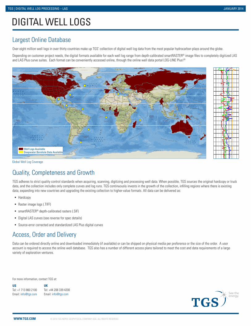
Global Well Log Coverage
Largest Online DatabaseOver eight million well logs in over thirty countries make up TGS’ collection of digital well log data from the most popular hydrocarbon plays around the globe.
Depending on customer project needs, the digital formats available for each well log range from depth-calibrated smartRASTER® image files to completely digitized LAS and LAS Plus curve suites. Each format can be conveniently accessed online, through the online well data portal LOG-LINE Plus!®
Quality, Completeness and GrowthTGS adheres to strict quality control standards when acquiring, scanning, digitizing and processing well data. When possible, TGS sources the original hardcopy or truck data, and the collection includes only complete curves and log runs. TGS continuously invests in the growth of the collection, infilling regions where there is existing data, expanding into new countries and upgrading the existing collection to higher-value formats. All data can be delivered as:
� Hardcopy
� Raster image logs (.TIFF)
� smartRASTER® depth-calibrated rasters (.SIF)
� Digital LAS curves (see reverse for spec details)
� Source-error corrected and standardized LAS Plus digital curves
Access, Order and DeliveryData can be ordered directly online and downloaded immediately (if available) or can be shipped on physical media per preference or the size of the order. A user account is required to access the online well database. TGS also has a number of different access plans tailored to meet the cost and data requirements of a large variety of exploration ventures.
DIGITAL WELL LOGS
National Geographic, Esri, DeLorme, NAVTEQ, UNEP-WCMC, USGS, NASA, ESA, METI, NRCAN, GEBCO, NOAA, iPC
Well Logs AvailableDeepwater Borehole Data Available
US Tel: +1 713 860 2100Email: [email protected]
For more information, contact TGS at:
UK Tel: +44 208 339 4200Email: [email protected]
WWW.TGS.COM © 2014 TGS-NOPEC GEOPHYSICAL COMPANY ASA. ALL RIGHTS RESERVED.
TGS | DIGITAL WELL LOG PROCESSING – LAS JANUARY 2014
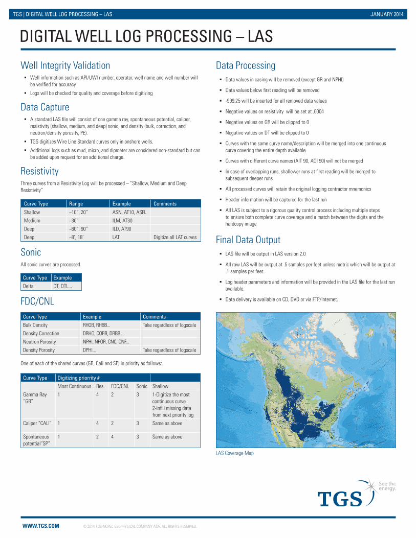
LAS Coverage Map
Well Integrity Validation � Well information such as API/UWI number, operator, well name and well number will
be verified for accuracy
� Logs will be checked for quality and coverage before digitizing
Data Capture � A standard LAS file will consist of one gamma ray, spontaneous potential, caliper,
resistivity (shallow, medium, and deep) sonic, and density (bulk, correction, and neutron/density porosity, PE).
� TGS digitizes Wire Line Standard curves only in onshore wells.
� Additional logs such as mud, micro, and dipmeter are considered non-standard but can be added upon request for an additional charge.
ResistivityThree curves from a Resistivity Log will be processed – “Shallow, Medium and Deep Resistivity”
SonicAll sonic curves are processed.
FDC/CNL
Data Processing � Data values in casing will be removed (except GR and NPHI)
� Data values below first reading will be removed
� -999.25 will be inserted for all removed data values
� Negative values on resistivity will be set at .0004
� Negative values on GR will be clipped to 0
� Negative values on DT will be clipped to 0
� Curves with the same curve name/description will be merged into one continuous curve covering the entire depth available
� Curves with different curve names (AIT 90, AOI 90) will not be merged
� In case of overlapping runs, shallower runs at first reading will be merged to subsequent deeper runs
� All processed curves will retain the original logging contractor mnemonics
� Header information will be captured for the last run
� All LAS is subject to a rigorous quality control process including multiple steps to ensure both complete curve coverage and a match between the digits and the hardcopy image
Final Data Output � LAS file will be output in LAS version 2.0
� All raw LAS will be output at .5 samples per feet unless metric which will be output at .1 samples per feet.
� Log header parameters and information will be provided in the LAS file for the last run available.
� Data delivery is available on CD, DVD or via FTP/Internet.
One of each of the shared curves (GR, Cali and SP) in priority as follows:
Curve Type Example CommentsBulk Density RHOB, RHBB... Take regardless of logscale
Density Correction DRHO, CORR, DRBB...
Neutron Porosity NPHI, NPOR, CNC, CNF...
Density Porosity DPHI... Take regardless of logscale
Curve Type ExampleDelta DT, DTL...
DIGITAL WELL LOG PROCESSING – LAS
Curve Type Range Example Comments
Shallow ~10”, 20” ASN, AT10, ASFL
Medium ~30” ILM, AT30
Deep ~60”, 90” ILD, AT90
Deep ~8’, 18’ LAT Digitize all LAT curves
Curve Type Digitizing priorrity #Most Continuous Res. FDC/CNL Sonic Shallow
Gamma Ray “GR”
1 4 2 3 1-Digitize the most continuous curve2-Infill missing data from next priority log
Caliper “CALI” 1 4 2 3 Same as above
Spontaneous potential”SP”
1 2 4 3 Same as above
WWW.TGS.COM © 2014 TGS-NOPEC GEOPHYSICAL COMPANY ASA. ALL RIGHTS RESERVED.
TGS | DIGITAL WELL LOG PROCESSING – LAS JANUARY 2014