Embed Size (px)
Citation preview

Integrated management system for converting a geosite into a tourist destination
Riccardo Beltramo, Paolo Cantore, Stefano Duglio University of Turin, Department of Management, Commodity Science area& NatRisk, Research Centre on Natural Risks in Mountain and Hilly Enviroments
PROGEO project (PROactive management of GEOlogical heritage in the Piemonte region: innovative methods and functional guidelines for promoting geodiversity knowledge and supporting geoconservation activities:
Review and improvements of the regional geosite inventory;
Assessment of main thematic areas of Piemonte geodiversity;
Specialized analysis on related critical issues of Earth Sciences knowledge;
The Monviso massif (MM) and the Cottian Alps (CA) as symbols of the Alpine chain;
Experiments on visual representation of geological environments and processes;
Development of geodiversity action plans including educational impacts;
Promotion of a “geodiversity economics”

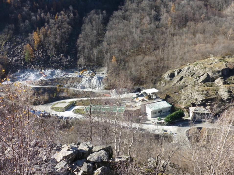
Talcum mine of Prali – Germanasca Valley
Source: computer graphic by Bacenetti M. (DST-UniTO)
Riccardo Beltramo - University of Turin, Department of Management, Commodity Science area& NatRisk

Prali Chisone and Germanasca Valleys are part of
the Chisone basin, one of the main hydrographic systems of the Italian side of the Cottian Alps
Rich area in terms of geodiversity and local tradition and culture
Riccardo Beltramo - University of Turin, Department of Management, Commodity Science area& NatRisk
Prali – ScopriMiniera/ScopriAlpi
Geotourism
Site of:
Riccardo Beltramo - University of Turin, Department of Management, Commodity Science area& NatRisk

Geotourism First definition of Geotourism was introduced in 1995 (Hose,
1995).
Concept of “Geographical tourism” was introduced publicly in 2002 (Farsani et al, 2002).
Different approaches: some authors highlight the role of the mining tourism as positive for the old European mining Regions (Rybár, 2006; WóJtowicz et al., 2011).
Riccardo Beltramo - University of Turin, Department of Management, Commodity Science area& NatRisk

Geotourism Recent definition (Newsome & Dowling,
2010):
“a form of natural area tourism that specifically focuses on geology and landscape. It promotes tourism to geosites and the conservation of geo-diversity and an understanding of earth sciences through appreciation and learning. This is achieved through independent visits to geological features use geo-trails and view points, guided tours, geo-activities and patronage of geo-site visitor centres”
Riccardo Beltramo - University of Turin, Department of Management, Commodity Science area& NatRisk

Prali – ScopriMiniera/ScopriAlpi
Geotourism
as well as
Industrial Tourism
Site of:
Riccardo Beltramo - University of Turin, Department of Management, Commodity Science area& NatRisk

Industrial Tourism No officially recognized definition.
It is a relatively unexplored research theme (Otgaar et al, 2010).
Frew (2008) affirms that “Industrial tourism involves visits by tourists to operational sites where the core activity of the sites is non-tourism oriented”.
In some countries – Germany, Poland - the attention is focused on visiting industrial heritage (non operational firms) (Otgaar et al, 2010)
Riccardo Beltramo - University of Turin, Department of Management, Commodity Science area& NatRisk

From Geotourism and Industrial Tourism
To Geo-industrial Tourism
1. Education: educational implication of the tourist’s experience
2. Tradition and culture: in both cases, there is a connection with the territory and its transformations.
3. Environmental awareness: geotourism specifically focuses on components of geology and landscape while the industrial tourism allows tourist to better understand the productive processes as well as their environmental implication
Riccardo Beltramo - University of Turin, Department of Management, Commodity Science area& NatRisk

The project – AimThe main aim of the project is the implementation of
a set of tools able to support ScopriMiniera/ScopriAlpi in the management of all
the aspect involved in its activity: quality, environment, social, health and safety.
to enhance the conversion of the ScopriMiniera/ScopriAlpi geosite into a tourist destination
Riccardo Beltramo - University of Turin, Department of Management, Commodity Science area& NatRisk

The project – Methodology Two tools:
Application of the Territorial Integrated Quality Management System (TIQMS)
Integration of the TIQ model with Scatol8® system.
Riccardo Beltramo - University of Turin, Department of Management, Commodity Science area& NatRisk
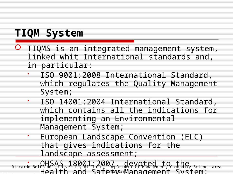
TIQM System TIQMS is an integrated management system, linked whit
International standards and, in particular: ISO 9001:2008 International Standard, which regulates
the Quality Management System; ISO 14001:2004 International Standard, which contains
all the indications for implementing an Environmental Management System;
European Landscape Convention (ELC) that gives indications for the landscape assessment;
OHSAS 18001:2007, devoted to the Health and Safety Management System;
SA8000:2008 that pay attention to the Social accountability Riccardo Beltramo - University of Turin, Department of Management, Commodity Science area
& NatRisk

TIQ System
STEPS

First step is the Integrated Territorial Analysis (ITA) that consists of:
identification of the activities carried out by the organisation;
description of activities management; identification of legal requirements.
Second step is represented by the necessity to create some procedures, useful for the management of the site and indicators able to verify the management objectives.
TIQ SystemTIQ System
Riccardo Beltramo - University of Turin, Department of Management, Commodity Science area& NatRisk

Step 1
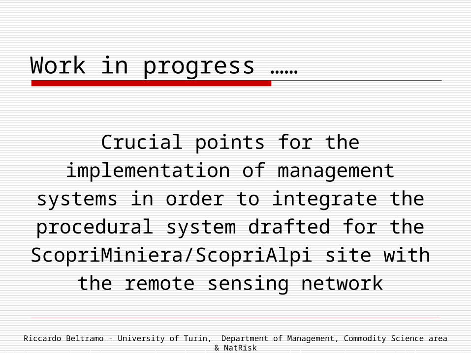
Work in progress ……
Crucial points for the implementation of management systems in order to integrate the
procedural system drafted for the ScopriMiniera/ScopriAlpi site with the remote
sensing network
Riccardo Beltramo - University of Turin, Department of Management, Commodity Science area& NatRisk

Scatol8®
Records are the key points for checking the system and calculating indicators.
Scatol8® is a remote sensing network of environmental, landscape and management variables based on free and open technology (hardware and software)
Scatol8® consists of a central unit and of peripheral units, connected in a network. Sensors are connected to peripheral units which transmit the data to a central unit, connected with a server.
It is possible to create a real-time monitoring of each measured variable, as well as evaluate their performance over time.
Riccardo Beltramo - University of Turin, Department of Management, Commodity Science area& NatRisk

Modularity
Accessibility & dissemination
Environmental compatibility
Scatol8®‘s Guidelines
Santa Maria di Leuca 11:07:2013

Riccardo Beltramo - University of Turin, Department of Management, Commodity Science area& NatRisk

Variables
Riccardo Beltramo - University of Turin, Department of Management, Commodity Science area& NatRisk

Riccardo Beltramo - University of Turin, Department of Management, Commodity Science area& NatRisk


Indicators drafted for the ScopriMiniera/ScopriAlpi
Riccardo Beltramo - University of Turin, Department of Management, Commodity Science area& NatRisk

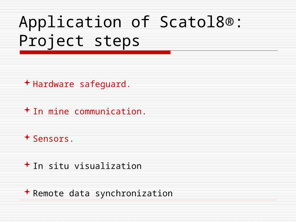
Application of Scatol8®:Project steps
Hardware safeguard.
In mine communication.
Sensors.
In situ visualization
Remote data synchronization
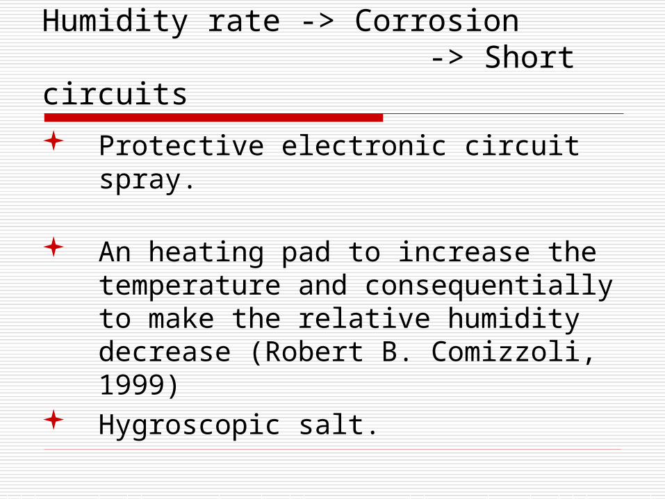
Humidity rate -> Corrosion -> Short circuits Protective electronic circuit spray.
An heating pad to increase the temperature and consequentially to make the relative humidity decrease (Robert B. Comizzoli, 1999)
Hygroscopic salt.

Step 2: in our Department
Riccardo Beltramo - University of Turin, Department of Management, Commodity Science area& NatRisk

The heating pad
Riccardo Beltramo - University of Turin, Department of Management, Commodity Science area& NatRisk

Location of peripheral units
Riccardo Beltramo - University of Turin, Department of Management, Commodity Science area& NatRisk

Step 3: installation and stress test
Riccardo Beltramo - University of Turin, Department of Management, Commodity Science area& NatRisk
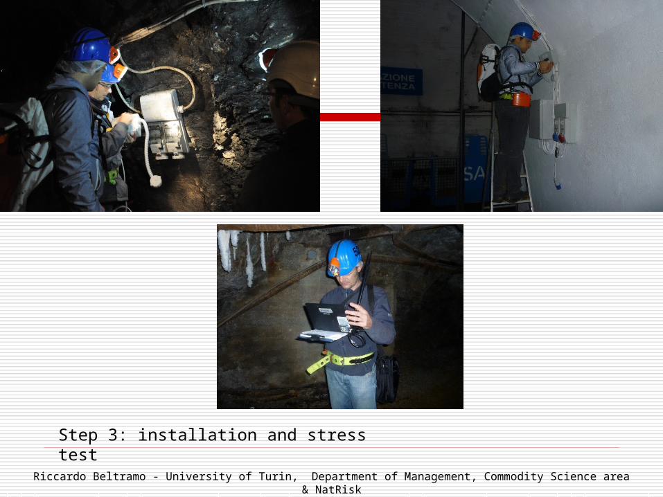
Step 3: installation and stress test
Riccardo Beltramo - University of Turin, Department of Management, Commodity Science area& NatRisk
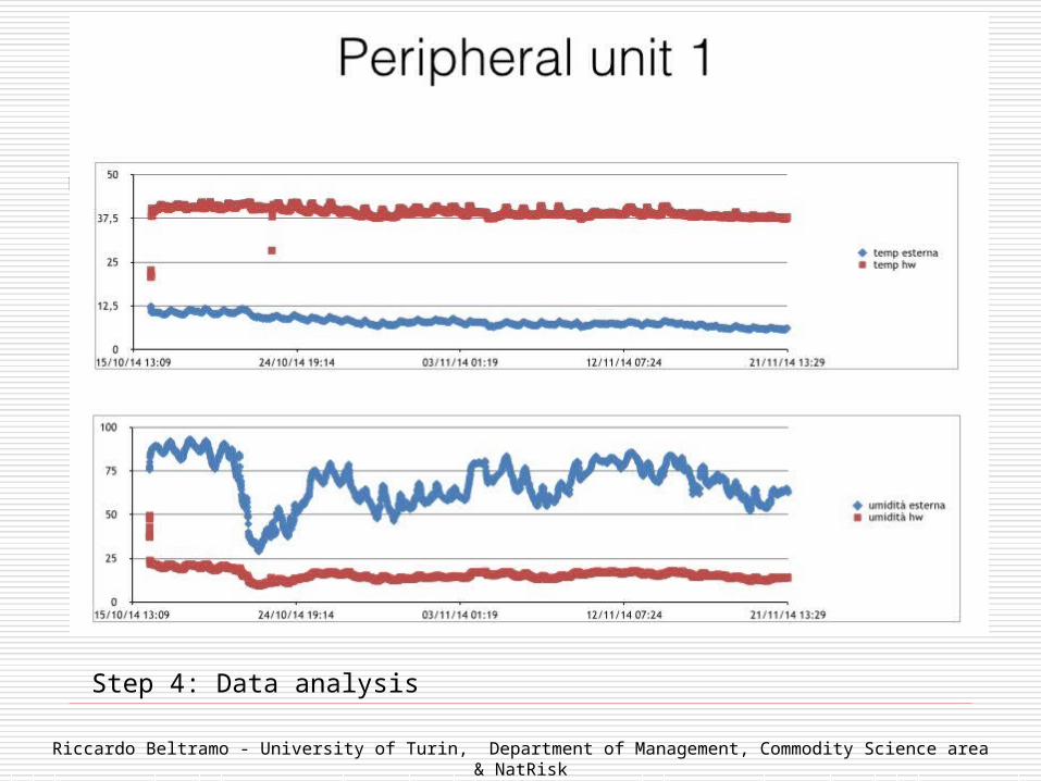
Step 4: Data analysis
Riccardo Beltramo - University of Turin, Department of Management, Commodity Science area& NatRisk

Step 4: Data analysis
Riccardo Beltramo - University of Turin, Department of Management, Commodity Science area& NatRisk

In mine communication
X-CTU Range and Received Signal Strength Indication test

Next steps:
SensorsMain parameters of interest are temperature, humidity,
radioactivity, earth tremor, water flow.
In situ visualization
Because a part of the mine is a tourist destination, it would be useful to show sensed parameters to the tourists. One solution
should be using a single-board computer with a screen at the entrance. This pc must act as a server for the coordinator and
must synchronize data with a remote server if needed.
Remote data transmission
As there is no internet connection in the mine, two hypothesis are
possible: connect to a GSM network or make a bridge using xBee 868 or other wireless technologies
between the mine and the offices.

References Farsani N.T., Coelho C.O., Costa C.M.M. (2014). “Analysis of Network activities in Geoparks as
Geotourism destinations”. International Journal of Tourism Research, 16, 1-10. Frew E.A. (2008). “Industrial tourism theory and implemented strategies”, in Arch G. Woodside (ed.)
2, Advanced in Culture, Tourism and Hospitality Research, Volume 2, Emerald Group Publishing Limited, 27-42
Hose T.A. (1996). “Selling the story of Britain’s stone”. Environmental interpretation, 10(2), 16-17 Newsome D, Dowling R. (2010). “Setting an agenda for geotourism”. In Geotourism: the tourism of
geology and landscape, Newsome D., Dowling R.. (eds). Goodfellow Publishers Limited, Woodeaton: Oxford, UK; 4-8.
Otgaar A., van den Berg L., Berger C., Xiang Feng R., (2010). Industrial Tourism. Opportunities for city and enterprise. Aldershot: Ashgate
Rybár P. (2006). “Mining related tourism in Slovakia in connection with the European Network of Mining Regions (ENMR) project”. Proceeding of International Conference GEOTOUR 2006, 5-7 October, 2006, Košice, Slovakia, 43-46.
WóJtowicz B., Strachowka R., Strzyź M. (2011). “The perspective of the develpment or tourism in the area of geoparks in Poland”. Procedia Social and Behavioral Sciences, 19, 150-157
Beltramo R., Duglio S., Giardino M. (2014). Integrated management system for converting a geosite into a tourist destination, 5° European Conference on Industrial Tourism, Ferrol, La Coruna, Spain, 17-20 June 2014, in press
Riccardo Beltramo - University of Turin, Department of Management, Commodity Science area& NatRisk

For further information:Riccardo Beltramo, Paolo Cantore, Stefano DuglioUniversity of Torino - Department of Management, Commodity Science areaNatRisk - Research Centre on Natural Risks in Mountain and Hilly EnvironmentsPh: +39 (11) 670 57 18
Thank You! Let’s keep in touch