Embed Size (px)
Citation preview
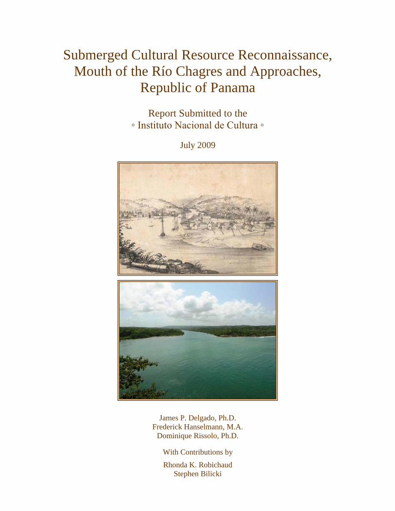
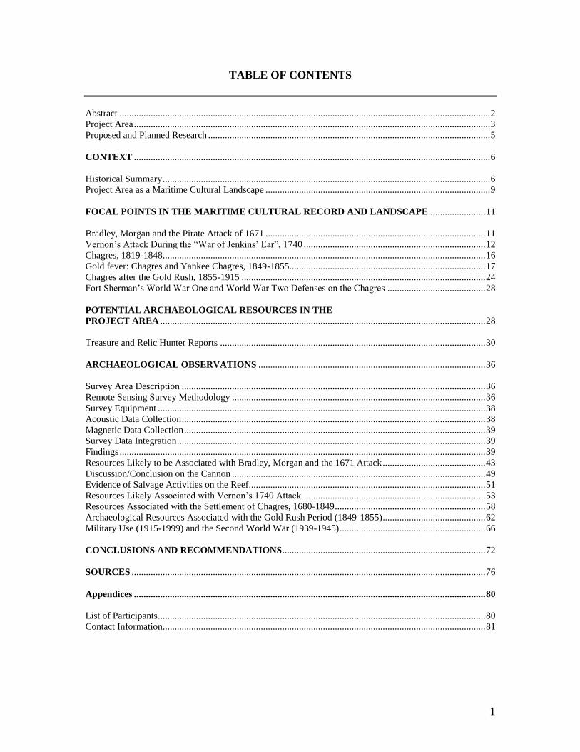
Submerged Cultural Resource Reconnaissance,
Mouth of the Río Chagres and Approaches,
Republic of Panama
Report Submitted to the
◦ Instituto Nacional de Cultura ◦
July 2009
James P. Delgado, Ph.D.
Frederick Hanselmann, M.A.
Dominique Rissolo, Ph.D.
With Contributions by
Rhonda K. Robichaud
Stephen Bilicki
1
TABLE OF CONTENTS
Abstract ........................................................................................................................................................... 2
Project Area ..................................................................................................................................................... 3
Proposed and Planned Research ...................................................................................................................... 5
CONTEXT ..................................................................................................................................................... 6
Historical Summary ......................................................................................................................................... 6
Project Area as a Maritime Cultural Landscape .............................................................................................. 9
FOCAL POINTS IN THE MARITIME CULTURAL RECORD AND LANDSCAPE ....................... 11
Bradley, Morgan and the Pirate Attack of 1671 ............................................................................................ 11
Vernon‟s Attack During the “War of Jenkins‟ Ear”, 1740 ............................................................................ 12
Chagres, 1819-1848 ....................................................................................................................................... 16
Gold fever: Chagres and Yankee Chagres, 1849-1855 .................................................................................. 17
Chagres after the Gold Rush, 1855-1915 ...................................................................................................... 24
Fort Sherman‟s World War One and World War Two Defenses on the Chagres ......................................... 28
POTENTIAL ARCHAEOLOGICAL RESOURCES IN THE
PROJECT AREA ........................................................................................................................................ 28
Treasure and Relic Hunter Reports ............................................................................................................... 30
ARCHAEOLOGICAL OBSERVATIONS ............................................................................................... 36
Survey Area Description ............................................................................................................................... 36
Remote Sensing Survey Methodology .......................................................................................................... 36
Survey Equipment ......................................................................................................................................... 38
Acoustic Data Collection ............................................................................................................................... 38
Magnetic Data Collection .............................................................................................................................. 39
Survey Data Integration ................................................................................................................................. 39
Findings ......................................................................................................................................................... 39
Resources Likely to be Associated with Bradley, Morgan and the 1671 Attack ........................................... 43
Discussion/Conclusion on the Cannon .......................................................................................................... 49
Evidence of Salvage Activities on the Reef................................................................................................... 51
Resources Likely Associated with Vernon‟s 1740 Attack ............................................................................ 53
Resources Associated with the Settlement of Chagres, 1680-1849 ............................................................... 58
Archaeological Resources Associated with the Gold Rush Period (1849-1855) ........................................... 62
Military Use (1915-1999) and the Second World War (1939-1945) ............................................................. 66
CONCLUSIONS AND RECOMMENDATIONS ..................................................................................... 72
SOURCES .................................................................................................................................................... 76
Appendices ................................................................................................................................................... 80
List of Participants ......................................................................................................................................... 80
Contact Information....................................................................................................................................... 81
2
ABSTRACT
Between January 23 and 31, 2008, a team of archaeologists and scientists from the Waitt
Institute for Discovery and the Institute of Nautical Archaeology, joined by the crew of
the vessel Plan B, conducted a non-disturbance survey for submerged cultural resources
off the mouth of the Río Chagres in Colon Province, in the Republica de Panamá. The
work described in this report was conducted under the terms of a permit issued on
January 21, 2008 by the Instituto Nacional de Cultura. The project was supported by the
Waitt Institute for Discovery, of La Jolla, California.
Strong northerly winds and resulting heavy seas prevented the survey team from
achieving their primary goal, a deeper water survey off the coast to locate the steamship
Lafayette, which burned and sank off Chagres in 1851. The team moved closer to shore,
in shallower waters, to conduct a reconnaissance and assessment of submerged cultural
resources.
The survey identified a number of submerged cultural resources, including a shipwreck
site probably associated with Henry Morgan‟s 1671 attack on Panamá, and other possible
shipwrecks associated with 18th
and 19th
century activity at the site. Cultural remains
from the 1740 attack and destruction of the Castillo de San Lorenzo by British Admiral
Edward Vernon, and submerged remains associated with the settlement of Chagres (ca.
1680-1915), in particular from the period of the California Gold Rush (1849-1855) were
also located. Submerged and shore-side remains from the U.S. military occupation of the
area (1911-1999) were also noted. No materials were removed; all were documented in
situ.
The submerged cultural resources of the mouth of the Río Chagres, as a collective group
of sites and remains, form a significant maritime cultural landscape along with the site of
Chagres and the Castillo de San Lorenzo. This maritime cultural landscape also includes
the natural resources of the area, such as the Morro or Peñon on which the Castillo rests,
the sandbars and beaches at the river‟s entrance, Lajas Reef, and the river‟s channel itself
– all of which influenced and were impacted by the human activities that have occurred
here over the last 500 years.
The reconnaissance was not an extensive survey, nor was it comprehensive, as limitations
of time, as well as weather and sea conditions precluded such an endeavor. This report
recommends additional survey, research, archaeological excavation, analysis,
preservation, cultural resources management that includes the submerged cultural
resources, and interpretation, and suggests a model of collaborative partnerships to
achieve these goals.
3
PROJECT AREA
The area surveyed during this project lies on the Caribbean side of the Isthmus of
Panamá, in the center of the country and approximately seven nautical miles (nine
kilometers) from Colon and the entrance to the Panamá Canal. The prominent feature is
the mouth of the Río Chagres, which emerges from the isthmian jungle to drain into the
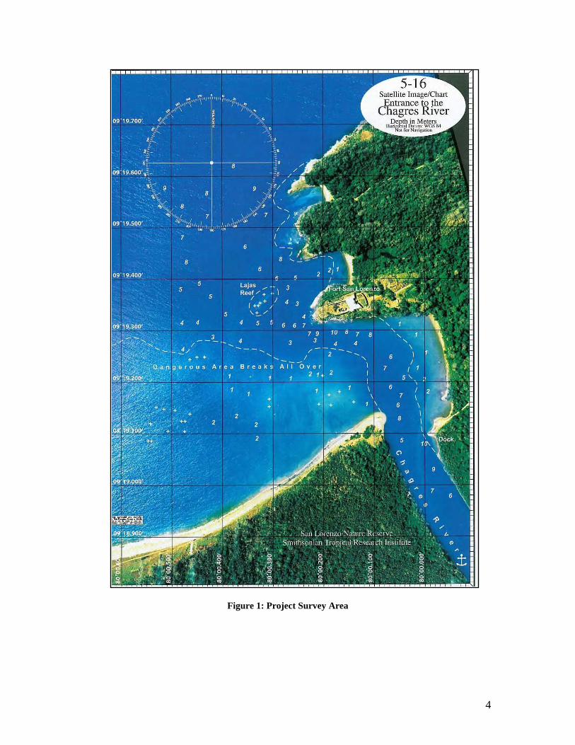
Caribbean. The project area (Fig. 1) lies immediately offshore of the 12,000-hectare San
Lorenzo Protected Area and the Castillo de San Lorenzo, a national historic site, and,
since 1980, a UNESCO World Heritage Site (Larson 2002).
The waters off the Castillo de San Lorenzo, as well as the associated land sites, have
attracted professional archaeological attention as well as interest from treasure hunters. A
1993 report by Dr. Kathleen Deagan of the University of Florida outlined a recommended
archaeological plan of action for San Lorenzo (Deagan 1993). Another assessment
(Lange 1999) recommended archaeological excavations in and around the fort and
exploration of the coastal waters and the waters of the Río Chagres near the fort.
In 1999, a permit was issued by the Ministry of Economy and Finance for underwater
survey and commercial recovery from shipwrecks in the vicinity. That permit and
contract has since lapsed.
In addition to this previously authorized recovery, much unauthorized activity has
reportedly taken place. This ranges from casual recovery of artifacts during the American
occupation of the site as part of Fort Sherman (1909-1999) to more recent activities,
which have resulted in private collections, and, as of the time of this report, Internet-
advertised sales of materials apparently illicitly taken from the waters off San Lorenzo.
4
Figure 1: Project Survey Area
5
PROPOSED AND PLANNED RESEARCH
The primary goal of the project was a remote sensing survey to locate and identify the
steamship Lafayette, which burned off the mouth of the Río Chagres on September 11,
1851. The survey zone was designed to encompass all potential sites for the imprecisely
located (in historical accounts) site of Lafayette’s sinking after it caught fire and burned
to its waterline.
The permit application noted that the survey zone most likely encompassed other
submerged cultural resources because of centuries of maritime activity in and around the
Río Chagres. The survey proposal therefore also included a provision for the non-
disturbance assessment of any submerged cultural resources encountered during the
survey. A final report would then be prepared and submitted to INAC.
As indicated, the strong winds, or nortes, created sea states that were not conducive for
survey activities, and which were in fact hazardous for small vessel operations. The only
shelter available was the area immediately off the mouth of the Chagres River. Initially,
the survey activities in this smaller area were pursued as a working alternative until
conditions improved and the primary zone Lafayette is believed to rest in was safe to
survey. The nortes never abated sufficiently for the survey to move offshore. As a result,
the planned survey for the steamship never took place within the time and weather
window that the survey vessel and crew were available.
6
CONTEXT
Historical Summary
Maritime activity in the project area commenced in the prehistoric period as human
settlement along the banks of the Río Chagres introduced watercraft for transportation
and for harvesting fish and other aquatic resources. The first European encounter with the
river was in December 1502, when Spanish explorer Christopher Columbus‟ fourth and
final expedition anchored a short distance from the mouth of the river at a place the local
natives called Huiva (probably modern Limon Bay). Columbus named the large rock at
the river entrance, the future site of the Castillo de San Lorenzo, Peñon. During a three-
day stay in the area, where he traded with the natives for gold, Columbus entered the
river‟s mouth, and noting its large numbers of caimans and alligators, named it El Río de
los Lagartos (Morison 1942:620-621).
Following Columbus‟ voyage, other 16th
century explorers entered the mouth of the river,
but none ventured very far up it, as fallen trees and debris clogged the river. It was not
until a 1527 expedition by Hernando de la Serna, who made the trip by canoe, that
explorers determined that the river was navigable. Serna recommended that a road from
Panamá City, established several years earlier (1519) be built to link to a local
transshipment point at Las Cruces (Anderson 1911:302). In 1528, acting on de la Serna‟s
report, merchants in Panamá petitioned the Crown to fund an alternate route across the
isthmus for trade, arguing that goods could be carried to the upper reaches of the Chagres
and floated down the river in boats. They recommended that a group of slaves could clear
the fallen trees and other obstructions in the river (Haring 1918:181-182).
In February 1534, after two subsequent surveys of the river, the Crown ordered the
Governor of Panamá to spend one thousand gold pesos on clearing the river and erecting
a warehouse for goods at the point where the river met the sea (ibid.:182, Anderson
1911:302). The river then became a partial highway across the Isthmus of Panamá (Ward
1993:57-58). The Chagres was a means for water transportation of goods to and from
Panamá City on the Pacific, and that port‟s connections via sea to South America,
Mexico and Spain‟s Pacific possessions in the Philippines. Flat-bottomed barges operated
between Cruces and Chagres, with one account noting that by 1579 as many as thirty of
these craft were in use on the river.
The river was both a strategic asset and liability. In 1534, Filipe II, the King of Spain,
ordered the fortification of the river‟s mouth. The river was not fortified, however, when
English buccaneer Francis Drake sailed up the river to attack the town of Cruces in 1571.
Fortification of the entrance began in 1597-1599 with the construction of a water-level
battery, built to plans prepared by military engineer Bautista Antonelli. A weakness in the
defenses was a failure to fortify the elevated promontory overlooking the river‟s mouth
(ibid.: 166, 169). That fort, named el Castillo de San Lorenzo el Real de Chagre, was first
fitted with guns in 1626.
7
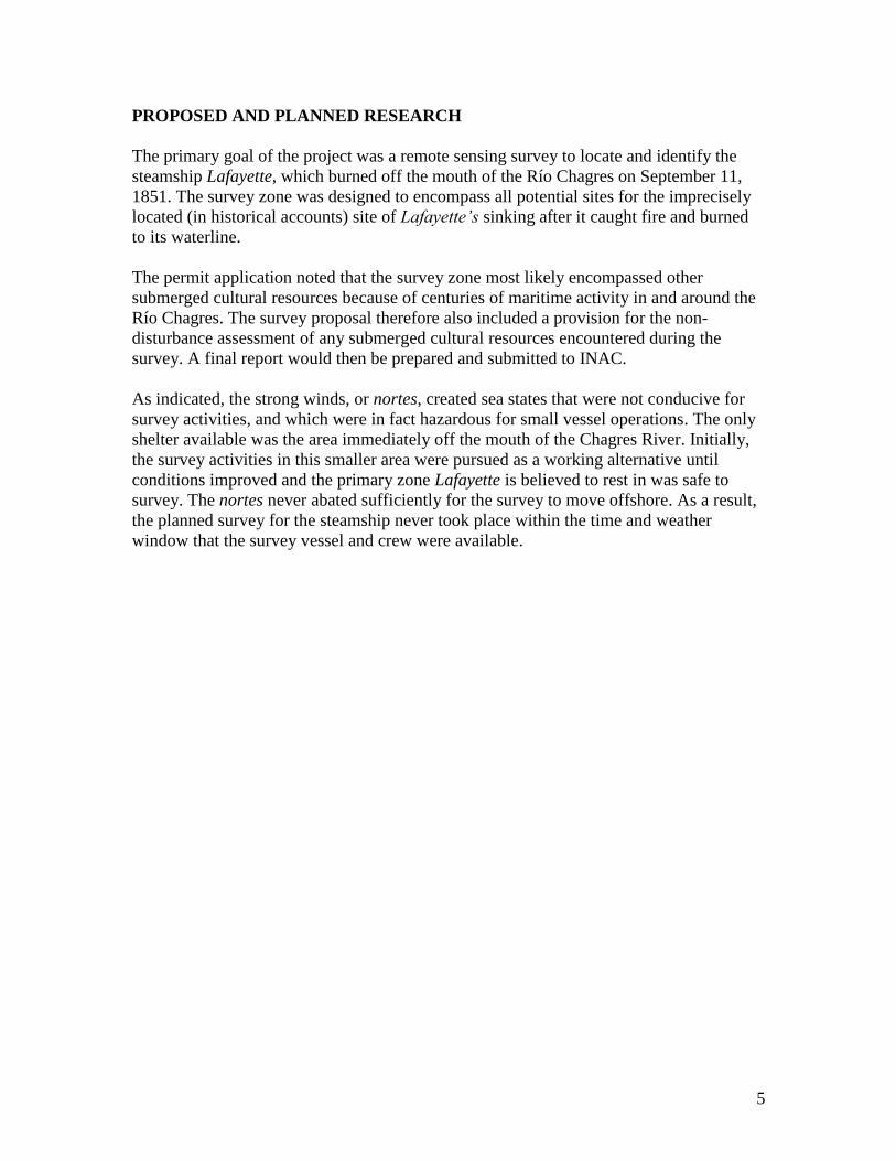
Figure 2: Map of the Isthmus of Panamá, showing the mouth of the Chagres, 1623
The Castillo de San Lorenzo de Chagres would go through four separate incarnations.
The first was the 1597-1599 water battery, ruined and subsequently abandoned after a
pirate attack in 1656. It was replaced with a star-shaped earthwork and wooden-palisaded
fort atop the Morro or cliff (Ward 1993: 170). That fort was destroyed in 1671 by forces
under the command of buccaneer Henry Morgan. Rebuilt as a three-tiered stone fortress
in 1677-1680, San Lorenzo gave rise to an associated village, Chagres, in the 1680s.
A visiting English buccaneer, Lionel Wafer, who lived among the natives of Darien from
1680 to 1688, described “the River of Chagre, which runs into the North Sea…on the
South-side of it, at no great distance from Panama, is Venta de Cruces, a small Village of
Inns and Storehouses,; whither Merchandises that are to be sent down the River Chagre
are carried from Panama by Mules, and there embark‟d in Canoas and pereagoes….”
(Wafer 1699:88). The fort was again destroyed by a punitive British raid in 1740 by
Admiral Edward Vernon. The third and final fort, constructed within a decade of
Vernon‟s raid, is the source of the ruins currently on the site.
By the time the third fort‟s construction, Spain had abandoned the Chagres as a route for
transshipment of treasure, and the area around the fort declined. During the active period
of Spanish control of the port of Chagres, the government maintained a custom house and
moored Guarda Costa, or Coast Guard vessels at the port. The custom house, burned in
the 1740 Vernon raid, was replaced and the fort was rebuilt between 1761-1768. At this
time, as well, a map of the mouth of the river and fort showed a logwood plantation off
the village of Chagres – a logical enterprise since the logwood trade with Britain via the
West Indies was one of the few potentially lucrative trades available to locals with the
8
end of goods coming down the river from Panamá City. At that time, Chagres served
largely as a backwater port and a point for illicit smuggling carried on by British mariners
from Jamaica collaborating with Panamá City merchants (Bancroft 1887:491). Jamaica
dominated British West Indies trade with Central America throughout the 18th
century
(Hinckley 1963:109) and was the only major link between Chagres and the outside world
after 1780.
After the illicit trade declined, regular trade continued through the early 19th
century,
although at a greatly diminished level, declining further following Panamá‟s
independence from Spain in 1819 as part of Bolivar‟s Gran Colombia, and later as part of
New Grenada (Colombia). The possibility of the Chagres as a potential route to the
Pacific maintained interest in the river, however, which was described in an 1818 British
account:
The river Chagre [sic] is the principal stream in this province, and
may be called the high road of Panama, being used as a means of
communication between the eastern shore and the capital. It takes its
rise in the mountains near Cruces, which is about five leagues from
Panama; the Chagre has a considerable descent, but is nonetheless
navigable for boats up to Cruces; its velocity is about three miles an
hour; therefore the ascent from the coast is rather fatiguing….It is by
means of this river that a communication between the two oceans
has been argued to be possible (Bonnycastle 1818:231).
Possibilities notwithstanding, the town remained a backwater of maritime activity until
the California gold discovery of 1848 and the subsequent “Gold Rush” of 1849-1855. In
1825, for example, only 38 vessels visited Chagres, most of them schooners from the
West Indies, although seven schooners called from the United States and one ship and
seven brigs arrived from France (Bancroft 1887:674). Two years later, only 20 vessels
called at Chagres (ibid.:675).
That all began to change in 1846, when the Royal Mail Steam Company began to send
Jamaica and England-bound steamers to Chagres, and it began “to show signs of modest
economic life” (Perez-Venero 1978:35). The selection of Chagres as a steamer port-of-
call influenced its selection as the port that gold-seekers bound to California would arrive
at after 1848. By 1849, Chagres, and a new, neighboring settlement, “Yankee” or
“American Chagres,” catered to the needs of arriving gold seekers who stopped briefly
enroute to Panamá City via the old water and land route via the Chagres and Cruces, as
well as returning “49ers” from California who caught steamers anchored off Chagres for
the voyage north to New York.
The construction of the Panamá Railroad from 1849-1855 gradually shifted traffic to the
modern port of Colon, and by January 1855, when the railroad finally reached Panamá
City, Chagres again declined into a backwater. Ironically, the original railroad route was
to have run from Chagres to Panamá City, but the low water of the river during the
9
summer and transportation problems shifted the interest of the Panama Railroad
Company to Colon in March 1850 (Perez-Venero 1978:67). After that, as the railroad
ventured farther across the isthmus, Chagres‟ fortunes as a port declined, and then died.
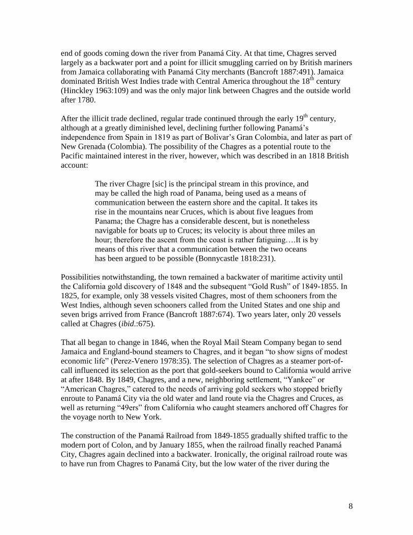
In 1911, Chagres was described as a “sleepy settlement of a few hundred people,
containing a modern church and a public school” (Anderson 1911:8). The following year,
The Panama Guide noted that tourists who wished to visit Fort San Lorenzo could only
reach it by water, either by sea from Colon, or down the river from Gatun. “The little
village of Chagres, at the foot of the castled hill, is the seat of an alcaldia, the capital of
the district about. It has neither industries nor commerce, except for local purposes.”
(Collins 1912:198). Around the same time, visiting journalist Willis J. Abbott described a
visit to Chagres, which he described as fronting “a bay perhaps a quarter of a mile wide”
and as “a native village of about fifty huts with an iron-roofed church in the center”
(Abbott 1913:79).
Figure 3: Chagres in February 1911, view from the river.
By that time, the United States had established Fort Sherman, several miles distant, on the
shores of Limon Bay, to help guard the approaches to the Panamá Canal, then under
construction.
In May 1915, “the Canal Zone government bluntly informed Panama that certain
uncultivated public lands about the mouth of the Chagres River were being taken over…for
the defense of the Canal Zone,” and in December, the area of expropriation was extended
to a “triangular space bounded by the Chagres, the Caribbean Sea, and the Canal Zone.”
(McCain 1937:147) The Government of Panama responded on December 21, 1915 that
while defense of the mouth of the river was necessary, the U.S. could hopefully “work out
a plan that would not require the occupation of the village of Chagres.” (ibid.:148). The
U.S. demanded the site of Chagres, so the Government of Panamá acceded to American
demands, and a new village site, Nuevo Chagres, was created. With that, by the time of the
First World War, Chagres was abandoned, ending the occupation of a site inhabited for at
least centuries, if not millennia. Subsequently, the site of Chagres and river mouth,
occupied by the U.S. Army, remained an active, and occasionally fortified military
reservation until 1999. Following the U.S. withdrawal, the area and the waters around it
became a protected area.
10
PROJECT AREA AS A MARITIME CULTURAL LANDSCAPE
The significance of the river and this area is both national and international, as recognized
by an early 20th
century historian; “for four centuries the Chagres has been the bond of
union between the two great oceans of the world, the way between the East and West, the
key to the portal of the South Sea” (Anderson 1911:7). Another historian called it “the
world‟s most valuable river,” calculating value on its role as the source of the Panamá
Canal‟s fresh water, but also noting its rich history, including “seeing more gold” than all
the world‟s other rivers combined (Minter 1948:3, 5). This broad-based assessment of the
Chagres‟ history reflects the essential truth that while there are key events in the history of
the project area, such as Columbus‟ visit, the establishment of the Castillo de San Lorenzo,
the pirate attack of 1671, the subsequent British assault of 1740, and the inrush of shipping
and people during the California Gold Rush, the flow of human history here, like that of the
river itself, is strong and reflects an essential continuity of purpose. We propose to
contextualize that history – as represented in the physical record – as a “maritime cultural
landscape.”
The concept of the maritime cultural landscape is at its most basic level the combination of
archaeological resources related to maritime activity, whether they are on land and in or on
the water. A maritime cultural landscape can encompass shipwrecks, and associated sites
on shore, such as lighthouses, fortifications, docks and wharves, warehouses and shipyards,
but it can also include “the natural geography…the details of roads, coasts, routes,
harbours, (e. g. the steepness, shallow banks) and the directions of prevailing currents and
winds” (Westerdahl 1991 and Westerdahl 1998:2).
Originally conceived by archaeologist Christer Westerdahl to conceptualize the maritime
archaeology of Scandinavia, the idea of the “maritime cultural landscape” has been adopted
by maritime archaeologists working on a variety of sites around the world, as a means of
encompassing within a more holistic framework the complex interrelationship between
human (maritime) activity and natural features as expressed in the material record.
The concept of the maritime cultural landscape provides an ideal framework for assessing
the diverse and extensive collection of structures, sites and material culture of the project
area. Collectively, the natural features, human modifications, structures, and associated
remains such as discarded materials, and shipwrecks not only represent, but also tell the
story of five centuries of maritime activity in and around the entrance to the Río Chagres.
There is also a very real possibility, with the inclusion of pre-Columbian sites known to
exist in the project area, to extend the scope of study and interpretation of the Chagres
maritime cultural landscape to a 1,000 to 1,500-year span. While some aspects of that
history are of particular significance, it is important to note that all aspects, and all traces of
that history, as represented in the archaeological resources, have significance as a complete
and collective record of maritime activity in one of the world‟s most significant focal
points for shipping, Panamá, and in particular, the entrance to the Río Chagres.
11
FOCAL POINTS IN THE MARITIME CULTURAL RECORD AND
LANDSCAPE
As previously noted, there are key events in the history of the project area that have
resulted in tangible remains in the archaeological record. As will be seen later in this
report, the survey encountered definite and probable remains from all of these periods. To
assist in the evaluation of those remains, a more detailed discussion of the history
surrounding those events follows.
Bradley, Morgan and the Pirate Attack of 1671
Henry Morgan assembled a fleet to attack Spanish possessions in the Caribbean in late
1670. There were
Thirty-eight ships in the fleet, the largest assembly of privateers that
had ever been seen in the West Indies. The ships varied enormously
in size. The biggest was Satisfaction, Morgan‟s flagship, with 22
guns and 140 men. Then there were twelve other ships with ten or
more guns, carrying an average of seventy-five men apiece. The
other twenty-five ships in the fleet were very small and many had no
guns at all….(Earle 1981:166).
Morgan detached 470 men in three ships under the command of Joseph Bradley to take
the Castillo de San Lorenzo, “understanding that the Castle of Chagres blocked our way”
(as quoted in Earle 1981:172).
After the capture of the Castillo de San Lorenzo, Henry Morgan and the rest of his fleet
arrived off the fort on January 12, 1671 and sailed straight to the entrance of the mouth of
the river. Morgan and his flagship, Satisfaction, were the first to ground on Lajas Reef
and hit so hard that the collision brought down the masts and yards and threw sailors into
the water. Three to four other vessels also grounded before the rest of the fleet was
warned and stood off from the reef. The ships caught on the reef “were shattered to
pieces,” as “the wind was blowing hard across the reef” (Earle 1981:182). Ten men
drowned, “the sea running very high,” and the only woman in the fleet, a “bruja,” or
witch, who Morgan kept with him, also drowned (ibid.)
The stores of the ships were reportedly salvaged, but none of the vessels was recovered.
Satisfaction was originally a 14-gun French pirate ship from La Rochelle named Le Cerf
Volant. Originally captured by one of Henry Morgan‟s privateers, Edward Collier, with
the ship Oxford, Collier brought the vessel to Port Royal, where it was made part of
Morgan‟s fleet and renamed Satisfaction. Following the explosion and sinking of Oxford
off Isla Vaca, Collier sailed Satisfaction to Campeche. Satisfaction spent 18 months at
sea, during which time Morgan took Maracaibo. Upon its return to Port Royal, Morgan
made it his flagship for the voyage to Panamá. Satisfaction was recorded to be 120 tons
and carried 22 guns, the largest ship in Morgan‟s fleet of 38 ships until the subsequent
grounding.
12
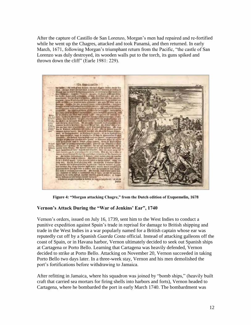
After the capture of Castillo de San Lorenzo, Morgan‟s men had repaired and re-fortified
while he went up the Chagres, attacked and took Panamá, and then returned. In early
March, 1671, following Morgan‟s triumphant return from the Pacific, “the castle of San
Lorenzo was duly destroyed, its wooden walls put to the torch, its guns spiked and
thrown down the cliff” (Earle 1981: 229).
Figure 4: “Morgan attacking Chagre,” from the Dutch edition of Exquemelin, 1678
Vernon’s Attack During the “War of Jenkins’ Ear”, 1740
Vernon‟s orders, issued on July 16, 1739, sent him to the West Indies to conduct a
punitive expedition against Spain‟s trade in reprisal for damage to British shipping and
trade in the West Indies in a war popularly named for a British captain whose ear was
reputedly cut off by a Spanish Guarda Costa official. Instead of attacking galleons off the
coast of Spain, or in Havana harbor, Vernon ultimately decided to seek out Spanish ships
at Cartagena or Porto Bello. Learning that Cartagena was heavily defended, Vernon
decided to strike at Porto Bello. Attacking on November 20, Vernon succeeded in taking
Porto Bello two days later. In a three-week stay, Vernon and his men demolished the
port‟s fortifications before withdrawing to Jamaica.
After refitting in Jamaica, where his squadron was joined by “bomb ships,” (heavily built
craft that carried sea mortars for firing shells into harbors and forts), Vernon headed to
Cartagena, where he bombarded the port in early March 1740. The bombardment was
13
unsuccessful in achieving Vernon‟s plan of drawing out the Spanish fleet, under the
command of Don Blas de Leso, to fight. Returning to Porto Bello, Vernon decided to
strike at Chagres, with its customhouse, Castillo and headquarters for the Spanish guarda
costas and the Caribbean. Arriving off Chagres on March 22, 1740, Vernon‟s ships
opened fire with mortars and cannon, and after a seven-hour bombardment, the garrison
at the Castillo de San Lorenzo surrendered. Landing troops, Vernon seized goods, sank
the Spanish vessels in the port, and demolished the Castillo.
In a letter to Sir Charles Wager, dated April 5, 1740, Vernon gave a detailed account of
his actions at Chagres, which detailed how the ships were sunk, and where:
The two Guarda Costa Sloops in the river were sunk just above the
Customs House, but their masts and booms were of great service to
us, to make out stage for shipping off the cannon [bronze guns taken
from the Castillo], and I ordered carpenters to break up their decks
and entirely destroy them, and these conclude the pleasure of
destroying all the Guarda Costas they had in these parts (Vernon
1740 as cited in Ranftt 1958:82)
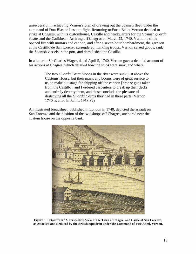
An illustrated broadsheet, published in London in 1740, depicted the assault on
San Lorenzo and the position of the two sloops off Chagres, anchored near the
custom house on the opposite bank.
Figure 5: Detail from “A Perspective View of the Town of Chagre, and Castle of San Lorenzo,
as Attacked and Reduced by the British Squadron under the Command of Vice Adml. Vernon,
14
1740,” published by George Foster, London, 1740. On the original legend, C is the “Town of
Chagre,” F is “The Custom House,” and E is “Two Guarda Costa Sloops.”
Vernon‟s letter noted that he sent men ashore to set mines at the base of the walls to
collapse them into the sea. He personally inspected the work, which he described as
settling on “what mines should be prepared for destroying the works” as well as giving
the orders “for the embarkation of the brass cannon from the fort and rendering
unserviceable the iron cannon.” (ibid.:83). On March 29, after loading the brass cannon,
“which were but eleven guns and eleven patereros…the mines were sprung under the
lower bastion, which entirely demolished it as effectually as could be desired.” (ibid.: 83)
As the English fleet left the river to lie off the fort, they “sprung two mines to blow up
some of the upper part of the works, and afterwards set fire to all the inner buildings of
the castle, which made a glorious and beautiful bonfire for all the 29th
at night.” (ibid.)
When Vernon and his squadron sailed from Chagres on March 30, 1740, they had so
effectively destroyed the Castillo de San Lorenzo that a complete rebuilding of the fort
was required.
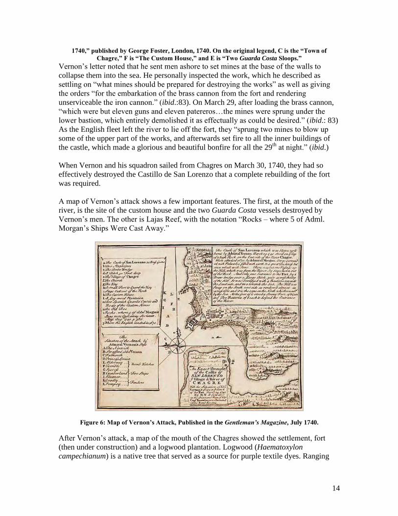
A map of Vernon‟s attack shows a few important features. The first, at the mouth of the
river, is the site of the custom house and the two Guarda Costa vessels destroyed by
Vernon‟s men. The other is Lajas Reef, with the notation “Rocks – where 5 of Adml.
Morgan‟s Ships Were Cast Away.”
Figure 6: Map of Vernon’s Attack, Published in the Gentleman’s Magazine, July 1740.
After Vernon‟s attack, a map of the mouth of the Chagres showed the settlement, fort
(then under construction) and a logwood plantation. Logwood (Haematoxylon
campechianum) is a native tree that served as a source for purple textile dyes. Ranging
15
from the Yucatan down the Central American coast to Panamá, logwood was a major
Caribbean trade commodity from the 16th
through the 20th
centuries. The logwood
plantation at Chagres is not otherwise documented, but appears as a small grove of trees
located directly in front of the town. Its presence may be evidence of a local attempt to
develop a commodity for trade not linked to the trans-isthmian role of the river. As will
be discussed later, sonar survey in 2008 discerned what might be submerged remains of
this plantation. An interesting feature of the map is the continued notation of Lajas reef
as the site of Morgan‟s wrecked ships, probably based on the map of Vernon‟s attack.
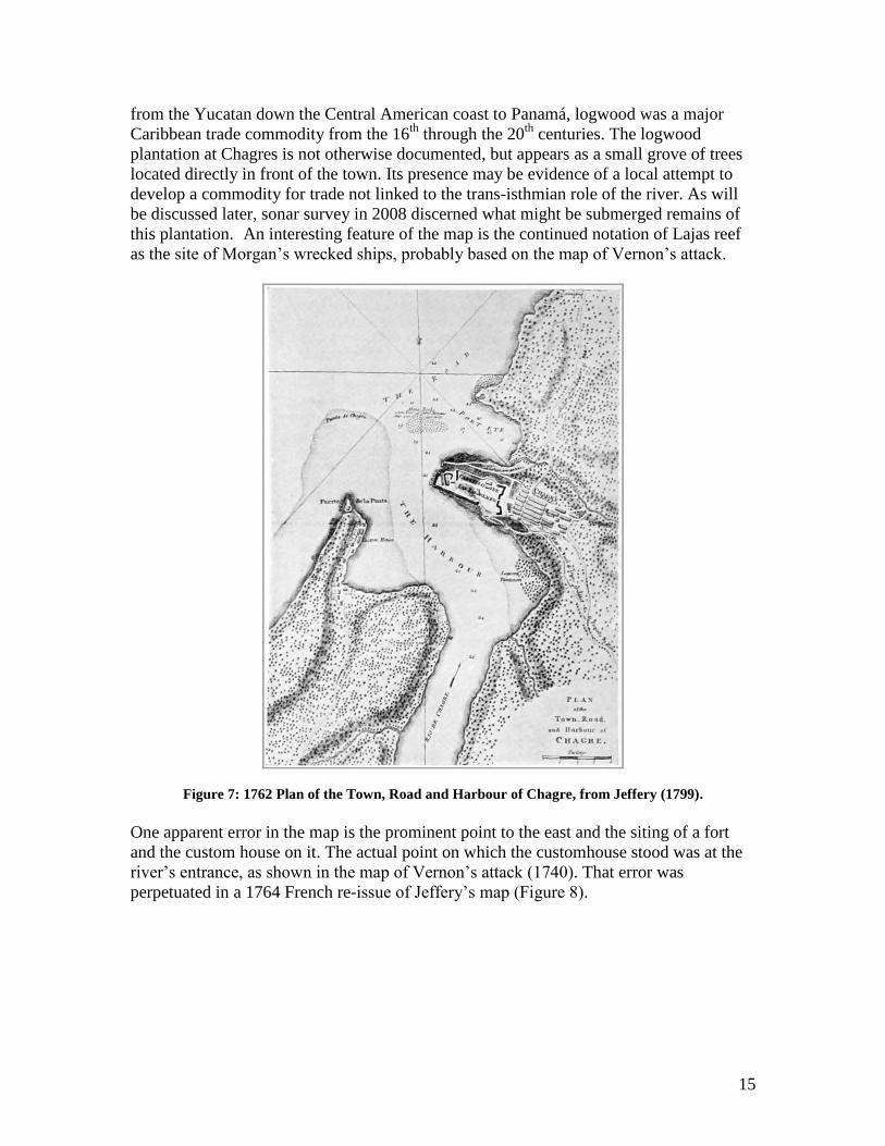
Figure 7: 1762 Plan of the Town, Road and Harbour of Chagre, from Jeffery (1799).
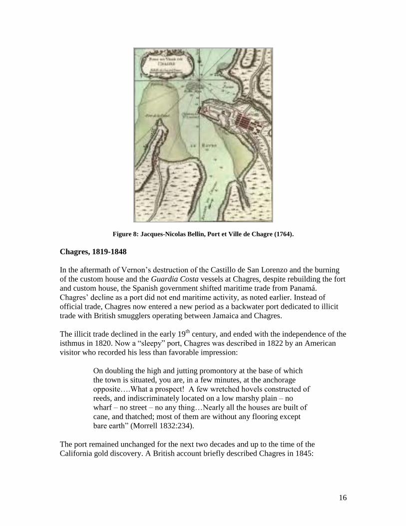
One apparent error in the map is the prominent point to the east and the siting of a fort
and the custom house on it. The actual point on which the customhouse stood was at the
river‟s entrance, as shown in the map of Vernon‟s attack (1740). That error was
perpetuated in a 1764 French re-issue of Jeffery‟s map (Figure 8).
16
Figure 8: Jacques-Nicolas Bellin, Port et Ville de Chagre (1764).
Chagres, 1819-1848
In the aftermath of Vernon‟s destruction of the Castillo de San Lorenzo and the burning
of the custom house and the Guardia Costa vessels at Chagres, despite rebuilding the fort
and custom house, the Spanish government shifted maritime trade from Panamá.
Chagres‟ decline as a port did not end maritime activity, as noted earlier. Instead of
official trade, Chagres now entered a new period as a backwater port dedicated to illicit
trade with British smugglers operating between Jamaica and Chagres.
The illicit trade declined in the early 19th
century, and ended with the independence of the
isthmus in 1820. Now a “sleepy” port, Chagres was described in 1822 by an American
visitor who recorded his less than favorable impression:
On doubling the high and jutting promontory at the base of which
the town is situated, you are, in a few minutes, at the anchorage
opposite….What a prospect! A few wretched hovels constructed of
reeds, and indiscriminately located on a low marshy plain – no
wharf – no street – no any thing…Nearly all the houses are built of
cane, and thatched; most of them are without any flooring except
bare earth” (Morrell 1832:234).
The port remained unchanged for the next two decades and up to the time of the
California gold discovery. A British account briefly described Chagres in 1845:
17
Chagres…has a good harbour, but vessels drawing more than 12 feet
water cannot enter it, on account of a ledge of rock which runs
across its entrance. It is also an unhealthy place. The town is a mere
collection of huts, which in 1822 contained 856 inhabitants of mixed
race. By means of this harbour the town of Panama carries on some
commerce with Jamaica (Long, et.al.:1845:117).
A more detailed account, in a letter from the British Consul in Panamá dated March 23,
1845, described the bar and port of Chagres and a shipwreck:
The bar of Chagres is divided into two narrow channels by a bed of
rock, upon which the sea generally breaks at low water, and during
gales of wind (from the Westward and Northerly to N.N.E.) the surf
is so heavy at all times of tide, as to render the passage of the bar, in
open boats or canoes, both difficult and dangerous…The rise and
fall of the tide upon this bar vary from one and a half to two feet, as
the wind prevails on or off the shore. In the eastern channel I found
a depth of 13 feet at low water, spring tides, but that although the
deepest and best of the two channels is so narrow as to render it
perilous for a steamer, drawing 9 or 10 feet water, to attempt it
during a fresh gale with a heavy sea; as, in addition to risk from the
„heave and set‟ of the sea, the least deviation from the deepest part
of the channel would cause her to strike, and incur serious damage,
if not total wreck. Sailing vessels, bound into the port of Chagres,
generally enter by the eastern channel, and they require a brisk
leading wind to carry them through it, (the set of the current being in
the direction of the rocks); for were the breeze to fail (which it
sometimes does under the castle point), they would be in imminent
danger of striking upon them. Shipwrecks are not uncommon in
Chagres Roads. Whilst I was there, and American schooner, (the
„Rocket‟), dragged her anchors, was driven ashore, and lost. The
Port of Chagres is essentially an inconvenient port, it is from five to
six fathoms deep in some parts, but very shoal in others; the
anchorage, moreover, is so narrow, that a steam vessel of moderate
length could not swing there at her moorings; to be always „water
bourne,‟ she should „moor stem and stern.‟ In the rainy season,
however, large trees are sometimes swept down the river by the
current, and carried „athwart hawse‟ of vessels moored off the
village, thus they are liable to be driven from their anchors, and if
they drift upon the bar they probably go to pieces. (Liot 1849:18-
19).
Gold Fever: Chagres and Yankee Chagres, 1849-1855
The discovery of gold in California in January 1848 revived the fortunes of Chagres and
reopened it as a port that for the next several years was busier than it had ever been in its
18
previous three centuries of existence. A treaty between the United States and New
Grenada (Colombia) guaranteed Americans free passage across the isthmus, and this all
served to boost Chagres‟ fortunes (Delgado 1991). A new custom house was built that
year in anticipation of the new trade, which was not long in coming. The United States
Mail Steamship Company and the Pacific Mail Steamship Company, established by New
York entrepreneurs before the gold discovery, were set to commence operation carrying
passengers, baggage and the U.S. Mail between New York and San Francisco to via
Chagres and Panamá City in January 1849, but the press of passengers eager to use the
5,500 nautical mile route, the fastest to California, induced the steamship line to
commence operations in late 1848. Other ships also joined in, sailing to Chagres to
disgorge their passengers.
An early guide offering advice to those using the Panamá Route to California noted, “the
passage across the isthmus from Chagres to Panama is now made by water forty miles, in
canoes, and twenty miles by mules, and occupies, on the average, two days.” It went on
to describe Chagres as a “miserable, sickly mud village” and advised, “it is generally
practicable, and is by far the best way, to step on board a canoe from the ship, and not to
touch at Chagres at all.” (as cited in Thornton 1864:348). Another set of “Practical
Directions to Persons about to cross the Isthmus of Panama” told passengers:
Upon your arrival at Chagres, take your baggage at once to the
custom-house, where you will experience but little delay. Then
hurry out of the village, which is pestilential. Hire your canoe,
which, for expedition, ought to be of small size. This is called a
“piragua,” is about 25 feet long, and navigated by a steersman and
two rowers. The cost of the boat-hire, and men to Cruces ought not
to exceed $12, unless, indeed, an increased traffic may have had the
effect of raising the prices. (as cited in Thornton 1864:353).
In late 1848, it was noted that the steamers advertised to sail from Panamá to San
Francisco in January and February 1849 were already booked full, and “the steamers
Crescent City, Isthmus, and Orus, are advertised for Chagres, and are nearly all full. The
Orus is intended to navigate Chagres River. Besides, there are some forty-five or fifty
vessels, of all sizes, up for Chagres or San Francisco direct.” (as cited in Thornton
1864:357).
The initial rush brought 59 vessels to Chagres between December 1848 and May 1849.
They disgorged some 4,000 passengers (Kemble 1949:48). On February 24, 1849, the
inaugural issue of the Panama Star newspaper reported that two steamers and six sailing
vessels had arrived at Chagres “within the last few days,” with “about one thousand
passengers in all.” The initial arrivals, most of the sailing vessels, approached the reef
and stood in close to shore.
19
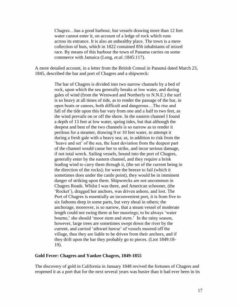
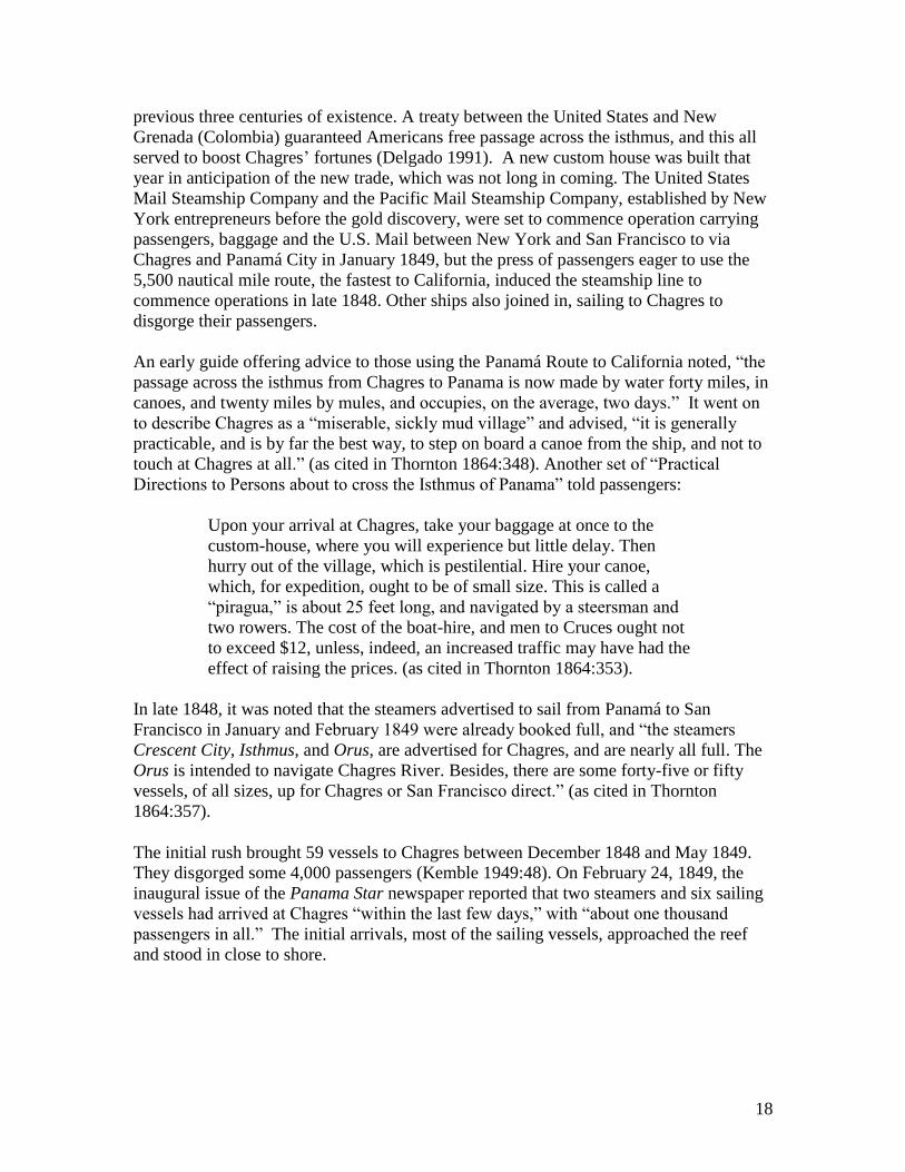
Figure 9: Chagres in early 1849 (The Century Magazine).
In the strong northerly winds, or “Nortes,” however, they lost their anchors and wrecked
at the river‟s mouth. (Morgan 1960:49). They were still visible in February when gold
seeker J.M. Letts arrived:
We remained outside until the 17th, when we weighed anchor and
passed into the mouth, making fast to the right bank, now called the
American side of the river. We found an abundance of water in the
channel, but at the entrance several dangerous rocks. As this coast is
subject to severe northers, it is an extremely difficult port to make.
The steamers still anchor some two miles out. We found several
vessels near the mouth, beached and filled….(Letts 1852:13-14).
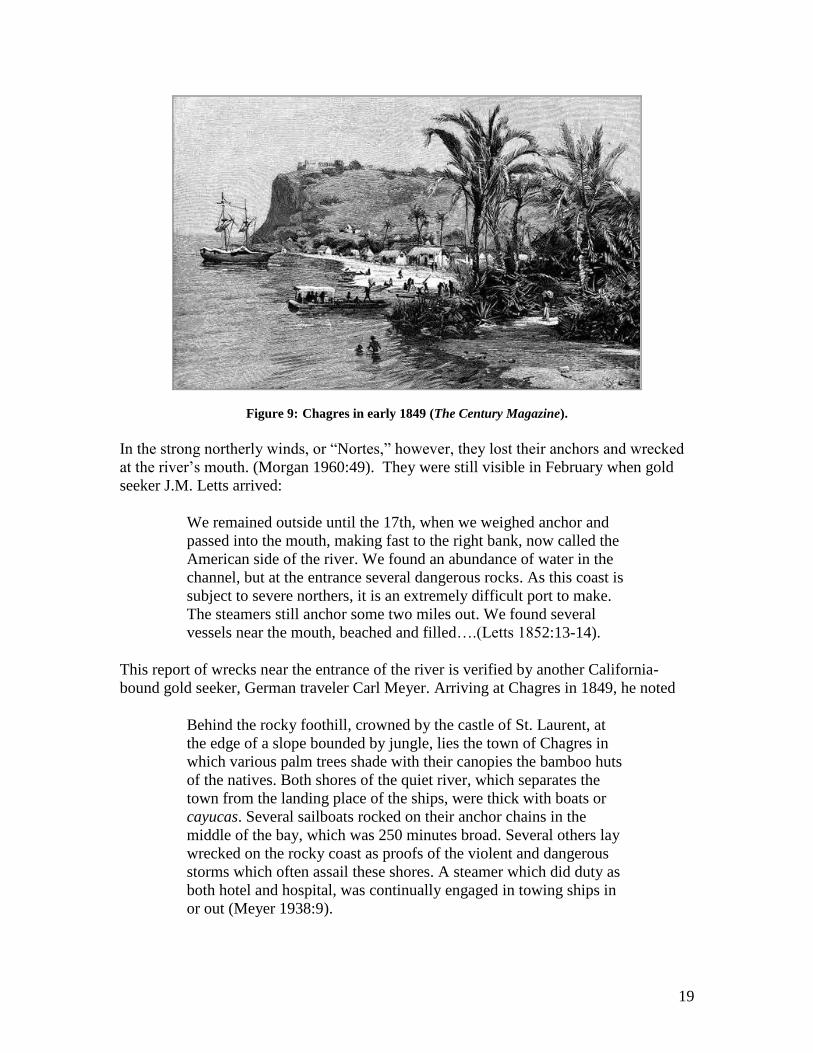
This report of wrecks near the entrance of the river is verified by another California-
bound gold seeker, German traveler Carl Meyer. Arriving at Chagres in 1849, he noted
Behind the rocky foothill, crowned by the castle of St. Laurent, at
the edge of a slope bounded by jungle, lies the town of Chagres in
which various palm trees shade with their canopies the bamboo huts
of the natives. Both shores of the quiet river, which separates the
town from the landing place of the ships, were thick with boats or
cayucas. Several sailboats rocked on their anchor chains in the
middle of the bay, which was 250 minutes broad. Several others lay
wrecked on the rocky coast as proofs of the violent and dangerous
storms which often assail these shores. A steamer which did duty as
both hotel and hospital, was continually engaged in towing ships in
or out (Meyer 1938:9).
20
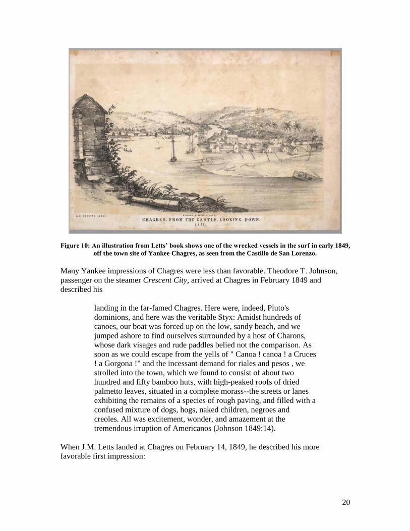
Figure 10: An illustration from Letts’ book shows one of the wrecked vessels in the surf in early 1849,
off the town site of Yankee Chagres, as seen from the Castillo de San Lorenzo.
Many Yankee impressions of Chagres were less than favorable. Theodore T. Johnson,
passenger on the steamer Crescent City, arrived at Chagres in February 1849 and
described his
landing in the far-famed Chagres. Here were, indeed, Pluto's
dominions, and here was the veritable Styx: Amidst hundreds of
canoes, our boat was forced up on the low, sandy beach, and we
jumped ashore to find ourselves surrounded by a host of Charons,
whose dark visages and rude paddles belied not the comparison. As
soon as we could escape from the yells of " Canoa ! canoa ! a Cruces
! a Gorgona !" and the incessant demand for riales and pesos , we
strolled into the town, which we found to consist of about two
hundred and fifty bamboo huts, with high-peaked roofs of dried
palmetto leaves, situated in a complete morass--the streets or lanes
exhibiting the remains of a species of rough paving, and filled with a
confused mixture of dogs, hogs, naked children, negroes and
creoles. All was excitement, wonder, and amazement at the
tremendous irruption of Americanos (Johnson 1849:14).
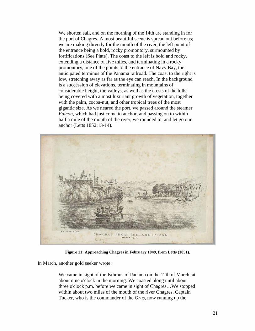
When J.M. Letts landed at Chagres on February 14, 1849, he described his more
favorable first impression:
21
We shorten sail, and on the morning of the 14th are standing in for
the port of Chagres. A most beautiful scene is spread out before us;
we are making directly for the mouth of the river, the left point of
the entrance being a bold, rocky promontory, surmounted by
fortifications (See Plate). The coast to the left is bold and rocky,
extending a distance of five miles, and terminating in a rocky
promontory, one of the points to the entrance of Navy Bay, the
anticipated terminus of the Panama railroad. The coast to the right is
low, stretching away as far as the eye can reach. In the background
is a succession of elevations, terminating in mountains of
considerable height, the valleys, as well as the crests of the hills,
being covered with a most luxuriant growth of vegetation, together
with the palm, cocoa-nut, and other tropical trees of the most
gigantic size. As we neared the port, we passed around the steamer
Falcon, which had just come to anchor, and passing on to within
half a mile of the mouth of the river, we rounded to, and let go our
anchor (Letts 1852:13-14).
Figure 11: Approaching Chagres in February 1849, from Letts (1851).
In March, another gold seeker wrote:
We came in sight of the Isthmus of Panama on the 12th of March, at
about nine o'clock in the morning. We coasted along until about
three o'clock p.m. before we came in sight of Chagres…We stopped
within about two miles of the mouth of the river Chagres. Captain
Tucker, who is the commander of the Orus, now running up the
22
Chagres River, came out in his yawl and piloted us into the river.
There is no harbor at Chagres and it is therefore exceedingly
dangerous to land outside of the river as the wrecks of two vessels
on the coast plainly testify. Never was a set of men more agreeably
disappointed in a place than we were at Chagres. Before we arrived
there our only prayer was that we might meet with some speedy
conveyance to take us away from this reputed charnel house. And
there was the steamer Orus with steam up, just ready to go; but
immediately upon our arrival we became equally solicitous to
remain for a few days. Instead of finding Chagres the miserable
slimy mud hole that it has been represented to be, we found it with
the exception of Panama to be one of the most interesting and pretty
spots on the Isthmus.
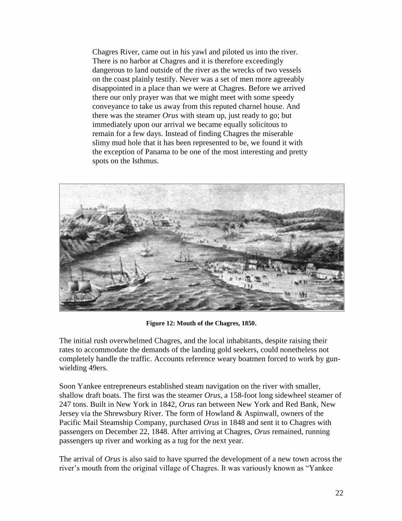
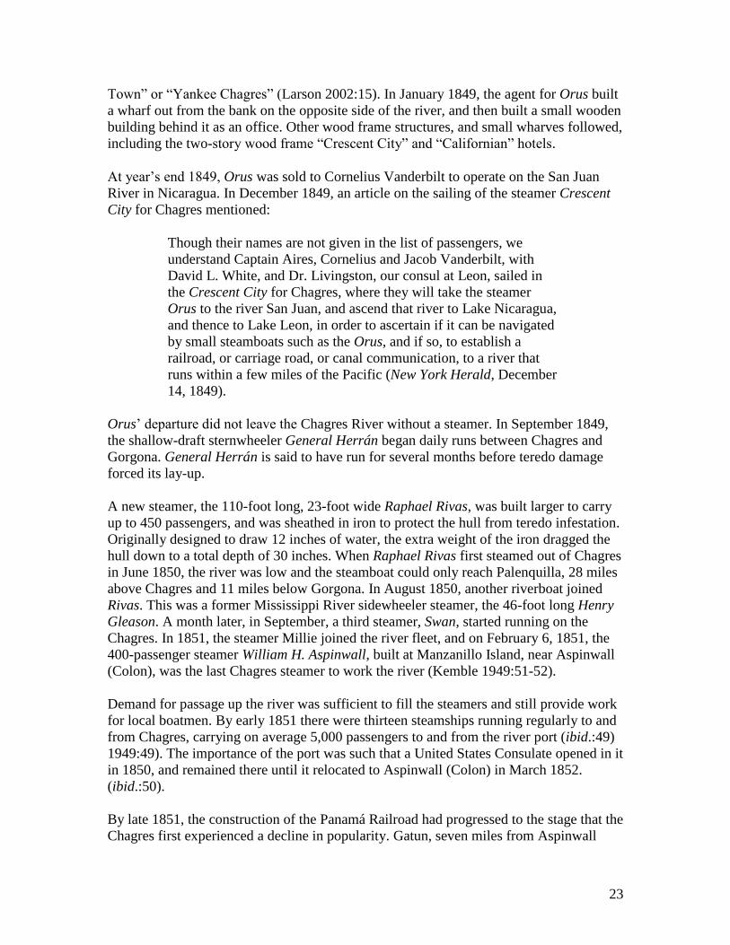
Figure 12: Mouth of the Chagres, 1850.
The initial rush overwhelmed Chagres, and the local inhabitants, despite raising their
rates to accommodate the demands of the landing gold seekers, could nonetheless not
completely handle the traffic. Accounts reference weary boatmen forced to work by gun-
wielding 49ers.
Soon Yankee entrepreneurs established steam navigation on the river with smaller,
shallow draft boats. The first was the steamer Orus, a 158-foot long sidewheel steamer of
247 tons. Built in New York in 1842, Orus ran between New York and Red Bank, New
Jersey via the Shrewsbury River. The form of Howland & Aspinwall, owners of the
Pacific Mail Steamship Company, purchased Orus in 1848 and sent it to Chagres with
passengers on December 22, 1848. After arriving at Chagres, Orus remained, running
passengers up river and working as a tug for the next year.
The arrival of Orus is also said to have spurred the development of a new town across the
river‟s mouth from the original village of Chagres. It was variously known as “Yankee
23
Town” or “Yankee Chagres” (Larson 2002:15). In January 1849, the agent for Orus built
a wharf out from the bank on the opposite side of the river, and then built a small wooden
building behind it as an office. Other wood frame structures, and small wharves followed,
including the two-story wood frame “Crescent City” and “Californian” hotels.
At year‟s end 1849, Orus was sold to Cornelius Vanderbilt to operate on the San Juan
River in Nicaragua. In December 1849, an article on the sailing of the steamer Crescent
City for Chagres mentioned:
Though their names are not given in the list of passengers, we
understand Captain Aires, Cornelius and Jacob Vanderbilt, with
David L. White, and Dr. Livingston, our consul at Leon, sailed in
the Crescent City for Chagres, where they will take the steamer
Orus to the river San Juan, and ascend that river to Lake Nicaragua,
and thence to Lake Leon, in order to ascertain if it can be navigated
by small steamboats such as the Orus, and if so, to establish a
railroad, or carriage road, or canal communication, to a river that
runs within a few miles of the Pacific (New York Herald, December
14, 1849).
Orus‟ departure did not leave the Chagres River without a steamer. In September 1849,
the shallow-draft sternwheeler General Herrán began daily runs between Chagres and
Gorgona. General Herrán is said to have run for several months before teredo damage
forced its lay-up.
A new steamer, the 110-foot long, 23-foot wide Raphael Rivas, was built larger to carry
up to 450 passengers, and was sheathed in iron to protect the hull from teredo infestation.
Originally designed to draw 12 inches of water, the extra weight of the iron dragged the
hull down to a total depth of 30 inches. When Raphael Rivas first steamed out of Chagres
in June 1850, the river was low and the steamboat could only reach Palenquilla, 28 miles
above Chagres and 11 miles below Gorgona. In August 1850, another riverboat joined
Rivas. This was a former Mississippi River sidewheeler steamer, the 46-foot long Henry
Gleason. A month later, in September, a third steamer, Swan, started running on the
Chagres. In 1851, the steamer Millie joined the river fleet, and on February 6, 1851, the
400-passenger steamer William H. Aspinwall, built at Manzanillo Island, near Aspinwall
(Colon), was the last Chagres steamer to work the river (Kemble 1949:51-52).
Demand for passage up the river was sufficient to fill the steamers and still provide work
for local boatmen. By early 1851 there were thirteen steamships running regularly to and
from Chagres, carrying on average 5,000 passengers to and from the river port (ibid.:49)
1949:49). The importance of the port was such that a United States Consulate opened in it
in 1850, and remained there until it relocated to Aspinwall (Colon) in March 1852.
(ibid.:50).
By late 1851, the construction of the Panamá Railroad had progressed to the stage that the
Chagres first experienced a decline in popularity. Gatun, seven miles from Aspinwall
24
(Colon) was reached by rail in October, and the following month, “the steamers Georgia
and Philadelphia were caught in a cyclone off Chagres, and were compelled to put into
Navy Bay for refuge. This event gave the railroad its first business of any importance”
(Robinson 1907:16). Construction of the railroad continued to reach farther into the
jungle and closer to Cruces. In July 1852, the rails had reached Barbacoas, 23 miles from
Aspinwall (Colon).
An 1854 account in Gleason’s Pictorial and Drawing Room Companion noted that
Chagres had declined greatly thanks to the Panamá Railroad. “Chagres…the ancient port,
but nine miles west of Aspinwall, is now sinking into nothingness; the most of its
business men and citizens now live at Aspinwall.” (Gleason‟s Pictorial Drawing-Room
Companion, September 30, 1854: 200). An entry in the English Cyclopaedia written in
February 1854 noted, “this small river was until lately of considerable importance,” but
because of the railway, “now (Feb. 1854) rapidly approaching completion…the Chagres
river and town are now deserted” (Knight 1866:411).
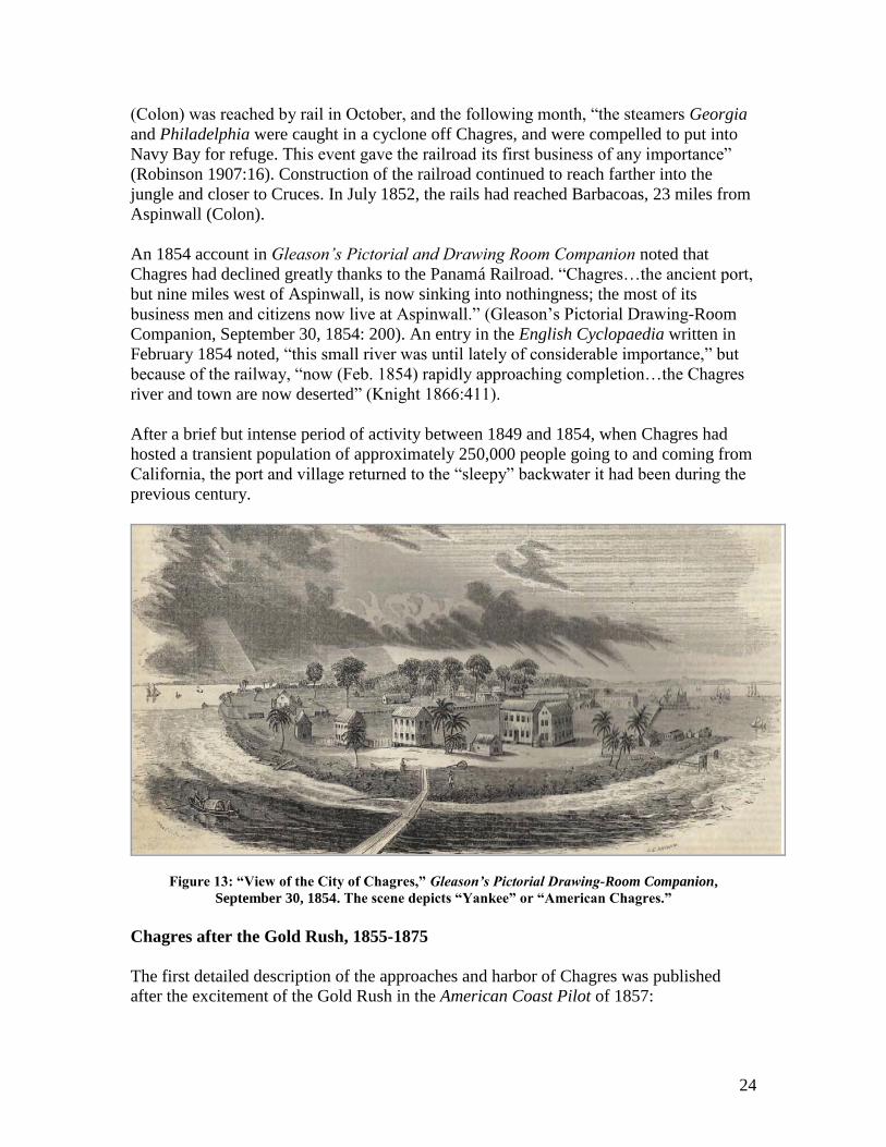
After a brief but intense period of activity between 1849 and 1854, when Chagres had
hosted a transient population of approximately 250,000 people going to and coming from
California, the port and village returned to the “sleepy” backwater it had been during the
previous century.
Figure 13: “View of the City of Chagres,” Gleason’s Pictorial Drawing-Room Companion,
September 30, 1854. The scene depicts “Yankee” or “American Chagres.”
Chagres after the Gold Rush, 1855-1875
The first detailed description of the approaches and harbor of Chagres was published
after the excitement of the Gold Rush in the American Coast Pilot of 1857:
25
From Chagres Point to the West point of the Peñon, or rock, on
which stands the castle of San Lorenzo, is about 1 2/2 cable‟s length
S. by E. The Peñon is scarped to the N.W. and South, and the castle
of San Lorenzo, as we have said, is situated on it. This Peñon to the
North, with Point Arenas to the South, form the mouth of the
Chagres River, which, at the widest part, is 2 cables length across,
and 1 ½ where narrowest. To the E.S.E., at a short distance from the
castle of San Lorenzo, is the little town and village of Chagres,
consisting of huts, covered in thatch. The mouth of the river narrows
between the Penon and bank, which extends out from Arenas Point
in a N.W. direction, to the distance of a cable‟s length. In the mouth,
and to the South of the Peñon, there are 2 ½ and 3 fathoms water;
and the same depth continues, a little more or less, to the distance of
half a mile up the river. To the West of the castle of San Lorenzo, at
the distance of 92 English fathoms, is a shoal, named Laja, which
extends from North to South 70 fathoms, and is of rock, with very
little water on it. To enter and to sail out of this river is very
dangerous, and can only be effected by very manageable vessels,
which do not draw more than 12 feet; both operations most be
performed with a fair wind, for otherwise the current of the river,
and the various eddies it forms, from the opposition of the Peñon,
Laja and the West shore, will carry vessels on either one or the other
of these dangers (Blunt 1857:604).
A year later, in 1858, the New American Cyclopaedia described Chagres:
It is built on both sides of the river, the left part being called the
American town, inhabited chiefly by natives of the United States,
and the right the old Spanish or Indian town, with negroes, half-
breeds, Mexicans, Spanish and a few English. The former is
composed of wood houses, the later mainly of huts thatched with
palmetto, and contains an old church. The harbor is difficult of
entrance and very shallow (Ripley and Dana 1858:671).
Despite its decline as a major port in favor of neighboring Aspinwall (Colon), Chagres
remained a small and yet vital local community.
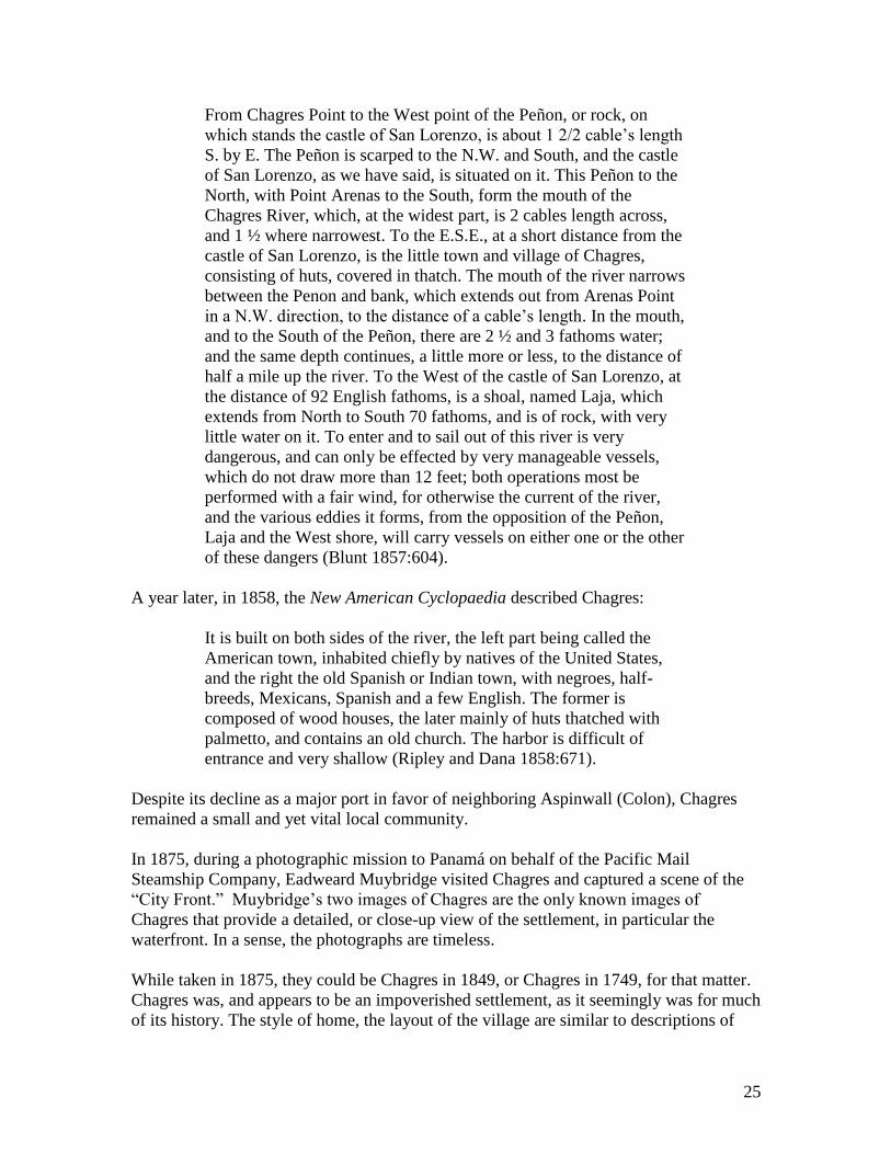
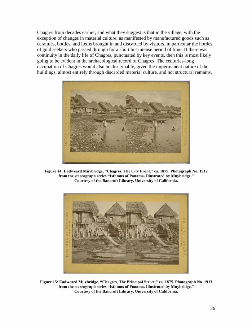
In 1875, during a photographic mission to Panamá on behalf of the Pacific Mail
Steamship Company, Eadweard Muybridge visited Chagres and captured a scene of the
“City Front.” Muybridge‟s two images of Chagres are the only known images of
Chagres that provide a detailed, or close-up view of the settlement, in particular the
waterfront. In a sense, the photographs are timeless.
While taken in 1875, they could be Chagres in 1849, or Chagres in 1749, for that matter.
Chagres was, and appears to be an impoverished settlement, as it seemingly was for much
of its history. The style of home, the layout of the village are similar to descriptions of
26
Chagres from decades earlier, and what they suggest is that in the village, with the
exception of changes in material culture, as manifested by manufactured goods such as
ceramics, bottles, and items brought in and discarded by visitors, in particular the hordes
of gold seekers who passed through for a short but intense period of time. If there was
continuity in the daily life of Chagres, punctuated by key events, then this is most likely
going to be evident in the archaeological record of Chagres. The centuries-long
occupation of Chagres would also be discernable, given the impermanent nature of the
buildings, almost entirely through discarded material culture, and not structural remains.
Figure 14: Eadweard Muybridge, “Chagres, The City Front,” ca. 1875. Photograph No. 1912
from the stereograph series “Isthmus of Panama. Illustrated by Muybridge.”
Courtesy of the Bancroft Library, University of California.
Figure 15: Eadweard Muybridge, “Chagres, The Principal Street,” ca. 1875. Photograph No. 1913
from the stereograph series “Isthmus of Panama. Illustrated by Muybridge.”
Courtesy of the Bancroft Library, University of California.
27
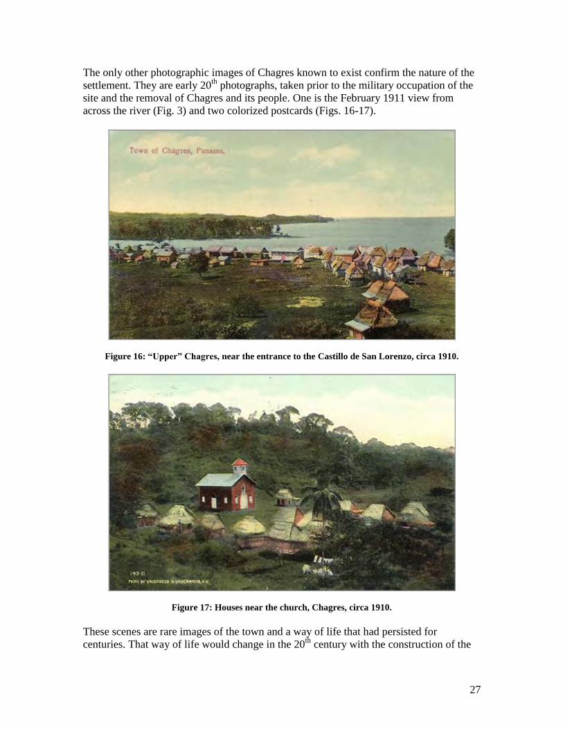
The only other photographic images of Chagres known to exist confirm the nature of the
settlement. They are early 20th
photographs, taken prior to the military occupation of the
site and the removal of Chagres and its people. One is the February 1911 view from
across the river (Fig. 3) and two colorized postcards (Figs. 16-17).
Figure 16: “Upper” Chagres, near the entrance to the Castillo de San Lorenzo, circa 1910.
Figure 17: Houses near the church, Chagres, circa 1910.
These scenes are rare images of the town and a way of life that had persisted for
centuries. That way of life would change in the 20th
century with the construction of the
28
Panamá Canal and the fortification of the coast, including the mouth of the Chagres, by
the United States Army.
Fort Sherman’s World War One and World War Two Defenses on the Chagres
The United States Army established Fort Sherman in 1909, and in 1911, Fort San
Lorenzo was added to the military reservation. After 1915, the town of Chagres and the
area surrounding it was also added. Military occupation of the lands led to fortification,
albeit on a smaller scale than the larger gun and mortar batteries guarding the Colon
entrance to the Panamá Canal.
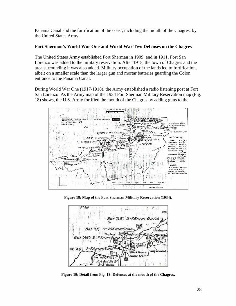
During World War One (1917-1918), the Army established a radio listening post at Fort
San Lorenzo. As the Army map of the 1934 Fort Sherman Military Reservation map (Fig.
18) shows, the U.S. Army fortified the mouth of the Chagres by adding guns to the
Figure 18: Map of the Fort Sherman Military Reservation (1934).
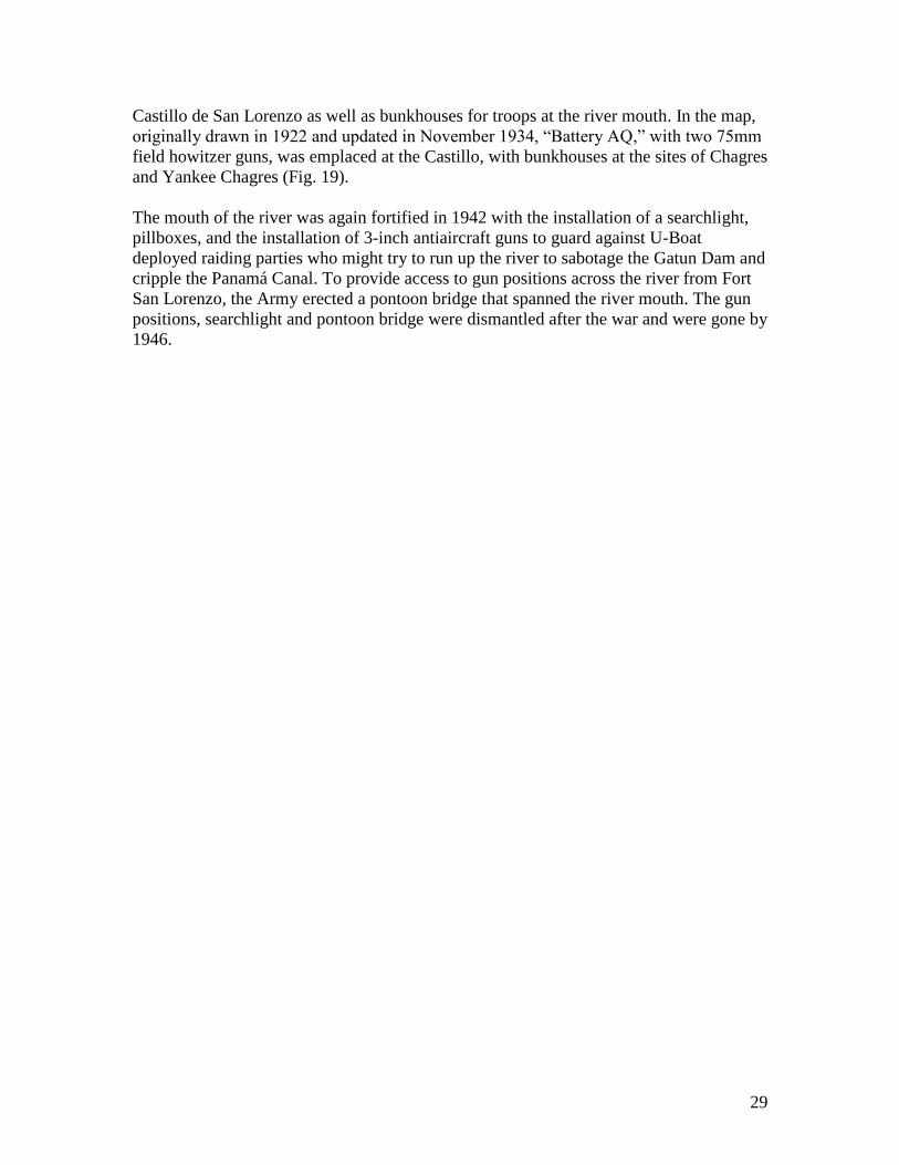
Figure 19: Detail from Fig. 18: Defenses at the mouth of the Chagres.
29
Castillo de San Lorenzo as well as bunkhouses for troops at the river mouth. In the map,
originally drawn in 1922 and updated in November 1934, “Battery AQ,” with two 75mm
field howitzer guns, was emplaced at the Castillo, with bunkhouses at the sites of Chagres
and Yankee Chagres (Fig. 19).
The mouth of the river was again fortified in 1942 with the installation of a searchlight,
pillboxes, and the installation of 3-inch antiaircraft guns to guard against U-Boat
deployed raiding parties who might try to run up the river to sabotage the Gatun Dam and
cripple the Panamá Canal. To provide access to gun positions across the river from Fort
San Lorenzo, the Army erected a pontoon bridge that spanned the river mouth. The gun
positions, searchlight and pontoon bridge were dismantled after the war and were gone by
1946.
30
POTENTIAL ARCHAEOLOGICAL RESOURCES IN THE PROJECT AREA
As previously noted, the waters off El Castillo de San Lorenzo and the sites of Chagres and “Yankee Chagres” have been known to contain a variety of submerged cultural
resources for decades, although a professional archaeological assessment of those resources was not undertaken, recommendations for such a survey have noted the potential for materials lost or discarded in the water as well as shipwrecks.
The official summary for natural and cultural resources in the San Lorenzo Protected Area notes, in a summary of archaeological sites, noted, “the coastal waters off San Lorenzo contain shipwrecks and portions of the fort and cannons that have eroded into the sea. The shipwrecks provide an opportunity for underwater research and have attracted proposals for exploration and salvage” (Weaver and Bauer 2004:14).
A detailed archival search has apparently yet to be conducted to assess the total number of potential shipwrecks in the project area. However, one popular source (Marx 1987) lists the following:
Ships from the fleet of Henry Morgan, including his flagship, Satisfaction,“wrecked on a reef at the mouth of the Chagres River” in 1670. A popular account states five vessels, which “were stripped of all valuable items” and then “burnt to
the waterline by the pirates” (ibid.:424-425). As noted earlier, the 1740 Vernon map and the 1762 map of Chagres noted the presence of the Morgan wrecks at Lajas Reef. The question of whether there were four or five wrecks may come from a misreading of accounts noting four vessels, but also naming Satisfactionand concluding that the flagship was a fifth vessel as opposed to the only named ship of the four lost.
A merchant nao of the 1681 Tierra Firme Armada, Chaperon, which “sank at the
mouth of the Chagres River” (ibid.:425).
“Two large Spanish vessels” sunk during Vernon‟s attack “at the mouth of the Chagres River” (ibid.:425). As noted earlier, these were most likely smaller vessels, as they were Guarda Costa craft moored inside the mouth of the river. They appear in the 1740 Vernon map.
From other sources, as noted previously, there are at least five additional wrecks:
The American schooner Rocket, blown ashore at Chagres in 1845 (Liot 1849:18-19).
Gold Rush wrecks noted off Chagres in 1849. A plate from Letts‟ book shows a half filled wreck in front of Yankee Chagres. This may be the recently wrecked brig Caroline E. Platt, which sailed from New York on December 20, 1848, the schooner Macon, which sailed from New Orleans on December 10, 1848, or the brig Mary Pennel, which sailed from New York on January 2, 1849, all wrecked
31
at Chagres in the strong “Nortes” of the season; one account notes that six out of
eight sailing vessels that reached Chagres between December and January had wrecked “upon the bar at the mouth of the Chagres River” (Morgan 1960:188 and the New York Herald, April 19, 1849).
Another possibility, not specifically mentioned in the historical record, would be laid up and abandoned steamships that ran on the Chagres during the Gold Rush. General Herran, one of the first on the river, was said to be plagued with teredo damage and withdrawn from service by the summer of 1850.
Lafayette, burned while being towed from the Chagres anchorage on September 11, 1851.
A more detailed discussion of Lafayette was presented in the proposal to INAC in January 2008. Inasmuch as the project was not able to survey in the area where Lafayetteis presumed to lie, no further discussion of this vessel will be made. However, if a subsequent phase of the project were undertaken, that would be an appropriate venue for more discussion of Lafayette‟s history, loss, context and characteristics.
In addition to the shipwrecks, the river bottom should also contain a wide array of material culture associated with the settlements of both Chagres and the later “Yankee
Chagres,” including landing sites, discarded materials from the settlements, items disposed of in the water, including ballast, anchors, and debris from ships as well as lost cargo or personal items. It should also be noted that the sites on land of both Chagres settlements would also be present in the archaeological record. Even the short temporal span of “Yankee Chagres” (1850-1855) would leave a substantial archaeological record given the large number of visitors who passed through the settlement, albeit even if measured in terms of discarded alcoholic beverage bottles in a trash dump.
Treasure and Relic Hunter Reports
Treasure hunter Robert F. Marx reported in 2004 that he had discovered the remains of Morgan‟s ships in 1954, had recovered materials from them, and later returned to find the wrecks had been removed in 1970:
In 1954, when I was a diver and salvage expert in the U.S. Marine Corps, I was in Panama for a short time and looked for the Oxford. Ihad, as a guide, a copy of an old manuscript with a chart showing the position where all five of Morgan‟s ships were wrecked in 1670.The reef, with waves breaking over it, was easy to find and so were vestiges of the pirate wrecks embedded in it. In quite shallow water Ifound 128 iron and 16 bronze cannon, 22 large anchors, thousands of cannon balls and tons of lead and iron ingots – most likely used as ballast. Also in evidence were hundreds of rum and wine bottles, some still full. I spent an exciting five days digging in the reef and discovered many artifacts from Morgan‟s ships – from small pewter
32
buckles to muskets as long as a man‟s body. The only piece of
treasure I found was a gold pocket watch inscribed “James Moore,
1657.” Eighteen years passed before I was able to return to Panama
with a salvage vessel to explore Morgan‟s wrecks further.
Anticipation turned to disillusionment when I found nothing but
deep holes in the coral reef where salvors had used explosives to
dislodge the cannon and anchors. I learned from fishermen that, two
years earlier, divers from California had salvaged all five of the
ships. I wonder if they even realized that they were on Henry
Morgan‟s shipwrecks! (Marx 2004:136).
In August 2001, an online posting by “whaywood” in the forum treasurenet.com talked of
a “circa 1700 wreck:”
just for information.... Treasure Quest Panama with West Indies Ltd.
have started the salvage of an unknown wreck near the mouth of the
Chagres River. All work is being done under contract and direction
of the Ministry of Culture (INAC). Early recoveries consisted of
chest of sword blades, mule shoes, ax heads and scissors in leather
pouches. One iron gun of approx 5ft in length was also recovered.
Speculation is that the wreck was inbound from Europe.
(http://treasurenet.com/forum/shipwrecks/archives/20011102/messa
ges/1002385.shtml)
A follow-up, posted by “Sport Diver” on September 3, 2001, said, “From a survey
conducted in 1999 this wreck has been tentatively identified as the 'Toledo' which sailed
from Spain with supplies. Not much treasure.”
(http://treasurenet.com/forum/shipwrecks/archives/20011102/messages/1002392.shtml)
Haywood responded on September 18, 2001:
Thanks for your info. I'll pass it on to the Panama crew. Since you
mentioned a 1999 survey, do you know where we could obtain a
copy? They have located two more sites but nothing “special.” The
first is “above” the Chagres and may date around circa 1820, the
second is “below” the first but I don't have anything. Thanks.
(http://treasurenet.com/forum/shipwrecks/archives/20011102/messa
ges/1002412.shtml)
“Sport Diver” answered, in the last post on the subject, on September 20, 2001:
Haywood, I got the survey from INAC. They should have a copy. The
Toledo wreck with 5 unopened wooden crates is located at; 09-18-
62N, 80-01-52W. Are you working in this area? You can find 7 iron
cannons at; 9-26.459N, 79-47.966W. This is the Galetta wreck which
is part of the Santa Teresa fleet. Anything else I can help you with?
33
(http://treasurenet.com/forum/shipwrecks/archives/20011102/message
s/1002415.shtml)
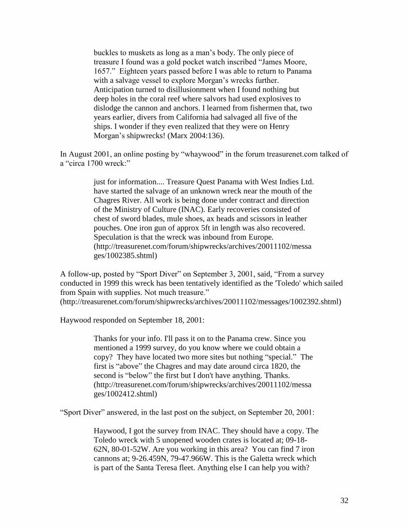
In another website, “Daniel Frank Sedwick: Treasure Auction #2 Artifacts,”
(http://www.sedwickcoins.com/Auction/DFS_TreasureAuction2_Cat_Artifacts.htm),
offered three artifacts from the project area. The following are the actual entries from the
auction catalog:
Item 471, estimated $500 - $1000 Huge (17" diameter) pewter plate
with hallmarks, probably Spanish, 1600s? 4 lb., about 16½” in
diameter and ¾” deep. Truly we have never seen such a big round
plate, probably a serving platter of some sort, let alone in such beautiful
condition. The surface shows many years worth of knife-cuts and other
wear, but the hallmarks (three on top, one on bottom) on the wide rim
are still in evidence, two being a sun and an anchor and the other two
not so identifiable, in addition to three clear letters R, P and S. There
are no wrinkles or holes or corrosion, as you see with shipwreck
specimens, which typically cost well into the thousands of dollars!
Found in the Chagres River near Ft. San Lorenzo, Panama.
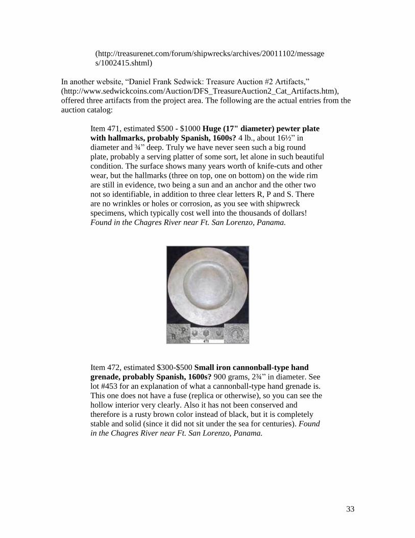
Item 472, estimated $300-$500 Small iron cannonball-type hand
grenade, probably Spanish, 1600s? 900 grams, 2¾” in diameter. See
lot #453 for an explanation of what a cannonball-type hand grenade is.
This one does not have a fuse (replica or otherwise), so you can see the
hollow interior very clearly. Also it has not been conserved and
therefore is a rusty brown color instead of black, but it is completely
stable and solid (since it did not sit under the sea for centuries). Found
in the Chagres River near Ft. San Lorenzo, Panama.
34
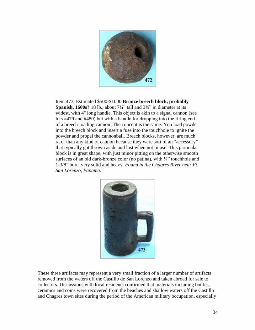
Item 473, Estimated $500-$1000 Bronze breech block, probably
Spanish, 1600s? 18 lb., about 7¾” tall and 3¾” in diameter at its
widest, with 4" long handle. This object is akin to a signal cannon (see
lots #479 and #480) but with a handle for dropping into the firing end
of a breech-loading cannon. The concept is the same: You load powder
into the breech block and insert a fuse into the touchhole to ignite the
powder and propel the cannonball. Breech blocks, however, are much
rarer than any kind of cannon because they were sort of an “accessory”
that typically got thrown aside and lost when not in use. This particular
block is in great shape, with just minor pitting on the otherwise smooth
surfaces of an old dark-bronze color (no patina), with ¼” touchhole and
1-3/8” bore, very solid and heavy. Found in the Chagres River near Ft.
San Lorenzo, Panama.
These three artifacts may represent a very small fraction of a larger number of artifacts
removed from the waters off the Castillo de San Lorenzo and taken abroad for sale to
collectors. Discussions with local residents confirmed that materials including bottles,
ceramics and coins were recovered from the beaches and shallow waters off the Castillo
and Chagres town sites during the period of the American military occupation, especially
35
after the introduction of scuba diving in the 1950s. This activity is discussed in one
website, http://www.czimages.com/CZMemories/Photos/photoof239.htm, which included
colorized postcards of Chagres and noted in a posting dated January 12, 2003: “When I
searched the old town area in modern times, it was nothing but mangrove swamp and
jungle. Many a good coin, bottle and relic have been found in the area of this historical
old town.” The discussion on the web page continued:
When I explored the old town of Chagres site, much of it had been
eroded by the river and sea. I found many old relics within the
shallows of the area that was once the old town. Although it was
rough probing and digging, we found many nice vintage bottles on
what was left of the dry, but swampy land.
A guide to bottle collecting, published in Panamá in 1973, talks of reports of people
“looking for old bottles at Fort San Lorenzo in “Sunday Best;” using those square bottles,
with the man on them, for target practice” (Lawrence and Teal 1973:5). The full extent of
this type of activity, and its impact on the archaeological record is unknown, but one
bottle broken by a bullet‟s impact was noted on the river bottom during the
archaeological survey, and like other traces of vandalism, forms a record of years of
unfortunate damage caused by collectors, looters, and salvagers, as well as the
thoughtless who had no appreciation or perhaps even an understanding of how each small
piece was part of a larger assemblage that reflected the area‟s long history.
36
ARCHAEOLOGICAL OBSERVATIONS
Archaeological observations commence with the remote sensing activities. A discussion
of resources noted during the visual survey and assessment of the project area then
follows.
Survey Area Description:
As previously noted, the original survey was planned to encompass a zone offshore,
along the adjacent coast and commencing at the mouth of the Rio Chagres. Severe
weather offshore restricted planned operations and the project shifted operations into
safer waters inshore of Lajas Reef and at the entrance to the Chagres River. Due to
limited geophysical data and maps of the area, the survey crew initially conducted a
reconnaissance of the river entrance to look for obstructions and to measure soundings in
the area. Diving later during the project determined that the bottom in the area is a mix of
sand and bottom sediments of mud/clay matrix running from the river with a hard
rock/coral reef formation (Lajas Reef), rocky shoreline and one outcropping from the
shoreline in the area of the Castillo de San Lorenzo.
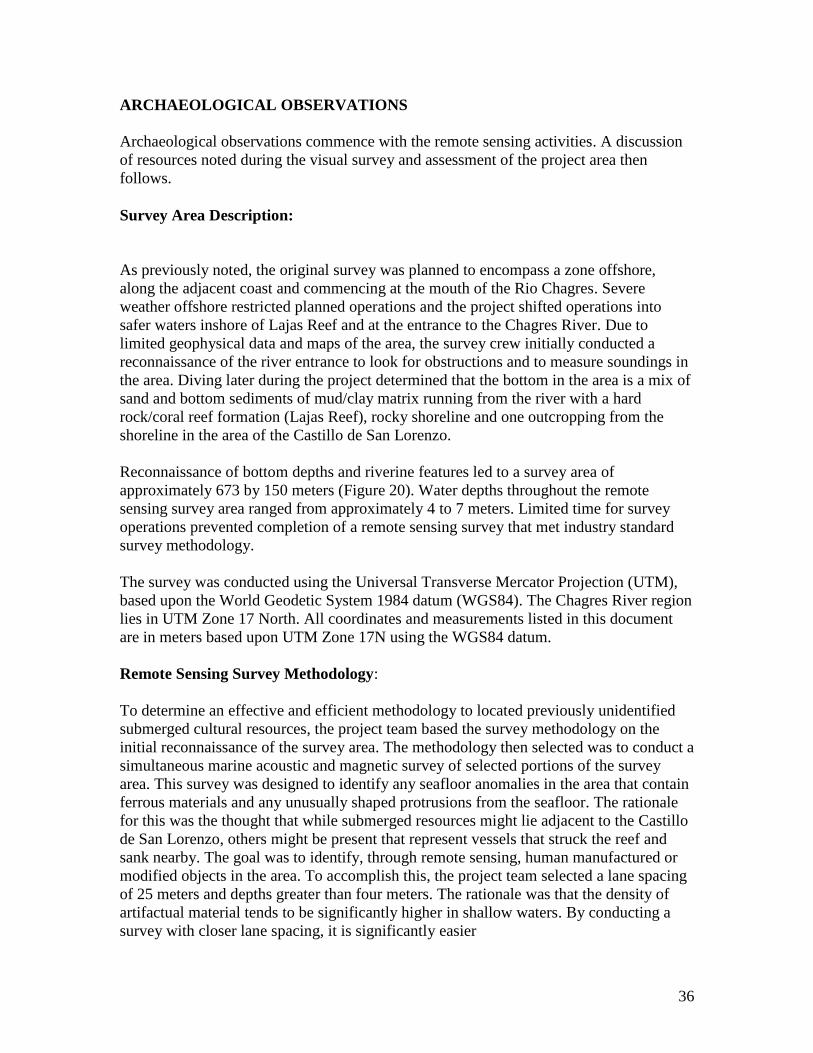
Reconnaissance of bottom depths and riverine features led to a survey area of
approximately 673 by 150 meters (Figure 20). Water depths throughout the remote
sensing survey area ranged from approximately 4 to 7 meters. Limited time for survey
operations prevented completion of a remote sensing survey that met industry standard
survey methodology.
The survey was conducted using the Universal Transverse Mercator Projection (UTM),
based upon the World Geodetic System 1984 datum (WGS84). The Chagres River region
lies in UTM Zone 17 North. All coordinates and measurements listed in this document
are in meters based upon UTM Zone 17N using the WGS84 datum.
Remote Sensing Survey Methodology:
To determine an effective and efficient methodology to located previously unidentified
submerged cultural resources, the project team based the survey methodology on the
initial reconnaissance of the survey area. The methodology then selected was to conduct a
simultaneous marine acoustic and magnetic survey of selected portions of the survey
area. This survey was designed to identify any seafloor anomalies in the area that contain
ferrous materials and any unusually shaped protrusions from the seafloor. The rationale
for this was the thought that while submerged resources might lie adjacent to the Castillo
de San Lorenzo, others might be present that represent vessels that struck the reef and
sank nearby. The goal was to identify, through remote sensing, human manufactured or
modified objects in the area. To accomplish this, the project team selected a lane spacing
of 25 meters and depths greater than four meters. The rationale was that the density of
artifactual material tends to be significantly higher in shallow waters. By conducting a
survey with closer lane spacing, it is significantly easier
37
Figure 20: Survey Zone
2008 Chagres River, Panama Survey Magnetic Survey Point Data
38
to detect and delineate smaller objects. This survey orientation and lane spacing provided
acoustic images of the seafloor at approximately 20cm resolution and magnetic field
readings every 45 cm along the track.
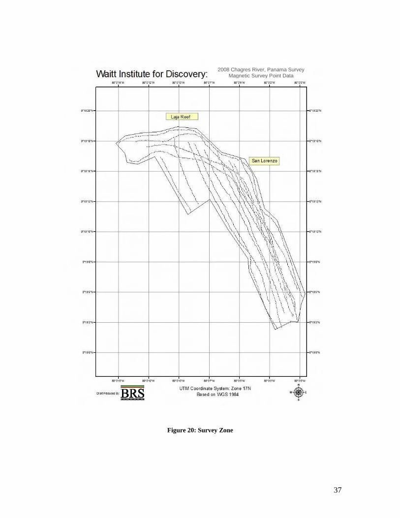
Survey Equipment
All shallow water survey operations were performed from a 28-foot cuddy cabin rigid
inflatable (RIB) (Figure 21). Aboard that vessel, navigation and positioning data was
received on a permanently mounted Raymarine E80 integrated navigation system which
included a Wide Area Augmentation System Differential Global Positioning System
(WAAS DGPS), digital echosounder, and radar. The vessel DGPS signal is provided to
the primary survey data collection system via an RS-232 cable. Hypack, Inc.‟s
hydrographic survey suite served as the primary survey navigation system. Hypack
provides the capability to layout survey lines, collect navigation and magnetic data, and
provided an accurate real-time visual representation of the survey vessel and survey
tracking. Additional shipboard power is provided by a portable Honda generator, rated at
2000 watts.
Figure 21: Waitt Institute RIB vessel Protector.
Acoustic Data Collection
Acoustic data was collected using a Klein 3000 digital side scan sonar system. The Klein
3000 system is dual frequency unit operating at 132 and 455 kHz with selectable range
control ranging from 12.5 to 1000 meters. WID personnel operated the sonar in the high
frequency 455 kHz mode and selected range scale settings between 25 and 50 meters to
ensure that high quality sonar records were recorded. Aboard the survey boat, the output
of the Klein 3000 sonar was recorded using Hypack survey software, which provided
sonar and navigation data collection, real-time sonar data analysis and targeting, and
sonar and navigation data post-processing capabilities. WID personnel configured
SonarPro to record the sonar data in Triton exchange format (XTF) files for post
39
processing in Echovision‟s 2020 software. The survey target database, coverage, and
towfish track were generated using Echovision‟s 2020 software.
Magnetic Data Collection
Magnetic data was collected using a Marine Magnetics SeaSpy overhauser
magnetometer. The SeaSpy magnetometer can detect variations in the earth‟s magnetic
field to .001 nano-tesla‟s (Gamma) and takes readings of that field 4 times a second (4
Hertz). The Hypack survey software recorded the magnetic readings along with
navigation data for each survey lane. WID personnel configured Hypack parameters to
record magnetic readings at 4 Hertz and account for the towfish layback behind the
survey vessel. All magnetic data collected during the survey was analyzed and edited in
Hypack‟s single beam survey editor and exported into an XYZ point file. The XYZ files
were imported in ESRI‟s ArcGIS Geographic Information System (GIS) where the data
was processed using the ArcGIS 3D Analyst extension to generate magnetic gradient
overlays and contour maps.
Survey Data Integration
All survey data was integrated for visualization and the production of survey maps using
ESRI‟s ArcGIS software. Magnetic gradient maps, the survey geo-database, as well as
data from published navigation charts were integrated into a single ArcGIS project. This
GIS project allowed WID personnel to analyze the spatial relationships between magnetic
anomalies and the surrounding geology.
Findings
Project personnel began the survey in the center of the mouth of the Chagres River in
approximately 7 meters of water depth. The survey team chose to start at that location
because the reconnaissance survey indicated deep water without bottom obstructions. The
initial survey line allowed the crew to further expand the reconnaissance of the bottom
and to determine appropriate operational range settings, sensor placement and settings to
ensure that the remote sensing survey would collect valid data. By working inside Lajas
Reef, weather conditions and boat traffic were not factors during the survey.
The survey located three distinct remote sensing features: 1) a large acoustic feature of
natural composition associated with numerous magnetic changes from below the Castillo
de San Lorenzo (9o19‟10” N); 2), a multi-component magnetic anomaly on the northwest
of the river‟s opening; 3), and a smaller multi-component magnetic anomaly below Lajas
Reef (See Figure 22).
The large multi-component anomaly in the middle of the river was confirmed by divers to
be a natural rock formation that extends from the shoreline and runs across the river
towards the opposite shore. Magnetic signatures associated with the feature produced
twelve dipolar signatures with a minimum magnetic reading of 34,480 gammas and a
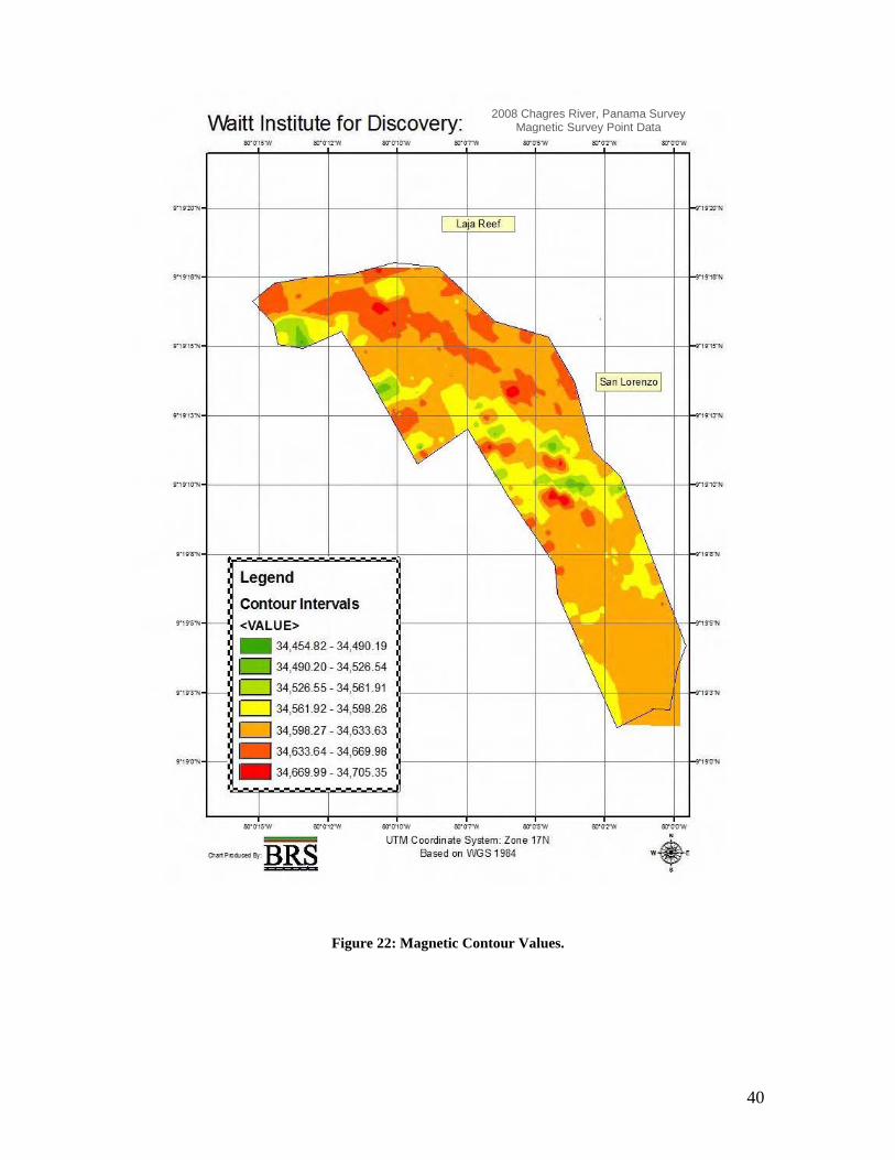
40
2008 Chagres River, Panama Survey Magnetic Survey Point Data
Figure 22: Magnetic Contour Values.

41
2008 Chagres River, Panama Survey Magnetic Survey Point Data
Figure 23: Contour Intervals
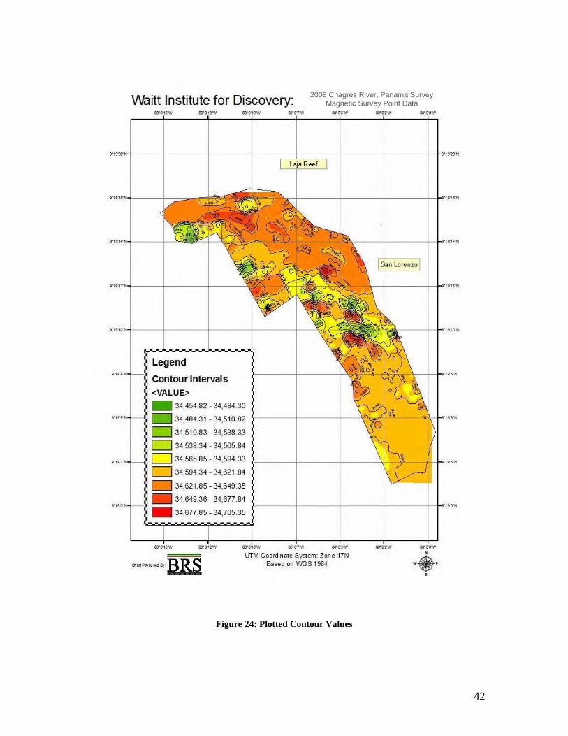
42
2008 Chagres River, Panama Survey Magnetic Survey Point Data
Figure 24: Plotted Contour Values
43
maximum reading of 34,705 gammas. This anomaly is covered in most areas with
sediment making it invisible to the reconnaissance diver. This natural formation may be
acting as a natural catch area for cultural resources (i.e. cannons and anchors) based upon
the magnetic signatures that were identified to be associated with it.
The multi-component anomaly at the northwest corner of the survey area (9o19‟15”)
covers a small area north of an area of sand shoals. This area is very close to the shoals
and beach on the opposite shore of San Lorenzo where a land reconnaissance team
observed an abandoned modern metal mooring buoy. The anomaly consists of one
monopolar and one dipolar magnetic signature with a minimum magnetic reading of
34,450 gammas and a maximum reading of 34,700 gammas. Side scan sonar data of the
area shows a sand bottom and evidence of sand waves with no distinct objects. No diver
reconnaissance was performed in this area.
The third target identified during the survey was located just below Lajas Reef.
Unfortunately the survey covered little of that area. The features of Lajas Reef tended to
cast acoustic shadows across the side scan sonar images of the reef, as a result only
magnetic data indicates the location of this anomaly. The minimum magnetic reading for
this area is 34,560 gammas and a maximum reading of 34,670 gammas. Subsequent diver
investigation of Lajas Reef located several cannon and an anchor. Therefore, it is likely
that this anomaly is associated with those artifacts due to its proximity.
In summary, diver assessment identified one shipwreck site at Lajas Reef with features
consistent with a 17th
century shipwreck and one probable 19th
century iron anchor and a
19th
century bottle. Diver assessment revealed a scatter of 18th
and 19th
century artifacts
but no visual features that were diagnostic vessel features off the Castillo de San
Lorenzo, but it is probable that shipwreck material and other cultural remains are
represented by the magnetic data. Additional anomalies inside the river mouth may
represent additional shipwrecks or buried structures from ca. 1942-1945 military use.
Features consistent with the military use of the area were observed in the shallows of the
river bank.
Additional material culture was identified by diver and snorkel survey off the former
Chagres town site and beneath the Castillo de San Lorenzo. This material, and its
relationship to the maritime cultural landscape, as well as preliminary assessment of what
the anomalies as well as what one identified shipwreck may represent are reviewed in the
discussion that follows.
Resources Likely to be Associated with Bradley, Morgan and the 1671 Attack
Archaeological survey of the waters off Castillo de San Lorenzo did not find any remains
in the waters off the fort from the 1671 attack and destruction of the fort. However,
remains were found that we believe relate to the 1740 destruction of the fort and remains
from the current (1762) fort (see next section). The fort destroyed in 1671 was a wooden
palisade, and any archaeological remains of the structure if they exist would lie beneath
the layers of subsequent fort construction. However, the possibility of some materials,
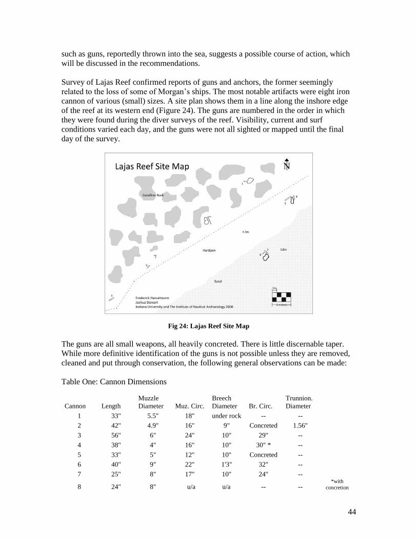
44
such as guns, reportedly thrown into the sea, suggests a possible course of action, which
will be discussed in the recommendations.
Survey of Lajas Reef confirmed reports of guns and anchors, the former seemingly
related to the loss of some of Morgan‟s ships. The most notable artifacts were eight iron
cannon of various (small) sizes. A site plan shows them in a line along the inshore edge
of the reef at its western end (Figure 24). The guns are numbered in the order in which
they were found during the diver surveys of the reef. Visibility, current and surf
conditions varied each day, and the guns were not all sighted or mapped until the final
day of the survey.
Fig 24: Lajas Reef Site Map
The guns are all small weapons, all heavily concreted. There is little discernable taper.
While more definitive identification of the guns is not possible unless they are removed,
cleaned and put through conservation, the following general observations can be made:
Table One: Cannon Dimensions
Cannon Length
Muzzle
Diameter Muz. Circ.
Breech
Diameter Br. Circ.
Trunnion.
Diameter
1 33" 5.5" 18" under rock -- --
2 42" 4.9" 16" 9" Concreted 1.56"
3 56" 6" 24" 10" 29" --
4 38" 4" 16" 10" 30" * --
5 33" 5" 12" 10" Concreted --
6 40" 9" 22" 1'3" 32" --
7 25" 8" 17" 10" 24" --
8 24" 8" u/a u/a -- -- *with
concretion
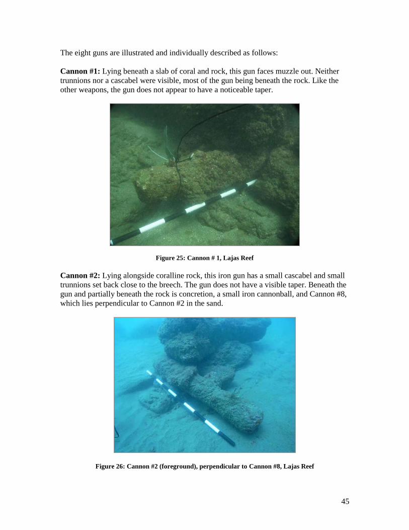
45
The eight guns are illustrated and individually described as follows:
Cannon #1: Lying beneath a slab of coral and rock, this gun faces muzzle out. Neither
trunnions nor a cascabel were visible, most of the gun being beneath the rock. Like the
other weapons, the gun does not appear to have a noticeable taper.
Figure 25: Cannon # 1, Lajas Reef
Cannon #2: Lying alongside coralline rock, this iron gun has a small cascabel and small
trunnions set back close to the breech. The gun does not have a visible taper. Beneath the
gun and partially beneath the rock is concretion, a small iron cannonball, and Cannon #8,
which lies perpendicular to Cannon #2 in the sand.
Figure 26: Cannon #2 (foreground), perpendicular to Cannon #8, Lajas Reef
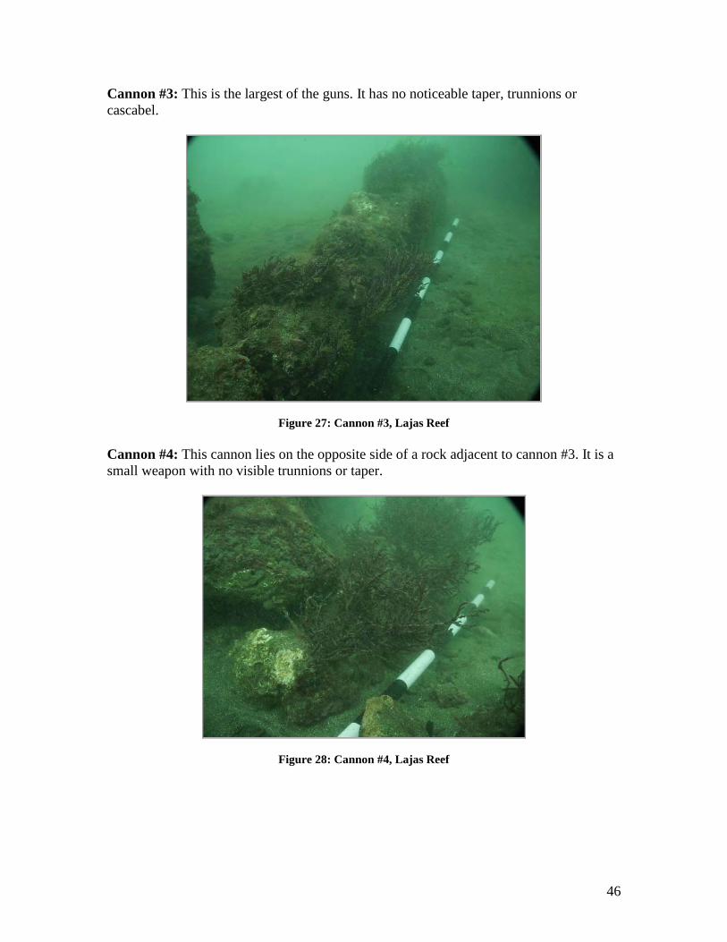
46
Cannon #3: This is the largest of the guns. It has no noticeable taper, trunnions or
cascabel.
Figure 27: Cannon #3, Lajas Reef
Cannon #4: This cannon lies on the opposite side of a rock adjacent to cannon #3. It is a
small weapon with no visible trunnions or taper.
Figure 28: Cannon #4, Lajas Reef
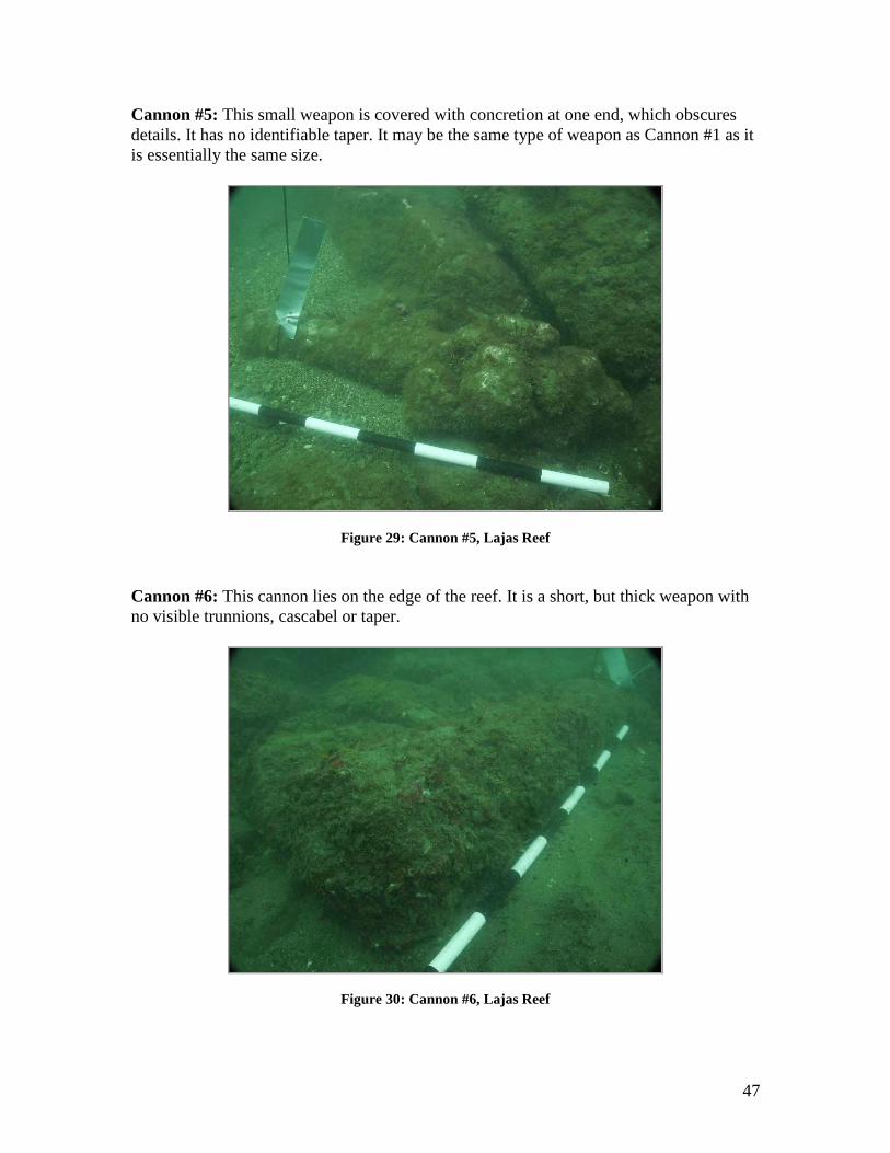
47
Cannon #5: This small weapon is covered with concretion at one end, which obscures
details. It has no identifiable taper. It may be the same type of weapon as Cannon #1 as it
is essentially the same size.
Figure 29: Cannon #5, Lajas Reef
Cannon #6: This cannon lies on the edge of the reef. It is a short, but thick weapon with
no visible trunnions, cascabel or taper.
Figure 30: Cannon #6, Lajas Reef
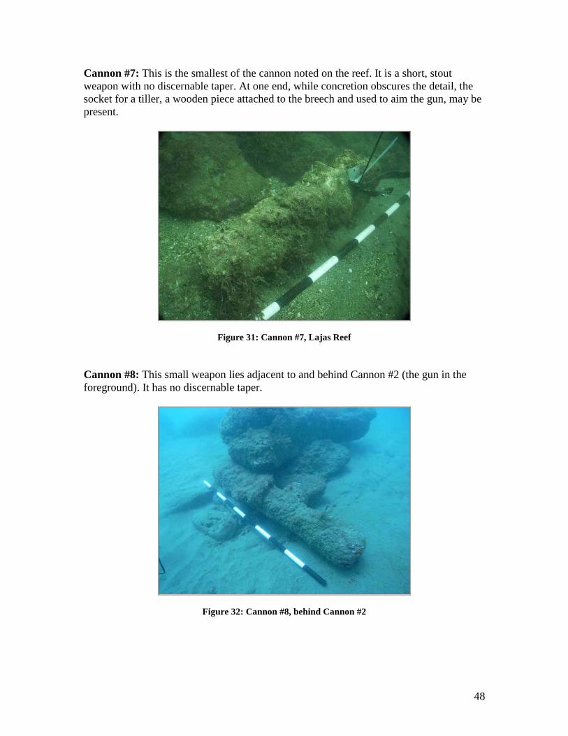
48
Cannon #7: This is the smallest of the cannon noted on the reef. It is a short, stout
weapon with no discernable taper. At one end, while concretion obscures the detail, the
socket for a tiller, a wooden piece attached to the breech and used to aim the gun, may be
present.
Figure 31: Cannon #7, Lajas Reef
Cannon #8: This small weapon lies adjacent to and behind Cannon #2 (the gun in the
foreground). It has no discernable taper.
Figure 32: Cannon #8, behind Cannon #2
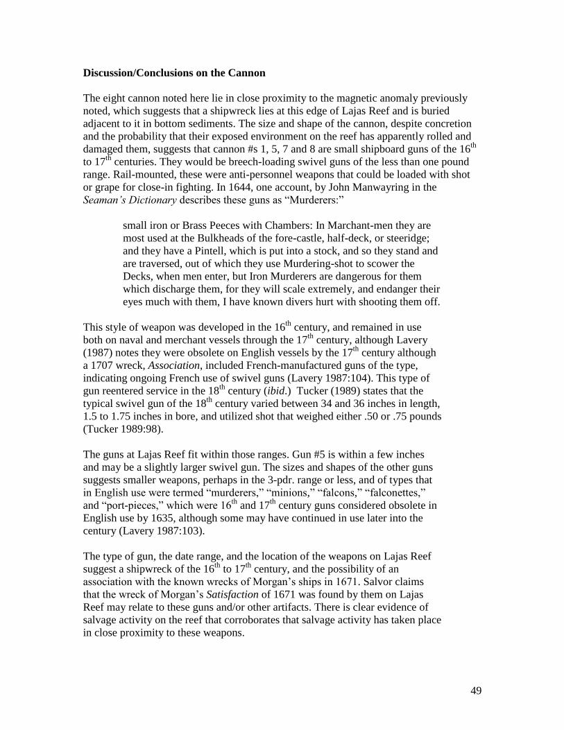
49
Discussion/Conclusions on the Cannon
The eight cannon noted here lie in close proximity to the magnetic anomaly previously
noted, which suggests that a shipwreck lies at this edge of Lajas Reef and is buried
adjacent to it in bottom sediments. The size and shape of the cannon, despite concretion
and the probability that their exposed environment on the reef has apparently rolled and
damaged them, suggests that cannon #s 1, 5, 7 and 8 are small shipboard guns of the 16th
to 17th
centuries. They would be breech-loading swivel guns of the less than one pound
range. Rail-mounted, these were anti-personnel weapons that could be loaded with shot
or grape for close-in fighting. In 1644, one account, by John Manwayring in the
Seaman’s Dictionary describes these guns as “Murderers:”
small iron or Brass Peeces with Chambers: In Marchant-men they are
most used at the Bulkheads of the fore-castle, half-deck, or steeridge;
and they have a Pintell, which is put into a stock, and so they stand and
are traversed, out of which they use Murdering-shot to scower the
Decks, when men enter, but Iron Murderers are dangerous for them
which discharge them, for they will scale extremely, and endanger their
eyes much with them, I have known divers hurt with shooting them off.
This style of weapon was developed in the 16th
century, and remained in use
both on naval and merchant vessels through the 17th
century, although Lavery
(1987) notes they were obsolete on English vessels by the 17th
century although
a 1707 wreck, Association, included French-manufactured guns of the type,
indicating ongoing French use of swivel guns (Lavery 1987:104). This type of
gun reentered service in the 18th
century (ibid.) Tucker (1989) states that the
typical swivel gun of the 18th
century varied between 34 and 36 inches in length,
1.5 to 1.75 inches in bore, and utilized shot that weighed either .50 or .75 pounds
(Tucker 1989:98).
The guns at Lajas Reef fit within those ranges. Gun #5 is within a few inches
and may be a slightly larger swivel gun. The sizes and shapes of the other guns
suggests smaller weapons, perhaps in the 3-pdr. range or less, and of types that
in English use were termed “murderers,” “minions,” “falcons,” “falconettes,”
and “port-pieces,” which were 16th
and 17th
century guns considered obsolete in
English use by 1635, although some may have continued in use later into the
century (Lavery 1987:103).
The type of gun, the date range, and the location of the weapons on Lajas Reef
suggest a shipwreck of the 16th
to 17th
century, and the possibility of an
association with the known wrecks of Morgan‟s ships in 1671. Salvor claims
that the wreck of Morgan‟s Satisfaction of 1671 was found by them on Lajas
Reef may relate to these guns and/or other artifacts. There is clear evidence of
salvage activity on the reef that corroborates that salvage activity has taken place
in close proximity to these weapons.
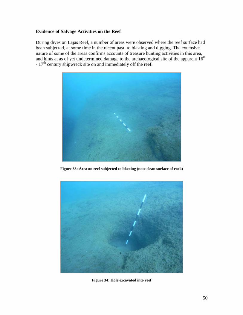
50
Evidence of Salvage Activities on the Reef
During dives on Lajas Reef, a number of areas were observed where the reef surface had
been subjected, at some time in the recent past, to blasting and digging. The extensive
nature of some of the areas confirms accounts of treasure hunting activities in this area,
and hints at as of yet undetermined damage to the archaeological site of the apparent 16th
- 17th
century shipwreck site on and immediately off the reef.
Figure 33: Area on reef subjected to blasting (note clean surface of rock)
Figure 34: Hole excavated into reef
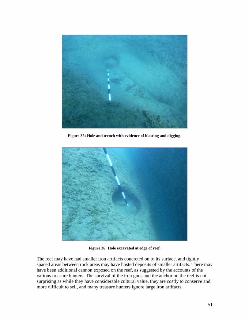
51
Figure 35: Hole and trench with evidence of blasting and digging.
Figure 36: Hole excavated at edge of reef.
The reef may have had smaller iron artifacts concreted on to its surface, and tightly
spaced areas between rock areas may have hosted deposits of smaller artifacts. There may
have been additional cannon exposed on the reef, as suggested by the accounts of the
various treasure hunters. The survival of the iron guns and the anchor on the reef is not
surprising as while they have considerable cultural value, they are costly to conserve and
more difficult to sell, and many treasure hunters ignore large iron artifacts.
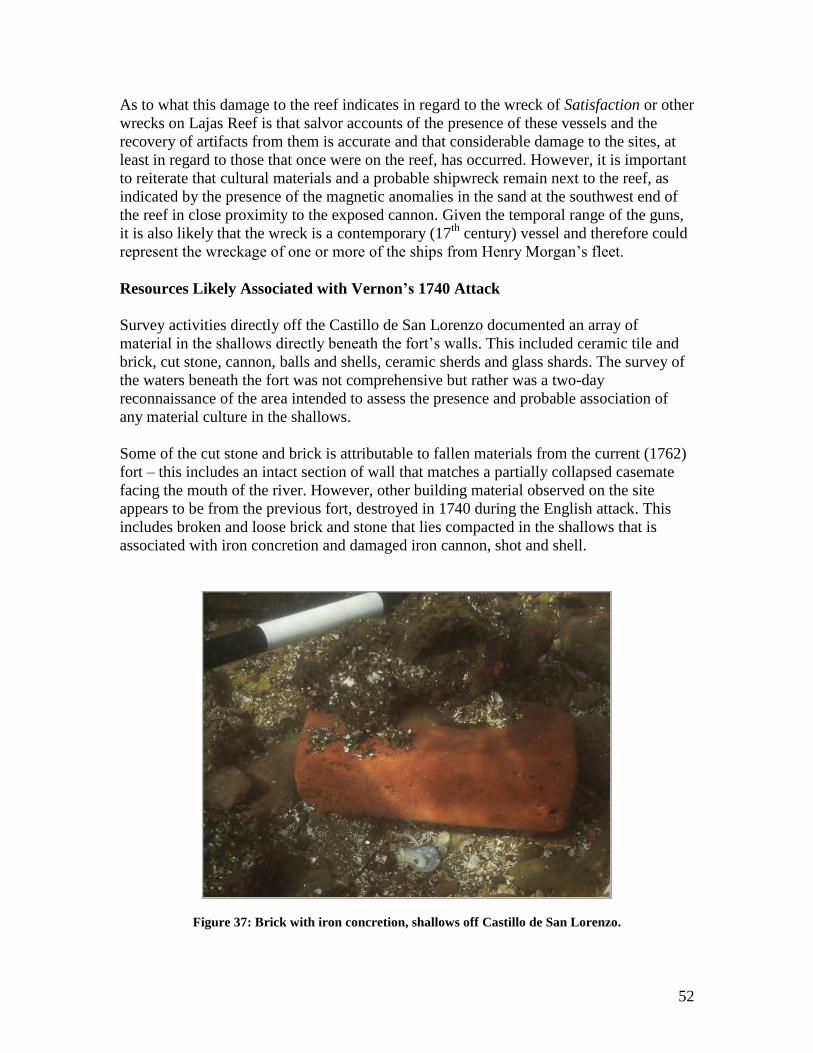
52
As to what this damage to the reef indicates in regard to the wreck of Satisfaction or other
wrecks on Lajas Reef is that salvor accounts of the presence of these vessels and the
recovery of artifacts from them is accurate and that considerable damage to the sites, at
least in regard to those that once were on the reef, has occurred. However, it is important
to reiterate that cultural materials and a probable shipwreck remain next to the reef, as
indicated by the presence of the magnetic anomalies in the sand at the southwest end of
the reef in close proximity to the exposed cannon. Given the temporal range of the guns,
it is also likely that the wreck is a contemporary (17th
century) vessel and therefore could
represent the wreckage of one or more of the ships from Henry Morgan‟s fleet.
Resources Likely Associated with Vernon’s 1740 Attack
Survey activities directly off the Castillo de San Lorenzo documented an array of
material in the shallows directly beneath the fort‟s walls. This included ceramic tile and
brick, cut stone, cannon, balls and shells, ceramic sherds and glass shards. The survey of
the waters beneath the fort was not comprehensive but rather was a two-day
reconnaissance of the area intended to assess the presence and probable association of
any material culture in the shallows.
Some of the cut stone and brick is attributable to fallen materials from the current (1762)
fort – this includes an intact section of wall that matches a partially collapsed casemate
facing the mouth of the river. However, other building material observed on the site
appears to be from the previous fort, destroyed in 1740 during the English attack. This
includes broken and loose brick and stone that lies compacted in the shallows that is
associated with iron concretion and damaged iron cannon, shot and shell.
Figure 37: Brick with iron concretion, shallows off Castillo de San Lorenzo.
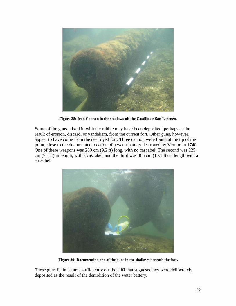
53
Figure 38: Iron Cannon in the shallows off the Castillo de San Lorenzo.
Some of the guns mixed in with the rubble may have been deposited, perhaps as the
result of erosion, discard, or vandalism, from the current fort. Other guns, however,
appear to have come from the destroyed fort. Three cannon were found at the tip of the
point, close to the documented location of a water battery destroyed by Vernon in 1740.
One of these weapons was 280 cm (9.2 ft) long, with no cascabel. The second was 225
cm (7.4 ft) in length, with a cascabel, and the third was 305 cm (10.1 ft) in length with a
cascabel.
Figure 39: Documenting one of the guns in the shallows beneath the fort.
These guns lie in an area sufficiently off the cliff that suggests they were deliberately
deposited as the result of the demolition of the water battery.
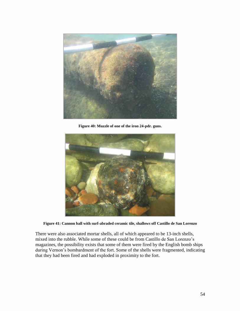
54
Figure 40: Muzzle of one of the iron 24-pdr. guns.
Figure 41: Cannon ball with surf-abraded ceramic tile, shallows off Castillo de San Lorenzo
There were also associated mortar shells, all of which appeared to be 13-inch shells,
mixed into the rubble. While some of these could be from Castillo de San Lorenzo‟s
magazines, the possibility exists that some of them were fired by the English bomb ships
during Vernon‟s bombardment of the fort. Some of the shells were fragmented, indicating
that they had been fired and had exploded in proximity to the fort.
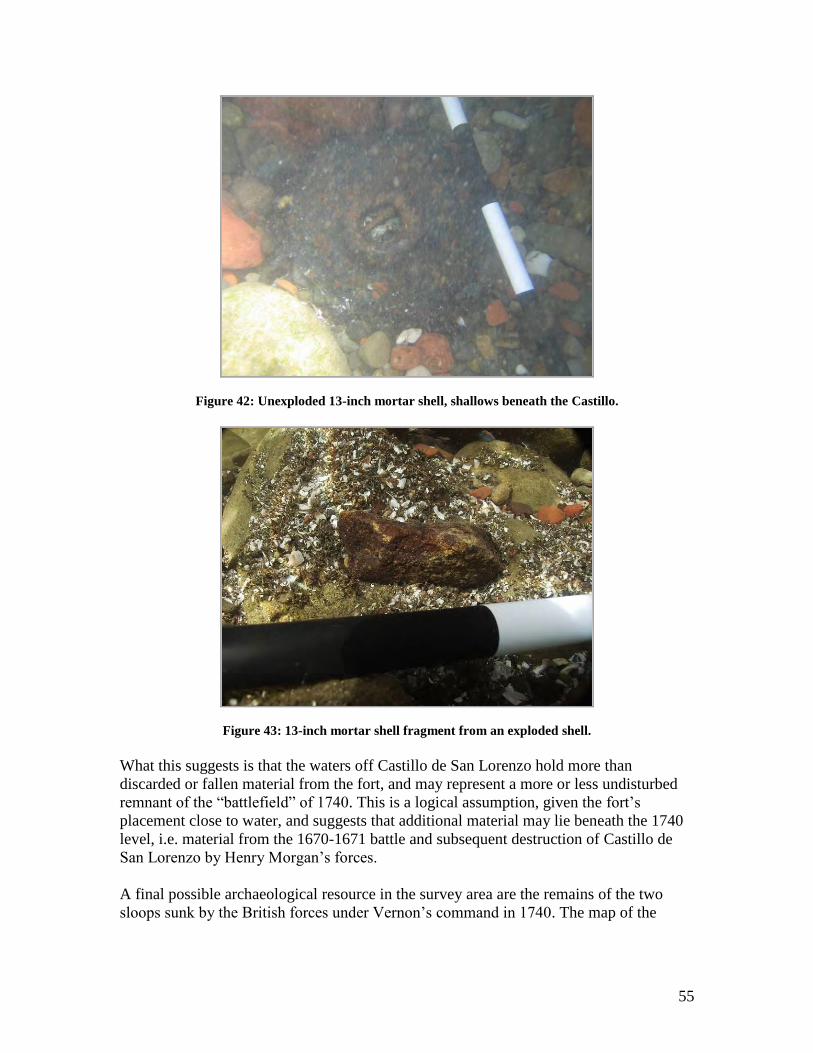
55
Figure 42: Unexploded 13-inch mortar shell, shallows beneath the Castillo.
Figure 43: 13-inch mortar shell fragment from an exploded shell.
What this suggests is that the waters off Castillo de San Lorenzo hold more than
discarded or fallen material from the fort, and may represent a more or less undisturbed
remnant of the “battlefield” of 1740. This is a logical assumption, given the fort‟s
placement close to water, and suggests that additional material may lie beneath the 1740
level, i.e. material from the 1670-1671 battle and subsequent destruction of Castillo de
San Lorenzo by Henry Morgan‟s forces.
A final possible archaeological resource in the survey area are the remains of the two
sloops sunk by the British forces under Vernon‟s command in 1740. The map of the
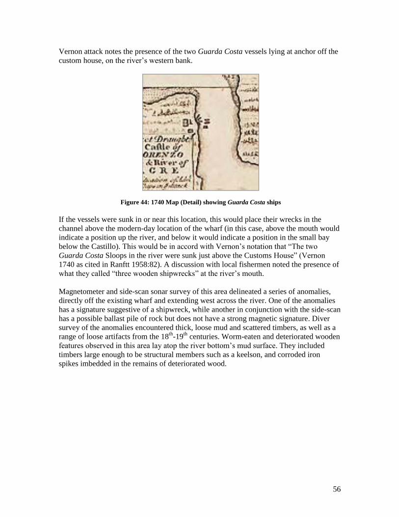
56
Vernon attack notes the presence of the two Guarda Costa vessels lying at anchor off the
custom house, on the river‟s western bank.
Figure 44: 1740 Map (Detail) showing Guarda Costa ships
If the vessels were sunk in or near this location, this would place their wrecks in the
channel above the modern-day location of the wharf (in this case, above the mouth would
indicate a position up the river, and below it would indicate a position in the small bay
below the Castillo). This would be in accord with Vernon‟s notation that “The two
Guarda Costa Sloops in the river were sunk just above the Customs House” (Vernon
1740 as cited in Ranftt 1958:82). A discussion with local fishermen noted the presence of
what they called “three wooden shipwrecks” at the river‟s mouth.
Magnetometer and side-scan sonar survey of this area delineated a series of anomalies,
directly off the existing wharf and extending west across the river. One of the anomalies
has a signature suggestive of a shipwreck, while another in conjunction with the side-scan
has a possible ballast pile of rock but does not have a strong magnetic signature. Diver
survey of the anomalies encountered thick, loose mud and scattered timbers, as well as a
range of loose artifacts from the 18th
-19th
centuries. Worm-eaten and deteriorated wooden
features observed in this area lay atop the river bottom‟s mud surface. They included
timbers large enough to be structural members such as a keelson, and corroded iron
spikes imbedded in the remains of deteriorated wood.
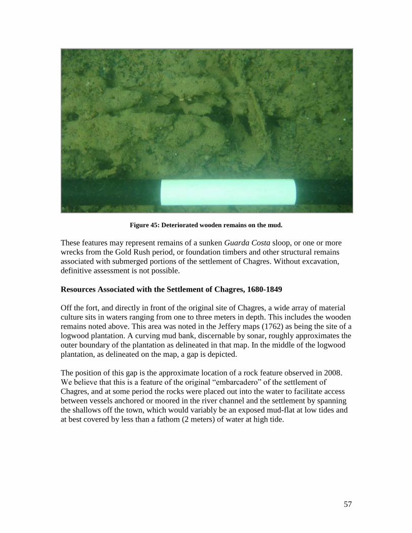
57
Figure 45: Deteriorated wooden remains on the mud.
These features may represent remains of a sunken Guarda Costa sloop, or one or more
wrecks from the Gold Rush period, or foundation timbers and other structural remains
associated with submerged portions of the settlement of Chagres. Without excavation,
definitive assessment is not possible.
Resources Associated with the Settlement of Chagres, 1680-1849
Off the fort, and directly in front of the original site of Chagres, a wide array of material
culture sits in waters ranging from one to three meters in depth. This includes the wooden
remains noted above. This area was noted in the Jeffery maps (1762) as being the site of a
logwood plantation. A curving mud bank, discernable by sonar, roughly approximates the
outer boundary of the plantation as delineated in that map. In the middle of the logwood
plantation, as delineated on the map, a gap is depicted.
The position of this gap is the approximate location of a rock feature observed in 2008.
We believe that this is a feature of the original “embarcadero” of the settlement of
Chagres, and at some period the rocks were placed out into the water to facilitate access
between vessels anchored or moored in the river channel and the settlement by spanning
the shallows off the town, which would variably be an exposed mud-flat at low tides and
at best covered by less than a fathom (2 meters) of water at high tide.
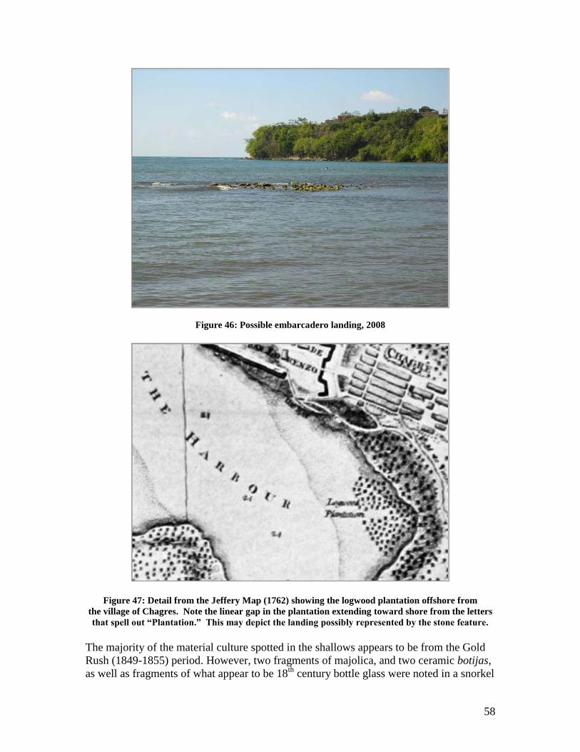
58
Figure 46: Possible embarcadero landing, 2008
Figure 47: Detail from the Jeffery Map (1762) showing the logwood plantation offshore from
the village of Chagres. Note the linear gap in the plantation extending toward shore from the letters
that spell out “Plantation.” This may depict the landing possibly represented by the stone feature.
The majority of the material culture spotted in the shallows appears to be from the Gold
Rush (1849-1855) period. However, two fragments of majolica, and two ceramic botijas,
as well as fragments of what appear to be 18th
century bottle glass were noted in a snorkel
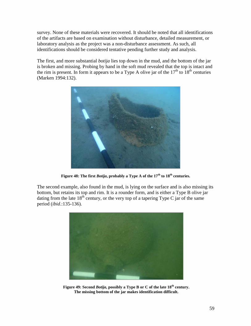
59
survey. None of these materials were recovered. It should be noted that all identifications
of the artifacts are based on examination without disturbance, detailed measurement, or
laboratory analysis as the project was a non-disturbance assessment. As such, all
identifications should be considered tentative pending further study and analysis.
The first, and more substantial botija lies top down in the mud, and the bottom of the jar
is broken and missing. Probing by hand in the soft mud revealed that the top is intact and
the rim is present. In form it appears to be a Type A olive jar of the 17th
to 18th
centuries
(Marken 1994:132).
Figure 48: The first Botija, probably a Type A of the 17th
to 18th
centuries.
The second example, also found in the mud, is lying on the surface and is also missing its
bottom, but retains its top and rim. It is a rounder form, and is either a Type B olive jar
dating from the late 18th
century, or the very top of a tapering Type C jar of the same
period (ibid.:135-136).
Figure 49: Second Botija, possibly a Type B or C of the late 18th
century.
The missing bottom of the jar makes identification difficult.
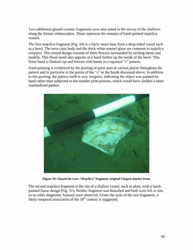
60
Two additional glazed ceramic fragments were also noted in the survey of the shallows
along the former embarcadero. These represent the remains of hand-painted majolica
vessels.
The first majolica fragment (Fig. 50) is a fairly intact base from a deep-sided vessel such
as a bowl. The terra cotta body and the thick white enamel glaze are common to majolica
ceramics. The central design consists of three flowers surrounded by arching stems and
tendrils. This floral motif also appears in a band further up the inside of the bowl. This
floral band is flanked top and bottom with bands in a repeated “v” pattern.
Hand painting is evidenced by the pooling of paint seen at various places throughout the
pattern and in particular at the points of the “v” in the bands discussed above. In addition
to this pooling, the pattern itself is very irregular, indicating the object was painted by
hand rather than subjected to the transfer print process, which would have yielded a more
standardized pattern.
Figure 50: Glazed tin-ware “Majolica” fragment, original Chagres harbor front.
The second majolica fragment is the rim of a shallow vessel, such as plate, with a hand-
painted linear design (Fig. 51). Neither fragment was disturbed and both were left in situ,
so no other diagnostic features were observed. Given the style of the two fragments, a
likely temporal association of the 18th
century is suggested.
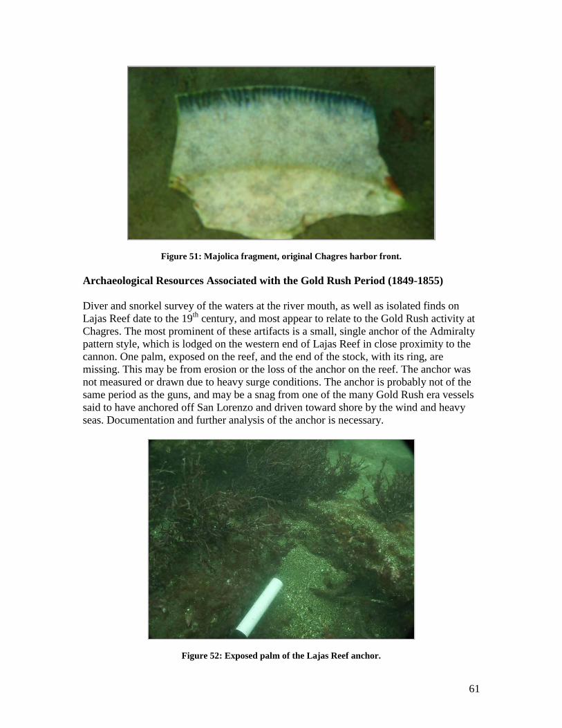
61
Figure 51: Majolica fragment, original Chagres harbor front.
Archaeological Resources Associated with the Gold Rush Period (1849-1855)
Diver and snorkel survey of the waters at the river mouth, as well as isolated finds on
Lajas Reef date to the 19th
century, and most appear to relate to the Gold Rush activity at
Chagres. The most prominent of these artifacts is a small, single anchor of the Admiralty
pattern style, which is lodged on the western end of Lajas Reef in close proximity to the
cannon. One palm, exposed on the reef, and the end of the stock, with its ring, are
missing. This may be from erosion or the loss of the anchor on the reef. The anchor was
not measured or drawn due to heavy surge conditions. The anchor is probably not of the
same period as the guns, and may be a snag from one of the many Gold Rush era vessels
said to have anchored off San Lorenzo and driven toward shore by the wind and heavy
seas. Documentation and further analysis of the anchor is necessary.
Figure 52: Exposed palm of the Lajas Reef anchor.
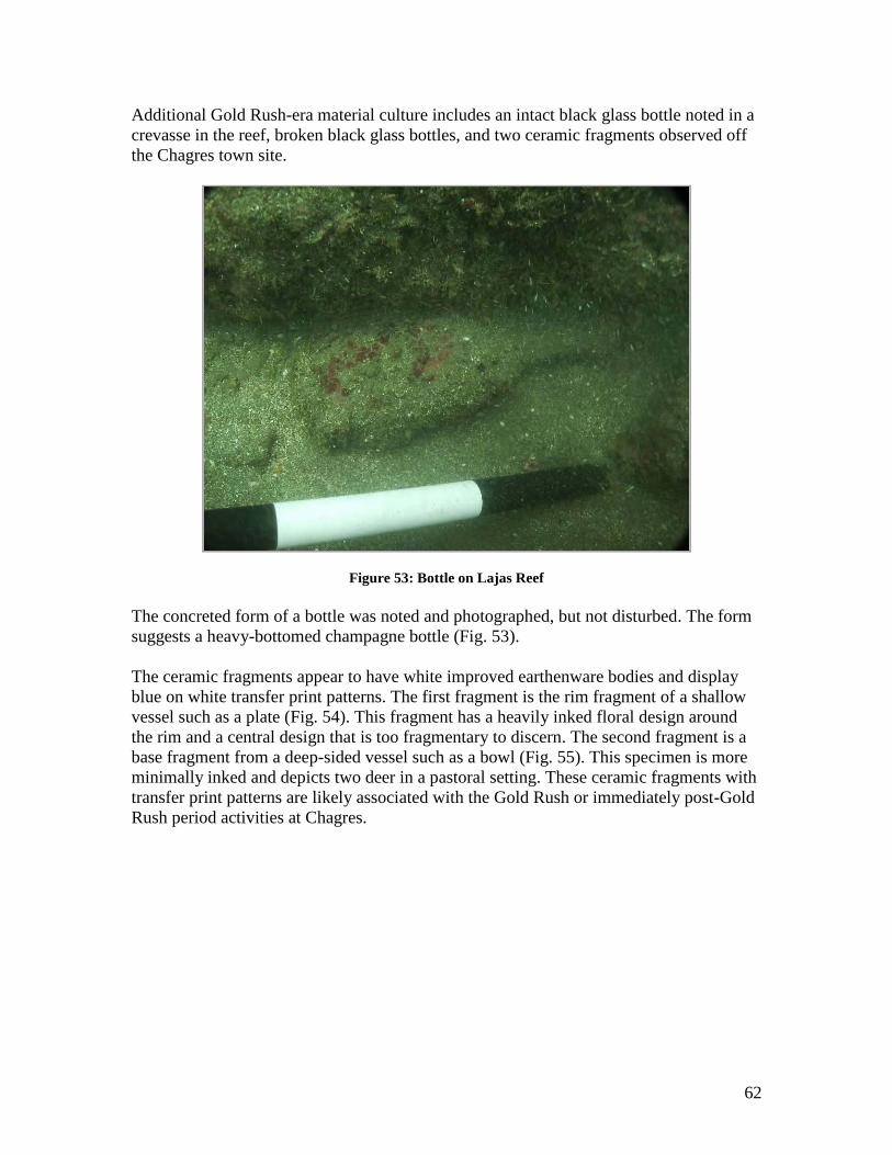
62
Additional Gold Rush-era material culture includes an intact black glass bottle noted in a
crevasse in the reef, broken black glass bottles, and two ceramic fragments observed off
the Chagres town site.
Figure 53: Bottle on Lajas Reef
The concreted form of a bottle was noted and photographed, but not disturbed. The form
suggests a heavy-bottomed champagne bottle (Fig. 53).
The ceramic fragments appear to have white improved earthenware bodies and display
blue on white transfer print patterns. The first fragment is the rim fragment of a shallow
vessel such as a plate (Fig. 54). This fragment has a heavily inked floral design around
the rim and a central design that is too fragmentary to discern. The second fragment is a
base fragment from a deep-sided vessel such as a bowl (Fig. 55). This specimen is more
minimally inked and depicts two deer in a pastoral setting. These ceramic fragments with
transfer print patterns are likely associated with the Gold Rush or immediately post-Gold
Rush period activities at Chagres.
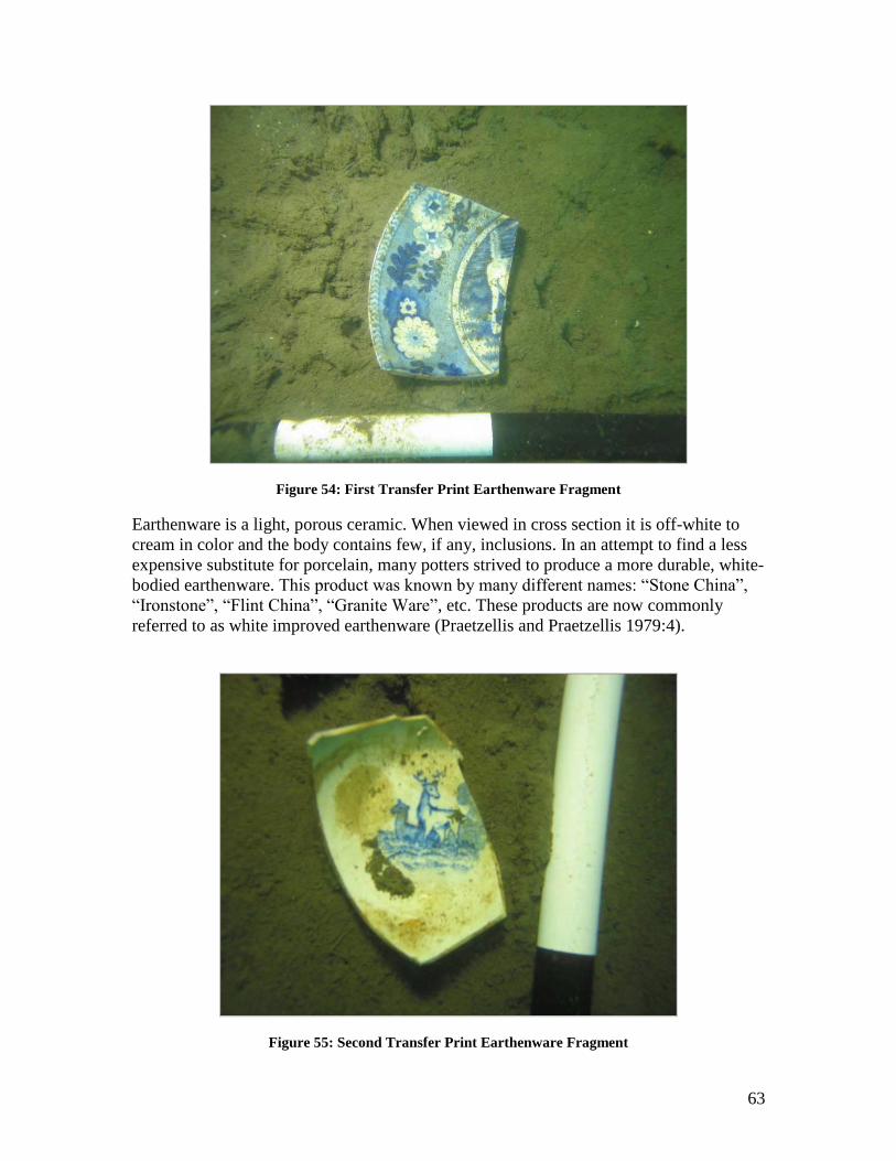
63
Figure 54: First Transfer Print Earthenware Fragment
Earthenware is a light, porous ceramic. When viewed in cross section it is off-white to
cream in color and the body contains few, if any, inclusions. In an attempt to find a less
expensive substitute for porcelain, many potters strived to produce a more durable, white-
bodied earthenware. This product was known by many different names: “Stone China”,
“Ironstone”, “Flint China”, “Granite Ware”, etc. These products are now commonly
referred to as white improved earthenware (Praetzellis and Praetzellis 1979:4).
Figure 55: Second Transfer Print Earthenware Fragment
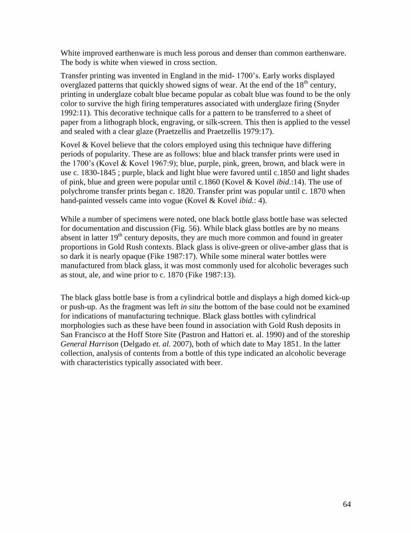
64
White improved earthenware is much less porous and denser than common earthenware.
The body is white when viewed in cross section.
Transfer printing was invented in England in the mid- 1700‟s. Early works displayed
overglazed patterns that quickly showed signs of wear. At the end of the 18th
century,
printing in underglaze cobalt blue became popular as cobalt blue was found to be the only
color to survive the high firing temperatures associated with underglaze firing (Snyder
1992:11). This decorative technique calls for a pattern to be transferred to a sheet of
paper from a lithograph block, engraving, or silk-screen. This then is applied to the vessel
and sealed with a clear glaze (Praetzellis and Praetzellis 1979:17).
Kovel & Kovel believe that the colors employed using this technique have differing
periods of popularity. These are as follows: blue and black transfer prints were used in
the 1700‟s (Kovel & Kovel 1967:9); blue, purple, pink, green, brown, and black were in
use c. 1830-1845 ; purple, black and light blue were favored until c.1850 and light shades
of pink, blue and green were popular until c.1860 (Kovel & Kovel ibid.:14). The use of
polychrome transfer prints began c. 1820. Transfer print was popular until c. 1870 when
hand-painted vessels came into vogue (Kovel & Kovel ibid.: 4).
While a number of specimens were noted, one black bottle glass bottle base was selected
for documentation and discussion (Fig. 56). While black glass bottles are by no means
absent in latter 19th
century deposits, they are much more common and found in greater
proportions in Gold Rush contexts. Black glass is olive-green or olive-amber glass that is
so dark it is nearly opaque (Fike 1987:17). While some mineral water bottles were
manufactured from black glass, it was most commonly used for alcoholic beverages such
as stout, ale, and wine prior to c. 1870 (Fike 1987:13).
The black glass bottle base is from a cylindrical bottle and displays a high domed kick-up
or push-up. As the fragment was left in situ the bottom of the base could not be examined
for indications of manufacturing technique. Black glass bottles with cylindrical
morphologies such as these have been found in association with Gold Rush deposits in
San Francisco at the Hoff Store Site (Pastron and Hattori et. al. 1990) and of the storeship
General Harrison (Delgado et. al. 2007), both of which date to May 1851. In the latter
collection, analysis of contents from a bottle of this type indicated an alcoholic beverage
with characteristics typically associated with beer.
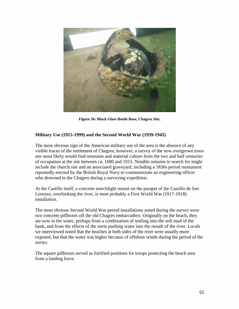
65
Figure 56: Black Glass Bottle Base, Chagres Site.
Military Use (1915-1999) and the Second World War (1939-1945)
The most obvious sign of the American military use of the area is the absence of any
visible traces of the settlement of Chagres; however, a survey of the now overgrown town
site most likely would find remnants and material culture from the two and half centuries
of occupation at the site between ca. 1680 and 1915. Notable remains to search for might
include the church site and an associated graveyard, including a 1830s period monument
reportedly erected by the British Royal Navy to commemorate an engineering officer
who drowned in the Chagres during a surveying expedition.
At the Castillo itself, a concrete searchlight mount on the parapet of the Castillo de San
Lorenzo, overlooking the river, is most probably a First World War (1917-1918)
installation.
The most obvious Second World War period installations noted during the survey were
two concrete pillboxes off the old Chagres embarcadero. Originally on the beach, they
are now in the water, perhaps from a combination of settling into the soft mud of the
bank, and from the effects of the norte pushing water into the mouth of the river. Locals
we interviewed noted that the beaches at both sides of the river were usually more
exposed, but that the water was higher because of offshore winds during the period of the
nortes.
The square pillboxes served as fortified positions for troops protecting the beach area
from a landing force.
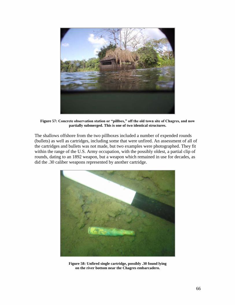
66
Figure 57: Concrete observation station or “pillbox,” off the old town site of Chagres, and now
partially submerged. This is one of two identical structures.
The shallows offshore from the two pillboxes included a number of expended rounds
(bullets) as well as cartridges, including some that were unfired. An assessment of all of
the cartridges and bullets was not made, but two examples were photographed. They fit
within the range of the U.S. Army occupation, with the possibly oldest, a partial clip of
rounds, dating to an 1892 weapon, but a weapon which remained in use for decades, as
did the .30 caliber weapons represented by another cartridge.
Figure 58: Unfired single cartridge, possibly .30 found lying
on the river bottom near the Chagres embarcadero.
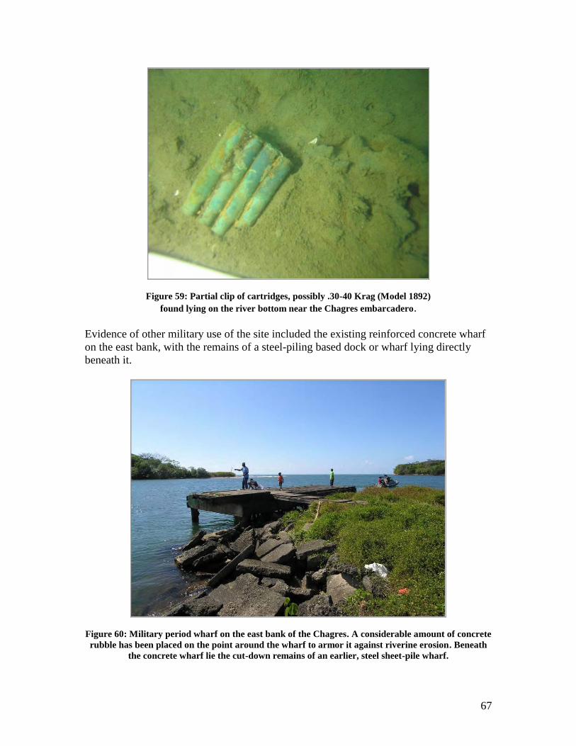
67
Figure 59: Partial clip of cartridges, possibly .30-40 Krag (Model 1892)
found lying on the river bottom near the Chagres embarcadero.
Evidence of other military use of the site included the existing reinforced concrete wharf
on the east bank, with the remains of a steel-piling based dock or wharf lying directly
beneath it.
Figure 60: Military period wharf on the east bank of the Chagres. A considerable amount of concrete
rubble has been placed on the point around the wharf to armor it against riverine erosion. Beneath
the concrete wharf lie the cut-down remains of an earlier, steel sheet-pile wharf.
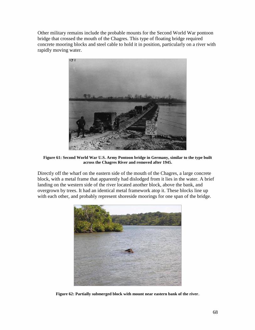
68
Other military remains include the probable mounts for the Second World War pontoon
bridge that crossed the mouth of the Chagres. This type of floating bridge required
concrete mooring blocks and steel cable to hold it in position, particularly on a river with
rapidly moving water.
Figure 61: Second World War U.S. Army Pontoon bridge in Germany, similar to the type built
across the Chagres River and removed after 1945.
Directly off the wharf on the eastern side of the mouth of the Chagres, a large concrete
block, with a metal frame that apparently had dislodged from it lies in the water. A brief
landing on the western side of the river located another block, above the bank, and
overgrown by trees. It had an identical metal framework atop it. These blocks line up
with each other, and probably represent shoreside moorings for one span of the bridge.
Figure 62: Partially submerged block with mount near eastern bank of the river.
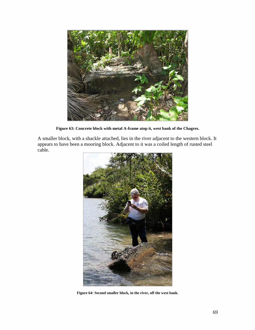
69
Figure 63: Concrete block with metal A-frame atop it, west bank of the Chagres.
A smaller block, with a shackle attached, lies in the river adjacent to the western block. It
appears to have been a mooring block. Adjacent to it was a coiled length of rusted steel
cable.
Figure 64: Second smaller block, in the river, off the west bank.
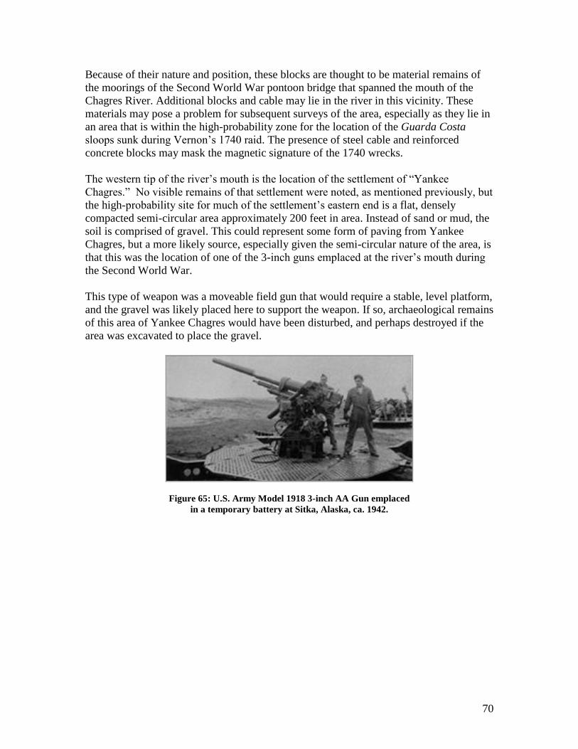
70
Because of their nature and position, these blocks are thought to be material remains of
the moorings of the Second World War pontoon bridge that spanned the mouth of the
Chagres River. Additional blocks and cable may lie in the river in this vicinity. These
materials may pose a problem for subsequent surveys of the area, especially as they lie in
an area that is within the high-probability zone for the location of the Guarda Costa
sloops sunk during Vernon‟s 1740 raid. The presence of steel cable and reinforced
concrete blocks may mask the magnetic signature of the 1740 wrecks.
The western tip of the river‟s mouth is the location of the settlement of “Yankee
Chagres.” No visible remains of that settlement were noted, as mentioned previously, but
the high-probability site for much of the settlement‟s eastern end is a flat, densely
compacted semi-circular area approximately 200 feet in area. Instead of sand or mud, the
soil is comprised of gravel. This could represent some form of paving from Yankee
Chagres, but a more likely source, especially given the semi-circular nature of the area, is
that this was the location of one of the 3-inch guns emplaced at the river‟s mouth during
the Second World War.
This type of weapon was a moveable field gun that would require a stable, level platform,
and the gravel was likely placed here to support the weapon. If so, archaeological remains
of this area of Yankee Chagres would have been disturbed, and perhaps destroyed if the
area was excavated to place the gravel.
Figure 65: U.S. Army Model 1918 3-inch AA Gun emplaced
in a temporary battery at Sitka, Alaska, ca. 1942.
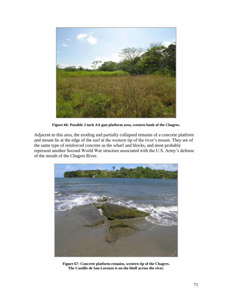
71
Figure 66: Possible 3-inch AA gun platform area, western bank of the Chagres.
Adjacent to this area, the eroding and partially collapsed remains of a concrete platform
and mount lie at the edge of the surf at the western tip of the river‟s mount. They are of
the same type of reinforced concrete as the wharf and blocks, and most probably
represent another Second World War structure associated with the U.S. Army‟s defense
of the mouth of the Chagres River.
Figure 67: Concrete platform remains, western tip of the Chagres.
The Castillo de San Lorenzo is on the bluff across the river.
72
Given the late nature of the U.S. Army materials (in terms of the long history of the site), it would be an easy conclusion to identify them as intrusive features, especially if their installation impacted or destroyed archaeological remains of the site‟s earlier history.However, the U.S. fortifications and structures represent a continuation of the historical use of the river as a strategic waterway, and while smaller, and of less impressive visual impact as the Castillo de San Lorenzo, they nonetheless are an important part of the maritime cultural landscape at the mouth of the Chagres, and historical archaeological resources in their own right. That is not to suggest that they are of equal significance to other elements. They do contribute with the other features as physical representatives of the centuries of human activities that formed this maritime landscape.
CONCLUSIONS AND RECOMMENDATIONS
The approval of the permit by INAC is greatly appreciated, as is the privilege and opportunity to work in Panamá. The survey of the project area was made possible entirely by the support of the Waitt Institute for Discovery and the crew of the M/Y Plan B, as well as the support of the contributing scientists and scholars.
The disappointment in the strong nortes denying access to the survey block notwithstanding, the limited area available for survey yielded a diverse and significantassemblage of material culture that in its entirety represented the full range of the documented history of the site, i.e. from the 17th through the 20th centuries.
The key results of this week-long survey and review of the historical literature leads us to conclude the following:
Historical accounts suggest as many as 15 shipwrecks at or near the entrance to the Río Chagres, including four or five vessels from Morgan‟s 1671 attack,
Chaperon, a 1681 Spanish supply ship, two Guarda Costa sloops sunk during Vernon‟s 1740 attack, and a variety of ships lost around the time of the California
Gold Rush of 1849-1851. Archaeological remains of all of these vessels must be present in the waters off the river‟s mouth. Archaeology may reveal the remains of more than 15 vessels, as not every vessel loss in the area may be accurately noted or even noted at all in the historical record.
Detailed survey of the bay at the entrance to the Río Chagres during this project located cannon and anomalies that appear to be from a wreck or wrecks on Lajas Reef, the location of Morgan‟s ship losses in 1671. The guns appear to be 17th
century, and suggest that these are part of an archaeological record of the loss of the Morgan ships.
Anomalies and exposed remains could suggest the presence of two to three other wrecks at the entrance to the river.
Discussion with locals suggests that the 1681 wreck of Chaperon is further west but in an area that can be pinpointed on a subsequent survey, and that ballast piles
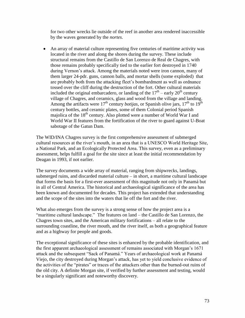
73
for two other wrecks lie outside of the reef in another area rendered inaccessible by the waves generated by the nortes.
An array of material culture representing five centuries of maritime activity was located in the river and along the shores during the survey. These include structural remains from the Castillo de San Lorenzo de Real de Chagres, with those remains probably specifically tied to the earlier fort destroyed in 1740 during Vernon‟s attack. Among the materials noted were iron cannon, many of them larger 24-pdr. guns, cannon balls, and mortar shells (some exploded) that are probably both from the attacking fleet‟s bombardment as well as ordnance
tossed over the cliff during the destruction of the fort. Other cultural materials included the original embarcadero, or landing of the 17th
– early 20th century village of Chagres, and ceramics, glass and wood from the village and landing. Among the artifacts were 17th century botijas, or Spanish olive jars, 17th to 19th
century bottles, and ceramic plates, some of them Colonial period Spanish majolica of the 18th century. Also plotted were a number of World War I and World War II features from the fortification of the river to guard against U-Boat sabotage of the Gatun Dam.
The WID/INA Chagres survey is the first comprehensive assessment of submerged cultural resources at the river‟s mouth, in an area that is a UNESCO World Heritage Site,
a National Park, and an Ecologically Protected Area. This survey, even as a preliminary assessment, helps fulfill a goal for the site since at least the initial recommendation by Deagan in 1993, if not earlier.
The survey documents a wide array of material, ranging from shipwrecks, landings, submerged ruins, and discarded material culture – in short, a maritime cultural landscape that forms the basis for a first-ever assessment of this magnitude not only in Panamá but in all of Central America. The historical and archaeological significance of the area has been known and documented for decades. This project has extended that understanding and the scope of the sites into the waters that lie off the fort and the river.
What also emerges from the survey is a strong sense of how the project area is a “maritime cultural landscape.” The features on land – the Castillo de San Lorenzo, the Chagres town sites, and the American military fortifications – all relate to the surrounding coastline, the river mouth, and the river itself, as both a geographical feature and as a highway for people and goods.
The exceptional significance of these sites is enhanced by the probable identification, and the first apparent archaeological assessment of remains associated with Morgan‟s 1671
attack and the subsequent “Sack of Panamá.” Years of archaeological work at Panamá Viejo, the city destroyed during Morgan‟s attack, has yet to yield conclusive evidence of
the activities of the “pirates” or traces of the attackers other than the burned-out ruins of the old city. A definite Morgan site, if verified by further assessment and testing, would be a singularly significant and noteworthy discovery.
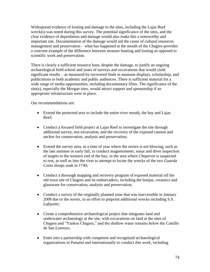
74
Widespread evidence of looting and damage to the sites, including the Lajas Reef wreck(s) was noted during this survey. The potential significance of the sites, and the clear evidence of depredation and damage would also make this a noteworthy and important site. Documentation of the damage would aid the cause of cultural resources management and preservation – what has happened at the mouth of the Chagres provides a concrete example of the difference between treasure hunting and looting as opposed to scientific work and preservation.
There is clearly a sufficient resource base, despite the damage, to justify an ongoing archaeological field school and years of surveys and excavations that would yield significant results – as measured by recovered finds in museum displays, scholarship, and publications to both academic and public audiences. There is sufficient material for a wide range of media opportunities, including documentary films. The significance of the site(s), especially the Morgan sites, would attract support and sponsorship if an appropriate infrastructure were in place.
Our recommendations are:
Extend the protected area to include the entire river mouth, the bay and Lajas Reef;
Conduct a focused field project at Lajas Reef to investigate the site through additional survey, test excavation, and the recovery of the exposed cannon and anchor for conservation, analysis and preservation;
Extend the survey area, in a time of year where the nortes is not blowing, such as the late summer or early fall, to conduct magnetometer, sonar and diver inspection of targets to the western end of the bay, in the area where Chaperon is suspected to rest, as well as into the river to attempt to locate the wrecks of the two Guarda Costa sloops sunk in 1740;
Conduct a thorough mapping and recovery program of exposed material off the old town site of Chagres and its embarcadero, including the botijas, ceramics and glassware for conservation, analysis and preservation;
Conduct a survey of the originally planned zone that was inaccessible in January 2008 due to the nortes, in an effort to pinpoint additional wrecks including S.S. Lafayette;
Create a comprehensive archaeological project that integrates land and underwater archaeology at the site, with excavations on land at the sites of Chagres and “Yankee Chagres,” and the shallow water remains below the Castillo de San Lorenzo;
Enter into a partnership with competent and recognized archaeological organizations in Panamá and internationally to conduct this work, including
75
seeking sponsorships and grants to carry out the work. This could include creating a base for fieldwork and archaeological field schools in conjunction with the Ciudad de Saber in Panamá City, as well as a laboratory, dormitory and offices in one of the unused former U.S. Army buildings at Fort Sherman. Such a facility could be the center of activities to conduct work, train students from Panamá and abroad, and create in Panamá a world center for underwater archaeology that places Panamá in the position of being the leaders of, and the principal location for such work in the Caribbean, Central and South America;
Create, with appropriate sponsorship, a museum at the site to showcase the finds and the work, in conjunction with the restoration of the Castillo de San Lorenzo. This would create a similar resource, and attraction at San Lorenzo as the one that currently exists with the patronato for Panamá Viejo, and create jobs and support tourism development in the Colon region while also preserving and displaying Panamá‟s culture and history.
The Institute of Nautical Archaeology has conducted similar work for nearly five decades, including the creation of laboratories, field schools, and museums, raising significant funds to do so, in Turkey and in other countries. This has included the involvement of INA‟s principal partner, Texas A&M University. In Panamá, particularly with a site such as this, those partnerships can be extended to other universities, organizations and supporters who seek nothing in return except an opportunity to work with Panamá to see these sites excavated, studied and shared with the public to the highest standard, and for the maximum benefit of Panamá and the world. We are standing by and ready to discuss this in further detail.
Again, we thank INAC and the Government of Panamá for the opportunity and the privilege to conduct this initial work.
76
SOURCES
Abbott, Willis J., Panama and the Canal In Picture and Prose. Syndicate Publishing
Company, London, New York, Toronto, Havana, Buenos Aires, 1913.
Anderson, Dr. C.L.G., Old Panama and Castillo Del Oro. North Rover Press, New York,
1911 (Subsequent editions 1938, 1944).
Bancroft, Hubert Howe, History of Central America, Vol. III: 1801-1887. The History
Company, San Francisco, 1887.
Blunt, Edmund M., The American Coast Pilot; Containing Directions for the Principal
Harbors, Capes and headlands of the Coasts of North and South America…. Edmund and
George W. Blunt, New York, 1857.
Bonnycastle, R.H., Spanish America: Or a Descriptive, Historical and Geographical
Account of the Dominions of Spain in the Western Hemisphere, Continental and
Insular….Volume I. Longman, Hurst, Rees, Orme and Brown, London, 1818.
Collins, John Owen, The Panama Guide. I.C.C. Press, Quartermaster‟s Department,
Mount Hope, C.Z., 1912.
Deagan, Kathleen, Observations and Recommendations for an Archaeological Plan of
Action for Portobelo and San Lorenzo de Chagres, Republica de Panamá. Technical
Report, University of Florida and the Florida Museum of Natural History, 1993.
Delgado, James P., To California by Sea: A Maritime History of the California Gold
Rush. University of South Carolina Press, Columbia, 1991.
Delgado, James P., Allen G. Pastron and Rhonda K. Robichaud, This Fine and
Commodious Vessel: Archaeological Investigations of the Gold Rush Storeship General
Harrison. Oakland, California, Archeo-Tec, 2007.
Earle, Peter, The Sack of Panamá: Captain Morgan and the Battle for the Caribbean.
Thomas Dunne Books, New York, 1981.
Exquemelin, Alexander O., The Buccaneers of America. Translated by Alexis Brown.
Dover, New York, 1969.
Fike, R.E. The Bottle Book: A Comprehensive Guide to Historic, Embossed Medicine
Bottles. Gibbs M. Smith, Salt Lake City, Utah, 1987.
Haring, Clarence Henry, Trade and Navigation Between Spain and the Indies in the Time
of the Hapsburgs. Harvard University Press, Cambridge, Massachusetts, 1918.
77
Hinckley, Theodore C., “The Decline of Caribbean Smuggling,” Journal of Inter-
American Studies, 5 (1), January 1963, pp. 107-121.
Jefferys, Thomas, The West Indian Atlas: or A Compendious Description of the West
Indies: Consisting of a Complete Collection of Accurate Charts, Plans of the Harbours,
Roads, Bays, & Forming the Whole Navigation and Distinct Maps of the Different
Islands, Taken From Actual Surveys. Robert Laurie and James Whittle, London, 1799.
Johnson, Theodore T., Sights in the Gold Region, and Scenes by the Way. Baker &
Scribner, New York, 1849.
Kemble, John Haskell, “The Gold Rush by Panama, 1848-1851,” The Pacific Historical
Review, 1949
Knight, Charles, Geography, Or First Division of “The English Cyclopaedia” Bradbury,
Evans, & Co., London, 1866.
Kovel, Ralph and Terry Kovel, Know Your Antiques: How to Recognize and Evaluate
and Antique - Large or Small - Like and Expert. New York: Crown Publications, 1967.
Lange, F.W., Los recursos culturales, coloniales, historicos y contemporaneous en al
area San Lorenzo/Ft. Sherman. Ciudad de Panamá, USAID, 1999.
Larson, Leslie F., Panamá’s Caribbean Treasure: The San Lorenzo Protected Area.
CEASPA, Panamá, 2002.
Lawrence, Grace and Gretchen Teal, Worldwide Bottles. Impresora Panamá, S.A.,
Panamá, R.P., 1973.
Lavery, Brian, The Arming and Fitting of English Ships of War, 1600-1850.
Naval Institute Press, Annapolis, Maryland, 1987.
Letts, John M., California Illustrated; Including a Description of the Panama
and Nicaragua Routes, By a Returned Californian. New York, William
Holdredge, 1852.
Liot, W.B., Panama, Nicaragua and Tehuantepec; Or, Considerations Upon the
Question of Communication Between the Atlantic and Pacific Oceans. Simpkin &
Marshall, London, 1849.
Long, Professor, George Richardson Porter, and George Tucker, America and the West
Indies, Geographically Described. Charles Knight & Co., London, 1845.
McCain, William D., The United States and the Republic of Panama. Duke University
Press, Durham, North Carolina, 1937.

78
Marken, Mitchell W., Pottery from Spanish Shipwrecks, 1500-1800. University Press of
Florida, Gainesville, 1994.
Marx, Robert F., Shipwrecks in the Americas, Dover Books, New York, 1987.
Marx, Robert F., with Jenifer Marx, Treasure Lost at Sea: Diving to the World’s Great
Shipwrecks. Firefly Books, Buffalo, New York, 2004.
Meyer, Carl, Bound for Sacramento: Travel-Pictures of a Returned Wanderer. Ruth Frey
Axe, translator. Saunders Studio Press, Claremont, California, 1938.
Minter, John Easter, The Chagres: River of Westward Passage. Rinehart & Company,
Inc., New York and Toronto, 1948.
Morgan, Dale L., editor. California As I Saw It: Pencillings by the Way of its Gold and
Gold Diggers, and Incidents of Travel by Land and Water. The Talisman Press, Los
Gatos, California, 1960.
Morison, Samuel Eliot, Admiral of the Ocean Sea: A Life of Christopher Columbus.
Little, Brown and Company, Boston, 1942.
Morrell, Capt. Benjamin, A Narrative of Four Voyages, to the South Sea, North and
South Pacific Ocean, Chinese Sea, Ethiopic and Southern Atlantic Ocean, Indian and
Antarctic Ocean, From the Year 1822 to 1831…. J. & J. Harper, New York, 1832.
Pastron, Allen G. and Eugene M. Hattori, eds. The Hoff Store Site and Gold Rush
Merchandise from San Francisco, California. Ann Arbor, Michigan: The Society for
Historical Archaeology, 1990.
Perez-Venero, Alex. Before the Five Frontiers: Panama From 1821-1903. AMS Press,
New York, 1978.
Praetzellis, Adrian and Mary Praetzellis, “Ceramics from Old Sacrament”. Manuscript on
file, Cultural Heritage Section, California Department of Parks and Recreation,
Sacramento, 1979.
Ranftt, B. Mc. L., editor, The Vernon Papers. The Naval Records Society, London, 1958.
Ripley, George and Charles A. Dana, editors, The New American Cyclopaedia: A
Popular Dictionary of General Knowledge. D. Appleton & Co., New York, 1858.
Robinson, Tracy, Panama: A Personal Record of Forty-Six Years, 1861-1907. Star and
Herald Company, New York and Panama, 1907.
Snyder, Jeffrey B., Flown Blue: A Collector’s Guide to Pattern, History, and Values.
Schiffer Publishing Ltd. West Chester, 1992.
79
Thornton, J. Quinn, Oregon and California in 1848, With an Appendix, Including Recent
and Authentic Information on the Subject of the Gold Mines of California…. Vol. II.
Harper & Brothers, New York, 1864.
Tucker, Spencer, Arming the Fleet: U.S. Navy Ordinance in the Muzzle Loading Era.
Naval Institute Press, Annapolis, Maryland, 1989.
Wafer, Lionel, A New Voyage and Description of the Isthmus of America, Reprinted from
the original edition of 1699. Edited by George Parker Winship. The Burrows Brothers
Company, Cleveland, Ohio, 1903.
Ward, Christopher, Imperial Panama: Commerce and Conflict in Isthmian America,
1550-1800. University of New Mexico Press, Albuquerque, 1993.
Weaver, Peter L. and G.P. Bauer, The San Lorenzo Protected Area: A Summary of
Cultural and Natural Resources. General Technical Report - International Institute of
Tropical Forestry, USDA Forest Service, 2004 (No. IITF-GTR-25)
Westerdahl, Christer, “The Maritime Cultural Landscape,” The International Journal of
Nautical Archaeology, 1991, 5-14.
Westerdahl, Christer, The Maritime Cultural Landscape: On the Concept of the
Traditional Zones of Transport Geography,” 1998, article online at
http://www.abc.se/~pa/publ/cult-land.htm (accessed March 1, 2008).
80
PARTICIPANTS
Waitt Institute for Discovery Team
Dominique Rissolo
Michael Dessner
Joseph Lepore
Stephen Bilicki
Lance Milbrand
Institute of Nautical Archaeology Team
James P. Delgado
Donald G. Geddes, III
Frederick Hanselmann
Crew of the M/Y Plan B
Capt. David Passmore
Scott Barsin
Jacques Broodryke
Jeffrey Cox
Mathew Quintal
Murray Bond
Kristen Gibbs
Nicole Haeck
Audrey Mann
Brooke Hatchman
Kelsey Rardon
Kai Rasinen
81
CONTACT INFORMATION
James P. Delgado, Ph.D., Institute of Nautical Archaeology at Texas A&M University,
PO Drawer HG, College Station, Texas 77841, USA
Frederick Hanselmann, M.A., Indiana University Office of Underwater Science,
1025 E. 7th
Street, HPER 058, Bloomington, Indiana 47405, USA
Dominique Rissolo, Ph.D., Waitt Institute for Discovery, PO Box 1948, La Jolla,
California 92038, USA


