Embed Size (px)
Citation preview
Technical Report No. 08-01 A SURVEY OF STREAM CROSSING STRUCTURES IN THE NORTH SLOPE OILFIELDS by William A. Morris and Jack F. Winters
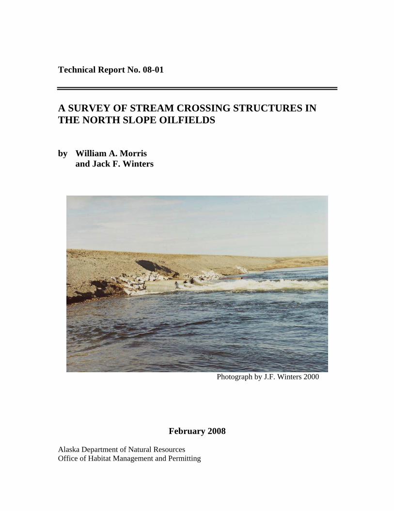
Photograph by J.F. Winters 2000
February 2008 Alaska Department of Natural Resources Office of Habitat Management and Permitting
The Alaska Department of Natural Resources administers all programs and activities free from discrimination based on race, color, national origin, age, sex, religion, marital status, pregnancy, parenthood, or disability. The department administers all programs and activities in compliance with Title VI of the Civil Rights Act of 1964, Section 504 of the Rehabilitation Act of 1973, Title II of the Americans with Disabilities Act of 1990, the Age Discrimination Act of 1975, and Title IX of the Education Amendments of 1972. If you believe you have been discriminated against in any program, activity, or facility, or if you desire further information please write to DNR, 1300 College Road, Fairbanks, Alaska 99701; U.S. Fish and Wildlife Service, 4040 N. Fairfax Drive, Suite 300 Webb, Arlington, VA 22203; or O.E.O., U.S. Department of the Interior, Washington DC 20240. For information on alternative formats for this and other department publications, please contact the department ADA Coordinator at (voice) 907-269-8549 or (TDD) 907-269-8411.
A SURVEY OF STREAM CROSSING STRUCTURES IN THE NORTH SLOPE OILFIELDS
By
William A. Morris and Jack F. Winters
Kerry M. Howard Executive Director
Office of Habitat Management and Permitting Alaska Department of Natural Resources

Table of Contents
TABLE OF CONTENTS ........................................................................................I
LIST OF FIGURES ............................................................................................. IV
ACKNOWLEDGEMENTS ................................................................................... V
INTRODUCTION ..................................................................................................1
METHODS............................................................................................................1
RESULTS .............................................................................................................2
Endicott Area Stream Crossings ................................................................................................................. 7 SAG C CREEK (1).................................................................................................................................. 11 WASHOUT CREEK (2).......................................................................................................................... 14 DUCK ISLAND CREEK (3)................................................................................................................... 17 SOUTH FORK ENDICOTT CREEK (4)................................................................................................ 20 NORTH FORK ENDICOTT CREEK (5) ............................................................................................... 23 ENDICOTT CREEK 4 (CV 13) (6) ........................................................................................................ 26 ENDICOTT CREEK 5 (CV 14) (7) ........................................................................................................ 28 WASHOUT CREEK TRIBUTARY (8).................................................................................................. 31 WASHOUT CREEK (9).......................................................................................................................... 34 WASHOUT CREEK (10)........................................................................................................................ 38 UNNAMED CREEK (11) ....................................................................................................................... 41 UNNAMED CREEK (13) ....................................................................................................................... 44 UNNAMED CREEK (14) ....................................................................................................................... 47 UNNAMED CREEK (12) ....................................................................................................................... 50 SAGAVANIRKTOK RIVER BRIDGE VICINITY ............................................................................... 53
West Dock Road from LGI to Point McIntyre 1 Stream Crossings ...................................................... 57 POINT MCINTYRE CREEK (1) ............................................................................................................ 61 LGI ESTUARY CREEK (2).................................................................................................................... 64
Central Prudhoe Bay Area, Putuligayuk and Little Putuligayuk River Stream Crossings................. 67 PUTULIGAYUK RIVER (2) .................................................................................................................. 71 PUTULIGAYUK RIVER (1) .................................................................................................................. 75 PUTULIGAYUK RIVER (3) .................................................................................................................. 78 PUTULIGAYUK RIVER TRIBUTARY (4) .......................................................................................... 84 PUMP STATION 1 DRAIN TO THE PUTULIGAYUK RIVER (5)..................................................... 87 LITTLE PUTULIGAYUK RIVER (6).................................................................................................... 89 LITTLE PUTULIGAYUK RIVER (7).................................................................................................... 92 LITTLE PUTULIGAYUK RIVER (9).................................................................................................... 94 LITTLE PUTULIGAYUK RIVER (8).................................................................................................. 104
Central Prudhoe Bay Area Fawn and Leach Creek Stream Crossings............................................... 107 FAWN CREEK (5)................................................................................................................................ 111 FAWN CREEK (3)................................................................................................................................ 114 FAWN CREEK (2)................................................................................................................................ 117
ii
FAWN CREEK (1)................................................................................................................................ 120 FAWN CREEK (4)................................................................................................................................ 123 LEACH CREEK (7) .............................................................................................................................. 127 LEACH CREEK (6) .............................................................................................................................. 131
Kuparuk River and Western Tributary Stream Crossings .................................................................. 137 SAKONOWYAK RIVER (11).............................................................................................................. 141 SMITH CREEK (8) ............................................................................................................................... 145 SMITH CREEK (9) ............................................................................................................................... 150 SMITH CREEK (10) ............................................................................................................................. 154 PEBBLE CREEK (4)............................................................................................................................. 158 PEBBLE CREEK (6,7).......................................................................................................................... 163 PEBBLE CREEK (5)............................................................................................................................. 167 KUPARUK RIVER (1,2,3) ................................................................................................................... 169
Milne Point Unit Stream Crossings......................................................................................................... 179 MILNE S PAD CREEK (1)................................................................................................................... 183 CASCADE CREEK (2)......................................................................................................................... 186 CENTRAL CREEK (3) ......................................................................................................................... 189 LOWER WEST CENTRAL CREEK (4) .............................................................................................. 193 MILNE NO POINT (F PAD) CREEK (5)............................................................................................. 196 MILNE B PAD CREEK (6) .................................................................................................................. 198
Kuparuk CPF 1 Area Stream Crossings ................................................................................................ 203 EAST CREEK (1) ................................................................................................................................. 207 EAST CREEK (2) ................................................................................................................................. 211 WEST FORK WEST FORK CENTRAL CREEK (5) .......................................................................... 213 EAST FORK WEST FORK CENTRAL CREEK (4) ........................................................................... 217 EAST FORK CENTRAL CREEK (3)................................................................................................... 221 EAST FORK CENTRAL CREEK (7)................................................................................................... 224 WEST FORK CENTRAL CREEK (8).................................................................................................. 228 EAST FORK UGNURAVIK RIVER (6) .............................................................................................. 232 UGNURAVIK RIVER (9) .................................................................................................................... 236 UGNURAVIK RIVER (10)................................................................................................................... 241 CHARLIE CREEK TRIBUTARY (11)................................................................................................. 244 CHARLIE CREEK (12) ........................................................................................................................ 247 EAST FORK CHARLIE CREEK (13).................................................................................................. 250 EAST FORK CHARLIE CREEK (14).................................................................................................. 253 CHARLIE CREEK (15) ........................................................................................................................ 256 WEST FORK UGNURAVIK RIVER TRIBUTARY (16) ................................................................... 259 WEST FORK UGNURAVIK RIVER (17) ........................................................................................... 262
Kuparuk CPF 3 Area Stream Crossings ................................................................................................ 267 CARIBOU CREEK (8).......................................................................................................................... 271 KALUBIK CREEK TRIBUTARY (EAST FORK NOWHERE CREEK) (9)...................................... 274 KALUBIK CREEK TRIBUTARY (NOWHERE CREEK) (10) .......................................................... 278 KALUBIK CREEK TRIBUTARY (WEST FORK NOWHERE CREEK) (11) ................................... 282 KALUBIK CREEK (12)........................................................................................................................ 285 CARIBOU CREEK (7).......................................................................................................................... 289 UGNURAVIK RIVER TRIBUTARY (1)............................................................................................. 292 UGNURAVIK RIVER TRIBUTARY (2)............................................................................................. 295 UGNURAVIK RIVER TRIBUTARY (3)............................................................................................. 298 UGNURAVIK RIVER TRIBUTARY (5)............................................................................................. 301 UGNURAVIK RIVER TRIBUTARY (4)............................................................................................. 304 UGNURAVIK RIVER TRIBUTARY (6)............................................................................................. 307
iii
Kuparuk CPF 2 Area Stream Crossings ................................................................................................ 311 CHARLIE CREEK (1) .......................................................................................................................... 315 CHARLIE CREEK (2) .......................................................................................................................... 318 WEST FORK UGNURAVIK RIVER (3) ............................................................................................. 321 WEST FORK UGNURAVIK RIVER (4) ............................................................................................. 324 KALUBIK CREEK TRIBUTARY (5).................................................................................................. 328 KALUBIK CREEK TRIBUTARY (6).................................................................................................. 331 KALUBIK CREEK TRIBUTARY (7).................................................................................................. 335 KALUBIK CREEK TRIBUTARY (8).................................................................................................. 338 KALUBIK CREEK (9).......................................................................................................................... 341 WEST FORK KALUBIK CREEK (10) ................................................................................................ 346 TROUBLE CREEK (MILUVEACH RIVER TRIBUTARY) (11) ....................................................... 349
Tarn to Meltwater Road Stream Crossings ........................................................................................... 353 MILUVEACH RIVER (1)..................................................................................................................... 357 MILUVEACH RIVER TRIBUTARY (2) ............................................................................................. 360 KACHEMACH RIVER TRIBUTARY (3) ........................................................................................... 364 TIFFINI CREEK (4).............................................................................................................................. 367 JENNIFER CREEK (5) ......................................................................................................................... 370 JESSICA CREEK (6) ............................................................................................................................ 373 STEPHANIE CREEK (7)...................................................................................................................... 376
iv
List of Figures Figure 1. Stream crossing locations examined in 2004 and 2005...................................... 4 Figure 2. Relative condition of stream crossings examined in 2004 and 2005. ................ 5 Figure 3. Relative priority for rehabilitation of stream crossings examined in 2004 and
2005............................................................................................................................. 6 Figure 4. Relative condition of Endicott area stream crossings......................................... 9 Figure 5. Relative priority for rehabilitation of Endicott area stream crossings.............. 10 Figure 6. Relative condition of West Channel Sagavanirktok River area stream crossings
examined in 2004 and 2005. ..................................................................................... 55 Figure 7. Relative priority for rehabilitation of West Channel Sagavanirktok River area
stream crossings examined in 2004 and 2005........................................................... 56 Figure 8. Relative condition of West Dock/LG1 area stream crossings.......................... 59 Figure 9. Relative priority for rehabilitation of West Dock/LG1 stream crossings......... 60 Figure 10. Relative condition of Putuligayuk River area stream crossings. .................... 69 Figure 11. Relative priority for rehabilitation of Putuligayuk River stream crossings.... 70 Figure 12. Relative condition of Fawn and Leach creeks stream crossings. ................. 109 Figure 13. Relative priority for rehabilitation of Fawn and Leach creeks crossings. .... 110 Figure 14. Relative condition of Kuparuk River/Western Kuparuk River tributary
crossings.................................................................................................................. 139 Figure 15. Relative priority for rehabilitation of Kuparuk River/Western Kuparuk
tributary crossings................................................................................................... 140 Figure 16. Relative condition of Milne Point Unit stream crossings............................. 181 Figure 17. Relative priority for rehabilitation of Milne Point Unit stream crossings.... 182 Figure 18. Relative condition of CPF1 area stream crossings. ...................................... 205 Figure 19. Relative priority for rehabilitation of CPF1 area stream crossings. ............. 206 Figure 20. Relative condition of CPF3 area stream crossings. ...................................... 269 Figure 21. Relative priority for rehabilitation of CPF3 area stream crossings. ............. 270 Figure 22. Relative condition of CPF2 area stream crossings. ...................................... 313 Figure 23. Relative priority for rehabilitation of CPF2 area stream crossings. ............. 314 Figure 24. Relative condition of Tarn to Meltwater Road stream crossings. ................ 355 Figure 25. Relative priority for rehabilitation of Tarn to Meltwater Road stream
crossings.................................................................................................................. 356
v
Acknowledgements We thank Caryn Rea of ConocoPhillips Alaska Inc. and Bill Streever of BP Exploration (Alaska) Inc. for providing partial funding support for this project. Additional funding was provided through an Alaska Coastal Management Program Section 306 grant.

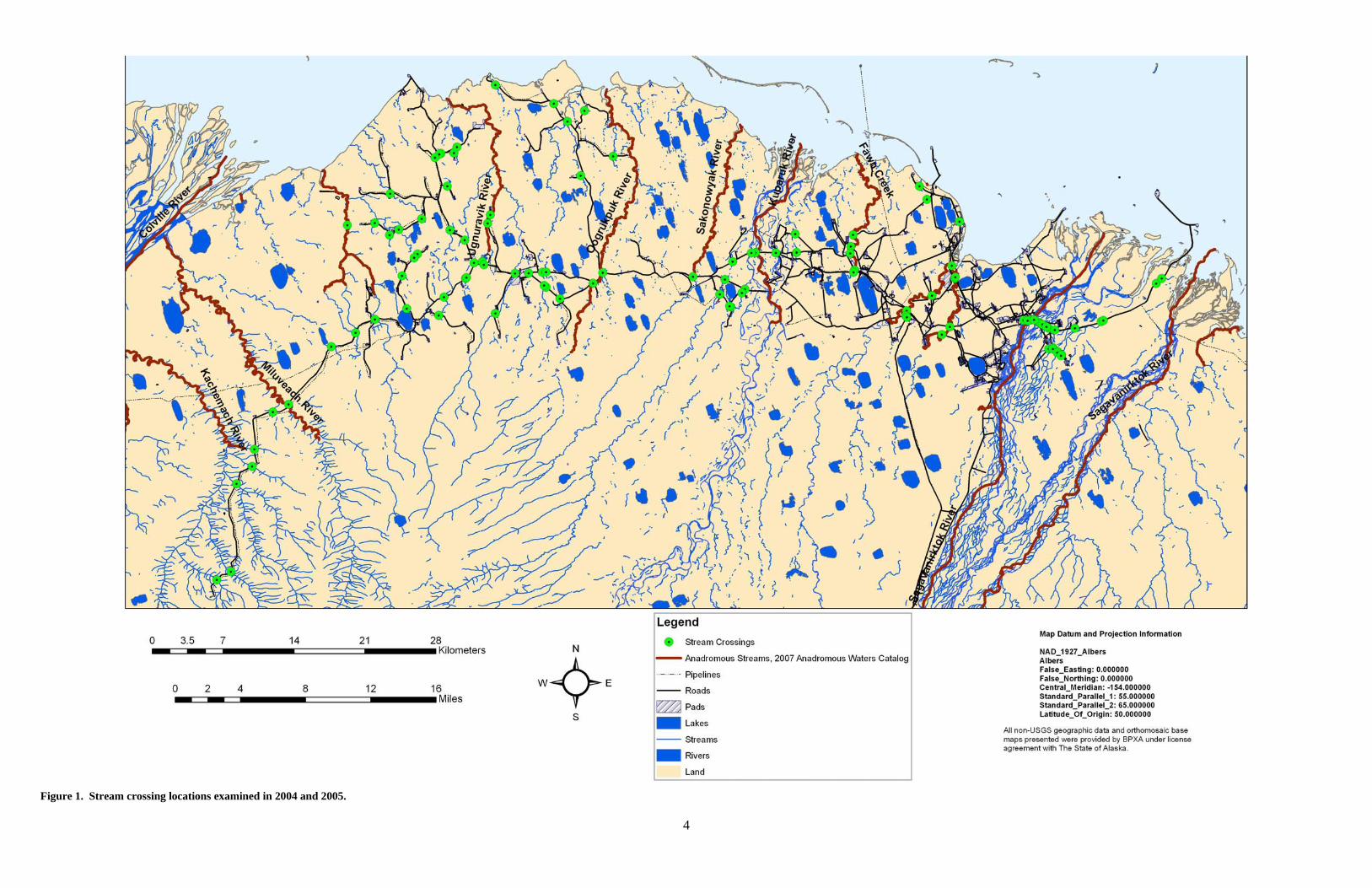
Introduction In August 1988, the Alaska Department of Fish and Game (ADF&G) conducted an inventory of many of the culverts and bridges that crossed fish-bearing or suspected fish-bearing waterbodies within the North Slope oilfields – Kuparuk, Milne Point, Prudhoe Bay East and West Operating Areas, and Endicott. Fifty two stream crossings were examined during this original survey to gather site specific information on the type of crossing structure and its condition, to document stream characteristics upstream and downstream of the crossings, to develop recommendations for the rehabilitation of streams and replacement of crossing structures where needed, and to provide a data set that could be used to develop design standards for future stream crossings. From this inventory, an unpublished report was produced in May 1989 by A.G. Ott titled “North Slope Oil and Gas Development Cross Drainage Report” (also informally known as the “Red Book”). This report found many of the crossing structures in need of repair from damage from routine road maintenance and from ice damage during breakup. Since 1988, new culverts and bridges have been installed as oilfield infrastructure expanded, culvert installations have been repaired or replaced, and bridges have been modified in light of changing stream conditions. As a result of these additions and changes to the inventory of stream crossing structures in the oilfields, along with additional information regarding fish distribution within oilfield streams, we resurveyed, beginning in summer 2004, the stream crossings of the original survey, along with structures installed since 1988 and some that were not surveyed in 1988 (Figure 1). The report is organized on a geographic basis within the oilfields from Endicott in the east to Meltwater in the western Kuparuk area. Crossing structures in the Badami or Alpine fields were not examined. Breaches in the Endicott and West Dock causeways also were not examined in this field review. Culverts used exclusively for cross drainage that did not involve fish-bearing or suspected fish bearing waters were also not examined. Methods Stream crossing structures were examined primarily during two periods: August 3-7, 2004 and July 12-17, 2005. Supplemental observations also were made from August 7-14, 2006 and July 5-11, 2007. Photographs and observations from the last 10 years also have been included to enhance descriptions of some of the observed crossings. Photographs were taken of the stream upstream and downstream of the crossing. Photographs detailing the condition of the outlets and inlets of culverts, and the abutments and piers of bridges were taken for each of the crossings. Information was recorded at each site regarding the location, the type of crossing structure, the number and size of culverts present in a culvert battery, the condition of any armor protection at the site, physical damage to the inlets, outlets, or barrels of culverts, scour, instream gravel deposition, stream bank erosion, road prism erosion, and any condition that restricted or prevented fish from moving past the structure. The presence of any fish at
2
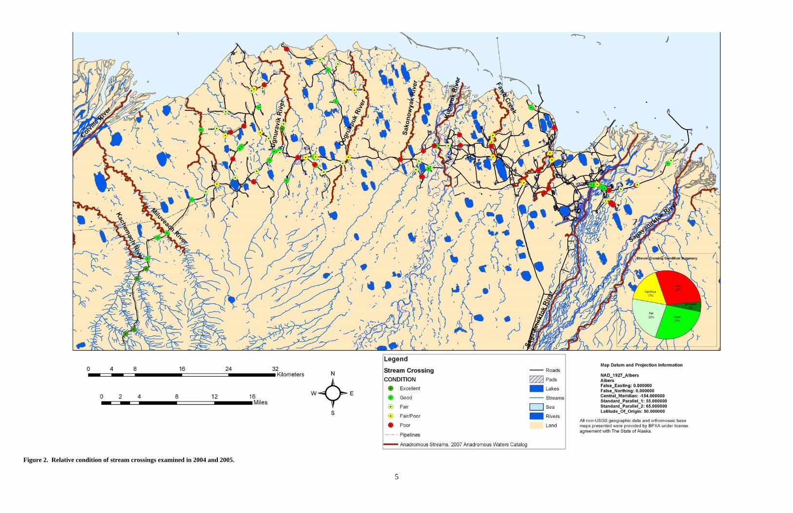
the crossing also was noted. This information is presented in the form of a descriptive text page for each crossing and an average of four photographs for each crossing. From our observations, we developed recommendations regarding the need for, the priority, and the type of rehabilitation needed for each crossing structure. These recommendations were based on the degree to which the crossing structure allowed unimpeded passage of fish, the type of fish present in the system, the amount of stream channel disruption, and the amount of potential or actual fish habitat upstream of the crossing. Each geographic section is preceded by two maps, the first illustrating the general condition of each of the crossings and the second depicting the priority for rehabilitation of each crossing. Crossings are numbered within each geographic area presented. Map numbers correspond with the number in parenthesis after each stream crossing name. The condition of each stream crossing was assessed and rated as either Excellent, Good, Fair, Fair/Poor or Poor. Stream crossings that exhibited no to slight stream bank and channel erosion and could readily pass fish were rated as excellent. Crossings with minor stream bank and road erosion that could pass fish were rated as good. Crossings that showed more significant signs of erosion, had damaged culverts and outwash gravel, but likely could pass fish at most flows, were rated as Fair. Crossings clearly producing extensive deposits of outwash gravel, significant stream bed and bank erosion, along with culvert damage and road erosion, but that likely could pass fish at most flows, were rated as Fair/Poor. Crossings showing extensive outwash, extreme stream and road erosion, and high likelihood for blocking fish passage, or that showed a clear blockage to fish movement at the time of inspection were rated as poor. Crossings filled with construction debris also were rated as poor. Crossings were then prioritized with respect to clean-up and/or rehabilitation urgency; High, Moderate, Low or No priority was assigned to each crossing. Prioritization was based on the severity of the rated condition, whether there was a complete blockage to fish passage, and the known relative use of the system by fish. Results We examined 107 crossing structures on streams and rivers within the North Slope oilfields. Of these 107 crossings, we considered 34 to be in good or excellent condition, with minimal or no damage to stream banks and channels, and to inlet or outlet structures (Figure 2). These crossings also maintained unimpeded fish passage past the structures. We considered 42 crossings to be in fair or fair/poor condition, with some damage to the crossing structures and some changes to the stream bed and banks. We considered the remaining 31 crossings to be in poor condition, with substantial damage to inlet and outlet structures, substantial scour, bank erosion and instream gravel deposition, and substantial restrictions or complete blockage of fish passage.
3
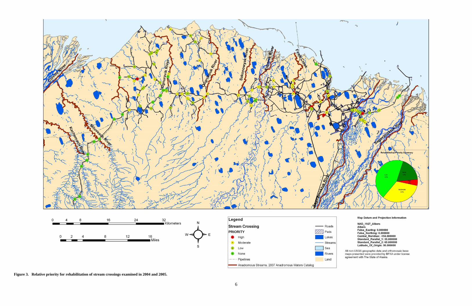
Priority recommendations (none, low, moderate, high) revealed five of the crossings have a high priority need for modification or repair (Figure 3). These five sites are: (1) Washout Creek on the Endicott Road; (2) the Little Putuligayuk River at the Spine Road; (3) the Putuligayuk River at the Spine Road; (4) Fawn Creek at the Spine Road; (5) East Fork Nowhere Creek, a Kalubik Creek tributary, crossing the Drill Site 3B to
Drill Site 3F access road. Problems associated with these culverted stream crossings include blockage of flow by gravel deposition, perched outlets, or inadequate conveyance of water that impair or impede movement of fish past the structure. Conversely, we had no repair recommendations for 20 of the crossings. These crossings were either bridges that spanned the bankfull or nearly bankfull width of the stream, or culverts that were in good condition and were of adequate size to convey water past the crossing at most flows. Of the remaining crossing structures examined, 47 had a low need for repair and 35 had a moderate need for repair. These rankings and priorities will change over time as crossings age and as crossings are rehabilitated. Some rehabilitation work as recommended throughout the document could be done quickly and inexpensively and should be addressed regardless of crossing priority. Some of this rehabilitation work on selected crossings has already begun. It is also significant to note that most of the crossings in the Prudhoe Bay and Kuparuk River units are old, and many were built during initial construction of the oil fields in the 1970’s and early 1980’s. Stream crossing design and construction techniques as well as knowledge of fish use have changed considerably since that time. Additionally, these are old crossings that withstood, in some cases, two or more decades of use in a harsh environment and some deterioration is to be expected. Our preliminary analysis largely reflects this assessment. Our interest is to begin addressing problem crossings over time and to work with the area operators to phase-in needed rehabilitation work in a manner that is consistent with maintaining fish habitat and fish passage, as well as in a manner that acknowledges the economic component of such work.

4
Figure 1. Stream crossing locations examined in 2004 and 2005.

5
Figure 2. Relative condition of stream crossings examined in 2004 and 2005.

6
Figure 3. Relative priority for rehabilitation of stream crossings examined in 2004 and 2005.

7
Endicott Area Stream Crossings

8
9
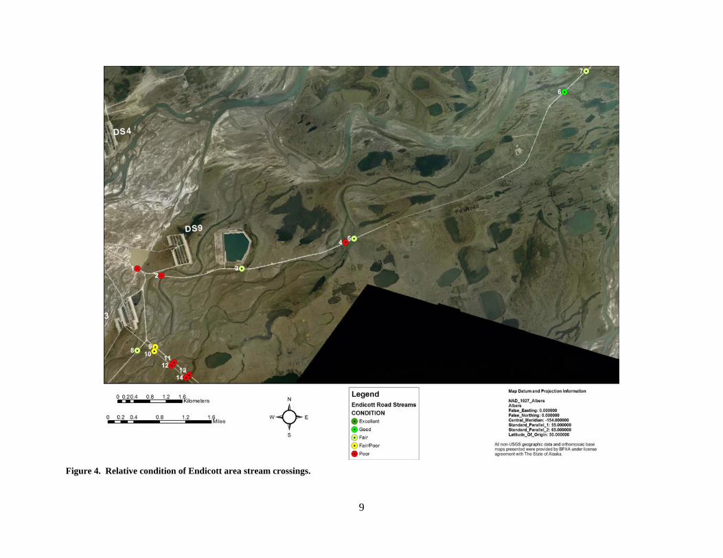
Figure 4. Relative condition of Endicott area stream crossings.
10
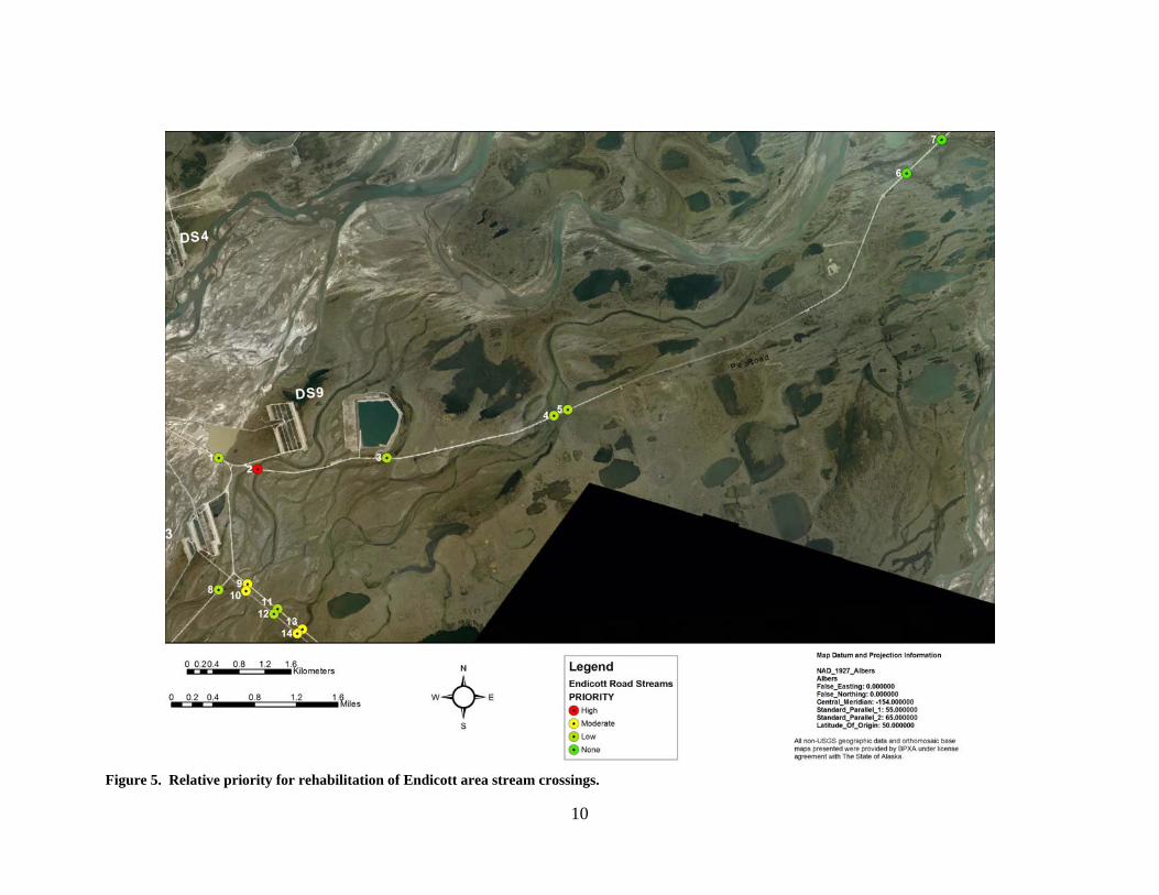
Figure 5. Relative priority for rehabilitation of Endicott area stream crossings.
11
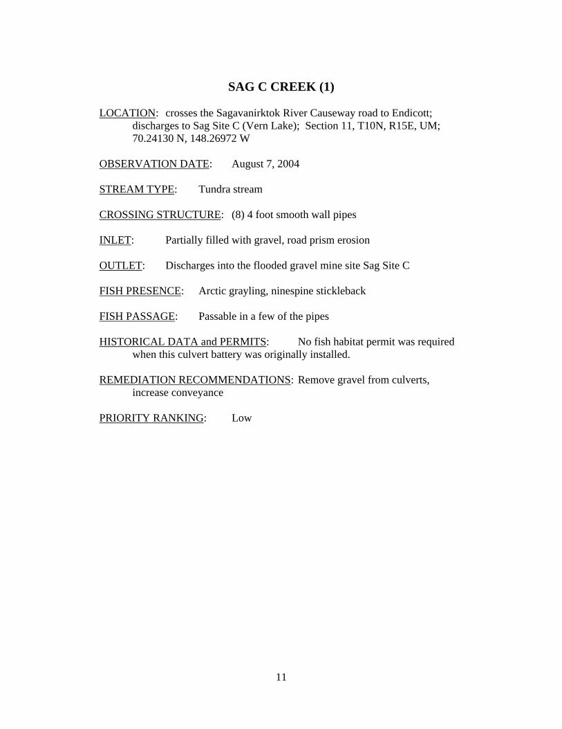
SAG C CREEK (1)
LOCATION: crosses the Sagavanirktok River Causeway road to Endicott;
discharges to Sag Site C (Vern Lake); Section 11, T10N, R15E, UM; 70.24130 N, 148.26972 W
OBSERVATION DATE: August 7, 2004 STREAM TYPE: Tundra stream CROSSING STRUCTURE: (8) 4 foot smooth wall pipes INLET: Partially filled with gravel, road prism erosion OUTLET: Discharges into the flooded gravel mine site Sag Site C FISH PRESENCE: Arctic grayling, ninespine stickleback FISH PASSAGE: Passable in a few of the pipes HISTORICAL DATA and PERMITS: No fish habitat permit was required
when this culvert battery was originally installed. REMEDIATION RECOMMENDATIONS: Remove gravel from culverts,
increase conveyance PRIORITY RANKING: Low
12
Photograph 1. Sag C Creek upstream of road.
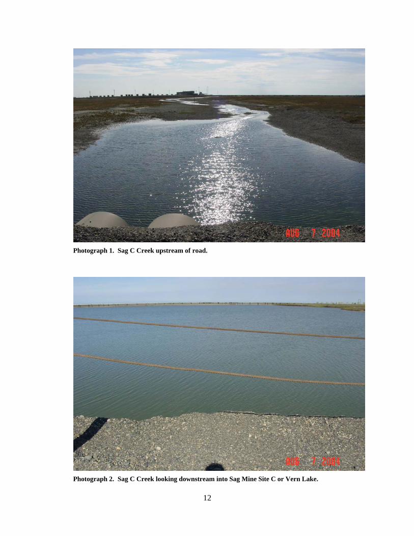
Photograph 2. Sag C Creek looking downstream into Sag Mine Site C or Vern Lake.
13
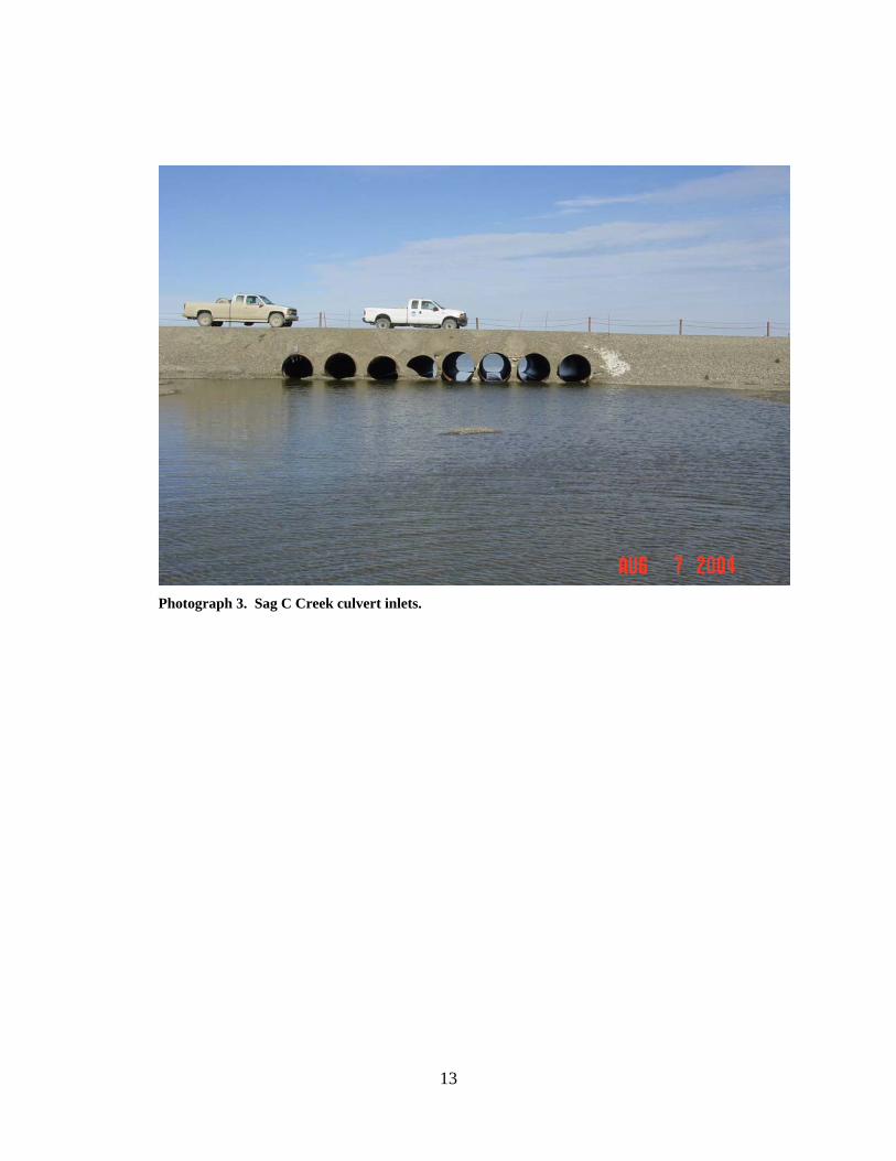
Photograph 3. Sag C Creek culvert inlets.
14
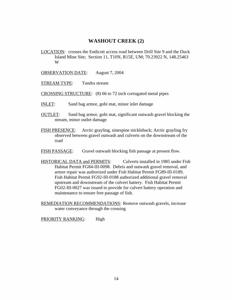
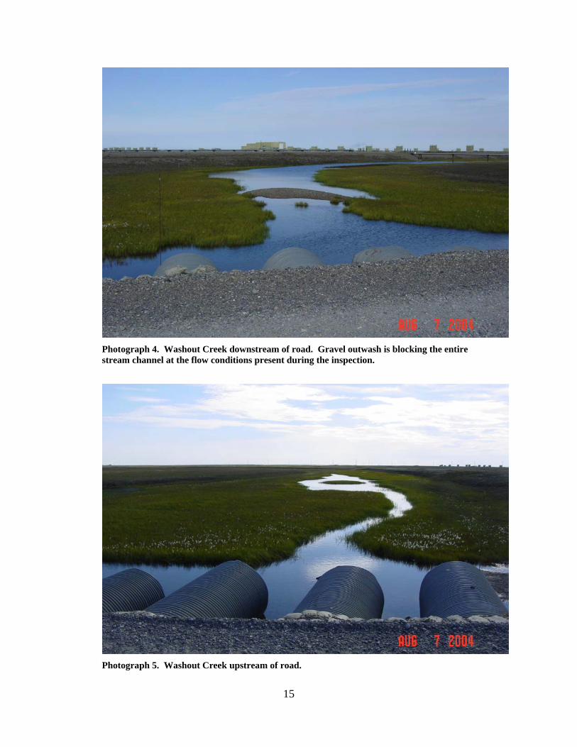
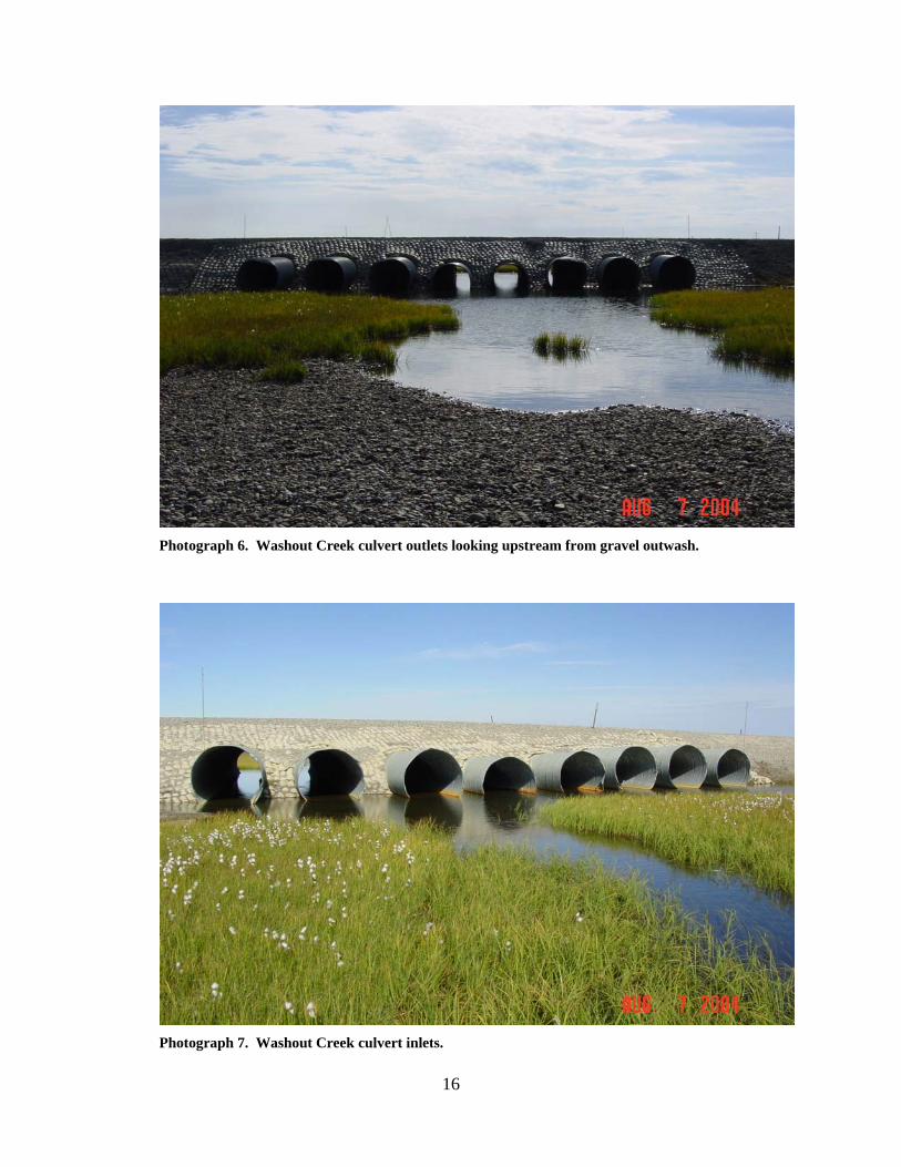
WASHOUT CREEK (2) LOCATION: crosses the Endicott access road between Drill Site 9 and the Duck
Island Mine Site; Section 11, T10N, R15E, UM; 70.23922 N, 148.25463 W
OBSERVATION DATE: August 7, 2004 STREAM TYPE: Tundra stream CROSSING STRUCTURE: (8) 66 to 72 inch corrugated metal pipes INLET: Sand bag armor, gobi mat, minor inlet damage OUTLET: Sand bag armor, gobi mat, significant outwash gravel blocking the
stream, minor outlet damage FISH PRESENCE: Arctic grayling, ninespine stickleback; Arctic grayling fry
observed between gravel outwash and culverts on the downstream of the road
FISH PASSAGE: Gravel outwash blocking fish passage at present flow. HISTORICAL DATA and PERMITS: Culverts installed in 1985 under Fish
Habitat Permit FG84-III-0098. Debris and outwash gravel removal, and armor repair was authorized under Fish Habitat Permit FG89-III-0189. Fish Habitat Permit FG92-III-0188 authorized additional gravel removal upstream and downstream of the culvert battery. Fish Habitat Permit FG02-III-0027 was issued to provide for culvert battery operation and maintenance to ensure free passage of fish.
REMEDIATION RECOMMENDATIONS: Remove outwash gravels, increase
water conveyance through the crossing PRIORITY RANKING: High
15
Photograph 4. Washout Creek downstream of road. Gravel outwash is blocking the entire stream channel at the flow conditions present during the inspection.
Photograph 5. Washout Creek upstream of road.
16
Photograph 6. Washout Creek culvert outlets looking upstream from gravel outwash.
Photograph 7. Washout Creek culvert inlets.
17
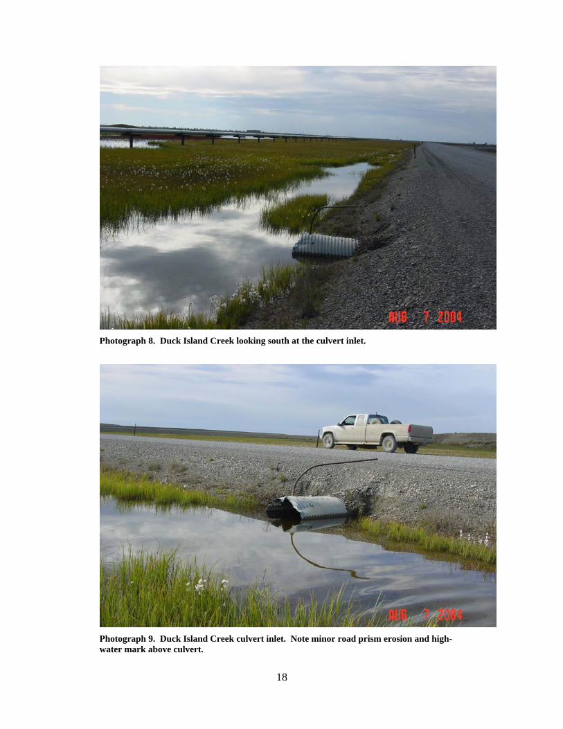
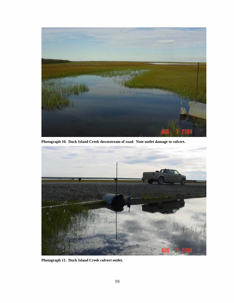
DUCK ISLAND CREEK (3)
LOCATION: crosses the Endicott access road at the Duck Island Mine Site;
Section 12, T10N, R15E, UM; 70.23925 N, 148.20249 W OBSERVATION DATE: August 7, 2004 STREAM TYPE: Tundra stream CROSSING STRUCTURE: (1) 48 inch corrugated metal pipe INLET: Damage to culvert end, minor road prism erosion, gobi mat armor OUTLET: Damage to culvert end, gobi mat armor FISH PRESENCE: Ninespine stickleback FISH PASSAGE: Passable HISTORICAL DATA and PERMITS: This culvert was installed in 1985
under Fish Habitat Permit FG84-III-0101. Debris and armor repair was authorized under Fish Habitat Permit FG89-III-0190. Fish Habitat Permit FG02-III-0026 was issued to provide for culvert operation and maintenance to ensure free passage of fish.
REMEDIATION RECOMMENDATIONS: Increase water conveyance through
this crossing PRIORITY RANKING: Low
18
Photograph 8. Duck Island Creek looking south at the culvert inlet.
Photograph 9. Duck Island Creek culvert inlet. Note minor road prism erosion and high-water mark above culvert.
19
Photograph 10. Duck Island Creek downstream of road. Note outlet damage to culvert.
Photograph 11. Duck Island Creek culvert outlet.
20
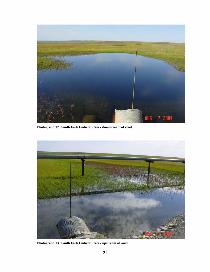
SOUTH FORK ENDICOTT CREEK (4)
LOCATION: crosses the Endicott access road about 2 miles east of the Duck
Island Mine Site, Section 5, T10N, R16E, UM; 70.24310 N, 148.13411 W
OBSERVATION DATE: August 7, 2004 STREAM TYPE: Tundra stream CROSSING STRUCTURE: (1) 36 inch smooth wall pipe, (1) 72 inch
corrugated metal pipe INLET: Sand bag armor, gobi mat, 36 inch pipe submerged, minor culvert
end damage, road prism erosion OUTLET: Sand bag armor, gobi mat, 36 inch pipe submerged, 6 to 8 foot
deep scour pool, minor culvert end damage FISH PRESENCE: Ninespine stickleback FISH PASSAGE: Passable HISTORICAL DATA and PERMITS: Culverts installed in 1985 under Fish
Habitat Permit FG84-III-0104. Fish Habitat Permit FG02-III-0025 was issued to provide for culvert operation and maintenance to ensure free passage of fish.
REMEDIATION RECOMMENDATIONS: Increase water conveyance past this
crossing with larger or additional culverts PRIORITY RANKING: Low
21
Photograph 12. South Fork Endicott Creek downstream of road.
Photograph 13. South Fork Endicott Creek upstream of road.
22
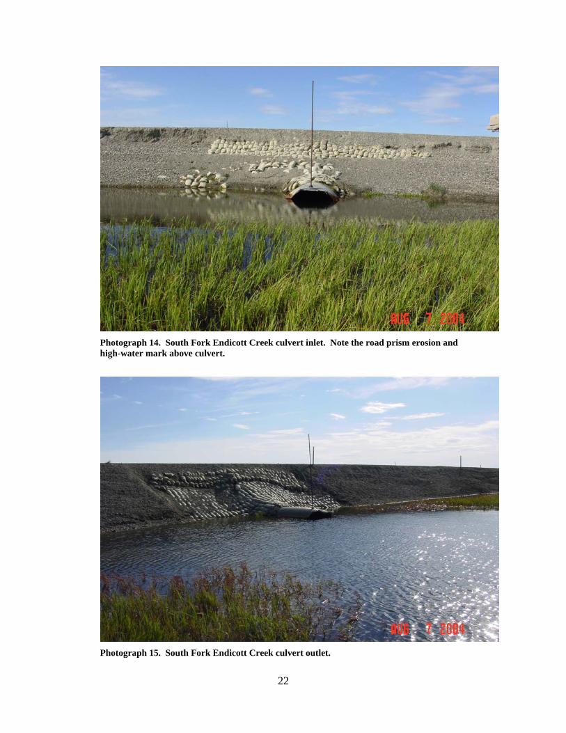
Photograph 14. South Fork Endicott Creek culvert inlet. Note the road prism erosion and high-water mark above culvert.
Photograph 15. South Fork Endicott Creek culvert outlet.
23
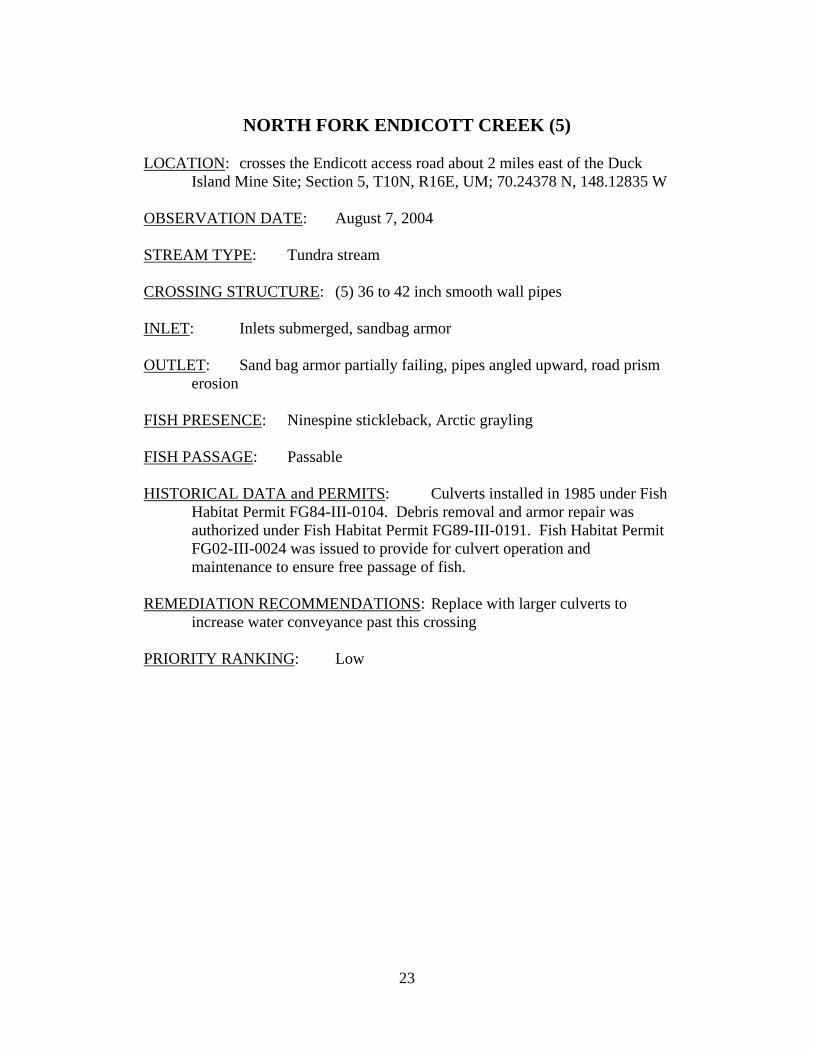
NORTH FORK ENDICOTT CREEK (5)
LOCATION: crosses the Endicott access road about 2 miles east of the Duck
Island Mine Site; Section 5, T10N, R16E, UM; 70.24378 N, 148.12835 W OBSERVATION DATE: August 7, 2004 STREAM TYPE: Tundra stream CROSSING STRUCTURE: (5) 36 to 42 inch smooth wall pipes INLET: Inlets submerged, sandbag armor OUTLET: Sand bag armor partially failing, pipes angled upward, road prism
erosion FISH PRESENCE: Ninespine stickleback, Arctic grayling FISH PASSAGE: Passable HISTORICAL DATA and PERMITS: Culverts installed in 1985 under Fish
Habitat Permit FG84-III-0104. Debris removal and armor repair was authorized under Fish Habitat Permit FG89-III-0191. Fish Habitat Permit FG02-III-0024 was issued to provide for culvert operation and maintenance to ensure free passage of fish.
REMEDIATION RECOMMENDATIONS: Replace with larger culverts to
increase water conveyance past this crossing PRIORITY RANKING: Low
24
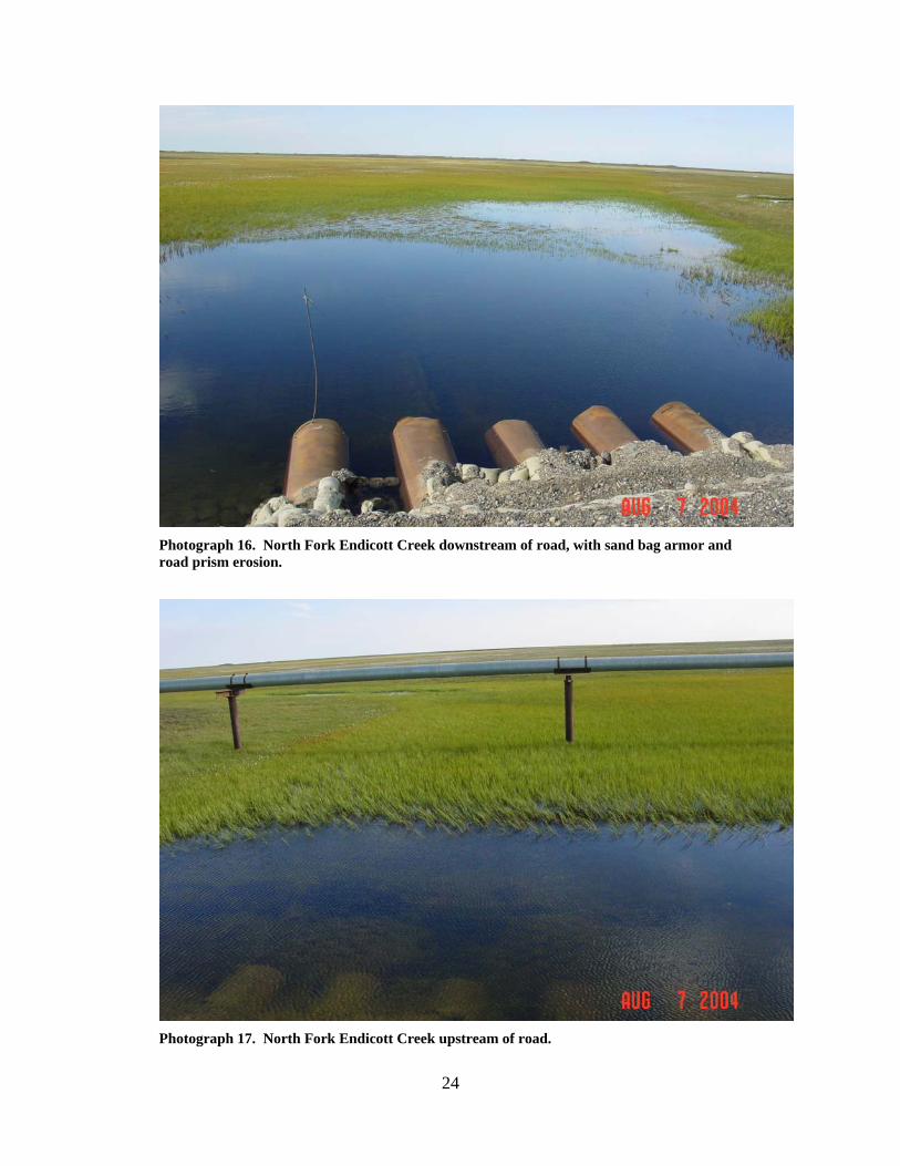
Photograph 16. North Fork Endicott Creek downstream of road, with sand bag armor and road prism erosion.
Photograph 17. North Fork Endicott Creek upstream of road.
25
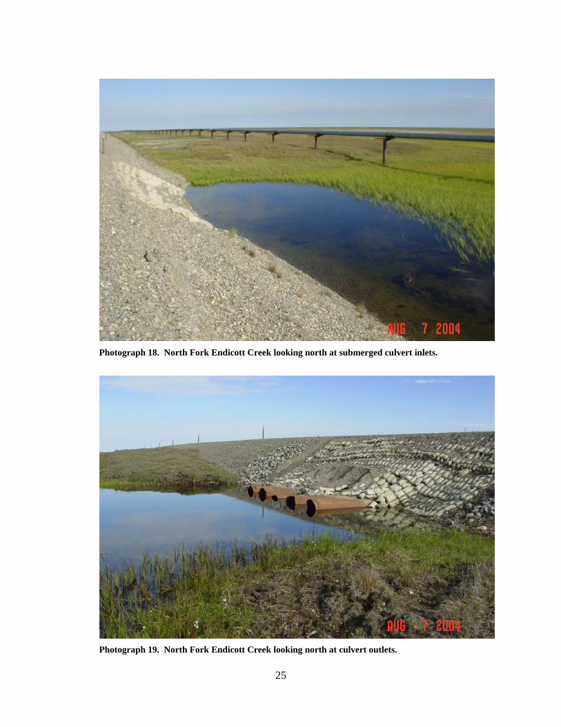
Photograph 18. North Fork Endicott Creek looking north at submerged culvert inlets.
Photograph 19. North Fork Endicott Creek looking north at culvert outlets.
26
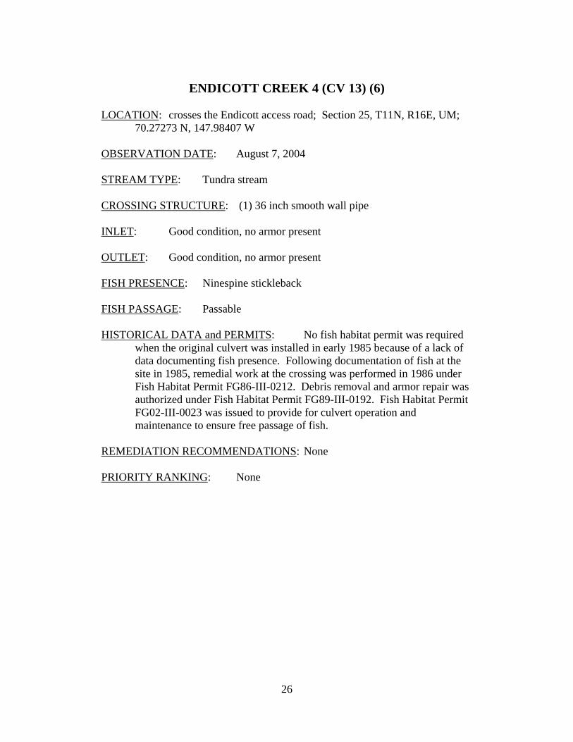
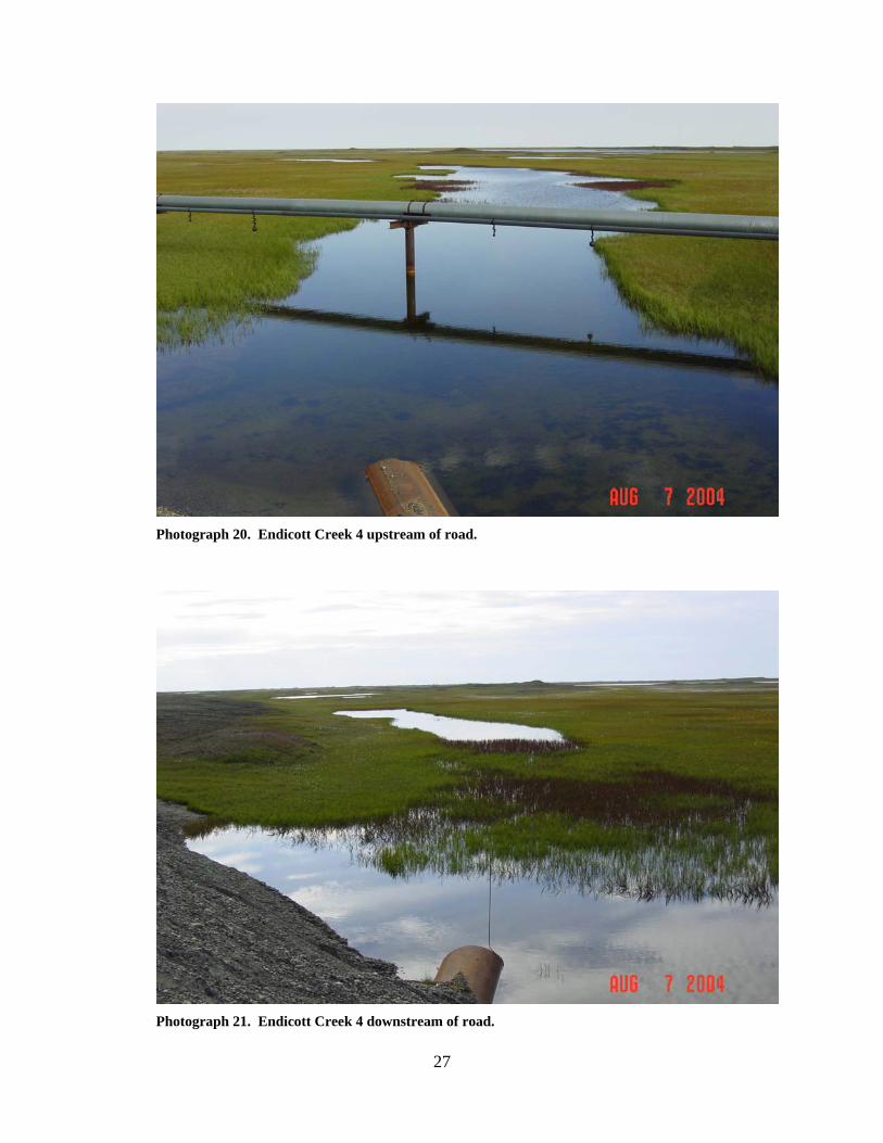
ENDICOTT CREEK 4 (CV 13) (6)
LOCATION: crosses the Endicott access road; Section 25, T11N, R16E, UM;
70.27273 N, 147.98407 W OBSERVATION DATE: August 7, 2004 STREAM TYPE: Tundra stream CROSSING STRUCTURE: (1) 36 inch smooth wall pipe INLET: Good condition, no armor present OUTLET: Good condition, no armor present FISH PRESENCE: Ninespine stickleback FISH PASSAGE: Passable HISTORICAL DATA and PERMITS: No fish habitat permit was required
when the original culvert was installed in early 1985 because of a lack of data documenting fish presence. Following documentation of fish at the site in 1985, remedial work at the crossing was performed in 1986 under Fish Habitat Permit FG86-III-0212. Debris removal and armor repair was authorized under Fish Habitat Permit FG89-III-0192. Fish Habitat Permit FG02-III-0023 was issued to provide for culvert operation and maintenance to ensure free passage of fish.
REMEDIATION RECOMMENDATIONS: None PRIORITY RANKING: None
27
Photograph 20. Endicott Creek 4 upstream of road.
Photograph 21. Endicott Creek 4 downstream of road.
28
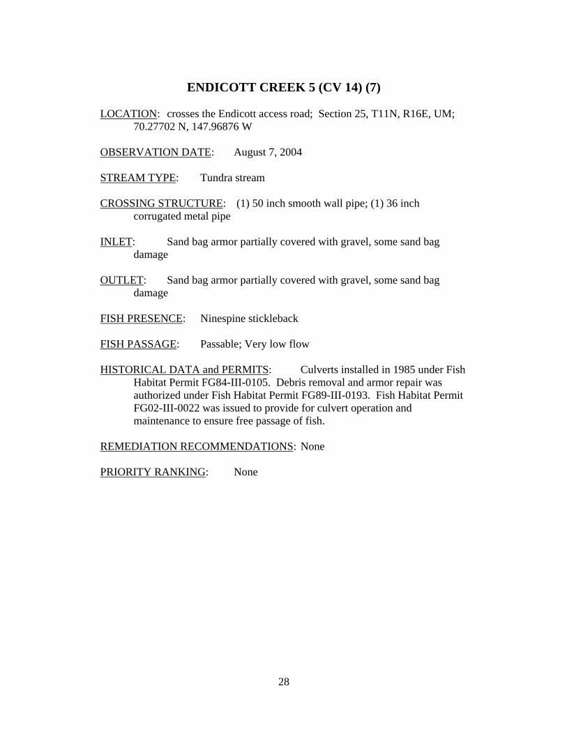
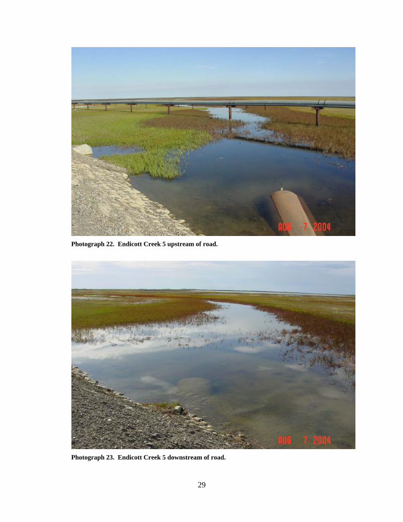
ENDICOTT CREEK 5 (CV 14) (7)
LOCATION: crosses the Endicott access road; Section 25, T11N, R16E, UM;
70.27702 N, 147.96876 W OBSERVATION DATE: August 7, 2004 STREAM TYPE: Tundra stream CROSSING STRUCTURE: (1) 50 inch smooth wall pipe; (1) 36 inch
corrugated metal pipe INLET: Sand bag armor partially covered with gravel, some sand bag
damage OUTLET: Sand bag armor partially covered with gravel, some sand bag
damage FISH PRESENCE: Ninespine stickleback FISH PASSAGE: Passable; Very low flow HISTORICAL DATA and PERMITS: Culverts installed in 1985 under Fish
Habitat Permit FG84-III-0105. Debris removal and armor repair was authorized under Fish Habitat Permit FG89-III-0193. Fish Habitat Permit FG02-III-0022 was issued to provide for culvert operation and maintenance to ensure free passage of fish.
REMEDIATION RECOMMENDATIONS: None PRIORITY RANKING: None
29
Photograph 22. Endicott Creek 5 upstream of road.
Photograph 23. Endicott Creek 5 downstream of road.
30
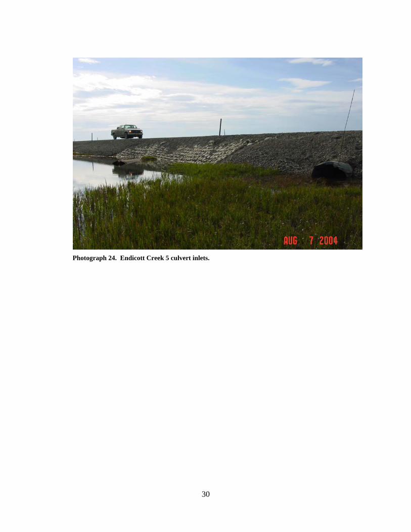
Photograph 24. Endicott Creek 5 culvert inlets.
31
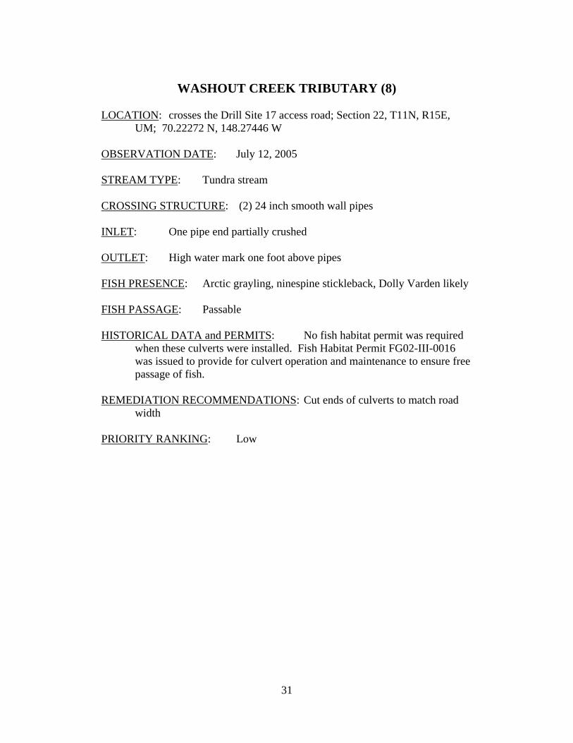
WASHOUT CREEK TRIBUTARY (8)
LOCATION: crosses the Drill Site 17 access road; Section 22, T11N, R15E,
UM; 70.22272 N, 148.27446 W OBSERVATION DATE: July 12, 2005 STREAM TYPE: Tundra stream CROSSING STRUCTURE: (2) 24 inch smooth wall pipes INLET: One pipe end partially crushed OUTLET: High water mark one foot above pipes FISH PRESENCE: Arctic grayling, ninespine stickleback, Dolly Varden likely FISH PASSAGE: Passable HISTORICAL DATA and PERMITS: No fish habitat permit was required
when these culverts were installed. Fish Habitat Permit FG02-III-0016 was issued to provide for culvert operation and maintenance to ensure free passage of fish.
REMEDIATION RECOMMENDATIONS: Cut ends of culverts to match road
width PRIORITY RANKING: Low
32
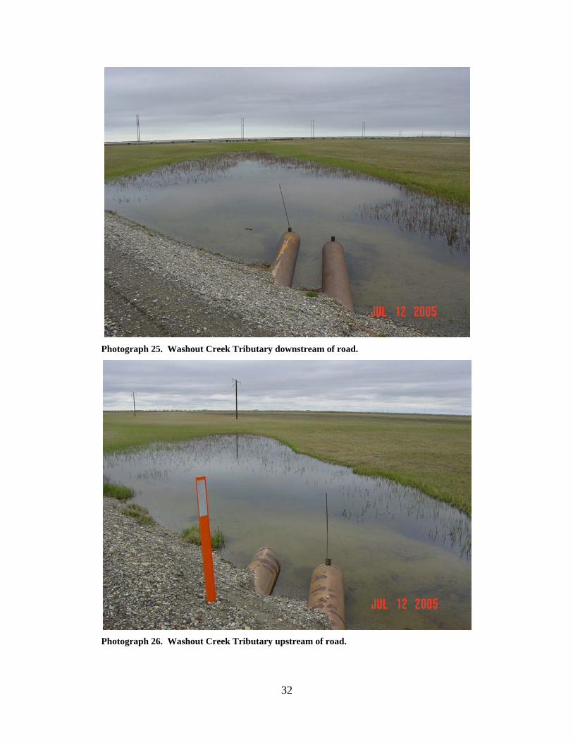
Photograph 25. Washout Creek Tributary downstream of road.
Photograph 26. Washout Creek Tributary upstream of road.
33
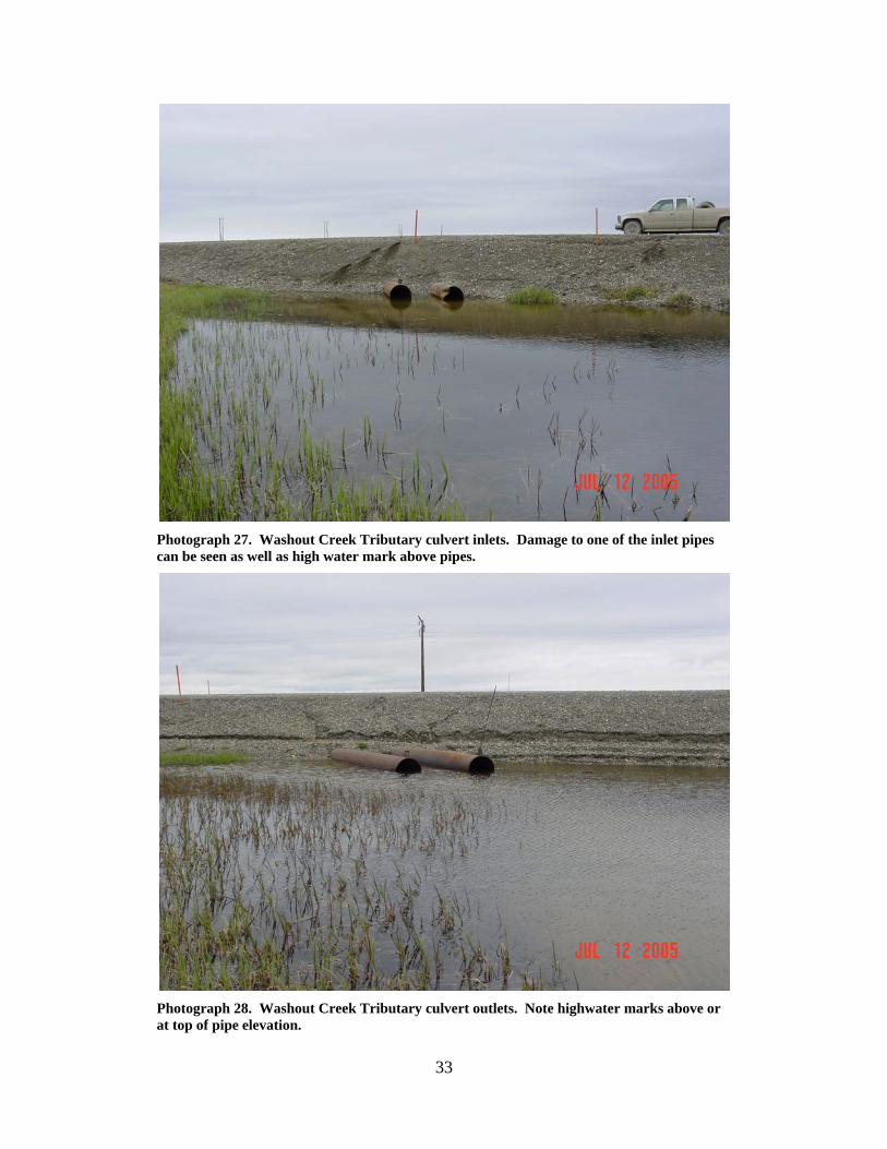
Photograph 27. Washout Creek Tributary culvert inlets. Damage to one of the inlet pipes can be seen as well as high water mark above pipes.
Photograph 28. Washout Creek Tributary culvert outlets. Note highwater marks above or at top of pipe elevation.
34
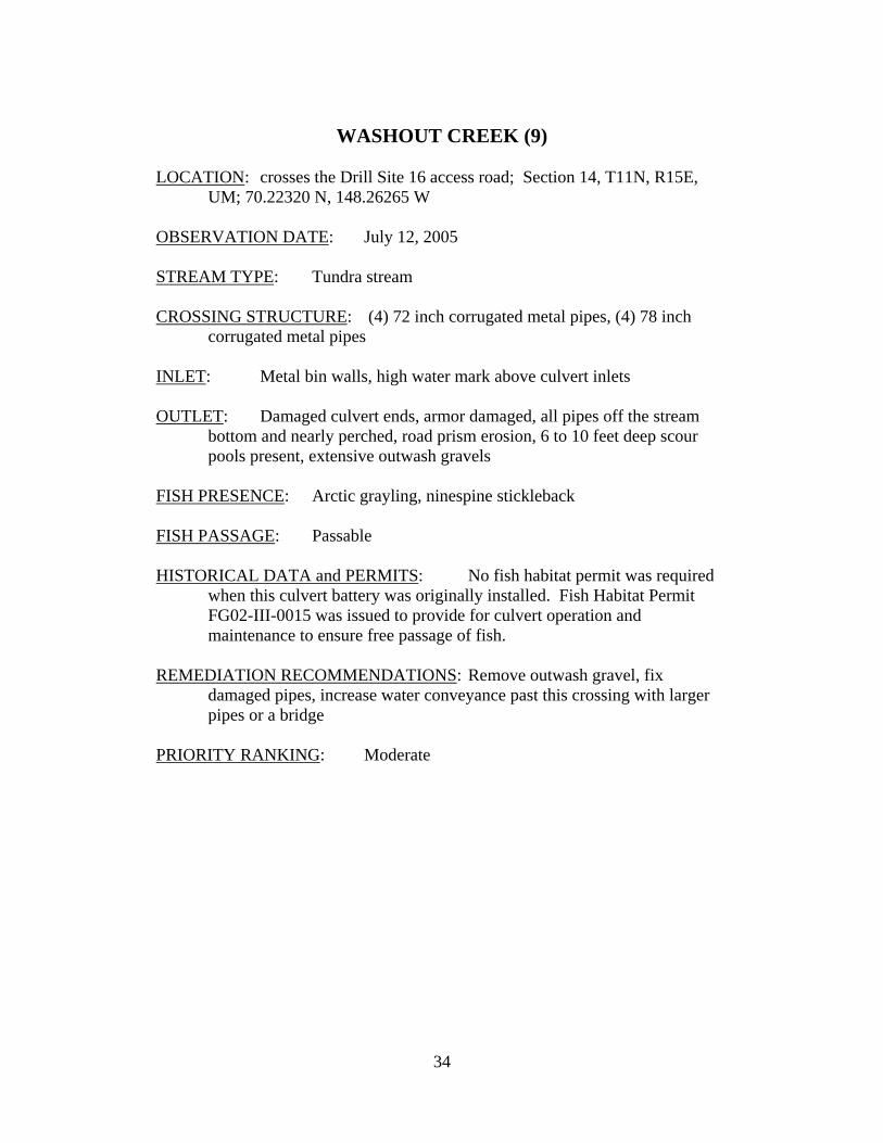
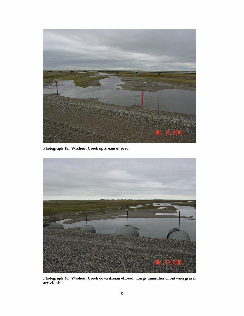
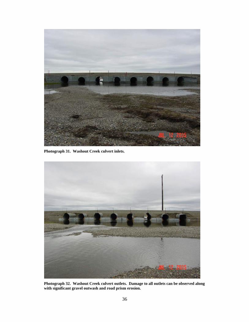
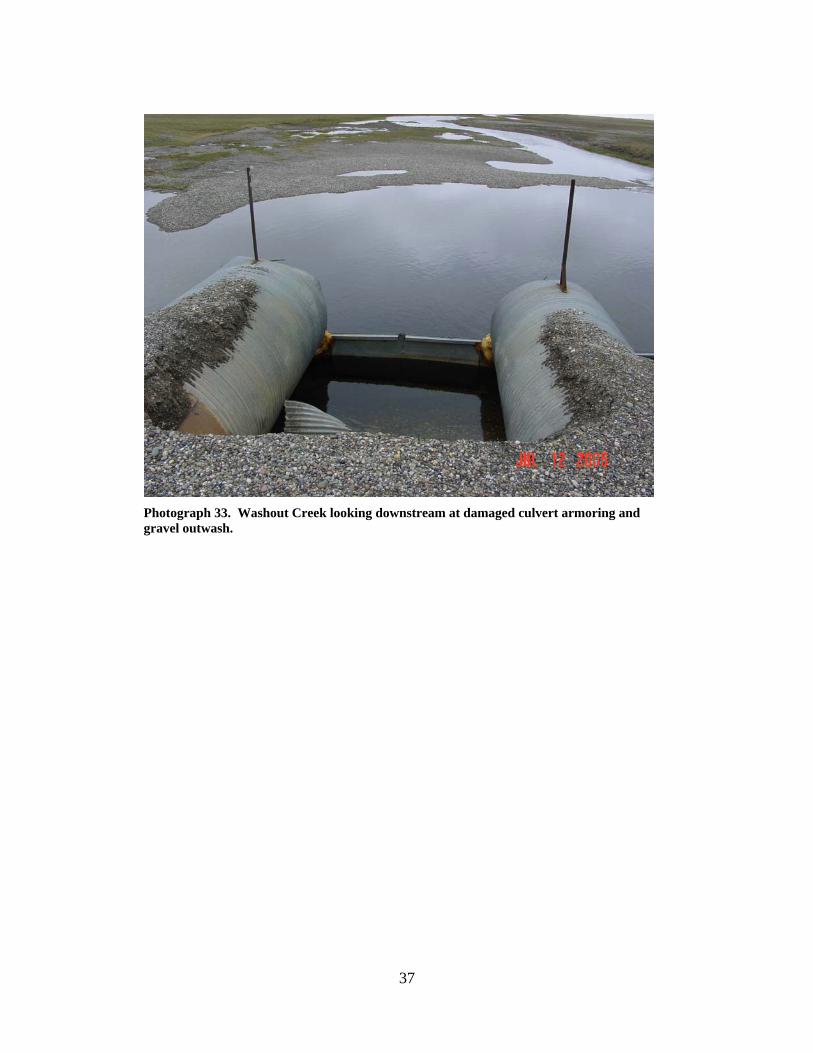
WASHOUT CREEK (9)
LOCATION: crosses the Drill Site 16 access road; Section 14, T11N, R15E,
UM; 70.22320 N, 148.26265 W OBSERVATION DATE: July 12, 2005 STREAM TYPE: Tundra stream CROSSING STRUCTURE: (4) 72 inch corrugated metal pipes, (4) 78 inch
corrugated metal pipes INLET: Metal bin walls, high water mark above culvert inlets OUTLET: Damaged culvert ends, armor damaged, all pipes off the stream
bottom and nearly perched, road prism erosion, 6 to 10 feet deep scour pools present, extensive outwash gravels
FISH PRESENCE: Arctic grayling, ninespine stickleback FISH PASSAGE: Passable HISTORICAL DATA and PERMITS: No fish habitat permit was required
when this culvert battery was originally installed. Fish Habitat Permit FG02-III-0015 was issued to provide for culvert operation and maintenance to ensure free passage of fish.
REMEDIATION RECOMMENDATIONS: Remove outwash gravel, fix
damaged pipes, increase water conveyance past this crossing with larger pipes or a bridge
PRIORITY RANKING: Moderate
35
Photograph 29. Washout Creek upstream of road.
Photograph 30. Washout Creek downstream of road. Large quantities of outwash gravel are visible.
36
Photograph 31. Washout Creek culvert inlets.
Photograph 32. Washout Creek culvert outlets. Damage to all outlets can be observed along with significant gravel outwash and road prism erosion.
37
Photograph 33. Washout Creek looking downstream at damaged culvert armoring and gravel outwash.
38
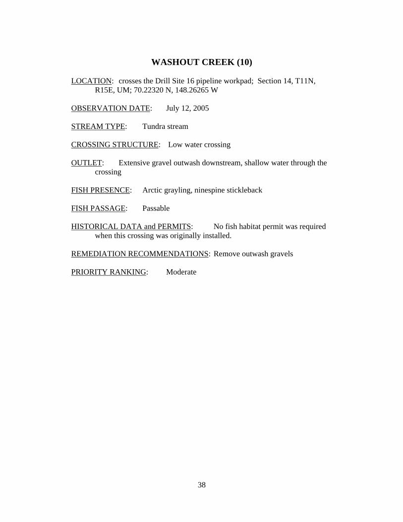
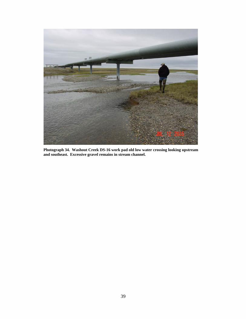
WASHOUT CREEK (10)
LOCATION: crosses the Drill Site 16 pipeline workpad; Section 14, T11N,
R15E, UM; 70.22320 N, 148.26265 W OBSERVATION DATE: July 12, 2005 STREAM TYPE: Tundra stream CROSSING STRUCTURE: Low water crossing OUTLET: Extensive gravel outwash downstream, shallow water through the
crossing FISH PRESENCE: Arctic grayling, ninespine stickleback FISH PASSAGE: Passable HISTORICAL DATA and PERMITS: No fish habitat permit was required
when this crossing was originally installed. REMEDIATION RECOMMENDATIONS: Remove outwash gravels PRIORITY RANKING: Moderate
39
Photograph 34. Washout Creek DS-16 work pad old low water crossing looking upstream and southeast. Excessive gravel remains in stream channel.
40
Photograph 35. Washout Creek DS-16 work pad old low water crossing looking upstream and southeast. Gravel outwash has formed a wide shallow channel.
Photograph 36. Washout Creek between old pipeline work pad low water crossing and DS-16 road looking downstream towards DS-16 road. Gravel outwash is present all the way to road crossing and has formed a shallow terraced stream channel with multiple channels.
41
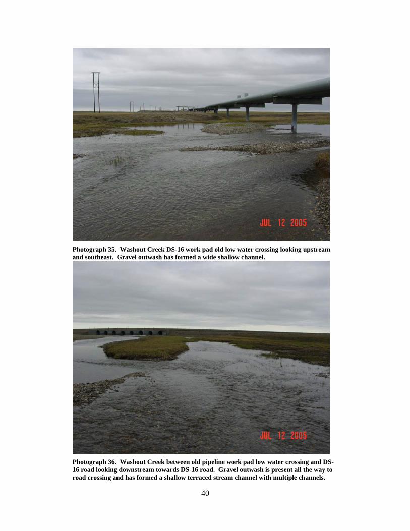
UNNAMED CREEK (11) LOCATION: crosses the Drill Site 16 access road about 0.4 miles southeast of
Washout Creek; Section 14, T11N, R15E, UM; 70.21932 N, 148.25141 W OBSERVATION DATE: July 12, 2005 STREAM TYPE: Tundra stream CROSSING STRUCTURE: (2) 24 inch corrugated metal pipes INLET: Culvert ends damaged OUTLET: Culvert ends damaged FISH PRESENCE: Ninespine stickleback FISH PASSAGE: Passable HISTORICAL DATA and PERMITS: No fish habitat permit was required
when these culverts were originally installed. Fish Habitat Permit FG02-III-0017 was issued to provide for culvert operation and maintenance to ensure free passage of fish.
REMEDIATION RECOMMENDATIONS: Repair culvert ends, shorten pipes to
match road width, replace with a single larger pipe PRIORITY RANKING: Low
42
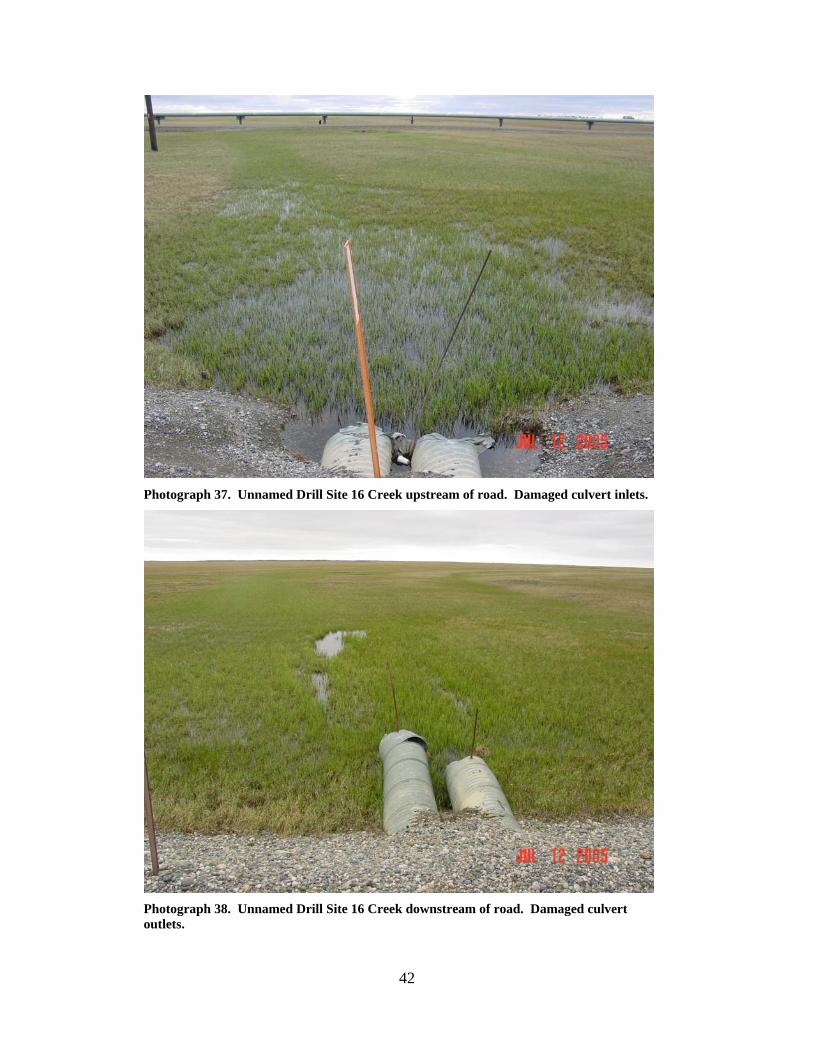
Photograph 37. Unnamed Drill Site 16 Creek upstream of road. Damaged culvert inlets.
Photograph 38. Unnamed Drill Site 16 Creek downstream of road. Damaged culvert outlets.
43
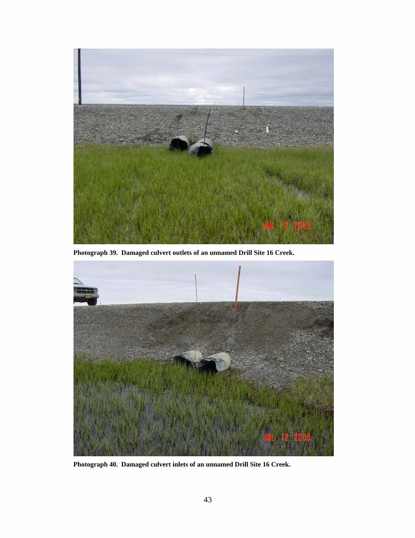
Photograph 39. Damaged culvert outlets of an unnamed Drill Site 16 Creek.
Photograph 40. Damaged culvert inlets of an unnamed Drill Site 16 Creek.
44
UNNAMED CREEK (13)
LOCATION: crosses the Drill Site 16 access road nearest the drill site; Section
14, T11N, R15E, UM; 70.21618 N, 148.24223 W OBSERVATION DATE: July 12, 2005 STREAM TYPE: Tundra stream CROSSING STRUCTURE: (1) 24 inch corrugated metal pipe INLET: Damaged inlet partially blocking the culvert, highwater mark
several feet above the pipe OUTLET: Damaged outlet FISH PRESENCE: Arctic grayling, ninespine stickleback FISH PASSAGE: Passable HISTORICAL DATA and PERMITS: No fish habitat permit was required
when this culvert was originally installed. Fish Habitat Permit FG02-III-0019 was issued to provide for culvert operation and maintenance to ensure free passage of fish.
REMEDIATION RECOMMENDATIONS: Culvert is severely undersized.
Increase water conveyance past this location PRIORITY RANKING: Moderate
45
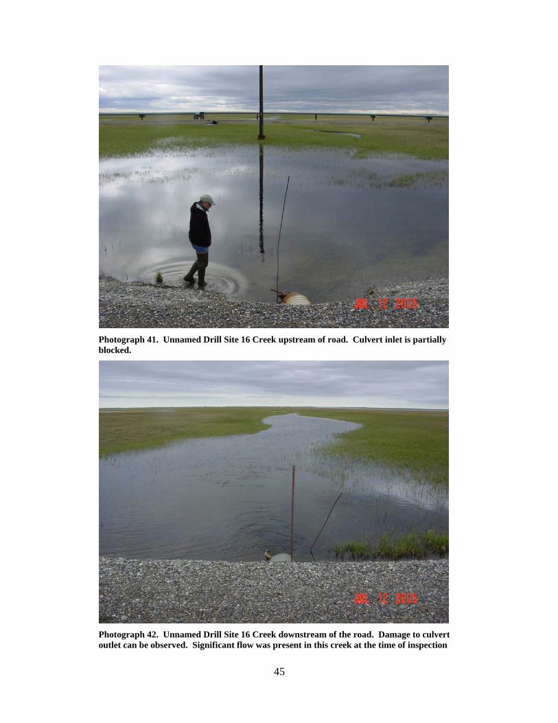
Photograph 41. Unnamed Drill Site 16 Creek upstream of road. Culvert inlet is partially blocked.
Photograph 42. Unnamed Drill Site 16 Creek downstream of the road. Damage to culvert outlet can be observed. Significant flow was present in this creek at the time of inspection
46
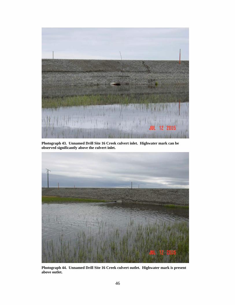
Photograph 43. Unnamed Drill Site 16 Creek culvert inlet. Highwater mark can be observed significantly above the culvert inlet.
Photograph 44. Unnamed Drill Site 16 Creek culvert outlet. Highwater mark is present above outlet.
47
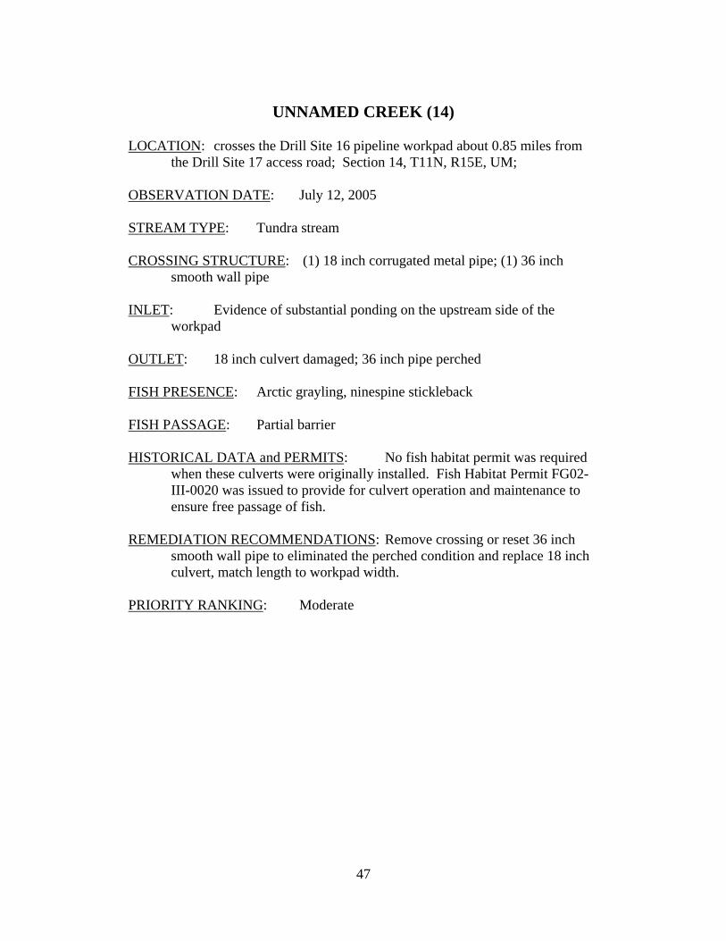
UNNAMED CREEK (14)
LOCATION: crosses the Drill Site 16 pipeline workpad about 0.85 miles from
the Drill Site 17 access road; Section 14, T11N, R15E, UM; OBSERVATION DATE: July 12, 2005 STREAM TYPE: Tundra stream CROSSING STRUCTURE: (1) 18 inch corrugated metal pipe; (1) 36 inch
smooth wall pipe INLET: Evidence of substantial ponding on the upstream side of the
workpad OUTLET: 18 inch culvert damaged; 36 inch pipe perched FISH PRESENCE: Arctic grayling, ninespine stickleback FISH PASSAGE: Partial barrier HISTORICAL DATA and PERMITS: No fish habitat permit was required
when these culverts were originally installed. Fish Habitat Permit FG02-III-0020 was issued to provide for culvert operation and maintenance to ensure free passage of fish.
REMEDIATION RECOMMENDATIONS: Remove crossing or reset 36 inch
smooth wall pipe to eliminated the perched condition and replace 18 inch culvert, match length to workpad width.
PRIORITY RANKING: Moderate
48
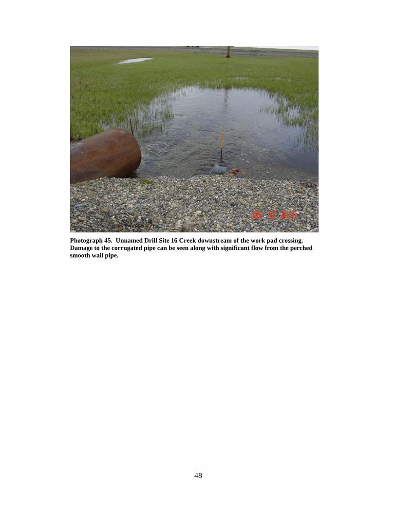
Photograph 45. Unnamed Drill Site 16 Creek downstream of the work pad crossing. Damage to the corrugated pipe can be seen along with significant flow from the perched smooth wall pipe.
49
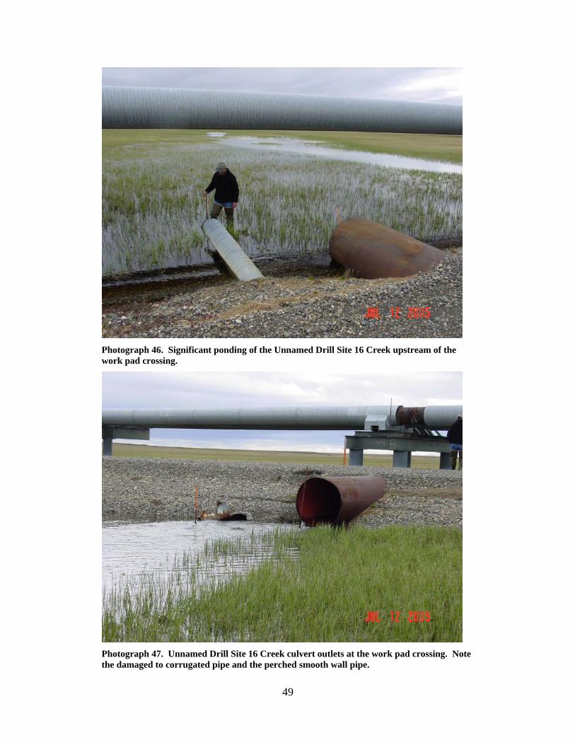
Photograph 46. Significant ponding of the Unnamed Drill Site 16 Creek upstream of the work pad crossing.
Photograph 47. Unnamed Drill Site 16 Creek culvert outlets at the work pad crossing. Note the damaged to corrugated pipe and the perched smooth wall pipe.
50
UNNAMED CREEK (12) LOCATION: crosses the Drill Site 16 pipeline workpad about 0.55 miles from
the Drill Site 17 access road; Section 14, T11N, R15E, UM; OBSERVATION DATE: July 12, 2005 STREAM TYPE: Wetland drainage CROSSING STRUCTURE: (1) 18 inch corrugated metal pipe; (1) 8 or 10 inch
smooth wall pipe INLET: Acceptable OUTLET: Outwash gravels present, outlet of smooth wall pipe perched FISH PRESENCE: Ninespine stickleback FISH PASSAGE: Likely passable HISTORICAL DATA and PERMITS: No fish habitat permit was required
when these culverts were originally installed. Fish Habitat Permit FG02-III-0018 was issued to provide for culvert operation and maintenance to ensure free passage of fish.
REMEDIATION RECOMMENDATIONS: Remove crossing PRIORITY RANKING: Low
51
Photograph 48. Unnamed Drill Site 16 Creek upstream of the work pad crossing.
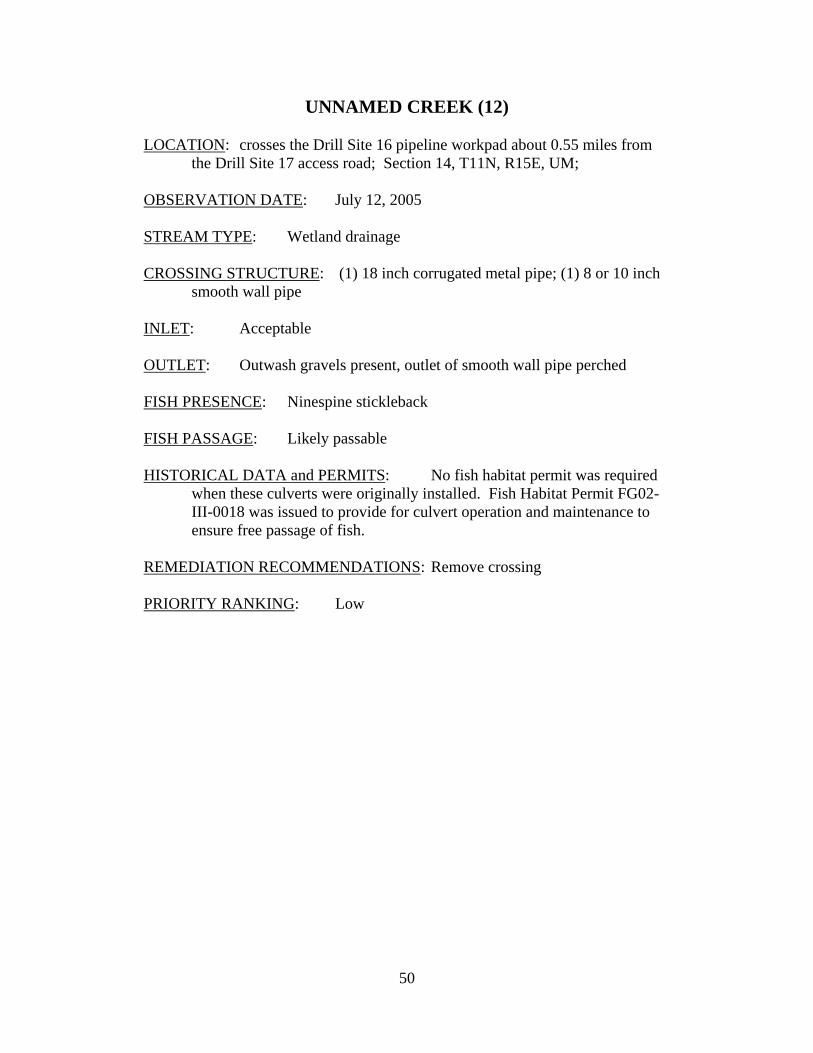
Photograph 49. Unnamed Drill Site 16 Creek downstream of the work pad crossing. The 36 inch culvert is located just in the foreground of the ponded water in the top left of the picture.
52
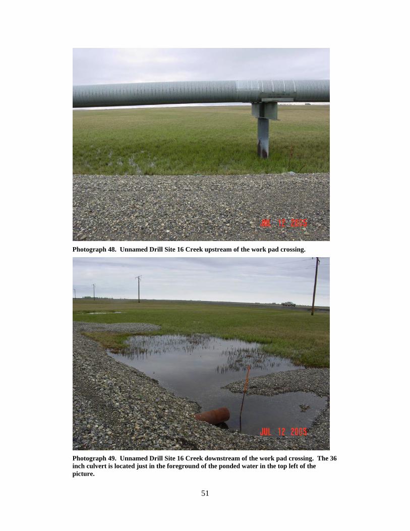
Photograph 50. Unnamed Drill Site 16 Creek downstream from the work pad crossing at the location of the 36 inch culvert.
53
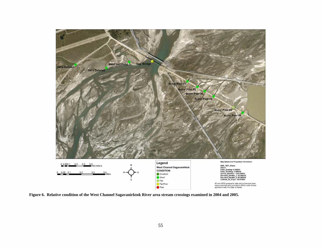
Sagavanirktok River Bridge Vicinity LOCATION: crosses the road to Drill Sites 16, 17 and Endicott, consists of the
area between the west bank of the Sagavanirktok River and Sag Mine Site C (Vern Lake); Sections 2, 3, 11, T10N, R15E, UM; see maps below
OBSERVATION DATE: Various STREAM TYPE: Spring and mountain fed river system CROSSING STRUCTURE: Bridge, several highwater culvert crossings FISH PRESENCE: Dolly Varden, Arctic grayling, broad whitefish, round
whitefish, slimy sculpin, fourhorn sculpin, least cisco, chum salmon, pink salmon, humpback whitefish, ninespine stickleback
FISH PASSAGE: Passable HISTORICAL DATA and PERMITS: Under-sizing of the Sagavanirktok River Bridge and various shallow
gravel scrapes from the 1970’s in the area have caused significant disturbance to the river. High-water events coupled with the reduced conveyance of the river at the bridge location have led to the formation of six channels leading to each of the six high water culvert batteries located to the east of the bridge between the river and Sag Mine Site C. The resultant pools downstream from each high water culvert battery have trapped many fish in the past after both spring and fall high-water events (see ADF&G Technical Report No. 99-5). The area immediately west and upstream from the bridge also becomes flooded during high water events and has traditionally trapped numerous fish each spring and fall once flood waters recede (see ADF&G Technical Report No. 99-5). Short term recommendations made by the OHMP to eliminate or reduce fish entrapment and mortality have been completed at the areas identified above. Surface flow connections between each of the scour pools and deep water lake Sag Mine Site C were constructed as were the low connection channels connecting the areas west and upstream from the bridge to the river. A culvert flow shut-off device was also installed on a culvert connecting Ott’s Oxbow to the river to prevent fish access to the area to reduce winter mortality. Long term recommendations to evaluate the entire area and return the river to a more natural flow pattern have not been fully addressed.
No fish habitat permit was required when the bridge was originally
installed. However, most repair and rehabilitation work to the bridge,
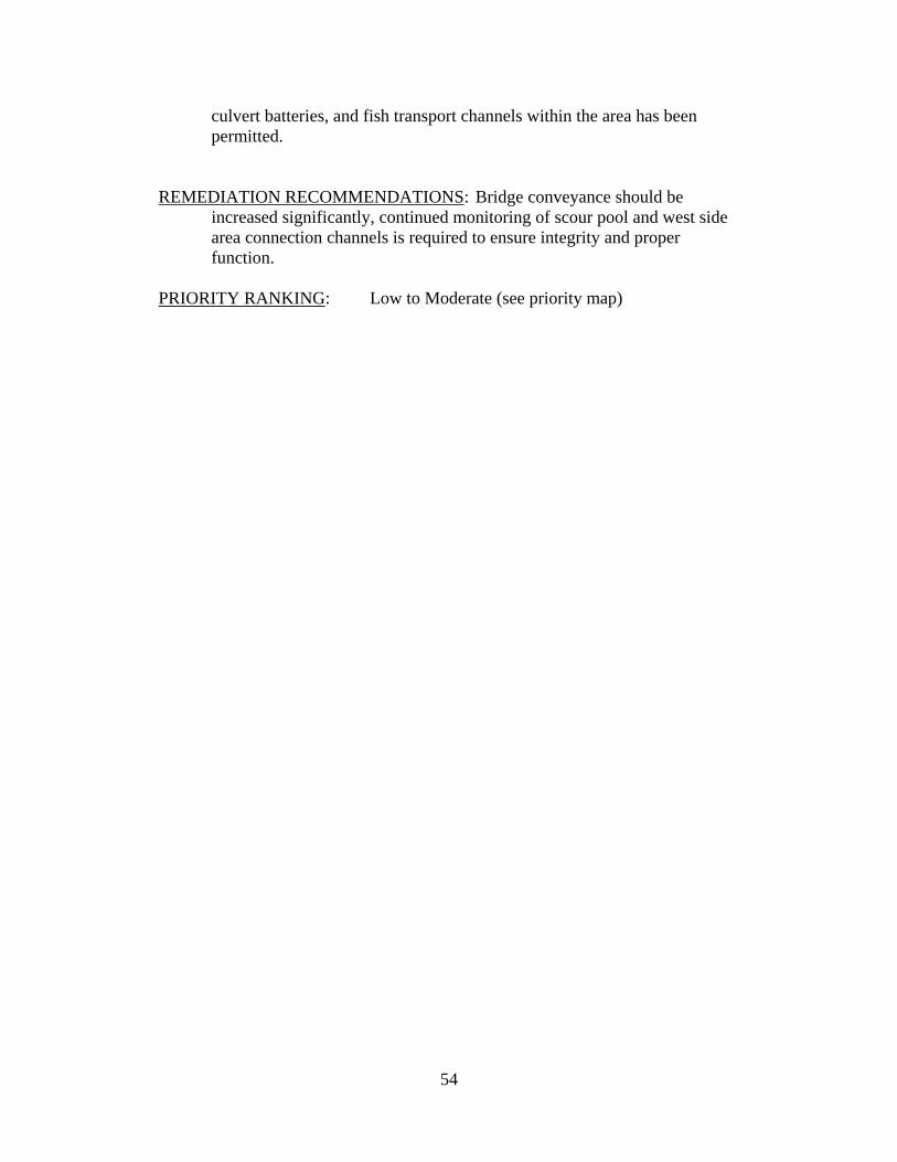
54
culvert batteries, and fish transport channels within the area has been permitted.
REMEDIATION RECOMMENDATIONS: Bridge conveyance should be
increased significantly, continued monitoring of scour pool and west side area connection channels is required to ensure integrity and proper function.
PRIORITY RANKING: Low to Moderate (see priority map)
55
Figure 6. Relative condition of the West Channel Sagavanirktok River area stream crossings examined in 2004 and 2005.
56
Figure 7. Relative priority for rehabilitation of West Channel Sagavanirktok River area stream crossings examined in 2004 and 2005.
57
West Dock Road from LGI to Point McIntyre 1 Stream Crossings

58

59
Figure 8. Relative condition of West Dock/LG1 area stream crossings.
60
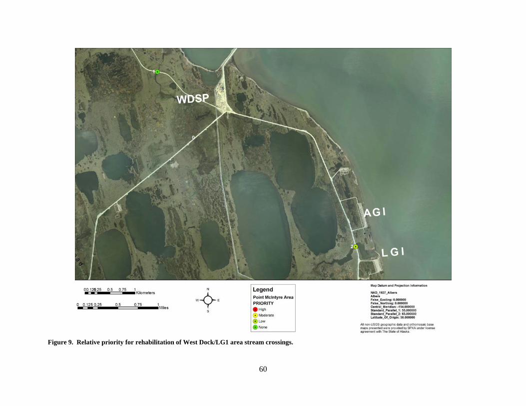
Figure 9. Relative priority for rehabilitation of West Dock/LG1 area stream crossings.
61
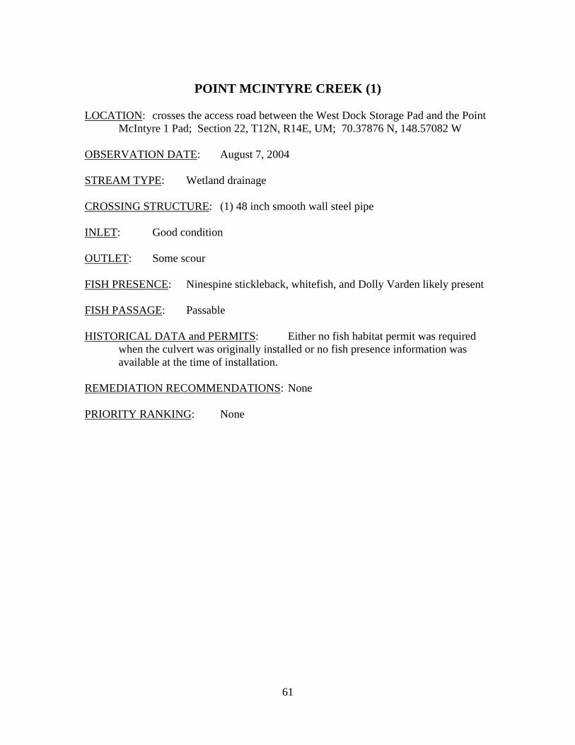
POINT MCINTYRE CREEK (1)
LOCATION: crosses the access road between the West Dock Storage Pad and the Point
McIntyre 1 Pad; Section 22, T12N, R14E, UM; 70.37876 N, 148.57082 W OBSERVATION DATE: August 7, 2004 STREAM TYPE: Wetland drainage CROSSING STRUCTURE: (1) 48 inch smooth wall steel pipe INLET: Good condition OUTLET: Some scour FISH PRESENCE: Ninespine stickleback, whitefish, and Dolly Varden likely present FISH PASSAGE: Passable HISTORICAL DATA and PERMITS: Either no fish habitat permit was required
when the culvert was originally installed or no fish presence information was available at the time of installation.
REMEDIATION RECOMMENDATIONS: None PRIORITY RANKING: None
62
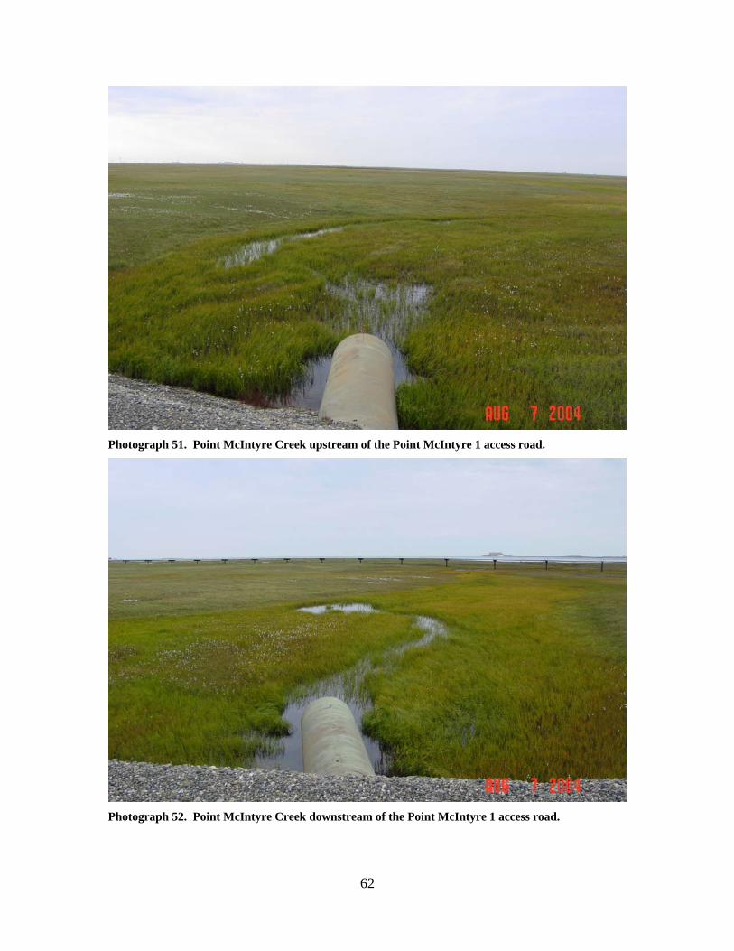
Photograph 51. Point McIntyre Creek upstream of the Point McIntyre 1 access road.
Photograph 52. Point McIntyre Creek downstream of the Point McIntyre 1 access road.
63
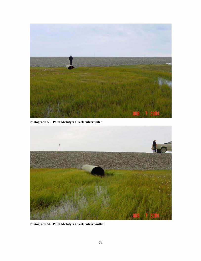
Photograph 53. Point McIntyre Creek culvert inlet.
Photograph 54. Point McIntyre Creek culvert outlet.
64
LGI ESTUARY CREEK (2)
LOCATION: crosses the West Dock access road between the LGI Pad and the AGI Pad;
Section 36, T12N, R14E, UM; 70.34389 N, 148.47501 W OBSERVATION DATE: August 7, 2004 STREAM TYPE: Salt marsh CROSSING STRUCTURE: (3) 48 inch corrugated metal pipes INLET: Minor inlet damage, one inlet elevated, significant scour and road prism
erosion OUTLET: Significant scour and outwash gravels, significant road prism erosion,
minor culvert outlet damage FISH PRESENCE: Possibly ninespine stickleback, whitefish, Dolly Varden FISH PASSAGE: Passable HISTORICAL DATA and PERMITS: No fish habitat permit was required when
this culvert battery was originally installed. REMEDIATION RECOMMENDATIONS: Repair road damage, increase water
conveyance past this location PRIORITY RANKING: Low
65
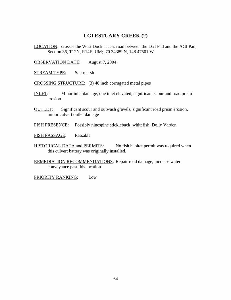
Photograph 55. LGI Estuary Creek upstream of the road.
Photograph 56. LGI Estuary Creek downstream of the road, with extensive gravel outwash.
66
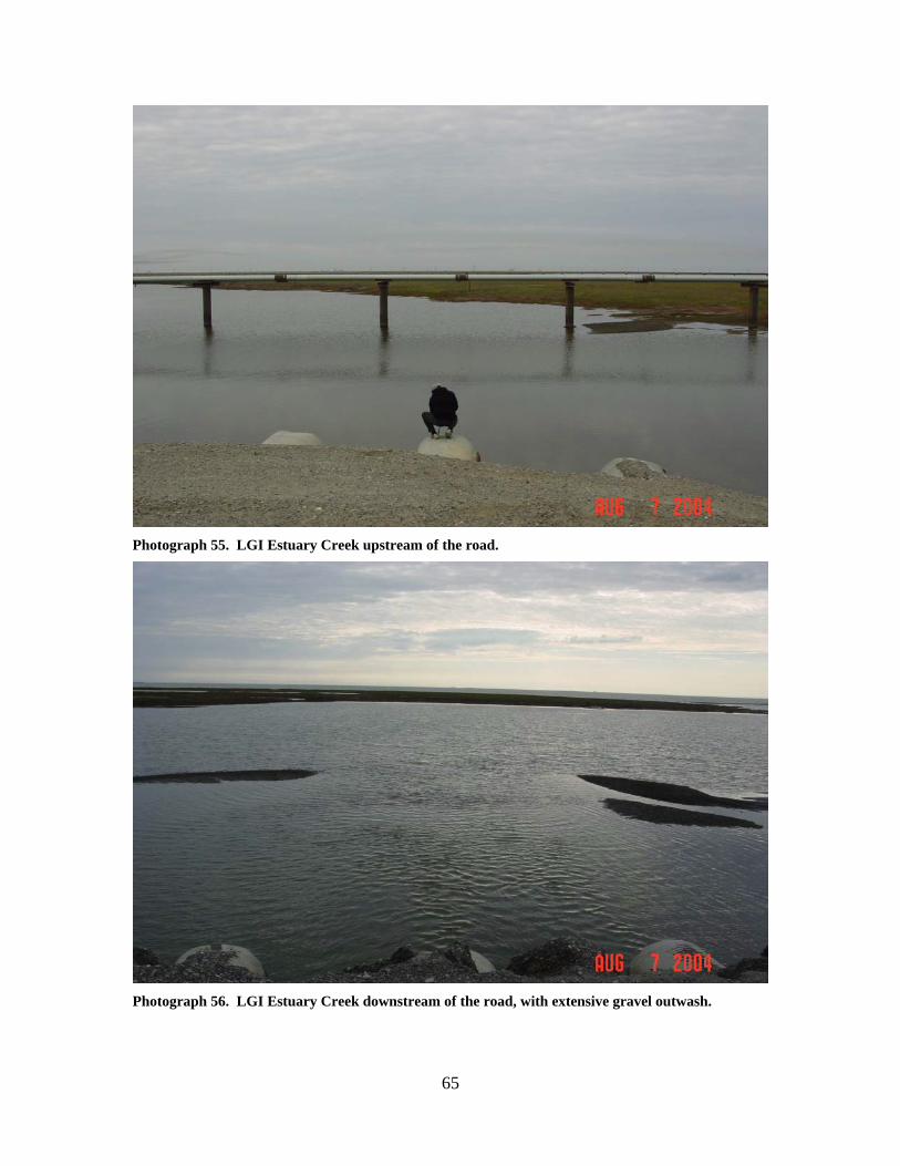
Photograph 57. LGI Estuary Creek culvert outlets, with significant gravel outwash and road prism erosion.
Photograph 58. LGI Estuary Creek culvert inlets. Significant road prism erosion can be seen as well as severe damage to some culverts. High water mark is above pipes.
67
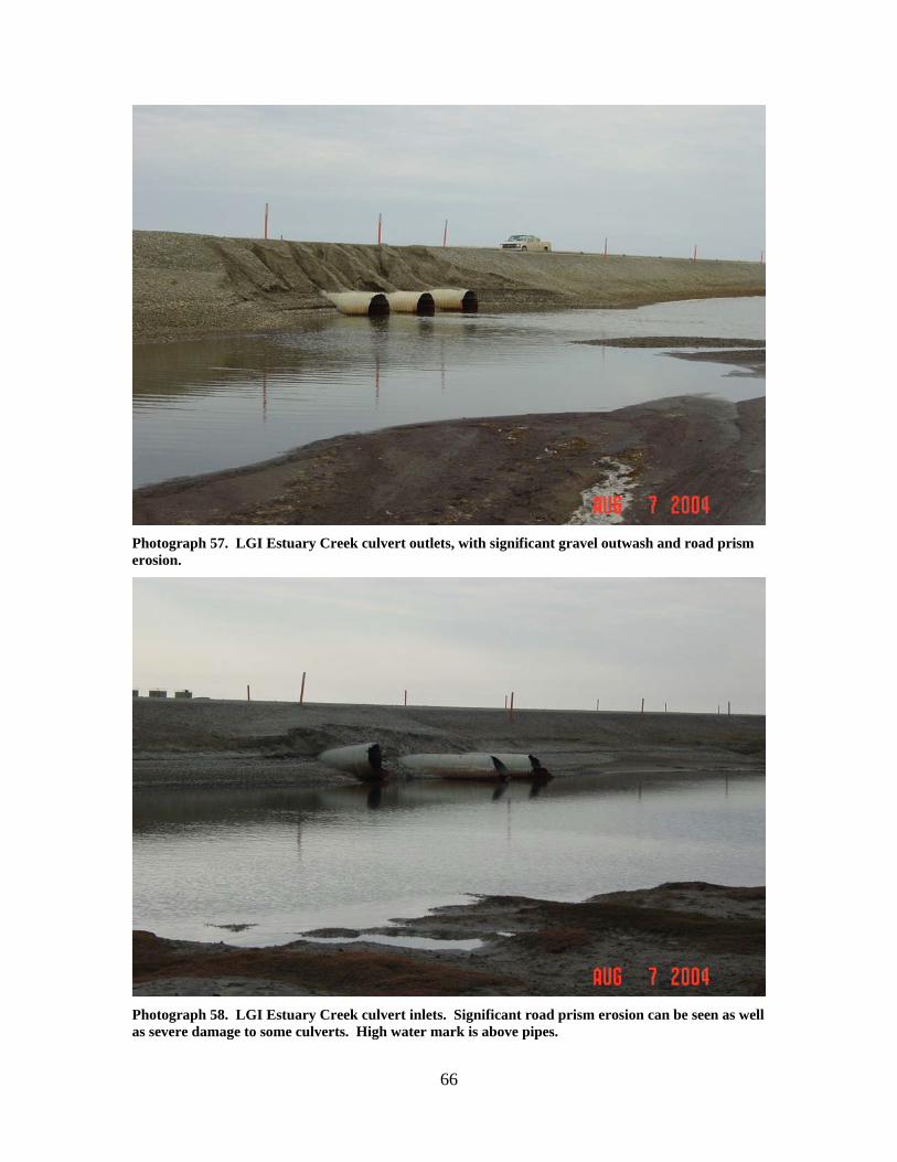
Central Prudhoe Bay Area, Putuligayuk and Little Putuligayuk River Stream Crossings

68

69
Figure 10. Relative condition of Putuligayuk River area stream crossings.
70
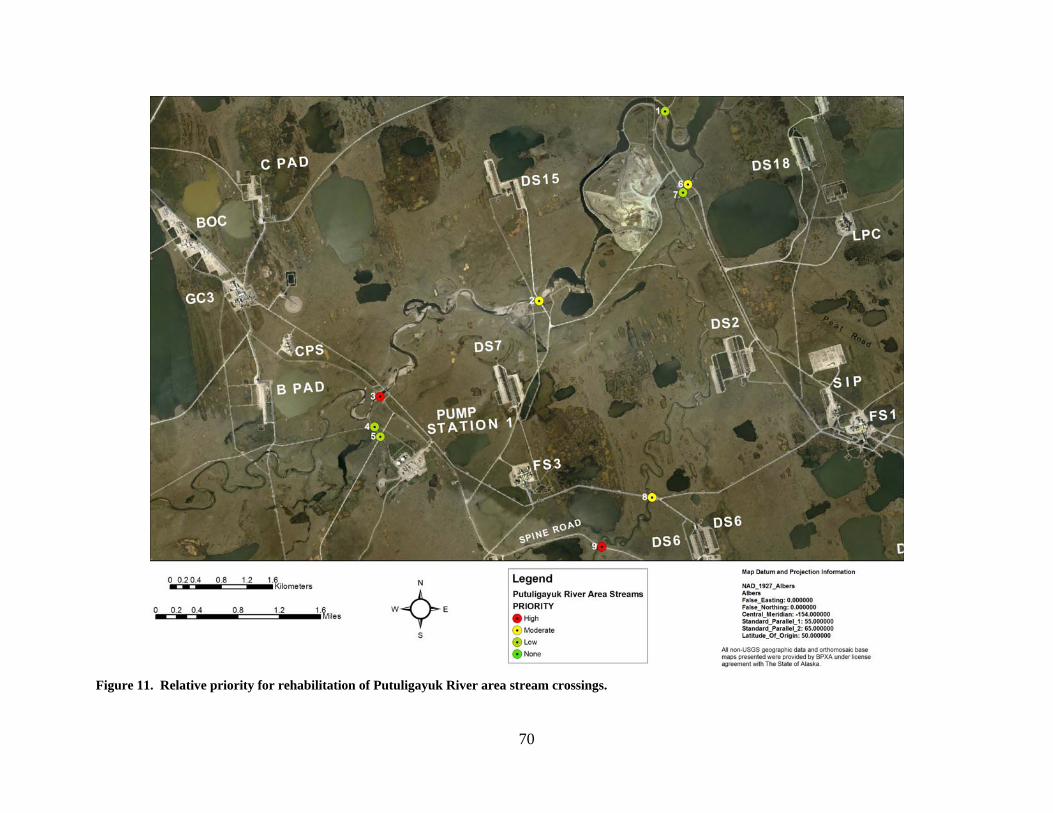
Figure 11. Relative priority for rehabilitation of Putuligayuk River area stream crossings.
71
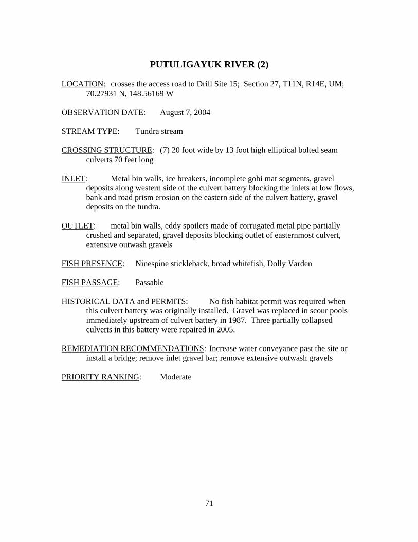
PUTULIGAYUK RIVER (2)
LOCATION: crosses the access road to Drill Site 15; Section 27, T11N, R14E, UM;
70.27931 N, 148.56169 W OBSERVATION DATE: August 7, 2004 STREAM TYPE: Tundra stream CROSSING STRUCTURE: (7) 20 foot wide by 13 foot high elliptical bolted seam
culverts 70 feet long INLET: Metal bin walls, ice breakers, incomplete gobi mat segments, gravel
deposits along western side of the culvert battery blocking the inlets at low flows, bank and road prism erosion on the eastern side of the culvert battery, gravel deposits on the tundra.
OUTLET: metal bin walls, eddy spoilers made of corrugated metal pipe partially
crushed and separated, gravel deposits blocking outlet of easternmost culvert, extensive outwash gravels
FISH PRESENCE: Ninespine stickleback, broad whitefish, Dolly Varden FISH PASSAGE: Passable HISTORICAL DATA and PERMITS: No fish habitat permit was required when
this culvert battery was originally installed. Gravel was replaced in scour pools immediately upstream of culvert battery in 1987. Three partially collapsed culverts in this battery were repaired in 2005.
REMEDIATION RECOMMENDATIONS: Increase water conveyance past the site or
install a bridge; remove inlet gravel bar; remove extensive outwash gravels PRIORITY RANKING: Moderate
72
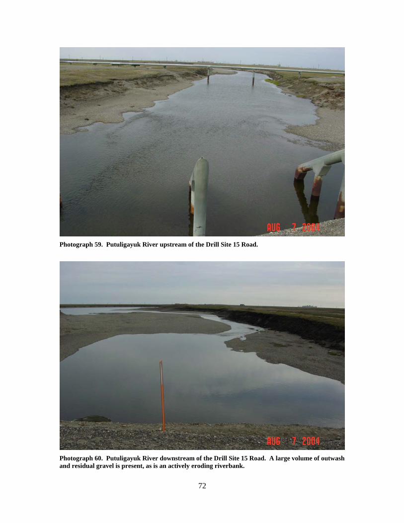
Photograph 59. Putuligayuk River upstream of the Drill Site 15 Road.
Photograph 60. Putuligayuk River downstream of the Drill Site 15 Road. A large volume of outwash and residual gravel is present, as is an actively eroding riverbank.
73
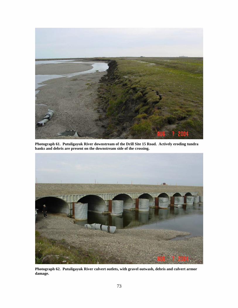
Photograph 61. Putuligayuk River downstream of the Drill Site 15 Road. Actively eroding tundra banks and debris are present on the downstream side of the crossing.
Photograph 62. Putuligayuk River culvert outlets, with gravel outwash, debris and culvert armor damage.
74
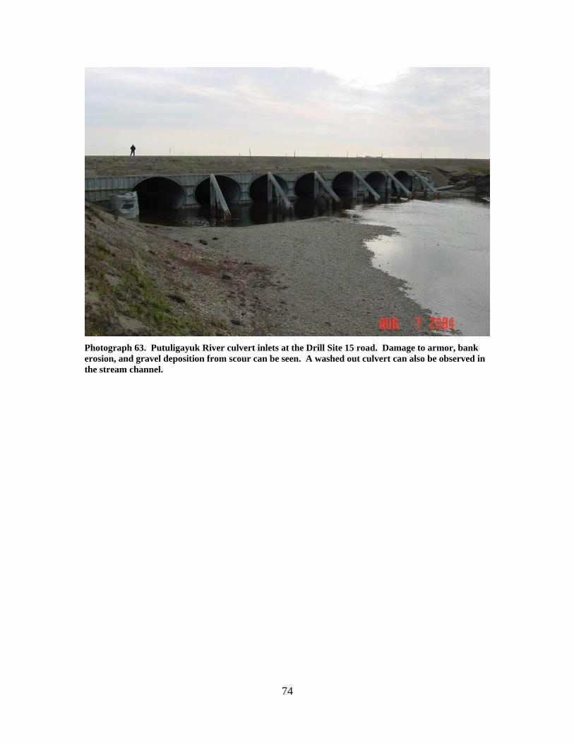
Photograph 63. Putuligayuk River culvert inlets at the Drill Site 15 road. Damage to armor, bank erosion, and gravel deposition from scour can be seen. A washed out culvert can also be observed in the stream channel.

75
PUTULIGAYUK RIVER (1)
LOCATION: crosses the West Dock road near the river’s mouth; Section 14, T11N,
R14E, UM; 70.30480 N, 148.50415 W OBSERVATION DATE: August 7, 2004 STREAM TYPE: Tundra stream CROSSING STRUCTURE: (10) 10 foot corrugated metal pipes INLET: bin walls, road prism erosion OUTLET: extensive outwash gravels, road prism erosion FISH PRESENCE: Ninespine stickleback, broad whitefish, Dolly Varden FISH PASSAGE: Passable HISTORICAL DATA and PERMITS: No fish habitat permit was required when
this culvert battery was originally installed. The culverts were strengthened in 1993 to support heavy module transport.
REMEDIATION RECOMMENDATIONS: Remove outwash gravels, increase water
conveyance past this crossing PRIORITY RANKING: Low
76
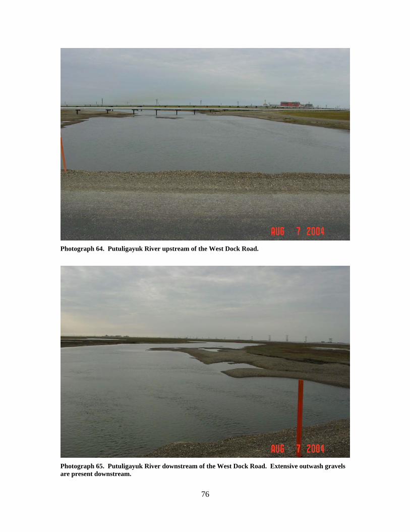
Photograph 64. Putuligayuk River upstream of the West Dock Road.
Photograph 65. Putuligayuk River downstream of the West Dock Road. Extensive outwash gravels are present downstream.
77
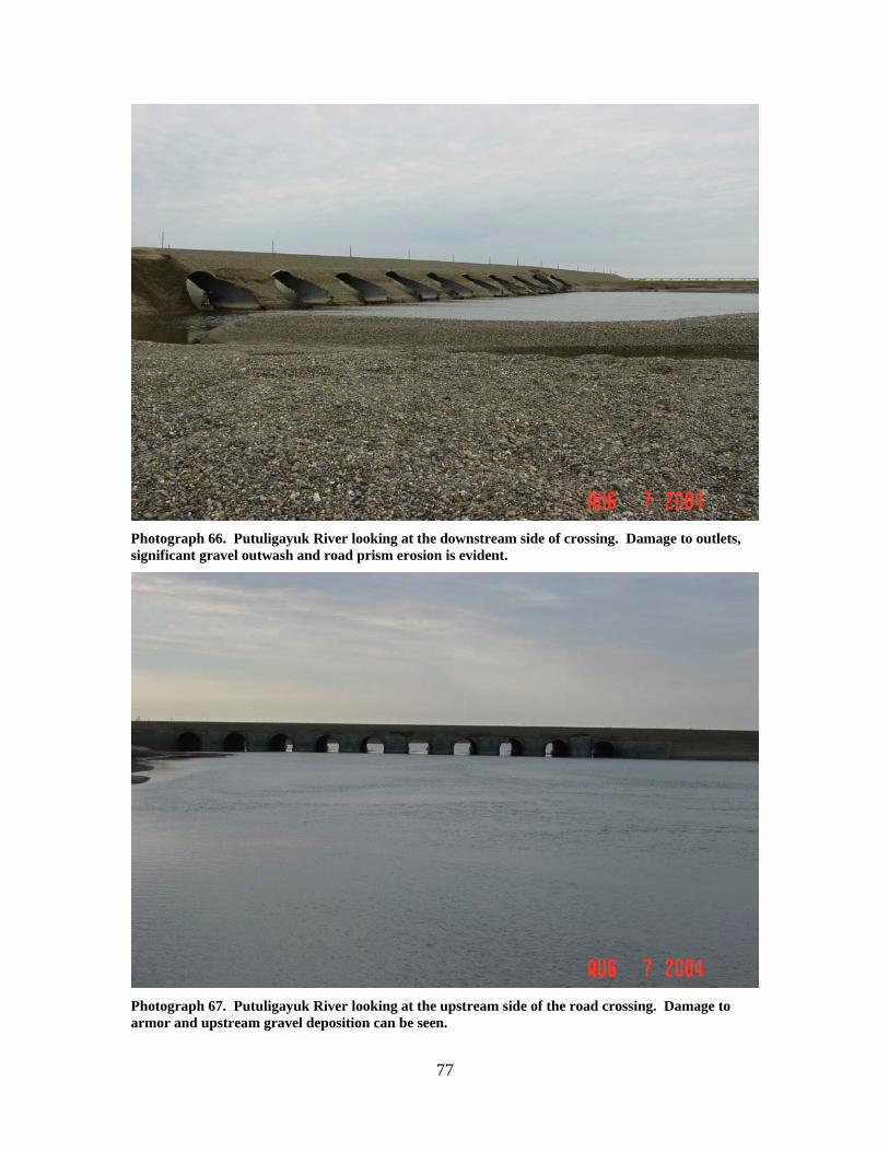
Photograph 66. Putuligayuk River looking at the downstream side of crossing. Damage to outlets, significant gravel outwash and road prism erosion is evident.
Photograph 67. Putuligayuk River looking at the upstream side of the road crossing. Damage to armor and upstream gravel deposition can be seen.
78
PUTULIGAYUK RIVER (3) LOCATION: crosses the Spine Road near Pump Station 1; Section 32, T11N, R14E,
UM; 70.26751 N, 148.62939 W OBSERVATION DATE: August 7, 2004; August 11, 2000 STREAM TYPE: Tundra stream CROSSING STRUCTURE: (6) approximately 15 foot multi-plate elliptical corrugated
metal pipes INLET: Metal bin walls, gravel bar in front of 3 of 6 pipes, concrete filled drum
erosion protection and partial concrete inlet apron, scour pools up to 4 feet deep at the concrete aprons
OUTLET: Sand bag armor, 10 foot culvert aprons, gobi mat extending bank to bank
to approximately 100 feet downstream, energy dissipaters (Dragon’s teeth), gravel-filled gabion baskets along both banks extending downstream to the pipeline bridge, extensive outwash gravels
FISH PRESENCE: Ninespine stickleback, broad whitefish FISH PASSAGE: Barrier at low flows HISTORICAL DATA and PERMITS: No fish habitat permit was required when
this culvert battery was originally installed. Gobi mats were installed across the bottom of the river in fall 1983. Gabion basket retaining walls were also installed in fall 1983. Gabion basket retaining wall repairs, replacement of eroded gravel, and placement of the Dragon’s teeth occurred in September 1985 under Fish Habitat Permit FG85-III-0350. Additional periodic maintenance, as evidenced by FG87-III-0149, FG88-III-0168, FG89-III-0156, FG91-III-0183, FG95-III-0230, and FG97-III-0238, has been needed to fill scour holes, replace or extend gabions, and reposition the energy dissipaters. The crossing, and unregulated gravel mining has altered the morphology of the river for approximately 2.6 km downstream. Channel accretion has occurred immediately upstream of the crossing.
REMEDIATION RECOMMENDATIONS: Installing a bridge at this location is the
preferred remediation. Alternatively, remove part or all of the downstream gobi mat and establish a deeper channel to ensure fish passage at low flows.
PRIORITY RANKING: High
79
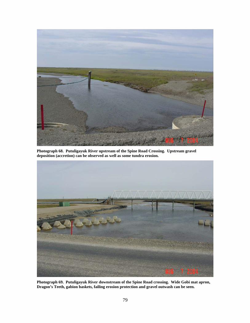
Photograph 68. Putuligayuk River upstream of the Spine Road Crossing. Upstream gravel deposition (accretion) can be observed as well as some tundra erosion.
Photograph 69. Putuligayuk River downstream of the Spine Road crossing. Wide Gobi mat apron, Dragon’s Teeth, gabion baskets, failing erosion protection and gravel outwash can be seen.
80
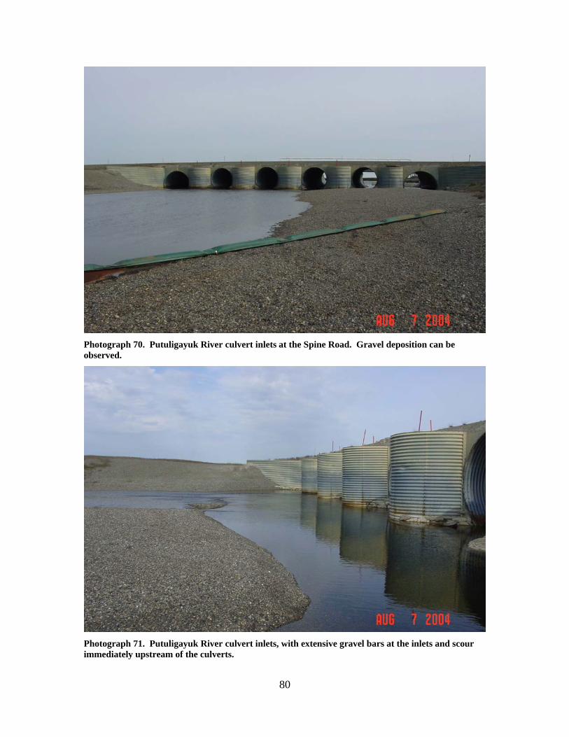
Photograph 70. Putuligayuk River culvert inlets at the Spine Road. Gravel deposition can be observed.
Photograph 71. Putuligayuk River culvert inlets, with extensive gravel bars at the inlets and scour immediately upstream of the culverts.
81
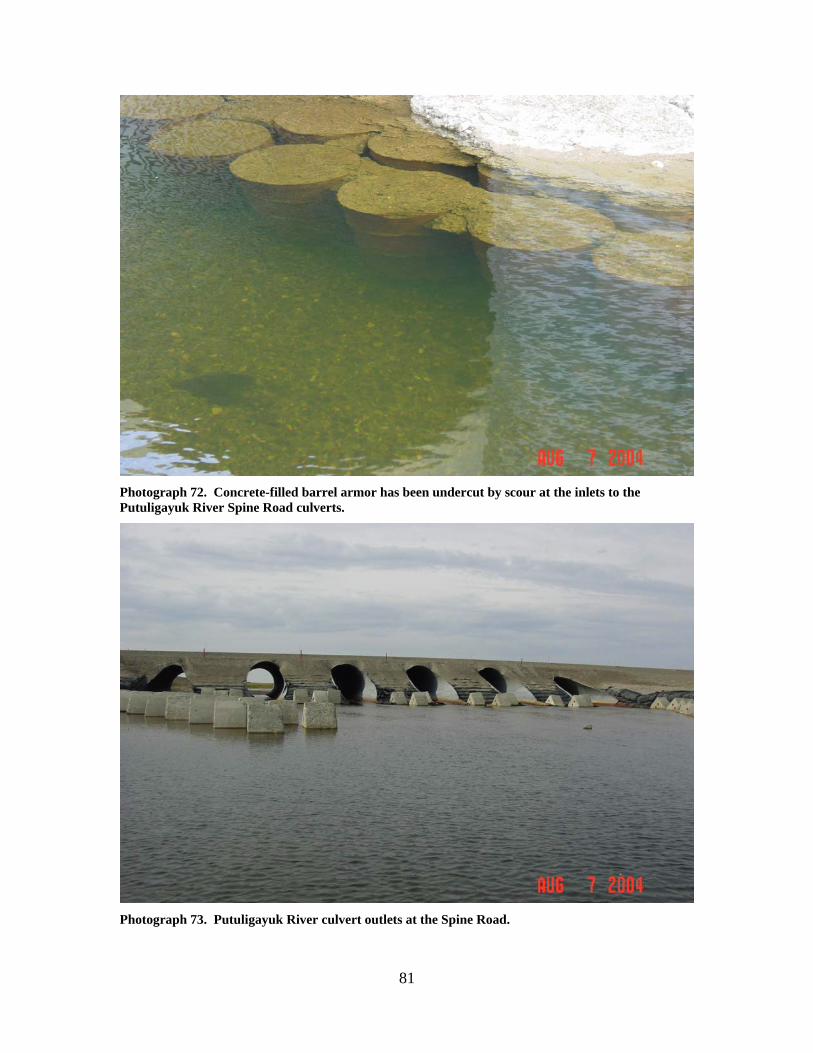
Photograph 72. Concrete-filled barrel armor has been undercut by scour at the inlets to the Putuligayuk River Spine Road culverts.
Photograph 73. Putuligayuk River culvert outlets at the Spine Road.
82
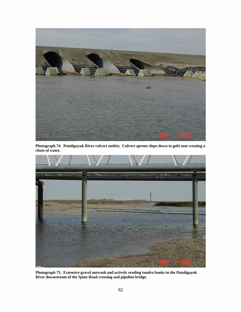
Photograph 74. Putuligayuk River culvert outlets. Culvert aprons slope down to gobi mat creating a chute of water.
Photograph 75. Extensive gravel outwash and actively eroding tundra banks in the Putuligayuk River downstream of the Spine Road crossing and pipeline bridge.
83
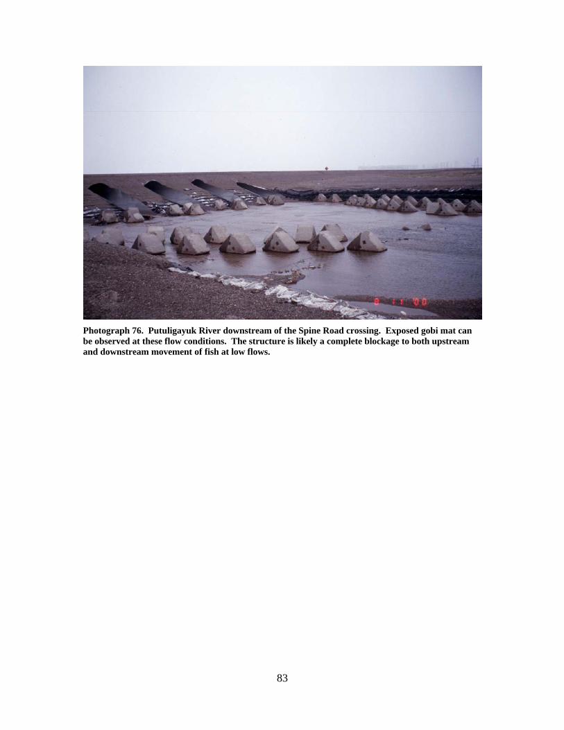
Photograph 76. Putuligayuk River downstream of the Spine Road crossing. Exposed gobi mat can be observed at these flow conditions. The structure is likely a complete blockage to both upstream and downstream movement of fish at low flows.
84
PUTULIGAYUK RIVER TRIBUTARY (4)
LOCATION: crosses the Kuparuk Pipeline near Pump Station 1; Section 32, T11N,
R14E, UM; 70.26326 N, 148.63267 W OBSERVATION DATE: August 7, 2004 STREAM TYPE: Tundra stream CROSSING STRUCTURE: Pipeline crossing only, substantial extraneous gravel in the
stream channel, most likely from the Pump Station 1 drain or the X Pad road crossing of the drain
FISH PRESENCE: Ninespine Stickleback, whitefish, Dolly Varden FISH PASSAGE: Passable HISTORICAL DATA and PERMITS: No fish habitat permit was required when
this crossing was originally installed. Culverts were removed from this crossing in 1995 under Fish Habitat Permit FG95-III-0213.
REMEDIATION RECOMMENDATIONS: Remove extraneous gravel, deepen stream
channel PRIORITY RANKING: Low
85
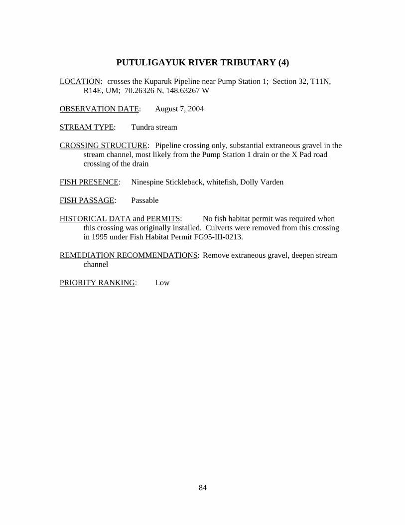
Photograph 77. Putuligayuk River Tributary at old Kuparuk Pipeline work pad crossing, looking downstream. A large quantity of gravel outwash is present.
Photograph 78. Putuligayuk River Tributary looking upstream towards the Pump 1 Drain. The creek is flowing out of the tundra at the upper right of the ponded water upstream from the pipeline.
86
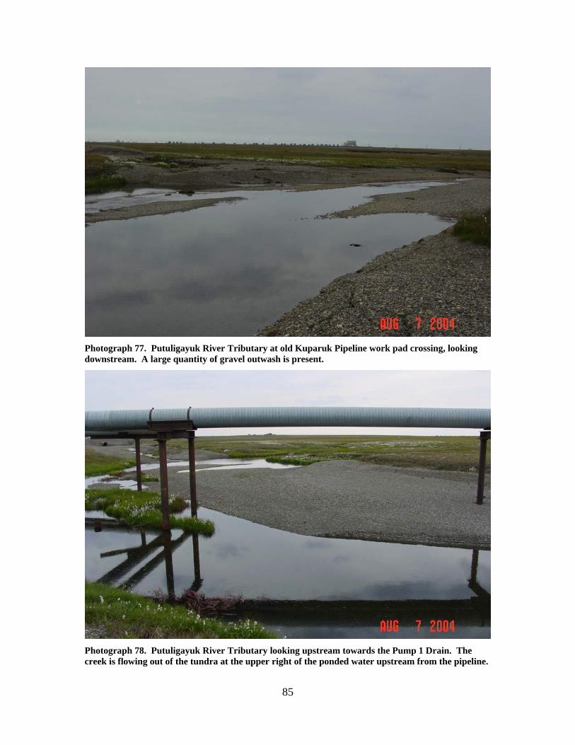
Photograph 79. Tundra wetland drainage flowing into the disturbed area between the Pump 1 Drain and the old KPL pad crossing. The drainage was intercepted by the KPL road and has rerouted its flow (See map).
87
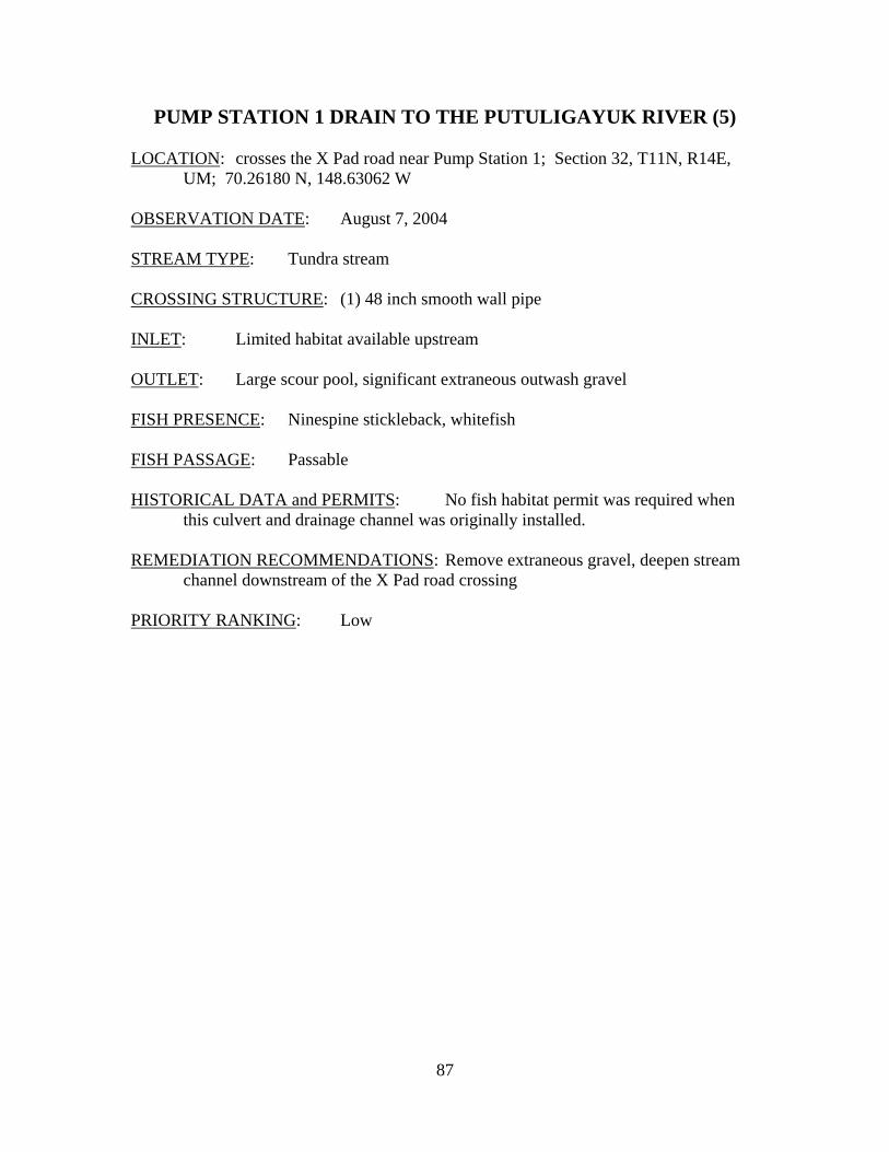
PUMP STATION 1 DRAIN TO THE PUTULIGAYUK RIVER (5) LOCATION: crosses the X Pad road near Pump Station 1; Section 32, T11N, R14E,
UM; 70.26180 N, 148.63062 W OBSERVATION DATE: August 7, 2004 STREAM TYPE: Tundra stream CROSSING STRUCTURE: (1) 48 inch smooth wall pipe INLET: Limited habitat available upstream OUTLET: Large scour pool, significant extraneous outwash gravel FISH PRESENCE: Ninespine stickleback, whitefish FISH PASSAGE: Passable HISTORICAL DATA and PERMITS: No fish habitat permit was required when
this culvert and drainage channel was originally installed. REMEDIATION RECOMMENDATIONS: Remove extraneous gravel, deepen stream
channel downstream of the X Pad road crossing PRIORITY RANKING: Low
88
Photograph 80. Pump 1 Drain to the Putuligayuk River looking at downstream side of the X Pad Road.
Photograph 81. Pump 1 Drain to the Putuligayuk River downstream of the X Pad Road. Significant gravel outwash is present.
89
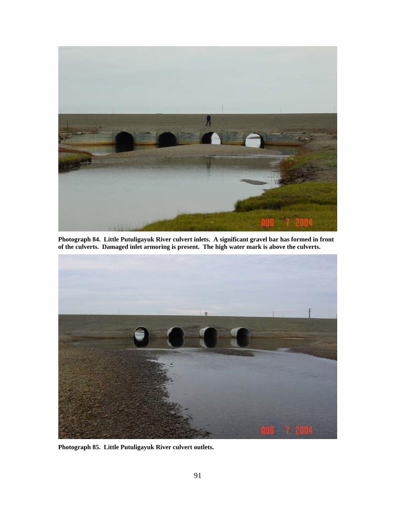
LITTLE PUTULIGAYUK RIVER (6)
LOCATION: crosses the West Dock Road near the river’s mouth; Section 23, T11N,
R14E, UM; 70.29414 N, 148.49740 W OBSERVATION DATE: August 7, 2004 STREAM TYPE: Tundra stream CROSSING STRUCTURE: (4) 8 foot corrugated metal pipes INLET: Corrugated metal bin walls, bin wall steel torn and damaged, gravel bar
upstream of culverts partially blocking flow, deep scour pool OUTLET: No downstream armor, culvert ends slightly damaged, some road
embankment erosion, outwash gravels present, deep scour pool FISH PRESENCE: Broad whitefish, ninespine stickleback FISH PASSAGE: Passable HISTORICAL DATA and PERMITS: No fish habitat permit was required when
this culvert battery was originally installed. The culverts were extended in 1991 and later strengthened in 1993 to support transport of heavy modules.
REMEDIATION RECOMMENDATIONS: Remove upstream and downstream
accumulated gravels, increase water conveyance past this crossing PRIORITY RANKING: Moderate
90
Photograph 82. The Little Putuligayuk River upstream of the West Dock Road. A large gravel bar has formed upstream of the culverts. Bank erosion is evident.
Photograph 83. The Little Putuligayuk River downstream of the West Dock Road. A large scour pool, gravel outwash and a split channel around outwash gravel occurs at present flow.
91
Photograph 84. Little Putuligayuk River culvert inlets. A significant gravel bar has formed in front of the culverts. Damaged inlet armoring is present. The high water mark is above the culverts.
Photograph 85. Little Putuligayuk River culvert outlets.
92
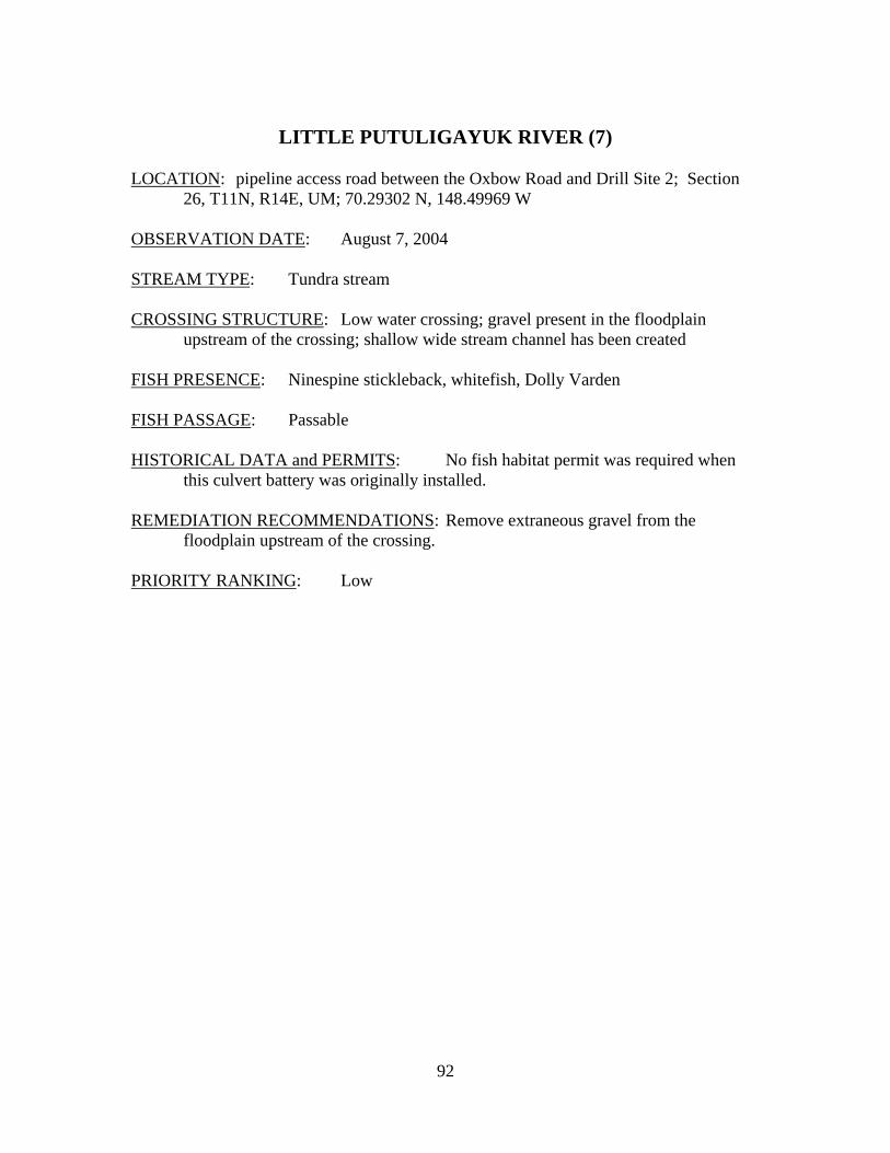
LITTLE PUTULIGAYUK RIVER (7)
LOCATION: pipeline access road between the Oxbow Road and Drill Site 2; Section
26, T11N, R14E, UM; 70.29302 N, 148.49969 W OBSERVATION DATE: August 7, 2004 STREAM TYPE: Tundra stream CROSSING STRUCTURE: Low water crossing; gravel present in the floodplain
upstream of the crossing; shallow wide stream channel has been created FISH PRESENCE: Ninespine stickleback, whitefish, Dolly Varden FISH PASSAGE: Passable HISTORICAL DATA and PERMITS: No fish habitat permit was required when
this culvert battery was originally installed. REMEDIATION RECOMMENDATIONS: Remove extraneous gravel from the
floodplain upstream of the crossing. PRIORITY RANKING: Low
93
Photograph 86. Little Putuligayuk River old low water crossing area, looking immediately upstream. Gravel accretion and split channel can be seen.
Photograph 87. Little Putuligayuk River old low water crossing looking downstream to the West Dock Road. Significant gravel outwash onto surrounding tundra is present.
94
LITTLE PUTULIGAYUK RIVER (9)
LOCATION: crosses the Spine Road at Lake Judith; Section 3, T10N, R14E, UM;
70.24355 N, 148.54451 W OBSERVATION DATE: August 7, 2004; June 20, 2000 STREAM TYPE: Tundra stream CROSSING STRUCTURE: (2) 42 inch corrugated metal pipes; (4) 48 inch corrugated
metal pipes; (4) 48 inch steel smooth wall pipes INLET: Partial sand bag armor, damaged culvert inlets, culverts mis-aligned with
the stream, significant ponding in spring/early summer from inadequate conveyance capacity, whirlpools at submerged culvert inlets
OUTLET: Partial sand bag armor, damaged culvert outlets, significant road prism
erosion, scour pools, extensive outwash gravels that at low flows may impede upstream movements of fish, stream channel has cut and bypassed a meander bend
FISH PRESENCE: Broad whitefish, Dolly Varden, ninespine stickleback FISH PASSAGE: Passable except at breakup due to excessive water velocities and
possibly at low flows because of outwash gravels HISTORICAL DATA and PERMITS: No fish habitat permit was required when
this culvert battery was originally installed. Fish Habitat Permits FG94-III-0156 and FG95-III-0211 authorized removal of outwash gravels. Fish Habitat Permit FG95-III-0242 authorized outwash gravel removal, and resetting and realigning culverts within the culvert battery.
REMEDIATION RECOMMENDATIONS: Remove downstream outwash gravels,
increase water conveyance by installing a bridge and removing all culverts. PRIORITY RANKING: high
95
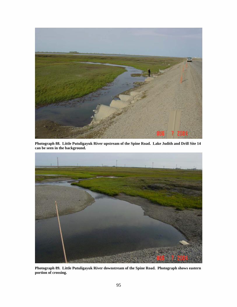
Photograph 88. Little Putuligayuk River upstream of the Spine Road. Lake Judith and Drill Site 14 can be seen in the background.
Photograph 89. Little Putuligayuk River downstream of the Spine Road. Photograph shows eastern portion of crossing.
96
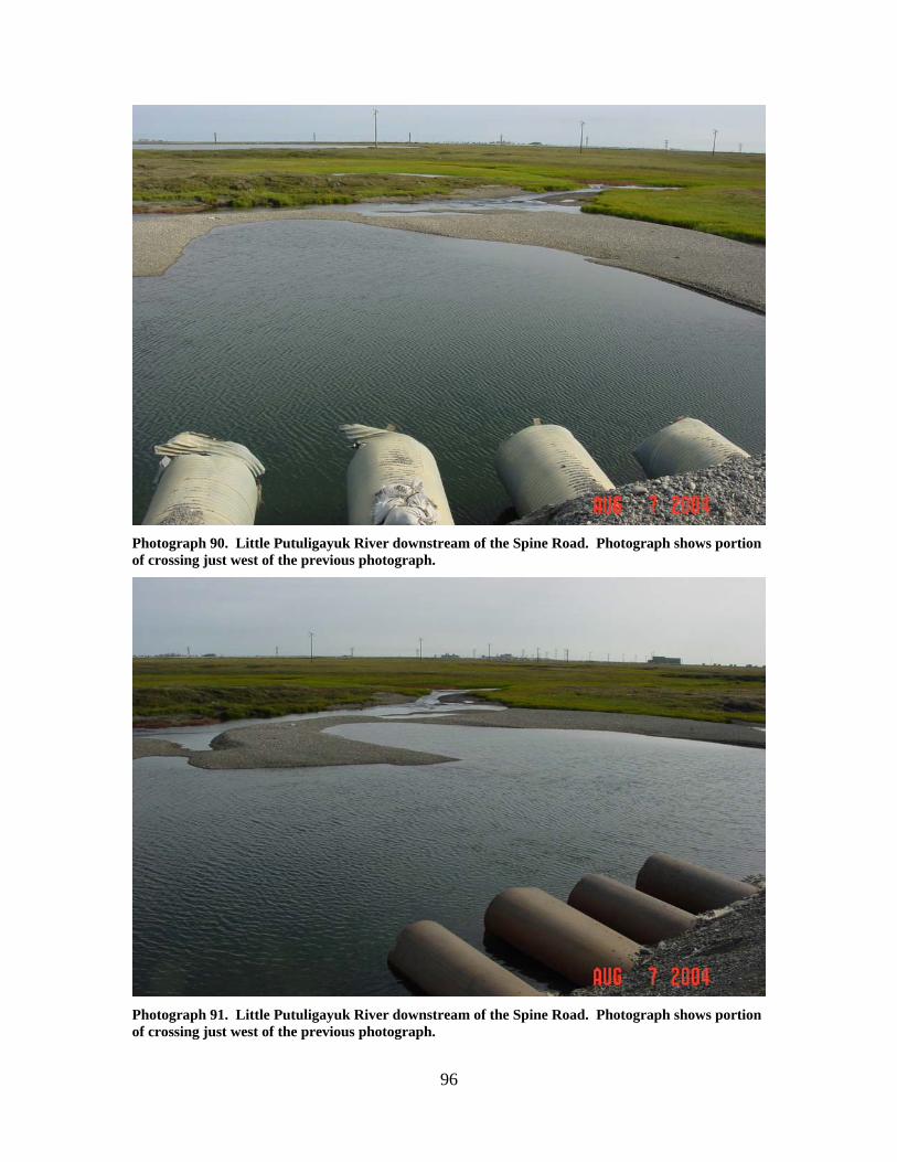
Photograph 90. Little Putuligayuk River downstream of the Spine Road. Photograph shows portion of crossing just west of the previous photograph.
Photograph 91. Little Putuligayuk River downstream of the Spine Road. Photograph shows portion of crossing just west of the previous photograph.
97
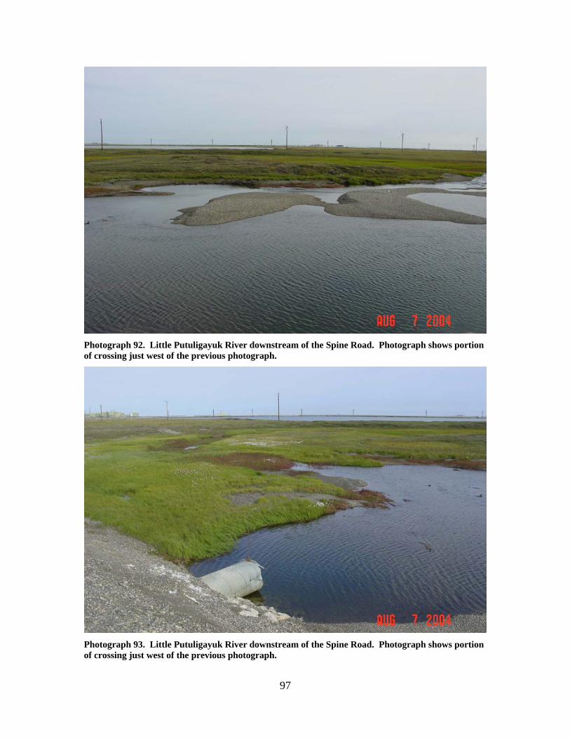
Photograph 92. Little Putuligayuk River downstream of the Spine Road. Photograph shows portion of crossing just west of the previous photograph.
Photograph 93. Little Putuligayuk River downstream of the Spine Road. Photograph shows portion of crossing just west of the previous photograph.
98
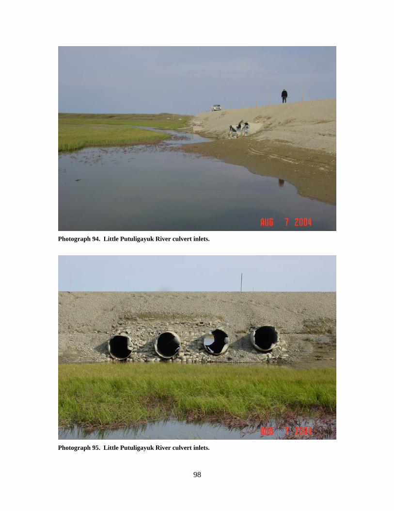
Photograph 94. Little Putuligayuk River culvert inlets.
Photograph 95. Little Putuligayuk River culvert inlets.
99
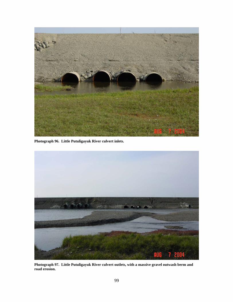
Photograph 96. Little Putuligayuk River culvert inlets.
Photograph 97. Little Putuligayuk River culvert outlets, with a massive gravel outwash berm and road erosion.
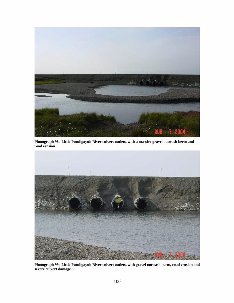
100
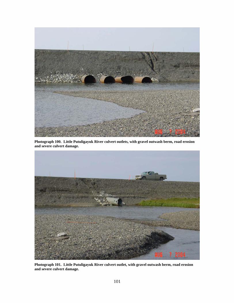
Photograph 98. Little Putuligayuk River culvert outlets, with a massive gravel outwash berm and road erosion.
Photograph 99. Little Putuligayuk River culvert outlets, with gravel outwash berm, road erosion and severe culvert damage.
101
Photograph 100. Little Putuligayuk River culvert outlets, with gravel outwash berm, road erosion and severe culvert damage.
Photograph 101. Little Putuligayuk River culvert outlet, with gravel outwash berm, road erosion and severe culvert damage.
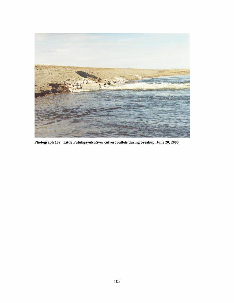
102
Photograph 102. Little Putuligayuk River culvert outlets during breakup, June 20, 2000.
103
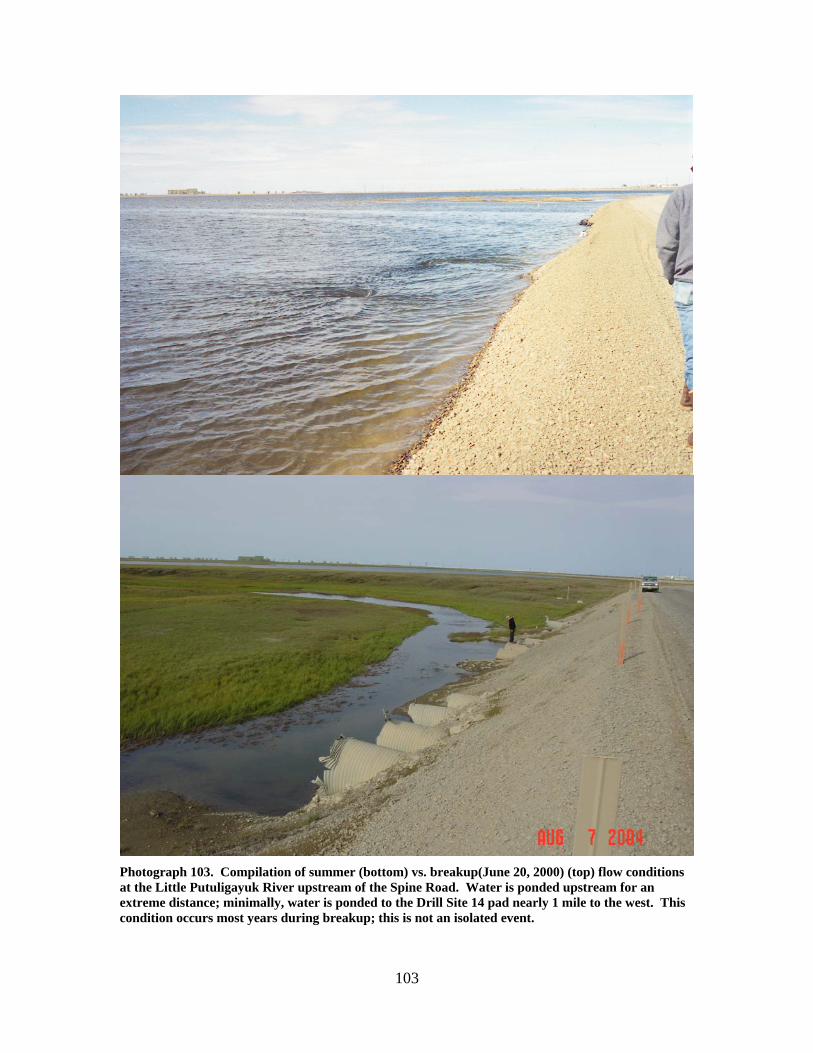
Photograph 103. Compilation of summer (bottom) vs. breakup(June 20, 2000) (top) flow conditions at the Little Putuligayuk River upstream of the Spine Road. Water is ponded upstream for an extreme distance; minimally, water is ponded to the Drill Site 14 pad nearly 1 mile to the west. This condition occurs most years during breakup; this is not an isolated event.
104
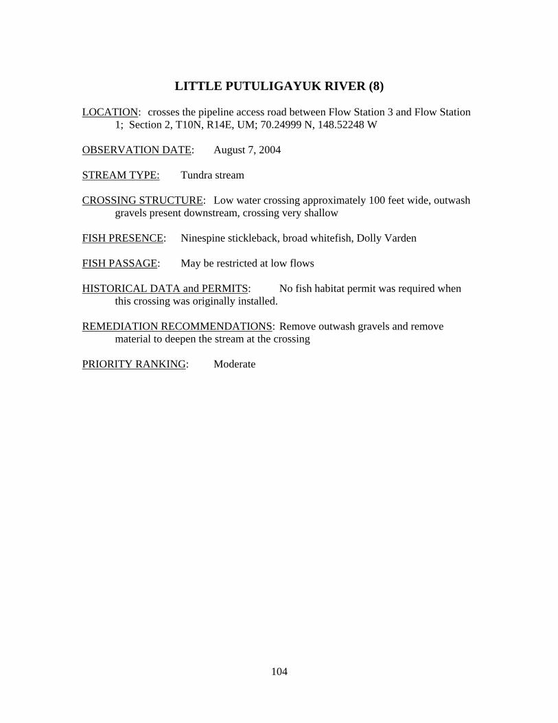
LITTLE PUTULIGAYUK RIVER (8)
LOCATION: crosses the pipeline access road between Flow Station 3 and Flow Station
1; Section 2, T10N, R14E, UM; 70.24999 N, 148.52248 W OBSERVATION DATE: August 7, 2004 STREAM TYPE: Tundra stream CROSSING STRUCTURE: Low water crossing approximately 100 feet wide, outwash
gravels present downstream, crossing very shallow FISH PRESENCE: Ninespine stickleback, broad whitefish, Dolly Varden FISH PASSAGE: May be restricted at low flows HISTORICAL DATA and PERMITS: No fish habitat permit was required when
this crossing was originally installed. REMEDIATION RECOMMENDATIONS: Remove outwash gravels and remove
material to deepen the stream at the crossing PRIORITY RANKING: Moderate
105
Photograph 104. Little Putuligayuk River old low water crossing. Significant gravel remains in stream channel creating a wide shallow bar across the width of the creek.
106
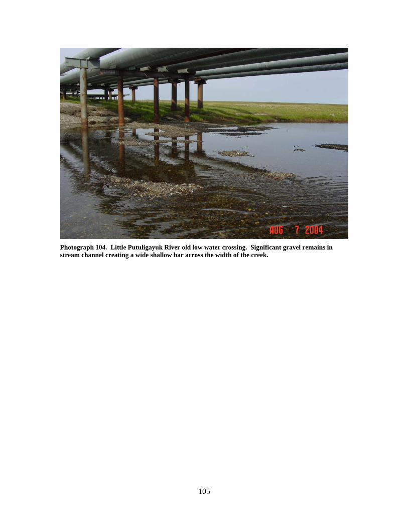
Photograph 105. Compilation of pictures of the Little Putuligayuk River downstream of the old low water crossing. Gravel outwash is present in stream channel immediately downstream of the crossing (top) and for a considerable downstream (bottom and map).
107
Central Prudhoe Bay Area Fawn and Leach Creek Stream Crossings

108
109
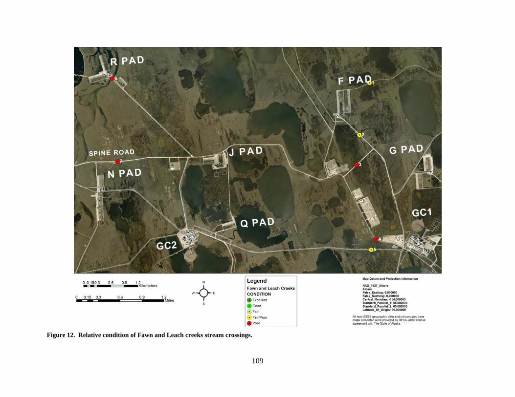
Figure 12. Relative condition of Fawn and Leach creeks stream crossings.
110
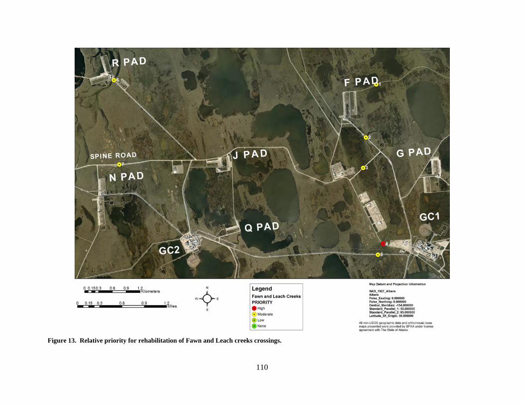
Figure 13. Relative priority for rehabilitation of Fawn and Leach creeks crossings.
111
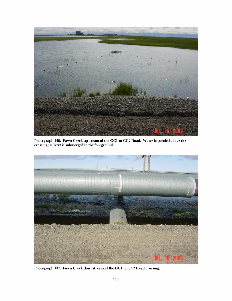
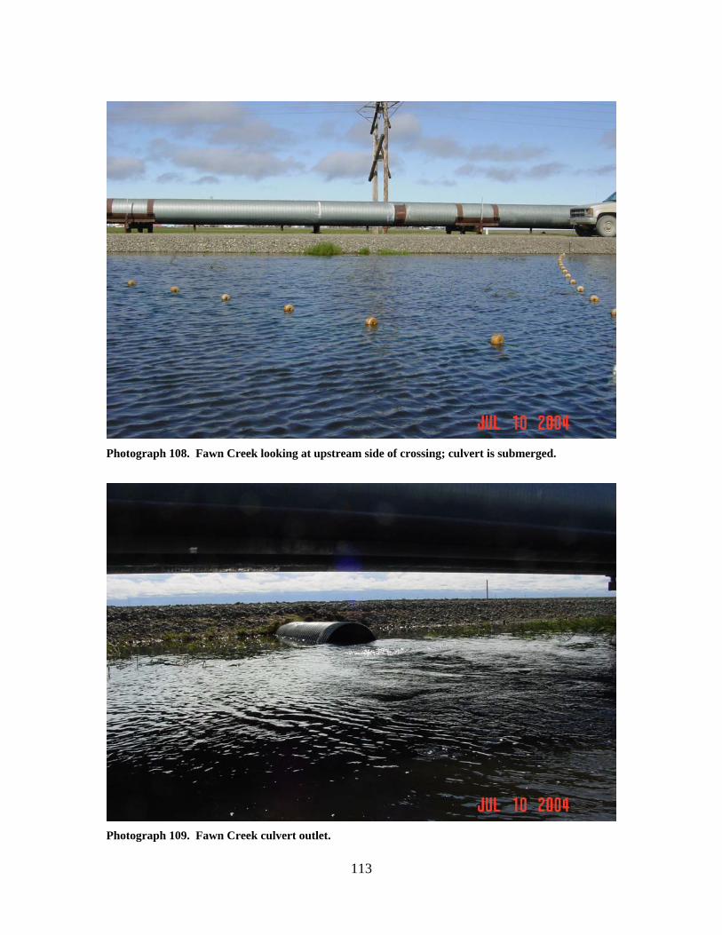
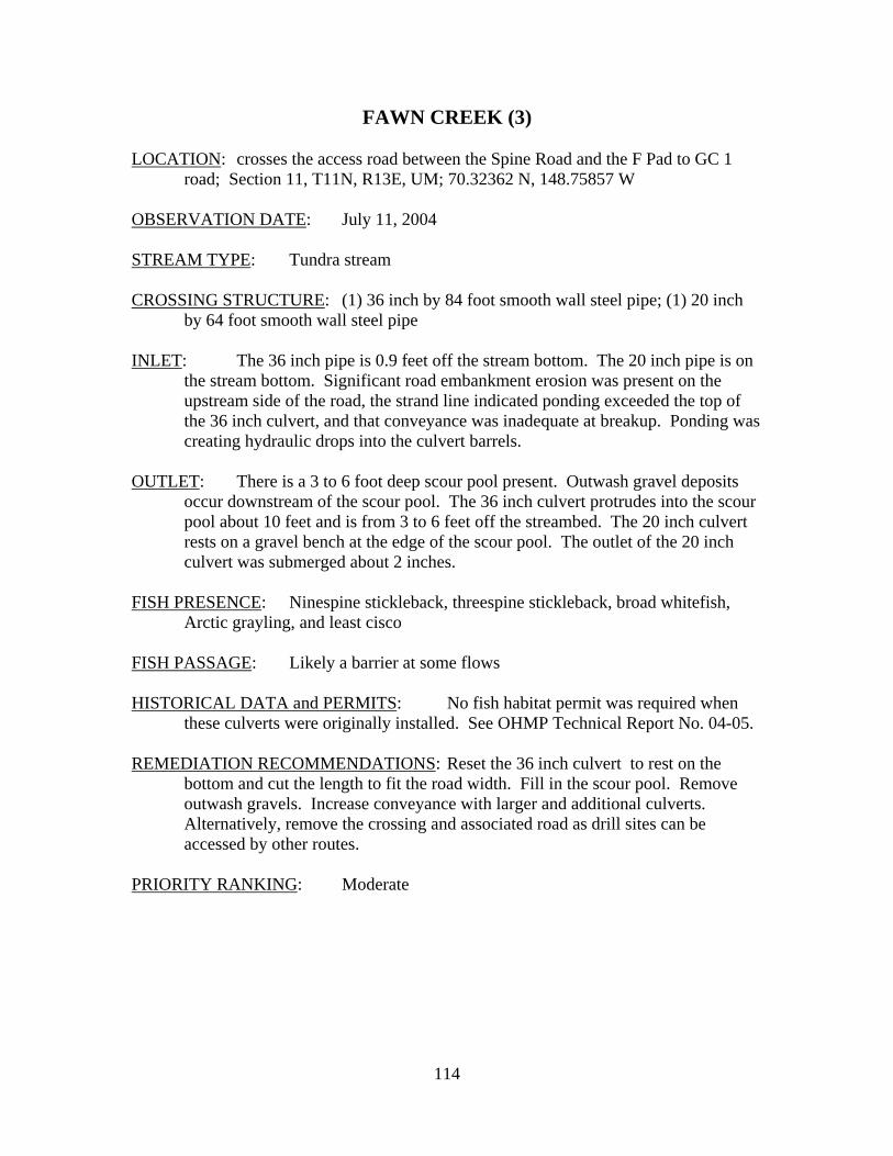
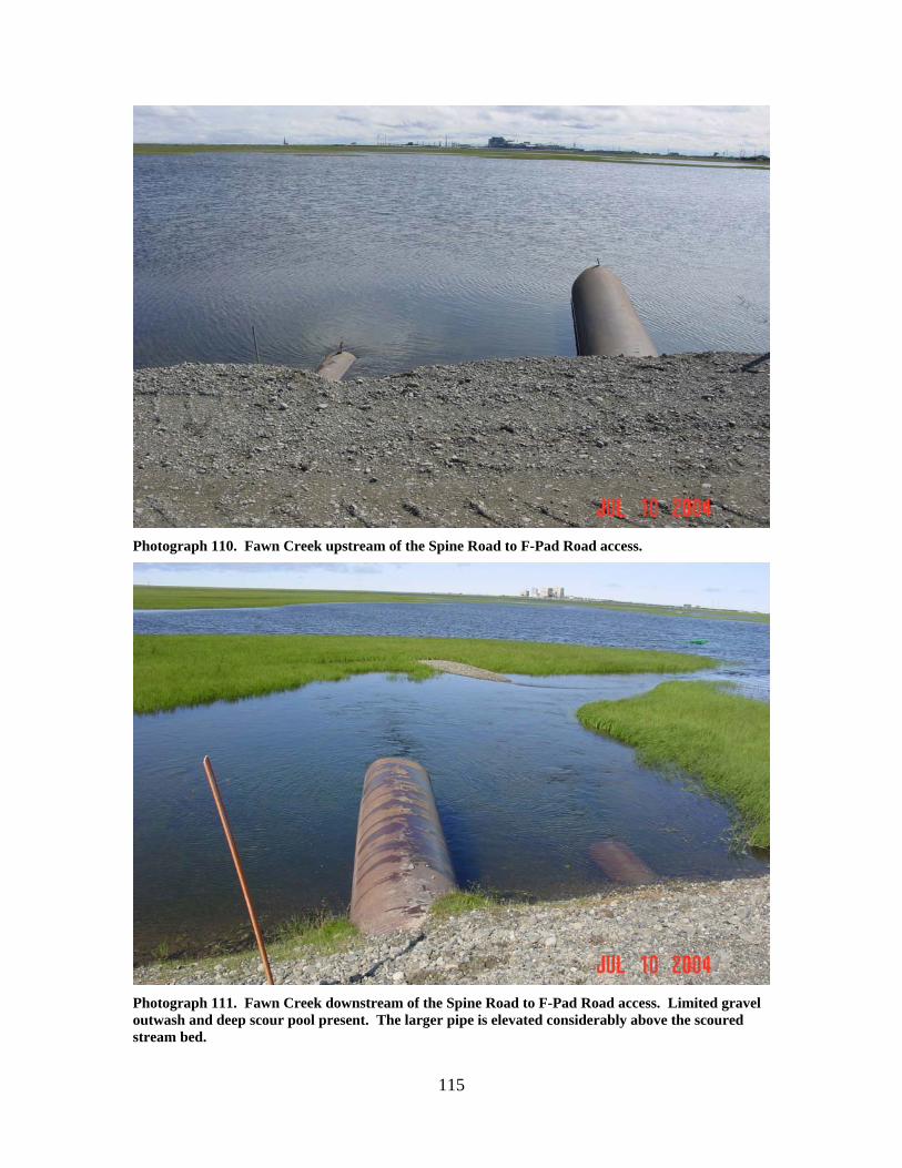
FAWN CREEK (5)
LOCATION: crosses the access road between GC 1 and GC 2; Section 14, T11N,
R13E, UM; 70.30622 N, 148.75507 W OBSERVATION DATE: July 11, 2004 STREAM TYPE: Tundra stream CROSSING STRUCTURE: (1) 30 inch by 40 foot corrugated metal pipe INLET: Culvert inlet submerged 3 inches, culvert on the bottom of the toe of the
road but above the streambed, water impounded above the road. OUTLET: Culvert is on the streambed, water velocity accelerated at the outlet. FISH PRESENCE: None observed; Ninespine stickleback, threespine stickleback,
broad whitefish, Arctic grayling, and least cisco occur downstream of the Fawn Creek Spine Road crossing.
FISH PASSAGE: Likely a barrier at some flows. HISTORICAL DATA and PERMITS: No fish habitat permit was required when
this culvert was originally installed. See OHMP Technical Report No. 04-05. REMEDIATION RECOMMENDATIONS: Replace with a larger culvert(s). This will
increase the potential for fish to reach D Pad Lake. PRIORITY RANKING: Moderate
112
Photograph 106. Fawn Creek upstream of the GC1 to GC2 Road. Water is ponded above the crossing; culvert is submerged in the foreground.
Photograph 107. Fawn Creek downstream of the GC1 to GC2 Road crossing.
113
Photograph 108. Fawn Creek looking at upstream side of crossing; culvert is submerged.
Photograph 109. Fawn Creek culvert outlet.
114
FAWN CREEK (3) LOCATION: crosses the access road between the Spine Road and the F Pad to GC 1
road; Section 11, T11N, R13E, UM; 70.32362 N, 148.75857 W OBSERVATION DATE: July 11, 2004 STREAM TYPE: Tundra stream CROSSING STRUCTURE: (1) 36 inch by 84 foot smooth wall steel pipe; (1) 20 inch
by 64 foot smooth wall steel pipe INLET: The 36 inch pipe is 0.9 feet off the stream bottom. The 20 inch pipe is on
the stream bottom. Significant road embankment erosion was present on the upstream side of the road, the strand line indicated ponding exceeded the top of the 36 inch culvert, and that conveyance was inadequate at breakup. Ponding was creating hydraulic drops into the culvert barrels.
OUTLET: There is a 3 to 6 foot deep scour pool present. Outwash gravel deposits
occur downstream of the scour pool. The 36 inch culvert protrudes into the scour pool about 10 feet and is from 3 to 6 feet off the streambed. The 20 inch culvert rests on a gravel bench at the edge of the scour pool. The outlet of the 20 inch culvert was submerged about 2 inches.
FISH PRESENCE: Ninespine stickleback, threespine stickleback, broad whitefish,
Arctic grayling, and least cisco FISH PASSAGE: Likely a barrier at some flows HISTORICAL DATA and PERMITS: No fish habitat permit was required when
these culverts were originally installed. See OHMP Technical Report No. 04-05. REMEDIATION RECOMMENDATIONS: Reset the 36 inch culvert to rest on the
bottom and cut the length to fit the road width. Fill in the scour pool. Remove outwash gravels. Increase conveyance with larger and additional culverts. Alternatively, remove the crossing and associated road as drill sites can be accessed by other routes.
PRIORITY RANKING: Moderate
115
Photograph 110. Fawn Creek upstream of the Spine Road to F-Pad Road access.
Photograph 111. Fawn Creek downstream of the Spine Road to F-Pad Road access. Limited gravel outwash and deep scour pool present. The larger pipe is elevated considerably above the scoured stream bed.
116
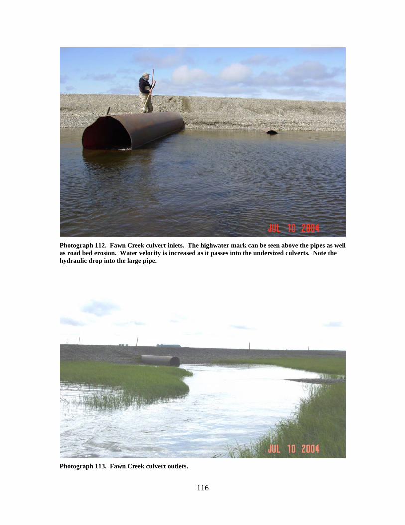
Photograph 112. Fawn Creek culvert inlets. The highwater mark can be seen above the pipes as well as road bed erosion. Water velocity is increased as it passes into the undersized culverts. Note the hydraulic drop into the large pipe.
Photograph 113. Fawn Creek culvert outlets.
117
FAWN CREEK (2) LOCATION: crosses the access road between F Pad and GC 1; Section 2, T11N, R13E,
UM; 70.32960 N, 148.75662 W OBSERVATION DATE: July 11, 2004 STREAM TYPE: Tundra stream CROSSING STRUCTURE: (1) 4 foot by 61 foot corrugated metal pipe INLET: 1.2 feet above stream bed; 0.7 foot hydraulic drop into the pipe OUTLET: 2 inches above thalweg FISH PRESENCE: Ninespine stickleback, threespine stickleback, broad whitefish,
Arctic grayling, and least cisco FISH PASSAGE: Likely a barrier at some flows HISTORICAL DATA and PERMITS: No fish habitat permit was required when
this culvert was originally installed. See OHMP Technical Report No. 04-05. REMEDIATION RECOMMENDATIONS: Reset culvert to improve fish passage.
Increase water conveyance past this crossing with larger or additional pipes. PRIORITY RANKING: Moderate
118
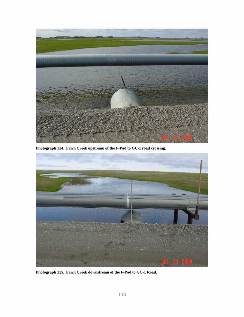
Photograph 114. Fawn Creek upstream of the F-Pad to GC-1 road crossing.
Photograph 115. Fawn Creek downstream of the F-Pad to GC-1 Road.
119
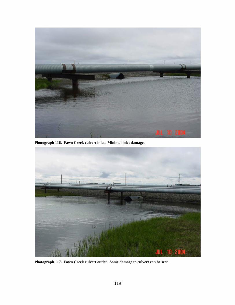
Photograph 116. Fawn Creek culvert inlet. Minimal inlet damage.
Photograph 117. Fawn Creek culvert outlet. Some damage to culvert can be seen.
120
FAWN CREEK (1)
LOCATION: crosses the access road between F Pad and E Pad; Section 1, T11N,
R13E, UM; 70.33994 N, 148.74840 W OBSERVATION DATE: July 11, 2004 STREAM TYPE: Tundra stream CROSSING STRUCTURE: (4) 24 inch by 40 foot corrugated metal culverts INLET: The tops of 2 culverts were level with the water surface. Two culverts
completely submerged by 3 inches. Culvert bottoms buried in the streambed. OUTLET: Culverts were roughly half full. Culvert bottoms buried in the streambed. FISH PRESENCE: Ninespine stickleback, threespine stickleback, broad whitefish,
Arctic grayling, and least cisco FISH PASSAGE: Likely a barrier at some flows HISTORICAL DATA and PERMITS: No fish habitat permit was required when
these culverts were originally installed. See OHMP Technical Report No. 04-05. REMEDIATION RECOMMENDATIONS: Increase water conveyance past this crossing
with larger or additional culverts. Alternatively, remove the entire crossing, re-establish the streambed, and remove the access road as the drill sites can be accessed by other routes.
PRIORITY RANKING: Moderate
121
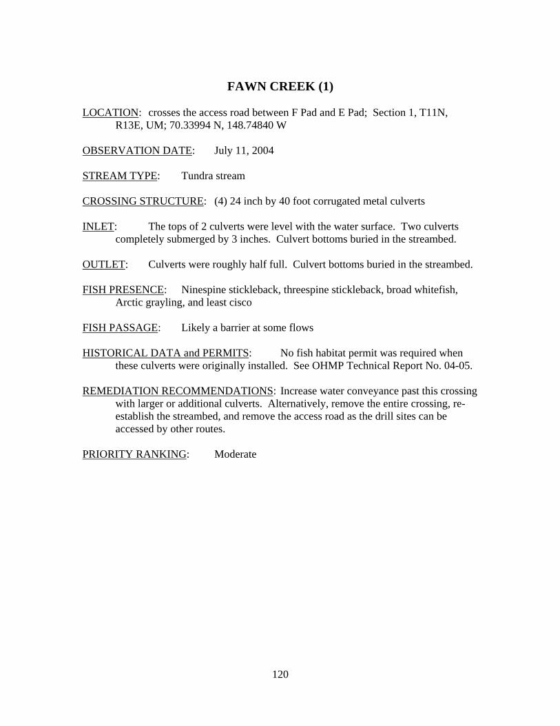
Photograph 118. Fawn Creek upstream of the F-Pad to E-Pad Road. Water is ponded upstream and culverts are submerged; whirlpools at inlets indicate excessive velocity is likely.
Photograph 119. Fawn Creek culvert outlets downstream of the F-Pad to E-Pad Road.
122
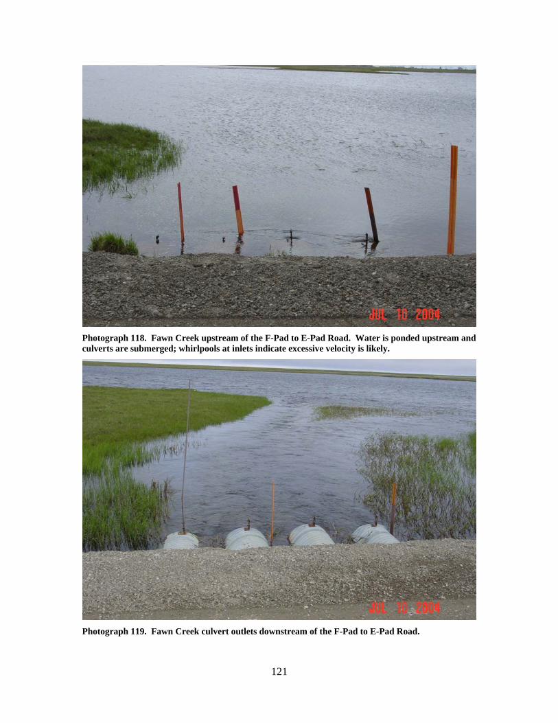
Photograph 120. Fawn Creek culvert inlets.
Photograph 121. Fawn Creek culvert outlets. Note the difference in water surface elevation between the upstream and downstream sides of the road.
123
FAWN CREEK (4)
LOCATION: crosses the Spine Road between GC-1 and the Central Storage Pad;
Section 14, T11N, R13E, UM; 70.30830 N, 148.75169 W OBSERVATION DATE: July 11, 2004 STREAM TYPE: Tundra stream CROSSING STRUCTURE: (1) 4.8 foot by 98 foot long smooth wall pipe INLET: The inlet is 1 foot above the streambed, with a 0.7 foot hydraulic drop into
the culvert. Sand bags were stacked around the inlet of the pipe. OUTLET: Perched at normal or low flows. Large plunge pool about 40 by 60 feet in
size and approximately 8 feet deep or deeper. Culvert protrudes about 15 feet into the plunge pool. The outlet is about 7 to 8 feet off the stream bottom.
FISH PRESENCE: Ninespine stickleback, threespine stickleback, broad whitefish,
Arctic grayling, and least cisco FISH PASSAGE: Barrier at nearly all flows. Perched at normal summer water
levels. Excessive water velocity present at high water. HISTORICAL DATA and PERMITS: No fish habitat permit was required when
this culvert was originally installed. See OHMP Technical Report No. 04-05. REMEDIATION RECOMMENDATIONS: Reset the existing culvert to provide for fish
passage; shorten the culvert to fit the road width; fill in the downstream plunge pool; and add an additional culvert for breakup flows.
PRIORITY RANKING: High
124
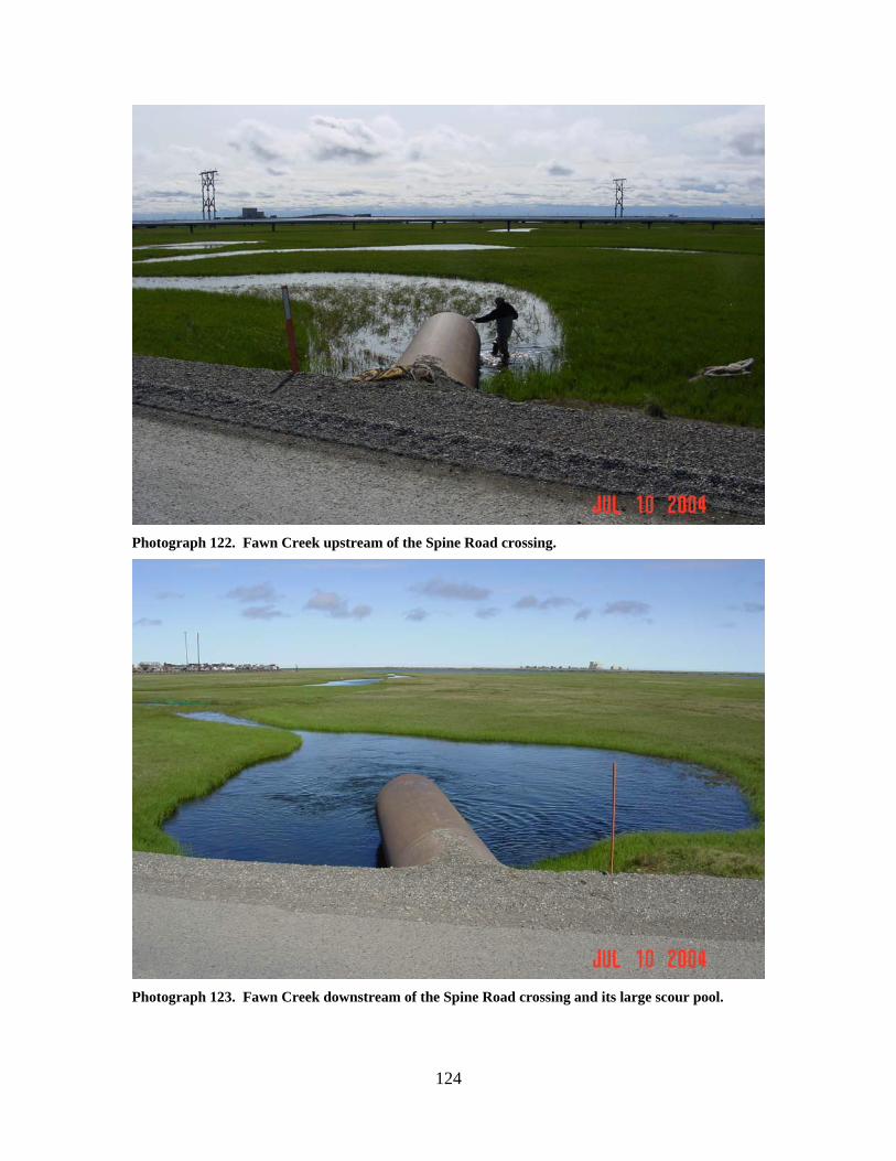
Photograph 122. Fawn Creek upstream of the Spine Road crossing.
Photograph 123. Fawn Creek downstream of the Spine Road crossing and its large scour pool.
125
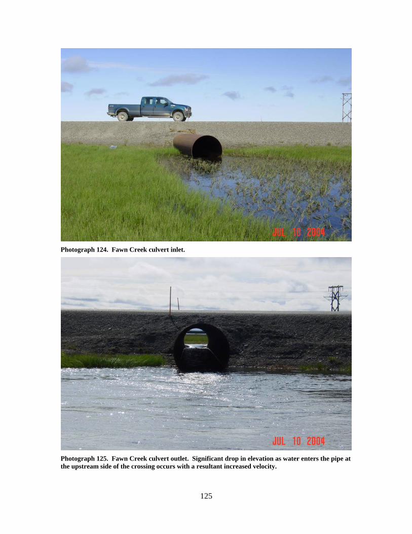
Photograph 124. Fawn Creek culvert inlet.
Photograph 125. Fawn Creek culvert outlet. Significant drop in elevation as water enters the pipe at the upstream side of the crossing occurs with a resultant increased velocity.
126
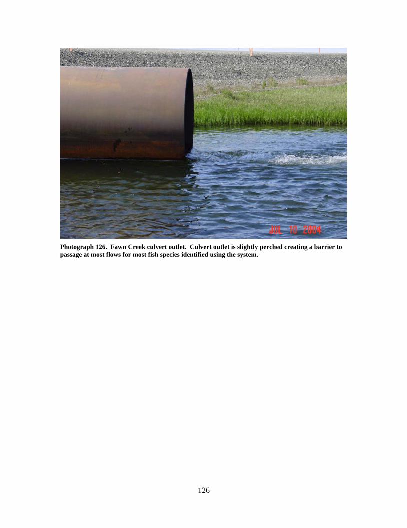
Photograph 126. Fawn Creek culvert outlet. Culvert outlet is slightly perched creating a barrier to passage at most flows for most fish species identified using the system.
127
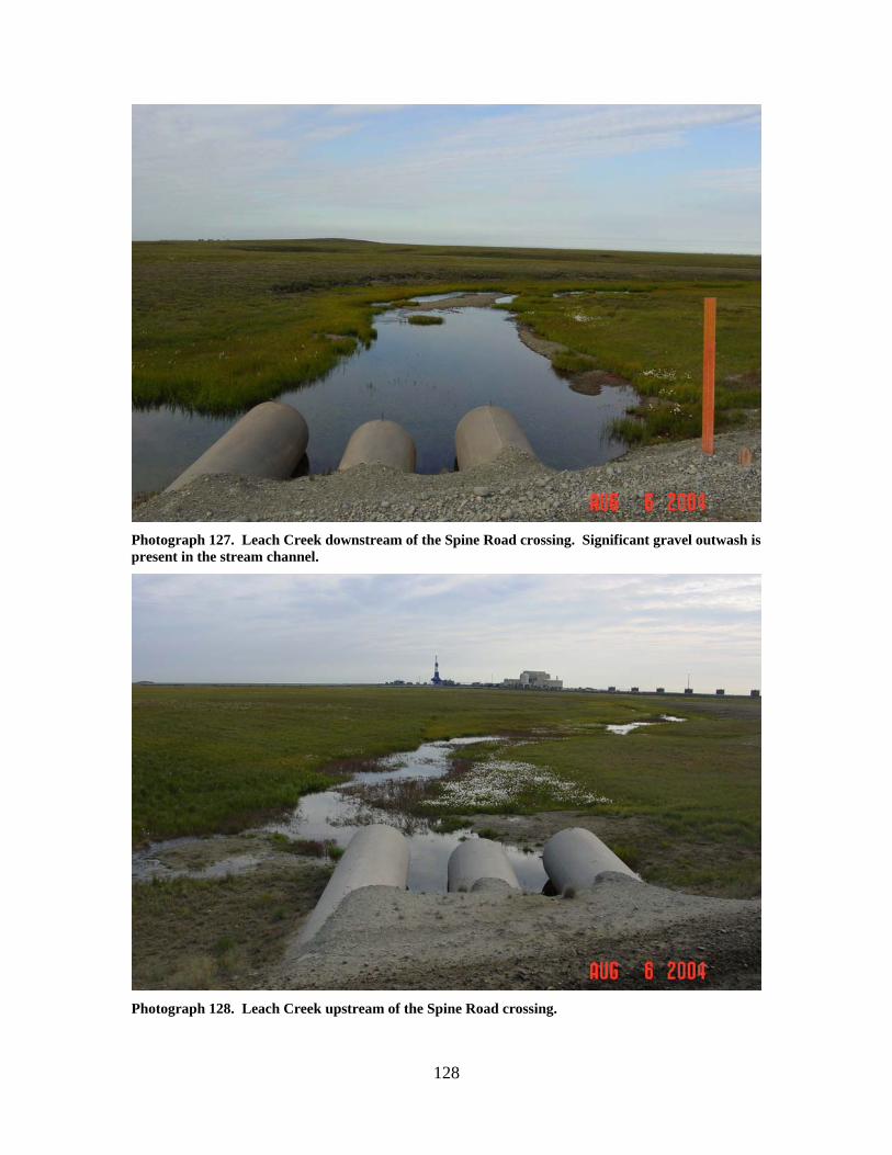
LEACH CREEK (7) LOCATION: crosses the Spine Road between the R Pad access road and the N Pad
access road; Section 8, T11N, R13E, UM; 70.32777 N, 148.90027 W OBSERVATION DATE: August 6, 2004 STREAM TYPE: Tundra stream CROSSING STRUCTURE: (3) 60 inch smooth wall pipes INLET: Good condition OUTLET: Significant outwash gravels present downstream FISH PRESENCE: Arctic grayling FISH PASSAGE: Passable HISTORICAL DATA and PERMITS: These three culverts were installed under
Fish Habitat Permit FG90-III-0205. REMEDIATION RECOMMENDATIONS: Increase water conveyance at this crossing,
remove outwash gravels PRIORITY RANKING: Moderate
128
Photograph 127. Leach Creek downstream of the Spine Road crossing. Significant gravel outwash is present in the stream channel.
Photograph 128. Leach Creek upstream of the Spine Road crossing.
129
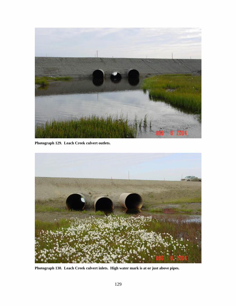
Photograph 129. Leach Creek culvert outlets.
Photograph 130. Leach Creek culvert inlets. High water mark is at or just above pipes.
130
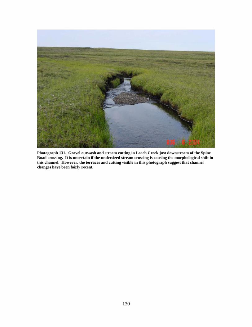
Photograph 131. Gravel outwash and stream cutting in Leach Creek just downstream of the Spine Road crossing. It is uncertain if the undersized stream crossing is causing the morphological shift in this channel. However, the terraces and cutting visible in this photograph suggest that channel changes have been fairly recent.
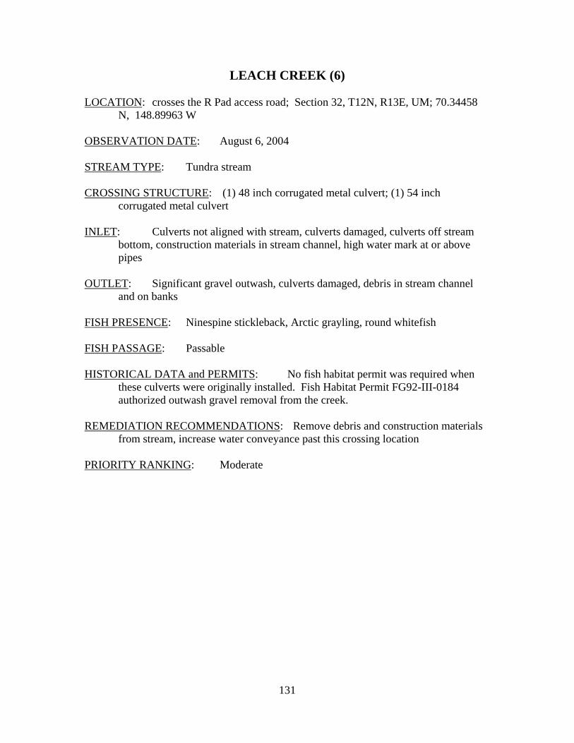
131
LEACH CREEK (6) LOCATION: crosses the R Pad access road; Section 32, T12N, R13E, UM; 70.34458
N, 148.89963 W OBSERVATION DATE: August 6, 2004 STREAM TYPE: Tundra stream CROSSING STRUCTURE: (1) 48 inch corrugated metal culvert; (1) 54 inch
corrugated metal culvert INLET: Culverts not aligned with stream, culverts damaged, culverts off stream
bottom, construction materials in stream channel, high water mark at or above pipes
OUTLET: Significant gravel outwash, culverts damaged, debris in stream channel
and on banks FISH PRESENCE: Ninespine stickleback, Arctic grayling, round whitefish FISH PASSAGE: Passable HISTORICAL DATA and PERMITS: No fish habitat permit was required when
these culverts were originally installed. Fish Habitat Permit FG92-III-0184 authorized outwash gravel removal from the creek.
REMEDIATION RECOMMENDATIONS: Remove debris and construction materials
from stream, increase water conveyance past this crossing location PRIORITY RANKING: Moderate
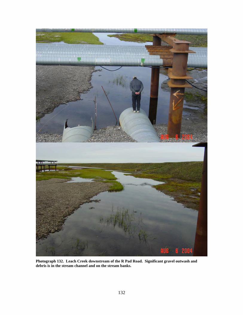
132
Photograph 132. Leach Creek downstream of the R Pad Road. Significant gravel outwash and debris is in the stream channel and on the stream banks.
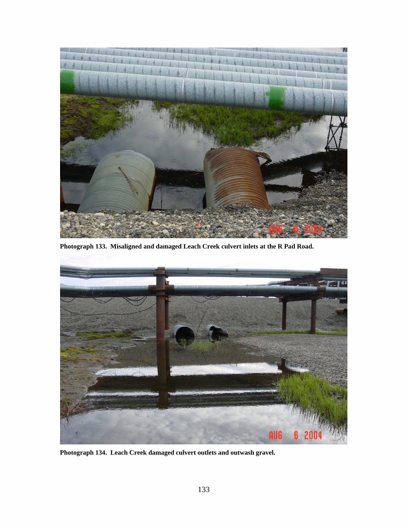
133
Photograph 133. Misaligned and damaged Leach Creek culvert inlets at the R Pad Road.
Photograph 134. Leach Creek damaged culvert outlets and outwash gravel.
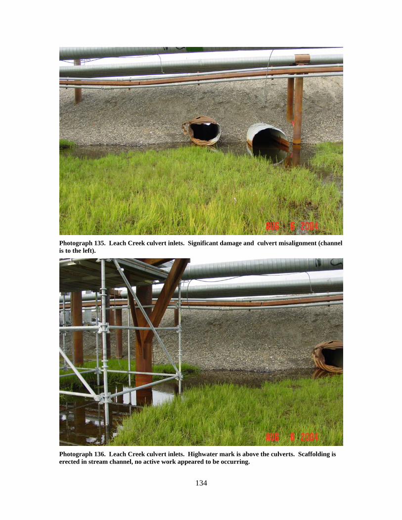
134
Photograph 135. Leach Creek culvert inlets. Significant damage and culvert misalignment (channel is to the left).
Photograph 136. Leach Creek culvert inlets. Highwater mark is above the culverts. Scaffolding is erected in stream channel, no active work appeared to be occurring.
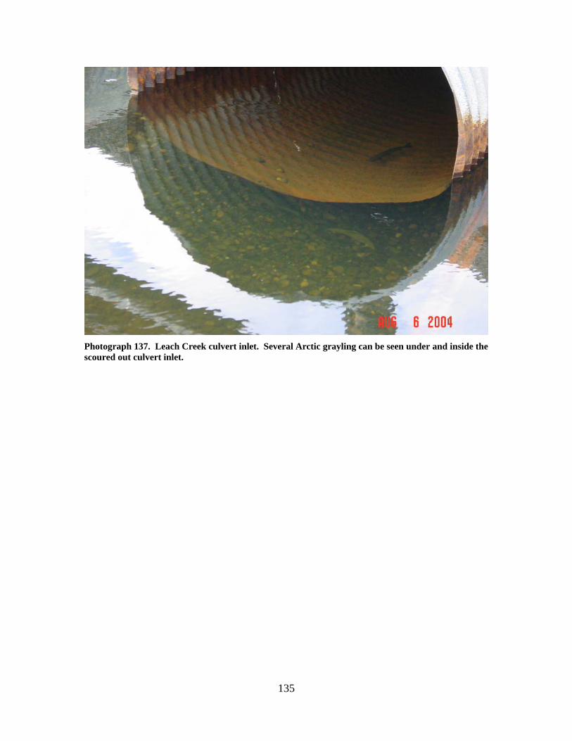
135
Photograph 137. Leach Creek culvert inlet. Several Arctic grayling can be seen under and inside the scoured out culvert inlet.

136
137
Kuparuk River and Western Tributary Stream
Crossings

138
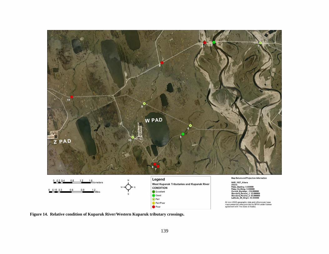
139
Figure 14. Relative condition of Kuparuk River/Western Kuparuk tributary crossings.
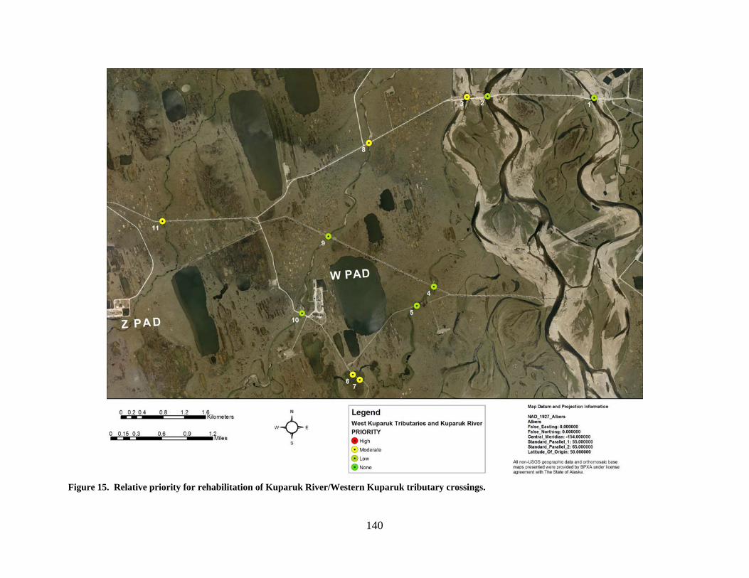
140
Figure 15. Relative priority for rehabilitation of Kuparuk River/Western Kuparuk tributary crossings.
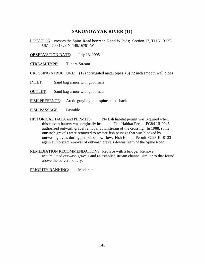
141
SAKONOWYAK RIVER (11)
LOCATION: crosses the Spine Road between Z and W Pads; Section 17, T11N, R12E,
UM; 70.31328 N, 149.16791 W OBSERVATION DATE: July 13, 2005 STREAM TYPE: Tundra Stream CROSSING STRUCTURE: (12) corrugated metal pipes, (3) 72 inch smooth wall pipes INLET: Sand bag armor with gobi mats OUTLET: Sand bag armor with gobi mats FISH PRESENCE: Arctic grayling, ninespine stickleback FISH PASSAGE: Passable HISTORICAL DATA and PERMITS: No fish habitat permit was required when
this culvert battery was originally installed. Fish Habitat Permit FG84-III-0045 authorized outwash gravel removal downstream of the crossing. In 1988, some outwash gravels were removed to restore fish passage that was blocked by outwash gravels during periods of low flow. Fish Habitat Permit FG93-III-0133 again authorized removal of outwash gravels downstream of the Spine Road.
REMEDIATION RECOMMENDATIONS: Replace with a bridge. Remove
accumulated outwash gravels and re-establish stream channel similar to that found above the culvert battery.
PRIORITY RANKING: Moderate
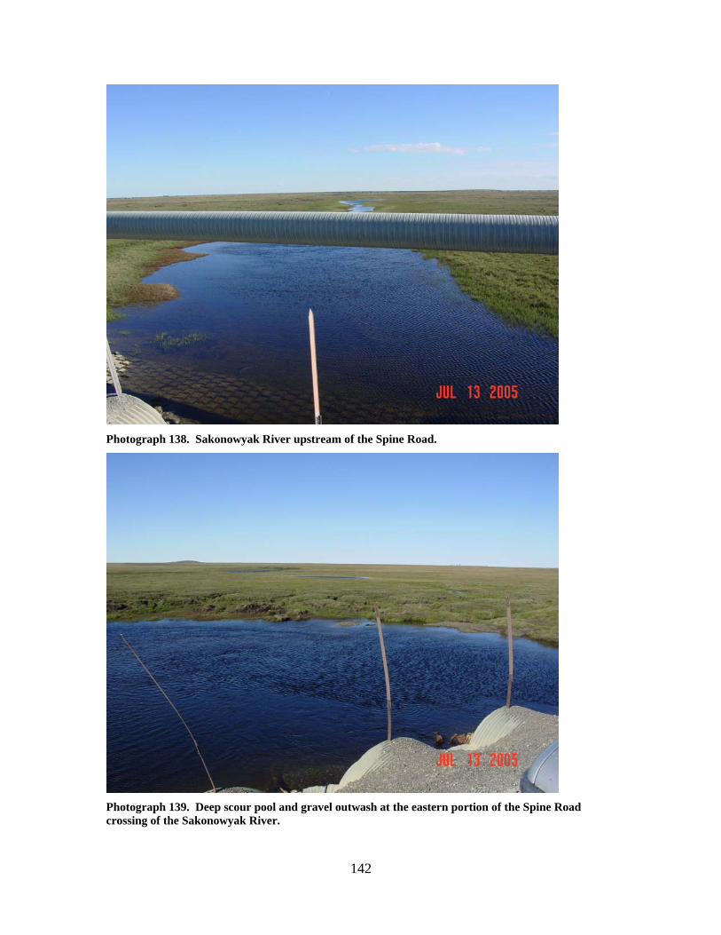
142
Photograph 138. Sakonowyak River upstream of the Spine Road.
Photograph 139. Deep scour pool and gravel outwash at the eastern portion of the Spine Road crossing of the Sakonowyak River.
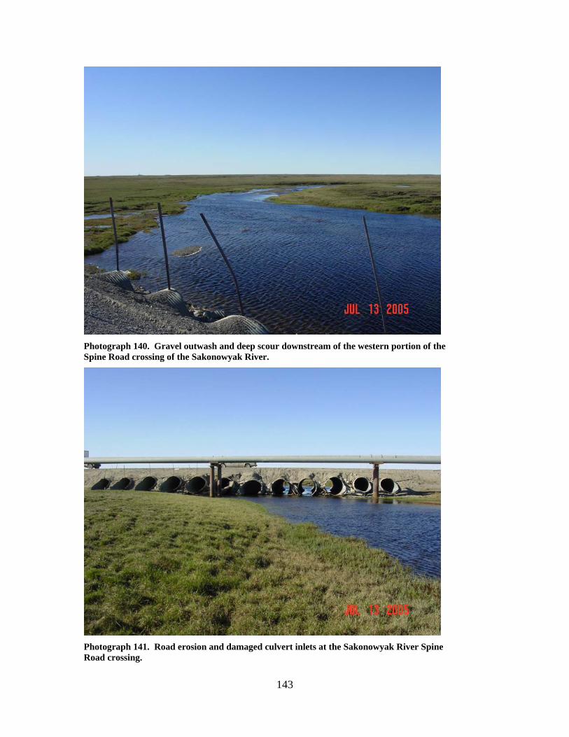
143
Photograph 140. Gravel outwash and deep scour downstream of the western portion of the Spine Road crossing of the Sakonowyak River.
Photograph 141. Road erosion and damaged culvert inlets at the Sakonowyak River Spine Road crossing.
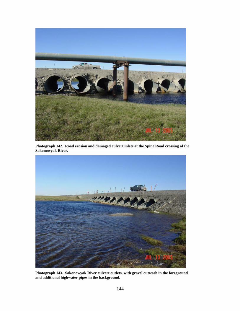
144
Photograph 142. Road erosion and damaged culvert inlets at the Spine Road crossing of the Sakonowyak River.
Photograph 143. Sakonowyak River culvert outlets, with gravel outwash in the foreground and additional highwater pipes in the background.
145
SMITH CREEK (8)
LOCATION: crosses the Spine Road between the Kuparuk River and S Pad; Section
10, T11N, R12E, UM; 70.32424 N, 149.06364 W OBSERVATION DATE: July 13, 2005 STREAM TYPE: Tundra stream CROSSING STRUCTURE: (5) 12 foot corrugated metal pipes; (2) 6 foot corrugated
metal pipes INLET: Sand bag armor, high water mark 4 to 5 feet above culvert inlets, road
prism erosion, substantial damage to culvert inlets, sand bag armor and armor reinforcement
OUTLET: Sand bag armor; outwash gravels present for a considerable distance
downstream, torn sand bags downstream of the crossing, 10 to 12 foot deep scour, some culvert outlet damage, some road prism erosion, high water mark above culvert outlets
FISH PRESENCE: Arctic grayling, ninespine stickleback, whitefish, burbot FISH PASSAGE: Passable at most flows HISTORICAL DATA and PERMITS: No fish habitat permit was required when
this culvert battery was originally installed. Some outwash gravels were removed in 1984. Outwash gravel removal was again authorized in 1993 under Fish Habitat Permit FG93-III-0135. Sandbag slope protection around the culvert inlets was repaired under Fish Habitat Permit FG 94-III-0140. Ice-damaged culvert inlets were repaired under Fish Habitat Permits FG99-III-0184 and FG99-III-0184, Amendment 1. Fish Habitat Permit FG99-III-0184, Amendment 2 was issued in 2006 to replace one 8 foot culvert with a similar-sized multiplate culvert. FG99-III-0184, Amendment 3 in 2007 authorized resetting of the easternmost culvert in the battery.
REMEDIATION RECOMMENDATIONS: Replace with a bridge. Remove
accumulated outwash gravels and re-establish stream channel similar to that found above the culvert battery. Remove sand bags that have washed downstream.
PRIORITY RANKING: Moderate
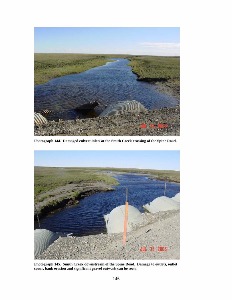
146
Photograph 144. Damaged culvert inlets at the Smith Creek crossing of the Spine Road.
Photograph 145. Smith Creek downstream of the Spine Road. Damage to outlets, outlet scour, bank erosion and significant gravel outwash can be seen.
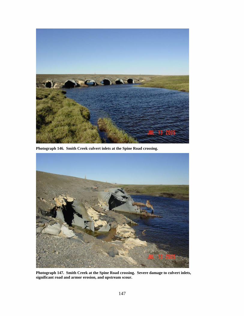
147
Photograph 146. Smith Creek culvert inlets at the Spine Road crossing.
Photograph 147. Smith Creek at the Spine Road crossing. Severe damage to culvert inlets, significant road and armor erosion, and upstream scour.
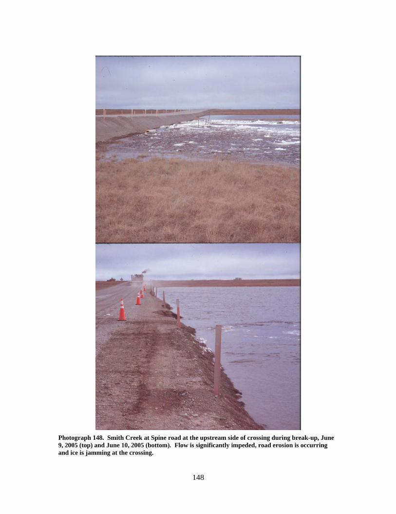
148
Photograph 148. Smith Creek at Spine road at the upstream side of crossing during break-up, June 9, 2005 (top) and June 10, 2005 (bottom). Flow is significantly impeded, road erosion is occurring and ice is jamming at the crossing.
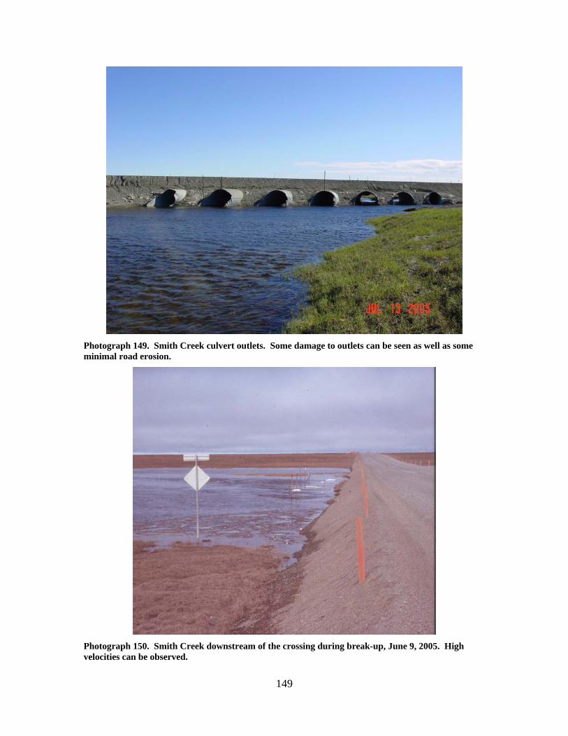
149
Photograph 149. Smith Creek culvert outlets. Some damage to outlets can be seen as well as some minimal road erosion.
Photograph 150. Smith Creek downstream of the crossing during break-up, June 9, 2005. High velocities can be observed.
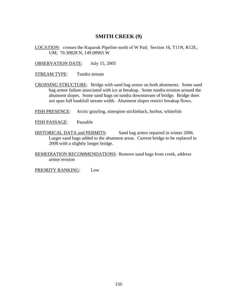
150
SMITH CREEK (9)
LOCATION: crosses the Kuparuk Pipeline north of W Pad; Section 16, T11N, R12E,
UM; 70.30828 N, 149.08965 W OBSERVATION DATE: July 15, 2005 STREAM TYPE: Tundra stream CROSSING STRUCTURE: Bridge with sand bag armor on both abutments. Some sand
bag armor failure associated with ice at breakup. Some tundra erosion around the abutment slopes. Some sand bags on tundra downstream of bridge. Bridge does not span full bankfull stream width. Abutment slopes restrict breakup flows.
FISH PRESENCE: Arctic grayling, ninespine stickleback, burbot, whitefish FISH PASSAGE: Passable HISTORICAL DATA and PERMITS: Sand bag armor repaired in winter 2006.
Larger sand bags added to the abutment areas. Current bridge to be replaced in 2008 with a slightly longer bridge.
REMEDIATION RECOMMENDATIONS: Remove sand bags from creek, address
armor erosion PRIORITY RANKING: Low
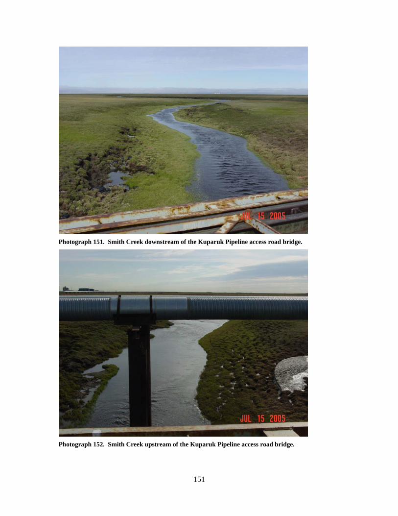
151
Photograph 151. Smith Creek downstream of the Kuparuk Pipeline access road bridge.
Photograph 152. Smith Creek upstream of the Kuparuk Pipeline access road bridge.
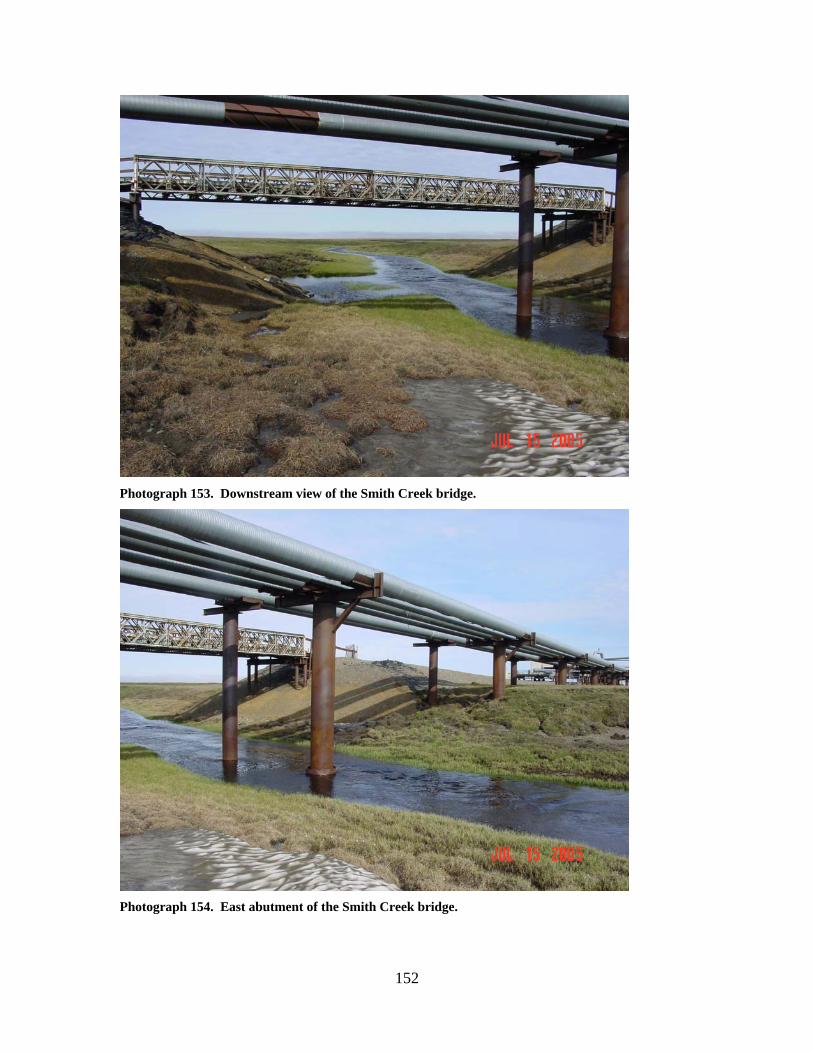
152
Photograph 153. Downstream view of the Smith Creek bridge.
Photograph 154. East abutment of the Smith Creek bridge.
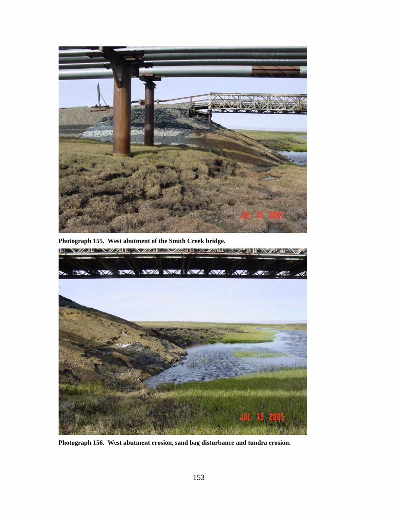
153
Photograph 155. West abutment of the Smith Creek bridge.
Photograph 156. West abutment erosion, sand bag disturbance and tundra erosion.
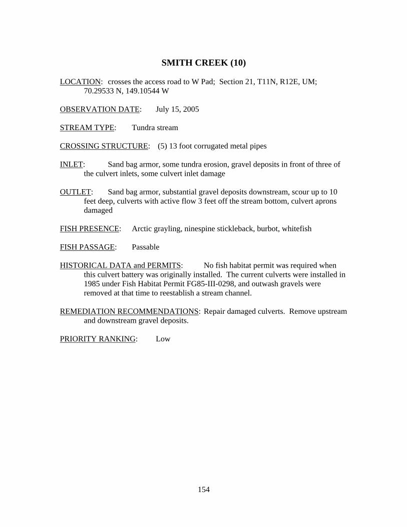
154
SMITH CREEK (10)
LOCATION: crosses the access road to W Pad; Section 21, T11N, R12E, UM;
70.29533 N, 149.10544 W OBSERVATION DATE: July 15, 2005 STREAM TYPE: Tundra stream CROSSING STRUCTURE: (5) 13 foot corrugated metal pipes INLET: Sand bag armor, some tundra erosion, gravel deposits in front of three of
the culvert inlets, some culvert inlet damage OUTLET: Sand bag armor, substantial gravel deposits downstream, scour up to 10
feet deep, culverts with active flow 3 feet off the stream bottom, culvert aprons damaged
FISH PRESENCE: Arctic grayling, ninespine stickleback, burbot, whitefish FISH PASSAGE: Passable HISTORICAL DATA and PERMITS: No fish habitat permit was required when
this culvert battery was originally installed. The current culverts were installed in 1985 under Fish Habitat Permit FG85-III-0298, and outwash gravels were removed at that time to reestablish a stream channel.
REMEDIATION RECOMMENDATIONS: Repair damaged culverts. Remove upstream
and downstream gravel deposits. PRIORITY RANKING: Low
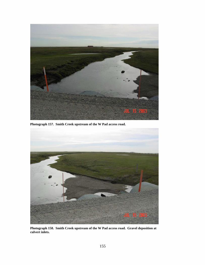
155
Photograph 157. Smith Creek upstream of the W Pad access road.
Photograph 158. Smith Creek upstream of the W Pad access road. Gravel deposition at culvert inlets.
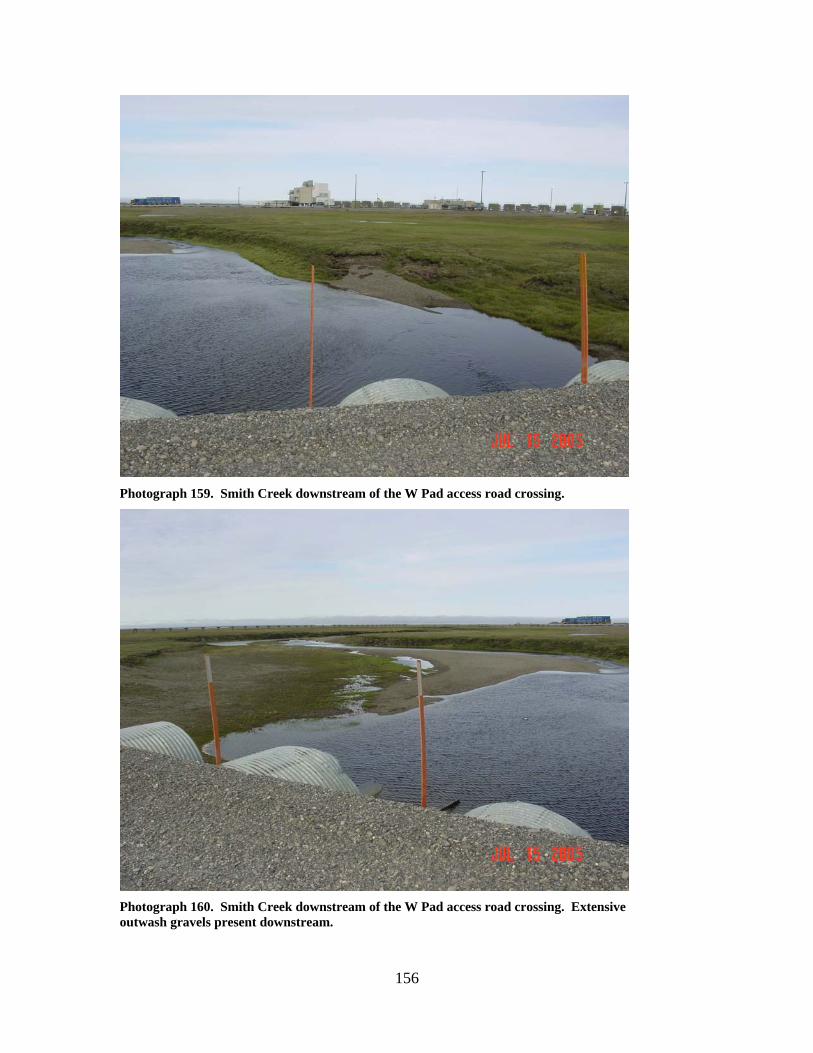
156
Photograph 159. Smith Creek downstream of the W Pad access road crossing.
Photograph 160. Smith Creek downstream of the W Pad access road crossing. Extensive outwash gravels present downstream.
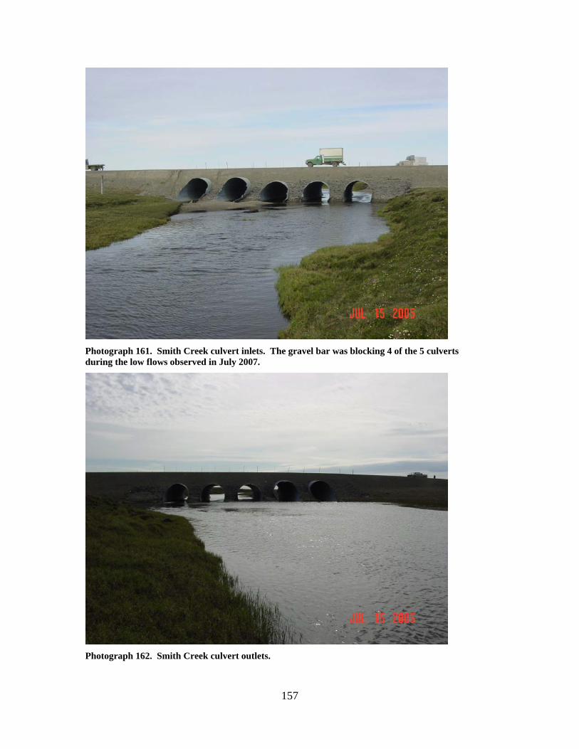
157
Photograph 161. Smith Creek culvert inlets. The gravel bar was blocking 4 of the 5 culverts during the low flows observed in July 2007.
Photograph 162. Smith Creek culvert outlets.
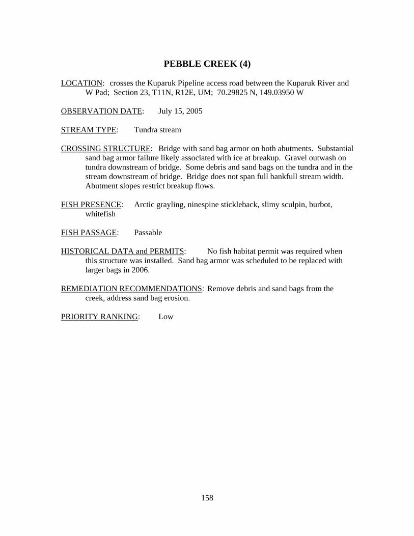
158
PEBBLE CREEK (4)
LOCATION: crosses the Kuparuk Pipeline access road between the Kuparuk River and
W Pad; Section 23, T11N, R12E, UM; 70.29825 N, 149.03950 W OBSERVATION DATE: July 15, 2005 STREAM TYPE: Tundra stream CROSSING STRUCTURE: Bridge with sand bag armor on both abutments. Substantial
sand bag armor failure likely associated with ice at breakup. Gravel outwash on tundra downstream of bridge. Some debris and sand bags on the tundra and in the stream downstream of bridge. Bridge does not span full bankfull stream width. Abutment slopes restrict breakup flows.
FISH PRESENCE: Arctic grayling, ninespine stickleback, slimy sculpin, burbot,
whitefish FISH PASSAGE: Passable HISTORICAL DATA and PERMITS: No fish habitat permit was required when
this structure was installed. Sand bag armor was scheduled to be replaced with larger bags in 2006.
REMEDIATION RECOMMENDATIONS: Remove debris and sand bags from the
creek, address sand bag erosion. PRIORITY RANKING: Low
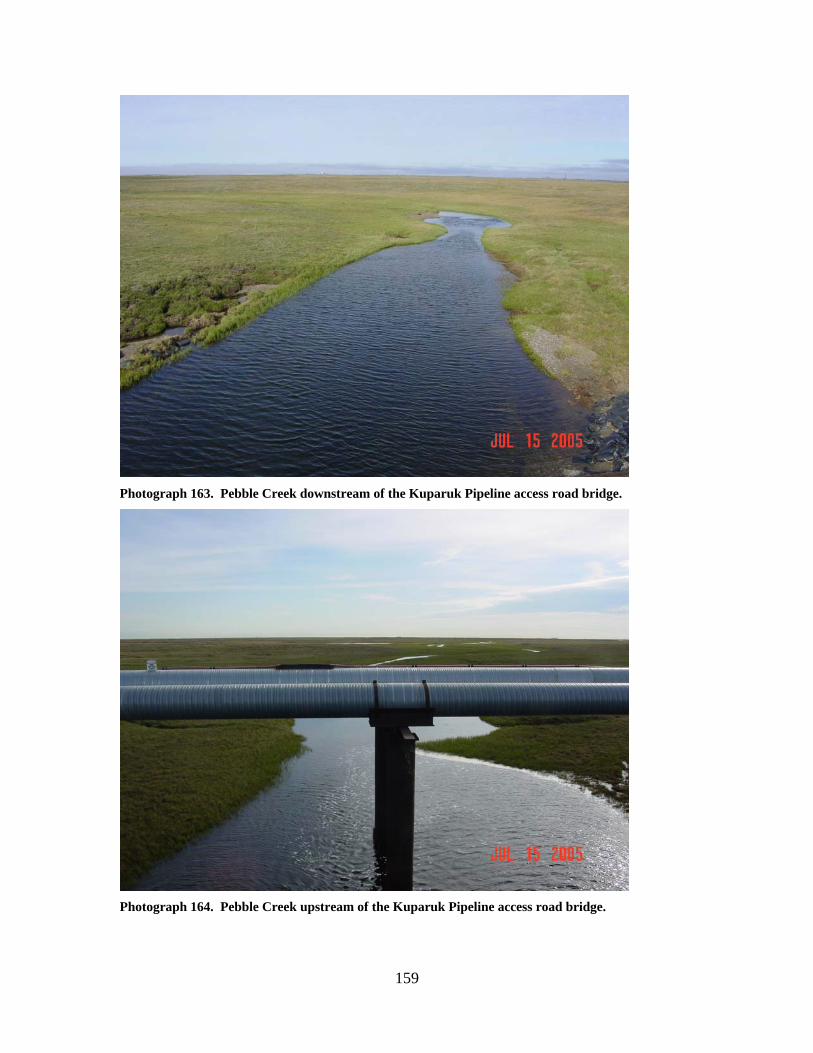
159
Photograph 163. Pebble Creek downstream of the Kuparuk Pipeline access road bridge.
Photograph 164. Pebble Creek upstream of the Kuparuk Pipeline access road bridge.
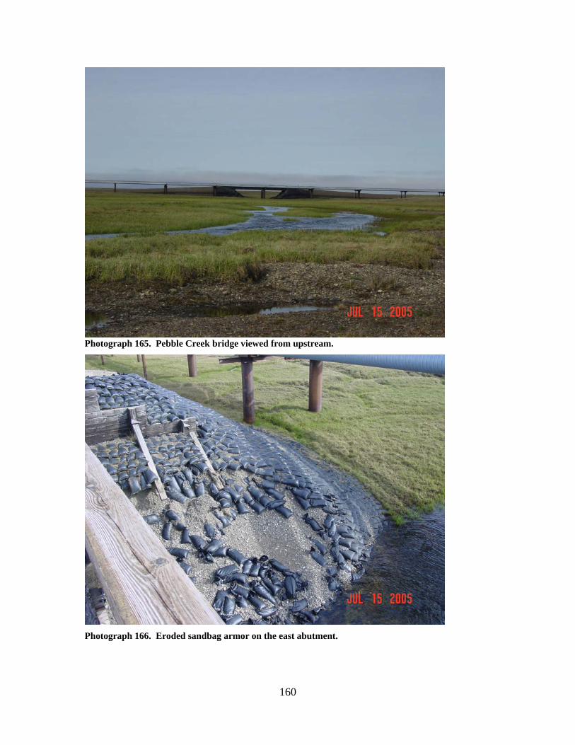
160
Photograph 165. Pebble Creek bridge viewed from upstream.
Photograph 166. Eroded sandbag armor on the east abutment.
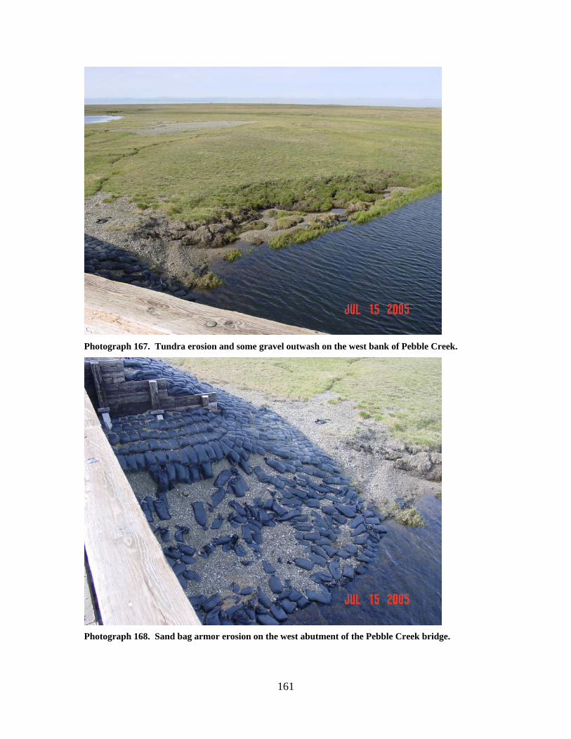
161
Photograph 167. Tundra erosion and some gravel outwash on the west bank of Pebble Creek.
Photograph 168. Sand bag armor erosion on the west abutment of the Pebble Creek bridge.
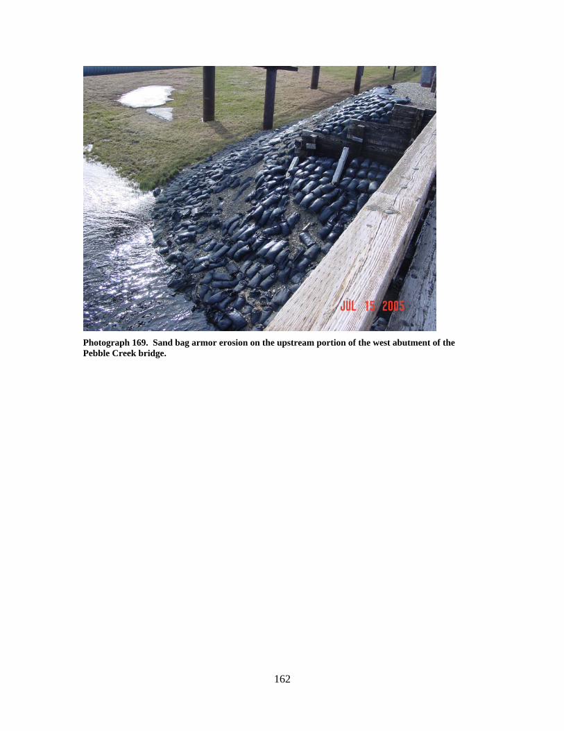
162
Photograph 169. Sand bag armor erosion on the upstream portion of the west abutment of the Pebble Creek bridge.
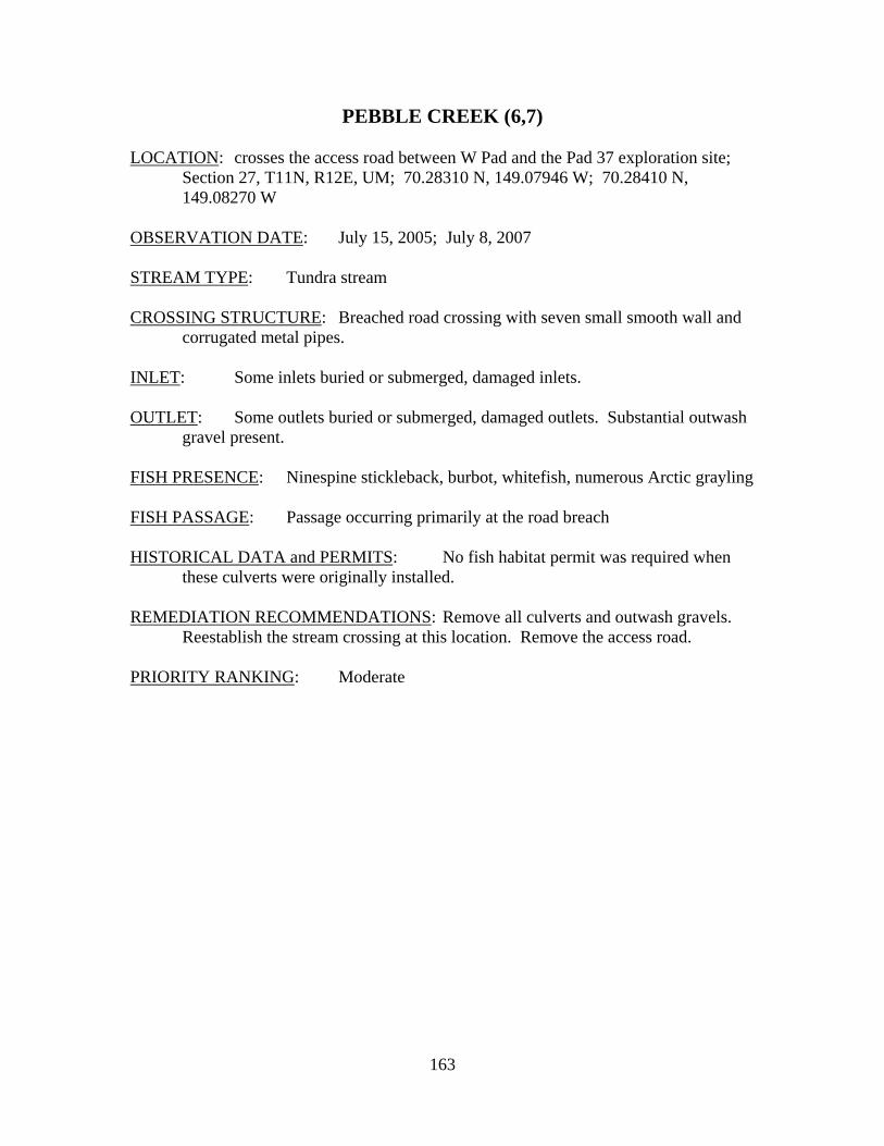
163
PEBBLE CREEK (6,7) LOCATION: crosses the access road between W Pad and the Pad 37 exploration site;
Section 27, T11N, R12E, UM; 70.28310 N, 149.07946 W; 70.28410 N, 149.08270 W
OBSERVATION DATE: July 15, 2005; July 8, 2007 STREAM TYPE: Tundra stream CROSSING STRUCTURE: Breached road crossing with seven small smooth wall and
corrugated metal pipes. INLET: Some inlets buried or submerged, damaged inlets. OUTLET: Some outlets buried or submerged, damaged outlets. Substantial outwash
gravel present. FISH PRESENCE: Ninespine stickleback, burbot, whitefish, numerous Arctic grayling FISH PASSAGE: Passage occurring primarily at the road breach HISTORICAL DATA and PERMITS: No fish habitat permit was required when
these culverts were originally installed. REMEDIATION RECOMMENDATIONS: Remove all culverts and outwash gravels.
Reestablish the stream crossing at this location. Remove the access road. PRIORITY RANKING: Moderate
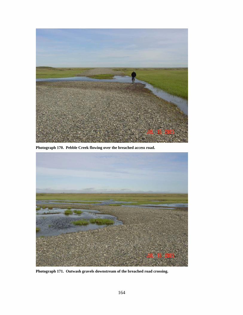
164
Photograph 170. Pebble Creek flowing over the breached access road.
Photograph 171. Outwash gravels downstream of the breached road crossing.
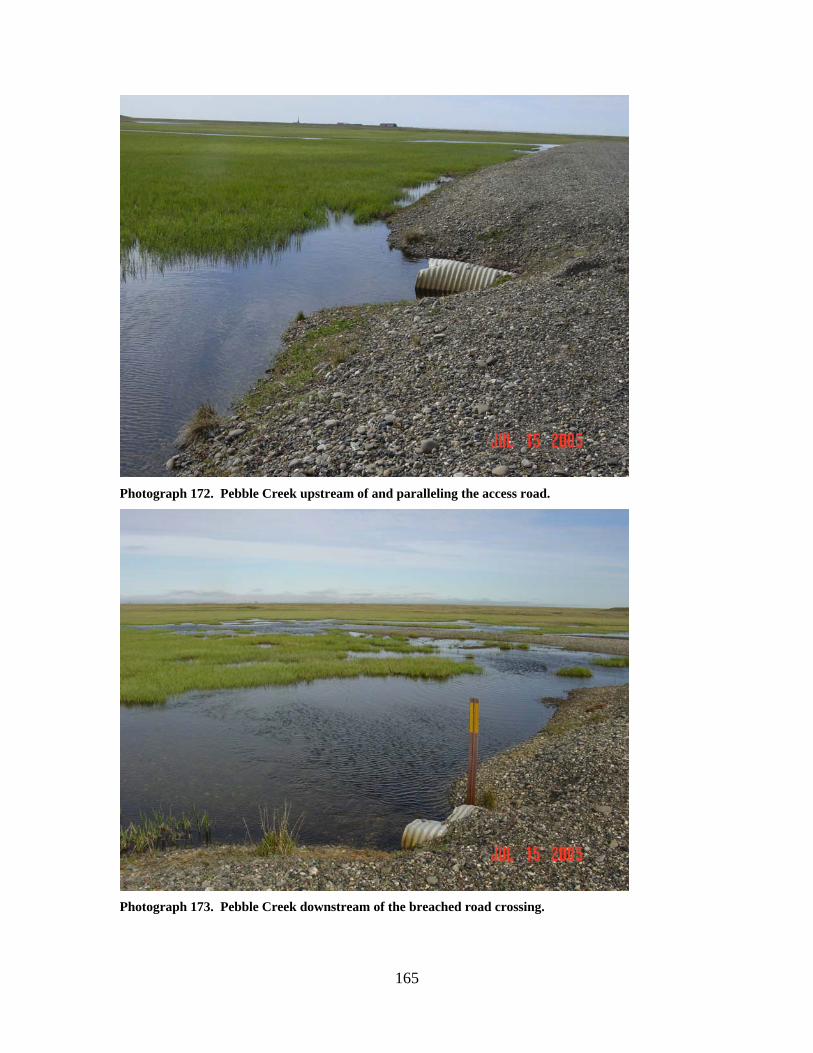
165
Photograph 172. Pebble Creek upstream of and paralleling the access road.
Photograph 173. Pebble Creek downstream of the breached road crossing.
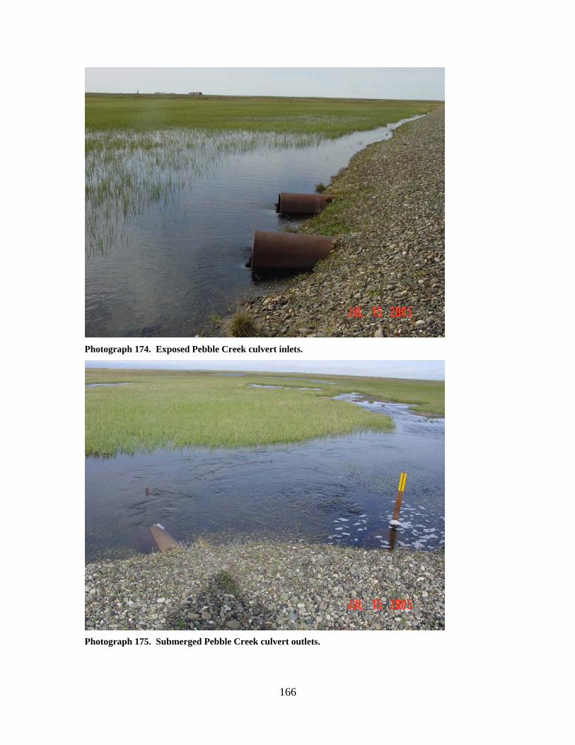
166
Photograph 174. Exposed Pebble Creek culvert inlets.
Photograph 175. Submerged Pebble Creek culvert outlets.
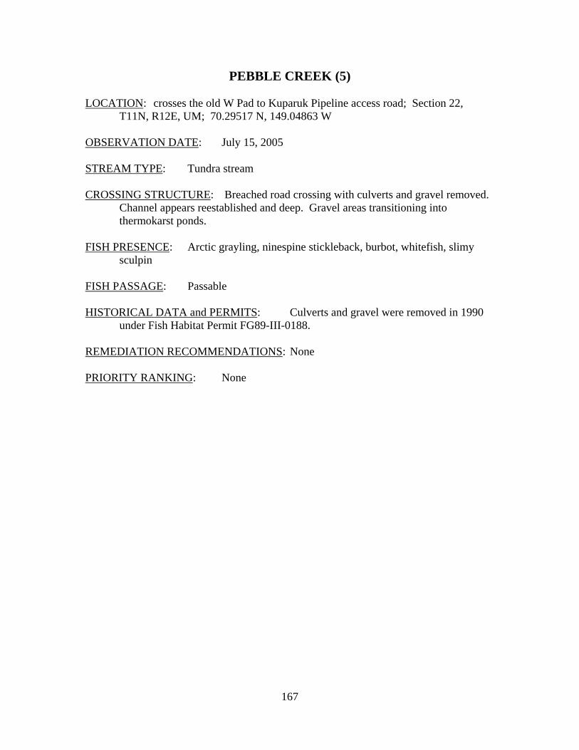
167
PEBBLE CREEK (5) LOCATION: crosses the old W Pad to Kuparuk Pipeline access road; Section 22,
T11N, R12E, UM; 70.29517 N, 149.04863 W OBSERVATION DATE: July 15, 2005 STREAM TYPE: Tundra stream CROSSING STRUCTURE: Breached road crossing with culverts and gravel removed.
Channel appears reestablished and deep. Gravel areas transitioning into thermokarst ponds.
FISH PRESENCE: Arctic grayling, ninespine stickleback, burbot, whitefish, slimy
sculpin FISH PASSAGE: Passable HISTORICAL DATA and PERMITS: Culverts and gravel were removed in 1990
under Fish Habitat Permit FG89-III-0188. REMEDIATION RECOMMENDATIONS: None PRIORITY RANKING: None
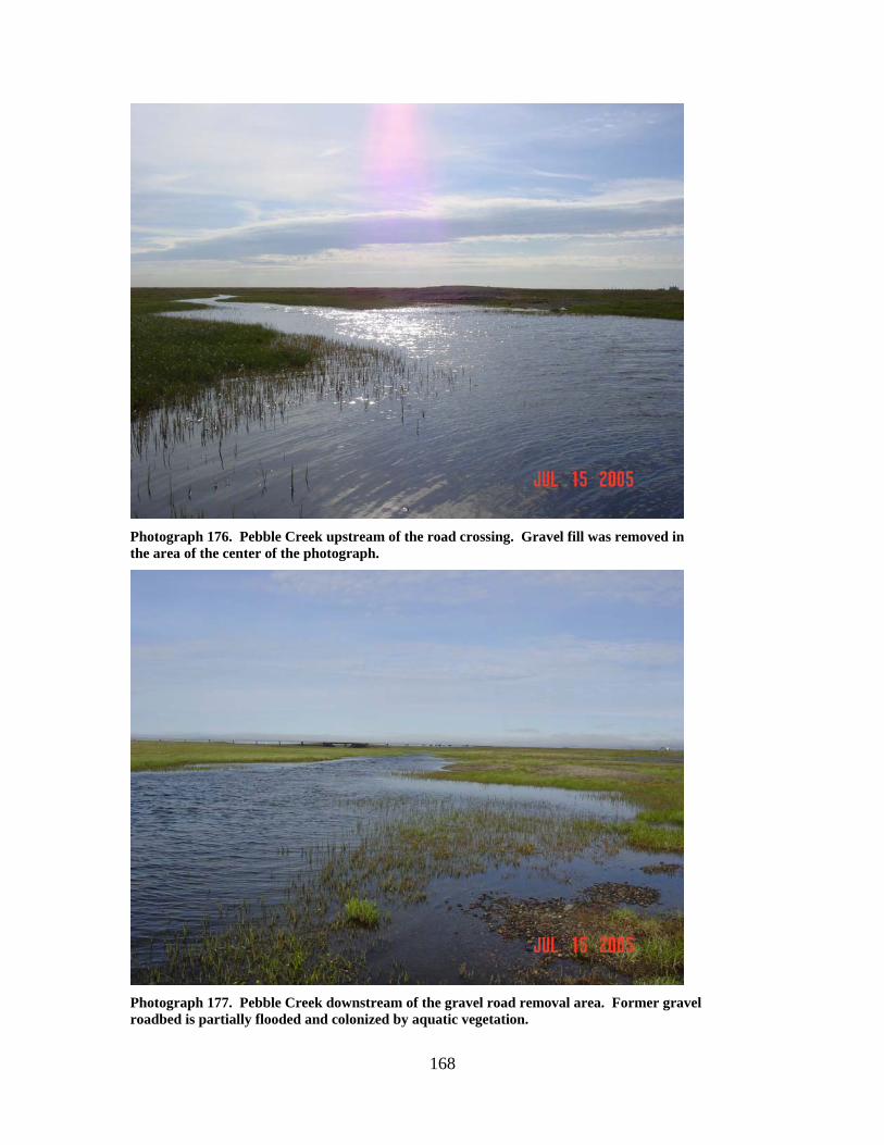
168
Photograph 176. Pebble Creek upstream of the road crossing. Gravel fill was removed in the area of the center of the photograph.
Photograph 177. Pebble Creek downstream of the gravel road removal area. Former gravel roadbed is partially flooded and colonized by aquatic vegetation.
169
KUPARUK RIVER (1,2,3)
LOCATION: Spine Road Crossing; Section 7, T11N, R13E, UM; Sections 1 and 2,
T11N, R12E, UM. OBSERVATION DATE: July 2004 and 2005 STREAM TYPE: Multi channel braided river CROSSING STRUCTURE: Bridges over the East, Central, and West Channels with
interconnecting low water roadways. OUTLET: Outwash gravels from previous culvert batteries have been removed
downstream of the East Channel Bridge. Extensive areas of outwash gravels still present downstream of the West Channel Bridge.
FISH PRESENCE: Anadromous and resident fish FISH PASSAGE: Passable HISTORICAL DATA and PERMITS: The original crossing in 1979 used a
multiplate culvert battery across the Central Channel and expendable culvert batteries in the East and West Channels. After failure of the multiplate culvert battery in 1980, a bridge was constructed over the Central Channel. Armored low water roadways and culvert batteries in the East and West Channels completed the crossing structure. Spring breakup and fall floods at the East and West Channel crossings produced culvert failures and gravel washouts, rendering the crossing impassable for several weeks each year. Outwash gravels were retrieved on a nearly yearly basis to reconstruct the crossings. Construction of permanent bridged crossings at the East and West Channels began in 1999. Abutment and low water roadway damage repair followed for several years following bridge installation. Sheet pile was installed at the east and west abutments of the Central Channel bridge in 2005. Removal of outwash gravels downstream of the East Channel bridge occurred in 2004 and 2005, with similar work at the West Channel bridge to occur in 2006-2007.
REMEDIATION RECOMMENDATIONS: PRIORITY RANKING: East and Central Channels – Low West Channel – Moderate
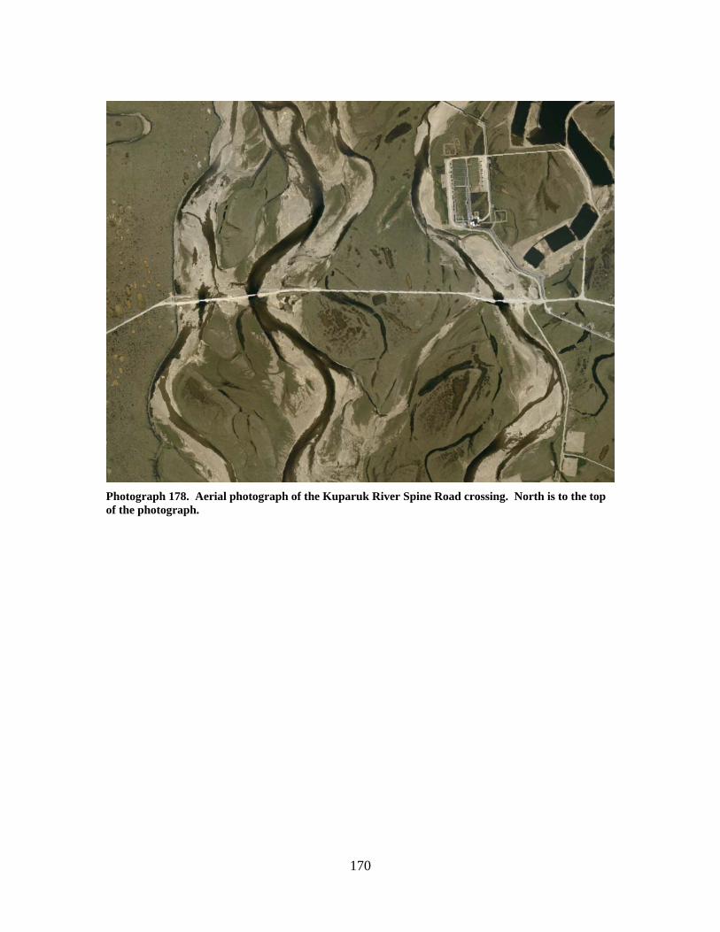
170
Photograph 178. Aerial photograph of the Kuparuk River Spine Road crossing. North is to the top of the photograph.
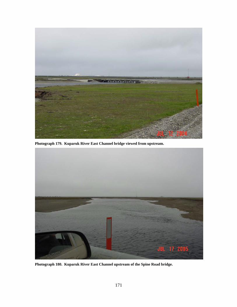
171
Photograph 179. Kuparuk River East Channel bridge viewed from upstream.
Photograph 180. Kuparuk River East Channel upstream of the Spine Road bridge.
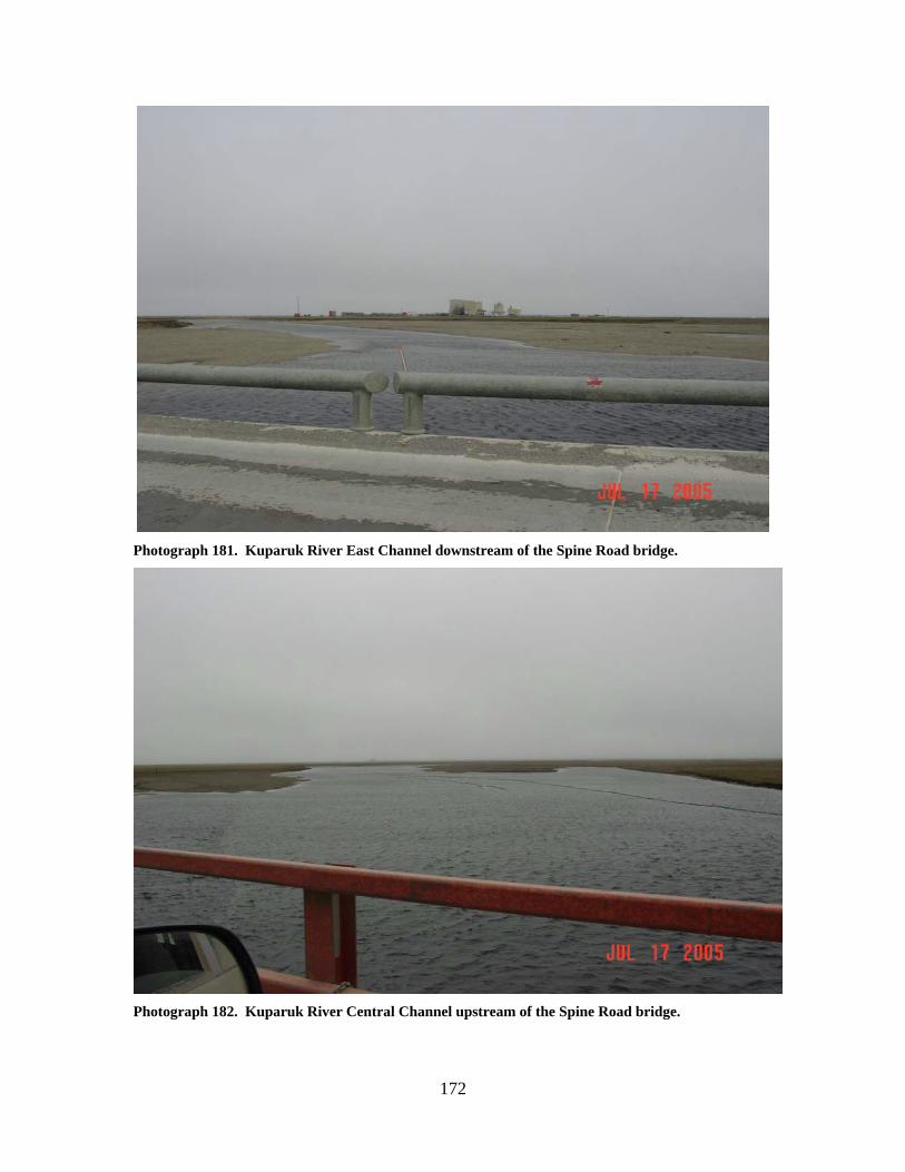
172
Photograph 181. Kuparuk River East Channel downstream of the Spine Road bridge.
Photograph 182. Kuparuk River Central Channel upstream of the Spine Road bridge.
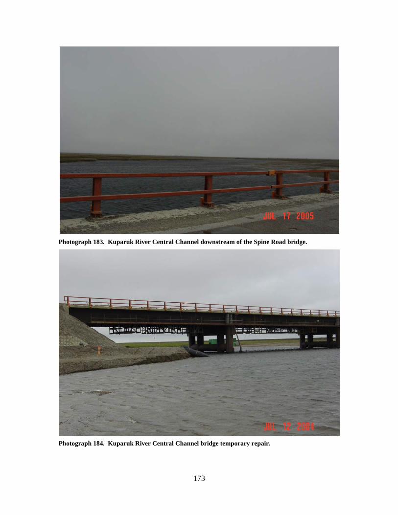
173
Photograph 183. Kuparuk River Central Channel downstream of the Spine Road bridge.
Photograph 184. Kuparuk River Central Channel bridge temporary repair.
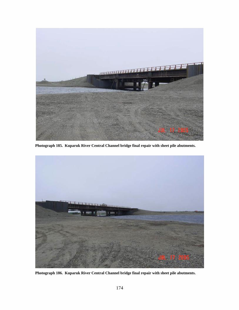
174
Photograph 185. Kuparuk River Central Channel bridge final repair with sheet pile abutments.
Photograph 186. Kuparuk River Central Channel bridge final repair with sheet pile abutments.
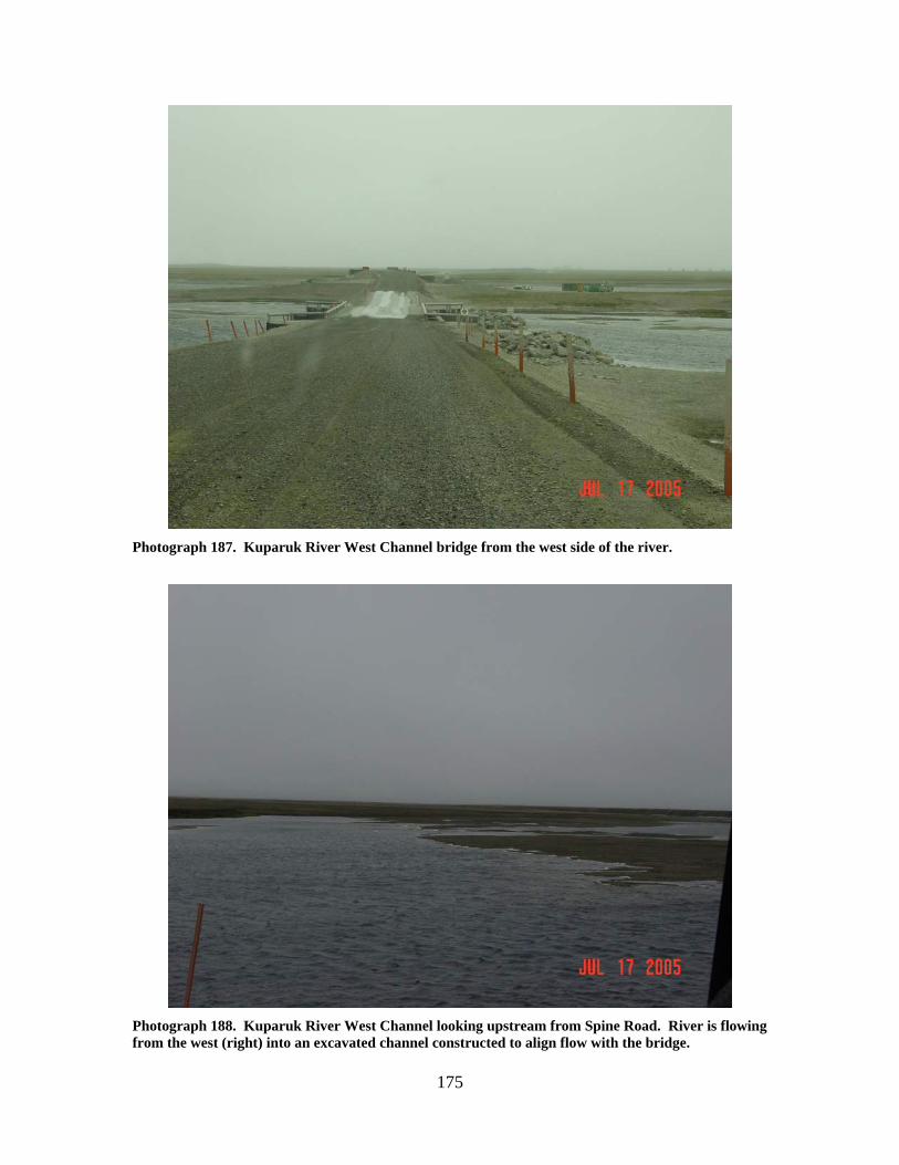
175
Photograph 187. Kuparuk River West Channel bridge from the west side of the river.
Photograph 188. Kuparuk River West Channel looking upstream from Spine Road. River is flowing from the west (right) into an excavated channel constructed to align flow with the bridge.
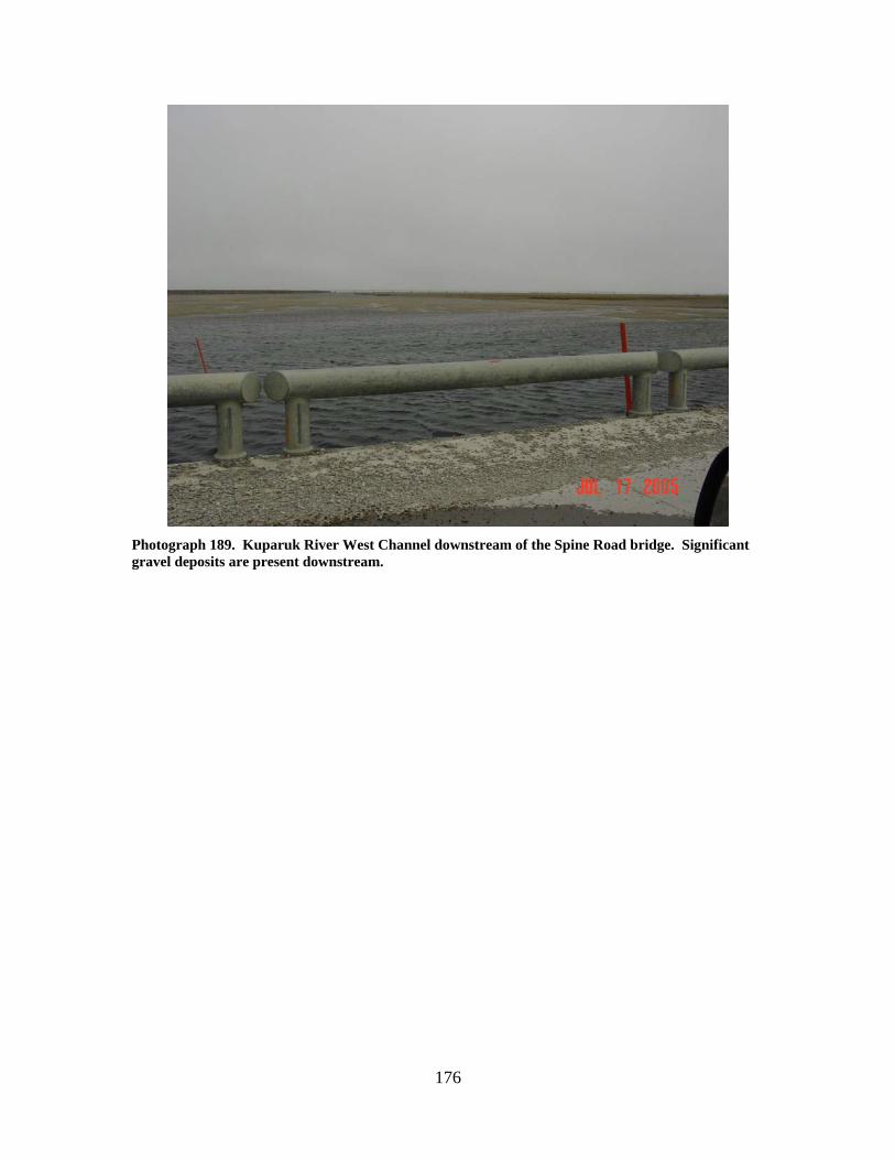
176
Photograph 189. Kuparuk River West Channel downstream of the Spine Road bridge. Significant gravel deposits are present downstream.
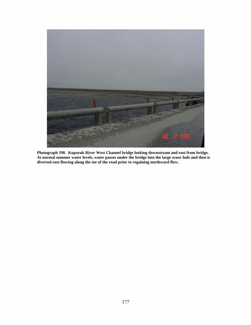
177
Photograph 190. Kuparuk River West Channel bridge looking downstream and east from bridge. At normal summer water levels, water passes under the bridge into the large scour hole and then is diverted east flowing along the toe of the road prior to regaining northward flow.

178
179
Milne Point Unit Stream Crossings

180
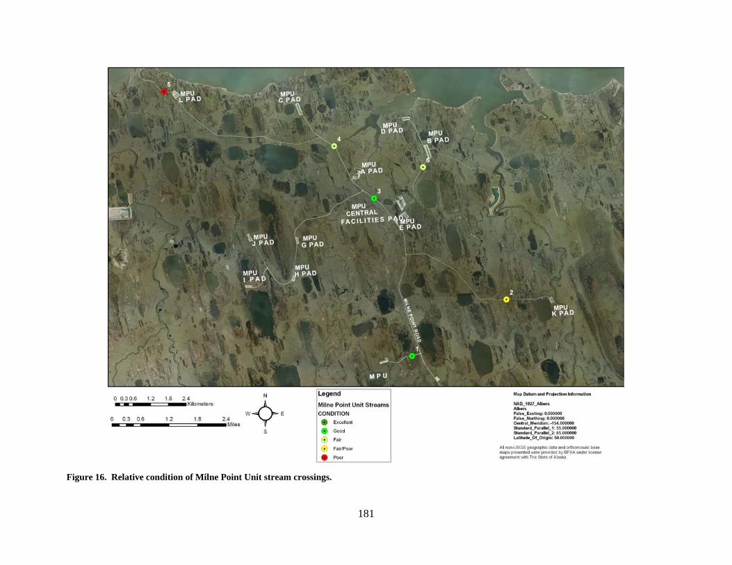
181
Figure 16. Relative condition of Milne Point Unit stream crossings.
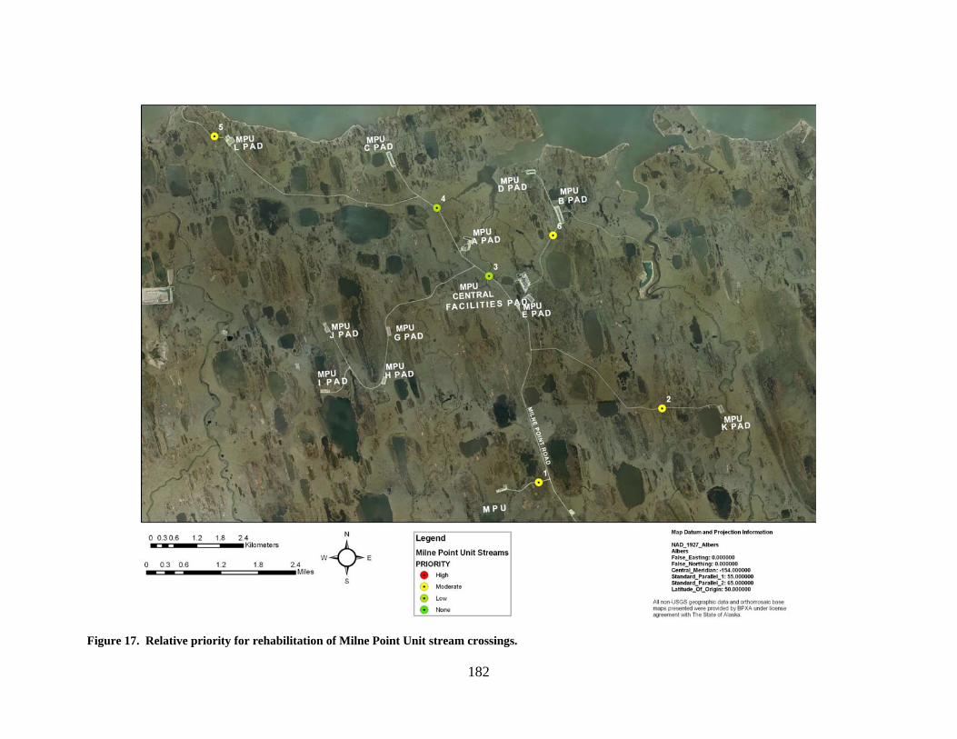
182
Figure 17. Relative priority for rehabilitation of Milne Point Unit stream crossings.
183
MILNE S PAD CREEK (1) LOCATION: Unnamed stream tributary to Central Creek crossing the access road from
the Milne Point Road to S Pad; Section 7, T12N, R10E, UM; 70.41122 N, 149.44161 W
OBSERVATION DATE: July 15, 2005 STREAM TYPE: Beaded tundra stream CROSSING STRUCTURE: Single 96 inch corrugated metal pipe INLET: A few sand bags along the eastern edge of the inlet OUTLET: Damage to the upper edge of the culvert outlet, road prism erosion FISH PRESENCE: Ninespine stickleback observed at the crossing location July 20,
2000 FISH PASSAGE: Passable HISTORICAL DATA and PERMITS: Culvert installed in 2002 under Fish Habitat
Permit FG01–III-0157; Amendment 3 (July 3, 2002) authorized removal of outwash gravels downstream of the culvert and removal of sandbags from the stream
REMEDIATION RECOMMENDATIONS: Repair road prism, repair culvert end PRIORITY RANKING: Moderate
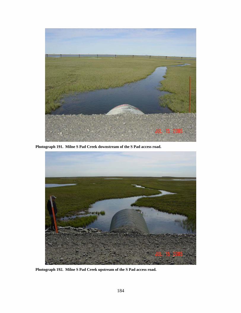
184
Photograph 191. Milne S Pad Creek downstream of the S Pad access road.
Photograph 192. Milne S Pad Creek upstream of the S Pad access road.
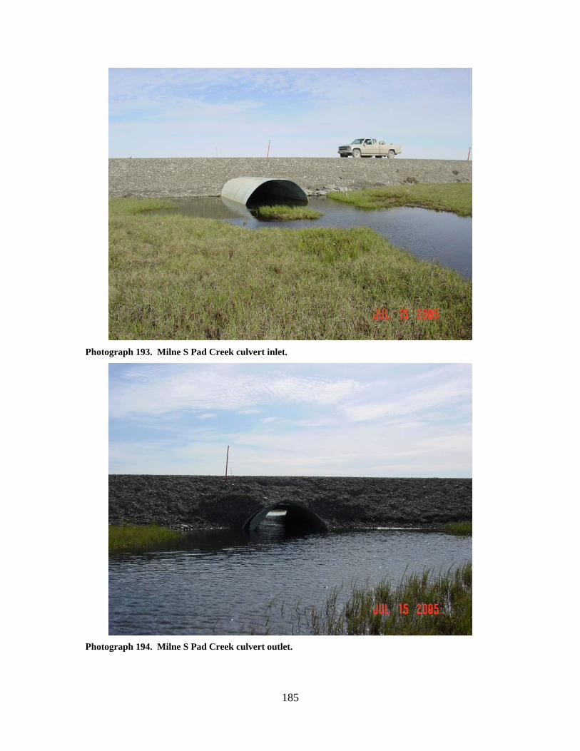
185
Photograph 193. Milne S Pad Creek culvert inlet.
Photograph 194. Milne S Pad Creek culvert outlet.
186
CASCADE CREEK (2) LOCATION: Cascade Creek is a tributary to the Ugnuravik River that crosses the access
road from the Milne Point Road to K Pad; Section 4, T12N, R11E, UM; 70.42668 N, 149.35445 W
OBSERVATION DATE: July 15, 2005 STREAM TYPE: Beaded tundra stream CROSSING STRUCTURE: Structural plate arch pipe; 4 ft 11in rise by 6 ft 9 in span INLET: Inlet damage, culvert extends significantly beyond road fill, high water
mark on the road fill 1 to 2 feet above the top of the culvert, culvert bowed considerably
OUTLET: Culvert extends significantly beyond road fill, high water mark on the road
fill extends about 6 inches above the culvert, scour pool 6 to 7 feet deep, culvert lies about 3 to 4 feet above the bottom, some scour of tundra mat
FISH PRESENCE: Ninespine stickleback, whitefish, Arctic grayling likely FISH PASSAGE: Passable HISTORICAL DATA and PERMITS: Culvert installed in 1996 under Fish Habitat
Permit FG95–III-0025. REMEDIATION RECOMMENDATIONS: Cut culvert to match road width, consider
increasing water conveyance past this crossing location PRIORITY RANKING: Moderate
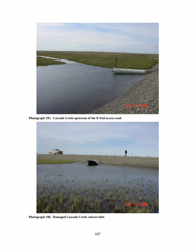
187
Photograph 195. Cascade Creek upstream of the K Pad access road.
Photograph 196. Damaged Cascade Creek culvert inlet.
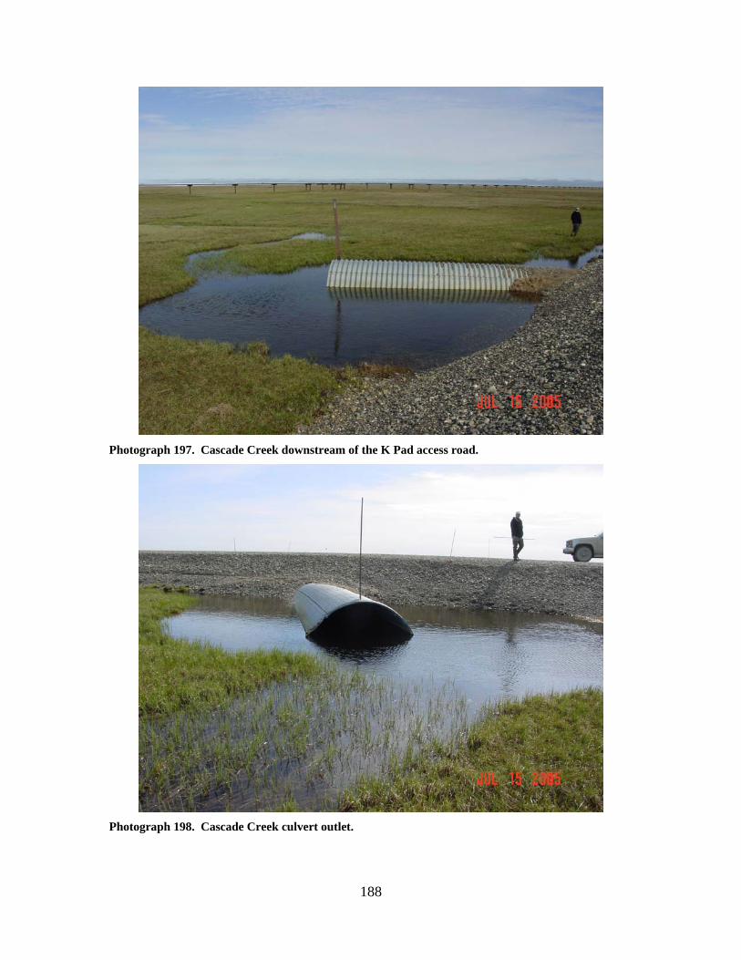
188
Photograph 197. Cascade Creek downstream of the K Pad access road.
Photograph 198. Cascade Creek culvert outlet.
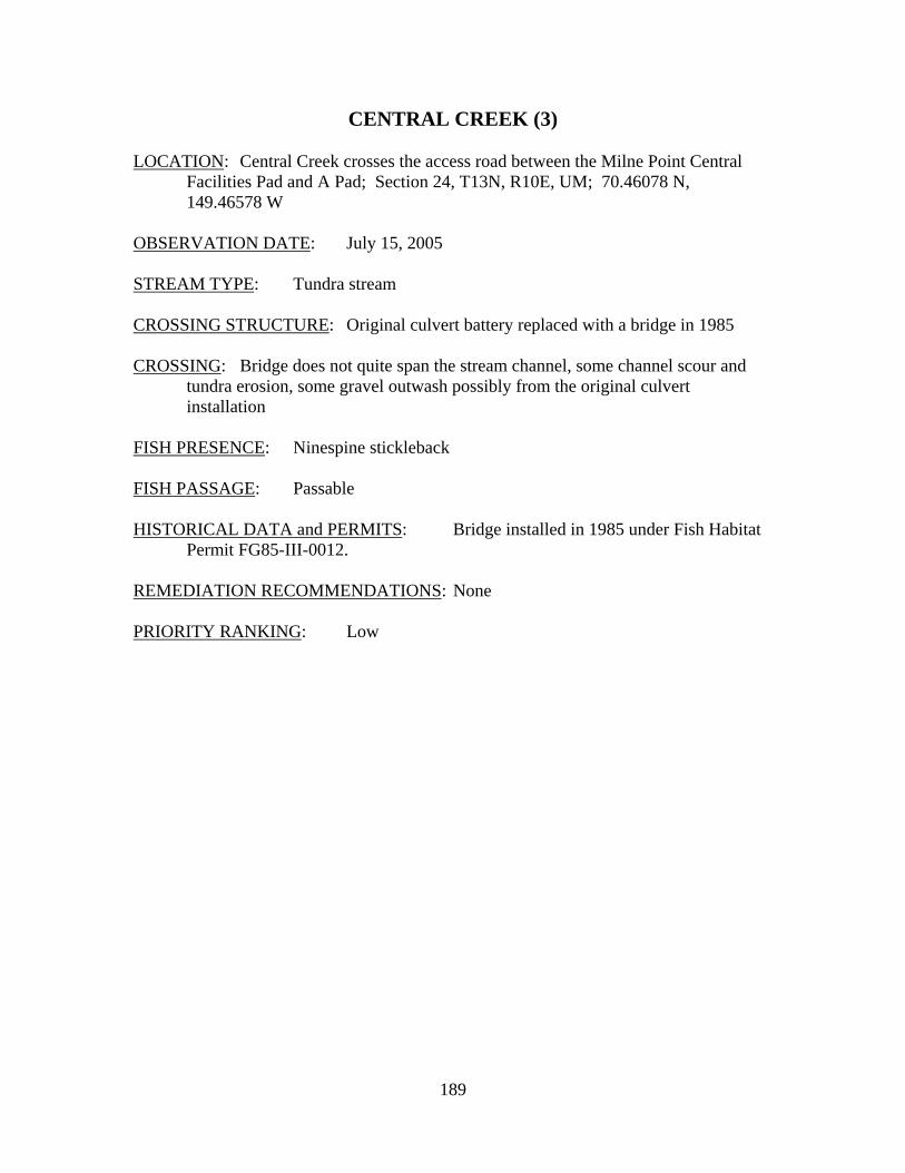
189
CENTRAL CREEK (3) LOCATION: Central Creek crosses the access road between the Milne Point Central
Facilities Pad and A Pad; Section 24, T13N, R10E, UM; 70.46078 N, 149.46578 W
OBSERVATION DATE: July 15, 2005 STREAM TYPE: Tundra stream CROSSING STRUCTURE: Original culvert battery replaced with a bridge in 1985 CROSSING: Bridge does not quite span the stream channel, some channel scour and
tundra erosion, some gravel outwash possibly from the original culvert installation
FISH PRESENCE: Ninespine stickleback FISH PASSAGE: Passable HISTORICAL DATA and PERMITS: Bridge installed in 1985 under Fish Habitat
Permit FG85-III-0012. REMEDIATION RECOMMENDATIONS: None PRIORITY RANKING: Low
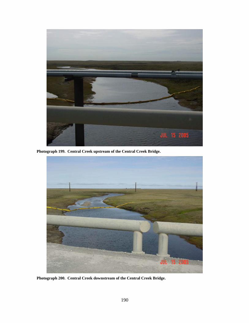
190
Photograph 199. Central Creek upstream of the Central Creek Bridge.
Photograph 200. Central Creek downstream of the Central Creek Bridge.
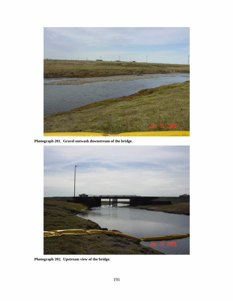
191
Photograph 201. Gravel outwash downstream of the bridge.
Photograph 202. Upstream view of the bridge.

192
Photograph 203. Abutment encroaching in the stream channel.
Photograph 204. Central Creek bridge viewed from upstream.
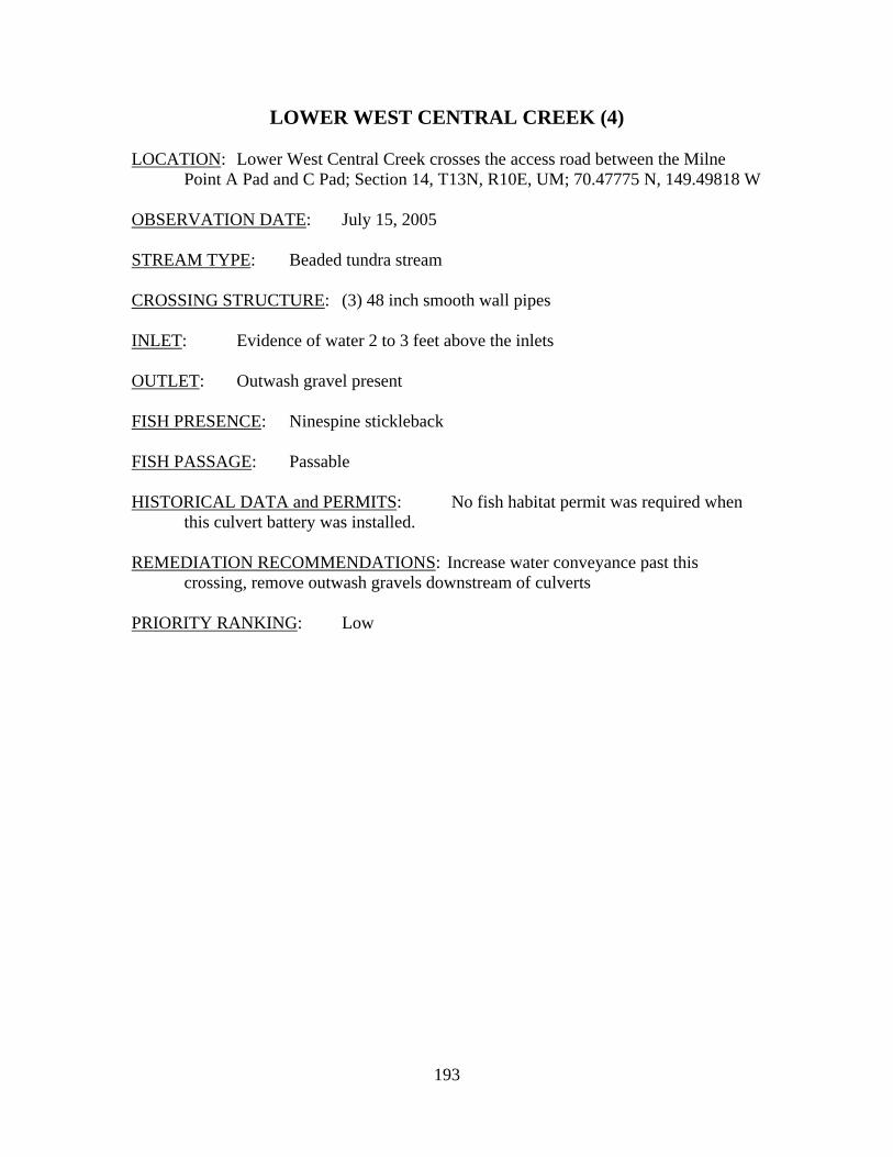
193
LOWER WEST CENTRAL CREEK (4) LOCATION: Lower West Central Creek crosses the access road between the Milne
Point A Pad and C Pad; Section 14, T13N, R10E, UM; 70.47775 N, 149.49818 W OBSERVATION DATE: July 15, 2005 STREAM TYPE: Beaded tundra stream CROSSING STRUCTURE: (3) 48 inch smooth wall pipes INLET: Evidence of water 2 to 3 feet above the inlets OUTLET: Outwash gravel present FISH PRESENCE: Ninespine stickleback FISH PASSAGE: Passable HISTORICAL DATA and PERMITS: No fish habitat permit was required when
this culvert battery was installed. REMEDIATION RECOMMENDATIONS: Increase water conveyance past this
crossing, remove outwash gravels downstream of culverts PRIORITY RANKING: Low
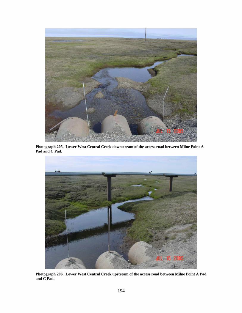
194
Photograph 205. Lower West Central Creek downstream of the access road between Milne Point A Pad and C Pad.
Photograph 206. Lower West Central Creek upstream of the access road between Milne Point A Pad and C Pad.
195
Photograph 207. Lower West Central Creek culvert inlets.
Photograph 208. Lower West Central Creek culvert outlets with outwash gravels.
196
MILNE NO POINT (F PAD) CREEK (5) LOCATION: No Point Creek crosses the access road between the Milne Point Unit L
Pad and F Pad; Section 7, T13N, R10E, UM; 70.49815 N, 149.64641 W OBSERVATION DATE: July 15, 2005 STREAM TYPE: Tundra stream CROSSING STRUCTURE: (3) 60 inch smooth wall pipes, 2 of which are completely
submerged INLET: All pipes extend approximately 20 feet beyond the road fill, scour pool
present, evidence of road prism erosion OUTLET: All pipes extend approximately 20 feet beyond the road fill, scour pool
present, evidence of road prism erosion FISH PRESENCE: Ninespine stickleback, whitefish, Dolly Varden likely FISH PASSAGE: Passable HISTORICAL DATA and PERMITS: Culverts installed in 1995 under Fish Habitat
Permit FG94-III-0190. REMEDIATION RECOMMENDATIONS: Shorten pipes to match road width; reset
pipes as the two currently submerged pipes will be frozen solid and unavailable to carry breakup flows.
PRIORITY RANKING: Moderate
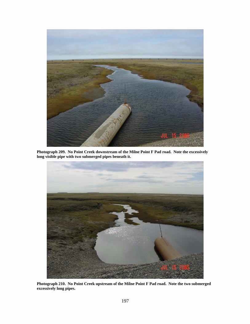
197
Photograph 209. No Point Creek downstream of the Milne Point F Pad road. Note the excessively long visible pipe with two submerged pipes beneath it.
Photograph 210. No Point Creek upstream of the Milne Point F Pad road. Note the two submerged excessively long pipes.
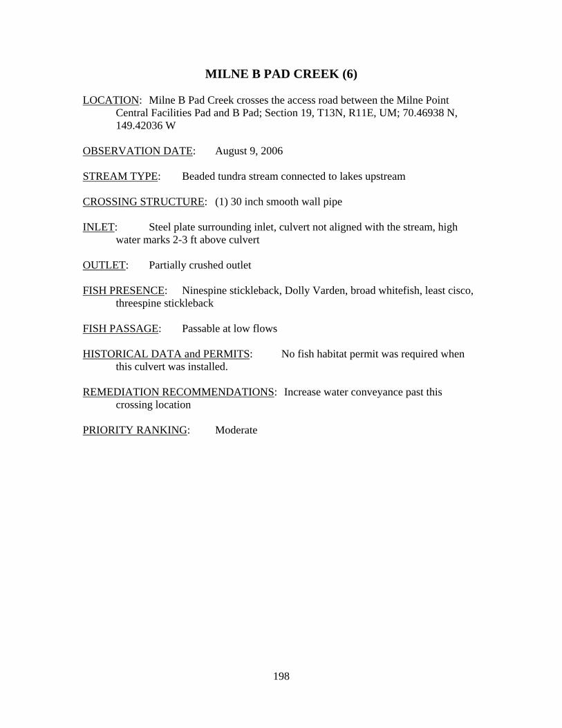
198
MILNE B PAD CREEK (6) LOCATION: Milne B Pad Creek crosses the access road between the Milne Point
Central Facilities Pad and B Pad; Section 19, T13N, R11E, UM; 70.46938 N, 149.42036 W
OBSERVATION DATE: August 9, 2006 STREAM TYPE: Beaded tundra stream connected to lakes upstream CROSSING STRUCTURE: (1) 30 inch smooth wall pipe INLET: Steel plate surrounding inlet, culvert not aligned with the stream, high
water marks 2-3 ft above culvert OUTLET: Partially crushed outlet FISH PRESENCE: Ninespine stickleback, Dolly Varden, broad whitefish, least cisco,
threespine stickleback FISH PASSAGE: Passable at low flows HISTORICAL DATA and PERMITS: No fish habitat permit was required when
this culvert was installed. REMEDIATION RECOMMENDATIONS: Increase water conveyance past this
crossing location PRIORITY RANKING: Moderate
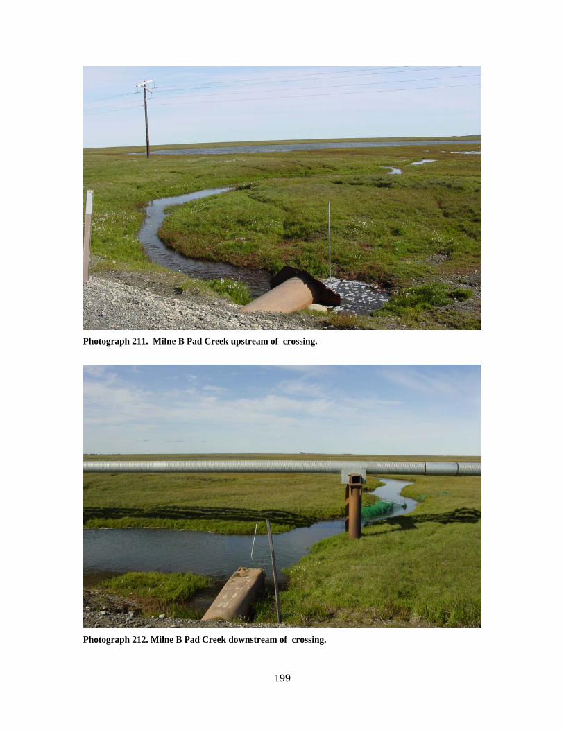
199
Photograph 211. Milne B Pad Creek upstream of crossing.
Photograph 212. Milne B Pad Creek downstream of crossing.
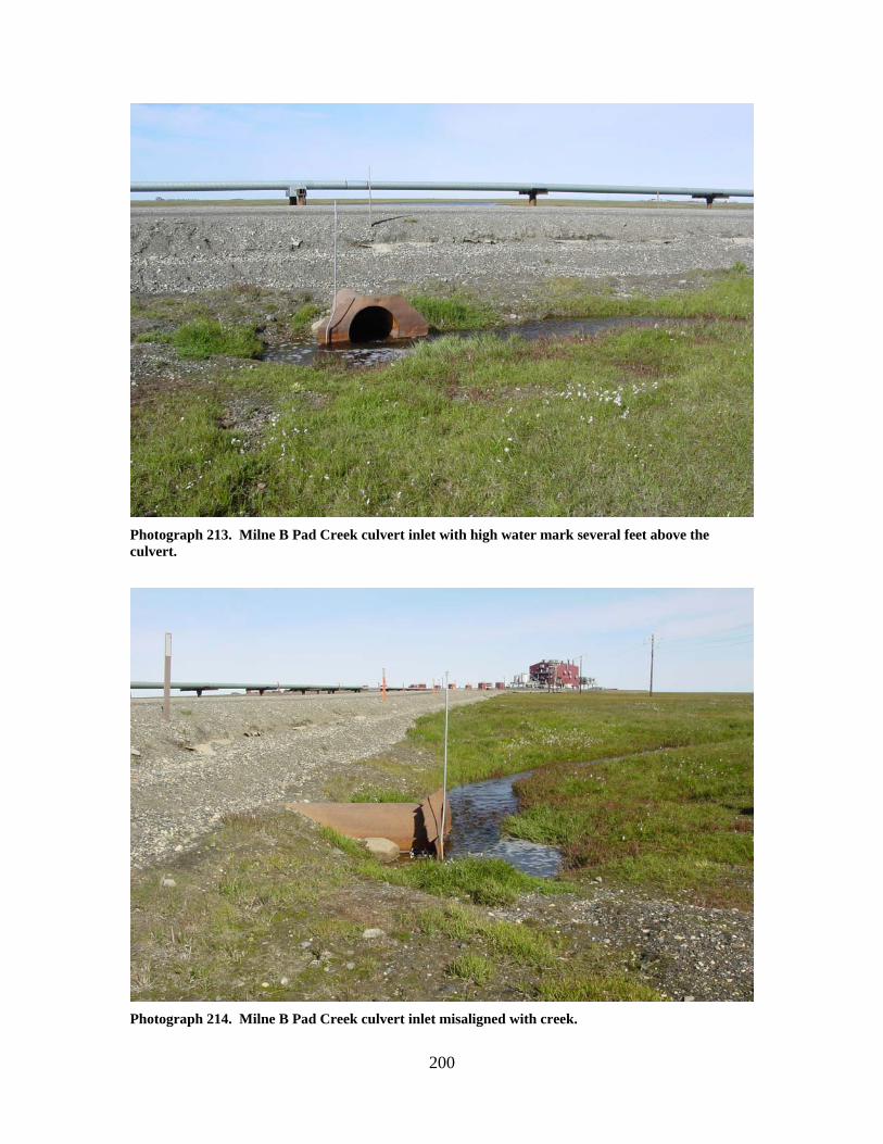
200
Photograph 213. Milne B Pad Creek culvert inlet with high water mark several feet above the culvert.
Photograph 214. Milne B Pad Creek culvert inlet misaligned with creek.
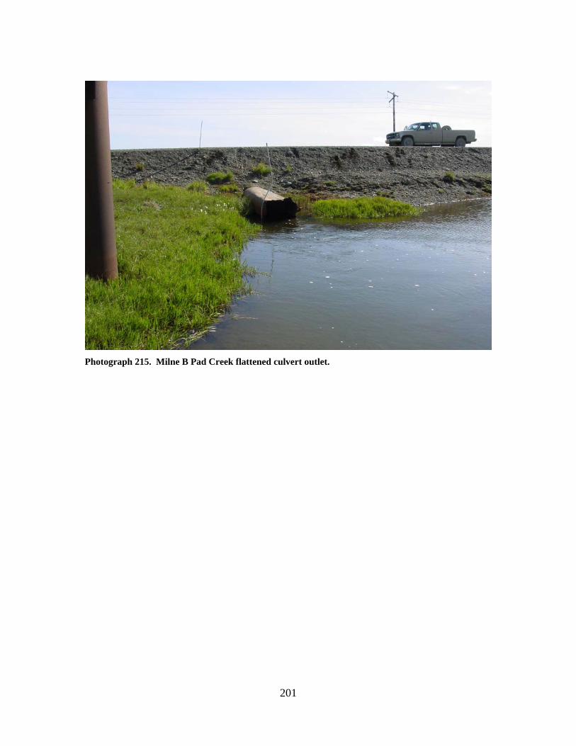
201
Photograph 215. Milne B Pad Creek flattened culvert outlet.

202
203
Kuparuk CPF 1 Area Stream Crossings

204
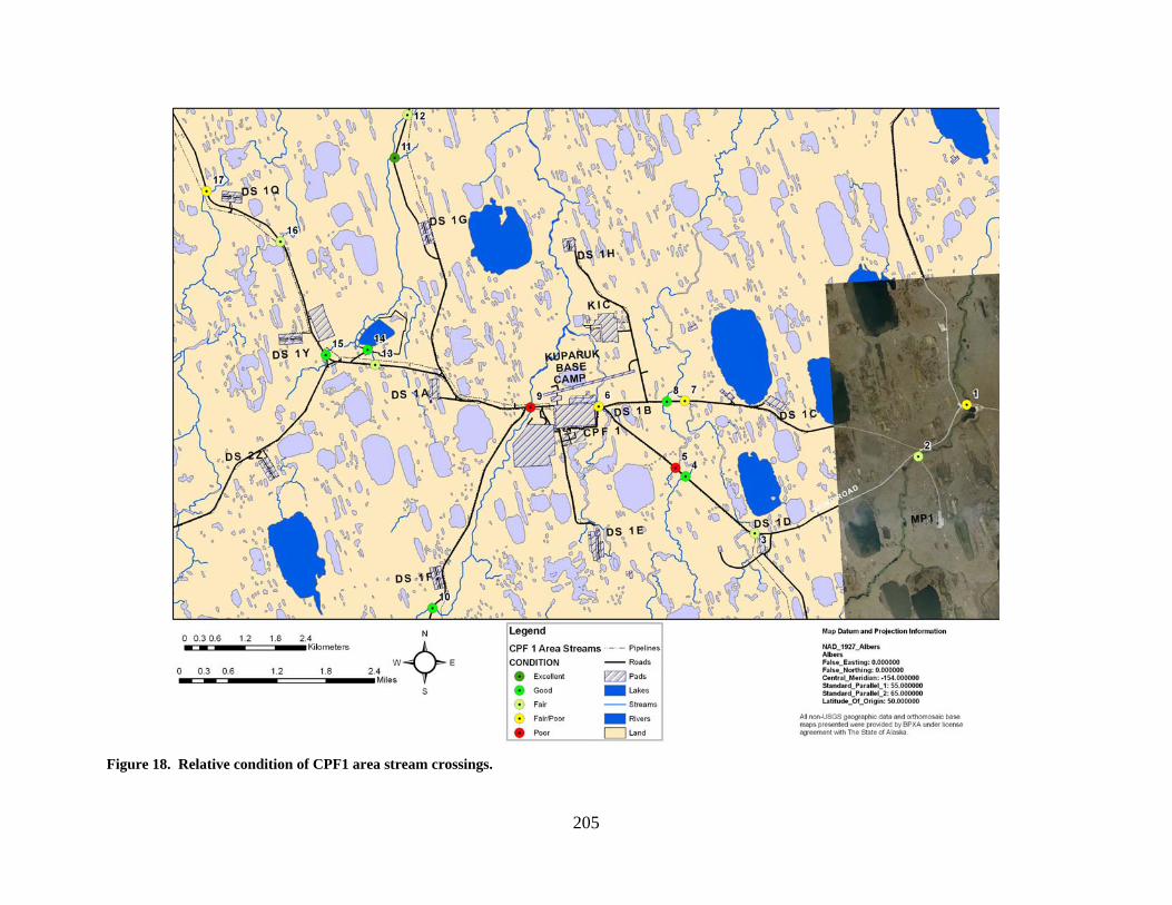
205
Figure 18. Relative condition of CPF1 area stream crossings.
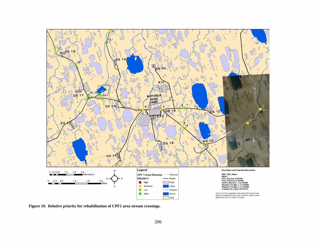
206
Figure 19. Relative priority for rehabilitation of CPF1 area stream crossings.
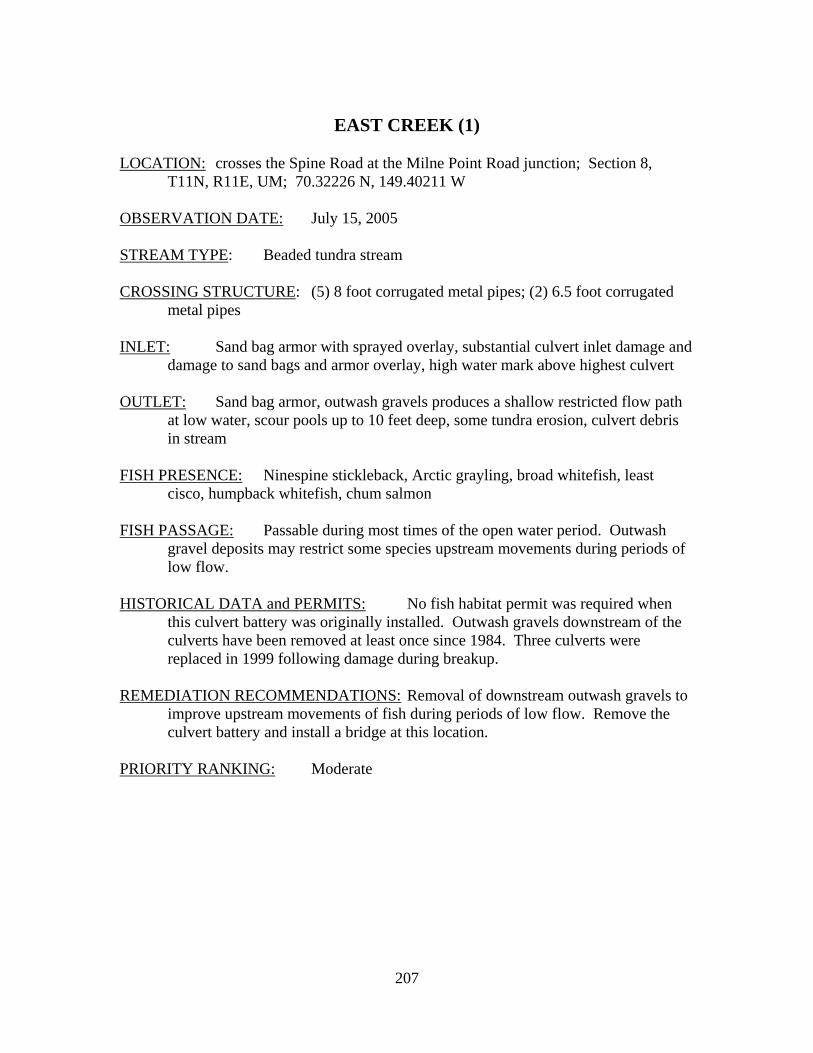
207
EAST CREEK (1)
LOCATION: crosses the Spine Road at the Milne Point Road junction; Section 8,
T11N, R11E, UM; 70.32226 N, 149.40211 W OBSERVATION DATE: July 15, 2005 STREAM TYPE: Beaded tundra stream CROSSING STRUCTURE: (5) 8 foot corrugated metal pipes; (2) 6.5 foot corrugated
metal pipes INLET: Sand bag armor with sprayed overlay, substantial culvert inlet damage and
damage to sand bags and armor overlay, high water mark above highest culvert OUTLET: Sand bag armor, outwash gravels produces a shallow restricted flow path
at low water, scour pools up to 10 feet deep, some tundra erosion, culvert debris in stream
FISH PRESENCE: Ninespine stickleback, Arctic grayling, broad whitefish, least
cisco, humpback whitefish, chum salmon FISH PASSAGE: Passable during most times of the open water period. Outwash
gravel deposits may restrict some species upstream movements during periods of low flow.
HISTORICAL DATA and PERMITS: No fish habitat permit was required when
this culvert battery was originally installed. Outwash gravels downstream of the culverts have been removed at least once since 1984. Three culverts were replaced in 1999 following damage during breakup.
REMEDIATION RECOMMENDATIONS: Removal of downstream outwash gravels to
improve upstream movements of fish during periods of low flow. Remove the culvert battery and install a bridge at this location.
PRIORITY RANKING: Moderate
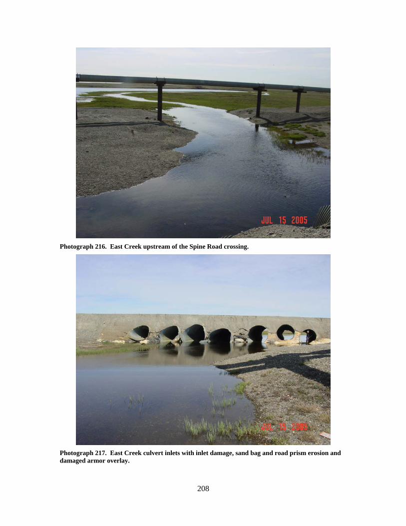
208
Photograph 216. East Creek upstream of the Spine Road crossing.
Photograph 217. East Creek culvert inlets with inlet damage, sand bag and road prism erosion and damaged armor overlay.
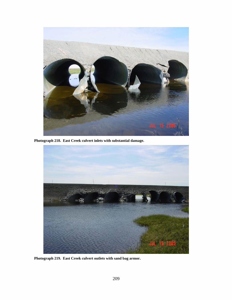
209
Photograph 218. East Creek culvert inlets with substantial damage.
Photograph 219. East Creek culvert outlets with sand bag armor.
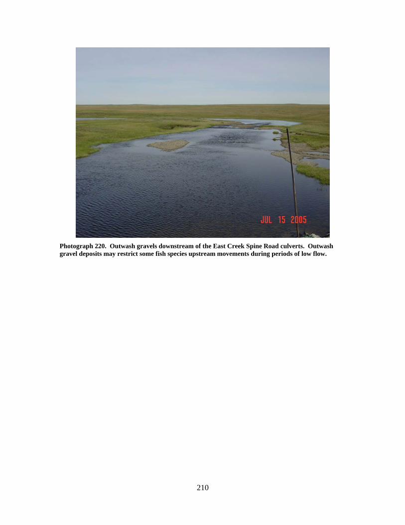
210
Photograph 220. Outwash gravels downstream of the East Creek Spine Road culverts. Outwash gravel deposits may restrict some fish species upstream movements during periods of low flow.
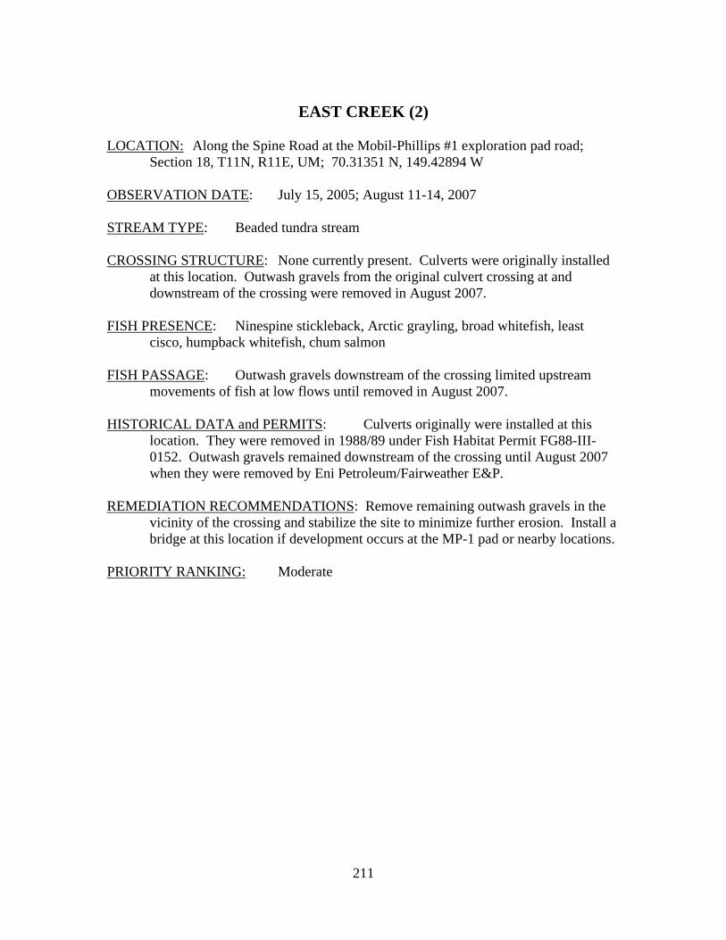
211
EAST CREEK (2)
LOCATION: Along the Spine Road at the Mobil-Phillips #1 exploration pad road;
Section 18, T11N, R11E, UM; 70.31351 N, 149.42894 W OBSERVATION DATE: July 15, 2005; August 11-14, 2007 STREAM TYPE: Beaded tundra stream CROSSING STRUCTURE: None currently present. Culverts were originally installed
at this location. Outwash gravels from the original culvert crossing at and downstream of the crossing were removed in August 2007.
FISH PRESENCE: Ninespine stickleback, Arctic grayling, broad whitefish, least
cisco, humpback whitefish, chum salmon FISH PASSAGE: Outwash gravels downstream of the crossing limited upstream
movements of fish at low flows until removed in August 2007. HISTORICAL DATA and PERMITS: Culverts originally were installed at this
location. They were removed in 1988/89 under Fish Habitat Permit FG88-III-0152. Outwash gravels remained downstream of the crossing until August 2007 when they were removed by Eni Petroleum/Fairweather E&P.
REMEDIATION RECOMMENDATIONS: Remove remaining outwash gravels in the
vicinity of the crossing and stabilize the site to minimize further erosion. Install a bridge at this location if development occurs at the MP-1 pad or nearby locations.
PRIORITY RANKING: Moderate
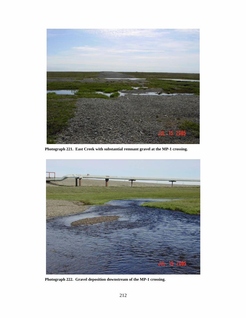
212
Photograph 221. East Creek with substantial remnant gravel at the MP-1 crossing.
Photograph 222. Gravel deposition downstream of the MP-1 crossing.

213
WEST FORK WEST FORK CENTRAL CREEK (5) LOCATION: crosses the Spine Road between Drill Site 1D and CPF-1; Section 15,
T11N, R10E, UM; 70.31447 N, 149.55468 W OBSERVATION DATE: August 8, 2006 STREAM TYPE: Tundra stream CROSSING STRUCTURE: (2) 42-48 inch corrugated metal pipes; (5) 36 inch smooth
metal pipes; (3) 42-48 inch smooth metal pipes; culvert battery not aligned with the creek
INLET: Culvert inlets perched, water flowing through 2 smooth wall pipes OUTLET: substantial outwash gravels present downstream, 5 to 6 foot deep scour
pools FISH PRESENCE: Ninespine stickleback FISH PASSAGE: Blocked; water flowing through 2 smooth wall pipes but sedges
and vegetation mat are blocking upstream passage to fish HISTORICAL DATA and PERMITS: No fish habitat permit was required when
this culvert battery was originally installed. Replaced under Fish Habitat Permit FH03-III-319. Fish Habitat Permit FH07-III-0262 was issued in 2007 to add a 60 inch multiplate culvert that will be aligned with the creek and set for fish passage. Outwash gravels are also scheduled to be removed under this latest permit.
REMEDIATION RECOMMENDATIONS: Align larger corrugated culvert with the
creek, remove outwash gravels PRIORITY RANKING: Moderate
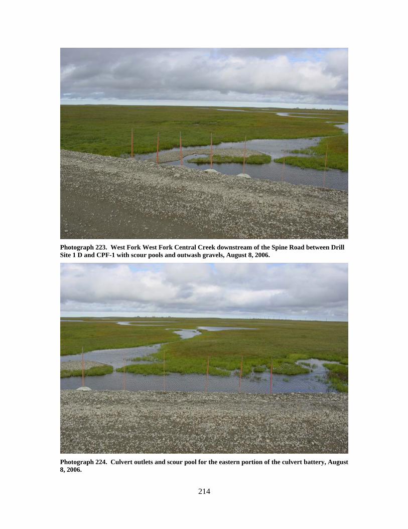
214
Photograph 223. West Fork West Fork Central Creek downstream of the Spine Road between Drill Site 1 D and CPF-1 with scour pools and outwash gravels, August 8, 2006.
Photograph 224. Culvert outlets and scour pool for the eastern portion of the culvert battery, August 8, 2006.
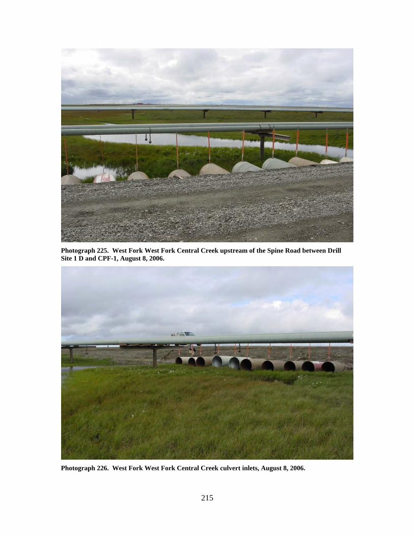
215
Photograph 225. West Fork West Fork Central Creek upstream of the Spine Road between Drill Site 1 D and CPF-1, August 8, 2006.
Photograph 226. West Fork West Fork Central Creek culvert inlets, August 8, 2006.
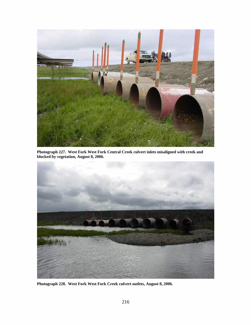
216
Photograph 227. West Fork West Fork Central Creek culvert inlets misaligned with creek and blocked by vegetation, August 8, 2006.
Photograph 228. West Fork West Fork Creek culvert outlets, August 8, 2006.
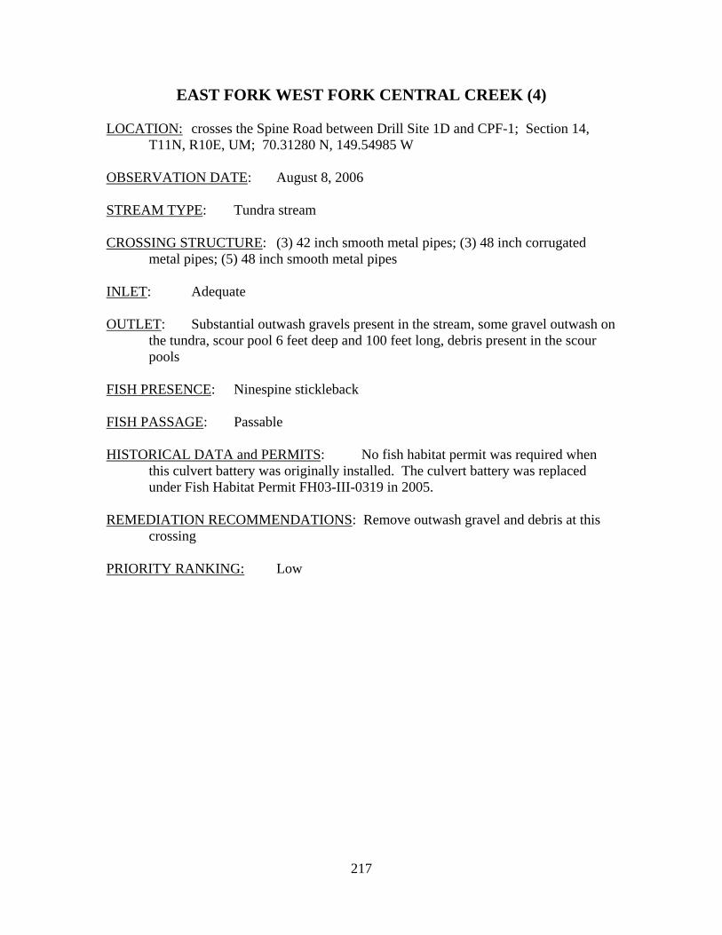
217
EAST FORK WEST FORK CENTRAL CREEK (4) LOCATION: crosses the Spine Road between Drill Site 1D and CPF-1; Section 14,
T11N, R10E, UM; 70.31280 N, 149.54985 W OBSERVATION DATE: August 8, 2006 STREAM TYPE: Tundra stream CROSSING STRUCTURE: (3) 42 inch smooth metal pipes; (3) 48 inch corrugated
metal pipes; (5) 48 inch smooth metal pipes INLET: Adequate OUTLET: Substantial outwash gravels present in the stream, some gravel outwash on
the tundra, scour pool 6 feet deep and 100 feet long, debris present in the scour pools
FISH PRESENCE: Ninespine stickleback FISH PASSAGE: Passable HISTORICAL DATA and PERMITS: No fish habitat permit was required when
this culvert battery was originally installed. The culvert battery was replaced under Fish Habitat Permit FH03-III-0319 in 2005.
REMEDIATION RECOMMENDATIONS: Remove outwash gravel and debris at this
crossing PRIORITY RANKING: Low
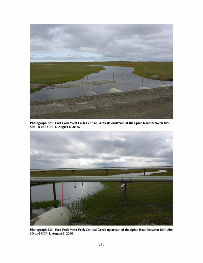
218
Photograph 229. East Fork West Fork Central Creek downstream of the Spine Road between Drill Site 1D and CPF-1, August 8, 2006.
Photograph 230. East Fork West Fork Central Creek upstream of the Spine Road between Drill Site 1D and CPF-1, August 8, 2006.
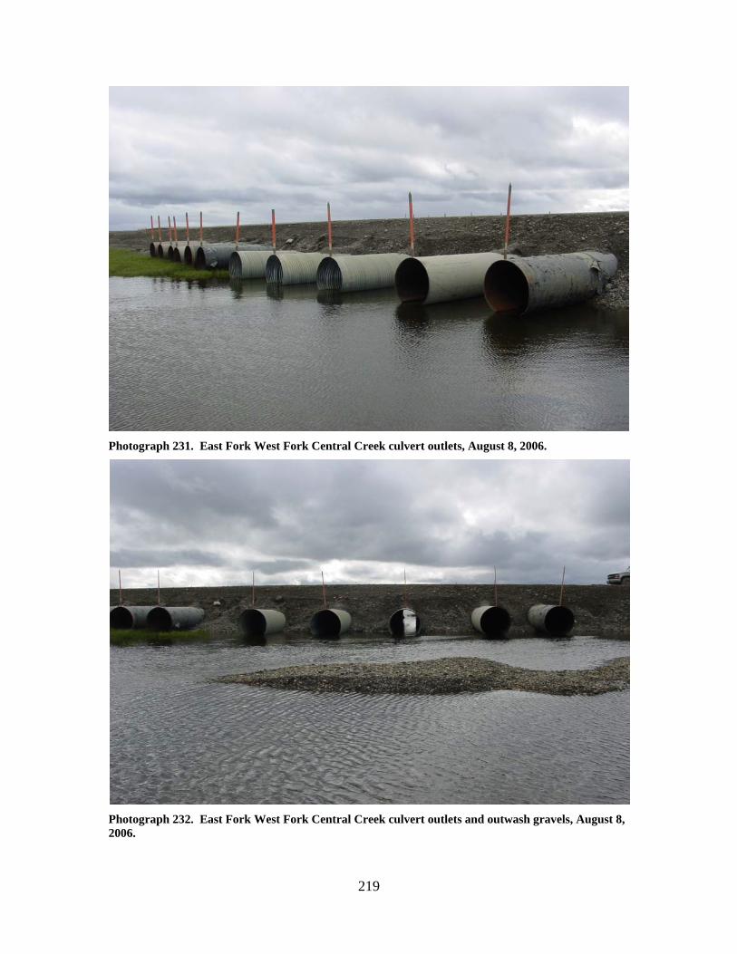
219
Photograph 231. East Fork West Fork Central Creek culvert outlets, August 8, 2006.
Photograph 232. East Fork West Fork Central Creek culvert outlets and outwash gravels, August 8, 2006.

220
Photograph 233. East Fork West Fork Central Creek culvert inlets, August 8, 2006.
Photograph 234. East Fork West Fork Central Creek culvert inlets, August 8, 2006.
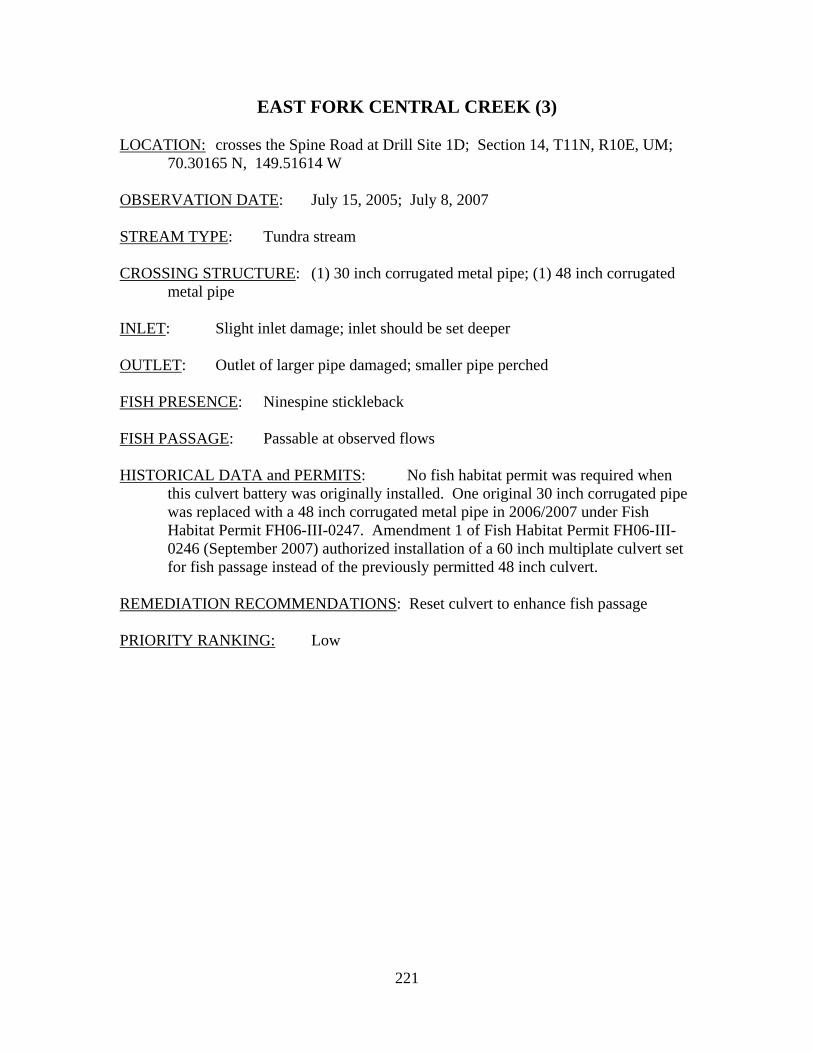
221
EAST FORK CENTRAL CREEK (3) LOCATION: crosses the Spine Road at Drill Site 1D; Section 14, T11N, R10E, UM;
70.30165 N, 149.51614 W OBSERVATION DATE: July 15, 2005; July 8, 2007 STREAM TYPE: Tundra stream CROSSING STRUCTURE: (1) 30 inch corrugated metal pipe; (1) 48 inch corrugated
metal pipe INLET: Slight inlet damage; inlet should be set deeper OUTLET: Outlet of larger pipe damaged; smaller pipe perched FISH PRESENCE: Ninespine stickleback FISH PASSAGE: Passable at observed flows HISTORICAL DATA and PERMITS: No fish habitat permit was required when
this culvert battery was originally installed. One original 30 inch corrugated pipe was replaced with a 48 inch corrugated metal pipe in 2006/2007 under Fish Habitat Permit FH06-III-0247. Amendment 1 of Fish Habitat Permit FH06-III-0246 (September 2007) authorized installation of a 60 inch multiplate culvert set for fish passage instead of the previously permitted 48 inch culvert.
REMEDIATION RECOMMENDATIONS: Reset culvert to enhance fish passage PRIORITY RANKING: Low
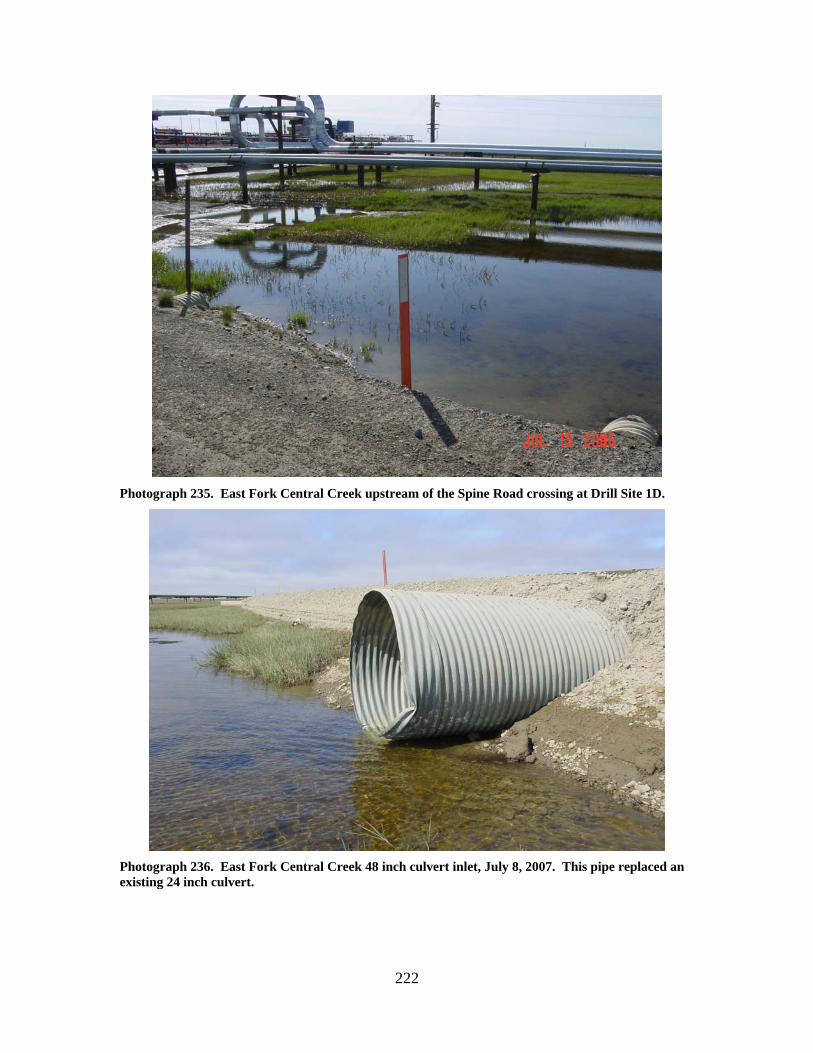
222
Photograph 235. East Fork Central Creek upstream of the Spine Road crossing at Drill Site 1D.
Photograph 236. East Fork Central Creek 48 inch culvert inlet, July 8, 2007. This pipe replaced an existing 24 inch culvert.
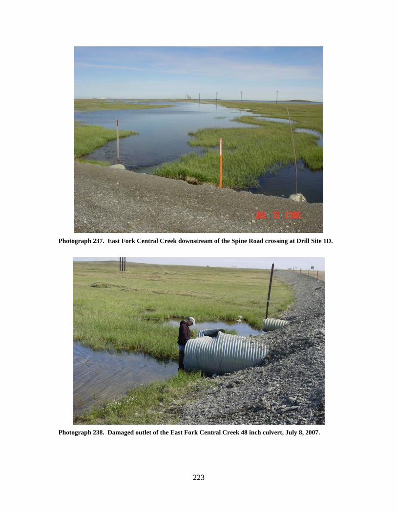
223
Photograph 237. East Fork Central Creek downstream of the Spine Road crossing at Drill Site 1D.
Photograph 238. Damaged outlet of the East Fork Central Creek 48 inch culvert, July 8, 2007.
224
EAST FORK CENTRAL CREEK (7)
LOCATION: crosses the Kuparuk Pipeline Road between Drill Site 1C and CPF-1;
Section 11, T11N, R10E, UM; 70.32641 N, 149.54757 W OBSERVATION DATE: July 15, 2005 STREAM TYPE: Tundra stream CROSSING STRUCTURE: (10) 48 inch corrugated metal pipes; all flow passing
through (1) 48 inch culvert about 100 feet east of the main culvert battery INLET: partial sand bag armor, inlet apron damage OUTLET: partial sand bag armor, damage to some culvert outlets, scour 5 to 6 feet
deep at the east culvert FISH PRESENCE: Ninespine stickleback FISH PASSAGE: Passable HISTORICAL DATA and PERMITS: No fish habitat permit was required when
this culvert battery was originally installed. REMEDIATION RECOMMENDATIONS: Increase conveyance at the east culvert,
repair east culvert inlet, repair main battery culverts PRIORITY RANKING: Low
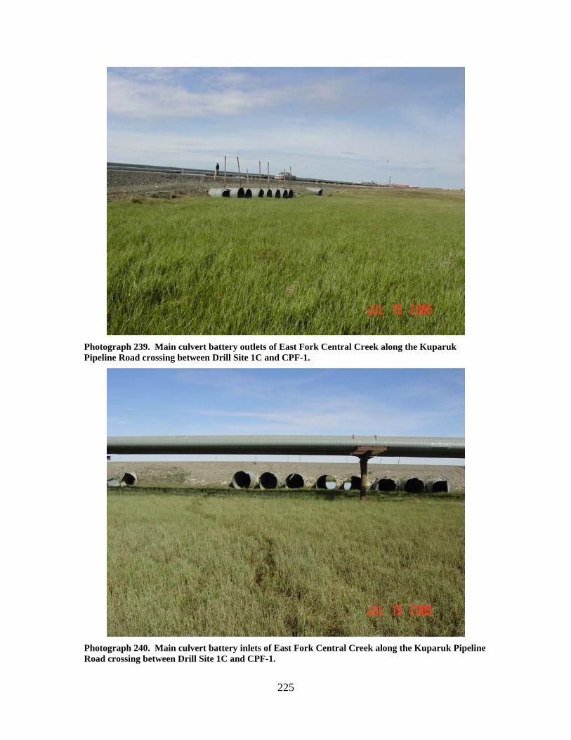
225
Photograph 239. Main culvert battery outlets of East Fork Central Creek along the Kuparuk Pipeline Road crossing between Drill Site 1C and CPF-1.
Photograph 240. Main culvert battery inlets of East Fork Central Creek along the Kuparuk Pipeline Road crossing between Drill Site 1C and CPF-1.
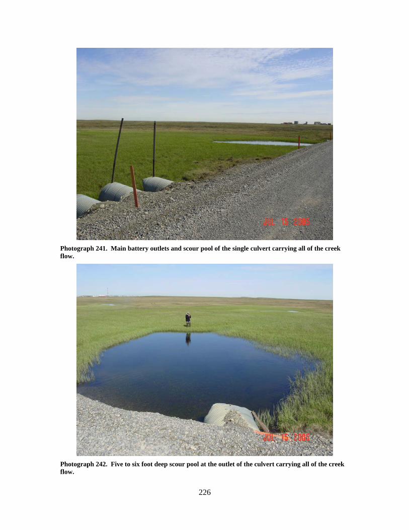
226
Photograph 241. Main battery outlets and scour pool of the single culvert carrying all of the creek flow.
Photograph 242. Five to six foot deep scour pool at the outlet of the culvert carrying all of the creek flow.
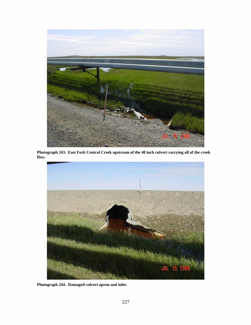
227
Photograph 243. East Fork Central Creek upstream of the 48 inch culvert carrying all of the creek flow.
Photograph 244. Damaged culvert apron and inlet.
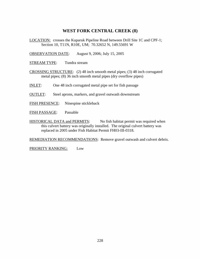
228
WEST FORK CENTRAL CREEK (8)
LOCATION: crosses the Kuparuk Pipeline Road between Drill Site 1C and CPF-1;
Section 10, T11N, R10E, UM; 70.32652 N, 149.55691 W OBSERVATION DATE: August 9, 2006; July 15, 2005 STREAM TYPE: Tundra stream CROSSING STRUCTURE: (2) 48 inch smooth metal pipes; (3) 48 inch corrugated
metal pipes; (8) 36 inch smooth metal pipes (dry overflow pipes) INLET: One 48 inch corrugated metal pipe set for fish passage OUTLET: Steel aprons, markers, and gravel outwash downstream FISH PRESENCE: Ninespine stickleback FISH PASSAGE: Passable HISTORICAL DATA and PERMITS: No fish habitat permit was required when
this culvert battery was originally installed. The original culvert battery was replaced in 2005 under Fish Habitat Permit FH03-III-0318.
REMEDIATION RECOMMENDATIONS: Remove gravel outwash and culvert debris. PRIORITY RANKING: Low
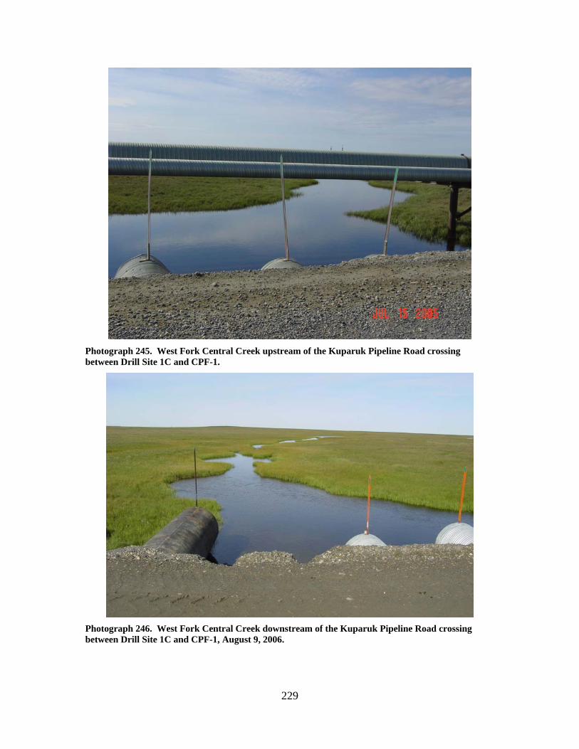
229
Photograph 245. West Fork Central Creek upstream of the Kuparuk Pipeline Road crossing between Drill Site 1C and CPF-1.
Photograph 246. West Fork Central Creek downstream of the Kuparuk Pipeline Road crossing between Drill Site 1C and CPF-1, August 9, 2006.
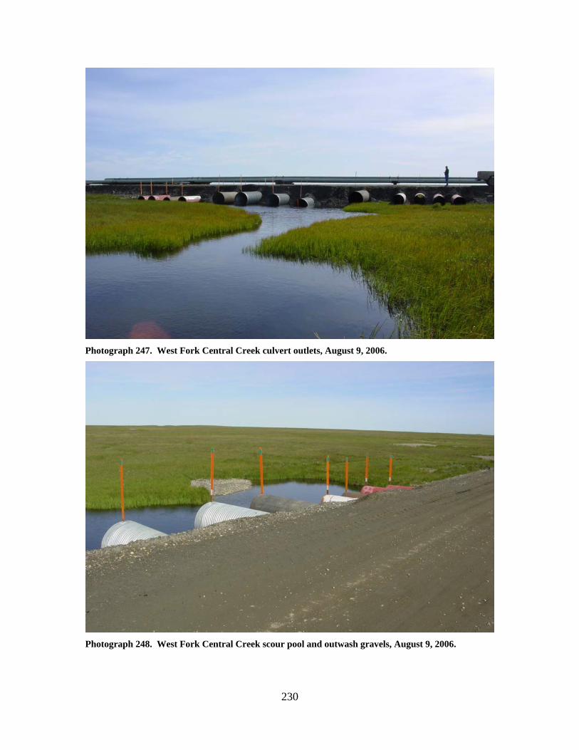
230
Photograph 247. West Fork Central Creek culvert outlets, August 9, 2006.
Photograph 248. West Fork Central Creek scour pool and outwash gravels, August 9, 2006.
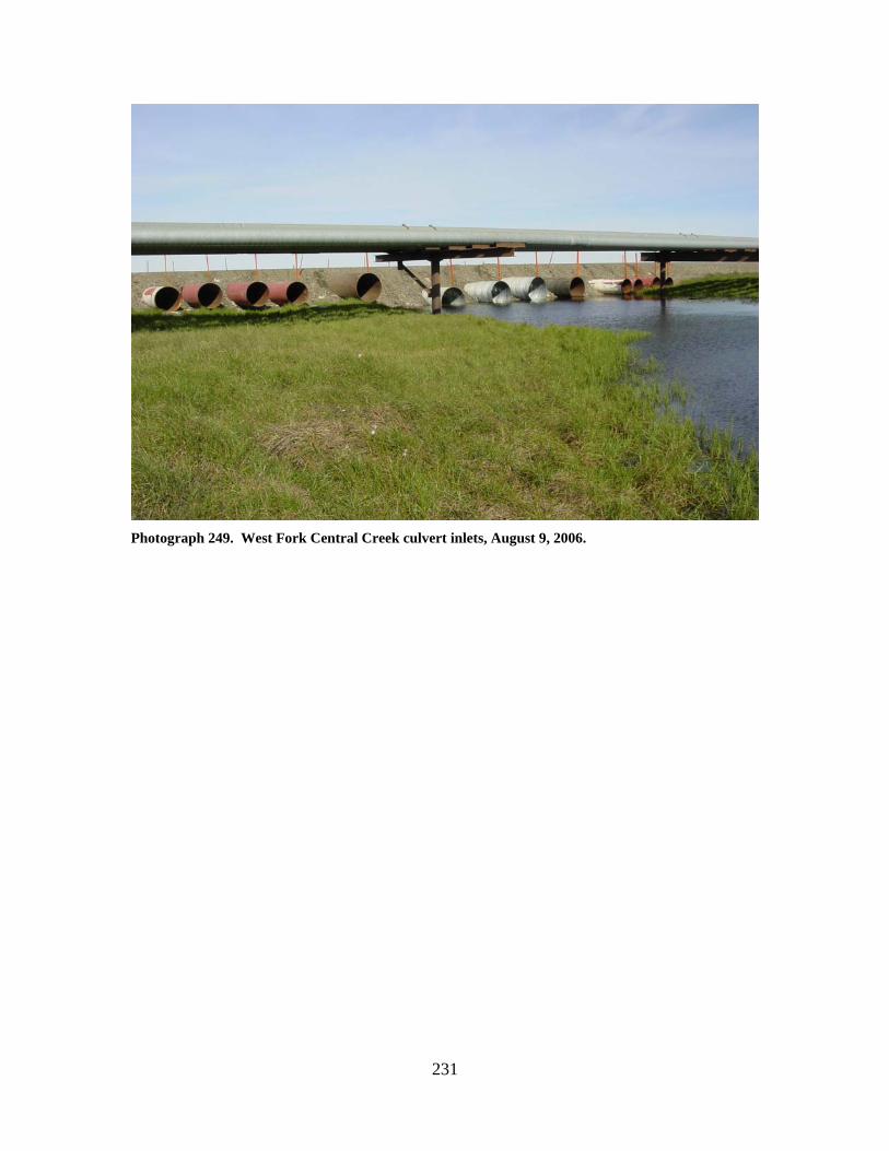
231
Photograph 249. West Fork Central Creek culvert inlets, August 9, 2006.
232
EAST FORK UGNURAVIK RIVER (6)
LOCATION: crosses the Spine Road at CPF-1; Section 10, T11N, R10E, UM;
70.32645 N, 149.59231 W OBSERVATION DATE: July 15, 2005 STREAM TYPE: Tundra stream CROSSING STRUCTURE: (6) 42 inch corrugated metal pipes INLET: Minor inlet damage, high water mark 2 feet above culvert inlets, cable and
debris in stream upstream of culverts OUTLET: outwash gravels present, considerable gravel and ice inside culverts, all
culverts bowed, minor culvert outlet damage FISH PRESENCE: Ninespine stickleback, Arctic grayling FISH PASSAGE: Passable HISTORICAL DATA and PERMITS: No fish habitat permit was required when
this culvert battery was originally installed. Fish Habitat Permit FH03-III-0320 was issued for culvert battery replacement with steel smooth-walled pipes and one corrugated metal pipe for fish passage. Fish Habitat Permit FH07-III-0264 authorized removal of outwash gravels downstream of the culvert battery.
REMEDIATION RECOMMENDATIONS: Remove outwash gravels and cables,
increase water conveyance past this crossing. PRIORITY RANKING: Moderate
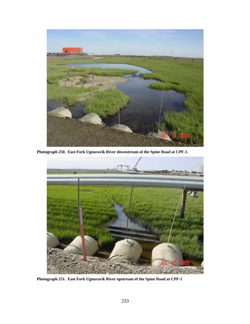
233
Photograph 250. East Fork Ugnuravik River downstream of the Spine Road at CPF-1.
Photograph 251. East Fork Ugnuravik River upstream of the Spine Road at CPF-1
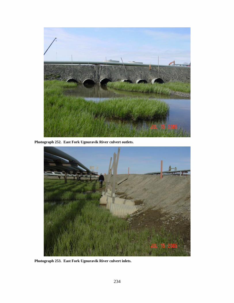
234
Photograph 252. East Fork Ugnuravik River culvert outlets.
Photograph 253. East Fork Ugnuravik River culvert inlets.
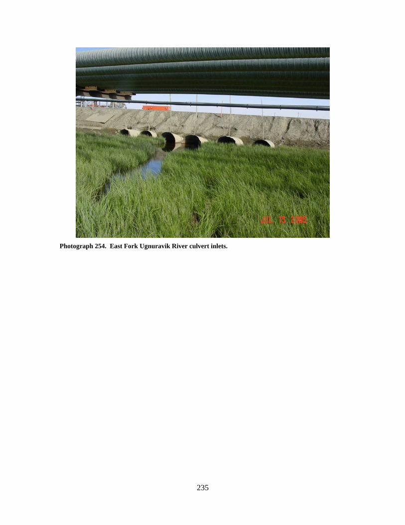
235
Photograph 254. East Fork Ugnuravik River culvert inlets.
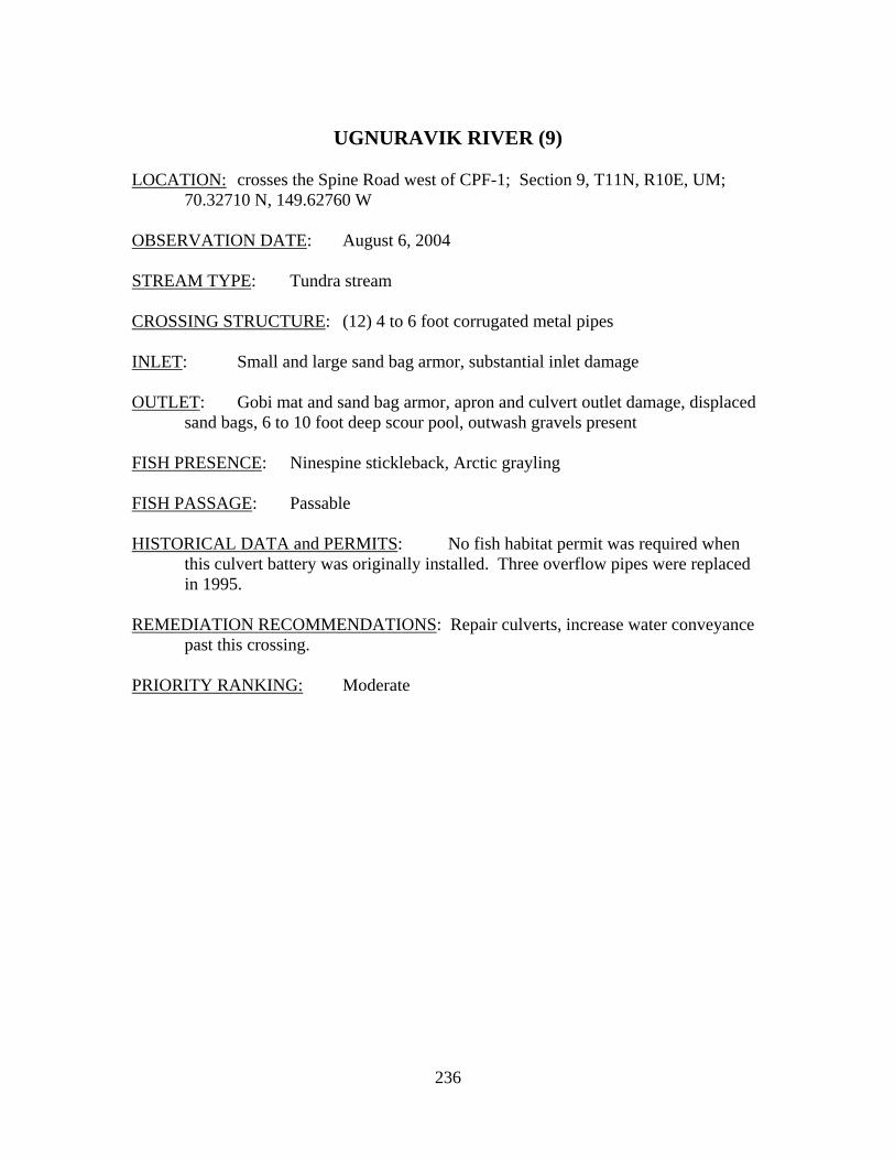
236
UGNURAVIK RIVER (9)
LOCATION: crosses the Spine Road west of CPF-1; Section 9, T11N, R10E, UM;
70.32710 N, 149.62760 W OBSERVATION DATE: August 6, 2004 STREAM TYPE: Tundra stream CROSSING STRUCTURE: (12) 4 to 6 foot corrugated metal pipes INLET: Small and large sand bag armor, substantial inlet damage OUTLET: Gobi mat and sand bag armor, apron and culvert outlet damage, displaced
sand bags, 6 to 10 foot deep scour pool, outwash gravels present FISH PRESENCE: Ninespine stickleback, Arctic grayling FISH PASSAGE: Passable HISTORICAL DATA and PERMITS: No fish habitat permit was required when
this culvert battery was originally installed. Three overflow pipes were replaced in 1995.
REMEDIATION RECOMMENDATIONS: Repair culverts, increase water conveyance
past this crossing. PRIORITY RANKING: Moderate
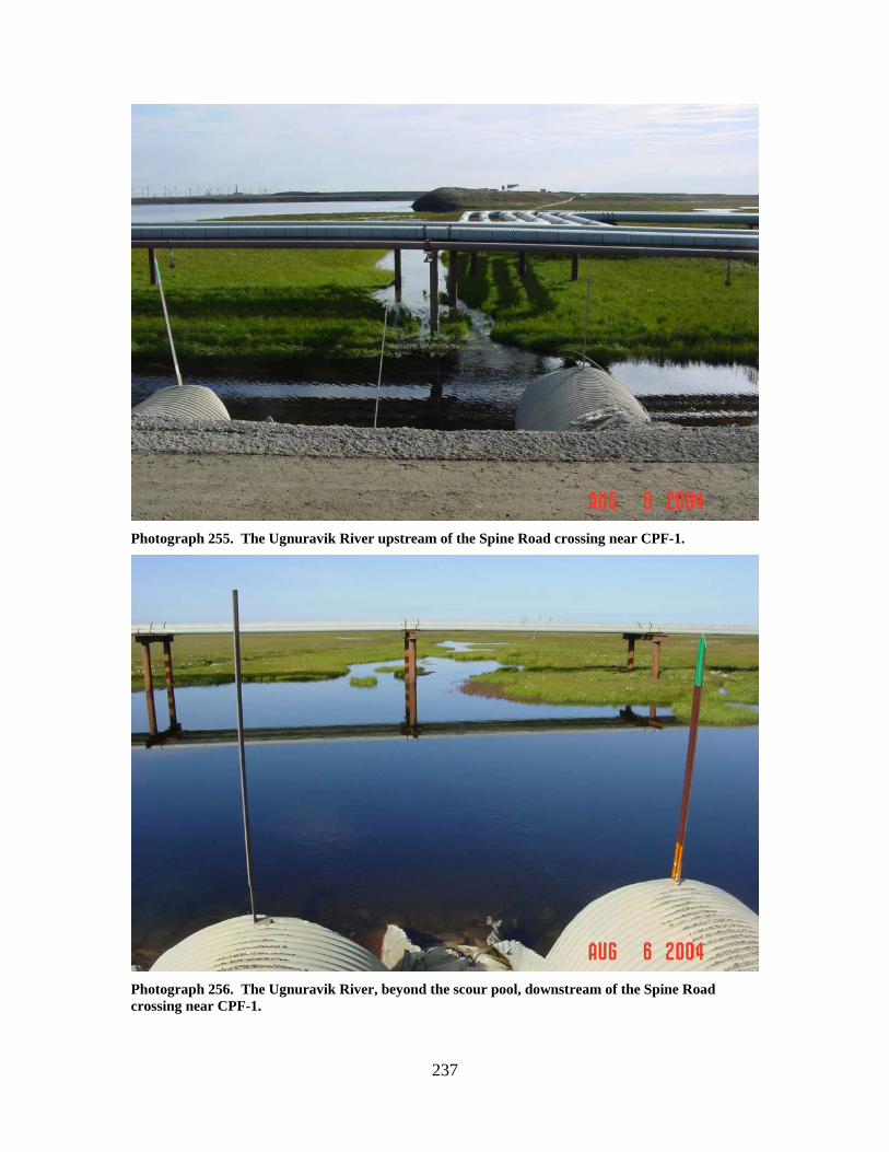
237
Photograph 255. The Ugnuravik River upstream of the Spine Road crossing near CPF-1.
Photograph 256. The Ugnuravik River, beyond the scour pool, downstream of the Spine Road crossing near CPF-1.
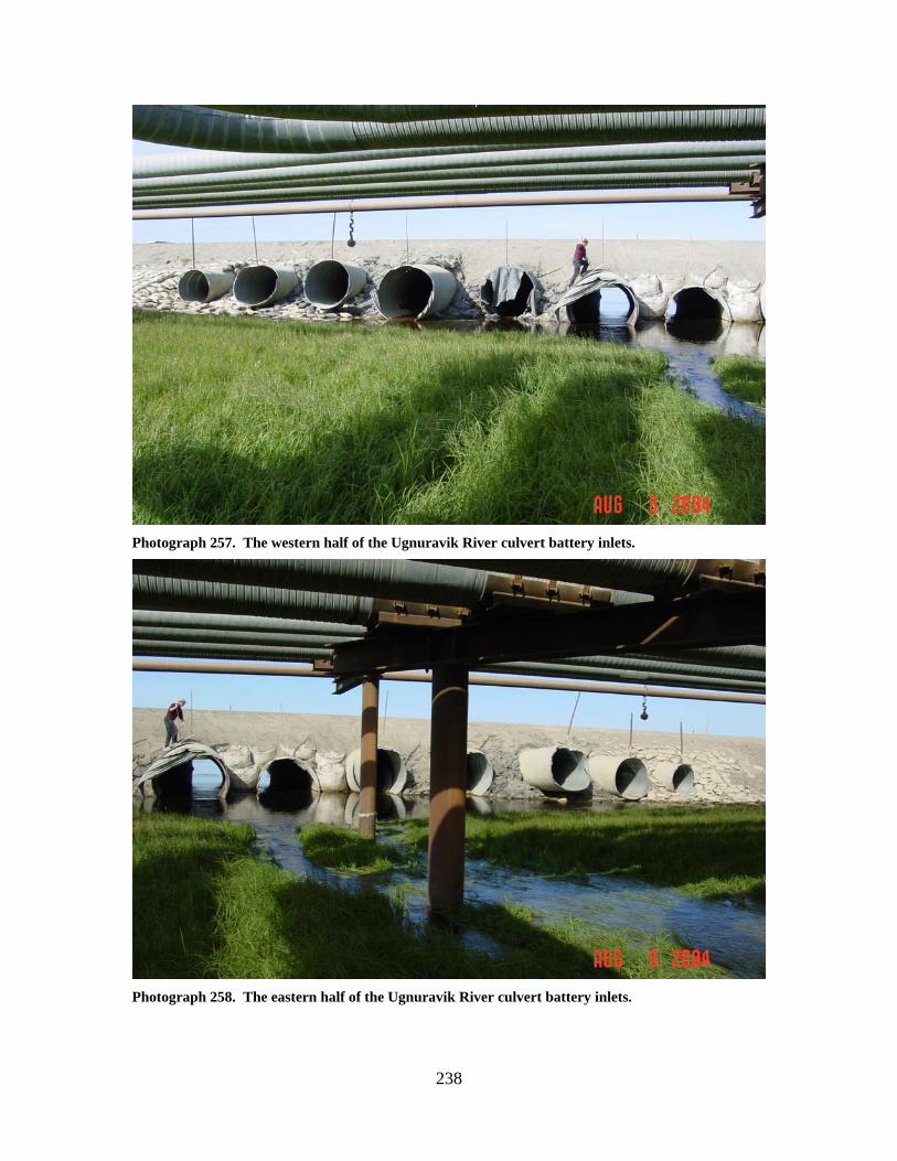
238
Photograph 257. The western half of the Ugnuravik River culvert battery inlets.
Photograph 258. The eastern half of the Ugnuravik River culvert battery inlets.
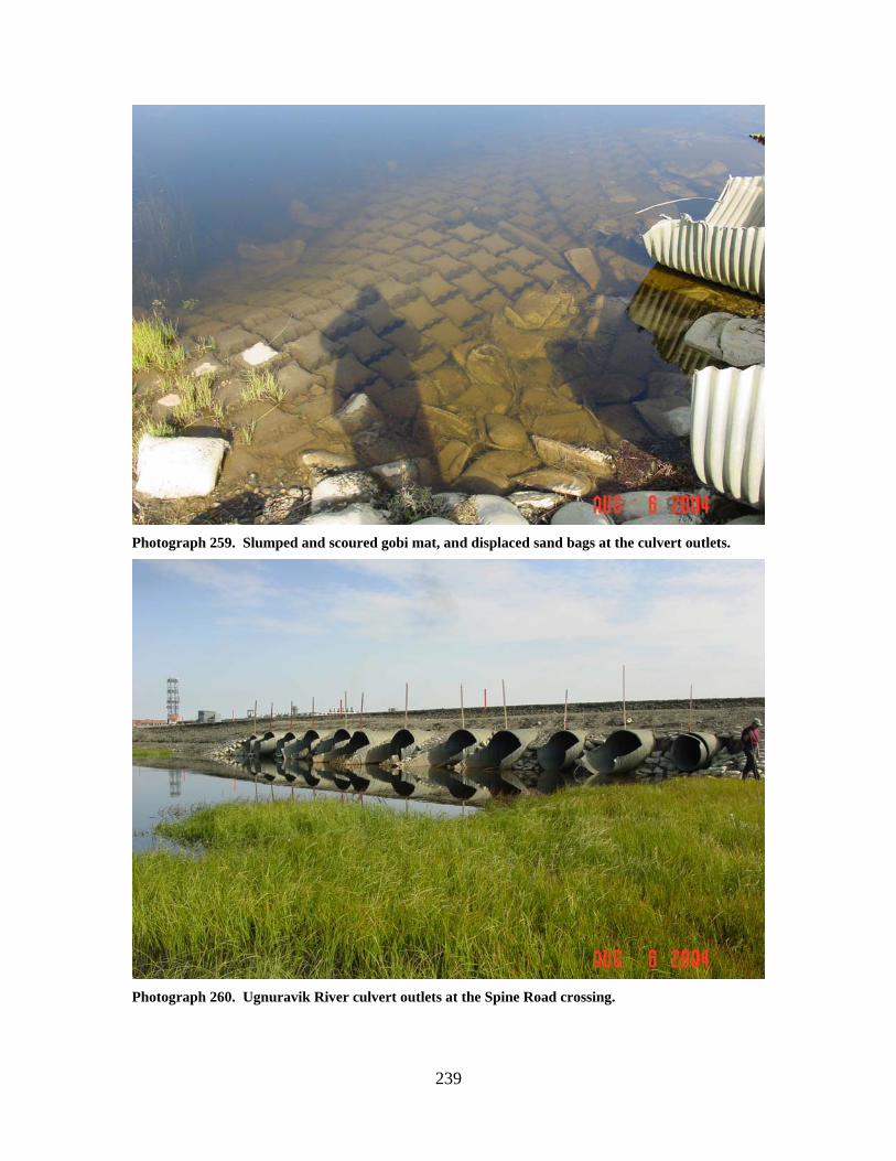
239
Photograph 259. Slumped and scoured gobi mat, and displaced sand bags at the culvert outlets.
Photograph 260. Ugnuravik River culvert outlets at the Spine Road crossing.
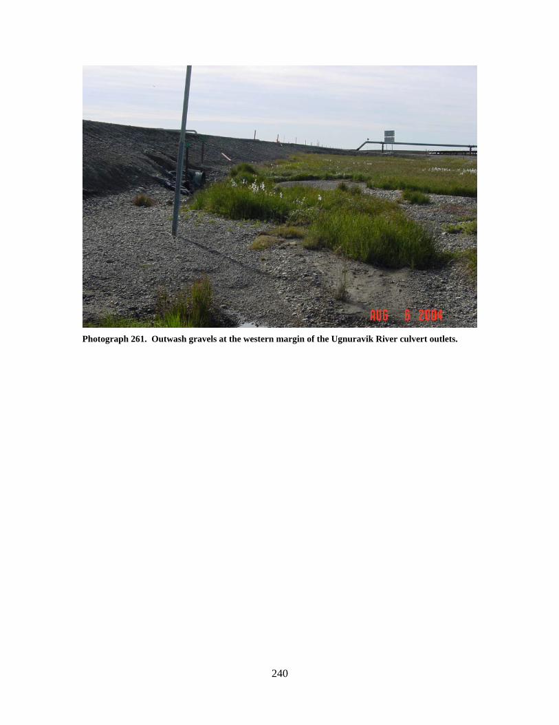
240
Photograph 261. Outwash gravels at the western margin of the Ugnuravik River culvert outlets.
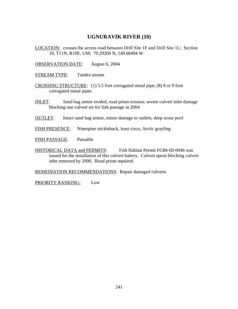
241
UGNURAVIK RIVER (10)
LOCATION: crosses the access road between Drill Site 1F and Drill Site 1L; Section
19, T11N, R10E, UM; 70.29206 N, 149.68494 W OBSERVATION DATE: August 6, 2004 STREAM TYPE: Tundra stream CROSSING STRUCTURE: (1) 5.5 foot corrugated metal pipe; (8) 8 or 9 foot
corrugated metal pipes INLET: Sand bag armor eroded, road prism erosion; severe culvert inlet damage
blocking one culvert set for fish passage in 2004 OUTLET: Intact sand bag armor, minor damage to outlets, deep scour pool FISH PRESENCE: Ninespine stickleback, least cisco, Arctic grayling FISH PASSAGE: Passable HISTORICAL DATA and PERMITS: Fish Habitat Permit FG84-III-0046 was
issued for the installation of this culvert battery. Culvert apron blocking culvert inlet removed by 2006. Road prism repaired.
REMEDIATION RECOMMENDATIONS: Repair damaged culverts PRIORITY RANKING: Low
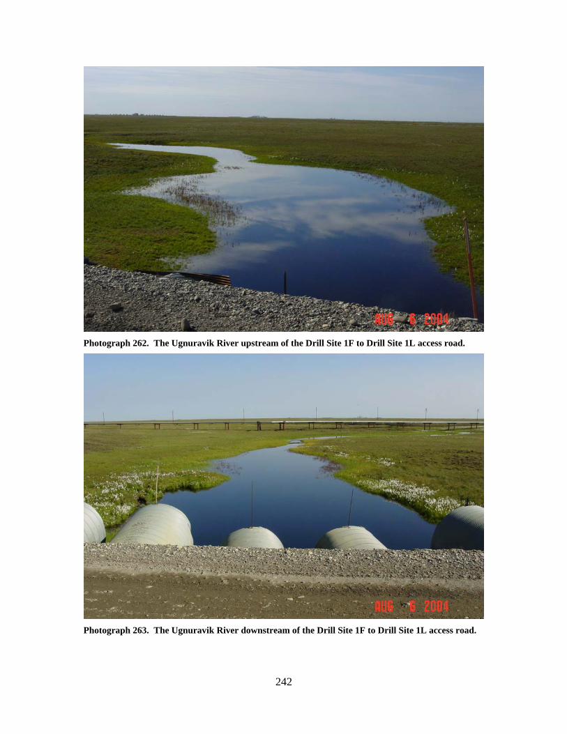
242
Photograph 262. The Ugnuravik River upstream of the Drill Site 1F to Drill Site 1L access road.
Photograph 263. The Ugnuravik River downstream of the Drill Site 1F to Drill Site 1L access road.
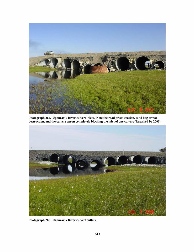
243
Photograph 264. Ugnuravik River culvert inlets. Note the road prism erosion, sand bag armor destruction, and the culvert apron completely blocking the inlet of one culvert (Repaired by 2006).
Photograph 265. Ugnuravik River culvert outlets.
244
CHARLIE CREEK TRIBUTARY (11)
LOCATION: crosses the Drill Site 1G to Drill Site 1R access road; Section 19, T12N,
R10E, UM; 70.37378 N, 149.68938 W OBSERVATION DATE: August 6, 2004 STREAM TYPE: Wetland drainage CROSSING STRUCTURE: (1) 24 inch corrugated metal pipe; (1) 30 inch corrugated
metal pipe; (1) 36 inch corrugated metal pipe INLET: Sand bag armor, no flow, 1 inch of water at crossing OUTLET: Sand bag armor FISH PRESENCE: Ninespine stickleback in 1988 FISH PASSAGE: Passable if adequate water is present HISTORICAL DATA and PERMITS: No fish habitat permit was required when
this culvert battery was originally installed in 1984 as fish presence was not documented at that time.
REMEDIATION RECOMMENDATIONS: None PRIORITY RANKING: None
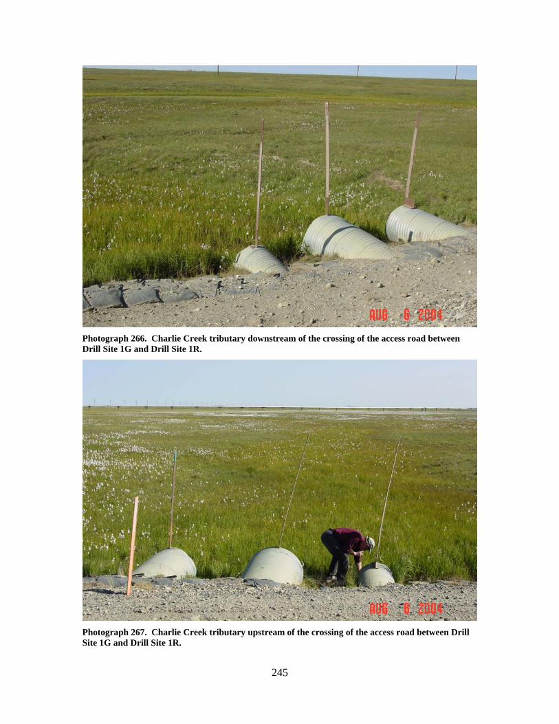
245
Photograph 266. Charlie Creek tributary downstream of the crossing of the access road between Drill Site 1G and Drill Site 1R.
Photograph 267. Charlie Creek tributary upstream of the crossing of the access road between Drill Site 1G and Drill Site 1R.
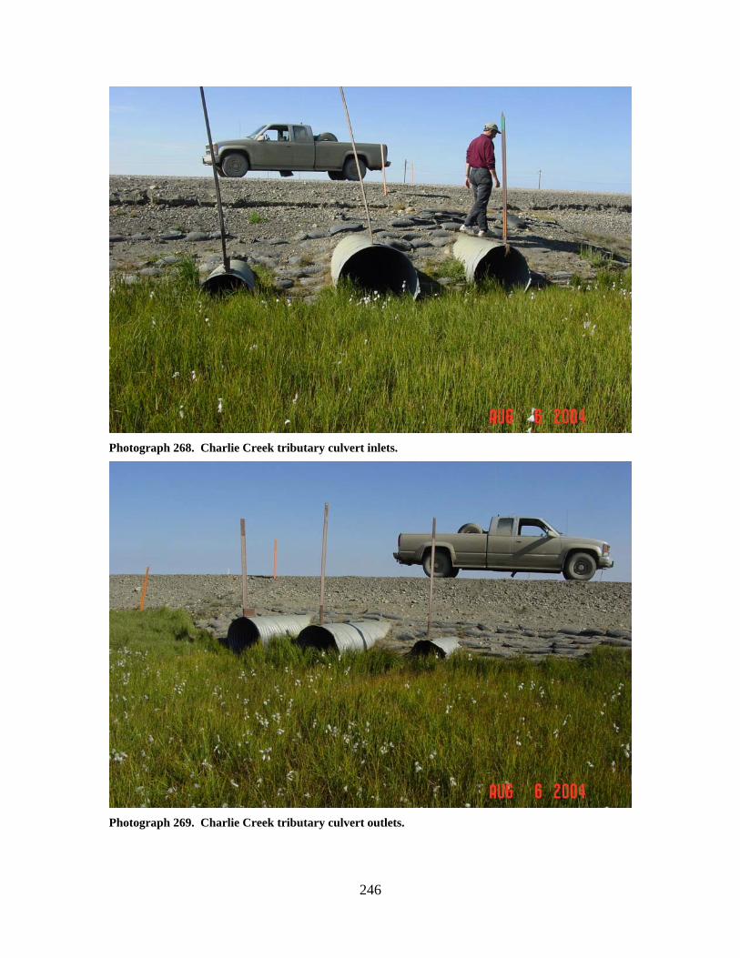
246
Photograph 268. Charlie Creek tributary culvert inlets.
Photograph 269. Charlie Creek tributary culvert outlets.
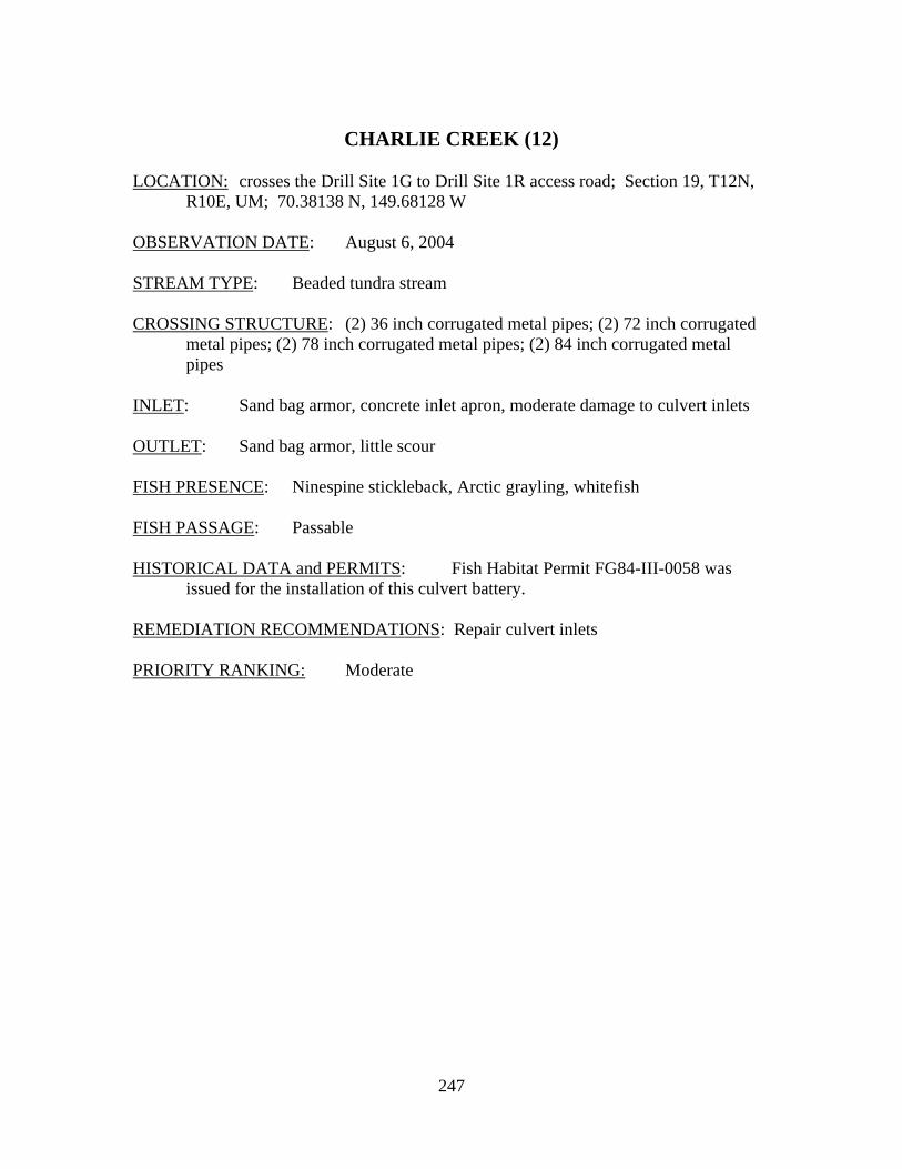
247
CHARLIE CREEK (12)
LOCATION: crosses the Drill Site 1G to Drill Site 1R access road; Section 19, T12N,
R10E, UM; 70.38138 N, 149.68128 W OBSERVATION DATE: August 6, 2004 STREAM TYPE: Beaded tundra stream CROSSING STRUCTURE: (2) 36 inch corrugated metal pipes; (2) 72 inch corrugated
metal pipes; (2) 78 inch corrugated metal pipes; (2) 84 inch corrugated metal pipes
INLET: Sand bag armor, concrete inlet apron, moderate damage to culvert inlets OUTLET: Sand bag armor, little scour FISH PRESENCE: Ninespine stickleback, Arctic grayling, whitefish FISH PASSAGE: Passable HISTORICAL DATA and PERMITS: Fish Habitat Permit FG84-III-0058 was
issued for the installation of this culvert battery. REMEDIATION RECOMMENDATIONS: Repair culvert inlets PRIORITY RANKING: Moderate
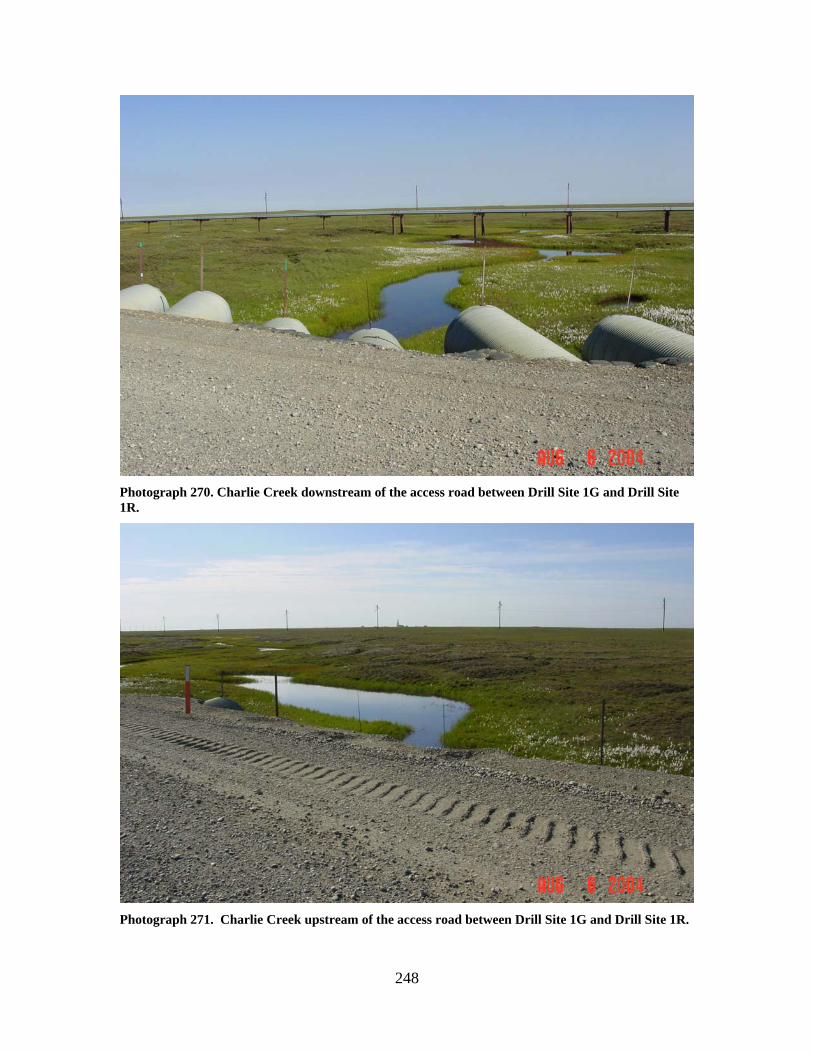
248
Photograph 270. Charlie Creek downstream of the access road between Drill Site 1G and Drill Site 1R.
Photograph 271. Charlie Creek upstream of the access road between Drill Site 1G and Drill Site 1R.
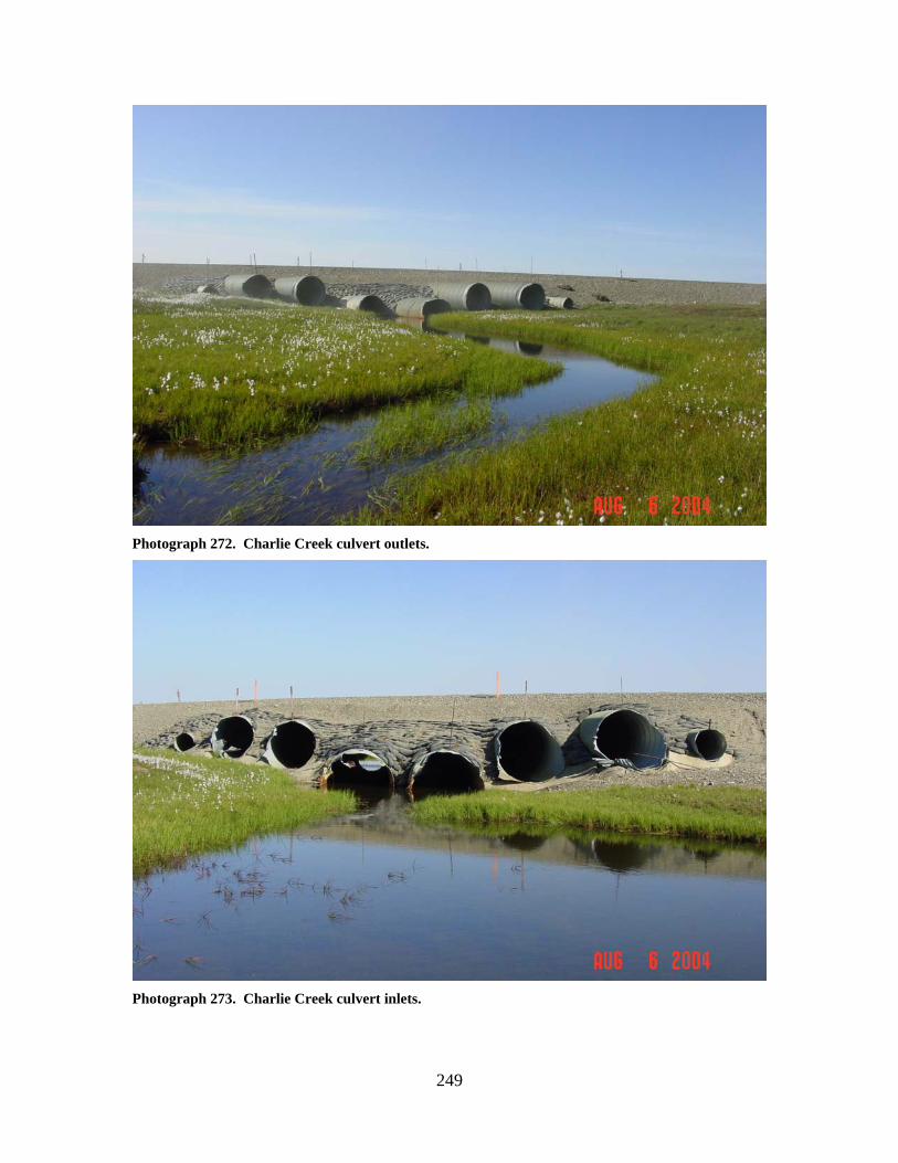
249
Photograph 272. Charlie Creek culvert outlets.
Photograph 273. Charlie Creek culvert inlets.
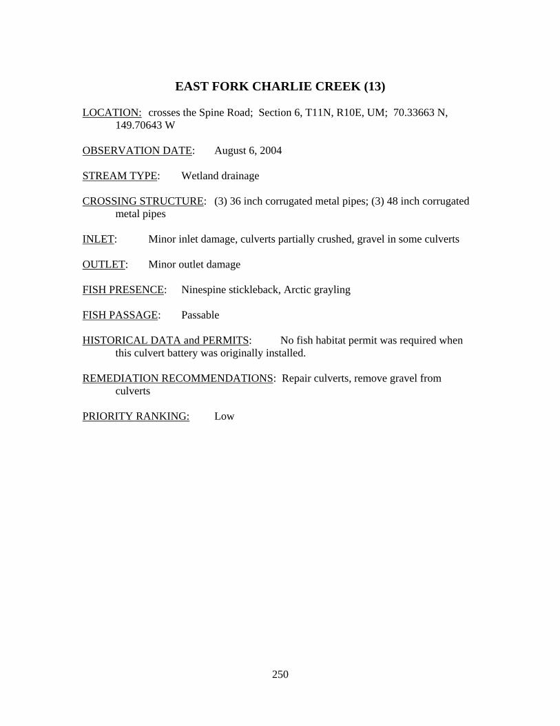
250
EAST FORK CHARLIE CREEK (13)
LOCATION: crosses the Spine Road; Section 6, T11N, R10E, UM; 70.33663 N,
149.70643 W OBSERVATION DATE: August 6, 2004 STREAM TYPE: Wetland drainage CROSSING STRUCTURE: (3) 36 inch corrugated metal pipes; (3) 48 inch corrugated
metal pipes INLET: Minor inlet damage, culverts partially crushed, gravel in some culverts OUTLET: Minor outlet damage FISH PRESENCE: Ninespine stickleback, Arctic grayling FISH PASSAGE: Passable HISTORICAL DATA and PERMITS: No fish habitat permit was required when
this culvert battery was originally installed. REMEDIATION RECOMMENDATIONS: Repair culverts, remove gravel from
culverts PRIORITY RANKING: Low
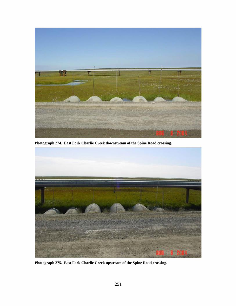
251
Photograph 274. East Fork Charlie Creek downstream of the Spine Road crossing.
Photograph 275. East Fork Charlie Creek upstream of the Spine Road crossing.
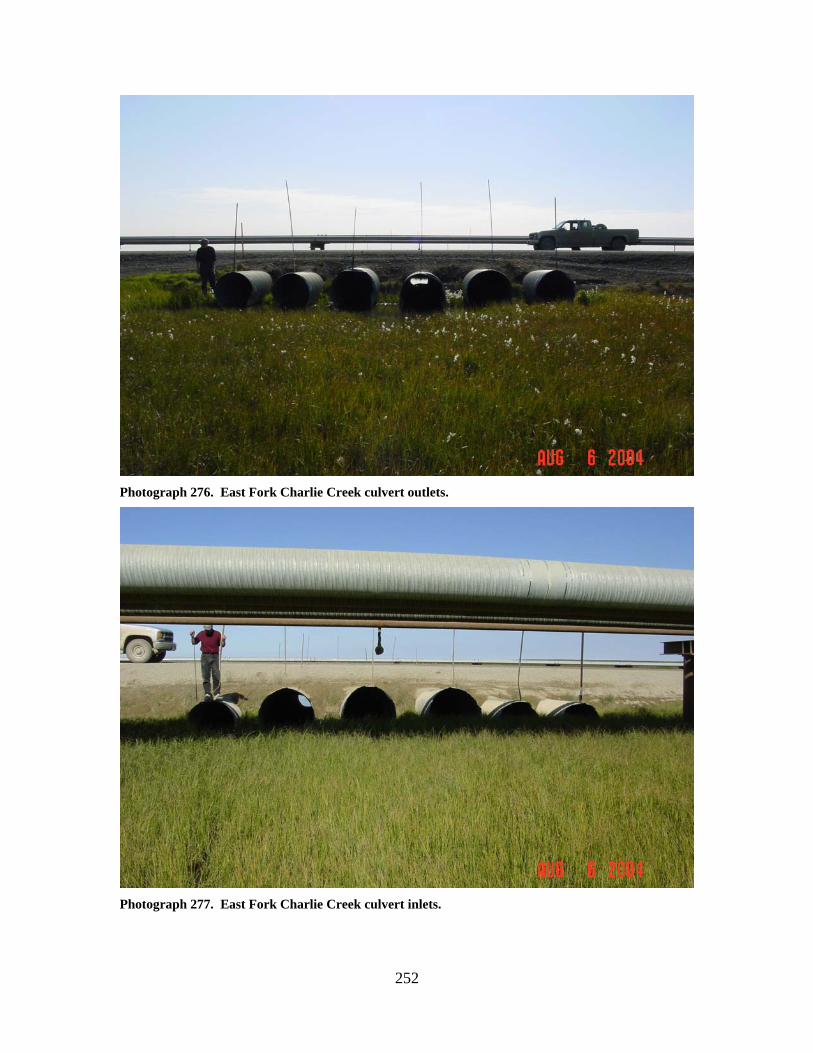
252
Photograph 276. East Fork Charlie Creek culvert outlets.
Photograph 277. East Fork Charlie Creek culvert inlets.
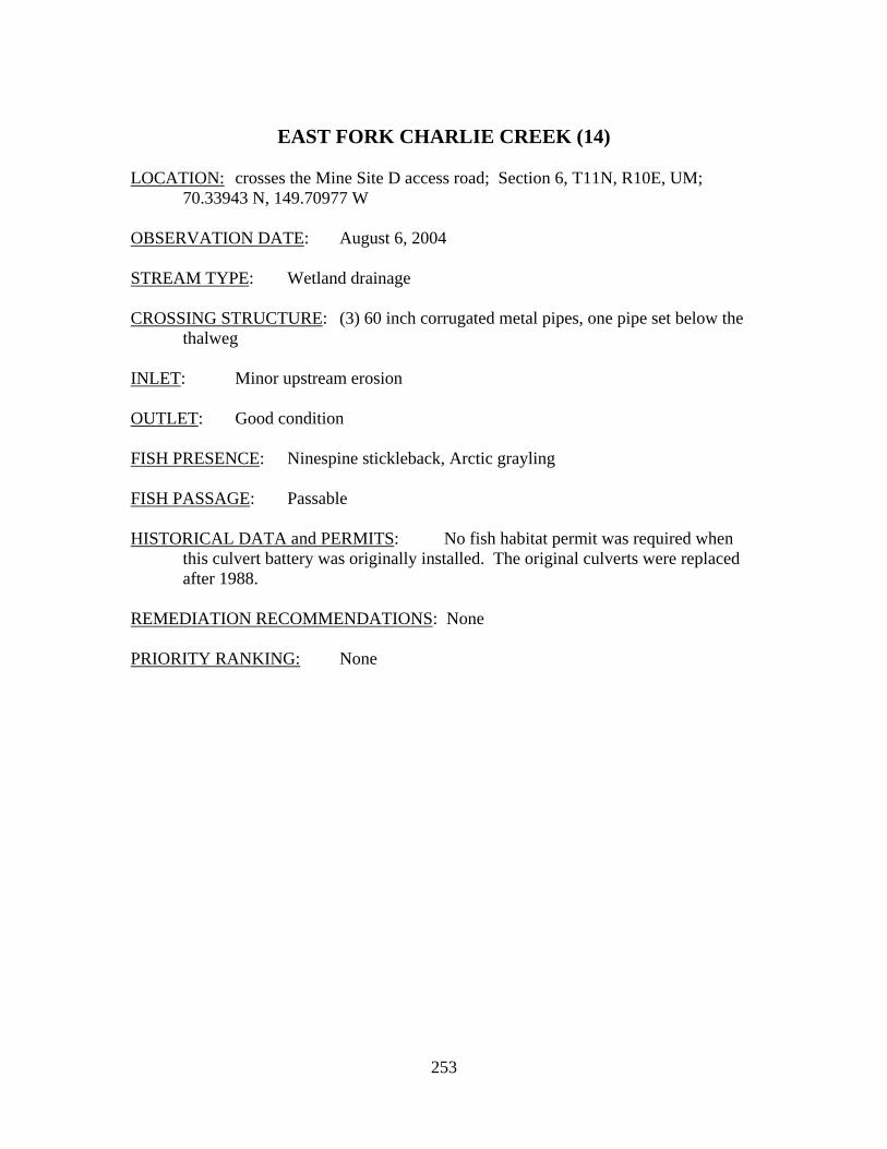
253
EAST FORK CHARLIE CREEK (14)
LOCATION: crosses the Mine Site D access road; Section 6, T11N, R10E, UM;
70.33943 N, 149.70977 W OBSERVATION DATE: August 6, 2004 STREAM TYPE: Wetland drainage CROSSING STRUCTURE: (3) 60 inch corrugated metal pipes, one pipe set below the
thalweg INLET: Minor upstream erosion OUTLET: Good condition FISH PRESENCE: Ninespine stickleback, Arctic grayling FISH PASSAGE: Passable HISTORICAL DATA and PERMITS: No fish habitat permit was required when
this culvert battery was originally installed. The original culverts were replaced after 1988.
REMEDIATION RECOMMENDATIONS: None PRIORITY RANKING: None
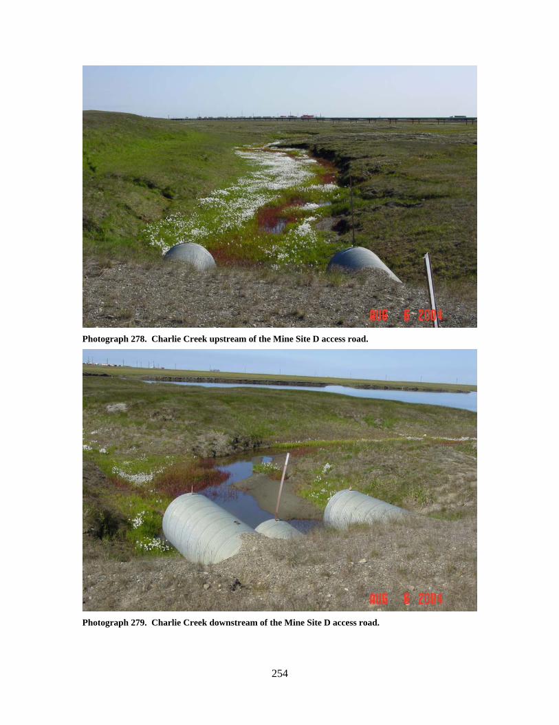
254
Photograph 278. Charlie Creek upstream of the Mine Site D access road.
Photograph 279. Charlie Creek downstream of the Mine Site D access road.
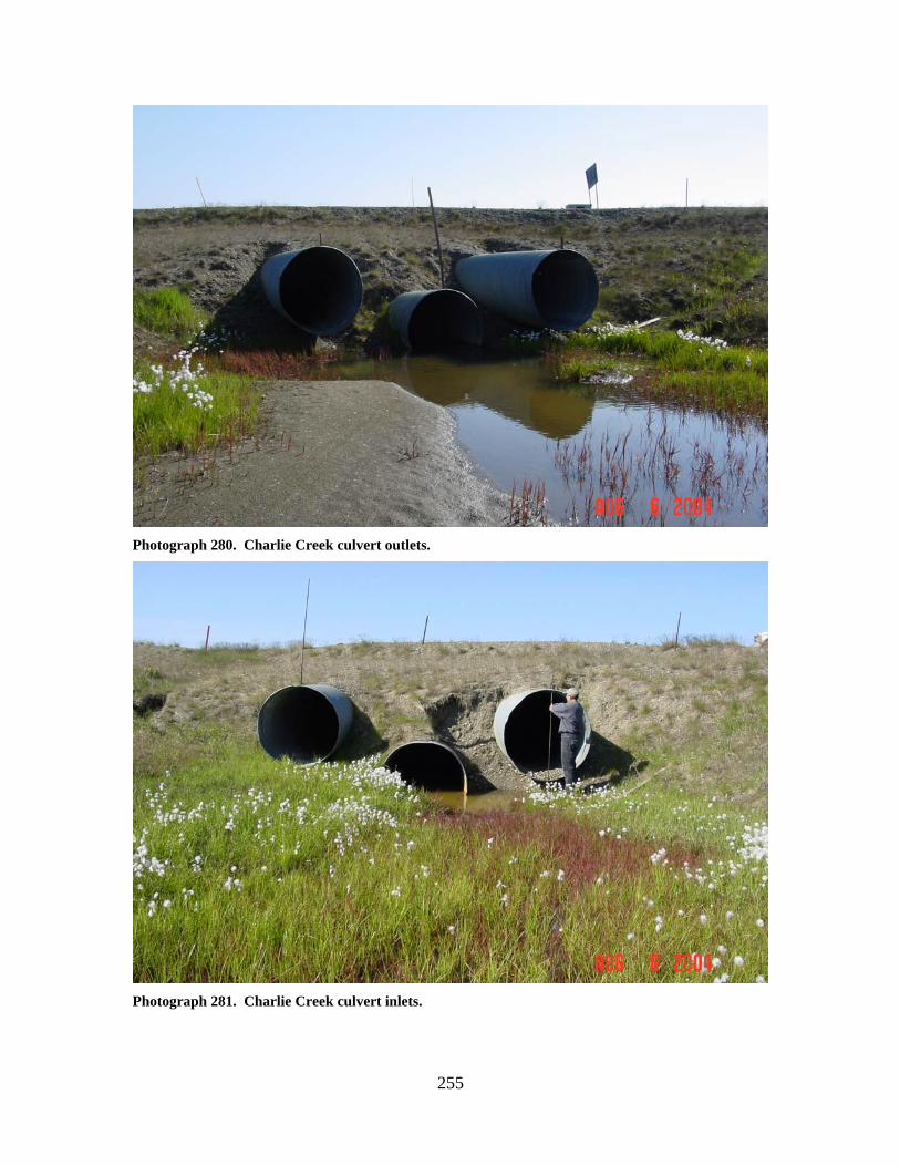
255
Photograph 280. Charlie Creek culvert outlets.
Photograph 281. Charlie Creek culvert inlets.
256
CHARLIE CREEK (15)
LOCATION: crosses the Oliktok Road; Section 1, T11N, R9E, UM; 70.33898 N,
149.73160 W OBSERVATION DATE: August 4, 2004 STREAM TYPE: Inundated wetland stream CROSSING STRUCTURE: (3) 48 inch corrugated metal pipes; (3) 42 inch corrugated
metal pipes INLET: Minor inlet damage OUTLET: Minor outlet damage FISH PRESENCE: Ninespine stickleback, Arctic grayling FISH PASSAGE: Passable HISTORICAL DATA and PERMITS: No fish habitat permit was required when
this culvert battery was originally installed. REMEDIATION RECOMMENDATIONS: Repair damaged culvert ends PRIORITY RANKING: None
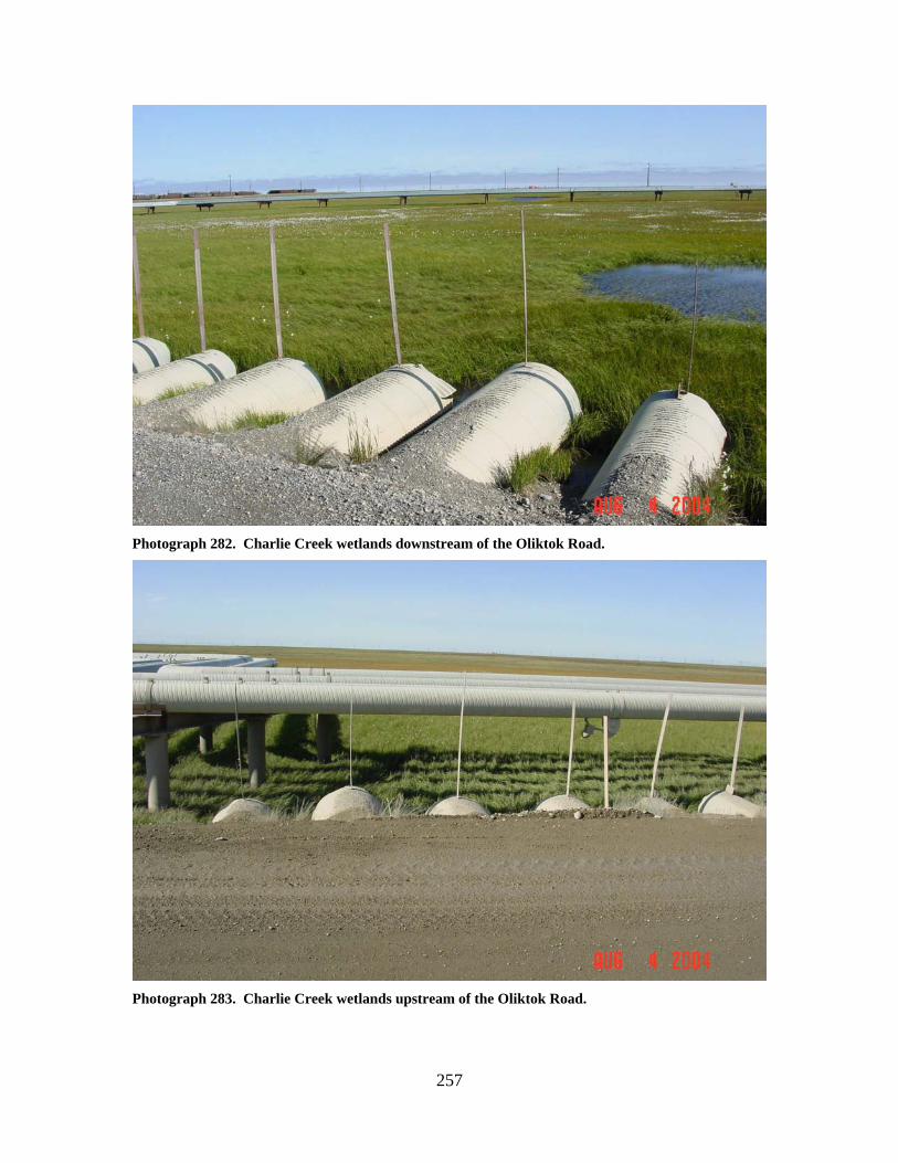
257
Photograph 282. Charlie Creek wetlands downstream of the Oliktok Road.
Photograph 283. Charlie Creek wetlands upstream of the Oliktok Road.
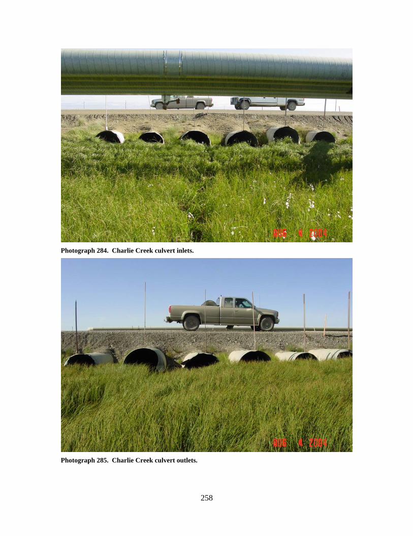
258
Photograph 284. Charlie Creek culvert inlets.
Photograph 285. Charlie Creek culvert outlets.
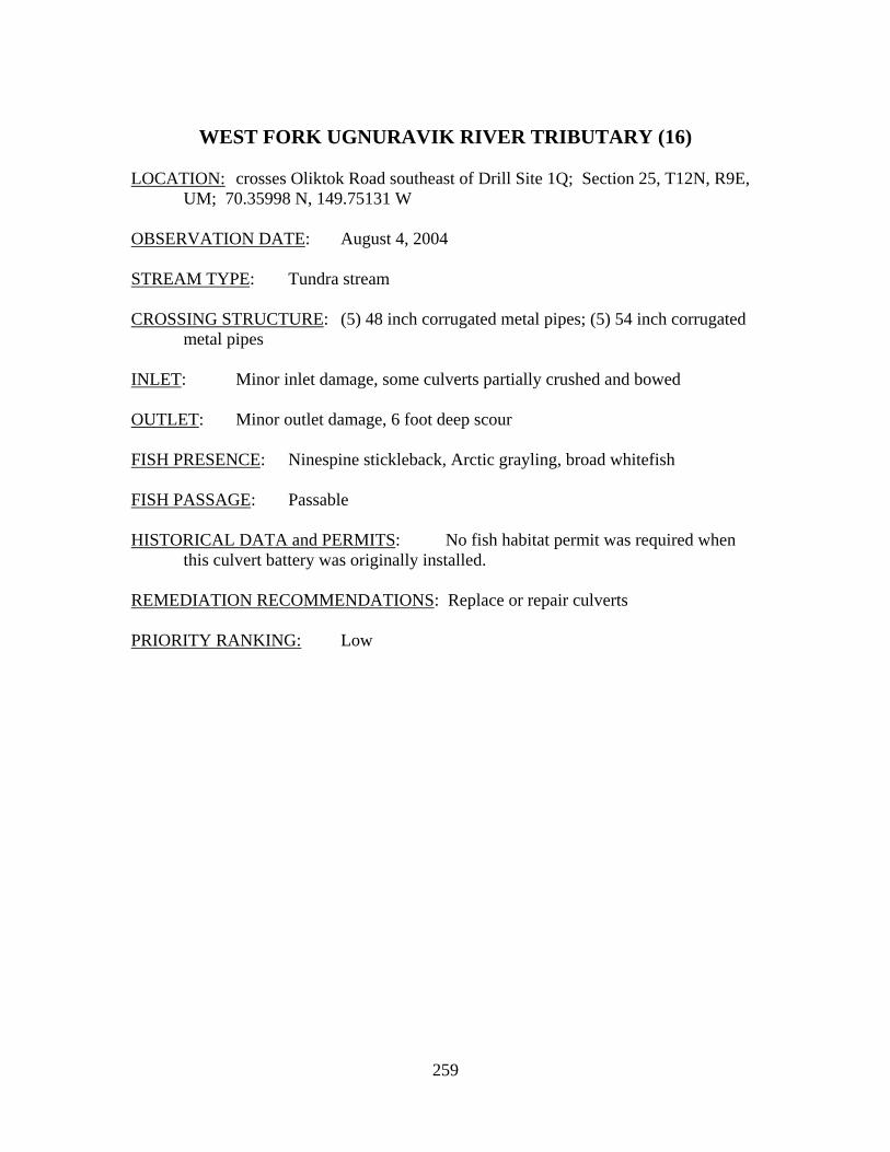
259
WEST FORK UGNURAVIK RIVER TRIBUTARY (16)
LOCATION: crosses Oliktok Road southeast of Drill Site 1Q; Section 25, T12N, R9E,
UM; 70.35998 N, 149.75131 W OBSERVATION DATE: August 4, 2004 STREAM TYPE: Tundra stream CROSSING STRUCTURE: (5) 48 inch corrugated metal pipes; (5) 54 inch corrugated
metal pipes INLET: Minor inlet damage, some culverts partially crushed and bowed OUTLET: Minor outlet damage, 6 foot deep scour FISH PRESENCE: Ninespine stickleback, Arctic grayling, broad whitefish FISH PASSAGE: Passable HISTORICAL DATA and PERMITS: No fish habitat permit was required when
this culvert battery was originally installed. REMEDIATION RECOMMENDATIONS: Replace or repair culverts PRIORITY RANKING: Low
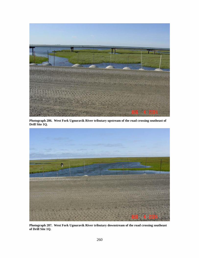
260
Photograph 286. West Fork Ugnuravik River tributary upstream of the road crossing southeast of Drill Site 1Q.
Photograph 287. West Fork Ugnuravik River tributary downstream of the road crossing southeast of Drill Site 1Q.
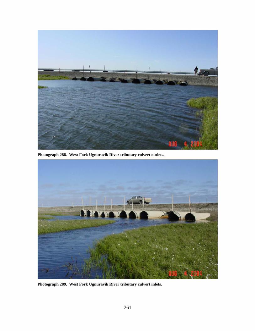
261
Photograph 288. West Fork Ugnuravik River tributary culvert outlets.
Photograph 289. West Fork Ugnuravik River tributary culvert inlets.
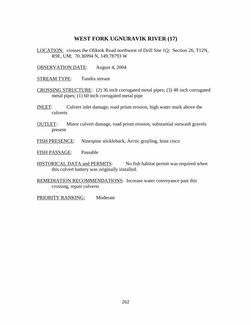
262
WEST FORK UGNURAVIK RIVER (17)
LOCATION: crosses the Oliktok Road northwest of Drill Site 1Q; Section 26, T12N,
R9E, UM; 70.36994 N, 149.78793 W OBSERVATION DATE: August 4, 2004 STREAM TYPE: Tundra stream CROSSING STRUCTURE: (2) 36 inch corrugated metal pipes; (3) 48 inch corrugated
metal pipes; (1) 60 inch corrugated metal pipe INLET: Culvert inlet damage, road prism erosion, high water mark above the
culverts OUTLET: Minor culvert damage, road prism erosion, substantial outwash gravels
present FISH PRESENCE: Ninespine stickleback, Arctic grayling, least cisco FISH PASSAGE: Passable HISTORICAL DATA and PERMITS: No fish habitat permit was required when
this culvert battery was originally installed. REMEDIATION RECOMMENDATIONS: Increase water conveyance past this
crossing, repair culverts PRIORITY RANKING: Moderate
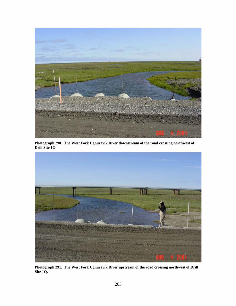
263
Photograph 290. The West Fork Ugnuravik River downstream of the road crossing northwest of Drill Site 1Q.
Photograph 291. The West Fork Ugnuravik River upstream of the road crossing northwest of Drill Site 1Q.
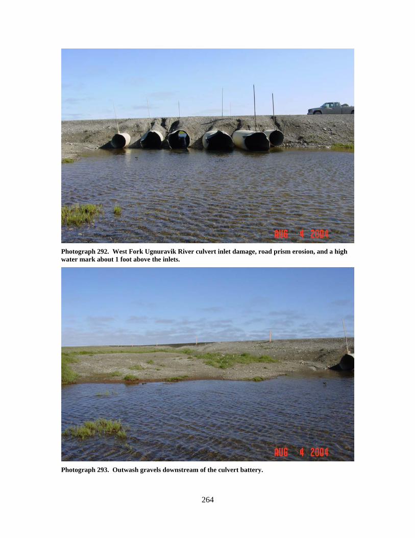
264
Photograph 292. West Fork Ugnuravik River culvert inlet damage, road prism erosion, and a high water mark about 1 foot above the inlets.
Photograph 293. Outwash gravels downstream of the culvert battery.
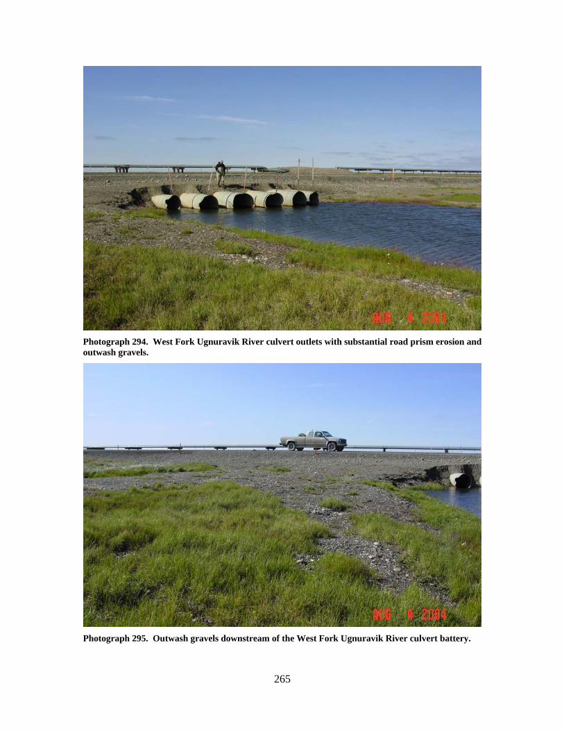
265
Photograph 294. West Fork Ugnuravik River culvert outlets with substantial road prism erosion and outwash gravels.
Photograph 295. Outwash gravels downstream of the West Fork Ugnuravik River culvert battery.

266
267
Kuparuk CPF 3 Area Stream Crossings

268
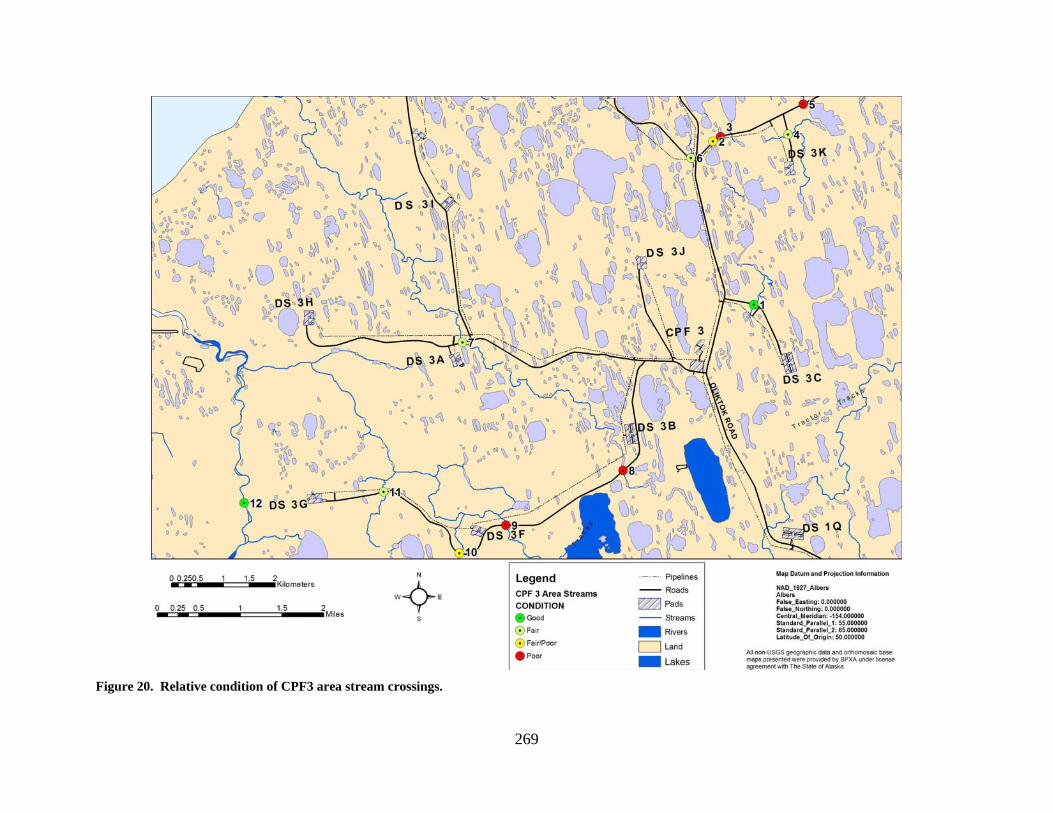
269
Figure 20. Relative condition of CPF3 area stream crossings.
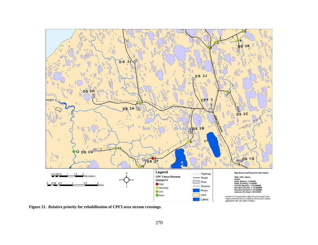
270
Figure 21. Relative priority for rehabilitation of CPF3 area stream crossings.
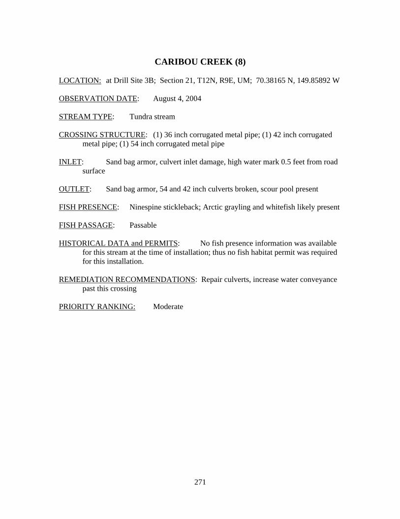
271
CARIBOU CREEK (8)
LOCATION: at Drill Site 3B; Section 21, T12N, R9E, UM; 70.38165 N, 149.85892 W OBSERVATION DATE: August 4, 2004 STREAM TYPE: Tundra stream CROSSING STRUCTURE: (1) 36 inch corrugated metal pipe; (1) 42 inch corrugated
metal pipe; (1) 54 inch corrugated metal pipe INLET: Sand bag armor, culvert inlet damage, high water mark 0.5 feet from road
surface OUTLET: Sand bag armor, 54 and 42 inch culverts broken, scour pool present FISH PRESENCE: Ninespine stickleback; Arctic grayling and whitefish likely present FISH PASSAGE: Passable HISTORICAL DATA and PERMITS: No fish presence information was available
for this stream at the time of installation; thus no fish habitat permit was required for this installation.
REMEDIATION RECOMMENDATIONS: Repair culverts, increase water conveyance
past this crossing PRIORITY RANKING: Moderate
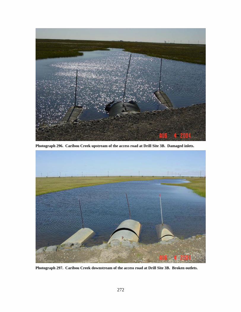
272
Photograph 296. Caribou Creek upstream of the access road at Drill Site 3B. Damaged inlets.
Photograph 297. Caribou Creek downstream of the access road at Drill Site 3B. Broken outlets.
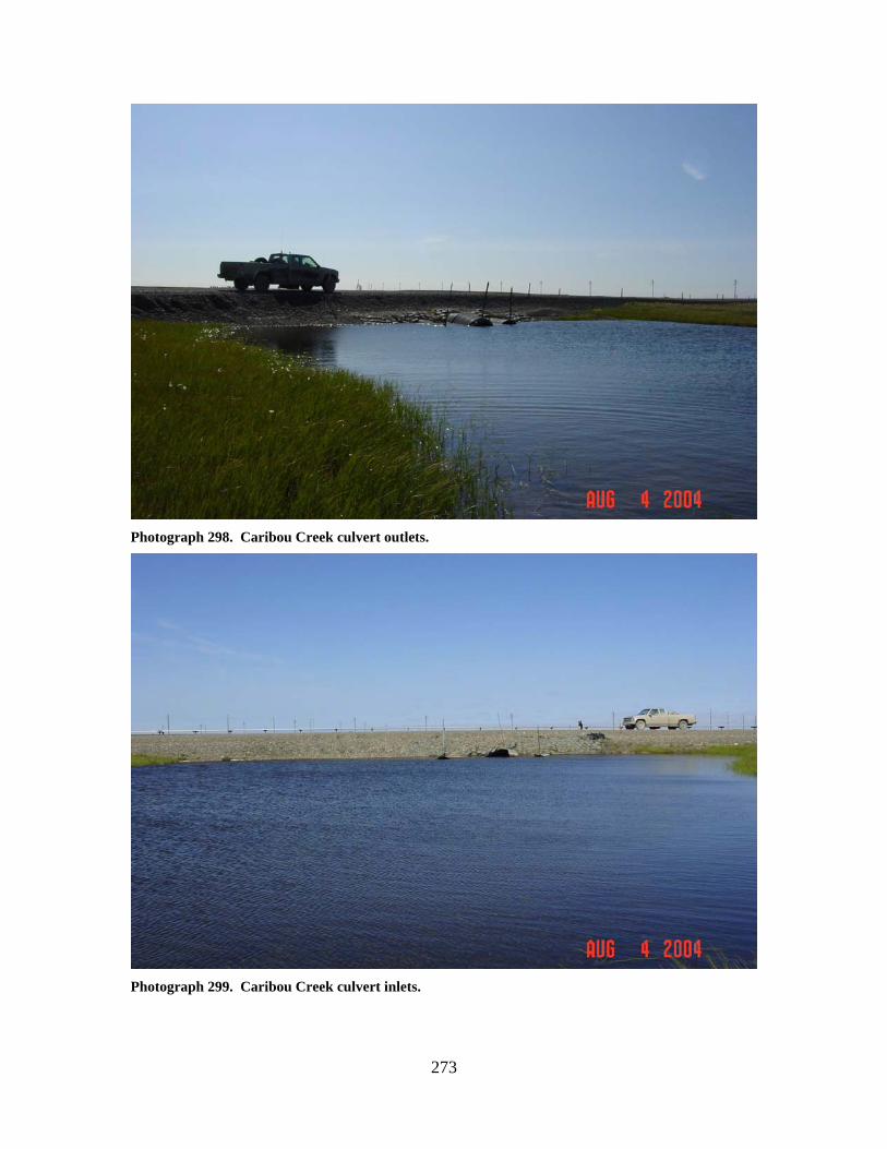
273
Photograph 298. Caribou Creek culvert outlets.
Photograph 299. Caribou Creek culvert inlets.
274
KALUBIK CREEK TRIBUTARY (EAST FORK NOWHERE CREEK)
(9) LOCATION: crosses the access road between Drill Site 3B and Drill Site 3F; Section
20, T12N, R9E, UM; 70.37325 N, 149.91980 W OBSERVATION DATE: August 4, 2004 STREAM TYPE: Beaded tundra stream CROSSING STRUCTURE: (2) 48 inch corrugated metal pipes; (1) 66 inch corrugated
metal pipe INLET: Sand bag armor, flow obstructed by damaged inlet on the 66 inch culvert,
inlet damage to all pipes, high water mark 1 foot above inlets OUTLET: Sand bag armor, culvert outlet damage, scour pool present FISH PRESENCE: Ninespine stickleback, Arctic grayling, broad whitefish, and three
spine stickleback FISH PASSAGE: Passable HISTORICAL DATA and PERMITS: Fish Habitat Permit FG84-III-0123 was
issued for installation of this culvert battery in 1985. Fish Habitat Permit FH07-III-0261 issued in September 2007 authorized replacement of the existing culverts with (3) 60 inch multiplate culverts.
REMEDIATION RECOMMENDATIONS: Repair culverts, reduce culvert length to fit
road prism, increase water conveyance past this location PRIORITY RANKING: High
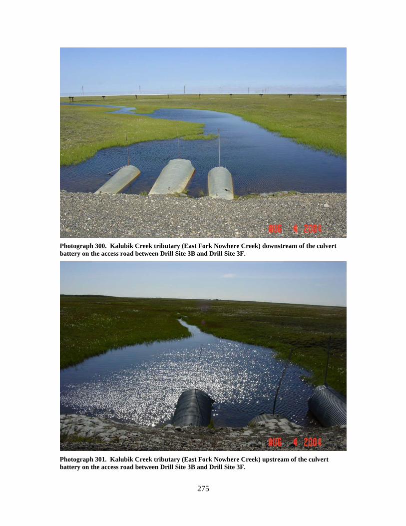
275
Photograph 300. Kalubik Creek tributary (East Fork Nowhere Creek) downstream of the culvert battery on the access road between Drill Site 3B and Drill Site 3F.
Photograph 301. Kalubik Creek tributary (East Fork Nowhere Creek) upstream of the culvert battery on the access road between Drill Site 3B and Drill Site 3F.
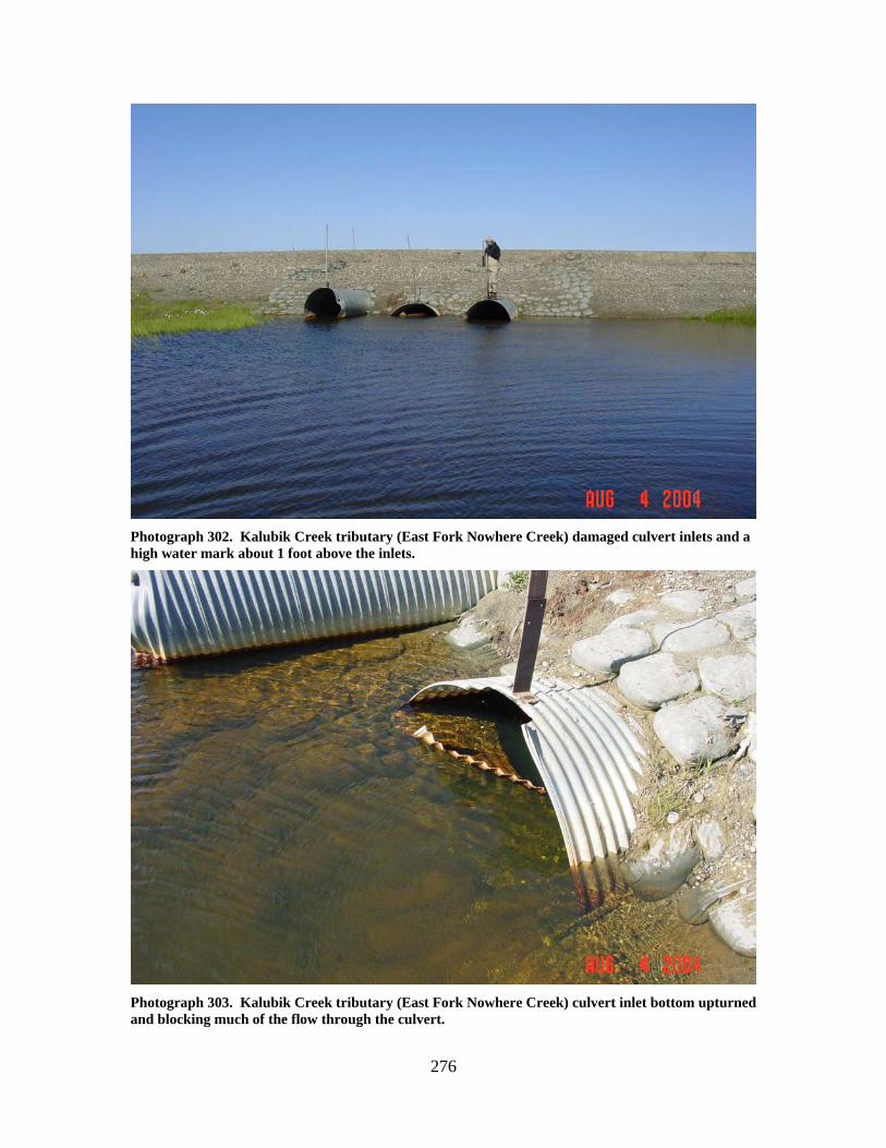
276
Photograph 302. Kalubik Creek tributary (East Fork Nowhere Creek) damaged culvert inlets and a high water mark about 1 foot above the inlets.
Photograph 303. Kalubik Creek tributary (East Fork Nowhere Creek) culvert inlet bottom upturned and blocking much of the flow through the culvert.
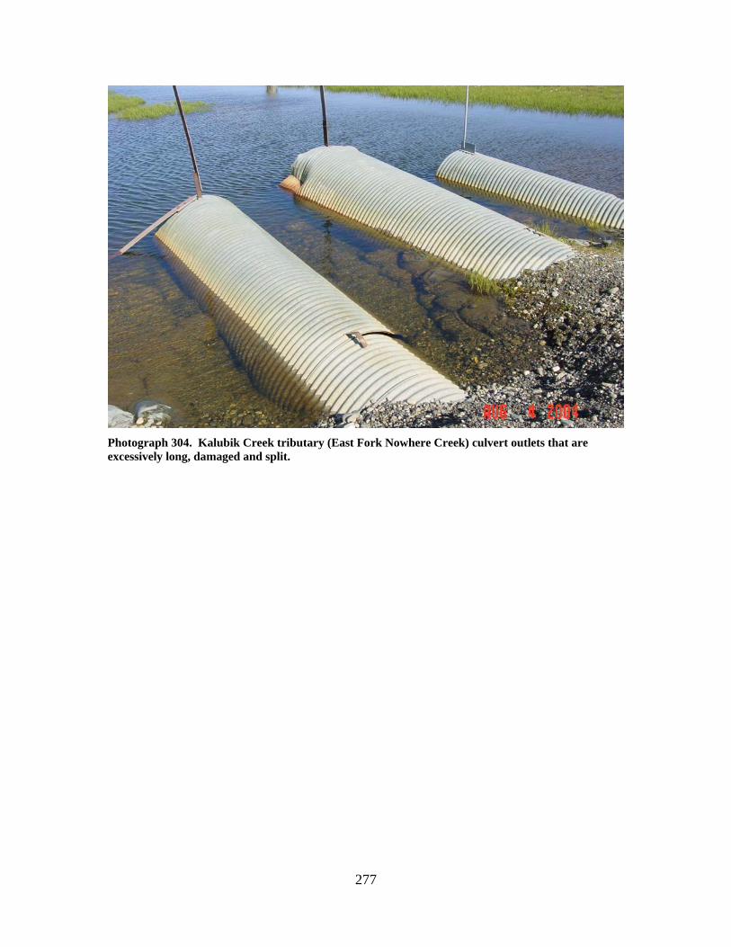
277
Photograph 304. Kalubik Creek tributary (East Fork Nowhere Creek) culvert outlets that are excessively long, damaged and split.
278
KALUBIK CREEK TRIBUTARY (NOWHERE CREEK) (10)
LOCATION: crosses the access road between Drill Site 3F and Drill Site 3G; Section
30, T12N, R9E, UM; 70.36884 N, 149.94430 W OBSERVATION DATE: August 4, 2004 STREAM TYPE: Incised tundra stream CROSSING STRUCTURE: (1) 36 inch corrugated metal pipe; (1) 54 inch corrugated
metal pipe; (1) 60 inch corrugated metal pipe; (2) 66 inch corrugated metal pipe; (1) 72 inch corrugated metal pipe
INLET: Sand bag armor, limited concrete inlet aprons, minor inlet damage, some
tundra erosion, some sand bag erosion around culvert inlets, high water mark 2 feet above inlets, 72 inch culvert partially collapsed
OUTLET: Sand bag armor, minor outlet damage FISH PRESENCE: Arctic grayling; ninespine stickleback, Dolly Varden, and broad
whitefish FISH PASSAGE: Passable HISTORICAL DATA and PERMITS: Fish Habitat Permit FG88-III-0115 was
issued for this installation in April 1988. The culvert battery failed during spring breakup 1988, with outwash gravels extending 300 feet downstream. Rehabilitation work included removal of outwash gravels and reinstallation of the culverts.
REMEDIATION RECOMMENDATIONS: Repair culverts, replace culverts with a
bridge PRIORITY RANKING: Moderate
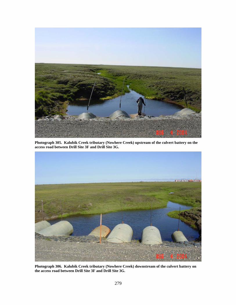
279
Photograph 305. Kalubik Creek tributary (Nowhere Creek) upstream of the culvert battery on the access road between Drill Site 3F and Drill Site 3G.
Photograph 306. Kalubik Creek tributary (Nowhere Creek) downstream of the culvert battery on the access road between Drill Site 3F and Drill Site 3G.
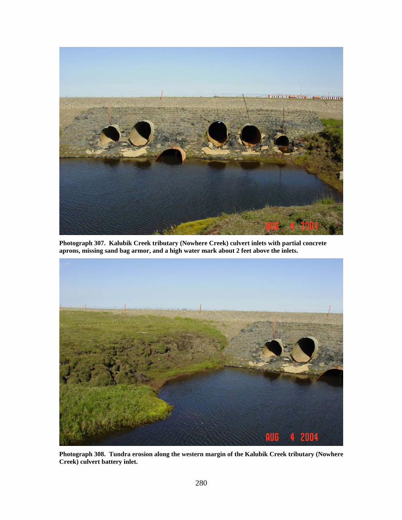
280
Photograph 307. Kalubik Creek tributary (Nowhere Creek) culvert inlets with partial concrete aprons, missing sand bag armor, and a high water mark about 2 feet above the inlets.
Photograph 308. Tundra erosion along the western margin of the Kalubik Creek tributary (Nowhere Creek) culvert battery inlet.
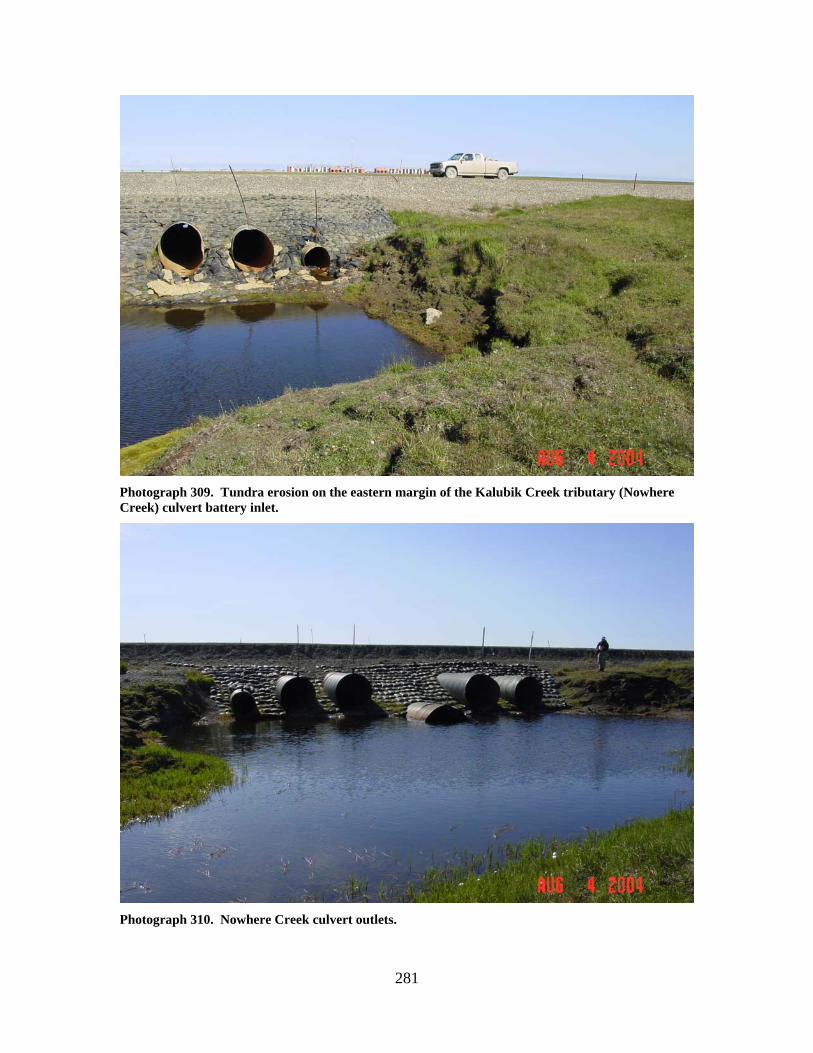
281
Photograph 309. Tundra erosion on the eastern margin of the Kalubik Creek tributary (Nowhere Creek) culvert battery inlet.
Photograph 310. Nowhere Creek culvert outlets.
282
KALUBIK CREEK TRIBUTARY (WEST FORK NOWHERE
CREEK) (11) LOCATION: crosses the access road between Drill Site 3F and Drill Site 3G; Section
24, T12N, R8E, UM; 70.38048 N, 149.98072 W OBSERVATION DATE: August 4, 2004 STREAM TYPE: Moderately incised tundra stream CROSSING STRUCTURE: (2) 48 inch corrugated metal pipes; (2) 60 inch corrugated
metal pipes INLET: Minor inlet damage, scour pools upstream of culverts, road prism erosion,
high water mark 1 foot above culvert inlets OUTLET: Sand bag armor, minor outlet damage, scour pools downstream of culverts FISH PRESENCE: Ninespine stickleback FISH PASSAGE: Passable HISTORICAL DATA and PERMITS: Fish Habitat Permit FG86-III-0116 was
issued for this installation in April 1986. REMEDIATION RECOMMENDATIONS: Repair culverts, increase conveyance at this
location PRIORITY RANKING: Low
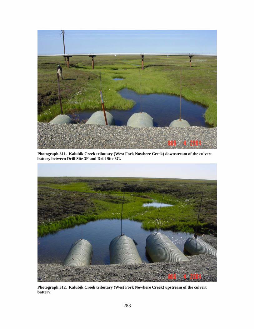
283
Photograph 311. Kalubik Creek tributary (West Fork Nowhere Creek) downstream of the culvert battery between Drill Site 3F and Drill Site 3G.
Photograph 312. Kalubik Creek tributary (West Fork Nowhere Creek) upstream of the culvert battery.
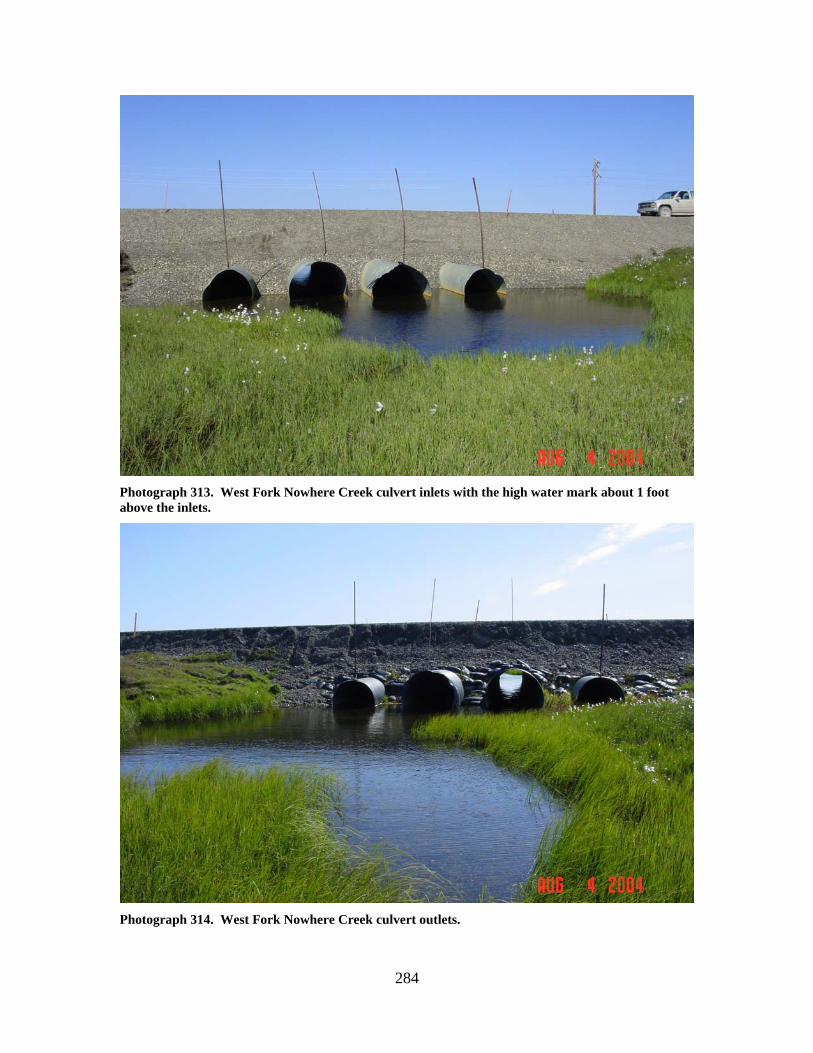
284
Photograph 313. West Fork Nowhere Creek culvert inlets with the high water mark about 1 foot above the inlets.
Photograph 314. West Fork Nowhere Creek culvert outlets.
285
KALUBIK CREEK (12)
LOCATION: crosses the access road between Drill Site 3G and Drill Site 3S; Section
23, T12N, R8E, UM; 70.38000 N, 150.05157 W OBSERVATION DATE: August 4, 2004 STREAM TYPE: Gravel bed tundra stream CROSSING STRUCTURE: Bridge with sheet pile bin walls; 2 sets of piers along the
stream banks; some limited pier and bank scour FISH PRESENCE: Ninespine stickleback, Arctic grayling, whitefish, Dolly Varden
likely present FISH PASSAGE: Passable HISTORICAL DATA and PERMITS: Fish Habitat Permit FG01-III-0260 was
issued for this bridge installation. REMEDIATION RECOMMENDATIONS: None PRIORITY RANKING: None
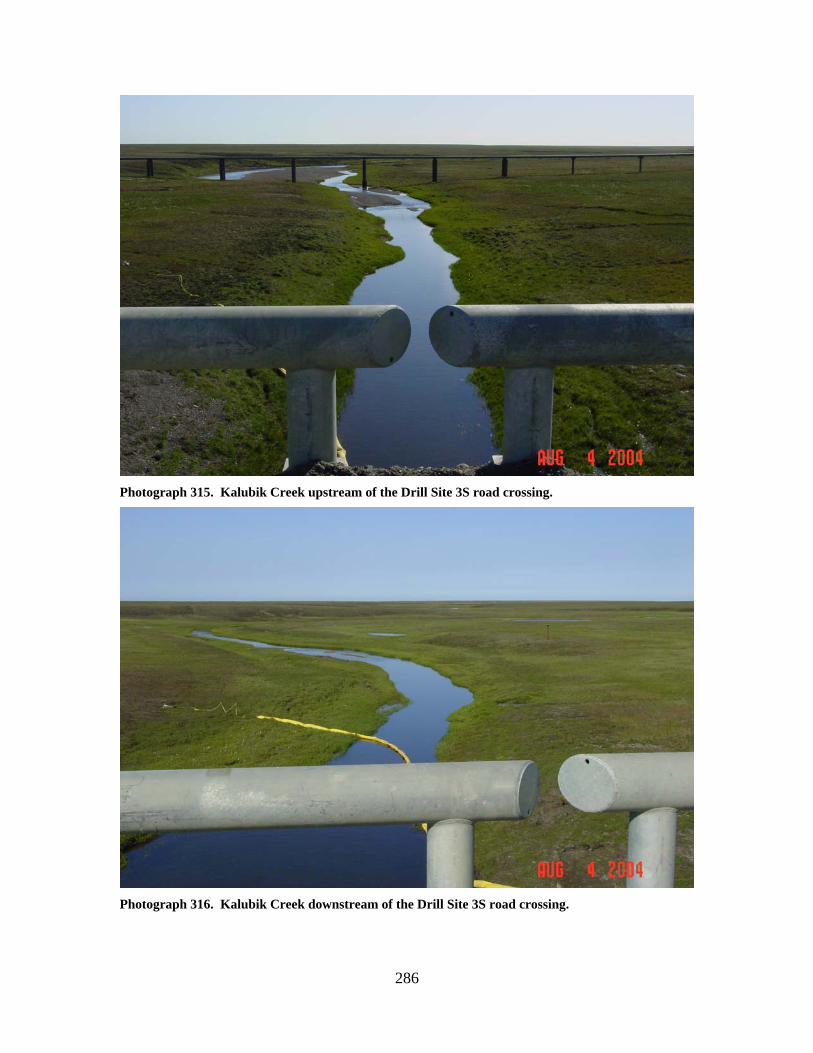
286
Photograph 315. Kalubik Creek upstream of the Drill Site 3S road crossing.
Photograph 316. Kalubik Creek downstream of the Drill Site 3S road crossing.
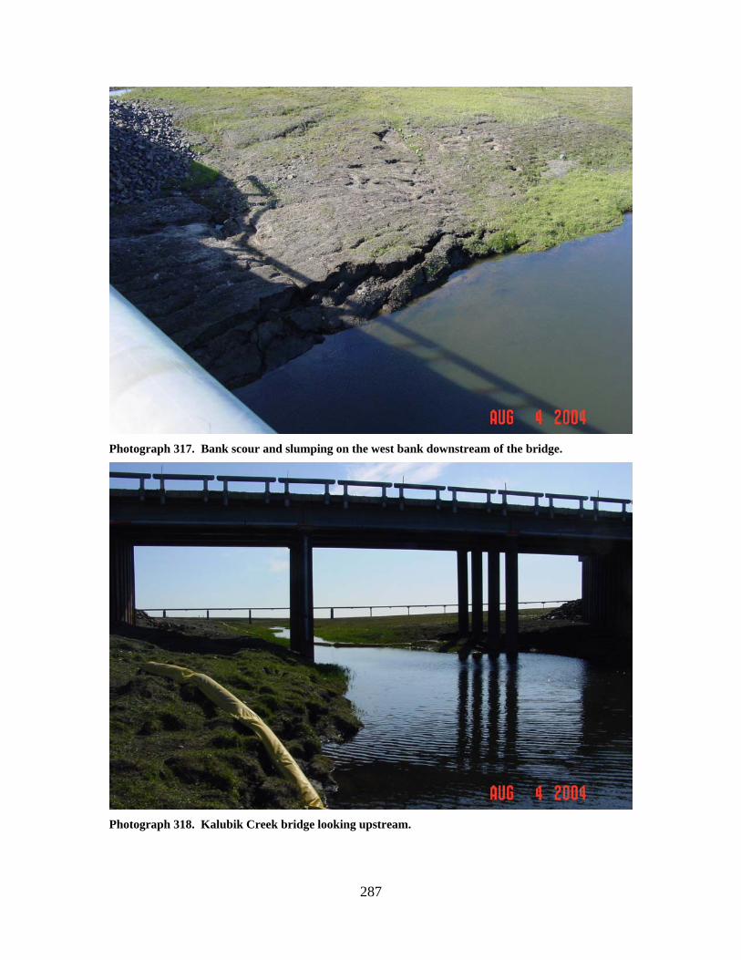
287
Photograph 317. Bank scour and slumping on the west bank downstream of the bridge.
Photograph 318. Kalubik Creek bridge looking upstream.
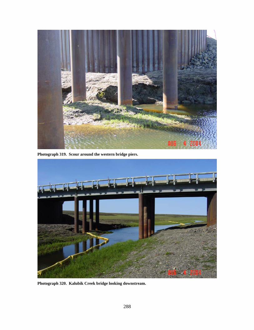
288
Photograph 319. Scour around the western bridge piers.
Photograph 320. Kalubik Creek bridge looking downstream.
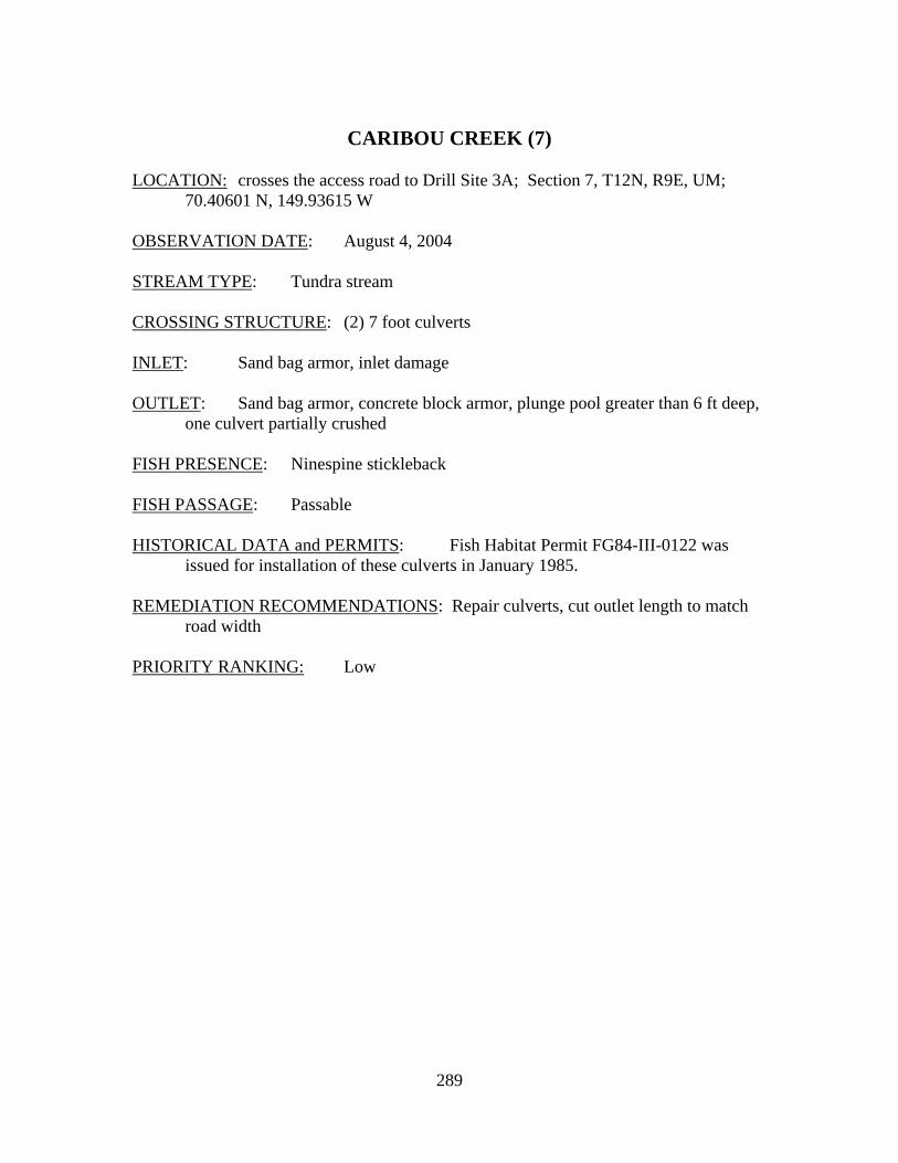
289
CARIBOU CREEK (7)
LOCATION: crosses the access road to Drill Site 3A; Section 7, T12N, R9E, UM;
70.40601 N, 149.93615 W OBSERVATION DATE: August 4, 2004 STREAM TYPE: Tundra stream CROSSING STRUCTURE: (2) 7 foot culverts INLET: Sand bag armor, inlet damage OUTLET: Sand bag armor, concrete block armor, plunge pool greater than 6 ft deep,
one culvert partially crushed FISH PRESENCE: Ninespine stickleback FISH PASSAGE: Passable HISTORICAL DATA and PERMITS: Fish Habitat Permit FG84-III-0122 was
issued for installation of these culverts in January 1985. REMEDIATION RECOMMENDATIONS: Repair culverts, cut outlet length to match
road width PRIORITY RANKING: Low
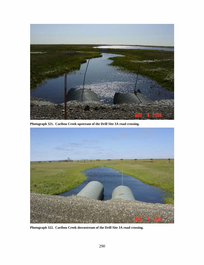
290
Photograph 321. Caribou Creek upstream of the Drill Site 3A road crossing.
Photograph 322. Caribou Creek downstream of the Drill Site 3A road crossing.
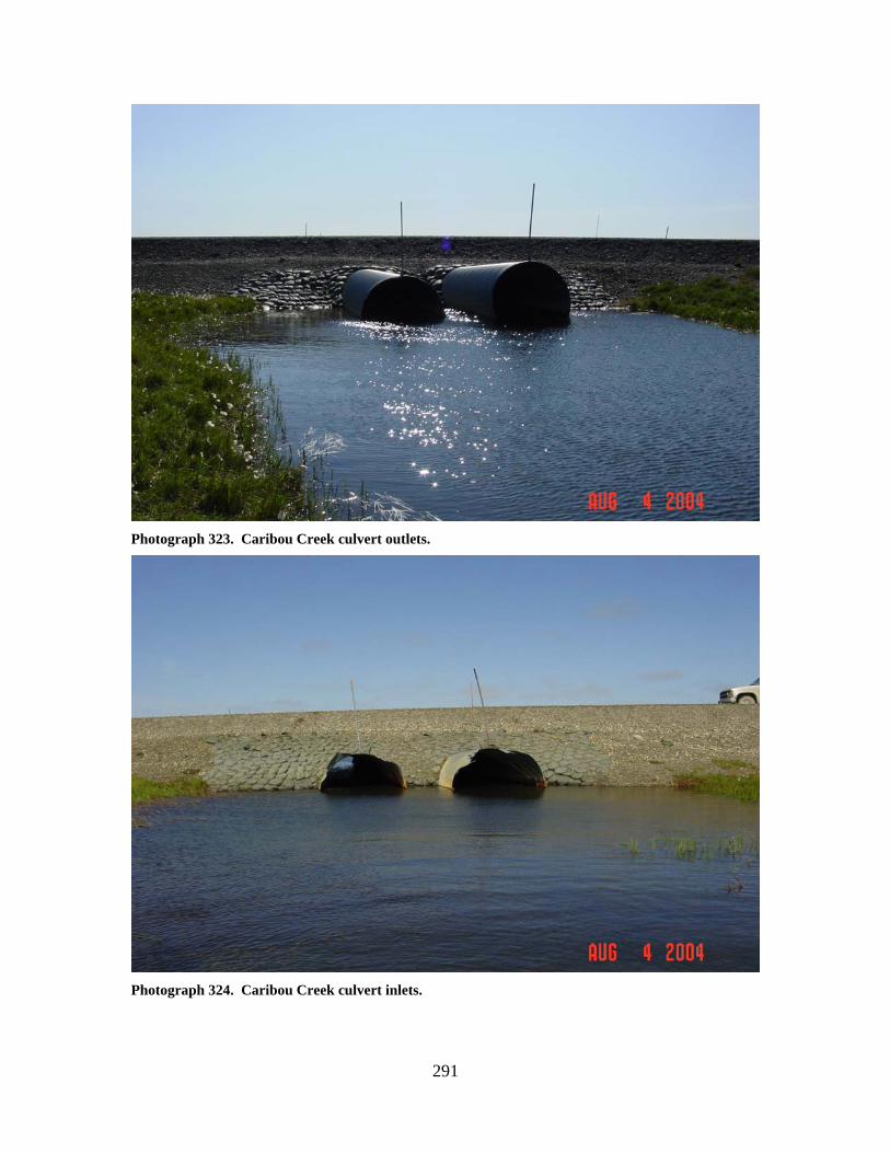
291
Photograph 323. Caribou Creek culvert outlets.
Photograph 324. Caribou Creek culvert inlets.
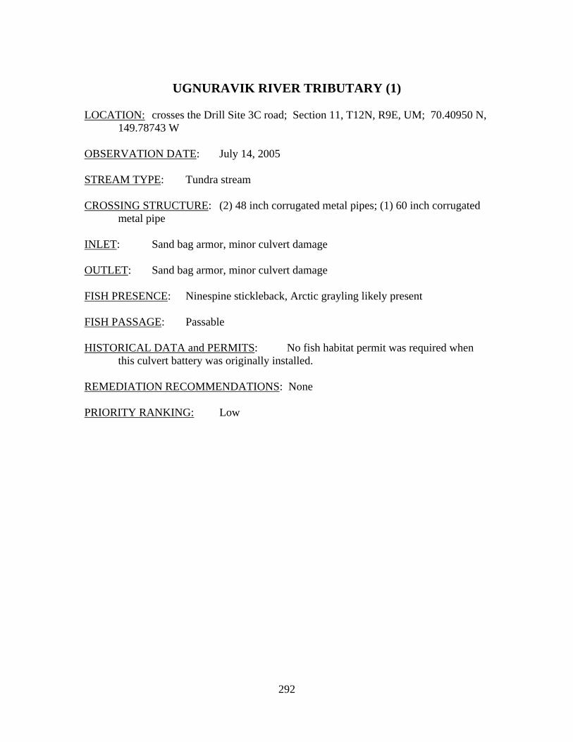
292
UGNURAVIK RIVER TRIBUTARY (1)
LOCATION: crosses the Drill Site 3C road; Section 11, T12N, R9E, UM; 70.40950 N,
149.78743 W OBSERVATION DATE: July 14, 2005 STREAM TYPE: Tundra stream CROSSING STRUCTURE: (2) 48 inch corrugated metal pipes; (1) 60 inch corrugated
metal pipe INLET: Sand bag armor, minor culvert damage OUTLET: Sand bag armor, minor culvert damage FISH PRESENCE: Ninespine stickleback, Arctic grayling likely present FISH PASSAGE: Passable HISTORICAL DATA and PERMITS: No fish habitat permit was required when
this culvert battery was originally installed. REMEDIATION RECOMMENDATIONS: None PRIORITY RANKING: Low
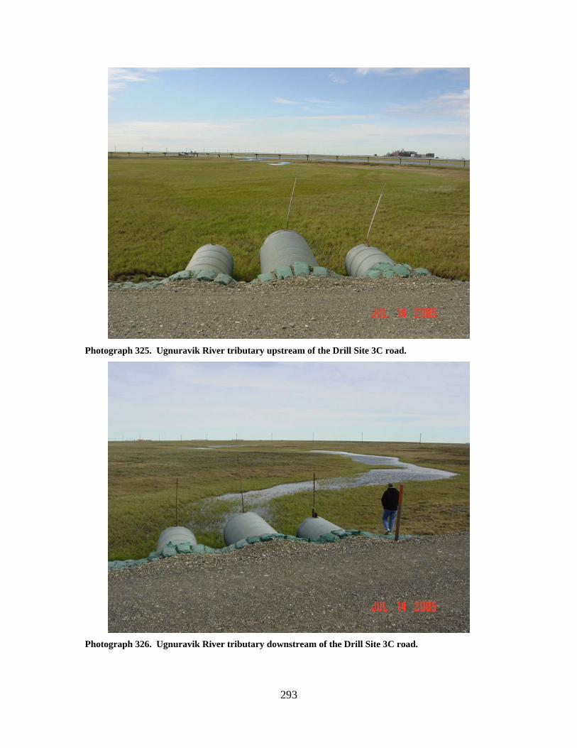
293
Photograph 325. Ugnuravik River tributary upstream of the Drill Site 3C road.
Photograph 326. Ugnuravik River tributary downstream of the Drill Site 3C road.
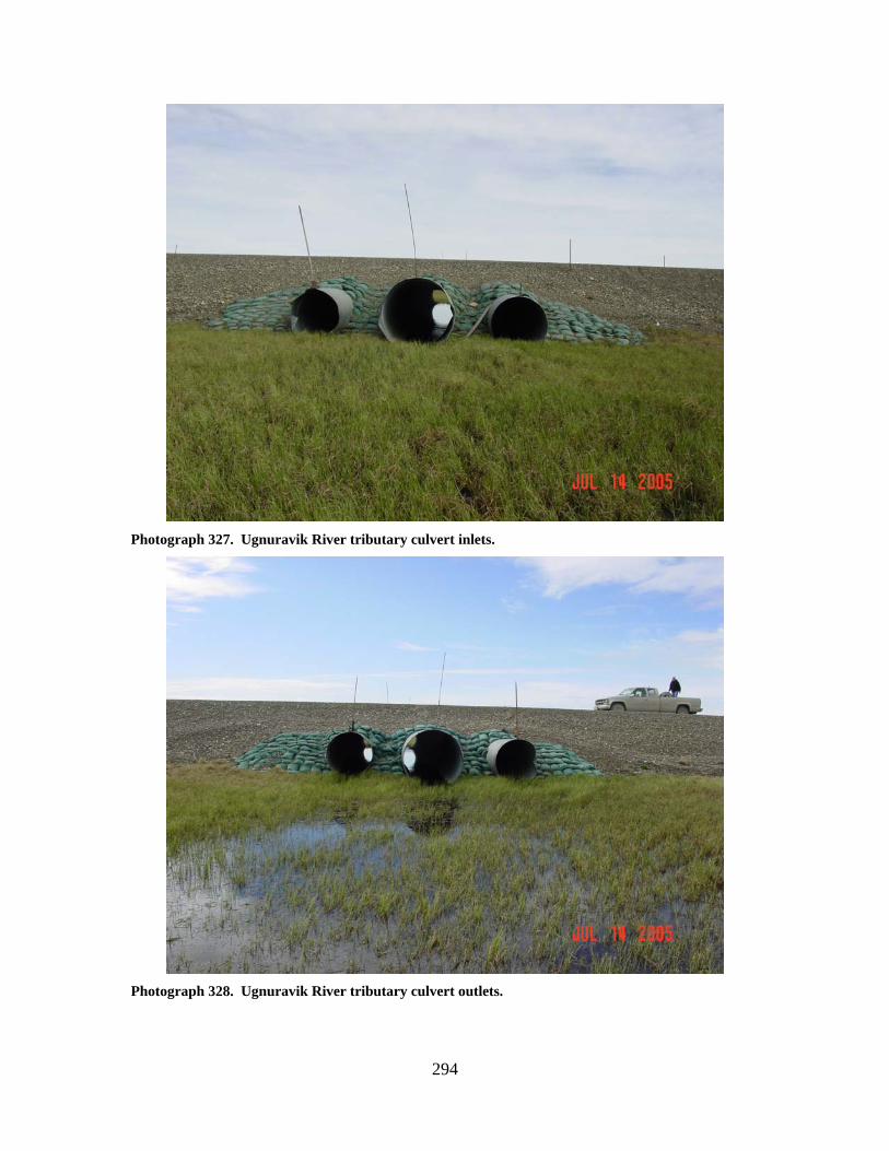
294
Photograph 327. Ugnuravik River tributary culvert inlets.
Photograph 328. Ugnuravik River tributary culvert outlets.
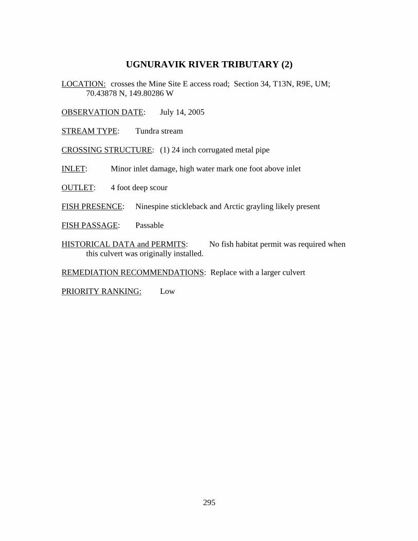
295
UGNURAVIK RIVER TRIBUTARY (2)
LOCATION: crosses the Mine Site E access road; Section 34, T13N, R9E, UM;
70.43878 N, 149.80286 W OBSERVATION DATE: July 14, 2005 STREAM TYPE: Tundra stream CROSSING STRUCTURE: (1) 24 inch corrugated metal pipe INLET: Minor inlet damage, high water mark one foot above inlet OUTLET: 4 foot deep scour FISH PRESENCE: Ninespine stickleback and Arctic grayling likely present FISH PASSAGE: Passable HISTORICAL DATA and PERMITS: No fish habitat permit was required when
this culvert was originally installed. REMEDIATION RECOMMENDATIONS: Replace with a larger culvert PRIORITY RANKING: Low
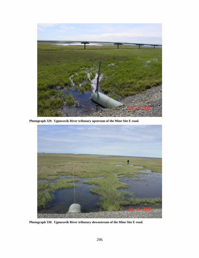
296
Photograph 329. Ugnuravik River tributary upstream of the Mine Site E road.
Photograph 330. Ugnuravik River tributary downstream of the Mine Site E road.
297
Photograph 331. Ugnuravik River tributary culvert inlet.
Photograph 332. Ugnuravik River tributary culvert outlet.
298
UGNURAVIK RIVER TRIBUTARY (3)
LOCATION: crosses the Mine Site E access road; Section 34, T13N, R9E, UM;
70.43951 N, 149.79885 W OBSERVATION DATE: July 14, 2005 STREAM TYPE: Tundra stream CROSSING STRUCTURE: (1) 36 inch corrugated metal pipe; (2) 48 inch corrugated
metal pipes INLET: Culvert split OUTLET: Culverts split, outlet damage FISH PRESENCE: Ninespine stickleback and Arctic grayling likely present FISH PASSAGE: Passable HISTORICAL DATA and PERMITS: No fish habitat permit was required when
this culvert battery was originally installed. REMEDIATION RECOMMENDATIONS: Repair culverts, cut length to match road
width PRIORITY RANKING: Low
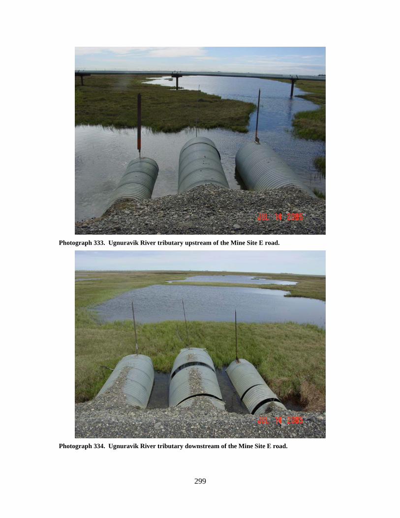
299
Photograph 333. Ugnuravik River tributary upstream of the Mine Site E road.
Photograph 334. Ugnuravik River tributary downstream of the Mine Site E road.
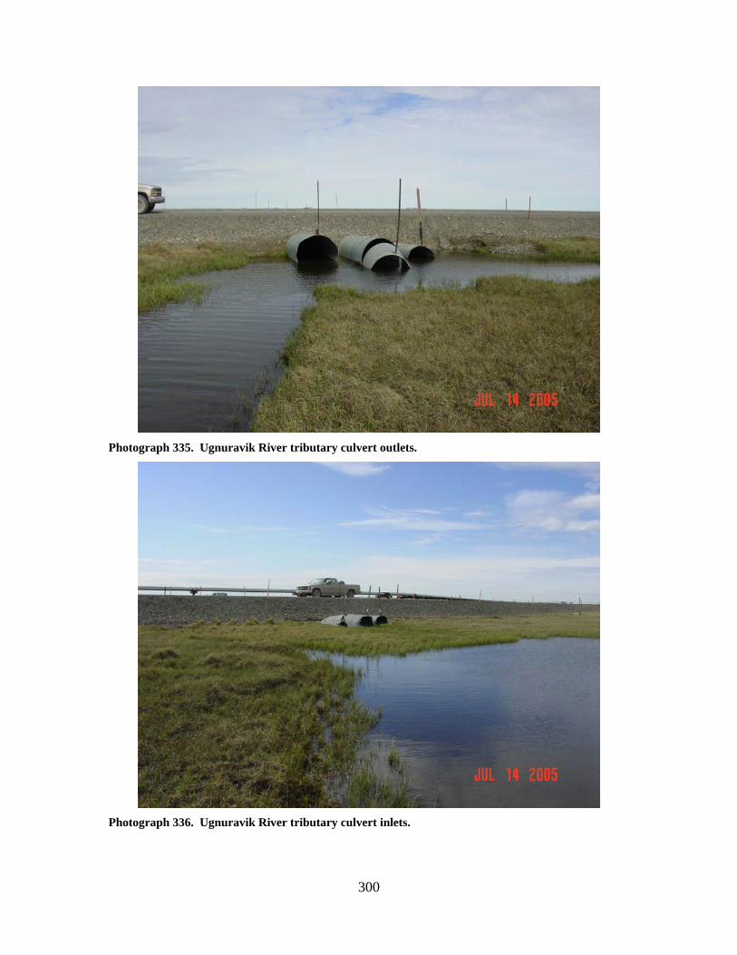
300
Photograph 335. Ugnuravik River tributary culvert outlets.
Photograph 336. Ugnuravik River tributary culvert inlets.
301
UGNURAVIK RIVER TRIBUTARY (5)
LOCATION: crosses the Mine Site E road; Section 26, T13N, R9E, UM; 70.44432 N,
149.75593 W OBSERVATION DATE: July 14, 2005 STREAM TYPE: Tundra stream/tundra swale CROSSING STRUCTURE: (1) 54 inch corrugated metal pipe; (1) 60 inch corrugated
metal pipe; (1) 66 inch corrugated metal pipe INLET: Sand bag armor, substantial inlet damage, high water mark above culverts OUTLET: Sand bag armor, scour pool 6 feet deep FISH PRESENCE: Ninespine stickleback and Arctic grayling likely present FISH PASSAGE: Passable HISTORICAL DATA and PERMITS: No fish habitat permit was required when
this culvert battery was originally installed. REMEDIATION RECOMMENDATIONS: Repair and possibly reset culverts PRIORITY RANKING: Low
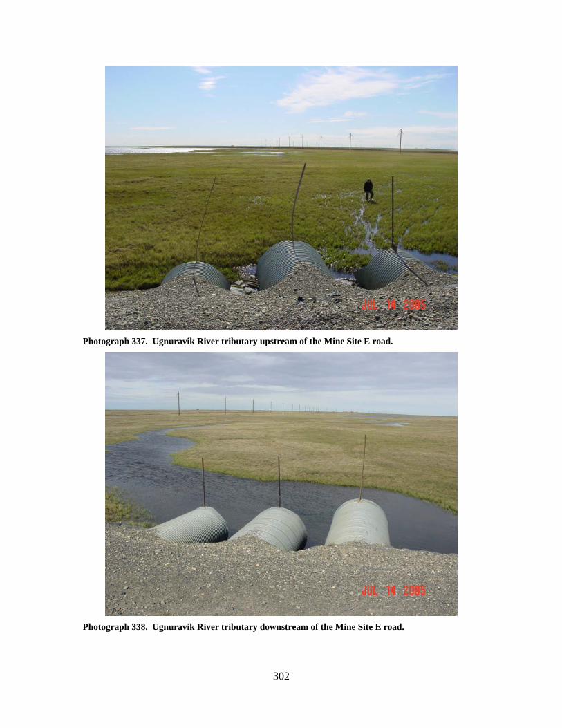
302
Photograph 337. Ugnuravik River tributary upstream of the Mine Site E road.
Photograph 338. Ugnuravik River tributary downstream of the Mine Site E road.
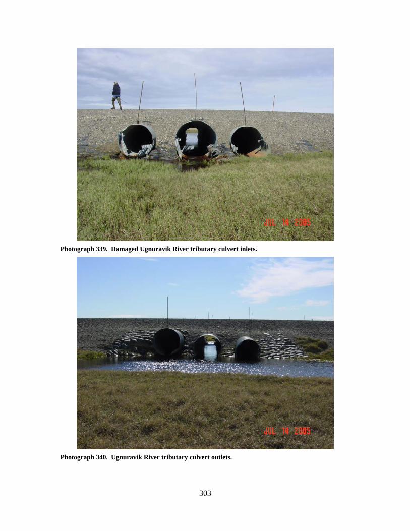
303
Photograph 339. Damaged Ugnuravik River tributary culvert inlets.
Photograph 340. Ugnuravik River tributary culvert outlets.
304
UGNURAVIK RIVER TRIBUTARY (4)
LOCATION: crosses the Drill Site 3K road; Section 35, T13N, R9E, UM; 70.43915 N,
149.76465 W OBSERVATION DATE: July 14, 2005 STREAM TYPE: Tundra stream/swale CROSSING STRUCTURE: (2) 24 inch corrugated metal pipes; (1) 42 inch corrugated
metal pipe INLET: Sand bag armor, inlet damage, OUTLET: Sand bag armor, outlet damage, gobi mat set below outlets, pipes bowed FISH PRESENCE: Ninespine stickleback and Arctic grayling likely present FISH PASSAGE: Passable HISTORICAL DATA and PERMITS: Fish Habitat Permit FG84-III-0124 was
issued for this culvert battery installation. REMEDIATION RECOMMENDATIONS: Repair culverts, cut length to match road
width PRIORITY RANKING: Low
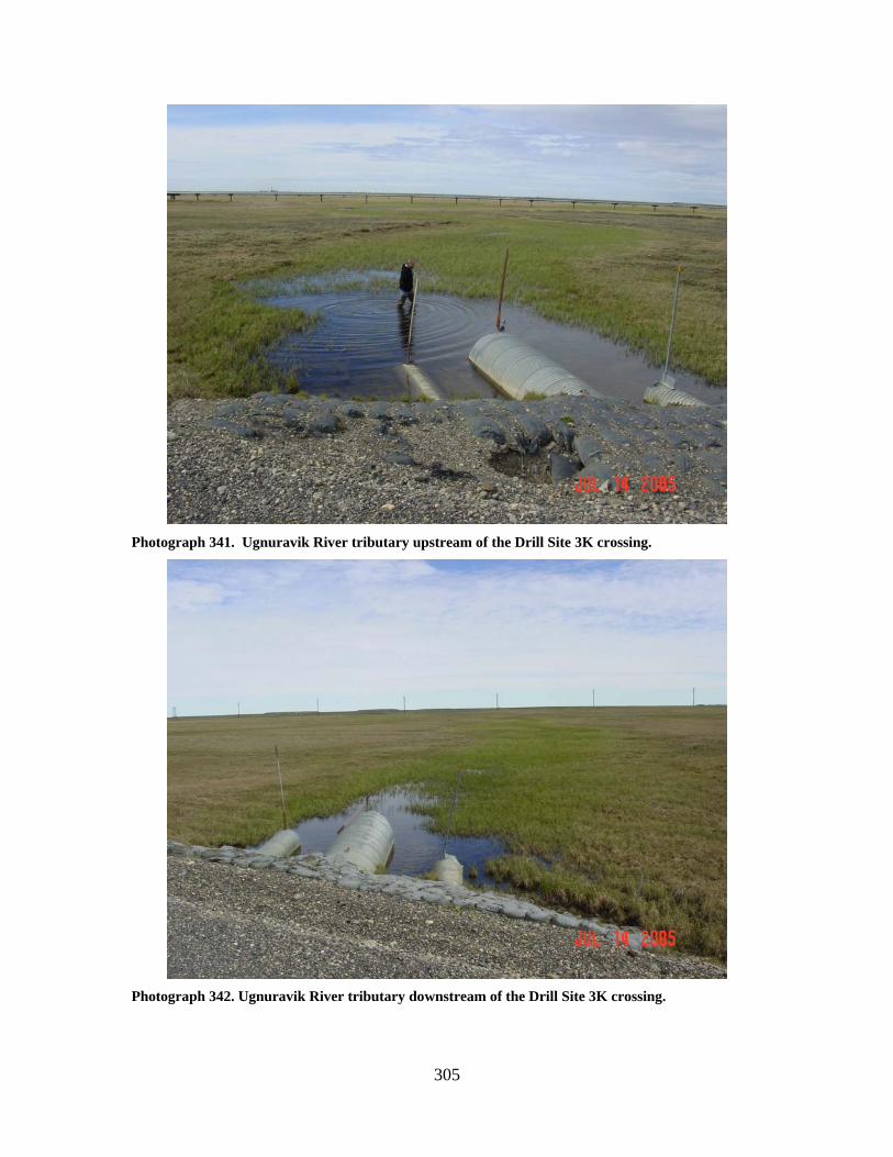
305
Photograph 341. Ugnuravik River tributary upstream of the Drill Site 3K crossing.
Photograph 342. Ugnuravik River tributary downstream of the Drill Site 3K crossing.
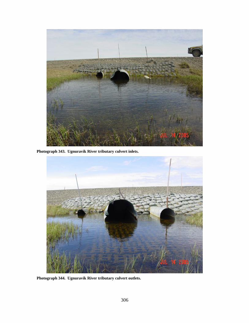
306
Photograph 343. Ugnuravik River tributary culvert inlets.
Photograph 344. Ugnuravik River tributary culvert outlets.
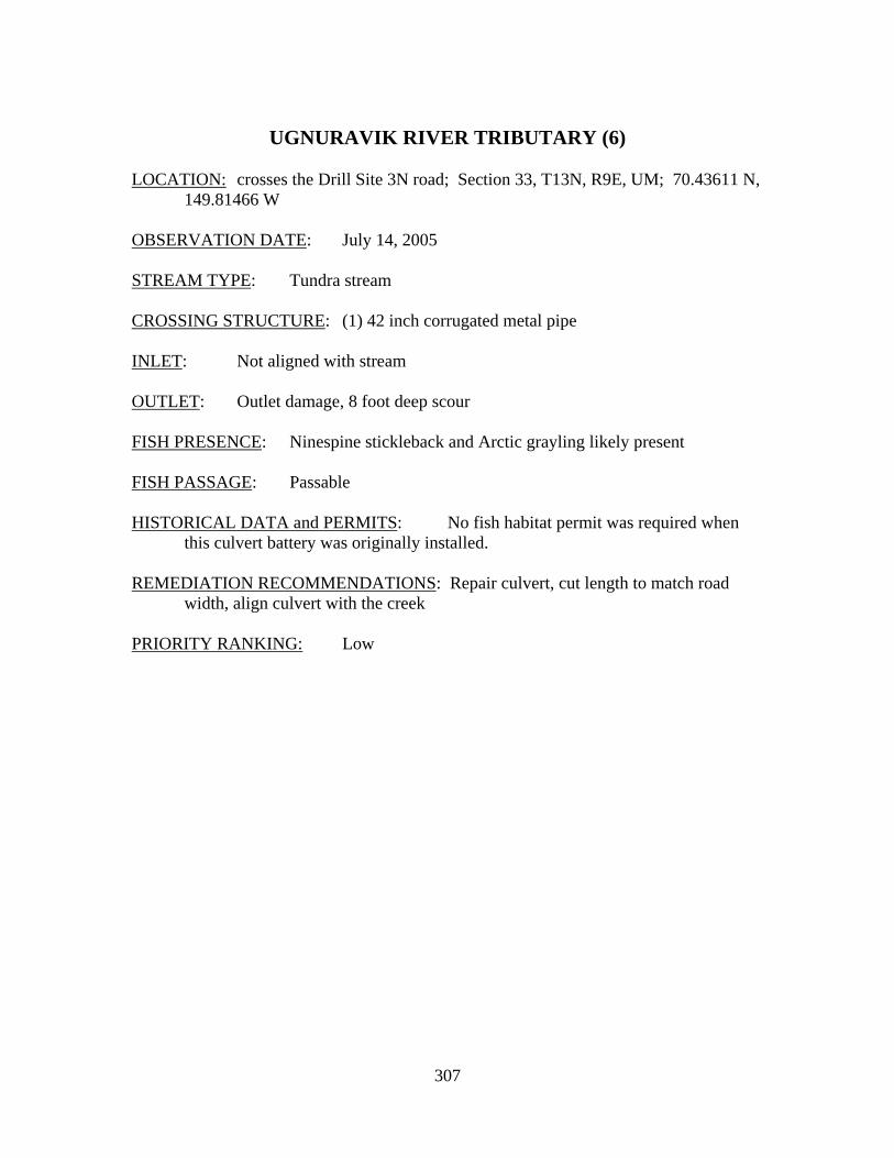
307
UGNURAVIK RIVER TRIBUTARY (6)
LOCATION: crosses the Drill Site 3N road; Section 33, T13N, R9E, UM; 70.43611 N,
149.81466 W OBSERVATION DATE: July 14, 2005 STREAM TYPE: Tundra stream CROSSING STRUCTURE: (1) 42 inch corrugated metal pipe INLET: Not aligned with stream OUTLET: Outlet damage, 8 foot deep scour FISH PRESENCE: Ninespine stickleback and Arctic grayling likely present FISH PASSAGE: Passable HISTORICAL DATA and PERMITS: No fish habitat permit was required when
this culvert battery was originally installed. REMEDIATION RECOMMENDATIONS: Repair culvert, cut length to match road
width, align culvert with the creek PRIORITY RANKING: Low
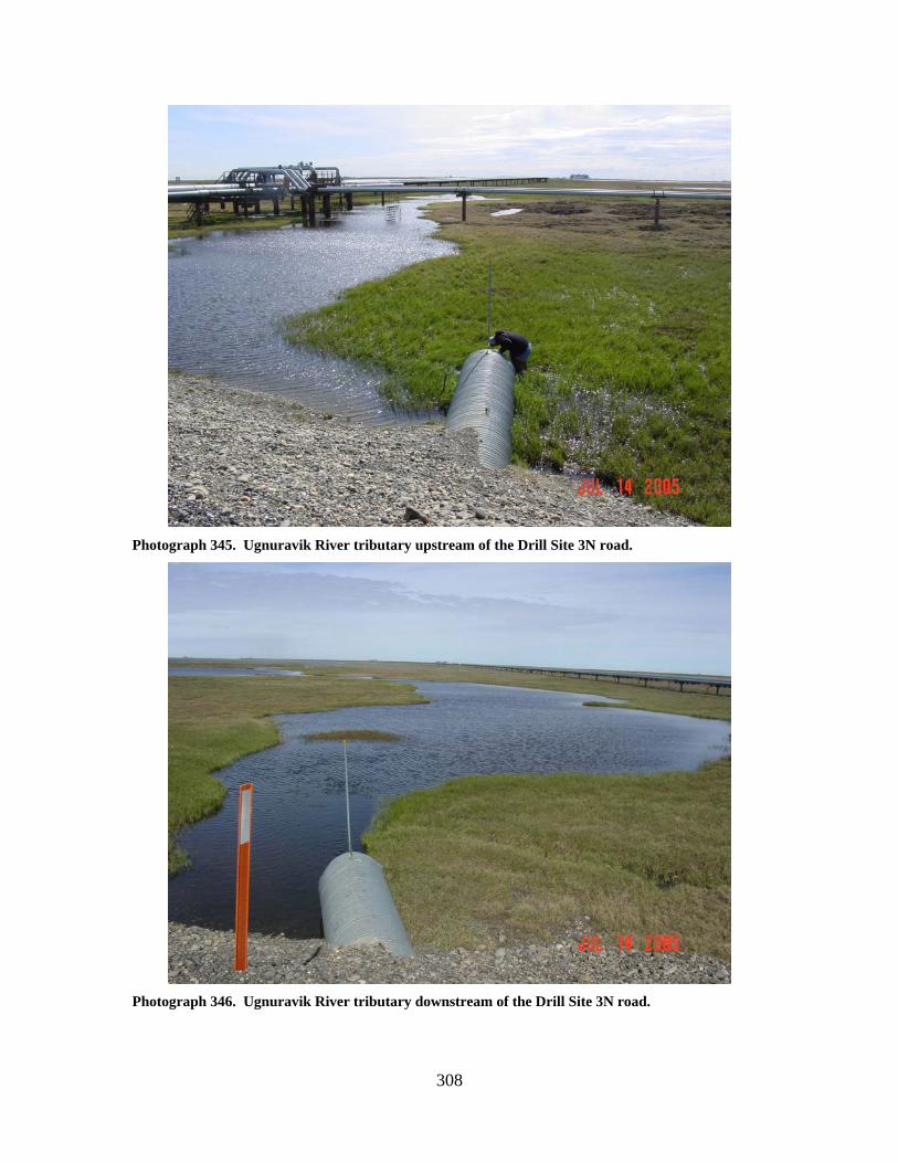
308
Photograph 345. Ugnuravik River tributary upstream of the Drill Site 3N road.
Photograph 346. Ugnuravik River tributary downstream of the Drill Site 3N road.
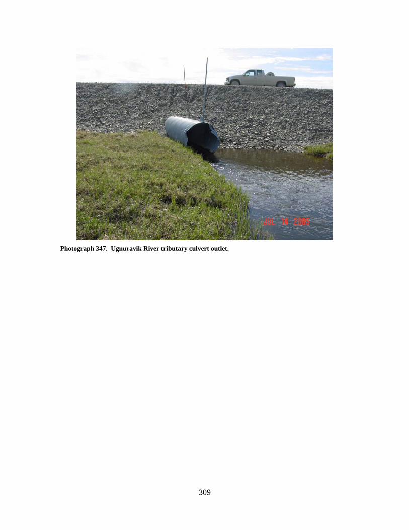
309
Photograph 347. Ugnuravik River tributary culvert outlet.

310

311
Kuparuk CPF 2 Area Stream Crossings

312
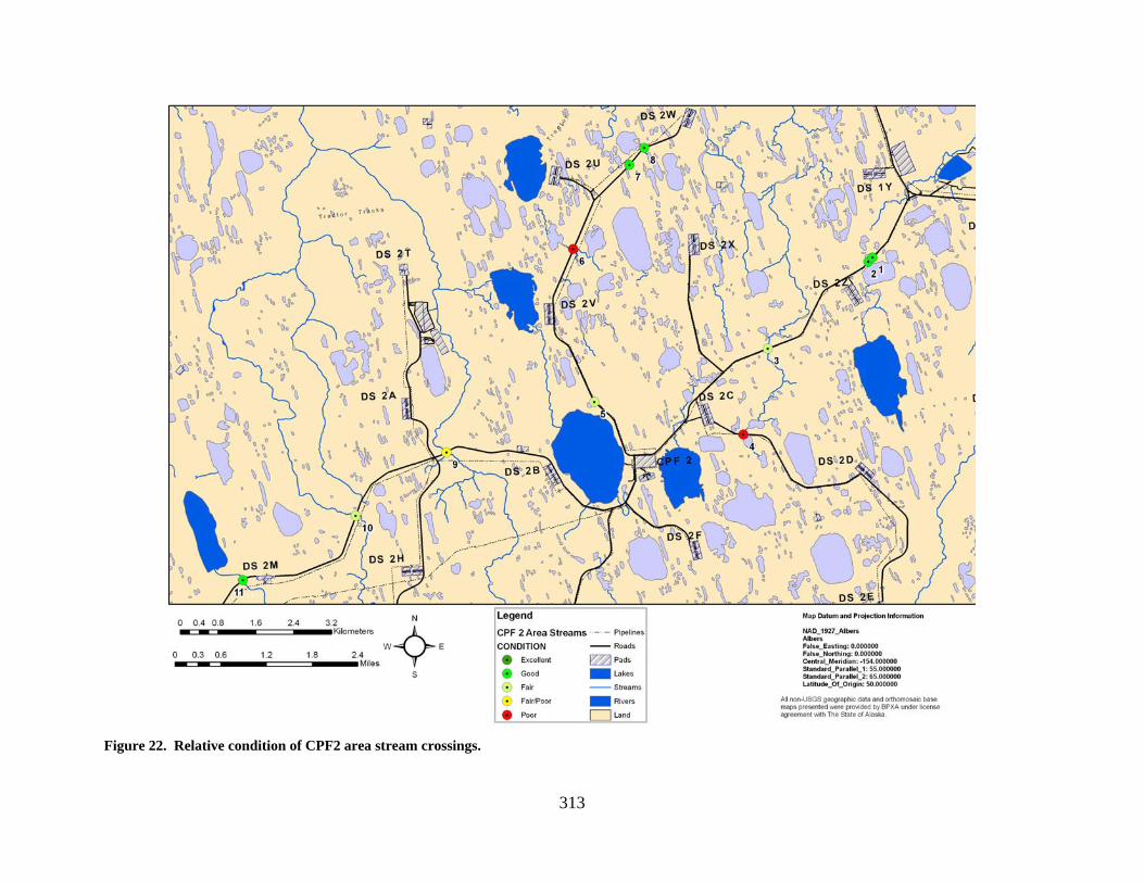
313
Figure 22. Relative condition of CPF2 area stream crossings.
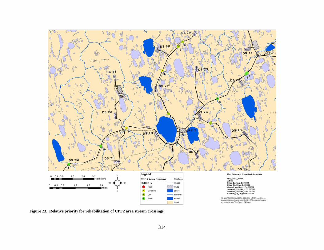
314
Figure 23. Relative priority for rehabilitation of CPF2 area stream crossings.

315
CHARLIE CREEK (1)
LOCATION: crosses the Spine Road 0.4 miles from Drill Site 2Z; Section 12, T11N,
R9E, UM; 70.32615 N, 149.75324 W OBSERVATION DATE: August 4, 2004 STREAM TYPE: Inundated wetland stream between lakes CROSSING STRUCTURE: (1) 36 inch corrugated metal pipe; (2) 48 inch corrugated
metal pipes INLET: Minor inlet damage OUTLET: Minor outlet damage FISH PRESENCE: Ninespine stickleback; Arctic grayling likely present FISH PASSAGE: Passable HISTORICAL DATA and PERMITS: No fish habitat permit was required when
this culvert battery was originally installed. REMEDIATION RECOMMENDATIONS: None PRIORITY RANKING: None
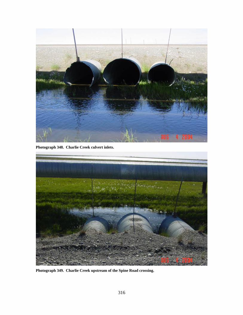
316
Photograph 348. Charlie Creek culvert inlets.
Photograph 349. Charlie Creek upstream of the Spine Road crossing.
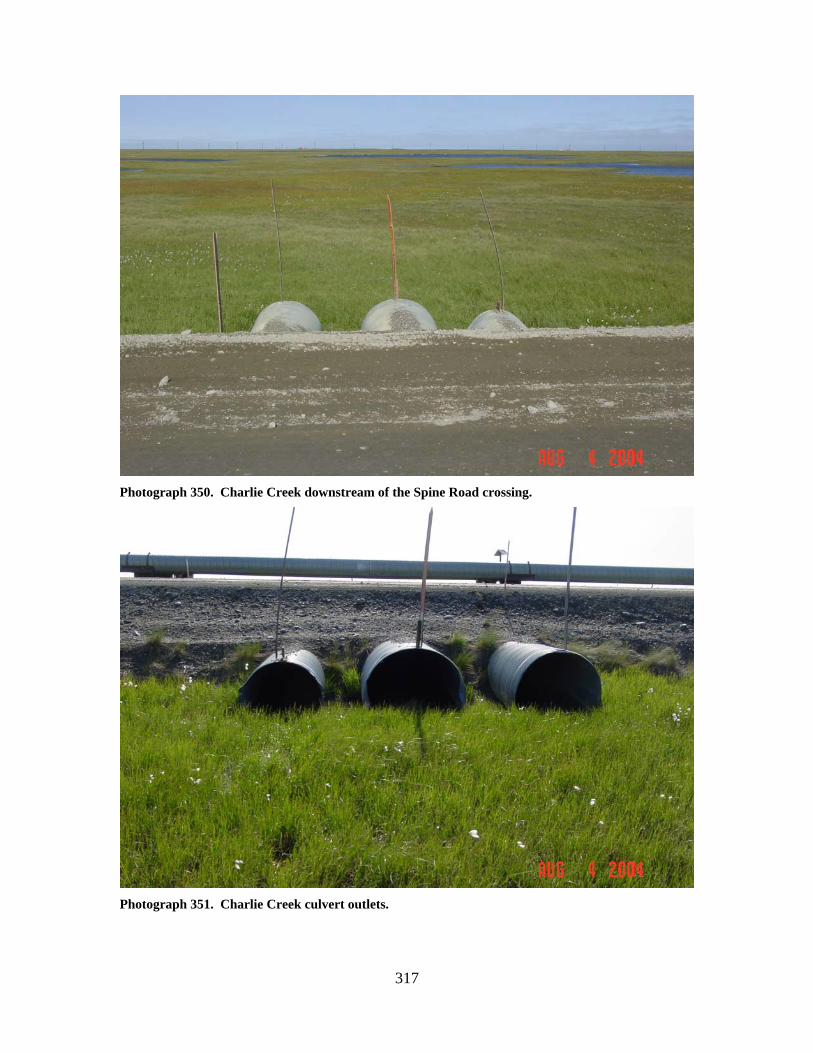
317
Photograph 350. Charlie Creek downstream of the Spine Road crossing.
Photograph 351. Charlie Creek culvert outlets.
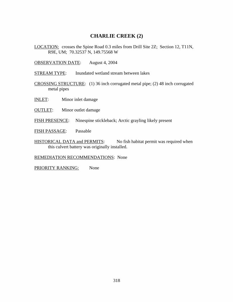
318
CHARLIE CREEK (2)
LOCATION: crosses the Spine Road 0.3 miles from Drill Site 2Z; Section 12, T11N,
R9E, UM; 70.32537 N, 149.75568 W OBSERVATION DATE: August 4, 2004 STREAM TYPE: Inundated wetland stream between lakes CROSSING STRUCTURE: (1) 36 inch corrugated metal pipe; (2) 48 inch corrugated
metal pipes INLET: Minor inlet damage OUTLET: Minor outlet damage FISH PRESENCE: Ninespine stickleback; Arctic grayling likely present FISH PASSAGE: Passable HISTORICAL DATA and PERMITS: No fish habitat permit was required when
this culvert battery was originally installed. REMEDIATION RECOMMENDATIONS: None PRIORITY RANKING: None
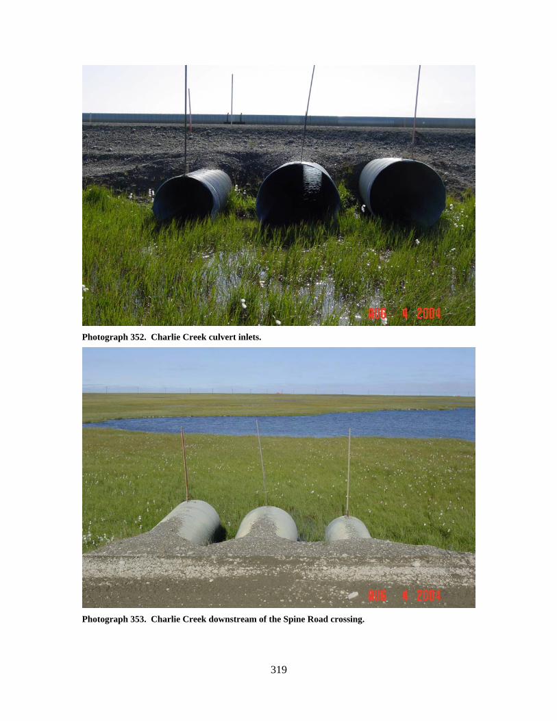
319
Photograph 352. Charlie Creek culvert inlets.
Photograph 353. Charlie Creek downstream of the Spine Road crossing.
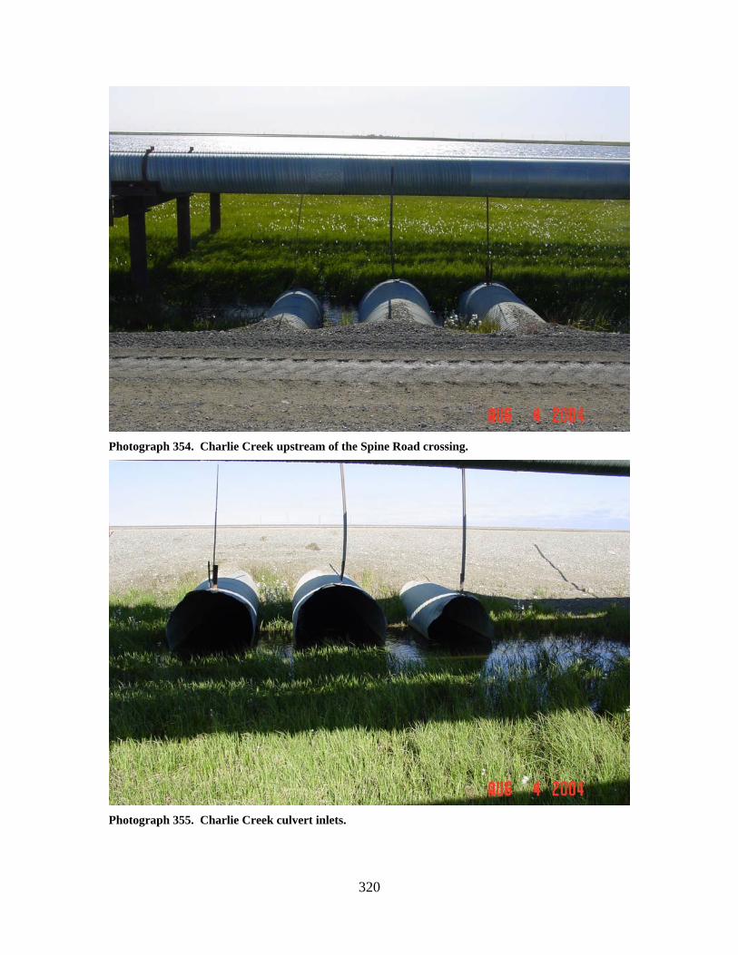
320
Photograph 354. Charlie Creek upstream of the Spine Road crossing.
Photograph 355. Charlie Creek culvert inlets.
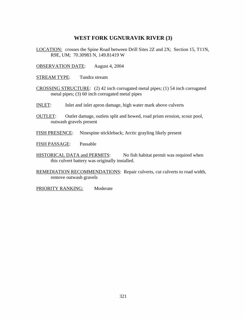
321
WEST FORK UGNURAVIK RIVER (3)
LOCATION: crosses the Spine Road between Drill Sites 2Z and 2X; Section 15, T11N,
R9E, UM; 70.30983 N, 149.81419 W OBSERVATION DATE: August 4, 2004 STREAM TYPE: Tundra stream CROSSING STRUCTURE: (2) 42 inch corrugated metal pipes; (1) 54 inch corrugated
metal pipes; (3) 60 inch corrugated metal pipes INLET: Inlet and inlet apron damage, high water mark above culverts OUTLET: Outlet damage, outlets split and bowed, road prism erosion, scour pool,
outwash gravels present FISH PRESENCE: Ninespine stickleback; Arctic grayling likely present FISH PASSAGE: Passable HISTORICAL DATA and PERMITS: No fish habitat permit was required when
this culvert battery was originally installed. REMEDIATION RECOMMENDATIONS: Repair culverts, cut culverts to road width,
remove outwash gravels PRIORITY RANKING: Moderate
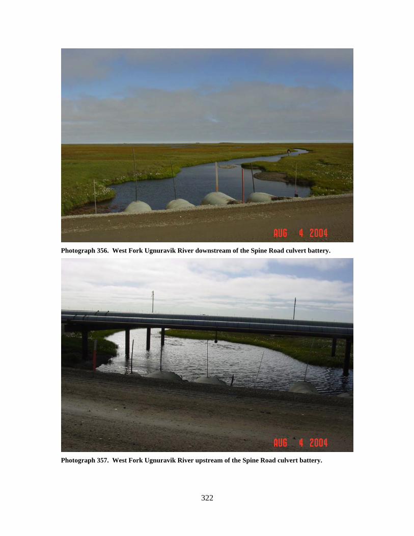
322
Photograph 356. West Fork Ugnuravik River downstream of the Spine Road culvert battery.
Photograph 357. West Fork Ugnuravik River upstream of the Spine Road culvert battery.
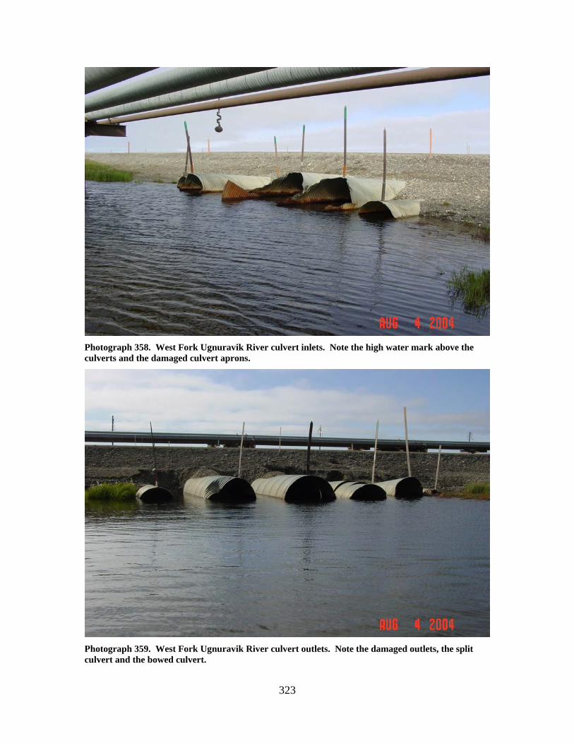
323
Photograph 358. West Fork Ugnuravik River culvert inlets. Note the high water mark above the culverts and the damaged culvert aprons.
Photograph 359. West Fork Ugnuravik River culvert outlets. Note the damaged outlets, the split culvert and the bowed culvert.
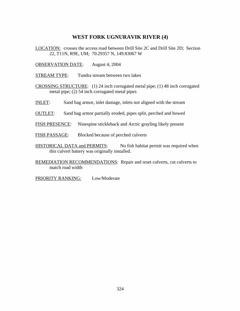
324
WEST FORK UGNURAVIK RIVER (4)
LOCATION: crosses the access road between Drill Site 2C and Drill Site 2D; Section
22, T11N, R9E, UM; 70.29357 N, 149.83067 W OBSERVATION DATE: August 4, 2004 STREAM TYPE: Tundra stream between two lakes CROSSING STRUCTURE: (1) 24 inch corrugated metal pipe; (1) 48 inch corrugated
metal pipe; (2) 54 inch corrugated metal pipes INLET: Sand bag armor, inlet damage, inlets not aligned with the stream OUTLET: Sand bag armor partially eroded, pipes split, perched and bowed FISH PRESENCE: Ninespine stickleback and Arctic grayling likely present FISH PASSAGE: Blocked because of perched culverts HISTORICAL DATA and PERMITS: No fish habitat permit was required when
this culvert battery was originally installed. REMEDIATION RECOMMENDATIONS: Repair and reset culverts, cut culverts to
match road width PRIORITY RANKING: Low/Moderate
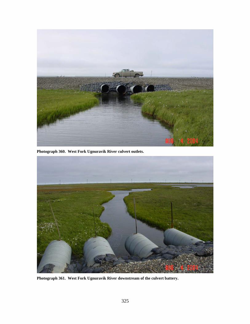
325
Photograph 360. West Fork Ugnuravik River culvert outlets.
Photograph 361. West Fork Ugnuravik River downstream of the culvert battery.
326
Photograph 362. Perched, split, and bowed culvert in the West Fork Ugnuravik River crossing.
Photograph 363. West Fork Ugnuravik River culvert inlets. Note the stream approaching from the right, and the perched and damaged inlets.
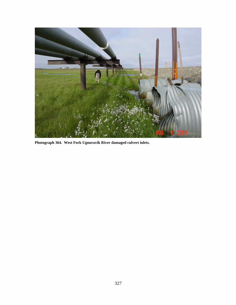
327
Photograph 364. West Fork Ugnuravik River damaged culvert inlets.
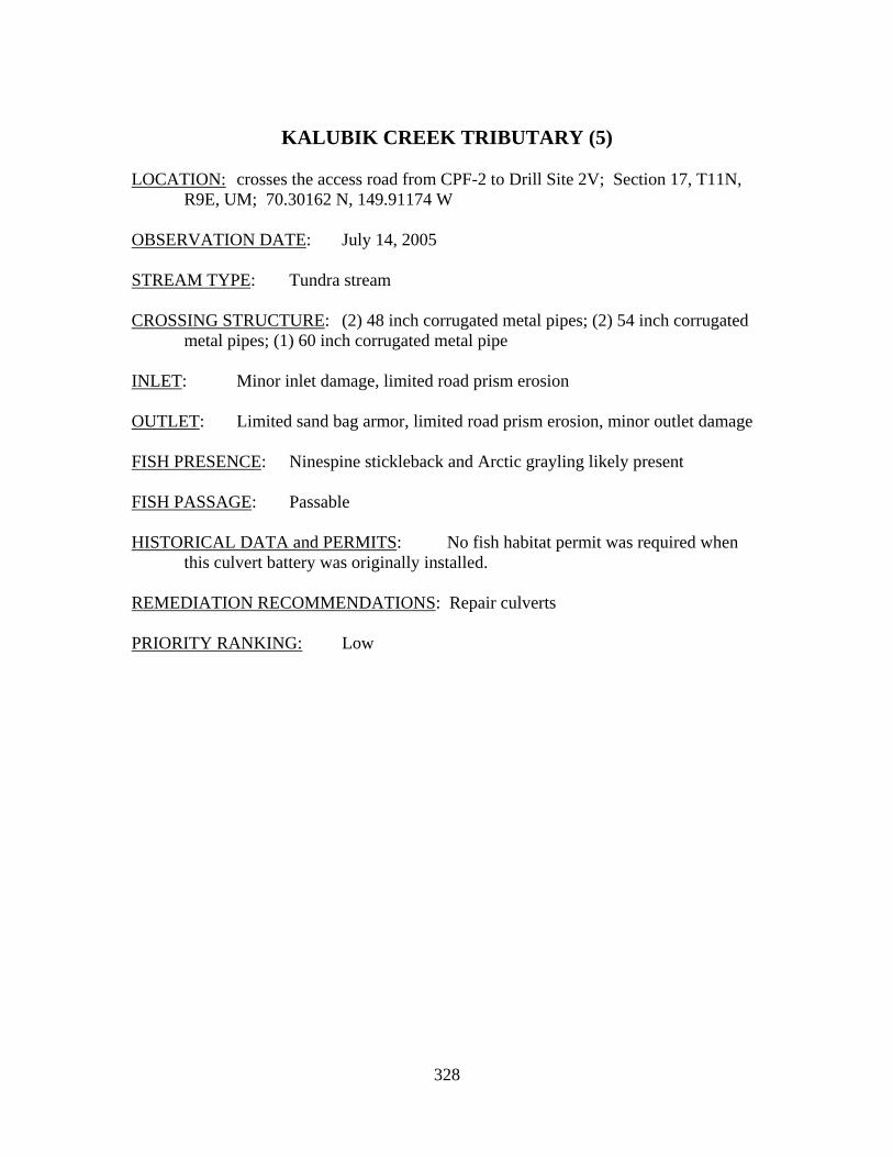
328
KALUBIK CREEK TRIBUTARY (5)
LOCATION: crosses the access road from CPF-2 to Drill Site 2V; Section 17, T11N,
R9E, UM; 70.30162 N, 149.91174 W OBSERVATION DATE: July 14, 2005 STREAM TYPE: Tundra stream CROSSING STRUCTURE: (2) 48 inch corrugated metal pipes; (2) 54 inch corrugated
metal pipes; (1) 60 inch corrugated metal pipe INLET: Minor inlet damage, limited road prism erosion OUTLET: Limited sand bag armor, limited road prism erosion, minor outlet damage FISH PRESENCE: Ninespine stickleback and Arctic grayling likely present FISH PASSAGE: Passable HISTORICAL DATA and PERMITS: No fish habitat permit was required when
this culvert battery was originally installed. REMEDIATION RECOMMENDATIONS: Repair culverts PRIORITY RANKING: Low
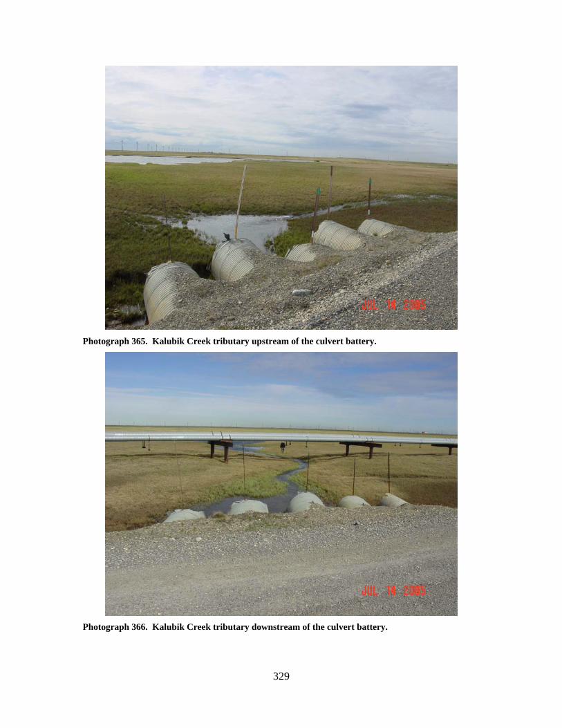
329
Photograph 365. Kalubik Creek tributary upstream of the culvert battery.
Photograph 366. Kalubik Creek tributary downstream of the culvert battery.
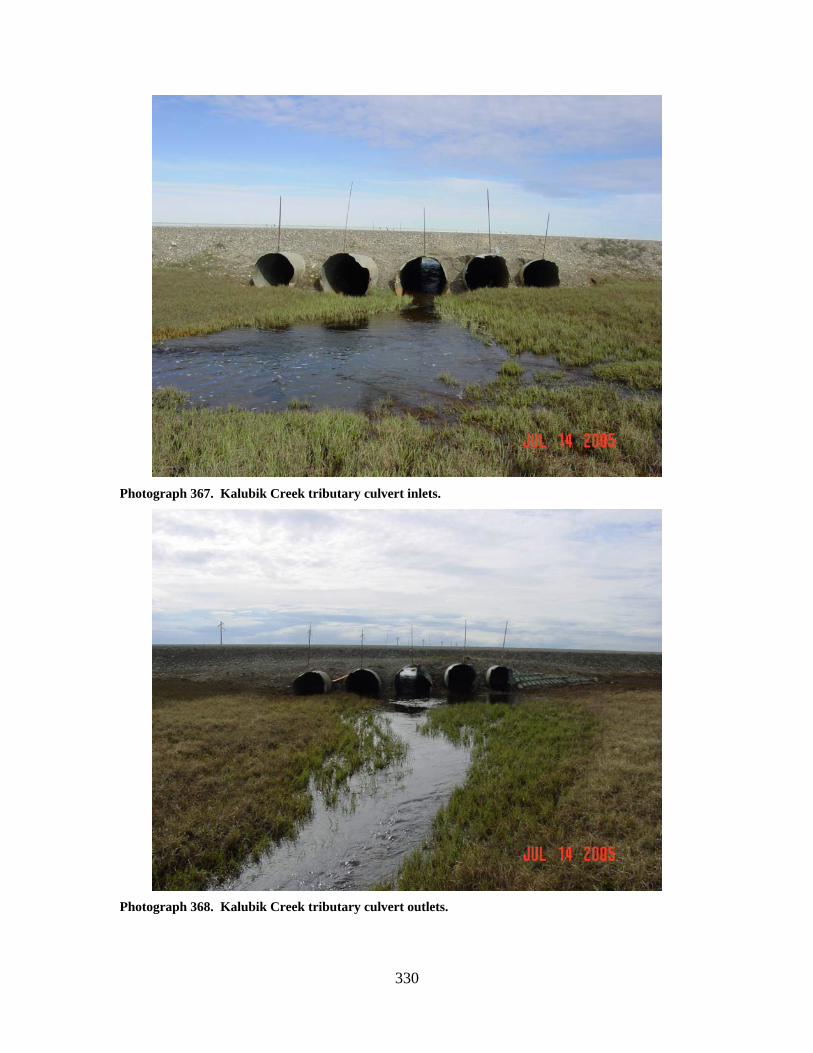
330
Photograph 367. Kalubik Creek tributary culvert inlets.
Photograph 368. Kalubik Creek tributary culvert outlets.
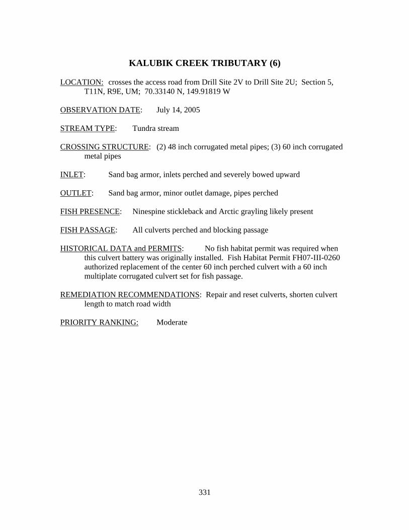
331
KALUBIK CREEK TRIBUTARY (6)
LOCATION: crosses the access road from Drill Site 2V to Drill Site 2U; Section 5,
T11N, R9E, UM; 70.33140 N, 149.91819 W OBSERVATION DATE: July 14, 2005 STREAM TYPE: Tundra stream CROSSING STRUCTURE: (2) 48 inch corrugated metal pipes; (3) 60 inch corrugated
metal pipes INLET: Sand bag armor, inlets perched and severely bowed upward OUTLET: Sand bag armor, minor outlet damage, pipes perched FISH PRESENCE: Ninespine stickleback and Arctic grayling likely present FISH PASSAGE: All culverts perched and blocking passage HISTORICAL DATA and PERMITS: No fish habitat permit was required when
this culvert battery was originally installed. Fish Habitat Permit FH07-III-0260 authorized replacement of the center 60 inch perched culvert with a 60 inch multiplate corrugated culvert set for fish passage.
REMEDIATION RECOMMENDATIONS: Repair and reset culverts, shorten culvert
length to match road width PRIORITY RANKING: Moderate
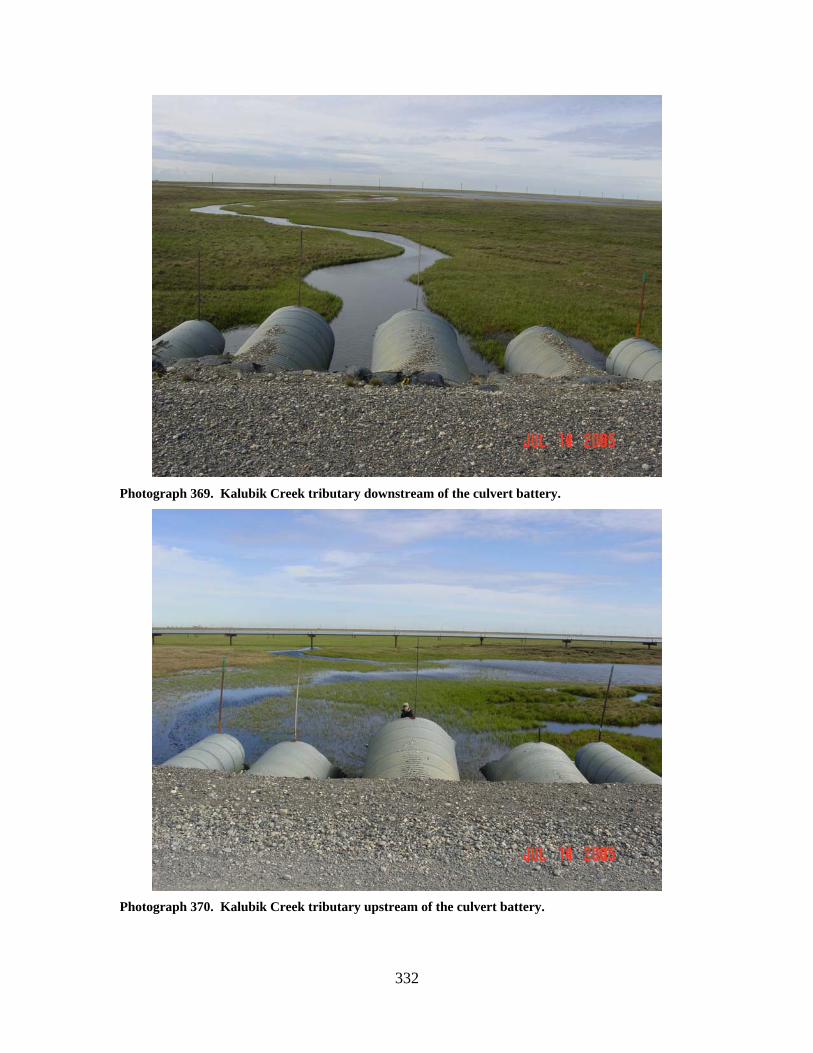
332
Photograph 369. Kalubik Creek tributary downstream of the culvert battery.
Photograph 370. Kalubik Creek tributary upstream of the culvert battery.
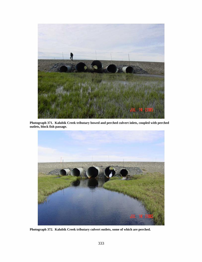
333
Photograph 371. Kalubik Creek tributary bowed and perched culvert inlets, coupled with perched outlets, block fish passage.
Photograph 372. Kalubik Creek tributary culvert outlets, some of which are perched.
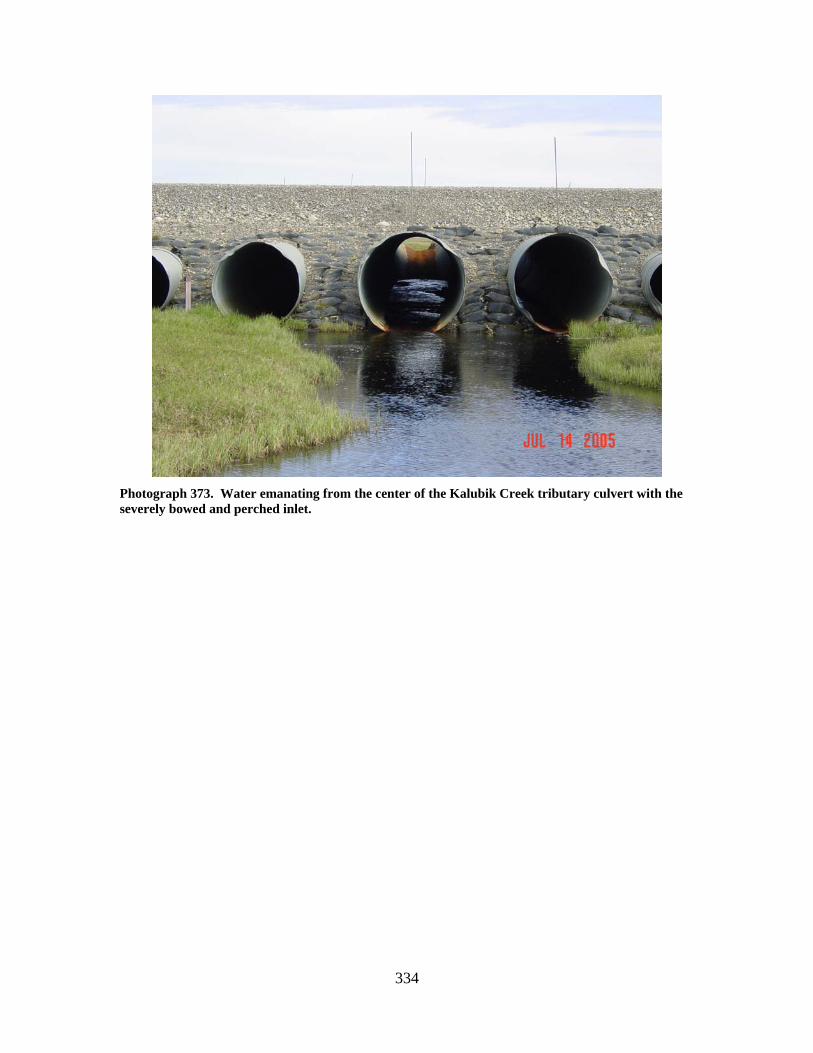
334
Photograph 373. Water emanating from the center of the Kalubik Creek tributary culvert with the severely bowed and perched inlet.
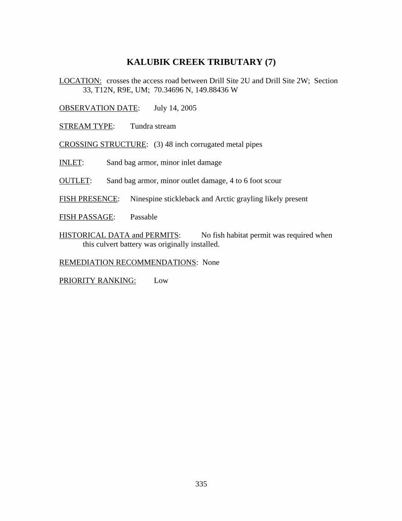
335
KALUBIK CREEK TRIBUTARY (7)
LOCATION: crosses the access road between Drill Site 2U and Drill Site 2W; Section
33, T12N, R9E, UM; 70.34696 N, 149.88436 W OBSERVATION DATE: July 14, 2005 STREAM TYPE: Tundra stream CROSSING STRUCTURE: (3) 48 inch corrugated metal pipes INLET: Sand bag armor, minor inlet damage OUTLET: Sand bag armor, minor outlet damage, 4 to 6 foot scour FISH PRESENCE: Ninespine stickleback and Arctic grayling likely present FISH PASSAGE: Passable HISTORICAL DATA and PERMITS: No fish habitat permit was required when
this culvert battery was originally installed. REMEDIATION RECOMMENDATIONS: None PRIORITY RANKING: Low
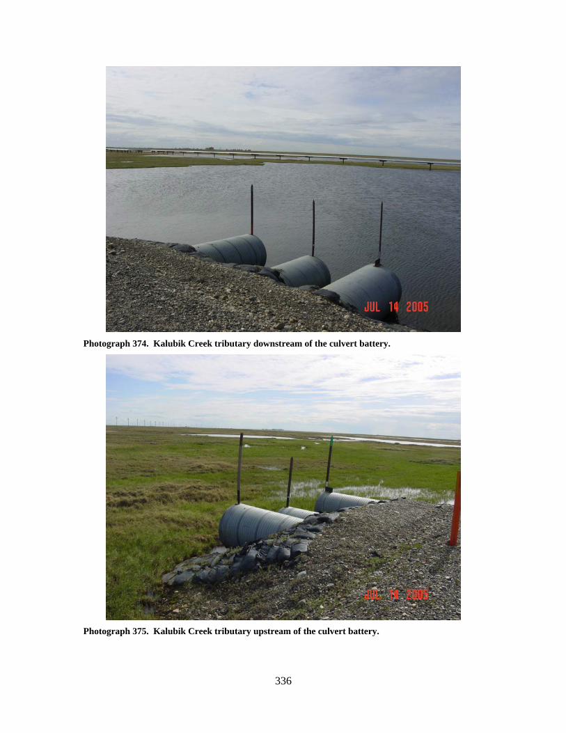
336
Photograph 374. Kalubik Creek tributary downstream of the culvert battery.
Photograph 375. Kalubik Creek tributary upstream of the culvert battery.
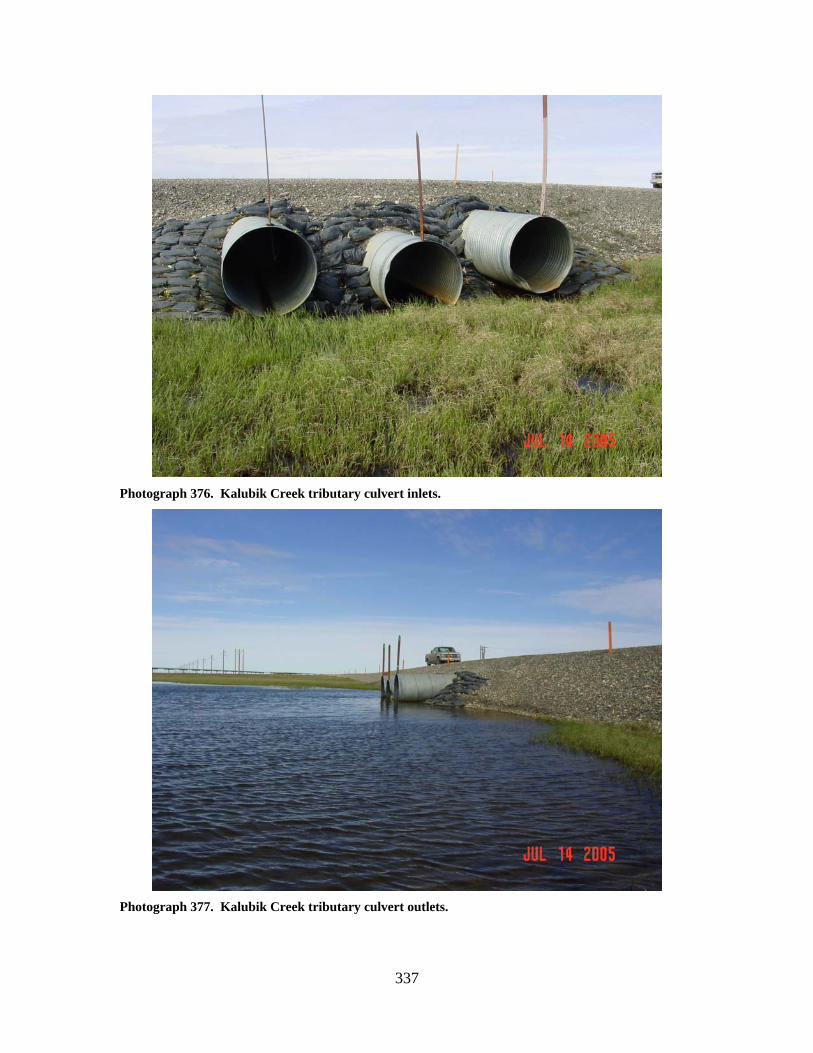
337
Photograph 376. Kalubik Creek tributary culvert inlets.
Photograph 377. Kalubik Creek tributary culvert outlets.
338
KALUBIK CREEK TRIBUTARY (8)
LOCATION: crosses the access road between Drill Site 2U and Drill Site 2W; Section
33, T12N, R9E, UM; 70.35008 N, 149.87547 W OBSERVATION DATE: July 14, 2005; July 8, 2007 STREAM TYPE: Tundra stream CROSSING STRUCTURE: (2) 48 inch smooth steel pipes; (1) 48 inch corrugated metal
pipe INLET: Sand bag armor remnants from original installation, minor inlet damage OUTLET: Gravel outwash FISH PRESENCE: Ninespine stickleback; Arctic grayling likely present FISH PASSAGE: Passable HISTORICAL DATA and PERMITS: No fish habitat permit was required when
this culvert battery was originally installed. All culverts perched in 2005. Culvert battery replacement (one 48 inch corrugated metal pipe plus two 48 inch smooth steel pipes) was authorized under Fish Habitat Permit FH06-III-0246.
REMEDIATION RECOMMENDATIONS: Stake tundra sod at inlet of the center pipe
to reduce the hydraulic drop into the culvert barrel, remove outwash gravels downstream of crossing
PRIORITY RANKING: Low
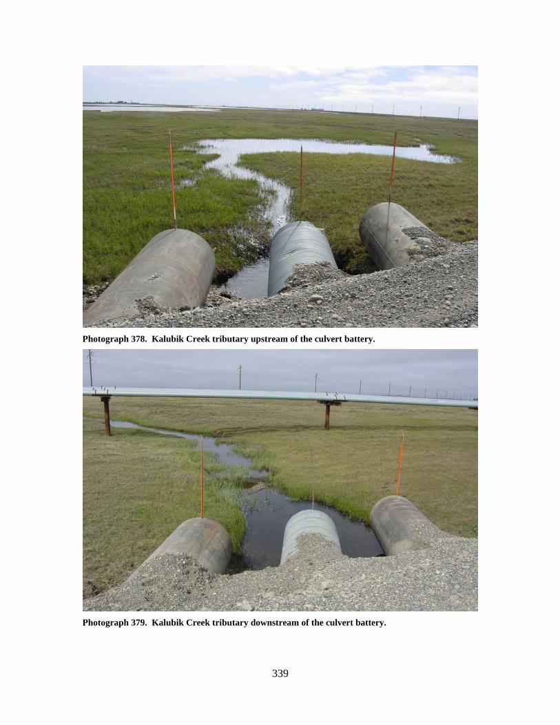
339
Photograph 378. Kalubik Creek tributary upstream of the culvert battery.
Photograph 379. Kalubik Creek tributary downstream of the culvert battery.
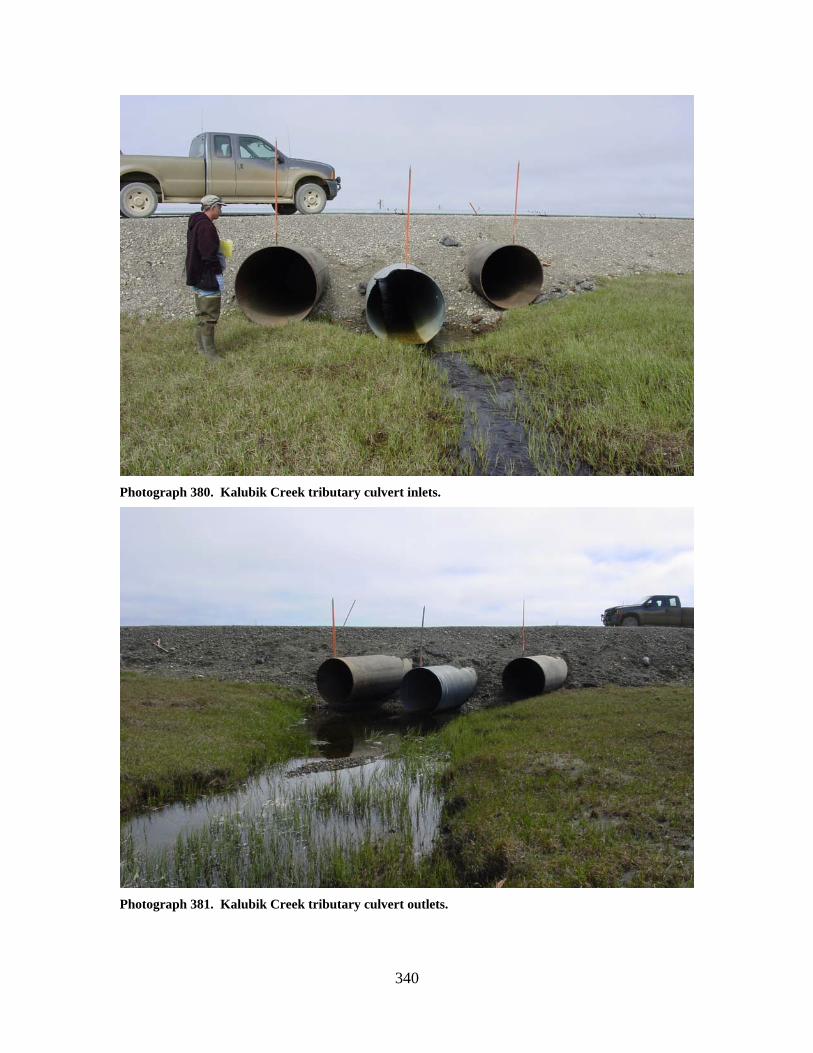
340
Photograph 380. Kalubik Creek tributary culvert inlets.
Photograph 381. Kalubik Creek tributary culvert outlets.
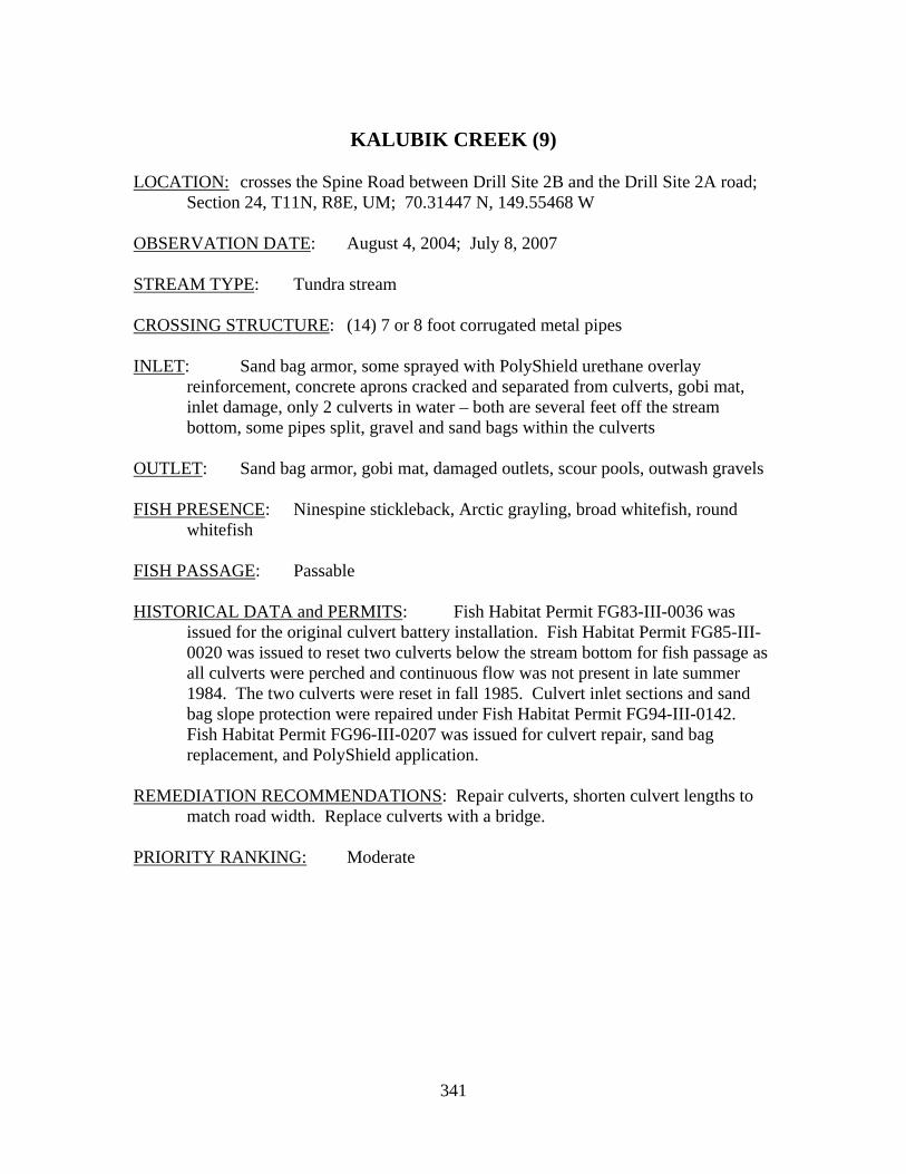
341
KALUBIK CREEK (9)
LOCATION: crosses the Spine Road between Drill Site 2B and the Drill Site 2A road;
Section 24, T11N, R8E, UM; 70.31447 N, 149.55468 W OBSERVATION DATE: August 4, 2004; July 8, 2007 STREAM TYPE: Tundra stream CROSSING STRUCTURE: (14) 7 or 8 foot corrugated metal pipes INLET: Sand bag armor, some sprayed with PolyShield urethane overlay
reinforcement, concrete aprons cracked and separated from culverts, gobi mat, inlet damage, only 2 culverts in water – both are several feet off the stream bottom, some pipes split, gravel and sand bags within the culverts
OUTLET: Sand bag armor, gobi mat, damaged outlets, scour pools, outwash gravels FISH PRESENCE: Ninespine stickleback, Arctic grayling, broad whitefish, round
whitefish FISH PASSAGE: Passable HISTORICAL DATA and PERMITS: Fish Habitat Permit FG83-III-0036 was
issued for the original culvert battery installation. Fish Habitat Permit FG85-III-0020 was issued to reset two culverts below the stream bottom for fish passage as all culverts were perched and continuous flow was not present in late summer 1984. The two culverts were reset in fall 1985. Culvert inlet sections and sand bag slope protection were repaired under Fish Habitat Permit FG94-III-0142. Fish Habitat Permit FG96-III-0207 was issued for culvert repair, sand bag replacement, and PolyShield application.
REMEDIATION RECOMMENDATIONS: Repair culverts, shorten culvert lengths to
match road width. Replace culverts with a bridge. PRIORITY RANKING: Moderate
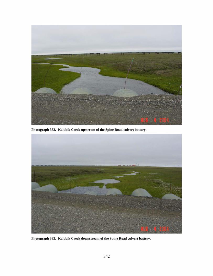
342
Photograph 382. Kalubik Creek upstream of the Spine Road culvert battery.
Photograph 383. Kalubik Creek downstream of the Spine Road culvert battery.
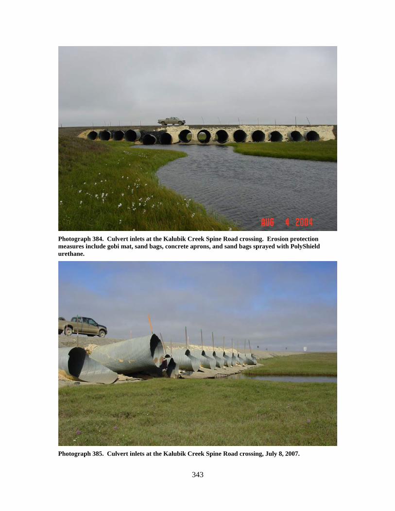
343
Photograph 384. Culvert inlets at the Kalubik Creek Spine Road crossing. Erosion protection measures include gobi mat, sand bags, concrete aprons, and sand bags sprayed with PolyShield urethane.
Photograph 385. Culvert inlets at the Kalubik Creek Spine Road crossing, July 8, 2007.
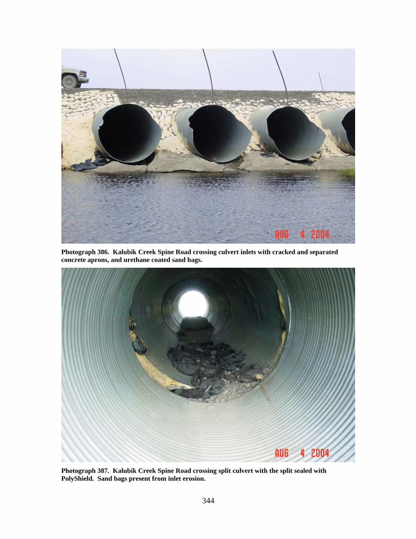
344
Photograph 386. Kalubik Creek Spine Road crossing culvert inlets with cracked and separated concrete aprons, and urethane coated sand bags.
Photograph 387. Kalubik Creek Spine Road crossing split culvert with the split sealed with PolyShield. Sand bags present from inlet erosion.
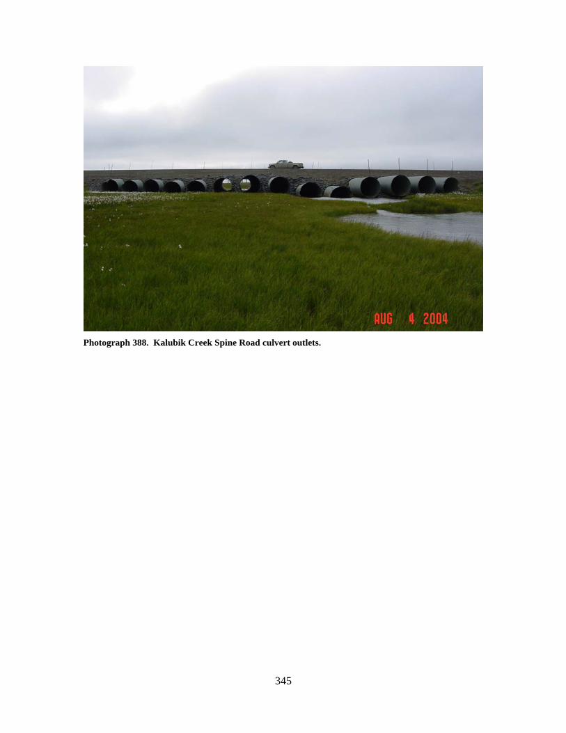
345
Photograph 388. Kalubik Creek Spine Road culvert outlets.
346
WEST FORK KALUBIK CREEK (10)
LOCATION: crosses the Spine Road between the Drill Site 2A access road and Drill
Site 2M; Section 26, T11N, R8E, UM; 70.28249 N, 150.04702 W OBSERVATION DATE: August 4, 2004 STREAM TYPE: Tundra stream CROSSING STRUCTURE: (2) 7 foot corrugated multiplate culverts; (1) 8 foot
corrugated multiplate culvert INLET: Partially eroded sand bag armor, road prism erosion, gobi mat, high water
mark 1 to 2 feet above culverts, OUTLET: Gobi mat, partial sand bag armor, minimal outwash gravels FISH PRESENCE: Ninespine stickleback, Arctic grayling, whitefish, and Dolly
Varden likely present FISH PASSAGE: Passable HISTORICAL DATA and PERMITS: Fish Habitat Permit FG84-III-0121 was
issued for this installation in January 1985. Fish Habitat Permit FG84-III-0121, Amendment 1 was issued in June 2001 to replace the three culverts that were damaged during a rig move.
REMEDIATION RECOMMENDATIONS: Repair road bed and armor PRIORITY RANKING: Low
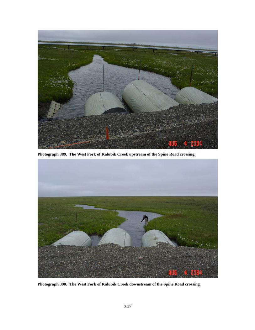
347
Photograph 389. The West Fork of Kalubik Creek upstream of the Spine Road crossing.
Photograph 390. The West Fork of Kalubik Creek downstream of the Spine Road crossing.
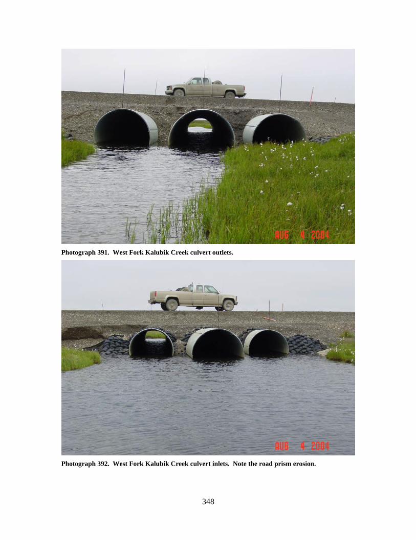
348
Photograph 391. West Fork Kalubik Creek culvert outlets.
Photograph 392. West Fork Kalubik Creek culvert inlets. Note the road prism erosion.
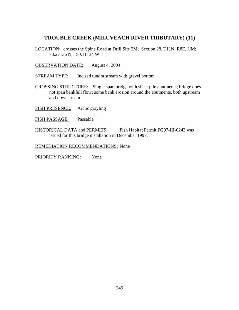
349
TROUBLE CREEK (MILUVEACH RIVER TRIBUTARY) (11)
LOCATION: crosses the Spine Road at Drill Site 2M; Section 28, T11N, R8E, UM;
70.27136 N, 150.11134 W OBSERVATION DATE: August 4, 2004 STREAM TYPE: Incised tundra stream with gravel bottom CROSSING STRUCTURE: Single span bridge with sheet pile abutments; bridge does
not span bankfull flow; some bank erosion around the abutments, both upstream and downstream
FISH PRESENCE: Arctic grayling FISH PASSAGE: Passable HISTORICAL DATA and PERMITS: Fish Habitat Permit FG97-III-0243 was
issued for this bridge installation in December 1997. REMEDIATION RECOMMENDATIONS: None PRIORITY RANKING: None
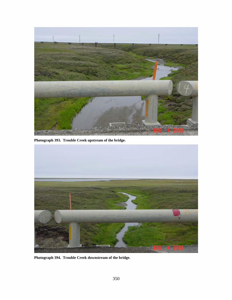
350
Photograph 393. Trouble Creek upstream of the bridge.
Photograph 394. Trouble Creek downstream of the bridge.
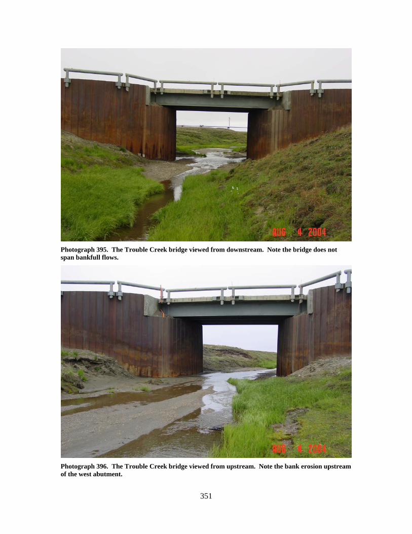
351
Photograph 395. The Trouble Creek bridge viewed from downstream. Note the bridge does not span bankfull flows.
Photograph 396. The Trouble Creek bridge viewed from upstream. Note the bank erosion upstream of the west abutment.

352
353
Tarn to Meltwater Road Stream Crossings

354
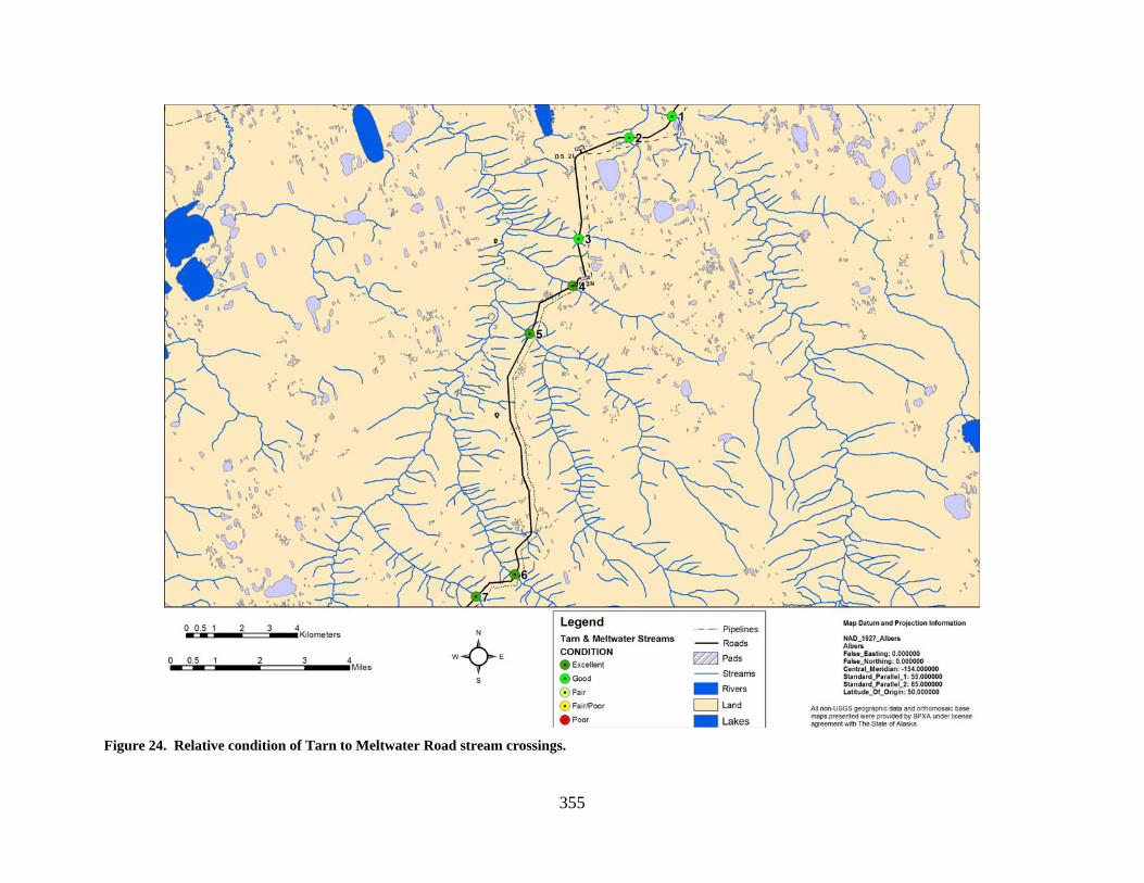
355
Figure 24. Relative condition of Tarn to Meltwater Road stream crossings.

356
Figure 25. Relative priority for rehabilitation of Tarn to Meltwater Road stream crossings.
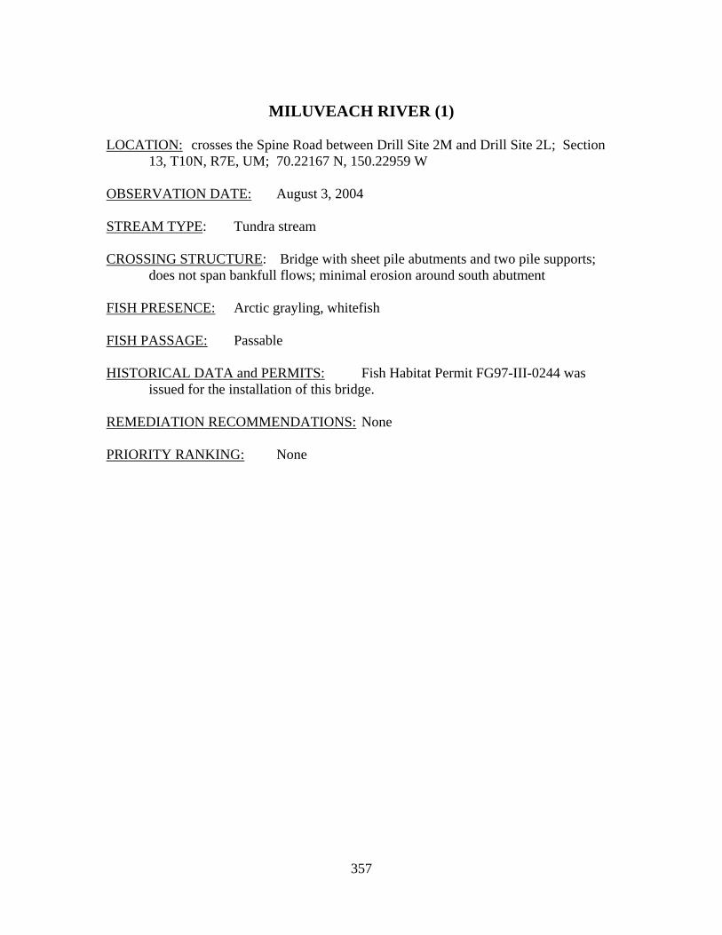
357
MILUVEACH RIVER (1)
LOCATION: crosses the Spine Road between Drill Site 2M and Drill Site 2L; Section
13, T10N, R7E, UM; 70.22167 N, 150.22959 W OBSERVATION DATE: August 3, 2004 STREAM TYPE: Tundra stream CROSSING STRUCTURE: Bridge with sheet pile abutments and two pile supports;
does not span bankfull flows; minimal erosion around south abutment FISH PRESENCE: Arctic grayling, whitefish FISH PASSAGE: Passable HISTORICAL DATA and PERMITS: Fish Habitat Permit FG97-III-0244 was
issued for the installation of this bridge. REMEDIATION RECOMMENDATIONS: None PRIORITY RANKING: None
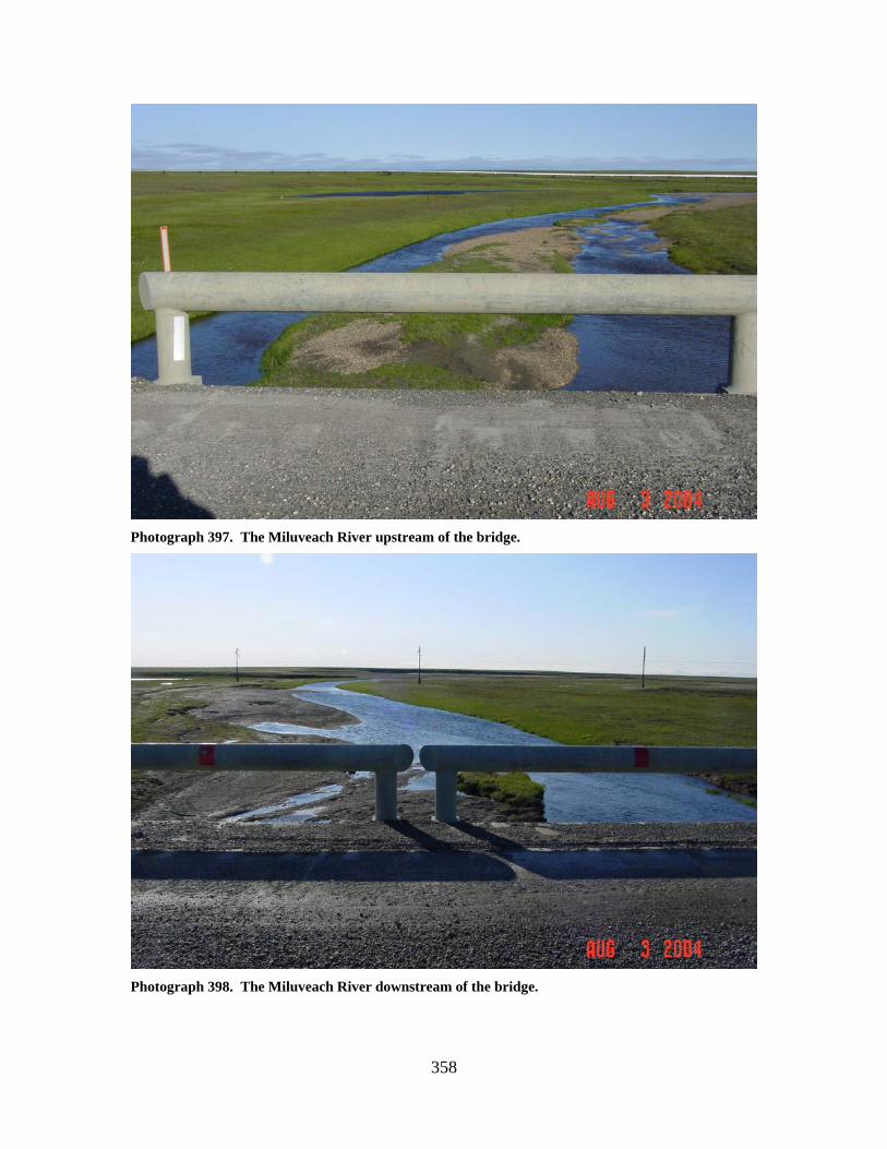
358
Photograph 397. The Miluveach River upstream of the bridge.
Photograph 398. The Miluveach River downstream of the bridge.
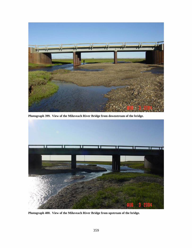
359
Photograph 399. View of the Miluveach River Bridge from downstream of the bridge.
Photograph 400. View of the Miluveach River Bridge from upstream of the bridge.
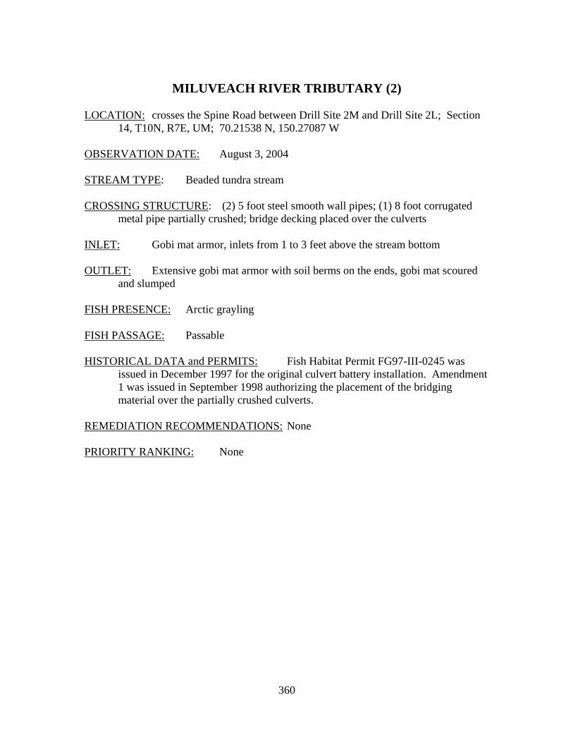
360
MILUVEACH RIVER TRIBUTARY (2)
LOCATION: crosses the Spine Road between Drill Site 2M and Drill Site 2L; Section
14, T10N, R7E, UM; 70.21538 N, 150.27087 W OBSERVATION DATE: August 3, 2004 STREAM TYPE: Beaded tundra stream CROSSING STRUCTURE: (2) 5 foot steel smooth wall pipes; (1) 8 foot corrugated
metal pipe partially crushed; bridge decking placed over the culverts INLET: Gobi mat armor, inlets from 1 to 3 feet above the stream bottom OUTLET: Extensive gobi mat armor with soil berms on the ends, gobi mat scoured
and slumped FISH PRESENCE: Arctic grayling FISH PASSAGE: Passable HISTORICAL DATA and PERMITS: Fish Habitat Permit FG97-III-0245 was
issued in December 1997 for the original culvert battery installation. Amendment 1 was issued in September 1998 authorizing the placement of the bridging material over the partially crushed culverts.
REMEDIATION RECOMMENDATIONS: None PRIORITY RANKING: None
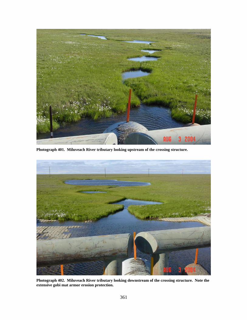
361
Photograph 401. Miluveach River tributary looking upstream of the crossing structure.
Photograph 402. Miluveach River tributary looking downstream of the crossing structure. Note the extensive gobi mat armor erosion protection.
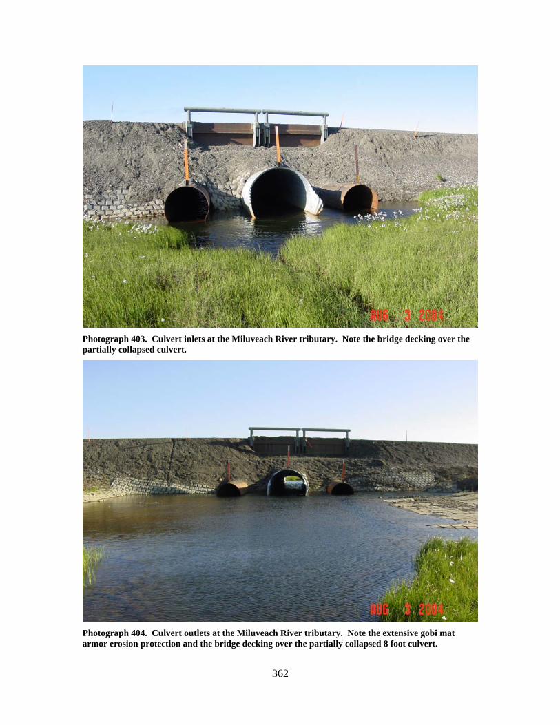
362
Photograph 403. Culvert inlets at the Miluveach River tributary. Note the bridge decking over the partially collapsed culvert.
Photograph 404. Culvert outlets at the Miluveach River tributary. Note the extensive gobi mat armor erosion protection and the bridge decking over the partially collapsed 8 foot culvert.
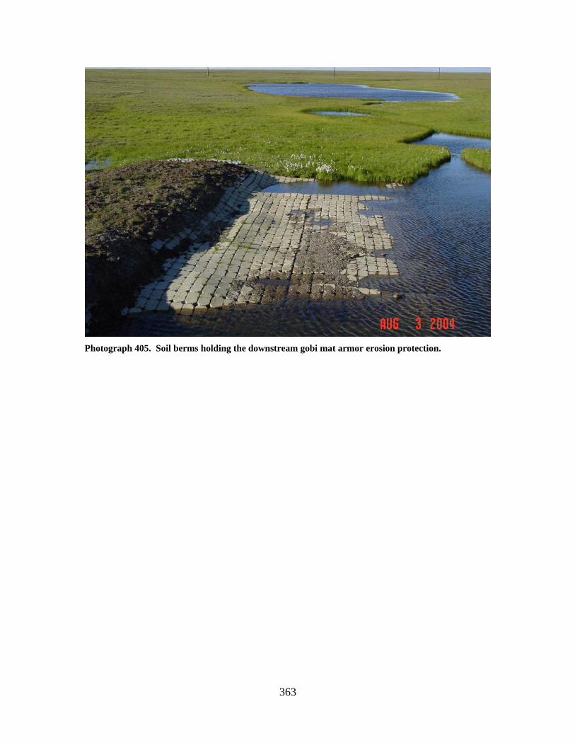
363
Photograph 405. Soil berms holding the downstream gobi mat armor erosion protection.
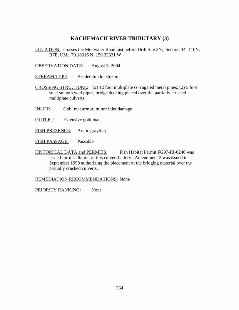
364
KACHEMACH RIVER TRIBUTARY (3) LOCATION: crosses the Meltwater Road just before Drill Site 2N; Section 34, T10N,
R7E, UM; 70.18316 N, 150.32331 W OBSERVATION DATE: August 3, 2004 STREAM TYPE: Beaded tundra stream CROSSING STRUCTURE: (2) 12 foot multiplate corrugated metal pipes; (2) 5 foot
steel smooth wall pipes; bridge decking placed over the partially crushed multiplate culverts
INLET: Gobi mat armor, minor inlet damage OUTLET: Extensive gobi mat FISH PRESENCE: Arctic grayling FISH PASSAGE: Passable HISTORICAL DATA and PERMITS: Fish Habitat Permit FG97-III-0246 was
issued for installation of this culvert battery. Amendment 2 was issued in September 1998 authorizing the placement of the bridging material over the partially crushed culverts.
REMEDIATION RECOMMENDATIONS: None PRIORITY RANKING: None
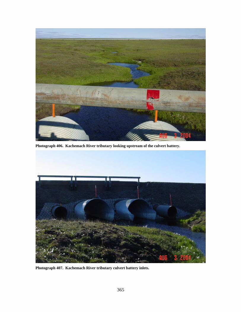
365
Photograph 406. Kachemach River tributary looking upstream of the culvert battery.
Photograph 407. Kachemach River tributary culvert battery inlets.
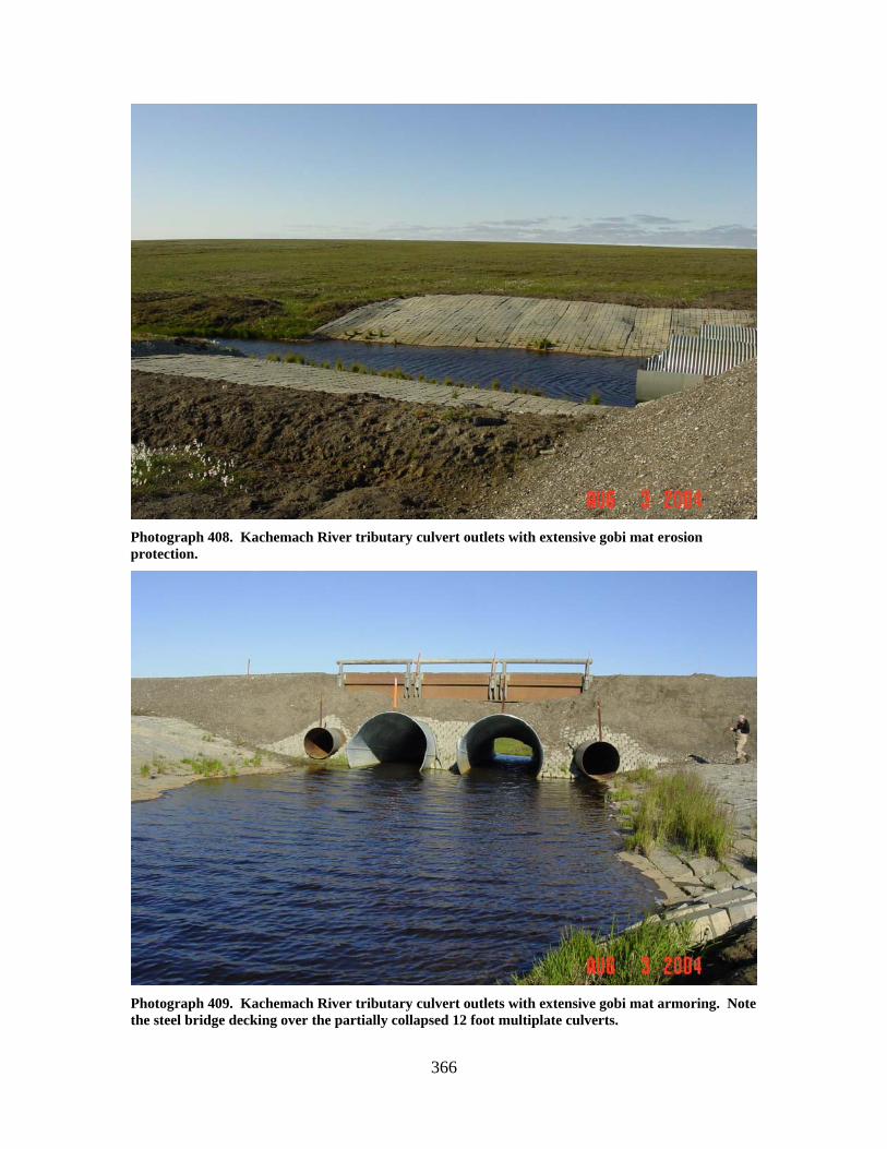
366
Photograph 408. Kachemach River tributary culvert outlets with extensive gobi mat erosion protection.
Photograph 409. Kachemach River tributary culvert outlets with extensive gobi mat armoring. Note the steel bridge decking over the partially collapsed 12 foot multiplate culverts.
367
TIFFINI CREEK (4)
LOCATION: crosses the Meltwater Road; Section 3, T9N, R7E, UM; 70.16772 N,
150.33132 W OBSERVATION DATE: August 3, 2004 STREAM TYPE: Beaded tundra stream CROSSING STRUCTURE: Bridge with sheet pile bin walls that spans bankfull flows FISH PRESENCE: Arctic grayling FISH PASSAGE: Passable HISTORICAL DATA and PERMITS: Fish Habitat Permit FG00-III-0255 was
issued for this bridge installation. REMEDIATION RECOMMENDATIONS: None PRIORITY RANKING: None
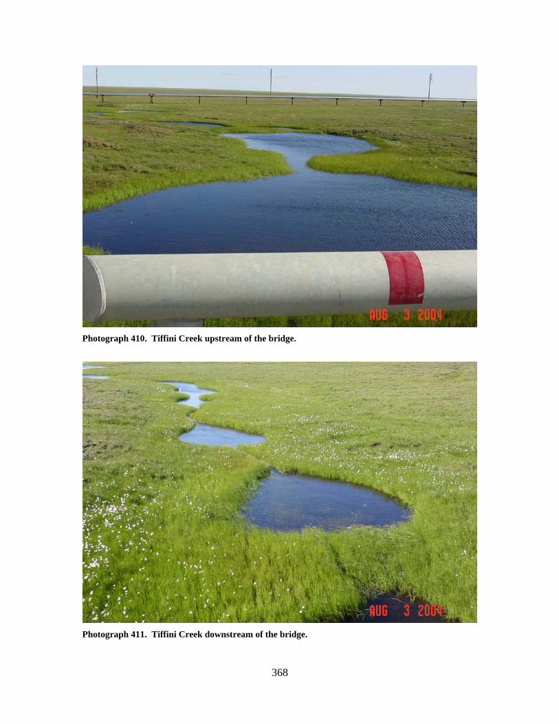
368
Photograph 410. Tiffini Creek upstream of the bridge.
Photograph 411. Tiffini Creek downstream of the bridge.
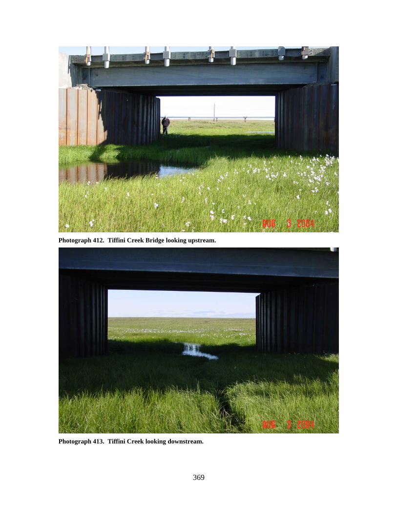
369
Photograph 412. Tiffini Creek Bridge looking upstream.
Photograph 413. Tiffini Creek looking downstream.
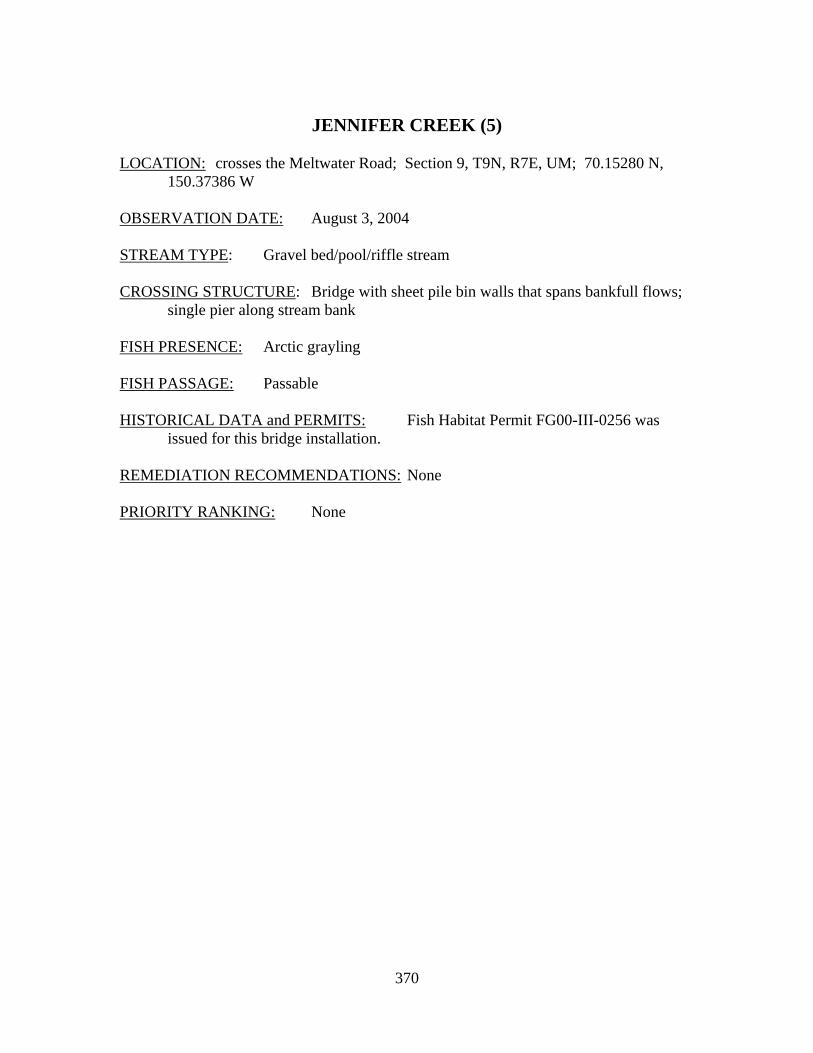
370
JENNIFER CREEK (5)
LOCATION: crosses the Meltwater Road; Section 9, T9N, R7E, UM; 70.15280 N,
150.37386 W OBSERVATION DATE: August 3, 2004 STREAM TYPE: Gravel bed/pool/riffle stream CROSSING STRUCTURE: Bridge with sheet pile bin walls that spans bankfull flows;
single pier along stream bank FISH PRESENCE: Arctic grayling FISH PASSAGE: Passable HISTORICAL DATA and PERMITS: Fish Habitat Permit FG00-III-0256 was
issued for this bridge installation. REMEDIATION RECOMMENDATIONS: None PRIORITY RANKING: None
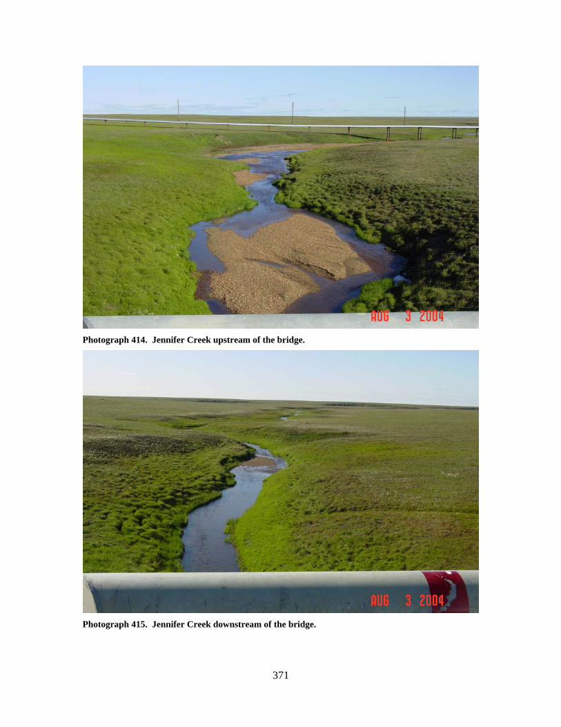
371
Photograph 414. Jennifer Creek upstream of the bridge.
Photograph 415. Jennifer Creek downstream of the bridge.
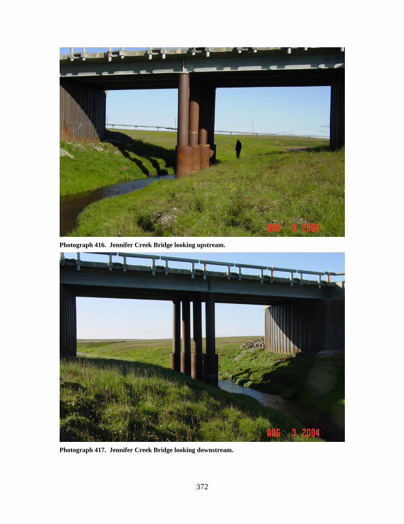
372
Photograph 416. Jennifer Creek Bridge looking upstream.
Photograph 417. Jennifer Creek Bridge looking downstream.

373
JESSICA CREEK (6)
LOCATION: crosses the Meltwater Road; Section 4, T8N, R7E, UM; 70.07401 N,
150.40002 W OBSERVATION DATE: August 3, 2004 STREAM TYPE: Gravel pool/riffle stream CROSSING STRUCTURE: Bridge with sheet pile bin walls that spans bankfull flows;
single pier along stream bank FISH PRESENCE: Arctic grayling FISH PASSAGE: Passable HISTORICAL DATA and PERMITS: Fish Habitat Permit FG00-III-0257 was
issued for this bridge installation. REMEDIATION RECOMMENDATIONS: None PRIORITY RANKING: None
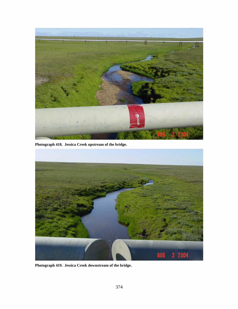
374
Photograph 418. Jessica Creek upstream of the bridge.
Photograph 419. Jessica Creek downstream of the bridge.
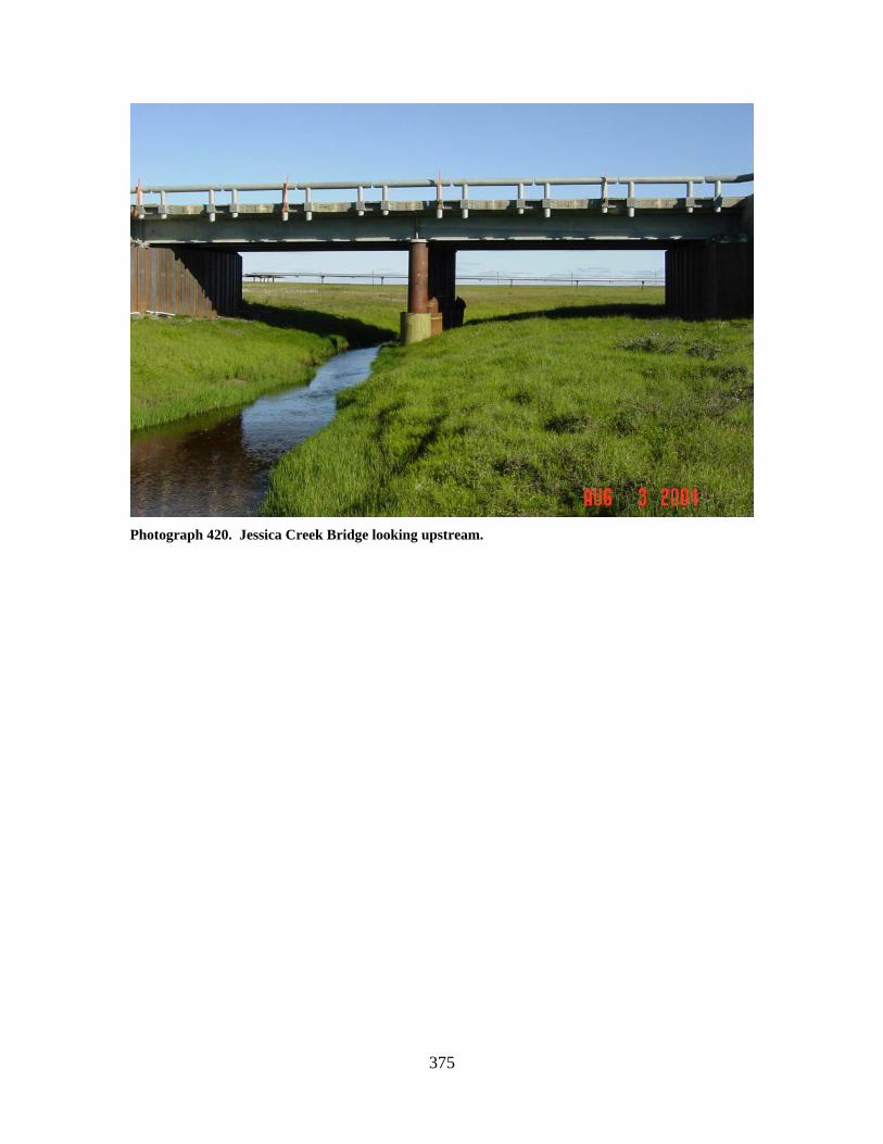
375
Photograph 420. Jessica Creek Bridge looking upstream.
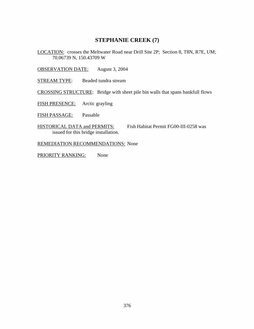
376
STEPHANIE CREEK (7)
LOCATION: crosses the Meltwater Road near Drill Site 2P; Section 8, T8N, R7E, UM;
70.06739 N, 150.43709 W OBSERVATION DATE: August 3, 2004 STREAM TYPE: Beaded tundra stream CROSSING STRUCTURE: Bridge with sheet pile bin walls that spans bankfull flows FISH PRESENCE: Arctic grayling FISH PASSAGE: Passable HISTORICAL DATA and PERMITS: Fish Habitat Permit FG00-III-0258 was
issued for this bridge installation. REMEDIATION RECOMMENDATIONS: None PRIORITY RANKING: None
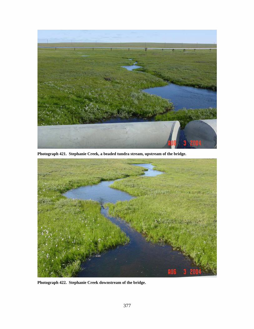
377
Photograph 421. Stephanie Creek, a beaded tundra stream, upstream of the bridge.
Photograph 422. Stephanie Creek downstream of the bridge.
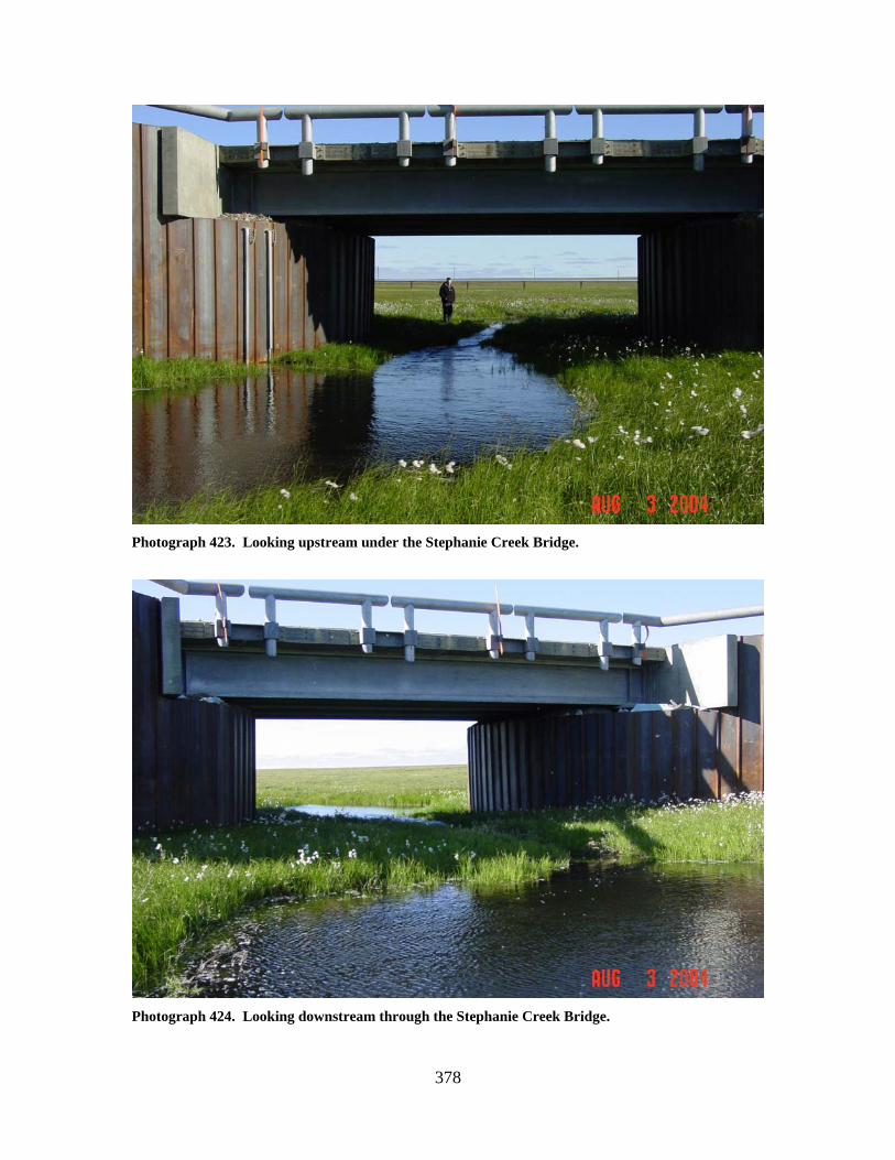
378
Photograph 423. Looking upstream under the Stephanie Creek Bridge.
Photograph 424. Looking downstream through the Stephanie Creek Bridge.