Embed Size (px)
Citation preview


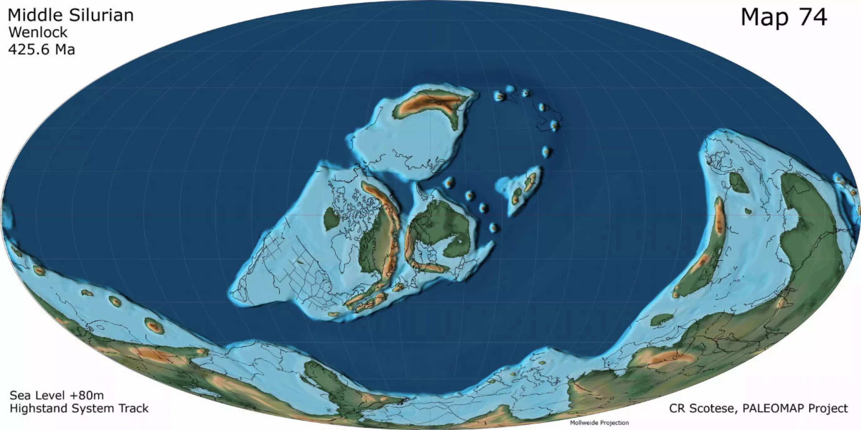
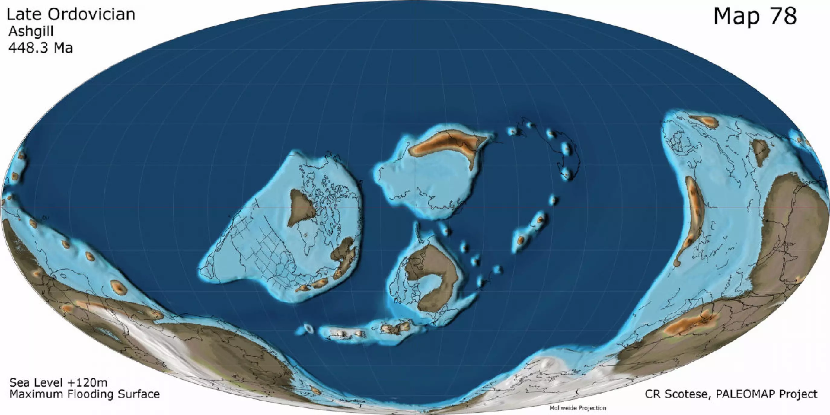
Atlas of Silurian and Middle-Late Ordovician Paleogeographic Maps This Atlas of Silurian and Middle-Late Ordovician Paleogeographic Maps shows the changing paleogeography from the Middle Ordovician (Darwillian, 464.5 Ma) to the Late Silurian (Ludlow & Prodoli, 419.5 Ma). The maps are from volume 5 of the PALEOMAP PaleoAtlas for ArcGIS (Scotese, 2014). Absolute age assignments are from Gradstein, Ogg & Smith (2008). The following maps are included in the Atlas of Silurian and Middle-Late Ordovician Paleogeographic Maps: Map 73 Late Silurian (Ludlow & Pridoli, 419.5 Ma) Lochkovian Supersequence Boundary Map 74 Middle Silurian (Wenlock, 425.6 Ma) Highstand System Tract Map 75 Early Silurian (late Llandovery, 432.1 Ma) Maximum Flooding Surface Map 76 Early Silurian (early Llandovery, 439.8 Ma) Transgressive Systems Tract Map 77 Late Ordovician (Hirnantian, 444.7 Ma) Llandoverian Supersequence Boundary Map 78 Late Ordovician (Ashgill, 448.3 Ma) Lowstand Systems Tract & Maximum Flooding Surface Map 79 Late Ordovician (Caradoc, 456 Ma) Maximum Flooding Surface Map 80 Middle Ordovician (Darwillian, 464.5 Ma) Llandeilian Supersequence Boundary This work should be cited as Scotese, C.R., 2014. Atlas of Silurian and Middle-Late Ordovician Paleogeographic Maps (Mollweide Projection), Maps 73 – 80, Volumes 5, The Early Paleozoic, PALEOMAP Atlas for ArcGIS, PALEOMAP Project, Evanston, IL.