Embed Size (px)
Citation preview
6U//03
BOUNTIFUL City of Beautiful Homes and Gardens
October 25,2010
Phil Bums State of Utah Department of Environmental Quality Division of Solid and Hazardous Waste P O Box 144880 Salt Lake City, Utah 84114-4880
HAND DELIVERED OCT 2 8 2010
UTAH DIVISION OF SOLID & HAZARDOUS WASTE
JOE L JOHNSON MAYOR
CITY COUNCIL BETH HOLBROOK
JOHN MARC KNIGHT R FRED MOSS
SCOTT C MYERS TOM TOLMAN
CITY MANAGER TOM HARDY
o
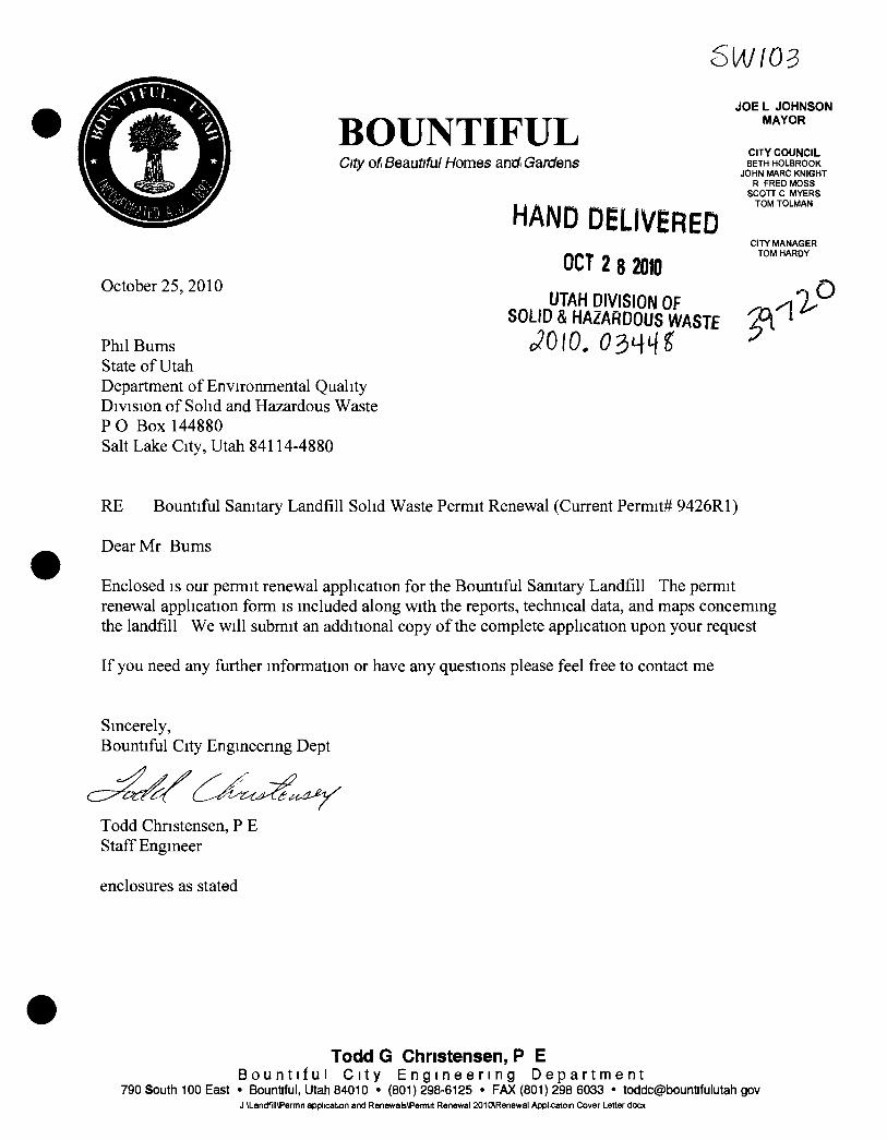
RE Bountiful Sanitary Landfill Solid Waste Permit Renewal (Current Permit# 9426R1)
Dear Mr Bums
Enclosed is our permit renewal application for the Bountiful Sanitary Landfill The permit renewal application form is included along with the reports, technical data, and maps conceming the landfill We will submit an additional copy of the complete application upon your request
If you need any further information or have any questions please feel free to contact me
Sincerely, Bountiful City Engineenng Dept
Todd Christensen, P E Staff Engineer
enclosures as stated
Todd G Christensen, P E B o u n t i f u l C i t y E n g i n e e r i n g D e p a r t m e n t
790 South 100 East • Bountiful, Utah 84010 • (801)298-6125 • FAX (801) 298 6033 • tocldc@bountifulutah gov J \Landfjll\Permit application and Renewals\Permrt Renewal 201 CARenewal Applicatoin Cover Letter docx
Bountiful Sanitary Landfill Permit Renewal Application
Class I Landfill D DELIVERED OCT 1 8 2010
UTAH DIVISION OF SOLID & HAZARDOUS WASTE
Submitted to
State of Utah Department of Environmental Quality Division of Solid and Hazardous Waste
October 2010
Prepared by
Bountiful City Engineering Department
TABLE OF CONTENTS
GENERAL REPORT 6 GENERAL FACILITY DESCRIPTION\RELATIONSHIP TO COUNTY\ SOLID WASTE PLANXOWNERSHIP 7 PLAN OF OPERATION 8
Schedule of Construction 8 Phase I 9 Phase II 9 Phase III 10 Phase IV 10
Sohd Waste Handhng Procedures 11 Monitoring Schedule 12 Forms 14 Corrective Action 14 Contingency Plans 16
Fire or explosion 16 Explosive Gas Release. 17
Alternative Waste Handling or Disposal 17 Maintenance of Monitoring Equipment 18 Disease Vector Control 18
Dead Animals 18 Tires 19
Hazardous Waste Exclusion 19 Load Inspection 19 Notification Procedures 20
General Training and Safety Plans 20 Recycling Program 22
FINANCIAL ASSURANCE PLAN 23 CLOSURE PLAN 26
Final Cover Installation 26 Site Capacity 27 Final Inspection 28
POST CLOSURE PLAN 29 Monitormg 29 Maintenance 29 Implementation 29 Record of Title, Land Use, and Zoning 30 Post Closure Costs 30
TECHNICAL DATA 31 USGS TOPOGRAPHIC MAP 7-1/2 MINUTE SERIES 32 TOPOGRAPHIC MAP 1" = 200' 34 BOUNTIFUL SANITARY LANDFILL SPECIFICATIONS 34
Preparation of Site 34 Access 34
11
Equipment Shelter 34 Employee Facilities 35 Weighing Facilities 35 Communications 35 Fire Protection 36
Operations 37 Limited Access 37 Unloading of Refuse 37 Blowmg Paper 38 Spreading and Compacting of Refuse 39 Depth of Lifts in Fill 40 Daily Cover 40
Soil 40 Wood Chips 40
Intermediate Cover 41 Final Cover 41 Equipment Maintenance 43 Vector Control 43 Dust Control 44 Drainage of surface water 44 Supervision of Operations 45 Accident Prevention and Safety 46
GEOHYDROLOGICAL ASSESSMENT REPORT 47 Geology 47
Regional Conditions 47 Local Conditions 48
Hydrogeology 50 Regional Conditions 50 Local Conditions 51 Shallow water bearing zones 51 Deeper water bearing zones 52 Shallow Ground Water Surface 52 Deeper Ground Water Surface 53
Seismicity 54 Water Rights 55 Surface Water 56 Ground Water Quality 57
Deep ground water 58 Shallow ground water 58
Site Water Balance 59 Conceptual Design of Ground Water Monitoring System 59
ENGINEERING REPORT 62 Location Standards 62
Airports 63 Unstable Areas 63
111
UTAH CLASS I AND V LANDFILL PERMIT APPLICATION
Utah Class I and V Landfill Permit Application Form
fiatf / General information APPLICANT PLEASE COMPLETE ALL SECTIONS
/ landfil l Type •
Class I Class V II Application Type • New Application
S Renewal Application • Facility Expansion • Modification
For Renewal Applications Facility Expansion Applications and Modifications Enter Current Permit Number 9426
/// Facility Name and Location Legal Name of Facility
Bountiful Sanitary Landfill Site Address (street or directions to site)
1300 West 1600 North County
D a v i s
City West Bountiful Zip Code 8 4 0 8 7 Telephone 801 -298 -6169
Township 2 N Range 1 W Section(s) 14 Quarter/Quarter Section Quarter Section
Mam Gate Latitude degrees 4 0 minutes 54 seconds 30 Longitude degrees 111 minutes 55 seconds 0
IV Facility Owner(s) Information Legal Name of Facility Owner
Bountiful City Corporation Address (mailing)
790 S 100 E
City Bountiful state U T Zip Code 8 4 0 1 0 Telephone 801 -298 -6125
V Facility Operator(s) information Legal Name of Facility Operator
SAME AS FACILITY OWNER Address (mailing)
state Zip Code Telephone
VI Property Owner(s) Information Legal Name of Property Owner
SAME AS FACILITY OWNER Address (mailing)
City State Zip Code Telephone
VII Contact Information
Owner Contact Todd G Chnstensen P E Title Staff Engineer Address (mailing)
790 S 100 E
City Bountiful State U T Zip Code 8 4 0 1 0 Telephone 801 -298 -6125
Email Address toddc@bountifulutah gov Alternative Telephone (cell or other) 8017262004
Operator Contact S A M E A S O W N E R C O N T A C T Title
Address (mailing)
City State Zip Code Telephone
Email Address Alternative Telephone (cell or other)
Property Owner Contact SAME AS OWNER CONTACT Title
ess (mailing)
City State Zip Code Telephone
Utah Class I and V Landfill Pemriit Application Form Part I General information (Continued) VIII W a s t e T y p e s (check all that apply) IX Facility Areas
II non hazardous solid waste (see R315 315 7(3) for PCB special ments) OR the following specific waste types
fe Type Combined Disposal Unit Monoflll Unit Municipal Waste ^ •
EI • • • • • El • • • • • • •
El ^ Construction & Demolition • Industnal • Incinerator Ash ^ Animals • Asbestos • PCB s (R315 315 7(3) only) • Other
Facility Area
Disposal Area
Design Capacity
Years
Cubic Yards
Tons
150 100
9million tot
acres
acres
X Fee and Application Documents Indicate Documents Attached To This Application
^ Facility Map or Maps ^ Facility Legal Descnption ^ Ground Water Report ^ Closure Design
• Application Fee Amount $
Plan of Operation ^ Waste Descnption Cost Estimates ^ Financial Assurance
Class V Special Requirements
• Documents required by UCA19 6 108(9) and (10)
I HEREBY CERTIFY THAT THIS INFORMATION AND ALL ATTACHED PAGES ARE CORRECT AND COMPLETE Signaturp^f ^t l^onzed Owner R^reseofbtive
Thomas R Hardv Name typed or pnnted
Title City Manager Date
Address 790 S 100 E Bountiful UT 84010
Signature of Authonzed Land Owner Representative (if applicable)
Name typed or printed
Title Date
Address
Signature of Authorized Operator Representative (if applicable)
Name typed or pnnted
Title Date
Address
Email Address Alternative Telephone (cell or other)
Utah Class I and V Permit Application Checklist
Important Note: The following checklist is for the permit application and addresses only the requirements of the Division of Solid and Hazardous Waste. Other federal, state, or local agencies may have requirements that the facility must meet. The applicant is responsible to be informed of, and meet, any applicable requirements. Examples of these requirements may include obtaining a conditional use permit, a business license, or a storm water permit. The applicant is reminded that obtaining a permit under the Solid Waste Permitting and Management Rules does not exempt the facility from these other requirements. Please take note of the heading of each section for the facilities that the section applies to.
An application for a permit to construct and operate a landfill is the documentation that the landfill will be located, designed, constructed, operated, and closed in compliance with the requirements of Rules R315-302, R315-303, R315-308, R315-309, and R315-315 of the Utah Solid Waste Permitting and Management Rules and the Utah Solid and Hazardous Waste Act (UCA 19-6-101 through 123). The application should be written to be understandable by regulatory agencies, landfill operators, and the general public. The application should also be written so that the landfill operator, after reading it, will be able to operate the landfill according to the requirements with a minimum of additional training.
Copies of the Solid Waste Permitting and Management Rules, the Utah Solid and Hazardous Waste Act, along with many other useful guidance documents can be obtained by contacting the Division of Solid and Hazardous Waste at 801-536-0200. Most of these documents are available on the Division's web page at www.hazardouswaste.utah.gov. Guidance documents can be found at the solid waste section portion of the web page.
When the application is determined to be complete, the original complete application and one copy of the complete application are required along with an electronic copy.
Part ii Application Checklist
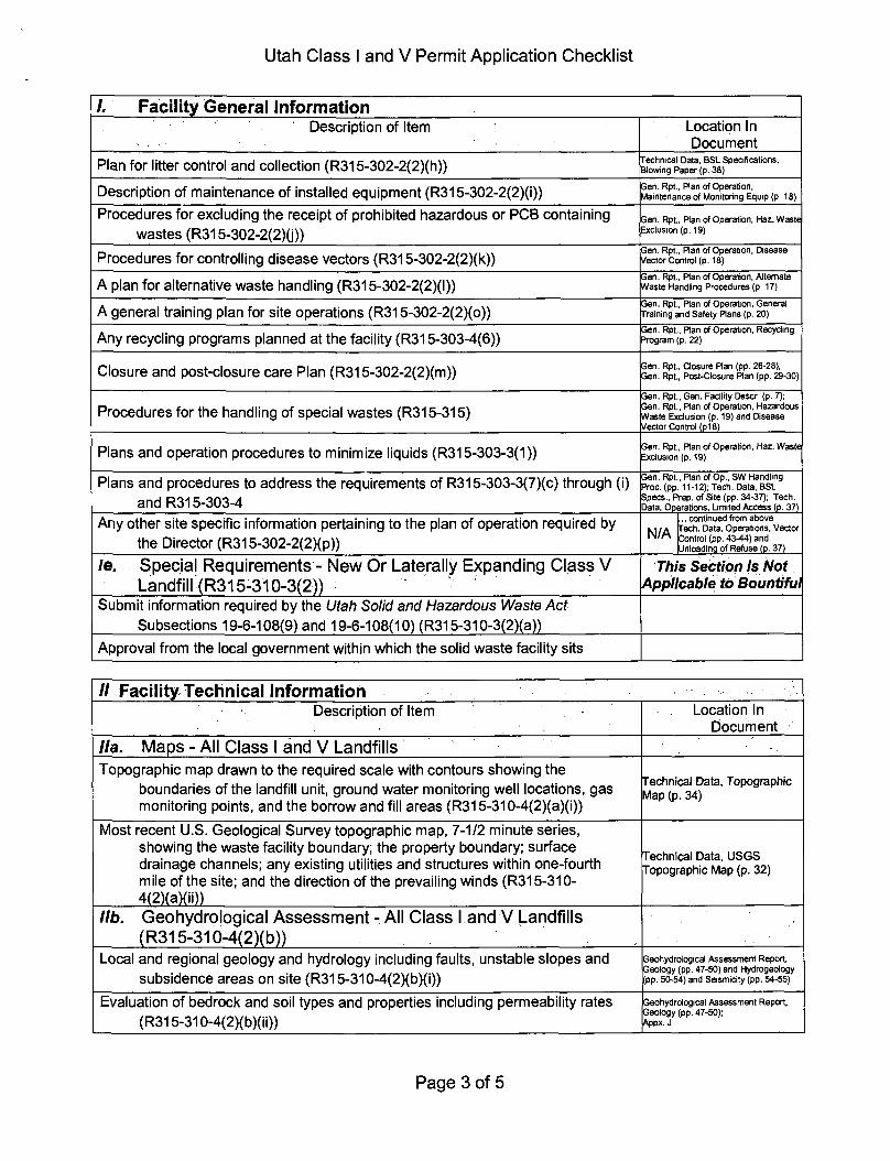
Facility General Information Description of Item Location In
Document la. Iriformation Required - All Class I and V Landfills
Completed Part I General information Form (See form above) Right after Table of Contents
General description of the facility (R315-310-3(1 )(b)) General Report, General Facilitv Description (p. 7)
Legal description of property (R315-310-3(1 )(c)) General Report, General Facilitv Description (p. 7)
Proof of ownership, lease agreement, or other mechanism (R315-310-3(1 )(c)) Appendix A
Area served by the facility including population (R315-310-3(1 )(d)) General Report, General Facilitv Description (p. 7)
If the permit application is for a class I landfill a demonstration that the landfill is not a commercial facility
General Report, General Facility Description (p. 7)
Waste type and anticipated daily volume (R315-310-3(1 )(d)) Permit Application Form Part I.VIII Gen Rpt., Closure Ran, Site Cap (p. 27)
lb. Information Required and V Landfills
All New Or Laterally Expanding Class I •This Section is Not Applicable to Bountiful
Intended schedule of construction (R315-302-2(2)(a))
Name and address of all property owners within 1000 feet of the facility boundary (R315-310-3(2)(a)(i))
Documentation that a notice of intent to apply for a permit has been sent to all property owners listed above (R315-310-3(2)(ii))
Name of the local government with jurisdiction over the facility site (R315-310-3(2)(iii))
Page 1 of 5
Utah Class I and V Permit Application Checklist
Facility General Information Description of Item Location In
Document Ic. Location Standards - All New Or Laterally Expanding Class 1
and V Landfills (R315-302-1) This Section is Not
Applicable to Bountiful
Documentation that the facility has meet the historical survey requirement of R315-302-1 (2)(f)
Land use compatibility (R315-302-1 (2)(a))
Maps showing the existing land use, topography, residences, parks, monuments, recreation areas or wilderness areas within 1000 feet of the site boundary
Certifications that no ecologically or scientifically significant areas or endangered species are present in site area
List of airports within five miles of facility and distance to each
Geology (R315-302-1 (2)(b))
Geologic maps showing significant geologic features, faults, and unstable areas
Maps showing site soils
Surface water (R315-302-1 (2)(c))
Magnitude of 24 hour 25 year and 100 year storm events
Average annual rainfall
Maximum elevation of flood waters proximate to the facility
Maximum elevation of flood water from 100 year flood for waters proximate to the facility
Wetlands (R315-302-1 (2)(d))
Ground water (R315-302-1 (2)(e))
Id. Plan of Operations Requirements - All Class I And V Landfills (R315-310-3(1 )(e) and R315-302-2(2))
Forms and other information as required in R315-302-2(3) including a description of on-site waste handling procedures and an example of the form that will be used to record the weights or volumes of waste received (R315-302-2(2)(b) And R315-310-3(1 )(f))
Appxs. D,H; Gen Rpt., Plan of Operation, Haz Waste Exclusion (p 20) Gen. Rpt., Ran of Operation, Gen. Training & Safety Plans (p. 20) Gen. Rpt., Ran of Operation, Solid Waste Handling Procedures (p. 11)
Schedule for conducting inspections and monitoring, and examples of the forms that will be used to record the results of the inspections and monitoring (R315-302-2(2)(c), R315-302-2(5)(a), and R315-310-3(1 )(g))
Appx. D Gen. Rpt., Plan of Operation, Monitoring Sch. (pp. 12-14); Gen. Rpt., Plan of Operation, Continoencv Plans (DO. 16-171
Contingency plans in the event of a fire or explosion (R315-302-2(2)(d)) Gen. Rpt., Ran of Operation, Contingency Plans (pp. 16-17)
Corrective action programs to be initiated if ground water is contaminated (R315-302-2(2)(e))
Gen. Rpt., Plan of Operation, Assessment (p. 15)
Contingency plans for other releases, e.g. explosive gases or failure of run-off collection system (R315-302-2(2)(f))
Gen. Rpt., Plan of Operation, Contingency Plans (pp. 16-17)
Plan to control fugitive dust generated from roads, construction, general operations, and covering the waste (R315-302-2(2)(g))
Technical Data, BSL Specifications, Operations, Dust Control (p. 44); Appx. M
Page 2 of 5
Utah Class I and V Permit Application Checklist
I. Facility General Information Description of Item Location In
Document
Plan for litter control and collection (R315-302-2(2)(h)) Technical Data, BSL Specifications, Blowing Paper (p. 38)
Description of maintenance of installed equipment (R315-302-2(2)(i)) Gen. Rpt., Plan of Operation, Maintenance of Monitoring Equip (p 18)
Procedures for excluding the receipt of prohibited hazardous or PCB containing wastes (R315-302-2(2)0)
Gen. Rpt., Plan of Operation, Haz. Waste Exclusion (p. 19)
Procedures for controlling disease vectors (R315-302-2(2)(k)) Gen. Rpt.. Plan of Operation, Disease Vector Control (p. 18)
A plan for alternative waste handling (R315-302-2(2)(l)) Gen. Rpt., Plan of Operation, Altemate Waste Handling Procedures (p 17)
A general training plan for site operations (R315-302-2(2)(o)) Gen. Rpt., Plan of Operation, General Training and Safety Plans (p. 20)
Any recycling programs planned at the facility (R315-303-4(6)) Gen. Rpt., Ran of Operation, Recycling 3rogram (p. 22)
Closure and post-closure care Plan (R315-302-2(2)(m)) Gen. Rpt., Closure Ran (pp. 26-28); Gen. Rpt., Post-Closure Ran (pp. 29-30)
Procedures for the handling of special wastes (R315-315) Gen. Rpt., Gen. Facility Descr (p. 7); Gen. Rpt., Plan of Operation, Hazardous Waste Exclusion (p. 19) and Disease Vector Control (p18)
Plans and operation procedures to minimize liquids (R315-303-3(1)) Gen. Rpt., Ran of Operation, Haz. Waste Exclusion (p. 19)
Plans and procedures to address the requirements of R315-303-3(7)(c) through (i) and R315-303-4
Gen. Rpt., Ran of Op., SW Handling Proc. (pp. 11-12); Tech. Data, BSL Specs., Prep, of Site (pp. 34-37); Tech. Data, Operations, Limited Access (p. 37)
Any other site specific information pertaining to the plan of operation required by the Director (R315-302-2(2)(p))
N/A continued from above
Tech. Data, Operations, Vector Control (pp. 43-44) and Unloading of Refuse (p. 37)
le. Special Requirements - New Or Laterally Expanding Class V Landfill (R315-310-3(2))
This Section is Not Applicable to Bountiful
Submit information required by the Utah Solid and Hazardous Waste Act Subsections 19-6-108(9) and 19-6-108(10) (R315-310-3(2)(a))
Approval from the local government within which the solid waste facility sits
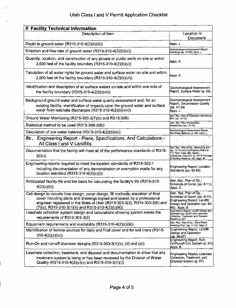
// Facility Technical Information Description of Item Location In
Document
//a. Maps - All Class I and V Landfills Topographic map drawn to the required scale with contours showing the
boundaries of the landfill unit, ground water monitoring well locations, gas monitoring points, and the borrow and fill areas (R315-310-4(2)(a)(i))
Technical Data, Topographic Map (p. 34)
Most recent U.S. Geological Survey topographic map, 7-1/2 minute series, showing the waste facility boundary; the property boundary; surface drainage channels; any existing utilities and structures within one-fourth mile of the site; and the direction of the prevailing winds (R315-310-4(2)(a)(ii»
Technical Data, USGS Topographic Map (p. 32)
lib. Geohydrological Assessment (R315-310-4(2)(b))
All Class I and V Landfills
Local and regional geology and hydrology including faults, unstable slopes and subsidence areas on site (R315-310-4(2)(b)(i))
Geohydrological Assessment Report, Geology (pp. 47-50) and Hydrogeology (pp. 50-54) and Seismicity (pp. 54-55)
Evaluation of bedrock and soil types and properties including permeability rates (R315-310-4(2)(b)(ii))
Geohydrological Assessment Report, Geology (pp. 47-50); Appx. J
Page 3 of 5
Utah Class I and V Permit Application Checklist
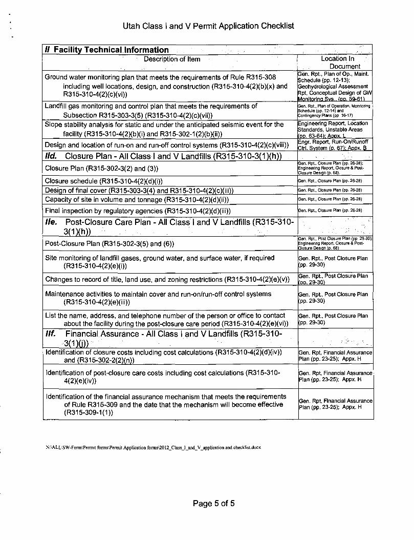
// Facility Technical Information Description of Item Location In
Document
Depth to ground water (R315-310-4(2)(b)(iii)) Appx. J
Direction and flow rate of ground water (R315-310-4(2)(b)(iv)) Geohydrological Assessment Report, Hydrology (pp. 47-54); Appx. J
Quantity, location, and construction of any private or public wells on-site or within 2,000 feet of the facility boundary (R315-310-4(2)(b)(v))
Appx. K
Tabulation of all water rights for ground water and surface water on-site and within 2,000 feet of the facility boundary (R315-310-4(2)(b)(vi))
Appx. K
Identification and description of all surface waters on-site and within one mile of the facility boundary (R315-310-4(2)(b)(vii))
Geohydrological Assessment Report, Surface Water (p. 56)
Background ground water and surface water quality assessment and, for an existing facility, identification of impacts upon the ground water and surface water from leachate discharges (R315-310-4(2)(b)(viii))
Geohydrological Assessment Report, Groundwater Quality (pp. 57-58) Appx. J
Ground Water Monitoring (R315-303-3(7)(b) and R315-308) Gen. Rpt., Plan of Operation, Monitoring Sch. (pp. 12-13)
Statistical method to be used (R315-308-2(8)) Gen. Rpt., Ran of Operation, Assessment (pp. 14-15);
Calculation of site water balance (R315-310-4(2)(b)(ix)) Geohydrological Assessment Report, Site Water Balance, (p. 59); Appx. J
He. Engineering Report - Plans, Specifications, And Calculations -All Class I and V Landfills
Documentation that the facility will meet all of the performance standards of R315-303-2
Gen. Rpt., Plan of Op., Monitoring Sch. (pp. 12-14) and Contingency Rans (p. 17); Tech. Data, BSL Specs., Operations, Dust Ctrl. (p. 44) & Drainage of Surface Water (p. 45); Appx M
Engineering reports required to meet the location standards of R315-302-1 including documentation of any demonstration or exemption made for any location standard (R315-310-4(2)(c)(i))
Engineering Report, Location Standards (pp. 62-65)
Anticipated facility life and the basis for calculating the facility's life (R315-310-4(2)(c)(ii))
Gen. Rpt, Plan of Op., Schedule of Const, (pp. 8-11) Appx. C
Cell design to include liner design, cover design, fill methods, elevation of final cover including plans and drawings signed and sealed by a professional engineer registered in the State of Utah (R315-303-3(3), R315-303-3(6) and (7)(a), R315-310-3(1 )(b) and R315-310-4(2)(c)(iii))
Gen. Rpt, Plan of Op., Schedule of Const, (pp. 8-11); Engineering Report, Landfill Design and Operation (pp. 65-66); Appx. B
Leachate collection system design and calculations showing system meets the requirements of R315-303-3(2)
Engineering Report, Landfill Design and Operation (pp. 65-67) and Leachate Collection, Treatment, and Disposal System (p. 67)
Equipment requirements and availability (R315-310-4(2)(c)(iii)) Gen. Rpt., Plan of O p , Solid Waste Handling Proc. (pp. 11-12), Appx. E
Identification of borrow sources for daily and final cover and for soil liners (R315-310-4(2)(c)(iv))
Engineering Report, Landfill Design and Operation fpp. 66-67)
Run-On and run-off diversion designs (R315-303-3(1 )(c), (d) and (e)) Engineering Report, Run-On/Runoff Ctrl. System (p. 67): Appx. B
Leachate collection, treatment, and disposal and documentation to show that any treatment system is being or has been reviewed by the Division of Water Quality (R315-310-4(2)(c)(v) and R315-310-3(1 )(i))
Engineering Report, Leachate Collection, Treatment, and Disposal System (p. 67)
Page 4 of 5
Utah Class I and V Permit Application Checklist
// Facility Technical Information Description of Item Location In
Document
Ground water monitoring plan that meets the requirements of Rule R315-308 including well locations, design, and construction (R315-310-4(2)(b)(x) and R315-310-4(2)(c)(vi))
Gen. Rpt, Plan of Op., Maint. Schedule (pp. 12-13); Geohydrological Assessment Rpt, Conceptual Design of GW Monitoring Svs.. (DP. 59-61)
Landfill gas monitoring and control plan that meets the requirements of Subsection R315-303-3(5) (R315-310-4(2)(c)(vii))
Gen. Rpt., Plan of Operation, Monitoring Schedule (pp. 12-14) and Contingency Plans (pp 16-17)
Slope stability analysis for static and under the anticipated seismic event for the facility (R315-310-4(2)(b)(i) and R315-302-1 (2)(b)(ii))
Engineering Report, Location Standards, Unstable Areas fpp. 63-64): A P P X . L
Design and location of run-on and run-off control systems (R315-310-4(2)(c)(viii)) Engr. Report, Run-On/Runoff Ctrl. Svstem (p. 67): Appx. B
lid. Closure Plan - All Class I and V Landfills (R315-310-3(1 )(h)) Closure Plan (R315-302-3(2) and (3))
Gen. Rpt., Closure Plan (pp. 26-28); Engineering Report, Closure & Post-Closure Design (p. 68).
Closure schedule (R315-310-4(2)(d)(i)) Gen. Rpt., Closure Plan (pp. 26-28)
Design of final cover (R315-303-3(4) and R315-310-4(2)(c)(iii)) Gen. Rpt., Closure Plan (pp. 26-28)
Capacity of site in volume and tonnage (R315-310-4(2)(d)(ii)) Gen. Rpt., Closure Ran (pp. 26-28)
Final inspection by regulatory agencies (R315-310-4(2)(d)(iii)) Gen. Rpt., Closure Ran (pp. 26-28)
lie. Post-Closure Care Plan - All Class I and V Landfills (R315-310-3(1)(h))
Post-Closure Plan (R315-302-3(5) and (6)) Gen. Rpt., Post Closure Ran (pp 29-30); Engineenng Report, Closure & Post-Closure Design (p. 68)
Site monitoring of landfill gases, ground water, and surface water, if required (R315-310-4(2)(e)(i))
Gen. Rpt., Post Closure Plan (pp. 29-30)
Changes to record of title, land use, and zoning restrictions (R315-310-4(2)(e)(v)) Gen. Rpt., Post Closure Plan fpp. 29-30)
Maintenance activities to maintain cover and run-on/run-off control systems (R315-310-4(2)(e)(iii))
Gen. Rpt., Post Closure Plan (pp. 29-30)
List the name, address, and telephone number of the person or office to contact about the facility during the post-closure care period (R315-310-4(2)(e)(vi))
Gen. Rpt., Post Closure Plan (pp. 29-30)
llf. Financial Assurance - All Class I and V Landfills (R315-310-3(DG))
Identification of closure costs including cost calculations (R315-310-4(2)(d)(iv)) and (R315-302-2(2)(n))
Gen. Rpt, Financial Assurance Plan (pp. 23-25); Appx. H
Identification of post-closure care costs including cost calculations (R315-310-4(2)(e)(iv))
Gen. Rpt, Financial Assurance Plan (pp. 23-25); Appx. H
Identification of the financial assurance mechanism that meets the requirements of Rule R315-309 and the date that the mechanism will become effective (R315-309-1(1))
Gen. Rpt, Financial Assurance Plan (pp. 23-25); Appx. H
N:\ALL\SW-Form\Perrnit forms\Peraiit Application forms\2012_Class_I_and_V_application and checklist.docx
Page 5 of 5

GENERAL REPORT
GENERAL FACILITY DESCRIPTION,
RELATIONSHIP TO COUNTY, SOLID WASTE PLAN, AND
OWNERSHIP
The Bountiful Sanitary Landfill (Previously called the Bay Area Refuse Disposal site (BARD))
occupies approximately 150 acres on the east shore of the Great Salt Lake, west of West Bountiful,
Utah The landfill began receiving municipal wastes in about 1962, while it was operated by a
group of SIX east shore cities, and Davis County which constituted the Bay Area Refuse Disposal
District The Bay Area Refuse Disposal District consisted of the following public entities
1 Bountiful City
2 CenterviUe City
3 Farmington City
4 City of North Salt Lake
5 West Bountiful City
6 Woods Cross City
7 Davis County (unincorporated areas)
Starting July 1987, all of the public entities except Bountiful joined the Davis County Solid Waste
Management Distnct and began transferring their refuse to the Davis County "Bum Plant" near
Hill Air Force Base in North Davis County Since that time the landfill has been operated solely
by the City of Bountiful
Use of the facility is limited to residents of the City of Bountiful The landfill receives residential
and commercial wastes and construction debris produced within Bountiful City, which has a total
area of nearly 13 square miles (Population 41,301 as of 2000 Census) Hazardous wastes,
asbestos, and PCB contaminated wastes and old tires are not allowed in the landfill
The property upon which the landfill is located is owned by the City of Bountiful, and is located in
the North 1/2 Sec 14 T 2 N R 1 W SLB&M The front gate is located at latitude 40''54'30"
and Longitude 11 TSS'OO" Proof of ownership is attached in appendix A
PLAN OF OPERATION
Schedule of Construction
Upgrading and implementation of operational changes at the Bountiful Sanitary Landfill began in
1987 when Bountiful City became sole owner and operator of the facility These changes were
the beginmng of the process required in order to come into compliance with State of Utah Solid
Waste Permitting and Management Rules Barton/Stone Creek, which pnor to 1992 was unlined
and traversed the south portion of the landfill, was realigned and concrete lined in an attempt to
isolate refuse from surface and ground water A large pond was also excavated south and west of
the landfill that serves several purposes One of the important purposes was to obtain low
permeability clay cover matenal to use at the landfill Much of the soil excavated was used to
re-contour the south half and the east side of the north half of the landfill to promote runoff and
reduce infiltration into the refuse This cover soil reaches fourteen feet thick in some areas
Current plans are to excavate cells from this cover and continue filling refuse in these areas when
the fill plan progresses to that point
In spring of 1996, landfill personnel completed the excavation and limng of the runoff
retention/evaporation pond to retain runoff of storm water from the active face of the landfill
dunng a 24-hour 25 year intensity storm Landfillmg is being accomplished in a manner such that
the working face and surrounding areas drain toward the pond in order to retain any runoff from
the active face within the pond
Additional upgrades at the site include implementation and enlarging of the recycling program at
the landfill site to complement the current recycling program operated by the City of Bountiful
Bins have been placed where recyclable matenals can be deposited Steel, aluminum, battenes,
carpet pad (urethane), and e-waste are all recycled
As a means of waste reduction the city has also implemented operations to reduce the amount of
yard waste deposited in the landfill In 1996 the City began to produce and stockpile wood chips
from tree limbs and branches delivered to the landfill for disposal These chips are useful for
8
vanous public and pnvate projects, including disease vector control and daily cover at the landfill
This program has developed into a composting program using the excess wood chips along with
other yard waste delivered to the landfill to produce high quality mulch which is sold back to the
public
The 1996 site improvements mcluded a new scale, scale house, operations center/office bmldmg,
and a new equipment storage building at the landfill site In order to accommodate the Legacy
Parkway project, the portion of the property occupying these improvements was sold to the Utah
Department of Transportation These facilities were demolished and replaced with new facilities
that were completed in 2007 Culmary water, natural gas, power, phone lines, and samtary sewer
service the facility
A layout of the site improvements is included in Appendix B
Fill Plan
This fill plan was developed m an attempt to provide the most efficient use of landfill space and
available cover matenal by makmg haul distances as short as possible The fill plan is divided
into four major phases These phases are bnefly descnbed as follows
Phase I This is the area that was currently being filled with refuse at the time of the
imtial permit apphcation m October 1994 As mdicated on the figure in Appendix B, it is
located near the center and west end of the north half of the landfill Quantity and volume
calculations indicated that this phase had a life of approximately 2 5 years beginning fall of
1994 This phase was completed aroimd the end of 1996
Phase II This is the area currently being filled This phase will attempt to make
maximum use of the entire north half of the landfill As indicated on the drawings in
Appendix B, fill began at approximately elevation 4220, and will continue to progress in an
orderly manner across the phase Fill will progress in an area fill manner, in lifts
approximately 10 feet thick Grading will provide dramage away from the active face and
toward the run-off retention pond Each lift will be well compacted, and receive daily
cover The top of each lift will receive 12 inches of interim cover, and be sloped at a
mmimum of one percent to promote storm water runoff and minimize infiltration The
intenm cover will be left in place for a maximum of two years Sometime during the first
two years, either an additional lift of refuse will be placed over the area, or the temporary
cover will be changed to intermediate cover, with the thickness increased to at least
eighteen inches m order to minimize infiltration The eighteen inch thick layer will be
monitored for erosion on a regular basis as part of the regular maintenance and momtonng
activities at the landfill When the first lift has covered the entire north half or reached
daylight matching contours from phase I, filling activities will commence on another lift
The same fill sequence will be followed for subsequent lifts Upon completion of this
phase, side slopes will be approximately twenty percent on all sides of the north half of the
landfill The north, east, and west slopes of the north half of the landfill will receive final
cover, top soil, and re-vegetation as the area is filled When Phase II is completed, the
final cover, topsoil, and vegetation will be in place and prepared for eventual closure
Phase HI This phase will be very similar to phase II, but will be performed on the south
half of the landfill The main difference will be that the south half currently has excess
cover matenal, (up to 14 feet thick) which will be excavated and stockpiled for use as final
cover on the landfill The first lift will resemble a trench fill procedure as the excess cover
matenal is reclaimed After the excess clay cover is excavated, and the first lift is placed,
subsequent lifts will be placed in an area fill manner Upon completion of this phase,
side slopes will be at twenty percent The south, east, and west slopes will have final
cover, topsoil, and be re-vegetated as the fill is being placed
Phase IV This will be the final phase of refuse fill at the site In this phase the center
"valley" between phase II and phase III will be filled In order to provide drainage
toward the retention pond, fill will begin on the east end of the valley and will progress
toward the west in an area fill manner with lifts of between five and ten feet thick Access
to the working face will be provided by traversing the north half of the landfill and
10
approaching the working face from the west Fill on the east end of the phase will slope at
twenty percent to match the slopes on the east side of phases II and III As fill is placed,
final cover, top soil, and re-vegetation will be ongomg
In January 2008, a Remaimng Life Study was performed for the landfill, using surveyed data for
volumes, and scale records for weight of waste landfilled This study found that the landfill is
achieving waste-m-place density of about 1750 Ib/cy, after the waste has been in place for some
time and allowed to settle Quantity and volume calculations m this study mdicate that Phase II
will be completely filled in about year 2037 Phase III has a life of approximately 14 years, and
Phase IV has a life of approximately 18 years Based on the conclusions from the Remaimng Life
Study with current waste disposal rates and practices, it has been calculated that the landfill's life
will end m approxmiately year 2089 However, small changes in vanables mvolved in
calculating landfill life can make it nearly impossible to anticipate capacity over that long of a time
frame Therefore our current estimate of the end of landfill life for planmng and reporting is year
2050 The Remaimng Life Study is mcluded in Appendix C
Sohd Waste Handlmg Procedures
As solid waste is transported on site, the transport vehicle must pass the scale house Every
commercial load of refuse delivered to the site will be weighed to determine the weight of refuse
deposited In addition, all construction and demolition waste will be weighed regardless of the
hauler Individual private citizens hauling municipal solid waste (pick-up trucks) will be charged
a umform fee and the tonnage will be estimated based on a calculated average weight This
information will be recorded using a computer database that will report on the ticket and vanous
forms as shown m Appendix D The database and reports will be retained m landfill records
The scale house operator will be trained to recogmze potential hazardous waste, and will question
the transporter as to the ongin of the wastes to be deposited All suspicious loads will be
inspected by trained personnel, and if determined to contain hazardous matenal will not be
allowed to unload at the landfill At least one percent of all loads delivered to the landfill will be
inspected at random For more information on load inspections, see the section below, "Load
Inspection" Any recyclable matenals will be separated by the transporter, and deposited m the
11
recycling bins prior to progressing to the working face of the landfill for disposal Transporters
hauling yard clippings and tree limbs will be directed to the composting area for unloading
After the solid waste is unloaded at the working face of the landfill, landfill operators will move
the refuse to the location necessary m order to obtain the desired lift thickness and slope The
refuse will then be compacted to a mimmum density of 29 6 pounds per cubic foot (800 pounds
per cubic yard) by making several passes over the refuse with the compaction equipment After
the refuse is compacted to the desired density, lift thickness, and slope, an approved daily cover
will be placed over the refuse in order to control vectors, fire, odor, blowing litter, and scavenging
The entire working face will be covered at the end of each working day
The equipment used for refuse distnbution, compaction, daily cover, cell excavation, and dust/fire
control IS listed below
2 Compactors
1 Dozer
2 Loaders
4 Dump Trucks
1 Excavators
2 Water Trucks
1 Backhoe
1 Leafer (litter vacuum)
A complete equipment list with the anticipated replacement schedule is attached in appendix E
Monitormg Schedule
Ground Water - History Bountiful City has been sampling the groundwater at the landfill on a
quarterly schedule since September 1996 when the new background and compliance wells were
completed Imtially, the reason for sampling quarterly was to quickly produce sufficient data to
develop background concentrations for the groundwater constituents Upon obtaimng sufficient
background data to perform the appropnate statistical analyses, a statistically significant increase
12
m arsemc concentrations in well BSL-3 was discovered These results were reported to the Utah
Division of Solid and Hazardous Waste m the annual Statistical Analysis Report for that year dated
January 19,1999
As proposed in the report an assessment momtonng program was mitiated which included taking
one sample from well BSL-2 and one sample from well BSL-3 and having them analyzed for all
constituents listed as Appendix II in 40 CFR Part 258, 1991 ed None of the Appendix II
constituents were detected m any of the samples tested Based on this. Bountiful received
authonzation to test only for constituents listed in Section R315-308-4 but were required to
contmue testing on a quarterly basis
Current Program The above testing schedule was followed until June of 2001 when
authonzation was given by the Division of Solid and Hazardous Waste to again amend the
momtormg schedule, which was amended again in Feb 2009 with authonzation Currently,
orgamc and inorganic constituents are sampled and analyzed on a semiannual basis in all wells
Metals are sampled and analyzed semiaimually in up gradient well BSL-1 and quarterly m wells
BSL-2 and BSL-3 In July 2010, formal authonzation was given to continue to analyze metals
using filtered samples, which began in 2002
This momtonng schedule allows accurately tracking the quality of the grovmdwater at the site and
will not compromise the envuronmental integnty of our landfill operations
Methane Penmeter methane momtonng will be conducted on a quarterly basis Calm-weather
days will be chosen so that worst case conditions can be determined Penmeter methane readmgs
will be taken at random locations along the boundanes of the landfill Methane readings will
also be taken m each of the ground water momtonng wells immediately upon removal of the cap
from the well The methane concentrations in some of the wells are expected to be high, and will
be for our information only Sampling points for compliance will be at random locations around
the penmeter of the landfill
13
Methane momtonng in the buildings at the landfill will be conducted quarterly Readings will be
taken immediately upon amval Monday moming after the buildings have been shut up with no
activity over the weekend This will likely produce a worst case situation, which will allow
detection of methane problems m the buildings
Self mspections of the momtormg systems, equipment, and operations will be conducted at least
quarterly at the landfill to prevent malfunctions and detenoration, operator errors, or discharges
which may cause or lead to the release of waste to the environment, or to a threat to human health
Forms
Database reporting forms and other forms for keepmg an operating record are attached m
Appendix D This includes weights, types of waste received each day, number of vehicles
entenng each day, any deviations from approved plan of operation, random load inspections,
self-inspections, and results of grovmdwater, stormwater, and gas momtonng Training
certificates are attached in Appendix F
Assessment
Three new momtonng wells were placed at the site m spnng of 1996 The new well locations
were chosen m order to provide better compliance with section R315-308-2 (1-2), and to address
concerns with well location and screen depth One up-gradient well was placed at a location on
landfill property, in an area unaffected by landfill operations This is used to determine
upgradient quality of the ground water The property upon which this well is located has since
been acquired by UDOT, but the well (which was retrofit mto a manhole) is still being used Two
down-gradient wells were placed at a location far enough from the landfill area to be sure that it
does not penetrate areas filled with refuse, these are the compliance wells
Bountiful City maintains a software license agreement with NIC Solutions for Sanitas for
Groimdwater, and has an engineer who is trained in the use of the Sanitas software Sanitas is a
statistical analysis program specifically designed for analysis of groundwater data for regulatory
compliance and MSW landfills It provides various options for ground water analysis based on
14
site specific conditions and statistical distnbution of data The license agreement with NIC
solutions ensures that the latest version of the software is being used and any necessary software
support IS received Bountiful city plans to contmue the use of Sanitas for Groundwater as a
means of statistical analysis compliance
The Engineenng Staff at Bountiful City are momtonng the quality of the groundwater at the
Landfill site on a regular basis The results of the groundwater momtonng and statistical analysis
of the data are used to venfy that the landfill is in compliance with the regulations for groundwater
(R315-308) The results are also reported annually to the Division of Solid and Hazardous Waste
with the Landfill Annual Report Additional reportmg is given if any of the groundwater
constituents are found to be at a 95% confidence level above the compliance limit
As new results of the groundwater momtonng program and the statistical analysis of the data
become available, decisions regarding the quality of the groundwater within and sunounding the
landfill Will be adapted Any new site the information will be submitted to the Executive
Secretary along with our plans for implementing or expanding Assessment Momtonng activities if
necessary
The steps set forth m R315-308-2 will be followed in evaluating the groundwater momtonng data
and determining if the implementation of additional momtonng is to be done, and whether a
conective action program at the site is necessary
In the 2009 Landfill Annual Report, Bountiful City notified the Division that the arsemc level in
one of the groundwater compliance wells (BSL3) for the Bountiful Samtary Landfill had exceeded
the compliance limit for arsemc Boxmtiful City believes that the arsemc is naturally occumng for
several reasons stated in the 2009 Statistical Analysis Report Bountiful has contracted with
Environmental Resources Management (ERM) to evaluate potential source(s) of arsemc in the
shallow groundwater sunounding the landfill in accordmg to (UAC) R315-308-2(13) Two new
wells have been placed for this study, according to the work plan, and the evaluation of arsemc is
in process
15
Contingency Plans
The design of the Bountiful Sanitary Landfill has been performed using sound engineenng
practice with factors of safety, and other design standards m an effort to mimmize the potential
hazards due to fire, explosion, release of explosive gases, or failure of the run-off containment
system Emergency evacuation of the site will probably not be necessary given the nature of the
waste matenals stored and processed The probability of fire, explosion, or toxic vapor
generation is remote
Fire or explosion The hazard caused by a fire or explosion is intensified in the presence of
discarded household chemicals, paints, fuels, etc , or other hazardous matenals Momtonng and
inspection of waste loads is intended to exclude these substances from the waste stream, and
therefore reduce the hazard caused by accidental fires Because burning of any kind is not
allowed at the landfill, any fire intentionally igmted is considered vandalism, and will be pursued
and prosecuted as such by landfill operators Foreseeable means by which accidental fires or
explosions may occur at the site include spontaneous combustion in refuse containers, or more
likely, by hot ashes or sparks delivered to the landfill within the refuse stream Landfill operators
are trained in recogmzing loads which contain hot ashes and will be instructed to prevent their
disposal among other flammable refuse
If a fire or explosion occurs at the site, the on-site Landfill Manager will be responsible to
determine if there is any immediate danger to personnel If it is determined that any immediate
danger exists, the site will be evacuated immediately The signal for evacuation will be three long
blasts from an automobile hom If an evacuation is imtiated at any time, all personnel will
immediately demand all patrons to leave the site and will then leave the site themselves and meet
for a head count outside the entrance gate When danger to on-site personnel exists, the South
Davis Metropolitan Fire Distnct will be summoned to fight the fire
If It is determined that no immediate danger exists, the on-site Manager will determine and
implement a procedure to fight the fire These procedures may include isolating the burning area
from the working face and covenng with on-site soil, use of the on-site water truck, use of the
16
on-site fire hydrant, and fire extinguishers for small fu-es, and/or obtain support from the South
Davis Metropolitan Fire Distnct All fires not immediately controlled by Landfill persoimel will
be reported to the Utah Division of Solid and Hazardous Waste
Explosive Gas Release Momtonng for explosive gasses will occur on a quarterly basis at the
landfill boundanes, and in the buildings at the landfill If it is determined that there are unsafe
levels of explosive gasses dunng any of the momtonng activities, emergency evacuation of the
landfill site will occur and immediate actions will be taken to reduce the levels of explosive gas
In the buildings, gas levels will be reduced by increasmg the ventilation in the buildings This
will be accomplished by opening doors and windows, and if necessary by placing fans so that fresh
air IS forced into the building The South Davis Metropolitan Fire Distnct will be alerted to the
high explosive gas levels, and their support in ventilatmg the building will be summoned if
necessary
If high explosive gas levels are discovered at the landfill boundanes, operators will immediately
notify occupants of nearby structures, and where possible, test the air m nearby structures for
explosive gas to determine if any immediate danger exists If so, ventilation procedures of the
bmldings will be performed usmg procedures similar to those above
Alternative Waste Handling or Disposal
The two foreseeable reasons that may require implementation of alternative waste handling at the
landfill site are equipment breakdown and inclement weather Landfill operators plan to keep
eqmpment in top working condition by following manufacturer's recommendations for regular
maintenance, and inspection of parts for the purpose of replacing parts receiving wear and tear
through use
If a piece of equipment breaks down it can be efficiently repau:ed m the on-site shop, and while
being repaired, the landfill will keep sufficient equipment on site to cover for a broken down piece
For example, the dozer can temporanly be used as a compactor if necessary, and the compactor
can be used to move and place refuse
17
In the case of inclement weather or other emergency which would interrupt normal disposal of
refuse, it is the opinion of the landfill operators, that due to the large size of the landfill, and
available fill area, if an area cannot be used for disposal, landfillmg activities can be moved to
another more accessible or useable area within the landfill
If emergency conditions exist that do not allow use of any part of the landfill on a temporary basis,
large bulk containers will be placed near the landfill, and a transfer station type operation will be
temporanly employed When conditions return to normal, the refuse will be placed in the landfill
and compacted and covered as normal
Maintenance of Monitoring Equipment
Maintenance of installed monitoring equipment will occur on an as needed basis Ground water
momtonng wells will be visually inspected dunng all sampling events and all regularly scheduled
mspections Any noted damage or wear to the momtonng systems will be assessed and repaired
The suitability of the momtonng systems to accomplish their desired purpose will be continually
momtored Upgrades and improvements will be made as warranted
Disease Vector Control
The primary means of controlling disease vectors at the landfill will be to provide a daily cover
over the working face of the disposal area at the end of each day The cover will be provided in an
attempt to prevent the propagation and harborage of rodents and insects, and to prevent odors
which attract rodents and insects to the site
Dead Animals Because refuse deposited in the landfill is limited only to that produced within
the City of Bountiful limits, the need to dispose of dead ammals is uncommon If it becomes
necessary to dispose of a dead animal, it will be deposited onto the working face at or near the
bottom of the cell with other solid waste It will be covered with at least six inches of earth to
prevent odors, and the propagation and harborage of rodents and insects
18
Tires. Waste tires, which tend to provide habitat for mosquito breedmg, and harborage of other
vectors such as rats, will be excluded from the landfill
Hazardous Waste Exclusion
The Bountiful Samtary Landfill will not knowingly dispose, treat, store, or otherwise handle
hazardous waste or waste containmg PCBs This includes, but is not limited to, toxic and
pathological/infectious waste, liquid waste, chemical wastes, and asbestos-contaimng wastes
White goods containmg chlorofluorocarbons will not be landfilled, they will be recycled after the
refrigerant is removed, which is done on site using a device for which a certification form has been
subnutted to the EPA
Both the person at the gate and the person at the working face of the landfill will be trained in
recogmzing suspicious loads, including liquid wastes, drums, sealed containers, red bag wastes,
and unusual markings or odors All such waste will be refused
As a means of keeping small quantity household hazardous wastes from being disposed of at the
Bountiful Sanitary Landfill to the greatest degree possible, Boxmtiful City regularly conducts a
household hazardous waste collection program Under this program, the city accepts household
hazardous waste from Bountiful residents and properly disposes of them This both allows
residents to be nd of hazardous matenals, and also keeps them out of the landfill A copy of the
most recent flyer advertising this program is attached m Appendix G
Load Inspection All suspicious loads will be mspected by landfill personnel Also, random
mspections of loads will be performed by landfill operators Random mspections will be
performed at a frequency of approxmiately one load for every one hundred loads entenng the
landfill The random inspections will be performed m addition to inspections of suspicious loads
Load inspections will be performed at an area near the landfill working face, but away from public
access
19
If hazardous matenals are discovered dunng the inspection process, the load will be denied access
to the landfill, and notifications will be made as descnbed in the section below for "Notification
Procedures " Access to the area will be restncted, and the hauler will be asked to park the load
until a decision can be made as to the appropnate disposal options for the hazardous waste
If no hazardous matenals are discovered in the load, the waste will be allowed to progress to the
working face The Landfill Manager will have ultimate authonty to decide whether to accept or
reject waste matenal If a question exists as to the acceptability of refuse, the load will most likely
be rejected and not allowed to unload at the site The form attached in Appendix D will be used to
keep record of each load inspection
Notification Procedures If hazardous waste or waste containmg PCBs is discovered at the
Bountiful Samtary Landfill, the landfill operators will
1 determine if any immediate threat to human health or the environment is present or
imminent, if so, contact the 911 for emergency response from the South Davis Fire
District,
2 request that the hauler park the truck (to be parked until the County Health DeparUnent can
make a decision as to proper handling of the waste),
3 notify the Davis County Health Department immediately,
4 notify the Utah Department of Environmental Quality Executive Secretary within 24
hours,
5 secure the area, and restrict the area from public access and from facility personnel.
General Training and Safety Plans
Traimng of landfill supervisors, managers, and on-site workers, will consist of a combination of
classroom training and on-the-job training The Landfill Supenntendent and on-site Landfill
20

Manager are certified by the Solid Waste Association of North Amenca (SWANA) as a Certified
Managers of Landfill Operation Full time on site Landfill Operators have completed the
SWANA Landfill Operator Traimng Course which covered samtary landfill operator traimng
and waste screemng at municipal solid waste facilities This or similar trammg will be provided
for all landfill personnel responsible for mspectmg and identifying hazardous waste Copies of
all certificates of completion and framing are attached m Appendix F
Traimng of new employees and continuing traimng of current employees will be under the
direction of the Landfill Manager Initial training of new employees will be completed dunng the
first three months of employment, and will include yearly reviews of basic waste management
skills The specific schedule for traimng will be as follows
A Introductory training Overview Plan of Operations, Solid Waste Regulations,
and Record Keeping
Required All personnel
Method On-the-Job Traimng / Seminars
Review Annual
B Policies and Procedures Secunty, inspections, momtonng, and emergency
response
Required All Personnel
Method On-the-Job Traimng, lecture, video media
Review Annual
C Safety Personal protection, hazardous waste recognition and exclusion,
hazardous matenals handling, emergency response, and first aid
Required All Personnel
Method Lecture, video, seminars
Review Armual
21
Recychng Program
The City of Bountiful cunently has an active recycling program Bountiful City has a contract
with Waste Management to provide curbside recyclmg for Bountiful residents Items that are
accepted paper, cardboard/paperboard, metals, and plastics (PETE and HDPE) A copy of the
Recycling Information is attached in Appendix G
Large recyclmg bays are available at the landfill near the scale building These are used to separate
recyclables from the waste stream including aluminum, steel, battenes, e-waste, and white goods
(appliances) Also, a recycling bin for used carpet padding is m use at the landfill
Bountiful City also operates an aggressive green waste composting operation Residents and
haulers are encouraged to separate the green waste that they deliver to the Landfill for disposal
Green waste is processed into compost and sold back to the public in order to divert a portion of the
flow of refuse into the landfill, and to provide a great product to consumers
22
FINANCIAL ASSURANCE PLAN
From 1962 to 1987 the Bountiful Sanitary Landfill operated under an Interlocal Cooperation Act
Agreement as the Bay Area Refuse Disposal (BARD) by Davis County and six cities in the area
A "reserve fund" generated by tipping fees at the landfill was developed in order to cover closure
costs There was for a time, litigation regarding the future use of this fund Because this fund
was generated while all cities were members of BARD, the entities who no longer used the landfill
felt that part of the money m the fund belonged to them, and therefore should be removed from the
fund and returned to them Bountiful City contended that since all entities had used the landfill,
all should be partially responsible for closure, post closure, and any necessary conective action at
the site On December 20, 1989 a "Settlement Agreement" was completed and submitted to the
SIX cities and Davis County which was signed by all This agreement WEIS accepted and became
effective on January 10, 1990 A copy of the "Settlement Agreement" is attached in Appendix H
The agreement includes a section dealing with the fund developed, and states
"Payment of BARD Fund " Defendants hereby transfer, convey, and assign to Bountiful
all of their nghts, title, and interest to and in all momes currently deposited in Public
Treasurer's Investment Fund, , including accrued interest (herein refened to as the
"BARD Fund"), the cash amount of which is approximately $ 1,862,642 12 The BARD
Fund IS held and managed by the State Treasurer pursuant to the State Money Management
Act of 1974, Utah Code Ann Section 51-7-1 (1953 as amended)
The agreement also includes provisions for Davis County to help m providing clay cover matenal,
and does not release the other cities from a share of financial responsibilities which may come
from any necessary corrective action, or other necessary improvements due to past landfill
operation
According to a January 22,1992 amendment to the Settlement agreement, a portion of the fund has
been used to perform design and operational upgrades These include improving cover and
23
grading over existing landfill areas to prevent infiltration and promote runoff, and realignment and
limng of Barton Creek in an attempt to keep additional moisture from infiltrating into the refuse
The remainder of the fund is reserved for closure, post-closure, and conective action financial
assurance The current balance in the fund is approximately $790,000 (September, 2010)
Interest to the fund continues to accrue, but no additional deposits mto the fund are planned
In addition to the above described fund. Bountiful City has established a Landfill Closure Fund
Prior to November 1996 contributions were appropnated annually and the amount varied each
year In November 1996, Bountiful City Entered into an "Escrow Agreement" with The
Executive Secretary, Utah Solid and Hazardous Waste Control Board Department of
Environmental Quality At that time the Closure Fund was fully funded in the amount of
$1,200,000 00 In December 2005, another "Escrow Agreement" was entered into with the
Division of Solid and Hazardous Waste to update the 1996 Escrow Agreement No additional
deposits are planned to this fund, but interest continues to accrue The cunent balance to this fund
IS approximately $2,220,000 (December 2009) A copy of the cunent Escrow Agreement and a
copy of recent Statements of Account from the Utah Public Treasurers' Investment Fund are
included in Appendix H
Because closure and post closure operations are planned to be performed "m house" by Bountiful
City, no withdrawal of these funds for routine closure and post closure activities is planned This
will ensure that the funds will be available if conective action ever becomes necessary, or if it ever
becomes necessary for a third party to perform closure and/or post closure activities
The largest area that may require closure at any one time is the first lift on the north half of the
landfill If closure were to become necessary at this point in landfill operations, approximately 50
acres would require final cover
Cunent closure and post closure costs are estimated for activities included in the cunent Closure
and Post Closure Plans for the Landfill Calculations are based on the unit costs and multipliers
contained in the Utah Division of Solid and Hazardous Waste Guidance Document entitled
24
"Preparation of Solid Waste Facility Closure and Post Closure Cost Estimates" Estimated
closure and post closure costs, in current dollars, is detailed in a cost calculation included in
Appendix H A summary of estimated cost totals are as follows
Total Estimated Closure Cost $ 1,03 8,165
Total Estimated Post-Closure Cost $ 888.800
Combined Total $ 1,926,965
Bountiful City currently has sufficient balance in a Closure Fund to meet the regulatory financial
assurance requirements
25
CLOSURE PLAN
This closure plan has been designed to mimnuze the need for future maintenance, mimmize threat
to human health and the environment from post closure escape of solid waste constituents,
leachate, landfill gasses, contaminated runoff or waste decomposition products to the ground,
groimd water, or surface water, and prepare the facility for the post closure penod Estimated costs
for closure needs have been tabulated and are included in appendix H
Final Cover Installation
Final Cover will be placed on finished areas at the end of each phase of landfillmg (for phases II,
III, and IV) At least 18 inches of well compacted, low permeability cover matenal will be placed
on each area where no additional filling is planned Stnngent compaction specifications will
ensure that the final cover is no more permeable than the underlying soil Our intent is to ensure
that the layer to mimmize infiltration achieves an equivalent reduction m mfiltration as the layer
specified in Subsection R315-303-3(4) A Final Cover Plan including and QA/QC procedures
will be submitted to the Division of Solid and Hazardous Waste, work on the final cover will not
commence until the Division gives approval of the plan
Fifteen inches of topsoil will be placed over the compacted final cover in order to sustain growth of
vegetation and provide protection from frost and erosion The topsoil will be seeded with grass,
or other shallow rooted vegetation which will not completely penetrate the topsoil layer The
topsoil and vegetation will be placed as soon as possible after placement of the final cover soil
dunng an appropriate season of the year that will allow the seeds to germinate and grow on the
slope (always within six months) Fifteen inches of top soil is being specified as opposed to the
SIX inches required in the rules in order to provide protection to the underlying clay layer from
dessication due to frost penetration Our site specific frost penetration analysis can be found in
Appendix I of this application
26
Site Capacity
The fill plan at the landfill site and compaction specifications have been designed to maximize the
useable area of the landfill site, and to provide as much life as possible, while still providing for a
stable, and sound engineered landfill The site has been determined based on side slopes of
approximately 20%, and a minimum top slope of 2%
Assumptions Site capacity of the landfill has been calculated using the following assumptions
1 Refuse handled cunently averages approximately 60,000 tons per year (200 tons per
day It IS assumed that waste reduction and recycling programs, including composting
operations, will offset increased population, to produce no increase in quantity of refuse
handled at the landfill above current levels
2 The compacted refuse density is 1750 Ib/yd , after the waste has been in place for some
time and imtial settlement has occuned This is based on volumes derived from three
detailed comprehensive surveys along with scale records of waste acceptance This
density accounts for daily cover and intermediate cover, soil is used for both
3 The airspace will be filled according to the fill perimeter, slopes, and top elevations as
shown on the fill plans The volumes available for refuse have been adjusted to account
for final cover
Calculations Calculations of remaimng available space were made as of August 2007 At this
time, approximately 2 103 x 10 yd'' of landfill space were available for refuse (1 840 x 10 tons at
1750 Ib/yd ) Based on the above assumptions this phase can provide operation until about 2037
Phase III has approximately 2 354 x 10 yd of landfill space available for refuse (2 060 x 10 tons
at 1750 lb/yd"') Based on the above assumptions, this area will provide about 14 years of
operation
27
Phase IV has approximately 1 229 x 10 yd of landfill space available (1 075 x 10 tons at 1750
Ib/yd ) Based on the above assumptions, this area will provide about 18 years of operation
Based on the conclusions from the Remaining Life Study with cunent waste disposal rates and
practices, it has been calculated that the landfill's life will end in approximately year 2089
However, small changes in variables involved in calculating landfill life can make it nearly
impossible to anticipate capacity over that long of a time frame Therefore our cunent estimate of
the end of landfill life for planning and reporting is year 2050 More details can be found in a
2008 Remaimng Life Study that was performed for the landfill, included in Appendix C
Final Inspection
As closure of each phase of the landfill has been completed, landfill operators will submit, to the
Solid and Hazardous Waste Division of the Utah Department of Environmental Quality, copies of
the as built, approved unit closure plan sheets signed by a professional engineer registered in the
state of Utah Certification will be provided by the landfill operator and a registered professional
engineer that the umt has been closed in accordance with the approved closure plan Operators
will then request a final inspection of the closed portion by applicable regulators Upon approval
of the closure of each section, post closure momtonng and maintenance will begin
28
POST CLOSURE PLAN
This post closure plan has been designed to provide continued facility maintenance and momtonng
of gasses, land, and ground water for 30 years, or as long as regulators require for the facility to
become stabilized and to protect human health and the environment
Monitoring
Semi-annual ground water momtormg and quarterly gas monitoring will continue as stated
under the landfill specifications and plan of operations until evidence exists that little or no gas is
being produced or becoming concentrated in dangerous amounts, and it is consensually
determined by landfill operators and the Department of Environmental Quality that further
momtonng is not necessary
Maintenance
Quarterly inspections of the monitoring systems, the facility, the facility structures, final cover,
and run-on/run-off systems will be conducted at the landfill throughout the post closure care
penod Any deterioration of any of the facilities, or systems will be noted on the inspection report
and repaired promptly
Implementation
As discussed above, post closure care activities will begin upon completion of closure activities at
each section of the landfill
Individual phases of the landfill may be in diffenng stages of post closure care at the same time
When closure on the final stage of the landfill is completed, it is anticipated that part of the landfill
(phases I, and II) may be neanng completion of the required post closure activities Continued
29
post closure activities on phases III, and IV will provide for limited extended post closure activities
on the entire landfill in order to maintain necessary facilities
Record of Title, Land Use, and Zoning
No specific plans have been outlined as to the future use of the land at the landfill site However,
it IS anticipated that Bountiful City will retain ownership of the property Keeping in mind that
the future refuse disposal needs of Bountiful City must be addressed, plans at the landfill site may
include operation of a transfer station, which could be expanded to provide for disposal needs even
after the landfill is closed Some possible recreational uses have also been speculated
Regardless of the future use of the landfill site, changes to the record of title indicating that the
property had been used as a sanitary landfill will be performed, and appropriate zomng restrictions
will be proposed
Post Closure Costs
The cost for post closure care that is performed dunng operation of later phases of the landfill is
planned to be incorporated into regular landfill operating costs, and therefore will be minimal
No withdrawal of funds is anticipated dunng this time
Post closure care that is performed after regular operations at the landfill have ceased will be under
the supervision of the Public Works Director and will be performed by trained Bountiful City
Employees Maintenance will be performed when necessary with equipment owned by Bountiful
City Estimated costs for these operations are included in appendix H
30

TECHNICAL DATA

USGS TOPOGRAPHIC MAP 7-1/2 MINUTE SERIES
32
USGS science for a changing world
U.S. DEPARTMENT OF THE INTERIOR U.S. GEOLOGICAL SURVEY u4s
11
41° 0 0 .
970 000 fEET
(CENTRAL)
U.S. DEPARTMENT OF AGRICULTURE FOREST SERVICE
<17 i l l ? — { 1 870 OOP FEET (CErfRAL) 57' 30* i<20
MUD
MUD
i
FARMINGTON QUADRANGLE UTAH
7.S-MINUTE SERIES (TOPCXJRAPHIC) 52 so
i l ' ' 0 0
FEET
G R E A 1
< 35i
57 30"
S A L L A K E
F A R M I N G T O N B A Y
W A T E R F O W L r i M M E N T
FAA \
/
A R E A
30*
«»34
«533
DAVIS CO
SALT l A K E C
55
:NORI
40" 5 2 ' 3 0 "
iiroo' Produced by the United States Geological Survey 1975 Revision by USDA Forest Service 1998 Topography c o m p M 1926 PUntanctrv cWrtved from »in«gw> uk«n 1997 and ot tm sources. Public U n d Sufvey Sy««n and survey control mrrwil as of 1998
North American Datum of 1927 (NAD 27) Protection: Utah coordinate sy«em. north rone (Umbert cnnformal conic) 10 000-foot ticks: Utah coordinate tyvtem north and central tones Bfcjtr lOOO-meter Universal Transverse Mercator ticks, tone 12
North American Dahim of 1983 (NAD 83) l« shmen by dashed comer ticks The vahies of the shih between NAD 27 and NAD 83 for 7 ,5.mlnu«e Intersections are obtatnabie IrxMn National GMtdettc Survey NADCON software
1 Non-National Forest System lands wlthm the National Forest hifwidlngs may exist tn other National or Stale rcservatfons
This map te not a krgal land line or ownership document Public lands are subject to change and leasing, and may have access restrictions; check whh local olffces. Obtain perraieilon bWore entering privMe Iwds Landmark buikiings verified 2000
I 8;
fUD
• 3 —
POND
PROPERTY BOUNDARY
FACILITY BOUNDARY
FACILITY LATITUDE 40* 54' 30"
FACILITY LONGITUDE 1 i r 55' 00"
4531
II.
^ ^ ^ ^ ^
DIRECTION OF PREVAILING WINDS / / / /
i ITT
• e
1 V
*20
SCALE 1:24 000
- 1 : *21 *22 *23
O i l — J i 7 2«MVLS
/
14-
I.TAH Inienrtale
U. S
m ADHANOll LOCATION State
LTTMCRl
CO^fTOUR INTERVAL 20 FEET SUPPLEMENTARY CONTOUR INTERVAL 5 FEET
NATIONAL GEODETIC VERTICAL DATUM OF 1929 TO CONVTKT ITIOM FttT TO MtfTCRS. MULTWLY BY 0 3048
THIS MAP COMPLIES WTTH NATIONAL MAP ACCURACY STANDARDS
FOR SALE B Y U S. GEOLOGICAL SURVEY. P.O. BOX 25286. DENVER, COLORADO 80225
A FOLDER DESCRIBING TOPOGRAPHRT MAPS AND SYMBOLS IS AVAILABLE ON RECXJEST
Ccntcr i
If.. "I
—
1 OmmMA i lUyMlllr
4 Sahair NF. SBoonOfulPMk bS.hse 7 >Mh lake CUv North H Foct OougUii
County
Nadonal Forest. suHable for passenger c a n
Nattonal Forest, suitable for high clearance vehicles
Nadonal Forest Trail »
•*30
55
4529
«*28
S27
930 000 FEET
(CENTRAL)
^ - t h r r f ^O"52-30' • o S . " v Z 2 u j . i n " 5 2 ' 3 0 ' AND ROADS
PrimaiV highway ^
Secondary highway ^
Ught-dutv road
Composition; UnspedBad... « ^
Paved
Gravel
Dirt
Unimpnwcd: 4 whOTidrtw
TraM
Gate; Barri«r..-.„..,.„,^„.„..„.„ ^
FARMINGTON. UT 1998
NIMA 3665 IV NW SERIES V897
4WD

TOPOGRAPHIC MAP 1"=200
33
Groundwater Monitoring Well
Soil Borrow Area
JMM-1
BOUNTIFUL CITY ENGINEERING DEPARTMENT BOUNTIFUL. UTAH
790 South 100 East Bountiful. Utah 84011 (801)298-6125 ph 298-6033 fax
Bountiful Sanitary Landfill 5' Contours Site Plan
DESIGN M W F / T G C BOOK DATE Oct. 2010
PRELIMINARY DRAWN MWF/TG
CHECK
FILE SHEET
1 OF 1
BOUNTIFUL SANITARY LANDFILL SPECIFICATIONS
Specifications for the Bountiful Samtary Landfill have been prepared in an attempt to ensure
continued operation of the landfill in a safe, efficient, and samtary manner Based on
observations made of current operational procedures, and on apparent operations in the recent past,
few, if any, operational changes will be necessary beyond those already implemented in order to be
in con:q)liance with these specifications
Preparation of Site
1. Access In order to avoid needless expense, it is important that collection vehicles
are not delayed at the collection site and that all refuse is unloaded only at the
working face Because the refiise hauling time is unproductive for the refuse
collectors, any unnecessary delays are costly, and can result in unfinished
collection routes
Therefore, access roads to the site and within the site will be designed and
constructed so that traffic will flow smoothly and will not be interrupted by
ordmary inclement weather All-weather access roads will be provided from the
entrance gate to the working face of the landfill Maintenance w iU be provided on
the access roads as needed to keep the roads in good condition
Fencing limits access so that indiscriminate unloading of refuse and accident
hazards are minimized Therefore, access to the site will continue to be limited by
suitable fencing
2. Equipment Shelter Protection of equipment from the weather reduces
detenoration and maintenance Shelter is also necessary for equipment servicing,
34
for routine maintenance, and for storage of tools, service equipment, spare parts,
and other supplies
Therefore, a permanent or temporary shelter of suitable size is provided to
accommodate landfill equipment and other necessary supplies
3. Employee Facilities. Shelter is necessary for protection of the landfill employees
from inclement weather Toilet and washing facilities, are necessary for good
personal hygiene of the landfill employees and patrons Therefore, shelter and
restrooms are provided v ath safe dnnking water, samtary washing and toilet
facilities, electncity, heating facilities, and proper ventilation
4 Weighing Facilities. A method of measunng incoming refuse is necessary to
provide reliable quantity data, to determine trends, and to estimate future disposal
needs Expenence has shown that refuse quantities should be based on weight
rather than volume if the data are to be reasonably accurate for comparative
purposes Weighing provides an equitable basis for establishing fees for refuse
disposal Weighing also provides the basis for cost analysis of landfill operations
In addition, weighing provides a means for the constant surveillance of collection
crews and encourages the delivery of adequate payloads by each truck
Therefore, suitable scales are provided and operational dunng the hours that the
landfill IS open All commercial loads are weighed pnor to unloading to determine
net weights delivered Weights of small loads are estimated based on the nature of
the truck and/or trailer hauling the load The scales are calibrated regularly, and
are registered with the State Department of Agnculture and Food
5. Communications Communications are necessary at the landfill site, especially
in cases of emergency Personnel at the working face of the landfill, the scale
35
house, and the operations center should be able to convemently commumcate with
each other Telephone commumcation should be available at the site for the
purpose of commumcating with emergency services if needed
Therefore, two way radios are installed in landfill vehicles, scale house, and
operations center Telephone communication is established and maintained at the
operations center of the landfill and at the scale house
Fire Protection Fires endanger hfe and property Smoke and odors create
nuisances to surrounding property owners, violate state and federal air quality
standards, and interfere with landfill operations
Therefore, no fires are permitted at the landfill site Any fire which occurs at the
landfill IS aggressively extinguished This is accomplished by any combination of
the following
a An adequate supply of water under pressure This includes, a
portable water truck or tank, and/or a standard fire hydrant
connected to a suitable water supply
and/or,
b A stockpile of earth is maintained reasonably close to the working
face of the fill
and/or,
c A nearby orgamzed fire department shall provide immediate service
whenever called
36
Operations
Suitable fire extinguishers, maintamed m working order, are kept in all landfill
vehicles, on all landfill equipment, and in both landfill buildings
1 Limited Access If public use of a sanitary landfill is allowed when no attendant
IS on duty, scavenging and indiscnmmate dumping commonly occur It then
becomes necessary to divert men and equipment to policing the area to restore
samtary conditions When only authonzed persons are permitted access to the site
dunng operating hours, traffic and other accident hazards are mimmized
Therefore, the following procedures are employed to limit access to the landfill
a The gate shall be open only when an attendant and equipment
operator is on duty The gate shall be locked at all other times
b Hours of operation and other limitations to access shall be displayed
prominently on a sign at the entrance gate
c An attendant shall be on duty at the scales near the landfill entrance
durmg operating hours and will be responsible for preventing
unauthonzed persons from entenng the area
2. Unloading of Refuse Systematic placement of refuse, restncted to a small
unloading area and coordinated with spreading and compacting operations, reduces
work, minimizes scattenng of refuse, and expedites unloading of collection
vehicles
37
Therefore, the following are performed at the landfill
a Appropnate signs are posted to indicate clearly where vehicles are
to unload
b An attendant is on duty near the working face dunng operating
hours to direct unloading of refuse
c Unloading of refuse is confined to as small of an area as possible
d A maximum of two small working faces will be active at the
landfill This will be to expedite unloading of vehicles hauling
refuse and to separate commercial and private hauling vehicles
3. Blowing Paper The purpose of a sanitary landfill is to dispose of the refuse in a
samtary and nuisance-free manner If papers and other light matenals are allowed
to be scattered by wind, then litter, fire hazards and other nuisances are created
Therefore, blowing paper and litter is controlled in the following manner
a Temporary and portables fence are placed near the unloading and
spreading area to catch windblown paper and other light matenals
b The portable fence and surrounding area are policed regularly and
all scattered matenal collected and placed in the fill
c The penmeter fence surrounding the landfill is pnmanly for the
purpose of access control, but also serves as an interceptor to
blowing paper and other litter It is the final defense against the
38
litter leaving the landfill site The perimeter fence is policed
regularly, and all scattered matenal is collected and placed in the
fill
Spreading and Compacting of Refuse. A successful samtary landfill operation
depends upon the adequate compaction of the refuse Settlement will be excessive
and uneven when the refuse is not well compacted Such settlement creates
dramage problems and severely lirmts the usefulness of the finished area
Compaction is better imtiated by spreading the refuse evenly in shallow layers than
placing the material in a single deep lift Further compaction is provided by the
repeated travel of landfill equipment over the layers and by the use of special
compacting equipment Additional compaction also can be achieved by routing
collection trucks so that they travel repeatedly over the finished portion of the fill
These procedures result in the greatest compaction and the least ultimate
settlement, providing the most useful fimshed fill and best utilizing the capacity of
the site
Therefore spreading and compacting the refuse is accomplished by incorporating
the foUov^ng
a Additions of refuse is spread evenly by repeated passage of landfill
equipment
b Each layer is compacted thoroughly to a depth not greater than 2-3
feet
c The refuse fill is continued to the total depth of lift by repeating (a)
and (b) above
39
5. Depth of Lifts in Fill. The total depth of a landfill is governed by the
charactenstics of the site, the desired elevation of the completed fill and good
engineenng practice Construction of a fill in well compacted lifts of not more
than ten feet in depth minimizes settlement, surface cracking, and release of odors
Therefore all lifts are ten feet or less in depth
6 Daily Cover. Daily covenng of the refuse is necessary to prevent fly and rodent
attraction, blowing of litter, production of odors, fire hazards, and an unsightly
appearance
Therefore the working face of the landfill operation will be covered at the end of
each working day As an alternative to the common means of daily soil cover,
other matenals are often acceptable accomplish the purpose of the daily cover
These alternate methods may be desirable because they decrease the amount of
cover matenal necessary to be imported to the landfill site, and also conserve
significant amounts of available landfill airspace
Via this permit renewal application. Bountiful City is requesting approval to use the
follovnng procedures as acceptable daily cover
Soil At least six inches (measured perpendicularly to the surface of the
compacted refuse) of well compacted soil cover material shall be placed
daily to completely cover all refuse deposited that day
Wood Chips. An alternate matenal available for use as daily cover is
wood chips produced in the landfill chipping operation If this matenal is
used, at least six inches (measured perpendicular to the surface of the
40
compacted refuse) of well compacted chips shall be placed daily to cover
completely all refuse deposited that day The wood chips should only be
used for cover if no other beneficial use of the chips is available or if the
amount of chips produced is in excess of the amount that can be used
beneficially In other words, if excess chips are to be disposed of in the
landfill, they are acceptable for use as daily cover rather than simply
disposing of them in the landfill cell
7. Intermediate Cover. More than one foot of soil cover is wasteful in a landfill
where there is a clear intention to provide additional lifts in the future Under such
circumstances, a one foot layer of properly compacted and mamtained cover will
prevent health hazards or nuisances until the next lift is placed
Therefore, intermediate cover will be applied as follows
a At least one foot (measured perpendicularly to the surface of the compacted
refuse) of well compacted cover matenal shall be placed daily on all
surfaces of each lift on which another lift will be constructed, except where
SIX inches of daily cover are provided as specified above
b The entire surface of the intermediate cover will be observed regularly and
all cracked, eroded, and uneven areas will be repaired
8 Final Cover. A minimum final cover of 18 inches of compacted earth will
prevent the emergence of insects from the compacted refuse, mimmize escape of
odors and gases, prevent infiltration of water and leachate production and prevent
rodent burrowing This cover also provides adequate beanng surface for vehicles
and sufficient thickness for cover integnty in the event of settling or erosion
41
Erosion of the final cover layer can be prevented by placing topsoil and vegetation
over the compacted final cover
Therefore, final cover shall meet the following specifications
a The soil constituting the final cover, when compacted, shall be
capable of producing permeabilities for water of not more than the
natural sub-soils present below the landfill
Because the soil used for cover matenal is the same soil as the
natural sub-soils present at the site, stringent compaction
specifications will be specified in an attempt to ensure that the final
cover IS no more permeable than the underlying soil The stnngent
compaction specifications will ensure that the layer designed to
mimmize infiltration achieves an equivalent reduction in infiltration
as the layer specified in Subsection R315-303-3(4)(b)
b At least 18 inches (measured perpendicularly to the surface of the
compacted refuse) of well compacted cover material shall be placed
after the completion of each the final lift
c At least fifteen mches of fertile topsoil shall be placed over the
compacted final cover in order to sustain growth of vegetation
The topsoil shall be seeded with grass, other shallow rooted
vegetation which will not penetrate the topsoil layer The topsoil
and vegetation shall be placed as soon as possible after placement of
the final cover soil (always withm six months), but should be done
dunng an appropnate season of the year that will allow the seeds to
germinate and grow on the slope The additional mne inches of top
42
soil specified is to prevent frost penetration and dessication of the
underlying clay layer
d Until closure and post closure activities are complete at the landfill,
the entire surface of the final cover shall be inspected monthly and
all cracked, eroded, and uneven areas shall be repaired
9. Equipment Maintenance. Equipment breakdowns of a day or more may result in
the accumulation of refuse as in an open dump with all the attendant health hazards
or nuisances Systematic, routine maintenance of equipment reduces repair costs,
increases life expectancy, and helps to prevent breakdowns that interrupt landfill
operations In event of breakdown, prompt repair of equipment or immediate
procurement of standby equipment insures continuity of operations Special
advance anangements for making major repau*s and for providing standby
equipment will materially reduce down time Prompt repair of equipment and
availability of standby equipment insure continuity of operations
Therefore, equipment maintenance includes
a Routine maintenance and inspection of landfill equipment is
performed on a schedule that meets or exceeds the
recommendations of the equipment manufacturer
b Inoperative equipment will be repaired as soon as possible
Multiple pieces of equipment are kept at the landfill that can work in
place of a compactor or a dozer that is under repair
10 Vector Control While operation of a sanitary landfill according to these
specifications will reduce insect and rodent problems to a mmimum, any lapse in
43
proper operating procedures or even changes in climatic conditions may result may
result in attraction and rapid production of insects and rodents Supplemental
vector control measures may occasionally be necessary to prevent health hazards or
nuisances
Therefore, proper maintenance of daily, intermediate, and final cover, adequate
dramage, and compliance with other landfill standards shall be performed promptly
and in a systematic manner
If it becomes apparent that vectors are present on the landfill site in uncontrolled
numbers, supplemental vector control in the form of professional extermination or
pesticides placed under the direction of a professional exterminator will be
performe
11 Dust Control Excessive dust violates air quality regulations, slows operations,
creates accident hazards and aesthetic problems, and may cause eye and respiratory
irritation or other injury to landfill personnel or users Therefore, suitable
measures shall be taken to control dust wherever necessary on the site or on the
access roads These measures may include moisture conditioning the dusty areas
with a water truck, portable water tank, or fire hydrant and hose
The Fugitive Dust Control Plan is attached in Appendix M
12 Drainage of surface water. Runoff from above the fill and rain falling on the fill
may, unless diverted, leach into the fill and pollute ground or surface water with the
leachate Cover soil may be removed by erosion Standing water may permit
mosquito breeding and interfere with the operation of the landfill
44
Therefore, the following means are employed to promote drainage of surface water
from the landfill area
a Construction of the landfill shall proceed in a manner which causes
all runoff from the active face of the landfill to drain toward the
borrow ditch areas along the main haul road in the center of the
landfill, (see Runoff Control Plan in Appendix B) The borrow
ditch adjacent to the hall road will move the runoff water to the
storm water retention pond where it will be allowed to evaporate
b The surface of intermediate covered fill shall be smooth and graded
to a minimum slope of 1%
c The surface of the final covered fill shall be smooth and graded to a
mmimum slope of 2%
d Maximum slope of the sides or toe of the completed fill shall not be
greater than 30% and the slope shall be adequately protected from
erosion by vegetation or rip-rap The bottom of the slope shall also
be protected from raveling The slopes shall be constructed to
provide surface drainage that prevents pondmg
e Regular inspections shall be made for standing water on the site and
on the access roads All accumulations of water outside of the
run-off collection/evaporation pond shall be eliminated
13. Supervision of Operations The operation of a landfill so that no health,
nuisance, or aesthetic problems result is best accomplished when the work is
45
directed by a responsible person who is both able to understand and to implement
the plans and specifications
Therefore, the landfill operation shall be directed by an mdividual deemed qualified
as a Certified Manager of Landfill Operations by the Solid Waste Association of
North Amenca, or similar certification by a similar orgamzation
14 Accident Prevention and Safety The use of heavy earth-moving equipment, the
maneuvenng of collection trucks and other vehicles, and the occasional hazardous
matenals that may be present in the refuse can create accident-prevention problems
at landfills The relatively remote location of the landfill makes it particularly
important that personnel be onented to accident hazard, trained in first aid, and
provided with first aid supplies For reasons of safety, access should be limited to
those authonzed to use the site for disposal of refuse
Therefore, the follovsang shall be employed at the landfill to promote accident
prevention and safety
a At least one person with formal first aid training shall be on site
dunng operating hours
b An educational program shall be maintained on safety and first aid
c Adequate first aid supplies shall be available at the site at all times
d Access to the site shall be limited as specified above
46
GEOHYDROLOGICAL ASSESSMENT REPORT
This section of the permit application presents a summary of the regional geologic and
hydrogeologic setting around the Bountiful Samtary Landfill and the local soil and ground water
conditions at the landfill The information was generated from published material by the U S
Geological Survey (USGS), the Utah Geological and Mineral Survey (UGMS), and other
publications, combined with two reports prepared for the City of Boimtiful by pnvate consultants
One of the reports was prepared by EMCON Associates entitled "Geotechnical Investigation and
Waste Management Studies, BARD Disposal Site" The other was prepared by James M
Montgomery, Consulting Engineers, entitled "Groundwater Quality Assessment Report for the
BARD Landfill"
Geology
Regional Conditions The Bountiful Samtary Landfill lies on the eastern shore of the Great Salt
Lake, which is situated m the Basin and Range physiographic province The Basin and Range
Province is charactenzed by parallel northwest-trending mountain ranges separated by alluvium
filled valleys The Great Salt Lake Basin consists of a broad, flat valley bordered by the Wasatch
Mountains on the east, and the Oquirrh Mountams on the West The Basin and Range
physiographic provmce is further charactenzed by internal drainage to closed depressions in the
valley bottoms The Great Salt Lake is the largest of these depressions in northern Utah
The eastern margin of the Basin and Range physiographic province is the Wasatch Fault located at
the base of the Wasatch Mountains approximately 2 miles east of the landfill area Areas east of
the Wasatch Fault he within the Middle Rocky Mountains physiographic province, which is
charactenzed by generally high mountain ranges and plateaus transected by deeply incised
erosional valleys
The Wasatch Mountains in the area of Bountiful are composed mainly of metamorphic and
gramtic rocks These matenals are typically Precambnan in age (greater than 600 million years
47
old) although some Tertiary age (approximately 50 million years old) gravels are located south of
Bountiful The Pnncipal rock type is highly metamorphosed gneiss assigned to the Farmington
Canyon Complex Formation The Gravels south of Bountiful are found on the surface of the
mountainsides and consist of angular pebbles, cobbles, boulders, sand and silt sized grains eroded
from nearby parts of the Wasatch Range
Sediments in the Salt Lake Valley were deposited by prehistonc Lake Bonneville as lacustnne
sediments These soils are typically interbedded silty clays and clayey silts with some sandy and
gravelly layers Some layers, especially the clay deposits, are laterally continuous The coarser
grained deposits tend to grade finer toward the west, and the thickness of these coarse grained
layers generally decreases and tend to eventually pinch out Thickness of the valley fill in the
area north of the landfill is estimated to be greater than 2000 feet
Local Conditions. Soil and ground water conditions at the site were investigated by reviewing
the logs from existing ground water momtonng wells, test borings, and examming excavation cut
slopes associated with on-going landfill operations The excavation cut slopes provided detailed
data on soils in the shallow zone beneath disposal areas Test bonng information, together v ith
logs of existing momtonng wells, supplied information on the nature of the subsurface soil and
groimd water underlying the disposal site
The natural slope of the site is very slight (generally less than 1%) toward the west For this
reason, natural imstable slopes do not exist Slope failure in excavation cuts and mounds created
dunng the landfillmg process may present slope stability concerns if they are over-steepened or
become saturated
Ground subsidence at the site is not anticipated However, differential settlement of the refuse
fills, and underlying clay soils due to increased overburden pressure from the weight of the refuse
and cover matenals should be anticipated and included in landfill design parameters
48
Excavation cut slopes and the logs from exploratory bonngs and ground water momtonng wells
confirmed that subsurface soil conditions beneath the site are generally consistent with the
regional conditions described earlier The test boring logs revealed the site is underlain by silty
and sandy clays with occasional thm (generally less than 1 5 feet thick) mostly discontmuous
interbeds and lenses of sand and sandy silt Field and laboratory analyses showed that clay soils
are classified as CL (low plasticity clay), and the interbeds and lenses of silty sand are classified as
SM (sand-silt mixture) by the Umfied Soil Classification System Laboratory permeability tests
performed on undisturbed samples of the clay soil underlying the site produced permeabilities in
the range of 1 x 10' cm\sec In the JMM report, the consultants identified a distmct layer of red
clay which they identified as a marker bed This clay layer had a umform consistency, and it
predictably occurred beneath a silty sand layer m each of the bonngs
The slope of the soil layers can be measured with the red clay marker bed The cross sections
attached in Appendix J show a planar surface that dips towards the northwest at approximately 0 6
percent, or 30 feet per mile The presence of an aenally extensive layer demonstrates that the
entire landfill is underlam by a continuous clay layer, which should effectively isolate the refuse
from deeper soil layers and water bearing umts
An interpretation of the soil beneath the Bountiful Sanitary Landfill is presented on the cross
sections attached m Appendix J These cross-sections were prepared by James M Montgomery
Consulting Engineers, Inc (JMM) in 1988 One cross section presents a southeast to northwest
view, which is parallel to both the direction of the dip of the soil umts, and the general direction of
the ground water flow The other cross section shows a view parallel to the north penmeter
dike, which is down gradient from most of the landfill
Several fine sand and silty fine sand layers ranging from 1 foot to less than I inch thick were
identified m most of the bonngs As shown m the cross sections, some of the sand layers may be
continuous beneath the landfill The Sand layer immediately on top of the red clay marker bed
was selected as the water beanng layer by JMM and they completed several groundwater
momtonng wells with screen in this layer
49
Although the sand layers decrease in thickness and increase in silt content toward the northwest,
they occur predictably in the sequence of soil types encountered in the soil bonngs from both
reports descnbed above This would indicate that some of the soil layers may be continuous
beneath the landfill, but it appears permeability decreases, and that the sand layers "pinch out" at
some distance either beneath or west of the landfill
Hydrogeology
Regional Conditions The area between the east shore of the Great Salt Lake and the Wasatch
Mountain Range from the mouth of the Jordan River to the south, to the mouth of the Bear River to
the north is defined as the East Shore Ground Water Province The province is further subdivided
into three subareas or ground water distncts The Bountiful Sanitary Landfill lies in the Bountiful
Distnct, which includes the east shore areas south and east of the Farmington Bay Bird Refuge
Sediments at the base of the Wasatch Range consist mainly of coarse grained delta, slope wash and
alluvial deposits which grade westward to predominantly fine-grained lacustnne deposits The
aquifers consist pnmanly of sand, gravel, or mixtures of matenals A major portion of the water
infiltration mto the aquifers occurs along the base of the mountains where course sediments occur
near the ground surface
In general, ground water in the East Shore Province is found mainly under artesian conditions in a
multi-aquifer system and moves generally westward from the recharge areas along the Wasatch
Front toward the Great Salt Lake Some of the Ground water is intercepted and discharged by
wells, some moves through overlying confining beds and is discharged onto the ground surface as
spnngs, some discharges directly into the Great Salt Lake, and some continues through the
aquifers westward under the Great Salt Lake
In the Bountiful Distnct, groimd water is produced from three, deep artesian aquifers The tops of
the aquifers range from 60 feet to more then 500 feet below ground Their thicknesses vary, and it
50
IS frequently not possible to distinguish among aquifers Most wells in the western Bountiful
Distnct are small diameter, and flow under artesian conditions Water produced from these wells
IS used for stock watenng, imgation, and domestic purposes
Local Conditions The occurrence of ground water beneath the disposal site was evaluated by
correlating information obtained from a reconnaissance of the site, existing groundwater
momtonng wells, and results of semi-annual sampling and analytical testing of the shallow
groundwater over the past several years Shallow groundwater at the site was found pearched
within the beds and lenses of sand and sandy sih within the predominantly clay soils The
uppermost groundwater was generally encountered at depths ranging from 4 to 12 feet beneath
ground surface The location of the wells combined with corresponding groundwater elevation,
suggests a gentle flow gradient in the shallow groundwater toward the northwest The honzontal
movement of the shallow groundwater is limited however, due to the predominance of extensive,
low permeability clay deposits beneath the site Laboratory tests have confirmed that these
clays have natural permeabilities in the range of 10^ cm/sec Downward movement of the
shallow groundwater probably does not occur at the site due to the above descnbed upward
artesian piezometnc pressure from the deeper aquifers The source of the water in the shallow
sand lenses is probably a combination of upward seepage from the deeper artesian aquifers and
infiltration of surface water
Shallow water beanng zones As shown m the landfill cross-sections attached in Appendix J,
some of the lithologic umts may be continuous beneath the landfill All of the JMM momtonng
wells, with the exception of JMM-5, are screened in the uppermost silty sand layer which lies
beneath the landfill A review of the soil bonng logs shows that the consistency of this layer
ranges from a clean fine sand approximately 1 foot thick to interbedded silty fine sands and fine
sandy silts approximately 3 5 feet thick At several locations, approximately one inch thick silty
clay layers are interbedded in the sandy zone
In-situ permeability tests were performed by JMM in the eight wells that they placed at the landfill
site The hydraulic conductivities in the shallow zone ranges from a low of 6 0 x 10^ centimeters
51
per second (cm/sec) in JMM-4, to a high of 2 8 x 10"'' cm/sec m JMM-3 These values are typical
for the silty sand deposits in which the momtonng wells are screened
The 1-foot thick layer was the most transmissive, shallow water-beanng zone identified
immediately beneath the landfill Although it transmits ground water to some degree, it has none
of the properties that are typically associated with an aquifer It contains non-potable water with
naturally degraded water quality, and it is not thick enough to readily yield water to wells
Therefore, the sand layer will be referred to as the uppermost "water bearing zone"
Groundwater also occurs in the refuse, and the water table in the refuse is momtored by wells
JMM-5 and DC-4 Water accumulates in the landfill from precipitation, limited groundwater
inflow, and moisture imported within the refuse The water table in the refuse appears to extend
to the perimeter of the landfill as indicated by the water levels measured in DC-4, which is located
at the northern edge of the landfill A groimdwater elevation contour map is attached in Appendix
J, this shows groundwater elevations based on data gathered from the wells in 2003
Deeper water bearing zones In addition to the shallow zones discussed above, several other
relatively transmissive sandy layers were identified at greater depths in the piezometer bonngs
performed by JMM These sandy zones range from one inch to several mches in thickness, and
also change in consistency from clean sands to silty fine sands and fine sandy silts depending upon
the location These deeper layers differ from the shallow layers because the ground water is
under artesian conditions in the deep layers However, the deeper water-beanng zones are similar
to the shallow layer because they also do not have the properties of an aquifer
Shallow Ground Water Surface Descnptions of the ground water surface are based on ground
water levels measured in the momtonng wells on site The ground water elevations for all wells
and the piezometers are summanzed in the table attached in Appendix J In addition, a contour
map for the shallow water beanng zone based on average water levels is attached in Appendix J
Water levels measured in the piezometers represent artesian conditions at depth and are discussed
in the following section
52
Examination of the groundwater contour map shows that a relatively flat area in the groundwater
surface exists within the refuse in the center portion of the landfill The groundwater surface
elevation appears to be umform withm most of the landfill then drops off steeply to the static
groundwater level of the upper most water beanng zone, generally near the level of the Great Salt
Lake
The steepest ground water elevation contours exist along the northern boundary of the landfill m
the vicinity of monitoring wells DC-4 and JMM-7 The water level differs substantially between
these two wells, which are in close proximity to one another The steep gradient is maintained by
low permeability sediments which act as a subsurface "dam" between the groundwater in the
refuse (DC-4), and ground water outside the refuse zone (JMM-7) This condition indicates the
potential of the soil to retard the release of leachate from the landfill This condition is
exaggerated by the depth of the screened area in each of the wells Well DC-4 is a deeper well
than JMM-7, and the upward gradient at the site also has an effect on the static groundwater levels
in the two wells
Shallow ground water levels withm and adjacent to the landfill are strongly influenced by the
Great Salt Lake level Since 1985, shallow ground water levels in the wells have fluctuated m
parallel with the Great Salt Lake Ground water levels and the lake level rose about 3 feet dunng
a penod from 1985 to 1987, and since that time both the lake level and the Groundwater level have
been generally declining
Water levels in momtonng well DC-4, which is screened within the refuse, have not been as
vanable as the water levels in other wells Although the DC-4 water level rose in parallel with the
others, it has declined only slightly since it peaked in March 1987 This suggests that the
sediments beneath the landfill transmit water very slowly out of the landfill
Deeper Ground Water Surface The piezometnc surface of the ground water measured in the
piezometers are generally 1 to 6 feet higher than that of the shallow ground water measured in the
adjacent momtonng well The piezometers tap water-beanng zones at 35 to 45 feet below
53
ground, while the momtonng wells were completed in a 1-foot sand layer at 9 to 20 feet below the
ground The differences between ground water elevations measured in piezometers and
momtonng wells demonstrate that an upward hydraulic gradient exists beneath the landfill That
is, ground water tends to flow vertically upward because the potentiometnc head increases with
depth
It IS likely that there is hydraulic commumcation between the Great Salt Lake and the sand layers
at depth beneath the landfill Ground water in these layers flows underneath the landfill and
discharges into the lake, driven by the hydraulic gradient between the sand layers and the lake It
is unlikely that any deep ground water flows upward into the landfill because it preferentially
flows honzontally through sand layers into the Great Salt Lake The sand layers are much more
permeable than the clay layers, so ground water flows more readily in the sand layers
Seismicity
The zone of seismic activity traversing Utah is comprised of several major faults The Major
fault closest to the disposal site is the Wasatch Fault located approximately 2 miles to the east
Seismic activity has been documented in Utah since 1850, and reveals that sporadic earthquakes
have been concentrated in the northern and southern portions of the Wasatch Front Six
extensively damaging earthquakes, with intensities ranging from VII to IX, and at least ten which
resulted in minor damage, have been recorded However, ground displacement following an
earthquake in Utah has been recorded on only one occasion Based on this record, it is likely
that the disposal site vicmity will experience the effects of seismic activity in the future
54
According to the Open-File Report 82-1033 published by the United States Department of the
Intenor, Geological Survey entitled "Probabilistic Estimates of Maximum Acceleration and
Velocity in Rock in the Contiguous United States" by S T Algermissen and others, the honzontal
acceleration in rock with 90 percent probability of not being exceeded in 50 years is 0 20g in the
vicimty of the landfill
Water Rights
An October 2010 internet search of the Utah Division of Water Rights (DWR) records show that
there are many water nghts that have a point of diversion withm 2000 feet of the landfill facility
boundary, most of which are for underground water nghts It appears that one of the nghts, a
surface water nght (31-3840), has a point of diversion in the middle of the landfill Yet upon
closer inspection of the application, it can be seen that it is mapped wrong by the DWR website,
and is meant to be located at the discharge of the sewer treatment plant
Another nght (31-4354) has a diversion point at the edge of the facility boundary, and is for
livestock watering - 7 horses It is on the edge of a property that UDOT purchased as part of the
Legacy Parkway project, and is now used for the landfill shop and composting areas It is
apparent that the water is not currently being used, at least not at the ongmal point of diversion
The landfill facility is on the land having the onginal point of diversion, which is now surrounded
for at least 500 feet by the landfill and Legacy Nature Preserve/Legacy
Bountiful City owns several underground water nghts with an ongmal point of diversion near the
southeast portion of the facility boundary In 1997, Bountiful City filed a Change Application to
consolidate these and other water nghts The consolidated diversion points are at well locations
that existed or were proposed at that time The Change Application was approved, and all new
diversion points are at least a mile from the landfill
None of the other points of diversion found from the October 2010 search, that are within 2000 feet
of the landfill, are down-gradient And, all of the underground water nghts (within 2000 feet) are
55
to draw from deep ground water, typically between 100 and 300 feet deep Maps, tabulations, and
other documents related to the water nghts/wells search around the landfill are included in
appendix K
Surface Water
The Bountiful Sanitary Landfill is located near the southeast shore of the Great Salt Lake Other
surface water withm a one mile radius of the site consists of the foUowmg
• Barton/Stone Creek which runs m a concrete lined channel immediately south of the site
• A 2000 foot long by 800 foot wide man made fresh water pond located south of the
landfill
• Mill Creek which is located South and West of the above descnbed pond
Barton/Stone Creek onginates as runoff from the west face Wasatch Mountains and flows south of
the landfill into the east end of the fresh water pond The frapezoidal shaped concrete lined
channel in which the Creek flows was constructed in 1991, and a part of it was re-located in 2006
as part of the Legacy Parkway project It is designed to carry flows from these creeks which
would be produced by a 100-year storm event No flood plain would be produced in the vicimty
of the landfill from a 100-year storm
Mill Creek also originates as runoff from the Wasatch Mountams and flows from the south mto the
south edge of the pond Any flood water that comes from Mill Creek will discharge into the pond
and will be discharged into the wetlands of Farmington bay No part of Mill Creek is adjacent to
the landfill Therefore, landfill operations will be uneffected by flooding in Mill Creek
The pond was created in 1991 under a permit from the U S Army Corps of Engineers It was
built as part of a larger plan to move Barton/Stone Creek out of the landfill site, and to obtain cover
matenal for landfill operation The cover matenal was removed from the area south of the
landfill, which produced a plarmed pond to serve as a sediment trap, and wetlands restoration
56
Infiltration of stream water from Barton/Stone Creek into the landfill has been halted due to the
concrete Immg of the channel, and it's realignment away from the refuse disposal area
Dunng the early to mid 1980's the high level of the Great Salt Lake had sigmficant impacts on the
landfill, and the surface and ground water in the area of the landfill site Dunng 1985-86, dikes
were constructed around the penmeter of the landfill in order to prevent the lake from intruding
into the landfill areas and to prevent washout of solid waste to the lake Portions of the landfill
area to the south and west (m the area of the new pond and wetlands) were completely inimdated
by the lake and portions of Barton/Stone Creek were overtopped by the lake Dunng the highest
level of the lake, the entire landfill was surrounded by open water from the Great Salt Lake except
for the entry road on the south east comer of the site, which remained open
The dikes which were placed dunng 1985-86 proved effective m preventing surface encroachment
of lake flood water from entenng the landfill site They were also effective in preventing the
washout of refuse from the landfill site by the flood waters Registered professional engineers
from Postma Engineenng Inc performed an on-site inspection of the dikes in 1987 and in their
June 1987 report prepared for the BARD Board of Directors stated "We have evaluated the dikes
and found them to be sufficiently stable " Past performance of the dikes dunng highly vanable
conditions venfy Postma's conclusions These shallow dikes, however are relatively permeable
They are constructed of granular matenals obtained from the excavation of debns basins
constructed m the eastern foothills Therefore these dikes, although effective in preventing
washout of refuse, may do little to keep water from infiltrating into the landfill site if the lake water
level nses to these levels again However, the Great Salt Lake pumping project, which was
initiated around peak lake levels, was designed to keep lake water levels below elevation 4212
Therefore the likelihood of lake water reaching elevations high enough to cause problems of
infilfration to the landfill is greatly diminished
Ground Water Quality
57
Deep ground water. Ground water from several deep wells (250-600 feet deep) penetrating the
underlying aquifers in the site vicimty has been periodically sampled and subjected to laboratory
analysis by the State of Utah These off-site analyses indicate that the ground water sampled is of
a sodium bicarbonate type, has a total dissolved solids (TDS) content of approximately 250
milligrams per liter, and is generally of good quality
Shallow ground water Operators of the Bountiful Samtary Landfill have had a shallow ground
water momtonng system m place and operating for many years Based on the information
obtained from this program, it has been determined that unlike the deeper groimd water, the
background quality of the uppermost ground water is poor, and is of no beneficial use Due to the
age of the landfill, (refuse has been being deposited in this area since approximately 1960) it is not
possible to determine the background quality of the ground water pnor to any landfillmg activities
It IS expected however, that the shallow groimd water in the area has always been of poor quality
and lacked beneficial use due to the natural environmental conditions Many of the "Constituents
for Detection Momtonng" m section R-315-308-4 of the "Solid Waste Permitting and
Management Rules" are detected both upgradient and down gradient from the landfill
As would be expected, the ground water quality becomes substantially degraded as it moves closer
to the Great Salt Lake This is due to lake water intrusion into the water beanng strata Lake
water intrusion would cause an increase in total dissolved solids and many of the major ions This
theory is validated by the data obtained dunng the ground water momtonng program
Ground water momtormg reports have been submitted over the years to the Utah Department of
Environmental Quality (DEQ) offices These reports contain the results of the momtormg that
has been done from the landfill's momtonng wells A statistical analysis of the groundwater
momtonng data at the landfill has been submitted annually to the DEQ since January 1999
Landfill operators will continue to work closely with regulators in order to ensure that all
necessary information is obtained and all groundwater quality concerns are addressed at the
landfill
58
Site Water Balance
A water balance for the landfill was calculated by James M Montgomery Consulting Engineers,
Inc (JMM) in their report entitled "Groundwater Quality Assessment Report for the BARD
Landfill" The calculated water balance is attached in Appendix J
Conceptual Design of Ground Water Monitoring System
The groundwater momtormg system at the landfill site was developed and installed in at least three
phases Well numbers DC-1 through DC-4 were installed in 1985 by the Davis Coimty Health
Department The intent of these wells was to provide one upgradient and three down gradient
momtonng wells at the landfill site Typical momtonng well schematics, and logs of the bonngs
performed are attached in Appendix J
In 1988, James M Montgomery Consulting Engineers, Inc performed a detailed assessment of
the groundwater at the site which included placing eight additional ground water momtonng wells
(JMM-1 through JMM-8), and seven deeper piezometers (P-1 through P-5, and P-7 & P-8) at the
site All piezometers are located within 15 feet of a shallow momtonng well for the purpose of
determimng the presence and magnitude of upward artesian pressure in the deeper water bearing
zones JMM consultants descnbed the rationale used in determining momtonng well locations as
follows
MONITORING WELL DESIGNATION RATIONALE
JMM-1 Characterize shallow upgradient
ground water quality at a distance
from the south side of the landfill
59
JMM-2 Examine shallow upgradient ground
water quality adjacent to the
southwest landfill property comer
JMM-3 Characterize shallow upgradient
ground water quality at a distance
from the east side of the landfill
JMM-4 Examine shallow ground water
quality along the east side of the
landfill property
JMM-5 This well is screened in the refuse
It's purpose is to charactenze the
chemical composition of the
groundwater in the refuse for
companson with other wells at the
landfill
JMM-6 Examine shallow down gradient
ground water quality along the west
boundary of the landfill property
JMM-7 Examine shallow down gradient
groimd water quality along the north
boundary of the landfill property
60
JMM-8 Examme shallow down gradient
groundwater quality at the northeast
property comer
Commonly accepted practice was employed m placing the above descnbed wells Based on the
serviceability of the wells over the past several years, this appears to be the case Silt in the wells
IS mmimal, and there appears to be no surface contamination of the ground water due to improper
installation of the wells Typical momtonng well schematics, and logs of the bonngs performed
by JMM in 1988 are attached in Appendix J
Several consultants have prepared reports dealing with the geology and hydrogeology at and
aroimd the landfill site Considerable time has been spent in reviewing the well schematics,
boring logs, and soil profiles from these reports This review produced several concerns about the
data provided by previous sampling and testmg of groundwater These concerns included the
following 1) that some of the wells on site are actually be placed through refuse, 2) that other
wells may be placed through refuse, but the bonng logs are unclear on this fact, 3 ) that the wells
may not all be screened m the same water beanng zone, and 4 )that the upgradient wells are placed
at large distances from the landfill boundary Based on these concerns we made the decision to
place one new upgradient well at the landfill boundary, and two new down gradient wells well
outside of the area where any refuse is placed Well Schematics for these and bonng logs for the
new wells are attached in Appendix J Every effort was made to ensure that the concems of the
previous wells were addressed m the new wells The three new wells are used as background and
compliance points
The ground water momtonng wells, and seven deep piezometers surrounding the landfill site
appear to be sufficient to determine ground water quality and parameters of the aquifers as needed
If It is determined that additional momtonng wells are necessary at the site, installation plans and
specifications will be prepared and submitted
61
ENGINEERING REPORT
Refuse disposal operations at the location of the Bountiful Samtary Landfill began around 1960
At that tune mimmal considerations were given to environmental concems in landfill design,
planmng and operation at the site The site was operated for many years as an open dump Later
large trenches were excavated and filled with refuse Open burning was allowed, and refuse was
accepted from most of South Davis County In the late 1970's and 1980's as landfill regulations
began to be proposed and implemented nationwide the area began receiving attention from
environmental regulatory agencies such as the U S Environmental Protection Agency and the
Davis County Health Department Groundwater momtormg at the site began m 1985 by the
Davis County Health Department In 1987, when Bountiful City became the sole owner/operator
of the site, improvements at the site began which would bring the landfill into compliance with
State and Federal Solid Waste Permitting and Management Rules and would eventually lead to the
Bountiful Samtary Landfill obtaimng a Permit from the Department of Environmental Quality
Division of Solid and Hazardous Waste (DEQDSHW) to operate a Class I Sanitary Landfill In
1988 landfill operators retained the services of James M Montgomery Consulting Engineers, Inc
(JMM) to perform a detailed groundwater analysis at the site Over the next several years site
improvements and operation enhancements were implemented Based on our Permit Application
and proposed Plan of Operations at the Bountiful Samtary Landfill the City of obtamed a permit to
operate a Class I Landfill from the DEQDSHW in June of 2000
The City currently operates the landfill in compliance with the State of Utah Department
Environmental Quality, Division of Solid and Hazardous Waste, Solid Waste Permitting and
Management Rules (R315-310 through 320) Continued operation of the Bountiful Sanitary
Landfill as currently operating and in compliance with the Plan of Operation will accomplish the
goal of ensunng environmentally sound landfill operations in the future
Location Standards
62
Because the Bountiful Sanitary Landfill is an "existing facility", the location standards for new
facilities do not apply However, Bountiful Sanitary Landfill is in general compliance with the
majority of these standards even though it is not required The areas specifically excluded from
the exception for existing facilities are location standards pertaining to auports, unstable areas, and
floodplains
Airports The nearest airport to the Bountiful Samtary Landfill is the Sky Park Air Field located
in Woods Cross, Utah The North end of the runway for this small airport is located
approximately 2 4 miles south of the south border of the Bountiful Samtary Landfill This airport
services only piston type aircraft No turbojet aircraft use this air stnp Birds attracted by
landfill operations will not interfere with aircraft from this airport
The north end of the runway at the Salt Lake Intemational Airport is located approximately 8 miles
south of the south border of the Bountiful Samtary Landfill This airport is used by many types of
aircraft including large turbojets Due to the distance of the runway from the landfill, interference
of birds attracted by the landfill with aircraft is not likely
Unstable Areas. Based on several Geological and Geotechmcal reports performed in the area of
the Bountiful Sanitary Landfill, and based on the definition of an "unstable area" m the Solid
Waste Permitting and Management Rules, the Bountiful Samtary Landfill is not in an unstable
area
The site is flat, and lack of stability of natural slopes is not a problem Slope stability analyses
were performed on slopes produced by landfillmg operations Conservative values based on
laboratory soils tests, expenence and engineermg judgement were used for refuse and soil
parameters The values used are as follows
Refiise Cohesion=0 0 Unit Weight=37 0 Ib/ft Fnction Angle=25 0
Soil Cohesion=50 0 Unit Weight=110 0 Ib/ft Fnction Angle=30 0
63
The minimum factor of safety determined by Bishop Modified Method and Ordinary Method of
Slices was 2 250 The program" JSLOPE" was used to determine various factors of safety based
on a search for minimum factor of safety for vanous failure surfaces Some cntical failure
surfaces were plotted, and are shown in Appendix L The failure surface with the minimum factor
of safety is also shown in Appendix L along with input and output data from the computer
program
As discussed in the section of this application entitled "Geohydrological Assessment Report", the
Bountiful Sanitary Landfill is in a seismic impact zone However, because the landfill is an
existing facility, regulations relating to seismic rnipact zones do not apply Even so, in order to
increase our comfort level as well as that of state regulators, we performed a pseudo-static analysis
of the landfill slopes under the same conditions as those descnbed above, but including the added
force which would be applied by earthquake movement In a pseudo-static analysis the honzontal
seismic acceleration is conservatively assumed to be both undirectioinal and constant in its
application, like a static dead load In fact, the seismic accelerations and resultant forces act in
multiple directions with varying intensities over the period of the seismic event Since the
varying intensities of the seismic loads tend to be less than the loads resulting from the assumed
peak accelerations, assuming a constant loading equivalent to the peak acceleration is a very
conservative assumption A seismic force of 0 2g was applied both at the base and at the center of
each slice in the above descnbed slope stability analysis In both cases, all factors of safety
remained above 1 Input and output data from the computer program can be found in Appendix
L
The thick saturated clay layers at the site are subject to consolidation when the soil overburden
pressure is increased Therefore as the refuse fill at the site progresses, settlement is anticipated
In an attempt to ensure proper runoff of storm water from the landfill surface, final slopes have
been designed to tolerate consolidation of sub-layers, and still maintain proper slope Also,
quarterly inspections will include a check of slopes and cover to detect unacceptable amounts of
settling Any noted settlement will be immediately repaired Any cracks developed in the cover
due to settlement will also be immediately repaired
64
Floodplains. As discussed earlier, the Bountiful Sanitary Landfill is located east of the east shore
of the Great Salt Lake In the early to mid 1980's the level of the lake rose substantially to levels
which caused it to nearly surround the landfill All sides were bordered by lake water except the
southeast comer of the landfill in the area of the entrance gate Improvements to the landfill site
dunng this time proved effective in preventing washout of solid waste from the landfill site The
improvements at the site mcluded building and upgrading berms and dikes around the landfill, and
providing np-rap matenal to prevent erosion These dikes and berms are maintained in good
condition in order to remain prepared should the level of the lake nse as it did in the early to mid
1980's
The size of the floodplam of the Great Salt Lake is very large in relation to the size of the Bountiful
Samtary Landfill Therefore any reduction in floodplam capacity, or restnction of flow caused by
landfillmg operations is insignificant
Landfill Design and Operation
The Bountiful Samtary Landfill has been designed by employing cunent and commonly accepted
engineering practice The facility is designed to provide economical disposal of the solid waste
generated withm the limits of Bountiful City and to provide both economical and environmentally
sound landfill operation This is accomplished by complying with the landfill specificattons and
design parameters, and following the approved Plan of Operation contained in this permit
application
Cell Design. Landfill cells have been designed to maximize available space, to provide easy
access to the working face for equipment and haul vehicles, and minimize run-on to the active
landfill face Run-on and run-off confrol have been considered
Fill at the Bountiful Sanitary Landfill will be performed using a modified area fill method The
modification is due to the desire to make use of any available cover matenal used previously in
providing intenm soil cover and run-off measures In areas where more than one foot of cover
65
matenal is available for recovery, a trench will be excavated to the bottom of the excess cover
matenal pnor to placing the imtial lift of refuse The soil excavated will be stockpiled and
subsequently reused for intenm and final cover on the new lifts This will occur on the first lift in
each area of the landfill The remainder of the lifts will employ standard area fill procedures
A cell will consist of one lift ranging in thickness from ten feet thick on the east edge of the landfill
and tapenng on a slope of 1% or greater to meet the existing grade on the west end This will
provide drainage away from the active face, and will allow drainage toward the run-off retention
pond located on the west edge of the landfill
General Daily Operation. Refuse delivered to the landfill site first undergos initial screemng at
the scale to determine if any suspicious, or hazardous matenals are present, and to determine if any
portion of the load can be deposited in the recycling bins, branch chippmg pile or composting
areas If nothing is noted that requires special handling procedures or further inspection, the load
IS weighed, and directed to the working face of the landfill to be unloaded All refuse is placed at
the toe of the active face of the landfill, and landfill personnel and equipment spread the refuse in
layers of approximately two to three feet thick Each layer is compacted by approximately 3-5
passes over the refuse with compaction equipment Daily cover consists of six inches of
compacted soil or other approved altemattve cover, which will be placed over the active face at the
end of each working day Detailed operating procedures are outlined m the attached "Plan of
Operations", and "Landfill Specifications"
Cover Soil Soil for daily and intenm cover at the landfill is imported to the site by landfill
operators or other haulers Landfill operators accept clean soil delivered to the site and placed as
requested by the on-site supervisor in useable quantities at no charge to the hauler If additional
soil IS needed for daily or interim cover for landfill operations. Bountiful City persormel and
equipment transport and place the soil
Intenm cover is placed at the top of each lift, consisting of an additional six mches of soil for a total
intenm cover thickness of 12 inches This cover is placed on all areas which are to receive at least
66
one additional lift of refuse pnor to receiving final cover The soil for intenm cover comes from
the same source as does the daily cover
Final cover soil will be obtamed from on site stockpiles Large quantities of low permeability
clay were excavated from an area south of the landfill Much of this soil was used as intenm
cover and to provide positive drainage on the south half of the landfill and can be reclaimed for use
as final cover Some of the soil was stock piled on site for use as final cover and to constmct the
dikes in the storm water retention pond Initially, approximately 640,000 cubic yards were
excavated for use at the landfill Cunently approximately 500,000 cubic yards are available for
use as final cover, approximately 400,000 of which can be reclaimed from the intenm cover on the
south half of the landfill Approximately 260,000 cubic yards of clay plus approximately 200,000
cubic yards of topsoil will be necessary to provide final cover
Soil Liner. Because the Bountiful Sanitary Landfill is an existing facility, an engineered liner at
the site IS not required However, the natural low permeability soil underlying the landfill serves
as a liner, and prevents the vertical migration of leachate from the landfill The permeability of
the natural clay liner which underlies the Bountiful Samtary Landfill was determined by laboratory
testing of undisturbed samples These tests determined the m place permeability of the soil to be
approximately lO' cm/s
Leachate Collection, Treatment, and Disposal System. Because no lmer is required at the
landfill, no leachate collection, treatment or disposal is currently planned at the site Improved
run-on and run-off confrol, combined with the relatively dry climate will mimmize the potential
for leachate production and migration
Run-on/Run-off Control System A run-off collection pond designed to retain the runoff from
the active face of the landfill dunng a 24 hour 25 year storm has been designed and constmcted at
the landfill Refuse fill areas and cover will be constmcted and graded to drain away from the
active face of the landfill All runoff from the active face of the landfill will be collected and
drained to the run-off collection pond
67
The run-off collection pond is constmcted of low permeability clay soil obtained on site This
soil has been compacted and tested in the laboratory The permeability of the soil was determined
to be 1 2 X 10' cm/sec when compacted to 95% of maxmium density as determined by a Standard
Proctor At least two feet of compacted soil constitutes the pond liner All run-off water retained
by the pond will be allowed to evaporate No run-off water from the active face will be released
from the landfill site
Closure and Post Closure Design. The closure and post closure plans have been designed in
accordance with applicable design parameters of the Division of Solid and Hazardous Waste
Admimsfrative Rules
The intent of the closure plan design is to mimmize the need for maintenance, minimize the threat
to human health and the environment from post closure escape of solid waste constituents,
leachate, landfill gasses, contaminated runoff or waste decomposition products to the ground,
ground water, and surface water, and to prepare the facility for the post closure penod
The mtent of the post closure plan design is to provide continued facility maintenance and
momtonng of gasses, land, and ground water, and to provide for timely maintenance of noted
detenoration or wear of any of the protective or monitoring systems
Detailed descnptions of the closure, and post closure plans are found in the " General Report"
section of this application
Currently, nearly all of the property surrounding the landfill is owned by Bountiful City That
which is not owned by Bountiful City is zoned by Davis County as A-1 and A-5 No decision has
been established relating to future use of the landfill site, but some speculation indicates
recreational uses are anticipated It is not anticipated that any change in ownership will be
necessary upon completion of closure and post closure activities
68
Appendix A
Proof of Ownership
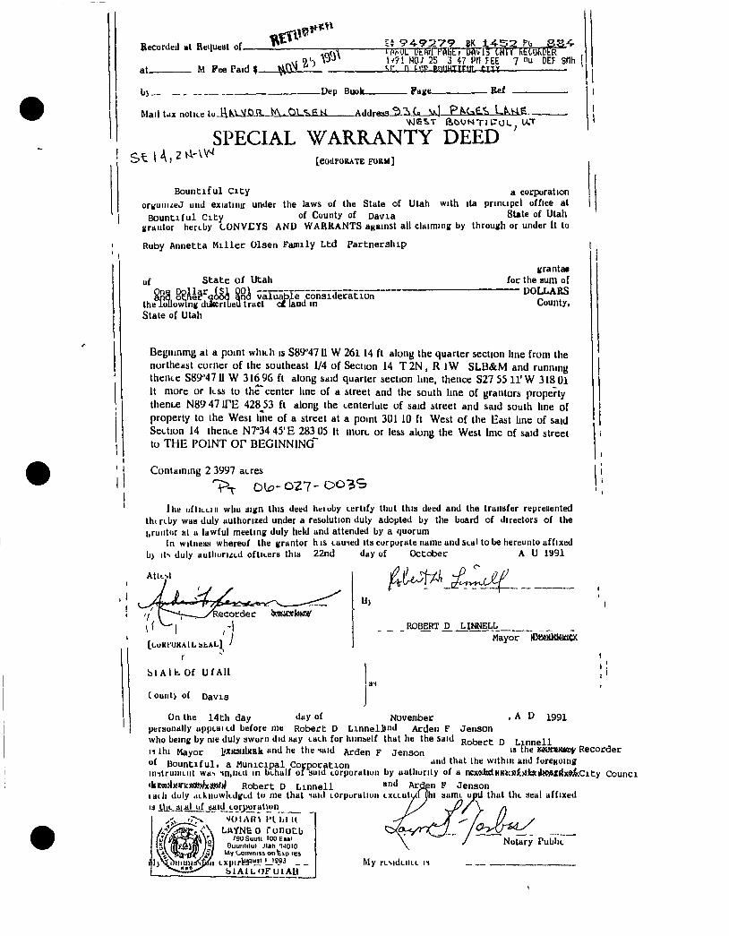
Becordeil Ht Retiueat of
at M Fee Paid
' P A - 9 : 2 . V 9 BK 1 4 - 5 2 Pb •if-KUL Dtftrl f'AliC 0Avl5 CNTTRtUjI OtR
Mo; 25 3 pn FEE 7 nu DEF SHH '.r, n PCT BQUHTIFUL CITY
-Dep Buok- . Fage-
Mail tax notice i . . H M M O a W N . O L ' k g K A d d r e s s ' 5 C » V^l P N < j £ . ^ L N . H E
SPECIAL WARRANTY DEED S t 1 A ) ^ *^ [COllFORATE FORM]
B o u n t i f u l C i t y a corporation orvuiiizeJ uiiJ exiatinir under the laws of the State of Utah with ita principcl office at
B o u n t i f u l C i t y of County of Davia 8Ute of Utah uraiitor heruby CONVEYS A N D WARKANTS aKBinst all claiming by through or under it to
I
Ruby Annetta Miller Olsen Family Ltd Partnership
uf State of Utah
the lollowlng dukcribeu tract oX lau the State of Utah
considera t ion land in
granta* for the aum of
DOLLARS County,
BeBiiinmg at a point whith is 589 4711 W northeast corner of the southeast 1/4 of thente 589 4711 W 316% ft along said it more or less to the" center line of a theoLC N89'47irE 428_53 ft along the property to the West line of a street at Section 14 thence N7°34 45'E 283 05 it to THE I'OINT o r BEGINNING"
261 14 ft along the quarter section line from the Section 14 T2N, R iW SLB&M and running quarter section line, thence S27 55 l l ' W 318 01 street and the south line of grantors property centerluie of said street and said south line of a point 301 10 ft West of the East line of said more or less along the West Imc of said street
Conlaining 2 3997 acres 0 2 7 - D 0 3 S
I he iifliLLiii wliu :iign this deed heiuby certify tiiut this deed and the traiiafer repreiiented tht rt-by waa duly authorized under a resolution duty adopted by the board of directors of the i,ruiitiir i l l a lawful meeting duly held and attended by a quorum
In witness whereof the grantor his caused Us curpurate name and seal to be hereunto affixed bj its duly autlHirutd oftitera this 22nd day of October A U 1991
A t k N l
[CuKfUKAlL bbAL]
r •••
b l A l f c . Of U f A l i
Count> of Davis
Hi
ROBERT D LINNELL Mayor lemKXifiiCX
November LinnelJind Arden F
, A D 1991
Jenson On the 14th day day of
personally upptaicd before me Robert D who being by nie duly sworn did say tach for hiinbelf that he the said Roi^ect D L i n n e l l II Ihi Mayor IftiWJlKRk and he the said Arden F Jenson JWUfUKwy Recorder
of B o u n t i f u l , a Munic ipa l Corporat ion '"«K0">« inilruiiiLiit wa-, sn,iini in behalf of suid torporaliun by uutliurily of a ncxcdxctKKtct)£}lJ[jcilx>#Xrix9&City Counci <kit7i3lniric](*jjx*«)J Robert D L i n n e l l l ad i duly dLkiiuwIidged tn me that saiil Lorpuraliun LXLLuly IS iUe_3i.aljif ^aid_eorjwal»un
LAYNEo ronocb , - „ . Notary ' 9 U S u u l t I O O E B B I
Buu i i l i f u l JIah U O I O I lAy C>ommi» o n fexp res
S I A I L O F U I A H
in F Jenson hi samL upd that the seal affixed Lulul yhi samL upu that the seal allixi
\ / Notary Public
My resideiit-L i i
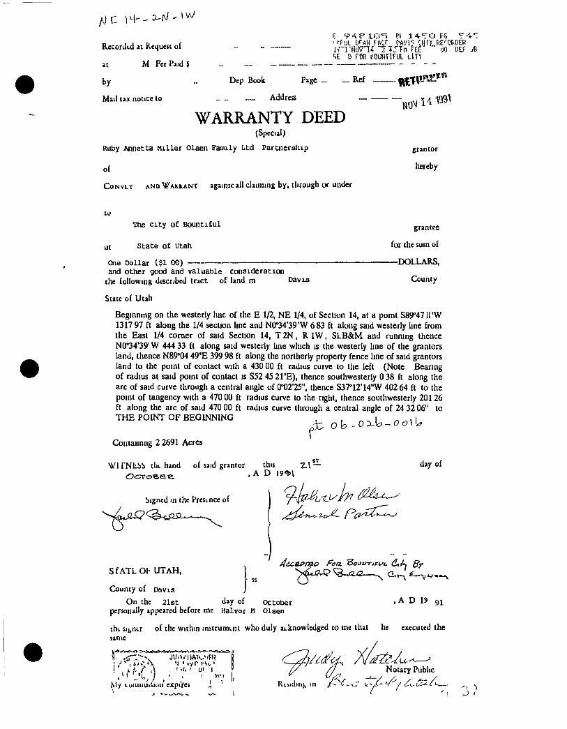
Recorded at Request of -
at M Fee Paid J _ „_
by „ Dep Book Page _ _ Ref
Mail tax notice to _ - — Address —
WARRANTY DEED (Special)
Ruby Annetta Mil ler Olaen Family Ltd Partnership
of CoNVLY A.ND\/AH.ieANT againsc all claiming by, tlifough or Under
t S'-S f JLi:i*=> PI 14^*10 F5 T-^-:
i rnwrK i i r f n fEE " uo DEF JB CiE D FOR eOUHTlFUL tlT^
grantor
hereby
ut
The c i ty of Bountiful
State of Utah
One Dollar ($1 00) and other good and valuable consideration
the following described tract of land m Davis
State of Utah
grantee
for the sum of
—DOLLARS,
County
Beginnmg on the westerly hnc of the E 1/2, NE 1/4, of Section 14, at a pomt S89°47 ll 'W 1317 97 ft along the 1/4 section Lne and N0°34'39'W 683 ft along said westerly line from the East 1/4 comer of said Section 14, T 2 N , R I W , S L B & M and running thence N0°34'39' W 444 33 ft along said westerly line which is the westerly line of the grantors land, thence N89°04 49"E 399 98 ft along the northerly property fence line of said grantors land to the point of contact with a 430 00 ft radius curve to the left (Note Beanng of radius at said point of contact is S52 45 21"E), thence southwesterly 0 38 ft along the arc of said curve through a central angle of 0°02'25", thence S37°12'14"W 402 64 ft to the point of tangency with a 470 00 ft radius curve to the right, thence southwesterly 201 26 ft along the arc of said 470 00 ft radius curve through a central angle of 24 32 06" to T H E POINT OF BEGINNING , , i ^ , I
Coiitaimng 2 2691 Acres
Wi TNiibb till, hand of said grantor this day of
bigned in the Presence of
S f A T L OP U T A H ,
County of Davis
On the 21st day of October personally appeared before me Halvor M Olsen
, A D 19 91
tht sii,n<.r of the within initrument who duly ai.knowledged to me that he executed the
same
JUrVl lAldFIJ
My euiiiiiu:iSi(iii expires
/ J Notary Public
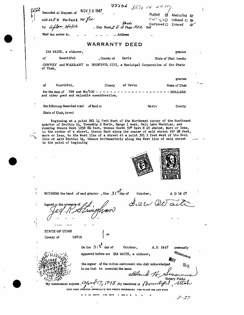
5'^ ^ Recortled at Request of ^ _
Platted a Absfracfod B ' T T I ' i j^nn Indexed D at/tfjCft^M Fee Paid? >tJ ^j^i^
/ / v/.7t.i! «r ^ CorrpaiedQ Entered by CU'Of^. . A ^ . ^ ^ ^ _ Dep Book^ d Page -^.45. Ref
Mail tax notice to_ _ „ _ _ „ Address
IRA WAITE, a widower,
of Bountiful
W A R R A N T Y D E E D
, County of Davis
grantor
SUteof Utah hereby
CONVEY and WARRANT to BOUNTIFUL CIXI, a Municipal Corporation of tho State of Utah,
of Bountiful, County of Davis
for the sum of TEN and No/lOO and other good and valuable consideration,
grantee
State of Utah
- DOLLARS
the following descnbed tract of land in
State of Utah, to-wit
Davi<i County
Beginning at a point 261 H feet West of the Northeast corner of the Southeast quarter of Section 1/,,, Township 2 North, Range 1 West, Salt Lake Meridian, and ninning thence West 1058 86 feet, thence South 59° East 8 25 chains, more or less, to the center of a street, thence East along the center of said street 55? 28 feet, more or less, to the West line of a street at a point 301 1 feet West of tho Enst line of said Section 14, thence Northeasterly along the West line of said street to the point of beginning
A D 19 /17 WITNESS the hand of said grantor , this 3 I ~day of October,
' Signed in the presepcy of
STATE OF UTAH
County of DAVIS
•MSI-
On the 31-5 day of October, A, D 19 47 personally
appeared before me IRA WAITE, a widower.
the signer of the withm instrument who duly acknowledged to me that he executed the same
f. Notary Public . JHy residence is /3c3-e*-**-2^^w ^ yUZ^X^ My commission expires - -
T H I S D E E D P R I N T E D E S P E C T A L L T TOR P H O T O RECOItDINO U S f f D L A C K I N K A N D T Y P E
NO 101—K T Co X> W I ewi H s
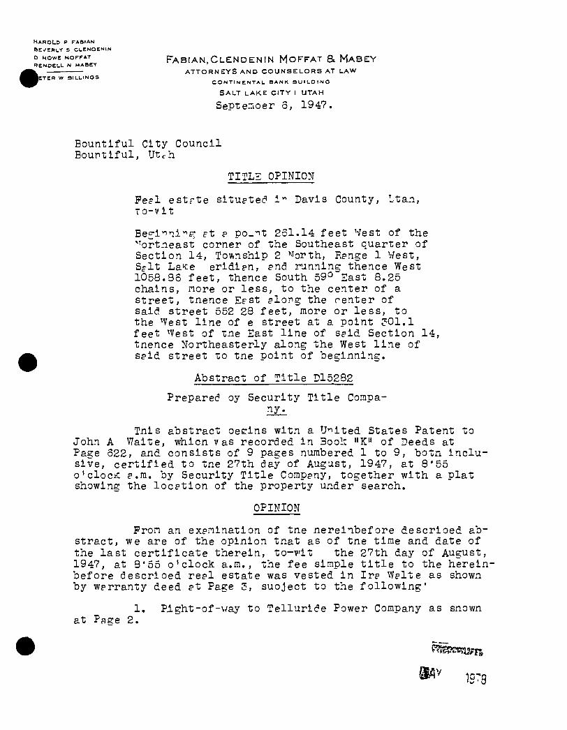
H A R O L " : ) P F A B I A N
S E / E R L r S C L E N O E N I N
0 HOWE MOFFAT F A B I A N , C L E N D E N I N M O F F A T & M A B E Y I ENOELL N MABEY
A T T O R N E Y S A N D C O U N S E L O R S AT L A W I E T E H W B I L L I N G S
CONTINENTAL BANK BUILDING
S A L T L A K E C I T Y 1 U T A H
Septerioer 3, 1947.
Bountiful City Council Bountiful, Utc-h
TITLZ OPINION
Fe?l estrte situatec" I'" Davis County, Ltan, r o - v i t
Bec-i- rix^g- f t e po-'^t 251.14 feet West of the "'ortneast corner of the Southeast quarter of Section 14, Township 2 ^^orth, Range 1 West, S f l t La^e eridian, and running thence West 1058.33 feet, thence South 59° East 8.25 chains, nore or les s , to the center of a street, tnence EfSt along the renter of said Street 552 28 feet, more or le s s , to the ^Vest l i n e of e street at a point ?01.1 feet ^Vest of tne East l i n e of said Section 14, tnence Northeasterly along the West l i n e of said street to tne point of beginning.
Abstract of T i t l e D15232
Preparec? oy Security T i t l e Company^
Tnis abstract oesins wit.n a United States Patent to John A V/aite, whicn v as recorded i n Bool: "K" of Deeds at Page 322, and consists of 9 pages numbered 1 to 9, botxi i n c l u sive, c e r t i f i e d to tne 27th day of August, 1947, at S'55 o'clociC a.m. by Security T i t l e Company, together with a plat showing the l o c a t i o n of the property under search.
OPINION
Fron an exanination of tne nereinbefore descrioed abs t ract , we are of the opinion tnat as of tne time and date of the l a s t c e r t i f i c a t e therein, t o - v i t the 27th day of August, 1947, at 3*55 o ' c lock a.m., the fee simple t i t l e to the hereinbefore descrioed rea l estate was vested i n I ra \Yalte as shown by warranty deed at Page 3, suoject to the f o l l o w i n g '
1, Pight-of-way to Telluric?e Power Company as snov/n at Page 2.
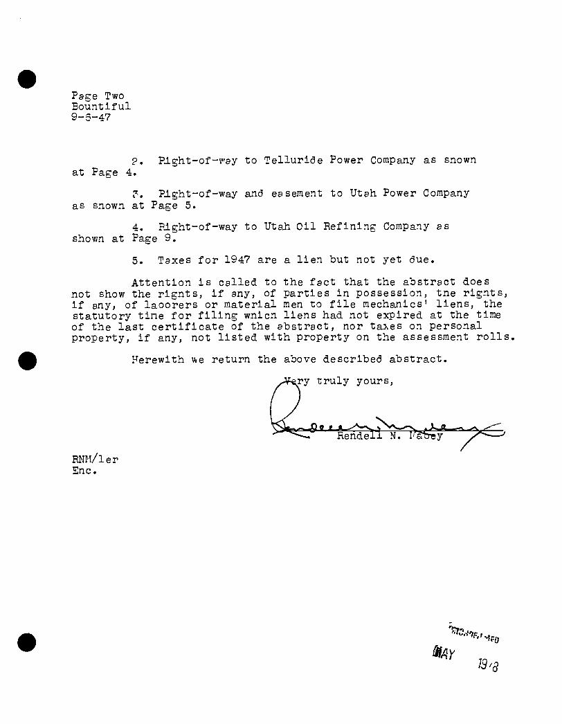
Page Two Bountiful 9-3-47
2. Plght-of-vay to Te l lu r ide Power CorapaJiy as snown at Page 4.
Plght-of-way and easement to Utah. Power Company as snown at Page 5.
4. Flght-of-way to UtaJh O i l Ref in ing Company as shovm at Page 9.
5. Taxes f o r 1947 are a l i e n but not yet due.
At tent ion i s ca l l ed to the f ac t that the abstract does not show the r i g n t s , i f any, of par t ies i n possession, tne r i gn t s , i f any, of laoorers or material men to f i l e mechanics' l i e n s , the statutory t ine f o r f i l i n g wnicn l i e n s had not expired at the time of the l a s t c e r t i f i c a t e of the abstract, nor ta^es on personal property, i f any, not l i s t e d with property on the assessment r o l l s ,
Herewith we return the above described abstract .
,Af«ry t r u l y yours,
RNIl/ler Enc.
i3^3
S U P P L E M E N T A L
Afaatrart of (SxtU TO P R O P E R T Y D E S C R I B E D O N T H E C E R T I F I C A T E P A G E O F THIS A B S T R A C T
P R E P A R E D B Y
SECURITY TITLE COMPANY
FARMINGTON, UTAH S A L T L A K E C I T Y t, U T A H
P H O N E 3 5841
M E M B E R A M E R I C A N TITLE A S S O C I A T I O N
Form No I
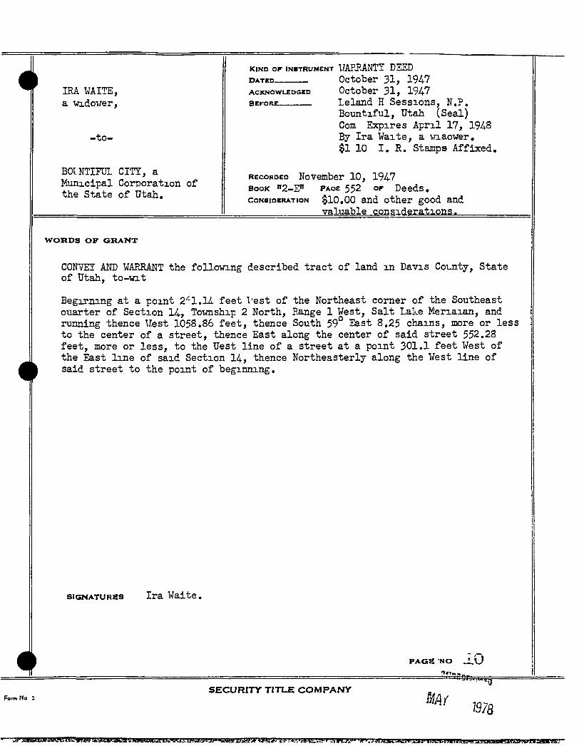
LRA ¥AITE, a vridouer,
- to-
BOINTIFDL c m , a Municipal Corporation of the State of Utah,
D A T E D
ACKNOWLEDGED
BEFORE
KIND OF INSTRUMENT UAHRANTI DEED October 31, 1947 October 31, 1%7 Leland H Sessions, N.P. Bountiful, Utah (Seal) Com Expires A p r i l 17, 194-8 By Ira Waite, a viaower, $1 10 I . R. Stan DS Affixed,
RECORDED November 10, 1947 BOOK "a-S" PAOE 552 OF Deeds, CONSIDERATION $10,00 and other good and
valuable considerations.
W O R D S O F G R A N T
C0F7ET AND WAERANT the following described tract of land i n Davis Couity, State of Utah, to-xnt
Begirjiing at a point 2' '-l.lL feet Vest of the Northeast corner of the Southeast otiarter of Section 14, Tovmship 2 North, Range 1 West, Salt Lake Meriaian, and running thence Uest 1058.86 feet, thence South 59° East 8.25 chains, more or less to the center of a street, thence East along the center of said street 552.28 feet, more or less, to the Uest line of a street at a point 301.1 feet West of the East line of said Section 14, thence Northeasterly along the West line of said street to the point of beginning.
SIGNATURES Ira Vadte.
PAGE -NO JL'O
S E C U R I T Y T I T L E C O M P A N Y Form No 2
1978
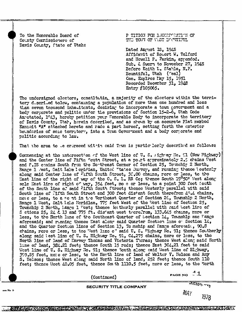
To the Honorable Board of P TITIG:I FCH lACC?T' ?Ji11''U CF Co -nty Corrdsaionero of TIC TGiri 0? ViL^ Df t' JTITUL Davis County, ftato of Utah:
Dated At:inist IS, 194S Affida^/it of RoLort W, Telford and IIcwoll P, Parldn, appondod. Sub, L Sworn to novcobcr 27, 194S Bcforo Koith L, StaUa. N.P. Bountiful, Utah ('"eal) Con, Ejcplrcs V&y 15, 1951 Recorded Dececbcr 31> 1943 Entry #105065.
The undersigned electors, ccnatltutint, a cajority of tho ©lectors vithln the t e r r i tory d-scri-ed tolov, containing a popiilation of core than one hundred and leas tLan seven tnousond inhauitcnts, desiring to incorporate a town £,ovorriffient and a body corporate and politic undor the provisions of Section 15-2-6, Utah Code Anrotated, 1"43, horoby petition yotj: Tonorable Body to incorporate tho territory of Davis County, Utah, h-srein dcccribed, and as shoun by on accurate Plat catked EsniDit "A" attached hereto and rado a part hereof, setting forth the exterior boT-ndarics of soic tcmtor-'-, into a Tcvn Govornrcnt and a body corj orate and politic according to law.
That tho area to e croraccd xrlt^in caid Tcun is partic lerly described as follot«st
CoEziencinc at tho intersection rf tho West line of U, S, ii^h^ay No, 91 (New richway) and the Center line of ?iftn *"cuti Street, at a pourt arprordEatoly 2,5 chains Vest and P.IS c-:uiins South fr t r tho Ilo-thcast Comer of Section 25, To'mchip 2 North, Range 1 .- est. Gait Lai» ! cridian, Unitcc '"tates Gttr'Tcry, and runninc thence \ ostcrly along said Center line of iTtli South Street, 3C,0G chains, rorc or less, to tho Eaat line of the ri^ht of vtsij or the 0. S. L, RR Co; thence South 19°50' Vest alonr sclc liist l i r o of richt o" way, 354 feet, mo e or lees, to a point 300 feet tovAh of tho South line or said ^ i f t l i South ftrcot; thonco Ucstcrly parallel vith said Soutli line of r i f t l i South Street and 300 feot distant South thereffrcr: 4'.4 chains, rrjoic or less, to a r-o i t in tre lortlieast Quarter of Section 26, Totnishlp 2 Ilorth, Range 1 Ueot, Salt IcI o Iteridlan, 775 feet West of tho Uost lino of Section 25, Toimchip 2 North, l ^ ^ o 1 '^cstj thence loithcrly parallel \7ith raid Ucst l i r o of S ctions 25, 24 13 and 775 f t . dis-'ant uest trcrefroni, 133.645 ch-ains, core or less, to tho north line of tbo Southeast Quarter of t^ection 14, Tox-nshlp enc "fange afcrcaaidj and running thence East alonj^ said Quarter Section line o- Section 14, and tho Quarter Section linos of Section 13, To mship and KancQ aforo-jaic, 90,8 chains, rore or less, to tne ''est lino o'' said U, S, T ighi;a7 Mo, 91; thcnco Southerly along said lest lino of U, S, Hix:h'v;a7 IIo, 91, C4,275 chains, core or less, to tho North line of land of Harvey Thoinas and Victoria Ticriasj thence West alonr; said llorth line of land, 334.21 feet; thence South 15 rods; thence East 3C4.21 feet to said Vest line of U, S, llichiray TIo. 91; thence South along caid West line of Bl Tv^Jxj, 399,S5 feet, VLOze or lesc, to the Horth lir-e of land of Walter V, Ilelson and Ary S, Ilelson; thence West along said North lino of land, 252 feet; thence South 110 feet; tlicnce Uoet 40,05 feet, thence Soith 1110,5 feet, ixro or less, to the North
(Continued) ^ '1
P A G E N O -
SECURITY TITLE C O M P A N Y
MAY
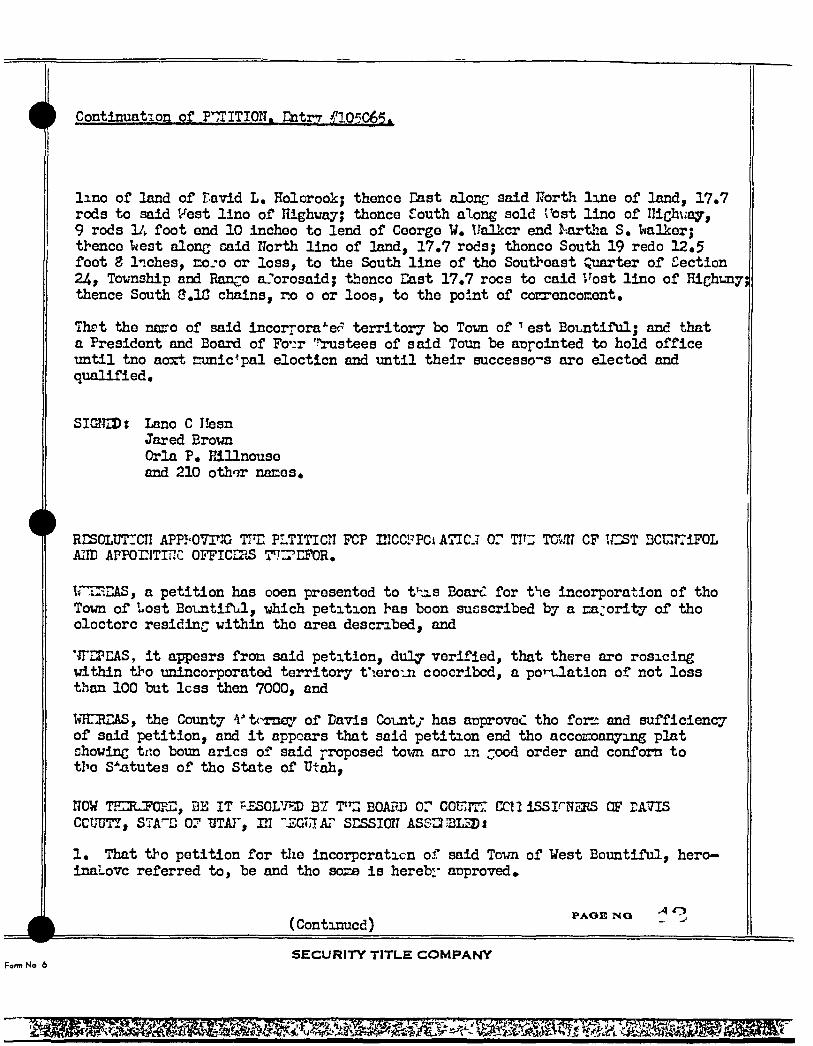
Continuation of PTTITION, Entrr 05C6< .
lino of land of Tavid L, Holorook; thence East alon^ said IJortl-i line of land, 17,7 rods to said Vest lino of nighvay; thonce South along sold Tost lino of IlichN.-ay, 9 rods Vy foot end 10 incheo to lend of Ceorge V, Ualkcr end a^tJla S, Ivalker; thence Isest alon^ caid North lino of land, 17,7 rods; thonco South 19 redo 12.5 feet g liches, coj-o or loss, to the South line of tho Southeast Quarter of Section 24, Tovnship and Ranco aJ'orosaid; thenco East 17,7 rocs to caid '. ost lino of Hichunyj thence South 3,1G chains, ra o or loos, to the point of conrencoKent,
Thrt the nmro of said incorporates territory bo Tovn of est Bountiful; and that a President and Board of Fo':r Trustees of said Toun b-e appointed to hold office until tno aort sunic^pal eloctlcn and until their successes aro elected and qualified.
SICSlEDt Lano C Ilesn Jared Brown Orla P. Elllnouse and 210 othor naces.
RESOLUTICII APP OVFX; TFE PLTITICTI FCP ElCCPPCt A7IC.7 Or TIT" TCv-iN CP TCST DCi;:rriFOL AIID APPOriTITTC OFFICERS 7'73'EPOR,
I* iLiL-iEAS, a petition has ooen presented to t^as Board for the incorporation of tho Town of Uost Bountiful, xjhich petition has boon sucscribed by a cajority of tho oloctorc residing within the area desc2a.bed, and
'•JTEPEAS, i t ajqxjsrs fron said petition, duly verified, that there aro rosicing within tho unincorporated territory t'leroui coocribcd, a poTTj.ation of not loss than 100 but less then 7000, and
IvHEREAS, the County 'I-'t<mfl3.'- of Davis County has approved tho for?: and sufficiency of said petition, and i t appears that said petition end tho accoEoanying plat chowinc tno boun arics of said proposed tot-m aro m order and confom to tl-'e S^^itutes of tho State of Utah,
NOW THERJFCFJ:, BE I T rEsovp^ B i T'l: BOAPj) or couirrr ccn ISSI^HSRS OF EATIS
CCUUTT, STA"-D 0? TJTA]', EI "JiXlt.lAr SESSION ASS^aLSDJ
1, That tho peti t ion for tlie incorpcraticn of said Tom of Vest Bount i ful , hero-inaLovc referred to, be and tho soz^ i s hereb:" approved*
(Conti33ucd) P A O I S N O •A O
farm No 6 S E C U R I T Y TITLE C O M P A N Y
mm
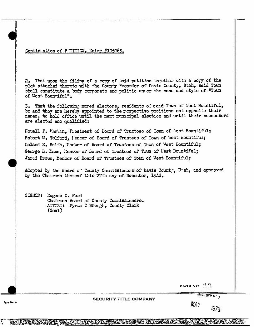
0 Continuation of P TITICN. Tlntr? #1050.65.
2, That upon tho filing of a copy of said petition to' othor with a copy of the plat attached thereto with the County Pecorder of Favis County, Uxah, said Town shall constitute a body corporate anc politic uncer the nana and style of "Town of West Bountiful",
3, Th t the followinc nared electors, residents of said Tcjn of West Bountiful, bo and thoy are hereby appointed to the r cspectivo positions sot opiJosite their nares, to hold office until the nezt Ennicipal election and until their successors are elected anc qualifiedt
nouell P, Parkin, Fresicent of Bocrd of "Tructoeo of Town of '<;est Bountiful; Pusbort W, Telford, I'encer of Board of Trustees of Town of r<e6t Bountiful; Leland R, Snith, rcnbor of Board of Trustees of Town of Vest Bountiful; George B, ijmn, I!enoor of Board of Truatoos of Town of 'est Bountiful; Jarcd Brown, Kenbor of Board of Trustees of Tom of Vest Bountiful;
Adopted by the Board o" County CocnissioaGrs of Davis Count„-, U ali, and approved by tho Chaircan thorecf this 27th cay of DocoEiber, 194S,
SIGIIED* Eugeno C. Ford ChairEsn Brard of CoiJity Ccsrrissionere. ATTEST: Fyn33 C Broi-gh, County Clerk (Seal)
P A G E N O
Form No 6 SECURITY TITLE C O M P A N Y
my 1378
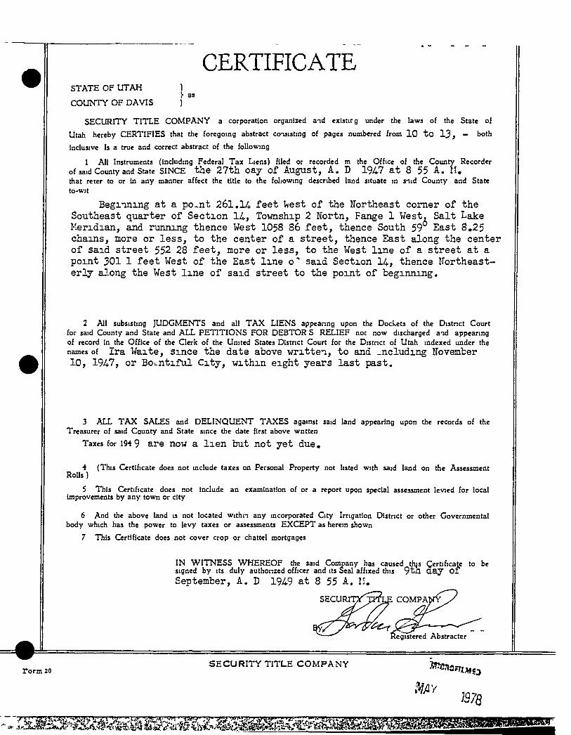
CERTIFICATE STATE OF UTAH 1
!• S3
COUNTY OF DAVIS )
SECURITY TITLE C O M P A N Y a corporation organized and existirg under the laws of the State of
Utah hereby CERTIFIES that the foregoing abstract consisting of pages numbered from 10 t o 1 3 , — both
inclusive Is a true and correct abstract of the following
1 All Instruments (Including Federal Tax Liens) filed or recorded m the Office of the County Recorder
of said County and State SINCE the 27th oay of August, A. D 1947 at 8 55 A. 11, that reter to or in any manner affect the title to the following described land situate in snid County and State to-wit
Begiining at a po^nt 261.14 feet ^est of the Northeast comer of the Southeast quarter of Section 14, Township 2 Hortn, Fange 1 West, Salt Lake Meridian, and running thence West 1058 86 feet, thence South 59 East 8,25 chains, more or less, to the center of a street, thence East along the center of said street 552 28 feet, more or less, to the West line of a street at a point 301 1 feet West of the East line o" said Section 14, thence northeasterly along the West line of said street to the point of beginning.
2 All subsisting JUDGMENTS and all T A X LIENS appeanng upon the Dockets of the Distnct Court for said County and State and ALL PETITIONS FOR DEBTOR S RELIEF not now discharged and appearing of record in the Office of the Qerk of the United States District Court for the District of Utah indexed under the names of Ira Waite, Since the date above written, to and _ncluding November 10, 1947, or Bountiful City, withm eight years last past.
3 ALL T A X SALES and DELINQUENT TAXES against said land appearing upon the records of the Treasurer of said County and State since the date first above wntten
Taxes for 194 9 are now a l i e n but not yet due,
4 (This Certificate does not include taxes on Personal Property not listed with said land on the Assessment RoUs)
5 This Certificate does not include an examination of or a report upon special assessment levied for local improvements by any town or city
6 And the above land is not located within any incorporated City Imgation District or other Governmental body which has the power to levy taxes or assessments EXCEPT as herein shown
7 This Certificate does not cover crop or chattel mortgages
IN WITNESS WHEREOF the said Company has caused this Certificate to be signed by its duly authonzed officer and its Seal affixed this 9 t h d a y o f September, A. D 1949 at 8 55 A. II,
gistered Abstracter
rorm 20 S E C U R I T Y TITLE C O M P A N Y
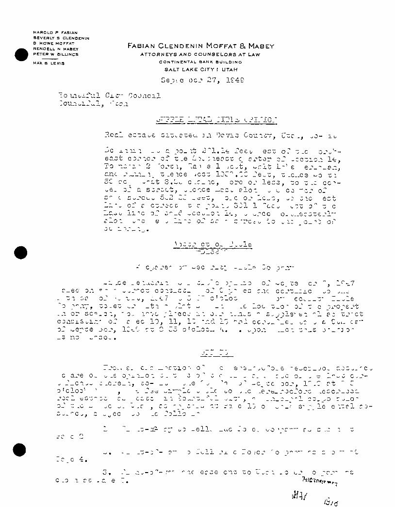
H A R O L D P F A S I A N
B E V E R L Y S C L E N D E N l N
D H O W E M O F F A T
R E N O E L L N M A B E Y
P E T E R W e i L L l N C S
M A X B L E W I S
F A B I A N C L E N D E N I N M O F F A T & M A B E Y
A T T O R N E Y S A N D C O U N S E L O R S A T L A W
C O N T I N C N T A L B A N K B U I L D I N G
S A L T L A K E C I T Y ( U T A H
)ejn Q o c j 2 7 , 1£'49
" O U l b i - f u l C ± C - C O J i l C i l
. - _ - ' „ J : : . —
-^c J. n i l _^ oo_ i t ^3"1,1^ f e e
a s t r e e t , ^.c^.c; w c
cnc _ ' _ i . i _ i _ u . e i c e , c z z ± j ^ ^ , J e ^ z , z .c..C3 z i 5'Z cc_ ^ - L t 3 , L ^ c - c _ i c , o re o.- l e c : 3 , ::o z - z c c ^ -
' l o - - ^ CO -c . " o f fe o 1/
01' € c-.-'cCG -G r s - D ^ i . 321 1 "cc^ ~^zz - c
' 1
C
-1 -ce _ e i^iCxv 1 w _ r - e o 0-1 - - ^ ^ J - ^ C Z C 0 1 3 _ G C _
i; 1 o J ^ _ w , 1.^-7 ^ 3 '0 '•'".Tr, z z ^ e z •..J' _ t i "
. 0 1, - 0 . :
:>Z- - - 0 o_ > c_ Z 3 c . " ez c_ic c c_ ' ' i ; _ i iC ) —
. 0 ; _o ;
.-1 o r 3 c - _ o i C D i l C x S u l . l " O
0 _ :
l ' " - ; C ' l - Q C J 1 1 O..-" ec 1 0 , ' 1 1 , i : " d 1-3
L c
sz zj'-c-
- - 3 0 -
- J
c a - e o , ^ J _ c n _ ^ 0 ' c lo z^ ^
- £ O ^ j - l - O
0 L-_ C , ec
• ' C v l O ' ' o
-I v ^ - . - \ -
;^C1 _ JO ^
c '1 J - c _ r e D O j ' , 1
-c uO ^ .c _e- ' ' to_ocro- ' ' . 1 o ^ - z - . ^ -.-1
. 0
e 1 J o
. e G C J ' - J O . ; .
l e e i~? 1 c J -
D - e l l . _^LC J O e.
e 4 . ' -• o - 5 _ t . l i . • ' j . e - O J C - " ' ' O
ic e r c e c i o uO L c .0 1 r
0 1^-'' o
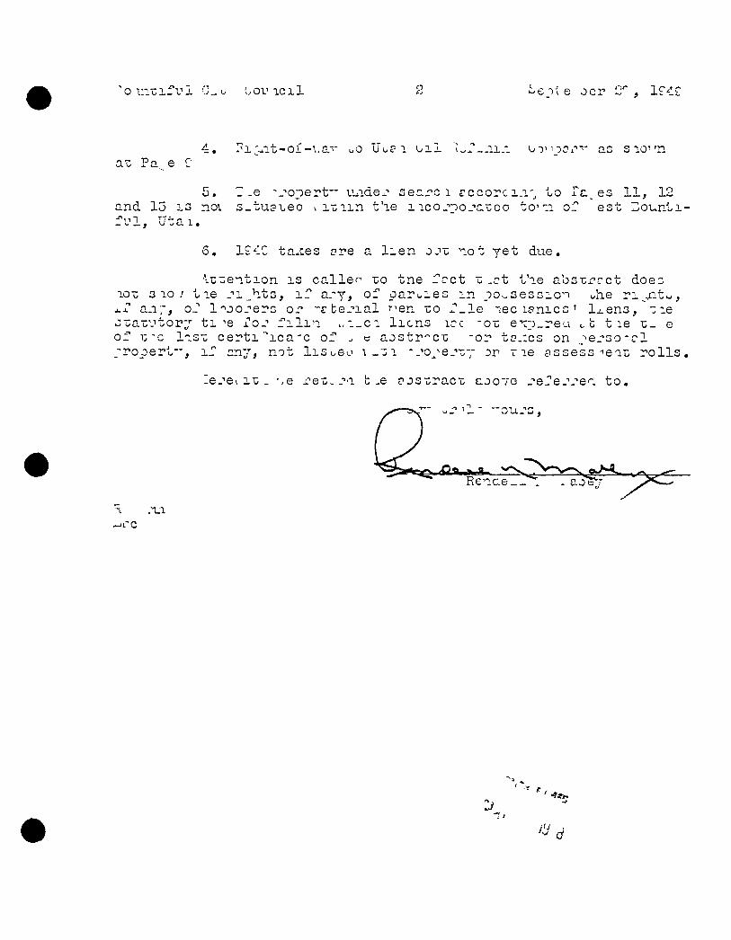
'o HIT; i f V L OV 1011
0.Z Pa e > i : ^ i t - o i .0 Uoei o i l iu^- . . i i . i ooioJ as s10' 'n
and 15 l o no\ f u l , U t a i .
"-e -.^opert" luidejr seciro i r c G o r c i . i ' j to Tc^ es 11 , 12 ;_tu3-beo i i - c i i n t ' le i ico.-noj 'CLCo t o ' i i oT est Do-unti-
S. 1£4C tables ore a l i e n o j z not ye t due.
^^"ent ion i s c a l l e r ' -co tne Tcct z .c t t ' le abs-crrct does lOo 3 lo ; t i e _''i_h.t3, i T a.'y, of pa ru ies m oOwSessic-i uhe r i ^ ^ i t ^ , x-T a n ; , oJ l'^jo_''ers o r -r te^ '- ial '"•en zo r _ l e ' i e c i f n i c s ' l^eno , me zzazvtov- j t i i''o_' f i l i n w i _ c i l i e n s icc -oz e^ro.reu c b t i e T:_ e of T ; l i s u c e r t i ' i c a ' c o f ^ « aostr^c-c -or to.ics on _-ie_-'30-icl / r o p e r t " , i " any, not 1IGL.6O \ _ I ; I '.-•o^^e.-'t;-; r le assess-lea^ r o l l s ,
lej'ei IT: . ",e i 'ei;.- ' ' ' i b .e ojs-craco COOTG _''s_''ej'-''ei t o .
Xra T&ita and Stella flaXto, his «lf«>
-to-
& ISalao Corporation*
c&tcd Jua3 50 1913 ^ - '^ -£3fcrs j:spi5i Pulcsr,- S,P» ; >^ , r&Txc C3522ity> Utcli (Sssl) Con, ij^sirca A ig* 20, X,9U - "
Ire Ksita csd Stelic. TJ:iito, hla idfc* ' ^ Bscorded Jb^-ist 9, I9i3 Beck Tc:^ 536 of t . ^
^ -Bid-t^-citi-Lri-tad In tJiC' Ccrnty cf S£.^c eiid £t>2,l.e cf Utah, ind sor*
,2. ire H : ; £T- Z 1- ^
- r
J — u ^
—
, _ „ ->6_ ir-x-:: onl^ ess toP?xtl s!:,slX-'ce piscs^'.,.^-^
'.-^T - rrc^^.r, tio crtc'v crc Cx:*i-tcl& a d d i t i o n U- -n ra po-las ^.rx*;" uf-is: uc-c iF-.w IwrLJ- vJi..er ''-Ls ciDss:Lr-t IT/ 372x3 " - tlissi e?iis3:''of -7.-'''/'; gL:.o .. cr:; tr.e ^^luriLri ccT • ICot::? fcr e^ci.. torer £3 pGLSi ed and cs-vcl-siced'eaS - ^'
r_--£i..-:;t csfo'n^i c." ;i:::-:5'--ere "K vt!:. tho use cfT ec d polLee or tr> cra or TxiCiSareg;
csats dsscriccQ. f i r 1>6 j^crpscc of rsr-slrlngj, reneisisis cad i5v3 20t?Ja.g ' "-Z, ssid polssj t-o' viCj fi^irig^f, ^rirc^ fiT-d iipiT^ttriEnct&Sj end for colss as i iiag; 1 r$£.r£Kr7^ t,5sful cr i;-cji ejilcr»t fcr tbc c::yoi'E.6:it of the ecsssieiit hereiii grarveSj-""r ,-£l£;o x:. r ur^v^lcgi or rc^icv^ji^ fi.^ criy iiricj cji^ cr fill cf e: '" iD^irarea^ta tipoB,'
1:1
^ _ **• — "V- " * -• t
Jobs A« t 41te, a ridower,
-to.
TTAH 1*0 "TI CVPA T, a Jalne Corporation^
RIGHT CF VXr BiS TffiMT
Ifeted Jttoo 20, 1913 Recorded Angttst 9» 1913 Book "D* P«gB 570 o Ccoa, $1.00 and other THlualild ecmsSAevBtixaim
HTRFBT (5lA'7rS, "brgains, rells en-"" conveys to flsld Utah Pcws?r Coarpanjr, ita sacTCSsors end ossiijns^ 4a easosant end rig^t of way and tho r l j ^ , prlvtlege ead euthorttjr to cuaati'oet, sreet; opereto azsJ tairtala a line or lines, far the purt5o»» of trans-aitting electric or othorpower arid telegrafto and tolephosxo lines, in," "UDon, cltaag, orer, through, acroea and "Ddar a piece of Xaad 150 feet in vid^h , situated in tho Cconrty of D vls end State of 7tah, and sore partlo:lnrly deserlhed ss follows, t«»^t»
Bftgtnning' at a point 65S feat tfeast and S# 2 deg. 6 >Ctn# W« s dlfltance of 3i7 f^t frca the V^- Soc» comer •b«»tMoeD Socs 23 and 1
T,29r«, H*3F« SJ,.B«£^ ead rormfag tbenos S 2S deg* 6Mlxw -V, a distance of 3S8 feet, aore oor leas^ thoocs Ues a dlstantfoi of 35 feoty isore or less, thenea Sorth a dirtaaoa of 160 feet« sore or Isea, ibanea ? 23 de * 8 vdn* 7* « dlst&nae tof 710 feety sore car leeSf thenee 1; at £ dlfftaztoe of 170 f scrt to the place of beginning, a l l in the NS of S1?J Sf3C. 14 TST, Hlff, SLBSH*
iOgshtar jBith rl^ts to grantae,^ its sticcesaars and aaslgna, to iplsesy ereety. reloeste. Inspect asd operate thereoo, poleSy touars^ cro9d>eraa and flxturea aad to place and sialatsla muii otittr appnrtensnces iisefal or nBcesssry to operate caid line cor llaesy end striag vires and cables frca time to tlzoe tfaraa^ xaodtsr or over the above d96crlbod javsiaeB^
Acfc'd June 30, 1913, bafore orjhl Palmer, Stote of Ftah CSeal) COB, Expirw Aa r 20, 1913, A, Valta,
^ICH)
Ira Ufclte and Ste la Ifaito, his vife,
-to-
Utah Power « light Ccxcspestjr, a corporation.
Dated Fobroary 13, 1937 Recorded Jtme 13, 1517 . Book Bega 48 of OJt. Fntry "o* 25694 Cons, tUCSQ pnd other vBltirble conaic'erc tion»
CO THT far '/'ATPXTT R perpst :al eesassnt and right of vey for the erecticja en' ccsitlnaed rsaintenanca, repair, eltf^ration. Inspection, x e location and replscoaent of the electric transtalacicai diatribation, tolsphono and tolograph drcnlta of the Grantee, and no pol'.s or totfaass, idth the necosz sjy gpy , Btub»> cro9S-a~na and other attactotnts thereon, or sffiaced thereto, for tiie support of SRld circuits, mier, upon and rcroes a tntct of land fifty (50) feet la vldth, belonging to tho Qraators, In Dcvls Coorty, Uteh dsecrlbed aa follows: Twan^y-flve (2^ ffiet on epch aide of a llnet
Coaaendng on the E onth bocndrrr of Grantor*© laa? 732 foat West of a point 325 feet Soath of the ^ eat i comer Sw» 1^ Tp<, 2
1 - thence running IT, 2SOD8» 2aat 360 feet to Jearth bocBdary of Qrentor'fl land; al l contained vlthia tbe -
"J-of S»T»'^, Sec* lA, saLi Tounshlp end Iiang»»
Together with a l l r i^ts of ingress egresa necessary or •eorrrenlfmt fcr the ftill and cccploto nse, oceopatlon asA miitisstmt of the «eses»nt herelQr granted, ead a l l r£^t& and parl-sHessa incident thereto, Inclndlng the rllfht to and rosdve tlxabeqp, trees, brash, overhanging bcienches and other obstroctioa^ vhldi aay Injqre or int-rfero vith the (Jranteoe'e tjsa, occcpatiott or enjojnaait of this eaaenwart*
Ira Valla Stella V alta
Adc'd FebTOiirj 13, 1917, before R.C, driller, ".P., State of Vtah (Seel) Cam* fxplrea Feb. -4, 1921, b Ira Vtedte end Stella Wclt«, hl» wife.
B7r
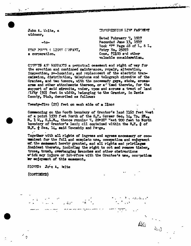
John A, U^lte, a vldotfor,
—to-
a corpar&tlon«
Deted Pobrasr? 7, 1917 PecOTdad JcBW 13, 1917 Book Pege iS of & Fntry Ko, 25693 Cons. fUOO and other -T&lnsble coRaidesratlon*
I .
COWTS ATIP a pprpotual oeaeaent end right of vsy for •the erection and contlJKwd ffiaintenance, rop>alr, alteratlon,-InspectleRi, rp-locatior, and I'cplaceoent of the electric tran-caiSBlan> distrltutlon, tfilepljona and tolograpih circuits of the Grantee, and two touore, vith the necesaa^ gays, atoha, eroaa-ems and other attnclbEsents thereon, or a 'ised thereto, for the fluppcgt of said drcuita, trader, vpca and across a tract of land fifty (50) feet In vldth, Iwlonging to the Garantor, in Davis Coonty, ITt&h, described ss follows
Tyaeat p- To (25) feet on eadi aide of a Unot
CcBsaenclng on tho Scoth banndary of Grantor's land llSO feet Vttst of a point 1530 f t North of the S«?» Ccrsar Sec« 14jr ^ « Hw. t W*, S,LJ4*, thence rttnnlnf 2S«»CS» ^aat 900 feet to ITorth boondsry of Grantor's land; c l l contained vlthln the of S.i;, See, 3A, said Townahlp and Fange,
L -
Togetfaar vith al l rl^xta of ingress end egress neoessary or ceo-* ^wnieat for the ful l and ecapl«to tse, occsputloa and enl syaent •at. the flsftBasnt hereV granted, and al l rights azri prlrilagwi Jnddeat therarto, Inolndlsg the r i g ^ to cot sal rasonre tlaber^ trues tnmsh,. cmfaanglsg faran<js8S snd other obstructions w*"icix acy injnre or lntf>rfore vith the Grantee's tsie, occriaticB lar ojoiTaBRt of this ttasesaent,
SlCmit Jo n A. Jaite
(ComSDED) - ' ' ~ "
- 1 -ft
U
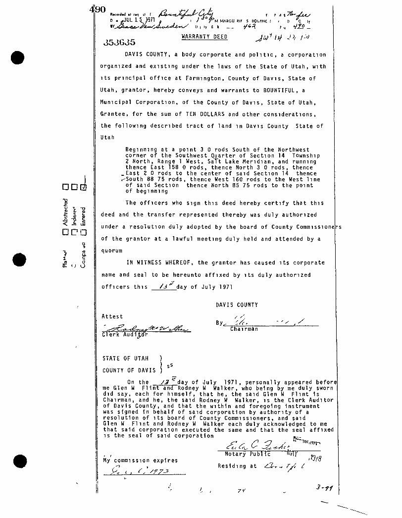
490
• •
P ii o H X i l
< ^ LS
<r a t e C W O
D • rfJUL 1 5 J ^ ' l « I ' ^ " T ' U MAHGU Rir s uoLnHc r p H t .
I r n ir
353G35 WARRANTY DEED
DAVIS COUNTY, a body corporate and p o l i t i c , a corporation
orgamzed and existing under the laws of the State of Utah, with
i t s principal of f i c e at Farmington, County of Davis, State of
Utah, grantor, hereby conveys and warrants to BOUNTIFUL, a
Municipal Corporation, of the County of Davis, State of Utah,
Grantee, for the sum of TEN DOLLARS and other considerations,
the following described tract of land in Davis County State of
Utah
Beginmng at a point 3 0 rods South of the Northwest corner of the Southwest Quarter of Section 14 Township 2 North, Range 1 West, SaTt Lake Meridian, and running thence East 158 0 rods, thence North 3 0 rods, thence
_East 2 0 rods to the center of said Section 14 thence <-South 88 75 rods, thence West 160 rods to the West line of said Section thence North 85 75 rods to the point of beginmng
The officers who sign this deed hereby c e r t i f y that this
deed and the transfer represented thereby was duly authorized
under a resolution duly adopted by the board of County CommissioneVs
of the grantor at a lawful meeting duly held and attended by a
quorum
IN WITNESS WHEREOF, the grantor has caused i t s corporate
name and seal to be hereunto affixed by i t s duly authorized
officers this / J day of July 1971
DAVIS COUNTY
Attest
Clerk Audi^(fr
By. Chairman
STATE OF UTAH ) ) sS
COUNTY OF DAVIS ) On the / 3 ' day of July 1971, personally appeared before
me Glen W F l i n t and Rodney W Walker, who being by me duly sworn did say, each for himself, that he, the said Glen W F l i n t is Chairman, and he, the said Rodney W Walker, is the Clerk Auditor of Davis County, and that the within and foregoing instrument was signed in behalf of said corporation by authority of a resolution of i t s board of County Commissioners, and said Glen W F l i n t and Rodney W Walker each duly acknowledged to me that said corporation executed the same and that the seal affixed is the seal of said corporation p._
, , Notary Public ^ ZTT My commission expires ^ ''v/ii
, ^ , , R e s i d i n g a t /Lir-t ^ r A /
7/
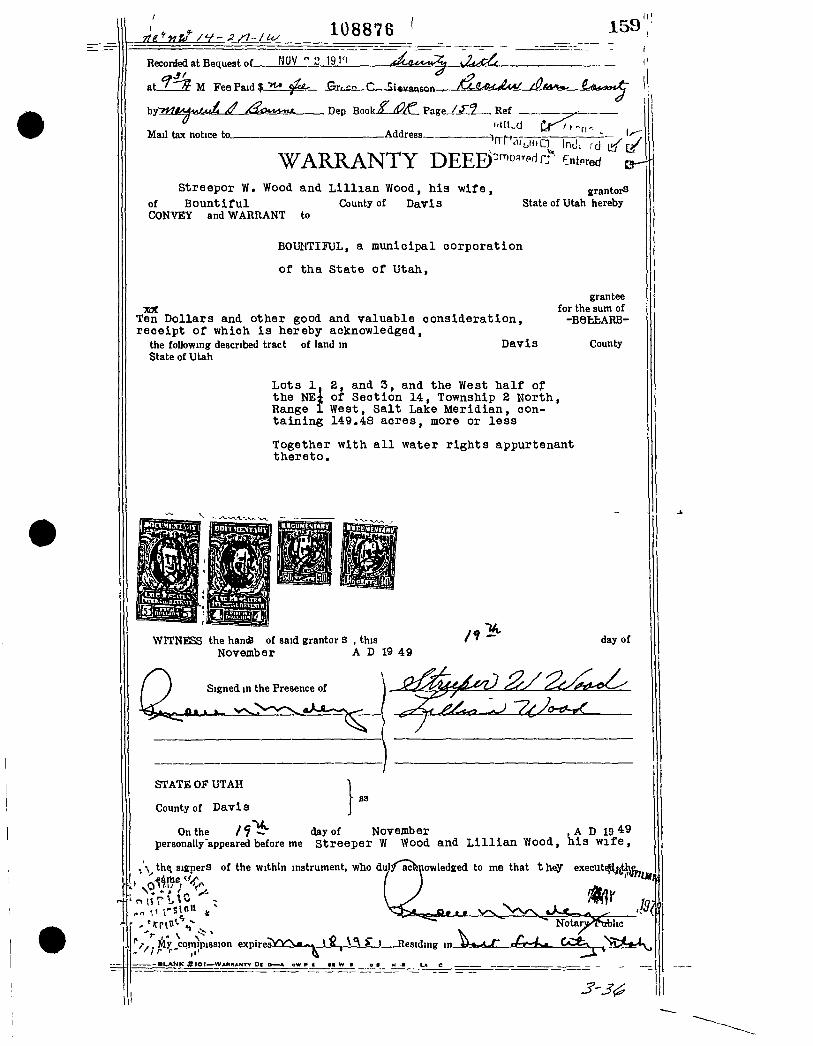
108876 159
Recorfed at Bequest nf HOV " 2 191 1 a6^«^i=itS
«t I ' t f - M Fee Paid % <f<^ Grr,-:? C. SiigvantOB
by'
Mail tax notice to. Address-
WARRANTY DEEE)'-"^'^^^-'^^ '^nt^red ^ Streepor W. Wood and L i l l i a n Wood, h i a w i f e ,
of B o u n t i f u l County of Davis CONVEY and WARIIANT to
BOUllTIJUL, a m u n i c i p a l c o r p o r a t i o n
of tha S t a t © of U t a h ,
ref. Ten Dollars and other good and valuable consideration, receipt of which i s hereby acknowledged,
the foUowingr described tract of land in Dav i s State of UUh
grantors State of Utah hereby
grantee for the sum of
-BefcfcARB-
County
Lots 1, 2, and 3, and the West half of the NEt of Section 14, Township 2 North, Range 1 West, Salt Lake Meridian, containing 149.48 acres, more or less
Together with a l l water rights appurtenant thereto.
WITNESS the han* of said grantor 3 , this November A D 19 49
day of
Signed in the Presence of
STATE OF UTAH
County of Dav i s 83
On the / f iiV day of November , A D 19 49 personally'appeared before me St reeper W Yfood and L i l l i a n V/ood, h i s w i f e ,
^\ th^ signers of the within instrument, who dulyacfenowledged to me that t h«y execut
' n H r \- ' ;
/ , , My comtpission expi
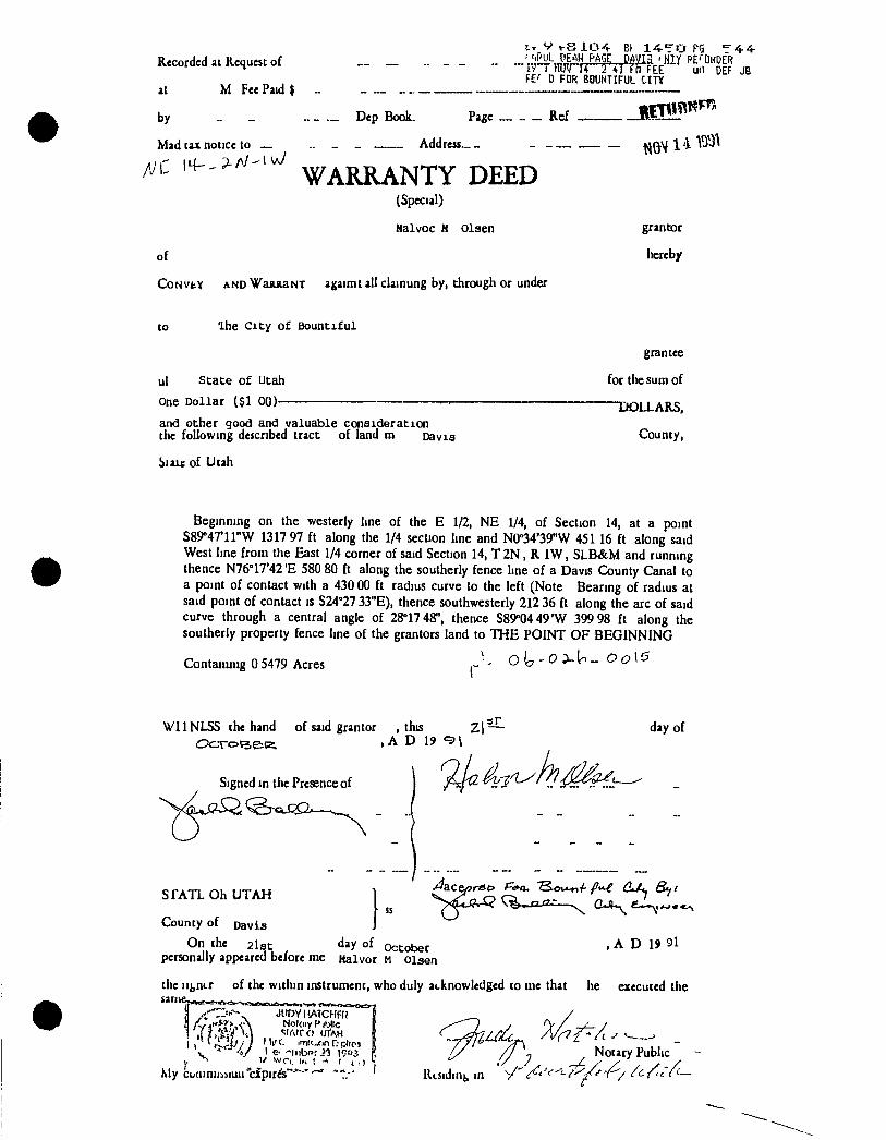
Recorded 41 Kequ«C of
at M Fee Paid t
by _ -
Mad tax notice to —
i7 r nmru 2 i i ffi FEE UH DEF f£ ' D FOR BOUNTIFUL CITY
JB
„ - ._ Dep BooL Pa«e Ref
„ _ Addreu ~
WARRANTY DEED (Special)
Halvoc H Olsen
of
CoNvtY AND W A K K A N T ajjaimt all dainung by, through or under
grantor
hereb/
to Ihe City of Bountiful
ul State of Utah
One Dollar ($1 00)—
and other good and valuable consideration the following defcribed tract of land m Davis
biaic of Utah
grantee
for the sum of
THDLLARS.
County,
Beginning on the westerly line of the E 1/2, NE 1/4, of Section 14, at a point S89°47'11"W 1317 97 ft along the 1/4 section line and N0°34'39"W 45116 ft along said West line from the East 1/4 corner of said Section 14, T 2 N , R IW, S L B & M and running thence N76''17'42'E 580 80 ft along the southerly fence line of a Davis County Canal to a point of contact with a 430 00 ft radius curve to the left (Note Bearing of radius at said point of contact is S24°27 33"E), thence southwesterly 212 36 ft along the arc of said curve through a central angle of 28°17 48", thence S89°04 49'W 39998 ft along the southerly property fence line of the grantors land to T H E POINT OF BEGINNING
Contammg 0 5479 Acres ^ O - 0 :>-lr - O o\5
VI1NLSS the hand of said grantor , this , A D 19
day of
Signed in the Presence of
S f A T L Oh U T A H
County of Davis
On the 21st d»y of October personally appeared before me Halvor M olsen
^aceprBo F'<»a. "^ou-n-f-fi"^ (1/^ S^/
, A D 1> 91
the ii{,nLr of the within instrument, who duly atknowledged to me that he executed the
r-/ 4 ' '*?>,A Nokiiy V
> 1/ w r i i<. I
My ctiiiinijDMuii'cipires'
/ / / / ' ^ ^ Notary Public
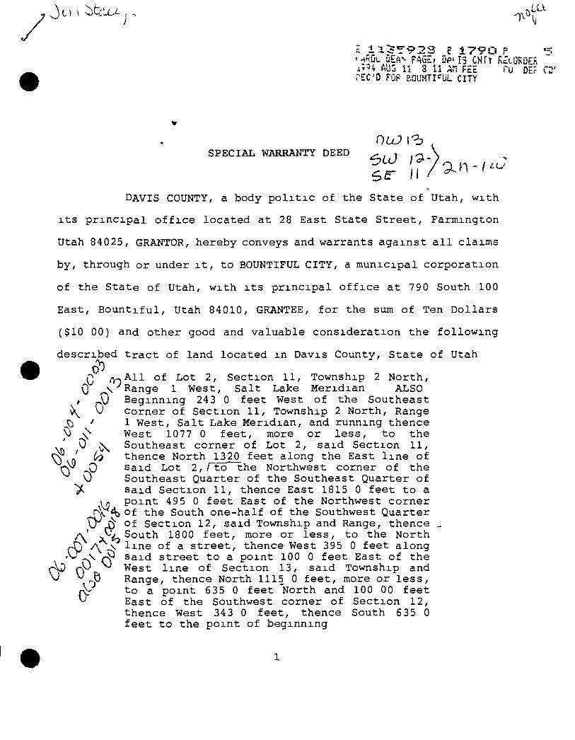
1 %
AU3 U 3 11 AH FEE Tu DEf C PEC'D PQF BGL'NTI" UL CITY
SPECIiU:. WARRANTY DEED
DAVIS COUNTY, a body p o l x t i c of the State of Utah, w i t h
i t s p r i n c i p a l o f f i c e l o c a t e d at 28 East State S t r e e t , Farmington
Utah 84025, GRANTOR, hereby conveys and warrants a g a i n s t a l l claims
by, through or under i t , to BOUNTIFUL CITY, a municipal c o r p o r a t i o n
of the State of Utah, with i t s p r i n c i p a l o f f i c e a t 790 South 100
East, B o u n t i f u l , Utah 84010, GRANTEE, f o r the sum of Ten D o l l a r s
($10 00) and other good and valuable c o n s i d e r a t i o n the f o l l o w i n g
described t r a c t of land l o c a t e d m Davis County, S t a t e of Utah
^ A l l of Lot 2, Section 11, Township 2 North, \) Range 1 West, S a l t Lake Meridian ALSO
)J Beginning 243 0 fee t West of the Southeast Corner of S e c t i o n 11, Township 2 North, Range 1 West, S a l t Lake Meridian, and running thence West 1077 0 f e e t , more or l e s s , to the Southeast corner of Lot 2, s a i d S e c t i o n 11, thence North 1320 f e e t along the East l i n e of Said Lot 2 , r t o the Northwest corner of the Southeast Quarter of the Southeast Quarter of Said S e c t i o n 11, thence East 1815 0 fee t to a p o i n t 495 0 f e e t East of the Northwest corner
\v'4> of the South one-half of the Southwest Quarter of S e c t i o n 12, s a i d Township and Range, thence
0-
South 1800 f e e t , more or l e s s , to the North n A \ l i n e of a s t r e e t , thence West 395 0 feet along
0 Said s t r e e t to a point 100 0 f e e t East of the West l i n e of Section 13, s a i d Township and Range, thence North 1115 0 f e e t , more or l e s s , to a p o i n t 635 0 feet North and 100 00 f e e t East of the Southwest corner of Se c t i o n 12, thence West 343 0 f e e t , thence South 635 0 f e e t t o the po i n t of beginning
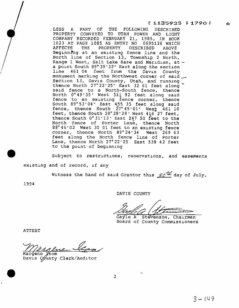
, LESS A PART OF THE FOLLOWING DESCRIBED PROPERTY CONVEYED TO UTAH POWER AND LIGHT COMPANY RECORDED FEBRUARY 21, 1985, IN BOOK 1023 AT PAGE 1085 AS ENTRY NO 0695126 WHICH AFFECTS THE PROPERTY DESCRIBED ABOVE Beginning at an e x i s t i n g fence l i n e and the North l i n e of Section 13, Township 2 North, Range 1 West, S a l t Lake Base and Meridian, at a p o i n t South 89"39'32" East along the s e c t i o n l i n e 461 04 fee t from the Davis County monument marking the Northwest corner of s a i d S e c t i o n 13, Davis County, Utah, and running thence North 27°22'25" East 32 61 fee t along s a i d fence to a North-South fence, thence North 0M9'35' West 511 92 fee t along s a i d fence to an e x i s t i n g fence corner, thence South 89° 53'04" East 4_55 35 feet along s a i d fence, thence South 27" 45'01" Wes : 461 10 f e e t , thence South 28°28'28' West 416 27 f e e t , thence South 0°31'13' East 24_7 50 f e e t to the North fence of Po r t e r Lane, thence North 88°46'02 West 30 01 feet to an e x i s t i n g fence corner, thence North 89°24'34 West 269 63 f e e t along the North fence l i n e of P o r t e r
Lane, thence to the point
North 27°22'25 of beginning
East 538 42 fee t
Subject to r e s t r i c t i o n s , r e s e r v a t i o n s , and easements
e x i s t i n g and of re c o r d , i f any
Witness the hand of s a i d Grantor t h i s J T ^ C ^ ^ day of J u l y ,
1994
DAVIS COUNTY
Gayle A Stevenson, Chairman Board of County Commissioners
ATTEST
Margene —
D a v i s som nty C l e r k / A u d i t o r
3- 14?
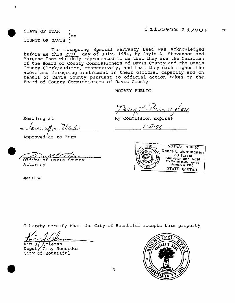
STATE OF UTAH )
) ss
l i c , 5 9 2 S 3 1 7 9 0 P
COUNTY OF DAVIS )
The foi;eqoing S p e c i a l Warranty Deed was acknowledged before me t h i s 9.rS^ day of J u l y , 1994, by Gayle A Stevenson and Margene Isom who duly represented to me that they are the Chairman of the Board of County Commissioners of Davis County and the Davis County C l e r k / A u d i t o r , r e s p e c t i v e l y , and that they each signed the above and foregoing instrument m t h e i r o f f i c i a l c a p a c i t y and on behalf of Davis County pursuant to o f f i c i a l a c t i o n taken by the Board of County Commissioners of Davis County
NOTARY PUBLIC
Residing a t
i^as tc Approved* :o Form
Orfibs' of Davis iSouni
My Commission Expires
At to rney
special Bou
n ty
UiT-y. NOTARY u t i B M C
.\ Nancy L Burnmghan • P O 80x618
Farmington utan 3<.025 1^ My Commission Expires ' Januarys 1995
S T A T E OF U T A H
I hereby c e r t i f y that the C i t y of B o u n t i f u l accepts t h i s property
Kim J/yColeman Deputy^City Recorder C i t y of B o u n t i f u l

Property Information for Relocation of Facilities Due to Legacy Parkway (work done in 2006-2007)
Deeds and Settlement Agreement of Bountiful City and U D O T
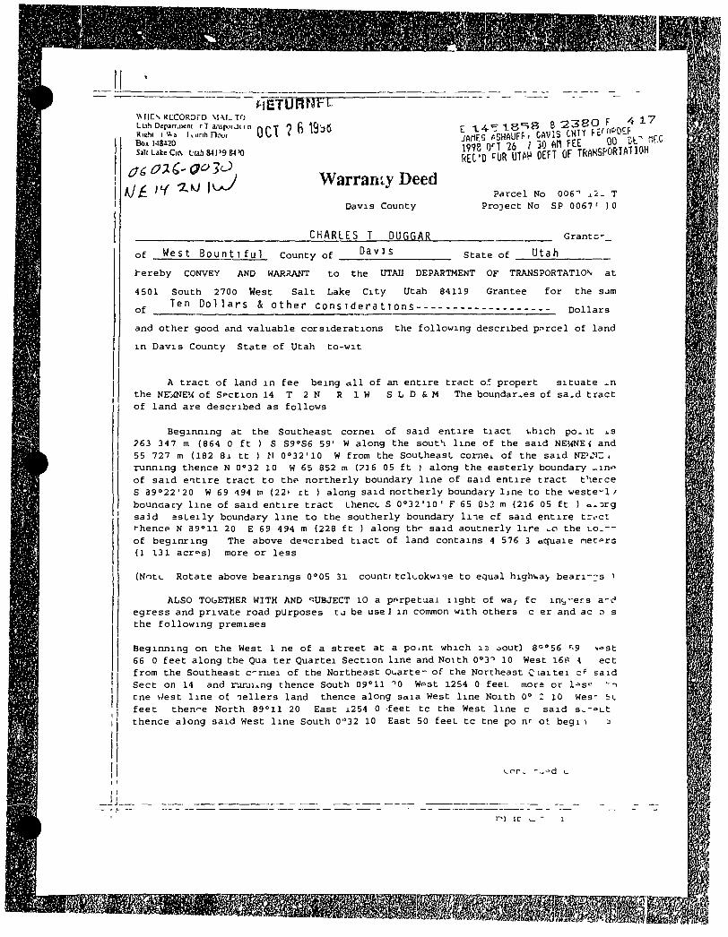
WIIC^ R C C O R O r D \ U I _ T O L Lih Deparuieni r T a,-upci j t < n rtpT 0 f! I Q s r t Riehi i V , a W u n h H i x . ! U ^ l < " ' Box US-l O Sail Lake Ci[\ Liah S41 '9 84'0
JJ_-
Warranty Deed Davis County
CHARLES T DUGGAR
Parcel No 006'' T Project No SP 0067 ' )0
G r a n t c -
Da V 1 s s t a t e o f Utah of W e s t B o u n t i f u l County of
he reby CONVEY AND WAJtaA>rr to Che UTAJJ DEPARTMENT OF TRANSPORTATION a t
4501 South 2700 West S a l t Lake C i t y Utah 84119 Grantee
Ten Dollars & other considerations of
f o r the sjm
Dollars
and other good and valuable corsiderations the following described parcel of land
i n Davis County State of Utah to-wit
n A tra c t of land i n fee being a l l of an entire tract of propert situate the NE"/<NEV< of SPCCion 1 4 T 2 N R I W S L D & M The boundaries of sa.d tra c t of land are described as follows
Beginning at the Southeast cornel of said entire t i a c t v.hich po^ i t J.3 ?63 347 m (864 0 f t ) S Sg^Se 59' W along the south l i n e of the said NE'/<NE < and 55 727 m (182 Bj t t ) II 0°32'10 W from the SouLheasL comCi. of the said NB'J'n: 4 running thence N 0°32 10 W 65 852 m (P16 05 f t ) along the easterly boundary - i n f of s a i d e a t i r e tract to tho northerly boundary l i n e of eaid entire t r a c t therce S a9°22'20 W 69 194 tn (22^ r t ) along said northerly boundary Ijne to the weste^l / bounaaty l i n e of said e n t i r e tract Lhencc S 0''32'10' F 65 eb2 m (216 05 f t ) o^^rg sajd s s L e i l y boundary l i n e to the southerly boundary l n e cf said entire trccc t-hencp N a g ^ l l 20 E 69 494 m (228 f t ) along thr said aoutnerly l i r e the uo^--of beginring The above de-icribed t i a c t of land contains 4 576 3 oguaie net°rG (1 131 acrps) more or less
(Note Rotate above bearings 0*05 31 countr ccluokwiqe to equal highv»a> beari-;;s 1
ALSO TOGETHER WITH AND 'SUBJECT lO a pt^rpetaaJ l i g h t of wa^ fc intj-ers a-t" egress and private road purposes t j be use J i n common with others c er and ac o s the following premises
Beginning on the West 1 ne of a street at a point which 13 ooucl 8 = 56 '9 I'^st 66 0 feet along the Qua ter Quartei Section l i n e and Notth 0°3'' 10 West 16P -l ect from the Southeast c r i i e i of the Northeast Ouarte- of the Northeast C ' a i t e i c*" said Sect on 14 and rarjung thence South 09° 11 ''O Wf>Gt 1254 0 feet mors or l- 's- " - i tne v/est l i n e o£ Tellers land thence along saia West l i n e Noith 0° : 10 Wes" feet then'~e North Bg""!! 20 East j.254 0 feet tc the West l i n e c said s^-'^et thence along said West l i n e South 0''32 10 East 50 feeL tc tne po nr ot begi \ 3
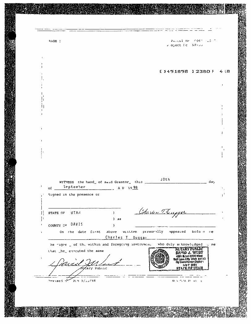
CAGE tic (^06"
o^ect ! c SP-jj
E 14^ '51S'5S 3 2 3 8 0 F 4 LS
of
WITM2SS the heind_ of saj .d Gran to r_ t h i s
S e p t e m b e r ^ ^ 98
J 0th
Signed i n the presence or
da>
S T A T E OF UTAf I
COUNTY C ^ ~
) as
) On rhe date f i r s t above w i i L t e n p e r s o n l l y -appealed b c f o i3 i le
Charles T Duqqai
LhaL he executed the same
he ' - igre _ of thi . w i t h i n and f o r e g c n g in«;tn.nicii^ who d u l y ac itnow] edged ^ me
y!fa>Ls.rY Pub L i e
ttaUUhftCity IMftMMO
Jiilyr flOOl
• ' o v i s e i PI M 9 / j . j / y 8
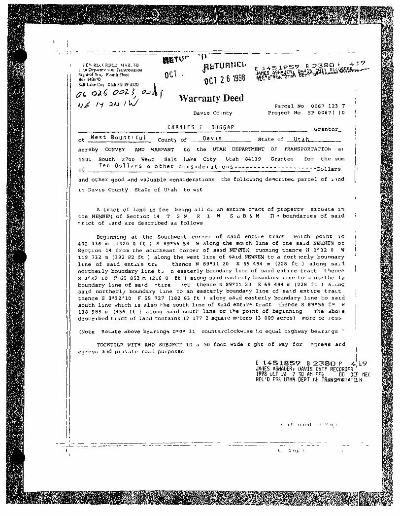
HEN RUC RDLD MAIL TO I in DfpirtiTt)( o( Transponaiion Rij^u-of Vv s, Faurih Floot Box 1484^0 Salt Lilte Cic) t lah 84119 <i420 X
OCT . OCT 2 6 398
Warranty Deed Davio Co in ty
P a r c e l No 0067 123 T P r o j e c t No SP 0067 ( )0
CHARLES DUGGAP G r a n t o r
ot West B o u n t i f u l Count i o f D a v i s s t a t e of
hereby CONVEY AND WARPANT
4501 South 2700 West S a l t Lake C i t y Otah 84119 Ten D o l l a r s & o t h e r c o n s i d e r a t i o n s
ot
t o the UTAH DEPARTMENT OF rRANSPORTATION a i
Grantee f o r the sum
- " D o l l a r s
and o t h e r good and v a l u a b l e c o n s i d e r a t i o n s the f o l l o w i n g de'=icribea p a r c e l o f x ind
n D a v i s County S t a t e o f Ut-ah to w i t
A t r a c t o f l a n d i n f e e b e i n g a l l Oi. an e n t i r e t - a c t o f p r o p e r t v s i t u d t e m the NEWE' t o f S e c t i o n 1 4 T 2 N R l W S I J B & M r i= b o u n d a r i e s o f s a i d t r i c t o f j . a rd are d e s c r i b e d aa f o l l o w s
B e g i n n i n g a t the Southwest c o m e r of s a i d e n t i r e t r a c t w n i c h p o i n t i c 402 336 m i l 3 2 0 0 f t ) S 89°56 59 W a l o n g the s o i t h l i n e of the saj .d NEVC'TE' ^ o t S e c t i o n 14 f r o m the sou theas t c o r n e r o f s a i d NE'flTEU runn ing thence H 0032 0 W 119 732 m (3 92 62 f t ) a l o n g the west l i n e o f s a i d NEHNE'X t o a n o r t i c r l y boundary l i n e o f s a i d e n t x i e tr=; thence N 89 = 11 20 E 69 494 m (228 f t ) a l o n g saa.-! n o r t h e i l y boundary l i n e t j n e a s t e r l y boundary l i n e of s a i d e n t i r e t r a c t t h e n c f S O'S? 10 y 65 852 m (216 0 f t ) a iong a a i d e a s t e r l y b o j n d a r v j.]ne Lo a n o r t h e 1/ boundary l i n e of s a i d - t i r e i c t thence N B g ^ l l 20 E 69 494 m (228 f t ) a.t .nc s a i d n o r t h e r l y boundary l i n e t o em e a s t e r l y bounda'-y l i n e of s a i d e n t i r e t r a c t thence S O' '32'10 F 55 727 (182 83 f t ) a long sa^d e a s t e r l y boundary l i n e t o s a i d s o u t h l i n e wh ich i s a l s o the south l i n e of s a i d e n t i r p t r a c t t h e r c e S sgose Z'^ W 138 989 ir (456 f t ) a l o n g s a i d south l i n e t c tbe p o i n t of b e g i n n i n g The dbo\ e d e s c r i b e d t r a c t of l a n d -zontains 1? 177 2 squaie moters (3 009 ac res ) more o i i e s t
(Note R o t a t e aibove b e a r i n g s 0°0=; 31 c o u n t » r c l o c k w - 3 e Lo equa l highway b e a r i r g s '
TOCETHCR WITH AND SUBJFCT 10 a 50 f o o t wide r ght o f way f o r n 3 r e s s a r d eg re s s a i d p r i v a t e road purposes '
E t 4 5 1 S 5 V B 2 3 S O P V L 9 JArlES ASHAUERr OAVIS CHTY RECOROFR 1998 UCT lli 7 -30 AM FFt 00 DCf m. REl'D Pnh UTAH DEPT n TRfiNSPnRTATIlLN
C ! t n led n r n
Condemnation Settlement Agreement
The Utah Department of Transportation (hereinafter "bDOT") and Bountiful City enter into this Con(Jemnation Settlement Agreement as follows
1 UDOT wishes to construct a state highway known as the Legacv Parkway, which will run through portions of Davis County, Utah The intended route crosses real estate owned by Bountiful City at four different points which are designated as the "pond property " the "Porter Lane property," the "power substation property," and the "landfill property " Four condemnation actions have already been filed in Second Distnct Court, which are, respectively, civil numbers 010800928-CD, 010700234-CD, 010700106-CD, and 010800716-CD The properties and easements which need to be taken from Bountiful for the Legacy Parkway are legally described in those lawsuits
2 In consideration of the compensation stated herein. Bountiful City will convey the necessary deeds and easements to UDOT for use in the Legacy Parkway
3 In consideration of the conveyances of the deeds and easements by Bountiful City, UDOT shall compensate Bountiful City as follows
(a) $36,600 00 shall be paid in connection with the "pond property " UDOT has paid this amount into the court in the condemnation action (#010800928), and this may be withdrawn by Bountiful City
(b) $2,000,000 shall be paid by check for the other three properties
(c) UDOT shall at its expense acquire and convey to Bountiftil City a parcel of land adjacent to the Bountiful landfill which has been designated for the construction of a new weigh station, scale house, etc , for the use and ownership of the City This land shall be fully cleared and new facilities constructed (i e a new weigh station, scale house, etc ), solely at the expense of UDOT, except that the City shall pay for any upgrades, enlargements or enchancements over the existing facilities
4 Bountiful City's access to and operation of the Bountiful landfill shall not be interrupted at any time dunng the construction of the Legacy Parkway UDOT understands that daily operation IS essential to the City The new facilities installed bv UDOT shall be fully constructed and operational before the existing facilities can be shut down, such that one day the landfill fully uses the existing facilities and the next day fully uses the new facilities, with no interruption of service to the public Access to the landfill on Page's Lane shall not be interrupted until access to the landfill from the new frontage road is complete and operational
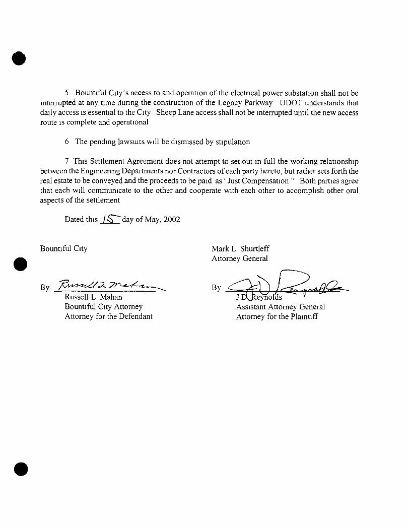
5 Bountiful City's access to and operation of the electncal power substation shall not be interrupted at any time during the construction of the Legacy Parkway UDOT understands that daily access is essential to the City Sheep Lane access shall not be interrupted until the new access route is complete and operational
6 The pending lawsuits will be dismissed by stipulation
7 This Settlement Agreement does not attempt to set out in full the v/orking relationship between the Engineering Departments nor Contractors of each party hereto, but rather sets forth the real estate to be conveyed and the proceeds to be paid as' Just Compensation " Both parties agree that each will communicate to the other and cooperate with each other to accomplish other oral aspects of the settlement
Dated this j ^ d a y of May, 2002
Bountifiil City MarkL Shurtleff Attorney General
Russell L Mahan Bountiful City Attorney Attorney for the Defendant
jBjleynold; Assistant Attorney General Attorney for the Plaintiff
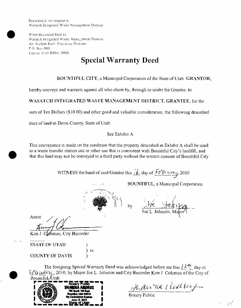
Recorded at tne request ot Wasaich Integrated W aste Management District
When Recorded iVfail to Wasatch [ntcgrated Waste Management District Att Nathan Rich Exei titive Directoi P 0 Box 900 Laytun Utah 84041 0900
Special Warranty Deed
BOUNTIFUL CITY, a Municipal Corporation of the State of Utah GRANTOR,
hereby conveys and warrants against all who claim by, through or under the Grantor, to
WASATCH INTEGRATED WASTE MANAGEMENT DISTRICT, GRANTEE, for the
sum of Ten Dollars (S10 00) and other good and valuable consideration, the following descnbed
tract of land in Davis County, State of Utah
See Exhibit A
This conveyance is made on the condition that the property described in Exhibit A shall be used as a waste transfei station site or other use that is consistent with Bountiful City's landfill, and that this land may not be conveyed to a third party without the written consent of Bountiful City
WITNESS the hand of said Grantor this i i _ day of Fr"!?! 't/^r^, 2010
- - . BOUNTIFUL, a Municipal Coiporation
by
Attest foe L Johns6n, Ma or
Kim J Q>reman, City Recorder
STATE OF UTAH
COUNTY OF DAVIS ) ss
The foiegoing Special Warranty Deed was acknowledged before me this day ot \A.i\''^'\'\ , 2010, by Mayor Joe L Johnson and City Recorder Kim J Coleman of the City of
BountifuLAJtah
SHAWNAAWWUS | TMSowttilOOCaU I
I l^otary Public
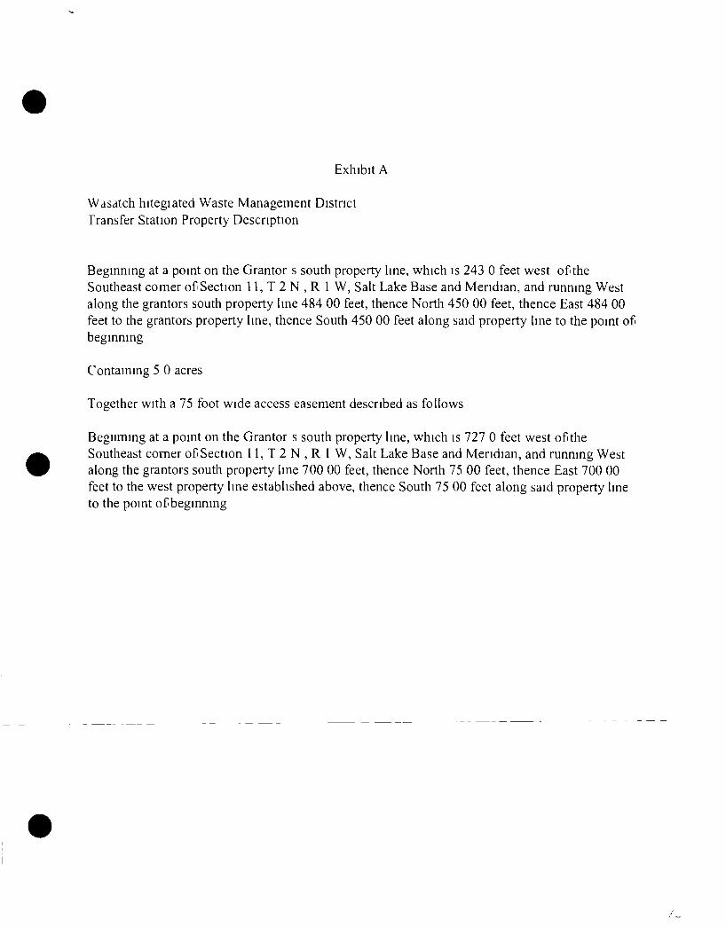
Exhibit A
WdSdlch hilegiated Waste Management District Transfer Station Property Description
Beginning at a point on the Grantor s south property line, which is 243 0 feet west of the Southeast comer of Section 11, T 2 N , R I W, Salt Lake Base and Meridian, and running West along the grantors south property line 484 00 feet, thence North 450 00 feet, thence East 484 00 feet to the grantors property line, thence South 450 00 feet along said property line to the point of beginning
Containing 5 0 acres
Together with a 75 foot wide access easement described as follows
Begiiming at a point on the Grantor s south property line, which is 727 0 feet west of the Southeast comer of Section 11, T 2 N , R 1 W, Salt Lake Base and Meridian, and running West along the grantors south property line 700 00 feet, thence North 75 00 feet, thence East 700 00 feet to the west property line established above, thence South 75 00 feet along said property line to the point of beginning
Appendix B
Plan Drawings
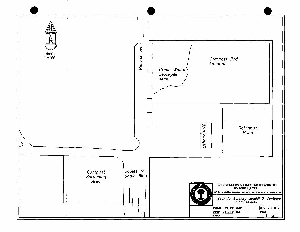
Scale 1 =100
^ c
Compost Pad Location
Green Waste Stockpile Area
Ck. o
-C
o
Compost Screening
Area
Scales & Scale BIdg
Retention Pond
BOUNHFUL CFTY ENGINEERING DEPARTMENT BOUNTIFUL, UTAH
790South 100East BounUtuI Utah»ni1 (BCt1)2B8S1i5ph 29»4a33Aw
Bountiful Sanitary Landfill 5 Contours Improvements
PEaow MWFAGC MWFAGC
CHECK
BOOK
RLE
DATE Oct 2010
1 OF 1
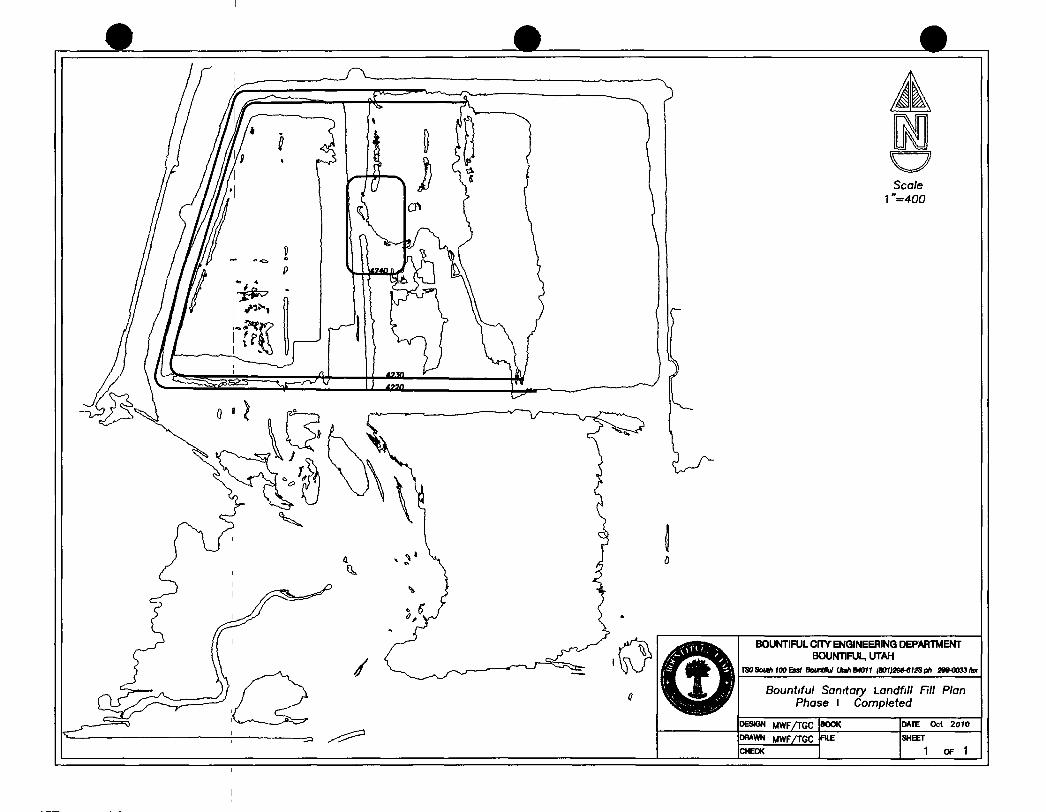
M Scale
1 "=400
BOUNTIFUL Cmr ENGINEERING DEPARTMENT BOUNTIFUL, UTAH
TSOSoulh fOOEnf BounUM UlahB4011 (B01)2»ei!Sl>h 288-0033tor
Bountiful Sanitary Landfill Fill Plan Phase I Completed
MWF/TGC P»*WN MWFAGC CHECK
BOOK
FILE
DATE Oct 2010
SHEET
1 OF 1
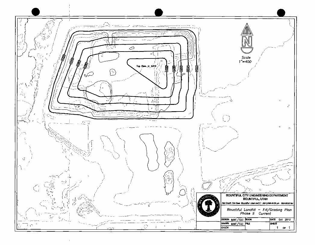
m Scale
1 "=400
i !
BOUNTIFUL cmr ENGINEERING DEPARTMENT BOUNTIFUL, UTAH
TSOSoutfiyOOEaa BounttUf Uah84011 (S01)29e-61SSph 29»«033tor
Bountiful Landfill - nil/Grading Plan Phase IV
MWF/TGC WWWN MWFAGC CHECK
DATE Oct 2010
SHEET
1 OF 1
EXPLANATION
0 Evaporatidn Ponds
retention f
-(W DPdJfo Cmm njsob (WUoL -
/WP\ Q lb (.SOO)(' 10/2.)-
ALL WEATHER SURFACE CONSISTING o r COMPACTED GRANULAR SOIL • R RECYCLED ASPHALT PAVEMENT CRAP)
OS MINIMUM CROWN 6 MINIMUM GRANULAR SOIL
OR y MINIMUM RECYCLED ASPHALT PAVEMENT
UNDISTURBED NATURAL SOIL OR
COMPACTED REFUSE AND INTERIM COVER
BOUhmFUL CITY ENQINEERINQ DEPARTMENT BOUNTIFUL UTAH
TYPICAL 20' ALL WEATHER ACCESS RDAD
MWF MVF
C i N A C A D V l N V R D A D 1 of 1
Appendix C
2008 Remaining Life Study
Bountiful Sanitary Landfill
Remaining Life Study
•if.
'il'iv-
Prepared By
Bountiful City Engineering Department
Todd Chnstensen, P E
January 2008
Executive Summary
Several factors have brought to question the vahdity of the remaimng hfe of the landfill as reported on the annual Capacity Report So this study was conducted in order to determine the useful life of the landfill by measunng the remaimng volume in the landfill and measunng the density of the landfilled waste Here is a summary of the findings
• The expected life of the landfill (based on measured airspace and waste density) is 82 years
• The density of the waste placed in the landfill since the year 2000 is at least 1750 Ib/yd^ much higher than the assumed 800 Ib/yd
• The remaimng airspace available to landfill (as of 8/02/07) 5,686,000 yd' This number takes into account the loss of airspace to UDOT for the Legacy Parkway
• Since the expected life of 82 years is so far into the future many changes affecting the Bountiful Samtary Lanfill could occur within that time As a result 6/30/2050 (42 5 years) is recommended as the end of life date that should be used for financial planning and public reporting
Background and Purpose
The remaimng life of the Bountiful Sanitary Landfill is estimated and reported each year in the Capacity Report The remaimng life calculation rehes on a 1993 survey (nearly 15 years old) to calculate the volume of airspace Then an adjustment is made to account for the planned loss of airspace to UDOT for the Legacy Parkway which may have had more or less of an impact than was thought The remaimng life calculation also assumes that the waste is compacted to 800 Ib/yd which is near the low end of the 750 to 1500 lb/yd' density range for mumcipal solid waste according to the Sohd Waste Association of North Amenca (SWANA) The remaimng hfe last reported to be 41 9 years is therefore questionable
The intent of this Study was to
• Determine the remaining volume of airspace in the landfill
• Measure the density of the waste and cover matenal after it is placed in the landfill
• Approximate the remaimng life of the landfill based upon a current survey and the measured density of the waste in the landfill
The Landfill's Available Airspace
In order to determine the airspace available in the landfill digital surface models were created for the fill plans usmg a software package Autodesk Map 3D 2006 First a base surface was created using the location of the landfill s penmeter roadways which for several years were at an elevation of close to 4215 ft almost everywhere along the roadways Then surfaces for
Bountiful Landfill Remaining Life Study, January 2008 Page 1
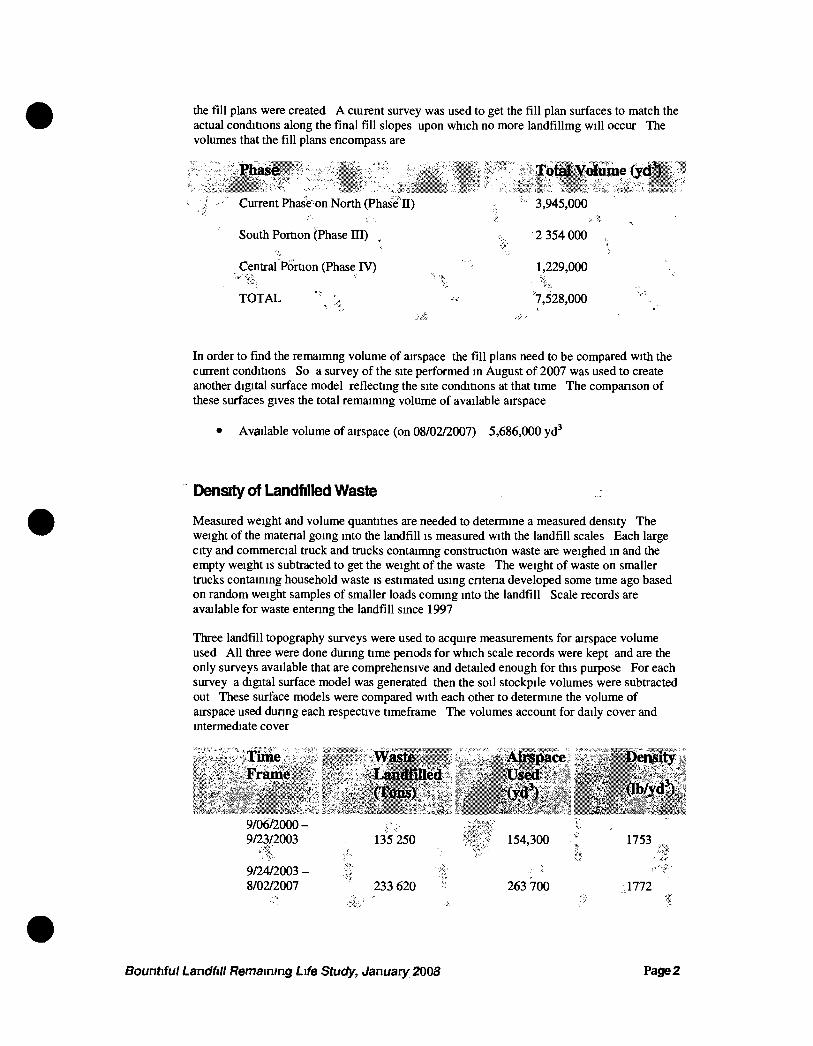
the fill plans were created A cturent survey was used to get the fill plan surfaces to match the actual conditions along the final fill slopes upon which no more landfillmg will occur The volumes that the fill plans encompass are
Ifhase
Current Phase on North (Phase H)
South PorUon (;Phase ni)
Central Portion (Phase IV)
TOTAL '
Total Volume (yd )
3,945,000
2 354 000 ,
1,229,000
'7,528,000
In order to find the remaimng volume of airspace the fill plans need to be compared with the current conditions So a survey of the site performed in August of 2007 was used to create another digital surface model reflecting the site conditions at that time The companson of these surfaces gives the total remaimng volume of available airspace
• Available volume of airspace (on 08/02/2007) 5,686,000 yd'
Density of Landfilled Waste
Measured weight and volume quantities are needed to determine a measured density The weight of the matenal going into the landfill is measured with the landfill scales Each large city and commercial truck and trucks contaimng construction waste are weighed in and the empty weight is subtracted to get the weight of the waste The weight of waste on smaller trucks containing household waste is estimated using cntena developed some time ago based on random weight samples of smaller loads coming into the landfill Scale records are available for waste entenng the landfill since 1997
Three landfill topography surveys were used to acquire measurements for airspace volume used All three were done during time penods for which scale records were kept and are the only surveys available that are comprehensive and detailed enough for this purjjose For each survey a digital surface model was generated then the soil stockpile volumes were subtracted out These surface models were compared with each other to determine the volume of airspace used dunng each respective timeframe The volumes account for daily cover and intermediate cover
ensity :
9/06/2000-9/23/2003
^ | . 9/24/2003 -8/02/2007
135 250
233 620
154,300 ;
263 700
1753
1772
Bountiful Landfill Remaining Life Study, January 2008 Page 2
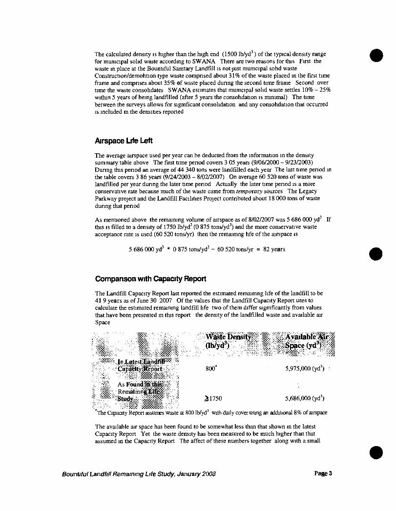
The calculated density is higher than the high end (1500 lb/yd') of the typical density range for municipal solid waste according to SWANA There are two reasons for this First the waste in place at the Bountiful Samtary Landfill is not just mumcipal sohd waste Construction/demohtion type waste compnsed about 31% of the waste placed in the fu-st time frame and compnses about 35% of waste placed dunng the second time frame Second over time the waste consohdates SWANA estimates that mumcipal solid waste settles 10% - 25% within 5 years of being landfilled (after 5 years the consohdation is minimal) The time between the surveys allows for sigmficant consolidation and any consohdation that occurred is included m the densities reported
Airspace Life Left
The average airspace used per year can be deducted from the information in the density summary table above The first time penod covers 3 05 years (9/06/2000 - 9/23/2003) Dunng this penod an average of 44 340 tons were landfilled each year The last time penod in the table covers 3 86 years (9/24/2003 - 8/02/2007) On average 60 520 tons of waste was landfilled per year dunng the later time penod Actually the later time penod is a more conservative rate because much of the waste came from temporary sources The Legacy Parkway project and the Landfill Facilities Project contnbuted about 18 000 tons of waste dunng that penod
As mentioned above the remaining volume of airspace as of 8/02/2007 was 5 686 000 yd' If this IS filled to a density of 1750 lb/yd' (0 875 tons/yd') and the more conservative waste acceptance rate is used (60 520 tons/yr) then the remaimng hfe of the airspace is
5 686 000 yd' * 0 875 tons/yd' - 60 520 tons/yr = 82 years
Comparison with Capacity Report
The Landfill Capacity Report last reported the estimated remaimng life of the landfill to be 41 9 years as of June 30 2007 Of the values that the Landfill Capacity Report uses to calculate the estimated remaining landfill life two of them differ sigmficantly from values that have been presented m this report the density of the landfilled waste and available air Space
Waste Density Ayailable ASr (Ib/yd ) Space (yd
In Latest I andflO Capacity Keport • 800* 5,975,000 (yd')
As Found {ill this Remaimng Irife Study ^1750 5,686,000 (yd')
'The Capacity Report assumes waste at 800 lb/yd'' with daily cover using an addiUonal 8% of airspace
The available air space has been found to be somewhat less than that shown in the latest Capacity Report Yet the waste density has been measured to be much higher than that assumed in the Capacity Report The affect of these numbers together along with a small
Bountiful Landfill Remaining Life Study, January 2008 Page 3
difference in the waste acceptance rate results m the major difference in the calculated remaining life
Recommendation
If the remaining life of the landfill is 82 years as projected by the measured airspace and waste density it will reach its useful hfe in the year 2089 Looking backward 82 years ago was 1926 Since then major changes have occurred that impact the disposal of sohd waste Demographics and political boundanes environmental regulations household sohd waste charactenstics technologies and disposal practices have all changed dramatically in the last 82 years Looking forward 2089 is so far into the future that predictions cannot reasonable be made on factors that affect the disposal of sohd waste Except that as time passes the existing landfill s impact on the environment becomes more and more hkely to violate environmental regulations which become more and more stnngent Violating environmental regulations could lead to an early closure of the landfill and/or a need to spend additional money to fund corrective action For these reasons the following recommendation is given
Plan for the landHIl to reach it's expected life on 6/30/2050 (this is just 1 1 years later than what was reported m the latest Capacity Report)
This date should be used for financial assurance requirements and other financial planmng relating to the sohd waste disposal for Bountiful City This date should also be used for general pubhc and professional reporting of the landfill s expected hfe
Assumptions
The quantities and calculations included in this report are based on the following assumptions
• Waste placed after 9/05/2000 has or will be placed at or above an elevation of4215 00ft
• Fill plans will be followed
• Future incoming waste charactenstics and acceptance rates will resemble those from 9/24/2003 - 8/02/2007
• Future waste compaction and consohdation rates will resemble those from 9/05/2000 - 9/24/2003
• Final cover will be placed over the fill plan surfaces (fill plan surfaces do not include final cover)
Bountiful Landfill Remaining Life Study, January 2008 Page 4
Attachments
1 September 2000 Surveyed Surface Contours
2 September 2003 Surveyed Surface Contours
3 August 2007 Surveyed Surface Contours
4 Phase n Fill Plan Contours (Current Phase)
5 Phase n and III Fill Plan Contours
6 Phase n - IV (Final) Fill Plan Contours
7 Landfill Inbound Scale Records for 9/06/2000 - 9/23/2003 (Matenal Analysis Report)
8 Landfill Inbound Scale Records for 9/24/2003 - 8/02/2007 (Matenal Analysis Report)
9 Bountiful Sanitary Landfill Capacity Report for Fiscal Year ending 6/30/2007
Bountiful Landfill Remaining Life Study, January 2008 Page 5
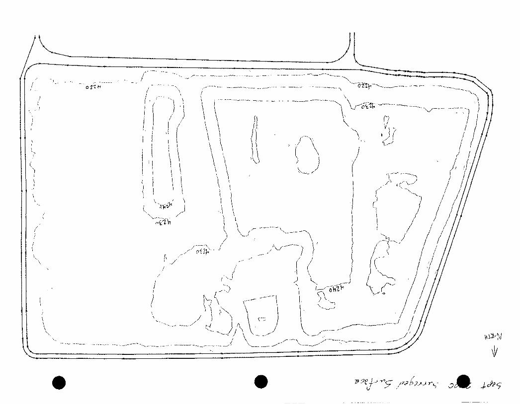
m
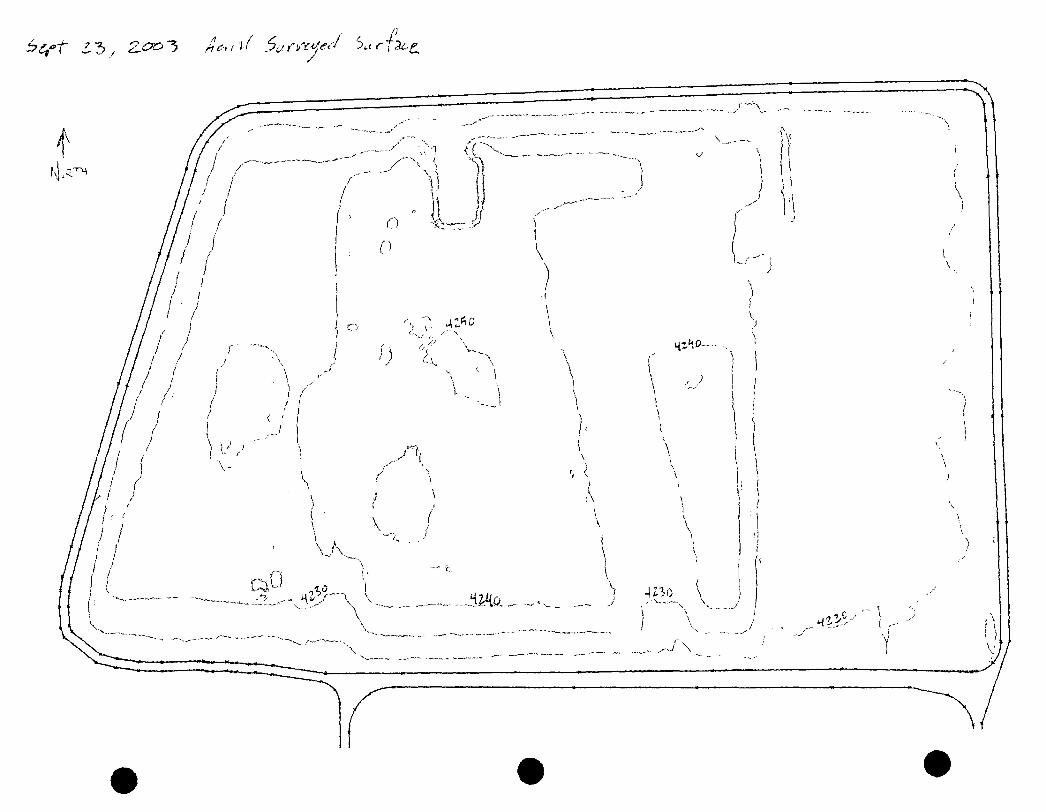
/ J.
rtv e -H ill Fri(
4
u / /- / /
/ / / /
/
/ / / / / / /
7////// / / / / / / /
/ / / / / / '
/ / I I \ / / 1^ / —
I I :
\ \ \ \ •
i ! i ' I
1 I 1
' [I i I
f 1 ;
I I i ; !
> ^ I I
J
\ \
/ / / /
/ / / .
/ /• /
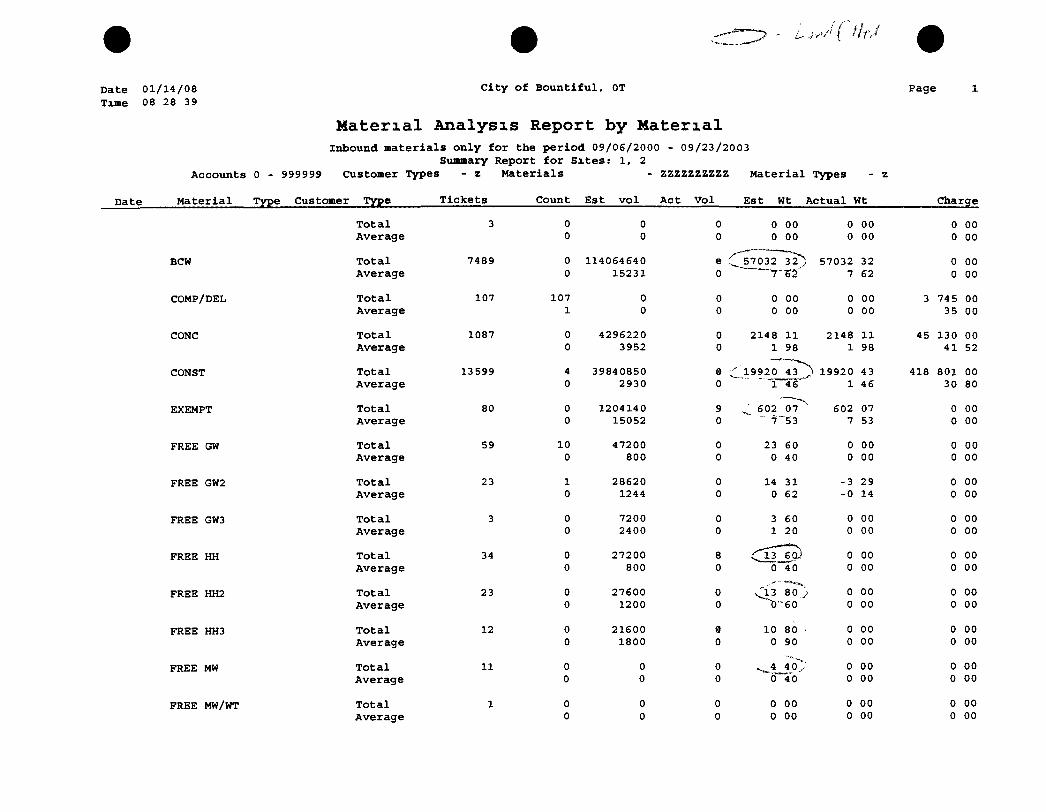
Date 01/14/08 Time 08 28 39
C i t y of B o u n t i f u l , 0T Page
Date
Material Analysis Report by Material Inbound materials only f o r the period 09/06/2000 - 09/23/2003
Summary Report f o r S i t e s : 1, 2
Acco u n t s 0 - 999993 Customer Types - 2 M a t e r i a l s - zzzzzzzzzz M a t e r i a l Types - z
M a t e r i a l Type Customer Type Tic3cets Count E s t v o l A c t V o l E s t Wt A c t u a l wt Charge
T o t a l 3 0 0 0 0 00 0 00 0 00 Average 0 0 0 0 00 0 00 0 00
BCW T o t a l 7489 0 114064640 e C 57032~32^ 57032 32 0 00 Average 0 15231 0 7 62 0 00
COMP/DEL T o t a l 107 107 0 0 0 00 0 00 3 745 00 Average 1 0 0 0 00 0 00 35 00
CONC T o t a l 1087 0 4296220 0 2148 11 2148 11 45 130 00 Average 0 3952 0 1 98 1 98 41 52
CONST T o t a l 13539 4 39840850 ® c 19920 43 ^ 19920 43 418 801 00 Average 0 2930 0 ~1 46 1 46 30 80
EXEMPT T o t a l 80 0 1204140 9 ^ 602 07"^ 602 07 0 00 Average 0 15052 0 " 7~53 7 53 0 00
FREE GW T o t a l 59 10 47200 0 23 60 0 00 0 00 Average 0 800 0 0 40 0 00 0 00
FREE GW2 T o t a l 23 1 28620 0 14 31 -3 29 0 00 Average 0 1244 0 0 62 -0 14 0 00
FREE GW3 T o t a l 3 0 7200 0 3 60 0 00 0 00 Average 0 2400 0 1 20 0 00 0 00
FREE HH T o t a l 34 0 27200 8 0 00 0 00 Average 0 800 0 0 40 0 00 0 00
FREE HH2 T o t a l 23 0 27600 0 80 , := 0 00 0 00 Average 0 1200 0 ~'0-60 0 00 0 00
FREE HH3 T o t a l 12 0 21600 9 10 80 0 00 0 00 Average 0 1800 0 0 90 0 00 0 00
FREE MW T o t a l 11 0 0 0 0 00 0 00 Average 0 0 0 0 40 0 00 0 00
FREE MW/WT T o t a l 1 0 0 0 0 00 0 00 0 00 Average 0 0 0 0 00 0 00 0 00
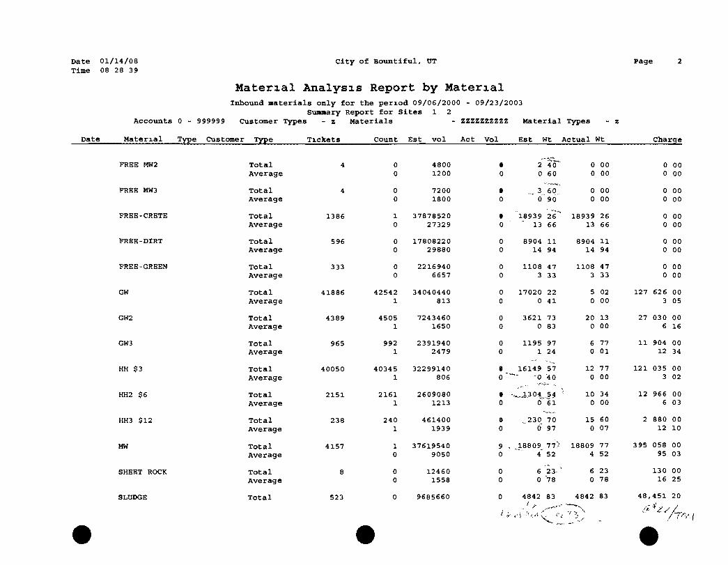
Date 01/14/08 Time 08 28 39
C i t y of B o u n t i f u l , OT Page
Material Analysis Report by Material Inbound materials only f o r the period 09/06/2000 - 09/23/2003
Summary Report f o r S i t e s 1 2
Date
Ac c o u n t s 0 - 999999 Customer Types - z M a t e r i a l s - ZZZZZZZZZZ M a t e r i a l Types - z
M a t e r i a l Type Customer Type T i c k e t s Count E s t v o l A c t V o l E s t Wt A c t u a l Wt Charge
FREE W2 T o t a l Average
4 0 0
4800 1200
• 0
2 40"' 0 60
0 0
00 00
0 0
00 00
FREE MW3 T o t a l Average
4 0 0
7200 1800
e 0 0 90
0 0
00 00
0 0
00 00
FREE-CRETE T o t a l Average
1386 1 0
37878520 27329
• 0
18939 13
26*" 66
18939 13
26 66
0 0
00 00
FREE-DIRT T o t a l Average
596 0 0
17808220 29880
0 0
8904 14
11 94
8904 14
11 94
0 0
00 00
FREE-GREEN T o t a l Average
333 0 0
2216940 6657
0 0
1108 3
47 33
1108 3
47 33
0 0
00 00
GW T o t a l Average
41886 42542 1
34040440 813
0 0
17020 0
22 41
5 0
02 00
127 626 3
00 05
GW2 T o t a l Average
4389 4505 1
7243460 1650
0 0
3621 0
73 83
20 0
13 00
27 030 6
00 16
GW3 T o t a l Average
965 992 1
2391940 2479
0 0
1195 1
97 24
6 0
77 01
11 904 12
00 34
HH $3 T o t a l Average
40050 40345 1
32299140 806
e 0 '
16149 57 ~~- - Q '4 0
12 0
77 00
121 035 3
00 02
HH2 $6 T o t a l Average
2151 2161 1
2609080 1213
• 0
•^.13 04, 0
54 61
10 0
34 00
12 966 6
00 03
HH3 $12 T o t a l Average
238 240 1
461400 1939
9 0
,230 6
70 97
15 0
60 07
2 880 12
00 10
MW T o t a l Average
4157 1 0
37619540 9050
9 . 0
, ,18809^ i
77) 52
18809 4
77 52
395 058 95
00 03
SHEET ROCK T o t a l Average
8 0 0
12460 1558
0 0
6 0
23-' 78
6 0
23 78
130 16
00 25
SLUDGE T o t a l 523 0 9685660 0
/ >
4842 83 4842 83 48,
s 451 20
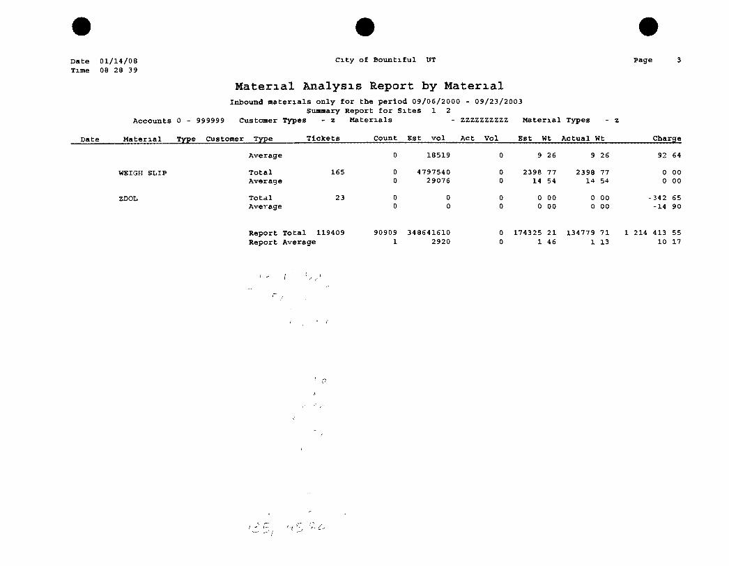
Date 01/14/08 Time 08 28 39
City of Bountiful UT
Material Analysis Report by Material
Page
Inbound materials only for the period 09/06/2000 - 09/23/2003 Summary Report for Sites 1 2
Accounts 0 - 999999 Customer Types - z Materials - ZZZZZZZZZZ Material Types
Date Material Type Customer Type Tickets Count Est vol Act Vol Est Wt Actual Wt Charge
Average 0 18519 0 9 26 9 26 92 64
WEIGH SLIP T o t a l 165 0 4797540 0 2396 77 2398 77 0 00 Average 0 29076 0 14 54 14 54 0 00
ZDOL T o t a l 23 0 0 0 0 00 0 00 -342 65 Average 0 0 0 0 00 0 00 -14 90
Report Total 119409 90909 348641610 0 174325 21 134779 71 1 214 413 55 Report Average 1 2920 0 1 46 1 13 10 17
'-i
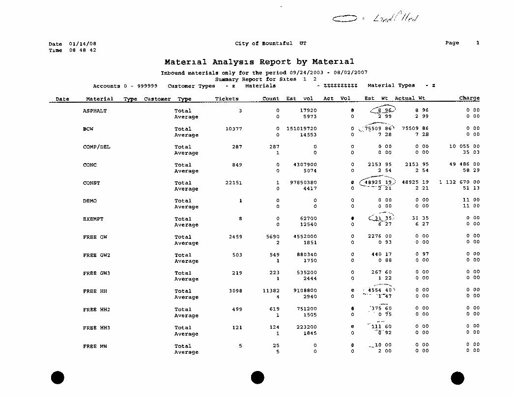
Date 01/14/08 Time 08 48 42
C i t y of B o u n t i f u l tJT
Material Analysis Report by Material Inbound m a t e r i a l s o n l y f o r the p e r i o d 09/24/2003 - 08/02/2007
Summary Report f o r S i t e s 1 2 Acco u n t s 0 - 999999 Customer Types - z M a t e r i a l s - ZZZZZZZZZZ
Page
M a t e r i a l Types
M a t e r i a l Type Customer Type T i c k e t s Count E s t v o l A c t V o l E s t Wt A c t u a l Wt
ASPHALT T o t a l 3 0 17920 y^ 9 ^ 8 96 Average 0 5973 0 2 99 2 99
BCW T o t a l 10377 0 151019720 0 75509 86"> 75509 86 Average 0 14553 0 28 7 2S
COMP/DEL T o t a l 287 287 0 0 0 00 0 00 Average 1 0 0 0 00 0 00
CONC T o t a l 849 0 4307900 0 2153 95 2153 95 Average 0 5074 0 2 54 2 54
,,«~—— CONST T o t a l 22151 1 97850380 0 (['48925 19,/ 48925 19
Average 0 4417 0 "21 2 21
DEMO T o t a l 1 0 0 0 0 00 0 00
Average 0 0 0 0 00 0 00
EXEMPT T o t a l S 0 62700 » •\
35- 31 35 Average 0 12540 0 6 27 6 27
FREE GW Total 2459 5690 4552000 0 2276 00 0 00
Average 2 1851 0 0 93 0 00
FREE GW2 T o t a l 503 549 880340 0 440 17 0 97
Average 1 1750 0 0 88 0 00
FREE GW3 T o t a l 219 223 535200 0 267 60 0 00
Average 1 2444 0 1 22 0 00
FREE HH T o t a l 3098 11382 9108800 e • 4554 40 0 00
Average 4 2940 0 "1"" -47 0 00
FREE HH2 T o t a l 499 619 751200 '375 60 0 00
Average 1 1505 0 ' 0 75 0 00
FREE HH3 T o t a l 121 124 223200 e " i l l 60 0 00
Average 1 1845 0 92 0 00
FREE MW T o t a l 5 25 0 e 00 0 00
Average 5 0 0 2 00 0 00
Charge
0 00 0 00
0 00 0 00
10 055 00 35 03
49 486 00 58 29
132 670 00 51 13
11 00 11 00
0 00 0 00
0 00 0 00
0 00 0 00
0 00 0 00
0 00 0 00
0 00 0 00
0 00 0 00
0 00 0 00
Date 0 1 / 1 4 / 0 8 Time 08 48 42
Date
C i t y o f B o i m t i f u l UT
Material Analysis Report by Material Inbound m a t e r i a l s o n l y f o r the p e r i o d 09/24/2003 - 08/02/2007
Summary Report f o r S i t e s X 2 Accou n t s 0 - 999999 Customer Types - z M a t e r i a l s - ZZZZZZZZZZ M a t e r i a l Types
M a t e r i a l Type Customer Type T i c k e t s Count E s t v o l A c t V o l E s t Wt A c t u a l Wt
Page
Charge
FREE MW2
FREE MW3
FREE-CONST
FREE-CRETE
FRSE-DIRT
FREE-GREEN
FREE-MW
GRAVEL
GW
GW2
GW3
GW4
HH $3
HH2 $6
T o t a l Average
T o t a l Average
T o t a l Average
T o t a l Average
T o t a l Average
T o t a l Average
T o t a l Average
T o t a l Average
T o t a l Average
T o t a l Average
T o t a l Average
T o t a l Average
T o t a l Average
T o t a l
27
37
2427
15888
510
279
10
34258
5824
1021
132
91974
5283
5 1
0 0
0 0
9 0
2 0
0 0
0 0
0 0
34775 1
5900 1
1050 1
131 1
92824 1
5299
6000 1500
48600 1800
1024480 27689
63119940 26007
438270880 27585
3316000 6502
3925620 14070
404540 40454
27820000 812
9439340 1621
2520000 2468
396000 3000
74259200 807
6358800
24 0
512 13
31559 13"
00 75
30 90
24" 84
0 00 0 00
0 00 0 00
512 24 13 84
97 i 31559 97 00 13 00
0 219135 44 219135 44 13 79
1658 3
1962 7
202 20
13910 0
4719 0
1260 1
198 1
37129 0
00 25
81 04
27 23
00 41
67 81
00 23
00 50
60^ 40
3179 40 >
13 79
1658 00 3 25
1962 81 7 04
202 27 20 23
0 00 0 00
0 47 0 00
0 00 0 00
0 00 0 00
0 00 0 00
0 00
0 00 0 00
0 00 0 00
0 00 0 00
0 00 0 00
0 00 0 00
0 00 0 00
0 00 0 00
0 00 0 00
104 325 00 3 05
35,400 00 6 08
12 600 00 12 34
2 376 00 18 00
278 472 00 3 03
31 794 00
Date 0 1 / 1 4 / 0 8 Time 08 48 42
Date
City of Bountiful UT
Material Analysis Report by Material
Paga
Inbound materials only for the period 09/24/2003 - 08/02/2007 Summary Report for Sites 1 2
Accounts 0 - 999999 Customer Types - z Materials - ZZZZZZZZZZ Material Types
Material Type Customer Type Tickets Count Est vol Act Vol Est Wt Actual Wt charge
Average 1 1204 0 0 60 0 00 6 02
HH3 $12 T o t a l 174 176 316800 e •-''lis' 4b 0 00 2 112 00 Average 1 1821 0 0 91 0 00 12 14
IMP SOIL T o t a l 1254 0 43372440 0 21686 22 21686 22 0 00 Average 0 34587 0 17 29 17 29 0 00
MW T o t a l 3564 0 57389810 e 28694 91 28694 91 650 006 00 Average 0 16103 0 8 05 8 05 182 38
ROAD BASE T o t a l 391 0 16070140 0 8035 07 8035 07 0 00 Average 0 41100 0 20 55 20 55 0 00
SHEET ROCK T o t a l 8 0 16780 e 8 39 3 39 177 00 Average 0 2098 0 1 05 1 05 22 13
SLUDGE T o t a l 88 0 1722880 e 861 44 861 44 18 635 00 Average 0 19578 0 9 79 9 79 211 76
WEIGH SLIP T o t a l 750 0 22168520 0 11084 26 11084 26 0 00 Average 0 29558 0 14 78 14 78 0 00
ZEAL T o t a l 8 0 0 0 0 00 0 00 0 00 Average 0 0 0 0 00 0 00 0 00
ZDOL T o t a l 32 0 0 0 0 00 0 00 565 50 Average 0 0 0 0 00 0 00 17 67
Report Total 204520 159071 1041276130 0 520648 07 452031 77 2,328 684 50
; >
Report Average 1 5091 0 2 55 2 21 11 39
'AL..'
Jul , - 7 J O C 2007 ' i s c j l y u i r
Rt.,Hit !ti< 1 KI N 'k t ti ity Thrt.uiri I in-,J fn-OV"
i p f . i M H Ci i tv-u l l imi T O N S
WBf i I'Jf!/ 1 f.<UE:M)0 Tons
1 r>7'jL+-()j o i l s
• s l i m it*^ bH*;' fj 01 rf-fiis*
t/ jOOO T / ioc i i i i i i l no 2 4 0 0 F i 0 o IK
6 5 J u l > 0 4 l o n i
A ( ) B < j E T e n s
4 raSE-n^t T e n s
'001 M Hen )! An. i ly ., Report 1 i D l E 04 T t m
0 0 " 4 1H')F*04 I f r s
4 .'>C)6E*04 Tun--,
-0(l-» V! Itt f ' i \ A l l i!vs s '^epoM 0 rOGE-'-O-i '"on
2L0r< M tU ri j f Anatycj'? po i l 4 /'fi.J(:.*{M rnii--. 2 (o r , M^^lcrMi Analy*. s 6 ' )10F+04 To i i i .
2007 M j l c f i a l Anafys is R o p o f t ! an j u n 2 7l)8E+OJ I r n ; .
Capacity Utilized to Date [j: 488E+06|Tons
To) i ! Csjim. t d Cr^pX'fy
B i i c t l a-i Apfil 1997 Devnn Capacity S ud i Ltii,' C-ia-icily Irfkf-n hy Leqacy (28 670 TonK)
May •Jj
O n M i y ? ^ lt)fi'^ At?rnl PhftJos wor ^ UKfcii 10 ftetomiiix (tnt 8 06c *0C yd 3 of airspare wsre .iva lable Since then the afflmin! of feluso placed in (he Ijndlill is
Compaction to 800 Ib/ydS stiowa^ >
A^suintnq air spcicr LonsLinieo by fJility cover is tlc^clitiorMl h% or
Ar?SPACE Fl i F D ^ i r i r e lO^S =^
Years of placcineiil >
Averacie f>er yi^ir -
Lets A rspitce l..i:JSt to Lr!Q;icy Hwy
Available Air Space
R L H I e TofHiagt,* Rtiinaffiirtf;
Estii lalrid -^ih.
A 628E OS Tons •1 59f)E -06 Tons
M 00"' iitili/«) to c i te
7 435E*05 Tons
1 SSQE^Oe yds of airspace I Hpd with refuse since 199'!
1 487E»-05 yds ot aircpjce niled wnlh cover soil "iini-c 1903
2 00TE^06 yUT
14 09 years since May 28 19i.S
1 425Et05 yria since May 28 1993
/ 741t"+04 yen (incliidinq 8% cover soil)
5 975E*06 yd3 rotnainmrj
2 ' '1 ' 'E*0C Tons (wdlides 8% cavff wti)
41 9 YRS liasfcd on aieraqe fill placemen! sinca May 2K 1Q93
Tons placed m 3 most recent vea's 170047 4« 1 ons
Estimated Life (based on 3 most rc^enl /ears) 3'i 1 YRS
Appendix D
Record Keeping Forms
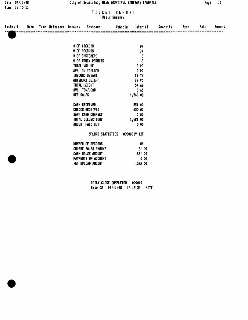
Date Tiie
0*/ll/98 IB 15 55
City of Bountiful, Utah BOUNTIFUL SANITARY LANDFILL
TICKET REPORT Daily Suiiary
Page 11
Ticket I Date Tiie Reference Account Custoaer Vehicle Hatenal Quantity Type Rate Aiount
1 OF TICKETS 84 t OF RECORDS 84 1 OF CUSTOMERS 6 t OF TRUCK PERMITS 2 TOTAL VOLUHE 0 00 AVE CU YD/LOAD 0 00 INBOUND UEI6HT 14 78 OUTBOUND UEI6HT 39 90 TOTAL HEIGHT 54 68 AV6 TON/LOAD 0 65 NET SALES 1,56S 00
CASH RECEIVED 851 00 CHECKS RECEIVED 630 00 BANK CARD CHAR6ES 0 00 TOTAL COLLECTIONS 1,481 00 AMOUNT PAID OUT 0 00
UPLOAD STATISTICS 02000019 TXT
NUMBER OF RECORDS 84 CHARGE SALES AMOUNT 81 00 CASH SALES AMOUNT 1481 00 PAYMENTS ON ACCOUNT 0 00 NET UPLOAD AMOUNT 1562 00
DAILY CLOSE COMPLETED 000019 Site 02 04/11/98 18 19 34 MATT
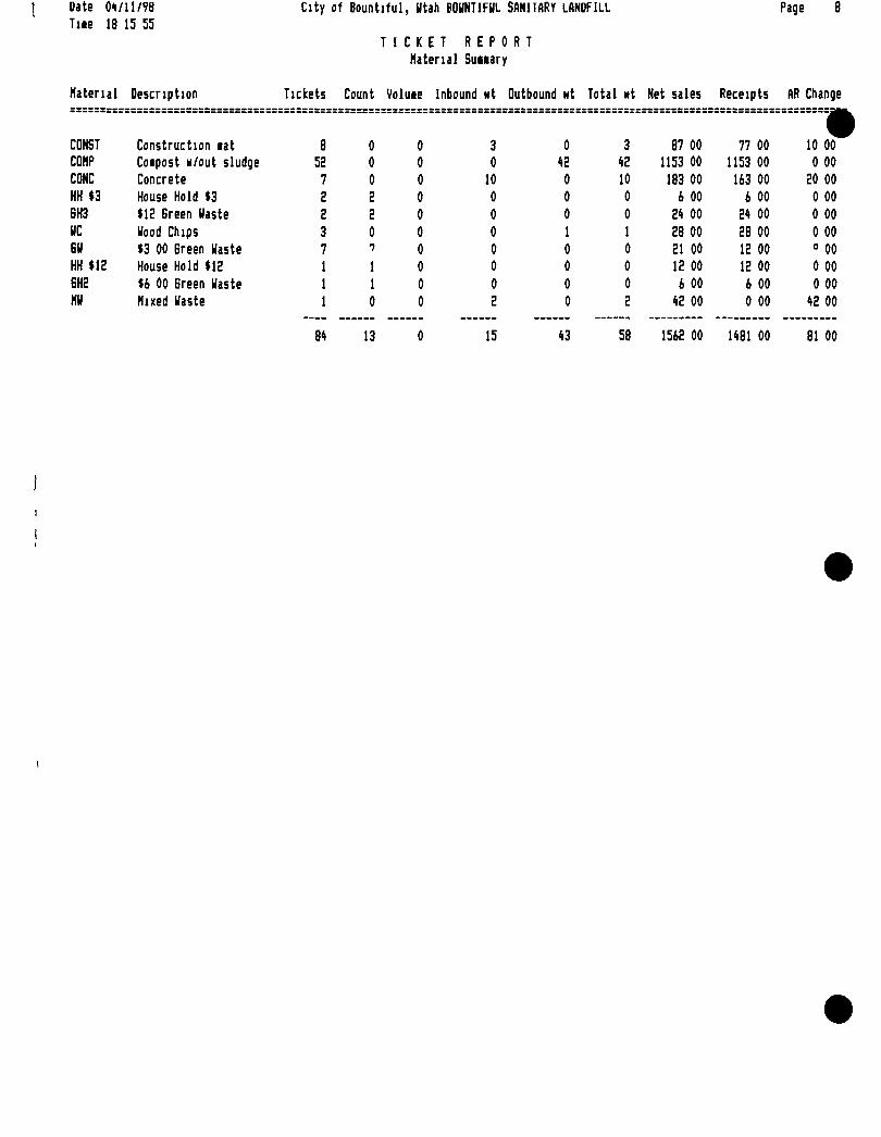
Date Tiie
01/11/98 18 15 55
City of Bountiful, Utah BOUNTIFUL SANITARY LANDFILL
TICKET R E P 0 R Material Suuary
T
Page 8
Material Description Tickets Count Voluie Inbound wt Outbound Ht Total Ht Net sales Receipts AR Change
CONST Construction lat 8 0 0 3 0 3 87 00 77 00 •
10 00 COMP Coipost H/out sludge 52 0 0 0 42 42 1153 00 1153 00 0 00 CONC Concrete 7 0 0 10 0 10 183 00 163 00 20 00 HH $3 House Hold $3 2 2 0 0 0 0 6 00 6 00 0 00 6H3 $12 Green Uaste 2 2 0 0 0 0 24 00 24 00 0 00 UC Uood Chips 3 0 0 0 1 1 28 00 28 00 0 00 6U $3 00 Green Uaste 7 7 0 0 0 0 21 00 12 00 " 00 HH $12 House Hold $12 1 1 0 0 0 0 12 00 12 00 0 00 6H2 $6 00 Green Uaste 1 1 0 0 0 0 6 00 6 00 0 00 MU Mixed Uaste 1 0 0 2 0 2 42 00 0 00 42 00
84 13 0 15 43 58 1562 00 1481 00 81 00
c i t y o x " B o u n t i f u l , DT
Ticket Report A l l T lc lce ta I n B a t c h F i l e
TicJcot^"* a^X.Beference Acoount Costoner Vehicle Material Q u a n t i t y
rage
Hate Amount
318460^0',
3 1 8 4 6 2 ^ M
318464^0iT^j027vicrS/05|:Oa-58 B MEADOWS 318465" 0-° ?f0 /Q95'd]5* 09 03 B MEADOWS 318465-0 318467- t3 318468- 0 318469- 0 318470- 0 318471- 0 318472- 0 318473- 0 318474- 0 318475- 0 318476- 0 318477- 0 318478- 0 318479- 0 318480- 0 318481- 0 318482- 0 318483- 0 318484- 0 318485- 0 318486- 0 318487- 0 318488- 0 318489- 0 318490- 0 318491- 0 318492- 0 318493- 0 318494- 0 318495- 0 318496- 0 318497- 0 318498- 0 318499- 0 318500- 0 318501- 0 318502- 0
107 R R ROOFING 0 CASH CUSTOMER 0 CASH CUSTOMER D CASH CUSTOMER 0 CASH CUSTOMER 0 CASH CUSTOMER
119 GARNER 6 ASSOC ,02709/105' 09 40 0 CASH CUSTOMER ,02/09/05 09 40 0 CASH CUSTOMER 02/09/05 09 43 0 CASH CUSTOMER 02/09/05 09 52 B MEADOWS 0 CASH CUSTOMER 02/09/05 09 53 100 BOUNTIFUL CITY SANIT :02/09/05 09 53 25 DAVIS COUNTY SCHOOL 02/09/05 09 56 B MEADOWS 0 CASH CUSTOMER •02/09/05 09 58 0 CASH CUSTOMER t02/09/05 09 58 0 CASH CUSTOMER 02/09/05 10 01 B MEADOWS 0 CASH CUSTOMER 02/09/05 10 08 B MEADOWS 0 CASH CUSTOMER 02/09/05 10 12 0 CASH CUSTOMER 02/09/05 10 50 B MEADOWS 0 CASH CUSTOMER 02/09/05 10 51 BASIN 0 CASH CUSTOMER 02/09/05 10 51 0 CASH CUSTOMER 02/09/05 10 51 0 CASH CUSTOMER 02/09/05 10 55 5TH BASIN 0 CASH CUSTOMER 02/09/05 10 58 B MEADOWS 0 CASH CUSTOMER 02/09/05 11 04 B MEADOWS 0 CASH CUSTOMER 02/09/05 11 07 B MEADOWS 0 CASH CUSTOMER 02/09/05 11 18 B MEADOWS 0 CASH CUSTOMER 02/09/05 11 32 0 CASH CUSTOMER 02/09/05 11 35 CENTERVILL 0 CASH CUSTOMER 02/09/05 11 43 CENTERVILL 0 CASH CUSTOMER 02/09/05 11 47 0 CASH CUSTOMER 02/09/05 11 47 0 CASH CUSTOMER 02/09/05 11 47 0 CASH CUSTOMER 02/09/05 11 49 40 GREEN DISPOSAL 02/09/05 11 56 14 BRODERICK CONSTRUCT!
02/09/05 11 57 B MEADOWS 0 CASH CUSTOMER 02/09/05 11 58 100 BOUNTIFUL CITY SANIT 02/09/05 12 10 B MEADOWS 0 CASH CUSTOMER 02/09/05 12 14 B MEADOWS 0 CASH CUSTOMER 02/09/05 12 16 0 CASH CUSTOMER 02/09/05 12 17 B MEADOWS 0 CASH CUSTOMER 02/09/05 12 25 CENTERVILL 0 CASH CUSTOMER
CONST FREE-DIRT FREE-DIRT FREE-DIRT FREE-DIRT FREE-DIRT HH $3 HH $3 HH $3 HH $3 FREE-DIRT BCW HH $3 FREE-DIRT HH $3 HH $3 FREE-DIRT FREE-DIRT HH $3 FREE-DIRT FREE-DIRT HH $3 HH $3 FREE-DIRT FREE-DIRT FREE-DIRT FREE-DIRT FREE-DIRT HH $3 FREE-DIRT FREE-DIRT COMP HH $3 HH $3 MW CONST FREE-DIRT BCW FREE-DIRT FREE-DIRT HH $3 FREE-DIRT FREE-DIRT
3 88 19 90 19 18 20 76 18 10 19 30
00 00 00 00
17 06 5 34 1 00
15 63 00 00
13 09 11 91 1 00
22 57 14 60
00 00
12 84 20 14 17 11 16 51 19 97 1 00
12 56 13 32 0 81
00 00 88
0 69 23 42 5 40
21 80 17 03 1 00
16 77 5 69
21 00 0 00
00 00 00 00 00 00 00 00 00 00 00 00 00 00 00 00 00
0 00 0 00
00 00 00 00 00 00 00 00
0 00 0 00
30 00 00 00
21 00 21 00
00 00 00 00 00 00 00
81 00 0 00
00 00 00 00 00 00 00 00 00
0 00 00 00 00 00 00 00 00 00 00 00 00 00 00
0 00 0 00 0 00
00 00
0 00 24 00
00 00
3 3
165 00 14 00 0 00 0 00 0 00 0 00 3 00 0 00 0 00
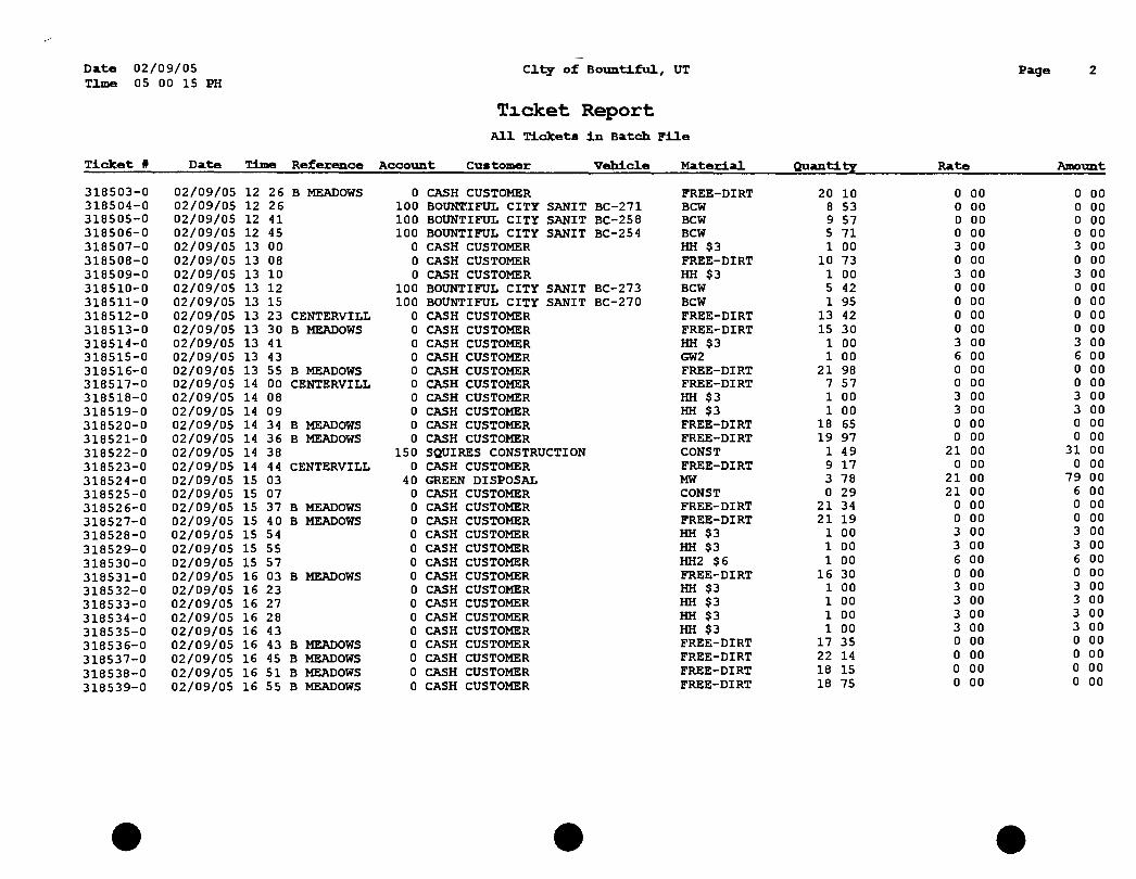
Date 02/09/05 TlzDe 05 00 15 PH
Clt7 of Boimti ful , UT
Ticket Report A l l T i c k e t s I n Batch F i l e
Page
T i c k e t # Date Time Reference Account tcount Customer V e h i c l e M a t e r i a l Q u a n t i t y Rate Amount
0 CASH CUSTOMER FREE-DIRT 20 10 0 00 0 00 100 BoxnrriFUL C I T Y SANIT BC-271 BCW 8 53 0 00 0 00 100 BOUNTIFUL CITY SANIT BC-258 BCW 9 57 0 00 0 00 100 BOUNTIFUL CITY SANIT BC-254 BCW 5 71 0 00 0 00 0 CASH CUSTOMER HH $3 1 00 3 00 3 00 0 CASH CUSTOMER FREE-DIRT 10 73 0 00 0 00 0 CASH CUSTOMER HH $3 1 00 3 00 3 00
100 BOUNTIFUL CITY SANIT BC-273 BCW 5 42 0 00 0 00 100 BOUNTIFUL CITY SANIT BC-270 BCW 1 95 0 00 0 00 0 CASH CUSTOMER FREE-DIRT 13 42 0 00 0 00 0 CASH CUSTOMER FREE-DIRT 15 30 0 00 0 00 0 CASH CUSTOMER HH $3 1 00 3 00 3 00 0 CASH CUSTOMER GW2 1 00 6 00 6 00 0 CASH CUSTOMER FREE-DIRT 21 98 0 00 0 00 0 CASH CUSTOMER FREE-DIRT 7 57 0 00 0 00 0 CASH CUSTOMER HH $3 1 00 3 00 3 00 0 CASH CUSTOMER HH $3 1 00 3 00 3 00 0 CASH CUSTOMER FREE-DIRT 18 65 0 00 0 00 0 CASH CUSTOMER FREE-DIRT 19 97 0 00 0 00
150 SQUIRES CONSTRUCTION CONST 1 49 21 00 31 00 0 CASH CUSTOMER FREE-DIRT 9 17 0 00 0 00
40 GREEN DISPOSAL MW 3 78 21 00 79 00 0 CASH CUSTOMER CONST 0 29 21 00 6 00 0 CASH CUSTOMER FREE-DIRT 21 34 0 00 0 00 0 CASH CUSTOMER FREE-DIRT 21 19 0 00 0 00 0 CASH CUSTOMER HH $3 1 00 3 00 3 00 0 CASH CUSTOMER HH $3 1 00 3 00 3 00 0 CASH CUSTOMER HH2 $6 1 00 6 00 6 00 0 CASH CUSTOMER FREE-DIRT 16 30 0 00 0 00 0 CASH CUSTOMER HH $3 1 00 3 00 3 00 0 CASH CUSTOMER HH $3 1 00 3 00 3 00 0 CASH CUSTOMER HH $3 1 00 3 00 3 00 0 CASH CUSTOMER HH $3 1 00 3 00 3 00 0 CASH CUSTOMER FREE-DIRT 17 35 0 00 0 00 0 CASH CUSTOMER FREE-DIRT 22 14 0 00 0 00 0 CASH CUSTOMER FREE-DIRT 18 15 0 00 0 00 0 CASH CUSTOMER FREE-DIRT 18 75 0 00 0 00
318503- 0 318504- 0 318505- 0 318506- 0 318507- 0 318508- 0 318509- 0 318510- 0 318511- 0 318512- 0 318513- 0 318514- 0 318515- 0 318516- 0 318517- 0 318518- 0 318519- 0 318520- 0 318521- 0 318522- 0 318523- 0 318524- 0 318525- 0 318526- 0 318527- 0 318528- 0 318529- 0 318530- 0 318531- 0 318532- 0 318533- 0 318534- 0 318535- 0 318536- 0 318537- 0 318538- 0 318539- 0
02/09/05 02/09/05 02/09/05 02/09/05 02/09/05 02/09/05 02/09/05 02/09/05 02/09/05 02/09/05 02/09/05 02/09/05 02/09/05 02/09/05 02/09/05 02/09/05 02/09/05 02/09/05 02/09/05 02/09/05 02/09/05 02/09/05 02/09/05 02/09/05 02/09/05 02/09/05 02/09/05 02/09/05 02/09/05 02/09/05 02/09/05 02/09/05 02/09/05 02/09/05 02/09/05 02/09/05 02/09/05
12 26 12 26 12 41 12 45 13 00 13 08 13 10 13 12 13 15 13 23 13 30 13 41 13 43 13 55 14 00 14 08 14 09 14 34 14 36 14 38 14 44 15 03 15 07 15 37 15 40 15 54 15 55 15 57 16 03 16 23 16 27 16 28 16 43 16 43 16 45 16 51 16 55
B MEADOWS
CENTERVILL B MEADOWS
B MEADOWS CENTERVILL
B MEADOWS B MEADOWS
CENTERVILL
B MEADOWS B MEADOWS
B MEADOWS
B MEADOWS B MEADOWS B MEADOWS B MEADOWS
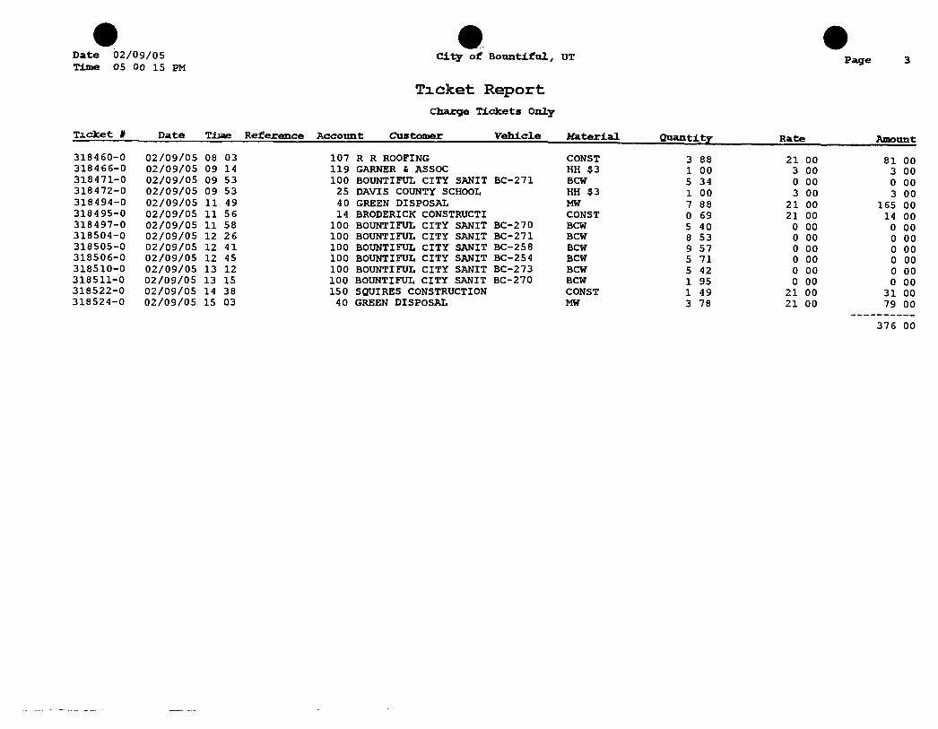
Date 02/09/05 Time 05 Oo 15 PM
ca.ty of Bou n t i f u l , UT
Ticket Report Charge Tickets Only
Page
T i c k e t # Date TJjae Reference Account Customer Vehicle Katerial Quantity Rate Amount
318460-0 02/09/05 08 03 107 R R ROOFING CONST 3 88 21 00 81 00 318466-0 02/09/05 09 14 119 GARNER & ASSOC HH $3 1 00 3 00 3 00 318471-0 02/09/05 09 53 100 BOUNTIFUL CITY SANIT BC-271 BCW 5 34 0 00 0 00 318472-0 02/09/05 09 53 25 DAVIS COUNTY SCHOOL HH $3 1 00 3 00 3 00 318494-0 02/09/05 11 49 40 GREEN DISPOSAL MW 7 88 21 00 165 00 318495-0 02/09/05 11 56 14 BRODERICK CONSTRUCTI CONST 0 69 21 00 14 00 318497-0 02/09/05 11 58 100 BOUNTIFUL CITY SANIT BC-270 BCW 5 40 0 00 0 00 318504-0 02/09/05 12 26 100 BOUNTIFUL CITY SANIT BC-271 BCW 8 53 0 00 0 00 318505-0 02/09/05 12 41 100 BOUNTIFUL CITY SANIT BC-258 BCW 9 57 0 00 0 00 318506-0 02/09/05 12 45 100 BOUNTIFUL CITY SANIT BC-254 BCW 5 71 0 00 0 00 318510-0 02/09/05 13 12 100 BOUNTIFtJL CITY SANIT BC-273 BCW 5 42 0 00 0 00 318511-0 02/09/05 13 15 100 BOUNTIFUL CITY SANIT BC-270 BCW 1 95 0 00 0 00 318522-0 02/09/05 14 38 150 SQUIRES CONSTRUCTION CONST 1 49 21 00 31 00 318524-0 02/09/05 15 03 40 GREEN DISPOSAL MW 3 78 21 00 79 00
376 00
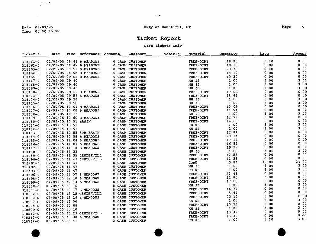
D a t e
Time 02/09/05 05 00 15 PM
City of Bountiful, UT
Ticket Report Cash Tickets Only
Page
T i c k e t # Date Tome Reference Account Customer Vehicle Material Q u a n t i t y Rate Amount
318461-0 02/09/05 08 46 B MEADOWS 0 CASH CUSTOMER FREE-DIRT 19 90 0 00 0 00 318462-0 02/09/05 08 47 B MEADOWS 0 CASH CUSTOMER FREE-DIRT 19 18 0 00 0 00 318463-0 02/09/05 08 52 B MEADOWS 0 CASH CUSTOMER FREE-DIRT 20 76 0 00 0 00 318464-0 02/09/05 08 58 B MEADOWS 0 CASH CUSTOMER FREE-DIRT 18 10 0 00 0 00 318465-0 02/09/05 09 03 B MEADOWS 0 CASH CUSTOMER FREE-DIRT 19 30 0 00 0 00 318467-0 02/09/05 09 40 0 CASH CUSTOMER HH $3 1 00 3 00 3 00 318468-0 02/09/05 09 40 0 CASH CUSTOMER HH $3 1 00 3 00 3 00 318469-0 02/09/05 09 43 0 CASH CUSTOMER HH $3 1 00 3 00 3 00 318470-0 02/09/05 09 52 B MEADOWS 0 CASH CUSTOMER FREE-DIRT 17 06 0 00 0 00 318473-0 02/09/05 09 56 B MEADOWS 0 CASH CUSTOMER FREE-DIRT 15 63 0 00 0 00 318474-0 02/09/05 09 58 0 CJVSH CUSTOMER HH $3 1 00 3 00 3 00 318475-0 02/09/05 09 58 0 CASH CUSTOMER HH $3 1 00 3 00 3 00 318476-0 02/09/05 10 01 B MEADOWS 0 CASH CUSTOMER FREE-DIRT 13 09 0 00 0 00 318477-0 02/09/05 10 08 B MEADOWS 0 CASH CUSTOMER FREE-DIRT 11 91 0 00 0 00 318478-0 02/09/05 10 12 0 CASH CUSTOMER HH $3 1 00 3 00 3 00 318479-0 02/09/05 10 50 B MEADOWS 0 CASH CUSTOMER FREE-DIRT 22 57 0 00 0 00 318480-0 02/09/05 10 51 BASIN 0 CASH CUSTOMER FREE-DIRT 14 60 0 00 0 00 318481-0 02/09/05 10 51 0 CASH CUSTOMER HH $3 1 00 3 00 3 00 318482-0 02/09/05 10 51 0 CASH CUSTOMER HH $3 1 00 3 00 3 00 318483-0 02/09/05 10 55 5TH BASIN 0 CASH CUSTOMER FREE-DIRT 12 84 0 00 0 00 318484-0 02/09/05 10 58 B MEADOWS 0 CASH CUSTOMER FREE-DIRT 20 14 0 00 0 00 318485-0 02/09/05 11 04 B MEADOWS 0 CASH CUSTOMER FREE-DIRT 17 11 0 00 0 00 318486-0 02/09/05 11 07 B MEADOWS 0 CASH CUSTOMER FREE-DIRT 16 51 0 00 0 00 318487-0 02/09/05 11 18 B MEADOWS 0 CASH CUSTOMER FREE-DIRT 19 97 0 00 0 00 318488-0 02/09/05 11 32 0 CASH CUSTOMER HH $3 1 00 3 00 3 00 318489-0 02/09/05 11 35 CENTERVILL 0 CASH CUSTOMER FREE-DIRT 12 56 0 00 0 00 318490-0 02/09/05 11 43 CENTERVILL 0 CASH CUSTOMER FREE-DIRT 13 32 0 00 0 00 318491-0 02/09/05 11 47 0 CASH CUSTOMER COMP 0 81 30 00 24 00 318492-0 02/09/05 11 47 0 CASH CUSTOMER HH $3 1 00 3 00 3 00 318493-0 02/09/05 11 47 0 CASH CUSTOMER HH $3 1 00 3 00 3 00 318496-0 02/09/05 11 57 B MEADOWS 0 CASH CUSTOMER FREE-DIRT 23 42 0 00 0 00 318498-0 02/09/05 12 10 B MEADOWS 0 CASH CUSTOMER FREE-DIRT 21 80 0 00 0 00 318499-0 02/09/05 12 14 B MEADOWS 0 CASH CUSTOMER FREE-DIRT 17 03 0 00 0 00 318500-0 02/09/05 12 16 0 CASH CUSTOMER HH $3 1 00 3 00 3 00 318501-0 02/09/05 12 17 B MEADOWS 0 CASH CUSTOMER FREE-DIRT 16 77 0 00 0 00 318502-0 02/09/05 12 25 CENTERVILL 0 CASH CUSTOMER FREE-DIRT 5 69 0 00 0 00 318503-0 02/09/05 12 26 B MEADOWS 0 CASH CUSTOMER FREE-DIRT 20 10 0 00
3 m o n o
c
00 00 00 00 00 00 00
318507-0 02/09/05 13 00 0 CASH CUSTOMER HH $3 1 00 3 00
3 m o n o
c
00 00 00 00 00 00 00
318508-0 02/09/05 13 08 0 CASH CUSTOMER FREE-DIRT 10 73 0 00
3 m o n o
c
00 00 00 00 00 00 00
318509-0 02/09/05 13 10 0 CASH CUSTOMER HH $3 1 00 3 00
3 m o n o
c
00 00 00 00 00 00 00
318512-0 02/09/05 13 23 CENTERVILL 0 CASH CUSTOMER FREE-DIRT 13 42 0 00
3 m o n o
c
00 00 00 00 00 00 00
318513-0 02/09/05 13 30 B MEADOWS 0 CASH CUSTOMER FREE-DIRT 15 30 0 3
00 00
u -J
00 00 00 00 00 00 00 318514-0 02/09/05 13 41 0 CASH CUSTOMER HH $3 1 00
0 3
00 00 J
00 00 00 00 00 00 00
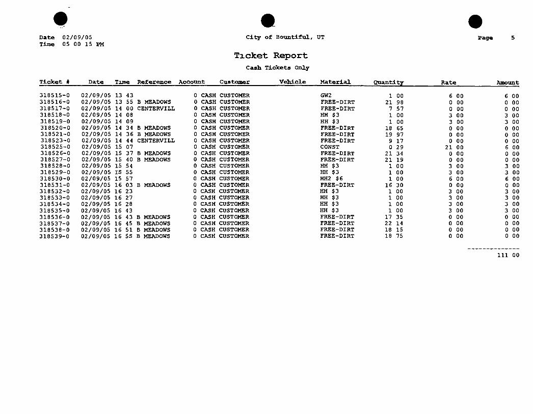
Date Time
02/09/05 05 00 15 PM
C i t y o f B o u n t i f u l , UT
Ticket Report Cash T i c k e t s Only
Page
T i c k e t # Date Tune Reference Account Customer Vehicle Material Q u a n t i t y Rate Amount
318515-0 02/09/05 13 43 0 CASH CUSTOMER GW2 1 00 6 00 6 00 318516-0 02/09/05 13 55 B MEADOWS 0 CASH CUSTOMER FREE-DIRT 21 98 0 00 0 00 318517-0 02/09/05 14 00 CENTERVILL 0 CASH CUSTOMER FREE-DIRT 7 57 0 00 0 00 318518-0 02/09/05 14 08 0 CASH CUSTOMER HH $3 1 00 3 00 3 00 318519-0 02/09/05 14 09 0 CASH CUSTOMER HH $3 1 00 3 00 3 00 318520-0 02/09/05 14 34 B MEADOWS 0 CASH CUSTOMER FREE-DIRT 18 65 0 00 0 00 318521-0 02/09/05 14 36 B MEADOWS 0 CASH CUSTOMER FREE-DIRT 19 97 0 00 0 00 318523-0 02/09/05 14 44 CENTERVILL 0 CASH CUSTOMER FREE-DIRT 9 17 0 00 0 00 318525-0 02/09/05 15 07 0 CASH CUSTOMER CONST 0 29 21 00 6 00 318526-0 02/09/05 15 37 B MEADOWS 0 CASH CUSTOMER FREE-DIRT 21 34 0 00 0 00 318527-0 02/09/05 15 40 B MEADOWS 0 CASH CUSTOMER FREE-DIRT 21 19 0 00 0 00 318528-0 02/09/05 15 54 0 CASH CUSTOMER HH $3 1 00 3 00 3 00 318529-0 02/09/05 IS 55 0 CASH CUSTOMER HH $3 1 00 3 00 3 00 318530-0 02/09/05 15 57 0 CASH CUSTOMER HH2 $6 1 00 6 00 6 00 318531-0 02/09/05 16 03 B MEADOWS 0 CASH CUSTOMER FREE-DIRT 16 30 0 00 0 00 318532-0 02/09/05 16 23 0 CASH CUSTOMER HH $3 1 00 3 00 3 00 318533-0 02/09/05 16 27 0 CASH CUSTOMER HH $3 1 00 3 00 3 00 318534-0 02/09/05 16 28 0 CASH CUSTOMER HH $3 1 00 3 00 3 00 318535-0 02/09/05 16 43 0 CASH CUSTOMER HH $3 1 00 3 00 3 00 318536-0 02/09/05 16 43 B MEADOWS 0 CASH CUSTOMER FREE-DIRT 17 35 0 00 0 00 318537-0 02/09/05 16 45 B MEADOWS 0 CASH CUSTOMER FREE-DIRT 22 14 0 00 0 00 318538-0 02/09/05 16 51 B MEADOWS 0 CASH CUSTOMER FREE-DIRT 18 15 0 00 0 00 318539-0 02/09/05 16 SS B MEADOWS 0 CASH CUSTOMER FREE-DIRT 18 75 0 00 0 00
111 00
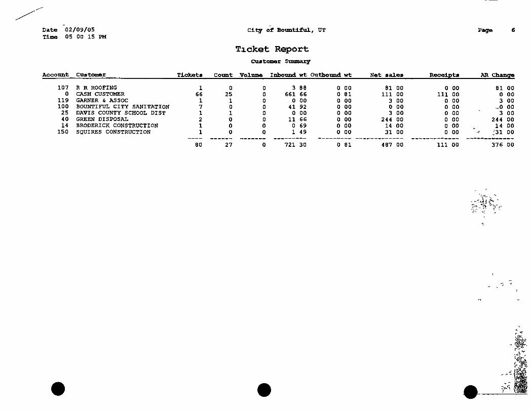
Date 02/09/05 City of Bountiful, UT Page Time 05 00 15 PM
Ticket Report CMstomer Stmnary
unt Customer Tickets Count Volume Inbound wt Outbound wt Net sales Receipts AR Change
107 R R ROOFING 1 0 0 3 88 0 00 81 00 0 00 81 00 0 CASH CUSTOMER 66 25 0 661 66 0 81 111 00 111 00 0 00
119 GARNER & ASSOC 1 1 0 0 00 0 00 3 00 0 00 3 00 100 BOUNTIFUL CITY SANITATION 7 0 0 41 92 0 00 0 00 0 00 ^0 00 25 DAVIS COUNTY SCHOOL DIST 1 1 0 0 00 0 00 3 00 0 00 3 00 40 GREEN DISPOSAL 2 0 0 11 66 0 00 244 00 0 00 244 00 14 BRODERICK CONSTRUCTION 1 0 0 0 69 0 00 14 00 0 00 14 00
150 SQUIRES CONSTRUCTION 1 0 0 1 49 0 00 31 00 0 00 j31 00
80 27 0 721 30 0 81 487 00 111 00 376 00
. IP
Date Time
02/09/05 05 00 15 PM
City of Bountiful, UT
Ticket Report Material Summary
^ Page- ' > '•7
Material D e s c r i p t i o n Tickets Count VolTima Inbound wt Outbound wt Net sales Receipts AR Change
CONST C o n s t r u c t i o n mat 4 0 0 6 35 0 00 132 00 6 00 • 126 00 FREE-DIRT CITY HAULING 39 0 0 661 37 0 00 0 00 0 00 ' , 0 00 HH $3 House Hold $3 25 25 0 0 00 0 00 75 00 69 00 6 00 BCW B o u n t i f u l Waste 7 0 0 41 92 0 00 0 00 0 00 0 00 COMP Compost w/out sludge 1 0 0 0 00 0 81 24 00 24 00 0 00 MW Mixed Waste 2 0 0 11 66 0 00 244 00 0 00 ' - -,244 00 GW2 $6 00 Green Waste 1 1 0 0 00 0 00 6 00 6 00 ^iT"^' 0 00 HH2 $6 House Hold 1 1 0 0 00 0 00 6 00 6 00 0 00
80 27 0 721 30 0 81 487 00 111 00 376 00
Po Bo^ 36<' BOUNTIFUL SANITARY LANDFILL B o u n t i f u l , Utah S< Oi 1-0369
000000 CASH CUSTOMER
/"SITE TICKET GRID
oa oooeio WEIGHMASTER
GEORSIA DATE IN TIME IN
O ^ t / 1 3 / 9 8 13 DATE OUT TIME OUT
0 4 / 1 3 / 9 8 \
13 y
r VEHICLE ROLL OFF
1 ! REFEnENCE . ORIGIN
QTY UNIT DESCRIPTION RATE EXTENSION FEE TOTAL
1 00 IIACH *3 Oo Breen Waste 3 00 3 OO O {)() 3 oo
Summer Hours from Apr 1 to Nov 1 Winter Hours from Nov 1 to Apr 1 -
8 00 a m - 8 OO a m
t o 6 OO a t o 5 00 p
3 OO TENDERED
OO CHANGE
E o n CHECK NO
SIGNATURE
uQi' ' it-LL ti uTh ' y r J
Biibfli ifUL L' rt." i»jo9
8ILL lO t LflJH ClJ-TOMEl.
ywhiclv- ID Fi»r<^reiicf
DftlE IN 02/10'2005 TIME IN 08 39 09 DATE OUT S2/10/20BS Tlht OUT 08 39
INBOUND TTCKhl Number 32-318540
:TORED Qv f' WT
:T0RED TAPE UT
NET WEIGHT
0 LB
0 LB
0 LB
QtLj Df.-criDtiori 1 00 Hou^M Hold $3
NET Cft''H AMOUNT
ftmount 3 08
3 00
'•0 )' ' i U,- 'JTMH y3 7
y luh t d ]31Tit
B LL TC 1.7 r R to " l U .
i,M-.-rlP ID
uPiE IN £7/llo/205!'o UrtF IN C9 03 56 LMlt OUT 82/16/200S TIKE OUT 0? 16
INBOUND TILKtl "dia'-.-*' a2-3ia543
"LfLE 1 uFO": UT 19260 LB
^LflLE 2 TftRE yT 9i4e LB
NET UEIGHT 10120 LB
Qty Df r r r ip i ion flmount 5 06 Construi Hon K I I 106 00
NET CHURGE ftHOUNT 106 00
NOTICE !
RANDOM WASTE SCREENING IS PRACTICED HERE!
WE RESERVE THE RIGHT TO INSPECT ANY LOAD OR PORTION OF A LOAD ARRIVING AT
OUR FACILITY.
WE WILL REJECT ALL: HAZARDOUS WAST
PCBs UQUIDS
RADIOACTIVE WASTE AND
ANY WASTES DETERMINED UNACCEPTABLE BY OUR MANAGEI\flENT!
YOUR PARTICIPATION IN THIS PROGRAM IN NOT OPTIONAL!
Random Load Inspection Record
INSPECTION INFORMATION
Inspector s Name Date of Inspection Time of Inspection Facility Name
TRANSPORTATION COMPANY INFORMATION
Name Address
Phone #
VEHICLE INFORMATION
Dnver's Name Vehicle Type Vehicle License # Vehicle s Last Stop Vehicle Contents
OBSERVATIONS AND ACTIONS TAKEN
Photo Documentation Yes No
Dover s Signature* Date
Inspector s Signature Date
* Driver's signature heron denotes His presence dunng the inspection and does not admit, confirm or identity liability
BOUNTIFUL CITY SANITARY LANDFILL
Routine Waste Inspection Form
Date
Truck Type
Hauler
Source of Material
Time
License/T ruck #
Other Information
Waster Composition
Composition Percent by Volume (estimated)
Food Wastes
Paper/Cardboard
Plastics
Textiles/Rubber/Leather
Dirt/Ashes/Brick
Vegetative Wastes
Wood ,
Glass
Metals
Household Hazardous Waste
Tires
Drywall
Other Hazardous Wastes
Comments
Inspector Signature
Date
LOAD ENSPECTION REPORT
DATE
Random Inspection Suspicious Load_
Waste Hauler
Waste Generator
Approx Volume
Load Contents
Comments
Load Accepted
Load Rejected _
Inspector
Inspector Signature
BOUNTIFUL SANITARY LANDFILL QUARTERLY INSPECTION REPORT
Date
Groundwater Monitoring system Locks Protective Covers_ Guard Posts Total depths Other
Methane Monitoring System Equipment Calibration
Equipment Operation_
Other
Runoff retention system Berm Condition
Runoff Transport Ditch Condition_
Erosion Concems
Topsoil and vegetation condition_
Other
Deviations from approved plan of operation
Other Comments
BOUNTIFUL SANITARY LANDFILL METHANE GAS MONITORING
DATE
Office
Office
Shop
Shop
Scale House
North Boundary
South Boundary
East Boundary
West Boundary
Well DC-1
Well DC-2
Well DC-3
Well DC-4
Well JMM-1
Well JMM-2
Well JMM-3
Well JMM-4
Well JMM-5
Well JMM-6
Well JMM-7
Well JMM-8
Well BSL-1
Well BSL-2
Well BSL-3
Inspector(s).
Drainage System inspection Form Bountiful Sanitary Landfill
^Date
Current Weather Conditions Last 24 Hours
OK Not OK Condition, Corrective Action, General Notes Site Access Site Access Site Access Site Access Site Access
Soil Stabilization Soil Stabilization Soil Stabilization Soil Stabilization Soil Stabilization
Slope Protection Slope Protection Slope Protection Slope Protection Slope Protection
Conveyances Stable Conveyances Stable Conveyances Stable Conveyances Stable Conveyances Stable
Water Management Water Management Water Management Water Management Water Management
Outlet Protection Outlet Protection Outlet Protection Outlet Protection Outlet Protection
Drainage System Inspection Form Bountiful Sanitary Landfill
OK Not OK Condition, Corrective Action, General Notes Stormwater Detention
And Monitoring Stormwater Detention
And Monitoring Stormwater Detention
And Monitoring Stormwater Detention
And Monitoring Stormwater Detention
And Monitoring
Maintenance Maintenance Maintenance Maintenance Maintenance
Dust Control Dust Control Dust Control Dust Control Dust Control
Spill Prevention Spill Prevention Spill Prevention Spill Prevention Spill Prevention
Condition of Discharge Water
Condition of Discharge Water
Condition of Discharge Water
Condition of Discharge Water
Condition of Discharge Water
Comments
IDENTmCATION & LOCATION
STORMWATER DISCHARGE MONITORING REPORT (SWDMR) (For additional forms copy this foiro or contact the DWQ)
Name PenmtNo UTR
Maihng Address Location (if different)
Momtonng Penod
From Month Day. -Year. To Month .Day. Year
Total Storm Water Discbarge Points, Number assigned to this Discharge Point_
INDUSTRY SECTOR(S)
Industnal Activities or Industry Sector(s) Drained by this Discharge A Timber Products Facilities B Paper and Allied Products Manufactunng
Facilities C Chemical and Allied Products
Manufactunng Facilities D Asphalt Paving Roofing Matenals and
Lubncant Manufactunng Facilities E Glass Clay Cement, Concrete and Gypsum
Product Manufactunng Facilities F Pnmaiy Metals Facilities G Metal Mines (Ore Mining and Dressing) H Coal Mmes and Coal Mme-Related
Facilities I Oil or Gas Extraction Facilities J Mmerai Mining and Processmg Facilities K Hazardous Waste Treatment Storage or
Disposal Facilities L Landfills and Land Application Sites M Automobile Salvage Yards N Scrap Recycling and Waste Recycling
Facilities O Steam Electnc Power Generating Facilities P Motor Freight Transportation Facilities
Passenger Transportation Facilities, Petroleum Bulk Oil Stations and Terminals the Umted States Postal Service or Railroad Transportation Facilities
Q Vehicle Maintenance Areas and Equipment
R. S
T U V
W
X. Y
Z AA
AB
AC
AD
Cleamng Areas of Water Transportation Facilities Ship or Boat Buildmg and Repair Yards Vducle Mamtenance Areas, Equipment Cleanmg Areas or Airport Deicing Operations located at Air Transportation Facilities Wastewater Treatment Works Food and Kmdred Products Facilities Textile Mills, Apparel and other Fabnc Product Manufactunng Facilities Furniture and Fixture Manufactunng Facilities Prmtmg and Pubhshmg Facilities Rubber and Miscellaneous Plastic Product Manufactunng Facihties Leather Tannmg and Fmishmg Facilities Facihties That Manufacture Metal Products includmg Jewelry, Silverware and Plated Ware Facilities That Manufacture Transportation Equipment, Industnal or Commercial Machmery Facihties That Manufacture Electronic and Electncal Equipment and Components, Photographic and Optical Goods Non-Classified Facilities
ANALYTICAL MONITORING DATA (For sectors where II a rtquu-ed)
Storm Event All samples shall be collected from the discharge resulting from a storm event that is greater than 0 I inches in magnitude and that occurs at least 72 hours from the previously measurable (greater than 01 inch rainfall) storm event This data must be submitted to the Dmslon of Water Quality
Date of Storm Event Month Day Year
Duration of Storm Event Hours 1
Ram Fall Measurement Inches |
Time Elapsed Between Recorded & Previous Storm Event Days
Estimated Total Volume of Discharge (include umts gal f f etc)
Please check if there has been no discharge of Storm Water dunng t (If none please explain m comment section)
us reportmg penod | No Discharge
Sample Type Data shall be reported for a grab sample taken durmg the first thirty minutes cf the discharge. If the collection of a grab sample durmg the first thirty minutes is impracticable a grab sample can be taken durmg the first hour of the discharge and the discharger shall submit with the monitoring report a description of why a grab sample durmg the first thirty minutes was impracticable
Parameter Effluent Limit {If Applicable)
Concentration (Concentration quantity for example 14 2)
Units (Example mg/L) |
1
SIGNATURE
Name/Title Principle Executive Officer (Typed or Pnnted)
I certify under penalty o/law that this document and all attachments were prepared under my direction or supervision m accordance with a system designed to assure that qualified personnel property gathered and evaluated the information submitted Based on my inquiry ofthe person or persons who manage the system or those persons directly responsible for gathering the information the information submitted is to the best of my knowledge and belief true accurate and complete I am aware that there are significant penalties for submitting false information including the possibility offine and imprisonmentfor knowing violations SeelSUSC 1001 and 33USC 1319 (penalties under these statues may include fines up to SI0 000 and or maximum unpnsonment of between 6 months aid 5 years)
Signature of Principle Executive Officer or Authonzed Agent
Date
Comments
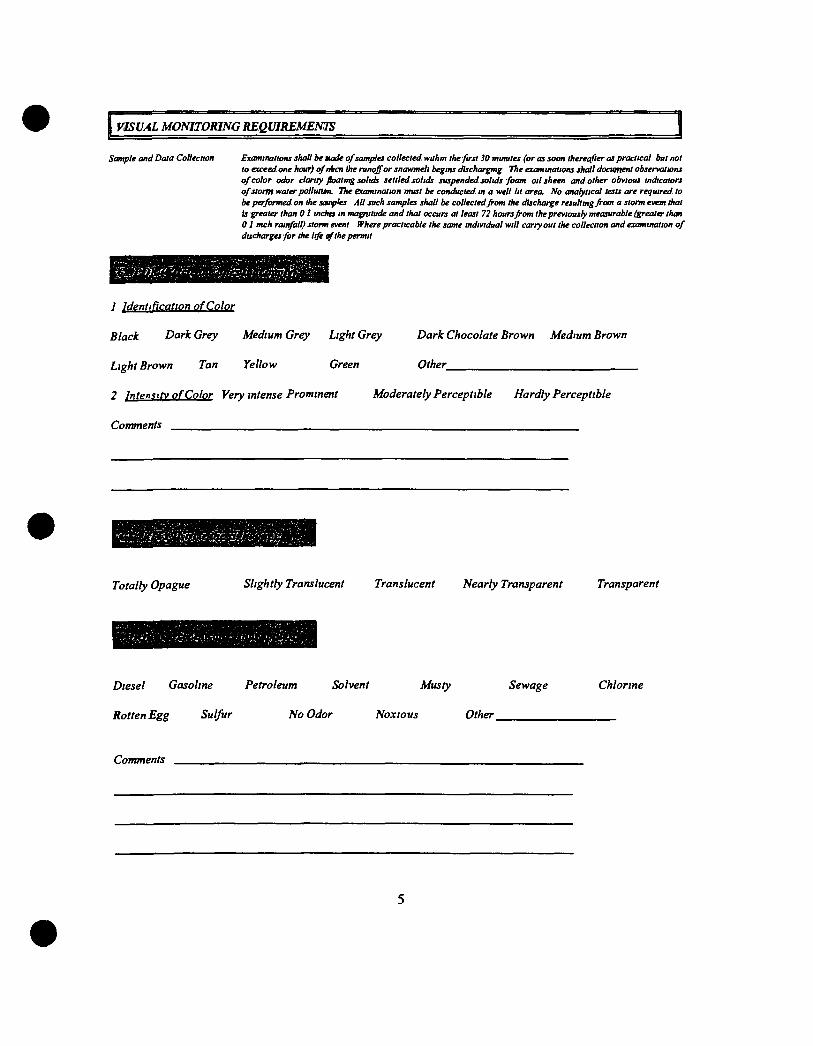
VISUAL MONITORING REQUIREMENTS
Sample and Data Collection Examinations shall be made of samples collected withm the first 30 minutes (or as soon thereafter as practical but not to exceed one hour) cf nfccn Ike runoff or snawmell begins dischargmg The examinations shall document observations of color odor clarity foatmg solids settled solids suspended solids foam oil sheen and other obvious indicators of storm water pollutum. The examination must be conducted in a well lit area. No analytical tests are required to be performed on the sauries All such samples shall be collected from the discharge resultingfrom a storm evem that Is greater than 01 incha in magnitude and that occurs at least 72 hours from the previously measurable (greater than 01 mch rainfall) storm event Where practicable the same individual will carry out the collection and examination of discharges for the life ^ the permit
'•iVZi!i'i)>(iZ^
1 Identification of Color
Black Dark Grey Medium Grey Light Grey
Light Brown Tan Yellow Green
2 lr\tp.n.iitv of Color Very intense Prominent Moderately Perceptible Hardly Perceptible
Comments
Dark Chocolate Brown Medium Brown
Other
Totally Opague Slightly Translucent Translucent Nearly Transparent Transparent
Diesel Gasoline Petroleum Solvent Musty Sewage
Rotten Egg Sulfur No Odor Noxious Other
Chlorine
Comments
Floating Solids (Descnption)
Suspended and Settled Solids (Description)
Appendix E
Equipment List
EQUIPMENT REPLACEMENT TIME TABLE
TRUCK NO YEAR DESCRIPTION 2011 2012 2013 2014 2015_
28 000
570 000 - - - _
145 000
2201 2000 Chev 4X4 (Used) 2217 1986 F o r d Water Tank 2247 2000 John Deere F r o n t Loader 2280 1989 C a t e r p i l l a r Compactor 2284 1995 C a t e r p i l l a r T r a c k Dozer 2285 1999 CEC S c r e e n - I t I I 2288 1998 C a t e r p i l l a r Loader 2289 1992 K o b e l c o E x c a v a t o r - 1995 Hotsy Steam C l e a n e r - 1987 Dearborn A i r Compressor - F a i r b a n k s M o r r i s S c a l e
2240 1995 JCB Backhoe 2253 1999 V o l v o A u t o Car/2000 ODE Leaf 2261 1994 Mack 10-wheel Dump 2265 1991 F o r d 10-wheel Dump 2266 1995 F o r d 10-wheel Water T r u c k 2267 1996 V o l v o A u t o Car 10-wheel Dump 2610 2002 F o r d F-450 Dump Tr u c k 2611 2009 F o r d One Ton F l a t b e d 2670 2006 John Deere 200CLC E x c a v a t o r 2680 2000 CAT 826G Compactor
YEARLY TOTALS
100 000
45 000
570 000 - 128,000 190,000
Appendix F
Training Certificates and Records
SWANA SOLID WASTE ASSOCIATION
i No ih Am c
SyNANAm^ This is to certify that
Gary Blowers has met the Solid Waste Association of North America's eligibility requirements
and passed a comprehensive examination. Therefore SWANA hereby designates Gary Blowers as a:
Certified Landfill Manager As of 04/21/2005 until 04/21/2011
Certification No. 81500 ^ ^ ^^ 4 c S ^ - ^
John A Skinner Executive Director and CEO

SWANA SWANA C E H f i This is to certify that
SOLID WASTE ASSOCIATION ol No th Ame ca
Jim Wood has met the Solid Waste Association of North America's eligibility requirements
and passed a comprehensive examination. Therefore SWANA hereby designates Jim Wood as a:
Certified Landfill Manager As of 09/22/2004 until 09/22/2010
Certification No. 60517
John A Skinner Executive Director and CEO
& SWANA CERTIFICATION PROGRAM SWANA Continuing Education Unit (CEU) Report Form
WASTK0NZ008 • Tampa, Florida • October 19-23, 2008
o j j dXvv". ^"^g^^ig^ SWANA MEMBER ID B ^ ^ ^
SOI D M %n SSOCl HON
NAME
ORGANIZATION A .
ADDRESS 7 ^ 0 ^
CITY_Souviij:
100
STATE/PROVINCE \ A V ZIP CODE g ^ 0 | 0
fKk8o[ "Z-n ^0^3> EMAIL fgci^^ <g Ctl ui^l PHONE 30^ 6/'Z-5
Current Certif ications Held Bioreactor ^ _ Landfill Recycling Compost ing
Collection Transfer Station Construction & Demolition M S W Systems
This f o rm m a y on l y be s igned b y a representat ive of this c o u r s e / s e m m a r / s y m p o s i u m
Obtain a signature for each session you attend by a course/seminar/symposium representative at the end of
the course The signature is M A N D A T O R Y and affirms the attendance of the session(s) as applicable
Must attend the entire day to receive contact hours!
Instuctor/ Staff
Initials
COLL COMP C&D LF MSW RECYC TS BIO
Manager of Bioreactor Landfills 10 10 10 20 15 10 10 20
Management of Landfill Operations (MOLD) 10 10 10 30 10 10 10 15
Managing Construction and Demolition Materials 10 10 30 15 10 10 15 15
Managing MSW Transfer Stations 10 10 10 10 10 10 30 10
Pnnciples of Management in MSW Systems 10 10 10 10 30 10 10 10
Managing MSW Collection Systems 30 10 10 10 10 15 10 10
Managing Composting Programs 10 30 10 10 10 15 10 10
HHW & CESOG Facility Operations
15 15 15 15 15 15 15 15
Landfill Gas System Operation and Maintenance
5 5 20 20 5 5 5 10
Renewable Energy Credits and Greenhouse Gas Offsets 101 5 CEUs Available for ALL Certification
5 CEUs Available for ALL Certification
5 CEUs Available for ALL Certification
u t*J7. Ca^c^^c,
5 CEUs Available for ALL Certification
Thursday Conference Sessions 5 CEUs Available for ALL Certification 1 Facility Tours 5 CEUs Available for ALL Certification
Mail or fax this completed form to the Certification Coordinator at P O Box 7219 Silver Spring Maryland 20907 7219 fax (301) 589 7068 If you have any questions please call 1 - 8 0 0 G O S W A N A
or email c e r M s w a n a o r g Visit our homepage at wvsrw S W A N A o r g
I M P O R T A N T - PLEASE R E A D You may opply for recertification upon completion of your 30 hours of continuing education
In order to recertify you will need to fill out o recertification application and submit it along with a recertification fee of >200 to S W A N A . To have a copy of the recertification application sent to you,
please call 1-SOD G O S W A N A Poge 18
SOI rO WASTE ASSOCMTION D( Norlh Amwl i This is to certifj^that
Todd^ef^imsen has met the Solid Waste^^so^ation of Noi:tir!?^^nc|'s eligibility requirements
and passed a com] ir ^ensive|x^miiiation. Therefore SWANA hereby iHesignates^rod CMTstensei^^a:
Certified LaiidlllJi golmic ^ Associate I msiof 02/16; 2006fumiff02/16/2Q09:
C^ertification No 83395 ^ - J . ^
JdliiiA Skintitr CxcciKivt Dircch)r and GEO
/ A t' I
SWANA l(f"""'!lf'!l
ACKNOWLEDGES THAT
Trevis Cabaness PARTICIPATED IN THE
TRAINING SANITARY LANDFILL OPERATING PERSONNEL ON-SITE
TRAINING COURSE
PRESENTED IN
St. George, UT
4-25-02
ACKNOWLEDGES THAT
John McCowen
PARTICIPATED IN THE
TRAINING SANITARY LANDFILL OPERATING PERSONNEL ON-SITE
TRAINING COURSE
PRESENTED IN
Sf. George, UT
4-25-02
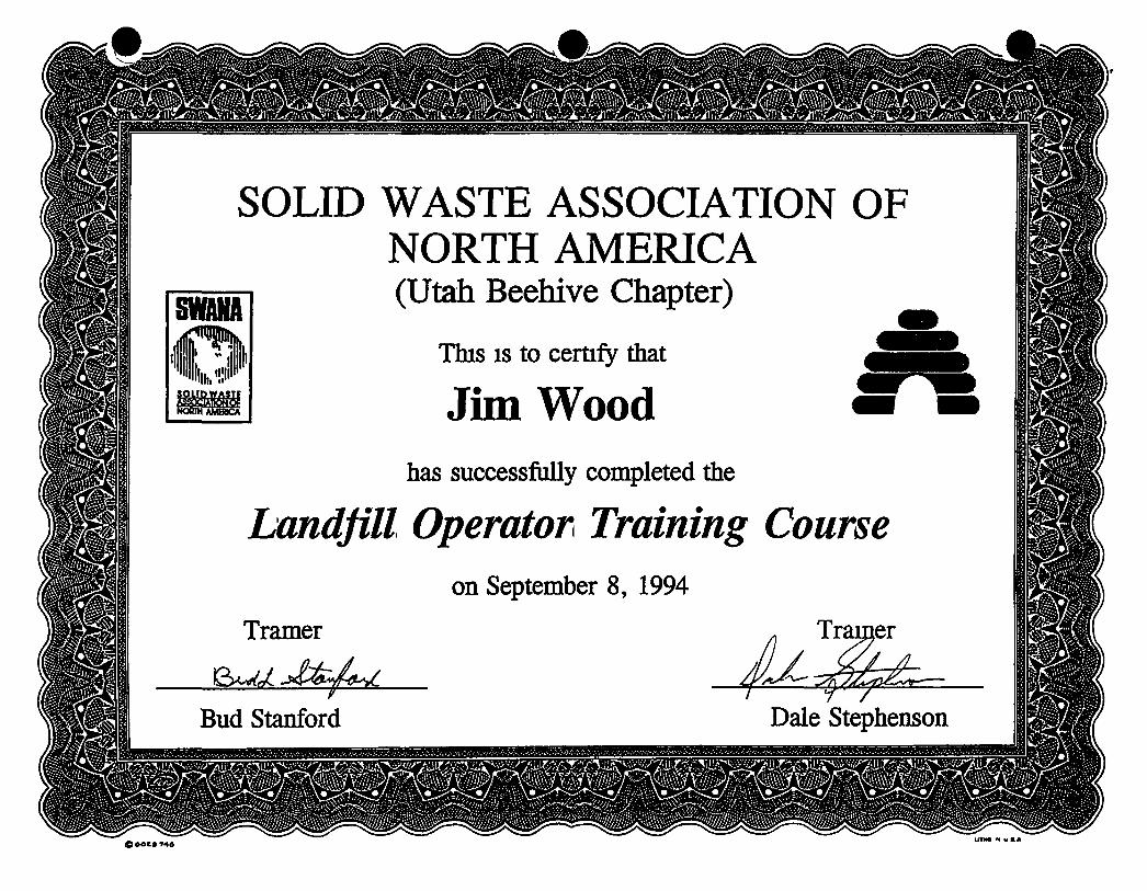
SOLID WASTE ASSOCIATION OF NORTH AMERICA (Utah Beehive Chapter)
This IS to certify that
Jim Wood has successfully completed the
Landfill Operator Training Course on September 8, 1994
Tramer
Bud Stanford Dale Stephenson
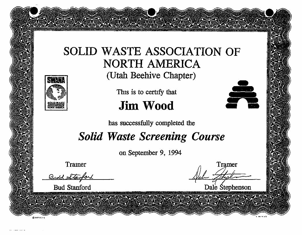
SOLID WASTE ASSOCIATION OF NORTH AMERICA (Utah Beehive Chapter)
This is to certify that
Jim Wood has successfully completed the
Solid Waste Screening Course on September 9, 1994
Trainer Tramer
Bud Stanford Dale Stephenson
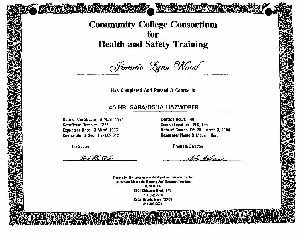
mill IfcVA <R<fllt 1^ '
Community College Consortium for
Health and Safety Training
Has Completed And Passed A Course In
40 HR SARA/OSHA HAZWOPER
Date of Certificate 3 March 1994 Certificate Number 1386 Expiration Date 3 March 1995 Course No & Sec Haz 002 042
Instructor
Contact Hours 40 Course Location SLC, Utah Date of Course. Feb 28 • March 3, 1994 Respirator Name & Model North
Program Director
Training for this program was developed and delivered by the. Hazardous Matenals Traimng And Research Institute
aCCJiS.T 6301 Kirkwood Blvd., SW
PO Box 2068 Cedar Rapids, Iowa 52406
319^98-567)
§8
i! 1 1
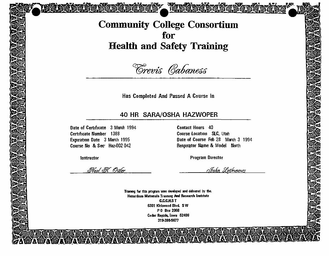
Community College Consortium for
Health and Safety Training
Has Completed And Passed A Course In
40 HR SARA/OSHA HAZWOPER
Date of Certificate 3 March 1994 Certificate Number 1388 Expiration Date 3 March 1995 Course No & Sec Haz-002 042
Instructor
Contact Hours 40 Course Location SLC, Utah Date of Course Feb 28 March 3 1994 Respirator Name & Model North
Program Director
Training for this program was developed and delivered by the. Hazardous Matenals Training And Research Institute
aaciLST 6301 Kirkwood Blvd. SW
P 0 Box 2068 Cedar Rapids, Iowa 52406
319-398-5677
Appendix G
Household Hazardous Waste
and
Recycling Programs
GET RID OF YOUR BAD STUFF FOR FREE!! Bountiful will be conducting a H O U S E H O L D H A Z A R D O U S W A S T E C O L L E C T I O N P R O G R A M
on SATURDAY, O C T O B E R 9th f rom 9 00 a m TO 3 00 p m at the City's Maintenance Facility, located at 950 South and 200 West in Bountiful
This IS a great chance to clean out your house and get nd of harmful chemicals and at the same time help the environment So bnng in any of the following, with exception of any DEA controlled medications
Antifreeze Batteries Car cleansers De-greasers Drain cleaners
Flea powder Floor waxes/cleaners Furniture polish Insecticides Lacquers
Laundry products Mothballs Oven cleaners Paints Paint thinners
Photographic chemicals Radiator flushes Rodent poison Silver cleaners Spot removers
Toilet bowl cleaners Waste motor oil Weed killers Window cleaners Wood preservatives
If you bring it in, we'll take it off your hands FREE, and properly dispose of it — you II be doing us a favor by keeping this matenal out of the landfill, and you'll be nd of old matenals that need to be specially disposed
FOR BOUNTIFUL RESIDENTS ONLY
HOUSEHOLD HAZARDOUS WASTE
HAZARDOUS WASTE IN YOUR HOME If asked what hazardous chemicals exist around your home, could you identify them"? We don t have to look
far to find everyday household products that contain hazardous chemicals We can find them in the form of weed killers, pesticides, paints, paint thinners, used motor oils, antifreeze, spot removers and oven cleaners Every household has these chemicals under the kitchen sink, stored in the basement or tn the garage
WHAT IS A HAZARDOUS WASTE? «l\ln order to adequately protect our environment, it is necessary to become familiar with what constitutes a iardous waste and the alternatives we have, as homeowners, in the proper management of the waste The
Environmental Protection Agency (EPA) considers a substance "hazardous" if it is no longer going to be used for Its intended purpose and exhibits any of the following charactenstics it is flammable, it can react with other chemicals giving off toxic gases or becomes explosive, it is corrosive, or if it is toxic to humans and animals
DANGERS OF IMPROPER DISPOSAL OF HOUSEHOLD HAZARDOUS WASTE Apart from the very important concerns of chemicals being properly stored in safe places away from children
is the growing concern of proper disposal It is obvious we can no longer dispose of these chemicals down sewers, storm drains or place them out for the weekly garbage collection Such disposal practices only add to the water and landfill pollution problem expenenced through improper disposal methods Additionally, disposal of household hazardous waste, in garbage, can cause harm to sanitation workers and explosions or fires if incompatible chemicals are mixed A common example of this is the mixing of chlonne and ammonia, giving off a toxic chloramine gas
DISPOSAL ALTERNATIVES AVAILABLE TO HOMEOWNERS Before throwing anything out, read the label and be sure to follow any directions given If no disposal
directions are available, see if you can locate the waste product on the easy reference chart provided in this brochure There may be chemicals for which no disposal alternatives exist at the present time if this is the case, contact the Bountiful Streets and Sanitation Department at 298-6175 for instructions on proper storage or for the location of the nearest household hazardous waste drop-off site
HOUSEHOLD HAZARDOUS WASTE REDUCTION To avoid future problems of disposing of hazardous chemicals you should—
1 Before buying a product, read the label making sure it will do what you want 2 Oo not buy more than you need This will avoid surplus and the need for future disposal 3 Try to purchase less toxic products or use alternatives to chemicals whenever possible
O
RECOMIVIENDED DISPOSAL METHODS FOR SMALL QUANTITIES OF HOUSEHOLD HAZARDOUS WASTE
PROOUCT/CHEMICAL HAZARDOUS INQREDIENTS/HAZARO DISPOSAL RECOMMENDATIONS BEST CHOICE 2ND CHOICE SUBSTITUTES/ALTERNATIVES
Spfays Fluorocarbons Hydrocarlx>n$/ Toxic Flammable
G J Use non aerosol products
Acids/Toxic Corrosive A 0 No substitutes
Anil freeze Ethylene Gtycol/Toxic B 0 No substitutes/have vehicle prolesstonally serviced/Use recycled anti Ireeze
Asbestos Asbestos Fibers/Carcinogen A F Use non asbestos products
Ammonii Cleaners Ammonia Elhanol/Toxic Corrosive G A Use vinegar or baking soda
Air Fresheners Hydrocarbons Petroleum Products/ ToxK Flammable
G A Use vinegar m open dish baking soda tor refrigarator
Batteries lutercury bottom type Mercury Cadmium/ToxK E A No suOslitutes/use rechargable batteries Batteries Automotive Sulfuric Acid Lead/Toxic Corrosive C B No substitutes Bleach Chlorine Hydroxides Hypochlorites/Toxic Corrosive G 0 Borax sunlight
Chlorine <Poot| Hypochlorites/Toxic G 0 No substitutes Detergent Cleaners Phospltates Hypochlontes/Toxic Corrosive G D Soap flakes—avoid phosphates Oisinfectanis FUiorocaibons Pnenols Hypochlorites/Toxic G A Vicup Borax in l gallon hot waler
Use rwn aerosol products Oram Cleaners Acids Hypochlorites Hydroxides/
Toxic Corrosive G A '/> cup baking soda /> cup salt - hot watei
vuieqar Fertilizers May contain Herbiodes/Toxic G A Manure for gardens Fmgemail Polish Remover Acelone/ToxK Flammable G Hor A No substitutes Flea-powder Sprays Shampoos Pesticides/Toxic G A No substitules Qasohfte Benzene Toluene Xytene/Toxic Flammable G A No substitutes Glues Beiuene Toluene/Toxic Flammable G Hor A No substitutes/screws staples
Heristddes 2 4 S TP Siivex 2 4 0 Glyphosate PrometonAToxic
A G Keep lawn groomed hand weed
lUedicines Stimuianis Inhibitorsn'oxic 0 A No substitutes MeUt Pohthes Acids/ToxK Conosive G E or A 1 tsp baking soda t ql hot waler and
t piece aluminum Motor Oil Benzene Kteavy Metals/Toxic Flammable 6 A No sutistilutes/tiave vetucle professionally
serviced ttottttMits Naptholenes Paradichlorobenzenes/Toxic G Hor A Cedar chips lavender Oowers Oven Cleaner Hydroxidesnbxic Corrosive G A Clean oven after every use with baking soda
and water
•. Lead Methylene Chlonde Ethylene Hydrocarbonsnbxw. Flammable
G Hor A Use water based pami
^ ^ r i p o « t « Tolueiw Methyler e Chlonde Acetone/ Toxic FlamnMUe
G A No substitutes
Paint Thinners Toluene Palroleum Products/Toxic Flammable
1 Hor A Use water based paint
Pesticides Arsenicals. CMonnated Hydrocarbons Crganophosphalas/Toxic
A G Soapy water keeping area dean
Spot Removers Perchloroethylene Acids//Toxic Corrosive G A Immediate coM water club soda salt or cornmeal ».
Syringes Contaminated Blood or Body Fluids/ Disease Transmitters
K A No substitutes
Toflel Bowl Cleaners Acids Paradicfilorobenzene/Toxic Corrosive G D Baking soda Wii«dow Cleaner Methanoi/Toxlc G D Vt cup vinegar and V> cup water Wood Cleaners Polishes Waxes Petroleum Products/Toxic Flammable G E Lemon oil t>eeswax m mineral ol or lemon
m vegetable oil Explosives — Bountiful Fire Department 29S4130 BounlKul Police 295-9435
DISPOSAL METHODS KEY
A. Cat locat health department for spedfic Insliuclkyi or lor the kx»tion of the nearest household hazardous waste drop-off site
8 Cal the local liealth department lor locatKHi of Ihe nearest recyding facility
C Return to manufacturer or retailer
0 Slowly wash down drain wKh large quantities of waler (not septic systems)
E. Wrap in plastk; and dispose wHh other refuse.
F Wet with water before removal/lake to an authorized landfill HI double plastlettag
Q Use entire contents lor Intended purposes or give to a friend who can use them.
K open Id and allow to diy ki • weR venClaled area before disposing wHh refwe (this could require spreading on on old board etc)
1 Allow solids to settle out and reuse
J Discharge contents In plastic bag or box and wrap conuiner in newspaper end dispose of with other refuse
er pun l>d dispose of with other refuse
uBKo a lawrn care or pestkAie company lor spray opplteations make sure that the ootnpany is disposing of ttielr residual waste In a responsible manner For more Intennauon on this matter please can 634-4566
The fonowiiKi pestidde ingredients have had their uses banned or Smiled to certain conddkms The underiined pesticides have been banned Those remaining have been substantially hmited to speofic uses requiring special precautksns The U S EPA documenU ''Suspended Cancelled and Redrlcted PesUddes," (from which this Kst was adapted] shouW be consulted for more spedlic InformalkHi Restricted use pesticides should only be used by ceitHied apptk tors Pestiddes that have exceeded expiration date may be used but their strength may have deteriorated In any case do not over apply AMrin E06 (ethylene dibromkle) Pronanride Arsente Trioxkle Endrin Satrole
(more than t 5%) Goal(oxyfluoifen- Siivex BHC containing) Sodium arsenite BMilond Hepttchtor (more than Z0%) CHonni Keoone Sodium cyankte Chiofdane Undone Sodium Fluoride (more Chkxobenzllate Metokfehyde than 40%) Copper Arsenate H rex Sodium Fhjoroacetate OBCP OMPA StfObane QQO PCBs (pdychtorinated Stiychnlne QDI biphenyls) 2.4.S-T Olefclrin PCNB ThaWum Sulfate DImethoale Phenarzlne Chtoride TDK EOBCs Polvchtorinated Terphenis Ibxaphene
VlnvlChkxtde NOTE TNti>anlytpaili(llslkwof«wp«<lieldMk)«itllMki«ieEPAdooun«nl,-Sutp*^^
C*nc*i«d ind RMIIICM PMicitM.
EMERGENCY 911 HAZARDOUS WASTE DISPOSAL INFORMATION 298 6175
BOUNTIFUL RECYCLE DROP OFF SITES
USED OIL
Bountiful City Shops 950 South 200 West Bountiful, Utah 84010 298-6175
Checker Auto Works 52 West 500 South Bountiful, Utah 84010 298-8332
A H Checker Auto Works through Salt Lake Valley
Sears Auto Service Center 754 South State St Salt Lake City, Utah 321-4161
Used Antifreeze
Preferred Reduction Services Inc (PRS) 977 South 700 West Salt Lake City, Utah 973-2220
Bountiful City Shops 950 South 200 West Bountiful, Utah 84010 298-6175
PRS will let a person know of the service station closest to them which will accept used antifreeze 973-2220
Old Latex and Oil Based Paint
Call Bob Bruhn at 298-6175, Bountiful City Street and Sanitation Department, for the paint collection days that will be held in Bountiful
Old Car Batteries
All stores that sell car batteries are required under a new law which was passed during the 1991 legislative session to accept old car batteries If a person has any problems with bringing a car battery back to the store where it was purchased, please have them call Bob Bruhn at 298-6175 Stores such as K-Mart have always taken car batteries
BENEFITS OF USING COMPOST
Compost IS 1 tremendously valuable soil amendment providmg the foUowmg benefits
/ Creates a superior soil amendment making the soil easier to cultivate
2 Holds water and nutrients where plants need them
3 Improves the dramage and aeration of clayey soils
4 Increases water retention and nutrient holding capability of sandy soils
5 Reduces adverse effects of excessive acidity and aver fertilization by increasing the buffering capai ity of soil
6 Increases the biological activity of earthworms and other beneficial soil organisms
7 AllcM's soil to hold more plant nutrients for longer periods of time
8 Is an especially good supplier ofmicro-nutrients that are needed m small quantities and are sometimes overlooked by gardeners such as boron, cobalt, copper iodine iron, manganese molybdenum and zinc In addition, the nutrients in compost are released at a slow rate
9 Compost acts as an tnoculant to your soil adding microorganisms and larger creatures such as earthworms which are nature s soil builders
Compost Applications and Uses
1 To establish new lawns and athletic fields apply at approximately3000to 6000pounds per 1000sq f t of ground (1 to 2 inches) and incorporate Into the top 4-6 inches of soil
2 To top dress established lawns apply at approximately 400to 800pounds per 1000sq ft. of ground (1/8 to 1/4 mch) and broadcast uniformly on grass surface.
3 For shrub and tree maintenance apply at approximately 9000 to 15,000pounds per 1000 sq ft. of ground (3 to S inches) and work it into the soil or leave on top as a mulch
4 To make container or potting mixes use not more than 1/3 by volume and blend with pearlite, vermiculite and sand bark.
CONTACTS
For additional information, or to provide comments or asic questions contact the following
Bountiful Sanitaiy Landfill
JnnWood Landfill Foreman (801)298-6169
MaricW Franc PE Environmental Engineer Bountiful City (801)298-6125
Green Waste Composting
at the Bountiful Sanitary Landfill
Bountiful City Sanitary Landfill 1300 West Pages Lane
(801)298-6169
INTRODUCTION PROJECT BENEFITS COMPOSTING PROCESS
Yard Waste is the largest individual component of mumcipal solid waste It represents approximately 15 percent of the total waste stream Elimmatmg diese matenals from die landfill disposal process can add as much as 10 years to the life of the Bountiful Sanitary LandfiU
In order to keep as much yard waste as possible out of the landfill, the City of Bountiful has undertaken a project to compost yard waste (tree trunmmgs, grass clippmgs, leaves, and other landsc:apmg residues)
Nitrogen fertilizer is added to the yard waste durmg the compostmg process This improves die quabty of the final orgamc mulch product, and also aids m speedmg up the compostmg process
Hie final product, a rich, fertile, orgamc mulch is then screened and sold to die public for use as a soil amendment m vegetable gardens and flower beds
Four major benefits are expected to be achieved from this project
1 Reduce the amount of material going into the Bountiful Sanitary Landfill, thereby extending its life
2 Provide for the recycling of green waste produced by Bountiful City residents
3 Provide local residents with a valuable organic soil amendment for lawns, gardens, and other landscaping needs
4 Minimize long-term costs for solid waste disposal
Residents and commercial haulers with yard waste that is free from trash or garbage are du-ected to unload this matenal m a segregated area at the landfill site This matenal is then ground m a "tub gnnder" designed for this purpose The ground green waste is then formed mto large wmdrows
The wmdrows are monitored for temperature and moisture They are turned as needed to mamtam aerobic conditions, and water must be added penodically to mamtam moisture levels Aerobic decomposition naturally produces large amounts of heat The wmdrows quickly reach and mamtam temperatures m excess of 50° C (131" F) which is highly effective m killmg any weed seeds or pathogens
The wmdrows are mamtamed and monitored for approxmiately 90 to 120 days This provides adequate time for the decomposition process to produce a nch orgamc mulch very simdar to that produced naturally on the forest floor as ^len leaves and other organic matenals fall to the ground and decompose
The mature compost is screened to remove bark, twigs and other woody debns that is larger than approximately three-quarters of an mch m size The large particles are returned to a new compost pile and eventually decompose
The screened compost is then tested to be free from toxic substances and pathogenic organisms, and is available for sale to the pubhc
"BOUNTIFUL RECYCLES" IN PARTNERSHIP WITH
WASTE MANAGEMENT OF UTAH W A S T E M A N A O E M E N T
T h i n l c G r e e n .
"BOUNTIFUL RECYCLES"IS a new recycling program utilizing a rollout container for the collection of mixed recyclable matenals at curbside from residences citywide The City has teamed up with Waste Management of Utah to provide the recychng service that will help save landfill space, reduce disposal costs, protect the environment, and save our natural resources by reusing recyclable commodities, including plastics, metals, and fibers such as office paper, newspaper, and cardboard More types and greater quantities of recyclables will be recycled conveniently and cost-effectively in one container
How IT WORKS
The new recycling service begins the weeks of December 1st and 8th (see collection calendar)
Each residence will receive a blue recyclmg container during the weeks of November 3rd through November 22nd Attached to each container in a plastic bag will be an information packet containing a collection schedule calendar along with recycling guidelines and a list of acceptable recyclable matenals and unacceptable items
Residents can request an additional recycling container if needs warrant by calling the City
The recyclables will be picked up every-other-week, on the same day the trash is collected
The recyclables will not be picked up on New Year's Day, Independence Day, Thanksgiving Day, and Christmas Day Pick-up will be one day later for the remainder of the week
The recycling container must be placed on the street near the trash container, with the front of the container facing the street, by 7 00 A M on the scheduled collection day
The recycling container must also be placed four to six feet apart from other containers and six to eight feet from mailboxes, poles, fences, trees or parked vehicles for easy access
The blue container must be used for acceptable recyclable matenals only, including office paper, newspaper, cardboard, plastics, and metals (see acceptable recyclables list)
The recyclable materials can be commingled or mixed together in one recychng container All recyclable plastic containers and metal cans need to be empty of all contents
The recycling container must remain on the resident's property and properly cared for It is suggested that each residence identify their address with permanent marker under the lid
Residents will be responsible for any loss or damage to the container resulting from negligence or abuse, except for normal wear and tear
The City will bill each residence $3 05 on their monthly utility bill for each recycling container
For collection service inquines or issues, please call Waste Management of Utah directly on their Toll Free line at 1-888-4WMUTAH, Monday through Fnday, 8 00 A M to 5 00 P M
RECYCLING IT WORKS BECAUSE OF YOU'
Do YOUR PART AND MAKE A DIFFERENCE
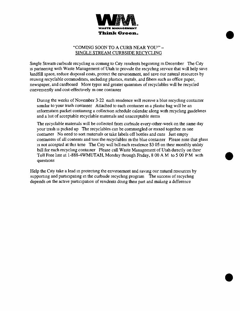
W A S T E M A N A O E M E N T
T h i n k G r e e n .
'COMING SOON T O A CURB NEAR YOU'" -SINGLE STREAM CURBSIDE RECYCLING
Single Stream curbside recycling is coming to City residents beginmng m December The City IS partnenng with Waste Management of Utah to provide the recychng service that will help save landfill space, reduce disposal costs, protect the environment, and save our natural resources by reusing recyclable commodities, including plastics, metals, and fibers such as office paper, newspaper, and cardboard More types and greater quantities of recyclables will be recycled conveniently and cost-effectively m one container
During the weeks of November 3-22 each residence will receive a blue recycling container similar to your trash container Attached to each container in a plastic bag will be an information packet containing a collection schedule calendar along with recycling guidelines and a list of acceptable recyclable matenals and unacceptable items
The recyclable matenals will be collected from curbside every-other-week on the same day your trash is picked up The recyclables can be commingled or mixed together m one container No need to sort matenals or take labels off bottles and cans Just empty containers of all contents and toss the recyclables m the blue container Please note that glass IS not accepted at this time The City will bill each residence $3 05 on their monthly utility bill for each recycling container Please call Waste Management of Utah directly on their Toll Free line at 1-888-4WMUTAH, Monday through Fnday, 8 00 A M to 5 00 P M with questions
Help the City take a lead in protecting the environment and saving our natural resources by supporting and participating in the curbside recycling program The success of recycling depends on the active participation of residents doing their part and making a difference
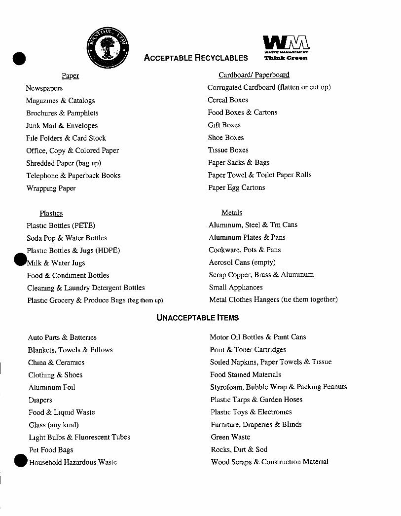
Paper
Newspapers
Magazines & Catalogs
Brochures & Pamphlets
Junk Mail & Envelopes
File Folders & Card Stock
Office, Copy & Colored Paper
Shredded Paper (bag up)
Telephone & Paperback Books
Wrapping Paper
W M ACCEPTABLE RECYCLABLES Tltis i lc G v e e n
Cardboard/ Paperboard
Corrugated Cardboard (flatten or cut up)
Cereal Boxes
Food Boxes & Cartons
Gift Boxes
Shoe Boxes
Tissue Boxes
Paper Sacks & Bags
Paper Towel & Toilet Paper Rolls
Paper Egg Cartons
Plastics
Plastic Bottles (PETE)
Soda Pop & Water Bottles
Plastic Bottles & Jugs (HDPE)
W M i l k & Water Jugs
Food & Condiment Bottles
Cleaning & Laundry Detergent Bottles
Plastic Grocery & Produce Bags (bag them up)
UNACCEPTABLE ITEMS
Metals
Aluminum, Steel & Tm Cans
Aluminum Plates & Pans
Cookware, Pots & Pans
Aerosol Cans (empty)
Scrap Copper, Brass & Aluminum
Small Appliances
Metal Clothes Hangers (tie them together)
Auto Parts & Batteries
Blankets, Towels & Pillows
China & Ceramics
Clothing & Shoes
Aluminum Foil
Diapers
Food & Liquid Waste
Glass (any kind)
Light Bulbs & Fluorescent Tubes
Pet Food Bags
' Household Hazardous Waste
Motor Oil Bottles & Paint Cans
Print & Toner Cartridges
Soiled Napkins, Paper Towels & Tissue
Food Stained Matenals
Styrofoam, Bubble Wrap & Packing Peanuts
Plastic Tarps cS: Garden Hoses
Plastic Toys & Electronics
Furniture, Draperies & Blinds
Green Waste
Rocks, Dirt & Sod
Wood Scraps & Construction Material
Appendix H
Closure Fund Documents
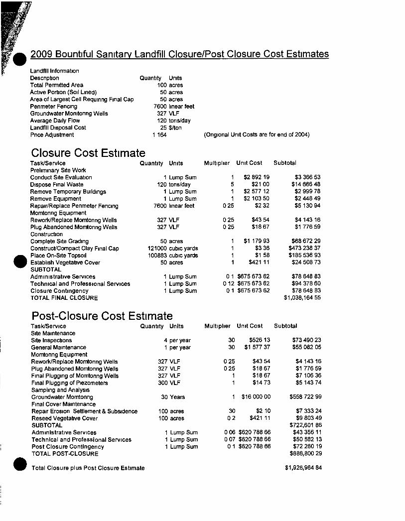
2009 Bountiful Sanitary Landfill Closure/Post Closure Cost Estimates Landfill Information Descnption Total Pemnitted Area Active Portion (Soil Lined) Area of Largest Cell Requinng Final Cap Penmeter Fencing Groundwater Momtonng Wells Average Daily Flow Landfill Disposal Cost Pnce Adjustment
Quantity Units 100 acres 50 acres 50 acres
7600 linear feet 327 VLF 120 tons/day 25 $/ton
1 164 (Ongional Unit Costs are for end of 2004)
Closure Cost Estimate Task/Service Quantity Units Multiplier Unit Cost Subtotal Preliminary Site Work Conduct Site Evaluation 1 Lump Sum 1 $2 892 19 $3 366 53 Dispose Final Waste 120 tons/day 5 $21 00 $14 666 48 Remove Temporary Buildings 1 Lump Sum 1 $2 577 12 $2 999 78 Remove Equipment 1 Lump Sum 1 $2 103 50 $2 448 49 Repair/Replace Penmeter Fencing 7600 linear feet 0 25 $2 32 $5 130 94 Momtonng Equipment Rework/Replace Momtonng Wells 327 VLF 0 25 $43 54 $4 143 16 Plug Abandoned Momtonng Weils 327 VLF 0 25 $18 67 $1 776 59 Construction Complete Site Grading 50 acres 1 $1 179 93 $68 672 29 Construct/Compact Clay Final Cap 121000 cubic yards 1 $3 36 $473 238 37 Place On-Site Topsoil 100883 cubic yards 1 $1 58 $185 536 93 Establish Vegetative Cover 50 acres 1 $421 11 $24 508 73 SUBTOTAL Administrative Services 1 Lump Sum 01 $675 673 62 $78 648 83 Technical and Professional Services 1 Lump Sum 0 12 $675 673 62 $94 378 60 Closure Contingency 1 Lump Sum 0 1 $675 673 62 $78 648 83 TOTAL FINAL CLOSURE $1,038,164 55
Post-Closure Cost Estimate Task/Service Quantity Units Multiplier Unit Cost Subtotal Site Maintenance Site Inspections 4 per year 30 $526 13 $73 490 23 General Maintenance 1 per year 30 $1 577 37 $55 082 05 Momtonng Equipment Rework/Replace Momtonng Wells 327 VLF 0 25 $43 54 $4 143 16 Plug Abandoned Momtonng Wells 327 VLF 0 25 $18 67 $1 776 59 Final Plugging of Momtonng Wells 327 VLF 1 $18 67 $7 106 36 Final Plugging of Piezometers 300 VLF 1 $14 73 $5 143 74 Sampling and Analysis Groundwater Momtonng 30 Years 1 $16 000 00 $558 722 99 Final Cover Maintenance Repair Erosion Settlement & Subsidence 100 acres 30 $2 10 $7 333 24 Reseed Vegetative Cover 100 acres 02 $421 11 $9 803 49 SUBTOTAL $722,601 86 Administrative Services 1 Lump Sum 0 06 $620 788 66 $43 356 11 Technical and Professional Services 1 Lump Sum 0 07 $620 788 66 $50 582 13 Post Closure Contingency 1 Lump Sum 0 1 $620 788 66 $72 260 19 TOTAL POST-CLOSURE $888,800 29
Total Closure plus Post Closure Estimate $1,926,964 84
SIA r t M h N l OF ACC GUN I
PTIF U T A H P U B L I C T R F A S U R F R S ' I N V F S T M F N T F U N D
IlichiiclK I Ills IJtiliStite lieasurer Fund Manj^-Ci
PO Box 1423 !•>
350 N SijteStietl Suite 180
Silt I dkL Citv Utah 84114 23IS
local Gill (801 )53X 1042 Toll Free (800) 39^ 7665
www trcaMiri-r Utah ^ov
ESC-BOUNTIFUL CITY SAN LAND MARK MCRAE PO BOX 140102 SALT LAKE CITY UT 84114-0102
Account Account Period
973
Summary
December 01, 2009 through December 31, 2009
Begmning Balance Deposits Withdrawals Ending Balance
$ 2,017,688 89 $ 1,072 02
$0 00 $2 018,760 91
Average Daily Balance Interest Earned 360 Day Rate 365 Day Rate
$2,017,688 89 $ 1,072 02
0 6170 0 6256
Date Activity Deposits Withdrawals Balance
12/01 /2009 FORWARD BALANCE
12/31 /2009 REINVESTMENT
12/31 /2009 ENDING BALANCE
$0 00
$ 1 072 02
$0 00
$0 00
$0 00
$0 00
$ 2 017,688 89
$2,018,760 91
$ 2,018,760 91
Page 1 of]
SI AlLMLNi OF ACCOUNl
PTIF U T A H P U B L I C T R F A S U R F R S ' I N V F S T M F N T F I N D
R i c h u d K 1 111-1 l U i h S U c l u i s u i L i t-uiul M ma_.Li
PO 142 ) h
3>0 N SijtL Stn,cl Sii iL ISO
Silt 1 i la Cit\ lUih S41 14 2 ^ h
1 oc i l C-ill (801) 5^8 1042 Toll ruL(80u)"9T "66'^
\\ WW tiv isuiLf ut ih go\
BOUNTIFUL CITY-LANDFILL CLOSURE MARK MCRAE POBOX 140102 SALT LAKE CITY UT 84114-0102
Account Account Period
1029 September 01 2010 through September 30, 2010
Summary
Beginning Balance $ 788,788 13 Average Daily Balance $ 788,788 13 Deposits $ 364 49 Interest Earned $ 364 49 Withdrawals $ 0 00 360 Day Rate 0 5545
jpnding Balance $789,152 62 365 Day Rate 0 5622
Date Activity Deposits Withdrawals Balance
09/01 /2010 FORWARD BALANCE $ 0 00 $ 0 00 $ 788,788 13
09/30/2010 REINVESTMENT $ 364 49 $ 0 00 $789,152 62
09/30/2010 ENDING BALANCE $ 0 00 $ 0 00 $789,152 62
Page 1 of 7
ESCROW AGREEMENT
SUMMARY
Parties to the Agreement
1 Depositor City of Bountiful, Utah (the 'Entity ) Address 790 South 100 East
P 0 Box 369 B o u n t i f u l . UT 84011-0369
Contact Galen D Rasmus sen Tel No (801) 298-6117 Mark 0 McRae Tel No (801) 298-6090
State Agency Utah Division of Solid & Hazardous Waste (the "State ) Address P O Box 144880
Salt Lake City. Utah 84114-4880
Contact Ralph Bohn. Section Mgr Tel No 801-538-6170 Tel No Tel No
3 Escrow Agent Utah State Treasurer (the 'Treasurer") 215 State Capitol Salt Lake City, Utah 84114
Contact Robert C Kirk, Financial Manager Stephanie Baldes, Accountant
Telephone (801)538-1042 Telefax (801)538-1465 Toll free 800-395-7665
B Deposit Amount(s)
1 Pnncipal amount $ 1,200.000 GO (the "Proceeds")
2 Additional amount(s), if any
$ From $ From $ From
C Authonzing Resolution F i n a n c i a l Assurance P lan f o r c l o s u r e & p o s t - c l o s u r e cos t s r e l a t e d to the B o u n t i f u l S a n i t a r y L a n d f i l l . (the"Instrument")
D Project Descnption Closu re & p o s t - c l o s u r e c o s t s r e l a t e d to the B o u n t i f u l S a n i t a r y L a n d f i l l l o c a t e d at Pages Lane and 1300 West, W. B t f l , (the"Proiect')
This Summary is an integral part ot the Escrow Agreement Utah
—2— 11 A G R E E M E N T
The undersigned hereby deliver to the Treasurer the Proceeds and Additional amount(s) to be held and disposed of by the Treasurer in accordance with the duties instructions and upon the terms and conditions hereinafter set forth m this Escrow Agreement to which the undersigned hereby agree
1 For purposes of this Escrow Agreement and this Escrow Agreement only
(a) The Treasurer shall not incur any liability in acting upon any wntten authonzation and request delivered hereunder and believed by the Treasurer to be genuine and to be signed by the proper parties
(b) The Treasurer may consult with legal counsel in the event of any dispute or question as to the construction of the Treasurer s duties hereunder and shall not be held to any liability for acting in accordance with advice so received
(c) The Treasurer shall have a first lien on the moneys held by it hereunder for its compensation and for any costs liability or expense or counsel fees it may incur
2 In the event of any disagreement between the undersigned or any of them and/or any other person resulting m adverse claims and demands being made m connection with or for any moneys involved herein or affected hereby the Treasurer shall be entitled at its option to refuse to comply with any such claim or demand so long as such disagreement shall continue and in so refusing the Treasurer may refrain from making any delivery or other disposition of any moneys involved herein or affected hereby and m so doing the Treasurer shall not be or become liable to the undersigned or any of them or to any person or party for its failure or refusal to comply with such conflicting or adverse demands and the Treasurer shall be entitled to continue so to refrain and refuse so to act until
(a) The nghts of the adverse claimants have been finally adjudicated m a court assuming and having junsdiction of the parties and the moneys involved herein or affected hereby and/or
(b) All differences shall have been adjusted by agreement and the Treasurer shall have been notified thereof in wnting signed by all of the persons interested
3 The fees for the usual services of the Treasurer under the terms of this Escrow agreement are set forth m the schedule attached hereto as Exhibit A It is agreed that additional compensation shall be paid to the Treasurer for any additional or extraordinary service it may be requested to render hereunder and the Treasurer shall be reimbursed for any out-of-pocket expenses (including without limitation fees of counsel) reasonably incurred in connection with additional or extraordinary services
4 The Entity and the State hereby agree that the deposit of the Proceeds shall constitute compliance with applicable deposit and investment provisions of the Instrument
5 The duties of the Treasurer under the terms of this Escrow Agreement are as follows
(a) The Treasurer shall receive into a separate fund (the Escrow Account ) Proceeds and any additional amounts to be used in connection with the Project
(b) The Treasurer shall reimburse Entity in amounts authorized in writing by the Entity and the State
(c) Each authorization must be signed by one official form both the Entity and the State except as provided in (i)of this section and shall be substantially the same as the form attached as Exhibit B On behalf of the Entity the wntten authonzation and request shall be signed by any one of the officials of the Entity identified in Section I A 1 above On behalf of the State the written authonzation and request shall be signed by any one of the officials of the State identified m Section I A 2 above The Treasurer assumes no responsibility for expenditure
—3—
of moneys paid out of the Escrow Account pursuant to a wntten authonzation and request properly signed and delivered the Treasurer as provided herein
(0 If the Entity fails to provide closure post-closure or conective action of the solid waste management facility as required by the Utah Solid Waste Permitting and Management Rules and the Entity s solid waste disposal permit the Executive Secretary will issue an order to close under the authonty of Section 19-6-107(7) of the Utah Solid and Hazardous Waste Act Upon completion of the Administrative process including the Entity s nght to contest and appeal the administrative action the State may independently request in wnting reimbursement to a State-approved and authonzed third party for the costs related to the third party s activities for closure post-closure or conective actions at the facility
(d) If a wntten authorization and request indicates that an amount (the Retained Amount ) payable to a Provider is to be held for retainage pending completion of the Project or the lapse of time the Treasurer shall segregate such amount and shall invest the Retained Amount in an interest-bearing account (the Separate Account') the interest on which shall accrue for the benefit of the Provider The Retained Amount and all accrued interest thereon shall be disbursed by the Treasurer in the same manner as provided in paragraph 5(b) hereof All fees charged or incurred by the Treasurer relating to the establishment, investment and disbursement of the Separate Account shall be borne solely by the Provider and may be withheld by the Treasurer from the Separate Account pnor to the disbursement thereof, provided however that if such fees are home by the Separate Account and if the interest earned on the Separate Account is less than the amount of such fees then the fees withheld from such Separate Account shall not exceed the interest earned and the balance of such fees shall be paid by the Entity
(e) The funds deposited by the parties hereto in the Escrow Fund and in any Separate Account shall be invested by the Treasurer in the Utah Public Treasurers Investment Fund established by Secuon 51-7-5 of the Utah Code All interest earned on moneys held m the Escrow Account shall be retained therein and disbursed as provided herein
(f) The Treasurer shall report at least monthly conceming the receipts disbursements and status of the Escrow Account The reports shall be mailed to the Entity and to the State at their respective addresses as shown in Section I A above Notification of changes of address if any shall be in wnting and mailed to the parties at their respective addresses as shown in Section I A above
(g) This Escrow Agreement will be terminated after payment of the fees and out-of-pocket expenses of the Treasurer and upon liquidation of the Escrow Account as provided herein This Escrow Account upon the earlier to occur of
(i) receipt by the Treasurer of a written authorization and request signed as provided in paragraph 5(c) hereof stating that the acquisition construction improvement and extension of the Project IS complete that all obligations and costs in connection with the Project which are payable out of the Escrow Account have been paid and discharged and that the Treasurer is authonzed and directed to transfer all moneys in the Escrow Fund to the Entity or such other disposition as may be agreed by the State and the Entity or
(ii) receipt by the Treasurer of a wntten certificate of the State signed by the appropnat^^ representatives thereof as identified in paragraph 5(c) hereof stating that at least 3 months have expired from the date of this Agreement and that all remaining moneys in the Escrow Account are to be transfened to the State as a prepayment on the Bond purchased by the State or such other disposition as may be specified by the State
This Agreement may be modified or amended only by a wntten Amendment attached to this Agreement and signed by the parties to this Agreement
Attest and Coyntersi
By
Title Ci ty Recorder
Entity Ci ty of B o u n t i f u l , Utah
Title Administrat ive Services Director
Date December 1. 2005
ate December 1, 2005
Accepted
Utah State Treasurer
By
Title
STATE Utah Division of Solid and Hazardous Waste
By
Title Executive Secretary Utah Solid & Hazardous Waste Control Board
Date
.ite
EXHIBIT A
Fees due to State Treasurer as Escrow Agent
Maximum annual fee is 10 basis points (one-tenth of one percent (001)) applied to the average daily balance in each account The fee is assessed monthly based on the actual number of days in the month divided by 360 days
Minimum annual fee is zero
The Treasurer intends to deduct the administrative fee from gross earnings of each account before crediting earnings to the account(s) The amount of such fees in not reflected on monthly statements to the Entity and IS payable only from gross earnings on the account(s)
Entity shall not be liable to the Treasurer for any other costs or expenses for usual services Usual services include
1 Acceptance of funds delivered for deposit
Deposit of funds and issuance of Treasurer's Receipt
3 Investment of all funds delivered to Treasurer
4 Credit net interest earnings to designated account(s) on a monthly basis
5 Reimburse entity for project costs pursuant to receipt of a wntten authonzation and request properly signed and delivered to the Treasurer
6 Prepare and deliver to Entity and State a monthly accounting showing all deposits withdrawals, interest credits and rate, ending balance and average balance for each account
Entity will be liable to the Treasurer for out-of-pocket expenses resulting from any additional or extraordinary service Treasurer is requested to render and reasonably incurs in connection with additional or extraordinary services
EXHIBIT B -1
WRITTEN AUTHORIZATION AND REQUEST FOR REIMBURSEMENT FROM ESCROW FUND
TO The Utah State Treasurer, as Escrow Agent (the 'Treasurer')
DATE
WRITTEN REQUEST NO
I the undersigned authonzed officer of , (the "Entity'), do hereby certify and request to the Treasurer as follows
7 Pursuant to the provisions of the Escrow Agreement by and between the Entity, the State and the Treasurer dated (the "Escrow Agreement") the undersigned hereby authonzes and requests a reimbursement from the Escrow Account to pay the amounts shown on the attached Payment Schedule
8 Each payment proposed to be made as set forth on the Payment Schedule has been incurred and is a proper charge against the Escrow Account
9 To the extent that the payment of any item set forth on the Payment Schedule is for other than work, matenals, equipment or supplies, in connection with this authonzation and request, the undersigned certifies that each payment proposed to be made on the Payment Schedules is a proper charge against the Escrow Account, is a reasonable amount and has not been heretofore included in a pnor Wntten Authonzation and Request for Reimbursement for the Escrow Account
10 This Wntten Authonzation and Request, including the Payment Schedule attached hereto, shall be conclusive evidence of the facts and statements set forth herein
11 A copy of this Wntten Authonzation and Request is being kept on file m the official records of the Entity
The terms used herein which are defined m the Escrow Agreement shall have the respective meanings therein assigned to them
By _
Title
EXHIBIT B-2
I/we the undersigned authonzed officer(s) of the State do hereby certify and request to the Treasurer follows
1 I/we have reviewed the foregoing statements of the authonzed officer of the Entity attached hereto, and on behalf of the State approve the request for payment from the Escrow Fund made therein, provided that the State has not independently venfied the statements of such authonzed officer of the Entity attached hereto and makes no representations or certifications with respect thereto
2 A copy of this Wntten Authonzation and Request is being kept on file in the official records of the State
The terms used herein shall have the same meanings assigned to them in the attached statements of the authonzed officer of the Entity
Dated the date appeanng at the top of the attached statements of the authonzed officer of the Entity
STATE
By
Title
EXHIBIT B -3
REIMBURSEMENT SCHEDULE
eck No Person or Firm Amount Purpose
Reimbursement for the above listed payments totaling $ is to be made to. _("Entity") by transfer of funds from the Escrow Account (PTIF# ) to
(CHECK ONE)
.Entity's general account in the Public Treasurer's Investment Fund ^ (PTIF#3,orto
Entity's checking account at ("Bank") Account number
RETAINAGE REQUEST
In addition to the above listed reimbursement, transfer the following retainage amounts From Escrow Acct # To Retainage Acct # For Contractor (name) #Amount
Contact Person at time of Wire Transfer (name) (phone #)
Appendix I
Frost Penetration Analysis
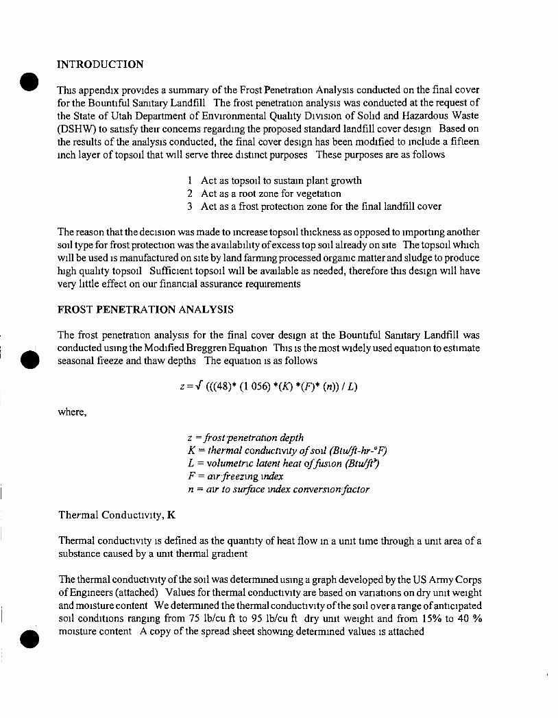
4
INTRODUCTION
This appendix provides a summary of the Frost Penetration Analysis conducted on the final cover for the Bountiful Sanitary Landfill The frost penetration analysis was conducted at the request of the State of Utah Department of Environmental Quality Division of Solid and Hazardous Waste (DSHW) to satisfy their concems regarding the proposed standard landfill cover design Based on the results of the analysis conducted, the final cover design has been modified to include a fifteen inch layer of topsoil that will serve three distinct purposes These purposes are as follows
1 Act as topsoil to sustain plant growth 2 Act as a root zone for vegetation 3 Act as a frost protection zone for the final landfill cover
The reason that the decision was made to increase topsoil thickness as opposed to importing another soil type for frost protection was the availability of excess top soil already on site The topsoil which will be used is manufactured on site by land farming processed organic matter and sludge to produce high quality topsoil Sufficient topsoil will be available as needed, therefore this design will have very little effect on our financial assurance requirements
FROST PENETRATION ANALYSIS
The frost penetration analysis for the final cover design at the Bountiful Sanitary Landfill was conducted using the Modified Breggren Equation This is the most widely used equation to estimate seasonal fi'eeze and thaw depths The equation is as follows
where.
z = / (((48)* (1 056) *(/0 *(F)* (n)) / L)
z = frost penetration depth K - thermal conductivity of soil (Btu/ft-hr-"F) L = volumetric latent heat of fusion (Btu/ft^) F = air freezing index n - air to surface index conversion factor
Thermal Conductivity, K
Thermal conductivity is defined as the quantity of heat flow in a unit time through a unit area of a substance caused by a unit thermal gradient
The thermal conductivity of the soil was determined using a graph developed by the US Army Corps of Engineers (attached) Values for thermal conductivity are based on vanations on dry unit weight and moisture content We determined the thermal conductivity of the soil over a range of anticipated soil conditions ranging from 75 Ib/cu ft to 95 Ib/cu ft dry unit weight and from 15% to 40 % moisture content A copy of the spread sheet showing determined values is attached
Because grasses will be planted as erosion control on all areas of the landfill as it is closed, the n-factor for turf may be the most applicable in some areas However, the grass to be planted will be more of a wheat grass type and may not act similar to turf in all areas this suggests that a n-factor around 0 6 may be more appropnate In addition, it is possible that frost may occur before any grass has the opportunity to grow in some areas In these areas an n-factor of 0 7 will be appropnate Spread sheets showing the effect of varying the n-factors is attached
Frost Depth
Using the variables determined as descnbed above, and varying the dry unit weight and moisture content of the soil over the range where it could reasonably be expected to fall produces frost penetration results ranging from 8 1-14 4 inches The worst case will be when the soil is relatively dry, relatively dense, and not covered with any vegetation Because the topsoil will be placed with little if any compactive effort, and the organic content of the soil is high, the densities will most likely remain low Also, the coldest times of the year is when much of the moisture is present in the soil and the intent of the topsoil layer is to produce plant growth Therefore, the likelihood of reaching the worst case conditions is minimal
Fifteen inches of topsoil will be effective in preventing frost dessication of the final clay cover on the Bountiful Sanitary Landfill
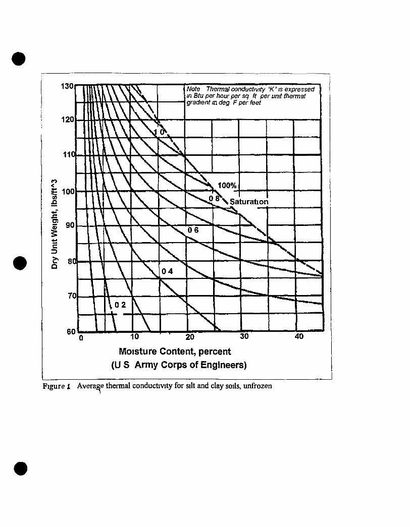
130
120
11C
CO
^ 100 (0
f 90
E 3 ^ 8C
70
60
Thermal conductivity 'K' is expressed \ oer hour per sq ft per unit thermal
Note in Btu per hour per sq ft per t gradient tn deg F per feet
10 20 30
Moisture Content, percent (U S Army Corps of Engineers)
Figure X Average thermal conductivity for silt and clay soils, unfrozen
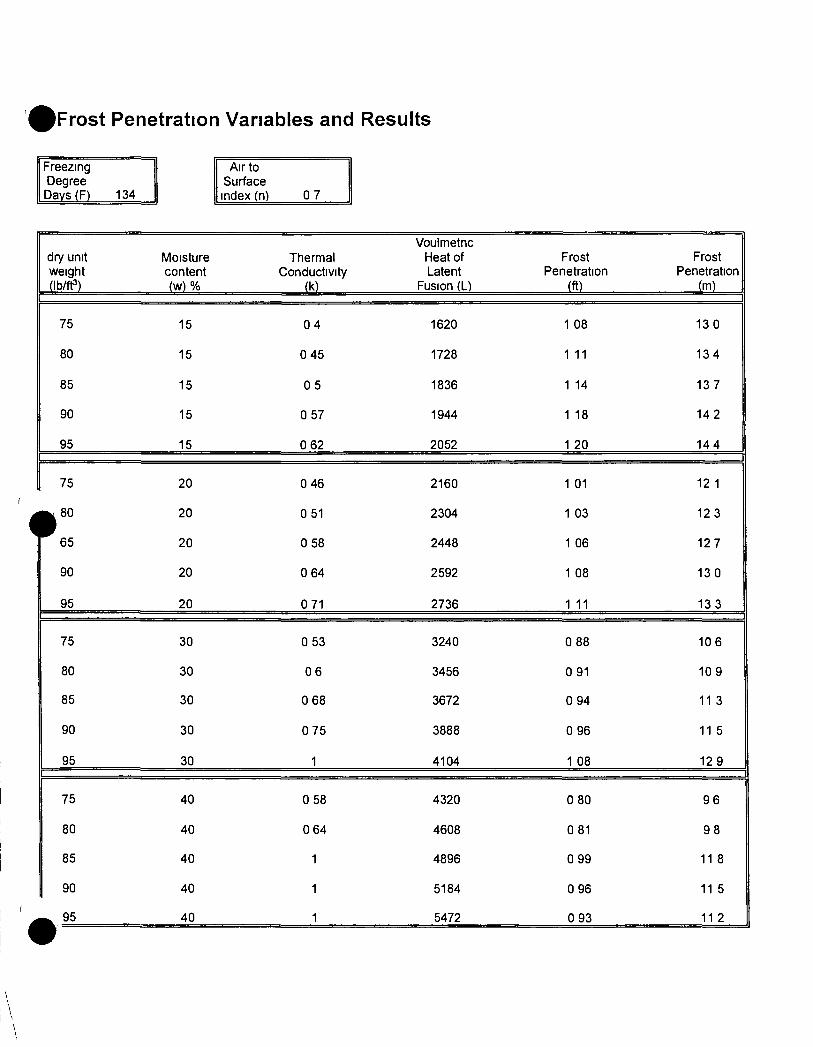
iFrost Penetration Vanables and Results
Freezing Degree Days (F) 134
Air to Surface index (n) 0 7
Voulmetnc dry unit Moisture Thermal Heat of Frost Frost weight content Conductivity Latent Penetration Penetration (Ib/ff) (w) % (k) Fusion (L) (ft) (m)
75 15 0 4 1620 1 08 13 0
80 15 0 45 1728 1 11 134
85 15 0 5 1836 1 14 137
90 15 0 57 1944 1 18 142
95 15 0 62 2052 1 20 14 4
75 20 0 46 2160 1 01 12 1
^ 8 0 20 0 51 2304 1 03 12 3
^ 6 5 20 0 58 2448 1 06 127
90 20 0 64 2592 1 08 13 0
95 20 0 71 2736 1 11 13 3
75 30 0 53 3240 0 88 106
80 30 0 6 3456 0 91 109
85 30 0 68 3672 0 94 11 3
90 30 0 75 3888 0 96 11 5
95 30 1 4104 1 08 12 9
75 40 0 58 4320 0 80 9 6
80 40 0 64 4608 0 81 9 8
85 40 1 4896 0 99 11 8
90 40 1 5184 0 96 11 5
95 40 1 5472 0 93 11 2
Appendix J
Geology and Ground Water
Exhibits
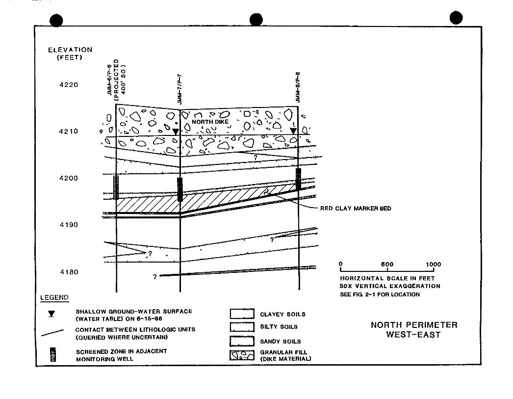
ELEVATION (FEET)
4220
4210
4200
4190
4180
LEGEND
CO
I CO
2
V<n :^t:> 'o'5 5:^: Q ^ NORTH DIKE " />, vC '--/K i
SHALLOW GROUND-WATER SURFACE (WATER TABLE) ON 6-15-88
CONTACT BETWEEN LITHOLOGIC UNITS (QUERIED WHERE UNCERTAIN)
SCREENED ZONE IN ADJACENT MONITORING WELL
l=Z!
• Z ]
CLAYEY SOILS
SILTY SOILS
SANDY SOILS
GRANULAR FILL (DIKE MATERIAL)
RED CLAY MARKER BED
0 L
600 1000
HORIZONTAL SCALE IN FEET SOX VERTICAL EXAGGERATION SEE Fia 2-1 FOR LOCATION
NORTH PERIMETER WEST-EAST
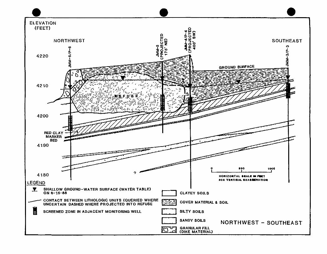
ELEVATION (FEET)
NORTHWEST SOUTHEAST
4220
4210
4200
RED CLAY MARKER
BED 4190
4180
LEGEND
i SHALLOW GROUND-WATER SURFACE (WATER TABLE) ON 6-15-88
CONTACT BETWEEN LITHOLOGIC UNITS (QUERIED WHERE UNCERTAIN DASHED WHERE PROJECTED INTO REFUSE
I SCREENED ZONE IN ADJACENT MONITORING WELL
HORIZONTAL SCALI M F M T •OX VERTICAL CXACMRATtON
I j CLAYEY SOILS
{Sfegj COVER MATERIAL & SOIL
I; I SILTY SOILS
NORTHWEST - SOUTHEAST [ j SANDY SOILS
(DIKE MATERIAL) j jp'Uyj GRANULAR FILL
TJ
: c / m
WATER BAU^NCC PARAMCTeiU
Maoihly praciit U U a IHiUuli 1 vspouwuplnti Bun rr Mol u i n «U>bl fcr InfiltntlvB loAItntioA iMa PET Acnimul udpoUotialw U T I M I Soil nolatun auntga Qiaiif is loi^ga Acuul fuuvaff i raU a Pu t I i l
Alt vkluM In iDcb • I U U H Mhtpr lM BoUd
J u l P b Hmt A p r J u s Jul Aug B r Oct N « D M
a 1 U < 41 0 M t M S « 4 7S< »• (4.7 137 39t 324
2.2a 1 n l O i >.]> 1 T< 1 41 0 41 1 02 0 » 1 n 1 to 204 00 00 01 1 0 27 I f 4 • 4 i 31 t i 06 00
01 01 01 0 1 02 0.1 00 01 0 1 01 02 01 1.1 1 e 11 M 1 < 1 3 0.* Ot oa 11 1 T I t 1.1 1 c 11 01 1 1 2.3 -4( •S.J 2T -oa 1 1 1 f 0 0 0 0 00 HO 1 1 -34 1 J 11 a 143 14 • 00 00 11 so « t o 1 0 I.Z 14 - I f •3t >.t Of 0< 00 ot 0 0 0 0 0 0 - U 1.2 X3 Ot 10 22 11 00 00 01 2.0 1 c 10 1< 11 00 ot Of 00 0 0 01 11 0 1 0 0 00 00 00 00 00 00 00 00 84 11 4 11 • 11 • 10 •1.1 141 114 74 1 4 ta
ESTIMATED WATER BALANCE FOR THE BARD LANDFILL
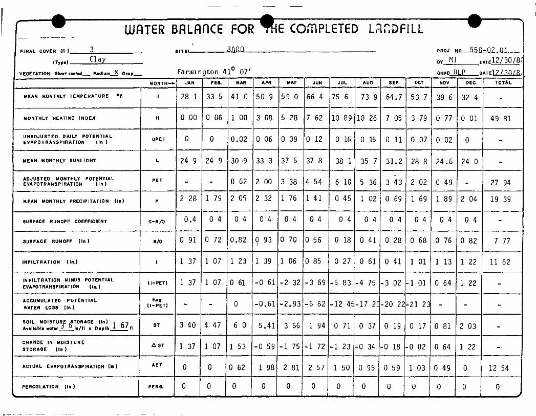
~ UiflTGR BfiLflnC6 FOR TH 6 COmPL£TGD LPinDFlLL
FINAL COVER (fl ) 3
k
a i T C i RARn PROJ NO 5 5 ? -02.n i ,Trp-. C l a y BY M I DATE12/30/8^
VEOETATION Short roolid Mtdlum X ooep Farmington 41° 07' CHKD R L P D A T E l ? / . ? n / R .
M O N T H - ^ JAN F E a MAR APR MAY JUN JUL AUO SEP OCT NOV DEC TOTAL
MEAN MONTHLY TEMPERATURE "f T 28 1 33 5 41 0 ^0 9 59 0 66 4 75 6 73 9 6417 53 7 39 6 32 4
MONTHLY HEATINO INDEX H 0 00 0 06 1 00 3 08 5 28 7 62 10 89 10 26 7 05 3 79 0 77 0 01 49 81
UNADJUSTED DAILY POTENTIAL EVAPOTRANSPIRAT ION (In )
UPET 0 0 O J 0 2 0 06 0 09 0 12 0 16 0 15 0 11 0 07 0 02 0 -
MEAN MONTHLY SUNLIOHT L 24 9 24 9 30 '9 33 3 37 5 37 8 38 1 35 7 31.2 28 8 24.6 24 0 -
ADJUSTED MONTHLY POTENTIAL EVAPOTRANSPIRATION ( In)
P E T - - O 62 2 00 3 38 4 54 6 10 5 36 3 43 2 02 0 49 - 27 94
MEAN MONTHLY PRECIPITATION (In) P 2 28 1 79 2 OS 2 32 1 76 1 41 0 45 1 02 0 69 1 69 1 89 2 04 19 39
SURFACE RUNOPI* COEFFICIENT C - R A ) 0.4 0 4 O 4 0 4 0 4 0 4 0 4 0 4 0 4 0 4 0 4 0 4 -
SURFACE RUNOFF ( In ) R/O 0 91 0 72 0,82 9 93 0 70 0 56 0 18 0 41 0 28 0 68 0 76 0 82 7 77
INFILTRATION ( l a ) 1 1 37 1 07 1 23 1 39 1 06 0 85 0 27 0 61 0 41 1 01 1 13 1 22 11 62
INFILTRATION MINUS POTENTIAL EVAPOTRANSPIRATION (In.)
( l - P E T ) 1 37 1 07 0 61 -0 61 -2 32 -3 69 -5 83 -4 75 -3 02 -1 01 0 64 1 22 -
ACCUMULATED POTENTIAL
WATER LOSS (In) ( l - P E T ) - - 0 -0.61 -2.93 -6 62 -12 4E -17 2C -20 22 -21 23 - -
SOIL MOISTUR£ ^ T O R A O E (In) ^ 7 Avollablt water ° l o / f l x Daolh 4 ° ' f l
ST 3 40 4 47 6 0 5.41 3 66 1 94 0 71 0 37 0 19 0 17 0 81 2 03 -
CHANOE IN MOISTURE STORAGE ( In )
A ST 1 37 1 07 1 53 -0 59 -1 75 -1 72 -1 23 -0 34 -0 18 -0 92 0 64 1 22 -
ACTUAL EVAPOTRANSPIRATION (In) A E T 0 0 0 62 1 98 2 81 2 57 1 50 0 95 0 59 1 03 0 49 0 12 54
PERCOLATION (In)
> P E R a 0 0 0 0 0 0 0 0 0 0 0 0 0
J
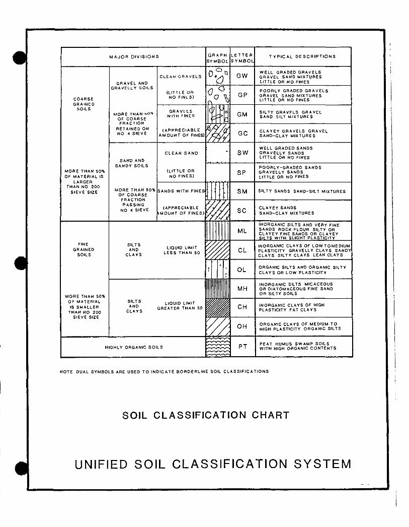
M A J O R DIVISIONS G R A P H S Y M B O L
L E T T E R S Y M B O L
T Y P I C A L D E S C R I P T I O N S
C O A R S E G R A I N C D
S O I L S
M O R E T H A N 50% O F M A T E R I A L IS
L A R G E R T H A N NO 200
S I E V E S IZE
G R A V E L AND G R A V E L L Y S O I L S
M O R E THAN hOU OF C O A R S E F R A C T I O N
R E T A I N E D O N NO 4 S I E V E
S A N D A N D S A N D Y S O I L S
M O R E T H A N 5 0 % O F C O A R S E
F R A C T I O N P A S S I N G
NO 4 S I E V E
C L E A N G R A V E L S
(L ITTLE o n NO FINL S)
GW W E L L G R A D E D G R A V E L S G R A V E L S A N D M I X T U R E S LITTLE OR NO F INES
G P P O O R L Y G R A D E D G R A V E L S G R A V E L S A N D M I X T U R E S L ITTLE OR N O F INES
G R A V I L S W^ITH FINES
( A P P R E C I A B L E A M O U N T O F FINES)
GM S I L T Y G R A V F L S G R A V E L S A N D SILT M I X T U R E S
G C C L A Y E Y G R A V E L S G R A V E L S A N D - C L A Y M I X T U R E S
C L E A N S A N D
( L I T T L E OR NO F I N E S )
S W W E L L G R A D E D S A N D S G R A V E L L Y S A N D S L I T T L E OR NO FINES
S P P O O R L Y - G R A D E D S A N D S G R A V E L L Y S A N D S L ITTLE OR NO F INES
S A N D S WITH F I N E S
( A P P R E C I A B L E A M O U N T O F F I N E S )
S M S I L T Y S A N D S S A N D - S I L T M I X T U R E S
S C C L A Y E Y S A N D S S A N D - C L A Y M I X T U R E S
ML I N O R G A N I C S I L T S AND V E R Y FINE S A N D S R O C K F L O U R SILTY OR C L A Y E Y FINE S A N D S O R C L A Y E Y S ILTS WITH SLIGHT P L A S T I C I T Y
FINE G R A I N E D
SOILS
S ILTS AND
C L A Y S
LIQUID LIMIT L E S S T H A N 50 CL
INORGANIC C L A Y S O F L O W T O M E D I U M PLASTIC ITY G R A V E L L Y C L A Y S S A N D Y C L A Y S S I L T Y C L A Y S L E A N C L A Y S
M O R E T H A N 50% O F M A T E R I A L IS S M A L L E R
T H A N NO 200 S I E V E SIZE
S I L T S A N D
C L A Y S
OL O R G A N I C S ILTS AND O R G A N I C SILTY C L A Y S OR L O W P L A S T I C I T Y
MH I N O R G A N I C SILTS M I C A C E O U S O R D I A T O M A C E O U S FINE S A N D O R SILTY S O I L S
LIQUID LIMIT G R E A T E R T H A N 50 CH INORGANIC C L A Y S OF HIGH
P L A S T I C I T Y FAT C L A Y S
OH O R G A N I C C L A Y S OF M E D I U M TO HIGH P L A S T I C I T Y O R G A N I C SILTS
HIGHLY O R G A N I C S O I L S PT P E A T HUMUS S W A M P S O I L S WITH HIGH O R G A N I C C O N T E N T S
N O T E D U A L S Y M B O L S A R E U S E D T O I N D I C A T E B O R D E R L I N E SOIL C L A S S I F I C A T I O N S
SOIL CLASSIFICATION CHART
1 UNIFIED SOIL CLASSIFICATION SYSTEM
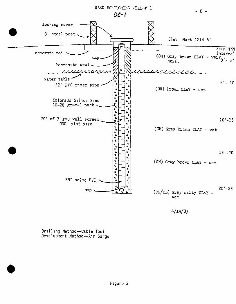
locking cover
3' steel pos
- 8
Elev Mark 4214 5'
bentonate seal
Viater table ' " ' ^ 22" PVC r i s e r pipe
Colorado S i l i c a San(J 10-20 g r a v f l pack
20' of 3"PVC wel l screen 030" slot si2e
D t.
B
t. I O
& 6
t tl
& e
ft.
o & o
T Samp nng Interval
(CH) Gray brown CLAY - very , moist 0 - 5
5'- 10
(CH) Brown CLAY - wet
10'-15
(CH) Gray brown CLAY - wet
15'-20
(CH) Gray brown CLAY - wet
(CH/CL) Gray s i l t y CLAY -wet
20'-25
Dr i l l ing Method—Cable Tool Development Method--Air Surge
4/19/85
Figure 3
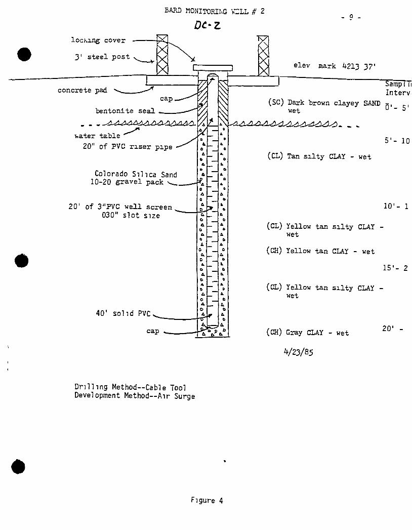
BAUD MONITORIl.G VZLL H 2 Q _
locKing cover
3' steel post
concrete pad. cap
bentonite seal
water table ^ 20" of PVC r i s e r pipe
Colorado S i l i c a Sand 10-20 gravel pack
20' of 3"PVC wel l screen 030" Slot size
40' solid PVC
cap
e
e
Drilling Method—Cable Tool Development Method—Air Surge
elev mark 4213 3?'
(SC) Dark brown clayey SAND wet
SampTTi Intervi
0'- 5'
(CL) Tan s i l t y CLAY - wet
5'- 10
10'- 1
(CL) Yellow tan s i l t y CLAY wet
(CH) Yellow tan CLAY - wet
(CL) Yellow tan s i l t y CLAY wet
(CH) Gray CLAY - wet
15'- 2
20'
V23/85
Figure 4
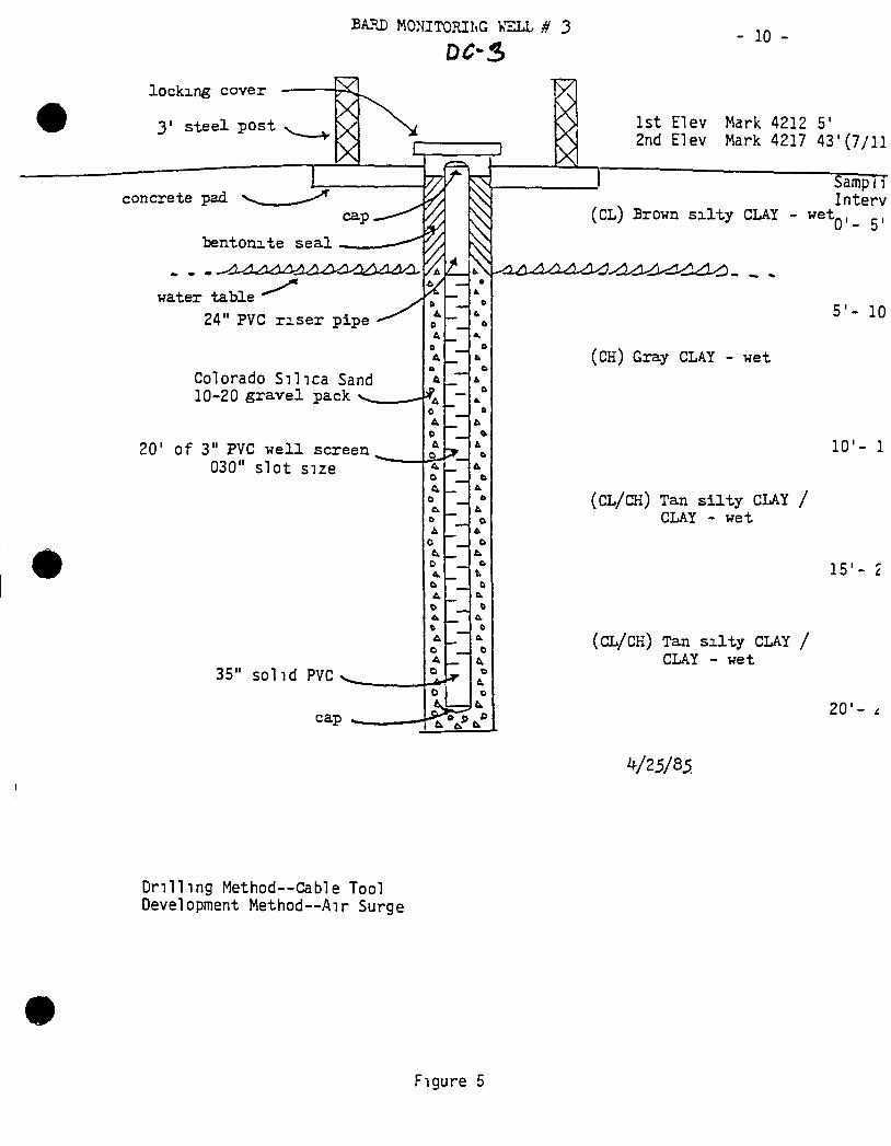
BAUD MONITORIltG KZLL # 3
locking cover
3' steel post
bentonite seal
water table "" ^ 24" PVC r i s e r pipe
Colorado Silica Sand 10-20 gravel pack
20' of 3" PVC well screen 030" slot size
35" solid PVC
cap
1st Elev 2nd Elev
- 10
Mark 4212 5' Mark 4217 43'(7/11
(CL) Brown s i l t y CLAY - wet
Samp 11 Interv '0'- 5'
(CH) Gray CLAY - wet
Drilling Method--Cable Tool Development Method—Air Surge
5'- 10
10'- 1
(CL/CH) Tan s i l t y CLAY / CLAY - wet
15'
( C L / C H ) Tan s i l t y CLAY / CLAY ~ wet
2 0 ' -
V25/85
Figure 5
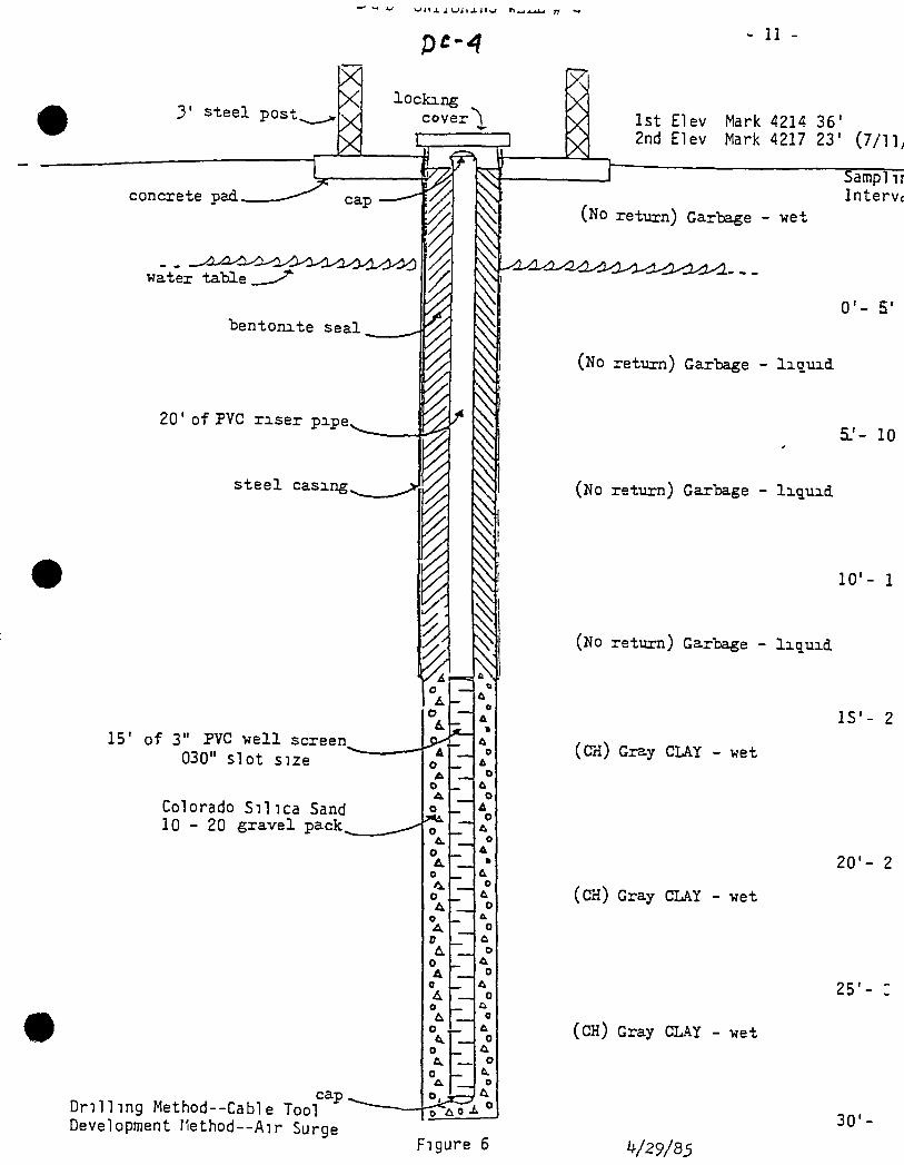
3' steel post.
X X locking X cover
E
concrete pad. cap
water table
bentonite seal
20' of PVC r i s e r pipe,
s t ee l casing.
15' of 3" PVC well screen 030" slot size
Colorado Si l ica Sand 1 0 - 2 0 gravel pack.
cap D r i l l i n g Method--Cable Tool Development I1ethod--Air Surge
I 1
i t.
o O A O 1^ 0 &.
o A.
o o
o A r L 0 A 0
o
o
0 & 0
£L
O
I & o
A » & o
L O & O
t o & o A » o & o
0
0
& 0 a 0 & 0 o b.
o
O
Figure 6
II -
1st Elev Mark 4214 36' 2nd Elev Mark 4217 23' (7/lly
(No return) Garbage - wet
Sampl ir Intervc
0'- 5'
(No return) Garbage - l i q u i d
5.'- 10
(No return) Garbage - l i q u i d
10 '- 1
(No retiurn) Garbage - liquid
IS'- 2
(CH) Gray CLAY - wet
20'- 2
(CH) Gray CLAY - wet
25'
(CH) Gray CLAY - wet
30'
V29/8i
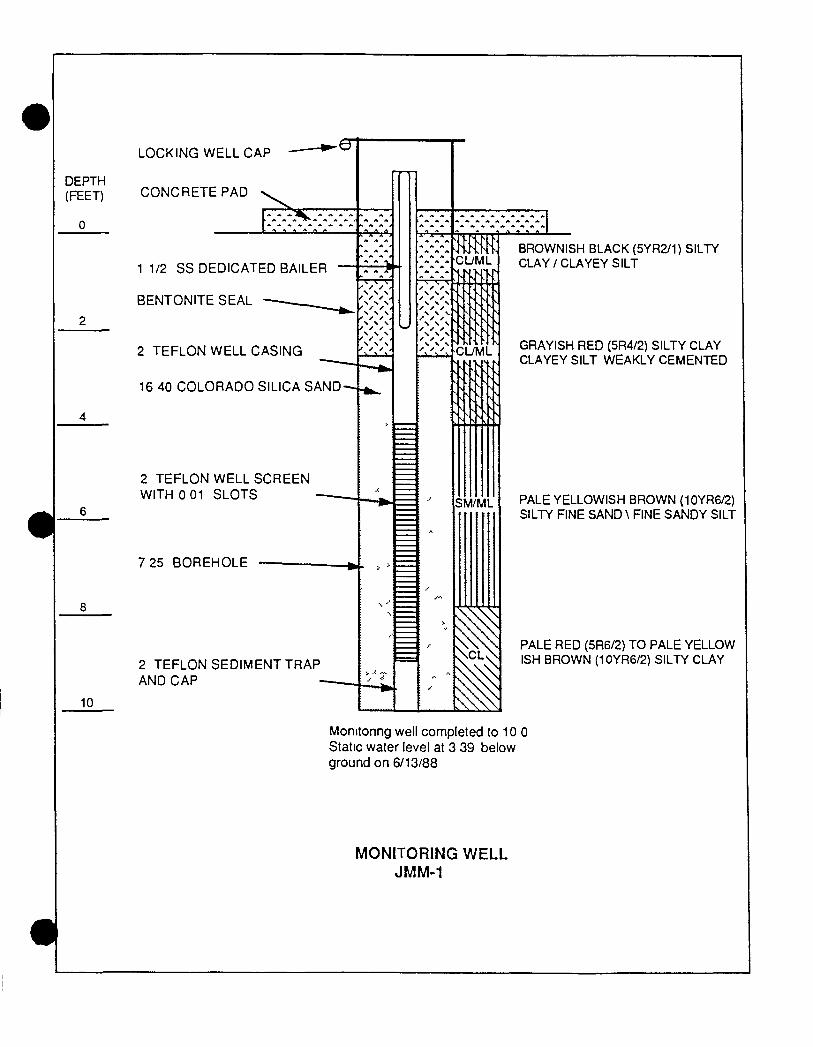
DEPTH (FEET)
LOCKING WELL CAP
CONCRETE PAD
1 1/2 SS DEDICATED BAILER
BENTONITE SEAL
2 TEFLON WELL CASING
16 40 COLORADO SILICA SAND-
2 TEFLON WELL SCREEN WITH 0 01 SLOTS
7 25 BOREHOLE
2 TEFLON SEDIMENT TRAP AND CAP
10
• X , \ \ N
X X • N S N ^ ^ ^ S \ ^
y • N \ N
^ ^ A . X \ \
\ \ N X X X \ \ \
K M CUML
CUML
SM/ML
BROWNISH BLACK (5YR2/1) SILTY CLAY / CLAYEY SILT
GRAYISH RED {5R4/2) SILTY CLAY CLAYEY SILT WEAKLY CEMENTED
PALE YELLOWISH BROWN {10YR6/2) SILTY FINE SAND \ FINE SANDY SILT
PALE RED (5R6/2) TO PALE YELLOW ISH BROWN (10YR6/2) SILTY CLAY
Momtonng well completed to 10 0 Static water level at 3 39 below ground on 6/13/88
MONITORING WELL JMM-1
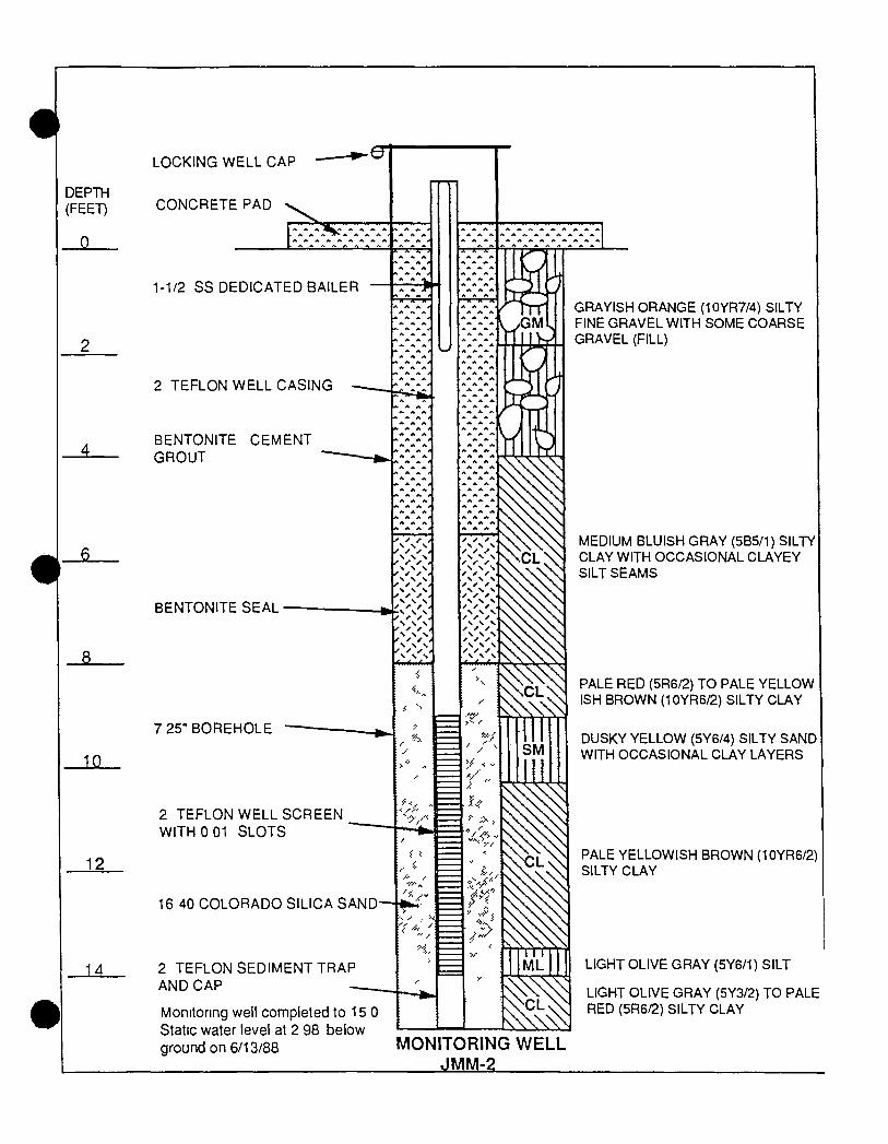
DEPTH (FEET)
3-
JLIL
12
AA.
LOCKING WELL CAP
CONCRETE PAD
1-1/2 SS DEDICATED BAILER
2 TEFLON WELL CASING
BENTONITE CEMENT GROUT
BENTONITE SEAL
7 25" BOREHOLE
GRAYISH ORANGE (10YR7/4) SILTY FINE GRAVEL WITH SOME COARSE GRAVEL (FILL)
MEDIUM BLUISH GRAY (5B5/1) SILTY CLAY WITH OCCASIONAL CLAYEY SILT SEAMS
PALE RED (5R6/2) TO PALE YELLOW ISH BROWN (10YR6/2) SILTY CLAY
DUSKY YELLOW (5Y6/4) SILTY SAND WITH OCCASIONAL CLAY LAYERS
2 TEFLON WELL SCREEN WITH 0 01 SLOTS
16 40 COLORADO SILICA SAND— -fci:^- =
2 TEFLON SEDIMENT TRAP AND CAP
PALE YELLOWISH BROWN (10YR6/2) SILTY CLAY
Monitoring well completed to 15 0 Static water level at 2 98 below ground on 6/13/88
LIGHT OLIVE GRAY (5Y6/1) SILT
LIGHT OLIVE GRAY (5Y3/2) TO PALE RED (5R6/2) SILTY CLAY
MONITORING WELL JMM-2
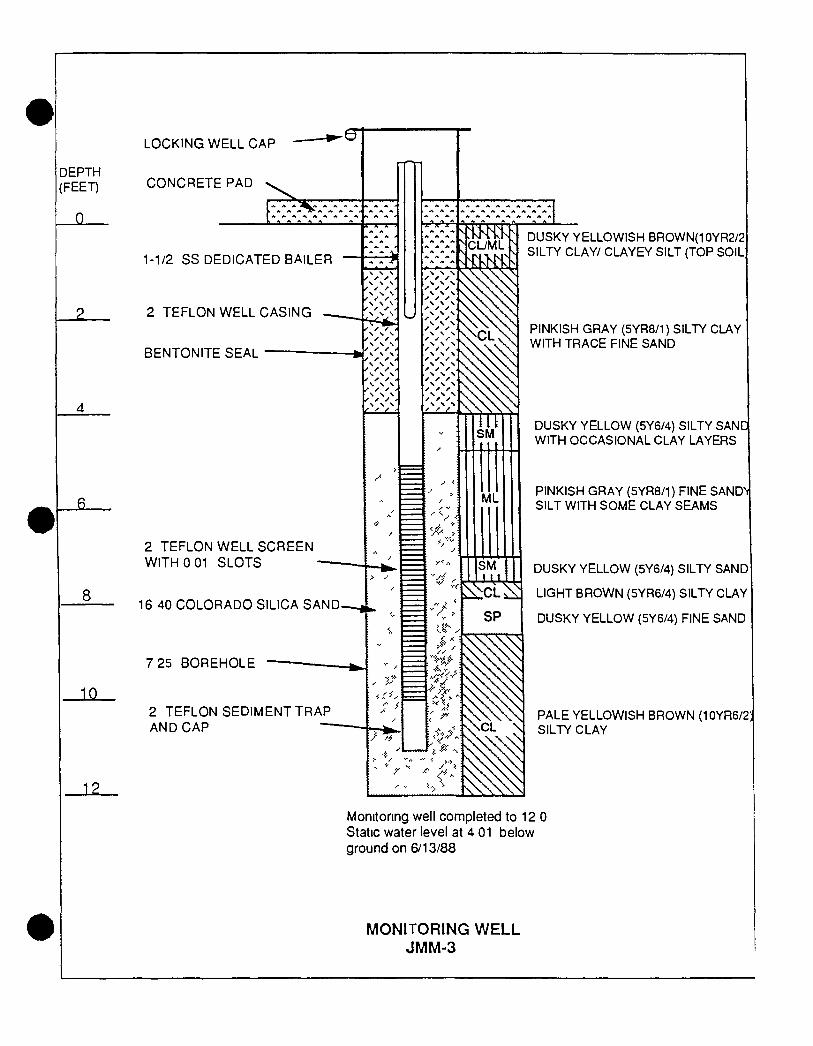
DEPTH (FEET)
J I _
8
JlSL
LOCKING WELL CAP
CONCRETE PAD
1-1/2 SS DEDICATED BAILER
2 TEFLON WELL CASING
BENTONITE SEAL
2 TEFLON WELL SCREEN WITH 0 01 SLOTS
16 40 COLORADO SILICA SAND-
7 25 BOREHOLE
2 TEFLON SEDIMENT TRAP AND CAP
JL2.
CUML ^
•'if
ML
SM
DUSKY YELLOWISH BROWN(10YR2/2 SILTY CLAY/ CLAYEY SILT (TOP SOIL
PINKISH GRAY (5YR8/1) SILTY CLAY WITH TRACE FINE SAND
DUSKY YELLOW (5Y6/4) SILTY SANC WITH OCCASIONAL CLAY LAYERS
PINKISH GRAY (5YR8/1) FINE SANDV SILT WITH SOME CLAY SEAMS
DUSKY YELLOW (5Y6/4) SILTY SAND
LIGHT BROWN (5YR6/4) SILTY CLAY
DUSKY YELLOW (5Y6/4) FINE SAND
PALE YELLOWISH BROWN (10YR6/2) SILTY CLAY
Monitoring well completed to 12 0 Static water level at 4 01 below ground on 6/13/88
MONITORING W E L L JMM-3
DEPTH (FEET)
12
15
21.
LOCKING WELL CAP
CONCRETE PAD
1 1/2 SS DEDICATED BAILER
2 PVC WELL CASING
7 25 BOREHOLE
CEMENT BENTONITE GROUT
2 TEFLON WELL CASING
GRAYISH ORANGE (10YR7/4) SILTY FINE GRAVEL WITH SOME COARSE GRAVEL (FILL)
BENTONITE SEAL
2 TEFLON WELL SCREEN WITH 0 01 SLOTS
16 40 COLORADO SILICA SAND
DARK GRAY (N 3) SILTY CLAY
PALE RED (10R6/2) SILTY CLAY
2 TEFLON SEDIMENT TRAP AND CAP
PALE YELLOWISH BROWN (10YR6/2) SILTY SAND / FINE SANDY SILY WITH OCCASIONAL CLAY LAYERS
MEDIUM GRAY (N 5) SILTY CLAY
Momtonng well completed to 20 0 Static water level at 11 11 below ground on 6/14/88
MONITORING WELL JMM-4
DEPTH (FEET)
12
15
_2i
LOCKING WELL CAP
CONCRETE PAD
1 1/2 SS DEDICATED BAILER
7 25 BOREHOLE
CEMENT BENTONITE GROUT-
2 TEFLON WELL CASING —
BENTONITE SEAL
2 TEFLON WELL SCREEN WITH 0 01 SLOTS
2 TEFLON SEDIMENT TRAP AND CAP
16 40 COLORADO SILICA SAND-
GRAYISH ORANGE (10YR7/4) SILTY FINE GRAVEL WITH SOME COARSE GRAVEL (FILL)
DARK GRAY (N 3) SILTY CLAY/ CLAYEY SILT (FILL)
BLACK (N 1) GARBAGE (FILL)
PALE RED (10R6/2) TO BROWNISH GRAY (5YR4/1) SILTY CLAY
Monitoring well completed lo 22 0 Static water level at 6 24 below ground on 6/14/88
MONITORING WELL JMM-5
DEPTH (FEET)
15
A3.
21
LOCKING WELL CAP
CONCRETE PAD
1 1/2 SS DEDICATED BAILER
2 PVC WELL CASING •
7 25 BOREHOLE
CEMENT BENTONITE GROUT-
2 TEFLON WELL CASING
BENTONITE SEAL
2 TEFLON WELL SCREEN WITH 0 01 SLOTS
16 40 COLORADO SILICA SAND-
2 TEFLON SEDIMENT TRAP AND CAP
GRAYISH ORANGE (10YR7/4) SILTY FINE GRAVEL WITH SOME COARSE GRAVEL (FILL)
GRAYISH BLACK (N 2 )SILTYCLAY/ CLAYEY SILT (TOP SOIL)
LIGHT GRAY (N 7) SILT WITH TRACE FINE SAND
YELLOWISH GRAY (15Y7/2) SILTY CLAY
GRADES PALE BROWN (5YR5/2)
LIGHT OLIVE GRAY (5Y5/2) TO DUSKY YELLOW INTERBEDDEDSILTYCLAY AND FINE SANDY SILT
PALE BROWN (5YR5/2) SILTY CLAY
Momtonng well completed to 22 0 Static water level at 6 59 below grniinrinn fi/lfi/RR
MONITORING WELL JMM-6
DEPTH (FEET)
12
15
LOCKING WELL CAP
CONCRETE PAD
1 1/2 SS DEDICATED BAILER
2 PVC WELL CASING
7 25 BOREHOLE
CEMENT BENTONITE GROUT-
2 TEFLON WELL CASING
BENTONITE SEAL
2 TEFLON WELL SCREEN WITH o o r SLOTS
16 40 COLORADO SILICA SAND-
2 TEFLON SEDIMENT TRAP AND CAP
GRAYISH ORANGE (10YR7/4) SILTY FINE GRAVEL WITH SOME COARSE GRAVEL (FILL)
GRAYISH BLACK (N 2 )SILTYCLAY/ CLAYEY SILT (TOP SOIL)
LIGHT OLIVE GRAY (5Y6/1) SILTY CLAY
LIGHT GRAY (N 7) SILT WITH SOME CLAY
YELLOWISH GRAY (15Y7/2) SILTY CLAY
LIGHT OLIVE GRAY (5Y5/2) FINE SAND WITH TRACE OF SILT
PALE RED (5R6/2) SILTY CLAY
21. Momtonng well completed to 19 0 Static water level at 5 28 below ground on 6/15/88
MONITORING WELL JMM-7
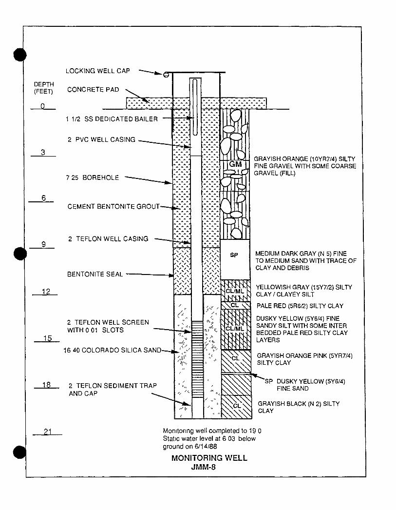
DEPTH (FEET)
0
12
15
13.
21
LOCKING WELL CAP
CONCRETE PAD
1 1/2 SS DEDICATED BAILER
2 PVC WELL CASING
7 25 BOREHOLE
CEMENT BENTONITE GROUT
2 TEFLON WELL CASING
BENTONITE SEAL
GRAYISH ORANGE (10YR7/4) SILTY FINE GRAVEL WITH SOME COARSE GRAVEL (FILL)
2 TEFLON WELL SCREEN WITH 0 01 SLOTS
16 40 COLORADO SILICA SAND
2 TEFLON SEDIMENT TRAP AND CAP
MEDIUM DARK GRAY (N 5) FINE TO MEDIUM SAND WITH TRACE OF CLAY AND DEBRIS
YELLOWISH GRAY (15Y7/2) SILTY CLAY/CLAYEY SILT
PALE RED (5R6/2) SILTY CLAY
DUSKY YELLOW (5Y6/4) FINE SANDY SILT WITH SOME INTER BEDDED PALE RED SILTY CLAY LAYERS
GRAYISH ORANGE PINK {5YR7/4) SILTY CLAY
SP DUSKY YELLOW (5Y6/4) FINE SAND
GRAYISH BLACK (N 2) SILTY CLAY
Monitoring well completed to 19 0 Static water level at 6 03 below ground on 6/14/88
MONITORING WELL JMM-8
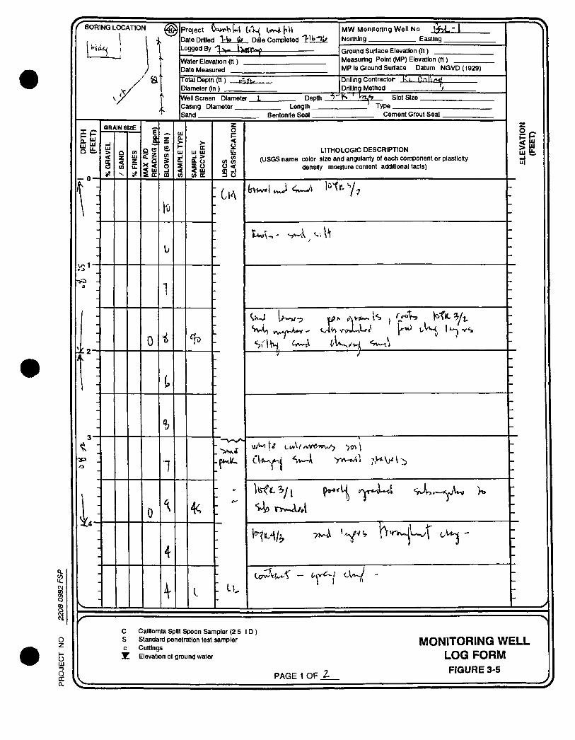
J3 HI
- 0 -
l O -
BORING LOCATION
\
) Si
tin QRMN SIZE
E Q.
a • (3
< UJ S oc
0
1
4
Project Oa*T«Vii»-i
Date Drilled I k Logged By i X T P " ^
1 I . 'VJ l ^ f i H
Dale Completed " T ' * ' ' ^
Water Elevation (tt) Date Measured
Total Depth (tt) Diameter fin) _
M W Monitoring Well No i f > L - I Northing Easting
Ground Surface Elevation (ft) Measuring Point (MP) Elevation (ft) MP Is Ground Surface Datum NGVD(ig29)
Well Screen Diameter. Casing Diameter Sand
Depth .
Drilling Contractor Drilling Method
^ - r - r
Length. Bentonite Sea l .
Slot Size. Type
Cement Grout Seal
UJ Ul -I > a o s o < UJ (A CC
4c
< o u. o <
<n -I 3 u
CiA
LITHOLOGIC DESCRIPTION (USGS name color size and angularity of each component or plasticity
density moisture content additional tacts)
1/ ' >
is > ^ m fc. Ul
C California Spilt Spoon Sampler (2 5 ID) S Standard penetration test sampler c Cuttings
Z Elevation ot ground water
PAGE 1 OF t _
MONITORING WELL LOG FORM FIGURE 3-5
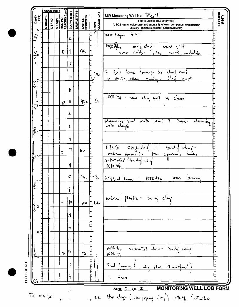
o z I -o 111
o
Q R A I N S I Z E
MA
X.
PID
1
RE
AD
ING
(ppm
) i
BL
OW
S(6
IN)
II
SA
MP
LE
TY
PE
* II
SA
MP
LE
RE
CO
VE
RY
uses
C
LA
SS
IFIC
AT
MW Monrtorina Well No IVSL' 1
ELE
VA
TIO
N
(FE
ET)
1%
GR
AV
EL
Q Z < (A
% F
INE
S
1
MA
X.
PID
1
RE
AD
ING
(ppm
) i
BL
OW
S(6
IN)
II
SA
MP
LE
TY
PE
* II
SA
MP
LE
RE
CO
VE
RY
uses
C
LA
SS
IFIC
AT
MW Monrtorina Well No IVSL' 1
ELE
VA
TIO
N
(FE
ET)
1%
GR
AV
EL
Q Z < (A
% F
INE
S
1
MA
X.
PID
1
RE
AD
ING
(ppm
) i
BL
OW
S(6
IN)
II
SA
MP
LE
TY
PE
* II
SA
MP
LE
RE
CO
VE
RY
uses
C
LA
SS
IFIC
AT
LITHOLOGIC DESCRIPTION (uses name color size and singularity of each component or plastlctty
density moisture content additional facts) ELE
VA
TIO
N
(FE
ET)
-- c
%
0 1 \ 1
- \ 1
•t; i :
7
\
: X . V »WTS^ ' -vA-J^ *7K-4i., - CU^i W-».U
T . V
\ - II
: X .
li • '
1 : 7 : ;i
^0<t^/4 - VvA 6 J W
o
! : -
/\ - ^A^ Ac tn^> "jw^ A^^rv wKv/ 1 ^^Js^ - v/'i-^v.«lv-
L. • •7 -
f -i "
4 -
1
r
T X -
ST : ? -
u
-
A : 4
-
-
3
1 1
- -
1 -
1 : //I -
z. H -
•
1J.U
-J
MONITORING WELL LOG FORM ^ PAGE OF 2 .
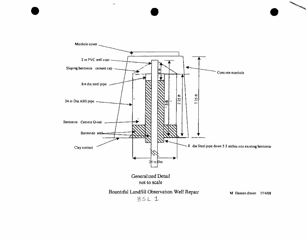
Manhole cover
2 in PVC well iisei
Sloping bentonite cement cap
8in dia steel pipe
24 in Dm ABS pipe
Bentonite Cement Giout
Bentonite sea
Clay contact
Conciete manhole
8 dia Steel pipe down 5 5 mches mto existing bentonite
Generalized Detail not to scale
Bountiful Landfill Observation Well Repair M Hansen drawn 7/14/08
I Q CO O
o z
O DC Q.
BORING LOCATION
ui UJ Q fc
I
« 3 -
Project U - J - j v U
Dale Drilled 1 l'a"^>/ Date Con^leted _ Logged By •''*W>
Water Elevation (ft) Dale Measured
Trial Depth (tt) Diameter (In) _
MW Monitoring Well No b ^ - ' Z ' Norihing Easting
Ground Surface Elevation (tt) Measunng Point (MP) Elevation (fl) MP Is Ground Surface Datum NGVD(1929)
DnIIIng Contractor _ k C _ ^ y i J i Drilling Method
WeU Screen Diameter. C«ing Diameter Sand
Deplh . - I S Slot S ize . Length.
Bentonite Sea l . Type.
Cement Grout Sea l .
GRAIN SIZE E B.
a
9 g < UJ S QC
V
3
>-oc
UJ UJ _1 > t o s u < UJ u) oc
o I-<
(AS; o < CA -I 3 U
- Co
LITHOLOGIC DESCRIPTION (Uses name color size and angularity of each component or plasticity
density moisture content additional facts)
V l l - ryvTTt ^ l ^ ^ \ ^ /v^ / ^ I j ^ ^
P'T.K
h ui fc. U l
C Calltomia Split Spoon Sampler (2 5 ID) S Standard penetration test sampler c Cuttings
!
o z
o LU —3 o oc Q .
11
0
] \
GRAIN SIZE E a
g o
< UJ Z (E
i
> (E
Ul UJ
s u < UJ tn CC
- r I I
^0
u
(A (A U < (A J 3 O
: t t
_ I
- U
MW Monitoring Weil No ^h^-Z-
LITHOLOGIC DESCRIPTION (uses name color size and angularity of each component or plasticity
density moisture content additional facts)
s7
^ Itw^ - l/tW fyf-f^^ <^J[
•7t>/i
4' <;«>^ \ w . • X f c ^
PAGE > OF V MONITORING WELL LOG FORM
/r
(NOT TO SCALE)
WELL NUMBER B S L " 2. GEOLOGIST TOK\ mUM?
DATE CONSTRUCTION STARTED 1"'^"^^ DATE CONSTRUCTION COMPLETED
RELEVANT INFORMATION (Problems corrective actions)
CASING SCHEDULE
RISER TYPE S ^ H g P U L g 4o T>VC-
RISER DIAMETER 2 T N C H X D
RISER LENGTH F E £ T
SCREEN TYPE "Sc^fejuLg 4<> Puc- -FACrdi^'^ SLOrTsD
SCREEN LENGTH IQ F&ET
SCREEN DIAMETER ^ JNtm x b ,r ... .^i- ,
PROTECTIVE CASING TYPE , LENGTH DIAMETER tTfr. 3^r/lffl>^^ < 'g"' ( Q| ^
O ^ / i^oor CEMENT GROUT INTERVAL
- 3 F^£T
3 fSET
CL - S/A
TOP OF BENTONITE SEJBLL
BENTONITE TYPE
5 - 16 f £ F r
TOP OF SAND PACK
SAND SIZE ^^h°
SCREENED INTERVAL (Beginning and ending depth below ground surface)
SLOT SIZE
\5 FE£r
15 P££T
uses CLASSIRCATION OF FORMATION MATERIAL IN SCREENED INTERVAL
DEPTH OF CASING (Below ground surface)
BOREHOLE DEPTH
ANNULAR VOLUME
V=icH(R?-flJ)
WHERE
V s Annular Volume (tt >) 10 3142
H = Length of Interval (It) R Borehole Radius (tt)
R = Well Casing Radius (tt)
CALCULATIONS
^ MONTGOMERY WATSON
MONITORING WELL CONSTRUCTION FORM
J
Q,
O UJ - J
o Q.
BORINS LOCATION
T
Project
Date Drilled 1 II* Data Con^J le ledTJ i l l l t . Logged By ' ^ r , , W f f l r ^
E UJ
gfc
GRAIN SIZE
9
B a.
Q a
< UJ
S en
Water Elevation (ft) Date Measured
Total Depth (ft) Diameter (in) _
1" ' S'
M W Monitoring Well No ^ Northing Easting
Ground Surface Elevation (ft) Measunng Point (MP) Elevation (ft) MP Is Ground Surface Datum NQVD(1929)
Dnlling Contractor Drilling Method _ 1
Well Screen Diameter. Casing Diameter Sand
Length Bentonite Sea l .
Depth Slot Size Type.
Cement Grout Sea l .
>• CC
Ul Ul _1 > & O
s o < UJ (A OC
< in
in in o < in -1 3 u
LITHOLOGIC DESCRIPTION (uses name color size and anguliirlty of each component or plastlctty
density moisture content additional facts)
h u fc, _ i UJ
C California Spilt Spoon Sampler (2 5 ID) S Standard penetration test sampler c Cuttings
Z Elevation of ground water
PAGE 1 OF 2-
MONITORING WELL LOG FORM FIGURE 3-5
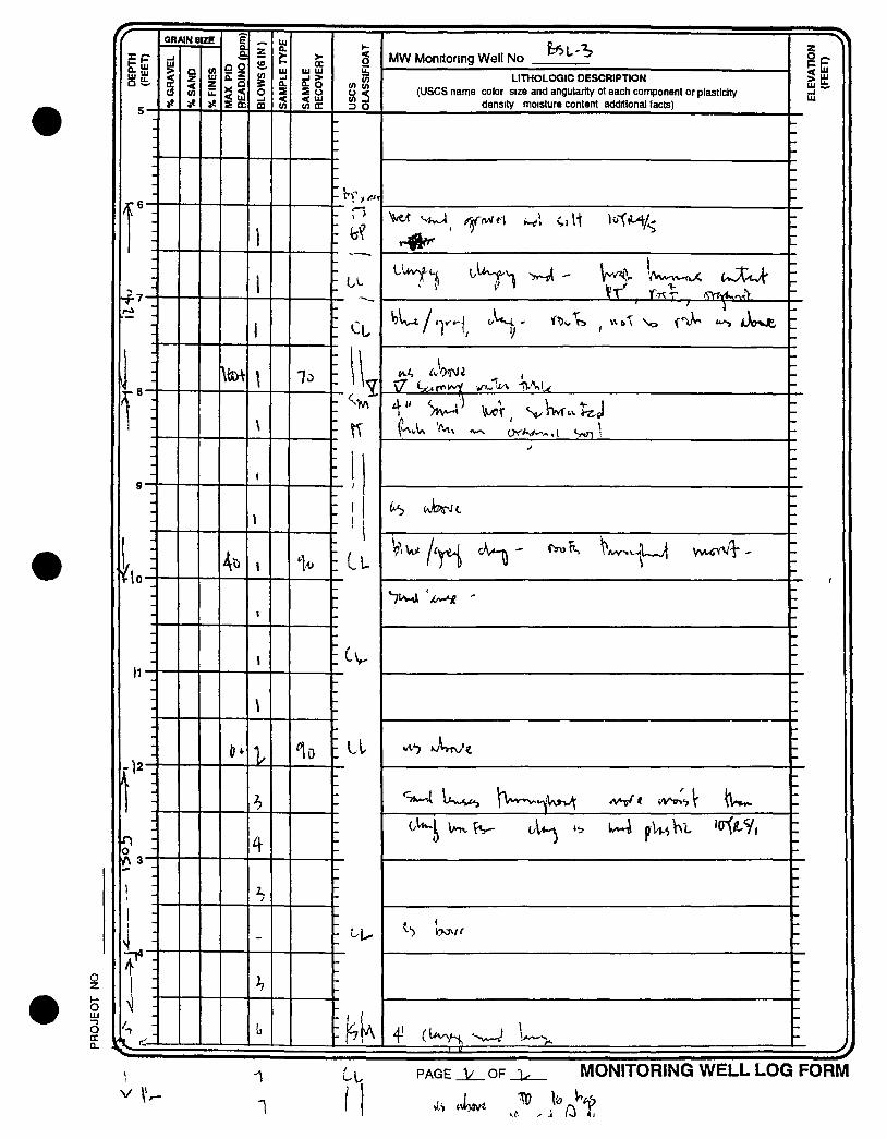
rr
o
o CC CL
E P
Q St.
I': o / \ 3 -
\ -
GRAIN SIZE
g O
S fic
1
oc UJ UJ _ l > ^ O < Ul in CC
lo
< o
CA (A U < (A -1 3 O
A
MW Monitoring Well No
LITHOLOGIC DESCRIPTION (Uses name color size and angularity ot each component or plasticity
density moisture content additional facts)
\7 ^ r f t ^ vfJV> 1VV|^
ft
4-' I
It
PAGE OF j u ^ MONITORING WELL LOG FORM
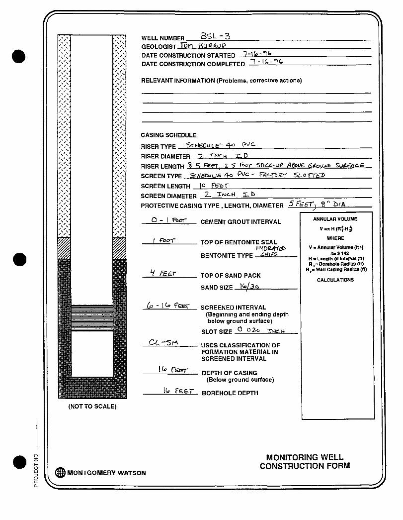
/r
(NOT TO SCALE)
WELL NUMBFR B S L - 3 GEOLOGIST Ton \gutg(?oP
DATE CONSTRUCTION STARTED '\-\^~'^^
DATE CONSTRUCTION COMPLETED
RELEVANT INFORMATION (Problems, corrective actions)
CASING SCHEDULE
RISER TYPE SgrigPuLg- ^ V^^^
RISER DIAMETER ~>- ^^^H X .D
RISER LENGTH "B PECTj Z S f ^ r SXiOCo^ / fioi E (<:griu>jl> Sog-rij^ig
SCREEN TYPE "ScHeXMU^ 4<a P < " 'F^'^r&gy SiLd THf:^
SCREEN LENGTH |0 F t ^ f 2. Xwc-ri X,_^ ^ _ SCREEN DIAMETER
PROTECTIVE CASING TYPE , LENGTH, DIAMETER ^ fl=ET^ " b/A
O - I fe«5r
/ ft>or
CEMENT GROUT INTERVAL
TOP OF BENTONITE SEAL
BENTONITE TYPE ' ^ ' ^
TOP OF SAND PACK
SAND SIZE l /3g>
SCREENED INTERVAL (Beginning and ending depth) below ground surface)
SLOT SIZE Q TiOc.i4-
ANNULAR VOLUME
V=jcH(Rf-H3
WHERE
V s Annular Volume (tt >) Ite3142
H - Length ot Interval (ft) R ,= Borehols Radius (tt)
R,s Wall Casing Radius (tt)
CALCULATIONS
uses CLASSIRCATION OF FORMATION MATERIAL IN SCREENED INTERVAL
DEPTH OF CASING (Below ground surface)
BOREHOLE DEPTH
@ MONTGOMERY WATSON
MONITORING WELL CONSTRUCTION FORM
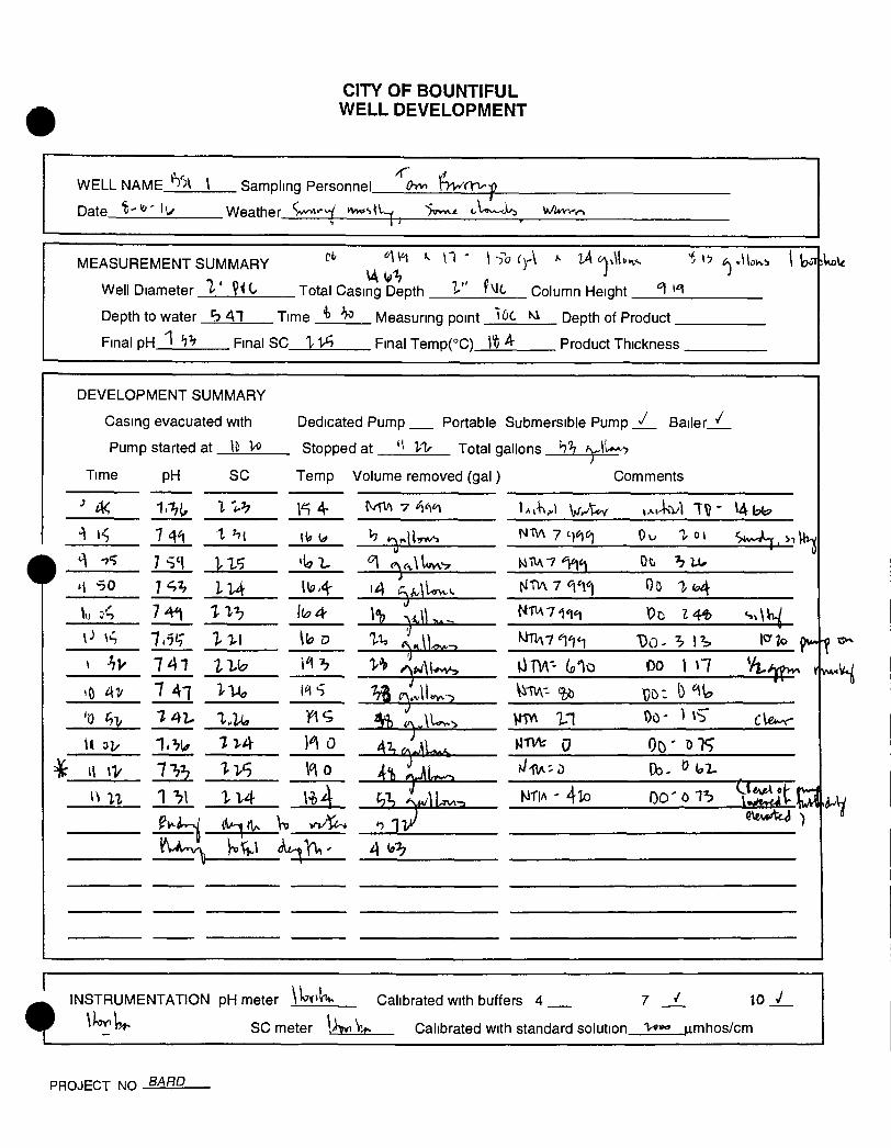
CITY OF BOUNTIFUL WELL DEVELOPMENT
WELL NAME_^5^L_L_ Sampling Personnel "^C^ "frworv-y
Date ' i ^ ^ ' lu Weather ^y^'^^ ivwsUw '>qvv.< ww.'rt
fvic Column Height
MEASUREMENT SUMMARY " "
Well Diameter t'' ViC Total Casing Depth
Depth to water h 41 Time ^ ^ Measuring point KV Depth of Product _
Final p H _ l _ ! 7 5 _ _ Final SC 1 1 ^ Final TemD(°C) It ^ Product Thickness
DEVELOPMENT SUMMARY
Casing evacuated with
Pump started at \i
Dedicated Pump Portable Submersible Pump j / .
Stopped at Vl- Total gallons b'h y \ l ^>
Bailer
Time pH SC Temp
^ A< I %^ 1 4->4 • 7 ' ; 7 SI
M 50 7 ^2, l U : ^
P \^ 7.7^' lv\ \ hv 741 IVo ^
7 41
•0 7 42- ^•5
7r4- ) 0
7^^ H 0
1 'h\ H 4
Volume removed (gal) Comments
1 ot
Ot. ^ LU
i4
IT,
i-»vvS 00 1 n
4^ ,-/yjL^
•71
MTlA - 4 lo
4
H
1
INSTRUMENTATION pH meter \UiU> Calibrated with buffers 4 7 10 _ ^
^ 4 ^ ^ SC meter \>^V^ Calibrated with standard solution 1 ^ |imhos/cm
PROJECT NO B^f^^
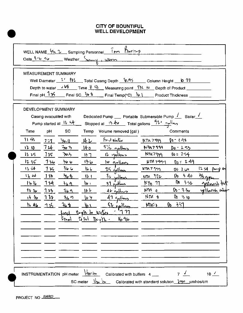
CITY OF BOUNTIFUL WELL DEVELOPMENT
WELL NAME S')v 1 Sampling Personnel hwTrw^
Oate_^JoJlk Weather S>/v^—/ ^ Mtuu-rr^ 0
MEASUREMENT SUMMARY
Well Diameter ^ ' Total Casing Depth '^1*^5 Column Height lO "IH
Depth to water *' Time V ''^ Measunng point TD*- M Depth of Product _
Final DH I'V? Final SC V Final Temp( °C)_W_L__ Product Thickness .
DEVELOPMENT SUMMARY
Casing evacuated with Dedicated Pump Portable Submersible Pump _ l _ Bailer_
Pump started at Stopped at ^ Total gallons *?'V'
Volume removed (gal) Comments Time pH SC Temp
W ^
'70^ 14-0 719 ''70.h
\\
\l , o4 ] W lb 1
IV\li l i A
'\
\h 71?
V, All
-ft^^ \v \f iK^ ' "111
1 »x^L^ KiV) 11 Ot 3S2. ' Y ^ w ' ^ W r
41 OUws tTVt i> Do -^o
^^ Y'^U. ^^^^ Oa
INSTRUMENTATION pH meter W^V?" Calibrated with buffers 4 1 lOj^L
SC meter V Calibrated with standard solution VtfQ^ |xmhos/cm
PROJECT NO 5.4ffD
CITY OF BOUNTIFUL WELL DEVELOPMENT
WELL NAME
Date A i l J l k .
Sampling Personnel.
Weather y^f^-^ ,
MEASUREMENT SUMMARY
Well Diameter V ' t/
Depth to water ^
Final DH 1 Final SC
Total Casing Depth ''^ " " Column Height [& l"?
Time. . Measunng point VX Ni Depth of Product _
Final Temp(°C) "b V Product Thickness .
DEVELOPMENT SUMMARY
Casing evacuated with
Pump started at.
Time pH SC
Dedicated Pump
Stopped at I" ^1
Temp Volume removed (gal)
Portable Submersible Pump
Total gallons ^\
I Bailer_
Comments
10 / q l
lb Ov 1- fall n* ^ 4/1 us )b iV 1% Hi) ^ l U s
' ' ^ r y-t—'
^ n v \ ' ^ b " 7 > 4 cla<>vet-
V1V\ 0
]t? 31 14(, >
INSTRUMENTATION pH meter l^^-^ Calibrated with buffers 4 7 _^ ^0 J_
SC meter \-\v.p> Calibrated with standard solution '^V'"^ |imhos/cm
PROJECT NO Q'^^P
CAD l ile Drawn By Date Project No G\\011560800-01 DWG J Estrada 08/11/10 0115608 00
4214 33
Potentiometr/c Surface Map Marcfj2070
ERM 08/W
TAI BOUNTIFUL SAI
SUMMARY OF WATER L1 Y LANDFILL
EL MEASUREMENTS
age 1 of 2
Date/Well DC 1 DC 2 DC 3 DC-4 JMM 1 JMM 2 JMM 3 JMM-4 JMM 5 JMM 6 JMM 7 JMM 8 BSL 1 BSL 2 BSL 3 P 1 P 2 P 3 P-4 P 5 P 6 P 7 p a 8/26/92 7 68 5 62 12 56 8 26 8 16 7 46 5 88 14 02 6 48 11 1 10 88 13 28 NM NM NM 2 32 NM 1 36 8 54 NM 5 1 6 37 9/29/92 7 76 5 49 12 36 8 18 79 7 32 3 54 13 78 6 58 11 98 10 24 134 NM NM NM 2 34 NM 1 46 8 78 NM 48 5 94 3 78
10/23/92 7 84 5 68 12 8 38 8 84 7 48 5 68 13 42 6 84 11 99 10 24 12 76 NM NM NM 2 26 NM 1 54 8 82 NM 5 04 5 96 38 1/20/93 4 94 5 09 10 12 7 85 3 54 6 13 2 45 12 37 NM 9 96 9 59 9 57 NM NM NM 09 NM NM 8 NM 421 4 86 3 21 2/20/93 1 06 4 18 9 34 7 3 2 46 5 52 2 11 94 5 42 92 9 1 9 34 NM NM NM OTC NM OTC 7 86 NM 3 14 5 1 3 1 3/26/93 1 44 45 10 04 6 72 3 44 6 04 2 89 12 36 5 62 9 38 9 22 9 82 NM NM NM OTC NM OTC 8 04 NM 3 82 4 9 2 96 4/21/93 1 72 4 56 10 29 7 02 3 68 6 14 3 1 12 46 6 04 9 76 96 9 72 NM NM NM 05 NM OTC 8 06 NM 4 24 5 22 2 92 5/20/93 2 22 4 56 9 54 6 54 4 28 5 86 4 04 12 48 5 64 8 44 8 34 9 34 NM NM NM 06 NM OTC 4 08 NM 3 34 4 64 2 96 6/16/93 34 4 54 104 6 74 4 86 65 5 12 12 52 5 74 9 16 9 06 10 06 NM NM NM 0 74 NM 0 45 8 12 NM 3 96 4 84 3 02 7/21/93 5 38 5 1 13 64 7 24 6 52 7 4 54 13 52 6 18 9 72 9 56 12 NM NM NM 1 4 NM 0 98 8 24 NM 3 84 5 14 3 1 8/18/93 6 24 5 34 11 62 74 7 18 6 92 6 58 13 44 7 34 9 76 9 56 12 02 NM NM NM 1 64 NM 0 16 8 38 NM 4 28 5 26 3 12 9/15/93 7 28 5 58 12 7 64 7 28 7 12 8 22 13 96 6 54 10 04 98 12 54 NM NM NM 1 92 NM 1 64 8 52 NM 4 52 53 3 18
10/26/93 6 88 5 68 11 08 79 5 84 6 34 7 14 12 72 6 84 10 08 98 11 4 NM NM NM 1 62 NM 0 82 87 NM 4 72 54 3 26 11/17/93 6 72 56 11 24 7 98 5 82 6 62 6 76 12 98 6 72 10 64 9 82 11 54 NM NM NM 1 44 NM 1 1 8 68 NM 4 44 5 34 33
1/1/94 5 32 5 32 10 84 8 22 4 68 6 1 5 12 12 46 7 1 98 10 74 9 72 NM NM NM 1 71 NM 3 12 8 52 NM 46 5 14 3 26 2/17/94 3 1 5 04 10 52 7 88 3 52 6 02 39 12 35 6 96 9 98 98 96 NM NM NM 05 NM 1 04 8 44 NM 3 74 5 12 3 24 3/16/94 1 68 5 16 10 18 8 06 3 48 5 92 3 14 12 46 6 64 10 02 9 82 97 NM NM NM 0 45 NM 03 8 34 NM 4 5 3 3 24 4/21/94 2 06 4 74 10 54 8 02 3 96 6 08 3 66 12 5 69 97 96 10 16 NM NM NM 0 06 NM OTC 8 26 NM 4 46 5 34 3 16 5/25/94 3 78 5 1 11 8 04 4 74 6 58 5 1 12 7 7 9 92 96 11 38 NM NM NM 0 74 NM 0 25 83 NM 4 46 5 32 3 18 6/21/94 5 28 4 76 11 76 84 5 86 6 88 7 02 136 73 10 44 9 84 12 2 NM NM NM 1 24 NM 0 92 8 36 NM 4 82 5 54 3 26 7/13/94 6 48 5 32 12 3 8 58 6 18 6 86 8 74 14 7 54 10 88 10 1 12 44 NM NM NM 1 38 NM 1 4 85 NM 49 56 3 38 7/29/94 NM 5 57 12 92 NM 6 89 6 99 NM 14 33 NM 12 07 10 32 12 7 NM NM NM NM NM NM NM NM NM NM NM 8/17/94 7 72 5 72 127 9 14 6 12 6 98 6 12 14 48 7 86 10 46 11 26 12 98 NM NM NM 1 62 NM 1 46 8 74 NM 53 58 3 52 9/21/94 83 5 94 12 58 99 5 84 7 8 02 14 76 8 12 10 86 12 12 13 48 NM NM NM 1 76 NM 1 74 9 NM 54 64 3 68 1/5/95 NM 5 14 10 27 NM 3 71 5 91 NM 12 36 NM 9 68 9 55 9 78 NM NM NM NM NM NM NM NM NM NM NM 1/9/96 618 5 25 10 29 8 36 418 5 83 4 47 12 51 6 73 93 9 39 10 52 NM NM NM NM NM NM 9 08 NM 5 22 8 33 3 56 6/5/96 3 47 4 15 10 58 8 14 3 74 6 14 5 26 12 54 57 95 9 39 10 52 NM NM NM NM NM 3 78 8 25 NM 4 44 5 2 3 48
9/23/96 7 78 5 33 10 48 86 5 15 6 09 3 49 14 35 6 95 9 45 9 44 12 57 5 63 6 01 82 NM NM 3 75 8 75 NM 4 59 5 26 3 84 12/10/96 3 42 4 27 NM NM 2 58 4 76 2 23 12 21 NM NM 93 97 5 11 4 96 8 11 NM NM 3 75 9 09 NM NM 4 97 3 85 3/17/97 NM NM 10 54 9 12 3 87 6 02 3 29 126 6 08 9 98 9 97 10 16 5 71 5 82 8 62 NM NM 4 02 8 48 NM 4 92 5 47 3 78 6/19/97 NM 43 10 64 8 47 3 45 5 76 3 93 12 52 5 61 9 53 9 52 10 92 5 42 5 91 8 47 NM NM 3 81 8 44 NM 4 56 5 17 3 53 9/12/97 4 5 33 11 93 8 85 4 39 6 34 6 58 14 72 6 46 98 9 82 12 76 7 82 6 79 8 56 NM NM 4 02 8 96 NM 4 86 5 44 3 98
12/10/97 3 49 5 23 10 38 8 93 4 21 5 42 5 47 14 01 7 33 9 31 9 39 10 89 5 58 5 41 8 05 NM NM 3 74 9 15 NM 4 79 8 38 3 75 3/12/98 0 58 3 58 9 23 7 26 2 09 5 15 2 28 11 66 58 9 27 92 9 39 5 13 4 59 7 98 NM NM 3 58 8 25 NM 4 63 4 17 3 49 6/15/98 2 09 42 10 08 82 3 66 5 52 4 59 12 48 5 52 94 9 35 9 95 5 11 55 8 16 NM NM 4 03 8 44 NM 4 74 5 02 3 62 9/16/98 61 4 76 11 49 8 31 5 21 5 91 6 84 13 96 5 98 9 65 9 56 12 53 5 56 6 45 84 NM NM 3 75 8 47 NM 47 5 15 3 51
12/16/98 6 58 5 16 10 51 8 77 4 58 5 75 4 54 13 32 6 96 9 53 9 57 11 04 5 67 5 66 8 31 NM NM 3 81 8 78 NM 5 22 4 83 3 55 3/25/99 2 95 4 81 10 54 88 38 5 83 3 86 12 86 6 03 9 76 9 81 10 53 5 52 5 82 8 55 NM NM 3 69 8 33 NM 4 57 4 95 3 56 6/24/99 4 03 2 3 11 1 8 64 3 61 5 86 4 86 12 16 5 28 10 9 79 11 7 5 62 6 37 8 63 NM NM 3 22 8 15 NM 4 55 5 28 3 58 9/23/99 7 22 4 64 11 6 89 4 2 6 55 8 06 10 21 6 35 97 9 73 12 34 5 75 66 8 51 NM NM 3 66 8 61 NM 4 87 5 32 3 77
12/17/99 6 16 5 21 10 76 906 3 86 57 6 71 13 75 7 01 9 77 9 84 11 62 5 66 5 93 8 58 NM NM 3 66 8 88 NM 4 98 5 46 3 75 4/1/00 2 61 4 88 10 15 8 91 3 71 5 71 3 43 12 36 6 17 9 55 9 61 10 08 5 53 5 47 8 35 NM NM 3 78 8 25 NM 4 89 NM 3 81
All Measurements are from the top of PVC casing measured in feet NM=Not Measured OTC=Over the Casing
TAI BOUNTIFUL SA!
SUMMARY OF WATER Y LANDFILL
EL MEASUREMENTS
ge 2 of 2
Date/Well DC 1 DC 2 DC 3 DC-4 JMM 1 JMM 2 JMM 3 JMM 4 JMM 5 JMM 6 JMM 7 JMM 8 BSL 1 BSL 2 BSL 3 P 1 P 2 P 3 P-4 P 5 P 6 P 7 P 8
6/22/00 4 86 5 37 11 22 8 71 5 03 6 86 7 98 1381 6 07 95 9 55 11 89 5 95 62 8 29 NM NM 3 98 8 58 NM 5 47 5 16 3 82 9/14/00 8 21 5 72 10 78 8 53 6 61 6 58 6 73 14 85 6 68 9 37 9 41 13 55 5 85 5 81 8 17 NM NM 37 8 97 NM 4 8 4 98 4
12/13/00 7 02 5 35 10 09 8 72 4 79 5 96 3 47 13 18 6 49 9 55 9 56 10 09 5 61 5 45 8 32 NM NM 3 74 9 1 NM 5 24 5 26 39 3/22/01 1 28 4 28 9 86 7 84 3 31 5 79 23 11 97 5 65 9 45 9 51 9 69 5 38 5 38 8 33 NM NM 3 47 8 13 NM 4 98 0 1 37 6/28/01 4 57 47 11 46 8 91 6 01 6 59 2 96 13 74 5 71 9 69 9 64 12 09 5 87 7 05 8 41 NM NM 3 19 8 23 NM 4 85 5 12 3 62 9/14/01 7 85 5 56 11 66 8 77 7 42 6 72 4 39 14 92 6 42 9 68 9 62 12 99 5 86 6 51 8 35 NM NM 3 52 8 67 NM 4 85 4 76 3 82 12/5/01 33 4 54 9 5 8 57 4 78 5 62 2 14 12 62 6 15 9 11 9 37 6 75 5 36 5 7 97 NM NM 3 59 9 04 NM 4 78 4 62 3 75 3/21/02 1 27 47 9 95 8 93 2 98 5 88 2 18 124 5 94 96 9 61 9 69 8 49 47 8 35 NM NM NM 8 24 NM 5 01 5 03 3 65 6/20/02 4 38 4 52 11 33 9 5 14 6 66 3 31 13 36 5 54 10 01 9 76 11 96 5 04 64 8 54 NM NM NM 8 53 NM 48 5 08 3 75 9/26/02 7 57 5 65 11 04 8 81 7 86 6 88 4 08 14 6 47 9 45 9 48 11 69 5 84 6 1 8 22 NM NM NM 6 76 NM 4 94 4 84 4 04 12/4/02 7 46 57 10 81 9 05 7 1 6 72 4 95 14 7 04 9 61 9 65 11 35 5 82 5 92 8 41 NM NM NM 7 94 NM 5 16 4 95 4 3/27/03 4 24 5 08 10 15 9 08 3 85 57 2 93 1321 7 03 9 48 9 59 10 28 56 5 39 8 303 NM NM NM 8 16 NM 7 21 5 04 3 76 6/18/03 5 73 5 66 11 36 9 06 5 55 68 3 44 1361 6 54 97 9 75 12 16 5 92 6 38 8 43 NM NM NM 8 22 NM 4 68 5 16 3 83 9/24/03 8 38 5 17 11 13 8 89 Dry 7 02 3 56 142 7 13 9 38 9 49 11 5 4 94 6 14 8 17 NM NM NM 8 73 NM 4 72 49 4 04
12/12/03 7 03 5 45 10 26 9 12 Dry 6 22 3 81 137 7 07 9 16 9 86 10 32 5 79 5 81 8 65 NM NM NM 8 77 NM 4 74 5 03 3 89 3/12/2004 1 07 3 73 9 65 8 44 2 83 5 49 22 10 24 6 23 9 16 9 28 9 59 5 29 5 05 88 NM NM NM 7 83 NM 4 64 4 84 3 49 6/18/2004 4 18 45 10 86 8 79 6 76 6 44 4 15 11 46 6 35 9 47 9 65 11 63 57 6 42 8 31 NM NM NM 7 47 NM 46 4 92 3 51 9/30/2004 77 6 02 11 16 9 64 Dry 7 02 4 37 13 74 NM 9 54 10 36 13 51 6 6 04 8 62 NM NM NM 84 NM 48 56 3 98
12/10/2004 5 59 5 1 9 62 9 12 6 32 56 2 16 12 44 NM 93 97 9 82 5 42 4 94 8 24 NM NM NM 8 33 NM 5 28 6 16 3 76 3/18/2005 23 4 45 10 24 88 4 31 6 03 3 14 11 5 34 9 33 9 56 10 46 56 57 8 21 NM NM NM 7 53 NM 4 66 5 02 3 54 6/24/2005 3 3 98 10 51 8 58 5 45 5 56 4 28 10 68 53 93 9 54 10 95 5 56 5 84 82 NM NM NM 6 98 NM 4 66 47 3 28
9/19/05 6 64 5 52 11 36 9 Dry 6 58 47 12 82 54 96 9 74 12 02 5 03 6 35 8 41 NM NM NM 7 55 NM 4 91 4 88 3 51 12/6/2005 5 7 5 25 10 36 8 86 Dry 6 18 4 36 12 74 68 94 9 66 10 7 5 79 6 42 8 31 NM NM NM 8 12 NM 4 81 5 82 4 34
3/17/06 1 47 9 44 9 92 2 83 5 46 3 76 10 68 5 28 9 56 93 96 5 28 4 88 8 14 NM NM NM 7 49 NM 2 96 48 5 36 6/23/2006 4 36 4 14 108 8 94 67 5 76 4 5 11 26 4 48 9 66 99 11 44 5 58 5 98 8 58 NM NM NM 7 1 NM 4 84 5 52 34
9/14/06 6 68 52 11 38 8 8 Dry 5 76 54 13 18 5 12 9 65 9 62 12 88 5 36 6 52 8 32 NM NM NM 7 74 NM 4 56 5 24 3 08 12/5/2006 57 5 27 10 26 87 78 5 94 42 12 64 6 44 9 16 9 36 104 57 56 8 02 NM NM NM 8 1 NM 4 62 47 NM
3/22/07 1 52 4 78 99 12 78 3 79 5 44 4 14 11 74 5 34 9 9 36 9 88 5 36 4 94 8 06 NM NM NM 75 NM 5 14 5 04 NM 6/15/2007 3 82 4 92 105 12 87 7 27 6 25 3 NM 53 9 1 9 11 11 32 5 68 5 75 8 17 NM NM NM 4 11 NM 5 09 5 28 NM
9/27/07 7 08 5 73 10 34 12 7 Dry 6 52 4 71 9 72 6 28 8 86 10 23 108 5 08 5 5 7 91 NM NM NM 4 72 NM 4 99 5 02 NM 12/20/2007 2 55 5 82 9 53 12 43 Dry 5 46 3 57 9 72 5 81 8 84 92 9 56 NM 4 71 7 79 NM NM NM 43 NM 5 74 4 83 NM
3/27/08 1 52 4 14 9 87 12 58 3 97 5 79 3 63 7 78 49 8 91 9 25 10 06 4 04 6 26 79 NM NM NM 5 59 NM 5 01 5 01 NM 6/27/2008 3 16 4 91 10 87 12 68 3 97 6 45 3 84 8 71 NM 9 04 9 44 11 95 3 21 5 98 8 07 NM NM NM NM NM 5 01 5 28 NM
9/23/08 6 82 4 46 10 83 12 78 Dry 6 61 4 47 9 76 7 86 9 07 9 44 11 77 53 5 82 8 08 NM NM NM 4 54 NM 5 08 5 23 NM 12/22/2008 4 96 4 49 10 14 12 59 Dry 6 32 3 92 NM 5 56 93 9 83 10 16 4 15 5 49 8 47 NM NM NM NM NM 4 64 4 83 NM 3/12/2009 1 22 3 88 9 81 12 98 3 65 5 67 3 48 7 46 NM 9 42 10 06 9 76 3 59 6 31 8 57 NM NM NM 4 5 NM 5 18 7 54 NM 6/16/2009 2 51 4 48 9 88 12 66 5 26 5 74 3 27 7 92 4 27 9 08 10 44 10 51 4 1 6 29 8 12 NM NM NM 43 NM 5 08 5 43 NM 9/24/2009 5 51 5 64 10 68 13 15 Dry 6 58 3 49 9 34 4 26 9 45 9 96 13 31 5 27 5 7 8 53 NM NM NM 4 78 NM 5 41 5 83 NM
12/21/2009 4 73 4 52 10 15 12 98 Dry 6 34 3 54 8 38 5 68 9 54 9 98 10 96 4 32 5 57 8 68 NM NM NM 4 34 NM 5 24 5 54 NM 3/19/2010 1 62 5 9 76 12 62 4 72 5 63 3 27 7 51 5 46 9 27 9 96 9 82 3 64 5 35 8 42 NM NM NM 4 35 NM 5 26 5 65 NM
All Measurements are from the top of PVC casing measured in feet NM=Not Measured OTC=Over the Casing
TABLE 2
CHRONOLOGICAL SUMMARY OF VOLATILE ORGANIC COMPOUNDS ANALYSIS BOUNTIFUL SANITARY LANDFILL
(Paget of 12)
I.I Well Date
Number Sampled Regulatory Standards
" "a ' at o V
4,000
Acr
olei
n O
ig/1
Acr
jio
nit
rile
l
Ben
zene
(jig
/l;
Bro
mo
dic
hlo
r
Bro
mo
chlo
roi
Bro
mo
form
Bro
mo
met
har
2-B
uta
no
neO
(m
ethy
l/et
hyl
Car
bo
n di
sull
Car
bo
n te
tra(
Chl
orob
enze
r
Ch
loro
eth
ane
1
Ch
loro
form
(,
Ch
loro
met
ha
Dib
rom
om
ett
o
Dib
rom
ochi
ol
° ° s ^ i o-E :5 =• 5 O £
1 J 0.2
1,2-
Dic
hlor
ob
o o
a
O U o
5 •4
a
h
=
1,1-
Dic
hlor
oe
o o
5
5 il 7
Well Date Number Sampled
Regulatory Standards
" "a ' at o V
4,000 100 5 inn 10 100 170 4,000 5 100 15,000 100
Ch
loro
met
ha
Dib
rom
om
ett
o
Dib
rom
ochi
ol
° ° s ^ i o-E :5 =• 5 O £
1 J 0.2 600 75
a
h
=
1,1-
Dic
hlor
oe
o o
5
5 il 7
B S H 26-Scp-96 <I0 NA <5.0 <2.0 <2.0 <2.0 <2.0 <5.0 <I0 <2.0 <2.0 <2.0 <5.0 N A <2.0 <2.0 <2.0 <2.0 <0.0I0 <2.0 N A <2.0 <I0 <2.0 <2.0 <2.0
BSL-I ll-Dcc-96 <10 N A <5.0 <2.0 <2.0 <2.0 <2.0 <5.0 <I0 <2.0 <2.0 <2.0 <5.0 N A <2.0 <2.0 <2.0 <2.0 <0.010 <2.0 N A <2.0 <I0 <2.0 <2.0 <2.0
BSL-1 I8-Mar-97 <I0 N A <5.0 <2.0 <2.0 <2.0 <2.0 <5.0 <10 <2.0 <2.0 <2.0 <5.0 N A <2.0 <2.0 <2.0 <2.0 <0.0I0 <2.0 NA <2.0 <I0 <2.0 <2.0 <2.0
BSL-I 19-Jun-97 <10 N A <5.0 <2.0 <2.0 <2.0 <2.0 <5.0 <10 <2.0 <2.0 <2.0 <5.0 N A <2.0 <2.0 <2.0 <2.0 <0.02 <2.0 N A <2.0 <I0 <2.0 <2.0 <2.0
BSL-1 I5-SCP-97 <I0 N A <5.0 <2.0 <2.0 <2.0 <2.0 <5.0 <I0 <2.0 <2.0 <2.0 <5.0 N A <2.0 <2.0 <2.0 <2.0 <2.0 <2.0 NA <2.0 <I0 <2.0 <2.0 <2.0
BSL-1 30-Dec-97 <I0 N A <5.0 <2.0 <2.0 <2.0 <2.0 <5.0 <10 <2.0 <2.0 <2.0 <5.0 N A <2.0 <2.0 <2.0 <2.0 <0.0I0 <2.0 NA <2.0 <I0 <2.0 <2.0 <2.0
BSL-1 l3-Mar-9g <I0 NA <5.0 <2.0 <2.0 <2.0 <2.0 <5.0 <I0 <2.0 <2.0 <2.0 <5.0 N A <2.0 <2.0 <2.0 <2.0 <0.010 <2.0 N A <2.0 <I0 <2.0 <2.0 <2.0
B S H 16-Jun-98 <10 N A <5.0 <2.0 <2.0 <2.0 <2.0 <5.0 <10 <2.0 <2.0 <2.0 <5.0 N A <2.0 <2.0 <2.0 <2.0 <0.010 <2.0 NA <2.0 <10 <2.0 <2.0 <2.0
nsL-i 17-Scp-98 <I0 <I0 <I0 <2.0 <2.0 <2.0 <2.0 <5.0 <10 <2.0 <2.0 <2.0 <2.0 <I0 <2.0 <2.0 <2.0 <2.0 <0.010 <2.0 <2.0 <2.0 <2.0 <2.0 <2.0 <2.0 BSL-I l7-Dec-98 <10 <10 <10 <2.0 <2.0 <2.0 <2.0 <5.0 <10 <2.0 <2.0 <2.0 <2.0 <I0 <2.0 <5.0 <2.0 <2.0 <0.010 <2.0 <2.0 <2.0 <2.0 <2.0 <2.0 <2.0 BSL-I 26-Mar-99 <I0 N A <10 <2.0 <2.0 <2.0 <2.0 <5.0 <I0 <2.0 <2.0 <2.0 <2.0 N A <2.0 <5.0 <2.0 <2.0 O.OIO <2.0 NA <2.0 <2.0 <2.0 <2.0 <2.0 BSL-I 25-Jun-99 <I0 <10 <I0 <2.0 <2.0 <2.0 <2.0 <5.0 <I0 <2.0 <2.0 <2.0 <2.0 <I0 <2.0 <5.0 <2.0 <2.0 O.OlO <2.0 <2.0 <2.0 <I0 <2.0 <2.0 <2.0 BSL-I 23-Scp-99 <I0 <10 <I0 <2.0 <2.0 <2.0 <2.0 <5.0 <I0 <2.0 <2.0 <2.0 <2.0 <I0 <2.0 <5.0 <2.0 <2.0 O.OIO <2.0 <2.0 <2.0 <I0 <2.0 <2.0 <2.0 BSL-1 I7-Dec-99 <I0 <I0 <I0 <2.0 <2.0 <2.0 <2.0 <5.0 <I0 <2.0 <2.0 <2.0 <2.0 N A <2.0 <5.0 <2.0 <2.0 <0.010 <2.0 NA <2.0 <I0 <2.0 <2.0 <2.0
B S H I7-Dec-99'*' <I0 <10 <I0 <2.0 <2.0 <2.0 <2.0 <5.0 <10 <2.0 <2.0 <2.0 <2.0 N A <2.0 <5.0 <2.0 <2.0 <0.0I0 <2.0 N A <2.0 <I0 <2.0 <2.0 <2.0 BSL-I 28-Mar-OO <I0 N A <10 <2.0 <2.0 <2.0 <2.0 <5.0 <I0 <2.0 <2.0 <2.0 <2.0 N A <2.0 <5.0 <2.0 <2.0 <0.I8 <2.0 N A <2.0 <2.0 <2.0 <2.0 <2.0
B S H 28-Mar-00<" <10 NA <10 <2.0 <2.0 <2.0 <2.0 <5.0 <10 <2.0 <2.0 <2.0 <2.0 N A <2.0 <S.0 <2.0 <2.0 <0.18 <2.0 N A <2.0 <2.0 <2.0 <2.0 <2.0 BSL-1 22-Jun-OO <I0 N A <I0 <2.0 <2.0 <2.0 <2.0 <5.0 <I0 <2.0 <2.0 <2.0 <2.0 N A <2.0 <5.0 <2.0 <2.0 <0.010 <2.0 NA <2.0 <2.0 <2.0 <2.0 <2.0
BSL-I 22-Jun-OO'" <I0 N A <I0 <2.0 <2.0 <2.0 <2.0 <5.0 <I0 <2.0 <2.0 <2.0 <2.0 N A <2.0 <5.0 <2.0 <2.0 <0.0I0 <2.0 NA <2.0 <2.0 <2.0 <2.0 <2.0 BSL-I 15-Sep-OO <I0 N A <10 <2.0 <2.0 <2.0 <2.0 <5.0 <I0 <2.0 <2.0 <2.0 <2.0 N A <2.0 <5.0 <2,0 <2.0 <0.010 <2.0 NA <2.0 <2.0 <2.0 <2.0 <2.0
BSL-1 IS-Scp-OO"' <I0 N A <10 <2.0 <2.0 <2.0 <2.0 <5.0 <I0 <2.0 <2.0 <2.0 <2.0 N A <2.0 <5.0 <2.0 <2.0 <0.0I0 <2.0 N A <2.0 <2.0 <2.0 <2.0 <2.0 BSL-I 14-Dcc-OO <I0 N A <I0 <2.0 <2.0 <2.0 <2.0 <5.0 <I0 <2.0 <2.0 <2.0 <2.0 N A <2.0 <5.0 <2.0 <2.0 O.OIO <2.0 NA <2.0 <2.0 <2.0 <2.0 <2.0
BSL-I l4-Dec-00*> <I0 N A <I0 <2.0 <2.0 <2.0 <2.0 <5.0 <I0 <2.0 <2.0 <2.0 <2.0 N A <2.0 <5.0 <2.0 <2.0 O.OIO <2.0 NA <2.0 <2.0 <2.0 <2.0 <2.0 BSL-I 22-Mar-OI <10 N A <5.0 <2.0 <2.0 <2.0 <2.0 <5.0 <I0 <2.0 <2.0 <2.0 <2.0 N A <2.0 <2.0 <2.0 <2.0 O.OIO <2.0 N A <2.0 <2.0 <2.0 <2.0 <2.0
BSL-I 22-Mar-OI*' <I0 N A <5.0 <2.0 <2.0 <2.0 <2.0 <5.0 <10 <2.0 <2.0 <2.0 <2.0 N A <2.0 <2.0 <2.0 <2.0 O.OIO <2.0 N A <2.0 <2.0 <2.0 <2.0 <2.0 BSL-I 14-Sep-OI <I0 NA <5.0 <2.0 <2.0 <2.0 <2.0 <5.0 <10 <2.0 <2.0 <2.0 <2.0 N A <2.0 <2.0 <2.0 <2.0 O.OIO <2.0 N A <2.0 <2.0 <2.0 <2.0 <2.0
BSL-1 14-SeivOI*' <10 NA <5.0 <2.0 <2,0 <2.0 <2.0 <5.0 <10 <2.0 <2.0 <2.0 <2.0 N A <2.0 <2.0 <2.0 <2.0 O.OIO <2.0 N A <2.0 <2.0 <2.0 <2.0 <2.0 BSL-I 2l-Mar-02 <10 NA <5.0 <2.0 <2.0 <2.0 <2.0 <5.0 <10 <2.0 <2.0 <2.0 <2.0 N A <2.0 <2.0 <2.0 <2.0 O.OIO <2.0 N A <2.0 <2.0 <2.0 <2.0 <2.0 BSL-I 26-Scp-02 <I0 N A <5.0 <2.0 <2.0 <2.0 <2.0 <5.0 <I0 <2.0 <2.0 <2.0 <2.0 NA <2.0 <2.0 <2.0 <2.0 O.OIO <2.0 N A <2.0 <2.0 <2.0 <2.0 <2.0 BSL-I 27-Mar-03 <I0 NA <I0 <2.0 <2.0 <2.0 <2.0 <5.0 <I0 <2.0 <2.0 <2.0 <2.0 N A <2.0 <5.0 <2.0 <2.0 O.OIO <2.0 N A <2.0 <2.0 <2.0 <2.0 <2.0
TABLE 2
Well Number
CHRONOLOGICAL SUMMARY OF VOLATILE ORGANIC COMPOUNDS ANALYSIS BOUNTIFUL SANITARY LANDFILL
(Page 2 of 12)
Date Sampled
H JS ~'
J- '->
Regulatory Standards 100 70 5 2 2 700 0.05 1,500 5 3,000 100 70 5 5 i,noo 200 5 5 10,000 40 37,000 2 10,000
BSL-I 26-Sep-96 <2.0 <2.0 <2.0 N A <2.0 <10 <2.0 O.OIO <5.0 <5.0 <2.0 <S.0 <2.0 <2.0 <2.0 <2.0 <2.0 <2.0 <2.0 <2.0 <2.0 <2.0 <5.0 <1.0 <4.0 NA
BSL-1 1 l-Dec-96 <2.0 <2.0 <2.0 N A <2.0 <10 <2.0 0 ,010 <5.0 <5.0 <2.0 <5.0 <2.0 <2.0 <2.0 <2.0 <2.0 <2.0 <2.0 <2.0 <2.0 <2.0 <5.0 <1.0 <4.0 NA
BSL-1 18-Mar-97 <2.0 <2.0 <2.0 N A <2.0 <2.0 <2.0 O.OIO <5.0 <5.0 <2.0 <5.0 <2.0 <2.0 <2.0 <2.0 <2.0 <2.0 <2.0 <2.0 <2.0 <2.0 <5.0 <1.0 <4.0 NA
BSL-1 19-Jun-97 <2.0 <2.0 <2.0 N A <2.0 <2.0 <2.0 O.02 <5.0 <5.0 <2.0 <5.0 <2.0 <2.0 <2.0 <2.0 <2.0 <2.0 <2.0 <2.0 <2.0 <2.0 <5.0 <1.0 <4.0 NA
BSL-I 15-Sep-97 <2.0 <2.0 <2.0 N A <2.0 <2.0 <2.0 <2.0 <5.0 <5.0 <2.0 <5.0 <2.0 <2.0 <2.0 <2.0 <2.0 <2.0 <2.0 <2.0 <2.0 <2.0 <5.0 <I.O <4.0 NA
BSL-1 30-Dec-97 <2.0 <2.0 <2.0 N A <2.0 <2.0 <2.0 <2.0 <5.0 <5.0 <2.0 <5.0 <2.0 <2.0 <2.0 <2.0 <2.0 <2.0 <2.0 <2.0 <2,0 <2.0 <5.0 <1.0 <4.0 NA
BSL-I l3-Mar-98 <2.0 <2.0 <2.0 N A <2.0 <2.0 <2.0 O.OIO <5.0 <5.0 <2.0 <5.0 <2.0 <2.0 <2.0 <2.0 <2.0 <2.0 <2.0 <2.0 <2.0 <2.0 <5.0 <1.0 <4.0 NA
BSL-1 l6-Jun-98 <2.0 <2.0 <2.0 N A <2.0 <2.0 <2.0 O.OIO <5.0 <5.0 <2.0 <5.0 <2.0 <2.0 <2.0 <2.0 <2.0 <2.0 <2.0 <2.0 <2.0 <2.0 <5.0 <1.0 <4.0 NA
BSL-I 17-Sep-98 <2.0 <2.0 <2.0 N A <2.0 <2.0 <2.0 O.OIO <5.0 <2.0 <2.0 <5.0 <2.0 <2.0 <2.0 <2.0 <2.0 <2.0 <2.0 <2.0 <2.0 <2.0 <5.0 <I.O <4.0 NA
BSL-1 I7-Dec-98 <2.0 <2.0 <2.0 <2.0 <2.0 <2.0 <2.0 O.OIO <5.0 <5.0 <2.0 <5.0 <2.0 <2.0 <2.0 <2.0 <2.0 <2.0 <2.0 <2.0 <2.0 <2.0 <5.0 <1.0 <4.0 NA BSL-I 26-Mar-99 <2.0 <2.0 <2.0 N A <2.0 <2.0 <2.0 0.025 <5.0 <5.0 <2.0 <5.0 <2.0 <2.0 <2.0 <2.0 <2.0 <2.0 <2.0 <2.0 <2.0 <2.0 <5.0 <1.0 <4.0 NA BSL-I 25-Jun-99 <2.0 <2.0 <2.0 <2.0 <2.0 <2.0 <2.0 O.OIO <5.0 <5.0 <2.0 <5.0 <2,0 <2,0 <2.0 5.1 <2.0 <2.0 <2.0 <2.0 <2.0 <2.0 <5.0 <1.0 <4.0 NA BSL-1 23-Sep-99 <2.0 <2.0 <2.0 <2.0 <2.0 <2.0 <2.0 O.OIO <5.0 <5.0 <2.0 <5.0 <2.0 <2.0 <2.0 <2.0 <2.0 <2.0 <2.0 <2.0 <2.0 <2.0 <5.0 <I.O <4.0 NA BSL-I 17-Dec-99 <2.0 <2.0 <2.0 N A <2.0 <2.0 <2.0 O.OIO <5.0 <5.0 <2.0 <5.0 <2.0 <2.0 <2.0 <2.0 <2.0 <2.0 <2.0 <2.0 <2.0 <2.0 <5.0 <1.0 <4.0 NA
BSI^I 17-Dec-99''' <2.0 <2.0 <2.0 N A <2.0 <2.0 <2.0 O.OIO <5.0 <5.0 <2.0 <5.0 <2.0 <2.0 <2.0 <2.0 <2,0 <2.0 <2.0 <2.0 <2.0 <2.0 <5.0 <1.0 <4.0 NA BSL-I 28-Mar-OO <2.0 <2.0 <2.0 N A <2.0 <2.0 <2.0 O . I 8 <5.0 <5.0 <2.0 <5.0 <2.0 <2.0 <2.0 <2.0 <2.0 <2.0 <2.0 <2.0 <2.0 <2.0 <5.0 <1.0 <4.0 NA
B S H 28-Mar-OO''* <2.0 <2.0 <2.0 N A <2.0 <2.0 <2.0 O . I 8 <5.0 <5.0 <2.0 <5.0 <2.0 <2.0 <2.0 <2.0 <2,0 <2.0 <2.0 <2.0 <2.0 <2.0 <5.0 <1.0 <4.0 NA BSL-I 22-Jun-OO <2.0 <2.0 <2.0 N A <2.0 <2.0 <2.0 O.OIO <5.0 <5.0 <2.0 <5.0 <2.0 <2.0 <2.0 <2.0 <2.0 <2,0 <2.0 <2.0 <2.0 <2.0 <5.0 <1.0 <4.0 NA
BSL-1 22-Jun-OO'^' <2.0 <2.0 <2.0 N A <2.0 <2.0 <2.0 O.OIO <5.0 <5.0 <2.0 <5.0 <2.0 <2.0 <2.0 <2.0 <2.0 <2.0 <2.0 <2.0 <2.0 <2.0 <5.0 <l.0 <4.0 NA BSL-1 15-Scp-OO <2.0 <2.0 <2.0 NA <2.0 <2.0 <2.0 O.OIO <5.0 <5.0 <2.0 <5.0 <2.0 <2.0 <2.0 <2.0 <2.0 <2.0 <2.0 <2.0 <2.0 <2.0 <5.0 <I.O <2.0 NA
BSL-1 I5-Sep-00''> <2.0 <2.0 <2.0 NA <2.0 <2.0 <2,0 O.OIO <5.0 <5.0 <2.0 <5.0 <2.0 <2.0 <2.0 <2.0 <2.0 <2.0 <2.0 <2.0 <2.0 <2.0 <5.0 <1.0 <2.0 NA BSL-I 14-Dec-OO <2.0 <2.0 <2.0 N A <2.0 <2.0 <2.0 O.OIO <5.0 <5.0 <2.0 <5.0 <2.0 <2.0 <2.0 <2.0 <2.0 <2.0 <2.0 <2.0 <2.0 <2.0 <5.0 <1.0 <2.0 NA
BSL-1 14-Dec-OO** <2.0 <2.0 <2.0 N A <2.0 <2.0 <2.0 O.OIO <5.0 <5.0 <2.0 <5.0 <2.0 <2.0 <2.0 <2.0 <2.0 <2.0 <2.0 <2.0 <2.0 <2.0 <5.0 <1.0 <2.0 NA BSL-1 22-Mar-Ol <2.0 <2.0 <2.0 N A <2.0 <2.0 <2.0 O.050 <5.0 <5.0 <2.0 <5.0 <2.0 <2.0 <2.0 <2.0 <2.0 <2.0 <2.0 <2.0 <2.0 <2.0 <5.0 <1.0 <2.0 NA
BSL-1 22-Mar-Ol*' <2.0 <2.0 <2.0 N A <2.0 <2.0 <2.0 O.050 <5.0 <5.0 <2.0 <5.0 <2.0 <2.0 <2.0 <2.0 <2.0 <2.0 <2.0 <2.0 <2.0 <2.0 <S.O <1.0 <2.0 NA BSL-1 14-Sep-Ol <2.0 <2.0 <2.0 N A <2.0 <2.0 <2.0 O.OIO <5.0 <5.0 <2.0 <5.0 <2.0 <2.0 <2.0 <2.0 <2.0 <2.0 <2.0 <2.0 <2,0 <2.0 <5.0 <1.0 <2.0 NA
BSL-I M-Sep-Ol*" <2,0 <2.0 <2.0 N A <2.0 <2.0 <2.0 O.OIO <5.0 <5.0 <2.0 <5.0 <2.0 <2.0 <2.0 <2.0 <2.0 <2.0 <2,0 <2.0 <2.0 <2.0 <5.0 <1.0 <2.0 NA B S L - l 2I-Miu*02 <2.0 <2.0 <2.0 N A <2.0 <2.0 <2,0 O.OIO <5.0 <S.O <2.0 <5.0 <2.0 <2.0 <2.0 <2.0 <2.0 <2.0 <2.0 <2.0 <2.0 <2.0 <5.0 <1.0 <2.0 NA BSL-1 2I-Mar-02 <2.0 <2.0 <2.0 NA <2.0 <2.0 <2.0 O.OIO <5.0 <5.0 <2.0 <5.0 <2.0 <2.0 <2.0 <2.0 <2.0 <2.0 <2.0 <2.0 <2.0 <2.0 <5.0 <1.0 <2.0 NA BSL-I 27-Mar-03 <2.0 <2.0 <2.0 N A <2.0 <2.0 <2.0 O.OIO <5.0 <5.0 <2.0 <5.0 <2.0 <2.0 <2.0 <2.0 <2.0 <2.0 <2.0 <2.0 <2.0 <2.0 <5.0 <1.0 <2.0 NA
TABLE 2
Well Number
Date
CHRONOLOGICAL SUMMARY OF VOLATILE ORGANIC COMPOUNDS ANALYSIS BOUNTIFUL SANITARY LANDFILL
(Page 3 of 12)
1 ot)
• 3 -00
3 trite
(
Oi B O
o o : C <
^ , a = = s 2 a a
= I £
.iaa-g
a n
Regulatory Standards 4,000 100 5 100 10 100 170 4,000 5 100 15,000 100 100 0.2 600 75 400 5 7
B S H 24-Sep-03 <10 NA <5.0 <2.0 <2.0 <2.0 <2.0 <5.0 <10 <2.0 <2.0 <2.0 <2.0 NA <2.0 <2.0 <2.0 <2.0 O.OIO <2.0 NA <2.0 <2.0 <2.0 <2.0 <2.0 BSL-I I2-Mar-04 <10 NA <5.0 <2.0 <2.0 <2.0 <2.0 <5.0 <I0 <2.0 <2.0 <2.0 <2.0 NA <2.0 <2.0 <2.0 <2.0 O.OIO <2.0 NA <2.0 <2.0 <2.0 <2.0 <2.0 BSL-1 30-Sep-04 <I0 NA <5.0 <2.0 <2.0 <2.0 <2.0 <5.0 <10 <2.0 <2.0 <2.0 <2.0 NA <2,0 <2.0 <2.0 <2.0 O.OIO <2.0 NA <2.0 <2.0 <2.0 <2.0 <2.0 BSL-I 18-Mar-05 <10 NA <5.0 <2.0 <2.0 <2.0 <2.0 <5.0 <10 <2.0 <2.0 <2.0 <2.0 NA <2.0 <2.0 <2.0 <2.0 O.OIO <2.0 NA <2.0 <2.0 <2.0 <2.0 <2.0 BSL-I I9-Scp-05 <10 NA <5.0 <2.0 <2.0 <2.0 <2.0 <5.0 <10 <2.0 <2.0 <2.0 <2.0 NA <2.0 <2.0 <2.0 <2.0 O.OIO <2.0 NA <2.0 <2.0 <2.0 <2.0 <2.0 BSL-1 I7-Mar-06 <10 NA <5.0 <2.0 <2.0 <2.0 <2.0 <5.0 <10 <2.0 <2.0 <2.0 <2.0 NA <2.0 <2.0 <2.0 <2.0 O.OIO <2.0 NA <2.0 <2.0 <2.0 <2.0 <2.0 BSL-I I4-Sep-06 <I0 NA <5.0 <2.0 <2.0 <2.0 <2.0 <5.0 <I0 <2.0 <2.0 <2.0 <2.0 NA <2.0 <2.0 <2.0 <2.0 O.OIO <2.0 NA <2.0 <2.0 <2.0 <2.0 <2.0 BSL-1 22-Mar-07 <10 NA <5.0 <2.0 <2.0 <2.0 <2.0 <5.0 <10 <2.0 <2.0 <2.0 <2.0 NA <2.0 <2.0 <2.0 <2.0 O.OIO <2.0 NA <2.0 <2.0 <2.0 <2.0 <2.0 BSL-I 27-Sep-07 <10 NA <5.0 <2.0 <2.0 <2.0 <2.0 <5.0 <I0 <2.0 <2.0 <2.0 <2.0 NA <2.0 <2.0 <2.0 <2.0 O.OIO <2.0 NA <2.0 <2.0 <2.0 <2.0 <2.0 BSL-1 27-Mar-08 <10 NA <20 <1.0 <1.0 <1.0 <1.0 <2.0 <6.0 <2.0 <1.0 <1.0 <2.0 NA <1.0 <2.0 <1.0 <1.0 O.020 <1.0 NA <I.O <3.0 <1.0 <I.O <I.O BSL-1 23-Sep-08 <10 NA <20 <l.0 <I.O <1.0 <1.0 <2.0 <6.0 <2.0 <1.0 <1.0 <2.0 NA <I.O <2.0 <1.0 <1.0 O.020 <I.O NA <1.0 <3.0 <1.0 <I.O <1.0 B S H 12-Mar-09 <10 NA <20 <I.O <1.0 <1.0 <1.0 <2.0 <6.0 <2.0 <1.0 <1.0 <2.0 NA <1.0 <2.0 <1.0 <1.0 O.020 <1.0 NA <1.0 <3.0 <1.0 <I.O <1.0 BSL-1 24-Scp-09 <10 NA <5.0 <2.0 <2.0 <2.0 <2.0 <5,0 <10 <2.0 <2.0 <2.0 <2.0 NA <2.0 <2.0 <2.0 <2.0 O.OIO <2.0 NA <2.0 <2.0 <2.0 <2.0 <2.0 BSL-I 19-Mar-IO <I0 NA <5.0 <2.0 <2.0 <2.0 <2.0 <5.0 <6 <2.0 <2.0 <2.0 <2.0 NA <2.0 <2.0 <2.0 <2.0 O.OIO <l.0 NA <I.O <2.0 <1.0 <I.O <1.0
TABLE 2
CHRONOLOGICAL SUMMARY OF VOLATILE ORGANIC COMPOUNDS ANALYSIS BOUNTIFUL SANITARY LANDFILL
(Page 4 of 12)
m
,2-D
ich
Dic
hlo
i
hlo
ro
pi
hlo
ro
pi
Dic
hlo
i
J-D
ich
enze
ne
hi none
etha
ne I
yl-2
-p
e
a
Tet
rac
Tet
rac
tilor
oet
3 at ri
chlo
r
rich
lon
troe
thei
s ° "a £ s e ri
chlo
n
ceta
te (
•S 'C _o
OA
• 3
I'd
ro
fu
i
Well Number
Date Sampled
" ^ S c -r ,
1,3
-D
ic
n. i .-, " 5
Eth
ylb
.
Eth
yle
i
(ED
BK
D
ibro
n
2-H
cia
lo
do
mi
1
4-M
eti
g 2- ~ ^ OA
Tet
rad
Tol
uen
1,1
,1-T
(TC
A)(
I.U
-T
Trich
io
Trich
io
(Flu
oro
(Fre
on;
H A n
Vin
yl
a
-- > Xyl
enes
Tet
rah;
Regulatory Standards 100 70 5 2 2 700 0.05 1,500 5 3,000 100 70 5 5 1,000 200 5 5 10,000 40 37,000 2 10,000
BSL-1 24-Scp-03 <2.0 <2.0 <2.0 N A <2.0 <2.0 <2.0 O.OIO <5.0 <5.0 <2.0 <5.0 <2.0 <2.0 <2.0 <2.0 <2.0 <2.0 <2.0 <2.0 <2.0 <2.0 <5.0 <1.0 <2.0 NA BSL-1 12-Mar-04 <2.0 <2.0 <2.0 N A <2.0 <2.0 <2.0 O.OIO <5.0 <5.0 <2.0 <5.0 <2.0 <2.0 <2.0 <2.0 <2.0 <2.0 <2.0 <2.0 <2.0 <2.0 <5.0 <1.0 <2.0 NA BSL-I 30-Sep-04 <2.0 <2.0 <2.0 N A <2.0 <2.0 <2.0 O.OIO <5.0 <5.0 <2.0 <5.0 <2.0 <2.0 <2.0 <2.0 <2.0 <2.0 <2.0 <2.0 <2.0 <2.0 <I0 <I.O <2.0 NA BSL-1 18-Mar-05 <2.0 <2.0 <2.0 NA <2.0 <2.0 <2.0 O.OIO <5.0 <5.0 <2.0 <5.0 <2.0 <2.0 <2.0 <2.0 <2.0 <2.0 <2.0 <2.0 <2.0 <2.0 <10 <I.O <2.0 NA BSL-1 19-Scp-05 <2.0 <2.0 <2.0 N A <2.0 <2.0 <2.0 O.OIO <5.0 <5.0 <2.0 <5.0 <2.0 <2.0 <2.0 <2.0 <2.0 <2.0 <2.0 <2.0 <2.0 <2.0 <I0 <1.0 <2.0 NA BSL-1 17-Mar-06 <2.0 <2.0 <2.0 NA <2.0 <2.0 <2.0 O.OIO <5.0 <5.0 <2.0 <5.0 <2.0 <2.0 <2.0 <2.0 <2.0 <2.0 <2.0 <2.0 <2.0 <2.0 <I0 <l.0 <2.0 NA BSL-I 14-Sep-06 <2.0 <2.0 <2.0 N A <2.0 <2.0 <2.0 O.OIO <5.0 <5.0 <2.0 <5.0 <2.0 <2.0 <2.0 <2.0 <2.0 <2.0 <2.0 <2.0 <2.0 <2.0 <10 <1.0 <2.0 NA BSL-1 22-Mar-07 <2.0 <2.0 <2.0 NA <2.0 <2.0 <2.0 O.OIO <5.0 <5.0 <2.0 <5.0 <2.0 <2.0 <2.0 <2.0 <2.0 <2.0 <2.0 <2.0 <2.0 <2.0 <I0 <1.0 <2.0 NA BSL-1 27-Sep-07 <2.0 <2.0 <2.0 N A <2.0 <2.0 <2.0 O.OIO <5.0 <5.0 <2.0 <5.0 <2.0 <2.0 <2.0 <2.0 <2.0 <2.0 <2.0 <2.0 <2.0 <2.0 <I0 <1.0 <2.0 NA BSL-1 27-Mar-08 <1.0 <1.0 <1.0 N A <1.0 <3.0 <I.O O.020 <5.0 <I.O <5.0 <5.0 <1.0 <1.0 <I.O <1.0 <I.O <I.O <I.O <1.0 <2.0 <2.5 <3.0 <1.0 <2.0 NA BSL-I 23-Scp-08 <I.O <1.0 <l.0 NA <I.O <3.0 <1.0 O.020 <5.0 <I.O <5.0 <5.0 <1.0 <I.O <1.0 <1.0 <1.0 <I.O <1.0 <1.0 <2.0 <2.5 <3.0 <1.0 <2.0 NA BSL-I 12-Mar-09 <1.0 <I.O <1.0 NA <I.O <3.0 <1.0 O.020 <5.0 <I.O <5.0 <5.0 <I.O <1.0 <1.0 <I.O <1.0 <I.O <1.0 <1.0 <2.0 <2.5 <3.0 <l.0 <2.0 NA BSL-I 24-Sep-09 <2.0 <2.0 <2.0 N A <2.0 <2.0 <2.0 O.014 <5.0 <5.0 <2.0 <5.0 <2.0 <2.0 <2.0 <2.0 <2.0 <2.0 <2.0 <2.0 <2.0 <2.0 <10 <1.0 <2.0 NA BSL-1 19-Mar-lO <2.0 <2.0 <1.0 NA <2.0 <2.0 <2.0 O.0I4 <5.0 <5.0 <2.0 <5.0 <2.0 <I.O <I.O <2.0 <2.0 <I.O <1.0 <2.0 <2.0 <2.5 <I0 <l.0 <2.0 NA
TABLE 2
CHRONOLOGICAL SUMMARY OF VOLATILE ORGANIC COMPOUNDS ANALYSIS BOUNTIFUL SANITARY LANDFILL
(Page 5 of 12)
3 C : oil
a bi
Well Number
Date Sampled
•a = s
tti u Acr
olein
(jig/
1]
' E
'5 O
c
•a a. a> B . N B a>
Bro
mo
dic
hlo
r
Bro
mo
ch
loro
n
Bro
mo
rorn
t (p
Bro
mo
me
tha
n
2-B
uta
no
ne
(p
(meth
yl/
eth
yl
1
Carb
on
dis
ulf
'1
Carb
on t
etr
ac
Ch
loro
ben
/.en
Ch
loro
eth
an
e
J: o
JZ U
E £ 1 V. at - C
a E g o o a u u o o o u
,3 3 a
1
Dib
rom
och
lor = i s
U g o i -e a
1
U-D
ichl
orob
'
o
at
a A
€ •s ( J I-H
o o o o
5 Q
Regulatory Standards 4,000 100 5 100 10 100 170 4,000 5 100 15,000 100 too 0.2 600 75 400 5
BSL-2 23-Sep-96 <10 NA <5.0 <2.0 <2.0 <2.0 <2.0 <5.0 <10 <2.0 <2.0 <2.0 <5.0 NA <2.0 <2.0 <2.0 <2.0 O.OIO <2.0 NA <2.0 <10 <2.0 <2.0 BSI^2 IO-Dec-96 <10 NA <5.0 <2.0 <2.0 <2.0 <2.0 <5.0 <10 <2.0 <2.0 <2.0 <5.0 NA <2.0 <2.0 <2.0 <2.0 O.OIO <2.0 NA <2.0 <10 <2.0 <2.0 BSL-2 17-Mar-97 <10 NA <5.0 <2.0 <2.0 <2.0 <2.0 <5.0 <I0 <2.0 <2.0 <2.0 <5.0 NA <2.0 <2.0 <2.0 <2.0 O.OIO <2.0 NA <2.0 <10 <2.0 <2.0 BSL-2 19-Jun-97 <I0 NA <5.0 <2.0 <2.0 <2.0 <2.0 <5.0 <I0 <2.0 <2.0 <2.0 <5.0 NA <2.0 <2.0 <2.0 <2.0 O.02 <2.0 NA <2.0 <10 <2.0 <2.0
BSL-2 20-Jun-97<" <I0 NA <5.0 <2.0 <2.0 <2.0 <2.0 <5.0 <10 <2.0 <2.0 <2.0 <5.0 NA <2.0 <2.0 <2.0 <2.0 O.02 <2.0 NA <2.0 <10 <2.0 <2.0 BSL-2 15-Scp-97 <10 NA <5.0 <2.0 <2.0 <2.0 <2.0 <5.0 <I0 <2.0 <2.0 <2.0 <5.0 NA <2.0 <2.0 <2.0 <2.0 <2.0 <2.0 NA <2.0 <10 <2.0 <2.0 BSL-2 30-Dec-97 <I0 NA <5.0 <2.0 <2.0 <2.0 <2.0 <5.0 <10 <2.0 <2.0 <2.0 <5.0 NA <2.0 <2.0 <2.0 <2.0 O.OIO <2.0 NA <2.0 <10 <2.0 <2.0 BSL-2 I3-Mar-98 <I0 NA <5.0 <2.0 <2.0 <2,0 <2.0 <5.0 <10 <2.0 <2.0 <2.0 <5.0 NA <2.0 <2.0 <2.0 <2.0 O.OIO <2.0 NA <2.0 <10 <2.0 <2.0 BSL-2 16-Jun-98 <10 NA <5.0 <2.0 <2.0 <2.0 <2.0 <5.0 <10 <2.0 <2.0 <2.0 <5.0 NA <2.0 <2.0 <2.0 <2.0 O.OIO <2.0 NA <2.0 <10 <2.0 <2.0 BSL-2 17-Scp-98 <10 <10 <10 <2.0 <2.0 <2.0 <2.0 <5.0 <10 <2.0 <2.0 <2.0 <2.0 <10 <2.0 <2.0 <2.0 <2.0 O.OIO <2.0 <2.0 <2.0 <2.0 <2.0 <2.0 BSL-2 I7-DCC-98 <10 <10 <I0 <2.0 <2.0 <2.0 <2.0 <5.0 <10 <2.0 <2.0 <2.0 <2.0 <10 <2.0 <5.0 <2.0 <2,0 O.OIO <2.0 <2.0 <2.0 <2.0 <2.0 <2.0 BSL-2 26-Mar-99 <10 NA <10 <2.0 <2.0 <2.0 <2.0 <5.0 <10 <2.0 <2.0 <2.0 <2.0 NA <2.0 <5.0 <2.0 <2.0 O.OIO <2.0 NA <2.0 <2.0 <2.0 <2.0 BSL-2 25-Jun-99 <10 <10 <10 <2.0 <2.0 <2.0 <2.0 <5.0 <10 <2.0 <2.0 <2.0 <2.0 <10 <2.0 <5.0 <2.0 <2.0 O.OIO <2.0 <2.0 <2.0 <10 <2.0 <2.0
BSL-2 25-Jun 99*' <10 <10 <10 <2.0 <2.0 <2.0 <2.0 <5.0 <I0 <2.0 <2.0 <2.0 <2.0 <10 <2.0 <5.0 <2.0 <2.0 O.OIO <2.0 <2.0 <2.0 <10 <2.0 <2.0 BSL-2 23-Scp-99 <10 <I0 <10 <2.0 <2.0 <2.0 <2.0 <5.0 <10 <2.0 <2.0 <2.0 <2.0 <I0 <2.0 <5.0 <2.0 <2.0 O.OIO <2.0 <2.0 <2.0 <10 <2.0 <2.0
BSL-2 23-Scp-99*' <10 <10 <10 <2.0 <2.0 <2.0 <2.0 <5.0 <I0 <2.0 <2.0 <2.0 <2.0 <I0 <2.0 <5.0 <2.0 <2.0 O.OIO <2.0 <2.0 <2.0 <10 <2.0 <2.0 BSL-2 17-Dec-99 <10 <10 <10 <2.0 <2.0 <2.0 <2.0 <5.0 <I0 <2.0 <2.0 <2.0 <2.0 NA <2.0 <5.0 <2.0 <2.0 O.OIO <2.0 NA <2.0 <10 <2.0 <2.0 BSL-2 28-Mar-OO <10 NA <10 <2.0 <2.0 <2.0 <2.0 <5.0 <I0 <2.0 <2.0 <2.0 <2.0 NA <2.0 <5.0 <2.0 <2.0 O.I 8 <2.0 NA <2.0 <2.0 <2.0 <2.0 BSL-2 22-Jun-OO <10 NA <10 <2.0 <2.0 <2.0 <2.0 <5.0 <I0 <2.0 <2.0 <2.0 <2.0 NA <2.0 <5.0 <2.0 <2.0 O.OIO <2.0 NA <2.0 <2.0 <2.0 <2.0 BSL-2 15-Sep-OO <10 NA <10 <2.0 <2.0 <2.0 <2.0 <5.0 <I0 <2.0 <2.0 <2.0 <2.0 NA <2,0 <5.0 <2.0 <2.0 O.OIO <2.0 NA <2.0 <2.0 <2.0 <2.0 BSL-2 14-Dcc-OO <I0 NA <I0 <2.0 <2.0 <2.0 <2.0 <5.0 <I0 <2.0 <2.0 <2.0 <2.0 NA <2.0 <5.0 <2.0 <2.0 O.OIO <2.0 NA <2.0 <2.0 <2,0 <2.0 BSL-2 22-Mar-Ol <10 NA <10 <2.0 <2.0 <2.0 <2.0 <5.0 <I0 <2.0 <2.0 <2.0 <2.0 NA <2.0 <5.0 <2.0 <2.0 O.OIO <2.0 NA <2.0 <2.0 <2.0 <2.0 BSL-2 I4-Sep-0I <I0 NA <5.0 <2.0 <2.0 <2.0 <2.0 <5.0 <10 <2.0 <2.0 <2.0 <2.0 NA <2.0 <5.0 <2.0 <2.0 O.OIO <2.0 NA <2.0 <2.0 <2.0 <2.0 BSL-2 2l-Mar-02 <10 NA <5.0 <2.0 <2.0 <2.0 <2.0 <5.0 <10 <2.0 <2.0 <2.0 <2.0 NA <2.0 <2.0 <2.0 <2.0 O.OIO <2.0 NA <2.0 <2.0 <2.0 <2.0 BSL-2 26-Sep-02 <I0 NA <5.0 <2.0 <2.0 <2.0 <2.0 <5.0 <10 <2.0 <2.0 <2.0 <2.0 NA <2.0 <2.0 <2.0 <2,0 O.OIO <2.0 NA <2:0 <2.0 <2.0 <2.0 BSL-2 27-Mar-03 <10 NA <10 <2.0 <2.0 <2.0 <2.0 <5.0 <10 <2.0 <2.0 <2.0 <2.0 NA <2.0 <5.0 <2.0 <2.0 O.OIO <2.0 NA <2.0 <2.0 <2.0 <2.0 BSL-2 24-Sep-03 <I0 NA <5.0 <2.0 <2.0 <2.0 <2.0 <5.0 <10 <2.0 <2.0 <2.0 <2.0 NA <2.0 <2.0 <2.0 <2.0 O.OIO <2.0 NA <2.0 <2.0 <2.0 <2.0 BSL-2 24-Sep-03*' <I0 NA <5.0 <2.0 <2.0 <2.0 <2.0 <5.0 <I0 <2.0 <2.0 <2.0 <2.0 NA <2.0 <2.0 <2.0 <2.0 O.OIO <2.0 NA <2.0 <2.0 <2.0 <2.0 BSL-2 l2-Mar-04 <I0 NA <5.0 <2.0 <2.0 <2.0 <2.0 <5.0 <I0 <2.0 <2.0 <2.0 <2.0 NA <2.0 <2.0 <2.0 <2.0 O.OIO <2.0 NA <2.0 <2.0 <2.0 <2.0 BSL-2 30-Scp-04 <10 NA <5.0 <2.0 <2.0 <2.0 <2.0 <5.0 <I0 <2.0 <2.0 <2.0 <2.0 NA <2.0 <2.0 <2.0 <2.0 O.OIO <2.0 NA <2.0 <2.0 <2.0 <2.0
<2.0 <2.0 <2.0 <2.0 <2.0 <2.0 <2.0 <2.0 <2.0 <2.0 <2.0 <2.0 <2.0 <2.0 <2.0 <2.0 <2.0 <2.0 <2.0 <2.0 <2.0 <2.0 <2.0 <2.0 <2.0 <2.0 <2.0 <2.0 <2.0 <2.0

TABLE 2
Well Date Number Sampled
RcRulatory Standards 100
CHRONOLOGICAL SUMMARY OF VOLATILE ORGANIC COMPOUNDS ANALYSIS BOUNTIFUL SANITARY LANDFILL
(Page 6 of 12)
a A
1,500 5 1,000
• a. oo 3
o 'a .2 B at
iloro
etha
r
iloro
etha
r
!th
en
e (
TC
s g i £ ~ o ° ,2 -g 3
iloro
prop
on =L w _-g
.a .y O -Si o
1,1
,1-T
r
(TC
A)(
i
H
n O
H •„
1 £ n •g g S
. , £ £.&• 1.2
J-T
r
V i
ny
l a(
1
Vin
yl
tl
200 5 5 10,000 40 37,000 2 X
10,000
n i
BSL-2 23-Scp-96 <2.0 <2.0 <2,0 N A <2.0 <I0 <2.0 O.OIO <5.0 <5.0 <2.0 <5.0 <2.0 <2.0 <2.0 <2.0 <2.0 <2.0 <2.0 <2.0 <2.0 <2.0 <5.0 <1.0 <4.0 N A
BSL-2 lO-Dcc-96 <2.0 <2.0 <2.0 N A <2.0 <10 <2.0 O.OIO <5.0 <5.0 <2.0 <5.0 <2.0 <2.0 <2.0 <2.0 <2.0 <2.0 <2.0 <2.0 <2.0 <2.0 <5.0 <l.0 <4.0 N A
BSL-2 17-Mar-97 <2.0 <2.0 <2.0 NA <2.0 <2.0 <2.0 O.OIO <5.0 <5.0 <2.0 <5.0 <2.0 <2.0 <2.0 <2.0 <2.0 <2.0 <2.0 <2.0 <2.0 <2.0 <5.0 <1.0 <4.0 N A
BSL-2 19-Jun-97 <2.0 <2.0 <2.0 N A <2.0 <2.0 <2.0 O.02 <5.0 <5.0 <2.0 <5.0 <2.0 <2.0 <2.0 <2.0 <2.0 <2.0 <2.0 <2.0 <2.0 <2.0 <5.0 <I.O <4.0 N A
BSL-2 20-Jun-97"* <2.0 <2.0 <2.0 N A <2.0 <2.0 <2.0 O.02 <5.0 <5.0 <2.0 <5.0 <2.0 <2.0 <2.0 <2.0 <2.0 <2.0 <2.0 <2,0 <2.0 <2.0 <5.0 <I.O <4.0 N A
BSL-2 15-Sep-97 <2.0 <2.0 <2.0 N A <2.0 <2.0 <2.0 <2.0 <5.0 <5.0 <2.0 <5.0 <2.0 <2.0 <2.0 <2.0 <2.0 <2.0 <2.0 <2.0 <2.0 <2.0 <5.0 <1.0 <4.0 N A
BSL-2 30-Dec-97 <2.0 <2.0 <2.0 N A <2.0 <2.0 <2.0 <2.0 <5.0 <5.0 <2.0 <5.0 <2.0 <2.0 <2.0 <2.0 <2.0 <2.0 <2.0 <2.0 <2.0 <2.0 <5.0 <I.O <4.0 NA
BSL-2 l3-Mar-98 <2.0 <2.0 <2.0 NA <2.0 <2.0 <2.0 O.OIO <5.0 <5,0 <2.0 <5.0 <2.0 <2.0 <2.0 <2,0 <2.0 <2.0 <2.0 <2.0 <2.0 <2.0 <5.0 <I.O <4.0 N A BSL-2 16-Jun-98 <2.0 <2.0 <2.0 NA <2.0 <2.0 <2.0 O.OIO <5.0 <5.0 <2.0 <5.0 <2.0 <2.0 <2.0 <2.0 <2.0 <2.0 <2.0 <2,0 <2.0 <2.0 <5.0 <1.0 <4.0 N A
BSL-2 17-Scp-98 <2.0 <2.0 <2.0 NA <2.0 <2.0 <2.0 O.OIO <5.0 <2.0 <2.0 <5.0 <2.0 <2.0 <2.0 <2.0 <2.0 <2.0 <2.0 <2.0 <2.0 <2.0 <5.0 <1.0 <4.0 N A BSL-2 17-Dec-98 <2.0 <2.0 <2.0 <2.0 <2.0 <2.0 <2.0 O.OIO <5.0 <5.0 <2.0 <5.0 <2.0 <2.0 <2.0 <2.0 <2.0 <2.0 <2.0 <2.0 <2.0 <2.0 <5.0 <1.0 <4.0 N A
BSL-2 26-Mar-99 <2.0 <2.0 <2.0 N A <2.0 <2.0 <2.0 O.OIO <5.0 <5.0 <2.0 <5.0 <2.0 <2.0 <2.0 <2.0 <2.0 <2.0 <2.0 <2.0 <2.0 <2.0 <5.0 <I.O <4.0 N A BSL-2 25-Jun-99 <2.0 <2.0 <2.0 <2.0 <2.0 <2.0 <2.0 O.OIO <5.0 <5.0 <2.0 <5.0 <2.0 <2.0 <2.0 5.0 <2.0 <2.0 <2.0 <2.0 <2.0 <2.0 <5.0 <I.O <4.0 N A
BSL-2 25-Jun 99*' <2.0 <2.0 <2.0 <2.0 <2.0 <2.0 <2.0 O.OIO <5.0 <5.0 <2.0 <5.0 <2.0 <2.0 <2.0 4.1 <2.0 <2.0 <2.0 <2.0 <2.0 <2.0 <5.0 <I.O <4.0 N A BSL-2 23-Scp-99 <2.0 <2.0 <2.0 <2.0 <2.0 <2.0 <2.0 O.OIO <5.0 <5.0 <2.0 <5.0 <2.0 <2.0 <2.0 <2.0 <2.0 <2.0 <2.0 <2.0 <2.0 <2.0 <5.0 <I.O <4.0 N A
BSL-2 23-Scp-99*' <2.0 <2.0 <2.0 <2.0 <2.0 <2.0 <2.0 O.OIO <5.0 <5.0 <2.0 <5.0 <2.0 <2.0 <2.0 <2.0 <2.0 <2.0 <2.0 <2.0 <2.0 <2.0 <5.0 <I.O <4.0 N A BSL-2 I7-DCC-99 <2.0 <2.0 <2.0 NA <2.0 <2.0 <2.0 O.OIO <5.0 <5.0 <2.0 <5.0 <2.0 <2.0 <2.0 <2.0 <2.0 <2.0 <2.0 <2.0 <2.0 <2.0 <S.O <1.0 <4.0 N A BSL-2 28-Mar-OO <2.0 <2.0 <2.0 NA <2.0 <2.0 <2.0 O . I 8 <5.0 <5.0 <2.0 <5.0 <2.0 <2.0 <2.0 <2.0 <2.0 <2.0 <2.0 <2.0 <2.0 <2.0 <5.0 <1.0 <4.0 N A BSL-2 22-Jun-OO <2.0 <2.0 <2.0 N A <2.0 <2.0 <2.0 O.OIO <5.0 <5.0 <2.0 <5.0 <2.0 <2.0 <2.0 <2.0 <2.0 <2.0 <2,0 <2.0 <2.0 <2.0 <5.0 <1.0 <4.0 N A BSL-2 15-Scp-OO <2.0 <2.0 <2.0 N A <2.0 <2.0 <2.0 O.OIO <5.0 <5.0 <2.0 <5.0 <2.0 <2.0 <2.0 <2.0 <2.0 <2.0 <2.0 <2.0 <2.0 <2.0 <5.0 <1.0 <2.0 N A BSL-2 I4-Dec-00 <2.0 <2.0 <2.0 N A <2.0 <2.0 <2.0 O.OIO <5.0 <5.0 <2.0 <5.0 <2.0 <2,0 <2.0 <2.0 <2.0 <2.0 <2.0 <2.0 <2.0 <2.0 <5.0 <I.O <2.0 N A BSL-2 22-Mar-Ol <2.0 <2.0 <2.0 NA <2.0 <2.0 <2.0 O.050 <5.0 <5.0 <2.0 <5.0 <2.0 <2.0 <2.0 <2.0 <2.0 <2.0 <2.0 <2.0 <2.0 <2.0 <5.0 <1.0 <2.0 N A BSL-2 14-Sep-OI <2.0 <2.0 <2.0 N A <2.0 <2.0 <2.0 O.OIO <5.0 <5.0 <2.0 <5.0 <2.0 <2.0 <2.0 <2.0 <2.0 <2.0 <2.0 <2.0 <2.0 <2.0 <5.0 <l.0 <2.0 N A BSL-2 2l-Mar-02 <2.0 <2.0 <2.0 NA <2.0 <2.0 <2.0 O.OIO <5.0 <5.0 <2.0 <5.0 <2.0 <2.0 <2.0 <2.0 <2.0 <2.0 <2.0 <2.0 <2.0 <2.0 <5.0 <1.0 <2.0 N A BSL-2 26-Sep-02 <2.0 <2.0 <2.0 N A <2.0 <2.0 <2.0 O.OIO <5.0 <5.0 <2.0 <5.0 <2.0 <2.0 <2.0 <2.0 <2.0 <2.0 <2.0 <2.0 <2.0 <2.0 <5.0 <I.O <2.0 N A BSU2 27-Mar-03 <2.0 <2.0 <2.0 N A <2.0 <2.0 <2.0 O.OIO <5.0 <5.0 <2.0 <5.0 <2.0 <2.0 <2.0 <2.0 <2.0 <2.0 <2.0 <2.0 <2.0 <2.0 <5.0 <1.0 <2.0 N A BSL-2 24-Scp-03 <2.0 <2.0 <2.0 NA <2.0 <2.0 <2.0 O.OIO <5.0 <5.0 <2.0 <5.0 <2.0 <2.0 <2.0 <2.0 <2.0 <2.0 <2.0 <2.0 <2.0 <2.0 <5.0 <I.O <2.0 N A
BSL-2 24-Sep-03<" <2.0 <2.0 <2.0 NA <2.0 <2.0 <2.0 O.OIO <5.0 <S.O <2.0 <5.0 <2.0 <2.0 <2.0 <2.0 <2.0 <2.0 <2.0 <2.0 <2.0 <2.0 <5.0 <I.O <2.0 N A BSL-2 l2-Mar-04 <2.0 <2.0 <2.0 N A <2.0 <2,0 <2.0 O.OIO <5.0 <5.0 <2.0 <5.0 <2.0 <2.0 <2.0 <2.0 <2.0 <2.0 <2.0 <2.0 <2.0 <2.0 <5.0 <I.O <2.0 N A BSL-2 30-Sep-04 <2.0 <2.0 <2.0 N A <2.0 <2.0 <2.0 O.OIO <5.0 <5.0 <2.0 <5,0 <2.0 <2.0 <2.0 <2.0 <2.0 <2.0 <2.0 <2.0 <2.0 <2.0 <10 <I.O <2.0 N A
TABLE 2
CHRONOLOGICAL SUMMARY OF VOLATILE ORGANIC COMPOUNDS ANALYSIS BOUNTIFUL SANITARY LANDFILL
(Page 7 of 12)
a. a := a. 3 o £ S -5 c
• i at B JS at u O a o O O n o o .a
Well Number
Date Sampled
ulatory Standards
at a o
< Acr
olei
n (
* Q O
£•
Benz
ene (
Bro
mo
dic
41*
Bro
mo
ch
Bro
mo
foi
Bro
mo
mi
2-B
uta
no
(meth
yl/
e
Carb
on d
Ca
rbo
nt
Ch
loro
be
Ch
loro
eti
2-C
hIr
oe
Ch
loro
fo
Ch
loro
m
Dib
rom
o
o
o U
XI » D
ibro
mo
(U-D
ibr
co
ioro
pn
U-D
ich
l
1,3
-Dic
hl
1,4
-Dic
hl
1,1
-Dic
hl
1,2
-Dic
hl
1,1
-Dic
hl
Reg
Date Sampled
ulatory Standards 4,000 100 5 100 10 100 170 4,000 5 100 15,000 too 100 0.2 600 75 400 5 7
BSL-2 I8-Mar-05 <10 NA <5.0 <2.0 <2.0 <2.0 <2.0 <5.0 <10 <2.0 <2.0 <2.0 <2.0 NA <2.0 <2.0 <2.0 <2.0 O.OIO <2.0 NA <2.0 <2.0 <2.0 <2.0 <2.0 BSL-2 19-Scp-05 <10 NA <5.0 <2.0 <2.0 <2.0 <2.0 <5.0 <10 <2.0 <2.0 <2.0 <2.0 NA <2.0 <2.0 <2.0 <2.0 O.OIO <2,0 NA <2.0 <2.0 <2.0 <2.0 <2.0 BSL-2 l7-Mar-06 <10 NA <5.0 <2.0 <2.0 <2.0 <2.0 <5.0 <10 <2.0 <2.0 <2.0 <2.0 NA <2.0 <2.0 <2.0 <2.0 O.OIO <2.0 NA <2.0 <2.0 <2.0 <2.0 <2.0
BSL-2 I7-Mar-06*" <10 NA <5.0 <2.0 <2.0 <2.0 <2.0 <5.0 <I0 <2.0 <2.0 <2.0 <2.0 NA <2.0 <2.0 <2.0 <2.0 O.OIO <2.0 NA <2.0 <2.0 <2.0 <2.0 <2.0 BSl^2 14-Sep-06 <10 NA <5.0 <2.0 <2.0 <2.0 <2.0 <5.0 <10 <2.0 <2.0 <2.0 <2.0 NA <2.0 <2.0 <2.0 <2.0 <5.0 <2.0 NA <2.0 <2.0 <2.0 <2.0 <2.0
BSL-2 I4-SCP-05'" <10 NA <S.0 <2.0 <2.0 <2.0 <2.0 <5.0 <10 <2.0 <2.0 <2.0 <2.0 NA <2.0 <2.0 <2.0 <2.0 <5.0 <2.0 NA <2.0 <2.0 <2.0 <2.0 <2.0 BSL-2 22-Mar-07 <10 NA <5.0 <2.0 <2.0 <2.0 <2.0 <5.0 <10 <2.0 <2.0 <2.0 <2.0 NA <2.0 <2.0 <2.0 <2.0 O.OIO <2.0 NA <2.0 <2.0 <2.0 <2.0 <2.0
BSL-2 22-Mar-07<*' <10 NA <5.0 <2.0 <2.0 <2.0 <2.0 <5.0 <I0 <2.0 <2.0 <2.0 <2.0 NA <2.0 <2.0 <2.0 <2.0 O.OIO <2.0 NA <2.0 <2.0 <2.0 <2.0 <2.0 BSL-2 27-Scp-07 <10 NA <5.0 <2.0 <2.0 <2.0 <2.0 <5.0 <I0 <2.0 <2.0 <2.0 <2.0 NA <2.0 <2.0 <2.0 <2.0 O.OII <2.0 NA <2.0 <2.0 <2.0 <2.0 <2.0 BSL-2 27-Sep-Of'' <10 NA <5.0 <2.0 <2.0 <2.0 <2.0 <5.0 <I0 <2.0 <2.0 <2.0 <2.0 NA <2.0 <2.0 <2.0 <2.0 O.OIO <2.0 NA <2.0 <2.0 <2.0 <2.0 <2.0 BSL-2 27-Mar-08 <10 NA <20 <I.O <1.0 <1.0 <1.0 <2.0 <6.0 <2.0 <1.0 <I.O <2.0 NA <1.0 <2.0 <1.0 <1.0 O.020 <1.0 NA <1.0 <3.0 <1.0 <1.0 <1.0 BSL-2 27-Mar-08"'' <I0 NA <20 <1.0 <1.0 <I.O <1.0 <2.0 <6.0 <2.0 <1.0 <1.0 <2.0 NA <I.O <2.0 <1.0 <1.0 O.020 <1.0 NA <1.0 <3.0 <1.0 <1.0 <1.0 BSL-2 23-Scp-08 <10 NA <20 <1.0 <1.0 <I.O <I.O <2.0 <6.0 <2.0 <I.O <1.0 <2.0 NA <I.O <2.0 <I.O <1.0 O.020 <I.O NA <I.O <3.0 <1.0 <1.0 <1.0 BSL-2 23-SCP-08''" <10 NA <20 <I.O <1.0 <1.0 <1.0 <2.0 <6.0 <2.0 <1.0 <I.O <2.0 NA <I.O <2.0 <I.O <I.O O.020 <1.0 NA <1.0 <3.0 <1.0 <I.O <1.0 BSL-2 I2-Mar-09 <10 NA <20 <I.O <1.0 <1.0 <1.0 <2.0 <6.0 <2.0 <I.O <1.0 <2.0 NA <1.0 <2.0 <I.O <I.O O.020 <1.0 NA <1.0 <3.0 <1.0 <1.0 <1.0 BSL-2 I2-Mar-09*" <10 NA <20 <1.0 <I.O <1.0 <I.O <2.0 <6.0 <2.0 <I.O <1.0 <2.0 NA <1.0 <2.0 <I.O <1.0 O.020 <l.0 NA <I.O <3.0 <1.0 <1.0 <1.0 BSL-2 24-Sep-09 <10 NA <5.0 <2.0 <2.0 <2.0 <2.0 <5.0 <I0 <2.0 <2.0 <2.0 <2.0 NA <2.0 <2.0 <2.0 <2.0 O.OIO <2.0 NA <2.0 <2.0 <2.0 <2.0 <2.0 BSL-2 24-Scp-09< ' <I0 NA <5.0 <2.0 <2.0 <2.0 <2,0 <5.0 <I0 <2.0 <2.0 <2.0 <2.0 NA <2.0 <2.0 <2.0 <2.0 O.OIO <2.0 NA <2.0 <2.0 <2.0 <2.0 <2.0 BSL-2 19-Mar-IO <I0 NA <5.0 <2.0 <2.0 <2.0 <2.0 <5.0 <6 <2.0 <2.0 <2.0 <2.0 NA <2,0 <2.0 <2.0 <2.0 O.OIO <I.O NA <I.O <2.0 <I.O <1.0 <1.0 BSL-2 19-Mar-IO" ' <I0 NA <5.0 <2.0 <2.0 <2.0 <2.0 <5.0 <6 <2.0 <2.0 <2.0 <2.0 NA <2.0 <2.0 <2.0 <2.0 O.OIO <I.O NA <I.O <2.0 <1.0 <1.0 <1.0

TABLE 2
Well Number
CHRONOLOGICAL SUMMARY OF VOLATILE ORGANIC COMPOUNDS ANALYSIS BOUNTIFUL SANITARY LANDFILL
(Page 8 of 12)
Date o A
a A
a A
a* o
S S E
>-S ° M a jD bd w. Q
•a 3
u
^ 1.,
ri. A ^
vt ..^ , S « . !5 H
a ! ^
£ ' e = .= a •= .2 X £ e c 5 2 = . c o o
Regulatory Standards 100 70 5 2 2 700 0.05 1,500 5 3,000 100 70 5 5 1,000 200 5 5 10,000 40 37,000 2 10,000
BSL-2 18-Mar-05 <2.0 <2.0 <2.0 NA <2.0 <2.0 <2.0 O.OIO <5.0 <5.0 <2.0 <5.0 <2.0 <2.0 <2.0 <2.0 <2.0 <2.0 <2.0 <2.0 <2.0 <2.0 <10 <l.0 <2.0 NA
BSL-2 19-Sep-05 <2.0 <2.0 <2.0 NA <2.0 <2.0 <2.0 O.OIO <5.0 <5.0 <2.0 <5.0 <2.0 <2.0 <2.0 <2.0 <2.0 <2.0 <2.0 <2.0 <2.0 <2.0 <10 <1.0 <2.0 NA
BSL-2 17-Mar-06 <2.0 <2.0 <2.0 NA <2.0 <2.0 <2.0 O.OIO <5.0 <5.0 <2.0 <5.0 <2.0 <2.0 <2.0 <2.0 <2.0 <2.0 <2.0 <2.0 <2.0 <2.0 <10 <I.O <2.0 NA
BSL-2 l7-Mar-06*" <2.0 <2.0 <2.0 NA <2.0 <2.0 <2.0 O.OIO <5.0 <5.0 <2.0 <5.0 <2.0 <2.0 <2.0 <2.0 <2.0 <2.0 <2.0 <2.0 <2.0 <2.0 <10 <1.0 <2.0 N A
BSL-2 l4-Sep-06 <2.0 <2.0 <2.0 N A <2.0 <2.0 <2.0 O.OIO <5.0 <5.0 <2.0 <5.0 <2.0 <2.0 <2.0 <2.0 <2.0 <2.0 <2.0 <2.0 <2.0 <2.0 <10 <I.O <2.0 N A
BSL-2 l4-Scp-06*' <2.0 <2.0 <2.0 N A <2.0 <2.0 <2.0 O.OIO <5.0 <5.0 <2.0 <5.0 <2.0 <2.0 <2.0 <2.0 <2.0 <2.0 <2.0 <2.0 <2.0 <2.0 <10 <1.0 <2.0 NA
BSL-2 22-Mar-07 <2.0 <2.0 <2.0 NA <2.0 <2.0 <2.0 O.OIO <5.0 <5.0 <2.0 <5.0 <2.0 <2.0 <2.0 <2.0 <2.0 <2.0 <2.0 <2.0 <2.0 <2.0 <10 <1.0 <2.0 N A
BSL-2 22-Mar-07*' <2.0 <2.0 <2.0 NA <2.0 <2.0 <2.0 O.OIO <5.0 <5.0 <2.0 <5.0 <2.0 <2.0 <2.0 <2.0 <2.0 <2.0 <2.0 <2.0 <2.0 <2.0 <I0 <1.0 <2.0 NA BSL-2 27-Sep-07 <2.0 <2.0 <2.0 NA <2.0 <2.0 <2.0 O . O l 1 <5.0 <5.0 <2.0 <5.0 <2.0 <2.0 <2.0 <2.0 <2.0 <2.0 <2.0 <2.0 <2.0 <2.0 <10 <I.O <2.0 NA
BSL-2 27-Sep-07*' <2.0 <2.0 <2.0 NA <2.0 <2.0 <2.0 O.OIO <5,0 <5.0 <2.0 <5.0 <2.0 <2.0 <2.0 <2.0 <2.0 <2.0 <2.0 <2.0 <2.0 <2.0 <10 <I.O <2.0 NA BSL-2 27-Mar-08 <1.0 <I.O <1.0 NA <I.O <3.0 <1.0 O.020 <5.0 <1.0 <5.0 <5.0 <1.0 <I.O <I.O <1.0 <1.0 <1.0 <1.0 <I.O <2.0 <2.5 <3.0 <1.0 <2.0 N A
BSL-2 27-Mar-08*' <1.0 <1.0 <1.0 NA <I.O <3.0 <1.0 O.020 <5.0 <1.0 <5.0 <5.0 <1.0 <1.0 <1.0 <1.0 <1.0 <1.0 <1.0 <1.0 <2.0 <2.5 <3.0 <I.O <2.0 NA
BSL-2 23-Sep-08 <1.0 <1.0 <1.0 NA <1.0 <3.0 <I.O O.020 <5.0 <I.O <5.0 <5.0 <I.O <1.0 <1.0 <1.0 <1.0 <1.0 <1.0 <1.0 <2.0 <2.5 <3.0 <1.0 <2.0 N A
B S U 2 23-Sep-08*' <1.0 <I.O <1.0 N A <I.O <3.0 <I.O O.020 <5.0 <I.O <5.0 <5,0 <1.0 <1.0 <1.0 <I.O <1.0 <1.0 <I.O <1.0 <2.0 <2.5 <3.0 <1.0 <2.0 NA BSL-2 l2-Mar-09 <1.0 <1.0 <l.0 NA <1.0 <3.0 <1.0 O.020 <5.0 <I.O <5.0 <5.0 <1.0 <I.O <I.O <1.0 <1.0 <I.O <1.0 <I.O <2.0 <2.5 <3.0 <1.0 <2.0 NA
BSL-2 l2-Mar-09*' <1.0 <1,0 <I.O NA <1.0 <3.0 <1.0 O.020 <5.0 <I.O <5.0 <5.0 <1.0 <1.0 <1.0 <1.0 <1.0 <I.O <1.0 <1.0 <2.0 <2.5 <3.0 <I.O <2.0 N A BSL-2 24-Scp-09 <2.0 <2.0 <2.0 N A <2.0 <2.0 <2.0 O.0I4 <5.0 <5.0 <2.0 <5.0 <2.0 <2.0 <2.0 <2.0 <2.0 <2.0 <2.0 <2.0 <2.0 <2.0 <I0 <I.O <2.0 N A
BSL-2 24-Scp-09'^' <2.0 <2.0 <2.0 N A <2.0 <2.0 <2.0 O . O l 4 <5.0 <5.0 <2.0 <5.0 <2.0 <2.0 <2.0 <2.0 <2.0 <2.0 <2.0 <2.0 <2.0 <2.0 <10 <1.0 <2.0 NA BSL-2 19-Mar-IO <2.0 <2.0 <1.0 NA <2.0 <2.0 <2.0 O . O l 4 <5.0 <5.0 <2.0 <5.0 <2.0 <I.O <1.0 <2.0 <2.0 <I.O <1.0 <2.0 <2.0 <2.5 <I0 <1.0 <2.0 N A
BSL-2 19-Mar-IO"" <2.0 <2.0 <I.O NA <2.0 <2.0 <2.0 O . O l 4 <5.0 <5.0 <2.0 <5.0 <2.0 <1.0 <I.O <2.0 <2.0 <1.0 <1.0 <2.0 <2.0 <2.5 <10 <1.0 <2.0 N A
TABLE 2
I CHRONOLOGICAL SUMMARY OF VOLATILE ORGANIC COMPOUNDS ANALYSIS
BOUNTIFUL SANITARY LANDFILL (Page 9 of 12)
Well Number
Date Sampled
o n
OPS XI A 2
. 5 S -g
Q
A Regulatory Standards 4,000 100 5 100 10 100 170 4,000 5 100 15,000 100 100 0.2 600 75 400 5 7
BSL-3 23-Sep-96 <10 N A <5.0 <2.0 <2.0 <2.0 <2.0 <5.0 <I0 <2.0 <2.0 <2.0 <5.0 NA <2.0 <2.0 <2.0 <2.0 O.OIO <2,0 NA <2.0 <I0 <2.0 <2.0 <2.0
BS1^3 lO-Dcc-96 <10 N A <5.0 <2.0 <2.0 <2.0 <2.0 <5.0 <10 <2.0 <2.0 <2.0 <5.0 N A <2.0 <2.0 <2.0 <2.0 O.OIO <2.0 N A <2.0 <10 <2.0 <2.0 <2.0
BSl^3 17-Mar-97 <I0 N A <5.0 <2.0 <2.0 <2.0 <2.0 <5.0 <I0 <2.0 <2.0 <2.0 <5.0 N A <2.0 <2.0 <2.0 <2.0 O.OIO <2.0 N A <2.0 <10 <2.0 <2.0 <2.0
BSL-3 20-Jun-97 <10 N A <5.0 <2.0 <2.0 <2.0 <2.0 <5.0 <10 <2.0 <2.0 <2.0 <5.0 N A <2.0 <2.0 <2.0 <2.0 O.02 <2.0 N A <2.0 <I0 <2.0 <2.0 <2.0
BSL-3 15-Sep-97 <10 N A <5.0 <2.0 <2.0 <2.0 <2.0 <5.0 <10 <2.0 <2.0 <2.0 <5.0 NA <2.0 <2.0 <2.0 <2.0 <2.0 <2.0 N A <2.0 <I0 <2.0 <2.0 <2.0
BSL-3 30-Dec-97 <10 N A <5.0 <2.0 <2.0 <2.0 <2.0 <5.0 <10 <2.0 <2.0 <2.0 <5.0 N A <2.0 <2.0 <2.0 <2.0 O.OIO <2.0 N A <2.0 <I0 <2.0 <2.0 <2.0
BSI^3 13-Mar-98 <10 N A <5.0 <2.0 <2.0 <2.0 <2.0 <5.0 <10 <2.0 <2.0 <2.0 <5.0 N A <2.0 <2.0 <2.0 <2.0 O.OIO <2.0 N A <2.0 <10 <2.0 <2.0 <2.0
BSL-3 16-Jun-98 <I0 N A <5.0 <2.0 <2.0 <2.0 <2.0 <5.0 <I0 <2.0 <2.0 <2.0 <5.0 N A <2.0 <2.0 <2.0 <2.0 O.OIO <2.0 NA <2.0 <10 <2.0 <2.0 <2.0
BSL-3 17-Sep-98 <10 <I0 <I0 <2.0 <2.0 <2.0 <2.0 <5.0 <I0 <2.0 <2.0 <2.0 <2.0 <10 <2.0 <2.0 <2.0 <2.0 O.OIO <2.0 <2.0 <2.0 <2.0 <2.0 <2.0 <2.0 BSL-3 17-Dec-98 <I0 <10 <10 <2.0 <2.0 <2.0 <2.0 <5.0 <10 <2.0 <2.0 <2.0 <2.0 <I0 <2.0 <5.0 <2.0 <2.0 O.OIO <2.0 <2.0 <2.0 <2.0 <2.0 <2.0 <2.0 BSL-3 26-Mar-99 <10 N A <10 <2.0 <2.0 <2.0 <2.0 <5.0 <10 <2.0 <2.0 <2.0 <2.0 N A <2.0 <5.0 <2.0 <2.0 O.OIO <2.0 N A <2.0 <2.0 <2.0 <2.0 <2.0
BSL-3 26-Mar-99"*' <I0 N A <I0 <2.0 <2.0 <2.0 <2.0 <5.0 <I0 <2.0 <2.0 <2.0 <2.0 N A <2.0 <5.0 <2.0 <2.0 O.OIO <2.0 N A <2.0 <2.0 <2.0 <2.0 <2.0 BSL-3 25-Jun-99 <10 <10 <I0 <2.0 <2.0 <2.0 <2.0 <5.0 <10 <2.0 <2.0 <2.0 <2.0 <10 <2.0 <5.0 <2.0 <2.0 O.OIO <2.0 <2.0 <2.0 <10 <2.0 <2.0 <2.0 BSL-3 23-Scp-99 <10 <10 <10 <2.0 <2.0 <2.0 <2.0 <5.0 <I0 <2.0 <2.0 <2.0 <2.0 <10 <2.0 <5.0 <2.0 <2.0 O.OIO <2.0 <2.0 <2.0 <10 <2.0 <2.0 <2.0 BSL-3 17-Dec-99 <10 <10 <10 <2.0 <2.0 <2.0 <2.0 <5.0 <10 <2.0 <2.0 <2.0 <2.0 N A <2.0 <5.0 <2.0 <2.0 O.OIO <2.0 NA <2.0 <10 <2.0 <2.0 <2.0 BSL-3 28-Mar-OO <10 N A <I0 <2.0 <2.0 <2.0 <2.0 <5.0 <I0 <2.0 <2.0 <2.0 <2.0 N A <2.0 <5.0 <2.0 <2.0 O . I 8 <2.0 NA <2.0 <2.0 <2.0 <2.0 <2.0 BSL-3 22-Jun-OO <I0 N A <I0 <2.0 <2.0 <2.0 <2.0 <5.0 <10 <2.0 <2.0 <2.0 <2.0 NA <2.0 <5.0 <2,0 <2.0 O.OIO <2.0 NA <2.0 <2.0 <2.0 <2.0 <2.0 BSL-3 15-Sep-OO <10 N A <I0 <2.0 <2.0 <2.0 <2.0 <5.0 <I0 <2.0 <2.0 <2.0 <2.0 N A <2.0 <5.0 <2.0 <2.0 O.OIO <2.0 N A <2.0 <2.0 <2.0 <2.0 <2.0 BSL-3 14-Dcc-OO <10 N A <I0 <2.0 <2.0 <2.0 <2.0 <5.0 <10 <2.0 <2.0 <2.0 <2.0 N A <2.0 <5.0 <2.0 <2.0 O.OIO <2.0 N A <2.0 <2.0 <2.0 <2.0 <2.0 B S W 22-Mar-Ol <I0 N A <5.0 <2.0 <2.0 <2.0 <2.0 <5.0 <I0 <2.0 <2.0 <2.0 <2.0 NA <2.0 <5.0 <2.0 <2.0 O.OIO <2.0 NA <2.0 <2.0 <2.0 <2.0 <2.0 BSL-3 14-Sep-OI <I0 N A <5.0 <2.0 <2.0 <2.0 <2.0 <5.0 <10 <2.0 <2.0 <2.0 <2.0 N A <2.0 <5.0 <2.0 <2.0 O.OIO <2.0 NA <2.0 <2.0 <2.0 <2.0 <2.0 BSL-3 2I-Mar-02 <10 N A <5.0 <2.0 <2.0 <2.0 <2.0 <5.0 <10 <2.0 <2.0 <2.0 <2.0 N A <2.0 <5.0 <2.0 <2.0 O.OIO <2.0 N A <2.0 <2.0 <2.0 <2.0 <2.0
BSL-3 21-Mar-02'"' <I0 N A <5.0 <2.0 <2.0 <2.0 <2.0 <5.0 <10 <2.0 <2.0 <2.0 <2.0 N A <2.0 <2.0 <2.0 <2.0 O.OIO <2.0 NA <2.0 <2.0 <2.0 <2.0 <2.0 BSL-3 26-Sep-02 <I0 N A <5.0 <2.0 <2.0 <2.0 <2.0 <5.0 <10 <2.0 <2.0 <2.0 <2.0 N A <2.0 <2.0 <2.0 <2.0 O.OIO <2.0 N A <2.0 <2.0 <2.0 <2.0 <2.0
BSL-3 26-Scp-02'^' <I0 N A <5.0 <2.0 <2.0 <2.0 .<2.0 <5.0 <I0 <2.0 <2.0 <2.0 <2.0 N A <2.0 <2.0 <2.0 <2,0 O.OIO <2.0 N A <2.0 <2.0 <2.0 <2.0 <2.0 BSL-3 27-Mar-03 <I0 N A <I0 <2.0 <2.0 <2.0 <2.0 <5.0 <10 <2.0 <2.0 <2.0 <2.0 N A <2.0 <5.0 <2.0 <2.0 O.OIO <2.0 NA <2.0 <2.0 <2.0 <2.0 <2.0
BSL-3 27-Mar-03''" <I0 N A <10 <2.0 <2.0 <2.0 <2.0 <5.0 <I0 <2.0 <2.0 <2.0 <2.0 N A <2.0 <5.0 <2.0 <2.0 O.OIO <2.0 N A <2.0 <2.0 <2.0 <2.0 <2.0 BSL-3 24-Sep-03 <I0 N A <5.0 <2.0 <2.0 <2.0 <2.0 <5.0 <10 <2.0 <2.0 <2.0 <2.0 N A <2.0 <2.0 <2.0 <2.0 O.OIO <2.0 NA <2.0 <2.0 <2.0 <2.0 <2.0 BSL-3 12-Mar-04 <I0 N A <5.0 <2.0 <2.0 <2.0 <2.0 <5.0 <10 <2.0 <2.0 <2.0 <2.0 N A <2.0 <2.0 <2.0 <2.0 O.OIO <2.0 NA <2.0 <2.0 <2.0 <2.0 <2.0
B S W 12-Mar-04*" <I0 N A <5.0 <2.0 <2.0 <2.0 <2.0 <5.0 <10 <2.0 <2.0 <2.0 <2.0 N A <2.0 <2.0 <2.0 <2.0 O.OIO <2.0 NA <2.0 <2.0 <2.0 <2.0 <2.0
TABLE 2
Well Number
Date Sampled
CHRONOLOGICAL SUMMARY OF VOLATILE ORGANIC COMPOUNDS ANALYSIS BOUNTIFUL SANITARY LANDFILL
(Page 10 of 12)
=5,
u
! g S E 5 « H • 3 g n n _ - S
I i C w
£ i a s £ =
t . •« ^ i t H .'.-J-H fc fc ,..< t i
1, B
Regulatory Standards 100 70 5 2 2 700 0.05 1,500 5 3,000 100 70 5 5 1,000 200 5 5 10,000 40 37,000 2 10,000
BSL-3 23-Scp-96 <2.0 <2.0 <2.0 N A <2.0 <I0 <2.0 O.OIO <5.0 <5.0 <2.0 <5.0 <2.0 <2.0 <2.0 <2.0 <2.0 <2.0 <2.0 <2.0 <2.0 <2,0 <5.0 <1.0 <4.0 NA BSL-3 lO-Dec-96 <2.0 <2.0 <2.0 N A <2.0 <10 <2.0 0 .010 <5.0 <5.0 <2.0 <5.0 <2.0 <2.0 <2.0 <2.0 <2.0 <2.0 <2.0 <2.0 <2.0 <2.0 <5.0 <I.O <4.0 NA BSL-3 I7-Mar-97 <2.0 <2.0 <2.0 N A <2.0 <2.0 <2.0 O.OIO <5.0 <5.0 <2.0 <5.0 <2.0 <2.0 <2.0 <2.0 <2.0 <2.0 <2.0 <2.0 <2.0 <2.0 <5.0 <I.O <4.0 NA BSL-3 20-Jun-97 <2.0 <2.0 <2.0 N A <2.0 <2.0 <2.0 0 .02 <5.0 <5.0 <2.0 <5.0 <2.0 <2.0 <2.0 <2.0 <2.0 <2.0 <2.0 <2.0 <2.0 <2.0 <5.0 <1.0 <4.0 NA BSL-3 lS-Scp-97 <2.0 <2.0 <2.0 N A <2.0 <2.0 <2.0 <2.0 <5.0 <5.0 <2.0 <5.0 <2.0 <2.0 <2.0 <2.0 <2.0 <2.0 <2.0 <2.0 <2.0 <2.0 <5.0 <1.0 <4.0 NA BSL-3 30-DCC-97 <2.0 <2.0 <2.0 N A <2.0 <2.0 <2.0 <2.0 <5.0 <5.0 <2.0 <5.0 <2.0 <2.0 <2.0 <2.0 <2.0 <2.0 <2.0 <2.0 <2.0 <2.0 <5.0 <l.0 <4.0 NA BSL-3 13-Mar-98 <2.0 <2.0 <2.0 N A <2.0 <2.0 <2.0 O.OIO <5.0 <5.0 <2.0 <5.0 <2.0 <2.0 <2.0 <2.0 <2.0 <2.0 <2.0 <2.0 <2.0 <2.0 <5.0 <1.0 <4.0 NA BSL-3 16-Jun-98 <2.0 <2.0 <2.0 N A <2.0 <2.0 <2.0 0 .010 <5.0 <5.0 <2.0 <5.0 <2.0 <2.0 <2.0 <2.0 <2.0 <2.0 <2.0 <2.0 <2.0 <2.0 <5.0 <I.O <4.0 NA BSL-3 17-Sep-98 <2.0 <2.0 <2.0 N A <2.0 <2.0 <2.0 0 .010 <5.0 <2.0 <2.0 <5.0 <2.0 <2.0 <2.0 <2.0 <2.0 <2.0 <2.0 <2.0 <2.0 <2.0 <5.0 <1.0 <4.0 NA BSL-3 17-Dec-98 <2.0 <2.0 <2.0 <2.0 <2.0 <2.0 <2.0 0 .010 <5.0 <5.0 <2.0 <5.0 <2.0 <2.0 <2.0 <2.0 <2.0 <2.0 <2.0 <2.0 <2.0 <2.0 <5.0 <1.0 <4.0 NA BSl^3 26-Mar-99 <2.0 <2.0 <2.0 N A <2.0 <2.0 <2.0 0 .010 <5.0 <S.O <2.0 <5.0 <2.0 <2.0 <2.0 <2.0 <2.0 <2.0 <2.0 <2.0 <2.0 <2.0 <5.0 <1.0 <4.0 NA
BSL-3 26-Mar-99*" <2.0 <2.0 <2.0 N A <2.0 <2.0 <2.0 0 .010 <5.0 <5.0 <2.0 <5.0 <2.0 <2.0 <2.0 <2.0 <2.0 <2.0 <2.0 <2.0 <2.0 <2.0 <5.0 <1.0 <4.0 NA BSL-3 25-Jun-99 <2.0 <2.0 <2.0 <2.0 <2.0 <2.0 <2.0 0 .010 <5.0 <5.0 <2.0 <5.0 <2,0 <2.0 <2.0 2.7 <2.0 <2.0 <2.0 <2.0 <2.0 <2.0 <5.0 <1.0 <4.0 NA BSL-3 23-Sep-99 <2.0 <2,0 <2.0 <2.0 <2.0 <2.0 <2.0 O.OIO <5.0 <5.0 <2.0 <5.0 <2.0 <2.0 <2,0 <2.0 <2,0 <2.0 <2.0 <2.0 <2.0 <2.0 <5.0 <1,0 <4.0 NA BSL-3 17-Dec-99 <2.0 <2.0 <2.0 N A <2.0 <2.0 <2.0 0 .010 <5.0 <5.0 <2.0 <5.0 <2.0 <2.0 <2.0 <2.0 <2.0 <2.0 <2.0 <2.0 <2.0 <2.0 <5.0 <I.O <4.0 NA BSL-3 28-Mar-OO <2.0 <2.0 <2.0 N A <2.0 <2.0 <2.0 0 .18 <5.0 <5.0 <2.0 <5.0 <2.0 <2.0 <2.0 <2.0 <2.0 <2.0 <2.0 <2.0 <2.0 <2.0 <5.0 <1.0 <4.0 NA BSL-3 22-Jun-OO <2.0 <2.0 <2.0 N A <2.0 <2.0 <2.0 O.OIO <5.0 <5.0 <2.0 <5.0 <2.0 <2.0 <2.0 <2.0 <2.0 <2.0 <2.0 <2.0 <2.0 <2.0 <5.0 <l,0 <4.0 NA BS1^3 15-Sep-OO <2.0 <2.0 <2.0 N A <2.0 <2.0 <2.0 0 .010 <5.0 <5.0 <2.0 <5.0 <2.0 <2.0 <2.0 <2.0 <2.0 <2.0 <2.0 <2.0 <2.0 <2.0 <5.0 <1.0 <2.0 NA BSL-3 14-Dec-OO <2.0 <2.0 <2.0 N A <2.0 <2.0 <2.0 0.010 <5.0 <5.0 <2.0 <5.0 <2.0 <2.0 <2.0 <2.0 <2.0 <2.0 <2.0 <2.0 <2.0 <2.0 <5.0 <I.O <2.0 NA BSL-3 22-Mar-Ol <2.0 <2.0 <2.0 NA <2.0 <2.0 <2.0 O.050 <5.0 <5.0 <2.0 <5.0 <2.0 <2.0 <2.0 <2.0 <2.0 <2.0 <2.0 <2.0 <2.0 <2.0 <5.0 <I.O <2.0 NA BSL-3 14-Scp-Ol <2.0 <2.0 <2.0 N A <2.0 <2.0 <2.0 0.010 <5.0 <5.0 <2.0 <5.0 <2.0 <2.0 <2.0 <2.0 <2.0 <2.0 <2.0 <2.0 <2.0 <2.0 <5.0 <I.O <2.0 NA BSL-3 21-Mar-02 <2.0 <2.0 <2.0 N A <2.0 <2.0 <2.0 0 .010 <5.0 <5.0 <2.0 <5.0 <2.0 <2.0 <2.0 <2.0 <2.0 <2.0 <2.0 <2.0 <2.0 <2.0 <5.0 <1.0 <2.0 NA BSL-3 21-Mar-02*' <2.0 <2.0 <2.0 N A <2.0 <2.0 <2.0 O.OIO <5.0 <5.0 <2.0 <5.0 <2.0 <2.0 <2.0 <2.0 <2.0 <2.0 <2.0 <2.0 <2.0 <2.0 <5.0 <1.0 <2.0 NA BSL-3 26-Sep-02 <2.0 <2.0 <2.0 N A <2.0 <2.0 <2.0 0 .010 <5.0 <5.0 <2.0 <5.0 <2.0 <2.0 <2.0 <2.0 <2.0 <2.0 <2.0 <2.0 <2.0 <2.0 <5.0 <1.0 <2.0 NA BSL-3 26-Scp-02*' <2.0 <2.0 <2.0 N A <2.0 <2.0 <2.0 O.OIO <5.0 <5.0 <2.0 <5.0 <2.0 <2.0 <2.0 <2.0 <2.0 <2.0 <2.0 <2.0 <2.0 <2.0 <5.0 <1.0 <2.0 NA BSL-3 27-Mar-03 <2.0 <2.0 <2.0 N A <2.0 <2.0 <2.0 0 .010 <5.0 <5.0 <2.0 <5.0 <2.0 <2.0 <2.0 <2.0 <2.0 <2.0 <2.0 <2.0 <2.0 <2.0 <5.0 <1.0 <2.0 NA BSL-3 27-Mar-03*' <2.0 <2.0 <2.0 NA <2.0 <2.0 <2.0 O.OIO <5.0 <5.0 <2.0 <5.0 <2.0 <2.0 <2.0 <2,0 <2.0 <2.0 <2.0 <2.0 <2.0 <2.0 <5.0 <1.0 <2.0 NA BSL-3 24-Sep-03 <2.0 <2.0 <2.0 NA <2.0 <2.0 <2.0 0 .010 <5.0 <5.0 <2.0 <5.0 <2.0 <2.0 <2.0 <2.0 <2.0 <2.0 <2.0 <2.0 <2.0 <2.0 <5.0 <1.0 <2.0 NA BSL-3 l2-Mar-04 <2.0 <2.0 <2.0 N A <2.0 <2.0 <2.0 0 .010 <5.0 <S.O <2.0 <5.0 <2.0 <2.0 <2.0 <2.0 <2.0 <2.0 <2.0 <2.0 <2.0 <2.0 <5.0 <1.0 <2.0 NA BSL-3 I2-Mar-04"" <2.0 <2.0 <2.0 N A <2.0 <2.0 <2.0 0 .010 <5.0 <5.0 <2.0 <5.0 <2.0 <2.0 <2.0 <2.0 <2.0 <2.0 <2.0 <2.0 <2.0 <2.0 <5.0 <1.0 <2.0 NA
TABLE 2
ClUtONOLOGICAL SUMMARY OF VOLATILE ORGANIC COMPOUNDS ANALYSIS BOUNTIFUL SANITARY LANDFILL
(Page II of 12)
5; ^ * P5
Well Date Number Sampled
Regulatory Standards
c
o at <
4,000
_ o
< g
Acry
lo
. n 5
o E o
, B
100
o E o
. (0
10
o E o
n 100
o E o
. n - . S i 170
o X I
a U
4,000
o St
U 5 5
C
hlo
rt
o • 3 u
15,000
U _o J t U
100
o
U
o
xt
«
o 1.
xt
a 100
Dib
ro
i
S
(1,2
-Di
chlo
ro
3 A
600
a A - 4
75 II a
400
a _ A
5
9 ^
7
B S W 30-Sep-04 <10 NA <5.0 <2.0 <2.0 <2.0 <2.0 <5.0 <10 <2.0 <2.0 <2.0 <2.0 N A <2.0 <2.0 <2.0 <2.0 O.OIO <2.0 NA <2.0 <2.0 <2.0 <2.0 <2.0
BS1^3 30-Scp-04*' <10 NA <5.0 <2.0 <2.0 <2.0 <2.0 <5.0 <10 <2.0 <2.0 <2.0 <2.0 N A <2.0 <2.0 <2.0 <2.0 O.OIO <2.0 NA <2.0 <2.0 <2.0 <2.0 <2.0
BSL-3 18-Mar-05 <10 NA <5.0 <2.0 <2.0 <2.0 <2.0 <5.0 <10 <2.0 <2.0 <2.0 <2.0 N A <2.0 <2.0 <2.0 <2.0 O.OIO <2.0 NA <2.0 <2.0 <2.0 <2.0 <2.0
BSL-3 I8-Mar-05*' <I0 N A <5.0 <2.0 <2.0 <2.0 <2.0 <5.0 <I0 <2.0 <2.0 <2.0 <2.0 NA <2.0 <2.0 <2.0 <2.0 O.OIO <2.0 NA <2.0 <2.0 <2.0 <2.0 <2.0
BSL-3 19-Sep-05 <10 NA <5.0 <2.0 <2.0 <2.0 <2.0 <5.0 <I0 <2.0 <2.0 <2.0 <2.0 N A <2.0 <2.0 <2.0 <2.0 O.OIO <2.0 NA <2.0 <2.0 <2.0 <2.0 <2.0
BSl^3 l9-Scp-05**' <10 NA <5.0 <2.0 <2.0 <2.0 <2.0 <5.0 <I0 <2.0 <2.0 <2.0 <2.0 N A <2.0 <2.0 <2.0 <2.0 O.OIO <2.0 NA <2.0 <2.0 <2.0 <2.0 <2.0
BSL-3 I7-Mar-06 <I0 N A <5.0 <2.0 <2.0 <2.0 <2.0 <5.0 <10 <2.0 <2.0 <2.0 <2.0 N A <2.0 <2.0 <2.0 <2.0 O.OIO <2.0 NA <2.0 <2.0 <2.0 <2.0 <2.0
BSL-3 14-Sep-06 <10 N A <5.0 <2.0 <2.0 <2.0 <2.0 <5.0 <I0 <2.0 <2.0 <2.0 <2.0 NA <2.0 <2.0 <2.0 <2.0 O.OIO <2.0 NA <2.0 <2.0 <2.0 <2.0 <2.0
BS1^3 22-Mar-07 <10 NA <5.0 <2.0 <2.0 <2.0 <2.0 <5.0 <I0 <2.0 <2.0 <2.0 <2.0 N A <2.0 <2.0 <2.0 <2.0 O.OIO <2.0 NA <2.0 <2.0 <2.0 <2.0 <2.0
BSL-3 27-Scp-07 <I0 NA <5.0 <2.0 <2.0 <2.0 <2.0 <5.0 <10 <2.0 <2.0 <2.0 <2.0 N A <2.0 <2.0 <2.0 <2.0 O.Ol 1 <2.0 NA <2.0 <2.0 <2.0 <2.0 <2.0
BSL-3 27-Mar-08 <10 NA <20 <I.O <I.O <1.0 <I.O <2.0 <6.0 <2.0 <1.0 <I.O <2.0 N A <1.0 <I.O <1.0 <1.0 O.020 <1.0 NA <I.O <3.0 <1.0 <1.0 <1.0
BSL-3 23-Sep-08 <I0 N A <20 <1.0 <1.0 <1.0 <1.0 <2.0 <6.0 <2.0 <1.0 <1.0 <2.0 N A <1.0 <I.O <1.0 <1.0 O.020 <1.0 NA <1.0 <3.0 <I.O <1.0 <1.0
BSL-3 I2-Mar-09 <10 NA <20 <1.0 <I.O <1.0 <I.O <2.0 <6.0 <2.0 <I.O <1.0 <2.0 N A <I.O <I.O <I.O <1.0 O.020 <I 0 NA <1.0 <3.0 <1.0 <1.0 <1.0 BSL-3 24-Sep-09 <10 NA <5.0 <2.0 <2.0 <2.0 <2.0 <5.0 <I0 <2.0 <2.0 <2.0 <2.0 NA <2.0 <2.0 <2.0 <2.0 O.OIO <2.0 NA <2.0 <2.0 <2.0 <2.0 <2.0 BS1^3 19-Mar-IO <10 N A <5.0 <2.0 <2.0 <2.0 <2.0 <5.0 <6 <2.0 <2.0 <2.0 <2.0 N A <2.0 <2.0 <2.0 <2.0 O.OIO <1.0 NA <I.O <2.0 <I.O <1.0 <I.O
TABLE 2
ClUtONOLOGICAL SUMMARY OF VOLATILE ORGANIC COMPOUNDS ANALYSIS BOUNTIFUL SANITARY LANDFILL
(Page 12 of 12)
Well Date Number Sampled
Regulatory Standards 100
Q
A
4J" C
o a.
A.
!ojO
|i
A. i f
Dic
h
;ene
Dib
r
thar
; s g X 1 a ^ JS •5.n £ j a M . o
-S 3 UJ S fcS 2 700 0.05
•5 Q£ 3 ,
at
(TC
E
ne
tha
: a at a o
c <u
JS 111
ilo
ro
p
o .g o .2 £ = H
H Tric
l
(Fiu
o
(Fre
e
-T. 1
5 10,000 40 0,000
BSL-3 30-Sep-04 <2.0 <2.0 <2.0 NA <2.0 <2.0 <2.0 O.OIO
BSL-3 30-Sep-04'" <2.0 <2.0 <2.0 NA <2.0 <2.0 <2.0 O.OIO BSL-3 l8-Mar-05 <2.0 <2.0 <2.0 NA <2.0 <2.0 <2.0 O.OIO
BSL-3 18-Mar-05*' <2,0 <2.0 <2.0 NA <2.0 <2.0 <2.0 O.OIO BSl^3 l9-Sep-05 <2.0 <2.0 <2.0 NA <2.0 <2.0 <2.0 O.OIO
BSL-3 l9-Scp-05*' <2.0 <2.0 <2.0 NA <2.0 <2.0 <2.0 O.OIO BSL-3 I7-Mar-06 <2.0 <2.0 <2.0 NA <2.0 <2.0 <2.0 O.OIO BSL-3 l4-Sep-06 <2.0 <2.0 <2.0 NA <2.0 <2.0 <2.0 O.OIO BSL-3 22-Mar-07 <2.0 <2.0 <2.0 NA <2.0 <2.0 <2.0 O.OIO BSL-3 27-Sep-07 <2.0 <2.0 <2.0 NA <2.0 <2.0 <2.0 O.OII BSL-3 27-Mar-08 <I.O <I.O <1.0 NA <1.0 <3.0 <I.O O.020 BSL-3 23-Scp-08 <1.0 <1.0 <1.0 NA <I.O <3.0 <I.O O.020 BSL-3 12-Mar-09 <1.0 <1.0 <I.O NA <1.0 <3.0 <I.O O.020 BSL-3 24-Sep-09 <2.0 <2.0 <2.0 NA <2.0 <2.0 <2.0 O.Ol 4 BSL-3 19-Mar-IO <2.0 <2.0 <1.0 NA <2.0 <2.0 <2.0 O.Ol 4
<5.0 <5.0 <5.0 <5.0 <5.0 <5.0 <5.0 <5.0 <5.0 <5.0 <5.0 <5.0 <5.0 <5.0 <5.0
<5.0 <5.0 <5.0 <5.0 <5.0 <5.0 <5.0 <5.0 <5.0 <5.0 <I.O <I.O <I.O <5.0 <5.0
<2.0 <2.0 <2.0 <2.0 <2.0 <2.0 <2.0 <2.0 <2.0 <2.0 <5.0 <5.0 <5.0 <2.0 <2.0
<5.0 <5.0 <5.0 <5.0 <5.0 <5.0 <5.0 <5.0 <5.0 <5.0 <5.0 <5.0 <5.0 <5.0 <5.0
<2.0 <2.0 <2.0 <2.0 <2.0 <2.0 <2.0 <2.0 <2.0 <2.0 <1.0 <1.0 <1.0 <2.0 <2.0
<2.0 <2.0 <2.0 <2.0 <2.0 <2.0 <2.0 <2.0 <2.0 <2.0 <I.O <1.0 <1.0 <2.0 <I.O
<2.0 <2.0 <2.0 <2.0 <2.0 <2.0 <2.0 <2.0 <2.0 <2.0 <I.O <I.O <1.0 <2.0 <I.O
<2.0 <2.0 <2,0 <2.0 <2.0 <2,0 <2.0 <2.0 <2.0 <2.0 <1.0 <1.0 <I.O <2.0 <2.0
<2.0 <2.0 <2.0 <2.0 <2.0 <2.0 <2.0 <2.0 <2.0 <2.0 <1.0 <I.O <I.O <2.0 <2.0
<2.0 <2.0 <2.0 <2.0 <2.0 <2.0 <2.0 <2.0 <2.0 <2.0 <I.O <1.0 <I.O <2.0 <1.0
<2.0 <2.0
<2.0 <2.0 <2.0 <2.0
<2.0 <2.0 <2.0 <2.0
<2.0 <2.0 <2.0 <2.0 <2.0 <2.0 <2.0 <2.0 <2.0 <2.0 <1.0 <I.O <I.O <I.O <1.0 <I.O <2.0 <2.0 <1.0 <2.0
<2.0 <2.0 <2.0 <2.0 <2.0 <2.0 <2.0 <2.0 <2.0 <2.0 <2.0 <2.0 <2.0 <2.0 <2.0
<2.0 <2.0 <2.0 <2.0 <2.0 <2.0 <2.0 <2.0 <2.0 <2.0 <2.5 <2.5 <2.5 <2.0 <2.5
<I0 <I0 <I0 <I0 <10 <I0 <10 <10 <10 <10 <3.0 <3.0 <3.0 <I0 <10
<1.0 <I.O <I.O <1.0 <I.O <1.0 <1.0 <1.0 <I.O <I.O <1.0 <1.0 <I.O <1.0 <I.O
<2.0 <2.0 <2.0 <2.0 <2.0 <2.0 <2.0 <2.0 <2.0 <2.0 <2.0 <2.0 <2.0 <2.0 <2.0
NA NA NA NA NA NA NA NA NA NA NA NA NA NA NA
NA lig/l mg/l
Not analyzed Micrograms per liter Milligrams per liter
(a) Duplicate sample, originally designated as BSL-4 (b) Duplicate sample, originally designated as JMM-9 (c) Duplicate sample, originally designated as I JMM-4
Bolded values indicate concentrations that exceed Utah Groimd Water Quality Standards or Federal Primary or Secondary Drinking Water Standards Shaded analytes are specified in the Utah R31S-308-4 analyte list
TABLE 3
CIIRONOLOGICAU SUMMARY OF METALS " 'ANALYSIS BOI/NTIFUL SANITARY LANDnLL
(Page I of S)
E e E
E
Well Number Dale Sampled
•5, E,
¥ 9
i
E a e
E E
E
E E s E
E E
E
E
E
"SI E
KcKulatory SUndards 0 006 0 01 2 0 004 0005 0.1 2 I J 0 015 0002 0 1 0 05 01 0 002 03 5
BSL-I 24 Sep-% <0 005 0 021 0 40 0 002 O 0 0 4 006 0 02 0 058 38 O 0 0 5 0 62 O 0 0 0 2 004 O 0 0 5 O O l OOOI NA 0 084 0 088 BSL-I lO-Dcc % <0 005 0 010 0 27 0 001 O 0 0 4 0 03 0 01 0 022 15 O 0 0 5 0 28 O 0 0 0 2 0 022 0 005 O O l OOOI NA 0 043 0 005 BSL 1 18-Mar 97 <0 005 0 009 028 O 0 0 5 O 0 0 4 0 03 O O l 0 028 74 0 012 0 25 OOOI 0 013 O 0 0 5 O O l OOOI NA a023 0 022 BSL-I 19 Jun 97 <0 005 0 021 0 34 0 001 O 0 0 4 006 0 02 0 052 34 0 024 0 55 OOOI 004 0 005 O O l OOOI NA 0 075 0 076 BSL-I 15 Sep-97 <0 005 0018 0 54 0 005 O 0 0 4 015 0 03 0 12 68 0 038 1 0 OOOI 0 15 O 0 0 5 O O l OOOI NA 0 18 0 19 BSL-I II Dec 97 0 011 0 013 0 27 O O O l O 0 0 4 0018 0013 0 026 14 0 011 0 33 OOOI 0 025 0 005 O O l OOOI NA 0 030 0 056 BSL-I 13 Mar 98 <0 005 001 0 48 0 002 O 0 0 4 0 07 0 02 0 068 53 0 021 096 OOOI 0 05 O 0 0 5 O O l OOOI NA 0 088 0 16
nsL-i 16-Jun 98 <0 005 0 033 0 40 0 004 O 0 0 4 006 0 02 006 42 0 026 0 71 OOOI 0 043 O 0 0 5 O O l OOOI NA 0 081 0 13 BSL-I 17 Sep-98 <0 005 0 013 0 32 0 001 0 004 0 04 0 02 0 034 25 0013 041 OOOI 0 042 0 005 O O l OOOI NA 0 064 0 089 BSL-I 17 Dec 98 <0 005 O 0 0 5 0 16 O O O l O 0 0 4 O O l O O l O 0 0 4 0 20 ooos 640 OOOI 0 005 0 005 O O l OOOI NA 0 0060 O 0 0 5 DSL-I 26-Mar99 <0 005 O O I D 0 35 OOOI O 0 0 4 O 0 5 0 0 020 0 046 37 0 020 0 54 OOOI 0 047 O 0 0 5 O O l O O O l NA 0 070 0 12 USL-I 25 Jun 99 <0 003 0021 0 26 O O O l O 0 0 4 0 050 O O l 0 020 23 0 005 0 34 OOOI 0 014 0 0 0 5 O O l OOOI NA 0 053 0 053 BSL-1 23 Sep-99 <0 005 0016 031 O O O l O 0 0 4 0 040 O O l 0 031 27 0 013 041 O O O l 0010 O 0 0 5 O O l OOOI NA 0 055 0 088 BSL-I 17 Dec 99 <0 005 0016 0 28 O O O l O 0 0 4 0 030 O O l 0015 25 0 022 0 37 OOOI 0 005 O 0 0 5 O O l OOOI 0 070 0 039 0 077
BSL-I 17 Dec 9 9 " <0 005 0 010 021 O O O l O 0 0 4 O O l O O l O 0 0 4 10 0 014 0 19 OOOI O 0 0 5 O 0 0 5 O O l OOOI 0 080 0 014 0 036 BSL-I 28-Mar-OO <0 005 0 025 0 34 OOOl O 0 0 4 0 06O 0 020 0 044 36 0015 0 49 OOOI 0 039 O 0 0 5 O O l OOOI NA 0 069 0 12
BSL-I 28 Mar-OO'' <0 005 0019 031 OOOI O 0 0 4 0 040 0010 0 032 26 0013 0 37 OOOI 0 030 O 0 0 5 O O l O O O l NA 0 056 0 091 B S U I 22 Jun 00 <0 005 0 011 0 25 O O O l O 0 0 4 0 020 O O l O 0 025 14 0 008 0 24 OOOI 0 013 0 005 O O l O O O l NA 0031 0 063
BSL-I 22 Jun-OO'' 0 005 0011 0 32 OOOI O 0 0 4 0 040 O O l O 0 039 25 0013 0 37 OOOI 0 024 0 005 O O O l OOOI NA 0 056 0 094 BSL-I l5Sep-00 <0 005 0 019 0 32 OOOI O 0 0 4 0 050 O O l O 0011 35 0 020 0 52 OOOlO 0 028 0 005 OOOI OOOI NA 0 053 0 088
BSL-I 15-Sep-OO'' <0 005 0018 0 33 OOOI 0 0 0 4 0 050 0 010 0018 40 0 020 0 56 oooio 0 034 O 0 0 5 OOOI OOOI NA 0 062 0 100 DSUI 14-Dee-OO 0 003 0 014 0 34 OOOI O 0 0 4 O0S2 0013 0 036 26 0 014 0 42 OOOlO 0 029 O 0 0 5 OOOI OOOI NA 0 059 0 090 BSL-I t4-Dec-0&' <0 00S 0013 031 OOOI O 0 0 4 0 044 0011 0 029 22 0014 0 34 OOOIO 0 023 0 003 OOOI OOOI NA 0 031 0 073 BSL-I 22 Mar-OI 0 005 0014 031 OOOI O 0 0 4 0 022 O O l O 0019 16 0 017 0 28 0 00020 0017 O 0 0 5 OOOI O O O l NA 0 043 0 035 BSL-I 22 Mar-Ol ' ' O 0 0 5 0017 0 33 OOOI O 0 0 4 0 027 O O l O 0 022 21 0 022 0 33 0 00020 0 023 O 0 0 5 OOOI O O O l NA 0 050 0 043 BSL-I 14 Scp-OI O 0 0 5 0013 0 30 OOOI O 0 0 4 0 026 O O l O 0 030 17 0 005 0 32 OOOIO 0 021 O 0 0 5 O O l O OOOI NA 0 040 0 044 BSL-I 14 Sep-Ol" O 0 0 5 0016 0 34 OOOI O 0 0 4 0 034 O O l O 0 035 22 0 0082 0 40 OOOlO 0 026 0 005 O O l O OOOI NA 0051 0 048 BSL 1 21 Mar-02 O 0 0 5 0 0057 0 19 0 0023 O 0 0 4 0 0 024 O O l O 0 022 1 8 O 0 0 5 0 0 13 OOOIO O 0 0 5 0 OOOS O O l O OOOIO NA 0 009 <.0O50 BSL 1 21 Mar.02" O 0 0 5 O 0 0 5 0 0 19 0 0012 O 0 0 4 0 O O l O O O l O 0 0075 0 020 O 0 0 5 0 0 069 OOOIO O 0 0 5 0 O 0 0 5 O O l O OOOIO NA O 0 0 5 0 O 0 0 5 0 BSL 1 26-Sep-02 O 0 0 5 0 0054 0 18 OOOlO O 0 0 4 0 O O l O O O l O O 0 0 4 0 O O l O O 0 0 5 0 0 088 0 00020 O 0 0 5 0 O 0 0 5 O O l O O 0 0 2 0 NA O 0 0 5 0 0 0087 BSL-I 27 Mar-03 O 0 0 5 0 O 0 0 5 0 0 20 OOOlO O 0 0 4 0 O O l O O O l O O 0 0 4 0 O O l O O 0 0 5 0 0 080 OOOIO O 0 0 5 0 O 0 0 5 0 O O l O OOOIO NA O 0 0 5 0 0010 DSL-1 24-Sep-03 O 0 0 5 0 <00050 021 OOOlO O 0 0 4 0 O O l O O O l O O 0 0 4 0 0 039 O 0 0 5 0 0 10 0 00020 O 0 0 5 0 O 0 0 5 0 O O l O O 0 0 2 0 NA 0 0066 0014 BSL 1 12 Mar-04 O 0 0 5 0 0 0060 0 27 OOOlO O 0 0 4 0 O O l O O O l O 0 0052 O 0 5 0 O 0 0 5 0 0 12 0 00020 O 0 0 5 0 O 0 0 5 0 O 0 0 5 0 OOOIO NA 0 0076 0 085 BSL-I 30-Sep-04 O 0 0 5 0 0 0060 0 25 OOOlO O 0 0 4 0 O O l O O O l O 0 0040 O 0 5 0 O 0 0 5 0 0 12 0 00020 O 0 0 5 0 O 0 0 5 0 O 0 0 5 0 O 0 0 2 0 NA O 0 0 5 0 0 094 BSL-I 18 Mar-OS O 0 0 5 0 O 0 0 5 0 0 24 OOOII O 0 0 4 0 O O l O O O l O 0 0050 0 038 O 0 0 5 0 0 15 0 00020 0 0053 O 0 0 5 0 O O l O 0 0024 N A 0011 O 2 0
T A B L E 3
C H R O N O L O G I C A L S U M M A R Y O F M E T A L S ' ' A N A L Y S I S BOUNTIFUL SANITARY L A N D F I L L
(Page 2 of 8)
Well Number Date Sampled A
ntim
ony
(mg/
l)
E, u c « c <!
Bar
ium
(m
g/l)
Ber
ylli
um (
mg/
l)
Cad
miu
m (
mg/
l)
Ch
rom
ium
(m
g/l)
Cob
alt
(mg/
l)
Cop
per
(mg/
l)
Iron
(m
g/l)
Lea
d (m
g/l)
E, w at B ei u e » s
Mer
cury
(m
g/l)
Sie
kti
(m
g/1)
Sele
nium
(m
g/I)
Silv
er (
mg/
1)
Tha
lliu
m (
mg/
l)
Fin
(m
g/I)
E,
E
m e m >
tin
e (m
g/l)
RcKulalory Standards 0 006 0 01 2 0 004 OOOS 0 t 2 I J 0015 0 002 01 005 01 0 002 O J 5 BSL 1 19 Scp-05 O 0 0 5 0 0 0073 0 28 OOOIO O 0 0 4 0 O O l O O O l O O 0 0 4 0 0 078 O 0 0 5 0 0 13 0 00020 O 0 0 5 0 O 0 0 5 0 O O l O OOOIO NA 0 0062 0 0074
BSL-I 17 Mar-06 O 0 0 5 0 0 0076 0 26 OOOIO O 0 0 4 0 O O l O O O l O 0 0070 0 15 O 0 0 5 0 0 16 0 00020 O 0 0 5 0 O 0 0 5 0 O 10 OOOIO NA 0 0051 0 0087 BSL 1 14 Sep-06 O 0 0 5 0 0 0059 023 OOOIO O 0 0 4 0 O O l O O O l O O 0 0 4 0 0 074 O 0 0 5 0 0 14 0 00020 0 0070 O 0 0 5 0 O O l O OOOIO NA O 0 0 5 0 O 0 0 5 0 BSL 1 22 Mar-07 O 0 0 5 0 O 0 0 5 0 0 28 OOOIO O 0 0 4 0 O O l O O O l O O 0 0 4 0 O 0 5 0 O 0 0 5 0 0 16 0 00020 0 0086 O 0 0 5 0 O 10 OOOIO N A O 0 0 5 0 0 0052 B S l ^ l 27-Sep-07 O 0 0 5 0 0 0064 0 29 OOOIO O 0 0 4 0 O O l O O O l O O 0 0 4 0 0012 O 0 0 5 0 0 15 0 00020 0 0070 O 0 0 5 0 O O l O OOOIO NA 0 0058 0 0083 BSL-I 27 Mar-08 O O l O O 0 I 5 021 OOOI 0 005 O O l O O O l O O 0 I 5 O 1 O 0 0 9 0 079 0 00020 O 0 4 0 O 0 I 5 O O l O O 0 I 5 NA 0013 O 0 2 0 BSL 1 23 Sep-08 O O l O O 0 I 5 0 18 OOOI O 0 0 5 O O l O O O l O O 0 I 5 O 1 O 0 0 9 0 IIO 0 00020 O 0 4 0 O 0 I 5 O O l O O 0 I 5 NA 0013 O 0 2 0 BSL 1 12 Mar 09 O O l O O 0 I 5 0 22 OOOI O 0 0 5 O O l O O O l O O 0 I 5 O 1 O 0 0 9 0 130 0 00020 O 0 4 0 O 0 I 5 O O l O O 0 I 5 NA O O l O O 0 2 0 BSL-I 24-Sep-09 O 0 0 5 0 0 0069 0 12 OOOIO O 0 0 4 0 O O l O O O l O O 0 0 4 0 O 10 O 0 0 5 0 0 19 0 00020 O 0 0 5 0 O 0 0 5 0 O O l O OOOIO NA 0 0063 0 0059 BSL 1 19 Mar 10 O 0 0 5 0 0 0077 0 078 OOOIO O 0 0 4 0 O O l O O O l O O 0 0 5 6 O 10 O 0 0 5 0 0 19 0 00020 O 0 0 5 0 O 0 0 7 0 O O l O OOOIO NA O O l O O 0 2 0
TABLE 3
CintONOLOCICAL SinvlMARY OF META1.S' 'ANALYSIS BOUNTIFUL SANITARY LANDFILL
(Page 3 of 8)
•a E E •a
E Well
Number Date Sampled
E •a E, E 3
E
B,
¥ 3
E
'a E
•a E
'a E
•a E
•a E E
E E
•a E
•a E
•a E
'a E
Reeulalorv Standards 0 006 0 01 2 0 004 OOOS 0 1 2 I J 0 015 0 002 0 1 DOS 0 1 0 002 O J 5
BSL-2 23 Sep-96 0 005 O 0 0 5 0 18 OOOI 0008 O O l 0 01 0017 59 0 005 0 85 O 0 0 0 2 0 005 0 005 O O l OOOI NA 0 032 OOOS
BSL-2 ID-Dec 96 O 0 0 5 0 005 0 19 OOOI O 0 0 4 O O l 001 O 0 0 4 23 0 005 1 7 O 0 0 0 2 0 005 O 0 0 5 O O l OOOI NA 0 033 OOOS
BSL 2 17 Mar 97 0 005 0011 0 17 O 0 0 5 O 0 0 4 009 O O l 0 032 3 1 0 005 1 8 OOOOl 0 005 0 005 O O l OOOI N A OOOS 0 005
BSL-2 20-Jun 97 0 005 0018 0 24 OOOI O 0 0 4 O O l 0 03 0 030 83 0 005 20 OOOOl 0 083 0 005 O O l OOOI NA 0 048 OOOS
BSL 2 20-Jun 97*' O 0 0 5 0014 0 20 OOOI O 0 0 4 O O l 0 03 0 021 57 0 005 1 8 OOOOl 0 078 OOOS O O l OOOI NA 0 015 OOOS
BSL-2 15 Sep-97 O 0 0 5 0011 0 23 O 0 0 5 O 0 0 4 O O l 0 02 0 020 7 1 0 005 1 9 OOOI 0 14 OOOS O O l OOOI NA 0 040 OOOS
BSL-2 II Dec 97 O 0 0 5 0018 0 16 OOOI 0 024 O O l 0 038 0019 49 0 005 1 4 OOOI 0 094 OOOS 0 05 OOOI NA 0 04S OOOS
BSL-2 13 Mar 98 0019 0013 0 16 0 002 O 0 0 4 O O l O O l O 0 0 4 4 1 0 005 1 8 OOOI 0 005 OOOS O O l OOOI NA 0 005 OOOS BSL-2 16-Jun 98 O 0 0 5 0016 0 18 OOOI 0 021 O O l O O l O 0 0 4 39 0 005 1 7 OOOI 0 005 OOOS O O l OOOI NA OOOS OOOS BSL-2 17 Scp-98 O 0 0 5 O 0 0 5 0 14 OOOI 0006 O O l O O l O 0 0 4 1 3 0 005 1 8 OOOI 0 031 OOOS O O l OOOI NA 0 02 OOOS BSL-2 17 Dec 98 O 0 0 5 0 005 0 13 OOOI O 0 0 4 O O l O O l O 0 0 4 1 0 0 005 1 4 OOOI 0 005 OOOS O O l OOOI NA 0 007 OOOS BSU2 26-Mar99 O 0 0 5 0 008 N A OOOI O 0 0 4 O O l O O l O 0 0 4 3 6 0 005 NA OOOI 0 005 OOOS O O l OOOI oos 0 005 O 0 0 5 BSU2 25 Jun 99 0 005 0 027 0 12 OOOI O 0 0 4 0 070 O O l O 0 0 4 72 0 005 1 5 OOOI 0 005 OOOS O O l OOOI NA 0 039 OOOS BSL-2 25 Jun 99*' O 0 0 5 0 030 0 071 O O O l O 0 0 4 0 070 O O l O 0 0 4 34 0 005 1 3 O O O l 0 005 OOOS O O l OOOI NA 0 030 OOOS BSL-2 23 Sep-99 0 005 0 007 0 16 OOOI O 0 0 4 O O l O O l O 0 0 4 46 0 005 1 2 OOOI 0 005 OOOS O O l O O O l NA OOOS 0 0080 BSL-2 23 Sep-99" 0 005 0 008 0 15 OOOI O 0 0 4 O O l O O l O 0 0 4 42 0 005 1 2 OOOI 0 005 OOOS O O l OOOI NA OOOS OOOS BSL-2 17 Dec 99 OOOS 0012 0 12 OOOI O 0 0 4 O O l O O l O 0 0 4 46 0 005 0 80 OOOI 0 005 OOOS O O l OOOI 0 070 OOOS OOOS DSL-2 28 Mar-00 0 005 0 034 0 20 OOOI <0 004 O O l O O l 0027 6 6 0017 1 4 OOOI 0 014 0 0 0 5 O O l OOOI NA 0011 0 089 BSL-2 22 Jun-OO O 0 0 5 0 036 0 29 OOOI O 0 0 4 0 020 O O l 0 050 16 0 009 1 2 OOOI 0 013 OOOS O O l OOOI NA 0 025 0099 BSI^2 15 Sep-OO O 0 0 5 0018 0 16 OOOI O 0 0 4 O O l O O l O 0 0 4 56 O 0 0 5 0 0 88 OOOI O 0 0 5 0 OOOS O O l OOOI NA 0 010 oooso BSL-2 14 Dec-OO O 0 0 5 0013 0 24 OOOI O 0 0 4 0 037 O O l 0 110 85 0 0084 2 20 OOOI OOIO OOOS O O l OOOI NA 0016 0 044 BSL-2 22 Mar-OI O 0 0 5 0 020 0 22 OOOI O 0 0 4 O O l O O l 0 005 87 005 1 8 O 0 0 2 0 0082 0 005 O O l OOOI NA OOlS oooso BSU2 28-Jun-OI O 0 0 5 0012 0 23 OOOI O 0 0 4 O O l O O l 0 022 6 8 0011 1 9 O 0 0 2 0 013 OOOS O O l OOOI NA OOIO 0 0050 BSL-2 14 Scp-01 O 0 0 5 0014 0 12 OOOI O 0 0 4 O O l O O l 0 020 37 0 005 0 93 O O O l 0 012 OOOS O O l OOOI NA 0 0068 oooso BSL-2 5 Dec 01 O 0 0 5 0 0088 0 17 OOOI O 0 0 4 O O l O O l 0 016 38 0 005 0 75 O O O l 0 0096 OOOS O O l OOOI NA 0 0060 oooso BSL-2 21 Mar-02 O 0 0 5 0 0099 0 2 0 0056 O 0 0 4 OlSO O O l 0 062 26 0 005 1 40 OOOI 0 005 0 005 O O l OOOI NA OOllO 0 0050 BSly.2 21 MaMtt'** OOOS 00099 0 18 0 0021 O 0 0 4 0 073 O O l O 0 0 4 0 033 0 005 1 30 OOOI 0 003 0 005 O O l OOOI NA OOOS 0 0057 BSL-2 20-Jun-02 O 0 0 5 0 0 0084 0 13 OOOIO O 0 0 4 0 O O l O O O I O 0 042 O O I O O 0 0 5 0 1 2 0 00020 O 0 0 5 0 O 0 0 5 0 O O I O OOOIO NA 0 0099 0 10 BSU2 26-Sep-02 O 0 0 5 0 0010 0 069 OOOIO O 0 0 4 0 O O l O O O I O 0 0065 0 059 O 0 0 5 0 0 42 0 00020 O 0 0 5 0 oooso O O I O O 0 0 2 0 NA 0 0050 0 023 BSL-2 4-Dec-02 O 0 0 5 0 0018 0 067 OOOIO O 0 0 4 0 O O I O O O I O 0 0072 0 079 O 0 0 5 0 041 0 00020 O 0 0 5 0 oooso O O I O O 0 0 2 0 NA 0 0086 0016 BSL-2 4 Dec-02<' O 0 0 5 0 0015 0 064 OOOIO O 0 0 4 0 O O l O O O I O 0 0065 0 082 O 0 0 5 0 0 37 0 00020 O 0 0 5 0 oooso O O I O O 0 0 2 0 NA 0 0086 0014 BSL-2 27 Mar-03 O 0 0 5 0 0013 0 15 OOOIO 0 0041 O O I O O O I O 00041 O O I O O 0 0 5 0 0 98 OOOIO O 0 0 5 0 oooso O O I O OOOIO NA 0 0075 0 033 BSL-2 18 Jun-03 O 0 0 5 0 O 0 0 5 0 0 16 OOOIO O 0 0 4 0 O O I O O O I O 0 0067 1 4 O 0 0 5 0 1 1 0 00020 O 0 0 5 0 oooso O O I O O 0 0 2 0 NA OOOSO 0 048 BSL-2 24-Sep-03
24 Sep-03' > O 0 0 5 0 0 013 0 071 OOOIO O 0 0 4 0 O O I O O O I O O 0 0 4 0 0 67 O 0 0 5 0 041 0 00020 O 0 0 5 0 oooso O O I O O 0 0 2 0 NA 0 0052 0 035
BSL-2
24-Sep-03 24 Sep-03' > O 0 0 5 0 0 014 0 072 OOOIO O 0 0 4 0 O O I O O O I O O 0 0 4 0 0 70 O 0 0 5 0 0 43 0 00020 O 0 0 5 0 oooso O O I O O 0 0 2 0 NA 0 0061 0 033
T A B L F 3
C i l R O N O I X J C I C A L S U M M A R Y O F M E T A I ^ ' ' A N A L Y S I S B O U N T I F U L S A N I T A R Y L A N D F I L L
(Page 4 of 8)
Well Number Dale Sampled
E 'a E E
"a E e
E 3
i at
•a E. E s
i •a E
E
•a E
'a E
•a E
'a E
•a E E
'a E
•a E
"a E
E
_t i_ Kc^.ulatorv Standards 0U06 0 01 0 004 OOOS I J 0015 0 002 0 I 0 05 0 I 0 002 03
BSL-2 BSL-2 BSU2 BSL-2 BSL-2 BSL-2 BSL 2 BSL-2 BSL-2 BSI 2 BSL-2 BSU2 BSL-2 BSL-2 BSL-2 BSL 2 BSL 2 DSI^2 BSL-2 BSL 2 BSL 2 BSL-2 BS1--2 BSU2 BSL-2 BSL 2 nSL-2 BSL 2 nSL-2 HSL-2 BSL 2 BSL-2 BSL 2 BSL-2 BSL 2
17 Dcc-03 12 Mar-04 18 Jun-04
18 Jun-04' ' 30-Sep-04 lO-Dcc-04
10 Dec 04' ' 18 Mar OS 24 Jun-OS
24 Jun-OS' ' 19 Sep-05 6-Dec-OS
6-Dec-OS' ' 17 Mar 06
17 Mar-06' ' 23 Jun.06
23 Jun-06''
14 Sep-06
l4-Sep-06''
5 Dcc-06
5 Dec 06*'
22 Mar-07
22 Mar-07''
15 Jun 07
IS Jun-07''
27 Scp-07
27 Sep 07*' 20-Dec-07
20.Deo.07'* 27 Mai^08
27 Mar 08 ' ' 27 Jun-08
27 Jun-08'' 23 Scp-08
23 Sep-08' .()
OOOSO oooso OOOSO oooso OOOSO oooso OOOSO 0 0068 O 10 O 10 oooso oooso O 0030
oooso oooso oooso O 0050
0 0050
oooso o ooso oooso O0030
oooso oooso oooso oooso O 0050
OOOIO
OOOIO
OOIO
OOIO
OOSO
OOSO
OOIO
OOIO
oooso 0 0080 0015 0 036
0 0070 0011 0 011 0014 O 10 O 10 0 0089 0 024 0019 0 026 0 021 0018 0016 0 019 0017 0 020 0 021 0 021 0 021 0 023 0 026
0 0074 0 0059 0 026 0014 0 041 0 033
O 0 7 S O 0 7 S 0 020 0 022
0 12 0 IS 021 0 17 0 069 021 021 0 22 0 40 0 42 0 18 0 II 0 II 0 23 021 0 24 0 22 0 16 0 16 0 19 0 19 0 18 0 19 0 19 0 20 0 13 0 14 0 17 0 l« 0 18 0 18 0 I9J 0 19J 0 ISO 0 160
OOOIO OOOIO OOOIO OOOIO OOOIO OOOIO OOOIO O 0 2 0 OOSO OOSO 0 0020
OOOIO OOOIO OOOIO OOOIO OOOIO OOOIO OOOIO OOOIO OOOIO OOOIO OOOIO 0 0027
OOOIO OOOIO
OOOIO
OOOIO
O0006
00006
OOOIO
OOOIO
OOOSO
O 0050
OOOIO
OOOIO
O0040
O0040
O0040
O0040
O0040
O0040
O0040
O0040
O20
O080
O0040
O0040
O0040
O0040
O0040
O0040
O0040
O0040
O0040
0 0040
O0040
O0040
O0040
O0040
0 017
O0040
O0040
O000I8
000018
0 0030
OOOSO
O025
O025
OOOS
OOOS
O O I O O O I O O O I O O O I O O O I O O O I O O O I O O O I O
O O I O O O I O 0017
O O I O O O I O 0018 0 016
O O I O O O I O O O I O O O I O
O O I O
O O I O
OOIO
0 011
O O I O
0011
0012
0013
0013
0012
O O I O
O O I O
OOSO
OOSO
O O I O
O O I O
O O I O O O I O O O I O O O I O O O I O O O I O O O I O O O I O O 2 0 O 2 0
O O I O O O I O O O I O O O I O O O I O O O I O O O I O O O I O O O I O O O I O O O I O O O I O O O I O O O I O O O I O O O I O O O I O 0 0038 0 0040 O O I O O O I O 0 050 OOSO O O I O O O I O
0015 0016
0 0065 0 0062
O 0 0 4 0 0017 0 020
O 0 8 0 O 0 8 0 0 080 0 0045 0 024 0 024 0 II
0 0085 O 0 0 4 0 O 0 0 4 0 0 0049 0 0071 0 0040 0 0040 0 0066 0012
0 0084 0 0072 0 0042 O0042
0 023 0 024
0 0 1 3 O O l S O 0 7 5 O 0 7 5 O O l S O 0 1 5
0 50 0 050
031 081
0 14 0 023 0027 0 058 0015 0 025 0 69 0 87 0 83
I 3 I 3
0 039 0 037
I I
I I 0 13
0 094
0 075
0 07
20
1 9
0 068
0 067
1 3
I 4
I 6
I 5
I 4
I 5
1 I
I I
OOOSO OOOSO OOOSO OOOSO oooso oooso oooso oooso 0 0050
oooso oooso oooso 0 0050
oooso oooso oooso oooso oooso 0 0050 0 0050
oooso oooso oooso oooso O0050
0 0050
oooso oooso O OOOIO
O0090
O0090
O04S
O045
O0090
O0090
0 58
I 0
I 3 I I
0 23
I 0
I 0
1 3
I 3
I S
0 84
0 59
0 54
I 4
I 1
I I
I I
0 76
0 79
0 97
0 97
I 2
1 2
I I
I I
061
061
0 69
066
I I
I I
1 IJ
I IJ
0 75
0 76
0 00020
0 00020
0 00020
0 00020
0 00020
0 00020
0 00020
0 00020
0 00020
0 00020
0 00020
0 00020
0 00020
0 00020
0 00020
0 00020
0 00020
0 00020
0 00020
0 00020
0 00020
0 00020
0 00020
0 00020
0 00020
0 00020
0 00020
0 00020
0 00020
0 00020
0 00020
0 00020
0 00020
0 00020
0 00020
oooso oooso oooso O 0 0 5 0
OOIO 0 033 0 038 O 10 O 10 O 10 0018 0 046 0 043 0 038 0 024 0 049 0 049 0031 0 029 0 029 0 029 0 043 0 034 0 057 0 041 0 022 0 020 0 069 0 069
O 0 4 0 O 0 4 0 O 2 0 O 2 0
O 0 4 0 O 0 4 0
OOOSO OOOSO OOOSO oooso 0 0050
oooso 0 0050
oooso o 10 O 10
oooso oooso oooso oooso 0 0054
oooso oooso oooso 0 0050
oooso oooso oooso oooso oooso oooso oooso 0 0050
0 00080
0 00040
0013
OOlS
O07S
O075
OOlS
0015
OOIO
oooso OOIO
OOIO
oooso OOIO
oooso OOIO
O50
O20
OOIO
oooso oooso O 10
O 10
OOIO
OOIO
OOIO
OOIO
OOIO
OOIO
O 10
O 10
OOIO
OOIO OOIO
OOIO
O0004
O0004
OOIO
OOIO
OOSO
OOSO
OOIO
OOIO
O0020
OOOIO
OOOIO
OOOIO
O0020
OOOIO
O0020
0 0013
OOIO
OOIO
OOOIO
OOOIO
OOOIO
OOOIO
OOOIO
OOOIO
OOOIO
OOOIO
OOOIO OOOIO
OOOIO
OOOIO
OOOIO
OOOIO
OOOIO
OOOIO
OOOIO
0 00099
0 00053
0 0 1 5
O 0 1 5
O 0 7 S
O 0 7 5
O O l S
O O l S
NA N A NA NA NA NA NA N A N A NA NA NA NA NA NA NA NA NA NA NA NA N A NA NA N A NA NA NA NA NA N A NA NA NA NA
OOOSO 0 0068
OOOSO 0 0051 OOIO
OOOSO OOOSO 0011
OOOSO oooso oooso oooso oooso 0 0054
oooso oooso oooso oooso oooso oooso oooso oooso oooso oooso 0 0050
oooso oooso oooso oooso O O I O OOIO OOSO OOSO O O I O O O I O
0 036
0 057
0 079
0 073
0 081
0 033
0 037
O 10
0 52
O 10
0015
oooso OOIO
0018
0 0074
0 074
0 077
O 0050
0 0050
OOOSO
O 0050
oooso 0 0084
0 0056
0 0490
0012
0012
O0S2
0 023
O 0 2 0
O 0 2 0
O 10
O 10
O 0 2 0
O 0 2 0
TABLF 3
CHRONOLOGICAL SUMMARY OF METALS' 'ANALYSIS BOUNTIFUL SANITARY LANDFILL
(Page 5 of 8)
Well tim
on
y (m
g/l)
seni
c (m
g/I)
nu
m (
mg/
1)
ryll
ium
(m
g/1)
dm
ium
(m
g/l)
rom
ium
(m
g/I)
bai
t (m
g/I)
pp
er (m
g/1)
in (
mg/
1)
E, •o at in
gan
ese
(mg
/I)
srcu
ry (
mg/
l)
ckel
(m
g/I)
leni
um (
mg
/l)
ver
(mg/
1)
alli
um (
mg/
l)
i(m
g/l
)
nad
ium
(m
g/l)
ic (
mg/
I)
Number Dale Sampled e
.* •* «
m « ta
m
u JS u
o u
o u
i . tt s S tt <rt
(Ji e > ReRulatory Standards 0 006 001 2 0 004 OOOS 0 1 2 I J OOIS 0 002 0 1 0.05 0 t 0 002 0 3 s
BSL-2 22 Dcc-08 O O I O 0 020 0 ISOJ OOOIO oooso O O I O O O I O O O l S 1 2 O 0 0 9 0 1 OJ 0 00020 O 0 4 0 O O I S O O I O O O I S NA O O I O O 0 2 0 BSL-2 22 Dec-08'' O O I O 0 024 0 ISOJ OOOIO OOOSO O O I O O O I O O O l S 1 2 O 0 0 9 0 I OJ 0 00020 O 0 4 0 O O I S O O I O O O I S NA <00I0 O 0 2 0 BSL-2 12 Mar-09 0018 0 026 0 160 O 0 0 2 4 00063 O O I O O O I O 0 0 1 3 1 6 O 0 I 3 1 1 0 00020 O 0 4 0 O 0 2 4 O O I O O 0 2 S NA O O I O O 0 2 3
BSI 2 12 Mar-09' ' O 0 I 6 0 032 0 160 O0024 0 0064 O O I O O O I O O O l S 1 5 O 0 1 3 1 1 0 00020 O 0 4 0 O 0 2 4 O O I O O 0 2 5 NA O O I O O 0 2 3 BSU2 l6-Jun-09 O O I O 0 024 0 170 OOOIO oooso O O I O O O I O O O l S 1 40 O 0 0 9 0 0 980 0 00020 O 0 4 0 O O I S O O I O O O I S NA O O I O O 0 2 0
BSL-2 l6-Jun-09" O O I O 0 037 0 170 OOOIO oooso O O I O O O I O O O I S 1 40 O 0 0 9 0 0 980 0 00020 O 0 4 0 O O I S O O I O O O I S NA O O I O O 0 2 0 BSL 2 24-Sep.09 oooso 0 0099 0 081 O 0 0 I 6 O 0 0 4 0 O O I O O O I O O O l l 1 4 OOOSO 0 44 0 00020 0 0067 O 0 I 4 O O I O OOOIO NA oooso O 0 4 0
BSI>-2 24-Sep.09" oooso 0 013 0 083 O 0 0 I 6 O 0 0 4 0 O O I O O O I O O O l l 1 5 OOOSO 0 45 0 00020 O 0 0 6 0 O 0 I 4 O O I O OOOIO NA oooso O 0 4 0 BSL-2 21 Dcc-09 oooso 0 027 0 18 OOOIO O 0 0 4 0 O O I O O O I O 0 028 1 5 oooso 1 2 0 00020 0 0087 0 020 O O I O OOOIO NA oooso OOOSO BSL 2 21 Dec 0 9 " 0 0050 0 026 0 17 OOOIO O 0 0 4 0 O O I O O O I O 0 066 1 4 OOOSO 1 1 0 00020 0 0090 0 029 O O I O OOOIO NA 0 0054 OOOSO BSL-2 19-Mar 10 oooso 0 027 0 17 OOOIO O 0 0 4 0 O O I O O O I O O 0 0 5 6 0 052 oooso 1 4 0 00020 0 0084 O 0 0 7 0 O O I O OOOIO NA oooso O 0 2 0 BSI 2 19-Mar lo' ' oooso 0 02S 0 17 OOOIO O 0 0 4 0 O O I O O O I O O 0 0 5 6 O 0 4 4 oooso 1 3 0 00020 0 0077 O 0 0 7 0 O O I O OOOIO NA oooso O 0 2 0
TABI F 3
CHRONOLOGICAL SUMMARY OF METALS < 'ANALYSIS BOUNTIFUL SANITARY LANDFILL
(Page6or8)
Well itim
ony
(mg/
l)
sem
e (m
g/l)
nu
m (
mg/
1)
ryll
ium
(m
g/l)
dm
ium
(m
g/l)
rom
ium
(m
g/l)
bai
t (m
g/l)
pp
er (
mg/
1)
in (
mg/
l)
ad (
mg/
I)
tng
anes
e (m
g/l)
ircu
ry (
mg/
l)
ckel
(m
g/I)
leni
um (
mg/
I)
ver
(mg/
I)
alli
um (
mg/
I)
i(m
g/I
)
nad
ium
(m
g/I)
)c (
mg/
I)
Number Date Sampled B < < a
m at a
ca
u JS
<-> o
u o
u at T" s s 4J ui Jt n i3
RejTulalory Standards 0 006 0 01 2 0004 0 005 0 1 2 I J OOIS 0 002 01 0 05 0 1 0002 O J 5 BSL-3 23 Sep-96 OOOS 0 049 0 18 O O O l OOOS O O l O O l O 0 0 4 S3 OOOS 066 O 0 0 0 2 OOOS OOOS O O l OOOI NA 0 029 OOOS BSL-3 10-Dcc % OOOS 0 044 0 12 O O O l O 0 0 4 O O l O O l O 0 0 4 20 OOOS 060 O 0 0 0 2 OOOS OOOS O O l OOOI NA 0013 OOOS BSL 3 17 Mar 97 OOOS 0 043 0 12 OOOS O 0 0 4 006 O O l OOIS 33 OOOS 0 45 OOOOl OOOS OOOS O O l OOOI NA OOOS OOOS BSL-3 20-Jun 97 OOOS 0 040 0 14 O O O l O 0 0 4 O O l 001 0 009 0 34 OOOS 0 50 OOOOl OOSI OOOS O O l OOOI NA 0 023 OOOS BSL-3 15 Sep-97 OOOS 0 0S3 0 16 OOOS O 0 0 4 O O l 001 O 0 0 4 690 OOOS 0 63 OOOOl 0 II OOOS O O l OOOI NA 0 030 OOOS BSL 3 11 Dec 97 OOOS 0 056 0 18 OOOI 0 024 O O l 0 032 0 007 1 8 OOOS 0 72 OOOI 0 093 OOOS 004 OOOI NA 0 039 OOOS BS1^3 13 Mar 98 0 008 0 02 0 26 OOOI O 0 0 4 O O l O O l O 0 0 4 0 98 OOOS 0 53 OOOI O 0 0 5 OOOS O O l OOOI NA OOOS OOOS BSL-3 16-Jun 98 OOOS 0 059 02 O O O l 0 014 O O l O O l O 0 0 4 22 OOOS OS OOOI OOOS OOOS O O l OOOI NA 0 005 OOOS BSL-3 17 Sep-98 OOOS 0 022 0 23 OOOI O 0 0 4 O O l O O l O 0 0 4 0 75 OOOS 0 68 OOOI 0 021 OOOS O O l OOOI NA 0012 OOOS BSL-3 17 Dec 98 OOOS 0 042 0 17 OOOI O 0 0 4 O O l O O l O 0 0 4 0 27 OOOS 0 53 OOOI OOOS 0 003 O O l OOOI NA OOOS OOOS BSL .•! 26-Mar 99 OOOS 0 036 NA OOOI O 0 0 4 O O l O O l O 0 0 4 20 OOOS NA OOOI OOOS 0 005 O O l OOOI oos O O S oos BSL 3 26-Mar 9 9 ' ' OOOS 0 040 NA OOOI O 0 0 4 O O l O O l O 0 0 4 1 6 0 005 NA OOOI OOOS 0 003 O O l OOOI oos oos 0 05 BSL-3 25 Jun 99 OOOS 0056 0 12 OOOI O 0 0 4 0 040 O O l O 0 0 4 1 1 OOOS 041 OOOI OOOS 0 005 O O l OOOI NA 0014 OOOS BSL 3 23 Sep-99 OOOS 0 050 0 18 OOOI O 0 0 4 O O l O O l O 0 0 4 26 OOOS 0 58 OOOI OOOS 0 005 O O l OOOI NA OOOS OOOS BSU3 17 Dec 99 OOOS 0 042 0 17 OOOI O 0 0 4 O O l O O l O 0 0 4 26 0 045 OSS OOOI OOOS OOOS O O l OOOI oos 0 005 OOOS nSL-3 28 Mar 00 OOOS OOSO 0 II OOOI O 0 0 4 O O l O O l 0 034 20 OOOS 0 27 OOOI OOOS OOOS O O l OOOI NA OOOS 0 042 USL-3 22 Jun-OO OOOS 0 041 0 12 OOOI O 0 0 4 O O l O O l 0 12 34 OOOS 0 44 OOOI 0 007 OOOS O O l OOOI NA 0014 0 084 BSL-3 15 Sep-OO OOOS 0 060 0 32 OOOI O 0 0 4 OOSO O O l 0015 36 OOOS 081 OOOI OOOS OOOS O O l O O O l NA 0 009 oooso nsi 3 14-Dcc-OO OOOS 0 047 0 28 OOOI O 0 0 4 0 039 O O l 0 072 65 0 019 071 OOOI 0 009 OOOS O O l OOOI NA 0018 0 026
22 Mar-OI OOOS OOSO 0 25 OOOI O 0 0 4 O O l O O l 0 060 4 1 0 064 061 O 0 0 2 0 006 OOOS O O l OOOI NA 0013 O OOSO l)SL-3 28 Jun 01 OOOS 0 046 0 14 OOOI O 0 0 4 O O l O O l 0 020 4 1 0 02S 0 52 O 0 0 2 OOIO OOOS O O l OOOI NA 0018 oooso BSL-1 28 Jun-Ol"' 0 005 OOSO 0 24 OOOI O 0 0 4 O O l O O l 0 014 43 0 022 064 O 0 0 2 00096 OOOS O O l OOOI NA 0012 oooso BSL-1 14 Sep 01 OOOS 0 061 0 28 OOOI O 0 0 4 0014 O O l 0 021 7 1 O O l l 0 77 OOOI 0016 0 005 O O l OOOI NA OOIS O 0050 BSL 3 5-Dec-OI OOOS 0 064 0 35 OOOI O 0 0 4 0012 O O l 0 016 68 0 00S2 0 75 OOOI 0012 OOOS O O l OOOI NA 0014 oooso BSL 3 5 Dec-Ol' > OOOS 0 061 0 27 OOOI O 0 0 4 0012 O O l 0018 690 oooso 0 69 OOOI 0 013 OOOS O O l OOOI NA 0018 oooso BSL 3 21 Mar 02 OOOS 0 040 0 1 O O l l O 0 0 4 0 140 O O l 0 038 1 20 O 0050 0 50 OOOI OOOS OOOS O O l OOOI NA OOOS oooso BSI.-3 21 Mar 0 2 " OOOS 0 035 0 18 0 0012 O 0 0 4 0 079 O O l O 0 0 4 0 086 oooso 0 57 O O O l OOOS OOOS O O l O O O l NA 0 0050 oooso BSL 3 21 Mar-02"" OOOS 0 040 0 17 0 007 O 0 0 4 0 170 O O l 0 064 1 40 oooso 060 OOOI OOOS OOOS O O l OOOI NA OOOSO oooso BSL-3 21 Mar-02''"' ' OOOS 0 036 0 16 OOOI O 0 0 4 0 077 O O l O 0 0 4 0 12 O 0050 0 56 OOOI OOOS 0 005 O O l OOOI NA OOOSO oooso BSL-3 2O-Jun-02 OOOSO 0 042 0 091 OOOIO O 0 0 4 0 O O I O O O I O 0 10 0 065 oooso 0 48 0 00020 0 0063 oooso O O I O OOOIO NA 0010 0 12 nSL 3 20-Jun-O2'' OOOSO 0 038 0 079 OOOIO O 0 0 4 0 O O I O O O I O 0 034 0013 oooso 0 45 0 00020 oooso oooso O O I O OOOIO NA 0 0096 0 072 BSL-3 26-Scp 02 O OOSO 0 053 0 22 OOOIO O 0 0 4 0 O O I O O O I O 0 0068 0 10 oooso 0 63 0 00020 O 0050 0 0050 O O I O O 0020 NA 0 0050 0 029 BSL-3 26-Sep-02'' OOOSO 0 057 0 16 OOOIO O 0 0 4 0 O O I O O O I O 0 0055 0 092 0 0050 0 63 0 00020 oooso oooso O O I O O 0 0 2 0 NA oooso 0016 BSL 3 4 Dcc-02 oooso 0 046 0 088 OOOIO O 0 0 4 0 0 020 O O I O 0 010 0 II oooso 0 54 0 00020 0 0050 oooso O O I O O 0 0 2 0 NA 0016 0 022 nSL-3 27 Mar-03 0 0050 0 040 0 091 OOOIO O 0 0 4 0 O O I O O O I O 0 0048 O O I O oooso 0 54 OOOIO oooso oooso O O I O OOOIO NA 0 0083 0 034 BSl^3 27 Mar-03'' oooso 0 039 0 II OOOIO O 0 0 4 0 O O I O O O I O 0 0041 0 071 oooso 0 34 OOOIO 0 0083 oooso O O I O OOOIO NA 0 0098 0 027 BSL 3 18 Jun-01 oooso 0 048 0 082 OOOIO O 0 0 4 0 O O I O O O I O 0 0056 0 54 oooso 0 50 0 00020 oooso oooso O O I O O 0 0 2 0 NA OOOSO 0041 BSL 3 18 Junc-03 oooso 0 049 0 091 OOOIO O 0 0 4 0 O O I O O O I O 0 0070 061 oooso 0 50 0 00020 oooso 0 0050 O O I O O 0 0 2 0 NA 0 0050 0 035
TABLE 3
CHRONOLOGICAL SUMMARY OF METALS' 'ANALYSIS BOUNTIFUL SANFFARY LANDFILL
(Page 7 of 8)
seni
c (m
g/I)
rlu
m (
mg/
I)
iro
mlu
m (
mg/
l)
ibalt
(m
g/l
)
ipp
er
(mg/1
)
ang
anes
e (m
g/l)
ckel
(mg
/I)
inad
ium
(m
g/l)
Well tim
on
y (m
seni
c (m
g/I)
rlu
m (
mg/
I)
ryO
ium
(m
idm
ium
(m
iro
mlu
m (
mg/
l)
ibalt
(m
g/l
)
ipp
er
(mg/1
)
)n (m
g/1
)
:ad
(mg/1
)
ang
anes
e (m
g/l)
ercu
ry (
m|
ckel
(mg
/I)
leni
um (
m;
Iver
(m
g/1)
lall
ium
(mi
n (m
g/1
)
inad
ium
(m
g/l)
nc (
mg/1
)
Number Dale Sampled B u u
m ti a u u I J _ - t - l s s •
at in c/i 15 p >
ReKulatorv Standards 0 006 0 01 2 0 004 0005 0 1 2 I J OOIS 0 002 01 0 05 0 1 0 002 O J 5
BSL-3 24 Sep-03 OOOSO OOSI 0 12 OOOIO O 0 0 4 0 O O I O O O I O O 0 0 4 0 0 78 oooso 0 34 0 00020 oooso OOOSO O O I O O 0 0 2 0 NA 0 0082 0 038
BSL-3 17 Dec-03 oooso 0 053 0 10 OOOIO O 0 0 4 0 O O I O O O I O 0 0075 0 65 oooso 0 53 0 00020 0 0060 oooso O O I O O 0 0 2 0 NA OOOSO 0 044
BSL 1 17 Dcc-03' ' O 0 0 5 0 0 051 0 II OOOIO O 0 0 4 0 O O I O O O I O O 0 0 4 0 0 72 oooso 0 52 0 00020 OOOSO oooso O O I O O 0 0 2 0 NA O 0 0 5 0 0 038
BSL-3 12 Mar-04 oooso 0 045 0 16 OOOIO O 0 0 4 0 O O I O O O I O O 0 0 4 0 0 76 oooso 0 49 0 00020 oooso oooso oooso OOOIO NA 0 0071 0 040
BSL 3 12 Mar-04' ' oooso 0 044 0 16 OOOIO O 0 0 4 0 O O I O O O I O OOIO 064 0 0050 0 49 0 00020 oooso oooso oooso OOOIO NA 0 0071 0041
BSL-3 18 Jun-04 oooso 0 051 0 13 OOOIO O 0 0 4 0 O O I O O O I O 0 0058 0 73 oooso 0 56 0 00020 oooso oooso O O I O OOOIO NA OOOSO 0 056
BSL-3 30-Sep-04 0 0050 0 071 0 14 OOOIO O 0 0 4 0 O O I O O O I O 0 0060 0 70 oooso 0 62 0 00020 0 025 oooso oooso 0 0050 NA OOOSO 0 094
BSL-1 30-Sep-04'' oooso 0 072 0 15 OOOIO O 0 0 4 0 O O I O O O I O 0 0070 0 78 oooso 0 65 0 00020 0 026 oooso OOOSO O 0 0 2 0 NA oooso 0 096
BSL 3 IO-Dec-04 oooso 0064 022 OOOIO O 0 0 4 0 O O I O O O I O 0016 0 13 oooso 0 56 0 00020 0 026 oooso O O I O OOOIO NA OOOSO 0 077
BSL-3 18 Mar-OS 0018 0 0S6 0 13 O 0 2 0 O 0 0 4 0 O O I O O 0 2 0 O 0 8 0 0 12 oooso 0 58 0 00020 O 10 oooso O O I O 0 0022 NA 0012 O 10
BSL-3 18 Mar-OS" ' oooso 0 050 0 12 O O I O O 0 0 4 0 O O I O O O I O O 0 4 0 0 13 oooso OSI 0 00020 0 023 oooso O O I O 0 0020 NA 0013 O 10
BSL-3 24-Jun OS O 10 O 10 0 32 O 0 5 0 O 0 8 0 O O I O O 2 0 0 080 0 062 oooso 051 0 00020 O 10 O 10 O 2 0 O O I O NA oooso 071
BSL-1 19 Sep-05 oooso 0 076 0 18 0 0026 O 0 0 4 0 0 022 O O I O 0 0073 0 83 oooso 0 56 0 00020 0 0050 oooso O O I O OOOIO NA 0 0055 0014
BSL-3 19 Scp-OS'' 0 0050 0 082 0 16 0 0015 O 0 0 4 0 0 020 O O I O 0 0079 0 83 oooso OSS 0 00020 oooso oooso O O I O OOOIO NA oooso 0012
BSL-3 6-Dec-05 oooso 0 067 0 13 O 0 0 3 0 O 0 0 4 0 0011 O O I O O 0 4 0 0 89 oooso 0 55 0 00020 0 043 oooso oooso OOOIO NA oooso OOOSO
BSL-3 17 Mar-06 oooso 0058 0 096 OOOIO O 0 0 4 0 0 022 O O I O 0 013 0 38 oooso 0 47 0 00020 0 00S4 0 0050 O 10 OOOIO NA 0 0098 0018
BSU3 23 Jun-06 oooso 0 046 0 12 O 0 0 2 0 O 0 0 4 0 O O I O O O I O O 0 0 4 0 0 065 oooso 0 43 0 00020 0 037 oooso O O I O OOOIO NA oooso 031
BSL-3 14 Sep-06 oooso 0 059 0 IS OOOIO O 0 0 4 0 O O I O O O I O O O l l 0 76 oooso 031 0 00020 0 046 oooso O O I O OOOIO NA 0 0072 OOOSO
BSL 1 S Dec-06 0 0050 0 056 0 14 OOOIO O 0 0 4 0 O O I O O O I O 0 0060 0 12 oooso 0 44 0 00020 0 190 oooso O O I O OOOIO NA 0 0091 0 0069 BSL-3 22 Mar-07 oooso 00S3 0012 0 0023 O 0 0 4 0 O O I O O O I O 0 0081 0 17 oooso 0 58 0 00020 0 028 oooso O 10 OOOIO NA oooso OOOSO
BSL-3 15 Jun-07 0 0050 0 047 0 071 OOOIO O 0 0 4 0 O O I O O O I O 0012 0 28 oooso 0 37 0 00020 0 034 oooso O O I O OOOIO NA 0 0079 0 023 BSL 3 27 Scp-07 oooso 0 073 0 13 OOOIO O 0 0 4 0 0018 O O I O 0 0078 0 10 oooso 0 58 0 00020 0018 0 0054 O O I O OOOIO NA O 0050 O O l l BSL-3 20-DCC-07 OOOIO 0 037 021 O 0 0 0 6 O 0 0 0 I 8 0016 0 0028 0 019 0 45 O00010 0 43 0 00020 0 055 O0008 O0004 O0004 NA oooso 0017 BSL 3 27 Mar-08 OOSO O 0 7 S 0 098 0 005 O 0 2 S OOSO OOSO O 0 7 S O S O 0 4 S 0 39 0 00020 O 2 0 O 0 7 S OOSO O 0 7 S NA OOSO O 10 BSt^3 27 Jun-08 OOSO O 0 7 5 0 IIOJ OOOS O 0 2 5 OOSO 0 050 O 0 7 5 0 820 O 0 4 5 0 46J 0 00020 O 2 0 O 0 7 S 0 050 O 0 7 5 NA OOSO O 10 BSL-1 23 Sep-08 OOSO 0 081 0 IS OOOS O 0 2 5 OOSO OOSO O 0 7 5 0 840 O 0 4 5 0 52 0 00020 O 2 0 O 0 7 5 OOSO O 0 7 S NA 0 050 O 10 BSl^3 22 Dec-08 O 0 I 6 0 027 0 ISOJ O0024 0 0076 O O I O O O I O O O I S 0 650 O 0 I 3 0 480J 0 00020 O 0 4 0 O 0 2 4 O O I O 0 027 NA 0012 O 0 2 3 BSU3 12 Mar-09 O 0 I 6 0 079 0 110 O0024 0 0055 O O I O O O I O O O I S 0 370 O 0 I 3 0 430 0 00020 O 0 4 0 O 0 2 4 O O I O O 0 2 5 NA O O I O 0 028 BSL-3 l6-Jun-09 O O I O OOSO 0099 OOOIO OOOSO O O I O O O I O 0 015 0 420 O 0 0 9 0 0 420 0 00020 O 0 4 0 O O I S O O I O O O I S NA O O I O O 0 2 0 nsi 3 24-Sep-09 0 0030 ao«s 0 12 O 0 0 3 2 O 0 0 4 0 O O I O O O I O O 0 2 2 0 87 O 0 0 7 2 060 0 00020 O 0 I 2 O 0 2 8 O O I O OOOIO NA O O l l O 0 8 0 BSL-3 21 Dec-09 oooso 0 056 0 13 OOOIO O 0 0 4 0 O O I O O O I O 0 0045 0 52 oooso 0 55 0 00020 OOOSO 0 0089 O O I O OOOIO NA 0 018 O O I O BSl^3 19-Mar 10 oooso 0 044 0 IS OOOIO O 0 0 4 0 O O I O O O I O O 0 0 S 6 O 10 oooso 0 52 0 00020 OOOSO O 0 0 7 0 O O I O OOOIO NA OOl l O 0 2 0
TABC
CHRONOLOGICAL SUMMARY OF WATER QUALITV DATA BOUNTIFUL SANITARY lANDFILL
(I of 8)
Well Date Number Sampled
RcKulatorv Standards
CBlc
ium
(m
g/l)
Mag
nesi
um (
mg/
l)
Pota
ssiu
m (
rag/
1)
Sodi
um (
mg/
I)
s
o
^oa 5
Car
bona
te (
as C
aC03
; m
g/l)
Chl
orid
e (m
gji) B
y'
£. Sulf
ate
(mg/
l) 1
(A Am
mon
ia (
as N
; mg/
l)
1
o , CO
D (
mg/l
)
1 a
TO
C (
mg
/l)
Lab
orat
ory
Con
duct
ivity
(u
mbo
s/cm
)
3 a s a
c-o Jo
a. B (a.
is ^-•rs.t Fiel
d C
ondu
ctiv
ity
(um
boi/c
m)
Fiel
d T
empe
ratu
re (
oF)
Well Date Number Sampled
RcKulatorv Standards
Fiel
d T
empe
ratu
re (
oF)
BSL-I 24-Sep-96 54 I 13 410 770 <to 210 0.01 75 N A " ' O O S NA"' NA 1,200 4.7 N M 7.8 7.35 1,930 65.30
BSL-l 1 l-Dec-96 57 76 13 420 890 <10 210 0.01 90 N A " ' oos NA"' NA 1,300 3.9 N M 78 803 2,070 57 40
BSL-1 l8-Mar-97 130 82 10 360 930 <10 220 O.Ol 80 N A " ' 0.08 NA"' NA 1.400 4.0 NM 7.8 7.33 2,260 51.10
BSL-1 19-Jun-97 56 72 11 380 910 <I0 220 002 65 N A " ' 0.05 NA"' NA 1,400 3,3 N M 7.8 7.42 2,370 57.60
BSL-I 15-Sep-97 32 61 11 360 870 <I0 210 O.Ol 60 N A " ' 0.13 N A " ' NA 1,400 39 N M 7.5 7.70 2,080 64 90
BSL-I ll-Dec-97 58 67 12 380 890 <I0 180 0.04 63 N A " ' O O S NA"' NA 1,300 1.4 N M 8.0 7.38 21,200 57 60
BSL-I l3-Mar-98 220 150 19 440 930 <I0 160 0.02 75 N A " ' 0.07 N A " ' NA 1,300 IS N M 7.8 7.47 21,300 30 70
nSL-l 16-Jun-98 160 1,200 19 410 900 <10 170 0 5 75 N A " ' O O S NA"' NA 1,300 2.6 N M 7.7 7.61 69,200 54.30
B S H l7-Sep-98 120 86 19 420 940 <I0 ISO O.Ol 54 N A " ' O O S NA"' NA 1,200 2.6 N M 76 7.33 20,700 54 00
BSL-1 l7-Dec-98 73 64 98 400 850 <10 130 0.02 30 N A " ' O.05 NA"' NA 1,100 <1.0 N M 7.7 7.38 1,950 64.20
BSL-I 26-Mar-99 140 90 16 370 880 <10 140 O.Ol 31 N A " ' O O S NA"' 18 1,100 4.8 N M 7.3 7.28 1,970 50.90
BSL-I 2S-Jun-99 100 75 14 390 900 <10 140 0.01 20 N A " ' O O S NA"' NA 1,200 4.0 N M 7.4 7.97 1,930 56.50
BSL-I 23-Sep-99 110 77 16 380 820 <I0 160 004 <S N A " ' 0.17 NA"' NA 1,200 40 N M 7.2 7.80 1,970 64 90
BSL-1 l7-Dec-99 37 50 9.7 390 800 <I0 170 004 12 N A " ' O.IO NA"' 80 I.IOO 4.0 N M 7.30 7.15 2,110 59.00
BSL-1 l7-Dec-99"' 42 48 94 390 840 <I0 180 0020 28 N A " ' O.IO NA"' 80 1,200 3.0 N M 7.30 7.15 2,110 59 00
nsL-i 28-Mar-OO 140 93 25 380 810 <I0 210 0.023 22 N A " ' 0.087 NA"> NA 1,200 3.9 N M 7.50 7.55 1,940 52.30
BSL-I 28-Mar-OO'''' no 80 20 360 820 <10 200 0.016 27 N A " ' 0.054 NA"' NA 1,200 10 N M 7.50 7.55 1,940 52.30
BSL-1 22-Jun-OO 90 72 14 380 940 <10 210 O.OIO <S.O N A " ' 0.15 N A " ' N A 1,100 2.0 N M 7.40 7.41 2,100 59 20
BSL-1 22-Jun-OO'" 120 86 19 420 950 <I0 210 O.OIO <5.0 N A " ' 0.16 NA"' NA 1,000 2.4 N M 7.40 7.41 2,100 59 20
BSL-I 15-Sep-OO ISO 82 16 340 900 <I0 160 O.OIO <S.O NA"' O i l N A " ' NA 1,200 <l 0 N M 7.40 797 1,930 5650
DSL-I IS-SoivOo"' 160 82 17 340 850 <I0 160 O.OIO <5.0 N A " ' 0.11 NA"' NA 1,100 <1.0 N M 7.30 7.97 1,930 56.50 nsL-i 14-Dec-OO 120 77 17 340 940 <I0 180 O.OIO <5.0 N A " > 0.087 NA"' 57 1,200 3.2 N M 7.30 7.38 2,030 38.08
BSL-I I4-Dec-00''' 96 69 16 340 970 <I0 180 O.OIO <5.0 NA"' 0.05 NA"' 34 1,200 11 N M 7.30 738 2,030 5808 BSL-I 22-Mar-Ol 79 66 IS 340 980 <10 230 0.030 <5.0 NA"' ai6 NA"' 38 1,400 3.3 N M 7.59 7 IS 2,190 51 62
BSL-1 22-Mar-Ol''' 87 70 IS 340 830 <I0 220 0 030 <5.0 N A " ' 0 13 N A " ' 32 1,300 <I.O N M 7.57 7.15 2,190 SI 52 nsL-i 14-Sep-OI 90 72 14 380 860 <I0 340 0.240 <5.0 NA"' 0.096 NA"' 27 1,400 <I.O N M 7.34 7.21 1.550 65.30
BSL-I 14-Sep-Ol'" 120 84 17 410 860 <I0 340 0.350 <5.0 N A " ' 0.12 N A " ' 30 1,500 <I.O N M 7.55 7.21 1,650 55 30
BSL-I 21-Mar-02 54 57 12 500 800 <I0 260 0.028 <3.0 NA"' 0.21 NA"' 10 1,300 1.9 N M 7.32 7.31 2,132 51 30
B S H 26-Sep-02 57 63 11 370 540 <I0 210 O.OIO <S.O N A " ' 0.20 N A " ' <I0 680 1.7 N M 7.53 7.27 2,259 56.70
BSL-I 27-Mar-03 50 62 12 370 840 <10 260 O.OIO <5.0 NA"' 0.26 N A " ' <I0 1,300 2.4 N M 7.43 752 1,899 51 62
BSL-1 24-Sep-03 SO 61 12 350 750 <10 270 O.OIO <S.O N A " ' 0.30 N A " ' <I0 1,600 25 N M 7.30 7.46 1,832 66.70 BSL-1 l2-Mar-04 69 86 IS 450 960 <I0 330 1.7 33 NA"' 023 NA"' 14 1,400 1.9 N M 7.39 731 1.820 51.40
nsL-i 30-Sep-04 59 69 12 370 930 <I0 300 O.OIO <5.0 N A " ' 0.24 N A " ' 26 1,300 1.8 N M 7.39 7.45 1,820 62.60 BSL-I 18-Mar-OS 56 59 11 410 910 <I0 360 0.014 <S.O NA"' 0.12 NA"' <I0 1,400 39 N M 7.55 751 1,860 52.00 BSL-I 19-Sep-OS 66 79 18 390 860 <10 380 O.OIO 30 NA"' 0.19 NA"' <I0 1,400 7.9 N M 7.39 7.53 1,915 63.90 BSL-1 I7-Mar-06 74 90 24 410 850 <I0 370 0.14 37 NA"' 0.33 NA"' 11 1,400 4.4 N M 7.32 7.31 2,314 32.70
TABLE 4
CHRONOLOGICAL SUMMARY OF WATER QUALITY DATA BOUNTIFUL SANITARY LANDFILL
(2 of 8)
Well Number
Date Sampled C
alci
um (
mg/
l)
Mag
nesi
um (
mg/
Pota
ssiu
m (
mg/
I)
Sodi
um (
mg/
l)
Bic
arbo
nate
(as
(
Car
bona
te(a
s C
i m
g/l
)
Chl
orid
e (m
g/l)
1
Su
lfid
e (m
g/I
)
-\m
mon
ia (
as N
;
B,
i u C
OD
(m
g/I
)
TD
S
(mg
/l)
TO
C (
rag
/I)
Lab
orat
ory
Com
(u
mbo
s/cm
)
Lab
oral
orj
pH (
Fie
ld p
H(p
Hu
n
Fiel
d C
ondu
ctlv
i (u
mbo
s/cr
a)
FieU
TcB
pera
tii
Reuulatory Standards
BSL-I 14-Sep-06 57 71 14 330 730 <10 270 O O I O 30 N A " ' 013 NA"' 24 740 5.1 N M 7.42 7.21 1,938 65.40
BSL-1 22-Mar-07 76 89 13 380 740 <10 380 O.OIO 33 N A " ' 014 NA"' 16 1,400 4.6 N M 766 7 17 2,615 51.40
BSL-1 27-Sep-07 74 92 13 390 800 <I0 420 O.OIO 37 N A " ' 0.17 NA"' 16 1,500 5.1 • N M 7.61 7.50 1,824 53,30
BSL-1 27-Mar-08 54 82 13 400 660 <S0 3100 <5.0 I80Q NA"' 0.13 NA"' <20 1,3000 4.3 N M 7.50 7.32 3,227 47.37
BSL-I 23-Sep-08 S3 67 14 340 680 <5.0 230Q O.50 1400 N A " ' 016 NA"' <20 1,300 4.3 N M 7.40 751 3,222 67.10
BSL-I l2-Mar-09 67 85 12 380 710 <5.0 290Q 086 2I0Q N A " ' 0.16 NA"' <20 1,400 4.4 N M 7.50 720 3,321 47.78
nSL-l 24-Scp-09 79 93 17 <l,000 880 <50 670Q O.SO 340Q N A " ' 0.19 NA"' 34 2,4000 65 N M 7.40 7.13 4,237 68 79
BSL-I 19-Mar-IO 83 120 IS <l,000 730 <I0 <500 OSI 550 NA"' O.SO NA"' 22 2,200 5.6 N M 7.37 7.29 4.805 49.91
TABLE
CHRONOI>OGICAL SUMMARY OF WATER QUALITY DATA BOUNTIFUL SANITARY LANDFILL
(3 of 8)
NA 15,000 22 N M 7.50 7.34 24,500 60 60
NA 19,000 11 N M 7.50 795 31,600 51.80
NA 26,000 20 N M 7.30 724 48,500 4800
NA 26,000 6.2 N M 7.70 7,37 51,500 5360
NA 27,000 64 N M 7.70 7,37 31,600 53 60
NA 24,000 19 N M 740 730 31,900 60.60
NA 19,000 8.6 N M 7.70 7 19 57,800 32.30
NA 25,000 13 N M 750 7,19 47,100 47.30
NA 27,000 II N M 7.30 7,25 45,700 31.40
NA 24,000 IS N M 720 726 41,300 59.50
NA 23,000 11 N M 7.30 7 16 35,600 60,20 NA NA NA N M NA 7,23 81,600 47,30
NA 26,000 19 N M 7.10 762 34,300 33,60
NA 25,000 18 N M 7 10 7,62 34.300 33.60
NA 19,000 21 N M 7.20 769 35,300 63.70
NA 19,000 18 N M 7.30 7.69 36,300 63.70
160 15,000 15 N M 7.30 7.06 29,800 34.50
NA 25.000 17 N M 7.30 766 34,500 48.00
NA 22,000 12 N M 7.20 7.51 35,800 53.20
NA 12,000 <1.0 N M 7.30 7.62 34,300 53 60
1,100 24,000 14 N M 7.00 734 30,900 31,10
540 30,000 18 N M 7.28 699 37,600 46.94
1,400 27,000 II N M 7 31 7 13 46,000 53.60
680 16,000 9 N M 7.49 6,92 44,900 63.03
330 9,900 10 N M 7.55 7,27 19,500 55,00
1,400 25,000 13 N M 724 7,32 >3,999 4660
1,400 25,000 87 N M 7.21 7,45 >3,999 59 10
230 9,600 12 N M 7.44 7,36 >3,999 63,10
250 11,000 13 N M 7.50 7.44 >3,999 54.80
230 11,000 25 N M 7.45 7.44 >3,999 54,80
320 21,000 15 N M 7.31 7.63 >3,999 47,48
1,400 23,000 12 N M 7 18 743 >3,999 55,94
300 15,000 14 N M 7.38 7.46 >3,999 63,50
290 12,000 25 N M 7.41 7.46 >3,999 63,50
320 13,000 9.6 N M 7.46 7.34 >3,999 52.50
1,100 21,000 17 N M 749 7.30 >3,999 46.50
1,300 22,000 19 N M 7.33 7.40 >3,999 5680
1,300 24,000 16 N M 737 740 >3,999 36.80
IIO 41,000 17 N M 7,72 744 >3,999 61.80
BSL-2 23-Sep-96 370 570 130 4,500 890 <10 9,000 O O l 1,300 N A " ' 8,3 N A " '
BSU2 IO-Dec-96 590 840 170 3,700 730 <10 10,000 0,74 1,700 N A " ' 7.1 NA"' BSL-2 l7-Mar-97 880 1,300 190 7,600 740 <10 13,000 on 1,700 N A " ' 97 NA"' BSL-2 20-Jun-97 780 1,200 190 7,400 690 <I0 15,000 0,03 1,700 NA"' 10 NA"' BSL-2 20-Jun-97<"' 750 1,200 190 7,500 690 <I0 15,000 003 1,700 NA"' 10 NA"' nSL-2 IS-Scp-97 590 880 160 3,600 790 <I0 13,000 O O l 1,400 NA"' 12 N A " '
BSL-2 ll-Dcc-97 520 770 140 5,200 840 <I0 9,900 0,02 1,300 NA"' 10 NA"' BSL-2 l3-Mar-98 900 130 200 7,700 790 <I0 14.000 0.17 1,700 NA"' 64 N A " '
BSL-2 l6-Jun-98 810 1,200 180 8,300 750 <I0 17,000 004 2,600 NA"' II NA"' BSL-2 l7-Se(>-98 730 1,100 170 9,900 850 <10 14,000 O.Ol 1,700 NA"' 7.9 N A " '
BSL-2 l7-Dec-98 710 1,100 ISO 6,800 840 <I0 13,000 O O l 1,600 NA"' 11.0 NA"' BSL-2 26-Mar-99 NA NA NA NA NA NA NA NA NA <5.0 NA OOOS
BSL-2 2S-Jun-99 710 1,100 170 7,200 820 <10 13,000 O O l 2,100 NA"' 3,6 NA"' BSU2 2S-Jun-99'" 560 1,100 190 7,600 820 <I0 13,000 O O l 2,000 NA"' 37 N A " '
BSL-2 23-Sep-99 520 820 170 5,700 890 <I0 10,000 O O l 1,500 NA"' 9,9 NA"' BSL-2 23-Sep-99'" 510 800 160 5,700 890 <10 8,800 002 1,700 NA"' 9,7 NA"' BSL-2 I7-DCC-99 300 520 130 4,600 900 <10 8,500 014 1,000 NA"' 7.8 NA"' BSL-2 28-Mar-OO 590 1,100 230 5,400 750 <I0 14,000 0.077 1,900 NA"' 8 1 NA"' BSL-2 22-Jun-OO 640 1,100 230 7,600 860 <I0 14,000 0020 1,700 NA"' 7.7 NA"' BSI^2 15-Scp-OO 350 480 120 4,100 1,000 <I0 6,700 O O I O 1,200 NA"' 7.7 NA"' BSL-2 14-Dec-OO 670 1,000 260 6,000 960 <I0 13,000 0 020 1,500 NA"' 7,0 NA"' BSL-2 22-Mar-Ol 650 1,100 180 6,600 910 <10 14,000 0040 2,000 NA"' 84 NA"' BSL-2 28-Jim-Ol 580 1,100 180 7,100 890 <10 15,000 0120 1.500 N A " ' 35 NA"' BSL-2 14-Scp-Ol 340 550 130 4,500 1,000 <I0 11,000 0 140 1,400 NA"' 7,1 NA"' BSU2 S-Dcc-OI 250 380 1.30 3,600 880 <I0 8,100 0,710 900 NA"' 2,8 N A " '
BSU2 21-Mar-02 600 1,000 170 6,800 850 <10 13,000 0.23 2,000 NA"' 8.2 NA"' BSL-2 20-Jun-O2 710 1,300 260 8,700 880 <I0 12,000 0012 1,800 NA"' 7.0 NA"' nSL-2 26-Sep-02 190 320 99 3,400 400 <I0 4,300 O.OIO 550 N A " ' 4 9 NA"' BSL-2 4-Dec-02 170 320 87 3,900 990 <I0 8,100 0.020 780 N A " ' 4 1 NA"' BSL-2 4-Dec-02'" 150 300 92 3,500 990 <10 7,400 0.020 780 N A " ' 4,5 NA"' BSL-2 27-Mar-03 470 830 210 5,900 940 <10 12,000 0,060 1,500 N A " ' 7,7 N A " '
BSL-2 I8-Jun-03 520 900 180 5,800 930 <10 11,000 O O I O 1,900 NA"' 4,3 NA"' BSL-2 24-Sep-03 160 360 120 3,300 960 <I0 6,100 O.OIO 1,000 NA"' 3.3 NA"' BSL-2 24-Sep-03''' 170 370 120 3,400 980 <I0 5,800 O O I O 1,000 NA"' SO NA"' BSL-2 I7-DCC-03 210 360 97 3,200 1.000 <I0 6,100 0060 730 NA"' 4.4 NA"' BSL-2 l2-Mar-04 360 640 180 6,500 950 <10 10.000 2.600 900 NA"' 56 N A " '
BSL-2 l8-Jun-04 550 970 180 6,700 990 <I0 12,000 0036 1,100 NA"' 68 N A " '
BSU2 l8-Jun-04'" 510 940 200 7,000 930 <10 13,000 0037 1,300 NA"' 7.0 NA"' nSL-2 3O-Scp-04 90 ISO 57 2,000 1,000 <I0 4,600 O.OIO 440 NA"' 3.5 N A " '
TABLE 4
CHRONOLOGICAL SUMMARY OF WATER QUALITY DATA BOUNTIFUL SANITARY LANDFILL
(4 of 8)
(mg
/I)
"a ,a
W H H U U l o ^^^^^'^ u
o
as
CaC
03;
ST oa
a
s • 1
m B •
m
H u
nit
s)
ictl
vit
j
erat
ure
(oF)
a a a s
Sulf
ate
(mg,
B a. c Q.
B Well
Number Date
Sampled Ca
lciu
m
.Mag
nesi
Po
tass
iu:
a
Bic
arbo
i m
g/l
)
Car
bonf
l m
gA
)
Cb
lori
dI
Nit
rate
(
Sulf
ate
(mg,
Su
lfid
e (
o a a
'p. Cy
an
ide
CO
D(m
Lab
orat
(u
mbo
s/i
& La
bo
rat
Fie
ld p
H
Fie
ld C
o
(um
bo
s/<
Fie
ld
le
Refiulatory Standards
B S L 2 10-Dec-04 350 300 110 4,000 1,000 <I0 7,300 0.64 910 NA"' 3.0 NA"' 610 14,000 18 N M 7.02 7.40 >3,999 51.90
BSL-2 lO-Dec-04'" 350 530 120 4,300 1,000 <I0 7,700 0.71 850 N A " ' 2.6 N A " ' 620 15,000 21 N M 7.02 7.40 >3,999 51.90
BSL-2 l8-Mar-05 530 960 160 6,900 940 <10 11,000 0019 1300 NA"' 60 NA"' 1,100 20,000 25 N M 7.36 7.52 >3,999 4780
BSI^2 24-Jun-OS 480 940 210 7,100 810 <I0 12,000 O.OIO 1300 N A " ' 7.2 NA"' 790 23,000 41 N M 7.32 7.40 >3,999 57.00
BSL-2 24-Jun-05''" 350 1,000 180 7,200 1.000 <I0 . 13,000 O.OIO 1300 NA"' 8.1 NA"' 1,500 23,000 41 N M 7.23 7.40 >3,999 57.00
BSL-2 19-Sep-OS 340 500 150 4,500 990 <10 8,000 O.OIO 1,000 NA"' 8.6 N A " ' 700 16,000 30 N M 7,34 7,53 >3,999 61 50
BSL-2 6-Dec-OS 240 450 130 4,800 880 <10 5,700 O.OIO 910 NA"' 5.3 N A " ' 410 13,000 22 N M 7.31 7,76 >3,999 30,20
BSL-2 6-Dec-05'" 220 420 120 4,700 1,000 <I0 6,000 O.OIO 960 NA"' 4.7 N A " ' 440 13,000 22 N M 7.51 7,76 >3,999 30.20
BSL-2 17-Mar-06 540 970 350 7.100 970 <10 13,000 0041 1,400 NA"' 7,0 N A " ' 1,000 22,000 24 N M 7,29 7,17 >3,999 52.70
BSL-2 17-Mar-06'" 540 970 410 7,100 930 <10 13,000 0015 1,500 NA"' 6,8 N A " ' 920 22.000 21 N M 7.27 7.31 >3,999 52.70
B S L 2 23-Jun-05 550 960 200 6,200 970 <I0 12,000 0.031 1,500 NA"' 8.3 NA"' 1,400 24,000 34 N M 7,28 7.35 >3,999 6270
BSL-2 23-Jun-05'" 530 930 180 6,200 950 <I0 12,000 0.038 1,500 N A " ' 8.2 N A " ' 1,400 23,000 35 N M 7,30 7,35 >3.999 62.70
BSL-2 14-Sep-06 330 620 170 5,100 990 <10 8,700 O.OIO 1,100 NA"' 6.4 NA"' 850 17,000 19 N M 7,33 7,38 >3,999 62,80
BSL-2 I4-Sep-06'" 340 620 200 5,200 980 <I0 9,000 O.OIO 1,100 N A " ' 6.3 NA"' 870 17,000 19 N M 7,31 7,38 >3,999 62.80
BSU2 5-Dec-06 430 810 200 5,600 990 <I0 12,000 O O I O 1,300 N A " ' 7.7 NA"' 1,100 20,000 22 N M 7,50 7,43 >3,999 53,70
BSL-2 5-Dec-06'°' 450 850 190 5,700 990 <10 11,000 0.015 1,100 NA"' 9.0 NA"' 1,100 21,000 26 N M 7,45 7,43 >3,999 33.70
BSL-2 22-Mar-07 SIO 900 230 6,100 960 <I0 14,000 0.019 1,500 N A " ' 6.4 NA"' 890 25,000 24 N M 7,37 7,22 >3.999 47,40
BSU2 22-Mar-07'" 560 940 240 5,700 950 <10 14,000 0100 1,600 NA"' 6.5 NA"' 1,400 25,000 24 N M 7,40 7.22 >3,999 4740
BSL-2 15-Jun-07 490 900 170 7,700 950 <10 14,000 0.130 1,600 NA"' 7.9 N A " ' 690 24,000 28 N M 7,35 7.60 >3,999 56.34
BSU2 IS-Jun-O/" 490 920 190 7,600 930 <10 14.000 0.055 1,600 NA"' 7.8 N A " ' 610 24,000 34 N M 7,43 7.60 >3,999 5634
BSL-2 27-Scp-07 280 540 150 4,800 1,000 <I0 9,300 0.03S 890 NA"' 6.8 N A " ' 830 16,000 19 N M 7,52 7.52 >3,999 60 90
BSL-2 27-Sep-07<" 280 530 150 4,700 990 <10 7,200 0.28 750 NA"' 6.9 N A " ' 800 16,000 18 N M 7.52 7,52 >3,999 60,90
BSI^2 20-Dec-07 350 760 180 5,600 960 <I0 9,800 0.021 1,500 NA"' 9.6 N A " ' 1,100 19,000 23 N M 7,25 7,14 >3,999 52,20 BSL-2 20-Dec-07<'' 370 750 200 5,000 960 <10 11,000 0.027 1,400 NA"' 7.7 N A " ' 1,100 20,000 20 N M 7.27 7,14 >3,999 52,20 BSL-2 27-Mar-08 400 1,000 270 8,800 920 <s.o 15,0000 <10 1,7000 NA"' 63 N A " ' <200 25,0000 28 N M 7,30 7,48 >3,999 47,93 B S L 2 27-Mar-08'" 410 1,000 250 8,500 900 <5.0 I4,000Q <I0 1,5000 NA"' 6.2 NA"' <200 24.0000 27 N M 7,30 748 >3,999 47,93 BSU2 27-Jun-08 500 1,100 200L 8,000 990 <S,0 17.000Q <10 1,800Q NA"' 8.10 N A " ' 260Q 27.0000 30 N M 7,30 7,31 >3,999 53 79 BSL-2 27-Jun-08''' 510 1,100 210L 8,200 990 <S0 I6,OOOQ <I0 1,8000 NA"' 8.10 N A " ' 2500 27,0000 30 N M 7,30 7,31 >3,999 53.79 BSL-2 27-Sep-08 330 710 180 6,100 940 <5.0 ll,OOOQ <I0 1,3000 NA"' 7.6Q NA"' 2200 20,0000 24 N M 7,30 700 2,825 60 98 BSL-2 27-Sep-08''' 330 720 190 6,300 960 <5.0 11,0000 <10 I,200Q NA"' 7.70 NA"' I20B,G 20,0000 25 N M 7,30 7,00 2,825 60 98 BSL-2 22-Dec-08 330 840J 200 6,700J 980 <5.0 ll.OOOQ 0 .85 1,300Q N A " ' 7.8J,Q NA"' 2100 19,0000 26J N M 7.20 7.43 >3,999 50,81 BSL-2 22-060-08'°' 340J 840J 210 6,900J 960 <5.0 9,4000 0 .85 1,5000 NA"' 7.7J,0 NA"' I80Q 18,0000 26J N M 7.20 7.43 >3,999 50.81 BSL-2 12-Mar-09 440 1,000 220 7,800 930 <5.0 IS,000Q 1.2 I,600Q NA"' 7.6 NA"' I60Q 2S,0OOQ 28 N M 7.30 7.23 >3,999 45,86
BSL-2 I2-Mar-09''" 450 1,000 220 7,800 930 <5.0 15,0000 1.3 l,600Q NA"' 7.6 NA"' I70Q 22.000Q 29 N M 7.30 7.23 >3,999 4386
nSL-2 I5-Jiin-09 430 960 250 9,000 NA NA NA NA NA NA"' NA NA"' NA NA NA N M N M 6,99 >3,999 N M BSL-2 16-Jun-09'" 420 950 260 9,100 NA NA NA NA NA NA"' NA NA"' NA NA NA N M N M 699 >3,999 N M
T A B ^ ^ ^
CHRONOLOGICAL SUMMARY OF WATER QUALITY DATA BOUNTIFUL SANITARY LANDFILL
(5 of 8)
Well Number
Dale Sampled
BSL-2 24-Sep-09 330 790 220 7.400 1,000 <50 I2,0O0Q 0 8 S 1.200Q NA"' 7.1 N A " ' 280G 22,0000 26 N M 7.30 7,14 >3,999 60.45
BSL-2 24-Sep-09'" 360 830 230 7,500 1,000 <5.0 13,0000 0 .85 1,3000 NA"' 7.4 N A " ' 320G 21,0000 26 N M 7.30 7.14 >3,999 50,45
BSL-2 21-Dec-09 380 880 250 7,600J NA NA NA NA NA NA"' NA N A " ' NA NA NA N M N M 7.18 >3.999 50 00
BSL-2 21-Dec-09"' 370 860 250 7,500J NA NA NA NA NA NA"' NA NA"' NA NA NA N M N M 7 18 >3,999 50 00
BSL-2 19-Mar-IO •420 1,000 200 8,300 1,100 <50 18,000 0 .85 1,400 NA"' 82 N A " ' 300 21,000 33 N M 7.26 7.20 52,710 46,09
BSL-2 I9-Mar-I0''' 420 1,000 200 8,200 1,100 <5.0 17.000 0 .85 1,400 NA"' 63 NA"' 150 23,000 34 N M 7.27 7.20 52,710 46 09
TABLE 4
CHRONOLOGICAL SUMMARY OF WATER QUALITY DATA BOUNTIFUL SANITARY LANDFILL
(6 of 8)
Well Date Number Sampled
ReRulalory Standards
a e K 1
U
?I a. C
a s II i
, IB ..a,
1 s • ^ i S *
BSL-3 23-Scp-96 210 1,100 540 16,000 1,500 <10 23,000 0.02 1,900 NA"" 10 N A " ' NA 39,000 44 N M 7.5 7.25 70,000 66.90
BSL-3 IO-Dec-96 210 1.100 580 12,000 1,500 <I0 21,000 0.63 1,600 NA"" 10 NA"" NA 37,000 9,8 N M 7,4 807 58,000 37.00
BSL-3 I7-Mar-97 210 1,100 460 12,000 1,200 <I0 21,000 0.23 1,700 NA"" 89 TVIA"' NA 37,000 14.0 N M 7.4 7.24 66,300 51 10
BSL-3 20-Jun-97 170 1,100 430 11,000 1,400 <10 22,000 on 1,800 N A " ' 8,9 NA"" NA 34,000 3.3 N M 7.6 7.55 79,900 56 50
BSL-3 l5-Sep-97 170 990 500 12,000 1,200 <I0 23,000 O.Ol 1,700 NA"" 9,9 NA"" NA 41,000 18 N M 7,1 7.43 52,000 64 60
BSL-3 ll-Dec-97 200 1,100 500 12,000 1,400 <10 22,000 O O l 1,600 NA"' 4,6 N A " ' NA 37,000 11 N M 7,8 7.17 <IOOOO 5560
B S M I3-Mar-98 210 1,300 550 13,000 1,300 <I0 21,000 021 1.700 NA"" 4,7 N A " ' N A 36,000 12 NM 7,5 7,46 7,290 51 10
BSL-3 16-Jun-98 190 1,100 460 13,000 1,400 <I0 21,000 0.03 2.400 NA"' 9,8 NA"" NA 36,000 12 N M 7,5 7,47 2,210 54.10
BSL-3 17-Sep-98 200 1,000 470 12,000 1,400 <I0 19,000 012 1,800 NA"" 64 NA"' NA 36,000 25 N M 7,4 7,42 67,200 63.00
BSL-3 I7-Dec-98 210 1,200 480 12.000 1,400 <10 21,000 O.Ol 1,800 NA"" 10,0 NA"" NA 36,000 13 N M 75 7,35 58,900 63.10 BSL-3 26-Mar-99 NA NA NA NA NA NA NA NA NA <50 NA OOOS NA NA NA N M NA 7,27 10,000 50.00
BSL-3 26-Mar-99'" NA NA NA NA NA NA NA NA NA <5,0 NA OOOS NA NA NA N M NA 7,27 10,000 50.00
BSL-3 2S-JUI1-99 150 1,100 420 11,000 1,300 <I0 21,000 0,02 2,200 NA"" 4,7 NA"' NA 37,000 17 N M 7,3 788 54,100 5560
BSL-3 23-Sep-99 200 1,200 540 13,000 1,200 <10 21,000 0.11 2,200 NA"' 9 5 NA"" NA 38,000 18 N M 7,4 7,85 63,100 54.00
BSL-3 l7-Dec-99 200 1,200 530 13,000 1,300 <I0 24,000 0.13 1,600 NA"" 7,8 NA"" 3,700 38,000 IS N M 7.30 703 66,600 59.50
BSL-3 28-Mar-OO 200 1,200 610 11,000 1,300 <I0 23,000 004 2,300 NA"" 7.5 NA"' N A 39,000 15 N M 7,50 7.82 55,300 51,10
BSL-3 22-Jun-OO 210 1,400 720 16,000 1,400 <I0 24,000 0.03 1,900 NA"" 9.5 NA"" NA 37,000 13 N M 7.30 7.62 59,700 59 50
BSL-3 15-Sep-OO 220 1,100 470 11,000 1.700 <I0 19,000 0.18 1,700 NA"" II NA"' N A 38,000 <1.0 N M 7.20 7.88 54,100 55,60
B S W 14-Dec-OO 200 1,200 730 13,000 1.400 <I0 22,000 0.02 1,900 NA"' 8.4 NA"' 990 32,000 11 N M 7.20 7.59 44,400 54 68
BSL-3 22-Mar-Ol 190 1,100 460 10,000 1,400 <I0 21,000 0.05 2,100 NA"" 9.6 NA"' 1,000 37,000 15 N M 7.53 717 59,000 50 00
BSL-3 28-Jun-Ol 210 1,400 700 16,000 1,400 <10 24,000 0.14 1,800 NA"" 4,7 NA"" 1,100 38,000 15 N M 7.53 7.24 78,000 57.74
BSL-3 28-Jun-Ol"^' 210 1,200 510 12,000 1,400 <I0 25,000 0.12 1,800 NA"' 8,9 NA"' 1,100 39.000 10 N M 7.56 7.24 78,000 57.74
BSL-3 14-Sep-OI 220 1,300 550 12,000 1,500 <10 29,000 0.28 1,800 NA"' 11 NA"" 1,200 42,000 15 N M 7.51 687 75,000 68.60
BSL-3 5-Dec-OI 220 1,200 670 11,000 990 <10 28,000 0,043 2,600 NA"" 13 NA"" 920 48,000 13 N M 7.39 7.06 63,000 59.39 B S L 3 5-Dec-Ol"^' 210 1,300 770 13,000 1,300 <10 24,000 0.059 2.200 NA"" 12 NA"' 980 40,000 10 N M 7.44 7,06 63,000 59.39 BSL-3 21-Mar-02 170 1,100 370 9,900 1,400 <10 21,000 OOS 2,100 NA"" 11 NA"" 1,100 38,000 8.3 N M 7.53 7,42 >3,999 48.56 BSL-3 21-Mar-02''" 200 1,200 440 11,000 1,400 <I0 23,000 O.Ol 2,100 NA"' II NA"" 1,200 38,000 7.9 N M 7.57 7.42 >3,999 48.56 B S W 20-Jun-02 240 1,400 540 15,000 1,500 <10 20,000 O.OIO 1,500 NA"" 8,6 NA"" 1,100 41,000 6.8 N M 7.48 7.50 >3,999 54.50 BSL-3 20-Jun-02"' 230 1,600 710 17,000 1,400 <10 21,000 O.OIO 1,700 NA"' 8,5 NA"' 1,400 39,000 5.5 N M 7.37 7.50 >3,999 54.50 BSL-3 26-Sep-02 200 1,200 540 11,000 580 <I0 15,000 O O I O 1,800 NA"' 12 NA"' 950 44,000 20 N M 731 712 >3,999 69 90 BSL-3 25-Sep-02"-'' 190 1,200 570 12,000 730 <I0 16,000 O.OIO 1,800 NA"" 12 NA"' 1,200 41,000 24 N M 7.32 7.12 >3,999 69 90 B S L 3 4-Dec-02 160 1,100 550 13.000 1,300 <I0 22,000 0.020 1,900 NA"" 9,4 NA"" 1,200 45,000 26 N M 7.36 7.34 >3,9<)9 58,20 BSL-3 27-Mar-03 190 1,200 500 11,000 1,500 <I0 21,000 O.OIO 2,000 NA"" 9,7 NA"" 1,200 46,000 19 N M 746 7.62 >3,999 49.10 BSL-3 27-Mar-03*°' 190 1,200 530 11,000 1,500 <I0 21,000 0.080 2,000 NA"' 10 NA"" 920 39,000 24 N M 7,46 7.62 >3,999 4910 BSL-3 18-Jun-03 200 1,300 360 13,000 1,400 <10 21,000 O.OIO 2,500 NA"" 5.4 NA"' 1,200 41.000 67 N M 7,30 7.43 >3,999 54.90 BSL-3 |g-Jun-03'" 190 1,200 570 12,000 \,400 <10 20,000 O.OIO 2,000 NA"" 5.4 NA"' 1,100 42,000 7.2 N M 7.40 7.43 >3,999 54,90 BSL-3 24-Sep-03 150 1,200 520 12,000 1,300 <I0 20,000 0,030 2,300 NA"' 10 NA»" 1,100 50,000 7.9 N M ' 7.32 746 >3,999 68,05
T A I ^ ^ ^
CHRONOLOGICAL SUMMARY OF WATER QUALITV DATA BOUNTIFUL SANITARY LANDFILL
(7 of 8)
1
lia (a
s N
; m
g/I)
(mg/l
)
lia (a
s N
; m
g/I)
f fl.
5 m fate
1
BSL-3 I7-DCC-03 170 1,100 540 12,000 1,500 <I0 17,000 O.OIO 1,900 N A " " 11 NA"" 1,200 40,000 14 N M 7.44 7.34 >3,999 5590
BS1^3 l7-Dec-03''' 170 1,100 520 11,000 1,500 <10 16.000 >0.0I0 1,900 N A " ' 10 NA"" 1,100 40,000 18 N M 7.56 7.34 >3,999 55.90
BSL-3 I2-Mar-04 140 1,100 410 10,000 1,400 <I0 13.000 0.38 1,000 N A " ' 93 NA"" 760 31,000 16 N M 7.66 7,52 >3,999 45.50
BSL-3 l2-Mar-04'" 170 1,000 420 10,000 1,400 <10 15.000 0.24 950 NA"" 9.0 NA"" 950 32,000 24 N M 7.67 7.52 >3,999 45.50
B S W l8-Jun-04 180 1,100 450 12,000 1,600 <10 16,000 0.022 1,000 N A " ' 12 NA"" 880 28,000 13 N M 7.S0 7.32 >3,999 61.50
BSL-3 30-Sep^ 190 1,200 550 12,000 1,600 <10 11,000 O.OIO 1,500 NA"" 12 NA"" 1,500 40,000 13 N M 738 7.45 >3,999 62 60
BS1.-3 30-Sep-04'°' 200 1,300 550 12,000 1,700 <10 11,000 O.OIO 1.700 NA"" 12.0 NA"" 1,800 39,000 17 N M 7.36 7,43 >3,999 56.20
BSL-3 IO-Dcc-04 180 1,200 480 11,000 1,600 <I0 15,000 0.046 2,300 N A " ' 4.6 NA"' 1,400 38,000 17 N M 7.27 7.31 >3,999 54.80
BSL-3 l8-Mar-05 190 1,300 440 12,000 1,500 <I0 21,000 O O I O 1.700 NA"" 12.0 NA"" 1,200 34,000 18 N M 7.53 7,50 >3,999 50.00
BSL-3 IS-Mar-OS'" 190 1,300 440 12,000 1,400 <I0 23.000 O.OIO 1,700 N A " " 12 NA"' 1,100 34,000 17 N M 7.53 7.50 >3,999 50 00
BSL-3 24-Jun-05 160 1,200 510 13,000 1,200 <I0 24,000 0.013 2.000 NA"' 10 NA"" 1,400 52,000 25 N M 7.42 7.50 >3,999 61 00
BSL-3 19-Sep-05 180 1,200 490 11,000 1,600 <I0 19.000 0.027 1,700 NA"" 12 NA"" 1,300 40,000 27 N M 7.35 7.54 >3,999 67.60
BSL-3 I9-Sep-0S<" 190 1,200 510 12,000 1,600 <I0 19.000 0.059 1,600 NA"' 12 NA"' 1,100 40,000 27 N M 7.31 754 >3,999 57.60
BSL-3 6-Dec-05 190 1,400 490 14,000 1,300 <10 9,100 O.OIO 1,900 NA"' 11 NA"' 1,000 38,000 23 N M 7.56 7.55 >3.999 30.20
BSL-3 l7-Mar-06 190 1,400 910 14,000 1,400 <I0 27,000 0.140 2,400 NA"' 8.7 NA"' 1,500 42,000 7.7 N M 7.43 7.21 >3.999 49.10
BSL-3 23-Jun-06 170 1,200 580 12,000 1,400 <10 22,000 0.024 2,300 NA"" 10 NA"" 1,600 43,000 22 N M 7.41 7.35 >3,999 64.50
BSL-3 14-Sep-06 170 1,300 770 14,000 1,300 <I0 24,000 O.OIO 2,500 NA"" 86 NA"' 1,400 44,000 16 N M 7.47 7.67 >3,999 64 90
BSL-3 S-Dec-06 170 1,200 640 13,000 1,200 <I0 22,000 O.OIO 1,700 NA"" 0.053 NA"" 1,100 42,000 15 N M 7.60 7.49 >3,999 58.10
BSL-3 22-Mar-07 160 1,100 560 11,000 1,600 <I0 21,000 0.041 1,900 NA"" 9.7 NA"' 920 38,000 16 N M 7.64 7.41 >3,999 47.70
BSL-3 I5-Jun-07 170 1,300 700 17,000 1,400 <10 22,000 0.039 2,200 NA"" 9.3 NA"' 1,300 45,000 13 N M 7.60 7.56 >3,999 58.70
BSL-3 27-Sep-07 170 1,200 630 11,000 1,500 <10 19,000 0059 1,600 NA"" 12 NA"' 1,100 42,000 11 N M 7.90 7.60 >3.999 67.20
BSL-3 20-Dec-07 120 800 310 7,300 1,700 <I0 15,000 0.017 1,500 NA"' 12 NA"' 1,100 31,000 11 N M 7.41 7.03 >3.999 53,94
BSL-3 27-Mar-08 ISO 1.300 650 15,000 840 <5.0 28,000Q <I0 3,6000 NA"" 7.3 NA"" <400 50,000 12 N M 7.50 7.45 >3,999 49 83
BSL-3 27-Jun-OS 170J 1,300 580L 14,000 1,200 <5.0 24,0000 <25 2,5000 NA"' 9.20 NA"" 4600 45,0OOQ 14 N M 7.50 7.13 >3,999 57.56
BSL-3 23-Sep-08 180 1,300 610 14,000 1,100 <5.0 25,0000 <25 2,80ljQ NA"' 8.60 NA"" <400 47,0000 16 N M 7.40 695 >3,999 65.60
BSL-3 22-Dec-08 I60J I.300J 610 14,000J 1,200 <5.0 24,0000 <2.l 2,500Q NA"' IIJ,Q NA"" 3600 42,0000 I8J,0 N M 7.40 7.37 >3,999 51.15
BSL-3 12-Mar-09 160 1.300 600 14,000 1,200 <S.O 27.000Q <2.l 2,9000 NA"" 100 NA"-' <400 41,0000 14 N M 7.50 7.29 >3,999 48.83
BSL-3 15-Jun-09 160 1,200 650 15,000 NA N A NA NA N A NA"" N A NA"" NA N A N A N M N M 7.15 >3.999 N M
BSL-3 24-Sep-09 170 1,200 550 13,000 1,600 <5.0 22,000Q 0 .85 l,900Q NA"" ISO NA"" 34 40,000Q 18 N M 7.40 7.30 >3.999 67.20
BSL-3 21-Dec-09 170 1,300 740 I5,000J N A NA N A NA NA NA"" NA NA"" NA NA NA N M N M 7.34 >3,900 54,32
BSL-3 19-Mar-IO 170 1,300 450 14,000 1,400 <10 24,000 0 ,85 2,200 NA"" 13 NA"' 240 34,000 15 N M 7.49 7.39 80,690 49,10
TABLE 4
CHRONOLOGICAL SUMMARY OF WATFR QUALITY DATA BOUNTIFUL SANITARY LANDFILI
(8 of 8)
Q = Elevated reporting limit The reporting limit is elevated due to high analyte levels G = elevated reportmg limit The reportmg limtt is elevated due to matrix interference L < Senal dilution of a digestate m the analytical batch indicates that physical and chemical interferences are present J = Method blank contaromation The associated method blank contiuns the target analyte at a reportable level )imohs/cm Micro mhos per centimeter CaCO] Calcmm carbonate COD Chemical oxygen demand mg/I Milligrams per liter N Nitrogen NA Not analyzed NM Not measured "F Degrees Fahrenheit TDS Total dissolved solids TOC Total organic carbon (a) Duplicate sample originally designated as BSL-4 (b) Cyanide and sulfate not required in the Utah R317 308-4 (Detection Momtonng) analyte list but arc required in the Appendix A, 40 CFR Part 258 (assessment momtonng) analyte list (c) Duplicate sample onginally designated JMM 9 (d) Duplicate sample originally designated I JMM-4 Bolded values indicate conccntralions that exceed Utah Ground Water Protection Standards or FederBl Pnmary or Secondary Dnnkjng Water Standards Shaded analytes are specified m Utah R315 308 and or Appendix I of 40 CFR Part 258
Appendix K
Wells and Water Rights Search
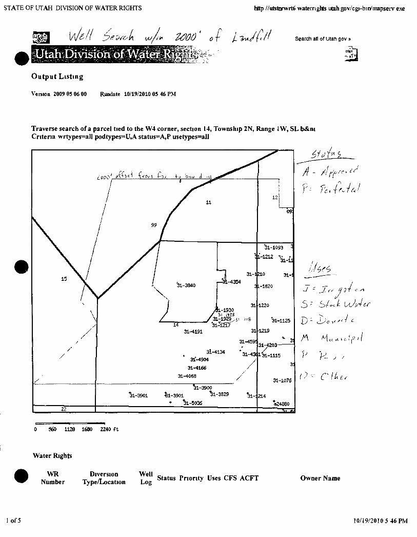
STATE OF UTAH DIVISION OF WATER RIGHTS http //utstnrwrt6 waternghts Utah gov/cgi-bin/mapserv exe
llJtaliL K Search all of Utah gov »
Output Listing
Vereion 2009 05 06 00 Rundate 10/19/2010 05 46 PM
Traverse search of a parcel tied to the W4 corner, section 14, Township 2N, Range 1W, SL b«&ni Criteria wrtypes=all podtypes=U,A status=A,P usetype$=all
0 560 1120 1680 2240 f t
Water Rights
WR Number
Diversion Type/Location
WeU Log Status Priority Uses CFS ACFT Owner Name
of5 10/19/2010 5 46 PM
ST^TE OF UTAH DIMSION OF WATER RIGHTS http / 'utstnrwrt6 waternghts Utah gov/cgi bin/mapserv e\e
0931Q08M00 Underground
N1140 W1670 S4 12 2N IW SL
0931008 MOO Underground well inFo
N1I40 W1665 S4 12 2N IW SL
31-1061 Underground
N2105 E702 W4 13 2N IW SL
31 1073 Underground
N860 E1I15SW 13 2N IWSL
31-1076 Underground
N980 E525 SW 13 2N IWSL
31-1093 Underground
S60 E250NW 13 2N IWSL
31-1111 Underground
S390E1060 W4 13 2N IWSL
31-1113 Underground
S1160E1060 W4 13 2N IWSL
31-1115 Underground
S890E150 W4 13 2N IWSL
31-1118 Underground
S415E860 W4 13 2N IWSL
31-1125 Underground
N240 E480 W4 13 2N IWSL
31-1136 Underground
S415 E7I0NW 13 2N IW SL
31-1143 Underground well info
S435 E760NW 13 2N IWSL
31-11^4 Underground
S210E320 W4 13 2N IWSL
20090507 0 000 0 000
20090507 0 000 0 000
POPULUS - TERMINAL TRANSVnSSIONER PARTNERS
2850 S1900 W
POPULUS TERiMINAL TRANS^^SSIONER PARTNERS
2850 S1900 W
19150000 S 0 022 0 000 THONL^SO & ELLA B WTLLI.WIS
428 SOUTH MAIN
19130000 0 123 0 000 LANE AND JOY BEATTIE
1313 N 1100 W
190D0000 0 111 0 000 LANE AND JOY BEATTIE
1313N 1100 W
18930000 IS 0 225 0 000 LORIN C WOOLLEY
C/O GORDON R AND TIM WOOLLEY
ROBERT A & CHARLOTTE 18950000 DI 0 078 0 000
19190000 IS 0 089 0 000
19140000 IS 0 390 0 000
18950000 IS 0 193 0 000
18960000 IS 0 004 0 000
RUECKERT
957 WEST 1600 NORTH
ROBERT A & CHARLOTTE RUECKERT
957 WEST 1600 NORTH
ROBERT A & CHARLOTTE RUECKERT
957 WEST 1600 NORTH
ROBERTA & CHARLOTTE RUECKERT
957 WEST 1600 NORTH
RUBY ANNETTA MILLER OLSEN
19230000 DI
FAMILY LIMITED PARTNERSHIP C/O HALVOR M OLSEN GENERAL PARTNER
0 111 0 000 ORVILLE J & CAROLYN F RYVER
BOUNTIFUL UT 84010
19501011 DI 0 080 0 000 THOMAS RAY BROADBENT
19020000 IS 0 056 0 000
508 EAST SOUTH TEMPLE
JAMES DELL BRUHN AND SHELLEY OLSEN BRUHN LIVING TRUST
JAMES DELL BRUHN AND SHELLEY OLSEN BRUHN TRUSTEES
2 of 5 10/19/2010 5 46 PM
STATE OF UTAH DIVISION OF WATER RIGHTS http /'utstnrwrt6 waternghts Utah gov/cgi-bin/mapserv exe
31-1153 Underground
S440 E800NW 13 2N IWSL
, 31 1160 Underground
SI 170 E l 160 NW 13 2N IW SL
31-1161 Underground
S940 E850NW 13 2N IWSL
31 1163 Underground
S353E1040 NW 13 2N IWSL
31-1167 Underground
S450E1050NW 13 2N IWSL
31-1169 Underground
S460 E760NW 13 2N IWSL
31-1186 Underground
S390 E830 W4 13 2N IWSL
well info
31-1192 Underground well mfo
S335 E60NW 13 2N IWSL
31-1210 Underground
S910 W345 NE 14 2N1WSL
31-1212 Underground
S350 W75 NE 14 2N IWSL
31 1213 Underground
S790 W1525 E4 14 2N1WSL
31-1216 Underground
N270 W1340 E4 14 2N IWSL
31-1217 Underground
N90 WI450 E4 14 2N IWSL
31-1218 Underground
N269 W1340 E4 14 2N IWSL
31-1219 Underground
S80 W190 E4 14 2N IWSL
19280000 DI 0 056 0 000 ORVILLE J & CAROLYN F RYVER
BOUNTIFUL UT 84010
19250000 S 0 013 0 000 THON-LAS Q AND ELLA B WILLIAMS
428 SOUTH MAIN STREET
19250000 S 0 013 0 000 THOMASQ AND ELLA B WILLIAMS
428 SOUTH MAIN STREET
19180000 1 0 150 0 000 THOMAS G LUND
19200000 DIS 0 033 0 000
962 WEST PORTER LANE
DONALD L AND LINDA L DROESBEKE
972 WEST PORTER LANE
18900000 DI 0 056 0 000 ORVILLE J & CAROLYN F RYVER
BOUNTIFUL UT84010
19350615 DIS 0 015 0 000 SHELDON RUECKERT
997 WEST 1600 NORTH
19600121 S 0 009 0 000 WENDALL A LAW
19440330 S 0 004 0 000
19310700 S 0 020 0 000
536 EAST 250 NORTH
UTAH DEPARTMENT OF TRANSPORTATION
RIGHT OF WAY DIVISION
UTAH DEPARTMENT OF TRANSPORTATION
P O BOX 14820
19300000 0 013 0 000 LELAND R & OLIVE M SMITH
1165 NORTH 800 WEST
19250000 IMS 0 022 0 000 BOUNTIFUL CITY CORPORATION
790 SOLTIH 100 EAST
19260000 IMS 0 022 0 000 BOUNTIFUL CITY CORPORATION
790 SOUTH 100 EAST
19260000 IMS 0 018 0 000 BOUNTIFUL CITY CORPORATION
790 SOUTH 100 EAST
RUBY ANNETTA MILLER OLSEN 18490000 S 2 000 0 000 FAMILY LIMITED PARTN^ERSHIP
C/O HALVOR M OLSEN GENERAL PARTNER
3 of 5 10/19/2010 5 46 PM
STA.TE OF UTAH DIMSION OF WATER RIGHTS http /'utstnr\vrt6 waternghts Utah gov/cgi bin/mapserv exe
31-1220 Underground
N730 W190 E4 14 2N IWSL
31 1221 Underground
S820 W545 E4 14 2N IWSL
31 1639 Underground
S388 Ei060 W4 13 2N IWSL
31-1820 Underground
S1310 W90 NE 14 2N IWSL
31 1928 Underground
N160 W1330 E4 14 2N IWSL
31-1929 Underground N300 W1425 E4 14 2N IWSL
31-1930 Underground
N580 W1330 E4 14 2N IW SL
31 3840 Underground
S1320 0N4 14 2N IWSL
31-4068 Underground
N1085 E60S4 14 2N IWSL
well info
31-4134 Underground
S775 W1625 E4 14 2N IWSL
31-4136 Underground
SI 135 W1605 E4 14 2N IWSL
31 -4166 Underground
well info
well info
well info
N1355 E390 S4 14 2N IWSL
31-4171 Underground
SI 120 W2030 E4 14 2N IWSL
31-4191 Underground
SllO W2347 E4 14 2N IWSL
31-4203 Underground
S540 E45 W4 13 2N IWSL
31-4217 Underground
19300000 S 0 011 0 000 GLADYS R SEEQUIST
1800 NORTH 800 WEST
19000000 1 0 073 0 000 LELAND R & OLIVE M SMITH
1165 NORTH 800 WEST
ROBERT A & CHARLOTTE 18630000 1 0 078 0 000
19610808 IS 0 100 0 000
RUECKERT
957 WEST 1600 NORTH
UTAH DEPARTMENT OF TRANSPORTATION
RIGHT OF WAY DIVISION
19260000 IMS 0 015 0 000 BOUNTIFUL CITY CORPORATION
790 SOUTH 100 EAST
19260000 [MS 0 015 0 000 BOUNTIFUL CITY CORPORATION
790 SOUTH 100 EAST
19260000 IMS 0 013 0 000 BOUNTIFUL CITY CORPORATION
790 SOUTH 100 EAST
19300510 M 2 000 0 000 BOUNTIFUL CITY CORPORATION
790 SOUTH 100 EAST
19730623 DIS 0 015 0 000 OSCAR A & GRACE GOLDBERG
282 WEST 2900 SOUTH
PACIFICORP DBA UTAH POWER & 19730308 S 0 015 0 000
LIGHT COMPANY
ATTN CLAUDIA CONDER
19730312 IS 0 015 0 000 FRANK B & BETTY M TTNGEY
1482 SOUTH 873 WEST
19730917 IS 0 015 0 000 ORLINA JOHNSON
1335 NORTH 400 EAST
19731010 S 0 000 0 000 LOUISE F BROWN
406 WEST 3300 SOUTH
19740326 S 0 013 0 000 FRED M SIMONS
933 EAST CONCORD WAY
19770909 S 0 015 0 000 DENNIS AND MELANIE W VEST
1544 NORTH 1100 WEST
19740903 IS 0 015 0 000 GARY R BIEHN
4 of 5 10/19/2010 5 46 PM
STATE OF UTAH DIVISION OF WATER RIGHTS http '/utstnrwrt6 waternghts Utah gov/cgi bin/mapserv exe
S700 W487 E4 14 2N IWSL
31-4348 Underground well info
S860 W63 E4 14 2N IWSL
31-4354 Underground well mfo
S1170 W l l l O N E 14 2N IWSL
31-4361 Underground well info
S835 W473 E4 14 2N IWSL
31-4423 Underground
S985 W2365 E4 14 2N IWSL
31-4395 Underground well info
S440 W580 E4 14 2N IWSL
31-4721 Underground
S15E1100NW 13 2N IWSL
31-4899 Underground
S1044 WI999 E4 14 2N IWSL
31-4904 Underground
SlOlO W2160 E4 14 2N IWSL
well mfo
well info
1513 NORTH 1100 WEST
19760824 IS 0 015 0 000 SCOTT A & LISA JAN DUGGAR
1454 NORTH 1100 WEST
19761005 S 0 015 0 000 TOM DUGGAR
531 NORTH 1100 WEST
19761108 IS 0 022 0 000 JOSEPH INGLES
1483 SOUTH 1100 WEST
19770422 IS 0 013 0 000 GEORG PFEIFFER
543 WEST 530 NORTH
19790801 IS 0 015 0 000 A L V A M GADD
1585 NORTH 1100 WEST
19820204 DS 0 0l3 0 000 THOMAS G LUND
962 WEST PORTER LANE
19870917 IS 0 000 7 592 DAVID AND KARA MCKEAN
1483 NORTH 175 WEST
19871015 IS 0 015 0 000 DAVID K BROOKS
610 WEST 800 NORTH
Utah Division of Water Rights | 1594 West North Tample Suits 220 P 0 Box 146300 SaltLake City Utah34114^300 | 801 538-7240 Natural Resources I Contact | Disclaimer | Pnvaev Policy I Accessibility Poficv I EmerQencv Evacuation Plan
5 of 5 10/19/2010 5 46 PM
STATE OF UTAH DIVISION OF WATER RIGHTS http //utstnrwrt6 waternghts utah.gov/cgi-bin/mapserv exe
113 [//^A/ Cf^A wl^ 2000' lUtah:C asib ;bf: Wat(e
Output Listing
Version 2009 05 06 00 Rundate 10/19/2010 05 17 PM
Traverse search of a parcel tied to the W4 corner, section 14, Township 2N, Range IW, SL b«&m Criteria wrtypes=all podtypes=aIl status=all usetypes=aH
0 560 1120 1680 2240 ft
Water Rights
WR Number
Diversion Well Type/Location Log
Status Priority Uses CFS ACFT Owner Name
1 of 7 10/19/2010 5 29 PM
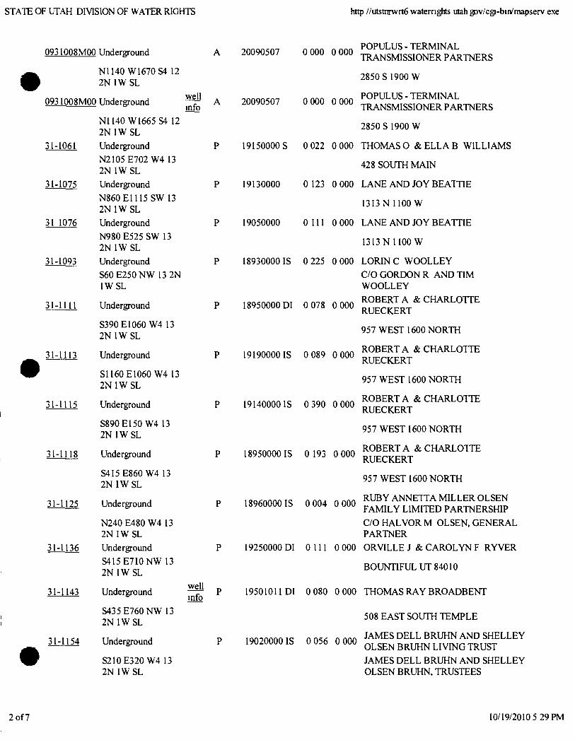
STATE OF UTAH DIVISION OF WATER RIGHTS http //utstnrwrt6 waternghts Utah gov/cgi-bin/mapserv exe
0931008MOO Underground 20090507 0 000 0 000
N1I40 WI670S4 12 2N IW SL
O931008M0O Underground well info
N1140 W1665 S4 12 2N IWSL
31-1061 Underground
N2I05 E702 W4 13 2N IWSL
31-1075 Underground
N860E1115 SW 13 2N IWSL
31 1076 Underground
N980 E525 SW 13 2N IWSL
31-1093 Underground
S60 E250NW 13 2N IWSL
31-1111 Underground
S390E1060 W4 13 2N IWSL
31-1113 Underground
S1160E1060 W4 13 2N IWSL
31-1115 Underground
S890E150 W4 13 2N IWSL
31-1118 Underground
S4I5E860 W4 13 2N IW SL
31-1125 Underground
N240 E480 W4 13 2N IW SL
31-1136 Underground
S415E7I0NW 13 2N IWSL
31-1143 Underground
S435 E760NW 13 2N IWSL
31-1154 Underground
S2I0E320 W4 13 2N IWSL
well info
20090507 0 000 0 000
POPULUS-TERMINAL TRANSMISSIONER PARTNERS
2850 S 1900 W
POPULUS - TERMINAL TRANSMISSIONER PARTNERS
2850 S1900 W
19150000 S 0 022 0 000 THOMAS O & E L L A B WILLIAMS
428 SOUTH MAIN
19130000 0 123 0 000 LANE AND JOY BEATTIE
13I3N 1100 W
19050000 O I U 0 000 LANE AND JOY BEATTIE
1313N 1100 W
18930000 IS 0 225 0 000
18950000 DI 0 078 0 000
19190000 IS 0 089 0 000
19140000 IS 0 390 0 000
18950000 IS 0 193 0 000
18960000 IS 0 004 0 000
19250000 DI 0 111 0 000
LORTNC WOOLLEY
C/O GORDON R AND TIM WOOLLEY
ROBERT A & CHARLOTTE RUECKERT
957 WEST 1600 NORTH
ROBERT A & CHARLOTTE RUECKERT
957 WEST 1600 NORTH
ROBERT A & CHARLOTTE RUECKERT
957 WEST 1600 NORTH
ROBERT A & CHARLOTTE RUECKERT
957 WEST 1600 NORTH
RUBY ANNETTA MILLER OLSEN FAMILY LIMITED PARTNERSHIP
C/O HALVOR M OLSEN, GENERAL PARTNER
ORVILLE J & CAROLYN F RYVER
BOUNTIFUL UT 84010
19501011 DI 0 080 0 000 THOMAS RAY BROADBENT
19020000 IS 0 056 0 000
508 EAST SOUTH TEMPLE
JAMES DELL BRUHN AND SHELLEY OLSEN BRUHN LIVING TRUST
JAMES DELL BRUHN AND SHELLEY OLSEN BRUHN, TRUSTEES
2 of 7 10/19/2010 5 29 PM
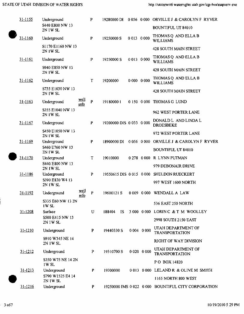
STATE OF UTAH DIVISION OF WATER RIGHTS http //utstnrwrt6 waternghts Utah gov/cgi-bin/mapserv exe
31-1155 Underground
S440 E800NW 13 2N IWSL
31-1160 Underground
S1I70EI160NW 13 2N IWSL
31-1161 Underground
S940 E850NW 13 2N IWSL
31-1162 Underground
S735 E1030NW 13 2N IWSL
31-1163 Underground
S355 E1040 NW 13 2N IWSL
31-1167 Underground
S450E1050NW 13 2N IWSL
31-1169 Underground
S460 E760NW 13 2N IWSL
31-1170 Underground
S440 E800NW 13 2N IW SL
31-1186 Underground
S390 E830 W4 13 2N IWSL
31-1192 Underground
well mfo
well mfo
S335 E60NW 13 2N IWSL
31-1208 Surface
S500E415NW 13 2N IW SL
31-1210 Underground
S910 W345NE 14 2N IW SL
31-1212 Underground
S350 W75NE 14 2N IWSL
31-1213 Underground
S790 WI525 E4 14 2N IWSL
31-1216 Underground
U
19280000 DI 0 056 0 000 ORVILLE J & CAROLYN F RYVER
BOUNTIFUL UT 84010
19250000 S 0 013 0 000 ™ ^ ^ Q AND E L L A B WILLIAMS
428 SOUTH MAIN STREET
THOMASQ AND E L L A B WILLIAMS
428 SOUTH MAIN STREET
THOMAS Q AND E L L A B WILLIAMS
428 SOUTH MAIN STREET
191800001 0 150 0000 T H O M A S G L U N D
19250000 S 0 013 0 000
19200000 0 000 0 000
19200000 DIS 0 033 0 000
962 WEST PORTER LANE
DONALD L AND LINDA L DROESBEKE
972 WEST PORTER LANE
18900000 DI 0 056 0 000 ORVILLE J & CAROLYN F RYVER
BOUNTIFUL UT 84010
19010000 0 278 0 000 R L Y N N P U T M A N
979 DEBONAIR DRIVE
19550615 DIS 0 015 0 000 SHELDON RUECKERT
997 WEST 1600 NORTH
19600121 S 0 009 0 000 WENDALL A LAW
536 EAST 250 NORTH
188404 IS 3 000 0 000 LORIN C & T M WOOLLEY
2998 SOUTH 2150 EAST
UTAH DEPARTMENT OF 19440330 S 0 004 0 000
19310700 S 0 020 0 000
TRANSPORTATION
RIGHT OF WAY DIVISION
UTAH DEPARTMENT OF TRANSPORTATION
P O BOX 14820
19300000 0 013 0 000 LELAND R & OLIVE M SMITH
1165 NORTH 800 WEST
19250000 IMS 0 022 0 000 BOUNTIFUL CITY CORPORATION
3 of 7 10/19/2010 5 29 PM
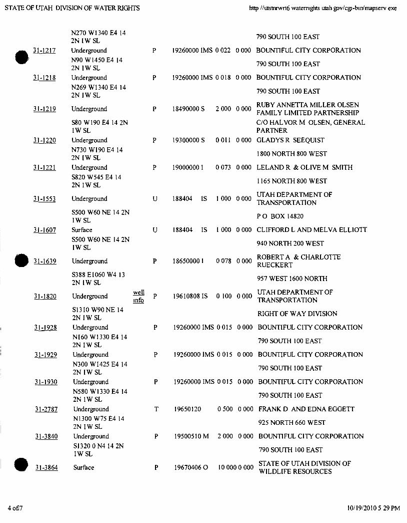
STATE OF UTAH DIVISION OF WATER RIGHTS http //utstnrwrt6 waternghts utah gov/cgi-bin/mapserv exe
N270 W1340 E4 14 2N IWSL
31-1217 Underground
N90 W1450 E4 14 2N IWSL
31-1218 Underground
N269 W1340 E4 14 2N IW SL
31-1219 Underground
S80 W190 E4 14 2N IWSL
31-1220 Underground
N730 WI90 E4 14 2N IWSL
31-1221 Underground
S820 W545 E4 14 2N IWSL
31-1553 Underground
S500 W60NE 14 2N IWSL
31-1607 Surface
S500 W60NE 14 2N IWSL
31-1639 Underground
S388 EI060 W4 13 2N IWSL
31-1820 Underground
S13I0 W90NE 14 2N IWSL
31-1928 Underground
NI60 W1330 E4 14
2 N I W S L
31-1929 Underground N300 WI425 E4 14 2N IWSL
31-1930 Underground N580 W1330 E4 14 2N1WSL
31-2787 Underground
N1300 W75 E4 14
2N IWSL
31-3840 Underground
SI320 0N4 14 2N IWSL
31-3864 Surface
well info
U
U
19260000 IMS 0 022 0 000
19260000 IMS 0 018 0 000
18490000 S 2 000 0 000
19300000 S OOll 0 000
190000001 0 073 0 000
188404 IS 1 000 0 000
188404 IS I 000 0 000
186500001 0 078 0 000
19610808 IS 0 100 0 000
790 SOUTH 100 EAST
BOUNTIFUL CITY CORPORATION
790 SOUTH 100 EAST
BOUNTIFUL CITY CORPORATION
790 SOUTH 100 EAST
RUBY ANNETTA MILLER OLSEN FAMILY LIMITED PARTNERSHIP
C/O HALVOR M OLSEN, GENERAL PARTNER
GLADYS R SEEQUIST
1800 NORTH 800 WEST
LELAND R & OLIVE M SMITH
1165 NORTH 800 WEST
UTAH DEPARTMENT OF TRANSPORTATION
P O BOX 14820
CLIFFORD L AND MELVA ELLIOTT
940 NORTH 200 WEST
ROBERTA & CHARLOTTE RUECKERT
957 WEST 1600 NORTH
UTAH DEPARTMENT OF TRANSPORTATION
RIGHT OF WAY DIVISION
19260000 IMS 0 015 0 000 BOUNTIFUL CITY CORPORATION
790 SOUTH 100 EAST
19260000 IMS 0 015 0 000 BOUNTIFUL CITY CORPORATION
790 SOUTH 100 EAST
19260000 IMS 0 015 0 000 BOUNTIFUL CITY CORPORATION
790 SOUTH 100 EAST
19650120 0 500 0 000 FRANK D AND EDNA EGGETT
925 NORTH 660 WEST
19500510 M 2 000 0 000 BOUNTIFUL CITY CORPORATION
790 SOUTH 100 EAST
19670406 0 10 000 0 000 STATE OF UTAH DIVISION OF WILDLIFE RESOURCES
4 of 7 10/19/2010 5 29 PM
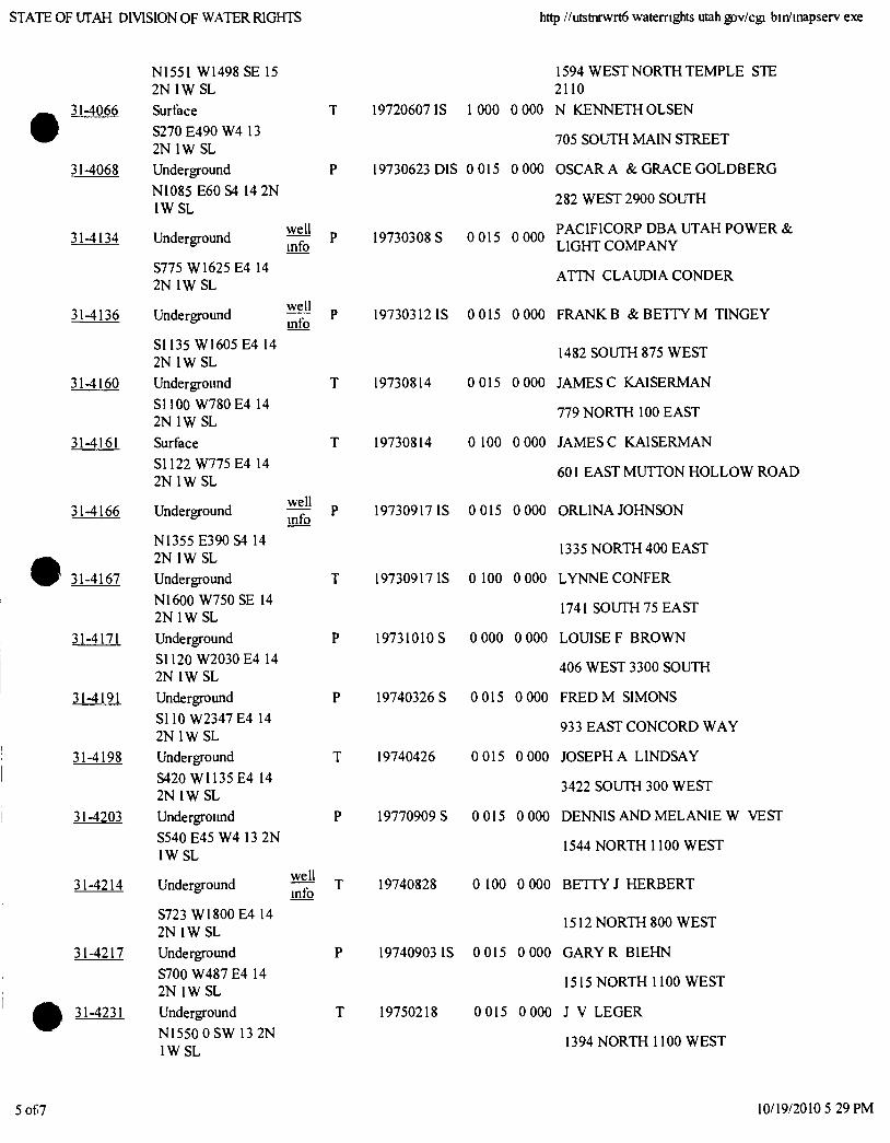
STATE OF UTAH DIVISION OF WATER RIGHTS http //utstnrwrt6 waternghts Utah gov/cgj bin/mapserv exe
NI55I W1498 SE 15 2N IWSL
31-4066 Surface
S270 £490 W4 13 2N IWSL
31-4068 Underground
NI085 E60S4 14 2N IWSL
31-4134 Underground
S775 W1625 E4 14 2N IWSL
31-4136 Underground
31-4217
31-4231
well info
well mfo
S1135 W1605 E4 14 2N IWSL
31 -4160 Undergroimd
SHOO W780 E4 14 2N IW SL
31-4161 Surface
SI 122 W775 E4 14 2N IW SL
31-4166 Underground well info
N1355 E390S4 14 2N IW SL
31-4167 Underground
N1600 W750SE 14 2N IWSL
31-4171 Underground
SI 120 W2030 E4 14 2N IWSL
31-4191 Underground
SllO W2347 E4 14 2N IW SL
31-4198 Underground
S420 WI135 E4 14
2N IW SL
31-4203 Undergroimd
S540 E45 W4 I3 2N IWSL
31-4214 Underground well mfo
S723 W1800E4 14 2N IW SL Underground
S700 W487 E4 14 2N IW SL
Underground N1550 0SW 13 2N IWSL
1594 WEST NORTH TEMPLE STE 2110
19720607 IS 1 000 0 000 N KENNETH OLSEN
705 SOUTH MAIN STREET
19730623 DIS 0 015 0 000 OSCAR A & GRACE GOLDBERG
282 WEST 2900 SOUTH
PACIFICORP DBA UTAH POWER & 19730308 S 0 015 0 000 LIGHT COMPANY
ATTN CLAUDIA CONDER
19730312 IS 0015 0 000 FRANK B & BETTY M TINGEY
1482 SOUTH 875 WEST
19730814 0 015 0 000 JAMESC KAISERMAN
779 NORTH 100 EAST
19730814 0 100 0 000 JAMESC KAISERMAN
601 EAST MUTTON HOLLOW ROAD
19730917 IS 0 015 0 000 ORLINA JOHNSON
1335 NORTH 400 EAST
19730917 IS 0 100 0 000 LYNNE CONFER
1741 SOUTH 75 EAST
19731010 S 0 000 0 000 LOUISE F BROWN
406 WEST 3300 SOUTH
19740326 S 0 015 0 000 FRED M SIMONS
933 EAST CONCORD W A Y
19740426 0 015 0 000 JOSEPH A LINDSAY
3422 SOUTH 300 WEST
19770909 S 0 015 0 000 DENNIS AND MELANIE W VEST
1544 NORTH 1100 WEST
19740828 0 100 0 000 BETTY J HERBERT
1512 NORTH 800 WEST
19740903 IS 0 015 0 000 GARY R BIEHN
1515 NORTH 1100 WEST
19750218 0 015 0 000 J V LEGER
1394 NORTH 1100 WEST
5 of 7 10/19/2010 5 29 PM
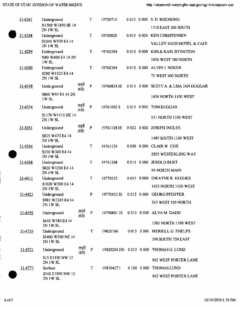
STATE OF UTAH DIVISION OF WATER RIGHTS http //utstnrwrt6 waternghts utah gov/cgi-bin/mapserv exe
31-4261 Underground
NI500 W1890 SE 14 2N IW SL
31-4268 Underground
SI 040 W930 E4 14 2N IW SL
31-4299 Underground
N80 W600 E4 14 2N IWSL
31-4300 Underground
S200 WI525 E4 14 2N IWSL
19750715
19750820
19760304
T 19760304
31-4348 Undergroimd
S860 W65 E4 14 2N IWSL
31-4354 Underground
S1170 W l l l O N E 14 2N IWSL
31-4361 Underground
well mfo
well info
well mfo
S835 W475 E4 14 2N IWSL
31-4366 Underground
S350 W300E4 14 2N IW SL
31-4368 Underground
S820 W1200 E4 14 2N IWSL
31-4411 Underground
S1020 W500 E4 14 2N IWSL
31-4423 Underground
S985 W2365 E4 14 2N IWSL
31-4595 Underground
S440 W580 E4 14 2N IW SL
31-4719 Underground
SHOO W500NE 14 2N IWSL
31-4721 Underground
S15 EllOONW 13 2N IWSL
31-4777 Surface
S540E1090 NW 13 2N IWSL
well mfo
well info
0 015 0 000 S D BIRDSONG
1210 EAST 300 SOUTH
0 015 0 000 KEN CHRISTENSEN
V A L L E Y HIGH MOTEL & CAFE
0 015 0 000 KIM & KARI BYINGTON
1056 WEST 700 NORTH
0015 0000 A L V I N J N O K E R
73 WEST 900 NORTH
19760824 IS 0 015 0 000 SCOTT A & LISA JAN DUGGAR
1454 NORTH 1100 WEST
19761005 S 0 015 0 000 TOM DUGGAR
531 NORTH II00 WEST
19761108 IS 0 022 0 000 JOSEPH INGLES
1485 SOUTH 1100 WEST
19761129 0 050 0 000 C L A I R W C O X
2855 WESTERLING WAY
19761208 0 015 0 000 JEROLDBURT
99 NORTH MAIN
19770322 0 015 0 000 DWAYNE R HUGHES
1425 NORTH 1100 WEST
19770422 IS 0 015 0 000 GEORG PFEIFFER
543 WEST 550 NORTH
19790801 IS 0 015 0 000 A L V A M GADD
1585 NORTH 1100 WEST
19820106 0 015 0 000 MERRILL G PHELPS
290 SOUTH 750 EAST
19820204 DS 0 015 0 000 T H O M A S G L U N D
962 WEST PORTER LANE
198304271 0 100 0 000 THOMAS LUND
962 WEST PORTER LANE
6 of 7 10/19/2010 5 29 PM
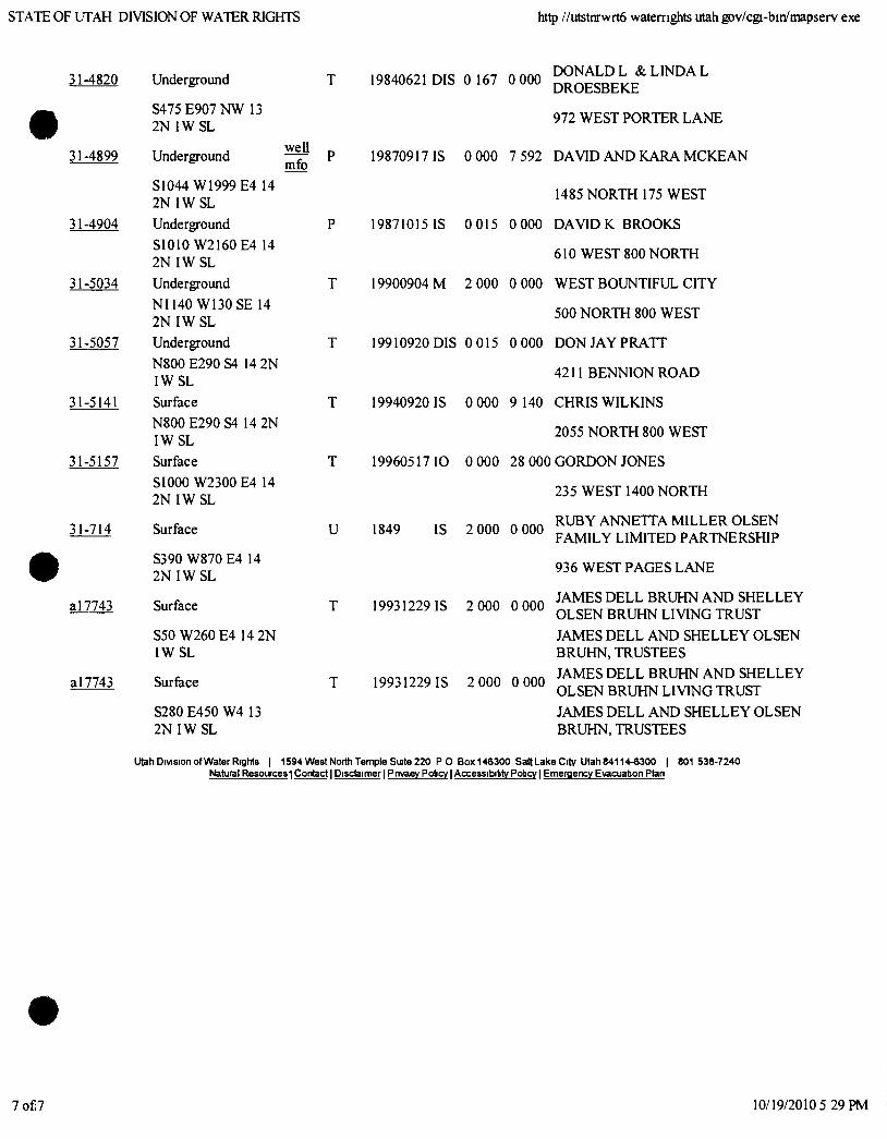
STATE OF UTAH DIVISION OF WATER RIGHTS http //utstnrwrt6 waternghts utah gov/cgi-bin/mapserv exe
31-4820 Underground
S475 E907NW 13 2N IWSL
31-4899 Underground
19840621 DIS 0 167 0 000
well mfo
S1044 W1999 E4 14 2N IWSL
31-4904 Underground
SlOlO W2160 E4 14 2N IWSL
31-5034 Underground
NI140 W130SE 14 2N IWSL
31-5057 Underground
N800 E290 S4 14 2N IWSL
31-5141 Surface
N800E290S4 14 2N IWSL
31-5157 Surface
SI 000 W2300 E4 14 2 N I W S L
31-714 Surface
S390 W870 E4 14 2N IWSL
a 17743 Surface
S50 W260 E4 14 2N IWSL
a 17743 Surface
S280 E450 W4 13 2N IWSL
U
DONALD L & LINDA L DROESBEKE
972 WEST PORTER LANE
19870917 IS 0 000 7 592 DAVID AND KARA M C K E A N
1485 NORTH 175 WEST
19871015 IS 0 015 0 000 DAVID K BROOKS
610 WEST 800 NORTH
19900904 M 2 000 0 000 WEST BOUNTIFUL CITY
500 NORTH 800 WEST
19910920 DIS 0 015 0 000 DON JAY PRATT
4211 BENNIONROAD
19940920 IS 0 000 9 140 CHRIS WILKINS
2055 NORTH 800 WEST
19960517 10 0 000 28 000 GORDON JONES
235 WEST 1400 NORTH
RUBY ANNETTA MILLER OLSEN 1849 IS 2 000 0 000
19931229 IS 2 000 0 000
19931229 IS 2 000 0 000
FAMILY LIMITED PARTNERSHIP
936 WEST PAGES LANE
JAMES DELL BRUHN AND SHELLEY OLSEN BRUHN LIVING TRUST
JAMES DELL AND SHELLEY OLSEN BRUHN, TRUSTEES JAMES DELL BRUHN AND SHELLEY OLSEN BRUHN LIVING TRUST JAMES DELL AND SHELLEY OLSEN BRUHN, TRUSTEES
Utah Division of Water Rights | 1594 WestNorth Temple Sute 220 P 0 Box146300 SaltLake City Utah84114-6300 | 801 538-7240 Natural Resouces 1 Contact I Disclaimer 1 Pnvaev Policy I Accessibibty Potcy I Emergency Evacuation Plan
7 of 7 10/19/2010 5 29 PM
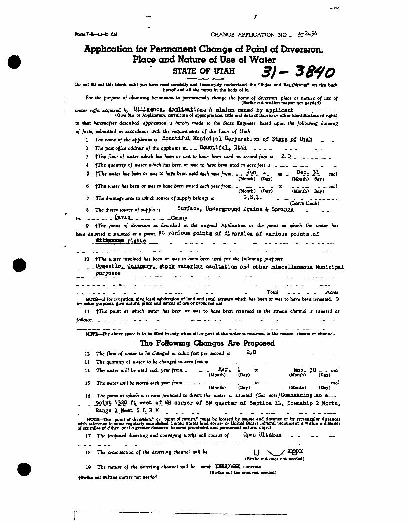
r.*-u-45 6M CHANGE APPUCATION NO _ aT24?6
Apphcation for Permanent Change of Pomt of Diversion, Place and Nature of Use of Water
STATE OF UTAH 38^0 Do not ID mrt tfaii bhnk miiil ywi k»« rod carahOy nd tborantidx nadvctand th* "Ihd«a and RatsUttoiv" an tin back
hmof and aB tba notai In tha body of H. For th< pxirpou of obtaining f ermimon to permanently change the point of drverjion place or nature of toe of
(Strike out wntten mattar not oaedad) water nght acqtared hy P4-&!DCjt, AjpEUssJ ioaa ft alftjan. OMneid.lur applicant .. _ -
(Giva Ma ot AvpUcatum, cartificata of apptopnation, titla and data of Dacrw or othar Idantificattoa of nght)
to A M keretnafter descnbed application u herehy made to the State Engineer bated upon the following ihounng
•f fact*, wbrnitted tn accordance with the requireinentt of the Laws of Utah
1 The name of the applicant it Bountiful Municipal C^rporatipn ptf §t*tiS fiS UtAh _ _ 2 The port ojice oiMrets of the opphomt « BPmitifUl^. HtaJx
3 fThe flow of water winch hoj been or wot to haiie been used in second feet ii _ 2*0 „
4 quantity of water which hoi been or woe to have been uted m acre feet u _
3 fThe water ha» been or was to have been used each year from. _ „ to _ 3 \ mcl (Month) (Day) (Uooth) Say)
6 tThe water has been or was to haue been stored each year from. _ _ to mcl (Month) (Da ) (Month) Day)
7 TTie drainage area to which source of supply belongs IS ''tSili, (Lsava blank)
8 The direct source of supply is _ _ Surface^ UndersrPW»4 Draijoa &. SpruogA in. 5*'"-9 County
9 t^he point of diversion as descnbed in the ongmal Application or the point at which the water has
been dnwrtid u situated ax a pomt. At 7arj.o\ia_j;)Qii}tjS QZ sHyarAioa at various pointa .o£ tiitSimu rights
10 ^The water mvolved has been or was to have been used for the foBoitiing purposei
_ _ .^J^^^^Oj- Q. Q^XJx. St9Rjb: yat rUig. oaoltiLtioa sod othsr miacsllanaoua Municipal pnrposss
_ . _ - Total _ _ _ _ _ Acres MOTS—-I{ for irrifatlcin, give Icfal aabdmslon of land and total acraaga which ha* b««n or was to have bean imgatad. It
tor othar puipoaet, give nature, place and axtent of on or proposed use
11 fThe point dt which water has been or was to have been returned to the stream channel is situated as
foOowe. - - _
MOn—The above space Is to be fiDed in only when all or part ot tha water i* returned to the natural stieam or dianneL
The Following Changes Are Proposed 12 The flow of water to be changed tn cubic feet per second ii 2,0
11 The quantity of water to be changed in acre feet « _ _ _
14 The water will be used each year from. _ _ _ Har<t 1 to ljay« 30 - ~ mcl (Month) (Day) (Month) (Day)
1J The water will be stored each year from _ t o _ _ _ inci (Month) (Day) (Month) (Day)
16 The pomt at which it is now proposed to divert the water u situated (Set note) Comawndng Jk
_ _ _EI?in 320 ft west of ItE_ COITRSI- 9f SW asftrtftr of SBfitloalii^ lowahip 2 JlQrtb, Range 1 West S L B M _ _ __
KOTB—The pout of divenlan.'' or pomt of ratoin," muat be located by ooune and datanoe or by rectangular dutanoes with raterenee to tome regularly aatabllafaad United States land eonier or United States mineral monument if withm a diatanee of siz mite* of either or if a greater diataoce to some prominent and permanent natural object
17 The proposed diverting and conveying worlds unll consist of Qpen UltCiiaA . . . . —
18 The cross section of the diverting channel will be \ / ^PQ^ (Strike out ones not needed)
19 The nature of the divertmg channel will be earth X tM.yiHHC concreu (Strike out the ones not needed)
IHiIfca aat wiittaa matter not needed
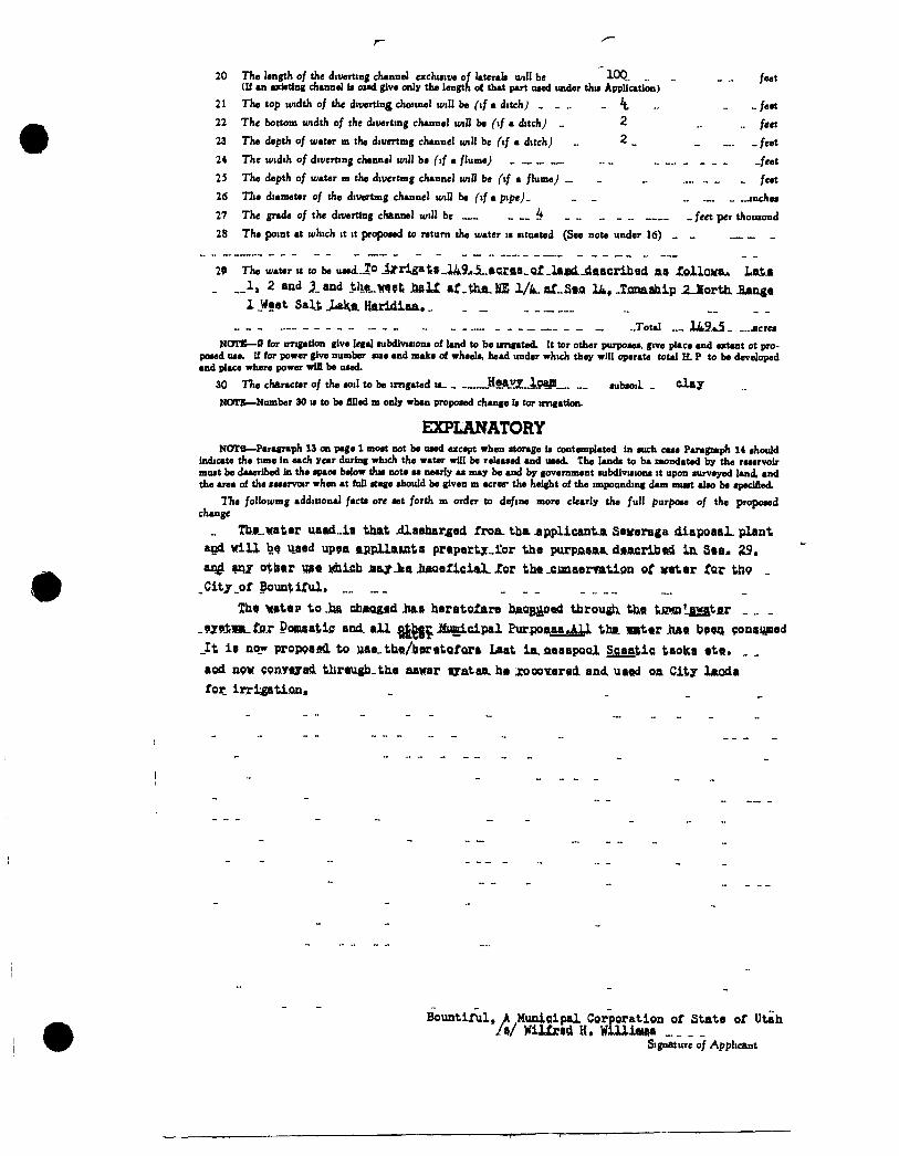
20 The length of the diverting channel exclusive of laterals unll be lOQ, _ _ feet (U an axiating channel is oiad give only the length o( that part used under this Application)
21 The top width of the diverting choatnel will be (if a ditch) - ' t - feet
22 The bottom width of the diverting channel wiB be (if a ditch) „ 2 _ _ fjjt
23 The depth of water m the ditwrtmg channel will be ftf a dttchj _ 2 _ _ _feet
24 The width of diverting channel will be f if a flume „„ _feet
25 The depth of water m the divertmg channel wiB be (tf a flume) _ _ _ _ _ feet
26 TTie diameter of the divertmg channel will be fif a pipe). _ _ „ jnches
27 The grade of the diverting channel will be _ feet per thotuond
28 The point at which it it proposed to return the water is situated (See note under 16) „ _
29 The water tt to be usedjo Jjrri£aii»_J49 i_»«fta_QX_lajotL-ClftacribBd as iollOKt. LaiM _ „ l i 2 and land tly(_w?li i»U af.thift.KE l/i.af_S*fl U«-XflnaahipiJlorth. Aang«
1 _West Salt .LakLfli Hftridiaa.. . _ . _ _Total __ 1A9..L5 jicres
NOTE—S for irrigation give legal lubdivision* of land to be ungated. It tor other purposes, give place and extant ot proposed use. If for power give number sue and make of wheels, head under which they will operate total H. P to be developed and place where power win be used.
30 TTie character of the soil to be imgated is .Heavz_loani_ subsoil _ d a y
NOTE— Number 30 is to be filled m only whan proposed change Is tor imgation.
EXPLANATORY NOTB— Paragraph 13 on page 1 most not be used except when storage is contemplated in such case Paragraph 14 should
indicate the time in each year during which the water will be released and uaed. The lands to ba raondated by the reservoir must be daaeribed in the spaoe below this note a* nearly as may be and by government subdivisions it upon surveyed land, and the area of the leservar when at full stage should be given m acrer the height of the impounding dam must also be specified.
TTie followmg additional facts ore set forth m order to define more clearly the full purpose of the proposed change
Tb.«Lwater uaad.ia that jdlaehar ed froa. tb& .applicant.a Sevsraga diapoaal. plant and wiU used up9a ftflpllawts pr«p«ttj_i:or the purpfisaa. dtacribiri 5*o. SL9,
otl)«r W)« lAticsb jpajrJtft JiAQeXici&LJTor th« „cina.erTatign of v«t«r fQc t p „ _Cit7_of Bountiful, „ „ _ _
Ih* >(»t«p to Jt» chAQ&fld iia.» herotoXare bAQBJiSttCl tbrou^ tix« tiMn'awater .9i9i,m..tjST Pomsatii; and. all Jtimicipal PurjoaaaJLU that mt«r M« \>9n onsi ed _It i« now proppsfKl to Hiae„tbL«/tiorBtQf.Qr» Laat ia.fi«sapQQl S.caatic taolsa *t«, . . aod npw CPRVflyadl tJtir«ugb_th.« aawar ayataa. hm xoooxnui. and. ua«d oa City lAOda for irri atifln*
Bountiful, A Municipal Corporation of State of Utah /»/ ViUxf) H, WlUi«»a
Signature of Applicant
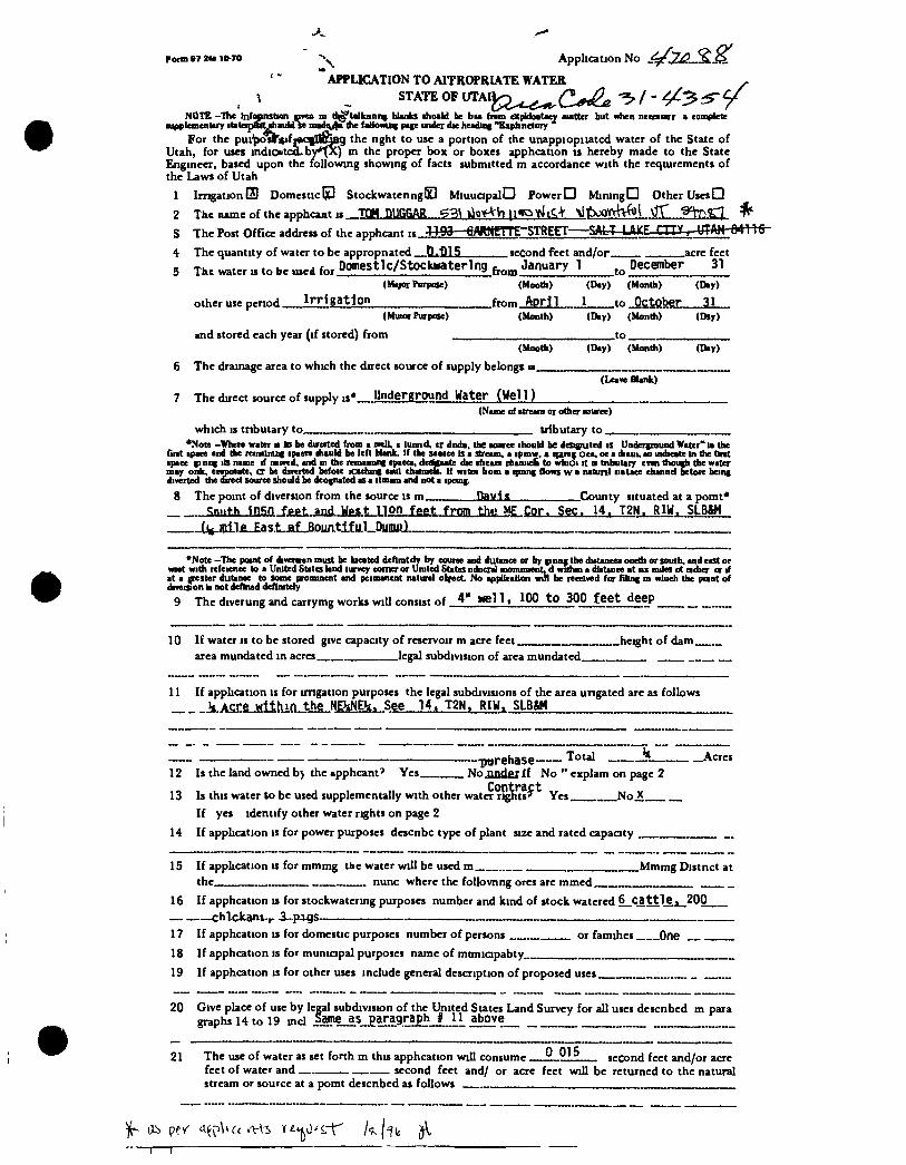
Form »7 it* 10-70 '•^ Application No
" APPUCATION TO AITROPRIATE WATER ^ ^ ^ STATE OF UTAIJ;j2.^^(^^^^/. 4^:3^^
NOTE -The Infynstwn DTO> m ti|§'talknnii( blanks ihoaU be btt (nm cxpUoatacy autter but when nccaurr « complete •upplementary itateipBiltshauU se mad ) the faUowuig page under die headiiig "Expfanelory
For the pui |>osrit>f]«q||I^Bg the nght to use a portion of the unappiopiiatcd water of the State of Utah, for uses indicaitco.by'v ) in the proper box or boxes apphcation 11 hereby made to the State Engineer, based upon the following showing of facts submitted m accordance with the reqturements of the Laws of Utah
1 Imgation OD Domestic IjP StockwatenngQ MiuuapalO Power D Mining D Other Uses Q 2 The name of the apphcant IS TOM Q ^ G ^ H^O' VHiqOtltC.-l \11boOYvH<i)i VfT ^ S The Post Office address of the apphcant » CAfWmE STREET SAmjUCE-CIIXT-WAHTftmfr-
4 The quantity of water to be appropnated tLiUS second feet and/or acre feet 5 The w»ter is to be ..,ed for Domestlc/Stockwaterlng January 1 December 31_
(M orFurpose) (Mootfa) (Day) (Month) (Day)
other use period _ Irrigation from April 1 to October 31
(Mun Purpose) (Month) (Day) (Month) (Dsy) and stored each year (if stored) from to
(Mootfa) (Day) (Month) (Day) 6 The drainage area to which the direct source of supply belongs u
7 The direct source of supply is* Underground Water (Well) (Leave Blank)
(Name of ttrearo or other MHiree)
which IS tnbutary to tributary to. *Note -When water it ID be durcited from a mil, • lunnd, cr dnda, the Kurce ihould be dcsiffuted is Underground Water" ia the
Grit ipace and the mnainuig ipaen ihauld be left Hank. If the saaice is a stream, a ipmw, a qang oca, oc a diaui, ao indicate in the tint •pace ginng its name if nimd, and in the remaimng tpaeca, de gaate die tfieaa r<ianiiffc to wfaioi it • tnbutary enn though tlie water may onk, enpoiate, cr be dmrted befoie icacbng iaui chaimefi. If wita bom a qmng flows w a natunl iiatace channel betoR being diverted the direct source should be dcognated as a itmam and not a ipcuig,
8 The point of diversion from the source is m Hgyis County situated at a pomt* _ <:ni.th insn fppt. and Wpst non feet fmm tht> ME Cor. Sec. 14. T2N. RIW. SLB&H ——(j jpiliL£as.t.ja.f. Bountiful Dunuit}
'Note -The point of divennn must be kicated dcfimtdT by eoune and dutance or by ginng the ooctfa or soutli, and east or wnt with refeience to a United States land lurvey comer or United States ndncra) monument, d wTlhm a dlittnce at MX miles ot eidier or if at a pester dutanoe to some (rominent and pcimanent natural ofcfect. No appUcaUon win be received for filing m wluch the point of diversion is not defined definitely 9 The diverung and carrymg works wiU consist of 4" well. 100 to 300 feet deep
10 It water is to be stored give capacity of reservoir m acre feet height of dam area mundated in acres legal subdivision of area mundated
11 If application is for imgation purposes the legal subdivisions of the area ungated are as follows At.Agrfi .wttitvin the NE^Eij, See 14. T2N. RIW, SLB&M
•Twrehase Total ? Acres 12 Is the land owned b> the apphcant'* Yes No nndprff No '* explam on page 2
13 Is this water to be used supplementally with other watCT*rl 'ts ^ Yes Noi If yes identify other water rights on page 2
14 If application is for power purposes descnbc type of plant size and rated capaaty
15 If application IS for mmmg the water will be used m Mmmg Distnct at the nunc where the foUovnng ores are mmed
16 If apphcation is for stockwatering purposes number and kind of stock watered 6 cattle, 200 ch-lckantr 3~p44fS-
17 If apphcation is for domestic purposes number of persons or famihes One 18 If apphcation IS for muniapal purposes name of mtmiapabty
19 If apphcation is for other uses include general description of proposed uses.
20 Give place of use by legal subdivision of the United States Land Survey for all uses descnbed m para graphs 14 to 19 incl Same 35 paragraph » 11 above
21 The use of water as set forth m this apphcation will consume ^ second feet and/or acre feet of water and second feet and/ or acre feet will be returned to the natural stream or source at a pomt descnbed as follows
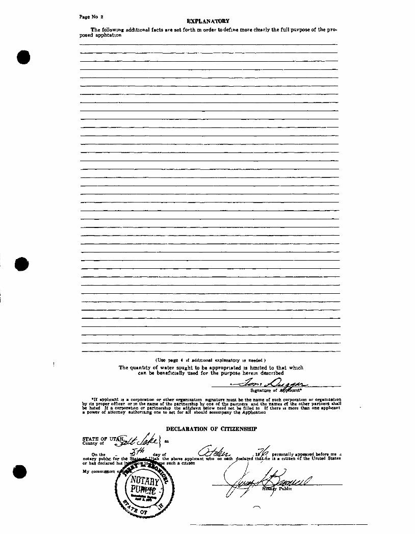
Page No 2 EXPLANATORY
The following additional facts are set forth m order to define more clearly the full purpose of the proposed apphcation
(Use page 4 if additional explanatory is needed )
The quantity of water sought to be appropriated is hmited to that which can be beneficially used for the purpose herein described
Signature of int*
*If applicant is a corporation or other organization signature must be the name of such corporation or organization by its proper officer or in the name of the partnership by one of the partners and the names c'f the other partners shall be hsted If a corporation or partnership the affidavit below need not be filled in tf there is more than one applicant a power of attorney authorizing one to act for all should accompany the Application
DECLARATION OF CITIZENSHIP
STATE OF UTAH, Oitrnty of
On the notary pubhc for the or has declared his '
My commission
day of _ the above applicant who on oath doelared - such a citizen ''^ '
•^kr< personally appeared before me a that*e IS a citizen of the United States
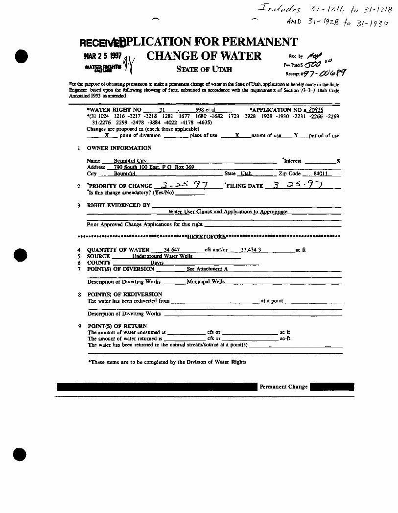
AND 31' I9^B ia 3i'l9?o
RECElVffiPLICATION FOR PERMANENT mismr^y CHANGE OF WATER ^ ^
STATE OF UTAH FeePaidS
For the purpose of obtaining permission to make a pennanent change of water in the State of Utah, application is hereby made to the State Engineer based upon the foUowmg showmg of ficts, submitted m accoidance with the requircinents of Section 73-3-3 Utah Code Annotated 19S3 as amended
•WATER RIGHT NO -2L 998etal •APPLICATION NO a j O f J ^ *{31 1024 1216 -1217 -1218 1281 1677 1680 -1682 1723 1928 1929 -1930 -2231 -2266 -2269
31-2276 2299 -2478 -3884 tt)22 -4178 -4635) Changes are proposed m (check those ^licable)
X pouit of diversion place of use X nature of use X penod of use
1 OWNER INFORMATION
Name Bctmtiful Citv Interest Address 790 South 100 East. P O Box 369 City. Bountiful State Utah . Zip Code 84011
2 'PRIORITY OF CHANGE .3 - 9 7 *FILING DATE 3 5> ^ - ? "7 *Is this change amendatory? (Yes/No)
RIGHT EVIDENCED BY Water User Claims and APDhcations to Appropnate
Pnor Approved (3iange Applications for this nght.
••••«e««ee*oe«**ee«*«*««*«*»*e««**«*««*«Hl?.PF7rOFnitF.*****************************************
4 QUANTTTY OF WATER 34 647 cfs and/or 17.434 3 ac ft 5 SOURCE Underground Water Wells 6 COUNTY Davis 7 POINT(S) OF DIVERSION See Attachment A
Descnption of Diverting Works
8 POINTCS) OF REDIVERSION The water has been rediverted from. , at a point.
Descnption of Divertmg Works
POINT(S) OF RETURN The amotmt of water consumed is . The amount of water r^umed is _
. cfs or. cfs or
. ac ft ac-ft
The water has been returned to the natural stream/source at a point(s).
*These items are to be comideted by the Division of Water Rights
Permanent Change
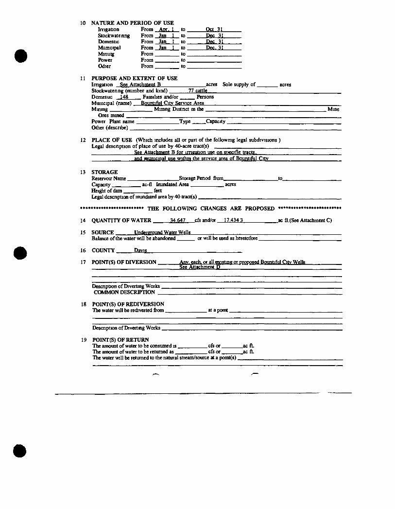
10 NATURE AND PERIOD OF USE Imgation From Apr. 1 to Oct 31 Stockwatenng From Jan 1 to Dec 31 Domestic From Jan 1 to Dec 31 Mumcipal From Jan 1 to Dec. 31 Minutg From to Power From to Odier From to
11 PURPOSE AND EXTENT OF USE Imgation See Attachment B acres Sole supply of acres Stockwatenng (number and kind) 77 cattle Domesuc 148 Families and/or Persons Mumcipal (name) Bountiful Citv Service Area Minmg Mimng Distnct m the Mine
Ores mined Power Plant name Type Ciqjacity . Other (describe)
12 PLACE OF USE (Which includes all or part of the followmg legal subdivisions ) Legal descnption of place of use by 40-acre traa($)
See Attachment B for imgation use on si>ecifie tracts. and municipal use Wlthm the service area of Bountiful Citv
13 STORAGE Reservoir Name Storage Penod from to_ Capacity ac-fl Inundated Area acres Height of dam feet Legal dcscnpticm of mundated area by 40 tract(s).
«***•«••«***«*«**«**«*•** Tjj£ FOLLOWING CHANGES ARE PROPOSED ••**•«««*•«»•**••»«*••»••
14 QUANTITY OF WATER 34.647 cfs and/or 17.434 3 ac fl.(See Attachment C)
15 SOURCE Underyound Water Welb Balance of the water will be abandoned or will be used as heretofore
16 COUNTY Davis
17 POINT(S) OF DIVERSION Any, each, or all mnstinff or proposed Bountiful Citv Wells See Attachment D
Descnption of Divertmg Works. COMMON DESCRIPTION _
18 POINT(S) OF REDIVERSION The water will be rediverted from at a pomt.
Descnption of Divertmg Works.
19 POINT(S) OF RETURN The amount of water to be consumed is cfs or ac ft The amount of water to be returned as cfs or ac ft The water will be returned to the natural stream/source at a pomt(s)
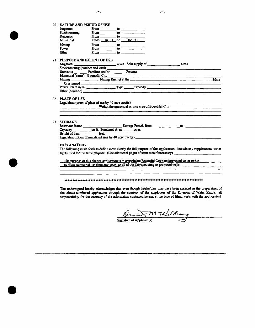
20 NATURE AND PERIOD OF USE Imgatm From to. Stockwatenng' From to. Dcanestic Fttsm to. Mumapal From Jan. 1 to Dec 31 Mmmg From to Power From to Other From to
21 PURPOSE AND EXTENT OF USE bngation acres Sole supply of acres Stockwatenng (number and kind). Domestic Families andl/or Persons Muniapal (name) Bountifiil Citv Mmmg Mmmg Distnct at the Mme
Ores mined Power Plant name Type Capacity. Other (descnbe)
22 PLACE OF USE Legal descnptum of place of use by 40-acre tract(s).
Within the mumcipal service area of Bountiful Citv
23 STORAGE Reservoir Name Storage Penod. from to_ Capacity ac-ft Inundated Area acres Heig^ of dam. feet Legal descnption of mundated area by 40 acre tract(s)
EXPLANATORY The followmg is set forth to define more clearly the full purpose of this applicaticn bclude aziy supplemental water n^its used for the same purpose (Use additional pages of same size tf necessary)
The purpose of tl ls change application is to consohdate Bountiful Citv s underground water nt|hts to allow mumcroal use from any, each, or all of the City's existmg or proposed wells.
*»•***•«•*•««**«««****«****•****«****«****•*•*••**•******•**«*««***•*********•**•«**•
The undersigned hereby acknowledges that even though he/she/they may have been assisted m tfae preparation of the above-numbered apphcation through the courtesy of the employees of the Division of Water Rights all responsibdity for the accuracy of the mfoimation contained herem, at the tune of filmg rests with the apphcant(s)
Signature of Apphcant(s)
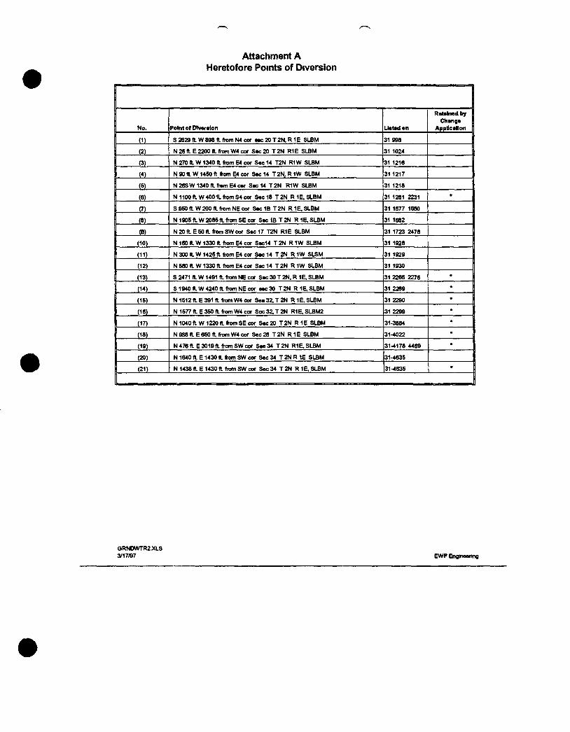
Attachment A Heretofore Points of Diversion
No. Pofait of DIveralon Uataden
Retained by 1 Change 1
Appllcallon
(1) S2629n.W898f t . ( remN4cor a« :20T2N.R1E SLBM 31 998
(2) N25( IE2200n. f romW4cor Sec20 T 2 N R1E SLBM 31 1024
P) N 270 n.W 1340 n. from E4 cor Sec 14 T2N R1W SLBM 31 1216
(4) N 9 0 t l W 1 4 5 0 f t fromE4cor Sec14 T 2 N , R 1 W SLBM 31 1217
(5) N26SW1340ft . f ramE4car Sec14 T 2 N R1W SLBM 31 1218
(6) N1100 ft. W400 IL from S4 cor Sec18 T 2 N R 1 E , S L B M 31 1281 2231
(7) S 950 (I W 200 ft. from NE cor Sec1B T 2 N R 1 E , S L B M 31 1677 1680
(8) N 1905 ft. W 2085 ft. from SE cor S e c l B T 2 N R 1 E , S L B M 31 1682
(B) N 20 a E 50 ft. from SW cor Sac17 T2N R1E SLBM 31 1723 2478
(10) N 160 ft. W1330 ft. from E4 cor Sec14 T 2 N R 1W SLBM 31 1928
(11) N 300 ft. W 1425 ft from E4 cor S « : 14 T 2 N R I W SLSM 31 1929
(12) N 580 ft W 1330 ft from cor Sec 14 T 2 N R I W SLBM 31 1930
(13) S 2471 ft. W1491 ft. from NE cor Sec30 T 2 N . R 1E.SLBM 31 2266 2276 •
(14) S 1940 ft. W 4240 ft from NE cor sec30 T 2 N R IE, SLBM 31 2269 •
(15) N 1512ft. E391 ft from W4 cor See32 ,T2N R 1 E . S L B M 31 2290 •
(16) N 1577 ft. E 350 ft from W4 cor Soc32 ,T2N R1E.SLBM2 31 2299 •
(17) N1040 ft W1220 ft from SE cor Sac 20 T 2 N R 1 E SLBM 31-3884 •
(18) N9S8 f tE650 f t f r omW4co r Sec 28 T 2 N R 1 E SLBM 31-4022 •
(19) N 476 ft E 3019 ft from SW cor See 34 T 2N R1E, SLBM 31-4178 4469 •
(20) N 1640 ft E 1430 ft. from SW cor Sec 34 T 2N R IE SLBM 31-4635
1 (21) N 1438 ft E 1430 ft from SW cor Sec 34 T2N R 1 E , S L B M 31-4635 • 1
GRNDWTR2JCLS 3/17«7 EWP Engineenng
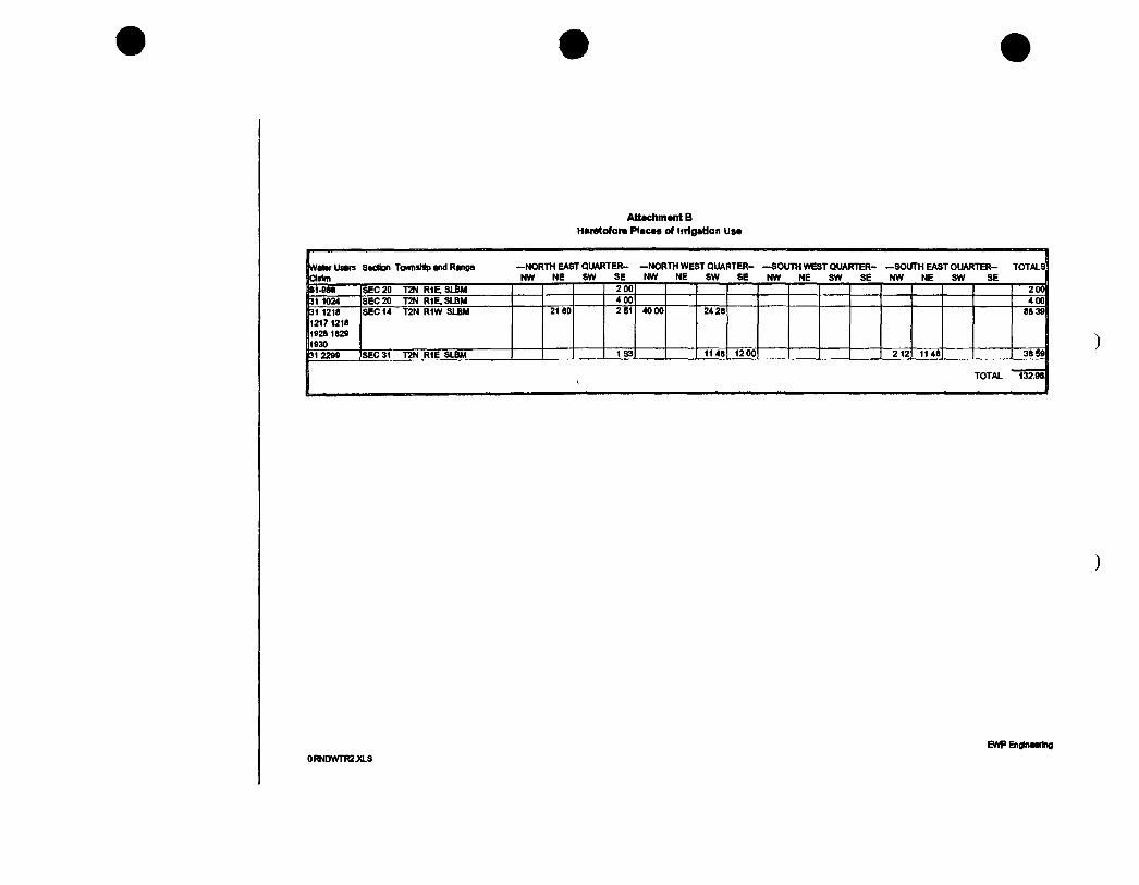
At tachment B
Hars to fo ra P l a c e s of l i t i ga t ion U s e
Valer Users Secton Tommstiip and Range (Claim
—NORTH EAST QUARTER-NW NE SW SE
—NORTH WEST QUARTER-NW NE SW SE
-SOUTH WEST QUARTER-NW NE SW SE
—SOLTTH EAST OUARTER-NW NE SW SE
TOTALS
Bsi-esa SEC 20 T2N R1E,SLBM 200 2 00 | b l 1024 SEC 20 T2N R1E.SLBM 400 4 0 0 l n3i 1218 11217 1218 ni»28 1829 | l930
SEC 14 T2N RIW SLBM 2160 2 51 40 00 2428 88 391
jp i 2299 SEC 31 T2N R1E SLBM 1 S3 1148 12 00 212 11 48 38 591
TOTAL 132.981
EWP Engineering
0RNDWTR2J(LS
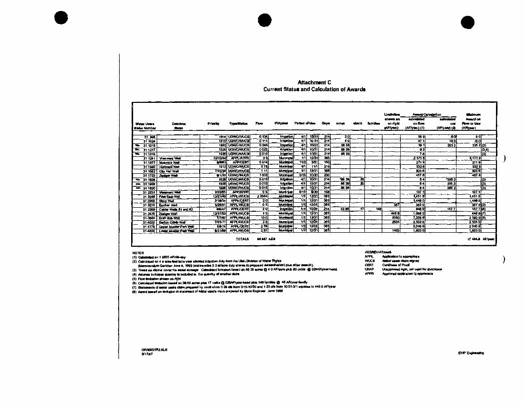
Attachment C Current Status and Calculation of Awards
Award CaJodatlon
PurpaM Parted e f U n Daya acraa atack fanUtaa
alalia Numbar on r lgM on flew
tAF/yaai) (AF/yaar) j i )
Awardo usa Row or U i
(AF/yaart W (AFftfaar)
31 » S isia UOWCrtVUCS 0134 ImgaJlon 4/1 1CV31 214 2 0 569 SO 8 0 31 1024 1915 inwowucs 0 111 inlgaUcai 4/1 1031 214 4 0 47 1 180 ISO
• » 31 1218 1925 uowc/wucs 0 045 impallon 4/1 1(V31 214 88 38 191 355 2 355 2 (3) •»k 31 1217 192S 0 022 tnloallon 4/1 1t»31 214 88 39 9 3 (3,4)
31 1218 1926 uowcmucs 0 018 Inlealion 4/1 1(V31 214 88 39 7 6 (3) 31 12a« V I n m a n l V M APPL/APPR 3 0 1/1 1201 365 21718 ^ 1 7 1 9 31 1877 MoaxockWall » M 1 APP/C£RT 0914 Munldpd 11/2 3ai 150 2719 271 9 31 1M0 HoRireoKW*!! 1912 UOWC/WUCS 078 Munidpel V1 11/1 215 332 6 3328 31 1682 CHy Hal Wall 7/1Q04 uowcmucs 1 11 Municipal 1/1 12/31 366 803 6 803 6 31 1723 ZMlewWaO ari/2o UGWC/MJCS 1003 UUBCIP I I 3/15 10/30 230 457 6 467 8 31 1828 IS26 UOWCAWJCS 0015 brioabon 4/1 1(V31 214 •8839 20 84 •356 2 (3)
•o- 31 1929 1926 USWCfWlX^ 0015 Inigallan 4/1 10/31 214 88 38 20 64 355 2 (3) 31 1830 1926 uowc/wucs 0 015 lingnUofi 4/1 1031 214 88 39 8 4 365 2 (3) 31 2231 VIminai i lWM 2/2SI65 APP/APPR 0 5 Munktpal 8/15 »30 108 107 1 1071 31 2266 F M E M l W d 12/ZV4S / J P P L W K S 2C0S4 Munlatail 1/1 1201 365 1.451 8 1,451 8 3)2268 Stnp WW 2'taf34 /«>Pt/C6RT 2 0 MuMpa l 1/1 1201 365 1,448 0 i,44ao 31 2278 BouSwWan /KPPLWUCS 0 5 Uunlctpal 1/1 12/31 365 367 3620 367 0 (3) 31 22S9 C a l d a - W f t e f l a n d n e«/47 /(PPL/CERT 20 Intaallon 4/1 1Q01 214 2286 17 148 848 9 157 7 157 7 (6) 31 2(78 ZMlgwWan 12/17/82 APPL/WUC8 1 5 MuiMpid 1/1 12/31 365 448 8 1,086 0 446 8 (7) 31.3864 BtansubWoo 7/7/87 APPUWUCS 10 0 Munkapd 1/1 12Q1 365 2SS0 7,239 8 2590 0 (8) 31-4022 Barion CnMkWr i 7/2171 AFPIAVUCS 3 5 Muraclpal 1/1 120* 365 2S34 2,533 9 2534 0 314178 ^ Uppar Muellv PwK Wen 1/8(74 APPUOERT 279 Municipal 1/1 1201 365 2,019 9 2010 9 31-4835 LmMrMueUvPaikWeD &nt/BO APPL«»UOS 167 Munldpil 1/1 1201 365 1*33 1,933 0 1,833 0
TOTALS M M 7 o J J i r 4 M J Af/]raac
NOTES <1) Cr iaMadan19835AF/c l» lay (2) Calcul«adon4aaci»4aalAcieY*aralki»iadln1i| i l lcaidulyfiDmlhaUlaliCI^^
(MamoiandumOacWDnJunaa, 1993 (aupawadaa 3 3 «</«ci» duly atwwi t l propoaaj iMamitialloii) plua rtllar awaiili). (3) Thaaa ate dalma c o w i twaaiM acraaga CalaiMad Itnlation baaail on 86 39 acraa Q 4 0 AF/aora pka 80 caUla Q 02aAF/Vaar-haad. (4) AalanaklKtcalaaquaniaylalndudadln lha quantity of amKharclalfa (5) FkwernttaUonahawnonrlQhl (8) Calculaladllm(alionliKa<lon3aS9aoreapliia17caltlaQ.02&AF/yaar4iaadplua14SfamlllaaO 46 AF/yav^^amBy (7) sttfamanla c l walar uaaia dalni praparad liy coult ahoo 0 29 da from 3(15-1000 and 1 23 oh fnm 10(31.3/1 aqualaa lo 448 9 AF(Vaar (8) Awwdbnadonianllatkinlnatalanianlofaataruaac'aclampiaparadtjySUIaEnglnaar Juna 1988
ABBREVIATKMa APPL Applicaticn 10 apprapiWa WUCS Mtoruamotalmaisnad CCRT CalWIcatoorPnior UNAP Unappnwad ngto, not valid for dh/antona APPR Apprwad appUcalian lo appraciala
ORNDVVrR2XLS VI7/97 E V ^ Enginaallns
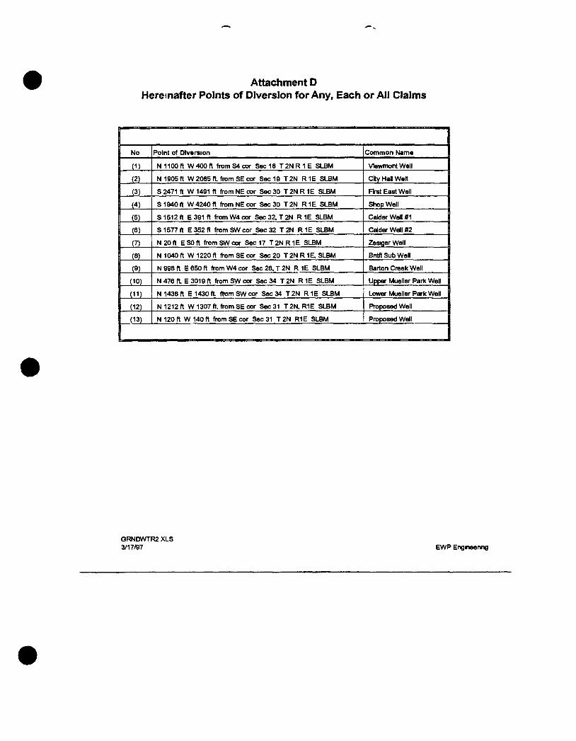
Attachment D Hereinafter Points of Diversion for Any, Each or All Claims
1 No Point of Diversion Common Name
1 N 1100 ft W 400 ft from S4 cor Sec 18 T2N R 1 E SLBM VIewmont Well
j (2) N 1905 ft W 2085 ft. from SE cor Sec 19 T 2N R IE SLBM City Hal Welt
1 (3) S 2471 ft W 1491 ft from NE cor Sec 30 T 2N R IE SLBM First East Well
(4) S 1940 ft W 4240 ft from NE cor S«»c30 T 2 N R 1 E SLBM Shop Well
(5) S 1512 ft E 391 ft from W4 cor Sec32 ,T2N R 1E SLBM CalderWelI#1 |
(6) S 1577 ft E352 f l from SW cor Sec 32 T2N R 1 E SLBM CalderWeII#2
(7) N20f t ESOft from SW cor Sec 17 T 2 N R 1 E SLBM ZesigerWell
(8) N1040ft W1220f l from SE cor Sec 20 T 2 N R 1 E , S L B M Bntfl Sub Well
(9) N 998 ft £650 ft from W4 cor Sec28 ,T2N R 1E SLBM Barton Creek Well
(10) N 476 ft. E 3019 ft from SW cor Sec 34 T 2N R 1E SLBM Upper Mueller ParK Well
(11) N 1438 ft E 1430 ft. ftxjmSWcor Sec 34 T2N R IE SLBM Lower Mueller Park Well
(12) N 1212 ft W 1307 ft. from SE cor Sec 31 T2N,R1E SLBM Proposed Well
(13) N 120 ft W 140 ft from SE cor Sec 31 T 2 N R1E SLBM Proposed Well
GRNDWTR2 XLS 3/17/97 EWP Engineenng
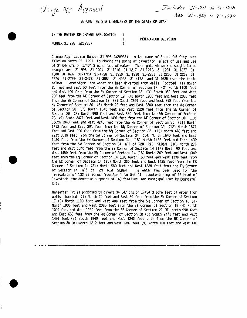
^ 4AII> 3f- ^ SI- 1930
BEFORE THE STATE ENGINEER OF THE STATE OF UTAH
IN THE MATTER OF CHANGE APPLICATION ) ) MEMORANDUM DECISION
NUMBER 31 998 (a20935) )
Change Application Number 31-998 (a20935) in the name of Bountiful City was filed on March 25 1997 to change the point of diversion place of use and use of 34 647 cfs or 17434 3 acre-feet of water The rights which are sought to be changed are 31 998 31-1024 31 1216 31 1217 31 1218 31 1281 31 1677 31 1680 31 1682 31-1723 31-1928 31 1929 31 1930 31-2231 31 2266 31 2269 31 2276 31-2299 31-2478 31-3884 31-4022 31 4178 and 31 4635 (see the table belcw) Heretofore the water has been diverted from wells located (1) North 20 feet and East 50 feet from the SW Corner of Section 17 (2) North 1100 feet and West 400 feet from the SH Corner of Section 18 (3) South 950 feet and West 200 feet from the NE Corner of Section 19 (4) North 1905 feet and West 2085 feet from the SE Corner of Section 19 (5) South 2629 feet and West 898 feet from the N!< Corner of Section 20 (6) North 25 feet and East 2200 feet from the VRi Corner of Section 20 (7) North 1040 feet and West 1220 feet from the SE Corner of Section 20 (8) North 998 feet and East 650 feet from the Corner of Section 28 (9) South 2471 feet and West 1491 feet from the NE Corner of Section 30 (10) South 1940 feet and West 4240 feet from the NE Corner of Section 30 (11) North 1512 feet and East 391 feet from the W, Corner of Section 32 (12) North 1577 feet and East 350 feet from the W, Corner of Section 32 (13) North 476 feet and East 3019 feet from the SW Corner of Section 34 (14) North 1640 feet and East 1430 feet from the SW Corner of Section 34 (15) North 1438 feet and East 1430 feet from the SW Corner of Section 34 all of T2N RIE SLB&M (16) North 270 feet and West 1340 feet from the E Corner of Section 14 (17) North 90 feet and West 1450 feet from the EV, Corner of Section 14 (18) North 269 feet and West 1340 feet from the E!< Corner of Section 14 (19) North 160 feet and West 1330 feet from the E5j Corner of Section 14 (20) North 300 feet and West 1425 feet from the £H Corner of Section 14 (21) North 580 feet and West 1330 feet from the El( Corner of Section 14 all of T2N RIW SLB&M The water has been used for the irrigation of 132 98 acres from Apr 1 to Oct 31 stockwatenng of 77 head of livestock the domestic purposes of 148 families and mumcipal uses by Bountiful City
Hereafter it is proposed to divert 34 647 cfs or 17434 3 acre feet of water from wells located (1) North 20 feet and East 50 feet from the SW Corner of Section 17 (2) North 1100 feet and West 400 feet from the S' Corner of Section 18 (3) North 1905 feet and West 2085 feet from the SE Corner of Section 19 (4) North 1040 feet and West 1220 feet from the SE Corner of Section 20 (5) North 998 feet and East 650 feet from the W/, Corner of Section 28 (6) South 2471 feet and West 1491 feet (7) South 1940 feet and West 4240 feet both from the NE Corner of Section 30 (8) North 1212 feet and West 1307 feet (9) North 120 feet and West 140
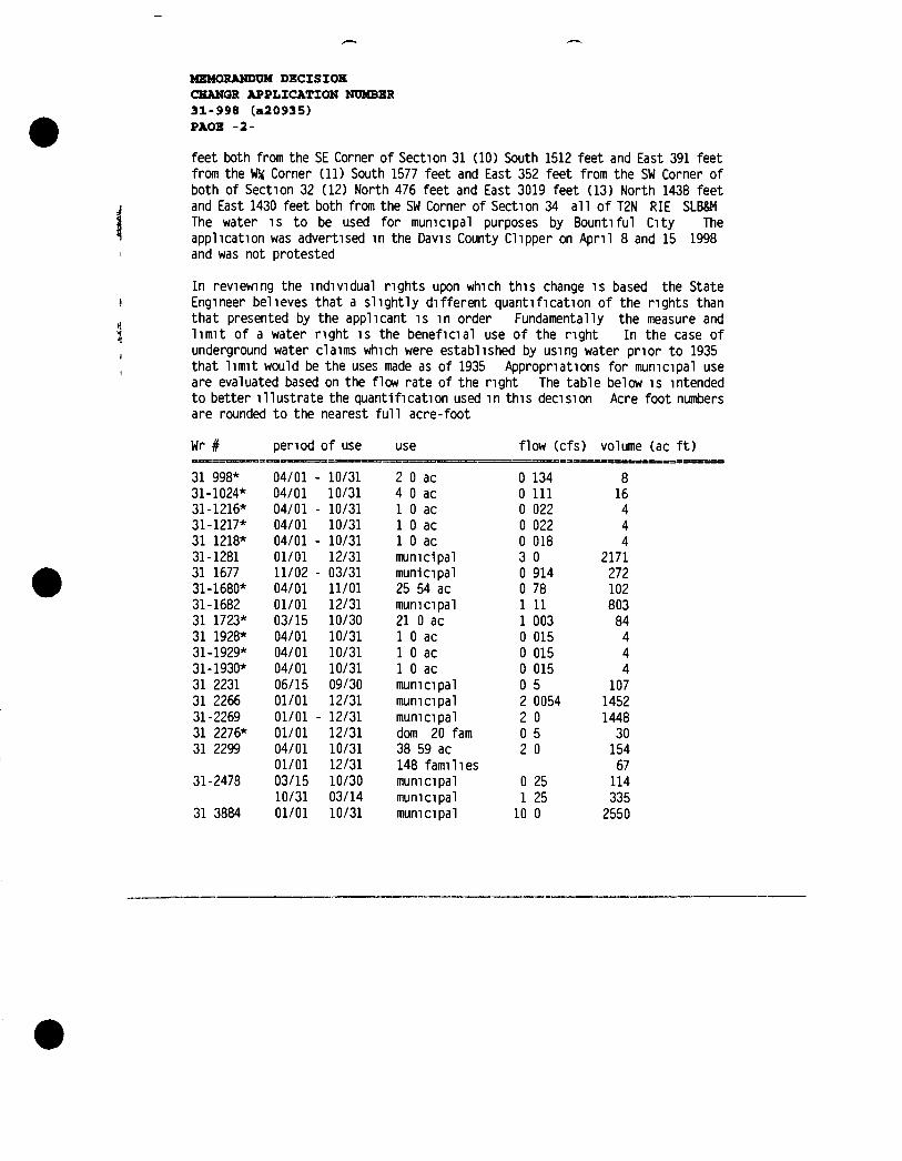
MEMORANDUM DECISIOH CHANQR APPLICATION NUMBER 31-998 (a20935) PAOE -2-
feet both from the SE Corner of Section 31 (10) South 1512 feet and East 391 feet from the W!< Corner (11) South 1577 feet and East 352 feet from the SW Corner of both of Section 32 (12) North 476 feet and East 3019 feet (13) North 1438 feet and East 1430 feet both from the SW Corner of Section 34 all of T2N RIE SLB&M The water is to be used for mumcipal purposes by Bountiful City The application was advertised in the Davis County Clipper on April 8 and 15 1998 and was not protested
In reviewing the individual rights upon which this change is based the State Engineer believes that a slightly different quantification of the rights than that presented by the applicant is in order Fundamentally the measure and limit of a water nght is the beneficial use of the nght In the case of underground water claims which were established by using water prior to 1935 that limit would be the uses made as of 1935 Appropriations for municipal use are evaluated based on the flow rate of the right The table below is intended to better illustrate the quantification used in this decision Acre foot niM>ers are rounded to the nearest full acre-foot
Wr # penod of use use flow (cfs) volume
31 998* 04/01 - 10/31 2 0 ac 0 134 8 31-1024* 04/01 10/31 4 0 ac 0 111 16 31-1216* 04/01 -10/31 1 0 ac 0 022 4 31-1217* 04/01 10/31 1 0 ac 0 022 4 31 1218* 04/01 - 10/31 1 0 ac 0 018 4 31-1281 01/01 12/31 municipal 3 0 2171 31 1677 11/02 - 03/31 municipal 0 914 272 31-1680* 04/01 11/01 25 54 ac 0 78 102 31-1682 01/01 12/31 mumcipal 1 11 803 31 1723* 03/15 10/30 21 0 ac 1 003 84 31 1928* 04/01 10/31 1 0 ac 0 015 4 31-1929* 04/01 10/31 1 0 ac 0 015 4 31-1930* 04/01 10/31 1 0 ac 0 015 4 31 2231 06/15 09/30 municipal 0 5 107 31 2266 01/01 12/31 municipal 2 0054 1452 31-2269 01/01 -12/31 mumcipal 2 0 1448 31 2276* 01/01 12/31 dom 20 fam 0 5 30 31 2299 04/01 10/31 38 59 ac 2 0 154
01/01 12/31 148 families 67 31-2478 03/15 10/30 mumcipal 0 25 114
10/31 03/14 municipal 1 25 335 31 3884 01/01 10/31 mumcipal 10 0 2550
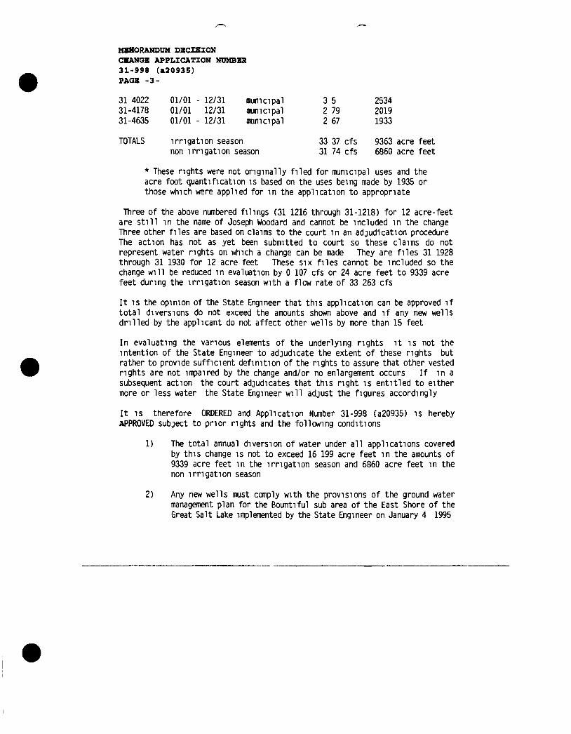
MSHORANDUM DECISION CHANGE APPLICATION NUMBER 31-998 (a20935) PAQE -3-
31 4022 01/01 - 12/31 numcipal 3 5 2534 31-4178 01/01 12/31 numcipal 2 79 2019 31-4635 01/01 - 12/31 naimcipal 2 67 1933
TOTALS irrigation season 33 37 cfs 9363 acre feet non irrigation season 31 74 cfs 6860 acre feet
* These rights were not originally filed for mumcipal uses and the acre foot quantification is based on the uses being made by 1935 or those which were applied for in the application to appropnate
Three of the above numbered filings (31 1216 through 31-1218) for 12 acre-feet are still in the name of Joseph Woodard and cannot be included in the change Three other files are based on claims to the court in an adjudication procedure The action has not as yet been submitted to court so these claims do not represent water rights on which a change can be made They are files 31 1928 through 31 1930 for 12 acre feet These six files cannot be included so the change will be reduced in evaluation by 0 107 cfs or 24 acre feet to 9339 acre feet during the irrigation season with a flow rate of 33 263 cfs
It IS the opinion of the State Engineer that this application can be approved if total diversions do not exceed the amounts shown above and if any new wells drilled by the applicant do not affect other wells by more than 15 feet
In evaluating the vanous elements of the underlying rights it is not the intention of the State Engineer to adjudicate the extent of these nghts but rather to provide sufficient definition of the rights to assure that other vested rights are not impaired by the change and/or no enlargement occurs If in a subsequent action the court adjudicates that this right is entitled to either more or less water the State Engineer will adjust the figures accordingly
It IS therefore ORDERED and Application Number 31-998 (a20935) is hereby APPROVED subject to pnor rights and the following conditions
1) The total annual diversion of water under all applications covered by this change is not to exceed 16 199 acre feet in the amounts of 9339 acre feet in the irrigation season and 6860 acre feet in the non irrigation season
2) Any new wells must comply with the provisions of the ground water management plan for the Bountiful sub area of the East Shore of the Great Salt Lake implemented by the State Engineer on January 4 1995
MEMORANDUM DECISION CEANQB APPLICATION NUMBER 31-998 (a20935) PAOE -4-
This Decision is subject to the provisions of Rule R655 6 17 of the Division of Water Rights and to Sections 63 46b-13 and 73-3 14 of the Utah Code Annotated 1953 which provide for filing either a Request for Reconsideration with the State Engineer or an appeal with the appropnate District Court A Request for Reconsideration must be filed with the State Engineer within 20 days of the date of this Decision However a Request for Reconsideration is not a prerequisite to filing a court appeal A court appeal must be filed within 30 days after the date of this Decision or if a Request for Reconsideration has been filed within 30 days after the date the Request for Reconsideration is denied A Request for Reconsideration is considered denied when no action is taken 20 days after the Request is filed
Dated this 11th day of December 1998
^bert L Morgan P E S)^& Engineer
RLM JRM ja
Mailed a copy of the foregoing Memorandum Decision this 11th day of December 1998 to
Bountiful City 790 South 100 East Bountiful UT 84011
BY c>w-^ur, Judy Aliii
Appendix L
Slope Stability Drawings
and
Calculations
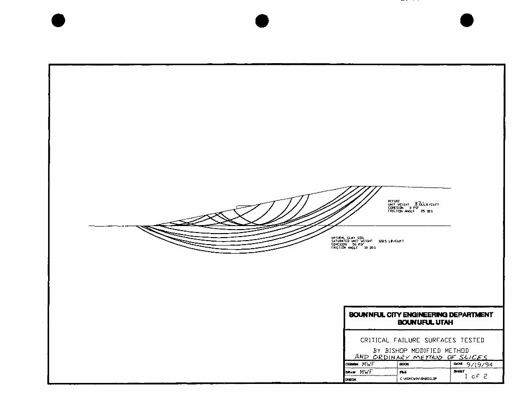
RErusE .... . UNIT VEI GMT 3 - ^ M . f l / C U / T cotcsioN 0 psr rK lCl lON ANGLE ?5 OEG
NATURAL CLAY SOIL SATURATED UNIT WEIGHT CDHESIDN 50 PSF TRICTIDN ANGLE 30 DEG
1285 L B / E u n
BouNnFUL cmr ENGINEERING DEPARTMENT BCXJNUFULUTAH
CRITICAL FAILURE SURFACES TESTED
BY BISHOP MODIFIED METHOD
oeaiaM M W F
DRAW M V F n L E
C SADACVINSJABDSLOP
9 /19 /94 SHEET
I o f P
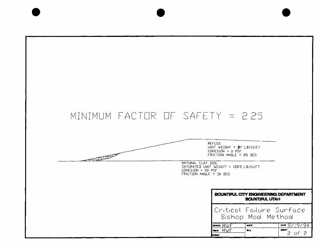
MINIMUM FACTOR DF SAFETY = 2 25
REFUSE UNIT WEIGHT = $7 L B / C U E T CDHESIDN = 0 PSF FRICTION ANGLE = 25 DEG
NATURAL CLAY SDIL SATURATED UNIT WEIGHT = CDHESIDN = 50 PSF FRICTIDN ANGLE = 30 DEG
1285 L B / C U F T
BOUNTIFUL CFTY ENGINEERING DEPARTTMENT BOUNTIFULUTAH
C r i t i c a l B i s h o p
F a i l u r e S u r f a c e Mod M e t h o d
DsaOH M V F BOOK ~™ 9 / 1 9 / 9 4 DRAW M W F R I E SHEET
2 o f 2 C t C C K
SHEET
2 o f 2
SLOPE STABILITY ANALYSIS BISHOP MODIFIED AND/OR ORDINARY METHOD OF SLICES
CONTROL DATA
NUMBER OF SPECIFIED CENTERS 0 NUMBER OF DEPTH LIMITING TANGENTS 8 NUMBER OF VERTICAL SECTIONS 4 NUMBER OF SOIL LAYER BOUNDARIES 3 NUMBER OF PORE PRESSURE LINES 1 NUMBER OF POINTS DEFINING COHESION PROFILE 0
SEISMIC COEFFICIENT S1,S2 = 0 00 0 00 Nu StlSrvMC Fofc.c£
UNIT WEIGHT OF WATER = 62 40
SEARCH IS BASED ON BISHOP MODIFIED METHOD
SEARCH STARTS AT CENTER { 650 0, 1 0),WITH FINAL GRID OF 20 0
ALL CIRCLES TANGENT TO DEPTH, 110 0, 120 0, 130 0, 140 0, 150 0, 160 0, 170 0, 180 0
GEOMETRY
SECTIONS 300 0 400 0 900 01500 0
T CRACKS 10 0 10 0 110 0 110 0 W IN CRACK 10 0 10 0 110 0 110 0 BOUNDARY 1 10 0 10 0 110 0 110 0 BOUNDARY 2 110 0 110 0 110 0 110 0 BOUNDARY 3 280 0 280 0 280 0 280 0
SOIL PROPERTIES
LAYER COHESION FRICTION ANGLE DENSITY PORE PRESSURE FACTOR
1 0 0 25 0 37 0 0 0 2 50 0 30 0 110 0 0 0
PORE PRESSURE DATA
COORDINATES OF EQUI-PRESSURE LINES
SECTIONS 300 0 400 0 900 01500 0 LINE 1 95 0 96 0 110 0 110 0
1 BISHOP MODIFIED AND/OR ORDINARY METHOD OF SLICES
NUMBER TANGENT RADIUS (X) CENTER (Y) CENTER FS(BISHOP) FS(OMS)
1 110 0 109 0 650 0 1 0 3 298 2 669 2 110 0 109 0 610 0 1 0 3 563 2 791 3 110 0 149 0 650 0 -39 0 2 920 2 4 97

4 110 0 109 0 690 0 1 0 3 064 2 562 5 110 0 69 0 650 0 41 0 4 446 3 202 6 110 0 149 0 610 0 -39 0 3 075 2 567 7 110 0 189 0 650 0 -79 0 2 732 2 412 8 110 0 149 0 690 0 -39 0 2 775 2 432 9 110 0 189 0 610 0 -79 0 2 841 2 461
10 110 0 229 0 650 0 -119 0 2 622 2 364 11 110 0 189 0 690 0 -79 0 2 631 2 368 12 110 0 229 0 630 0 -119 0 2 662 2 381 13 110 0 249 0 650 0 -139 0 2 583 2 347 14 110 0 229 0 670 0 -119 0 2 583 2 347 15 110 0 209 0 650 0 -99 0 2 670 2 385 16 110 0 249 0 630 0 -139 0 2 618 2 362 17 110 0 269 0 650 0 -159 0 2 550 2 333 18 110 0 249 0 670 0 -139 0 2 548 2 332 19 110 0 269 0 670 0 -159 0 2 518 2 320 20 110 0 249 0 690 0 -139 0 2 513 2 317 21 110 0 229 0 670 0 -119 0 2 583 2 347 22 110 0 269 0 690 0 -159 0 2 488 2 307 23 110 0 249 0 710 0 -139 0 2 481 2 304 24 110 0 229 0 690 0 -119 0 2 545 2 331 25 110 0 269 0 710 0 -159 0 2 459 2 295 26 110 0 249 0 730 0 -139 0 2 450 2 292 27 110 0 229 0 710 0 -119 0 2 508 2 315 28 110 0 269 0 730 0 -159 0 2 431 2 285 29 110 0 249 0 750 0 -139 0 2 421 2 281 30 110 0 229 0 730 0 -119 0 2 472 2 301 31 110 0 269 0 750 0 -159 0 2 404 2 274 32 110 0 249 0 770 0 -139 0 2 391 2 269 33 110 0 229 0 750 0 -119 0 2 439 2 288 34 110 0 269 0 770 0 -159 0 2 377 2 264 35 110 0 249 0 790 0 -139 0 2 364 2 260 36 110 0 229 0 770 0 -119 0 2 407 2 275 37 110 0 269 0 790 0 -159 0 2 355 2 258 38 110 0 249 0 810 0 -139 0 2 340 2 253 39 110 0 229 0 790 0 -119 0 2 376 2 264 40 110 0 269 0 810 0 -159 0 2 333 2 251 41 110 0 249 0 830 0 -139 0 2 321 2 251 42 110 0 229 0 810 0 -119 0 2 350 "L 43 110 0 269 0 830 0 -159 0 2 317 <L 2^0. 44 110 0 249 0 850 0 -139 0 2 309 2 254 45 110 0 229 0 830 0 -119 0 2 326 2 251 46 110 0 269 0 850 0 -159 0 2 307 2 255 47 110 0 249 0 870 0 -139 0 2 306 2 266 48 110 0 229 0 850 0 -119 0 2 310 2 252 49 110 0 269 0 870 0 -159 0 2 307 2 270 50 110 0 249 0 890 0 -139 0 2 330 2 304 51 110 0 229 0 870 0 -119 0 & 2 264
SEARCH IS ABANDONED AFTER 51 CIRCLES 1 BISHOP MODIFIED AND/OR ORDINARY METHOD OF SLICES
NUMBER TANGENT RADIUS (X) CENTER (Y) CENTER FS(BISHOP) FS(OMS)
1 2 3
120 0 120 0 120 0
259 0 239 0 279 0
870 0 830 0 870 0
-139 0 -119 0 -159 0
3 541 3 073 3 504
3 381 2 904 3 354
4 120 0 239 0 910 0 -119 0 6 004 5 744 5 120 0 199 0 870 0 -79 0 3 661 3 461 6 120 0 239 0 790 0 -119 0 2 967 2 771 7 120 0 279 0 830 0 -159 0 3 012 2 866 8 120 0 199 0 830 0 -79 0 3 148 2 94 6 9 120 0 239 0 770 0 -119 0 2 946 2 734
10 120 0 259 0 790 0 -139 0 2 934 2 752 11 120 0 239 0 810 0 -119 0 3 006 2 824 12 120 0 219 0 790 0 -99 0 3 005 2 791 13 120 0 259 0 770 0 -139 0 2 911 2 715 14 120 0 279 0 790 0 -159 0 2 905 2 735 15 120 0 259 0 810 0 -139 0 2 973 2 805 16 120 0 279 0 770 0 -159 0 2 882 2 699 17 120 0 299 0 790 0 -179 0 2 881 2 722 18 120 0 279 0 810 0 -159 0 2 942 2 785 19 120 0 299 0 770 0 -179 0 2 857 2 686 20 120 0 319 0 790 0 -199 0 2 860 2 710 21 120 0 299 0 810 0 -179 0 2 919 2 771 22 120 0 299 0 750 0 -179 0 2 843 2 659 23 120 0 319 0 770 0 -199 0 2 835 2 674 24 120 0 279 0 770 0 -159 0 2 882 2 699 25 120 0 319 0 750 0 -199 0 2 820 2 647 26 120 0 339 0 770 0 -219 0 2 816 2 664 27 120 0 319 0 790 0 -199 0 2 860 2 710 28 120 0 339 0 750 0 -219 0 2 800 2 637 29 120 0 359 0 770 0 -239 0 2 797 2 652 30 120 0 339 0 790 0 -219 0 2 841 2 699 31 120 0 359 0 750 0 -239 0 2 781 2 626 32 120 0 379 0 770 0 -259 0 2 780 2 642 33 120 0 359 0 790 0 -239 0 2 822 2 688 34 120 0 379 0 750 0 -259 0 2 763 2 616 35 120 0 399 0 770 0 -279 0 2 764 2 633 36 120 0 379 0 790 0 -259 0 2 805 2 677 37 120 0 379 0 730 0 -259 0 2 753 2 596 38 120 0 399 0 750 0 -279 0 2 748 2 608 39 120 0 359 0 750 0 -239 0 2 781 2 626 40 120 0 399 0 730 0 -279 0 2 737 2 587 41 120 0 419 0 750 0 -299 0 2 734 2 600 42 120 0 399 0 770 0 -279 0 2 764 2 633 43 120 0 419 0 730 0 -299 0 2 723 2 579 44 120 0 439 0 750 0 -319 0 2 722 2 593 45 120 0 419 0 770 0 -299 0 2 751 2 625 46 120 0 439 0 730 0 -319 0 2 710 2 572 47 120 0 459 0 750 0 -339 0 2 710 2 586 48 120 0 439 0 770 0 -319 0 2 739 2 618 49 120 0 439 0 710 0 -319 0 2 703 2 557 50 120 0 459 0 730 0 -339 0 2 698 2 566 51 120 0 419 0 730 0 -299 0 2 723 2 579
SEARCH IS ABANDONED AFTER 51 CIRCLES 1 BISHOP MODIFIED AND/OR ORDINARY METHOD OF SLICES
NUMBER TANGENT RADIUS (X) CENTER (Y) CENTER FS(BISHOP) FS(OMS)
130 0 130 0 130 0
449 0 429 0 469 0
730 0 690 0 730 0
-319 0 -299 0 -339 0
2 934 2 931 2 918
2 748 2 719 2 740
4 130 0 429 0 770 0 -299 0 3 003 2 823 5 130 0 389 0 730 0 -259 0 2 992 2 777 6 130 0 469 0 710 0 -339 0 2 901 2 715 7 130 0 489 0 730 0 -359 0 2 903 2 732 8 130 0 469 0 750 0 -339 0 2 941 2 769 9 130 0 449 0 730 0 -319 0 2 934 2 748
10 130 0 469 0 690 0 -339 0 2 914 2 721 11 130 0 489 0 710 0 -359 0 2 892 2 713 12 130 0 449 0 710 0 -319 0 2 919 2 724 13 130 0 489 0 690 0 -359 0 2 913 2 727 14 130 0 509 0 710 0 -379 0 2 885 2 713 15 130 0 489 0 730 0 -359 0 2 903 2 732 16 130 0 509 0 690 0 -379 0 2 918 2 739 17 130 0 529 0 710 0 -399 0 2 885 2 720 18 130 0 509 0 730 0 -379 0 2 888 2 723 19 130 0 529 0 690 0 -399 0 2 922 2 751 20 130 0 529 0 730 0 -399 0 2 876 2 717 21 130 0 489 0 730 0 -359 0 2 903 2 732 22 130 0 489 0 690 0 -359 0 2 913 2 727 23 130 0 549 0 730 0 -419 0 2 862 2 709 24 130 0 529 0 750 0 -399 0 2 899 2 745 25 130 0 549 0 710 0 -419 0 2 886 2 727 26 130 0 569 0 730 0 -439 0 2 859 2 711 27 130 0 549 0 750 0 -419 0 2 886 2 737 28 130 0 569 0 710 0 -439 0 2 891 2 738 29 130 0 589 0 730 0 -459 0 2 866 2 722 30 130 0 569 0 750 0 -439 0 2 874 2 730 31 130 0 589 0 710 0 -459 0 2 899 2 750 32 130 0 589 0 750 0 -459 0 2 867 2 728 33 130 0 549 0 750 0 -419 0 2 886 2 737 34 130 0 549 0 710 0 -419 0 2 886 2 727
F S MINIMUM= 2 859 FOR THE CIRCLE OF CENTER { 730 0,-439 0) 1 BISHOP MODIFIED AND/OR ORDINARY METHOD OF SLICES
NUMBER TANGENT RADIUS (X) CENTER (Y) CENTER FS(BISHOP) FS(OMS)
1 140 0 579 0 730 0 -439 0 3 077 2 884 2 140 0 559 0 670 0 -419 0 3 227 3 010 3 140 0 599 0 710 0 -459 0 3 117 2 926 4 140 0 559 0 750 0 -419 0 3 093 2 896 5 140 0 519 0 710 0 -379 0 3 093 2 873 6 140 0 559 0 690 0 -419 0 3 154 2 944 7 140 0 539 0 710 0 -399 0 3 095 2 884 8 140 0 579 0 690 0 -439 0 3 155 2 954 9 140 0 579 0 730 0 -439 0 3 077 2 884
10 140 0 539 0 730 0 -399 0 3 076 2 869 11 140 0 539 0 690 0 -399 0 3 142 2 924 12 140 0 539 0 750 0 -399 0 3 101 2 897 13 140 0 519 0 730 0 -379 0 3 081 2 866 14 140 0 559 0 710 0 -419 0 3 100 2 896 15 140 0 559 0 750 0 -419 0 3 093 2 896 16 140 0 519 0 750 0 -379 0 3 114 2 903 17 140 0 519 0 710 0 -379 0 3 093 2 873
F S MINIMUM= 3 076 FOR THE CIRCLE OF CENTER ( 730 0,-399 0) L BISHOP MODIFIED AND/OR ORDINARY METHOD OF SLICES
NUMBER TANGENT RADIUS (X) CENTER (Y) CENTER FS(BISHOP) FS(OMS)
1 150 0 549 0 730 0 -399 0 3 289 3 028 2 150 0 529 0 670 0 -379 0 3 413 3 126 3 150 0 569 0 710 0 -419 0 3 309 3 054 4 150 0 529 0 750 0 -379 0 3 328 3 056 5 150 0 489 0 710 0 -339 0 3 293 2 997 6 150 0 529 0 690 0 -379 0 3 343 3 064 7 150 0 509 0 710 0 -359 0 3 291 3 007 8 150 0 549 0 690 0 -399 0 3 351 3 082 9 150 0 549 0 730 0 -399 0 3 289 3 028
10 150 0 509 0 730 0 -359 0 3 290 3 009 11 150 0 509 0 690 0 -359 0 3 334 3 043 12 150 0 569 0 730 0 -419 0 3 294 3 041 13 150 0 549 0 750 0 -399 0 3 320 3 056 14 150 0 569 0 710 0 -419 0 3 309 3 054 15 150 0 569 0 750 0 -419 0 3 321 3 067 16 150 0 529 0 750 0 -379 0 3 328 3 056 17 150 0 529 0 710 0 -379 0 3 294 3 020
F S MINIMUM" 3 289 FOR THE CIRCLE OF CENTER ( 730 0,-399 0) L BISHOP MODIFIED AND/OR ORDINARY METHOD OF SLICES
NUMBER TANGENT RADIUS (X) CENTER (Y) CENTER FS(BISHOP) FS(OMS)
1 160 0 559 0 730 0 -399 0 3 513 3 188 2 160 0 539 0 670 0 -379 0 3 618 3 272 3 160 0 579 0 710 0 -419 0 3 533 3 219 4 160 0 539 0 750 0 -379 0 3 550 3 210 5 160 0 499 0 710 0 -339 0 3 492 3 131 6 160 0 499 0 690 0 -339 0 3 526 3 161 7 160 0 519 0 710 0 -359 0 3 499 3 152 8 160 0 499 0 730 0 -339 0 3 504 3 143 9 160 0 479 0 710 0 -319 0 3 495 3 119 10 160 0 519 0 690 0 -359 0 3 534 3 183 11 160 0 519 0 730 0 -359 0 3 502 3 154 12 160 0 479 0 730 0 -319 0 3 509 3 133 13 160 0 479 0 690 0 -319 0 3 522 3 142
F S MINIMUM= 3 492 1 FOR THE CIRCLE OF CENTER { 710 0,-: 339 0) BISHOP MODIFIED AND/OR ORDINARY METHOD OF SLICES
NUMBER TANGENT RADIUS (X) CENTER (Y) CENTER FS(BISHOP) FS(OMS)
1 170 0 509 0 710 0 -339 0 3 706 3 273 2 170 0 489 0 650 0 -319 0 3 879 3 409 3 170 0 529 0 690 0 -359 0 3 740 3 322 4 170 0 489 0 730 0 -319 0 3 721 3 268 5 170 0 449 0 690 0 -279 0 3 719 3 228 6 170 0 489 0 670 0 -319 0 3 785 3 326 7 170 0 469 0 690 0 -299 0 3 718 3 247 8 170 0 509 0 670 0 -339 0 3 792 3 352 9 170 0 509 0 710 0 -339 0 3 706 3 273
10 170 0 469 0 710 0 -299 0 3 701 3 233 11 170 0 469 0 670 0 -299 0 3 779 3 300 12 170 0 469 0 730 0 -299 0 3 726 3 254 13 170 0 449 0 710 0 -279 0 3 703 3 214 14 170 0 489 0 690 0 -319 0 3 721 3 270 15 170 0 489 0 730 0 -319 0 3 721 3 268 16 170 0 449 0 730 0 -279 0 3 740 3 247 17 170 0 449 0 690 0 -279 0 3 719 3 228
F S MINIMUM= 3 701 FOR THE CIRCLE OF CENTER { 710 0,-299 0) L BISHOP MODIFIED AND/OR ORDINARY METHOD OF SLICES
NUMBER TANGENT RADIUS (X) CENTER (Y) CENTER FS(BISHOP) FS(OMS)
1 180 0 479 0 710 0 -299 0 3 908 3 358 2 180 0 459 0 650 0 -279 0 4 063 3 470 3 180 0 499 0 690 0 -319 0 3 930 3 401 4 180 0 459 0 730 0 -279 0 3 943 3 363 5 180 0 419 0 690 0 -239 0 3 931 3 302 6 180 0 459 0 670 0 -279 0 3 970 3 390 7 180 0 439 0 690 0 -259 0 3 919 3 319 8 180 0 479 0 670 0 -299 0 3 973 3 418 9 180 0 479 0 710 0 -299 0 3 908 3 358
10 180 0 439 0 710 0 -259 0 3 914 3 315 11 180 0 439 0 670 0 -259 0 3 971 3 364 12 180 0 499 0 710 0 -319 0 3 913 3 384 13 180 0 479 0 730 0 -299 0 3 940 3 384 14 180 0 499 0 690 0 -319 0 3 930 3 401 15 180 0 499 0 730 0 -319 0 3 937 3 401 16 180 0 459 0 730 0 -279 0 3 943 3 363 17 180 0 459 0 690 0 -279 0 3 919 3 347
F S MINIMUM= 3 908 FOR THE CIRCLE OF CENTER ( 710 0,-299 0)
SLOPE STABILITY ANALYSIS BISHOP MODIFIED AND/OR ORDINARY METHOD OF SLICES
CONTROL DATA
NUMBER OF SPECIFIED CENTERS 0 NUMBER OF DEPTH LIMITING TANGENTS 8 NUMBER OF VERTICAL SECTIONS 4 NUMBER OF SOIL LAYER BOUNDARIES 3 NUMBER OF PORE PRESSURE LINES 1 NUMBER OF POINTS DEFINING COHESION PROFILE 0
SEISMIC COEFFICIENT S1,S2 = 0 20 0 00
UNIT WEIGHT OF WATER = 62 40
SEARCH IS BASED ON BISHOP MODIFIED METHOD
SEARCH STARTS AT CENTER ( 650 0, 1 0),WITH FINAL GRID OF 20 0
ALL CIRCLES TANGENT TO DEPTH, 110 0, 120 0, 130 0, 140 0, 150 0, 160 0, 170 0, 180 0
GEOMETRY
SECTIONS 300 0 400 0 900 01500 0
T CRACKS 10 0 10 0 110 0 110 0 W IN CRACK 10 0 10 0 110 0 110 0 BOUNDARY 1 10 0 10 0 110 0 110 0 BOUNDARY 2 110 0 110 0 110 0 110 0 BOUNDARY 3 280 0 280 0 280 0 280 0
SOIL PROPERTIES
LAYER COHESION FRICTION ANGLE DENSITY PORE PRESSURE FACTOR
1 0 0 25 0 37 0 0 0 2 50 0 30 0 110 0 0 0
PORE PRESSURE DATA
COORDINATES OF EQUI-PRESSURE LINES
SECTIONS 300 0 400 0 900 01500 0 LINE 1 95 0 96 0 110 0 110 0
1 BISHOP MODIFIED AND/OR ORDINARY METHOD OF SLICES
NUMBER TANGENT RADIUS (X) CENTER (Y) CENTER FS(BISHOP) FS(OMS)
1 110 0 109 0 650 0 1 0 1 414 1 172 2 110 0 109 0 610 0 1 0 1 4 90 1 192 3 110 0 149 0 650 0 -39 0 1 297 1 142
4 110 0 109 0 690 0 1 0 1 343 1 154 5 110 0 69 0 650 0 41 0 1 718 1 255 6 110 0 149 0 610 0 -39 0 1 346 1 155 7 110 0 189 0 650 0 -79 0 1 235 1 127 8 110 0 149 0 690 0 -39 0 1 250 1 130 9 110 0 189 0 610 0 -79 0 1 271 1 136
10 110 0 229 0 650 0 -119 0 1 198 1 118 11 110 0 189 0 690 0 -79 0 1 201 1 119 12 110 0 229 0 630 0 -119 0 1 212 1 121 13 110 0 249 0 650 0 -139 0 1 185 1 115 14 110 0 229 0 670 0 -119 0 1 185 1 115 15 110 0 209 0 650 0 -99 0 1 214 1 122 16 110 0 249 0 630 0 -139 0 1 197 1 118 17 110 0 269 0 650 0 -159 0 1 173 1 113 18 110 0 249 0 670 0 -139 0 1 172 1 113 19 110 0 269 0 670 0 -159 0 1 162 1 111 20 110 0 249 0 690 0 -139 0 1 160 1 110 21 110 0 229 0 670 0 -119 0 1 185 1 115 22 110 0 269 0 690 0 -159 0 1 151 1 109 23 110 0 249 0 710 0 -139 0 1 149 1 108 24 110 0 229 0 690 0 -119 0 1 171 1 113 25 110 0 269 0 710 0 -159 0 1 141 1 107 26 110 0 249 0 730 0 -139 0 1 138 1 107 27 110 0 229 0 710 0 -119 0 1 158 1 110 28 110 0 269 0 730 0 -159 0 1 132 1 106 29 110 0 249 0 750 0 -139 0 1 128 1 106 30 110 0 229 0 730 0 -119 0 1 146 1 108 31 110 0 269 0 750 0 -159 0 1 122 1 105 32 110 0 249 0 770 0 -139 0 1 118 1 104 33 110 0 229 0 750 0 -119 0 1 135 1 106 34 110 0 269 0 770 0 -159 0 1 113 1 104 35 110 0 249 0 790 0 -139 0 1 109 1 104 36 110 0 229 0 770 0 -119 0 1 123 1 105 37 110 0 269 0 790 0 -159 0 1 106 1 104 38 110 0 249 0 810 0 -139 0 1 101 1 104 39 110 0 229 0 790 0 -119 0 1 113 1 104 40 110 0 269 0 810 0 -159 0 1 098 1^105 41 110 0 249 0 830 0 -139 0 1 095 1 107 42 110 0 229 0 810 0 -119 0 1 104 1 104 43 110 0 269 0 830 0 -159 0 1 094 1 108 44 110 0 249 0 850 0 -139 0 1 093 1 113 45 110 0 229 0 830 0 -119 0 1 097 1 106 46 110 0 269 0 850 0 -159 0 1 093 1 114 47 110 0 249 0 870 0 -139 0 1 095 1 123 48 110 0 229 0 850 0 -119 0 1 093 1 111 49 110 0 269 0 830 0 -159 0 1 094 1 108 50 110 0 289 0 850 0 -179 0 1 093 1 115 51 110 0 269 0 870 0 -159 0 1 097 1 125
SEARCH IS ABANDONED AFTER 51 CIRCLES 1 BISHOP MODIFIED AND/OR ORDINARY METHOD OF SLICES
NUMBER TANGENT RADIUS (X) CENTER (Y) CENTER FS(BISHOP) FS(OMS)
120 0 120 0 120 0
279 0 279 0 319 0
850 0 830 0 870 0
-159 0 -159 0 -199 0
1 177 1 170 1 197
1 164 1 154 1 189
4 120 0 279 0 910 0 -159 0 1 326 1 301 5 120 0 239 0 870 0 -119 0 1 208 1 187 6 120 0 279 0 810 0 -159 0 1 174 1 152 7 120 0 299 0 830 0 -179 0 1 166 1 153 8 120 0 279 0 850 0 -159 0 1 177 1 164 9 120 0 259 0 830 0 -139 0 1 175 1 154
10 120 0 299 0 810 0 -179 0 1 170 1 151 11 120 0 319 0 830 0 -199 0 1 164 1 153 12 120 0 299 0 850 0 -179 0 1 175 1 165 13 120 0 319 0 810 0 -199 0 1 166 1 151 14 120 0 339 0 830 0 -219 0 1 161 1 154 15 120 0 319 0 850 0 -199 0 1 172 1 165 16 120 0 339 0 810 0 -219 0 1 163 1 151 17 120 0 359 0 830 0 -239 0 1 159 1 154 18 120 0 339 0 850 0 -219 0 1 170 1 165 19 120 0 359 0 810 0 -239 0 1 160 1 151 20 120 0 379 0 830 0 -259 0 1 157 1 154 21 120 0 359 0 850 0 -239 0 1 169 1 165 22 120 0 379 0 810 0 -259 0 1 157 1 150 23 120 0 399 0 830 0 -279 0 1 155 1 154 24 120 0 379 0 850 0 -259 0 1 167 1 166 25 120 0 399 0 810 0 -279 0 1 154 1 150 26 120 0 419 0 830 0 -299 0 1 154 1 154 27 120 0 399 0 850 0 -279 0 1 166 1 166 28 120 0 419 0 810 0 -299 0 1 152 1 150 29 120 0 439 0 830 0 -319 0 1 153 1 154 30 120 0 419 0 850 0 -299 0 1 166 1 167 31 120 0 419 0 790 0 -299 0 1 156 1 149 32 120 0 439 0 810 0 -319 0 1 150 1 150 33 120 0 399 0 810 0 -279 0 1 154 1 150 34 120 0 439 0 790 0 -319 0 1 153 1 149 35 120 0 459 0 810 0 -339 0 1 149 1 150 36 120 0 439 0 830 0 -319 0 1 153 1 154 37 120 0 459 0 790 0 -339 0 1 149 1 146 38 120 0 479 0 810 0 -359 0 1 148 1 150 39 120 0 459 0 830 0 -339 0 1 151 1 155 40 120 0 479 0 790 0 -359 0 1 147 1 146 41 120 0 499 0 810 0 -379 0 1 146 1 149 42 120 0 479 0 830 0 -359 0 1 150 1 155 43 120 0 499 0 790 0 -379 0 1 145- 1 146 44 120 0 519 0 810 0 -399 0 1 144 1 149 45 120 0 499 0 830 0 -379 0 1 150 1 155 46 120 0 519 0 790 0 -399 0 1 147 1 148 47 120 0 539 0 810 0 -419 0 1 143 1 149 48 120 0 519 0 830 0 -399 0 1 149 1 156 49 120 0 539 0 790 0 -419 0 1 145 1 148 50 120 0 559 0 810 0 -439 0 1 142 1 149 51 120 0 539 0 830 0 -419 0 1 148 1 156
SEARCH IS ABANDONED AFTER 51 CIRCLES 1 BISHOP MODIFIED AND/OR ORDINARY METHOD OF SLICES
NUMBER TANGENT RADIUS (X) CENTER (Y) CENTER FS(BISHOP) FS(OMS)
130 0 130 0 130 0
549 0 549 0 589 0
810 0 790 0 830 0
-419 0 -419 0 -459 0
1 121 1 119 1 127
1 110 1 108 1 119
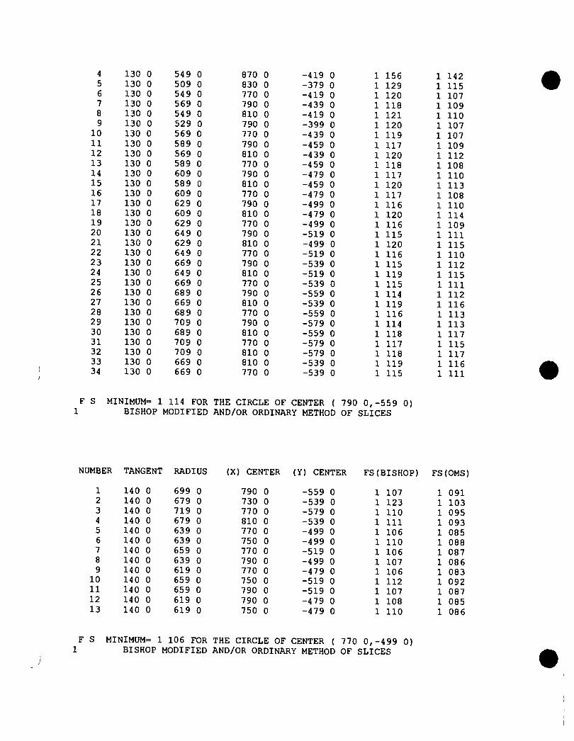
4 130 0 549 0 870 0 -419 0 1 156 1 142 5 130 0 509 0 830 0 -379 0 1 129 1 115 6 130 0 549 0 770 0 -419 0 1 120 1 107 7 130 0 569 0 790 0 -439 0 1 118 1 109 8 130 0 549 0 810 0 -419 0 1 121 1 110 9 130 0 529 0 790 0 -399 0 1 120 1 107
10 130 0 569 0 770 0 -439 0 1 119 1 107 11 130 0 589 0 790 0 -459 0 1 117 1 109 12 130 0 569 0 810 0 -439 0 1 120 1 112 13 130 0 589 0 770 0 -459 0 1 118 1 108 14 130 0 609 0 790 0 -479 0 1 117 1 110 15 130 0 589 0 810 0 -459 0 1 120 1 113 16 130 0 609 0 770 0 -479 0 1 117 1 108 17 130 0 629 0 790 0 -499 0 1 116 1 110 18 130 0 609 0 810 0 -479 0 1 120 1 114 19 130 0 629 0 770 0 -499 0 1 116 1 109 20 130 0 649 0 790 0 -519 0 1 115 1 111 21 130 0 629 0 810 0 -499 0 1 120 1 115 22 130 0 649 0 770 0 -519 0 1 116 1 110 23 130 0 669 0 790 0 -539 0 1 115 1 112 24 130 0 649 0 810 0 -519 0 1 119 1 115 25 130 0 669 0 770 0 -539 0 1 115 1 111 26 130 0 689 0 790 0 -559 0 1 114 1 112 27 130 0 669 0 810 0 -539 0 1 119 1 116 28 130 0 689 0 770 0 -559 0 1 116 1 113 29 130 0 709 0 790 0 -579 0 1 114 1 113 30 130 0 689 0 810 0 -559 0 1 118 1 117 31 130 0 709 0 770 0 -579 0 1 117 1 115 32 130 0 709 0 810 0 -579 0 1 118 1 117 33 130 0 669 0 810 0 -539 0 1 119 1 116 34 130 0 669 0 770 0 -539 0 1 115 1 111
F S MINIMUM= 1 114 FOR THE CIRCLE OF CENTER ( 790 0,-559 0) 1 BISHOP MODIFIED AND/OR ORDINARY METHOD OF SLICES
NUMBER TANGENT RADIUS (X) CENTER (Y) CENTER FS (BISHOP) FS(OMS)
1 140 0 699 0 790 0 -559 0 1 107 1 091 2 140 0 679 0 730 0 -539 0 1 123 1 103 3 140 0 719 0 770 0 -579 0 1 110 1 095 4 140 0 679 0 810 0 -539 0 1 111 1 093 5 140 0 639 0 770 0 -499 0 1 106 1 085 6 140 0 639 0 750 0 -499 0 1 110 1 088 7 140 0 659 0 770 0 -519 0 1 106 1 087 8 140 0 639 0 790 0 -499 0 1 107 1 086 9 140 0 619 0 770 0 -479 0 1 106 1 083
10 140 0 659 0 750 0 -519 0 1 112 1 092 11 140 0 659 0 790 0 -519 0 1 107 1 087 12 140 0 619 0 790 0 -479 0 1 108 1 085 13 140 0 619 0 750 0 -479 0 1 110 1 086
F S MINIMUM= 1 106 FOR THE CIRCLE OF CENTER ( 770 0,-499 0) L BISHOP MODIFIED AND/OR ORDINARY METHOD OF SLICES
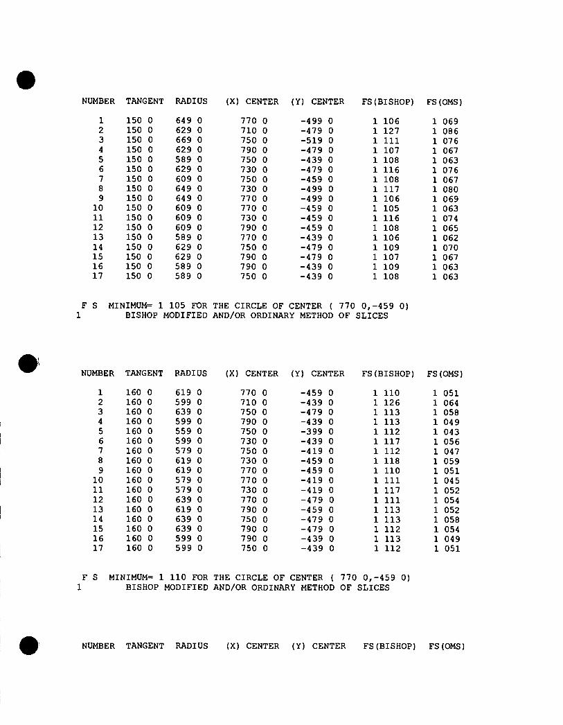
NUMBER TANGENT RADIUS (X) CENTER (Y) CENTER FS (BISHOP) FS(OMS)
1 150 0 649 0 770 0 -499 0 1 106 1 069 2 150 0 629 0 710 0 -479 0 1 127 1 086 3 150 0 669 0 750 0 -519 0 1 111 1 076 4 150 0 629 0 790 0 -479 0 1 107 1 067 5 150 0 589 0 750 0 -439 0 1 108 1 063 6 150 0 629 0 730 0 -479 0 1 116 1 076 7 150 0 609 0 750 0 -459 0 1 108 1 067 8 150 0 649 0 730 0 -499 0 1 117 1 080 9 150 0 649 0 770 0 -499 0 1 106 1 069
10 150 0 609 0 770 0 -459 0 1 105 1 063 11 150 0 609 0 730 0 -459 0 1 116 1 074 12 150 0 609 0 790 0 -459 0 1 108 1 065 13 150 0 589 0 770 0 -439 0 1 106 1 062 14 150 0 629 0 750 0 -479 0 1 109 1 070 15 150 0 629 0 790 0 -479 0 1 107 1 067 16 150 0 589 0 790 0 -439 0 1 109 1 063 17 150 0 589 0 750 0 -439 0 1 108 1 063
F S MINIMUM= 1 105 FOR THE CIRCLE OF CENTER ( 770 0,-459 0) L BISHOP MODIFIED AND/OR ORDINARY METHOD OF SLICES
NUMBER TANGENT RADIUS (X) CENTER (Y) CENTER FS(BISHOP) FS(OMS)
1 160 0 619 0 770 0 -459 0 1 110 1 051 2 160 0 599 0 710 0 -439 0 1 126 1 064 3 160 0 639 0 750 0 -479 0 1 113 1 058 4 160 0 599 0 790 0 -439 0 1 113 1 049 5 160 0 559 0 750 0 -399 0 1 112 1 043 6 160 0 599 0 730 0 -439 0 1 117 1 056 7 160 0 579 0 750 0 -419 0 1 112 1 047 8 160 0 619 0 730 0 -459 0 1 118 1 059 9 160 0 619 0 770 0 -459 0 1 110 1 051
10 160 0 579 0 770 0 -419 0 1 111 1 045 11 160 0 579 0 730 0 -419 0 1 117 1 052 12 160 0 639 0 770 0 -479 0 1 111 1 054 13 160 0 619 0 790 0 -459 0 1 113 1 052 14 160 0 639 0 750 0 -479 0 1 113 1 058 15 160 0 639 0 790 0 -479 0 1 112 1 054 16 160 0 599 0 790 0 -439 0 1 113 1 049 17 160 0 599 0 750 0 -439 0 1 112 1 051
F S MINIMUM= 1 110 FOR THE CIRCLE OF CENTER { 770 0,-459 0) BISHOP MODIFIED AND/OR ORDINARY METHOD OF SLICES
NUMBER TANGENT RADIUS (X) CENTER (Y) CENTER FS(BISHOP) FS(OMS)
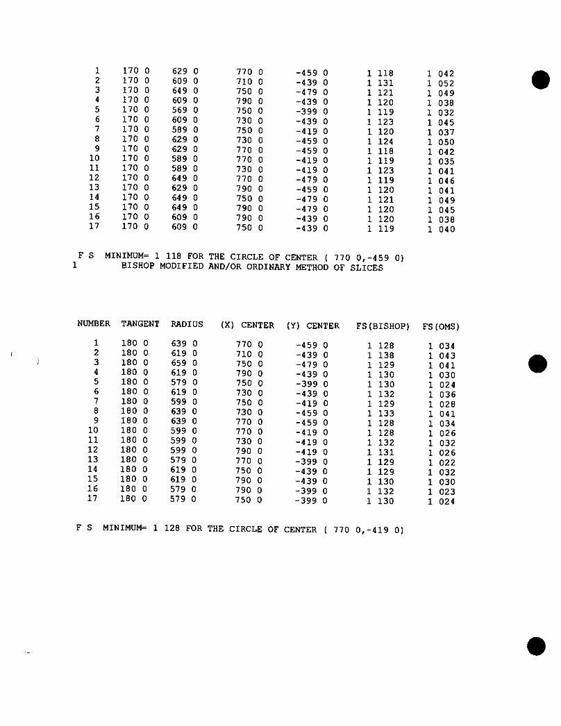
1 170 0 629 0 770 0 -459 0 1 118 1 042 2 170 0 609 0 710 0 -439 0 1 131 1 052 3 170 0 64 9 0 750 0 -479 0 1 121 1 049 4 170 0 609 0 790 0 -439 0 1 120 1 038 5 170 0 569 0 750 0 -399 0 1 119 1 032 6 170 0 609 0 730 0 -439 0 1 123 1 045 7 170 0 589 0 750 0 -419 0 1 120 1 037 8 170 0 629 0 730 0 -459 0 1 124 1 050 9 170 0 629 0 770 0 -459 0 1 118 1 042
10 170 0 589 0 770 0 -419 0 1 119 1 035 11 170 0 589 0 730 0 -419 0 1 123 1 041 12 170 0 64 9 0 770 0 -479 0 1 119 1 046 13 170 0 629 0 790 0 -459 0 1 120 1 041 14 170 0 64 9 0 750 0 -479 0 1 121 1 049 15 170 0 649 0 790 0 -479 0 1 120 1 045 16 170 0 609 0 790 0 -439 0 1 120 1 038 17 170 0 609 0 750 0 -439 0 1 119 1 040
F S MINIMUM= 1 118 FOR THE CIRCLE OF CENTER ( 770 0,-459 0) 1 BISHOP MODIFIED AND/OR ORDINARY METHOD OF SLICES
NUMBER TANGENT RADIUS (X) CENTER (Y) CENTER FS(BISHOP) FS(OMS)
1 180 0 639 0 770 0 -459 0 1 128 1 034 2 180 0 619 0 710 0 -439 0 1 138 1 043 3 180 0 659 0 750 0 -479 0 1 129 1 041 4 180 0 619 0 790 0 -439 0 1 130 1 030 5 180 0 579 0 750 0 -399 0 1 130 1 024 6 180 0 619 0 730 0 -439 0 1 132 1 036 7 180 0 599 0 750 0 -419 0 1 129 1 028 8 180 0 639 0 730 0 -459 0 1 133 1 041 9 180 0 639 0 770 0 -459 0 1 128 1 034
10 180 0 599 0 770 0 -419 0 1 128 1 026 11 180 0 599 0 730 0 -419 0 1 132 1 032 12 180 0 599 0 790 0 -419 0 1 131 1 026 13 180 0 579 0 770 0 -399 0 1 129 1 022 14 180 0 619 0 750 0 -439 0 1 129 1 032 15 180 0 619 0 790 0 -439 0 1 130 1 030 16 180 0 579 0 790 0 -399 0 1 132 1 023 17 180 0 579 0 750 0 -399 0 1 130 1 024
F S MINIMUM= 1 128 FOR THE CIRCLE OF CENTER ( 770 0,-419 0)
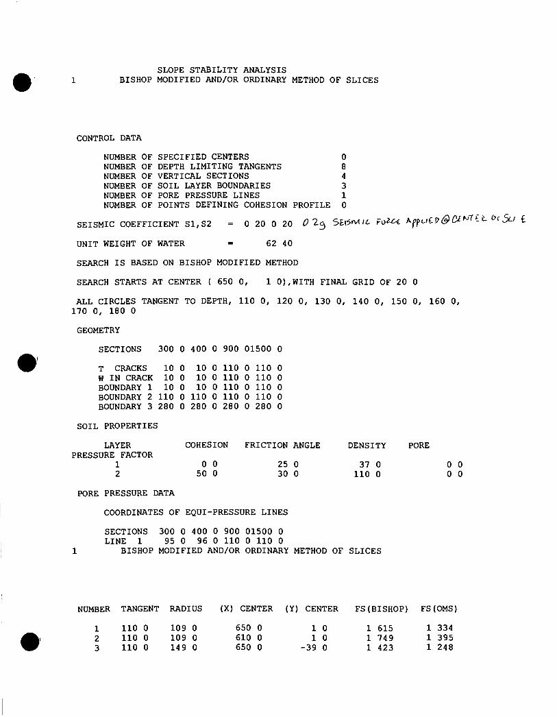
SLOPE STABILITY ANALYSIS BISHOP MODIFIED AND/OR ORDINARY METHOD OF SLICES
CONTROL DATA
NUMBER OF SPECIFIED CENTERS 0 NUMBER OF DEPTH LIMITING TANGENTS 8 NUMBER OF VERTICAL SECTIONS 4 NUMBER OF SOIL LAYER BOUNDARIES 3 NUMBER OF PORE PRESSURE LINES 1 NUMBER OF POINTS DEFINING COHESION PROFILE 0
SEISMIC COEFFICIENT S1,S2 = 0 20 0 20 0 5£l5n/t ,6 F o ^ ^^fu^V&C^'^ '^ '^ i -^^SLi I
UNIT WEIGHT OF WATER = 62 40
SEARCH IS BASED ON BISHOP MODIFIED METHOD
SEARCH STARTS AT CENTER { 650 0, 1 0),WITH FINAL GRID OF 20 0
ALL CIRCLES TANGENT TO DEPTH, 110 0, 120 0, 130 0, 140 0, 150 0, 160 0, 170 0, 180 0
GEOMETRY
SECTIONS 300 0 400 0 900 01500 0
T CRACKS 10 0 10 0 110 0 110 0 W IN CRACK 10 0 10 0 110 0 110 0 BOUNDARY 1 10 0 10 0 110 0 110 0 BOUNDARY 2 110 0 110 0 110 0 110 0 BOUNDARY 3 280 0 280 0 280 0 280 0
SOIL PROPERTIES
LAYER COHESION FRICTION ANGLE DENSITY PORE PRESSURE FACTOR
1 0 0 25 0 37 0 0 0 2 50 0 30 0 110 0 0 0
PORE PRESSURE DATA
COORDINATES OF EQUI-PRESSURE LINES
SECTIONS 300 0 400 0 900 01500 0 LINE 1 95 0 96 0 110 0 110 0
1 BISHOP MODIFIED AND/OR ORDINARY METHOD OF SLICES
NUMBER TANGENT RADIUS (X) CENTER (Y) CENTER FS(BISHOP) FS(OMS)
1 110 0 109 0 650 0 1 0 1 615 1 334 2 110 0 109 0 610 0 1 0 1 749 1 395 3 110 0 149 0 650 0 -39 0 1 423 1 248
4 110 0 109 0 690 0 1 0 1 496 1 281 5 110 0 69 0 650 0 41 0 2 192 1 600 6 110 0 149 0 610 0 -39 0 1 502 1 283 7 110 0 189 0 650 0 -79 0 1 327 1 206 8 110 0 149 0 690 0 -39 0 1 349 1 216 9 110 0 189 0 610 0 -79 0 1 382 1 230
10 110 0 229 0 650 0 -119 0 1 270 1 182 11 110 0 189 0 690 0 -79 0 1 275 1 184 12 110 0 229 0 630 0 -119 0 1 291 1 191 13 110 0 249 0 650 0 -139 0 1 250 1 174 14 110 0 229 0 670 0 -119 0 1 250 1 174 15 110 0 209 0 650 0 -99 0 1 295 1 192 16 110 0 249 0 630 0 -139 0 1 268 1 181 17 110 0 269 0 650 0 -159 0 1 233 1 167 18 110 0 249 0 670 0 -139 0 1 232 1 166 19 110 0 269 0 670 0 -159 0 1 217 1 160 20 110 0 249 0 690 0 -139 0 1 214 1 159 21 110 0 229 0 670 0 -119 0 1 250 1 174 22 110 0 269 0 690 0 -159 0 1 201 1 153 23 110 0 249 0 710 0 -139 0 1 197 1 152 24 110 0 229 0 690 0 -119 0 1 230 1 165 25 110 0 269 0 710 0 -159 0 1 186 1 147 26 110 0 249 0 730 0 -139 0 1 181 1 146 27 110 0 229 0 710 0 -119 0 1 211 1 157 28 110 0 269 0 730 0 -159 0 1 172 1 142 29 110 0 249 0 750 0 -139 0 1 166 1 140 30 110 0 229 0 730 0 -119 0 1 193 1 150 31 110 0 269 0 750 0 -159 0 1 157 1 137 32 110 0 249 0 770 0 -139 0 1 151 1 134 33 110 0 229 0 750 0 -119 0 1 176 1 144 34 110 0 269 0 770 0 -159 0 1 144 1 132 35 110 0 249 0 790 0 -139 0 1 137 1 130 36 110 0 229 0 770 0 -119 0 1 159 1 138 37 110 0 269 0 790 0 -159 0 1 132 1 129 38 110 0 249 0 810 0 -139 0 1 124 1 126 39 110 0 229 0 790 0 -119 0 1 143 1 132 40 110 0 269 0 810 0 -159 0 1 121 1 126 41 110 0 249 0 830 0 -139 0 1 114 1 125 42 110 0 229 0 810 0 -119 0 1 129 1 128 43 110 0 269 0 830 0 -159 0 1 112 1 125 44 110 0 249 0 850 0 -139 0 1 108 1 127 45 110 0 229 0 830 0 -119 0 1 117 1 125 46 110 0 269 0 850 0 -159 0 1 107 1 128 47 110 0 249 0 870 0 -139 0 1 106 1 133 48 110 0 229 0 850 0 -119 0 1 109 1 126 49 110 0 269 0 870 0 -159 0 1 107 1 135 50 110 0 249 0 890 0 -139 0 1 118 1 152 51 110 0 229 0 870 0 -119 0 1 106 1 132
SEARCH IS ABANDONED AFTER 51 CIRCLES 1 BISHOP MODIFIED AND/OR ORDINARY METHOD OF SLICES
NUMBER TANGENT RADIUS (X) CENTER (Y) CENTER FS(BISHOP) FS(OMS)
1 2 3
120 0 120 0 120 0
259 0 239 0 279 0
870 0 830 0 870 0
-139 0 -119 0 -159 0
1 231 1 219 1 226
1 213 1 191 1 211
4 120 0 239 0 910 0 -119 0 1 367 1 332 5 120 0 199 0 870 0 -79 0 1 249 1 216 6 120 0 239 0 810 0 -119 0 1 232 1 196 7 120 0 259 0 830 0 -139 0 1 210 1 187 8 120 0 239 0 850 0 -119 0 1 215 1 192 9 120 0 219 0 830 0 -99 0 1 228 1 194
10 120 0 259 0 810 0 -139 0 1 221 1 191 11 120 0 279 0 830 0 -159 0 1 203 1 184 12 120 0 259 0 850 0 -139 0 1 210 1 191 13 120 0 279 0 810 0 -159 0 1 211 1 186 14 120 0 299 0 830 0 -179 0 1 197 1 182 15 120 0 279 0 850 0 -159 0 1 205 1 190 16 120 0 299 0 810 0 -179 0 1 204 1 183 17 120 0 319 0 830 0 -199 0 1 192 1 180 18 120 0 299 0 850 0 -179 0 1 201 1 189 19 120 0 319 0 810 0 -199 0 1 199 1 182 20 120 0 339 0 830 0 -219 0 1 188 1 179 21 120 0 319 0 850 0 -199 0 1 197 1 188 22 120 0 339 0 810 0 -219 0 1 194 1 180 23 120 0 359 0 830 0 -239 0 1 185 1 178 24 120 0 339 0 850 0 -219 0 1 194 1 187 25 120 0 359 0 810 0 -239 0 1 189 1 178 26 120 0 379 0 830 0 -259 0 1 182 1 177 27 120 0 359 0 850 0 -239 0 1 191 1 186 28 120 0 379 0 810 0 -259 0 1 184 1 176 29 120 0 399 0 830 0 -279 0 1 179 1 176 30 120 0 379 0 850 0 -259 0 1 189 1 186 31 120 0 399 0 810 0 -279 0 1 181 1 174 32 120 0 419 0 830 0 -299 0 1 176 1 175 33 120 0 399 0 850 0 -279 0 1 187 1 186 34 120 0 419 0 810 0 -299 0 1 177 1 173 35 120 0 439 0 830 0 -319 0 1 174 1 174 36 120 0 419 0 850 0 -299 0 1 185 1 186 37 120 0 439 0 810 0 -319 0 1 174 1 172 38 120 0 459 0 830 0 -339 0 1 172 1 174 39 120 0 439 0 850 0 -319 0 1 183 1 185 40 120 0 459 0 810 0 -339 0 1 172 1 171 41 120 0 479 0 830 0 -359 0 1 170 1 174 42 120 0 459 0 850 0 -339 0 1 181 1 184 43 120 0 479 0 810 0 -359 0 1 170 1 171 44 120 0 499 0 830 0 -379 0 1 169 1 174 45 120 0 479 0 850 0 -359 0 1 179 1 184 46 120 0 499 0 810 0 -379 0 1 167 1 170 47 120 0 519 0 830 0 -399 0 1 168 1 174 48 120 0 499 0 850 0 -379 0 1 178 1 183 49 120 0 499 0 790 0 -379 0 1 169 1 168 50 120 0 519 0 810 0 -399 0 1 165 1 169 51 120 0 479 0 810 0 -359 0 1 170 1 171
SEARCH IS ABANDONED AFTER 51 CIRCLES 1 BISHOP MODIFIED AND/OR ORDINARY METHOD OF SLICES
NUMBER TANGENT RADIUS (X) CENTER (Y) CENTER FS(BISHOP) FS(OMS)
130 0 130 0 130 0
509 0 489 0 529 0
810 0 770 0 810 0
-379 0 -359 0 -399 0
1 150 1 159 1 149
1 135 1 138 1 135
4 130 0 489 0 850 0 -359 0 1 166 1 148 5 130 0 449 0 810 0 -319 0 1 157 1 135 6 130 0 529 0 790 0 -399 0 1 149 1 134 7 130 0 549 0 810 0 -419 0 1 147 1 135 8 130 0 529 0 830 0 -399 0 1 153 1 140 9 130 0 509 0 810 0 -379 0 1 150 1 135
10 130 0 549 0 790 0 -419 0 1 147 1 134 11 130 0 569 0 810 0 -439 0 1 146 1 135 12 130 0 549 0 830 0 -419 0 1 152 1 140 13 130 0 569 0 790 0 -439 0 1 146 1 134 14 130 0 589 0 810 0 -459 0 1 145 1 136 15 130 0 569 0 830 0 -439 0 1 151 1 140 16 130 0 589 0 790 0 -459 0 1 144 1 134 17 130 0 609 0 810 0 -479 0 1 144 1 137 18 130 0 589 0 830 0 -459 0 1 150 1 140 19 130 0 589 0 770 0 -459 0 1 146 1 135 20 130 0 609 0 790 0 -479 0 1 142 1 134 21 130 0 569 0 790 0 -439 0 1 146 1 134 22 130 0 609 0 770 0 -479 0 1 144 1 134 23 130 0 629 0 790 0 -499 0 1 141 1 134 24 130 0 609 0 810 0 -479 0 1 144 1 137 25 130 0 629 0 770 0 -499 0 1 143 1 134 26 130 0 649 0 790 0 -519 0 1 140 1 134 27 130 0 629 0 810 0 -499 0 1 143 1 137 28 130 0 64 9 0 770 0 -519 0 1 142 1 135 29 130 0 669 0 790 0 -539 0 1 138 1 134 30 130 0 649 0 810 0 -519 0 1 142 1 137 31 130 0 669 0 770 0 -539 0 1 141 1 135 32 130 0 689 0 790 0 -559 0 1 137 1 134 33 130 0 669 0 810 0 -539 0 1 141 1 137 34 130 0 689 0 770 0 -559 0 1 141 1 136 35 130 0 709 0 790 0 -579 0 1 137 1 135 36 130 0 689 0 810 0 -559 0 1 140 1 137 37 130 0 709 0 770 0 -579 0 1 141 1 138 38 130 0 729 0 790 0 -599 0 1 137 1 136 39 130 0 709 0 810 0 -579 0 1 139 1 137 40 130 0 729 0 770 0 -599 0 1 141 1 139 41 130 0 729 0 810 0 -599 0 1 138 1 137 42 130 0 689 0 810 0 -559 0 1 140 1 137 43 130 0 689 0 770 0 -559 0 1 141 1 136
F S MINIMUM= 1 137 FOR THE CIRCLE OF CENTER ( 790 0,-579 0) L BISHOP MODIFIED AND/OR ORDINARY METHOD OF SLICES
MBER TANGENT RADIUS (X) CENTER (Y) CENTER FS (BISHOP) FS(OMS)
1 140 0 719 0 790 0 -579 0 1 135 1 118 2 140 0 699 0 730 0 -559 0 1 159 1 139 3 140 0 739 0 770 0 -599 0 1 141 1 125 4 140 0 699 0 810 0 -559 0 1 138 1 119 5 140 0 659 0 770 0 -519 0 1 138 1 116 6 140 0 699 0 750 0 -559 0 1 147 1 128 7 140 0 679 0 770 0 -539 0 1 139 1 119 8 140 0 719 0 750 0 -579 0 1 148 1 131 9 140 0 719 0 790 0 -579 0 1 135 1 118 10 140 0 679 0 790 0 -539 0 1 136 1 116
11 140 0 679 0 750 0 -539 0 1 146 1 125 12 140 0 739 0 790 0 -599 0 1 136 1 120 13 140 0 719 0 810 0 -579 0 1 137 1 119 14 140 0 739 0 770 0 -599 0 1 141 1 125 15 140 0 739 0 810 0 -599 0 1 136 1 120 16 140 0 699 0 810 0 -559 0 1 138 1 119 17 140 0 699 0 770 0 -559 0 1 138 1 120
S MINIMUM= 1 135 FOR THE CIRCLE OF CENTER ( 790 0,-579 0) BISHOP MODIFIED AND/OR ORDINARY METHOD OF SLICES
NUMBER TANGENT RADIUS (X) CENTER (Y) CENTER FS(BISHOP) FS(OMS)
1 150 0 729 0 790 0 -579 0 1 142 1 109 2 150 0 709 0 730 0 -559 0 1 162 1 128 3 150 0 749 0 770 0 -599 0 1 147 1 117 4 150 0 709 0 810 0 -559 0 1 144 1 108 5 150 0 669 0 770 0 -519 0 1 144 1 106 6 150 0 709 0 750 0 -559 0 1 152 1 118 7 150 0 689 0 770 0 -539 0 1 145 1 109 8 150 0 729 0 750 0 -579 0 1 153 1 121 9 150 0 729 0 790 0 -579 0 1 142 1 109 10 150 0 689 0 790 0 -539 0 1 143 1 106 11 150 0 689 0 750 0 -539 0 1 151 1 116 12 150 0 749 0 790 0 -599 0 1 143 1 112 13 150 0 729 0 810 0 -579 0 1 142 1 109 14 150 0 749 0 770 0 -599 0 1 147 1 117 15 150 0 749 0 810 0 -599 0 1 143 1 111 16 150 0 709 0 810 0 -559 0 1 144 1 108 17 150 0 709 0 770 0 -559 0 1 145 1 111
F S MINIMUM= 1 142 FOR THE CIRCLE OF CENTER ( 790 0,-579 0) L BISHOP MODIFIED AND/OR ORDINARY METHOD OF SLICES
NUMBER TANGENT RADIUS (X) CENTER (Y) CENTER FS(BISHOP) FS(OMS)
1 160 0 739 0 790 0 -579 0 1 153 1 105 2 160 0 719 0 730 0 -559 0 1 171 1 122 3 160 0 759 0 770 0 -599 0 1 156 1 111 4 160 0 719 0 810 0 -559 0 1 154 1 102 5 160 0 679 0 770 0 -519 0 1 155 1 101 6 160 0 719 0 750 0 -559 0 1 162 1 113 7 160 0 699 0 770 0 -539 0 1 155 1 103 8 160 0 739 0 750 0 -579 0 1 162 1 116 9 160 0 739 0 790 0 -579 0 1 153 1 105 10 160 0 699 0 790 0 -539 0 1 153 1 100 11 160 0 699 0 750 0 -539 0 1 161 1 109 12 160 0 699 0 810 0 -539 0 1 154 1 100 13 160 0 679 0 790 0 -519 0 1 154 1 098 14 160 0 719 0 770 0 -559 0 1 156 1 107 15 160 0 719 0 810 0 -559 0 1 154 1 102
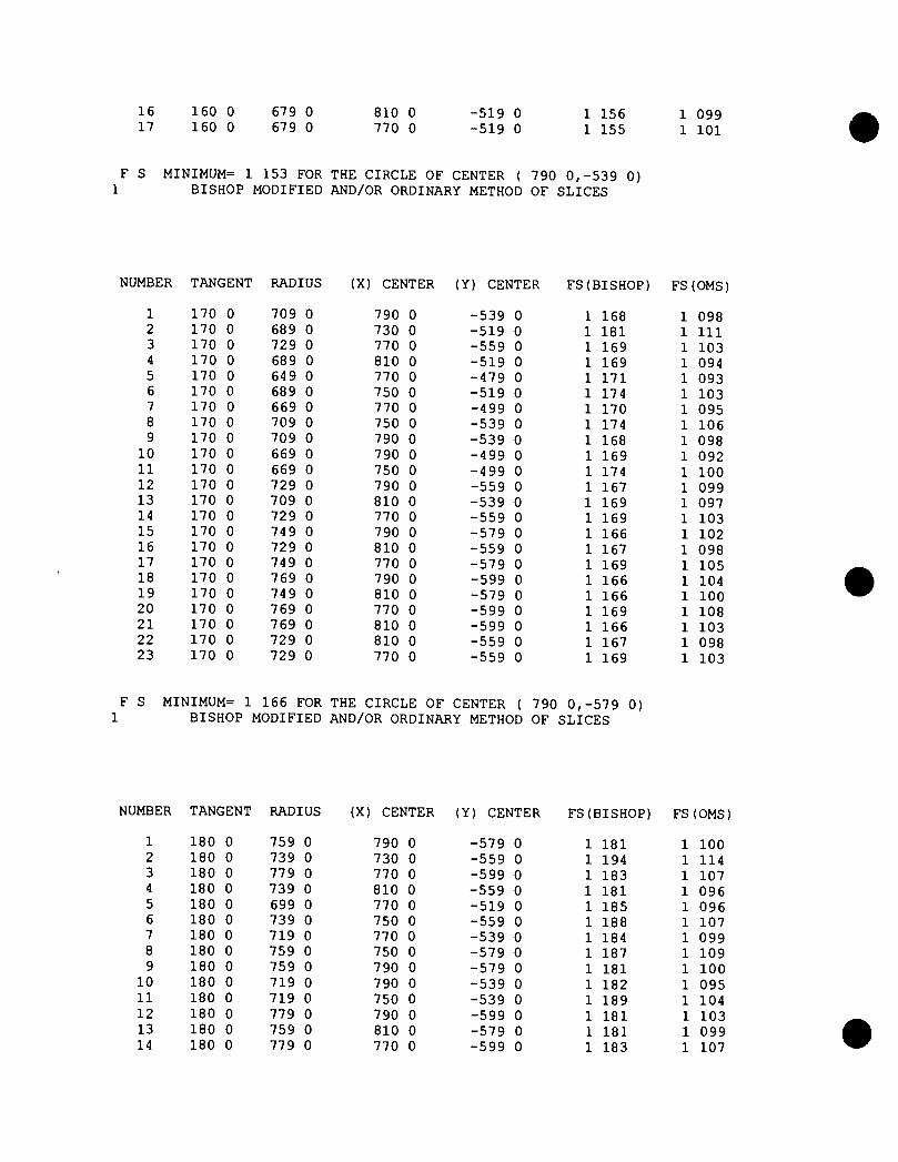
16 17
160 0 160 0
679 0 679 0
810 0 770 0
-519 0 -519 0
1 156 1 155
1 099 1 101
F S MINIMUM= 1 153 FOR THE CIRCLE OF CENTER ( 790 0,-539 0) 1 BISHOP MODIFIED AND/OR ORDINARY METHOD OF SLICES
NUMBER TANGENT RADIUS (X) CENTER (Y) CENTER FS(BISHOP) FS(OMS)
1 170 0 709 0 790 0 -539 0 1 168 1 098 2 170 0 689 0 730 0 -519 0 1 181 1 111 3 170 0 729 0 770 0 -559 0 1 169 1 103 4 170 0 689 0 810 0 -519 0 1 169 1 094 5 170 0 649 0 770 0 -479 0 1 171 1 093 6 170 0 689 0 750 0 -519 0 1 174 1 103 7 170 0 669 0 770 0 -499 0 1 170 1 095 8 170 0 709 0 750 0 -539 0 1 174 1 106 9 170 0 709 0 790 0 -539 0 1 168 1 098
10 170 0 669 0 790 0 -499 0 1 169 1 092 11 170 0 669 0 750 0 -499 0 1 174 1 100 12 170 0 729 0 790 0 -559 0 1 167 1 099 13 170 0 709 0 810 0 -539 0 1 169 1 097 14 170 0 729 0 770 0 -559 0 1 169 1 103 15 170 0 749 0 790 0 -579 0 1 166 1 102 16 170 0 729 0 810 0 -559 0 1 167 1 098 17 170 0 749 0 770 0 -579 0 1 169 1 105 18 170 0 769 0 790 0 -599 0 1 166 1 104 19 170 0 749 0 810 0 -579 0 1 166 1 100 20 170 0 769 0 770 0 -599 0 1 169 1 108 21 170 0 769 0 810 0 -599 0 1 166 1 103 22 170 0 729 0 810 0 -559 0 1 167 1 098 23 170 0 729 0 770 0 -559 0 1 169 1 103
F S MINIMUM= 1 166 FOR THE CIRCLE OF CENTER ( 790 0,-579 0) 1 BISHOP MODIFIED AND/OR ORDINARY METHOD OF SLICES
NUMBER TANGENT RADIUS (X) CENTER (Y) CENTER FS(BISHOP) FS(OMS)
1 180 0 759 0 790 0 -579 0 1 181 1 100 2 180 0 739 0 730 0 -559 0 1 194 1 114 3 180 0 779 0 770 0 -599 0 1 183 1 107 4 180 0 739 0 810 0 -559 0 1 181 1 096 5 180 0 699 0 770 0 -519 0 1 185 1 096 6 180 0 739 0 750 0 -559 0 1 188 1 107 7 180 0 719 0 770 0 -539 0 1 184 1 099 8 180 0 759 0 750 0 -579 0 1 187 1 109 9 180 0 759 0 790 0 -579 0 1 181 1 100
10 180 0 719 0 790 0 -539 0 1 182 1 095 11 180 0 719 0 750 0 -539 0 1 189 1 104 12 180 0 779 0 790 0 -599 0 1 181 1 103 13 180 0 759 0 810 0 -579 0 1 181 1 099 14 180 0 779 0 770 0 -599 0 1 183 1 107

15 180 0 779 0 810 0 -599 0 1 181 1 101 16 180 0 739 0 810 0 -559 0 1 181 1 096 17 180 0 739 0 770 0 -559 0 1 183 1 101 18 180 0 799 0 810 0 -619 0 1 179 1 103 19 180 0 779 0 830 0 -599 0 1 182 1 101 20 180 0 799 0 790 0 -619 0 1 181 1 106 21 180 0 819 0 810 0 -639 0 1 179 1 105 22 180 0 799 0 830 0 -619 0 1 181 1 102 23 180 0 819 0 790 0 -639 0 1 180 1 108 24 180 0 839 0 810 0 -659 0 1 179 1 108 25 180 0 819 0 830 0 -639 0 1 180 1 105 26 180 0 839 0 790 0 -659 0 1 180 1 110 27 180 0 839 0 830 0 -659 0 1 180 1 107 28 180 0 799 0 830 0 -619 0 1 181 1 102 29 180 0 799 0 790 0 -619 0 1 181 1 106
F S MINIMUM= 1 179 FOR THE CIRCLE OF CENTER ( 810 0,-639 0)
Appendix M
Fugitive Dust Control Plan
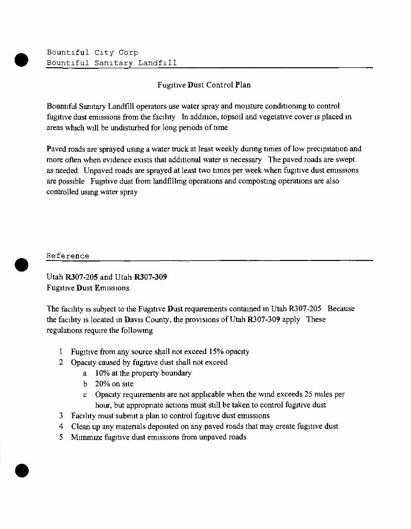
Bountiful City Corp Bountiful Sanitary L a n d f i l l
Fugitive Dust Control Plan
Bountiful Sanitary Landfill operators use water spray and moisture conditioning to control fugitive dust emissions from the facility In addition, topsoil and vegetative cover is placed in areas which will be undisturbed for long penods of time
Paved roads are sprayed using a water truck at least weekly during times of low precipitation and more often when evidence exists that additional water is necessary The paved roads are swept as needed Unpaved roads are sprayed at least two times per week when fugitive dust emissions are possible Fugitive dust from landfillmg operations and composting operations are also controlled using water spray
Reference
Utah R307-205 and Utah R307-309 Fugitive Dust Emissions
The facility is subject to the Fugitive Dust requirements contained in Utah R307-205 Because the facility is located in Davis County, the provisions of Utah R307-309 apply These regulations require the following
1 Fugitive from any source shall not exceed 15% opacity 2 Opacity caused by fugitive dust shall not exceed
a 10% at the property boundary b 20% on site c Opacity requirements are not applicable when the wind exceeds 25 miles per
hour, but appropriate actions must still be taken to control fugitive dust 3 Facility must submit a plan to control fugitive dust emissions 4 Clean up any matenals deposited on any paved roads that may create fugitive dust 5 Mimmize fugitive dust emissions from unpaved roads