Embed Size (px)
Citation preview
TECHNICAL DOCUMENT
CAMPUS-INSTITUTIONAL DISTRICT MASTER PLAN
EXTENDING OUR HISTORY—EMBRACING OUR FUTURE
Madison, WisconsinEFFECTIVE JANUARY 1, 2019

2
Table of Contents Forward ...................................................................................................................5 i Document Composition ii List of Figures, Tables, and Photo Credits iii Introduction iv City of Madison Conditions of Approval - Planning Requirements1. Background & History (MGO Sec. 28.097(5)(a)) ...........................................13
1.1 Scope of the 2015 Campus Master Plan Update1.2 History of Campus Planning at UW-Madison1.3 Historical Development of the UW-Madison Campus1.4 2005 Campus Master Plan “Recreating Ourselves in Place”
2. Mission & Guiding Principles (MGO Sec. 28.097(5)(b)) ..............................492.1 University Mission, Vision, and Strategic Plan2.2 Coordination with Campus Strategic Framework Plan2.3 Need for a Master Plan2.4 Physical Planning Principles, UW System Board of Regents2.5 Master Plan Goals and Guiding Principles
3. Facilities Plan: Existing Conditions (MGO Sec. 28.097(5)(c)(1)) ................633.1 Campus Profile3.2 Context within Region and City3.3 Campus Development Plan Boundary3.4 Existing Zoning Districts3.5 Projects Completed Since 2005 Plan3.6 Campus Planning Districts3.7 Campus Land Use Land Uses and Buildings3.8 Building Form and Density3.9 Landmarks and Historic Sites3.10 Historic Preservation Planning at UW-Madison3.11 Open Space3.12 Tree Canopy3.13 Existing Green Infrastructure & Stormwater Management3.14 Existing Pedestrian and Bicycle3.15 Existing Transit, Parking, and Vehicular Circulation
4. Facilities Plan: Proposed Conditions (MGO Sec. 28.097(5)(c)(2)) ...................... 1114.1 Campus Development Plan Boundary and Potential Land Acquisitions4.2 Proposed Land Use4.3 Building Density Floor Area Ratios (F.A.R.)4.4 Proposed Building Use4.5 Open Space & Landscape Plan4.6 Natural Campus Landscapes4.7 Social Campus Landscapes4.8 Green Streets4.9 Proposed Green Infrastructure & Stormwater Management 4.10 Proposed Pedestrian and Bicycle Circulation4.11 Proposed Transit, Parking, and Vehicular Circulation
5. Proposed Project Phasing (MGO Sec. 28.097(5)(c)(2)(b)) ................................ 1736. Design Review Process (MGO Sec. 28.097(8)) .................................................... 195
6.1 UW-Madison Design Review Board7. Campus Design Guidelines & Standards (MGO Sec. 28.097(7)) ...................... 205
7.1 Building Principles and Guidelines Summary7.2 Campus Design Neighborhoods
8. Neighborhood Coordination .................................................................................. 3319. Amendments to the Approved C-I District Master Plan .................................... 33510. Appendix ................................................................................................................. 339
A. Acknowledgements B. Long Range Transportation Plan
C. Campus and Community Engagement Summary D. Master Plan Graphic E. C-I District Zoning Graphic F. Build-to Lines G. Maximum Building Heights
3

4 UNIVERSITY OF WISCONSIN–MADISON
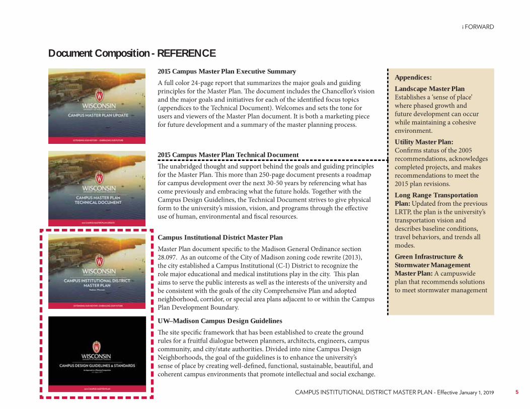
Document Composition - REFERENCE2015 Campus Master Plan Executive Summary
A full color 24-page report that summarizes the major goals and guiding principles for the Master Plan. The document includes the Chancellor’s vision and the major goals and initiatives for each of the identified focus topics (appendices to the Technical Document). Welcomes and sets the tone for users and viewers of the Master Plan document. It is both a marketing piece for future development and a summary of the master planning process.
2015 Campus Master Plan Technical Document
The unabridged thought and support behind the goals and guiding principles for the Master Plan. This more than 250-page document presents a roadmap for campus development over the next 30-50 years by referencing what has come previously and embracing what the future holds. Together with the Campus Design Guidelines, the Technical Document strives to give physical form to the university’s mission, vision, and programs through the effective use of human, environmental and fiscal resources.
UW–Madison Campus Design Guidelines
The site specific framework that has been established to create the ground rules for a fruitful dialogue between planners, architects, engineers, campus community, and city/state authorities. Divided into nine Campus Design Neighborhoods, the goal of the guidelines is to enhance the university’s sense of place by creating well-defined, functional, sustainable, beautiful, and coherent campus environments that promote intellectual and social exchange.
Campus Institutional District Master Plan
Master Plan document specific to the Madison General Ordinance section 28.097. As an outcome of the City of Madison zoning code rewrite (2013), the city established a Campus Institutional (C-I) District to recognize the role major educational and medical institutions play in the city. This plan aims to serve the public interests as well as the interests of the university and be consistent with the goals of the city Comprehensive Plan and adopted neighborhood, corridor, or special area plans adjacent to or within the Campus Plan Development Boundary.
Appendices:
Landscape Master Plan Establishes a ‘sense of place’ where phased growth and future development can occur while maintaining a cohesive environment.Utility Master Plan: Confirms status of the 2005 recommendations, acknowledges completed projects, and makes recommendations to meet the 2015 plan revisions.Long Range Transportation Plan: Updated from the previous LRTP, the plan is the university’s transportation vision and describes baseline conditions, travel behaviors, and trends all modes.Green Infrastructure & Stormwater Management Master Plan: A campuswide plan that recommends solutions to meet stormwater management
5
Figure 3-6 Campus Planning Districts ..............................................................74Figure 3-7 Existing Building Uses ......................................................................75Figure 3-8 Existing Density In 2015 ..................................................................76Figure 3-9 Campus Pre-Settlement Landscape ................................................78Figure 3-10 Campus Cultural Landscape ..........................................................79Figure 3-11 Archaeological Sites on the Main Campus of the University of
Wisconsin–Madison .......................................................................................83Figure 3-12 2005 Cultural Landscape Resource Project, Fifteen Potentially
Significant Sites ...............................................................................................85Figure 3-13 2005 Cultural Landscape Resource Project, Eight Sites Selected
for In-Depth Analysis .....................................................................................87Figure 3-14 Open Space Ratios ..........................................................................88Figure 3-15 Existing Landscape Character .......................................................89Figure 3-16 Existing Tree Canopy ......................................................................90Figure 3-17 Campus Relationship to Rock River Watershed .........................92Figure 3-18 Campus Watersheds ........................................................................93Figure 3-19 Campus Impervious Areas .............................................................94Figure 3-20 Campus Impervious Traffic Areas ................................................95Table 3-1 Impervious and Pervious Areas ........................................................95Figure 3-21 Source Area Map .............................................................................96Figure 3-22 Stormwater Best Management Practice Types and Locations ...97Figure 3-23 Existing Walking and Biking Routes and Identified Challenges 99Table 3-2 Summary of Gaps in Walking and Bike Connectivity ..................100Table 3-3 Summary of Locations Where Challenges Exist ...........................101Figure 3-24 Vehicle Congestion on Campus ..................................................103Figure 3-25 Campus Bus Routes ......................................................................105Figure 3-26 Peer Institutions Parking Spaces per Person .............................106Figure 3-27 Existing Campus Parking Facilities ............................................107Figure 3-28 Mid-day Parking Occupancies for Faculty and Staff ................108Figure 3-29 Mid-day Parking Occupancies for Visitors ................................109Figure 4-1 Potential Acquisitions .....................................................................113Figure 4-2 Zoning Overlay and Proposed Buildings .....................................114Figure 4-3 Enlargement Zoning Overlay and Proposed Buildings .............115Figure 4-4 Floor Area Ratio - Existing and Proposed ...................................116
List of Figures and TablesFigure iii - University of Wisconsin Campus-Institutional Zoning Map .................9Figure 1-1 Master Planning Process ..................................................................14Figure 1-2 Master Planning Process, Campus Planning Steering Committee 16Figure 1-3 Master Planning Process, Campus Planning Steering Committee 17Figure 1-4 Map of Four Lakes Mound Sites ......................................................18Figure 1-5 Cultural Landscape Project-A0129I ...............................................19Figure 1-6 General Plan for the University of Wisconsin by John Raque,
January 1850 ....................................................................................................20Figure 1-7 O.C. Simonds 1906 Plan for the Grounds of the UW ..................21Figure 1-8 O.C. Simonds 1906 Plan for the Grounds of the University of
Wisconsin, Bascom Hill (Detail) ..................................................................22Figure 1-9 Laird & Cret 1908 General Design of the UW ..............................23Figure 1-10 Laird & Cret 1908 General Design of the UW, Detail ................24Figure 1-11 Laird & Cret 1908 General Design of the University of Wisconsin,
Detail showing “liberal arts piazza” near the summit of College Hill. .....25Figure 1-12 Laird & Cret 1908 General Design of the University of Wisconsin,
General Design for Future Development ....................................................26Figure 1-13 Figure Ground Map, 1870 ..............................................................28Figure 1-14 Figure Ground Map, 1880 ..............................................................29Figure 1-15 Figure Ground Map, 1900 ..............................................................30Figure 1-16 1941 Design for the Campus (at) the UW–Madison ..................32Figure 1-17 Figure Ground Map, 1940 ..............................................................33Figure 1-18 Figure Ground Map, 1954 ..............................................................35Figure 1-19 Figure Ground Map, 1967 ..............................................................36Figure 1-20 1959 Sketch Plan for the UW, UW Planning & Construction ..37Figure 1-21 Figure Ground Map, 1980 ..............................................................39Figure 1-22 JJR 1996 Campus Opportunities Plan ..........................................41Figure 1-23 Figure Ground Map, 2000 ..............................................................43Figure 1-24 Ayers Saint Gross 2005 Campus Master Plan ..............................47Figure 3-1 Student Housing ................................................................................67Figure 3-2 CDPB and Potential Land Acquisitions .........................................69Figure 3-3 Campus Institutional Zoning Map............................................ 70-71Figure 3-4 Building Projects Completed Since 2005 .......................................72Figure 3-5 Transportation Improvements Completed Since 2005.................73
6 UNIVERSITY OF WISCONSIN–MADISON
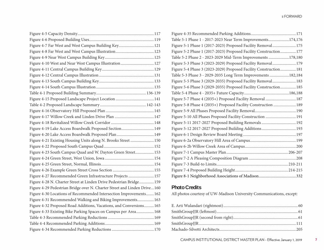
Figure 4-5 Capacity Density..............................................................................117Figure 4-6 Proposed Building Uses ..................................................................119Figure 4-7 Far West and West Campus Building Key....................................121Figure 4-8 Far West and West Campus Illustration .......................................123Figure 4-9 Near West Campus Building Key ..................................................125Figure 4-10 West and Near West Campus Illustration ..................................127Figure 4-11 Central Campus Building Key .....................................................129Figure 4-12 Central Campus Illustration ........................................................131Figure 4-13 South Campus Building Key ........................................................133Figure 4-14 South Campus Illustration ...........................................................135Table 4-1 Proposed Building Summary ................................................... 136-139Figure 4-15 Proposed Landscape Project Location .......................................141Table 4-2 Proposed Landscape Summary ............................................... 142-143Figure 4-16 Observatory Hill Proposed Plan .................................................145Figure 4-17 Willow Creek and Linden Drive Plan ........................................147Figure 4-18 Revitalized Willow Creek Corridor ............................................148Figure 4-19 Lake Access Boardwalk Proposed Section .................................149Figure 4-20 Lake Access Boardwalk Proposed Plan ......................................149Figure 4-21 Existing Housing Units along N. Brooks Street ........................150Figure 4-22 Proposed South Campus Quad ...................................................152Figure 4-23 South Campus Quad and W. Dayton Green Street ...................153Figure 4-24 Green Street, West Union, Iowa ..................................................154Figure 4-25 Green Street, Normal, Illinois ......................................................154Figure 4-26 Example Green Street Cross Section ..........................................155Figure 4-27 Recommended Green Infrastructure Projects ..........................157Figure 4-28 N. Charter Street at Linden Drive Pedestrian Bridge ...............159Figure 4-29 Pedestrian Bridge over N. Charter Street and Linden Drive ...160Figure 4-30 Locations of Recommended Intersection Improvements ........162Figure 4-31 Recommended Walking and Biking Improvements.................163Figure 4-32 Proposed Road Additions, Vacations, and Conversions ..........165Figure 4-33 Existing Bike Parking Spaces on Campus per Area ..................168Table 4-3 Recommended Parking Reductions ...............................................169Table 4-4 Recommended Parking Additions ..................................................169Figure 4-34 Recommended Parking Reductions ...........................................170
Figure 4-35 Recommended Parking Additions ..............................................171Table 5-1 Phase 1 - 2017-2023 Near Term Improvements .....................174,176Figure 5-1 Phase 1 (2017-2023) Proposed Facility Removal ........................175Figure 5-2 Phase 1 (2017-2023) Proposed Facility Construction ................177Table 5-2 Phase 2 - 2023-2029 Mid-Term Improvements .....................178,180Figure 5-3 Phase 3 (2023-2029) Proposed Facility Removal ........................179Figure 5-4 Phase 3 (2023-2029) Proposed Facility Construction ................181Table 5-3 Phase 3 - 2029-2035 Long Term Improvements ....................182,184Figure 5-5 Phase 3 (2029-2035) Proposed Facility Removal ........................183Figure 5-6 Phase 3 (2029-2035) Proposed Facility Construction ................185Table 5-4 Phase 4 - 2035+ Future Capacity ..............................................186,188Figure 5-7 Phase 4 (2035+) Proposed Facility Removal ...............................187Figure 5-8 Phase 4 (2035+) Proposed Facility Construction .......................189Figure 5-9 All Phases Proposed Facility Removal ..........................................190Figure 5-10 All Phases Proposed Facility Construction ...............................191Figure 5-11 2017-2027 Proposed Building Removals ...................................192Figure 5-12 2017-2027 Proposed Building Additions ...................................193Figure 6-1 Design Review Board Meeting ......................................................197 Figure 6-2a Observatory Hill Area of Campus...............................................199 Figure 6-2b Willow Creek Area of Campus ....................................................200Figure 7-1 Campus Master Plan ............................................................... 206-207Figure 7-2 A Pleasing Composition Diagram ................................................208Figure 7-3 Build-to Limits ......................................................................... 210-211Figure 7-4 Proposed Building Height ...................................................... 214-215Figure 8-1 Neighborhood Associations of Madison ......................................332
Photo CreditsAll photos courtesy of UW-Madison University Communications, except:
E. Arti Wulandari (rightmost) ............................................................................60SmithGroupJJR (leftmost) ...................................................................................61SmithGroupJJR (second from right)..................................................................61SmithGroupJJR ...................................................................................................111Machado-Silvetti Architects ..............................................................................205
7
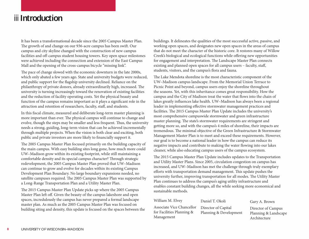
It has been a transformational decade since the 2005 Campus Master Plan. The growth of and change on our 936-acre campus has been swift. Our campus and city skyline changed with the construction of new campus facilities and off-campus student housing towers. Key open space milestones were achieved including the connection and extension of the East Campus Mall and the opening of the cross-campus bicycle “missing link”.The pace of change slowed with the economic downturn in the late 2000s, which only abated a few years ago. State and university budgets were reduced, and public support for the flagship university declined. Reliance on the philanthropy of private donors, already extraordinarily high, increased. The university is turning increasingly toward the renovation of existing facilities and the reduction of facility operating costs. Yet the physical beauty and function of the campus remains important as it plays a significant role in the attraction and retention of researchers, faculty, staff, and students.In this fiscal climate, measured and deliberate long-term master planning is more important than ever. The physical campus will continue to change and evolve, though the steps may be smaller and less frequent. Thus, the university needs a strong, guiding, long-term vision that can be achieved incrementally through multiple projects. When the vision is both clear and exciting, both public and private investors are more likely to financially support it.The 2005 Campus Master Plan focused primarily on the building capacity of the main campus. With easy building sites long gone, how much more could UW–Madison grow within its existing footprint, while still maintaining a comfortable density and its special campus character? Through strategic redevelopment, the 2005 Campus Master Plan proved that UW–Madison can continue to grow and evolve for decades within its existing Campus Development Plan Boundary. No large boundary expansions needed, no satellite campuses required. The 2005 Campus Master Plan was supported by a Long-Range Transportation Plan and a Utility Master Plan.The 2015 Campus Master Plan Update picks up where the 2005 Campus Master Plan left off. Given the beauty of the campus lakeshore and open spaces, incredulously the campus has never prepared a formal landscape master plan. As much as the 2005 Campus Master Plan was focused on building siting and density, this update is focused on the spaces between the
buildings. It delineates the qualities of the most successful active, passive, and working open spaces, and designates new open spaces in the areas of campus that do not meet the character of the historic core. It restores many of Willow Creek’s biological and ecological functions while offering new opportunities for engagement and interpretation. The Landscape Master Plan connects existing and planned open spaces for all campus users – faculty, staff, students, visitors, and the campus’s flora and fauna.The Lake Mendota shoreline is the most characteristic component of the UW–Madison campus landscape. From the Memorial Union Terrace to Picnic Point and beyond, campus users enjoy the shoreline throughout the seasons. Yet, with this inheritance comes great responsibility. How the campus and the City of Madison treat the water that flows into the chain of lakes greatly influences lake health. UW–Madison has always been a regional leader in implementing effective stormwater management practices and facilities. The 2015 Campus Master Plan Update includes the university’s most comprehensive campuswide stormwater and green infrastructure master planning. The state’s stormwater requirements are stringent and getting more so, and with the campus’s 4 miles of shoreline, their impacts are tremendous. The minimal objective of the Green Infrastructure & Stormwater Management Master Plan is to meet and exceed these requirements. However, our goal is to become a national leader in how the campus can reduce its negative impacts and contribute to making the water flowing into our lakes cleaner, while also educating campus users of the campus ecosystem.The 2015 Campus Master Plan Update includes updates to the Transportation and Utility Master Plans. Since 2005, circulation congestion on campus has increased, and UW–Madison has met the challenge through truly exemplary efforts with transportation demand management. This update pushes the university further, improving transportation for all modes. The Utility Master Plan continues to address the campus’s aging utility infrastructure and enables constant building changes, all the while seeking more economical and sustainable methods.
iii Introduction
William M. ElveyAssociate Vice Chancellor for Facilities Planning & Management
Daniel T. OkoliDirector of Capital Planning & Development
Gary A. BrownDirector of Campus Planning & Landscape Architecture
8 UNIVERSITY OF WISCONSIN–MADISON
REGENT ST
UNIVERSITY AVE CAMPUS DR
OBSERVATORY DR
W DAYTON ST
N
PARK
ST
W JOHNSON ST
LINDEN DR
BLUFF ST
HARVEY ST
HIG
HLA
ND
AVE
STEVENS ST
LANGDON ST
N
CH
ART
ER S
T
LAKE MENDOTA DR
KENDALL AVE
N
LAKE
ST
OXFORD RD
STATE ST
UNIVERSITY BAY DR
N
MIL
LS S
T
MASON ST
FARL
EY A
VE
CHADBOURNE AVE
LATH
ROP
ST
EDGEHILL DR
COLUMBIA RD
EUG
ENIA
AV
E
GRA
ND
AV
E
N
BREE
SE T
ER
N OWEN DR
CHAMBERLAIN AVE
RID
GE
ST
N
BLA
CKH
AW
K A
VE
N
ALL
EN S
T
N
FRA
NKL
IN A
VE
VAN HISE AVE
SHO
REW
OO
D B
LVD
W G
ILMAN ST
BABC
OC
K D
R
SPRING ST
N
FRA
NC
ES S
T
SUMMIT AVE
MONROE ST
WALNUT ST
N
RAN
DA
LL A
VE
ELM
DR
ACCESS RAMP
W LINDEN DR
N
PRO
SPEC
T AV
E
MARSHALL CT
N HENRY ST
N BASSETT ST
N
SPO
ON
ER S
T
AM
HERST D
R
LOCUST DR
OAK WAY
HARVARD DR
W M
IFFLIN ST
COLGATE RD
TALLYHO LN
PARK PL
TOPPING RD
W G
ORHAM ST
WILLOW DR
CHES
TNU
T ST
COLLEGE CT
FITC
H C
T
W W
ASHINGTO
N AVE
HIL
L ST
WO
OD
LN
SHEP
ARD
TER
ELM
ST
YALE RD
HERRICK DR
PURDUE ST
ELY PL
ASH
ST
MC KINLEY ST
SWEETBRIA
R RD
CORN
ELL
CT
BASC
OM
PL
LITTLE ST
UNIVERSITY AVE
EAST
ERD
AY L
N
CLYMER PL
HOWARD PL
PRINC
ETON
AVE
CONKLIN PL
CAPITOL CT
MA
RIO
N S
T
SCH
MIT
T PL
HA
WTH
ORN
E C
T
EAST
CA
MPU
S M
ALL
LAKELAWN PL
HEN
RY M
ALL
KRONSHAGE DR
MENDOTA CT
LAKE
MEN
DO
TA D
R
N
FRA
NC
ES S
T
KENDALL AVE
CAMPUS DR STEVENS ST WA
LNU
T ST
VAN HISE AVE SPRING ST
UNIVERSITY AVE
OBSERVATORY DR
WA
LNU
T ST
A
SH S
T
Lake Mendota
Village ofShorewood
Hills
UNIVERSITY AVE
W DAYTON ST
N
PARK
ST
N
MIL
LS S
T
SPRING ST
W JOHNSON ST
N
CH
ART
ER S
T
N
RAN
DA
LL A
VE
CAMPUS DR
CLYMER PL
CONKLIN PL
MONROE ST
N
BRO
OKS
ST
N
ORC
HA
RD S
T
RANDALL CT
LORC
H S
T
N
BRO
OKS
ST
SPRING ST
N
ORC
HA
RD S
T
Enlargement Area Shown Above
¸Prepared by the City of Madison Planning Division
University of Wisconsin Zoning Map
July 11, 2017
0 1,000 2,000500Feet
Existing Planned Developments to Remainwithin Campus Boundary
Lands Zoned CC-T to Remain WithinCampus Boudary
Lands Zoned Conservancy (CN) to Remain Within Campus Boundary
Lands Zoned UMX to Remain WithinCampus Boudary
Lands Zoned TR-U1 to Remain WithinCampus Boudary
UW Campus-Institutional Zoning DistrictSubject to Master Plan
UW & Affiliated Properties UnderCity of Madison Zoning
Lands Zoned TSS to Remain WithinCampus Boudary
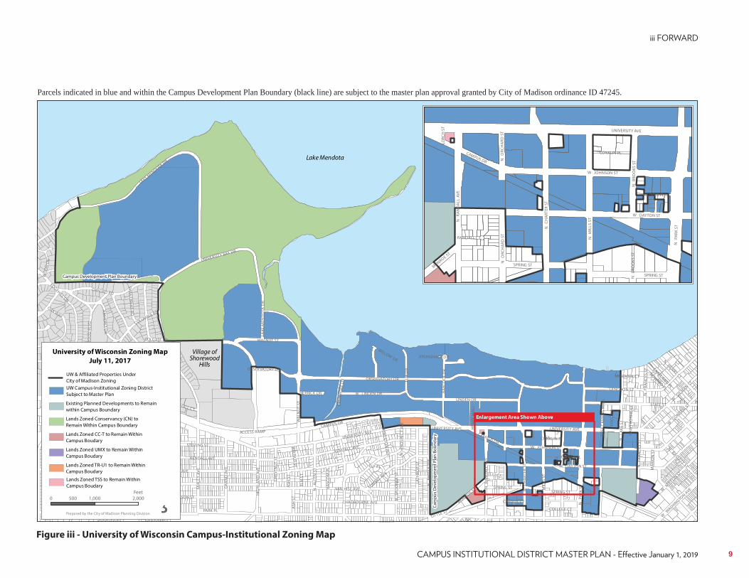
Figure iii - University of Wisconsin Campus-Institutional Zoning Map
Parcels indicated in blue and within the Campus Development Plan Boundary (black line) are subject to the master plan approval granted by City of Madison ordinance ID 47245.
Campus Development Plan Boundary
Cam
pus
Dev
elop
men
t Pla
n Bo
unda
ry
9
iv City of Madison Conditions of Approval - Planning Requirements
1. Developing Green Streets will require that the University work with the City Engineering Division to develop a cross-section that meets the needs of pedestrian, bicycle and vehicle traffic while enhancing the “green” nature of the street. This may require that easements or additional right of way be dedicated to allow for the required width of cross-section.
2. Until technology is developed that removes chlorides from the winter management strategies of the University and City of Madison, “green” infrastructure improvements on W. Dayton and N. Charter streets shall not include infiltration practices that cannot be diverted for the winter seasons, as these compounds are incompatible with infiltration devices. Further, as these roads are arterial bus routes chlorides are currently necessary for winter operation of the system.
3. The proposed cross-section for University Avenue, including a protected two-way bike path, should be installed if found to be beneficial after further public involvement and study.
4. The proposed recommendations for N. Charter Street, N. Mills Street and N. Brooks Street will require more study/ public involvement to determine traffic and/or right of way impacts.
5. The City recognizes that some existing parking lots may be reduced or eliminated and parking may be added in other areas. New areas of concentrations of parking may affect City streets operation and right of way widths required. A Traffic Impact Analysis, right of way improvements and/or dedications may be required.
6. As part of the master plan, it is anticipated that there will likely be some University of Wisconsin improvements within City right of ways. The applicant shall be aware that coordination of these improvements within pubic right of ways may require, but are not limited to, maintenance agreements, encroachment agreements, air/ subterranean leases, street vacations, or intergovernmental agreements.
Conditions of approval recommended by City agencies to be followed as future projects are realized within the Campus Development Plan Boundary.
7. The applicant shall be aware that redevelopment of sites comprised of more than one platted lot will likely require a land division approved by the City of Madison to dissolve underlying lot lines.
8. All proposed right-of-way vacations shall be approved or denied at the time of the proposed project and after the approval of a TIA reviewed and approved by the City Traffic Engineer.
9. All relevant sections of the Zoning Code and Madison General Ordinances, which may be amended from time to time, shall apply to this Campus Master Plan, unless otherwise noted in the final approved Master Plan documents
10. Vacation of Walnut Street north of Observatory Drive, and construction of a new north-south street east of Highland Avenue (between Observatory Drive and Marsh Drive), will require alteration of current transit operations, including the construction of new bus stops locations.
11. Every effort has been taken to remove references to future university planning inititatives on lands within the Campus Development Plan Boundary, but not owned by the Board of Regents. For reference, these planning initiatives are identified in the UW-Madison Campus Master Plan Technical Document and support materials.
10 UNIVERSITY OF WISCONSIN–MADISON
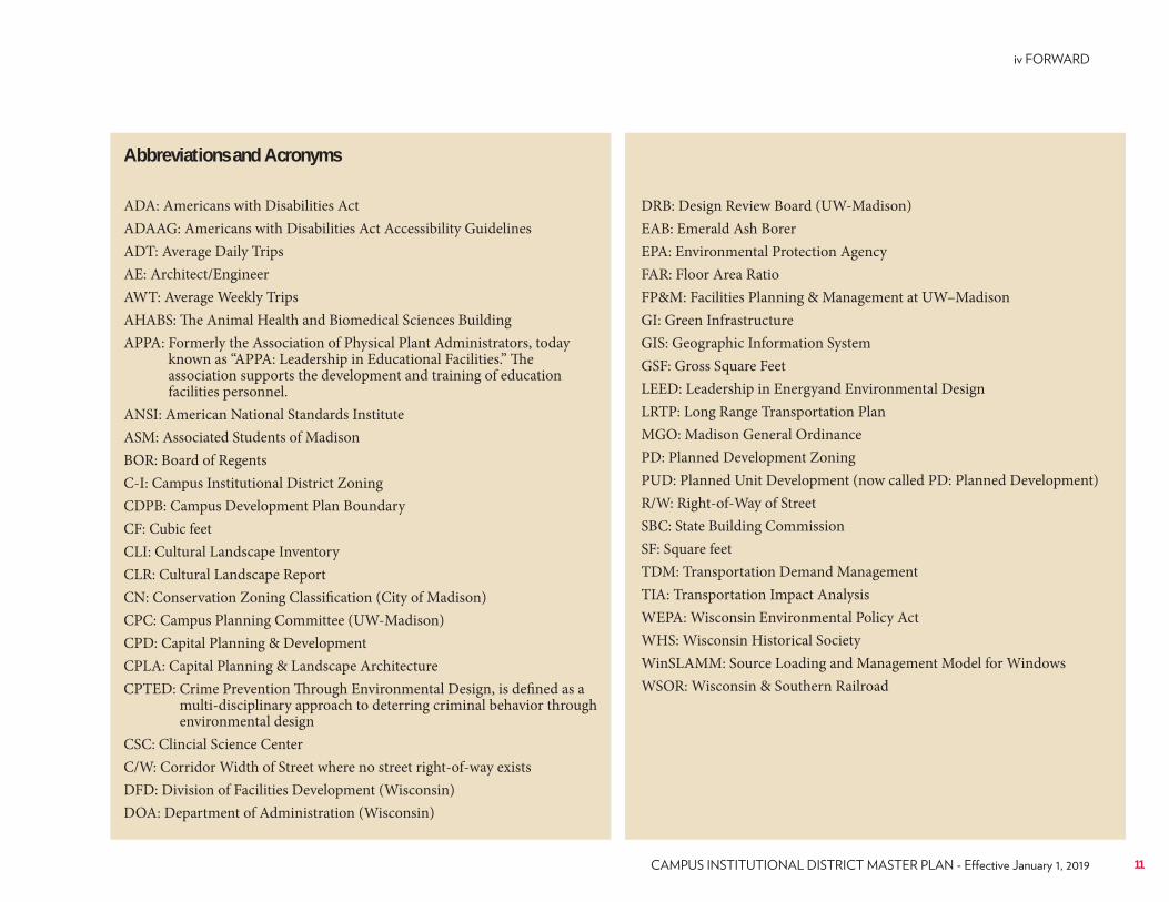
Abbreviations and Acronyms
ADA: Americans with Disabilities ActADAAG: Americans with Disabilities Act Accessibility GuidelinesADT: Average Daily TripsAE: Architect/EngineerAWT: Average Weekly TripsAHABS: The Animal Health and Biomedical Sciences BuildingAPPA: Formerly the Association of Physical Plant Administrators, today
known as “APPA: Leadership in Educational Facilities.” The association supports the development and training of education facilities personnel.
ANSI: American National Standards InstituteASM: Associated Students of MadisonBOR: Board of RegentsC-I: Campus Institutional District ZoningCDPB: Campus Development Plan BoundaryCF: Cubic feetCLI: Cultural Landscape InventoryCLR: Cultural Landscape ReportCN: Conservation Zoning Classification (City of Madison)CPC: Campus Planning Committee (UW-Madison)CPD: Capital Planning & DevelopmentCPLA: Capital Planning & Landscape ArchitectureCPTED: Crime Prevention Through Environmental Design, is defined as a
multi-disciplinary approach to deterring criminal behavior through environmental design
CSC: Clincial Science CenterC/W: Corridor Width of Street where no street right-of-way existsDFD: Division of Facilities Development (Wisconsin)DOA: Department of Administration (Wisconsin)
DRB: Design Review Board (UW-Madison)EAB: Emerald Ash BorerEPA: Environmental Protection AgencyFAR: Floor Area RatioFP&M: Facilities Planning & Management at UW–MadisonGI: Green InfrastructureGIS: Geographic Information SystemGSF: Gross Square FeetLEED: Leadership in Energyand Environmental DesignLRTP: Long Range Transportation PlanMGO: Madison General OrdinancePD: Planned Development ZoningPUD: Planned Unit Development (now called PD: Planned Development)R/W: Right-of-Way of StreetSBC: State Building CommissionSF: Square feetTDM: Transportation Demand ManagementTIA: Transportation Impact AnalysisWEPA: Wisconsin Environmental Policy ActWHS: Wisconsin Historical SocietyWinSLAMM: Source Loading and Management Model for WindowsWSOR: Wisconsin & Southern Railroad
11

12 UNIVERSITY OF WISCONSIN–MADISON
HISTORY
13
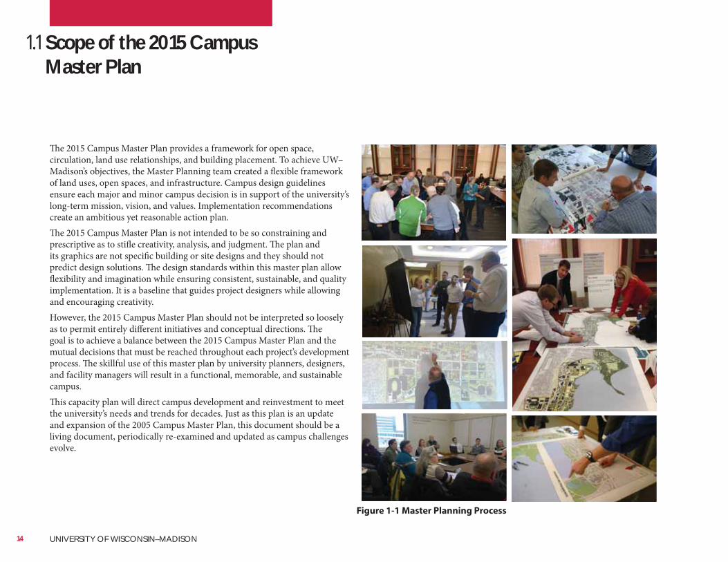
SmithGroupJJRThe 2015 Campus Master Plan provides a framework for open space, circulation, land use relationships, and building placement. To achieve UW–Madison’s objectives, the Master Planning team created a flexible framework of land uses, open spaces, and infrastructure. Campus design guidelines ensure each major and minor campus decision is in support of the university’s long-term mission, vision, and values. Implementation recommendations create an ambitious yet reasonable action plan.The 2015 Campus Master Plan is not intended to be so constraining and prescriptive as to stifle creativity, analysis, and judgment. The plan and its graphics are not specific building or site designs and they should not predict design solutions. The design standards within this master plan allow flexibility and imagination while ensuring consistent, sustainable, and quality implementation. It is a baseline that guides project designers while allowing and encouraging creativity.However, the 2015 Campus Master Plan should not be interpreted so loosely as to permit entirely different initiatives and conceptual directions. The goal is to achieve a balance between the 2015 Campus Master Plan and the mutual decisions that must be reached throughout each project’s development process. The skillful use of this master plan by university planners, designers, and facility managers will result in a functional, memorable, and sustainable campus.This capacity plan will direct campus development and reinvestment to meet the university’s needs and trends for decades. Just as this plan is an update and expansion of the 2005 Campus Master Plan, this document should be a living document, periodically re-examined and updated as campus challenges evolve.
1.1 Scope of the 2015 Campus Master Plan
Figure 1-1 Master Planning Process
14 UNIVERSITY OF WISCONSIN–MADISON
Decision-Making StructureThe master planning process had several types of review and participation. Stakeholders included the Executive Leadership team, the Campus Planning Steering Committee, four Technical Coordinating Committees, and a number of campus and community constituency representatives. Each group met with the Master Plan Consultant team to provide input and oversight into: a) the master planning process, b) the development of the plan alternatives, and c) the final results of the plan. Members of those groups are listed in the Appendix.The official approval process of the 2015 Campus Master Plan Update was via the UW–Madison shared governance Campus Planning Steering Committee, acting as the steering committee for the plan and making a final recommendation to the Chancellor for approval. Presentations were made to the Campus Planning Steering Committee for their input and guidance on the development of the plan. Upon Chancellor approval, Facilities Planning & Management then made informational presentations to the Board of Regents (BOR) and the State Building Commission (SBC). The Master Plan Consultant team also presented the draft recommendations to the Executive Leadership team and Campus Design Review Board for input throughout the process. Facilities Planning & Management staff also presented the plan to the various constituency groups across the campus and to the local community to assure their active participation and input in to the plan. The final draft plan was presented to the City of Madison Plan Commission for approval and formal adoption by the Madison Common Council with recommendations coming from the Joint West and Joint Southeast Campus Area Committees.
Executive Leadership TeamChaired by the Chancellor, this group met four times with the Master Planning team to establish overall direction, check on the progress of the plan and validate the conclusions developed for the plan prior to its final release.
Master Planning ProcessThrough a forward-thinking, interactive, and inclusive master planning process, UW–Madison staff, faculty, and students defined the campus’s physical future.Assisted by the Master Planning team, UW–Madison staff, faculty, and students developed the 2015 Campus Master Plan Update through sequential steps. The Master Planning team understood the pressing campus issues, analyzed the campus site and infrastructure, interpreted the university’s mission and sustainable future, and determined how best to meet the designated future needs.In response to this input and analysis, the campus Master Planning team prepared viable and contrasting alternatives for campus change and growth. Inspired by the opportunities uncovered in these alternatives, staff, faculty, and students crafted a consensus campus concept. The Master Planning team then refined and illustrated this concept and created campus design guidelines and a potential project sequencing plan.Master planning was inclusive and transparent in all stages. The master planning process was directed by the Campus Planning Steering Committee and advised by four Technical Coordinating Committees and the Executive Leadership team. The master plan commenced by interviewing dozens of campus and community leaders. Scores more faculty, staff, students, and community members participated in workshops, open houses, presentations, and online forms to confirm campus analysis and direct future decisions. The campus repeatedly reached into the community, meeting with adjacent neighborhood leaders and with City of Madison and Village of Shorewood elected officials and staff on and off campus. The university’s website provided access to planning materials for review and an online town hall facilitated concurrent and interactive discussions throughout the master planning process.As a result of this collaborative process, the 2015 Campus Master Plan Update has widespread understanding and support within all groups on campus and in the community.
15
SmithGroupJJR
brainstorm solutions, and provide input into the master planning process. This was the main working group for the plan and is the sounding board for technical ideas and draft recommendations for the plan. This group invited other subject experts to join them for individual meeting(s) to provide further detailed information about a particular topic. Recommendations from this group were shared with the Campus Planning Steering Committee for inclusion in the overall master plan to be approved by the Chancellor. The Technical Coordinating Committee met both as a single committee and as specialized subcommittees:• Administration Technical Coordinating Committee• Green Infrastructure/Stormwater Technical Coordinating Committee• Landscape Technical Coordinating Committee• Transportation Technical Coordinating Committee• Utility Infrastructure Technical Coordinating Committee
Outreach and CoordinationThe Master Planning team met with various campus and community constituency groups throughout the master planning process. These groups were individuals with special concerns who provided detailed level input and feedback into the concepts and ideas proposed in the plan. The list of over 50 campus and community constituency organizations is listed in the Appendix.
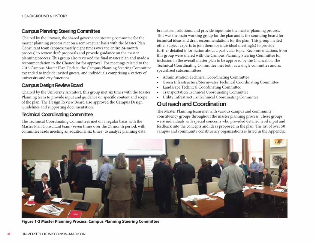
Campus Planning Steering CommitteeChaired by the Provost, the shared governance steering committee for the master planning process met on a semi-regular basis with the Master Plan Consultant team (approximately eight times over the entire 24-month process) to review draft proposals and provide guidance on the master planning process. This group also reviewed the final master plan and made a recommendation to the Chancellor for approval. For meetings related to the 2015 Campus Master Plan Update, the Campus Planning Steering Committee expanded to include invited guests, and individuals comprising a variety of university and city functions.
Campus Design Review BoardChaired by the University Architect, this group met six times with the Master Planning team to provide input and guidance on specific content and scope of the plan. The Design Review Board also approved the Campus Design Guidelines and supporting documentation.
Technical Coordinating CommitteeThe Technical Coordinating Committees met on a regular basis with the Master Plan Consultant team (seven times over the 24 month period, with committee leads meeting an additional six times) to analyze planning data,
Figure 1-2 Master Planning Process, Campus Planning Steering Committee
16 UNIVERSITY OF WISCONSIN–MADISON
SmithGroupJJR
Plan Approval and Future UseThe Chancellor approved the 2015 Campus Master Plan on September 13, 2016 and the Board of Regents accepted the plan on February 2, 2017. The 2015 Campus Master Plan Update will guide the planning and design of campus by university staff and all consultants it hires. The 2015 Campus Master Plan Update will guide the development of the campus, indicating appropriate building and open space uses, parking and transportation improvements, and necessary green infrastructure and utilities upgrades. Design guidelines will shape the design of future buildings, open spaces, and streetscapes.The 2015 Campus Master Plan Update was also reviewed and approved by the City of Madison as part of a rezoning process. The C-I District master plan only applies to properties owned by the University of Wisconsin Board of Regents, State of
The 2015 Campus Master Plan Update should serve as a guide and its specific recommendations should be modified as additional information and needs are discovered. Even as specific recommendations are modified, the revised plans and designs must directly follow and support the Master Plan Goals and Guiding Principles. Any major modifications may need further review and approval by the City of Madison.
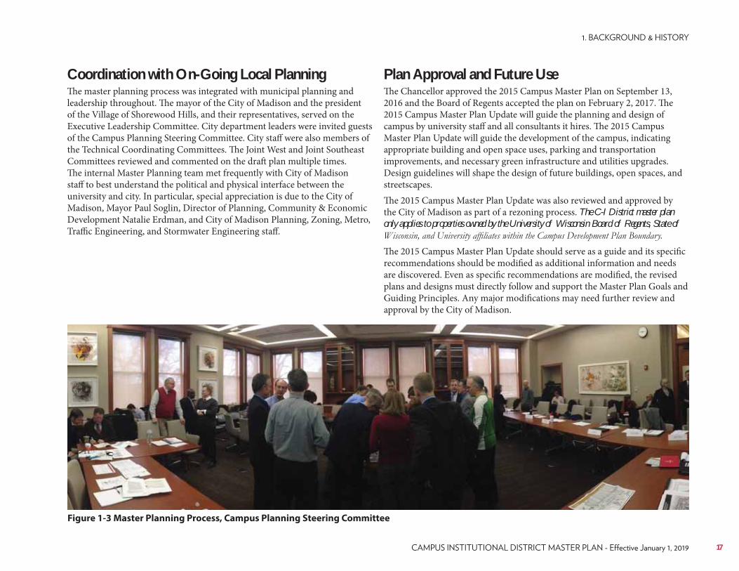
Coordination with On-Going Local PlanningThe master planning process was integrated with municipal planning and leadership throughout. The mayor of the City of Madison and the president of the Village of Shorewood Hills, and their representatives, served on the Executive Leadership Committee. City department leaders were invited guests of the Campus Planning Steering Committee. City staff were also members of the Technical Coordinating Committees. The Joint West and Joint Southeast Committees reviewed and commented on the draft plan multiple times. The internal Master Planning team met frequently with City of Madison staff to best understand the political and physical interface between the university and city. In particular, special appreciation is due to the City of Madison, Mayor Paul Soglin, Director of Planning, Community & Economic Development Natalie Erdman, and City of Madison Planning, Zoning, Metro, Traffic Engineering, and Stormwater Engineering staff.
Figure 1-3 Master Planning Process, Campus Planning Steering Committee
17
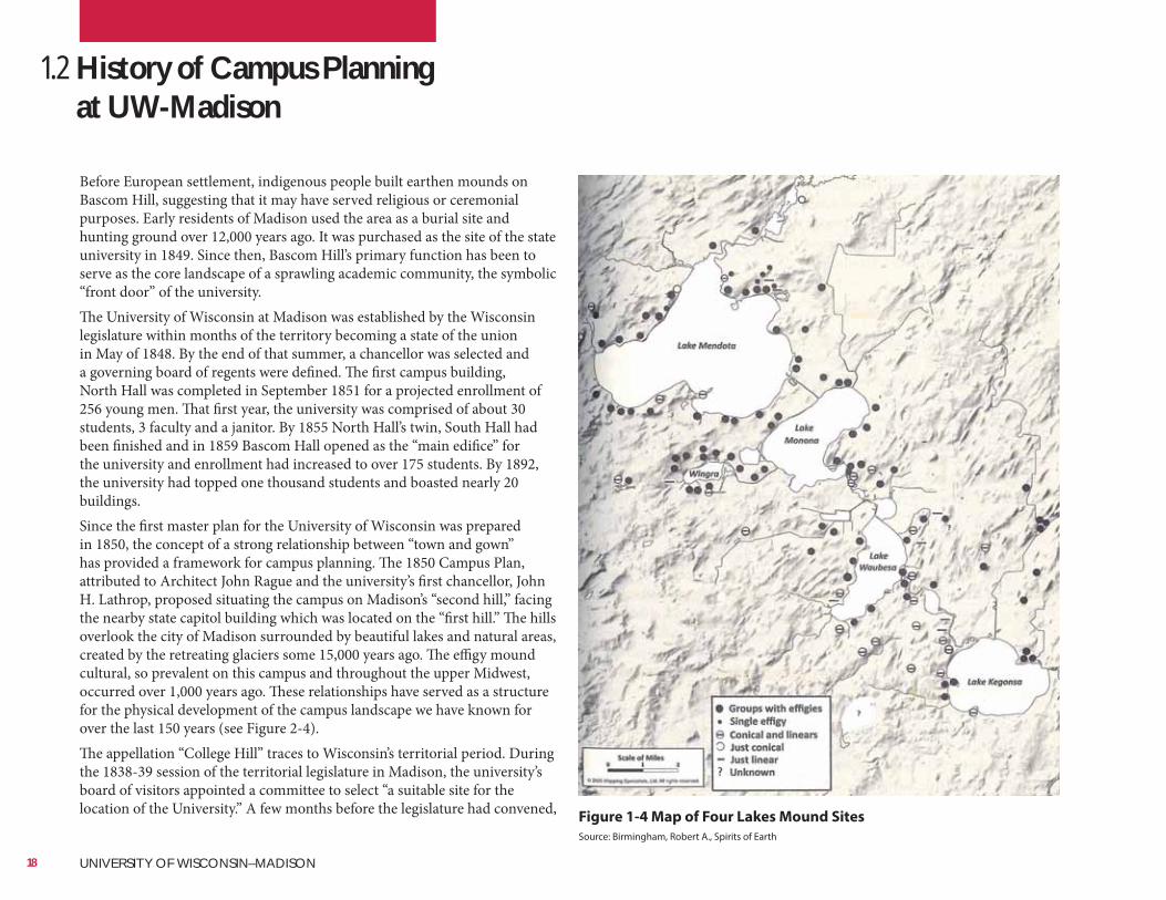
Birmingham, Robert A. “Spirit of Earth. The Effigy Mound Landscape of Madison and the Four Lakes”
Figure 1-4 Map of Four Lakes Mound Sites
Source: Birmingham, Robert A., Spirits of Earth
1.2 History of Campus Planning at UW-Madison
Before European settlement, indigenous people built earthen mounds on Bascom Hill, suggesting that it may have served religious or ceremonial purposes. Early residents of Madison used the area as a burial site and hunting ground over 12,000 years ago. It was purchased as the site of the state university in 1849. Since then, Bascom Hill’s primary function has been to serve as the core landscape of a sprawling academic community, the symbolic “front door” of the university.The University of Wisconsin at Madison was established by the Wisconsin legislature within months of the territory becoming a state of the union in May of 1848. By the end of that summer, a chancellor was selected and a governing board of regents were defined. The first campus building, North Hall was completed in September 1851 for a projected enrollment of 256 young men. That first year, the university was comprised of about 30 students, 3 faculty and a janitor. By 1855 North Hall’s twin, South Hall had been finished and in 1859 Bascom Hall opened as the “main edifice” for the university and enrollment had increased to over 175 students. By 1892, the university had topped one thousand students and boasted nearly 20 buildings.Since the first master plan for the University of Wisconsin was prepared in 1850, the concept of a strong relationship between “town and gown” has provided a framework for campus planning. The 1850 Campus Plan, attributed to Architect John Rague and the university’s first chancellor, John H. Lathrop, proposed situating the campus on Madison’s “second hill,” facing the nearby state capitol building which was located on the “first hill.” The hills overlook the city of Madison surrounded by beautiful lakes and natural areas, created by the retreating glaciers some 15,000 years ago. The effigy mound cultural, so prevalent on this campus and throughout the upper Midwest, occurred over 1,000 years ago. These relationships have served as a structure for the physical development of the campus landscape we have known for over the last 150 years (see Figure 2-4).The appellation “College Hill” traces to Wisconsin’s territorial period. During the 1838-39 session of the territorial legislature in Madison, the university’s board of visitors appointed a committee to select “a suitable site for the location of the University.” A few months before the legislature had convened,
18 UNIVERSITY OF WISCONSIN–MADISON
University of Wisconsin Digital Collections
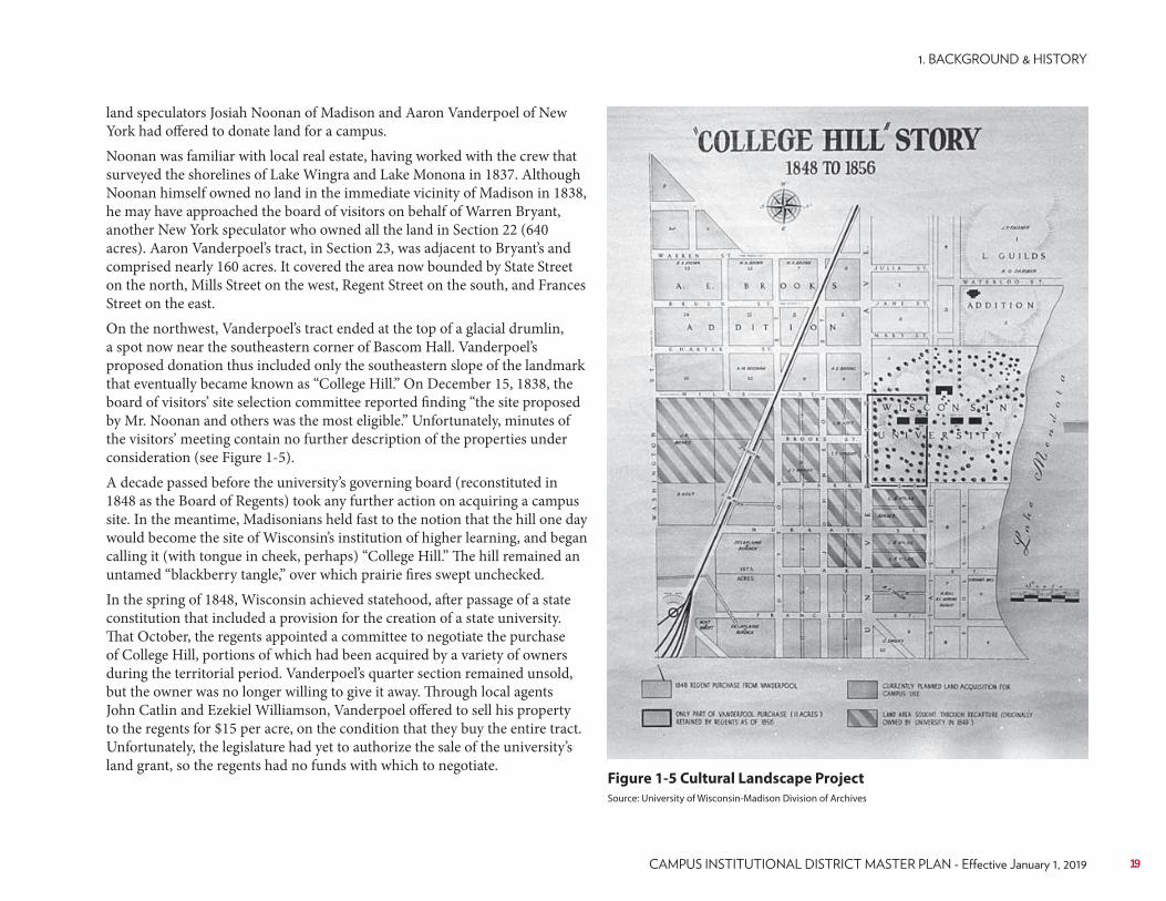
Figure 1-5 Cultural Landscape Project
Source: University of Wisconsin-Madison Division of Archives
land speculators Josiah Noonan of Madison and Aaron Vanderpoel of New York had offered to donate land for a campus.Noonan was familiar with local real estate, having worked with the crew that surveyed the shorelines of Lake Wingra and Lake Monona in 1837. Although Noonan himself owned no land in the immediate vicinity of Madison in 1838, he may have approached the board of visitors on behalf of Warren Bryant, another New York speculator who owned all the land in Section 22 (640 acres). Aaron Vanderpoel’s tract, in Section 23, was adjacent to Bryant’s and comprised nearly 160 acres. It covered the area now bounded by State Street on the north, Mills Street on the west, Regent Street on the south, and Frances Street on the east.On the northwest, Vanderpoel’s tract ended at the top of a glacial drumlin, a spot now near the southeastern corner of Bascom Hall. Vanderpoel’s proposed donation thus included only the southeastern slope of the landmark that eventually became known as “College Hill.” On December 15, 1838, the board of visitors’ site selection committee reported finding “the site proposed by Mr. Noonan and others was the most eligible.” Unfortunately, minutes of the visitors’ meeting contain no further description of the properties under consideration (see Figure 1-5).A decade passed before the university’s governing board (reconstituted in 1848 as the Board of Regents) took any further action on acquiring a campus site. In the meantime, Madisonians held fast to the notion that the hill one day would become the site of Wisconsin’s institution of higher learning, and began calling it (with tongue in cheek, perhaps) “College Hill.” The hill remained an untamed “blackberry tangle,” over which prairie fires swept unchecked.In the spring of 1848, Wisconsin achieved statehood, after passage of a state constitution that included a provision for the creation of a state university. That October, the regents appointed a committee to negotiate the purchase of College Hill, portions of which had been acquired by a variety of owners during the territorial period. Vanderpoel’s quarter section remained unsold, but the owner was no longer willing to give it away. Through local agents John Catlin and Ezekiel Williamson, Vanderpoel offered to sell his property to the regents for $15 per acre, on the condition that they buy the entire tract. Unfortunately, the legislature had yet to authorize the sale of the university’s land grant, so the regents had no funds with which to negotiate.
19
Cultural Landscape Inventory-Bascom Mall
Figure 1-6 General Plan for the University of Wisconsin by John Rague,
January 1850
During their 1848-49 session, legislators passed a joint resolution approving the regents’ request to purchase a site. Interestingly, they also approved “the plan of the buildings submitted by said regents.” Although the legislature denied the board’s request for a $1,000 loan to cover the first payment on the site, the sale nonetheless went forward. On March 16, 1849, Vanderpoel and his wife, Ellen, deeded their tract to the regents for the sum of $2,435.36. How the regents managed to fund the Vanderpoel purchase remains unknown. Regent Simeon Mills (1810-1895), then chairman of the legislature’s finance committee and one of Madison’s most successful real estate dealers, may have stepped forward to help.A plan for a “main edifice, fronting towards the Capitol” was devised by the regents’ building committee in 1850 (see Figure 1-6) and was included with the regents’ annual report. The committee, consisting of Chancellor John Lathrop and Regents Mills and Nathanial Dean, also called for “an avenue, two hundred and forty feet wide… bordered by double rows of trees,” extending from the main building to the eastern boundary of the campus (Park Street). The regents originally planned to build four dormitories on the hill, two on each side of the avenue. They also recommended the construction of two carriage ways flanking the dormitory buildings and paralleling the tree-lined avenue.One of the first general development plans for the University of Wisconsin was by Milwaukee Architect John F. Rague in January 1850 which included his plans for “College Hill.” The simple site plan showed a “main edifice” that later would be designed by William Tinsley of Indianapolis, Indiana opening in 1859 as University Hall. It was later named Bascom Hall in June 1920, after John A. Bascom, university president from 1874 to 1887.The first campus building, North Hall built in 1851, was also attributed to John F. Rague after the Board of Regents approved the 1850 plan. It was designated a National Historic Landmark in 1966. Rague designed the Madison sandstone building to be similar to dormitories on University of Michigan campus, in Ann Arbor. The plan included three dormitories but only one other (South Hall) was built in 1855 (see Figure 1-6).From 1860 to 1865, the new university struggled financially, aided to some degree by the Morrill Act which provided public lands to be sold to create an endowment for “land-grant universities.”
20 UNIVERSITY OF WISCONSIN–MADISON
University of Wisconsin Digital Collections
Figure 1-7 O.C. Simonds, Plan for the Grounds of the University of Wisconsin, 1906
21
University of Wisconsin Digital Collections
Figure 1-8 O.C. Simonds 1906 Plan for the Grounds of the University of
Wisconsin, Bascom Hill (Detail)
Over time, the campus grew from these first three buildings (North, South and University Halls) on what would become Bascom Hill, to over the present-day 300 buildings spanning 936 acres in downtown Madison. Growth of campus facilities was clearly directed by several master planning efforts: some were followed rather closely, while others because of political pressures and the necessity of campus growth to meet basic demands, were basically disregarded. The “college on the hill” met with success early on and enrollment increased steadily as projected by the regents.Expansion of the university was consistent until 1890 to 1900 when a number of new buildings were built and student enrollment doubled. After Charles R. Van Hise assumed the presidency in 1903, a series of planning initiatives began to influence development across campus. In early 1900, Ossian C. Simonds, a prominent Chicago landscape gardener, was hired to consider future development of the campus. He completed his plans in 1906. Simonds was the first to address the entire campus as Rague’s earlier plan focused on the Bascom Hill area before the campus began to expand to the west (see Figure 1-7).Simonds’ plan picked up on some of the earlier formal planning concepts but took on a more pastoral and curvilinear layout reflecting his training as a landscape gardener. Simonds’ plan was curiously devoid of projected major new buildings and more expertly concentrated on the grounds, which he was much more comfortable with pursuing (see Figure 1-8).In the meantime, President Van Hise was out scouting for much broader based planning and found Arthur Peabody, a supervising architect at the Chicago World’s Columbian Exposition. In 1906, the Board of Regents created an Architectural Commission consisting of then university architect Arthur Peabody, consultant Warren P. Laird, and Laird’s colleague, Paul Philippe Cret, a University of Pennsylvania professor of design. This was to be the first significant and comprehensive campus master plan for the university, eventually being completed in 1908. Laird had originally come to campus in 1903 to provide consulting services for the new Chemistry Building which began a lengthy partnership with Peabody.
Peabody explained the 1908 Campus Plan by saying .“The design attempts to
The architectural style being proposed was the Beaux-Arts classical revival style popularized by Daniel Burnham’s grand White City at the Chicago Columbian Exposition of 1893 and the subsequent City Beautiful Movement.The 1908 Campus Plan called for a series of well-defined districts, each with its own character but based on the major academic units they comprised. For example, the “eastern section” would include public functions (library, theatre, and administration) and the liberal arts. The “northern section” would include residence halls and athletics. The University Avenue section, including the south facing slopes and westerly levels, were to include the pure sciences, pre-medical and applied sciences along with agriculture. The
22 UNIVERSITY OF WISCONSIN–MADISON
University of Wisconsin Digital Collections
Figure 1-9 Laird & Cret 1908 General Design of the University of Wisconsin23
University of Wisconsin Digital Collections
Figure 1-10 Laird & Cret 1908 General Design of the University of
Wisconsin, Detail
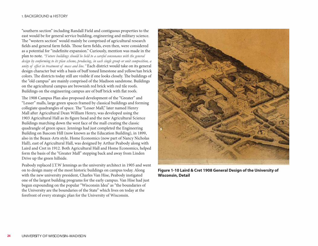
“southern section” including Randall Field and contiguous properties to the east would be for general service building, engineering and military science. The “western section” would mainly be comprised of agricultural research fields and general farm fields. Those farm fields, even then, were considered as a potential for “indefinite expansion.” Curiously, mention was made in the plan to note.
Each district would take on its general design character but with a basis of buff toned limestone and yellow/tan brick colors. The districts today still are visible if one looks closely. The buildings of the “old campus” are mainly comprised of the Madison sandstone. Buildings on the agricultural campus are brownish red brick with red tile roofs. Buildings on the engineering campus are of buff brick with flat roofs.The 1908 Campus Plan also proposed development of the “Greater” and “Lesser” malls, large green spaces framed by classical buildings and forming collegiate quadrangles of space. The “Lesser Mall,” later named Henry Mall after Agricultural Dean William Henry, was developed using the 1903 Agricultural Hall as its figure head and the new Agricultural Science Buildings marching down the west face of the mall creating the classic quadrangle of green space. Jennings had just completed the Engineering Building on Bascom Hill (now known as the Education Building), in 1899, also in the Beaux-Arts style. Home Economics (now part of Nancy Nicholas Hall), east of Agricultural Hall, was designed by Arthur Peabody along with Laird and Cret in 1912. Both Agricultural Hall and Home Economics, helped form the basis of the “Greater Mall” stepping back and away from Linden Drive up the green hillside.Peabody replaced J.T.W Jennings as the university architect in 1905 and went on to design many of the most historic buildings on campus today. Along with the new university president, Charles Van Hise, Peabody instigated one of the largest building programs for the early campus. Van Hise had just begun expounding on the popular “Wisconsin Idea” as “the boundaries of the University are the boundaries of the State” which lives on today at the forefront of every strategic plan for the University of Wisconsin.
24 UNIVERSITY OF WISCONSIN–MADISON
University of Wisconsin Digital Collections
Figure 1-11 Laird & Cret 1908 General Design of the University of
Wisconsin, Detail showing “liberal arts piazza” near the summit of
College Hill.
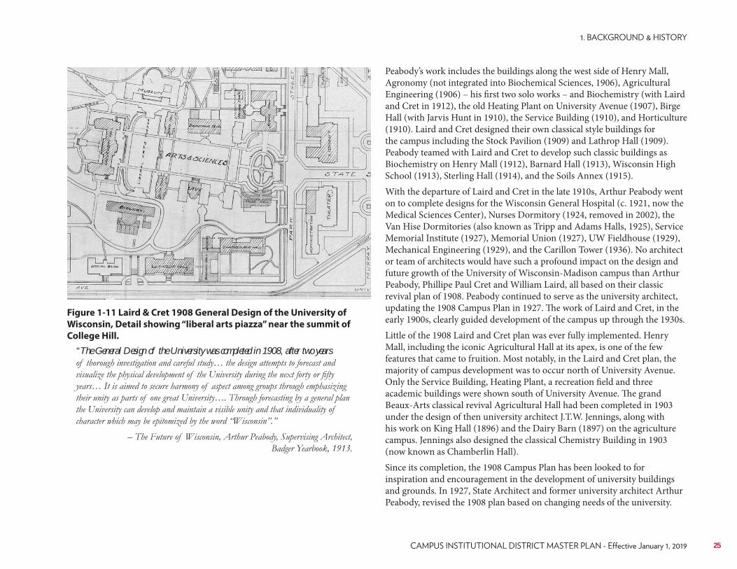
“The General Design of the University was completed in 1908, after two years
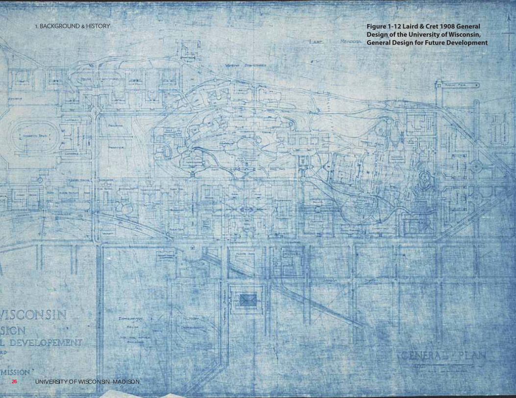
Peabody’s work includes the buildings along the west side of Henry Mall, Agronomy (not integrated into Biochemical Sciences, 1906), Agricultural Engineering (1906) – his first two solo works – and Biochemistry (with Laird and Cret in 1912), the old Heating Plant on University Avenue (1907), Birge Hall (with Jarvis Hunt in 1910), the Service Building (1910), and Horticulture (1910). Laird and Cret designed their own classical style buildings for the campus including the Stock Pavilion (1909) and Lathrop Hall (1909). Peabody teamed with Laird and Cret to develop such classic buildings as Biochemistry on Henry Mall (1912), Barnard Hall (1913), Wisconsin High School (1913), Sterling Hall (1914), and the Soils Annex (1915).With the departure of Laird and Cret in the late 1910s, Arthur Peabody went on to complete designs for the Wisconsin General Hospital (c. 1921, now the Medical Sciences Center), Nurses Dormitory (1924, removed in 2002), the Van Hise Dormitories (also known as Tripp and Adams Halls, 1925), Service Memorial Institute (1927), Memorial Union (1927), UW Fieldhouse (1929), Mechanical Engineering (1929), and the Carillon Tower (1936). No architect or team of architects would have such a profound impact on the design and future growth of the University of Wisconsin-Madison campus than Arthur Peabody, Phillipe Paul Cret and William Laird, all based on their classic revival plan of 1908. Peabody continued to serve as the university architect, updating the 1908 Campus Plan in 1927. The work of Laird and Cret, in the early 1900s, clearly guided development of the campus up through the 1930s.Little of the 1908 Laird and Cret plan was ever fully implemented. Henry Mall, including the iconic Agricultural Hall at its apex, is one of the few features that came to fruition. Most notably, in the Laird and Cret plan, the majority of campus development was to occur north of University Avenue. Only the Service Building, Heating Plant, a recreation field and three academic buildings were shown south of University Avenue. The grand Beaux-Arts classical revival Agricultural Hall had been completed in 1903 under the design of then university architect J.T.W. Jennings, along with his work on King Hall (1896) and the Dairy Barn (1897) on the agriculture campus. Jennings also designed the classical Chemistry Building in 1903 (now known as Chamberlin Hall). Since its completion, the 1908 Campus Plan has been looked to for inspiration and encouragement in the development of university buildings and grounds. In 1927, State Architect and former university architect Arthur Peabody, revised the 1908 plan based on changing needs of the university.
25
University of Wisconsin Digital CollectionsUnUnUniUniUniUnininiUUniUninniUniUUniUniU ververververvveverververvvvev sititsisitsititsitsitsitsity y y oy y oooooooy y oy oy ooooyy f Wff Wf WWWWWf Wf WWf Wff Wfff WWf Wiiscisciscisiscisciscciscccsci csconsonsonsonsonsonsonsonsonssoo sin iniininin inin iininin in inninin nn ninin DigDigDDDigDiDigDigDigDigDDDDDDigDiDigDDDiDDDigDDDDiDDD gDDiDDDDD gD gDigitaititataitaitaititatatataatatitaitatti aiitatataatattiit ll lllllllllCCColColColoColCoColColololColoooll eleleclececlecleclelelecclectiotitioiitiotiotiotiootiotiotitioiot onsnsnsnsnsssnsnssnnsns
Figure 1-12 Laird & Cret 1908 General
Design of the University of Wisconsin,
General Design for Future Development
26 UNIVERSITY OF WISCONSIN–MADISON
1.3 Historical Development of the UW-Madison Campus
The figure ground maps of the campus on the following pages show historical growth patterns and how the campus grew over time with the accompanying text describing major planning initiatives.From 1875 through to the 1940s the campus saw a major shift from its humble beginnings as a small land grant college to what would become a large, modern university. Buildings were typically planned and designed to fit an immediate need and a departure from the historic academic village was seen. From 1910 to 1920, many new buildings were dedicated to agriculture and to the sciences. The 1920s saw the building of the Wisconsin General Hospital, the Service Memorial Institute for the College of Medicine (now part of the Medical Sciences Center) and the new Field House was completed. The first men’s dormitories were also constructed during this period (Tripp and Adams Halls). In 1927, modifications to the Campus Plan were made which involved placing Intercollegiate Athletics at Camp Randall and the Medical School, as noted above, in the Service Memorial Institute. The 1908 Campus Plan called for the engineering campus to be located on the site of the current Medical Sciences Center located where the hospital and medical school was eventually built. Engineering eventually was placed south of University Avenue, north of Camp Randall. In the 1930s most new buildings were for residential, social and athletic purposes (e.g., the Lakeshore Dormitories, Elizabeth Waters Residence Hall, the Carillon Tower and completion of the Stadium).
27
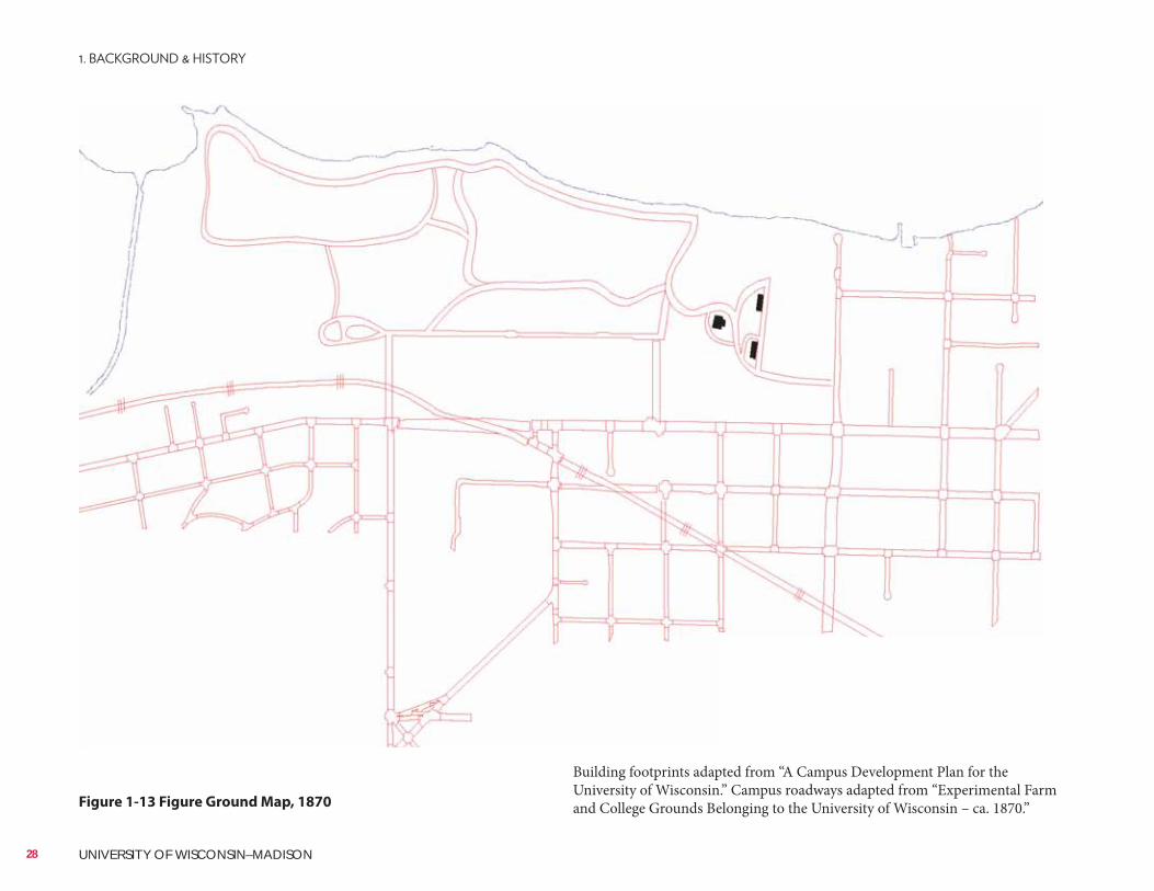
UW–Madison FP&M Archives
Figure 1-13 Figure Ground Map, 1870
Building footprints adapted from “A Campus Development Plan for the University of Wisconsin.” Campus roadways adapted from “Experimental Farm and College Grounds Belonging to the University of Wisconsin – ca. 1870.”
28 UNIVERSITY OF WISCONSIN–MADISON
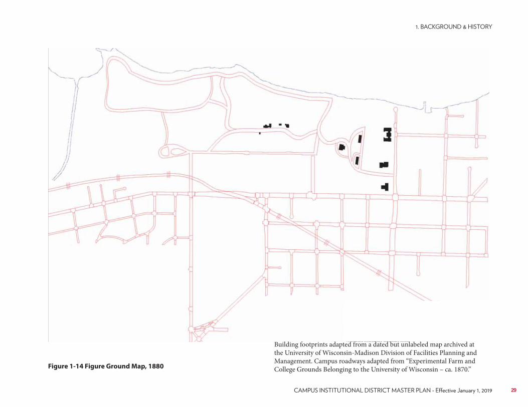
UW–Madison Facilities Planning & Management Archives
Figure 1-14 Figure Ground Map, 1880
Building footprints adapted from a dated but unlabeled map archived at the University of Wisconsin-Madison Division of Facilities Planning and Management. Campus roadways adapted from “Experimental Farm and College Grounds Belonging to the University of Wisconsin – ca. 1870.”
29
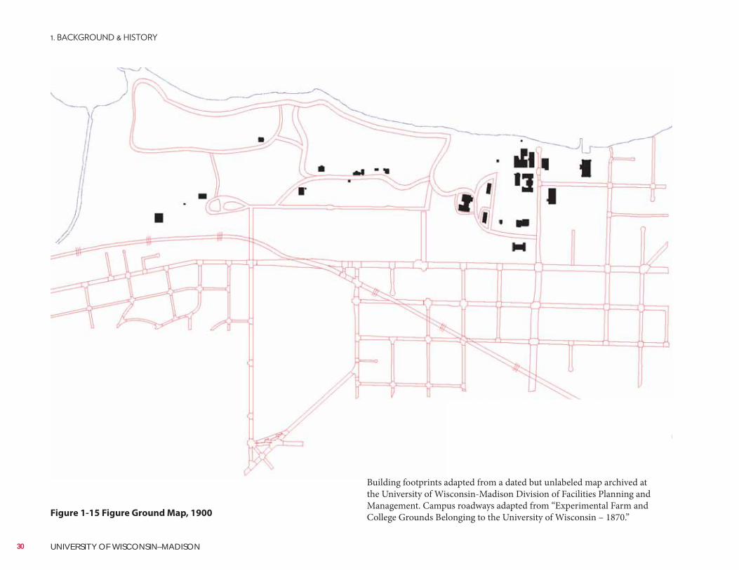
UW–Madison FP&M Archives
Figure 1-15 Figure Ground Map, 1900
Building footprints adapted from a dated but unlabeled map archived at the University of Wisconsin-Madison Division of Facilities Planning and Management. Campus roadways adapted from “Experimental Farm and College Grounds Belonging to the University of Wisconsin – 1870.”
30 UNIVERSITY OF WISCONSIN–MADISON
In November 1940, President Clarence A. Dykstra requested the development of a new plan to guide future development and growth for the campus. The objective of the plan was clearly defined to provide a pattern for new growth in such a way that “
An extensive building program was being submitted to the legislature and the leaders of the day suggested that a new plan be developed to help guide the massive undertaking. In 1941, the Wisconsin State Planning Board finalized the development of “A Campus Development Plan for the University of Wisconsin.”The 1941 Plan’s major recommendations included:• The plan should facilitate the integration of related activities by college.• The unique topographic features of the campus shall be preserved and
enhanced.• Ample open spaces should be maintained within the developed areas.• The plan be achieved without significant land acquisition adjacent to the
existing campus.• New construction be primarily devoted to the College of Agriculture.No attempt was made to provide for architectural details in the 1941 Plan. The commissioned architect and university authorities were tasked to make these decisions with respect to the architecture. The plan was to be flexible and allow for change over time but the broader objectives would be maintained. The planning team suggested the development of a group of individuals to carry out the program, something similar to a City Plan Commission. The “University Plan Commission” was to include regents, alumni, university staff, and state staff as ex-officio members. The charge to the commission would be to review all proposals for construction of new buildings or alterations of old ones. Since 2007 the university has had a Design Review Board, chaired by the university architect, which provides review and input into the development of large capital building projects.In the 1940s, growth was seen late in the decade with Babcock Hall and several quonset huts and temporary buildings were constructed as enrollment grew after the end of World War II in 1945. The University Houses complex was built in 1948, as was Babcock Hall, and Engineering Hall in 1949. Taylor, Humphrey and Jorns Halls were also built in 1949. In May 1946, the regents requested that the University Plan Commission (also known as Campus Planning Commission and now the shared governance
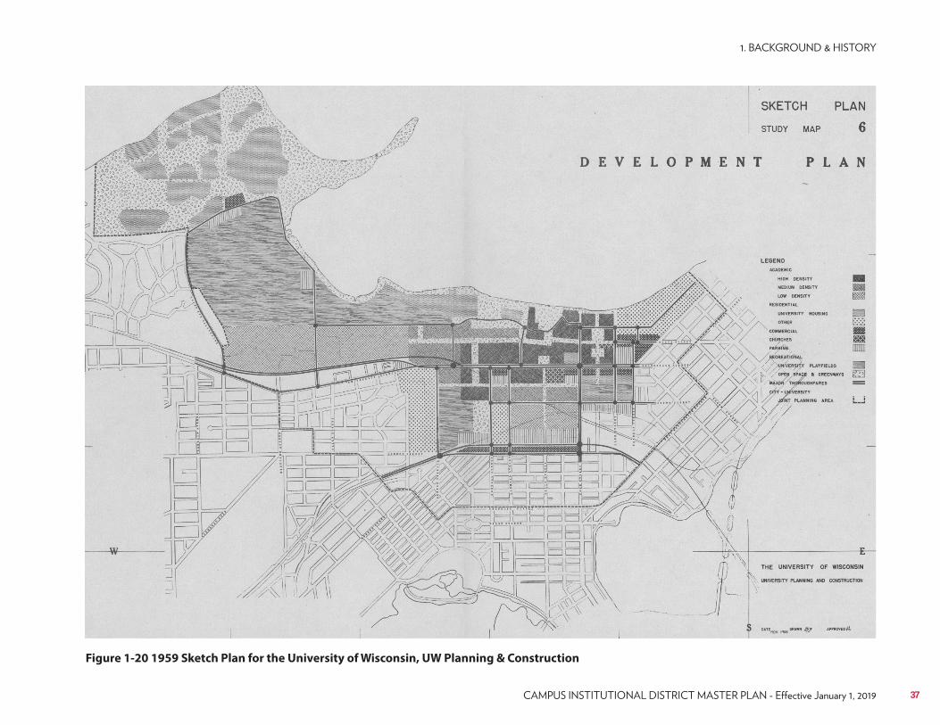
Campus Planning Committee) work with the City of Madison to develop plans for the area of expansion south of University Avenue and east of N. Park Street. Many months of discussion ensued with the eventual outcome of a master plan approved by the Board of Regents in August 1949. The design basically followed the 1908 Plan but, due to ever increasing enrollments, it indicated an expansion of the university to the south and east.These historic prior plans served the campus well for over 40 years when, with the baby boom looming in the late 1950s, the next generation of campus planning began. In 1958, enrollment was just over 16,500 students and projected to grow up to 30,000 or greater by 1970. While the expected enrollment and subsequent growth in faculty and staff was predicted, it was not predicted at the rate at which it actually occurred in the 1960s and 70s. By 1970, enrollment stood at nearly 36,000 and a concurrent building boom was in full swing.In the early 1950s, several new buildings were added to the campus including the Memorial Library, Stovall Hall, University Health Service, and the Dairy Cattle Center. Ingraham Hall (now known as the Commerce Building) was built in 1954, as was Camp Randall Memorial Practice Building (also known informally as the Shell). In 1955, the campus saw the Bardeen Labs being built, along with the Harvey Street Apartment complex for graduate students, approximately 1 mile west of the main campus. In the late 1950s, more residence halls were added (Holt Commons, Cole Hall, Sullivan Hall in 1957 and the Elm Drive Dorms – Bradley, Goodnight, Friedrick (now know as Val Phillips Residence Hall), and the associated dining hall facility were all built in 1958) and the beginning phases of the Eagle Heights married student housing complex was started. Poultry Research and the Agricultural Engineering Shop were also added on the Agriculture campus in that year.In 1959, the Board of Regents adopted a “Sketch Plan for the University of Wisconsin–Madison.” Goals of that plan where “to define succinctly the kind of physical environment deemed most desirable for the various activities of the University” and “to serve as a framework for more detailed site plans for the future development of the campus.” The plan set about several planning principles that strove to use the natural beauty of the campus making sure new buildings enhance that setting and that the campus “does not spread unnecessarily.” The distribution of activities was important such that related functions would be grouped together in the most efficient manner.
31
University of Wisconsin Digital Collections
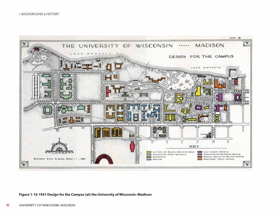
Figure 1-16 1941 Design for the Campus (at) the University of Wisconsin–Madison
32 UNIVERSITY OF WISCONSIN–MADISON
UW–Madison FP&M Archives
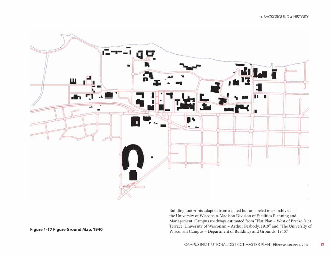
Figure 1-17 Figure Ground Map, 1940
Building footprints adapted from a dated but unlabeled map archived at the University of Wisconsin-Madison Division of Facilities Planning and Management. Campus roadways estimated from “Plat Plan – West of Breeze (sic) Terrace, University of Wisconsin – Arthur Peabody, 1919” and “The University of Wisconsin Campus – Department of Buildings and Grounds, 1940.”
33
Expansion of existing facilities was planned and sites were reserved for future growth of established departments on campus. Density standards were established for various areas on campus and the concept “to minimize conflict between pedestrian and vehicular circulation, to eliminate excess vehicular traffic on campus, and to develop separate pedestrian systems” was first introduced. New boundaries for the campus were established by the Board of Regents in anticipation of growth of the campus south of University Avenue. Adequate space for parking was important as was the planning for non-university service facilities. In the 1959 Sketch Plan, they also wanted to
on campus.The early 1960s saw a boom in construction with larger square footage buildings being constructed for the first time on campus. The average size of facilities built since 1960 are over twice the gross square footage of earlier developed facilities. (It is interesting to note that over half of the existing campus buildings were constructed between 1950 and 1979.) The early 1960s saw the development of: Susan B. Davis House, Social Sciences Building, Van Vleck Hall, Genetics, and the Limnology Building on Lake Mendota, all in 1961; Henry Rust House, Hi Ray Hall, Veterinary Sciences, AW Peterson Building, McArdle Labs, Gym/Natatorium Unit I and II, and UW Extension Services in 1962; the Mifflin Street Warehouse, Russell Labs, Zoology Research Building in 1963; Brodgen Hall, Biotron, Primate Center in 1964; and Daniels Chemistry Building, Bock Labs, Computer Sciences Building, Van Hise Hall, and Middleton Medical Library in 1965.In 1965, plans for enrollment growth were projected to upwards of 40,000 students, a level unprecedented in prior thinking. An intensive space needs study was implemented to look at what it would take to provide facilities for this burgeoning student population. Talk of the need for a second satellite campus, utilizing the Charmany and Reider Farms on the western edge of the city, were contemplated. Teaching workloads were analyzed and projected space deficits were looming on the horizon. A study of circulation patterns, both vehicular and pedestrian, was started with City of Madison officials. The great building boom of the late 1960s and early 1970s was finally beginning to meet the needs of the baby boomers coming to campus. In 1966, the Eagle Heights married student housing complex was finally completed.In 1970, a new Campus Development Plan was developed by an internal university staff team that reached out to meet the goal of having a campus population of 40,000 students. Major proposals coming out of that plan included continuing efforts to preserve and upgrade the traditional feel and
atmosphere of the original campus north of University Avenue and spreading outward from Bascom Hill. South of University Avenue, the plan called for a fresh approach to integrating campus and community development yet meet the needs of the ever expanding campus. Growth of on-campus housing was projected and thoughts of adding more residence halls were discussed. The late 1960s also included a major new development that was in full discussion. The development of a new Medical School teaching hospital on the far west end of campus, just east of University Bay Drive, was coming to fruition. The new Clinical Sciences Center would eventually open in March 1979 with the move of patients from the old hospital complex on University Avenue.Parking capacity levels were contemplated to have up to 15,000 spaces on campus, again with most of them being in structured parking facilities. The university’s long tradition of preserving its natural areas was also codified and included a suggestion to add the lands of “Second Point” (now known as Frautschi Point) to the 250 acres of already set aside natural areas. Their preservation and protection remain as a major planning goal for the campus. Service and utility areas, then spread across several sites, was to be consolidated in and around the Charter Street Heating Plant and on a site near Walnut Street, the latter being the future home of the Walnut Street Heating Plant constructed to serve the growing west campus. Removal of the railroad tracks that bisect the campus was also being discussed along with the development of a major vehicular bypass that would handle the large volumes of community wide traffic coming into downtown Madison. The bypass would connect at Highland Avenue on the west and the Gorham-Johnson Street pair on the east. The bypass would also act as a city-community redevelopment initiative that would spur integrated development along this large, 200-foot wide transportation corridor. Mass transit options were expanding in the planning circles of the day, with elevated trams, mono rails and duo-rail rapid transit. Funding for such a large scale endeavor would certainly be an issue.In 1973, a campus planning workbook for UW–Madison was adopted by the Campus Planning Committee as a culmination of the planning efforts started in 1970 by university facilities staff. The 1973 “Madison Campus Development Plan” envisioned a projected enrollment of 35,350 students by 1982 and a maximum enrollment of 42,000 students (as predicted by the Wisconsin Coordinating Council on Higher Education and under enrollment management constraints established by the Board of Regents). Enrollment projections were starting to stabilize after the extreme growth in the late 1960’s. Some boundary changes were suggested through joint city-university negotiations. The majority of campus development was again focused around the central campus with additional development starting around the newly opened UW Hospital’s Clinical Sciences Center.
34 UNIVERSITY OF WISCONSIN–MADISON
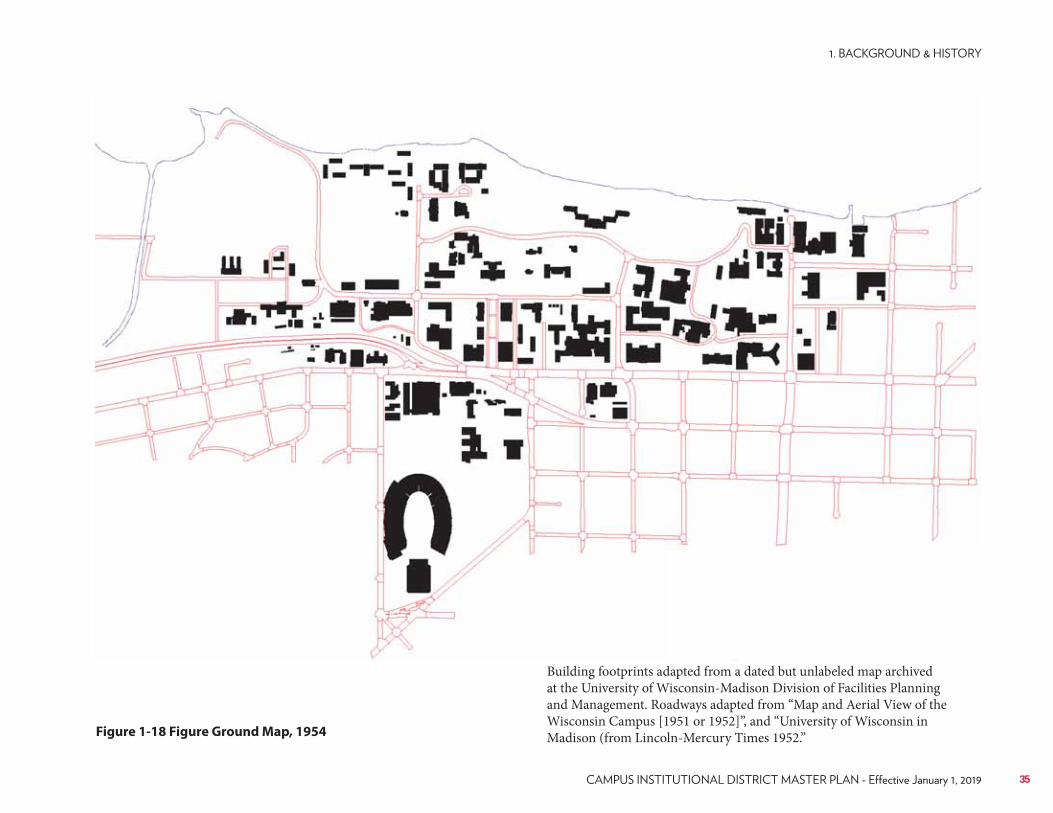
UW–Madison FP&M Archives
Figure 1-18 Figure Ground Map, 1954
Building footprints adapted from a dated but unlabeled map archived at the University of Wisconsin-Madison Division of Facilities Planning and Management. Roadways adapted from “Map and Aerial View of the Wisconsin Campus [1951 or 1952]”, and “University of Wisconsin in Madison (from Lincoln-Mercury Times 1952.”
35
UW–Madison FP&M Archives
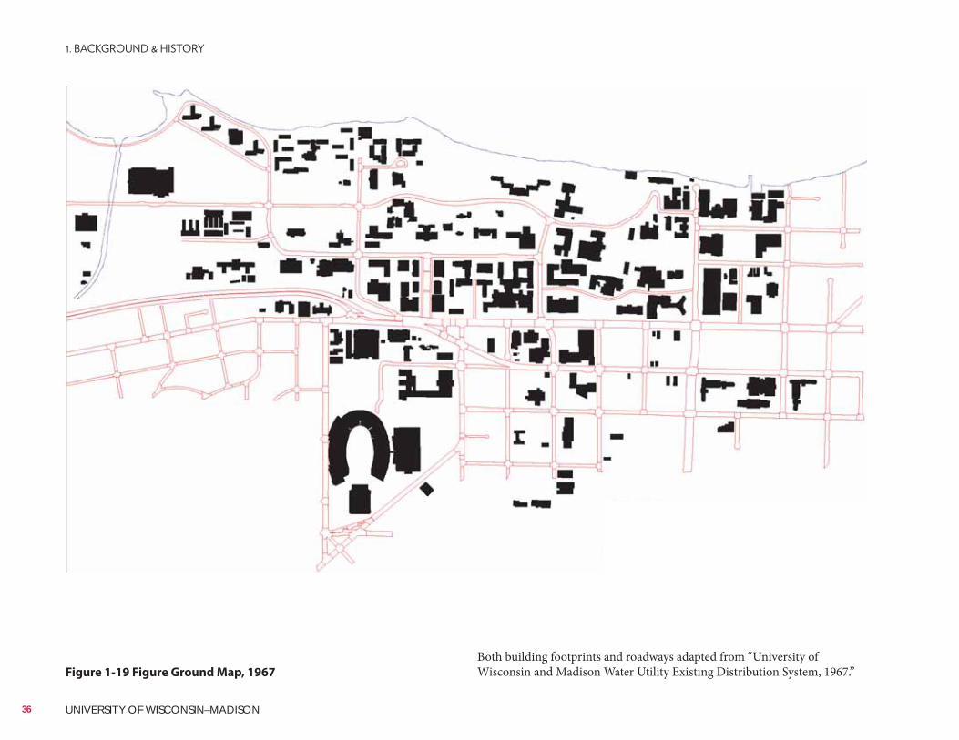
Figure 1-19 Figure Ground Map, 1967
Both building footprints and roadways adapted from “University of Wisconsin and Madison Water Utility Existing Distribution System, 1967.”
36 UNIVERSITY OF WISCONSIN–MADISON
University of Wisconsin Digital Collections
Figure 1-20 1959 Sketch Plan for the University of Wisconsin, UW Planning & Construction
37
The extensively detailed 1973 Campus Plan including the following planning efforts:• Increase density of building in the central campus and on the west campus
related to the Medical School and hospital.• Design new buildings and replace obsolete old buildings so as to facilitate
use by different departments and programs with a minimal amount of remodeling.
• Work toward reducing pedestrian-vehicular conflicts by locating facilities that need extensive vehicular access (medical center and athletic complexes) on the periphery of the campus.
• Maintain or increase pedestrian malls, natural areas, recreational land and green spaces across campus; protect from development the natural and park-like areas of John Muir Woods, Picnic Point and Camp Randall Memorial Park.
• Incorporate more public art, construct more pedestrian malls and other works of landscape architecture.
• Increase on-campus student housing from 7,550 beds to approximately 10,000 beds.
• Working with the city and local developers, increase near-campus private student housing.
• Increase available parking on campus from 6,800 to 13,500 spaces, creating more structured parking to reduce the number of acres devoted to surface parking from over 62 acres to around 40 acres; locate new parking on the fringe of the campus to reduce congestion and traffic including two large shuttle lots, one on the east and one on the west end of campus (each with 3,000 spaces).
• Close University Avenue from Lake Street on the east to Henry Mall on the west to provide a more pedestrian friendly campus; redirect vehicular traffic to Johnson Street and a proposed four-lane highway system via W. Dayton Street connecting back up to “old” University Avenue on the west and to E. Johnson Street on the east.
• Improve vehicular circulation around campus and possibly remove/relocate the existing railroad tracks that bisect the campus.
• Improve the campus transit system to serve remote parking areas and reduce on-campus vehicular traffic; work with the city to improve the regional and city-wide transit systems.
• On the south campus (south of W. Dayton Street) continue to work with the city to partner on redevelopment initiatives.
From 1979 to 1980, facilities staff updated the 1973 Campus Plan with a final plan being adopted by the Campus Planning Committee in September 1980. The primary focus of the 1980 Campus Plan centered on the South Campus area for which the City of Madison established a joint planning area with the university in 1979. Those efforts resulted in a land use plan being adopted by the Campus Planning Committee on January 17, 1980 and by the Madison Common Council in April 1980. Major conclusions of that plan and the 1980 Campus Development Plan include:• Undergraduate enrollments will continue to decline somewhat over the
next decade and then begin to increase again with little to no effect on campus facilities; research programs will continue to grow on campus.
• The building program for the next decade will focus on remodeling and upgrading existing facilities with selective new space to complement existing programs.
• The parking program has stabilized on campus at the existing level of approximately 10,000 spaces.
• Considerable emphasis will need to be placed on alternative modes of transportation to and from campus to accommodate user needs.
• The university continues its strong commitment to maintaining open space and preserving campus natural areas.
• The university will continue to work with the City of Madison and the private sector to resolve issues around the need for more and improved student housing close to campus; first step has been made in the jointly developed land use plan for the South Campus.
• The boundaries of the campus will not change dramatically from those approved in 1959; principal modifications will be in the South Campus area and in modest land acquisition to meet programmatic needs.
During the fall of 1980, the Campus Planning Committee, the Board of Regents and the State Building Commission adopted the 1980 Campus Development Plan. The major conclusions of that plan stated that enrollment would decline somewhat but would increase again in the mid-1990s. The plan focused on remodeling and upgrading existing facilities while adding selective space to complement existing programs. In order to accommodate the needs of the campus users, considerable emphasis was placed on alternative modes of transportation, including bus, car and van-pooling, bicycles and walking. The plan made a strong commitment to maintaining open space and did not make major recommendations in expanding the campus boundary over what was established in the 1959 Campus Plan. Principal boundary modifications
38 UNIVERSITY OF WISCONSIN–MADISON
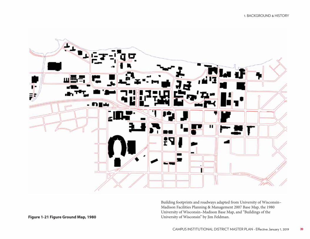
UW–Madison FP&M Archives
Figure 1-21 Figure Ground Map, 1980
Building footprints and roadways adapted from University of Wisconsin–Madison Facilities Planning & Management 2007 Base Map, the 1980 University of Wisconsin–Madison Base Map, and “Buildings of the University of Wisconsin” by Jim Feldman.
39
since that time were in the south campus area and along the rail corridor where a joint planning area was established with the City of Madison. Modest land acquisition was planned to meet programmatic needs.In 1982, a Campus Transportation Plan was adopted by the UW–Madison Parking and Transportation Board, the Campus Planning Committee and the Board of Regents of the UW System. The plan, based on several transportation surveys of faculty, staff and students, helped pave the way for future transportation planning initiatives and the campus’ leadership role in defining campus transportation solutions.In 1984, a series of campus master development plans were completed as part of an overall UW System effort to bring all of the campus master plans up-to-date and define the pressing need of facility improvements to the state legislature. A 2-year, 6-year and 10-year plan were developed, the latter two of which included extensive amounts of information pertinent to the anticipated program directions and corresponding future needs of the campus. All of these documents are available for review in the current offices of Facilities Planning & Management.These series of plans, outlined in 1984, included the following major themes:• Undergraduate enrollments were expected to dip somewhat in the 1980s
and begin to stabilize in the 1990s.• Minor changes in the campus plan boundary in the south campus area,
mainly for housing redevelopment; property acquisition within the boundary continued to occur based upon program needs.
• A number of improvements for bicycle and pedestrian enhancements were considered including the development of new bicycle routes and a series of overhead pedestrian bridges connecting much of the east campus to Bascom Hill.
• A comprehensive transportation planning effort was developed with Dane County.
• Parking supply was held at a steady state of 9,383 parking spaces for the campus realizing some parking will continue to be moved into parking structures to free up future space for development or new open space.
• Wherever possible, existing buildings would continue to be utilized for programmatic needs; in some instances buildings would need to be removed for better land use, or a replacement for a facility whose operational and on-going maintenance costs were unreasonable.
• Preservation of key historic buildings that possess a high degree of
architectural or historical integrity was identified as important to the campus community.
• A shortage of research and instructional program space was identified across campus as well as a shortage of service facilities.
• Affordable, private sector student housing in the campus area was seen as an issue forcing many students to reside further away from campus where rents were less expensive.
• Emphasis on upgrading and expanding utility systems (electrical, heating and cooling) were discussed.
• Energy conservation was a key component in all facilities planning efforts; stability and reliability of energy sources was seen as a concern.
Updates to the 1984 plans were completed in 1986 and 1988 with minor revisions along the way as part of the biennial capital budget process.The next major campus planning effort occurred in 1996, when Johnson, Johnson & Roy (JJR) was hired to develop a comprehensive campus master plan for UW–Madison, a first for the campus in many years. A new strategic plan had been developed for the campus by then Chancellor David Ward entitled “A Vision for the Future.” This plan identified priorities for the campus including a need to encourage unified interrelationships among the university’s highly specialized activities all while encouraging a common goal of increasing “community” and improving “learning environments” through well planned facilities. Campus facilities must be flexible and adaptable to changing circumstances and be easily changeable programmatically. The new campus physical master plan would provide a solid framework for organizing and enhancing the campus’ physical environment for the next 10-30 years as the university faced the challenges of the future.The major planning issues discussed include:• Enrollment will continue to be held stable under Board of Regent
Enrollment Management Initiatives at approximately 42,000 students.• The location of the Medical School and other health science related
facilities in relation to the hospital on the west campus.• Visitor reception is needed on the east campus.• Improved pedestrian linkages of the campus north-south and east-west
and improve transit service on campus.• Promote alternatives to single-occupancy vehicle travel modes to and
from campus.• Create a new major sports arena on the southeast campus.• Balance development with properly scaled open spaces.
40 UNIVERSITY OF WISCONSIN–MADISON
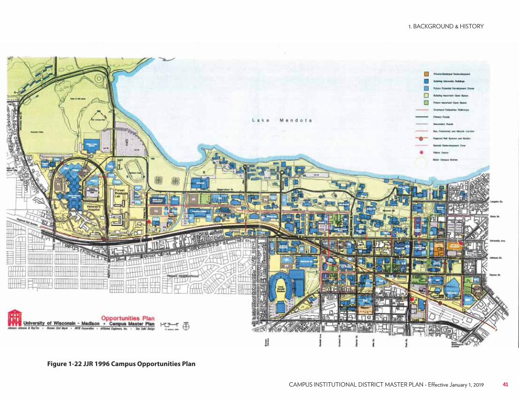
UW–Madison FP&M Archives
Figure 1-22 JJR 1996 Campus Opportunities Plan
41
• Protect and preserve the waterfront, sensitive environmental areas and open spaces.
• Eliminate vehicular conflicts and configure roads for efficient traffic flow; roadways were defined as “at capacity” with several upgrades to intersections and roadways planned with the City of Madison.
• Locate parking in close relationship to major campus destinations; add 2,500 spaces for parking on campus.
• Build relationships between the campus and surrounding community via improved visual gateways, edges and boundaries, etc..
• Respect adjacent neighborhoods.• Utility capacities were analyzed with 1.5 million gross square feet of
chilled water demand and 1.0 million gross square feet of steam demand found.
Development was projected to occur mainly on the south, west, and east edges of the campus where it ultimately did occur. The Medical School and School of Pharmacy consolidated into a Health Sciences Campus by moving from the center of campus and the old Medical Sciences Center out to the west campus near the UW Hospital. The 17,000-seat Kohl Center was built on the southeast campus to serve major athletic, university events and national tour concerts. The East Campus Mall (also known as Murray Mall as defined in the 1996 plan) came to fruition with the redevelopment in 2005 of two new residence halls and an office building on North Park Street. As new building development occurs along the former Murray Street corridor, each project is including the development of the north-south pedestrian mall to assure its completion from Regent Street on the south to Lake Mendota on the north. Parking has been increased from approximately 11,000 spaces on campus to 13,000 spaces bringing an increase in visitor parking along with a significant increase in Transportation Demand Management initiatives. The university has become the leader in providing options to single-occupancy vehicle trips to downtown Madison and the university.The 1996 Campus Master Plan identified 50 potential building sites across campus with an estimated growth of approximately 4.7 million gross square feet. In 1996, the campus had approximately 15.8 million gross square feet in existing buildings. Campus growth since 1986 was at a rate of about one million gross square feet per decade. The Campus Plan therefore suggested a growth rate of approximately three million gross square feet would last 30 years. By comparison, in 2005 the campus was at about 18.5 million gross square feet. Little did they know then that the university would witness
another era of major new building across the campus. Over 80% of the recommendations made in the 1996 Campus Plan were implemented and are seen today in the development of the many new buildings on the main campus.From 1996 to 2005, biennial capital building programs continued to be developed that started to implement the 1996 Plan. Each two years, a new Campus Physical Development Plan was updated and submitted as part of the capital budget process through the Campus Planning Committee, the Chancellor’s office, UW System Administration, the Board of Regents and eventually on to the Department of Administration to help provide support and background information on the proposed projects in each subsequent capital budget. Enrollment management continued keeping student enrollments around 40,000 students. Faculty and staff remained stable as well at approximately 19,000 individuals.In 1999, through a mandatory self-study as part of the campuswide 10-year reaccreditation process, “Targeting Tomorrow” was published identifying five strategic trends for the university: promote research, advance learning, accelerate internationalization, amplify the Wisconsin Idea, and nurture human resources. The university completed another national reaccreditation process that started in 2008.In an effort to facilitate approvals for new campus research facilities, especially related to the sciences, several capital funding initiatives were started. In the early 1990s, a new effort began with the State of Wisconsin and the university to jointly commit to funding major facility improvement initiatives. These funding initiatives allowed projects to occur on a more streamlined approach and solidified funding over a longer period of time for a number of projects.The projects included:• WiStar (1991-93 biennium): This $150 million program required a 50/50
match of private to state dollars and lasted for eight years focusing efforts on improving and upgrading biological and basic science facilities.
• HealthStar (1997-99 biennium): This $210 million program required a one-third General Fund Supported Borrowing to two-thirds Gift/Grant/Program Revenue Supported Borrowing split funding that lasted for six years focusing on the Medical School and Health Sciences facilities on the West Campus.
• BioStar (2001-03 biennium): This $317 million program required a 50/50 match of private to state dollars and lasted for 10 years and focused on new biological and interdisciplinary science facilities.
42 UNIVERSITY OF WISCONSIN–MADISON
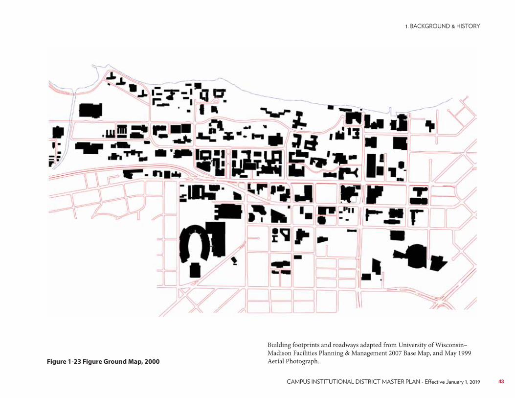
UW–Madison FP&M Archives
Figure 1-23 Figure Ground Map, 2000
Building footprints and roadways adapted from University of Wisconsin–Madison Facilities Planning & Management 2007 Base Map, and May 1999 Aerial Photograph.
43
The 1996 Campus Master Plan served the campus well into early 2005. Several recommendations were deemed unlikely to be forwarded due to changing campus priorities and planning circumstances beyond the control of the university (namely changing street use patterns and closing city streets south of University Avenue). In all, the 1996 Plan was successful in guiding 10 years of facilities development on the campus.As in any planning process, the horizon is never ending. It was clear in 2005 that the campus was going to continue to change and evolve, meeting new challenges and providing quality learning environments for future researchers, faculty, students and staff. It was time for a new facilities growth capacity plan for the 936-plus acres of the main UW–Madison campus.
44 UNIVERSITY OF WISCONSIN–MADISON
1.4 2005 Campus Master Plan Recreating Ourselves in Place”
As a result of the regents’ enrollment management efforts, the university’s enrollment was projected to remain at approximately 41,500 students (headcount), well into the future. Continued moderate growth would be seen in faculty and staff related to the university’s research engine, estimated to be approximately 2% per year. The 2005 Campus Master Plan addressed how to responsibly plan for growth without requiring significant land acquisition outside the current development plan boundary approved by the Board of Regents in 1996. It also provided recommendations for a responsible “carrying capacity” of the land, striving to balance the importance of open space to building space within the campus development plan boundary of the campus.Six major goals were identified as part of the 2005 Campus Master Plan process:Goal #1 – Sustainability
Protect, enhance and celebrate our lakeside setting. Develop sustainability guidelines using “green” building designs, materials and techniques. Reduce our impact on the land and better manage energy use. Investigate use of alternative fuels for heating plants and fleet vehicles.Goal #2 – Community, Academic and Research Connections
Promote the Wisconsin Idea by enhancing community connections. Define our borders and enliven streetscapes with more trees and more public gathering places. Make boundaries inviting and transparent. Enhance academic connections by replacing aging buildings, adding research space and improving the quality and quantity of academic facilities. Promote interdisciplinary learning and research with flexible new facilities.Goal #3 – Student Life
Renew a commitment to student life by renovating, rebuilding or restoring our unions and adding upgraded recreation facilities. Add on-campus housing space and continue to promote learning communities. Create new outdoor spaces for informal student gatherings.
Goal #4 – Buildings and Design Guidelines
Renew campus by removing obsolete buildings that cannot be renovated. Provide buildings with renewable designs and a planned life of at least 100 years. Preserve significant historic buildings. Define existing neighborhoods of design to ensure new buildings fit into their campus context. Develop comprehensive design guidelines to provide architectural coherence.Goal #5 – Open Space
Protect and enhance existing open spaces and create new gathering areas. Maintain lands in the Lakeshore Nature Preserve as natural areas that support our mission of teaching, research and outreach. Protect and enhance known historic cultural landscapes, quadrangles and courtyards.Goal #6 – Transportation and Utilities
Provide attractive options to driving alone. Maintain parking capacity. Provide more pedestrian areas, bicycle lanes, connected paths and bicycle commuter facilities. Plan for the future development of commuter rail and streetcars. Provide a reliable utility network to meet current and future demands.Four major components were identified to be studied in the 2005 Campus Master Plan, including:1. Buildings – Which buildings should remain and which are nearing the
end of their useful life? How much new space will be needed to support growth in the research engine of the campus? How can we decompress current research and teaching facilities to provide the outstanding types of facilities our faculty, staff and students require? What is the responsible building capacity of the currently developed land within the campus boundary? If we do not have enough land to meet our programmatic needs, while protecting important open spaces, will we need to develop a satellite campus outside of downtown Madison?
45
2. Open Space – What are the important green spaces on campus that need to be protected or enhanced? Can we add more usable open space if we remove buildings or surface parking lots and without purchasing additional land outside our existing approved boundary? Where can we create new courtyards and quadrangles in the more urbanized campus to provide outdoor gathering areas for passive use?
3. Transportation – How can we continue to maximize our progressive Transportation Demand Management (TDM) initiatives and continue to provide sustainable alternatives to driving alone to campus, all while maintaining our current 13,000 parking spaces? How can we have campus users make a positive choice to use an alternative form of transportation to, from and around campus? How can we improve our public transit system on campus and move people quickly and efficiently across campus without using their cars?
4. Utilities – What is the capacity of our utility systems to support current and future campus facilities? What utilities require improvements or expansion in order to meet our needs? What about alternative fuel sources and sustainability in our energy use and building design?
For all of these areas, existing components were analyzed; guidelines developed for the future, and sustainability issues were addressed.At the conclusion of the 2005 Campus Master Plan process, it was confirmed that indeed the campus had plenty of capacity to build up to an additional net 7 million gross square feet without having to significantly change the campus planning boundary or think about a satellite campus, as many universities have across the country. Surface parking lots, some 10% (90+ acres) of the campus land area in 2005, were suggested as the potential space to grow the campus facilities by consolidating surface parking into structured parking garages in key locations were needed most in the fabric of the campus landscape.Additionally, with a review of the then existing building stock, it was confirmed (and as projected) that many buildings built in the 1960’s and 1970’s were nearing the end of their useful life and a decision would have to be made on keeping them for renovation, remodeling and re-programming, or remove the buildings for future redevelopment. In the end, a combination of the two was recommended across the campus for buildings that critically needed upgrades.
Since the completion of the 2005 Campus Master Plan, and with the national economic challenges that started in 2008, overall campus construction and new capital projects, has slowed considerably compared to the redevelopment that occurred between 1996 and 2006. In 2015, the campus has only completed about 35% of the 2005 Campus Master Plan which suggests there is still adequate potential for future growth and redevelopment on the campus without significantly expanding our planning boundary.In 2009, the City of Madison approved their new municipal zoning code, last updated (created) in 1966. Included in the new form-based code was the development of a new “Campus-Institutional” (C-I) zoning district. With the approval of the new code, UW–Madison has the ability to have a comprehensive campus master plan approved by the city and codified by ordinance. The new C-I district requires the development of an approved campus master plan every 10 years. With the 10-year update in 2015-16 of the 2005 Campus Master Plan, the university is poised to have its first ever Campus Master Plan approved by the City of Madison.
46 UNIVERSITY OF WISCONSIN–MADISON
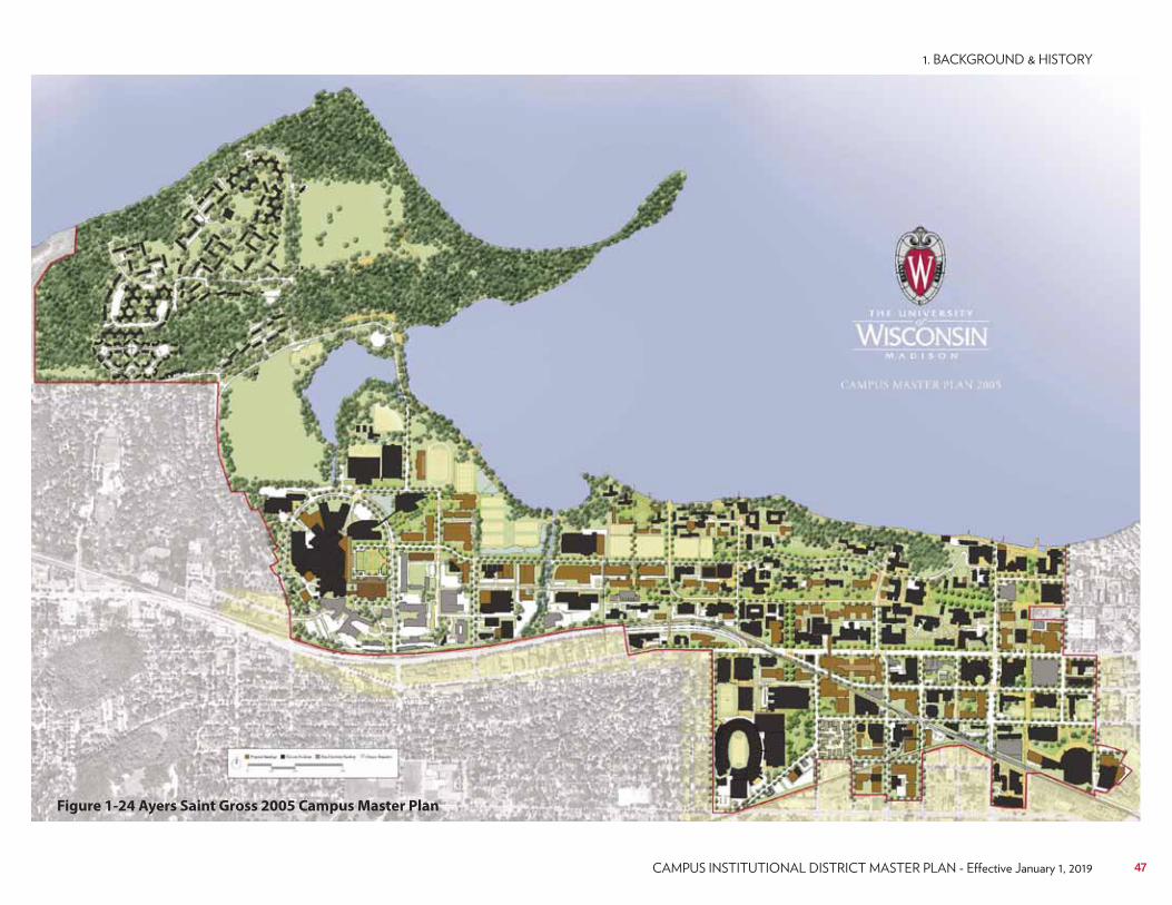
UW–Madison FP&M Archives
Figure 1-24 Ayers Saint Gross 2005 Campus Master Plan
47

48 UNIVERSITY OF WISCONSIN–MADISON
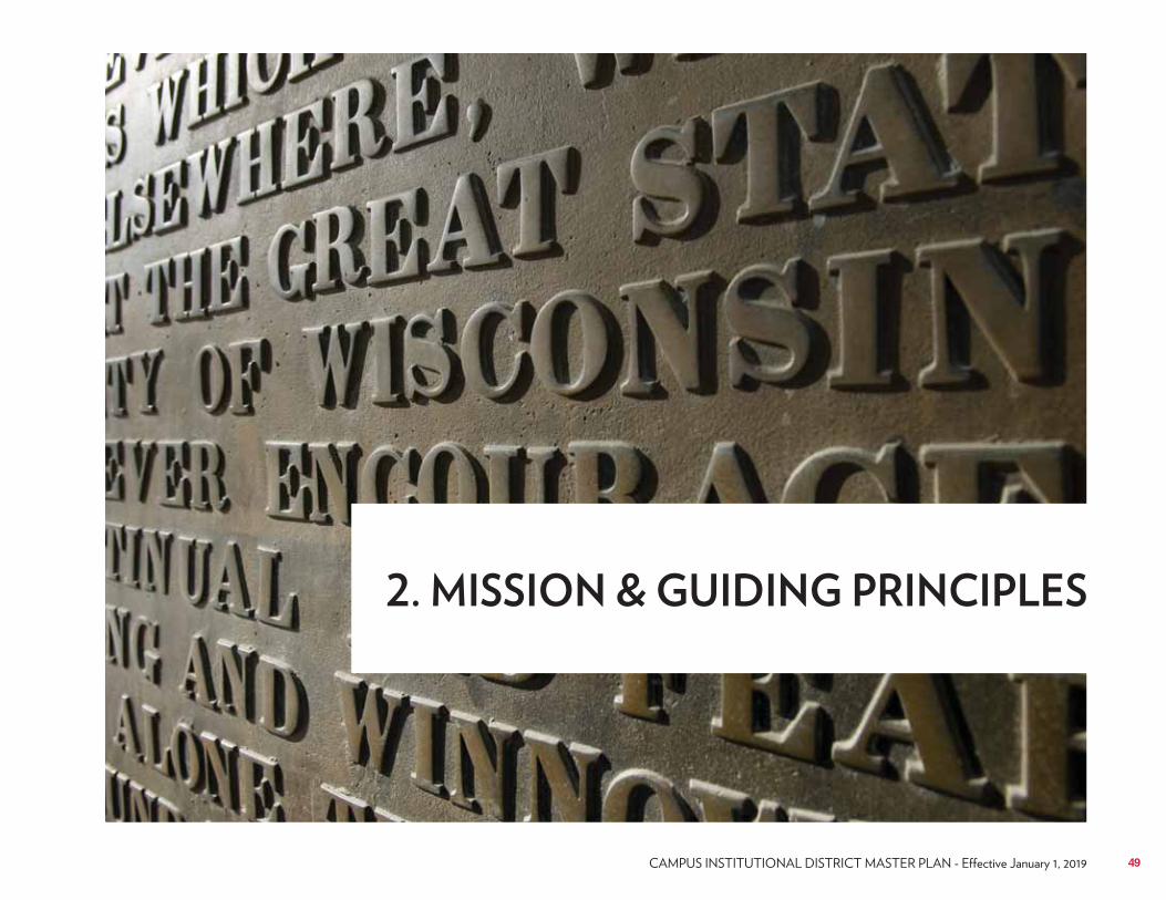
49
The primary purpose of UW–Madison is to provide a learning environment in which faculty, staff and students can discover, examine critically, preserve and transmit the knowledge, wisdom and values that will help ensure the survival of this and future generations and improve the quality of life for all. The university seeks to help students to develop an understanding and appreciation for the complex cultural and physical worlds in which they live and to realize their highest potential of intellectual, physical and human development.
It also seeks to attract and serve students from diverse social, economic and ethnic backgrounds and to be sensitive and responsive to those groups which have been underserved by higher education.1. Offer broad and balanced academic programs that are mutually
reinforcing and emphasize high quality and creative instruction at the undergraduate, graduate, professional and postgraduate levels.
2. Generate new knowledge through a broad array of scholarly, research and creative endeavors, which provide a foundation for dealing with the immediate and long-range needs of society.
3. Achieve leadership in each discipline; strengthen interdisciplinary studies, and pioneer new fields of learning.
4. Serve society through coordinated statewide outreach programs that meet continuing educational needs in accordance with the university’s designated land-grant status.
5. Participate extensively in statewide, national and international programs and encourage others in the University of Wisconsin System, at other educational institutions and in state, national and international organizations to seek benefit from the university’s unique educational resources, such as faculty and staff expertise, libraries, archives, museums and research facilities.
6. Strengthen cultural understanding through opportunities to study languages, cultures, the arts and the implications of social, political, economic and technological change and through encouragement of study, research and service off campus and abroad.
7. Maintain a level of excellence and standards in all programs that will give them statewide, national and international significance.
8. Embody, through its policies and programs, respect for, and commitment to, the ideals of a pluralistic, multiracial, open and democratic society.
2.1 University Mission, Vision, and Strategic Plan
50 UNIVERSITY OF WISCONSIN–MADISON
2.2 Coordination with the Campus Strategic Framework Plan
The current UW–Madison strategic framework plan, developed by the university in 2015, identifies five strategic priorities and initiatives, including:1. Educational Experience: The Wisconsin Experience describes what’s
unique about getting a degree from UW–Madison— together, we create and apply learning inside and outside the classroom to make the world a better place. UW–Madison produces graduates who are creative problem solvers, able to integrate empirical analysis and passion, seek out and create new knowledge and technologies, adapt to new situations, and engage as world citizens and leaders.
2. Research and Scholarship: Nurture excellence in research, scholarship, and creative activity across all divisions. Optimize the research and scholarship infrastructure of the university. Strengthen our influence in national decision-making around research policy and funding. Engage our interdisciplinary strength to generate creative solutions. Support the continued high level of integration of research and education.
3. The Wisconsin Idea: Partner with UW System schools, corporations, communities, and government to bring value to Wisconsin citizens. Promote economic development and job creation through our campus technology-transfer ecosystem, in partnership with the business and entrepreneurial communities. Extend our educational mission to Wisconsin and the world with new technology and partnerships. Leverage our distinctive interdisciplinary strength to address complex problems in the state and the world.
4. Our People: Ensure UW–Madison has a workforce that is highly talented, engaged, and diverse by implementing our new personnel/human resource system. Enhance the strength of our campus through diversity and inclusion by implementing the campus Diversity Framework. Ensure our ability to attract and retain talent by making progress toward competitive compensation relative to our peers and market medians. Nurture growth of our people through professional development and performance excellence. Create the best possible environment in which our people can carry out their responsibilities to the university.
5. Resource Stewardship: Promote resource stewardship, improve service delivery and efficiency, and ensure administrative capacity. Create a stable and sustainable financial structure through the implementation of a transformed budget model. Identify and pursue new revenue sources aligned with the institution’s mission and goals. Promote environmental sustainability through our own campus operations, integrated with research and education. Transform library structures and technologies to best support research and learning, and to attain campus efficiencies. Sponsor a comprehensive campaign to invest in the future of the university and the students, faculty, and staff who will shape the future of Wisconsin and the world.
Among the world’s leading universities, UW–Madison is distinctive in its scale and breadth, the premium we place on our relevance to society, and our commitment to inclusivity in the broadest sense. The combination of these attributes enables us to be fully equipped to address the complex problems facing the modern world.The strategic framework is designed to chart a course for 2015–2019 that will not only protect our legacy of research, teaching, and public service, but also will encourage new ideas from all corners of the campus and transform our state, nation, and world.This framework has evolved from a rigorous self-study conducted in 2009 during the university’s reaccreditation process. We experienced significant achievements in key priorities that served as the core of our 2009–2014 framework, and that very success convinced us to continue along this path as we begin the next five years. The priorities have been updated to build on our momentum and to take bold steps toward our vision.
51
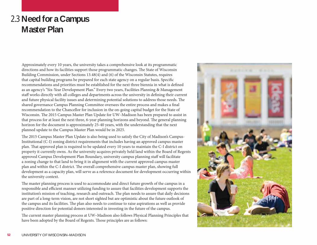
Approximately every 10 years, the university takes a comprehensive look at its programmatic directions and how its facilities support those programmatic changes. The State of Wisconsin Building Commission, under Sections 13.48(4) and (6) of the Wisconsin Statutes, requires that capital building programs be prepared for each state agency on a regular basis. Specific recommendations and priorities must be established for the next three biennia in what is defined as an agency’s “Six-Year Development Plan.” Every two years, Facilities Planning & Management staff works directly with all colleges and departments across the university in defining their current and future physical facility issues and determining potential solutions to address those needs. The shared governance Campus Planning Committee oversees the entire process and makes a final recommendation to the Chancellor for inclusion in the on-going capital budget for the State of Wisconsin. The 2015 Campus Master Plan Update for UW–Madison has been prepared to assist in that process for at least the next three, 6-year planning horizons and beyond. The general planning horizon for the document is approximately 25-40 years, with the understanding that the next planned update to the Campus Master Plan would be in 2025.The 2015 Campus Master Plan Update is also being used to satisfy the City of Madison’s Campus-Institutional (C-I) zoning district requirements that includes having an approved campus master plan. That approved plan is required to be updated every 10 years to maintain the C-I district on property it currently owns. As the university acquires privately held land within the Board of Regents approved Campus Development Plan Boundary, university campus planning staff will facilitate a zoning change to that land to bring it in alignment with the current approved campus master plan and within the C-I district. The overall comprehensive campus master plan, showing full development as a capacity plan, will serve as a reference document for development occurring within the university context. The master planning process is used to accommodate and direct future growth of the campus in a responsible and efficient manner utilizing funding to assure that facilities development supports the institution’s mission of teaching, research and outreach. The plan needs to assure that daily decisions are part of a long-term vision, are not short sighted but are optimistic about the future outlook of the campus and its facilities. The plan also needs to continue to raise aspirations as well as provide positive direction for potential donors interested in investing in the future of the campus.The current master planning process at UW–Madison also follows Physical Planning Principles that have been adopted by the Board of Regents. Those principles are as follows:
2.3 Need for a Campus Master Plan
52 UNIVERSITY OF WISCONSIN–MADISON
53
Our VisionThe University of Wisconsin–Madison (UW–Madison) will be a model public university in the 21st century, serving as a resource to the public, and working to enhance the quality of life in the state, the nation, and the world.The university will remain a preeminent center for discovery, learning, and engagement by opening new forms of access to citizens from every background; creating a welcoming, empowered, and inclusive community; and preparing current and future generations to live satisfying, useful, and ethical lives. In partnership with the state and with colleagues around the world, the university’s faculty, staff, and students will identify and address many of the state’s and the world’s most urgent and complex problems.
Guiding PrinciplesAs an institution and as individuals, we are guided by the following principles:• We promote the highest standards of intellectual inquiry and rigor, in keeping with
the university’s proven commitment to the “continual sifting and winnowing by which alone the truth can be found.”
• We support learning for its own sake, throughout our lives, as a service to the greater good.
• We fiercely defend intellectual freedom and combine it with responsibility and civility so that all who work and live on our campus can question, criticize, teach, learn, create, and grow.
• We observe the highest ethical integrity in everything we do.• We believe in the importance of working with and learning from those whose
backgrounds and views differ from our own.• We share the belief that neither origin nor economic background should be barriers
to participation in the community.• We are committed to being responsible stewards of our human, intellectual,
cultural, financial, and environmental resources.• We promote the application of research and teaching to issues of importance for the
state, the nation, and the world, and we place learning and discovery in the service of political, economic, social, and cultural progress.
The current campus physical master planning process aligns closely with the campus mission and strategic plan by creating a framework for upgrading research facilities and the utility infrastructure that serves them. The plan advances learning by planning facilities with life-long learning in mind; utilizing technology to its best advantage through appropriate facility improvements; and substantially upgrading the buildings that serve the arts and humanities.The plan reaches out not only to the Madison and Dane County communities, but to the entire Midwest and the world beyond. The plan seeks to improve wayfinding for our many visitors with better graphic wayfinding. It will amplify the Wisconsin Idea by promoting these community connections and making the campus boundaries more transparent and inviting. The plan will enhance academic connections by providing upgraded facilities that are flexible and promote interdisciplinary learning and research.The master planning process included a broad base group of representatives from across campus. Students, faculty and staff from every department and college have been involved as well as many members of the Madison community. The 2015 Campus Master Plan Update, as well as the Strategic Plan, is a result of shared values among the many campus users and provides a direction to guide future growth.
It is the policy of the Board of Regents that the following principles shall guide the physical planning and development of UW System institutions and stewardship of physical assets controlled by the Board of Regents.
Space needs;Image, identity, and aesthetics;
Open space;
Implementation; and
Ease of long-term maintenance and operation; and
A successful campus master plan needs to be consistent yet flexible and responsive to the needs of its time. It is an important baseline upon which to make day-to-day decisions over a longer period of time and to meet a consistent vision. The development of new facilities, and the preservation, renovation and maintenance of existing facilities, need to assure university and state decision-makers that funds allocated for facilities are in line with the campus mission. As the campus continues to rely on private dollars for more and more of its development, it is also clear that the 2015 Campus Master Plan Update will be used to keep aspirations high and help raise funds for new and exciting endeavors. The campus master plan must continue to always provide an optimistic vision for the future.
2.4 Physical Planning Principles, UW System Board of Regents
54 UNIVERSITY OF WISCONSIN–MADISON
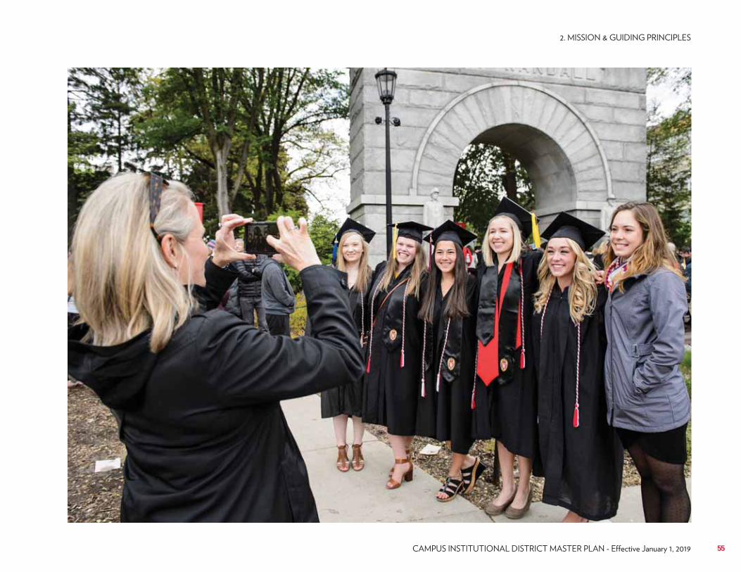
55
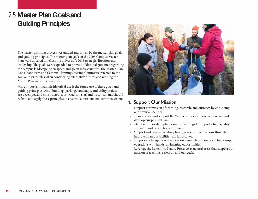
• Support our mission of teaching, research, and outreach by enhancing our physical identity.
• Demonstrate and support the Wisconsin Idea in how we perceive and develop our physical campus.
• Maintain/renovate/replace campus buildings to support a high quality academic and research environment.
• Support and create interdisciplinary academic connections through improved campus facilities and landscapes.
• Support the integration of education, research, and outreach into campus operations with hands-on learning opportunities.
• Leverage the Lakeshore Nature Preserve as natural areas that support our mission of teaching, research, and outreach.
2.5 Master Plan Goals and Guiding Principles
The master planning process was guided and driven by the master plan goals and guiding principles. The master plan goals of the 2005 Campus Master Plan were updated to reflect the university’s 2015 strategic direction and leadership. The goals were expanded to provide additional guidance regarding the campus landscape, open space, and green infrastructure. The Master Plan Consultant team and Campus Planning Steering Committee referred to the goals and principles when considering alternative futures and refining the Master Plan recommendations.More important than this historical use is the future use of these goals and guiding principles. As all building, parking, landscape, and utility projects are developed and constructed, UW–Madison staff and its consultants should refer to and apply these principles to ensure a consistent and common vision.
56 UNIVERSITY OF WISCONSIN–MADISON
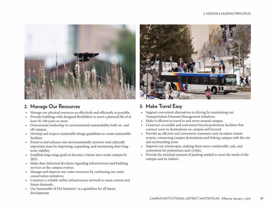
• Manage our physical resources as effectively and efficiently as possible.• Provide buildings with designed flexibilities to meet a planned life of at
least 50-100 years or more.• Demonstrate leadership in environmental sustainability both on- and
off-campus.• Develop and respect sustainable design guidelines to create sustainable
facilities.• Preserve and enhance our environmentally sensitive and culturally
important areas by improving, expanding, and monitoring their long-term viability.
• Establish long-range goals to become a future zero-waste campus by 2025.
• Make data-informed decisions regarding infrastructure and building services as the campus evolves.
• Manage and improve our water resources by continuing our water conservation initiatives.
• Construct a reliable utility infrastructure network to meet current and future demands.
• Use Sustainable SITES Initiative® as a guideline for all future development.
• Support convenient alternatives to driving by maximizing our Transportation Demand Management initiatives.
• Make it efficient to travel to and move around campus.• Construct accessible and convenient bicycle/pedestrian facilities that
connect users to destinations on campus and beyond.• Provide an efficient and convenient commuter and circulator transit
system, connecting campus destinations and linking campus with the city and surrounding areas.
• Improve our streetscapes, making them more comfortable, safe, and convenient for pedestrians and cyclists.
• Provide the minimal amount of parking needed to meet the needs of the campus and its visitors.
57
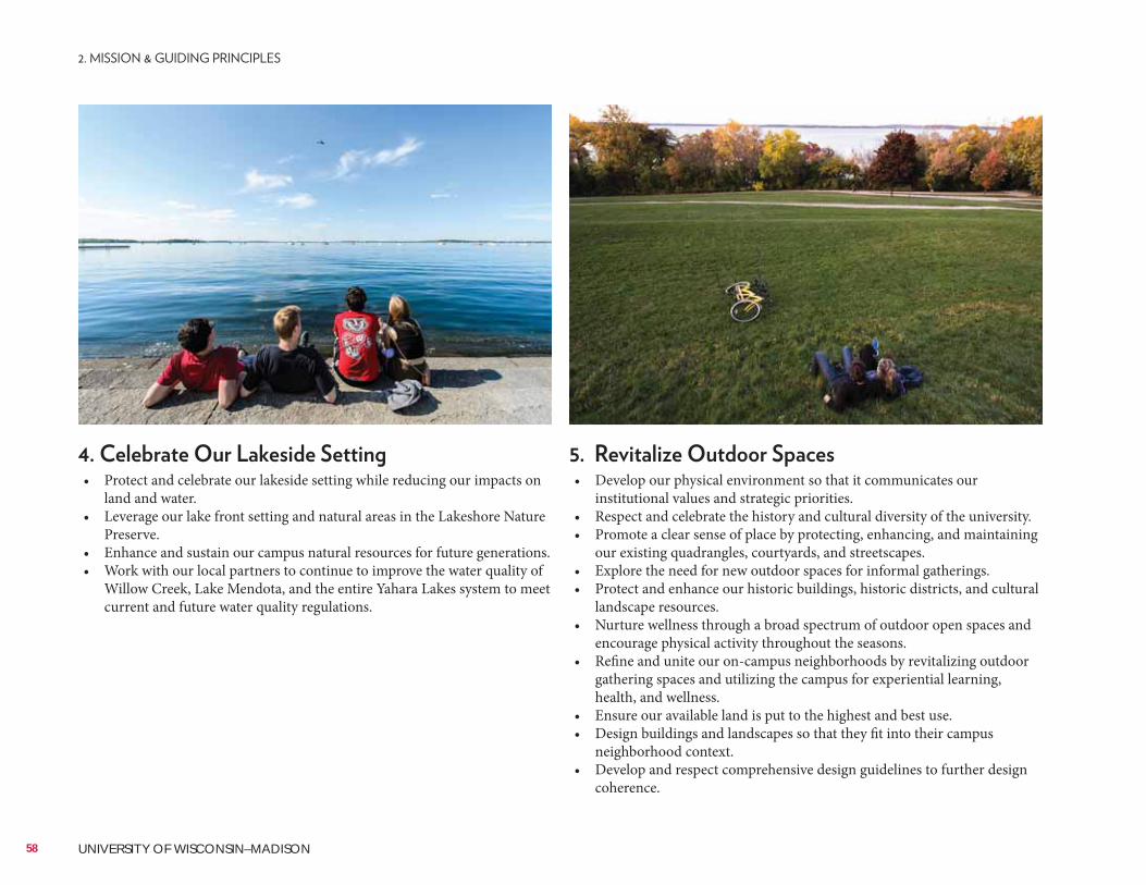
• Develop our physical environment so that it communicates our institutional values and strategic priorities.
• Respect and celebrate the history and cultural diversity of the university.• Promote a clear sense of place by protecting, enhancing, and maintaining
our existing quadrangles, courtyards, and streetscapes.• Explore the need for new outdoor spaces for informal gatherings.• Protect and enhance our historic buildings, historic districts, and cultural
landscape resources.• Nurture wellness through a broad spectrum of outdoor open spaces and
encourage physical activity throughout the seasons.• Refine and unite our on-campus neighborhoods by revitalizing outdoor
gathering spaces and utilizing the campus for experiential learning, health, and wellness.
• Ensure our available land is put to the highest and best use.• Design buildings and landscapes so that they fit into their campus
neighborhood context.• Develop and respect comprehensive design guidelines to further design
coherence.
• Protect and celebrate our lakeside setting while reducing our impacts on land and water.
• Leverage our lake front setting and natural areas in the Lakeshore Nature Preserve.
• Enhance and sustain our campus natural resources for future generations.• Work with our local partners to continue to improve the water quality of
Willow Creek, Lake Mendota, and the entire Yahara Lakes system to meet current and future water quality regulations.
58 UNIVERSITY OF WISCONSIN–MADISON
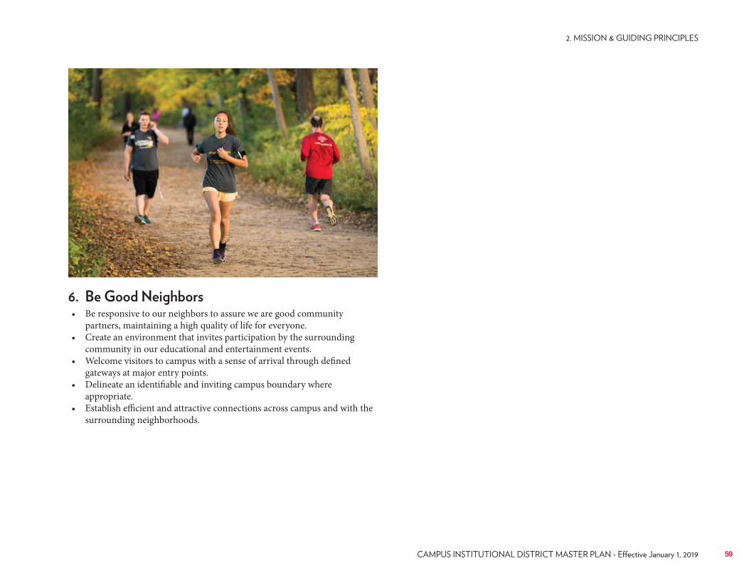
• Be responsive to our neighbors to assure we are good community partners, maintaining a high quality of life for everyone.
• Create an environment that invites participation by the surrounding community in our educational and entertainment events.
• Welcome visitors to campus with a sense of arrival through defined gateways at major entry points.
• Delineate an identifiable and inviting campus boundary where appropriate.
• Establish efficient and attractive connections across campus and with the surrounding neighborhoods.
59
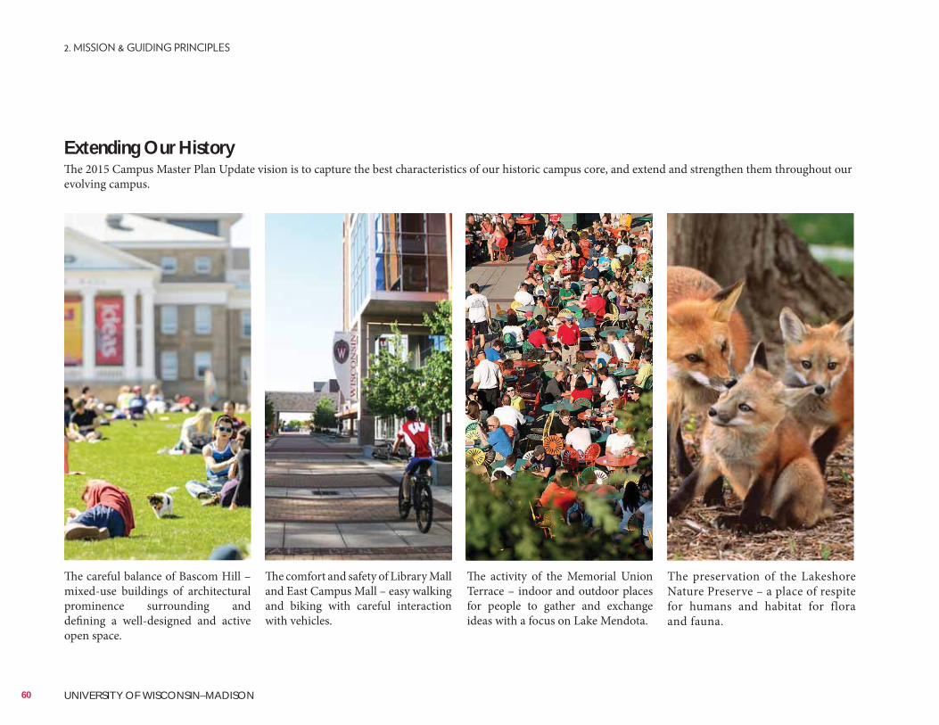
E. Arti Wulandari (rightmost)
SmithGroupJJR (second from left)
Extending Our HistoryThe 2015 Campus Master Plan Update vision is to capture the best characteristics of our historic campus core, and extend and strengthen them throughout our evolving campus.
The careful balance of Bascom Hill – mixed-use buildings of architectural prominence surrounding and defining a well-designed and active open space.
The comfort and safety of Library Mall and East Campus Mall – easy walking and biking with careful interaction with vehicles.
The activity of the Memorial Union Terrace – indoor and outdoor places for people to gather and exchange ideas with a focus on Lake Mendota.
The preservation of the Lakeshore Nature Preserve – a place of respite for humans and habitat for flora and fauna.
60 UNIVERSITY OF WISCONSIN–MADISON
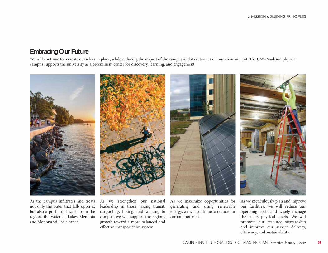
SmithGroupJJR (leftmost)
SmithGroupJJR (second from right)
Embracing Our FutureWe will continue to recreate ourselves in place, while reducing the impact of the campus and its activities on our environment. The UW–Madison physical campus supports the university as a preeminent center for discovery, learning, and engagement.
As the campus infiltrates and treats not only the water that falls upon it, but also a portion of water from the region, the water of Lakes Mendota and Monona will be cleaner.
As we strengthen our national leadership in those taking transit, carpooling, biking, and walking to campus, we will support the region’s growth toward a more balanced and effective transportation system.
As we maximize opportunities for generating and using renewable energy, we will continue to reduce our carbon footprint.
As we meticulously plan and improve our facilities, we will reduce our operating costs and wisely manage the state’s physical assets. We will promote our resource stewardship and improve our service delivery, efficiency, and sustainability.
61

62 UNIVERSITY OF WISCONSIN–MADISON
EXISTING CONDITIONS
63
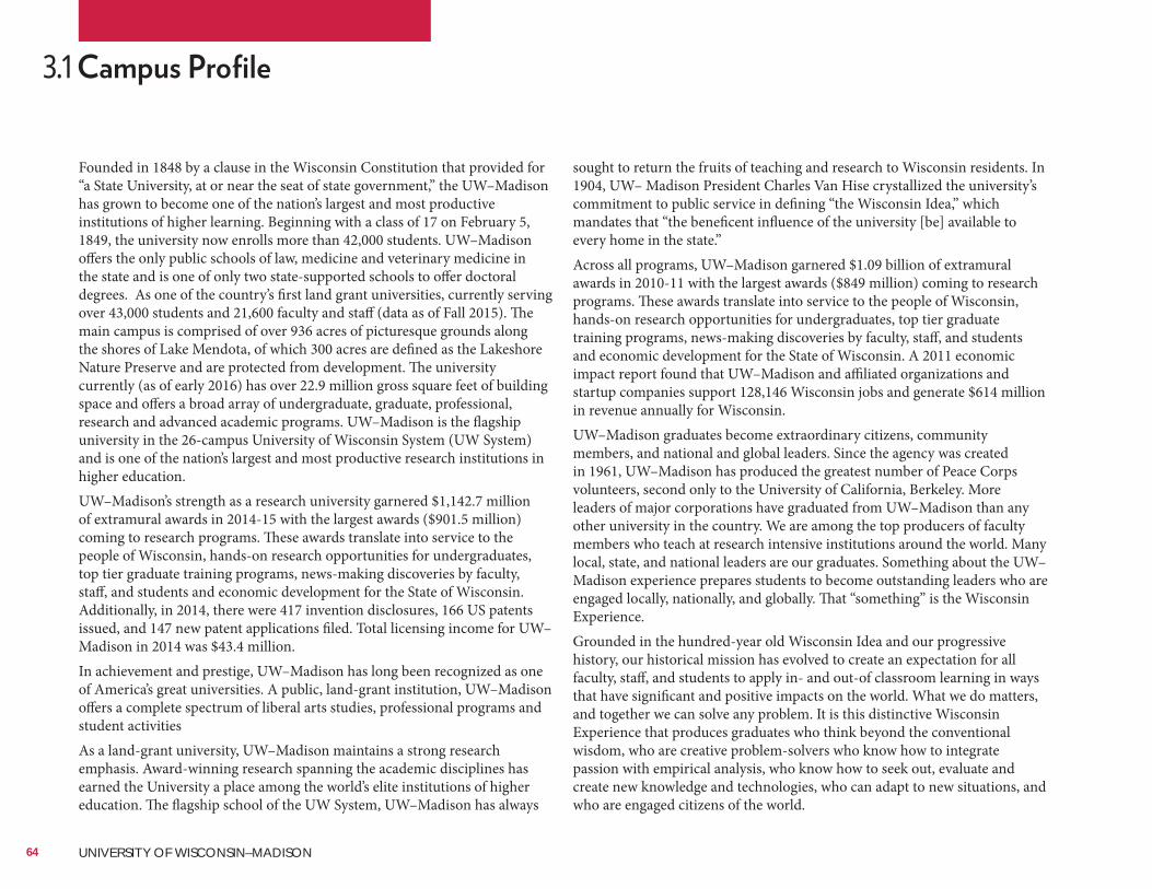
Founded in 1848 by a clause in the Wisconsin Constitution that provided for “a State University, at or near the seat of state government,” the UW–Madison has grown to become one of the nation’s largest and most productive institutions of higher learning. Beginning with a class of 17 on February 5, 1849, the university now enrolls more than 42,000 students. UW–Madison offers the only public schools of law, medicine and veterinary medicine in the state and is one of only two state-supported schools to offer doctoral degrees. As one of the country’s first land grant universities, currently serving over 43,000 students and 21,600 faculty and staff (data as of Fall 2015). The main campus is comprised of over 936 acres of picturesque grounds along the shores of Lake Mendota, of which 300 acres are defined as the Lakeshore Nature Preserve and are protected from development. The university currently (as of early 2016) has over 22.9 million gross square feet of building space and offers a broad array of undergraduate, graduate, professional, research and advanced academic programs. UW–Madison is the flagship university in the 26-campus University of Wisconsin System (UW System) and is one of the nation’s largest and most productive research institutions in higher education.UW–Madison’s strength as a research university garnered $1,142.7 million of extramural awards in 2014-15 with the largest awards ($901.5 million) coming to research programs. These awards translate into service to the people of Wisconsin, hands-on research opportunities for undergraduates, top tier graduate training programs, news-making discoveries by faculty, staff, and students and economic development for the State of Wisconsin. Additionally, in 2014, there were 417 invention disclosures, 166 US patents issued, and 147 new patent applications filed. Total licensing income for UW–Madison in 2014 was $43.4 million.In achievement and prestige, UW–Madison has long been recognized as one of America’s great universities. A public, land-grant institution, UW–Madison offers a complete spectrum of liberal arts studies, professional programs and student activitiesAs a land-grant university, UW–Madison maintains a strong research emphasis. Award-winning research spanning the academic disciplines has earned the University a place among the world’s elite institutions of higher education. The flagship school of the UW System, UW–Madison has always
3.1
sought to return the fruits of teaching and research to Wisconsin residents. In 1904, UW– Madison President Charles Van Hise crystallized the university’s commitment to public service in defining “the Wisconsin Idea,” which mandates that “the beneficent influence of the university [be] available to every home in the state.”Across all programs, UW–Madison garnered $1.09 billion of extramural awards in 2010-11 with the largest awards ($849 million) coming to research programs. These awards translate into service to the people of Wisconsin, hands-on research opportunities for undergraduates, top tier graduate training programs, news-making discoveries by faculty, staff, and students and economic development for the State of Wisconsin. A 2011 economic impact report found that UW–Madison and affiliated organizations and startup companies support 128,146 Wisconsin jobs and generate $614 million in revenue annually for Wisconsin.UW–Madison graduates become extraordinary citizens, community members, and national and global leaders. Since the agency was created in 1961, UW–Madison has produced the greatest number of Peace Corps volunteers, second only to the University of California, Berkeley. More leaders of major corporations have graduated from UW–Madison than any other university in the country. We are among the top producers of faculty members who teach at research intensive institutions around the world. Many local, state, and national leaders are our graduates. Something about the UW–Madison experience prepares students to become outstanding leaders who are engaged locally, nationally, and globally. That “something” is the Wisconsin Experience.Grounded in the hundred-year old Wisconsin Idea and our progressive history, our historical mission has evolved to create an expectation for all faculty, staff, and students to apply in- and out-of classroom learning in ways that have significant and positive impacts on the world. What we do matters, and together we can solve any problem. It is this distinctive Wisconsin Experience that produces graduates who think beyond the conventional wisdom, who are creative problem-solvers who know how to integrate passion with empirical analysis, who know how to seek out, evaluate and create new knowledge and technologies, who can adapt to new situations, and who are engaged citizens of the world.
64 UNIVERSITY OF WISCONSIN–MADISON
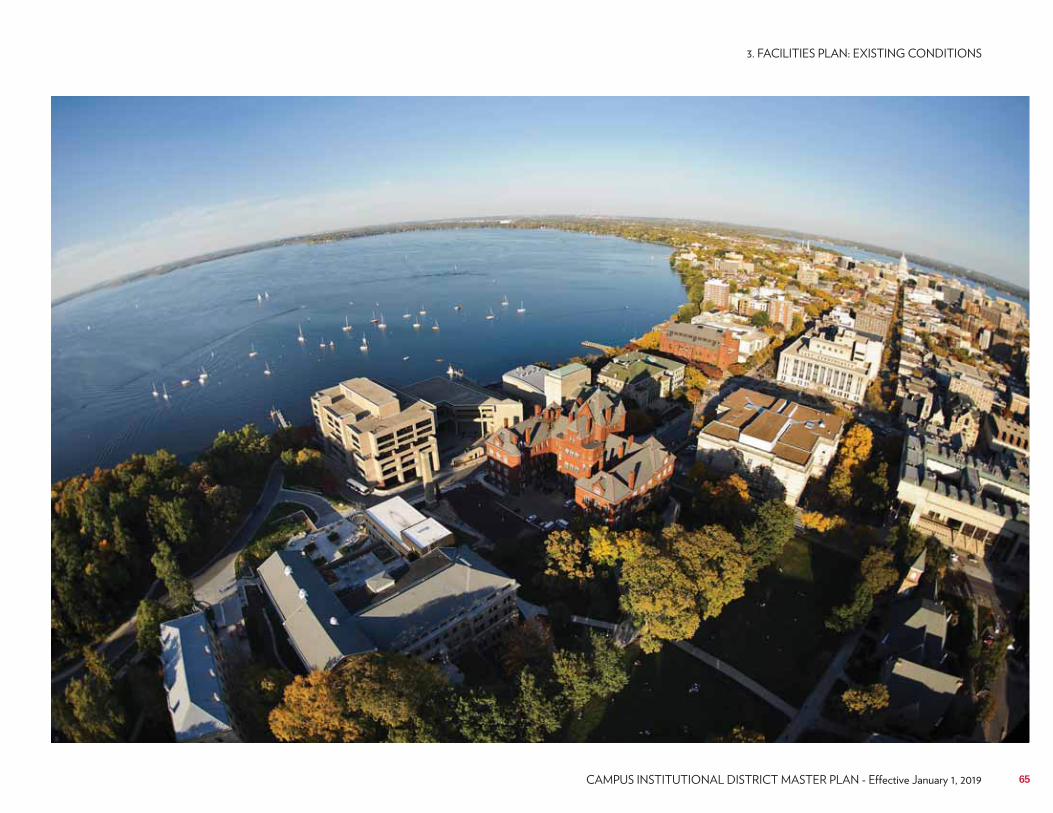
65
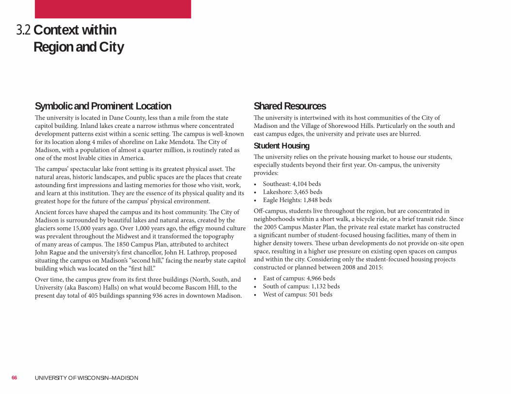
3.2 Context within Region and City
Symbolic and Prominent LocationThe university is located in Dane County, less than a mile from the state capitol building. Inland lakes create a narrow isthmus where concentrated development patterns exist within a scenic setting. The campus is well-known for its location along 4 miles of shoreline on Lake Mendota. The City of Madison, with a population of almost a quarter million, is routinely rated as one of the most livable cities in America.The campus’ spectacular lake front setting is its greatest physical asset. The natural areas, historic landscapes, and public spaces are the places that create astounding first impressions and lasting memories for those who visit, work, and learn at this institution. They are the essence of its physical quality and its greatest hope for the future of the campus’ physical environment.Ancient forces have shaped the campus and its host community. The City of Madison is surrounded by beautiful lakes and natural areas, created by the glaciers some 15,000 years ago. Over 1,000 years ago, the effigy mound culture was prevalent throughout the Midwest and it transformed the topography of many areas of campus. The 1850 Campus Plan, attributed to architect John Rague and the university’s first chancellor, John H. Lathrop, proposed situating the campus on Madison’s “second hill,” facing the nearby state capitol building which was located on the “first hill.”Over time, the campus grew from its first three buildings (North, South, and University (aka Bascom) Halls) on what would become Bascom Hill, to the present day total of 405 buildings spanning 936 acres in downtown Madison.
Shared ResourcesThe university is intertwined with its host communities of the City of Madison and the Village of Shorewood Hills. Particularly on the south and east campus edges, the university and private uses are blurred.
Student HousingThe university relies on the private housing market to house our students, especially students beyond their first year. On-campus, the university provides:• Southeast: 4,104 beds• Lakeshore: 3,465 beds• Eagle Heights: 1,848 bedsOff-campus, students live throughout the region, but are concentrated in neighborhoods within a short walk, a bicycle ride, or a brief transit ride. Since the 2005 Campus Master Plan, the private real estate market has constructed a significant number of student-focused housing facilities, many of them in higher density towers. These urban developments do not provide on-site open space, resulting in a higher use pressure on existing open spaces on campus and within the city. Considering only the student-focused housing projects constructed or planned between 2008 and 2015:• East of campus: 4,966 beds• South of campus: 1,132 beds• West of campus: 501 beds
66 UNIVERSITY OF WISCONSIN–MADISON
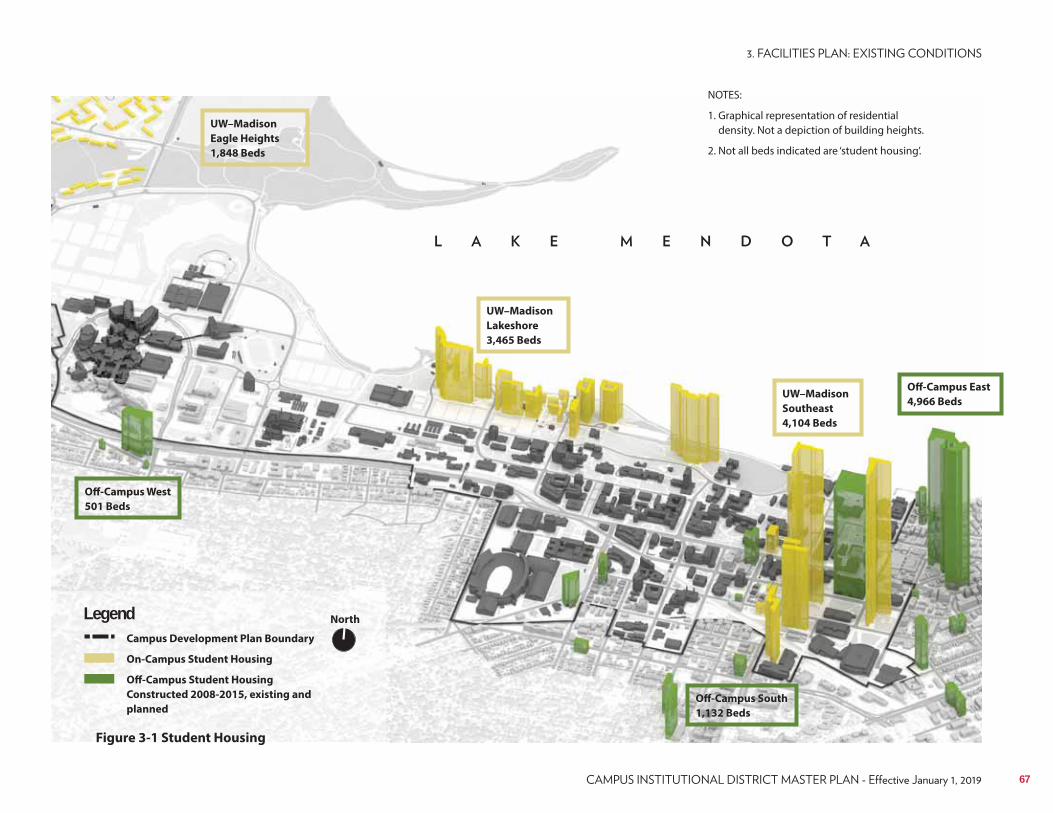
North
Campus Development Plan Boundary
On-Campus Student Housing
Off-Campus Student Housing
Constructed 2008-2015, existing and
planned
Figure 3-1 Student Housing
Legend
NOTES:
1. Graphical representation of residential density. Not a depiction of building heights.
2. Not all beds indicated are ‘student housing’.
UW–Madison
Lakeshore
3,465 Beds
UW–Madison
Eagle Heights
1,848 Beds
UW–Madison
Southeast
4,104 Beds
Off-Campus West
501 Beds
Off-Campus South
1,132 Beds
Off-Campus East
4,966 Beds
67
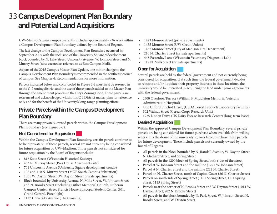
3.3 Campus Development Plan Boundary and Potential Land AcquisitionsUW–Madison’s main campus currently includes approximately 936 acres within a Campus Development Plan Boundary defined by the Board of Regents.The last change to the Campus Development Plan Boundary occurred in September 2005 with the inclusion of the University Square redevelopment block bounded by N. Lake Street, University Avenue, W. Johnson Street and N. Murray Street (now vacated as referred to as East Campus Mall).As part of the 2015 Campus Master Plan Update, one minor change to the Campus Development Plan Boundary is recommended in the southeast corner of campus. See Chapter 4: Recommendations for more information.Parcels indicated below and color coded in Figure 3-2 must first be rezoned in to the C-I zoning district and the use of those parcels added to the Master Plan through the amendment process in the City’s Zoning Code. These parcels are referenced and acknowledged within this C-I District master plan for reference only and for the benefit of the University’s long-range planning efforts.
Open for AcquisitionSeveral parcels are held by the federal government and not currently being considered for acquisition. If at such time the federal government decides to relocate and/or liquidate their property interests in these locations, the university would be interested in acquiring the land under prior agreements with the federal government.• 2500 Overlook Terrace (William F. Middleton Memorial Veterans
Administration Hospital)• One Gifford Pinchot Drive, (USDA Forest Products Laboratory facilities)• 502 Walnut Street (Cereal Crops Research Unit)• 1925 Linden Drive (US Dairy Forage Research Center) (long-term lease)
Desired AcquisitionWithin the approved Campus Development Plan Boundary, several private parcels are being considered for future purchase when available from willing sellers. It is the desire of the university to, over time, purchase these parcels for future development. These include parcels not currently owned by the Board of Regents.• All parcels in the block bounded by N. Randall Avenue, W. Dayton Street,
N. Orchard Street, and Spring Street• All parcels in the 1200 block of Spring Street, both sides of the street• Parcel at W. Johnson Street and the rail line (1221 W. Johnson Street)• Parcel at N. Charter Street and the rail line (222 N. Charter Street)• Parcel on N. Charter Street, north of Capitol Court (26 N. Charter Street)• Parcels on south side of Spring Street (1101 Spring Street, 1111 Spring
Street, 1115 Spring Street)• Parcels near the corner of N. Brooks Street and W. Dayton Street (1014 W.
Dayton Street, 202 N. Brooks Street)• All parcels in the block bounded by N. Park Street, W. Johnson Street, N.
Brooks Street, and W. Dayton Street
Private Parcels within the Campus Development Plan BoundaryThere are many privately-owned parcels within the Campus Development Plan Boundary (see Figure 3-2).
Not Considered for AcquisitionWithin the Campus Development Plan Boundary, certain parcels continue to be held privately. Of those parcels, several are not currently being considered for future acquisition by UW–Madison. Those parcels not considered for future acquisition by the Board of Regents include:• 816 State Street (Wisconsin Historical Society)• 433 N. Murray Street (Pres House Apartments site)• 701 University Avenue (University Square development-condo)• 108 and 110 N. Murray Street (MGE South Campus Substation)• 1001 W. Dayton Street (W. Dayton Street private apartments)• Block bounded by University Avenue, N. Mills Street, W. Johnson Street
and N. Brooks Street (including Luther Memorial Church/Lutheran Campus Center, Street Francis House Episcopal Student Center, X01, Grand Central, Porchlight)
• 1127 University Avenue (The Crossing)
• 1423 Monroe Street (private apartments)• 1435 Monroe Street (UW Credit Union)• 1437 Monroe Street (City of Madison Fire Department)• 210 N. Charter Street (private apartments)• 445 Easterday Lane (Wisconsin Veterinary Diagnostic Lab)• 112 N. Mills Street (private apartments)
68 UNIVERSITY OF WISCONSIN–MADISON
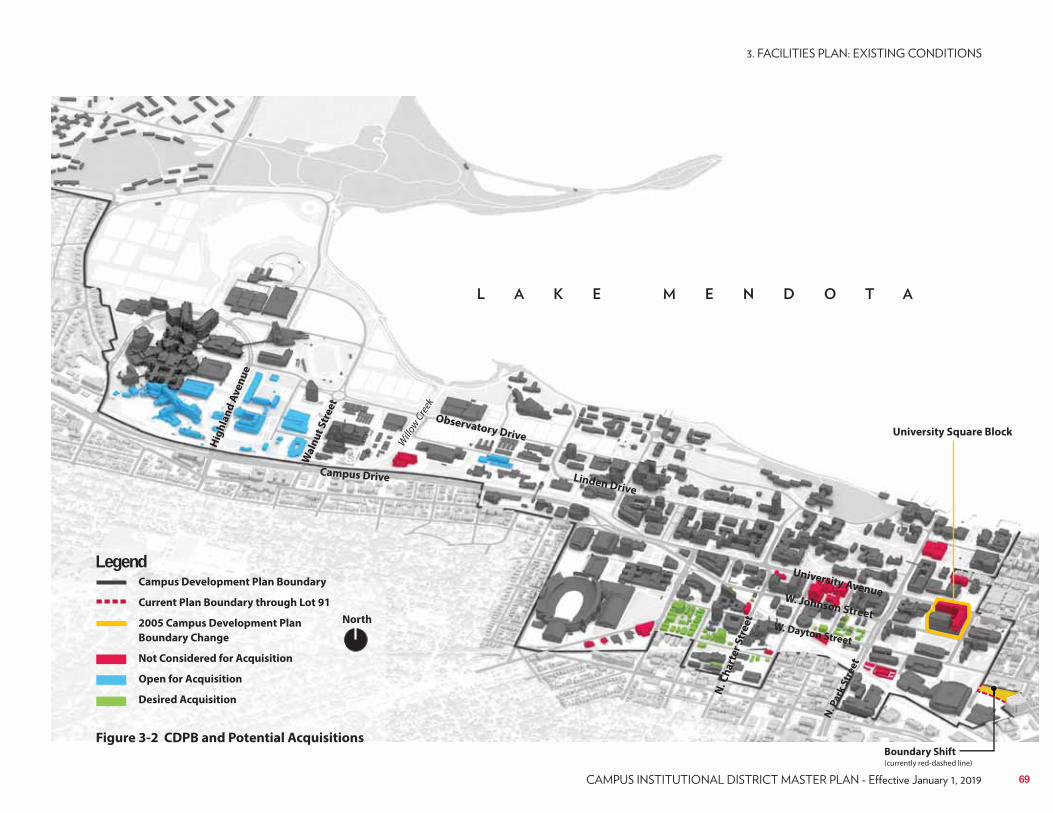
University Square Block
North
Campus Development Plan Boundary
Current Plan Boundary through Lot 91
2005 Campus Development Plan
Boundary Change
Not Considered for Acquisition
Open for Acquisition
Desired Acquisition
Legend
Figure 3-2 CDPB and Potential Acquisitions
Campus Drive
Observatory Drive
N. C
ha
rte
r S
tre
et
N. P
ark
Str
ee
t
University Avenue
Linden Drive
W. Dayton Street
Wa
lnu
t S
tre
et
Willo
w Cre
ek
W. Johnson Street
Hig
hla
nd
Av
en
ue
Boundary Shift(currently red-dashed line)
69
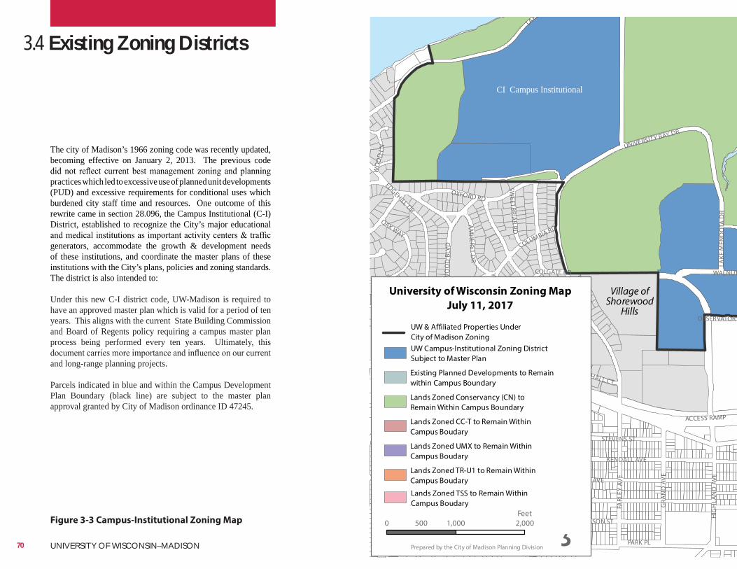
REGENT ST
BLUFF ST
HARVEY ST
HIG
HLA
ND
AVE
STEVENS ST
LAKE
KENDALL AVE
OXFORD RD
UNIVERSITY BAY DR
MASON ST
FARL
EY A
VE
EDGEHILL DR
COLUMBIA RD
EUG
ENIA
AV
E
GRA
ND
AV
E
N OWEN DR
CHAMBERLAIN AVE
RID
GE
ST
N
BLA
CKH
AW
K A
VE N
FR
AN
KLIN
AVE
VAN HISE AVE
SHO
REW
OO
D B
LVD
WALNUT
ACCESS RAMP
MARSHALL CT
AM
HERST D
R
LOCUST DR
OAK WAY
HARVARD DR
COLGATE RD
TALLYHO LN
PARK PL
TOPPING RD
HIL
L ST
WO
OD
LN
SHEP
ARD
TER
YALE RD
PURDUE ST
MC KINLEY ST
SWEETBRIA
R RD
CORN
ELL
CT
SCH
MIT
T PL
LAKE
MEN
DO
TA D
R
STEVENS ST
OBSERVATORY
Village ofShorewood
Hills
¸Prepared by the City of Madison Planning Division
University of Wisconsin Zoning Map
July 11, 2017
0 1,000 2,000500Feet
Existing Planned Developments to Remainwithin Campus Boundary
Lands Zoned CC-T to Remain WithinCampus Boudary
Lands Zoned Conservancy (CN) to Remain Within Campus Boundary
Lands Zoned UMX to Remain WithinCampus Boudary
Lands Zoned TR-U1 to Remain WithinCampus Boudary
UW Campus-Institutional Zoning DistrictSubject to Master Plan
UW & Affiliated Properties UnderCity of Madison Zoning
Lands Zoned TSS to Remain WithinCampus Boudary
Figure 3-3 Campus-Institutional Zoning Map
3.4 Existing Zoning Districts
The city of Madison’s 1966 zoning code was recently updated, becoming effective on January 2, 2013. The previous code
practices which led to excessive use of planned unit developments (PUD) and excessive requirements for conditional uses which burdened city staff time and resources. One outcome of this rewrite came in section 28.096, the Campus Institutional (C-I) District, established to recognize the City’s major educational
generators, accommodate the growth & development needs of these institutions, and coordinate the master plans of these institutions with the City’s plans, policies and zoning standards. The district is also intended to: Under this new C-I district code, UW-Madison is required to have an approved master plan which is valid for a period of ten years. This aligns with the current State Building Commission and Board of Regents policy requiring a campus master plan process being performed every ten years. Ultimately, this
and long-range planning projects.
Parcels indicated in blue and within the Campus Development Plan Boundary (black line) are subject to the master plan approval granted by City of Madison ordinance ID 47245.
CI Campus Institutional
70 UNIVERSITY OF WISCONSIN–MADISON
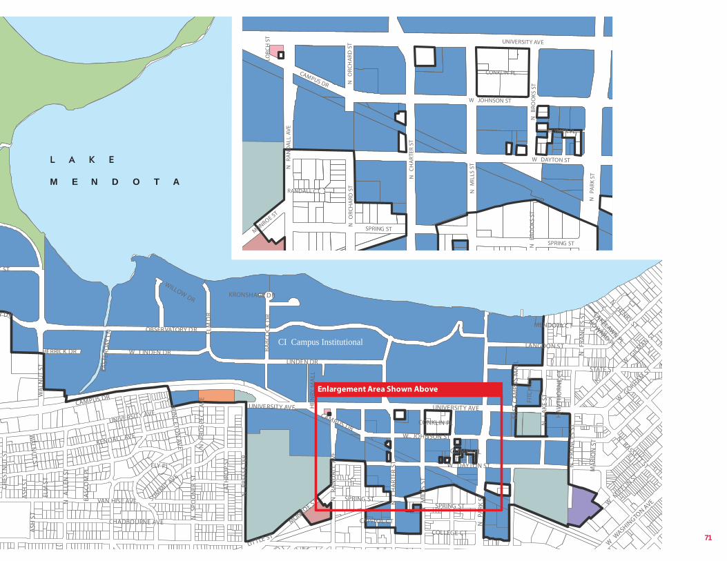
UNIVERSITY AVE CAMPUS DR
OBSERVATORY DR
W DAYTON ST
N
PARK
ST
W JOHNSON ST
LINDEN DR
LANGDON ST
N
CH
ART
ER S
T
N
LAKE
ST
STATE ST
N
MIL
LS S
T
CHADBOURNE AVE
LATH
ROP
ST
N
BREE
SE T
ER
N
ALL
EN S
T
W G
ILMAN ST
BABC
OC
K D
R
SPRING ST
N
FRA
NC
ES S
T
SUMMIT AVE
MONROE ST
T ST
N
RAN
DA
LL A
VE
ELM
DR
W LINDEN DR
N
PRO
SPEC
T AV
E
N HENRY ST
N BASSETT ST
N
SPO
ON
ER S
T
W M
IFFLIN ST
W G
ORHAM ST
WILLOW DR
CHES
TNU
T ST
COLLEGE CT FI
TCH
CT
W W
ASHINGTO
N AVE
ELM
ST
HERRICK DR
ELY PL
ASH
ST
BASC
OM
PL
LITTLE ST
UNIVERSITY AVE
EAST
ERD
AY L
N
CLYMER PL
HOWARD PL
PRINC
ETON
AVE
CONKLIN PL
CAPITOL CT
MA
RIO
N S
T
HA
WTH
ORN
E C
T
EAST
CA
MPU
S M
ALL
LAKELAWN PL
HEN
RY M
ALL
KRONSHAGE DR
MENDOTA CT
N
FRA
NC
ES S
T
KENDALL AVE
CAMPUS DR WA
LNU
T ST
VAN HISE AVE SPRING ST
UNIVERSITY AVE
Y DR
WA
LNU
T ST
A
SH S
T
W DAYTON ST
N
PARK
ST
N
MIL
LS S
T
SPRING ST
N
CH
ART
ER S
T
N
RAN
DA
LL A
VE
CLYMER PL
MONROE ST
N
BRO
OKS
ST
RANDALL CT
N
BR
SPRING ST
N
ORC
HA
RD S
T
Enlargement Area Shown Above
UNIVERSITY AVE
W DAYTON ST
N
PARK
ST
N
MIL
LS S
T
SPRING ST
W JOHNSON ST
N
CH
ART
ER S
T
N
RAN
DA
LL A
VE
CAMPUS DR
CLYMER PL
CONKLIN PL
MONROE ST
N
BRO
OKS
ST
N
ORC
HA
RD S
T
RANDALL CT
LORC
H S
T
N
BRO
OKS
ST
SPRING ST
N
ORC
HA
RD S
T M E N D O T A
CI Campus Institutional
71
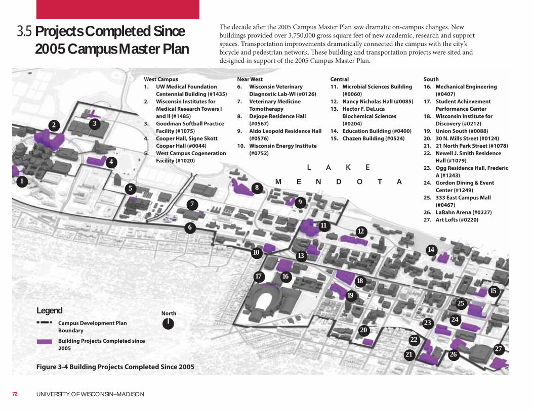
The decade after the 2005 Campus Master Plan saw dramatic on-campus changes. New buildings provided over 3,750,000 gross square feet of new academic, research and support spaces. Transportation improvements dramatically connected the campus with the city’s bicycle and pedestrian network. These building and transportation projects were sited and designed in support of the 2005 Campus Master Plan.
3.5 Projects Completed Since 2005 Campus Master Plan
West Campus
1. UW Medical Foundation
Centennial Building (#1435)
2. Wisconsin Institutes for
Medical Research Towers I
and II (#1485)
3. Goodman Softball Practice
Facility (#1075)
4. Cooper Hall, Signe Skott
Cooper Hall (#0044)
5. West Campus Cogeneration
Facility (#1020)
Near West
6. Wisconsin Veterinary
Diagnostic Lab-WI (#0126)
7. Veterinary Medicine
Tomotherapy
8. Dejope Residence Hall
(#0567)
9. Aldo Leopold Residence Hall
(#0576)
10. Wisconsin Energy Institute
(#0752)
Central
11. Microbial Sciences Building
(#0060)
12. Nancy Nicholas Hall (#0085)
13. Hector F. DeLuca
Biochemical Sciences
(#0204)
14. Education Building (#0400)
15. Chazen Building (#0524)
South
16. Mechanical Engineering
(#0407)
17. Student Achievement
Performance Center
18. Wisconsin Institute for
Discovery (#0212)
19. Union South (#0088)
20. 30 N. Mills Street (#0124)
21. 21 North Park Street (#1078)
22. Newell J. Smith Residence
Hall (#1079)
23. Ogg Residence Hall, Frederic
A (#1243)
24. Gordon Dining & Event
Center (#1249)
25. 333 East Campus Mall
(#0467)
26. LaBahn Arena (#0227)
27. Art Lofts (#0220)
NorthLegend
Figure 3-4 Building Projects Completed Since 2005
Campus Development Plan
Boundary
Building Projects Completed since
2005
1
2 3
4
5
6
7
8
9
10
1112
1314
15
161718
19
20
21
22
23 24
25
2627
M E N D O T A
72 UNIVERSITY OF WISCONSIN–MADISON
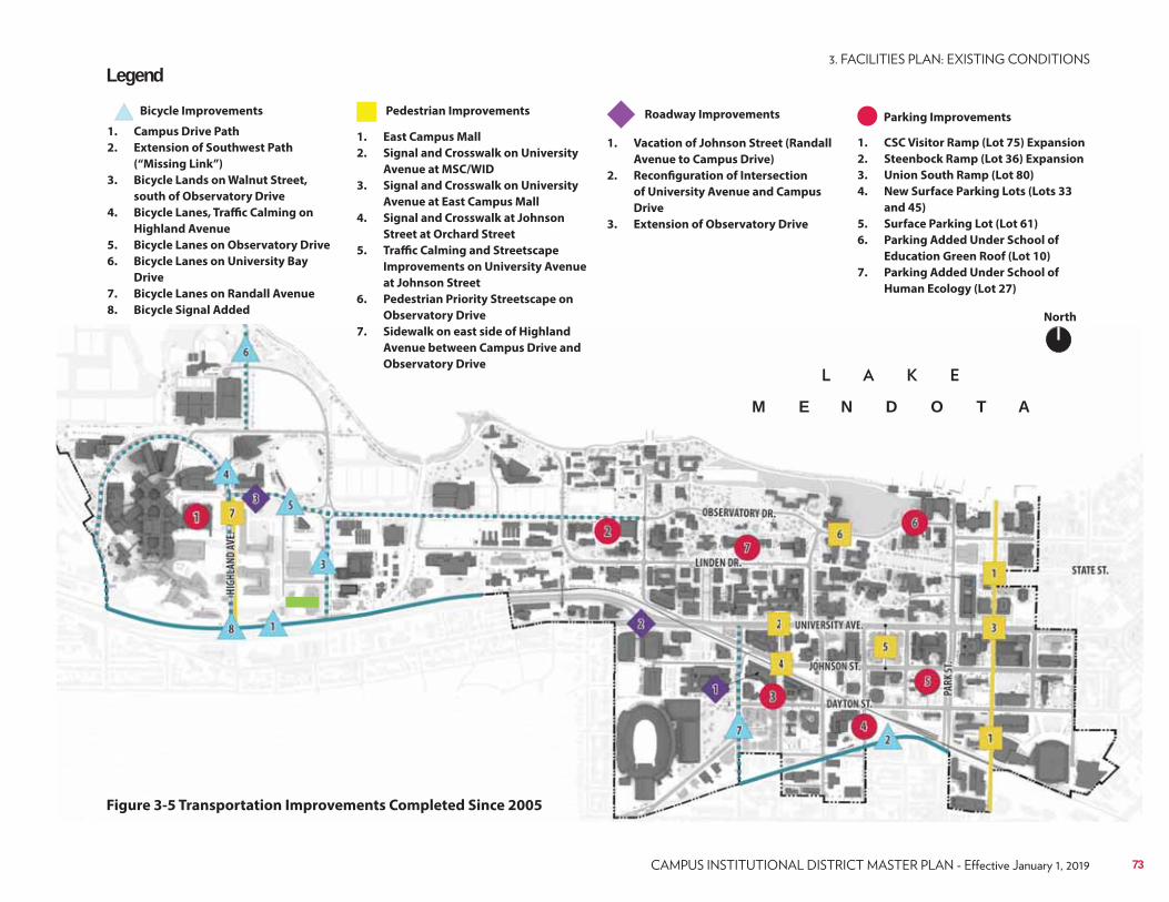
Figure 3-5 Transportation Improvements Completed Since 2005
North
Legend
1. Campus Drive Path
2. Extension of Southwest Path
(“Missing Link”)
3. Bicycle Lands on Walnut Street,
south of Observatory Drive
4. Bicycle Lanes, Traffic Calming on
Highland Avenue
5. Bicycle Lanes on Observatory Drive
6. Bicycle Lanes on University Bay
Drive
7. Bicycle Lanes on Randall Avenue
8. Bicycle Signal Added
1. East Campus Mall
2. Signal and Crosswalk on University
Avenue at MSC/WID
3. Signal and Crosswalk on University
Avenue at East Campus Mall
4. Signal and Crosswalk at Johnson
Street at Orchard Street
5. Traffic Calming and Streetscape
Improvements on University Avenue
at Johnson Street
6. Pedestrian Priority Streetscape on
Observatory Drive
7. Sidewalk on east side of Highland
Avenue between Campus Drive and
Observatory Drive
1. Vacation of Johnson Street (Randall
Avenue to Campus Drive)
2. Reconfiguration of Intersection
of University Avenue and Campus
Drive
3. Extension of Observatory Drive
1. CSC Visitor Ramp (Lot 75) Expansion
2. Steenbock Ramp (Lot 36) Expansion
3. Union South Ramp (Lot 80)
4. New Surface Parking Lots (Lots 33
and 45)
5. Surface Parking Lot (Lot 61)
6. Parking Added Under School of
Education Green Roof (Lot 10)
7. Parking Added Under School of
Human Ecology (Lot 27)
Bicycle Improvements Pedestrian Improvements Roadway Improvements Parking Improvements
M E N D O T A
73
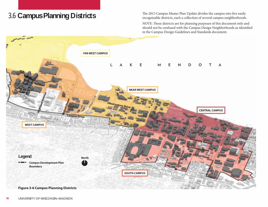
The 2015 Campus Master Plan Update divides the campus into five easily recognizable districts, each a collection of several campus neighborhoods.NOTE: These districts are for planning purposes of this document only and should not be confused with the Campus Design Neighborhoods as identified in the Campus Design Guidelines and Standards document.
3.6 Campus Planning Districts
FAR WEST CAMPUS
WEST CAMPUS
NEAR WEST CAMPUS
CENTRAL CAMPUS
SOUTH CAMPUS
NorthLegendCampus Development Plan
Boundary
Figure 3-6 Campus Planning Districts
Campus Drive
Observatory Drive
N. C
ha
rte
r S
tre
et
N. P
ark
Str
ee
t
University Avenue
Linden Drive
W. Dayton Street
Wa
lnu
t S
tre
et
Will
ow C
reek
W. Johnson Street
Hig
hla
nd
Av
en
ue
74 UNIVERSITY OF WISCONSIN–MADISON
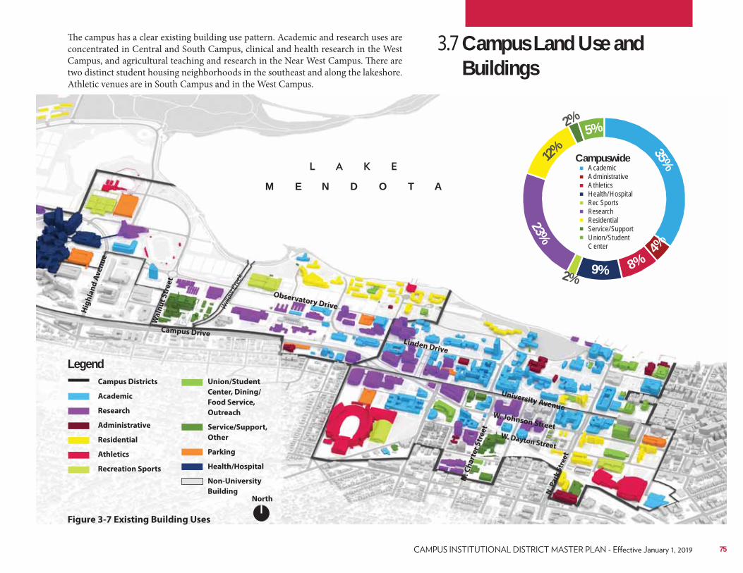
3.7 Campus Land Use and Buildings
The campus has a clear existing building use pattern. Academic and research uses are concentrated in Central and South Campus, clinical and health research in the West Campus, and agricultural teaching and research in the Near West Campus. There are two distinct student housing neighborhoods in the southeast and along the lakeshore. Athletic venues are in South Campus and in the West Campus.
North
LegendCampus Districts
Academic
Research
Administrative
Residential
Athletics
Recreation Sports
Figure 3-7 Existing Building Uses
Union/Student
Center, Dining/
Food Service,
Outreach
Service/Support,
Other
Parking
Health/Hospital
Non-University
Building
Campus Drive
Observatory Drive
N. C
ha
rte
r S
tre
et
N. P
ark
Str
ee
t
University Avenue
Linden Drive
W. Dayton Street
Wa
lnu
t S
tre
et
Will
ow C
reek
W. Johnson Street
Hig
hla
nd
Av
en
ue
CampuswideAcademicAdministrativeAthleticsHealth/HospitalRec SportsResearchResidentialService/SupportUnion/Student Center
35%
4%
8%9%
23%
5%
12%
2%
2%
M E N D O T A
75
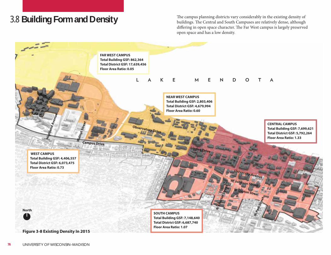
3.8 Building Form and Density
FAR WEST CAMPUS
Total Building GSF: 862,364
Total District GSF: 17,639,456
Floor Area Ratio: 0.05
WEST CAMPUS
Total Building GSF: 4,406,557
Total District GSF: 6,073,475
Floor Area Ratio: 0.73
NEAR WEST CAMPUS
Total Building GSF: 2,803,406
Total District GSF: 4,679,994
Floor Area Ratio: 0.60
CENTRAL CAMPUS
Total Building GSF: 7,699,621
Total District GSF: 5,792,264
Floor Area Ratio: 1.33
SOUTH CAMPUS
Total Building GSF: 7,148,640
Total District GSF: 6,687,740
Floor Area Ratio: 1.07
The campus planning districts vary considerably in the existing density of buildings. The Central and South Campuses are relatively dense, although differing in open space character. The Far West campus is largely preserved open space and has a low density.
North
Figure 3-8 Existing Density In 2015
Campus Drive
Observatory Drive
N. C
ha
rte
r S
tre
et
N. P
ark
Str
ee
t
University Avenue
Linden Drive
W. Dayton Street
Wa
lnu
t S
tre
et
Will
ow C
reek
W. Johnson Street
Hig
hla
nd
Av
en
ue
76 UNIVERSITY OF WISCONSIN–MADISON
Floor Area Ratio (FAR) is a method
measuring density. It is calculated as the
sum of the gross floor area (GSF) of all
buildings in a district, divided by the size of
the district.
To better measure the activity concentration of each district,
building GSF and FAR do not include parking structures, Camp
Randall, or the Kohl Center.
77
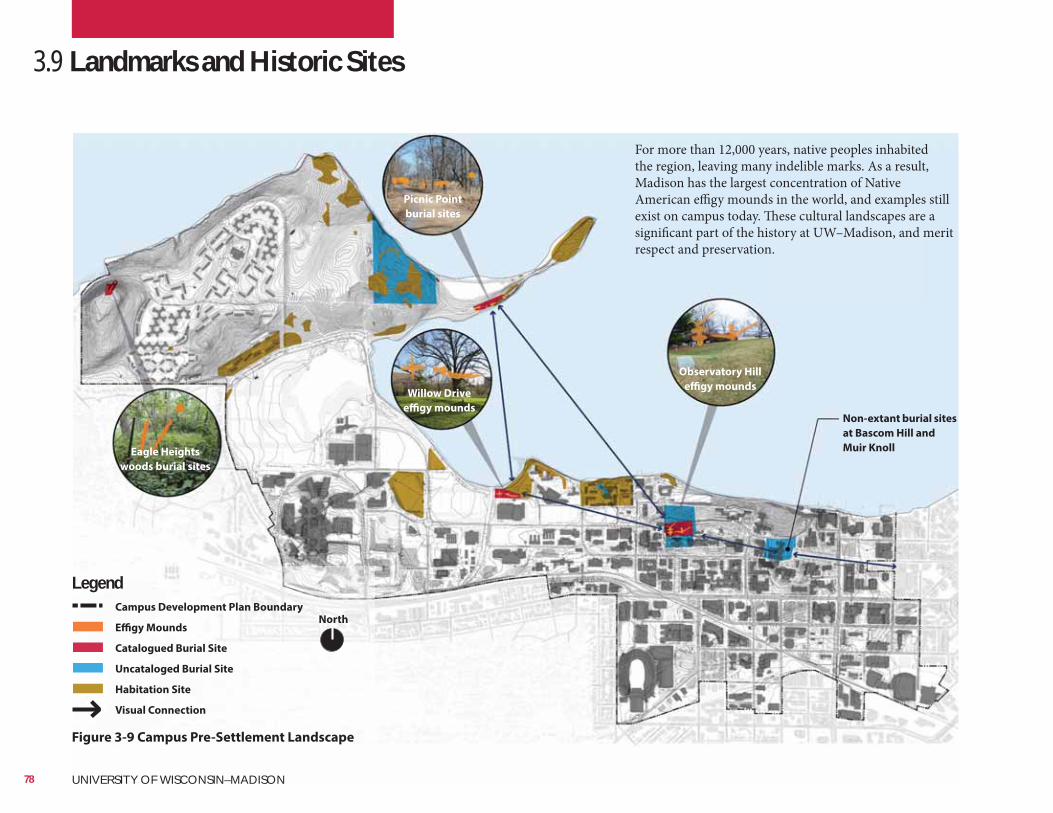
Figure 3-9 Campus Pre-Settlement Landscape
3.9 Landmarks and Historic Sites
For more than 12,000 years, native peoples inhabited the region, leaving many indelible marks. As a result, Madison has the largest concentration of Native American effigy mounds in the world, and examples still exist on campus today. These cultural landscapes are a significant part of the history at UW–Madison, and merit respect and preservation.
North
LegendCampus Development Plan Boundary
Effigy Mounds
Catalogued Burial Site
Uncataloged Burial Site
Habitation Site
Visual Connection
Picnic Point
burial sites
Observatory Hill
effigy mounds
Non-extant burial sites
at Bascom Hill and
Muir Knoll
Willow Drive
effigy mounds
Eagle Heights
woods burial sites
78 UNIVERSITY OF WISCONSIN–MADISON
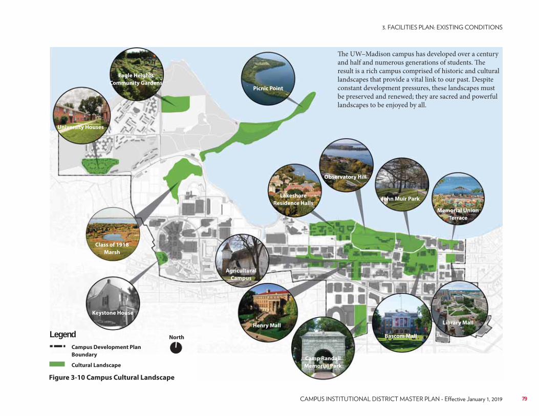
Picnic Point
Eagle Heights
Community Gardens
University Houses
Keystone House
Agricultural
Campus
Camp Randall
Memorial Park
Henry Mall
Bascom Mall
John Muir ParkLakeshore
Residence Halls
Observatory Hill
Library Mall
Memorial Union
Terrace
Class of 1918
Marsh
The UW–Madison campus has developed over a century and half and numerous generations of students. The result is a rich campus comprised of historic and cultural landscapes that provide a vital link to our past. Despite constant development pressures, these landscapes must be preserved and renewed; they are sacred and powerful landscapes to be enjoyed by all.
Figure 3-10 Campus Cultural Landscape
North
Campus Development Plan
Boundary
Cultural Landscape
Legend
79
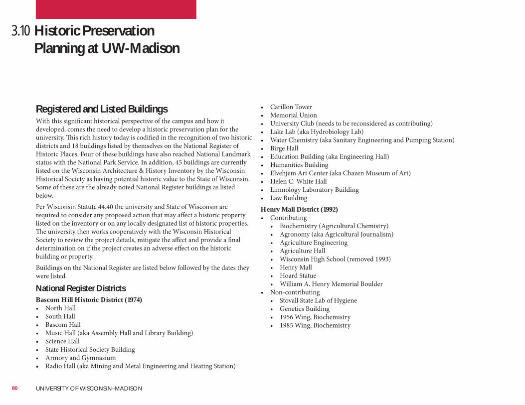
3.10 Historic Preservation Planning at UW-Madison
Registered and Listed BuildingsWith this significant historical perspective of the campus and how it developed, comes the need to develop a historic preservation plan for the university. This rich history today is codified in the recognition of two historic districts and 18 buildings listed by themselves on the National Register of Historic Places. Four of these buildings have also reached National Landmark status with the National Park Service. In addition, 45 buildings are currently listed on the Wisconsin Architecture & History Inventory by the Wisconsin Historical Society as having potential historic value to the State of Wisconsin. Some of these are the already noted National Register buildings as listed below.Per Wisconsin Statute 44.40 the university and State of Wisconsin are required to consider any proposed action that may affect a historic property listed on the inventory or on any locally designated list of historic properties. The university then works cooperatively with the Wisconsin Historical Society to review the project details, mitigate the affect and provide a final determination on if the project creates an adverse effect on the historic building or property.Buildings on the National Register are listed below followed by the dates they were listed.
National Register DistrictsBascom Hill Historic District (1974)• North Hall• South Hall• Bascom Hall• Music Hall (aka Assembly Hall and Library Building)• Science Hall• State Historical Society Building• Armory and Gymnasium• Radio Hall (aka Mining and Metal Engineering and Heating Station)
• Carillon Tower• Memorial Union• University Club (needs to be reconsidered as contributing)• Lake Lab (aka Hydrobiology Lab)• Water Chemistry (aka Sanitary Engineering and Pumping Station)• Birge Hall• Education Building (aka Engineering Hall)• Humanities Building• Elvehjem Art Center (aka Chazen Museum of Art)• Helen C. White Hall• Limnology Laboratory Building• Law BuildingHenry Mall District (1992)• Contributing
• Biochemistry (Agricultural Chemistry)• Agronomy (aka Agricultural Journalism)• Agriculture Engineering• Agriculture Hall• Wisconsin High School (removed 1993)• Henry Mall• Hoard Statue• William A. Henry Memorial Boulder
• Non-contributing• Stovall State Lab of Hygiene• Genetics Building• 1956 Wing, Biochemistry• 1985 Wing, Biochemistry
80 UNIVERSITY OF WISCONSIN–MADISON
Buildings on the National Register of Historic Places (date of listing)• Agriculture Dean’s Residence (1984)• Agricultural Engineering (1985)• Agricultural Hall (1985)• Agricultural Heating Station (1985)• Camp Randall Memorial Park (1971)• Biochemistry (aka Agricultural Chemistry Building) (1985)• Hiram Smith Hall and Annex (1985)• Lathrop Hall (1985)• Materials Sciences Building (aka Old US Forest Products Lab) (1985)• North Hall (1974 and 1977) National Landmark Status (1966)• Observatory Director’s Residence (1985)• King Hall/Soils (aka Horticulture, Agricultural Physics and Soil Science)
(1985)• Red Gym/Armory (1974) National Landmark Status (1993)• Science Hall (1993) National Landmark Status (1993)• Stock Pavilion (1985)• UW Fieldhouse (1998)• Washburn Observatory (1985)• Wisconsin Dairy Barn (2002) National Landmark Status (2005)
Buildings on the Wisconsin Architecture and History Inventory (date surveyed)All of the above buildings listed on the National Register or in a National Register of Historic Places District (including all contributing and non-contributing buildings)• Barnard Hall (1974)• Chadbourne Hall (1973)• Chamberlin Hall (1974)• Engineering Research Building (1973)• Heating Station (aka Old Heating Plant) (1974)• Home Economics Building (aka School of Human Ecology) (1974)• Horticulture Hall (1973)• Mechanical Engineering (1974)• Primate Center (1985)• Sea Grant Institute (1973)• Sellery Hall (1973)• Service Building (2003)• Sterling Hall (unknown)• University Life Saving Station (1997)• Vilas Hall (1998)• WARF Building (1974)• Weeks Hall (aka Geology Building) (1973)• Wisconsin General Hospital (aka Medical Sciences Center) (1974)
81
Buildings Eligible for National Register Designation(As determined by the Wisconsin Historical Society)• Adams Hall• Animal Science Building• Barnard Hall• Biotron Laboratory• Camp Randall Memorial Sports Center (aka The Shell)• Carson Gulley Commons• Cole Hall• Elizabeth Waters Hall• Enzyme Institute• Goodnight Hall• Horse Barn• Humphrey Hall• Ingraham Hall (formerly Commerce Building)• Institute for Enzyme Research• Keystone House and Garage (aka 901 University Bay Drive)• Kronshage Dormitories (Chamberlin, Conover, Gilman, Jones, Kronshage,
Mack, Showerman, and Swenson)• McArdle Cancer Research Building• McClain Athletic Facility• Mechanical Engineering Building• Meiklejohn House• Middleton Building (former Middleton Medical Library)• Nancy Nicholas Hall, School of Human Ecology (former Home
Economics)• Nutritional Sciences (former Children’s Hospital/Orthopedic Hospital• Phillips, Vel Hall• Service Building Annex (former Old Heating Plant, Central Heating
Station)• Picnic Point Change House/Beach House• Primate Laboratory and Addition• Sewell Social Science Building• Short Course Dormitories (Humphrey and Jorns)• Slichter Hall• Steenbock Library• Sterling Hall• Teacher Education• Temin Lakeshore Path• Tripp Hall• Van Hise Hall• Van Vleck Hall• Vilas Communication Hall• WARF Office Building
There are also several important archaeological sites on campus which are mapped and inventoried by the Wisconsin Historical Society (see Figure 2-25). Several are on the National Register of Historic Places and others are inventoried and catalogued. Some of those major sites include (with their State Archaeological Site Number and Year Cataloged, if known):• Willow Drive Mounds (DA-119)• Picnic Point Grove Mounds (DA-120)• Picnic Point Mound Group (DA-0121) (2006)• Stevens (DA-122)• Unnamed Group (eastern end of Picnic Point) (DA-123)• Unnamed Group (west lakeshore residence halls and the Natatorium)
(DA-124)• Picnic Point Bay Mounds Group (DA-125)• University Ridge Mound Group (DA-126)• Breitenbach (along University Bay Drive, west of the Recreation fields)
(DA-128)• Eagle Heights Group (DA-0130) (2006)• Eagle Heights Field (DA-413)• Picnic Point (DA-501)• Observatory Hill Mound Group (DA-0571) (2006)• Bascom Hill Mound Group (DA-573)• North Hall Mounds (DA-819)• Agricultural Hall Mounds (DA-820)• South Slope (on Picnic Point) (DA-1168)• Unnamed (on Picnic Point) (DA-1169)• Observatory Hill Village (DA-1207)• Muir Knoll (DA-1208)Further detailed information is available on all of these sites, including a map with all of the historic sites, at the Campus Planning & Landscape Architecture office of Facilities Planning & Management and on their website.
82 UNIVERSITY OF WISCONSIN–MADISON
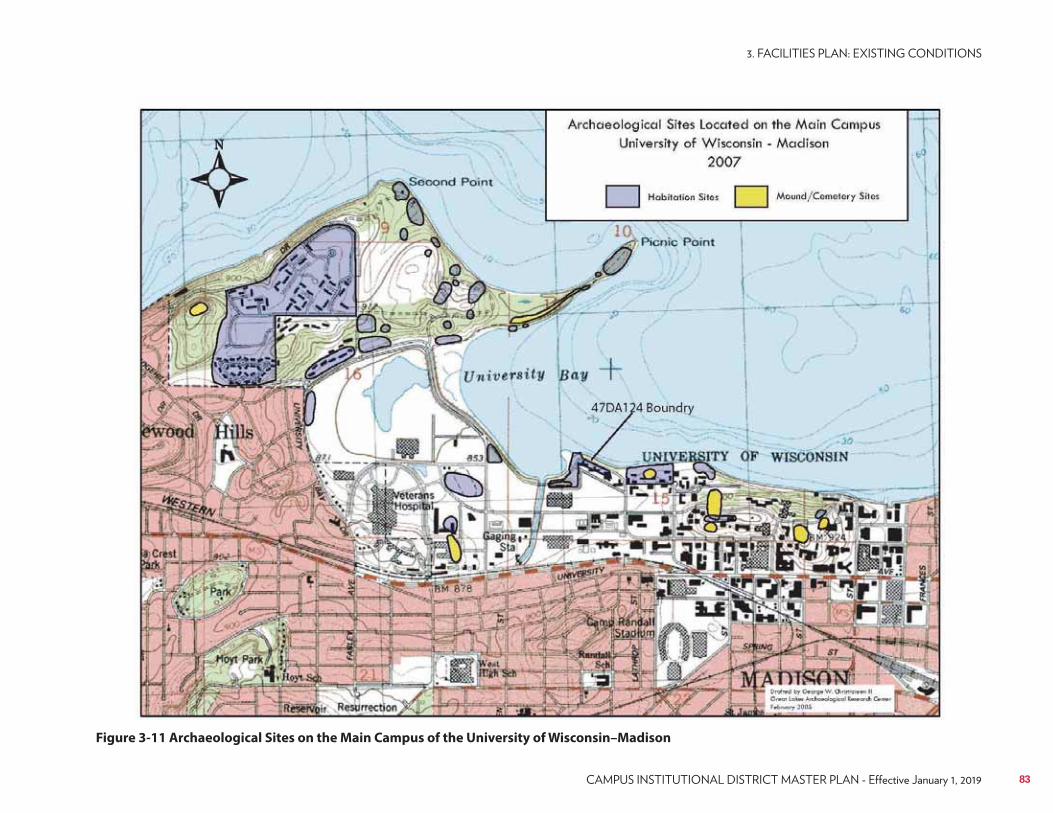
UW–Madison Facilities Planning & Management Archives
Figure 3-11 Archaeological Sites on the Main Campus of the University of Wisconsin–Madison
83
Cultural Landscape ResourcesIn 2005, the university developed a Cultural Landscape Resources Plan as one part of a collaborative project entitled the Cultural Landscape Resource Project. The Cultural Landscape Resource Project developed a base of knowledge and resources to protect the significant cultural landscapes on campus. The Cultural Landscape Resource Project was funded through a grant from the J. Paul Getty Trust and supported by Facilities Planning & Management. The Cultural Landscape Resource Project was developed under the guidance of the Wisconsin Department of Administration, Quinn Evans Architects, faculty and students from the UW–Madison Department of Landscape Architecture and staff of Facilities Planning & Management. Portions have been excerpted from the planning documents developed by that process and included in this comprehensive campus master plan. A complete copy of the analysis and recommendations in the Cultural Landscape Resource Project can be found for reference in the UW–Madison Facilities Planning & Management office or in the UW–Madison Library system.The cultural landscapes on the UW–Madison campus are places that provide touchstones to the past. Stories related to past activities bring the history of these places to life for people who use, visit, and explore these sites today. The campus today can be compared to a fabric woven of historic and contemporary landscapes that are intertwined. The historic landscapes retain the ability to conjure the past as three-dimensional entities that display a sense of place and contain physical reminders of the activities that occurred. As such, the preservation of historic landscapes takes on the same responsibility as the preservation of historic buildings.The university is undergoing a period of change that requires updated and new facilities to address the needs of advancing education and research. Since the campus is surrounded by the City of Madison on three sides and Lake Mendota on the fourth, only limited opportunities for expansion of boundaries exist. A major goal of the current master planning effort is for the campus to “recreate itself in place” with the physical planning needs met within the current campus boundaries. Identification of the historic landscapes on campus has played an important role in the master planning process in two ways:1. It has increased understanding of these landscapes through historical
research and analysis and helped to identify the aspects that are most essential for preserving their character and integrity; and,
2. It has identified the characteristics and features that are components of the historic landscapes providing guidance for planning and design for future development on campus.
The protection of historic landscapes already has taken a step forward by integrating these newly identified resources into the current comprehensive master planning process.The Cultural Landscape Resource Project, completed in fall 2005, includes a number of documents that are available to provide information about the historic landscapes on campus. A Cultural Landscape Report was developed addressing:• The historical context for the development of cultural landscapes on
campus.• Archaeological resources on campus (details of the site investigations
conducted as part of the project and management recommendations for archaeological resources).
• Individual Cultural Landscape Inventories (CLI) for eight sites: Bascom Mall, Library Mall, John Muir Park, Memorial Union Terrace, Observatory Hill, Henry Mall, the Agricultural Campus, and Camp Randall Memorial Park. The CLIs each include: a historic narrative and graphics documenting the physical development of the site; documentation of existing conditions; evaluation of the significance and integrity of the site; and, landscape preservation recommendations.
• A summary of the reconnaissance survey for additional sites including: Temin Lakeshore Path, Lakeshore Area Residence Halls, Class of 1918 Marsh, Picnic Point, Keystone House, Eagle Heights Community Gardens, and University Houses.
In addition to the Cultural Landscape Report, efforts associated with preparing the Cultural Landscape Resource Project, have included• Historical image and map gallery website: http://digital.library.wisc.
edu/1711.dl/UW.UWCulturalLand• UW–Madison cultural resources website: http://www2.fpm.wisc.edu/
planning/culturalresources• Press package with information regarding cultural landscapes• Walking tour brochure of significant campus landscapes• Interpretive exhibit posters for the eight sites studied• A PowerPoint presentation that provides an overview of the Cultural
Landscape Resource Project, findings.
84 UNIVERSITY OF WISCONSIN–MADISON
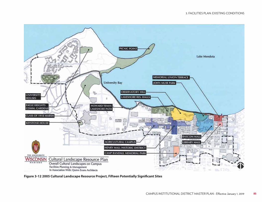
UW–Madison FP&M Archives
Figure 3-12 2005 Cultural Landscape Resource Project, Fifteen Potentially Significant Sites
85
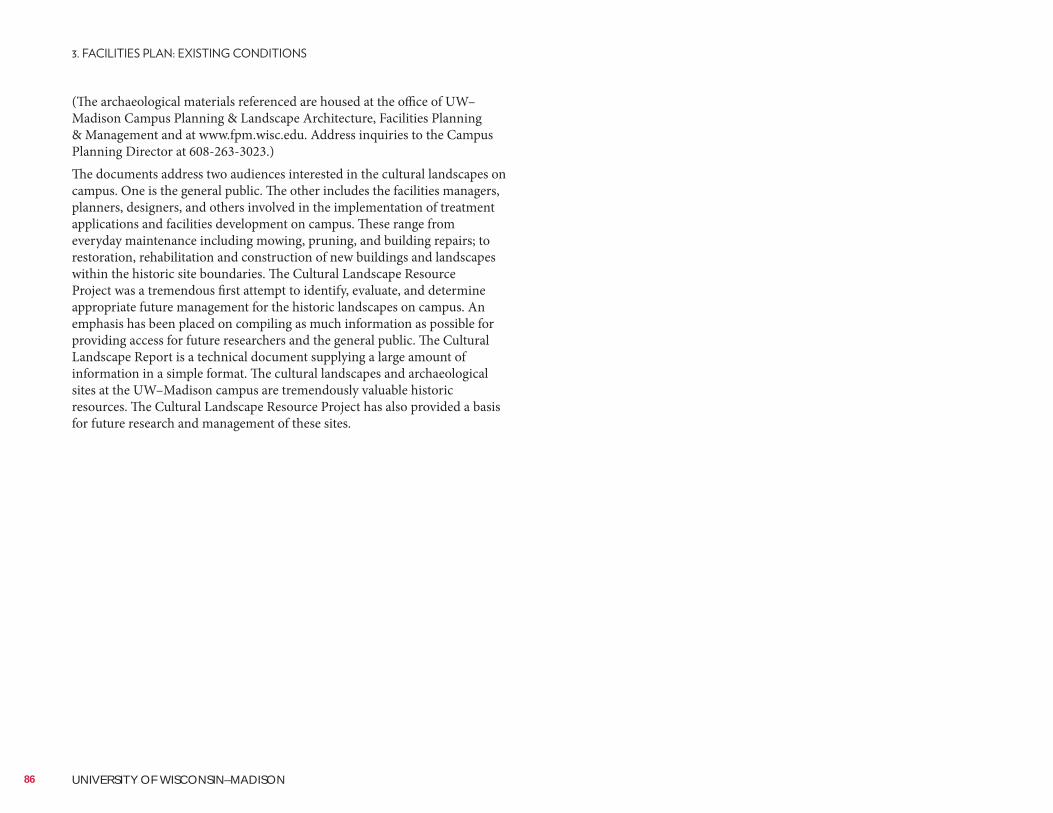
(The archaeological materials referenced are housed at the office of UW–Madison Campus Planning & Landscape Architecture, Facilities Planning & Management and at www.fpm.wisc.edu. Address inquiries to the Campus Planning Director at 608-263-3023.)The documents address two audiences interested in the cultural landscapes on campus. One is the general public. The other includes the facilities managers, planners, designers, and others involved in the implementation of treatment applications and facilities development on campus. These range from everyday maintenance including mowing, pruning, and building repairs; to restoration, rehabilitation and construction of new buildings and landscapes within the historic site boundaries. The Cultural Landscape Resource Project was a tremendous first attempt to identify, evaluate, and determine appropriate future management for the historic landscapes on campus. An emphasis has been placed on compiling as much information as possible for providing access for future researchers and the general public. The Cultural Landscape Report is a technical document supplying a large amount of information in a simple format. The cultural landscapes and archaeological sites at the UW–Madison campus are tremendously valuable historic resources. The Cultural Landscape Resource Project has also provided a basis for future research and management of these sites.
86 UNIVERSITY OF WISCONSIN–MADISON
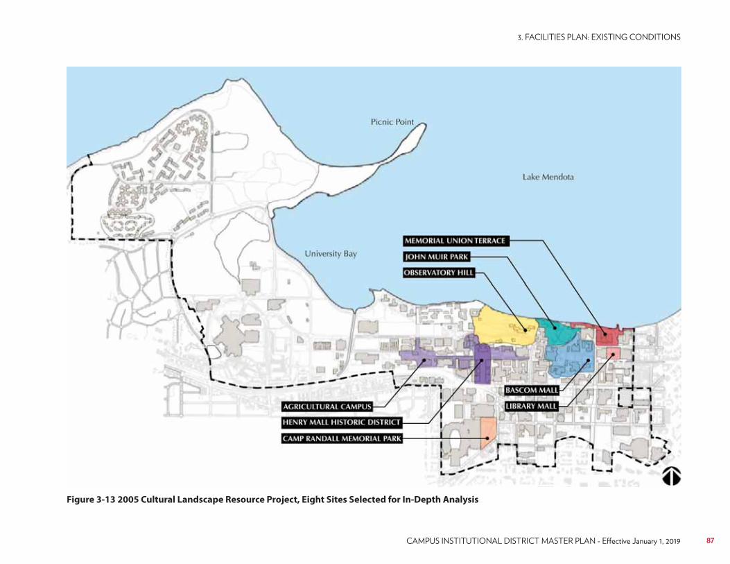
UW–Madison FP&M Archives
Figure 3-13 2005 Cultural Landscape Resource Project, Eight Sites Selected for In-Depth Analysis
87
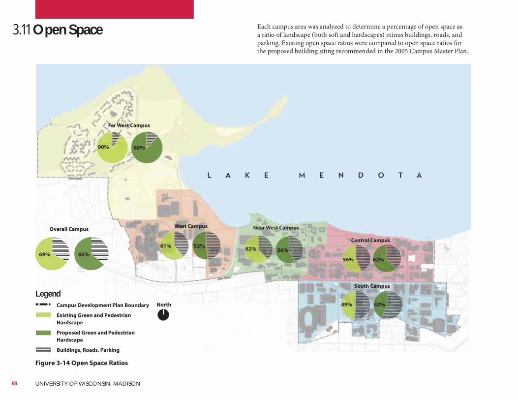
Far West Campus
West Campus Near West Campus
Central Campus
South Campus
90%
61% 52%62%
62%
42%
56%
56%
49%
88%
3.11 Open Space
Figure 3-14 Open Space Ratios
Each campus area was analyzed to determine a percentage of open space as a ratio of landscape (both soft and hardscapes) minus buildings, roads, and parking. Existing open space ratios were compared to open space ratios for the proposed building siting recommended in the 2005 Campus Master Plan.
North
LegendCampus Development Plan Boundary
Existing Green and Pedestrian
Hardscape
Proposed Green and Pedestrian
Hardscape
Buildings, Roads, Parking
Overall Campus
69% 66%
88 UNIVERSITY OF WISCONSIN–MADISON
The development of campus over time has resulted in a diversity of landscape spaces on campus, each reflective of the values of the students and administration that oversaw their development.
Figure 3-15 Existing Landscape Character
Naturalized
Suburban
Recreational
Campus Mall
Traditional Lawn
Courtyard and Terrace
Urban Streetscape
Parks and Gardens
NorthLegendCampus Development Plan Boundary
Recreational
Suburban
Landscape
Naturalized
Campus Mall
Parks & Gardens
Courtyard &
Terrace
Traditional
Campus
Urban Streetscape
89
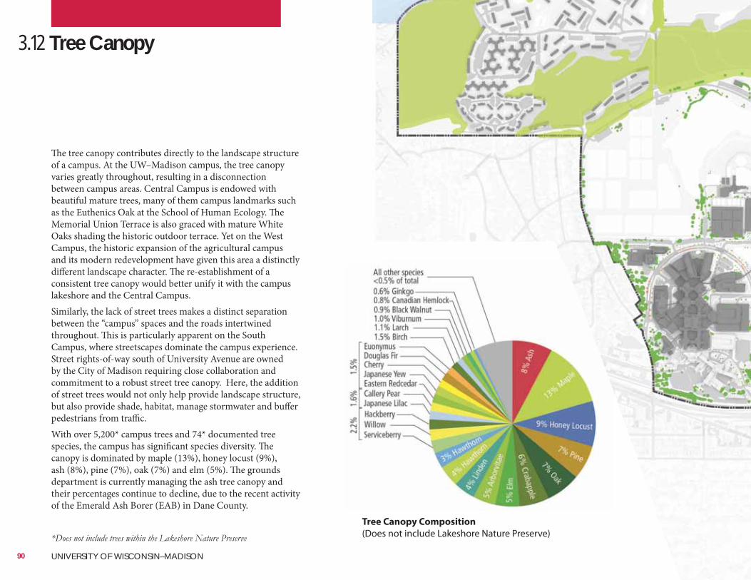
3.12 Tree Canopy
The tree canopy contributes directly to the landscape structure of a campus. At the UW–Madison campus, the tree canopy varies greatly throughout, resulting in a disconnection between campus areas. Central Campus is endowed with beautiful mature trees, many of them campus landmarks such as the Euthenics Oak at the School of Human Ecology. The Memorial Union Terrace is also graced with mature White Oaks shading the historic outdoor terrace. Yet on the West Campus, the historic expansion of the agricultural campus and its modern redevelopment have given this area a distinctly different landscape character. The re-establishment of a consistent tree canopy would better unify it with the campus lakeshore and the Central Campus.Similarly, the lack of street trees makes a distinct separation between the “campus” spaces and the roads intertwined throughout. This is particularly apparent on the South Campus, where streetscapes dominate the campus experience. Street rights-of-way south of University Avenue are owned by the City of Madison requiring close collaboration and commitment to a robust street tree canopy. Here, the addition of street trees would not only help provide landscape structure, but also provide shade, habitat, manage stormwater and buffer pedestrians from traffic.With over 5,200* campus trees and 74* documented tree species, the campus has significant species diversity. The canopy is dominated by maple (13%), honey locust (9%), ash (8%), pine (7%), oak (7%) and elm (5%). The grounds department is currently managing the ash tree canopy and their percentages continue to decline, due to the recent activity of the Emerald Ash Borer (EAB) in Dane County.
Tree Canopy Composition
(Does not include Lakeshore Nature Preserve)
90 UNIVERSITY OF WISCONSIN–MADISON
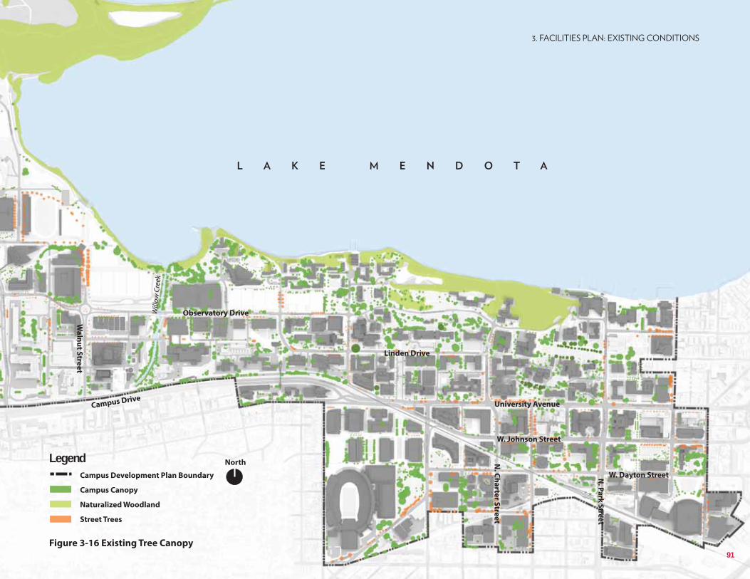
NorthLegendCampus Development Plan Boundary
Campus Canopy
Naturalized Woodland
Street Trees
Campus Drive
Observatory Drive
N. C
ha
rter S
tree
t
N. P
ark
Stre
et
University Avenue
Linden Drive
W. Dayton Street
Wa
lnu
t Stre
et
Will
ow C
reek
W. Johnson Street
Figure 3-16 Existing Tree Canopy91
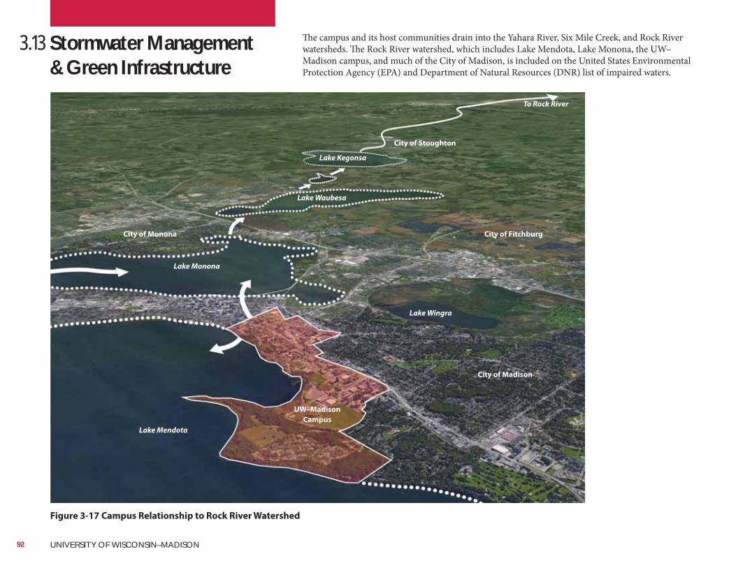
3.13 Stormwater Management & Green Infrastructure
Figure 3-17 Campus Relationship to Rock River Watershed
The campus and its host communities drain into the Yahara River, Six Mile Creek, and Rock River watersheds. The Rock River watershed, which includes Lake Mendota, Lake Monona, the UW–Madison campus, and much of the City of Madison, is included on the United States Environmental Protection Agency (EPA) and Department of Natural Resources (DNR) list of impaired waters.
Google Earth
Lake Mendota
Lake Monona
Lake Waubesa
To Rock River
UW–Madison
Campus
City of Madison
Lake Kegonsa
City of FitchburgCity of Monona
Lake Wingra
City of Stoughton
92 UNIVERSITY OF WISCONSIN–MADISON
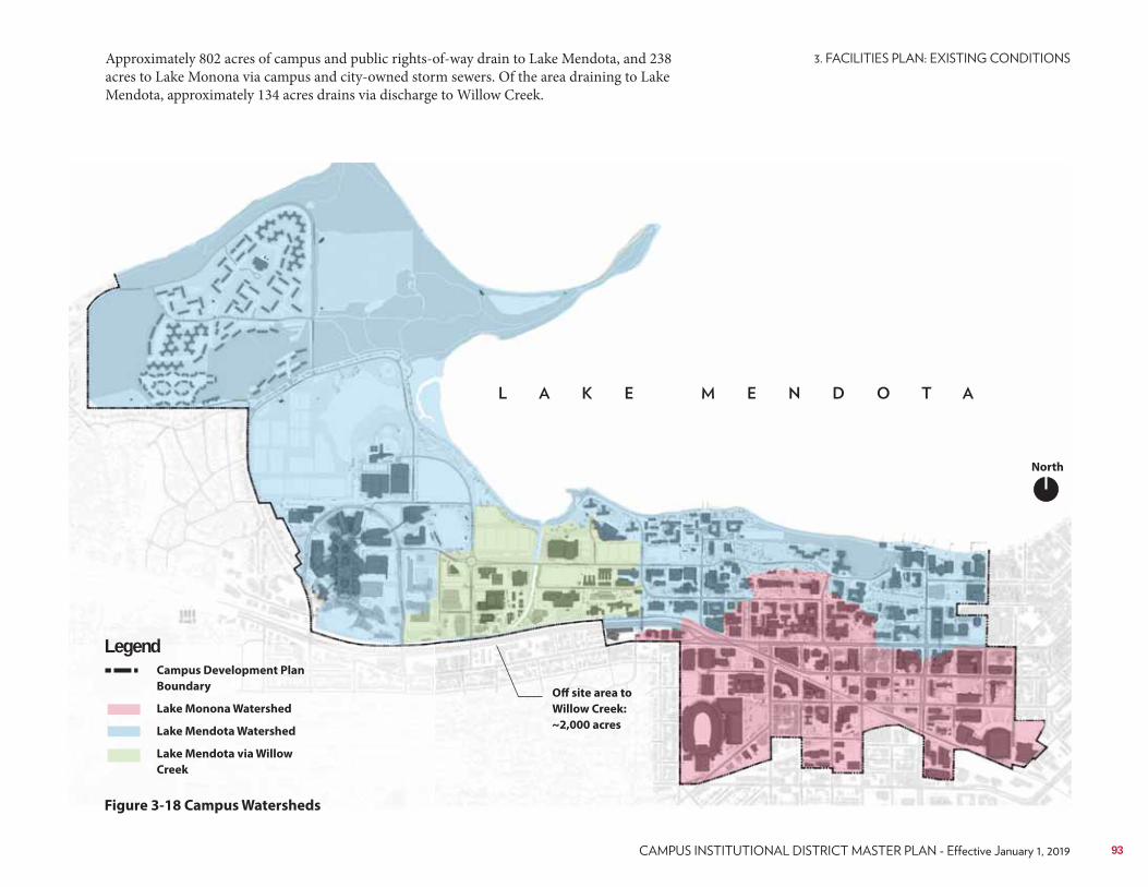
Off site area to
Willow Creek:
~2,000 acres
Figure 3-18 Campus Watersheds
Approximately 802 acres of campus and public rights-of-way drain to Lake Mendota, and 238 acres to Lake Monona via campus and city-owned storm sewers. Of the area draining to Lake Mendota, approximately 134 acres drains via discharge to Willow Creek.
Campus Development Plan
Boundary
Lake Monona Watershed
Lake Mendota Watershed
Lake Mendota via Willow
Creek
Legend
North
93
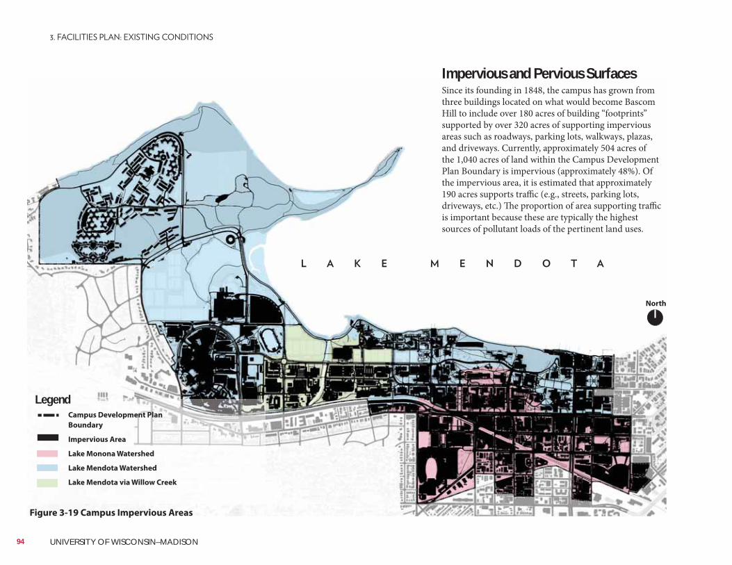
Impervious and Pervious SurfacesSince its founding in 1848, the campus has grown from three buildings located on what would become Bascom Hill to include over 180 acres of building “footprints” supported by over 320 acres of supporting impervious areas such as roadways, parking lots, walkways, plazas, and driveways. Currently, approximately 504 acres of the 1,040 acres of land within the Campus Development Plan Boundary is impervious (approximately 48%). Of the impervious area, it is estimated that approximately 190 acres supports traffic (e.g., streets, parking lots, driveways, etc.) The proportion of area supporting traffic is important because these are typically the highest sources of pollutant loads of the pertinent land uses.
Figure 3-19 Campus Impervious Areas
Campus Development Plan
Boundary
Impervious Area
Lake Monona Watershed
Lake Mendota Watershed
Lake Mendota via Willow Creek
Legend
North
94 UNIVERSITY OF WISCONSIN–MADISON
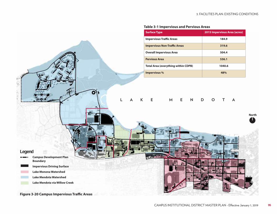
Table 3-1 Impervious and Pervious Areas
Campus Development Plan
Boundary
Impervious Driving Surface
Lake Monona Watershed
Lake Mendota Watershed
Lake Mendota via Willow Creek
Legend
Figure 3-20 Campus Impervious Traffic Areas
Surface Type 2015 Impervious Area (acres)
Impervious Traffic Areas 184.9
Impervious Non-Traffic Areas 319.6
Overall Impervious Area 504.4
Pervious Area 536.1
Total Area (everything within CDPB) 1040.6
Impervious % 48%
North
95
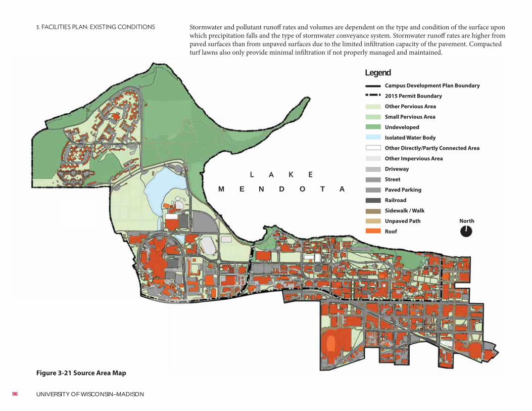
Figure 3-21 Source Area Map
Stormwater and pollutant runoff rates and volumes are dependent on the type and condition of the surface upon which precipitation falls and the type of stormwater conveyance system. Stormwater runoff rates are higher from paved surfaces than from unpaved surfaces due to the limited infiltration capacity of the pavement. Compacted turf lawns also only provide minimal infiltration if not properly managed and maintained.
North
LegendCampus Development Plan Boundary
2015 Permit Boundary
Other Pervious Area
Small Pervious Area
Undeveloped
Isolated Water Body
Other Directly/Partly Connected Area
Other Impervious Area
Driveway
Street
Paved Parking
Railroad
Sidewalk / Walk
Unpaved Path
Roof
M E N D O T A
96 UNIVERSITY OF WISCONSIN–MADISON
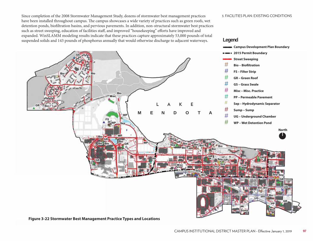
###
#
######
Campus Development Plan Boundary
2015 Permit Boundary
Street Sweeping
Bio – Biofiltration
FS – Filter Strip
GR – Green Roof
GS – Grass Swale
Misc – Misc. Practice
PP – Permeable Pavement
Sep – Hydrodynamic Separator
Sump – Sump
UG – Underground Chamber
WP – Wet Detention Pond
Since completion of the 2008 Stormwater Management Study, dozens of stormwater best management practices have been installed throughout campus. The campus showcases a wide variety of practices such as green roofs, wet detention ponds, biofiltration basins, and pervious pavements. In addition, non-structural stormwater best practices such as street sweeping, education of facilities staff, and improved “housekeeping” efforts have improved and expanded. WinSLAMM modeling results indicate that these practices capture approximately 53,000 pounds of total suspended solids and 143 pounds of phosphorus annually that would otherwise discharge to adjacent waterways.
Figure 3-22 Stormwater Best Management Practice Types and Locations
North
Legend
M E N D O T A
97
Gaps in ConnectivityFor PedestriansPaved pedestrian-only pathways represent the primary routes carrying students, faculty, and staff across campus grounds and between buildings. These pathways provide micro-level connections. Paved shared-use facilities such as the Southwest Path and unpaved facilities like the Lakeshore Path serve longer distance and cross-campus connections. Campus destinations are well-connected, with a few exceptions.Sidewalks exist on the majority of campus streets and carry high volumes of pedestrian traffic on a daily basis. Interior block connecting roads such as Lathrop Drive, Clymer Place, Conklin Place, and Fitch Court do not have sidewalks on either side of the road but have alternate pathways nearby. However, analysis identified Lathrop Drive as being particularly uncomfortable for pedestrians because there is an absence of infrastructure or design elements indicating whether pedestrians or automobiles have priority in this space.There is a primary gap in pedestrian connectivity on the west side of campus. The eastbound Campus Drive shared-use path ends near the School of Veterinary Medicine. A connection to Babcock Drive and University Avenue to the east would better connect pedestrians and cyclists along this corridor.Busy arterial roads and railroads act as barriers to pedestrian connectivity on campus because of uncomfortable intersections and the absence of adequate crossing locations. There is limited pedestrian connectivity across Campus Drive and the railroad corridor west of Babcock Drive. The shared-use bridge at the Stock Pavilion (city-owned Alicia Ashman Bridge) as well as Walnut Street and Highland Avenue are the only north-south crossings on campus. There is a ½ mile span near the Veterinary Medicine Building without a crossing of Campus Drive. This is an issue for students and others living in the concentration of residences along University Avenue west of Breese Terrace and south of Campus Drive.
3.14 Pedestrian and Bicycle
Walking and biking are the predominant modes of transportation on campus. A grid street system, dense land uses, attractive streetscapes, and comfortable walking and biking facilities carry students, faculty, and staff to classes, work, and appointments on a daily basis. UW–Madison consists of a dense building network interconnected with walking facilities, particularly on the east part of campus. With nearly 22,000 faculty and staff and over 43,000 students on a nearly 1.5 square mile campus, walking continues to be the most accessible and popular form of transportation. See the Long-Range Transportation Plan for a detailed analysis of existing pedestrian and bicycle facilities and services.This section describes the current assets and challenges with the non-motorized transportation network. The findings presented in this section form the basis of the recommendations offered.
98 UNIVERSITY OF WISCONSIN–MADISON
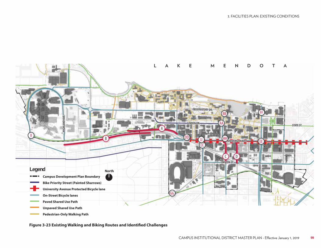
Figure 3-23 Existing Walking and Biking Routes and Identified Challenges
NorthLegendCampus Development Plan Boundary
Bike Priority Street (Painted Sharrows)
University Avenue Protected Bicycle lane
On-Street Bicycle lanes
Paved Shared Use Path
Unpaved Shared Use Path
Pedestrian-Only Walking Path
99
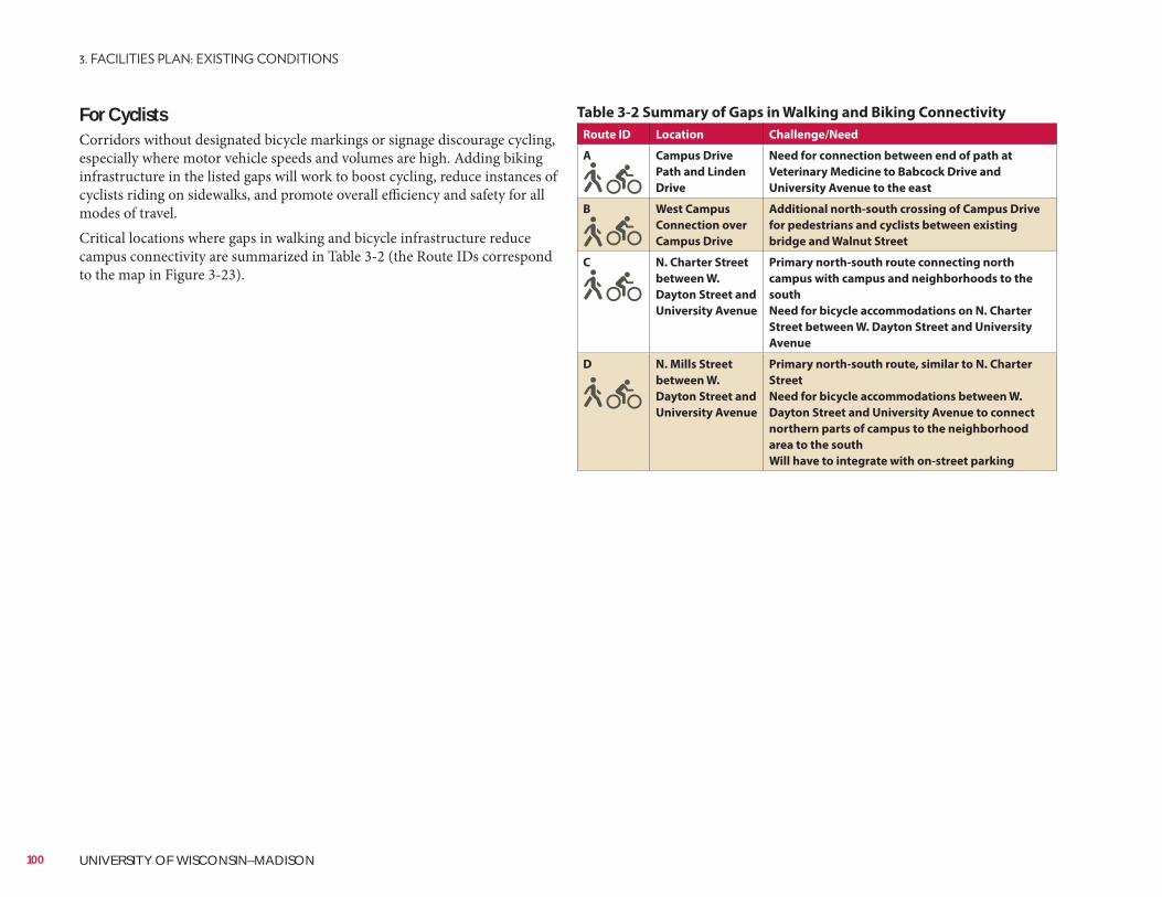
For CyclistsCorridors without designated bicycle markings or signage discourage cycling, especially where motor vehicle speeds and volumes are high. Adding biking infrastructure in the listed gaps will work to boost cycling, reduce instances of cyclists riding on sidewalks, and promote overall efficiency and safety for all modes of travel.Critical locations where gaps in walking and bicycle infrastructure reduce campus connectivity are summarized in Table 3-2 (the Route IDs correspond to the map in Figure 3-23).
Table 3-2 Summary of Gaps in Walking and Biking Connectivity
Route ID Location Challenge/Need
A Campus Drive
Path and Linden
Drive
Need for connection between end of path at
Veterinary Medicine to Babcock Drive and
University Avenue to the east
B West Campus
Connection over
Campus Drive
Additional north-south crossing of Campus Drive
for pedestrians and cyclists between existing
bridge and Walnut Street
C N. Charter Street
between W.
Dayton Street and
University Avenue
Primary north-south route connecting north
campus with campus and neighborhoods to the
south
Need for bicycle accommodations on N. Charter
Street between W. Dayton Street and University
Avenue
D N. Mills Street
between W.
Dayton Street and
University Avenue
Primary north-south route, similar to N. Charter
Street
Need for bicycle accommodations between W.
Dayton Street and University Avenue to connect
northern parts of campus to the neighborhood
area to the south
Will have to integrate with on-street parking
100 UNIVERSITY OF WISCONSIN–MADISON
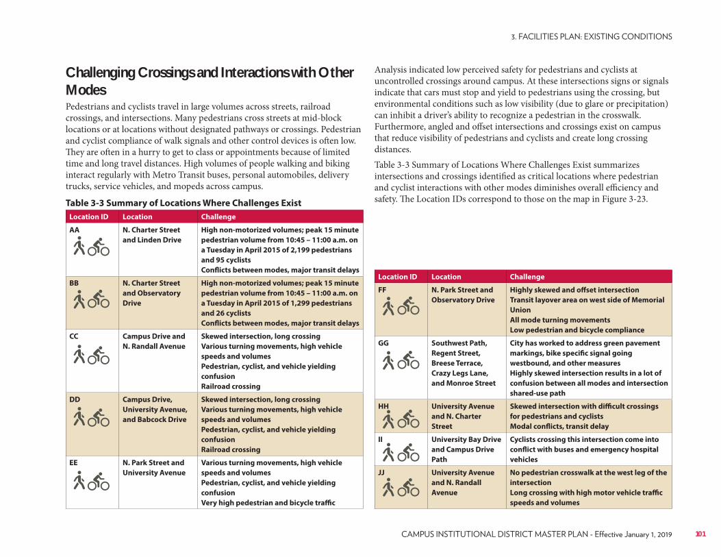
Location ID Location Challenge
FF N. Park Street and
Observatory Drive
Highly skewed and offset intersection
Transit layover area on west side of Memorial
Union
All mode turning movements
Low pedestrian and bicycle compliance
GG Southwest Path,
Regent Street,
Breese Terrace,
Crazy Legs Lane,
and Monroe Street
City has worked to address green pavement
markings, bike specific signal going
westbound, and other measures
Highly skewed intersection results in a lot of
confusion between all modes and intersection
shared-use path
HH University Avenue
and N. Charter
Street
Skewed intersection with difficult crossings
for pedestrians and cyclists
Modal conflicts, transit delay
II University Bay Drive
and Campus Drive
Path
Cyclists crossing this intersection come into
conflict with buses and emergency hospital
vehicles
JJ University Avenue
and N. Randall
Avenue
No pedestrian crosswalk at the west leg of the
intersection
Long crossing with high motor vehicle traffic
speeds and volumes
Table 3-3 Summary of Locations Where Challenges Exist
Location ID Location Challenge
AA N. Charter Street
and Linden Drive
High non-motorized volumes; peak 15 minute
pedestrian volume from 10:45 – 11:00 a.m. on
a Tuesday in April 2015 of 2,199 pedestrians
and 95 cyclists
Conflicts between modes, major transit delays
BB N. Charter Street
and Observatory
Drive
High non-motorized volumes; peak 15 minute
pedestrian volume from 10:45 – 11:00 a.m. on
a Tuesday in April 2015 of 1,299 pedestrians
and 26 cyclists
Conflicts between modes, major transit delays
CC Campus Drive and
N. Randall Avenue
Skewed intersection, long crossing
Various turning movements, high vehicle
speeds and volumes
Pedestrian, cyclist, and vehicle yielding
confusion
Railroad crossing
DD Campus Drive,
University Avenue,
and Babcock Drive
Skewed intersection, long crossing
Various turning movements, high vehicle
speeds and volumes
Pedestrian, cyclist, and vehicle yielding
confusion
Railroad crossing
EE N. Park Street and
University Avenue
Various turning movements, high vehicle
speeds and volumes
Pedestrian, cyclist, and vehicle yielding
confusion
Very high pedestrian and bicycle traffic
Challenging Crossings and Interactions with Other ModesPedestrians and cyclists travel in large volumes across streets, railroad crossings, and intersections. Many pedestrians cross streets at mid-block locations or at locations without designated pathways or crossings. Pedestrian and cyclist compliance of walk signals and other control devices is often low. They are often in a hurry to get to class or appointments because of limited time and long travel distances. High volumes of people walking and biking interact regularly with Metro Transit buses, personal automobiles, delivery trucks, service vehicles, and mopeds across campus.
Analysis indicated low perceived safety for pedestrians and cyclists at uncontrolled crossings around campus. At these intersections signs or signals indicate that cars must stop and yield to pedestrians using the crossing, but environmental conditions such as low visibility (due to glare or precipitation) can inhibit a driver’s ability to recognize a pedestrian in the crosswalk. Furthermore, angled and offset intersections and crossings exist on campus that reduce visibility of pedestrians and cyclists and create long crossing distances.Table 3-3 Summary of Locations Where Challenges Exist summarizes intersections and crossings identified as critical locations where pedestrian and cyclist interactions with other modes diminishes overall efficiency and safety. The Location IDs correspond to those on the map in Figure 3-23.
101
Public TransportationUW–Madison currently contracts with the local transit provider, Metro Transit, to provide transit service to students, faculty, and staff on campus. There are four routes on campus that UW–Madison faculty, staff, and students can ride for free. Metro Transit bus passes for an unlimited number of rides are available for eligible UW faculty and staff for $24 per year. Those without a pass can ride Metro Transit routes for $2 per ride.
Existing Service OptionsThere are a variety of service options that connect to and around the UW–Madison campus.• On-Campus Metro Transit Bus Routes: There are currently 11 routes on
campus and 18 additional routes that travel close to campus. Figure 3-25 displays the peak transit service locations provided on campus, as well as transit stops. Currently, there is an average of 16,900 boardings on campus each weekday during the academic year. According to available Metro Transit data, the busiest transit stop on campus is at University Avenue and N. Park Street, with an average of 1,460 daily boardings.
• Carpool: The university offers carpool locations for those wishing to decrease their commuting costs by riding with others. Carpools may elect to register for a carpool permit with UW Transportation Services to give them priority in acquiring a parking permit in the parking lot of their choice from a select list of lots across campus.
• Vanpool: Vanpools consist of 8-15 employees that travel to work in a State of Wisconsin van. Operating costs are covered by fares. Vanpools are serviced by the Wisconsin State Vanpool Program.
• Car Sharing• Intercity Buses: Megabus, Van Galder, and Badger Bus offer intercity bus
service from a stop at the Chazen Museum of Art on University Avenue. Buses layover in the northern bus lane at this location. During bus layovers, Metro Transit buses are forced into the adjacent vehicle travel lane, crossing the westbound bicycle lane for access.
Campus Road NetworkCampus Drive and University Avenue run east-west through campus and act as the primary arterial “spine” on campus. N. Park Street is the primary north-south campus arterial. A variety of other smaller connectors run north-south including N. Randall Avenue, N. Mills Street, N. Orchard Street, and N. Charter Street. The smaller east-west connectors include Observatory Drive, Linden Drive, and W. Dayton Street. Campus Drive and Observatory Drive provide the only vehicle connections across Willow Creek and to the West Campus.
Traffic volumes on the roads leading into and circulating around campus are varied. The highest vehicular volumes on campus occur at the intersection of Babcock Drive, Campus Drive, and University Avenue with an average daily traffic of 32,050 vehicles. Campus Drive west of this intersection had an average daily traffic of 41,600 vehicles (both 2011) (see Figure 3-24).
3.15 ExistingTransit, Parking, and Vehicular Circulation
102 UNIVERSITY OF WISCONSIN–MADISON
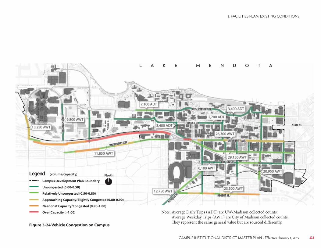
Note: Average Daily Trips (ADT) are UW-Madison collected counts. Average Weekday Trips (AWT) are City of Madison collected counts. They represent the same general value but are sourced differently.
NorthLegendCampus Development Plan Boundary
Uncongested (0.00-0.50)
Relatively Uncongested (0.50-0.80)
Approaching Capacity/Slightly Congested (0.80-0.90)
Near or at Capacity/Congested (0.90-1.00)
Over Capacity (>1.00)
(volume/capacity)
Figure 3-24 Vehicle Congestion on Campus
103
has significant travel time implications for those traveling a relatively short distance in the opposite direction of the route.Finally, some routes on campus currently serve competing purposes. As discussed previously, this is particularly an issue for the current structure of Route 80. This route is currently structured to serve as a connector between the east and west ends of campus and as a circulator. As a result of these contradictory roles, the route is inhibited from performing well in either one. There is a strong desire for a Memorial Union to Union South circulator route that would operate back and forth between these popular destinations.Travel Time and DelaySeveral factors contribute to the issues associated with bus travel time. As discussed previously, the road network and route structures create several travel time limitations. Additionally, there are a large number of pedestrians on campus, which often conflict with bus operations, particularly at intersections such as N. Charter Street and Linden Drive, and N. Park Street and University Avenue. The current bus stop spacing on campus also is a detriment to travel time since buses stop frequently along with slow fare collection and manual rider counting methods contributing to delays. Finally, buses often face increased delay and poor performance during times of inclement weather due to degraded road conditions and high usage.Capacity LimitsCapacity is a challenge, especially during class change times. This issue causes students to have to wait for the next bus or commute via another mode. As with other issues, capacity is exacerbated during times of inclement weather since buses are delayed and have more passengers per stop than usual. During other times of the year buses are well below capacity. A more demand-responsive set of routes on campus should be examined. Improving the efficiency and reducing the capacity limitations of Route 80 is a high priority on campus.Limited to No Express ServiceCurrently there is limited or no express bus service to campus. This results in those taking transit from more remote areas to transfer or experience an indirect, time-consuming trip to campus. There is likely latent transit demand not being captured, since direct service to campus is not available. This is evident based on the substantial amount of “hide-and-ride” activity that occurs in the residential areas near campus. Direct, express transit service for area park-and-rides should be explored as a viable option to reducing on-campus vehicle use and parking demands.See the Long-Range Transportation Plan (LRTP) for additional analysis.
• Park-and-Ride Service: Metro Transit owns and operates five designated park-and-ride lots with direct transit service to and from campus. Complimentary parking is provided to riders at these locations. The university also has its own park-and-rides, including Lot 202 (served by a UW–Madison shuttle), and Lot 203 (served by a UW–Madison shuttle). These park-and-rides are serviced by the UW independently of Metro Transit in order to improve commuters’ access to campus.
Transit System AnalysisThe current transit system works well and those wishing to access campus via a high-occupancy vehicle have several options. Transit is available for those traveling just around the corner as well as those traveling to the other side of campus. Transit service is also available during the peak period, the middle of the day, and the evening.The transit system analysis presented here builds off of the 2013 Campus Transportation System Evaluation completed by Nelson Nygaard, currently serving as a reference for Transportation Services. There are several areas in need of improvement within the UW–Madison transit system. These include the street network, route structuring, travel time, capacity, and express service. Each of these items is discussed in further detail below.Street Network ConnectivityThe street network throughout campus is a significant limitation to the transit network. There is a lack of connecting roadways and a significant number of one-way streets so transit routes are required to operate in a circuitous and indirect manner. This prohibits bidirectional service, creates inefficiencies, and provides less optimal service. There is an identified wish to explore allowing transit vehicles to operate through the Observatory Drive switchback.Route StructuringThe structure of the transit routes on campus also is in need of improvement. Currently, there are many routes that operate on the same stretch of roadway, partly due to the geography of campus. This creates route duplication, which in turn causes increased congestion and operational issues.Furthermore, due to the road network and limited resources several routes operate in a circuitous fashion. This is not optimal for several reasons, but is especially an issue for circulator routes that only operate in one direction. This
104 UNIVERSITY OF WISCONSIN–MADISON
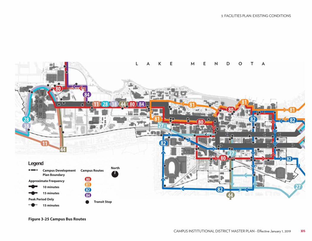
Figure 3-25 Campus Bus Routes
LegendCampus Development
Plan Boundary
Approximate Frequency
10 minutes
15 minutes
Peak Period Only
15 minutes
NorthCampus Routes
Transit Stop
105
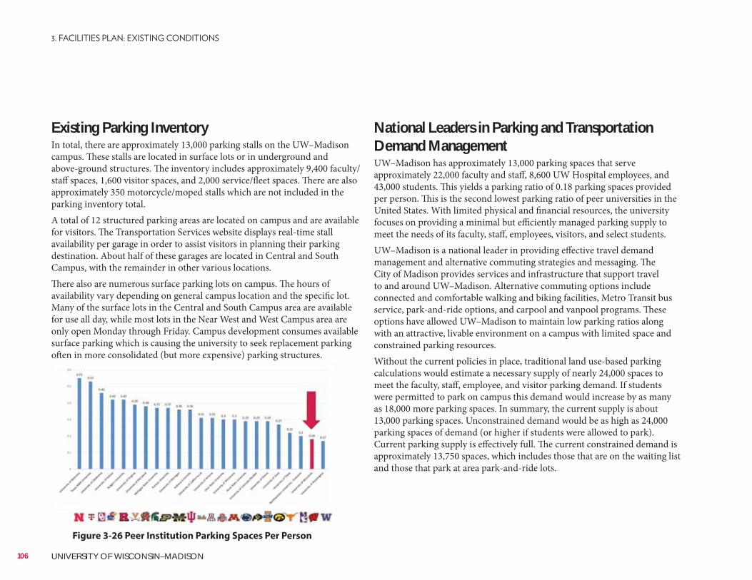
Existing Parking InventoryIn total, there are approximately 13,000 parking stalls on the UW–Madison campus. These stalls are located in surface lots or in underground and above-ground structures. The inventory includes approximately 9,400 faculty/staff spaces, 1,600 visitor spaces, and 2,000 service/fleet spaces. There are also approximately 350 motorcycle/moped stalls which are not included in the parking inventory total.A total of 12 structured parking areas are located on campus and are available for visitors. The Transportation Services website displays real-time stall availability per garage in order to assist visitors in planning their parking destination. About half of these garages are located in Central and South Campus, with the remainder in other various locations.There also are numerous surface parking lots on campus. The hours of availability vary depending on general campus location and the specific lot. Many of the surface lots in the Central and South Campus area are available for use all day, while most lots in the Near West and West Campus area are only open Monday through Friday. Campus development consumes available surface parking which is causing the university to seek replacement parking often in more consolidated (but more expensive) parking structures.
National Leaders in Parking and Transportation Demand ManagementUW–Madison has approximately 13,000 parking spaces that serve approximately 22,000 faculty and staff, 8,600 UW Hospital employees, and 43,000 students. This yields a parking ratio of 0.18 parking spaces provided per person. This is the second lowest parking ratio of peer universities in the United States. With limited physical and financial resources, the university focuses on providing a minimal but efficiently managed parking supply to meet the needs of its faculty, staff, employees, visitors, and select students.UW–Madison is a national leader in providing effective travel demand management and alternative commuting strategies and messaging. The City of Madison provides services and infrastructure that support travel to and around UW–Madison. Alternative commuting options include connected and comfortable walking and biking facilities, Metro Transit bus service, park-and-ride options, and carpool and vanpool programs. These options have allowed UW–Madison to maintain low parking ratios along with an attractive, livable environment on a campus with limited space and constrained parking resources.Without the current policies in place, traditional land use-based parking calculations would estimate a necessary supply of nearly 24,000 spaces to meet the faculty, staff, employee, and visitor parking demand. If students were permitted to park on campus this demand would increase by as many as 18,000 more parking spaces. In summary, the current supply is about 13,000 parking spaces. Unconstrained demand would be as high as 24,000 parking spaces of demand (or higher if students were allowed to park). Current parking supply is effectively full. The current constrained demand is approximately 13,750 spaces, which includes those that are on the waiting list and those that park at area park-and-ride lots.
Figure 3-26 Peer Institution Parking Spaces Per Person
106 UNIVERSITY OF WISCONSIN–MADISON
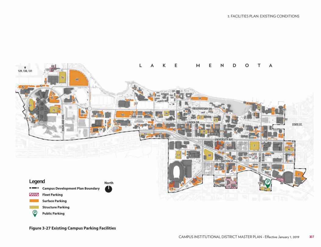
Figure 3-27 Existing Campus Parking Facilities
NorthLegendCampus Development Plan Boundary
Fleet Parking
Surface Parking
Structure Parking
Public Parking
107
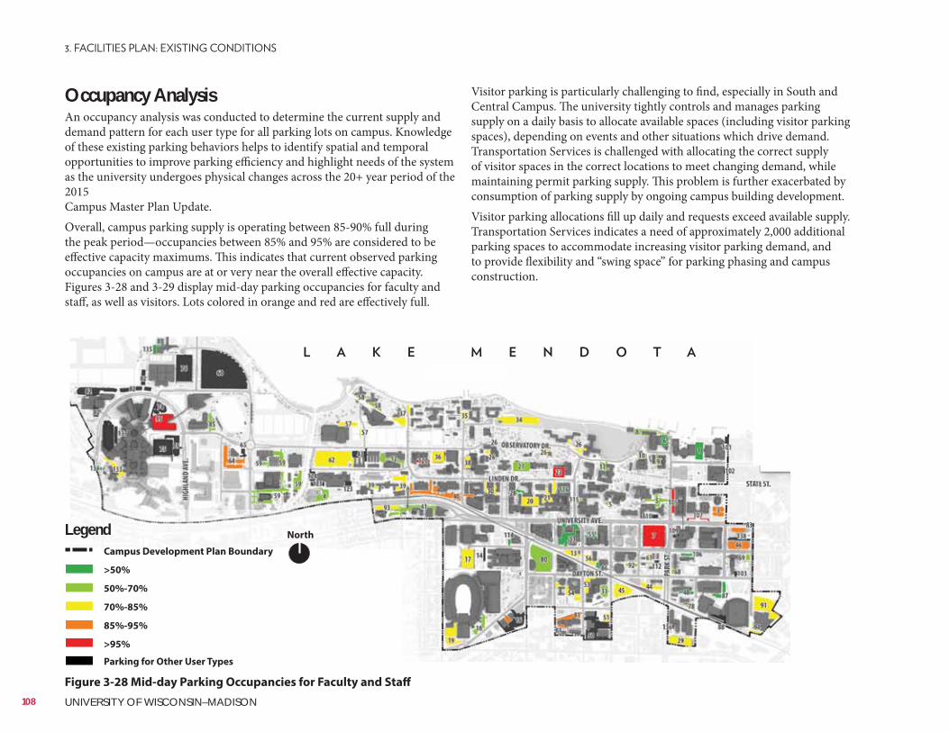
Lake Mendota
Visitor parking is particularly challenging to find, especially in South and Central Campus. The university tightly controls and manages parking supply on a daily basis to allocate available spaces (including visitor parking spaces), depending on events and other situations which drive demand. Transportation Services is challenged with allocating the correct supply of visitor spaces in the correct locations to meet changing demand, while maintaining permit parking supply. This problem is further exacerbated by consumption of parking supply by ongoing campus building development.Visitor parking allocations fill up daily and requests exceed available supply. Transportation Services indicates a need of approximately 2,000 additional parking spaces to accommodate increasing visitor parking demand, and to provide flexibility and “swing space” for parking phasing and campus construction.
Occupancy AnalysisAn occupancy analysis was conducted to determine the current supply and demand pattern for each user type for all parking lots on campus. Knowledge of these existing parking behaviors helps to identify spatial and temporal opportunities to improve parking efficiency and highlight needs of the system as the university undergoes physical changes across the 20+ year period of the 2015 Campus Master Plan Update.Overall, campus parking supply is operating between 85-90% full during the peak period—occupancies between 85% and 95% are considered to be effective capacity maximums. This indicates that current observed parking occupancies on campus are at or very near the overall effective capacity. Figures 3-28 and 3-29 display mid-day parking occupancies for faculty and staff, as well as visitors. Lots colored in orange and red are effectively full.
NorthLegendCampus Development Plan Boundary
>50%
50%-70%
70%-85%
85%-95%
>95%
Parking for Other User Types
Figure 3-28 Mid-day Parking Occupancies for Faculty and Staff
108 UNIVERSITY OF WISCONSIN–MADISON
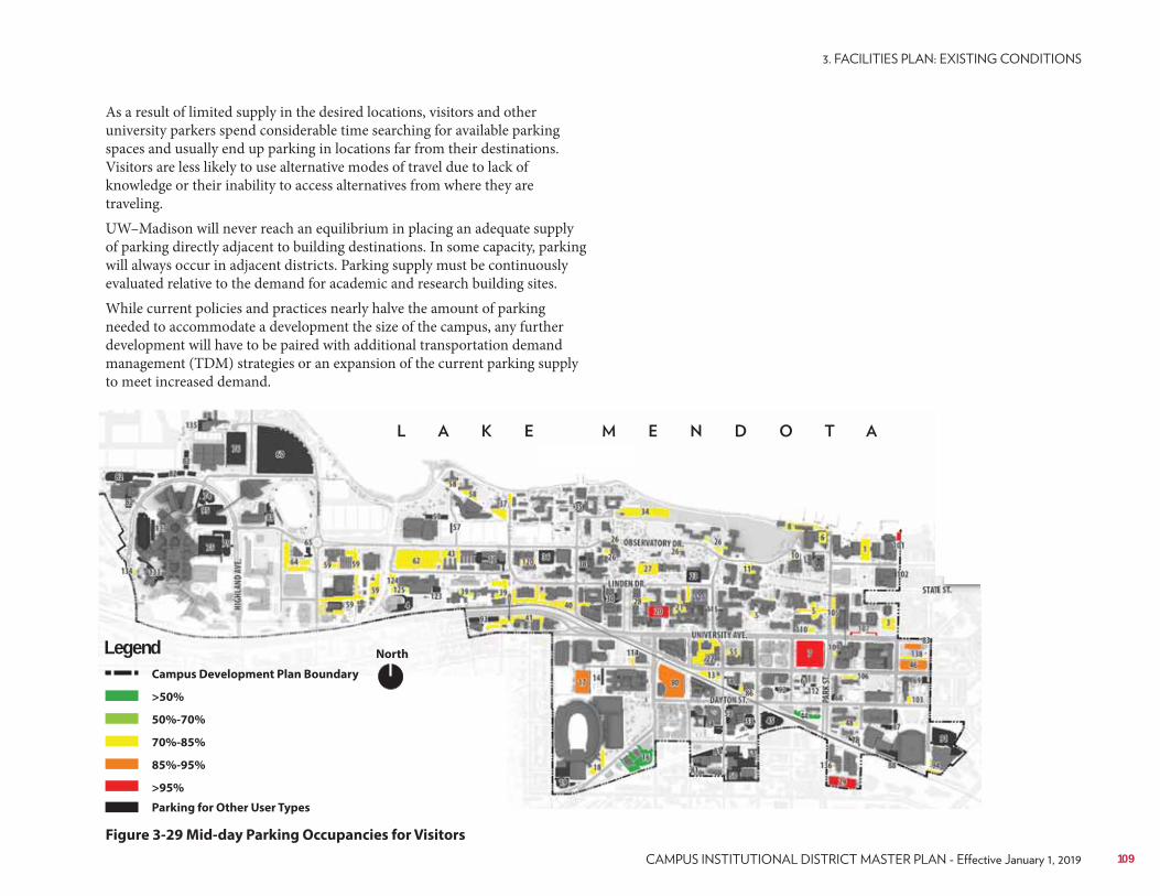
Lake Mendota
As a result of limited supply in the desired locations, visitors and other university parkers spend considerable time searching for available parking spaces and usually end up parking in locations far from their destinations. Visitors are less likely to use alternative modes of travel due to lack of knowledge or their inability to access alternatives from where they are traveling.UW–Madison will never reach an equilibrium in placing an adequate supply of parking directly adjacent to building destinations. In some capacity, parking will always occur in adjacent districts. Parking supply must be continuously evaluated relative to the demand for academic and research building sites.While current policies and practices nearly halve the amount of parking needed to accommodate a development the size of the campus, any further development will have to be paired with additional transportation demand management (TDM) strategies or an expansion of the current parking supply to meet increased demand.
NorthLegendCampus Development Plan Boundary
>50%
50%-70%
70%-85%
85%-95%
>95%
Parking for Other User Types
Figure 3-29 Mid-day Parking Occupancies for Visitors
109

110 UNIVERSITY OF WISCONSIN–MADISON
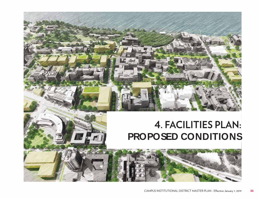
PROPOSED CONDITIONS
111
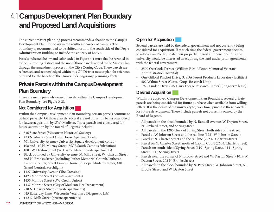
4.1 Campus Development Plan Boundary and Proposed Land AcquisitionsThe current master planning process recommends a change to the Campus Development Plan Boundary in the southeast corner of campus. The boundary is recommended to be shifted north to the south side of the Doyle Administration Building to include the entirety of Lot 91.Parcels indicated below and color coded in Figure 4-1 must first be rezoned in to the C-I zoning district and the use of those parcels added to the Master Plan through the amendment process in the City’s Zoning Code. These parcels are referenced and acknowledged within this C-I District master plan for reference only and for the benefit of the University’s long-range planning efforts.
Open for AcquisitionSeveral parcels are held by the federal government and not currently being considered for acquisition. If at such time the federal government decides to relocate and/or liquidate their property interests in these locations, the university would be interested in acquiring the land under prior agreements with the federal government.• 2500 Overlook Terrace (William F. Middleton Memorial Veterans
Administration Hospital)• One Gifford Pinchot Drive, (USDA Forest Products Laboratory facilities)• 502 Walnut Street (Cereal Crops Research Unit)• 1925 Linden Drive (US Dairy Forage Research Center) (long-term lease)
Desired AcquisitionWithin the approved Campus Development Plan Boundary, several private parcels are being considered for future purchase when available from willing sellers. It is the desire of the university to, over time, purchase these parcels for future development. These include parcels not currently owned by the Board of Regents.• All parcels in the block bounded by N. Randall Avenue, W. Dayton Street,
N. Orchard Street, and Spring Street• All parcels in the 1200 block of Spring Street, both sides of the street• Parcel at W. Johnson Street and the rail line (1221 W. Johnson Street)• Parcel at N. Charter Street and the rail line (222 N. Charter Street)• Parcel on N. Charter Street, north of Capitol Court (26 N. Charter Street)• Parcels on south side of Spring Street (1101 Spring Street, 1111 Spring
Street, 1115 Spring Street)• Parcels near the corner of N. Brooks Street and W. Dayton Street (1014 W.
Dayton Street, 202 N. Brooks Street)• All parcels in the block bounded by N. Park Street, W. Johnson Street, N.
Brooks Street, and W. Dayton Street
Private Parcels within the Campus Development Plan BoundaryThere are many privately-owned parcels within the Campus Development Plan Boundary (see Figure 3-2).
Not Considered for AcquisitionWithin the Campus Development Plan Boundary, certain parcels continue to be held privately. Of those parcels, several are not currently being considered for future acquisition by UW–Madison. Those parcels not considered for future acquisition by the Board of Regents include:• 816 State Street (Wisconsin Historical Society)• 433 N. Murray Street (Pres House Apartments site)• 701 University Avenue (University Square development-condo)• 108 and 110 N. Murray Street (MGE South Campus Substation)• 1001 W. Dayton Street (W. Dayton Street private apartments)• Block bounded by University Avenue, N. Mills Street, W. Johnson Street
and N. Brooks Street (including Luther Memorial Church/Lutheran Campus Center, Street Francis House Episcopal Student Center, X01, Grand Central, Porchlight)
• 1127 University Avenue (The Crossing)• 1423 Monroe Street (private apartments)• 1435 Monroe Street (UW Credit Union)• 1437 Monroe Street (City of Madison Fire Department)• 210 N. Charter Street (private apartments)• 445 Easterday Lane (Wisconsin Veterinary Diagnostic Lab)• 112 N. Mills Street (private apartments)
112 UNIVERSITY OF WISCONSIN–MADISON
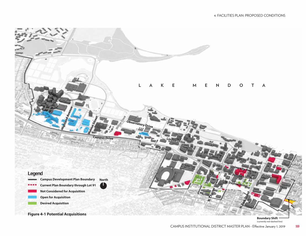
NorthCampus Development Plan Boundary
Current Plan Boundary through Lot 91
Not Considered for Acquisition
Open for Acquisition
Desired Acquisition
Legend
Figure 4-1 Potential Acquisitions
Campus Drive
Observatory Drive
N. C
ha
rte
r S
tre
et
N. P
ark
Str
ee
t
Boundary Shift(currently red-dashed line)
University Avenue
Linden Drive
W. Dayton Street
Wa
lnu
t S
tre
et
Willo
w Cre
ek
W. Johnson Street
Hig
hla
nd
Av
en
ue
113
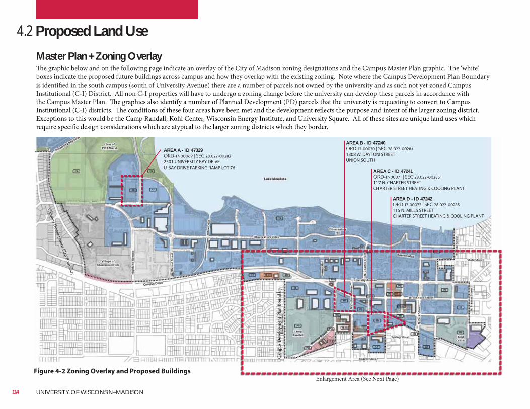
Master Plan + Zoning OverlayThe graphic below and on the following page indicate an overlay of the City of Madison zoning designations and the Campus Master Plan graphic. The ‘white’ boxes indicate the proposed future buildings across campus and how they overlap with the existing zoning. Note where the Campus Development Plan Boundary is identified in the south campus (south of University Avenue) there are a number of parcels not owned by the university and as such not yet zoned Campus Institutional (C-I) District. All non C-I properties will have to undergo a zoning change before the university can develop these parcels in accordance with the Campus Master Plan. The graphics also identify a number of Planned Development (PD) parcels that the university is requesting to convert to Campus Institutional (C-I) districts. The conditions of these four areas have been met and the development reflects the purpose and intent of the larger zoning district. Exceptions to this would be the Camp Randall, Kohl Center, Wisconsin Energy Institute, and University Square. All of these sites are unique land uses which require specific design considerations which are atypical to the larger zoning districts which they border.
Enlargement Area (See Next Page)
Cam
pus D
evelo
pmen
t Pla
n Bo
unda
ry
Campus D
evelopment Plan Boundary
Cam
Cam
Cam
Cam
Cam
Cam
Cam
Cam
Cam
CamamCamamCammammCam
Camm
Cam
Cam
Cam
Cam
Camm
CammammmammmmCCC
pususpus
pus
puss
pus
pus
pus
pus
pupupupupupupuupuppppppppppppppD
eD
eD
eD
eD
eD
eD
eeD
eD
eD
eeD
eD
eD
eeD
eD
eeD
eD
eeDDDDDDDDDDDDDDDDD
vel
vel
vel
vel
vel
vel
vel
vel
vel
vel
velll
vell
vell
vel
vel
vel
vel
vel
vel
vellleveeeevvvop
mpppopm
opm
opm
opmm
opm
opm
opm
opm
opm
opm
opm
opm
opm
opm
opm
opm
opm
opmpopmpmppppoppooooooo
ent
ent
ent
ent
ent
ent
ent
entt
ent
entt
ent
ent
ent
ent
ent
ent
enttttntnennnenennneneneeeee
PlPlPllPlPlPlPlPlPlPllPlllllPlllPPPPPPan
an
an
an
anananannanananannnananananaaaaaaaaa
Bou
BououououuBou
Bou
Bou
Bou
Bou
Bou
Bouu
Bou
Bou
Bou
Bou
BouououoBoooooooBooooBBBB
nda
nda
nda
nda
nda
nda
ndaaa
ndaadandadanda
ndaaaa
nda
nda
nda
nda
nda
nda
ndnddddnddnnnnry
yry
ry
ry
ry
ryy
ry
ry yyryry yryryryyyyryyyyrrrr
4.2 Proposed Land Use
Figure 4-2 Zoning Overlay and Proposed Buildings
AREA A - ID 47329
2501 UNIVERSITY BAY DRIVEU-BAY DRIVE PARKING RAMP LOT 76
AREA B - ID 47240
1308 W. DAYTON STREETUNION SOUTH
AREA C - ID 47241
117 N. CHARTER STREETCHARTER STREET HEATING & COOLING PLANT
AREA D - ID 47242
115 N. MILLS STREETCHARTER STREET HEATING & COOLING PLANT
114 UNIVERSITY OF WISCONSIN–MADISON
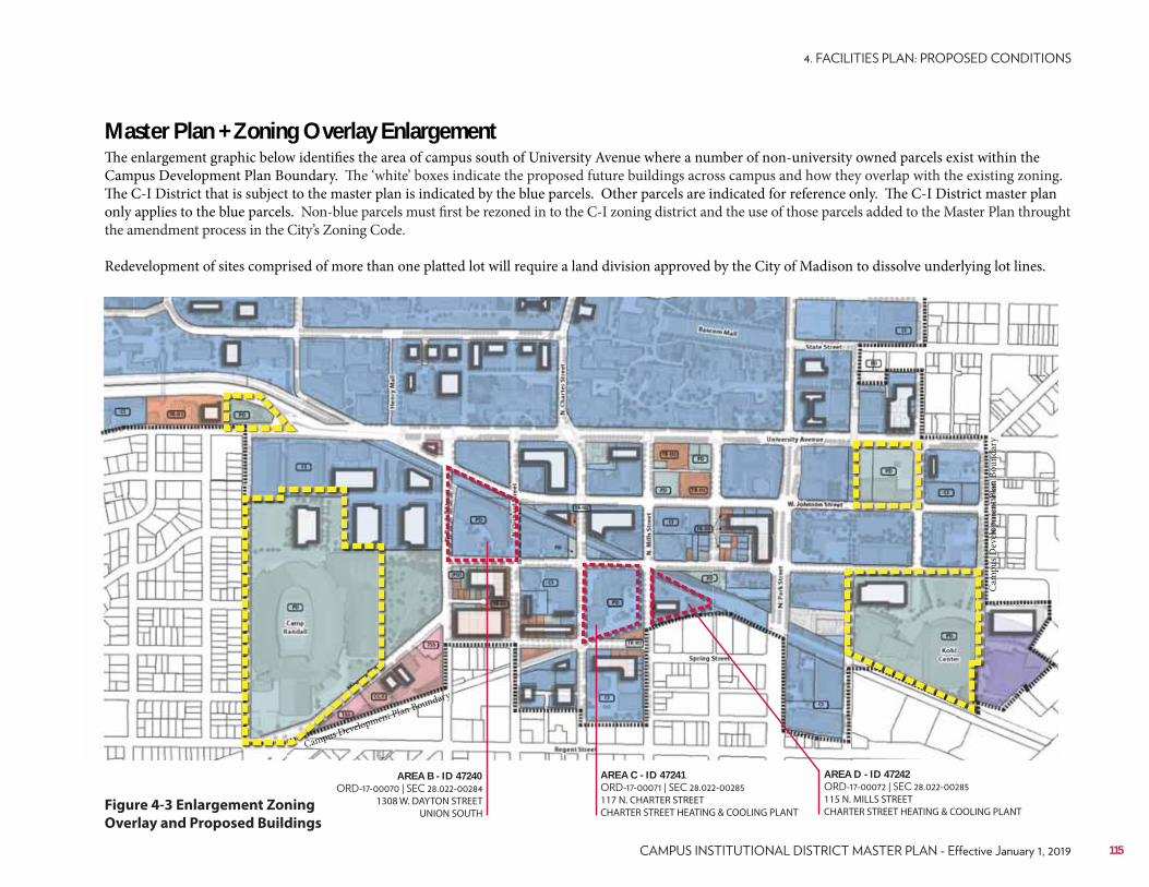
Campus Development Plan Boundary
Master Plan + Zoning Overlay EnlargementThe enlargement graphic below identifies the area of campus south of University Avenue where a number of non-university owned parcels exist within the Campus Development Plan Boundary. The ‘white’ boxes indicate the proposed future buildings across campus and how they overlap with the existing zoning. The C-I District that is subject to the master plan is indicated by the blue parcels. Other parcels are indicated for reference only. The C-I District master plan only applies to the blue parcels. Non-blue parcels must first be rezoned in to the C-I zoning district and the use of those parcels added to the Master Plan throught the amendment process in the City’s Zoning Code.
Redevelopment of sites comprised of more than one platted lot will require a land division approved by the City of Madison to dissolve underlying lot lines.
mCamCamCamCamC mmmmCammmCammmmmmmmmmmmmmmmmmmmpuspuspuspuspuspuspusppuspuspuspuspuspuspuspuspuspuspuspuspuspuspuspuspuspuspuspusupupuuuspupupuuppupupuupupusppppuppup DeDeDeDeDeDeeDeDeDeDeDeDeDeDeDeDeDeDeDeDeDeDeDeDeeDeDDeDeDDDDDDDDDDD velvvevelvelvelvelvelvelvelvelevelvelvelvelvellvelvelvelvelvelelellvelvelelvevevelvevvvvvvvv opmopmopmopmopmopmopmopmopopmopmoopmopmmopmopmopmmopmmopmopmpmopmopmopmmopmmpmopmopmopmpmmopppopoo entententententenentententententententenenentntnnenenententeneneenennneeeeeee
Cam
pus D
evelo
pmen
t Pla
n Bo
unda
ry
Figure 4-3 Enlargement Zoning
Overlay and Proposed Buildings
AREA B - ID 47240
1308 W. DAYTON STREETUNION SOUTH
AREA C - ID 47241
117 N. CHARTER STREETCHARTER STREET HEATING & COOLING PLANT
AREA D - ID 47242
115 N. MILLS STREETCHARTER STREET HEATING & COOLING PLANT
115
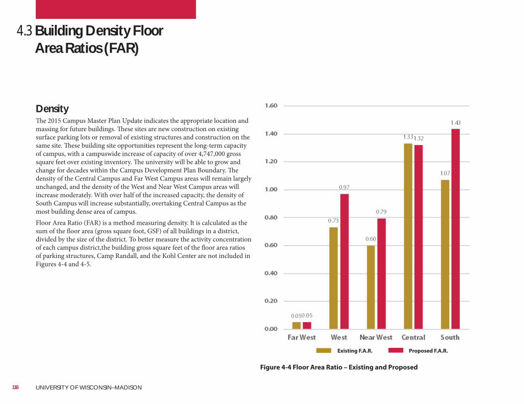
DensityThe 2015 Campus Master Plan Update indicates the appropriate location and massing for future buildings. These sites are new construction on existing surface parking lots or removal of existing structures and construction on the same site. These building site opportunities represent the long-term capacity of campus, with a campuswide increase of capacity of over 4,747,000 gross square feet over existing inventory. The university will be able to grow and change for decades within the Campus Development Plan Boundary. The density of the Central Campus and Far West Campus areas will remain largely unchanged, and the density of the West and Near West Campus areas will increase moderately. With over half of the increased capacity, the density of South Campus will increase substantially, overtaking Central Campus as the most building dense area of campus.Floor Area Ratio (FAR) is a method measuring density. It is calculated as the sum of the floor area (gross square foot, GSF) of all buildings in a district, divided by the size of the district. To better measure the activity concentration of each campus district,the building gross square feet of the floor area ratios of parking structures, Camp Randall, and the Kohl Center are not included in Figures 4-4 and 4-5.
Figure 4-4 Floor Area Ratio – Existing and Proposed
Existing F.A.R. Proposed F.A.R.
4.3 Building Density Floor Area Ratios (FAR)
116 UNIVERSITY OF WISCONSIN–MADISON
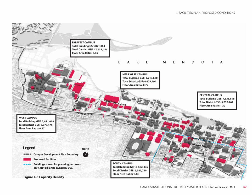
FAR WEST CAMPUS
Total Building GSF: 871,064
Total District GSF: 17,639,456
Floor Area Ratio: 0.05
WEST CAMPUS
Total Building GSF: 5,881,018
Total District GSF: 6,073,475
Floor Area Ratio: 0.97
NEAR WEST CAMPUS
Total Building GSF: 3,713,680
Total District GSF: 4,679,994
Floor Area Ratio: 0.79
CENTRAL CAMPUS
Total Building GSF: 7,636,898
Total District GSF: 5,792,264
Floor Area Ratio: 1.32
SOUTH CAMPUS
Total Building GSF: 9,582,435
Total District GSF: 6,687,740
Floor Area Ratio: 1.43
North
Figure 4-5 Capacity Density
Campus Development Plan Boundary
Proposed Facilities
Buildings shown for planning purposes,
only. Not all lands owned by UW.
Legend
Campus Drive
Observatory Drive
N. C
ha
rte
r S
tre
et
N. P
ark
Str
ee
t
Linden Drive
W. Dayton Street
Wa
lnu
t S
tre
et
Will
ow C
reek
W. Johnson Street
Hig
hla
nd
Av
en
ue
117
University Avenue
4.4 Proposed Building Use
The campus has a clear existing building use pattern and the 2015 Master Plan Update strengthens and extends that pattern. Academic and research uses are concentrated in the Central and South Campus areas, clinical and health teaching and research in the West Campus area, and agricultural teaching and research in the Near West area. There are two distinct student housing neighborhoods, in the southeast and along the lakeshore, each with significant outdoor and indoor recreational facilities. Outdoor recreational fields are located in lower density Near West, West, and Far West Campuses. Athletic venues are in the South Campus and West Campus areas. The most significant building use pattern change proposed in the 2015 Campus Master Plan Update is a relocation and expansion of medical and health related teaching and research from the Central Campus to the West CampusA detailed listing of all major planned buildings follows. In each section, where a new building is proposed, it is referenced to a map by a key location and building number. For example, “W-08” would be a new building on the West Campus or Near West Campus The numeric numbers are in a simple geographic sequence and does not signify a timeline or sequence as to how the buildings would be built over time.
Building DemolitionPer MGO 48025 Section 28.185, demolition of buildings identified in the approved C-I District master plan shall be exempt from Plan Commission approval and the need to seek demolition approvals for those identified buildings. However, projects that involve historic buildings and/or structures, even if they are not landmarks, must be reviewed by the Wisconsin Historical Society (WHS). Consideration shall also be given to proposed buildings or major renovations that occur adjacent to historic buildings and/or structures. Proposals shall not negatively impact the historic context they are being placed within.
City CoordinationAs part of the master plan, it is anticipated that there will be some University of Wisconsin improvements within the City right-of-ways. The coordination of these improvements within the right-of-way may require, but are not limited to maintenance agreements, encroachment agreements, air/subterranean leases, street vacations/dedications, or intergovernmental agreements.
118 UNIVERSITY OF WISCONSIN–MADISON

North
LegendCampus Districts
Academic
Research
Administrative
Residential
Athletics
Recreation Sports
Union/Student
Center, Dining/
Food Service,
Outreach
Service/Support,
Other
Parking
Health/Hospital
Non-University
Building
Figure 4-6 Proposed Building Uses
Campus Drive
Observatory Drive
N. C
ha
rte
r S
tre
et
N. P
ark
Str
ee
t
University Avenue
Linden Drive
W. Dayton Street
Wa
lnu
t S
tre
et
Will
ow C
reek
W. Johnson Street
Hig
hla
nd
Av
en
ue
119
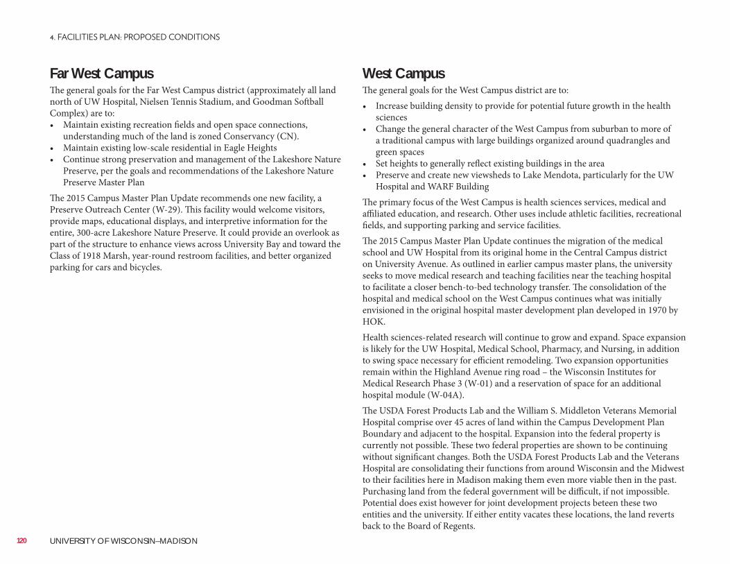
Far West CampusThe general goals for the Far West Campus district (approximately all land north of UW Hospital, Nielsen Tennis Stadium, and Goodman Softball Complex) are to:• Maintain existing recreation fields and open space connections,
understanding much of the land is zoned Conservancy (CN).• Maintain existing low-scale residential in Eagle Heights• Continue strong preservation and management of the Lakeshore Nature
Preserve, per the goals and recommendations of the Lakeshore Nature Preserve Master Plan
The 2015 Campus Master Plan Update recommends one new facility, a Preserve Outreach Center (W-29). This facility would welcome visitors, provide maps, educational displays, and interpretive information for the entire, 300-acre Lakeshore Nature Preserve. It could provide an overlook as part of the structure to enhance views across University Bay and toward the Class of 1918 Marsh, year-round restroom facilities, and better organized parking for cars and bicycles.
West CampusThe general goals for the West Campus district are to:• Increase building density to provide for potential future growth in the health
sciences• Change the general character of the West Campus from suburban to more of
a traditional campus with large buildings organized around quadrangles and green spaces
• Set heights to generally reflect existing buildings in the area• Preserve and create new viewsheds to Lake Mendota, particularly for the UW
Hospital and WARF BuildingThe primary focus of the West Campus is health sciences services, medical and affiliated education, and research. Other uses include athletic facilities, recreational fields, and supporting parking and service facilities.The 2015 Campus Master Plan Update continues the migration of the medical school and UW Hospital from its original home in the Central Campus district on University Avenue. As outlined in earlier campus master plans, the university seeks to move medical research and teaching facilities near the teaching hospital to facilitate a closer bench-to-bed technology transfer. The consolidation of the hospital and medical school on the West Campus continues what was initially envisioned in the original hospital master development plan developed in 1970 by HOK.Health sciences-related research will continue to grow and expand. Space expansion is likely for the UW Hospital, Medical School, Pharmacy, and Nursing, in addition to swing space necessary for efficient remodeling. Two expansion opportunities remain within the Highland Avenue ring road – the Wisconsin Institutes for Medical Research Phase 3 (W-01) and a reservation of space for an additional hospital module (W-04A).The USDA Forest Products Lab and the William S. Middleton Veterans Memorial Hospital comprise over 45 acres of land within the Campus Development Plan Boundary and adjacent to the hospital. Expansion into the federal property is currently not possible. These two federal properties are shown to be continuing without significant changes. Both the USDA Forest Products Lab and the Veterans Hospital are consolidating their functions from around Wisconsin and the Midwest to their facilities here in Madison making them even more viable then in the past. Purchasing land from the federal government will be difficult, if not impossible. Potential does exist however for joint development projects beteen these two entities and the university. If either entity vacates these locations, the land reverts back to the Board of Regents.
120 UNIVERSITY OF WISCONSIN–MADISON
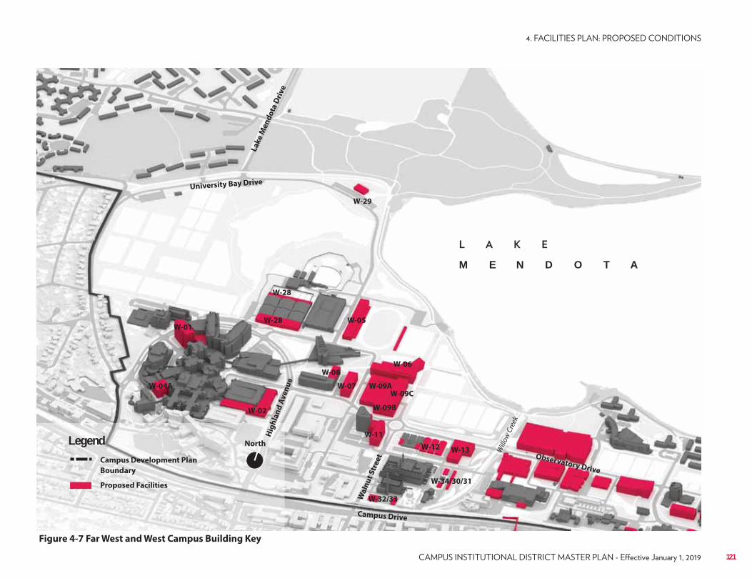
W-29
W-01
W-04A
W-02
W-28
W-28
W-05
W-06
W-07
W-08
W-09A
W-09B
W-09C
W-11
W-12 W-13
W-34/30/31
W-32/33
North
Campus Development Plan
Boundary
Proposed Facilities
Legend
Figure 4-7 Far West and West Campus Building Key
Campus Drive
Wa
lnu
t S
tre
et
Hig
hla
nd
Av
en
ue
Will
ow C
reek
La
ke
Me
nd
ota
Dri
ve
University Bay Drive
Observatory Drive
M E N D O T A
121
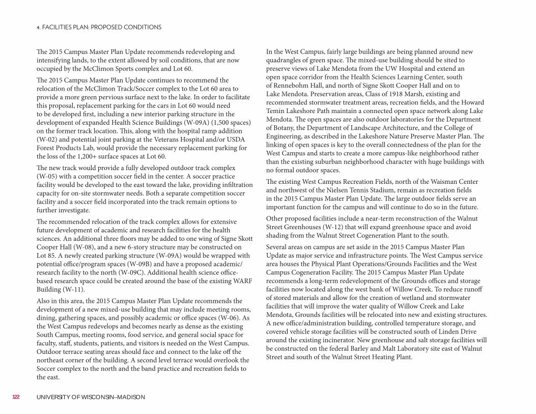
The 2015 Campus Master Plan Update recommends redeveloping and intensifying lands, to the extent allowed by soil conditions, that are now occupied by the McClimon Sports complex and Lot 60.The 2015 Campus Master Plan Update continues to recommend the relocation of the McClimon Track/Soccer complex to the Lot 60 area to provide a more green pervious surface next to the lake. In order to facilitate this proposal, replacement parking for the cars in Lot 60 would need to be developed first, including a new interior parking structure in the development of expanded Health Science Buildings (W-09A) (1,500 spaces) on the former track location. This, along with the hospital ramp addition (W-02) and potential joint parking at the Veterans Hospital and/or USDA Forest Products Lab, would provide the necessary replacement parking for the loss of the 1,200+ surface spaces at Lot 60.The new track would provide a fully developed outdoor track complex (W-05) with a competition soccer field in the center. A soccer practice facility would be developed to the east toward the lake, providing infiltration capacity for on-site stormwater needs. Both a separate competition soccer facility and a soccer field incorporated into the track remain options to further investigate.The recommended relocation of the track complex allows for extensive future development of academic and research facilities for the health sciences. An additional three floors may be added to one wing of Signe Skott Cooper Hall (W-08), and a new 6-story structure may be constructed on Lot 85. A newly created parking structure (W-09A) would be wrapped with potential office/program spaces (W-09B) and have a proposed academic/research facility to the north (W-09C). Additional health science office-based research space could be created around the base of the existing WARF Building (W-11).Also in this area, the 2015 Campus Master Plan Update recommends the development of a new mixed-use building that may include meeting rooms, dining, gathering spaces, and possibly academic or office spaces (W-06). As the West Campus redevelops and becomes nearly as dense as the existing South Campus, meeting rooms, food service, and general social space for faculty, staff, students, patients, and visitors is needed on the West Campus. Outdoor terrace seating areas should face and connect to the lake off the northeast corner of the building. A second level terrace would overlook the Soccer complex to the north and the band practice and recreation fields to the east.
In the West Campus, fairly large buildings are being planned around new quadrangles of green space. The mixed-use building should be sited to preserve views of Lake Mendota from the UW Hospital and extend an open space corridor from the Health Sciences Learning Center, south of Rennebohm Hall, and north of Signe Skott Cooper Hall and on to Lake Mendota. Preservation areas, Class of 1918 Marsh, existing and recommended stormwater treatment areas, recreation fields, and the Howard Temin Lakeshore Path maintain a connected open space network along Lake Mendota. The open spaces are also outdoor laboratories for the Department of Botany, the Department of Landscape Architecture, and the College of Engineering, as described in the Lakeshore Nature Preserve Master Plan. The linking of open spaces is key to the overall connectedness of the plan for the West Campus and starts to create a more campus-like neighborhood rather than the existing suburban neighborhood character with huge buildings with no formal outdoor spaces.The existing West Campus Recreation Fields, north of the Waisman Center and northwest of the Nielsen Tennis Stadium, remain as recreation fields in the 2015 Campus Master Plan Update. The large outdoor fields serve an important function for the campus and will continue to do so in the future.Other proposed facilities include a near-term reconstruction of the Walnut Street Greenhouses (W-12) that will expand greenhouse space and avoid shading from the Walnut Street Cogeneration Plant to the south.Several areas on campus are set aside in the 2015 Campus Master Plan Update as major service and infrastructure points. The West Campus service area houses the Physical Plant Operations/Grounds Facilities and the West Campus Cogeneration Facility. The 2015 Campus Master Plan Update recommends a long-term redevelopment of the Grounds offices and storage facilities now located along the west bank of Willow Creek. To reduce runoff of stored materials and allow for the creation of wetland and stormwater facilities that will improve the water quality of Willow Creek and Lake Mendota, Grounds facilities will be relocated into new and existing structures. A new office/administration building, controlled temperature storage, and covered vehicle storage facilities will be constructed south of Linden Drive around the existing incinerator. New greenhouse and salt storage facilities will be constructed on the federal Barley and Malt Laboratory site east of Walnut Street and south of the Walnut Street Heating Plant.
122 UNIVERSITY OF WISCONSIN–MADISON
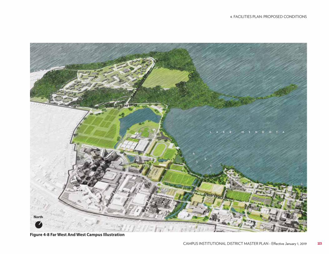
Figure 4-8 Far West And West Campus Illustration
Wa
lnu
t S
tre
et
Hig
hla
nd
Ave
nu
e
Will
ow C
reek
Lake
Men
do
ta D
rive
University Bay Drive
Observatory Drive
North
123
Near West Campus Design NeighborhoodIn the Near West Campus district, a goal is to increase overall density and expand social and working open spaces. Currently the area is a mixture of low or single-story Agricultural Farm Buildings and higher density research and academic facilities. The Near West Campus will not only continue to maintain its land grant Agricultural Buildings but also increase density to allow for new research facilities to be constructed.A large near-term academic and research facility is a new Veterinary Medicine hospital and research facility (W-17), which will be an expansion of small animal clinical and research programs in the new building and renewal of portions of the existing small and large animal hospitals. The expansion will occur on the site of the existing 410-stall Lot 62, and parking will be replaced in a new 625-stall parking structure (W-27).The pre-design for the new Veterinary Medicine hospital and research facility requires two at-grade connector hallways between the existing and proposed structures, cutting off Linden Drive. In order to improve the Willow Creek corridor by replacing impermeable driving surfaces with permeable and attractive open spaces, the 2015 Campus Master Plan Update recommends that Easterday Lane be removed. Circulation to the existing small animal drop-off will be accommodated by a reconstruction of the existing pedestrian/utility bridge over Willow Creek into a wider bridge that will accommodate vehicles. Access to the east side of the new Veterinary Medicine Hospital will occur off Linden Drive, and large animal loading and drop-off along the east and south sides of the existing hospital.Systematic reconstruction of facilities along the south side of Observatory Drive and west of Elm Drive will provide additional space for new and expanded agricultural research facilities. The first project, the Meat Science and Muscle Biology Building (W-18), will replace the existing Meat and Muscle Biology facility. This new 2-story, modern teaching, research, and outreach facility will support the meat industry of the State of Wisconsin. Future sites along the south edge of Observatory Drive are a Poultry and Livestock Laboratory Building (W-20) and Biological Systems Engineering Building (W-19).
Near West CampusThe general goals for the Near West Campus district are to:• Increase building density to provide for potential future growth in
agricultural and life sciences• Replace single-story buildings to better tie the West and Central Campuses
together in a more traditional campus setting building• Improve the Willow Creek corridor and water quality through adjacent
site redevelopment and wetland and stormwater facilities• Capture and treat stormwater along the Linden Drive and Observatory
Drive corridors, creating a new campus “green neighborhood”
124 UNIVERSITY OF WISCONSIN–MADISON
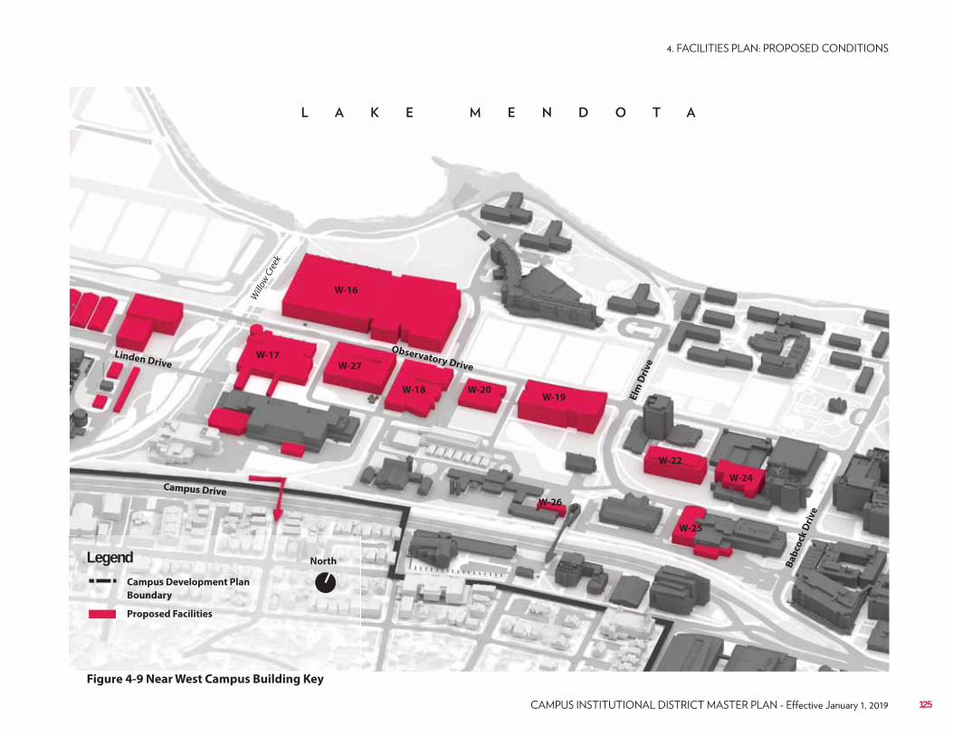
W-16
W-17
W-20W-19
W-18
W-22
W-25
W-27
W-24
W-26
North
Campus Development Plan
Boundary
Proposed Facilities
Legend
Campus Drive
Elm
Dri
ve
Linden Drive
Willo
w C
reek
Observatory Drive
Figure 4-9 Near West Campus Building Key
Ba
bco
ck D
riv
e
125
Lakeshore Campus Design NeighborhoodWith the construction of Dejope Residence Hall and Leopold Hall since the 2005 Campus Master Plan, no expansion of residential beds is planned for the Lakeshore Residences Neighborhood. Incremental renovations and improvements of existing halls will continue, but density will not further increase. Rather, recreational-related projects will improve the desirability of this historic neighborhood. A goal is that the residential neighborhood be organized around major areas of open space and maintain the existing active recreation fields for student enjoyment and active exercise.The existing Natatorium is undersized, overused, and per the 2012 Recreational Sports Master Plan cannot be renovated effectively. The 2015 Campus Master Plan Update recommends a new recreational facility (W-16) on the same site. The replacement facility will be larger to accommodate increased activity and residents in the Lakeshore Residences Neighborhood and recreational facilities relocated from elsewhere on campus. The scale of the new facility will overwhelm the largely small-scale character of the Lakeshore Residential Neighborhood, so it must be sited and planned carefully. Its height should be no higher than Dejope Residential Hall. A minimum 75-foot setback from Willow Creek will provide active and passive open space that is focused on the creek, and a 25-foot setback from the effigy mounds located north of the site. A new pedestrian bridge should connect the Near West Fields with the Natatorium.The Near West Fields will soon be upgraded. The existing fields, at approximately 383,140 gross square feet, will be re-graded to create five synthetic turf flag football fields and one championship soccer field. A portion of the fields will function as a stormwater management facility via an open graded stone layer. Existing stormwater treatment along the south and east edges of the existing fields will be maintained.Like the Near West Fields, the Near East Recreation Fields, located on Observatory Drive just west of Elm Drive, are slated to be rebuilt with synthetic turf fields in the Recreational Facility Master Plan. These fields sit at the confluence of several large storm sewers that collect a vast tributary area before discharging to Lake Mendota. Approximately 32 acres of stormwater runoff pass by this site, from as far away as Henry Mall. When reconstructed, the Near East Fields should be constructed above a new underground stormwater detention chamber.
These new facilities should be sited along and be serviced by Observatory Drive. Areas south of these new structures should be reserved for an open space corridor between the Horse Barn and Meat Science and Muscle Biology Building. The open space will support the repurposing of the Horse Barn (perhaps as an event space) and provide an appropriate setting for the characteristic agricultural land grant buildings of the Horse Barn and Dairy Cattle Center. The open space should also function as stormwater capture and cleaning, a part of the “green neighborhood” system.The existing Meat and Muscle Biology facility lies within the railroad right-of-way, and it blocks one of the two remaining missing links of the campus off-street bicycle network. When the existing Meat and Muscle Biology Building is repurposed, the portion of the building in the railroad right-of-way should be studied for removal and any necessary expansion on the north facade (W-26), allowing for the eastward continuation of the commuter path.To the east of Elm Drive, north of the existing historic Stock Pavilion and north of Linden Drive are sites for a new Plant Sciences Building (W-24) and a Animal Sciences (AHABS) Building (W-22).
126 UNIVERSITY OF WISCONSIN–MADISON
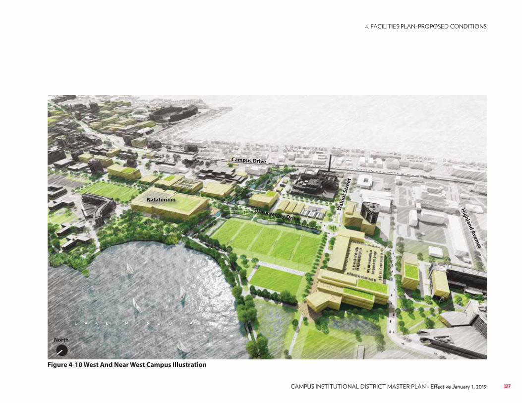
Figure 4-10 West And Near West Campus Illustration
Campus Drive
Wa
lnu
t S
tre
et
Hig
hla
nd
Av
en
ue
North
Observatory Drive
Natatorium
OOOOOOOOOOOOOOOOOOOOOOOOOOOOOOOOOOO
Willow Creek
127
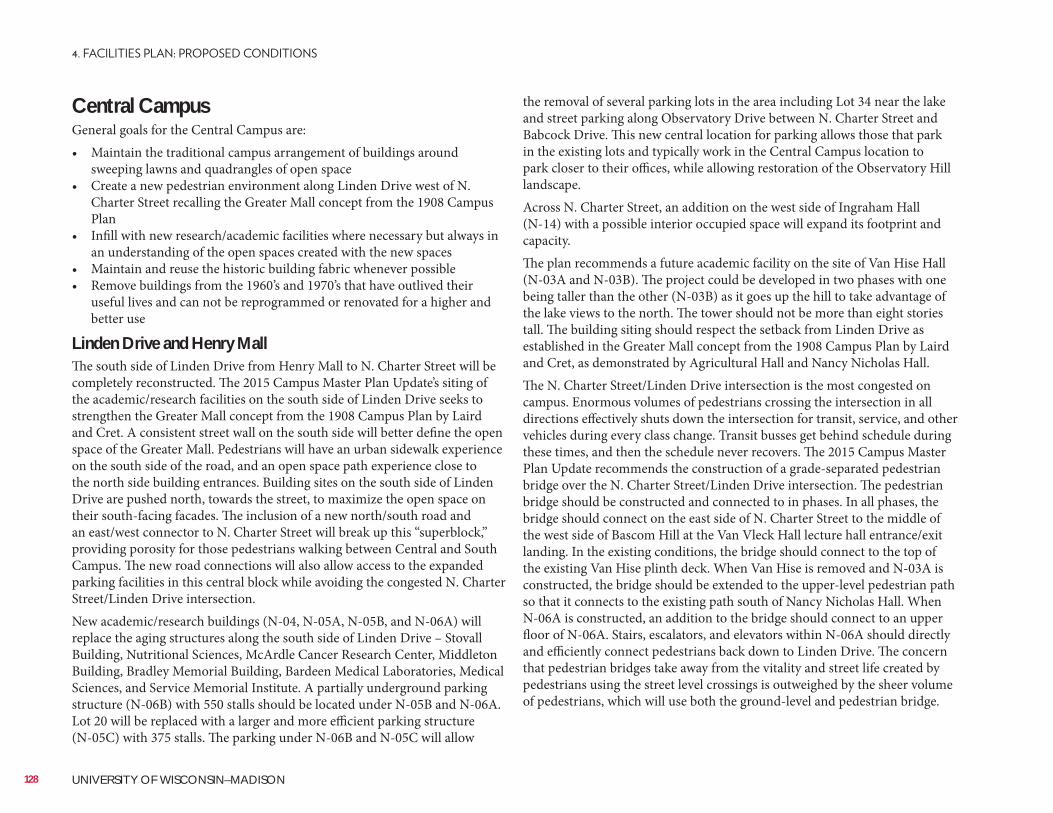
the removal of several parking lots in the area including Lot 34 near the lake and street parking along Observatory Drive between N. Charter Street and Babcock Drive. This new central location for parking allows those that park in the existing lots and typically work in the Central Campus location to park closer to their offices, while allowing restoration of the Observatory Hill landscape.Across N. Charter Street, an addition on the west side of Ingraham Hall (N-14) with a possible interior occupied space will expand its footprint and capacity.The plan recommends a future academic facility on the site of Van Hise Hall (N-03A and N-03B). The project could be developed in two phases with one being taller than the other (N-03B) as it goes up the hill to take advantage of the lake views to the north. The tower should not be more than eight stories tall. The building siting should respect the setback from Linden Drive as established in the Greater Mall concept from the 1908 Campus Plan by Laird and Cret, as demonstrated by Agricultural Hall and Nancy Nicholas Hall.The N. Charter Street/Linden Drive intersection is the most congested on campus. Enormous volumes of pedestrians crossing the intersection in all directions effectively shuts down the intersection for transit, service, and other vehicles during every class change. Transit busses get behind schedule during these times, and then the schedule never recovers. The 2015 Campus Master Plan Update recommends the construction of a grade-separated pedestrian bridge over the N. Charter Street/Linden Drive intersection. The pedestrian bridge should be constructed and connected to in phases. In all phases, the bridge should connect on the east side of N. Charter Street to the middle of the west side of Bascom Hill at the Van Vleck Hall lecture hall entrance/exit landing. In the existing conditions, the bridge should connect to the top of the existing Van Hise plinth deck. When Van Hise is removed and N-03A is constructed, the bridge should be extended to the upper-level pedestrian path so that it connects to the existing path south of Nancy Nicholas Hall. When N-06A is constructed, an addition to the bridge should connect to an upper floor of N-06A. Stairs, escalators, and elevators within N-06A should directly and efficiently connect pedestrians back down to Linden Drive. The concern that pedestrian bridges take away from the vitality and street life created by pedestrians using the street level crossings is outweighed by the sheer volume of pedestrians, which will use both the ground-level and pedestrian bridge.
Central CampusGeneral goals for the Central Campus are:• Maintain the traditional campus arrangement of buildings around
sweeping lawns and quadrangles of open space• Create a new pedestrian environment along Linden Drive west of N.
Charter Street recalling the Greater Mall concept from the 1908 Campus Plan
• Infill with new research/academic facilities where necessary but always in an understanding of the open spaces created with the new spaces
• Maintain and reuse the historic building fabric whenever possible• Remove buildings from the 1960’s and 1970’s that have outlived their
useful lives and can not be reprogrammed or renovated for a higher and better use
Linden Drive and Henry MallThe south side of Linden Drive from Henry Mall to N. Charter Street will be completely reconstructed. The 2015 Campus Master Plan Update’s siting of the academic/research facilities on the south side of Linden Drive seeks to strengthen the Greater Mall concept from the 1908 Campus Plan by Laird and Cret. A consistent street wall on the south side will better define the open space of the Greater Mall. Pedestrians will have an urban sidewalk experience on the south side of the road, and an open space path experience close to the north side building entrances. Building sites on the south side of Linden Drive are pushed north, towards the street, to maximize the open space on their south-facing facades. The inclusion of a new north/south road and an east/west connector to N. Charter Street will break up this “superblock,” providing porosity for those pedestrians walking between Central and South Campus. The new road connections will also allow access to the expanded parking facilities in this central block while avoiding the congested N. Charter Street/Linden Drive intersection.New academic/research buildings (N-04, N-05A, N-05B, and N-06A) will replace the aging structures along the south side of Linden Drive – Stovall Building, Nutritional Sciences, McArdle Cancer Research Center, Middleton Building, Bradley Memorial Building, Bardeen Medical Laboratories, Medical Sciences, and Service Memorial Institute. A partially underground parking structure (N-06B) with 550 stalls should be located under N-05B and N-06A. Lot 20 will be replaced with a larger and more efficient parking structure (N-05C) with 375 stalls. The parking under N-06B and N-05C will allow
128 UNIVERSITY OF WISCONSIN–MADISON
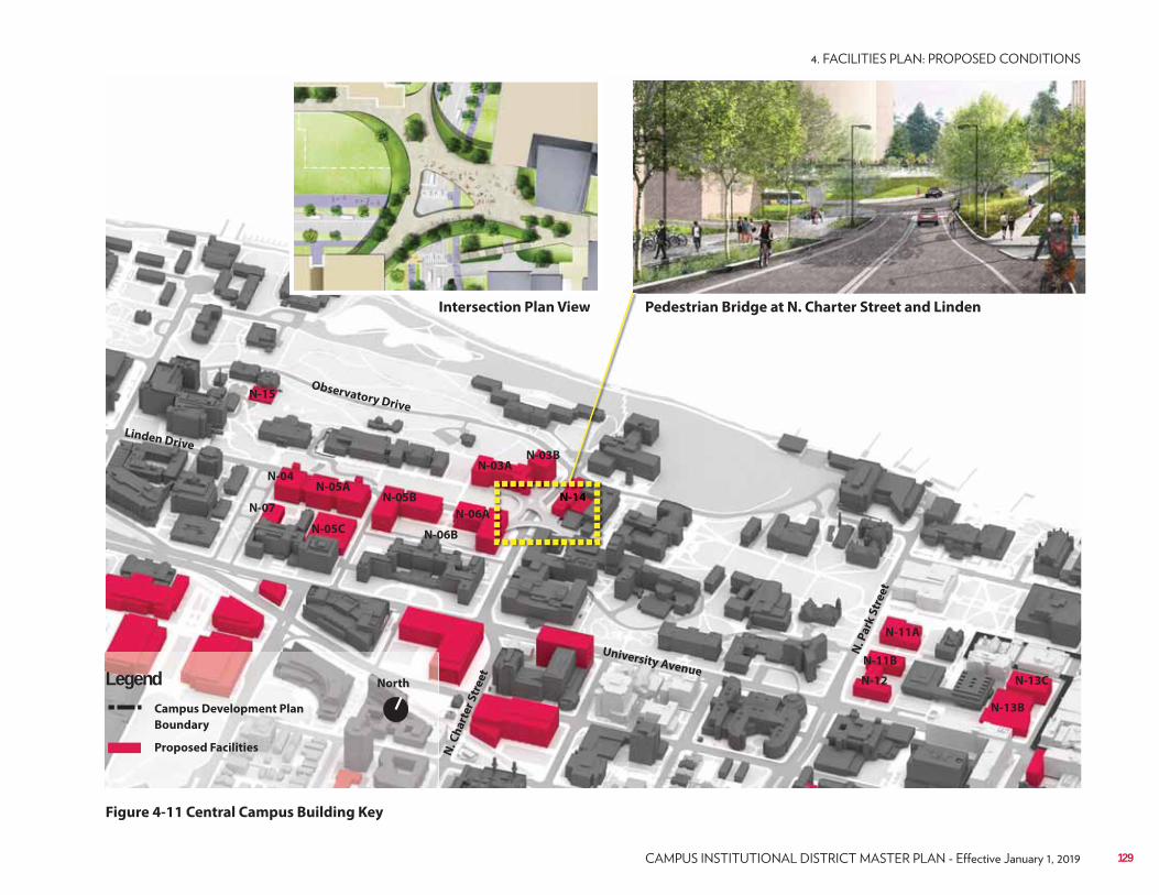
N-03AN-03B
N-05B
N-06A
N-05A
N-07
N-11B
N-04
N-11A
N-06B
N-12
N-13B
N-13C
N-14
N-15
N-05C
North
Campus Development Plan
Boundary
Proposed Facilities
LegendUniversity Avenue
N. C
ha
rte
r S
tre
et
Linden Drive
Observatory Drive
N. P
ark
Str
ee
t
Figure 4-11 Central Campus Building Key
Pedestrian Bridge at N. Charter Street and Linden Intersection Plan Viewiew
NNN-N-NN-N-N-N-N-N-N-N-NNNNNNN-N-NNNNNN-N-NNNNN-NN-N-N-NN 111111111411444444411114144441114444441414444414144444444444444444444414141
129
On the east side of Henry Mall, Stovall Hall and Old Genetics should be removed and replaced by new academic/research facilities – Nutritional Sciences (N-04) and a new academic/research facility (N-07). Both buildings should be designed to maintain the massing and scale of the other buildings along Henry Mall and be of a tan brick or limestone color. Henry Mall continues to be the transition line between buildings in the agricultural campus that have red-brown brick colorations and the cream city brick that lies east of Henry Mall.King Hall Greenhouse expansion is enabled through N-15. All construction and maintenance near King Hall and Agricultural Hall should protect and highlight the Observatory Hill mounds.
Library MallThe Library Mall area includes the northern section of the East Campus Mall, Chazen Museum, Humanities, and the planned music performance sites. The concept for an east campus pedestrian promenade has been around for many decades as was most recently defined as “Murray Mall” in the 1995 JJR Campus Master Plan. After the current construction of Alumni Park is complete, the north section of what is now known as East Campus Mall will be complete with the renovation of the Library Mall.The Mosse Humanities Building, built in 1966-1969 and designed by Chicago architect Harry Weese, is recommended to be removed due to extensive physical issues with the facility and inability to reprogram the building efficiently and economically. The programs in the Humanities Building must be moved first, and they will be relocated into multiple new facilities. Music instruction and music performance will be moved to the Hamel Music Center Phases 1 and 2 (N-13B) at the corner of University Avenue and Lake Street, and Phase 3 north of it on Lake Street (N-13C). Art instruction and galleries will be moved to S-16A and other Mosse Humanities Building occupants will be moved to S-13A, both new facilities in South Campus.After the Mosse Humanities Building is removed, two smaller academic facilities will be constructed on its site (N-11A and N-11B). Under N-11A and N-11B should be constructed as an underground two-level parking structure for approximately 450 cars to accommodate the parking needs of the lake front. If possible the parking under both building should be designed and constructed for maximum efficiency and capacity. Traffic flow in and out of the new parking facility should be carefully studied, in coordinated with the City of Madison, to minimize congestion at the University Avenue/N. Park Street intersection.
130 UNIVERSITY OF WISCONSIN–MADISON
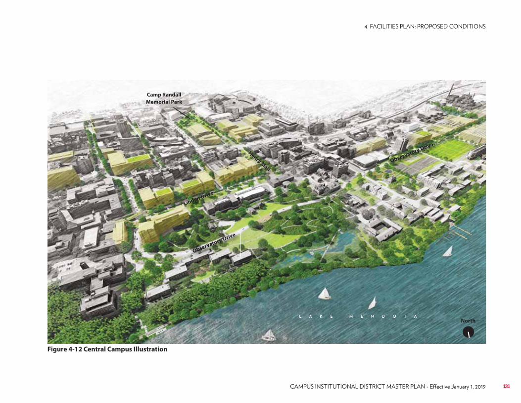
Figure 4-12 Central Campus Illustration
Observatory Drive
Linden Drive
Observatory Drive
Henry Mall
Camp Randall
Memorial Park
North
131
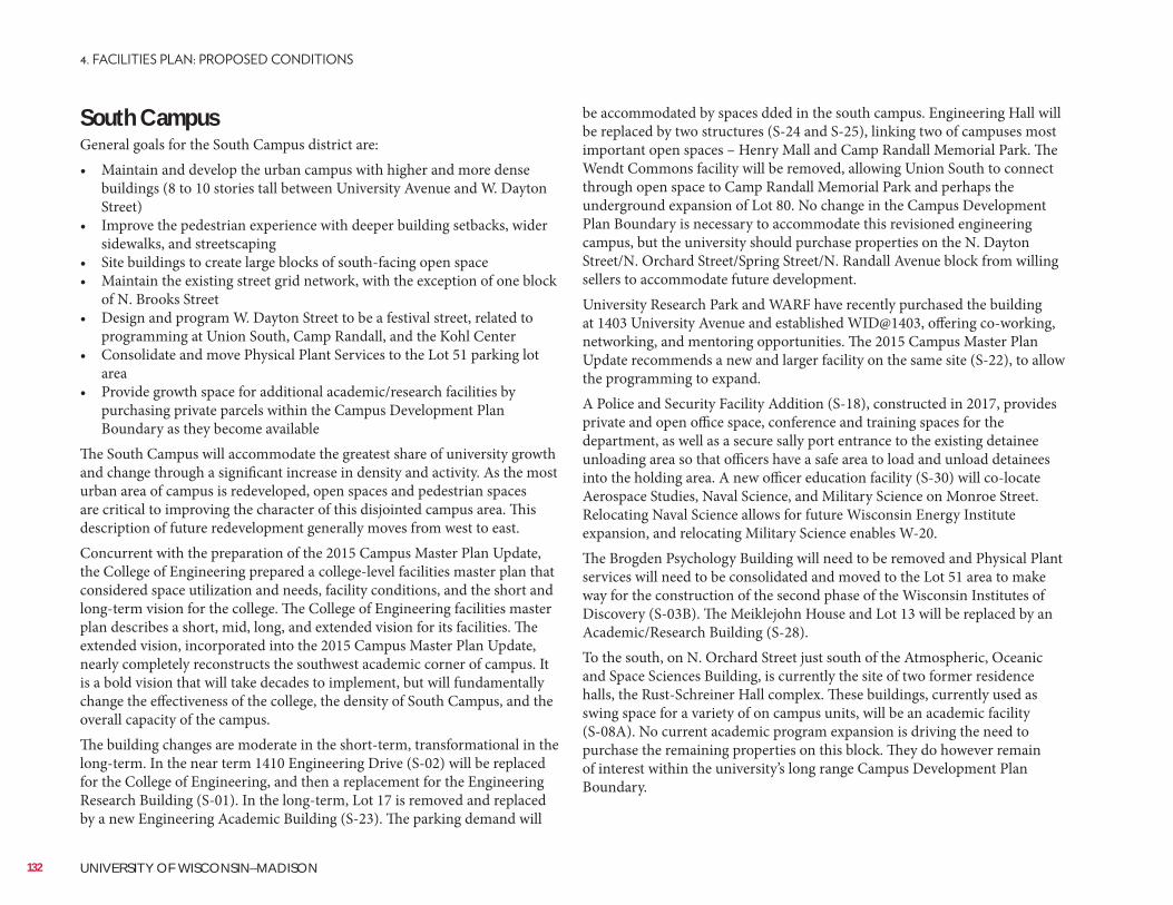
South CampusGeneral goals for the South Campus district are:• Maintain and develop the urban campus with higher and more dense
buildings (8 to 10 stories tall between University Avenue and W. Dayton Street)
• Improve the pedestrian experience with deeper building setbacks, wider sidewalks, and streetscaping
• Site buildings to create large blocks of south-facing open space• Maintain the existing street grid network, with the exception of one block
of N. Brooks Street• Design and program W. Dayton Street to be a festival street, related to
programming at Union South, Camp Randall, and the Kohl Center• Consolidate and move Physical Plant Services to the Lot 51 parking lot
area• Provide growth space for additional academic/research facilities by
purchasing private parcels within the Campus Development Plan Boundary as they become available
The South Campus will accommodate the greatest share of university growth and change through a significant increase in density and activity. As the most urban area of campus is redeveloped, open spaces and pedestrian spaces are critical to improving the character of this disjointed campus area. This description of future redevelopment generally moves from west to east.Concurrent with the preparation of the 2015 Campus Master Plan Update, the College of Engineering prepared a college-level facilities master plan that considered space utilization and needs, facility conditions, and the short and long-term vision for the college. The College of Engineering facilities master plan describes a short, mid, long, and extended vision for its facilities. The extended vision, incorporated into the 2015 Campus Master Plan Update, nearly completely reconstructs the southwest academic corner of campus. It is a bold vision that will take decades to implement, but will fundamentally change the effectiveness of the college, the density of South Campus, and the overall capacity of the campus.The building changes are moderate in the short-term, transformational in the long-term. In the near term 1410 Engineering Drive (S-02) will be replaced for the College of Engineering, and then a replacement for the Engineering Research Building (S-01). In the long-term, Lot 17 is removed and replaced by a new Engineering Academic Building (S-23). The parking demand will
be accommodated by spaces dded in the south campus. Engineering Hall will be replaced by two structures (S-24 and S-25), linking two of campuses most important open spaces – Henry Mall and Camp Randall Memorial Park. The Wendt Commons facility will be removed, allowing Union South to connect through open space to Camp Randall Memorial Park and perhaps the underground expansion of Lot 80. No change in the Campus Development Plan Boundary is necessary to accommodate this revisioned engineering campus, but the university should purchase properties on the N. Dayton Street/N. Orchard Street/Spring Street/N. Randall Avenue block from willing sellers to accommodate future development.University Research Park and WARF have recently purchased the building at 1403 University Avenue and established WID@1403, offering co-working, networking, and mentoring opportunities. The 2015 Campus Master Plan Update recommends a new and larger facility on the same site (S-22), to allow the programming to expand.A Police and Security Facility Addition (S-18), constructed in 2017, provides private and open office space, conference and training spaces for the department, as well as a secure sally port entrance to the existing detainee unloading area so that officers have a safe area to load and unload detainees into the holding area. A new officer education facility (S-30) will co-locate Aerospace Studies, Naval Science, and Military Science on Monroe Street. Relocating Naval Science allows for future Wisconsin Energy Institute expansion, and relocating Military Science enables W-20.The Brogden Psychology Building will need to be removed and Physical Plant services will need to be consolidated and moved to the Lot 51 area to make way for the construction of the second phase of the Wisconsin Institutes of Discovery (S-03B). The Meiklejohn House and Lot 13 will be replaced by an Academic/Research Building (S-28).To the south, on N. Orchard Street just south of the Atmospheric, Oceanic and Space Sciences Building, is currently the site of two former residence halls, the Rust-Schreiner Hall complex. These buildings, currently used as swing space for a variety of on campus units, will be an academic facility (S-08A). No current academic program expansion is driving the need to purchase the remaining properties on this block. They do however remain of interest within the university’s long range Campus Development Plan Boundary.
132 UNIVERSITY OF WISCONSIN–MADISON
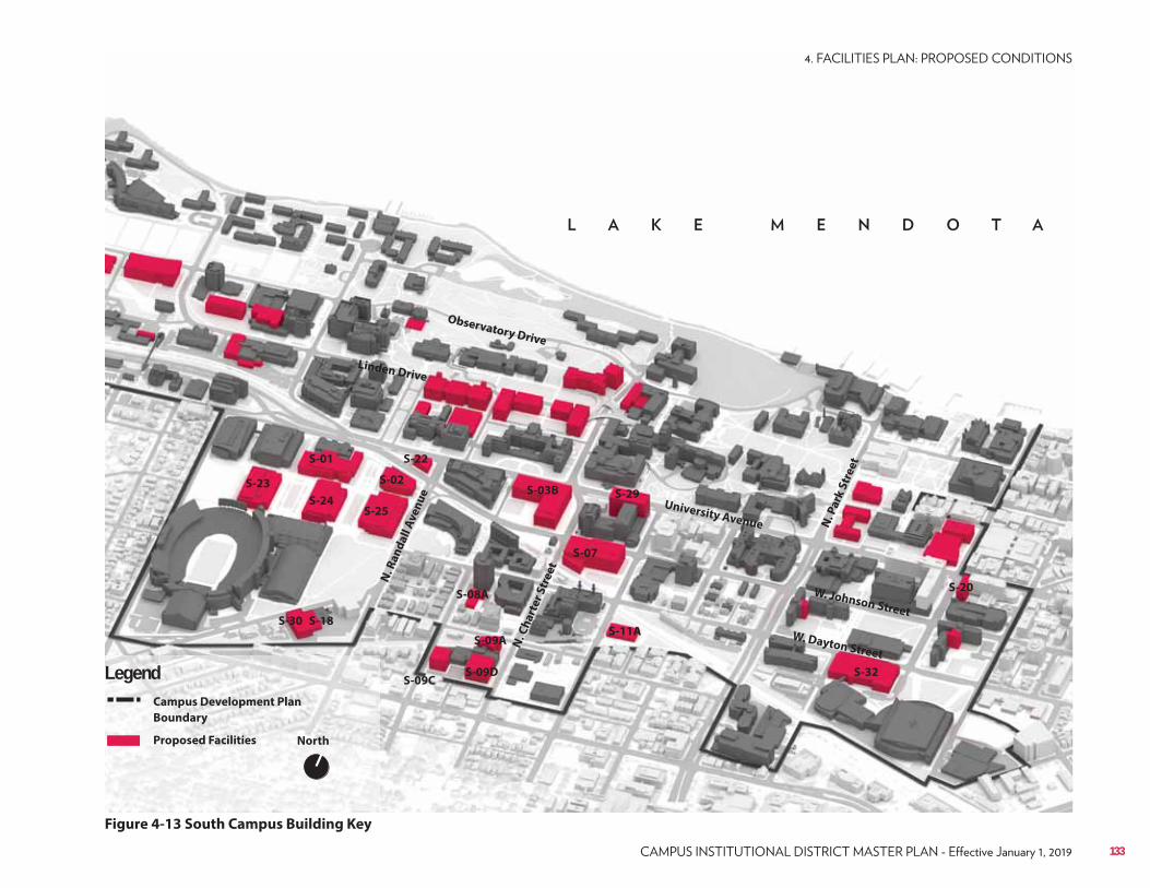
S-09CS-09D
S-09A
S-07
S-02S-03B
S-11A
S-01
S-08A
S-18
S-20
S-22
S-23
S-24S-25
S-29
S-30
S-32
North
Campus Development Plan
Boundary
Proposed Facilities
Legend
Figure 4-13 South Campus Building Key
University AvenueN
. Ch
art
er
Str
ee
t
Linden Drive
Observatory Drive
N. P
ark
Str
ee
t
W. Johnson Street
W. Dayton Street
N. R
an
da
ll A
ve
nu
e
133
Further south lies the Primate Research facilities which have a planned consolidation and phased expansion of their facilities (S-09A, C and D).To the east of this block, east of N. Charter Street, is Parking Lots 50 and 51, the 30 N. Mills Street facility, and the campus Fleet and Service Garage. The 2015 Campus Master Plan Update shows further development of this block for Physical Plant services, as outlined in the 1995 and 2005 Campus Master Plans. This development could include a 400-space parking ramp. The development could possibly include small private retail space(s) on the first floor as well as some meter parking on the first floor of the parking garage for public use. Public parking in this garage could remove on-street parking from N. Charter Street, enabling for conversion of N. Charter Street to a two-way green street. The 2015 Campus Master Plan Update recommends an Academic Building on the Lot 45 site (S-11A).The 2015 Campus Master Plan Update recommends the total redevelopment of the Noland Hall and Zoology Research Building block (S-07) to replace these two buildings. They were built in 1972 and 1963 respectfully and both have outlasted their useful lives.The Chemistry Instructional Addition (S-29) will be a 9-story tower that will address the Chemistry instructional program’s anticipated space needs. The new tower will be constructed first, followed by the remodeling of the existing building.The university should continue to purchase the remaining privately owned parcels on the block directly south of Grainger Hall.The Fluno Center was designed to accommodate an addition (S-20).The 2013 Recreational Sports Master Plan recommends the removal of the existing Southeast Recreational Facility (SERF) and reconstruction of a larger and re-programmed facility (S-32) on the same site. The building will serve the residents of the southeast residence hall neighborhood. It will be dedicated to Recreational Sports, other than sharing a 50-meter competition pool and separate diving well with the Division of Intercollegiate Athletics.The existing Campus Development Plan Boundary passes diagonally through Lot 91; the 2015 Campus Master Plan Update recommends adjusting the Campus Development Plan Boundary to include the entire Lot 91 and planned site for S-16A and S-16C.
134 UNIVERSITY OF WISCONSIN–MADISON
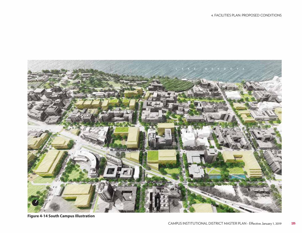
Figure 4-14 South Campus Illustration
W. Dayton Street
W. Johnson Street
N. P
ark
Stre
et
N. C
ha
rte
r S
tre
et
North
135
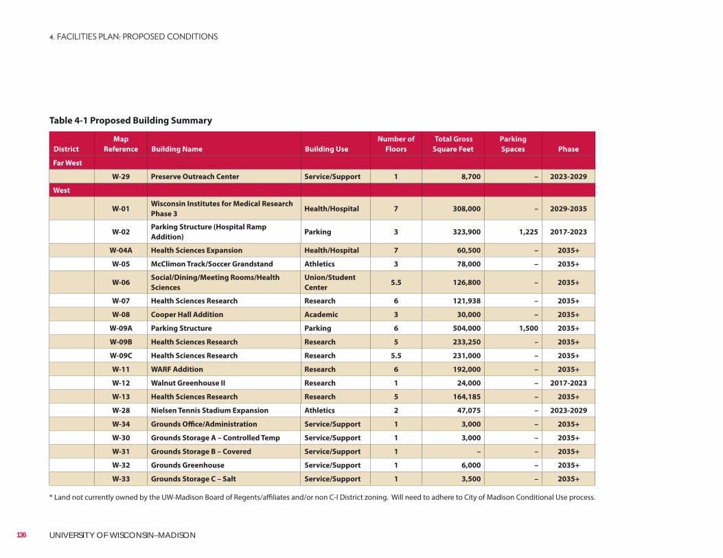
District
Map
Reference Building Name Building Use
Number of
Floors
Total Gross
Square Feet
Parking
Spaces Phase
Far West
W-29 Preserve Outreach Center Service/Support 1 8,700 – 2023-2029
West
W-01Wisconsin Institutes for Medical Research
Phase 3Health/Hospital 7 308,000 – 2029-2035
W-02Parking Structure (Hospital Ramp
Addition)Parking 3 323,900 1,225 2017-2023
W-04A Health Sciences Expansion Health/Hospital 7 60,500 – 2035+
W-05 McClimon Track/Soccer Grandstand Athletics 3 78,000 – 2035+
W-06Social/Dining/Meeting Rooms/Health
Sciences
Union/Student
Center5.5 126,800 – 2035+
W-07 Health Sciences Research Research 6 121,938 – 2035+
W-08 Cooper Hall Addition Academic 3 30,000 – 2035+
W-09A Parking Structure Parking 6 504,000 1,500 2035+
W-09B Health Sciences Research Research 5 233,250 – 2035+
W-09C Health Sciences Research Research 5.5 231,000 – 2035+
W-11 WARF Addition Research 6 192,000 – 2035+
W-12 Walnut Greenhouse II Research 1 24,000 – 2017-2023
W-13 Health Sciences Research Research 5 164,185 – 2035+
W-28 Nielsen Tennis Stadium Expansion Athletics 2 47,075 – 2023-2029
W-34 Grounds Office/Administration Service/Support 1 3,000 – 2035+
W-30 Grounds Storage A – Controlled Temp Service/Support 1 3,000 – 2035+
W-31 Grounds Storage B – Covered Service/Support 1 – – 2035+
W-32 Grounds Greenhouse Service/Support 1 6,000 – 2035+
W-33 Grounds Storage C – Salt Service/Support 1 3,500 – 2035+
Table 4-1 Proposed Building Summary
* Land not currently owned by the UW-Madison Board of Regents/affiliates and/or non C-I District zoning. Will need to adhere to City of Madison Conditional Use process.
136 UNIVERSITY OF WISCONSIN–MADISON
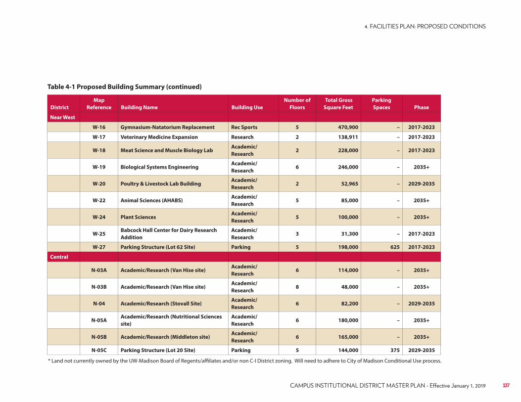
* Land not currently owned by the UW-Madison Board of Regents/affiliates and/or non C-I District zoning. Will need to adhere to City of Madison Conditional Use process.
District
Map
Reference Building Name Building Use
Number of
Floors
Total Gross
Square Feet
Parking
Spaces Phase
Near West
W-16 Gymnasium-Natatorium Replacement Rec Sports 5 470,900 – 2017-2023
W-17 Veterinary Medicine Expansion Research 2 138,911 – 2017-2023
W-18 Meat Science and Muscle Biology LabAcademic/
Research2 228,000 – 2017-2023
W-19 Biological Systems EngineeringAcademic/
Research6 246,000 – 2035+
W-20 Poultry & Livestock Lab BuildingAcademic/
Research2 52,965 – 2029-2035
W-22 Animal Sciences (AHABS)Academic/
Research5 85,000 – 2035+
W-24 Plant SciencesAcademic/
Research5 100,000 – 2035+
W-25Babcock Hall Center for Dairy Research
Addition
Academic/
Research3 31,300 – 2017-2023
W-27 Parking Structure (Lot 62 Site) Parking 5 198,000 625 2017-2023
Central
N-03A Academic/Research (Van Hise site)Academic/
Research6 114,000 – 2035+
N-03B Academic/Research (Van Hise site)Academic/
Research8 48,000 – 2035+
N-04 Academic/Research (Stovall Site)Academic/
Research6 82,200 – 2029-2035
N-05AAcademic/Research (Nutritional Sciences
site)
Academic/
Research6 180,000 – 2035+
N-05B Academic/Research (Middleton site)Academic/
Research6 165,000 – 2035+
N-05C Parking Structure (Lot 20 Site) Parking 5 144,000 375 2029-2035
Table 4-1 Proposed Building Summary (continued)
137
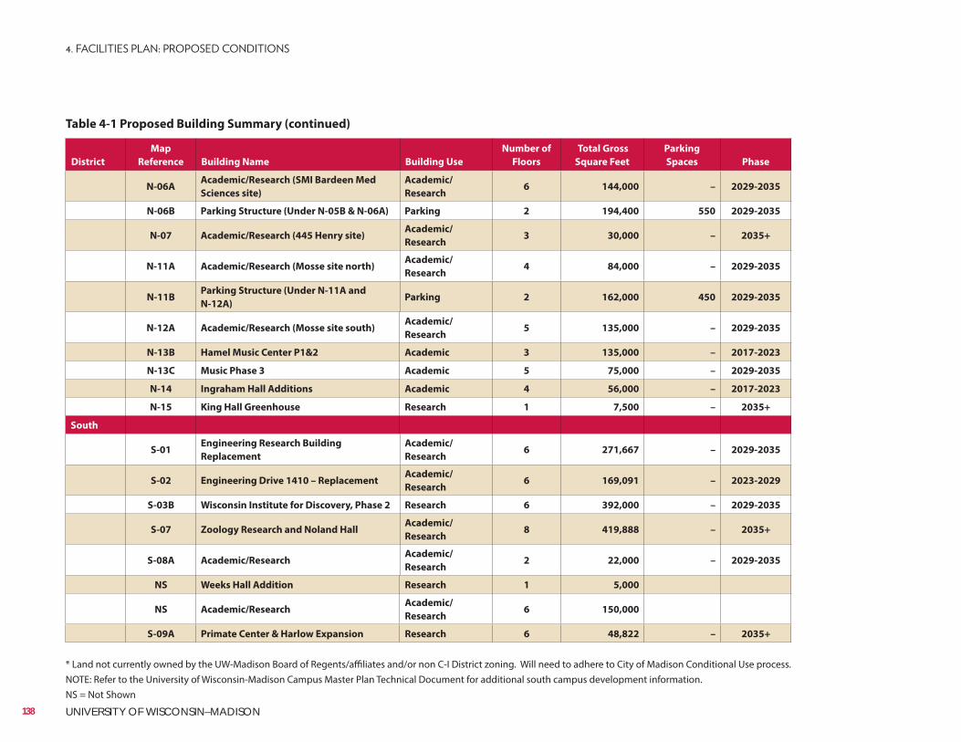
District
Map
Reference Building Name Building Use
Number of
Floors
Total Gross
Square Feet
Parking
Spaces Phase
N-06AAcademic/Research (SMI Bardeen Med
Sciences site)
Academic/
Research6 144,000 – 2029-2035
N-06B Parking Structure (Under N-05B & N-06A) Parking 2 194,400 550 2029-2035
N-07 Academic/Research (445 Henry site)Academic/
Research3 30,000 – 2035+
N-11A Academic/Research (Mosse site north)Academic/
Research4 84,000 – 2029-2035
N-11BParking Structure (Under N-11A and
N-12A)Parking 2 162,000 450 2029-2035
N-12A Academic/Research (Mosse site south)Academic/
Research5 135,000 – 2029-2035
N-13B Hamel Music Center P1&2 Academic 3 135,000 – 2017-2023
N-13C Music Phase 3 Academic 5 75,000 – 2029-2035
N-14 Ingraham Hall Additions Academic 4 56,000 – 2017-2023
N-15 King Hall Greenhouse Research 1 7,500 – 2035+
South
S-01Engineering Research Building
Replacement
Academic/
Research6 271,667 – 2029-2035
S-02 Engineering Drive 1410 – ReplacementAcademic/
Research6 169,091 – 2023-2029
S-03B Wisconsin Institute for Discovery, Phase 2 Research 6 392,000 – 2029-2035
S-07 Zoology Research and Noland HallAcademic/
Research8 419,888 – 2035+
S-08A Academic/ResearchAcademic/
Research2 22,000 – 2029-2035
NS Weeks Hall Addition Research 1 5,000
NS Academic/ResearchAcademic/
Research6 150,000
S-09A Primate Center & Harlow Expansion Research 6 48,822 – 2035+
Table 4-1 Proposed Building Summary (continued)
* Land not currently owned by the UW-Madison Board of Regents/affiliates and/or non C-I District zoning. Will need to adhere to City of Madison Conditional Use process.NOTE: Refer to the University of Wisconsin-Madison Campus Master Plan Technical Document for additional south campus development information.NS = Not Shown
138 UNIVERSITY OF WISCONSIN–MADISON
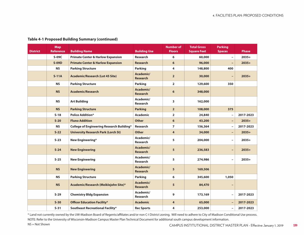
District
Map
Reference Building Name Building Use
Number of
Floors
Total Gross
Square Feet
Parking
Spaces Phase
S-09C Primate Center & Harlow Expansion Research 6 60,000 – 2035+
S-09D Primate Center & Harlow Expansion Research 6 96,000 – 2035+
NS Parking Structure Parking 4 148,800 400
S-11A Academic/Research (Lot 45 Site)Academic/
Research2 30,000 – 2035+
NS Parking Structure Parking 2 129,600 350
NS Academic/ResearchAcademic/
Research6 348,000
NS Art BuildingAcademic/
Research3 162,000
NS Parking Structure Parking 2 108,000 375
S-18 Police Addition* Academic 2 24,840 – 2017-2023
S-20 Fluno Addition Other 6 43,200 – 2035+
NS College of Engineering Research Building* Research 7 156,364 – 2017-2023
S-22 University Research Park (Lorch St) Other 4 34,000 – 2035+
S-23 New Engineering*Academic/
Research5 204,000 – 2035+
S-24 New EngineeringAcademic/
Research5 236,583 – 2035+
S-25 New EngineeringAcademic/
Research5 274,986 – 2035+
NS New EngineeringAcademic/
Research5 169,506
NS Parking Structure Parking 6 345,600 1,050
NS Academic/Research (Meiklejohn Site)*Academic/
Research5 84,470 –
S-29 Chemistry Bldg ExpansionAcademic/
Research9 173,169 – 2017-2023
S-30 Officer Education Facility* Academic 4 65,000 – 2017-2023
S-31 Southeast Recreational Facility* Rec Sports 4 253,000 – 2017-2023
Table 4-1 Proposed Building Summary (continued)
* Land not currently owned by the UW-Madison Board of Regents/affiliates and/or non C-I District zoning. Will need to adhere to City of Madison Conditional Use process.NOTE: Refer to the University of Wisconsin-Madison Campus Master Plan Technical Document for additional south campus development information.NS = Not Shown 139
4.5 Open Space and Landscape Plan
The overall campus plan is the summation of planning and design by an inter-disciplinary team, in collaboration with Facilities Planning & Management staff and university stakeholders.The plan is conceptual, illustrating campuswide improvements based upon the principles established and the landscape concepts presented above. This plan is not a final destination, but a guiding illustration that envisions what campus could look like.The City reserves the right to determine street design in the city right-of-way. The concepts shown and discussed in the UW Master Plan are only meant to depict or suggest some future design possibilities, and no detailed studies/modeling have been done on those concepts.
1
2
3
4
5
6
7
8
9
A revitalized Willow Creek corridor
A dedicated campus arrival for the School of Veterinary Medicine
New Near West Commons open space, adaptively re-purposing the historic Horse Barn
Expanded naturalized and working landscapes on Observatory Hill
An iconic pedestrian bridge at the intersection of N. Charter Street and Linden Drive
A boardwalk to safely traverse the steep slope behind Sewell Social Sciences Building
The creation of new campus open spaces through the redevelopment of the Medical Sciences and Humanities
Improved visitor gateway experience along University Avenue and W. Johnson Street
Green Street initiatives along N. Charter and W. Dayton Streets
140 UNIVERSITY OF WISCONSIN–MADISON
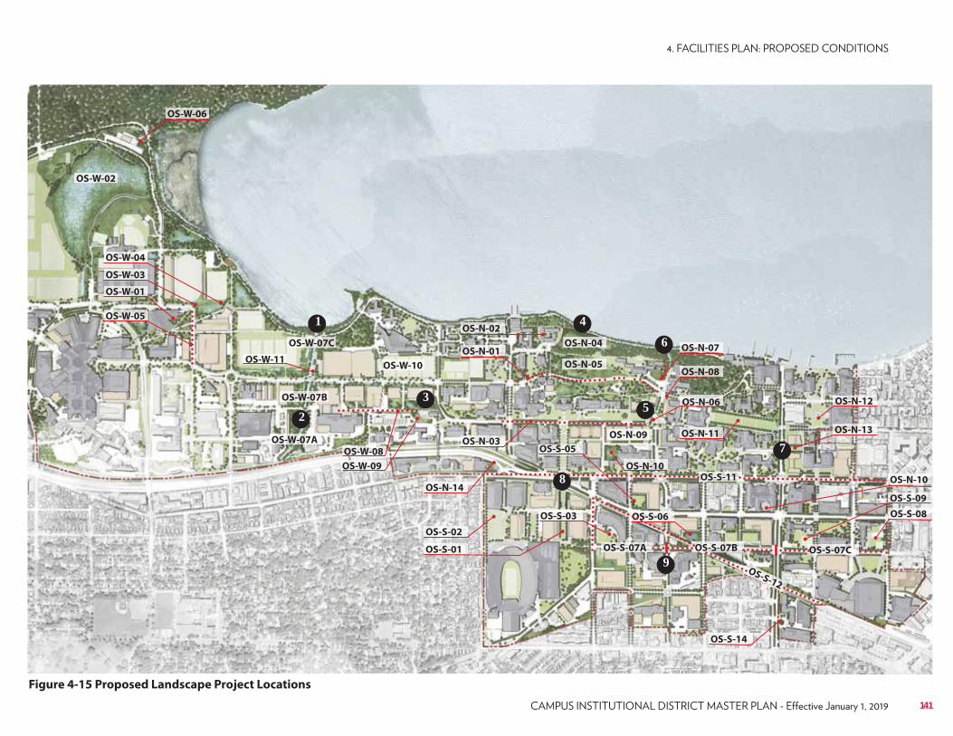
OS-W-01
OS-W-03
OS-W-04
OS-W-05
OS-W-02
OS-W-07C
OS-W-10OS-W-11
OS-W-08
OS-N-02
OS-N-05
OS-N-04
OS-S-03
OS-S-05
OS-S-06
OS-N-07
OS-N-09 OS-N-11
OS-N-12
OS-N-13
OS-N-06
OS-N-10
OS-N-08
OS-N-10
OS-S-14
OS-S-08
OS-S-09
OS-N-01
OS-N-03
OS-N-14
OS-S-02
OS-S-11
OS-S-12
OS-S-01
OS-W-09
OS-W-07B
OS-W-07A
OS-S-07A OS-S-07B OS-S-07C
OS-W-06
1
2
3
4
5
6
7
8
9
Figure 4-15 Proposed Landscape Project Locations
141
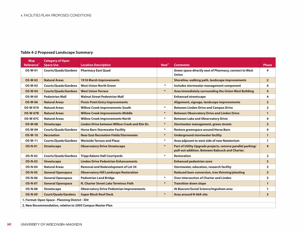
Map
Reference¹
Category of Open
Space Use Location Description New² Comments Phase
OS-W-01 Courts/Quads/Gardens Pharmacy East Quad Green space directly east of Pharmacy, connect to West
Union
4
OS-W-02 Natural Areas 1918 Marsh Improvements Shoreline, walking path, landscape improvements 2
OS-W-03 Courts/Quads/Gardens West Union North Green * Includes stormwater management component 4
OS-W-04 Courts/Quads/Gardens West Union Terrace * Area immediately surrounding the Union West Building 4
OS-W-05 Pedestrian Mall Walnut Street Pedestrian Mall Enhanced streetscape 4
OS-W-06 Natural Areas Picnic Point Entry Improvements Alignment, signage, landscape improvements 2
OS-W-07A Natural Areas Willow Creek Improvements-South * Between Linden Drive and Campus Drive 2
OS-W-07B Natural Areas Willow Creek Improvements-Middle * Between Observatory Drive and Linden Drive 1
OS-W-07C Natural Areas Willow Creek Improvements-North * Between Lake and Observatory Drive 4
OS-W-08 Streetscape Linden Drive between Willow Creek and Elm Dr. * Stormwater management, green streets 3
OS-W-09 Courts/Quads/Gardens Horse Barn Stormwater Facility * Restore greenspace around Horse Barn 4
OS-W-10 Recreation Near East Recreation Fields/Stormwater * Underground stormwater facility 1
OS-W-11 Courts/Quads/Gardens Westside Terrace and Plaza * Area adjacent to west side of new Natatorium 1
OS-N-01 Streetscape Observatory Drive Streetscape * Part of Utility Upgrade projects, remove parallel parking/
pull-out addition. Between Babcock and Charter.
4
OS-N-02 Courts/Quads/Gardens Tripp/Adams Hall Courtyards * Restoration 2
OS-N-03 Streetscape Linden Drive Pedestrian Enhancements Enhanced pedestrian zone 3
OS-N-04 Natural Areas Removal and Redevelopment of Lot 34 Stormwater, education, research facility 3
OS-N-05 General Openspace Observatory Hill Landscape Restoration Reduced lawn conversion, tree thinning/planting 3
OS-N-06 General Openspace Pedestrian Land Bridge * Over intersection of Charter and Linden 3
OS-N-07 General Openspace N. Charter Street Lake Terminus Path * Transition down slope 1
OS-N-08 Streetscape Observatory Drive Pedestrian Improvements At Bascom/Social Science/Ingraham area 1
OS-N-09 Court/Quads/Gardens Super Block Roof Deck * Area around N-06A site 3
1. Format: Open Space - Planning District - ID#
2. New Recommendation, relative to 2005 Campus Master Plan
Table 4-2 Proposed Landscape Summary
142 UNIVERSITY OF WISCONSIN–MADISON
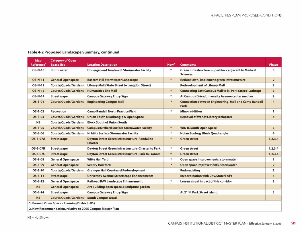
Map
Reference¹
Category of Open
Space Use Location Description New² Comments Phase
OS-N-10 Stormwater Underground Treatment Stormwater Facility * Green infrastructure, superblock adjacent to Medical
Sciences
3
OS-N-11 General Openspace Bascom Hill Stormwater Landscape * Reduce lawn, implement green infrastructure 2
OS-N-12 Courts/Quads/Gardens Library Mall (State Street to Langdon Street) Redevelopment of Library Mall 2
OS-N-13 Courts/Quads/Gardens Humanities Site Mall * Connecting East Campus Mall to N. Park Street (Lathrop) 3
OS-N-14 Streetscape Campus Gateway Entry Sign * At Campus Drive/University Avenue center median 2
OS-S-01 Courts/Quads/Gardens Engineering Campus Mall * Connection between Engineering. Mall and Camp Randall
Park
4
OS-S-02 Recreation Camp Randall North Practice Field * Minor addition 1
OS-S-03 Courts/Quads/Gardens Union South Quadrangle & Open Space Removal of Wendt Library (relocate) 4
NS Courts/Quads/Gardens Block South of Union South
OS-S-05 Courts/Quads/Gardens Campus/Orchard Surface Stormwater Facility * WID II, South Open Space 3
OS-S-06 Courts/Quads/Gardens N. Mills Surface Stormwater Facility * Nolan Zoology Block Quadrangle 4
OS-S-07A Streetscape Dayton Street Green Infrastructure-Randall to
Charter
* Green street 1,2,3,4
OS-S-07B Streetscape Dayton Street Green Infrastructure-Charter to Park * Green street 1,2,3,4
OS-S-07C Streetscape Dayton Street Green Infrastructure-Park to Frances * Green street 1,2,3,4
OS-S-08 General Openspace Witte Hall Yard * Open space improvements, stormwater 1
OS-S-09 General Openspace Sellery Hall Yard * Open space improvements, stormwater 2
OS-S-10 Courts/Quads/Gardens Grainger Hall Courtyard Redevelopment Redo existing 2
OS-S-11 Streetscape University Avenue Streetscape Enhancements Incoordination with City/State/Fed’s 4
OS-S-12 General Openspace Railroad R/W Landscape Enhancement * Lessen visual impact of this corridor 2
NS General Openspace Art Building open space & sculpture garden
OS-S-14 Streetscape Campus Gateway Entry Sign At 21 N. Park Street island 3
NS Courts/Quads/Gardens South Campus Quad
1. Format: Open Space - Planning District - ID#
2. New Recommendation, relative to 2005 Campus Master Plan
Table 4-2 Proposed Landscape Summary, continued
NS = Not Shown
143
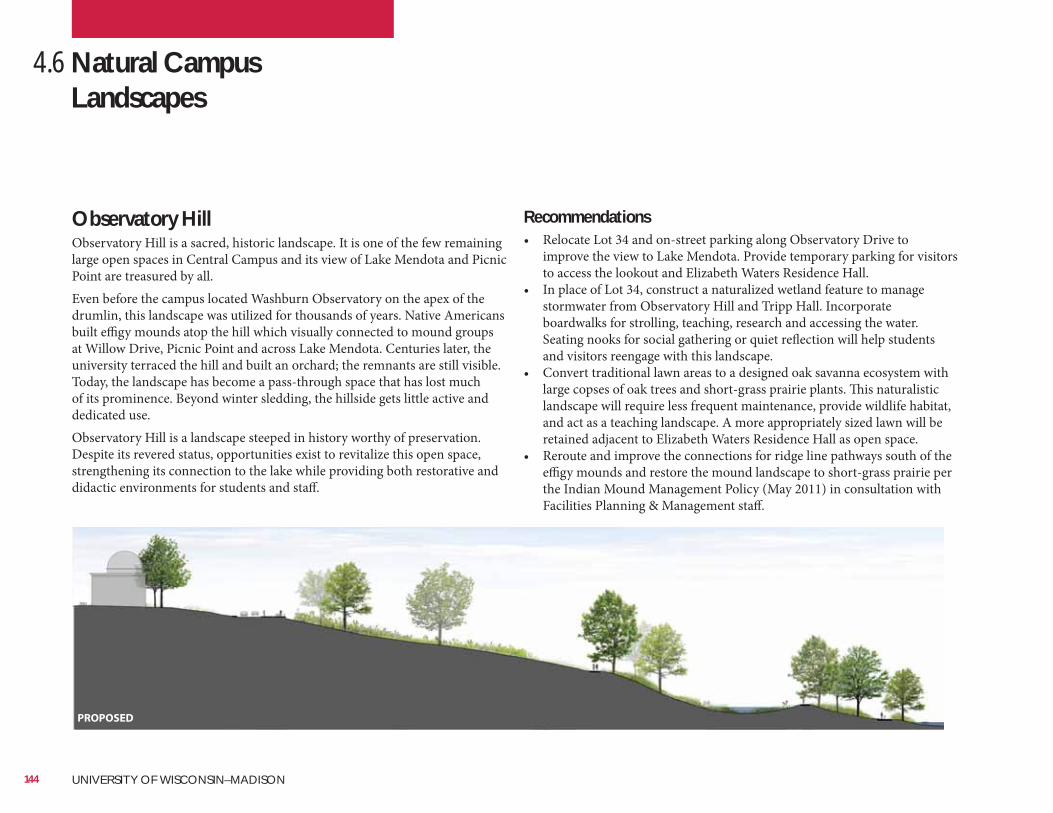
Recommendations• Relocate Lot 34 and on-street parking along Observatory Drive to
improve the view to Lake Mendota. Provide temporary parking for visitors to access the lookout and Elizabeth Waters Residence Hall.
• In place of Lot 34, construct a naturalized wetland feature to manage stormwater from Observatory Hill and Tripp Hall. Incorporate boardwalks for strolling, teaching, research and accessing the water. Seating nooks for social gathering or quiet reflection will help students and visitors reengage with this landscape.
• Convert traditional lawn areas to a designed oak savanna ecosystem with large copses of oak trees and short-grass prairie plants. This naturalistic landscape will require less frequent maintenance, provide wildlife habitat, and act as a teaching landscape. A more appropriately sized lawn will be retained adjacent to Elizabeth Waters Residence Hall as open space.
• Reroute and improve the connections for ridge line pathways south of the effigy mounds and restore the mound landscape to short-grass prairie per the Indian Mound Management Policy (May 2011) in consultation with Facilities Planning & Management staff.
4.6 Natural Campus Landscapes
Observatory HillObservatory Hill is a sacred, historic landscape. It is one of the few remaining large open spaces in Central Campus and its view of Lake Mendota and Picnic Point are treasured by all.Even before the campus located Washburn Observatory on the apex of the drumlin, this landscape was utilized for thousands of years. Native Americans built effigy mounds atop the hill which visually connected to mound groups at Willow Drive, Picnic Point and across Lake Mendota. Centuries later, the university terraced the hill and built an orchard; the remnants are still visible. Today, the landscape has become a pass-through space that has lost much of its prominence. Beyond winter sledding, the hillside gets little active and dedicated use.Observatory Hill is a landscape steeped in history worthy of preservation. Despite its revered status, opportunities exist to revitalize this open space, strengthening its connection to the lake while providing both restorative and didactic environments for students and staff.
PROPOSED
144 UNIVERSITY OF WISCONSIN–MADISON
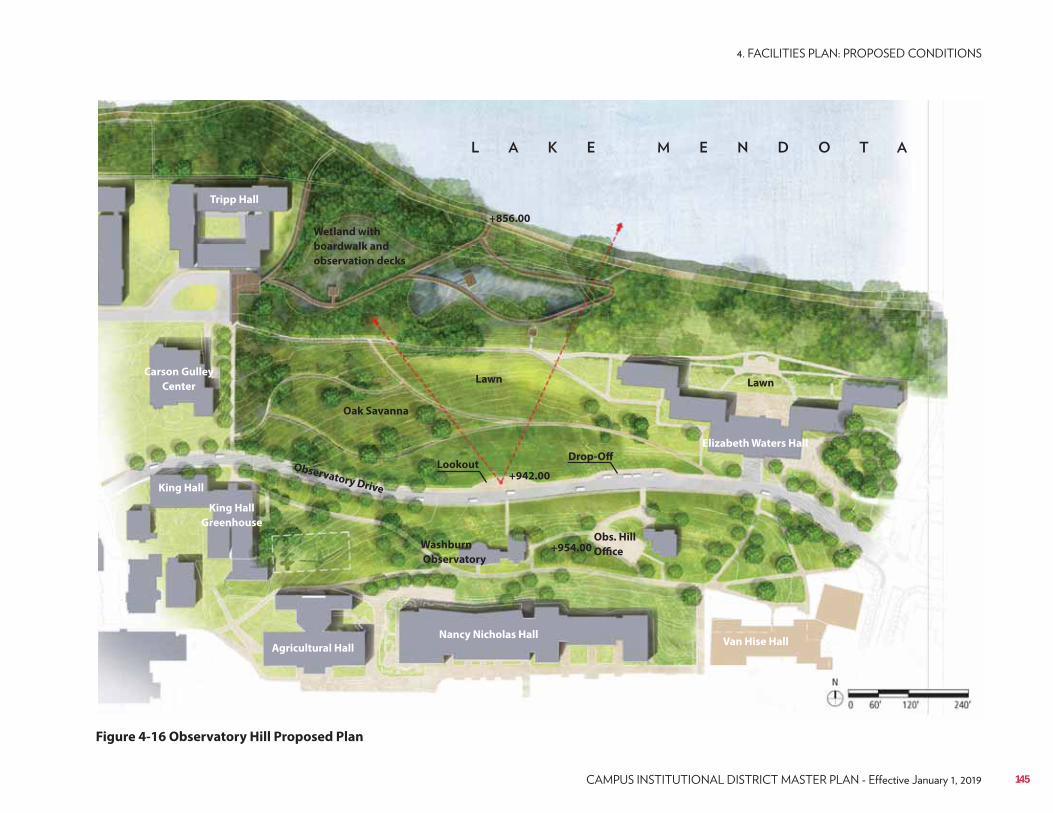
Figure 4-16 Observatory Hill Proposed Plan
Wetland with
boardwalk and
observation decks
Lawn
+856.00
+942.00
+954.00
Observatory Drive
Lawn
Oak Savanna
Drop-OffLookout
Nancy Nicholas Hall
Agricultural Hall
Washburn
Observatory
Tripp Hall
King Hall
Carson Gulley
Center
King Hall
Greenhouse
Van Hise Hall
Obs. Hill
Office
Elizabeth Waters Hall
145
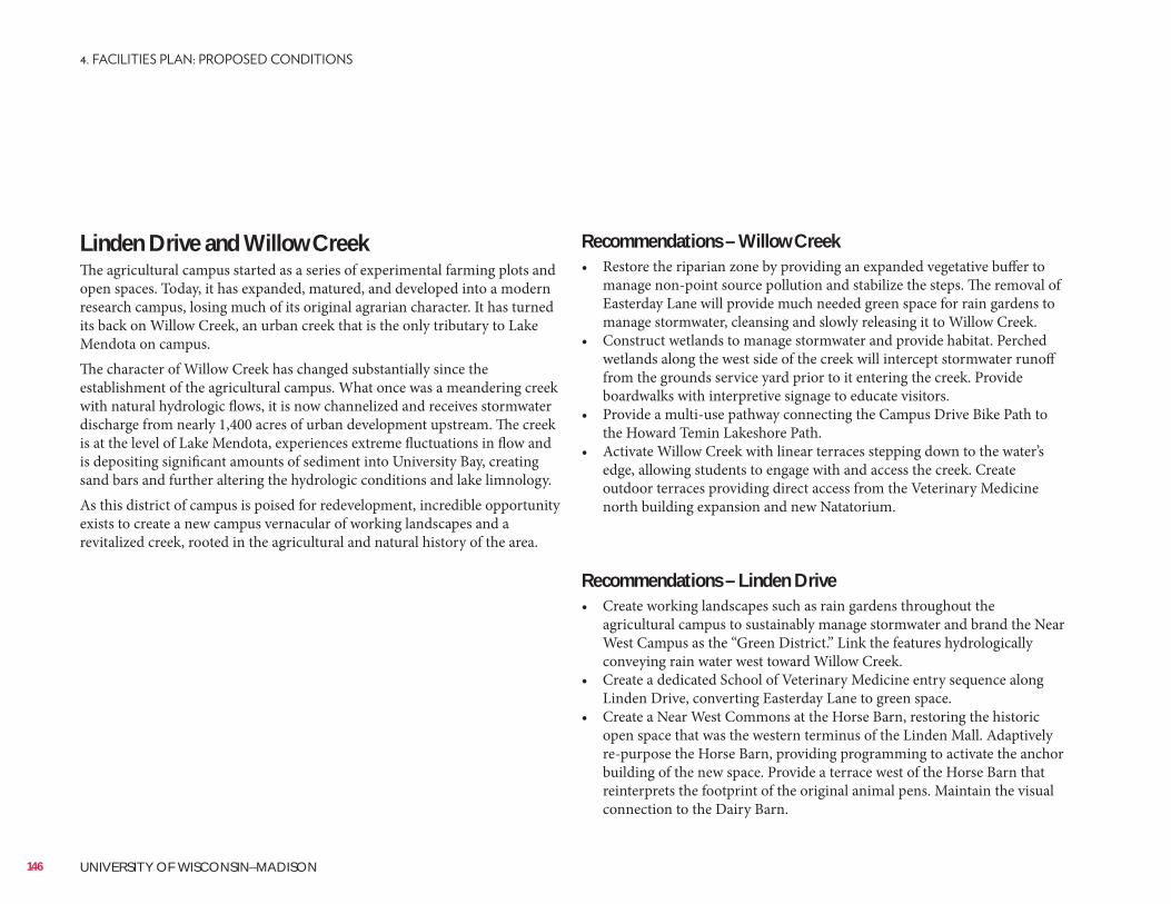
Recommendations – Willow Creek• Restore the riparian zone by providing an expanded vegetative buffer to
manage non-point source pollution and stabilize the steps. The removal of Easterday Lane will provide much needed green space for rain gardens to manage stormwater, cleansing and slowly releasing it to Willow Creek.
• Construct wetlands to manage stormwater and provide habitat. Perched wetlands along the west side of the creek will intercept stormwater runoff from the grounds service yard prior to it entering the creek. Provide boardwalks with interpretive signage to educate visitors.
• Provide a multi-use pathway connecting the Campus Drive Bike Path to the Howard Temin Lakeshore Path.
• Activate Willow Creek with linear terraces stepping down to the water’s edge, allowing students to engage with and access the creek. Create outdoor terraces providing direct access from the Veterinary Medicine north building expansion and new Natatorium.
Recommendations – Linden Drive• Create working landscapes such as rain gardens throughout the
agricultural campus to sustainably manage stormwater and brand the Near West Campus as the “Green District.” Link the features hydrologically conveying rain water west toward Willow Creek.
• Create a dedicated School of Veterinary Medicine entry sequence along Linden Drive, converting Easterday Lane to green space.
• Create a Near West Commons at the Horse Barn, restoring the historic open space that was the western terminus of the Linden Mall. Adaptively re-purpose the Horse Barn, providing programming to activate the anchor building of the new space. Provide a terrace west of the Horse Barn that reinterprets the footprint of the original animal pens. Maintain the visual connection to the Dairy Barn.
Linden Drive and Willow CreekThe agricultural campus started as a series of experimental farming plots and open spaces. Today, it has expanded, matured, and developed into a modern research campus, losing much of its original agrarian character. It has turned its back on Willow Creek, an urban creek that is the only tributary to Lake Mendota on campus.The character of Willow Creek has changed substantially since the establishment of the agricultural campus. What once was a meandering creek with natural hydrologic flows, it is now channelized and receives stormwater discharge from nearly 1,400 acres of urban development upstream. The creek is at the level of Lake Mendota, experiences extreme fluctuations in flow and is depositing significant amounts of sediment into University Bay, creating sand bars and further altering the hydrologic conditions and lake limnology.As this district of campus is poised for redevelopment, incredible opportunity exists to create a new campus vernacular of working landscapes and a revitalized creek, rooted in the agricultural and natural history of the area.
146 UNIVERSITY OF WISCONSIN–MADISON
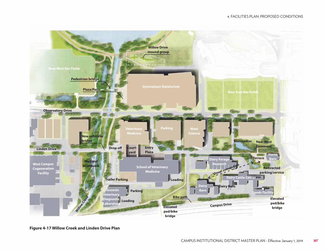
Figure 4-17 Willow Creek and Linden Drive Plan
Willow Drive
mound group
Pedestrian bridge
Plaza/Patio
Drop off
Terrace
Visual connection
Elevated
ped/bike
bridgeElevated
ped/bike
bridge
Redirected
parking/service
access
Stormwater
Parking
Linden Drive
Observatory Drive
Campus Drive
Will
ow C
reek
Loading
Loading
Gymnasium Natatorium
Meat
Science
Veterinary
Medicine
School of Veterinary
Medicine
West Campus
Cogeneration
Facility
Parking
Near East Rec Fields
Near West Rec Fields
Horse
Barn
Seeds Facility
Dairy
Barn
Bike path
Near West
CommonsCourt-
yard
Entry
Plaza
Trailer Parking
Wetland
boardwalk
New vehicular
bridge
Dairy Forage
Research
Dairy Cattle Center
Dairy BarnWisconsin
Veterinary
Diagnostic
Laboratory
147
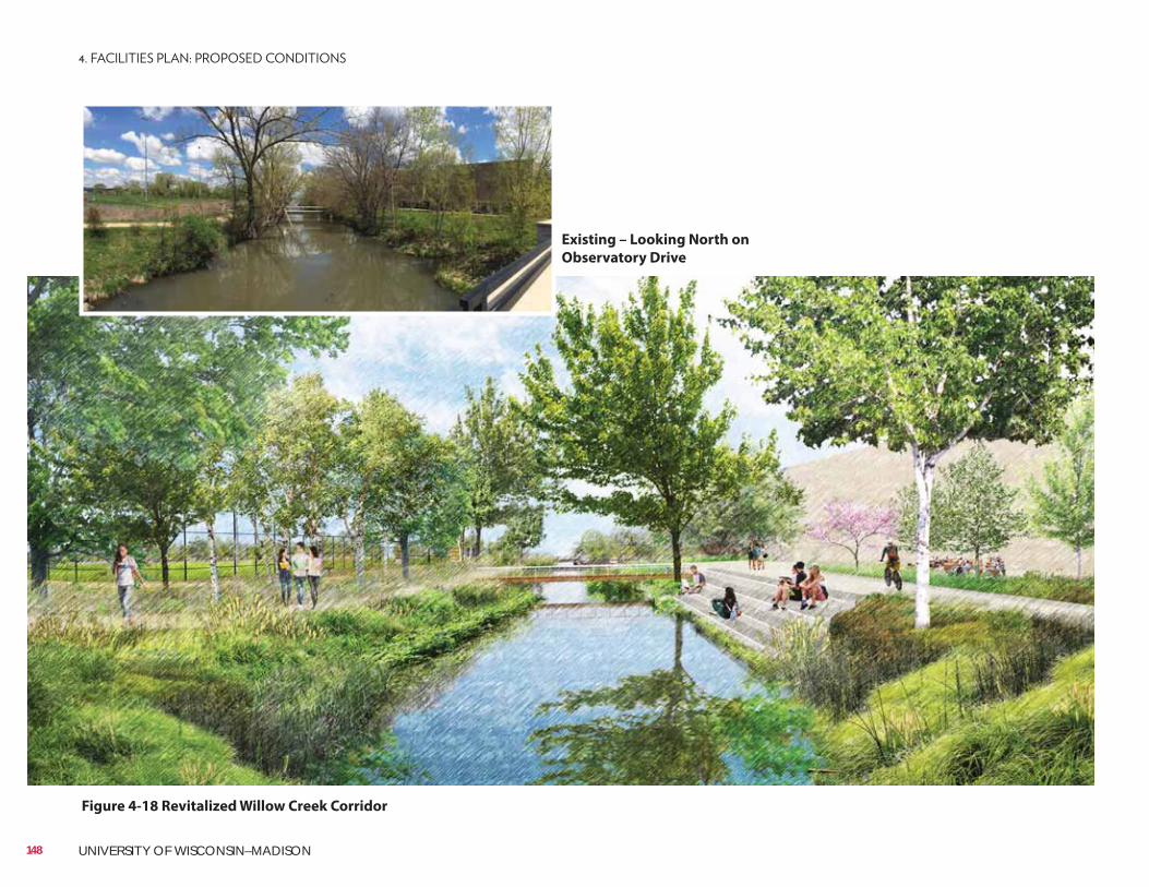
Existing – Looking North on
Observatory Drive
Figure 4-18 Revitalized Willow Creek Corridor
148 UNIVERSITY OF WISCONSIN–MADISON
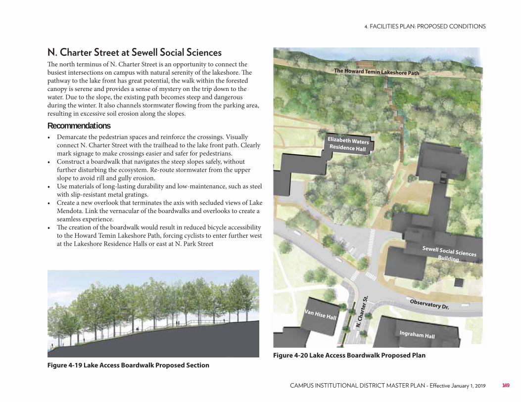
The north terminus of N. Charter Street is an opportunity to connect the busiest intersections on campus with natural serenity of the lakeshore. The pathway to the lake front has great potential, the walk within the forested canopy is serene and provides a sense of mystery on the trip down to the water. Due to the slope, the existing path becomes steep and dangerous during the winter. It also channels stormwater flowing from the parking area, resulting in excessive soil erosion along the slopes.
Recommendations• Demarcate the pedestrian spaces and reinforce the crossings. Visually
connect N. Charter Street with the trailhead to the lake front path. Clearly mark signage to make crossings easier and safer for pedestrians.
• Construct a boardwalk that navigates the steep slopes safely, without further disturbing the ecosystem. Re-route stormwater from the upper slope to avoid rill and gully erosion.
• Use materials of long-lasting durability and low-maintenance, such as steel with slip-resistant metal gratings.
• Create a new overlook that terminates the axis with secluded views of Lake Mendota. Link the vernacular of the boardwalks and overlooks to create a seamless experience.
• The creation of the boardwalk would result in reduced bicycle accessibility to the Howard Temin Lakeshore Path, forcing cyclists to enter further west at the Lakeshore Residence Halls or east at N. Park Street
Figure 4-19 Lake Access Boardwalk Proposed Section
Figure 4-20 Lake Access Boardwalk Proposed Plan
The Howard Temin Lakeshore Path
Observatory Dr.
N. C
ha
rte
r S
t.
Sewell Social Sciences Building
Elizabeth WatersResidence Hall
Ingraham Hall
Van Hise Hall
149
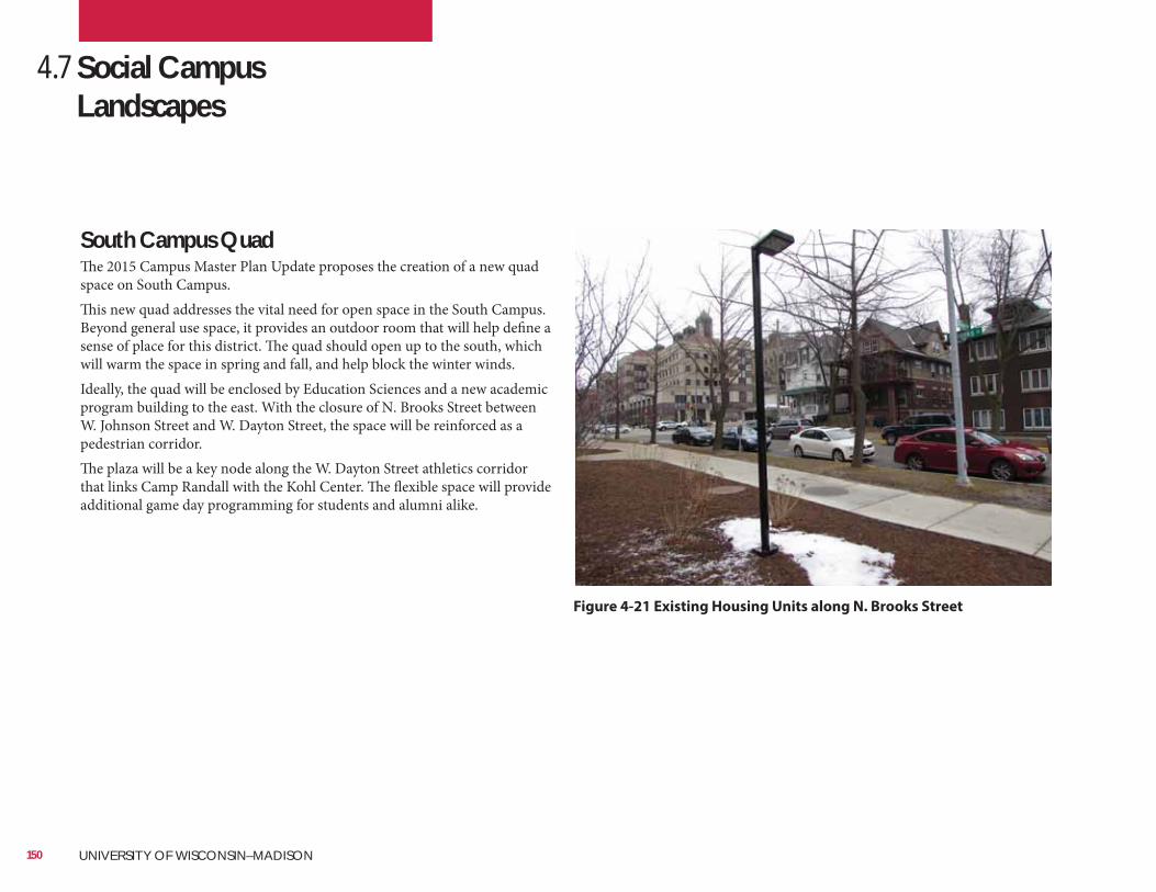
4.7 Social Campus Landscapes
South Campus QuadThe 2015 Campus Master Plan Update proposes the creation of a new quad space on South Campus. This new quad addresses the vital need for open space in the South Campus. Beyond general use space, it provides an outdoor room that will help define a sense of place for this district. The quad should open up to the south, which will warm the space in spring and fall, and help block the winter winds.Ideally, the quad will be enclosed by Education Sciences and a new academic program building to the east. With the closure of N. Brooks Street between W. Johnson Street and W. Dayton Street, the space will be reinforced as a pedestrian corridor.The plaza will be a key node along the W. Dayton Street athletics corridor that links Camp Randall with the Kohl Center. The flexible space will provide additional game day programming for students and alumni alike.
Figure 4-21 Existing Housing Units along N. Brooks Street
150 UNIVERSITY OF WISCONSIN–MADISON
• Create a ‘quad’ of civic scale and character. The simple design will withstand heavy pedestrian traffic. The layout makes programming the space flexible for large and small events. Large lawn panels lined with trees will be reminiscent of larger campus malls and provide a soft, collegiate feel for informal social gatherings. Diagonal paths cut through the space along desire lines between entries and exits. Trees wrap the space and define the rooms, providing a human scale to the surrounding architecture (see Figure 4-22).
• Reinforce north-south pedestrian movement by creating a tree-lined pedestrian mall. The axis will create a pleasant corridor defining the rooms within the quad, while terminating the viewshed on the historic campus to the north.
• Introduce green infrastructure to manage stormwater on site. The site propitiously coincides with a low point in the terrain and intercepts the storm sewer line in the Brooks Street right-of-way, making it an ideal location for an urban stormwater feature to illustrate green infrastructure on campus. The rain garden ponds replace traditional fountains, providing the noise mitigation and calming effects while treating and managing the sites stormwater.
• A terrace connecting to the west facade of the new academic building provides space to have outdoor classes, socialize with friends or study exam material. This corner gathering space is off the main axis to avoid blocking traffic, while engaging the building and providing a space for groups to congregate.
• Redevelop Dayton Street as a “green street” pilot project. As with N. Charter Street, implement the design guidelines outlined in the streetscape typologies to give W. Dayton Street a clear landscape identity linking Camp Randall Memorial Park, Union South, the South Quad and the Kohl Center along one unified “athletic” streetscape experience.
• Provide pedestrian scale lighting to animate the area at all times of the day, particularly during the short days of the winter months.
• Design the quad lawn such that in can endure significant usage, for example through the incorporation of fiber reinforced soils.
151
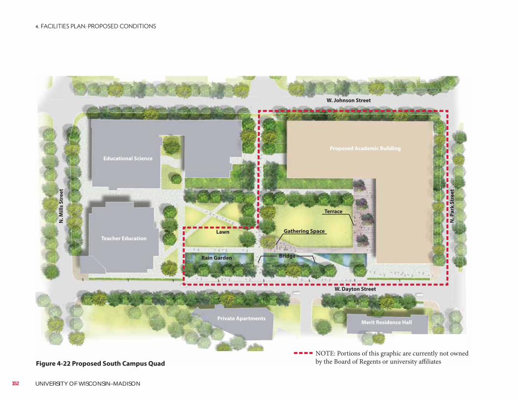
Figure 4-22 Proposed South Campus Quad
Lawn
N. P
ark
Str
ee
t
N. M
ills
Str
ee
t
W. Dayton Street
W. Johnson Street
Rain Garden Bridge
Gathering Space
Terrace
Proposed Academic Building
Educational Science
Private ApartmentsMerit Residence Hall
Teacher Education
NOTE: Portions of this graphic are currently not owned by the Board of Regents or university affiliates
152 UNIVERSITY OF WISCONSIN–MADISON
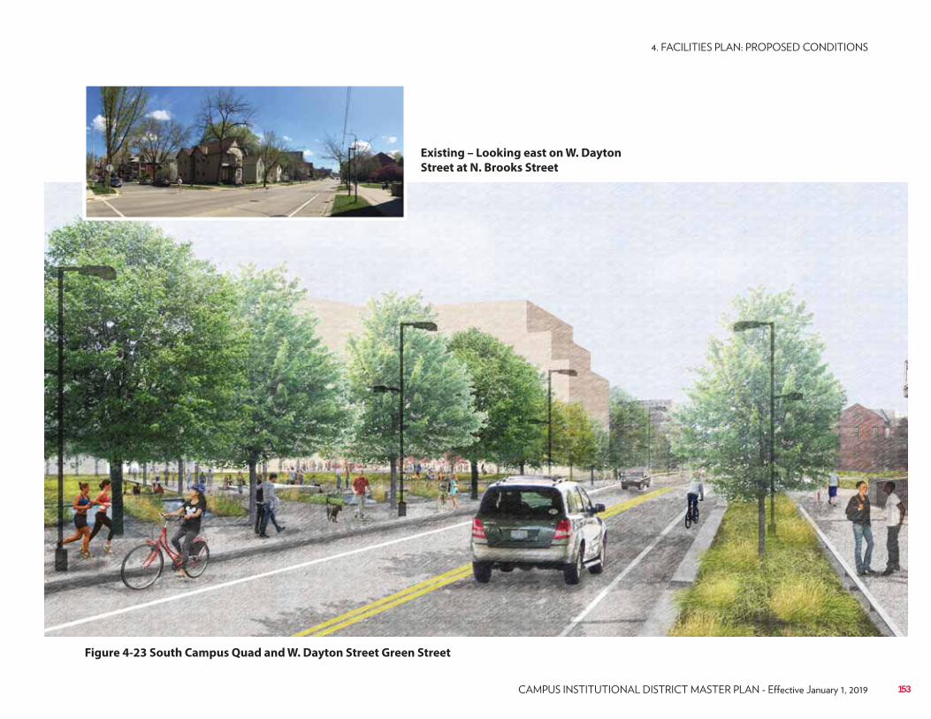
Figure 4-23 South Campus Quad and W. Dayton Street Green Street
Existing – Looking east on W. Dayton
Street at N. Brooks Street
153
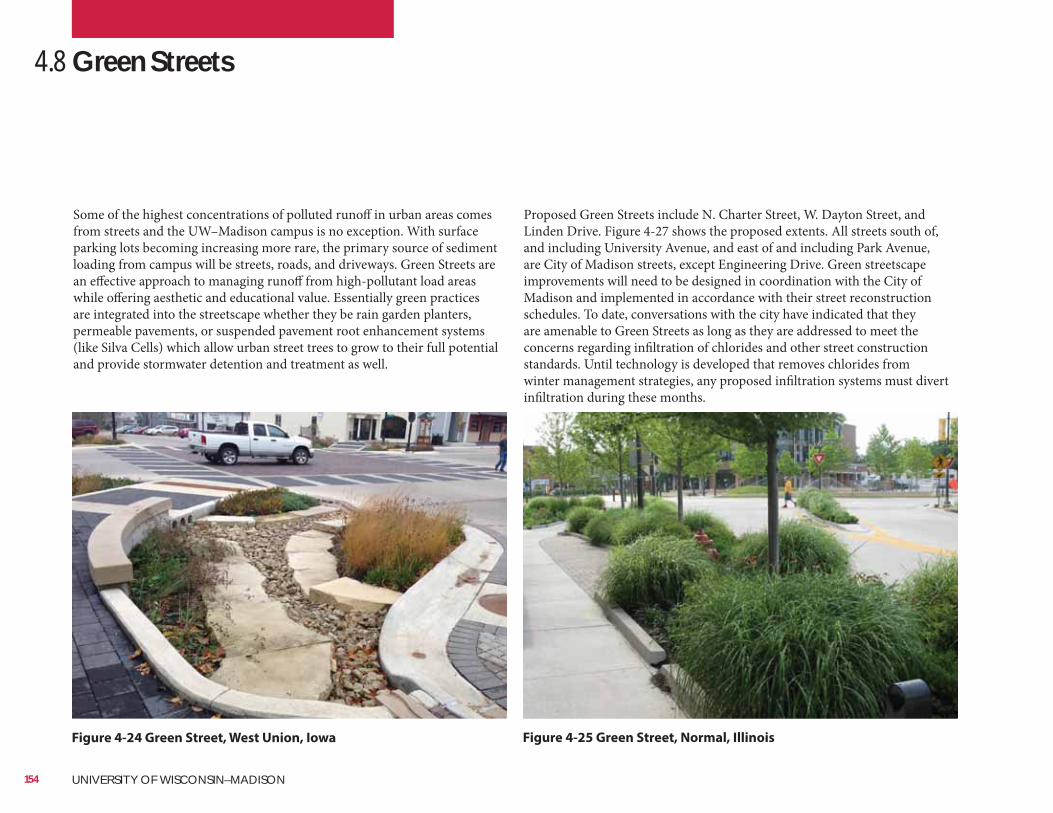
SmithGroupJJR (right)
Proposed Green Streets include N. Charter Street, W. Dayton Street, and Linden Drive. Figure 4-27 shows the proposed extents. All streets south of, and including University Avenue, and east of and including Park Avenue, are City of Madison streets, except Engineering Drive. Green streetscape improvements will need to be designed in coordination with the City of Madison and implemented in accordance with their street reconstruction schedules. To date, conversations with the city have indicated that they are amenable to Green Streets as long as they are addressed to meet the concerns regarding infiltration of chlorides and other street construction standards. Until technology is developed that removes chlorides from winter management strategies, any proposed infiltration systems must divert infiltration during these months.
4.8 Green Streets
Some of the highest concentrations of polluted runoff in urban areas comes from streets and the UW–Madison campus is no exception. With surface parking lots becoming increasing more rare, the primary source of sediment loading from campus will be streets, roads, and driveways. Green Streets are an effective approach to managing runoff from high-pollutant load areas while offering aesthetic and educational value. Essentially green practices are integrated into the streetscape whether they be rain garden planters, permeable pavements, or suspended pavement root enhancement systems (like Silva Cells) which allow urban street trees to grow to their full potential and provide stormwater detention and treatment as well.
Figure 4-25 Green Street, Normal, IllinoisFigure 4-24 Green Street, West Union, Iowa
154 UNIVERSITY OF WISCONSIN–MADISON
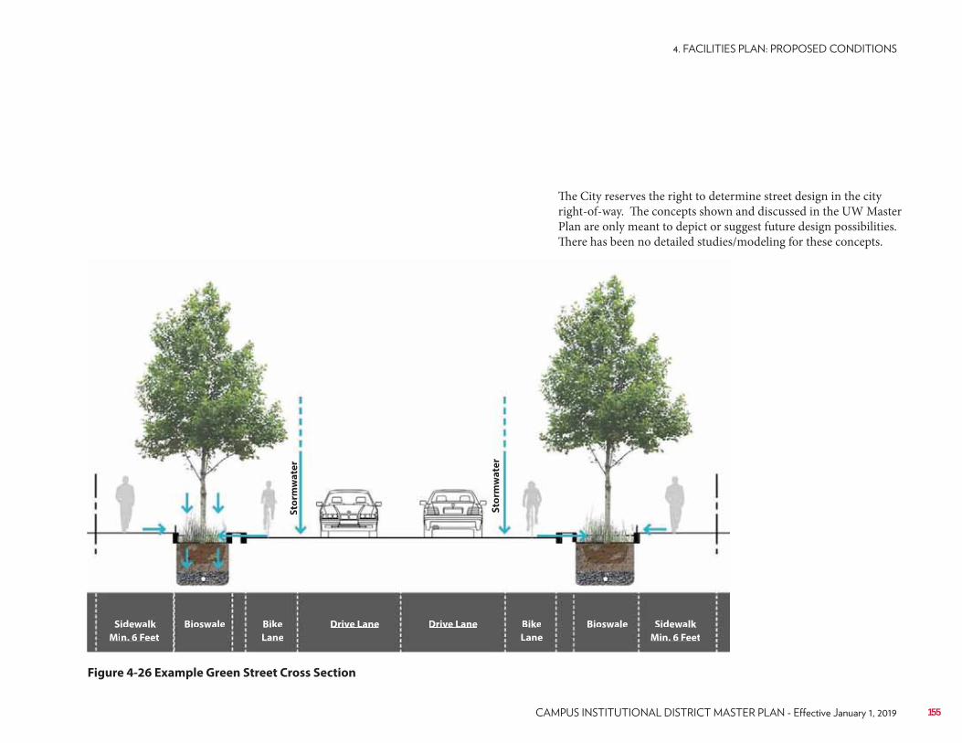
Figure 4-26 Example Green Street Cross Section
Sto
rmw
ate
r
Sto
rmw
ate
r
Sidewalk
Min. 6 Feet
Bike
Lane
Drive LaneBioswale Drive Lane Bike
Lane
Sidewalk
Min. 6 Feet
Bioswale
155
The City reserves the right to determine street design in the city right-of-way. The concepts shown and discussed in the UW Master Plan are only meant to depict or suggest future design possibilities. There has been no detailed studies/modeling for these concepts.
(2) Second, a menu of site-specific best management practices (BMP) and the outcomes they are intended to achieve (such as volume reduction, total suspended solids capture, groundwater recharge, etc.) are described which should be implemented as redevelopment occurs block by block based on an overall subwatershed plan. (3) Third, campus stormwater standards should be updated to ensure that all new redevelopment projects on campus are contributing in a positive way towards overall sustainability and green infrastructure goals. (4) Fourth, we encourage the continuation of good housekeeping practices on campus including street sweeping, snow and leaf litter collection, and diversion and isolation of waste areas to keep runoff from campus as clean as possible.The above recommendations are all physical modifications or policy adoptions that will help UW–Madison maintain a strong leadership role in green infrastructure and work towards permit requirements and other sustainability goals such as ecological awareness of the community and serving as a living laboratory. In addition, UW–Madison is participating in water quality initiatives outside of campus which contribute to a healthy watershed. Adaptive Management in the Yahara Lakes watershed is a program that includes dozens of municipalities and other governmental agencies to target urban and non-urban sources of sediment and phosphorus in the watershed. The long-term goal is to achieve water quality standards in the Yahara Lakes for fishable and swimmable lakes, which will ultimately benefit the university as a major landholder along Lake Mendota.A significant amount of technical analysis went into studying the existing campus conditions and charting a course for the future of green infrastructure on campus. The companion document Green Infrastructure & Stormwater Management Master Plan contains the technical background and detailed recommendations regarding green infrastructure and stormwater management on campus.
UW–Madison is already a leader in sustainable stormwater practices, having implemented dozens of progressive practices from green roofs to wetlands throughout the 936-acre campus. However, increased sustainability awareness by students, faculty, staff, and the general public, as well as a more stringent regulatory climate, offer opportunities for UW–Madison to step up and be even more aggressive in greening its facilities. The 2015 Campus Master Plan Update offers both opportunities for enhancing green infrastructure and challenges as the campus continues to densify and space for stormwater management is balanced with other programmatic needs.Within the context of green infrastructure and stormwater management planning, the primary goal of the UW–Madison Campus Stormwater Management Plan is to identify green infrastructure opportunities so that they can be appropriately budgeted and accommodated during site planning. A secondary goal is to identify and quantify possible impacts (both positive and negative) of proposed building, open space, parking, and roadway changes on stormwater runoff so that appropriate land use decisions can be made or measures incorporated to address potential adverse impacts.Through this master planning process, there were three primary goals identified for green infrastructure on campus:• Implement stormwater practices and policies that contribute to a healthy
Yahara Lakes system.• Integrate research and learning into the campus stormwater management
approach.• Connect campus stormwater management to the wider Yahara Lakes
watershed community.Recommendations to achieve these goals fall under a multi-tiered approach.(1) First, practices were identified which could be implemented in areas where a large multi-site runoff tributary could be collected and treated to maximum benefits for every dollar spent.
4.9 Proposed Green Infrastructure and Stormwater Management
156 UNIVERSITY OF WISCONSIN–MADISON
N
LegendMulti-Site Best
Management Practice
Site-Based Best
Management Practice
Green Street
Permit Boundary
Catchment Area Served by
Best Management Practice
Figure 4-27 Recommended Green Infrastructure Projects
157
4.10 Proposed Pedestrian and Bicycle Circulation
Walking and biking are fundamental and widespread forms of transportation on campus throughout the year, and the university places a high priority on providing connected and comfortable facilities for pedestrians and cyclists. The City reserves the right to determine street design in the city right-of-way. The concepts shown and discussed in the UW Master Plan are only meant to depict or suggest future design possibilities. There has been no detailed studies/modeling for these concepts. Coordination between the City and University will be required. Moving forward, the following should be priorities for enhancing the campus walking and biking experience:
Intersections recommended for improvement were identified based on input from UW–Madison and city staff and the public. The highest priority intersection is N. Charter Street and Linden Drive. This intersection is at the center of campus with several primary academic and research locations in the area, including Van Hise, Human Ecology, Van Vleck, Bascom Hall, Sterling Hall, and others.Pedestrians, mopeds, buses, bicycles, and cars all converge at this intersection. During class change, pedestrian volumes rival pedestrian traffic on the streets of New York City. This causes delays in the transit system, which ripple through the remaining day’s schedule. At peak class change times, Metro Transit buses and motor vehicles experience delay at this location waiting for the large numbers of pedestrians and cyclists to clear the intersection. This delay has a lasting effect on the overall performance of the Metro Transit routes traveling through this area.Coupled with steep topography from Bascom and Observatory Hills, this intersection creates extremely challenging conditions. The university should take advantage of the steep topography and construct a pedestrian plaza/bridge over the intersection. This separated level would capitalize on existing topography and tie into upper levels of future buildings to be built/redeveloped in this area.
Grade separation would provide a continuous connection for pedestrians from the entrance of Van Vleck to the future building in the southwest corner of the intersection as well as the upper plinth of Van Hise (and any new building on the site) and the sidewalk parallel to Linden Drive connecting west to Human Ecology. Removing pedestrians from the street level will reduce intersection transit delay. Motor vehicles, transit users, and cyclists would travel at the existing street level. By linking into future new and redeveloped buildings at the intersection, the vertical circulation would be made primarily through the buildings. Street access would be provided along the east side of N. Charter Street to and from the grade separated area.
Recommendations• Build a pedestrian bridge that establishes a new primary pedestrian level
connecting from Van Vleck to Van Hise. To be successful, the bridge must feel like the natural choice for students. Using the unique topography, the bridge crossing will be easier than current pathways. Separating a portion of pedestrians from vehicular traffic will alleviate traffic congestion, mitigate multimodal conflicts, and improve pedestrian experience.
• Build an iconic bridge. The bridge will be at the eastern terminus of the Linden “Greater” Mall and therefore is a tremendous opportunity to create an architectural icon. Unlike a particular building that only a small portion of the campus may use, this bridge will be used by a large campus cross section.
• Create a destination through the incorporation of planting and seating. The bridge creates a new opportunity that currently does not exist, to create space that accommodates the traffic flow while providing flex space for people to congregate. The bridge will conceptually extend the Linden Mall up toward Bascom Hill connecting two spaces that were previously divided. The bridge design should be such as not to hinder both anticipated and unanticipated programming.
• Provide an open and airy structure. The bridge should incorporate skylights and openings to provide adequate daylight to travelers below. Lighting should be incorporated for safety and to highlight architectural features.
158 UNIVERSITY OF WISCONSIN–MADISON
Figure 4-28 N. Charter Street At Linden Drive Pedestrian Bridge
N. C
ha
rte
r S
t.
Existing Van Hise
FootprintUpper Level Entrance
Upper Level
Entrance
with Elevator
Stairs to Bascom Hall
Stairs to Bridge
Gathering
Space
Linden “Greater Mall”
Linden Dr.
Opening
Street Level
Entrance
Nancy Nicholas
Hall
New Building
New Building New Building
New Building
New Building
Ingraham Hall
Van Vleck Hall
Sterling HallNote: Tan color represents future proposed buildings
159
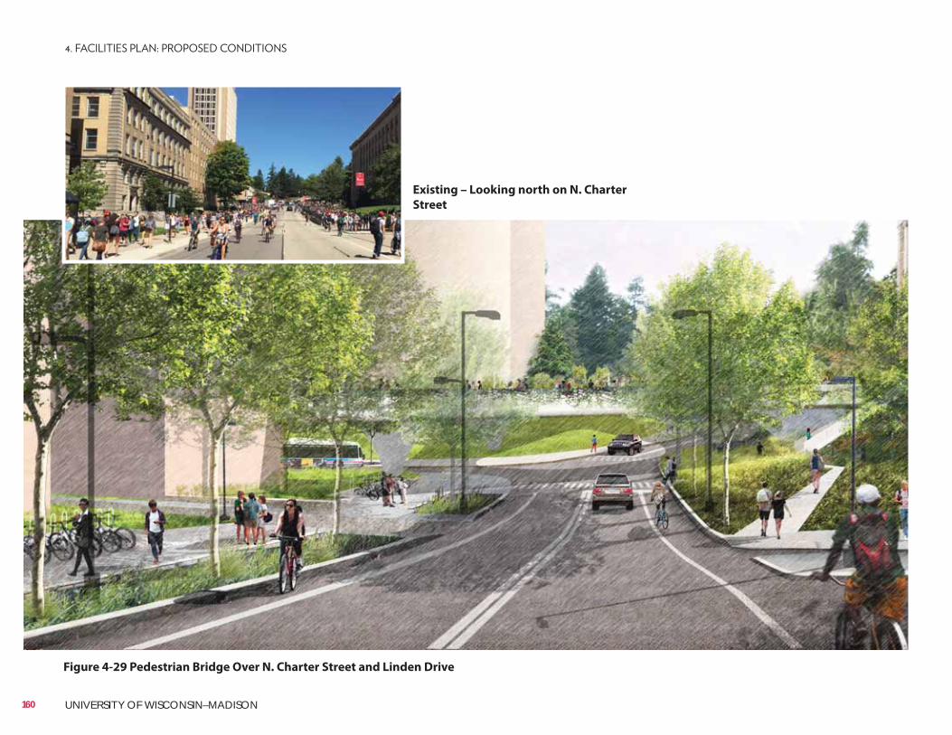
Existing – Looking north on N. Charter
Street
Figure 4-29 Pedestrian Bridge Over N. Charter Street and Linden Drive
160 UNIVERSITY OF WISCONSIN–MADISON
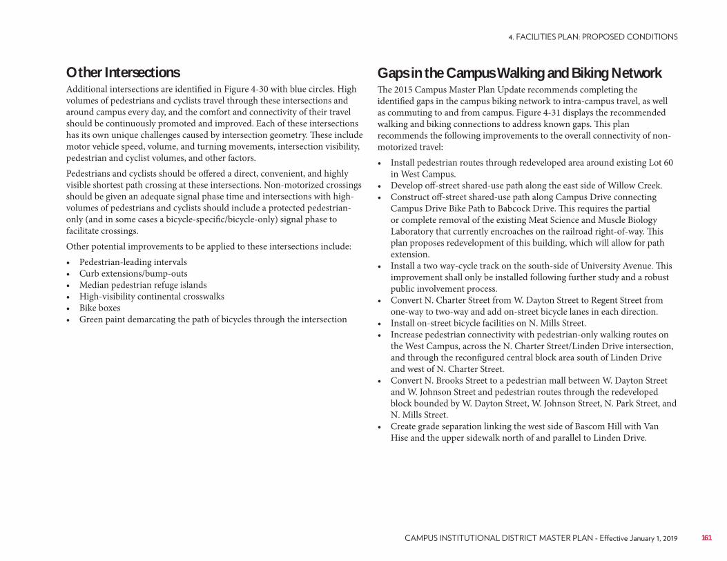
Other IntersectionsAdditional intersections are identified in Figure 4-30 with blue circles. High volumes of pedestrians and cyclists travel through these intersections and around campus every day, and the comfort and connectivity of their travel should be continuously promoted and improved. Each of these intersections has its own unique challenges caused by intersection geometry. These include motor vehicle speed, volume, and turning movements, intersection visibility, pedestrian and cyclist volumes, and other factors.Pedestrians and cyclists should be offered a direct, convenient, and highly visible shortest path crossing at these intersections. Non-motorized crossings should be given an adequate signal phase time and intersections with high-volumes of pedestrians and cyclists should include a protected pedestrian-only (and in some cases a bicycle-specific/bicycle-only) signal phase to facilitate crossings.Other potential improvements to be applied to these intersections include:• Pedestrian-leading intervals• Curb extensions/bump-outs• Median pedestrian refuge islands• High-visibility continental crosswalks• Bike boxes• Green paint demarcating the path of bicycles through the intersection
Gaps in the Campus Walking and Biking NetworkThe 2015 Campus Master Plan Update recommends completing the identified gaps in the campus biking network to intra-campus travel, as well as commuting to and from campus. Figure 4-31 displays the recommended walking and biking connections to address known gaps. This plan recommends the following improvements to the overall connectivity of non-motorized travel:• Install pedestrian routes through redeveloped area around existing Lot 60
in West Campus.• Develop off-street shared-use path along the east side of Willow Creek.• Construct off-street shared-use path along Campus Drive connecting
Campus Drive Bike Path to Babcock Drive. This requires the partial or complete removal of the existing Meat Science and Muscle Biology Laboratory that currently encroaches on the railroad right-of-way. This plan proposes redevelopment of this building, which will allow for path extension.
• Install a two way-cycle track on the south-side of University Avenue. This improvement shall only be installed following further study and a robust public involvement process.
• Convert N. Charter Street from W. Dayton Street to Regent Street from one-way to two-way and add on-street bicycle lanes in each direction.
• Install on-street bicycle facilities on N. Mills Street.• Increase pedestrian connectivity with pedestrian-only walking routes on
the West Campus, across the N. Charter Street/Linden Drive intersection, and through the reconfigured central block area south of Linden Drive and west of N. Charter Street.
• Convert N. Brooks Street to a pedestrian mall between W. Dayton Street and W. Johnson Street and pedestrian routes through the redeveloped block bounded by W. Dayton Street, W. Johnson Street, N. Park Street, and N. Mills Street.
• Create grade separation linking the west side of Bascom Hill with Van Hise and the upper sidewalk north of and parallel to Linden Drive.
161
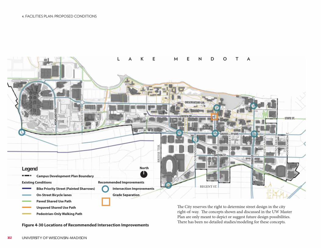
NorthLegendCampus Development Plan Boundary
Existing Conditions
Bike Priority Street (Painted Sharrows)
On-Street Bicycle lanes
Paved Shared Use Path
Unpaved Shared Use Path
Pedestrian-Only Walking Path
REGENT ST.
BREE
SE T
ER.
N. R
AN
DA
LL A
VE.
N. M
ILLS
ST.
EAST
CA
MPU
S
N. L
AKE
ST.
N. F
RAN
CES
ST.
WA
LNU
T ST
.
Figure 4-30 Locations of Recommended Intersection Improvements
Recommended Improvements
Intersection Improvements
Grade Separation
The City reserves the right to determine street design in the city right-of-way. The concepts shown and discussed in the UW Master Plan are only meant to depict or suggest future design possibilities. There has been no detailed studies/modeling for these concepts.
162 UNIVERSITY OF WISCONSIN–MADISON
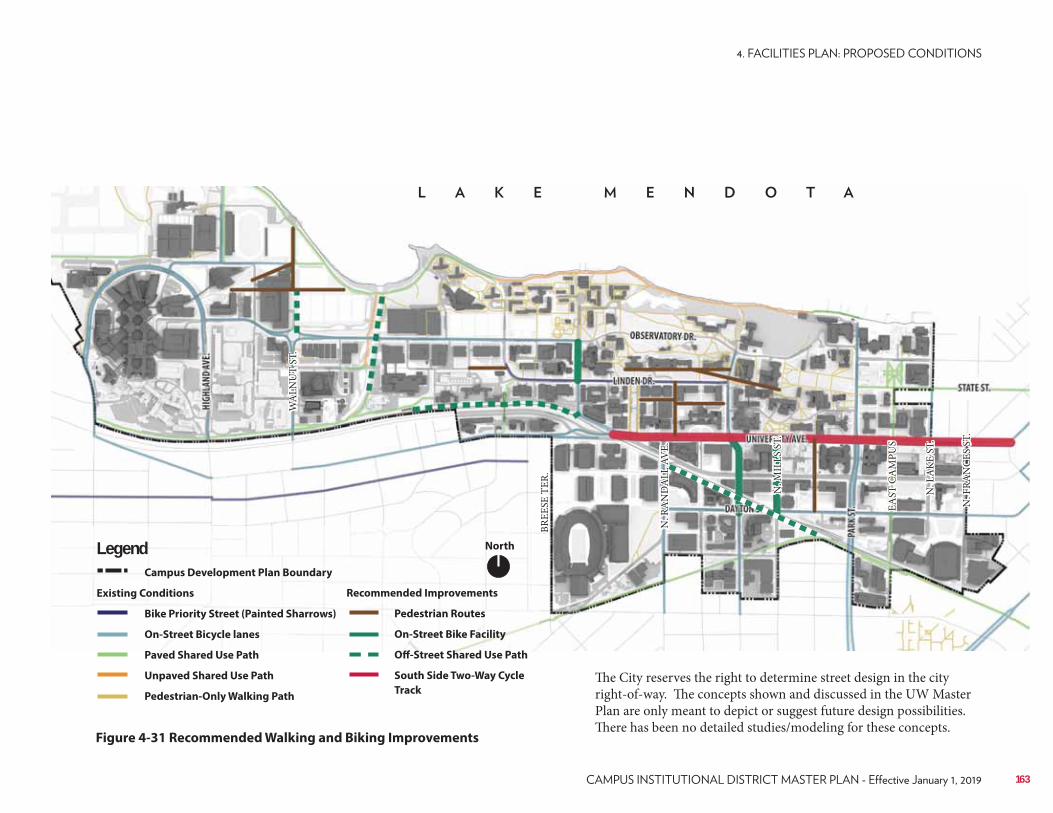
Figure 4-31 Recommended Walking and Biking Improvements
NorthLegendCampus Development Plan Boundary
Existing Conditions
Bike Priority Street (Painted Sharrows)
On-Street Bicycle lanes
Paved Shared Use Path
Unpaved Shared Use Path
Pedestrian-Only Walking Path
Recommended Improvements
Pedestrian Routes
On-Street Bike Facility
Off-Street Shared Use Path
South Side Two-Way Cycle
Track
BREE
SE T
ER.
N. R
AN
DA
LL A
VE.
N. M
ILLS
ST.
EAST
CA
MPU
S
N. L
AKE
ST.
N. F
RAN
CES
ST.
WA
LNU
T ST
.
The City reserves the right to determine street design in the city right-of-way. The concepts shown and discussed in the UW Master Plan are only meant to depict or suggest future design possibilities. There has been no detailed studies/modeling for these concepts.
163
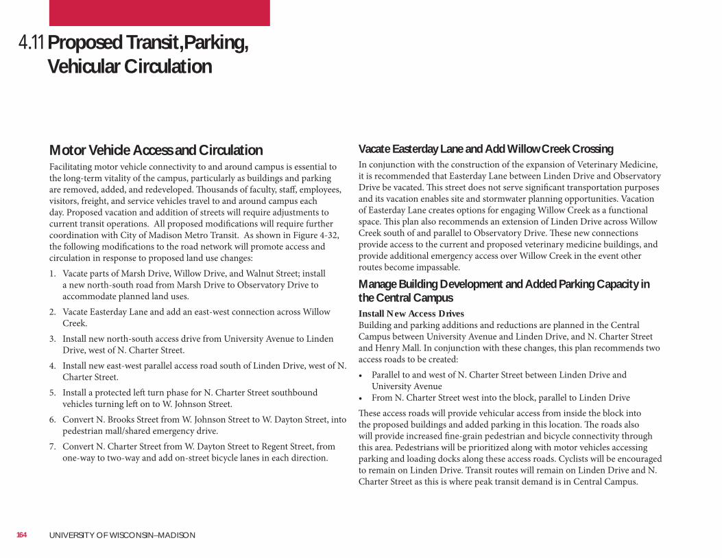
Vacate Easterday Lane and Add Willow Creek CrossingIn conjunction with the construction of the expansion of Veterinary Medicine, it is recommended that Easterday Lane between Linden Drive and Observatory Drive be vacated. This street does not serve significant transportation purposes and its vacation enables site and stormwater planning opportunities. Vacation of Easterday Lane creates options for engaging Willow Creek as a functional space. This plan also recommends an extension of Linden Drive across Willow Creek south of and parallel to Observatory Drive. These new connections provide access to the current and proposed veterinary medicine buildings, and provide additional emergency access over Willow Creek in the event other routes become impassable.
Manage Building Development and Added Parking Capacity in the Central CampusInstall New Access DrivesBuilding and parking additions and reductions are planned in the Central Campus between University Avenue and Linden Drive, and N. Charter Street and Henry Mall. In conjunction with these changes, this plan recommends two access roads to be created:• Parallel to and west of N. Charter Street between Linden Drive and
University Avenue• From N. Charter Street west into the block, parallel to Linden DriveThese access roads will provide vehicular access from inside the block into the proposed buildings and added parking in this location. The roads also will provide increased fine-grain pedestrian and bicycle connectivity through this area. Pedestrians will be prioritized along with motor vehicles accessing parking and loading docks along these access roads. Cyclists will be encouraged to remain on Linden Drive. Transit routes will remain on Linden Drive and N. Charter Street as this is where peak transit demand is in Central Campus.
Motor Vehicle Access and CirculationFacilitating motor vehicle connectivity to and around campus is essential to the long-term vitality of the campus, particularly as buildings and parking are removed, added, and redeveloped. Thousands of faculty, staff, employees, visitors, freight, and service vehicles travel to and around campus each day. Proposed vacation and addition of streets will require adjustments to current transit operations. All proposed modifications will require further coordination with City of Madison Metro Transit. As shown in Figure 4-32, the following modifications to the road network will promote access and circulation in response to proposed land use changes:1. Vacate parts of Marsh Drive, Willow Drive, and Walnut Street; install
a new north-south road from Marsh Drive to Observatory Drive to accommodate planned land uses.
2. Vacate Easterday Lane and add an east-west connection across Willow Creek.
3. Install new north-south access drive from University Avenue to Linden Drive, west of N. Charter Street.
4. Install new east-west parallel access road south of Linden Drive, west of N. Charter Street.
5. Install a protected left turn phase for N. Charter Street southbound vehicles turning left on to W. Johnson Street.
6. Convert N. Brooks Street from W. Johnson Street to W. Dayton Street, into pedestrian mall/shared emergency drive.
7. Convert N. Charter Street from W. Dayton Street to Regent Street, from one-way to two-way and add on-street bicycle lanes in each direction.
4.11 Proposed Transit,Parking, Vehicular Circulation
164 UNIVERSITY OF WISCONSIN–MADISON
NorthLegendCampus Development Plan Boundary
Proposed Road Addition
Proposed Road Vacation
Proposed Road Conversion
Proposed Pedestrian Mall/Emergency
Access
Figure 4-32 Proposed Road Additions, Vacations, and Conversions
BREE
SE T
ER.
N. R
AN
DA
LL A
VE.
N. M
ILLS
ST.
EAST
CA
MPU
S
N. L
AKE
ST.
N. F
RAN
CES
ST.
WA
LNU
T ST
.
The City reserves the right to determine street design in the city right-of-way. The concepts shown and discussed in the UW Master Plan are only meant to depict or suggest future design possibilities. There has been no detailed studies/modeling for these concepts.
165
Parking Operations and ManagementThe effective operation and management of parking at UW–Madison is paramount to the long-term success of the university and quality of life on campus. The university strives to continue to be a national leader in parking management, the provision of low parking ratios, and a comprehensive and complementary set of alternative commuter solutions. The university also recognizes the importance of providing available and accessible parking spaces for campus visitors and employees.
Future Parking NeedsFuture parking needs were modeled under the planned future campus land use scenario. Approximately 900,000 square feet of new programmable building space is planned for West Campus compared to the existing condition. Additional parking supply is recommended for all campus districts to meet demand. Analysis indicates an overall future campus parking deficit of just 18 faculty/staff parking spaces as a result of the development programmed in the 2015 Campus Master Plan Update. Analysis was used to modify and finalize the proposed land use development and redevelopment build-out scenario.
RecommendationsThis plan presents several recommendations for the university to effectively and efficiently provide and manage parking in conjunction with this Master Plan’s proposed campus development and redevelopment.• Continue to be leaders in transportation demand management (TDM)
and alternative commuter solutions.• Maintain parking ratios for faculty and staff. Work to shift UW Hospital
employee parking demand off campus.• Strategically add parking supply in conjunction with planned land use
changes to continue to provide enough available and convenient parking to support the university’s academic, research, and outreach missions.
• Add approximately 2,000 parking spaces over the next 20-40 years for visitors and provide swing space to accommodate parking phasing and construction.
Where possible, remove surface parking lots and consolidate parking supply into centrally located parking structures to allow for green space and campus development, increase parking efficiency, and improve water quality by reducing the amount of impermeable surfaces on campus.
Additional building square footage and parking capacity in the Central Campus will bring added traffic on N. Charter Street and University Avenue. Much of the traffic from the development in this area will desire to turn left onto W. Johnson Street from southbound N. Charter Street. This plan recommends a short, protected, leading left turn phase from southbound N. Charter Street to eastbound W. Johnson Street. This would be in addition to the current permissive left turn phase. A protected left turn phase will provide additional capacity for turning movements without negatively affecting the intersection of Park Street and W. Johnson Street (the key intersection in the area).
Street into Pedestrian Mall/Shared Emergency DriveIn conjunction with future building redevelopment at this block, this plan recommends converting N. Brooks Street from W. Johnson Street to W. Dayton Street into a pedestrian mall/shared emergency access drive.
StreetThis plan recommends converting N. Charter Street from W. Dayton Street to Regent Street from a northbound one-way street (with a southbound contra-flow bicycle lane and on-street parking) to a two-way with minimum 5-foot bicycle lanes in each direction. This recommendation serves to establish N. Charter Street an attractive multimodal gateway from South Campus and provides a connection through the center of campus all the way to Lake Mendota. These modifications require removal of on-street parking from the east side of N. Charter Street. There is sufficient nearby public street and university parking to make up for removal of parking along N. Charter Street.
166 UNIVERSITY OF WISCONSIN–MADISON
Recommended Parking Additions and ReductionsThis plan recommends the addition of approximately 2,000 parking spaces for visitors and to provide swing space over the next 20-40 years. Additional parking is needed to serve development phasing. New parking needs to be built before current parking lots are taken off line to accommodate the future building projects. In addition to providing construction swing space, the additional parking spaces will serve our campus visitors. Visitor parking demand is typically during off-peak hours. Roadways in West Campus and across campus are sized to meet peak demand levels. No significant traffic impacts on local roads during peak or off-peak periods are anticipated due to the recommended increase in visitor parking supply.This plan recommends an addition of 6,380 and removal of 4,320 parking spaces, for a net increase of 2,060 parking spaces over the next 20-40 years to accommodate the planned build-out. Recommended parking additions and reductions are depicted in Figure 4-36 and Figure 4-37. Additions and reductions result in the following increases by district:• West Campus: +689 spaces• Near West Campus: +81 spaces• Central Campus: +675 spaces• South Campus: +615 spacesParking spaces will be consistently monitored to assure the campus is not overbuilding its parking supply based on current and future parking demands. With the continual improvements in public transit options and latest technologies in autonomous vehicles, it is clear that transportation to, from, and within campus will continue to evolve. The parking recommendations have been developed with input from the City of Madison Traffic Engineering and Planning agencies, as well as the Pedestrian, Bike, Motor Vehicle Commission (PBMVC). They recognize that some existing parking lots may be reduced or eliminated with additional parking added in other areas of campus. New additions of parking may affect city streets operation and right-of-way widths required. A transportation impact analysis (TIA), right-of-way improvements, and/or dedications may be required. Refer to amended MGO 28.097(7)(b) for additional information related to ‘Final Building, Structured Parking, and Surface Parking Design Review’.
167
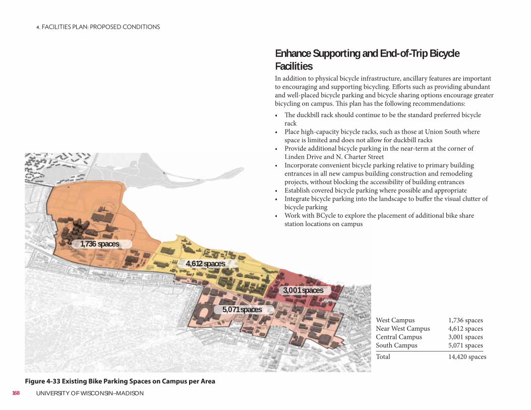
Figure 4-33 Existing Bike Parking Spaces on Campus per Area
Enhance Supporting and End-of-Trip BicycleFacilitiesIn addition to physical bicycle infrastructure, ancillary features are importantto encouraging and supporting bicycling. Efforts such as providing abundantand well-placed bicycle parking and bicycle sharing options encourage greater bicycling on campus. This plan has the following recommendations:• The duckbill rack should continue to be the standard preferred bicycle
rack• Place high-capacity bicycle racks, such as those at Union South where
space is limited and does not allow for duckbill racks• Provide additional bicycle parking in the near-term at the corner of
StreetLinden Drive and N. Charter S• e parking relative to primary building Incorporate convenient bicycle
uilding construction and remodeling entrances in all new campus buaccessibility of building entrancesprojects, without blocking the a
• ng where possible and appropriateEstablish covered bicycle parki• he landscape to buffer the visual clutter of Integrate bicycle parking into th
bicycle parking• he placement of additional bike share Work with BCycle to explore th
station locations on campus
West Campus 1,736 spacesNear West Campus 4,612 spacesCentral Campus 3,001 spacesSouth Campus 5,071 spacesTotal 14,420 spaces
168 UNIVERSITY OF WISCONSIN–MADISON
1,736 spaces
4,612 spaces
3,001 spaces
5,071 spaces
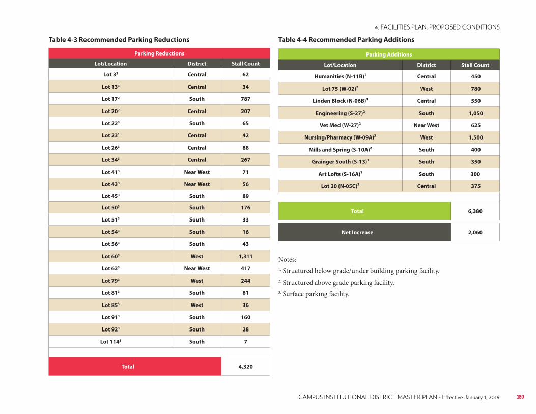
Table 4-3 Recommended Parking Reductions
Parking Reductions
Lot/Location District Stall Count
Lot 33 Central 62
Lot 133 Central 34
Lot 172 South 787
Lot 202 Central 207
Lot 223 South 65
Lot 231 Central 42
Lot 263 Central 88
Lot 343 Central 267
Lot 413 Near West 71
Lot 433 Near West 56
Lot 453 South 89
Lot 503 South 176
Lot 513 South 33
Lot 543 South 16
Lot 563 South 43
Lot 603 West 1,311
Lot 623 Near West 417
Lot 793 West 244
Lot 813 South 81
Lot 853 West 36
Lot 913 South 160
Lot 923 South 28
Lot 1143 South 7
Total 4,320
Parking Additions
Lot/Location District Stall Count
Humanities (N-11B)1 Central 450
Lot 75 (W-02)2 West 780
Linden Block (N-06B)1 Central 550
Engineering (S-27)2 South 1,050
Vet Med (W-27)2 Near West 625
Nursing/Pharmacy (W-09A)2 West 1,500
Mills and Spring (S-10A)2 South 400
Grainger South (S-13)1 South 350
Art Lofts (S-16A)1 South 300
Lot 20 (N-05C)2 Central 375
Total 6,380
Net Increase 2,060
Notes:1. Structured below grade/under building parking facility.2. Structured above grade parking facility.3. Surface parking facility.
Table 4-4 Recommended Parking Additions
169
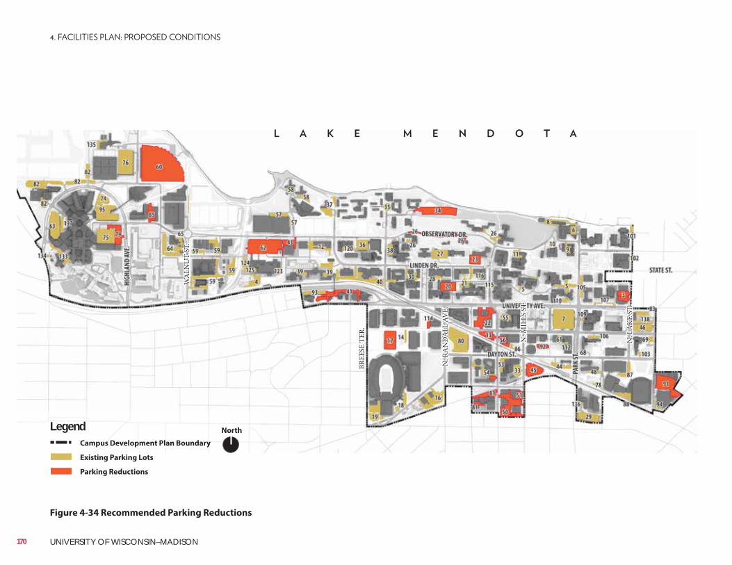
NorthLegendCampus Development Plan Boundary
Existing Parking Lots
Parking Reductions
Figure 4-34 Recommended Parking Reductions
BREE
SE T
ER.
N. R
AN
DA
LL A
VE.
N. M
ILLS
ST.
N. L
AKE
ST.
WA
LNU
T ST
.
170 UNIVERSITY OF WISCONSIN–MADISON
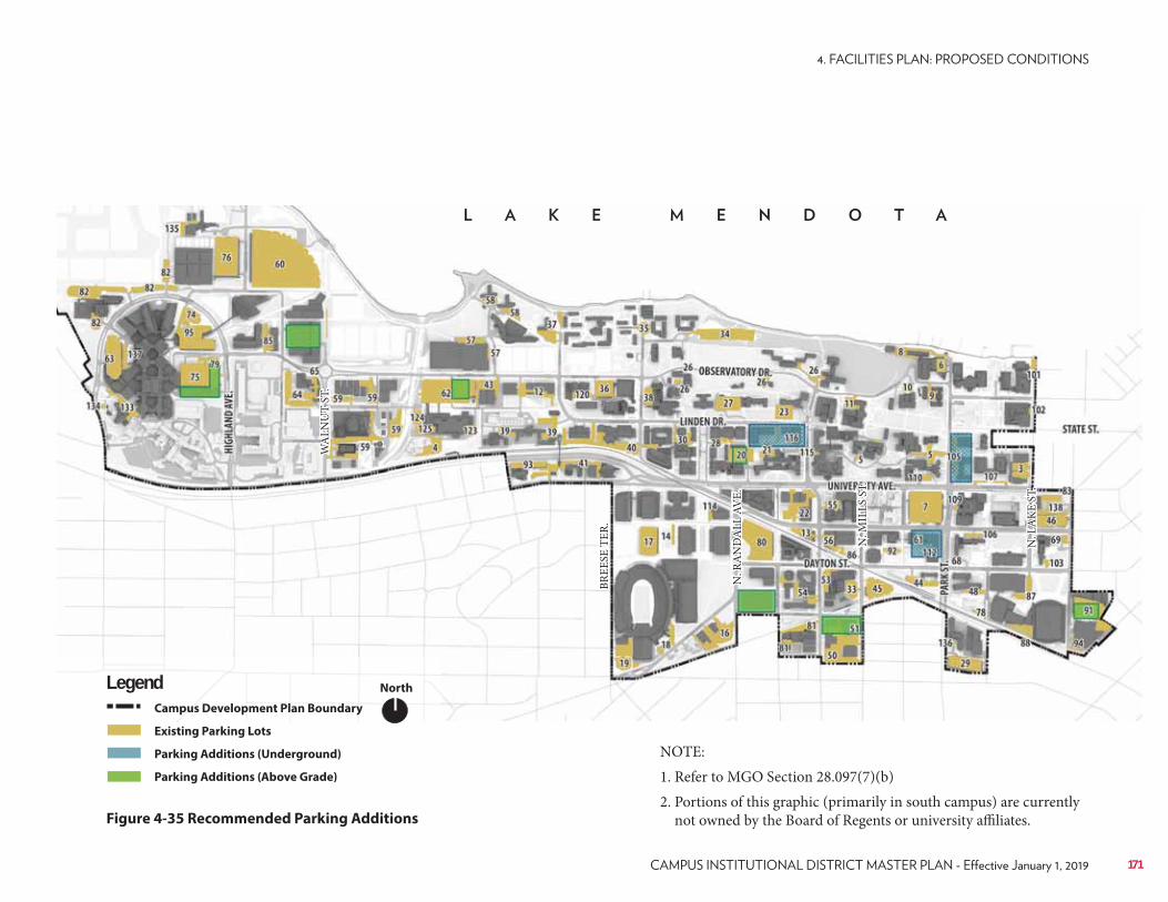
NorthLegendCampus Development Plan Boundary
Existing Parking Lots
Parking Additions (Underground)
Parking Additions (Above Grade)
Figure 4-35 Recommended Parking Additions
BREE
SE T
ER.
N. R
AN
DA
LL A
VE.
N. M
ILLS
ST.
N. L
AKE
ST.
WA
LNU
T ST
.
NOTE: 1. Refer to MGO Section 28.097(7)(b)2. Portions of this graphic (primarily in south campus) are currently
not owned by the Board of Regents or university affiliates.
171

172 UNIVERSITY OF WISCONSIN–MADISON
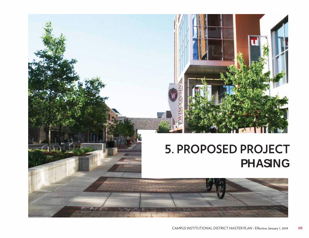
SmithGroupJJR
PHASING
173
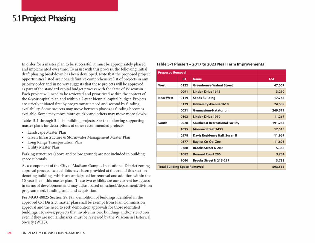
In order for a master plan to be successful, it must be appropriately phased and implemented over time. To assist with this process, the following initial draft phasing breakdown has been developed. Note that the proposed project opportunities listed are not a definitive comprehensive list of projects in any priority order and in no way suggests that these projects will be approved as part of the standard capital budget process with the State of Wisconsin. Each project will need to be reviewed and prioritized within the context of the 6-year capital plan and within a 2-year biennial capital budget. Projects are strictly initiated first by programmatic need and second by funding availability. Some projects may move between phases as funding becomes available. Some may move more quickly and others may move more slowly.Tables 5-1 through 5-4 list building projects. See the following supporting master plans for descriptions of other recommended projects:• Landscape Master Plan• Green Infrastructure & Stormwater Management Master Plan• Long Range Transportation Plan• Utility Master PlanParking structures (above and below ground) are not included in building space subtotals.As a component of the City of Madison Campus Institutional District zoning approval process, two exhibits have been provided at the end of this section denoting buildings which are anticipated for removal and addition within the 10-year life of this master plan. These two exhibits are our current best guess in terms of development and may adjust based on school/department/division program need, funding, and land acquisition. Per MGO 48025 Section 28.185, demolition of buildings identified in the approved C-I District master plan shall be exempt from Plan Commission approval and the need to seek demolition approvals for those identified buildings. However, projects that involve historic buildings and/or structures, even if they are not landmarks, must be reviewed by the Wisconsin Historical Society (WHS).
5.1 Project Phasing
Table 5-1 Phase 1 – 2017 to 2023 Near Term Improvements
Proposed Removal
ID Name GSF
West 0122 Greenhouse-Walnut Street 47,007
0091 Linden Drive 1645 3,210
Near West 0119 Seeds Building 17,744
0129 University Avenue 1610 24,589
0031 Gymnasium-Natatorium 249,579
0103 Linden Drive 1910 11,267
South 0028 Southeast Recreational Facility 191,254
1095 Monroe Street 1433 12,515
0578 Davis Residence Hall, Susan B 11,967
0577 Bayliss Co-Op, Zoe 11,603
0788 Brooks Street N 209 5,363
1082 Bernard Court 206 3,734
1060 Brooks Street N 215-217 3,733
Total Building Space Removed 593,565
174 UNIVERSITY OF WISCONSIN–MADISON
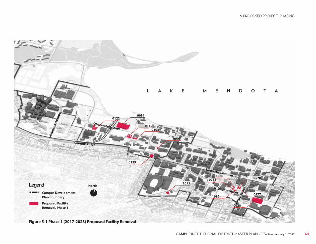
Campus Drive
Observatory Drive
University Avenue
W. Dayton Street
Hig
hla
nd
Av
en
ue
N. P
ark
Str
ee
t
North
Campus Development
Plan Boundary
Proposed Facility
Removal, Phase 1
Legend
Figure 5-1 Phase 1 (2017-2023) Proposed Facility Removal
Willo
w Cre
ekk
0122
0091
0119
0031
0103
1095
0578
1082
0129
0788
0577
NNNN.
NNNN0028
yyyyyy AAAAAAvevevevevvevenununununnn1060
175
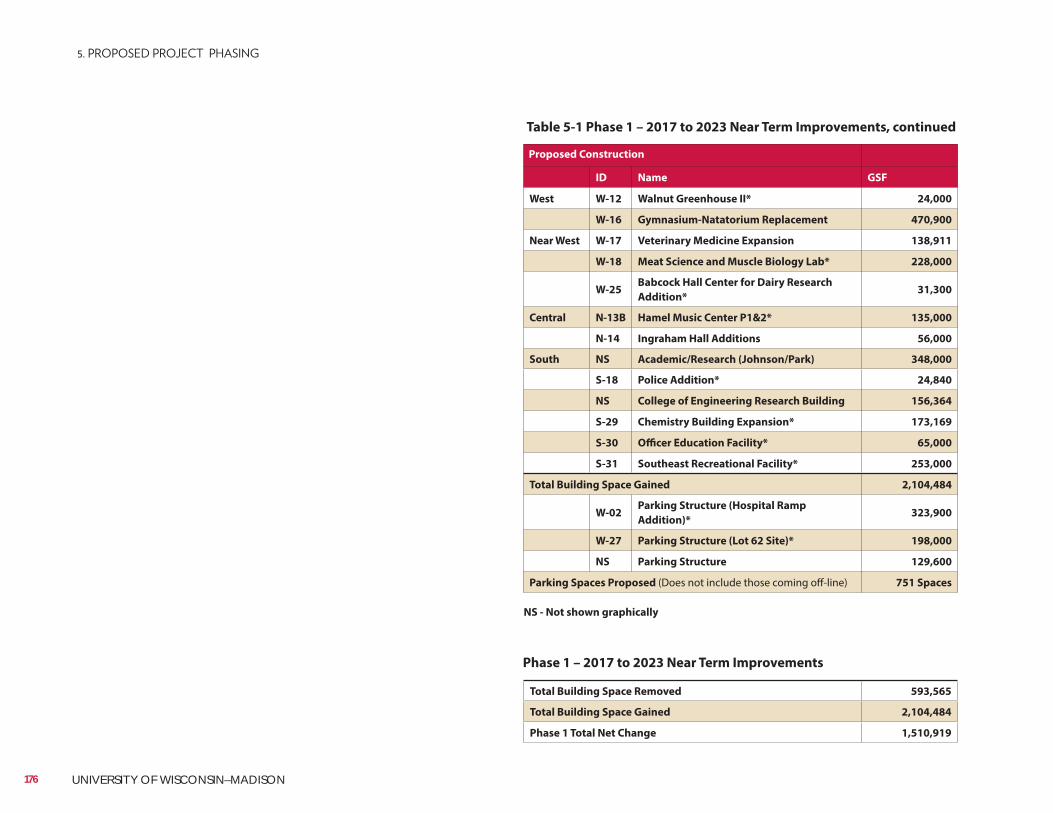
Proposed Construction
ID Name GSF
West W-12 Walnut Greenhouse II* 24,000
W-16 Gymnasium-Natatorium Replacement 470,900
Near West W-17 Veterinary Medicine Expansion 138,911
W-18 Meat Science and Muscle Biology Lab* 228,000
W-25Babcock Hall Center for Dairy Research
Addition* 31,300
Central N-13B Hamel Music Center P1&2* 135,000
N-14 Ingraham Hall Additions 56,000
South NS Academic/Research (Johnson/Park) 348,000
S-18 Police Addition* 24,840
NS College of Engineering Research Building 156,364
S-29 Chemistry Building Expansion* 173,169
S-30 Officer Education Facility* 65,000
S-31 Southeast Recreational Facility* 253,000
Total Building Space Gained 2,104,484
W-02Parking Structure (Hospital Ramp
Addition)* 323,900
W-27 Parking Structure (Lot 62 Site)* 198,000
NS Parking Structure 129,600
Parking Spaces Proposed (Does not include those coming off-line) 751 Spaces
Table 5-1 Phase 1 – 2017 to 2023 Near Term Improvements, continued
Total Building Space Removed 593,565
Total Building Space Gained 2,104,484
Phase 1 Total Net Change 1,510,919
Phase 1 – 2017 to 2023 Near Term Improvements
NS - Not shown graphically
176 UNIVERSITY OF WISCONSIN–MADISON
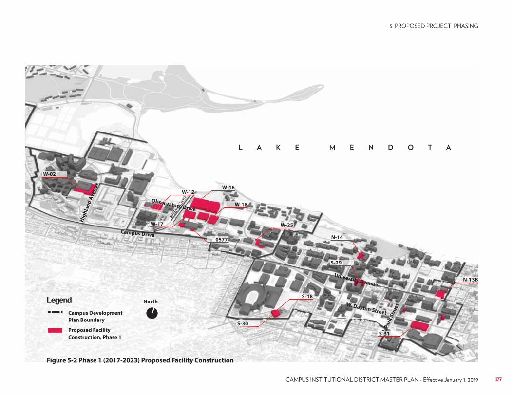
Campus Drive
Observatory Drive
University Avenue
W. Dayton Street
Hig
hla
nd
Av
en
ue
N. P
ark
Str
ee
t
North
Campus Development
Plan Boundary
Proposed Facility
Construction, Phase 1
Legend
Figure 5-2 Phase 1 (2017-2023) Proposed Facility Construction
Willo
w Cre
ekk
W-12
W-25
W-18
W-16
S-18
W-17
W-02
0577
NNNN.
NNNS-31
N-14
N-13B
S-29
S-30
177
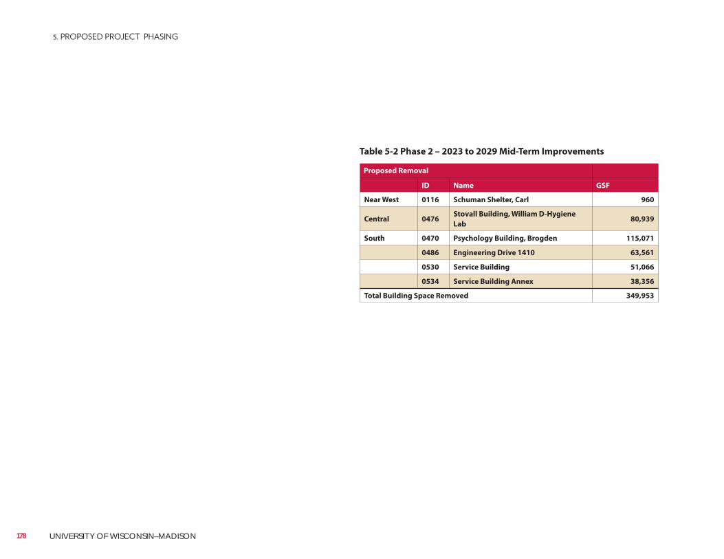
Table 5-2 Phase 2 – 2023 to 2029 Mid-Term Improvements
Proposed Removal
ID Name GSF
Near West 0116 Schuman Shelter, Carl 960
Central 0476Stovall Building, William D-Hygiene
Lab 80,939
South 0470 Psychology Building, Brogden 115,071
0486 Engineering Drive 1410 63,561
0530 Service Building 51,066
0534 Service Building Annex 38,356
Total Building Space Removed 349,953
178 UNIVERSITY OF WISCONSIN–MADISON
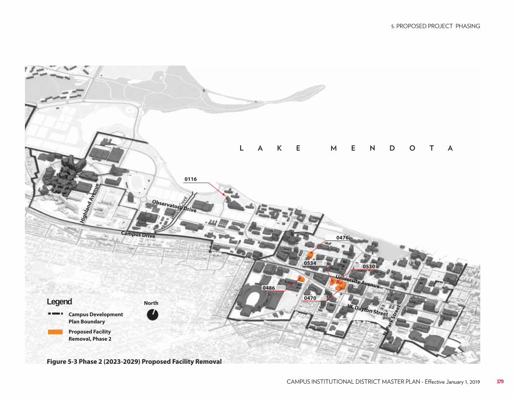
Campus Drive
Observatory Drive
University Avenue
W. Dayton Street
Hig
hla
nd
Av
en
ue
N. P
ark
Str
ee
t
North
Campus Development
Plan Boundary
Proposed Facility
Removal, Phase 2
Legend
Figure 5-3 Phase 2 (2023-2029) Proposed Facility Removal
Willo
w Cre
ek
0476
0486
0470
0116
05340530
179
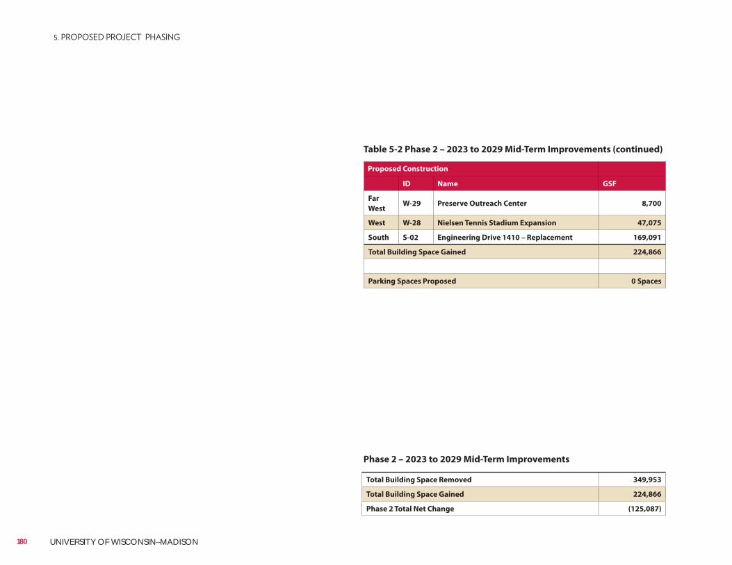
Table 5-2 Phase 2 – 2023 to 2029 Mid-Term Improvements (continued)
Proposed Construction
ID Name GSF
Far
WestW-29 Preserve Outreach Center 8,700
West W-28 Nielsen Tennis Stadium Expansion 47,075
South S-02 Engineering Drive 1410 – Replacement 169,091
Total Building Space Gained 224,866
Parking Spaces Proposed 0 Spaces
Total Building Space Removed 349,953
Total Building Space Gained 224,866
Phase 2 Total Net Change (125,087)
Phase 2 – 2023 to 2029 Mid-Term Improvements
180 UNIVERSITY OF WISCONSIN–MADISON
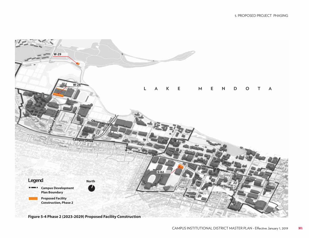
Campus Drive
Observatory Drive
University Avenue
W. Dayton Street
Hig
hla
nd
Av
en
ue
N. P
ark
Str
ee
t
North
Campus Development
Plan Boundary
Proposed Facility
Construction, Phase 2
Legend
Figure 5-4 Phase 2 (2023-2029) Proposed Facility Construction
Willo
w Cre
ek
W-28
S-02
W-29
181
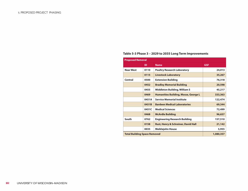
Table 5-3 Phase 3 – 2029 to 2035 Long Term Improvements
Proposed Removal
ID Name GSF
Near West 0110 Poultry Research Laboratory 24,013
0115 Livestock Laboratory 35,267
Central 0500 Extension Building 76,318
0452 Bradley Memorial Building 20,598
0455 Middleton Building, William S 45,217
0469 Humanities Building, Mosse, George L 333,363
0451A Service Memorial Institute 122,474
0451B Bardeen Medical Laboratories 69,344
0451C Medical Sciences 72,499
0468 McArdle Building 96,657
South 0762 Engineering Research Building 157,510
0158 Rust, Henry & Schreiner, David Hall 21,142
0035 Meiklejohn House 5,955
Total Building Space Removed 1,080,357
182 UNIVERSITY OF WISCONSIN–MADISON
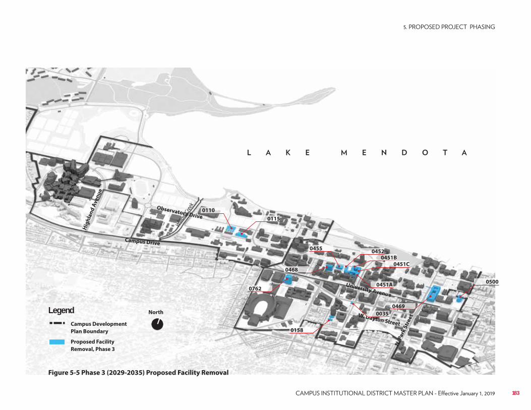
Campus Drive
Observatory Drive
University Avenue
W. Dayton Street
Hig
hla
nd
Av
en
ue
N. P
ark
Str
ee
t
North
Campus Development
Plan Boundary
Proposed Facility
Removal, Phase 3
Legend
Figure 5-5 Phase 3 (2029-2035) Proposed Facility Removal
Willo
w Cre
ek
0451B
0500
0452
0468
0469
0451A
0110
0115
0455
0451C
0762
0158
DDDD0035
183
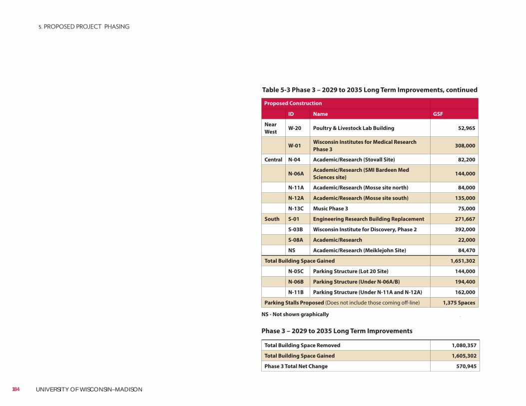
Table 5-3 Phase 3 – 2029 to 2035 Long Term Improvements, continued
Proposed Construction
ID Name GSF
Near
WestW-20 Poultry & Livestock Lab Building 52,965
W-01Wisconsin Institutes for Medical Research
Phase 3308,000
Central N-04 Academic/Research (Stovall Site) 82,200
N-06AAcademic/Research (SMI Bardeen Med
Sciences site) 144,000
N-11A Academic/Research (Mosse site north) 84,000
N-12A Academic/Research (Mosse site south) 135,000
N-13C Music Phase 3 75,000
South S-01 Engineering Research Building Replacement 271,667
S-03B Wisconsin Institute for Discovery, Phase 2 392,000
S-08A Academic/Research 22,000
NS Academic/Research (Meiklejohn Site) 84,470
Total Building Space Gained 1,651,302
N-05C Parking Structure (Lot 20 Site) 144,000
N-06B Parking Structure (Under N-06A/B) 194,400
N-11B Parking Structure (Under N-11A and N-12A) 162,000
Parking Stalls Proposed (Does not include those coming off-line) 1,375 Spaces
Total Building Space Removed 1,080,357
Total Building Space Gained 1,605,302
Phase 3 Total Net Change 570,945
Phase 3 – 2029 to 2035 Long Term Improvements
NS - Not shown graphically
184 UNIVERSITY OF WISCONSIN–MADISON
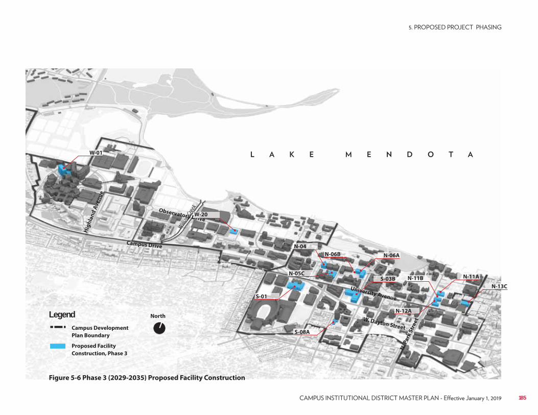
Campus Drive
Observatory Drive
University Avenue
W. Dayton Street
Hig
hla
nd
Av
en
ue
N. P
ark
Str
ee
t
North
Campus Development
Plan Boundary
Proposed Facility
Construction, Phase 3
Legend
Figure 5-6 Phase 3 (2029-2035) Proposed Facility Construction
Willo
w Cre
ek
W-01
DrDDDDD iviviviviv
N-12A
N-05C
W-20
N-04
N-06A
N-11A
N-13C
S-01
S-03B
S-08A
N-06B
N-11B
185
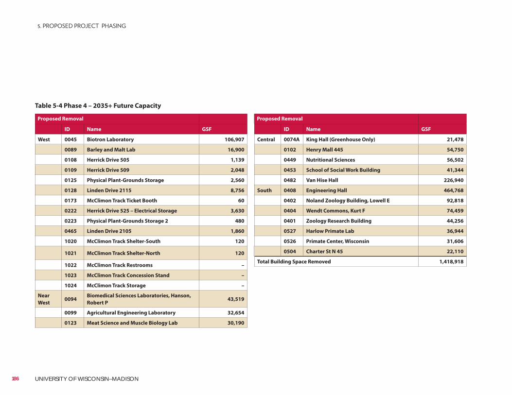
Proposed Removal
ID Name GSF
Central 0074A King Hall (Greenhouse Only) 21,478
0102 Henry Mall 445 54,750
0449 Nutritional Sciences 56,502
0453 School of Social Work Building 41,344
0482 Van Hise Hall 226,940
South 0408 Engineering Hall 464,768
0402 Noland Zoology Building, Lowell E 92,818
0404 Wendt Commons, Kurt F 74,459
0401 Zoology Research Building 44,256
0527 Harlow Primate Lab 36,944
0526 Primate Center, Wisconsin 31,606
0504 Charter St N 45 22,110
Total Building Space Removed 1,418,918
Proposed Removal
ID Name GSF
West 0045 Biotron Laboratory 106,907
0089 Barley and Malt Lab 16,900
0108 Herrick Drive 505 1,139
0109 Herrick Drive 509 2,048
0125 Physical Plant-Grounds Storage 2,560
0128 Linden Drive 2115 8,756
0173 McClimon Track Ticket Booth 60
0222 Herrick Drive 525 – Electrical Storage 3,630
0223 Physical Plant-Grounds Storage 2 480
0465 Linden Drive 2105 1,860
1020 McClimon Track Shelter-South 120
1021 McClimon Track Shelter-North 120
1022 McClimon Track Restrooms –
1023 McClimon Track Concession Stand –
1024 McClimon Track Storage –
Near
West0094
Biomedical Sciences Laboratories, Hanson,
Robert P 43,519
0099 Agricultural Engineering Laboratory 32,654
0123 Meat Science and Muscle Biology Lab 30,190
Table 5-4 Phase 4 – 2035+ Future Capacity
186 UNIVERSITY OF WISCONSIN–MADISON
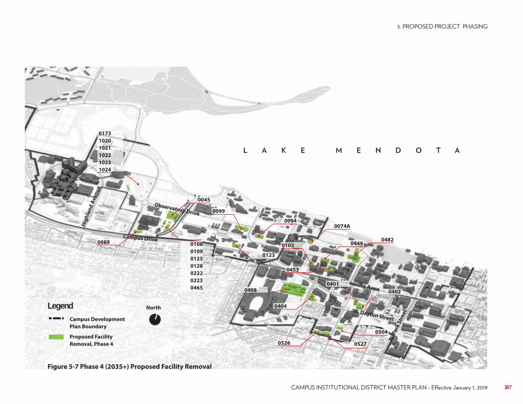
Campus Drive
Observatory Drive
University Avenue
W. Dayton Street
Hig
hla
nd
Av
en
ue
N. P
ark
Str
ee
t
North
Campus Development
Plan Boundary
Proposed Facility
Removal, Phase 4
Legend
Figure 5-7 Phase 4 (2035+) Proposed Facility Removal
Willo
w Cre
ek
0526
0408
0173
1020
1021
1022
1023
1024
ek
0099
0045
0074A
0504
0089
0094
0108
0109
0125
0128
0222
0223
0465
0123
0102
UnUnUnUnUnUnUUnnivivivivivivv0401
0527
uuuuuueeeeeeee 0402
0404
04820449
0453
187
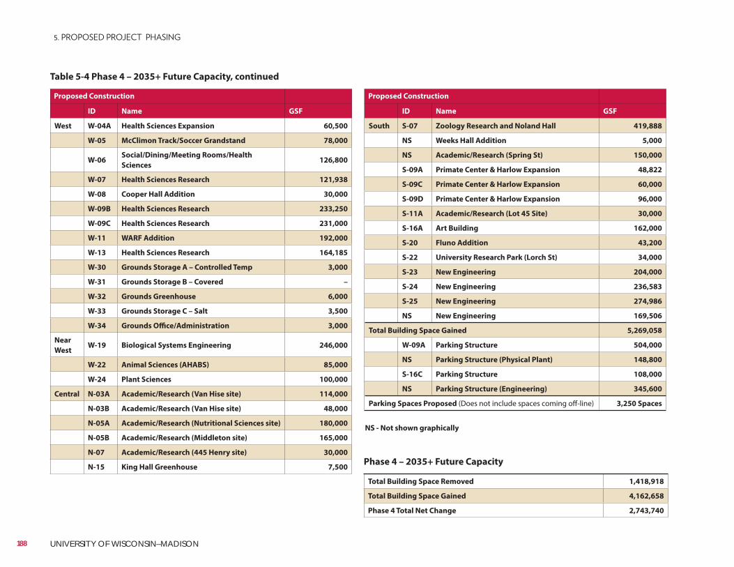
Proposed Construction
ID Name GSF
South S-07 Zoology Research and Noland Hall 419,888
NS Weeks Hall Addition 5,000
NS Academic/Research (Spring St) 150,000
S-09A Primate Center & Harlow Expansion 48,822
S-09C Primate Center & Harlow Expansion 60,000
S-09D Primate Center & Harlow Expansion 96,000
S-11A Academic/Research (Lot 45 Site) 30,000
S-16A Art Building 162,000
S-20 Fluno Addition 43,200
S-22 University Research Park (Lorch St) 34,000
S-23 New Engineering 204,000
S-24 New Engineering 236,583
S-25 New Engineering 274,986
NS New Engineering 169,506
Total Building Space Gained 5,269,058
W-09A Parking Structure 504,000
NS Parking Structure (Physical Plant) 148,800
S-16C Parking Structure 108,000
NS Parking Structure (Engineering) 345,600
Parking Spaces Proposed (Does not include spaces coming off-line) 3,250 Spaces
Proposed Construction
ID Name GSF
West W-04A Health Sciences Expansion 60,500
W-05 McClimon Track/Soccer Grandstand 78,000
W-06Social/Dining/Meeting Rooms/Health
Sciences 126,800
W-07 Health Sciences Research 121,938
W-08 Cooper Hall Addition 30,000
W-09B Health Sciences Research 233,250
W-09C Health Sciences Research 231,000
W-11 WARF Addition 192,000
W-13 Health Sciences Research 164,185
W-30 Grounds Storage A – Controlled Temp 3,000
W-31 Grounds Storage B – Covered –
W-32 Grounds Greenhouse 6,000
W-33 Grounds Storage C – Salt 3,500
W-34 Grounds Office/Administration 3,000
Near
WestW-19 Biological Systems Engineering 246,000
W-22 Animal Sciences (AHABS) 85,000
W-24 Plant Sciences 100,000
Central N-03A Academic/Research (Van Hise site) 114,000
N-03B Academic/Research (Van Hise site) 48,000
N-05A Academic/Research (Nutritional Sciences site) 180,000
N-05B Academic/Research (Middleton site) 165,000
N-07 Academic/Research (445 Henry site) 30,000
N-15 King Hall Greenhouse 7,500
Total Building Space Removed 1,418,918
Total Building Space Gained 4,162,658
Phase 4 Total Net Change 2,743,740
Table 5-4 Phase 4 – 2035+ Future Capacity, continued
Phase 4 – 2035+ Future Capacity
188 UNIVERSITY OF WISCONSIN–MADISON
NS - Not shown graphically
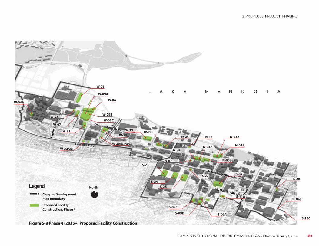
Campus Drive
Observatory Drive
University Avenue
W. Dayton Street
Hig
hla
nd
Av
en
ue
N. P
ark
Str
ee
t
North
Campus Development
Plan Boundary
Proposed Facility
Construction, Phase 4
Legend
Figure 5-8 Phase 4 (2035+) Proposed Facility Construction
Willo
w Cre
ek
nu
nu
nu
nu
nu
nu
neeeee
W-08
N-07
W-04A
W-09A
W-05
W-13
W-19W-22
W-30/31/34
W-24
ddAAW-07
W-06
N-03B
W-11
W-09Bk
W-09C
W-32/33 N-04
N-03AN-15
N-05A
N-05B
nuS-07
eeetet
kkkk
k
kkS
tS
tSS-11A
S-09C
S-09D S-09A
S-23
S-24
S-25
S-22
S-16A
S-20
S-16C
189
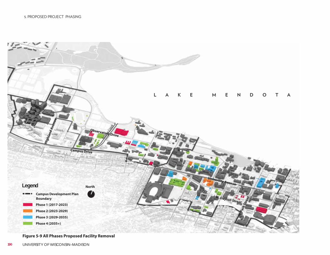
Campus Drive
Observatory Drive
University Avenue
W. Dayton Street
Hig
hla
nd
Av
en
ue
N. P
ark
Str
ee
t
North
Campus Development Plan
Boundary
Legend
Phase 1 (2017-2023)
Phase 3 (2029-2035)
Phase 2 (2023-2029)
Phase 4 (2035+)
Figure 5-9 All Phases Proposed Facility Removal
Willo
w Cre
ek
190 UNIVERSITY OF WISCONSIN–MADISON
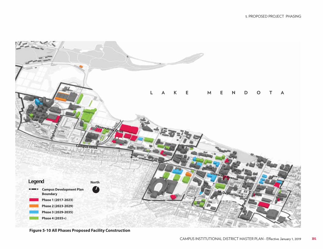
Campus Drive
Observatory Drive
University Avenue
W. Dayton Street
Hig
hla
nd
Av
en
ue
N. P
ark
Str
ee
t
North
Campus Development Plan
Boundary
Legend
Phase 1 (2017-2023)
Phase 3 (2029-2035)
Phase 2 (2023-2029)
Phase 4 (2035+)
Figure 5-10 All Phases Proposed Facility Construction
Willo
w Cre
ek
191
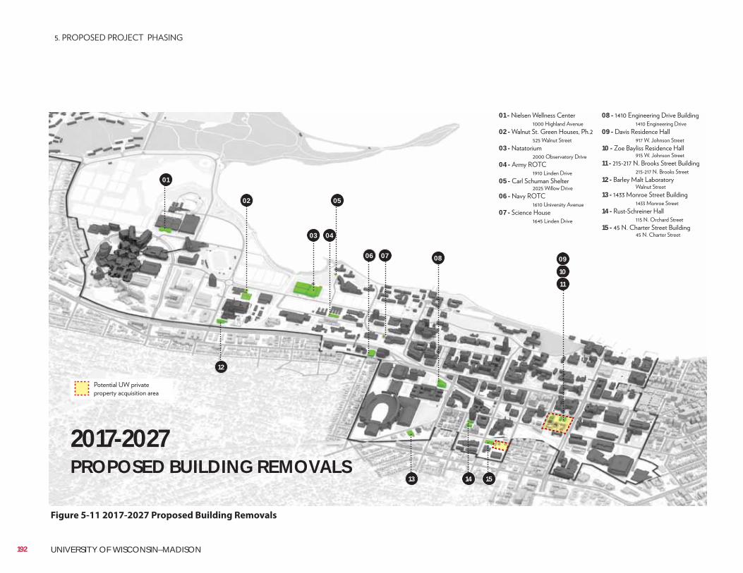
Figure 5-11 2017-2027 Proposed Building Removals
01
02
03 04
05
06 07 08
10
11
09
01 - 02 -
03 -
04 -
05 -
06 -
07 -
13
12
14 15
08 -
09 -
10 -
11 -
12 -
13 -
14 -
15 -
2017-2027 PROPOSED BUILDING REMOVALS
192 UNIVERSITY OF WISCONSIN–MADISON
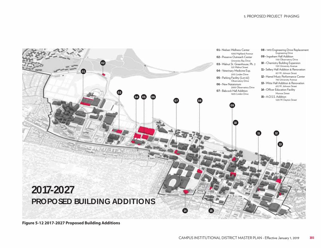
Figure 5-12 2017-2027 Proposed Building Additions
01
02
0304 05 06
07 0809
10
11 12
13
14 15
01 - 02 -
03 -
04 -
05 -
06 -
07 -
08 -
09 -
10 -
11 -
12 -
13 -
14 -
15 -
2017-2027 PROPOSED BUILDING ADDITIONS
193

194 UNIVERSITY OF WISCONSIN–MADISON
195
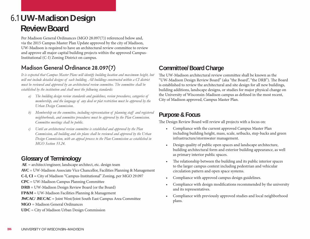
6.1 UW-Madison Design Review BoardPer Madison General Ordinances (MGO 28.097(7)) referenced below and, via the 2015 Campus Master Plan Update approved by the city of Madison, UW-Madison is required to have an architectural review committee to review and approve all major capital building projects within the approved Campus-Institutional (C-I) Zoning District on campus.
Glossary of Terminology AE = architect/engineer, landscape architect, etc. design teamAVC = UW-Madison Associate Vice Chancellor, Facilities Planning & ManagementC-I, CI = City of Madison “Campus-Institutional” Zoning, per MGO 29.097CPC = UW-Madison Campus Planning CommitteeDRB = UW-Madison Design Review Board (or the Board)FP&M = UW-Madison Facilities Planning & ManagementJWCAC/JSECAC = Joint West/Joint South East Campus Area CommitteeMGO = Madison General OrdinancesUDC = City of Madison Urban Design Commission
Committee/Board ChargeThe UW-Madison architectural review committee shall be known as the “UW-Madison Design Review Board” (aka “the Board”, “the DRB”). The Board is established to review the architectural and site design for all new buildings, building additions, landscape designs, or studies for major physical change on the University of Wisconsin-Madison campus as defined in the most recent, City of Madison approved, Campus Master Plan.
Purpose & FocusThe Design Review Board will review all projects with a focus on:
• Compliance with the current approved Campus Master Plan including building height, mass, scale, setbacks, step-backs and green infrastructure/stormwater management.
• Design quality of public open spaces and landscape architecture, building architectural form and exterior building appearance, as well as primary interior public spaces.
• The relationship between the building and its public interior spaces to the larger campus context including pedestrian and vehicular circulation pattern and open space systems.
• Compliance with approved campus design guidelines.• Compliance with design modifications recommended by the university
and its representatives.• Compliance with previously approved studies and local neighborhood
plans.
196 UNIVERSITY OF WISCONSIN–MADISON
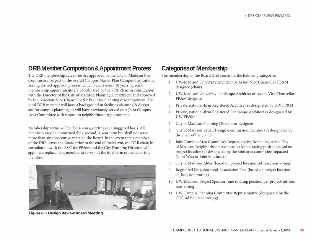
Categories of MembershipThe membership of the Board shall consist of the following categories:
1. UW-Madison University Architect or Assoc. Vice Chancellor FP&M designee (chair)
2. UW-Madison University Landscape Architect or Assoc. Vice Chancellor FP&M designee
3. Private, national-firm Registered Architect as designated by UW FP&M4. Private, national-firm Registered Landscape Architect as designated by
UW FP&M5. City of Madison Planning Director or designee6. City of Madison Urban Design Commission member (as designated by
the chair of the UDC)7. Joint Campus Area Committee Representative from a registered City
of Madison Neighborhood Association (one rotating position based on project location) as designated by the joint area committee impacted (Joint West or Joint Southeast)
8. City of Madison Alder (based on project location, ad-hoc, non-voting)9. Registered Neighborhood Association Rep. (based on project location,
ad-hoc, non-voting)10. UW-Madison Project Sponsor (one rotating position per project; ad-hoc,
non-voting)11. UW Campus Planning Committee Representative (designated by the
CPC; ad hoc, non-voting)
DRB Member Composition & Appointment ProcessThe DRB membership categories are approved by the City of Madison Plan Commission as part of the overall Campus Master Plan Campus-Institutional zoning district approval process, which occurs every 10 years. Specific membership appointments are coordinated by the DRB chair in consultation with the Director of the City of Madison Planning Department and approved by the Associate Vice Chancellor for Facilities Planning & Management. The ideal DRB member will have a background in facilities planning & design and/or campus planning; or will have previously served on a Joint Campus Area Committee with respect to neighborhood appointments.
Membership terms will be for 3-years, starting on a staggered basis. All members may be nominated for a second, 3-year term but shall not serve more than six consecutive years on the Board. In the event that a member of the DRB leaves the Board prior to the end of their term, the DRB chair, in consultation with the AVC for FP&M and the City Planning Director, will appoint a replacement member to serve out the final term of the departing member.
Figure 6-1 Design Review Board Meeting
197
• Small landscape design projects that do not impact the overall character of the site or campus design neighborhood (bus stops, benches, picnic tables/chairs, site lighting upgrades, etc.).
• “Minor alternations” to existing zoning approved uses, as defined by the City of Madison ordinance, (unless they include significant impacts to the exterior of buildings or landscapes as defined by the DRB chair). “Minor alternations” on campus, either in or outside the C-I district, follow the City of Madison zoning review process for minor alterations.
New Building(s)• Projects with a total project cost of over $300,000.• Projects under $300,000 if determined by the DRB chair to be
reviewable.• Projects over 4,000 GSF. (Projects <4,000 GSF typically do not require
zoning review but may require a minor alternation through the city.)• Projects within a defined campus historic district.
Building Addition(s) and Major Changes to an Existing Building(s)• Projects over 4,000 GSF.• A building addition within a defined campus historic district.• A building addition or modification as part of an existing historic
structure.• Projects that include over 10,000 SF of exterior site disturbance.• An addition to an entry or prominent visual side of a building.• Departure from existing cladding and/or material use on the exterior
of a building.• Addition impedes on an area reserved for development in the approved
Campus Master Plan.
Landscape Design and Major Changes to an Existing Site/Landscape• Alterations in a defined campus historic district or to an historic
landscape.• Alternations to a highly visible corridor, lawn, quadrangle or
courtyard.• Over 10,000 SF of exterior site disturbance.• Significant site restoration work related to utility projects that disturb
over 10,000 SF.
Types of projects to be reviewed by the DRBThe following is a list of project types that are to be reviewed by the Design Review Board. This is not an exhaustive list and any questions regarding the need for review or the number of times a project is to be reviewed is at the discretion of the DRB chair and/or the Associate Vice Chancellor for Facilities Planning & Management.
• New buildings, building additions and/or major changes to existing buildings or campus landscapes that modify the exterior of the building(s) or site(s).
NOTE: Projects outside the C-I zoning district will also be reviewed by the DRB with recommendations being made to the City of Madison Plan Commission and/or the Urban Design Commission as required by city ordinances.
• The Campus Master Plan and any significant updates or changes to the Plan.
• Facilities Master Plans for colleges, schools, departments or major units of the university.
• New public open spaces, landscapes, gathering places or landscape architectural designs.
by the DRB chair, include:
• Utility projects (unless they include significant site restoration upgrades or changes)
• Maintenance activities on existing buildings (unless they include significant exterior changes)
• Maintenance activities on existing campus landscapes or major landscape planting renovations.
• Interior design modifications (unless part of a major public interior space).
198 UNIVERSITY OF WISCONSIN–MADISON
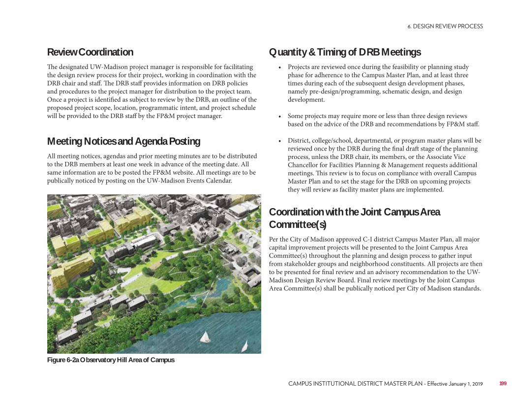
Quantity & Timing of DRB Meetings• Projects are reviewed once during the feasibility or planning study
phase for adherence to the Campus Master Plan, and at least three times during each of the subsequent design development phases, namely pre-design/programming, schematic design, and design development.
• Some projects may require more or less than three design reviews based on the advice of the DRB and recommendations by FP&M staff.
• District, college/school, departmental, or program master plans will be reviewed once by the DRB during the final draft stage of the planning process, unless the DRB chair, its members, or the Associate Vice Chancellor for Facilities Planning & Management requests additional meetings. This review is to focus on compliance with overall Campus Master Plan and to set the stage for the DRB on upcoming projects they will review as facility master plans are implemented.
Coordination with the Joint Campus Area Committee(s)Per the City of Madison approved C-I district Campus Master Plan, all major capital improvement projects will be presented to the Joint Campus Area Committee(s) throughout the planning and design process to gather input from stakeholder groups and neighborhood constituents. All projects are then to be presented for final review and an advisory recommendation to the UW-Madison Design Review Board. Final review meetings by the Joint Campus Area Committee(s) shall be publically noticed per City of Madison standards.
Review CoordinationThe designated UW-Madison project manager is responsible for facilitating the design review process for their project, working in coordination with the DRB chair and staff. The DRB staff provides information on DRB policies and procedures to the project manager for distribution to the project team. Once a project is identified as subject to review by the DRB, an outline of the proposed project scope, location, programmatic intent, and project schedule will be provided to the DRB staff by the FP&M project manager.
Meeting Notices and Agenda PostingAll meeting notices, agendas and prior meeting minutes are to be distributed to the DRB members at least one week in advance of the meeting date. All same information are to be posted the FP&M website. All meetings are to be publically noticed by posting on the UW-Madison Events Calendar.
199
Figure 6-2a Observatory Hill Area of Campus
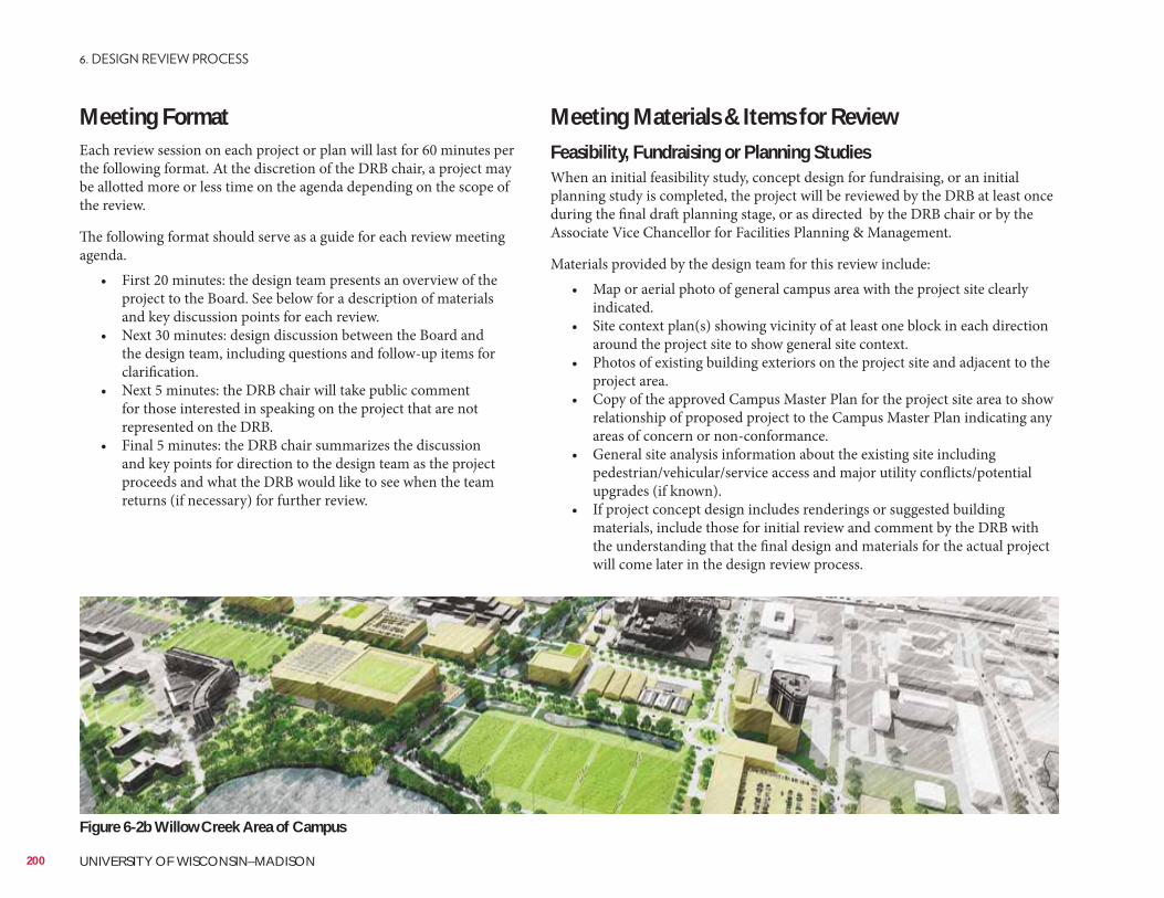
Meeting FormatEach review session on each project or plan will last for 60 minutes per the following format. At the discretion of the DRB chair, a project may be allotted more or less time on the agenda depending on the scope of the review.
The following format should serve as a guide for each review meeting agenda.
• First 20 minutes: the design team presents an overview of the project to the Board. See below for a description of materials and key discussion points for each review.
• Next 30 minutes: design discussion between the Board and the design team, including questions and follow-up items for clarification.
• Next 5 minutes: the DRB chair will take public comment for those interested in speaking on the project that are not represented on the DRB.
• Final 5 minutes: the DRB chair summarizes the discussion and key points for direction to the design team as the project proceeds and what the DRB would like to see when the team returns (if necessary) for further review.
Meeting Materials & Items for ReviewFeasibility, Fundraising or Planning StudiesWhen an initial feasibility study, concept design for fundraising, or an initial planning study is completed, the project will be reviewed by the DRB at least once during the final draft planning stage, or as directed by the DRB chair or by the Associate Vice Chancellor for Facilities Planning & Management.
Materials provided by the design team for this review include:• Map or aerial photo of general campus area with the project site clearly
indicated.• Site context plan(s) showing vicinity of at least one block in each direction
around the project site to show general site context.• Photos of existing building exteriors on the project site and adjacent to the
project area.• Copy of the approved Campus Master Plan for the project site area to show
relationship of proposed project to the Campus Master Plan indicating any areas of concern or non-conformance.
• General site analysis information about the existing site including pedestrian/vehicular/service access and major utility conflicts/potential upgrades (if known).
• If project concept design includes renderings or suggested building materials, include those for initial review and comment by the DRB with the understanding that the final design and materials for the actual project will come later in the design review process.
200 UNIVERSITY OF WISCONSIN–MADISON
Figure 6-2b Willow Creek Area of Campus
Pre-Design PhaseThe pre-design review may take place during programming or earlier, but is likely to occur before any drawing has been done. Materials to be provided by the design team for this review include:
• Map or aerial photo of general campus area with the project site clearly indicated.
• Site context plan(s) showing vicinity of at least one block in each direction, with entry or grade level plans of each adjacent building. Plans should include existing grades as well as location of existing roads, walks, landscape elements, etc.
• Design and development guideline graphics and text from appropriate planning studies.
• Photos of existing building exteriors on the project site and adjacent to the project area.
Many of the above elements required to generate these materials are available from various University departments. The FP&M project manager will provide contacts for this information to the AE teams.
Key discussion points at this phase of review may include, but are not limited to:
• Analysis of existing Campus Master Plan documents, including other planning studies for the area in which the project is located, and discussion regarding conformance to the approved plan.
• Analysis of existing vehicular and pedestrian circulation patterns in the area.
• Analysis of existing bicycle parking in the area.• Analysis of architectural context, including scale, detail and materials of
existing adjacent buildings. AE teams should reference the appropriate Campus Design Neighborhood design guidelines found in the Campus Design Guide.
• Discussion of potential relationships between site and adjacent and campus-wide open space systems, including green infrastructure/stormwater management practices.
• Discussion of program opportunities such as: • Location and organization of major interior public spaces.• Program elements which should, or could, benefit from a relationship
to exterior spaces.• Possible or desired main and secondary entrance locations.
Schematic Design PhaseThe schematic design review will focus on the building’s relationship to its site, its massing and scale, and its contextual relationships. Materials provided by the design team for this review include:
• Three-dimensional massing studies (physical model or 3D drawing/rendering/model) of the proposed building, shown in context with adjacent building structures and open spaces.
• Conceptual site plan showing site layout, existing and proposed grading, hard surfaces, and site circulation for pedestrian, vehicles and services access.
• Conceptual floor plans showing relationship between programmed spaces, particularly entrances, lobbies, general assignment classrooms and other shared-use or public spaces.
• Proposed entry or ground level floor plans of adjacent buildings to show relationship to main public entrances and public-use spaces.
• Conceptual elevations, showing overall height and relationship and proportion of materials or type of material (i.e. glass/void vs. solid brick/stone/precast/metal, etc.), as well as location and proportions of windows, doors and other openings.
Key discussion points at this phase of review may include, but are not limited to:
• Review of recommendations from previous DRB reviews and whether these have been addressed successfully or not.
• Massing and scale of building in relationship to surrounding structures and open space and the Campus Master Plan design guidelines.
• Landscape architectural concept plan - planted area versus hard surfaces, relationship of site design and organization to larger campus systems (pedestrian, vehicular and service circulation and open spaces, etc.).
• Relationship of major public and shared interior spaces to building site and landscape architectural concept plan and larger context, such as location of entries with respect to adjacent buildings and campus pedestrian/vehicular circulation systems.
• Understanding of the proposed green infrastructure/stormwater management systems to meet campus goals as defined in the current comprehensive stormwater management plan.
• Relationship of public vs. private zones of building, and of such zone to the surrounding site and buildings.
• Scale and vertical relationship of major public or shared interior spaces.• Preliminary types and mix of building materials, if known.
201
Design Development PhaseDesign development review will focus on refinements of the schematic design, especially proposed building and site design materials selection and ideas for detailing. Material selections need not be final, and may include presentation of options and alternatives.
Materials provided by the design team for this review include:
• Three-dimensional studies (physical model or 3D drawing/rendering/model) of proposed building, showing refinements of massing and scale concepts, and indicating material and color suggestions.
• Developed landscape plan indicating character of all outdoor spaces, including topography, plant material suggestions, hard surfaces material suggestions, and photographs or drawings of suggested site furnishings and amenities.
• Floor plans showing refinement of relationship between programmed spaces, particularly entrances, lobbies, general assignment classroom and other shared or public spaces.
• Proposed entry or ground level plan shown in site context plan with landscape design, and entry or ground level floor plans of adjacent buildings.
• Building sections showing scale and vertical relationship of spaces.• Elevations, showing material suggestions and preliminary detailing ideas, as
well as location and proportions of windows, doors and other openings.• Material samples for building exterior and site.
Key discussion points at this phase of review may include, but are limited to:
• Review of recommendations from previous DRB reviews and whether these have been addressed successfully or not.
• Continued discussion of massing and scale of building.• Landscape architectural design including overall character of space, plant
material suggestions, hard scape materials and site furnishings, and continued discussion of relationship of site design and organization to larger campus open space systems.
• Continued discussion of green infrastructure and stormwater management systems to meet the university’s green infrastructure goals.
• Continued discussion of relationship of the proposed building and site design to the surrounding site and buildings, including scale and vertical (height) relationships.
• Continued discussion of relationships of proposed major public or shared interior spaces.
• Selection, use and mix of building and site materials and preliminary detailing.
•
Further ReviewOn occasion, the DRB may require more than three reviews of a project. In this case, every effort will be made to expedite the review process including holding “in-town/local” DRB members meetings or hold a web-based teleconference to include the out-of-town members to meet any specific time restraints of the project design and approval process.
Reasons why an additional review may be necessary include:
• Design team did not provide adequate materials or was not prepared to discuss key design elements identified at one of the previous reviews.
• Significant changes in the scope or design of a project after the final review has been completed.
• Mutual agreement by all stakeholders that additional review is necessary and desired.
• Determination by the DRB chair that additional review is needed.
Documentation and Follow-up
• The DRB staff will be responsible for recording and distributing the minutes following internal FP&M staff review.
• FP&M staff will strive to provide the design team with written draft minutes of the meeting, summarizing key recommendations of the Design Review Board, within one week after the meeting.
• Comments or questions on the draft minutes should be sent to the DRB staff prior to the next regularly scheduled DRB meeting where the prior meeting minutes will be reviewed and approved.
Committee Process and Process for resolving disagreements and appealing decisions
• For the purposes of holding meetings of the DRB, quorum will be considered one over 50% of the voting members of the Board, (i.e. four members constitutes a quorum for action on any project being reviewed). Ad hock, non-voting members do not count towards quorum but are highly encouraged to participate fully in all DRB meetings and provide comment during the review process.
• It is the goal of the university and FP&M staff that the DRB meeting will be run by a consensus approval process. The DRB chair will determine if a consensus has been reached or if further discussions is needed, or a further review meeting is needed to gain consensus.
202 UNIVERSITY OF WISCONSIN–MADISON
• If consensus is not reached, and the DRB chair determines that a vote of the Board is needed, the chair will use Robert’s Rules of Order to ask for a motion/second from the floor. Voting members can make and second motions. Discussion from the floor on the motion may include the ad hoc, non-voting members of the Board. Once a motion passes, that decision is the final. Per Robert’s Rules, the chair will only vote in the event of a tie.
• Per MGO. 28.097(9), final decisions of the Board may be appealed by the applicant or the alder to the City of Madison Plan Commission within ten days of the decision by the Board. A public hearing will be scheduled to take public input on the request. At the conclusion of the public hearing, the Plan Commission may, by simple majority vote, affirm, reverse or modify the decision of the Board.
• If, as the result of an appeal, the DRB finds that design guidelines or criteria need to be revised, such revisions shall be recommended for consideration to the DRB chair, FP&M staff and/or the Campus Planning Committee for review by the City of Madison Planning Director. Per MGO 28.097(10), significant changes to the Campus Master Plan and or the approved Design Guidelines, may also need further review by the City of Madison Planning staff, Plan Commission and/or the Urban Design Commission for review and approval.
Meeting Scheduling, Timing, and DeadlinesGenerally, the UW-Madison Campus Design Review Board will meet 6 times a year, with regular meeting dates defined for each month to allow for maximum scheduling flexibility. At times, there may be a fewer number of projects that need review and therefore the DRB may not need to meet every month. Currently, the third Tuesday of each month is set aside for DRB meetings, with a 14 calendar-day cancellation notice if there are no projects for review in any given month.• If a project must be reviewed before the next scheduled DRB meeting,
a special meeting may be convened at the call of the DRB chair. Such special meetings may be via webcast.
• The Design Review Board staff is responsible for collecting and distributing materials to the members at minimum of one week (seven calendar days), prior to the scheduled meeting date.
• The FP&M project manager is responsible for obtaining materials from the AE design team, and providing them to the DRB staff no later than 14 calendar days before the DRB to insure FP&M staff can review the presentation materials and provide guidance.
• Digital copies of the materials for the meeting shall be provided to the DRB staff based on the recommended meeting materials defined above. All copies should either be able to be printed on a standard 8.5”x11” sheet or a maximum sheet size of 11”x17”.
• Materials submitted in advance as a preview, prior to the DRB meeting date, should include reduced versions of the information for the review as outlined above and include any key discussion points previously requested by the DRB.
• All materials provided to the DRB staff and presented at the DRB meetings shall be delivered to the FP&M project manager by the AE team(s) in a digital PDF format.
Reporting of Actions, Annual Report RequirementsFormal actions by the Board are recorded in the official meeting minutes of the Board and posted on the FP&M website for public use and review. By February 15 of each year, staff of the DRB and the DRB chair, shall prepare and submit an annual report of activities to the AVC of Facilities Planning & Management and to the Director of the City of Madison Planning Department. These reports may be shared with the UW-Madison Campus Planning Committee, the surrounding neighborhoods, the City of Madison Plan Commission and in other public venues.
203

204 UNIVERSITY OF WISCONSIN–MADISON
205
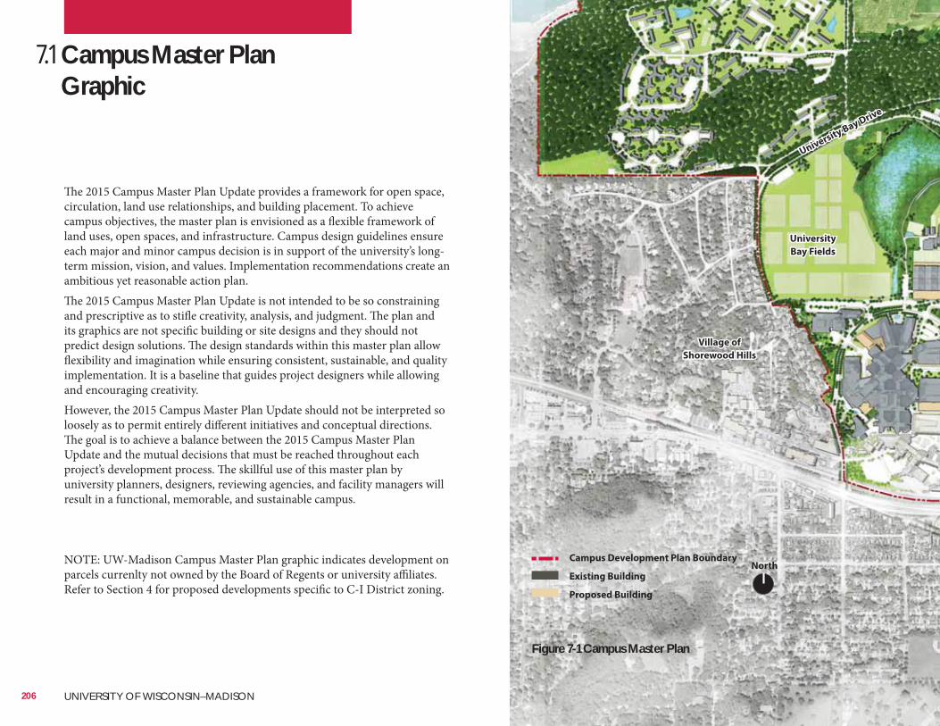
7.1 Campus Master Plan Graphic
The 2015 Campus Master Plan Update provides a framework for open space, circulation, land use relationships, and building placement. To achieve campus objectives, the master plan is envisioned as a flexible framework of land uses, open spaces, and infrastructure. Campus design guidelines ensure each major and minor campus decision is in support of the university’s long-term mission, vision, and values. Implementation recommendations create an ambitious yet reasonable action plan.The 2015 Campus Master Plan Update is not intended to be so constraining and prescriptive as to stifle creativity, analysis, and judgment. The plan and its graphics are not specific building or site designs and they should not predict design solutions. The design standards within this master plan allow flexibility and imagination while ensuring consistent, sustainable, and quality implementation. It is a baseline that guides project designers while allowing and encouraging creativity. However, the 2015 Campus Master Plan Update should not be interpreted so loosely as to permit entirely different initiatives and conceptual directions. The goal is to achieve a balance between the 2015 Campus Master Plan Update and the mutual decisions that must be reached throughout each project’s development process. The skillful use of this master plan by university planners, designers, reviewing agencies, and facility managers will result in a functional, memorable, and sustainable campus.
NOTE: UW-Madison Campus Master Plan graphic indicates development on parcels currenlty not owned by the Board of Regents or university affiliates. Refer to Section 4 for proposed developments specific to C-I District zoning.
Village of
Shorewood Hills
NorthCampus Development Plan Boundary
Existing Building
Proposed Building
206 UNIVERSITY OF WISCONSIN–MADISON
University Bay Drive
University
Bay Fields
Figure 7-1 Campus Master Plan
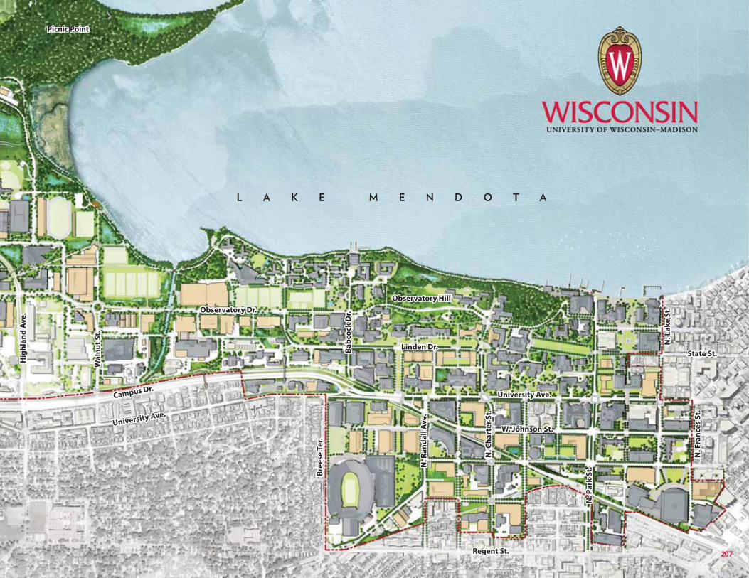
Picnic Point
Observatory Hill
207
Hig
hla
nd
Av
e.
Wa
lnu
t S
t.
Observatory Dr.
University Ave.
Linden Dr.
Regent St.
State St.Ba
bco
ck D
r.
N. L
ak
e S
t.
N. F
ran
ces
St.
Bre
ese
Te
r.
N. C
ha
rte
r S
t.
N. P
ark
St.
W. Johnson St.
Campus Dr.
University Ave.N
. Ra
nd
all
Av
e.
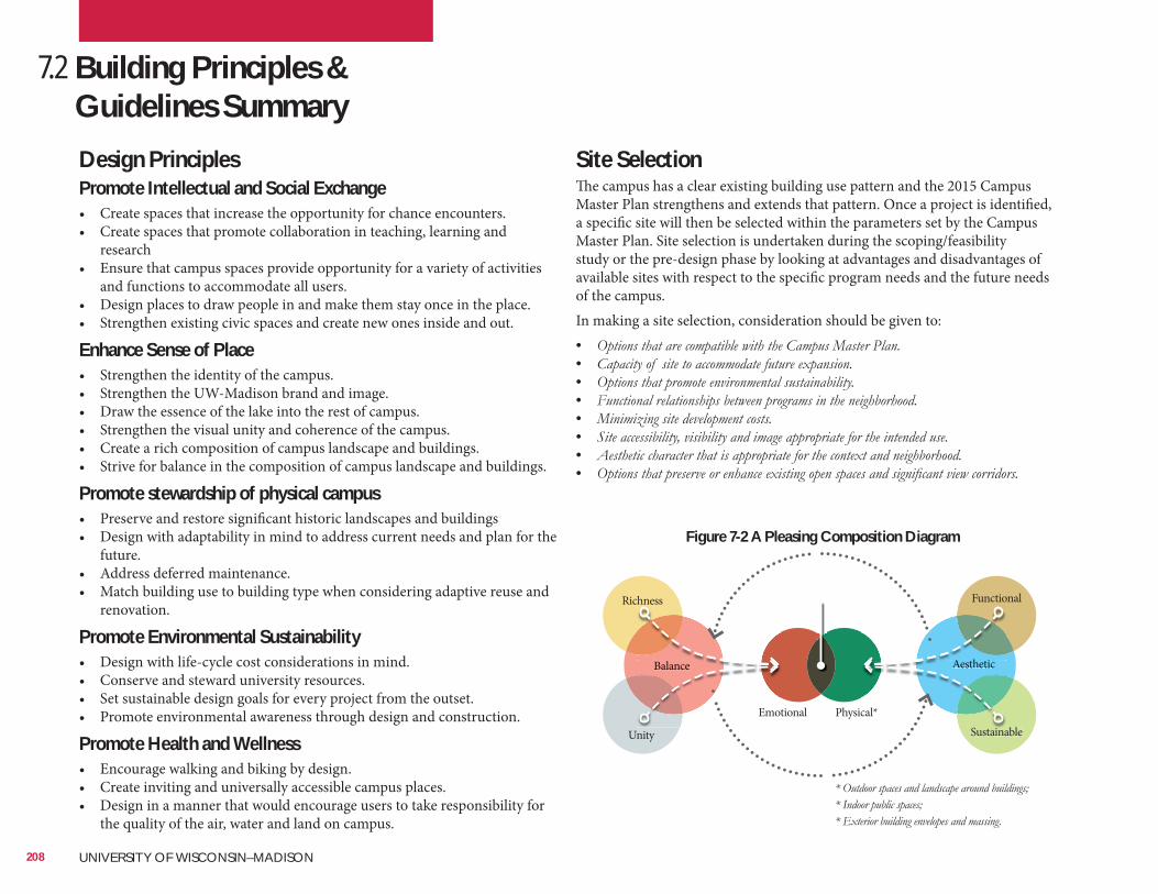
Site SelectionThe campus has a clear existing building use pattern and the 2015 Campus Master Plan strengthens and extends that pattern. Once a project is identified, a specific site will then be selected within the parameters set by the Campus Master Plan. Site selection is undertaken during the scoping/feasibility study or the pre-design phase by looking at advantages and disadvantages of available sites with respect to the specific program needs and the future needs of the campus.In making a site selection, consideration should be given to:• • • • • • • •
7.2 Building Principles & Guidelines Summary
208 UNIVERSITY OF WISCONSIN–MADISON
Design PrinciplesPromote Intellectual and Social Exchange• Create spaces that increase the opportunity for chance encounters.• Create spaces that promote collaboration in teaching, learning and
research• Ensure that campus spaces provide opportunity for a variety of activities
and functions to accommodate all users.• Design places to draw people in and make them stay once in the place.• Strengthen existing civic spaces and create new ones inside and out.
Enhance Sense of Place• Strengthen the identity of the campus.• Strengthen the UW-Madison brand and image.• Draw the essence of the lake into the rest of campus.• Strengthen the visual unity and coherence of the campus.• Create a rich composition of campus landscape and buildings.• Strive for balance in the composition of campus landscape and buildings.
Promote stewardship of physical campus• Preserve and restore significant historic landscapes and buildings• Design with adaptability in mind to address current needs and plan for the
future.• Address deferred maintenance.• Match building use to building type when considering adaptive reuse and
renovation.
Promote Environmental Sustainability• Design with life-cycle cost considerations in mind.• Conserve and steward university resources.• Set sustainable design goals for every project from the outset.• Promote environmental awareness through design and construction.
Promote Health and Wellness• Encourage walking and biking by design.• Create inviting and universally accessible campus places.• Design in a manner that would encourage users to take responsibility for
the quality of the air, water and land on campus.
Richness
Sustainable
Balance Aesthetic
Unity
Emotional Physical*
Functional
Emot
Balance A h
Scal*
Aesthetic
Figure 7-2 A Pleasing Composition Diagram
Universal Design
It is the intent of this guide that all buildings and campus places be physically barrier-free or inclusive. While our technical guidelines adopt the most restrictive provisions of ADAAG and ANSI standards, this guide considers those as minimum standards. The universal design approach goes beyond these standards. No user should receive negative special treatment. The accessible features of all buildings and campus places should be well integrated with the design aesthetically and functionally such that all users are equally accommodated in the same manner. For example, accessible ramps that are not integrated with primary entries, could be substituted with gently sloping sidewalks that bring all users to the same place at building entrances, eliminating the need for stairs or expensive switchback ramps.The strong message here, is that designers must consciously and actively strive to create buildings and campus landscapes that are inclusively accessible to all, (emotionally, socially, physically, and psychologically).
209
SustainabilityUW-Madison is committed to renovating and constructing buildings and landscapes that aid in the success of its students and staff, and are sustainable for years to come. In order to benchmark these practices, the university is pursuing a minimum of LEED Silver certification on its new and renovated facilities. Also, all projects should use the Sustainable SITES Initiative as a guideline for all future development. This initiative along with others, continues to transform UW-Madison’s campus to meet the needs of development today, without compromising the needs of future generations. The UW-Madison adheres to the Wisconsin State Building Commission Sustainable Facilities Policy as outlined below:
PurposeIt is the policy of the State Building Commission to be a leader in improving the overall quality and performance of state facilities and to minimize the total cost of occupancy. The Building Commission adopts this Policy to promote the planning, improvement, and management of state facilities in a sustainable manner that:• • • • • •
Policy “ The Department of Administration shall develop and implement guidelines and
minimum standards to incorporate environmentally responsible and sustainable concepts and practices into the planning, design, construction, operation and maintenance of all state facilities. These guidelines and minimum standards shall include, but not be limited to: establishing performance criteria in the following categories: portfolio management, sustainable sites, water efficiency, energy and atmosphere, materials and resources, adaptive use and preservation of existing buildings, indoor environmental quality, construction waste and recycling, operation and maintenance, and purchasing of furniture, fixtures and equipment.”
http://www.doa.state.wi.us/Divisions/Facilities-Development/Document-Library/Master-Specifications-Design-Guidelines
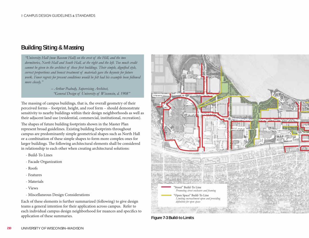
Building Siting & Massing
The massing of campus buildings, that is, the overall geometry of their perceived forms – footprint, height, and roof form – should demonstrate sensitivity to nearby buildings within their design neighborhoods as well as their adjacent land use (residential, commercial, institutional, recreation). The shapes of future building footprints shown in the Master Plan represent broad guidelines. Existing building footprints throughout campus are predominantly simple geometrical shapes such as North Hall or a combination of these simple shapes to form more complex ones for larger buildings. The following architectural elements shall be considered in relationship to each other when creating architectural solutions: - Build-To Lines - Facade Organization - Roofs - Features - Materials - Views - Miscellaneous Design ConsiderationsEach of these elements is further summarized (following) to give design teams a general intention for their application across campus. Refer to each individual campus design neighborhood for nuances and specifics to application of these summaries.
210 UNIVERSITY OF WISCONSIN–MADISON
Figure 7-3 Build-to Limits
“Street” Build-To Line “Open Space” Build-To Line
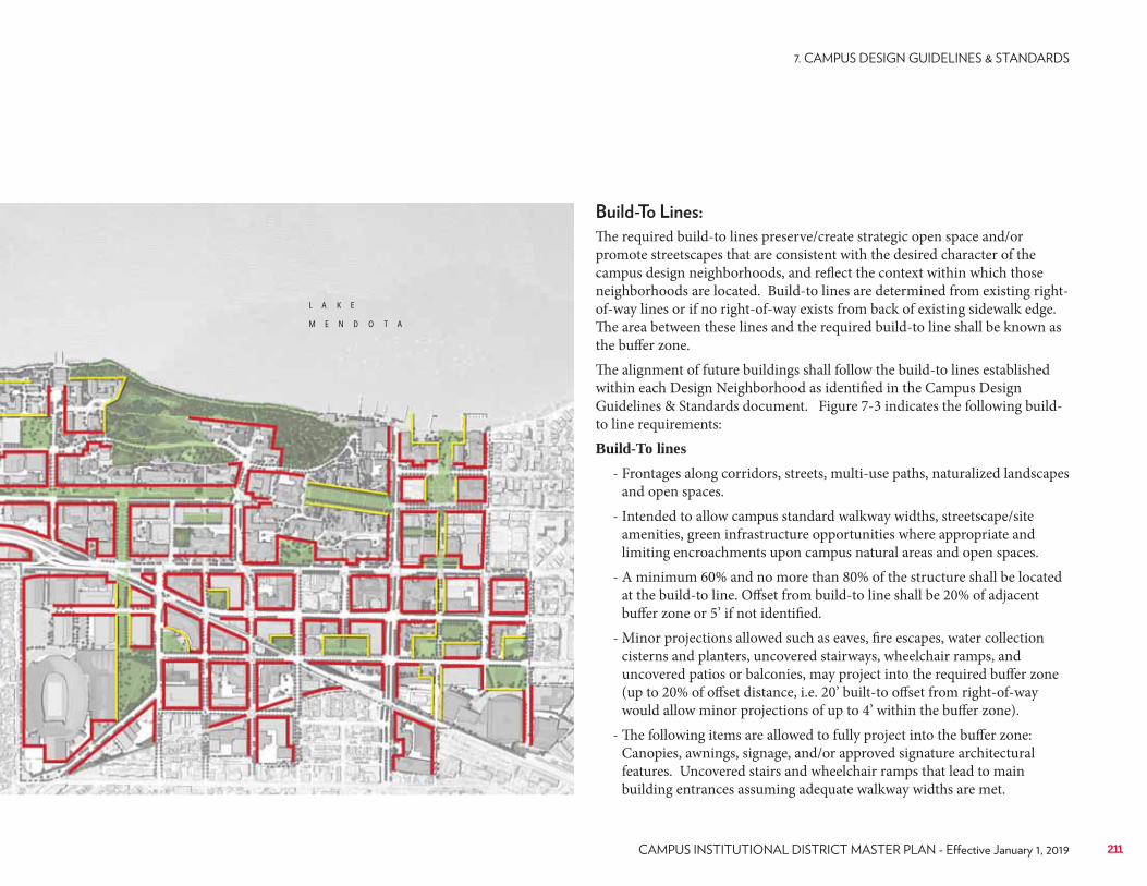
The required build-to lines preserve/create strategic open space and/or promote streetscapes that are consistent with the desired character of the campus design neighborhoods, and reflect the context within which those neighborhoods are located. Build-to lines are determined from existing right-of-way lines or if no right-of-way exists from back of existing sidewalk edge. The area between these lines and the required build-to line shall be known as the buffer zone. The alignment of future buildings shall follow the build-to lines established within each Design Neighborhood as identified in the Campus Design Guidelines & Standards document. Figure 7-3 indicates the following build-to line requirements:Build-To lines
- Frontages along corridors, streets, multi-use paths, naturalized landscapes and open spaces.
- Intended to allow campus standard walkway widths, streetscape/site amenities, green infrastructure opportunities where appropriate and limiting encroachments upon campus natural areas and open spaces.
- A minimum 60% and no more than 80% of the structure shall be located at the build-to line. Offset from build-to line shall be 20% of adjacent buffer zone or 5’ if not identified.
- Minor projections allowed such as eaves, fire escapes, water collection cisterns and planters, uncovered stairways, wheelchair ramps, and uncovered patios or balconies, may project into the required buffer zone (up to 20% of offset distance, i.e. 20’ built-to offset from right-of-way would allow minor projections of up to 4’ within the buffer zone).
- The following items are allowed to fully project into the buffer zone: Canopies, awnings, signage, and/or approved signature architectural features. Uncovered stairs and wheelchair ramps that lead to main building entrances assuming adequate walkway widths are met.
211
L A K E
M E N D O T A
Features such as porticos, gables, cornices, columns, dormers, and canopies are present in some of the favorite buildings on campus. These architectural features are not style-dependent but could help to define the character of buildings and grounds by regulating their massing, scale, and façade rhythm. Canopies and accents at major door ways (such as the main south entry of the new Microbial Sciences building), protective projections (such as entries at the Kronshage Halls), or recessed doorways (as seen at the Red Gym) are encouraged to protect occupants and visitors from inclement weather. These features shall be of a material and character that is consistent with the design of the building and its neighborhood. The main entrance to buildings should be easily identifiable, and part of a larger “entrance feature”. This feature should be in scale with its building facade.
Durable, quality materials that are consistent with each design neighborhood are to be used for new campus buildings. Materials that do not convey a sense of permanence and institutional quality, such as EIFS, vinyl siding, unfinished poured-in-place concrete, and concrete blocks are not acceptable finish options. Modern and innovative materials shall be encouraged provided that they are composed in a manner that exhibit richness, balance and unity.
Campus landmarks are important within the specific districts and regions of campus, but the connection to the lake is paramount. Preserving and enhancing views to Lake Mendota and the Capitol is essential. This visual connection reinforces the campus’ unique setting and strengthens the sense of place. The following view types are summarized here and referenced more specifically within each campus design neighborhood section as well as the Landscape Master Plan document.
Protected Views: • Two viewsheds are protected on campus, these include views to the
natural areas and the lake from both the WARF (Figure 11) and east hospital wing. Proposed building development within these viewsheds are subject to review. The intent is to preserve the uncluttered view of the lake and Lakeshore Nature Preserve.
It is important that the size of buildings and campus places be related to the human scale and be perceived to be so. Careful consideration should also be given to the relationship of the parts to the whole; these may be details and elements of a building in relation to larger elements, or relationships between groups of buildings and spaces – or outdoor rooms – they create. In general, those buildings and campus places that exhibit a clear hierarchy of scales, from the largest dimensions to the smallest perceivable differentiations, are among the favorite places on campus.
The façade of favorite campus buildings have a tripartite division of base, middle and top. In addition, fenestration patterns and window material, scale and proportions are sensitive to the architectural character of each design neighborhood. The fenestration pattern in the Historic Campus core, for example, consists principally of punched windows that are single or ganged horizontally, and aligned vertically. Sometimes the exterior walls have rhythms of recessions and projections that are coordinated with window placements to create depth, and shadows. In contrast, the Health Sciences Campus is characterized predominantly by horizontal banding or patterns. Buildings in this area are also massive and tall requiring gestures that would relate them more to the human scale.
Roof forms and material also vary throughout campus. There are red tiled pitched roofs, flat roofs, as well as pitched asphalt roofs. The general principal is to unify the design neighborhoods and make them read more like a whole. Therefore areas of campus like the Lakeshore neighborhoods that employ a good amount of red tile roofs, may be best served by employing a similar material. No specific material is prescribed but through dialogue and design review, an appropriate choice would be made.Architectural designs shall limit the use of flat roof buildings throughout campus in an effort to promote skyline and architectural interest. It is recommended that architectural responses to program statements consider green roofs, functional roof spaces, and/or hybrid approaches where open space and/or stormwater management can be achieved via integrated architecture blurring the lines between landscape and structure.
212 UNIVERSITY OF WISCONSIN–MADISON
Campus Views:
• Primary campus views include those visual connections to the lake, significant campus landmarks, open spaces, and city icons. These views are organizing features in the landscape, such as the view to the State Capitol from Bascom Hall and the view down Henry Mall to Engineering from Agricultural Hall.
Elevated Views:
• Observatory Hill is an example of an elevated view, but a collection of viewsheds has also been created through the development of open spaces atop roof deck structures. These occur at the UW Hospital, Nancy Nicholas Hall and Education Sciences. These new open spaces have created new ways to connect with the lake.
Lake Mendota Views:
• Campus is also experienced from Lake Mendota and across University Bay at Picnic Point. The naturalized lakeshore edge unifies and blends campus and the lake together. Opportunities exist to improve the view through the removal and relocation of parking areas and structures adjacent the lake.
Transparency and Permeability:
• To the extent possible and consistent with functional requirements, new buildings should be designed with a certain degree of transparency and permeability at the pedestrian level to encourage visual engagement between the interior and exterior of the building. It is important that buildings and campus landscapes enhance public awareness and feelings of involvement in the institution The large windows or glazed walls along pedestrian paths being used at WID, Biochemistry II, Chazen Museum and other campus buildings, are good examples of how the larger campus, as a public place, can be experienced from within the buildings. Glass also allows those outside to feel like they are a part of what happens inside. Solid walls, particularly at the ground level tend to emphasize boundary and separation, thereby undermining the notion of a campus as public place. Design teams should be sensitive to glazing use in regard to bird strikes and mortality, especially when sited adjacent to open spaces and natural areas.
Screening of Site Elements:• The following elements shall be screened in a manner that is consistent
with the architectural character of the building and campus design neighborhood at a minimum height of 6’ above finish surface. Refuse/recycle areas, outdoor storage areas, loading docks, rooftop and site located mechanical equipment.
Connections, Transitions, & Thresholds:• Pedestrian bridges are good connectors but should only be employed
to improve functional ties between facilities where topographically it makes sense. However, primary movement paths should be developed and maintained at the street level to promote “eyes on the street” and safe streets. Pedestrian bridges are proposed at critical locations to alleviate congestion, and traffic conflicts for pedestrians and/or vehicles. Such areas are context specific taking advantage of existing topographic conditions. Bridges and tunnels are highly functional and convenient but they can compromise the quality of the pedestrian environment at the street level. Designer teams are encouraged, whenever possible, to explore the use of colonnades, arcades, and overhangs, not only as transitions and thresholds between exterior and interior spaces, but also as protection from inclement weather (rain, heat, snow)thereby encouraging pedestrians to engage more with such buildings
Parking Structures:• Parking structures are necessary for our campus to function well but their
often austere architectural appearance needs to be softened. The design of parking structures should demonstrate sensitivity to the character of the neighborhoods. Wherever possible, fenestration patterns should more closely resemble inhabited buildings in the neighborhood. Screening may be a useful device to make the façade surface more regular yet not compromise required air flow. Where possible, the first floor level of parking garages should be used for occupied space, such as retail or service functions that will maintain activity at the ground level.
Exterior Signage:• Each building shall have one campus standard building sign displaying
the official Regent-approved name of the building and the official street address. As an option, signage may be incorporated into the face of the building as long as it is up and out of reach of pedestrians passing by at street level.
•
213
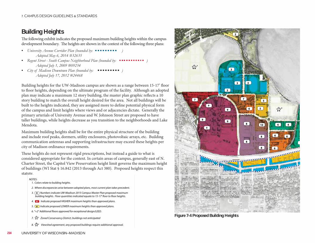
Building Heights The following exhibit indicates the proposed maximum building heights within the campus development boundary. The heights are shown in the context of the following three plans:•
•
•
Building heights for the UW-Madison campus are shown as a range between 15-17’ floor to floor heights, depending on the ultimate program of the facility. Although an adopted plan may indicate a maximum 12 story building, the master plan graphic reflects a 10 story building to match the overall height desired for the area. Not all buildings will be built to the heights indicated, they are assigned more to define potential physical form of the campus and limit heights where views and or adjacencies dictate. Generally the primary arterials of University Avenue and W. Johnson Street are proposed to have taller buildings, while heights decrease as you transition to the neighborhoods and Lake Mendota.Maximum building heights shall be for the entire physical structure of the building and include roof peaks, dormers, utility enclosures, photovoltaic arrays, etc. Building communication antennas and supporting infrastructure may exceed these heights per city of Madison ordinance requirements. These heights do not represent rigid prescriptions, but instead a guide to what is considered appropriate for the context. In certain areas of campus, generally east of N. Charter Street, the Capitol View Preservation height limit governs the maximum height of buildings (WI Stat § 16.842 (2013 through Act 380). Proposed heights respect this statute.
4
6
4
2
3
6
6
10
8
8
8
8
5
5
6
3
9
9
7
9
7
9
9
3
3
2
*
1*
NOTES: 1. Colors relate to building heights.
2. Where discrepancies arise between adopted plans, most current plan takes precedent.
3. Numbers indicate UW-Madison 2015 Campus Master Plan proposed maximum building heights. Floor quantities indicated equate to 15-17’ floor to floor heights.
4. Indicate proposed HIGHER maximum heights than approved plans.
5. Indicate proposed LOWER maximum heights than approved plans.
6. “+2” Additional floors approved for exceptional design/LEED.
7. 1 Zoned Conservancy District, buildings not anticipated
8. 2 Viewshed agreement, any proposed buildings require additional approval.
x
**
x
x
214 UNIVERSITY OF WISCONSIN–MADISON
Figure 7-4 Proposed Building Heights
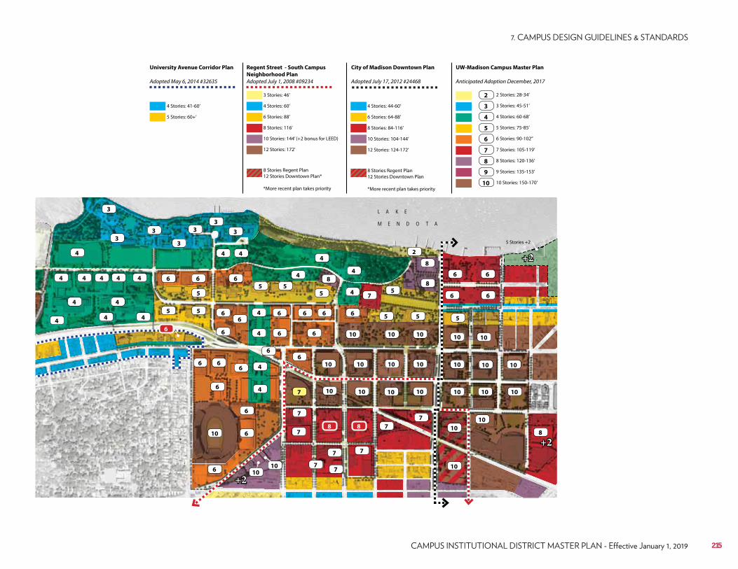
5 Stories +2
+2
+2
+2
6
44444
4
3
3 3
3
3
3
4 4
6
5 55
7
8
6 6
3
6 6
5
4
5
5
4
444
66
10
10
8
5
66
1010 10
10
5
10
4
4
4
4
2
8
88
6
7
7
7
7
4
466
7
6
6
610
6
77
10
10
1010
10
10 10 10
1010
7 7
222
10 10 10
5
6
66
6 6 6
10 10 10
65
6 6
4
4
10
8
Regent Street - South Campus
Neighborhood Plan
Adopted July 1, 2008 #09234
City of Madison Downtown Plan
Adopted July 17, 2012 #24468
UW-Madison Campus Master Plan
Anticipated Adoption December, 2017
University Avenue Corridor Plan
Adopted May 6, 2014 #32635
4 Stories: 41-60’
3 Stories: 46’
6 Stories: 88’ 6 Stories: 64-88’
3 Stories: 45-51’
7 Stories: 105-119’
10 Stories: 144’ (+2 bonus for LEED) 10 Stories: 104-144’
5 Stories: 75-85’
9 Stories: 135-153’
5 Stories: 60+’
4 Stories: 60’ 4 Stories: 44-60’
2 Stories: 28-34’
8 Stories: 116’ 8 Stories: 84-116’
4 Stories: 60-68’
8 Stories: 120-136’
12 Stories: 172’
8 Stories Regent Plan 12 Stories Downtown Plan*
*More recent plan takes priority
8 Stories Regent Plan 12 Stories Downtown Plan
*More recent plan takes priority
12 Stories: 124-172’
6 Stories: 90-102’’
10 Stories: 150-170’
2
3
7
4
8
5
9
6
10
215
L A K E
M E N D O T A
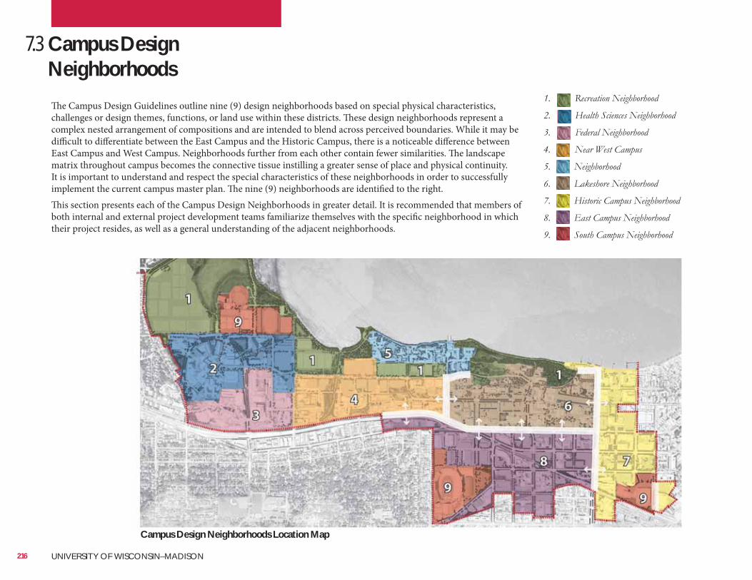
The Campus Design Guidelines outline nine (9) design neighborhoods based on special physical characteristics, challenges or design themes, functions, or land use within these districts. These design neighborhoods represent a complex nested arrangement of compositions and are intended to blend across perceived boundaries. While it may be difficult to differentiate between the East Campus and the Historic Campus, there is a noticeable difference between East Campus and West Campus. Neighborhoods further from each other contain fewer similarities. The landscape matrix throughout campus becomes the connective tissue instilling a greater sense of place and physical continuity. It is important to understand and respect the special characteristics of these neighborhoods in order to successfully implement the current campus master plan. The nine (9) neighborhoods are identified to the right.This section presents each of the Campus Design Neighborhoods in greater detail. It is recommended that members of both internal and external project development teams familiarize themselves with the specific neighborhood in which their project resides, as well as a general understanding of the adjacent neighborhoods.
7.3 Campus Design Neighborhoods
216 UNIVERSITY OF WISCONSIN–MADISON
Campus Design Neighborhoods Location Map
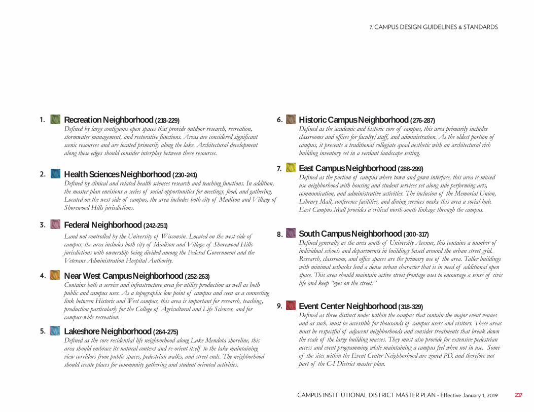
Recreation Neighborhood (218-229) Historic Campus Neighborhood (276-287)
Health Sciences Neighborhood (230-241) East Campus Neighborhood (288-299)
Federal Neighborhood (242-251)South Campus Neighborhood (300-317)
Near West Campus Neighborhood (252-263)
Event Center Neighborhood (318-329)
Lakeshore Neighborhood (264-275)
217
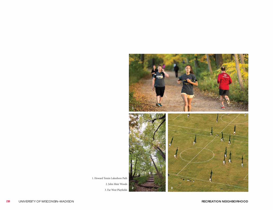
218 UNIVERSITY OF WISCONSIN–MADISON RECREATION NEIGHBORHOOD
1. Howard Temin Lakeshore Path
2. John Muir Woods
3. Far West Playfields
1
2 3
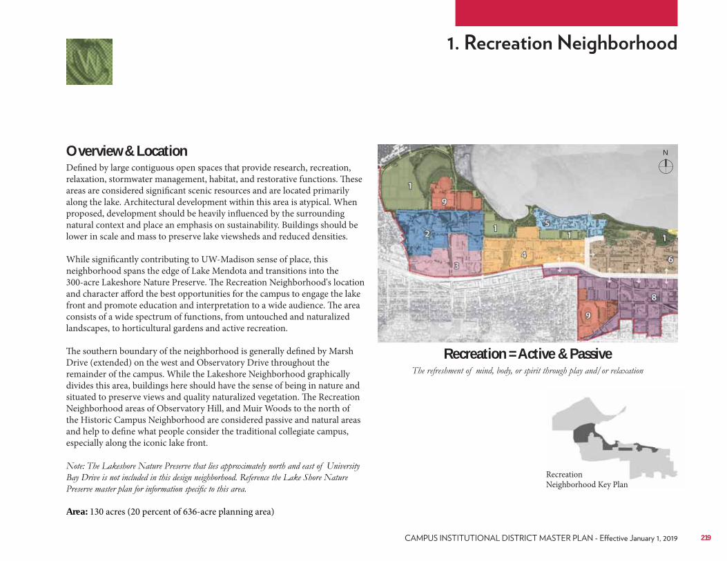
Overview & LocationDefined by large contiguous open spaces that provide research, recreation, relaxation, stormwater management, habitat, and restorative functions. These areas are considered significant scenic resources and are located primarily along the lake. Architectural development within this area is atypical. When proposed, development should be heavily influenced by the surrounding natural context and place an emphasis on sustainability. Buildings should be lower in scale and mass to preserve lake viewsheds and reduced densities. While significantly contributing to UW-Madison sense of place, this neighborhood spans the edge of Lake Mendota and transitions into the 300-acre Lakeshore Nature Preserve. The Recreation Neighborhood's location and character afford the best opportunities for the campus to engage the lake front and promote education and interpretation to a wide audience. The area consists of a wide spectrum of functions, from untouched and naturalized landscapes, to horticultural gardens and active recreation. The southern boundary of the neighborhood is generally defined by Marsh Drive (extended) on the west and Observatory Drive throughout the remainder of the campus. While the Lakeshore Neighborhood graphically divides this area, buildings here should have the sense of being in nature and situated to preserve views and quality naturalized vegetation. The Recreation Neighborhood areas of Observatory Hill, and Muir Woods to the north of the Historic Campus Neighborhood are considered passive and natural areas and help to define what people consider the traditional collegiate campus, especially along the iconic lake front.
Area: 130 acres (20 percent of 636-acre planning area)
Recreation = Active & Passive
Recreation Neighborhood Key Plan
N
219
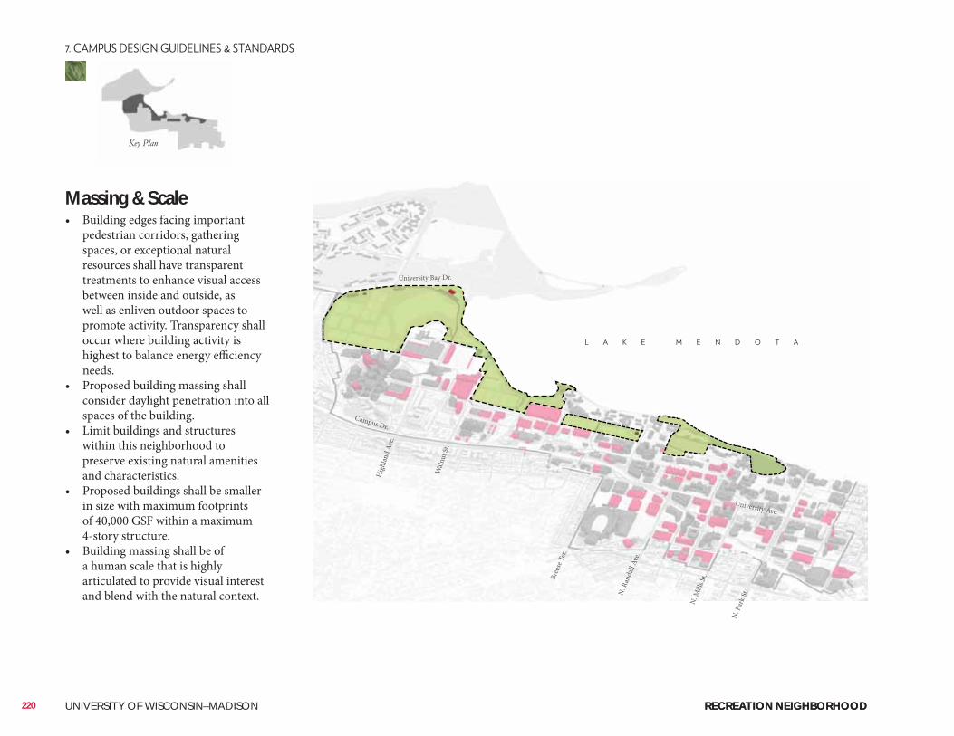
Massing & Scale• Building edges facing important
pedestrian corridors, gathering spaces, or exceptional natural resources shall have transparent treatments to enhance visual access between inside and outside, as well as enliven outdoor spaces to promote activity. Transparency shall occur where building activity is highest to balance energy efficiency needs.
• Proposed building massing shall consider daylight penetration into all spaces of the building.
• Limit buildings and structures within this neighborhood to preserve existing natural amenities and characteristics.
• Proposed buildings shall be smaller in size with maximum footprints of 40,000 GSF within a maximum 4-story structure.
• Building massing shall be of a human scale that is highly articulated to provide visual interest and blend with the natural context.
220 UNIVERSITY OF WISCONSIN–MADISON
Hig
hlan
d Av
e.
Waln
ut St
.
Campus Dr.
University Ave.
Bree
se T
er.
N. R
anda
ll Av
e.
N. M
ills S
t.
N. P
ark S
t.
University Bay Dr.
RECREATION NEIGHBORHOODRECREATION NEIGHBORHOOD
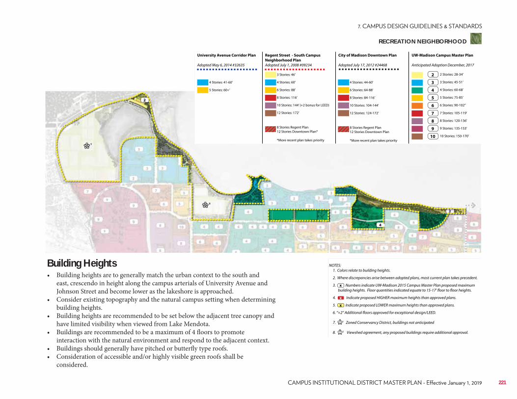
NOTES: 1. Colors relate to building heights.
2. Where discrepancies arise between adopted plans, most current plan takes precedent.
3. Numbers indicate UW-Madison 2015 Campus Master Plan proposed maximum building heights. Floor quantities indicated equate to 15-17’ floor to floor heights.
4. Indicate proposed HIGHER maximum heights than approved plans.
5. Indicate proposed LOWER maximum heights than approved plans.
6. “+2” Additional floors approved for exceptional design/LEED.
7. 1 Zoned Conservancy District, buildings not anticipated
8. 2 Viewshed agreement, any proposed buildings require additional approval.
x
**
x
x
Regent Street - South Campus
Neighborhood Plan
Adopted July 1, 2008 #09234
City of Madison Downtown Plan
Adopted July 17, 2012 #24468
UW-Madison Campus Master Plan
Anticipated Adoption December, 2017
University Avenue Corridor Plan
Adopted May 6, 2014 #32635
4 Stories: 41-60’
3 Stories: 46’
6 Stories: 88’ 6 Stories: 64-88’
3 Stories: 45-51’
7 Stories: 105-119’
10 Stories: 144’ (+2 bonus for LEED) 10 Stories: 104-144’
5 Stories: 75-85’
9 Stories: 135-153’
5 Stories: 60+’
4 Stories: 60’ 4 Stories: 44-60’
2 Stories: 28-34’
8 Stories: 116’ 8 Stories: 84-116’
4 Stories: 60-68’
8 Stories: 120-136’
12 Stories: 172’
8 Stories Regent Plan 12 Stories Downtown Plan*
*More recent plan takes priority
8 Stories Regent Plan 12 Stories Downtown Plan
*More recent plan takes priority
12 Stories: 124-172’
6 Stories: 90-102’’
10 Stories: 150-170’
2
3
7
4
8
5
9
6
10
Building Heights• Building heights are to generally match the urban context to the south and
east, crescendo in height along the campus arterials of University Avenue and Johnson Street and become lower as the lakeshore is approached.
• Consider existing topography and the natural campus setting when determining building heights.
• Building heights are recommended to be set below the adjacent tree canopy and have limited visibility when viewed from Lake Mendota.
• Buildings are recommended to be a maximum of 4 floors to promote interaction with the natural environment and respond to the adjacent context.
• Buildings should generally have pitched or butterfly type roofs.• Consideration of accessible and/or highly visible green roofs shall be
considered.
221
RECREATION NEIGHBORHOOD
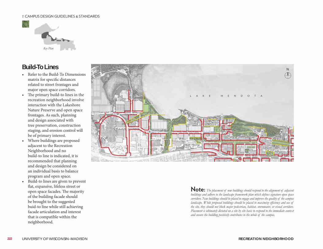
Build-To Lines• Refer to the Build-To Dimensions
matrix for specific distances related to street frontages and major open space corridors.
• The primary build-to lines in the recreation neighborhood involve interaction with the Lakeshore Nature Preserve and open space frontages. As such, planning and design associated with tree preservation, construction staging, and erosion control will be of primary interest.
• Where buildings are proposed adjacent to the Recreation Neighborhood and no build-to line is indicated, it is recommended that planning and design be considered on an individual basis to balance program and open space.
• Build-to lines are given to prevent flat, expansive, lifeless street or open space facades. The majority of the building facade should be brought to the suggested buid-to line while still achieving facade articulation and interest that is compatible within the neighborhood.
N
222 UNIVERSITY OF WISCONSIN–MADISON RECREATION NEIGHBORHOOD
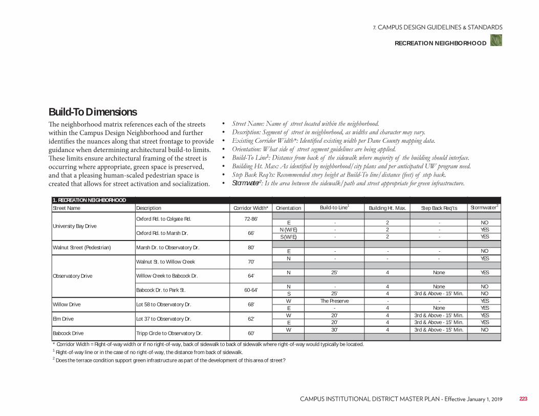
1. RECREATION NEIGHBORHOODStreet Name Description Corridor Width* Orientation Build to Line1 Building Ht. Max. Step Back Req'ts Stormwater2
E 2 NON (W/E) 2 YESS (W/E) 2 YES
E NON YES
N 25' 4 None YES
N 4 None NOS 25' 4 3rd & Above 15' Min. NOW The Preserve YESE 4 None YESW 20' 4 3rd & Above 15' Min. YESE 20' 4 3rd & Above 15' Min. YESW 30' 4 3rd & Above 15' Min. NO
* Corridor Width = Right of way width or if no right of way, back of sidewalk to back of sidewalk where right of way would typically be located.1 Right of way line or in the case of no right of way, the distance from back of sidewalk.2 Does the terrace condition support green infrastructure as part of the development of this area of street?
Babcock Drive Tripp Circle to Observatory Dr. 60'
Willow Drive Lot 58 to Observatory Dr. 68'
Elm Drive Lot 37 to Observatory Dr. 62'
Observatory Drive
Walnut St. to Willow Creek 70'
Willow Creek to Babcock Dr. 64'
Babcock Dr. to Park St. 60 64'
University Bay DriveOxford Rd. to Colgate Rd. 72 86'
Oxford Rd. to Marsh Dr. 66'
Walnut Street (Pedestrian) Marsh Dr. to Observatory Dr. 80'
Build-To DimensionsThe neighborhood matrix references each of the streets within the Campus Design Neighborhood and further identifies the nuances along that street frontage to provide guidance when determining architectural build-to limits. These limits ensure architectural framing of the street is occurring where appropriate, green space is preserved, and that a pleasing human-scaled pedestrian space is created that allows for street activation and socialization.
• • • • • 1
• • • Stormwater2
223
RECREATION NEIGHBORHOOD
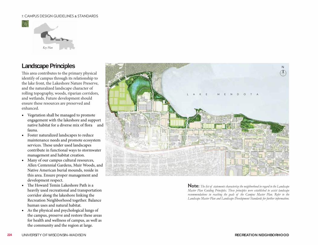
Landscape PrinciplesThis area contributes to the primary physical identify of campus through its relationship to the lake front, the Lakeshore Nature Preserve, and the naturalized landscape character of rolling topography, woods, riparian corridors, and wetlands. Future development should ensure these resources are preserved and enhanced. • Vegetation shall be managed to promote
engagement with the lakeshore and support native habitat for a diverse mix of flora and fauna.
• Foster naturalized landscapes to reduce maintenance needs and promote ecosystem services. These under used landscapes contribute in functional ways to stormwater management and habitat creation.
• Many of our campus cultural resources, Allen Centennial Gardens, Muir Woods, and Native American burial mounds, reside in this area. Ensure proper management and development respect.
• The Howard Temin Lakeshore Path is a heavily used recreational and transportation corridor along the lakeshore linking the Recreation Neighborhood together. Balance human uses and natural habitat.
• As the physical and psychological lungs of the campus, preserve and restore these areas for health and wellness of campus, as well as the community and the region at large.
N
224 UNIVERSITY OF WISCONSIN–MADISON RECREATION NEIGHBORHOOD
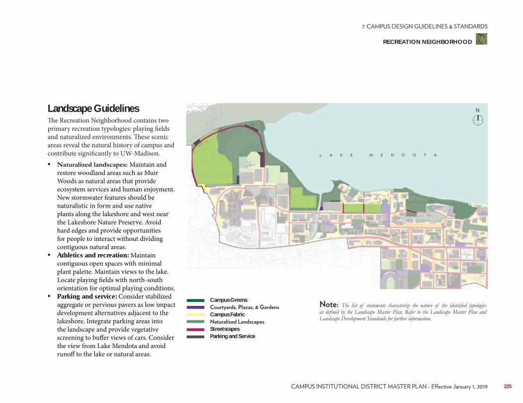
Landscape GuidelinesThe Recreation Neighborhood contains two primary recreation typologies: playing fields and naturalized environments. These scenic areas reveal the natural history of campus and contribute significantly to UW-Madison.• Maintain and
restore woodland areas such as Muir Woods as natural areas that provide ecosystem services and human enjoyment. New stormwater features should be naturalistic in form and use native plants along the lakeshore and west near the Lakeshore Nature Preserve. Avoid hard edges and provide opportunities for people to interact without dividing contiguous natural areas.
• Athletics and recreation: Maintain contiguous open spaces with minimal plant palette. Maintain views to the lake. Locate playing fields with north-south orientation for optimal playing conditions.
• Parking and service: Consider stabilized aggregate or pervious pavers as low impact development alternatives adjacent to the lakeshore. Integrate parking areas into the landscape and provide vegetative screening to buffer views of cars. Consider the view from Lake Mendota and avoid runoff to the lake or natural areas.
Campus Greens
Campus Fabric
StreetscapesParking and Service
N
225
RECREATION NEIGHBORHOOD
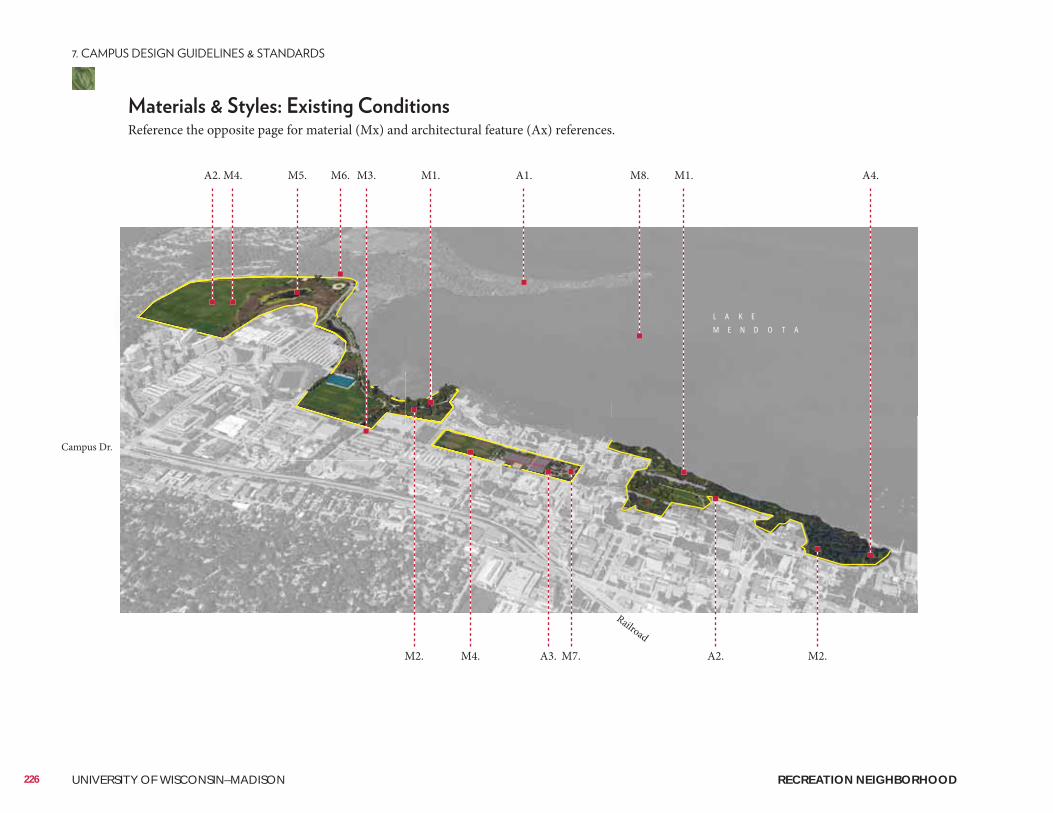
L A K E
M E N D O T A
226 UNIVERSITY OF WISCONSIN–MADISON
Reference the opposite page for material (Mx) and architectural feature (Ax) references.
A2. M4. M6. M3.M5. M1. M1.A1. M8. A4.
Campus Dr.
Railroad
A2. M2.M7.A3.M2. M4.
RECREATION NEIGHBORHOOD
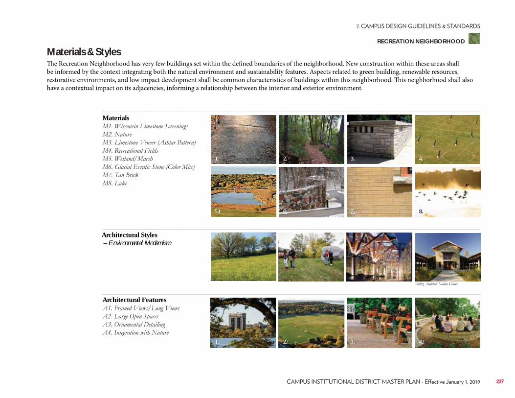
Materials & StylesThe Recreation Neighborhood has very few buildings set within the defined boundaries of the neighborhood. New construction within these areas shall be informed by the context integrating both the natural environment and sustainability features. Aspects related to green building, renewable resources, restorative environments, and low impact development shall be common characteristics of buildings within this neighborhood. This neighborhood shall also have a contextual impact on its adjacencies, informing a relationship between the interior and exterior environment.
Materials
Architectural Features
Architectural Styles – Environmental Modernism
1.
5.
2.
6.
2.1.
3.
7.
3.
4.
8.
4.
227
RECREATION NEIGHBORHOOD
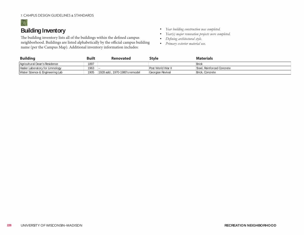
• • • •
Agricultural Dean's Residence 1897 BrickHasler Laboratory for Limnology 1963 Post World War II Steel, Reinforced ConcreteWater Science & Engineering Lab 1905 1928 add., 1970 1980's remodel Georgian Revival Brick, Concrete
Building InventoryThe building inventory lists all of the buildings within the defined campus neighborhood. Buildings are listed alphabetically by the official campus building name (per the Campus Map). Additional inventory information includes:
Building Built Renovated Style Materials
228 UNIVERSITY OF WISCONSIN–MADISON RECREATION NEIGHBORHOOD
Well Head District/Locations• City of Madison Unit Well 6 (University Bay Drive & University Ave.)• City of Madison Unit Well 19 (Lake Mendota Drive)• City of Madison Unit Well 27 (N. Randall Ave. & Bike Path)
City of Madison Zoning (Chapter 28)• Campus Institutional District (C-I)• Conservancy District (CN)
ConsiderationsConsiderations include information related to the planning, design, and approval of a typical building and/or landscape architecture campus project. It is to be reviewed as a resource identifying locations of materials that UW project teams reference most often. Not all projects will require each identified item. All projects should review the reference list and determine with the UW project manager applicability to the project.
Site Amenities & Vegetation• 2015 Landscape Development Standards• Division of Facilities Development Master Specifications–Division 32• UW-Madison Technical Guidelines–Division 32
Past Plans• 2006 Lakeshore Nature Preserve Master Plan Cultural Landscape Report• 2016 Allen Centennial Garden Master Plan
• Class of 1918 Marsh Restoration• University Bay Restoration• Willow Creek Restoration Project• Observatory Hill• John Muir Woods
• Viewshed Protection Agreement–WARF• Friends of Lakeshore Nature Preserve
Historical and Cultural Resources• Cultural Landscape Report• Historic Property Review Requirements• Archaeological Site Review Requirements• Archaeological Management Guidelines• Indian Burial Mound Management Policy
229
RECREATION NEIGHBORHOOD
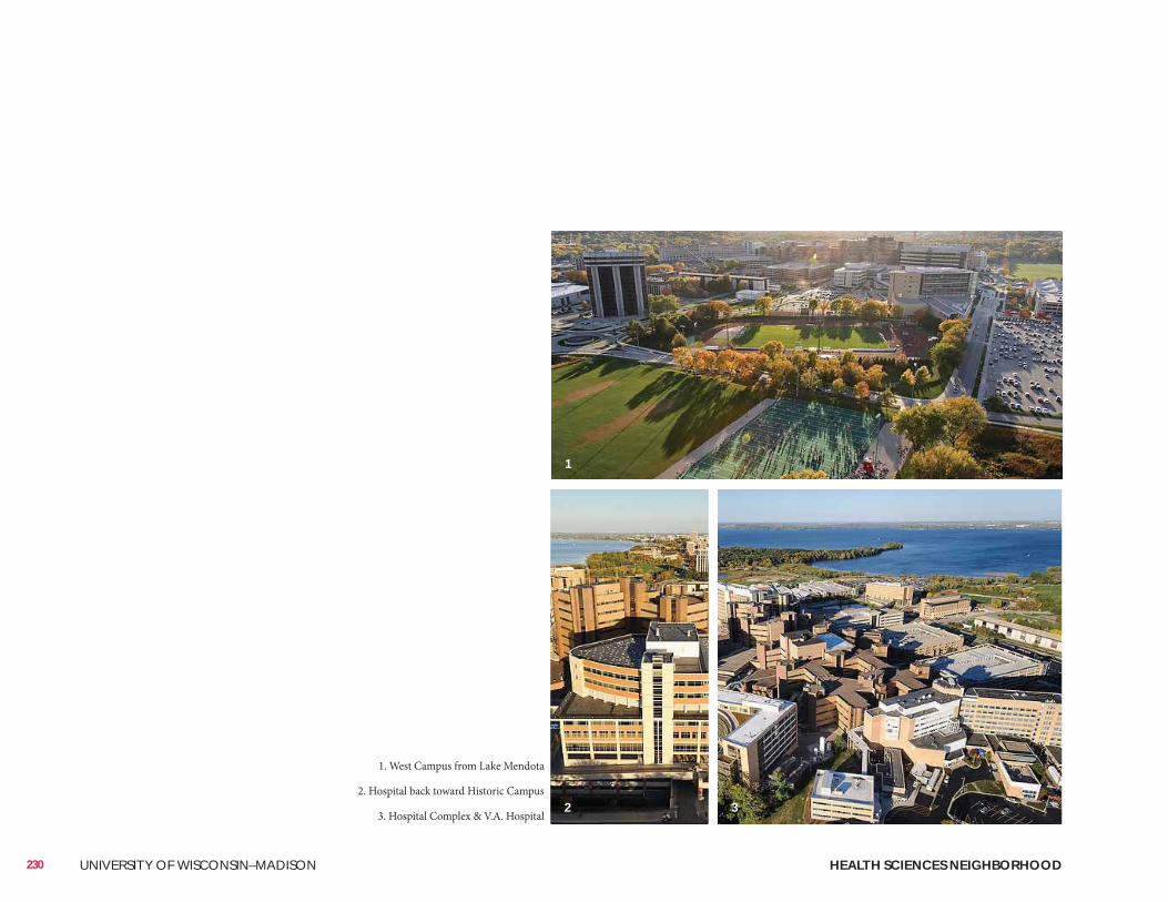
230 UNIVERSITY OF WISCONSIN–MADISON HEALTH SCIENCES NEIGHBORHOOD
1. West Campus from Lake Mendota
2. Hospital back toward Historic Campus
3. Hospital Complex & V.A. Hospital
1
2 3
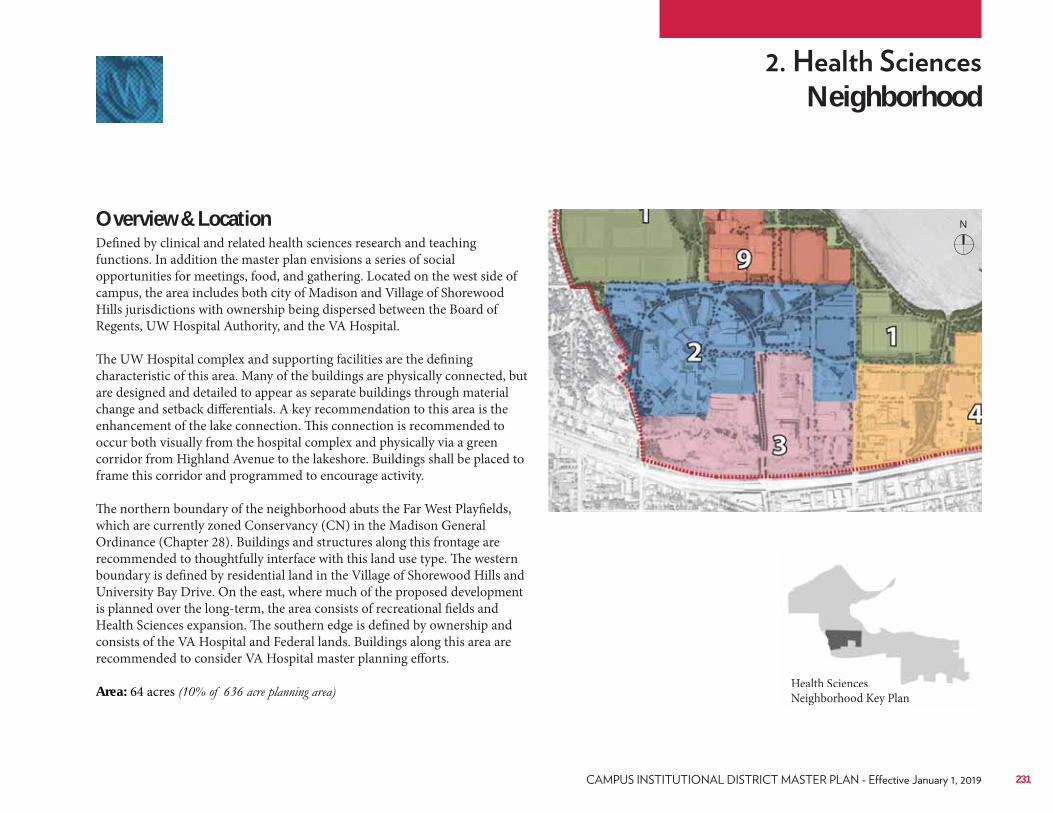
Neighborhood
Overview & LocationDefined by clinical and related health sciences research and teaching functions. In addition the master plan envisions a series of social opportunities for meetings, food, and gathering. Located on the west side of campus, the area includes both city of Madison and Village of Shorewood Hills jurisdictions with ownership being dispersed between the Board of Regents, UW Hospital Authority, and the VA Hospital.
The UW Hospital complex and supporting facilities are the defining characteristic of this area. Many of the buildings are physically connected, but are designed and detailed to appear as separate buildings through material change and setback differentials. A key recommendation to this area is the enhancement of the lake connection. This connection is recommended to occur both visually from the hospital complex and physically via a green corridor from Highland Avenue to the lakeshore. Buildings shall be placed to frame this corridor and programmed to encourage activity. The northern boundary of the neighborhood abuts the Far West Playfields, which are currently zoned Conservancy (CN) in the Madison General Ordinance (Chapter 28). Buildings and structures along this frontage are recommended to thoughtfully interface with this land use type. The western boundary is defined by residential land in the Village of Shorewood Hills and University Bay Drive. On the east, where much of the proposed development is planned over the long-term, the area consists of recreational fields and Health Sciences expansion. The southern edge is defined by ownership and consists of the VA Hospital and Federal lands. Buildings along this area are recommended to consider VA Hospital master planning efforts. Area: 64 acres Health Sciences
Neighborhood Key PlanHealth Sciences Neighborhood Key Plan
N
231
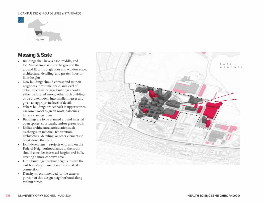
Massing & Scale• Buildings shall have a base, middle, and
top. Visual emphasis is to be given to the ground floor through door and window scale, architectural detailing, and greater floor-to-floor heights.
• New buildings should correspond to their neighbors in volume, scale, and level of detail. Necessarily large buildings should either be located among other such buildings or be broken down into smaller masses and given an appropriate level of detail.
• Where buildings are set back at upper stories, use lower roofs as green roofs, balconies, terraces, and gardens.
• Buildings are to be planned around internal open spaces, courtyards, and/or green roofs.
• Utilize architectural articulation such as changes in material, fenestration, architectural detailing, or other elements to break down the scale.
• Joint development projects with and on the Federal Neighborhood lands to the south should consider increased heights and bulk, creating a more cohesive area.
• Limit building/structure heights toward the east boundary to maintain the visual lake connection.
• Density is recommended for the eastern portion of this design neighborhood along Walnut Street.
232 UNIVERSITY OF WISCONSIN–MADISON
Campus Dr.
University Ave.
Hig
hlan
d Av
e.
Unive
rsity
Bay
Dr.
Waln
ut St
.
M E N D O T A
HEALTH SCIENCES NEIGHBORHOOD
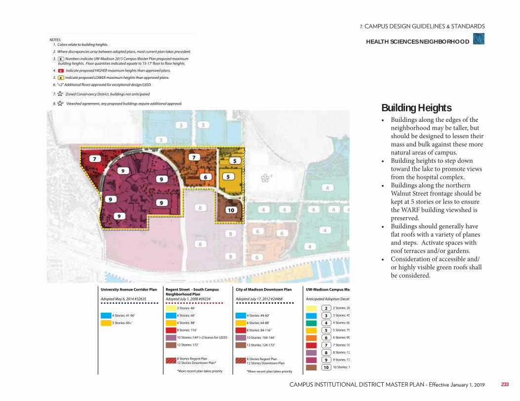
NOTES: 1. Colors relate to building heights.
2. Where discrepancies arise between adopted plans, most current plan takes precedent.
3. Numbers indicate UW-Madison 2015 Campus Master Plan proposed maximum building heights. Floor quantities indicated equate to 15-17’ floor to floor heights.
4. Indicate proposed HIGHER maximum heights than approved plans.
5. Indicate proposed LOWER maximum heights than approved plans.
6. “+2” Additional floors approved for exceptional design/LEED.
7. 1 Zoned Conservancy District, buildings not anticipated
8. 2 Viewshed agreement, any proposed buildings require additional approval.
x
**
x
x
Regent Street - South Campus
Neighborhood Plan
Adopted July 1, 2008 #09234
City of Madison Downtown Plan
Adopted July 17, 2012 #24468
UW-Madison Campus Ma
Anticipated Adoption Decem
University Avenue Corridor Plan
Adopted May 6, 2014 #32635
4 Stories: 41-60’
3 Stories: 46’
6 Stories: 88’ 6 Stories: 64-88’
3 Stories: 45
7 Stories: 10
10 Stories: 144’ (+2 bonus for LEED) 10 Stories: 104-144’
5 Stories: 75
9 Stories: 13
5 Stories: 60+’
4 Stories: 60’ 4 Stories: 44-60’
2 Stories: 28
8 Stories: 116’ 8 Stories: 84-116’
4 Stories: 60
8 Stories: 12
12 Stories: 172’
8 Stories Regent Plan 12 Stories Downtown Plan*
*More recent plan takes priority
8 Stories Regent Plan 12 Stories Downtown Plan
*More recent plan takes priority
12 Stories: 124-172’
6 Stories: 90
10 Stories: 1
2
3
7
4
8
5
9
6
10
Building Heights• Buildings along the edges of the
neighborhood may be taller, but should be designed to lessen their mass and bulk against these more natural areas of campus.
• Building heights to step down toward the lake to promote views from the hospital complex.
• Buildings along the northern Walnut Street frontage should be kept at 5 stories or less to ensure the WARF building viewshed is preserved.
• Buildings should generally have flat roofs with a variety of planes and steps. Activate spaces with roof terraces and/or gardens.
• Consideration of accessible and/or highly visible green roofs shall be considered.
233
HEALTH SCIENCES NEIGHBORHOOD
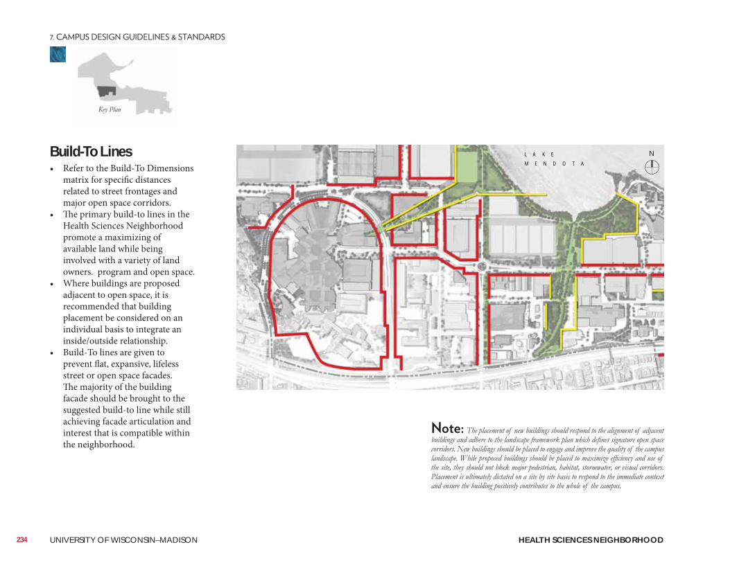
Build-To Lines• Refer to the Build-To Dimensions
matrix for specific distances related to street frontages and major open space corridors.
• The primary build-to lines in the Health Sciences Neighborhood promote a maximizing of available land while being involved with a variety of land owners. program and open space.
• Where buildings are proposed adjacent to open space, it is recommended that building placement be considered on an individual basis to integrate an inside/outside relationship.
• Build-To lines are given to prevent flat, expansive, lifeless street or open space facades. The majority of the building facade should be brought to the suggested build-to line while still achieving facade articulation and interest that is compatible within the neighborhood.
N
234 UNIVERSITY OF WISCONSIN–MADISON HEALTH SCIENCES NEIGHBORHOOD
L A K E
M E N D O T A
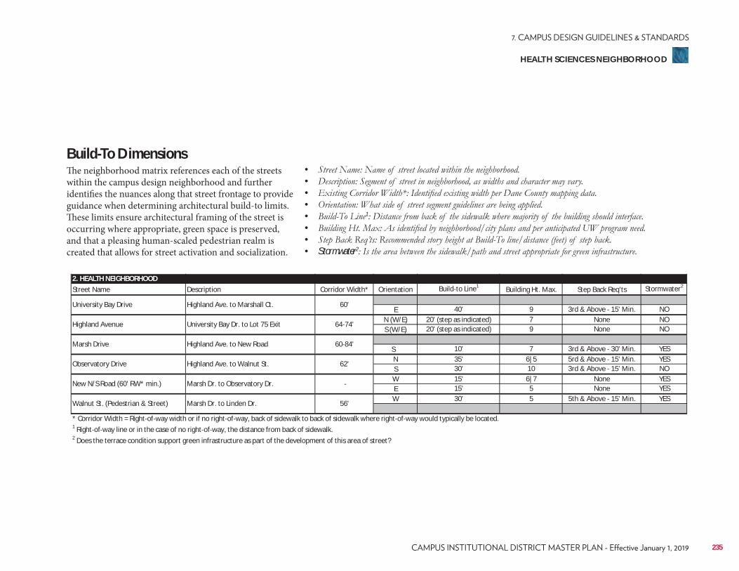
2. HEALTH NEIGHBORHOODStreet Name Description Corridor Width* Orientation Build to Line1 Building Ht. Max. Step Back Req'ts Stormwater2
E 40' 9 3rd & Above 15' Min. NON (W/E) 20' (step as indicated) 7 None NOS (W/E) 20' (step as indicated) 9 None NO
S 10' 7 3rd & Above 30' Min. YESN 35' 6|5 5rd & Above 15' Min. YESS 30' 10 3rd & Above 15' Min. NOW 15' 6|7 None YESE 15' 5 None YESW 30' 5 5th & Above 15' Min. YES
* Corridor Width = Right of way width or if no right of way, back of sidewalk to back of sidewalk where right of way would typically be located.1 Right of way line or in the case of no right of way, the distance from back of sidewalk.2 Does the terrace condition support green infrastructure as part of the development of this area of street?
Walnut St. (Pedestrian & Street) Marsh Dr. to Linden Dr. 56'
Observatory Drive Highland Ave. to Walnut St. 62'
New N/S Road (60' RW* min.) Marsh Dr. to Observatory Dr.
Highland Avenue University Bay Dr. to Lot 75 Exit 64 74'
Marsh Drive Highland Ave. to New Road 60 84'
University Bay Drive Highland Ave. to Marshall Ct. 60'
Build-To DimensionsThe neighborhood matrix references each of the streets within the campus design neighborhood and further identifies the nuances along that street frontage to provide guidance when determining architectural build-to limits. These limits ensure architectural framing of the street is occurring where appropriate, green space is preserved, and that a pleasing human-scaled pedestrian realm is created that allows for street activation and socialization.
• • • • • 1
• • • Stormwater2
235
HEALTH SCIENCES NEIGHBORHOOD
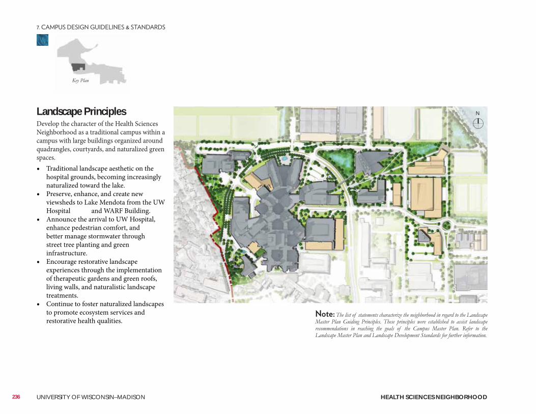
Landscape Principles Develop the character of the Health Sciences Neighborhood as a traditional campus within a campus with large buildings organized around quadrangles, courtyards, and naturalized green spaces.• Traditional landscape aesthetic on the
hospital grounds, becoming increasingly naturalized toward the lake.
• Preserve, enhance, and create new viewsheds to Lake Mendota from the UW Hospital and WARF Building.
• Announce the arrival to UW Hospital, enhance pedestrian comfort, and better manage stormwater through street tree planting and green infrastructure.
• Encourage restorative landscape experiences through the implementation of therapeutic gardens and green roofs, living walls, and naturalistic landscape treatments.
• Continue to foster naturalized landscapes to promote ecosystem services and restorative health qualities.
N
236 UNIVERSITY OF WISCONSIN–MADISON HEALTH SCIENCES NEIGHBORHOOD
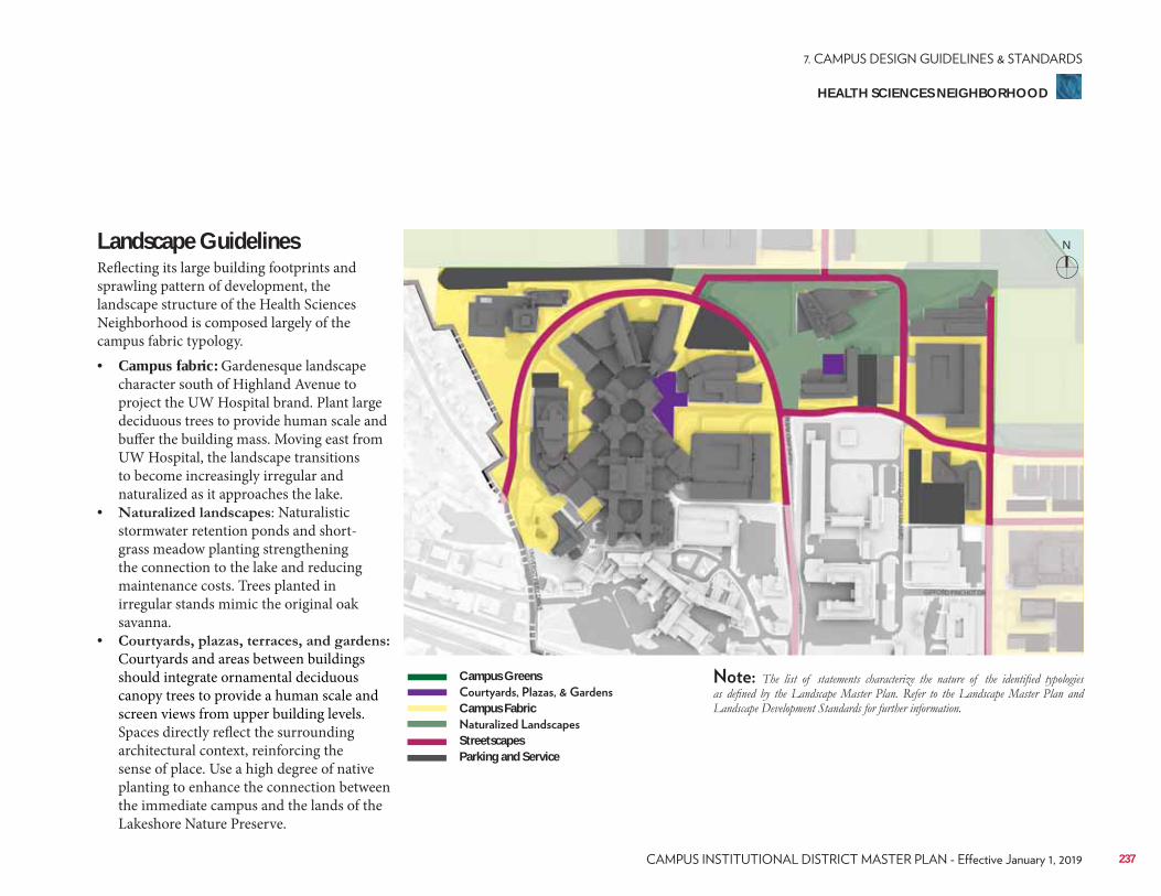
Landscape GuidelinesReflecting its large building footprints and sprawling pattern of development, the landscape structure of the Health Sciences Neighborhood is composed largely of the campus fabric typology. • Campus fabric: Gardenesque landscape
character south of Highland Avenue to project the UW Hospital brand. Plant large deciduous trees to provide human scale and buffer the building mass. Moving east from UW Hospital, the landscape transitions to become increasingly irregular and naturalized as it approaches the lake.
• : Naturalistic stormwater retention ponds and short-grass meadow planting strengthening the connection to the lake and reducing maintenance costs. Trees planted in irregular stands mimic the original oak savanna.
• Courtyards and areas between buildings should integrate ornamental deciduous canopy trees to provide a human scale and screen views from upper building levels. Spaces directly reflect the surrounding architectural context, reinforcing the sense of place. Use a high degree of native planting to enhance the connection between the immediate campus and the lands of the Lakeshore Nature Preserve.
N
Campus Greens
Campus Fabric
StreetscapesParking and Service
237
HEALTH SCIENCES NEIGHBORHOOD
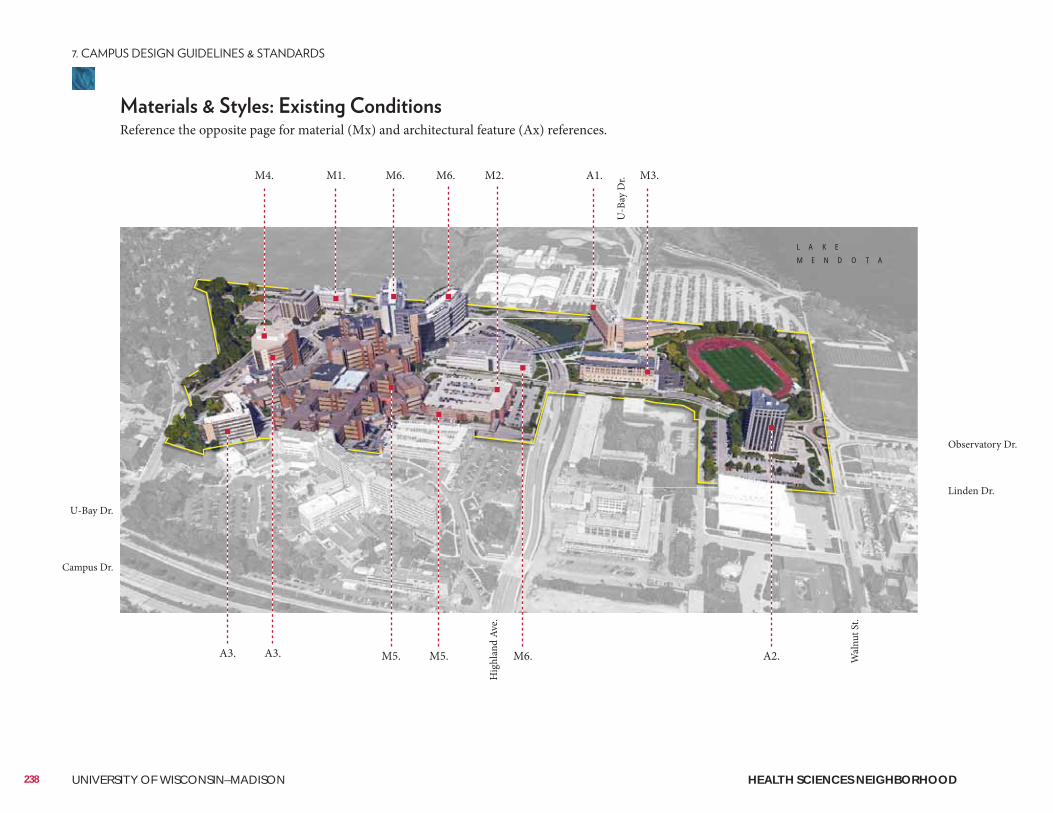
L A K E
M E N D O T A
238 UNIVERSITY OF WISCONSIN–MADISON
Reference the opposite page for material (Mx) and architectural feature (Ax) references.
M4. M1. M6. M6. M2. A1. M3.
A3.A3.
Hig
hlan
d Av
e.
Wal
nut S
t.
Campus Dr.
Observatory Dr.
Linden Dr.
U-B
ay D
r.
U-Bay Dr.
M5. M5. M6. A2.
HEALTH SCIENCES NEIGHBORHOOD
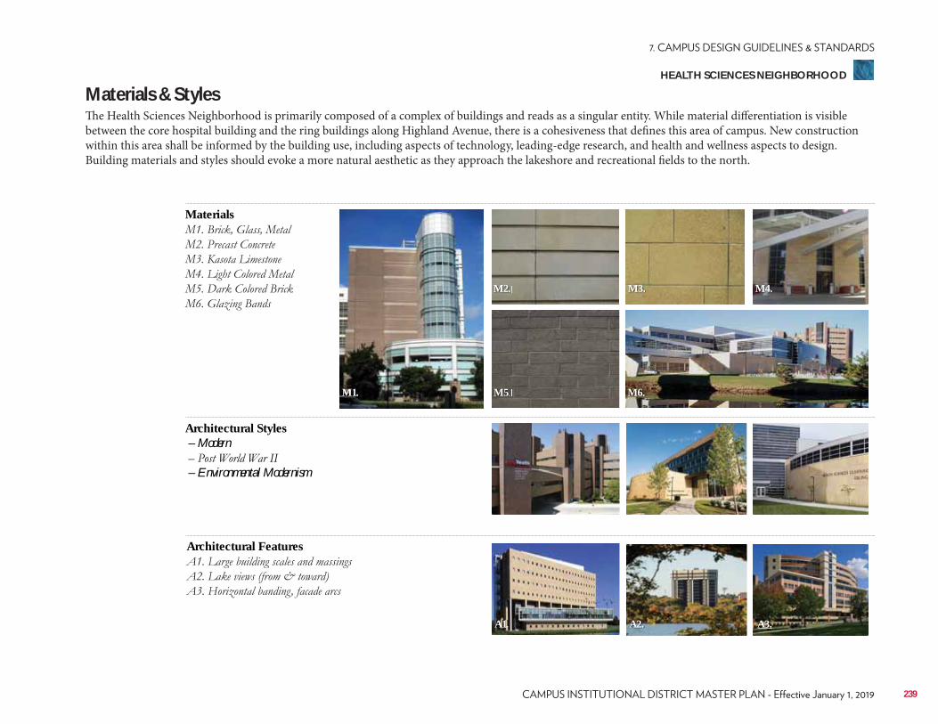
239
Materials & StylesThe Health Sciences Neighborhood is primarily composed of a complex of buildings and reads as a singular entity. While material differentiation is visible between the core hospital building and the ring buildings along Highland Avenue, there is a cohesiveness that defines this area of campus. New construction within this area shall be informed by the building use, including aspects of technology, leading-edge research, and health and wellness aspects to design. Building materials and styles should evoke a more natural aesthetic as they approach the lakeshore and recreational fields to the north.
Materials
Architectural Features
Architectural Styles – Modern
– Environmental Modernism
A1. A2. A3.
M4.
M6.M5
M2. M3.
M1.
HEALTH SCIENCES NEIGHBORHOOD
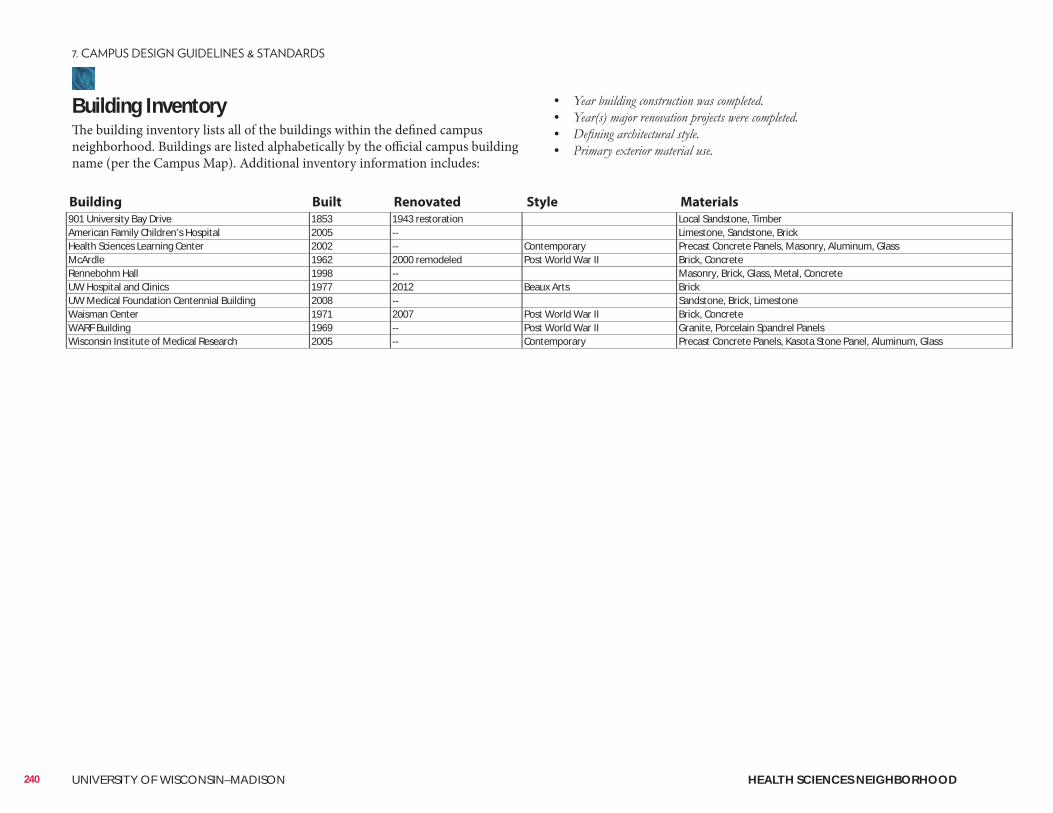
Building InventoryThe building inventory lists all of the buildings within the defined campus neighborhood. Buildings are listed alphabetically by the official campus building name (per the Campus Map). Additional inventory information includes:
• • • •
901 University Bay Drive 1853 1943 restoration Local Sandstone, TimberAmerican Family Children’s Hospital 2005 -- Limestone, Sandstone, BrickHealth Sciences Learning Center 2002 -- Contemporary Precast Concrete Panels, Masonry, Aluminum, GlassMcArdle 1962 2000 remodeled Post World War II Brick, ConcreteRennebohm Hall 1998 -- Masonry, Brick, Glass, Metal, ConcreteUW Hospital and Clinics 1977 2012 Beaux Arts BrickUW Medical Foundation Centennial Building 2008 -- Sandstone, Brick, LimestoneWaisman Center 1971 2007 Post World War II Brick, ConcreteWARF Building 1969 -- Post World War II Granite, Porcelain Spandrel PanelsWisconsin Institute of Medical Research 2005 -- Contemporary Precast Concrete Panels, Kasota Stone Panel, Aluminum, Glass
Building Built Renovated Style Materials
240 UNIVERSITY OF WISCONSIN–MADISON HEALTH SCIENCES NEIGHBORHOOD
ConsiderationsConsiderations include information related to the planning, design, and approval of a typical building and/or landscape architecture campus project. It is to be reviewed as a resource identifying locations of materials that UW project teams reference most often. Not all projects will require each identified item. All projects should review the reference list and determine with the UW project manager applicability to the project.
Site Amenities & Vegetation• 2015 Landscape Development Standards• Division of Facilities Development Master Specifications–Division 32• UW-Madison Technical Guidelines–Division 32
Past Plans• 2013 University of Wisconsin Hospital & Clinics Master Plan• 2014 University Avenue Corridor Plan
• Class of 1918 Marsh Restoration
• Viewshed Protection Agreement–WARF• Viewshed Protection Agreement–UW Hospital• Village of Shorewood Hills
Historical and Cultural Resources• 2005 Cultural Landscape Report• Historic Property Review Requirements• Archaeological Site Review Requirements
Well Head District/Locations• City of Madison Unit Well 6 (U-Bay Drive & University Ave.)
City of Madison Zoning (Chapter 28)• Campus Institutional District (C-I)
241
HEALTH SCIENCES NEIGHBORHOOD
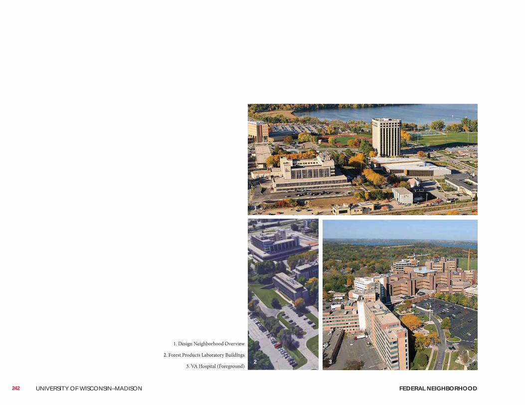
242 UNIVERSITY OF WISCONSIN–MADISON FEDERAL NEIGHBORHOOD
1. Design Neighborhood Overview
2. Forest Products Laboratory Buildings
3. VA Hospital (Foreground)
1
2 3
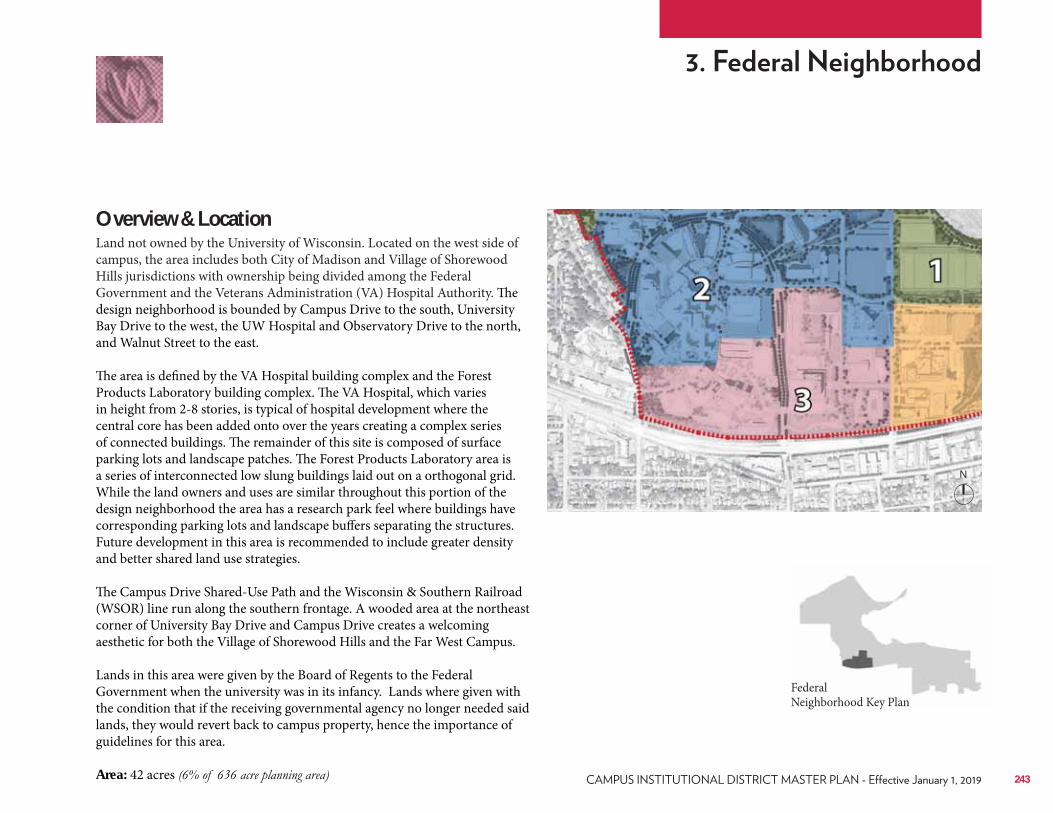
Overview & LocationLand not owned by the University of Wisconsin. Located on the west side of campus, the area includes both City of Madison and Village of Shorewood Hills jurisdictions with ownership being divided among the Federal Government and the Veterans Administration (VA) Hospital Authority. The design neighborhood is bounded by Campus Drive to the south, University Bay Drive to the west, the UW Hospital and Observatory Drive to the north, and Walnut Street to the east. The area is defined by the VA Hospital building complex and the Forest Products Laboratory building complex. The VA Hospital, which varies in height from 2-8 stories, is typical of hospital development where the central core has been added onto over the years creating a complex series of connected buildings. The remainder of this site is composed of surface parking lots and landscape patches. The Forest Products Laboratory area is a series of interconnected low slung buildings laid out on a orthogonal grid. While the land owners and uses are similar throughout this portion of the design neighborhood the area has a research park feel where buildings have corresponding parking lots and landscape buffers separating the structures. Future development in this area is recommended to include greater density and better shared land use strategies. The Campus Drive Shared-Use Path and the Wisconsin & Southern Railroad (WSOR) line run along the southern frontage. A wooded area at the northeast corner of University Bay Drive and Campus Drive creates a welcoming aesthetic for both the Village of Shorewood Hills and the Far West Campus. Lands in this area were given by the Board of Regents to the Federal Government when the university was in its infancy. Lands where given with the condition that if the receiving governmental agency no longer needed said lands, they would revert back to campus property, hence the importance of guidelines for this area. Area: 42 acres
Federal Neighborhood Key Plan
N
243
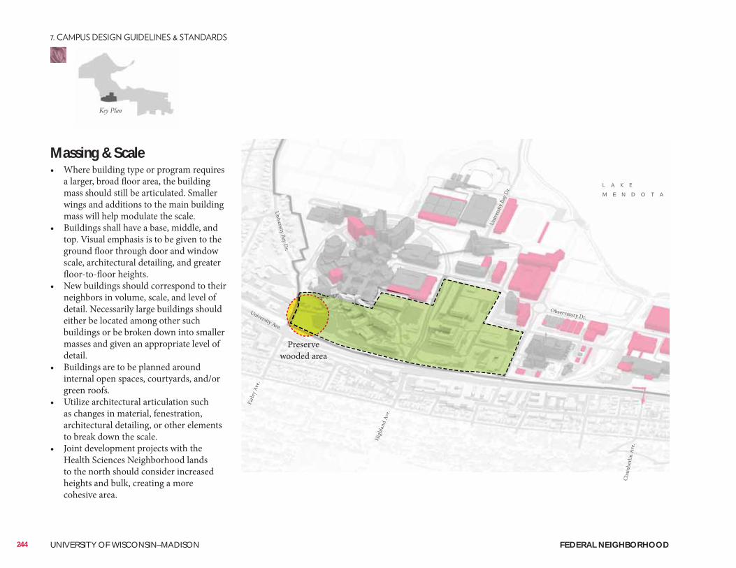
Massing & Scale• Where building type or program requires
a larger, broad floor area, the building mass should still be articulated. Smaller wings and additions to the main building mass will help modulate the scale.
• Buildings shall have a base, middle, and top. Visual emphasis is to be given to the ground floor through door and window scale, architectural detailing, and greater floor-to-floor heights.
• New buildings should correspond to their neighbors in volume, scale, and level of detail. Necessarily large buildings should either be located among other such buildings or be broken down into smaller masses and given an appropriate level of detail.
• Buildings are to be planned around internal open spaces, courtyards, and/or green roofs.
• Utilize architectural articulation such as changes in material, fenestration, architectural detailing, or other elements to break down the scale.
• Joint development projects with the Health Sciences Neighborhood lands to the north should consider increased heights and bulk, creating a more cohesive area.
Preserve wooded area
244 UNIVERSITY OF WISCONSIN–MADISON
M E N D O T A
University Ave.
Hig
hlan
d Av
e.
Unive
rsity
Bay
Dr.
Farle
y Ave
.
University Bay Dr.
Observatory Dr.
Cham
berli
n Av
e.
FEDERAL NEIGHBORHOOD
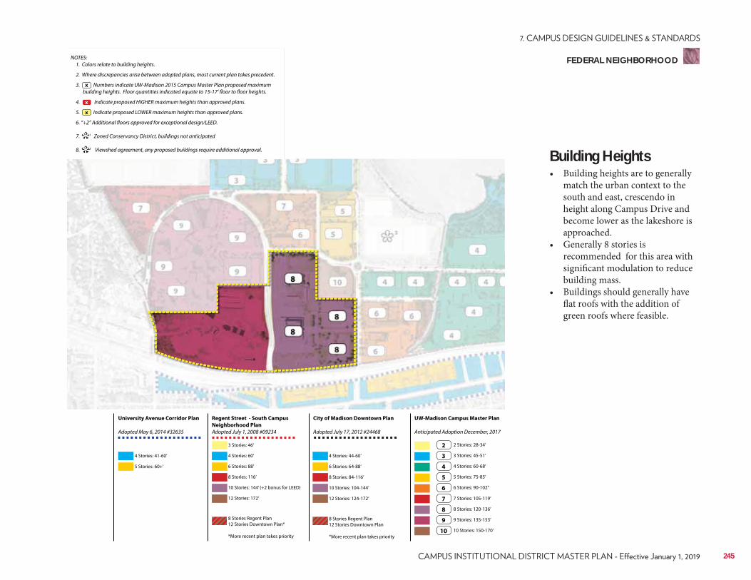
NOTES: 1. Colors relate to building heights.
2. Where discrepancies arise between adopted plans, most current plan takes precedent.
3. Numbers indicate UW-Madison 2015 Campus Master Plan proposed maximum building heights. Floor quantities indicated equate to 15-17’ floor to floor heights.
4. Indicate proposed HIGHER maximum heights than approved plans.
5. Indicate proposed LOWER maximum heights than approved plans.
6. “+2” Additional floors approved for exceptional design/LEED.
7. 1 Zoned Conservancy District, buildings not anticipated
8. 2 Viewshed agreement, any proposed buildings require additional approval.
x
**
x
x
Regent Street - South Campus
Neighborhood Plan
Adopted July 1, 2008 #09234
City of Madison Downtown Plan
Adopted July 17, 2012 #24468
UW-Madison Campus Master Plan
Anticipated Adoption December, 2017
University Avenue Corridor Plan
Adopted May 6, 2014 #32635
4 Stories: 41-60’
3 Stories: 46’
6 Stories: 88’ 6 Stories: 64-88’
3 Stories: 45-51’
7 Stories: 105-119’
10 Stories: 144’ (+2 bonus for LEED) 10 Stories: 104-144’
5 Stories: 75-85’
9 Stories: 135-153’
5 Stories: 60+’
4 Stories: 60’ 4 Stories: 44-60’
2 Stories: 28-34’
8 Stories: 116’ 8 Stories: 84-116’
4 Stories: 60-68’
8 Stories: 120-136’
12 Stories: 172’
8 Stories Regent Plan 12 Stories Downtown Plan*
*More recent plan takes priority
8 Stories Regent Plan 12 Stories Downtown Plan
*More recent plan takes priority
12 Stories: 124-172’
6 Stories: 90-102’’
10 Stories: 150-170’
2
3
7
4
8
5
9
6
10
Building Heights• Building heights are to generally
match the urban context to the south and east, crescendo in height along Campus Drive and become lower as the lakeshore is approached.
• Generally 8 stories is recommended for this area with significant modulation to reduce building mass.
• Buildings should generally have flat roofs with the addition of green roofs where feasible.
245
FEDERAL NEIGHBORHOOD
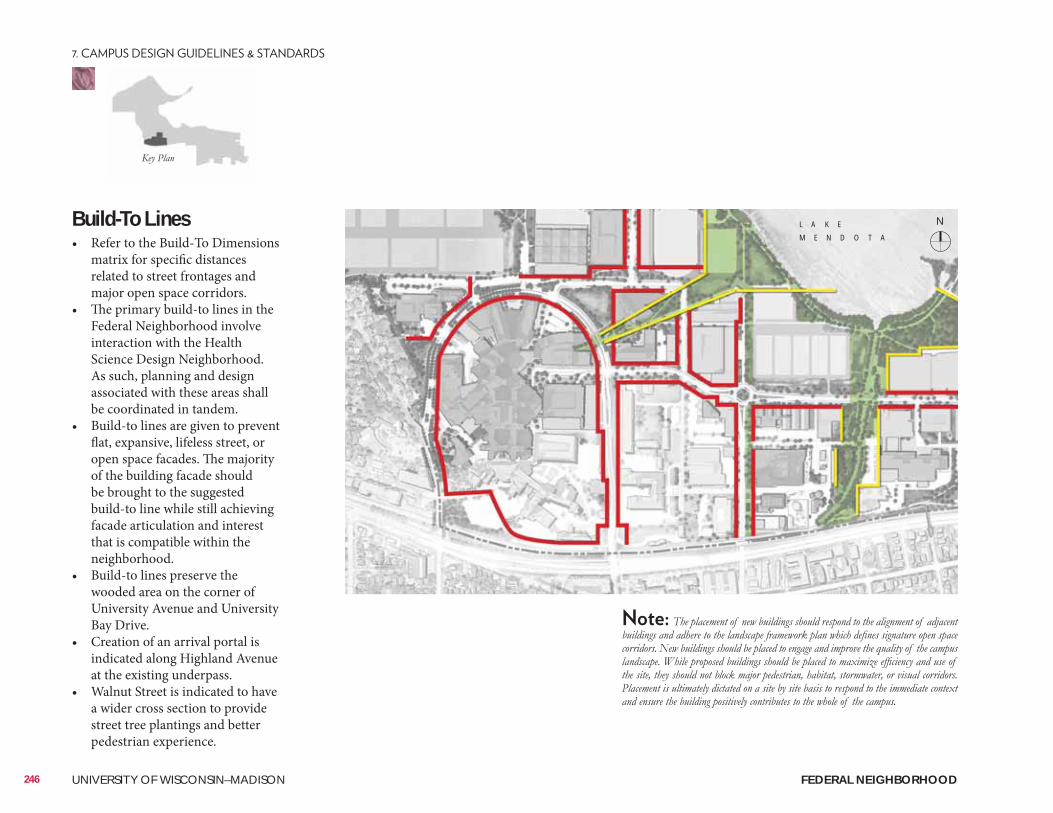
Build-To Lines• Refer to the Build-To Dimensions
matrix for specific distances related to street frontages and major open space corridors.
• The primary build-to lines in the Federal Neighborhood involve interaction with the Health Science Design Neighborhood. As such, planning and design associated with these areas shall be coordinated in tandem.
• Build-to lines are given to prevent flat, expansive, lifeless street, or open space facades. The majority of the building facade should be brought to the suggested build-to line while still achieving facade articulation and interest that is compatible within the neighborhood.
• Build-to lines preserve the wooded area on the corner of University Avenue and University Bay Drive.
• Creation of an arrival portal is indicated along Highland Avenue at the existing underpass.
• Walnut Street is indicated to have a wider cross section to provide street tree plantings and better pedestrian experience.
N
246 UNIVERSITY OF WISCONSIN–MADISON
L A K E
M E N D O T A
FEDERAL NEIGHBORHOOD
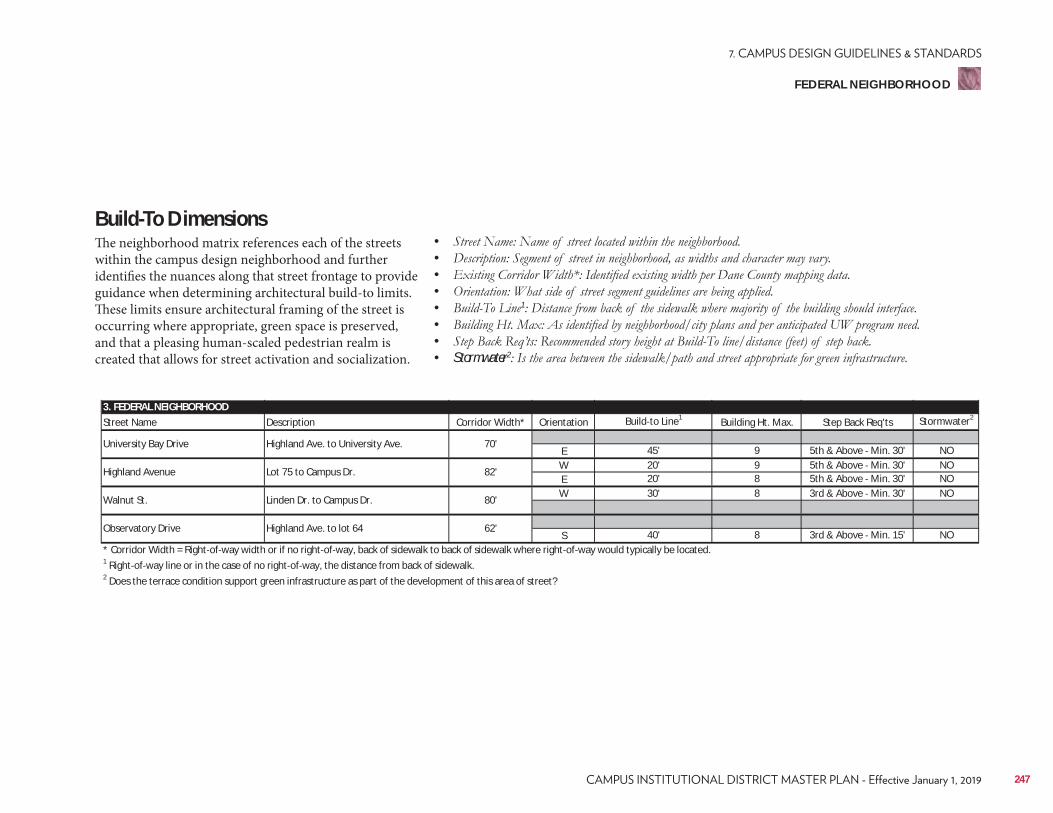
3. FEDERAL NEIGHBORHOODStreet Name Description Corridor Width* Orientation Build to Line1 Building Ht. Max. Step Back Req'ts Stormwater2
E 45' 9 5th & Above Min. 30' NOW 20' 9 5th & Above Min. 30' NOE 20' 8 5th & Above Min. 30' NOW 30' 8 3rd & Above Min. 30' NO
S 40' 8 3rd & Above Min. 15' NO* Corridor Width = Right of way width or if no right of way, back of sidewalk to back of sidewalk where right of way would typically be located.1 Right of way line or in the case of no right of way, the distance from back of sidewalk.2 Does the terrace condition support green infrastructure as part of the development of this area of street?
Observatory Drive Highland Ave. to lot 64 62'
Highland Avenue Lot 75 to Campus Dr. 82'
Walnut St. Linden Dr. to Campus Dr. 80'
University Bay Drive Highland Ave. to University Ave. 70'
Build-To DimensionsThe neighborhood matrix references each of the streets within the campus design neighborhood and further identifies the nuances along that street frontage to provide guidance when determining architectural build-to limits. These limits ensure architectural framing of the street is occurring where appropriate, green space is preserved, and that a pleasing human-scaled pedestrian realm is created that allows for street activation and socialization.
• • • • • 1
• • • Stormwater2
247
FEDERAL NEIGHBORHOOD
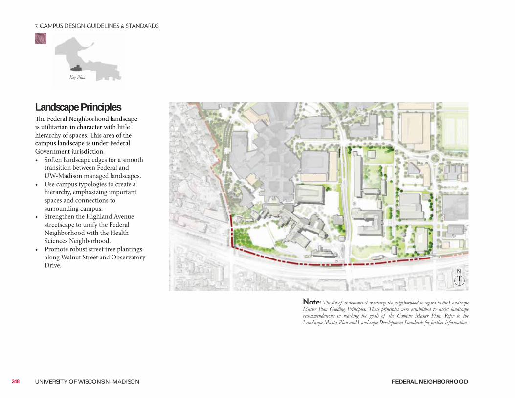
Landscape PrinciplesThe Federal Neighborhood landscape is utilitarian in character with little hierarchy of spaces. This area of the campus landscape is under Federal Government jurisdiction. • Soften landscape edges for a smooth
transition between Federal and UW-Madison managed landscapes.
• Use campus typologies to create a hierarchy, emphasizing important spaces and connections to surrounding campus.
• Strengthen the Highland Avenue streetscape to unify the Federal Neighborhood with the Health Sciences Neighborhood.
• Promote robust street tree plantings along Walnut Street and Observatory Drive.
N
248 UNIVERSITY OF WISCONSIN–MADISON FEDERAL NEIGHBORHOOD
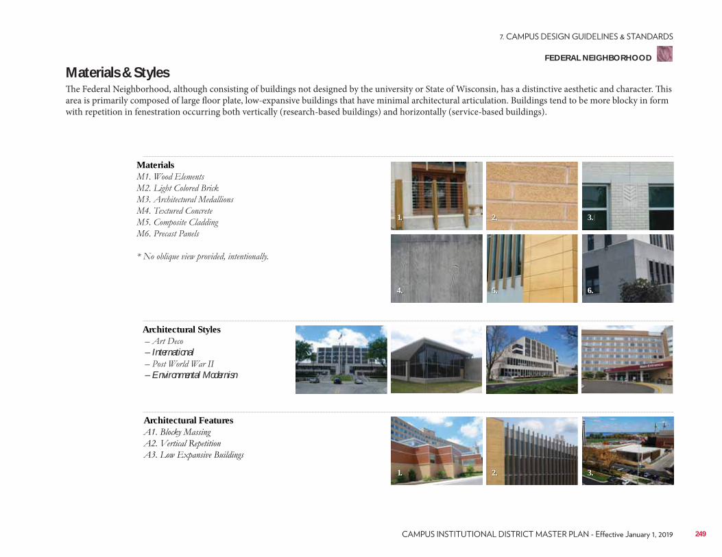
Materials & StylesThe Federal Neighborhood, although consisting of buildings not designed by the university or State of Wisconsin, has a distinctive aesthetic and character. This area is primarily composed of large floor plate, low-expansive buildings that have minimal architectural articulation. Buildings tend to be more blocky in form with repetition in fenestration occurring both vertically (research-based buildings) and horizontally (service-based buildings).
Materials
Architectural Features
Architectural Styles
– International
– Environmental Modernisn
1.
1.
4.
2.
2.
5.
3.
3.
6.
249
FEDERAL NEIGHBORHOOD
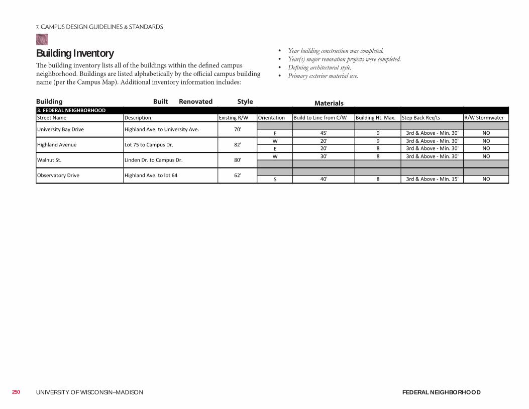
Building InventoryThe building inventory lists all of the buildings within the defined campus neighborhood. Buildings are listed alphabetically by the official campus building name (per the Campus Map). Additional inventory information includes:
• • • •
Building Built Renovated Style Materials
250 UNIVERSITY OF WISCONSIN–MADISON FEDERAL NEIGHBORHOOD
ConsiderationsConsiderations include information related to the planning, design, and approval of a typical building and/or landscape architecture campus project. It is to be reviewed as a resource identifying locations of materials that UW project teams reference most often. Not all projects will require each identified item. All projects should review the reference list and determine with the UW project manager applicability to the project.
Site Amenities & Vegetation• 2015 Landscape Development Standards• Division of Facilities Development Master Specifications–Division 32• UW-Madison Technical Guidelines–Division 32
Past Plans• 2013 University of Wisconsin Hospital & Clinics Master Plan• 2013 Madison Transit Corridor Study
• Village of Shorewood HillsHistorical and Cultural Resources• Historic Property Review Requirements• Archaeological Site Review Requirements
Well Head District/Locations• City of Madison Unit Well 6 (University Bay Drive & University Ave.)
City of Madison Zoning (Chapter 28)• Campus Institutional District (C-I)
251
FEDERAL NEIGHBORHOOD
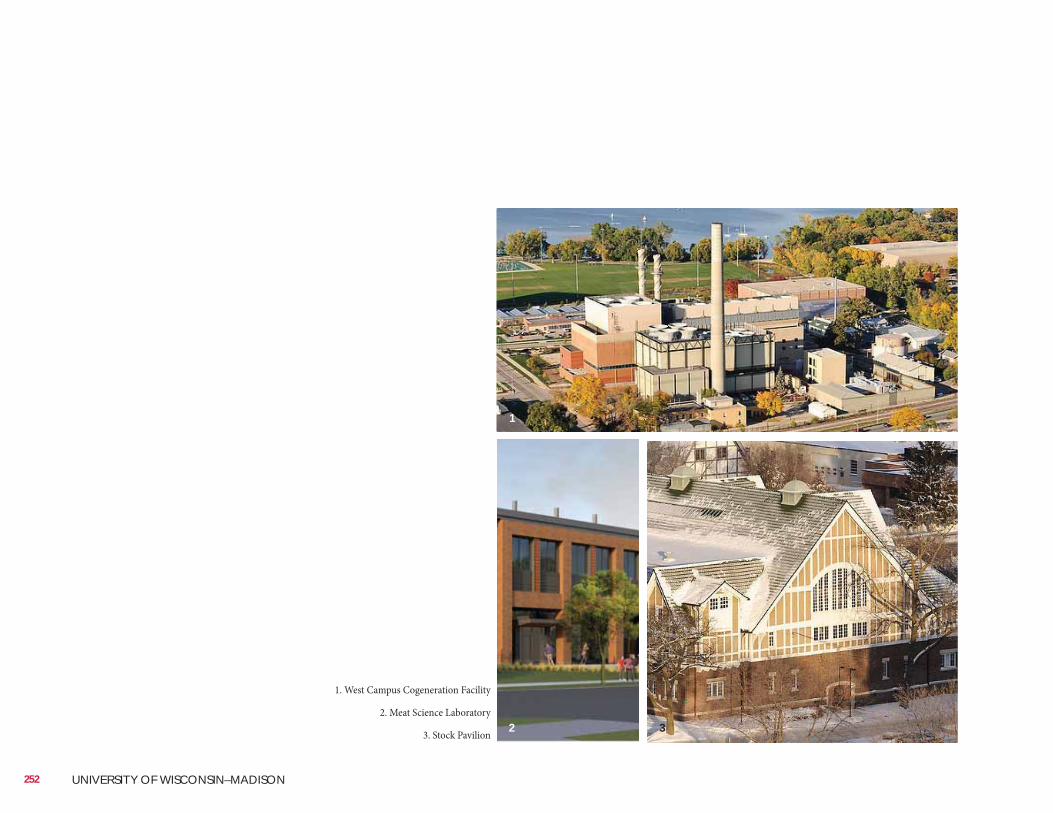
252 UNIVERSITY OF WISCONSIN–MADISON
1. West Campus Cogeneration Facility
2. Meat Science Laboratory
3. Stock Pavilion
1
2 3
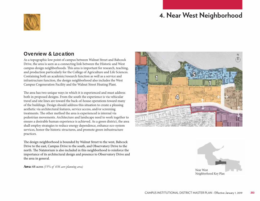
Overview & LocationAs a topographic low point of campus between Walnut Street and Babcock Drive, the area is seen as a connecting link between the Historic and West campus design neighborhoods. This area is important for research, teaching, and production particularly for the College of Agriculture and Life Sciences. Containing both an academic/research function as well as a service and infrastructure function, the design neighborhood also includes the West Campus Cogeneration Facility and the Walnut Street Heating Plant. The area has two unique ways in which it is experienced and must address both in proposed designs. From the south the experience is via vehicular travel and site lines are toward the back-of-house operations toward many of the buildings. Design should address this situation to create a pleasing aesthetic via architectural features, service access, and/or screening treatments. The other method the area is experienced is internal via pedestrian movements. Architecture and landscape need to work together to ensure a desirable human experience is achieved. As a green district, the area shall employ strategies to reduce energy dependence, enhance eco-system services, honor the historic structures, and promote green infrastructure practices. The design neighborhood is bounded by Walnut Street to the west, Babcock Drive to the east, Campus Drive to the south, and Observatory Drive to the north. The Natatorium is also included in this neighborhood to reinforce the importance of its architectural design and presence to Observatory Drive and the area in general. Area: 68 acres
Near West Neighborhood Key Plan
253
N
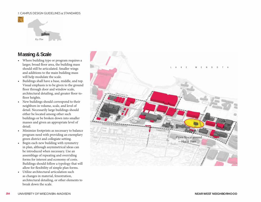
Massing & Scale• Where building type or program requires a
larger, broad floor area, the building mass should still be articulated. Smaller wings and additions to the main building mass will help modulate the scale.
• Buildings shall have a base, middle, and top. Visual emphasis is to be given to the ground floor through door and window scale, architectural detailing, and greater floor-to-floor heights.
• New buildings should correspond to their neighbors in volume, scale, and level of detail. Necessarily large buildings should either be located among other such buildings or be broken down into smaller masses and given an appropriate level of detail.
• Minimize footprints as necessary to balance program need with providing an exemplary green district and collegiate setting.
• Begin each new building with symmetry in plan, although asymmetrical ideas can be introduced when necessary. Use an assemblage of repeating and overriding forms for interest and economy of costs. Buildings should follow a typology that will allow for flexibility of simple plan forms.
• Utilize architectural articulation such as changes in material, fenestration, architectural detailing, or other elements to break down the scale.
254 UNIVERSITY OF WISCONSIN–MADISON
Waln
ut St
.
Cham
berli
n Av
e.
Elm
Dr.
Campus Dr.
Wisconsin & Southern Railroad
Observatory Dr.
Bree
se T
er.
L A K E M E N D O T A
NEAR WEST NEIGHBORHOOD
Open Space around Horse Barn
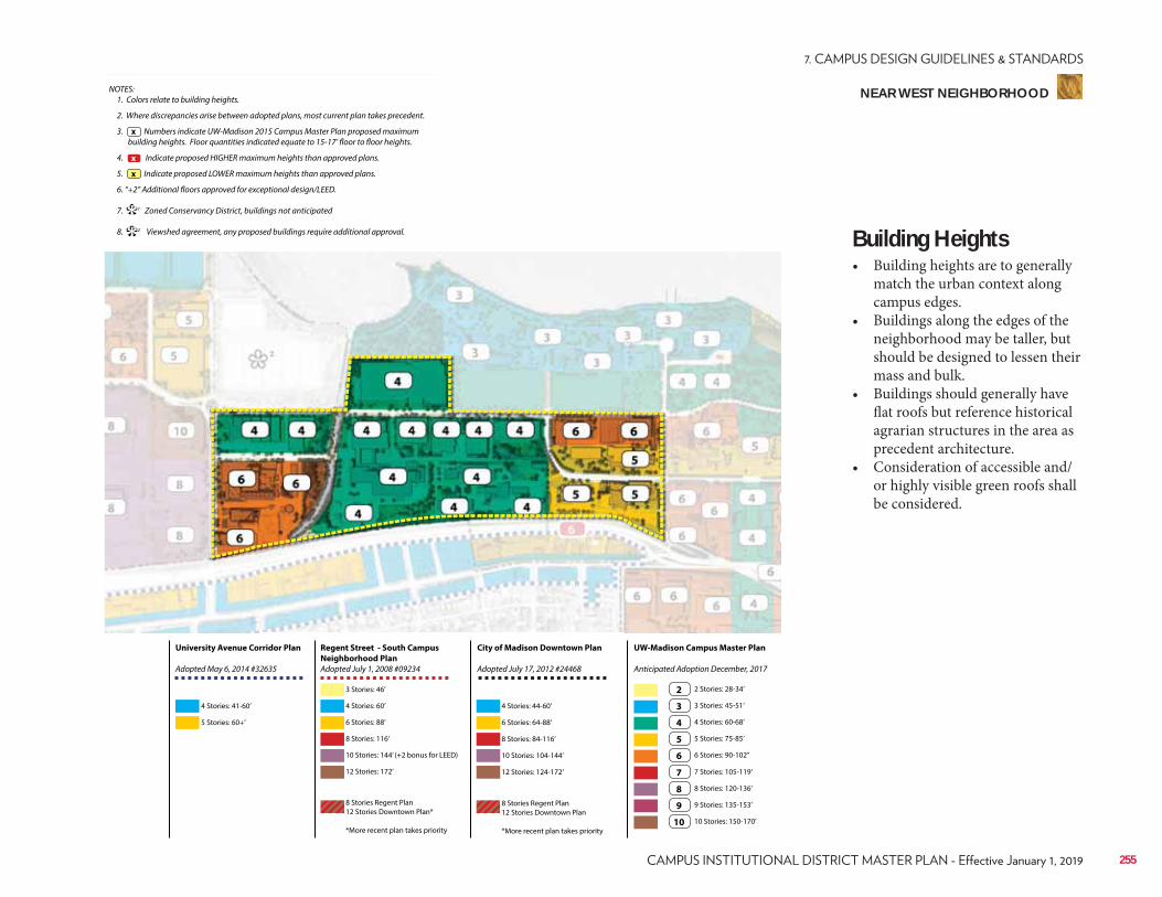
NOTES: 1. Colors relate to building heights.
2. Where discrepancies arise between adopted plans, most current plan takes precedent.
3. Numbers indicate UW-Madison 2015 Campus Master Plan proposed maximum building heights. Floor quantities indicated equate to 15-17’ floor to floor heights.
4. Indicate proposed HIGHER maximum heights than approved plans.
5. Indicate proposed LOWER maximum heights than approved plans.
6. “+2” Additional floors approved for exceptional design/LEED.
7. 1 Zoned Conservancy District, buildings not anticipated
8. 2 Viewshed agreement, any proposed buildings require additional approval.
x
**
x
x
Regent Street - South Campus
Neighborhood Plan
Adopted July 1, 2008 #09234
City of Madison Downtown Plan
Adopted July 17, 2012 #24468
UW-Madison Campus Master Plan
Anticipated Adoption December, 2017
University Avenue Corridor Plan
Adopted May 6, 2014 #32635
4 Stories: 41-60’
3 Stories: 46’
6 Stories: 88’ 6 Stories: 64-88’
3 Stories: 45-51’
7 Stories: 105-119’
10 Stories: 144’ (+2 bonus for LEED) 10 Stories: 104-144’
5 Stories: 75-85’
9 Stories: 135-153’
5 Stories: 60+’
4 Stories: 60’ 4 Stories: 44-60’
2 Stories: 28-34’
8 Stories: 116’ 8 Stories: 84-116’
4 Stories: 60-68’
8 Stories: 120-136’
12 Stories: 172’
8 Stories Regent Plan 12 Stories Downtown Plan*
*More recent plan takes priority
8 Stories Regent Plan 12 Stories Downtown Plan
*More recent plan takes priority
12 Stories: 124-172’
6 Stories: 90-102’’
10 Stories: 150-170’
2
3
7
4
8
5
9
6
10
Building Heights• Building heights are to generally
match the urban context along campus edges.
• Buildings along the edges of the neighborhood may be taller, but should be designed to lessen their mass and bulk.
• Buildings should generally have flat roofs but reference historical agrarian structures in the area as precedent architecture.
• Consideration of accessible and/or highly visible green roofs shall be considered.
255
NEAR WEST NEIGHBORHOOD
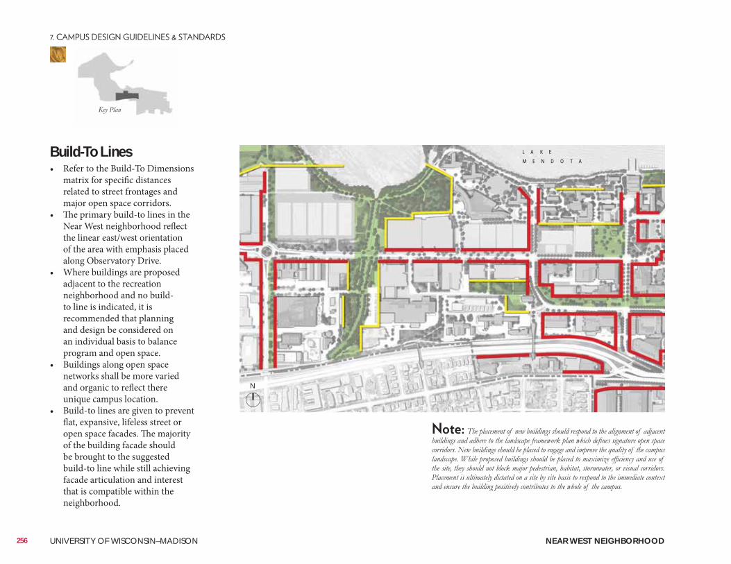
Build-To Lines• Refer to the Build-To Dimensions
matrix for specific distances related to street frontages and major open space corridors.
• The primary build-to lines in the Near West neighborhood reflect the linear east/west orientation of the area with emphasis placed along Observatory Drive.
• Where buildings are proposed adjacent to the recreation neighborhood and no build-to line is indicated, it is recommended that planning and design be considered on an individual basis to balance program and open space.
• Buildings along open space networks shall be more varied and organic to reflect there unique campus location.
• Build-to lines are given to prevent flat, expansive, lifeless street or open space facades. The majority of the building facade should be brought to the suggested build-to line while still achieving facade articulation and interest that is compatible within the neighborhood.
256 UNIVERSITY OF WISCONSIN–MADISON
L A K E
M E N D O T A
NEAR WEST NEIGHBORHOOD
N
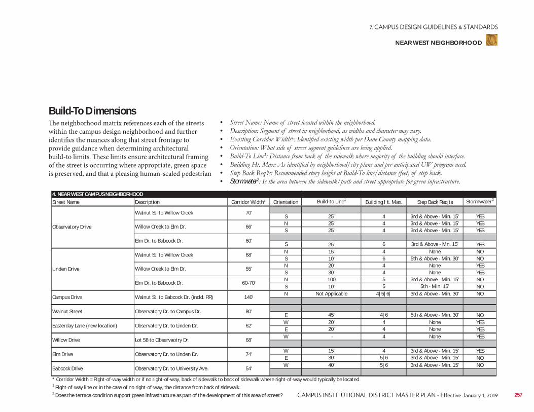
4. NEAR WEST CAMPUS NEIGHBORHOODStreet Name Description Corridor Width* Orientation Build to Line1 Building Ht. Max. Step Back Req'ts Stormwater2
S 25' 4 3rd & Above Min. 15' YESN 25' 4 3rd & Above Min. 15' YESS 25' 4 3rd & Above Min. 15' YES
S 25' 6 3rd & Above Mn. 15' YESN 15' 4 None NOS 10' 6 5th & Above Min. 30' NON 20' 4 None YESS 30' 4 None YESN 100 5 3rd & Above Min. 15' NOS 10' 5 5th Min. 15' NON Not Applicable 4|5|6| 3rd & Above Min. 30' NO
E 45' 4|6 5th & Above Min. 30' NOW 20' 4 None YESE 20' 4 None YESW 4 None YES
W 15' 4 3rd & Above Min. 15' YESE 30' 5|6 3rd & Above Min. 15' NOW 40' 5|6 3rd & Above Min. 15' NO
* Corridor Width = Right of way width or if no right of way, back of sidewalk to back of sidewalk where right of way would typically be located.1 Right of way line or in the case of no right of way, the distance from back of sidewalk.2 Does the terrace condition support green infrastructure as part of the development of this area of street?
Elm Drive Observatory Dr. to Linden Dr. 74'
Babcock Drive Observatory Dr. to University Ave. 54'
Easterday Lane (new location) Observatory Dr. to Linden Dr. 62'
Willow Drive Lot 58 to Observaotry Dr. 68'
Campus Drive Walnut St. to Babcock Dr. (incld. RR) 140'
Walnut Street Observatory Dr. to Campus Dr. 80'
Linden Drive
Walnut St. to Willow Creek 68'
Willow Creek to Elm Dr. 55'
Elm Dr. to Babcock Dr. 60 70'
Observatory Drive
Walnut St. to Willow Creek 70'
Willow Creek to Elm Dr. 66'
Elm Dr. to Babcock Dr. 60'
Build-To DimensionsThe neighborhood matrix references each of the streets within the campus design neighborhood and further identifies the nuances along that street frontage to provide guidance when determining architectural build-to limits. These limits ensure architectural framing of the street is occurring where appropriate, green space is preserved, and that a pleasing human-scaled pedestrian
• • • • • 1
• • • Stormwater2
257
NEAR WEST NEIGHBORHOOD
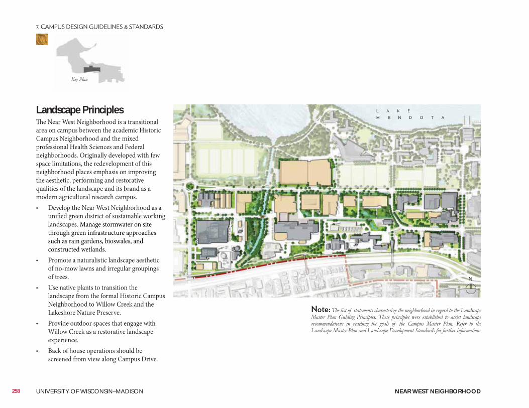
Landscape PrinciplesThe Near West Neighborhood is a transitional area on campus between the academic Historic Campus Neighborhood and the mixed professional Health Sciences and Federal neighborhoods. Originally developed with few space limitations, the redevelopment of this neighborhood places emphasis on improving the aesthetic, performing and restorative qualities of the landscape and its brand as a modern agricultural research campus. • Develop the Near West Neighborhood as a
unified green district of sustainable working landscapes. Manage stormwater on site through green infrastructure approaches such as rain gardens, bioswales, and constructed wetlands.
• Promote a naturalistic landscape aesthetic of no-mow lawns and irregular groupings of trees.
• Use native plants to transition the landscape from the formal Historic Campus Neighborhood to Willow Creek and the Lakeshore Nature Preserve.
• Provide outdoor spaces that engage with Willow Creek as a restorative landscape experience.
• Back of house operations should be screened from view along Campus Drive.
M E N D O T A
258 UNIVERSITY OF WISCONSIN–MADISON NEAR WEST NEIGHBORHOOD
N
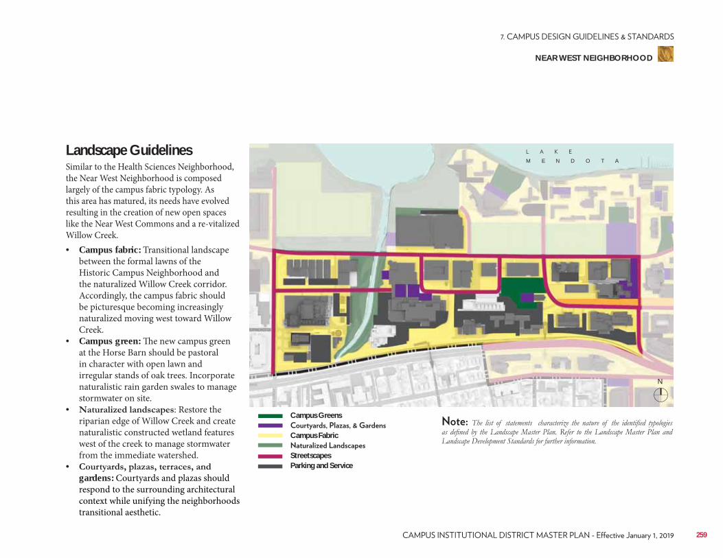
Landscape Guidelines Similar to the Health Sciences Neighborhood, the Near West Neighborhood is composed largely of the campus fabric typology. As this area has matured, its needs have evolved resulting in the creation of new open spaces like the Near West Commons and a re-vitalized Willow Creek. • Campus fabric: Transitional landscape
between the formal lawns of the Historic Campus Neighborhood and the naturalized Willow Creek corridor. Accordingly, the campus fabric should be picturesque becoming increasingly naturalized moving west toward Willow Creek.
• Campus green: The new campus green at the Horse Barn should be pastoral in character with open lawn and irregular stands of oak trees. Incorporate naturalistic rain garden swales to manage stormwater on site.
• : Restore the riparian edge of Willow Creek and create naturalistic constructed wetland features west of the creek to manage stormwater from the immediate watershed.
• gardens: Courtyards and plazas should respond to the surrounding architectural context while unifying the neighborhoods transitional aesthetic.
Campus Greens
Campus Fabric
StreetscapesParking and Service
M E N D O T A
259
NEAR WEST NEIGHBORHOOD
N
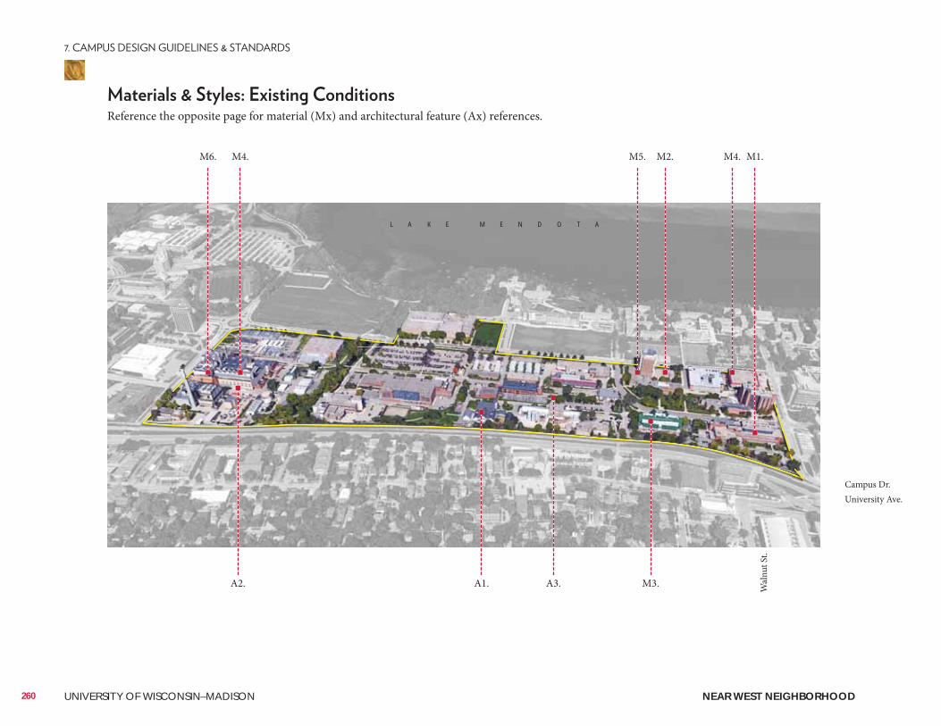
Wal
nut S
t.
Campus Dr.University Ave.
L A K E M E N D O T A
260 UNIVERSITY OF WISCONSIN–MADISON
Reference the opposite page for material (Mx) and architectural feature (Ax) references.
M1.M2.M4.M6. M5. M4.
A1. A3.A2. M3.
NEAR WEST NEIGHBORHOOD
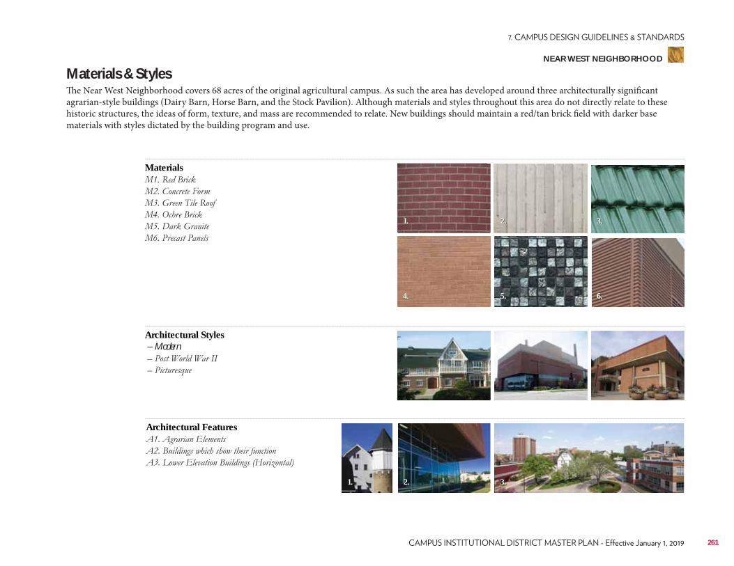
Materials & StylesThe Near West Neighborhood covers 68 acres of the original agricultural campus. As such the area has developed around three architecturally significant agrarian-style buildings (Dairy Barn, Horse Barn, and the Stock Pavilion). Although materials and styles throughout this area do not directly relate to these historic structures, the ideas of form, texture, and mass are recommended to relate. New buildings should maintain a red/tan brick field with darker base materials with styles dictated by the building program and use.
Materials
Architectural Features
Architectural Styles – Modern
1.
4.
1. 2. 3.
2.
5.
3.
6.
261
NEAR WEST NEIGHBORHOOD
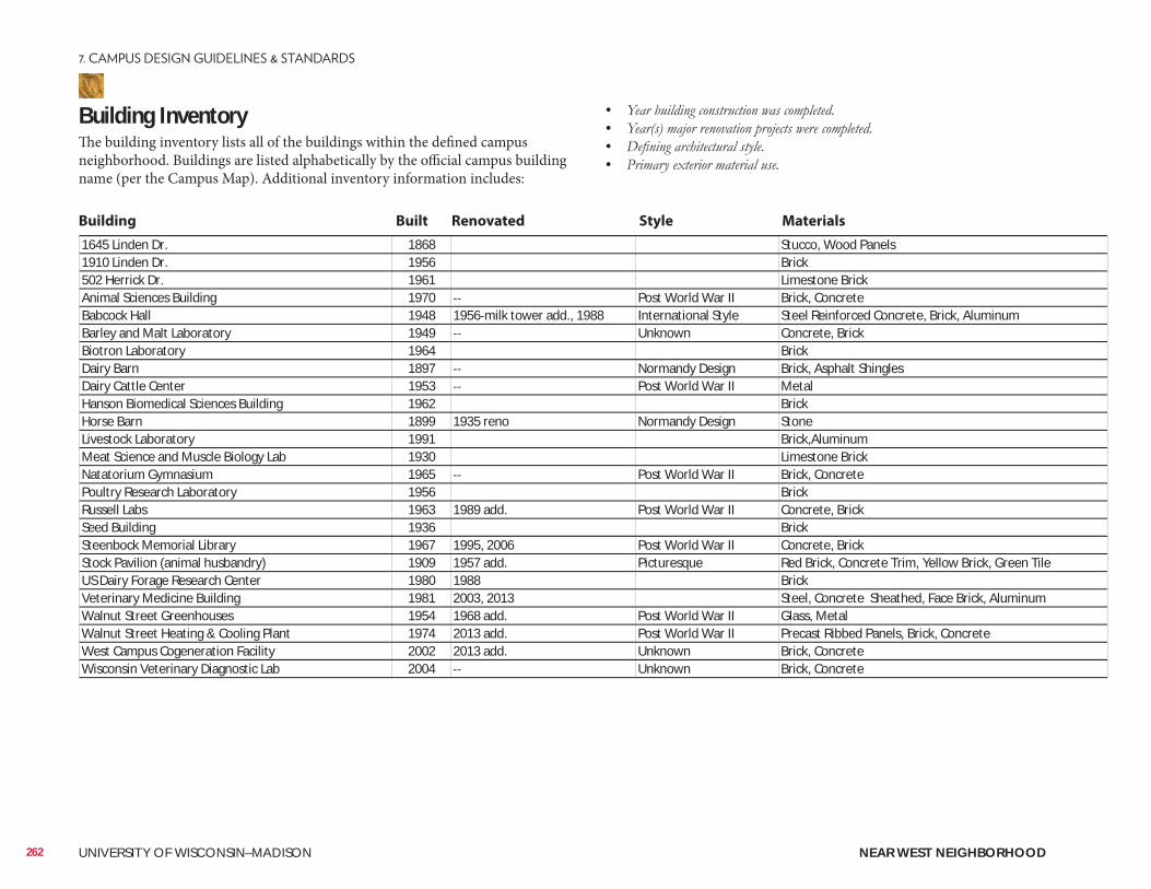
Building InventoryThe building inventory lists all of the buildings within the defined campus neighborhood. Buildings are listed alphabetically by the official campus building name (per the Campus Map). Additional inventory information includes:
• • • •
1645 Linden Dr. 1868 Stucco, Wood Panels1910 Linden Dr. 1956 Brick502 Herrick Dr. 1961 Limestone BrickAnimal Sciences Building 1970 Post World War II Brick, ConcreteBabcock Hall 1948 1956 milk tower add., 1988 International Style Steel Reinforced Concrete, Brick, AluminumBarley and Malt Laboratory 1949 Unknown Concrete, BrickBiotron Laboratory 1964 BrickDairy Barn 1897 Normandy Design Brick, Asphalt ShinglesDairy Cattle Center 1953 Post World War II MetalHanson Biomedical Sciences Building 1962 BrickHorse Barn 1899 1935 reno Normandy Design StoneLivestock Laboratory 1991 Brick,AluminumMeat Science and Muscle Biology Lab 1930 Limestone BrickNatatorium Gymnasium 1965 Post World War II Brick, ConcretePoultry Research Laboratory 1956 BrickRussell Labs 1963 1989 add. Post World War II Concrete, BrickSeed Building 1936 BrickSteenbock Memorial Library 1967 1995, 2006 Post World War II Concrete, BrickStock Pavilion (animal husbandry) 1909 1957 add. Picturesque Red Brick, Concrete Trim, Yellow Brick, Green TileUS Dairy Forage Research Center 1980 1988 BrickVeterinary Medicine Building 1981 2003, 2013 Steel, Concrete Sheathed, Face Brick, AluminumWalnut Street Greenhouses 1954 1968 add. Post World War II Glass, MetalWalnut Street Heating & Cooling Plant 1974 2013 add. Post World War II Precast Ribbed Panels, Brick, ConcreteWest Campus Cogeneration Facility 2002 2013 add. Unknown Brick, ConcreteWisconsin Veterinary Diagnostic Lab 2004 Unknown Brick, Concrete
Building Built Renovated Style Materials
262 UNIVERSITY OF WISCONSIN–MADISON NEAR WEST NEIGHBORHOOD
ConsiderationsConsiderations include information related to the planning, design, and approval of a typical building and/or landscape architecture campus project. It is to be reviewed as a resource identifying locations of materials that UW project teams reference most often. Not all projects will require each identified item. All projects should review the reference list and determine with the UW project manager applicability to the project.
Site Amenities & Vegetation• 2015 Landscape Development Standards• Division of Facilities Development Master Specifications–Division 32• UW-Madison Technical Guidelines–Division 32
Past Plans• 2006 Lakeshore Nature Preserve Master Plan• 2007 Recreational Sports Facilities Master Plan• 2014 University Avenue Corridor Neighborhood Plan• 2016 Letters & Science Facilities Master Plan
• Willow Creek Restoration Project
• Viewshed Protection Agreement–WARF• Friends of Lakeshore Nature Preserve• Regent Neighborhood Association
Historical and Cultural Resources• 2005 Cultural Landscape Report• Historic Property Review Requirements• Archaeological Site Review Requirements
Well Head District/Locations• City of Madison Unit Well 27 (N. Randall Ave. & Bike Path)
City of Madison Zoning (Chapter 28)• Campus Institutional District (C-I)
263
NEAR WEST NEIGHBORHOOD
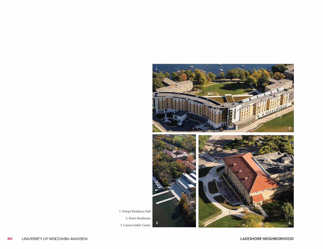
264 UNIVERSITY OF WISCONSIN–MADISON
1. Dejope Residence Hall
2. Porter Boathouse
3. Carson Gulley Center
1
2 3
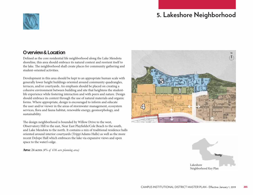
Overview & LocationDefined as the core residential life neighborhood along the Lake Mendota shoreline, this area should embrace its natural context and reorient itself to the lake. The neighborhood shall create places for community gathering and student-oriented activities. Development in this area should be kept to an appropriate human scale with generally lower height buildings oriented around community quadrangles, terraces, and/or courtyards. An emphasis should be placed on creating a cohesive environment between building and site that heightens the student-life experience while fostering interaction and with peers and nature. Design should embrace its context through the use of natural materials and organic forms. Where appropriate, design is encouraged to inform and educate the user and/or viewer in the areas of stormwater management, ecosystem services, flora and fauna habitat, renewable energy, geomorphology, and sustainability. The design neighborhood is bounded by Willow Drive to the west, Observatory Hill to the east, Near East Playfields/Cole Beach to the south, and Lake Mendota to the north. It contains a mix of traditional residence halls oriented around interior courtyards (Tripp/Adams Halls) as well as the more recent DeJope Hall which embraces the lake via expansive views and open space to the water’s edge. Area: 24 acres
Lakeshore Neighborhood Key Plan
265
N
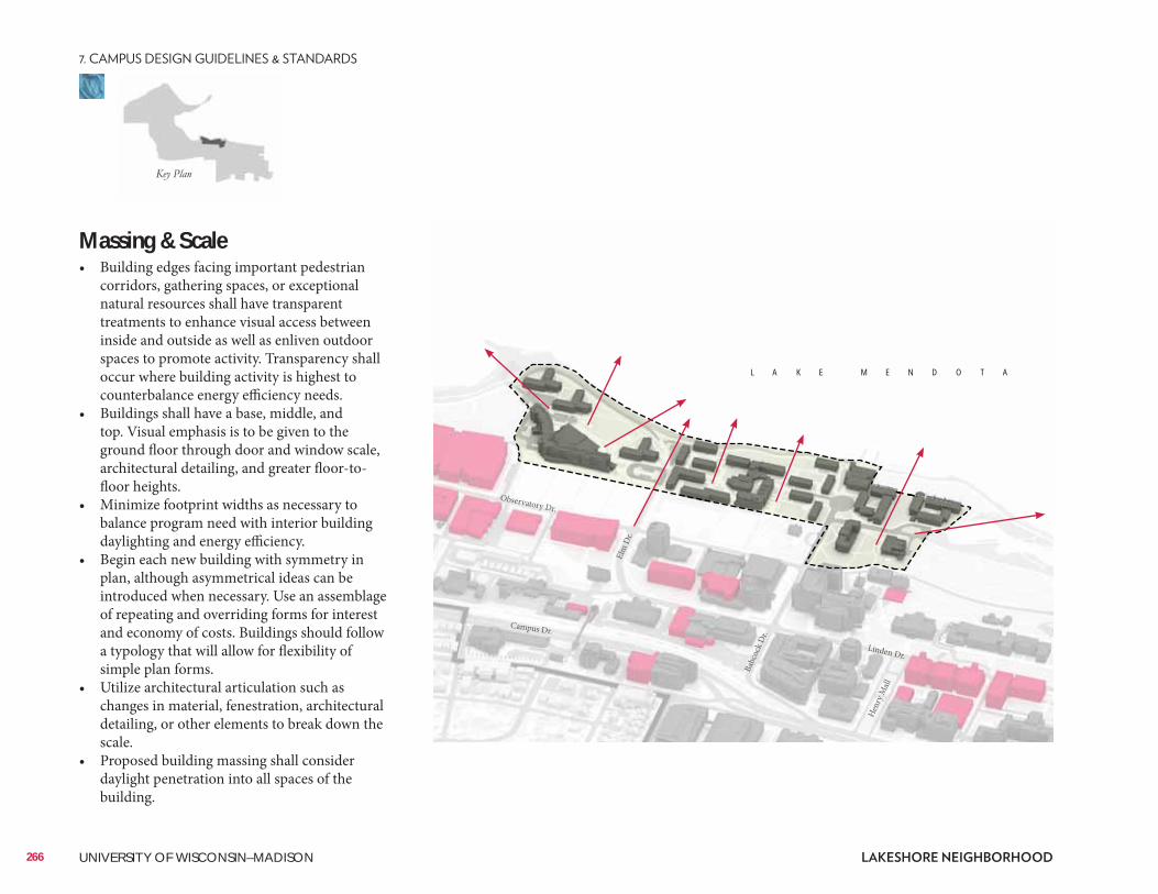
Massing & Scale• Building edges facing important pedestrian
corridors, gathering spaces, or exceptional natural resources shall have transparent treatments to enhance visual access between inside and outside as well as enliven outdoor spaces to promote activity. Transparency shall occur where building activity is highest to counterbalance energy efficiency needs.
• Buildings shall have a base, middle, and top. Visual emphasis is to be given to the ground floor through door and window scale, architectural detailing, and greater floor-to-floor heights.
• Minimize footprint widths as necessary to balance program need with interior building daylighting and energy efficiency.
• Begin each new building with symmetry in plan, although asymmetrical ideas can be introduced when necessary. Use an assemblage of repeating and overriding forms for interest and economy of costs. Buildings should follow a typology that will allow for flexibility of simple plan forms.
• Utilize architectural articulation such as changes in material, fenestration, architectural detailing, or other elements to break down the scale.
• Proposed building massing shall consider daylight penetration into all spaces of the building.
266 UNIVERSITY OF WISCONSIN–MADISON
Elm
Dr.
Babc
ock D
r.
Henr
y Mall
Observatory Dr.
Linden Dr.
Campus Dr.
L A K E M E N D O T A
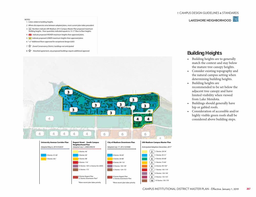
NOTES: 1. Colors relate to building heights.
2. Where discrepancies arise between adopted plans, most current plan takes precedent.
3. Numbers indicate UW-Madison 2015 Campus Master Plan proposed maximum building heights. Floor quantities indicated equate to 15-17’ floor to floor heights.
4. Indicate proposed HIGHER maximum heights than approved plans.
5. Indicate proposed LOWER maximum heights than approved plans.
6. “+2” Additional floors approved for exceptional design/LEED.
7. 1 Zoned Conservancy District, buildings not anticipated
8. 2 Viewshed agreement, any proposed buildings require additional approval.
x
**
x
x
Regent Street - South Campus
Neighborhood Plan
Adopted July 1, 2008 #09234
City of Madison Downtown Plan
Adopted July 17, 2012 #24468
UW-Madison Campus Master Plan
Anticipated Adoption December, 2017
University Avenue Corridor Plan
Adopted May 6, 2014 #32635
4 Stories: 41-60’
3 Stories: 46’
6 Stories: 88’ 6 Stories: 64-88’
3 Stories: 45-51’
7 Stories: 105-119’
10 Stories: 144’ (+2 bonus for LEED) 10 Stories: 104-144’
5 Stories: 75-85’
9 Stories: 135-153’
5 Stories: 60+’
4 Stories: 60’ 4 Stories: 44-60’
2 Stories: 28-34’
8 Stories: 116’ 8 Stories: 84-116’
4 Stories: 60-68’
8 Stories: 120-136’
12 Stories: 172’
8 Stories Regent Plan 12 Stories Downtown Plan*
*More recent plan takes priority
8 Stories Regent Plan 12 Stories Downtown Plan
*More recent plan takes priority
12 Stories: 124-172’
6 Stories: 90-102’’
10 Stories: 150-170’
2
3
7
4
8
5
9
6
10
Building Heights• Building heights are to generally
match the context and stay below the mature tree canopy heights.
• Consider existing topography and the natural campus setting when determining building heights.
• Building heights are recommended to be set below the adjacent tree canopy and have limited visibility when viewed from Lake Mendota.
• Buildings should generally have hip or gabled roofs.
• Consideration of accessible and/or highly visible green roofs shall be considered above building steps.
267
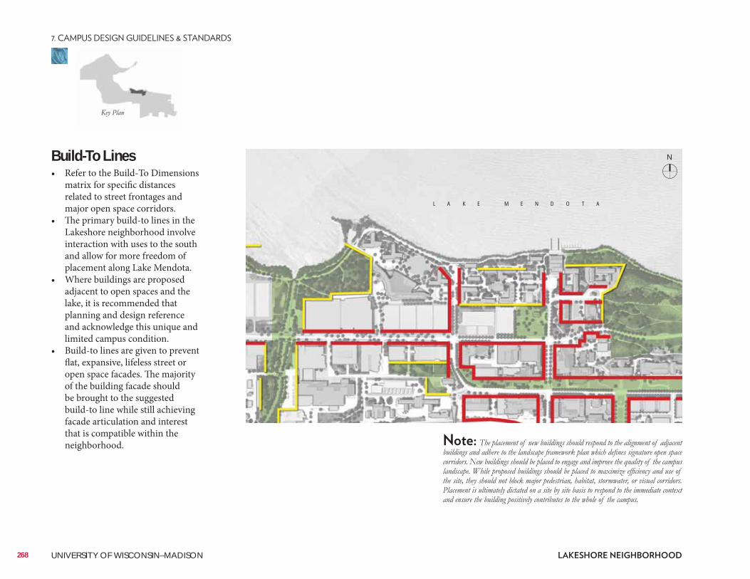
Build-To Lines• Refer to the Build-To Dimensions
matrix for specific distances related to street frontages and major open space corridors.
• The primary build-to lines in the Lakeshore neighborhood involve interaction with uses to the south and allow for more freedom of placement along Lake Mendota.
• Where buildings are proposed adjacent to open spaces and the lake, it is recommended that planning and design reference and acknowledge this unique and limited campus condition.
• Build-to lines are given to prevent flat, expansive, lifeless street or open space facades. The majority of the building facade should be brought to the suggested build-to line while still achieving facade articulation and interest that is compatible within the neighborhood.
268 UNIVERSITY OF WISCONSIN–MADISON
L A K E M E N D O T A
N
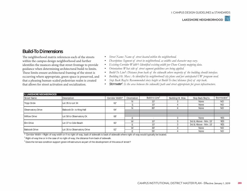
5. LAKESHORE NEIGHBORHOODStreet Name Description Corridor Width* Orientation Build to Line1 Building Ht. Max. Step Back Req'ts Stormwater2
N 10' 3 None NOS 10' 4 None NON 80' 4 None NO
E 3 None YESW 10' 3 3rd & Above Min. 15' YESE 10' 3 3rd & Above Min. 15' YESW 30' 3 None NOE 55' 4 None NO
* Corridor Width = Right of way width or if no right of way, back of sidewalk to back of sidewalk where right of way would typically be located.1 Right of way line or in the case of no right of way, the distance from back of sidewalk.2 Does the terrace condition support green infrastructure as part of the development of this area of street?
Babcock Drive Lot 35 to Observatory Drive 62'
Willow Drive Lot 58 to Observatory Dr. 68'
Elm Drive Lot 37 to Cole Beach 60'
Tripp Circle Lot 35 to Lot 34 62'
Observatory Drive Babcock Dr. to King Hall 64'
Build-To DimensionsThe neighborhood matrix references each of the streets within the campus design neighborhood and further identifies the nuances along that street frontage to provide guidance when determining architectural build-to limits. These limits ensure architectural framing of the street is occurring where appropriate, green space is preserved, and that a pleasing human-scaled pedestrian realm is created that allows for street activation and socialization.
• • • • • 1
• • • Stormwater2
269
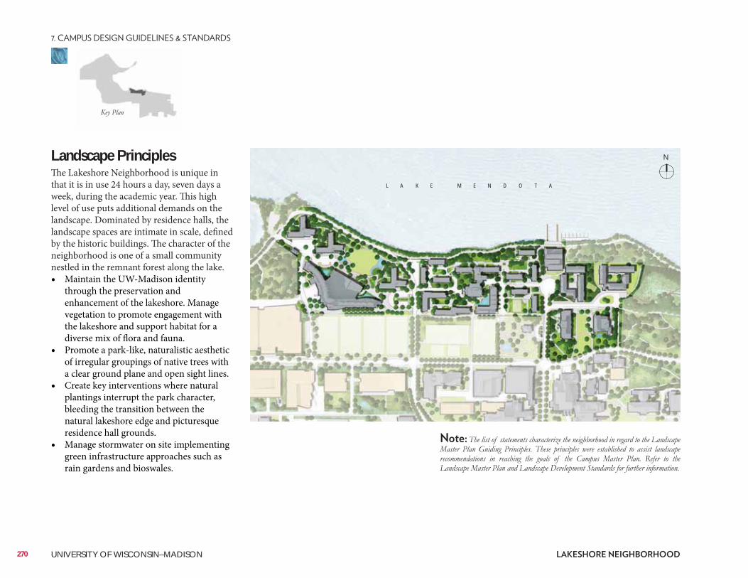
Landscape Principles The Lakeshore Neighborhood is unique in that it is in use 24 hours a day, seven days a week, during the academic year. This high level of use puts additional demands on the landscape. Dominated by residence halls, the landscape spaces are intimate in scale, defined by the historic buildings. The character of the neighborhood is one of a small community nestled in the remnant forest along the lake. • Maintain the UW-Madison identity
through the preservation and enhancement of the lakeshore. Manage vegetation to promote engagement with the lakeshore and support habitat for a diverse mix of flora and fauna.
• Promote a park-like, naturalistic aesthetic of irregular groupings of native trees with a clear ground plane and open sight lines.
• Create key interventions where natural plantings interrupt the park character, bleeding the transition between the natural lakeshore edge and picturesque residence hall grounds.
• Manage stormwater on site implementing green infrastructure approaches such as rain gardens and bioswales.
L A K E M E N D O T A
N
270 UNIVERSITY OF WISCONSIN–MADISON
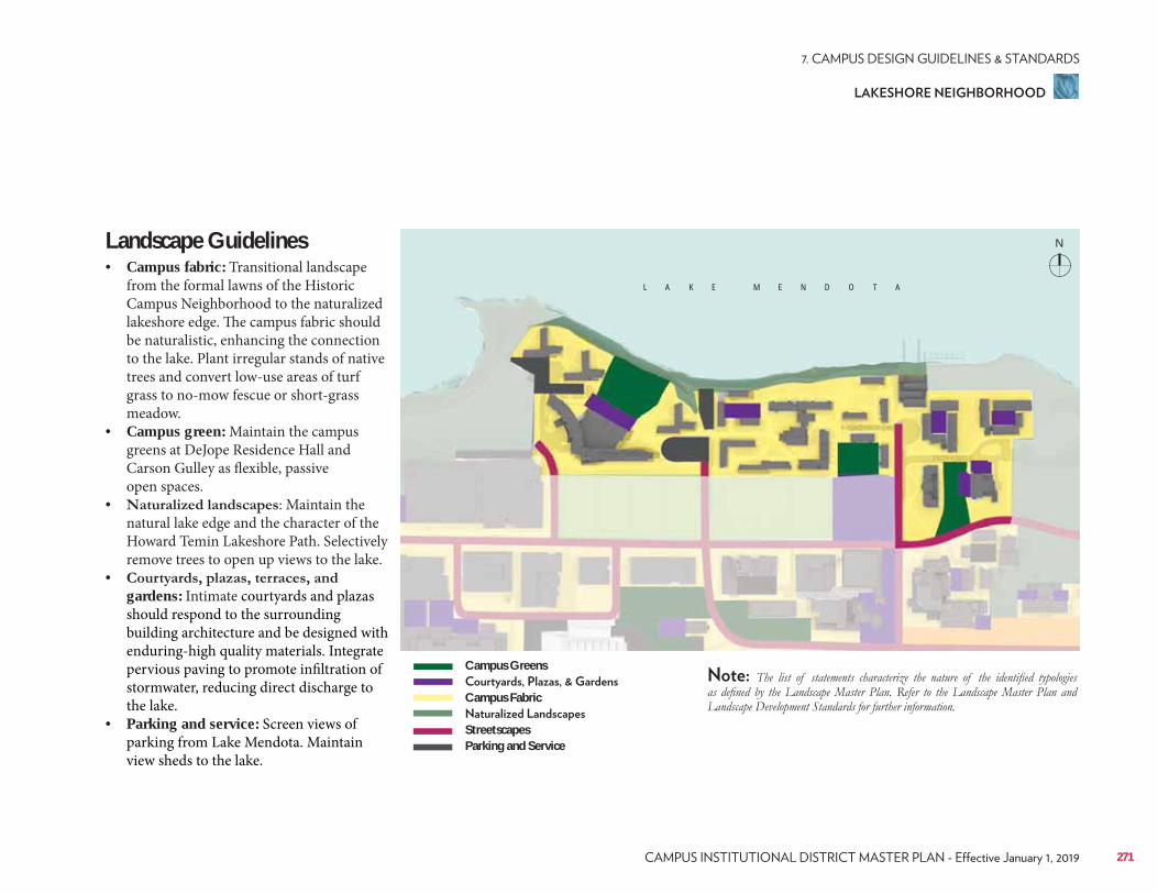
Landscape Guidelines• Campus fabric: Transitional landscape
from the formal lawns of the Historic Campus Neighborhood to the naturalized lakeshore edge. The campus fabric should be naturalistic, enhancing the connection to the lake. Plant irregular stands of native trees and convert low-use areas of turf grass to no-mow fescue or short-grass meadow.
• Campus green: Maintain the campus greens at DeJope Residence Hall and Carson Gulley as flexible, passive open spaces.
• : Maintain the natural lake edge and the character of the Howard Temin Lakeshore Path. Selectively remove trees to open up views to the lake.
• gardens: Intimate courtyards and plazas should respond to the surrounding building architecture and be designed with enduring-high quality materials. Integrate pervious paving to promote infiltration of stormwater, reducing direct discharge to the lake.
• Parking and service: Screen views of parking from Lake Mendota. Maintain view sheds to the lake.
L A K E M E N D O T A
Campus Greens
Campus Fabric
StreetscapesParking and Service
N
271
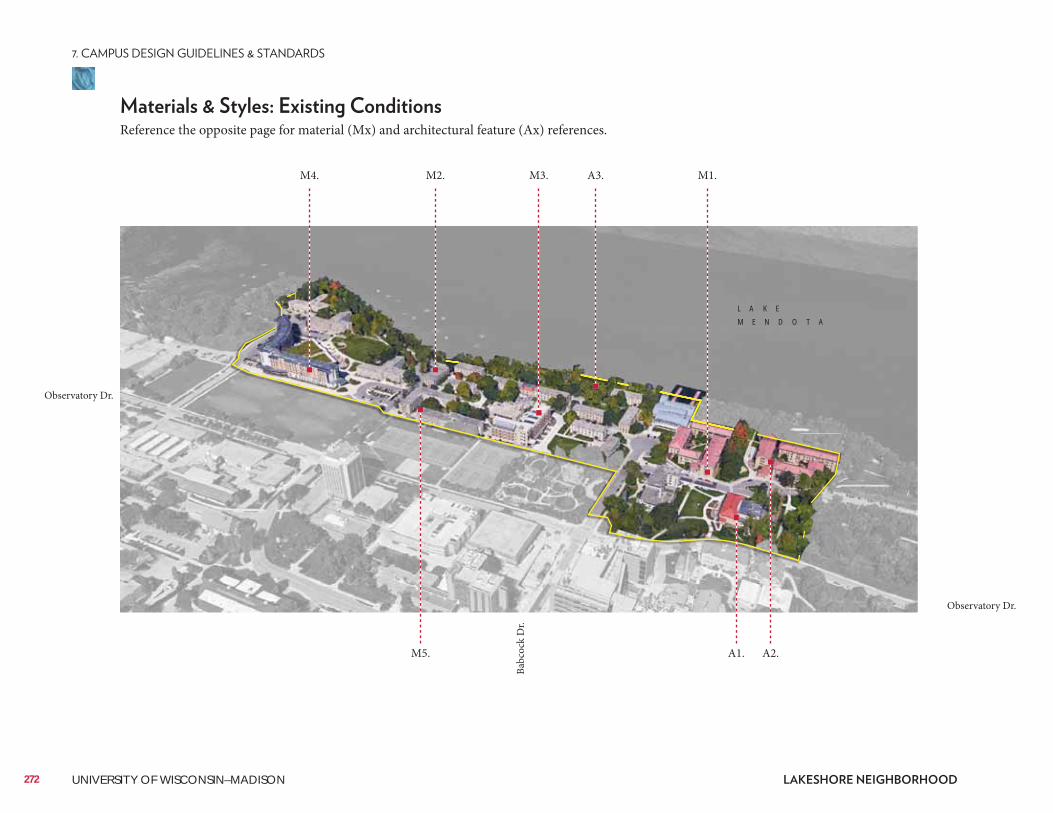
272 UNIVERSITY OF WISCONSIN–MADISON
Reference the opposite page for material (Mx) and architectural feature (Ax) references.
M1.A3.M2.M4. M3.
M5. A1. A2.
L A K E
M E N D O T A
Observatory Dr.
Observatory Dr.
Babc
ock
Dr.
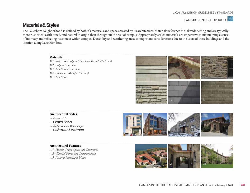
Materials & StylesThe Lakeshore Neighborhood is defined by both it’s materials and spaces created by its architecture. Materials reference the lakeside setting and are typically more rusticated, earth toned, and natural in origin than throughout the rest of campus. Appropriately scaled materials are imperative to maintaining a sense of intimacy and reflecting its context within campus. Durability and weathering are also important considerations due to the users of these buildings and the location along Lake Mendota.
Materials
2.1.
3.
1. 2. 3.
4. 5.
Architectural Styles
– Classical Revival
– Environmental Modernism
Architectural Features
273
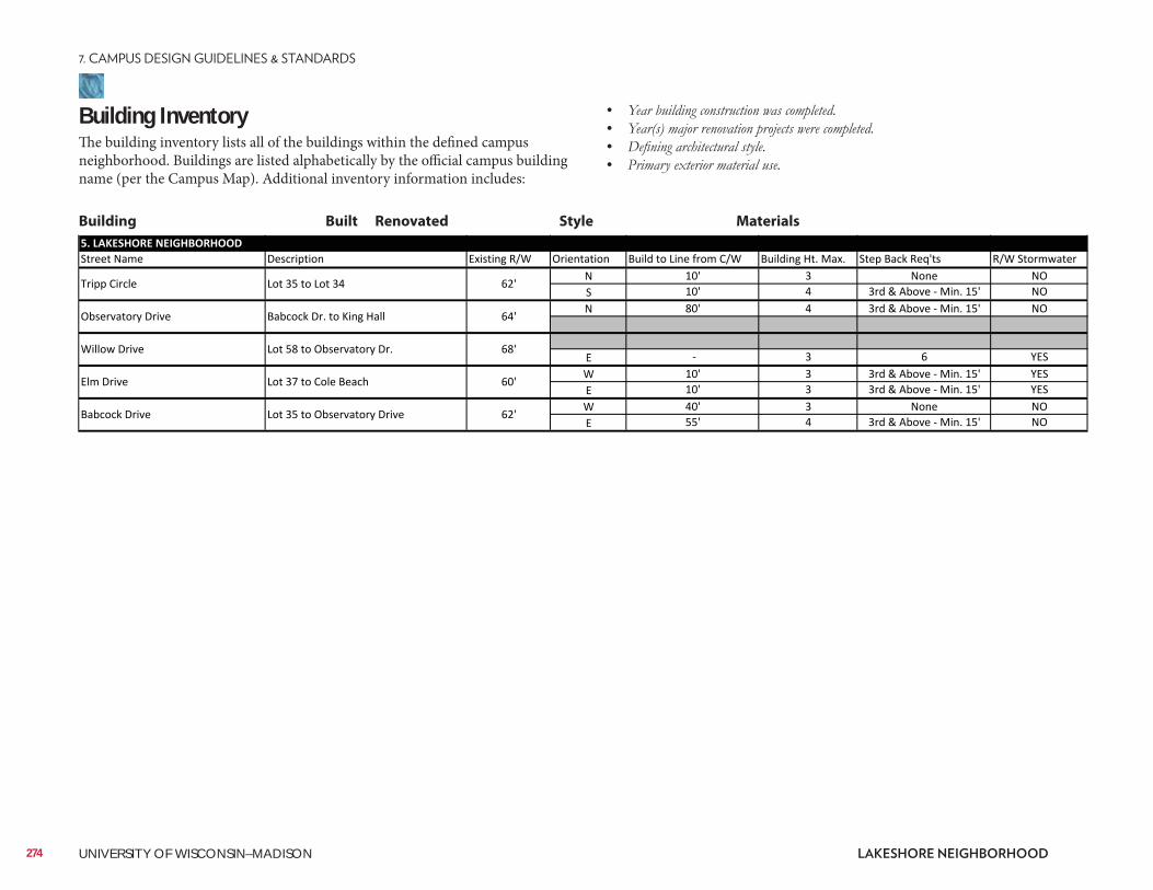
Building InventoryThe building inventory lists all of the buildings within the defined campus neighborhood. Buildings are listed alphabetically by the official campus building name (per the Campus Map). Additional inventory information includes:
• • • •
Building Built Renovated Style Materials
274 UNIVERSITY OF WISCONSIN–MADISON
ConsiderationsConsiderations include information related to the planning, design, and approval of a typical building and/or landscape architecture campus project. It is to be reviewed as a resource identifying locations of materials that UW project teams reference most often. Not all projects will require each identified item. All projects should review the reference list and determine with the UW project manager applicability to the project.
Site Amenities & Vegetation• 2015 Landscape Development Standards• Division of Facilities Development Master Specifications–Division 32• UW-Madison Technical Guidelines–Division 32
Past Plans• 2006 Lakeshore Nature Preserve Master Plan• 2006 UW Housing Facilities Master Plan
• University Bay Restoration• Tree Canopy Preservation
• Friends of Lakeshore Nature Preserve
Historical and Cultural Resources• 2005 Cultural Landscape Report• Historic Property Review Requirements• Archaeological Site Review Requirements
Well Head District/Locations• City of Madison Unit Well 27 (N. Randall Ave. & Bike Path)
City of Madison Zoning (Chapter 28)• Campus Institutional District (C-I)
275
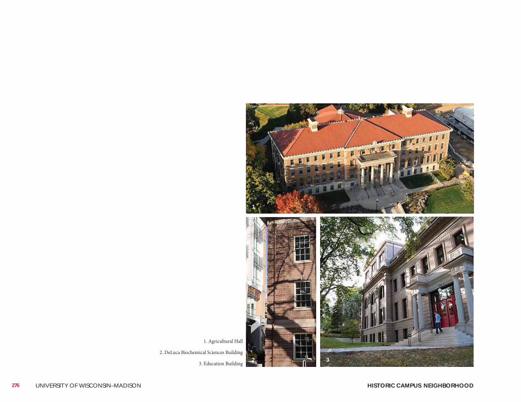
276 UNIVERSITY OF WISCONSIN–MADISON HISTORIC CAMPUS NEIGHBORHOOD
1. Agricultural Hall
2. DeLuca Biochemical Sciences Building
3. Education Building
1
2 3
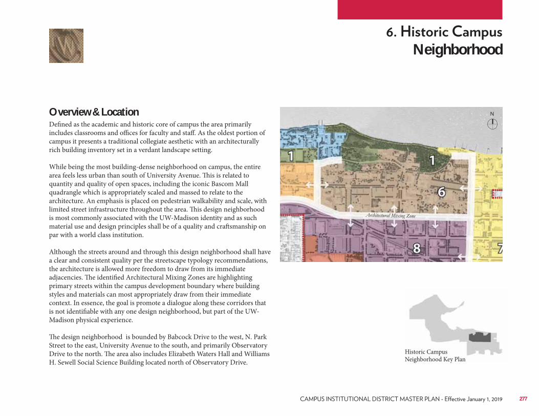
Neighborhood
Overview & LocationDefined as the academic and historic core of campus the area primarily includes classrooms and offices for faculty and staff. As the oldest portion of campus it presents a traditional collegiate aesthetic with an architecturally rich building inventory set in a verdant landscape setting. While being the most building-dense neighborhood on campus, the entire area feels less urban than south of University Avenue. This is related to quantity and quality of open spaces, including the iconic Bascom Mall quadrangle which is appropriately scaled and massed to relate to the architecture. An emphasis is placed on pedestrian walkability and scale, with limited street infrastructure throughout the area. This design neighborhood is most commonly associated with the UW-Madison identity and as such material use and design principles shall be of a quality and craftsmanship on par with a world class institution. Although the streets around and through this design neighborhood shall have a clear and consistent quality per the streetscape typology recommendations, the architecture is allowed more freedom to draw from its immediate adjacencies. The identified Architectural Mixing Zones are highlighting primary streets within the campus development boundary where building styles and materials can most appropriately draw from their immediate context. In essence, the goal is promote a dialogue along these corridors that is not identifiable with any one design neighborhood, but part of the UW-Madison physical experience. The design neighborhood is bounded by Babcock Drive to the west, N. Park Street to the east, University Avenue to the south, and primarily Observatory Drive to the north. The area also includes Elizabeth Waters Hall and Williams H. Sewell Social Science Building located north of Observatory Drive.
Historic Campus Neighborhood Key Plan
277
N
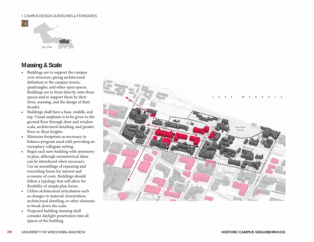
Massing & Scale• Buildings are to support the campus
civic structure, giving architectural definition to the campus streets, quadrangles, and other open spaces. Buildings are to front directly onto these spaces and to support them by their form, massing, and the design of their facades.
• Buildings shall have a base, middle, and top. Visual emphasis is to be given to the ground floor through door and window scale, architectural detailing, and greater floor-to-floor heights.
• Minimize footprints as necessary to balance program need with providing an exemplary collegiate setting.
• Begin each new building with symmetry in plan, although asymmetrical ideas can be introduced when necessary. Use an assemblage of repeating and overriding forms for interest and economy of costs. Buildings should follow a typology that will allow for flexibility of simple plan forms.
• Utilize architectural articulation such as changes in material, fenestration, architectural detailing, or other elements to break down the scale.
• Proposed building massing shall consider daylight penetration into all spaces of the building.
Babc
ock D
r.
N. C
harte
r St.N. R
anda
ll Ave
.
Observatory Dr.
University Ave.
W. Johnson St.
John Muir Woods
Bascom Hill
N. P
ark S
t.
L A K E M E N D O T A
278 UNIVERSITY OF WISCONSIN–MADISON HISTORIC CAMPUS NEIGHBORHOOD
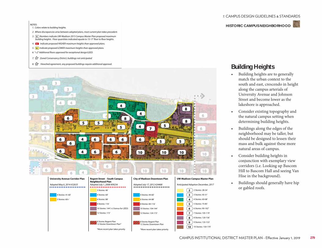
NOTES: 1. Colors relate to building heights.
2. Where discrepancies arise between adopted plans, most current plan takes precedent.
3. Numbers indicate UW-Madison 2015 Campus Master Plan proposed maximum building heights. Floor quantities indicated equate to 15-17’ floor to floor heights.
4. Indicate proposed HIGHER maximum heights than approved plans.
5. Indicate proposed LOWER maximum heights than approved plans.
6. “+2” Additional floors approved for exceptional design/LEED.
7. 1 Zoned Conservancy District, buildings not anticipated
8. 2 Viewshed agreement, any proposed buildings require additional approval.
x
**
x
x
Regent Street - South Campus
Neighborhood Plan
Adopted July 1, 2008 #09234
City of Madison Downtown Plan
Adopted July 17, 2012 #24468
UW-Madison Campus Master Plan
Anticipated Adoption December, 2017
University Avenue Corridor Plan
Adopted May 6, 2014 #32635
4 Stories: 41-60’
3 Stories: 46’
6 Stories: 88’ 6 Stories: 64-88’
3 Stories: 45-51’
7 Stories: 105-119’
10 Stories: 144’ (+2 bonus for LEED) 10 Stories: 104-144’
5 Stories: 75-85’
9 Stories: 135-153’
5 Stories: 60+’
4 Stories: 60’ 4 Stories: 44-60’
2 Stories: 28-34’
8 Stories: 116’ 8 Stories: 84-116’
4 Stories: 60-68’
8 Stories: 120-136’
12 Stories: 172’
8 Stories Regent Plan 12 Stories Downtown Plan*
*More recent plan takes priority
8 Stories Regent Plan 12 Stories Downtown Plan
*More recent plan takes priority
12 Stories: 124-172’
6 Stories: 90-102’’
10 Stories: 150-170’
2
3
7
4
8
5
9
6
10
Building Heights• Building heights are to generally
match the urban context to the south and east, crescendo in height along the campus arterials of University Avenue and Johnson Street and become lower as the lakeshore is approached.
• Consider existing topography and the natural campus setting when determining building heights.
• Buildings along the edges of the neighborhood may be taller, but should be designed to lessen their mass and bulk against these more natural areas of campus.
• Consider building heights in conjunction with exemplary view corridors (i.e. Looking up Bascom Hill to Bascom Hall and seeing Van Hise in the background).
• Buildings should generally have hip or gabled roofs.
279
HISTORIC CAMPUS NEIGHBORHOOD
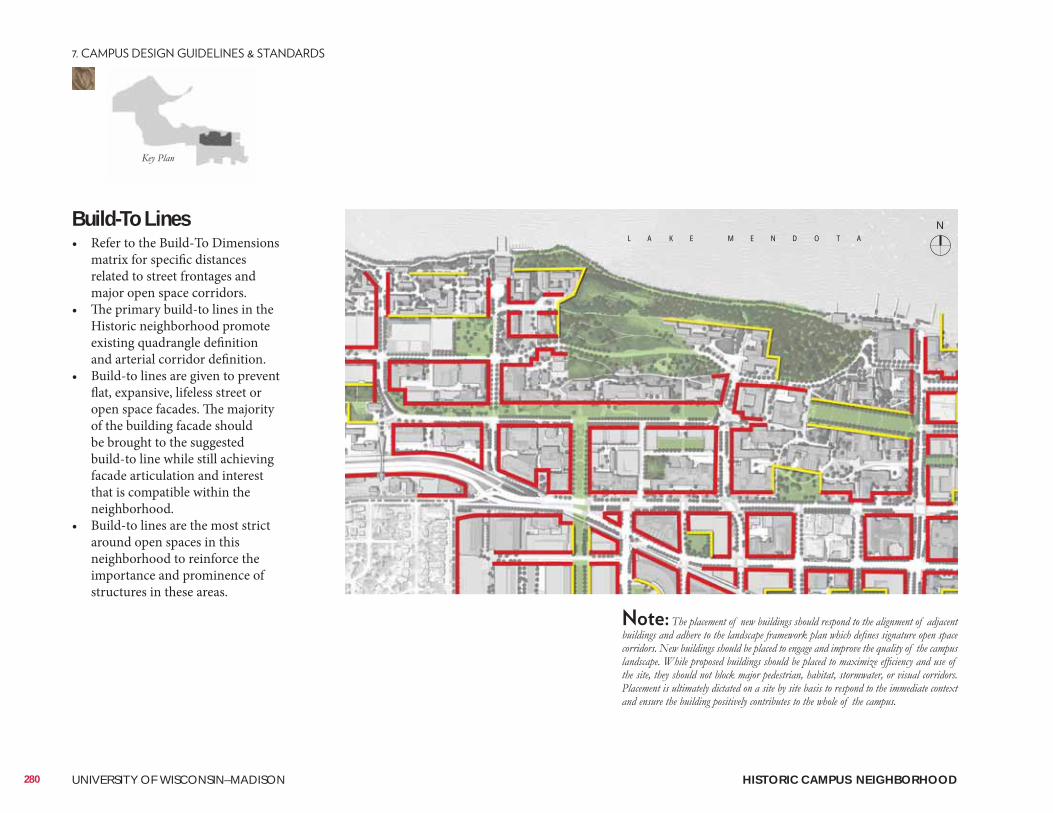
Build-To Lines• Refer to the Build-To Dimensions
matrix for specific distances related to street frontages and major open space corridors.
• The primary build-to lines in the Historic neighborhood promote existing quadrangle definition and arterial corridor definition.
• Build-to lines are given to prevent flat, expansive, lifeless street or open space facades. The majority of the building facade should be brought to the suggested build-to line while still achieving facade articulation and interest that is compatible within the neighborhood.
• Build-to lines are the most strict around open spaces in this neighborhood to reinforce the importance and prominence of structures in these areas.
280 UNIVERSITY OF WISCONSIN–MADISON HISTORIC CAMPUS NEIGHBORHOOD
NL A K E M E N D O T A
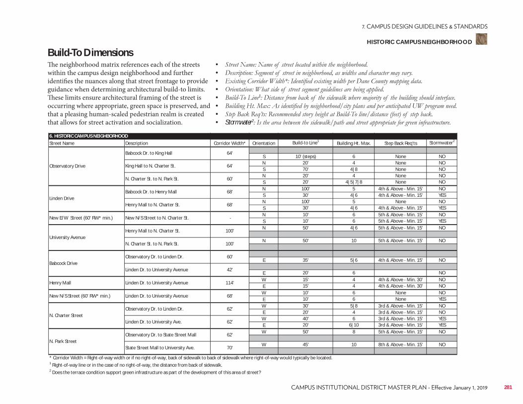
6. HISTORIC CAMPUS NEIGHBORHOODStreet Name Description Corridor Width* Orientation Build to Line1 Building Ht. Max. Step Back Req'ts Stormwater2
S 10' (steps) 6 None NON 20' 4 None NOS 70' 4|8 None NON 20' 4 None NOS 20' 4|5|7|8 None NON 100' 5 4th & Above Min. 15' NOS 30' 4|6 4th & Above Min. 15' YESN 100' 5 None NOS 30' 4|6 4th & Above Min. 15' YESN 10' 6 5th & Above Min. 15' NOS 10' 6 5th & Above Min. 15' YESN 50' 4|6 5th & Above Min. 15' NO
N 50' 10 5th & Above Min. 15' NO
E 35' 5|6 4th & Above Min. 15' NO
E 20' 6 NOW 15' 4 4th & Above Min. 30' NOE 15' 4 4th & Above Min. 30' NOW 10' 6 None NOE 10' 6 None YESW 30' 5|8 3rd & Above Min. 15' NOE 20' 4 3rd & Above Min. 15' NOW 40' 6 3rd & Above Min. 15' YESE 20' 6|10 3rd & Above Min. 15' YESW 50' 8 5th & Above Min. 15' NO
W 45' 10 8th & Above Min. 15' NO
* Corridor Width = Right of way width or if no right of way, back of sidewalk to back of sidewalk where right of way would typically be located.1 Right of way line or in the case of no right of way, the distance from back of sidewalk.2 Does the terrace condition support green infrastructure as part of the development of this area of street?
N. Charter StreetObservatory Dr. to Linden Dr. 62'
Linden Dr. to University Ave. 62'
N. Park StreetObservatory Dr. to State Street Mall 62'
State Street Mall to University Ave. 70'
Henry Mall Linden Dr. to University Avenue 114'
New N/S Street (60' RW* min.) Linden Dr. to University Avenue 68'
University AvenueHenry Mall to N. Charter St. 100'
N. Charter St. to N. Park St. 100'
Babcock DriveObservatory Dr. to Linden Dr. 60'
Linden Dr. to University Avenue 42'
Linden DriveBabcock Dr. to Henry Mall 68'
Henry Mall to N. Charter St. 68'
New E/W Street (60' RW* min.) New N/S Street to N. Charter St.
Observatory Drive
Babcock Dr. to King Hall 64'
King Hall to N. Charter St. 64'
N. Charter St. to N. Park St. 60'
Build-To DimensionsThe neighborhood matrix references each of the streets within the campus design neighborhood and further identifies the nuances along that street frontage to provide guidance when determining architectural build-to limits. These limits ensure architectural framing of the street is occurring where appropriate, green space is preserved, and that a pleasing human-scaled pedestrian realm is created that allows for street activation and socialization.
• • • • • 1
• • • Stormwater2
281
HISTORIC CAMPUS NEIGHBORHOOD
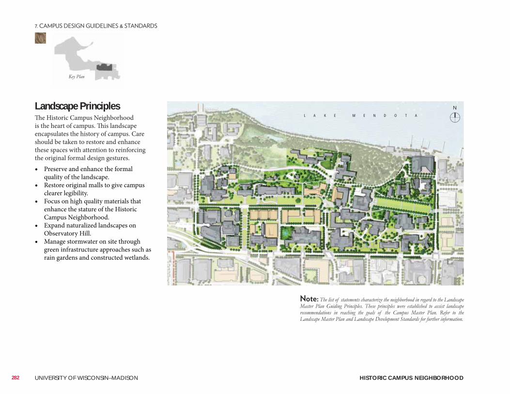
Landscape PrinciplesThe Historic Campus Neighborhood is the heart of campus. This landscape encapsulates the history of campus. Care should be taken to restore and enhance these spaces with attention to reinforcing the original formal design gestures.• Preserve and enhance the formal
quality of the landscape.• Restore original malls to give campus
clearer legibility.• Focus on high quality materials that
enhance the stature of the Historic Campus Neighborhood.
• Expand naturalized landscapes on Observatory Hill.
• Manage stormwater on site through green infrastructure approaches such as rain gardens and constructed wetlands.
L A K E M E N D O T A
282 UNIVERSITY OF WISCONSIN–MADISON HISTORIC CAMPUS NEIGHBORHOOD
N
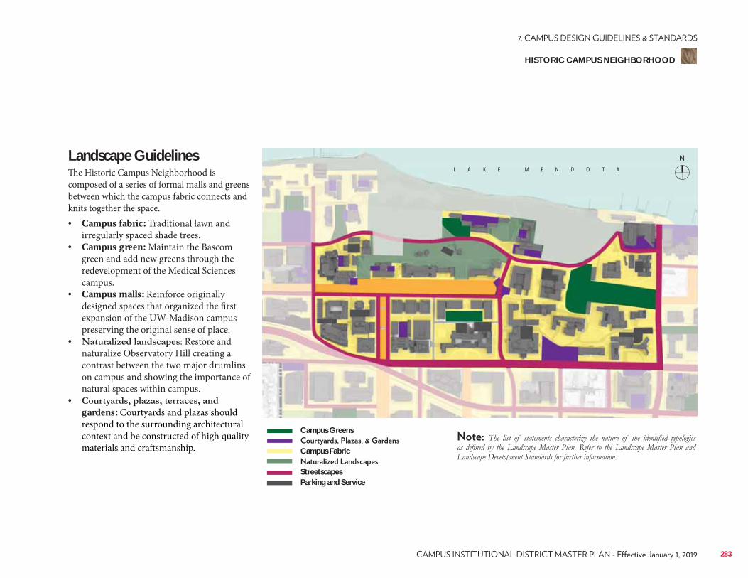
Landscape Guidelines The Historic Campus Neighborhood is composed of a series of formal malls and greens between which the campus fabric connects and knits together the space.• Campus fabric: Traditional lawn and
irregularly spaced shade trees.• Campus green: Maintain the Bascom
green and add new greens through the redevelopment of the Medical Sciences campus.
• Campus malls: Reinforce originally designed spaces that organized the first expansion of the UW-Madison campus preserving the original sense of place.
• : Restore and naturalize Observatory Hill creating a contrast between the two major drumlins on campus and showing the importance of natural spaces within campus.
• gardens: Courtyards and plazas should respond to the surrounding architectural context and be constructed of high quality materials and craftsmanship.
L A K E M E N D O T A
Campus Greens
Campus Fabric
StreetscapesParking and Service
283
HISTORIC CAMPUS NEIGHBORHOOD
N
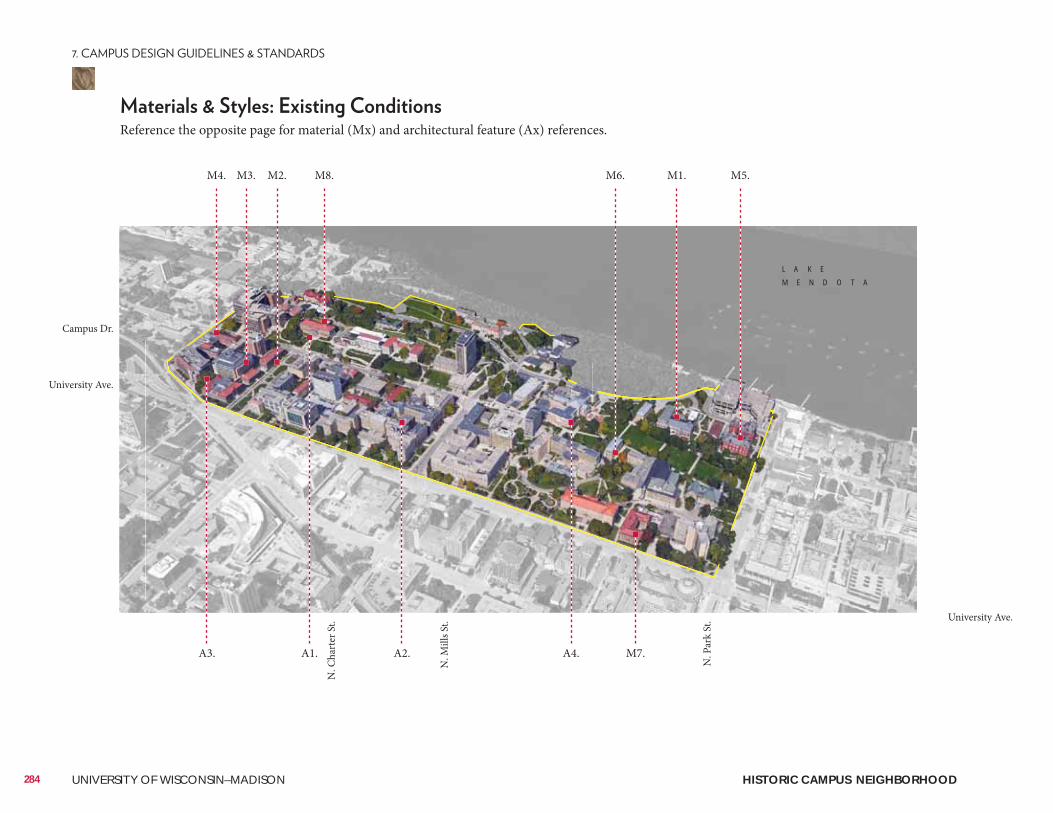
284 UNIVERSITY OF WISCONSIN–MADISON
Reference the opposite page for material (Mx) and architectural feature (Ax) references.
M1. M5.M4. M3. M2. M8. M6.
A1. A2.A3. A4. M7.
L A K E
M E N D O T A
University Ave.
N. P
ark
St.
N. C
hart
er S
t.
N. M
ills S
t.
University Ave.
Campus Dr.
HISTORIC CAMPUS NEIGHBORHOOD
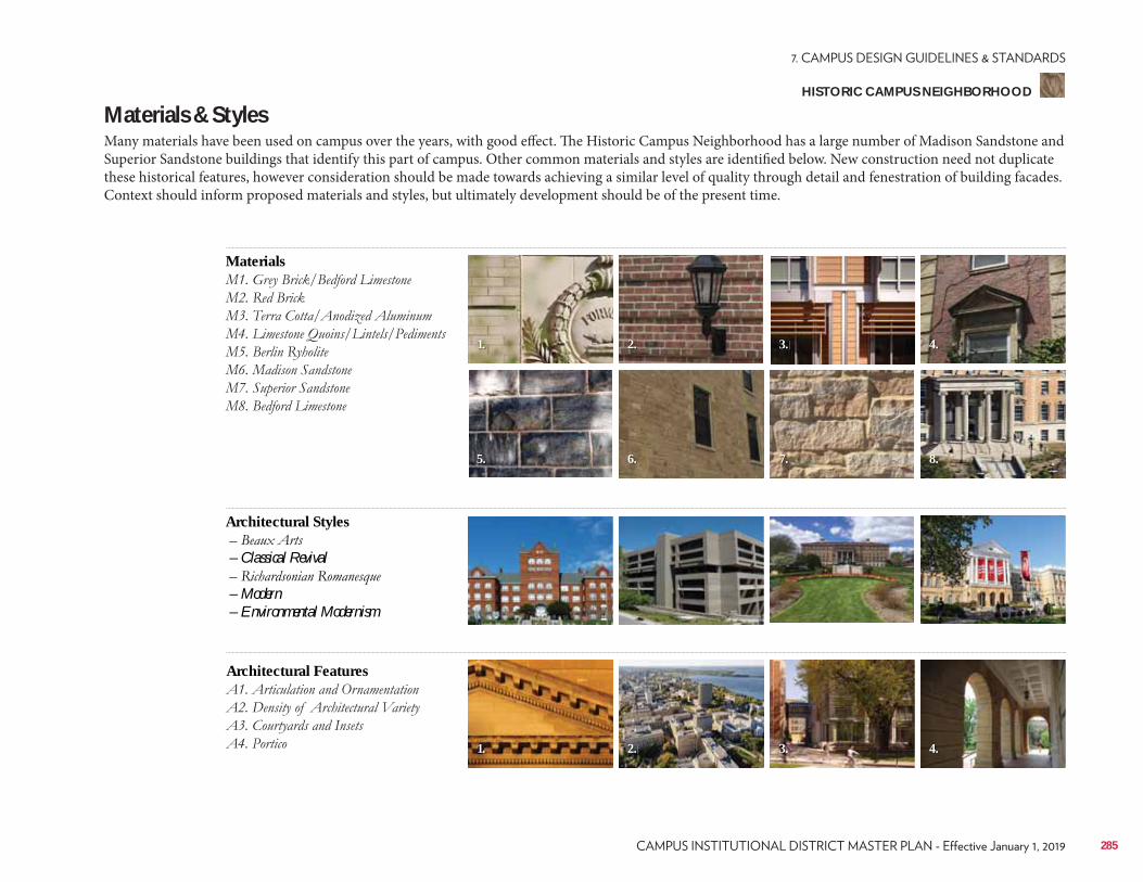
Materials & StylesMany materials have been used on campus over the years, with good effect. The Historic Campus Neighborhood has a large number of Madison Sandstone and Superior Sandstone buildings that identify this part of campus. Other common materials and styles are identified below. New construction need not duplicate these historical features, however consideration should be made towards achieving a similar level of quality through detail and fenestration of building facades. Context should inform proposed materials and styles, but ultimately development should be of the present time.
Materials
Architectural Features
Architectural Styles
– Classical Revival
– Modern – Environmental Modernism
2.
6.
1.
5.
3. 4.
8.7.
2.1. 3. 4.
285
HISTORIC CAMPUS NEIGHBORHOOD
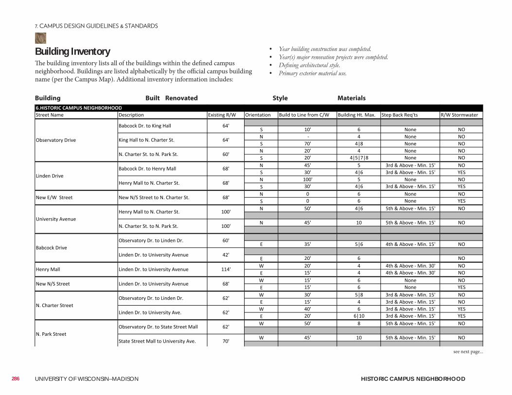
Building InventoryThe building inventory lists all of the buildings within the defined campus neighborhood. Buildings are listed alphabetically by the official campus building name (per the Campus Map). Additional inventory information includes:
• • • •
Building Built Renovated Style Materials
286 UNIVERSITY OF WISCONSIN–MADISON HISTORIC CAMPUS NEIGHBORHOOD
see next page...
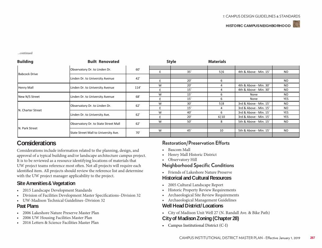
Building Built Renovated Style Materials
...continued
ConsiderationsConsiderations include information related to the planning, design, and approval of a typical building and/or landscape architecture campus project. It is to be reviewed as a resource identifying locations of materials that UW project teams reference most often. Not all projects will require each identified item. All projects should review the reference list and determine with the UW project manager applicability to the project.
Site Amenities & Vegetation• 2015 Landscape Development Standards• Division of Facilities Development Master Specifications–Division 32• UW-Madison Technical Guidelines–Division 32Past Plans• 2006 Lakeshore Nature Preserve Master Plan• 2006 UW Housing Facilities Master Plan• 2016 Letters & Science Facilities Master Plan
• Bascom Mall• Henry Mall Historic District• Observatory Hill
• Friends of Lakeshore Nature PreserveHistorical and Cultural Resources• 2005 Cultural Landscape Report• Historic Property Review Requirements• Archaeological Site Review Requirements• Archaeological Management GuidelinesWell Head District/Locations• City of Madison Unit Well 27 (N. Randall Ave. & Bike Path)City of Madison Zoning (Chapter 28)• Campus Institutional District (C-I)
287
HISTORIC CAMPUS NEIGHBORHOOD
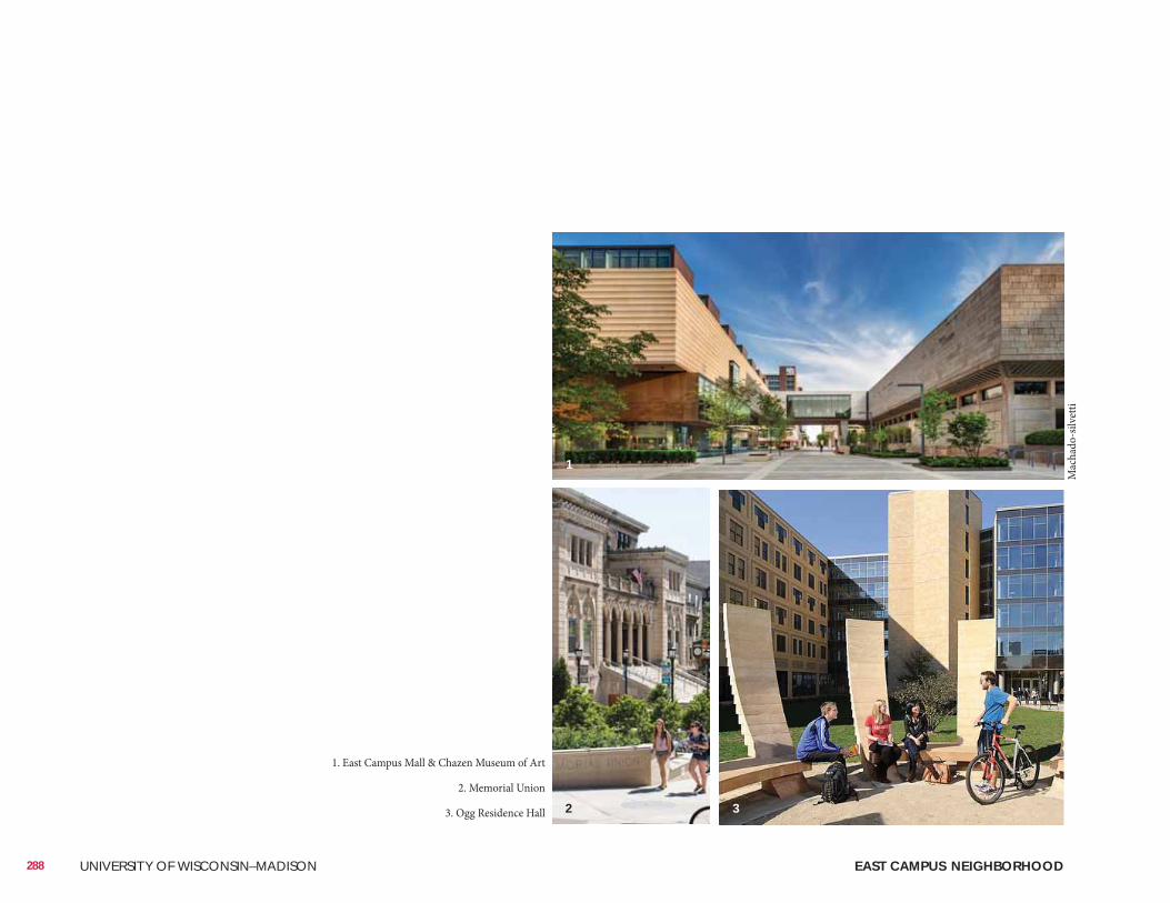
288 UNIVERSITY OF WISCONSIN–MADISON EAST CAMPUS NEIGHBORHOOD
1. East Campus Mall & Chazen Museum of Art
2. Memorial Union
3. Ogg Residence Hall
Mac
hado
-silv
etti
1
2 3
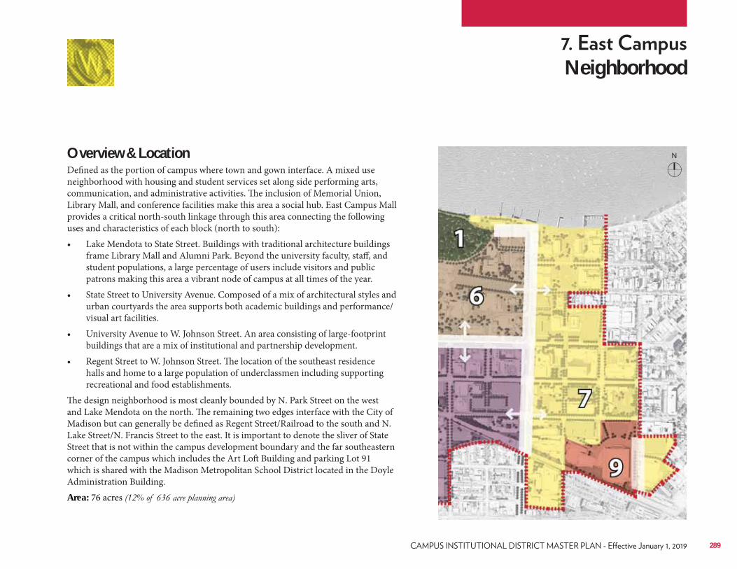
Neighborhood
Overview & LocationDefined as the portion of campus where town and gown interface. A mixed use neighborhood with housing and student services set along side performing arts, communication, and administrative activities. The inclusion of Memorial Union, Library Mall, and conference facilities make this area a social hub. East Campus Mall provides a critical north-south linkage through this area connecting the following uses and characteristics of each block (north to south):• Lake Mendota to State Street. Buildings with traditional architecture buildings
frame Library Mall and Alumni Park. Beyond the university faculty, staff, and student populations, a large percentage of users include visitors and public patrons making this area a vibrant node of campus at all times of the year.
• State Street to University Avenue. Composed of a mix of architectural styles and urban courtyards the area supports both academic buildings and performance/visual art facilities.
• University Avenue to W. Johnson Street. An area consisting of large-footprint buildings that are a mix of institutional and partnership development.
• Regent Street to W. Johnson Street. The location of the southeast residence halls and home to a large population of underclassmen including supporting recreational and food establishments.
The design neighborhood is most cleanly bounded by N. Park Street on the west and Lake Mendota on the north. The remaining two edges interface with the City of Madison but can generally be defined as Regent Street/Railroad to the south and N. Lake Street/N. Francis Street to the east. It is important to denote the sliver of State Street that is not within the campus development boundary and the far southeastern corner of the campus which includes the Art Loft Building and parking Lot 91 which is shared with the Madison Metropolitan School District located in the Doyle Administration Building. Area: 76 acres
289
N
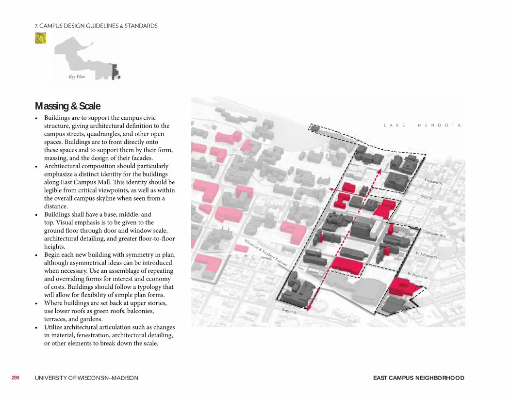
Massing & Scale• Buildings are to support the campus civic
structure, giving architectural definition to the campus streets, quadrangles, and other open spaces. Buildings are to front directly onto these spaces and to support them by their form, massing, and the design of their facades.
• Architectural composition should particularly emphasize a distinct identity for the buildings along East Campus Mall. This identity should be legible from critical viewpoints, as well as within the overall campus skyline when seen from a distance.
• Buildings shall have a base, middle, and top. Visual emphasis is to be given to the ground floor through door and window scale, architectural detailing, and greater floor-to-floor heights.
• Begin each new building with symmetry in plan, although asymmetrical ideas can be introduced when necessary. Use an assemblage of repeating and overriding forms for interest and economy of costs. Buildings should follow a typology that will allow for flexibility of simple plan forms.
• Where buildings are set back at upper stories, use lower roofs as green roofs, balconies, terraces, and gardens.
• Utilize architectural articulation such as changes in material, fenestration, architectural detailing, or other elements to break down the scale.
290 UNIVERSITY OF WISCONSIN–MADISON
University Ave.
W. Johnson St.
W. Dayton St.
Regent St.
Langdon St.
State St.
Wisconsin & Southern Railroad
EAST CAMPUS NEIGHBORHOOD
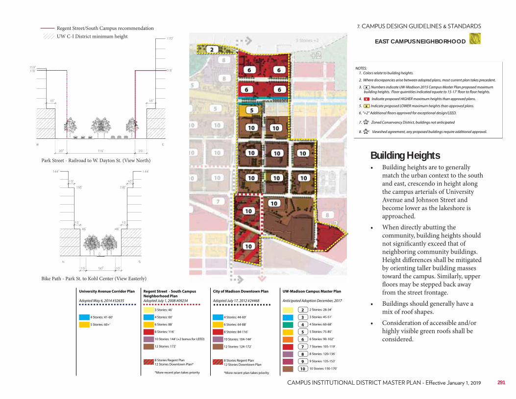
Regent Street - South Campus
Neighborhood Plan
Adopted July 1, 2008 #09234
City of Madison Downtown Plan
Adopted July 17, 2012 #24468
UW-Madison Campus Master Plan
Anticipated Adoption December, 2017
University Avenue Corridor Plan
Adopted May 6, 2014 #32635
4 Stories: 41-60’
3 Stories: 46’
6 Stories: 88’ 6 Stories: 64-88’
3 Stories: 45-51’
7 Stories: 105-119’
10 Stories: 144’ (+2 bonus for LEED) 10 Stories: 104-144’
5 Stories: 75-85’
9 Stories: 135-153’
5 Stories: 60+’
4 Stories: 60’ 4 Stories: 44-60’
2 Stories: 28-34’
8 Stories: 116’ 8 Stories: 84-116’
4 Stories: 60-68’
8 Stories: 120-136’
12 Stories: 172’
8 Stories Regent Plan 12 Stories Downtown Plan*
*More recent plan takes priority
8 Stories Regent Plan 12 Stories Downtown Plan
*More recent plan takes priority
12 Stories: 124-172’
6 Stories: 90-102’’
10 Stories: 150-170’
2
3
7
4
8
5
9
6
10
NOTES: 1. Colors relate to building heights.
2. Where discrepancies arise between adopted plans, most current plan takes precedent.
3. Numbers indicate UW-Madison 2015 Campus Master Plan proposed maximum building heights. Floor quantities indicated equate to 15-17’ floor to floor heights.
4. Indicate proposed HIGHER maximum heights than approved plans.
5. Indicate proposed LOWER maximum heights than approved plans.
6. “+2” Additional floors approved for exceptional design/LEED.
7. 1 Zoned Conservancy District, buildings not anticipated
8. 2 Viewshed agreement, any proposed buildings require additional approval.
x
**
x
x
Building Heights• Building heights are to generally
match the urban context to the south and east, crescendo in height along the campus arterials of University Avenue and Johnson Street and become lower as the lakeshore is approached.
• When directly abutting the community, building heights should not significantly exceed that of neighboring community buildings. Height differences shall be mitigated by orienting taller building masses toward the campus. Similarly, upper floors may be stepped back away from the street frontage.
• Buildings should generally have a mix of roof shapes.
• Consideration of accessible and/or highly visible green roofs shall be considered.
291
Park Street - Railroad to W. Dayton St. (View North)
Bike Path - Park St. to Kohl Center (View Easterly)
Regent Street/South Campus recommendationUW C-I District minimum height
EAST CAMPUS NEIGHBORHOOD
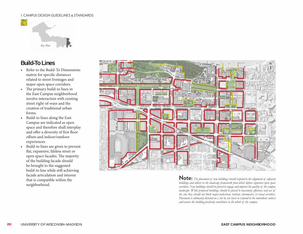
Build-To Lines• Refer to the Build-To Dimensions
matrix for specific distances related to street frontages and major open space corridors.
• The primary build-to lines in the East Campus neighborhood involve interaction with existing street right-of-ways and the creation of traditional urban forms.
• Build-to lines along the East Campus are indicated as open space and therefore shall interplay and offer a diversity of first floor offsets and indoor/outdoor experiences.
• Build-to lines are given to prevent flat, expansive, lifeless street or open space facades. The majority of the building facade should be brought to the suggested build-to line while still achieving facade articulation and interest that is compatible within the neighborhood.
292 UNIVERSITY OF WISCONSIN–MADISON EAST CAMPUS NEIGHBORHOOD
N
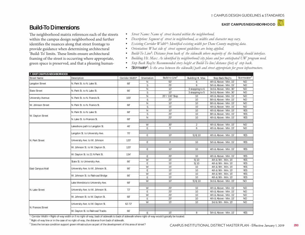
7. EAST CAMPUS NEIGHBORHOODStreet Name Description Corridor Width* Orientation Build to Line1 Building Ht. Max. Step Back Req'ts Stormwater2
N 50' 6 4th & Above Min. 15' NOS 25' 6 5th & Above Min. 15' NON 10' 3 stepping to 6 3rd & Above Min. 30' NOS 10' 3 stepping to 5 3rd & Above Min. 30' NON 20' / 100' Step 10 4th & Above Min. 15' NOS 20' 10 8th & Above Min. 15' NON 10' 10 8th & Above Min. 15' NOS 15' 10 4th & Above Min. 15' NON 10' 10 4th & Above Min. 15' YESS 20' 10 8th & Above Min. 15' YESN 20' 10 4th & Above Min. 15' YES
W 30' 2 4th & Above Min. 15' NOE 5' 6 4th & Above Min. 15' NO
E 10' 5|6|10 4th & Above Min. 15' YES
E 0' 10 5th & Above Min. 15' YES
E 10' 10 4th & Above Min. 15' YES
E 20' 10 4th & Above Min. 15' YESW 15' 5|10 4th & 9th Min. 15' YESE 15' 5|10 4th & 9th Min. 15' YESW 15' 10 4th & 9th Min. 15' YESE 15' 10 4th & 9th Min. 15' YESW 15' 10 4th & 9th Min. 15' YESE 15' 10 4th & 9th Min. 15' YESW 10' 5|6|10 3rd & Above Min. 15' NO
W 20' 10 4th & Above Min. 15' NOE 20' 10 4th & Above Min. 15' NOW 20' 10 4th & Above Min. 15' NOE 20' 10 4th & Above Min. 15' NOW 15' 10 3rd & 9th Min. 15' NO
E 15' 8 5th & Above Min. 15' YES* Corridor Width = Right of way width or if no right of way, back of sidewalk to back of sidewalk where right of way would typically be located.1 Right of way line or in the case of no right of way, the distance from back of sidewalk.2 Does the terrace condition support green infrastructure as part of the development of this area of street?
W. Johnson Street N. Park St. to N. Franics St. 68'
W. Dayton StreetN. Park St. to N. Lake St. 68'
N. Lake St. to Frances St. 68'
Langdon Street N. Park St. to N. Lake St. 68'
University Avenue N. Park St. to N. Francis St. 100'
State Street N. Park St. to N. Lake St. 66'
134'
East Campus Mall
State St. to University Ave. 66'
University Ave. to W. Johnson St. 66'
W. Johnson St. to Railroad Bridge 66'
N. Park Street
Lakeshore path to Langdon St. 46'
Langdon St. to University Ave. 70'
University Ave. to W. Johnson 120'
W. Johnson St. to W. Dayton St. 120'
W. Dayton St. to 21 N Park St.
N. Frances StreetUniversity Ave. to W. Dayton St. 62 72'
W. Dayton St. to Railroad Tracks 66'
N. Lake Street
Lake Mendota to University Ave. 68'
University Ave. to W. Johnson St. 72'
W. Johnson St. to W. Dayton St. 68'
Build-To DimensionsThe neighborhood matrix references each of the streets within the campus design neighborhood and further identifies the nuances along that street frontage to provide guidance when determining architectural ‘Build-To’ limits. These limits ensure architectural framing of the street is occurring where appropriate, green space is preserved, and that a pleasing human-
• • • • • 1
• • • Stormwater2
293
EAST CAMPUS NEIGHBORHOOD
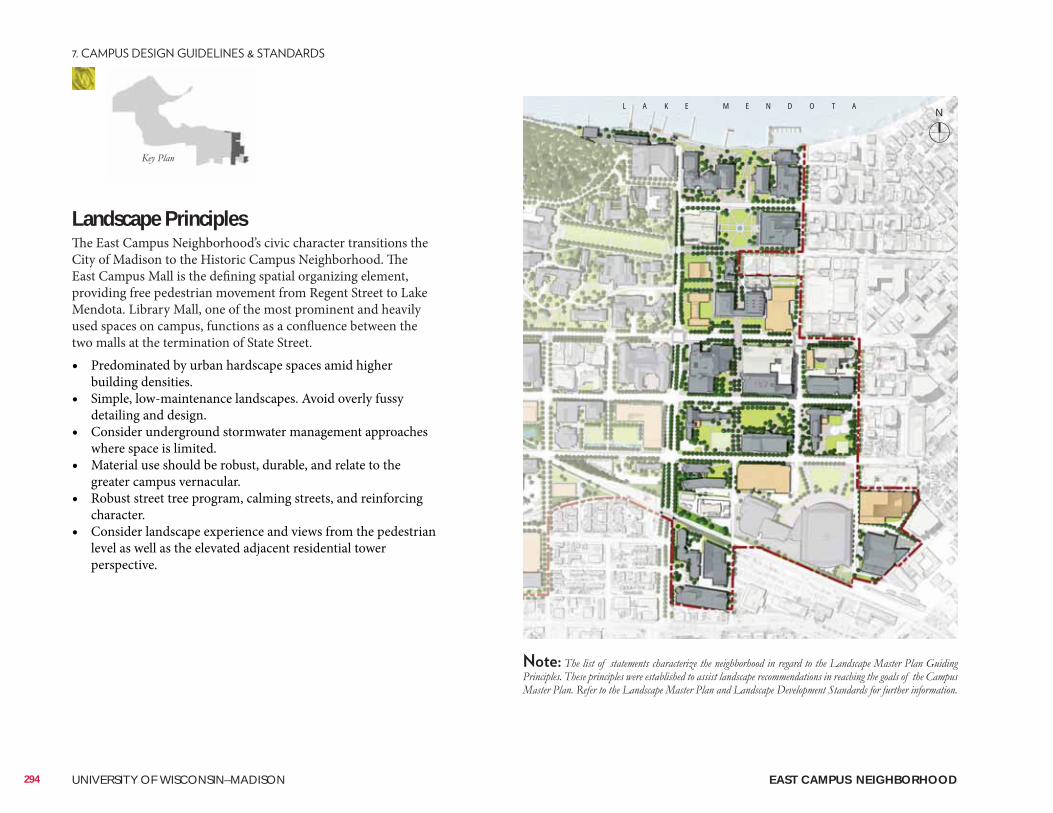
Landscape Principles The East Campus Neighborhood’s civic character transitions the City of Madison to the Historic Campus Neighborhood. The East Campus Mall is the defining spatial organizing element, providing free pedestrian movement from Regent Street to Lake Mendota. Library Mall, one of the most prominent and heavily used spaces on campus, functions as a confluence between the two malls at the termination of State Street. • Predominated by urban hardscape spaces amid higher
building densities.• Simple, low-maintenance landscapes. Avoid overly fussy
detailing and design.• Consider underground stormwater management approaches
where space is limited. • Material use should be robust, durable, and relate to the
greater campus vernacular. • Robust street tree program, calming streets, and reinforcing
character.• Consider landscape experience and views from the pedestrian
level as well as the elevated adjacent residential tower perspective.
L A K E M E N D O T A
294 UNIVERSITY OF WISCONSIN–MADISON EAST CAMPUS NEIGHBORHOOD
N
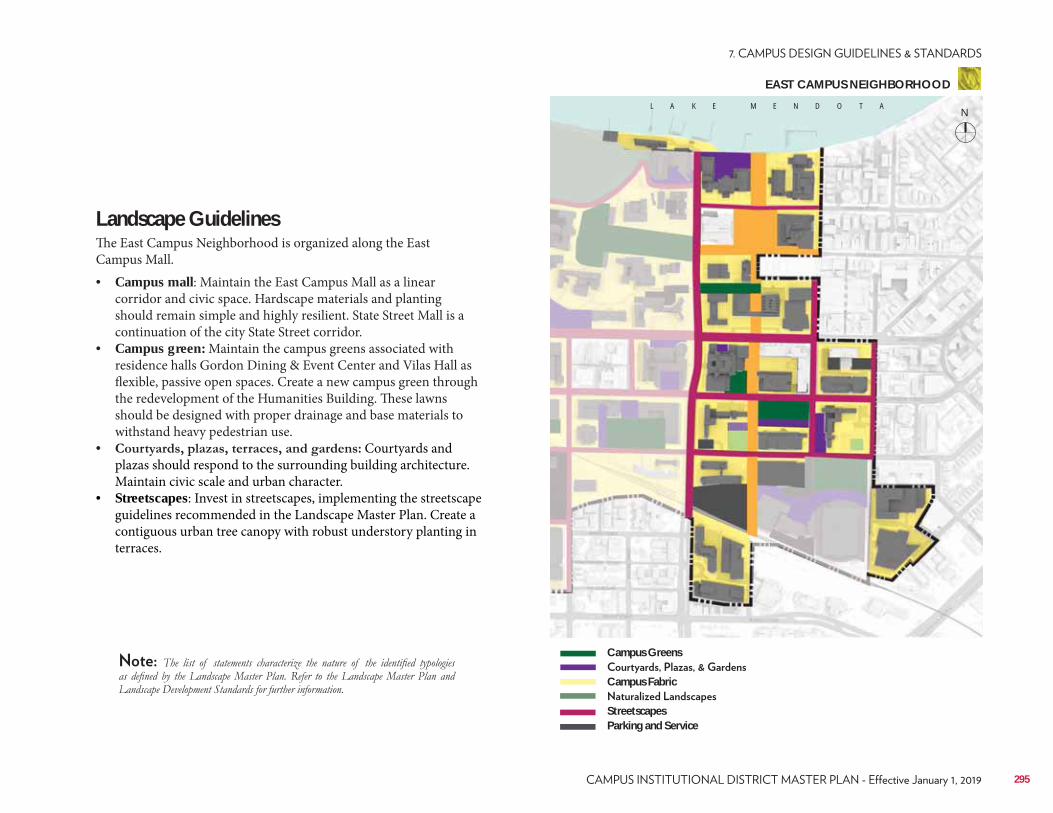
Landscape GuidelinesThe East Campus Neighborhood is organized along the East Campus Mall.• Campus mall: Maintain the East Campus Mall as a linear
corridor and civic space. Hardscape materials and planting should remain simple and highly resilient. State Street Mall is a continuation of the city State Street corridor.
• Campus green: Maintain the campus greens associated with residence halls Gordon Dining & Event Center and Vilas Hall as flexible, passive open spaces. Create a new campus green through the redevelopment of the Humanities Building. These lawns should be designed with proper drainage and base materials to withstand heavy pedestrian use.
• Courtyards and plazas should respond to the surrounding building architecture. Maintain civic scale and urban character.
• Streetscapes: Invest in streetscapes, implementing the streetscape guidelines recommended in the Landscape Master Plan. Create a contiguous urban tree canopy with robust understory planting in terraces.
L A K E M E N D O T A
Campus Greens
Campus Fabric
StreetscapesParking and Service
295
EAST CAMPUS NEIGHBORHOOD
N
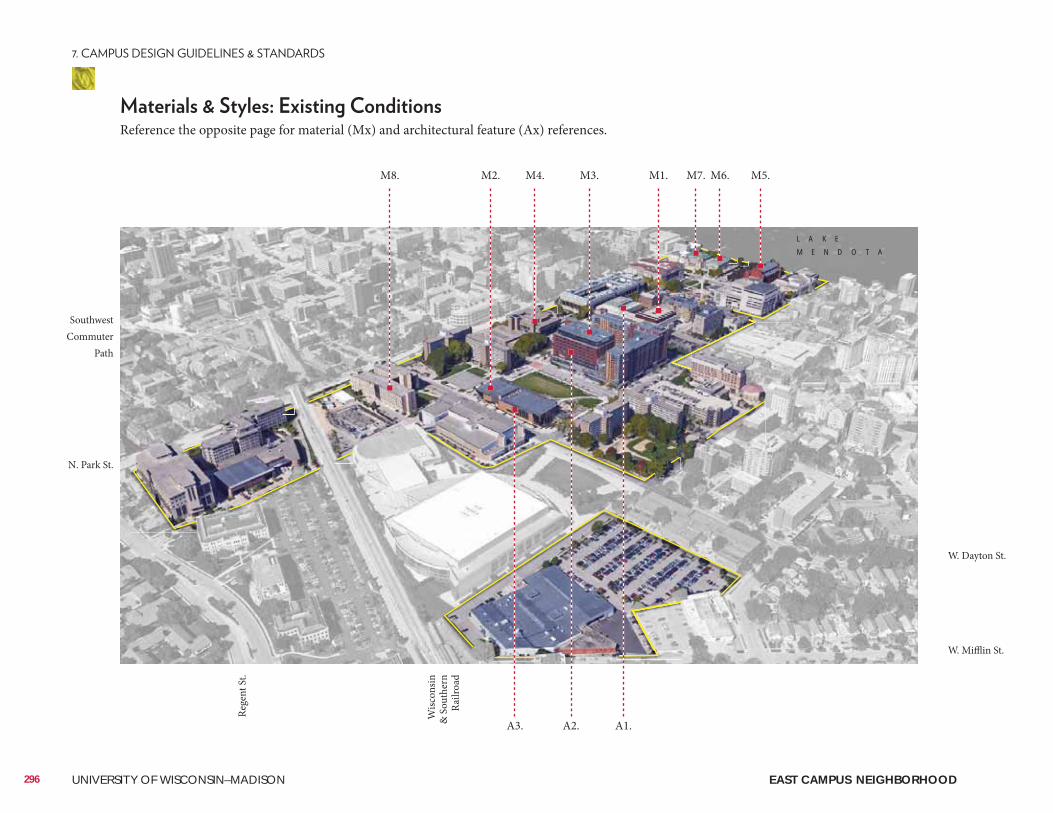
296 UNIVERSITY OF WISCONSIN–MADISON
Reference the opposite page for material (Mx) and architectural feature (Ax) references.
M1. M7. M6. M5.M2.M8. M4. M3.
A1.A2.A3.
L A K E
M E N D O T A
W. Dayton St.
W. Mifflin St.
Wisc
onsin
&
Sou
ther
n Ra
ilroa
d
Rege
nt S
t.
Southwest Commuter
Path
N. Park St.
EAST CAMPUS NEIGHBORHOOD
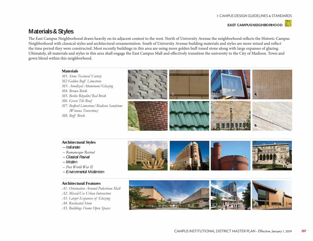
Materials & StylesThe East Campus Neighborhood draws heavily on its adjacent context to the west. North of University Avenue the neighborhood reflects the Historic Campus Neighborhood with classical styles and architectural ornamentation. South of University Avenue building materials and styles are more mixed and reflect the time period they were constructed. Most recently buildings in this area are using more golden buff-toned stone along with large expanses of glazing. Ultimately, all materials and styles in this area shall engage the East Campus Mall and effectively transition the university to the City of Madison. Town and gown blend within this neighborhood.
Materials
Architectural Features
Architectural Styles – Italianate
– Classical Revival – Modern
– Environmental Modernism
2.
6. 7.
1.
1.
5.
3.
2/3
4.
4/5
8.
297
EAST CAMPUS NEIGHBORHOOD
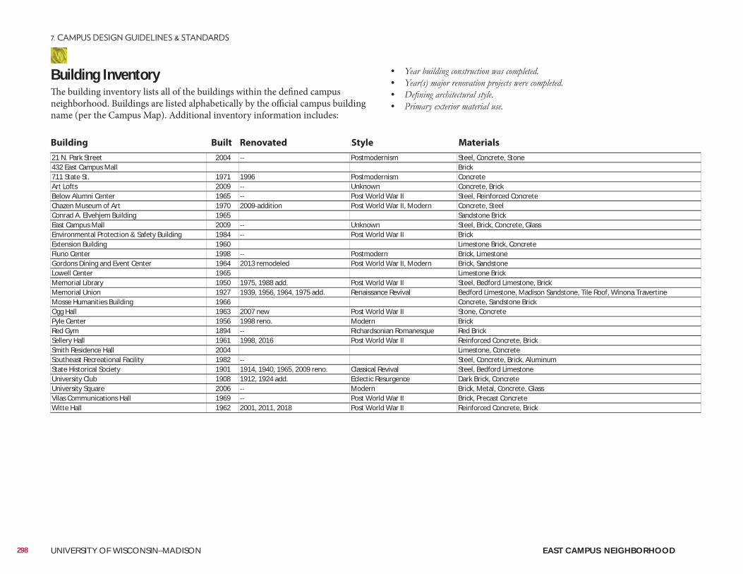
Building InventoryThe building inventory lists all of the buildings within the defined campus neighborhood. Buildings are listed alphabetically by the official campus building name (per the Campus Map). Additional inventory information includes:
• • • •
21 N. Park Street 2004 Postmodernism Steel, Concrete, Stone432 East Campus Mall Brick711 State St. 1971 1996 Postmodernism ConcreteArt Lofts 2009 Unknown Concrete, BrickBelow Alumni Center 1965 Post World War II Steel, Reinforced ConcreteChazen Museum of Art 1970 2009 addition Post World War II, Modern Concrete, SteelConrad A. Elvehjem Building 1965 Sandstone BrickEast Campus Mall 2009 Unknown Steel, Brick, Concrete, GlassEnvironmental Protection & Safety Building 1984 Post World War II BrickExtension Building 1960 Limestone Brick, ConcreteFluno Center 1998 Postmodern Brick, LimestoneGordons Dining and Event Center 1964 2013 remodeled Post World War II, Modern Brick, SandstoneLowell Center 1965 Limestone BrickMemorial Library 1950 1975, 1988 add. Post World War II Steel, Bedford Limestone, BrickMemorial Union 1927 1939, 1956, 1964, 1975 add. Renaissance Revival Bedford Limestone, Madison Sandstone, Tile Roof, Winona TravertineMosse Humanities Building 1966 Concrete, Sandstone BrickOgg Hall 1963 2007 new Post World War II Stone, ConcretePyle Center 1956 1998 reno. Modern BrickRed Gym 1894 Richardsonian Romanesque Red BrickSellery Hall 1961 1998, 2016 Post World War II Reinforced Concrete, BrickSmith Residence Hall 2004 Limestone, ConcreteSoutheast Recreational Facility 1982 Steel, Concrete, Brick, AluminumState Historical Society 1901 1914, 1940, 1965, 2009 reno. Classical Revival Steel, Bedford LimestoneUniversity Club 1908 1912, 1924 add. Eclectic Resurgence Dark Brick, ConcreteUniversity Square 2006 Modern Brick, Metal, Concrete, GlassVilas Communications Hall 1969 Post World War II Brick, Precast ConcreteWitte Hall 1962 2001, 2011, 2018 Post World War II Reinforced Concrete, Brick
Building Built Renovated Style Materials
298 UNIVERSITY OF WISCONSIN–MADISON EAST CAMPUS NEIGHBORHOOD
ConsiderationsConsiderations include information related to the planning, design, and approval of a typical building and/or landscape architecture campus project. It is to be reviewed as a resource identifying locations of materials that UW project teams reference most often. Not all projects will require each identified item. All projects should review the reference list and determine with the UW project manager applicability to the project.
Site Amenities & Vegetation• 2015 Landscape Development Standards• Division of Facilities Development Master Specifications–Division 32• UW-Madison Technical Guidelines–Division 32
Past Plans• 2006 Lakeshore Nature Preserve Master Plan• 2006 Wisconsin Union Facilities Master Plan• 2006 UW Housing Facilities Master Plan• 2007 Recreational Sports Facilities Master Plan• 2012 City of Madison Downtown Plan• 2016 Letters & Science Facilities Master Plan
• Memorial Union Terrace• Library Mall
• Capitol Neighborhood Inc. • Friends of Lakeshore Nature PreserveHistorical and Cultural Resources• 2005 Cultural Landscape Report• Historic Property Review Requirements• Archaeological Site Review Requirements
Well Head District/Locations• City of Madison Unit Well 27 (N. Randall Ave. & Bike Path)
City of Madison Zoning (Chapter 28)• Campus Institutional District (C-I)• Planned Development (PD)
299
EAST CAMPUS NEIGHBORHOOD
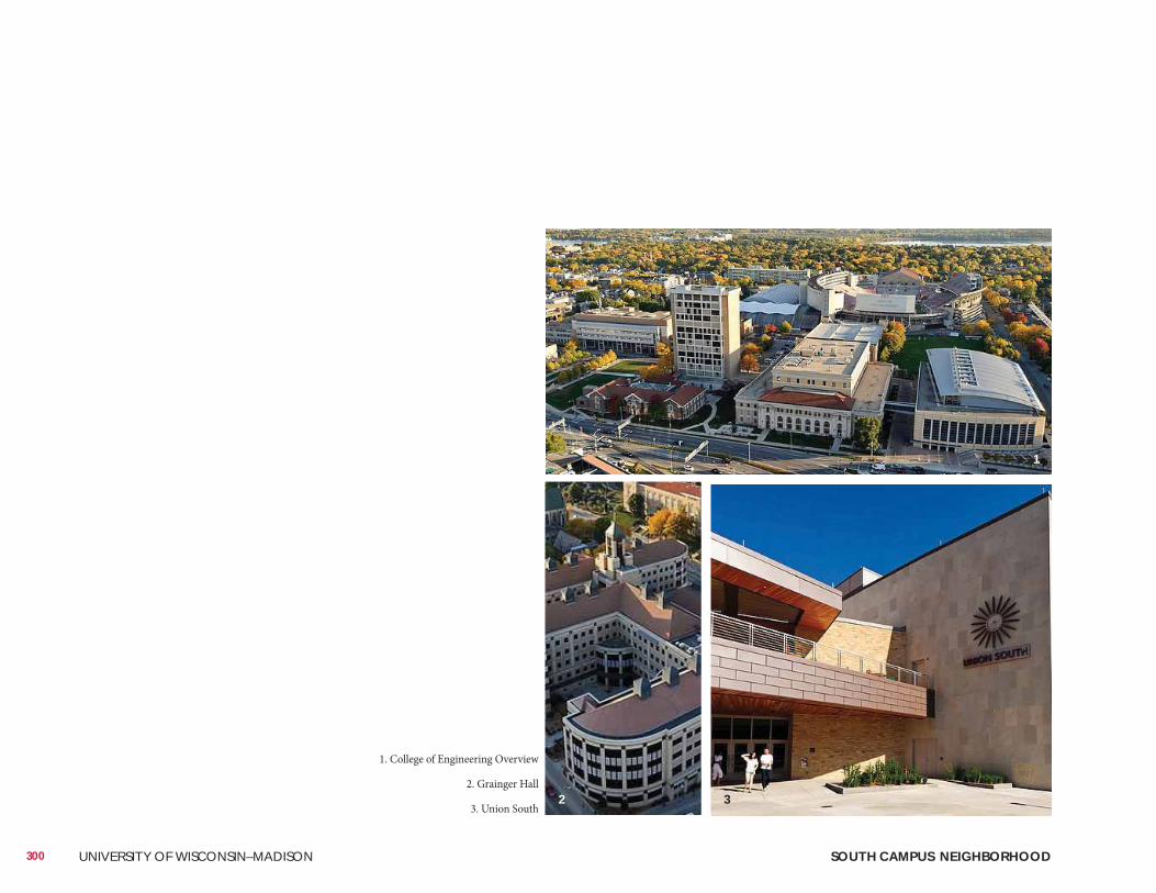
300 UNIVERSITY OF WISCONSIN–MADISON SOUTH CAMPUS NEIGHBORHOOD
1. College of Engineering Overview
2. Grainger Hall
3. Union South
1
2 3
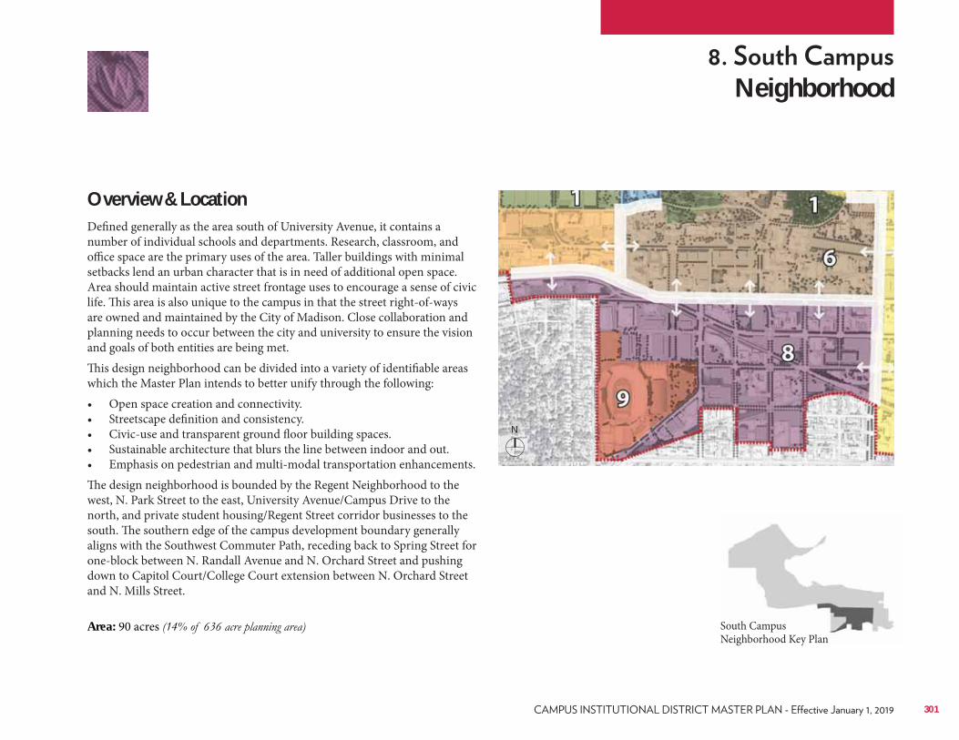
Neighborhood
Overview & LocationDefined generally as the area south of University Avenue, it contains a number of individual schools and departments. Research, classroom, and office space are the primary uses of the area. Taller buildings with minimal setbacks lend an urban character that is in need of additional open space. Area should maintain active street frontage uses to encourage a sense of civic life. This area is also unique to the campus in that the street right-of-ways are owned and maintained by the City of Madison. Close collaboration and planning needs to occur between the city and university to ensure the vision and goals of both entities are being met. This design neighborhood can be divided into a variety of identifiable areas which the Master Plan intends to better unify through the following:• Open space creation and connectivity.• Streetscape definition and consistency.• Civic-use and transparent ground floor building spaces.• Sustainable architecture that blurs the line between indoor and out.• Emphasis on pedestrian and multi-modal transportation enhancements.The design neighborhood is bounded by the Regent Neighborhood to the west, N. Park Street to the east, University Avenue/Campus Drive to the north, and private student housing/Regent Street corridor businesses to the south. The southern edge of the campus development boundary generally aligns with the Southwest Commuter Path, receding back to Spring Street for one-block between N. Randall Avenue and N. Orchard Street and pushing down to Capitol Court/College Court extension between N. Orchard Street and N. Mills Street.
Area: 90 acres South Campus Neighborhood Key Plan
301
N
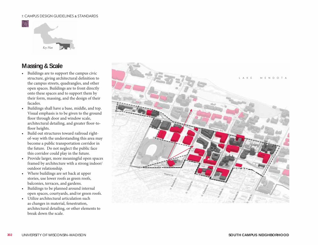
Massing & Scale• Buildings are to support the campus civic
structure, giving architectural definition to the campus streets, quadrangles, and other open spaces. Buildings are to front directly onto these spaces and to support them by their form, massing, and the design of their facades.
• Buildings shall have a base, middle, and top. Visual emphasis is to be given to the ground floor through door and window scale, architectural detailing, and greater floor-to-floor heights.
• Build out structures toward railroad right-of-way with the understanding this area may become a public transportation corridor in the future. Do not neglect the public face this corridor could play in the future.
• Provide larger, more meaningful open spaces framed by architecture with a strong indoor/outdoor relationship.
• Where buildings are set back at upper stories, use lower roofs as green roofs, balconies, terraces, and gardens.
• Buildings to be planned around internal open spaces, courtyards, and/or green roofs.
• Utilize architectural articulation such as changes in material, fenestration, architectural detailing, or other elements to break down the scale.
302 UNIVERSITY OF WISCONSIN–MADISON
Regent St.
Bree
se Te
r.
N. R
anda
ll St.
N. O
rcha
rd St
.
N. C
harte
r St.
N. M
ills S
t.
N. B
rook
s St.
N. P
ark S
t.
University Ave.
SOUTH CAMPUS NEIGHBORHOOD
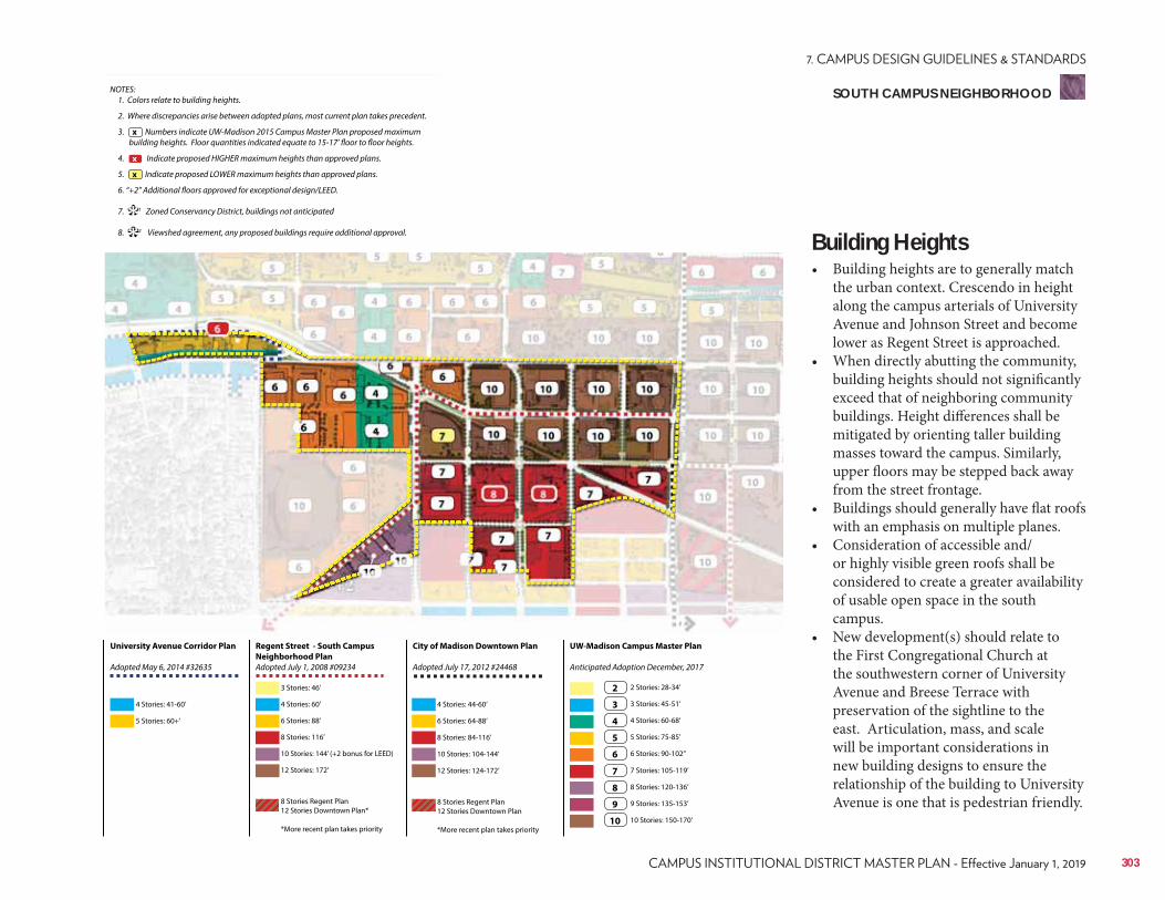
Regent Street - South Campus
Neighborhood Plan
Adopted July 1, 2008 #09234
City of Madison Downtown Plan
Adopted July 17, 2012 #24468
UW-Madison Campus Master Plan
Anticipated Adoption December, 2017
University Avenue Corridor Plan
Adopted May 6, 2014 #32635
4 Stories: 41-60’
3 Stories: 46’
6 Stories: 88’ 6 Stories: 64-88’
3 Stories: 45-51’
7 Stories: 105-119’
10 Stories: 144’ (+2 bonus for LEED) 10 Stories: 104-144’
5 Stories: 75-85’
9 Stories: 135-153’
5 Stories: 60+’
4 Stories: 60’ 4 Stories: 44-60’
2 Stories: 28-34’
8 Stories: 116’ 8 Stories: 84-116’
4 Stories: 60-68’
8 Stories: 120-136’
12 Stories: 172’
8 Stories Regent Plan 12 Stories Downtown Plan*
*More recent plan takes priority
8 Stories Regent Plan 12 Stories Downtown Plan
*More recent plan takes priority
12 Stories: 124-172’
6 Stories: 90-102’’
10 Stories: 150-170’
2
3
7
4
8
5
9
6
10
NOTES: 1. Colors relate to building heights.
2. Where discrepancies arise between adopted plans, most current plan takes precedent.
3. Numbers indicate UW-Madison 2015 Campus Master Plan proposed maximum building heights. Floor quantities indicated equate to 15-17’ floor to floor heights.
4. Indicate proposed HIGHER maximum heights than approved plans.
5. Indicate proposed LOWER maximum heights than approved plans.
6. “+2” Additional floors approved for exceptional design/LEED.
7. 1 Zoned Conservancy District, buildings not anticipated
8. 2 Viewshed agreement, any proposed buildings require additional approval.
x
**
x
x
Building Heights• Building heights are to generally match
the urban context. Crescendo in height along the campus arterials of University Avenue and Johnson Street and become lower as Regent Street is approached.
• When directly abutting the community, building heights should not significantly exceed that of neighboring community buildings. Height differences shall be mitigated by orienting taller building masses toward the campus. Similarly, upper floors may be stepped back away from the street frontage.
• Buildings should generally have flat roofs with an emphasis on multiple planes.
• Consideration of accessible and/or highly visible green roofs shall be considered to create a greater availability of usable open space in the south campus.
• New development(s) should relate to the First Congregational Church at the southwestern corner of University Avenue and Breese Terrace with preservation of the sightline to the east. Articulation, mass, and scale will be important considerations in new building designs to ensure the relationship of the building to University Avenue is one that is pedestrian friendly.
303
SOUTH CAMPUS NEIGHBORHOOD
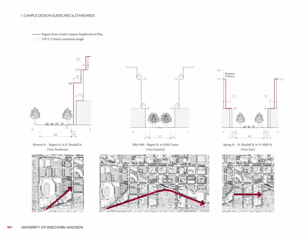
304 UNIVERSITY OF WISCONSIN–MADISON
Monroe St. - Regent St. to N. Randall St. (View Northeast)
Bike Path - Regent St. to Kohl Center (View Easterly)
Spring St. - N. Randall St. to N. Mills St.(View East)
Regent Street-South Campus Neighborhood PlanUW C-I District minimum height
Requires Variance
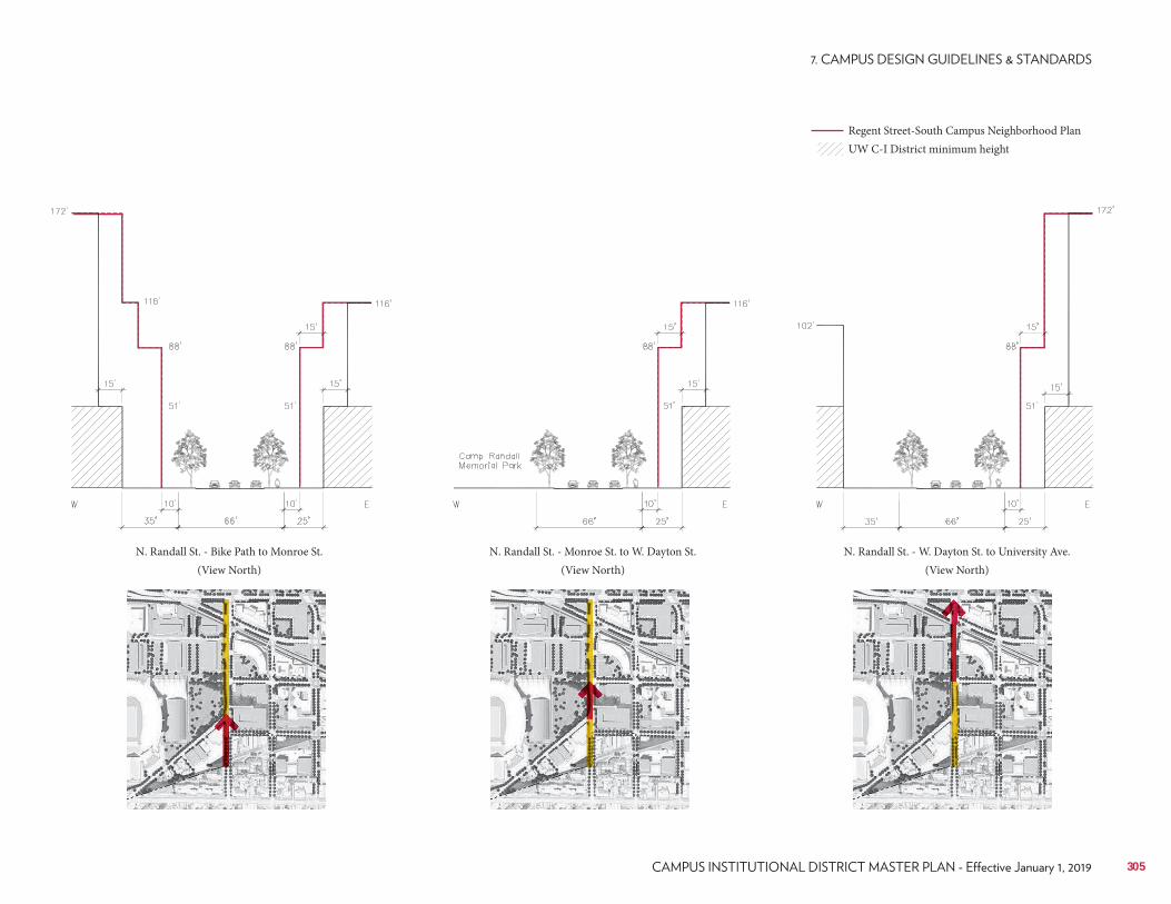
305
N. Randall St. - Bike Path to Monroe St.(View North)
N. Randall St. - Monroe St. to W. Dayton St.(View North)
N. Randall St. - W. Dayton St. to University Ave.(View North)
Regent Street-South Campus Neighborhood PlanUW C-I District minimum height
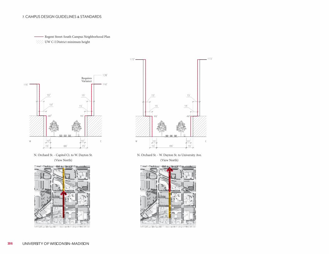
306 UNIVERSITY OF WISCONSIN–MADISON
N. Orchard St. - Capitol Ct. to W. Dayton St.(View North)
N. Orchard St. - W. Dayton St. to University Ave.(View North)
Regent Street-South Campus Neighborhood PlanUW C-I District minimum height
Requires Variance
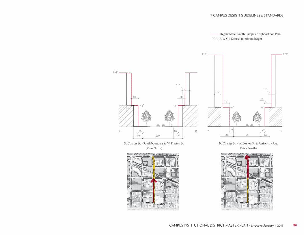
N. Charter St. - South boundary to W. Dayton St.(View North)
N. Charter St. - W. Dayton St. to University Ave.(View North)
307
Regent Street-South Campus Neighborhood PlanUW C-I District minimum height
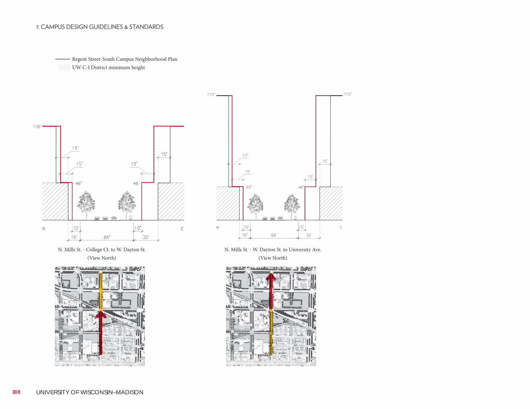
Regent Street-South Campus Neighborhood PlanUW C-I District minimum height
N. Mills St. - College Ct. to W. Dayton St.(View North)
N. Mills St. - W. Dayton St. to University Ave.(View North)
308 UNIVERSITY OF WISCONSIN–MADISON
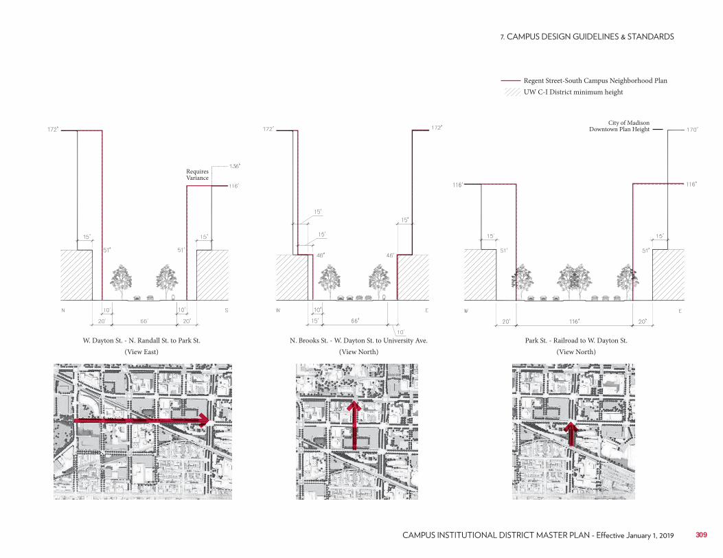
Regent Street-South Campus Neighborhood PlanUW C-I District minimum height
309
W. Dayton St. - N. Randall St. to Park St.(View East)
N. Brooks St. - W. Dayton St. to University Ave.(View North)
Park St. - Railroad to W. Dayton St.(View North)
City of Madison Downtown Plan Height
Requires Variance
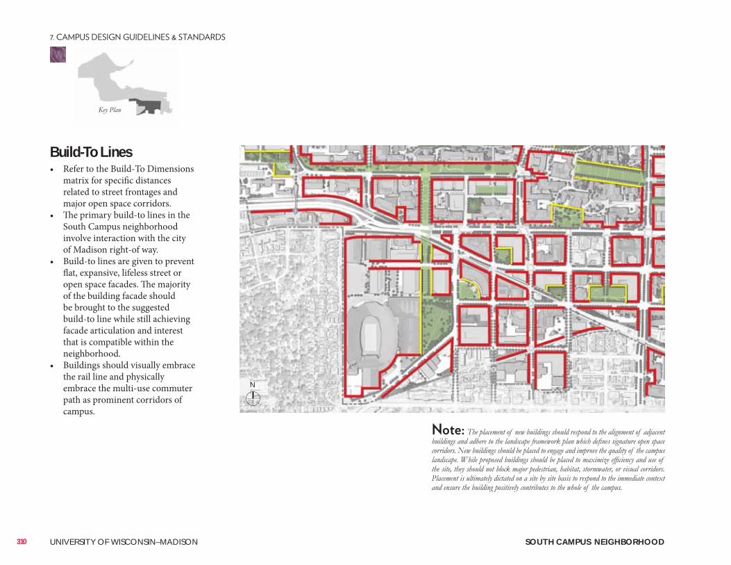
Build-To Lines• Refer to the Build-To Dimensions
matrix for specific distances related to street frontages and major open space corridors.
• The primary build-to lines in the South Campus neighborhood involve interaction with the city of Madison right-of way.
• Build-to lines are given to prevent flat, expansive, lifeless street or open space facades. The majority of the building facade should be brought to the suggested build-to line while still achieving facade articulation and interest that is compatible within the neighborhood.
• Buildings should visually embrace the rail line and physically embrace the multi-use commuter path as prominent corridors of campus.
310 UNIVERSITY OF WISCONSIN–MADISON SOUTH CAMPUS NEIGHBORHOOD
N
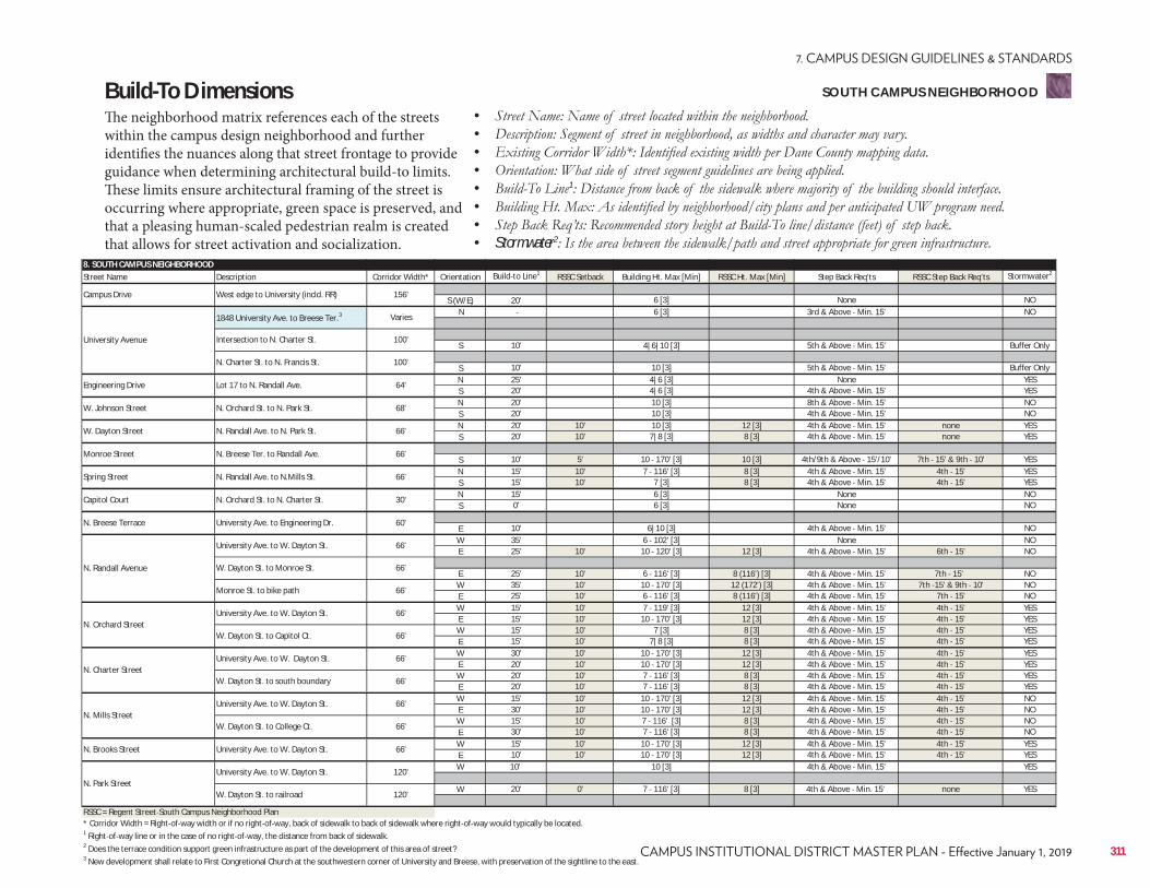
8. SOUTH CAMPUS NEIGHBORHOODStreet Name Description Corridor Width* Orientation Build to Line1 RSSC Setback Building Ht. Max [Min] RSSC Ht. Max [Min] Step Back Req'ts RSSC Step Back Req'ts Stormwater2
S (W/E) 20' 6 [3] None NON 6 [3] 3rd & Above Min. 15' NO
S 10' 4|6|10 [3] 5th & Above Min. 15' Buffer Only
S 10' 10 [3] 5th & Above Min. 15' Buffer OnlyN 25' 4|6 [3] None YESS 20' 4|6 [3] 4th & Above Min. 15' YESN 20' 10 [3] 8th & Above Min. 15' NOS 20' 10 [3] 4th & Above Min. 15' NON 20' 10' 10 [3] 12 [3] 4th & Above Min. 15' none YESS 20' 10' 7|8 [3] 8 [3] 4th & Above Min. 15' none YES
S 10' 5' 10 170' [3] 10 [3] 4th/9th & Above 15'/10' 7th 15' & 9th 10' YESN 15' 10' 7 116' [3] 8 [3] 4th & Above Min. 15' 4th 15' YESS 15' 10' 7 [3] 8 [3] 4th & Above Min. 15' 4th 15' YESN 15' 6 [3] None NOS 0' 6 [3] None NO
E 10' 6|10 [3] 4th & Above Min. 15' NOW 35' 6 102' [3] None NOE 25' 10' 10 120' [3] 12 [3] 4th & Above Min. 15' 6th 15' NO
E 25' 10' 6 116' [3] 8 (116') [3] 4th & Above Min. 15' 7th 15' NOW 35' 10' 10 170' [3] 12 (172') [3] 4th & Above Min. 15' 7th 15' & 9th 10' NOE 25' 10' 6 116' [3] 8 (116') [3] 4th & Above Min. 15' 7th 15' NOW 15' 10' 7 119' [3] 12 [3] 4th & Above Min. 15' 4th 15' YESE 15' 10' 10 170' [3] 12 [3] 4th & Above Min. 15' 4th 15' YESW 15' 10' 7 [3] 8 [3] 4th & Above Min. 15' 4th 15' YESE 15' 10' 7|8 [3] 8 [3] 4th & Above Min. 15' 4th 15' YESW 30' 10' 10 170' [3] 12 [3] 4th & Above Min. 15' 4th 15' YESE 20' 10' 10 170' [3] 12 [3] 4th & Above Min. 15' 4th 15' YESW 20' 10' 7 116' [3] 8 [3] 4th & Above Min. 15' 4th 15' YESE 20' 10' 7 116' [3] 8 [3] 4th & Above Min. 15' 4th 15' YESW 15' 10' 10 170' [3] 12 [3] 4th & Above Min. 15' 4th 15' NOE 30' 10' 10 170' [3] 12 [3] 4th & Above Min. 15' 4th 15' NOW 15' 10' 7 116' [3] 8 [3] 4th & Above Min. 15' 4th 15' NOE 30' 10' 7 116' [3] 8 [3] 4th & Above Min. 15' 4th 15' NOW 15' 10' 10 170' [3] 12 [3] 4th & Above Min. 15' 4th 15' YESE 10' 10' 10 170' [3] 12 [3] 4th & Above Min. 15' 4th 15' YESW 10' 10 [3] 4th & Above Min. 15' YES
W 20' 0' 7 116' [3] 8 [3] 4th & Above Min. 15' none YES
RSSC = Regent Street South Campus Neighborhood Plan* Corridor Width = Right of way width or if no right of way, back of sidewalk to back of sidewalk where right of way would typically be located.1 Right of way line or in the case of no right of way, the distance from back of sidewalk.2 Does the terrace condition support green infrastructure as part of the development of this area of street?3 New development shall relate to First Congretional Church at the southwestern corner of University and Breese, with preservation of the sightline to the east.
N. Brooks Street University Ave. to W. Dayton St. 66'
N. Mills StreetUniversity Ave. to W. Dayton St. 66'
W. Dayton St. to College Ct. 66'
N. Park StreetUniversity Ave. to W. Dayton St. 120'
W. Dayton St. to railroad 120'
N. Orchard StreetUniversity Ave. to W. Dayton St. 66'
W. Dayton St. to Capitol Ct. 66'
N. Charter StreetUniversity Ave. to W. Dayton St. 66'
W. Dayton St. to south boundary 66'
N. Randall Avenue
University Ave. to W. Dayton St. 66'
W. Dayton St. to Monroe St. 66'
Monroe St. to bike path 66'
Spring Street N. Randall Ave. to N.Mills St. 66'
N. Breese Terrace University Ave. to Engineering Dr. 60'
Capitol Court N. Orchard St. to N. Charter St. 30'
W. Dayton Street N. Randall Ave. to N. Park St. 66'
Monroe Street N. Breese Ter. to Randall Ave. 66'
Engineering Drive Lot 17 to N. Randall Ave. 64'
W. Johnson Street N. Orchard St. to N. Park St. 68'
Campus Drive West edge to University (incld. RR) 156'
University Avenue
1848 University Ave. to Breese Ter.3 Varies
Intersection to N. Charter St. 100'
N. Charter St. to N. Francis St. 100'
Build-To DimensionsThe neighborhood matrix references each of the streets within the campus design neighborhood and further identifies the nuances along that street frontage to provide guidance when determining architectural build-to limits. These limits ensure architectural framing of the street is occurring where appropriate, green space is preserved, and that a pleasing human-scaled pedestrian realm is created that allows for street activation and socialization.
• • • • • 1
• • • Stormwater2
311
SOUTH CAMPUS NEIGHBORHOOD
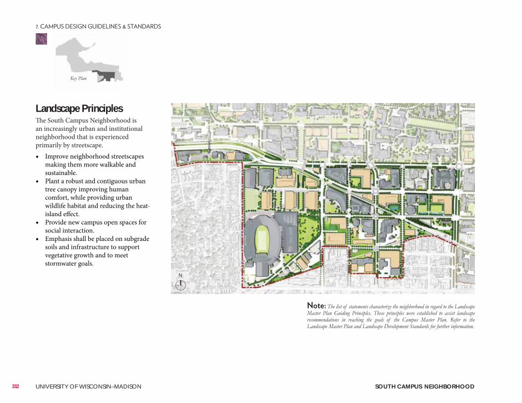
Landscape Principles The South Campus Neighborhood is an increasingly urban and institutional neighborhood that is experienced primarily by streetscape.• Improve neighborhood streetscapes
making them more walkable and sustainable.
• Plant a robust and contiguous urban tree canopy improving human comfort, while providing urban wildlife habitat and reducing the heat-island effect.
• Provide new campus open spaces for social interaction.
• Emphasis shall be placed on subgrade soils and infrastructure to support vegetative growth and to meet stormwater goals.
312 UNIVERSITY OF WISCONSIN–MADISON SOUTH CAMPUS NEIGHBORHOOD
N
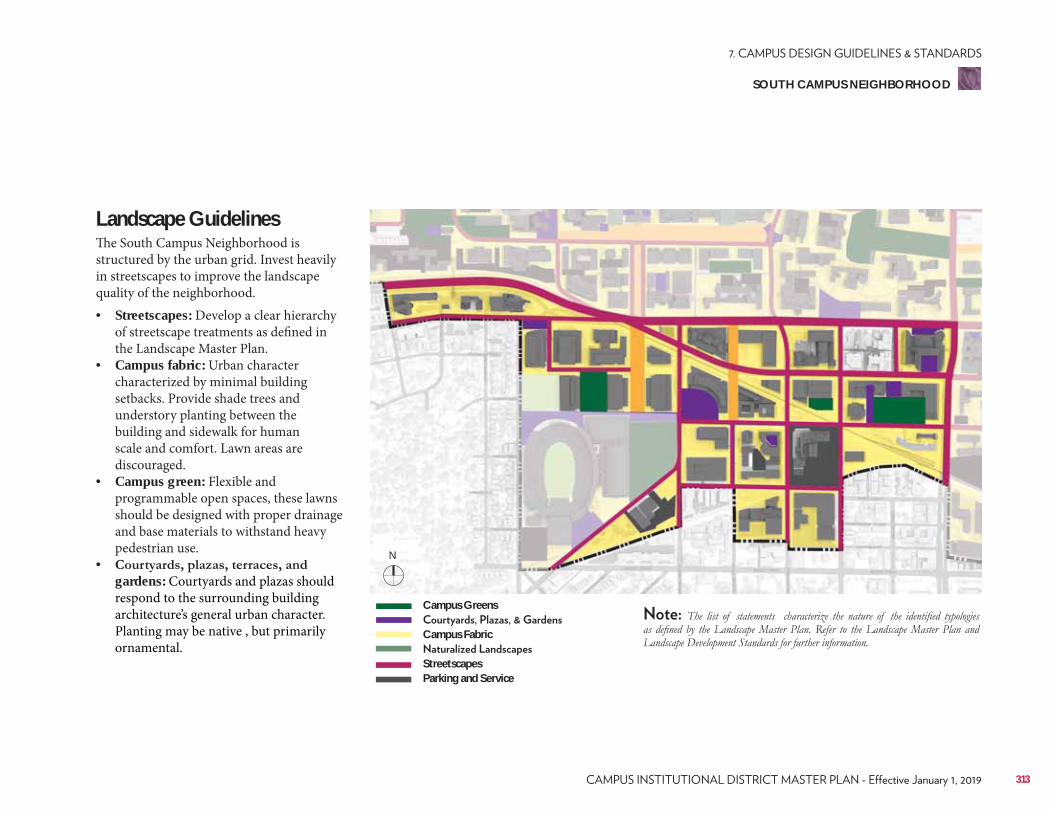
Landscape Guidelines The South Campus Neighborhood is structured by the urban grid. Invest heavily in streetscapes to improve the landscape quality of the neighborhood.• Streetscapes: Develop a clear hierarchy
of streetscape treatments as defined in the Landscape Master Plan.
• Campus fabric: Urban character characterized by minimal building setbacks. Provide shade trees and understory planting between the building and sidewalk for human scale and comfort. Lawn areas are discouraged.
• Campus green: Flexible and programmable open spaces, these lawns should be designed with proper drainage and base materials to withstand heavy pedestrian use.
• gardens: Courtyards and plazas should respond to the surrounding building architecture’s general urban character. Planting may be native , but primarily ornamental.
Campus Greens
Campus Fabric
StreetscapesParking and Service
313
SOUTH CAMPUS NEIGHBORHOOD
N
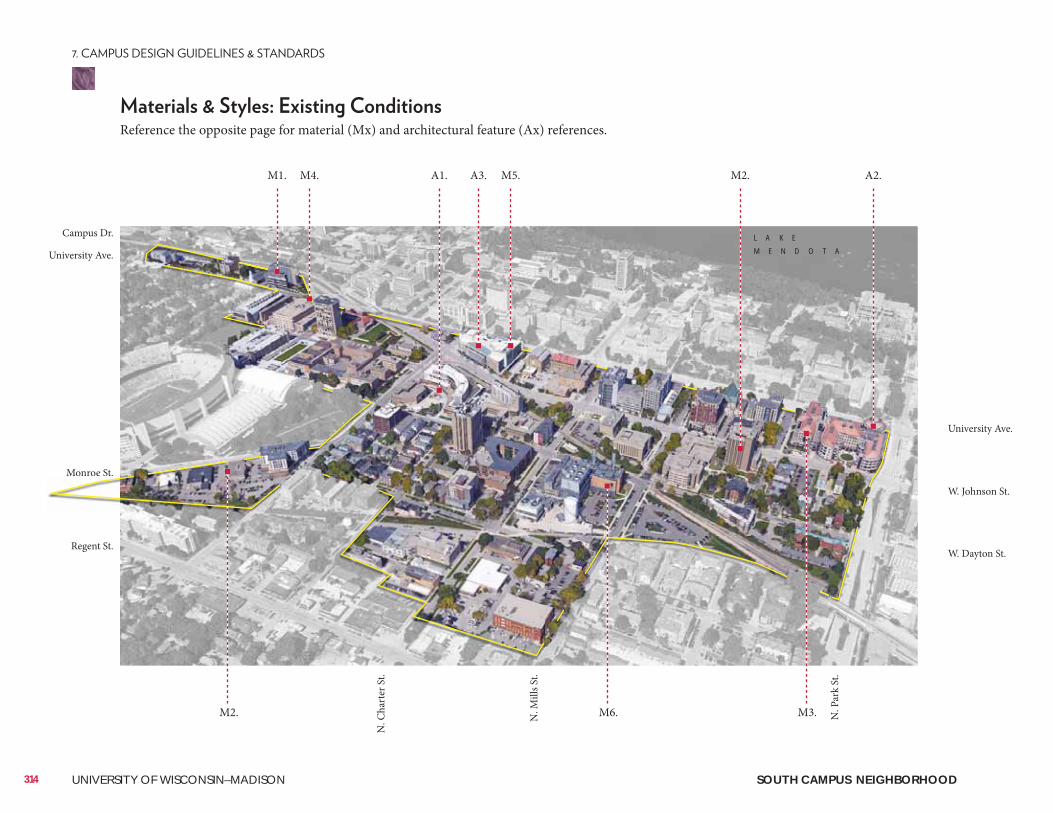
314 UNIVERSITY OF WISCONSIN–MADISON
Reference the opposite page for material (Mx) and architectural feature (Ax) references.
M4. M2.A3. M5.A1. A2.M1.
M2. M6. M3.
L A K E
M E N D O T A
University Ave.
W. Johnson St.
W. Dayton St.
N. P
ark
St.
N. C
hart
er S
t.
N. M
ills S
t.
Campus Dr.
University Ave.
Monroe St.
Regent St.
Monroe St.
SOUTH CAMPUS NEIGHBORHOOD
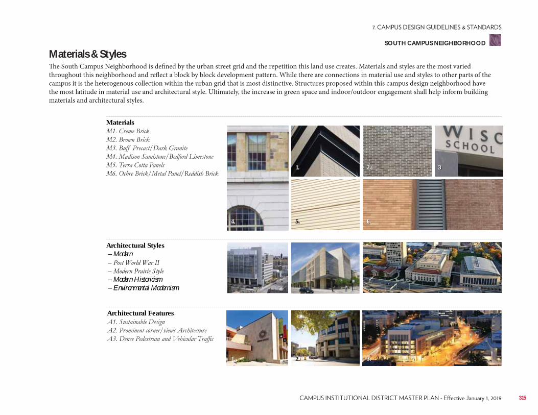
Materials
Architectural Features
Architectural Styles – Modern
– Modern Historicism – Environmental Modernism
Materials & StylesThe South Campus Neighborhood is defined by the urban street grid and the repetition this land use creates. Materials and styles are the most varied throughout this neighborhood and reflect a block by block development pattern. While there are connections in material use and styles to other parts of the campus it is the heterogenous collection within the urban grid that is most distinctive. Structures proposed within this campus design neighborhood have the most latitude in material use and architectural style. Ultimately, the increase in green space and indoor/outdoor engagement shall help inform building materials and architectural styles.
5.
1.
2.
4.
1.
6.
2.
3.
3
315
SOUTH CAMPUS NEIGHBORHOOD
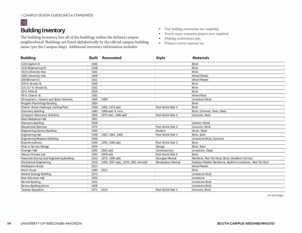
Building InventoryThe building inventory lists all of the buildings within the defined campus neighborhood. Buildings are listed alphabetically by the official campus building name (per the Campus Map). Additional inventory information includes:
• • • •
1220 Capitol Ct. 1946 Brick1410 Engineering Dr. 1938 Brick1610 University Ave. 1942 Brick1800 University Ave. 1909 Wood Panels206 Bernard Ct. 1911 Wood Panels209 N. Brooks St. 1929 Brick215 217 N. Brooks St. 1931 Brick30 N. Mills St. 2009 Brick45 N. Charter St. 1962 Mixed RockAtmospheric, Oceanic and Space Sciences 1966 1989 Limestone BrickBrogden Psychology Building 1964 BrickCharter Street Heating & Cooling Plant 1958 1965, 1973 add. Post World War II BrickChemistry Building 1960 1999 add. & reno. Brick, Concrete, Steel, GlassComputer Sciences & Statistics 1965 1970 add., 1986 add. Post World War II Concrete, SteelDavis Residence Hall 1961Discovery Building 2008 Granite, MetalEducational Sciences 1970 Post World War II Concrete, BrickEngineering Centers Building 2000 Modern Stone, GlassEngineering Hall 1948 1952, 1962, 1993 Post World War II Brick, SteelEngineering Research Building 1966 Limestone Brick, ConcreteEnzyme Institute 1949 1959, 1968 add. Post World War II BrickFleet & Service Garage 2004 Garage Brick, SteelGrainger Hall 1992 2002 add. Contemporary Limestone, GlassHarlow Primate Lab 1964 2009 add. Post World War II BrickMaterials Science and Engineering Building 1910 1975, 1996 add. Georgian Revival Red Brick, Red Tile Rood, Brick, Modillion CorniceMechanical Engineering 1929 1959, 2007 add., 1978, 1981 remodel Renaissance Revival Madison Rubble Sandstone, Bedford Limestone, Red Tile RoofMeiklejohn House 1914 Wood PanelsMerit House 1985 2011 BrickNoland Zoology Building 1970 Limestone BrickRust Schreiner Hall 1955 LimestoneService Building 1910 Limestone BrickService Building Annex 1908 Limestone BrickTeacher Education 1971 2014 Post World War II Concrete, Brick
Building Built Renovated Style Materials
316 UNIVERSITY OF WISCONSIN–MADISON SOUTH CAMPUS NEIGHBORHOOD
see next page...
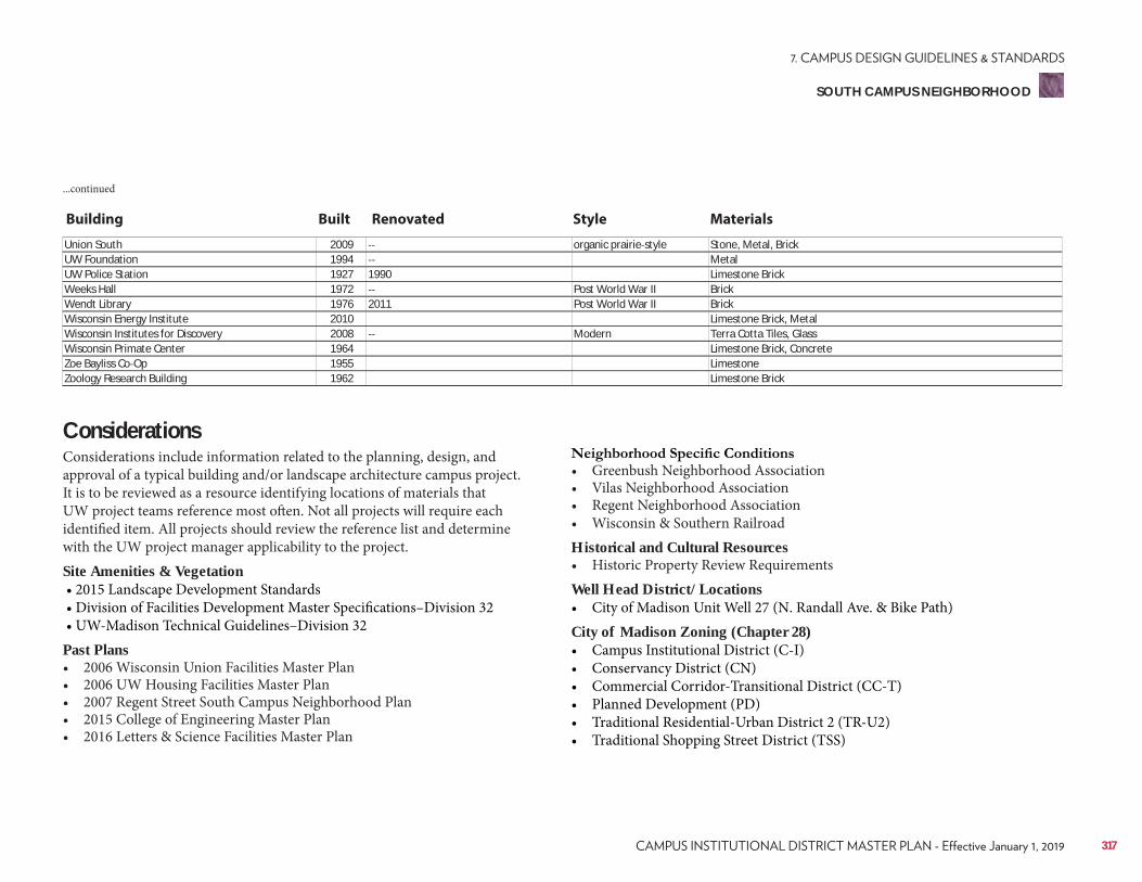
Union South 2009 organic prairie style Stone, Metal, BrickUW Foundation 1994 MetalUW Police Station 1927 1990 Limestone BrickWeeks Hall 1972 Post World War II BrickWendt Library 1976 2011 Post World War II BrickWisconsin Energy Institute 2010 Limestone Brick, MetalWisconsin Institutes for Discovery 2008 Modern Terra Cotta Tiles, GlassWisconsin Primate Center 1964 Limestone Brick, ConcreteZoe Bayliss Co Op 1955 LimestoneZoology Research Building 1962 Limestone Brick
...continued
Building Built Renovated Style Materials
ConsiderationsConsiderations include information related to the planning, design, and approval of a typical building and/or landscape architecture campus project. It is to be reviewed as a resource identifying locations of materials that UW project teams reference most often. Not all projects will require each identified item. All projects should review the reference list and determine with the UW project manager applicability to the project.Site Amenities & Vegetation • 2015 Landscape Development Standards • Division of Facilities Development Master Specifications–Division 32 • UW-Madison Technical Guidelines–Division 32Past Plans• 2006 Wisconsin Union Facilities Master Plan• 2006 UW Housing Facilities Master Plan• 2007 Regent Street South Campus Neighborhood Plan• 2015 College of Engineering Master Plan• 2016 Letters & Science Facilities Master Plan
• Greenbush Neighborhood Association• Vilas Neighborhood Association• Regent Neighborhood Association• Wisconsin & Southern RailroadHistorical and Cultural Resources• Historic Property Review RequirementsWell Head District/Locations• City of Madison Unit Well 27 (N. Randall Ave. & Bike Path)City of Madison Zoning (Chapter 28)• Campus Institutional District (C-I)• Conservancy District (CN)• Commercial Corridor-Transitional District (CC-T)• Planned Development (PD)• Traditional Residential-Urban District 2 (TR-U2)• Traditional Shopping Street District (TSS)
317
SOUTH CAMPUS NEIGHBORHOOD
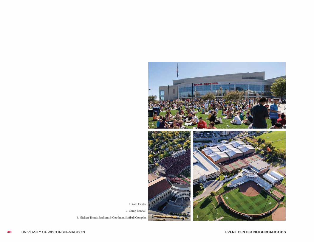
EVENT CENTER NEIGHBORHOODS318 UNIVERSITY OF WISCONSIN–MADISON
1. Kohl Center
2. Camp Randall
3. Nielsen Tennis Stadium & Goodman Softball Complex
1
2 3
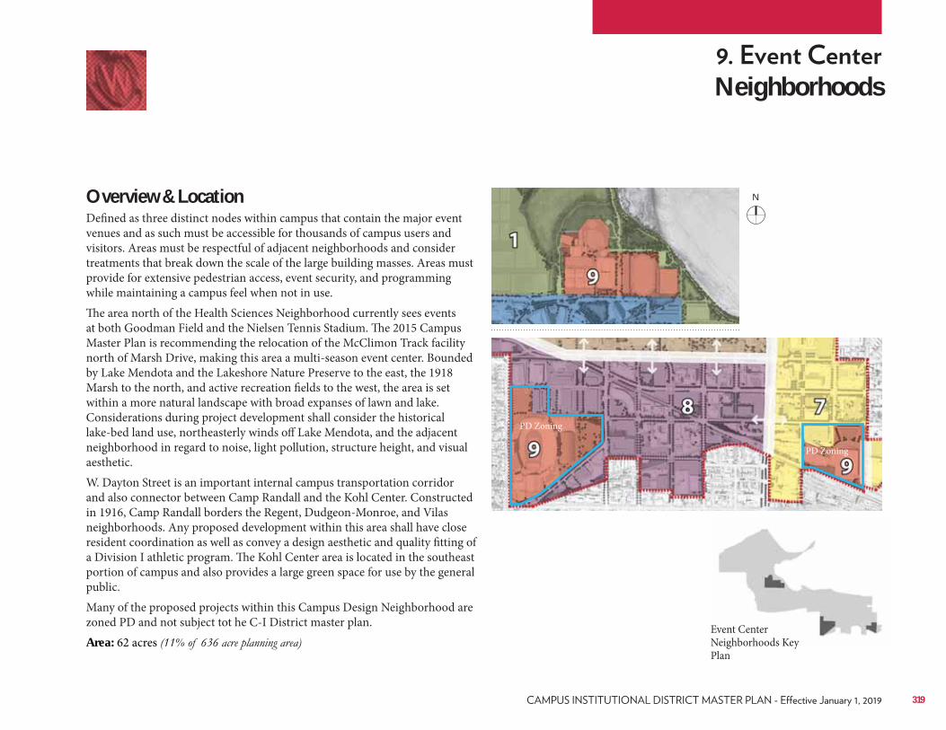
Neighborhoods
Overview & LocationDefined as three distinct nodes within campus that contain the major event venues and as such must be accessible for thousands of campus users and visitors. Areas must be respectful of adjacent neighborhoods and consider treatments that break down the scale of the large building masses. Areas must provide for extensive pedestrian access, event security, and programming while maintaining a campus feel when not in use.The area north of the Health Sciences Neighborhood currently sees events at both Goodman Field and the Nielsen Tennis Stadium. The 2015 Campus Master Plan is recommending the relocation of the McClimon Track facility north of Marsh Drive, making this area a multi-season event center. Bounded by Lake Mendota and the Lakeshore Nature Preserve to the east, the 1918 Marsh to the north, and active recreation fields to the west, the area is set within a more natural landscape with broad expanses of lawn and lake. Considerations during project development shall consider the historical lake-bed land use, northeasterly winds off Lake Mendota, and the adjacent neighborhood in regard to noise, light pollution, structure height, and visual aesthetic.W. Dayton Street is an important internal campus transportation corridor and also connector between Camp Randall and the Kohl Center. Constructed in 1916, Camp Randall borders the Regent, Dudgeon-Monroe, and Vilas neighborhoods. Any proposed development within this area shall have close resident coordination as well as convey a design aesthetic and quality fitting of a Division I athletic program. The Kohl Center area is located in the southeast portion of campus and also provides a large green space for use by the general public.Many of the proposed projects within this Campus Design Neighborhood are zoned PD and not subject tot he C-I District master plan. Area: 62 acres
Event Center Neighborhoods Key Plan
PD Zoning
PD Zoning
319
N
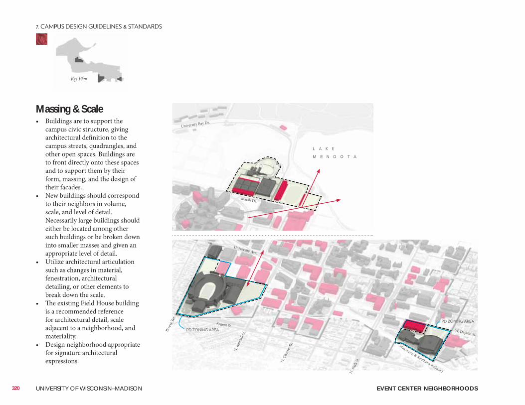
M E N D O T A
University Bay Dr.
Marsh Dr.
University Ave.
W. Dayton St.
Regent St.
EVENT CENTER NEIGHBORHOODS
Massing & Scale• Buildings are to support the
campus civic structure, giving architectural definition to the campus streets, quadrangles, and other open spaces. Buildings are to front directly onto these spaces and to support them by their form, massing, and the design of their facades.
• New buildings should correspond to their neighbors in volume, scale, and level of detail. Necessarily large buildings should either be located among other such buildings or be broken down into smaller masses and given an appropriate level of detail.
• Utilize architectural articulation such as changes in material, fenestration, architectural detailing, or other elements to break down the scale.
• The existing Field House building is a recommended reference for architectural detail, scale adjacent to a neighborhood, and materiality.
• Design neighborhood appropriate for signature architectural expressions.
320 UNIVERSITY OF WISCONSIN–MADISON
Bree
se Te
r.
N. R
anda
ll St.
N. C
harte
r St.
N. P
ark S
t.
Wisconsin & Southern Railroad
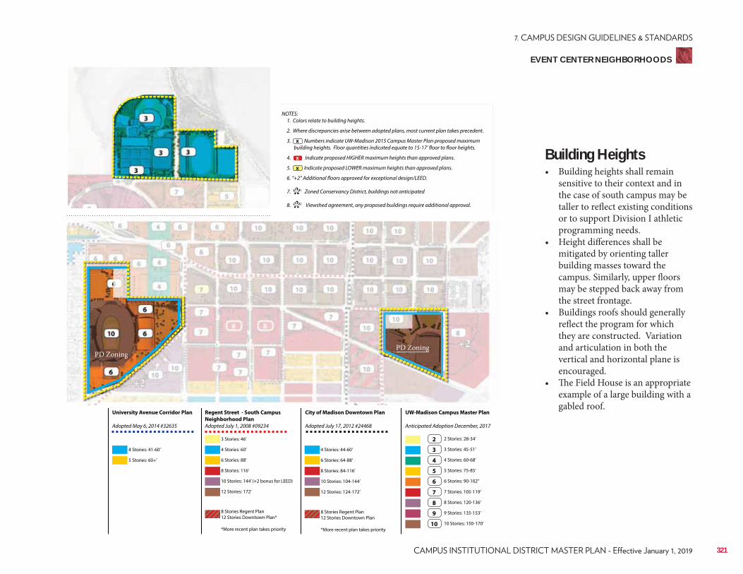
Regent Street - South Campus
Neighborhood Plan
Adopted July 1, 2008 #09234
City of Madison Downtown Plan
Adopted July 17, 2012 #24468
UW-Madison Campus Master Plan
Anticipated Adoption December, 2017
University Avenue Corridor Plan
Adopted May 6, 2014 #32635
4 Stories: 41-60’
3 Stories: 46’
6 Stories: 88’ 6 Stories: 64-88’
3 Stories: 45-51’
7 Stories: 105-119’
10 Stories: 144’ (+2 bonus for LEED) 10 Stories: 104-144’
5 Stories: 75-85’
9 Stories: 135-153’
5 Stories: 60+’
4 Stories: 60’ 4 Stories: 44-60’
2 Stories: 28-34’
8 Stories: 116’ 8 Stories: 84-116’
4 Stories: 60-68’
8 Stories: 120-136’
12 Stories: 172’
8 Stories Regent Plan 12 Stories Downtown Plan*
*More recent plan takes priority
8 Stories Regent Plan 12 Stories Downtown Plan
*More recent plan takes priority
12 Stories: 124-172’
6 Stories: 90-102’’
10 Stories: 150-170’
2
3
7
4
8
5
9
6
10
NOTES: 1. Colors relate to building heights.
2. Where discrepancies arise between adopted plans, most current plan takes precedent.
3. Numbers indicate UW-Madison 2015 Campus Master Plan proposed maximum building heights. Floor quantities indicated equate to 15-17’ floor to floor heights.
4. Indicate proposed HIGHER maximum heights than approved plans.
5. Indicate proposed LOWER maximum heights than approved plans.
6. “+2” Additional floors approved for exceptional design/LEED.
7. 1 Zoned Conservancy District, buildings not anticipated
8. 2 Viewshed agreement, any proposed buildings require additional approval.
x
**
x
x
EVENT CENTER NEIGHBORHOODS
Building Heights• Building heights shall remain
sensitive to their context and in the case of south campus may be taller to reflect existing conditions or to support Division I athletic programming needs.
• Height differences shall be mitigated by orienting taller building masses toward the campus. Similarly, upper floors may be stepped back away from the street frontage.
• Buildings roofs should generally reflect the program for which they are constructed. Variation and articulation in both the vertical and horizontal plane is encouraged.
• The Field House is an appropriate example of a large building with a gabled roof.
PD ZoningPD Zoning
321
PD ZoningPD Zoning
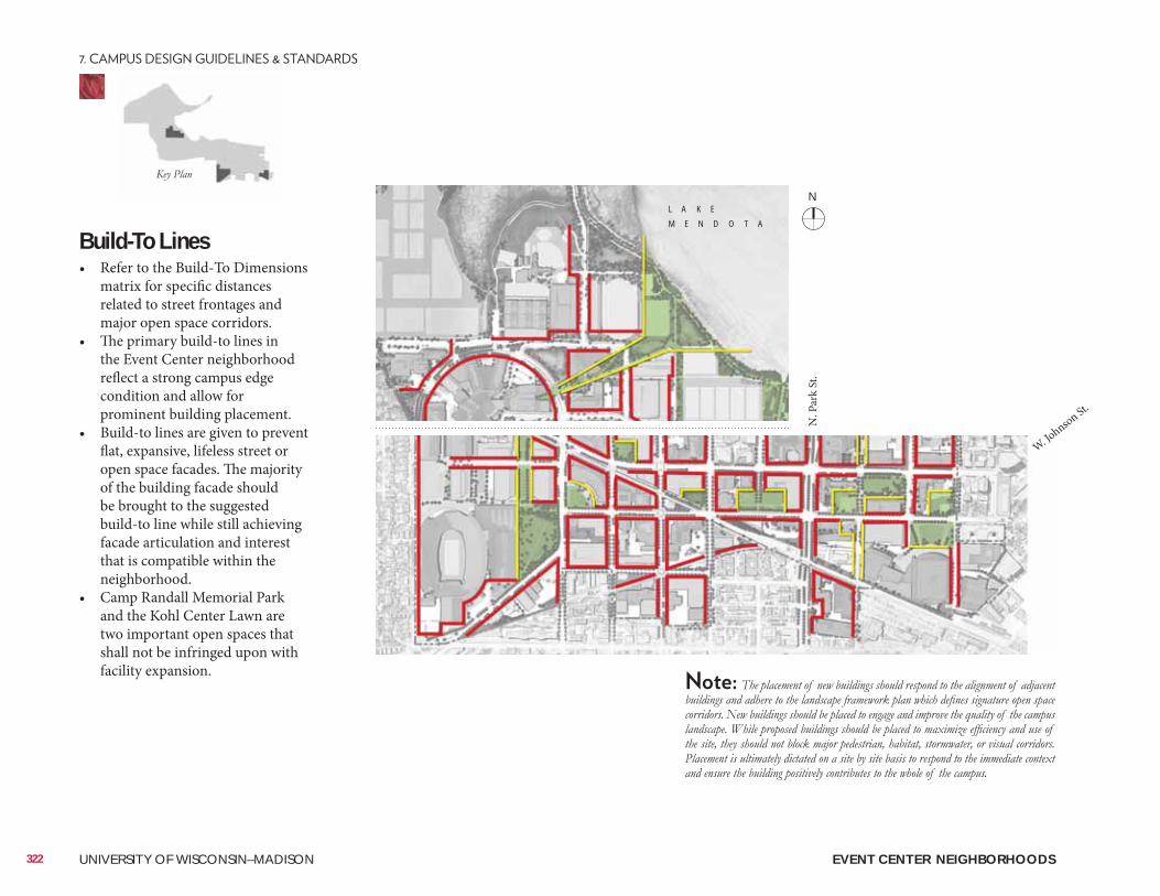
EVENT CENTER NEIGHBORHOODS
Build-To Lines• Refer to the Build-To Dimensions
matrix for specific distances related to street frontages and major open space corridors.
• The primary build-to lines in the Event Center neighborhood reflect a strong campus edge condition and allow for prominent building placement.
• Build-to lines are given to prevent flat, expansive, lifeless street or open space facades. The majority of the building facade should be brought to the suggested build-to line while still achieving facade articulation and interest that is compatible within the neighborhood.
• Camp Randall Memorial Park and the Kohl Center Lawn are two important open spaces that shall not be infringed upon with facility expansion.
322 UNIVERSITY OF WISCONSIN–MADISON
L A K E
M E N D O T A
N. P
ark
St.
W. Johnson St.
N
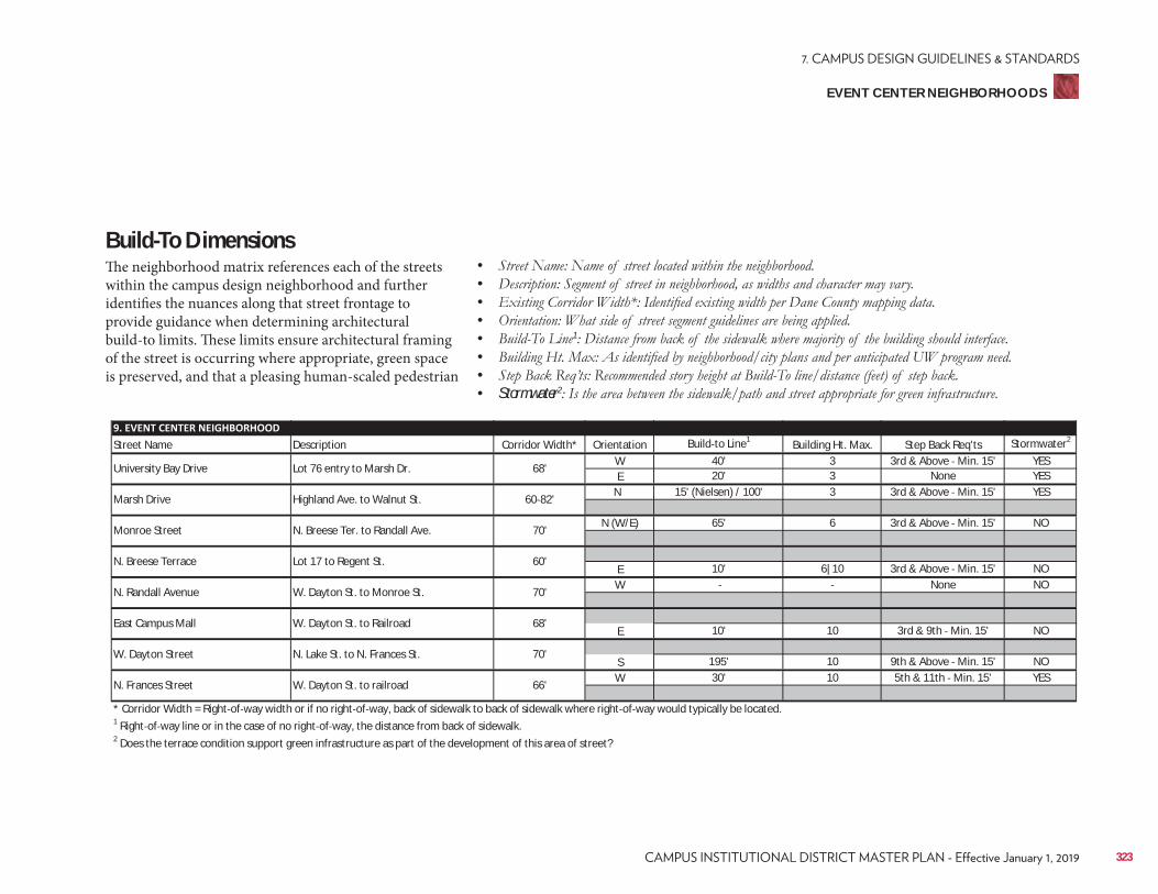
Street Name Description Corridor Width* Orientation Build to Line1 Building Ht. Max. Step Back Req'ts Stormwater2
W 40' 3 3rd & Above Min. 15' YESE 20' 3 None YES
N 15' (Nielsen) / 100' 3 3rd & Above Min. 15' YES
N (W/E) 65' 6 3rd & Above Min. 15' NO
E 10' 6|10 3rd & Above Min. 15' NOW None NO
E 10' 10 3rd & 9th Min. 15' NO
S 195' 10 9th & Above Min. 15' NOW 30' 10 5th & 11th Min. 15' YES
* Corridor Width = Right of way width or if no right of way, back of sidewalk to back of sidewalk where right of way would typically be located.1 Right of way line or in the case of no right of way, the distance from back of sidewalk.2 Does the terrace condition support green infrastructure as part of the development of this area of street?
N. Frances Street W. Dayton St. to railroad 66'
East Campus Mall W. Dayton St. to Railroad 68'
W. Dayton Street N. Lake St. to N. Frances St. 70'
N. Breese Terrace Lot 17 to Regent St. 60'
N. Randall Avenue W. Dayton St. to Monroe St. 70'
Marsh Drive Highland Ave. to Walnut St. 60 82'
Monroe Street N. Breese Ter. to Randall Ave. 70'
University Bay Drive Lot 76 entry to Marsh Dr. 68'
EVENT CENTER NEIGHBORHOODS
Build-To DimensionsThe neighborhood matrix references each of the streets within the campus design neighborhood and further identifies the nuances along that street frontage to provide guidance when determining architectural build-to limits. These limits ensure architectural framing of the street is occurring where appropriate, green space is preserved, and that a pleasing human-scaled pedestrian
• • • • • 1
• • • Stormwater2
323
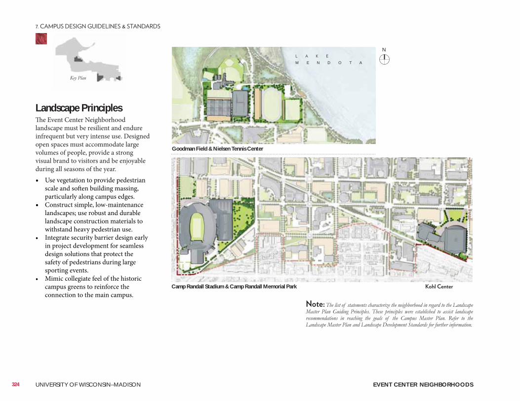
Landscape PrinciplesThe Event Center Neighborhood landscape must be resilient and endure infrequent but very intense use. Designed open spaces must accommodate large volumes of people, provide a strong visual brand to visitors and be enjoyable during all seasons of the year. • Use vegetation to provide pedestrian
scale and soften building massing, particularly along campus edges.
• Construct simple, low-maintenance landscapes; use robust and durable landscape construction materials to withstand heavy pedestrian use.
• Integrate security barrier design early in project development for seamless design solutions that protect the safety of pedestrians during large sporting events.
• Mimic collegiate feel of the historic campus greens to reinforce the connection to the main campus.
Camp Randall Stadium & Camp Randall Memorial Park
Goodman Field & Nielsen Tennis Center
M E N D O T A
EVENT CENTER NEIGHBORHOODS324 UNIVERSITY OF WISCONSIN–MADISON
N
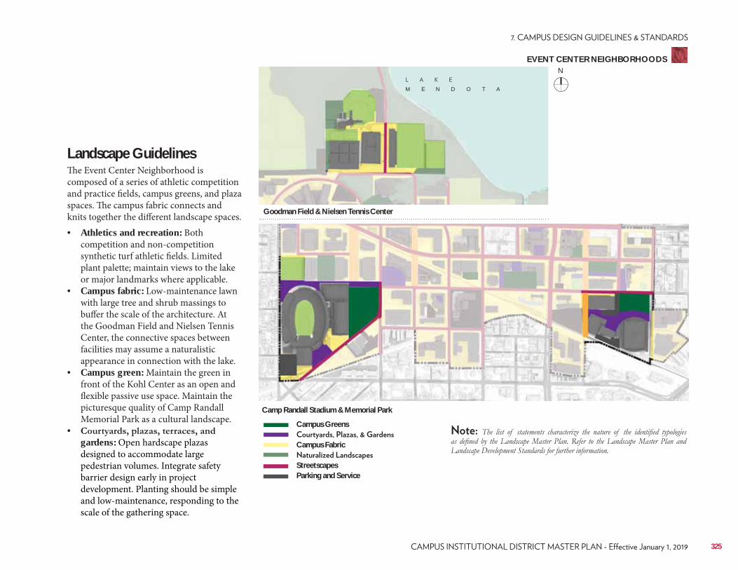
Landscape Guidelines The Event Center Neighborhood is composed of a series of athletic competition and practice fields, campus greens, and plaza spaces. The campus fabric connects and knits together the different landscape spaces.• Athletics and recreation: Both
competition and non-competition synthetic turf athletic fields. Limited plant palette; maintain views to the lake or major landmarks where applicable.
• Campus fabric: Low-maintenance lawn with large tree and shrub massings to buffer the scale of the architecture. At the Goodman Field and Nielsen Tennis Center, the connective spaces between facilities may assume a naturalistic appearance in connection with the lake.
• Campus green: Maintain the green in front of the Kohl Center as an open and flexible passive use space. Maintain the picturesque quality of Camp Randall Memorial Park as a cultural landscape.
• gardens: Open hardscape plazas designed to accommodate large pedestrian volumes. Integrate safety barrier design early in project development. Planting should be simple and low-maintenance, responding to the scale of the gathering space.
Camp Randall Stadium & Memorial Park
Goodman Field & Nielsen Tennis Center
M E N D O T A
Campus Greens
Campus Fabric
StreetscapesParking and Service
EVENT CENTER NEIGHBORHOODS
325
N
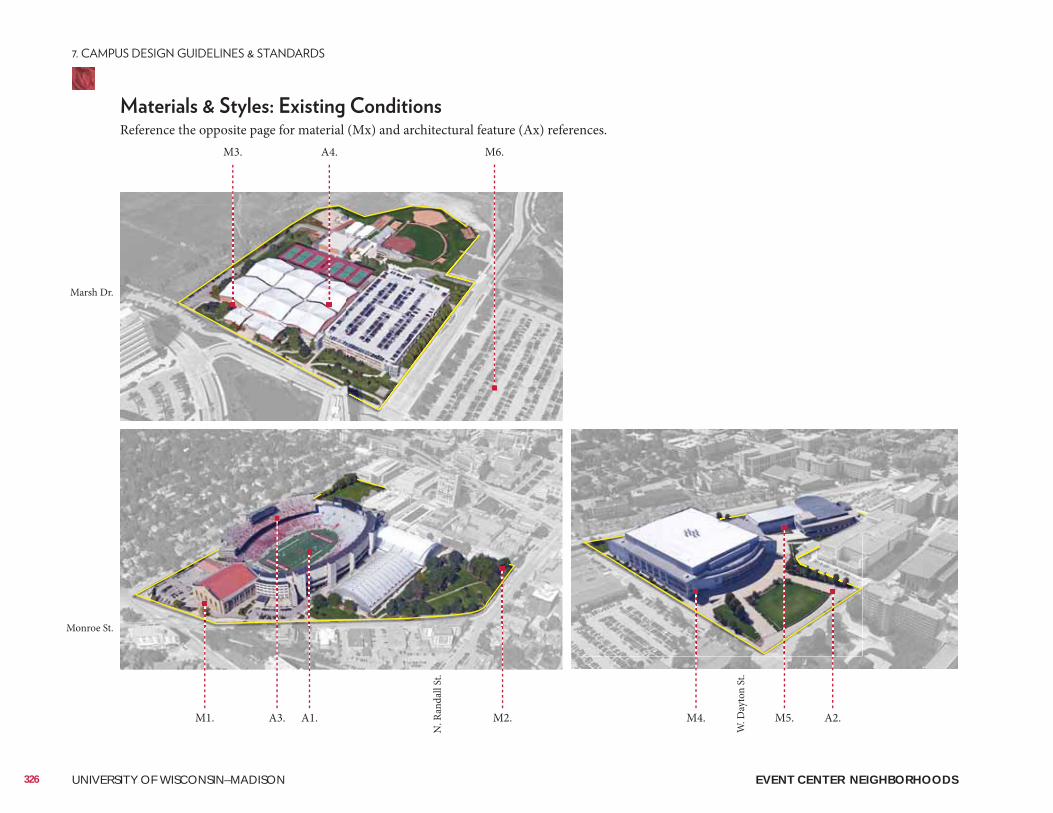
EVENT CENTER NEIGHBORHOODS326 UNIVERSITY OF WISCONSIN–MADISON
Reference the opposite page for material (Mx) and architectural feature (Ax) references. M3. A4. M6.
M1. A1.A3. M2. M4. A2.M5.
N. R
anda
ll St
.
W. D
ayto
n St
.
Marsh Dr.
Monroe St.
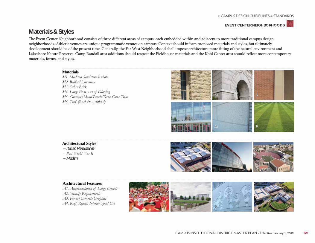
EVENT CENTER NEIGHBORHOODS
Materials
Architectural Features
Architectural Styles – Italian Renaissance
– Modern
Materials & StylesThe Event Center Neighborhood consists of three different areas of campus, each embedded within and adjacent to more traditional campus design neighborhoods. Athletic venues are unique programmatic venues on campus. Context should inform proposed materials and styles, but ultimately development should be of the present time. Generally, the Far West Neighborhood shall impose architecture more fitting of the natural environment and Lakeshore Nature Preserve. Camp Randall area additions should respect the Fieldhouse materials and the Kohl Center area should reflect more contemporary materials, forms, and styles.
2.1. 3. 4.
3.
6.
2.
5.
1.
4.
327
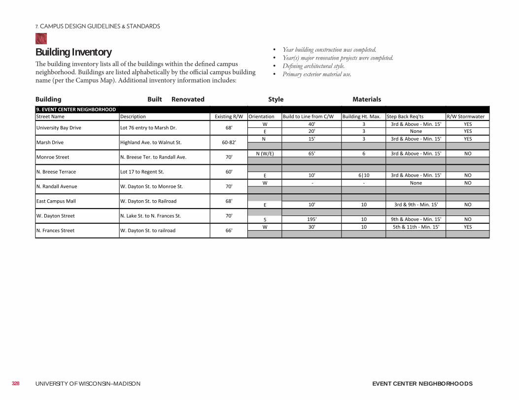
Building InventoryThe building inventory lists all of the buildings within the defined campus neighborhood. Buildings are listed alphabetically by the official campus building name (per the Campus Map). Additional inventory information includes:
• • • •
Building Built Renovated Style Materials
EVENT CENTER NEIGHBORHOODS328 UNIVERSITY OF WISCONSIN–MADISON
ConsiderationsConsiderations include information related to the planning, design, and approval of a typical building and/or landscape architecture campus project. It is to be reviewed as a resource identifying locations of materials that UW project teams reference most often. Not all projects will require each identified item. All projects should review the reference list and determine with the UW project manager applicability to the project.
Site Amenities & Vegetation• 2015 Landscape Development Standards• Division of Facilities Development Master Specifications–Division 32• UW-Madison Technical Guidelines–Division 32
Past Plans• 2006 Lakeshore Nature Preserve Master Plan• 2007 Recreational Sports Facilities Master Plan• 2007 Regent Street South Campus Neighborhood Plan• 2012 City of Madison Downtown Plan• 2016 Athletics Facilities Master Plan
• Class of 1918 Marsh• Camp Randall Memorial Park
• Friends of Lakeshore Nature Preserve• Greenbush Neighborhood Association• Regent Neighborhood Association• Village of Shorewood Hills Historical and Cultural Resources• 2005 Cultural Landscape Report• Historic Property Review Requirements
Well Head District/Locations• City of Madison Unit Well 6 (University Bay Drive & University Ave.)• City of Madison Unit Well 19 (Lake Mendota Drive)• City of Madison Unit Well 27 (N. Randall Ave. & Bike Path)City of Madison Zoning (Chapter 28)• Campus Institutional District (C-I)• Conservancy District (CN)• Planned Development (PD)
EVENT CENTER NEIGHBORHOODS
329

330 UNIVERSITY OF WISCONSIN–MADISON
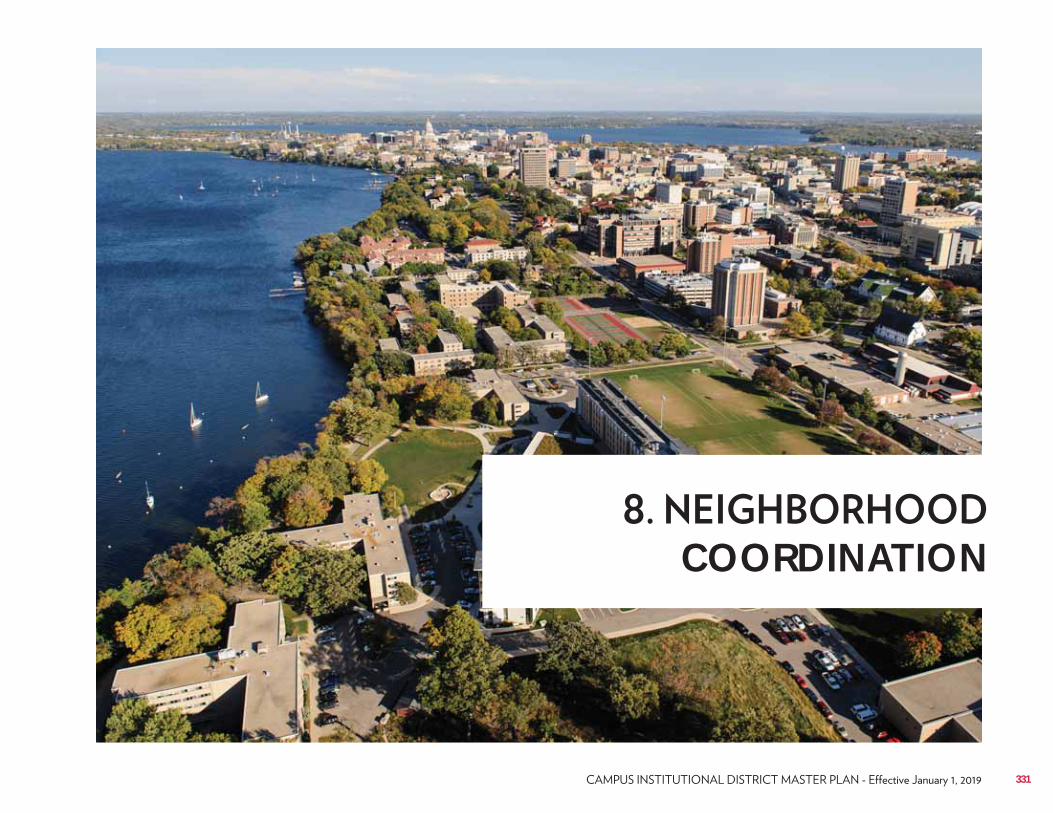
COORDINATION
331
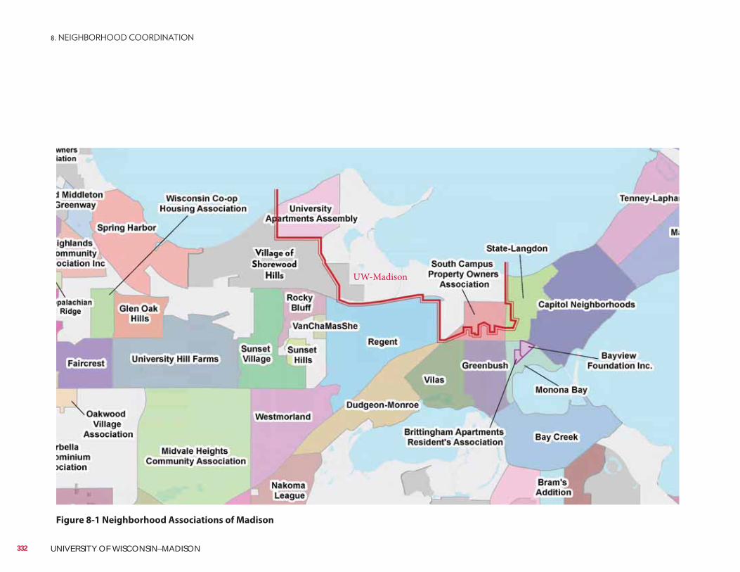
Figure 8-1 Neighborhood Associations of Madison
332 UNIVERSITY OF WISCONSIN–MADISON
UW-Madison
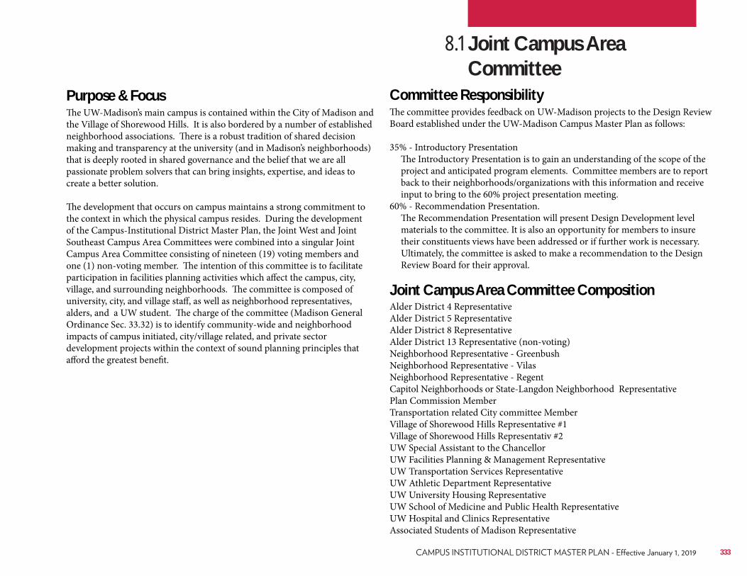
Purpose & FocusThe UW-Madison’s main campus is contained within the City of Madison and the Village of Shorewood Hills. It is also bordered by a number of established neighborhood associations. There is a robust tradition of shared decision making and transparency at the university (and in Madison’s neighborhoods) that is deeply rooted in shared governance and the belief that we are all passionate problem solvers that can bring insights, expertise, and ideas to create a better solution.
The development that occurs on campus maintains a strong commitment to the context in which the physical campus resides. During the development of the Campus-Institutional District Master Plan, the Joint West and Joint Southeast Campus Area Committees were combined into a singular Joint Campus Area Committee consisting of nineteen (19) voting members and one (1) non-voting member. The intention of this committee is to facilitate participation in facilities planning activities which affect the campus, city, village, and surrounding neighborhoods. The committee is composed of university, city, and village staff, as well as neighborhood representatives, alders, and a UW student. The charge of the committee (Madison General Ordinance Sec. 33.32) is to identify community-wide and neighborhood impacts of campus initiated, city/village related, and private sector development projects within the context of sound planning principles that afford the greatest benefit.
Committee ResponsibilityThe committee provides feedback on UW-Madison projects to the Design Review Board established under the UW-Madison Campus Master Plan as follows:
35% - Introductory Presentation The Introductory Presentation is to gain an understanding of the scope of the
project and anticipated program elements. Committee members are to report back to their neighborhoods/organizations with this information and receive input to bring to the 60% project presentation meeting.
60% - Recommendation Presentation. The Recommendation Presentation will present Design Development level
materials to the committee. It is also an opportunity for members to insure their constituents views have been addressed or if further work is necessary. Ultimately, the committee is asked to make a recommendation to the Design Review Board for their approval.
Joint Campus Area Committee CompositionAlder District 4 RepresentativeAlder District 5 RepresentativeAlder District 8 RepresentativeAlder District 13 Representative (non-voting)Neighborhood Representative - GreenbushNeighborhood Representative - VilasNeighborhood Representative - RegentCapitol Neighborhoods or State-Langdon Neighborhood RepresentativePlan Commission MemberTransportation related City committee MemberVillage of Shorewood Hills Representative #1Village of Shorewood Hills Representativ #2UW Special Assistant to the ChancellorUW Facilities Planning & Management RepresentativeUW Transportation Services RepresentativeUW Athletic Department RepresentativeUW University Housing RepresentativeUW School of Medicine and Public Health RepresentativeUW Hospital and Clinics RepresentativeAssociated Students of Madison Representative
8.1 Joint Campus Area Committee
333

334 UNIVERSITY OF WISCONSIN–MADISON
APPROVED PLAN
335
PROCESS FOR AMENDMENTS
No alteration of an approved Campus Master Plan, including changes to the proposed use of identified open space areas and other open space uses, shall be permitted unless approved by the Plan Commission, provided however, the Zoning Administrator may, following consideration by the alderperson of the district, issue permits for minor alterations that are approved by the Director of Planning and Community and Economic Development and are consistent with the concept approved by the Common Council. If the change or addition constitutes a substantial alteration of the original plan, the procedure in Sec. 28.097(6) is required. Substantial changes to the plan will be determined by the City of Madison Director of Planning and Community and Economic Development, or designee, and must receive Common Council approval following a recommendation from the Plan Commission to become part of the approved Campus Institutional District Master Plan. NOTE: All relevant sections of the Zoning Code and Madison General Ordinances, which may be amended from time to time, shall apply to this Campus Master Plan.
Amendments to the approved Campus Master Plan Update from 2018-2028
1.
2.
3.
336 UNIVERSITY OF WISCONSIN–MADISON

{Campus Institutional District Master Plan amendments}
337

338 UNIVERSITY OF WISCONSIN–MADISON
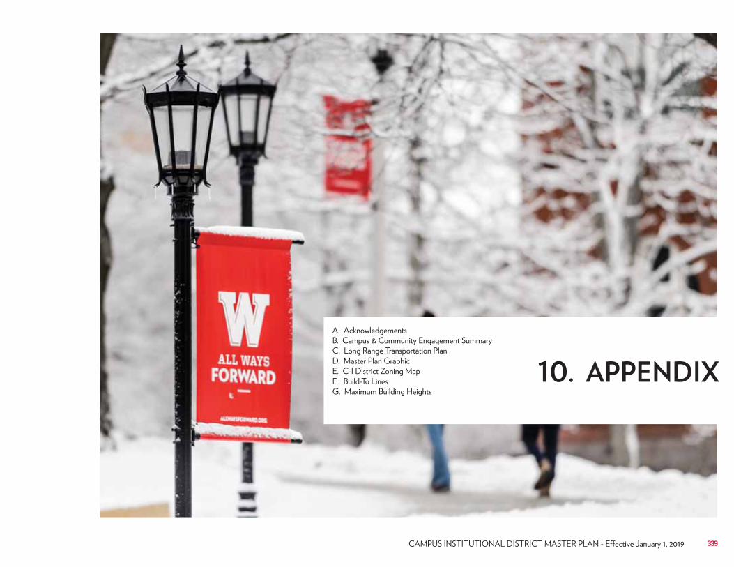
339
340 UNIVERSITY OF WISCONSIN–MADISON
The 2015 Campus Master Plan internal core group would like to thank the scores of people from the university and city communities who devoted time and effort to work with us in developing the 2015 Campus Master Plan; their efforts will enhance the university for years to come.This work was done under the auspices of the Vice Chancellor for Finance and Administration (VCFA), Darrel Bazzell/Michael Lehman, Laurent Heller, and their office. Special thanks go to Bill Elvey, Associate Vice Chancellor of FP&M/Leadership, Gary Brown, Director of Campus Planning & Landscape Architect/Project Manager. Additional appreciation goes to the Campus Planning & Landscape Architecture, Capital Planning & Development, and Space Management Office divisions. Thank you to University Communications for your timely reviews and branding efforts. We would especially like to thank Aaron Williams, Assistant Campus Planner, for his work in coordinating all the many meetings, taking notes, and facilitating the review process.Appreciation to the City of Madison, Mayor Paul Soglin, Director of Planning, Community & Economic Development Natalie Erdman, City of Madison Planning, Zoning, Metro, Traffic Engineering, and Stormwater Engineering staff – for their assistance in understanding the political and physical interface between the university and city.
Executive Leadership Team• Rebecca Blank – Chancellor• Sarah Mangelsdorf – Provost• Darrell Bazzell – Vice Chancellor for Finance & Administration• Michael Lehman – Interim Vice Chancellor for Finance & Administration• Laurent Heller – Vice Chancellor for Finance & Administration• Charles Hoslet – Vice Chancellor for University Relations• Bill Elvey – Associate Vice Chancellor, FP&M• Paul Soglin – Mayor, City of Madison• Natalie Erdman – City of Madison, Director of Planning & Community &
Economic Development• Mark Sundquist – President, Village of Shorewood Hills• Karl Frantz – Administrator, Village of Shorewood Hills
Internal Core GroupAn internal group of state and university facilities staff worked directly on the project with the consultants, coordinating all meetings and facilitating development of the entire project.• Gary Brown – Director, FP&M Campus Planning & Landscape Architecture• Matt Collins – Civil Engineer, FP&M Capital Planning & Development• Bill Elvey – Associate Vice Chancellor, FP&M• Julie Grove – AE Supervisor, FP&M Capital Planning & Development• Pete Heaslett – AE Supervisor, FP&M Capital Planning & Development• Rhonda James* – Senior Landscape Architect, FP&M Campus Planning & Landscape
Architecture• Patrick Kass – Director, FP&M Transportation Services• Rob Kennedy – Transportation Planner, FP&M Transportation Services• Daniel Okoli – University Architect & Director, FP&M Capital Planning &
Development• Lisa Pearson – Project Manager, State of WI DOA Division of Facilities Development
(1/1/16-completion)• Jeff Pollei –Utilities Engineer, FP&M Physical Plant Engineering Group• Doug Rose – Director, FP&M Space Management Office (5/30/14-2/28/16)• Beth Reid – Project Manager, State of WI DOA Division of Facilities Development
(6/1/15-12/31/15)• Alex Roe – Associate Vice Chancellor UW-System, Capital Planning & Budget• Daniel Stephens – Project Manager, State of WI DOA Division of Facilities
Development (5/30/14-5/31/15)• Aaron Williams – Asst. Campus Planner, FP&M Campus Planning & Landscape
Architecture
A. Acknowledgements
341
Campus Planning Steering Committee Invited Guests• Lori Berquam – Dean of Students• Deborah Biggs – Associate Dean, School of medicine & Public Health• Brian Bridges – Captain, UW–Madison Police Department• Paul Broadhead – Assistant Director, Wisconsin Union• Katharine Cornwell – Director, City of Madison Planning Department (3/26/15-
6/1/15)• Luis Fernandez – Director, General Services, UW Extension• Mike Grady – Planning Coordinator, UW Health• Mark Guthier – Director, Wisconsin Unions• John Hahn – Policy Analyst, State of WI DOA Division of Facilities Development• Mike Hanson – Engineering, State of WI DOA Division of Facilities
Development• Ann Hayes – Project Manager/Interior Designer, FP&M Capital Planning &
Development• John Horn – Director, UW–Madison Recreational Sports• Andy Howick – Director, UW Health• Eden Inoway-Ronnie – Assistant, Provost Office• Kathy Kalscheur – Project Manager, State of WI DOA Division of Facilities
Development• Jason King – Associate Director, UW–Madison Athletics• Jeff Kosloski – Architect, UW System (5/30/14-3/26/15)• Kari Knutsen – UW–Madison University Communications• Stu LaRose – Project Manager/Architect, FP&M Capital Planning &
Development• John Lind – Lieutenant, UW–Madison Police Department• Bruce Maas – Director & CIO, UW–Madison Information Technology (DoIT)• Scott McKinney – Director, UW Foundation/Wisconsin Alumni Association• Jocelyn Milner – Director, University Academic Planning• Everett Mitchell – Representative, Chancellor’s Office• Jeff Novak – Director, UW–Madison Housing• Sue Riseling – Chief, UW–Madison Police Department• Doug Sabatke – Assistant Dean, College of Letters & Sciences• Kari Sasso – Assistant Chief, UW–Madison Police Department• Karen Soley – Captain, UW–Madison Police Department
Campus Planning Steering Committee• Sarah Mangelsdorf – Provost (Committee Chair)• Teresa Adams – Staff, FP&M Capital Planning & Development• Marwa Bassiouni – Academic Staff Representative• Seth Blair – Professor, University Committee• Gary Brown – Director, FP&M Campus Planning & Landscape
Architecture• Chris Bruhn – Assistant Dean, College of Letters & Sciences• Derrick Buisch – Professor, Humanities• Thomas Chitwood – ASM student representative• Aaron Crandall – Research Administrator, Academic Staff Representative• David Drake – Associate Professor, UW Arboretum representative• Bill Elvey – Associate Vice Chancellor, FP&M• Gail Geiger – University Representative, Committee on Women• Aris Georgiades – Professor, School of Education• Pamela Herd – Committee on Women• Shawn Kaeppler – Professor, Biological Sciences• Jim LaGro – Professor, Department of Urban & Regional Planning• David Marcouiller – Professor, Urban and Regional Planning• Jesse Markow – Researcher, Recreational Sports Board• Trina McMahon – Professor, Environmental representative• Melanie Meyer, ASM Student Representative (alternate)• Linda Oakley – Professor, University Committee• Michael Pflieger – Assistant Dean, Information Technology Committee• Gary Pine – Classified Staff Representative• Lance Raney – Facilities, Wisconsin Union• Ian Robertson – Dean, College of Engineering• James Schauer – Professor, Physical Sciences• Karl Scholz – Dean, College of Letters & Sciences• Petra Schroeder – Space and Remodeling Policies Committee• Kyle Schroekenthaler – ASM student representative• James Skinner – Professor, University Committee Representative• Bill Tracy – Professor, Campus Transportation Committee• Katharyn Vandenbosh – Dean, College of Agricultural and Life Sciences• David Weimer – Professor, Social Sciences• Mark Wells – Space and Remodeling Policies Committee
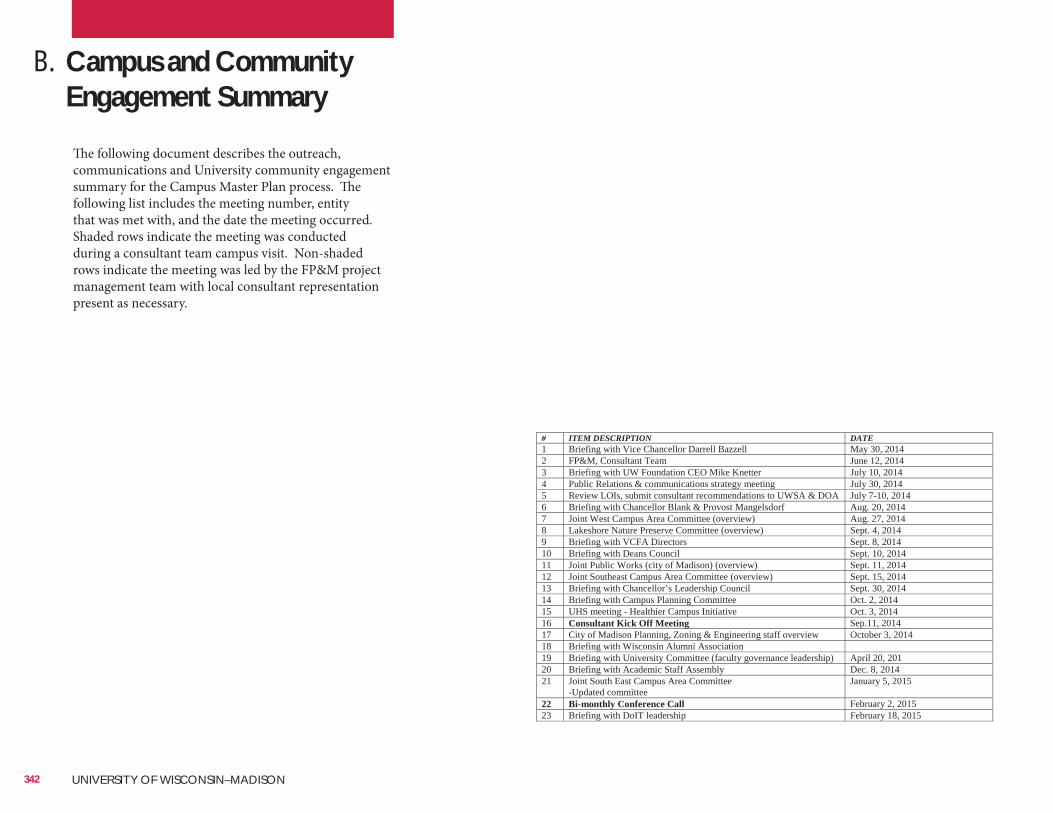
342 UNIVERSITY OF WISCONSIN–MADISON
B. Campus and Community Engagement Summary
# ITEM DESCRIPTION DATE 1 Briefing with Vice Chancellor Darrell Bazzell May 30, 2014 2 FP&M, Consultant Team June 12, 2014 3 Briefing with UW Foundation CEO Mike Knetter July 10, 2014 4 Public Relations & communications strategy meeting July 30, 2014 5 Review LOIs, submit consultant recommendations to UWSA & DOA July 7-10, 2014 6 Briefing with Chancellor Blank & Provost Mangelsdorf Aug. 20, 2014 7 Joint West Campus Area Committee (overview) Aug. 27, 2014 8 Lakeshore Nature Preserve Committee (overview) Sept. 4, 2014 9 Briefing with VCFA Directors Sept. 8, 2014 10 Briefing with Deans Council Sept. 10, 2014 11 Joint Public Works (city of Madison) (overview) Sept. 11, 2014 12 Joint Southeast Campus Area Committee (overview) Sept. 15, 2014 13 Briefing with Chancellor’s Leadership Council Sept. 30, 2014 14 Briefing with Campus Planning Committee Oct. 2, 2014 15 UHS meeting - Healthier Campus Initiative Oct. 3, 2014 16 Consultant Kick Off Meeting Sep.11, 2014 17 City of Madison Planning, Zoning & Engineering staff overview October 3, 2014 18 Briefing with Wisconsin Alumni Association 19 Briefing with University Committee (faculty governance leadership) April 20, 201 20 Briefing with Academic Staff Assembly Dec. 8, 2014 21 Joint South East Campus Area Committee
-Updated committee January 5, 2015
22 Bi-monthly Conference Call February 2, 2015 23 Briefing with DoIT leadership February 18, 2015
The following document describes the outreach, communications and University community engagement summary for the Campus Master Plan process. The following list includes the meeting number, entity that was met with, and the date the meeting occurred. Shaded rows indicate the meeting was conducted during a consultant team campus visit. Non-shaded rows indicate the meeting was led by the FP&M project management team with local consultant representation present as necessary.
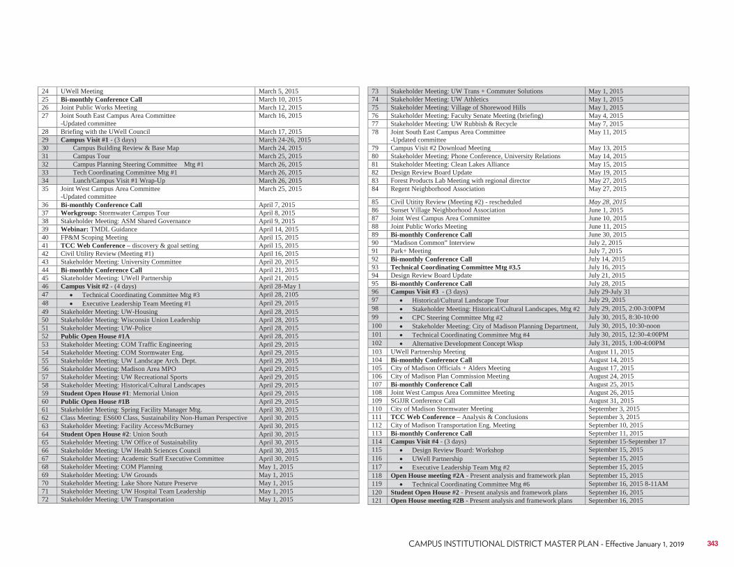
343
24 UWell Meeting March 5, 2015 25 Bi-monthly Conference Call March 10, 2015 26 Joint Public Works Meeting March 12, 2015 27 Joint South East Campus Area Committee
-Updated committee March 16, 2015
28 Briefing with the UWell Council March 17, 2015 29 Campus Visit #1 - (3 days) March 24-26, 2015 30 Campus Building Review & Base Map March 24, 2015 31 Campus Tour March 25, 2015 32 Campus Planning Steering Committee Mtg #1 March 26, 2015 33 Tech Coordinating Committee Mtg #1 March 26, 2015 34 Lunch/Campus Visit #1 Wrap-Up March 26, 2015 35 Joint West Campus Area Committee
-Updated committee March 25, 2015
36 Bi-monthly Conference Call April 7, 2015 37 Workgroup: Stormwater Campus Tour April 8, 2015 38 Stakeholder Meeting: ASM Shared Governance April 9, 2015 39 Webinar: TMDL Guidance April 14, 2015 40 FP&M Scoping Meeting April 15, 2015 41 TCC Web Conference – discovery & goal setting April 15, 2015 42 Civil Utility Review (Meeting #1) April 16, 2015 43 Stakeholder Meeting: University Committee April 20, 2015 44 Bi-monthly Conference Call April 21, 2015 45 Skateholder Meeting: UWell Partnership April 21, 2015 46 Campus Visit #2 - (4 days) April 28-May 1 47 Technical Coordinating Committee Mtg #3 April 28, 2105 48 Executive Leadership Team Meeting #1 April 29, 2015 49 Stakeholder Meeting: UW-Housing April 28, 2015 50 Stakeholder Meeting: Wisconsin Union Leadership April 28, 2015 51 Stakeholder Meeting: UW-Police April 28, 2015 52 Public Open House #1A April 28, 2015 53 Stakeholder Meeting: COM Traffic Engineering April 29, 2015 54 Stakeholder Meeting: COM Stormwater Eng. April 29, 2015 55 Stakeholder Meeting: UW Landscape Arch. Dept. April 29, 2015 56 Stakeholder Meeting: Madison Area MPO April 29, 2015 57 Stakeholder Meeting: UW Recreational Sports April 29, 2015 58 Stakeholder Meeting: Historical/Cultural Landscapes April 29, 2015 59 Student Open House #1: Memorial Union April 29, 2015 60 Public Open House #1B April 29, 2015 61 Stakeholder Meeting: Spring Facility Manager Mtg. April 30, 2015 62 Class Meeting: ES600 Class, Sustainability Non-Human Perspective April 30, 2015 63 Stakeholder Meeting: Facility Access/McBurney April 30, 2015 64 Student Open House #2: Union South April 30, 2015 65 Stakeholder Meeting: UW Office of Sustainability April 30, 2015 66 Stakeholder Meeting: UW Health Sciences Council April 30, 2015 67 Stakeholder Meeting: Academic Staff Executive Committee April 30, 2015 68 Stakeholder Meeting: COM Planning May 1, 2015 69 Stakeholder Meeting: UW Grounds May 1, 2015 70 Stakeholder Meeting: Lake Shore Nature Preserve May 1, 2015 71 Stakeholder Meeting: UW Hospital Team Leadership May 1, 2015 72 Stakeholder Meeting: UW Transportation May 1, 2015
73 Stakeholder Meeting: UW Trans + Commuter Solutions May 1, 2015 74 Stakeholder Meeting: UW Athletics May 1, 2015 75 Stakeholder Meeting: Village of Shorewood Hills May 1, 2015 76 Stakeholder Meeting: Faculty Senate Meeting (briefing) May 4, 2015 77 Stakeholder Meeting: UW Rubbish & Recycle May 7, 2015 78 Joint South East Campus Area Committee
-Updated committee May 11, 2015
79 Campus Visit #2 Download Meeting May 13, 2015 80 Stakeholder Meeting: Phone Conference, University Relations May 14, 2015 81 Stakeholder Meeting: Clean Lakes Alliance May 15, 2015 82 Design Review Board Update May 19, 2015 83 Forest Products Lab Meeting with regional director May 27, 2015 84 Regent Neighborhood Association May 27, 2015
85 Civil Utitity Review (Meeting #2) - rescheduled May 28, 2015 86 Sunset Village Neighborhood Association June 1, 2015 87 Joint West Campus Area Committee June 10, 2015 88 Joint Public Works Meeting June 11, 2015 89 Bi-monthly Conference Call June 30, 2015 90 “Madison Common” Interview July 2, 2015 91 Park+ Meeting July 7, 2015 92 Bi-monthly Conference Call July 14, 2015 93 Technical Coordinating Committee Mtg #3.5 July 16, 2015 94 Design Review Board Update July 21, 2015 95 Bi-monthly Conference Call July 28, 2015 96 Campus Visit #3 - (3 days) July 29-July 31 97 Historical/Cultural Landscape Tour July 29, 2015 98 Stakeholder Meeting: Historical/Cultural Landscapes, Mtg #2 July 29, 2015, 2:00-3:00PM 99 CPC Steering Committee Mtg #2 July 30, 2015, 8:30-10:00 100 Stakeholder Meeting: City of Madison Planning Department, July 30, 2015, 10:30-noon 101 Technical Coordinating Committee Mtg #4 July 30, 2015, 12:30-4:00PM 102 Alternative Development Concept Wksp July 31, 2015, 1:00-4:00PM 103 UWell Partnership Meeting August 11, 2015 104 Bi-monthly Conference Call August 14, 2015 105 City of Madison Officials + Alders Meeting August 17, 2015 106 City of Madison Plan Commission Meeting August 24, 2015 107 Bi-monthly Conference Call August 25, 2015 108 Joint West Campus Area Committee Meeting August 26, 2015 109 SGJJR Conference Call August 31, 2015 110 City of Madison Stormwater Meeting September 3, 2015 111 TCC Web Conference – Analysis & Conclusions September 3, 2015 112 City of Madison Transportation Eng. Meeting September 10, 2015 113 Bi-monthly Conference Call September 11, 2015 114 Campus Visit #4 - (3 days) September 15-September 17 115 Design Review Board: Workshop September 15, 2015 116 UWell Partnership September 15, 2015 117 Executive Leadership Team Mtg #2 September 15, 2015 118 Open House meeting #2A - Present analysis and framework plan September 15, 2015 119 Technical Coordinating Committee Mtg #6 September 16, 2015 8-11AM 120 Student Open House #2 - Present analysis and framework plans September 16, 2015 121 Open House meeting #2B - Present analysis and framework plans September 16, 2015
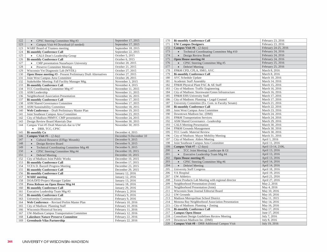
344 UNIVERSITY OF WISCONSIN–MADISON
170 Bi-monthly Conference Call February 23, 2016 171 UW Campus Designers February 23, 2016 172 Campus Visit #6 – (2 days) February 24-25, 2016 173 Technical Coordinating Committee Mtg #10 February 24, 2016 174 Design Review Board February 24, 2016 175 Open House meeting #4 February 24, 2016 176 CPSC Steering Committee Mtg #5 February 25, 2016 177 Debrief Meeting February 25, 2016 178 FP&M CPD, CPLA, SMO, AVC March 8, 2016 179 Bi-monthly Conference Call March 8, 2016 180 AVC Schedule Update March 10, 2016 181 Academic Staff Assembly March 14, 2016 182 FP&M Physical Plant PAC & AE Staff March 15, 2016 183 City of Madison: Traffic Engineering March 16, 2016 184 City of Madison: Stormwater/Green Infrastructure March 16, 2016 185 FP&M EHS University Staff March 17, 2016 186 City of Madison: Planning + Legal Counsel March 17, 2016 187 University Committee (Ex. Com. to Faculty Senate) March 21, 2016 188 Bi-monthly Conference Call March 22, 2016 189 Joint West Campus Area Committee March 23, 2016 190 Downtown Madison Inc. (DMI) March 24, 2016 191 FP&M Transportation Services March 24, 2016 192 ASM Shared Governance - Leadership March 29, 2016 193 CALS Meeting-Presentation March 30, 2016 194 FP&M Grounds Management March 30, 2016 195 TCC Leads: Material Review March 30, 2016 196 City of Madison: Mayor Mobility Meeting March 31, 2016 197 City of Madison: Alders Meeting April 1, 2016 198 Joint Southeast Campus Area Committee April 11, 2016 199 Campus Visit #7 – (2 days) April 13-14, 2106, 200 TCC Joint Meeting: Landscape & GI April 13, 2016 201 Executive Leadership Team Mtg #4 April 13, 2016 202 Open House meeting #5 April 13, 2016 203 CPSC Steering Committee Mtg #6 April 14, 2016 204 Debrief Meeting April 14, 2016 205 University Staff Congress April 18, 2016 206 VA Hospital April 19, 2016 207 UW Athletics April 21, 2016 208 Forest Products Lab Meeting with regional director April 27, 2016 209 Neighborhood Presentation (Joint) May 2, 2016 210 Neighborhood Presentation (Joint) May 4, 2016 211 Wisconsin State Journal Editorial Board May 10, 2016 212 UW Grounds May 10, 2016 213 Madison Metropolitan School District May 11, 2015 214 Monona Bay Neighborhood Association Presentation May 14, 2016 215 City of Madison: Planning + Zoning May 16, 2016 216 Bi-monthly Conference Call May 17, 2016 217 Campus Open House June 17, 2016 218 Consultant Design Guidelines Review Meeting July 7, 2016 219 Downtown Madison Inc. (DMI) July 8, 2016 220 Campus Visit #8 – DRB Additional Campus Visit July 19, 2016
122 CPSC Steering Committee Mtg #3 September 17, 2015 123 Campus Visit #4 Download (if needed) September 17, 2015 123 WARF Board of Trustees meeting September 18, 2015 124 Bi-monthly Conference Call September 22, 2015 125 CALS Dean’s Leadership Group October 5, 2015 126 Bi-monthly Conference Call October 6, 2015 127 CMP presentation Nazarbayev University October 20, 2015 128 Preserve Committee Meeting October 21, 2015 129 Wisconsin Vet Diagnostic Lab (WVDL) October 27, 2015 130 Open House meeting #3 - Present Preliminary Draft Alternatives October 27, 2015 131 Joint West Campus Area Committee October 28, 2015 132 Stakeholder Meeting: Fall Facility Manager Mtg. November 3, 2015 133 Bi-monthly Conference Call November 4, 2015 134 TCC Coordinating Committee Mtg #7 November 11, 2015 135 ASM Leadership November 11, 2015 136 Neighborhood Association Presentation November 16, 2015 137 Bi-monthly Conference Call November 17, 2015 138 ASM Shared Governance Committee November 17, 2015 139 ASM Sustainability Committee November 18, 2015 140 Web Conference – Draft Preliminary Master Plan November 19, 2015 141 Joint Southeast Campus Area Committee November 23, 2015 142 City of Madison PBMVC CMP presentation November 24, 2015 143 Design Review Board Materials Due November 30, 2015 144 Campus Visit #5 Draft Materials due to UW
DRB, TCC, CPSC November 30, 2015
145 Bi-monthly Co December 4, 2015 146 Campus Visit #5 – (2 day) December 9-December 10 147 Cultural Resource (Effigy Mounds) December 9, 2015 148 Design Review Board December 9, 2015 149 Technical Coordinating Committee Mtg #8 December 9, 2015 150 CPSC Steering Committee Mtg #4 December 10, 2015 151 Debrief Meeting December 10, 2015 152 City of Madison Joint Public Works December 10, 2015 153 Bi-monthly Conference Call December 17, 2015 154 VCFA D. Bazzell Progress Meeting December 23, 2015 155 Bi-monthly Conference Call December 29, 2015 156 Bi-monthly Conference Call January 12, 2016 157 WARF meeting January 12, 2016 158 DOA/DFD Project Manager Update January 13, 2016 159 Press Release on Open House Mtg #4 January 18, 2016 160 Bi-monthly Conference Call January 29, 2016 161 Executive Leadership Team Mtg #3 February 2, 2016 162 Bi-monthly Conference Call February 9, 2016 163 University Communications February 9, 2016 164 Web Conference – Revised Prelim Master Plan February 10, 2016 165 City of Madison: Planning Staff February 10, 2016 166 Wisconsin Historical Society February 11, 2016 167 UW-Madison Campus Transportation Committee February 12, 2016 168 Lakeshore Nature Preserve Committee February 22, 2016 169 Greenbush-Vilas Partnership February 22, 2016
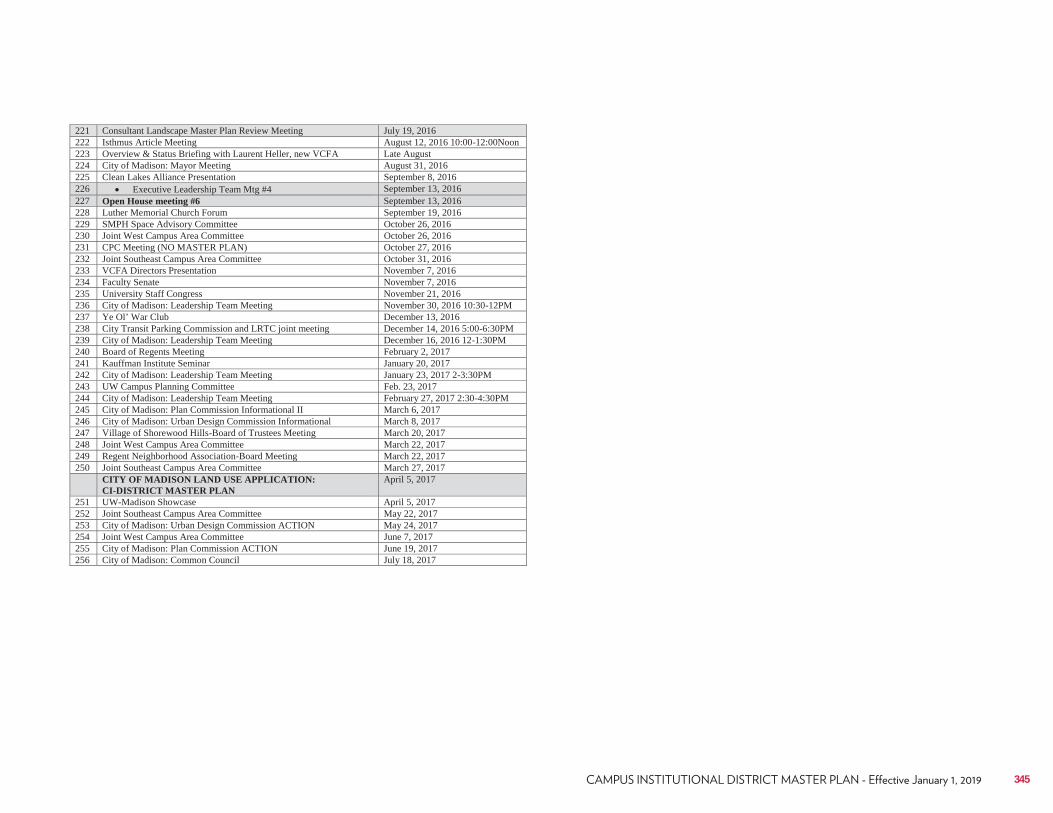
345
221 Consultant Landscape Master Plan Review Meeting July 19, 2016 222 Isthmus Article Meeting August 12, 2016 10:00-12:00Noon 223 Overview & Status Briefing with Laurent Heller, new VCFA Late August 224 City of Madison: Mayor Meeting August 31, 2016 225 Clean Lakes Alliance Presentation September 8, 2016 226 Executive Leadership Team Mtg #4 September 13, 2016 227 Open House meeting #6 September 13, 2016 228 Luther Memorial Church Forum September 19, 2016 229 SMPH Space Advisory Committee October 26, 2016 230 Joint West Campus Area Committee October 26, 2016 231 CPC Meeting (NO MASTER PLAN) October 27, 2016 232 Joint Southeast Campus Area Committee October 31, 2016 233 VCFA Directors Presentation November 7, 2016 234 Faculty Senate November 7, 2016 235 University Staff Congress November 21, 2016 236 City of Madison: Leadership Team Meeting November 30, 2016 10:30-12PM 237 Ye Ol’ War Club December 13, 2016 238 City Transit Parking Commission and LRTC joint meeting December 14, 2016 5:00-6:30PM 239 City of Madison: Leadership Team Meeting December 16, 2016 12-1:30PM 240 Board of Regents Meeting February 2, 2017 241 Kauffman Institute Seminar January 20, 2017 242 City of Madison: Leadership Team Meeting January 23, 2017 2-3:30PM 243 UW Campus Planning Committee Feb. 23, 2017 244 City of Madison: Leadership Team Meeting February 27, 2017 2:30-4:30PM 245 City of Madison: Plan Commission Informational II March 6, 2017 246 City of Madison: Urban Design Commission Informational March 8, 2017 247 Village of Shorewood Hills-Board of Trustees Meeting March 20, 2017 248 Joint West Campus Area Committee March 22, 2017 249 Regent Neighborhood Association-Board Meeting March 22, 2017 250 Joint Southeast Campus Area Committee March 27, 2017 CITY OF MADISON LAND USE APPLICATION:
CI-DISTRICT MASTER PLAN April 5, 2017
251 UW-Madison Showcase April 5, 2017 252 Joint Southeast Campus Area Committee May 22, 2017 253 City of Madison: Urban Design Commission ACTION May 24, 2017 254 Joint West Campus Area Committee June 7, 2017 255 City of Madison: Plan Commission ACTION June 19, 2017 256 City of Madison: Common Council July 18, 2017

© 2018
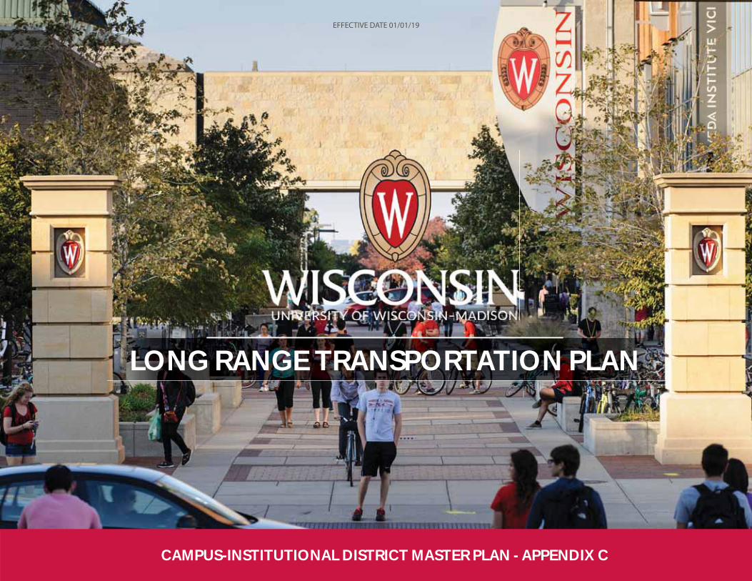
UW–Madison University Communications
LONG RANGE TRANSPORTATION PLAN
LONG RANGE TRANSPORTATION PLAN
CAMPUS-INSTITUTIONAL DISTRICT MASTER PLAN - APPENDIX C
EFFECTIVE DATE 01/01/19
Table of Contents
Executive Summary .................................................................................................. 7IntroductionExisting ConditionsTransportation Recommendations
1. Introduction ......................................................................................................... 23Background and ContextTransportation Improvements Made Since 2005
2. Transportation Context ...................................................................................... 27Existing Conditions Assessment and AnalysisCurrent Travel Patterns and BehaviorVehicle Access and CirculationWalking and Biking NetworkPublic TransportationParking on Campus
3. Transportation Recommendations ................................................................... 59Alternatives Development and RecommendationsEmphasize Walking and Biking as Primary Forms of Transportation To
and Around CampusImprove the Service and Efficiency of Transit OperationsIncrease Road Network Connectivity and EfficiencyParking Operations and Management
2 UNIVERSITY OF WISCONSIN-MADISON
Photo Credits
UW–Madison University Communications.................................................................................................................................1Hoerr Schaudt ...............................................................................................................................................................................................................................................61Hoerr Schaudt ...............................................................................................................................................................................................................................................61National Association of Transportation Officials (NACTO) .............................................................64Hoerr Schaudt ...............................................................................................................................................................................................................................................67Hoerr Schaudt ...............................................................................................................................................................................................................................................67Hoerr Schaudt ...............................................................................................................................................................................................................................................67Hoerr Schaudt ...............................................................................................................................................................................................................................................68Hoerr Schaudt ...............................................................................................................................................................................................................................................68
List of Figures and TablesFigure E-1 Existing Walking and Biking Routes and Identified Challenges ..11Figure E-2 Parking Spaces per Person (Employees + Students) at Select Peer
Universities .............................................................................................................................................................................................................................................14Figure E-3 Concept Rendering of the Proposed Grade Separation at N. Charter
Street and Linden Drive, Elevation (Top) And Plan View (Bottom) .................15Figure E-4 Recommended University Avenue Cross Section where Right-of-
Way Allows..............................................................................................................................................................................................................................................16Figure E-5 Plan View of Proposed University Avenue Re-Design .......................................16Figure E-6 Proposed Road Additions, Vacations, and Conversions ................................18Figure E-7 Recommended Parking Reductions ..............................................................................................................20Figure E-8 Recommended Parking Additions ....................................................................................................................21Figure 1-1 Transportation Improvements Made Since 2005 Master Plan...........26Figure 2-1 Trip Distribution for Faculty, Staff, and Hospital Employees...............30Figure 2-2 Faculty/Staff, Student, and Employee Mode Split to and From
Campus ............................................................................................................................................................................................................................................................31Figure 2-3 Motor Vehicle Traffic and Congestion on Campus .....................................................34Figure 2-4 Campus Loading Docks .............................................................................................................................................................35Figure 2-5 Existing Campus Walking Facilities ...............................................................................................................38Figure 2-6 Existing Campus Biking Facilities and Features .................................................................40Figure 2-7 Existing Walking and Biking Routes and Identified Challenges ...43Table 2-1 Summary of Gaps in Walking and Biking Connectivity ......................................44Table 2-2 Summary of Locations Where Challenges Exist ....................................................................44Figure 2-8 Metro Transit Bus Routes Circulating UW–Madison Campus .......47Figure 2-9 Average Daily Transit Boardings............................................................................................................................48Figure 2-10 Existing Campus Parking Facilities .............................................................................................................53Table 2-3 Existing Campus Parking Spaces, as of July 2016 ................................................................54Figure 2-11 Parking Spaces per Person (Employees + Students) at Select Peer
Universities .............................................................................................................................................................................................................................................55Figure 2-12 Mid-day Parking Occupancies for Faculty and Staff ...........................................56Figure 2-13 Mid-day Parking Occupancies for Visitors ...............................................................................56Figure 3-1 Concept Rendering of the Proposed Grade Separation at N. Charter
All photos taken or created by Kimley-Horn unless otherwise noted.
Street and Linden Drive, Elevation (Top) And Plan View (Bottom) .................61Figure 3-2 Locations of Recommended Intersection Improvements.............................62Figure 3-3 Bike boxes and Green Conflict Markings are Proposed at All
Intersections of University Avenue on Campus .................................................................................................64Figure 3-4 Recommended Walking and Biking Improvements .................................................65Figure 3-5 Recommended Campus Drive Path Extension.....................................................................66Figure 3-6 Dunsmuir Street in Vancouver, BC, Canada ..............................................................................67Figure 3-7 Recommended University Avenue Cross Section where Right-of-
Way Allows..............................................................................................................................................................................................................................................67Figure 3-8 Plan View of Proposed University Avenue Re-Design ........................................67Figure 3-9 Proposed University Avenue Intersection Configuration at Henry
Mall ...........................................................................................................................................................................................................................................................................68Figure 3-10 Recommended Concept for W. Dayton Street ..................................................................68Figure 3-11 Existing and Recommended N. Charter Street Cross Section ......69Figure 3-12 Proposed Road Additions, Vacations, and Conversions ............................75Table 3-1 Recommended Parking Reductions ...................................................................................................................78Table 3-2 Recommended Parking Additions .........................................................................................................................78Figure 3-13 Recommended Parking Reductions ..........................................................................................................79Figure 3-14 Recommended Parking Additions ................................................................................................................80
3
LONG RANGE TRANSPORTATION PLAN
LONG RANGE TRANSPORTATION PLAN
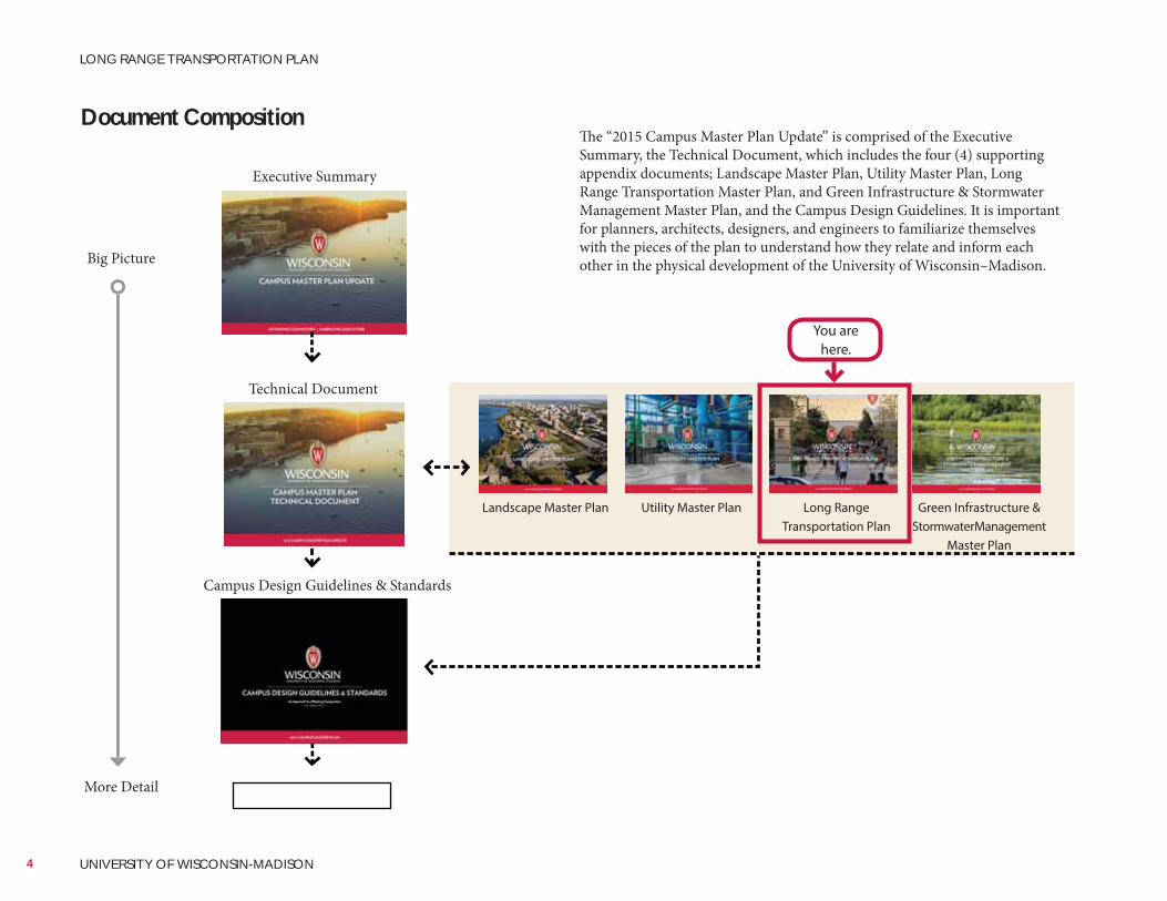
Document Composition
Landscape Master Plan Utility Master Plan Long Range Transportation Plan
Green Infrastructure & Stormwater Management
Master Plan
Technical Document
Big Picture
More Detail
Executive Summary
Campus Design Guidelines & Standards
The “2015 Campus Master Plan Update” is comprised of the Executive Summary, the Technical Document, which includes the four (4) supporting appendix documents; Landscape Master Plan, Utility Master Plan, Long Range Transportation Master Plan, and Green Infrastructure & Stormwater Management Master Plan, and the Campus Design Guidelines. It is important for planners, architects, designers, and engineers to familiarize themselves with the pieces of the plan to understand how they relate and inform each other in the physical development of the University of Wisconsin–Madison.
You are here.
4 UNIVERSITY OF WISCONSIN-MADISON
LONG RANGE TRANSPORTATION PLAN
2015 Campus Master Plan Executive SummaryA full color 24-page report that summarizes the major goals and guiding principles for the Master Plan. The document includes the Chancellor’s vision and the major goals and initiatives for each of the identified focus topics (appendices to the Technical Document). Welcomes and sets the tone for users and viewers of the master plan document. It is both a marketing piece for future development and a summary of the planning process.
2015 Campus Master Plan Technical DocumentThe unabridged thought and support behind the goals and guiding principles for the Master Plan. This more than 250-page document presents a roadmap for campus development over the next 30-50 years by referencing what has come previously and embracing what the future holds. Together with the Campus Design Guidelines, the Technical Document strives to give physical form to the university’s mission, vision, and programs through the effective use of human, environmental and fiscal resources.
UW–Madison Campus Design GuidelinesThe site specific framework that has been established to create the ground rules for a fruitful dialogue between planners, architects, engineers, campus community, and city/state authorities. Divided into nine Campus Design Neighborhoods, the goal of the guidelines is to enhance the university’s sense of place by creating well-defined, functional, sustainable, beautiful and coherent campus environments that promote intellectual and social exchange.
Appendices:Landscape Master Plan Establishes a ‘sense of place’ where phased growth and future development can occur while maintaining a cohesive environment.Utility Master Plan: Confirms status of the 2005 recommendations, acknowledges completed projects, and makes recommendations to meet the 2015 plan revisions.Long Range Transportation Plan: Updated from the previous LRTP, the plan is the university’s transportation vision and describes baseline conditions, travel behaviors, and trends all modes.Green Infrastructure & Stormwater Management Master Plan: A campuswide plan that recommends solutions to meet stormwater management
5
LONG RANGE TRANSPORTATION PLAN
LONG RANGE TRANSPORTATION PLAN

6 UNIVERSITY OF WISCONSIN-MADISON
LONG RANGE TRANSPORTATION PLAN
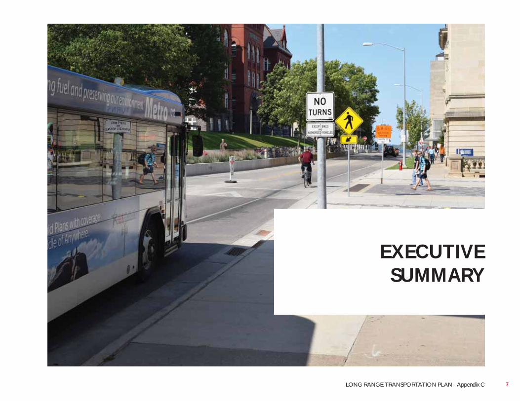
EXECUTIVE SUMMARY
7LONG RANGE TRANSPORTATION PLAN - Appendix C
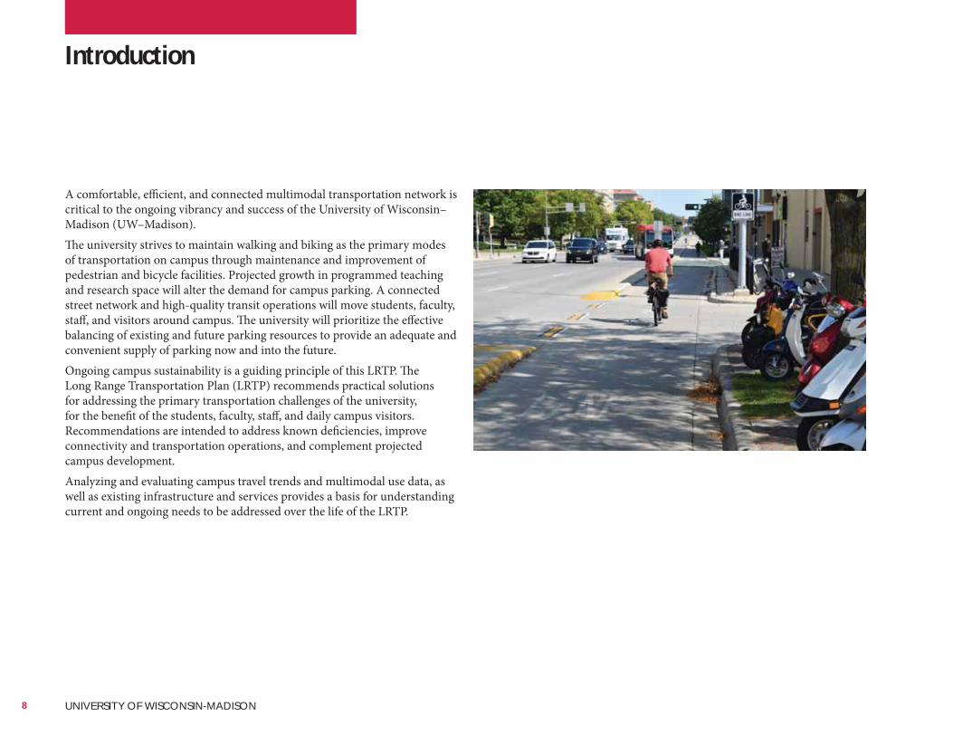
A comfortable, efficient, and connected multimodal transportation network is critical to the ongoing vibrancy and success of the University of Wisconsin–Madison (UW–Madison).The university strives to maintain walking and biking as the primary modes of transportation on campus through maintenance and improvement of pedestrian and bicycle facilities. Projected growth in programmed teaching and research space will alter the demand for campus parking. A connected street network and high-quality transit operations will move students, faculty, staff, and visitors around campus. The university will prioritize the effective balancing of existing and future parking resources to provide an adequate and convenient supply of parking now and into the future.Ongoing campus sustainability is a guiding principle of this LRTP. The Long Range Transportation Plan (LRTP) recommends practical solutions for addressing the primary transportation challenges of the university, for the benefit of the students, faculty, staff, and daily campus visitors. Recommendations are intended to address known deficiencies, improve connectivity and transportation operations, and complement projected campus development.Analyzing and evaluating campus travel trends and multimodal use data, as well as existing infrastructure and services provides a basis for understanding current and ongoing needs to be addressed over the life of the LRTP.
Introduction
8 UNIVERSITY OF WISCONSIN-MADISON
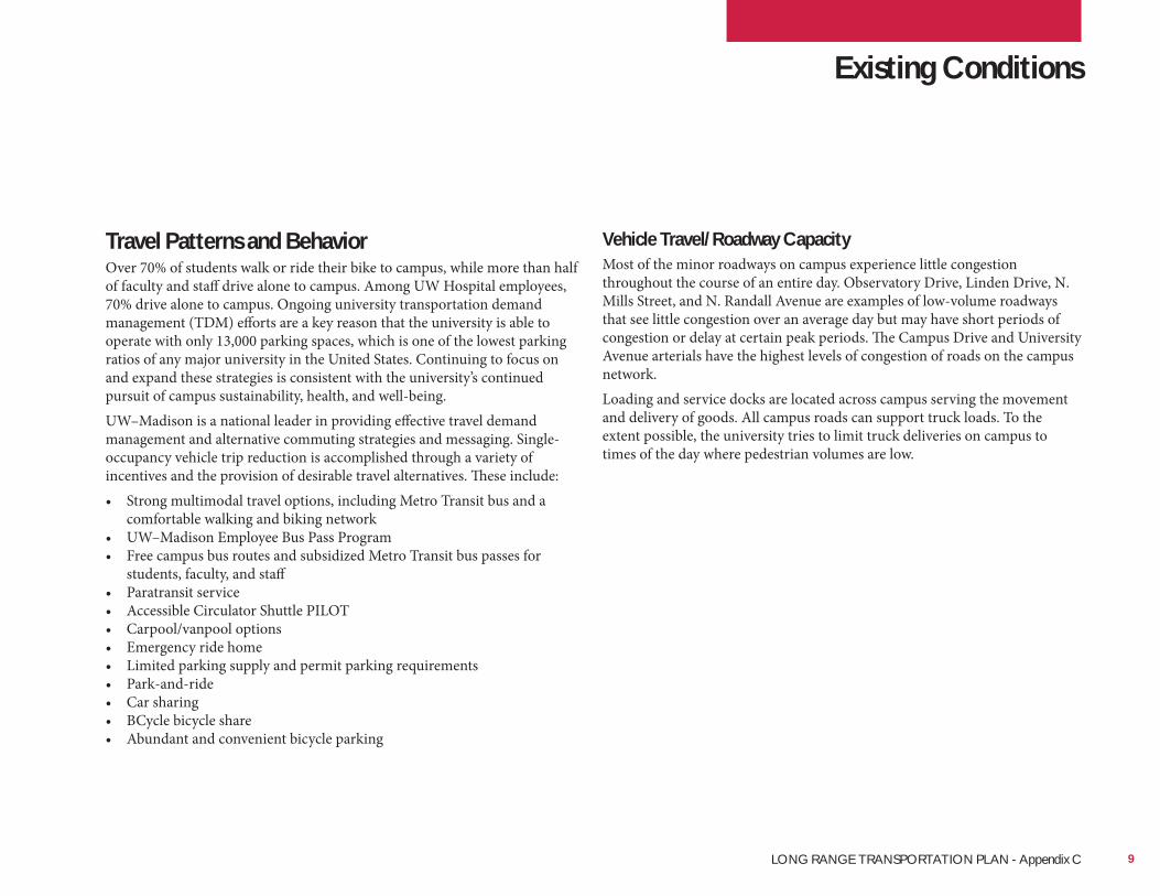
Travel Patterns and BehaviorOver 70% of students walk or ride their bike to campus, while more than half of faculty and staff drive alone to campus. Among UW Hospital employees, 70% drive alone to campus. Ongoing university transportation demand management (TDM) efforts are a key reason that the university is able to operate with only 13,000 parking spaces, which is one of the lowest parking ratios of any major university in the United States. Continuing to focus on and expand these strategies is consistent with the university’s continued pursuit of campus sustainability, health, and well-being.UW–Madison is a national leader in providing effective travel demand management and alternative commuting strategies and messaging. Single-occupancy vehicle trip reduction is accomplished through a variety of incentives and the provision of desirable travel alternatives. These include:• Strong multimodal travel options, including Metro Transit bus and a
comfortable walking and biking network• UW–Madison Employee Bus Pass Program• Free campus bus routes and subsidized Metro Transit bus passes for
students, faculty, and staff• Paratransit service• Accessible Circulator Shuttle PILOT• Carpool/vanpool options• Emergency ride home• Limited parking supply and permit parking requirements• Park-and-ride• Car sharing• BCycle bicycle share• Abundant and convenient bicycle parking
Existing Conditions
Vehicle Travel/Roadway CapacityMost of the minor roadways on campus experience little congestion throughout the course of an entire day. Observatory Drive, Linden Drive, N. Mills Street, and N. Randall Avenue are examples of low-volume roadways that see little congestion over an average day but may have short periods of congestion or delay at certain peak periods. The Campus Drive and University Avenue arterials have the highest levels of congestion of roads on the campus network.Loading and service docks are located across campus serving the movement and delivery of goods. All campus roads can support truck loads. To the extent possible, the university tries to limit truck deliveries on campus to times of the day where pedestrian volumes are low.
9LONG RANGE TRANSPORTATION PLAN - Appendix C
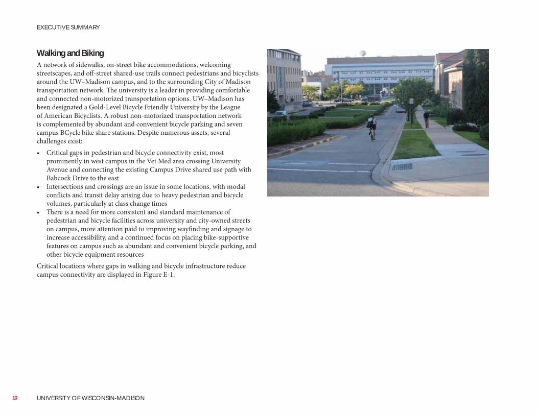
Walking and BikingA network of sidewalks, on-street bike accommodations, welcoming streetscapes, and off-street shared-use trails connect pedestrians and bicyclists around the UW–Madison campus, and to the surrounding City of Madison transportation network. The university is a leader in providing comfortable and connected non-motorized transportation options. UW–Madison has been designated a Gold-Level Bicycle Friendly University by the League of American Bicyclists. A robust non-motorized transportation network is complemented by abundant and convenient bicycle parking and seven campus BCycle bike share stations. Despite numerous assets, several challenges exist:• Critical gaps in pedestrian and bicycle connectivity exist, most
prominently in west campus in the Vet Med area crossing University Avenue and connecting the existing Campus Drive shared use path with Babcock Drive to the east
• Intersections and crossings are an issue in some locations, with modal conflicts and transit delay arising due to heavy pedestrian and bicycle volumes, particularly at class change times
• There is a need for more consistent and standard maintenance of pedestrian and bicycle facilities across university and city-owned streets on campus, more attention paid to improving wayfinding and signage to increase accessibility, and a continued focus on placing bike-supportive features on campus such as abundant and convenient bicycle parking, and other bicycle equipment resources
Critical locations where gaps in walking and bicycle infrastructure reduce campus connectivity are displayed in Figure E-1.
10 UNIVERSITY OF WISCONSIN-MADISON
EXECUTIVE SUMMARY
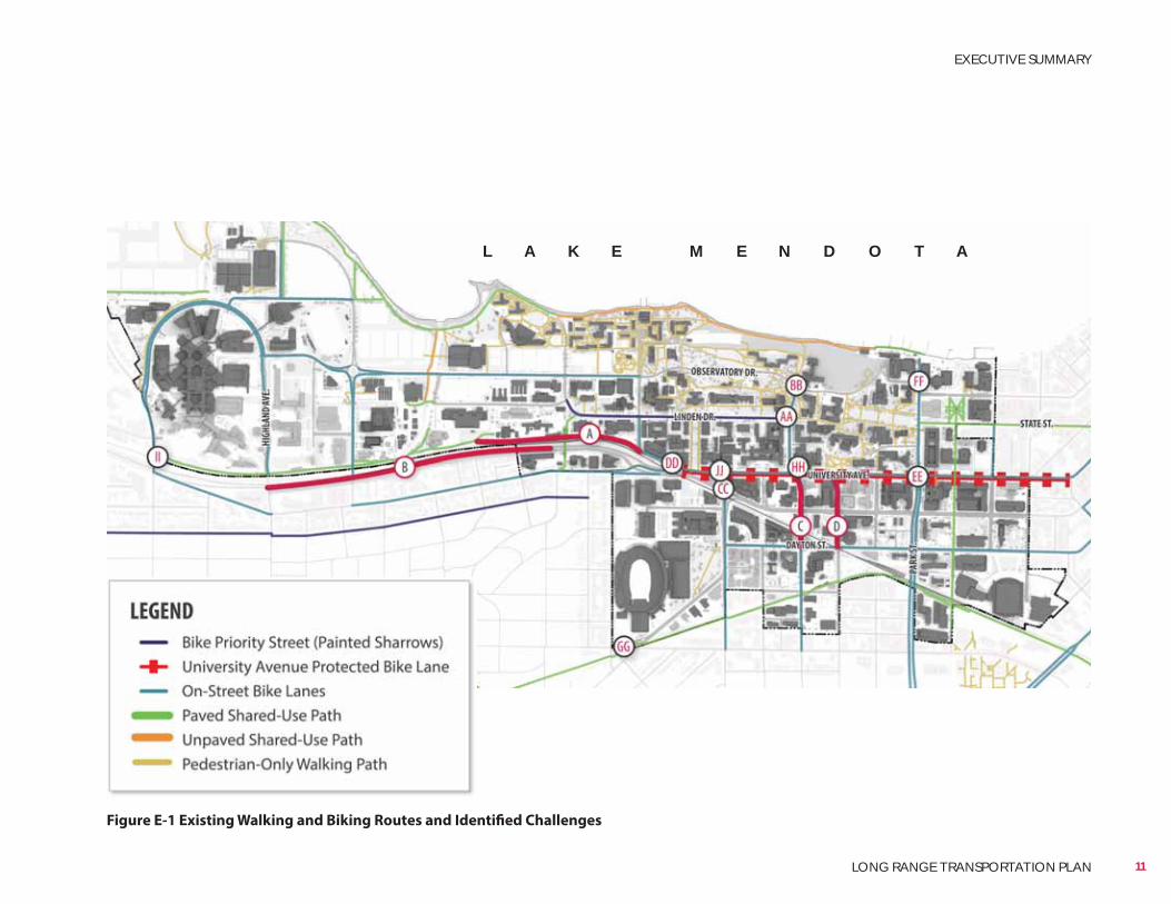
Figure E-1 Existing Walking and Biking Routes and Identified Challenges
L A K E M E N D O T A
11
EXECUTIVE SUMMARY
LONG RANGE TRANSPORTATION PLAN
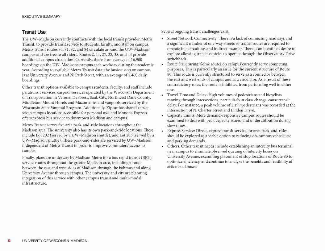
Several ongoing transit challenges exist:• Street Network Connectivity: There is a lack of connecting roadways and
a significant number of one-way streets so transit routes are required to operate in a circuitous and indirect manner. There is an identified desire to explore allowing transit vehicles to operate through the Observatory Drive switchback.
• Route Structuring: Some routes on campus currently serve competing purposes. This is particularly an issue for the current structure of Route 80. This route is currently structured to serve as a connector between the east and west ends of campus and as a circulator. As a result of these contradictory roles, the route is inhibited from performing well in either one.
• Travel Time and Delay: High volumes of pedestrians and bicyclists moving through intersections, particularly at class change, cause transit delay. For instance, a peak volume of 2,199 pedestrians was recorded at the intersection of N. Charter Street and Linden Drive.
• Capacity Limits: More demand-responsive campus routes should be examined to deal with peak capacity issues, and underutilization during slow times.
• Express Service: Direct, express transit service for area park-and-rides should be explored as a viable option to reducing on-campus vehicle use and parking demands.
• Others: Other transit needs include establishing an intercity bus terminal near campus to eliminate observed queuing of intercity buses on University Avenue, examining placement of stop locations of Route 80 to optimize efficiency, and continue to analyze the benefits and feasibility of articulated buses.
Transit UseThe UW–Madison currently contracts with the local transit provider, Metro Transit, to provide transit service to students, faculty, and staff on campus. Metro Transit routes 80, 81, 82, and 84 circulate around the UW–Madison campus and are free to all riders. Routes 2, 11, 27, 28, 38, and 44 provide additional campus circulation. Currently, there is an average of 16,900 boardings on the UW–Madison’s campus each weekday during the academic year. According to available Metro Transit data, the busiest stop on campus is at University Avenue and N. Park Street, with an average of 1,460 daily boardings.Other transit options available to campus students, faculty, and staff include paratransit services, carpool services operated by the Wisconsin Department of Transportation in Verona, DeForest, Sauk City, Northwest Dane County, Middleton, Mount Horeb, and Mazomanie, and vanpools serviced by the Wisconsin State Vanpool Program. Additionally, Zipcar has shared cars at seven campus locations accessible for personal use, and Monona Express offers express bus service to downtown Madison and campus.Metro Transit serves five area park-and-ride locations throughout the Madison area. The university also has its own park-and-ride locations. These include Lot 202 (served by a UW–Madison shuttle), and Lot 203 (served by a UW–Madison shuttle). These park-and-rides are serviced by UW–Madison independent of Metro Transit in order to improve commuters’ access to campus.Finally, plans are underway by Madison Metro for a bus rapid transit (BRT) service routes throughout the greater Madison area, including a route between the east and west sides of Madison through the isthmus and along University Avenue through campus. The university and city are planning integration of this service with other campus transit and multi-modal infrastructure.
12 UNIVERSITY OF WISCONSIN-MADISON
EXECUTIVE SUMMARY
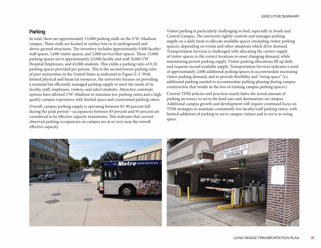
Visitor parking is particularly challenging to find, especially in South and Central Campus. The university tightly controls and manages parking supply on a daily basis to allocate available spaces (including visitor parking spaces), depending on events and other situations which drive demand. Transportation Services is challenged with allocating the correct supply of visitor spaces in the correct locations to meet changing demand, while maintaining permit parking supply. Visitor parking allocations fill up daily and requests exceed available supply. Transportation Services indicates a need of approximately 2,000 additional parking spaces to accommodate increasing visitor parking demand, and to provide flexibility and “swing space” (i.e. additional parking needed to accommodate parking phasing during campus construction that results in the loss of existing campus parking spaces.)Current TDM policies and practices nearly halve the actual amount of parking necessary to serve the land uses and destinations on campus. Additional campus growth and development will require continued focus on TDM strategies to maintain consistently low faculty/staff parking ratios, with limited additions of parking to serve campus visitors and to serve as swing space.
ParkingIn total, there are approximately 13,000 parking stalls on the UW–Madison campus. These stalls are located in surface lots or in underground and above-ground structures. The inventory includes approximately 9,400 faculty/staff spaces, 1,600 visitor spaces, and 2,000 service/fleet spaces. These 13,000 parking spaces serve approximately 22,000 faculty and staff, 8,600 UW Hospital Employees, and 43,000 students. This yields a parking ratio of 0.18 parking spaces provided per person. This is the second lowest parking ratio of peer universities in the United States as indicated in Figure E-2. With limited physical and financial resources, the university focuses on providing a minimal but efficiently managed parking supply to meet the needs of its faculty, staff, employees, visitors, and select students. Attractive commute options have allowed UW–Madison to maintain low parking ratios and a high quality campus experience with limited space and constrained parking ratios.Overall, campus parking supply is operating between 85-90 percent full during the peak period—occupancies between 85 percent and 95 percent are considered to be effective capacity maximums. This indicates that current observed parking occupancies on campus are at or very near the overall effective capacity.
13
EXECUTIVE SUMMARY
LONG RANGE TRANSPORTATION PLAN
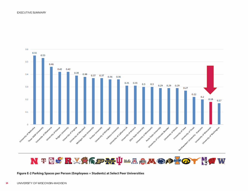
Figure E-2 Parking Spaces per Person (Employees + Students) at Select Peer Universities
14 UNIVERSITY OF WISCONSIN-MADISON
EXECUTIVE SUMMARY
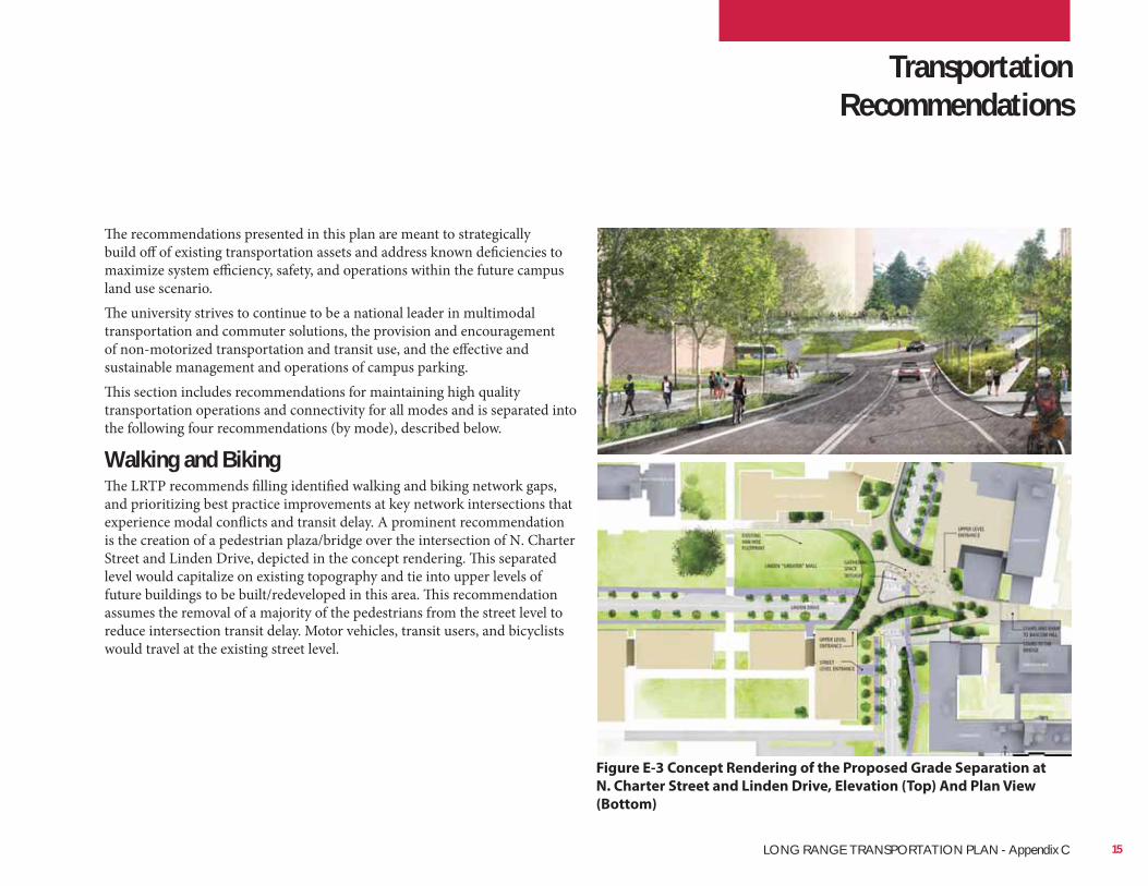
The recommendations presented in this plan are meant to strategically build off of existing transportation assets and address known deficiencies to maximize system efficiency, safety, and operations within the future campus land use scenario.The university strives to continue to be a national leader in multimodal transportation and commuter solutions, the provision and encouragement of non-motorized transportation and transit use, and the effective and sustainable management and operations of campus parking.This section includes recommendations for maintaining high quality transportation operations and connectivity for all modes and is separated into the following four recommendations (by mode), described below.
Walking and BikingThe LRTP recommends filling identified walking and biking network gaps, and prioritizing best practice improvements at key network intersections that experience modal conflicts and transit delay. A prominent recommendation is the creation of a pedestrian plaza/bridge over the intersection of N. Charter Street and Linden Drive, depicted in the concept rendering. This separated level would capitalize on existing topography and tie into upper levels of future buildings to be built/redeveloped in this area. This recommendation assumes the removal of a majority of the pedestrians from the street level to reduce intersection transit delay. Motor vehicles, transit users, and bicyclists would travel at the existing street level.
Figure E-3 Concept Rendering of the Proposed Grade Separation at
N. Charter Street and Linden Drive, Elevation (Top) And Plan View
(Bottom)
Transportation Recommendations
15LONG RANGE TRANSPORTATION PLAN - Appendix C
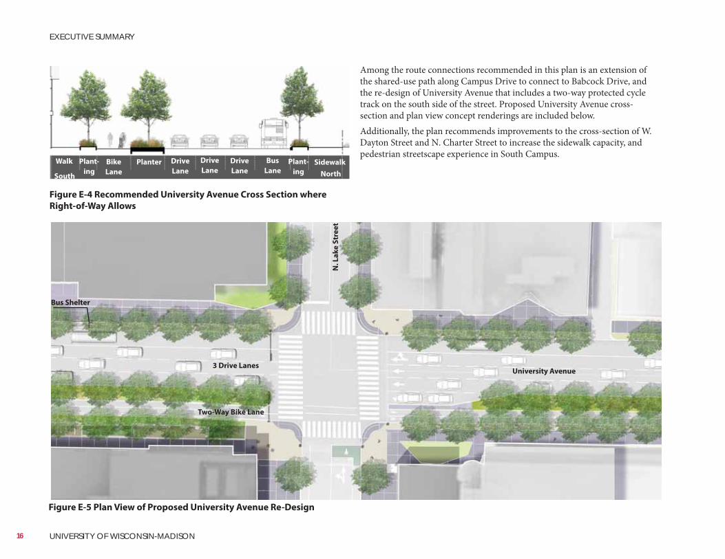
Among the route connections recommended in this plan is an extension of the shared-use path along Campus Drive to connect to Babcock Drive, and the re-design of University Avenue that includes a two-way protected cycle track on the south side of the street. Proposed University Avenue cross-section and plan view concept renderings are included below.Additionally, the plan recommends improvements to the cross-section of W. Dayton Street and N. Charter Street to increase the sidewalk capacity, and pedestrian streetscape experience in South Campus.
Figure E-4 Recommended University Avenue Cross Section where
Right-of-Way Allows
Figure E-5 Plan View of Proposed University Avenue Re-Design
University Avenue
Bus Shelter
3 Drive Lanes
Two-Way Bike Lane
N.
La
ke
Str
ee
t
Walk Bike
Lane
SidewalkDrive
Lane
Bus
LanePlanter Drive
Lane
Drive
Lane
Plant-
ing
Plant-
ing NorthSouth
16 UNIVERSITY OF WISCONSIN-MADISON
EXECUTIVE SUMMARY
TransitThis master plan recommends four priorities for improving transit service ridership, efficiency, and operations:• Address intersection locations with transit delay: Recommendations
for grade separation at N. Charter Street and Linden Drive should be implemented to address critical transit delay at the intersection
• Implement limited stop and/or express bus service to serve campus: To complement planned Bus Rapid Transit, the university should work with Metro Transit to add a limited stop and/or express bus service from area park-and-ride locations to campus. There is a particular opportunity to divert UW Hospital employees from driving single-occupancy vehicles to transit with this premium service
• Improve intra-campus bus connectivity: It is recommended Metro Transit revert back to the previous routing of Route 80 to provide more direct connections between the east and west sides of campus. Additionally, bus stops should continue to be examined closely for possible elimination or consolidation, and where feasible, doubleheaders (two simultaneously arriving buses) are operated on routes with capacity issues during class change time
• Establish a permanent inter-city bus terminal: This plan recommends a permanent inter-city bus terminal in east campus to remove queuing buses from University Avenue and East Campus Mall. The new bus terminal should be in a location that is easily serviceable by transit without adding new routes. Opportunities to integrate Metro Transit connections and mixed-use development into the terminal facility should be evaluated
One potential location for an east campus bus terminal is the current City of Madison Lake Street parking garage which is central to campus destinations and population density. UW–Madison will continue to work with the City of Madison and Metro Transit to locate a site for a new intercity bus terminal.
Road NetworkThe LRTP recommends the following modifications to the road network to promote access and circulation in light of planned land use changes, depicted in Figure E-6:• Vacate parts of Marsh Drive, Willow Drive, and Walnut Street, and install
a new north-south road from Marsh Drive to Observatory Drive to accommodate planned land uses
• Vacate Easterday Lane and add an east-west connection across Willow Creek
• Install new north-south access drive from University Avenue to Linden Drive, west of Charter Street
• Install new east-west parallel access road south of Linden Drive, west of Charter Street
• Install protected left turn phase for N. Charter Street southbound vehicles turning left on to Johnson Street
• Convert Brooks Street into a pedestrian mall/shared emergency drive• Convert Charter Street from one-way to two-way and add on-street
bicycle lanes in each direction from W. Dayton Street to Regent Street
17
EXECUTIVE SUMMARY
LONG RANGE TRANSPORTATION PLAN
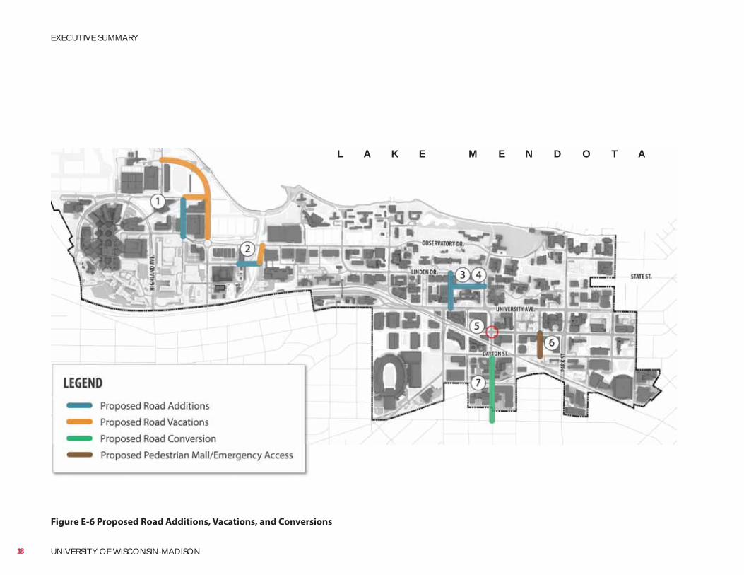
Figure E-6 Proposed Road Additions, Vacations, and Conversions
L A K E M E N D O T A
18 UNIVERSITY OF WISCONSIN-MADISON
EXECUTIVE SUMMARY
ParkingThis plan presents several recommendations for the university to effectively and efficiently provide and manage parking in conjunction with this Master Plan’s proposed campus development and redevelopment.• Continue to be leaders in transportation demand management (TDM)
and alternative commuter solutions• Maintain current parking ratios for faculty and staff. Work to shift UW
Hospital employee and other faculty and staff parking demand off campus through enhanced park-and-ride transit service
• Add 2,000 parking spaces over the next 20-40 years for visitors and provide swing space to accommodate parking phasing and construction
• Where possible, remove surface parking lots and consolidate parking supply into centrally located parking structures to allow for green space and campus development, increase parking efficiency, and improve water quality by reducing the amount of impermeable surface on campus
Parking Additions and ReductionsThis plan recommends an addition of 6,380 and removal of 4,380 parking spaces, for a net increase of 2,000 parking spaces over the next 20-40 years to accommodate the planned build-out. Recommended parking additions and reductions are depicted in the table and figures below. Additions and reductions result in the following increases by district:• West Campus: +689 spaces• Near West Campus: +81 spaces• Central Campus: +615 spaces• South Campus: +615 spacesRecommended additions and reductions are summarized in Figures E-7 and E-8.
19
EXECUTIVE SUMMARY
LONG RANGE TRANSPORTATION PLAN
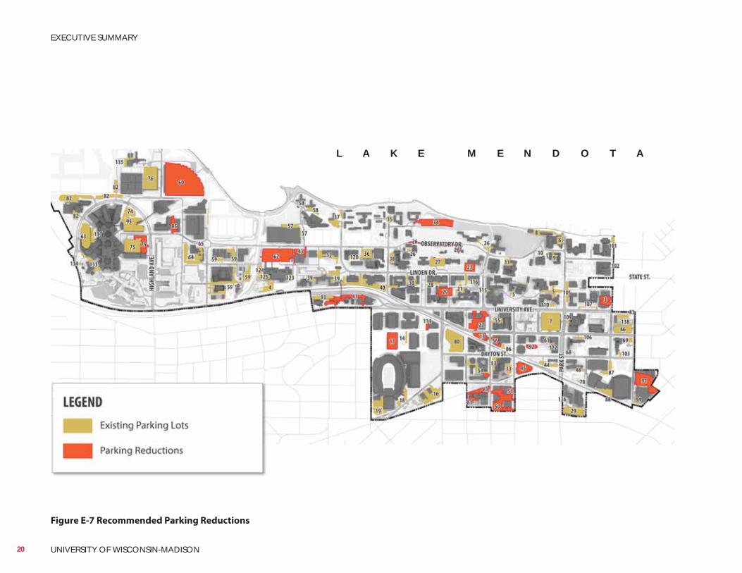
Figure E-7 Recommended Parking Reductions
L A K E M E N D O T A
20 UNIVERSITY OF WISCONSIN-MADISON
EXECUTIVE SUMMARY
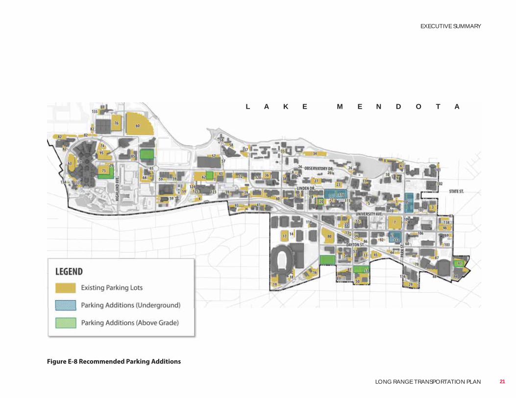
Figure E-8 Recommended Parking Additions
L A K E M E N D O T A
21
EXECUTIVE SUMMARY
LONG RANGE TRANSPORTATION PLAN
22 UNIVERSITY OF WISCONSIN-MADISON
This page left intentionally blank.
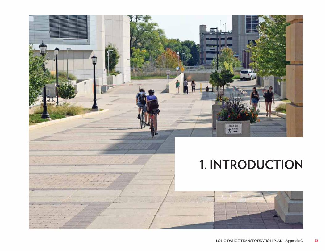
23LONG RANGE TRANSPORTATION PLAN - Appendix C
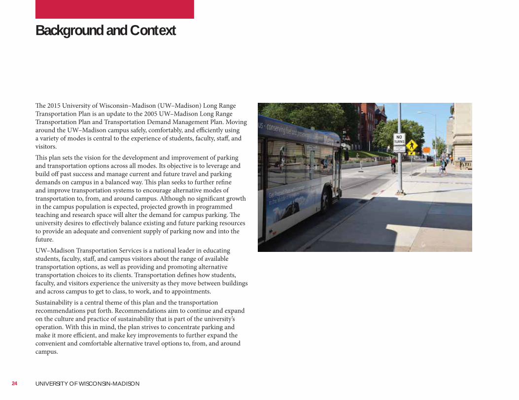
The 2015 University of Wisconsin–Madison (UW–Madison) Long Range Transportation Plan is an update to the 2005 UW–Madison Long Range Transportation Plan and Transportation Demand Management Plan. Moving around the UW–Madison campus safely, comfortably, and efficiently using a variety of modes is central to the experience of students, faculty, staff, and visitors.This plan sets the vision for the development and improvement of parking and transportation options across all modes. Its objective is to leverage and build off past success and manage current and future travel and parking demands on campus in a balanced way. This plan seeks to further refine and improve transportation systems to encourage alternative modes of transportation to, from, and around campus. Although no significant growth in the campus population is expected, projected growth in programmed teaching and research space will alter the demand for campus parking. The university desires to effectively balance existing and future parking resources to provide an adequate and convenient supply of parking now and into the future.UW–Madison Transportation Services is a national leader in educating students, faculty, staff, and campus visitors about the range of available transportation options, as well as providing and promoting alternative transportation choices to its clients. Transportation defines how students, faculty, and visitors experience the university as they move between buildings and across campus to get to class, to work, and to appointments.Sustainability is a central theme of this plan and the transportation recommendations put forth. Recommendations aim to continue and expand on the culture and practice of sustainability that is part of the university’s operation. With this in mind, the plan strives to concentrate parking and make it more efficient, and make key improvements to further expand the convenient and comfortable alternative travel options to, from, and around campus.
Background and Context
24 UNIVERSITY OF WISCONSIN-MADISON
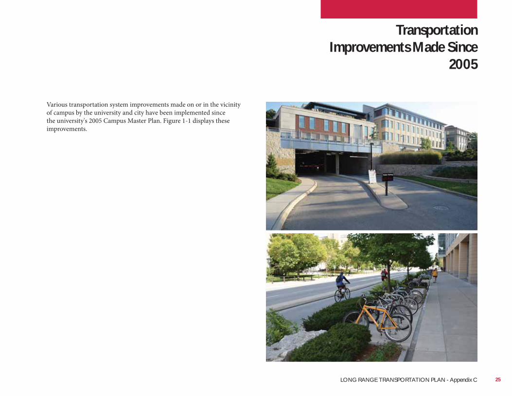
Various transportation system improvements made on or in the vicinity of campus by the university and city have been implemented since the university's 2005 Campus Master Plan. Figure 1-1 displays these improvements.
Transportation Improvements Made Since
2005
25LONG RANGE TRANSPORTATION PLAN - Appendix C
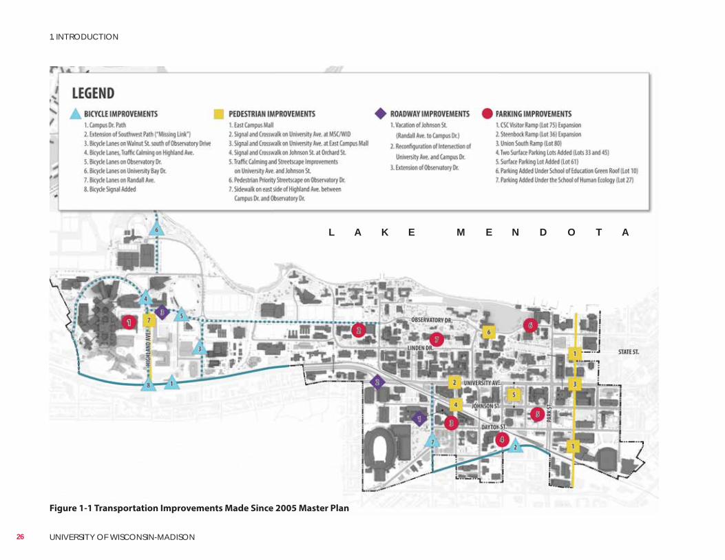
Figure 1-1 Transportation Improvements Made Since 2005 Master Plan
L A K E M E N D O T A
26 UNIVERSITY OF WISCONSIN-MADISON
1. INTRODUCTION
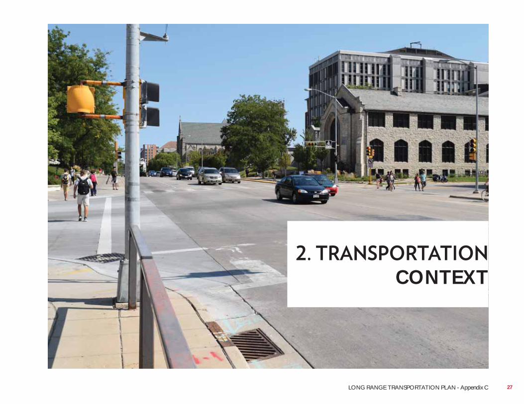
CONTEXT
27LONG RANGE TRANSPORTATION PLAN - Appendix C
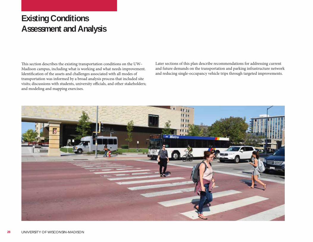
Existing Conditions Assessment and Analysis
This section describes the existing transportation conditions on the UW–Madison campus, including what is working and what needs improvement. Identification of the assets and challenges associated with all modes of transportation was informed by a broad analysis process that included site visits; discussions with students, university officials, and other stakeholders; and modeling and mapping exercises.
Later sections of this plan describe recommendations for addressing current and future demands on the transportation and parking infrastructure network and reducing single-occupancy vehicle trips through targeted improvements.
28 UNIVERSITY OF WISCONSIN-MADISON
Trip DistributionTo better understand the travel behaviors of those working on campus, trip distribution was analyzed using address data of university faculty and staff, as well as UW Hospital staff. The distribution was broken into five sectors.Individuals living in the northwest sector constitute 30 percent of total travelers and likely access campus using University Avenue to the west of campus. Those coming from the southwest of campus likely use Monroe Street and Regent Street and make up 20 percent of total travelers. In the southeast part of campus, 15 percent of people use US 151 to Park Street to access the campus area. Individuals making up the 30 percent of total travelers located in the northeast sector access campus via West Dayton Street, West Gorham Street, West Gilman Street, and Langdon Street from the Isthmus. Data indicates that 5 percent of total travelers are internal to the university campus.Figure 2-1 on the following page depicts trip distribution among UW–Madison faculty, staff, and hospital employees.
Current travel patterns and behavior among students, faculty, staff, and hospital employees at UW–Madison were determined using home address information and results from a 2014 Biennial Transportation Survey Report completed by Transportation Services.
Trip OriginDaily campus visitors come from locations near campus, throughout Madison, Dane County, and beyond.
StudentsParking is available to students on campus only under very specific limited condi tions. Students are encouraged to live in university residence halls; in Eagle Heights; in nearby neighborhoods on the near south and west side city neighborhoods such as Regent, Vilas, and Greenbush; and in the neighborhoods of the State Street, Capitol, and near east side parts of the city. The robust walking, bicycling, and public transit network on campus and in Madison supports commuting to campus using alternative modes.
The highest density of faculty and staff live on the near west and near east sides of Madison and in Shorewood Hills.
UW Hospital EmployeesHigh densities of hospital employees live on the west, southwest, and east sides of Madison and the surrounding communities of Middleton, Verona, Monona, Waunakee, McFarland, Oregon, and Sun Prairie.
Current Travel Patterns and Behavior
29LONG RANGE TRANSPORTATION PLAN - Appendix C
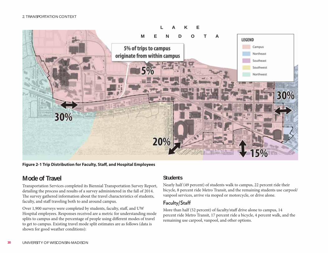
StudentsNearly half (49 percent) of students walk to campus, 22 percent ride their bicycle, 8 percent ride Metro Transit, and the remaining students use carpool/vanpool services, arrive via moped or motorcycle, or drive alone.
More than half (52 percent) of faculty/staff drive alone to campus, 14 percent ride Metro Transit, 17 percent ride a bicycle, 4 percent walk, and the remaining use carpool, vanpool, and other options.
Mode of TravelTransportation Services completed its Biennial Transportation Survey Report, detailing the process and results of a survey administered in the fall of 2014. The survey gathered information about the travel characteristics of students, faculty, and staff traveling both to and around campus.Over 1,900 surveys were completed by students, faculty, staff, and UW Hospital employees. Responses received are a metric for understanding mode splits to campus and the percentage of people using different modes of travel to get to campus. Existing travel mode split estimates are as follows (data is shown for good weather conditions):
Figure 2-1 Trip Distribution for Faculty, Staff, and Hospital Employees
L A K E
M E N D O T A
30 UNIVERSITY OF WISCONSIN-MADISON
2. TRANSPORTATION CONTEXT
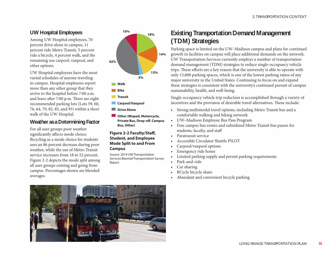
Existing Transportation Demand Management (TDM) StrategiesParking space is limited on the UW–Madison campus and plans for continued growth in facilities on campus will place additional demands on the network. UW Transportation Services currently employs a number of transportation demand management (TDM) strategies to reduce single-occupancy vehicle trips. These efforts are a key reason that the university is able to operate with only 13,000 parking spaces, which is one of the lowest parking ratios of any major university in the United States. Continuing to focus on and expand these strategies is consistent with the university’s continued pursuit of campus sustainability, health, and well-being.Single-occupancy vehicle trip reduction is accomplished through a variety of incentives and the provision of desirable travel alternatives. These include:• Strong multimodal travel options, including Metro Transit bus and a
comfortable walking and biking network• UW–Madison Employee Bus Pass Program• Free campus bus routes and subsidized Metro Transit bus passes for
students, faculty, and staff• Paratransit service• Accessible Circulator Shuttle PILOT• Carpool/vanpool options• Emergency ride home• Limited parking supply and permit parking requirements• Park-and-ride• Car sharing• BCycle bicycle share• Abundant and convenient bicycle parking
UW Hospital EmployeesAmong UW Hospital employees, 70 percent drive alone to campus, 11 percent ride Metro Transit, 5 percent ride a bicycle, 4 percent walk, and the remaining use carpool, vanpool, and other options.UW Hospital employees have the most varied schedules of anyone traveling to campus. Hospital employees report more than any other group that they arrive to the hospital before 7:00 a.m. and leave after 7:00 p.m. There are eight recommended parking lots (Lots 59, 60, 76, 64, 79, 82, 85, and 95) within a short walk of the UW Hospital.
Weather as a Determining FactorFor all user groups poor weather significantly affects mode choice. Bicycling as a mode choice for students sees an 86 percent decrease during poor weather, while the use of Metro Transit service increases from 18 to 52 percent.Figure 2-2 depicts the mode split among all user groups coming and going from campus. Percentages shown are blended averages.
42%
3%
13%
14%
18%10%
Figure 2-2 Faculty/Staff,
Student, and Employee
Mode Split to and From
Campus
Walk
Bike
Transit
Carpool/Vanpool
Drive Alone
Other (Moped, Motorcycle,
Private Bus, Drop-off, Campus
Bus, Other)
Source: 2014 UW Transportation Services Biennial Transportation Survey Report
31
2. TRANSPORTATION CONTEXT
LONG RANGE TRANSPORTATION PLAN
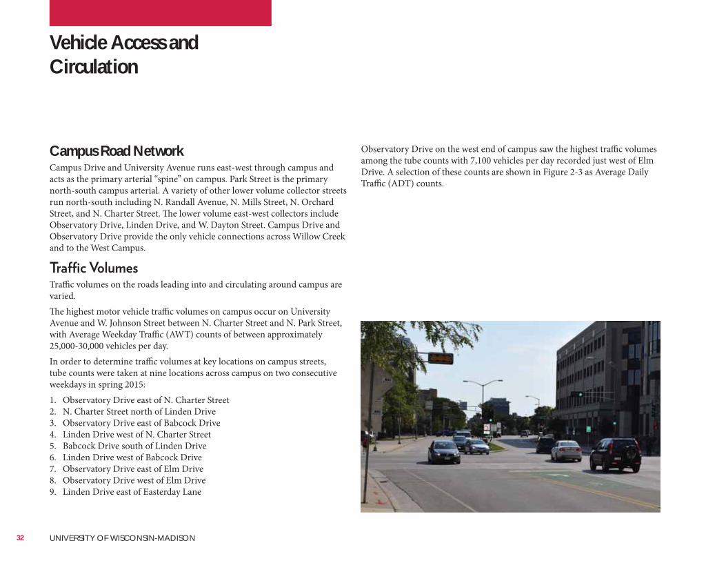
Observatory Drive on the west end of campus saw the highest traffic volumes among the tube counts with 7,100 vehicles per day recorded just west of Elm Drive. A selection of these counts are shown in Figure 2-3 as Average Daily Traffic (ADT) counts.
Campus Road NetworkCampus Drive and University Avenue runs east-west through campus and acts as the primary arterial “spine” on campus. Park Street is the primary north-south campus arterial. A variety of other lower volume collector streets run north-south including N. Randall Avenue, N. Mills Street, N. Orchard Street, and N. Charter Street. The lower volume east-west collectors include Observatory Drive, Linden Drive, and W. Dayton Street. Campus Drive and Observatory Drive provide the only vehicle connections across Willow Creek and to the West Campus.
Traffic volumes on the roads leading into and circulating around campus are varied.The highest motor vehicle traffic volumes on campus occur on University Avenue and W. Johnson Street between N. Charter Street and N. Park Street, with Average Weekday Traffic (AWT) counts of between approximately 25,000-30,000 vehicles per day.In order to determine traffic volumes at key locations on campus streets, tube counts were taken at nine locations across campus on two consecutive weekdays in spring 2015:1. Observatory Drive east of N. Charter Street2. N. Charter Street north of Linden Drive3. Observatory Drive east of Babcock Drive4. Linden Drive west of N. Charter Street5. Babcock Drive south of Linden Drive6. Linden Drive west of Babcock Drive7. Observatory Drive east of Elm Drive8. Observatory Drive west of Elm Drive9. Linden Drive east of Easterday Lane
Vehicle Access and Circulation
32 UNIVERSITY OF WISCONSIN-MADISON
Campus intersections are both signalized and unsignalized and the signalized intersections feature standard traffic controls.The Wisconsin and Southern Railroad passes through campus, and several points along the west and south sides of campus feature at-grade railroad crossings. These crossings occur at major intersections, such as Highland Avenue and University Avenue, and have standard railroad crossing controls.
Roadway CapacityOverall, UW–Madison’s vehicular traffic flows relatively well. When looking at traffic over the course of an entire day, most of the minor roadways on campus experience little congestion. Observatory Drive, Linden Drive, N. Mills Street, and N. Randall Avenue are examples of low-volume roadways that see little congestion over an average day but may have short periods of congestion or delay at certain peak periods. The Campus Drive and University Avenue arterials have the highest levels of congestion of roads on the campus network.Several streets offering direct access to and from campus, such as Highland Ave, N. Randall Avenue, and Regent Street, have moderate levels of congestion over the course of a day. Some intersections on campus experience significant transit delay due to high volumes of pedestrians and bicyclists. The intersection of N. Charter Street and Linden Drive is an example of vehicular traffic delay occurring during short peak periods of the day due to high pedestrian traffic despite the low traffic volumes. This vehicular delay slows down transit vehicles and may get them off schedule. This is discussed in more detail later in the plan.Figure 2-3 displays traffic volumes and congestion on campus.
Loading Docks and Truck RoutesLoading and service docks are located across campus serving the movement and delivery of goods. All campus roads can support truck loads. To the extent possible, the university tries to limit truck deliveries on campus to times of the day where pedestrian volumes are low. Figure 2-4 displays loading docks on campus.
33
2. TRANSPORTATION CONTEXT
LONG RANGE TRANSPORTATION PLAN
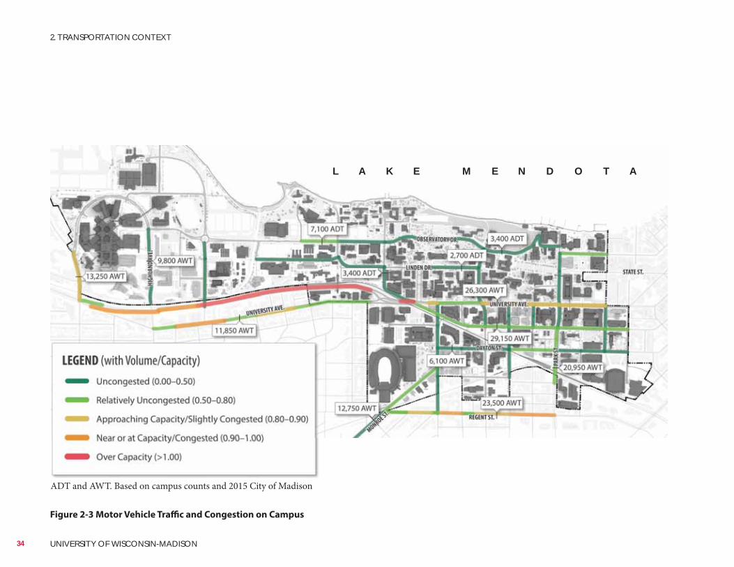
Figure 2-3 Motor Vehicle Traffic and Congestion on Campus
L A K E M E N D O T A
ADT and AWT. Based on campus counts and 2015 City of Madison
34 UNIVERSITY OF WISCONSIN-MADISON
2. TRANSPORTATION CONTEXT
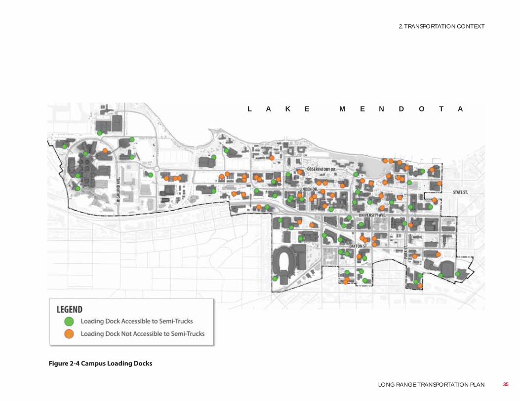
Figure 2-4 Campus Loading Docks
L A K E M E N D O T A
35
2. TRANSPORTATION CONTEXT
LONG RANGE TRANSPORTATION PLAN
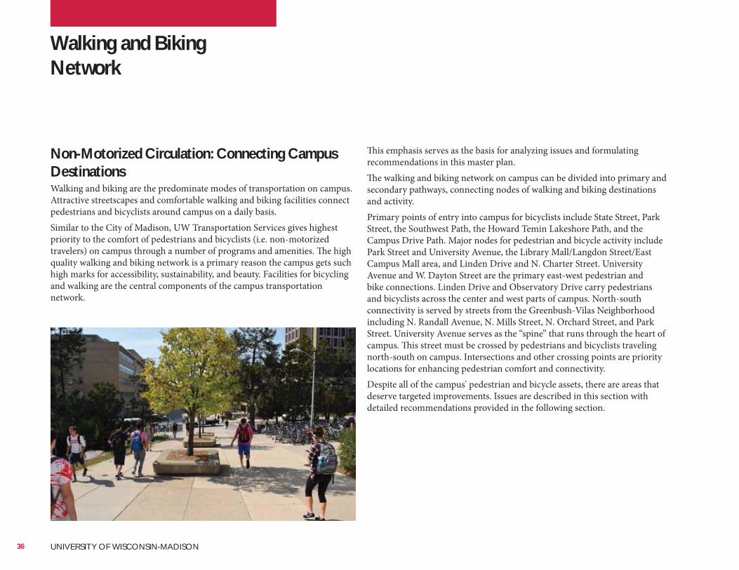
Walking and Biking Network
This emphasis serves as the basis for analyzing issues and formulating recommendations in this master plan.The walking and biking network on campus can be divided into primary and secondary pathways, connecting nodes of walking and biking destinations and activity.Primary points of entry into campus for bicyclists include State Street, Park Street, the Southwest Path, the Howard Temin Lakeshore Path, and the Campus Drive Path. Major nodes for pedestrian and bicycle activity include Park Street and University Avenue, the Library Mall/Langdon Street/East Campus Mall area, and Linden Drive and N. Charter Street. University Avenue and W. Dayton Street are the primary east-west pedestrian and bike connections. Linden Drive and Observatory Drive carry pedestrians and bicyclists across the center and west parts of campus. North-south connectivity is served by streets from the Greenbush-Vilas Neighborhood including N. Randall Avenue, N. Mills Street, N. Orchard Street, and Park Street. University Avenue serves as the “spine” that runs through the heart of campus. This street must be crossed by pedestrians and bicyclists traveling north-south on campus. Intersections and other crossing points are priority locations for enhancing pedestrian comfort and connectivity.Despite all of the campus' pedestrian and bicycle assets, there are areas that deserve targeted improvements. Issues are described in this section with detailed recommendations provided in the following section.
Non-Motorized Circulation: Connecting Campus DestinationsWalking and biking are the predominate modes of transportation on campus. Attractive streetscapes and comfortable walking and biking facilities connect pedestrians and bicyclists around campus on a daily basis.Similar to the City of Madison, UW Transportation Services gives highest priority to the comfort of pedestrians and bicyclists (i.e. non-motorized travelers) on campus through a number of programs and amenities. The high quality walking and biking network is a primary reason the campus gets such high marks for accessibility, sustainability, and beauty. Facilities for bicycling and walking are the central components of the campus transportation network.
36 UNIVERSITY OF WISCONSIN-MADISON
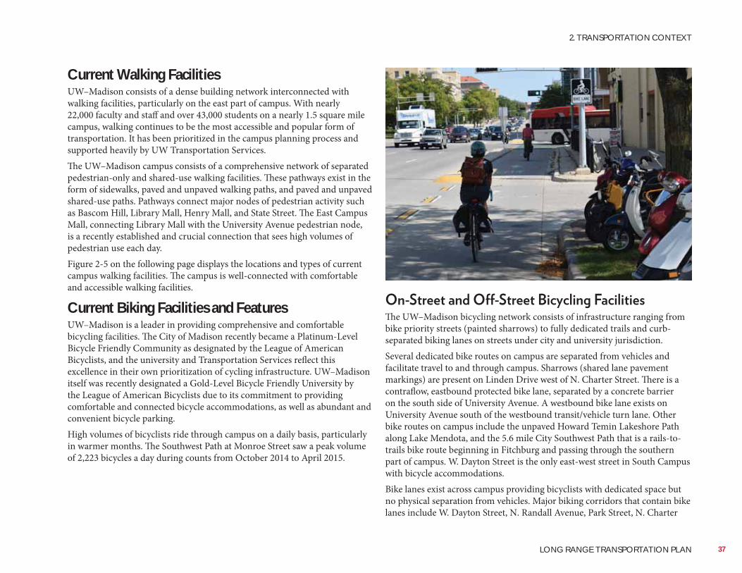
Current Walking FacilitiesUW–Madison consists of a dense building network interconnected with walking facilities, particularly on the east part of campus. With nearly 22,000 faculty and staff and over 43,000 students on a nearly 1.5 square mile campus, walking continues to be the most accessible and popular form of transportation. It has been prioritized in the campus planning process and supported heavily by UW Transportation Services.The UW–Madison campus consists of a comprehensive network of separated pedestrian-only and shared-use walking facilities. These pathways exist in the form of sidewalks, paved and unpaved walking paths, and paved and unpaved shared-use paths. Pathways connect major nodes of pedestrian activity such as Bascom Hill, Library Mall, Henry Mall, and State Street. The East Campus Mall, connecting Library Mall with the University Avenue pedestrian node, is a recently established and crucial connection that sees high volumes of pedestrian use each day.Figure 2-5 on the following page displays the locations and types of current campus walking facilities. The campus is well-connected with comfortable and accessible walking facilities.
Current Biking Facilities and FeaturesUW–Madison is a leader in providing comprehensive and comfortable bicycling facilities. The City of Madison recently became a Platinum-Level Bicycle Friendly Community as designated by the League of American Bicyclists, and the university and Transportation Services reflect this excellence in their own prioritization of cycling infrastructure. UW–Madison itself was recently designated a Gold-Level Bicycle Friendly University by the League of American Bicyclists due to its commitment to providing comfortable and connected bicycle accommodations, as well as abundant and convenient bicycle parking.High volumes of bicyclists ride through campus on a daily basis, particularly in warmer months. The Southwest Path at Monroe Street saw a peak volume of 2,223 bicycles a day during counts from October 2014 to April 2015.
The UW–Madison bicycling network consists of infrastructure ranging from bike priority streets (painted sharrows) to fully dedicated trails and curb-separated biking lanes on streets under city and university jurisdiction.Several dedicated bike routes on campus are separated from vehicles and facilitate travel to and through campus. Sharrows (shared lane pavement markings) are present on Linden Drive west of N. Charter Street. There is a contraflow, eastbound protected bike lane, separated by a concrete barrier on the south side of University Avenue. A westbound bike lane exists on University Avenue south of the westbound transit/vehicle turn lane. Other bike routes on campus include the unpaved Howard Temin Lakeshore Path along Lake Mendota, and the 5.6 mile City Southwest Path that is a rails-to-trails bike route beginning in Fitchburg and passing through the southern part of campus. W. Dayton Street is the only east-west street in South Campus with bicycle accommodations.Bike lanes exist across campus providing bicyclists with dedicated space but no physical separation from vehicles. Major biking corridors that contain bike lanes include W. Dayton Street, N. Randall Avenue, Park Street, N. Charter
37
2. TRANSPORTATION CONTEXT
LONG RANGE TRANSPORTATION PLAN
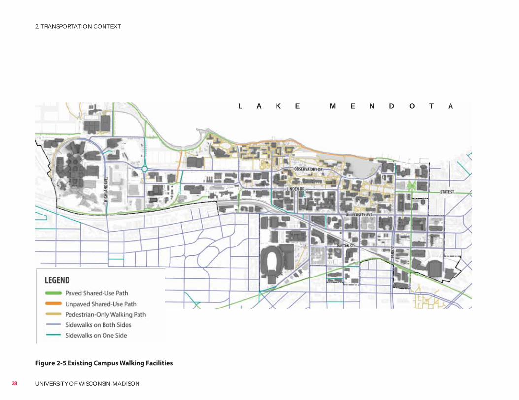
Figure 2-5 Existing Campus Walking Facilities
L A K E M E N D O T A
38 UNIVERSITY OF WISCONSIN-MADISON
2. TRANSPORTATION CONTEXT
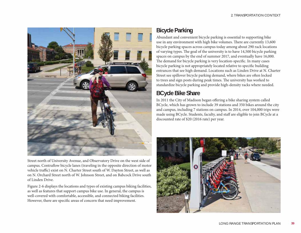
Bicycle ParkingAbundant and convenient bicycle parking is essential to supporting bike use in any environment with high bike volumes. There are currently 13,600 bicycle parking spaces across campus today among about 290 rack locations of varying types. The goal of the university is to have 14,500 bicycle parking spaces on campus by the end of summer 2017, and eventually have 16,000. The demand for bicycle parking is very location-specific. In many cases bicycle parking is not appropriately located relative to specific building entrances that see high demand. Locations such as Linden Drive at N. Charter Street see spillover bicycle parking demand, where bikes are often locked to trees and sign posts during peak times. The university has worked to standardize bicycle parking and provide high-density racks where needed.
BCycle Bike ShareIn 2011 the City of Madison began offering a bike sharing system called BCycle, which has grown to include 39 stations and 350 bikes around the city and campus, including 7 stations on campus. In 2014, over 104,000 trips were made using BCycle. Students, faculty, and staff are eligible to join BCycle at a discounted rate of $20 (2016 rate) per year.
Street north of University Avenue, and Observatory Drive on the west side of campus. Contraflow bicycle lanes (traveling in the opposite direction of motor vehicle traffic) exist on N. Charter Street south of W. Dayton Street, as well as on N. Orchard Street north of W. Johnson Street, and on Babcock Drive south of Linden Drive.Figure 2-6 displays the locations and types of existing campus biking facilities, as well as features that support campus bike use. In general, the campus is well-covered with comfortable, accessible, and connected biking facilities. However, there are specific areas of concern that need improvement.
39
2. TRANSPORTATION CONTEXT
LONG RANGE TRANSPORTATION PLAN
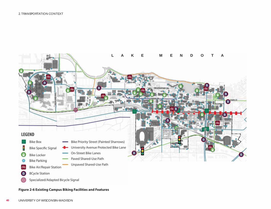
Figure 2-6 Existing Campus Biking Facilities and Features
L A K E M E N D O T A
40 UNIVERSITY OF WISCONSIN-MADISON
2. TRANSPORTATION CONTEXT
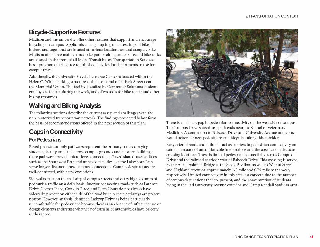
Bicycle-Supportive FeaturesMadison and the university offer other features that support and encourage bicycling on campus. Applicants can sign up to gain access to paid bike lockers and cages that are located at various locations around campus. Bike Madison offers free maintenance bike pumps along some paths and bike racks are located in the front of all Metro Transit buses. Transportation Services has a program offering free refurbished bicycles for departments to use for campus travel.Additionally, the university Bicycle Resource Center is located within the Helen C. White parking structure at the north end of N. Park Street near the Memorial Union. This facility is staffed by Commuter Solutions student employees, is open during the week, and offers tools for bike repair and other biking resources.
Walking and Biking AnalysisThe following sections describe the current assets and challenges with the non-motorized transportation network. The findings presented below form the basis of recommendations offered in the next section of this plan.
Gaps in ConnectivityFor PedestriansPaved pedestrian-only pathways represent the primary routes carrying students, faculty, and staff across campus grounds and between buildings; these pathways provide micro-level connections. Paved shared-use facilities such as the Southwest Path and unpaved facilities like the Lakeshore Path serve longer distance, cross-campus connections. Campus destinations are well-connected, with a few exceptions.Sidewalks exist on the majority of campus streets and carry high volumes of pedestrian traffic on a daily basis. Interior connecting roads such as Lathrop Drive, Clymer Place, Conklin Place, and Fitch Court do not always have sidewalks present on either side of the road but alternate pathways are present nearby. However, analysis identified Lathrop Drive as being particularly uncomfortable for pedestrians because there is an absence of infrastructure or design elements indicating whether pedestrians or automobiles have priority in this space.
There is a primary gap in pedestrian connectivity on the west side of campus. The Campus Drive shared-use path ends near the School of Veterinary Medicine. A connection to Babcock Drive and University Avenue to the east would better connect pedestrians and bicyclists along this corridor.Busy arterial roads and railroads act as barriers to pedestrian connectivity on campus because of uncomfortable intersections and the absence of adequate crossing locations. There is limited pedestrian connectivity across Campus Drive and the railroad corridor west of Babcock Drive. This crossing is served by the Alicia Ashman Bridge at the Stock Pavilion, as well as Walnut Street and Highland Avenues, approximately 1/2 mile and 0.70 mile to the west, respectively. Limited connectivity in this area is a concern due to the number of campus destinations that are present, and the concentration of students living in the Old University Avenue corridor and Camp Randall Stadium area.
41
2. TRANSPORTATION CONTEXT
LONG RANGE TRANSPORTATION PLAN
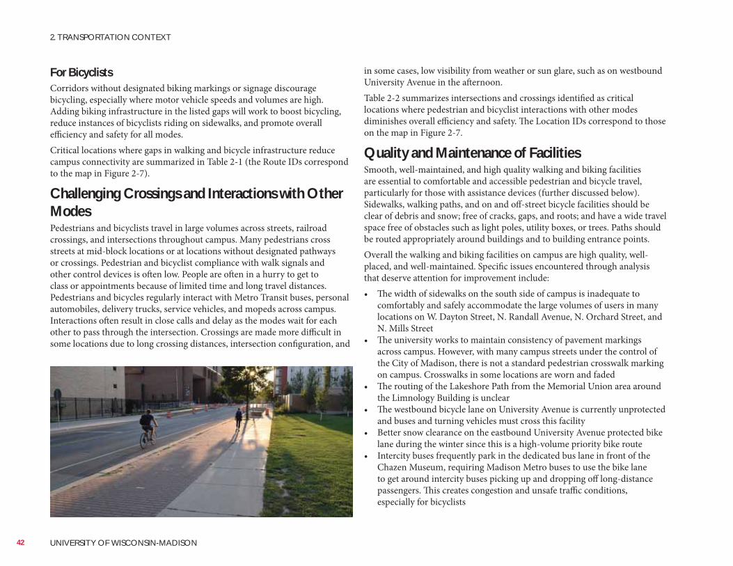
For BicyclistsCorridors without designated biking markings or signage discourage bicycling, especially where motor vehicle speeds and volumes are high. Adding biking infrastructure in the listed gaps will work to boost bicycling, reduce instances of bicyclists riding on sidewalks, and promote overall efficiency and safety for all modes.Critical locations where gaps in walking and bicycle infrastructure reduce campus connectivity are summarized in Table 2-1 (the Route IDs correspond to the map in Figure 2-7).
Challenging Crossings and Interactions with Other ModesPedestrians and bicyclists travel in large volumes across streets, railroad crossings, and intersections throughout campus. Many pedestrians cross streets at mid-block locations or at locations without designated pathways or crossings. Pedestrian and bicyclist compliance with walk signals and other control devices is often low. People are often in a hurry to get to class or appointments because of limited time and long travel distances. Pedestrians and bicycles regularly interact with Metro Transit buses, personal automobiles, delivery trucks, service vehicles, and mopeds across campus. Interactions often result in close calls and delay as the modes wait for each other to pass through the intersection. Crossings are made more difficult in some locations due to long crossing distances, intersection configuration, and
in some cases, low visibility from weather or sun glare, such as on westbound University Avenue in the afternoon.Table 2-2 summarizes intersections and crossings identified as critical locations where pedestrian and bicyclist interactions with other modes diminishes overall efficiency and safety. The Location IDs correspond to those on the map in Figure 2-7.
Quality and Maintenance of FacilitiesSmooth, well-maintained, and high quality walking and biking facilities are essential to comfortable and accessible pedestrian and bicycle travel, particularly for those with assistance devices (further discussed below). Sidewalks, walking paths, and on and off-street bicycle facilities should be clear of debris and snow; free of cracks, gaps, and roots; and have a wide travel space free of obstacles such as light poles, utility boxes, or trees. Paths should be routed appropriately around buildings and to building entrance points.Overall the walking and biking facilities on campus are high quality, well-placed, and well-maintained. Specific issues encountered through analysis that deserve attention for improvement include:• The width of sidewalks on the south side of campus is inadequate to
comfortably and safely accommodate the large volumes of users in many locations on W. Dayton Street, N. Randall Avenue, N. Orchard Street, and N. Mills Street
• The university works to maintain consistency of pavement markings across campus. However, with many campus streets under the control of the City of Madison, there is not a standard pedestrian crosswalk marking on campus. Crosswalks in some locations are worn and faded
• The routing of the Lakeshore Path from the Memorial Union area around the Limnology Building is unclear
• The westbound bicycle lane on University Avenue is currently unprotected and buses and turning vehicles must cross this facility
• Better snow clearance on the eastbound University Avenue protected bike lane during the winter since this is a high-volume priority bike route
• Intercity buses frequently park in the dedicated bus lane in front of the Chazen Museum, requiring Madison Metro buses to use the bike lane to get around intercity buses picking up and dropping off long-distance passengers. This creates congestion and unsafe traffic conditions, especially for bicyclists
42 UNIVERSITY OF WISCONSIN-MADISON
2. TRANSPORTATION CONTEXT
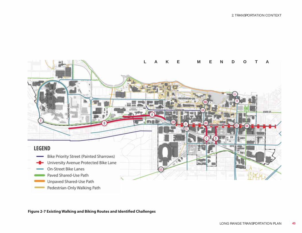
Figure 2-7 Existing Walking and Biking Routes and Identified Challenges
L A K E M E N D O T A
43
2. TRANSPORTATION CONTEXT
LONG RANGE TRANSPORTATION PLAN
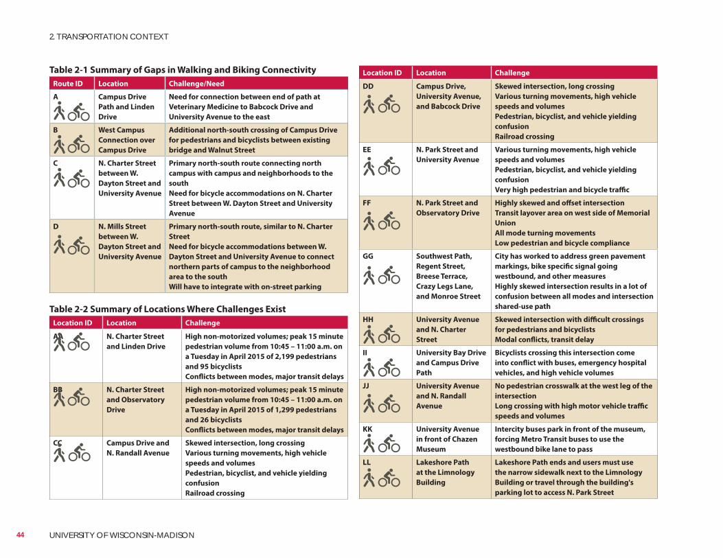
Location ID Location Challenge
DD Campus Drive,
University Avenue,
and Babcock Drive
Skewed intersection, long crossing
Various turning movements, high vehicle
speeds and volumes
Pedestrian, bicyclist, and vehicle yielding
confusion
Railroad crossing
EE N. Park Street and
University Avenue
Various turning movements, high vehicle
speeds and volumes
Pedestrian, bicyclist, and vehicle yielding
confusion
Very high pedestrian and bicycle traffic
FF N. Park Street and
Observatory Drive
Highly skewed and offset intersection
Transit layover area on west side of Memorial
Union
All mode turning movements
Low pedestrian and bicycle compliance
GG Southwest Path,
Regent Street,
Breese Terrace,
Crazy Legs Lane,
and Monroe Street
City has worked to address green pavement
markings, bike specific signal going
westbound, and other measures
Highly skewed intersection results in a lot of
confusion between all modes and intersection
shared-use path
HH University Avenue
and N. Charter
Street
Skewed intersection with difficult crossings
for pedestrians and bicyclists
Modal conflicts, transit delay
II University Bay Drive
and Campus Drive
Path
Bicyclists crossing this intersection come
into conflict with buses, emergency hospital
vehicles, and high vehicle volumes
JJ University Avenue
and N. Randall
Avenue
No pedestrian crosswalk at the west leg of the
intersection
Long crossing with high motor vehicle traffic
speeds and volumes
KK University Avenue
in front of Chazen
Museum
Intercity buses park in front of the museum,
forcing Metro Transit buses to use the
westbound bike lane to pass
LL Lakeshore Path
at the Limnology
Building
Lakeshore Path ends and users must use
the narrow sidewalk next to the Limnology
Building or travel through the building's
parking lot to access N. Park Street
Table 2-1 Summary of Gaps in Walking and Biking Connectivity
Route ID Location Challenge/Need
A Campus Drive
Path and Linden
Drive
Need for connection between end of path at
Veterinary Medicine to Babcock Drive and
University Avenue to the east
B West Campus
Connection over
Campus Drive
Additional north-south crossing of Campus Drive
for pedestrians and bicyclists between existing
bridge and Walnut Street
C N. Charter Street
between W.
Dayton Street and
University Avenue
Primary north-south route connecting north
campus with campus and neighborhoods to the
south
Need for bicycle accommodations on N. Charter
Street between W. Dayton Street and University
Avenue
D N. Mills Street
between W.
Dayton Street and
University Avenue
Primary north-south route, similar to N. Charter
Street
Need for bicycle accommodations between W.
Dayton Street and University Avenue to connect
northern parts of campus to the neighborhood
area to the south
Will have to integrate with on-street parking
Table 2-2 Summary of Locations Where Challenges Exist
Location ID Location Challenge
AA N. Charter Street
and Linden Drive
High non-motorized volumes; peak 15 minute
pedestrian volume from 10:45 – 11:00 a.m. on
a Tuesday in April 2015 of 2,199 pedestrians
and 95 bicyclists
Conflicts between modes, major transit delays
BB N. Charter Street
and Observatory
Drive
High non-motorized volumes; peak 15 minute
pedestrian volume from 10:45 – 11:00 a.m. on
a Tuesday in April 2015 of 1,299 pedestrians
and 26 bicyclists
Conflicts between modes, major transit delays
CC Campus Drive and
N. Randall Avenue
Skewed intersection, long crossing
Various turning movements, high vehicle
speeds and volumes
Pedestrian, bicyclist, and vehicle yielding
confusion
Railroad crossing
44 UNIVERSITY OF WISCONSIN-MADISON
2. TRANSPORTATION CONTEXT
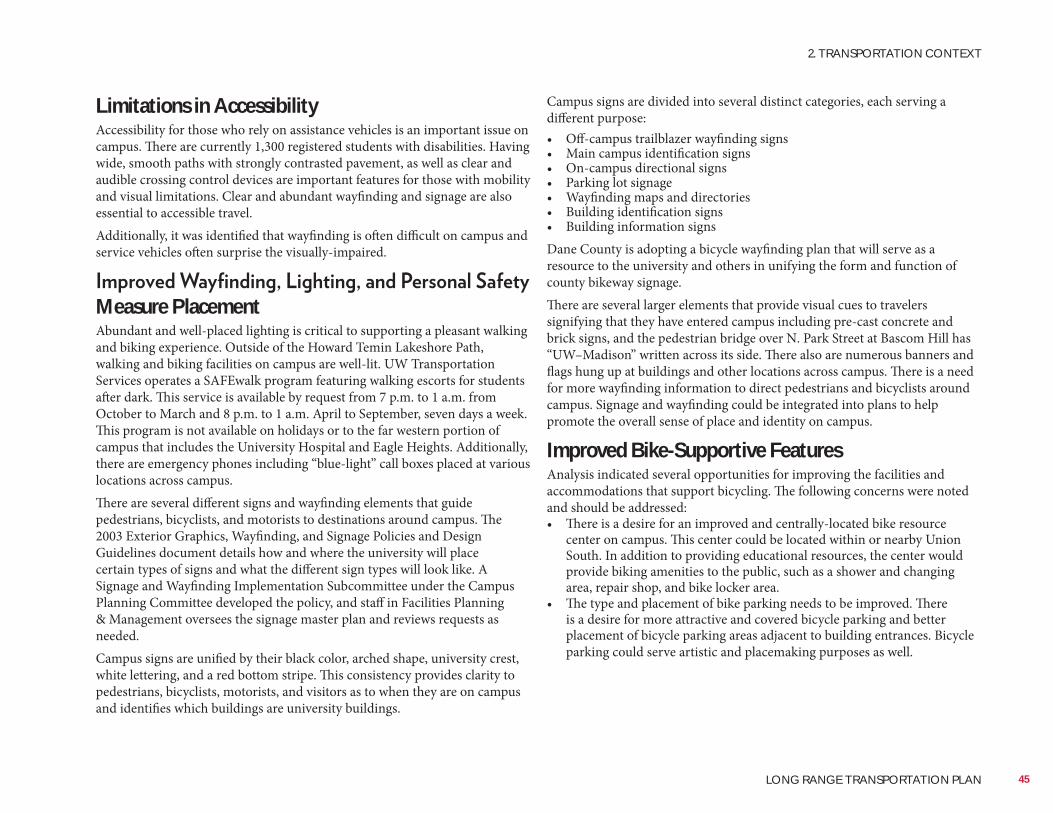
Limitations in AccessibilityAccessibility for those who rely on assistance vehicles is an important issue on campus. There are currently 1,300 registered students with disabilities. Having wide, smooth paths with strongly contrasted pavement, as well as clear and audible crossing control devices are important features for those with mobility and visual limitations. Clear and abundant wayfinding and signage are also essential to accessible travel.Additionally, it was identified that wayfinding is often difficult on campus and service vehicles often surprise the visually-impaired.
Measure PlacementAbundant and well-placed lighting is critical to supporting a pleasant walking and biking experience. Outside of the Howard Temin Lakeshore Path, walking and biking facilities on campus are well-lit. UW Transportation Services operates a SAFEwalk program featuring walking escorts for students after dark. This service is available by request from 7 p.m. to 1 a.m. from October to March and 8 p.m. to 1 a.m. April to September, seven days a week. This program is not available on holidays or to the far western portion of campus that includes the University Hospital and Eagle Heights. Additionally, there are emergency phones including “blue-light” call boxes placed at various locations across campus.There are several different signs and wayfinding elements that guide pedestrians, bicyclists, and motorists to destinations around campus. The 2003 Exterior Graphics, Wayfinding, and Signage Policies and Design Guidelines document details how and where the university will place certain types of signs and what the different sign types will look like. A Signage and Wayfinding Implementation Subcommittee under the Campus Planning Committee developed the policy, and staff in Facilities Planning & Management oversees the signage master plan and reviews requests as needed.Campus signs are unified by their black color, arched shape, university crest, white lettering, and a red bottom stripe. This consistency provides clarity to pedestrians, bicyclists, motorists, and visitors as to when they are on campus and identifies which buildings are university buildings.
Campus signs are divided into several distinct categories, each serving a different purpose:• Off-campus trailblazer wayfinding signs• Main campus identification signs• On-campus directional signs• Parking lot signage• Wayfinding maps and directories• Building identification signs• Building information signsDane County is adopting a bicycle wayfinding plan that will serve as a resource to the university and others in unifying the form and function of county bikeway signage.There are several larger elements that provide visual cues to travelers signifying that they have entered campus including pre-cast concrete and brick signs, and the pedestrian bridge over N. Park Street at Bascom Hill has “UW–Madison” written across its side. There also are numerous banners and flags hung up at buildings and other locations across campus. There is a need for more wayfinding information to direct pedestrians and bicyclists around campus. Signage and wayfinding could be integrated into plans to help promote the overall sense of place and identity on campus.
Improved Bike-Supportive FeaturesAnalysis indicated several opportunities for improving the facilities and accommodations that support bicycling. The following concerns were noted and should be addressed:• There is a desire for an improved and centrally-located bike resource
center on campus. This center could be located within or nearby Union South. In addition to providing educational resources, the center would provide biking amenities to the public, such as a shower and changing area, repair shop, and bike locker area.
• The type and placement of bike parking needs to be improved. There is a desire for more attractive and covered bicycle parking and better placement of bicycle parking areas adjacent to building entrances. Bicycle parking could serve artistic and placemaking purposes as well.
45
2. TRANSPORTATION CONTEXT
LONG RANGE TRANSPORTATION PLAN
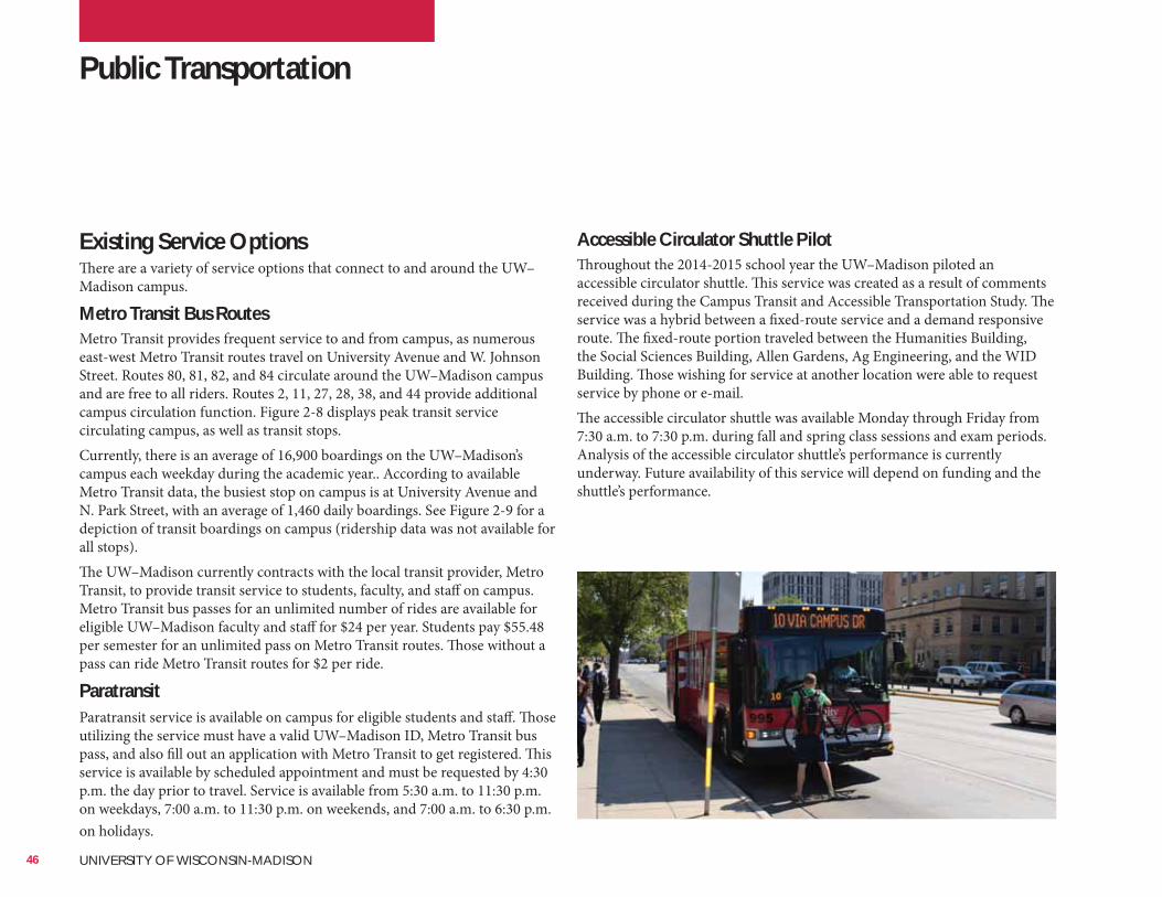
Existing Service OptionsThere are a variety of service options that connect to and around the UW–Madison campus.
Metro Transit Bus RoutesMetro Transit provides frequent service to and from campus, as numerous east-west Metro Transit routes travel on University Avenue and W. Johnson Street. Routes 80, 81, 82, and 84 circulate around the UW–Madison campus and are free to all riders. Routes 2, 11, 27, 28, 38, and 44 provide additional campus circulation function. Figure 2-8 displays peak transit service circulating campus, as well as transit stops.Currently, there is an average of 16,900 boardings on the UW–Madison’s campus each weekday during the academic year.. According to available Metro Transit data, the busiest stop on campus is at University Avenue and N. Park Street, with an average of 1,460 daily boardings. See Figure 2-9 for a depiction of transit boardings on campus (ridership data was not available for all stops).The UW–Madison currently contracts with the local transit provider, Metro Transit, to provide transit service to students, faculty, and staff on campus. Metro Transit bus passes for an unlimited number of rides are available for eligible UW–Madison faculty and staff for $24 per year. Students pay $55.48 per semester for an unlimited pass on Metro Transit routes. Those without a pass can ride Metro Transit routes for $2 per ride.
ParatransitParatransit service is available on campus for eligible students and staff. Those utilizing the service must have a valid UW–Madison ID, Metro Transit bus pass, and also fill out an application with Metro Transit to get registered. This service is available by scheduled appointment and must be requested by 4:30 p.m. the day prior to travel. Service is available from 5:30 a.m. to 11:30 p.m. on weekdays, 7:00 a.m. to 11:30 p.m. on weekends, and 7:00 a.m. to 6:30 p.m. on holidays.
Accessible Circulator Shuttle PilotThroughout the 2014-2015 school year the UW–Madison piloted an accessible circulator shuttle. This service was created as a result of comments received during the Campus Transit and Accessible Transportation Study. The service was a hybrid between a fixed-route service and a demand responsive route. The fixed-route portion traveled between the Humanities Building, the Social Sciences Building, Allen Gardens, Ag Engineering, and the WID Building. Those wishing for service at another location were able to request service by phone or e-mail.The accessible circulator shuttle was available Monday through Friday from 7:30 a.m. to 7:30 p.m. during fall and spring class sessions and exam periods. Analysis of the accessible circulator shuttle’s performance is currently underway. Future availability of this service will depend on funding and the shuttle’s performance.
Public Transportation
46 UNIVERSITY OF WISCONSIN-MADISON
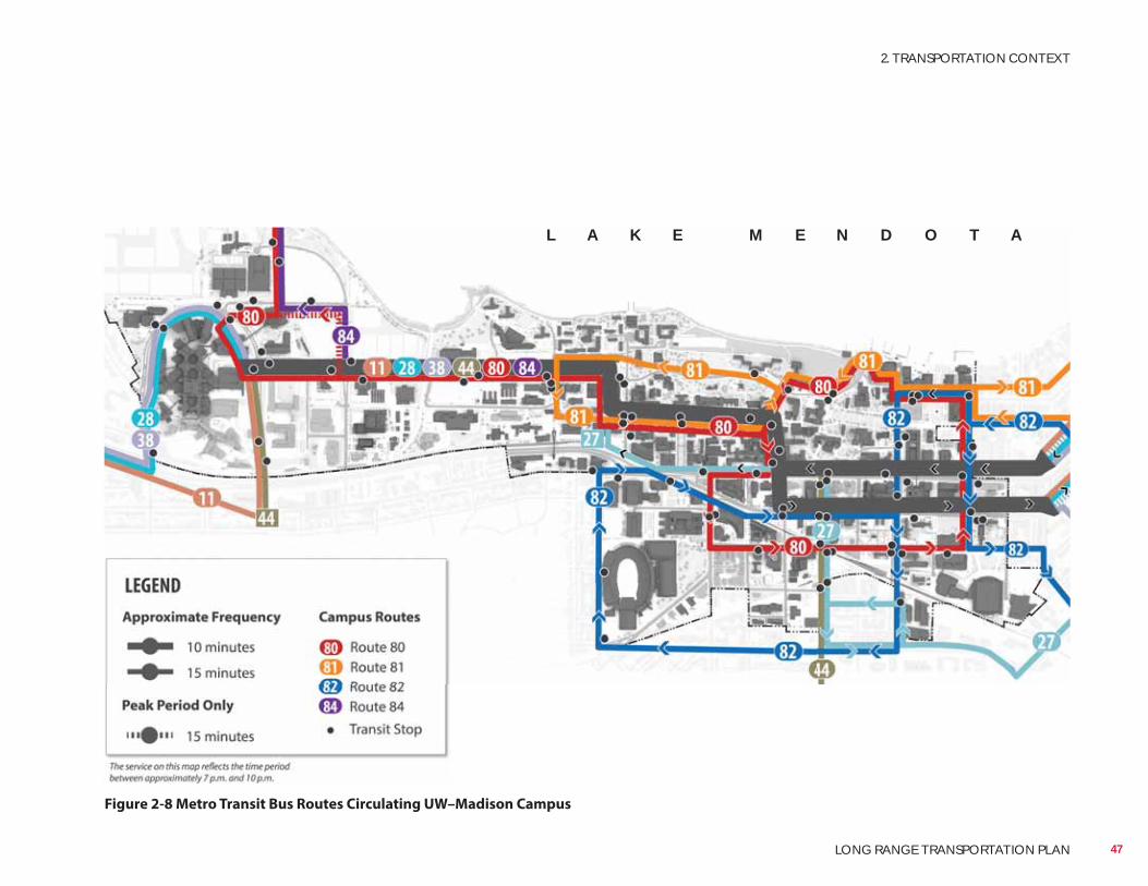
Figure 2-8 Metro Transit Bus Routes Circulating UW–Madison Campus
L A K E M E N D O T A
47
2. TRANSPORTATION CONTEXT
LONG RANGE TRANSPORTATION PLAN
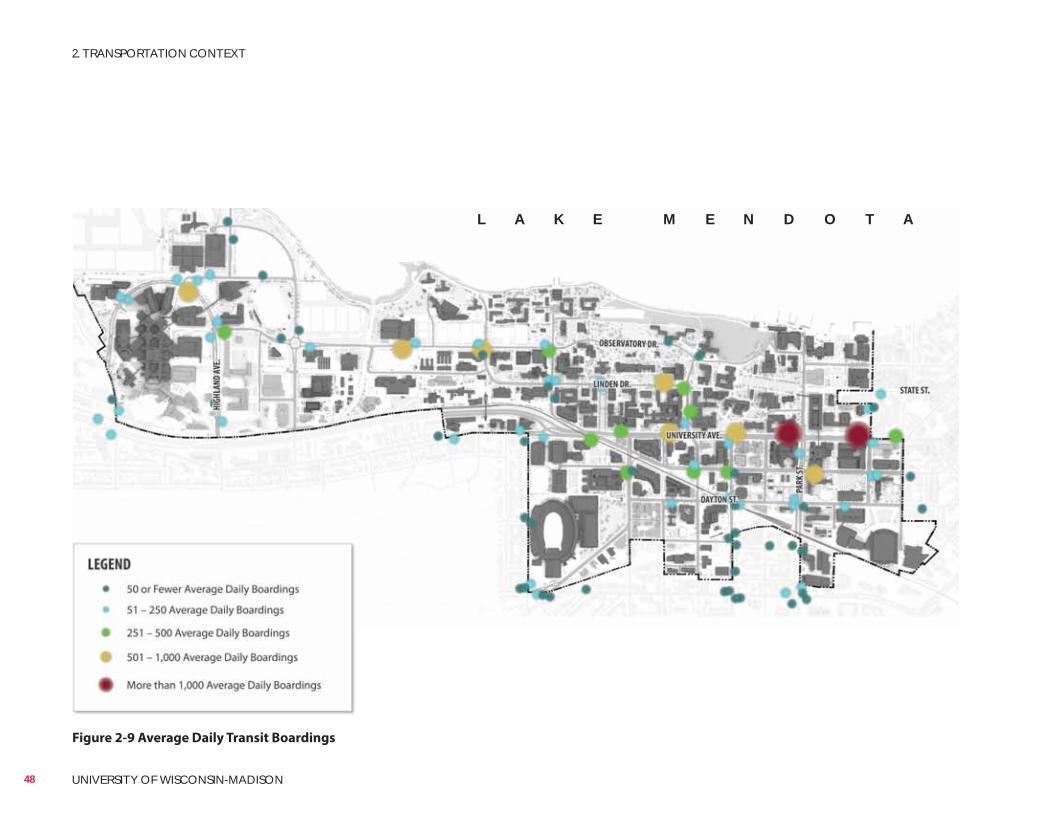
Figure 2-9 Average Daily Transit Boardings
L A K E M E N D O T A
48 UNIVERSITY OF WISCONSIN-MADISON
2. TRANSPORTATION CONTEXT
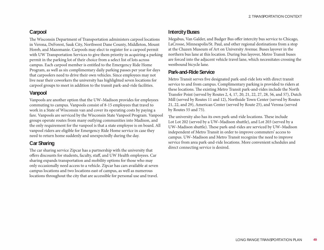
Intercity BusesMegabus, Van Galder, and Badger Bus offer intercity bus service to Chicago, LaCrosse, Minneapolis/St. Paul, and other regional destinations from a stop at the Chazen Museum of Art on University Avenue. Buses layover in the northern bus lane at this location. During bus layover, Metro Transit buses are forced into the adjacent vehicle travel lane, which necessitates crossing the westbound bicycle lane.
Park-and-Ride ServiceMetro Transit serves five designated park-and-ride lots with direct transit service to and from campus. Complimentary parking is provided to riders at these locations. The existing Metro Transit park-and-rides include the North Transfer Point (served by Routes 2, 4, 17, 20, 21, 22, 27, 28, 56, and 57), Dutch Mill (served by Routes 11 and 12), Northside Town Center (served by Routes 21, 22, and 29), American Center (served by Route 25), and Verona (served by Routes 55 and 75).The university also has its own park-and-ride locations. These include Lot Lot 202 (served by a UW–Madison shuttle), and Lot 203 (served by a UW–Madison shuttle). These park-and-rides are serviced by UW–Madison independent of Metro Transit in order to improve commuters’ access to campus. UW–Madison and Metro Transit recognize the need to improve service from area park-and-ride locations. More convenient schedules and direct connecting service is desired.
CarpoolThe Wisconsin Department of Transportation administers carpool locations in Verona, DeForest, Sauk City, Northwest Dane County, Middleton, Mount Horeb, and Mazomanie. Carpools may elect to register for a carpool permit with UW Transportation Services to give them priority in acquiring a parking permit in the parking lot of their choice from a select list of lots across campus. Each carpool member is entitled to the Emergency Ride Home Program, as well as six complimentary daily parking passes per year for days that carpoolers need to drive their own vehicles. Since employees may not live near their coworkers the university has highlighted seven locations for carpool groups to meet in addition to the transit park-and-ride facilities.
VanpoolVanpools are another option that the UW–Madison provides for employees commuting to campus. Vanpools consist of 8-15 employees that travel to work in a State of Wisconsin van and cover its operating costs by paying a fare. Vanpools are serviced by the Wisconsin State Vanpool Program. Vanpool groups operate routes from many outlying communities into Madison, and the only requirement for the vanpool is that a state employee is on board. All vanpool riders are eligible for Emergency Ride Home service in case they need to return home suddenly and unexpectedly during the day.
Car SharingThe car sharing service Zipcar has a partnership with the university that offers discounts for students, faculty, staff, and UW Health employees. Car sharing expands transportation and mobility options for those who may only occasionally need access to a vehicle. Zipcar has cars available at seven campus locations and two locations east of campus, as well as numerous locations throughout the city that are accessible for personal use and travel.
49
2. TRANSPORTATION CONTEXT
LONG RANGE TRANSPORTATION PLAN
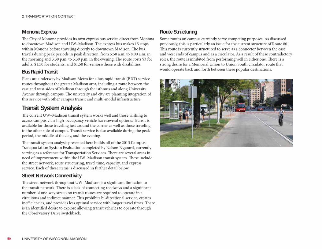
Route StructuringSome routes on campus currently serve competing purposes. As discussed previously, this is particularly an issue for the current structure of Route 80. This route is currently structured to serve as a connector between the east and west ends of campus and as a circulator. As a result of these contradictory roles, the route is inhibited from performing well in either one. There is a strong desire for a Memorial Union to Union South circulator route that would operate back and forth between these popular destinations.
Monona ExpressThe City of Monona provides its own express bus service direct from Monona to downtown Madison and UW–Madison. The express bus makes 15 stops within Monona before traveling directly to downtown Madison. The bus travels during peak periods in peak direction, from 5:50 a.m. to 8:00 a.m. in the morning and 3:30 p.m. to 5:30 p.m. in the evening. The route costs $3 for adults, $1.50 for students, and $1.50 for seniors/those with disabilities.
Bus Rapid TransitPlans are underway by Madison Metro for a bus rapid transit (BRT) service routes throughout the greater Madison area, including a route between the east and west sides of Madison through the isthmus and along University Avenue through campus. The university and city are planning integration of this service with other campus transit and multi-modal infrastructure.
Transit System AnalysisThe current UW–Madison transit system works well and those wishing to access campus via a high-occupancy vehicle have several options. Transit is available for those traveling just around the corner as well as those traveling to the other side of campus. Transit service is also available during the peak period, the middle of the day, and the evening.The transit system analysis presented here builds off of the 2013 Campus Transportation System Evaluation completed by Nelson Nygaard, currently serving as a reference for Transportation Services. There are several areas in need of improvement within the UW–Madison transit system. These include the street network, route structuring, travel time, capacity, and express service. Each of these items is discussed in further detail below.
Street Network ConnectivityThe street network throughout UW–Madison is a significant limitation to the transit network. There is a lack of connecting roadways and a significant number of one-way streets so transit routes are required to operate in a circuitous and indirect manner. This prohibits bi-directional service, creates inefficiencies, and provides less optimal service with longer travel times. There is an identified desire to explore allowing transit vehicles to operate through the Observatory Drive switchback.
50 UNIVERSITY OF WISCONSIN-MADISON
2. TRANSPORTATION CONTEXT
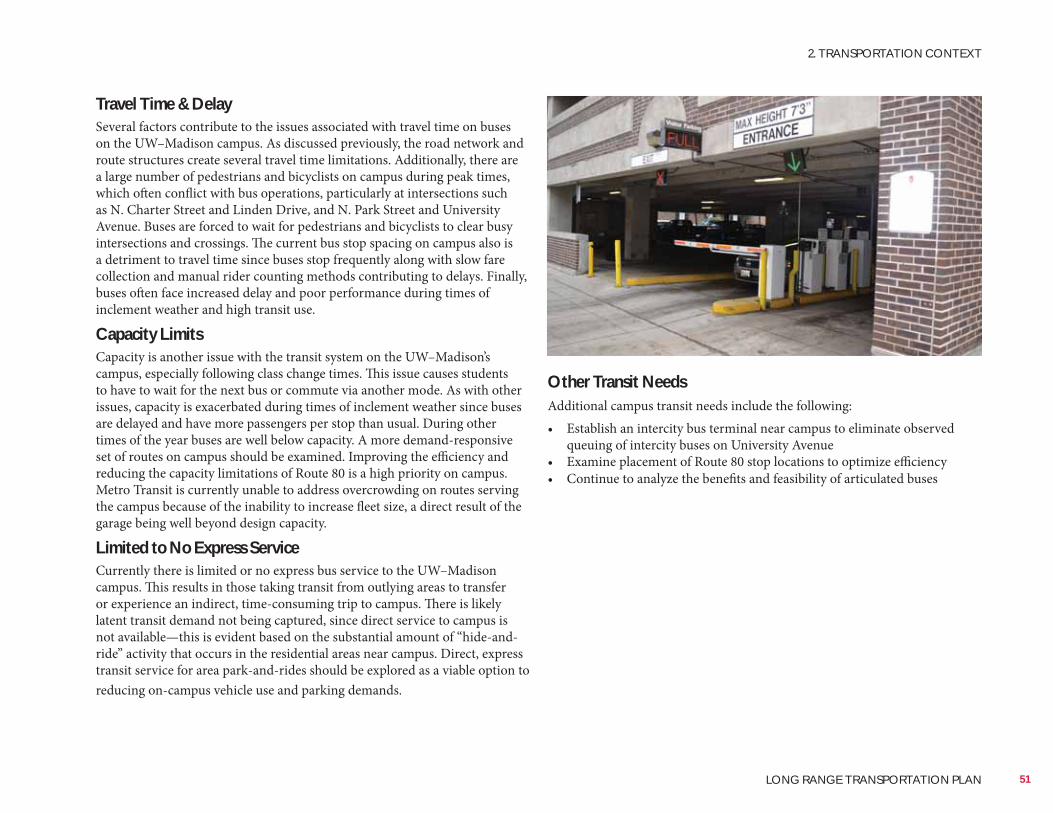
Other Transit NeedsAdditional campus transit needs include the following:• Establish an intercity bus terminal near campus to eliminate observed
queuing of intercity buses on University Avenue• Examine placement of Route 80 stop locations to optimize efficiency• Continue to analyze the benefits and feasibility of articulated buses
Travel Time & DelaySeveral factors contribute to the issues associated with travel time on buses on the UW–Madison campus. As discussed previously, the road network and route structures create several travel time limitations. Additionally, there are a large number of pedestrians and bicyclists on campus during peak times, which often conflict with bus operations, particularly at intersections such as N. Charter Street and Linden Drive, and N. Park Street and University Avenue. Buses are forced to wait for pedestrians and bicyclists to clear busy intersections and crossings. The current bus stop spacing on campus also is a detriment to travel time since buses stop frequently along with slow fare collection and manual rider counting methods contributing to delays. Finally, buses often face increased delay and poor performance during times of inclement weather and high transit use.
Capacity LimitsCapacity is another issue with the transit system on the UW–Madison’s campus, especially following class change times. This issue causes students to have to wait for the next bus or commute via another mode. As with other issues, capacity is exacerbated during times of inclement weather since buses are delayed and have more passengers per stop than usual. During other times of the year buses are well below capacity. A more demand-responsive set of routes on campus should be examined. Improving the efficiency and reducing the capacity limitations of Route 80 is a high priority on campus. Metro Transit is currently unable to address overcrowding on routes serving the campus because of the inability to increase fleet size, a direct result of the garage being well beyond design capacity.
Limited to No Express ServiceCurrently there is limited or no express bus service to the UW–Madison campus. This results in those taking transit from outlying areas to transfer or experience an indirect, time-consuming trip to campus. There is likely latent transit demand not being captured, since direct service to campus is not available—this is evident based on the substantial amount of “hide-and-ride” activity that occurs in the residential areas near campus. Direct, express transit service for area park-and-rides should be explored as a viable option to reducing on-campus vehicle use and parking demands.
51
2. TRANSPORTATION CONTEXT
LONG RANGE TRANSPORTATION PLAN
Parking on Campus
Existing Inventory SupplyIn total, there are approximately 13,000 parking stalls on the UW–Madison campus. These stalls are located in surface lots or in underground and above-ground structures. The inventory includes approximately 9,400 faculty/staff spaces, 1,600 visitor spaces, and 2,000 service/fleet spaces. There are also approximately 350 motorcycle stalls which are not included in the parking inventory total.A total of 12 structured parking areas are located on campus and are available for visitors. The Transportation Services website displays real-time stall availability per garage in order to assist visitors in planning their parking destination. About half of these garages are located in Central and South Campus, with the remainder in other various locations.There also are numerous surface parking lots on campus. The hours of availability vary depending on general campus location and the specific lot. Many of the surface lots in the Central and South Campus area are available for use all day, while most lots in the Near West and West Campus area are only open Monday through Friday. Campus development consumes available surface parking which is causing the university to seek replacement parking often in more consolidated (but more expensive) parking structures.All mopeds on campus must be licensed by the State of Wisconsin and must have a university permit to park in designated moped parking stalls and lots across campus. Some lots allow “all access” moped parking that is open to all those with moped parking permits no matter what lot they have been assigned. The city and university lack consistent regulations and standards managing moped parking. Parked mopeds tend to accumulate on city terraces within campus boundaries and riders often need to illegally operate on sidewalks and crosswalks to access these areas.Figure 2-10 and Table 2-3 display existing campus parking facilities.
Permitting and PricingParking rates vary depending on location on campus, and parking duration. Although most stalls are reserved for permitted vehicles, numerous permit types exist within the UW–Madison system, depending on the user’s need. Daytime permits are most commonly used by UW–Madison faculty, emeriti, and staff. Daytime permits for students are limited to those who live outside the central Madison transit area or to those with other special circumstances. The current waiting list for permits is 374 for all user groups. Approximately 370 cars park at the UW Park Street/Wingra, University Crossing, and Research Park park-and-ride lots.Other permit types include afternoon, nighttime, carpool, park-and-ride, disabled user, motorcycle, and departmental permits. Non-UW–Madison affiliated permits for vendors and construction contractors and monthly permits are also available. Regular annual permit rates range between $265 for park-and-ride spots to $1,199 for high-demand lots.Event parking is deployed during peak periods, such as athletic and commencement events. A large number of regularly permitted lots are affected during events; these impacted lots and the recurring events that impact them are listed on the Transportation Services website.The UW–Madison issues an annual Parking Lot Rate Redesignation Plan that re-categorizes parking area priorities. In fall 2013, the university detailed various steps to condense pricing and prioritization categories. The changes will align all garages, ramps, and high-demand surface lots in one category and all remaining surface lots in a separate category.
52 UNIVERSITY OF WISCONSIN-MADISON
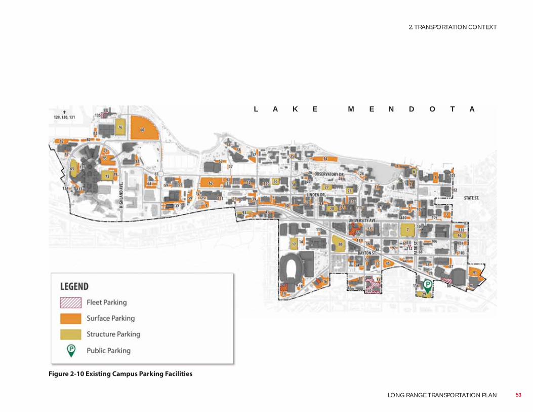
Figure 2-10 Existing Campus Parking Facilities
L A K E M E N D O T A
53
2. TRANSPORTATION CONTEXT
LONG RANGE TRANSPORTATION PLAN
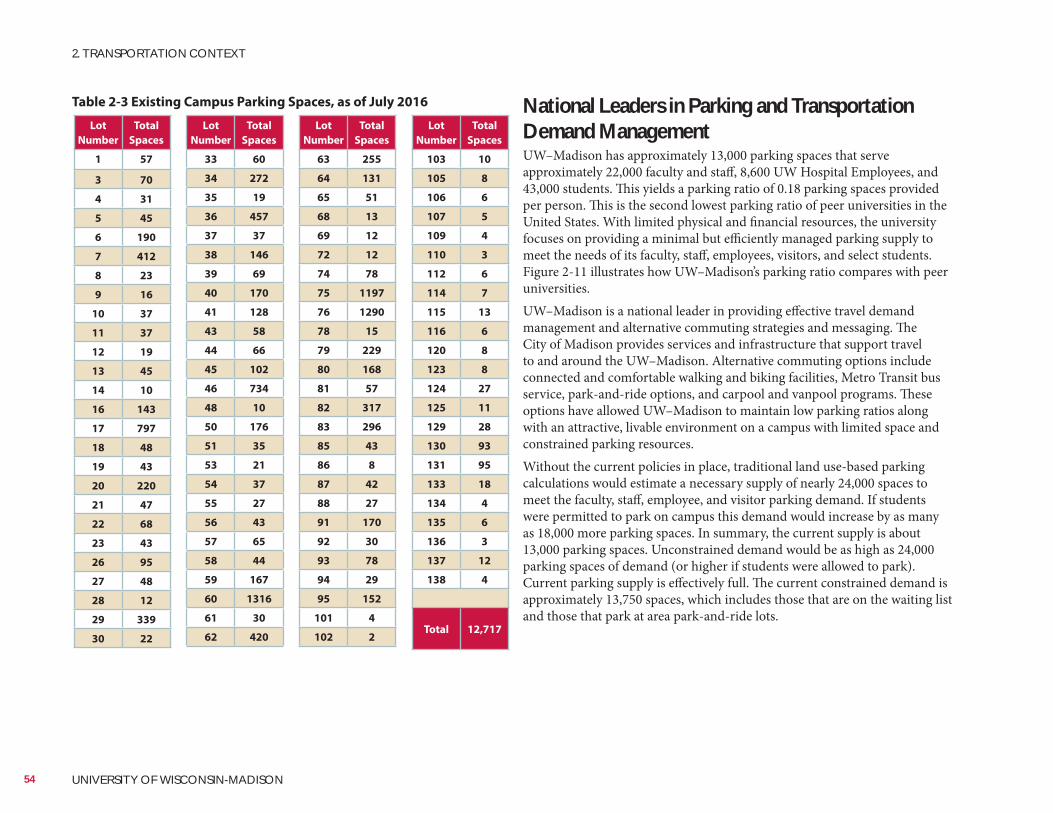
National Leaders in Parking and Transportation Demand ManagementUW–Madison has approximately 13,000 parking spaces that serve approximately 22,000 faculty and staff, 8,600 UW Hospital Employees, and 43,000 students. This yields a parking ratio of 0.18 parking spaces provided per person. This is the second lowest parking ratio of peer universities in the United States. With limited physical and financial resources, the university focuses on providing a minimal but efficiently managed parking supply to meet the needs of its faculty, staff, employees, visitors, and select students. Figure 2-11 illustrates how UW–Madison’s parking ratio compares with peer universities.UW–Madison is a national leader in providing effective travel demand management and alternative commuting strategies and messaging. The City of Madison provides services and infrastructure that support travel to and around the UW–Madison. Alternative commuting options include connected and comfortable walking and biking facilities, Metro Transit bus service, park-and-ride options, and carpool and vanpool programs. These options have allowed UW–Madison to maintain low parking ratios along with an attractive, livable environment on a campus with limited space and constrained parking resources.Without the current policies in place, traditional land use-based parking calculations would estimate a necessary supply of nearly 24,000 spaces to meet the faculty, staff, employee, and visitor parking demand. If students were permitted to park on campus this demand would increase by as many as 18,000 more parking spaces. In summary, the current supply is about 13,000 parking spaces. Unconstrained demand would be as high as 24,000 parking spaces of demand (or higher if students were allowed to park). Current parking supply is effectively full. The current constrained demand is approximately 13,750 spaces, which includes those that are on the waiting list and those that park at area park-and-ride lots.
Lot
Number
Total
Spaces
1 57
3 70
4 31
5 45
6 190
7 412
8 23
9 16
10 37
11 37
12 19
13 45
14 10
16 143
17 797
18 48
19 43
20 220
21 47
22 68
23 43
26 95
27 48
28 12
29 339
30 22
Lot
Number
Total
Spaces
33 60
34 272
35 19
36 457
37 37
38 146
39 69
40 170
41 128
43 58
44 66
45 102
46 734
48 10
50 176
51 35
53 21
54 37
55 27
56 43
57 65
58 44
59 167
60 1316
61 30
62 420
Lot
Number
Total
Spaces
63 255
64 131
65 51
68 13
69 12
72 12
74 78
75 1197
76 1290
78 15
79 229
80 168
81 57
82 317
83 296
85 43
86 8
87 42
88 27
91 170
92 30
93 78
94 29
95 152
101 4
102 2
Lot
Number
Total
Spaces
103 10
105 8
106 6
107 5
109 4
110 3
112 6
114 7
115 13
116 6
120 8
123 8
124 27
125 11
129 28
130 93
131 95
133 18
134 4
135 6
136 3
137 12
138 4
Total 12,717
Table 2-3 Existing Campus Parking Spaces, as of July 2016
54 UNIVERSITY OF WISCONSIN-MADISON
2. TRANSPORTATION CONTEXT
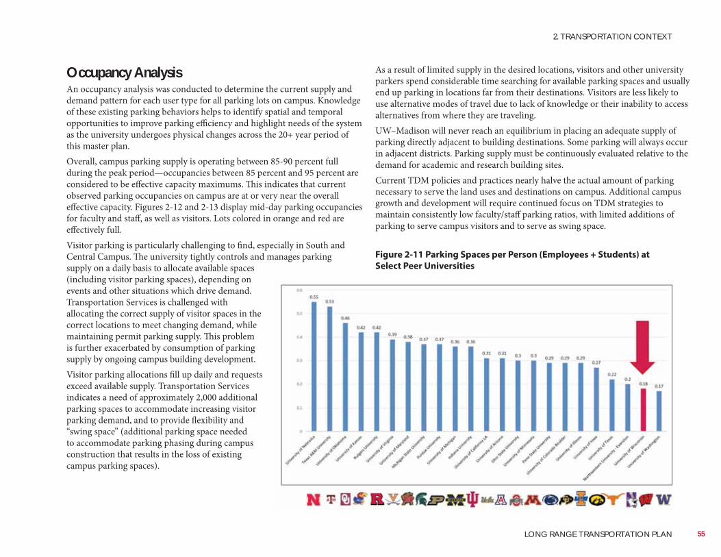
As a result of limited supply in the desired locations, visitors and other university parkers spend considerable time searching for available parking spaces and usually end up parking in locations far from their destinations. Visitors are less likely to use alternative modes of travel due to lack of knowledge or their inability to access alternatives from where they are traveling.UW–Madison will never reach an equilibrium in placing an adequate supply of parking directly adjacent to building destinations. Some parking will always occur in adjacent districts. Parking supply must be continuously evaluated relative to the demand for academic and research building sites.Current TDM policies and practices nearly halve the actual amount of parking necessary to serve the land uses and destinations on campus. Additional campus growth and development will require continued focus on TDM strategies to maintain consistently low faculty/staff parking ratios, with limited additions of parking to serve campus visitors and to serve as swing space.
Occupancy AnalysisAn occupancy analysis was conducted to determine the current supply and demand pattern for each user type for all parking lots on campus. Knowledge of these existing parking behaviors helps to identify spatial and temporal opportunities to improve parking efficiency and highlight needs of the system as the university undergoes physical changes across the 20+ year period of this master plan.Overall, campus parking supply is operating between 85-90 percent full during the peak period—occupancies between 85 percent and 95 percent are considered to be effective capacity maximums. This indicates that current observed parking occupancies on campus are at or very near the overall effective capacity. Figures 2-12 and 2-13 display mid-day parking occupancies for faculty and staff, as well as visitors. Lots colored in orange and red are effectively full.Visitor parking is particularly challenging to find, especially in South and Central Campus. The university tightly controls and manages parking supply on a daily basis to allocate available spaces (including visitor parking spaces), depending on events and other situations which drive demand. Transportation Services is challenged with allocating the correct supply of visitor spaces in the correct locations to meet changing demand, while maintaining permit parking supply. This problem is further exacerbated by consumption of parking supply by ongoing campus building development.Visitor parking allocations fill up daily and requests exceed available supply. Transportation Services indicates a need of approximately 2,000 additional parking spaces to accommodate increasing visitor parking demand, and to provide flexibility and “swing space” (additional parking space needed to accommodate parking phasing during campus construction that results in the loss of existing campus parking spaces).
55
2. TRANSPORTATION CONTEXT
LONG RANGE TRANSPORTATION PLAN
Figure 2-11 Parking Spaces per Person (Employees + Students) at
Select Peer Universities
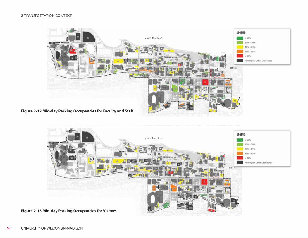
Lake Mendota
Lake Mendota
Figure 2-12 Mid-day Parking Occupancies for Faculty and Staff
56 UNIVERSITY OF WISCONSIN-MADISON
2. TRANSPORTATION CONTEXT
Figure 2-13 Mid-day Parking Occupancies for Visitors
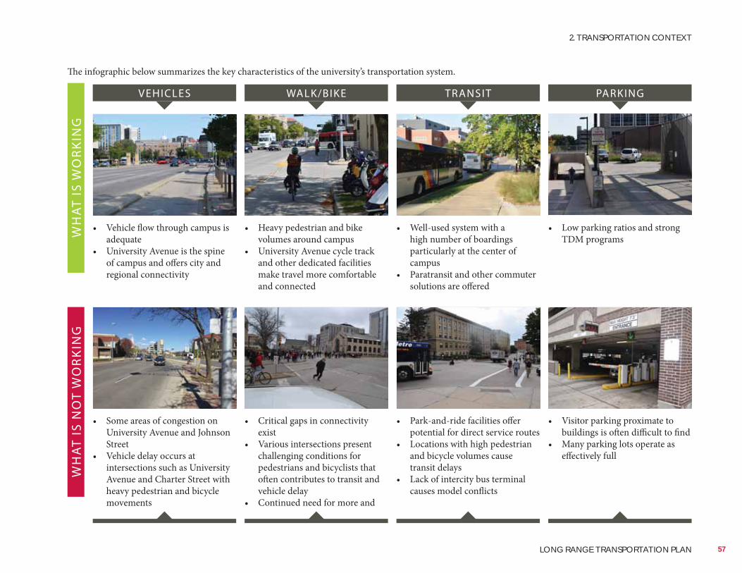
WH
AT
IS W
OR
KIN
GW
HA
T IS
NO
T W
OR
KIN
G
• Vehicle flow through campus is adequate
• University Avenue is the spine of campus and offers city and regional connectivity
• Heavy pedestrian and bike volumes around campus
• University Avenue cycle track and other dedicated facilities make travel more comfortable and connected
• Well-used system with a high number of boardings particularly at the center of campus
• Paratransit and other commuter solutions are offered
• Low parking ratios and strong TDM programs
• Some areas of congestion on University Avenue and Johnson Street
• Vehicle delay occurs at intersections such as University Avenue and Charter Street with heavy pedestrian and bicycle movements
• Critical gaps in connectivity exist
• Various intersections present challenging conditions for pedestrians and bicyclists that often contributes to transit and vehicle delay
• Continued need for more and
• Park-and-ride facilities offer potential for direct service routes
• Locations with high pedestrian and bicycle volumes cause transit delays
• Lack of intercity bus terminal causes model conflicts
• Visitor parking proximate to buildings is often difficult to find
• Many parking lots operate as effectively full
VEHICLES WALK/BIKE TRANSIT PARKING
The infographic below summarizes the key characteristics of the university’s transportation system.
57
2. TRANSPORTATION CONTEXT
LONG RANGE TRANSPORTATION PLAN
This page intentionally left blank.
58 UNIVERSITY OF WISCONSIN-MADISON
2. TRANSPORTATION CONTEXT
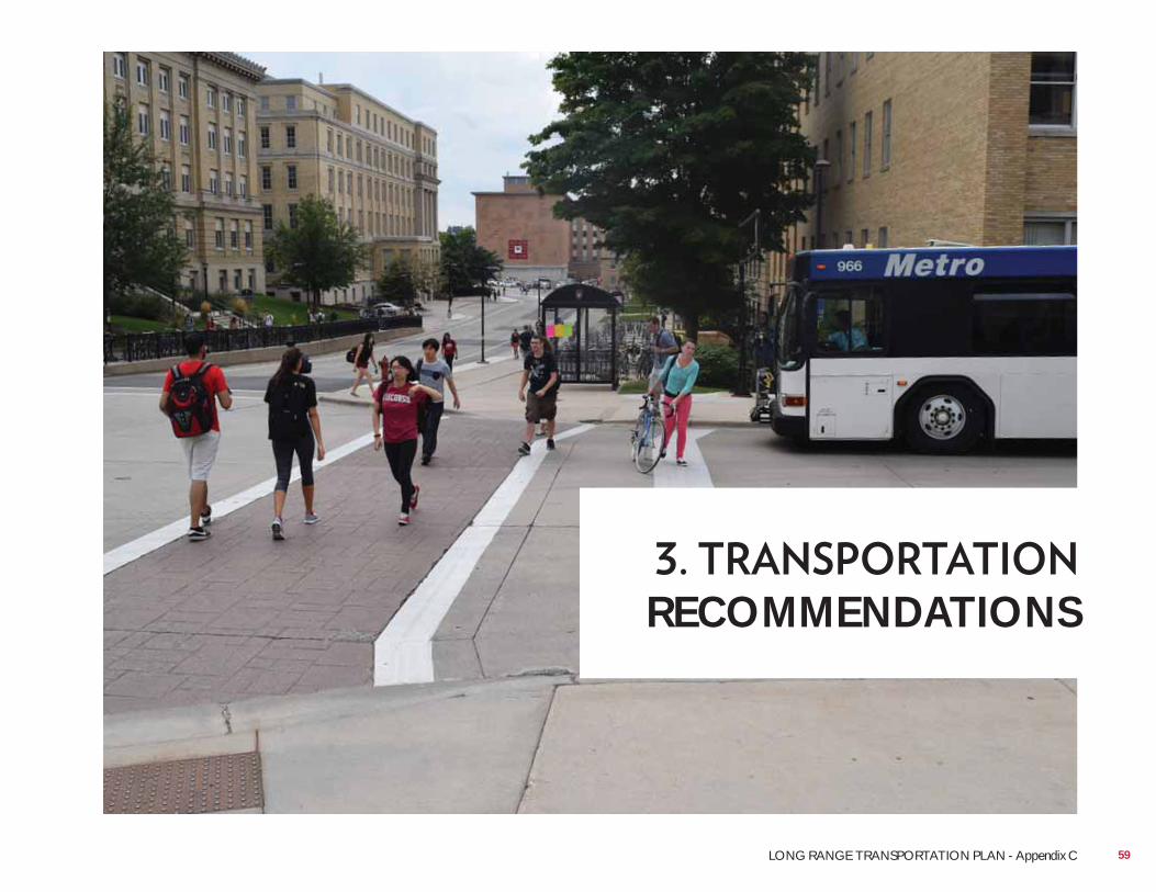
RECOMMENDATIONS
59LONG RANGE TRANSPORTATION PLAN - Appendix C
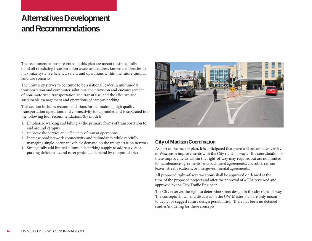
•
City of Madison CoordinationAs part of the master plan, it is anticipated that there will be some University of Wisconsin improvements with the City right-of-ways. The coordination of these improvements within the right-of-way may require, but are not limited to maintenance agreements, encroachment agreements, air/subterranean leases, street vacations, or intergovernmental agreements.All proposed right-of-way vacations shall be approved or denied at the time of the proposed project and after the approval of a TIA reviewed and approved by the City Traffic Engineer.The City reserves the right to determine street design in the city right-of-way. The concepts shown and discussed in the UW Master Plan are only meant to depict or suggest future design possibilities. There has been no detailed studies/modeling for these concepts.
Alternatives Development and Recommendations
The recommendations presented in this plan are meant to strategically build off of existing transportation assets and address known deficiencies to maximize system efficiency, safety, and operations within the future campus land use scenario.The university strives to continue to be a national leader in multimodal transportation and commuter solutions, the provision and encouragement of non-motorized transportation and transit use, and the effective and sustainable management and operations of campus parking.This section includes recommendations for maintaining high quality transportation operations and connectivity for all modes and is separated into the following four recommendations (by mode):1. Emphasize walking and biking as the primary forms of transportation to
and around campus2. Improve the service and efficiency of transit operations3. Increase road network connectivity and redundancy while carefully
managing single-occupant vehicle demand on the transportation network4. Strategically add limited automobile parking supply to address visitor
parking deficiencies and meet projected demand by campus district
60 UNIVERSITY OF WISCONSIN-MADISON
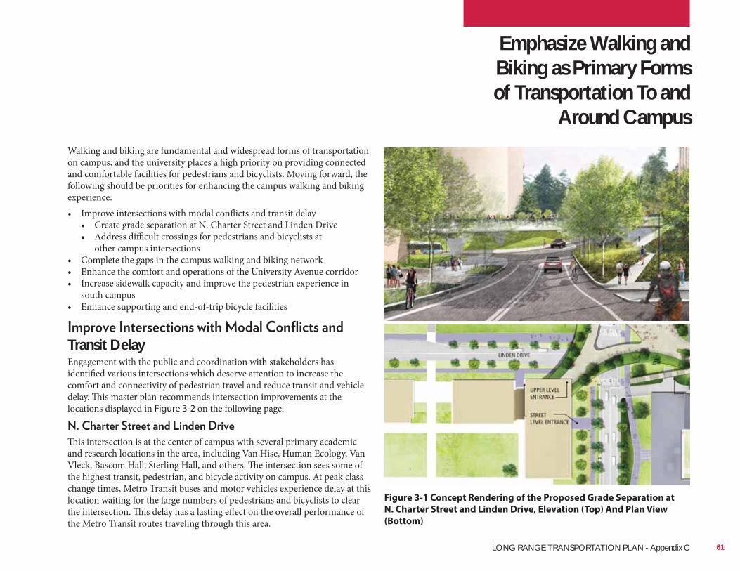
Hoerr Schaudt
Hoerr Schaudt
Emphasize Walking and Biking as Primary Forms of Transportation To and
Around CampusWalking and biking are fundamental and widespread forms of transportation on campus, and the university places a high priority on providing connected and comfortable facilities for pedestrians and bicyclists. Moving forward, the following should be priorities for enhancing the campus walking and biking experience:• Improve intersections with modal conflicts and transit delay
• Create grade separation at N. Charter Street and Linden Drive• Address difficult crossings for pedestrians and bicyclists at
other campus intersections• Complete the gaps in the campus walking and biking network• Enhance the comfort and operations of the University Avenue corridor• Increase sidewalk capacity and improve the pedestrian experience in
south campus• Enhance supporting and end-of-trip bicycle facilities
Transit DelayEngagement with the public and coordination with stakeholders has identified various intersections which deserve attention to increase the comfort and connectivity of pedestrian travel and reduce transit and vehicle delay. This master plan recommends intersection improvements at the locations displayed in Figure 3-2 on the following page.
This intersection is at the center of campus with several primary academic and research locations in the area, including Van Hise, Human Ecology, Van Vleck, Bascom Hall, Sterling Hall, and others. The intersection sees some of the highest transit, pedestrian, and bicycle activity on campus. At peak class change times, Metro Transit buses and motor vehicles experience delay at this location waiting for the large numbers of pedestrians and bicyclists to clear the intersection. This delay has a lasting effect on the overall performance of the Metro Transit routes traveling through this area.
Figure 3-1 Concept Rendering of the Proposed Grade Separation at
N. Charter Street and Linden Drive, Elevation (Top) And Plan View
(Bottom)
61LONG RANGE TRANSPORTATION PLAN - Appendix C
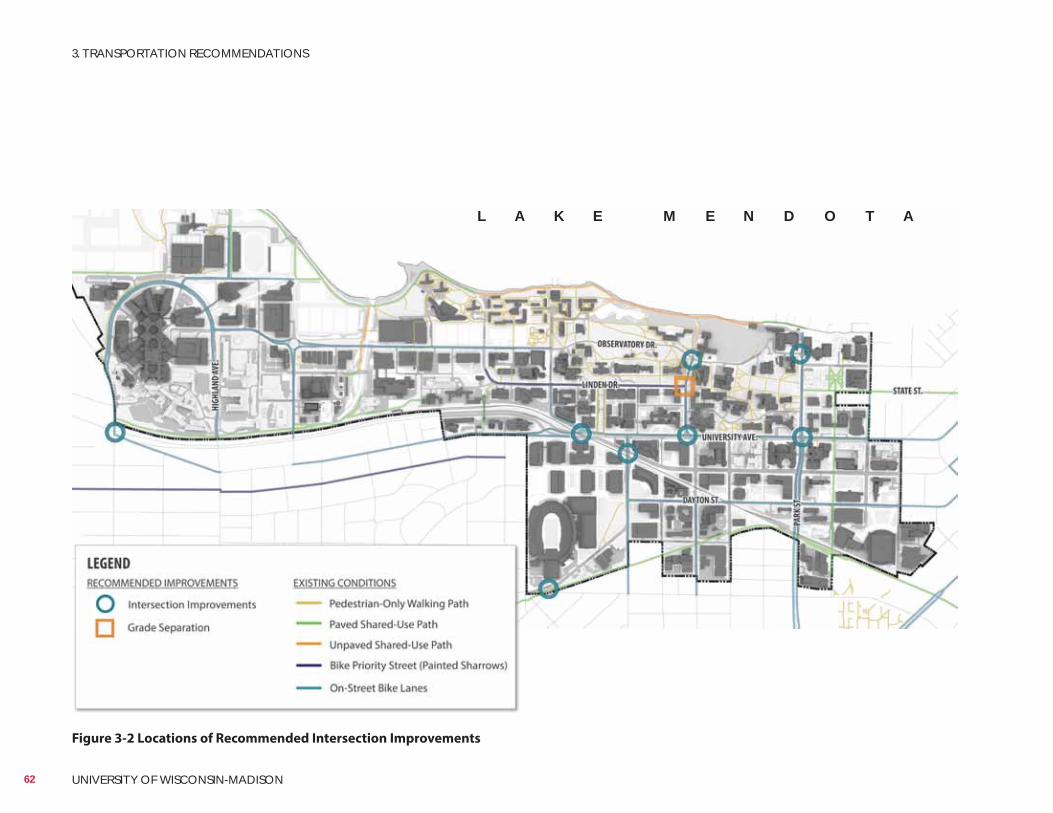
Figure 3-2 Locations of Recommended Intersection Improvements
L A K E M E N D O T A
62 UNIVERSITY OF WISCONSIN-MADISON
3. TRANSPORTATION RECOMMENDATIONS
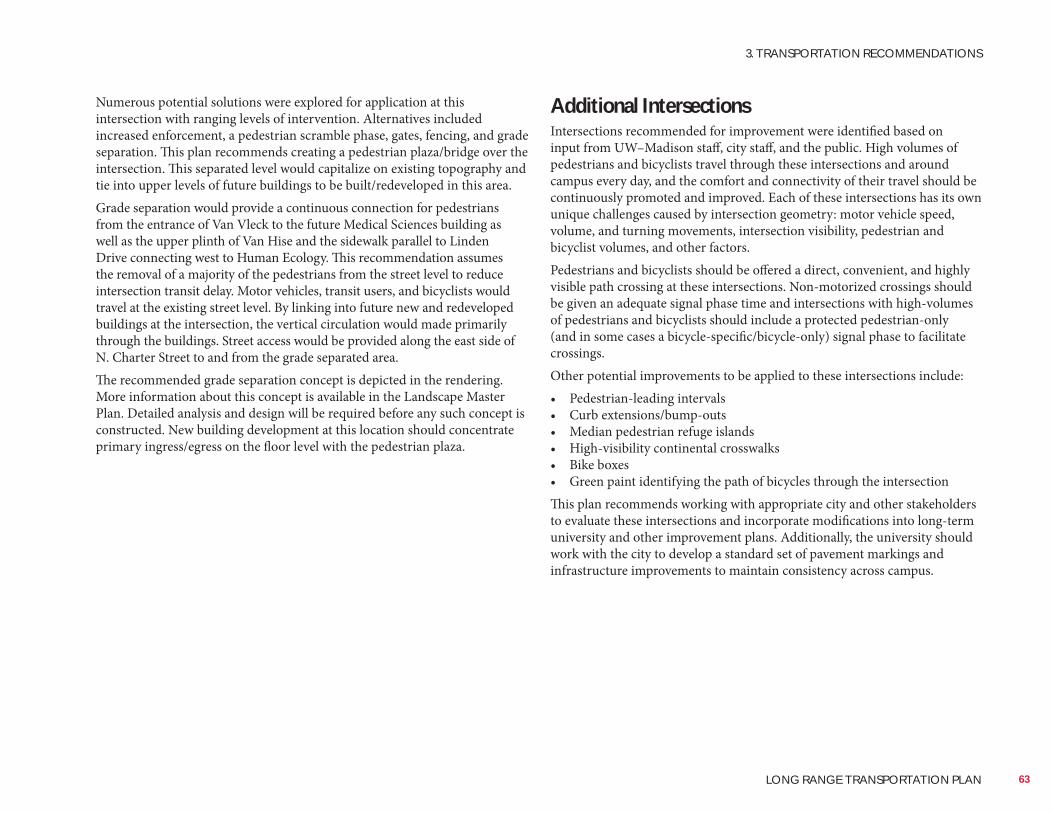
Numerous potential solutions were explored for application at this intersection with ranging levels of intervention. Alternatives included increased enforcement, a pedestrian scramble phase, gates, fencing, and grade separation. This plan recommends creating a pedestrian plaza/bridge over the intersection. This separated level would capitalize on existing topography and tie into upper levels of future buildings to be built/redeveloped in this area.Grade separation would provide a continuous connection for pedestrians from the entrance of Van Vleck to the future Medical Sciences building as well as the upper plinth of Van Hise and the sidewalk parallel to Linden Drive connecting west to Human Ecology. This recommendation assumes the removal of a majority of the pedestrians from the street level to reduce intersection transit delay. Motor vehicles, transit users, and bicyclists would travel at the existing street level. By linking into future new and redeveloped buildings at the intersection, the vertical circulation would made primarily through the buildings. Street access would be provided along the east side of N. Charter Street to and from the grade separated area.The recommended grade separation concept is depicted in the rendering. More information about this concept is available in the Landscape Master Plan. Detailed analysis and design will be required before any such concept is constructed. New building development at this location should concentrate primary ingress/egress on the floor level with the pedestrian plaza.
Additional IntersectionsIntersections recommended for improvement were identified based on input from UW–Madison staff, city staff, and the public. High volumes of pedestrians and bicyclists travel through these intersections and around campus every day, and the comfort and connectivity of their travel should be continuously promoted and improved. Each of these intersections has its own unique challenges caused by intersection geometry: motor vehicle speed, volume, and turning movements, intersection visibility, pedestrian and bicyclist volumes, and other factors.Pedestrians and bicyclists should be offered a direct, convenient, and highly visible path crossing at these intersections. Non-motorized crossings should be given an adequate signal phase time and intersections with high-volumes of pedestrians and bicyclists should include a protected pedestrian-only (and in some cases a bicycle-specific/bicycle-only) signal phase to facilitate crossings.Other potential improvements to be applied to these intersections include:• Pedestrian-leading intervals• Curb extensions/bump-outs• Median pedestrian refuge islands• High-visibility continental crosswalks• Bike boxes• Green paint identifying the path of bicycles through the intersectionThis plan recommends working with appropriate city and other stakeholders to evaluate these intersections and incorporate modifications into long-term university and other improvement plans. Additionally, the university should work with the city to develop a standard set of pavement markings and infrastructure improvements to maintain consistency across campus.
63
3. TRANSPORTATION RECOMMENDATIONS
LONG RANGE TRANSPORTATION PLAN
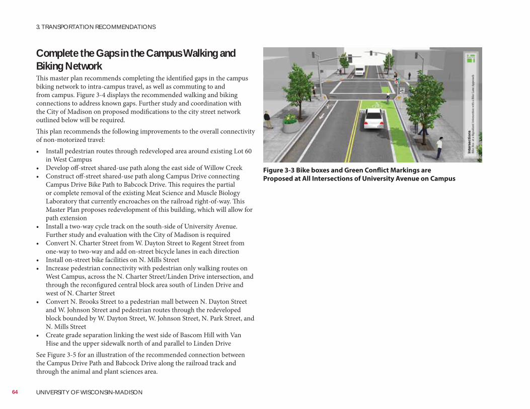
National Association of Transportation Officials (NACTO)
Complete the Gaps in the Campus Walking and Biking NetworkThis master plan recommends completing the identified gaps in the campus biking network to intra-campus travel, as well as commuting to and from campus. Figure 3-4 displays the recommended walking and biking connections to address known gaps. Further study and coordination with the City of Madison on proposed modifications to the city street network outlined below will be required.This plan recommends the following improvements to the overall connectivity of non-motorized travel:• Install pedestrian routes through redeveloped area around existing Lot 60
in West Campus• Develop off-street shared-use path along the east side of Willow Creek• Construct off-street shared-use path along Campus Drive connecting
Campus Drive Bike Path to Babcock Drive. This requires the partial or complete removal of the existing Meat Science and Muscle Biology Laboratory that currently encroaches on the railroad right-of-way. This Master Plan proposes redevelopment of this building, which will allow for path extension
• Install a two-way cycle track on the south-side of University Avenue. Further study and evaluation with the City of Madison is required
• Convert N. Charter Street from W. Dayton Street to Regent Street from one-way to two-way and add on-street bicycle lanes in each direction
• Install on-street bike facilities on N. Mills Street• Increase pedestrian connectivity with pedestrian only walking routes on
West Campus, across the N. Charter Street/Linden Drive intersection, and through the reconfigured central block area south of Linden Drive and west of N. Charter Street
• Convert N. Brooks Street to a pedestrian mall between N. Dayton Street and W. Johnson Street and pedestrian routes through the redeveloped block bounded by W. Dayton Street, W. Johnson Street, N. Park Street, and N. Mills Street
• Create grade separation linking the west side of Bascom Hill with Van Hise and the upper sidewalk north of and parallel to Linden Drive
See Figure 3-5 for an illustration of the recommended connection between the Campus Drive Path and Babcock Drive along the railroad track and through the animal and plant sciences area.
Figure 3-3 Bike boxes and Green Conflict Markings are
Proposed at All Intersections of University Avenue on Campus
64 UNIVERSITY OF WISCONSIN-MADISON
3. TRANSPORTATION RECOMMENDATIONS
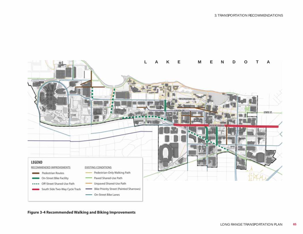
Figure 3-4 Recommended Walking and Biking Improvements
L A K E M E N D O T A
65
3. TRANSPORTATION RECOMMENDATIONS
LONG RANGE TRANSPORTATION PLAN
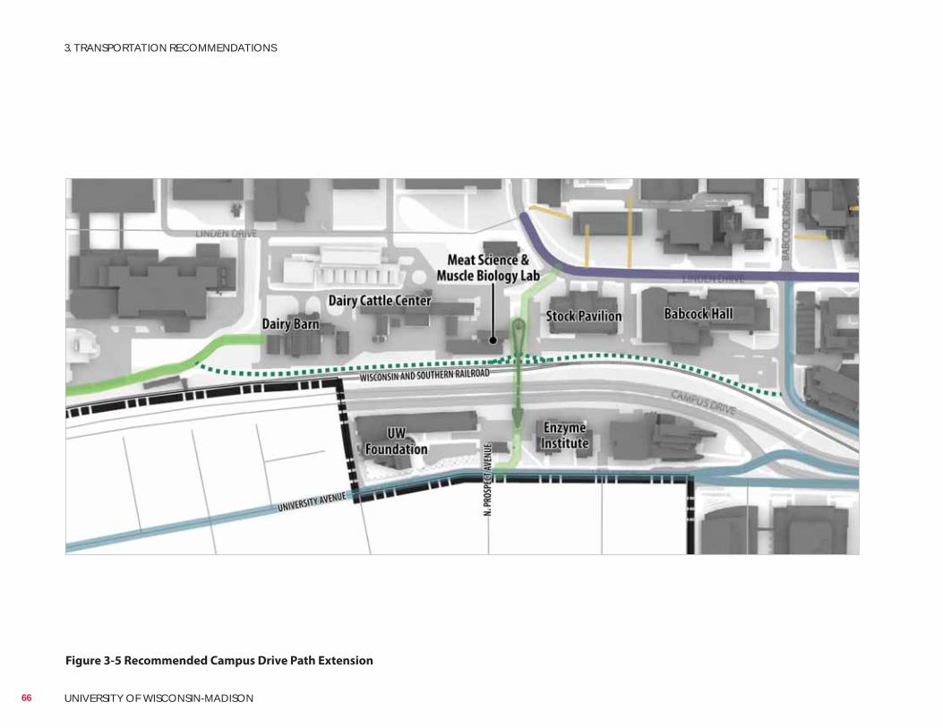
Figure 3-5 Recommended Campus Drive Path Extension
66 UNIVERSITY OF WISCONSIN-MADISON
3. TRANSPORTATION RECOMMENDATIONS
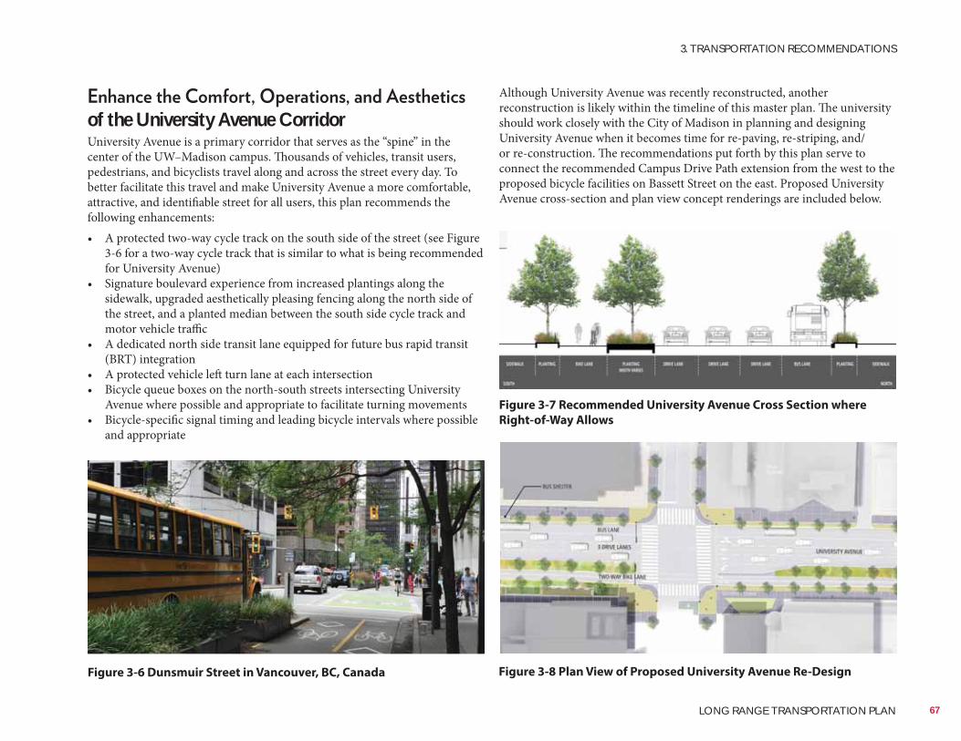
Hoerr Schaudt
Hoerr Schaudt
Hoerr Schaudt
Although University Avenue was recently reconstructed, another reconstruction is likely within the timeline of this master plan. The university should work closely with the City of Madison in planning and designing University Avenue when it becomes time for re-paving, re-striping, and/or re-construction. The recommendations put forth by this plan serve to connect the recommended Campus Drive Path extension from the west to the proposed bicycle facilities on Bassett Street on the east. Proposed University Avenue cross-section and plan view concept renderings are included below.
of the University Avenue CorridorUniversity Avenue is a primary corridor that serves as the “spine” in the center of the UW–Madison campus. Thousands of vehicles, transit users, pedestrians, and bicyclists travel along and across the street every day. To better facilitate this travel and make University Avenue a more comfortable, attractive, and identifiable street for all users, this plan recommends the following enhancements:• A protected two-way cycle track on the south side of the street (see Figure
3-6 for a two-way cycle track that is similar to what is being recommended for University Avenue)
• Signature boulevard experience from increased plantings along the sidewalk, upgraded aesthetically pleasing fencing along the north side of the street, and a planted median between the south side cycle track and motor vehicle traffic
• A dedicated north side transit lane equipped for future bus rapid transit (BRT) integration
• A protected vehicle left turn lane at each intersection• Bicycle queue boxes on the north-south streets intersecting University
Avenue where possible and appropriate to facilitate turning movements• Bicycle-specific signal timing and leading bicycle intervals where possible
and appropriate
Figure 3-7 Recommended University Avenue Cross Section where
Right-of-Way Allows
Figure 3-6 Dunsmuir Street in Vancouver, BC, Canada Figure 3-8 Plan View of Proposed University Avenue Re-Design
67
3. TRANSPORTATION RECOMMENDATIONS
LONG RANGE TRANSPORTATION PLAN
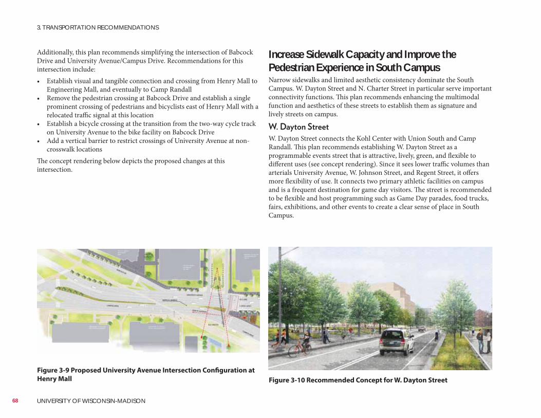
Hoerr Schaudt
Hoerr Schaudt
Increase Sidewalk Capacity and Improve the Pedestrian Experience in South CampusNarrow sidewalks and limited aesthetic consistency dominate the South Campus. W. Dayton Street and N. Charter Street in particular serve important connectivity functions. This plan recommends enhancing the multimodal function and aesthetics of these streets to establish them as signature and lively streets on campus.
W. Dayton Street connects the Kohl Center with Union South and Camp Randall. This plan recommends establishing W. Dayton Street as a programmable events street that is attractive, lively, green, and flexible to different uses (see concept rendering). Since it sees lower traffic volumes than arterials University Avenue, W. Johnson Street, and Regent Street, it offers more flexibility of use. It connects two primary athletic facilities on campus and is a frequent destination for game day visitors. The street is recommended to be flexible and host programming such as Game Day parades, food trucks, fairs, exhibitions, and other events to create a clear sense of place in South Campus.
Additionally, this plan recommends simplifying the intersection of Babcock Drive and University Avenue/Campus Drive. Recommendations for this intersection include:• Establish visual and tangible connection and crossing from Henry Mall to
Engineering Mall, and eventually to Camp Randall• Remove the pedestrian crossing at Babcock Drive and establish a single
prominent crossing of pedestrians and bicyclists east of Henry Mall with a relocated traffic signal at this location
• Establish a bicycle crossing at the transition from the two-way cycle track on University Avenue to the bike facility on Babcock Drive
• Add a vertical barrier to restrict crossings of University Avenue at non-crosswalk locations
The concept rendering below depicts the proposed changes at this intersection.
Figure 3-9 Proposed University Avenue Intersection Configuration at
Henry Mall Figure 3-10 Recommended Concept for W. Dayton Street
68 UNIVERSITY OF WISCONSIN-MADISON
3. TRANSPORTATION RECOMMENDATIONS
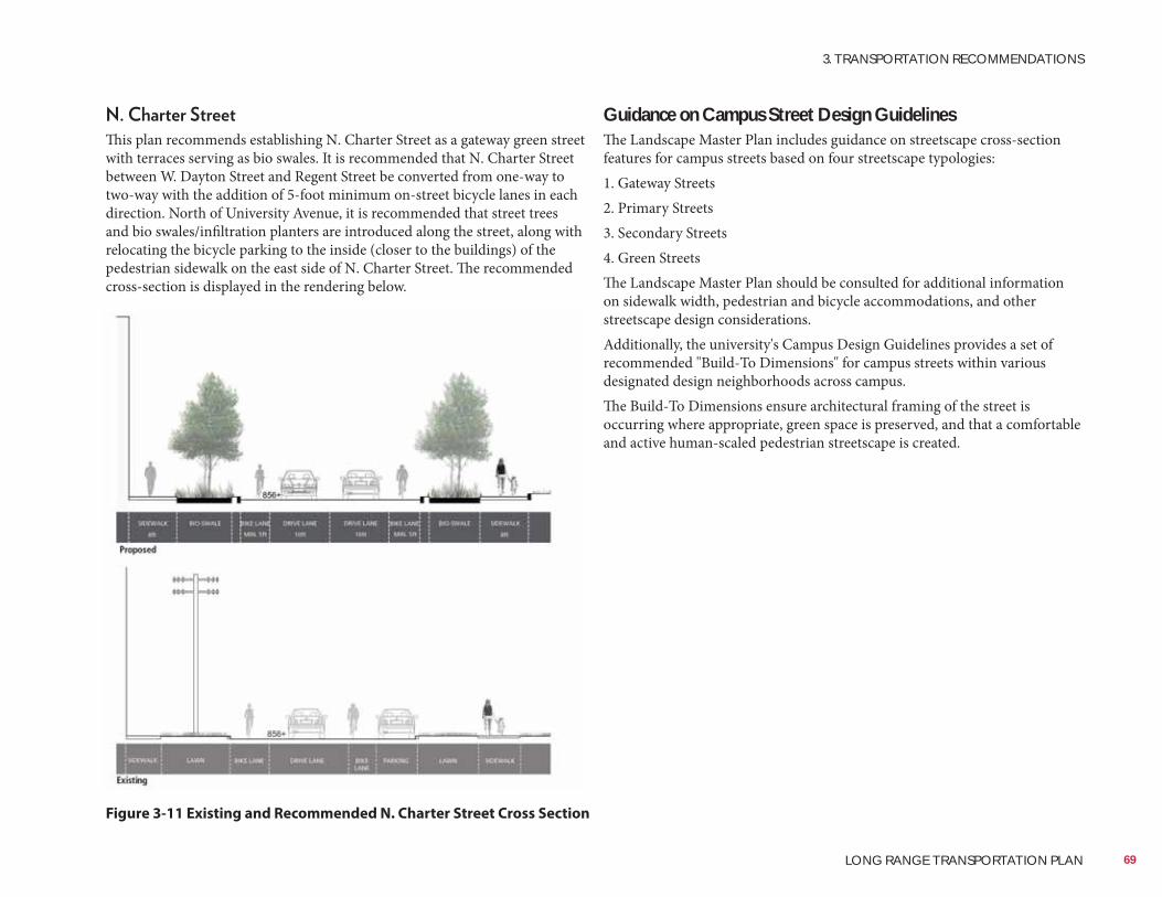
Guidance on Campus Street Design GuidelinesThe Landscape Master Plan includes guidance on streetscape cross-section features for campus streets based on four streetscape typologies:1. Gateway Streets2. Primary Streets3. Secondary Streets4. Green StreetsThe Landscape Master Plan should be consulted for additional information on sidewalk width, pedestrian and bicycle accommodations, and other streetscape design considerations.Additionally, the university's Campus Design Guidelines provides a set of recommended "Build-To Dimensions" for campus streets within various designated design neighborhoods across campus.The Build-To Dimensions ensure architectural framing of the street is occurring where appropriate, green space is preserved, and that a comfortable and active human-scaled pedestrian streetscape is created.
This plan recommends establishing N. Charter Street as a gateway green street with terraces serving as bio swales. It is recommended that N. Charter Street between W. Dayton Street and Regent Street be converted from one-way to two-way with the addition of 5-foot minimum on-street bicycle lanes in each direction. North of University Avenue, it is recommended that street trees and bio swales/infiltration planters are introduced along the street, along with relocating the bicycle parking to the inside (closer to the buildings) of the pedestrian sidewalk on the east side of N. Charter Street. The recommended cross-section is displayed in the rendering below.
Figure 3-11 Existing and Recommended N. Charter Street Cross Section
69
3. TRANSPORTATION RECOMMENDATIONS
LONG RANGE TRANSPORTATION PLAN
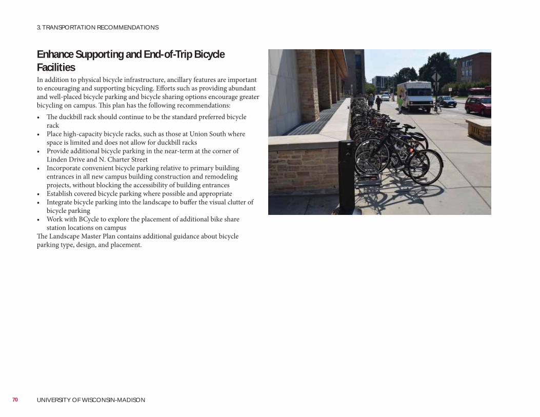
Enhance Supporting and End-of-Trip Bicycle FacilitiesIn addition to physical bicycle infrastructure, ancillary features are important to encouraging and supporting bicycling. Efforts such as providing abundant and well-placed bicycle parking and bicycle sharing options encourage greater bicycling on campus. This plan has the following recommendations:• The duckbill rack should continue to be the standard preferred bicycle
rack• Place high-capacity bicycle racks, such as those at Union South where
space is limited and does not allow for duckbill racks• Provide additional bicycle parking in the near-term at the corner of
Linden Drive and N. Charter Street• Incorporate convenient bicycle parking relative to primary building
entrances in all new campus building construction and remodeling projects, without blocking the accessibility of building entrances
• Establish covered bicycle parking where possible and appropriate• Integrate bicycle parking into the landscape to buffer the visual clutter of
bicycle parking• Work with BCycle to explore the placement of additional bike share
station locations on campusThe Landscape Master Plan contains additional guidance about bicycle parking type, design, and placement.
70 UNIVERSITY OF WISCONSIN-MADISON
3. TRANSPORTATION RECOMMENDATIONS
Improve the Service
Operations
IntroductionMetro Transit service is one primary way that faculty, staff, students, and employees travel to and from and around campus. This master plan recommends four priorities for improving transit service ridership, efficiency, and operations:1. Address intersection locations with transit delay2. Implement limited stop and/or express bus service to serve campus3. Improve intra-campus bus connectivity4. Establish a permanent inter-city bus terminal
Address Intersection Locations with Transit DelayAs discussed in the previous section, several intersections across campus see transit delay due to high volumes of pedestrians and bicyclists at peak travel times. Most notably among these is the intersections of N. Charter Street and Linden Drive, N. Charter Street and University Avenue, and University Avenue and N. Park Street. Recommended improvements to these intersections are meant to reduce transit (and vehicle) delay and improve conditions for pedestrians and bicyclists.
Implement Express Bus ServiceThis plan recommends the university work with Metro Transit to add a limited stop and/or express bus service from area park-and-ride locations to campus, stopping in South Campus (Park Street/University Avenue), Central Campus (Charter Street/Linden Drive), and West Campus at the UW Hospital and Health Sciences Learning Center. Such a premium service with 20 minute headways and high quality vehicles would increase transit ridership and reduce the parking demand on campus. There is a particular opportunity to divert UW Hospital employees from driving single-occupancy vehicles to transit with this premium service. West Campus has a higher parking generation ratio of any district on campus. UW Hospital employees commute from further out and use single-occupancy vehicles in a larger percentage than other UW–Madison faculty and staff. Planned BRT connecting the east and west sides of Madison would complement this express bus service by offering more opportunities for connecting across campus during the day and for return trips.BRT, a concept officially adopted by the City of Madison, will allow for quicker commutes to and from the campus, for both students and staff. It will also provide increased capacity, reducing the chronic overloads that are being experienced now. Operation of BRT will require enhanced passenger stations located on or near the UW campus.The university should work closely with the City of Madison, the Madison Area Transportation Planning Board, and other stakeholders to implement BRT service in the city and through campus, including developing routes and schedules, and locating appropriate station locations.
71LONG RANGE TRANSPORTATION PLAN - Appendix C
Improve Intra-Campus Transit ConnectivityIn order to improve the efficiency and customer experience of intra-campus transit, this plan recommends reverting back to the previous routing of Route 80 to provide more direct connections between the east and west sides of campus. Prior to reintroducing the circulating Route 85, the university should explore the demand for this route. While the route carried many passengers when it was in operation, it was slow due to its circulatory nature. The distance covered by the previous Route 85 was minimal, so those who took this circulator could likely walk more quickly to their destination. If this or any other circulators are introduced on the UW–Madison campus it is recommended further evaluation be done to determine whether they can operate in both directions so that riders are not traveling extra distance in the opposite direction of destinations.It also is recommended that as Metro Transit is able to increase their bus storage facilities that articulated buses are introduced on the UW–Madison campus. These buses would address capacity issues as well as provide better maneuvering ability near Observatory Hill. It is critical that buses are able to safely maneuver this hill for bi-directional circulation. Articulated buses cost approximately $800,000 per bus. In lieu of articulated buses, the university should explore the use of intelligent transportation systems (ITS) technology at the base of the hill to alert westbound vehicles of oncoming eastbound buses.Bus stops should be examined closely for possible elimination or consolidation. Eliminating extraneous and unnecessary bus stops would serve to decrease rider delay. The current frequency of stops creates significant delays for those on board. Off-board fare payment collection also is recommended as a method for decreasing transit delay and improving travel times and passenger experience.Since capacity is currently an issue on buses during class change times, it is recommended that doubleheaders (two simultaneously arriving buses) are operated on routes with capacity issues during class change time. Schedules also could be adjusted so they deviate from strict clocked headways and buses would operate more frequently while students are changing classes and less frequently while they are in class. These changes would impact Metro Transit’s overall operations and should be carefully explored before implementing them.
Establish a Permanent Inter-City Bus TerminalThis plan recommends a permanent inter-city bus terminal in east campus to remove queuing buses from University Avenue and East Campus Mall. The new bus terminal should be in a location that is easily serviceable by transit without adding new routes. Opportunities to integrate Metro Transit connections and mixed-use development into the terminal facility should be evaluated.One potential location for an east campus bus terminal is the current City of Madison Lake Street parking garage which is central to campus destinations and population density. The first floor of a redeveloped parking structure may be able to serve as an inter-city bus terminal facility, to serve the needs of the university and the City of Madison. UW–Madison will continue to work with the City of Madison Planning Division, Traffic Engineering Division, Metro Transit, and others to locate a site for a new intercity bus terminal.
72 UNIVERSITY OF WISCONSIN-MADISON
3. TRANSPORTATION RECOMMENDATIONS
Increase Road Network
Vacate Easterday Lane and Add Willow Creek CrossingIn conjunction with the expansion of Veterinary Medicine, it is recommended that Easterday Lane between Linden Drive and Observatory Drive be vacated. Easterday Lane does not serve significant transportation purposes and its vacation enables site planning opportunities. Vacation of Easterday Lane creates options for developing Willow Creek as a functional space. This plan also recommends an extension of Linden Drive across Willow Creek south of and parallel to Observatory Drive providing additional access across Willow Creek in the event Observatory Drive is obstructed. Extending Linden Drive across Willow Creek enhances connectivity for pedestrians and bicyclists, and establishes the possibility of a future connection to Walnut Street to the west.
IntroductionFacilitating motor vehicle connectivity to and around campus is essential to the long-term vitality of the campus, particularly as buildings and parking are removed, added, and redeveloped. Thousands of faculty, staff, employees, visitors, freight, and service vehicles travel to and around campus each day. This plan recommends the following modifications to the road network to promote access and circulation in light of planned land use changes:1. Vacate parts of Marsh Drive, Willow Drive, and Walnut Street, and install
a new north-south road from Marsh Drive to Observatory Drive to accommodate planned land uses
2. Vacate Easterday Lane and add an east-west connection across Willow Creek
3. Install new north-south access drive from University Avenue to Linden Drive, west of Charter Street
4. Install new east-west parallel access road south of Linden Drive, west of Charter Street
5. Install protected left turn phase for N. Charter Street southbound vehicles turning left on to Johnson Street
6. Convert Brooks Street into a pedestrian mall/shared emergency drive7. Convert Charter Street from one-way to two-way and add on-street
bicycle lanes in each direction from W. Dayton Street to Regent StreetFigure 3-12 on the following page summarizes the recommended road additions, modifications, and vacations.
73LONG RANGE TRANSPORTATION PLAN - Appendix C
to Dayton Street into Pedestrian Mall/Shared Emergency DriveIn conjunction with future building redevelopment at this block, this plan recommends converting N. Brooks Street from W. Johnson Street to W. Dayton Street into a pedestrian mall/shared emergency access drive.
Regent StreetThis plan recommends converting N. Charter Street from W. Dayton Street to Regent Street from a northbound one-way street (with a southbound contra-flow bicycle lane and on-street parking) to a two-way street with minimum 5 foot bicycle lanes in each direction. This recommendation serves to establish N. Charter Street as an attractive multimodal gateway from South Campus and providing a connection through the center of campus all the way to Lake Mendota. These modifications require removal of on-street parking from the east side of N. Charter Street. There is sufficient nearby public street and university parking to make up for removal of parking along N. Charter Street.
Manage Building Development and Added Parking Capacity in the Central CampusInstall New Access DrivesBuilding and parking additions and reductions are planned in the Central Campus between University Avenue and Linden Drive, and N. Charter Street and Henry Mall. In conjunction with these changes, this plan recommends two access roads to be created:• Parallel to and west of N. Charter Street between Linden Drive and
University Avenue• From N. Charter Street west into the block, parallel to Linden DriveThese access roads also will provide increased fine-grain pedestrian and bicycle connectivity through this area, as well as limited access to parking garages and loading docks. Through traffic will be discouraged. Transit routes will remain on Linden Drive and N. Charter Street.
Additional building square footage and parking capacity in the Central Campus will bring added traffic on N. Charter Street and University Avenue. Much of the traffic from the development in this area will desire to turn left onto Johnson Street from southbound N. Charter Street. This plan recommends a short protected leading left turn vehicle phase from southbound N. Charter Street to eastbound W. Johnson Street. Pedestrians will be held during this phase. This would be in addition to the current permissive left turn phase. A protected left turn phase will provide additional capacity for turning movements without negatively affecting the intersection of N. Park Street and W. Johnson Street (the key intersection in the area).
74 UNIVERSITY OF WISCONSIN-MADISON
3. TRANSPORTATION RECOMMENDATIONS3. TRANSPORTATION RECOMMENDATIONS
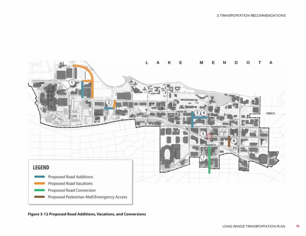
Figure 3-12 Proposed Road Additions, Vacations, and Conversions
L A K E M E N D O T A
75
3. TRANSPORTATION RECOMMENDATIONS
LONG RANGE TRANSPORTATION PLAN
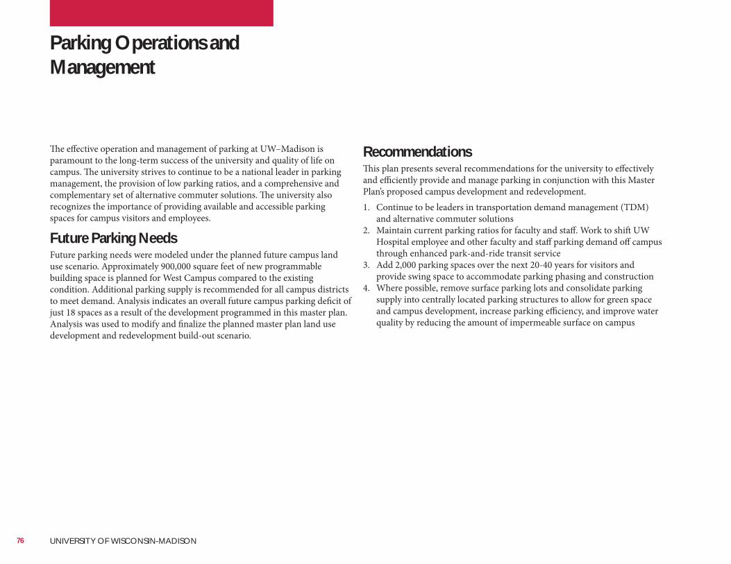
Parking Operations and Management
RecommendationsThis plan presents several recommendations for the university to effectively and efficiently provide and manage parking in conjunction with this Master Plan’s proposed campus development and redevelopment.1. Continue to be leaders in transportation demand management (TDM)
and alternative commuter solutions2. Maintain current parking ratios for faculty and staff. Work to shift UW
Hospital employee and other faculty and staff parking demand off campus through enhanced park-and-ride transit service
3. Add 2,000 parking spaces over the next 20-40 years for visitors and provide swing space to accommodate parking phasing and construction
4. Where possible, remove surface parking lots and consolidate parking supply into centrally located parking structures to allow for green space and campus development, increase parking efficiency, and improve water quality by reducing the amount of impermeable surface on campus
The effective operation and management of parking at UW–Madison is paramount to the long-term success of the university and quality of life on campus. The university strives to continue to be a national leader in parking management, the provision of low parking ratios, and a comprehensive and complementary set of alternative commuter solutions. The university also recognizes the importance of providing available and accessible parking spaces for campus visitors and employees.
Future Parking NeedsFuture parking needs were modeled under the planned future campus land use scenario. Approximately 900,000 square feet of new programmable building space is planned for West Campus compared to the existing condition. Additional parking supply is recommended for all campus districts to meet demand. Analysis indicates an overall future campus parking deficit of just 18 spaces as a result of the development programmed in this master plan. Analysis was used to modify and finalize the planned master plan land use development and redevelopment build-out scenario.
76 UNIVERSITY OF WISCONSIN-MADISON
Recommended Parking Additions and ReductionsThis plan recommends the addition of 2,000 parking spaces for visitors and to provide swing space over the next 20-40 years. Additional parking is needed to serve development phasing. New parking needs to be built before current parking lots are taken off line to accommodate building projects. In addition to providing construction swing space, the additional parking spaces will serve visitors. The demand for visitor parking is typically during off-peak travel periods, especially in the middle of the day, when lots are full of faculty and staff vehicles. Campus roads see much lower demand during these time periods. Roadways in West Campus and across campus are sized to meet peak demand levels. No significant traffic impacts during peak or off-peak periods are anticipated due to the recommended increase in visitor parking supply.This plan recommends an addition of 6,380 and removal of 4,380 parking spaces, for a net increase of 2,000 parking spaces over the next 20-40 years to accommodate the planned build-out. Recommended parking additions and reductions are depicted in Tables 3-1 and 3-2 on the following page, Figure 3-13 and Figure 3-14. Additions and reductions result in the following increases by district:
• West Campus: +689 spaces• Near West Campus: +81 spaces• Central Campus: +615 spaces• South Campus: +615 spaces
77
3. TRANSPORTATION RECOMMENDATIONS
LONG RANGE TRANSPORTATION PLAN
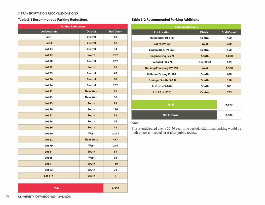
Table 3-1 Recommended Parking Reductions
Parking Reductions
Lot/Location District Stall Count
Lot 1 Central 60
Lot 3 Central 62
Lot 13 Central 34
Lot 17 South 787
Lot 20 Central 207
Lot 22 South 65
Lot 23 Central 42
Lot 26 Central 88
Lot 34 Central 267
Lot 41 Near West 71
Lot 43 Near West 56
Lot 45 South 89
Lot 50 South 176
Lot 51 South 33
Lot 54 South 16
Lot 56 South 43
Lot 60 West 1,311
Lot 62 Near West 417
Lot 79 West 244
Lot 81 South 81
Lot 85 West 36
Lot 91 South 160
Lot 92 South 28
Lot 114 South 7
Total 4,380
Parking Additions
Lot/Location District Stall Count
Humanities (N-11B) Central 450
Lot 75 (W-02) West 780
Linden Block (N-06B) Central 550
Engineering (S-27) South 1,050
Vet Med (W-27) Near West 625
Nursing/Pharmacy (W-09A) West 1,500
Mills and Spring (S-10A) South 400
Grainger South (S-13) South 350
Art Lofts (S-16A) South 300
Lot 20 (N-05C) Central 375
Total 6,380
Net Increase 2,000
Note:This is anticipated over a 20-30 year time period. Additional parking would be built on an as-needed basis after public review.
Table 3-2 Recommended Parking Additions
78 UNIVERSITY OF WISCONSIN-MADISON
3. TRANSPORTATION RECOMMENDATIONS
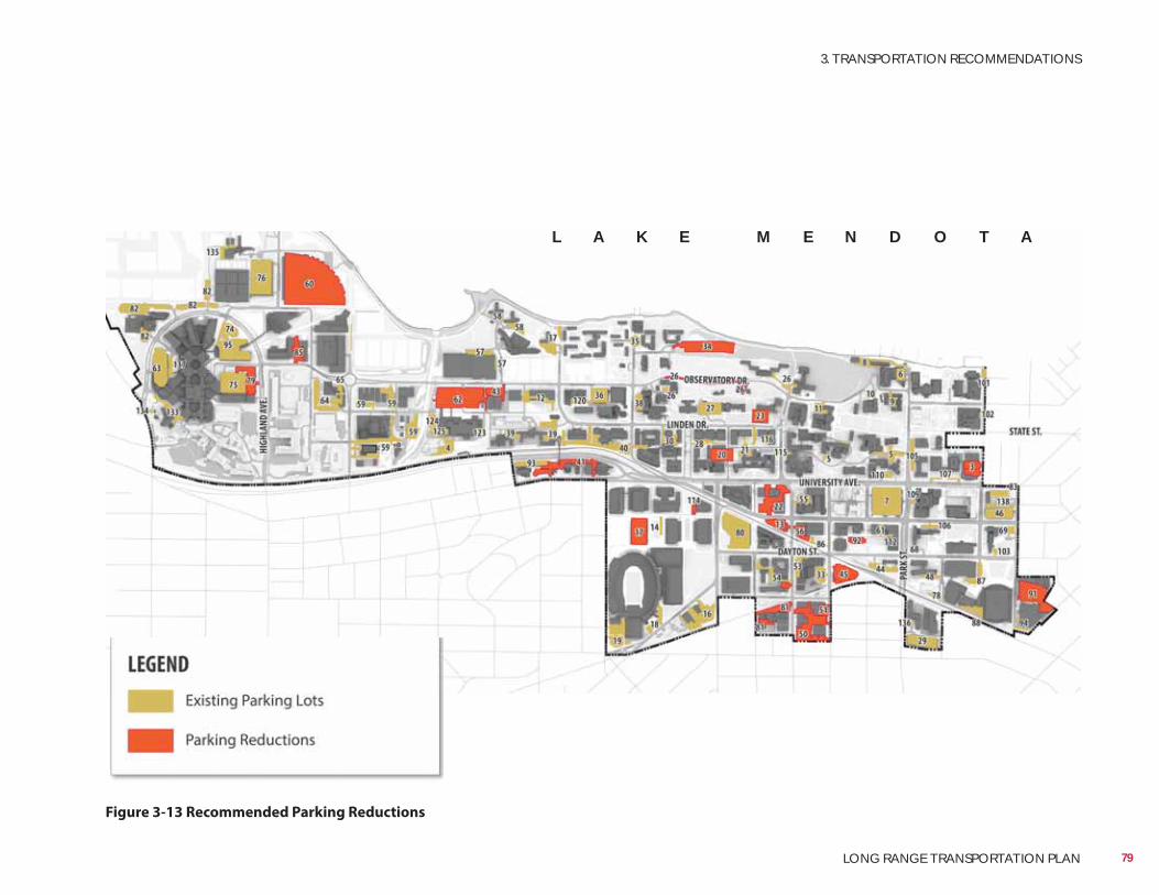
Figure 3-13 Recommended Parking Reductions
L A K E M E N D O T A
79
3. TRANSPORTATION RECOMMENDATIONS
LONG RANGE TRANSPORTATION PLAN
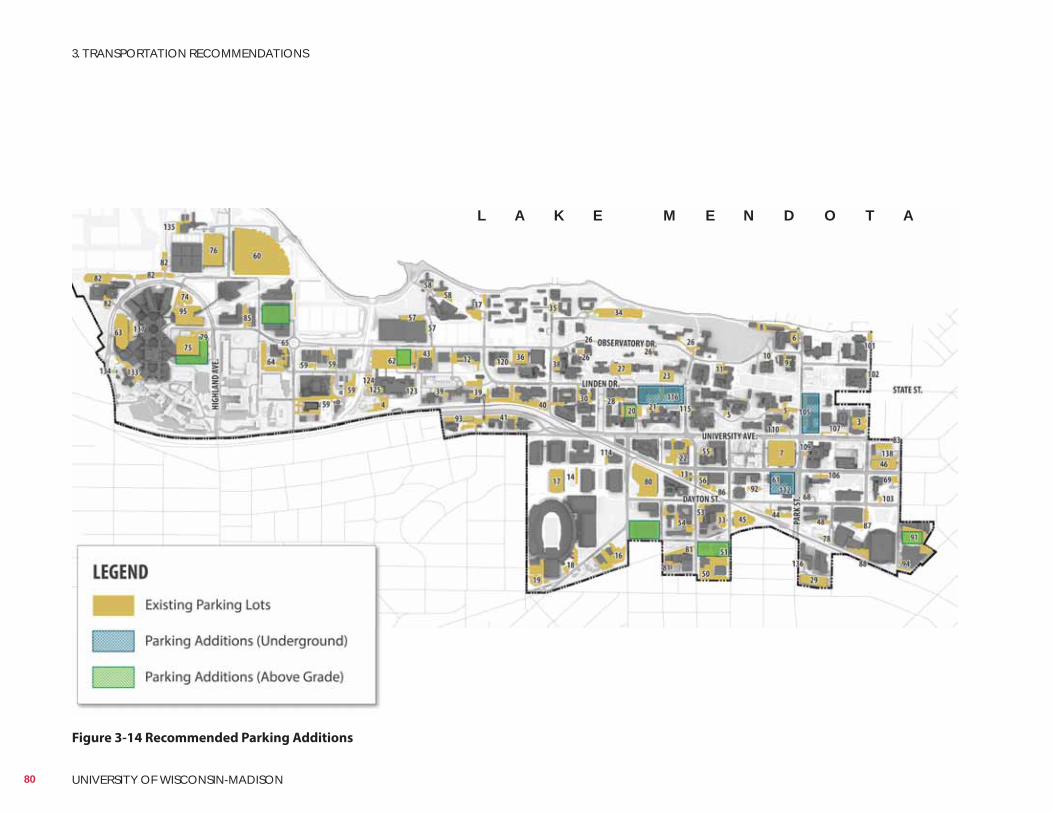
Figure 3-14 Recommended Parking Additions
L A K E M E N D O T A
80 UNIVERSITY OF WISCONSIN-MADISON
3. TRANSPORTATION RECOMMENDATIONS

81
3. TRANSPORTATION RECOMMENDATIONS
LONG RANGE TRANSPORTATION PLAN

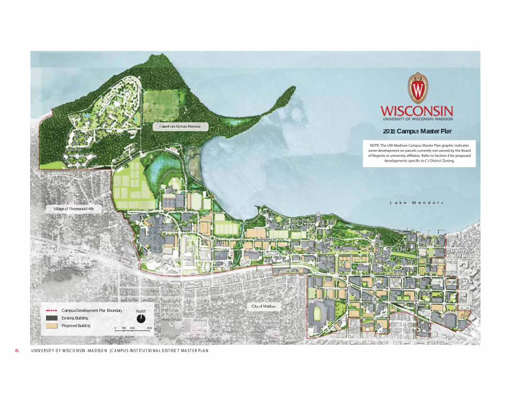
UNIVERSITY OF WISCONSIN -MADISON | CAMPUS-INSTITUTIONAL DISTRICT MASTER PLAN D.
L a kL a kL a kL a ka kL a kL a kL a kLL e Me Me Me Me Me MMMM e n de n de n de n de n de nn de n dn o t ao t ao t aoo t ao t aoo
20202020202020202002222015151515151515151515 CCCCCCCCCCamamamamamamamamammpuppupupupupupup ssssssss MaMaMaMaMaMaMaMaMaaMMastststststststerererererererr PPPPPPPPlalalaalalalaaannnnnnnnnn
VilVilVilVillaglaglaglage oe oe oe of Sf Sf Sf Shorororhorewoewoewoewood od od od HilHilHilHillslslsls
CitCitCitCity oy oy oy of Mf Mf Mf Madiadiadidisonsonsonson
LakLakLakLakkesheshesheshes oreoreoreoreore NaNaNaNaNNN turturturturu e Pe Pe Pe Pe resresresserverververveerveeeee
CamCamCamCampuspuspuspus DeDeDeDevelvelvelvelopmopmopmopmentententent PlPlPlPlanananan BouBouBouBoundandandandaryryryry
ExiExiExiExististitisting ng ng ng BuBuiBuiB ldildididingngngng
ProPPP posed BuiBuBuu ldildiingngngg
NorNorNorNorthththth
5005005000250250250250 100000010001000000
Hig
hla
nd
Av
e.
Wa
lnu
t S
t.
Observatory Dr.
University Ave.
N.
Pa
rk S
t.
W. Johnson St.
N.
Ra
nd
all
Av
e.
NOTE: The UW-Madison Campus Master Plan graphic indicates some development on parcels currently not owned by the Board of Regents or university affiliates. Refer to Section 4 for proposed
developments specific to C-I District Zoning.
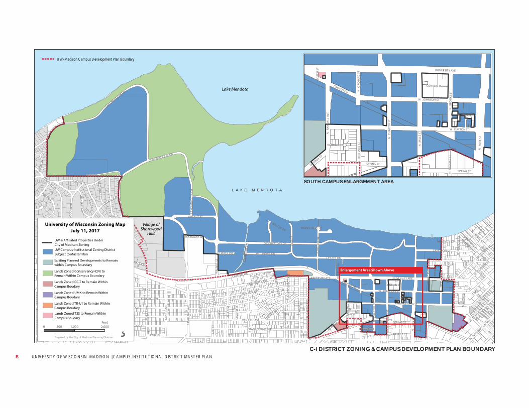
UNIVERSITY OF WISCONSIN -MADISON | CAMPUS-INSTITUTIONAL DISTRICT MASTER PLAN E.
REGENT ST
UNIVERSITY AVE CAMPUS DR
OBSERVATORY DR
W DAYTON ST
N
PARK
ST
W JOHNSON ST
LINDEN DR
BLUFF ST
HARVEY ST
HIG
HLA
ND
AVE
STEVENS ST
LANGDON ST
N
CH
ART
ER S
T
LAKE MENDOTA DR
KENDALL AVE
N
LAKE
ST
OXFORD RD
STATE ST
UNIVERSITY BAY DR
N
MIL
LS S
T
MASON ST
FARL
EY A
VE
CHADBOURNE AVE
LATH
ROP
ST
EDGEHILL DR
COLUMBIA RD
EUG
ENIA
AV
E
GRA
ND
AV
E
N
BREE
SE T
ER
N OWEN DR
CHAMBERLAIN AVE
RID
GE
ST
N
BLA
CKH
AW
K A
VE
N
ALL
EN S
T
N
FRA
NKL
IN A
VE
VAN HISE AVE
SHO
REW
OO
D B
LVD
W G
ILMAN ST
BABC
OC
K D
R
SPRING ST
N
FRA
NC
ES S
T
SUMMIT AVE
MONROE ST
WALNUT ST
N
RAN
DA
LL A
VE
ELM
DR
ACCESS RAMP
W LINDEN DR
N
PRO
SPEC
T AV
E
MARSHALL CT
N HENRY ST
N BASSETT ST
N
SPO
ON
ER S
T
AM
HERST D
R
LOCUST DR
OAK WAY
HARVARD DR
W M
IFFLIN ST
COLGATE RD
TALLYHO LN
PARK PL
TOPPING RD
W G
ORHAM ST
WILLOW DR
CHES
TNU
T ST
COLLEGE CT
FITC
H C
T
W W
ASHINGTO
N AVE
HIL
L ST
WO
OD
LN
SHEP
ARD
TER
ELM
ST
YALE RD
HERRICK DR
PURDUE ST
ELY PL
ASH
ST
MC KINLEY ST
SWEETBRIA
R RD
CORN
ELL
CT
BASC
OM
PL
LITTLE ST
UNIVERSITY AVE
EAST
ERD
AY L
N
CLYMER PL
HOWARD PL
PRINC
ETON
AVE
CONKLIN PL
CAPITOL CT
MA
RIO
N S
T
SCH
MIT
T PL
HA
WTH
ORN
E C
T
EAST
CA
MPU
S M
ALL
LAKELAWN PL
HEN
RY M
ALL
KRONSHAGE DR
MENDOTA CT
LAKE
MEN
DO
TA D
R
N
FRA
NC
ES S
T
KENDALL AVE
CAMPUS DR STEVENS ST WA
LNU
T ST
VAN HISE AVE SPRING ST
UNIVERSITY AVE
OBSERVATORY DR
WA
LNU
T ST
A
SH S
T
Lake Mendota
Village ofShorewood
Hills
UNIVERSITY AVE
W DAYTON ST
N
PARK
ST
N
MIL
LS S
T
SPRING ST
W JOHNSON ST
N
CH
ART
ER S
T
N
RAN
DA
LL A
VE
CAMPUS DR
CLYMER PL
CONKLIN PL
MONROE ST
N
BRO
OKS
ST
N
ORC
HA
RD S
T
RANDALL CT
LORC
H S
T
N
BRO
OKS
ST
SPRING ST
N
ORC
HA
RD S
T
Enlargement Area Shown Above
¸Prepared by the City of Madison Planning Division
University of Wisconsin Zoning MapJuly 11, 2017
0 1,000 2,000500Feet
Existing Planned Developments to Remainwithin Campus Boundary
Lands Zoned CC-T to Remain WithinCampus Boudary
Lands Zoned Conservancy (CN) to Remain Within Campus Boundary
Lands Zoned UMX to Remain WithinCampus Boudary
Lands Zoned TR-U1 to Remain WithinCampus Boudary
UW Campus-Institutional Zoning DistrictSubject to Master Plan
UW & Affiliated Properties UnderCity of Madison Zoning
Lands Zoned TSS to Remain WithinCampus Boudary
C-I DISTRICT ZONING & CAMPUS DEVELOPMENT PLAN BOUNDARY
UW-Madison Campus Development Plan Boundary
SOUTH CAMPUS ENLARGEMENT AREAL A K E M E N D O T A
DD
DDRRRDD
NN
AAA CCCEEESSSSSS RAAAAAAMMMPPPC VV
NNBBBBRR
EEEESSEEEE
TTEERRRR
TTLLIITTST
N INPRS
CAA
NNM
II STTNN
PAARK
NNFFRR
AANN
CCCCEESS
SSTT
AW
AWE
ST
UUUSS
MMMAA
LL
DDDD
NNNN
LEL
SSTGN
LLLL
AAACCC AK
PPPPP VV
CCCUU
TTTTTTTT
AALL
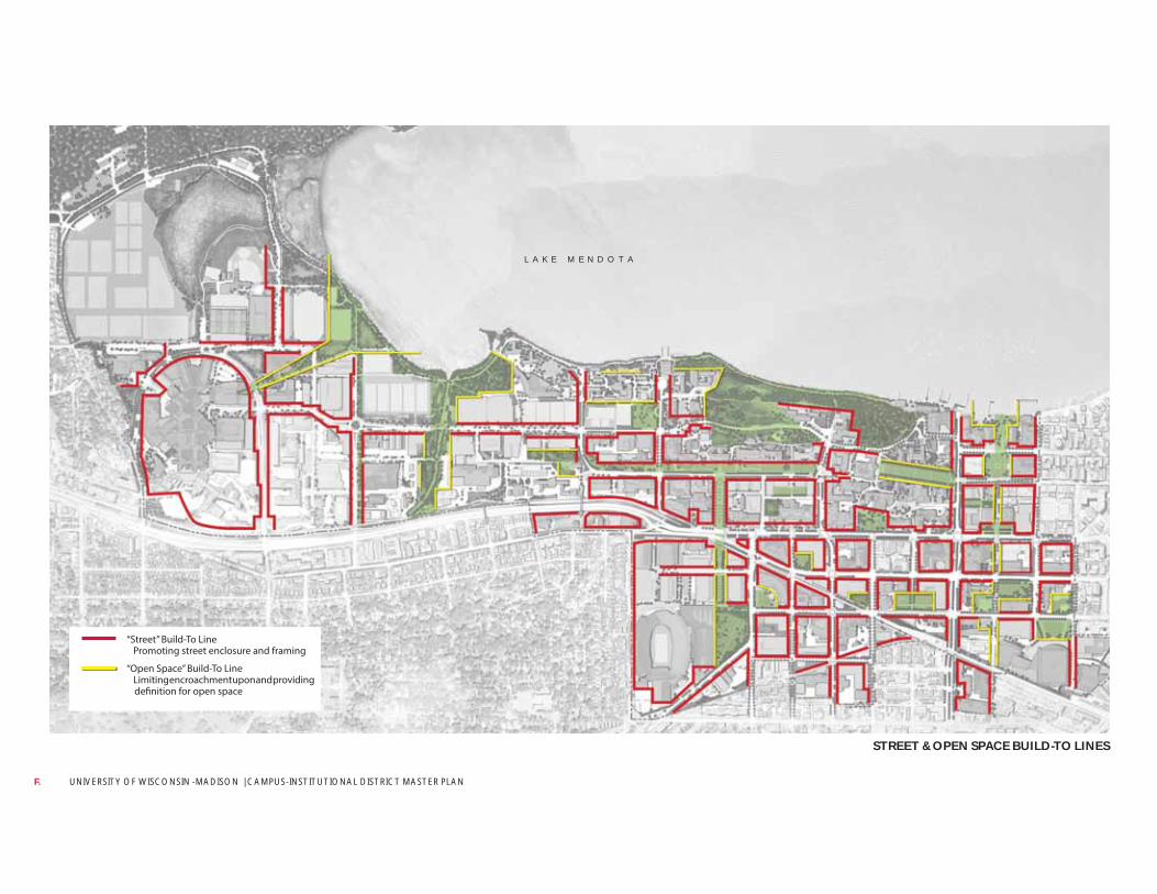
UNIVERSITY OF WISCONSIN -MADISON | CAMPUS-INSTITUTIONAL DISTRICT MASTER PLAN F.
STREET & OPEN SPACE BUILD-TO LINES
“Street” Build-To Line Promoting street enclosure and framing
“Open Space” Build-To Line Limiting encroachment upon and providing
definition for open space
L A K E M E N D O T A
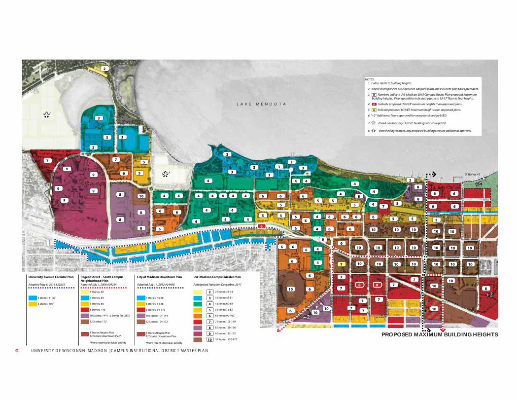
UNIVERSITY OF WISCONSIN -MADISON | CAMPUS-INSTITUTIONAL DISTRICT MASTER PLAN G.
PROPOSED MAXIMUM BUILDING HEIGHTS
5 Stories +2
+2
+2
+2
6
444444
6
4
4
3
2
3 3
3
3
3
4 4
6
5 55
7
8
6 6
3
6 6
3
5
4
5
5
4
444
6
66
10
10
8
5
6
66
1010 10
10
5
10
4
4
4
4
2
8
88
10
8
8
8
8
5
5
6
3
9
9
7
9
7
9
9
3
3
2
6
7
7
7
7
4
466
7
6
6
610
6
77
10
10
1010
10
10 10 10
1010
7 7
222
10 10 10
5
6
66
6 6 6
10 10 10
65
6 6
4
4
10
8
*
1*
Regent Street - South Campus
Neighborhood Plan
Adopted July 1, 2008 #09234
City of Madison Downtown Plan
Adopted July 17, 2012 #24468
UW-Madison Campus Master Plan
Anticipated Adoption December, 2017
University Avenue Corridor Plan
Adopted May 6, 2014 #32635
4 Stories: 41-60’
3 Stories: 46’
6 Stories: 88’ 6 Stories: 64-88’
3 Stories: 45-51’
7 Stories: 105-119’
10 Stories: 144’ (+2 bonus for LEED) 10 Stories: 104-144’
5 Stories: 75-85’
9 Stories: 135-153’
5 Stories: 60+’
4 Stories: 60’ 4 Stories: 44-60’
2 Stories: 28-34’
8 Stories: 116’ 8 Stories: 84-116’
4 Stories: 60-68’
8 Stories: 120-136’
12 Stories: 172’
8 Stories Regent Plan 12 Stories Downtown Plan*
*More recent plan takes priority
8 Stories Regent Plan 12 Stories Downtown Plan
*More recent plan takes priority
12 Stories: 124-172’
6 Stories: 90-102’’
10 Stories: 150-170’
2
3
7
4
8
5
9
6
10
NOTES: 1. Colors relate to building heights.
2. Where discrepancies arise between adopted plans, most current plan takes precedent.
3. Numbers indicate UW-Madison 2015 Campus Master Plan proposed maximum building heights. Floor quantities indicated equate to 15-17’ floor to floor heights.
4. Indicate proposed HIGHER maximum heights than approved plans.
5. Indicate proposed LOWER maximum heights than approved plans.
6. “+2” Additional floors approved for exceptional design/LEED.
7. 1 Zoned Conservancy District, buildings not anticipated
8. 2 Viewshed agreement, any proposed buildings require additional approval.
x
**
x
x
L A K E
M E N D O T A
L A K E M E N D O T A


