Embed Size (px)
Citation preview

Mineral programs of Canadian provincial and territorial geological surveys 2018-2019

Canadian provincial and territorial geological surveysGeological surveys are government agencies that provide geoscience information to the public, thus supporting responsible resource development and encouraging investment. Geoscience information is used by governments to make informed decisions and create effective policy on resource development, land use, and environmental stewardship. The provincial and territorial surveys are the main stewards for public geoscience within their borders. They conduct programs that address jurisdictional priorities and provide systematic geological descriptions, including mineral, energy, and groundwater endowments. They maintain records of assessment work and are closely linked to agencies that manage mineral tenure and regulations.
British Columbia Geological SurveyPO Box 9333 Stn Prov Gov’t
Victoria, BC V8W 9N3www.empr.gov.bc.ca/geology
Northwest Territories Geological SurveyP.O. Box 1320, 4601-B 52 Avenue
Yellowknife, NT, X1A 2L9www.nwtgeoscience.ca/
Saskatchewan Geological Survey11th floor, 1945 Hamilton Street
Regina SK, S4P 2C7www.economy.gov.sk.ca/SGS
Yukon Geological SurveyPO Box 2703
Whitehorse, Yukon Y1A 2C6www.geology.gov.yk.ca
Alberta Geological Survey402, Twin Atria Building, 4999 - 98 Avenue
Edmonton, Alberta T6B 2X3www.ags.aer.ca
Canada’s national survey, the Geological Survey of Canada, focuses on programs that are thematic or of national scope. The GSC also partners with provinces and territories on projects of common interest.
This booklet, produced by the Committee of Provincial and Territorial Geologists (www.ngsccanada.com), provides information on the mineral programs of Canada’s provincial and territorial surveys, and how to access key publications and services.

Ministère de l’Énergie et des Ressources naturelles du QuébecDirection générale de Géologie Québec
5700, 4e Avenue Ouest, D-307, Québec, QC G1H 6R1www.mern.gouv.qc.ca/mines
Geological Survey of Newfoundland and LabradorP.O. Box 8700
St. John’s, NL A1B 4J6www.nr.gov.nl.ca/nr/mines/Geoscience/index.html
New Brunswick Geological Survey1350 Regent Street, Room 150
Fredericton, New Brunswick E3C 2G6www2.gnb.ca/content/gnb/en/departments/erd/energy/content/minerals.html
Nova Scotia Department of Natural Resources - Geological Services1701 Hollis Street
PO Box 698, Halifax, Nova Scotia, B3J 2T9novascotia.ca/natr/meb/
Ontario Geological SurveyWillet Green Miller Centre, 933 Ramsey Lake Road, 3rd Floor
Sudbury, ON P3E 6B5www.mndm.gov.on.ca/en/mines-and-minerals/geology
Canada-Nunavut Geoscience Office1106 Inuksugait Plaza
Iqaluit NUhttp://www.cngo.ca
Manitoba Geological Survey360-1395 Ellice Ave
Winnipeg, MB R3G 3P2www.manitoba.ca/minerals
British Columbia Geological Survey
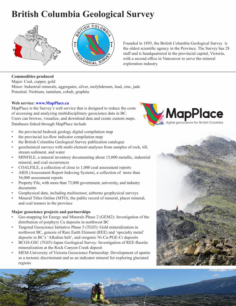
Founded in 1895, the British Columbia Geological Survey is the oldest scientific agency in the Province. The Survey has 28 staff and is headquartered in the provincial capital, Victoria, with a second office in Vancouver to serve the mineral exploration industry.
Commodities producedMajor: Coal, copper, goldMinor: Industrial minerals, aggregates, silver, molybdenum, lead, zinc, jadePotential: Niobium, tantalum, cobalt, graphite
Major geoscience projects and partnerships• Geo-mapping for Energy and Minerals Phase 2 (GEM2): Investigation of the
distribution of porphyry Cu deposits in northwest BC• Targeted Geoscience Initiative Phase 5 (TGI5): Gold mineralization in
northwest BC, genesis of Rare Earth Element (REE) and ‘specialty metal’ deposits in BC’s ‘Alkaline belt’, and orogenic Ni-Cu-PGE-Cr deposits
• BCGS-GSC (TGI5)-Japan Geological Survey: Investigation of REE-fluorite mineralization at the Rock Canyon Creek deposit
• MEM-University of Victoria Geoscience Partnership: Development of apatite as a tectonic discriminant and as an indicator mineral for exploring glaciated regions
Web service: www.MapPlace.caMapPlace is the Survey’s web service that is designed to reduce the costs of accessing and analyzing multidisciplinary geoscience data in BC. Users can browse, visualize, and download data and create custom maps. Databases linked through MapPlace include
• the provincial bedrock geology digital compilation map• the provincial ice-flow indicator compilation map• the British Columbia Geological Survey publication catalogue• geochemical surveys with multi-element analyses from samples of rock, till,
stream sediment, and water• MINFILE, a mineral inventory documenting about 15,000 metallic, industrial
mineral, and coal occurrences• COALFILE, a collection of close to 1,000 coal assessment reports• ARIS (Assessment Report Indexing System), a collection of more than
36,000 assessment reports• Property File, with more than 73,000 government, university, and industry
documents• Geophysical data, including multisensor, airborne geophysical surveys• Mineral Titles Online (MTO), the public record of mineral, placer mineral,
and coal tenures in the province
Ministry of Energy, Mines and Petroleum ResourcesBritish Columbia Geological Survey
Paper 2019-01
Geological Fieldwork 2018A Summary of Field Activities and Current Research
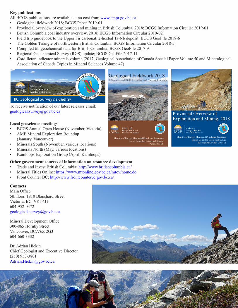
Key publicationsAll BCGS publications are available at no cost from www.empr.gov.bc.ca• Geological fieldwork 2018; BCGS Paper 2019-01• Provincial overview of exploration and mining in British Columbia, 2018; BCGS Information Circular 2019-01• British Columbia coal industry overview, 2018; BCGS Information Circular 2019-02• Field trip guidebook to the Upper Fir carbonatite-hosted Ta-Nb deposit; BCGS GeoFile 2018-6• The Golden Triangle of northwestern British Columbia. BCGS Information Circular 2018-5• Compiled till geochemical data for British Columbia; BCGS GeoFile 2017-9• Regional Geochemical Survey (RGS) update; BCGS GeoFile 2017-11• Cordilleran indicator minerals volume (2017; Geological Association of Canada Special Paper Volume 50 and Mineralogical
Association of Canada Topics in Mineral Sciences Volume 47)
Local geoscience meetings• BCGS Annual Open House (November, Victoria)• AME Mineral Exploration Roundup
(January, Vancouver)• Minerals South (November, various locations)• Minerals North (May, various locations)• Kamloops Exploration Group (April, Kamloops)
Other government sources of information on resource development • Trade and Invest British Columbia: http://www.britishcolumbia.ca/• Mineral Titles Online: https://www.mtonline.gov.bc.ca/mtov/home.do• Front Counter BC: http://www.frontcounterbc.gov.bc.ca/
To receive notification of our latest releases email: [email protected]
ContactsMain Office5th floor, 1810 Blanshard StreetVictoria, BC V8T [email protected]
Mineral Development Office300-865 Hornby StreetVancouver, BC,V6Z 2G3604-660-3332
Dr. Adrian Hickin Chief Geologist and Executive Director(250) [email protected]
Ministry of Energy, Mines and Petroleum ResourcesBritish Columbia Geological Survey
Information Circular 2019-01
Provincial Overview of Exploration and Mining, 2018

Yukon Geological Survey, established in 1992, delivers a program that includes regional mapping and thematic studies such as mineral deposit research, metallogenic compilations, and placer studies. The survey also administers the Yukon Mineral Exploration Program, which provides a portion of the risk capital needed for early-stage exploration projects.
Commodities producedMajor: Gold Potential: Silver, lead, zinc
Web servicesYukon Geological Survey publications, data, and industry files can be accessed online using the Integrated Data System (IDS) search tool (www.geology.gov.yk.ca). In addition to the IDS, an online map gallery allows users to view and download a variety of data and reports. Downloadable information includes
• the Yukon digital bedrock geology map • the Yukon digital surficial geology map• geochronologic data• information on current mineral exploration projects• regional stream-sediment geochemical data and derivative
maps• data on more than 4,000 mineral occurrences and deposits
from the Yukon MINFILE database• geophysical survey data and maps• assessment reports and other archived industry files • the Placer industry report• information on YGS’ diamond drill core collection• annual exploration summaries and research reports
Major geoscience projects and partnerships• Regional bedrock mapping: Frances Lake, Glenlyon and Lake Laberge map areas• Regional surficial mapping: Kluane Lake map area• Targeted Geoscience Initiative Phase 5 (TGI5): Gold in the Rackla Belt• Geo-mapping for Energy and Minerals Phase 2 (GEM2): aeromagnetic surveys in Wolf Lake area;
thematic studies in southern Yukon
Yukon Geological Survey

Key publications• Yukon Exploration and Geology annual reports• Yukon Exploration and Geology annual reports of activities • Yukon Mineral Deposits Summaries• Yukon Digital Bedrock Geology Map Open File 2016-1• Yukon Placer Mining Industry reports• annual releases of bedrock and surficial geology maps (Open Files, by year)• regional stream-sediment geochemical data and enhanced interpretation of
stream-sediment geochemical data (released as Open Files, by map sheet)
Local geoscience meetings• Yukon Geoscience Forum (November, Whitehorse)• Cordilleran Tectonics Working Group (various locations across Canada)
Other government sources of information on resource development• Mining Map Viewer
www.mapservices.gov.yk.ca/Mining/• Yukon Mining Land Use
www.emr.gov.yk.ca/mining/mining_land_use.html• Yukon Environmental and Socio-economic Assessment
Board www.yesab.ca/
• Yukon Chamber of Mineswww.yukonminers.ca/
• Yukon government spatial data warehousehttp://mapservices.gov.yk.ca/GeoYukon/
ContactsBedrock Geology unit91807 Alaska HighwayWhitehorse, Yukon867-667-8508www.geology.gov.yk.ca
Minerals and Surficial Geology units301 Main StreetWhitehorse, Yukon867-667-3201www.geology.gov.yk.ca
Dr. Carolyn RelfChief Geologist/[email protected]
Alberta Geological Survey Since the early 1920s, the Alberta Geological Survey has provided information and advice about the geology of Alberta to the Government of Alberta, provincial regulatory agencies, industry, and the public to support the exploration, sustainable development, regulation, and conservation of Alberta's resources. The Survey is part of the Alberta Energy Regulator and has 59 staff, headquartered in the provincial capital, Edmonton.
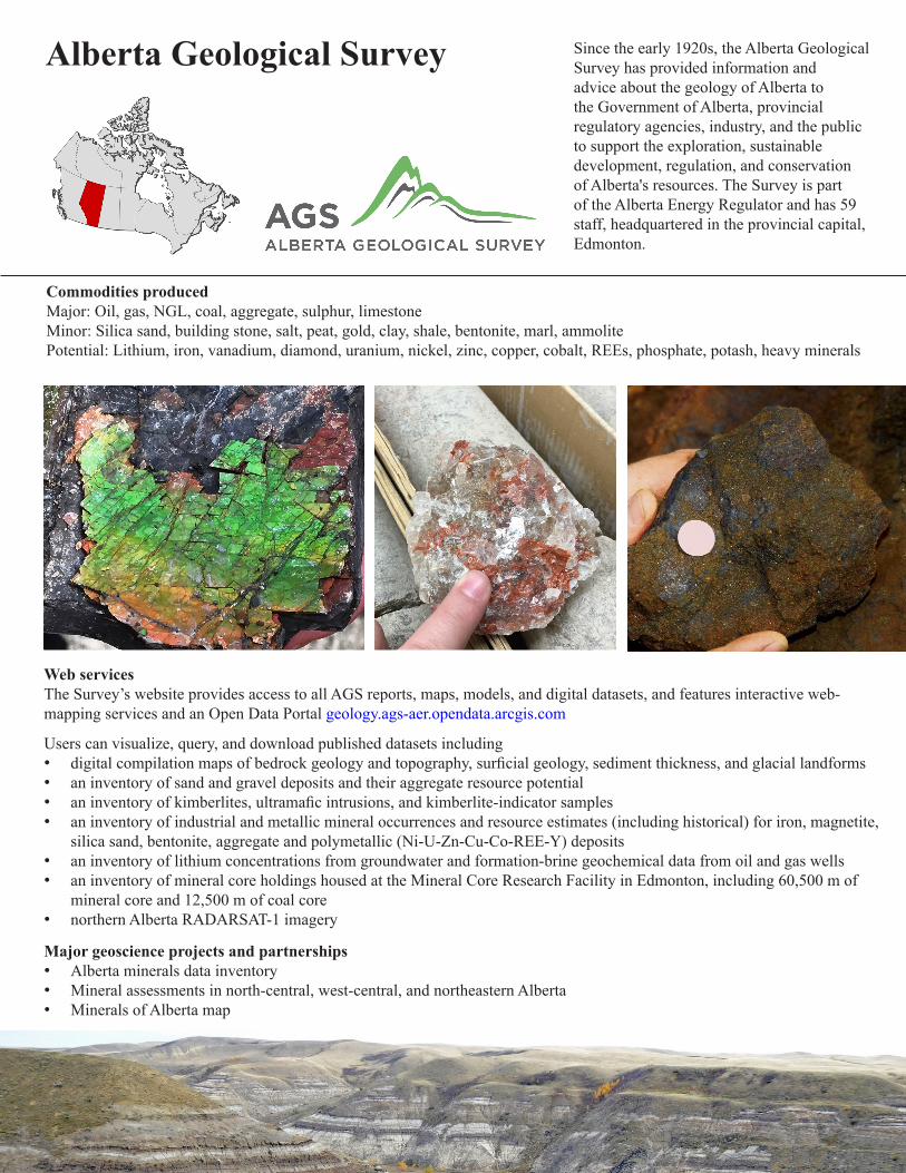
Commodities producedMajor: Oil, gas, NGL, coal, aggregate, sulphur, limestone Minor: Silica sand, building stone, salt, peat, gold, clay, shale, bentonite, marl, ammolitePotential: Lithium, iron, vanadium, diamond, uranium, nickel, zinc, copper, cobalt, REEs, phosphate, potash, heavy minerals
Web servicesThe Survey’s website provides access to all AGS reports, maps, models, and digital datasets, and features interactive web-mapping services and an Open Data Portal geology.ags-aer.opendata.arcgis.com
Users can visualize, query, and download published datasets including• digital compilation maps of bedrock geology and topography, surficial geology, sediment thickness, and glacial landforms• an inventory of sand and gravel deposits and their aggregate resource potential• an inventory of kimberlites, ultramafic intrusions, and kimberlite-indicator samples• an inventory of industrial and metallic mineral occurrences and resource estimates (including historical) for iron, magnetite,
silica sand, bentonite, aggregate and polymetallic (Ni-U-Zn-Cu-Co-REE-Y) deposits• an inventory of lithium concentrations from groundwater and formation-brine geochemical data from oil and gas wells• an inventory of mineral core holdings housed at the Mineral Core Research Facility in Edmonton, including 60,500 m of
mineral core and 12,500 m of coal core• northern Alberta RADARSAT-1 imagery
Major geoscience projects and partnerships• Alberta minerals data inventory• Mineral assessments in north-central, west-central, and northeastern Alberta• Minerals of Alberta map

Key publicationsAll AGS publications are available at no cost from www.ags.aer.ca
• Minerals of Alberta; AGS Map (Spring 2019)• 3D Provincial Geological Framework Model of Alberta, Version 1; AGS Model 2017-03, Open File Report 2017-09, 2018• Architecture and geometry of basal sand and gravel deposits including the ‘Grimshaw gravels’, northwestern Alberta (NTS
84C and 84D); AGS Open File Report 2018-04, 2018• Aeromagnetic Survey of the Marguerite River Area, Alberta, Parts of NTS 74E/L North and 74E/L South; AGS Maps 584 to
589, 2017 (co-published with GSC)• Relative landslide susceptibility model of the Alberta plains and shield regions; AGS Map 605, Information Series 148, 2017• Alberta Interactive Minerals Map (AIMM), 2016• Diamond potential in Alberta; AGS Special Report 103, 2016• Limestone and dolomite prospects for industrial use in the Alberta Foothills and Front Ranges; AGS Special Report 102,
2016• Glacial landforms of Alberta; AGS Map 604, 2015• Bedrock topography of Alberta; AGS Map 602, 2015• Bedrock geology of Alberta; AGS Map 600, 2013• Geology of the Alberta Rocky Mountains and Foothills; AGS Map 560, 2013• Geological introduction to lithium-rich formation water with emphasis on the Fox Creek area of west-central Alberta; AGS
Open File Report 2011-10, 2012• Review of metallic mineralization in Alberta with emphasis on gold potential; AGS Open File Report 2011-01, 2011• Northern Alberta kimberlite province: the first 20 years; AGS Bulletin 65, 2011
Geoscience meetings• Calgary Mineral Exploration Group
http://www.megcalgary.com/• Geoconvention (May, Calgary)
https://www.geoconvention.com/• Canadian Society for Unconventional Resources
http://www.csur.com/
Other government sources of information on resource development• Alberta Energy Regulator: http://aer.ca• Alberta Energy: http://www.energy.alberta.ca• Alberta Environment and Parks: http://aep.alberta.ca
ContactsAlberta Geological Survey402, Twin Atria Building4999 - 98 AvenueEdmonton, Alberta T6B 2X3Phone:[email protected]
Mineral Core Research Facility4504 Eleniak RoadEdmonton, Alberta780-466-1779
Andrew Beaton, Vice [email protected]

Northwest Territories Geological Survey
The Northwest Territories Geological Survey (NTGS) is a Division of the Department of Industry, Tourism and Investment, Government of the Northwest Territories. The NTGS advances the geoscience knowledge of the Northwest Territories by conducting and publishing geoscience research, analyzing mineral and petroleum potential, and offering excellence in digital data management. The NTGS also conducts environmental geoscience research and outreach activities.
Commodities producedMajor: DiamondsMinor: Industrial minerals, oil and gasPotential: Gold, rare metals and elements, lead, zinc, silver, copper, cobalt, bismuth, tungsten
Web servicesNTGS web applications provide search, display, and download capabilities for Northwest Territories geoscience information and publicationshttp://www.nwtgeoscience.ca/our-data-and-searching-tools
• NTGS web applications have been recently updated. There are now eight separate web apps that provide access to geoscience publication and reports, mineral showings, geophysical data, kimberlite-related information, and till/soil geochemical data.
• Two new web apps – NTGS Spatial and NTGS Data Hub – allow users to create customized geoscience maps and download collections of geoscience information for the Northwest Territories.
• NTGS Spatial permits users to select, clip, and export a range of spatial data from within an Area of Interest defined by the user
Major geoscience projects and partnerships• Slave Province Surficial Materials, Geophysics
and Permafrost Study (major funder – Canadian Northern Economic Development Agency)
• Detailed stratigraphic mapping, sampling, and resource characterization of Northwest Territories sedimentary basins
• Bedrock geology compilation of the Northwest Territories, plus region-specific geology maps with mineral and petroleum information
• Permafrost and ground temperature studies and associated landscape change
• Geo-Mapping for Energy and Minerals Phase 2 (GEM2): various projects throughout the Northwest Territories

Key publications• Northwest Territories Mineral Exploration Overview (published annually in November and updated the following
March)• Carlin-type gold and clastic-dominated zinc-lead potential of the Misty Creek Embayment region, Mackenzie
Mountains, Northwest Territories; NWT Open File 2017-02• Geology of the Mactung tungsten skarn and area – review and 2016 field observations; NWT Open File 2018-02• An interpretation of the deglaciation history of the southern Slave Province using 1:50 000 surficial geology maps;
NWT Open Report 2017-018• Airborne magnetic, electromagnetic, radiometric and gravity data for the Northwest Territories, Canada; NWT Open
Report 2018-001• Petroleum potential data for the Horn River Group from eight exploration wells - NTS 95N, 95O, 96C, 106H, 106J,
106K, and 106N, Northwest Territories; NWT Open Report 2016-015• Mapping of terrain affected by retrogressive thaw slumping in northwestern Canada; NWT Open Report 2016-023• Geological compilation of the western mainland and southern Arctic Islands regions, Northwest Territories; NWT Open
File 2014-01
Local geoscience meeting• Yellowknife Geoscience Forum (November,
Yellowknife)
Other government sources of information on resource development• Department of Industry, Tourism and
Investment (ITI): http://www.iti.gov.nt.ca/en
• ITI – Mines and Minerals: http://www.iti.gov.nt.ca/en/mines-and-minerals
• ITI – Oil and Gas: http://www.iti.gov.nt.ca/en/oil-gas
• Mining Incentive Program: http://www.nwtgeoscience.ca/services/mining-incentive-program
• Mining Recorder’s Office: https://www.iti.gov.nt.ca/en/mining-recorders-office
ContactsP.O. Box 13204601-B 52 Avenue Yellowknife, NT X1A 2L9867-767-9211, extension 63469 Fax: 867-873-2652 [email protected]://www.nwtgeoscience.ca/
Dr. John KetchumDirector867-767-9211, extension [email protected]

Saskatchewan Geological Survey The Saskatchewan Geological Survey (SGS) has a mandate to provide high-quality, easily accessible geoscience information to encourage and facilitate the responsible exploration for, and development of, Saskatchewan’s mineral and petroleum resources, thereby advancing Saskatchewan’s natural resource advantage. The SGS has forty staff and is based in Regina.
Commodities produced Major: Potash, uranium, oil and gasMinor: Coal, gold, base metals, helium, sodium and potassium sulphate, salt, claysPotential: Diamonds, rare earth elements, specialty metals, silica sand
Web servicesThe Saskatchewan Mining and Petroleum GeoAtlas is the SGS’s online data portal that allows anyone with an internet connection to browse, visualize, download, and analyze multidisciplinary geoscience and tenure data, and create custom maps.www.saskatchewan.ca/geoatlas
More than 100 databases are linked through the GeoAtlas, including• provincial bedrock and surficial geology compilation maps• drillhole compilations• an EM conductor compilation• a geochronology compilation• a provincial ice-flow indicator compilation • Crown dispositions and reserves• oil and gas wells, pools, and land sale postings• geochemical surveys with multi-element analyses from samples of rock• SMDI (SK Mineral Deposits Index), a mineral inventory documenting about 6,000 metallic, industrial mineral, and coal
occurrences• SMAD (SK Mineral Assessment Database) an online archive of industry mineral assessment reports
Major geoscience projects and partnerships• Mineral Development Strategy: New airborne geophysical survey data, collaborative geoscience programs, and
drilling-focused Targeted Mineral Exploration Incentive in specified areas of unrealized potential for base metals, precious metals, and diamonds
• National Geological Surveys Committee: Pilot Project undertaken with the Geological Survey of Canada (GSC) to demonstrate how new, innovative geoscience knowledge supports the junior mineral exploration sector
• In collaboration with the GSC, Targeted Geoscience Initiative Phase 5 (TGI5) project on the context of uranium mineralization in the southwest part of the Athabasca Basin.
• Geological Survey of South Australia: Scientific and technical cooperation with respect to minerals including professional development opportunities
• University of Regina: MOU on Geoscience Collaboration, including mentoring of graduate students• International Atomic Energy Agency: World Distribution of Uranium Deposits Map• China Geological Survey: Technical MOU on sandstone uranium deposits

Key publications All SGS publications are available at no cost from saskatchewan.ca/geological-survey• Summary of Investigations 2018; Misc. Rep. 2018-4.1
and 4.2• Resource Map of Saskatchewan, 2018 Edition, Misc.
Rep. 2018-1• Saskatchewan Gold: Mineralization styles and mining
history. Rep. 262• Karst facies characterization of the Lower
Carboniferous (Mississippian) Madison Group and the Jura-Cretaceous Success Formation of west-central Saskatchewan; Summary of Investigations 2017, v 1.
• A summary of helium exploration, production, traps and sources in southwestern Saskatchewan, and suggestions for exploration; Open File 2016-1.
• Updated isopach maps of the potash-rich members of the Devonian Prairie Evaporite in Saskatchewan; set of 6 maps, Open File 2018-1.
• Saskatchewan Phanerozoic Fluids and Petroleum Systems Project: Hydrogeology of the Phanerozoic-aged strata of Saskatchewan; Open File 2015-1
• Rare Earths in Saskatchewan: Mineralization Types, Settings, and Distributions, 2014, Report 264.
Local geoscience meetings• Saskatchewan Geological Open House (early December, Saskatoon)
https://openhouse.sgshome.ca/index.php• Williston Basin Petroleum Conference (biannually in May, Regina)
http://www.wbpc.ca/
Other government sources of information on resource development• Saskatchewan Natural Resources Information
http://www.saskatchewan.ca/business/agriculture-natural-resources-and-industry• Acquire mineral dispositions online from Mineral Administration Registry Saskatchewan (MARS):
https://mars.isc.ca/MARSWeb/default.aspx• Mineral Tenure
http://www.saskatchewan.ca/business/agriculture-natural-resources-and-industry/mineral-exploration-and-mining/mineral-tenure
• Mineral Exploration Guidelineshttp://saskmining.ca/ckfinder/userfiles/files/BMP%20August%202016_Draft.pdf
ContactsMain Office1945 Hamilton Street,Regina, SK, S4P 2C7, 306-787-2476
Subsurface Geological Laboratory201 Dewdney Avenue EastRegina, SK, S4N 4G3, 306-787-0650
Precambrian Geological LaboratoryP.O. Box 104, 1310 La Ronge Avenue,La Ronge, SK S0J 1L0, 306-425-4498
Dr. Gary DelaneyChief Geologist and Executive [email protected]

Commodities producedMajor: Gold, ironPotential: Lead, zinc, silver, copper, uranium, nickel
Web servicesCNGO web applications provide display and download capabilities for geoscience information and publications.• CNGO’s website (www.cngo.ca) provides aps and publications• NUMIN is a database within NunavutGeoscience.ca that contains mineral showings and geological metadata
Major geoscience projects and partnerships• Strategic Investments in Northern Economic Development (funded by the Canadian Northern Economic Development
Agency; CanNor)• Geo-Mapping for Energy and Minerals Phase 2 (GEM2 collaboration with the Geological Survey of Canada)• NSERC Strategic Partnership Grants with universities
Examples of recent projects include• Fury-Hecla Geoscience Project, northwestern Baffin Island; Hall Peninsula, southern Baffin Island, Baffin (Qikiqtani
Region); Elu Belt (Kitkmeot Region); Tehery Lake-Wager Bay (Kivalliq Region) • Surficial studies and permafrost investigations of Sylvia Grinnell, Hall Peninsula, western Hudson Bay; Iqaluit airport • Paleozoic stratigraphy and petroleum potential of Hudson Bay, Ungava Bay, Akpatok Island, Southampton Island, High
Arctic• Seabed mapping and characterization of Frobisher Bay
Canada-Nunavut Geoscience Office
The youngest jurisdiction in Canada, becoming a territory in 1999, Nunavut does not yet have a formal survey. Instead, the Canada-Nunavut Geoscience Office (CNGO) is managed and funded by the federal government through Natural Resources Canada (Lands and Minerals Sector), Crown-Indigenous Relations and Northern Affairs Canada, and the Government of Nunavut (Economic Development and Transportation). The CNGO is managed with input from a Management Board with representatives from the federal and territorial governments and Nunavut Tunngavik Inc., the organization that ensures the Nunavut Land Claims Agreement is adhered to.
The CNGO office is in Iqaluit. Our staff of six have expertise in Precambrian, Paleozoic, and Quaternary geology, GIS, and online geoscience data dissemination. The CNGO’s mandate is to provide accessible geoscience information and expertise in Nunavut and support: responsible resource exploration and development; responsible infrastructure development; geoscience-capacity building; and geoscience education, training and awareness. To accomplish this mandate, the CNGO publishes maps and reports about the geology and resources of Nunavut. In collaboration with many partners, CNGO aims at engaging the public on key geoscience issues.

ContactsP.O. Box 23191106 Inuksugait PlazaIqaluit NU867-975-4412 http://www.cngo.ca
Linda HamChief Geologist [email protected]
Key publicationsAll CNGO publications are available at no cost from www.cngo.caAll Geological Survey of Canada publications are available on GEOSCAN at http://geoscan.nrcan.gc.ca/• Summary of Activities, published annually since 2012. Available digitally December 31 and in hard copy late January of the
following year. • Nunavut Exploration Overview, a joint publication led by the Nunavut Regional Office of Crown-Indigenous Relations and
Northern Affairs Canada
Local geoscience meeting• Nunavut Mining Symposium (April, Iqaluit)
Other government sources of information on resource development• Government of Nunavut, Department of Economic Development and Transportation, Minerals and Petroleum
Resources; www.gov.nu.ca/edt• Crown-Indigenous Relations and Northern Affairs Canada (CIRNAC), Nunavut Regional Office, Resource
Management Directorate and Lands Directorate; www.aandc-aadnc.gc.ca/nu

Manitoba Geological Survey
The Manitoba Geological Survey collects, distributes, and archives information about Manitoba’s geology and mineral resources to attract exploration investment, foster sustainable mineral and petroleum developments, inform government policy and land management, and contribute to the quality of life and economic prosperity of all Manitobans.
Commodities producedMajor: Nickel, copper, zinc, gold, silver, oilMinor: Cesium, natural gas, gypsum, high-Ca limestone, aggregate, crushed stone, dimension stone, high-purity dolomitePotential: Frac sand, potash, lithium
Web services: http://www.gov.mb.ca/iem/geo/index.htmlThe Manitoba Resource Development Division website offers, at no charge, current and historical geoscience information to assist the exploration and mining industry, academia, and the general public. These include
• the GIS Map Gallery, an interactive map portal to view, query, and extract mineral disposition and geoscience data, including mining claims, exploration licenses, assessment files, drill hole locations, geophysical data, mineral occurrences, bedrock and surficial geology data, petroleum well information, and technical well files
• Mineral Commodities in Manitoba: brochures for copper-zinc, gold, nickel, rare metals, diamond potential, uranium, and lithium
• online tracker for Geological Survey activities• a 3-D geological model of the Phanerozoic section in southwest Manitoba• Rare Metals in Manitoba, a compilation of rare metal occurrences• surficial geology maps and a digital compilation of surficial features such as ice-flow indicators• Bibliography of Manitoba Geology, listing 15,000 reports, maps, journal articles, and conference proceedings • Phanerozoic stratigraphic maps depicting structural, isopach, subcrop, and outcrop information • a digital elevation model of Manitoba, based on high-resolution SRTM data• information on industrial minerals, occurrences, and historical accounts• weekly updates on petroleum drilling and well status• the Corporation File database, which includes descriptions of more than 2,000 mining corporations, some of which have
been active since the 1920s• historical documents on early exploration targets (e.g., oil shale, helium)Major geoscience projects and partnerships• Geo-mapping for Energy and Minerals Phase 2 (GSC): hydrocarbon potential of the Hudson Bay basin onshore strata• Targeted Geoscience Initiative Phase 5 (GSC): Au ore systems in the Lynn Lake greenstone belt;magmatic Ni-Cu-PGE ore
systems in the Bird River belt• NGSC pilot project (GSC-SGS): sub-Phanerozoic Flin Flon belt• Geology and Metallogeny of Archean and Paleoproterozoic greenstone belts (Oxford Lake–Knee Lake, Flin Flon–Snow
Lake, Lynn Lake–Leaf Rapids)• Shallow Unconventional Shale Gas Project (U of Calgary, U of Manitoba, Manitoba Hydro): shallow biogenic gas potential
of Cretaceous strata in the Williston Basin

Key publications MGS publications are available for free download atwww.manitoba.ca/minerals • Annual Report of Activities• Ice-flow history and till composition of the Southern Indian Lake
area, north-central Manitoba (parts of NTS 64G1, 2, 7-10 and 64B15); OF2018-1
• Till composition of a sampling transect in the Lynn Lake area, northwest Manitoba (parts of NTS 64B12, 64C9, 11, 12, 14–16, and 64F3, 4); OF2018-3
• Geology of the Tower Cu-Zn-Ag-Au deposit, sub-Phanerozoic Superior boundary zone, central Manitoba (part of NTS 63G14); OF2018-4
• Geology of the Paint and Phillips lakes area, Thompson nickel belt, central Manitoba (parts of NTS 63O1, 8, 9 and 63P5, 12); Geoscientific Report GR2016
• Kimberlite-indicator-mineral results derived from glacial sediments (till): Southern Indian Lake area, Kaskattama highlands area; OF2017-1 and -2
• Manitoba Kimberlite Indicator Mineral Database Version 3.1.1• Preliminary geology of the diamond occurrence at southern Knee Lake,
Oxford Lake-Knee Lake greenstone belt, Manitoba (NTS 35L 15); OF2017-3
• Stratigraphic synthesis of the Hudson Platform in Manitoba, Ontario, and Nunavut: Ordovician-Silurian, GSC Open File 8378
Local geoscience meetings• Central Canada Mineral Exploration Convention (yearly in November, Winnipeg; https://ccme-convention.ca/)• Manitoba Prospectors and Developers Association (member meetings throughout the year, Winnipeg, http://mpda.ca/)
Other government sources of information on resource development• Manitoba Mineral Sector Profile: http://www.manitoba.ca/iem/busdev/sector/index.html• Weekly Well Activity Report: http://www.manitoba.ca/iem/petroleum/wwar/index.html
ContactsManitoba Geological Survey360-1395 Ellice AveWinnipeg, MB R3G 3P2www.manitoba.ca/minerals204-945-11191-800-223-5215 (toll-free)
Michelle Nicolas A/Director, Mines and Geological [email protected]

Ontario Geological SurveyThe Ontario Geological Survey is the principal provincial government organization responsible for the documentation and public dissemination of geoscience information. The Survey has 115 staff and is headquartered in Sudbury with an additional eight satellite offices throughout the province to serve both the mineral exploration industry and non-industry clients.
Commodities producedMajor: Gold, nickel, copper, platinum group metals, zinc, salt, sand and gravelMinor: Silver, cobalt, diamonds, clay, stone, lime, cement, nepheline syenitePotential: Lithium, indium, selenium, tellurium, quartz (silica), graphite
Web services Geoscience data collected by the OGS can be viewed geographically and spatially using the OGSEarth application (www.ontario.ca/ogsearth). Embedded links in OGSEarth allow users to download maps and data from GeologyOntario.
• GeologyOntario (www.ontario.ca/geology), the OGS online data warehouse, provides free downloads of OGS geoscience publications and datasets. Paper reports and maps, and digital data in CD or DVD formats can also be purchased through the sales outlet.
• Geophysical Survey Index (www.mndm.gov.on.ca/en/mines-and-minerals/applications/ogsearth/)geophysical; GIS format files (and an associated .kml file) are updated with new data releases.
• Provincial digital compilation maps: bedrock geology, and Quaternary geology.• Southern Ontario digital compilation maps: surficial geology, Paleozoic geology, physiography.• 3D Mapping of Surficial Aquifers; with information about the distribution and character of surficial
materials that may form aquifers and aquitards.• Geochemical surveys with multi-element analyses from samples of rock, till, stream sediment, and water.• Ambient Groundwater Geochemistry; with inorganic analyses from more than 2300 water samples
collected in southern Ontario.• Southern Ontario Stream Sediment Geochemistry Survey; with stream-sediment data including metals
chemistry.• ARO—2016, a compilation of the aggregate resources of Ontario.• MDI, the Mineral Deposit Inventory database; with more than 19,000 records, provides an overview of
metallic and industrial mineral occurrences.
Major geoscience projects and partnerships• OGS–GSC Collaborative Project: Regional Hydrogeology of Southern Ontario• MERC–Laurentian University—OGS: Metal Earth Project• Targeted Geoscience Initiative 5 (TGI-5)• Canada in 3-D Initiative• Geo-mapping for Energy and Minerals 2 (GEM-2): Hudson Platform Project

Key publications• Summary of Field Work and Other Activities (annual report of OGS mapping work)• Report of Activities, Resident Geologist Program (6 annual reports from the regional
offices)• Recommendations for Exploration (from the regional offices)• Geology of Ontario (Special Volume 4, 2 parts + maps)• The Subsurface Paleozoic Stratigraphy of Southern Ontario (Special Volume 7)• GeoTours Northern Ontario (online PDF virtual tours)
Local geoscience meetings• Ontario Prospector’s Association Northwestern Ontario and Northeastern Ontario
Mines and Minerals Symposia (spring, Thunder Bay, ON; and other locations)• Ontario Petroleum Institute Annual Meeting (spring or fall, various locations)
Other government sources of information on resource development• Exploration and Developing Minerals in Ontario:
http://www.mndm.gov.on.ca/en/mines-and-minerals/exploration-and-developing-minerals-ontario • Mining Lands Administration System:
https://www.mndm.gov.on.ca/en/mines-and-minerals/land-tenure-and-geoscience-resources
ContactsOntario Geological Survey Willet Green Miller Centre 933 Ramsey Lake Road, 3rd Floor Sudbury, ON, P3E 6B5 888-415-9845 ext 5614 (toll-free)[email protected] Mineral Development and Lands Branch Willet Green Miller Centre933 Ramsey Lake Road, 6th FloorSudbury, ON, P3E 6B5888-415-9845 ext 5787 (toll-free)[email protected]
Renée-Luce SimardA/[email protected]

Commodities producedMajor: Gold, iron, nickel, titanium, niobiumMinor: Diamond, cobalt, copper, silver, zinc, platinum group elements, silica, lithium, graphite, mica, salt, feldsparAdvanced projects: Apatite, rare earths elements, vanadium
Web services SIGÉOM is a spatial information system that contains the entire Québec geoscientific database collected during the last 150 years. Every year, it grows richer with additional data from geological surveys by the Ministry, prospecting and exploration assessment reports by companies, and studies by university researchers. (sigeom.mines.gouv.qc.ca)
SIGÉOM contains• the Interactive Map, a friendly interface that gives a global overview of the SIGÉOM database• Web Mapping Services (WMS) that allow you to access the SIGÉOM database and load data directly into your GIS software.• the gateway to Géologie Québec’s records, holding more than 80,000 documents (bibliographic data, reports, maps)• SIGÉOM à la carte, which gives access to the entire geoscientific database and allows searches to be performed by precise
criteria and to get maps in different file formats
GESTIM Plus (Québec mining titles online) provides instant access to up-to-date data in the Registry of real and immovable mining rights in Québec. (gestim.mines.gouv.qc.ca)
Major geoscience projects and partnerships• Géologie Québec’s Annual Survey Program: geological mapping, airborne geophysical surveys and geochemical sampling. • Regional geology and metallogeny of gold in the Opinaca and La Grande subprovinces of the Superior Province.• Geo-mapping for Energy and Minerals (GEM-2): Bedrock and Surficial deposits mapping projects in northeastern Québec. • Targeted Geoscientific Initiative (TGI-5): Collaboration on various mineral deposit studies in the Canadian Shield. • Metal Earth: To understand metal endowment in the Canadian Shield, multiple geoscientific research transects will be
carried out in the Abitibi region. • Consortium de recherche en exploration minérale (CONSOREM): Applied research projects to optimize the discovery of
new deposits in Québec. • NSERC-Agnico-Eagle Industrial Research Chair: New exploration methods for gold exploration using indicator minerals.
Québec Ministère de l’Énergie et des Ressources naturelles
Since 1891, the Mining sector of the Québec government has evaluated and promoted the mineral potential of the province. Now headquartered in Québec City, and with a staff of 200 people, the sector acquires, analyzes, integrates, and distributes geoscience information related to mineral resources. The sector is also a world leader in capturing and processing geoscience data.

Key publications• Choosing Québec’s mining sector: mern.gouv.qc.ca/english/publications/mines/mining-sector.pdf• Reports on Mineral Activities in Québec: mern.gouv.qc.ca/english/mines/publications/publications-report.jsp• Québec Mines Bulletin: mern.gouv.qc.ca/english/mines/quebec-mines/index.asp• Strategic Vision for Mining Development in Québec: mern.gouv.qc.ca/english/mines/strategy/index.jsp
Local geoscience meetings• Québec Mines Convention (November, Quebec City, QC)• Kuujjuaq Mining Workshop (April, Kuujjuaq, QC)
Other government sources of information on resource development• Société du Plan Nord: plannord.gouv.qc.ca• Investissement Quebec: www.investquebec.com• SOQUEM: soquem.qc.ca
ContactsCentre de service des mines5700, 4e Avenue Ouest, D-307Québec (Québec) G1H [email protected]
Dr. Andrea Amortegui, interim director418-627-6269 #[email protected]
Facebook: Facebook.com/QuebecMines LinkedIn: QuebecMines.gouv.qc.ca/linkedin Twitter: @MERN_Quebec and #quebecmines
Geological Survey of Newfoundland and Labrador
Commodities producedMajor: Iron ore, nickel, copper, gold, fluorsparMinor: Gold, cobalt, limestone, dolomite, barite, pyrophylliteHistoric: Zinc, lead, silver, antimony, slate Potential: Rare earth elements and rare metals, uranium
The Geological Survey of Newfoundland and Labrador is responsible for mapping the geological framework of the province to interpret and explain its geological evolution, and to describe, interpret, and explain the distribution, nature, quantity, and origin of the province’s mineral resources.
Web servicesWe have a comprehensive suite of on-line tools, including links to public geoscience, industry reports, and other data, and real-time mineral land tenure.
• GeoScience OnLine: Includes interactive maps of geology, geophysics, geochemistry, mineral occurrences, and mineral land tenure; gis.geosurv.gov.nl.ca
• GeoFiles database: A repository of documents about provincial geoscience including mineral exploration assessment reports, reports and maps, university theses, books, and unpublished reports and maps.www.nr.gov.nl.ca/nr/mines/geoscience/geofiles.html
• MIRIAD: Real-time claim staking; https://www.claimstaking.gov.nl.ca/
Major geoscience projects and partnerships• Bedrock mapping in the Paleoproterozoic Labrador Trough and the Archean Hopedale Block.• Surficial geology and till geochemistry studies in Newfoundland, and assessment of coastlines vulnerable to erosion and
flooding.• Study of gold metallogeny and VMS deposits in central Newfoundland, fluorite mineralization on the Burin Peninsula,base
metal mineralization within the Labrador Trough, and an examination of precious metal mineralization in theHopedale Block of Labrador.
• Geo-mapping for Energy and Minerals Phase 2 (GEM2): Central Labrador surficial mapping, till sampling andaeromagnetic surveying; and Mineral Potential of Northeastern Quebec and Labrador.
• Newfoundland Ice Sheet Shelf project in collaboration with the University of Ulster, Marine Institute of Ireland and Memorial University.
The Geological Survey currently has three sections (Regional Geology; Mineral Deposits; Terrain Sciences; and Geoscience Data Management), and 45 staff. The Survey offices are mostly in the Natural Resources Building in the provincial capital, St. John's. The Geological Survey also has a geochemical laboratory in St. John’s, and a staff member in Happy Valley-Goose Bay, Labrador.

Key publicationsOur publications are freely available on the Geological Survey website athttp://www.nr.gov.nl.ca/nr/mines/geoscience/reports_maps.html• Current Research, an annual report highlighting Geological Survey field activities• Geological Survey Review, an annual report produced for the Department’s ‘Open House’ • Exploration Highlights, an annual review of mineral exploration activity in the Province• VLF-EM data from an airborne geophysical survey of the St. Alban’s region, Newfoundland (NTS map area 1M/13 and
parts of 1M/12, 1M/14, 11P/16 and 2D/04), Open file NFLD/3339• Fluoride in Newfoundland Tills, Open File NFLD/3344• Till-geochemistry survey in the Great Burnt Lake (NTS 12A/08), Burnt Hill (NTS 2D/05), Northern Cold Spring
Pond (NTS 12A/01) and adjacent map areas, Open File NFLD/3341• Geochemical data from Montagnais gabbro sills and associated rocks in the Labrador Trough (NTS map areas
23I/12, 13, 23J/16, 23O/01 and 02), Open File LAB/1723• Geochemical data from sedimentary, intrusive and metamorphic rocks from the Dunnage and Gander Zones in
the St. Alban’s map sheet, south coast of Newfoundland (NTS map area 1M/13), Open File 001M/13/0922
Local geoscience meetings• Mineral Resources Review (November, St. John’s)• Baie Verte Mining Conference (June, Baie Verte)• Geological Association of Canada (Newfoundland Section)
(February, St. John’s)
Other government sources of information on resource development• Department of Natural Resources
http://www.nr.gov.nl.ca/nr/• Explore Newfoundland and Labrador
http://www.nr.gov.nl.ca/nr/mines/investments/investments.html• The Way Forward on Mineral Development: Mining the Future 2030
https://www.nr.gov.nl.ca/nr/pdf/WF_Mining_2018.pdf
ContactsMain OfficeNatural Resources Building50 Elizabeth AvenueP.O. Box 8700St. John's, NL A1B 4J6Phone: 1-709-729-3017Email: [email protected]
Dr. Martin Batterson Director(709) 729-3419; [email protected]

The New Brunswick Geological Survey traces its origin to 1838, when Abraham Gesner was appointed as the first Provincial Geologist. The Survey has 16 permanent staff and is headquartered in Fredericton, with regional offices in Bathurst and Sussex. The province maintains three drill core repositories containing about 800,000 m of core derived from mineral exploration.
Commodities producedMajor: Zinc, lead, peatMinor: Copper, bismuth, silverPotential: Manganese, zinc, lead, copper, potash, tungsten, molybdenum, gold, antimony, indiumHistoric: Potash, tungsten, gold, antimony
Web services• NB e-CLAIMS: online acquisition of mineral exploration rights: nbeclaims.gnb.ca/• Provincial Bedrock Geology Maps at scales of 1:20,000, 1:50,000, and 1:1,00,000
www2.gnb.ca/content/gnb/en/departments/erd/energy/content/minerals/content/BedrockGeologyMaps_1-50-000.html• Mineral Reports of Work: searchable database containing assessment reports from 1950 to the present
dnr-mrn.gnb.ca/ParisWeb/• Geoscience Publication Search Tool: searchable database of all NB Government geoscience data
dnr-mrn.gnb.ca/ParisWeb/• Mineral Occurrence Database: over 1500 metallic and non-metallic mineral occurrences
dnr-mrn.gnb.ca/mineraloccurrence• New Brunswick Bedrock Lexicon: information on all formally defined geologic units in New Brunswick
dnr-mrn.gnb.ca/Lexicon• NB Bibliography: reference list of all non-government published geoscience about New Brunswick
www1.gnb.ca/0078/GeoscienceDatabase/Bibliography/Bibliography-e.asp
Major geoscience projects and partnerships• Collaborative work on till geochemistry; gold and antimony mineralization in southern NB; and lithogeochemistry and
precious metal analysis of VMS deposits (University of New Brunswick)• Quartz-vein hosted Au in northwest NB (St. Mary’s University)• Ichnological and paleontological investigations of Carboniferous basins (St. Mary’s University and Geological Survey
of Canada)• Geochronological investigations of selected intrusive rocks (Acadia University)• Seismic monitoring (Geological Survey of Canada)
New Brunswick has a long history of mineral development and production. Beginning with coal mining in the 1600s, the province has produced base-metals (Zn-Pb-Ag-Cu) from volcanogenic massive sulphide deposits in the Bathurst Mining Camp, building stone, petroleum, potash, and gold. The province’s efficient regulatory process serves to expedite both exploration plays and mine development.
New Brunswick Geological Survey

Key publications• New Brunswick Geoscience Project Summaries and Other Activities 2018; IC 2018-1• California Lake Group Massive Sulfide Chemistry; OF 2018-1• The occurrence of methane and other hydrocarbon gases in private water supply wells near the Stoney Creek oil and natural
gas field, New Brunswick; OF 2018-3• Analysis of certified reference materials by portable X-ray fluorescence spectrometry: an examination of data quality; OF
2018-4• Follow-up till geochemical data for the eastern portion of the McDougall Lake map area (NTS 21 G/07), southwestern New
Brunswick; OF 2018-5• Twelve beach elevation change map plates (MP 2018-1A to MP 2018-1L)
Geoscience meetings• Atlantic Geoscience Society (AGS) Colloquium
(February, Fredericton)• New Brunswick Exploration, Mining and Petroleum
Conference (November, Fredericton)
Other government sources of information on resource development • Service New Brunswick: GeoNB• Mineral Titles Online: NB e-CLAIMS
ContactsFredericton OfficeHugh John Flemming Forestry Complex1350 Regent Street, Ancillary Building Fredericton, New Brunswick, E3C 2G6506-453-3826
Bathurst Office2574 Route 180South Tetagouche,New Brunswick, E2A 7B8506-547-2070
Sussex Office701 Main StreetSussexNew Brunswick, E4E 7H7506-432-2008
Dr. Kathleen [email protected]
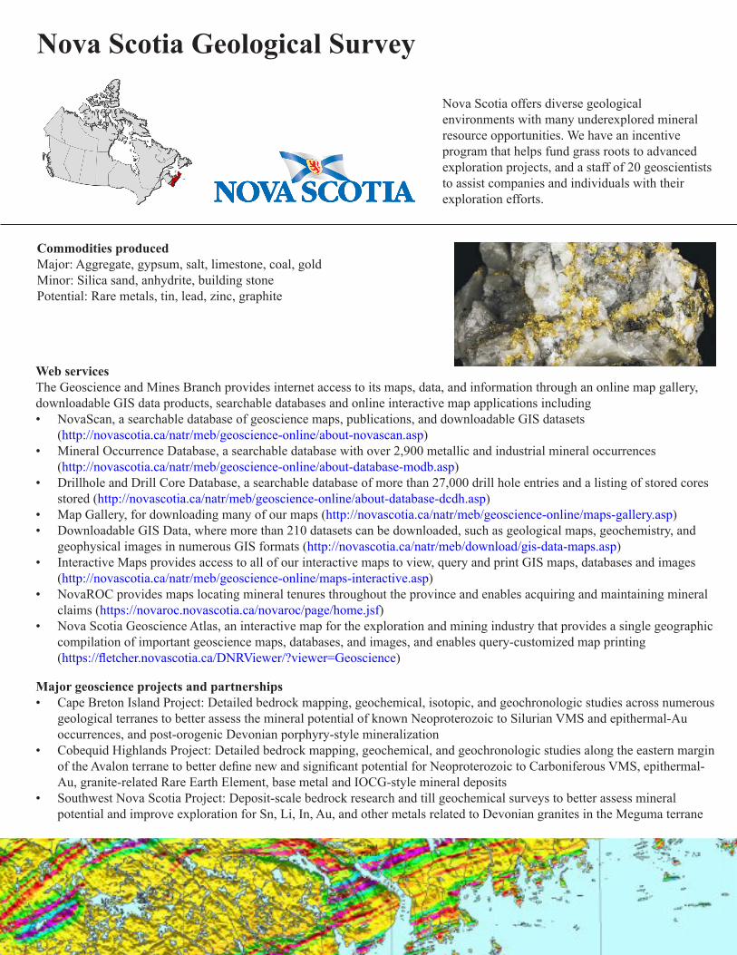
Nova Scotia Geological Survey
Nova Scotia offers diverse geological environments with many underexplored mineral resource opportunities. We have an incentive program that helps fund grass roots to advanced exploration projects, and a staff of 20 geoscientists to assist companies and individuals with their exploration efforts.
Commodities produced Major: Aggregate, gypsum, salt, limestone, coal, goldMinor: Silica sand, anhydrite, building stonePotential: Rare metals, tin, lead, zinc, graphite
Web servicesThe Geoscience and Mines Branch provides internet access to its maps, data, and information through an online map gallery, downloadable GIS data products, searchable databases and online interactive map applications including• NovaScan, a searchable database of geoscience maps, publications, and downloadable GIS datasets
(http://novascotia.ca/natr/meb/geoscience-online/about-novascan.asp)• Mineral Occurrence Database, a searchable database with over 2,900 metallic and industrial mineral occurrences
(http://novascotia.ca/natr/meb/geoscience-online/about-database-modb.asp)• Drillhole and Drill Core Database, a searchable database of more than 27,000 drill hole entries and a listing of stored cores
stored (http://novascotia.ca/natr/meb/geoscience-online/about-database-dcdh.asp)• Map Gallery, for downloading many of our maps (http://novascotia.ca/natr/meb/geoscience-online/maps-gallery.asp)• Downloadable GIS Data, where more than 210 datasets can be downloaded, such as geological maps, geochemistry, and
geophysical images in numerous GIS formats (http://novascotia.ca/natr/meb/download/gis-data-maps.asp)• Interactive Maps provides access to all of our interactive maps to view, query and print GIS maps, databases and images
(http://novascotia.ca/natr/meb/geoscience-online/maps-interactive.asp)• NovaROC provides maps locating mineral tenures throughout the province and enables acquiring and maintaining mineral
claims (https://novaroc.novascotia.ca/novaroc/page/home.jsf)• Nova Scotia Geoscience Atlas, an interactive map for the exploration and mining industry that provides a single geographic
compilation of important geoscience maps, databases, and images, and enables query-customized map printing (https://fletcher.novascotia.ca/DNRViewer/?viewer=Geoscience)
Major geoscience projects and partnerships• Cape Breton Island Project: Detailed bedrock mapping, geochemical, isotopic, and geochronologic studies across numerous
geological terranes to better assess the mineral potential of known Neoproterozoic to Silurian VMS and epithermal-Au occurrences, and post-orogenic Devonian porphyry-style mineralization
• Cobequid Highlands Project: Detailed bedrock mapping, geochemical, and geochronologic studies along the eastern margin of the Avalon terrane to better define new and significant potential for Neoproterozoic to Carboniferous VMS, epithermal-Au, granite-related Rare Earth Element, base metal and IOCG-style mineral deposits
• Southwest Nova Scotia Project: Deposit-scale bedrock research and till geochemical surveys to better assess mineral potential and improve exploration for Sn, Li, In, Au, and other metals related to Devonian granites in the Meguma terrane

Key publications• Geoscience and Mines Branch Report of Activities 2017-2018, Edited by D. R. MacDonald and E. W. MacDonald; Nova
Scotia Department of Natural Resources; Report ME 2018-001, 99p.• Digital Product ME2, version 11, 2016: Nova Scotia mineral occurrence database, by M. J. O’Neill and J. C Poole, ISN
18752• Digital Product ME3, version 5, 2016: Nova Scotia drillhole database, by M. J. O’Neill and J. C. Poole, ISN 18535• DP ME 433, Version 1, 2017: Digital Geological Data Generated as Part of the Bedrock Geological Mapping Compilation
Project for Cape Breton Island, Nova Scotia, by S. M. Barr, C. E. White, B. E. Fisher, J. S. McKinnon, A. L. Barras and D. S. Hapgood. https://novascotia.ca/natr/meb/download/dp433.asp
• DP ME 470, Version 1, 2018. Digital Version of Nova Scotia Department of Natural Resources Open File Map ME 2018-001, Bedrock Geology Map of the Antigonish Highlands Area, Antigonish and Pictou Counties, Nova Scotia, scale 1:75 000, by C.E. White, 2018; Digital Product by C.E. White, A.L. Barras and J.S. McKinnon. https://novascotia.ca/natr/meb/download/dp470.asp
• Various OFM’s, OFR’s and DP’s Associated with the Warwick Mountain Area, Eastern Cobequid Highlands, Data Release on March 5, 2018, Nova Scotia. https://novascotia.ca/natr/meb/data/pubs/rn/rn-2018-03-05.pdf
• Preliminary flow unit subdivision of Lower Mississippian volcanic rocks in the eastern Cobequid Highlands, Nova Scotia, by T.G. MacHattie; Nova Scotia Department of Natural Resources, Open File Report ME 2018-005, 5.
Nova Scotia Department of Energy and Mines - Geological Survey 1701 Hollis StreetPO Box 698Halifax, Nova Scotia, B3J 2T9http://novascotia.ca/natr/meb/
Local geoscience meetings• Atlantic Geoscience Society (AGS) Colloquium
(location rotates among Maritime Provinces)• Mining Society AGM
(location varies in Nova Scotia)
Other government source of information on resource developmentNova Scotia Business Inc. 1800 Argyle Street, Suite 701Halifax, Nova Scotia, B3J 3N8http://www.novascotiabusiness.com/en/home/default.aspx
ContactsBrian [email protected]

Join our representatives at annual national meetings such as the Prospectors and Developers Association conference in Toronto (PDAC) and the Association for Mineral Exploration (AME)Mineral Exploration Roundup in Vancouver.


