Embed Size (px)
Citation preview
Page i
Fort Indiantown Gap National Guard Training Center Lebanon and Dauphin Counties, Pennsylvania
Integrated Natural Resources Management Plan
2022-2027
Prepared by Pennsylvania Dept. of Military and Veterans Affairs, Environmental Section
Page ii
Fort Indiantown Gap National Guard Training Center Lebanon and Dauphin Counties, Pennsylvania
Integrated Natural Resources Management Plan 2022-2027
Acknowledgements
This plan was prepared by Pennsylvania Department of Military and Veterans Affairs under the direction of John Fronko (Environmental Program Manager) and Shannon Henry (Conservation Division Chief). Major authors include Nick Hoffman (Ecological Program Specialist), Mark Swartz (Invertebrate Wildlife Program Manager), Joe Hovis (Vertebrate Wildlife Program Manager), JD Lambrinos (Forest Program Manager). Additional authors contributing to content and editing include wildlife biologists Jarrod Derr, Chris Hauer, Virginia Tilden, and Ericka McKinney.
Significant editing and formatting effort provided by Emily Shertzer (Ecological Programs Specialist) made the document cohesive.
Other contributors include Daryl Valley (maps), Dave Walton (ITAM work plan), Tom Marrs (wetland section) and Karen Sattazahn (Status Tool for the Environment Program (STEP) inclusions). David Weisnicht reviewed for the Garrison Command and LTC Andrew O’Connor reviewed for Training Lands Management. Daryl Valley and Emily Shertzer provided NEPA input as needed.
Comments were provided by Eric Beckley (NGB), Pamela Shellenberger and Anthony Tur (USFWS), Alexander Dogonniuck and Richard Shockey (PADCNR), Matthew Caccese (PGC), and Kathy Gipe (PFBC).
Page iii
Executive Summary
Preparation and implementation of this Integrated Natural Resources Management Plan (INRMP) are required by the Sikes Act and its amendments, as well as several other Federal directives and regulations. The purpose of this plan is to guide natural resource management at Fort Indiantown Gap National Guard Training Center (FIG) from 2022 with annual internal reviews to 2027, at which point a 5-year external review and update will be completed.
The Pennsylvania Army National Guard (PAARNG) anticipates continued use of FIG in perpetuity; therefore, PAARNG must manage FIG to preserve and enhance its carrying capacity. FIG provides centralized training, while reducing the need for travel to distant out-of-state training areas or increased use of localized training sites with their own natural resource concerns. This results in a significant increase in productive training and reduced transportation costs. According to the Range Facilities Management Scheduling System (RFMSS), FIG is the most heavily used National Guard Training Center in the country, despite being one of the smallest in acreage among the thirteen Tier I and II Training Centers the National Guard currently has in its inventory. For comparison, FIG is 11% the land area of Ft. Bragg, but RFMSS shows that FIG conducts approximately 40% of the training as the larger Ft. Bragg. As such, FIG’s ranges and training areas are used extensively and require significant investment of resources to sustain and maintain.
This INRMP supports the military mission at FIG by providing for no net loss in the capability of FIG lands to support the military mission and ensure the preparedness of the Armed Forces (Sikes Act 16 USC Section 670a (b)(1)(I)). Combined with other range plans and programs, this INRMP ensures sound land management and compliance with all relevant regulations.
The focus of this plan is on the implementation of goals, objectives, and management guidelines for training area management and ecosystem management at FIG. The management plan is based on ecosystem management with the intention of demonstrating the interrelationships between the military mission and natural resource management.
The purpose of this INRMP is: • To describe the training site and its physical natural resources.• To describe the military mission and to determine the potential effects of the mission on
natural resources at FIG.• To provide references, to show the environmental compliance status of the installation
and of this plan, and to define responsibilities for the management of natural resources.• To show the status of baseline inventories of natural resources and monitoring needs for
environmental compliance.• To recommend revegetation and erosion control techniques that will maximize stable
soils while ensuring high-quality water resources and training.• To present methods that will increase the environmental awareness to the PAARNG
personnel and the public.

Page iv
• To provide management guidelines that will be effective in maintaining and improving the sustainability and biological diversity of terrestrial and wetland ecosystems on the training site as well as supporting human needs.
• To provide conservation efforts for species of concern and listed species (both federal and state) to ensure long-term persistence and an overall benefit to the species.
• To provide necessary means for implementation of the plan as well as being user-friendly and translatable to the training site manager.
Benefits to the military mission include long-term sustainability, decreases in encroachment, and increased realism to training scenarios at FIG. This plan will enhance mission realism through more options for training as well as more intensive planning of missions. It will also enhance long-range planning efforts at FIG. Benefits to the environment include reduced soil erosion and vegetation loss, improved water-quality, enhanced populations of at-risk species and other native wildlife and plants, and increased overall knowledge of the operation of the ecosystems on FIG through surveys and monitoring. Coarse Summary of Changes since the 2016-2021 INRMP
• The recognition of one candidate species (Monarch Butterfly) as well as upcoming USFWS review for several additional species occurring at FIG to determine if they should be listed as either threatened or endangered, pursuant to the Endangered Species Act.
• Detailed discussion of species, their supporting habitats, and potential impacts to the military mission.
• Revised and additional maps to include installation setting, topography, partnerships/opportunities, water resources, and environmentally sensitive areas that could pose constraints on, or restrictions to, training.
• Updated discussion concerning the Army Compatible Use Buffer and partnership. • Additional information regarding training area management, to include the aerial
application of herbicide. • Consolidation of wetlands and deep-water habitats and their management, as well as
clarification on maintaining buffer areas and distances to be consistent with FIG Regulation 350-2.
• The inclusion of an ITAM worklist as Appendix I • Relocation of maps (now full-page size) from the body of the document to Appendix J
Page vi
INTEGRATED NATURAL RESOURCES MANAGEMENT PLAN FORT INDIANTOWN GAP NATIONAL GUARD TRAINING CENTER
LEBANON AND DAUPHIN COUNTIES, PENNSYLVANIA 2021
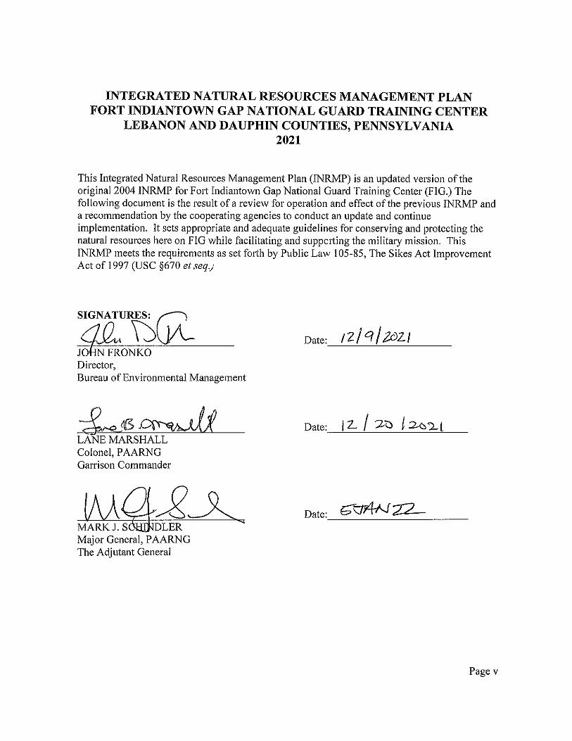
This Integrated Natural Resources Management Plan (INRMP) is an updated version of the original 2004 INRMP for Fort Indiantown Gap National Guard Training Center (FIG.) The following document is the result of a review for operation and effect of the previous INRMP and a recommendation by the cooperating agencies to conduct an update and continue implementation. It sets appropriate and adequate guidelines for conserving and protecting the natural resources here on FIG while facilitating and supporting the military mission. This INRMP meets the requirements as set forth by Public Law 105-85, The Sikes Act Improvement Act of 1997 (USC §670 et seq.)
SIGNATURE:
______________________________________ Date:________December 1, 2021____________ SONJA JAHRSDOERFER Project Leader U.S. Fish and Wildlife Service Pennsylvania Field Office
INTEGRATED NATURAL RESOURCES MANAGEMENT PLAN
FORT INDIANTOWN GAP NATIONAL GUARD TRAINING CENTER
LEBANON AND DAUPHIN COUNTIES, PENNSYLVANIA
2021
This Integrated Natural Resources Management Plan (INRMP) is an updated version of the origin al 2004 INRMP for Fort Indiantown Gap National Guard Training Center {FIG.) The following document is the result of a review for operation and effect of the preYious INRMP and a recommendation by the cooperating agencies to conduct an update and contin ue implementation. It sets appro priate and ::id equate guidelines for conserving and protecting the natural resources here on FIG while facilitating and supporting the military mission. This INRMP meets the requirements as set forth by Public La-., I 05-85. The Sik�s Ac t Improvement Act of 1997 (USC §670 er seq.)
SIGNATURE:
CHRISTOPHER URBAN Chief. Natural Diversity Section
Date: ( l / 2 � I 2 I-----"---+1 -=-�, -�---
Nongame. Threatened and Endangered Sped es Coordinator PA Fish & Boat Commission
Page vii
INTEGRATED NATURAL RESOURCES MANAGEMENT PLAN
FORT INDIANTOWN GAP NATIONAL GUARD TRAINING CENTER
LEBANON AND DAUPHIN COUNTIES, PENNSYLVANIA
2021
This Integrated Natural Resources Management Plan (INRMP) is an updated version of the original 2004 INRMP for Fort Indiantown Gap National Guard Training Center (FIG.) The following document is the result of a review for operation and effect of the previous INRMP and a recommendation by the cooperating agencies to conduct an update and continue implementation. It sets appropriate and adequate guidelines for conserving and protecting the natural resources here on FIG while facilitating and supporting the military mission. This INRMP meets the requirements as set forth by Public Law 105-85, The Sikes Act Improvement Act of 1997 (USC §670 et seq.)
SIGNATURE:
Date: /�-�-�,
Executi Director PA Game Commission
Page viii

Page ix
INTEGRATED NATURAL RESOURCES MANAGEMENT PLAN FORT INDIANTOWN GAP NATIONAL GUARD TRAINING CENTER
LEBANON AND DAUPHIN COUNTIES, PENNSYLVANIA 2021
This Integrated Natural Resources Management Plan (INRMP) is an updated version of the original 2004 INRMP for Fort Indiantown Gap National Guard Training Center (FIG.) The following document is the result of a review for operation and effect of the previous INRMP and a recommendation by the cooperating agencies to conduct an update and continue implementation. It sets appropriate and adequate guidelines for conserving and protecting the natural resources here on FIG while facilitating and supporting the military mission. This INRMP meets the requirements as set forth by Public Law 105-85, The Sikes Act Improvement Act of 1997 (USC §670 et seq.)
SIGNATURE:
______________________________________ Date:____12/1/2021___________________ GREGORY PODNIESINSKI Section Chief, Natural Heritage Section PA Department of Conservation and Natural Resources

Page xi
Table of Contents Acknowledgements ....................................................................................................................... ii Executive Summary ..................................................................................................................... iii 1. Overview .................................................................................................................................. 14
1.a. Purpose ............................................................................................................................... 14 1.b. Scope .................................................................................................................................. 14 1.c. Goals and Objectives.......................................................................................................... 15 1.d. Responsibilities .................................................................................................................. 16
1.d.1. Installation Stakeholders ............................................................................................. 16 1.d.2. External Stakeholders ................................................................................................. 19
1.e. Authority ............................................................................................................................ 20 1.f. Stewardship and Compliance Discussion ........................................................................... 20 1.g. Review and Revision Process ............................................................................................ 21 1.h. Management Strategy ........................................................................................................ 21 1.i. Other Plan Integration ......................................................................................................... 22
1.i.1. Wildlife Planning ......................................................................................................... 22 1.i.1.a. Deer Management Plan ............................................................................................. 22 1.i.1.b. Bird Airstrike Hazard (BASH) Plan ......................................................................... 22 1.i.1.c. Endangered Species Management Plan(s) (ESMP) .................................................. 23 1.i.1.d. Mowing Plan ............................................................................................................. 23 1.i.2. Forestry Planning ......................................................................................................... 23 1.i.3. Pest Management Planning .......................................................................................... 24 1.i.3.a. Integrated Pest Management Plan ............................................................................. 24 1.i.3.b. Invasive Species Management Plan .......................................................................... 25 1.i.3. Cultural Resource Planning ......................................................................................... 25 1.i.4. Compliance Planning ................................................................................................... 25 1.i.5. Range and Training Area Planning .............................................................................. 26 1.i.6. Master Planning ........................................................................................................... 26 1.i.7. Installation NEPA History ........................................................................................... 26
2. Current Conditions and Use .................................................................................................. 27 2.a. Installation Information ...................................................................................................... 27
2.a.1. General Description .................................................................................................... 27 2.a.2. Regional Land Uses .................................................................................................... 27 2.a.3. Abbreviated History and Pre-Military Land Use ........................................................ 28 2.a.4. Military Mission .......................................................................................................... 30 2.a.5. Operations and Activities ............................................................................................ 32
2.b. General Physical Environment and Ecosystems ................................................................ 41 2.c. General Biotic Environment .............................................................................................. 41
2.c.1. Threatened and Endangered (T&E) Species and Species of Concern ........................ 42 2.c.2. Fauna ........................................................................................................................... 47 2.c.3. Flora ............................................................................................................................ 47
Page xii
3. Environmental Management Strategy and Mission Sustainability ................................... 48 3.a. Supporting Sustainability of the Military Mission and the Natural Environment ............. 48
3.a.1. Military Mission and Sustainable Land Use Integration............................................. 48 3.a.2. Vegetation Management ............................................................................................. 48 3.a.3. Impact to the Military Mission .................................................................................... 50 3.a.4. Relationship to Range Complex Master Plan (RCMP) and Operational Area Plans (OAP) .................................................................................................................................... 51
3.b. Natural Resources Consultation Requirements ................................................................. 51 3.c. National Environmental Policy Act Compliance ............................................................... 52 3.d. Beneficial Partnerships and Collaborative Resource Planning .......................................... 52 3.e. Public Access and Outreach ............................................................................................... 52
3.e.1. Public Access and Outdoor Recreation ....................................................................... 52 3.e.2. Public Outreach ........................................................................................................... 53
3.f. Encroachment Partnering ................................................................................................... 54 3.g. State Wildlife Action Plan (SWAP) .................................................................................. 55
4. Program Elements .................................................................................................................. 59 4.a. Threatened and Endangered Species Management and Species Benefit, Critical Habitat, and Species of Concern Management ....................................................................................... 59 4.b. Wetlands and Deep-Water Habitats Management ............................................................. 59 4.c. Law Enforcement of Natural Resources Laws and Regulations ........................................ 60 4.d. Fish and Wildlife Management .......................................................................................... 61 4.e. Forestry Management......................................................................................................... 61 4.f. Vegetative Management ..................................................................................................... 63 4.g. Migratory Birds Management ............................................................................................ 64 4.h. Invasive Species Management ........................................................................................... 65 4.i. Pest Management ................................................................................................................ 66 4.j. Land Management .............................................................................................................. 66 4.k. Agricultural Out-leasing .................................................................................................... 66 4.l. Geographical Information Systems (GIS) Management .................................................... 66 4.m. Outdoor Recreation ........................................................................................................... 67 4.n. Bird Aircraft Strike Hazard (BASH) ................................................................................. 68 4.o. Wildland Fire Management ............................................................................................... 69 4.p. Training of Natural Resource Personnel ............................................................................ 69
4.p.1. Wildland Fire Training ............................................................................................... 69 4.p.2. Land Management Certifications ................................................................................ 69 4.p.3. Employee Safety and Disease Surveillance ................................................................ 70 4.p.4. Other Certifications and Training ............................................................................... 70
4.q. Floodplains Management ................................................................................................... 71 4.r. Other Leases ....................................................................................................................... 71
5. Implementation ....................................................................................................................... 72 5.a. Preparing Project Prescriptions .......................................................................................... 72

Page xiii
5.b. No Net Loss ....................................................................................................................... 72 5.c. Cooperative Agreements .................................................................................................... 73
5.c.1. Pennsylvania Game Commission ................................................................................ 73 5.c.2. The Nature Conservancy (TNC) ................................................................................. 74 5.c.3. PADCNR Bureau of State Forestry ............................................................................ 74 5.c.4 ACUB Cooperative Agreement ................................................................................... 74
5.d. Funding .............................................................................................................................. 74 6. References ................................................................................................................................ 76
Appendix A. List of Acronyms Appendix B. Natural Resource Management Prescriptions Appendix C. Results of Planning Level Surveys Appendix D. Research Requirements Appendix E. Migratory Bird Conservation Appendix F. INRMP Benefits for Endangered Species and Critical Habitat Appendix G. Constraints/Restrictions to Military Mission Appendix H. Climate Change Appendix I. ITAM Work Plan Appendix J. Maps
FIG Integrated Natural Resources Management Plan DRAFT as of 2-Dec-21
14
1. Overview
1.a. Purpose The purpose of the Integrated Natural Resources Management Plan (INRMP) is to provide a plan which integrates installation Natural Resources management with the state and federal military missions as well as a cooperative plan with United States Fish and Wildlife Services (USFWS) and the state under the Sikes Act. The Sikes Act requires that each INRMP provide for:
• No net loss in the capability of military installation lands to support the military mission of the installation.
• Fish and wildlife management, land management, forest management, and fish and wildlife-oriented recreation.
• Fish and wildlife habitat enchancement or modifications. • Wetland protection, enhancement, and restoration, where necessary for support of fish,
wildlife, or plants. • Integration of, and consistency among, the various activities conducted under the plan. • Establishment of specific natural resource management goals and objectives and time
frames for proposed action. • Sustained use by the public of natural resources to the extent that the use is not
inconsistent with the needs of fish and wildlife resources. • Public access to the military installation that is necessary or appropriate subject to
requirements necessary to ensure safety and military security. • Enforcement of applicable natural resource laws (including regulations). • Such other activities as the Secretary of the military department determines appropriate
(USFWS 2015).
This plan constitutes the major strategic plan for the Conservation Division, Bureau of Environmental Management (BEM) of the Pennsylvania Department of Military and Veterans Affairs (PADMVA) and its partner stakeholders for Fort Indiantown Gap National Guard Training Center (here in referred to as FIG). All actions contemplated in this INRMP are subject to the availability of funds properly authorized and appropriated under federal law. Nothing in this INRMP is intended to be nor shall be construed to be a violation of the Anti-Deficienty Act, 31 USC § 1341.
1.b. Scope This INRMP covers FIG’s lands, leases, and ranges as identified by the federal lease and state property boundaries of the installation. Under DoD, Department of Army (DA), and National Guard Bureau (NGB) policy, an INRMP for statewide facilities and properties is not currently necessary but management strategies mentioned here apply to all PADMVA holdings.
FIG Integrated Natural Resources Management Plan DRAFT as of 2-Dec-21
15
1.c. Goals and Objectives Goals are listed by target under the numbers below. Objectives are included in Appendix B and may be broken further into sub-objectives. These goals and objectives are meant to be leads for projects listed in Appendix B and included in the Status Tool for the Environment Program (STEP) each year. Objectives must be measurable in accordance with DoD policy. In the case that they are not, sub-objectives will quantify the objective’s target. The overall INRMP goal is to provide a conservation program that sustains military operations and ecosystem health and integrity per guidance by NGB.
1. Training Goal: Provide the most durable, safe, and realistic natural training environment possible for the PAARNG and other FIG users.
2. Conservation Division
Goal: Staff and manage a trained and professional team of natural resources experts to provide for the best interests of the military training environment and the conservation environment and to balance between the two for maximum sustainability. The Conservation Division has two sections – Wildlife and Forestry.
3. Flora and Fauna
Goal: Monitor, inventory, and manage for the highest possible level of native biodiversity on all taxonomic levels through large-scale ecosystem management with focus on species of concern.
4. Rare Species
Goal: Provide for the longevity of species identified at any level (regional, state, or federal) as being at risk or under high responsibility including rare, threatened, and endangered animals and plants through active management, conservation, and propagation.
5. Bird Management (Including Migratory Bird Treaty Act (MBTA), Bald and Golden
Eagle Protection Act (BGEPA), and Bird/Animal Airstrike Hazard (BASH)) Goal 5.1: Monitor, inventory, and manage for the highest possible level of native biodiversity on all taxonomic levels through large-scale ecosystem management with focus on species of concern.
Goal 5.2: MBTA - Follow established policies, regulation, and guidance set forth by USFWS, DoD, and Army concerning migratory birds, and provide for migratory bird conservation during their breeding, wintering, and migration periods. Goal 5.3: BGEPA - Follow the regulations set forth by USFWS concerning eagles and provide a safe and beneficial breeding, wintering, and migratory environment.

FIG Integrated Natural Resources Management Plan DRAFT as of 2-Dec-21
16
Goal 5.4: BASH - Provide for the safety and coexistence of both native bird species and military aviation to the greatest extent possible while ensuring the safety of our soldiers, aviators, and support personnel and their equipment.
6. Pest Management
Goal: Remove or reduce the impacts of pest species regarding cost and efficiency, including non-native species in nature and pests to humans in developed areas, from their host environments at a reasonable level.
7. Water Quality Goal: Remove or reduce through cost efficient means, human-induced impacts to surface and groundwater on the installation and immediate surrounding areas including but not limited to streams, wetlands, drinking water wells, and open water bodies.
8. Outdoor Recreation
Goal: Provide an effective, safe, and enjoyable environment for recreation in natural and urbanized settings on the installation while improving safety, habitat quality, and operational effectiveness.
9. Public Relations
Goal: Maintain and improve operational effectiveness through a public relations program that provides information on the Conservation Division’s programs, military impacts, and installation resources while attracting volunteers, partners, and advocates.
10. Urban and Developed Areas Management
Goal: Reduce conflict in the human-wildlife interface while providing for interconnectivity between plant and animal populations fragmented by improvements.
11. Forestry
Goal: Maintain a resilient and diverse forest to support the military training mission and natural diversity.
12. Fire Management Goal: Provide for public, firefighter, and soldier safety while maximizing military training opportunities.
1.d. Responsibilities
1.d.1. Installation Stakeholders The major installation stake holders are the Conservation Division; the Integrated Training Area Management (ITAM) Office; the Directorate of Plans, Operations, Training, and Security (DPOTS); and state and federal engineers. Minor installation stakeholders include the BEM Compliance Division, BEM Planning Division, the Sustainment Office, Division of Installation

FIG Integrated Natural Resources Management Plan DRAFT as of 2-Dec-21
17
Maintenance (DIM), and Range Maintenance. While less involved, all installation bureaus, offices, personnel, and landholdings are governed by this document. The Conservation Division, Compliance Division, and Planning Division (all in BEM) fall under the Office of Facilities and Engineering (commonly referred to as the “state side” of the installation). The structure of BEM is shown in Figure 1.d.1.
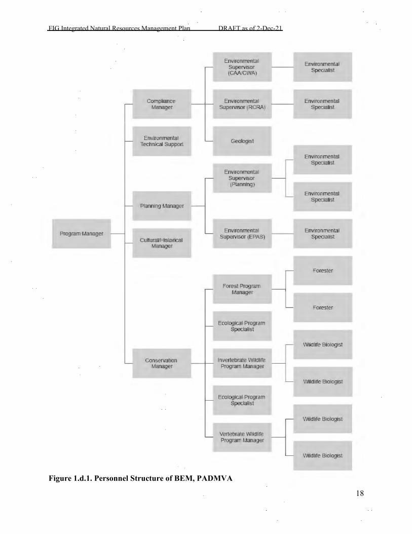
FIG Integrated Natural Resources Management Plan DRAFT as of 2-Dec-21
18
Figure 1.d.1. Personnel Structure of BEM, PADMVA
Program Manager
Compliance Manager
Environmental Technical support
Planning Manager
Cultural/Historical Manager
Conservation Manager
EnVironmental SuperVisor (CAA/CWA}
EnVironmental Supervisor (RCRA)
Geologist
EnVironmental SuperVisor (Planning}
EnVironmental Supervisor (EPAS)
Forest Program Manager
Ecological Program Specialist
Invertebrate Wildlife Program Manager
Ecological Program Specialist
Vertebrate Wildlife Program Manager
EnVironmental Specialist
EnVironmental Specialist
EnVironmental Specialist
EnVironmental Specialist
EnVironmental Specialist
Forester
Forester
Wildlife Biologist
Wildlife Biologist
Wildlife Biologis;
Wildlife Biologist
FIG Integrated Natural Resources Management Plan DRAFT as of 2-Dec-21
19
The DPOTS includes the ITAM Office, Range Control, Range Planning, and Range Maintenance. This group manages training on the installation, including scheduling and conduct of unit training as well as maintenance, design, and construction of range and training area facilities. This branch is commonly referred to as the “federal side” of the installation. Another major stakeholder is NGB, the higher headquarters for the PAARNG. Two Directorates are involved in the management of natural resources: the ARNG Installations & Environment Directorate (ARNG G-9), and the Operations, Training, and Readiness Directorate (ARNG-TRS). The ARNG G-9 ensures environmental compliance, facilities management, issues policy, tracks and provides funding, provides technical assistance, quality assurance and execution of funds. ARNG-TRS provides policy and resources to create, sustain, and operate training facilities that support the Army National Guard.
1.d.2. External Stakeholders The external stakeholders for the purposes of this document include regulatory bodies that have jurisdiction over the INRMP’s contents. While partners and contracted organizations have a role within the document and projects, they do not constitute an external stakeholder for DoD purposes. The external stakeholder at the federal level is USFWS. State level stakeholders include the PADCNR, PGC, and PFBC. USFWS, PGC, PFBC, and PADCNR have jurisdiction over flora and fauna matters with regards to endangered/threatened/migratory species and game species. The Army Corps of Engineers (ACoE), PADEP, and the County Conservation Districts have jurisdiction over surface waters and wetlands including any impacts or permits. The US Department of Agriculture (USDA) and Pennsylvania Department of Agriculture (PADA) control pesticides and some aspects of land management. The US Forest Service (USFS), PADCNR, and PADEP have some regulatory authority over wildland fire including prescribed fire. Other minor stakeholders include the USDA, USFS, ACoE, PADEP, and PADA. County level stakeholders include the Dauphin (DCCD) and Lebanon County Conservation Districts (LCCD). Non-governmental stakeholders include the Western Pennsylvania Conservancy (WPC) as part of the PA Natural Heritage Program (PNHP.) Other township and county level government offices also have influence. The local offices have some control over wildland fire (i.e. county burn bans) and zoning. As state lands and federal and state controllers, these minor stakeholders hold less jurisdiction over planning and development than they do on other properties in their boundaries. The townships represented on installation property include Cold Springs Township, Lebanon County; East Hanover Township, Dauphin County; East Hanover Township, Lebanon County; Middle Paxton Township, Dauphin County; Union Township, Lebanon County; and West Hanover Township, Dauphin County. Tribes and Nations were consulted during the development of the INRMP and will be invited to future reviews. Much like other external stakeholders, invitation is a requirement, but attendance is up to their discretion. A written statement can be sent in place of attendance at the
FIG Integrated Natural Resources Management Plan DRAFT as of 2-Dec-21
20
stakeholders’ meetings. For this version, formal consultations were sent to all parties of interest. Responses were received from the Oneida Indian Nation and Seneca Nation. Neither had any comments regarding the plan, but the Seneca Nation did request a final/signed copy for their records.
1.e. Authority The Sikes Act, as amended (16 USC §§ 670a-670o), requires the Secretary of each military department to prepare and implement an integrated natural resources management plan for military installations in the United States that have significant natural resources. FIG implemented its first INRMP in 2002 (Ogden 2002). An INRMP is a long-term planning document designed to guide the management of natural resources to support the preparedness of the Armed Forces, while protecting and enhancing installation resources for multiple use including recreation, sustainability, and biological integrity. The INRMP shall strive to prevent the net loss in the capability of military installation lands to support the military mission. The management of natural resources is driven by compliance and stewardship requirements. As federal entities on land leased from the state, DoD and the National Guard are required to comply with all federal laws and most state laws. Stewardship, the responsibility to manage and conserve natural resources for the future, is a major component of the military environmental and training ethic. DoD actively manages military lands for multiple training and testing missions, while implementing policies and programs to reduce impacts to the land and ensuring both environmental and mission sustainability. Environmental regulatory compliance and natural resources stewardship must be of equal importance on military installations. The INRMP needs to be approved and supported by NGB, USFWS, PGC, PFBC, and PADCNR. With the approval of these agencies, the state will have reached mutual agreement and oversight of the activities contained herein, and all activities as described are considered approved until such a time as all parties agree that the document must be revised. Formal review of this document for operation and effect must take place every 5 years and requires signature from each of the above listed agencies.
1.f. Stewardship and Compliance Discussion The Conservation and Compliance Sections both fall under BEM’s chain of command. This promotes coordination and integration of the principles and strategies of both offices on all installation actions. For example, hazardous materials storage protocols are integrated into the pest management program. The driving force behind both sections is sound and logical stewardship for the earth and the environment. This results in sustainable systems and resource management.
FIG Integrated Natural Resources Management Plan DRAFT as of 2-Dec-21
21
1.g. Review and Revision Process All contents of this and future INRMPs will be followed by all installation personnel, offices, and partners. The plan will be implemented upon approval by standard signature page(s.) This plan shall be reviewed annually at a meeting of the combined stakeholders. Minor revisions, updates, results, and actions will be published in separate annual reports initiated and written during the annual review. Unless there is need for major revisions, this plan shall continue in perpetuity with the approval from stakeholders at the five-year review. External partner agencies (USFWS, PGC, PFBC, PADCNR, and NGB) are required to be invited to annual update meetings but are not required to attend. Annual updates, decided upon at the stakeholders’ meeting, will be supplied in written form to all stakeholders and partners as addenda. Additional entities wishing to obtain a copy of such addenda can contact the installation’s PAO. During the formal five-year review process, all internal and external stakeholders will be invited to a meeting or series of meetings to discuss the effectiveness and pertinence of the INRMP. Those stakeholders who choose not to attend may send written comment for consideration but will otherwise be treated as consenting to the document as it currently reads. If, during the meeting(s), any stakeholders can show that a major revision is required or a major action has occurred, the formal revision process will begin, and a replacement document will be drafted by installation stakeholders. Section 2905 of the Sikes Act Improvement Act of 1997 [16 U.S.C. 670a note] requires an opportunity for the public to submit comments on initial INRMPs prepared pursuant to the new Section 101(a)(2) of the Sikes Act [16 U.S.C. 670a(a)(2)]. There is no legal obligation to invite the public either to review or to comment upon the stakeholders’ mutually agreed upon decision to continue implementation of an existing INRMP without revision (USFWS 2010).
1.h. Management Strategy FIG Conservation managers employ an adaptive management strategy. Research and monitoring are carefully structured into strategic planning and operations to provide feedback once management actions are implemented. Managers also use the data at hand to drive management planning. Triggers, indicators, and metrics help to identify problems and solutions without lengthy study when possible, but these “shortcuts” are backed by long-term studies with long-term data that demonstrate their usefulness on installation rather than abstractly. The Conservation Division strives to provide habitat that enhances soldiers training and makes it a target for land management decisions. The benefits from this target include most of the primary and early succession species that the installation needs to protect (eastern regal fritillary butterfly, grassland birds, striped gentian, etc.) and that are uncommon and/or rare throughout the state (PGC and PFBC 2008). The result is a series of rugged grasslands, shrublands, and oak-hickory forests that stand up well to military training, provide cover and concealment, and are valuable throughout the state for their diversity.
FIG Integrated Natural Resources Management Plan DRAFT as of 2-Dec-21
22
1.i. Other Plan Integration
1.i.1. Wildlife Planning This section provides synopses of each separate management plan written or held by the Wildlife Section. Discussions will also relate how they interact and follow the tenets of this INRMP.
1.i.1.a. Deer Management Plan The FIG Deer Management Plan was written in 2004 and implemented in 2005; it is currently being updateded and will be finalized in March 2022. This document satisfies PGC requirements for Deer Management Assistance Program (DMAP) harvest coupons that allow overpopulated areas to receive a greater share of harvest pressure than normal. The plan outlines the estimated deer population and the goals, objectives, and measures necessary to maintain sustainable population size throughout the installation. Deer hunting in Pennsylvania is a very controversial issue with high public involvement. Training and operations safety issues arise from an overabundant deer population including vehicle accidents, disease vectors, landscape damages, and parasites. Pennsylvania is host to several deer-borne ailments, including Lyme disease, Rocky Mountain spotted fever, West Nile virus, and others, that can be transmitted to humans via parasites. Where deer populations are highest are those areas where harvest is restricted partially or wholly due to human activities including range training, impact areas, and hallowed grounds.
1.i.1.b. Bird Airstrike Hazard (BASH) Plan A BASH Plan was devised by USDA Wildlife Services working with the 193rd Special Operations Wing (SOW) of the Pennsylvania Air National Guard (PAANG) following a Class B BASH incident in 2009. This plan was reviewed and updated in 2019 but is focused on/limited to activity at Bollen Range and therefore does not cover all air operations on installation. Aircraft training is constant on the installation, including air-to-ground range and drop activities, the Eastern Army Aviation Training Site (EAATS), and Muir Army Airfield (MAAF). Types of aircraft include jets (fighter, attack, and cargo variations), propeller-driven fixed wing (cargo and civilian missions), rotary wings, and unmanned aerial systems (UASs). The installation resides in a Global Important Bird Area for bird migration. These raptors and songbirds are extremely important to global population health and geographic connectivity between breeding and wintering grounds. The installation has a strong responsibility, not to mention legal requirement within the MBTA and BGEPA, to sound stewardship of these birds while also providing for pilot and crew safety during the training mission. While these two can sometimes conflict, they have been working in harmony for over 20 years of tracking and documentation. With the frequency and variety of aircraft training on the installation, the potential for wildlife strikes is increased. The BASH plan decreases that potential by offering hazard descriptions, research, and alternative strategies for abatement.
FIG Integrated Natural Resources Management Plan DRAFT as of 2-Dec-21
23
1.i.1.c. Endangered Species Management Plan(s) (ESMP) This INRMP contains species-specific information on each of the federal and state listing decisions and should act as an ESMP if/when listing occurs. Any additional federal or state species not mentioned here or that are insufficient in the eyes of USFWS, state agencies, and NGB in their treatment here will receive a later ESMP attached to this INRMP as an addendum in the annual review process.
1.i.1.d. Mowing Plan The Mowing Plan for Fort Indiantown Gap National Guard Training Site: For Reducing Costs in Labor and Equipment and Improving Wildlife Habitat (the Mowing Plan) was written in 2005 and implemented in 2006. The plan details a schema to reduce mowing costs and increase habitat value throughout the installation with timetables, field analyses, and compromises between safety, security, budget, training, and natural resources. The plan was initiated by installation leadership and receives consistent leadership support, though implementation can face challenges on a field-by-field basis when soldier requests, maintenance schedules, and the plan all meet in the real world. The plan is based on many of the goals and objectives that sustain the INRMP, and thus the two documents will be consistent in policy and tone.
1.i.2. Forestry Planning This section provides a synopsis of each separate management plan written or held by the Forestry Section. Discussions will also relate how they interact and follow the tenets of the INRMP. 1.i.2.a. Forest Management Plan The Forest Management plan was written in 2011 after an analysis of forest inventory and stand data. This plan details the current state of FIG’s forest in regard to age class, site quality, and operability/availability for active management. A comparison of timber harvest scheduling methods was completed, and the best choice was determined to be area control by site class. This has set timber harvest goals for the next 20 years on the installation. To make the goals more achievable they will be implemented in 5-year increments by the Forestry staff. Potential revisions to this plan are the addition of a forest inventory plan and input from a more recent analysis done by American Forest Management in 2017. Analysis by American Forest Management include forest inventory design, fire analysis, financial analysis, and 100-year growth projections. The inventory plan will outline the inventory protocols which include Continuous Forest Inventory (CFI), regeneration, fuel loading, and permanent plots. Fort Indiantown Gap is not eligible to participate in the federally funded Conservation Reimbursable Fee Collection Program (CRFCP). Revenue from the sale of Timber goes to the Pennsylvania State Treasury Fund.
FIG Integrated Natural Resources Management Plan DRAFT as of 2-Dec-21
24
1.i.2.b Urban Forest Management Plan The FIG Community Tree Manual was completed in 2008 by contract. This plan outlines roles and responsibilities of different entities on the installation regarding urban forest management. It also serves as a comprehensive guide to tree planting, pruning, general maintenance and care, as well as provides a suitable list of tree species to be planted on the installation. Personnel training and safety guidelines are also established in this plan. Future revisions to this plan include incorporating into the larger Forest Management plan and including riparian buffers and lawn conversion sections. 1.i.2.c Integrated Wildland Fire Management Plan The Wildland Fire Management Plan is required for any installation where wildland fire could be a concern. It details various items including fuel types found on the installation, personnel qualification guidelines, wildfire response plans, the use of prescribed fire, and guidelines for operation of various pieces of equipment. The plan was last updated in 2017 and reviewed by the installation commander in 2011. As per new guidance the plan will be reviewed/updated and certified by the Installation Commander annually. 1.i.2.d Annual Prescribed Fire Project Plan The Annual Prescribed Fire Project Plan is comprised of individual prescribed burn site plans for the installation for the upcoming fiscal year(s). The Forestry, Wildlife, DPOTS and ITAM sections all provide input to the prescribed fire plan. The end goal is to have all burn units on the installation included in the annual plan. This will provide increased flexibility to meet training and ecological needs as identified by DPOTS, Conservation, and ITAM. Each plan is good for three years and units can be burned any number of times during the three-year period. Conservation staff are responsible for writing these plans. The plan discusses areas to be burned during each fiscal year, favorable weather parameters, personnel qualifications and requirements, contingency plans and resources, burn complexity analyses, and desired burn results. The Prescribed Fire Plan will be signed and reviewed every year by the plan authors, technical reviewer, DPOTS (agency administrator), ITAM, and will be appended to the IWFMP (as of 2017 only a template is appended).
1.i.3. Pest Management Planning This section provides synopses of each separate management plan written or held by the Pest Management Coordinator and the Pest Management Office including statewide plans. Discussions will also relate how they interact and follow the tenets of the INRMP.
1.i.3.a. Integrated Pest Management Plan The Integrated Pest Management Plan (IPMP) was written in 2005 under contract and was recently revised (2019). The document gives the basic guidelines for pest management on the installation and at all state properties. Contents include basic strategies, necessary certifications, and chemical storage as well as some basic descriptions and biological data on major structural
FIG Integrated Natural Resources Management Plan DRAFT as of 2-Dec-21
25
pest species. The IPMP addresses the basic foundations of installation pest management, to include the structural pest problems found on most installations as well as the natural pest (often invasive species) problems found on the installation.
1.i.3.b. Invasive Species Management Plan Currently there is only one invasive species management plan for FIG, which addresses the introduced and legally quarantined insect pest, the spotted lanternfly. This plan outlines the management strategy being used by FIG Conservation staff to control population levels and contain the spread of infection. Additional invasive species and associated issues are addressed in the IPMP; the goals and objectives, responsibilities, actions, and strategies have been incorporated into that document and its appendices.
1.i.3. Cultural Resource Planning The Integrated Cultural Resource Management Plan (ICRMP) is the leading document on all cultural resource planning and management in the same way that the INRMP is that same document for natural resource planning and management. The two work together to form the installation conservation program, and therefore they must support one-another for the installation to remain functional and meet Sikes Act standards. PADMVA’s teams have consistently integrated their environmental standards and share common language throughout much of each document. The teams support one another during inadvertent discoveries and on statewide actions.
1.i.4. Compliance Planning All federal actions to include construction, training, operations, and maintenance activities are evaluated and assessed for potential environmental impacts prior to being implemented. The NEPA process is the systematic examination of possible and probable environmental consequences of implementing a proposed action. Integration of the NEPA process with other army projects and program planning must occur at the earliest possible time to ensure that planning and decision-making reflect army environmental values, such as compliance with environmental regulations, and that these values are evident in army decisions. The NEPA process does not replace either the procedural or substantive requirements of other environmental statutes and regulations. Rather, it addresses them in one place so that the decision-maker has a concise, comprehensive view of the major environmental issues and requirements. Additionally, the NEPA document identifies how all other applicable regulations were addressed. In addition, the decision-maker can understand the interrelationships and potential conflicts among the environmental components of a proposed action. There are other plans dealing with specific compliance matters on FIG such as the Operational Noise Plan which addresses noise complaints and the Hazardous & Residual Waste Management Plan which deals with issues like spill response and hazardous waste.
FIG Integrated Natural Resources Management Plan DRAFT as of 2-Dec-21
26
1.i.5. Range and Training Area Planning FIG’s purpose is to provide and maintain the maximum amount of training capabilities within the constraints of the installation, while protecting and maintaining our natural and manmade resources, to meet the training needs of the PAARNG, out-of-state national guard units, Army Reserve units and Active Army units. This plan establishes the range and maneuver land requirements needed at FIG, as per published doctrine and guidelines, to support the Army’s present and future training requirements. FIG’s major training capability shortfalls are the result of not enough land and, without a resolution of that issue, most of the related training range shortfalls cannot be addressed. Consequently, the main focus of the FIG Range Complex Master Plan will be on small arms range development, range, training areas and training facilities enhancement, and the sustainment of those ranges, training areas and training facilities. Additional priority is to maintain training areas that have the capacity to support mounted and dismounted maneuver, adding additional maneuver lands as they become available.
1.i.6. Master Planning Based on a 25-year development strategy, the FIG Master Plan includes a comprehensive implementation plan. This plan provides a road map to meet developing facility and training program needs in alignment with the Master Plan’s adaptability to inevitable mission changes over the next 24 years. FIG’s Master Plan outlines six planning objectives: existing facilities management, site image and character, site functionality, future land use, new construction, and sustainable development. The sustainable development objective discusses the Army Compatible Use Buffer program (ACUB), the Joint Land Use Study (JLUS), Leadership in Energy and Environment Design (LEED), and the INRMP. Some of the key environmental considerations for master planning in cantonment include: Prime Farmlands, wetlands and surface water course constraints, Whitetail deer and Canada geese overpopulation, woodchuck damage, floodplains, and public access for recreation.
1.i.7. Installation NEPA History Over the years, several NEPA documents have been prepared by the PAARNG that have direct influence on this INRMP. In March 2002, the PAARNG completed a document titled Final Environmental Impact Statement (FEIS) for the Enhanced Training and Operations at the National Guard Training Center FIG, which addressed the proposed implementation of eleven actions, including improvements to the installation’s wastewater treatment plant and ammunition supply point as well as the implementation of the first INRMP. In 2006, the PAARNG completed a document titled FEIS for the Transformation of the Pennsylvania Army National Guard 56th Brigade into a Stryker Brigade Combat Team. This document set forth new missions and a major range construction project, and in doing so changed land use and the landscape in several key areas, most notably several core eastern regal fritillary fields. In April 2008, the
FIG Integrated Natural Resources Management Plan DRAFT as of 2-Dec-21
27
PAARNG completed a document titled Supplemental Environmental Assessment for Establishing a Surface Danger Zone on a Portion of State Game Lands No. 211 in Connection with the Operation of a Multi-Purpose Training Range at the National Guard Training Center – FIG, Pennsylvania. This project was later “tabled” due to funding constraints. The documents referenced above were prepared in accordance with the National Environmental Policy Act (NEPA) of 1969 (42 U.S. Code [USC] 4321 et seq.), Council on Environmental Quality (CEQ) Regulations for Implementing the Procedural Provisions of the National Environmental Policy Act (40 Code of Federal Regulations [CFR] 1500 – 1508), and Army Regulation 200-2, Environmental Analysis of Army Actions (32 CFR 651). In addition, these documents were prepared in conjunction with NGB, whose role is to provide review of NEPA documentation and ensure that units and members of the Army National Guard are trained by states in accordance with approved policies and programs of the Secretary of the Army per Department of Defense Directive 5105.77, May 21, 2008.
2. Current Conditions and Use
2.a. Installation Information
2.a.1. General Description FIG is located on property that is owned by the Commonwealth of Pennsylvania and leased to the Federal government. FIG occupies approximately 17,100 acres in Lebanon and Dauphin Counties, 20 miles northeast of Harrisburg and 10 miles northwest of the city of Lebanon. New York City and Washington, DC are within 150 miles and Philadelphia and Baltimore are within 100 miles of the installation. The nearby junctions of Interstates 78 and 81 as well as 81 and 83 make the location a strategic hub for travel between these metropolitan areas. The installation includes five townships. Of these, East Hanover, Union, and Cold Spring Townships are in Lebanon County. Most of the Dauphin County landholdings fall in East Hanover Township, but the far western portion of the boundary lies in West Hanover Township. The installation is split by Blue Mountain, which separates cantonment from the training corridor. Second Mountain, on the northern boundary, forms the basic border with adjacent State Game Lands 211. Interstate 81 and the Indiantown Gap National Cemetery border most of the installation to the south. Significant inholdings include Memorial Lake State Park, a 240-acre PADCNR lake bounded on all sides by cantonment and training areas, and several small landholders along Tomstown Road. See map in Appendix J, page J-1.
2.a.2. Regional Land Uses Land use in Pennsylvania is regulated at the local level through county and township zoning ordinances and land use regulations. County and township management plans and zoning regulations—the comprehensive plan and the zoning ordinance – determine the type, density and intensity of land use allowable in specific areas. The comprehensive plan is a community visioning document and the means whereby local government can control and influence future
FIG Integrated Natural Resources Management Plan DRAFT as of 2-Dec-21
28
development. The zoning ordinance is then used to implement the comprehensive plan and has the force and effect of the law. It divides the entire community districts known as “zones” which identify the intensity of development and allowable land use. The southern, eastern, and western boundaries of FIG are abutted by primarily conservation, rural residential and agricultural land uses. The lands directly to the north of the installation are owned and operated by PGC and used for public recreation. Hollywood Casino at Penn National Racetrack opened in 2007 within a mile of the southern boundary of the training corridor. Commercial developments surrounding the casino have mainly stayed between Interstate 81 and the casino entrance, but land prices and zoning are beginning to shift from agricultural use south of the racetrack. Future land use around the installation is projected to remain conservation, rural residential and agricultural with some parcels becoming commercial and industrial. A recently constructed light industrial park is located to the east of the installation in Union Township. The closest urban environments are located approximately 8 miles from the far west end of the installation in Hershey and Hummelstown and the closest major city is Harrisburg, 20 miles to the southwest.
2.a.3. Abbreviated History and Pre-Military Land Use FIG is located in an area rich in history. Dating back almost 400 years, the area was originally inhabited by the Susquehannock Indians. Known for their physical size and strength, this Native American tribe developed its skills in warfare by using indigenous techniques and European weapons. Despite this advantage, the Iroquois destroyed them and took possession of the land. By the early 1700s, the battle for land raged on between the Iroquois and white settlers. Situated in the Blue Mountains, part of the Appalachian Mountain chain, the area had numerous natural protective boundaries. Original land grants show that four tribes resided in the area, thus the source of the area’s name. After the defeat of British by the American troops commanded by General Edward Braddock in 1775, the Native American tribes allied themselves with the French in hopes of reclaiming their territory. Settlers in the Indiantown Gap area were victims of raids that resulted in burned homes, stolen cattle, destruction of crops, and even death. Because the Philadelphia Council offered no support, settlers decided to defend themselves. They built blockhouses, observation towers, and fortified farms. In addition, forts were built along the Susquehanna River to the Delaware River, including Fort Swatara (on present-day Fort Indiantown Gap), Fort Robinson, Fort Hunter, Manada Fort, and Browne’s Fort. The Indiantown Gap area was primarily farmland with mills and furnaces interspersed. The railroad industry was moving in to assist with mining operations and other burgeoning industries. In the early 1880s, a location in the South Mountain near the Cornwall Ore Mines was chosen as the site for a railroad station. The station was situated by “Governor Dick’s Mountain,” named after Governor Dick, a former slave who worked as a charcoal burner in the area and who lived in a cabin at the foot of this hill. The facility was intended as a planned “playground” of sorts with a manicured rest area. When the board of directors of the Cornwall and Lebanon Railroad chose the location, they renamed it “Mount Gretna” - Gretna for the image and Mount in homage to Governor Dick’s Mountain. By 1884, preparations were underway, and five acres of land had been cleared for a picnic area, kitchen, and walled spring. Bridges erected over the dammed springs gave the area a very rustic and scenic appearance. In time, the area would become a
FIG Integrated Natural Resources Management Plan DRAFT as of 2-Dec-21
29
vacation spot. A dam was built across Conewago Creek to form a lake, and dining halls, concession stands, boat docks, and a carousel were added. Soon cottages were built, and a hotel was erected to accommodate numerous individual visitors as well as such large gatherings such as the American Farmer’s Encampment (a precursor to large “farm shows”) and religious revival meetings. The Pennsylvania National Guard (PANG) moved into the area in 1885, when it obtained 120 acres west of the Mt. Gretna Park. This land was used for summer encampment for over 50 years. The site was named Camp Gobin in 1886 and renamed Camp Winfield Scott Hancock the following year. Finally referred to as Mt. Gretna, the camp trained several groups of soldiers before shipping them to the Philippines during the Spanish- American War in 1898. Five years later, the camp became a permanent training camp because of its usefulness and its status as the only camp in Pennsylvania which had not experienced outbreaks of typhoid or yellow fever (Carmean 1976). In 1929, however, changes in the nature of warfare began raising questions about Mt. Gretna’s long-term effectiveness as a military training site. The State Military Reservation Commission debated whether it would be more cost-efficient to improve and update Mt. Gretna or purchase new land and move the training camp. The ideal spot, many believed, was Indiantown Gap. Arguments against Mt. Gretna were numerous. The location itself had not been well-planned; the roads were inadequate and unstable; and redeveloping the land for training activities would be expensive since it did not lend itself to such activities. But most importantly, Mt. Gretna’s proximity to camping grounds and parks made its artillery activities a threat to the safety of the general population. Indiantown Gap was ideal because of its lack of development, low price, ample resources, and location. After due consideration, the state, under the leadership of Governor Gifford Pinchot (the first Chief of the United States Forest Service), purchased Indiantown Gap for a new training camp in 1931. Initial construction on the camp was limited, and many soldiers lived in tent towns for several years. But in September 1940, Pennsylvania leased Indiantown Gap to the Federal government for $1 a year, an arrangement which continues today. After this transfer, construction boomed as military leaders prepared to meet the training needs of another world war. Over 13,000 workmen labored on the site, completing 1,145 mobilization buildings, 187 Theatre of Operation buildings, an assortment of guesthouses, chapels, theaters, and a sports arena. The hospital alone covered 45 acres and had 78 buildings. Accompanying the construction of hundreds of buildings was the development of the Field Artillery Range. Covering seven and a half miles and located between the Blue Mountains and the Second Mountain, it was the most impressive range in the state. Development of the site did not end with the range. As amphibious warfare was becoming more common, Army engineers constructed an 80- acre lake for training. Named Memorial Lake, it was dedicated to all the residents of Pennsylvania who had served in World War I (WWI) and those already active in World War II (WWII). The installation was complete in 1941 when the first airplane landed on the newly built Muir Airfield. Indiantown Gap became the training area for several units. Initially it functioned as the training facility for the 28th Infantry Division of the PAARNG. Between January 1942 and December 1942, the installation fell under the command of the New York Port of Embarkation as a quasi-
FIG Integrated Natural Resources Management Plan DRAFT as of 2-Dec-21
30
staging area for troops preparing for shipment overseas. From July 1942 until the end of WWII, it supported the Transportation Corps Training Center, which trained personnel used in Port Battalions. The 55th Infantry Brigade, the 53rd Field Artillery, the 52nd Cavalry Brigade, and the 109th Infantry all trained at the Gap. Some of the famous divisions that came through Indiantown Gap included the First Division, which participated with the 28th in the assault on Omaha Beach; the 95th Division; parts of the 5th Division; the 3rd and 5th Armored Division; the 77th (Statue of Liberty) Division; and the 37th (Buckeye) Division. The 77th Division gained fame for enabling General Douglas MacArthur to gain ground in Leyte, and the 37th Division carried the burden of some of the U.S.’s earliest campaigns in the Pacific Theatre. In addition to its role as a training center, Indiantown Gap had a prisoner of war camp for German prisoners. After WWII, the installation served primarily as a reception and separation center for troops returning from Europe. Here soldiers were processed through with a discharge rate of over 1,000 per day (AMEC 2002). With this mission complete in 1946, the installation was deactivated to housekeeping status. In 1951, Indiantown Gap reactivated to training camp status when the U.S. entered the Korean War. The 5th Infantry Division primarily trained at the site until heading for duty in Korea. Over 32,000 soldiers were trained as replacements for those already fighting. In 1953, the installation was placed on inactive status and returned to the Pennsylvania Military District. Between 1957 and 1968, the XXI U.S. Army Corps oversaw an Army Reserve Program on site. The program later moved to Fort George G. Meade in Maryland. In 1975, the installation officially became “Fort Indiantown Gap,” and it served for a time as a refugee resettlement camp. This was a very tumultuous period for the site. In 1975, 22,228 Vietnamese and Cambodian refugees were housed at the installation while local organizations processed and placed them in communities across the country. Five years later, 19,094 Cuban refugees came through (Evinger 1998). Unlike their Asian predecessors, these refugees created havoc at FIG. Tensions eventually culminated in a violent standoff between the PAARNG and several buildings of refugees. In 1983, FIG became a sub-installation of Ft. Meade; ten years later, it came under the authority of Ft. Drum in New York. In 1998, the Base Realignment and Closure (BRAC) program terminated active duty at FIG. At that time the state and the PAARNG took control as it became a National Guard and Army Reserve Training Center. FIG has served since that period as the primary training center for the PANG, the headquarters of the Pennsylvania Army and Air National Guards, the Northeast Counterdrug Training Center, and the premier EAATS for rotary-winged aircraft at MAAF.
2.a.4. Military Mission Mission Statement The FIG installation is operated and managed by the FIG Garrison Headquarters. The installation’s overarching mission is to provide administrative, logistical, maintenance and family support to active and reserve component units training at the installation, as well as for tenant and off‐installation activities in central and eastern Pennsylvania. The installation provides training support to the National Guard, US Army Reserve, and members of all services to meet the ongoing need for a highly trained US military presence throughout the world. To meet this
FIG Integrated Natural Resources Management Plan DRAFT as of 2-Dec-21
31
mission, training facilities that reflect the diverse conditions soldiers will encounter in war are needed, and soldiers must be trained to adapt to the constantly changing conditions of the areas in which they engage in combat to maintain military readiness and preparedness. There are four primary missions at FIG described in the JLUS:
1. To provide a major year‐round training facility and the highest‐quality training opportunities for the PAARNG and other military and civilian users.
2. To provide the infrastructure, services, and site logistical support necessary to operate training and support facilities.
3. To provide, operate, maintain, and control facilities and equipment that support the pre‐mobilization training of military forces.
4. To provide quality of life services and programs and conduct proactive community relations.
The installation provides state-of-the-art operational training facilities across three training environments (live, virtual, and constructive) in support of the instructional, operational, and pre-mobilization training requirements of organizations within the PAARNG as well as other states’ national guard, reserve, and active-duty units. FIG provides facilities and services to U.S. Armed Forces that require land and airspace to practice combat skills and operations on a year-round basis. On average there are about 2,100 soldiers, technicians, state employees, and contractors that work at the installation on a daily basis. It does not appear that FIG’s mission will change in the foreseeable future. Troop Support facilities range from upgraded World War II (WWII)-era temporary buildings to a "state of the art" battalion-sized troop support area. The installation has eighteen administration and supply buildings, eighteen dining facilities, numerous barracks (total bedspace 7,000), Base Enlisted Quarters/Base Officer Quarters (BEQ/BOQ) with 680 beds, and a 600 bed Forward Operating Base (FOB). PAARNG units have over 1,000 pieces of wheeled and tracked equipment available through Unit Training Equipment Site (UTES) for training and a Training Support Center (TSC). The FIG Ammunition Supply Point (ASP) was recently upgraded, adding 12 new bunkers, a new small arms warehouse, and a new administrative building. The entire installation has tactical internet coverage via the fixed tactical internet. Current Units and Organizations FIG is the main training site for the PAARNG’s 28th Infantry Division (ID). FIG is the home of the PANG Joint Force Headquarters and PADMVA, as well as the 28th Combat Aviation Brigade, Chemical, Biological, Radiological, Nuclear, and Explosive (CBRNE), Enhanced Response Force Package (CERFP) and the 3rd Civil Support Team. FIG is the primary training center for the 28th ID’s 55th Heavy Brigade Combat Team (HBCT), 2nd Infantry Brigade Combat Team (IBCT), and the 56th Stryker Brigade Combat Team (SBCT), the 213th Area Support Group, and numerous other US Army Reserve (USAR) and National Guard deployable units.
FIG Integrated Natural Resources Management Plan DRAFT as of 2-Dec-21
32
FIG also hosts a variety of specialized training activities and “schoolhouses.” EAATS provides both ARNG-unique aviation training and augments the Army’s overall aviation training capacity to meet both surge and continuing training needs. EAATS is the second largest helicopter training site in the United States. The 166th Regional Training Institute, Regional Training Site - Medical, the Army Research Laboratory, and the USAR Regional Training Site - Maintenance are also located at FIG. The Air National Guard has a significant institutional training presence at FIG as well, including the 201st Red Horse Squadron and the Regional Equipment Operator Training School (REOTS). Detachment 1, 193rd Special Operations Wing schedules and operates the live-fire air-to-ground Bollen Range. Bollen Range's primary impact zone covers approximately 2,000-acres and is one of fourteen Air National Guard ranges in the country.
2.a.5. Operations and Activities With 15,000 members, the PAARNG plays an important role in the nation’s defense and supporting the commonwealth in times of need. Its units have taken part in every conflict America has faced, from the Revolutionary War to Operation Iraqi Freedom and the War on Terror. The ability of the installation to provide training for a wide range of army and other service users makes it a significant asset to national security. Throughput In Training Year 2020, FIG was the busiest National Guard Major Training Center (MTC) in the United States, hosting a total of 118,029 ground personnel for a total of 526,225 personnel days of training and activity. This compares to a decrease from 2019 (133,256 personnel for 682,315 personnel days) which can be explained by the COVID-19 pandemic. Projected numbers for 2021 are expected to exceed those from both 2020 and 2019. FIG’s geographical location, full complement of firing ranges, and ability to employ the Army Digital Training Strategy of live-constructive-virtual integration make it an integral part of the DoD’s overall training and readiness capability. The Air guard flew 541 sorties for 280.58 hours in FY20. Again, this number has decreased since the previous year due to COVID-19. However, the Bollen Air-to-Ground Range is consistently used each week and is still a critical asset for the Northeast. The ability of the installation to provide training for a wide range of Army and other service users makes it a significant asset to national security. The mosaic of natural communities, and the varied topography found at FIG support a variety of training scenarios. FIG maintains the maximum amount of training capabilities within the physical constraints of the installation, while protecting and maintaining its natural and manmade resources to meet the training needs of the soldiers. Blue Mountain divides the installation into two distinct zones: the cantonment area to the south and the training corridor to the north. The cantonment area contains numerous functional areas such as operations, educational and simulations, along with maintenance buildings and support facilities, classroom and educational
FIG Integrated Natural Resources Management Plan DRAFT as of 2-Dec-21
33
facilities, dormitories, barracks and other lodging facilities, a medical clinic, chapel, conference center, shopping and dining options, recreational and athletic facilities. Live-Constructive-Virtual Gaming Training Integration - FIG embraces the Battle Command Training Strategy through the incorporation of live, virtual, constructive, and gaming training opportunities. Live training can be linked to the simulation training using the Fixed Tactical internet located in Area 5. FIG has an extensive list of virtual trainers including an Engagement Skills Trainers (EST 2000), Call For Fire Trainer (CFFT), Mobile-Close Combat Tactical Trainer (M-CCTT), Aviation Combined Arms Tactical Trainer (AVCATT), and Common Driver Trainer (Stryker & Mine Resistant Ambush Protected (MRAP) variants). These simulators have the ability to function as stand-alone trainers, or they can be connected through the MTC, formerly known as the Battle Command Training Center, to facilitate Combined Arms or Joint Operations in a constructive simulation.
The MTC provides a training environment for numerous individual Army Battle Command Systems. Also, the Virtual Battlespace System 2 is a gaming system that is fully interactive in three dimensions providing a synthetic environment suitable for a wide array of military training purposes. The MTC provides extensive simulation capability to battalion, brigade, and division commanders. The MTC is the only one operated by the National Guard that is capable of integrating all components of the Army’s live, constructive, virtual, gaming training strategy. Most of the 50 designated training areas (TA) are located in the main training corridor which consists of over 12,000‐acres of land located north of the cantonment area and bounded by Second Mountain to the north and Blue Mountain to the south. TAs offer specific capabilities and amenities to support activities such as bivouac, maneuver, vehicle training, unit tactics, convoy training, weapons firing, and air‐to‐ground weapons firing. Although most TAs are situated north of Blue Mountain, a few are located adjacent to or within the cantonment area (e.g., the tank trails which connect UTES and the wash facility to the maneuver areas in the training corridor). Field training activities and facilities which occur south of Blue Mountain include: a 50-foot Rappel Tower in TA A-31, a Leadership Reaction Course, an 11-station obstacle course, four Nuclear, Biological and Chemical Chambers for training units on their protective equipment, a water purification set-up site adjacent to Shuey Lake, structure collapse site, and small arms ranges. Military Operations and Activities Individual Weapons Systems ranges are located adjacent to MAAF along Range Road. These ranges are suitable for zero, qualification and familiarization on pistols, rifles and shotguns. A wide array of facilities and training activities occur in the main training corridor to include the following: Vehicle maneuver areas - There are currently 3,133 acres of heavy maneuver training land and 10,523 acres of light maneuver training land at FIG.

FIG Integrated Natural Resources Management Plan DRAFT as of 2-Dec-21
34
Crew Served Weapons – Range 35, multipurpose machine gun range, is an automated range out to 800 meters for M-240, M-249 or M-60 zero and qualification. Range 36 provides automated scoring for M-2/ MK19 zero and qualification. Familiarization on crew served weapons is allowed on some of the multipurpose ranges. The Combined Arms Collective Training Facility (CACTF) -A one-kilometer urban village setting that currently contains 12 furnished buildings, a road network, a tunnel / sewer system, and a helicopter landing zone. The facility contains video cameras, sound effects, human urban targets, external lighting, break away doors, and hook ups on buildings for rappelling, and is capable of daylight and limited visibility entry. It assists unit training on entering, clearing, and controlling multiple buildings simultaneously.
Urban assault course (UAC) - A 28-acre facility designed for squad- and platoon-sized training in urban fighting techniques. This facility is used to train individual soldiers, squads, and platoons on tasks necessary to operate within a built-up/urban area. It has five stations: Station 1 - Individual & Team Task - Technique Trainer - clear a building Station 2 - Squad & Platoon Task - Technique - enter a building, move tactically & clear a room Station 3 - Grenadier Gunnery Trainer - grenadier gunnery Station 4 - Urban Offense/Defense Trainer - urban ops; enter, clear & defend a building Station 5 - Underground Trainer - reconnoiter UAC allows the use of the following ammunition: Station 1 - smoke grenades, practice grenades, grenade simulators, M84 stun grenades, whistling
booby traps, 5.56mm blank linked, MILES, SRTA, 5.56mm ball, & non-explosive training demo charges.
Station 2 - Station 1 ammo plus 7.62mm blank linked. Station 3 - 40mm TP grenades, smoke grenades, 5.56mm blank, short-range training ammo, &
ball ammo. (40mm HE grenades will not be used.) Station 4 - 5.56mm blank, SRTA, smoke grenades, 7.62mm blank linked, M84 stun grenades, &
practice grenades. (No live fire training.) Station 5 - 5.56mm blank (Smoke will not be employed inside the underground trainer.) Live-fire Shoothouse - A two-story facility with eleven enclosed rooms where personnel can train in dry, blank, and live-fire room and building clearing techniques. It has video cameras and sound effects and is capable of limited visibility training. The facility features moveable walls to customize rooms for different unit purposes. This range allows the use of the following ammunition: 5.56mm blank, SESAMS, SRTA, 5.56mm ball, 9mm, M84 stun grenade, practice grenades, smoke grenades, DET cord, and nonelectrical firing blasting caps. Live-fire breach exercise facility - Designed to train military and civilians on technical aspects of building breaching techniques and to provide them with immediate feedback. Techniques are taught for doors, windows, demolition of concrete or brick structures using mechanical, ballistic, explosive, or thermal breaching means. This range allows the following ammunition: 5.56mm,
FIG Integrated Natural Resources Management Plan DRAFT as of 2-Dec-21
35
Hand Grenade, Shotgun rounds, RLEM, DET cord, C-4 blocks, and non-electric firing blasting caps. Live-fire infantry squad battle course – A 1,000-meter course which allows units to develop customized starting points and maneuver routes to fit their training needs. Features at the facility include 2 landing zones, 6 moving infantry targets, 1 moving target, 20 stationary infantry targets, 6 stationary armor targets, 2 trench obstacles, and 5 machine gun/ observation bunkers. This complex is used to train and test infantry squads on the skills necessary to conduct tactical movement techniques; detect, identify, engage and defeat stationary and moving infantry and armor targets in a tactical array. This range allows the use of the following ammunition: 5.56mm, 7.62mm, and 40mm TP. All targets are fully automated, and the event specific target scenario is computer driven and scored from the range operations center. The range operating system is fully capable of providing immediate performance feedback to the using participants. Trenches, bunkers, and target emplacements simulate typical threat scenarios. Mortar simulation device emplacements are located in areas from which unfriendly mortar fire is to be simulated. Helicopter landing areas, designed for heavy use, and located to support aerial insertion and extraction of the squad. Third world village mock-ups - Used to simulate economically disadvantaged communities. They are built out of modified shipping containers and offer realistic settings for urban close combat operations in the real world. MK19 / 50 caliber firing range- Offers automated scoring and qualification. Heavy machine gun range – An automated range which provides zero and qualification training out to 800 meters for the M-240, M-249, and M-60 weapons. Sniper field fire range – A range which offers 1,000 meter known distance targets and includes a remote enhanced targeting system that allows for both 5.56 and 7.62 ammunition. This range is used to train and test soldiers on the skills necessary to detect, identify, engage and defeat stationary and moving infantry targets in a tactical array. This range is designed to satisfy the training and qualification requirements of the M24 sniper rifle. Primary features include: 40 stationary infantry targets, 8 moving infantry targets, and 4 firing positions. Natural vegetation is required in the target area to provide realistic natural obstacles for the sniper to negotiate. Aviation Training and Activities Aviation related training facilities such the Unmanned Aerial System (UAS) facility and airstrip, and MAAF are located southeast of the main training corridor. However, aviation activities can occur over much of the installation as well as some areas surrounding the installation. MAAF - The sixth busiest airport in Pennsylvania and the second busiest heliport in the US when measured in terms of daily takeoffs and landings, averaging more than 70,000 take‐offs and landings per year. The primary operations at MAAF are for rotary‐wing aircraft (helicopters). A rotary wing aircraft is an aircraft that derives its lift from the rotation of blades
FIG Integrated Natural Resources Management Plan DRAFT as of 2-Dec-21
36
on an approximately vertical central axis such as a helicopter. The airfield is fully instrumented and has its own air traffic control tower. It is home to EAATS and the 28th Combat Aviation Brigade. EAATS is one of four ARNG aviation training sites that provide both ARNG-unique aviation training and augment the Army’s overall aviation training capacity to meet both surge and continuing training needs. At each of these locations, instructors provide a wide range of training for ARNG, Army Reserve, and Active Army aviators to include graduate-level flight training, military occupation specialty/additional skill identifier-producing courses, enlisted professional development courses, and training in support of foreign military sales. EAATS has a unique national mission. Its focus is on the Army’s utility helicopters including the CH-47 Chinook and the UH-60 Black Hawk. EAATS provides critical virtual simulations, procedure training, aircraft qualifications, instructor pilot, and institutional training on utility and cargo helicopters to personnel from all 54 states and territories. Low level night vision goggle training activities occur in FIG’s northern training area, which includes airspace above Dehart Dam, SGL and state forests. MAAF is encompassed by a standard regulatory Class D airspace. FIG’s airspace usage is generally limited to military flight and is controlled on a local level by the control tower at the MAAF in the cantonment area. In addition, Army regulations require a 3,500‐foot safety arc for ammunition supply points, which prohibits any armed aircraft from entering that restricted airspace. MAAF has safety zones associated with its runway to limit and guide development and protect the safety of the public and pilots while simultaneously allowing for continued economic growth. The DoD has created safety zones around runways and landing areas that are based on historical data where an aircraft accident is most likely to occur, if one should occur. These safety zones are broken down into Clear Zones and Accident Potential Zones I and II, which are based on the dimensions of the runway. The orientation of the safety zones is determined by the typical flight patterns that aircraft take directionally when approaching the runway or landing area. Training activities focus on low‐altitude flight maneuverability, cargo transport, use of night vision equipment, and tactical maneuverability. The flight training area includes closed‐loop patterns involving MAAF, training areas and landing zones within the NTA, and flight corridors extending east and north from FIG into the NTA. The closed‐loop patterns involving MAAF are generally contained within the FIG boundaries with the exception of a small portion that extends into East Hanover Township in Lebanon County and is bounded by I‐81. The NTA encompasses an area outside of FIG that extends from the northwest side of FIG to the northeast / east side of FIG comprising of SGL and private property; it includes three training areas and 25 landing zones. Rotary-wing aircraft operate “around the clock” at MAAF and surrounding areas. The majority of flights from MAAF involve rotary-wing aircraft training activities that can include testing, observation, low-altitude exercises, cargo carrying, night operations, water bucket training, and tactical aviation training. Most of these flights consist of closed pattern flights that follow a loop south of the runway during the day and north of the runway at night, at 900- to 1,200-feet AGL, and no further than 4,000-feet from the ends or lateral edges of the runway. On the uninhabited areas off the installation and other approved areas in close proximity to MAAF, rotary-wing

FIG Integrated Natural Resources Management Plan DRAFT as of 2-Dec-21
37
aircraft frequently operate at altitudes below 500-feet AGL. Approximately 15% of rotary wing operations departing from MAAF fly specific routes at 600- to 800-feet AGL through Indiantown Gap following State Route 443 on the north side of Blue Mountain (NTA). In addition to the restricted military airspace over FIG, approximately 44,000-acres of SGL to the north support certain flight operations. Special Use Airspace - The airspace where military activity or unusual flight conditions may occur. The type of special use airspace at FIG comprises restricted airspace designated in areas where flight or ground activities must be confined because they may be considered hazardous to nonparticipating aircraft. There are five designated restricted airspaces at FIG which range from floor elevations at ground level up to 25,000 feet above ground level. These areas are used for weapons testing, observation, low‐altitude exercises, cargo carrying, night operations, water bucket training, and tactical aviation training. Military Training Routes (MTRs) - One‐way flight corridors used to practice low‐altitude, high speed, and terrain‐following training missions. There are three MTRs comprising a 13‐mile‐wide corridor terminating approximately 6 miles north of FIG over Weiser State Forest. The MTRs have assigned altitudes of ground level to 18,000 feet above ground level for operational speeds in excess of 250 knots. Bollen Range -Provides pilots with realistic training in attacking ground targets from the air. All fixed‐wing bombing and strafing activities are accomplished with inert ordinance; however, some types of training bomb munitions have small propellant charges (equivalent to two shotgun shells) to disperse a marking agent to aid in the scoring process. Rotary-wing aircraft operations are also conducted at the Bollen Range. These operations consist of low‐level attacks, less than 100 feet AGL with machine guns, chain guns, or rockets. Bollen Range's primary impact zone covers approximately 2,000-acres and is one of fourteen Air National Guard ranges in the country. Current Units and Organizations Military units and home stationed at FIG include: 28th Combat Aviation Brigade -Serves as a heavy aviation unit for PAARNG. It flies UH-60 Blackhawk, AH-64D Apache, and CH-47F Chinook helicopters. The 28th CAB’s primary mission is to find and destroy enemy forces to support its combined arms team, but it is also capable of close combat attacks, mobile strikes, reconnaissance, security, air assault, command and control, aerial medical evacuation, air movement, personnel recovery, and aerial mine delivery. 3rd Civil Support Team (CST) and Chemical, Biological, Radiological/Nuclear, and Explosive Enhanced Response Force Package (CERFP)- The 3rd CST provides Pennsylvania and the region with a chemical, biological, radiological, and nuclear response capability in the form of recognition, analysis, prediction, and active monitoring. The CERFP provides search and extraction, decontamination, medical triage, and limited care capabilities in response to chemical, biological, radiological, and nuclear events.

FIG Integrated Natural Resources Management Plan DRAFT as of 2-Dec-21
38
PANG Joint Force Headquarters (JFHQ-PA) - The headquarters for both the Army and Air National Guards of Pennsylvania, providing oversight to all the soldiers and airmen in the state. JFHQ-PA mission is to maintain trained and equipped forces ready to perform as directed by state or federal authorities. It supports homeland defense, defense support to civil authorities and other domestic emergency missions. In addition, the JFHQ-PA provides experience and situational awareness to DoD authorities to facilitate integration of federal and state activities. 628th Aviation Support Battalion – Provides Brigade level logistics, health service support, aviation unit and intermediate level field maintenance support for the Expeditionary Combat Aviation Brigade at Division and Corps. 3622nd Maintenance – Provides field maintenance, including all low density, and limited recovery support to units on an area basis and calibration and repair of general purpose and selected special purpose test, measurement, and diagnostic equipment (TMDE). Other military support and military affiliated organizations located at the installation include: 166th Regional Training Institute - Among the largest and most technologically advanced of its kind in the Total Army School System, and one of the largest Non-Commissioned Officer Academies in the U.S. Army. It has an average throughput of approximately 6,000 students annually. Some of the Army career fields trained there include cavalry scouts, cannon crewmember, fire support specialist, motor transport operators, and infantrymen. USAR Regional Training Site - Maintenance - Accredited by the U.S. Army Training and Doctrine Command. It instructs students in effective and efficient maintenance training. Its mission is to “provide training that will sustain all active components and reserve component soldiers, which enables armed forces components to mobilize and deploy units capable of meeting wartime mission requirements on current and force modernization equipment systems in the areas of logistics / maintenance training, MOS qualifier training, additional skill identifier training, and NCO basic and advanced courses. Pennsylvania Department of Military and Veterans’ Affairs - A Pennsylvania state agency which has a dual mission to provide quality services to the commonwealth’s veterans and their families, as well as oversee and support the members of the PANG. Medical Battalion Training Site- Provides students with real-life battlefield simulated training on medical tasks. This state-of-the-art simulation facility includes over 50 human patient simulation devices. Simulations are conducted through the projection of scenario-driven realistic sounds, scents, climate controls and smoke, and an interactive target system. Military and civilian agencies are able to train on mass casuality scenarios.
FIG Integrated Natural Resources Management Plan DRAFT as of 2-Dec-21
39
Medical Simulation Training Center - Provides standardized medical and nonmedical personnel in both classroom and under simulated battlefield conditions. Unit Training Equipment Site (UTES) - Offers soldiers operator assistance and maintenance support for vehicles, subsystems and weapons. PAARNG units have over 1,000 pieces of wheeled and tracked equipment available through UTES. Combined Support Maintenance Shop (CSMS) - Offers automotive, heavy mobile, inspection, armament and small-arms repair, electronics, allied trade and recovery support to units on or near FIG. Central Wash Facility - Capable of cleaning a wide variety of military vehicles, wheeled and tracked, with a newly upgraded system. The facility is equipped with a large wash and a smaller wash, together capable of handling three vehicles at once. All water from the facility is recycled. Counterdrug Task Force -Directly supports the commonwealth’s mission to improve the safety and welfare of its citizens. The PAANG has a significant institutional training presence at FIG as well, including: 201st Red Horse Squadron -Supports combat air power and provides the commander-in-chief and federal and state authorities well rounded heavy construction and repair capability any time at any location. Regional Equipment Operator Training School (REOTS)-Trains airmen on heavy equipment. Detachment 1, 193rd Special Operations Wing -Schedules and operates the live-fire air-to-ground Bollen Range. 203rd Weather Flight - A small, elite unit that analyzes and predicts atmospheric conditions for pilots, war planners, and decision makers. Lightning Force Academy- Trains Air Force and Air Guard personnel to support the engineering and installation (EI) mission. Students become familiar with practices to accomplish the EI during wartime, including project engineering, management, and total project oversight. Classes include combat restoration, repair, installation and removal/ relocation of communications-electronic equipment. Common Environmental Impacts Combat support and combat service support —Various support units often have similar impacts to land as described for bivouac since they use the same sites repeatedly. Support units also have potential to adversely affect land resources via petroleum product spills, improper sanitation, digging activities, and other effects of intensive use of small areas by units with a wide variety of
FIG Integrated Natural Resources Management Plan DRAFT as of 2-Dec-21
40
tasks. Often, the first steps in land degradation from bivouac activities are soil compaction and the loss of ground cover, which can be followed by localized erosion and possible increases in down-watershed stream sedimentation. Ground disturbance associated with bivouac can also impact wildlife resources. Use of Smoke — Some military operations involve using a cloud of smoke that is artificially generated in order to obscure the enemy’s ability to observe friendly activities. Fog oil operations have the potential to create pollution from spills of fog oil or petroleum, oils, or lubricants used by vehicles in the operations. Procedures in support of air quality regulations must be followed to avoid smoke drifting off the installation. Bivouac — Bivouac sites (temporary encampments) can create damage, particularly if the activity is repeated in the same area, or the unit remains in the same bivouac area for an extended period of time. Often, the first steps in land degradation from bivouac activities are soil compaction and the loss of ground cover, which can be followed by localized erosion and possible increases in down-watershed stream sedimentation. Ground disturbance associated with bivouac can also impact wildlife resources. Engineer operations — Engineer activities (e.g., digging fighting positions or tank ditches, obstacle removal, construction of FOBs) disturb soil which can affect various natural resources. Demolition can cause noise and dust. Engineer operations have the potential for pollution from spills of petroleum, oils, or lubricants. Other combat engineer activities can be beneficial to natural resources. Combat engineer projects, (e.g., training land rehabilitation, erosion control structure construction, site hardening) can also protect the environment from damage in the future. Digging is prohibited in areas where known cultural resources may be disturbed. Construction — Construction is constantly occurring at FIG. Impacts to the environment from construction depend largely on the location of the construction. In the Cantonment, construction generally occurs on previously disturbed soil and in areas where wildlife has either already departed or accommodated to human activity. There is the possibility of temporary dust and runoff during construction periods, and new construction may contribute to stormwater runoff. Construction in training areas normally involves a change in the land use and has the potential for greater impacts on wildlife. Erosion and sedimentation plans utilize best management practices to minimize erosion during construction. In both areas, there is a temporary increase in noise during the construction period. Future Operations A significant transformation to the FIG mission occurred in 1999, when the Secretary of the Army and the Chief of Staff of the Army modified their vision to develop an Army more capable of “rapid response across the entire spectrum of operations in a joint, interagency and multi-national environment” (AMEC 2006). The result of this vision led to a gradual implementation of new activities at installations across the United States. At FIG, the PAARNG was directed to transform the 56th Brigade of the 28th Infantry Division into the National Guard’s only SBCT. This transformation created the need for additional training programs and aviation capabilities, resulting in several new construction projects. Given these changes, real estate acquisition and a
FIG Integrated Natural Resources Management Plan DRAFT as of 2-Dec-21
41
compatible land use strategy that will enable FIG to accommodate mission change and growth over the next 25 years is necessary and is currently being prepared. In addition, new facilities to house several additional UAS platoons with runways for the Army Guard are being planned. A similar unit for the Air Guard is being planned.
2.b. General Physical Environment and Ecosystems FIG straddles two physiographic subunits of the Ridge and Valley Province: The Great Valley and Blue Mountain Sections. Underlying bedrock is Devonian in age and consists mainly of sedimentary rock, namely sandstones, mudstones, and conglomerates. This porous rock and the position of the installation topographically creates almost all the hydrology that feeds the installation both in groundwater supplies and in surface waters. In the training corridor, FIG maintains all its own surface waters from their source to the installation boundary. The bedrock is folded into a series of mountains and ridges, starting with Blue Mountain that forms the boundary between cantonment and the training corridor. The northern boundary is formed by the next immediate mountain, Second Mountain. In between are several smaller rock ridges and valleys. The two main watersheds on the installation, the source of Manada Creek and the source of Indiantown Run, divide mid-corridor near the present Range 23 complex. In the greater Appalachian ecosystem, FIG hosts a variety of vegetation types including native warm-season grasslands, oak-dominated forests, scrub oak barrens, and shrublands. Many of these vegetation types are arrested from serial succession by periodic high-frequency and low-intensity disturbance resulting from military training. This habitat is considered extremely important and increasingly rare within the Commonwealth of Pennsylvania as a whole (PGC and PFBC 2008). The topographic map features significant landforms, installation boundaries, inholdings and other state- owned properties, and the environmental condition of the landscape. See Appendix J, page J-2.
2.c. General Biotic Environment Native Eastern grasslands, forests, shrublands, and savannahs characterize the vegetation cover on FIG. Keystone or foundational species include little bluestem (Schizachyrium scoparium), broom sedge (Andropogon virginicus), and purple-top (Tridens flavus) grasses, oak species (Quercus spp.), Eastern hemlock (Tsuga canadensis), and poverty grasses (Danthonia spp.). Other important vegetation constituents include non-natives honeysuckle (Lonicera spp.), mile-a-minute (Persicaria perfoliata), autumn olive (Elaeagnus umbellata), and cold season ornamental grasses and groundcovers. These vegetation types are inhabited by a large diversity of animal life. Animal diversity stems from disturbance and management treatments, land use patterns, native stock, and geographical placement. Species include eastern regal fritillary butterfly (Speyeria idalia idalia), grasshopper sparrow (Ammodramus savannarum), Allegheny woodrat (Neotoma magister), white-tailed deer
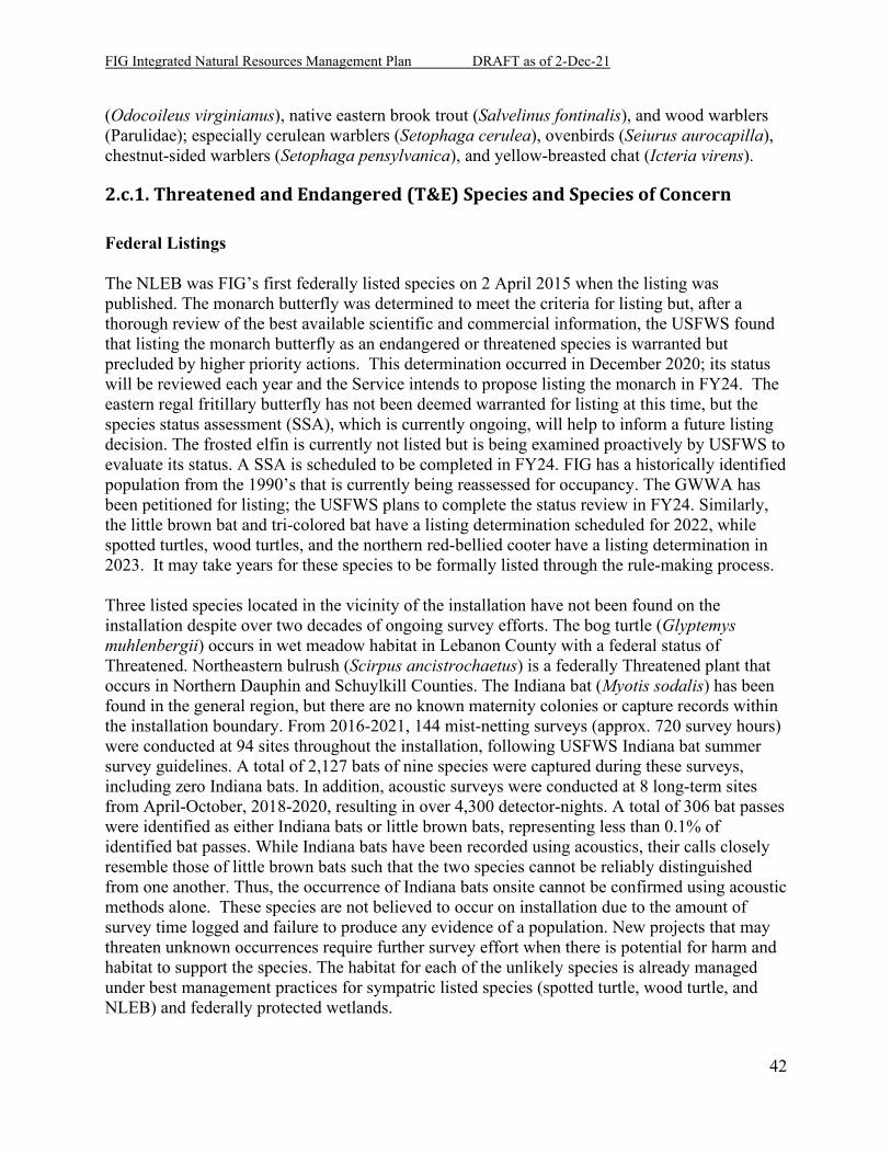
FIG Integrated Natural Resources Management Plan DRAFT as of 2-Dec-21
42
(Odocoileus virginianus), native eastern brook trout (Salvelinus fontinalis), and wood warblers (Parulidae); especially cerulean warblers (Setophaga cerulea), ovenbirds (Seiurus aurocapilla), chestnut-sided warblers (Setophaga pensylvanica), and yellow-breasted chat (Icteria virens).
2.c.1. Threatened and Endangered (T&E) Species and Species of Concern Federal Listings The NLEB was FIG’s first federally listed species on 2 April 2015 when the listing was published. The monarch butterfly was determined to meet the criteria for listing but, after a thorough review of the best available scientific and commercial information, the USFWS found that listing the monarch butterfly as an endangered or threatened species is warranted but precluded by higher priority actions. This determination occurred in December 2020; its status will be reviewed each year and the Service intends to propose listing the monarch in FY24. The eastern regal fritillary butterfly has not been deemed warranted for listing at this time, but the species status assessment (SSA), which is currently ongoing, will help to inform a future listing decision. The frosted elfin is currently not listed but is being examined proactively by USFWS to evaluate its status. A SSA is scheduled to be completed in FY24. FIG has a historically identified population from the 1990’s that is currently being reassessed for occupancy. The GWWA has been petitioned for listing; the USFWS plans to complete the status review in FY24. Similarly, the little brown bat and tri-colored bat have a listing determination scheduled for 2022, while spotted turtles, wood turtles, and the northern red-bellied cooter have a listing determination in 2023. It may take years for these species to be formally listed through the rule-making process. Three listed species located in the vicinity of the installation have not been found on the installation despite over two decades of ongoing survey efforts. The bog turtle (Glyptemys muhlenbergii) occurs in wet meadow habitat in Lebanon County with a federal status of Threatened. Northeastern bulrush (Scirpus ancistrochaetus) is a federally Threatened plant that occurs in Northern Dauphin and Schuylkill Counties. The Indiana bat (Myotis sodalis) has been found in the general region, but there are no known maternity colonies or capture records within the installation boundary. From 2016-2021, 144 mist-netting surveys (approx. 720 survey hours) were conducted at 94 sites throughout the installation, following USFWS Indiana bat summer survey guidelines. A total of 2,127 bats of nine species were captured during these surveys, including zero Indiana bats. In addition, acoustic surveys were conducted at 8 long-term sites from April-October, 2018-2020, resulting in over 4,300 detector-nights. A total of 306 bat passes were identified as either Indiana bats or little brown bats, representing less than 0.1% of identified bat passes. While Indiana bats have been recorded using acoustics, their calls closely resemble those of little brown bats such that the two species cannot be reliably distinguished from one another. Thus, the occurrence of Indiana bats onsite cannot be confirmed using acoustic methods alone. These species are not believed to occur on installation due to the amount of survey time logged and failure to produce any evidence of a population. New projects that may threaten unknown occurrences require further survey effort when there is potential for harm and habitat to support the species. The habitat for each of the unlikely species is already managed under best management practices for sympatric listed species (spotted turtle, wood turtle, and NLEB) and federally protected wetlands.
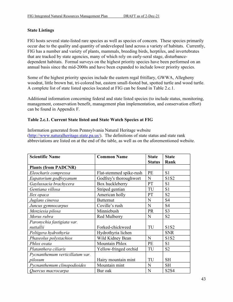
FIG Integrated Natural Resources Management Plan DRAFT as of 2-Dec-21
43
State Listings FIG hosts several state-listed rare species as well as species of concern. These species primarily occur due to the quality and quantity of undeveloped land across a variety of habitats. Currently, FIG has a number and variety of plants, mammals, breeding birds, herptiles, and invertebrates that are tracked by state agencies, many of which rely on early-seral stage, disturbance-dependent habitats. Formal surveys on the highest priority species have been performed on an annual basis since the mid-2000s and have been expanded to include lower priority species. Some of the highest priority species include the eastern regal fritillary, GWWA, Allegheny woodrat, little brown bat, tri-colored bat, eastern small-footed bat, spotted turtle and wood turtle. A complete list of state listed species located at FIG can be found in Table 2.c.1. Additional information concerning federal and state listed species (to include status, monitoring, management, conservation benefit, management plan implementation, and conservation effort) can be found in Appendix F. Table 2.c.1. Current State listed and State Watch Species at FIG Information generated from Pennsylvania Natural Heritage website (http://www.naturalheritage.state.pa.us/). The definitions of state status and state rank abbreviations are listed on at the end of the table, as well as on the aforementioned website. Scientific Name Common Name State
Status State Rank
Plants (from PADCNR) Eleocharis compressa Flat-stemmed spike-rush PE S1 Eupatorium godfreyanum Godfrey's thoroughwort N S1S2 Gaylussacia brachycera Box huckleberry PT S1 Gentiana villosa Striped gentian TU S1 Ilex opaca American holly PT S2 Juglans cinerea Butternut N S4 Juncus gymnocarpus Coville’s rush N S4 Menziesia pilosa Minniebush PR S3 Morus rubra Red Mulberry N S2 Paronychia fastigiata var. nuttallii Forked-chickweed TU S1S2 Peltigera hydrothyria Hydrothyria lichen SNR Phaseolus polystachios Wild Kidney Bean N S1S2 Phlox ovata Mountain Phlox PE S1 Platanthera ciliaris Yellow-fringed orchid TU S2 Pycnanthemum verticillatum var. pilosum Hairy mountain mint TU SH Pycnanthemum clinopodioides Mountain mint N SH Quercus macrocarpa Bur oak N S2S4
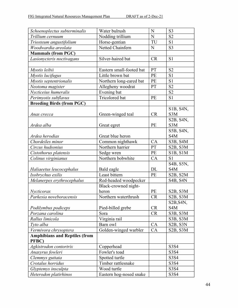
FIG Integrated Natural Resources Management Plan DRAFT as of 2-Dec-21
44
Schoenoplectus subterminalis Water bulrush N S3 Trillium cernuum Nodding trillium N S2 Triosteum angustifolium Horse-gentian TU S1 Woodwardia areolata Netted Chainfern N S3 Mammals (from PGC) Lasionycteris noctivagans Silver-haired bat CR S1 Myotis leibii Eastern small-footed bat PT S2 Myotis lucifugus Little brown bat PE S1 Myotis septentrionalis Northern long-eared bat PE S1 Neotoma magister Allegheny woodrat PT S2 Nycticeius humeralis Evening bat S2 Perimyotis subflavus Tricolored bat PE S1 Breeding Birds (from PGC)
Anas crecca Green-winged teal CR S1B, S4N, S3M
Ardea alba Great egret PE S2B, S4N, S3M
Ardea herodias Great blue heron S5B, S4N, S4M
Chordeiles minor Common nighthawk CA S3B, S4M Circus hudsonius Northern harrier PT S2B, S3M Cistothorus platensis Sedge wren PE S1B, S1M Colinus virginianus Northern bobwhite CA S1
Haliaeetus leucocephalus Bald eagle DL S4B, S5N, S4M
Ixobrychus exilis Least bittern PE S2B, S2M Melanerpes erythrocephalus Red-headed woodpecker S4B, S4N
Nycticorax Black-crowned night-heron PE S2B, S3M
Parkesia noveboracensis Northern waterthrush CR S2B, S3M
Podilymbus podiceps Pied-billed grebe CR S2B,S4N, S4M
Porzana carolina Sora CR S3B, S3M Rallus limicola Virginia rail S3B, S3M Tyto alba Barn owl CA S2B, S3N Vermivora chrysoptera Golden-winged warbler CA S2B, S3M Amphibians and Reptiles (from PFBC) Agkistrodon contortrix Copperhead S3S4 Anaxyrus fowleri Fowler's toad S3S4 Clemmys guttata Spotted turtle S3S4 Crotalus horridus Timber rattlesnake S3S4 Glyptemys insculpta Wood turtle S3S4 Heterodon platirhinos Eastern hog-nosed snake S3S4
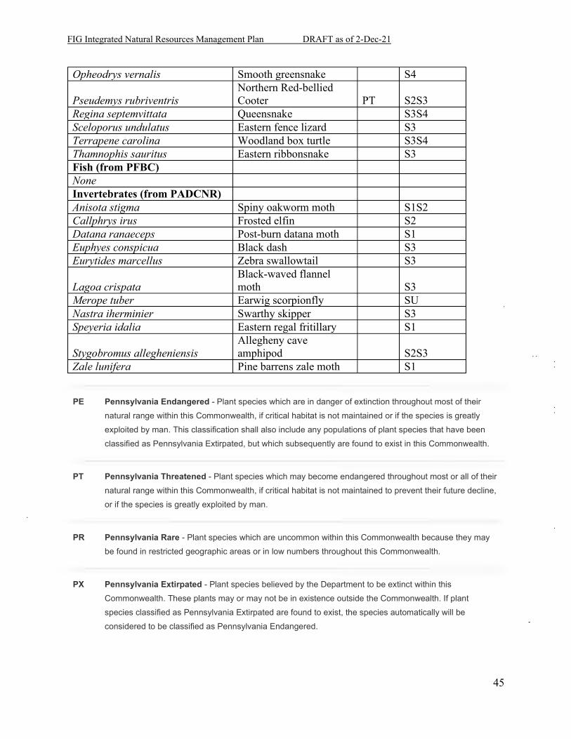
FIG Integrated Natural Resources Management Plan DRAFT as of 2-Dec-21
45
Opheodrys vernalis Smooth greensnake S4
Pseudemys rubriventris Northern Red-bellied Cooter PT S2S3
Regina septemvittata Queensnake S3S4 Sceloporus undulatus Eastern fence lizard S3 Terrapene carolina Woodland box turtle S3S4 Thamnophis sauritus Eastern ribbonsnake S3 Fish (from PFBC) None Invertebrates (from PADCNR) Anisota stigma Spiny oakworm moth S1S2 Callphrys irus Frosted elfin S2 Datana ranaeceps Post-burn datana moth S1 Euphyes conspicua Black dash S3 Eurytides marcellus Zebra swallowtail S3
Lagoa crispata Black-waved flannel moth S3
Merope tuber Earwig scorpionfly SU Nastra iherminier Swarthy skipper S3 Speyeria idalia Eastern regal fritillary S1
Stygobromus allegheniensis Allegheny cave amphipod S2S3
Zale lunifera Pine barrens zale moth S1
PE Pennsylvania Endangered - Plant species which are in danger of extinction throughout most of their natural range within this Commonwealth, if critical habitat is not maintained or if the species is greatly exploited by man. This classification shall also include any populations of plant species that have been classified as Pennsylvania Extirpated, but which subsequently are found to exist in this Commonwealth.
PT Pennsylvania Threatened - Plant species which may become endangered throughout most or all of their natural range within this Commonwealth, if critical habitat is not maintained to prevent their future decline, or if the species is greatly exploited by man.
PR Pennsylvania Rare - Plant species which are uncommon within this Commonwealth because they may be found in restricted geographic areas or in low numbers throughout this Commonwealth.
PX Pennsylvania Extirpated - Plant species believed by the Department to be extinct within this Commonwealth. These plants may or may not be in existence outside the Commonwealth. If plant species classified as Pennsylvania Extirpated are found to exist, the species automatically will be considered to be classified as Pennsylvania Endangered.

FIG Integrated Natural Resources Management Plan DRAFT as of 2-Dec-21
46
PV Pennsylvania Vulnerable - Plant species which are in danger of population decline within Commonwealth because of their beauty, economic value, use as a cultivar, or other factors which indicate that persons may seek to remove these species from their native habitats.
TU Tentatively Undetermined - A classification of plant species which are believed to be in danger of population decline, but which cannot presently be included within another classification due to taxonomic uncertainties, limited evidence within historical records, or insufficient data.
PC Animals that could become endangered or threatened in the future. All of these are uncommon, have restricted distribution or are at risk because of certain aspects of their biology.
N No current legal status, but is under review for future listing.
S1 Critically Imperiled - Critically imperiled in the nation or state because of extreme rarity (often 5 or fewer occurrences) or because of some factor(s) such as very steep declines making it especially vulnerable to extirpation from the state.
S2 Imperiled - Imperiled in the nation or state because of rarity due to very restricted range, very few populations (often 20 or fewer), steep declines, or other factors making it very vulnerable to extirpation from the nation or state.
S3 Vulnerable - Vulnerable in the nation or state due to a restricted range, relatively few populations (often 80 or fewer), recent and widespread declines, or other factors making it vulnerable to extirpation.
S4 Apparently Secure - Uncommon but not rare; some cause for long-term concern due to declines or other factors.
S5 Secure - Common, widespread, and abundant in the nation or state.
S#S# Range Rank - A numeric range rank (e.g., S2S3 or S1S3) is used to indicate any range of uncertainty about the status of the species or ecosystem.
SNR Not Ranked - State conservation status not yet assessed.
SU Unknown - Currently unrankable due to lack of information or due to substantially conflicting information about status or trends.
FIG Integrated Natural Resources Management Plan DRAFT as of 2-Dec-21
47
B Breeding - Conservation status refers to the breeding population of the species in the nation or state/province.
N Nonbreeding - Conservation status refers to the non-breeding population of the species in the nation or state/province.
M Migrant - Migrant species occurring regularly on migration at particular staging areas or concentration spots where the species might warrant conservation attention. Conservation status refers to the aggregating transient population of the species in the nation or state/province.
CA Candidate at Risk - Species that although relatively abundant now are particularly vulnerable to certain types of exploitation or environmental modification.
CR Candidate Rare - Species which exist only in one of a few restricted geographic areas or habitats within Pennsylvania, or they occur in low numbers over a relatively broad area of the Commonwealth.
2.c.2. Fauna FIG provides access to approximately 12,000 acres for hunting, trapping, and fishing. Although numerous game species can be hunted at FIG, the most common are Pennsylvania’s three big game species: the white-tailed deer, black bear, and wild turkey. Ring-necked pheasant are purchased with outdoor recreation funds and stocked to be hunted with other native small game species such as ruffed grouse, eastern cottontail rabbit, and gray squirrel. Furbearers such as red fox, grey fox, coyote and raccoons are the most common species captured by trappers. Brook, rainbow, and brown trout are stocked in the public access waters of FIG, both by the PA Fish & Boat Commission and the IGMR FGCC. Stocked trout are the most common species sought after by anglers on the installation. Native brook trout, small and large mouth bass, and several species of pan-fish are other less commonly sought-after species present in the waters of FIG.
2.c.3. Flora FIG currently hosts over 800 species of plants spread across many unique plant communities. These communities are generally composed of forests, grasslands, shrublands, and wetlands which, when combined, form a unique and complex mosaic across the landscape. Forests and grasslands occupy most of the installation while shrublands and wetlands as well as intermediate communities comprise of the rest. Surveys on the diversity, abundance, and ecology are conducted annually. Primary species include typical eastern forest species such as oaks and maples as well as various pines such as white pine and Virginia pine. In open landscapes, keystone species include native
FIG Integrated Natural Resources Management Plan DRAFT as of 2-Dec-21
48
warm season grasses such as little bluestem and broom-sedge and forbs such as milkweeds, thistles, goldenrods and other native wildflowers. Sensitive species such as striped gentian and yellow-fringed orchis occur in grassland habitat while others are wetland dependent. These include golden club, Coville’s rush, and four-angled spikerush. American holly and nodding trillium are forest species.
3. Environmental Management Strategy and Mission Sustainability
3.a. Supporting Sustainability of the Military Mission and the Natural Environment As the mission is dependent on natural resources, so is the mission sustainability dependent on the longevity of those resources. The two, while seeming at odds in certain moments, cooperate and provide synergy when implemented effectively, efficiently, and correctly. The two can be a means to the same end.
3.a.1. Military Mission and Sustainable Land Use Integration Sustainability is defined by the Army Strategy for the Environment as simultaneously meeting “current as well as future mission requirements world-wide,” safeguarding human health, improving quality of life, and enhancing the natural environment (US Army 2004). On the local scale, this translates to preparing, repairing, and enhancing the FIG missionscape for soldier training and the perpetuation of its natural resources. PADMVA and the National Guard accomplish sustainability by implementing the INRMP through on-site Conservation (natural resource managers) and Sustainable Range Program (SRP) personnel. These personnel perform a dual role of both monitoring the environmental conditions of the training site and physically maintaining and rehabilitating the environment with stewardship programs. The result of the level of habitat health enjoyed today is due to a cadre of professional and effective soldiers who appreciate the realism of the training environment and the habitat variability FIG provides. By emphasizing biodiversity and native species, the installation landscape is resilient and diverse for simulation and replication of mission conditions worldwide. Resiliency also extends some protection from invasive species, disease, and other natural threats to the resource.
3.a.2. Vegetation Management Vegetation management is important for the continued viability and availability of maneuver lands at FIG. FIG employs various vegetation management techniques depending on the needs of the training area in question. From small scale brush cutting and removal, to large scale
FIG Integrated Natural Resources Management Plan DRAFT as of 2-Dec-21
49
prescribed burning, and aerial herbicide application, FIG ITAM and the Conservation Division cooperate to reduce nuisance vegetation—whether that be for natural resource needs to control harmful, invasive species, or the Training Site (ITAM) needing to control woody encroachment hindering line of sight, or of nuisance vegetation affecting mounted or dismounted maneuver. The FIG ITAM program primarily uses mechanical brush grinding in training areas to reduce undergrowth in concealment and bivouac areas. For large, open maneuver areas, aerial herbicide application is used to reduce woody vegetation encroachment, while protecting beneficial grasses and other desirable physiognomic classes of vegetation. FIG ITAM coordinates its herbicide application with the BEM via the NEPA process. In addition to buffering sensitive areas proximal to the areas being treated using GIS data layers in the spraying helicopter, the buffers of the sensitive areas are also able to be aerially marked for an additional, visual safeguard for the pilot applying the product. Land Rehabilitation and Maintenance (LRAM) used best management practices (BMPs) for erosion control & environmental compliance. The Sustainable Range Program SharePoint site lists dozens of different BMPs, why and how they might be used and specifications for construction; all listed in 32CFR under categorical exclusions in NEPA.
LRAM uses various vegetation management practices. For small projects, simple mechanical removal is used either with a forestry mulcher (Fecon-type machine) or by hand using saws. Otherwise, the ITAM program maintains a vegetation management contract with several prescriptions including mechanical removal, hand removal, brown brush monitoring, boom application of herbicide, etc.
Project approval is via the ITAM Coordinator and the Range Management Authority (RMA). Each project undergoes a NEPA review by BEM and undergoes periodic review and inspection by BEM and the local County Conservation District.
The Range and Training Land Assessment (RTLA) program developed and uses a protocol defining the projects conducted. The purpose of the RTLA is primarily to assess the training lands for viability, accessibility, and availability, and identifies problem areas with respect to maneuver damage, line of sight issues, and erosion. The RTLA coordinator also helps the ITAM Coordinator track the progress and success of LRAM projects.
SRP GIS provides many functions to support the training mission at the installation but will assist in natural resource management only from a project compliance, or an erosion and sedimentation control aspect.
Sustainable Range Awareness is a program designed to inform trainers and users of the training lands about cultural and natural resources, and what to do and who to contact in case of an emergency such as a petroleum, oil, lubricants (POL) spill. It also identifies sensitive species, and the areas they inhabit. This is done by disseminating pertinent information (such as what Seibert Stakes are/why they are important) during daily range coordination briefings, as well as
FIG Integrated Natural Resources Management Plan DRAFT as of 2-Dec-21
50
through the distribution of Soldier Field Cards, which will highlight sensitive areas, issues, and provide contact information. These cards are currently in production (scheduled to be published and received in FY22).
The FIG ITAM Coordinator chairs the monthly SRP Steering Committee, a multi-functional group of trainers, users, and stakeholders of the installation. Environmental and training issues and initiatives are brought to the table and discussed for appropriateness and to deconflict each effort with training, ensuring the proper environmental procedures are being followed. The committee is made up of representatives from the Training Site, BEM Planning and Conservation Divisions, Air National Guard, DPW, and the CFMO.
3.a.3. Impact to the Military Mission The primary impact to the military mission from a proper natural resource program is that of a benefit to training durability and realism. Weak, unsupported landscapes quickly degrade in the face of on-the-ground training in the forms of mounted vehicle use, fire, and detonation. A healthy habitat provides species that are robust to these activities and thrive in the faces of the added pressures. Native grasses, oaks, and pines are able to recover from initial disturbance. The birds, mammals, and insects that use them have demonstrated the ability and desire to occupy the habitat with and without training activity in their midst. While some disturbance-sensitive species are absent from the installation’s training grounds and ranges, many disturbance-dependent species (often even more rare in Pennsylvania) require the continuation of the military presence and land-use model. Occasionally, the maintenance and enhancement of the installation’s natural resources does conflict with the immediate desires of a training unit. Fire, herbicide, planting, and hunting are all seasonal activities with short windows that can come into conflict with annual trainings and duty weeks. To this end, the natural resource managers, SRP office, and Range Control staff work together to avoid scheduling barriers and conflicts. In the end, the greater good is performed for not just one unit at one point in time but for all units in perpetuity. Rare species, such as the eastern regal fritillary, and protected habitats, such as wetlands, cause adaptations to training plans. Any restrictions to the military mission, specific to species or area, are shown and discussed in detail in Appendix G. Some restrictions may be implemented even if a species is not present (but their habitat is). For example, despite extensive searches and 15 years of turtle monitoring, no bog turtles have been found on the installation. However, several areas surveyed at FIG have revealed wetlands associated with potential bog turtle habitat. FIG staff works closely with USFWS personnel to determine the best course of action should a proposed action be located near potential habitat. Recommendations include implementation of avoidance measures and/or conducting a Phase II (presence/absence) study. As mentioned previously, no bog turtles have been located during any of the Phase II surveys at FIG. Overall, the impact on the military mission is clear: After 80 years of training at FIG, the site remains one of the most heavily used installations, acre for acre, of any in the United States while still looking similar to the environment found here upon purchase in the 1930s. The
FIG Integrated Natural Resources Management Plan DRAFT as of 2-Dec-21
51
landscape and the natural resources programs are not detriments to Army training, but rather they have fostered realistic training situations through several major conflicts on several continents with victorious results. The job here and now is to continue tradition and ensure the same or higher level of success in the future. For an overview of constraints/restrictions to military mission, see map in Appendix J, page J-3.
3.a.4. Relationship to Range Complex Master Plan (RCMP) and Operational Area Plans (OAP) The RCMP, OAPs and the INRMP are used together to provide guidance as to how natural resources are managed. Training restrictions imposed because of endangered species, wetlands, and other natural resource issues are incorporated into the installation-wide GIS and posted on the landscape with Seibert Stakes or Regal Research Area (RRA) signs. Prohibited activities and sensitive issues are discussed in the range safety briefings and the range safety certification program. Additional restrictions in place for fire sensitivity and fuels danger are incorporated into the RCMP in regard to the fire danger rating system and the use of pyrotechnics. Any questions or concerns with the interaction between the RCMP, OAP, and the INRMP are brought up in the monthly ITAM meeting, held in conjunction between the Bureau of Environmental Management, the Garrison Commander, both maintenance offices, both engineer offices, DPOTS, and the Master Planning Office. This meeting is where FIG determines management priorities, infrastructure needs, and funding solutions to coordinate effort and reduce duplication and waste.
3.b. Natural Resources Consultation Requirements PADMVA and the PAARNG are required to consult the ACoE, PADEP, and the local county conservation districts when dealing with matters affecting surface waters and wetlands. This consultation often comes in the form of Clean Water Act (CWA) permits and mitigations. These agencies to date are flexible and willing to find a reasonable agreement in most situations. On all matters of stream crossings, bank and floodplain encroachment, and wetland encroachment, a permit must be in hand or reparations will be considered for damages done. When there is a major project in planning that reaches the 35% design phase, PADMVA is also required to consult PADCNR concerning possible rare species that may occur in the area. PADCNR performs a geographical database search (called Pennsylvania Natural Diversity Inventory or PNDI) within a given buffer for the line of disturbance. The results may require further consultation with PGC, PFBC, or even the USFWS. To date, the highest level of consultation has been to require Phase I and II surveys for rare species occurrences. These surveys are conducted by either PADMVA Wildlife or contract, and the resulting supporting documentation resolves the issue. The PADMVA must also consult PGC and PFBC regarding the Outdoor Recreation program, its harvests, and the regulated species. The installation hunting and fishing programs have the

FIG Integrated Natural Resources Management Plan DRAFT as of 2-Dec-21
52
ability to regulate above and beyond the PGC and PFBC requirements, but do not have the ability to undermine or disregard their regulations. Prescribed fire also has a set of consultations that must be followed, including plan review (30-day review period prior to implementation) and burn day notification to DCNR Bureau of Forestry (BoF) and DEP (24 hours prior to implementation).
3.c. National Environmental Policy Act Compliance This INRMP is a proposed action that must be reviewed in accordance with NEPA and AR 200-1 prior to implementation of the projects, objectives and goals found within. NEPA was created to identify environmental concerns with human activities and to resolve them to the best degree possible at early stages of project development. The PAARNG uses NEPA to ensure its activities are properly planned, coordinated, and documented. The PAARNG provides NEPA documentation for proposed projects at FIG that are beyond the existing level of documentation developed by the PAARNG for the training site. This additional NEPA documentation can then be used for identifying impacts or potential problems to the natural resources of the FIG.
3.d. Beneficial Partnerships and Collaborative Resource Planning The current opportunities between PADMVA and outside entities include the eastern regal fritillary reintroduction efforts, fire-related mutual aid agreements, and community involvement. PADCNR BoF and Bureau of State Parks (BoSP), Pennsylvania Department of Transportation (PENNDOT), Pennsylvania Emergency Management Agency (PEMA), PA State Police, and other state agencies inholding or occupying FIG lands are all enrolled in one way or another in the natural resources coverage or partnerships.
3.e. Public Access and Outreach The installation has a dedication to the public that stretches beyond Right-to-Know laws, recruitment, and answering questions from the press. Community involvement and participation is promoted in events such as annual butterfly tours and March for the Fallen (a walk/run/ruck march of various distances designed to honor those who given the ultimate sacrifice for our nation and also serve as a fundraiser for the PANG Military Museum). PADMVA and the PANG are committed to community involvement and showcasing our special assets.
3.e.1. Public Access and Outdoor Recreation The general public currently has seasonal access to portions of the installation due to township-owned roads, public features, and trout stocking. Areas of cantonment, 2nd Mountain Hawkwatch, and Indiantown Run are available without a fee and without registration. Specifically, FIG maintains two public recreation lakes, Marquette and Shuey Lakes, as well as a public education wetland across from the Memorial State Park inholding (formerly PADMVA property). NOTE: The installation is not currently a “closed” post with limited access. As of 2016, most of the smaller access roads to FIG were closed off with gates so that installation
FIG Integrated Natural Resources Management Plan DRAFT as of 2-Dec-21
53
access is only allowed from three major roads. This is in preparation for future controlled access/secure perimeter at FIG. The portion of Indiantown Run from and including St. Joseph Springs to Memorial Lake is open for public fishing due to clauses established in PFBC’s regulations on the trout stocking program. Since trout are raised from PFBC-provided fingerlings, they must be made available to the public upon release and any stocked water must be publicly fishable to return the commonwealth’s investment. Shuey and Marquette Lakes are also stocked annually. There is no public boating on installation waters, but the Indiantown Gap Military Reservation Fish and Game Conservation Club (IGMR FGCC) can use some small un-motorized rowboats on Marquette Lake. The registered outdoor recreation program allows further access upon completion of a recreation safety briefing available online Aug-May. Registrants must also pay a fee determined and set forth in FIG Regulation 215-2. The use of a recreation permit allows the user to sign-in online and access off-limits portions of the installation otherwise only open to military training. The briefing ensures registrant safety, and the fee covers recreation program costs that often can’t be reimbursed with appropriated funds. SGL 211 borders the installation to the north. This remote area has only a few reasonable access points, one of which runs through Cold Springs Road and FIG property. This access brings hunters, snowmobilers, and equestrians near or across the installation’s borders. Hunting camps and farms bordering FIG that provide hunting access for a fee also attract encroachment onto FIG. Field monitoring and law enforcement keep most of the encroachment activities to a minimum, however. Public hiking trails have accessed FIG property even before the installation’s first dedication ceremony. The Appalachian Trail originally ran through installation but was realigned to the north in the early 1930s to avoid conflicts with the military mission. The Horse-Shoe Trail, connecting the Appalachian Trail and Valley Forge, still runs through the far southwest boundary of the installation in D3B and D3D. The Horse-Shoe Trail Conservancy and PADMVA agreed to reroute parts of the trail to prevent access to the training corridor and active ranges; this agreement has allowed the trail to continue through portions of FIG property without conflict.
3.e.2. Public Outreach The Wildlife section holds several outreach programs each year, including public tours, informational sessions, lectures, peer tours, publications, hunter education courses, and special events. The key to the outreach program is involvement both from the agency and from the public, whether it’s performing the service of public and environmental education or receiving the volunteer labor necessary to complete objectives. In a typical year, the Wildlife section holds one bird tour (April/May) and several eastern regal fritillary grassland habitat tours (July) for the public. These events have been attended by as few as 8 people to as many as a few hundred. In August and September, outdoor recreation safety briefings speak to approximately 1,000 registrants a year. With 50 volunteers, small, specialized
FIG Integrated Natural Resources Management Plan DRAFT as of 2-Dec-21
54
groups (state agencies, academics, master gardeners, educators, Boy and Girl Scouts, etc.), and recreationists, FIG receives thousands of hours of free labor in return for access opportunities, nature viewing, and environmental education. All public outreach materials go through the PAO for approval. Similarly, all press and public inquiry must pass through the PAO. PADMVA Natural Resources employees may be requested for speaking engagements via a request form on the PADMVA website.
3.f. Encroachment Partnering Encroachment restricts the Army’s ability to operate installations & training areas. It changes the pattern of land use and habitat growth and impedes the Army’s ability to train soldiers. It affects the installation’s natural resources by isolating populations, increasing edge effect, and introducing stressors. Encroachment is also a concern for the communities outside the installation boundary line, whose health, safety, and quality of life could be affected by noise and other impacts associated with training activities. The Army Compatible Use Buffer (ACUB) program facilitates partnerships between the Army, conservation organizations, state and local governments, and landowners to limit incompatible land use around Army installations and thus reduce restrictions on daily training activities. The primary purpose of the FIG ACUB program is to protect current military missions and training, as well as capacity for future missions and training, via land conservation efforts. ACUB projects use of fee-simple/sale real estate purchases, conservation easements, and/or deed restrictions to encumber land for protection in perpetuity. FIG’s ACUB program is intended to help protect critical military missions such as the aviation training functions of the Eastern Army Avaition Training Site (EAATS) and its associated facilities at MAAF (the Army’s second-busiest heliport behind Fort Rucker) and the live-fire training facilities located throughout FIG’s training area, including small and large-caliber ranges and an air-to-ground bombing range, among others. Protection of land under this program assists in reducing the risk of incompatible use of land around FIG that could threaten military training activities. Several secondary benefits are often realized as part of FIG’s ACUB projects. Secondary benefits that affect natural resources include such things as habitat protection, forest and timber management, protection of water resources, including watersheds that provide drinking water to communities, and protection of recreational sites and trails, including their viewsheds. Under its ACUB program, FIG works with its Primary Partner, the Ward Burton Wildlife Foundation (WBWF), and several secondary partners, including The Nature Conservancy (TNC), the Manada Conservancy, the Lebanon County Conservation District, and others to conserve land in pursuit of program and regional conservation goals. FIG participates in regional conservation efforts as a member of the Kittatinny Ridge Coalition (KRC), a cooperative partnership between multiple local, regional, and state-wide conservation organizations. FIG collaborates with members of this partnership to identify threats to military missions and conservation priorities, collaborate on projects of shared interest, and assist coalition members with their respective conservation projects, as applicable. Currently, the largest threats to both the military missions at FIG and the greater Kittainny Ridge ecosystem include commercial and residential development and the accompanying loss of habitat (including
FIG Integrated Natural Resources Management Plan DRAFT as of 2-Dec-21
55
commercial development that may attract additional residential development), and the construction of large-scale energy projects (electric transmission lines, wind turbines, etc.) that often result in habitat fragmentation and harm to military aviation training conducted at low altitudes. FIG has recently participated, via its involvement in the KRC, in a long-term process by DCNR to designate the Kittatinny Ridge as a state-level Conservation Landscape. The KRC anticipates applying for designation as a REPI Sentinel Landscape in 2023, as well. Failure to conserve land and maintain compatible use through theses initiatives would likely result in the loss of aviation training and live-fire abilities at FIG. A lack of targeted conservation programs in the Kittatinny Ridge would further degrade habitat, climate change resilience capacity, recreational opoortunities, and economic activity in the region. The JLUS is a planning process accomplished through the collaborative efforts of stakeholders in a defined study area in order to identify compatible land uses and growth management guidelines within, and adjacent to, an active military installation. These stakeholders include local community, state, and federal officials, residents, business owners, local tribal governments, nongovernmental organizations, and the military who come together to identify compatible land uses and growth management guidelines within the JLUS study area. The intent of the process is to establish and encourage a working relationship among military installations and their proximate communities to act as a team to prevent and/or reduce encroachment issues associated with current and future missions and local community growth. Currently, primary federal funding is through the Office of Economic Adjustment, although FIG is working with Lebanon County and Dauphin County as well as the townships adjacent to the installation to implement several of the recommendations outlined in the 2015 JLUS. Other funding sources include the REPI program and matching grants from local conservation organizations. See partnership and opportunities map in Appendix J, page J-4.
3.g. State Wildlife Action Plan (SWAP) Pennsylvania’s state comprehensive wildlife plan is known as the Pennsylvania Wildlife Action Plan published in 2008 (PGC and PFBC 2008) and updated in 2015 (PGC and PFBC 2015). The SWAP sets forth a new set of priority species and communities of concern that focus on responsibility as well as rarity. For those species whose breeding range lies mostly within the state, priority is elevated whether the species is rare or common. The highest priority is reserved for those species, such as the eastern regal fritillary butterfly, where conservation concern and regional responsibility are concentrated. FIG contains some of the largest and highest-quality patches of priority communities within the state, including grasslands, seasonal wetlands, and thicket/shrub habitats. The plants and animals that live in these communities have high numbers of endemic and rare species, some of which provide the only county and state records for their occurrence. FIG has several species of greatest conservation need (SGCN), (see Table 3.g.1). SGCNs relate to an International Union for Conservation of Nature (IUCN) level 1 threat category, which is to say that they are steeply declining or concentrated in Pennsylvania as a significant portion of their range. This may be at any point in time, not just during breeding season, so that some species concentrate as they pass through the Appalachians during migration, or they might gather
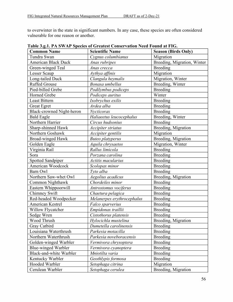
FIG Integrated Natural Resources Management Plan DRAFT as of 2-Dec-21
56
to overwinter in the state in significant numbers. In any case, these species are often considered vulnerable for one reason or another. Table 3.g.1. PA SWAP Species of Greatest Conservation Need Found at FIG. Common Name Scientific Name Season (Birds Only) Tundra Swan Cygnus columbianus Migration American Black Duck Anas rubripes Breeding, Migration, Winter Green-winged Teal Anas crecca Breeding Lesser Scaup Aythya affinis Migration Long-tailed Duck Clangula heymalis Migration, Winter Ruffed Grouse Bonasa umbellus Breeding, Winter Pied-billed Grebe Podilymbus podiceps Breeding Horned Grebe Podiceps auritus Winter Least Bittern Ixobrychus exilis Breeding Great Egret Ardea alba Breeding Black-crowned Night-heron Nycticorax Breeding Bald Eagle Haliaeetus leucocephalus Breeding, Winter Northern Harrier Circus hudsonius Breeding Sharp-shinned Hawk Accipiter striatus Breeding, Migration Northern Goshawk Accipiter gentilis Migration Broad-winged Hawk Buteo platyperus Breeding, Migration Golden Eagle Aquila chrysaetos Migration, Winter Virginia Rail Rallus limicola Breeding Sora Porzana carolina Breeding Spotted Sandpiper Actitis macularius Breeding American Woodcock Scolopax minor Breeding Barn Owl Tyto alba Breeding Northern Saw-whet Owl Aegolius acadicus Breeding, Migration Common Nighthawk Chordeiles minor Breeding Eastern Whippoorwill Antrostomus vociferus Breeding Chimney Swift Chaetura pelagica Breeding Red-headed Woodpecker Melanerpes erythrocephalus Breeding American Kestrel Falco sparverius Breeding Willow Flycatcher Empidonax traillii Breeding Sedge Wren Cistothorus platensis Breeding Wood Thrush Hylocichla mustelina Breeding, Migration Gray Catbird Dumetella carolinensis Breeding Louisiana Waterthrush Parkesia motacilla Breeding Northern Waterthrush Parkesia noveboracensis Breeding Golden-winged Warbler Vermivora chrysoptera Breeding Blue-winged Warbler Vermivora cyanoptera Breeding Black-and-white Warbler Mniotilta varia Breeding Kentucky Warbler Geothlypis formosa Breeding Hooded Warbler Setophaga citrina Migration Cerulean Warbler Setophaga cerulea Breeding, Migration
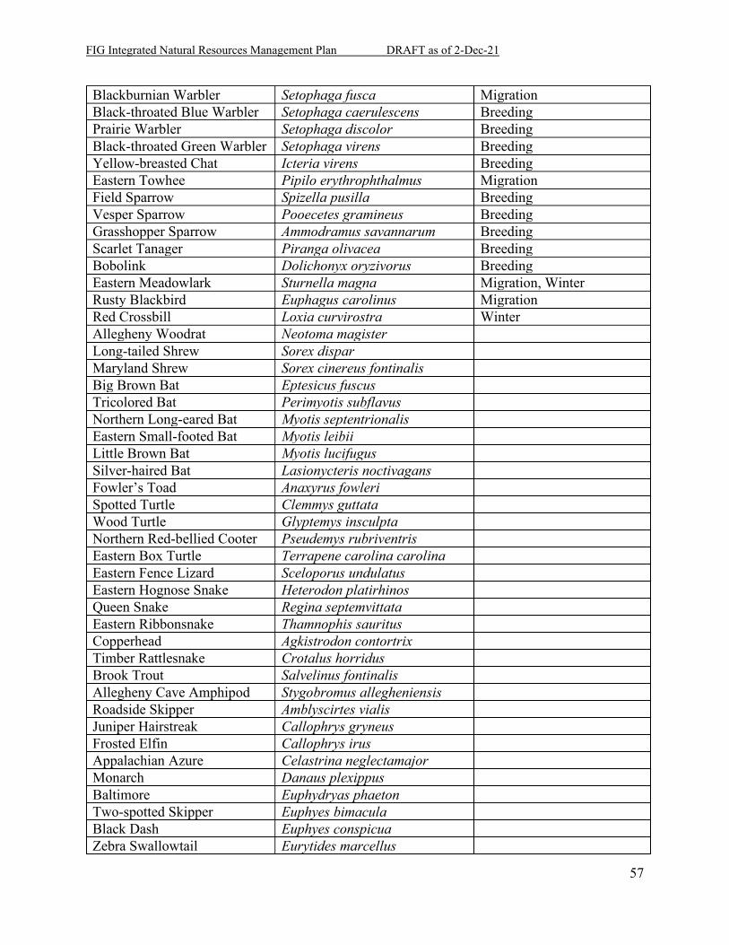
FIG Integrated Natural Resources Management Plan DRAFT as of 2-Dec-21
57
Blackburnian Warbler Setophaga fusca Migration Black-throated Blue Warbler Setophaga caerulescens Breeding Prairie Warbler Setophaga discolor Breeding Black-throated Green Warbler Setophaga virens Breeding Yellow-breasted Chat Icteria virens Breeding Eastern Towhee Pipilo erythrophthalmus Migration Field Sparrow Spizella pusilla Breeding Vesper Sparrow Pooecetes gramineus Breeding Grasshopper Sparrow Ammodramus savannarum Breeding Scarlet Tanager Piranga olivacea Breeding Bobolink Dolichonyx oryzivorus Breeding Eastern Meadowlark Sturnella magna Migration, Winter Rusty Blackbird Euphagus carolinus Migration Red Crossbill Loxia curvirostra Winter Allegheny Woodrat Neotoma magister Long-tailed Shrew Sorex dispar Maryland Shrew Sorex cinereus fontinalis Big Brown Bat Eptesicus fuscus Tricolored Bat Perimyotis subflavus Northern Long-eared Bat Myotis septentrionalis Eastern Small-footed Bat Myotis leibii Little Brown Bat Myotis lucifugus Silver-haired Bat Lasionycteris noctivagans Fowler’s Toad Anaxyrus fowleri Spotted Turtle Clemmys guttata Wood Turtle Glyptemys insculpta Northern Red-bellied Cooter Pseudemys rubriventris Eastern Box Turtle Terrapene carolina carolina Eastern Fence Lizard Sceloporus undulatus Eastern Hognose Snake Heterodon platirhinos Queen Snake Regina septemvittata Eastern Ribbonsnake Thamnophis sauritus Copperhead Agkistrodon contortrix Timber Rattlesnake Crotalus horridus Brook Trout Salvelinus fontinalis Allegheny Cave Amphipod Stygobromus allegheniensis Roadside Skipper Amblyscirtes vialis Juniper Hairstreak Callophrys gryneus Frosted Elfin Callophrys irus Appalachian Azure Celastrina neglectamajor Monarch Danaus plexippus Baltimore Euphydryas phaeton Two-spotted Skipper Euphyes bimacula Black Dash Euphyes conspicua Zebra Swallowtail Eurytides marcellus
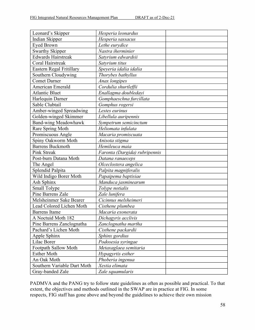
FIG Integrated Natural Resources Management Plan DRAFT as of 2-Dec-21
58
Leonard’s Skipper Hesperia leonardus Indian Skipper Hesperia sassacus Eyed Brown Lethe eurydice Swarthy Skipper Nastra iherminier Edwards Hairstreak Satyrium edwardsii Coral Hairstreak Satyrium titus Eastern Regal Fritillary Speyeria idalia idalia Southern Cloudywing Thorybes bathyllus Comet Darner Anax longipes American Emerald Cordulia shurtleffii Atlantic Bluet Enallagma doubledayi Harlequin Darner Gomphaeschna furcillata Sable Clubtail Gomphus rogersi Amber-winged Spreadwing Lestes eurinus Golden-winged Skimmer Libellula auripennis Band-wing Meadowhawk Sympetrum semicinctum Rare Spring Moth Heliomata infulata Promiscuous Angle Macaria promiscuata Spiny Oakworm Moth Anisota stigma Barrens Buckmoth Hemileuca maia Pink Streak Faronta (Dargida) rubripennis Post-burn Datana Moth Datana ranaeceps The Angel Olceclostera angelica Splendid Palpita Palpita magniferalis Wild Indigo Borer Moth Papaipema baptisiae Ash Sphinx Manduca jasminearum Small Tolype Tolype notialis Pine Barrens Zale Zale lunifera Melsheinmer Sake Bearer Cicinnus melsheimeri Lead Colored Lichen Moth Cisthene plumbea Barrens Itame Macaria exonerata A Noctuid Moth 182 Dichagyris acclivis Pine Barrens Zanclognatha Zanclognatha martha Pachard’s Lichen Moth Cisthene packardii Apple Sphinx Sphinx gordius Lilac Borer Podosesia syringae Footpath Sallow Moth Metaxaglaea semitaria Esther Moth Hypagyrtis esther An Oak Moth Phoberia ingenua Southern Variable Dart Moth Xestia elimata Gray-banded Zale Zale squamularis
PADMVA and the PANG try to follow state guidelines as often as possible and practical. To that extent, the objectives and methods outlined in the SWAP are in practice at FIG. In some respects, FIG staff has gone above and beyond the guidelines to achieve their own mission
FIG Integrated Natural Resources Management Plan DRAFT as of 2-Dec-21
59
objectives. Certainly, the habitats presented on the installation help the entire state reach the goals of the plan rather than provide obstacles to meeting those goals.
4. Program Elements
4.a. Threatened and Endangered Species Management and Species Benefit, Critical Habitat, and Species of Concern Management As of 15 May 2021, FIG currently has one listed species under the federal Endangered Species Act (ESA): the NLEB (Threatened). The installation does hold several species with potential for listing in the near future, many of which have been identified in petitions currently or recently brought before USFWS. These species and the most recent determinations are found in Appendix F, Table F.1. Conservation actions and plans are in place for all potentially listed species on the installation, and all species are currently monitored and managed in best-available adaptive management practices. Indiana bat, bog turtle and northeastern bulrush, although listed, will not be considered here. These species have no recorded presence on the installation determined by years of targeted surveys, and they are considered absent. Should these species be detected at FIG in the future, this section (and Appendix F) will be revised.
4.b. Wetlands and Deep-Water Habitats Management Wetlands and surface water features were comprehensively surveyed in 1998 with jurisdictional determination granted to the report in 1999 on the condition that individual impacts may need re-inspection (Ogden 1998a, 1998b). Several small project-driven studies and delineations have been completed since that time, but no other installation-wide survey has been performed due to the size of the installation, the amount of hydrology on the installation, and the lack of need for a full-scale determination. Those wetlands that have been resurveyed generally follow the 1998 findings closely. For a map of wetlands and other water resources, see Appendix J, page J-5. FIG property encompasses the head waters of Indiantown Run, Manada Creek, Vesle Run, Aires Run, and Qureg Run. These streams are all perpetual and are gaining streams, meaning groundwater continues to leach into the stream valley causing the volume of water to “gain” as the stream progresses downhill. Two major man-made lakes Marquette Lake and Shuey Lake and several un-named man-made ponds are also on FIG property. Physical activities and chemical releases performed by PAARNG at FIG as part of daily operations affect both the surface and subsurface water quality. Both groundwater and surface water provide pathways for transport of releases off post. Because of the overriding land ownership, FIG is responsible for the water quality where it flows off the installation. PAARNG strives to minimize the impact to littoral (lakes and ponds), aquatic(streams), and groundwater environments. These habitats are extremely fertile and provide diversity, energy, and waste management for the rest of the environment. Continuing improvements to trails, training, and tactics minimize water quality degradation.
FIG Integrated Natural Resources Management Plan DRAFT as of 2-Dec-21
60
Wetlands were first protected on the installation by President Carter’s Executive Orders 11988 and 11990 of 1977 that required Federal agencies to minimize impacts of federal activities on floodplains (11988) and wetlands (11990). Regulation has been strengthened in various acts and orders since, but the comprehensive control of wetlands and surface waters comes under the Clean Water Act of 1972. Other regulations authored by a variety of agencies, including the Pennsylvania Fish and Boat Commission, Pennsylvania Department of Environmental Protection, Army Corps of Engineers, and the Soil Conservation Districts in Dauphin and Lebanon County, Pennsylvania seek to minimize the degradation of stream and surface water habitat. FIG is a part of the Swatara Creek watershed, which in turn is part of the Susquehanna River drainage and the Chesapeake Bay watershed. Chesapeake Bay is one of the nation’s most unique and critical estuary environments, and the Bay has many environmental initiatives, funding sources, and oversight to try and protect its ecosystems. FIG participates in Chesapeake Bay restoration efforts as a member of the DOD Chesapeake Bay Compact. Groundwater quality is monitored at various locations across FIG. Groundwater samples are collected as part of a closed landfill monitoring, CERCLA investigation of PFAS compounds, and Operational Range Assessment Program (ORAP). Groundwater elevation mapping and contouring is ongoing but over 30 piezometers have been installed throughout the post to gather depth to groundwater information. Water turbidity monitoring of Manada Creek and Indiantown Run is accomplished by remote data loggers. A minimum 50 linear foot buffer from the bank full edge of all surface waters, streams, and wetlands is required. In accordance with FIG Regulation 350-2, mounted/vehicular training must maintain a 25-meter buffer. Additionally, specific areas of the post may require greater buffers based on specific protected species habitat investigations. This minimum buffer would be applicable for both Cantonment and the Training Corridor and for all types of encroachment, including general construction activities, range maintenance, or military training. The standardized buffer simplifies implementation and minimizes confusion and allows corrective action to be applied with minimal effort. The buffers can be enhanced by placing signs or Seibert Stakes at the identified boundary. Ponds and lakes on the installation are internally regulated against watercraft use except in the case of Marquette Lake, on which IGMR FGCC may operate flat-bottomed boats without the use of an engine. The lakes are not considered deep enough by modern safety standards for most aquatic training including obstacle course equipment. Specialized training activities are authorized by Range Control.
4.c. Law Enforcement of Natural Resources Laws and Regulations All law enforcement on the installation is handled by the cooperative law enforcement agencies (LEA) of the FIG Police Department and the military police on duty. As there are no installation conservation law enforcement officers (CLEO), all immediate natural resource law and regulation enforcement is handled by these LEA agents. If a situation involves state resource
FIG Integrated Natural Resources Management Plan DRAFT as of 2-Dec-21
61
law, LEA or Range Control has the duty to inform a Wildlife/Waterways Conservation Officer (WCO) from either PFBC or PGC according to the resource involved. The FIG Range Control Office administrates the outdoor recreation programs on installation. These programs have their own regulations that Range Control has some ability to enforce through the privileges they grant. When a state or federal conservation law is involved, Range Control must inform the LEA, PGC, or PFBC for further investigation or prosecution. LEA has the full abilities of a Commonwealth officer of the peace as described in PA Senate Bill 384 of 2009. These duties include the ability to
(8) arrest any person who damages, mutilates or destroys the trees, plants, shrubbery, turf, grass, plots, benches, buildings and structures or commits any other offense on the grounds and in the buildings of Fort Indiantown Gap or other designated military installation or facility and prefer charges against such offender under the laws and procedures of this Commonwealth.
4.d. Fish and Wildlife Management Fish and wildlife management fall under the duties of the PADMVA Wildlife section. The duties include all taxonomic organisms found in nature, including game, rare, common, aquatic, terrestrial, native, and exotic species. The general goal is to promote native species, increase rare species populations, and keep common species common. The means include vigorous stewardship, monitoring, and analysis. In some cases, exotic species may be targeted for removal or declines, as may be native pest species. The primary regulation guiding fish and wildlife management is the Sikes Act (16 USC 670, et seq.) as amended. Additional regulations are covered in AR 200-1. Other funding and authorization legislation may also apply in a supplemental role. The overarching goal of the fish and wildlife management is to provide as rich and as high quality a natural environment as can be provided while prioritizing habitat for military training use and the low-intensity high-frequency disturbance that typically occurs during training. To this end, the Conservation Division monitors and manages for common and regionally significant species as well as the game and state and federal rare species that gain more notoriety.
4.e. Forestry Management The PADMVA Forestry Office is responsible for management of the installation’s 10,000 acres of forest as well as urban forest management in the installation’s cantonment area. The duties include maintaining a current inventory of forest resources, monitoring growth and yield of the common tree species found in the forest, conducting forest regeneration studies, conducting commercial and non-commercial timber harvests to promote forest health or for military training needs, conducting forest pest surveys, riparian buffer management, and reforestation. Overall, the Forestry Office is trying to promote and maintain a resilient forest landscape that can withstand impacts caused military training, forest insects and disease outbreaks, and climate
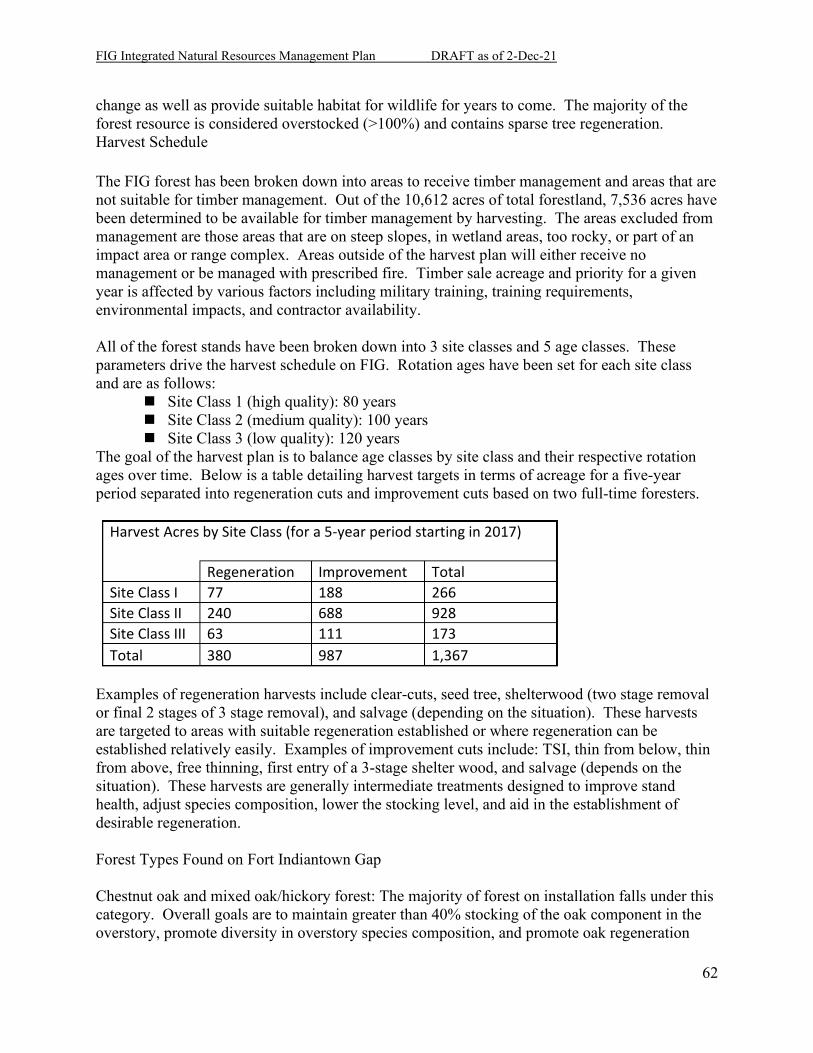
FIG Integrated Natural Resources Management Plan DRAFT as of 2-Dec-21
62
change as well as provide suitable habitat for wildlife for years to come. The majority of the forest resource is considered overstocked (>100%) and contains sparse tree regeneration. Harvest Schedule The FIG forest has been broken down into areas to receive timber management and areas that are not suitable for timber management. Out of the 10,612 acres of total forestland, 7,536 acres have been determined to be available for timber management by harvesting. The areas excluded from management are those areas that are on steep slopes, in wetland areas, too rocky, or part of an impact area or range complex. Areas outside of the harvest plan will either receive no management or be managed with prescribed fire. Timber sale acreage and priority for a given year is affected by various factors including military training, training requirements, environmental impacts, and contractor availability. All of the forest stands have been broken down into 3 site classes and 5 age classes. These parameters drive the harvest schedule on FIG. Rotation ages have been set for each site class and are as follows:
Site Class 1 (high quality): 80 years Site Class 2 (medium quality): 100 years Site Class 3 (low quality): 120 years
The goal of the harvest plan is to balance age classes by site class and their respective rotation ages over time. Below is a table detailing harvest targets in terms of acreage for a five-year period separated into regeneration cuts and improvement cuts based on two full-time foresters.
Harvest Acres by Site Class (for a 5-year period starting in 2017) Regeneration Improvement Total Site Class I 77 188 266 Site Class II 240 688 928 Site Class III 63 111 173 Total 380 987 1,367
Examples of regeneration harvests include clear-cuts, seed tree, shelterwood (two stage removal or final 2 stages of 3 stage removal), and salvage (depending on the situation). These harvests are targeted to areas with suitable regeneration established or where regeneration can be established relatively easily. Examples of improvement cuts include: TSI, thin from below, thin from above, free thinning, first entry of a 3-stage shelter wood, and salvage (depends on the situation). These harvests are generally intermediate treatments designed to improve stand health, adjust species composition, lower the stocking level, and aid in the establishment of desirable regeneration. Forest Types Found on Fort Indiantown Gap Chestnut oak and mixed oak/hickory forest: The majority of forest on installation falls under this category. Overall goals are to maintain greater than 40% stocking of the oak component in the overstory, promote diversity in overstory species composition, and promote oak regeneration
FIG Integrated Natural Resources Management Plan DRAFT as of 2-Dec-21
63
throughout the rotation to limit potential loss of oak due to gypsy moth infestation, fire, or military training impact. Yellow poplar forest: These forests are characterized as occurring on mesic sites and generally have greater than 40% stocking in yellow poplar. Overall goal is to maintain the yellow poplar component on these high-quality growing sites. White Pine/Hemlock forest: These forests are mostly found in bottomland and stream corridors north of Blue Mountain. Overall goal is to maintain evergreen cover to protect stream temperatures and water quality. Miscellaneous Softwoods: These forests are comprised mainly of Virginia and pitch pine with over 50% stocking of either of these two species. Overall goals are to maintain the evergreen canopy for cover and concealment areas for military training as well as to promote pitch pine growth and establishment on installation. Miscellaneous Hardwoods: These forests are mostly in the bottomland areas on the south side of Blue Mountain and contain an abundance of ash, hickory, and red maple. Overall goal is to maintain tree cover in these riparian areas. Old Field: These forests are characterized by having mixed species typical of a fallow field such as black locust, black cherry, and Virginia pine. Overall goal of these forests is to aid the successional process in order to promote closed canopy forest. Benefits to Wildlife The forests of FIG provide many benefits to the NLEB as well as many of the common game species found in Pennsylvania.
4.f. Vegetative Management Vegetative management is a cooperative joint effort between the Conservation Division, ITAM, DIM and Range Maintenance. The goal is to provide sustainable native ground cover and canopy structures for realistic military training as well as to support optimal habitat for native species. Stewardship includes revitalizing native communities such as warm-season grasses and oak forests through active management with fire, soil supplementation, and seeding. The other side of stewardship is discouraging the non-native and invasive species through herbicide, fire, and mechanical removals. These two sides of stewardship must be used in some combination to achieve objectives or the natives will be crowded out of the community. Fire, prescribed or training-induced, provides benefits that the use of herbicide and mechanical treatments cannot achieve. These include removing litter and duff, a key to seed germination and survival of violets and important wildflowers; invigorating fire-adapted species like little bluestem grass (Schizachyrium scoparium); removing invasives with herbicide resistance; and opening interstitial space for rodents, birds, and other taxa. Fire is also easier, cheaper, and faster
FIG Integrated Natural Resources Management Plan DRAFT as of 2-Dec-21
64
to implement than an herbicide-heavy integrated pest management plan. The key to a successful fire-dominated vegetation management program is finding a frequency and achieving a certain intensity that is neither too disturbing nor too light for the target assemblage. Herbicide provides treatment options throughout the year rather than just the narrow windows in a burning cycle. The chemical is more directed and more effective on certain species than fire that often leaves a mosaic of effects. Chemical treatment also opens more soil to receiving aggressive invaders. Unlike fire, chemical treatments may remain soil-active and must be carefully studied before implementation. Safety concerns are still highly important, although they are less than those found with fire operations. Mechanical treatment can also be used at any time plants remain exposed at the surface. Equipment and labor are often the largest expenses in any stewardship operation, and they can be especially expensive in mechanical treatment. Mechanical removal is often the least effective and causes the most disturbance impact. Safety concerns depend on the equipment used, but fatal accidents probably occur more often with mechanical treatment than chemical. Volunteer programs and creative initiatives include the native seed collection program (for PADMVA or contract propagation), the butterfly garden (for a native seed bank repository), IGMR FGCC seeding and soil preparation, and reintroduction partnerships. FIG has some very unique ecotypes and species for the state, and the exceptionality and variety attract participation. These programs mainly support grassland and eastern regal fritillary habitat programs, but they also provide matching monies for grants from organizations like DoD Legacy Program and State Wildlife Grants.
4.g. Migratory Birds Management The primary drivers for migratory bird management are the Migratory Bird Treaty Act (MBTA, 16 USC 703-711), supported by Executive Order 13186, the Bald and Golden Eagle Protection Act (16 USC 668-668d), and state and federal Endangered Species Acts with amendments (16 USC 1531 et seq.) Other funding and authorization legislation may also apply in a supplemental role. As of June 2014, a total of 287 bird species have been observed using or passing through the installation. Of those 287 species, 144 are presumed or confirmed breeding species within the installation’s many habitats. Not all of those birds are covered under MBTA (upland game species and exotic species are exempt), but a majority are. Active management for birds on installation is usually wrapped into habitat and community management projects and objectives. Grassland guild birds benefit from grassland habitat projects, and forest guild birds benefit from beneficial forestry practices. The targeted management bird species receive on installation is limited to nest box placements, monitoring counts and projects, the wildland fire program, and some limited public educational and volunteer programs (i.e., the public feeder project, Migratory Bird Day tours, the Pennsylvania Annual Migration Count, Quittapahilla Audubon Society’s Christmas Bird Count, etc.).
FIG Integrated Natural Resources Management Plan DRAFT as of 2-Dec-21
65
Passive management includes surface water quality programs including wetland protections and improvements, the mowing plan, the prescribed fire program’s seasonality, and certain hunting program regulations. These programs ensure that no take occurs under the MBTA and its guidelines. They also lower disturbance levels around nesting birds and the breeding season. Incidental migratory bird take from military readiness activities is authorized under MBTA. However, the military proponent must confer with the USFWS if any proposed or ongoing readiness activity may or is likely to adversely affect a population of migratory bird species. If such a threshold occurs, conservation measures are to be implemented to minimize the impact. Assessing the overall impacts of military readiness activities on migratory birds is to be addressed in the NEPA analysis (50 CFR 21.15). Readiness is very strictly defined and generally only applies in the direct actions of training military units. The readiness definition does not extend to any support activities that makes that training possible, just the training itself. Exemption also does not extend to cover intentional (or known) take. Interestingly in the National Guard, readiness and preparation for domestic emergencies and disaster response still falls under the military readiness provision. A proposed rule for an incidental take (non-readiness) permit system is currently in the rule-making process (US Department of Interior 2021). Without any outline of potential activities covered by the permit, the most likely scenario is that FIG will have to comply with that permit system and get in contact with the USFWS field office or other office handling that permit. There is no current authorization for this take, but USFWS uses prosecutorial discretion on which violations to pursue. Implementing a migratory bird conservation and management program makes it very unlikely the USFWS would pursue any violation given the benefit of such programs outweigh any costs associated with the incident take from non-readiness activities. Non-native birds and those considered non-migratory game birds are not covered under MBTA. Starling and house sparrow management, amongst other invasive species control, is acceptable and can be considered a conservation measure towards an MBTA program. Some waterfowl and other huntable migratory birds can be dealt with through a depredation permit, but the agency must go through the steps to obtain that permit and implement it legally.
4.h. Invasive Species Management Invasive species management is a function of pest management, forest and wildlife ecology, and the sustainable range program. To this extent, all major land management offices on installation are involved in the control efforts. The SRP generally covers aerial herbicide and large-scale removal on the ranges and training areas where they prohibit maneuver. Forestry and Wildlife sections have herbicide and mechanical removal on the smaller scale (backpacks, vehicular broadcasts, drum chipping, etc.) and in areas where they present no immediate training hazard. Range maintenance will mechanically remove infestations when they threaten targetry or other major range structures. Environmental conflicts such as ESA effects and permits must be satisfied through the proper procedures with regulatory agencies via the Conservation Office. Additionally, BMPs such as conducting vehicle inspections in order to prevent the transport/spread of the invasive spotted lanternfly, are in effect.
FIG Integrated Natural Resources Management Plan DRAFT as of 2-Dec-21
66
4.i. Pest Management The pest management program is jointly run under multiple offices and leaders; oversight is the responsibility of the Integrated Pest Management Coordinator as outlined in the Integrated Pest Management Plan. The Pest Management shop is part of the DIM office and takes care of human, building, and equipment pests that threaten health and infrastructure. Conservation Division employees deal mainly with pests that threaten lands, habitats, and organisms. ITAM takes further care of natural resource pests that threaten training lands and equipment. Finally, the medical and safety offices monitor pest vectors for human disease threats and their agents, especially Lyme disease, West Nile virus, and Rocky Mountain spotted fever. Best management practices include sanitation, eliminating food sources/breeding sites, and exclusion; this will prevent pests from becoming established.
4.j. Land Management Land and soils management is a cooperative joint effort between Conservation Division, ITAM, DIM, Range Maintenance, and Training Site Engineers. The goal is to provide protection to the land and waterways from erosion and sedimentation. Best management practices (BMPs) are used to hold soils in place whenever ground disturbance is necessary (e.g., logging, military construction, land rehabilitation, road grading, etc.). These BMPs include silt fences, straw bales, erosion eels, sedimentation traps, sedimentation ponds, appropriate crowning on trails, ditch turnouts, water bars and any other device referenced in the erosion and sedimentation plan for preventing soils from reaching the waterways. A set of specific BMPs for ground disturbance projects are available that have been cleared with the county conservation districts. Seed mixes have been formulated for Erosion & Sediment (E&S) control specific to the individual projects. A mix for use on ranges to prevent line of sight issues uses low growing grasses, mixes for firebreaks contain mostly clover species, and mixes for immediate rehabilitation use fast growing species such as annual rye. Straw mulch or rolled fabric stabilizers are typically used to cover the seed, and when hydro-seeding on steep slopes, a commercial mulch with a tacking agent is used. The seeding of native warm season grasses is also an important part of rehabilitation as these grasses help hold soil in place even after heavy training. These grasses however take a much longer time to establish and therefore are seeded with other rehabilitation mixes.
4.k. Agricultural Out-leasing The installation has no agricultural leases. Installation agriculture programs are carried out with installation staff and products are used in conservation programs for the benefit of the installation, PADMVA, and PAARNG (e.g., straw for erosion and sediment control projects, native seed harvest for natural resource programs, etc.). There are no developed fields.
4.l. Geographical Information Systems (GIS) Management Geospatial data of important elements of the natural resource program are used to create data layers and maps that facilitate environmental planning and impact management programs. GIS

FIG Integrated Natural Resources Management Plan DRAFT as of 2-Dec-21
67
analyses influence management and mission activities and are critical in both daily and long-term management actions. GIS products can depict important management areas of concern and potential conflict with proposed military actions. All published GIS data, including installation-prepared data and data from contractors, should follow the current approved Spatial Data Standards for Facilities, Infrastructure, and Environment (SDSFIE) structure (http://www.sdsfie.org). The current standard datum and projection are Universal Trans Mercator (UTM) World Geodetic System 1984 (WGS 84) for Zone 18 North. Metadata should follow any governance released from NGB and must accompany the file when published. Core elements must be in place and should be written into standard contracting language, however additional attributes can be added as necessary. Protocols should implement workflows that integrate field data seamlessly into proper storage. Natural resources data are stored in geodatabases, which allow for multiple users and seamless data integration. Data management is generally handled by the Assistant Forest Program Manager or the Assistant Wildlife Program Manager or another member of the installation GIS working group. Content requests by NGB and other federal entities are generated by the installation GIS Working Group. GIS training is available for those in need. ESRI, the company behind ArcMap, has a plethora of content on their website (learn.arcgis.com). There are also numerous books and YouTube tutorials on the subject (see Ormsby et al. 2001 and Arctur and Zeiler 2004).
4.m. Outdoor Recreation Primary regulations governing outdoor recreation at the military installation include the Engle Act of 1958 (43 USC 155158), Executive Order 13443 – Facilitation of Hunting Heritage and Wildlife Conservation, the Sikes Act (16 USC 670, et seq.), and the Pittman-Robertson Act (16 USC 669-669k). Internal regulations include AR 200-1 and DoD Memo of 05AUG02 (Disabled Recreation Opportunities). All extractive recreation opportunities on installation (hunting, fishing, and wood-gathering) are directed by FIG Reg. 215-2, which is revised annually and available from either the Conservation Office (Bldg 26-151) or Range Control (Bldg 11-9). PADMVA strives to provide access and opportunity to all recreation users. All seasons are considered for harvest, though individual species may be regulated above the state’s minimum by installation regulations and all recreation closes in restricted areas from the end of May to the beginning of September. This closure coincides with the heaviest military training use of the property, which typically makes public access nearly impossible. Wildlife viewing stations exist in A-21 (wetland trail), Shuey Lake (shoreline and parking lot), Marquette Lake, and Second Mountain Hawkwatch. The latter is a former helicopter landing zone that was set aside in 1984 for the counting and recording of the raptor migration every year (August through December). Access beyond standard public areas requires the purchase of a permit available through registration online Aug. through May.
FIG Integrated Natural Resources Management Plan DRAFT as of 2-Dec-21
68
4.n. Bird Aircraft Strike Hazard (BASH) The 193rd SOW of the PAANG, based out of Harrisburg, contracted the first BASH management plan in 2009. This plan has been revised several times, with the most recent being 2019, and states basic best management for airstrike avoidance and resolution. BASH incidents have occurred over installation, on installation, and on mission routes to and from installation. Fixed and rotary wing vehicles are both susceptible and neither should be disregarded in management of the issue. As of 2015, the Army and NGB have not prepared a standard to follow, but Air Force and Navy recommendations and programs are well established. Air Force uses the Smithsonian to identify remains, and to some extent this resource can be utilized by units at FIG. Even a single feather can produce certain species identification. The restricted airspace over and surrounding FIG is complex. Bollen Range (DET 1 193rd SOW) utilizes the airspace over the training corridor. MAAF controls their operational space over and within a 5-mile radius of the airfield. The Training Site and Range Operations control the airspace over ranges and training lands in the corridor and cantonment when those lands are not in use by Bollen or MAAF. BASH is best treated by prevention methods, and the Conservation Division takes the matter seriously. Canada goose residency in the general area of MAAF and the flight paths is actively discouraged. Temporary water bodies built around MAAF were drained years ago to discourage geese and ducks from settling in the flight paths. Egg oiling (as opposed to addling) has been a very successful technique in discouraging nesting pairs, possibly even more successful than adult roundups during molt. Geese are driven off the airfield by the FIG Fire Department Crash Response Unit when they land in large flocks on the runways and helipads. Owl and kestrel boxes are discouraged in the immediate vicinity of MAAF or the flight paths. Most incidents take place in the training airspace or on approach to/from Harrisburg. The 193rd conducted a study using USDA Animal Plant Health Inspection Service to monitor bird flight patterns throughout the year in 2010 to determine the best approaches and timing for avoidance. Pilots usually recon the field before making high-speed maneuvers or air-to-ground runs, and large birds are noted at that time as well as during the exercise from observers in the towers. This system generally works well over installation airspace; hence incidents mainly occur from birds on the other side of Second Mountain in the narrow Stony Valley where they cannot be seen. The FAA Wildlife Strike Database (http://wildlife.faa.gov) is a way of reporting and tracking air strikes, both at MAAF and statewide. The database records strikes by their home airport, so some data may be “lost” at the flight’s origin. Reporting is a simple online form, and it can be edited as additional data (such as the identification of remains or damage cost estimates) become available. The entire process is fairly short in comparison to other means. This database is highly recommended to try and gather better data on strikes, which is necessary to fine tune management.
FIG Integrated Natural Resources Management Plan DRAFT as of 2-Dec-21
69
4.o. Wildland Fire Management Fire Management is essential to the mission of FIG. The primary goal of the Wildland Fire Management Program is to provide for public and firefighter safety and maximize military training opportunities. The IWFMP and Prescribed Burn Plan discuss in detail how fire is used at Ft. Indiantown Gap. In the past military training has been restricted in an effort to reduce the chance of wildfires. Therefore, in order to promote rather than restrict training activity, fire management is used to reduce the fuels that are a precondition of wildfire. An additional military benefit will be gained by controlling vegetation types that restrict troop movement and/or live fire activities. The environmental benefit that will result from a proactive wildland fire management program is a more naturally correct state. Historically, periodic fires have played an important role in maintaining or improving biodiversity. Fire management will also reduce the potential for environmentally harmful wildfires.
4.p. Training of Natural Resource Personnel This section lays out the requirements and opportunities for natural resource personnel training. Certifications may differ amongst personnel given position, responsibilities, and status.
4.p.1. Wildland Fire Training Details on the wildland fire training policies of PADMVA Natural Resources can be found in the FIG Integrated Wildland Fire Management Plan. Wildland fire certifications and credentials follow the state guidelines for training and certification levels for participating individuals. Alternatively, those with access to federal tasks books and the National Wildfire Coordination Group certification process may participate using those credentials. Transition to NWCG standards is underway. Annual training includes mandated fire refreshers once per year and successful completion of a pack test to prove physical fitness minimums for the fire line in accordance with state standards. In accordance with current standards in the IWFMP all individuals participating on wildland fire will transition to be certified in first aid and Cardio-pulmonary resuscitation (CPR). First responder or EMT training is beneficial but not required.
4.p.2. Land Management Certifications Full-time salaried personnel wishing to participate in pesticide programs need to obtain and keep current the appropriate state certification level as issued by PA Department of Agriculture. This includes core certification and the appropriate category certification for the types of applications the staff will encounter (at a minimum, the state’s Industrial Weeds/Right of Way or Forest Pest category). The state requires core and category recertification credits every three years to maintain the license. These credits are generally obtainable in one to two days of offsite training usually held within the counties several times annually. PADMVA’s pesticide business license is

FIG Integrated Natural Resources Management Plan DRAFT as of 2-Dec-21
70
held by DIM, and all PADMVA applicators should use that business license for their public applicator certification records.
4.p.3. Employee Safety and Disease Surveillance Natural resources and pest management personnel face a wider array of environmental disease threats than other commonwealth employees. As such, PADMVA has a need to see to employee health on two main issues, with the benefit to the agency of decreased liability and long-term medical costs. The first concern is Lyme disease and other tick-borne ailments. FIG lands have high occurrences of ticks, with at least three species present including the most typical disease host, the deer tick. The prevalence of Lyme disease in tested ticks collected by the Troop Medical Center has never fallen below the 50% level since the onset of testing in the early 2000s. Natural resource employees usually find ticks on their persons at least once every two weeks, often imbedded. No number of self-checks or appropriate clothing can maintain 100% protection, and indeed, more than half of the Wildlife and Forestry crews have had at least one treatment for possible Lyme infection. The agency should endeavor to provide annual surveillance, based on current medically accepted testing, for each employee and contractor that fall into the greatest liability group, i.e., those who work with natural resources and pest management. The second concern is rabies. This disease is specific to those handling or called to handle mammals, at least in terms of susceptibility. Some employees, including those in pest management and those in the Wildlife section, involved in the monitoring and management of bats, rodents, and other mammals are highly exposed and require pre-vaccination as a condition of their work. The agency should provide initial vaccines, booster shots as needed, and annual titer surveillance to determine when those boosters are needed. These conditions are essential and industry standard. The alternative is nearly 100% fatality for those exposed without vaccination. Risk and susceptibility for wildlife vectored diseases is an ever growing and changing topic. This topic should be revisited along with the 5-year review process to determine the necessity and budget for any further cost and life-saving measures or threats that may arise.
4.p.4. Other Certifications and Training Safety certifications are a must for those using equipment. This includes All-Terrain Vehicle (ATV) Safety Certification before using an ATV on the installation, General Services Administration (GSA) safe driver certification before driving a GSA vehicle, and specialized equipment training on larger stewardship equipment, chainsaws, etc. State employees must pass a series of trainings available electronically. Those PADMVA employees who qualify are given notice of the need for those trainings during their orientation. All FIG personnel must pass and annually recertify in network security courses before they can obtain a working username and email account. Other annual trainings are determined by job position.
FIG Integrated Natural Resources Management Plan DRAFT as of 2-Dec-21
71
Conferences and meetings with other natural resources professionals, both DoD and non-DoD, are necessary to gain the most up-to-date information and techniques available to the science. With more unknowns than knowns on even the most studied species, staying abreast of current topics and techniques is crucial to both successful management and an efficient team. Information at these types of professional gatherings is both very diverse and yet very detailed. Sending only one team member to report back to the group rarely covers the office needs, especially with multiple tracks of speakers and topics. Sometimes several staff will go to the same event and come back with completely different sets of information for the office’s use.
4.q. Floodplains Management FIG’s geographic placement in the foothills of the Appalachian Mountains is such that most of the installation streams are first and second-order and do not have broad floodplains. As mentioned previously in the Wetlands and Deep-Water Habitats Management section, a minimum 50 linear foot buffer from the bank full edge of all surface waters, streams, and wetlands is required. This buffer is a minimum and may be increased in areas as designated by Range Control and PADMVA BEM. In accordance with FIG Regulation 350-2, mounted/vehicular training must maintain a 25-meter buffer. Additionally, specific areas of the post may require greater buffers based on specific protected species habitat investigations. The overarching goal is to prevent direct impact to streams and wetlands from training mission activities. Some cantonment locations, being in an urbanized setting, do not meet minimum setback requirements. Impacts in these areas are limited as much as possible with no-mow streamside buffers, woodlots, and stream improvements. Where variances are necessary, PADMVA BEM and the responsible office of engineers follow standard ACoE and Commonwealth permitting procedures before implementing the activity or improvement plan. The hundred-year floodplain is often contained in a woodlot for any streams of size. These woodlots and the wetlands contained within them are high replacement value (5:1 for forest, 3:1 for shrubland) when considered in a mitigation context and should be protected from encroachment.
4.r. Other Leases Out-leased property at the installation is coordinated through headquarters and does not concern natural resource management. There are no agricultural or extractive industry leases at FIG at this time.
FIG Integrated Natural Resources Management Plan DRAFT as of 2-Dec-21
72
5. Implementation
5.a. Preparing Project Prescriptions Prescriptions are prepared for the Status Tool for the Environmental Program (STEP) process. Prescriptions must follow goals and objectives set in Section 1. c. Goals and Objectives of this document. Conservation Division managers will prepare these prescriptions and estimate costs ahead of the annual budget submissions set by NGB. These submission periods take place April through July of every year. Prescriptions will be written into Appendix B, which will be reviewed and revised annually without constituting a major action unless such action is deemed necessary and this INRMP is officially revised.
5.b. No Net Loss As a landholding department smaller than many of the landholding agencies in other Federal departments, DoD strives to maintain use of all its lands through obstacles set in place by regulation. While certain activities may be lost on an acre-by-acre basis, the overall land use for, in FIG’s case, military training remains constant. The achievement of no net loss can be achieved through the planning process, the stewardship process, or the mitigation process. The first is the most desirable – to avoid loss in the planning process before implementation costs begin. The third is the least desired– to not only suffer the impact, but also have to acquire the resources to offset that impact is the most expensive option in almost all cases. The environmental planning process at FIG generally seeks to solve the problems and inefficiencies possible through military training by avoiding impacts. Often the placement or footprint of the activities and their facilities determines the level of impact of a proposed activity. By avoiding sensitive natural resources such as surface waters and wetlands, military activities avoid a heavy footprint downstream. Environmental planning usually steps into a project at the 35-65% design phase. The earlier the environmental review process begins, the fewer problems at the point of implementation. Stewardship is a constant and daily activity at FIG. Units have a high throughput and footprint on FIG’s training landscape, and land has little time to recover between training activities. Woody encroachment, invasive species, E & S issues, and ground hazards can appear that need remediation. To this end, the PAARNG has the cooperative teams of the ITAM office, the Conservation Division, DIM, and Range Maintenance to heal the landscape, invigorate precious vegetative forms like native warm season grasses, and to enhance the habitat from its initial status. These offices perform land reclamation too, adding trainable acreage by removing old threats to maneuvers and military activity Most directly, mitigation has been used to offset losses, such as wetland impacts, from the construction of ranges and facilities. Mitigation also provides protection in the forms of multiple use ranges (for shifting repetitive uses to alternate sites and thereby lessening the severity of the impact), additional habitat outside a given land use (such as grassland outside fire-prone ranges)
FIG Integrated Natural Resources Management Plan DRAFT as of 2-Dec-21
73
to avoid blanket treatments and mix age classes, and provides effective solutions for resource problems (such as the installation of a berm to protect a cultural resource). FIG’s most frequent encroachments are the 219 acres of eastern regal fritillary research areas and the acreages contained in wetlands and surface waters. These areas are often near the center of activity because of the nature of the installation. RRAs are found on former ranges and, naturally, in open areas conducive to training. Wetlands and surface waters are found throughout installation due to its location at the headwaters of two major tributaries to the Swatara Creek. The answer to these issues is to simply find compatible use. The first compatible use is dismounted training. If mechanized and motorized vehicles are not in use, the impact to the land is minimal and can avoid any major long-term damage that would threaten sustainability. This means that vehicles must cross waterways at permitted engineered crossings rather than at improvised fords. This also means that the troops must avoid driving through RRAs in the maneuver areas and treat them as mined or off-limits areas, conditions that can be found in the theatre of operations not just the training environment. The second compatible use is large live-fire ranges. These ranges have very little ground use and have natural occurrences of training-induced fire that helps to maintain the grasslands and their health. While fire cycles, spent munitions, and noise levels must be monitored and occasionally policed or placed into stewardship, military active use can even get heavy and repetitive without a loss in training time or a loss in the natural resource’s sustainability. This option is more frequently used now as larger installations have more room for maneuvers, but FIG is specially adapted to live-fire operations (an increasingly rare condition in the northeast). Small arms and air-to-ground are two of the installations most frequent military land use activities. Other compatible uses include land navigation courses, drop zones, UAS training, and convoy/IED training. These uses concentrate ground activities and minimize the true limits of disturbance. Creativity can place the facilities for these uses out of the way of sensitive habitat. Some of these uses are indifferent to the hydrology of an area as well.
5.c. Cooperative Agreements
5.c.1. Pennsylvania Game Commission The current PGC agreement provides for PGC and PADMVA cooperation on wildland fire and habitat management projects. PGC also provides law enforcement on PADMVA properties. This agreement has no date of termination. Currently, cooperation between the PGC and PADMVA consists of primarily wildland fire coordination and habitat management. PGC provides trainees to and has organized training events at FIG wildland fires. PADMVA has also sent supervision, equipment, and labor to PGC-held prescribed fires. Both agencies are primary members of the Keystone Appalachians Fire Learning Network and continue to partner through that organization as well. PGC and PADMVA have partnered under this agreement to provide management and scientific expertise to habitat management projects on lands managed by both agencies.
FIG Integrated Natural Resources Management Plan DRAFT as of 2-Dec-21
74
5.c.2. The Nature Conservancy (TNC) The original TNC agreements were signed in the early 1990s to allow the state’s Natural Heritage Program (then contracted to TNC) to provide installation-wide planning level surveys and document the primary habitats occupied by the eastern regal fritillary butterfly. From that position, TNC eventually created a semi-permanent office at FIG to monitor the eastern regal fritillary and provide management recommendations. This agreement ended in 2006 when TNC decided to end all scientific contracting within the state based on programmatic changes at the state level. The positions created by TNC were transferred to the Penn State University cooperative agreement and eventually to Temple University. PADMVA-TNC cooperative agreements are now primarily fire-related, with PADMVA joining the TNC-led Fire Learning Network in 2006 and reorganizing in 2009. TNC has provided training and trainees at FIG fires since 2006. TNC is currently a partner in the ACUB program.
5.c.3. PADCNR Bureau of State Forestry Currently there is no cooperative agreement between DCNR Bureau of Forestry and PADMVA. Meetings could be held in the future with the intent of establishing an agreement as it relates to wildland fire.
5.c.4 ACUB Cooperative Agreement FIG’s ACUB program is based on a Cooperative Agreement (CA) between the WBWF (FIG’s ACUB program Primary Partner) and the National Guard Bureau (NGB). This agreement was first signed in 2015 for a five-year period and was reauthorized in 2021 for a period of ten years. The current CA authorizes NGB to obligate federal funds to assist WBWF in implementing FIG’s ACUB program via the acquisition of “long-term interests in or title to” land parcels in FIG’s vicinity or those lands “ecologically related” to the installation. Under this CA, program funds are available for management of encumbered lands and the natural resources they contain, as applicable and authorized. As of 30 September 2021, FIG and its partners have encumbered approximately 9,300-acres under the ACUB program, utilizing approximately $19M in ARNG and REPI funds, as well as approximately $5.7M in matching funds. See section 3.f of this INRMP for additional information on FIG’s ACUB program.
5.d. Funding Environmental funding is provided by the NGB through its STEP process for the Wildlife Office and a portion of the Forestry Office’s annual budget. Additional funding from the facilities office supports the wildland fire program and response. Fees collected from hunting/fishing permits go directly into a fish and wildlife fund, which is managed by a board of trustees from various offices at FIG and used only on natural resource projects such as trout food, pheasants, food for wildlife, seed, and herbicide. The fund also pays for the Outdoor Recreation program online registration and sign in system, currently administered by iSportsman. Additional funds for natural resource projects come in through grants.

FIG Integrated Natural Resources Management Plan DRAFT as of 2-Dec-21
75
Grants To date, the Conservation Division has applied for funding through several reimbursable or grant programs: PA Wild Resource Conservation Program (WRCP), DoD Legacy, Chesapeake Bay Foundation (CBF), and the Readiness and Environmental Protection Initiative (REPI). WRCP and Legacy grants have been used to fund off-site partnerships, regal rearing, initial planning level surveys in the 1990s, and off-site expert opinion. CBF has paid for stream and waterway enhancements. DoD Legacy, through National Public Lands Day (NPLD) funding mechanisms, has provided for pollinator enhancements like the Range House Butterfly Garden. The REPI program funds ACUB and encroachment buffer programs. There is one other DoD grant program that has not been successfully awarded to the installation but continues to hold promise for funding in the future. This program is the Strategic Environmental Research and Development Program (SERDP)/Environmental Security Technology Certification Program (ESTCP). SERDP/ESTCP funds projects with real world development of technological solutions for common Defense problems. Grants have their own schedules and timelines. Many follow the fiscal year of the ultimate granting authority. DoD Legacy thus follows the federal fiscal year with plenty of lag time for the lengthy review and proposal processes. WRCP follows the state fiscal year from 1 July to 30 June. NPLD is a special grant package meant to honor the titular day of 29 September, and the proposal process follows sufficiently so that funds are distributed in time to host the volunteer events. Reimbursable Accounts The Conservation Division benefits from three state-funded reimbursable accounts. The first, forestry reimbursable funds (specifically called the State Armory Trust Fund), is made from timber revenue and firewood sales. This money is generated by both commercial timbering contracts and by the fees residential users pay for firewood at our firewood yard. These funds are primarily used for facility improvements with funding considerations for forestry and conservation projects. The second fund is generated by the outdoor recreation access program, part of Morale Welfare and Recreation (MWR). This program generates user cost fees from the sale of installation passes for hunters and anglers, but all money must go to MWR purposes or back into the costs of the natural resources that generate the program’s interest (hunting programs, wildlife habitat projects, check stations, etc.). The third type is recycling money generated by the proceeds of recycling brass and other metal left by range use, and by the recycling of common materials from around the installation like aluminum cans and cardboard. These funds go back into the recycling operations or to MWR, which can be used to fund recreation costs.
FIG Integrated Natural Resources Management Plan DRAFT as of 2-Dec-21
76
6. References Adkins Giese, C.L., D.N. Greenwald, and T. Curry. 2012. Petition to List 53 Amphibians and Reptiles in
the United States as Threatened or Endangered Species Under the Endangered Species Act. Center for Biological Diversity. FWS-R5-ES-2015-0064-0002. 454 pp.
Bakermans, M.H., J.L. Larkin, B.W. Smith, T.M. Fearer, and B.C. Jones. 2011. Golden-winged Warbler
Habitat Best Management Practices for Forestlands in Maryland and Pennsylvania. American Bird Conservancy. The Plains, Virginia. 26 pp.
Balcom, B.J. and R.H. Yahner. 1996. Microhabitat and landscape characteristics
associated with the threatened Allegheny woodrat. Conservation Biology 10(2): 515-525. Bat Conservation and Management, Inc. 2004. 2004 Woodland Bat Survey at Fort Indiantown Gap.
Report prepared for the Pennsylvania Chapter of The Nature Conservancy. 49 pp. Becker, T. 2016. Propagation and repatriation of the regal fritillary butterfly. Proceedings of the 2016
Invertebrates in Education and Conservation Conference. [online] URL: http://titag.org/2016/2016papers/beckerregal.pdf 8 pp.
Becker, D.A., M.C. Brittingham, C.B. Goguen. 2006. Effects of the hemlock woolly adelgid on bird
communities at Fort Indiantown Gap, Pennsylvania. In press. Becker, T. Hershey Zoo Manager. personal communications. Best, T.L., and J.B. Jennings. 1997. Myotis leibii. Mammalian Species 547:1-6. Boyles, J.G., and D.P. Aubrey. 2006. Managing forests with prescribed fire: Implications for a cavity-
dwelling bat species. Forest Ecology and Management 222:108-115. Britzke, E. 2019. Results of Allegheny woodrat tracking survey. Project report submitted to Pennsylvania
Department of Military and Veterans Affairs. 13 pp. Brose, P.H., and D.H. Van Lear. 1998. Responses of hardwood advance regeneration to seasonal
prescribed fires in oak-dominated shelterwood stands. Canadian Journal of Forest Research 28:331-339.
Brose, P., T. Shuler, D. Van Lear, and J. Berst. 2001. Bringing fire back: The changing regimes of the
Appalachian mixed-oak forests. Journal of Forestry 99(11):30-35. Bulluck, L.P. 2007. Golden-winged warbler (Vermivora chrysoptera) demographics and habitat use and
the potential effects of land use change on golden-winged and cerulean warblers (Dendroica cerulean) in the Cumberland Mountains of Tennessee. Dissertation, University of Knoxville, TN.
Burton, J.A., S.W. Hallgren, S.D. Fuhlendorf, and D.M. Leslie Jr. 2011. Understory response to varying
fire frequencies after 20 years of prescribed burning in an upland oak forest. Plant Ecology 212:1513-1525.
Butchkoski, C. 2006. Allegheny woodrat research management. Pennsylvania Game Commission. Bureau
of Wildlife Management. Project Annual Job Report. 27 pp.
FIG Integrated Natural Resources Management Plan DRAFT as of 2-Dec-21
77
Butchkoski, C.M. and S. Bearer. 2016. Summer bat netting trends in Pennsylvania. Pp. 137-151, In C.M. Butchkoski, D.M. Reeder, G.G. Turner, and H.P. Whidden. (Eds.). Conservation and ecology of Pennsylvania’s bats. The Pennsylvania Academy of Sciences, East Stroudsburg, PA. 267 pp.
Cagle, F.R. 1939. A system for marking turtles for future identification. Copeia 1939:170-173. Caldwell, K.L., T.C. Carter, and J.C. Doll. 2019. A comparison of bat activity in a managed central
hardwood forest. American Midland Naturalist 181:225-244. Castleberry, S.B., M.T. Mengak, and W.M. Ford. 2006. Neotoma magister. Mammalian Species 789:1-5. Center for Biological Diversity and Defenders of Wildlife. 2016. Petition to list the tricolored bat
Perimyotis subflavus as Threatened or Endangered under the Endangered Species Act. 76 pp. Chazal, A.C. 2014. Surveys for rare Lepidoptera and Henslow’s Sparrow on the Radford Army
Ammunition Plant. Natural Heritage Technical Report 14-10. Virginia Department of Conservation and Recreation, Division of Natural Heritage, Richmond VA. 10 pp. + plus appendix.
Confer, J.L., and K. Knapp. 1981. Golden-winged warblers and blue-winged warblers: the relative
success of a habitat specialist and a generalist. Auk 98:108-114. Cromp, J.M. 2005. Fort Indiantown Gap Biodiversity Survey Plant Inventory (database). Penn State
University Center for Biodiversity Research. University Park, PA. Dickinson, M.B., M.J. Lacki, and D.R. Cox. 2009. Fire and the endangered Indiana bat.
Proceedings of the 3rd Fire in Eastern Oak Forests Conference. GTR-NRS-P-46. U.S. Department of Agriculture Forest Service, Northern Research Station. 25 pp.
Dodd, L.E., M.J. Lacki, E.R. Britzke, D.A. Buehler, P.D. Keyser, J.L. Larkin, A.D. Rodewald, T.B.
Wigley, P.B. Wood, and L.K. Rieske. 2012. Forest structure affects trophic linkages: How silvicultural disturbance impacts bats and their insect prey. Forest Ecology and Management 267:262-270.
Department of Defense Partners in Amphibian and Reptile Conservation (DoD PARC). 2019.
Recommended best management practices for the wood turtle on Department of Defense installations. 14 pp.
Derr, J., and I. Gardner. 2020. Bird point count research and monitoring. Fort Indiantown Gap National
Guard Training Center. Annual technical report submitted to the PA Department of Military and Veterans Affairs. 9 pp.
Dunn, J. L., and K. L. Garrett. 1997. Peterson Field Guides Warblers. Houghton Mifflin, New York, NY.
pp. 140-143. Ernst, C.H., and J.E. Lovich. 2009. Turtles of the United States and Canada. John Hopkins University
Press, USA.

FIG Integrated Natural Resources Management Plan DRAFT as of 2-Dec-21
78
Ecoanalysts, Inc. 2007-2013. Unpublished data. Taxonomic data submitted to the Department of
Military and Veterans Affairs. Pennsylvania National Guard, Annville, PA. Ferster, B., and K. Vulinec. 2010. Population size and conservation of the last remnants of the Eastern
Regal Fritillary, Speyeria idalia idalia (Drury) [Lepidoptera: Nymphalidae]: implications for temperate grassland restoration. Journal of Insect Conservation 14:31-42.
FIG REG 215-2. Morale, Welfare, and Recreation: Hunting, Fishing, and Outdoor Recreation in the
Training Areas. 5 September 2013. 23 pp. FIG REG 350-2. Policy, Procedures and Standards for Training at Fort Indiantown Gap. 1 July 2021. 81
pp. FIG. Fort Indiantown Gap Venemous Snake Avoidance and Incidental Observation Form, FIG Form NR-
1. PADMVA, Annville, PA. FIG. Venemous Snakes at Fort Indiantown Gap, Annville, PA Avoidance Measures and Snakebite
Response Protocol. PADMVA, Annville, PA. 2 pp. FIG. 2002a. Fort Indiantown Gap National Guard Training Center, Lebanon and Dauphin Counties,
Pennsylvania, Final Integrated Natural Resource Management Plan 2002-2006 (INRMP). 421 pp. Gannon, M.R. and B.N. Bovard. 2016. The value of bats: Keystone species in the keystone state. Pp. 5-
32, In C.M. Butchkoski, D.M. Reeder, G.G. Turner, and H.P. Whidden (Eds.). Conservation and ecology of Pennsylvania’s bats. The Pennsylvania Academy of Science, East Stroudsburg, PA. 267 pp.
Gates, N. 2021. Personal Communication (email dated 25 AUG 2021). USFWS. Hall, J.S. 1988. Survey of the woodrat in Pennsylvania. Progress report. Pennsylvania Game
Commission, Harrisburg, PA. Harper, C.A., W.M. Ford, M.A. Lashley, C.E. Moorman, and M.C. Stambaugh. 2016. Fire effects on
wildlife in the central hardwoods and Appalachian regions, USA. Fire Ecology 12(2):127-159. Hart, J.A. 2001. A Survey for Indiana Bats (Myotis sodalist) in the Proposed Multi-purpose Training
Range (MPTR) at Fort Indiantown Gap. The Nature Conservancy, PA Heritage Office, Middletown, PA. 16 pp.
Hart, J.A. 2002. Woodrat (Neotoma magister) Survey, Management, and Conservation at Fort Indiantown
Gap. The Nature Conservancy, PA Heritage Office, Middletown, PA. 17 pp. Hassinger, J.D. and C. Butchkoski. 2000. Eastern woodrat research and management; Eastern woodrat
surveys. Project Code 06718, Job Code 71801. PGC, Harrisburg, PA. Hassinger, J.D., C.M. Butchkoski, and D.R. Diefenbach. 2008. Managing surface rock
communities for Neotoma magister. Pp. 133-152 in J.D. Peles and J. Wright, eds., The Allegheny woodrat: Ecology, conservation and management of a declining species. Springer, New York, NY.

FIG Integrated Natural Resources Management Plan DRAFT as of 2-Dec-21
79
Hauer, C., J. Shinskie, R. Picone, and C. Titus. 2020. Allegheny woodrat (Neotoma magister) research and monitoring. Fort Indiantown Gap National Guard Training Center. Annual technical report submitted to the PA Department of Military and Veterans Affairs. 14 pp.
Hauer, C., J. Shinskie, R. Picone, and C. Titus. 2020. Bat research and monitoring. Fort Indiantown Gap National Guard Training Center. Annual technical report submitted to the PA Department of Military and Veterans Affairs. 50 pp.
Hauer, C., J. Shinskie, R. Picone, D. McNaughton, J.D. Lambrinos, and J. Hovis. In press. Effects of prescribed fire on site occupancy of Allegheny woodrats (Neotoma magister) in a mixed-oak forest in south-central Pennsylvania. Accepted by Natural Areas Journal.
Hauer, C., J. Shinskie, R. Picone, J. Crosbie, and C. Titus. 2019. Bat research and monitoring. Fort Indiantown Gap National Guard Training Center. Annual technical report submitted to the PA Department of Military and Veterans Affairs. 65 pp.
Hauer, C., L. Powers, D. McNaughton, C. Paul, and B.J. Sewall. 2017. Bat research and monitoring. Fort Indiantown Gap National Guard Training Center. Annual technical report submitted to the PA Department of Military and Veterans Affairs. 62 pp.
Hauer, C., L. Powers, D. McNaughton, J. Shinskie, D. Bear, L. Bircher, C. Farmer, and B.J. Sewall. 2018. Bat research and monitoring. Fort Indiantown Gap National Guard Training Center. Annual technical report submitted to the PA Department of Military and Veterans Affairs. 70 pp.
Heffernan, L., and G.G. Turner. 2016. The spread of white-nose syndrome in North America and
Pennsylvania. Pp. 109-123, In C.M. Butchkoski, D.M. Reeder, G.G. Turner, and H.P. Whidden (Eds.). Conservation and ecology of Pennsylvania’s bats. The Pennsylvania Academy of Science, East Stroudsburg, PA. 267 pp.
Holzmueller, E.J., S. Jose, and M.A. Jenkins. 2011. The response of understory species
composition, diversity, and seedling regeneration to repeated burning in southern Appalachian oak-hickory forests. Natural Areas Journal 29(3):255-262.
Hovis, J.C. and D.K. McNaughton. 2005. Mowing Plan for Fort Indiantown Gap National Guard Training
Site: For Reducing Costs in Labor and Equipment and Improving Wildlife Habitat. PADMVA, Annville, PA. 25 pp.
Hovis, J.C., D.K. McNaughton, T.R. Haydt, S.W. Henry, M. Swartz, P. McElhenny, and M. Ney. 2006.
Management and Restoration of Native Grasslands at Fort Indiantown Gap National Guard Training Center, Pennsylvania. pp. 253-254 in Proceedings of the 5th Eastern Native Grass Symposium. Harrisburg, PA. 330 pp.
Hutchinson, T.F., R.E.J. Boerner, S. Sutherland, E.K. Sutherland, M. Ortt, and L.R. Iverson.
2005. Prescribed fire effects on the herbaceous layer of mixed-oak forests. Canadian Journal of Forest Research 35:877-890.
Ingersoll, T.E., B.J. Sewall, and S.K. Amelon. 2013. Improved analysis of long-term monitoring
data demonstrates marked regional declines of bat populations in the eastern United States. PLoS one 8(6):e65907.doi:10.1371/journal.pone.0065907.

FIG Integrated Natural Resources Management Plan DRAFT as of 2-Dec-21
80
Johnson, C.M., and R.A. King, eds. 2018. Beneficial Forest Management Practices for WNS- affected Bats: Voluntary Guidance for Land Managers and Woodland Owners in the Eastern United States. A product of the White-nose Syndrome Conservation and Recovery Working Group established by the White-nose Syndrome National Plan (www.whitenosesyndrome.org). 39 pp.
Jones, M.T., H.P. Roberts, and L.L. Willey. 2018. Conservation Plan for the Wood Turtle in the
Northeastern United States. Report to the Massachusetts Division of Fisheries & Wildlife and the U.S. Fish & Wildlife Service. 259 pp.
Jones, M.T., and P. Seivert. 2009. Effects of stochastic flood disturbance on adult wood turtles, Glyptemys insculpta, in Massachusetts. Canadian Field Naturalist 123:313-322.
Kazacos, K.R. 2001. Baylisascaris procyonis and related species. Pp. 301-341 in W.M. Samuel,
M.J. Pybus, and A.A. Kocan, eds., Parasitic diseases of wild mammals. Second Edition. Iowa State University Press, Ames, IA.
Kelly, L., and D.M. Debinski. 1998. Relationship of host-plant density to size and abundance of the Regal
Fritillary Speyeria idalia Drury (Nymphalidae). Journal of the Lepidopterists’ Society 52:262–276.
Keyghobadi, N., K.P. Unger, J.D. Weintraub, and D.M. Fonseca. 2007. Remnant populations of the regal
fritillary (Speyeria idalia) in Pennsylvania: local genetic structure in a high gene flow species. Conservation Genetics 7(2): 309-313.
Kim, K.C., R.A. Byers, J.R. Rohr, B. Bills, J. Heindel, K.C. Kahler, T. Tomon, R.P. Withington, L.
Byrne, F. Fee, and J. Cromp. 2006. Biodiversity Inventory and Assessment of the National Guard Training Center at Fort Indiantown Gap (FIG), Pennsylvania: Project 1 Invertebrate Biodiversity Inventory and Assessment (2002-2004) (Contract: PPADMVA Task 03/PAA2001033; 4000000661/#359494). Progress Report. Pennsylvania State University, Institutes of the Environment, University Park, PA. 46 pp.
Kinkead, C.O., J.M. Kabrick, M.C. Stambaugh, and K.W. Grabner. 2013. Changes to oak
woodland stand structure and ground flora composition caused by thinning and burning. Pp 373-383 in Proceedings of the 18th Central Hardwoods Forest Conference. General Technical Report NRS-P-117, USDA Forest Service, Northern Research Station, Newtown Square, PA.
Larkin, J., D.K. McNaughton, B. Page, and S. Livelsberger. 2011. Habitat Improvements – Overview and
Tour. Presented at the DCNR Hunting and Fishing Leadership Roundtable IV. Bald Eagle State Park, Howard, PA. 18 October 2011.
Larkin, J.L., and J. Grata. 2009. Golden-winged warbler conservation initiative – Pennsylvania. Final
report. PADCNR, Harrisburg, PA. Latham, R.E. and J.F. Thorne. 2007. Keystone Grasslands: Restoration and Reclamation of Native
Grasslands, Meadows, and Savannas in Pennsylvania State Parks and State Game Lands. Wild Resource Conservation Program, PADCNR, Harrisburg, PA. 100 pp.
Loeb, S.C., and J.M. O’Keefe. 2005. Habitat use by forest bats in South Carolina in relation to
FIG Integrated Natural Resources Management Plan DRAFT as of 2-Dec-21
81
local, stand, and landscape characteristics. The Journal of Wildlife Management 70(1):1210-1218.
Loeb, S.C., T.J. Rodhouse, L.E. Ellison, C.L. Lausen, J.D. Reichard, K.M. Irvine, T.E. Ingersoll,
J.T.H. Coleman, W.E. Thogmartin, J.R. Sauer, C.M. Francis, M.L. Bayless, T.R. Stanley, and D.H. Johnson. 2015. A plan for the North American Bat Monitoring Program (NABat). Gen. Tech. Rep. SRS-208. Asheville, NC: U.S. Department of Agriculture Forest Service, Southern Research Station. 100 pp.
LoGiudice, K. 2006. Toward a synthetic view of extinction: A history lesson from a North
American rodent. Bioscience 56(8):687-693. Matteson, M. 2010. Petition to list the eastern small-footed bat Myotis leibii and northern long-
eared bat Myotis septentrionalis as Threatened or Endangered under the Endangered Species Act. Center for Biological Diversity. 61 pp.
McKerrow, A. 2014. Introduction to the US National Vegetation Standard. Presented at the 2014 DoD
Natural Resources Training Workshop, 12 March 2014, Denver, CO. Merritt, J.F. 1987. Guide to the Mammals of Pennsylvania. University of Pittsburgh Press. Pittsburgh, PA, 408 pp. Minnis, A.M. and D.L. Lindner. 2013. Phylogenetic evaluation of Geomyces and allies reveals
no close relatives of Pseudogymnoascus destructans, comb. Nov., in bat hibernacula of eastern North America. Fungal Biology 117:638-649.
NatureServe. 2021. NatureServe Explorer (web application). NatureServe, Arlington, VA.
https://explorer.natureserve.org/Taxon/ELEMENT_GLOBAL.2.116737/Callophrys_irus. (Accessed: August 28, 2021).
NGB. 2019. Integrated Training Area Management (ITAM) Roles and Responsibilities for INRMP Development.
Northeast Wood Turtle Working Group. 2015. Wood Turtle Population Assessment Protocol: Step-by-
Step. 8 pp. Patton, L.L., D.S. Maehr, J.E. Duchamp, S. Fei, J.W. Gassett, and J.L. Larkin. 2010. Do the Golden-
winged Warbler and Blue-winged Warbler Exhibit Species-specific Differences in their Breeding Habitat Use? Avian Conservation and Ecology - Écologie et conservation des oiseaux 5(2): 2. [online] URL: http://www.ace-eco.org/vol5/iss2/art2/
Pennsylvania Game Commission. 2020. Camera-trapping protocol for the Allegheny woodrat
(Neotoma magister). Pennsylvania Game Commission, Bureau of Wildlife Management. Harrisburg, PA. 14 pp.
Pennsylvania Game Commission and Pennsylvania Fish and Boat Commission. 2015.
Pennsylvania Wildlife Action Plan, 2015-2025. C. Haffner and D. Day, editors. Pennsylvania Game Commission and Pennsylvania Fish and Boat Commission, Harrisburg, PA.
Pennsylvania Natural Heritage Program (PNHP). 2021. Species and Natural Features List. Available at:

FIG Integrated Natural Resources Management Plan DRAFT as of 2-Dec-21
82
https://www.naturalheritage.state.pa.us/SpeciesFeatures.aspx. Accessed 13 March 2021.
Perry, R.W. 2012. A review of fire effects on bats and bat habitat in the eastern oak region. Proceedings of the 4th Fire in Eastern Oak Forests Conference. GTR-NRS-P-102. U.S. Department of Agriculture Forest Service, Southern Research Station. 21 pp.
Perry, R.W., and R.E. Thill. 2007. Roost selection by male and female northern long-eared bats in a pine- dominated landscape. Forest Ecology and Management 247:220-226.
Picone, R. 2019. Spotted turtle assessment 2019. Technical report submitted to the Pennsylvania Department of Military and Veterans Affairs. 8 pp.
Pollard, E. and T.J Yates. 1993. Monitoring Butterflies for Ecology and Conservation. Chapman & Hall,
London. Powers, L.E. 2018. Long-term bat monitoring program at Fort Indiantown Gap National Guard Training
Center. Pennsylvania Department of Military and Veterans Affairs. 7 pp. Reinert, H.K 1984. Habitat variation within sympatric snakes. Ecology 65(5) 1673-1682. Scafini, M., and G. Turner. 2019. Indiana bat research/management. Project annual job report.
Pennsylvania Game Commission, Bureau of Wildlife Management. Harrisburg, PA. 11 pp. Schaub, A., J. Ostwald, and B.M. Siemers. 2008. Foraging bats and noise. The Journal of Experimental
Biology 211:3174-3180. Schery, R. 1977. The curious double life of rosa multiflora. Horticulture 55(6): 56-61. Schoss, A.E., W.E. Sharpe, and R. Carline. 2003. Fish Surveys and Management Recommendations for
Fort Indiantown Gap National Guard Training Center, Pennsylvania. PSIE2003-7. Pennsylvania State University, Institutes of the Environment, University Park, PA. 32 pp.
Schweitzer, D.E. 1984. The Regal Fritillary, Speyeria idalia on the Dickinson-Lewis Preserve, Block
Island, RI. Unpublished report prepared for The Nature Conservancy, Block Island, RI. Schweitzer, D.E. 1993. Regal Fritillaries in the east. American Butterflies 1:9. Schweitzer, D.E. 2000. Element stewardship abstract for Speyeria idalia. Unpublished report prepared for
The Nature Conservancy, Arlington, VA. Senser, K.L. 2008. Where soldiers train, a rare species thrives. National Wildlife, June/July 2008, p. 31. Shinskie, J. C. Hauer, R. Picone, C. Titus, and J. Derr. 2020. Wood turtle stream survey. Technical report
submitted to the Pennsylvania Department of Military and Veterans Affairs. 18 pp. Siemers, B.M., and A. Schaub. 2011. Hunting at the highway: Traffic noise reduces foraging
efficiency on acoustic predators. Proceedings of the Royal Society B: Biological Sciences 278:1646-1652.
Silvis, A., R.W. Perry, and W.M. Ford. 2016. Relationships of three species of bats impacted by white-

FIG Integrated Natural Resources Management Plan DRAFT as of 2-Dec-21
83
nose syndrome to forest condition and management. Gen. Tech. Rep. SRS-214. Asheville, NC: U.S. Department of Agriculture Forest Service, Southern Research Station. 57 pp.
Smith, D.J.M. Unpublished data. Command Historian, Pennsylvania National Guard. Smyser, T.J., S.A. Johnson, L.K. Page, and O.E. Rhodes, Jr. 2012. Synergistic stressors and the dilemma
of conservation in a multivariate world: A case study in Allegheny woodrats. Animal Conservation 15:205-213.
Steen, D.A. et al. 2012. Terrestrial habitat requirements of nesting freshwater turtles. Ecology, Evolution,
and Organismal Biology 150(1):1-41. Swartz, M. 2010. Annual Field Season Report on the Monitoring and Status of the Regal Fritillary
(Speyeria idalia) at Ft. Indiantown Gap-National Guard Training Center, Annville, PA. Technical document prepared by Pennsylvania State University and submitted to the PADMVA Wildlife Office.
Swartz, M. 2011. 2011 Research summary for the regal fritillary (Speyeria idalia) at Fort Indiantown Gap
National Guard Training Center, Annville, PA. Technical report submitted to PADMVA Wildlife Office: 29 pages.
Swartz, M. 2012. 2012 Research summary for the regal fritillary (Speyeria idalia) at Fort Indiantown Gap
National Guard Training Center, Annville, PA. Technical report prepared by Pennsylvania State University and submitted to PADMVA Wildlife Office: 32 pages.
Swartz, M. 2013. 2013 Research summary for the regal fritillary (Speyeria idalia) at Fort Indiantown Gap
National Guard Training Center, Annville, PA. Technical report prepared by Pennsylvania State University and submitted to PADMVA Wildlife Office: 40 pages.
Swartz, M. 2014a. 2014 Speyeria idalia mark-recapture report. Technical report prepared by the
PADMVA Wildlife Office: 24 pages. Swartz, M. 2014b. 2014 Research summary for the regal fritillary (Speyeria idalia) at Fort Indiantown
Gap National Guard Training Center, Annville, PA. Technical report prepared by the PADMVA Wildlife Office: 22 pages.
Swartz, M., and V. Tilden. 2015a. Updated monitoring protocol for the regal fritillary (Speyeria idalia)
program at Fort Indiantown Gap National Guard Training Center, Annville, PA. PA DMVA, Conservation Office.
Swartz, M., B. Ferster, K. Vulinec, and G. Paulson. 2015. Measuring Regal Fritillary Butterfly (Speyeria
idalia) Habitat Requirements in South-Central Pennsylvania: Implications for the Conservation of an Imperiled Butterfly. Northeastern Naturalist 22(4):812-829.
Swengel, A.B. 1993. Regal fritillary: prairie royalty. American Butterflies 1:4-9. TNC. 2000a. The 1999 flora and fauna inventory for Fort Indiantown Gap National Guard Training
Center, Annville, Pennsylvania. Report prepared for the Department of Military and Veterans Affairs under contract to Science Applications International Corporation. Pennsylvania National Guard, Annville, PA. 261 pp.

FIG Integrated Natural Resources Management Plan DRAFT as of 2-Dec-21
84
TNC. 2001. A survey for Indiana bats (Myotis sodalis) in the proposed multi-purpose training range at Fort Indiantown Gap. Report prepared for the Pennsylvania Department of Military and Veterans Affairs. 16 pp.
TNC. 2001a. Population monitoring, life history studies and stewardship activities for the regal fritillary Speyeria idalia (Nymphalidae) at National Guard Training Center-Fort Indiantown Gap, Annville, PA. Thomas-Van Gundy, M.A., K.U. Wood, and J.S. Rentch. 2015. Impacts of wildfire recency and
frequency on an Appalachian oak forest. Journal of Forestry 113(4):393-403. Tilden, V., and M. Swartz. 2017. Annual Field Season Report on the Monitoring and Status of the Regal
Fritillary (Speyeria idalia) at Ft. Indiantown Gap-National Guard Training Center, Annville, PA. PA DMVA, Conservation Office.
Titchenell, M.A., R.A. Williams, and S.D. Gehrt. 2011. Bat response to shelterwood harvests and forest structure in oak-hickory forests. Forest Ecology and Management 262:980-988.
Turner, G., J. Vreeland, C. Lutz, M. Scafini, M. Giazzon, and J. Duchamp. 2020. Camera-trapping
protocol for the Allegheny woodrat (Neotoma magister). Pennsylvania Game Commission and Indiana University of Pennsylvania. 14 pp.
Turner, G.G., D.M. Reeder, and J.T.H. Coleman. 2011. A five-year assessment of mortality and
geographic spread of white-nose syndrome in North American bats, with a look at the future. Update of White-nose Syndrome in bats. Bat Research News 52:13-27.
US Army Environmental Command. 2015. Informal conference and management guidelines on the
northern long-eared bat (Myotis septentrionalis) for ongoing operations on installation management command installations. 40 pp.
USDA. 2015. Conservation and Management of Monarch Butterflies: A Strategic Framework. USDA
Natural Resources Conservation Service. US Department of Interior. 2016. Endangered and Threatened Wildlife and Plants; 4(d) Rule for the
Northern Long-Eared Bat. Federal Register 81(9):1900-1922.
US Department of Interior. 2021. Migratory Bird Permits; Authorizing the Incidental Take of Migratory Birds Federal Register 86(189):54667-54672.
USFWS. 1996. Final decision on identification of candidates for listing as endangered or threatened. Available online at https://www.fws.gov/endangered/ laws-policies/policy-final-decision.html. Accessed 10 Nov 2021.
USFWS. 2015. U.S. Fish and Wildlife Service Guidelines for Coordination on Integrated Natural
Resource Management Plans. 37pp. USFWS. 2020. Range-wide Indiana Bat Survey Guidelines. Available at:
https://www.fws.gov/midwest/endangered/mammals/inba/surveys/pdf/FINAL%20Range-wide%20IBat%20Survey%20Guidelines%203.23.20.pdf. Accessed 15 April 2020.
USFWS. 2021. National domestic listing workplan: fiscal years 21-25. Available at:

FIG Integrated Natural Resources Management Plan DRAFT as of 2-Dec-21
85
https://www.fws.gov/endangered/esa-library/pdf/National-Listing-Workplan-FY21-FY25.pdf. Accessed 20 January 2021.
Wagner, D. L., Wallace, M. S., Boettner, J., and Elkinton, J. S. (1997). Status update & life history
studies on the regal fritillary (Lepidoptera: Nymphalidae). In Vickely, P. D., Dunwiddie, P., and Griffxn, C. (eds.), Ecology and Conservation of Grasslands and Heathlands of Northeastern North America, Massachusetts Audubon, Lincoln, pp. 261-275.
Warren, S.D., S.W. Holbrook, D.A. Dale, N.L. Whelan, M. Elyn, W. Grimm, and A. Jentsch. 2007.
Biodiversity and the heterogeneous disturbance regime on military training lands. Restoration Ecology 15:606–612.
Whidden, H.P. 2010. Eastern small-footed myotis. Pages 335-337 in M.A. Steele, M.C. Brittingham, T.J.
Maret and J.F. Merritt, eds. Terrestrial vertebrates of Pennsylvania: A complete guide to species of conservation concern. The Johns Hopkins University Press, Baltimore, MD.
White‐nose Syndrome Conservation and Recovery Working Group. 2015. Acceptable Management
Practices for Bat Control Activities in Structures ‐ A Guide for Nuisance Wildlife Control Operators. U.S. Fish and Wildlife Service, Hadley, MA. 16 pp.
Wilson, A.M., D.W. Brauning, and R.S. Mulvihill. 2012. Second Atlas of Breeding Birds in
Pennsylvania. The Pennsylvania State University Press, University Park, PA. 586 pp. Wright, J., and G.L. Kirkland. 2000. A possible role for chestnut blight in the decline of the Allegheny
woodrat. Journal of the American Chestnut Foundation 8:30-35. Zappalorti, R.T., P.R. Metcalf, and M.E. Torocco. 1995. Phase II of an ecological study of the timber
rattlesnake (Crotalus horridus) in the Rushmore property, Town of Woodbury, Orange County, NY, by radiotelemetry, with emphasis on a proposed management plan. Report to Rushmore Associates, Inc
1
A-1
Appendix A. List of Acronyms ACoE Army Corps of Engineers ACUB Army Compatible Use Buffer AGL Above Ground Level ASP Ammo Supply Point ATV All-Terrain Vehicle AT Annual Training AVCATT Aviation Combined Arms Tactical Trainer BASH Bird/Animal Airstrike Hazard BEM Bureau of Environmental Management BEQ Base Enlisted Quarters BGEPA Bald and Golden Eagle Protection Act BMP Best Management Practice BoF Bureau of Forestry BoSP Bureau of State Parks BOQ Base Officers Quarters BRAC Base Realignment and Closure BWWA Blue-winged Warbler CA Cooperative Agreement CACTF Combined Arms Collective Training Facility CBF Chesapeake Bay Foundation CBRNE Chemical, Biological, Radiological, Nuclear, and Explosives CERFP CBRNE Enhanced Response Force Package CEQ Council on Environmental Quality CFFT Call For Fire Trainer CFR Code of Federal Regulations CLEO Conservation Law Enforcement Officer CPR Cardio-Pulmonary Resuscitation CWA Clean Water Act DA Department of Army DCCD Dauphin County Conservation District DMAP Deer Management Assistance Program DoD Department of Defense DPOTS Directorate of Plans, Operations, Training, and Security DPTMS E&S Erosion and Sedimentation EAATS Eastern Army Aviation Training Site EMT Emergency Medical Technician ESA Endangered Species Act ESMP Endangered Species Management Plan EST Engagement Skills Trainer ESTCP Environmental Security Technology Certification Program FEIS Final Environmental Impact Statement FIG Fort Indiantown Gap National Guard Training Center
A-2
FOB Forward Operating Base GIS Geographical Information System GSA General Services Administration GWWA Golden-Winged Warbler HBCT Heavy Brigade Combat Team IBCT Infantry Brigade Combat Team ICRMP Integrated Cultural Resources Management Plan IGMR FGCC Indiantown Gap Military Reservation Fish and Game Conservation Club INRMP Integrated Natural Resources Management Plan ID Infantry Division IPMP Integrated Pest Management Plan ITAM Integrated Training Area Management IUCN International Union for Conservation of Nature JLUS Joint Land Use Study KRC Kittatinny Ridge Coalition LCCD Lebanon County Conservation District LEA Law Enforcement Agency LEED Leadership in Energy and Environment MAAF Muir Army Airfield MBTA Migratory Bird Treaty Act M-CCTT Mobile-Close Combat Tactical Trainer MRAP Mine Resistant Ambush Protected MTC Mission Training Center MTR Military Training Routes MWR Morale, Welfare, and Recreation NGB National Guard Bureau NLEB Northern Long-eared Bat NEPA National Environmental Policy Act No. Number NPLD National Public Lands Day NPS National Park Service NTA Northern Training Area OAP Operational Area Plans PA Pennsylvania PAANG Pennsylvania Air National Guard PAARNG Pennsylvania Army National Guard PADA Pennsylvania Department of Agriculture PADCNR Department of Conservation and Natural Resources PADEP Pennsylvania Department of Environmental Protection PADMVA Pennsylvania Department of Military and Veterans Affairs PANG Pennsylvania National Guard PAO Public Affairs Office (or Officer) PARC Partners in Amphibian and Reptile Conservation PEMA Pennsylvania Emergency Management Agency PENNDOT Pennsylvania Department of Transportation PFBC Pennsylvania Fish and Boat Commission
A-3
PGC Pennsylvania Game Commission PIF Partners-in-Flight PLS Planning Level Survey PNDI Pennsylvania Natural Diversity Inventory PNHP Pennsylvania Natural Heritage Program POL Petroleum, Oil, Lubricants PT Physical Training REOTS Regional Equipment Operator Training School REPI Readiness and Environmental Protection Initiative RRA Regal Research Area RTLA Range and Training Land Assessment SAD State Active Duty SBCT Stryker Brigade Combat Team SDSFIE Spatial Data Standards for Facilities, Infrastructure, and Environment SERDP Strategic Environmental Research and Development Program SGCN Species of Greatest Conservation Need SGL State Game Lands SOW Special Operations Wing SP/SPP Species SRP Sustainable Range Program SSA Species Status Assessment STEP Status Tool for the Environment Program SWAP State Wildlife Action Plan TA Training Area TNC The Nature Conservancy TSC Training Support Center UAC Urban Assault Course UAS Unmanned Aerial System USAR United States Army Reserve USC United States Code USDA United States Department of Agriculture USFS United States Forest Service USFWS United States Fish and Wildlife Service USGS United States Geological Service UTES Unit Training Equipment Site UTM Universal Trans Mercator WAATS Western Army Aviation Training Site WBWF Ward Burton Wildlife Foundation WCO Wildlife (PGC) or Waterways (PFBC) Conservation Officer WGS World Geodetic System WNS White-Nose Syndrome WPC Western Pennsylvania Conservancy WRCP Wild Resource Conservation Program WWI World War I WWII World War II
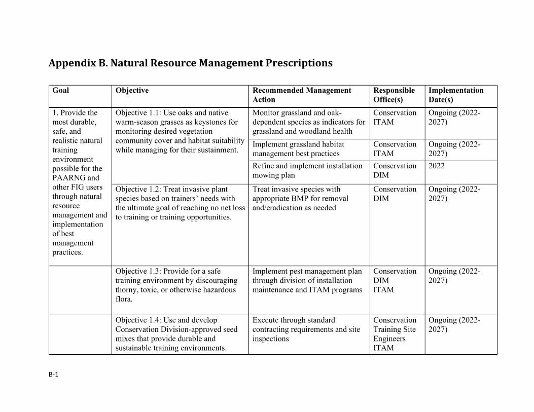
B-1
Appendix B. Natural Resource Management Prescriptions
Goal Objective Recommended Management Action
Responsible Office(s)
Implementation Date(s)
1. Provide the most durable, safe, and realistic natural training environment possible for the PAARNG and other FIG users through natural resource management and implementation of best management practices.
Objective 1.1: Use oaks and native warm-season grasses as keystones for monitoring desired vegetation community cover and habitat suitability while managing for their sustainment.
Monitor grassland and oak-dependent species as indicators for grassland and woodland health
Conservation ITAM
Ongoing (2022-2027)
Implement grassland habitat management best practices
Conservation ITAM
Ongoing (2022-2027)
Refine and implement installation mowing plan
Conservation DIM
2022
Objective 1.2: Treat invasive plant species based on trainers’ needs with the ultimate goal of reaching no net loss to training or training opportunities.
Treat invasive species with appropriate BMP for removal and/eradication as needed
Conservation DIM
Ongoing (2022-2027)
Objective 1.3: Provide for a safe training environment by discouraging thorny, toxic, or otherwise hazardous flora.
Implement pest management plan through division of installation maintenance and ITAM programs
Conservation DIM ITAM
Ongoing (2022-2027)
Objective 1.4: Use and develop Conservation Division-approved seed mixes that provide durable and sustainable training environments.
Execute through standard contracting requirements and site inspections
Conservation Training Site Engineers ITAM
Ongoing (2022-2027)
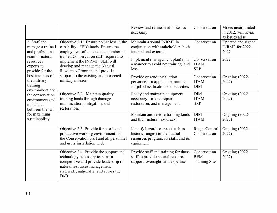
B-2
Review and refine seed mixes as necessary
Conservation Mixes incorporated in 2012, will revise as issues arise
2. Staff and manage a trained and professional team of natural resources experts to provide for the best interests of the military training environment and the conservation environment and to balance between the two for maximum sustainability.
Objective 2.1: Ensure no net loss in the capability of FIG lands. Ensure the employment of an adequate number of trained Conservation staff required to implement the INRMP. Staff will develop and manage the Natural Resources Program and provide support to the existing and projected military mission.
Maintain a sound INRMP in conjunction with stakeholders both internal and external
Conservation Updated and signed INRMP for 2022-2027
Implement management plan(s) in a manner to avoid net training land loss
Conservation ITAM SRP
2022
Provide or send installation personnel for applicable training for job classification and activities
Conservation ITAM DIM
Ongoing (2022-2027)
Objective 2.2: Maintain quality training lands through damage minimization, mitigation, and restoration.
Ready and maintain equipment necessary for land repair, restoration, and management
DIM ITAM SRP
Ongoing (2022-2027)
Maintain and restore training lands and their natural resources
DIM ITAM
Ongoing (2022-2027)
Objective 2.3: Provide for a safe and productive working environment for the Conservation staff and all personnel and users installation wide.
Identify hazard sources (such as historic ranges) to the natural resources program, its staff, and its equipment
Range Control Conservation
Ongoing (2022-2027)
Objective 2.4: Provide the support and technology necessary to remain competitive and provide leadership in natural resources management statewide, nationally, and across the DoD.
Provide staff and training for those staff to provide natural resource support, oversight, and expertise
Conservation BEM Training Site
Ongoing (2022-2027)
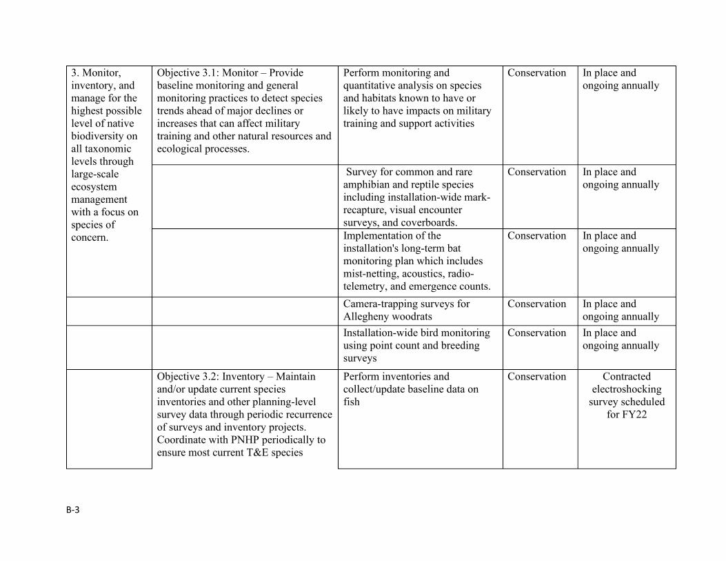
B-3
3. Monitor, inventory, and manage for the highest possible level of native biodiversity on all taxonomic levels through large-scale ecosystem management with a focus on species of concern.
Objective 3.1: Monitor – Provide baseline monitoring and general monitoring practices to detect species trends ahead of major declines or increases that can affect military training and other natural resources and ecological processes.
Perform monitoring and quantitative analysis on species and habitats known to have or likely to have impacts on military training and support activities
Conservation In place and ongoing annually
Survey for common and rare amphibian and reptile species including installation-wide mark-recapture, visual encounter surveys, and coverboards.
Conservation In place and ongoing annually
Implementation of the installation's long-term bat monitoring plan which includes mist-netting, acoustics, radio-telemetry, and emergence counts.
Conservation In place and ongoing annually
Camera-trapping surveys for Allegheny woodrats
Conservation In place and ongoing annually
Installation-wide bird monitoring using point count and breeding surveys
Conservation In place and ongoing annually
Objective 3.2: Inventory – Maintain and/or update current species inventories and other planning-level survey data through periodic recurrence of surveys and inventory projects. Coordinate with PNHP periodically to ensure most current T&E species
Perform inventories and collect/update baseline data on fish
Conservation Contracted electroshocking
survey scheduled for FY22
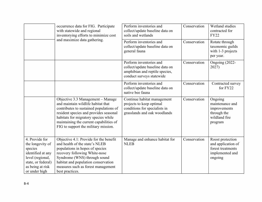
B-4
occurrence data for FIG. Participate with statewide and regional inventorying efforts to minimize cost and maximize data gathering.
Perform inventories and collect/update baseline data on soils and wetlands
Conservation Wetland studies contracted for FY22
Perform inventories and collect/update baseline data on general fauna
Conservation Rotate through taxonomic guilds with 1-3 projects per year.
Perform inventories and collect/update baseline data on amphibian and reptile species, conduct surveys statewide
Conservation Ongoing (2022-2027)
Perform inventories and collect/update baseline data on native bee fauna
Conservation Contracted survey for FY22
Objective 3.3 Management – Manage and maintain wildlife habitat that contributes to sustained populations of resident species and provides seasonal habitats for migratory species while maintaining the current capabilities of FIG to support the military mission.
Continue habitat management projects to keep optimal conditions for specialists in grasslands and oak woodlands
Conservation Ongoing maintenance and improvements through the wildland fire program
4. Provide for the longevity of species identified at any level (regional, state, or federal) as being at risk or under high
Objective 4.1: Provide for the benefit and health of the state’s NLEB populations in hopes of species recovery following White-nose Syndrome (WNS) through sound habitat and population conservation measures such as forest management best practices.
Manage and enhance habitat for NLEB
Conservation Roost protection and application of forest treatments implemented and ongoing
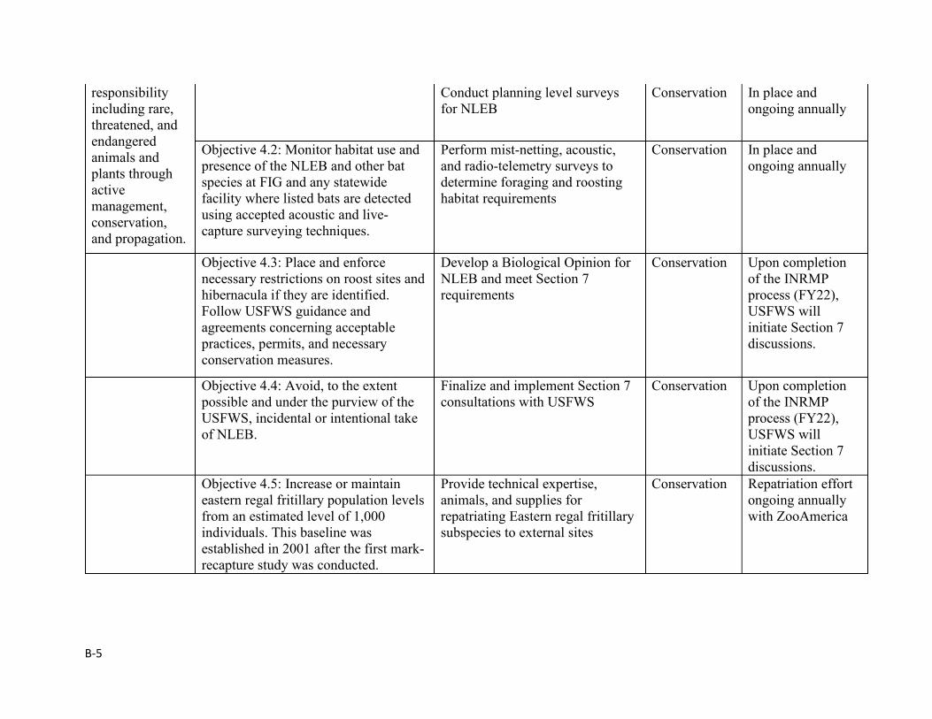
B-5
responsibility including rare, threatened, and endangered animals and plants through active management, conservation, and propagation.
Conduct planning level surveys for NLEB
Conservation In place and ongoing annually
Objective 4.2: Monitor habitat use and presence of the NLEB and other bat species at FIG and any statewide facility where listed bats are detected using accepted acoustic and live-capture surveying techniques.
Perform mist-netting, acoustic, and radio-telemetry surveys to determine foraging and roosting habitat requirements
Conservation In place and ongoing annually
Objective 4.3: Place and enforce necessary restrictions on roost sites and hibernacula if they are identified. Follow USFWS guidance and agreements concerning acceptable practices, permits, and necessary conservation measures.
Develop a Biological Opinion for NLEB and meet Section 7 requirements
Conservation Upon completion of the INRMP process (FY22), USFWS will initiate Section 7 discussions.
Objective 4.4: Avoid, to the extent possible and under the purview of the USFWS, incidental or intentional take of NLEB.
Finalize and implement Section 7 consultations with USFWS
Conservation Upon completion of the INRMP process (FY22), USFWS will initiate Section 7 discussions.
Objective 4.5: Increase or maintain eastern regal fritillary population levels from an estimated level of 1,000 individuals. This baseline was established in 2001 after the first mark-recapture study was conducted.
Provide technical expertise, animals, and supplies for repatriating Eastern regal fritillary subspecies to external sites
Conservation Repatriation effort ongoing annually with ZooAmerica
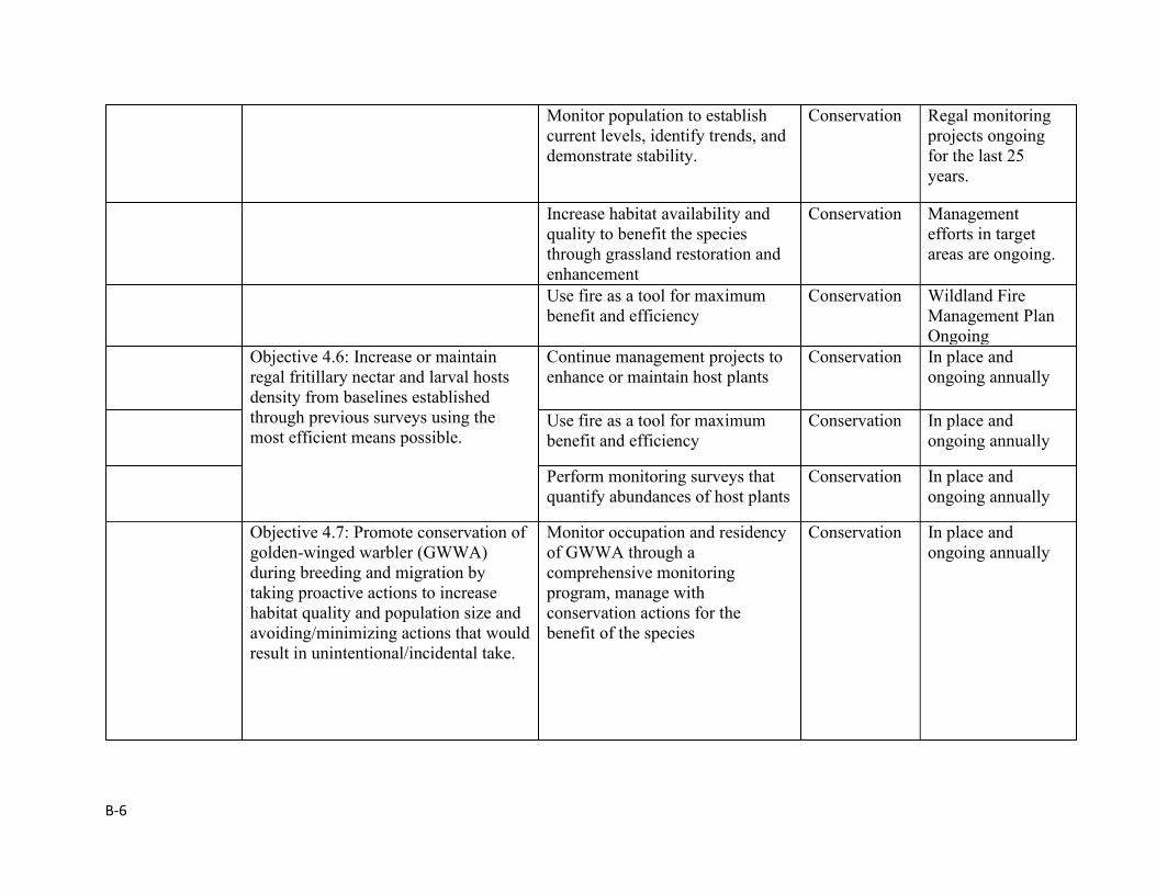
B-6
Monitor population to establish current levels, identify trends, and demonstrate stability.
Conservation Regal monitoring projects ongoing for the last 25 years.
Increase habitat availability and quality to benefit the species through grassland restoration and enhancement
Conservation Management efforts in target areas are ongoing.
Use fire as a tool for maximum benefit and efficiency
Conservation Wildland Fire Management Plan Ongoing
Objective 4.6: Increase or maintain regal fritillary nectar and larval hosts density from baselines established through previous surveys using the most efficient means possible.
Continue management projects to enhance or maintain host plants
Conservation In place and ongoing annually
Use fire as a tool for maximum benefit and efficiency
Conservation In place and ongoing annually
Perform monitoring surveys that quantify abundances of host plants
Conservation In place and ongoing annually
Objective 4.7: Promote conservation of golden-winged warbler (GWWA) during breeding and migration by taking proactive actions to increase habitat quality and population size and avoiding/minimizing actions that would result in unintentional/incidental take.
Monitor occupation and residency of GWWA through a comprehensive monitoring program, manage with conservation actions for the benefit of the species
Conservation In place and ongoing annually
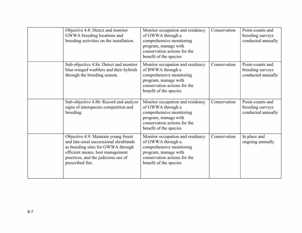
B-7
Objective 4.8: Detect and monitor GWWA breeding locations and breeding activities on the installation.
Monitor occupation and residency of GWWA through a comprehensive monitoring program, manage with conservation actions for the benefit of the species
Conservation Point-counts and breeding surveys conducted annually
Sub-objective 4.8a: Detect and monitor blue-winged warblers and their hybrids through the breeding season.
Monitor occupation and residency of BWWA through a comprehensive monitoring program, manage with conservation actions for the benefit of the species
Conservation Point-counts and breeding surveys conducted annually
Sub-objective 4.8b: Record and analyze signs of interspecies competition and breeding.
Monitor occupation and residency of GWWA through a comprehensive monitoring program, manage with conservation actions for the benefit of the species
Conservation Point-counts and breeding surveys conducted annually
Objective 4.9: Maintain young forest and late-seral successional shrublands as breeding sites for GWWA through efficient means, best management practices, and the judicious use of prescribed fire.
Monitor occupation and residency of GWWA through a comprehensive monitoring program, manage with conservation actions for the benefit of the species
Conservation In place and ongoing annually
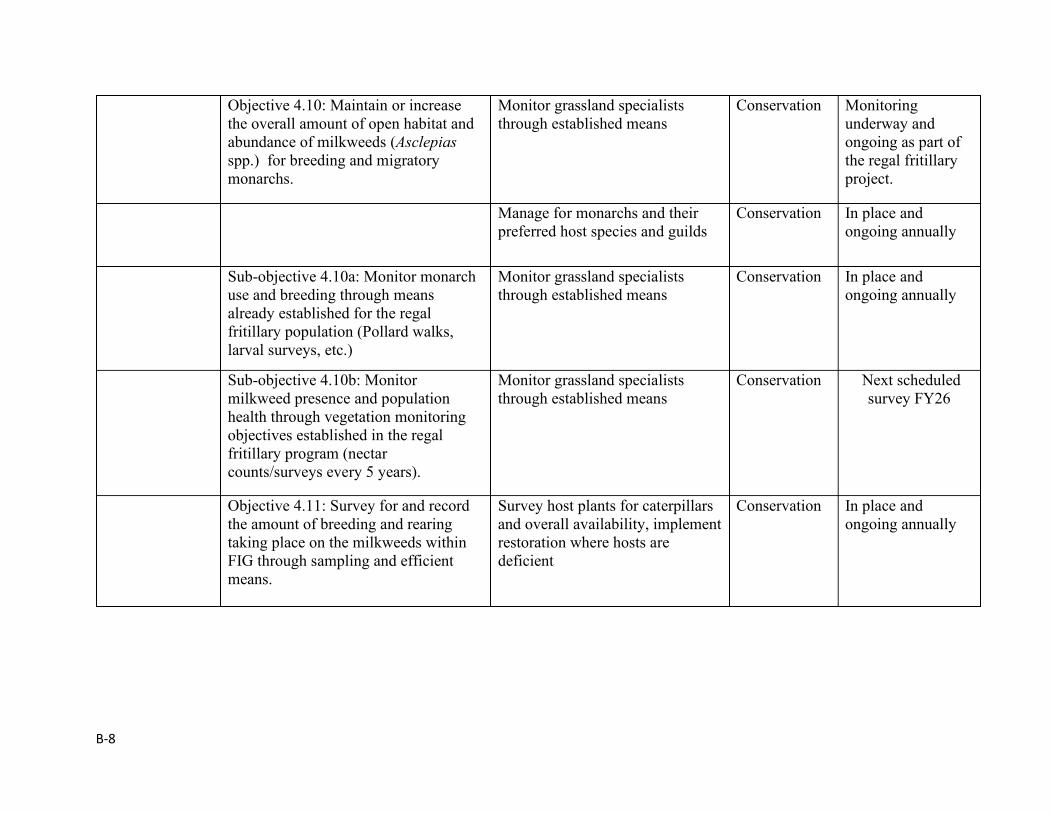
B-8
Objective 4.10: Maintain or increase the overall amount of open habitat and abundance of milkweeds (Asclepias spp.) for breeding and migratory monarchs.
Monitor grassland specialists through established means
Conservation Monitoring underway and ongoing as part of the regal fritillary project.
Manage for monarchs and their preferred host species and guilds
Conservation In place and ongoing annually
Sub-objective 4.10a: Monitor monarch use and breeding through means already established for the regal fritillary population (Pollard walks, larval surveys, etc.)
Monitor grassland specialists through established means
Conservation In place and ongoing annually
Sub-objective 4.10b: Monitor milkweed presence and population health through vegetation monitoring objectives established in the regal fritillary program (nectar counts/surveys every 5 years).
Monitor grassland specialists through established means
Conservation Next scheduled survey FY26
Objective 4.11: Survey for and record the amount of breeding and rearing taking place on the milkweeds within FIG through sampling and efficient means.
Survey host plants for caterpillars and overall availability, implement restoration where hosts are deficient
Conservation In place and ongoing annually
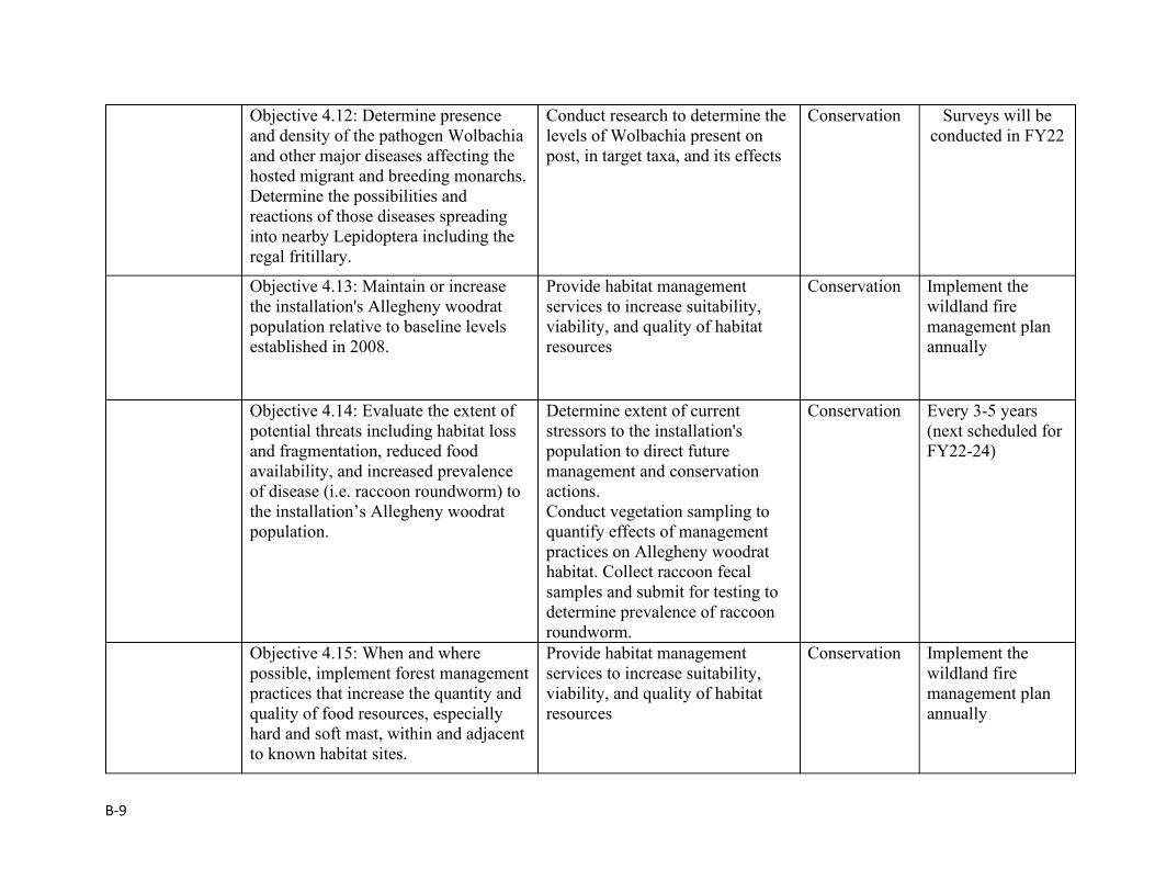
B-9
Objective 4.12: Determine presence and density of the pathogen Wolbachia and other major diseases affecting the hosted migrant and breeding monarchs. Determine the possibilities and reactions of those diseases spreading into nearby Lepidoptera including the regal fritillary.
Conduct research to determine the levels of Wolbachia present on post, in target taxa, and its effects
Conservation Surveys will be conducted in FY22
Objective 4.13: Maintain or increase the installation's Allegheny woodrat population relative to baseline levels established in 2008.
Provide habitat management services to increase suitability, viability, and quality of habitat resources
Conservation Implement the wildland fire management plan annually
Objective 4.14: Evaluate the extent of potential threats including habitat loss and fragmentation, reduced food availability, and increased prevalence of disease (i.e. raccoon roundworm) to the installation’s Allegheny woodrat population.
Determine extent of current stressors to the installation's population to direct future management and conservation actions. Conduct vegetation sampling to quantify effects of management practices on Allegheny woodrat habitat. Collect raccoon fecal samples and submit for testing to determine prevalence of raccoon roundworm.
Conservation Every 3-5 years (next scheduled for FY22-24)
Objective 4.15: When and where possible, implement forest management practices that increase the quantity and quality of food resources, especially hard and soft mast, within and adjacent to known habitat sites.
Provide habitat management services to increase suitability, viability, and quality of habitat resources
Conservation Implement the wildland fire management plan annually
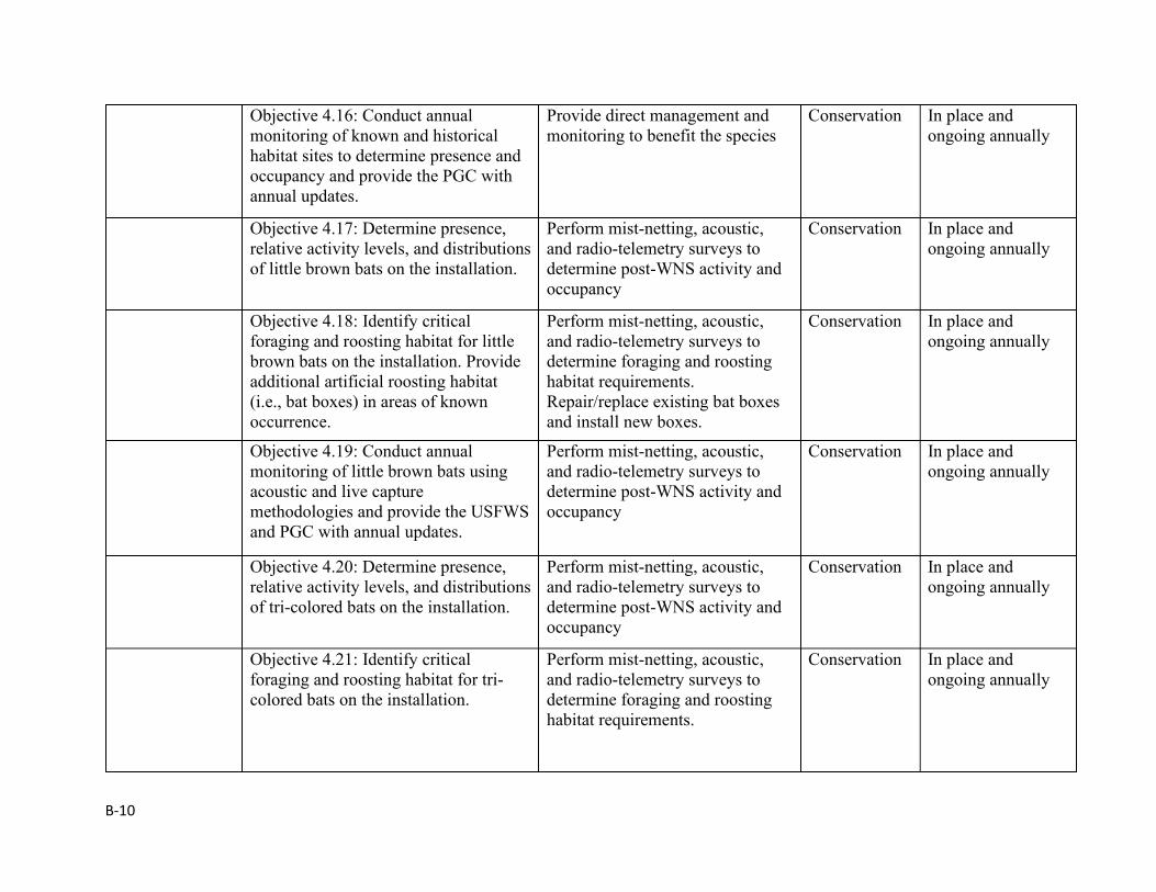
B-10
Objective 4.16: Conduct annual monitoring of known and historical habitat sites to determine presence and occupancy and provide the PGC with annual updates.
Provide direct management and monitoring to benefit the species
Conservation In place and ongoing annually
Objective 4.17: Determine presence, relative activity levels, and distributions of little brown bats on the installation.
Perform mist-netting, acoustic, and radio-telemetry surveys to determine post-WNS activity and occupancy
Conservation In place and ongoing annually
Objective 4.18: Identify critical foraging and roosting habitat for little brown bats on the installation. Provide additional artificial roosting habitat (i.e., bat boxes) in areas of known occurrence.
Perform mist-netting, acoustic, and radio-telemetry surveys to determine foraging and roosting habitat requirements. Repair/replace existing bat boxes and install new boxes.
Conservation In place and ongoing annually
Objective 4.19: Conduct annual monitoring of little brown bats using acoustic and live capture methodologies and provide the USFWS and PGC with annual updates.
Perform mist-netting, acoustic, and radio-telemetry surveys to determine post-WNS activity and occupancy
Conservation In place and ongoing annually
Objective 4.20: Determine presence, relative activity levels, and distributions of tri-colored bats on the installation.
Perform mist-netting, acoustic, and radio-telemetry surveys to determine post-WNS activity and occupancy
Conservation In place and ongoing annually
Objective 4.21: Identify critical foraging and roosting habitat for tri-colored bats on the installation.
Perform mist-netting, acoustic, and radio-telemetry surveys to determine foraging and roosting habitat requirements.
Conservation In place and ongoing annually
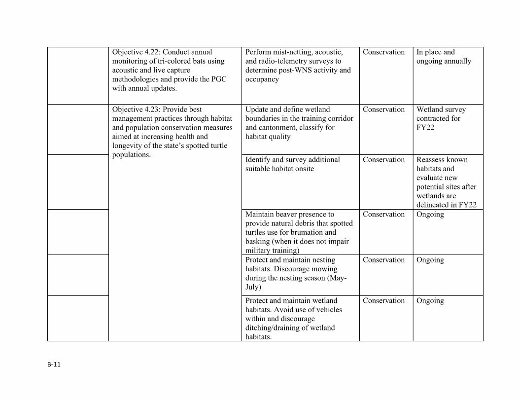
B-11
Objective 4.22: Conduct annual monitoring of tri-colored bats using acoustic and live capture methodologies and provide the PGC with annual updates.
Perform mist-netting, acoustic, and radio-telemetry surveys to determine post-WNS activity and occupancy
Conservation In place and ongoing annually
Objective 4.23: Provide best management practices through habitat and population conservation measures aimed at increasing health and longevity of the state’s spotted turtle populations.
Update and define wetland boundaries in the training corridor and cantonment, classify for habitat quality
Conservation Wetland survey contracted for FY22
Identify and survey additional suitable habitat onsite
Conservation Reassess known habitats and evaluate new potential sites after wetlands are delineated in FY22
Maintain beaver presence to provide natural debris that spotted turtles use for brumation and basking (when it does not impair military training)
Conservation Ongoing
Protect and maintain nesting habitats. Discourage mowing during the nesting season (May-July)
Conservation Ongoing
Protect and maintain wetland habitats. Avoid use of vehicles within and discourage ditching/draining of wetland habitats.
Conservation Ongoing
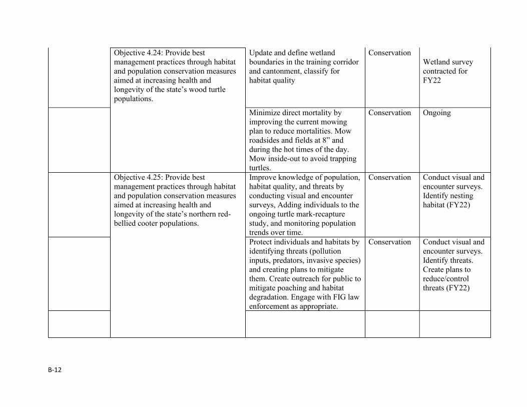
B-12
Objective 4.24: Provide best management practices through habitat and population conservation measures aimed at increasing health and longevity of the state’s wood turtle populations.
Update and define wetland boundaries in the training corridor and cantonment, classify for habitat quality
Conservation Wetland survey contracted for FY22
Minimize direct mortality by improving the current mowing plan to reduce mortalities. Mow roadsides and fields at 8” and during the hot times of the day. Mow inside-out to avoid trapping turtles.
Conservation Ongoing
Objective 4.25: Provide best management practices through habitat and population conservation measures aimed at increasing health and longevity of the state’s northern red-bellied cooter populations.
Improve knowledge of population, habitat quality, and threats by conducting visual and encounter surveys, Adding individuals to the ongoing turtle mark-recapture study, and monitoring population trends over time.
Conservation Conduct visual and encounter surveys. Identify nesting habitat (FY22)
Protect individuals and habitats by identifying threats (pollution inputs, predators, invasive species) and creating plans to mitigate them. Create outreach for public to mitigate poaching and habitat degradation. Engage with FIG law enforcement as appropriate.
Conservation Conduct visual and encounter surveys. Identify threats. Create plans to reduce/control threats (FY22)
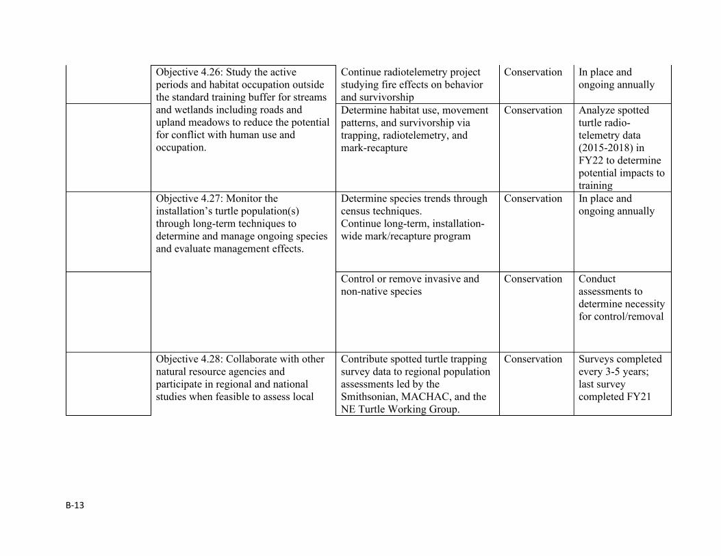
B-13
Objective 4.26: Study the active periods and habitat occupation outside the standard training buffer for streams and wetlands including roads and upland meadows to reduce the potential for conflict with human use and occupation.
Continue radiotelemetry project studying fire effects on behavior and survivorship
Conservation In place and ongoing annually
Determine habitat use, movement patterns, and survivorship via trapping, radiotelemetry, and mark-recapture
Conservation Analyze spotted turtle radio-telemetry data (2015-2018) in FY22 to determine potential impacts to training
Objective 4.27: Monitor the installation’s turtle population(s) through long-term techniques to determine and manage ongoing species and evaluate management effects.
Determine species trends through census techniques. Continue long-term, installation-wide mark/recapture program
Conservation In place and ongoing annually
Control or remove invasive and non-native species
Conservation Conduct assessments to determine necessity for control/removal
Objective 4.28: Collaborate with other natural resource agencies and participate in regional and national studies when feasible to assess local
Contribute spotted turtle trapping survey data to regional population assessments led by the Smithsonian, MACHAC, and the NE Turtle Working Group.
Conservation Surveys completed every 3-5 years; last survey completed FY21
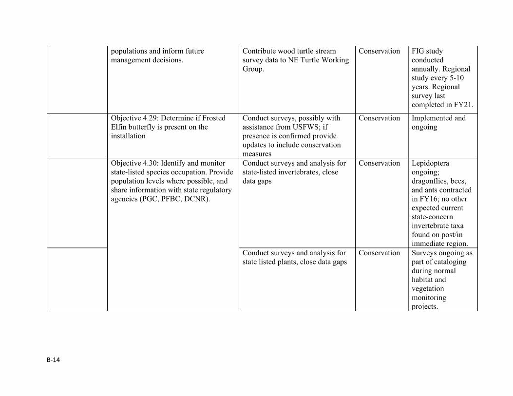
B-14
populations and inform future management decisions.
Contribute wood turtle stream survey data to NE Turtle Working Group.
Conservation FIG study conducted annually. Regional study every 5-10 years. Regional survey last completed in FY21.
Objective 4.29: Determine if Frosted Elfin butterfly is present on the installation
Conduct surveys, possibly with assistance from USFWS; if presence is confirmed provide updates to include conservation measures
Conservation Implemented and ongoing
Objective 4.30: Identify and monitor state-listed species occupation. Provide population levels where possible, and share information with state regulatory agencies (PGC, PFBC, DCNR).
Conduct surveys and analysis for state-listed invertebrates, close data gaps
Conservation Lepidoptera ongoing; dragonflies, bees, and ants contracted in FY16; no other expected current state-concern invertebrate taxa found on post/in immediate region.
Conduct surveys and analysis for state listed plants, close data gaps
Conservation Surveys ongoing as part of cataloging during normal habitat and vegetation monitoring projects.
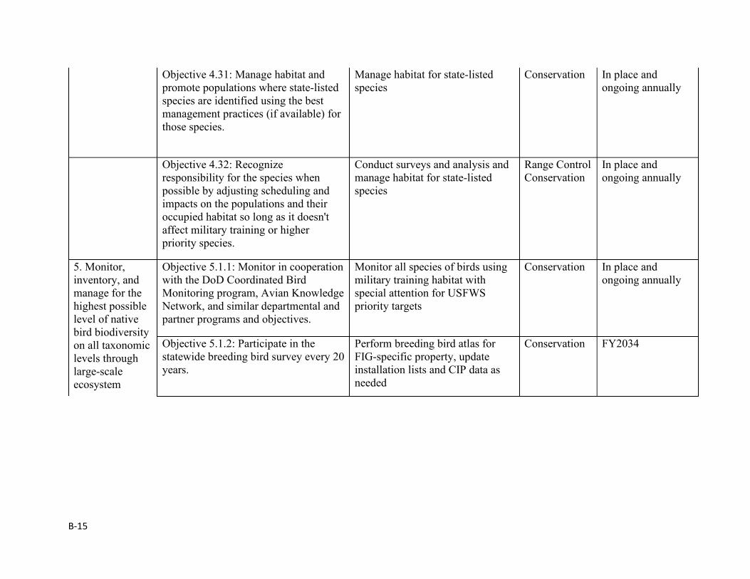
B-15
Objective 4.31: Manage habitat and promote populations where state-listed species are identified using the best management practices (if available) for those species.
Manage habitat for state-listed species
Conservation In place and ongoing annually
Objective 4.32: Recognize responsibility for the species when possible by adjusting scheduling and impacts on the populations and their occupied habitat so long as it doesn't affect military training or higher priority species.
Conduct surveys and analysis and manage habitat for state-listed species
Range Control Conservation
In place and ongoing annually
5. Monitor, inventory, and manage for the highest possible level of native bird biodiversity on all taxonomic levels through large-scale ecosystem
Objective 5.1.1: Monitor in cooperation with the DoD Coordinated Bird Monitoring program, Avian Knowledge Network, and similar departmental and partner programs and objectives.
Monitor all species of birds using military training habitat with special attention for USFWS priority targets
Conservation In place and ongoing annually
Objective 5.1.2: Participate in the statewide breeding bird survey every 20 years.
Perform breeding bird atlas for FIG-specific property, update installation lists and CIP data as needed
Conservation FY2034
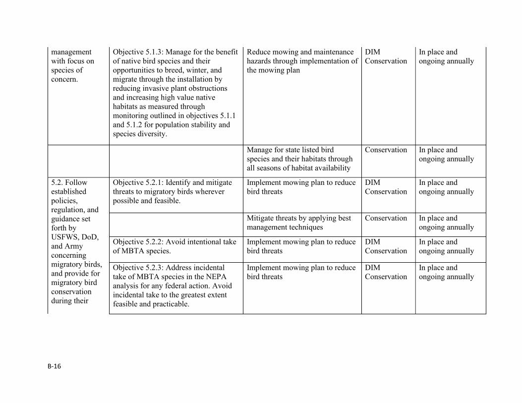
B-16
management with focus on species of concern.
Objective 5.1.3: Manage for the benefit of native bird species and their opportunities to breed, winter, and migrate through the installation by reducing invasive plant obstructions and increasing high value native habitats as measured through monitoring outlined in objectives 5.1.1 and 5.1.2 for population stability and species diversity.
Reduce mowing and maintenance hazards through implementation of the mowing plan
DIM Conservation
In place and ongoing annually
Manage for state listed bird species and their habitats through all seasons of habitat availability
Conservation In place and ongoing annually
5.2. Follow established policies, regulation, and guidance set forth by USFWS, DoD, and Army concerning migratory birds, and provide for migratory bird conservation during their
Objective 5.2.1: Identify and mitigate threats to migratory birds wherever possible and feasible.
Implement mowing plan to reduce bird threats
DIM Conservation
In place and ongoing annually
Mitigate threats by applying best management techniques
Conservation In place and ongoing annually
Objective 5.2.2: Avoid intentional take of MBTA species.
Implement mowing plan to reduce bird threats
DIM Conservation
In place and ongoing annually
Objective 5.2.3: Address incidental take of MBTA species in the NEPA analysis for any federal action. Avoid incidental take to the greatest extent feasible and practicable.
Implement mowing plan to reduce bird threats
DIM Conservation
In place and ongoing annually
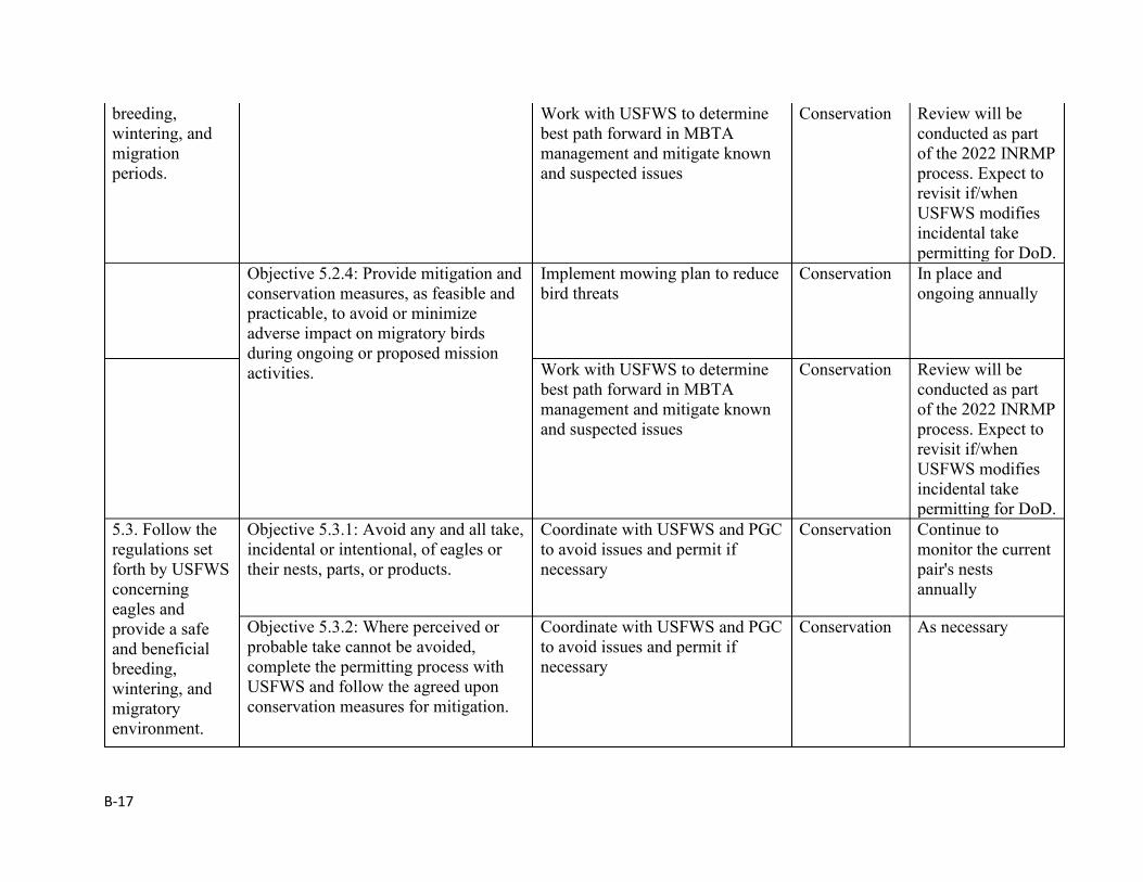
B-17
breeding, wintering, and migration periods.
Work with USFWS to determine best path forward in MBTA management and mitigate known and suspected issues
Conservation Review will be conducted as part of the 2022 INRMP process. Expect to revisit if/when USFWS modifies incidental take permitting for DoD.
Objective 5.2.4: Provide mitigation and conservation measures, as feasible and practicable, to avoid or minimize adverse impact on migratory birds during ongoing or proposed mission activities.
Implement mowing plan to reduce bird threats
Conservation In place and ongoing annually
Work with USFWS to determine best path forward in MBTA management and mitigate known and suspected issues
Conservation Review will be conducted as part of the 2022 INRMP process. Expect to revisit if/when USFWS modifies incidental take permitting for DoD.
5.3. Follow the regulations set forth by USFWS concerning eagles and provide a safe and beneficial breeding, wintering, and migratory environment.
Objective 5.3.1: Avoid any and all take, incidental or intentional, of eagles or their nests, parts, or products.
Coordinate with USFWS and PGC to avoid issues and permit if necessary
Conservation Continue to monitor the current pair's nests annually
Objective 5.3.2: Where perceived or probable take cannot be avoided, complete the permitting process with USFWS and follow the agreed upon conservation measures for mitigation.
Coordinate with USFWS and PGC to avoid issues and permit if necessary
Conservation As necessary
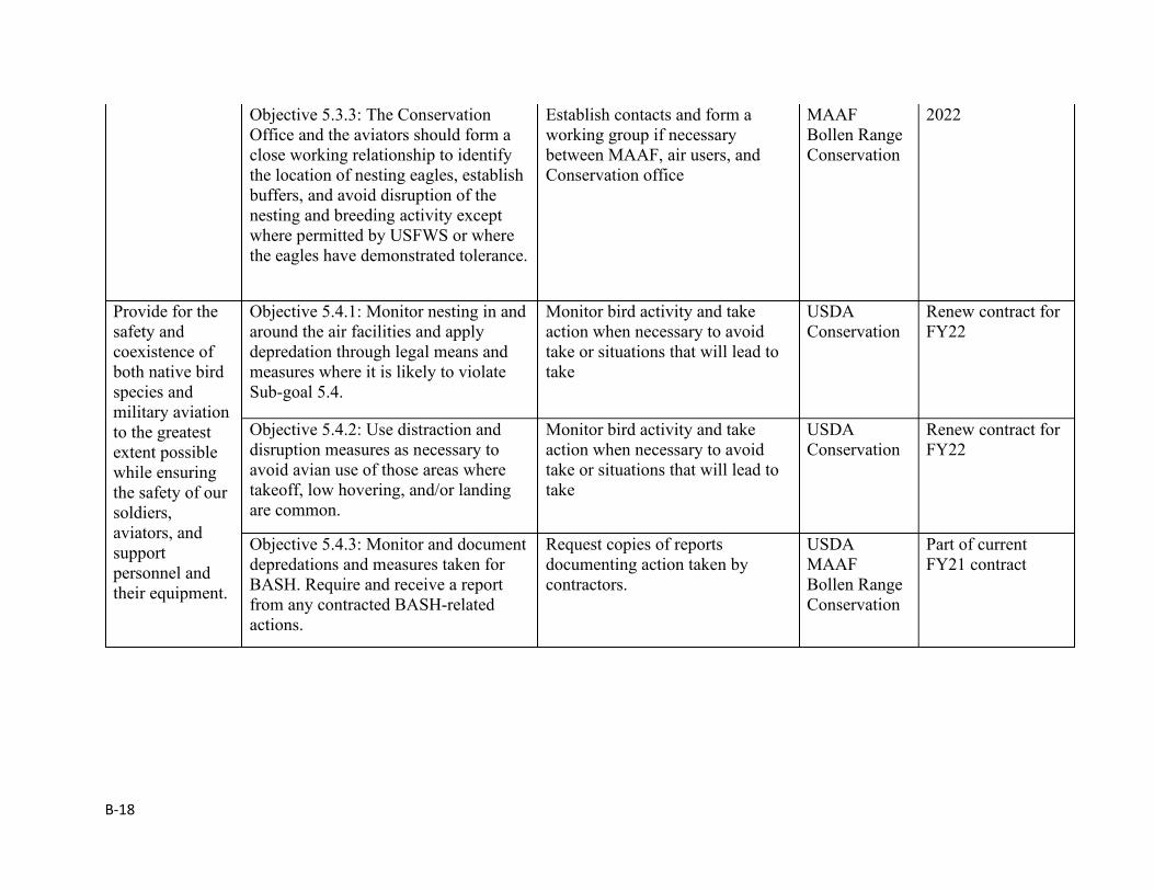
B-18
Objective 5.3.3: The Conservation Office and the aviators should form a close working relationship to identify the location of nesting eagles, establish buffers, and avoid disruption of the nesting and breeding activity except where permitted by USFWS or where the eagles have demonstrated tolerance.
Establish contacts and form a working group if necessary between MAAF, air users, and Conservation office
MAAF Bollen Range Conservation
2022
Provide for the safety and coexistence of both native bird species and military aviation to the greatest extent possible while ensuring the safety of our soldiers, aviators, and support personnel and their equipment.
Objective 5.4.1: Monitor nesting in and around the air facilities and apply depredation through legal means and measures where it is likely to violate Sub-goal 5.4.
Monitor bird activity and take action when necessary to avoid take or situations that will lead to take
USDA Conservation
Renew contract for FY22
Objective 5.4.2: Use distraction and disruption measures as necessary to avoid avian use of those areas where takeoff, low hovering, and/or landing are common.
Monitor bird activity and take action when necessary to avoid take or situations that will lead to take
USDA Conservation
Renew contract for FY22
Objective 5.4.3: Monitor and document depredations and measures taken for BASH. Require and receive a report from any contracted BASH-related actions.
Request copies of reports documenting action taken by contractors.
USDA MAAF Bollen Range Conservation
Part of current FY21 contract
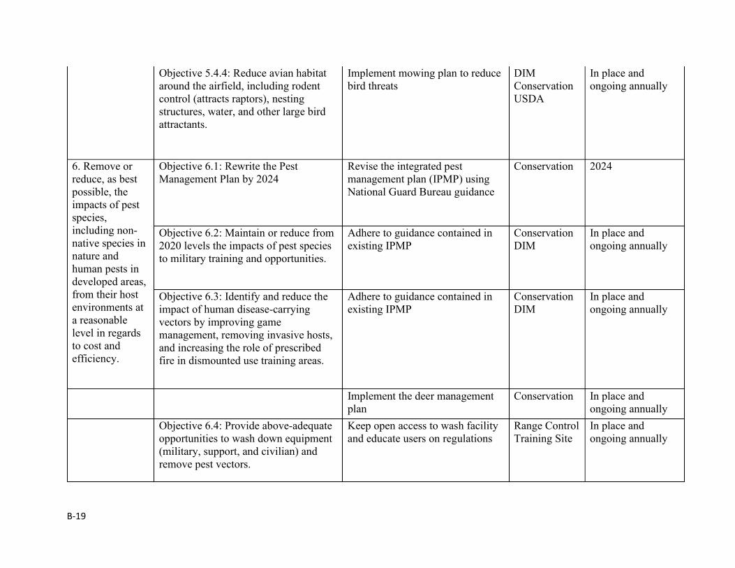
B-19
Objective 5.4.4: Reduce avian habitat around the airfield, including rodent control (attracts raptors), nesting structures, water, and other large bird attractants.
Implement mowing plan to reduce bird threats
DIM Conservation USDA
In place and ongoing annually
6. Remove or reduce, as best possible, the impacts of pest species, including non-native species in nature and human pests in developed areas, from their host environments at a reasonable level in regards to cost and efficiency.
Objective 6.1: Rewrite the Pest Management Plan by 2024
Revise the integrated pest management plan (IPMP) using National Guard Bureau guidance
Conservation 2024
Objective 6.2: Maintain or reduce from 2020 levels the impacts of pest species to military training and opportunities.
Adhere to guidance contained in existing IPMP
Conservation DIM
In place and ongoing annually
Objective 6.3: Identify and reduce the impact of human disease-carrying vectors by improving game management, removing invasive hosts, and increasing the role of prescribed fire in dismounted use training areas.
Adhere to guidance contained in existing IPMP
Conservation DIM
In place and ongoing annually
Implement the deer management plan
Conservation In place and ongoing annually
Objective 6.4: Provide above-adequate opportunities to wash down equipment (military, support, and civilian) and remove pest vectors.
Keep open access to wash facility and educate users on regulations
Range Control Training Site
In place and ongoing annually
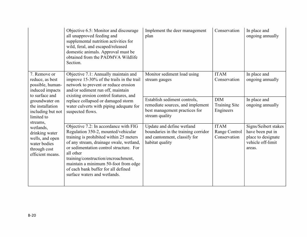
B-20
Objective 6.5: Monitor and discourage all unapproved feeding and supplemental nutrition activities for wild, feral, and escaped/released domestic animals. Approval must be obtained from the PADMVA Wildlife Section.
Implement the deer management plan
Conservation In place and ongoing annually
7. Remove or reduce, as best possible, human-induced impacts to surface and groundwater on the installation including but not limited to streams, wetlands, drinking water wells, and open water bodies through cost efficient means.
Objective 7.1: Annually maintain and improve 15-30% of the trails in the trail network to prevent or reduce erosion and/or sediment run off, maintain existing erosion control features, and replace collapsed or damaged storm water culverts with piping adequate for suspected flows.
Monitor sediment load using stream gauges
ITAM Conservation
In place and ongoing annually
Establish sediment controls, remediate sources, and implement best management practices for stream quality
DIM Training Site Engineers
In place and ongoing annually
Objective 7.2: In accordance with FIG Regulation 350-2, mounted/vehicular training is prohibited within 25 meters of any stream, drainage swale, wetland, or sedimentation control structure. For all other training/construction/encroachment, maintain a minimum 50-foot from edge of each bank buffer for all defined surface waters and wetlands.
Update and define wetland boundaries in the training corridor and cantonment, classify for habitat quality
ITAM Range Control Conservation
Signs/Seibert stakes have been put in place to designate vehicle off-limit areas.
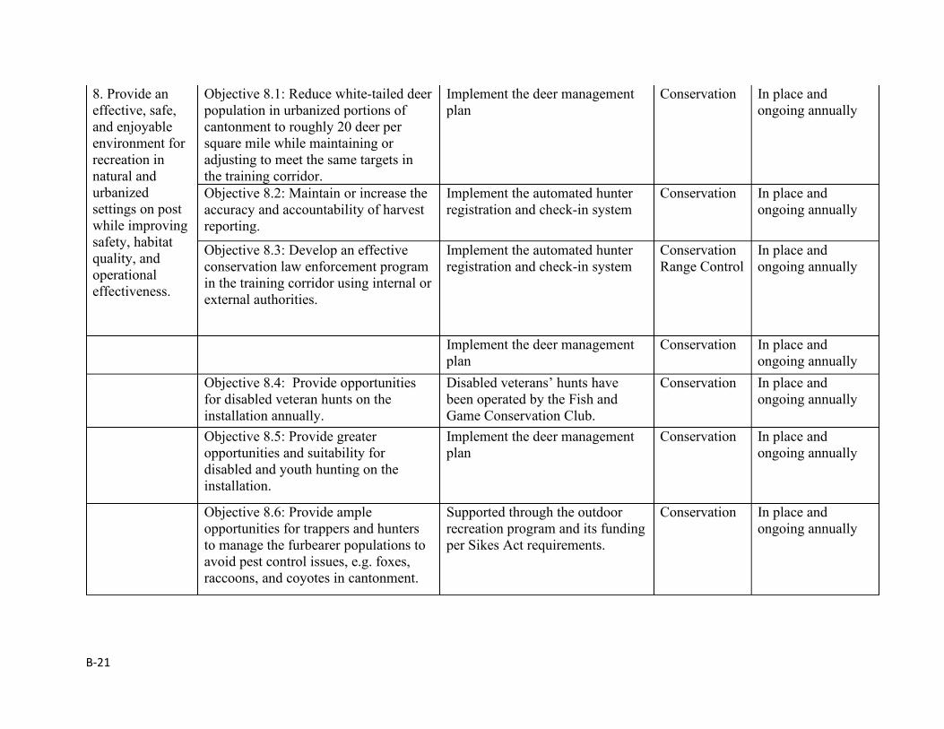
B-21
8. Provide an effective, safe, and enjoyable environment for recreation in natural and urbanized settings on post while improving safety, habitat quality, and operational effectiveness.
Objective 8.1: Reduce white-tailed deer population in urbanized portions of cantonment to roughly 20 deer per square mile while maintaining or adjusting to meet the same targets in the training corridor.
Implement the deer management plan
Conservation In place and ongoing annually
Objective 8.2: Maintain or increase the accuracy and accountability of harvest reporting.
Implement the automated hunter registration and check-in system
Conservation In place and ongoing annually
Objective 8.3: Develop an effective conservation law enforcement program in the training corridor using internal or external authorities.
Implement the automated hunter registration and check-in system
Conservation Range Control
In place and ongoing annually
Implement the deer management plan
Conservation In place and ongoing annually
Objective 8.4: Provide opportunities for disabled veteran hunts on the installation annually.
Disabled veterans’ hunts have been operated by the Fish and Game Conservation Club.
Conservation In place and ongoing annually
Objective 8.5: Provide greater opportunities and suitability for disabled and youth hunting on the installation.
Implement the deer management plan
Conservation In place and ongoing annually
Objective 8.6: Provide ample opportunities for trappers and hunters to manage the furbearer populations to avoid pest control issues, e.g. foxes, raccoons, and coyotes in cantonment.
Supported through the outdoor recreation program and its funding per Sikes Act requirements.
Conservation In place and ongoing annually
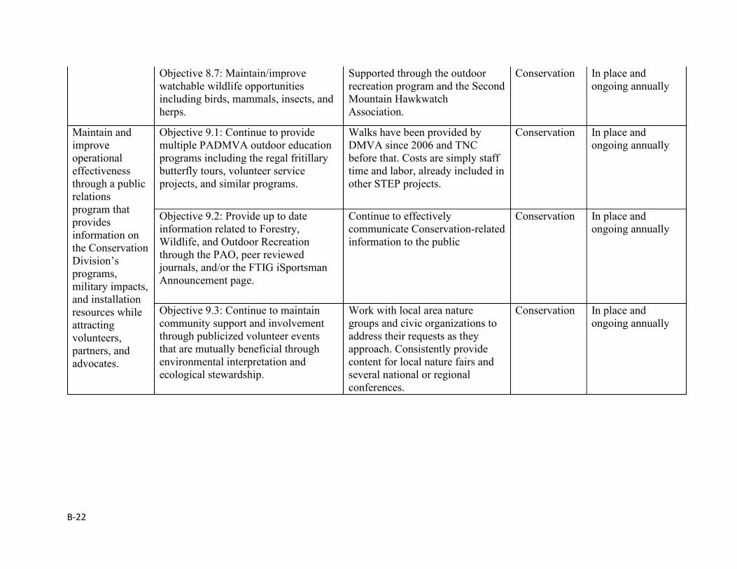
B-22
Objective 8.7: Maintain/improve watchable wildlife opportunities including birds, mammals, insects, and herps.
Supported through the outdoor recreation program and the Second Mountain Hawkwatch Association.
Conservation In place and ongoing annually
Maintain and improve operational effectiveness through a public relations program that provides information on the Conservation Division’s programs, military impacts, and installation resources while attracting volunteers, partners, and advocates.
Objective 9.1: Continue to provide multiple PADMVA outdoor education programs including the regal fritillary butterfly tours, volunteer service projects, and similar programs.
Walks have been provided by DMVA since 2006 and TNC before that. Costs are simply staff time and labor, already included in other STEP projects.
Conservation In place and ongoing annually
Objective 9.2: Provide up to date information related to Forestry, Wildlife, and Outdoor Recreation through the PAO, peer reviewed journals, and/or the FTIG iSportsman Announcement page.
Continue to effectively communicate Conservation-related information to the public
Conservation In place and ongoing annually
Objective 9.3: Continue to maintain community support and involvement through publicized volunteer events that are mutually beneficial through environmental interpretation and ecological stewardship.
Work with local area nature groups and civic organizations to address their requests as they approach. Consistently provide content for local nature fairs and several national or regional conferences.
Conservation In place and ongoing annually
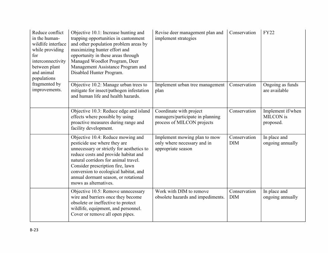
B-23
Reduce conflict in the human-wildlife interface while providing for interconnectivity between plant and animal populations fragmented by improvements.
Objective 10.1: Increase hunting and trapping opportunities in cantonment and other population problem areas by maximizing hunter effort and opportunity in these areas through Managed Woodlot Program, Deer Management Assistance Program and Disabled Hunter Program.
Revise deer management plan and implement strategies
Conservation FY22
Objective 10.2: Manage urban trees to mitigate for insect/pathogen infestation and human life and health hazards.
Implement urban tree management plan
Conservation Ongoing as funds are available
Objective 10.3: Reduce edge and island effects where possible by using proactive measures during range and facility development.
Coordinate with project managers/participate in planning process of MILCON projects
Conservation Implement if/when MILCON is proposed.
Objective 10.4: Reduce mowing and pesticide use where they are unnecessary or strictly for aesthetics to reduce costs and provide habitat and natural corridors for animal travel. Consider prescription fire, lawn conversion to ecological habitat, and annual dormant season, or rotational mows as alternatives.
Implement mowing plan to mow only where necessary and in appropriate season
Conservation DIM
In place and ongoing annually
Objective 10.5: Remove unnecessary wire and barriers once they become obsolete or ineffective to protect wildlife, equipment, and personnel. Cover or remove all open pipes.
Work with DIM to remove obsolete hazards and impediments.
Conservation DIM
In place and ongoing annually
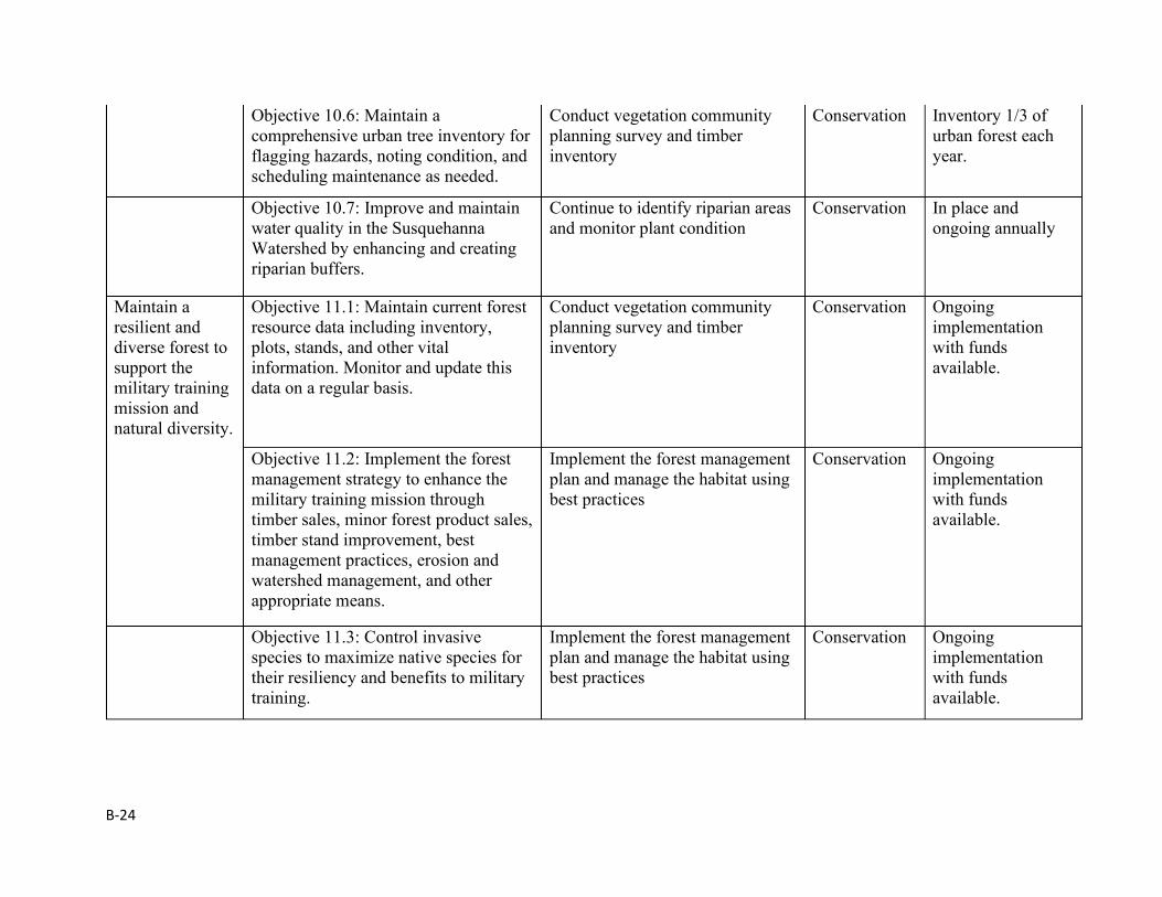
B-24
Objective 10.6: Maintain a comprehensive urban tree inventory for flagging hazards, noting condition, and scheduling maintenance as needed.
Conduct vegetation community planning survey and timber inventory
Conservation Inventory 1/3 of urban forest each year.
Objective 10.7: Improve and maintain water quality in the Susquehanna Watershed by enhancing and creating riparian buffers.
Continue to identify riparian areas and monitor plant condition
Conservation In place and ongoing annually
Maintain a resilient and diverse forest to support the military training mission and natural diversity.
Objective 11.1: Maintain current forest resource data including inventory, plots, stands, and other vital information. Monitor and update this data on a regular basis.
Conduct vegetation community planning survey and timber inventory
Conservation Ongoing implementation with funds available.
Objective 11.2: Implement the forest management strategy to enhance the military training mission through timber sales, minor forest product sales, timber stand improvement, best management practices, erosion and watershed management, and other appropriate means.
Implement the forest management plan and manage the habitat using best practices
Conservation Ongoing implementation with funds available.
Objective 11.3: Control invasive species to maximize native species for their resiliency and benefits to military training.
Implement the forest management plan and manage the habitat using best practices
Conservation Ongoing implementation with funds available.
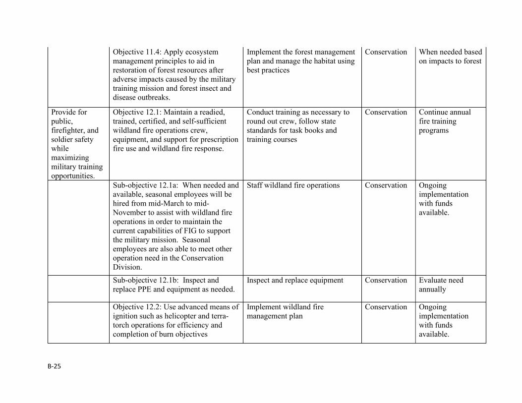
B-25
Objective 11.4: Apply ecosystem management principles to aid in restoration of forest resources after adverse impacts caused by the military training mission and forest insect and disease outbreaks.
Implement the forest management plan and manage the habitat using best practices
Conservation When needed based on impacts to forest
Provide for public, firefighter, and soldier safety while maximizing military training opportunities.
Objective 12.1: Maintain a readied, trained, certified, and self-sufficient wildland fire operations crew, equipment, and support for prescription fire use and wildland fire response.
Conduct training as necessary to round out crew, follow state standards for task books and training courses
Conservation Continue annual fire training programs
Sub-objective 12.1a: When needed and available, seasonal employees will be hired from mid-March to mid-November to assist with wildland fire operations in order to maintain the current capabilities of FIG to support the military mission. Seasonal employees are also able to meet other operation need in the Conservation Division.
Staff wildland fire operations Conservation Ongoing implementation with funds available.
Sub-objective 12.1b: Inspect and replace PPE and equipment as needed.
Inspect and replace equipment Conservation Evaluate need annually
Objective 12.2: Use advanced means of ignition such as helicopter and terra-torch operations for efficiency and completion of burn objectives
Implement wildland fire management plan
Conservation Ongoing implementation with funds available.
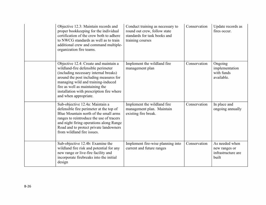
B-26
Objective 12.3: Maintain records and proper bookkeeping for the individual certification of the crew both to adhere to NWCG standards as well as to train additional crew and command multiple-organization fire teams.
Conduct training as necessary to round out crew, follow state standards for task books and training courses
Conservation Update records as fires occur.
Objective 12.4: Create and maintain a wildland-fire defensible perimeter (including necessary internal breaks) around the post including measures for managing wild and training-induced fire as well as maintaining the installation with prescription fire where and when appropriate.
Implement the wildland fire management plan
Conservation Ongoing implementation with funds available.
Sub-objective 12.4a: Maintain a defensible fire perimeter at the top of Blue Mountain north of the small arms ranges to reintroduce the use of tracers and night firing operations along Range Road and to protect private landowners from wildland fire issues.
Implement the wildland fire management plan. Maintain existing fire break.
Conservation In place and ongoing annually
Sub-objective 12.4b: Examine the wildland fire risk and potential for any new range or live-fire facility and incorporate firebreaks into the initial design
Implement fire-wise planning into current and future ranges
Conservation As needed when new ranges or infrastructure are built
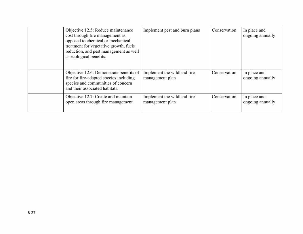
B-27
Objective 12.5: Reduce maintenance cost through fire management as opposed to chemical or mechanical treatment for vegetative growth, fuels reduction, and pest management as well as ecological benefits.
Implement pest and burn plans Conservation In place and ongoing annually
Objective 12.6: Demonstrate benefits of fire for fire-adapted species including species and communities of concern and their associated habitats.
Implement the wildland fire management plan
Conservation In place and ongoing annually
Objective 12.7: Create and maintain open areas through fire management.
Implement the wildland fire management plan
Conservation In place and ongoing annually
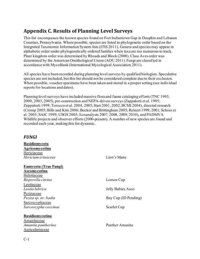
C-1
Appendix C. Results of Planning Level Surveys This list encompasses the known species found on Fort Indiantown Gap in Dauphin and Lebanon Counties, Pennsylvania. Where possible, species are listed in phylogenetic order based on the Integrated Taxonomic Information System lists (ITIS 2011). Genera and species may appear in alphabetic order under phylogenetically ordered families when taxa are too numerous to track. Plant kingdom order was determined by Rhoads and Block (2000). Class Aves order was determined by the American Ornithological Union (AOU 2011). Fungi are classified in accordance with MycoBank (International Mycological Association 2011). All species have been recorded during planning level surveys by qualified biologists. Speculative species are not included, but this list should not be considered complete due to their exclusion. When possible, voucher specimens have been taken and stored in a proper setting (see individual reports for locations and dates). Planning level surveys have included massive flora and fauna cataloging efforts (TNC 1995, 2000, 2003, 2005), pre-construction and NEPA-driven surveys (Zappalorti et al. 1995; Zappalorti 1999; Torocco et al. 2004, 2005; Hart 2001, 2002; BCMI 2004), directed research (Cromp 2005; Bills and Kim 2006; Becker and Brittingham 2005; Reinert 1999, 2001; Schoss et al. 2003; SAIC 1999; USGS 2005; Ecoanalysts 2007, 2008, 2009, 2010), and PADMVA Wildlife projects and observer efforts (2000-present). A number of new species are found and recorded each year, making this list dynamic.
FUNGI Basidiomycota Agricomycotina Hericiaceae Hericium erinaceus Lion’s Mane Eumycota (True Fungi) Ascomycotina Helotiaceae Bisporella citrina Lemon Cup Leotiaceae Leotia lubrica Jelly Babies Asco Pezizaceae Peziza sp. nr. badia Bay Cup (ID Pending) Sarcoscyphaceae Sarcoscypha coccinea Scarlet Cup Basidiomycotina Amanitaceae Amanita pantherina Panther Amanita Auriculariaceae
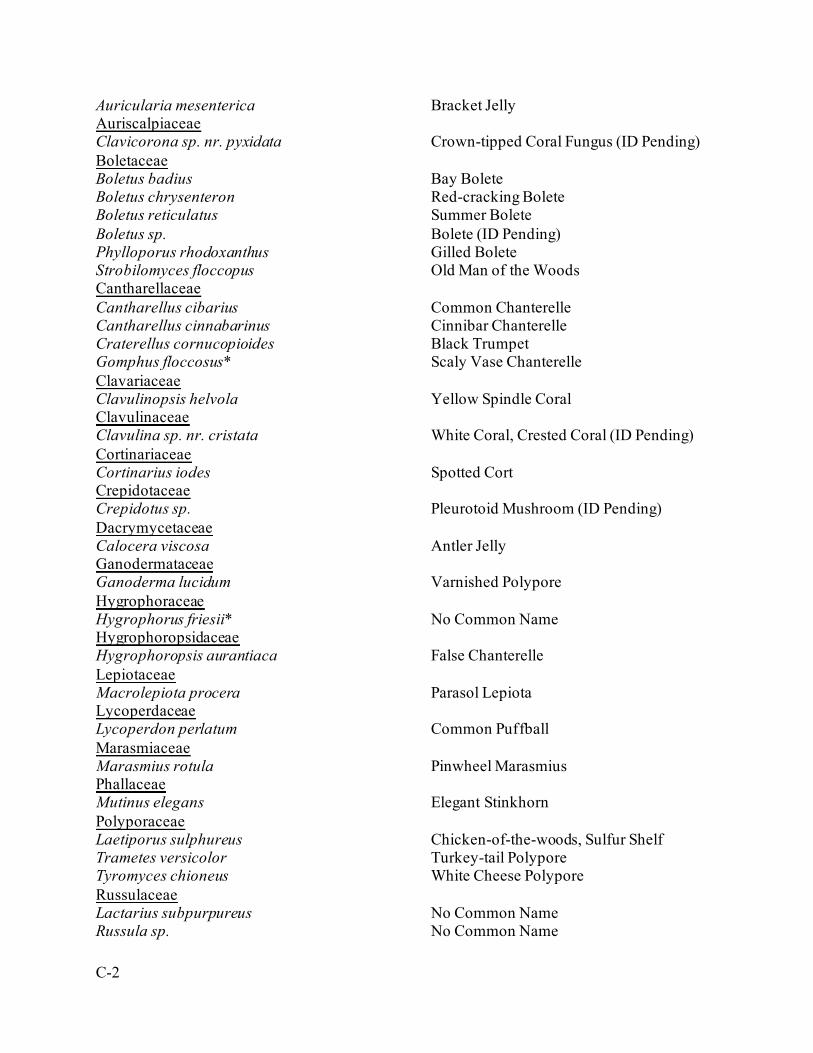
C-2
Auricularia mesenterica Bracket Jelly Auriscalpiaceae Clavicorona sp. nr. pyxidata Crown-tipped Coral Fungus (ID Pending) Boletaceae Boletus badius Bay Bolete Boletus chrysenteron Red-cracking Bolete Boletus reticulatus Summer Bolete Boletus sp. Bolete (ID Pending) Phylloporus rhodoxanthus Gilled Bolete Strobilomyces floccopus Old Man of the Woods Cantharellaceae Cantharellus cibarius Common Chanterelle Cantharellus cinnabarinus Cinnibar Chanterelle Craterellus cornucopioides Black Trumpet Gomphus floccosus* Scaly Vase Chanterelle Clavariaceae Clavulinopsis helvola Yellow Spindle Coral Clavulinaceae Clavulina sp. nr. cristata White Coral, Crested Coral (ID Pending) Cortinariaceae Cortinarius iodes Spotted Cort Crepidotaceae Crepidotus sp. Pleurotoid Mushroom (ID Pending) Dacrymycetaceae Calocera viscosa Antler Jelly Ganodermataceae Ganoderma lucidum Varnished Polypore Hygrophoraceae Hygrophorus friesii* No Common Name Hygrophoropsidaceae Hygrophoropsis aurantiaca False Chanterelle Lepiotaceae Macrolepiota procera Parasol Lepiota Lycoperdaceae Lycoperdon perlatum Common Puffball Marasmiaceae Marasmius rotula Pinwheel Marasmius Phallaceae Mutinus elegans Elegant Stinkhorn Polyporaceae Laetiporus sulphureus Chicken-of-the-woods, Sulfur Shelf Trametes versicolor Turkey-tail Polypore Tyromyces chioneus White Cheese Polypore Russulaceae Lactarius subpurpureus No Common Name Russula sp. No Common Name
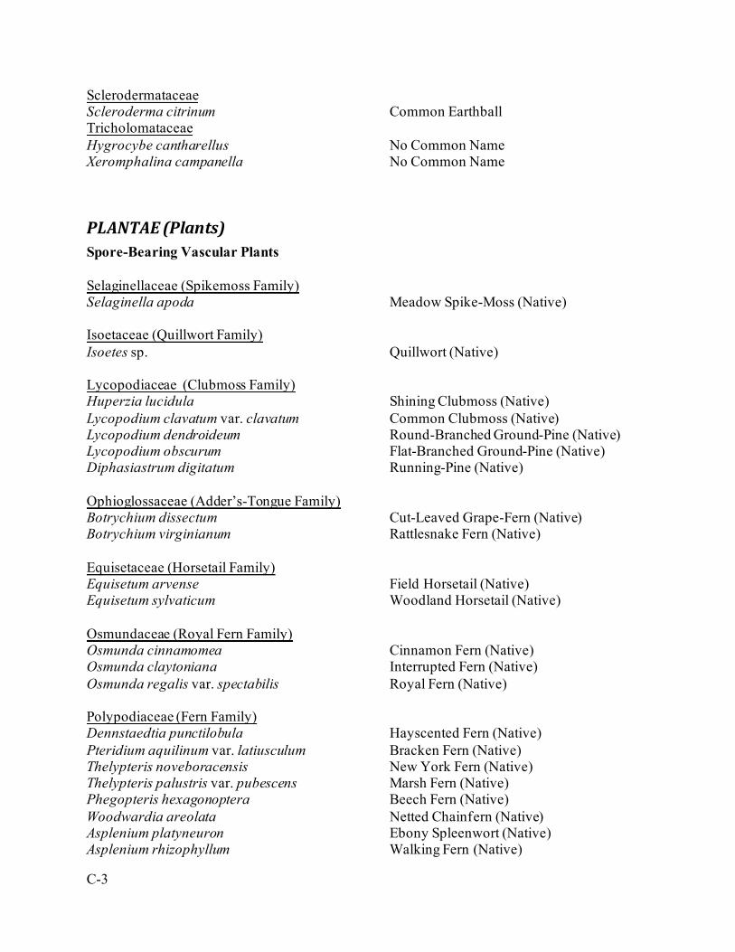
C-3
Sclerodermataceae Scleroderma citrinum Common Earthball Tricholomataceae Hygrocybe cantharellus No Common Name Xeromphalina campanella No Common Name
PLANTAE (Plants) Spore-Bearing Vascular Plants Selaginellaceae (Spikemoss Family) Selaginella apoda Meadow Spike-Moss (Native) Isoetaceae (Quillwort Family) Isoetes sp. Quillwort (Native) Lycopodiaceae (Clubmoss Family) Huperzia lucidula Shining Clubmoss (Native) Lycopodium clavatum var. clavatum Common Clubmoss (Native) Lycopodium dendroideum Round-Branched Ground-Pine (Native) Lycopodium obscurum Flat-Branched Ground-Pine (Native) Diphasiastrum digitatum Running-Pine (Native) Ophioglossaceae (Adder’s-Tongue Family) Botrychium dissectum Cut-Leaved Grape-Fern (Native) Botrychium virginianum Rattlesnake Fern (Native) Equisetaceae (Horsetail Family) Equisetum arvense Field Horsetail (Native) Equisetum sylvaticum Woodland Horsetail (Native) Osmundaceae (Royal Fern Family) Osmunda cinnamomea Cinnamon Fern (Native) Osmunda claytoniana Interrupted Fern (Native) Osmunda regalis var. spectabilis Royal Fern (Native) Polypodiaceae (Fern Family) Dennstaedtia punctilobula Hayscented Fern (Native) Pteridium aquilinum var. latiusculum Bracken Fern (Native) Thelypteris noveboracensis New York Fern (Native) Thelypteris palustris var. pubescens Marsh Fern (Native) Phegopteris hexagonoptera Beech Fern (Native) Woodwardia areolata Netted Chainfern (Native) Asplenium platyneuron Ebony Spleenwort (Native) Asplenium rhizophyllum Walking Fern (Native)
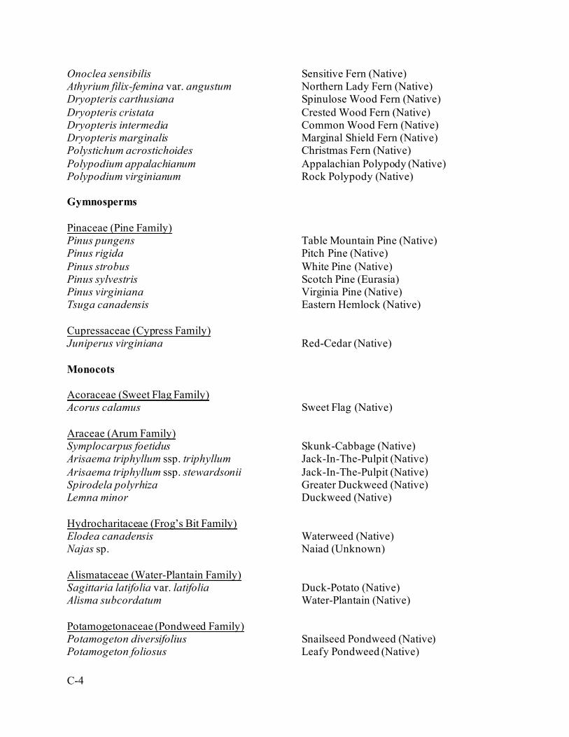
C-4
Onoclea sensibilis Sensitive Fern (Native) Athyrium filix-femina var. angustum Northern Lady Fern (Native) Dryopteris carthusiana Spinulose Wood Fern (Native) Dryopteris cristata Crested Wood Fern (Native) Dryopteris intermedia Common Wood Fern (Native) Dryopteris marginalis Marginal Shield Fern (Native) Polystichum acrostichoides Christmas Fern (Native) Polypodium appalachianum Appalachian Polypody (Native) Polypodium virginianum Rock Polypody (Native) Gymnosperms Pinaceae (Pine Family) Pinus pungens Table Mountain Pine (Native) Pinus rigida Pitch Pine (Native) Pinus strobus White Pine (Native) Pinus sylvestris Scotch Pine (Eurasia) Pinus virginiana Virginia Pine (Native) Tsuga canadensis Eastern Hemlock (Native) Cupressaceae (Cypress Family) Juniperus virginiana Red-Cedar (Native) Monocots Acoraceae (Sweet Flag Family) Acorus calamus Sweet Flag (Native) Araceae (Arum Family) Symplocarpus foetidus Skunk-Cabbage (Native) Arisaema triphyllum ssp. triphyllum Jack-In-The-Pulpit (Native) Arisaema triphyllum ssp. stewardsonii Jack-In-The-Pulpit (Native) Spirodela polyrhiza Greater Duckweed (Native) Lemna minor Duckweed (Native) Hydrocharitaceae (Frog’s Bit Family) Elodea canadensis Waterweed (Native) Najas sp. Naiad (Unknown) Alismataceae (Water-Plantain Family) Sagittaria latifolia var. latifolia Duck-Potato (Native) Alisma subcordatum Water-Plantain (Native) Potamogetonaceae (Pondweed Family) Potamogeton diversifolius Snailseed Pondweed (Native) Potamogeton foliosus Leafy Pondweed (Native)
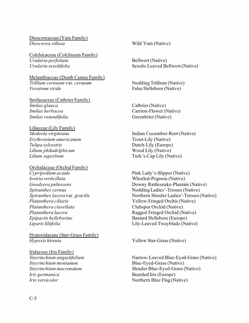
C-5
Dioscoreaceae (Yam Family) Dioscorea villosa Wild Yam (Native) Colchicaceae (Colchicum Family) Uvularia perfoliata Bellwort (Native) Uvularia sessilifolia Sessile-Leaved Bellwort (Native) Melanthiaceae (Death Camas Family) Trillium cernuum var. cernuum Nodding Trillium (Native) Veratrum viride False Hellebore (Native) Smilacaceae (Catbrier Family) Smilax glauca Catbrier (Native) Smilax herbacea Carrion-Flower (Native) Smilax rotundifolia Greenbrier (Native) Liliaceae (Lily Family) Medeola virginiana Indian Cucumber-Root (Native) Erythronium americanum Trout-Lily (Native) Tulipa sylvestris Dutch-Lily (Europe) Lilium philadelphicum Wood Lily (Native) Lilium superbum Turk’s-Cap Lily (Native) Orchidaceae (Orchid Family) Cypripedium acaule Pink Lady’s-Slipper (Native) Isotria verticillata Whorled-Pogonia (Native) Goodyera pubescens Downy Rattlesnake-Plantain (Native) Spiranthes cernua Nodding Ladies’-Tresses (Native) Spiranthes lacera var. gracilis Northern Slender Ladies’-Tresses (Native) Platanthera ciliaris Yellow-Fringed Orchis (Native) Platanthera clavellata Clubspur Orchid (Native) Platanthera lacera Ragged Fringed Orchid (Native) Epipactis helleborine Bastard Hellebore (Europe) Liparis liliifolia Lily-Leaved Twayblade (Native) Hypoxidaceae (Star-Grass Family) Hypoxis hirsuta Yellow Star-Grass (Native) Iridaceae (Iris Family) Sisyrinchium angustifolium Narrow-Leaved Blue-Eyed-Grass (Native) Sisyrinchium montanum Blue-Eyed-Grass (Native) Sisyrinchium mucronatum Slender Blue-Eyed-Grass (Native) Iris germanica Bearded Iris (Europe) Iris versicolor Northern Blue Flag (Native)
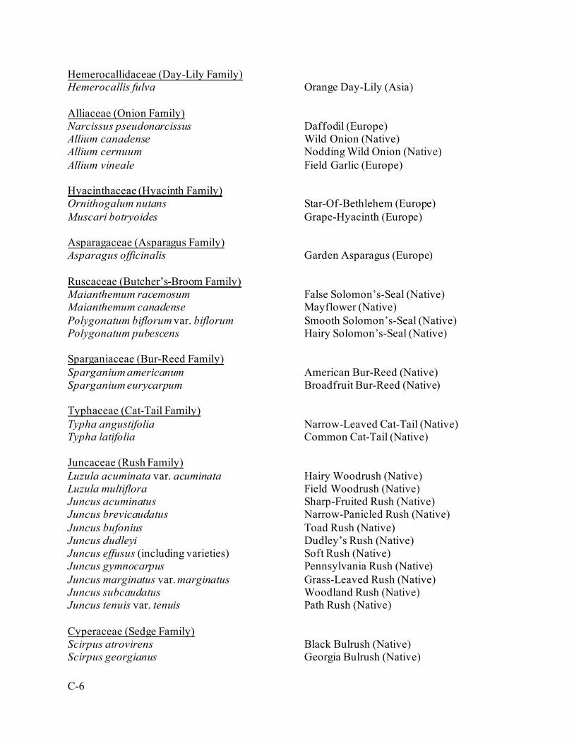
C-6
Hemerocallidaceae (Day-Lily Family) Hemerocallis fulva Orange Day-Lily (Asia) Alliaceae (Onion Family) Narcissus pseudonarcissus Daffodil (Europe) Allium canadense Wild Onion (Native) Allium cernuum Nodding Wild Onion (Native) Allium vineale Field Garlic (Europe) Hyacinthaceae (Hyacinth Family) Ornithogalum nutans Star-Of-Bethlehem (Europe) Muscari botryoides Grape-Hyacinth (Europe) Asparagaceae (Asparagus Family) Asparagus officinalis Garden Asparagus (Europe) Ruscaceae (Butcher’s-Broom Family) Maianthemum racemosum False Solomon’s-Seal (Native) Maianthemum canadense Mayflower (Native) Polygonatum biflorum var. biflorum Smooth Solomon’s-Seal (Native) Polygonatum pubescens Hairy Solomon’s-Seal (Native) Sparganiaceae (Bur-Reed Family) Sparganium americanum American Bur-Reed (Native) Sparganium eurycarpum Broadfruit Bur-Reed (Native) Typhaceae (Cat-Tail Family) Typha angustifolia Narrow-Leaved Cat-Tail (Native) Typha latifolia Common Cat-Tail (Native) Juncaceae (Rush Family) Luzula acuminata var. acuminata Hairy Woodrush (Native) Luzula multiflora Field Woodrush (Native) Juncus acuminatus Sharp-Fruited Rush (Native) Juncus brevicaudatus Narrow-Panicled Rush (Native) Juncus bufonius Toad Rush (Native) Juncus dudleyi Dudley’s Rush (Native) Juncus effusus (including varieties) Soft Rush (Native) Juncus gymnocarpus Pennsylvania Rush (Native) Juncus marginatus var. marginatus Grass-Leaved Rush (Native) Juncus subcaudatus Woodland Rush (Native) Juncus tenuis var. tenuis Path Rush (Native) Cyperaceae (Sedge Family) Scirpus atrovirens Black Bulrush (Native) Scirpus georgianus Georgia Bulrush (Native)
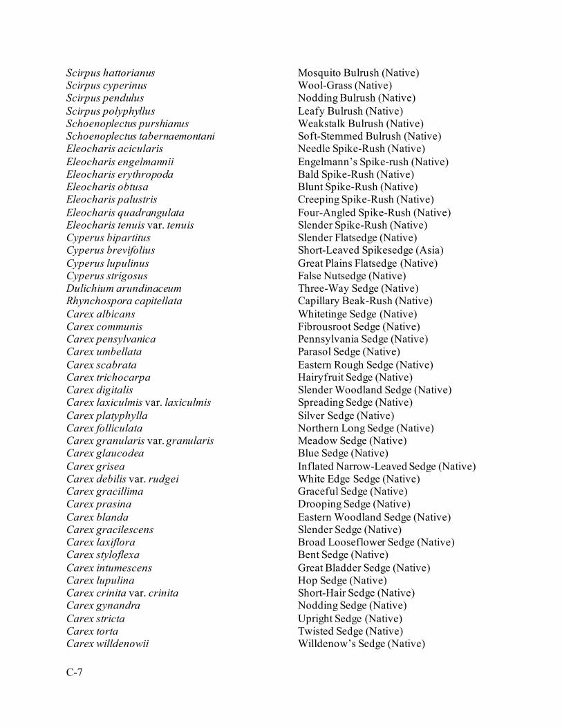
C-7
Scirpus hattorianus Mosquito Bulrush (Native) Scirpus cyperinus Wool-Grass (Native) Scirpus pendulus Nodding Bulrush (Native) Scirpus polyphyllus Leafy Bulrush (Native) Schoenoplectus purshianus Weakstalk Bulrush (Native) Schoenoplectus tabernaemontani Soft-Stemmed Bulrush (Native) Eleocharis acicularis Needle Spike-Rush (Native) Eleocharis engelmannii Engelmann’s Spike-rush (Native) Eleocharis erythropoda Bald Spike-Rush (Native) Eleocharis obtusa Blunt Spike-Rush (Native) Eleocharis palustris Creeping Spike-Rush (Native) Eleocharis quadrangulata Four-Angled Spike-Rush (Native) Eleocharis tenuis var. tenuis Slender Spike-Rush (Native) Cyperus bipartitus Slender Flatsedge (Native) Cyperus brevifolius Short-Leaved Spikesedge (Asia) Cyperus lupulinus Great Plains Flatsedge (Native) Cyperus strigosus False Nutsedge (Native) Dulichium arundinaceum Three-Way Sedge (Native) Rhynchospora capitellata Capillary Beak-Rush (Native) Carex albicans Whitetinge Sedge (Native) Carex communis Fibrousroot Sedge (Native) Carex pensylvanica Pennsylvania Sedge (Native) Carex umbellata Parasol Sedge (Native) Carex scabrata Eastern Rough Sedge (Native) Carex trichocarpa Hairyfruit Sedge (Native) Carex digitalis Slender Woodland Sedge (Native) Carex laxiculmis var. laxiculmis Spreading Sedge (Native) Carex platyphylla Silver Sedge (Native) Carex folliculata Northern Long Sedge (Native) Carex granularis var. granularis Meadow Sedge (Native) Carex glaucodea Blue Sedge (Native) Carex grisea Inflated Narrow-Leaved Sedge (Native) Carex debilis var. rudgei White Edge Sedge (Native) Carex gracillima Graceful Sedge (Native) Carex prasina Drooping Sedge (Native) Carex blanda Eastern Woodland Sedge (Native) Carex gracilescens Slender Sedge (Native) Carex laxiflora Broad Looseflower Sedge (Native) Carex styloflexa Bent Sedge (Native) Carex intumescens Great Bladder Sedge (Native) Carex lupulina Hop Sedge (Native) Carex crinita var. crinita Short-Hair Sedge (Native) Carex gynandra Nodding Sedge (Native) Carex stricta Upright Sedge (Native) Carex torta Twisted Sedge (Native) Carex willdenowii Willdenow’s Sedge (Native)
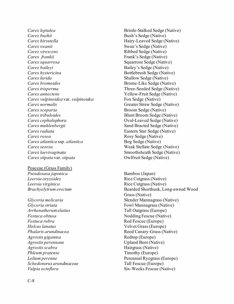
C-8
Carex leptalea Bristle-Stalked Sedge (Native) Carex bushii Bush’s Sedge (Native) Carex hirsutella Hairy-Leaved Sedge (Native) Carex swanii Swan’s Sedge (Native) Carex virescens Ribbed Sedge (Native) Carex frankii Frank’s Sedge (Native) Carex squarrosa Squarrose Sedge (Native) Carex baileyi Bailey’s Sedge (Native) Carex hystericina Bottlebrush Sedge (Native) Carex lurida Shallow Sedge (Native) Carex bromoides Brome-Like Sedge (Native) Carex trisperma Three-Seeded Sedge (Native) Carex annectens Yellow-Fruit Sedge (Native) Carex vulpinoidea var. vulpinoidea Fox Sedge (Native) Carex normalis Greater Straw Sedge (Native) Carex scoparia Broom Sedge (Native) Carex tribuloides Blunt Broom Sedge (Native) Carex cephalophora Oval-Leaved Sedge (Native) Carex muhlenbergii Sand Bracted Sedge (Native) Carex radiata Eastern Star Sedge (Native) Carex rosea Rosy Sedge (Native) Carex atlantica ssp. atlantica Bog Sedge (Native) Carex seorsa Weak Stellate Sedge (Native) Carex laevivaginata Smoothsheath Sedge (Native) Carex stipata var. stipata Owlfruit Sedge (Native) Poaceae (Grass Family) Pseudosasa japonica Bamboo (Japan) Leersia oryzoides Rice Cutgrass (Native) Leersia virginica Rice Cutgrass (Native) Brachyelytrum erectum Bearded Shorthusk, Long-awned Wood
Grass (Native) Glyceria melicaria Slender Mannagrass (Native) Glyceria striata Fowl Mannagrass (Native) Arrhenatherum elatius Tall Oatgrass (Europe) Festuca obtusa Nodding Fescue (Native) Festuca rubra Red Fescue (Europe) Holcus lanatus Velvet Grass (Europe) Phalaris arundinacea Reed Canary-Grass (Native) Agrostis gigantea Redtop (Europe) Agrostis perennans Upland Bent (Native) Agrostis scabra Hairgrass (Native) Phleum pratense Timothy (Europe) Lolium perenne Perennial Ryegrass (Europe) Schedonorus arundinaceus Tall Fescue (Europe) Vulpia octoflora Six-Weeks Fescue (Native)
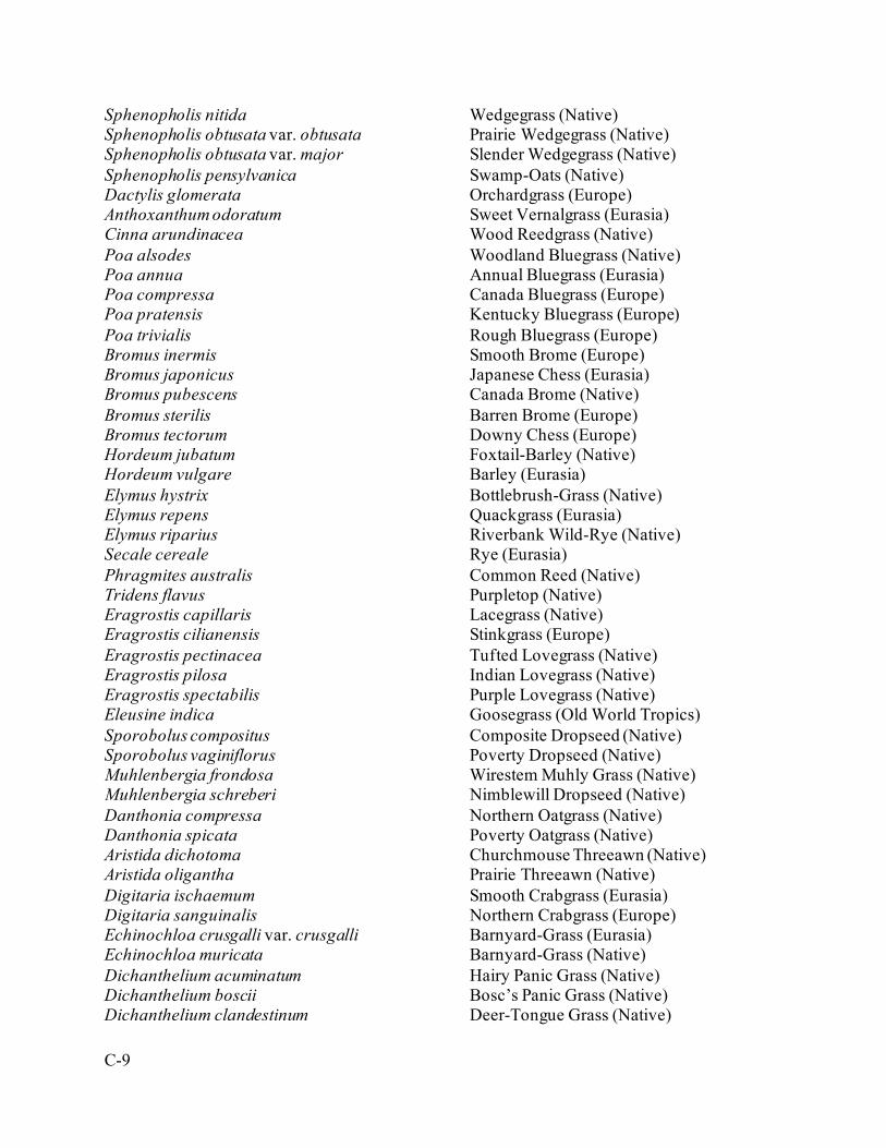
C-9
Sphenopholis nitida Wedgegrass (Native) Sphenopholis obtusata var. obtusata Prairie Wedgegrass (Native) Sphenopholis obtusata var. major Slender Wedgegrass (Native) Sphenopholis pensylvanica Swamp-Oats (Native) Dactylis glomerata Orchardgrass (Europe) Anthoxanthum odoratum Sweet Vernalgrass (Eurasia) Cinna arundinacea Wood Reedgrass (Native) Poa alsodes Woodland Bluegrass (Native) Poa annua Annual Bluegrass (Eurasia) Poa compressa Canada Bluegrass (Europe) Poa pratensis Kentucky Bluegrass (Europe) Poa trivialis Rough Bluegrass (Europe) Bromus inermis Smooth Brome (Europe) Bromus japonicus Japanese Chess (Eurasia) Bromus pubescens Canada Brome (Native) Bromus sterilis Barren Brome (Europe) Bromus tectorum Downy Chess (Europe) Hordeum jubatum Foxtail-Barley (Native) Hordeum vulgare Barley (Eurasia) Elymus hystrix Bottlebrush-Grass (Native) Elymus repens Quackgrass (Eurasia) Elymus riparius Riverbank Wild-Rye (Native) Secale cereale Rye (Eurasia) Phragmites australis Common Reed (Native) Tridens flavus Purpletop (Native) Eragrostis capillaris Lacegrass (Native) Eragrostis cilianensis Stinkgrass (Europe) Eragrostis pectinacea Tufted Lovegrass (Native) Eragrostis pilosa Indian Lovegrass (Native) Eragrostis spectabilis Purple Lovegrass (Native) Eleusine indica Goosegrass (Old World Tropics) Sporobolus compositus Composite Dropseed (Native) Sporobolus vaginiflorus Poverty Dropseed (Native) Muhlenbergia frondosa Wirestem Muhly Grass (Native) Muhlenbergia schreberi Nimblewill Dropseed (Native) Danthonia compressa Northern Oatgrass (Native) Danthonia spicata Poverty Oatgrass (Native) Aristida dichotoma Churchmouse Threeawn (Native) Aristida oligantha Prairie Threeawn (Native) Digitaria ischaemum Smooth Crabgrass (Eurasia) Digitaria sanguinalis Northern Crabgrass (Europe) Echinochloa crusgalli var. crusgalli Barnyard-Grass (Eurasia) Echinochloa muricata Barnyard-Grass (Native) Dichanthelium acuminatum Hairy Panic Grass (Native) Dichanthelium boscii Bosc’s Panic Grass (Native) Dichanthelium clandestinum Deer-Tongue Grass (Native)
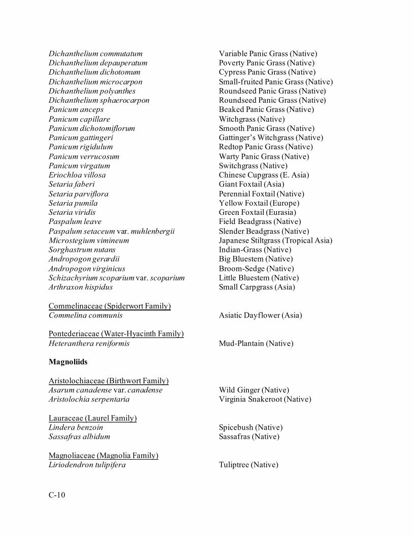
C-10
Dichanthelium commutatum Variable Panic Grass (Native) Dichanthelium depauperatum Poverty Panic Grass (Native) Dichanthelium dichotomum Cypress Panic Grass (Native) Dichanthelium microcarpon Small-fruited Panic Grass (Native) Dichanthelium polyanthes Roundseed Panic Grass (Native) Dichanthelium sphaerocarpon Roundseed Panic Grass (Native) Panicum anceps Beaked Panic Grass (Native) Panicum capillare Witchgrass (Native) Panicum dichotomiflorum Smooth Panic Grass (Native) Panicum gattingeri Gattinger’s Witchgrass (Native) Panicum rigidulum Redtop Panic Grass (Native) Panicum verrucosum Warty Panic Grass (Native) Panicum virgatum Switchgrass (Native) Eriochloa villosa Chinese Cupgrass (E. Asia) Setaria faberi Giant Foxtail (Asia) Setaria parviflora Perennial Foxtail (Native) Setaria pumila Yellow Foxtail (Europe) Setaria viridis Green Foxtail (Eurasia) Paspalum leave Field Beadgrass (Native) Paspalum setaceum var. muhlenbergii Slender Beadgrass (Native) Microstegium vimineum Japanese Stiltgrass (Tropical Asia) Sorghastrum nutans Indian-Grass (Native) Andropogon gerardii Big Bluestem (Native) Andropogon virginicus Broom-Sedge (Native) Schizachyrium scoparium var. scoparium Little Bluestem (Native) Arthraxon hispidus Small Carpgrass (Asia) Commelinaceae (Spiderwort Family) Commelina communis Asiatic Dayflower (Asia) Pontederiaceae (Water-Hyacinth Family) Heteranthera reniformis Mud-Plantain (Native) Magnoliids Aristolochiaceae (Birthwort Family) Asarum canadense var. canadense Wild Ginger (Native) Aristolochia serpentaria Virginia Snakeroot (Native) Lauraceae (Laurel Family) Lindera benzoin Spicebush (Native) Sassafras albidum Sassafras (Native) Magnoliaceae (Magnolia Family) Liriodendron tulipifera Tuliptree (Native)
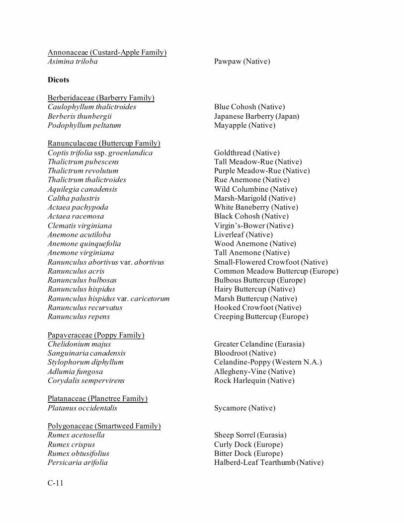
C-11
Annonaceae (Custard-Apple Family) Asimina triloba Pawpaw (Native) Dicots Berberidaceae (Barberry Family) Caulophyllum thalictroides Blue Cohosh (Native) Berberis thunbergii Japanese Barberry (Japan) Podophyllum peltatum Mayapple (Native) Ranunculaceae (Buttercup Family) Coptis trifolia ssp. groenlandica Goldthread (Native) Thalictrum pubescens Tall Meadow-Rue (Native) Thalictrum revolutum Purple Meadow-Rue (Native) Thalictrum thalictroides Rue Anemone (Native) Aquilegia canadensis Wild Columbine (Native) Caltha palustris Marsh-Marigold (Native) Actaea pachypoda White Baneberry (Native) Actaea racemosa Black Cohosh (Native) Clematis virginiana Virgin’s-Bower (Native) Anemone acutiloba Liverleaf (Native) Anemone quinquefolia Wood Anemone (Native) Anemone virginiana Tall Anemone (Native) Ranunculus abortivus var. abortivus Small-Flowered Crowfoot (Native) Ranunculus acris Common Meadow Buttercup (Europe) Ranunculus bulbosas Bulbous Buttercup (Europe) Ranunculus hispidus Hairy Buttercup (Native) Ranunculus hispidus var. caricetorum Marsh Buttercup (Native) Ranunculus recurvatus Hooked Crowfoot (Native) Ranunculus repens Creeping Buttercup (Europe) Papaveraceae (Poppy Family) Chelidonium majus Greater Celandine (Eurasia) Sanguinaria canadensis Bloodroot (Native) Stylophorum diphyllum Celandine-Poppy (Western N.A.) Adlumia fungosa Allegheny-Vine (Native) Corydalis sempervirens Rock Harlequin (Native) Platanaceae (Planetree Family) Platanus occidentalis Sycamore (Native) Polygonaceae (Smartweed Family) Rumex acetosella Sheep Sorrel (Eurasia) Rumex crispus Curly Dock (Europe) Rumex obtusifolius Bitter Dock (Europe) Persicaria arifolia Halberd-Leaf Tearthumb (Native)

C-12
Persicaria hydropiper Water-Pepper (Europe) Persicaria lapathifolia Dock-Leaf Smartweed (Europe) Persicaria longiseta var. longisetum Low Smartweed (Asia) Persicaria maculosa Lady’s-Thumb (Europe) Persicaria pensylvanica Smartweed (Native) Persicaria perfoliata Mile-A-Minute (Asia) Persicaria punctata var. punctatum Water Smartweed (Native) Persicaria sagittata Arrow-leaf Tearthumb (Native) Persicaria virginiana Jumpseed (Native) Polygonum aviculare Knotweed (Europe) Polygonum erectum Erect Knotweed (Native) Polygonum tenue Slender Knotweed (Native) Fallopia convolvulus Black Bindweed (Europe) Fallopia japonica Japanese Knotweed (Japan) Fallopia scandens Climbing False Buckwheat (Native) Caryophyllaceae (Pink Family) Paronychia canadensis Forked Chickweed (Native) Paronychia fastigiata var. fastigiata Whitlow-Wort Chickweed (Native) Scleranthus annuus Knawel (Eurasia) Arenaria serpyllifolia Thyme-Leaved Sandwort (Europe) Cerastium fontanum ssp. triviale Common Mouse-Ear Chickweed (Eurasia) Cerastium glomeratum Mouse-Ear Chickweed (Eurasia) Cerastium nutans Nodding Chickweed (Native) Cerastium pumilum Small Mouse-Ear Chickweed (Europe) Holosteum umbellatum Jagged Chickweed (Eurasia) Myosoton aquaticum Giant Chickweed (Europe) Stellaria alsine Bog Chickweed (Eurasia) Stellaria longifolia Long-Leaved Stitchwort (Native) Stellaria media Common Chickweed (Europe) Silene antirrhina Sleepy Catchfly (Native) Silene caroliniana ssp. pensylvanica Wild Pink (Native) Silene dichotoma Forked Catchfly (Eurasia) Silene latifolia White Campion (Europe) Silene stellata Star Campion (Native) Silene vulgaris Bladder Campion (Europe) Saponaria officinalis Bouncing-Bet (Europe) Dianthus armeria Deptford Pink (Europe) Amaranthaceae (Amaranth Family) Amaranthus albus, Tumbleweed (Central N.A.) Chenopodium album var. album, Lamb’s-Quarters (Native) Phytolaccaceae (Pokeweed Family) Phytolacca americana, Pokeweed (Native)
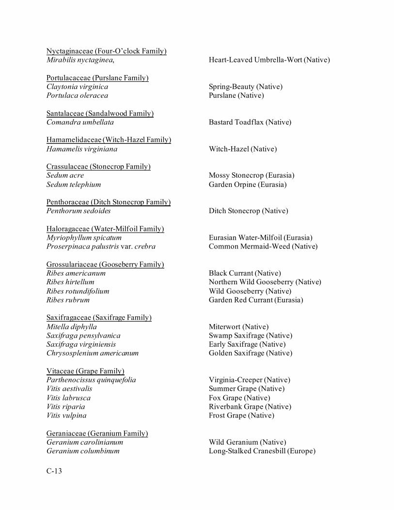
C-13
Nyctaginaceae (Four-O’clock Family) Mirabilis nyctaginea, Heart-Leaved Umbrella-Wort (Native) Portulacaceae (Purslane Family) Claytonia virginica Spring-Beauty (Native) Portulaca oleracea Purslane (Native) Santalaceae (Sandalwood Family) Comandra umbellata Bastard Toadflax (Native) Hamamelidaceae (Witch-Hazel Family) Hamamelis virginiana Witch-Hazel (Native) Crassulaceae (Stonecrop Family) Sedum acre Mossy Stonecrop (Eurasia) Sedum telephium Garden Orpine (Eurasia) Penthoraceae (Ditch Stonecrop Family) Penthorum sedoides Ditch Stonecrop (Native) Haloragaceae (Water-Milfoil Family) Myriophyllum spicatum Eurasian Water-Milfoil (Eurasia) Proserpinaca palustris var. crebra Common Mermaid-Weed (Native) Grossulariaceae (Gooseberry Family) Ribes americanum Black Currant (Native) Ribes hirtellum Northern Wild Gooseberry (Native) Ribes rotundifolium Wild Gooseberry (Native) Ribes rubrum Garden Red Currant (Eurasia) Saxifragaceae (Saxifrage Family) Mitella diphylla Miterwort (Native) Saxifraga pensylvanica Swamp Saxifrage (Native) Saxifraga virginiensis Early Saxifrage (Native) Chrysosplenium americanum Golden Saxifrage (Native) Vitaceae (Grape Family) Parthenocissus quinquefolia Virginia-Creeper (Native) Vitis aestivalis Summer Grape (Native) Vitis labrusca Fox Grape (Native) Vitis riparia Riverbank Grape (Native) Vitis vulpina Frost Grape (Native) Geraniaceae (Geranium Family) Geranium carolinianum Wild Geranium (Native) Geranium columbinum Long-Stalked Cranesbill (Europe)
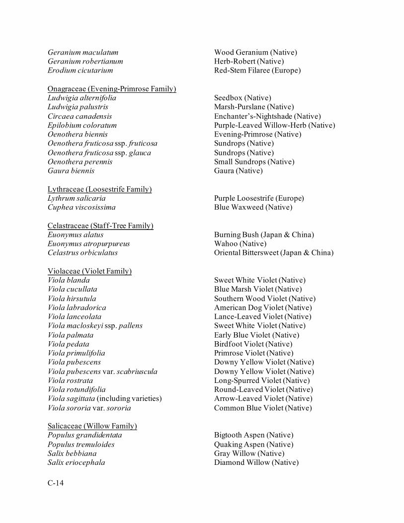
C-14
Geranium maculatum Wood Geranium (Native) Geranium robertianum Herb-Robert (Native) Erodium cicutarium Red-Stem Filaree (Europe) Onagraceae (Evening-Primrose Family) Ludwigia alternifolia Seedbox (Native) Ludwigia palustris Marsh-Purslane (Native) Circaea canadensis Enchanter’s-Nightshade (Native) Epilobium coloratum Purple-Leaved Willow-Herb (Native) Oenothera biennis Evening-Primrose (Native) Oenothera fruticosa ssp. fruticosa Sundrops (Native) Oenothera fruticosa ssp. glauca Sundrops (Native) Oenothera perennis Small Sundrops (Native) Gaura biennis Gaura (Native) Lythraceae (Loosestrife Family) Lythrum salicaria Purple Loosestrife (Europe) Cuphea viscosissima Blue Waxweed (Native) Celastraceae (Staff-Tree Family) Euonymus alatus Burning Bush (Japan & China) Euonymus atropurpureus Wahoo (Native) Celastrus orbiculatus Oriental Bittersweet (Japan & China) Violaceae (Violet Family) Viola blanda Sweet White Violet (Native) Viola cucullata Blue Marsh Violet (Native) Viola hirsutula Southern Wood Violet (Native) Viola labradorica American Dog Violet (Native) Viola lanceolata Lance-Leaved Violet (Native) Viola macloskeyi ssp. pallens Sweet White Violet (Native) Viola palmata Early Blue Violet (Native) Viola pedata Birdfoot Violet (Native) Viola primulifolia Primrose Violet (Native) Viola pubescens Downy Yellow Violet (Native) Viola pubescens var. scabriuscula Downy Yellow Violet (Native) Viola rostrata Long-Spurred Violet (Native) Viola rotundifolia Round-Leaved Violet (Native) Viola sagittata (including varieties) Arrow-Leaved Violet (Native) Viola sororia var. sororia Common Blue Violet (Native) Salicaceae (Willow Family) Populus grandidentata Bigtooth Aspen (Native) Populus tremuloides Quaking Aspen (Native) Salix bebbiana Gray Willow (Native) Salix eriocephala Diamond Willow (Native)
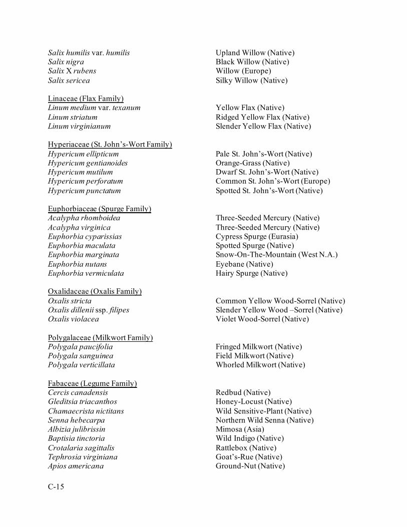
C-15
Salix humilis var. humilis Upland Willow (Native) Salix nigra Black Willow (Native) Salix X rubens Willow (Europe) Salix sericea Silky Willow (Native) Linaceae (Flax Family) Linum medium var. texanum Yellow Flax (Native) Linum striatum Ridged Yellow Flax (Native) Linum virginianum Slender Yellow Flax (Native) Hyperiaceae (St. John’s-Wort Family) Hypericum ellipticum Pale St. John’s-Wort (Native) Hypericum gentianoides Orange-Grass (Native) Hypericum mutilum Dwarf St. John’s-Wort (Native) Hypericum perforatum Common St. John’s-Wort (Europe) Hypericum punctatum Spotted St. John’s-Wort (Native) Euphorbiaceae (Spurge Family) Acalypha rhomboidea Three-Seeded Mercury (Native) Acalypha virginica Three-Seeded Mercury (Native) Euphorbia cyparissias Cypress Spurge (Eurasia) Euphorbia maculata Spotted Spurge (Native) Euphorbia marginata Snow-On-The-Mountain (West N.A.) Euphorbia nutans Eyebane (Native) Euphorbia vermiculata Hairy Spurge (Native) Oxalidaceae (Oxalis Family) Oxalis stricta Common Yellow Wood-Sorrel (Native) Oxalis dillenii ssp. filipes Slender Yellow Wood –Sorrel (Native) Oxalis violacea Violet Wood-Sorrel (Native) Polygalaceae (Milkwort Family) Polygala paucifolia Fringed Milkwort (Native) Polygala sanguinea Field Milkwort (Native) Polygala verticillata Whorled Milkwort (Native) Fabaceae (Legume Family) Cercis canadensis Redbud (Native) Gleditsia triacanthos Honey-Locust (Native) Chamaecrista nictitans Wild Sensitive-Plant (Native) Senna hebecarpa Northern Wild Senna (Native) Albizia julibrissin Mimosa (Asia) Baptisia tinctoria Wild Indigo (Native) Crotalaria sagittalis Rattlebox (Native) Tephrosia virginiana Goat’s-Rue (Native) Apios americana Ground-Nut (Native)
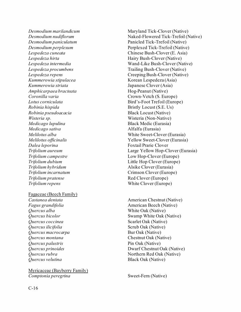
C-16
Desmodium marilandicum Maryland Tick-Clover (Native) Desmodium nudiflorum Naked-Flowered Tick-Trefoil (Native) Desmodium paniculatum Panicled Tick-Trefoil (Native) Desmodium perplexum Perplexed Tick-Trefoil (Native) Lespedeza cuneata Chinese Bush-Clover (E. Asia) Lespedeza hirta Hairy Bush-Clover (Native) Lespedeza intermedia Wand-Like Bush-Clover (Native) Lespedeza procumbens Trailing Bush-Clover (Native) Lespedeza repens Creeping Bush-Clover (Native) Kummerowia stipulacea Korean Lespedeza (Asia) Kummerowia striata Japanese Clover (Asia) Amphicarpaea bracteata Hog-Peanut (Native) Coronilla varia Crown-Vetch (S. Europe) Lotus corniculata Bird’s-Foot Trefoil (Europe) Robinia hispida Bristly Locust (S.E. Us) Robinia pseudoacacia Black Locust (Native) Wisteria sp. Wisteria (Non-Native) Medicago lupulina Black Medic (Eurasia) Medicago sativa Alfalfa (Eurasia) Melilotus alba White Sweet-Clover (Eurasia) Melilotus officinalis Yellow Sweet-Clover (Eurasia) Dalea leporina Foxtail Prarie Clover Trifolium aureum Large Yellow Hop-Clover (Eurasia) Trifolium campestre Low Hop-Clover (Europe) Trifolium dubium Little Hop Clover (Europe) Trifolium hybridum Alsike Clover (Eurasia) Trifolium incarnatum Crimson Clover (Europe) Trifolium pratense Red Clover (Europe) Trifolium repens White Clover (Europe) Fagaceae (Beech Family) Castanea dentata American Chestnut (Native) Fagus grandifolia American Beech (Native) Quercus alba White Oak (Native) Quercus bicolor Swamp White Oak (Native) Quercus coccinea Scarlet Oak (Native) Quercus ilicifolia Scrub Oak (Native) Quercus macrocarpa Bur Oak (Native) Quercus montana Chestnut Oak (Native) Quercus palustris Pin Oak (Native) Quercus prinoides Dwarf Chestnut Oak (Native) Quercus rubra Northern Red Oak (Native) Quercus velutina Black Oak (Native) Myricaceae (Bayberry Family) Comptonia peregrina Sweet-Fern (Native)
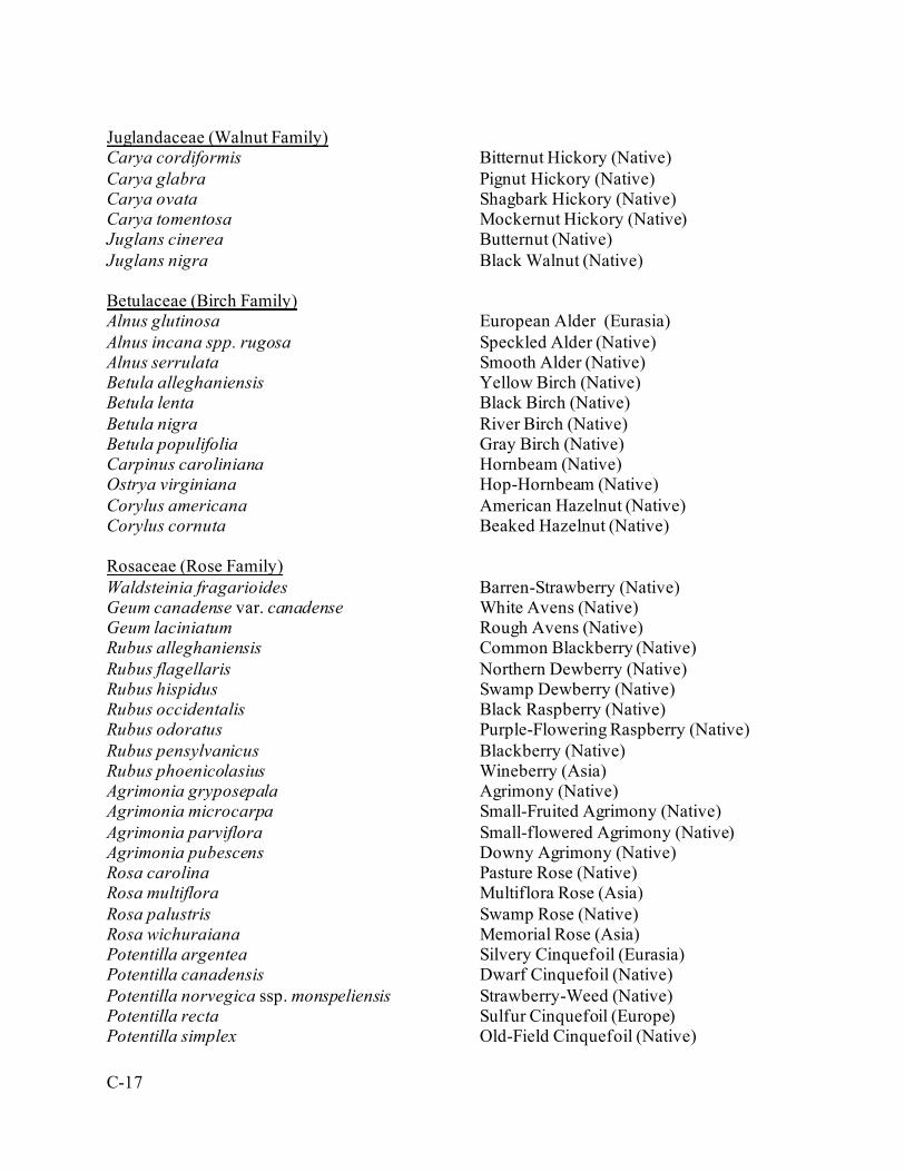
C-17
Juglandaceae (Walnut Family) Carya cordiformis Bitternut Hickory (Native) Carya glabra Pignut Hickory (Native) Carya ovata Shagbark Hickory (Native) Carya tomentosa Mockernut Hickory (Native) Juglans cinerea Butternut (Native) Juglans nigra Black Walnut (Native) Betulaceae (Birch Family) Alnus glutinosa European Alder (Eurasia) Alnus incana spp. rugosa Speckled Alder (Native) Alnus serrulata Smooth Alder (Native) Betula alleghaniensis Yellow Birch (Native) Betula lenta Black Birch (Native) Betula nigra River Birch (Native) Betula populifolia Gray Birch (Native) Carpinus caroliniana Hornbeam (Native) Ostrya virginiana Hop-Hornbeam (Native) Corylus americana American Hazelnut (Native) Corylus cornuta Beaked Hazelnut (Native) Rosaceae (Rose Family) Waldsteinia fragarioides Barren-Strawberry (Native) Geum canadense var. canadense White Avens (Native) Geum laciniatum Rough Avens (Native) Rubus alleghaniensis Common Blackberry (Native) Rubus flagellaris Northern Dewberry (Native) Rubus hispidus Swamp Dewberry (Native) Rubus occidentalis Black Raspberry (Native) Rubus odoratus Purple-Flowering Raspberry (Native) Rubus pensylvanicus Blackberry (Native) Rubus phoenicolasius Wineberry (Asia) Agrimonia gryposepala Agrimony (Native) Agrimonia microcarpa Small-Fruited Agrimony (Native) Agrimonia parviflora Small-flowered Agrimony (Native) Agrimonia pubescens Downy Agrimony (Native) Rosa carolina Pasture Rose (Native) Rosa multiflora Multiflora Rose (Asia) Rosa palustris Swamp Rose (Native) Rosa wichuraiana Memorial Rose (Asia) Potentilla argentea Silvery Cinquefoil (Eurasia) Potentilla canadensis Dwarf Cinquefoil (Native) Potentilla norvegica ssp. monspeliensis Strawberry-Weed (Native) Potentilla recta Sulfur Cinquefoil (Europe) Potentilla simplex Old-Field Cinquefoil (Native)
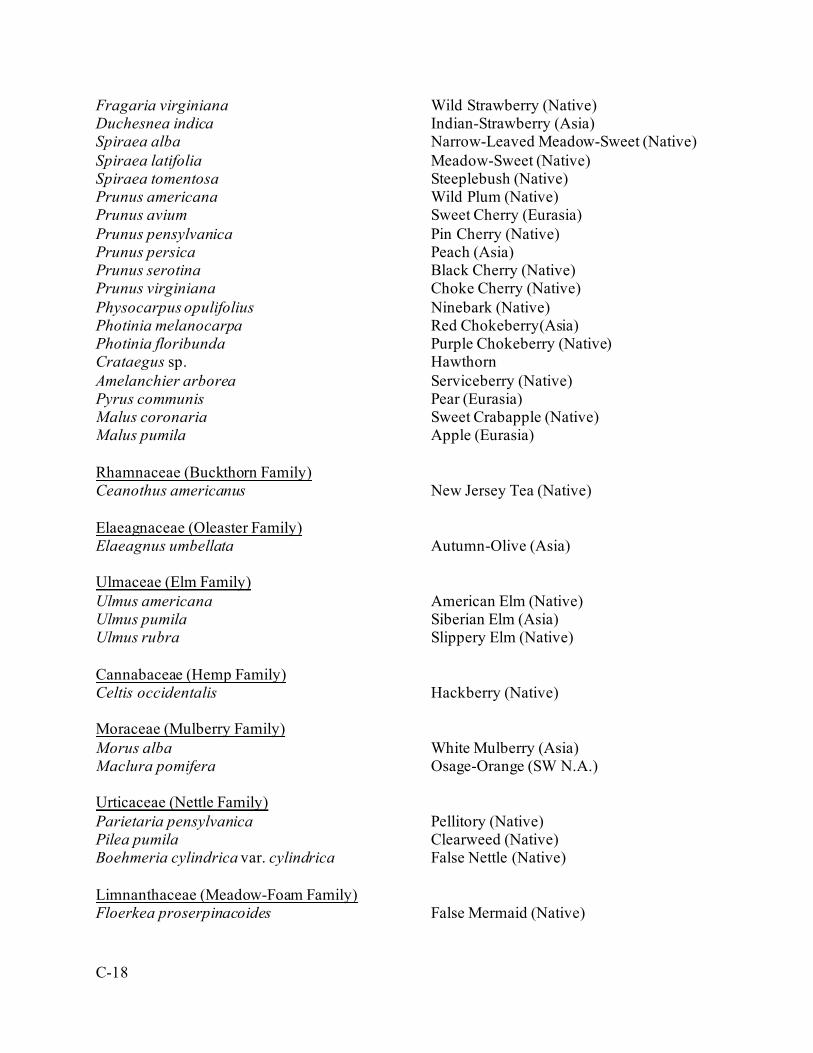
C-18
Fragaria virginiana Wild Strawberry (Native) Duchesnea indica Indian-Strawberry (Asia) Spiraea alba Narrow-Leaved Meadow-Sweet (Native) Spiraea latifolia Meadow-Sweet (Native) Spiraea tomentosa Steeplebush (Native) Prunus americana Wild Plum (Native) Prunus avium Sweet Cherry (Eurasia) Prunus pensylvanica Pin Cherry (Native) Prunus persica Peach (Asia) Prunus serotina Black Cherry (Native) Prunus virginiana Choke Cherry (Native) Physocarpus opulifolius Ninebark (Native) Photinia melanocarpa Red Chokeberry(Asia) Photinia floribunda Purple Chokeberry (Native) Crataegus sp. Hawthorn Amelanchier arborea Serviceberry (Native) Pyrus communis Pear (Eurasia) Malus coronaria Sweet Crabapple (Native) Malus pumila Apple (Eurasia) Rhamnaceae (Buckthorn Family) Ceanothus americanus New Jersey Tea (Native) Elaeagnaceae (Oleaster Family) Elaeagnus umbellata Autumn-Olive (Asia) Ulmaceae (Elm Family) Ulmus americana American Elm (Native) Ulmus pumila Siberian Elm (Asia) Ulmus rubra Slippery Elm (Native) Cannabaceae (Hemp Family) Celtis occidentalis Hackberry (Native) Moraceae (Mulberry Family) Morus alba White Mulberry (Asia) Maclura pomifera Osage-Orange (SW N.A.) Urticaceae (Nettle Family) Parietaria pensylvanica Pellitory (Native) Pilea pumila Clearweed (Native) Boehmeria cylindrica var. cylindrica False Nettle (Native) Limnanthaceae (Meadow-Foam Family) Floerkea proserpinacoides False Mermaid (Native)
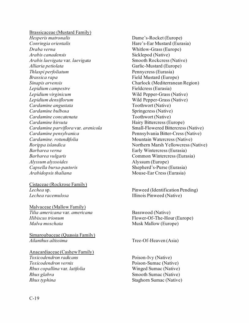
C-19
Brassicaceae (Mustard Family) Hesperis matronalis Dame’s-Rocket (Europe) Conringia orientalis Hare’s-Ear Mustard (Eurasia) Draba verna Whitlow-Grass (Europe) Arabis canadensis Sicklepod (Native) Arabis laevigata var. laevigata Smooth Rockcress (Native) Alliaria petiolata Garlic-Mustard (Europe) Thlaspi perfoliatum Pennycress (Eurasia) Brassica rapa Field Mustard (Europe) Sinapis arvensis Charlock (Mediterranean Region) Lepidium campestre Fieldcress (Eurasia) Lepidium virginicum Wild Pepper-Grass (Native) Lepidium densiflorum Wild Pepper-Grass (Native) Cardamine angustata Toothwort (Native) Cardamine bulbosa Springcress (Native) Cardamine concatenata Toothwort (Native) Cardamine hirsuta Hairy Bittercress (Europe) Cardamine parviflora var. arenicola Small-Flowered Bittercress (Native) Cardamine pensylvanica Pennsylvania Bitter-Cress (Native) Cardamine. rotundifolia Mountain Watercress (Native) Rorippa islandica Northern Marsh Yellowcress (Native) Barbarea verna Early Wintercress (Eurasia) Barbarea vulgaris Common Wintercress (Eurasia) Alyssum alyssoides Alyssum (Europe) Capsella bursa-pastoris Shepherd’s-Purse (Eurasia) Arabidopsis thaliana Mouse-Ear Cress (Eurasia) Cistaceae (Rockrose Family) Lechea sp. Pinweed (Identification Pending) Lechea racemulosa Illinois Pinweed (Native) Malvaceae (Mallow Family) Tilia americana var. americana Basswood (Native) Hibiscus trionum Flower-Of-The-Hour (Europe) Malva moschata Musk Mallow (Europe) Simaroubaceae (Quassia Family) Ailanthus altissima Tree-Of-Heaven (Asia) Anacardiaceae (Cashew Family) Toxicodendron radicans Poison-Ivy (Native) Toxicodendron vernix Poison-Sumac (Native) Rhus copallina var. latifolia Winged Sumac (Native) Rhus glabra Smooth Sumac (Native) Rhus typhina Staghorn Sumac (Native)
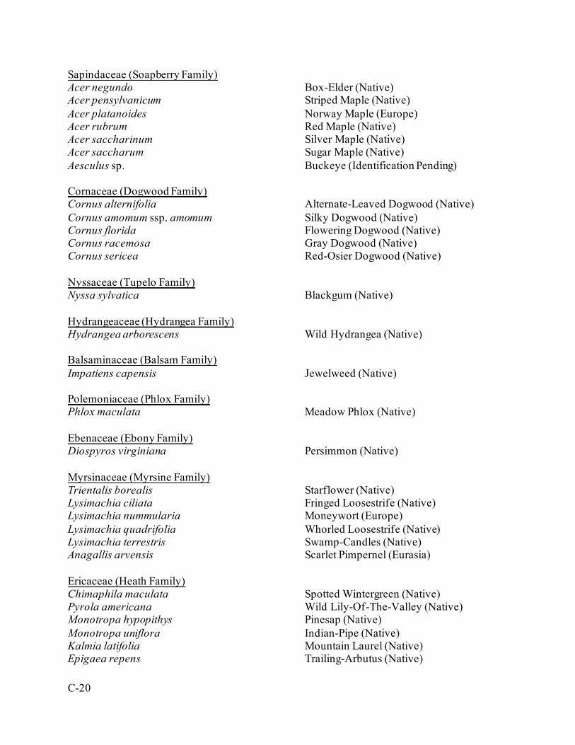
C-20
Sapindaceae (Soapberry Family) Acer negundo Box-Elder (Native) Acer pensylvanicum Striped Maple (Native) Acer platanoides Norway Maple (Europe) Acer rubrum Red Maple (Native) Acer saccharinum Silver Maple (Native) Acer saccharum Sugar Maple (Native) Aesculus sp. Buckeye (Identification Pending) Cornaceae (Dogwood Family) Cornus alternifolia Alternate-Leaved Dogwood (Native) Cornus amomum ssp. amomum Silky Dogwood (Native) Cornus florida Flowering Dogwood (Native) Cornus racemosa Gray Dogwood (Native) Cornus sericea Red-Osier Dogwood (Native) Nyssaceae (Tupelo Family) Nyssa sylvatica Blackgum (Native) Hydrangeaceae (Hydrangea Family) Hydrangea arborescens Wild Hydrangea (Native) Balsaminaceae (Balsam Family) Impatiens capensis Jewelweed (Native) Polemoniaceae (Phlox Family) Phlox maculata Meadow Phlox (Native) Ebenaceae (Ebony Family) Diospyros virginiana Persimmon (Native) Myrsinaceae (Myrsine Family) Trientalis borealis Starflower (Native) Lysimachia ciliata Fringed Loosestrife (Native) Lysimachia nummularia Moneywort (Europe) Lysimachia quadrifolia Whorled Loosestrife (Native) Lysimachia terrestris Swamp-Candles (Native) Anagallis arvensis Scarlet Pimpernel (Eurasia) Ericaceae (Heath Family) Chimaphila maculata Spotted Wintergreen (Native) Pyrola americana Wild Lily-Of-The-Valley (Native) Monotropa hypopithys Pinesap (Native) Monotropa uniflora Indian-Pipe (Native) Kalmia latifolia Mountain Laurel (Native) Epigaea repens Trailing-Arbutus (Native)
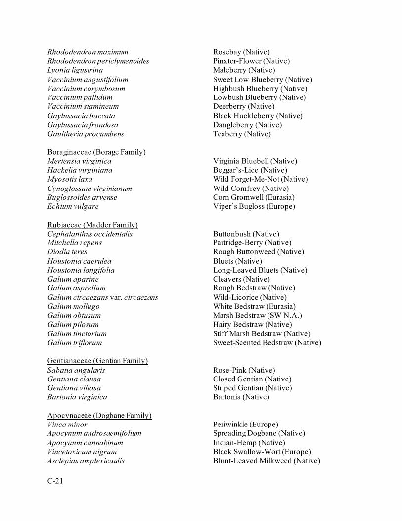
C-21
Rhododendron maximum Rosebay (Native) Rhododendron periclymenoides Pinxter-Flower (Native) Lyonia ligustrina Maleberry (Native) Vaccinium angustifolium Sweet Low Blueberry (Native) Vaccinium corymbosum Highbush Blueberry (Native) Vaccinium pallidum Lowbush Blueberry (Native) Vaccinium stamineum Deerberry (Native) Gaylussacia baccata Black Huckleberry (Native) Gaylussacia frondosa Dangleberry (Native) Gaultheria procumbens Teaberry (Native) Boraginaceae (Borage Family) Mertensia virginica Virginia Bluebell (Native) Hackelia virginiana Beggar’s-Lice (Native) Myosotis laxa Wild Forget-Me-Not (Native) Cynoglossum virginianum Wild Comfrey (Native) Buglossoides arvense Corn Gromwell (Eurasia) Echium vulgare Viper’s Bugloss (Europe) Rubiaceae (Madder Family) Cephalanthus occidentalis Buttonbush (Native) Mitchella repens Partridge-Berry (Native) Diodia teres Rough Buttonweed (Native) Houstonia caerulea Bluets (Native) Houstonia longifolia Long-Leaved Bluets (Native) Galium aparine Cleavers (Native) Galium asprellum Rough Bedstraw (Native) Galium circaezans var. circaezans Wild-Licorice (Native) Galium mollugo White Bedstraw (Eurasia) Galium obtusum Marsh Bedstraw (SW N.A.) Galium pilosum Hairy Bedstraw (Native) Galium tinctorium Stiff Marsh Bedstraw (Native) Galium triflorum Sweet-Scented Bedstraw (Native) Gentianaceae (Gentian Family) Sabatia angularis Rose-Pink (Native) Gentiana clausa Closed Gentian (Native) Gentiana villosa Striped Gentian (Native) Bartonia virginica Bartonia (Native) Apocynaceae (Dogbane Family) Vinca minor Periwinkle (Europe) Apocynum androsaemifolium Spreading Dogbane (Native) Apocynum cannabinum Indian-Hemp (Native) Vincetoxicum nigrum Black Swallow-Wort (Europe) Asclepias amplexicaulis Blunt-Leaved Milkweed (Native)
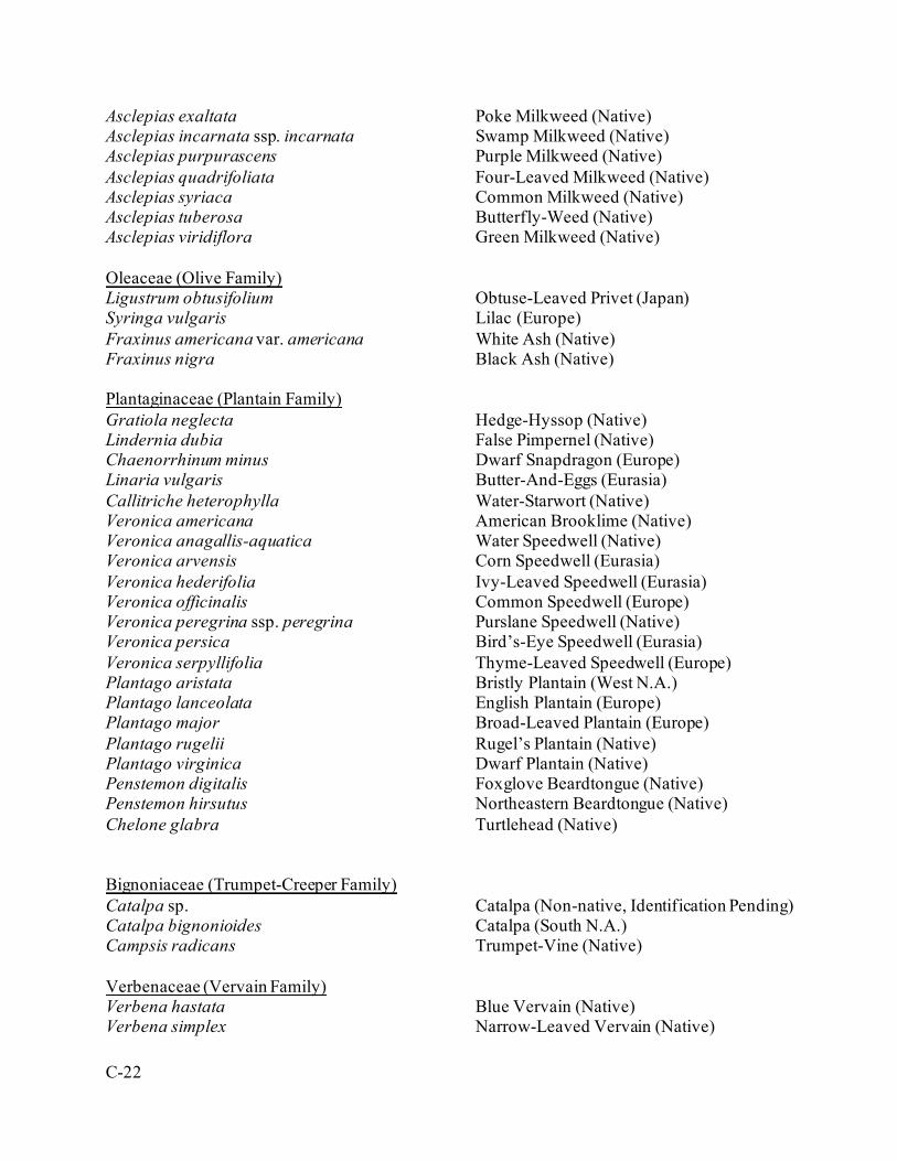
C-22
Asclepias exaltata Poke Milkweed (Native) Asclepias incarnata ssp. incarnata Swamp Milkweed (Native) Asclepias purpurascens Purple Milkweed (Native) Asclepias quadrifoliata Four-Leaved Milkweed (Native) Asclepias syriaca Common Milkweed (Native) Asclepias tuberosa Butterfly-Weed (Native) Asclepias viridiflora Green Milkweed (Native) Oleaceae (Olive Family) Ligustrum obtusifolium Obtuse-Leaved Privet (Japan) Syringa vulgaris Lilac (Europe) Fraxinus americana var. americana White Ash (Native) Fraxinus nigra Black Ash (Native) Plantaginaceae (Plantain Family) Gratiola neglecta Hedge-Hyssop (Native) Lindernia dubia False Pimpernel (Native) Chaenorrhinum minus Dwarf Snapdragon (Europe) Linaria vulgaris Butter-And-Eggs (Eurasia) Callitriche heterophylla Water-Starwort (Native) Veronica americana American Brooklime (Native) Veronica anagallis-aquatica Water Speedwell (Native) Veronica arvensis Corn Speedwell (Eurasia) Veronica hederifolia Ivy-Leaved Speedwell (Eurasia) Veronica officinalis Common Speedwell (Europe) Veronica peregrina ssp. peregrina Purslane Speedwell (Native) Veronica persica Bird’s-Eye Speedwell (Eurasia) Veronica serpyllifolia Thyme-Leaved Speedwell (Europe) Plantago aristata Bristly Plantain (West N.A.) Plantago lanceolata English Plantain (Europe) Plantago major Broad-Leaved Plantain (Europe) Plantago rugelii Rugel’s Plantain (Native) Plantago virginica Dwarf Plantain (Native) Penstemon digitalis Foxglove Beardtongue (Native) Penstemon hirsutus Northeastern Beardtongue (Native) Chelone glabra Turtlehead (Native) Bignoniaceae (Trumpet-Creeper Family) Catalpa sp. Catalpa (Non-native, Identification Pending) Catalpa bignonioides Catalpa (South N.A.) Campsis radicans Trumpet-Vine (Native) Verbenaceae (Vervain Family) Verbena hastata Blue Vervain (Native) Verbena simplex Narrow-Leaved Vervain (Native)
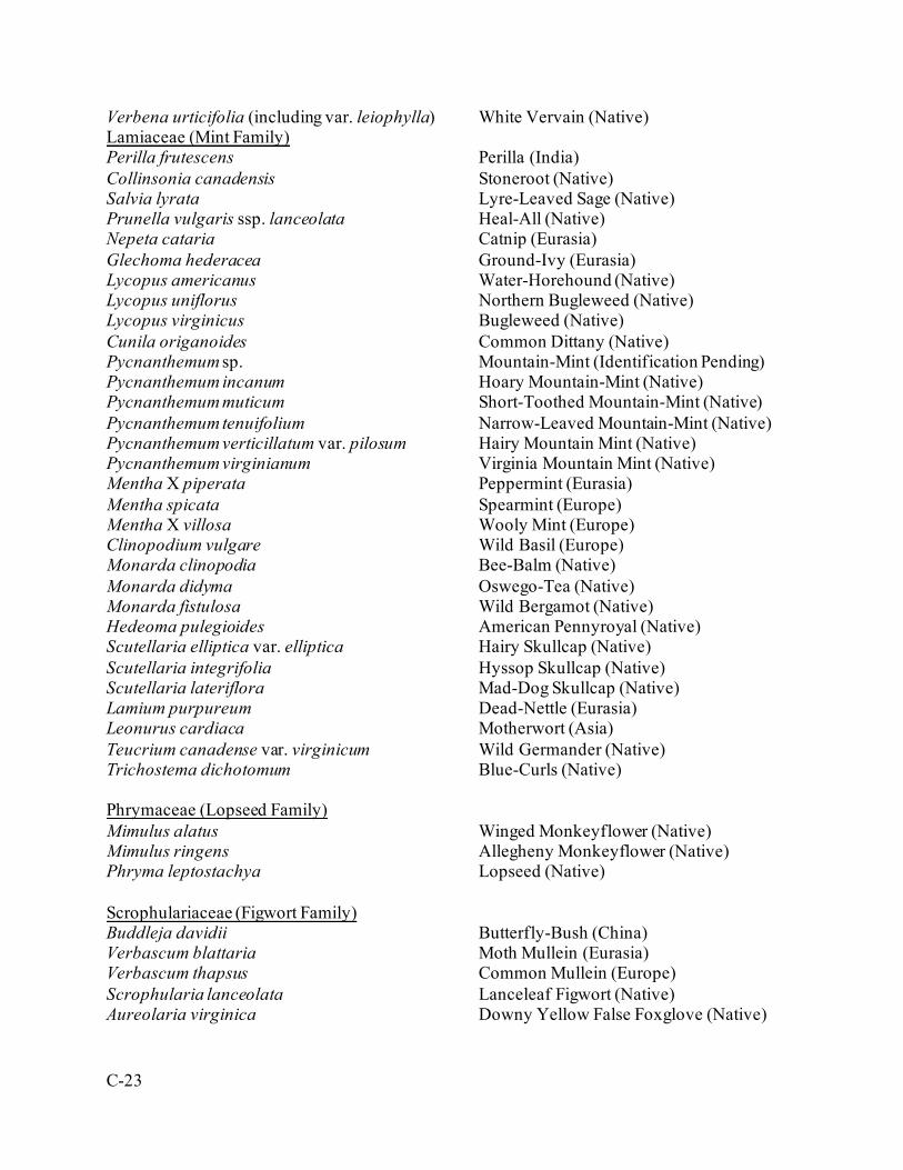
C-23
Verbena urticifolia (including var. leiophylla) White Vervain (Native) Lamiaceae (Mint Family) Perilla frutescens Perilla (India) Collinsonia canadensis Stoneroot (Native) Salvia lyrata Lyre-Leaved Sage (Native) Prunella vulgaris ssp. lanceolata Heal-All (Native) Nepeta cataria Catnip (Eurasia) Glechoma hederacea Ground-Ivy (Eurasia) Lycopus americanus Water-Horehound (Native) Lycopus uniflorus Northern Bugleweed (Native) Lycopus virginicus Bugleweed (Native) Cunila origanoides Common Dittany (Native) Pycnanthemum sp. Mountain-Mint (Identification Pending) Pycnanthemum incanum Hoary Mountain-Mint (Native) Pycnanthemum muticum Short-Toothed Mountain-Mint (Native) Pycnanthemum tenuifolium Narrow-Leaved Mountain-Mint (Native) Pycnanthemum verticillatum var. pilosum Hairy Mountain Mint (Native) Pycnanthemum virginianum Virginia Mountain Mint (Native) Mentha X piperata Peppermint (Eurasia) Mentha spicata Spearmint (Europe) Mentha X villosa Wooly Mint (Europe) Clinopodium vulgare Wild Basil (Europe) Monarda clinopodia Bee-Balm (Native) Monarda didyma Oswego-Tea (Native) Monarda fistulosa Wild Bergamot (Native) Hedeoma pulegioides American Pennyroyal (Native) Scutellaria elliptica var. elliptica Hairy Skullcap (Native) Scutellaria integrifolia Hyssop Skullcap (Native) Scutellaria lateriflora Mad-Dog Skullcap (Native) Lamium purpureum Dead-Nettle (Eurasia) Leonurus cardiaca Motherwort (Asia) Teucrium canadense var. virginicum Wild Germander (Native) Trichostema dichotomum Blue-Curls (Native) Phrymaceae (Lopseed Family) Mimulus alatus Winged Monkeyflower (Native) Mimulus ringens Allegheny Monkeyflower (Native) Phryma leptostachya Lopseed (Native) Scrophulariaceae (Figwort Family) Buddleja davidii Butterfly-Bush (China) Verbascum blattaria Moth Mullein (Eurasia) Verbascum thapsus Common Mullein (Europe) Scrophularia lanceolata Lanceleaf Figwort (Native) Aureolaria virginica Downy Yellow False Foxglove (Native)
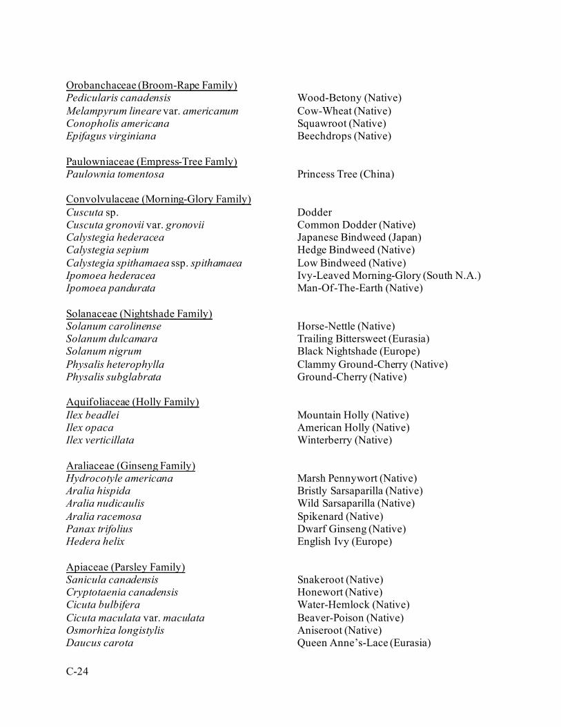
C-24
Orobanchaceae (Broom-Rape Family) Pedicularis canadensis Wood-Betony (Native) Melampyrum lineare var. americanum Cow-Wheat (Native) Conopholis americana Squawroot (Native) Epifagus virginiana Beechdrops (Native) Paulowniaceae (Empress-Tree Famly) Paulownia tomentosa Princess Tree (China) Convolvulaceae (Morning-Glory Family) Cuscuta sp. Dodder Cuscuta gronovii var. gronovii Common Dodder (Native) Calystegia hederacea Japanese Bindweed (Japan) Calystegia sepium Hedge Bindweed (Native) Calystegia spithamaea ssp. spithamaea Low Bindweed (Native) Ipomoea hederacea Ivy-Leaved Morning-Glory (South N.A.) Ipomoea pandurata Man-Of-The-Earth (Native) Solanaceae (Nightshade Family) Solanum carolinense Horse-Nettle (Native) Solanum dulcamara Trailing Bittersweet (Eurasia) Solanum nigrum Black Nightshade (Europe) Physalis heterophylla Clammy Ground-Cherry (Native) Physalis subglabrata Ground-Cherry (Native) Aquifoliaceae (Holly Family) Ilex beadlei Mountain Holly (Native) Ilex opaca American Holly (Native) Ilex verticillata Winterberry (Native) Araliaceae (Ginseng Family) Hydrocotyle americana Marsh Pennywort (Native) Aralia hispida Bristly Sarsaparilla (Native) Aralia nudicaulis Wild Sarsaparilla (Native) Aralia racemosa Spikenard (Native) Panax trifolius Dwarf Ginseng (Native) Hedera helix English Ivy (Europe) Apiaceae (Parsley Family) Sanicula canadensis Snakeroot (Native) Cryptotaenia canadensis Honewort (Native) Cicuta bulbifera Water-Hemlock (Native) Cicuta maculata var. maculata Beaver-Poison (Native) Osmorhiza longistylis Aniseroot (Native) Daucus carota Queen Anne’s-Lace (Eurasia)
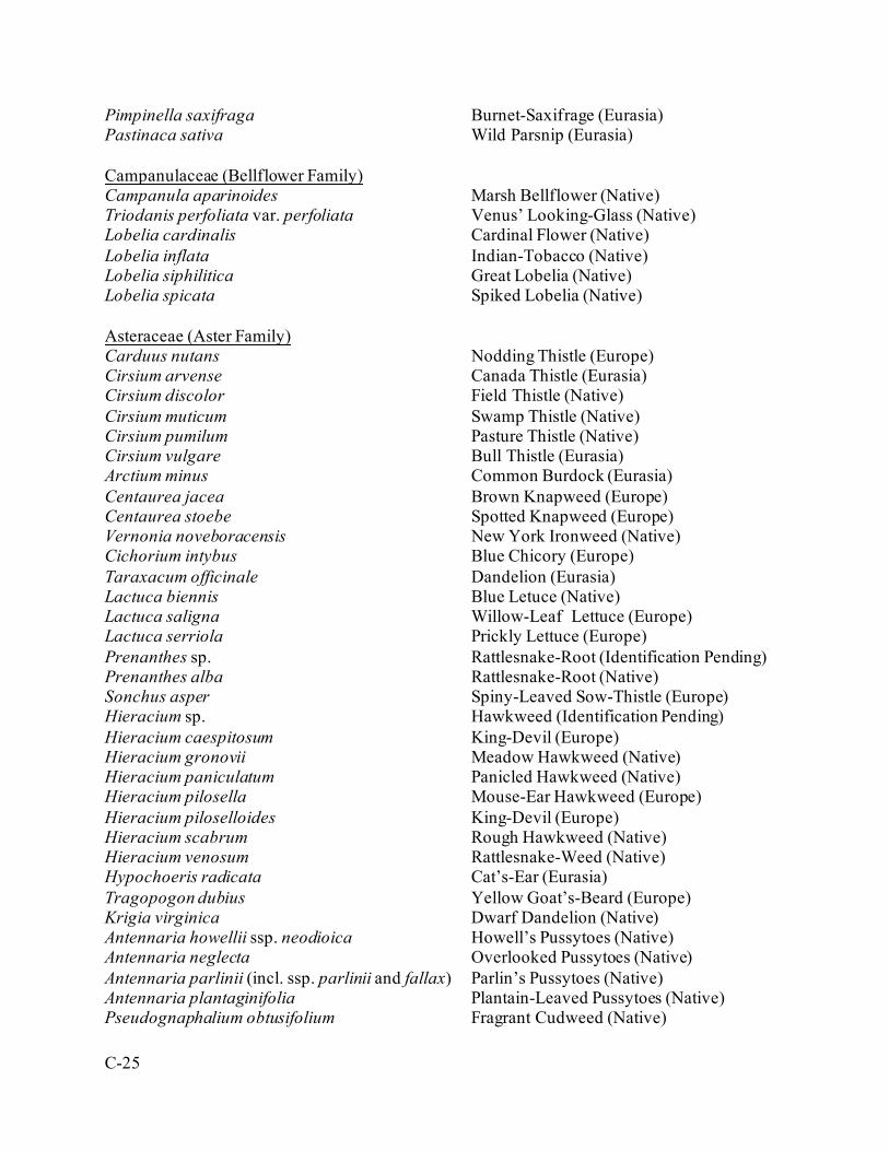
C-25
Pimpinella saxifraga Burnet-Saxifrage (Eurasia) Pastinaca sativa Wild Parsnip (Eurasia) Campanulaceae (Bellflower Family) Campanula aparinoides Marsh Bellflower (Native) Triodanis perfoliata var. perfoliata Venus’ Looking-Glass (Native) Lobelia cardinalis Cardinal Flower (Native) Lobelia inflata Indian-Tobacco (Native) Lobelia siphilitica Great Lobelia (Native) Lobelia spicata Spiked Lobelia (Native) Asteraceae (Aster Family) Carduus nutans Nodding Thistle (Europe) Cirsium arvense Canada Thistle (Eurasia) Cirsium discolor Field Thistle (Native) Cirsium muticum Swamp Thistle (Native) Cirsium pumilum Pasture Thistle (Native) Cirsium vulgare Bull Thistle (Eurasia) Arctium minus Common Burdock (Eurasia) Centaurea jacea Brown Knapweed (Europe) Centaurea stoebe Spotted Knapweed (Europe) Vernonia noveboracensis New York Ironweed (Native) Cichorium intybus Blue Chicory (Europe) Taraxacum officinale Dandelion (Eurasia) Lactuca biennis Blue Letuce (Native) Lactuca saligna Willow-Leaf Lettuce (Europe) Lactuca serriola Prickly Lettuce (Europe) Prenanthes sp. Rattlesnake-Root (Identification Pending) Prenanthes alba Rattlesnake-Root (Native) Sonchus asper Spiny-Leaved Sow-Thistle (Europe) Hieracium sp. Hawkweed (Identification Pending) Hieracium caespitosum King-Devil (Europe) Hieracium gronovii Meadow Hawkweed (Native) Hieracium paniculatum Panicled Hawkweed (Native) Hieracium pilosella Mouse-Ear Hawkweed (Europe) Hieracium piloselloides King-Devil (Europe) Hieracium scabrum Rough Hawkweed (Native) Hieracium venosum Rattlesnake-Weed (Native) Hypochoeris radicata Cat’s-Ear (Eurasia) Tragopogon dubius Yellow Goat’s-Beard (Europe) Krigia virginica Dwarf Dandelion (Native) Antennaria howellii ssp. neodioica Howell’s Pussytoes (Native) Antennaria neglecta Overlooked Pussytoes (Native) Antennaria parlinii (incl. ssp. parlinii and fallax) Parlin’s Pussytoes (Native) Antennaria plantaginifolia Plantain-Leaved Pussytoes (Native) Pseudognaphalium obtusifolium Fragrant Cudweed (Native)
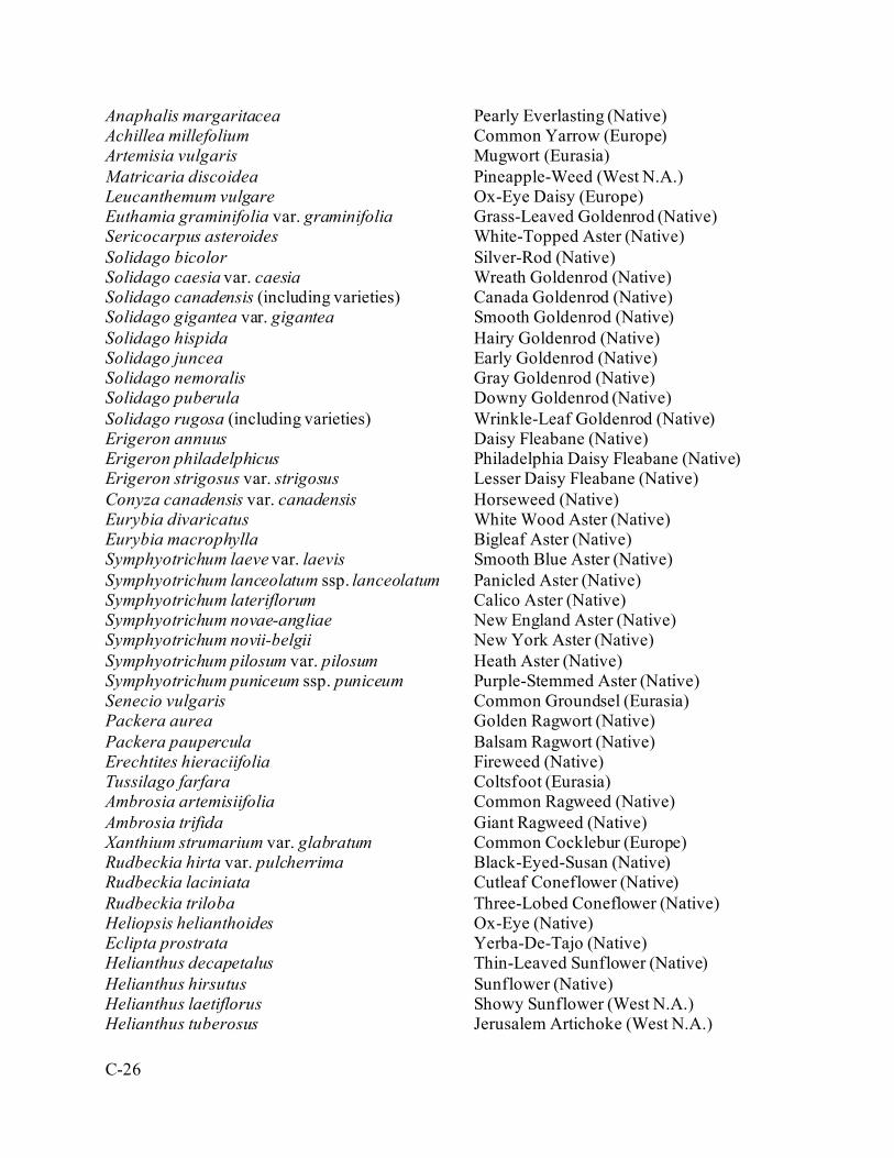
C-26
Anaphalis margaritacea Pearly Everlasting (Native) Achillea millefolium Common Yarrow (Europe) Artemisia vulgaris Mugwort (Eurasia) Matricaria discoidea Pineapple-Weed (West N.A.) Leucanthemum vulgare Ox-Eye Daisy (Europe) Euthamia graminifolia var. graminifolia Grass-Leaved Goldenrod (Native) Sericocarpus asteroides White-Topped Aster (Native) Solidago bicolor Silver-Rod (Native) Solidago caesia var. caesia Wreath Goldenrod (Native) Solidago canadensis (including varieties) Canada Goldenrod (Native) Solidago gigantea var. gigantea Smooth Goldenrod (Native) Solidago hispida Hairy Goldenrod (Native) Solidago juncea Early Goldenrod (Native) Solidago nemoralis Gray Goldenrod (Native) Solidago puberula Downy Goldenrod (Native) Solidago rugosa (including varieties) Wrinkle-Leaf Goldenrod (Native) Erigeron annuus Daisy Fleabane (Native) Erigeron philadelphicus Philadelphia Daisy Fleabane (Native) Erigeron strigosus var. strigosus Lesser Daisy Fleabane (Native) Conyza canadensis var. canadensis Horseweed (Native) Eurybia divaricatus White Wood Aster (Native) Eurybia macrophylla Bigleaf Aster (Native) Symphyotrichum laeve var. laevis Smooth Blue Aster (Native) Symphyotrichum lanceolatum ssp. lanceolatum Panicled Aster (Native) Symphyotrichum lateriflorum Calico Aster (Native) Symphyotrichum novae-angliae New England Aster (Native) Symphyotrichum novii-belgii New York Aster (Native) Symphyotrichum pilosum var. pilosum Heath Aster (Native) Symphyotrichum puniceum ssp. puniceum Purple-Stemmed Aster (Native) Senecio vulgaris Common Groundsel (Eurasia) Packera aurea Golden Ragwort (Native) Packera paupercula Balsam Ragwort (Native) Erechtites hieraciifolia Fireweed (Native) Tussilago farfara Coltsfoot (Eurasia) Ambrosia artemisiifolia Common Ragweed (Native) Ambrosia trifida Giant Ragweed (Native) Xanthium strumarium var. glabratum Common Cocklebur (Europe) Rudbeckia hirta var. pulcherrima Black-Eyed-Susan (Native) Rudbeckia laciniata Cutleaf Coneflower (Native) Rudbeckia triloba Three-Lobed Coneflower (Native) Heliopsis helianthoides Ox-Eye (Native) Eclipta prostrata Yerba-De-Tajo (Native) Helianthus decapetalus Thin-Leaved Sunflower (Native) Helianthus hirsutus Sunflower (Native) Helianthus laetiflorus Showy Sunflower (West N.A.) Helianthus tuberosus Jerusalem Artichoke (West N.A.)

C-27
Galinsoga quadriradiata Quickweed (Central & S. America) Bidens frondosa Beggar-Ticks (Native) Bidens polylepis Tickseed-Sunflower (West N.A.) Bidens tripartite Three-Lobed Beggar-Ticks (Native) Helenium autumnale Common Sneezeweed (Native) Eupatorium godfreyanum Vasey’s Eupatorium (Native) Eupatorium perfoliatum Boneset (Native) Eupatorium rotundifolium nr. var. ovatum Round-Leafed Throughwort (Native) Eupatorium serotinum Late Boneset (Native) Eupatorium sessilifolium Upland Boneset (Native) Eutrochium fistulosum Hollow Joe-Pye-Weed (Native) Eutrochium maculatum Spotted Joe-Pye-Weed (Native) Eutrochium purpureum Sweet Joe-Pye-Weed (Native) Ageratina altissima White-Snakeroot (Native) Adoxaceae (Muskroot Family) Viburnum acerifolium Maple-Leaved Viburnum (Native) Viburnum cassinoides Witherod (Native) Viburnum dentatum Southern Arrow-Wood (Native) Viburnum lantana Wayfaring-Tree (China) Viburnum lentago Nannyberry (Native) Viburnum prunifolium Black-Haw (Native) Viburnum recognitum Northern Arrow-Wood (Native) Sambucus canadensis Common Elderberry (Native) Sambucus racemosa var. pubens Red Elderberry (Native) Caprifoliaceae (Honeysuckle Family) Symphoricarpos orbiculatus Coralberry (Native) Triosteum angustifolium Horse-Gentian (Native) Lonicera japonica var. japonica Japanese Honeysuckle (Asia) Lonicera maackii Amur Honeysuckle (Asia) Lonicera morrowii Morrow’s Honeysuckle (Japan) Lonicera morrowii x tatarica Honeysuckle (Non-Native) Lonicera xylosteum Dwarf Honeysuckle, European Fly
Honeysuckle (Europe) Diervilla lonicera Bush-Honeysuckle (Native) Dipsacaceae (Teasel Family) Dipsacus sylvestris Common Teasel (Native)
ANIMALIA
Herpetofauna (Amphibians and Reptiles) Amphibia Bufonidae
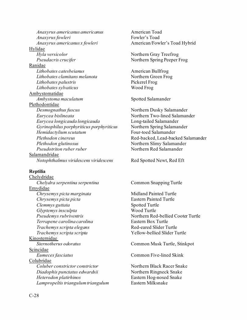
C-28
Anaxyrus americanus americanus American Toad Anaxyrus fowleri Fowler’s Toad Anaxyrus americanus x fowleri American/Fowler’s Toad Hybrid
Hylidae Hyla versicolor Northern Gray Treefrog Pseudacris crucifer Northern Spring Peeper Frog
Ranidae Lithobates catesbeianus American Bullfrog Lithobates clamitans melanota Northern Green Frog Lithobates palustris Pickerel Frog Lithobates sylvaticus Wood Frog
Ambystomatidae Ambystoma maculatum Spotted Salamander
Plethodontidae Desmognathus fuscus Northern Dusky Salamander Eurycea bislineata Northern Two-lined Salamander Eurycea longicauda longicauda Long-tailed Salamander Gyrinophilus porphyriticus porphyriticus Northern Spring Salamander Hemidactylium scutatum Four-toed Salamander Plethodon cinereus Red-backed, Lead-backed Salamander Plethodon glutinosus Northern Slimy Salamander Pseudotriton ruber ruber Northern Red Salamander
Salamandridae Notophthalmus viridescens viridescens Red Spotted Newt, Red Eft
Reptilia Chelydridae
Chelydra serpentina serpentina Common Snapping Turtle Emydidae
Chrysemys picta marginata Midland Painted Turtle Chrysemys picta picta Eastern Painted Turtle Clemmys guttata Spotted Turtle Glyptemys insculpta Wood Turtle Pseudemys rubriventris Northern Red-bellied Cooter Turtle Terrapene carolina carolina Eastern Box Turtle Trachemys scripta elegans Red-eared Slider Turtle Trachemys scripta scripta Yellow-bellied Slider Turtle
Kinosternidae Sternotherus odoratus Common Musk Turtle, Stinkpot
Scincidae Eumeces fasciatus Common Five-lined Skink
Colubridae Coluber constrictor constrictor Northern Black Racer Snake Diadophis punctatus edwardsii Northern Ringneck Snake Heterodon platirhinos Eastern Hog-nosed Snake Lampropeltis triangulum triangulum Eastern Milksnake
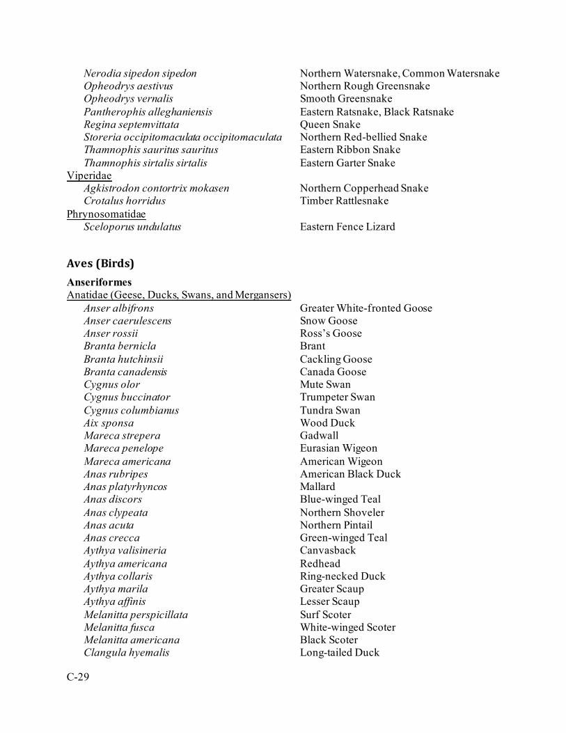
C-29
Nerodia sipedon sipedon Northern Watersnake, Common Watersnake Opheodrys aestivus Northern Rough Greensnake Opheodrys vernalis Smooth Greensnake Pantherophis alleghaniensis Eastern Ratsnake, Black Ratsnake Regina septemvittata Queen Snake Storeria occipitomaculata occipitomaculata Northern Red-bellied Snake Thamnophis sauritus sauritus Eastern Ribbon Snake Thamnophis sirtalis sirtalis Eastern Garter Snake
Viperidae Agkistrodon contortrix mokasen Northern Copperhead Snake Crotalus horridus Timber Rattlesnake
Phrynosomatidae Sceloporus undulatus Eastern Fence Lizard
Aves (Birds) Anseriformes Anatidae (Geese, Ducks, Swans, and Mergansers)
Anser albifrons Greater White-fronted Goose Anser caerulescens Snow Goose Anser rossii Ross’s Goose Branta bernicla Brant Branta hutchinsii Cackling Goose Branta canadensis Canada Goose Cygnus olor Mute Swan Cygnus buccinator Trumpeter Swan Cygnus columbianus Tundra Swan Aix sponsa Wood Duck Mareca strepera Gadwall Mareca penelope Eurasian Wigeon Mareca americana American Wigeon Anas rubripes American Black Duck Anas platyrhyncos Mallard Anas discors Blue-winged Teal Anas clypeata Northern Shoveler Anas acuta Northern Pintail Anas crecca Green-winged Teal Aythya valisineria Canvasback Aythya americana Redhead Aythya collaris Ring-necked Duck Aythya marila Greater Scaup Aythya affinis Lesser Scaup Melanitta perspicillata Surf Scoter Melanitta fusca White-winged Scoter Melanitta americana Black Scoter Clangula hyemalis Long-tailed Duck

C-30
Bucephala albeola Bufflehead Bucephala clangula Common Goldeneye Lophodytes cucullatus Hooded Merganser Mergus merganser Common Merganser Mergus serrator Red-breasted Merganser Oxyura jamaicensis Ruddy Duck
Galliformes Odontophoridae (Quails)
Colinus virginianus Northern Bobwhite Quail Phasianidae (Pheasants and Partridges)
Phasianus colchicus Ring-necked Pheasant Bonasa umbellus Ruffed Grouse Meleagris gallopavo Wild Turkey
Gaviiformes Gaviidae (Loons)
Gavia stellata Red-throated Loon Gavia immer Common Loon
Podicipediformes Podicipedidae (Grebes)
Podilymbus podiceps Pied-billed Grebe Podiceps auritus Horned Grebe Podiceps grisegena Red-necked Grebe Podiceps nigricollis Eared Grebe Aechmophorus occidentalis Western Grebe
Suliformes Phalacrocoracidae (Cormorants)
Phalacrocorax auritus Double-crested Cormorant Anhingidae (Anhingas)
Anhinga anhinga Anhinga Procellariiformes Hydrobatidae
Oceanodroma leucorhoa Leach’s Storm-petrel Ciconiiformes Ardeidae (Bitterns, Egrets, and Herons)
Botaurus lentiginosus American Bittern Ixobryclus exilis Least Bittern Ardea herodias Great Blue Heron Ardea alba Great Egret Egretta caerulea Little Blue Heron
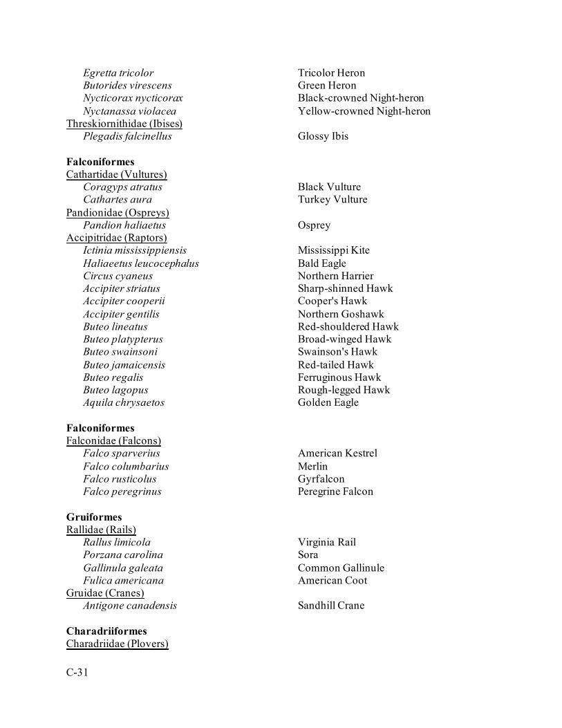
C-31
Egretta tricolor Tricolor Heron Butorides virescens Green Heron Nycticorax nycticorax Black-crowned Night-heron Nyctanassa violacea Yellow-crowned Night-heron
Threskiornithidae (Ibises) Plegadis falcinellus Glossy Ibis
Falconiformes Cathartidae (Vultures)
Coragyps atratus Black Vulture Cathartes aura Turkey Vulture
Pandionidae (Ospreys) Pandion haliaetus Osprey
Accipitridae (Raptors) Ictinia mississippiensis Mississippi Kite Haliaeetus leucocephalus Bald Eagle Circus cyaneus Northern Harrier Accipiter striatus Sharp-shinned Hawk Accipiter cooperii Cooper's Hawk Accipiter gentilis Northern Goshawk Buteo lineatus Red-shouldered Hawk Buteo platypterus Broad-winged Hawk Buteo swainsoni Swainson's Hawk Buteo jamaicensis Red-tailed Hawk Buteo regalis Ferruginous Hawk Buteo lagopus Rough-legged Hawk Aquila chrysaetos Golden Eagle
Falconiformes Falconidae (Falcons)
Falco sparverius American Kestrel Falco columbarius Merlin Falco rusticolus Gyrfalcon Falco peregrinus Peregrine Falcon
Gruiformes Rallidae (Rails)
Rallus limicola Virginia Rail Porzana carolina Sora Gallinula galeata Common Gallinule Fulica americana American Coot
Gruidae (Cranes) Antigone canadensis Sandhill Crane
Charadriiformes Charadriidae (Plovers)
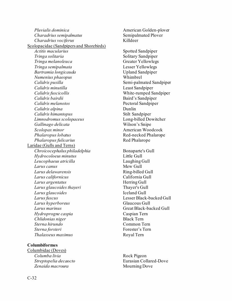
C-32
Pluvialis dominica American Golden-plover Charadrius semipalmatus Semipalmated Plover Charadrius vociferus Killdeer
Scolopacidae (Sandpipers and Shorebirds) Actitis macularius Spotted Sandpiper Tringa solitaria Solitary Sandpiper Tringa melanoleuca Greater Yellowlegs Tringa semipalmata Lesser Yellowlegs Bartramia longicauda Upland Sandpiper Numenius phaeopus Whimbrel Calidris pusilla Semi-palmated Sandpiper Calidris minutilla Least Sandpiper Calidris fuscicollis White-rumped Sandpiper Calidris bairdii Baird’s Sandpiper Calidris melanotos Pectoral Sandpiper Calidris alpina Dunlin Calidris himantopus Stilt Sandpiper Limnodromus scolopaceus Long-billed Dowitcher Gallinago delicata Wilson’s Snipe Scolopax minor American Woodcock Phalaropus lobatus Red-necked Phalarope Phalaropus fulicarius Red Phalarope
Laridae (Gulls and Terns) Chroicocephalus philadelphia Bonaparte's Gull Hydrocoloeus minutus Little Gull Leucophaeus atricilla Laughing Gull Larus canus Mew Gull Larus delawarensis Ring-billed Gull Larus californicus California Gull Larus argentatus Herring Gull Larus glaucoides thayeri Thayer's Gull Larus glaucoides Iceland Gull Larus fuscus Lesser Black-backed Gull Larus hyperboreus Glaucous Gull Larus marinus Great Black-backed Gull Hydroprogne caspia Caspian Tern Chlidonias niger Black Tern Sterna hirundo Common Tern Sterna forsteri Forester’s Tern Thalasseus maximus Royal Tern
Columbiformes Columbidae (Doves)
Columba livia Rock Pigeon Streptopelia decaocto Eurasian Collared-Dove Zenaida macroura Mourning Dove

C-33
Cuculiformes Cuculidae (Cuckoos)
Coccyzus americanus Yellow-billed Cuckoo Coccyzus erythropthalmus Black-billed Cuckoo
Strigiformes Tytonidae (Barn Owls)
Tyto alba Barn Owl Strigidae (True Owls)
Megascops asio Eastern Screech-Owl Bubo virginianus Great Horned Owl Strix varia Barred Owl Asio flammeus Short-eared Owl Aegolius acadicus Northern Saw-whet Owl
Caprimulgiformes Caprimulgidae (Nightjars)
Chordeiles minor Common Nighthawk Antrostomus carolinensis Chuck-wills-widow Antrotsomus vociferus Eastern Whip-poor-will
Apodiformes Apodidae (Swifts)
Chaetura pelagica Chimney Swift Trochilidae (Hummingbirds)
Archilochus colubris Ruby-throated Hummingbird Coraciiformes Alcedinidae (Kingfishers)
Megaceryle alcyon Belted Kingfisher Piciformes Picidae (Woodpeckers)
Melanerpus erythrocephalus Red-headed Woodpecker Melanerpes carolinus Red-bellied Woodpecker Sphyrapicus varius Yellow-bellied Sapsucker Dryobates pubescens Downy Woodpecker Dryobates villosus Hairy Woodpecker Colaptes auratus Northern Flicker Dryocopus pileatus Pileated Woodpecker
Passeriformes Tyrannidae (New World Flycatchers)
Contopus cooperi Olive-sided Flycatcher Contopus virens Eastern Wood-Pewee
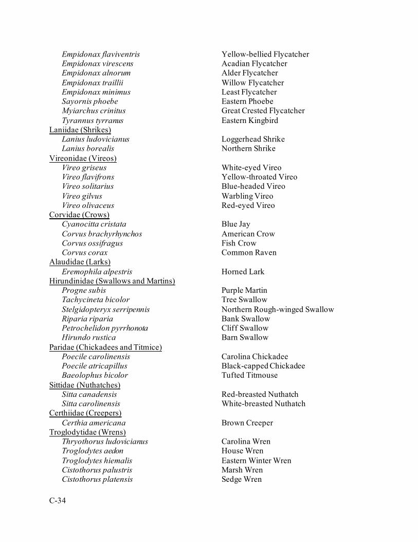
C-34
Empidonax flaviventris Yellow-bellied Flycatcher Empidonax virescens Acadian Flycatcher Empidonax alnorum Alder Flycatcher Empidonax traillii Willow Flycatcher Empidonax minimus Least Flycatcher Sayornis phoebe Eastern Phoebe Myiarchus crinitus Great Crested Flycatcher Tyrannus tyrranus Eastern Kingbird
Laniidae (Shrikes) Lanius ludovicianus Loggerhead Shrike Lanius borealis Northern Shrike
Vireonidae (Vireos) Vireo griseus White-eyed Vireo Vireo flavifrons Yellow-throated Vireo Vireo solitarius Blue-headed Vireo Vireo gilvus Warbling Vireo Vireo olivaceus Red-eyed Vireo
Corvidae (Crows) Cyanocitta cristata Blue Jay Corvus brachyrhynchos American Crow Corvus ossifragus Fish Crow Corvus corax Common Raven
Alaudidae (Larks) Eremophila alpestris Horned Lark
Hirundinidae (Swallows and Martins) Progne subis Purple Martin Tachycineta bicolor Tree Swallow Stelgidopteryx serripennis Northern Rough-winged Swallow Riparia riparia Bank Swallow Petrochelidon pyrrhonota Cliff Swallow Hirundo rustica Barn Swallow
Paridae (Chickadees and Titmice) Poecile carolinensis Carolina Chickadee Poecile atricapillus Black-capped Chickadee Baeolophus bicolor Tufted Titmouse
Sittidae (Nuthatches) Sitta canadensis Red-breasted Nuthatch Sitta carolinensis White-breasted Nuthatch
Certhiidae (Creepers) Certhia americana Brown Creeper
Troglodytidae (Wrens) Thryothorus ludovicianus Carolina Wren Troglodytes aedon House Wren Troglodytes hiemalis Eastern Winter Wren Cistothorus palustris Marsh Wren Cistothorus platensis Sedge Wren
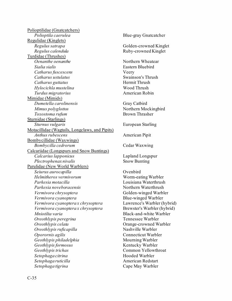
C-35
Polioptilidae (Gnatcatchers) Polioptila caerulea Blue-gray Gnatcatcher
Regulidae (Kinglets) Regulus satrapa Golden-crowned Kinglet Regulus calendula Ruby-crowned Kinglet
Turdidae (Thrushes) Oenanthe oenanthe Northern Wheatear Sialia sialis Eastern Bluebird Catharus fuscescens Veery Catharus ustulatus Swainson's Thrush Catharus guttatus Hermit Thrush Hylocichla mustelina Wood Thrush Turdus migratorius American Robin
Mimidae (Mimids) Dumetella carolinensis Gray Catbird Mimus polyglottos Northern Mockingbird Toxostoma rufum Brown Thrasher
Sturnidae (Starlings) Sturnus vulgaris European Starling
Motacillidae (Wagtails, Longclaws, and Pipits) Anthus rubescens American Pipit
Bombycillidae (Waxwings) Bombycilla cedrorum Cedar Waxwing
Calcariidae (Longspurs and Snow Buntings) Calcarius lapponicus Lapland Longspur Plectrophenax nivalis Snow Bunting
Parulidae (New World Warblers) Seiurus aurocapilla Ovenbird Helmitheros vermivorum Worm-eating Warbler Parkesia motacilla Louisiana Waterthrush Parkesia noveboracensis Northern Waterthrush Vermivora chrysoptera Golden-winged Warbler Vermivora cyanoptera Blue-winged Warbler Vermivora cyanoptera x chrysoptera Lawrence's Warbler (hybrid) Vermivora cyanoptera x chrysoptera Brewster's Warbler (hybrid) Mniotilta varia Black-and-white Warbler Oreothlypis peregrina Tennessee Warbler Oreothlypis celata Orange-crowned Warbler Oreothlypis ruficapilla Nashville Warbler Oporornis agilis Connecticut Warbler Geothlypis philadelphia Mourning Warbler Geothlypis formosus Kentucky Warbler Geothlypis trichas Common Yellowthroat Setophaga citrina Hooded Warbler Setophaga ruticilla American Redstart Setophaga tigrina Cape May Warbler
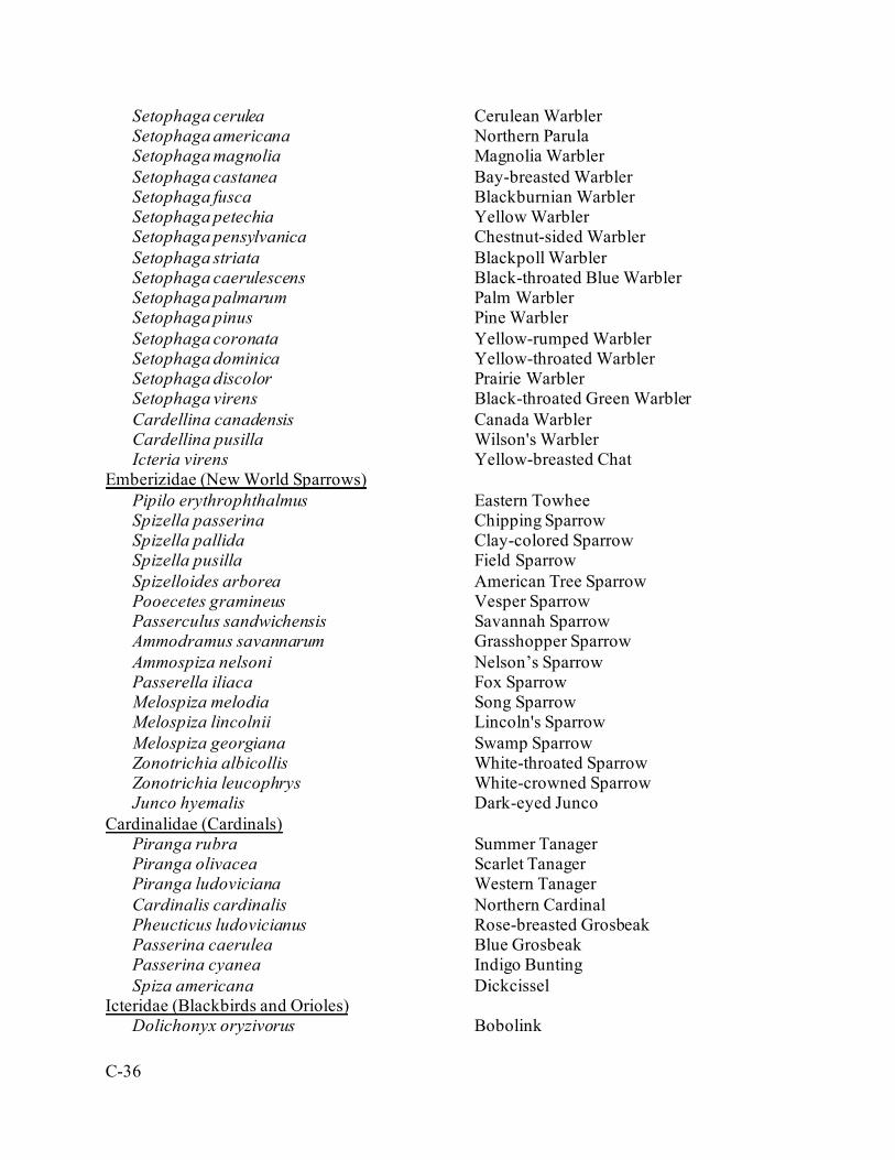
C-36
Setophaga cerulea Cerulean Warbler Setophaga americana Northern Parula Setophaga magnolia Magnolia Warbler Setophaga castanea Bay-breasted Warbler Setophaga fusca Blackburnian Warbler Setophaga petechia Yellow Warbler Setophaga pensylvanica Chestnut-sided Warbler Setophaga striata Blackpoll Warbler Setophaga caerulescens Black-throated Blue Warbler Setophaga palmarum Palm Warbler Setophaga pinus Pine Warbler Setophaga coronata Yellow-rumped Warbler Setophaga dominica Yellow-throated Warbler Setophaga discolor Prairie Warbler Setophaga virens Black-throated Green Warbler Cardellina canadensis Canada Warbler Cardellina pusilla Wilson's Warbler Icteria virens Yellow-breasted Chat
Emberizidae (New World Sparrows) Pipilo erythrophthalmus Eastern Towhee Spizella passerina Chipping Sparrow Spizella pallida Clay-colored Sparrow Spizella pusilla Field Sparrow Spizelloides arborea American Tree Sparrow Pooecetes gramineus Vesper Sparrow Passerculus sandwichensis Savannah Sparrow Ammodramus savannarum Grasshopper Sparrow Ammospiza nelsoni Nelson’s Sparrow Passerella iliaca Fox Sparrow Melospiza melodia Song Sparrow Melospiza lincolnii Lincoln's Sparrow Melospiza georgiana Swamp Sparrow Zonotrichia albicollis White-throated Sparrow Zonotrichia leucophrys White-crowned Sparrow Junco hyemalis Dark-eyed Junco
Cardinalidae (Cardinals) Piranga rubra Summer Tanager Piranga olivacea Scarlet Tanager Piranga ludoviciana Western Tanager Cardinalis cardinalis Northern Cardinal Pheucticus ludovicianus Rose-breasted Grosbeak Passerina caerulea Blue Grosbeak Passerina cyanea Indigo Bunting Spiza americana Dickcissel
Icteridae (Blackbirds and Orioles) Dolichonyx oryzivorus Bobolink
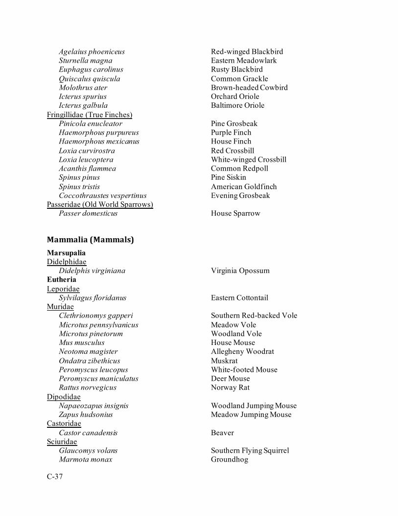
C-37
Agelaius phoeniceus Red-winged Blackbird Sturnella magna Eastern Meadowlark Euphagus carolinus Rusty Blackbird Quiscalus quiscula Common Grackle Molothrus ater Brown-headed Cowbird Icterus spurius Orchard Oriole Icterus galbula Baltimore Oriole
Fringillidae (True Finches) Pinicola enucleator Pine Grosbeak Haemorphous purpureus Purple Finch Haemorphous mexicanus House Finch Loxia curvirostra Red Crossbill Loxia leucoptera White-winged Crossbill Acanthis flammea Common Redpoll Spinus pinus Pine Siskin Spinus tristis American Goldfinch Coccothraustes vespertinus Evening Grosbeak
Passeridae (Old World Sparrows) Passer domesticus House Sparrow
Mammalia (Mammals) Marsupalia Didelphidae
Didelphis virginiana Virginia Opossum Eutheria Leporidae
Sylvilagus floridanus Eastern Cottontail Muridae
Clethrionomys gapperi Southern Red-backed Vole Microtus pennsylvanicus Meadow Vole Microtus pinetorum Woodland Vole Mus musculus House Mouse Neotoma magister Allegheny Woodrat Ondatra zibethicus Muskrat Peromyscus leucopus White-footed Mouse Peromyscus maniculatus Deer Mouse Rattus norvegicus Norway Rat
Dipodidae Napaeozapus insignis Woodland Jumping Mouse Zapus hudsonius Meadow Jumping Mouse
Castoridae Castor canadensis Beaver
Sciuridae Glaucomys volans Southern Flying Squirrel Marmota monax Groundhog
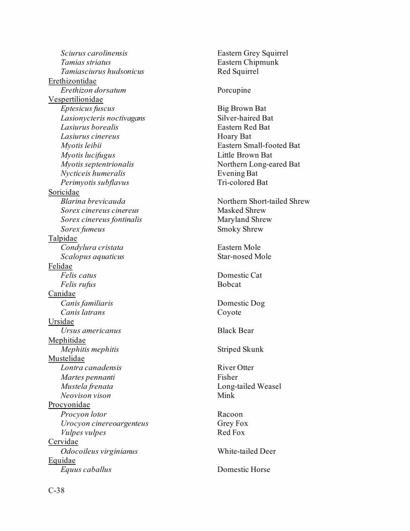
C-38
Sciurus carolinensis Eastern Grey Squirrel Tamias striatus Eastern Chipmunk Tamiasciurus hudsonicus Red Squirrel
Erethizontidae Erethizon dorsatum Porcupine
Vespertilionidae Eptesicus fuscus Big Brown Bat Lasionycteris noctivagans Silver-haired Bat Lasiurus borealis Eastern Red Bat Lasiurus cinereus Hoary Bat Myotis leibii Eastern Small-footed Bat Myotis lucifugus Little Brown Bat Myotis septentrionalis Northern Long-eared Bat Nycticeis humeralis Evening Bat Perimyotis subflavus Tri-colored Bat
Soricidae Blarina brevicauda Northern Short-tailed Shrew Sorex cinereus cinereus Masked Shrew Sorex cinereus fontinalis Maryland Shrew Sorex fumeus Smoky Shrew
Talpidae Condylura cristata Eastern Mole Scalopus aquaticus Star-nosed Mole
Felidae Felis catus Domestic Cat Felis rufus Bobcat
Canidae Canis familiaris Domestic Dog Canis latrans Coyote
Ursidae Ursus americanus Black Bear
Mephitidae Mephitis mephitis Striped Skunk
Mustelidae Lontra canadensis River Otter Martes pennanti Fisher Mustela frenata Long-tailed Weasel Neovison vison Mink
Procyonidae Procyon lotor Racoon Urocyon cinereoargenteus Grey Fox Vulpes vulpes Red Fox
Cervidae Odocoileus virginianus White-tailed Deer
Equidae Equus caballus Domestic Horse

C-39
Osteichthyes (Fish) Cypriniformes Cyprinidae (Carps and Minnows)
Campostoma anomalum Central Stoneroller Cyprinella spiloptera Spotfin Shiner Exoglossum maxillingua Cutlips Minnow Luxilus cornutus Common Shiner Margariscus margarita Pearl Dace Nocomis micropogon River Chub Notemigonus crysoleucas Golden Shiner Notropis hudsonius Spottail Shiner Notropis procne Swallowtail Shiner Notropis rubellus Rosyface Shiner Rhinichthys atratulus Eastern Blacknose Dace Rhinichthys cataractae Longnose Dace Pimephales notatus Bluntnose Minnow Semotilus atromaculatus Creek Chub Semotilus corporalis Fallfish
Catostomidae (Suckers) Catostomus commersonii White Sucker Hypentelium nigricans Northern Hog Sucker
Siluriformes Ictaluridae (North American Freshwater Catfishes)
Ameiurus natalis Yellow Bullhead Ameiurus nebulosus Brown Bullhead Noturus insignis Margined Madtom
Salmoniformes Salmonidae (Trouts)
Oncorhynchus mykiss Rainbow Trout Salmo trutta Brown Trout Salvelinus fontinalis Brook Trout
Esociformes Esocidae (Pikes, Pickerels, and Muskellunges)
Esox niger Chain Pickerel Scorpaeniformes Cottidae (Sculpins)
Cottus bairdii Mottled Sculpin Perciformes Centrarchidae (Sunfishes, Basses, and Crappies)
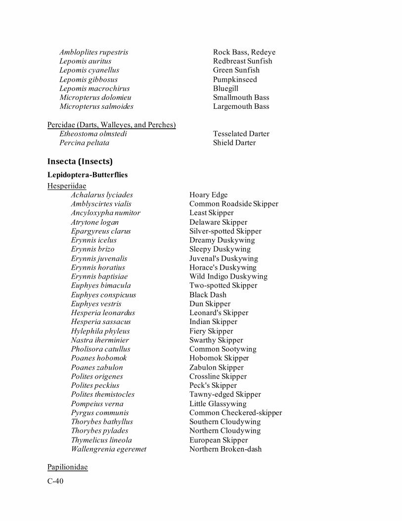
C-40
Ambloplites rupestris Rock Bass, Redeye Lepomis auritus Redbreast Sunfish Lepomis cyanellus Green Sunfish Lepomis gibbosus Pumpkinseed Lepomis macrochirus Bluegill Micropterus dolomieu Smallmouth Bass Micropterus salmoides Largemouth Bass
Percidae (Darts, Walleyes, and Perches) Etheostoma olmstedi Tesselated Darter Percina peltata Shield Darter
Insecta (Insects) Lepidoptera-Butterflies Hesperiidae
Achalarus lyciades Hoary Edge Amblyscirtes vialis Common Roadside Skipper Ancyloxypha numitor Least Skipper Atrytone logan Delaware Skipper Epargyreus clarus Silver-spotted Skipper Erynnis icelus Dreamy Duskywing Erynnis brizo Sleepy Duskywing Erynnis juvenalis Juvenal's Duskywing Erynnis horatius Horace's Duskywing Erynnis baptisiae Wild Indigo Duskywing Euphyes bimacula Two-spotted Skipper Euphyes conspicuus Black Dash Euphyes vestris Dun Skipper Hesperia leonardus Leonard's Skipper Hesperia sassacus Indian Skipper Hylephila phyleus Fiery Skipper Nastra iherminier Swarthy Skipper Pholisora catullus Common Sootywing Poanes hobomok Hobomok Skipper Poanes zabulon Zabulon Skipper Polites origenes Crossline Skipper Polites peckius Peck's Skipper Polites themistocles Tawny-edged Skipper Pompeius verna Little Glassywing Pyrgus communis Common Checkered-skipper Thorybes bathyllus Southern Cloudywing Thorybes pylades Northern Cloudywing Thymelicus lineola European Skipper Wallengrenia egeremet Northern Broken-dash
Papilionidae
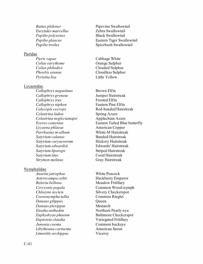
C-41
Battus philenor Pipevine Swallowtail Eurytides marcellus Zebra Swallowtail Papilio polyxenes Black Swallowtail Papilio glaucus Eastern Tiger Swallowtail Papilio troilus Spicebush Swallowtail
Pieridae Pieris rapae Cabbage White Colias eurytheme Orange Sulphur Colias philodice Clouded Sulphur Phoebis sennae Cloudless Sulphur Pyrisitia lisa Little Yellow
Lycaenidae
Callophrys augustinus Brown Elfin Callophrys gryneus Juniper Hairstreak Callophrys irus Frosted Elfin Callophrys niphon Eastern Pine Elfin Calycopis cecrops Red-banded Hairstreak Celastrina ladon Spring Azure Celastrina neglectamajor Applachian Azure Everes comyntas Eastern Tailed Blue butterfly Lycaena phlaeas American Copper Parrhasius m-album White-M Hairstreak Satyrium calanus Banded Hairstreak Satyrium caryaevorum Hickory Hairstreak Satyrium edwardsii Edwards' Hairstreak Satyrium liparops Striped Hairstreak Satyrium titus Coral Hairstreak Strymon melinus Gray Hairstreak
Nymphalidae
Anartia jatrophae White Peacock Asterocampa celtis Hackberry Emperor Boloria bellona Meadow Fritillary Cercyonis pegala Common Wood-nymph Chlosyne nycteis Silvery Checkerspot Coenonympha tullia Common Ringlet Danaus gilippus Queen Danaus plexippus Monarch Enodia anthedon Northern Pearly-eye Euphydryas phaeton Baltimore Checkerspot Euptoieta claudia Variegated Fritillary Junonia coenia Common buckeye Libytheana carinenta American Snout Limenitis archippus Viceroy
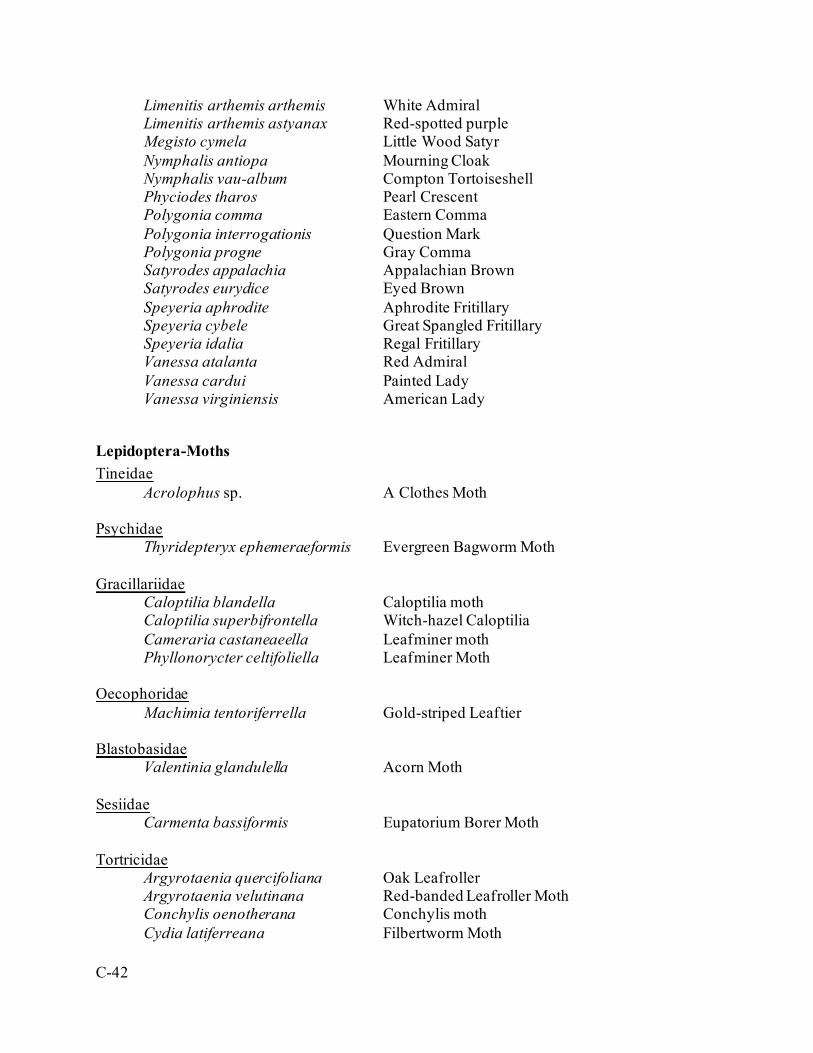
C-42
Limenitis arthemis arthemis White Admiral Limenitis arthemis astyanax Red-spotted purple Megisto cymela Little Wood Satyr Nymphalis antiopa Mourning Cloak Nymphalis vau-album Compton Tortoiseshell Phyciodes tharos Pearl Crescent Polygonia comma Eastern Comma Polygonia interrogationis Question Mark Polygonia progne Gray Comma Satyrodes appalachia Appalachian Brown Satyrodes eurydice Eyed Brown Speyeria aphrodite Aphrodite Fritillary Speyeria cybele Great Spangled Fritillary Speyeria idalia Regal Fritillary Vanessa atalanta Red Admiral Vanessa cardui Painted Lady Vanessa virginiensis American Lady
Lepidoptera-Moths Tineidae
Acrolophus sp. A Clothes Moth Psychidae
Thyridepteryx ephemeraeformis Evergreen Bagworm Moth
Gracillariidae Caloptilia blandella Caloptilia moth Caloptilia superbifrontella Witch-hazel Caloptilia
Cameraria castaneaeella Leafminer moth Phyllonorycter celtifoliella Leafminer Moth Oecophoridae
Machimia tentoriferrella Gold-striped Leaftier Blastobasidae
Valentinia glandulella Acorn Moth Sesiidae
Carmenta bassiformis Eupatorium Borer Moth Tortricidae Argyrotaenia quercifoliana Oak Leafroller
Argyrotaenia velutinana Red-banded Leafroller Moth Conchylis oenotherana Conchylis moth
Cydia latiferreana Filbertworm Moth
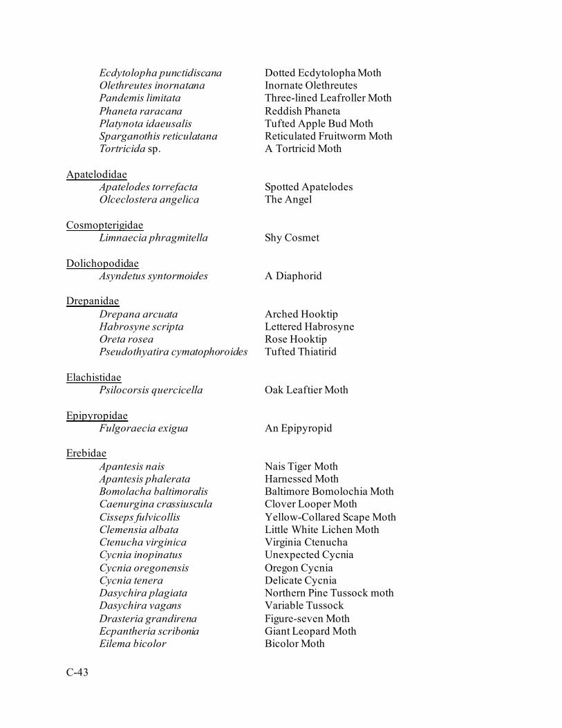
C-43
Ecdytolopha punctidiscana Dotted Ecdytolopha Moth Olethreutes inornatana Inornate Olethreutes Pandemis limitata Three-lined Leafroller Moth Phaneta raracana Reddish Phaneta
Platynota idaeusalis Tufted Apple Bud Moth Sparganothis reticulatana Reticulated Fruitworm Moth
Tortricida sp. A Tortricid Moth Apatelodidae
Apatelodes torrefacta Spotted Apatelodes Olceclostera angelica The Angel Cosmopterigidae Limnaecia phragmitella Shy Cosmet Dolichopodidae
Asyndetus syntormoides A Diaphorid Drepanidae
Drepana arcuata Arched Hooktip Habrosyne scripta Lettered Habrosyne Oreta rosea Rose Hooktip Pseudothyatira cymatophoroides Tufted Thiatirid
Elachistidae Psilocorsis quercicella Oak Leaftier Moth Epipyropidae
Fulgoraecia exigua An Epipyropid Erebidae
Apantesis nais Nais Tiger Moth Apantesis phalerata Harnessed Moth Bomolacha baltimoralis Baltimore Bomolochia Moth Caenurgina crassiuscula Clover Looper Moth
Cisseps fulvicollis Yellow-Collared Scape Moth Clemensia albata Little White Lichen Moth Ctenucha virginica Virginia Ctenucha Cycnia inopinatus Unexpected Cycnia Cycnia oregonensis Oregon Cycnia Cycnia tenera Delicate Cycnia
Dasychira plagiata Northern Pine Tussock moth Dasychira vagans Variable Tussock
Drasteria grandirena Figure-seven Moth Ecpantheria scribonia Giant Leopard Moth
Eilema bicolor Bicolor Moth
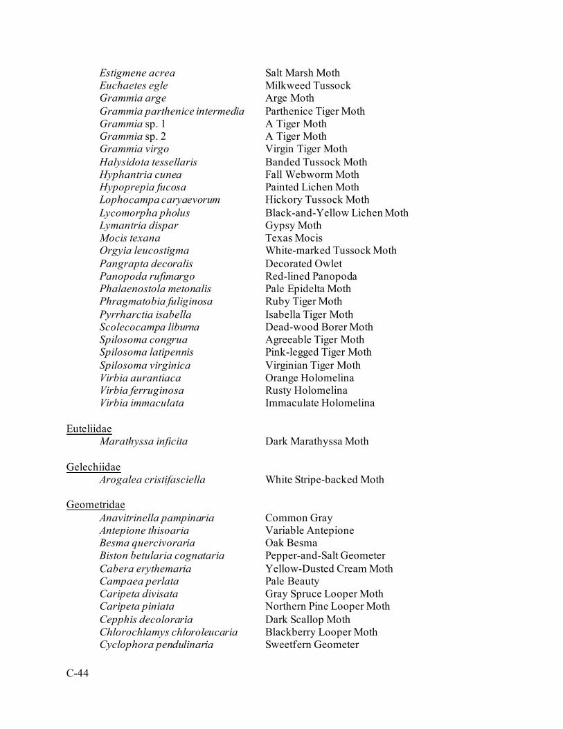
C-44
Estigmene acrea Salt Marsh Moth Euchaetes egle Milkweed Tussock Grammia arge Arge Moth Grammia parthenice intermedia Parthenice Tiger Moth Grammia sp. 1 A Tiger Moth Grammia sp. 2 A Tiger Moth Grammia virgo Virgin Tiger Moth Halysidota tessellaris Banded Tussock Moth Hyphantria cunea Fall Webworm Moth Hypoprepia fucosa Painted Lichen Moth Lophocampa caryaevorum Hickory Tussock Moth Lycomorpha pholus Black-and-Yellow Lichen Moth
Lymantria dispar Gypsy Moth Mocis texana Texas Mocis Orgyia leucostigma White-marked Tussock Moth Pangrapta decoralis Decorated Owlet Panopoda rufimargo Red-lined Panopoda Phalaenostola metonalis Pale Epidelta Moth Phragmatobia fuliginosa Ruby Tiger Moth
Pyrrharctia isabella Isabella Tiger Moth Scolecocampa liburna Dead-wood Borer Moth
Spilosoma congrua Agreeable Tiger Moth Spilosoma latipennis Pink-legged Tiger Moth Spilosoma virginica Virginian Tiger Moth Virbia aurantiaca Orange Holomelina Virbia ferruginosa Rusty Holomelina Virbia immaculata Immaculate Holomelina Euteliidae Marathyssa inficita Dark Marathyssa Moth Gelechiidae Arogalea cristifasciella White Stripe-backed Moth Geometridae
Anavitrinella pampinaria Common Gray Antepione thisoaria Variable Antepione Besma quercivoraria Oak Besma Biston betularia cognataria Pepper-and-Salt Geometer Cabera erythemaria Yellow-Dusted Cream Moth Campaea perlata Pale Beauty Caripeta divisata Gray Spruce Looper Moth Caripeta piniata Northern Pine Looper Moth Cepphis decoloraria Dark Scallop Moth Chlorochlamys chloroleucaria Blackberry Looper Moth Cyclophora pendulinaria Sweetfern Geometer
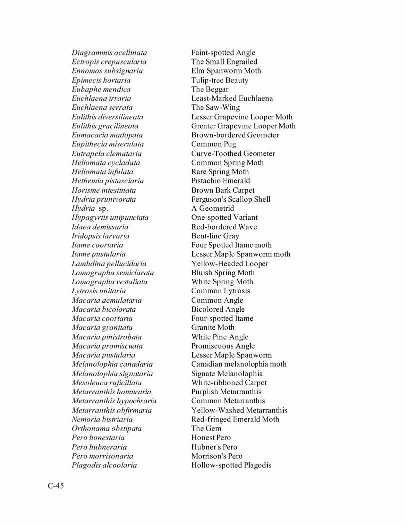
C-45
Diagrammis ocellinata Faint-spotted Angle Ectropis crepuscularia The Small Engrailed
Ennomos subsignaria Elm Spanworm Moth Epimecis hortaria Tulip-tree Beauty Eubaphe mendica The Beggar Euchlaena irraria Least-Marked Euchlaena Euchlaena serrata The Saw-Wing Eulithis diversilineata Lesser Grapevine Looper Moth Eulithis gracilineata Greater Grapevine Looper Moth Eumacaria madopata Brown-bordered Geometer
Eupithecia miserulata Common Pug Eutrapela clemataria Curve-Toothed Geometer Heliomata cycladata Common Spring Moth Heliomata infulata Rare Spring Moth Hethemia pistasciaria Pistachio Emerald Horisme intestinata Brown Bark Carpet Hydria prunivorata Ferguson's Scallop Shell Hydria sp. A Geometrid Hypagyrtis unipunctata One-spotted Variant Idaea demissaria Red-bordered Wave Iridopsis larvaria Bent-line Gray Itame coortaria Four Spotted Itame moth Itame pustularia Lesser Maple Spanworm moth Lambdina pellucidaria Yellow-Headed Looper Lomographa semiclarata Bluish Spring Moth Lomographa vestaliata White Spring Moth Lytrosis unitaria Common Lytrosis Macaria aemulataria Common Angle Macaria bicolorata Bicolored Angle Macaria coortaria Four-spotted Itame Macaria granitata Granite Moth Macaria pinistrobata White Pine Angle Macaria promiscuata Promiscuous Angle Macaria pustularia Lesser Maple Spanworm Melanolophia canadaria Canadian melanolophia moth Melanolophia signataria Signate Melanolophia Mesoleuca ruficillata White-ribboned Carpet Metarranthis homuraria Purplish Metarranthis Metarranthis hypochraria Common Metarranthis Metarranthis obfirmaria Yellow-Washed Metarranthis Nemoria bistriaria Red-fringed Emerald Moth Orthonama obstipata The Gem Pero honestaria Honest Pero Pero hubneraria Hubner's Pero Pero morrisonaria Morrison's Pero Plagodis alcoolaria Hollow-spotted Plagodis
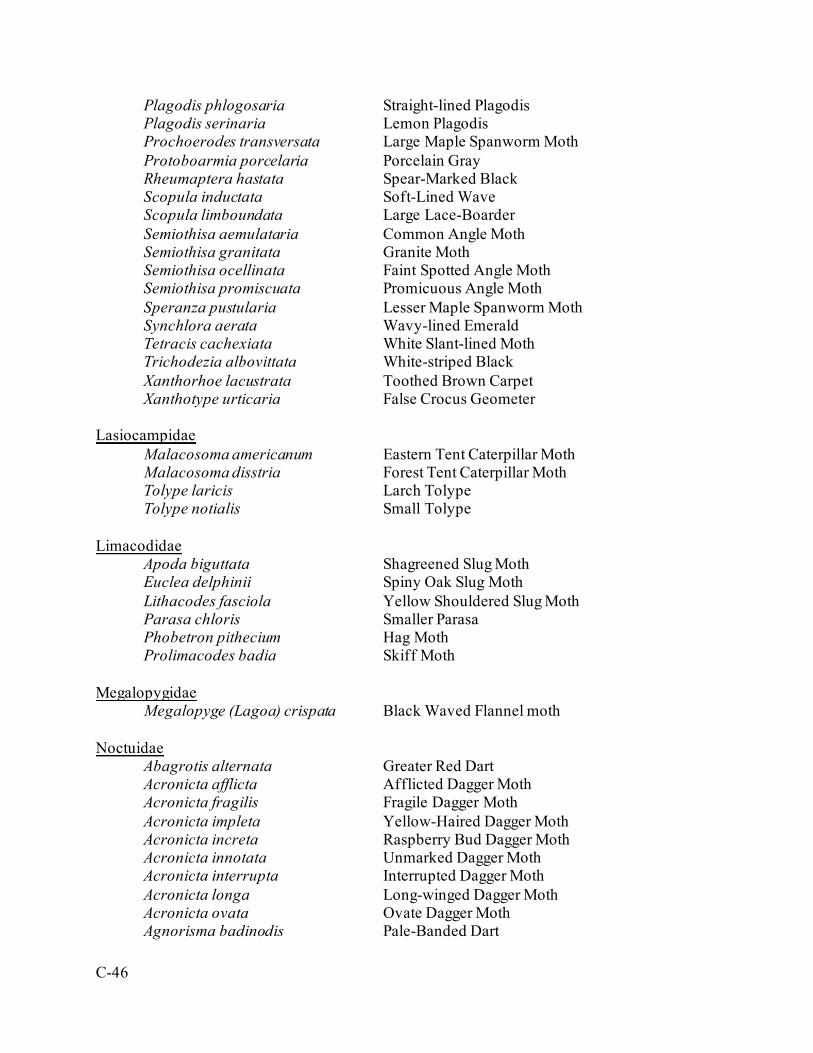
C-46
Plagodis phlogosaria Straight-lined Plagodis Plagodis serinaria Lemon Plagodis Prochoerodes transversata Large Maple Spanworm Moth Protoboarmia porcelaria Porcelain Gray Rheumaptera hastata Spear-Marked Black Scopula inductata Soft-Lined Wave Scopula limboundata Large Lace-Boarder Semiothisa aemulataria Common Angle Moth Semiothisa granitata Granite Moth Semiothisa ocellinata Faint Spotted Angle Moth Semiothisa promiscuata Promicuous Angle Moth Speranza pustularia Lesser Maple Spanworm Moth Synchlora aerata Wavy-lined Emerald Tetracis cachexiata White Slant-lined Moth Trichodezia albovittata White-striped Black Xanthorhoe lacustrata Toothed Brown Carpet Xanthotype urticaria False Crocus Geometer Lasiocampidae
Malacosoma americanum Eastern Tent Caterpillar Moth Malacosoma disstria Forest Tent Caterpillar Moth Tolype laricis Larch Tolype Tolype notialis Small Tolype Limacodidae
Apoda biguttata Shagreened Slug Moth Euclea delphinii Spiny Oak Slug Moth
Lithacodes fasciola Yellow Shouldered Slug Moth Parasa chloris Smaller Parasa Phobetron pithecium Hag Moth Prolimacodes badia Skiff Moth Megalopygidae
Megalopyge (Lagoa) crispata Black Waved Flannel moth Noctuidae
Abagrotis alternata Greater Red Dart Acronicta afflicta Afflicted Dagger Moth Acronicta fragilis Fragile Dagger Moth Acronicta impleta Yellow-Haired Dagger Moth Acronicta increta Raspberry Bud Dagger Moth Acronicta innotata Unmarked Dagger Moth Acronicta interrupta Interrupted Dagger Moth Acronicta longa Long-winged Dagger Moth Acronicta ovata Ovate Dagger Moth Agnorisma badinodis Pale-Banded Dart

C-47
Agriopodes fallax Green Marvel Agrotis ipsilon Ipsilon Dart Allotria elonympha False Underwing Alypia octomaculata Eight-spotted forester moth Amphipoea americana American Ear Moth Amphipyra pyramidoides Copper Underwing Anagrapha falcifera Celery Looper Moth Argyrogramma basigera Pink-washed Looper Moth Azenia obtuse Obtuse Yellow Baileya australis Small Baileya Caenurgina crassiuscula Clover Looper Moth Caenurgina erechtea Forage Looper Moth Callopistria cordata Silver-spotted Fern Moth Callopistria mollissima Pink-shaded Fern Moth Catocala amica Girlfriend Underwing Catocala antinympha Sweetfern Underwing
Catocala blandula Charming Underwing Catocala coccinata Scarlet Underwing Catocala ilia Ilia Underwing Catocala lineella Little Lined Underwing Catocala palaeogama Oldwife Underwing Catocala relicta White Underwing Catocala retecta Yellow-gray Underwing Catocala ultronia Ultronia Underwing Cerma cerintha Tufted Bird-dropping Moth Chaetaglaea sericea Silky Sallow Charadra deridens The Laugher Chrysanympha formosa Formosa Looper Moth Chytonix palliatricula Cloaked Marvel Colocasia flavicornis Yellowhorn Colocasia propinquilinea Closebanded Yellowhorn Moth Cosmia calami American Dun-bar Moth Cucullia convexipennis Brown-Hooded Owlet Dargida diffusa Wheat Head Armyworm Moth
Diarsia jucunda Smaller Pinkish Dart Dyspyralis puncticosta A Noctuid Elaphria grata Grateful Midget Elaphria versicolor Variegated Midget Epiglaea decliva Sloping Sallow Eudryas grata Beautiful Wood-Nymph Eudryas unio Pearly Wood-Nymph Euparthenos nubilis Locust Underwing Euplexia benesimilis American Angle Shades Euxoa messoria Reaper Dart Euxoa velleripennis Fleece-winged Dart Faronta (Dargida) rubripennis The Pink Streak

C-48
Feltia herilis Master's Dart Feltia jaculifera Dingy Cutworm Moth Helicoverpa zea Corn Earworm Moth Homorthodes lindseyi A Noctuid Moth Hypena baltimoralis Baltimore Bomolocha Hypena manalis Flowing-line Bomolocha Moth Hyperstrotia flaviguttata Yellow-spotted Graylet Idia aemula Common Idia Moth
Idia forbesi Idia moth Idia rotundalis Rotund Idia Moth Lacinipolia anguina Snaky Arches Lacinipolia renigera Bristly Cutworm Moth Lacinipolia vicina Neighborly Arches Leucania multilinea Many-lined Wainscot Leucania ursula Ursula Wainscot Leuconycta diphteroides Green Leuconycta Lithacodia carneola An Owlet Moth Lithacodia synochitis An Owlet Moth Macrochilo absorptalis Slant-lined Owlet
Marimatha nigrofimbria Black-bordered Lemon Moth Metaxaglaea semitaria Footpath Sallow Moth Mythimna unipuncta Armyworm Moth Nephelodes minians Bronzed Cutworm Moth Noctua pronuba Large Yellow Underwing Ogdoconta cinereola Common Pinkband
Oligia fractilinea Broken-lined Brocade Orthodes cynica Cynical Quaker Palthis angulalis Dark-spotted Palthis Palthis asopialis Faint-spotted Palthis Panopoda rufimargo Red-Lined Panopoda Panthea furcilla Eastern Panthea
Papaipema baptisiae Wild Indigo Borer Moth Parallelia bistriaris Maple Looper Moth Peridroma saucia Variegated Cutworm Moth Perigea xanthioides Red Groundling Phlogophora iris Olive Angle Shades Phosphila miselioides Spotted Phosphila Phytometra rhodarialis Pink-Boardered Yellow Plathypena scabra Green Cloverworm Moth Polygrammate hebraeicum The Hebrew Ponometia erastrioides Small Bird-dropping Moth Protodeltote muscosula Large Mossy Lithacodia
Protolampra brunneicollis Brown-Collared Dart Protorthodes oviduca Ruddy Quaker Pseudaletia unipuncta Armyworm Moth Pseudeustrotia carneola Pink-Boardered Pseudeustrotia

C-49
Psychomorpha epimenis Grapevine Epimenis Raphia frater The Brother Renia discoloralis Discolored Renia Renia factiosalis A Renia Moth Renia flavipunctalis A Renia Moth Schinia arcigera Arcigera Flower Moth Schinia nundina Goldenrod Flower Moth Schinia rivulosa Ragweed Flower Moth Spargaloma sexpunctata Six Spotted Gray Moth Spragueia leo Common Spragueia
Sunira bicolorago Bicolored Sallow Synedoida grandirena Figure-seven Tarachidia erastriodies Small Bird-dropping Moth Tetanolita nigrofimbria Florida Tetanolita Thioptera nigrofimbria Black-bordered Lemon Moth Tricholita signata Signate Quaker Trichoplusia ni Cabbage Looper Moth Xestia bicarnea Pink-Spotted Dart Xestia dilucida A Dart Moth Xestia dolosa Greater Black-letter Dart Xestia normaniana Norman's Dart Xestia smithii Smith's Dart Xestia youngii A Dart Moth Zale horrida Horrid Zale Zale lunifera Pine Barrens Zale
Zale undularis Black Zale Zanclognatha jacchusalis Yellowish Zanclognatha Zanclognatha laevigata Variable Zanclognatha Zanclognatha lituralis Lettered Zanclognatha Zanclognatha pedipilalis Grayish Zanclognatha Zanclognatha sp. A Noctuid Moth Nolidae Meganola miniscula Confused Meganola Meganola phylla A Meganola Moth Notodontidae
Clostera albosigma Sigmoid Prominent Dasylophia anguina Black-spotted Prominent Datana angusii Anguss Datana moth Datana drexelii Drexel's Datana Datana integerrima Walnut Caterpillar Moth Datana ministra Yellow-necked Caterpillar Moth Datana perspicua Spotted Datana Datana ranaeceps Post-burn Datana Moth Datana sp. Datana Moth

C-50
Gluphisia septentrionis Common Gluphisia Heterocampa biundata Wavy-lined Heterocampa Heterocampa guttivita Saddled or Maple Prominent Heterocampa umbrata White-blotched Heterocampa Lochmaeus manteo Variable Oakleaf Caterpillar Moth Macrurocampa marthesia Mottled Prominent Nadata gibbosa White-dotted Prominent Nadata sp. A Prominent Moth Nerice bidentata Double-toothed Prominent Odontosia elegans Elegant Prominent Oligocentria lignicolor White-streaked Prominent Peridea angulosa Angulose Prominent Pheosia rimosa Black-rimmed Prominent Schizura badia Chestnut Schizura Schizura unicornis Unicorn Caterpillar Moth Symmerista sp. A Prominent Moth Oecophoridae Epicallima argenticinctella Orange-headed Epicallima Pterophoridae Platyptilia carduidactyla Artichoke Plume Moth Pyralidae
Anageshna primordialis A Pyralid Moth Anania funebris glomeralis A Pyralid Moth Blepharomastix ranalis A Pyralid Moth Chrysoteuchia topiaria Topiary Grass-veneer Crambus agitatellus Double-banded Grass-veneer Crambus albellus Small White Grass-veneer
Crambus laqueatellus A Pyralid Moth Desmia funeralis Grape Leaffolder Moth Dioryctria zimmermani Zimmerman Pine Moth Elophila icciusalis Pondside Crambid
Elophila obliteralis Waterlily Leafcutter Moth Eudonia strigalis Striped Eudonia Herculia infimbrialis A Pyralid Moth Herpetogramma theseusalis Herpetogramma Moth Herpetogramma thestealis A Pyralid Moth Hypsopygia olinalis Yellow-fringed Dolichomia Lygropia rivulalis A Pyralid Moth Microcrambus elegans Elegant Grass-veneer
Nomophila nearctica Lucerne Moth Oneida lunulalis Orange-tufted Oneida Moth Ostrinia nubilalis European Corn Borer Palpita magniferalis Splendid Palpita

C-51
Pantographa limata Basswood Leafroller Moth Perispasta caeculalis Titian Peale’s Crambid Pococera asperatella Maple Webworm Moth Pococera expandens Double-humped Pococera Moth Pyrausta acrionalis Mint-loving Pyrausta Pyrausta bicoloralis Bicolored Pyrausta Moth Pyrausta niveicilialis A Pyralid Moth Sciota vetustella Belted Leafroller Sitochroa palealis Carrot Seed Moth Udea rubigalis Celery Leaftier Moth Urola nivalis Snowy Urola Moth Vaxi auratella Curve-lined Vax Herpetogramma thestialis A Pyralid Moth Saturniidae
Actias luna Luna Moth Anatheraea polyphemus Polyphemus Moth Anisota senatoria Orange-Tipped Oak Moth Anisota sp. A Royal Moth Anisota stigma Spiny Oakworm Moth Anisota virginiensis Pink-striped Oakworm Moth Automeris io Io Moth Callosamia promethea Spicebush Silkmoth Dryocampa rubicunda Rosy maple Moth Eacles imperialis Imperial Moth Hemileuca maia Buckmoth Hyalophora cecropia Cecropia Moth Sphingidae
Amphion floridensis Nessus Sphinx Ceratomia undulosa Waved Sphinx Darapsa choerilus (pholus) Azalea Sphinx
Darapsa myron Virginia Creeper Sphinx Dolba hyloeus Pawpaw Sphinx
Eumorpha achemon Achemon Sphinx Eumorpha pandorus Pandorus Sphinx Hemaris diffinis Snowberry Clearwing Hemaris thysbe Hummingbird Clearwing Lapara bombycoides Northern Pine Sphinx Paonias excaecatus Blinded Sphinx Paonias myops Small-eyed Sphinx Pachysphinx modesta Big Poplar Sphinx Sphecodina abbottii Abbot’s Sphinx Sphinx drupiferarum Wild Cherry Sphinx Thyrididae
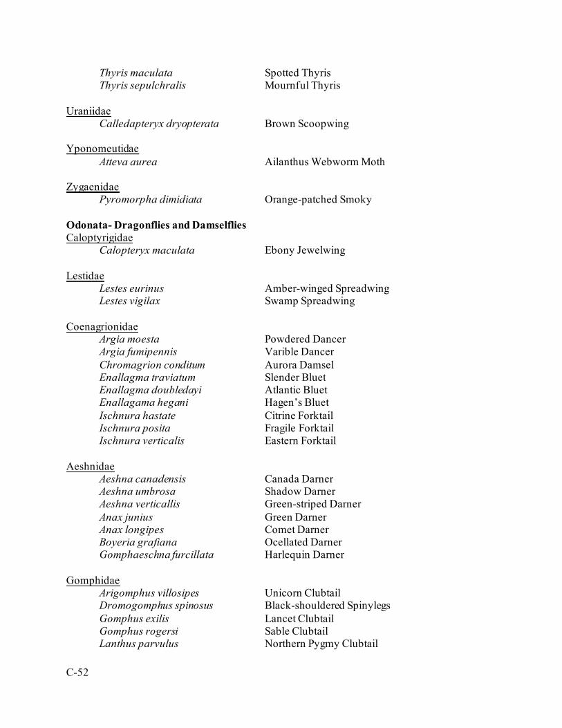
C-52
Thyris maculata Spotted Thyris Thyris sepulchralis Mournful Thyris Uraniidae Calledapteryx dryopterata Brown Scoopwing Yponomeutidae
Atteva aurea Ailanthus Webworm Moth Zygaenidae
Pyromorpha dimidiata Orange-patched Smoky Odonata- Dragonflies and Damselflies Caloptyrigidae Calopteryx maculata Ebony Jewelwing Lestidae Lestes eurinus Amber-winged Spreadwing Lestes vigilax Swamp Spreadwing Coenagrionidae Argia moesta Powdered Dancer Argia fumipennis Varible Dancer Chromagrion conditum Aurora Damsel Enallagma traviatum Slender Bluet Enallagma doubledayi Atlantic Bluet Enallagama hegani Hagen’s Bluet Ischnura hastate Citrine Forktail Ischnura posita Fragile Forktail Ischnura verticalis Eastern Forktail Aeshnidae Aeshna canadensis Canada Darner Aeshna umbrosa Shadow Darner Aeshna verticallis Green-striped Darner Anax junius Green Darner Anax longipes Comet Darner Boyeria grafiana Ocellated Darner Gomphaeschna furcillata Harlequin Darner Gomphidae Arigomphus villosipes Unicorn Clubtail Dromogomphus spinosus Black-shouldered Spinylegs Gomphus exilis Lancet Clubtail Gomphus rogersi Sable Clubtail Lanthus parvulus Northern Pygmy Clubtail
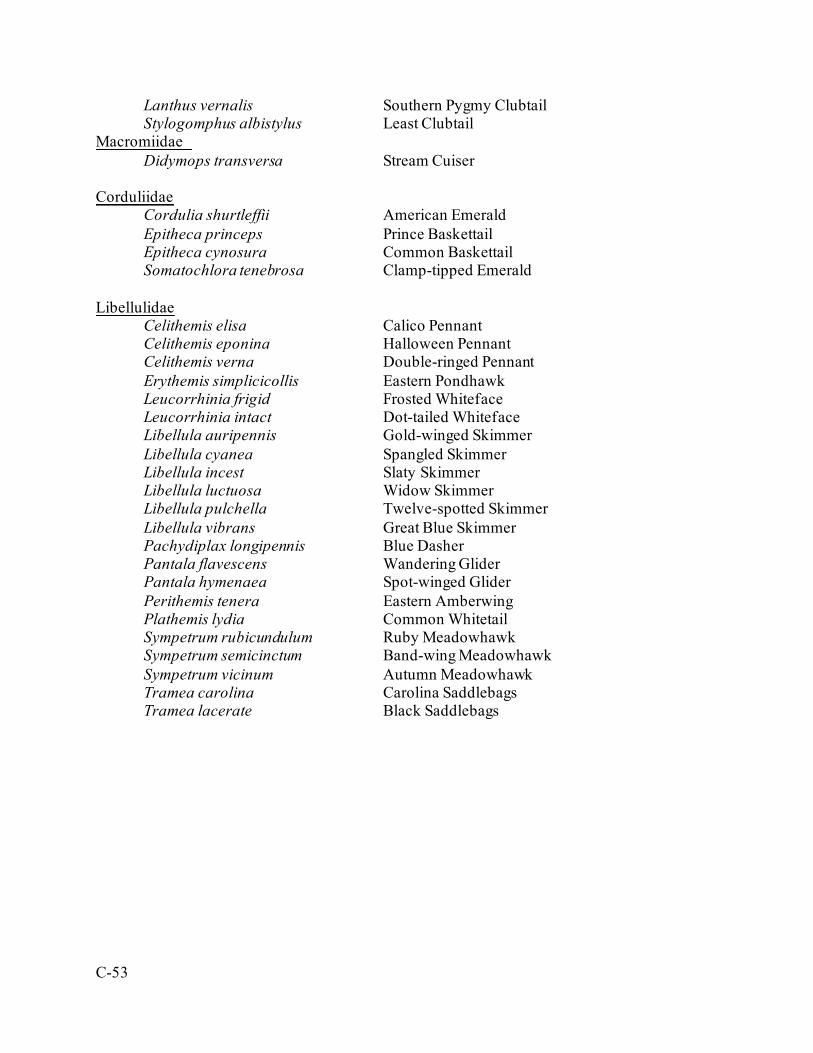
C-53
Lanthus vernalis Southern Pygmy Clubtail Stylogomphus albistylus Least Clubtail Macromiidae Didymops transversa Stream Cuiser Corduliidae Cordulia shurtleffii American Emerald Epitheca princeps Prince Baskettail Epitheca cynosura Common Baskettail Somatochlora tenebrosa Clamp-tipped Emerald Libellulidae Celithemis elisa Calico Pennant Celithemis eponina Halloween Pennant Celithemis verna Double-ringed Pennant Erythemis simplicicollis Eastern Pondhawk Leucorrhinia frigid Frosted Whiteface Leucorrhinia intact Dot-tailed Whiteface Libellula auripennis Gold-winged Skimmer Libellula cyanea Spangled Skimmer Libellula incest Slaty Skimmer Libellula luctuosa Widow Skimmer Libellula pulchella Twelve-spotted Skimmer Libellula vibrans Great Blue Skimmer Pachydiplax longipennis Blue Dasher Pantala flavescens Wandering Glider Pantala hymenaea Spot-winged Glider Perithemis tenera Eastern Amberwing Plathemis lydia Common Whitetail Sympetrum rubicundulum Ruby Meadowhawk Sympetrum semicinctum Band-wing Meadowhawk Sympetrum vicinum Autumn Meadowhawk Tramea carolina Carolina Saddlebags Tramea lacerate Black Saddlebags
D-1
Appendix D. Research Requirements Research requirements are projects that would be nice to do by an installation but there is no legal obligation to support them. The concept behind this appendix is that it will allow the installation and other entities (e.g. SERDP and ESTCP) to quickly assess if there are any projects available for funding if it becomes available.
D.1. Fauna
D.1.a. NLEB Basic population status post-WNS has yet to be determined at FIG. Whereas the species was widespread and numerous in breeding attempts as late as 2004 (Chenger 2004), only the rare individual will end up in a net capture or on an audio recording. The population has dropped to the point where detection rate is extremely low. Further capture and study are necessary to determine species occupation on the installation and habitat preferences now that numbers are so much lower than maximum availability. Further study is also necessary to determine the availability of hibernacula within the installation boundary. While no known open mines or other cavities occur on the installation, there is a past history of open shaft mining and open fissures in the bedrock on the installation. Animals like the Allegheny woodrat and most of the installation’s snakes find winter dens below the frost line, and, due to the NLEB’s behavior of crawling into the tops of narrow fissures in caves, perhaps there is more opportunity for winter roosting than is currently believed.
D.1.b. Regal Fritillary With the exception of adults, there are still wide gaps of knowledge in the regal’s life history. One key aspect is the larval diapauses between the first and second instar. While research has shown that the caterpillars will eat their chorizon and then go inert, there is no data available on materials they choose for cover, the depth of that material, whether they go subsurface or remain near the top of the ground litter, and so forth. This knowledge has direct impact on management decisions and would appreciably help survivorship in lab rearing. Another important avenue of research is that of disease. Wolbachia and nucleo-polyhedral virus (NPV) are widely studied in monarchs, but very little work has been published on these mechanisms and their effects on Speyeria. Lab rearing has illuminated the variance in productivity among females and may indicate the presence of a pathogen that affects fertility. Field studies and lab rearing attempts have shown the devastating presence of an unknown disease that affects late instar caterpillars. Mold and fungus seem also to be a prevalent mortality factor in the laboratory.

D-2
The existence of two subspecies has been theorized and weakly supported. FIG research has shown some behavior and population modifications that FIG (and possibly all historical Eastern populations) displays compared to the literature on Western populations. Further comparison is necessary to determine whether FIG findings should be applied back to the national metapopulation and to settle some disputes amongst PADMVA and TNC findings with their Western counterparts.
D.1.c. Allegheny Woodrat Being so often subterranean, woodrats still have substantial holes in their life history information and their known activities at FIG. Camera studies, such as tunnel crawlers and nest cameras would be beneficial to show the level of use, preferred habitat/food sources, and breeding success on the installation. Telemetry would substantiate activity centers and interaction levels among them. Further research on occupied versus acceptable but unoccupied habitat on the installation could yield new knowledge on desired conditions and management techniques. Also, means of monitoring when those management techniques become successful are in demand as active locations get covered in fruit-bearing shrubs. Remote techniques including audio would be very useful for rocky portions of the impact area, where researchers cannot access in person. Much still needs to be known about the woodrat’s range extent on the installation. A possible sighting on Blue Mountain in 2004 (McNaughton and Kern field notes) has never been explained, and habitat found in D2 and D4 with possible old sign has never been fully surveyed due to priorities during the prime research season.
D.1.d. Eastern Small-Footed Bat The Eastern small-footed bat is the most recent listed species to be found on the installation (Chenger 2014). The bat frequents piles of large rock exposed to direct sunlight for its maternity roosts, and plenty of habitat was opened during range construction from 2005-2007. These bats seemed to have moved in after that time period. More research is necessary to determine distinct temperature and microclimate preferences in order to better assess the distribution and population size of these bats on the installation.
D.1.e. Telemetry, Geolocational Data, and Home Range/Habitat Use A variety of telemetry projects for various species of concern would be helpful to predict management effects, describe population health and adaptability, and define priority locations. Species of interest include various turtles (box, spotted, and wood especially), Allegheny woodrats, timber rattlesnakes, smooth greensnakes, golden winged-warblers, black bear, fishers, various raptors, and Eastern coyotes. Seasonality varies from species to species, some requiring breeding range, others requiring dispersal, and still others requiring wintering data. A generalized set of equipment and protocol to do these studies would be very beneficial. Radio methods have been difficult or produced poor results in the past due to the topography on the installation and the amount of signals, both high and low frequency, in use around the installation by the military, regional users (like cell towers and state agency radios), and the public. A GPS method with automated collection would be ideal.
D-3
D.2. Flora
D.2.a. Violets Scientific study into propagation methods continues informally at FIG. Collected seed has a very low germination rate, but there is circumstantial evidence that much higher seedling success can be obtained. More research is needed into the means of boosting this success including methods to remove the eliasome, the optimal stratification time and conditions, and UV light requirements. Besides germination, trichomes on the leaves are barriers for caterpillar feeding. More research into the cause of variation and possible environmental factors that contribute to trichome development are very much a critical part of the regal fritillary rearing program. Initial research indicates that available nitrogen in the soil may play some part (Cromp 2007). Seed dispersal in violets has long been linked to explosively dehiscing seedpods or ants. At FIG, the key species do not disperse all that far from seedpods alone, and subpopulations organically creep out across open landscapes (Hovis et al. 2006). This suggests that ants may be a major factor, but the species of the seed carriers are unknown. Positively identifying ants willing and able to carry V. sagittata seed in particular would benefit site selection and pre-release factors for the regal fritillary reintroduction program.
D.2.b. Vasey’s Eupatorium Scientific literature suggests that Vasey’s thoroughwort (Eupatorium godfreyanum) and round-leaved thoroughwort (E. rotundifolium) may not be genetically pure species. Variation and intergrades have been found between sites at FIG, and the species seem to fare extraordinarily well despite their statewide distribution and status. Intense genetic analysis may indicate that the species are actually hybrids of the common upland boneset (E. sessilifolium).
D.2.c. Yellow-Fringed Orchis Yellow-fringed orchis populations appear in very different and very distinct habitats on the installation: mesic oak forest, upland warm-season grassland slopes, and emergent herbaceous wetlands. More research in reproductive success is necessary to determine which habitat is best for the species and habitat objectives to further the populations. For now, it seems that the woodland population produces the most flowers in productive years, while the grassland slope population has seen the least browse. While the full-sun emergent wetland population has produced the most blooms in a single season, it has not had a repeat of that season in the near decade since that mast. Deer browse, fire regime, and vegetative competition may all be serious factors in the success or decline of the species, but the research has remained low and obscure. Access to the wild populations is very difficult during the height of the blooming season due to the military training schedule, so off-post or laboratory research would be a requirement.

D-4
D.2.d. Vegetation Community Classification The state’s vegetation communities fail to capture much diversity or distinction amongst herbaceous, barrens, and scrub communities. When trying to describe the ideal habitat for many rare species and for the state’s best functioning warm-season grasslands, the possible community guidelines introduced in Fike (1999) leave much to be desired. A better understanding of these communities and how they differ from location to location can be found in Latham and Thorne (2007), but a full description of these subcategories needs to go through scientific peer review and register with the National Vegetation Classification Standard (McKerrow 2014).
E-1
Appendix E. Migratory Bird Conservation FIG is part of Pennsylvania Audubon’s Second Mountain Important Bird Area (IBA) and the Kittatinny Ridge global IBA. The installation is home to a diverse wealth of breeding and migratory birds including many state and regional rarities, state responsibility species, and a migration counting point (Second Mountain Hawkwatch). A Memorandum of Understanding between DoD and USFWS was updated in 2014 and includes pertinent information for military installations to include FIG.
E.1. 2014 MIGRATORY BIRDS MOU (BETWEEN DOD AND USFWS) The MOU resulted from the legal requirements set forth in EO 13186 (17 January 2001). The agreement has been refreshed three times since its original signing (2006, 2011, 2014). This MOU specifically pertains to the following categories of DoD activities:
I) Natural resource management activities, including, but not limited to, habitat management, erosion control, forestry activities, hunting, fishing, agricultural out-leasing, conservation law enforcement, invasive-weed management, and prescribed burning.
2) Installation support activities, including, but not limited to, administration, retail
sales, food service, health care, water and sewage treatment, supply and storage, education, housing, equipment maintenance, base transportation, laundry and dry cleaning, recreation, and religious activities.
3) Operation of industrial activities. 4) Construction, maintenance, renovation, or demolition of facilities that
support the activities described in items 1 through 3.
5) Prevention or abatement of pollution or detrimental alteration of the environment for the benefit of migratory birds, as practicable.
The following FWS programs have responsibilities with regards to bird conservation activities:
1) The Division of Migratory Bird Management and the Migratory Bird Programs in
FWS Regional Offices serve as focal points for policy development and strategic planning. These offices develop and implement monitoring and management initiatives that help maintain healthy populations of migratory birds and their habitats and provide continued opportunities for citizens to enjoy bird-related recreation.
E-2
2) The Division of Bird Habitat Conservation is instrumental in supporting habitat conservation partnerships through the administration of bird conservation grant programs and development of joint ventures that serve as major vehicles for implementing the various bird conservation plans across the country.
3) Ecological Services Field Offices across the country serve as the primary
contacts for technical assistance and environmental reviews involving migratory bird issues. The Field Offices coordinate with the Regional Migratory Bird Offices, as necessary, regarding permits and overall migratory bird conservation coordination.
4) The Office of Law Enforcement is the principal FWS program that enforces the
legal provisions of the MBTA, BGEPA, ESA, and other laws pertaining to migratory birds.
5) The National Wildlife Refuge (NWR) System manages NWR and Waterfowl
Production Areas across the country, many of which were established to protect and conserve migratory birds. NWR not only protects important bird habitat, but also focuses on monitoring migratory bird populations, restoring and maintaining native habitats, and educating the public on recreational and economic benefits of migratory birds.
6) The Science Applications program works with other FWS programs and partners
to ensure that the necessary science, tools, and capacity are available for planning and implementing the most efficient and effective conservation actions to protect fish and wildlife, including migratory birds. The office facilitates regional self-directed science management partnerships called Landscape Conservation Cooperatives to develop and apply shared science capacity to conservation.
Responsibilities of Both Parties The Parties agree that this MOU shall be implemented to the extent permitted by law and in harmony with evolving requirements of agency missions, subject to the availability of appropriations and budgetary limits. Both Parties shall:
1) Support the conservation intent of Executive Order 13186, and the migratory
bird conventions by:
a) Integrating bird conservation principles, measures, and practices into agency planning and actions; and
b) Avoiding or minimizing, to the extent practicable, the exposure of birds and
their resources to avian stressors that result in take.
2) Emphasize an interdisciplinary, collaborative approach to migratory bird conservation in cooperation with other governments, state and federal agencies, and
E-3
non-federal partners within the geographic framework of the North American Bird Conservation Initiative (NABCI) Bird Conservation Regions (BCR.)
3) Work to protect, restore, and enhance migratory bird habitats, as practicable, on
DoD-managed lands, in ways that do not conflict with or impede military training and testing, by:
a) Designing and executing actions to minimize, to the extent practicable and
consistent with the military mission, avian stressors on migratory bird populations, including impacts to breeding, migration, or wintering habitats; and by developing and implementing, as appropriate, conservation measures that could reduce the take of migratory birds or enhance the quality of the habitats they use.
b) Working to identify, conserve, and manage significant bird conservation sites
that occur on DoD-managed lands.
c) Preventing or abating pollution or detrimental alteration of the environment for the benefit of migratory birds, as practicable; and
d) Preventing the introduction and establishment of, and controlling and reducing
the spread of existing, non-native invasive species that may be harmful to native flora and fauna, including migratory bird populations, as required by Executive Order 13112 on Invasive Species.
4) Work with willing landowners to prevent or minimize the loss or degradation of
migratory bird habitats on lands adjacent or near military installation boundaries. This cooperative conservation may include:
a) Participating in efforts to identify, protect, and conserve important migratory
bird habitats or other significant bird conservation sites and ecological conditions that occur in landscapes or watersheds that may be of conservation value to migratory birds found on DoD lands, and that also buffer one or more installations from adverse impacts to DoD mission or resource-management activities;
b) Providing information on migratory bird resources found on DoD lands
for partners to include and integrate into their outreach and education materials and activities; and
c) Using available authorities to enter into agreements with federal, state,
tribal, or other governmental entities, or nongovernmental organizations to conserve and enhance habitats in a manner compatible with military operations.

E-4
5) Promote collaborative projects such as:
a) Developing or using existing inventory and monitoring programs, at appropriate scales, with national or regional standardized protocols, to assess the status and trends of bird populations and habitats, including migrating, breeding, and wintering birds.
b) Designing management studies and research/monitoring projects using
national or regional standardized protocols and programs to identify the habitat conditions needed by applicable species of concern, to understand interrelationships of co-existing species, and to evaluate the effects of management activities on habitats and populations of migratory birds;
c) Sharing inventory, monitoring, research, and study data for breeding,
migrating, and wintering bird populations and habitats in a timely fashion with national data repositories such as the Avian Knowledge Network, National Point Count Database, and Monitoring Avian Productivity and Survivorship (MAPS).
d) Working in conjunction with each other and federal and state agencies to
develop reasonable and effective conservation measures for actions that reduce the exposure of birds and their habitats to avian stressors.
e) Participating in or promoting the implementation of existing regional or
national inventory and monitoring programs such as Breeding Bird Survey (BBS), Christmas Bird Counts, bird atlas projects, or game-bird surveys (e.g., mid-winter waterfowl surveys) on DoD lands where practicable and feasible.
f) Using existing partnerships and exploring opportunities for expanding
and creating new partnerships to facilitate combined funding for inventory, monitoring, management studies, and research; and
g) Improving habitat on lands adjacent to DoD-managed lands through
programs such as the DoD Readiness and Environmental Protection Integration and Land and Water Conservation Fund programs.
6) Work cooperatively to identify and utilize existing conservation measures to avoid
or minimize the effects of avian stressors and develop new conservation measures as needed.
7) Per Executive Order 13186 (Sec. 3(12)), provide training opportunities to appropriate
personnel on responsibilities under the MBTA, GBEPA, and other regulations protecting birds, current processes for coordination on bird conservation issues, strategies for properly assessing how actions effect bird populations, and
E-5
recommended approaches on how to avoid or minimize the exposure of birds and their habitats to avian stressors.
8) Participate annually in the interagency Council for the Conservation of Migratory
Birds. The duties of the Council include the following:
a) Sharing resource information to help conserve and manage migratory birds.
b) Fostering partnerships to further the goals of Executive Order 13186.
c) Reporting annually on Executive Order accomplishments and recommendations; and
d) Selecting an annual recipient of a Presidential Migratory Bird Federal
Stewardship Award.
9) Promote migratory bird conservation nationally and internationally through activities such as National Public Lands Day and International Migratory Bird Day.
Department of Defense Responsibilities:
1) Follow all migratory bird permitting requirements for intentional take under 50 CFR 21.22 (banding or marking), 21.23 (scientific collecting), 21.26 (special Canada Goose permit), 21.27 (special purposes), or 21.41 (depredation). Though no permit is required to take birds in accordance with 50 CFR 21.43-21.47 (depredation orders), follow all regulatory requirements set forth in those sections when applicable.
2) Consistent with military mission requirements, encourage incorporation of
comprehensive migratory bird management objectives into relevant DoD planning documents, including INRMPs, Integrated Pest Management Plans (IPMPs), Installation Master Plans, NEPA analyses, and other relevant documents. Comprehensive planning efforts for migratory birds include PIF Bird Conservation Plans, the North American Waterfowl Management Plan, U.S. Shorebird Conservation Plan, North American Waterbird Conservation Plan, and associated regional plans where available.
3) Consistent with current and emerging mission requirements, manage military lands
and non-military readiness activities in a manner that supports migratory bird conservation, habitat protection, restoration, and enhancement.
4) Inventory and monitor bird populations on DoD lands to the extent feasible to
facilitate decisions about the need for, and effectiveness of, conservation efforts.

E-6
5) In accordance with DoD INRMP Implementation Manual (DoDM 4715.03, 2013), work cooperatively with FWS and state and fish and wildlife agencies to promote timely development, effective review, and revisions of INRMPs, including any potential revisions to promote the conservation of migratory birds.
6) Incorporate conservation measures addressed in regional or state bird conservation
plans in the INRMP development process.
7) Consistent with safety and security requirements, allow the FWS and other partners reasonable access to military lands for conducting sampling or survey programs, including but not limited to MAPS, BBS, International Shorebird Survey, game-bird surveys, and breeding bird atlases.
8) Consistent with safety and security requirements and bird conservation
responsibilities, support the economic and recreational benefits of bird-related activities by allowing public access to military lands for recreational uses, such as bird watching and other non-consumptive activities.
9) Develop policies and procedures for facilities design that will promote the
conservation of migratory bird populations and habitat, including:
a) Mitigating the negative impacts of reflective glass in building design by considering building location and orientation with respect to migratory bird areas, and use of other mitigation techniques, such as reducing the amount of reflective glass on buildings.
b) Maximizing the use of native landscaping to promote migratory bird
habitat, except in areas subject to BASH hazards.
c) Turning off interior building lighting at night, especially lighting in offices with exterior windows that face outward to exterior building surfaces that may be visible to migratory or resident birds.
10) Prior to implementing any activity that has, or is likely to have, a measurable negative effect on migratory bird populations:
a) Identify the migratory bird species likely to occur in the area of the proposed action, and determine if any species of concern could be affected by the activity.
b) Assess and document, through the project planning process (e.g., NEPA), the
potential effects of the proposed action on species of concern. Use best available demographic, population, or habitat-association data in the assessment of effects upon species of concern.
E-7
c) Engage in early planning and scoping with the FWS to proactively address migratory bird conservation, and to initiate appropriate actions to avoid or minimize the exposure of birds and their habitats to avian stressors that may result in the take of migratory birds.
11) Continue to promote the conservation of migratory birds on military lands, to the extent permitted by law, subject to the availability of appropriations, within a d m i n i s t r a t i v e budgetary limits, and where in harmony with DoD missions.
a) Fire and fuels-management practices. Fire plays an important role in
shaping plant and animal communities and is a valuable tool in restoring habitats altered by decades of fire suppression. Fire management may include fire suppression, fire prevention, fuels treatment, and prescribed burning. Prescribed burning is one of the most effective tools in managing grassland and longleaf pine/wiregrass ecosystems. Fire-management planning efforts will consider the effects of fire management strategies on the conservation of migratory bird populations and should be combined with monitoring to properly assess fire management on relevant habitats and species.
b) Management practices for invasive and aquatic nuisance species. Invasive and
aquatic nuisance species are a threat to native plants and wildlife throughout the United States, including on military lands. Efforts to prevent, control, and contain these species must consider both the impacts from invasive species and the effects of the control efforts on migratory bird populations. Invasive species that can threaten migratory birds and their habitats include, but are not limited to, exotic grasses, trees and weeds, terrestrial and aquatic insects and organisms, non- native birds, and stray and feral cats.
c) Communications towers, utilities, and energy development. Increased
communications demand, changes in technology, and the development of alternative energy sources have resulted in additional exposure of migratory birds and their resources to avian stressors. DoD will review best practices outlined in FWS Guidance and consult with FWS as needed when considering the development of these technologies on military lands. Construction of new utility and energy systems and associated infrastructure should avoid or minimize the exposure of birds and their resources to avian stressors. Consideration also may be given to retrofitting existing utilities to reduce impacts. Available guidance includes (but is not limited to):
i. Avian Power Line Interaction Committee -Suggested Practices for Avian
Protection on Power Lines (2006) ii. Avian Power Line Interaction Committee- Reducing Avian
Collisions with Power Lines (2012) iii. U.S. Fish and Wildlife Service Land-based Wind Energy Guidelines
(2012)
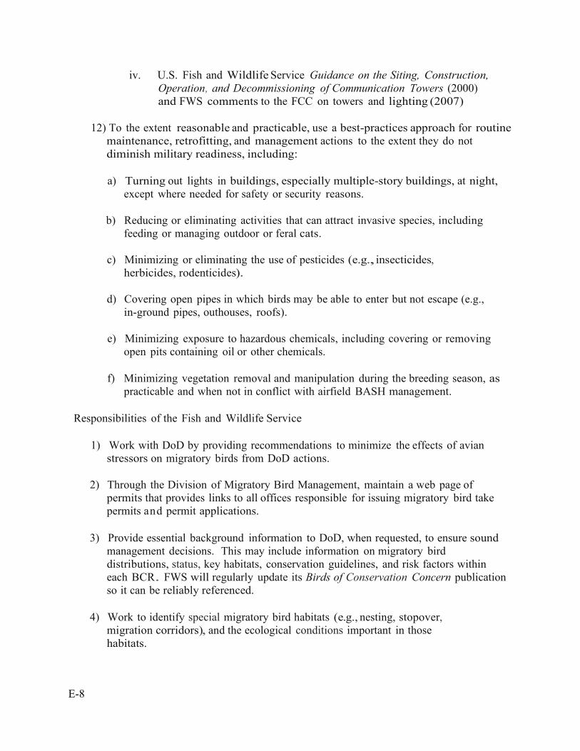
E-8
iv. U.S. Fish and Wildlife Service Guidance on the Siting, Construction, Operation, and Decommissioning of Communication Towers (2000) and FWS comments to the FCC on towers and lighting (2007)
12) To the extent reasonable and practicable, use a best-practices approach for routine
maintenance, retrofitting, and management actions to the extent they do not diminish military readiness, including:
a) Turning out lights in buildings, especially multiple-story buildings, at night,
except where needed for safety or security reasons.
b) Reducing or eliminating activities that can attract invasive species, including feeding or managing outdoor or feral cats.
c) Minimizing or eliminating the use of pesticides (e.g., insecticides,
herbicides, rodenticides).
d) Covering open pipes in which birds may be able to enter but not escape (e.g., in-ground pipes, outhouses, roofs).
e) Minimizing exposure to hazardous chemicals, including covering or removing
open pits containing oil or other chemicals.
f) Minimizing vegetation removal and manipulation during the breeding season, as practicable and when not in conflict with airfield BASH management.
Responsibilities of the Fish and Wildlife Service
1) Work with DoD by providing recommendations to minimize the effects of avian
stressors on migratory birds from DoD actions.
2) Through the Division of Migratory Bird Management, maintain a web page of permits that provides links to all offices responsible for issuing migratory bird take permits and permit applications.
3) Provide essential background information to DoD, when requested, to ensure sound
management decisions. This may include information on migratory bird distributions, status, key habitats, conservation guidelines, and risk factors within each BCR. FWS will regularly update its Birds of Conservation Concern publication so it can be reliably referenced.
4) Work to identify special migratory bird habitats (e.g., nesting, stopover,
migration corridors), and the ecological conditions important in those habitats.
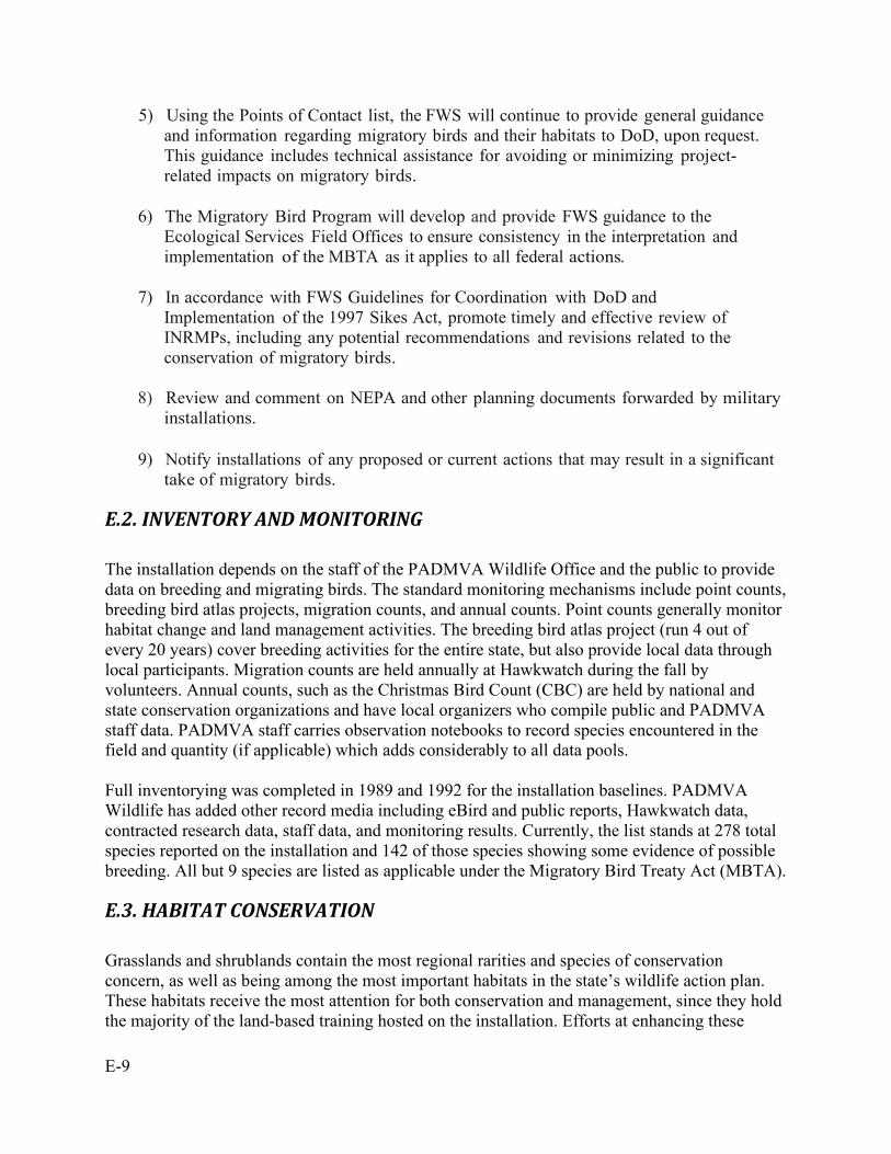
E-9
5) Using the Points of Contact list, the FWS will continue to provide general guidance and information regarding migratory birds and their habitats to DoD, upon request. This guidance includes technical assistance for avoiding or minimizing project- related impacts on migratory birds.
6) The Migratory Bird Program will develop and provide FWS guidance to the
Ecological Services Field Offices to ensure consistency in the interpretation and implementation of the MBTA as it applies to all federal actions.
7) In accordance with FWS Guidelines for Coordination with DoD and
Implementation of the 1997 Sikes Act, promote timely and effective review of INRMPs, including any potential recommendations and revisions related to the conservation of migratory birds.
8) Review and comment on NEPA and other planning documents forwarded by military
installations.
9) Notify installations of any proposed or current actions that may result in a significant take of migratory birds.
E.2. INVENTORY AND MONITORING The installation depends on the staff of the PADMVA Wildlife Office and the public to provide data on breeding and migrating birds. The standard monitoring mechanisms include point counts, breeding bird atlas projects, migration counts, and annual counts. Point counts generally monitor habitat change and land management activities. The breeding bird atlas project (run 4 out of every 20 years) cover breeding activities for the entire state, but also provide local data through local participants. Migration counts are held annually at Hawkwatch during the fall by volunteers. Annual counts, such as the Christmas Bird Count (CBC) are held by national and state conservation organizations and have local organizers who compile public and PADMVA staff data. PADMVA staff carries observation notebooks to record species encountered in the field and quantity (if applicable) which adds considerably to all data pools. Full inventorying was completed in 1989 and 1992 for the installation baselines. PADMVA Wildlife has added other record media including eBird and public reports, Hawkwatch data, contracted research data, staff data, and monitoring results. Currently, the list stands at 278 total species reported on the installation and 142 of those species showing some evidence of possible breeding. All but 9 species are listed as applicable under the Migratory Bird Treaty Act (MBTA).
E.3. HABITAT CONSERVATION Grasslands and shrublands contain the most regional rarities and species of conservation concern, as well as being among the most important habitats in the state’s wildlife action plan. These habitats receive the most attention for both conservation and management, since they hold the majority of the land-based training hosted on the installation. Efforts at enhancing these

E-10
habitats are focused and ongoing because of the diversity and importance they host. Species such as the regal fritillary bring emphasis and attention to spreading these habitats and protecting them from exotics and succession. Forests and woodlots are also valuable to the avian species on the installation, and they similarly receive attention for their ecological value. Species such as oak, chestnut, and hemlock are valuable both to the birds and to the military mission as strong and resistant tree cover that can survive some damage from fire and training while providing key food and shelter to wildlife and root stabilization to the soil. These habitats are also important for minimizing noise impacts and ricochet near our borders and inholdings. PADMVA and PAARNG are committed to enhancing these habitats for ecological value while providing realistic environments for our nation’s military trainers. The terrain effects soldiers consider on the battlefield are best represented through diversity of habitat and condition here at home. Striving to preserve the health of these environments makes sense for both natural resource managers and mission sustainment.
E.4. COLLABORATION AND COOPERATION FIG bird life benefits from close working ties amongst PADMVA Wildlife, DCNR BOSP, volunteer organizations, local Audubon compilers, and the PGC. Surveys are run using standardized methods easily comparable with other data from across the nation. This includes possible collaboration with online data collection projects like eBird, the Avian Knowledge Network (AKN), the Hawk Migration Association of North America (HMANA), the National Point Count Database, Breeding Bird Research and Monitoring Database (BBIRD), and the Pennsylvania Breeding Bird Survey. Other collaborations include Audubon CBC participation (in the Lebanon circle), the Pennsylvania Ornithological Review Committee (PORC), and several local tours, surveys, and projects. PADMVA Wildlife regularly coordinates volunteer support from local birding organizations for these projects and surveys. Local clubs, schools, groups, organizations, and individuals have contributed nest boxes, expert opinion, count staffing, and identification help for the birds on the installation. Additionally, these resources have also spread public awareness through word of mouth, public programs, and county data.
E.5. OUTREACH AND PUBLIC ACCESS The public has limited access to some of the more active regional rarity locations such as Shuey Lake, Memorial Lake, Marquette Lake, and Second Mountain Hawkwatch. Township roads like Cold Springs Road and Tomstown Road have additionally made birding possible on other interesting portions of the installation. PADMVA Wildlife provides migratory bird tours and grassland tours annually in May and July. These tours allow the public special access to otherwise restricted portions of the installation. Many birders from local audubon chapters and elsewhere participate in these tours each year.
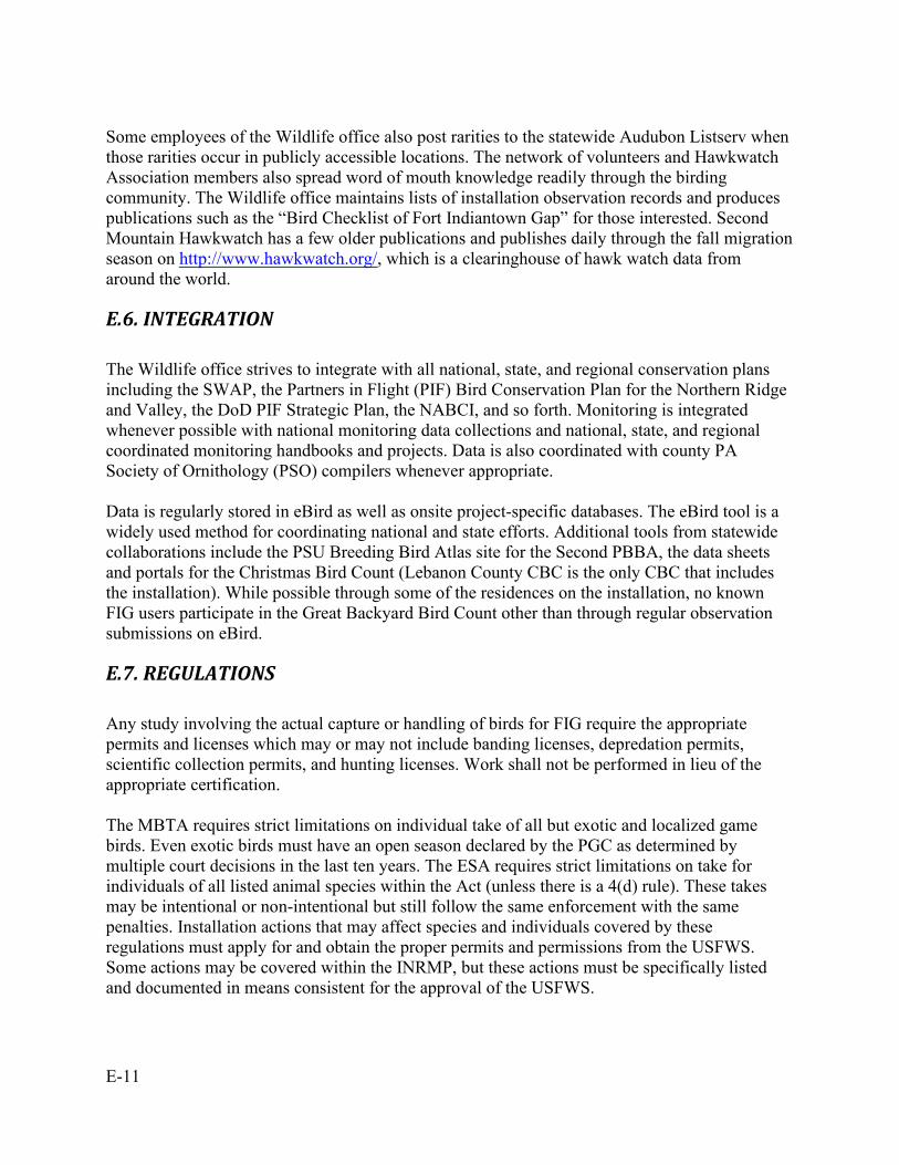
E-11
Some employees of the Wildlife office also post rarities to the statewide Audubon Listserv when those rarities occur in publicly accessible locations. The network of volunteers and Hawkwatch Association members also spread word of mouth knowledge readily through the birding community. The Wildlife office maintains lists of installation observation records and produces publications such as the “Bird Checklist of Fort Indiantown Gap” for those interested. Second Mountain Hawkwatch has a few older publications and publishes daily through the fall migration season on http://www.hawkwatch.org/, which is a clearinghouse of hawk watch data from around the world.
E.6. INTEGRATION The Wildlife office strives to integrate with all national, state, and regional conservation plans including the SWAP, the Partners in Flight (PIF) Bird Conservation Plan for the Northern Ridge and Valley, the DoD PIF Strategic Plan, the NABCI, and so forth. Monitoring is integrated whenever possible with national monitoring data collections and national, state, and regional coordinated monitoring handbooks and projects. Data is also coordinated with county PA Society of Ornithology (PSO) compilers whenever appropriate. Data is regularly stored in eBird as well as onsite project-specific databases. The eBird tool is a widely used method for coordinating national and state efforts. Additional tools from statewide collaborations include the PSU Breeding Bird Atlas site for the Second PBBA, the data sheets and portals for the Christmas Bird Count (Lebanon County CBC is the only CBC that includes the installation). While possible through some of the residences on the installation, no known FIG users participate in the Great Backyard Bird Count other than through regular observation submissions on eBird.
E.7. REGULATIONS Any study involving the actual capture or handling of birds for FIG require the appropriate permits and licenses which may or may not include banding licenses, depredation permits, scientific collection permits, and hunting licenses. Work shall not be performed in lieu of the appropriate certification. The MBTA requires strict limitations on individual take of all but exotic and localized game birds. Even exotic birds must have an open season declared by the PGC as determined by multiple court decisions in the last ten years. The ESA requires strict limitations on take for individuals of all listed animal species within the Act (unless there is a 4(d) rule). These takes may be intentional or non-intentional but still follow the same enforcement with the same penalties. Installation actions that may affect species and individuals covered by these regulations must apply for and obtain the proper permits and permissions from the USFWS. Some actions may be covered within the INRMP, but these actions must be specifically listed and documented in means consistent for the approval of the USFWS.

E-12
Hunting of game birds is covered within the state by the PGC, but the hunts themselves are authorized, enforced, and enacted by the USFWS except where MBTA exceptions exist. For these reasons, PADMVA Wildlife is unable to establish its own hunting seasons for any of these species without first seeking the proper approval of the enacting agency. PADMVA can and has implemented regulations above and beyond those of the state and USFWS. As examples, PADMVA has added regulations banning quail collection despite PGC and PFBC having available seasons and harvest limits for these animals.
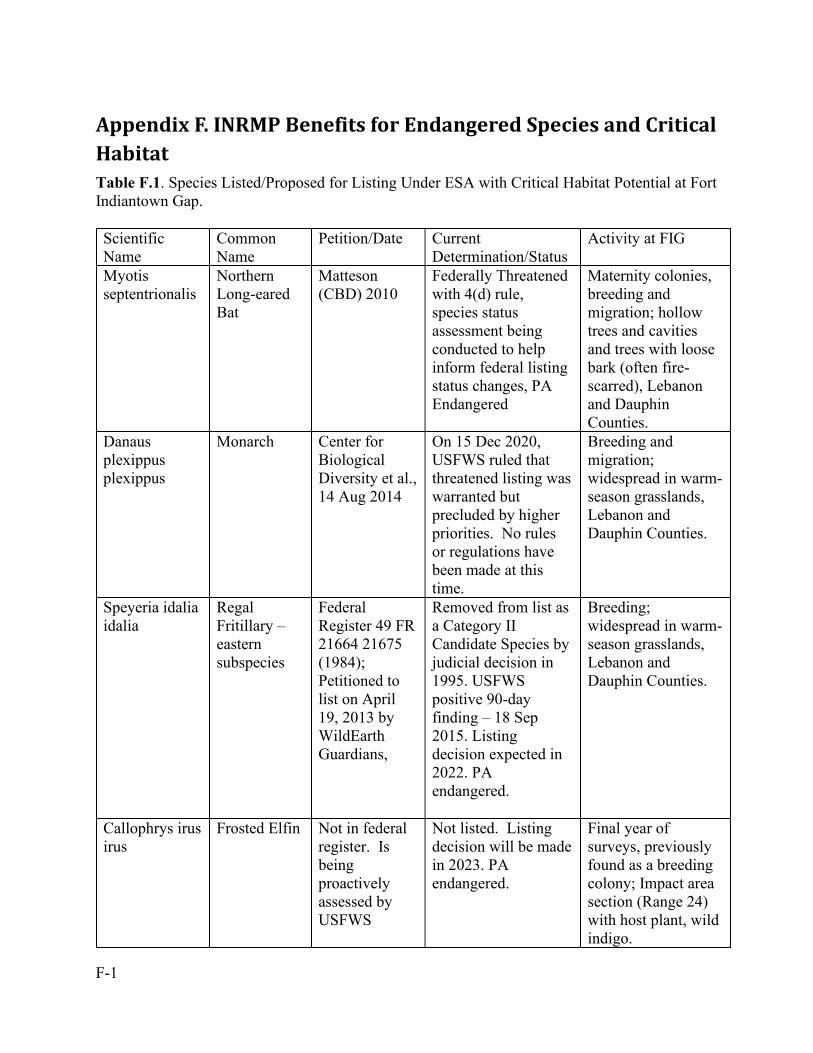
F-1
Appendix F. INRMP Benefits for Endangered Species and Critical Habitat Table F.1. Species Listed/Proposed for Listing Under ESA with Critical Habitat Potential at Fort Indiantown Gap. Scientific Name
Common Name
Petition/Date Current Determination/Status
Activity at FIG
Myotis septentrionalis
Northern Long-eared Bat
Matteson (CBD) 2010
Federally Threatened with 4(d) rule, species status assessment being conducted to help inform federal listing status changes, PA Endangered
Maternity colonies, breeding and migration; hollow trees and cavities and trees with loose bark (often fire-scarred), Lebanon and Dauphin Counties.
Danaus plexippus plexippus
Monarch Center for Biological Diversity et al., 14 Aug 2014
On 15 Dec 2020, USFWS ruled that threatened listing was warranted but precluded by higher priorities. No rules or regulations have been made at this time.
Breeding and migration; widespread in warm-season grasslands, Lebanon and Dauphin Counties.
Speyeria idalia idalia
Regal Fritillary – eastern subspecies
Federal Register 49 FR 21664 21675 (1984); Petitioned to list on April 19, 2013 by WildEarth Guardians,
Removed from list as a Category II Candidate Species by judicial decision in 1995. USFWS positive 90-day finding – 18 Sep 2015. Listing decision expected in 2022. PA endangered.
Breeding; widespread in warm-season grasslands, Lebanon and Dauphin Counties.
Callophrys irus irus
Frosted Elfin Not in federal register. Is being proactively assessed by USFWS
Not listed. Listing decision will be made in 2023. PA endangered.
Final year of surveys, previously found as a breeding colony; Impact area section (Range 24) with host plant, wild indigo.
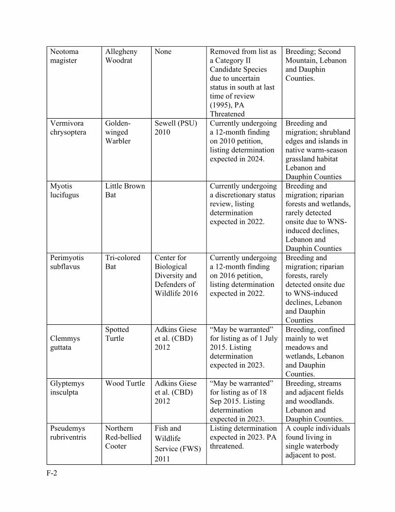
F-2
Neotoma magister
Allegheny Woodrat
None Removed from list as a Category II Candidate Species due to uncertain status in south at last time of review (1995), PA Threatened
Breeding; Second Mountain, Lebanon and Dauphin Counties.
Vermivora chrysoptera
Golden-winged Warbler
Sewell (PSU) 2010
Currently undergoing a 12-month finding on 2010 petition, listing determination expected in 2024.
Breeding and migration; shrubland edges and islands in native warm-season grassland habitat Lebanon and Dauphin Counties
Myotis lucifugus
Little Brown Bat
Currently undergoing a discretionary status review, listing determination expected in 2022.
Breeding and migration; riparian forests and wetlands, rarely detected onsite due to WNS-induced declines, Lebanon and Dauphin Counties
Perimyotis subflavus
Tri-colored Bat
Center for Biological Diversity and Defenders of Wildlife 2016
Currently undergoing a 12-month finding on 2016 petition, listing determination expected in 2022.
Breeding and migration; riparian forests, rarely detected onsite due to WNS-induced declines, Lebanon and Dauphin Counties
Clemmys guttata
Spotted Turtle
Adkins Giese et al. (CBD) 2012
“May be warranted” for listing as of 1 July 2015. Listing determination expected in 2023.
Breeding, confined mainly to wet meadows and wetlands, Lebanon and Dauphin Counties.
Glyptemys insculpta
Wood Turtle Adkins Giese et al. (CBD) 2012
“May be warranted” for listing as of 18 Sep 2015. Listing determination expected in 2023.
Breeding, streams and adjacent fields and woodlands. Lebanon and Dauphin Counties.
Pseudemys rubriventris
Northern Red-bellied Cooter
Fish and Wildlife Service (FWS) 2011
Listing determination expected in 2023. PA threatened.
A couple individuals found living in single waterbody adjacent to post.
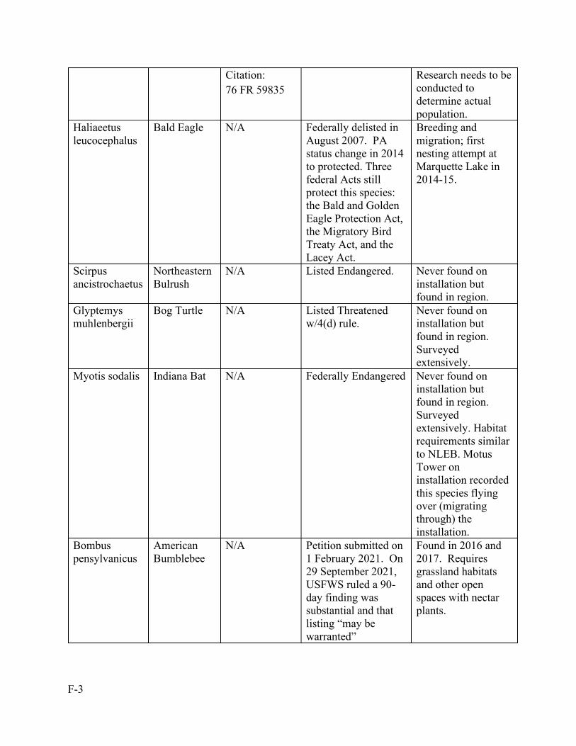
F-3
Citation: 76 FR 59835
Research needs to be conducted to determine actual population.
Haliaeetus leucocephalus
Bald Eagle N/A Federally delisted in August 2007. PA status change in 2014 to protected. Three federal Acts still protect this species: the Bald and Golden Eagle Protection Act, the Migratory Bird Treaty Act, and the Lacey Act.
Breeding and migration; first nesting attempt at Marquette Lake in 2014-15.
Scirpus ancistrochaetus
Northeastern Bulrush
N/A Listed Endangered. Never found on installation but found in region.
Glyptemys muhlenbergii
Bog Turtle N/A Listed Threatened w/4(d) rule.
Never found on installation but found in region. Surveyed extensively.
Myotis sodalis Indiana Bat N/A Federally Endangered Never found on installation but found in region. Surveyed extensively. Habitat requirements similar to NLEB. Motus Tower on installation recorded this species flying over (migrating through) the installation.
Bombus pensylvanicus
American Bumblebee
N/A Petition submitted on 1 February 2021. On 29 September 2021, USFWS ruled a 90-day finding was substantial and that listing “may be warranted”
Found in 2016 and 2017. Requires grassland habitats and other open spaces with nectar plants.
F-4
F.1. Northern Long-eared Bat Status In January 2010, the Center for Biological Diversity (CBD) petitioned the USFWS to list the northern long-eared bat as endangered or threatened under section 4(a)(1) of the Endangered Species Act. In a 12-month petition finding, the USFWS found that listing of the species was warranted (U.S. Department of Interior 2011). On 2 April 2015, the northern long-eared bat was federally listed as threatened (U.S. Department of Interior 2016), making it the first federally listed species known to occur on Fort Indiantown Gap. The USFWS is currently reviewing the status of the northern long-eared bat following a lawsuit put forth by the CBD in 2020, and a new proposed rule and final listing determination are due within 18 months of the completion of the species’ status assessment (likely fall FY2022, R. Niver, pers. comm.). The northern long-eared bat was listed as endangered in Pennsylvania in January 2019, has a state conservation ranking of S1 (critically imperiled) (PNHP 2021), and is designated as a Species of Greatest Conservation Need (PGC-PFBC 2015). White-nose syndrome (WNS) is the most severe and immediate threat to the northern long-eared bat and was the basis of the species’ listing. Other threats to the species include habitat loss and fragmentation, disturbance and loss of hibernacula, wind energy development, and climate change. Currently, 30 state or federally owned ARNG installations across 19 states have occurrence records of the northern long-eared bat. Monitoring Bat surveys were conducted on Fort Indiantown Gap beginning in 1999, with initial pre-construction surveys used to determine presence/absence of the federally endangered Indiana bat. Beginning in 2016, more extensive bat surveys were conducted on the installation in collaboration with researchers from Temple University. Eight of the 9 Pennsylvania resident bat species, as well as the evening bat (Nycticeius humeralis), have been documented on Fort Indiantown Gap. There is suitable roosting and foraging habitat for all bat species that occur on the installation, however, there are currently no known hibernacula onsite. Cave-hibernating bat species are experiencing severe population declines throughout eastern North America (Ingersoll et al. 2013), largely as the result of a fungal disease known as white-nose syndrome (WNS). White-nose syndrome, caused by the cold-loving fungal pathogen Pseudogymnoascus destructans (Minnis and Lindner 2013), was first documented near Albany, NY during the winter of 2006 and has since spread to 35 U.S. states and 7 Canadian provinces (www.whitenosesyndrome.org). WNS was first confirmed at 10 hibernacula in 4 Pennsylvania counties during the winter of 2008-2009, and by 2011-2012 WNS had spread throughout much of the state (Heffernan and Turner 2016). All 6 cave-hibernating bat species found in Pennsylvania are known to be infected with WNS (Turner et al. 2011). The results of capture and acoustic surveys in 2016-2020 have documented drastic declines in populations of several bat species on Fort Indiantown Gap, presumably as the result of WNS (Hauer et al. 2019, Hauer et al. 2020). Prior to WNS, the northern long-eared bat was the most common bat species on the installation, comprising 47% (n = 111) of total mist-net captures and
F-5
this species was captured at >50% of sites surveyed (TNC 2000a, TNC 2001, Bat Conservation and Management, Inc., 2004). Sampling efforts pre-SBCT in 2004 showed extensive use of the training corridor by northern long-eared bats, as 98 individuals (most of which were reproductive females) were captured in forests on or near proposed ranges (Bat Conservation and Management, Inc., 2004). Since 2016, only 3 (0.2% of total captures) northern long-eared bats have been captured at 3 of 96 (3.1%) of sites surveyed (Hauer et al. 2017, Hauer et al. 2018, Hauer et al. 2019). Declines in summer captures of northern long-eared bats at FIG are consistent with post-WNS capture trends across Pennsylvania. Northern long-eared bats declined from 24.8% of total captures in years prior to WNS to 12.6% of captures after WNS (Butchkoski and Bearer 2016). Declines in captures of Myotis bats and tri-colored bats have largely been offset by big brown bats (Eptesicus fuscus) and eastern red bats (Lasiurus borealis), whose populations appear to be stable or increasing at Fort Indiantown Gap (Hauer et al. 2019). Total capture rates have increased steadily over time, with 8.1 bats captured per survey in 2004 and 17.8 bats captured per survey in 2019. Long-term, stationary acoustic monitoring at 8 sites in 2018-2020 revealed peaks in nightly activity of northern long-eared bats in spring (mid-April - May) and late summer (mid-August – early September) (Hauer et al. 2020). Our data suggests that northern long-eared bats return to the installation by April and remain active on the installation until October. Northern long-eared bats are infrequently detected onsite, comprising only 0.6% of total identified passes, 90.4% of which were recorded at 1 site along Indiantown Run in TA B-06A (Hauer et al. 2020). PADMVA Wildlife staff have confirmed the use of 6 known, occupied maternity roosts for 3 northern long-eared bats (2 juvenile males, 1 lactating, adult female) captured in 2017-2019. All 6 roosts are in recently burned forests where there are no proposed construction actions, 3 in TA A-32 north of Ranges 12 and 13A and 3 in TA D-02 east of Range 37 proper. Species of roost trees included red maple (n = 3), black birch (n = 1), black gum (n = 1) and northern red oak (n = 1). Roost trees were small (4.8-24 cm DBH) and most had exfoliating bark, cat faces (partially healed or grown-over wound on a tree stem usually resulting from fire), and/or hollow boles in the main stem. The results of recent mist-netting surveys, acoustic monitoring, and radio-telemetry day-roost searches indicate that the distribution of northern long-eared bats on Fort Indiantown Gap may largely be restricted to the western end of the training corridor and the south-facing slope of Blue Mountain (TA B-06A, A-32, A-33, A-34) in Cantonment, and these areas provide particularly important foraging and roosting habitat for this species. Management Given regional-scale declines in populations of several cave hibernating bat species due to WNS, and the lack of known bat hibernacula onsite, land managers at Fort Indiantown Gap aim to provide and enhance summer foraging and roosting habitat for all bat species following forest management best practices (U.S. Army Environmental Command 2015, Silvis et al. 2016, Johnson and King 2018) and conservation measures listed in the final 4(d) rule (U.S. Department of Interior 2016).
F-6
Silviculture Silviculture practices including even-aged and uneven-aged harvest methods are used to manage forests in support of military training, improve forest stand condition and health, and provide and/or enhance wildlife habitat (U.S. Army Environmental Command 2015). Changes in the structure and composition of forests can alter foraging and roosting habitat use by bats, including the northern long-eared bat. Northern long-eared bats are roost “generalists”, having been found roosting in live trees and snags, as well as anthropogenic structures including buildings and bat boxes (Silvis et al. 2016). However, they typically form summer maternity colonies within cavities of snags or senescing live trees, under loose bark, or in tree cavities (Silvis et al. 2016). Northern long-eared bats roost in numerous tree species within forest stands of various types and conditions, however, roosts are generally in overstory trees in later stages of decay than surrounding trees and are in canopy gaps (Perry and Thill 2007, Lacki et al. 2009). Results vary widely among studies on foraging habitat use by northern long-eared bats in response to silviculture. Despite being adapted to foraging in cluttered, structurally complex forested habitats, Loeb and O’Keefe (2005) documented greater northern long-eared bat activity in open rather than cluttered conditions. In Ohio, northern long-eared bat activity did not differ between shelterwood and control stands (Titchenell et al. 2011). Similarly, Caldwell et al. (2019) and Dodd et al. (2012) found no difference in northern long-eared bat activity between stands with varying degrees of overstory tree removal. Removal of trees has the potential to negatively impact northern long-eared bats either directly through injury or mortality or indirectly through the loss of roosting habitat. The following conservation measures will be taken for all silviculture activities to minimize adverse impacts to northern long-eared bats:
• Removal of trees >3 inches DBH during the pup season (1 June – 31 July) will be restricted
• Removal of known, occupied northern long-eared bat maternity roost trees or any trees within 150 feet of a known, occupied maternity roost tree will be restricted. Known, occupied maternity roosts are defined as “trees that have had female or juvenile northern long-eared bats tracked to them or the presence of female or juvenile bats is known as the result of other methods.” A tree will remain a known, occupied maternity roost “as long as the tree and surrounding habitat remains suitable for northern long-eared bats.”
• Retain snags in silvicultural treatments unless there is a safety concern for the contractor or military personnel, or unless the treatment is a salvage cut or clearcut.
Exceptions to the removal of unoccupied trees >3 inches DBH during the 1 June – 31 July restricted period include:
1. Small-scale Military Training Needs Tree removal required for line-of-sight on training ranges and other training projects (e.g., chainsaw classes, disaster preparedness) may remove up to 5 acres during the restricted period. Preceding the cut, PADMVA Wildlife staff will determine presence/probable absence of northern long-eared bats following USFWS survey
F-7
guidelines (USFWS 2020). If northern long-eared bats are determined to be present, tree removal operations will not occur until after the restricted period.
2. Hazard Trees and Storm Damage Hazard trees can be defined as trees that pose an immediate danger to human life or property. A hazard tree >3 inches DBH with suitable roosting characteristics (e.g., exfoliating bark, crevices, cavities) that needs to be removed during the restricted period, must be assessed by natural resources personnel prior to removal. If appropriate, an emergence survey will be conducted to determine if bats are present. If no bats are present, the hazard tree must be promptly removed. Downed trees that block roads, trails, and other points of access may be removed if they become a barrier. Several hurricanes and other storms have produced substantial damage in recent years, and under emergency conditions such as these, the installation will do what is necessary for force protection, training access, and safety purposes.
Prescribed Fire Land managers on military installations use prescribed fire to achieve many forest management objectives, including hazardous fuel removal for wildfire mitigation, ecosystem restoration, maintenance of grasslands and open forests for military training, and wildlife habitat enhancement (U.S. Army Env Command 2015). Fire may affect bats directly through exposure to heat, smoke, and carbon monoxide, and indirectly through habitat modification and changes in insect prey abundance, diversity, and availability (Dickinson et al. 2009, Johnson and King 2018). The effects of fire likely vary by bat species, season of burn, burn frequency, and intensity (Harper et al. 2016). Low-intensity prescribed fire may provide favorable roosting and foraging habitat for bats by reducing structural complexity or “clutter” in the midstory and understory, reducing tree densities, creating canopy gaps and snags (Perry 2012). Several recent studies have found that bats generally benefit from fire, largely in response to the increased availability and/or suitability of roosts (Boyles and Aubrey 2006). Specifically, northern long-eared bats may preferentially roost in burned forests (Loeb and O’Keefe 2014). In Kentucky, Lacki et al. (2009) located 74% of northern long-eared bat maternity roosts in previously burned habitats. Similarly, Perry and Thill (2007) found 54% of male day roosts within areas that had been burned 1-5 years prior. Johnson et al. (2009) also located 38% of maternity roosts for this species within burned areas while documenting no differences in roost switching behavior or distances between successive roosts between burned and unburned treatments. The results of day-roost telemetry searches onsite in 2017-2019 support these findings as all 6 northern long-eared bat roosts were in recently burned (<5 years prior) forests (Hauer et al. 2017, Hauer et al. 2018, Hauer et al. 2019). Most of these roosts were small diameter snags with hollow boles and numerous catfaces and crevices likely created by fire. Similarly, Johnson et al. (2012) found northern long-eared bat roosts in cavities of small diameter trees post-fire.
F-8
However, prescribed fire has the potential to negatively impacts bats. Adults bats are slow to arouse from torpor when air temperatures are less than 50°F, and thus may not be able to escape smoke and heat from fires. Non-volant pups are likely the most vulnerable to death or injury from fire. The following conservation measures will be taken for prescribed burning to minimize adverse impacts to northern long-eared bats:
• Avoid conducting prescribed burns in suitable forested northern long-eared bat habitat from 1 June – 31 July
• Use low intensity burns during the active season (1 April – 31 October) when ambient temperatures are <50°F
• Where practical, remove hazard trees and construct fire breaks during winter to reduce the chance of removing or disturbing occupied roosts
• Where practical, protect known maternity roost trees from fire
Bat Boxes Roost availability is an important factor for bat survival and population persistence. Artificial roosts, such as bat boxes, can be used to supplement existing roosting habitat or to mitigate the loss of natural roosts (Taylor et al. 2020). Several bat species have been found to use bat boxes as day or maternity roosts, including big brown bats, little brown bats, Indiana bats, and to a lesser extent northern long-eared bats. In 2006, PADMVA Wildlife staff installed 21 bat boxes near several bodies of water throughout the training corridor and Cantonment, many of which are no longer in suitable condition to be used by bats. Over the next few years, bat boxes in poor condition will either be repaired or replaced with new boxes. In summer 2021, PADMVA Wildlife staff installed 5 new bat boxes, and these boxes (along with any newly repaired or replaced boxes) will be monitored annually to determine use by bats. Motus Towers In 2017, 6 automated radiotelemetry towers were installed on the installation as part of the Motus Wildlife Tracking System (Bird Studies Canada). Each tower consists of 4 9-element Yagi antennas positioned in each of the cardinal directions. Three Indiana bats originally captured and radio tagged by PGC biologists at a bat box in Berks Co., PA in fall of 2018 and 2019 were later detected by several of the Motus towers onsite. The fact that these detections occurred during the fall swarm period (mid-October - early November) in both years, suggests that an undocumented Indiana hibernaculum may exist near the northern boundary of FIG, adjacent to State Game Lands (SGL) 211. Several historic northern long-eared bat hibernacula are also located in SGL 211 north of FIG (G. Turner, PGC, pers. comm.). The continued operation of the Motus towers at FIG will enable PADMVA Wildlife staff to document seasonal movements of Indiana bats and other bat species of conservation concern and may aid in the search for new winter populations of these species. Land Use Buffering The Fort Indiantown Gap ACUB program is used to preserve public lands and conservation-compatible use for air corridors used in flight training. The program has several enlisted and interested partners looking to purchase or create easements on land around the DeHart Reservoir
F-9
north of Fort Indiantown Gap. This land contains high-quality northern long-eared bat habitat along Clark’s Creek and its tributaries and preserves a contiguous stretch of wooded stream valleys from State Route 325 south to Fort Indiantown Gap property. For these reasons, the ACUB program should be considered for conservation measures or potential conservation crediting programs as land is purchased and/or eased should other listings occur. Providing a Conservation Benefit to the Species Populations of northern long-eared bats have undergone precipitous declines throughout the northeastern United States since 2006-2007 as the result of white-nose syndrome. As such, the maintenance of high-quality, forested habitat for roosting and foraging will be particularly important for the conservation and recovery of this species. This will be accomplished onsite through the use of forest management best practices. Northern long-eared bats have benefitted from current forest management practices (e.g., prescribed fire, mechanical thinning) onsite, as evidenced by the selection of recently burned stands for roosting. Providing Certainty that the Management Plan will be Implemented The management plan follows simple, easily followed polices that were already in use and were proven to be effective on the installation prior to listing of the northern long-eared bat. For example, the management plan follows the annual Prescribed Fire Project Plan, which is submitted to several state agencies for approval prior to implementation. In addition, there will be a moratorium on prescribed fire and tree removal within suitable forested northern long-eared bat habitat during the pup season (1 June to 31 July). PADMVA Wildlife staff will coordinate with the USFWS to ensure that management actions remain in compliance with the Endangered Species Act and the final 4(d) rule (U.S. Department of Interior 2016). Providing Certainty that the Conservation Effort will be Effective Since 2018, a long-term bat monitoring plan has been implemented to determine the current distribution and relative abundance of northern long-eared bats onsite, and to determine the potential effects of land management practices and military training activities on habitat use of this species (Powers 2018). This plan incorporates multiple field methodologies (e.g., mist-netting, acoustic monitoring, radiotelemetry, emergence counts) following guidance provided by the PGC, USFWS (USFWS 2020) and NABat (Loeb et al. 2015). This plan will enable the collection of extensive, long-term data to track changes in Fort Indiantown Gap’s bat populations over time and will also contribute to national and international initiatives (e.g., Motus, NABat). The plan will be updated and refined by PADMVA Wildlife staff on an annual basis.
F.2. Eastern Regal Fritillary (eastern subspecies) Status The regal fritillary was petitioned to the USFWS by WildEarth Guardians in 2013 followed by a 18 Sep 2015 90-day substantial finding. A "Substantial Finding" means that the petition provides enough information to substantiate that listing this species may be warranted. USFWS recognizes the regal as two distinct subspecies, eastern and western, in its species status
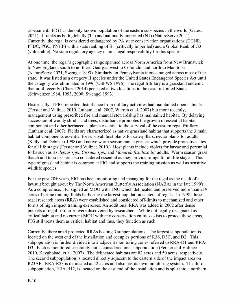
F-10
assessment. FIG has the only known population of the eastern subspecies in the world (Gates, 2021). It ranks as both globally (T1) and nationally imperiled (N1) (NatureServe 2021). Currently, the regal is considered endangered by PA state conservation organizations (DCNR, PFBC, PGC, PNHP) with a state ranking of S1 (critically imperiled) and a Global Rank of G3 (vulnerable). No state regulatory agency claims legal responsibility for this species. At one time, the regal’s geographic range spanned across North America from New Brunswick to New England, south to northern Georgia, west to Colorado, and north to Manitoba (NatureServe 2021, Swengel 1993). Similarly, in Pennsylvania it once ranged across most of the state. It was listed as a category II species under the United States Endangered Species Act until the category was eliminated in 1996 (USFWS 1996). The regal fritillary is a grassland endemic that until recently (Chazal 2014) persisted at two locations in the eastern United States (Schweitzer 1984, 1993, 2000; Swengel 1993). Historically at FIG, repeated disturbance from military activities had maintained open habitats (Ferster and Vulinec 2010, Latham et al. 2007, Warren et al. 2007) but more recently, management using prescribed fire and manual stewardship has maintained habitat. By delaying succession of woody shrubs and trees, disturbance promotes the growth of essential habitat component and other herbaceous plants essential to the survival of the eastern regal fritillary (Latham et al. 2007). Fields are characterized as native grassland habitat that supports the 3 main habitat components essential for survival: host plants for caterpillars, nectar plants for adults (Kelly and Debinski 1998) and native warm season bunch grasses which provide protective sites for all life stages (Ferster and Vulinec 2010.) Host plants include violets for larvae and perennial forbs such as Asclepias spp., Cirsium spp., and Monarda fistulosa for adults. Warm season grass thatch and tussocks are also considered essential as they provide refuge for all life stages. This type of grassland habitat is common at FIG and supports the training mission as well as sensitive wildlife species. For the past 20+ years, FIG has been monitoring and managing for the regal as the result of a lawsuit brought about by The North American Butterfly Association (NABA) in the late 1990's. As a compromise, FIG signed an MOU with TNC which delineated and preserved more than 219 acres of prime training fields harboring the largest population centers of regals. In 1998, three regal research areas (RRA) were established and considered off-limits to mechanized and other forms of high impact training exercises. An additional RRA was added in 2002 after dense pockets of regal fritillaries were discovered by researchers. While not legally designated as critical habitat and no current MOU with any conservation entities exists to protect these areas, FIG still treats them as critical habitat and thus, they function as such. Currently, there are 4 protected RRAs hosting 3 subpopulations. The largest subpopulation is located on the west end of the installation and occupies portions of R36, D3C, and D2. This subpopulation is further divided into 2 adjacent monitoring zones referred to RRA-D1 and RRA-D3. Each is monitored separately but is considered one subpopulation (Ferster and Vulinec 2010, Keyghobadi et al. 2007). The delineated habitats are 82 acres and 50 acres, respectively. The second subpopulation is located directly adjacent to the eastern side of the impact area on R23AE. RRA-R23 is delineated at 42 acres and also has its own monitoring system. The third subpopulation, RRA-B12, is located on the east end of the installation and is split into a northern
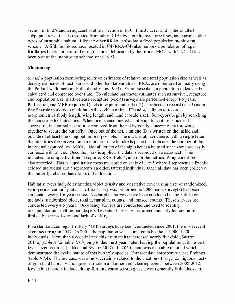
F-11
section in B12A and an adjacent southern section in R30. It is 35 acres and is the smallest subpopulation. It is also isolated from other RRAs by a public road, tree lines, and various other types of unsuitable habitat. Like the other RRAs, it also has a fixed population monitoring scheme. A fifth monitored area located in C4 (RRA-C4) also harbors a population of regal fritillaries but is not part of the original area delineated by the former MOU with TNC. It has been part of the monitoring scheme since 1999. Monitoring S. idalia population monitoring relies on estimates of relative and total population size as well as density estimates of host plants and other habitat variables. RRAs are monitored annually using the Pollard-walk method (Pollard and Yates 1993). From these data, a population index can be calculated and compared over time. To calculate parameter estimates such as survival, recapture, and population size, mark-release-recapture (MRR) surveys are performed every 4-5 years. Performing and MRR requires: 1) nets to capture butterflies 2) datasheets to record data 3) extra fine Sharpie markers to mark butterflies with a unique ID and 4) calipers to record morphometrics (body length, wing length, and head capsule size). Surveyors begin by searching the landscape for butterflies. When one is encountered an attempt to capture is made. If successful, the animal is carefully removed from the net by gently squeezing the forewings together to secure the butterfly. Once out of the net, a unique ID is written on the inside and outside of at least one wing but more if possible. The mark is alpha numeric with a single letter that identifies the surveyor and a number to the hundreds place that indicates the number of the individual captured (ex. M001). Not all letters of the alphabet can be used since some are easily confused with others. Once the mark is applied, the data is recorded on a datasheet. This includes the unique ID, time of capture, RRA, field #, and morphometrics. Wing condition is also recorded. This is a qualitative measure scored on scale of 1 to 5 where 1 represents a freshly eclosed individual and 5 represents an older, tattered individual. Once all data has been collected, the butterfly released back to its initial location. Habitat surveys include estimating violet density and vegetative cover using a set of randomized, semi-permanent 2m2 plots. The first survey was performed in 2000 and a survey(s) has been conducted every 4-6 years since. Nectar plant surveys have been conducted using 3 different methods: randomized plots, total nectar plant counts, and transect counts. These surveys are conducted every 4-5 years. Occupancy surveys are conducted and used to identify metapopulation satellites and dispersal events. These are performed annually but are more limited by access issues and lack of staffing. Five standardized regal fritillary MRR surveys have been conducted since 2001, the most recent event occurring in 2017. In 2001, the population was estimated to be about 1,000-1,200 individuals. More than a decade later, this estimate has increased nearly five-fold (Swartz 2014a) (table A7.2, table A7.3) only to decline 3 years later, leaving the population at its lowest levels ever recorded (Tilden and Swartz 2017). In 2020, there was a notable rebound which demonstrated the cyclic nature of this butterfly species. Transect data corroborate these findings (table A7.4). The increase was almost certainly related to the creation of large, contiguous tracts of grassland habitat via range construction and other land clearing events between 2008-2012. Key habitat factors include clump-forming warm season grass cover (generally little bluestem,
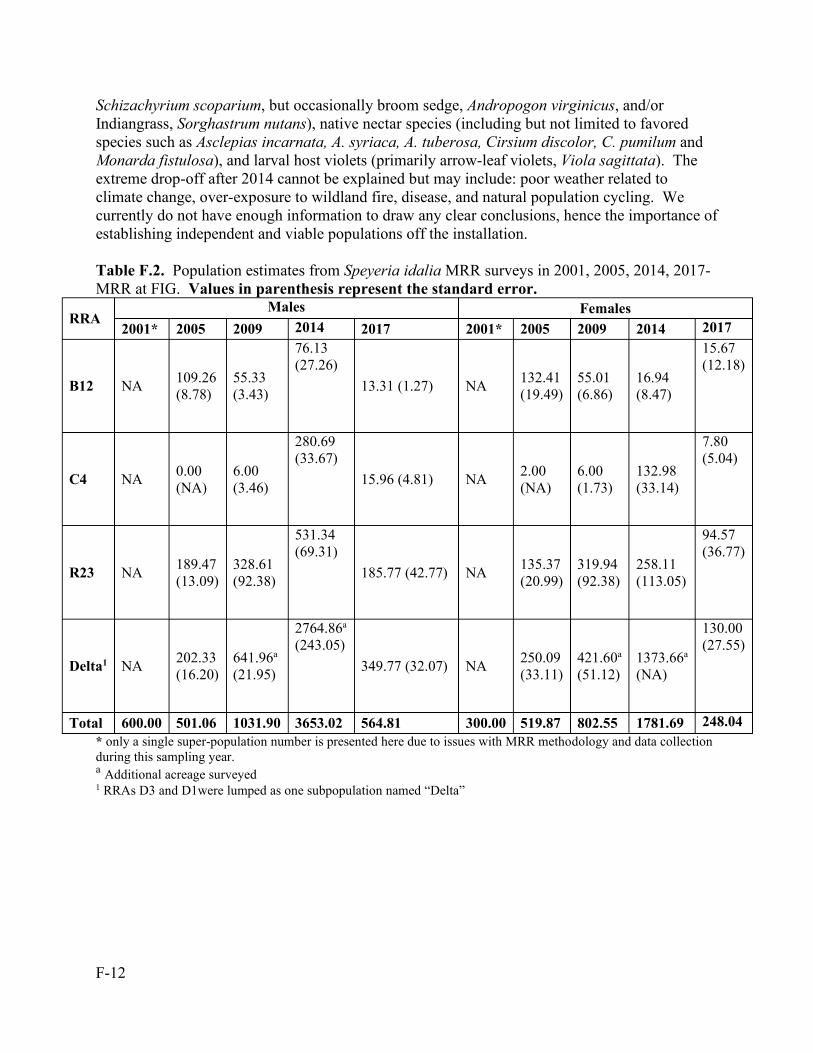
F-12
Schizachyrium scoparium, but occasionally broom sedge, Andropogon virginicus, and/or Indiangrass, Sorghastrum nutans), native nectar species (including but not limited to favored species such as Asclepias incarnata, A. syriaca, A. tuberosa, Cirsium discolor, C. pumilum and Monarda fistulosa), and larval host violets (primarily arrow-leaf violets, Viola sagittata). The extreme drop-off after 2014 cannot be explained but may include: poor weather related to climate change, over-exposure to wildland fire, disease, and natural population cycling. We currently do not have enough information to draw any clear conclusions, hence the importance of establishing independent and viable populations off the installation. Table F.2. Population estimates from Speyeria idalia MRR surveys in 2001, 2005, 2014, 2017- MRR at FIG. Values in parenthesis represent the standard error.
RRA Males Females
2001* 2005 2009 2014 2017 2001* 2005 2009 2014 2017
B12 NA 109.26 (8.78)
55.33 (3.43)
76.13 (27.26)
13.31 (1.27) NA 132.41 (19.49)
55.01 (6.86)
16.94 (8.47)
15.67 (12.18)
C4 NA 0.00 (NA)
6.00 (3.46)
280.69 (33.67)
15.96 (4.81) NA 2.00 (NA)
6.00 (1.73)
132.98 (33.14)
7.80 (5.04)
R23 NA 189.47 (13.09)
328.61 (92.38)
531.34 (69.31)
185.77 (42.77) NA 135.37 (20.99)
319.94 (92.38)
258.11 (113.05)
94.57 (36.77)
Delta1 NA 202.33 (16.20)
641.96a (21.95)
2764.86a (243.05)
349.77 (32.07) NA 250.09 (33.11)
421.60a (51.12)
1373.66a (NA)
130.00 (27.55)
Total 600.00 501.06 1031.90 3653.02 564.81 300.00 519.87 802.55 1781.69 248.04 * only a single super-population number is presented here due to issues with MRR methodology and data collection during this sampling year. a Additional acreage surveyed 1 RRAs D3 and D1were lumped as one subpopulation named “Delta”
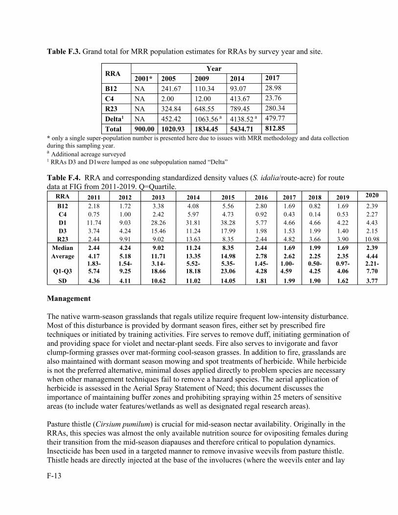
F-13
Table F.3. Grand total for MRR population estimates for RRAs by survey year and site.
RRA Year
2001* 2005 2009 2014 2017 B12 NA 241.67 110.34 93.07 28.98 C4 NA 2.00 12.00 413.67 23.76 R23 NA 324.84 648.55 789.45 280.34 Delta1 NA 452.42 1063.56 a 4138.52 a 479.77 Total 900.00 1020.93 1834.45 5434.71 812.85
* only a single super-population number is presented here due to issues with MRR methodology and data collection during this sampling year. a Additional acreage surveyed 1 RRAs D3 and D1were lumped as one subpopulation named “Delta” Table F.4. RRA and corresponding standardized density values (S. idalia/route-acre) for route data at FIG from 2011-2019. Q=Quartile.
RRA 2011 2012 2013 2014 2015 2016 2017 2018 2019 2020
B12 2.18 1.72 3.38 4.08 5.56 2.80 1.69 0.82 1.69 2.39 C4 0.75 1.00 2.42 5.97 4.73 0.92 0.43 0.14 0.53 2.27 D1 11.74 9.03 28.26 31.81 38.28 5.77 4.66 4.66 4.22 4.43 D3 3.74 4.24 15.46 11.24 17.99 1.98 1.53 1.99 1.40 2.15
R23 2.44 9.91 9.02 13.63 8.35 2.44 4.82 3.66 3.90 10.98 Median 2.44 4.24 9.02 11.24 8.35 2.44 1.69 1.99 1.69 2.39 Average 4.17 5.18 11.71 13.35 14.98 2.78 2.62 2.25 2.35 4.44
Q1-Q3 1.83-5.74
1.54-9.25
3.14-18.66
5.52-18.18
5.35-23.06
1.45-4.28
1.00-4.59
0.50-4.25
0.97-4.06
2.21-7.70
SD 4.36 4.11 10.62 11.02 14.05 1.81 1.99 1.90 1.62 3.77 Management The native warm-season grasslands that regals utilize require frequent low-intensity disturbance. Most of this disturbance is provided by dormant season fires, either set by prescribed fire techniques or initiated by training activities. Fire serves to remove duff, initiating germination of and providing space for violet and nectar-plant seeds. Fire also serves to invigorate and favor clump-forming grasses over mat-forming cool-season grasses. In addition to fire, grasslands are also maintained with dormant season mowing and spot treatments of herbicide. While herbicide is not the preferred alternative, minimal doses applied directly to problem species are necessary when other management techniques fail to remove a hazard species. The aerial application of herbicide is assessed in the Aerial Spray Statement of Need; this document discusses the importance of maintaining buffer zones and prohibiting spraying within 25 meters of sensitive areas (to include water features/wetlands as well as designated regal research areas). Pasture thistle (Cirsium pumilum) is crucial for mid-season nectar availability. Originally in the RRAs, this species was almost the only available nutrition source for ovipositing females during their transition from the mid-season diapauses and therefore critical to population dynamics. Insecticide has been used in a targeted manner to remove invasive weevils from pasture thistle. Thistle heads are directly injected at the base of the involucres (where the weevils enter and lay
F-14
eggs), either post-flowering or with the assistance of an exclosure to keep rare pollinators from ingesting any chemical-tainted nectar. The weevils have been devouring seed heads at an unsustainable rate, reducing this key mid-season/transitional nectar source to a local rarity status. FIG has been introducing native-to-post wild bergamot as a surrogate for the mid-July purple blooms of the pasture thistle. Rearing FIG researchers and Hershey ZooAmerica employees have refined and enhanced existing lab rearing protocols. Adult females are collected in mid-August and held in paper bags with shredded, unbleached paper towels as an ovipositional substrate, along with a violet leaf intended to induce oviposition, and a moist cotton ball to provide humidity. Females are highly fecund, laying thousands of eggs in a laboratory setting (Becker 2013, Wagner et al. 1997). Mortality is most common during the overwintering phase, where delicate first instar larvae easily succumb to changes in microclimate resulting in mold or desiccation. Survival of overwintering larvae significantly increased after adapting a protocol being tested by a butterfly rearing lab in the Midwest. Small groups of first instar caterpillars are placed in sealed, vented cups filled with paper towel squares on which they can settle. These cups are placed in larger plastic storage containers, alongside open cups filled with hydration salts designed to maintain humidity and, in turn, reduce caterpillar desiccation. The containers are housed in an incubation chamber programmed to stay at an optimal temperature from October to April. The increased larval survivorship achieved with this method should allow for continued success in producing healthy regals for reintroduction. In April, larvae are “woken up”, assessed for survivorship, and prepared for release directly to reintroduction sites or to FIG to supplement the existing population. Some larvae are retained in the lab for further rearing studies at ZooAmerica. Once pupation occurs, they are placed into a holding cage until metamorphosis is completed. After emergence, adults are measured and marked with a unique character, and released to reintroduction sites or FIG. Regals are released as caterpillars in mid-late spring, or as adults in the summer, primarily to reintroduction sites. While a variety of sites and partnerships are being explored for future potential, PGC state game lands represent the only current release sites. A small number of larvae released in the previous fall (old protocol) or the current spring successfully become adult butterflies that have been readily observed in summer, but year-to-year success has been elusive. Thus far, our program has not been able to maintain self-sustaining satellite populations. Additional years of release and monitoring will be necessary to determine survivability of these experimental populations. We suspect that condition of habitat is a key factor in determining site quality for the Regal. Most reintroduction sites taken into consideration in the past have been too small and over-run with undesirable vegetation. Sites like these require extensive management efforts to reproduce conditions like those of FIG RRA’s. Because of these observations, efforts have shifted to one reintroduction site in western Pennsylvania, a reclaimed historical strip mine, which has shown great potential to mimic the conditions at FIG. To facilitate this reintroduction work, a formal agreement has been made with PGC allowing FIG staff to devote more time and resources to working with this site. Partnerships with universities and other organizations are also being developed, to increase the ability to address the many demands of a successful reintroduction. Reestablishment of satellite populations elsewhere
F-15
would begin the road to recovery for this butterfly and would also satisfy a main goal of USFWS and DoD. Habitat Expansion The Wildlife office, in conjunction with Forestry and the ITAM office, work to improve native warm-season grassland conditions throughout the installation. Isolation was cited as a key stressor on population dynamics according to a study by the Natural Academy of Science (Keyghobadi et al. 2006, 2013). Since the first publication, a timber sale in training areas C-5A and C-4 has created a potential corridor between the 3 subpopulations east of the impact area. Success of this was verified during the last MRR (Swartz 2014a) but was limited to RRAs C4, R23, and the Deltas. Native grasses, violets, and forbs quickly filled in gaps out to R23, allowing the smaller subpopulation in C4 to expand with the habitat. The population has increased so much that it is no longer considered marginal. Additional land clearing efforts and construction have also occurred throughout the east end training areas (B9-12 and R30) but have not produced the same positive effect on population size as other areas on FIG. Here, grassland habitat has been slower to develop, leaving large patches of marginal habitat dominated by invasive vegetation and trees which do not support the different resources required for all life stages of regals. This combined with RRA-B12’s already isolated position, appear to hinder population growth as well as dispersal. Regal populations, as well as other disturbance dependent species, exist within a metapopulation structure. This consists of a matrix of various sized habitat pockets that support each other through dispersal. The metapopulation fluctuates over time as satellites populations die off and get re-colonized. Little, if any, movement has been observed between this subpopulation and any other. In fact, comparing mark-recapture datasets over time (Swartz 2010, 2014a) demonstrates a decrease in movement between RRA-B12 and any other RRA. The increase in fire tempo on Ranges 35 and 36, along with timber clearing and construction of ranges has led to new colonization events and the most significant population increases on the installation. The Range 36 subpopulation (RRAs D1 and D3) has the largest and fastest growing subpopulation on the installation. One area in particular, located in the central part of the range, has driven this trend which can be verified by MRR and transect data . It is situated between the firing line and several targets and burns at least once a year, whether under prescribed fire conditions or fires ignited by training rounds. In addition, Wildlife staff grow nectar plants and larval host plants from seed or divisions (often through contracted nurseries but also in-house). In the spring and fall, plants are installed in deficient areas on the landscape. Successes include introducing and growing available Monarda fistulosa where Cirsium pumilum declines and moving Asclepias incarnata into areas of the corridor where it hasn’t dispersed itself. Providing a Conservation Benefit to the Species FIG has set aside 219 acres of core grassland habitat for conservation purposes. It has been divided into separate management units that are part of a long-standing monitoring system that
F-16
tracks eastern regal fritillary populations levels at FIG as well as all of the resources it needs for survival. We also have a land management plan that is fully integrated into our own conservation programs as well as the military mission, and a growing reintroduction project that brings together multiple agencies and partners for common conservation purpose. Providing Certainty that the Management Plan will be Implemented The management plan does not interfere with training and has been fully integrated into our program for over a decade. Providing Certainty that the Conservation Effort will be Effective The regal fritillary conservation project has been operating in its current formulation since the early 2000’s and, because of this long-standing monitoring and management project, FIG has been able to successfully maintain the last population of eastern regal fritillaries in the world.
F.3. Golden-winged Warbler Status In February 2010, the GWWA was petitioned to be listed under the Endangered Species Act (ESA). In June 2011, the USFWS released its 90 day finding that based on substantial scientific information, listing of the GWWA may be warranted. The GWWA is currently undergoing a 12-month finding based on the petition and if warranted could be listed in FY2024 (USFWS 2021). The GWWA is a rarely observed breeder at FIG. The GWWA requires a mosaic of early successional forest and open (grassland) areas for breeding and foraging and mature forest post-fledging. Challenges facing the GWWA are loss of habitat and the expansion of, and hybridization with the blue-winged warbler (BWWA) (Bakermans et al. 2011). Suitable habitat can be found throughout many training areas at FIG. This habitat also supports an abundant BWWA population resulting in increased opportunities for hybridization. Advanced stages of replacement have been observed, as described in Dunn and Garrett (1997) wherein backcrossed Brewster’s and Lawrence’s warblers have become increasingly common. GWWA likely breed on the installation every year, but their presence has only occasionally been detected. Evidence of their presence can be found in the many backcrossed hybrid individuals, Brewster’s warblers and Lawrence’s warblers, that have been detected over the years. This fits Dunn and Garrett’s (1997) description of the late stages of BWWA invasion. GWWA presence on the installation will likely diminish if their prediction is correct. Studies such as Confer and Knapp (1981), Bulluck (2007), and Larkin and Grata (2009) show that some isolation of the GWWA from the BWWA occurs at higher altitudes, but elevations at FIG only range from 350 feet above mean sea level (msl) to just under 1,400 feet msl. Isolating for GWWA on the ridges is not expected to occur until over 1,900 feet msl (Bulluck 2007). Patton et al. (2010) suggest grass cover and canopy cover play important roles.
F-17
FIG is one of only two known breeding locations in Dauphin or Lebanon Counties (Wilson et al. 2012). The area has experienced steep declines since the first breeding bird atlas project in 1984-1989, and GWWA numbers continued to decline through the second breeding bird atlas project in 2004-2009. Monitoring There has been limited success in breeding detections through various bird survey techniques including annual installation-wide point count surveys and annual census counts (Derr and Gardner 2020). These surveys can be augmented with audio call surveys (using audio lures to invoke a breeding male response) at known locations to determine occupancy, but GWWA cannot be distinguished from BWWA by song alone. Visual confirmation of species identity is needed since both species and hybrid can sing each other’s song. Once identified, territories may be marked during return visits to the field (Larkin et al. 2011). These locations can be revisited annually, but often male GWWA are displaced by BWWA males and hybrids. Management Abundant high-quality GWWA habitat is present at FIG. This habitat is kept open using dormant-season prescribed fire, mechanical treatments, and limited herbicide to reduce invasive species like mile-a-minute that remove understory or limit regeneration. FIG has been identified as a leader in the state for this type of habitat and for our management expertise (Senser 2008, WMI 2014, Latham pers. comm.). Care to avoid harm to the population and to individual birds is already covered under proper management for compliance with MBTA, but in general, species-specific nesting locations should be marked and avoided when found. Mechanical, combustible, and chemical treatments should maintain a 20 m buffer from a known nesting location. A focus on restoring habitat with native shrubs and herbaceous plants increases the abundance and diversity of insects feeding on the plants in the GWWA breeding area. This in turn produces better nutrition for developing hatchlings and adults. FIG has a strict policy of using only native plantings within installation boundaries, and the invasive pest management policies target against non-native dominance in the training corridor. This also benefits local insect abundance immediately upon seeding or planting. Providing a Conservation Benefit to the Species GWWA habitat is created and maintained through the use of several land management techniques including, but not limited to, prescription and wildland fire, chemical applications including herbicide, and mechanical treatments including invasive species removal and periodic mowing or brush cutting. As succession naturally progresses, these areas become prime breeding habitat and nesting locations. Prime habitat is very difficult to create directly but is also very easy to derive naturally following a proper land-management rotation.
F-18
Providing Certainty that the Management Plan will be Implemented The management plan does not interfere with military training and land use coincides with GWWA habitat and therefore is a good fit for cooperation and funding even without additional effort. If ESA listing occurs, legal status will add to the gravitas of implementation. Coordination with USFWS on both ESA listing and MBTA will ensure compliance with the plan. Providing Certainty that the Conservation Effort will be Effective Currently, breeding GWWA are rarely observed on the installation. Breeding males, the easiest individuals to detect, rarely return to the same locations in successive years. Due to the nature of the habitat, documentation of successful nesting efforts and species identification of females is difficult to obtain without disrupting breeding behavior. A limited number of migrating individuals continue to pass through the installation each year, although they are difficult to detect. Monitoring schemes include point-count surveys in early successional habitat (see Becker and Brittingham 2005, McNaughton, Swartz, and Hovis 2011), annual installation-wide point count surveys since 2016 (Derr and Gardner 2020), opportunistic calling surveys, and public data collected in eBird. Declines have followed the pattern of BWWA transition outlined in Peterson’s Field Guide to Warblers (Dunn and Garrett 1997), so BWWA and intergrades are also carefully noted. Ephemeral habitat is difficult to quantify with long-term trends since the habitat is constantly changing. Installation-wide survey efforts will bring some regulation to the data, but with 17,000 acres and a small population, many birds may never be detected. The best course of action is to continue rotating the habitat so that some portion of the installation is able to host the species in any given year. Annual habitat monitoring should continue to produce observations and documentation of breeding males.
F.4. Monarch Status On 15 December 2020, USFWS ruled the monarch butterfly (Danaus plexippus plexippus) warranted a threatened listing but was precluded at this time due to higher priorities. No rules or regulations exist for this species but its status will be reviewed each year and the Service intends to propose listing the monarch in FY24. NatureServe (2015) ranks the eastern population (Mexican overwintering population) of monarchs as G4/T1 (critically imperiled) but has no national rank status (NNRB) as of yet. It currently has no state ranking (SNRB) either and, like the eastern regal fritillary, is considered orphaned taxa. The monarch exists in North America as two migratory populations. The main population is in the Mid-Western and Eastern states while the smaller, second one is located on the West Coast into coastal California and adjacent states. Both populations migrate between winter roosting sites in the southern US and Mexico and non-winter foraging/breeding sites further north, extending as far as northern Quebec and British Columbia. Over the past 15 years, the main population has experienced an 80-90% collapse probably due to pesticide use and habitat
F-19
conversion, resulting in the massive loss of their host plant, milkweeds (Asclepias spp). The spread of disease via monarch rearing programs has also been cited as a source of mortality. At FIG, during the spring and fall migration periods, monarch butterflies can be seen migrating throughout the installation. The majority are observed in the fall as the population travels from Canada and the northern US to Mexico and the southern US. They occur throughout the installation in open spaces that support its host plant, milkweeds. Habitats such as forest interiors and later successional or overgrown habitats typically do not support milkweeds and thus, do not support reproducing individuals. Their strong flying ability allows them to exploit various habitats and can provide them access to remote areas across the landscape. The full life cycle (from egg to adult) takes about 30 days so each life stage occurs on the installation. Data collected from annual butterfly monitoring transects corroborate the declining national trend. Declines are not related to military training but to host plant loss in the mid-Western US, illegal logging of roosting habitat in Mexico, and the spread of disease from amateur monarch rearing efforts. Regardless, the ramifications of listing the monarch will directly affect the military mission. Monitoring Monarchs were incorporated into the regal fritillary monitoring scheme in 2007 and uses the same methodology. Guidelines for monitoring at FIG can be found in the previous INRMP (2002a) as well as from in-house protocols (Swartz and Tilden 2015a). The Wildlife staff use a modified version of the transect-based system created by Pollard and Yates (1993). With these data, Wildlife staff has started to establish trends in adult abundance over time just as with the regal fritillary. Additional surveys that account for survival of immature stages (egg, larvae, and pupae) are being developed for future inclusion. The effect of herbicide application on host plants (i.e. milkweeds) also needs to be monitored as overuse is likely a leading cause of monarch decline (USDA 2015). Habitat Management Essentially, open habitats that support larval (milkweeds) and adult host plants (milkweeds and other wildflowers) are required. Creating this habitat requires disturbance to set back succession; either by military training events or coordinated management activities led by FIG Conservation Staff. Multiple land management methods are used but typically rely on dormant season prescribed fire to maintain open space throughout most of the training corridor. These areas are actively managed as grassland habitat and meadows dominated by native vegetation such as warm season grasses, milkweeds, and wildflowers. Some of this land is currently managed specifically for the regal fritillary and operates under a 3-5 year fire rotation to maintain grasslands vegetation. Other management methods that maintain or create open habitats involve timber harvesting, mechanical brush removal, and backpack herbicide application. In some cases, aerial herbicide application is used to manage thickets and forest stands. These habitats do not support host plants and, therefore, do not support monarch butterfly.
F-20
Providing a Conservation Benefit to the Species Already established management and monitoring schemes created for regal fritillary conservation (see G.2.) will benefit monarch conservation in a similar fashion. The monitoring scheme allows conservation staff to track population indicators annually while the management plan creates and maintains open, grassland habitats that support host plants as well as training for soldiers. Providing Certainty that the Management Plan will be Implemented The management plan is the same used for the regal fritillary since the use very habitats and have similar needs. That plan has been successfully implemented and integrated into FIG’s conservation and training programs for over a decade. Providing Certainty that the Conservation Effort will be Effective FIG conservation staff have been monitoring and managing for the monarch butterfly for last 10+ years as it has been imbedded into the same scheme used for the eastern regal fritillary project.
F.5. Allegheny Woodrat Status The Allegheny woodrat (Neotoma magister) is a medium-sized rodent closely associated with rocky habitats (e.g., rock outcrops, cliffs, boulder fields, talus) of the Appalachian Mountains in the eastern United States (Castleberry et al. 2006). Since the late 1970s, this species has experienced population declines throughout much of its historic range, particularly in northern portions including Connecticut and New York where it has been completely extirpated (Balcom and Yahner 1996, Castleberry et al. 2006). A combination of factors have likely contributed to population declines (LoGiudice 2006, Smyser et al. 2012) including habitat loss and fragmentation (Balcom and Yahner 1996, Ford et al. 2006), competition from game species (Balcom and Yahner 1996), increased prevalence of raccoon roundworm (Baylisascaris procyonis) (Kazacos 2001, LoGuidice 2003, Page et al. 2012), and reduced hard mast availability following the loss of the American chestnut (Castanea dentata) from chestnut blight (Wright and Kirkland 2000), and repeated gypsy moth (Lymantria dispar) defoliation of oaks (Quercus spp.) (Hall 1988). The Allegheny woodrat has disappeared from many formerly occupied rock islands and corridors in eastern and northwestern Pennsylvania, and currently occupies only roughly half of its historically occupied range within the state (Balcom and Yahner 1996, Butchkoski 2006). As a result, the Allegheny woodrat is currently state-listed as threatened with a state conservation ranking of S2 (imperiled) (PNHP 2020), and it has been designated as a Species of Greatest Conservation Need (PGC-PFBC 2015). Monitoring The majority of suitable Allegheny woodrat habitat on Fort Indiantown Gap is located along the ridgeline of Second Mountain, which forms the installation’s northern boundary immediately
F-21
adjacent to Pennsylvania State Game Lands 211. Most historic habitat sites are located between Cold Springs Road and Trail 35, directly north of the installation’s main dudded impact area. More recently, rock outcrops have been located to the west and east in TAs Range 37, D-02, and B-10B. Potential Allegheny woodrat habitat has also been found on Blue Mountain in TA D-04; however, these sites have yet to be surveyed. To date, 23 habitat sites have been located onsite (Hauer et al. 2020). Live trapping surveys for Allegheny woodrats were conducted in 1999 and 2002 (TNC 2000a, Hart 2002). Due to low capture success in both years, surveys in subsequent years involved searching suitable Allegheny woodrat habitat to locate fresh caches and toilet areas (latrines). In 2010, PADMVA Wildlife staff began using remote game cameras to confirm Allegheny woodrat presence at habitat sites, and game cameras have since been incorporated into annual monitoring efforts following a protocol developed by the PGC (Turner et al 2020). While the number of habitat sites surveyed varies slightly from year to year due to logistical constraints, the proportion of occupied sites has remained relatively stable over the last 5 years, ranging from 50% in 2019 to 71.4% in 2018 (Hauer et al. 2020). Additional live trapping at 6 sites in fall 2019 resulted in the capture of 1 Allegheny woodrat (Britzke 2019). Management Management actions that increase the quantity and quality of food resources, particularly hard and soft mast, in forest stands containing and adjacent to active Allegheny woodrat habitat sites will benefit the species (Butchkoski 2006, Hassinger et al. 2008). Prescribed fire may be used to promote the regeneration of hard mast producing tree species (e.g., Quercus, Carya) (Brose and Van Lear 1998, Brose et al. 2001, Holzmueller et al. 2011, Thomas-Van Gundy et al. 2015) and increase the abundance and diversity of herbaceous understory vegetation (Hutchinson et al. 2005, Holzmueller et al. 2009, Burton et al. 2011, Kinkead et al. 2013), thereby increasing the availability of food and cover for Allegheny woodrats. A recent study conducted by PADMVA Wildlife staff found no effect of repeated prescribed fire on Allegheny woodrat occupancy, however, all occupied sites were in burned areas (Hauer et al. in press). PADMVA Wildlife staff are currently managing these stands using low-intensity, dormant season burns on a 3-5 year burn rotation. Removal or selective thinning of non-mast trees may further stimulate oak regeneration by allowing more sunlight to reach the understory. Downed trees should also be retained as they provide protective cover and a substrate for fungi, an important food source for Allegheny woodrats during spring and summer (Butchkoski 2006, Hassinger et al. 2008). Providing a Conservation Benefit to the Species Allegheny woodrats have experienced population declines throughout much of their historical range since the 1970s, likely due to a combination of factors. However, the Allegheny woodrat population at Fort Indiantown Gap appears to be relatively stable, and its persistence may be attributed to the installation’s fire history. Recent evidence suggests that Allegheny woodrats occupy sites within burned areas as they may provide a greater abundance and diversity of food resources (Hauer et al. in press).
F-22
Providing Certainty that the Management Plan will be Implemented FIG has over 20 years of experience monitoring and managing for this species. Future monitoring efforts will be conducted in coordination with the PGC. Data gathered through annual camera-trapping and subsequent habitat surveys will be disseminated to the PGC and other state agency personnel and working groups to aid in the development of regional conservation strategies for this species. Providing Certainty that the Conservation Effort will be Effective Future monitoring efforts for Allegheny woodrats on Fort Indiantown Gap will involve annual visual searches and camera-trapping of known habitat sites in late summer – early fall to confirm presence and activity levels. Vegetation sampling may be conducted periodically to assess the effects of habitat management practices (i.e., prescribed fire) on the habitat surrounding occupied sites. PADMVA staff will also continue to search for additional suitable Allegheny woodrat habitat on Second Mountain, as well as Blue Mountain using a combination of aerial imagery, GIS, and field reconnaissance. If suitable rock habitat is found, those sites will be incorporated in annual monitoring efforts.
F.6. Little Brown Bat Status The USFWS is currently conducting a discretionary status review of the little brown bat and a listing determination is scheduled for FY2022 (USFWS 2021). The little brown bat was listed as endangered in Pennsylvania in January 2019, has a state conservation ranking of S1 (critically imperiled) (PNHP 2020), and is designated as a Species of Greatest Conservation Need (PGC-PFBC 2016). The little brown bat was once the most common bat species in Pennsylvania (Merritt 1987). However, the little brown bat has undergone severe population declines due to white-nose syndrome (WNS) and is now threatened with regional extirpation (Frick et al. 2010). Since the initial onset of WNS in Pennsylvania in 2009, statewide captures of little brown bats during summer mist-netting surveys have declined significantly from 3.24 to 1.28 captures/1,000UE (Butchkoski and Bearer 2016). A 99.5% decline in little brown bats has been observed at 93 hibernacula in the state (Scafini and Turner 2019). Monitoring Prior to WNS, little brown bats were relatively common on Fort Indiantown Gap, comprising 15% (n = 34) of mist-net captures (TNC 2000a, TNC 2001, Bat Conservation and Management, Inc., 2004). However, only 1 little brown bat has been captured onsite since 2004. To date, no little brown bat maternity roosts have been confirmed onsite, but a roost was found 1.5 km from the installation in 2021. Little brown bats are infrequently detected onsite, comprising only 0.1% of total identified passes in 2018-2020. Each year, little brown bats were first detected on the installation in late
F-23
April – early May, and they remained active on the installation until late September – early October. The probability of detecting little brown bats was highest during the fall season (16 August – 31 October) in 2019 and 2020, which may be indicative of fall migratory movements through the installation. It must be noted that the echolocation calls of Indiana bats and little brown bats are nearly indistinguishable, therefore we conservatively group these species together into a single species group for reporting purposes. Recorded calls of these two species are presumed to be little brown bats, and until an Indiana bat is physically captured and identified in-hand, the species is not considered to occur on the installation. Management Habitat management as described in the northern long-eared bat section will also benefit little brown bats. Little brown bats are known to roost and form maternity colonies in human-made structures during the summer. Several buildings in Cantonment (Quarters 15, Quarters 38, Bldg. 8-72) are currently in use by big brown bats during the summer and are monitored annually. If any bats are discovered during the demolition or repair of buildings, all work must cease, and Fort Indiantown Gap’s Wildlife or Integrated Pest Management Office must be immediately contacted to have them humanely captured and removed. If colonies of bats are found in structures and there is a requirement to evict/exclude them, any actions should only be done after prior coordination with Fort Indiantown Gap’s Wildlife or Integrated Pest Management office. Bat evictions/exclusions may not be performed during the summer maternity season (1 April – 31 August) (WNS Conservation and Recovery Working Group 2015). While unlikely for little brown bats, big brown bats will regularly hibernate in man-made structures. Thus, evictions/exclusions should also be avoided during the winter months if there is evidence of winter bat use in a structure (WNS Conservation and Recovery Working Group 2015). No lethal control methods are permitted for bats unless there is a suspected human health risk for exposure to rabies or other diseases. Providing a Conservation Benefit to the Species Populations of little brown bats have undergone precipitous declines throughout the northeastern United States since 2006-2007 as the result of white-nose syndrome. As such, the maintenance of high-quality, forested habitat for roosting and foraging will be particularly important for the conservation and recovery of this species. This will be accomplished through forest management best practices including prescribed fire and mechanical thinning. The installation of bat boxes in known use areas will also provide artificial roosting habitat for this species. Providing Certainty that the Management Plan will be Implemented PADMVA Wildlife staff will coordinate directly with the USFWS on possible, upcoming species listings and will conduct Section 7 consultation when needed. Additionally, PADMVA Wildlife staff will also coordinate with the PGC regarding current monitoring efforts. This document sets forth a regulatory requirement to meet the management plan recommendations outlined within several sections of this INRMP.
F-24
Providing Certainty that the Conservation Effort will be Effective Since 2018, a long-term bat monitoring plan has been implemented to determine the current distribution and seasonal activity patterns of little brown bats onsite, and to determine the potential effects of land management practices and military training activities on habitat use of this species (Powers 2018). This plan incorporates multiple field methodologies (e.g., mist-netting, acoustic monitoring, radiotelemetry, emergence counts) following guidance provided by the PGC, USFWS (2020) and NABat (Loeb et al. 2015). This plan will enable the collection of extensive, long-term data to track changes in Fort Indiantown Gap’s bat populations over time and will also contribute to national and international initiatives (e.g., Motus, NABat). The plan will be updated and refined by PADMVA Wildlife staff on an annual basis.
F.7 Tri-colored Bat Status In June 2016, the Center for Biological Diversity (CBD) and Defenders of Wildlife (DOW) petitioned the USFWS to list the tri-colored bat as endangered or threatened based on Factors A, C, and E in section 4(a)(1) of the Endangered Species Act (CBD/DOW 2016). The USFWS is conducting a 12-month finding on the petition and a listing determination is scheduled for FY2022 (USFWS 2021). The tri-colored bat was listed as endangered in Pennsylvania in January 2019, has a state conservation ranking of S1 (critically imperiled) (PNHP 2020), and is designated as a Species of Greatest Conservation Need (PGC-PFBC 2015). The tri-colored bat has undergone severe population declines throughout the eastern U.S. due to white-nose syndrome (WNS) (Ingersoll et al. 2013). Since the initial onset of WNS in Pennsylvania in 2009, statewide captures of tri-colored bats during summer mist-netting surveys have declined significantly from 0.11 to 0.05 captures/1,000UE (Butchkoski and Bearer 2016). A 92.5% decline in tri-colored bats has been observed at 93 hibernacula in the state (Turner and Scafini 2019). Monitoring Only six tri-colored bats have been captured onsite since 1999, suggesting that this species was probably never common onsite even before WNS (TNC 2000a, Bat Conservation and Management, Inc., 2004, Hauer et al. 2019). Tri-colored bats are infrequently detected onsite, comprising only 0.4% of total identified passes in 2018-2020, with 96.3% of identified passes recorded at one site along Indiantown Run in TA B-06A. Each year, tri-colored bats were first detected on the installation in mid-April – early May, and they remained active on the installation through much of October (Hauer et al. 2020). PADMVA Wildlife staff have identified the approximate locations (via triangulation) of eight day-roost trees, four of which were used by a juvenile female tri-colored bat captured in August 2019, and four for an adult female tri-colored bat captured at the same site in June 2021. All eight roosts were located near the capture site within mature, mixed-hardwood forests along
F-25
Indiantown Run in TA B-08, B-06A, and A-34 (Hauer et al. 2019, Hauer et al. 2021, unpublished data). The results of recent mist-netting surveys, acoustic monitoring, and radio-telemetry day-roost searches indicate that the distribution of tri-colored bats on Fort Indiantown Gap may largely be restricted to riparian forested habitats in Cantonment, particularly along Indiantown Run where it feeds into Marquette Lake and Memorial Lake. Management Habitat management as described in the northern long-eared bat section will also benefit tri-colored bats. Providing a Conservation Benefit to the Species Populations of tri-colored bats have undergone precipitous declines throughout the northeastern United States since 2006-2007 as the result of white-nose syndrome. As such, the maintenance of high-quality, forested habitat for roosting and foraging will be particularly important for the conservation and recovery of this species. This will be accomplished through forest management best practices including prescribed fire and mechanical thinning. Providing Certainty that the Management Plan will be Implemented PADMVA Wildlife staff will coordinate directly with the USFWS on possible, upcoming species listings and will conduct Section 7 consultation when needed. Additionally, PADMVA Wildlife staff will also coordinate with the PGC regarding current monitoring efforts. This document sets forth a regulatory requirement to meet the management plan recommendations outlined within several sections of this INRMP. Providing Certainty that the Conservation Effort will be Effective Since 2018, a long-term bat monitoring plan has been implemented to determine the current distribution and relative abundance of tri-colored bats onsite, and to determine the potential effects of land management practices and military training activities on habitat use of this species (Powers 2018). This plan incorporates multiple field methodologies (e.g., mist-netting, acoustic monitoring, radiotelemetry, emergence counts) following guidance provided by the PGC, USFWS (USFWS 2020) and NABat (Loeb et al. 2015). This plan will enable the collection of extensive, long-term data to track changes in Fort Indiantown Gap’s bat populations over time and will also contribute to national and international initiatives (e.g., Motus, NABat). The plan will be updated and refined by PADMVA Wildlife staff on an annual basis.
F.8 Eastern Small-Footed Bat Status
F-26
In 2010, the Center for Biological Diversity (CBD) petitioned the USFWS to list the eastern small-footed bat as endangered or threatened (Matteson 2010). In a 12-month petition finding, the USFWS found that listing of the species was not warranted. The eastern small-footed bat is listed as threatened in Pennsylvania with a state conservation ranking of S2 (imperiled) (PNHP 2020), and it has been designated as a Species of Greatest Conservation Need (PGC-PFBC 2015). The eastern small-footed bat has been historically rare throughout eastern North America (Best and Jennings 1997), and little is currently known about its foraging and roosting habits during summer (Gannon and Bovard 2016). Current threats to the eastern small-footed bat include disturbance and destruction of hibernacula, loss of foraging habitat (i.e., forested areas with abundant rock outcrops), and white-nose syndrome (WNS). While susceptible to WNS, eastern small-footed bats have not exhibited mass mortality like other Myotis species, possibly due to its propensity to roost solitarily in colder, drier areas near the entrances of hibernacula, and its relatively short hibernation period (Whidden 2010). Monitoring There were no occurrence records of eastern small-footed bats on Fort Indiantown Gap until 2014, when 1 individual was captured over a boulder field in TA D-03D (BCM 2014, unpublished data). A pregnant female eastern small-footed bat was also captured in May 2017 (also in D-03D) (Hauer et al. 2017). Long-term, stationary acoustic monitoring in 2018-2020 revealed peaks in nightly activity of eastern small-footed bats in late spring (mid-May – early June) and early fall (mid-September – mid-October). Eastern small-footed bats were first detected between 6-8 April and appeared to remain active on the installation until mid- to late October each year. Eastern small-footed bats are infrequently detected onsite, comprising only 1.3% of total identified passes, 99% of which were recorded at 1 site in TA D-03D (Hauer et al. 2020). Thus, the distribution of eastern small-footed bats appears to be restricted to the western end of the training corridor, where rock habitat is more prevalent. To date, no eastern small-footed bat roosts have been confirmed onsite. Management Habitat management as described in the northern long-eared bat section will also benefit eastern small-footed bats. A particular focus should be placed on the management of forest stands containing or near rock outcrops and boulder fields, as these areas may serve as summer roosting habitat for this species. Providing a Conservation Benefit to the Species Populations of eastern small-footed bats have undergone declines throughout the northeastern United States since 2006-2007 as the result of white-nose syndrome. As such, the maintenance of high-quality, forested habitat for roosting and foraging will be particularly important for the conservation and recovery of this species. Eastern small-footed bats have largely benefitted from current forest management practices (e.g., prescribed fire, mechanical thinning) as well as the
F-27
construction of training ranges which exposed rock habitat preferred by this species. Nightly activity of eastern small-footed bats was higher at sites following a shelterwood preparatory cut performed in 2019 when compared to pre-harvest (2017-2018) activity levels at the same sites (Hauer et al. 2019). Providing Certainty that the Management Plan will be Implemented Little information exists on foraging and roosting habitat use by eastern small-footed bats onsite and statewide. Data gathered through acoustic and/or mist-netting surveys will be disseminated to the PGC and will help to inform future conservation and management efforts for this species. Providing Certainty that the Conservation Effort will be Effective Since 2018, a long-term bat monitoring plan has been implemented to determine the current distribution and relative abundance of eastern small-footed bats onsite, and to determine the potential effects of land management practices and military training activities on habitat use of this species (Powers 2018). This plan incorporates multiple field methodologies (e.g., mist-netting, acoustic monitoring, radiotelemetry, emergence counts) following guidance provided by the PGC, USFWS (USFWS 2020) and NABat (Loeb et al. 2015). This plan will enable the collection of extensive, long-term data to track changes in Fort Indiantown Gap’s bat populations over time and will also contribute to national and international initiatives (e.g., Motus, NABat). The plan will be updated and refined by PADMVA Wildlife staff on an annual basis.
F.9. Spotted Turtle Status In July 2012, the Center for Biological Diversity (CBD) petitioned the USFWS to list 53 species of amphibians and reptiles, including the spotted turtle, as endangered or threatened based on Factors A, B, D, and E in section 4(a)(1) of the Endangered Species Act (Adkins Giese 2012). In a 90-day petition finding, the USFWS determined that listing of the species may be warranted, and a listing determination is scheduled for FY2023 (USFWS 2021). NatureServe ranks the spotted turtle as globally secure (G5) and nationally secure (N5). The spotted turtle has a state conservation ranking of S3S4 (vulnerable/apparently secure) and is designated as a Species of Greatest Conservation Need (PGC-PFBC 2015). Similar to wood turtles, spotted turtle populations have undergone significant declines throughout much of their geographic range, largely due to habitat loss and destruction, overexploitation for the pet trade, nest predation, and road mortality (Adkins Giese 2012). The spotted turtle has been confirmed present on 40 military installations throughout its geographic range (DoD PARC 2019). Monitoring
F-28
Since 2003, PADMVA Wildlife staff have conducted annual, installation-wide mark-recapture surveys of all turtle species, including spotted turtles. Spotted turtles encountered in the field are marked using carapace notches (Cagle 1939), and other pertinent morphometric data is collected. Approximately 75 unique spotted turtles have been encountered and marked onsite since 2003 (PADMVA Wildlife, unpublished data). PADMVA Wildlife staff conducted a radio-telemetry study from 2015-2017 to determine home ranges, movements, and seasonal activity patterns of spotted turtles onsite. A total of 12 individuals were captured, marked, and radio-tagged in 4 training areas (Area 14, Range 23, Range 30, C-04) with known spotted turtle subpopulations. Radio-tagged turtles were relocated once per week during the active season each year. Preliminary analyses revealed that spotted turtles had relatively small home ranges and largely remained within 50 m wetland and stream buffers (PADMVA Wildlife, unpublished data). In 2019, PADMVA Wildlife staff participated in and contributed data to a regional spotted turtle status assessment developed by the Northeast Spotted Turtle Working Group (Spotted Turtle Working Group 2019). This assessment uses a standardized, trap-based protocol for sampling for spotted turtles within potential habitat (Spotted Turtle Working Group 2019). PADMVA Wildlife staff conducted 3 4-night trapping periods during the active season in 2 training areas (B-12A and C-04). A total of 16 spotted turtles were captured during this survey (Picone 2019). In spring 2021, PADMVA Wildlife staff will conduct additional trapping (including several new sites) as part of a population assessment of spotted turtles on military installations led by the Smithsonian Conservation Biology Institute. Management Spotted turtles inhabit slow moving, shallow bodies of water with soft bottoms and aquatic vegetation including wet meadows, woodland streams, swamps, ephemeral pools, and small ponds. They also utilize open upland habitats when traveling between wetland areas, when migrating from hibernacula to spring-summer habitats, and for aestivation and nesting. Radio-telemetry data collected 2015-2018 will be analyzed in FY22 to determine distances traveled. Spotted turtles are active from March – October/November, with activity peaking in May when ambient temperatures are 13-18°C (Ernst and Lovich 2009). The following best management practices will be implemented to minimize adverse impacts to spotted turtle populations on FIG, following guidelines developed by DoD PARC (2019):
• Protect upland, terrestrial habitats surrounding wetlands and ensure connectivity between adjacent wetlands.
• Maintain a 300-foot buffer around wetlands known to be occupied by spotted turtles. • If possible, avoid use of military and other vehicles in wetland areas. • Forest management (e.g., mechanical thinning, prescribed fire) can enhance spotted turtle
habitat and may be required to slow habitat succession. However, these practices should be restricted within 300 ft of wetlands known to be occupied by spotted turtles during the active season (March – October). Instead, management should occur over the winter when spotted turtles are inactive and overwintering in wetland areas.
F-29
• If possible, manage fields via mowing during the winter months. Avoid mowing fields from late May through July when spotted turtles are nesting.
Providing a Conservation Benefit to the Species The spotted turtle population on Fort Indiantown Gap will benefit from proactive, adaptive management of wetlands and wet meadow habitats. PADMVA Wildlife staff will consider various nest protection strategies if active nests are found onsite. Possible strategies include predator exclusion, head-starting, and temporary training restrictions surrounding nests. These strategies will not be enacted without prior consultation with the PFBC and USFWS. PADMVA Wildlife staff will coordinate directly with the USFWS on possible, upcoming species listings and will conduct Section 7 consultation/engage in a Section 7 conference if the spotted turtle is proposed for listing. Additionally, PADMVA Wildlife staff will also coordinate with the PFBC regarding current monitoring efforts. Providing Certainty that the Management Plan will be Implemented The management plan is a commitment under the Sikes Act, the Endangered Species Act, and Pennsylvania Code. Multiple organizations have oversight and regulatory responsibilities to hold FIG to its commitments. Further, if critical habitat is designated for this species, protection/conservation of such habitat would likely be covered by several wetlands’ regulations. As the PAARNG has a federal mission, FIG/PADMVA are held to the standard of the Executive Orders for wetland conservation above and beyond the standard codes. Providing Certainty that the Conservation Effort will be Effective PADMVA Wildlife staff commit to the continuation of installation-wide mark-recapture surveys for all turtle species, including spotted turtles. Mark-recapture data will be analyzed periodically to determine population estimates and track long-term population trends. PADMVA Wildlife staff will also complete analyses of radio-telemetry data collected in 2015-2017 to inform future conservation efforts and potential training restrictions. PADMVA Wildlife staff will continue to contribute data to regional monitoring and conservation efforts for this species as well.
F.10. Wood Turtle Status In July 2012, the Center for Biological Diversity (CBD) petitioned the USFWS to list 53 species of amphibians and reptiles, including the wood turtle, as endangered or threatened based on Factors A, B, C, D, and E in section 4(a)(1) of the Endangered Species Act (Adkins Giese 2012). In a 90-day petition finding, the USFWS determined that listing of the species may be warranted, and a listing determination is scheduled for FY2023 (USFWS 2021). NatureServe ranks the wood turtle as globally vulnerable (G3) and nationally vulnerable (N3). The wood turtle has a state conservation ranking of S3S4 (vulnerable/apparently secure) and is designated as a Species of Greatest Conservation Need (PGC-PFBC 2015). Wood turtle populations have undergone
F-30
significant declines throughout much of their geographic range, largely due to habitat loss and destruction, overexploitation for the pet trade, and predation (Adkins Giese 2012). The wood turtle has been confirmed present on 13 military installations throughout its geographic range, and it may be present on an additional 26 installations (DoD PARC 2019). Monitoring Since 2003, PADMVA Wildlife staff have conducted annual, installation-wide mark-recapture surveys of all turtle species, including wood turtles. Wood turtles encountered in the field are marked using carapace notches (Cagle 1939), and other pertinent morphometric data is collected. Approximately 225 unique wood turtles have been encountered and marked onsite since 2003, with an average of 23 individuals encountered per year over the last 6 years (PADMVA Wildlife, unpublished data). PADMVA Wildlife staff have participated in and contributed data to a regional status assessment that was first developed by the Northeast Wood Turtle Working Group in 2012. This assessment uses a standardized monitoring protocol to survey 1-km stream segments of suitable wood turtle habitat (Jones et al. 2018). PADMVA Wildlife staff have conducted 87 visual encounter surveys of 10 1-km stream segments of 6 streams in 2013-2020 (except for 2017), resulting in 42 wood turtle encounters (Shinskie et al. 2020). Management Wood turtles overwinter and mate in slow moving, cold water streams, but they utilize a variety of terrestrial landscapes ranging from early successional habitats (e.g., open fields, shrublands) to mature forests for both foraging and nesting throughout the remainder of the year (Jones et al. 2018). For much of the active season (March – October), wood turtles typically remain close to overwintering streams, with most activity occurring within 300 ft of streams (Jones 2009, Parren 2013). During the nesting period (mid-May – mid-July), however, females may travel far (up to 600 m) from overwintering streams in search of suitable nesting habitat (Steen et al. 2012). Thus, wood turtles (particularly females) may be especially vulnerable to human-related activities (e.g., forest management, mowing, military field training exercises and bivouacking) during the summer months if these activities occur near wood turtle streams. The following best management practices will be implemented to minimize adverse impacts to wood turtle populations on Fort Indiantown Gap, following guidelines in Jones et al. (2018) and DoD PARC (2019):
• Maintain unfragmented, riparian buffers ≥300 ft along wood turtle streams. • Forest management (e.g., mechanical thinning, prescribed fire) can enhance wood turtle
habitat, but should be restricted within 300 ft of wood turtle streams during the active season (March – October). Instead, management should occur over the winter when wood turtles are inactive and largely restricted to streams.
• If possible, manage fields via mowing during the winter months. If mowing occurs during the active season, decks ≥8 inches high should be used and mowing should occur during the hottest times of the day when wood turtles avoid open areas.
F-31
• Where practical, limit road construction within 300 ft of wood turtle streams and use existing roads and trails for military training activities.
Providing a Conservation Benefit to the Species The major benefit to the wood turtle population on FIG is the protection and enhancement of high-quality overwintering and nesting habitats. Through the careful application of management treatments, utilization of best management practices, and conservation from perceived threats, FIG provides the species with necessary habitat requirements to ensure long-term population persistence. PADMVA Wildlife staff will coordinate directly with the USFWS on possible, upcoming species listings and will conduct Section 7 consultation when needed. Additionally, PADMVA Wildlife staff will also coordinate with PFBC regarding current monitoring efforts. Providing Certainty that the Management Plan will be Implemented The management plan is a commitment under the Sykes Act, the Endangered Species Act, and Pennsylvania Code. Multiple organizations have oversight and regulatory responsibilities to hold FIG to its commitments. Further, if critical habitat is designated for this species, protection/conservation of such habitat would likely be covered by several wetlands’ regulations. As the PAARNG has a federal mission, FIG/PADMVA are held to the standard of the Executive Orders for wetland conservation above and beyond the standard codes. Providing Certainty that the Conservation Effort will be Effective PADMVA Wildlife staff commit to the continuation of installation-wide mark-recapture surveys for all turtle species, including wood turtles. Mark-recapture data will be analyzed periodically to determine population estimates and track long-term population trends. PADMVA Wildlife staff will continue to contribute data to regional-scale monitoring and conservation efforts for this species as well.
F.11. Red-Bellied Cooter Status In April 2010, the Center for Biological Diversity (CBD) petitioned the USFWS to list 404 species of amphibians and reptiles, including the northern red-bellied cooter, as endangered or threatened based on Factors A, B, C, D, and E in section 4(b)(3)(A) of the Endangered Species Act (Adkins Giese 2012). In a 90-day petition finding, the USFWS determined that listing of the species may be warranted and scheduled a listing determination for FY2023 (USFWS 2021). The northern red-bellied cooter, also known as redbelly turtle, is listed as Near Threatened (NT) on the IUCN Red List (van Dijk 2011). NatureServe ranks the northern red-bellied cooter as globally secure (G5) and nationally secure (N5). The northern red-bellied cooter has a legal status of State Threatened (PT), a state conservation ranking of S2S3 (imperiled/vulnerable) and is designated as a Species of Greatest Conservation Need (PGC-PFBC 2015). Like wood and spotted turtles, northern red-bellied cooter populations are significantly affected by habitat
F-32
degradation, loss, and destruction, collection for the pet trade, nest predation, competition with invasive species, and road mortality (Adkins Giese 2012). The northern red-bellied cooter has been confirmed present on 27 military installations across its geographic range (Petersen et al. 2018). Monitoring One individual was confirmed on the installation in April 2017. A few other sightings have occurred in subsequent years. Monitoring surveys will begin in FY22 with the intent to add individuals to the ongoing mark-recapture program. These surveys will also inform our knowledge of the population. Management Northern red-bellied cooters inhabit permanent aquatic bodies of water, including large deep ponds and lakes. They occur in tannin-stained (black water) habitats, open-water kettle ponds, and slow-moving river stretches. They tend not to inhabit ephemeral wetlands. They require abundant aquatic vegetation as it provides important cover for hatchlings and subadults. Northern red-bellied cooters bask frequently throughout the year, which is when they are most often detected. Females can be encountered on land during the nesting season, where they nest in open canopy sites such as agricultural fields and the edges of roads. Nests are constructed in the spring, but nesting can occur from May – August (usually June) (Ernst and Lovich 2009). Northern red-bellied cooters are active from March/April – October. The following best management practices will be implemented to improve knowledge of population and minimize adverse impacts to northern red-bellied cooters on FIG, following guidelines developed by DoD PARC (2020):
• Conduct visual surveys to document occurrence and identify habitats. Add individuals to the ongoing mark-recapture program and use this data to monitor population trends.
• Protect habitats by identifying and mitigating pollution inputs when possible. • Protect individuals by identifying and controlling invasive species. • Protect individuals against poaching activity or harm due to heavy recreational fishing.
Providing a Conservation Benefit to the Species The northern red-bellied cooter population on Fort Indiantown Gap will benefit from proactive, adaptive management of deep-water habitats. PADMVA Wildlife staff will consider various nest protection strategies if active nests are found onsite. Possible strategies include predator exclusion, head-starting, and temporary training restrictions surrounding nests. These strategies will not be enacted without prior consultation with the PFBC and USFWS. PADMVA Wildlife staff will coordinate directly with the USFWS on possible, upcoming species listings and will conduct Section 7 consultation when needed. Additionally, PADMVA Wildlife staff will also coordinate with the PFBC regarding current monitoring efforts.
F-33
Providing Certainty that the Management Plan will be Implemented The management plan is a commitment under the Sykes Act, the Endangered Species Act, and Pennsylvania Code. Multiple organizations have oversight and regulatory responsibilities to hold FIG to its commitments. Further, critical habitat for this species is likely to be covered by several wetlands’ regulations. As the PAARNG has a federal mission, FIG/PADMVA are held to the standard of the Executive Orders for wetland conservation above and beyond the standard codes. Providing Certainty that the Conservation Effort will be Effective PADMVA Wildlife staff commit to the continuation of installation-wide mark-recapture surveys for all turtle species. Mark-recapture data will be analyzed periodically to determine population estimates and track long-term population trends. PADMVA Wildlife staff will continue to contribute data to regional monitoring and conservation efforts for this species as well.
F.12. Frosted Elfin Status The frosted elfin butterfly (Callophyrus irus irus) has been part of an on-going, proactive assessment by USFWS since 2018. NatureServe ranks this species as critically imperiled globally (G2), nationally (N3), and on the state level (S1S2). Habitat loss is the driving force behind the decline throughout its range (NatureServe 2021). At FIG, the host plant is wild indigo (Baptisia tinctoria) which thrives on recently disturbed, low nutrient soils. Adults are in flight during the early Spring (April-May) while larvae can be observed soon after and into June. Neither are found away from host plant patches. Pupae remain in the leaf litter on the soil surface until the following spring. In the early 1990’s, PA Natural Heritage Staff (now Western PA Conservancy) performed Flora and Fauna surveys to assess the biodiversity on the installation. While working at Range 24 in early May, biologists documented a lone frosted elfin adult among a large patch of wild indigo plants down range. Subsequent ad-hoc surveys were unable to relocate this species, and in more recent times (2018 and on), systematic surveys have been conducted; thus far without success. It is unlikely that this species still exists at FIG due to the high fire frequency at the historic site and other locations that support host plants. Monitoring Since 2019, FIG staff and contractors have been performing occupancy surveys as access and weather allows. The dangerous nature of the survey location and difficult access makes formal surveys exceptionally hard to do. FIG Conservation staff and contractors will continue to perform surveys into the foreseeable future. Management N/A Providing a Conservation Benefit to the Species
F-34
N/A Providing Certainty that the Management Plan will be Implemented N/A Providing Certainty that the Conservation Effort will be Effective N/A
F. 13 American Bumble Bee Status On 1 February 2021, The Center for Biological Diversity submitted a petition to USFWS to list the American bumble bee (Bombus pensylvanicus). On 29 September 2021, USFWS ruled that a 90-day finding was substantial triggering an SSA. It is considered vulnerable globally (G3) with no state ranking (SNR) at this time. Bombus pensylvanicus was likely the most common bumble bee in North America until the late 1990’s (NatureServe 2021). Habitat loss, pesticide use, and Nosema infections are the main contributors to population declines. Preferred habitat includes grasslands and wildflower meadows that support nectar plants as well as areas that support above ground nests. Recent bee surveys at FIG have found this species in 2016 and 2017. In 2016, the first sighting was made in the summer by a contractor down range on Range 36 in a patch of flowers close to the firing line. In 2017, another contractor made 2 sightings in late summer in regal fritillary habitat in Bravo 12 just south of the Conservation office building. Monitoring We do not have regular monitoring system for this species. We conduct periodic surveys on pollinator networks as related to the regal fritillary and monarch butterflies. This allows us to track observations and behaviors of numerous non-target species that includes bees and other potential pollinators of grassland wildflowers. Management N/A Providing a Conservation Benefit to the Species N/A Providing Certainty that the Management Plan will be Implemented N/A Providing Certainty that the Conservation Effort will be Effective N/A
G-1
Appendix G. Constraints/Restrictions to Military Mission Please also refer to map (page J-3) in Appendix J.
G.1. Northern Long-Eared Bat While not prohibited under the final 4(d) rule (U.S. Department of Interior 2016), the USFWS recommends that military smoke and obscurants, particularly M18 colored smoke grenades and white phosphorus, not be used within suitable forested northern long-eared bat habitat during the active season (1 April – 31 October) to reduce adverse impacts to roosting bats. While there is some evidence to suggest that anthropogenic noise may influence bat foraging behavior (Schaub et al. 2008, Siemers and Schaub 2011), noise resulting from military training activities at firing and maneuver ranges and hovering aircraft is unlikely to adversely affect northern long-eared bats (U.S. Army Environmental Command 2015). Northern long-eared bat roosts located onsite in 2017 and 2018 were found in TA A-32, near the Muir Army Airfield. In addition, results from acoustic and mist-netting surveys from 2016-2020 indicate that Acorn Road and the surrounding forest provides quality bat foraging habitat despite being next to the airfield.
G.2. Eastern Regal Fritillary Areas identified as being part of the 219 acres of Regal Research Area (RRA) and delineated as such in the field are not available for heavy or wheeled maneuver, bivouacking, helicopter landing, or artillery firing positions. These areas are not removed entirely from training, as they can be used for a variety of purposes including, but not limited to, being downrange as part of the impact area for that range, light maneuver (on foot), drop zones, and simulation use as minefield or other operational impediment. Restrictions have not impacted military training because work arounds have ensured military training is not compromised. In addition, eastern regal fritillary-occupied acreage outside the 219 acres has maintained persistent populations whose range has expanded over the last 20+ years of monitoring. USFWS is recognizing the regal fritillary as two distinct subspecies: eastern (S. i. idalia) and western (S. i. occidentalis). Both are currently under a Species Status Assessment (SSA) with a decision coming in 2021 (Gates, 2021). FIG has the only remaining population of the eastern subspecies. Should it become listed, there will likely be additional pressure to conserve and manage for this species in additional areas at FIG, likely around areas already occupied with established populations. This may interfere with training activities and future planning around currently established RRA’s. An extremely small, highly erratic population located along Range Road behind Ranges 8 and 9 may also create additional restrictions though, we still do not know if this is truly a separate population or if it’s just population dispersal from RRA’s.
G-2
G.3. Golden-winged warbler To date, no habitat restrictions have been proposed for the GWWA. Current land-management practices in support of the military mission favor the creation and maintenance of GWWA habitat. Slowing the management cycles or containing the extent of the management footprint for any reason would impact not only GWWA habitat use, but also the military training cycle that has direct implications on military readiness. Unanticipated breaks in the training cycle can also have a negative feedback on habitat response. Maintenance requests, direct impacts from the trainers, and indirect impacts such as fire all help to manage the brush and invasive species in those locations.
G.4. Monarch Butterfly In December 2020, The monarch butterfly was found to be warranted for a threatened listing but was precluded due to higher priorities at USFWS. . Therefore, there are no restrictions on the military mission. Should USFWS officially list the species and create a legal framework for conservation, it could prove to have the most severe restrictions on training and operations. Restriction concerns come from both the monarch itself and its host plant, milkweed. Adults begin migrating through south-central PA as early as May and are present until freezing weather arrives in October and November. During this time, they are free-flying adults that nectar from milkweeds, thistles, and other assorted grassland and meadow wildflowers, reaching peak densities at FIG between late summer and early fall. With adults comes reproduction. Eggs are deposited and larvae develop continuously throughout the adult flight season making conflict unavoidable regardless of life stage. FIG hosts 5 species of milkweed which are ubiquitously distributed across the installation on training lands as well as right of ways to reach those training lands. The most wide-spread species on the installation, common milkweed, forms wide spreading clonal colonies that readily spread across disturbed and poor-quality soils, which is a dominant soil type at FIG. During the flight season, restrictions to training may impair tracked- and wheeled-vehicle maneuvers, helicopter operations, and live-fire events. Furthermore, the use of herbicides and other forms of vegetation management used to control obstacles and open travel lanes may also see some restriction. The monarch butterfly is migratory; none are on site during the winter and early spring (about November-April), therefore no restrictions during that timeframe.
G.5. Allegheny Woodrat The Allegheny woodrat currently poses no restrictions on the military mission. Should this species be listed, it could prove to have restrictions on military training and operations. However, the majority of suitable Allegheny woodrat habitat and all known habitat sites onsite are located along the ridgeline of Second Mountain, where military training and operations are unlikely to impact woodrats or their habitat.

G-3
G.6. Little Brown Bat The little brown bat currently poses no restrictions on the military mission, as it is covered under management and conservation measures already in place for the northern long-eared bat. Should the species be listed, it could prove to have restrictions on military training and operations. FIG will engage in a Section 7 consultation if listing occurs. Little brown bats are known to roost and form maternity colonies in human-made structures during the summer months. Military personnel may encounter roosting bats in occupied buildings. All bats found in buildings should be immediately reported to Fort Indiantown Gap’s Wildlife or Integrated Pest Management office, so they can be humanely captured and removed. Field structures such as equipment and ammunition bunkers, magazines, and other similar structures may also be unusable during the pup (1 June – 31 July) or hibernation (1 November – 31 March) seasons, if occupied by bats. However, recent inspections of such structures (e.g., ASP, FO bunker) by PADMVA Wildlife staff have not revealed evidence of recent use by bats.
G.7. Tri-colored Bat The tri-colored bat currently poses no restrictions on the military mission, as it is covered under management and conservation measures already in place for the northern long-eared bat Should the species be listed, it could prove to have restrictions to military training and operations. FIG will engage in a Section 7 consultation if listing occurs.
G.8. Eastern Small-Footed Bat The eastern small-footed bat currently poses no restrictions on the military mission.
G.9. Spotted Turtle To date, no habitat restrictions have been proposed for the spotted turtle. There is the potential for conflict between spotted turtles and military maneuver, bivouac, and field training exercises during the active season. If the species were to be listed, seasonal restrictions on military training in areas immediately adjacent to occupied wetlands may be imposed. However, military training is already restricted in wetland areas under federal law and DoD policy. PADMVA Wildlife staff initiated a radio-telemetry study in 2015 to determine home range sizes and movement patterns of spotted turtles in order to identify potential areas of conflict. While analysis of these data has not yet been completed, preliminary results suggest that conflict with military training activities would likely be minimal as spotted turtles largely remained within wetland boundaries and stream buffers.
G-4
G.10. Wood Turtle There is potential for conflict between wood turtles and military maneuver, bivouac, and field training exercises during the summer (May – July) nesting period when wood turtles, particularly females, disperse from overwintering streams and are more widely distributed on the landscape. No habitat restrictions have been proposed for the wood turtle to date. If the species were to be listed, formal consultation would address installation missions and proposed actions, and could impose additional seasonal restrictions on military training in areas immediately adjacent to wood turtle streams. Road mortality from vehicle collisions is one of the greatest threats to wood turtles on FIG, as many roads and trails onsite are located immediately adjacent to or intersect wood turtle streams.
G.11 Red-Bellied Cooter The northern red-bellied cooter is a state-listed species and is to be protected from human conflict, such as poaching, recreational fishing pressures, and road mortalities. If the species were to be listed, formal consultation would address installation missions and proposed actions, and could impose seasonal restrictions on military training in habitat-adjacent areas. Currently there are no training restrictions associated with the northern red-bellied cooter or its habitat.
G.12. Timber Rattlesnake The timber rattlesnake is a state protected species and is not to be harmed, hunted, or harassed (FIG Outdoor Recreation Regulation 215-2). Attention should be given out of concern for potential rattlesnake/human conflicts. FIG employees and soldiers training at FIG are informed prior to entering the field/training environment that rattlesnakes are present on the installation (FIG REG 350-2). Avoidance is the best means for minimizing risks to personal safety. Notify Range Operations if wildlife is impacting training (FIG REG 350-2). Should that notification be made, trained personnel in the Wildlife Section will be dispatched to properly handle and remove a snake. Currently there are no training restrictions associated with the timber rattlesnake or its habitat.
G.13. Bald Eagle Nest Region 5 of the USFWS, which includes Pennsylvania, suggests a 300-meter aircraft buffer zone for active bald eagle nests. The suggestions also include a 200-meter buffer on other human activity that can be seen from the nest (to include hunting and fishing, walking, starting engines, and other activities as detailed on their website), and 100 meters for activities with obstructed views. As long as aircraft and personnel leave this relatively minor amount of space alone, activities can proceed as normal. Additionally, it should be noted that nest building, egg laying/incubation, hatching/rearing young, and fledging young typically occurs from November through July in this area. Any disturbances that cannot be avoided or maintain the appropriate buffer distance should occur between August and October. In instances where the space is not
G-5
compatible with necessary activities, PADMVA can apply for a depredation permit and follow consultation. As of 31 May 2021, there is one nesting pair on the installation, which has resulted in a minor impact to military training (helicopter fire buckets and travel.) It has been easier to avoid the nests and buffer them than to actively discourage the nesting activity.
G.14. Bog Turtle Habitat Despite extensive searches and turtle monitoring through 2021, no bog turtles have been found on the installation. However, the USFWS has designated critical habitat for the species, and several areas surveyed at FIG have revealed wetlands associated with potential bog turtle habitat. FIG staff works closely with USFWS personnel to determine the best course of action should a proposed action be located near potential habitat. Recommendations include implementation of avoidance measures and/or conducting a Phase II (presence/absence) study.
G.15. Indiana Bat Despite extensive searches and targeted surveys (live capture and acoustic) through 2021, no Indiana bats have been found on the installation in any season, but surveys continue as part of an annual monitoring effort. At this point in time, USFWS has not designated critical habitat for this species. For these reasons, the Indiana bat currently poses no restrictions on the military mission.
G.16. Northeastern Bulrush Even though extensive surveys, dating back to 1989, have been conducted, no northeastern bulrush has been found on the installation. Therefore, the northeastern bulrush currently poses no restrictions on the military mission.
G.17. Frosted Elfin The Frosted Elfin butterfly is known only from a single observation in Range 24B and 24C by PA Natural Heritage Program staff in the 1990’s. It has not been observed since. FIG conservation staff are currently in the third year of a 3-year of survey to relocate this species, though it seems unlikely to still exist on the installation. It is actually 2 subspecies separated by pupation type. The subspecies for our region pupates on the soil surface while the other burrows into the soil and is protected. Continued survival of this species at the historic locations at FIG seems doubtful due to frequent and, at times intense, prescribed and wildfire events that have become more common as training activity has steadily increased. USFWS is currently working on the SSA, therefore no training restrictions at this time. A listing decision will not be made until 2023. Should we relocate it and it gets listed, restrictions will likely affect ARNG and Bollen Range activities, as critical habitat would likely include Ranges 23 and 24 series. Range 24 is where the historic population was located, and both ranges consist

G-6
of grassland habitat with high densities of the host plant wild indigo. If other populations are located on the installation, those may also be included. The Frosted Elfin is not found without its host plant, wild indigo, which is found in high densities on Ranges 36, 38 and throughout the impact area, particularly along the edges of Hotel Road. Those areas may also be subject to training restrictions that limit the causes of fire.
H-1
Appendix H. Climate Change
H.1. Anticipated Climate Changes The National Climate Assessment (Horton et al. 2014) indicates that heat waves, heavy downpours, and sea level rise will affect our region. From 1895 to 2011, the region observed 2°F increases in mean annual temperature (a rise of 0.16°F per decade) and mean annual precipitation increases of 5 inches (>10%, 0.4 inches per decade). Sea level has risen 1 foot since 1900 despite global averages of only 8 inches. Very heavy (heaviest 1% of all daily events) precipitation events have risen more than 70% just between 1958 and 2010. Warming will continue 4.5°F to 10°F by 2080 at current emissions rates but may only warm 3°F to 6°F if substantial emissions reductions take place. FIG currently faces 5-10 days per year above 90°F but may face anywhere from 30-40 days per year in the next 65 years. Winter and spring precipitation are expected to increase, with 5 to 20% increases in winter precipitation. Summer and fall precipitation changes are projecting to be very small compared to current normal. Heavy downpours, seasonal drought, and earlier snowmelt are all predicted. Sea levels will rise 1 to 4 feet globally (even more in the region due to subsidence and ocean current changes) by 2100 with variation based on land-based ice in Greenland and western Antarctica. Vulnerability to major hurricanes and tropical storms will rise along with the seas.
H.2. Impacts The effects of climate change are far-reaching and seem minor when approached in the short-term. Long-term and large-scale thinking is more difficult, but environmental management is essentially planning for and considering the benefits and costs of the long-term. Climate change affects both the natural world as well as the human world, so the discussion is split between training impacts and natural resources impacts though they do mesh.
H.2.a. Training The most noticeable and direct impact to military training will be heat casualties as a result of increases in 90°F days during the height of the training season. Already, these casualties are a top priority in risk assessments and preventable accidents for training units. While preventative measures can be taken to avoid heat casualties, some events will continue to occur. At an average of 5-10 days of Heat Category 4 and above for normal training, many of these days are lost to the training units as commanders decide not to run risks. When that number approaches a full month of 90° days, there is no avoidance or work-around for troops stationed here on their two-week Annual Training (AT). High-stress activities such as physical training (PT) and training in body armor will have to be conducted.
H-2
In addition to heat casualties, the number of days lost to severe weather incidents is likely to rise. Extreme downpours, floods, and even violent thunderstorms will cause the shutdown of ranges and facilities. Tornados, hurricanes, and other storm events have caused loss of training days, significant damage to infrastructure, and also force the governor to call out units for active duty on domestic emergencies within the state. These activations and delays cause serious financial harm and interference for units within PAARNG. Hurricanes placed a major toll on the PAARNG, the installation and its resources in the past decade. Hurricane Sandy (2012) wiped out infrastructure, cleared training schedules for weeks at a time, and even reset stream morphology (Cinotto pers. comm.). Hurricane Sandy shut down the electrical grid at FIG for nearly three days and mobilized the PAARNG statewide. Five years later PAARNG personnel were deployed to Puerto Rico to assist with the devastation caused by Hurricane Maria. Overall, floods and winter storms account for 41% of all domestic missions, and weather events as a whole count for 47% (Smith unpublished data). Droughts on the other hand require extra efforts and materials from the full-time support for FIG and for the soldiers as well. Having few potable water sources and trailers for training units, FIG experiences major shortages of distribution when droughts and high-temperature days overstretch water buffaloes and greywater treatment units. Dust control also becomes an issue for air quality, vision, and sedimentation. In drought, engineering units typically have to run water trucks to wet down heavy-use trails rather than getting to other infrastructure improvements that need to get done.
H.2.b. Natural Resources The natural resources at FIG are already affected by the past century of climate change. Drought resistance, strongly anchored floodplain species, and species able to withstand greater flexibility in the climate of the region are all thriving in the training environment. Fragile species that are susceptible to these impacts are becoming more and more rare on our landscape. Several southern species such as blue-winged warbler, black vulture, blue grosbeak, spring peeper, and American holly more commonly found southward have been increasing on installation lands and in the region. For some rare edge-of-range species, this has been a tremendous boon. For others, like the golden-winged warbler, the species are getting squeezed out of their former niche. The Pennsylvania Natural Heritage Program (PNHP) and NatureServe have issued climate change vulnerability indices by species for some of FIG’s species of interest (Table I.1. Climate Change Vulnerability Index Assessment for Selected Species at FIG). Of the highest species of concern, only regal fritillary and golden-winged warbler are evaluated. The regal fritillary is dependent on high-quality warm-season grasslands, which should increase and expand within the state under a warmer climate. Unfortunately, this species is most vulnerable during the spring, when climate shifts and high rainfall may make caterpillars and pupae susceptible to disease, mold, and fungus (Wagner 1997). Longer growing seasons and slight changes in nectar availability may also make the species vulnerable when they are trying to maintain energy for mating and oviposition as adults.
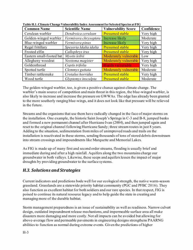
H-3
Table H.1. Climate Change Vulnerability Index Assessment for Selected Species at FIG Common Name Scientific Name Vulnerability Score Confidence Cerulean warbler Dendroica cerulean Presumed stable Very high Golden-winged warbler Vermivora chrysoptera Increase likely Moderate Blue-winged warbler Vermivora pinus Increase likely Very high Regal fritillary Speyeria Idalia idalia Presumed stable Very high Frosted elfin Callophrys irus Presumed stable Very high Eastern small-footed bat Myotis leibii Moderately vulnerable Low Allegheny woodrat Neotoma magister Moderately vulnerable Very high Goldenthread Coptis trifolia Highly vulnerable Very high Spotted turtle Clemmys guttata Moderately vulnerable Moderate Timber rattlesnake Crotalus horridus Presumed stable Very high Wood turtle Glyptemys insculpta Presumed stable Moderate
The golden-winged warbler, too, is given a positive chance against climate change. The warbler’s main source of competition and main threat in this region, the blue-winged warbler, is also likely to increase and increase the pressure on GWWAs. The edge has already been granted to the more southerly ranging blue-wings, and it does not look like that pressure will be relieved in the future. Streams and the organisms that use them have radically changed in the face of major storms on the installation. One example, the historic Saint Joseph’s Springs in C-3 and B-8, jumped banks and formed a new permanent channel after Hurricane Ivan (2004), and then jumped again and reset to the original channel following Hurricane Sandy; three stream routes in just 8 years. Adding to the situation, sedimentation from miles of unimproved roads and trails on the installation is reactivated in these storms, sending thousands of tons of stored debris downstream into stream crossings and impoundments like Marquette and Memorial Lakes. As FIG is made up of many first and second order streams, flooding is usually brief and immediate during and after a high rainfall. Aquifers along the two mountains charge our groundwater in both valleys. Likewise, these seeps and aquifers lessen the impact of major droughts by providing groundwater to the surface systems.
H.3. Solutions and Strategies Current indicators and predictions bode well for our ecological strength, the native warm-season grassland. Grasslands are a statewide priority habitat community (PGC and PFBC 2016). They also function as excellent habitat for both soldiers and our rare species. In that respect, FIG is poised to continue its natural resource legacy and to help guide the state in creating and managing more of the durable habitat. Storm management preparedness is an issue of sustainability as well as readiness. Narrow culvert design, outdated impoundment release mechanisms, and impermeable surface area all make disasters more damaging and more costly. Not all impacts can be avoided but allowing for above-average flow and permeable pavements in engineering designs strengthens PAARNG abilities to function as normal during extreme events. Given the predictions of higher
H-4
precipitation and more frequent significant precipitation events, plans and infrastructure need to incorporate well above average flow capacity or face restabilization and reconstruction. PADMVA Conservation is committed to helping prepare the PAARNG for weather-related deployments. The training site engineers requested chainsaws and training for PEMA callouts after the extensive tree damage the state faced in Hurricane Sandy. Additionally, vehicle recovery simulations were once conducted only on dry ground, but the FIG ITAM office came up with innovative isolated training ponds that do not impact sedimentation controls or local waterways. The Conservation Office has helped to develop BMPs with the engineers for all E&S work and site design (PADMVA 2009). The mowing plan (Hovis and McNaughton 2005) also provides for flood and drought controls by keeping standing vegetation as long as possible (slowing surface flows and preventing evaporation and erosion with land cover). Protecting vulnerable species on the installation is a constant daily routine. Luckily, the training corridor remains fairly flexible in terms of improved structures and urban encroachment. These types of situations tend to lock resources in place, not allowing slow migration and creep of breeding and roosting habitats. The best means of preventing bottlenecks is to keep the ridgelines as natural as possible, not avoiding management but avoiding physical structures. The ridgelines provide more than just a wildlife buffer, they also act as a buffer for noise, ricochet, wildland fire, encroachment, and even trespass. Keeping natural cover on these features will allow necessary movements in altitude and connect FIG with the greater Saint Anthony’s Wilderness that runs through State Gamelands 211. Wetlands are possibly the most heavily protected vegetation community in the United States thanks to specialized laws, executive orders, and regulations. The protection of natural wetlands needs to be kept a priority over mitigation, which is a potential solution. Wetland mitigation creates issues with encroachment, as each acre taken is reproduced with a multiplier, stealing training lands and other potentially usable space around the installation. Wetlands and cold-water dependent species seem to be most of what PNHP has deemed climate imperiled. As the installation creates stormwater basins, wetland mitigations, and other water structures, care should be taken to consider habitat as much as hydrology. Small stormwater management ponds and sewage control structures in cantonment are already being used by uncommon birds like Virginia rails and soras, herps such as spotted turtles, and interesting and important insects including odonates. The key is to get them to hold water at the soil surface or low-level standing water through a portion of the basin; vegetative cover including cattail, sedges, and rushes; and keeping a small buffer from human interaction even if it’s just a few feet. The Sustainability Program was initiated at FIG in 2010. The National Guard used FIG as a test facility and issued their Sustainability Policy on 14 January 2011 (NGB 2011). Army launched initial sustainability plans in 2004 and released a new initiative in May 2010. Sustainment makes sense, as supply chains and footprints can be a vulnerability to the force. The push to renewable fuels and self-sufficient machinery will result in lower air emissions and will be the key to slowing global warming. History shows that military technology and spending is a driver for the rest of humanity, and by taking the lead, PAARNG will help others while helping ourselves. FIG can meet these objectives with sustainment planning in building and site design, best management practices, finding efficiencies, and striving for innovation.
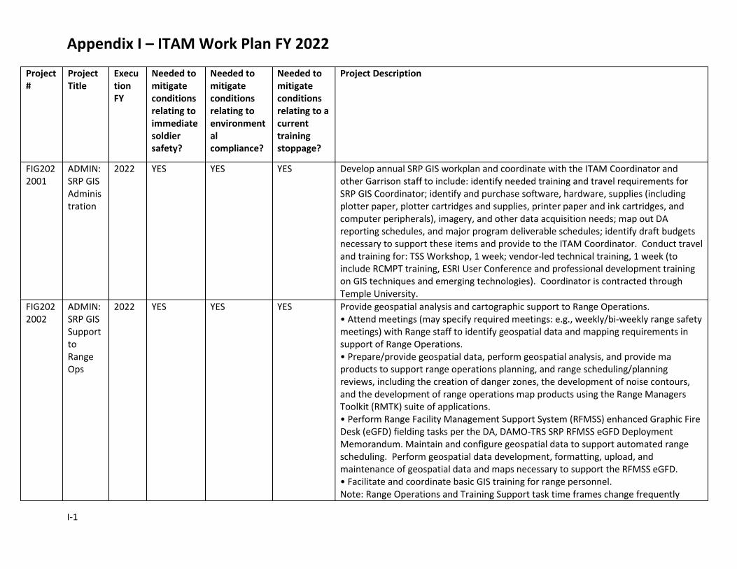
Appendix I – ITAM Work Plan FY 2022
I-1
Project #
Project Title
Execution FY
Needed to mitigate conditions relating to immediate soldier safety?
Needed to mitigate conditions relating to environmental compliance?
Needed to mitigate conditions relating to a current training stoppage?
Project Description
FIG2022001
ADMIN: SRP GIS Administration
2022 YES YES YES Develop annual SRP GIS workplan and coordinate with the ITAM Coordinator and other Garrison staff to include: identify needed training and travel requirements for SRP GIS Coordinator; identify and purchase software, hardware, supplies (including plotter paper, plotter cartridges and supplies, printer paper and ink cartridges, and computer peripherals), imagery, and other data acquisition needs; map out DA reporting schedules, and major program deliverable schedules; identify draft budgets necessary to support these items and provide to the ITAM Coordinator. Conduct travel and training for: TSS Workshop, 1 week; vendor-led technical training, 1 week (to include RCMPT training, ESRI User Conference and professional development training on GIS techniques and emerging technologies). Coordinator is contracted through Temple University.
FIG2022002
ADMIN: SRP GIS Support to Range Ops
2022 YES YES YES Provide geospatial analysis and cartographic support to Range Operations. • Attend meetings (may specify required meetings: e.g., weekly/bi-weekly range safety meetings) with Range staff to identify geospatial data and mapping requirements in support of Range Operations. • Prepare/provide geospatial data, perform geospatial analysis, and provide ma products to support range operations planning, and range scheduling/planning reviews, including the creation of danger zones, the development of noise contours, and the development of range operations map products using the Range Managers Toolkit (RMTK) suite of applications. • Perform Range Facility Management Support System (RFMSS) enhanced Graphic Fire Desk (eGFD) fielding tasks per the DA, DAMO-TRS SRP RFMSS eGFD Deployment Memorandum. Maintain and configure geospatial data to support automated range scheduling. Perform geospatial data development, formatting, upload, and maintenance of geospatial data and maps necessary to support the RFMSS eGFD. • Facilitate and coordinate basic GIS training for range personnel. Note: Range Operations and Training Support task time frames change frequently
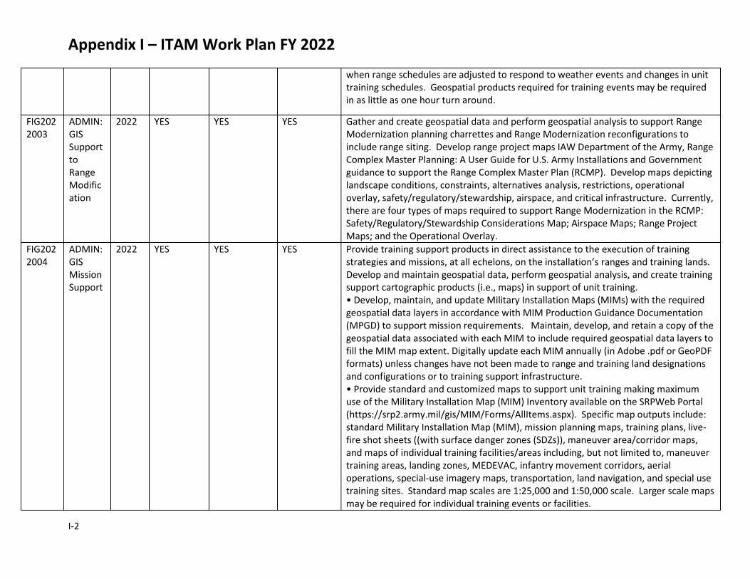
Appendix I – ITAM Work Plan FY 2022
I-2
when range schedules are adjusted to respond to weather events and changes in unit training schedules. Geospatial products required for training events may be required in as little as one hour turn around.
FIG2022003
ADMIN: GIS Support to Range Modification
2022 YES YES YES Gather and create geospatial data and perform geospatial analysis to support Range Modernization planning charrettes and Range Modernization reconfigurations to include range siting. Develop range project maps IAW Department of the Army, Range Complex Master Planning: A User Guide for U.S. Army Installations and Government guidance to support the Range Complex Master Plan (RCMP). Develop maps depicting landscape conditions, constraints, alternatives analysis, restrictions, operational overlay, safety/regulatory/stewardship, airspace, and critical infrastructure. Currently, there are four types of maps required to support Range Modernization in the RCMP: Safety/Regulatory/Stewardship Considerations Map; Airspace Maps; Range Project Maps; and the Operational Overlay.
FIG2022004
ADMIN: GIS Mission Support
2022 YES YES YES Provide training support products in direct assistance to the execution of training strategies and missions, at all echelons, on the installation’s ranges and training lands. Develop and maintain geospatial data, perform geospatial analysis, and create training support cartographic products (i.e., maps) in support of unit training. • Develop, maintain, and update Military Installation Maps (MIMs) with the required geospatial data layers in accordance with MIM Production Guidance Documentation (MPGD) to support mission requirements. Maintain, develop, and retain a copy of the geospatial data associated with each MIM to include required geospatial data layers to fill the MIM map extent. Digitally update each MIM annually (in Adobe .pdf or GeoPDF formats) unless changes have not been made to range and training land designations and configurations or to training support infrastructure. • Provide standard and customized maps to support unit training making maximum use of the Military Installation Map (MIM) Inventory available on the SRPWeb Portal (https://srp2.army.mil/gis/MIM/Forms/AllItems.aspx). Specific map outputs include: standard Military Installation Map (MIM), mission planning maps, training plans, live-fire shot sheets ((with surface danger zones (SDZs)), maneuver area/corridor maps, and maps of individual training facilities/areas including, but not limited to, maneuver training areas, landing zones, MEDEVAC, infantry movement corridors, aerial operations, special-use imagery maps, transportation, land navigation, and special use training sites. Standard map scales are 1:25,000 and 1:50,000 scale. Larger scale maps may be required for individual training events or facilities.
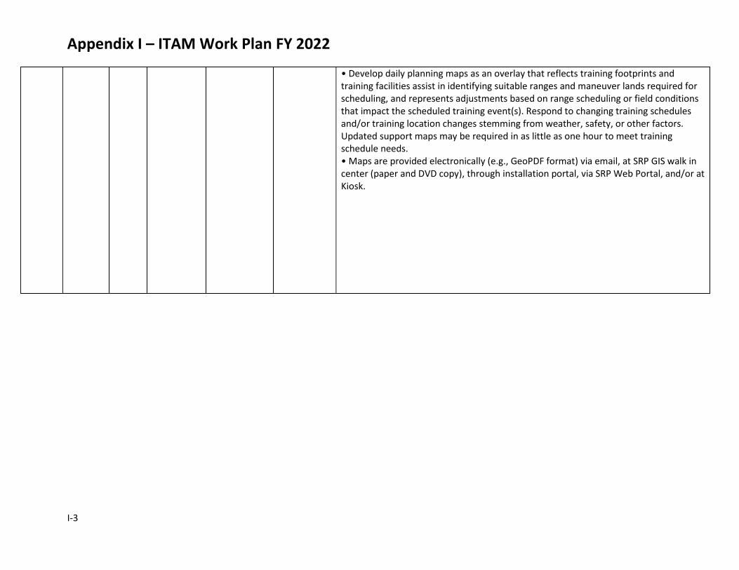
Appendix I – ITAM Work Plan FY 2022
I-3
• Develop daily planning maps as an overlay that reflects training footprints and training facilities assist in identifying suitable ranges and maneuver lands required for scheduling, and represents adjustments based on range scheduling or field conditions that impact the scheduled training event(s). Respond to changing training schedules and/or training location changes stemming from weather, safety, or other factors. Updated support maps may be required in as little as one hour to meet training schedule needs. • Maps are provided electronically (e.g., GeoPDF format) via email, at SRP GIS walk in center (paper and DVD copy), through installation portal, via SRP Web Portal, and/or at Kiosk.
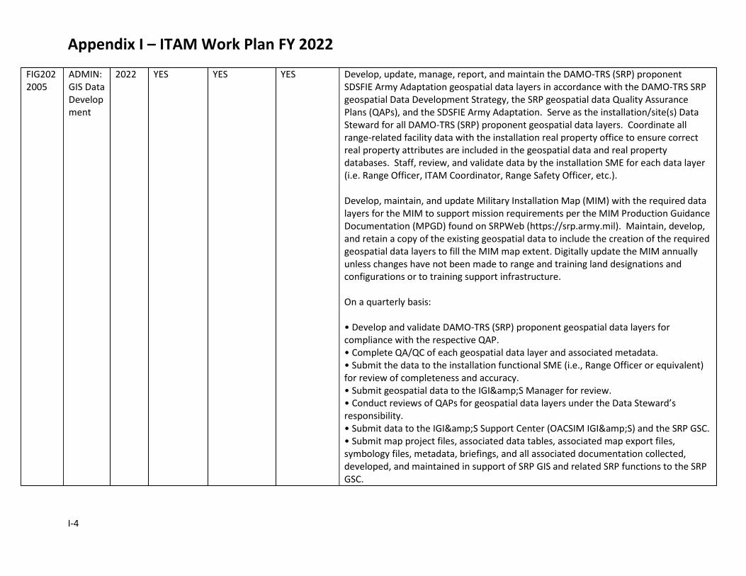
Appendix I – ITAM Work Plan FY 2022
I-4
FIG2022005
ADMIN: GIS Data Development
2022 YES YES YES Develop, update, manage, report, and maintain the DAMO-TRS (SRP) proponent SDSFIE Army Adaptation geospatial data layers in accordance with the DAMO-TRS SRP geospatial Data Development Strategy, the SRP geospatial data Quality Assurance Plans (QAPs), and the SDSFIE Army Adaptation. Serve as the installation/site(s) Data Steward for all DAMO-TRS (SRP) proponent geospatial data layers. Coordinate all range-related facility data with the installation real property office to ensure correct real property attributes are included in the geospatial data and real property databases. Staff, review, and validate data by the installation SME for each data layer (i.e. Range Officer, ITAM Coordinator, Range Safety Officer, etc.). Develop, maintain, and update Military Installation Map (MIM) with the required data layers for the MIM to support mission requirements per the MIM Production Guidance Documentation (MPGD) found on SRPWeb (https://srp.army.mil). Maintain, develop, and retain a copy of the existing geospatial data to include the creation of the required geospatial data layers to fill the MIM map extent. Digitally update the MIM annually unless changes have not been made to range and training land designations and configurations or to training support infrastructure. On a quarterly basis: • Develop and validate DAMO-TRS (SRP) proponent geospatial data layers for compliance with the respective QAP. • Complete QA/QC of each geospatial data layer and associated metadata. • Submit the data to the installation functional SME (i.e., Range Officer or equivalent) for review of completeness and accuracy. • Submit geospatial data to the IGI&S Manager for review. • Conduct reviews of QAPs for geospatial data layers under the Data Steward’s responsibility. • Submit data to the IGI&S Support Center (OACSIM IGI&S) and the SRP GSC. • Submit map project files, associated data tables, associated map export files, symbology files, metadata, briefings, and all associated documentation collected, developed, and maintained in support of SRP GIS and related SRP functions to the SRP GSC.

Appendix I – ITAM Work Plan FY 2022
I-5
FIG2022006
ADMIN: Training Requirements Integration
2022 YES YES YES Facilitate installation training mission goals by including environmental compliance requirements, range facilities requirements, and landscape condition requirements in the development of range and training land management decisions and the coordination of mission needs with garrison facility and environmental plans. These actions are inherently iterative, and require frequent coordination, reviews, and approvals with other Garrison offices. Many TRI actions, particularly those related to integration of mission needs into Garrison plans, are subject to individual installation timelines and processes. Key TRI actions are: Provide decision support to range and training land planning, scheduling, modernization, and maintenance. Obtain information from appropriate offices regarding the conditions of ranges and training lands, and provide recommendations to the installation DPTMS and ITAM offices on potential impacts and permitting requirements of relevant environmental, natural, and cultural resources for the proposed training. Include the use of information from RTLA, LRAM, and SRP GIS in this process. Attend training briefings, land management coordination meetings, and other range and training land planning and scheduling meetings; provide written and verbal input, as appropriate, on potential issues; and recommend changes to range and training land schedules Actively participate in range and training land management planning and execution; ensure mission needs are considered in environmental and facilities planning; and ensure environmental constraints are considered in mission planning. Communicate the installation training mission needs for ranges and training lands for inclusion into the plans and programs of other installation offices involved in the management and oversight of land and related natural, cultural, and environmental resources. Coordinate with the appropriate installation offices to provide mission goals and objectives for inclusion in the planning and resourcing of installation land management programs. Include information from RTLA, LRAM, and SRP GIS in this process. In particular, coordinate the inclusion of RCMP mission goals and objectives into the installation Integrated Natural Resources Management Plan (INRMP) and subordinate plans, and ensure the various land management programs associated with these participate in the development and submittal of workplans necessary to achieve
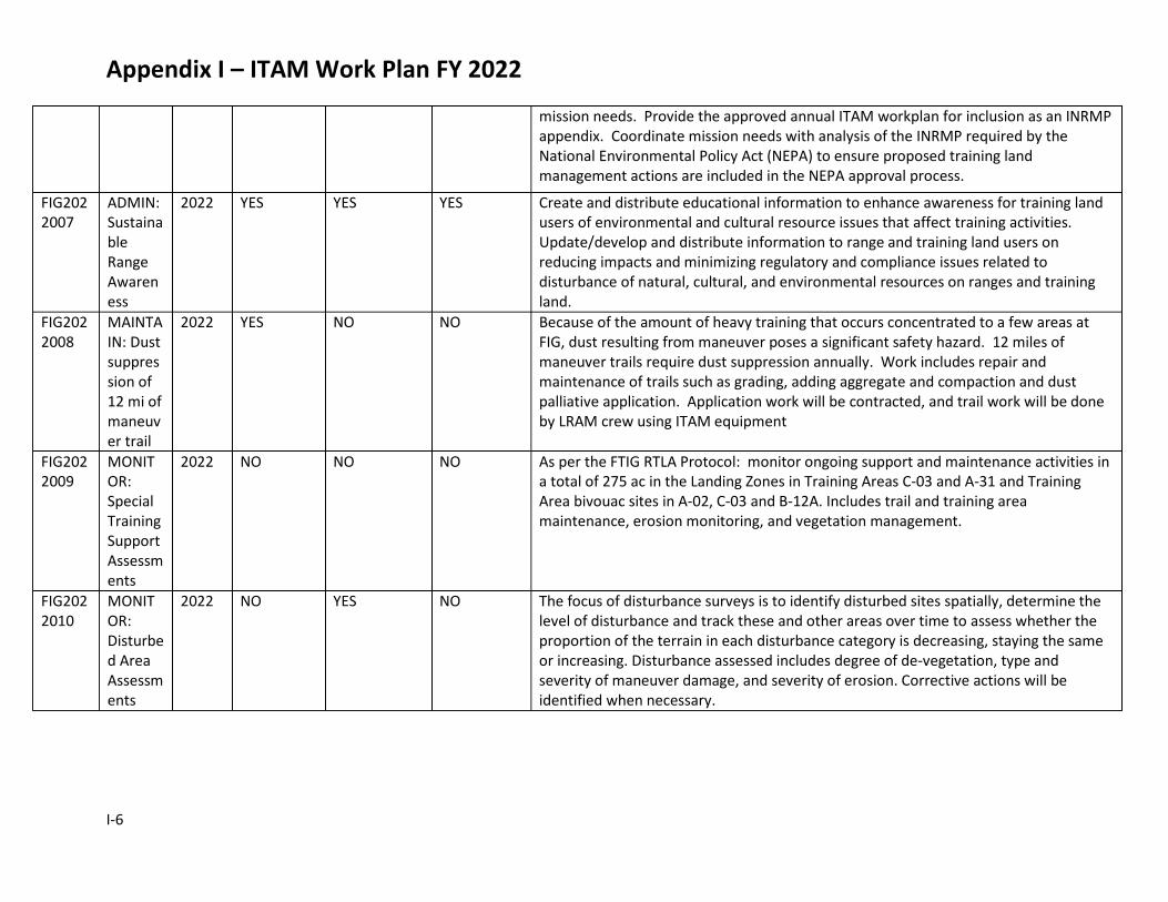
Appendix I – ITAM Work Plan FY 2022
I-6
mission needs. Provide the approved annual ITAM workplan for inclusion as an INRMP appendix. Coordinate mission needs with analysis of the INRMP required by the National Environmental Policy Act (NEPA) to ensure proposed training land management actions are included in the NEPA approval process.
FIG2022007
ADMIN: Sustainable Range Awareness
2022 YES YES YES Create and distribute educational information to enhance awareness for training land users of environmental and cultural resource issues that affect training activities. Update/develop and distribute information to range and training land users on reducing impacts and minimizing regulatory and compliance issues related to disturbance of natural, cultural, and environmental resources on ranges and training land.
FIG2022008
MAINTAIN: Dust suppression of 12 mi of maneuver trail
2022 YES NO NO Because of the amount of heavy training that occurs concentrated to a few areas at FIG, dust resulting from maneuver poses a significant safety hazard. 12 miles of maneuver trails require dust suppression annually. Work includes repair and maintenance of trails such as grading, adding aggregate and compaction and dust palliative application. Application work will be contracted, and trail work will be done by LRAM crew using ITAM equipment
FIG2022009
MONITOR: Special Training Support Assessments
2022 NO NO NO As per the FTIG RTLA Protocol: monitor ongoing support and maintenance activities in a total of 275 ac in the Landing Zones in Training Areas C-03 and A-31 and Training Area bivouac sites in A-02, C-03 and B-12A. Includes trail and training area maintenance, erosion monitoring, and vegetation management.
FIG2022010
MONITOR: Disturbed Area Assessments
2022 NO YES NO The focus of disturbance surveys is to identify disturbed sites spatially, determine the level of disturbance and track these and other areas over time to assess whether the proportion of the terrain in each disturbance category is decreasing, staying the same or increasing. Disturbance assessed includes degree of de-vegetation, type and severity of maneuver damage, and severity of erosion. Corrective actions will be identified when necessary.
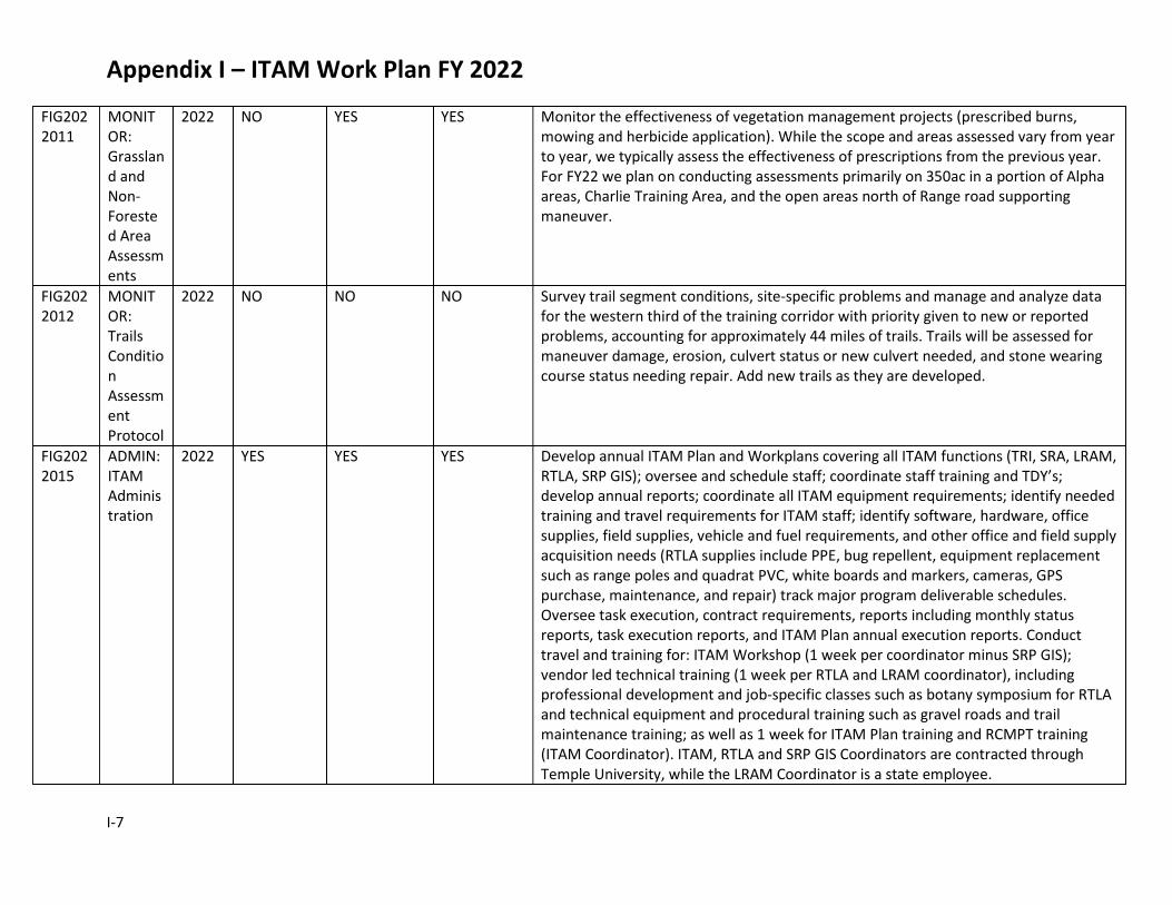
Appendix I – ITAM Work Plan FY 2022
I-7
FIG2022011
MONITOR: Grassland and Non-Forested Area Assessments
2022 NO YES YES Monitor the effectiveness of vegetation management projects (prescribed burns, mowing and herbicide application). While the scope and areas assessed vary from year to year, we typically assess the effectiveness of prescriptions from the previous year. For FY22 we plan on conducting assessments primarily on 350ac in a portion of Alpha areas, Charlie Training Area, and the open areas north of Range road supporting maneuver.
FIG2022012
MONITOR: Trails Condition Assessment Protocol
2022 NO NO NO Survey trail segment conditions, site-specific problems and manage and analyze data for the western third of the training corridor with priority given to new or reported problems, accounting for approximately 44 miles of trails. Trails will be assessed for maneuver damage, erosion, culvert status or new culvert needed, and stone wearing course status needing repair. Add new trails as they are developed.
FIG2022015
ADMIN: ITAM Administration
2022 YES YES YES Develop annual ITAM Plan and Workplans covering all ITAM functions (TRI, SRA, LRAM, RTLA, SRP GIS); oversee and schedule staff; coordinate staff training and TDY’s; develop annual reports; coordinate all ITAM equipment requirements; identify needed training and travel requirements for ITAM staff; identify software, hardware, office supplies, field supplies, vehicle and fuel requirements, and other office and field supply acquisition needs (RTLA supplies include PPE, bug repellent, equipment replacement such as range poles and quadrat PVC, white boards and markers, cameras, GPS purchase, maintenance, and repair) track major program deliverable schedules. Oversee task execution, contract requirements, reports including monthly status reports, task execution reports, and ITAM Plan annual execution reports. Conduct travel and training for: ITAM Workshop (1 week per coordinator minus SRP GIS); vendor led technical training (1 week per RTLA and LRAM coordinator), including professional development and job-specific classes such as botany symposium for RTLA and technical equipment and procedural training such as gravel roads and trail maintenance training; as well as 1 week for ITAM Plan training and RCMPT training (ITAM Coordinator). ITAM, RTLA and SRP GIS Coordinators are contracted through Temple University, while the LRAM Coordinator is a state employee.
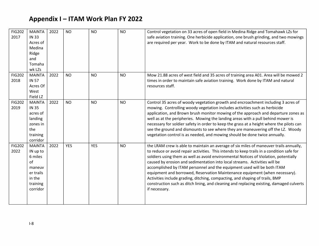
Appendix I – ITAM Work Plan FY 2022
I-8
FIG2022017
MAINTAIN 33 Acres of Medina Ridge and Tomahawk LZs
2022 NO NO NO Control vegetation on 33 acres of open field in Medina Ridge and Tomahawk LZs for safe aviation training. One herbicide application, one brush grinding, and two mowings are required per year. Work to be done by ITAM and natural resources staff.
FIG2022018
MAINTAIN 57 Acres Of West Field LZ
2022 NO NO NO Mow 21.88 acres of west field and 35 acres of training area A01. Area will be mowed 2 times in order to maintain safe aviation training. Work done by ITAM and natural resources staff.
FIG2022019
MAINTAIN 35 acres of landing zones in the training corridor
2022 NO NO NO Control 35 acres of woody vegetation growth and encroachment including 3 acres of mowing. Controlling woody vegetation includes activities such as herbicide application, and Brown brush monitor mowing of the approach and departure zones as well as at the peripheries. Mowing the landing areas with a pull behind mower is necessary for soldier safety in order to keep the grass at a height where the pilots can see the ground and dismounts to see where they are maneuvering off the LZ. Woody vegetation control is as needed, and mowing should be done twice annually.
FIG2022022
MAINTAIN up to 6 miles of maneuver trails in the training corridor
2022 YES YES NO the LRAM crew is able to maintain an average of six miles of maneuver trails annually, to reduce or avoid repair activities. This intends to keep trails in a condition safe for soldiers using them as well as avoid environmental Notices of Violation, potentially caused by erosion and sedimentation into local streams. Activities will be accomplished by ITAM personnel and the equipment used will be both ITAM equipment and borrowed, Reservation Maintenance equipment (when necessary). Activities include grading, ditching, compacting, and shaping of trails, BMP construction such as ditch lining, and cleaning and replacing existing, damaged culverts if necessary.

Appendix I – ITAM Work Plan FY 2022
I-9
FIG2022023
REPAIR FARP near Range 38
2022 NO NO YES Repair Range 38 FARP. After several years on non-use, The FARP near Range 38 is being repaired to support aviation gunnery and refueling missions. Work includes hauling, and dumping stone followed by grading and compacting, to a site approximately XX acres in size. Work will be done by ITAM personnel using ITAM equipment and borrowed, DPW equipment if necessary.
FIG2022024
MAINTAIN 50 acres of Firing Points Annually
2022 NO NO NO The LRAM crew is able to maintain 50 acres of firing points annually. Maintenance activities include mowing, removal of woody vegetation through mechanical and chemical means, grading, and the occasional application of aggregate to harden sites. This will ensure line of site, and maneuverability at the firing point, ensuring enough room for the firing units to occupy the site.
FIG2022025
MAINTAIN 51 acres of Light Maneuver in TA A-02
2022 NO NO YES Maintain 51 acres of light maneuver that has woody vegetation encroachment. Because of vegetation encroachment, light maneuver is hindered in much of the understory of the wooded areas in A-02. Work includes mechanical forestry mulching and herbicide application. Mechanical removal will be by existing vegetation management contract, and herbicide will be applied by LRAM personnel using ITAM equipment.
FIG2022026
MAINTAIN 30 Acres of Bivouac Area in TA B-12A
2022 NO NO NO Because of woody vegetation regrowth in the understory, brush grinding and herbicide application needs to be conducted to keep the area available for units bivouacking. Work to be done includes mechanical removal of, and herbicide application to woody vegetation regrowth. Work will be done by ITAM personnel using ITAM equipment and resources.
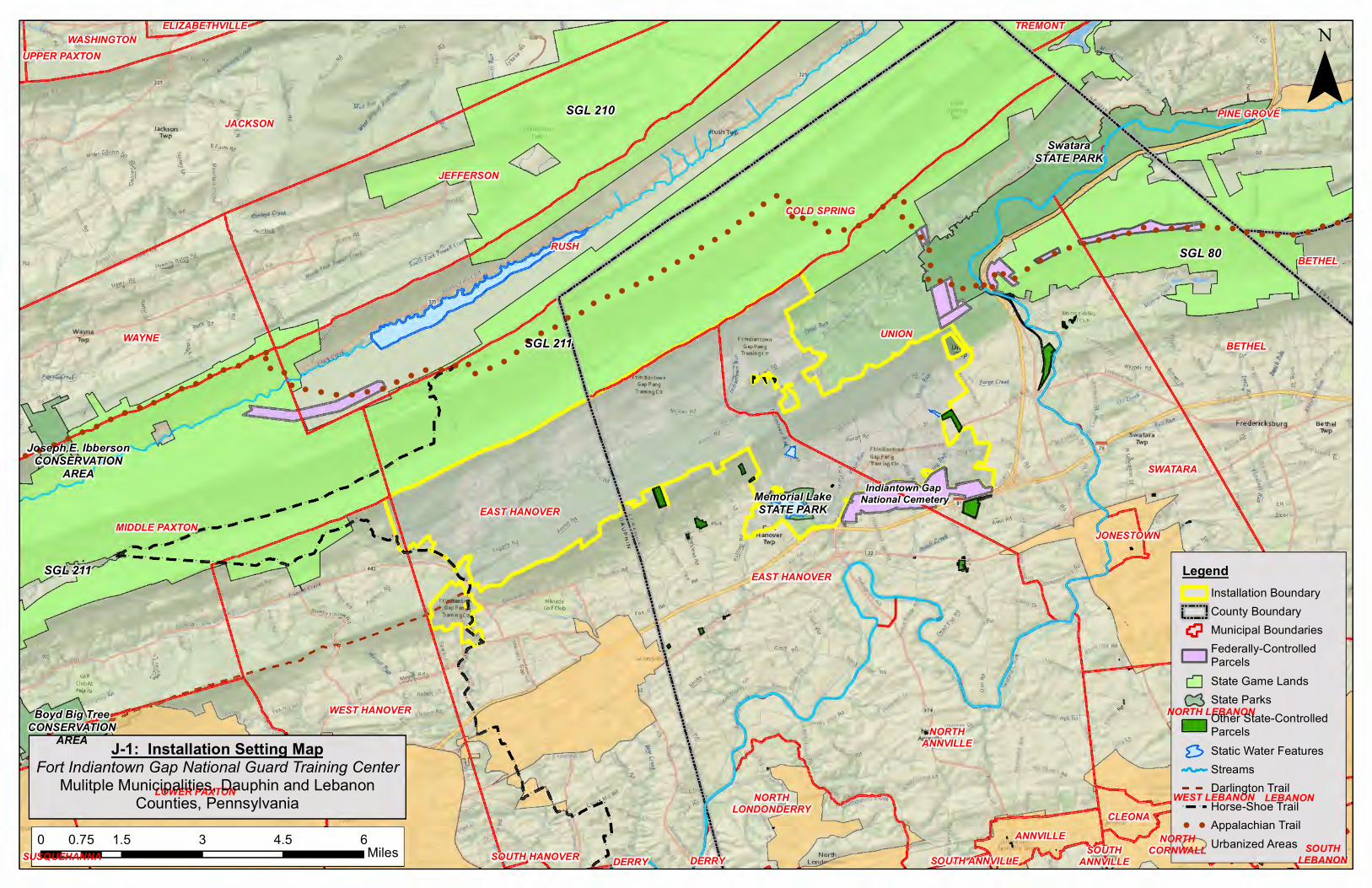
66
66
66 6 6
6
66 6
6
6
6
6
6
66
6
66
66
6
666
6
6
6666
6
66 6
66
6
6 6 66
6666
666
6
66
6
666
6666
6
666
66
6
666
6
666666
66
6
66666
6666666
66
6 6666
66
6
6
6
6
6
666
6
6
66
66
66 6 6 6
6 66666 6 6
6666
66
6
6 6 6
6
66
6
6 6 6 66
66 6 6 6
6 6 6
6 6 6
6 6 6 6 666 6 6 6 6 6 6 6
6
6
6
6
666 6
666 6
66
6
6
6 6 6 66
6
6 6 6 6 66 6 6 6 6
6 6 6
66
6 6
6
666
66
6
6666
66
6
6 66
66
66
66
66
6
6
6
66
666
6666
6666 6
6666
66
6
6
66
6
666
6
6 6
66
666
666
66
6
666
666
6
6666
6
666 6 6 6 6 6
66
6 6
6666
6
6 6 6
6
666
6 6 66 6 6 6 6 6 6 6 6 6 6 6 6
6 6 6 6 6 6 6 6 6 6 66 6 6 6 6 6 6 6 6 6 6 6 6 6 6 6 6
6 6 66 66
6 6
6 6 6 6 6 6 6 6 6 6 6 6 6
6 6 66
6
6 66 6
6 6 6 6 666 6
6 6
66
666 6
6 6
66 6 6
666 6
6
6
66
66 6 6
6 6
6 66 6 6
66 6 6 6 6 6 6 6 6 6 6 6 6 6 6 6 6 6 6 6 6 6 6 6 6 6 6 6 6 6 6 6 6
6 6 6 6 6 6 6 6 6
6
66 6 6 6
6 6
6 66 6 6
6
6 6 6 6 6 6 6 6 6 6 6 6
6 6
6 6 6 6 6
6
6
6 6 6
666
6 6 66 6 6 6 66
6 6
66 6 6 6 6
6 66 6 6
6 666 6
66
6
66 6
6 6 6 6 6 6 6 6 6 6
6 6 6 6 6 6 6 66 6
666
66
6 66
6
666666666666
6
66
66
6
66
66
666 6
6 6 66 6 6 6 6 6
6
66 6
6 666 6 6 6 6
6 66 6 6
6 6 6 6 6
6
6
6
66
6
6
6
6 6 6666 6
666666 6 6
6
6 6 6
6 6 6 66 6 6 6 6 6 6 6 6 6 6 6
6
6 6
666 6
6 6 6 66 6 6
6 6 6 6 6 6 6 6 6 6 6 6 6 6 6 6 6 6 6 6 6 6 6 66 6 6 6 6 6 6 6 6 6
6 6 6 66
6
6 6 6 6 6
66
666 6 6 6 6
6 6 666
6
6
66
6
6
66 6
666
6 6
6666
666 6
6 6 6 6 6666 6 6 6 6 6
6 666
6
66
666
66
66
6
6 66
6
6
6 6666
6
6
6
6 6 6 6
6 6 6
6
6 66 6 6 6
6
!
!
!
!
!
!
!
!
!
!
!
!
!!
!
!
!
!
!
!
!
!
!
!
!
!
!
!
!
!
!!
!
!
!
!!
!
!
!
!
!
!
!
!
!
!
!
!
!
!
!!
!
!
!
!
!
!
!
!
!
!
!
!
!
!
!
!
!
!
!
!
!
!!
!
!
!
!
!
!
!
!
!
!
!
!
!
!
!
!
!
!
!!
!
!
!
!
!
!
!
!
!
!
!
!
!
!!
!
!
!
!
!
!
!
!
!
!
!
!
!
!
!
!
!
!
!
!
!
!
!
!
!
!
!
!
!
!
!!
!
!
!
!
!
!
!
!
!
!
!
!
!
!
!
!
!
!
!
!!
!
!
!
!
!
!
!
!
!
!
!
!
!
!!
!!
!
!
!
!
!
!
!
!
!
!
!
!
!
!
!
!
!
!
!
!
!
!
!
!
!
!
!
!
!
!
!
!
!
!
!
!
!!
!
!
!
!
!
!!
!
!!!
!
!
!
!
!
!
!
!
!
!
!
!!
!
!!
!!
!
!
!!
!
!
!
!
!
!
!
!
!
!!!
!
!
!
!
!
!
!
!
!
!
!
!
!
!
!
!
!
!
!
!
!
!
!
!
!
!
!
!
!
!!
!!
!
!!
!
!
!
!
!!
!!
!
!
!
!
!
!
!
!
!!
!
!
!
!
!
!
!
!!
!
!
!
!
!!
!
!
!
!
!
!
!
!
!
!
!
!
!
!
!
!
!
!!
!
!
!
!
!
!
!
!
!
!
!
!
!
!
!
!
!
!
!
!
!
!
!
!
!
!
!
!
!
!
!
!
!
!
!
!
!
!
!
!
!
!!
!
!!
!!
!
!
!
!
!
!!
!!
!!
!!
!!!
!!
!
!
!
!
!
!
!
!
!
!
!
!
!
!
!
!
!
!
!
!
!
!
!
!
Indiantown Gap National Cemetery
ANNVILLE
WEST LEBANON
BETHEL
UNION
SWATARA
SUSQUEHANNA
LEBANON
JONESTOWN
CLEONA
NORTHANNVILLE
DERRY DERRY SOUTH ANNVILLESOUTH
ANNVILLE
BETHEL
NORTH LEBANON
NORTHCORNWALL
WEST HANOVER
EAST HANOVER
SOUTHLEBANON
JACKSON
WASHINGTONELIZABETHVILLE
PINE GROVE
EAST HANOVER
WAYNE
LOWER PAXTON
RUSH
SOUTH HANOVER
MIDDLE PAXTON
JEFFERSON
TREMONT
UPPER PAXTON
COLD SPRING
NORTHLONDONDERRY
Joseph E. IbbersonCONSERVATION
AREA
SwataraSTATE PARK
Boyd Big TreeCONSERVATION
AREA
Memorial LakeSTATE PARK
SGL 80
SGL 210
SGL 211
SGL 211
LegendInstallation BoundaryCounty BoundaryMunicipal BoundariesFederally-ControlledParcelsState Game LandsState ParksOther State-ControlledParcelsStatic Water FeaturesStreamsDarlington Trail
! ! Horse-Shoe Trail6 6 Appalachian Trail
Urbanized Areas0 1.5 3 4.5 60.75Miles
¯
J-1: Installation Setting MapFort Indiantown Gap National Guard Training Center
Mulitple Municipalities, Dauphin and LebanonCounties, Pennsylvania
Rd
Jackson Twp
SEarth Rct
,,, ... .. ;• ,,, ... ..
;• ,,, ... ,,, ... .. ;• ,,, ... ,,, ... .. ;• ,,, ... ..
;• ,,, ... ,,, ... .. ;• ,,, ... .. .,,..•·
;• ,,, ... .. ;• .. ;• ,,, ... ,,, ... ,,, ... ,,, ... ..
;•
\ Ft Indiantown
Gap_Pang ~ TrainrngCtr ~
Un, ,p
"/, %-t. For_9! Creek ., \~ 1r-
.,
D
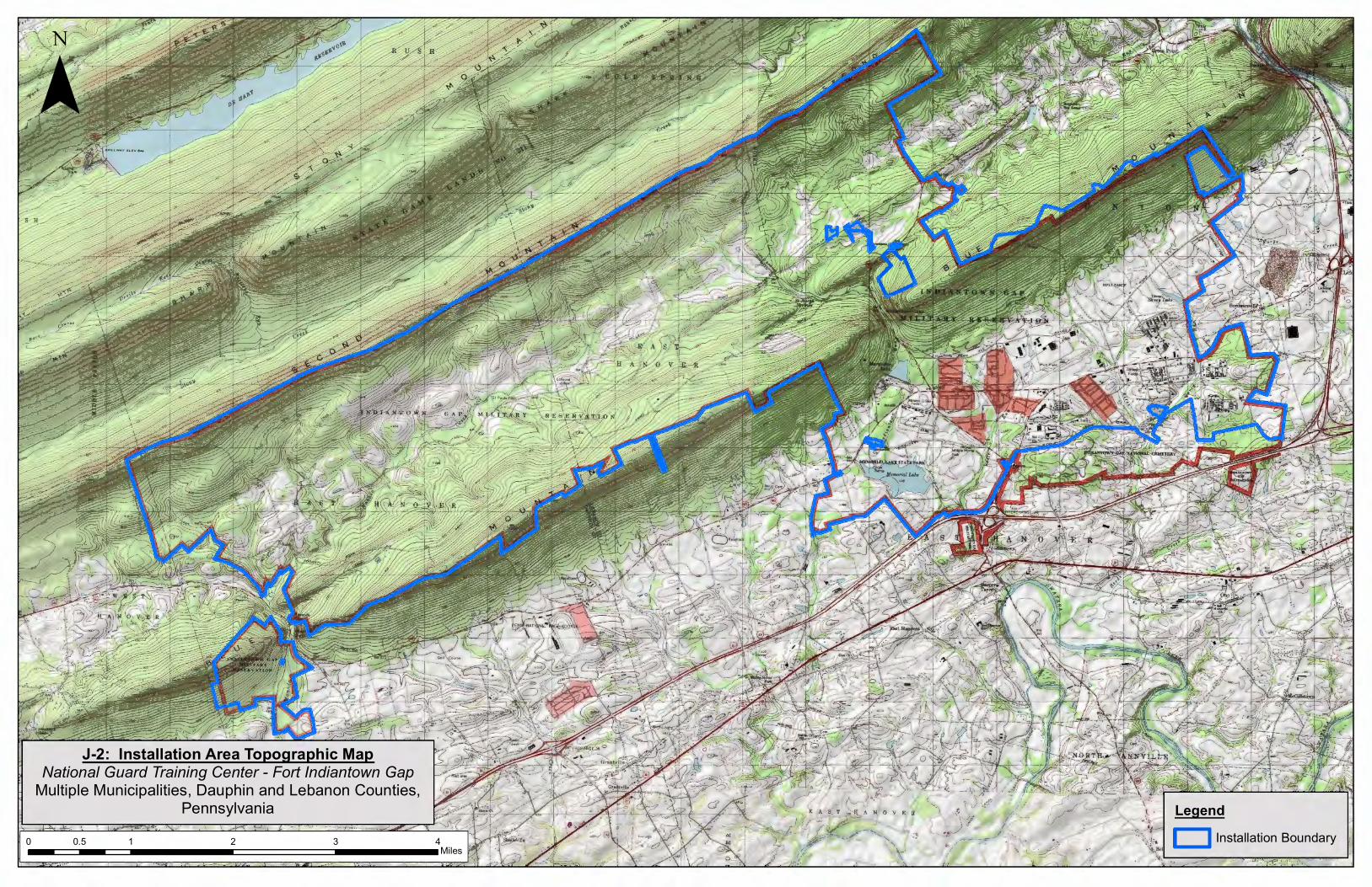
LegendInstallation Boundary
¯
0 1 2 3 40.5Miles
J-2: Installation Area Topographic MapNational Guard Training Center - Fort Indiantown Gap
Multiple Municipalities, Dauphin and Lebanon Counties,Pennsylvania
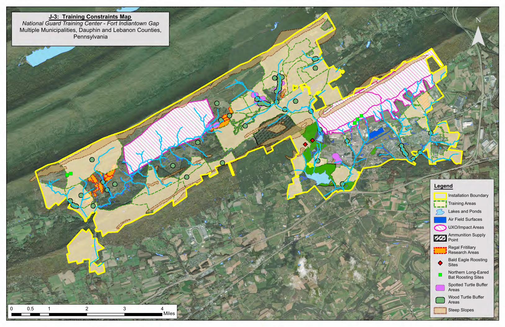
")
")")
")")")
")
¯J-3: Training Constraints Map
National Guard Training Center - Fort Indiantown GapMultiple Municipalities, Dauphin and Lebanon Counties,
Pennsylvania
0 1 2 3 40.5Miles
LegendInstallation BoundaryTraining AreasLakes and PondsAir Field SurfacesUXO/Impact AreasAmmunition SupplyPointRegal FritillaryResearch AreasBald Eagle RoostingSites
")Northern Long-EaredBat Roosting SitesSpotted Turtle BufferAreasWood Turtle BufferAreasSteep Slopes
.. --1
L--• 0
1111 ~ ~
•
-D r-, ,_ __ ,.
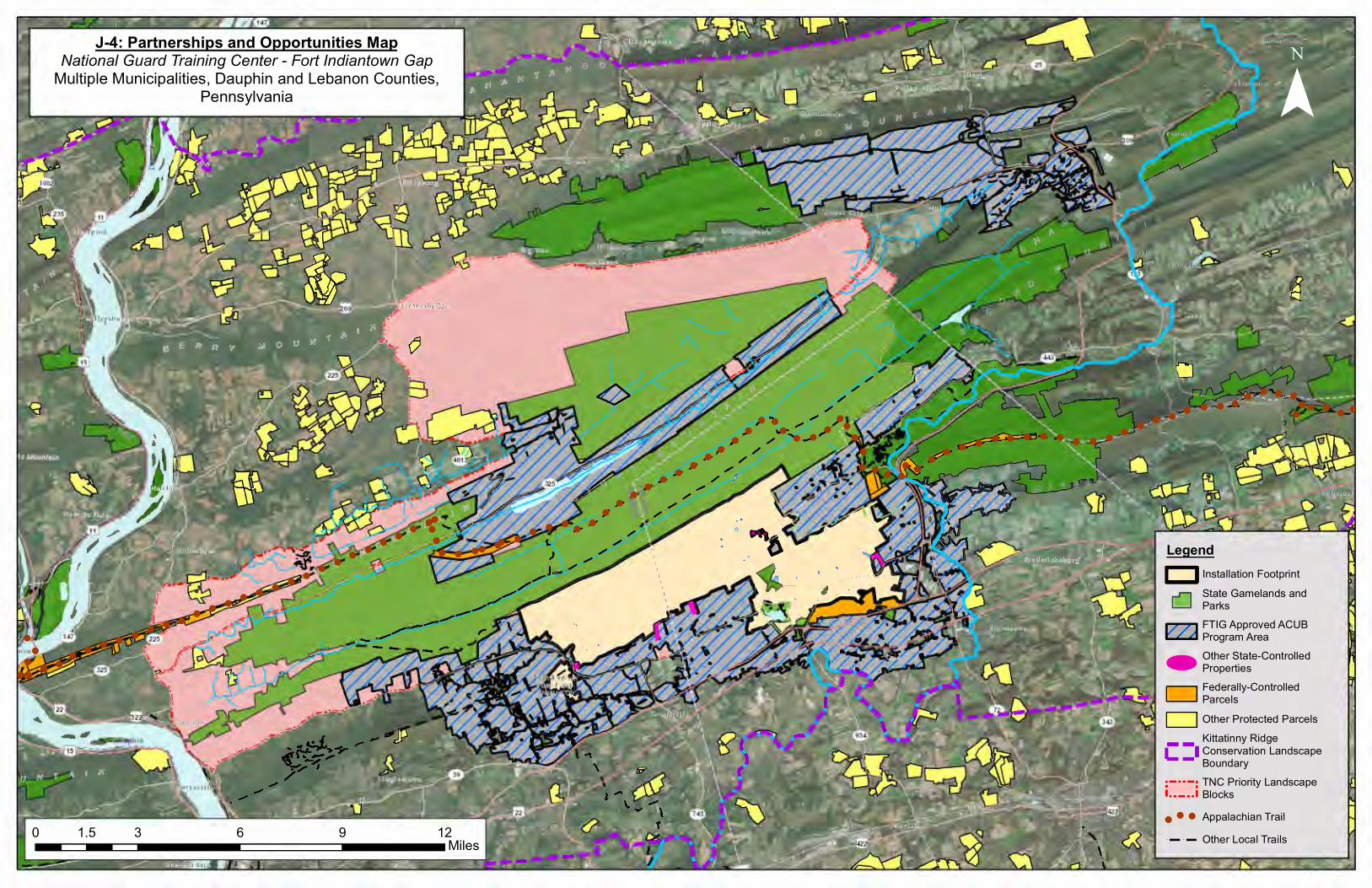
! !!
! !!
!
!
!!
!!
!!
!!
!!
!
!
!! !
!
!!
!
!!
!! !
! !!
!! !
! ! ! ! !! ! !
!!
! !! ! ! !
!! ! ! !
!! !
!
!!!
!
!
!
!!
! !!
!!
!! !
!!
!!
!!
!! !
!!
!!
!!
!!
!!
!
!!!!!
!
!
!
LegendInstallation Footprint
State Gamelands andParks
FTIG Approved ACUBProgram Area
Other State-ControlledProperties
Federally-ControlledParcels
Other Protected Parcels
Kittatinny RidgeConservation LandscapeBoundary
TNC Priority LandscapeBlocks
!!
! Appalachian Trail
! ! Other Local Trails
¯J-4: Partnerships and Opportunities Map
National Guard Training Center - Fort Indiantown GapMultiple Municipalities, Dauphin and Lebanon Counties,
Pennsylvania
0 3 6 9 121.5Miles
CJ I I
' I L]
Im ~
CJ CJ
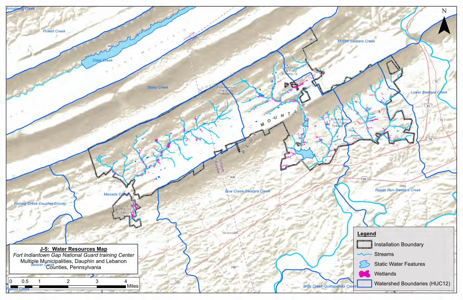
Manada Creek
Stony Creek
Bow Creek-Swatara Creek
Clark Creek
Reeds Run-Swatara Creek
Powell Creek
Middle Swatara Creek
Lower Swatara Creek
Beaver Creek
Fishing Creek-Dauphin County
Snitz Creek-Quittapahilla Creek
Armstrong Creek
Paxton Creek0 1 2 3 40.5
Miles
¯
LegendInstallation Boundary
Streams
Static Water Features
Wetlands
Watershed Boundaries (HUC12)
J-5: Water Resources MapFort Indiantown Gap National Guard training Center
Multiple Municipalities, Dauphin and LebanonCounties, Pennsylvania 0
M D


