Embed Size (px)
Citation preview

GEOGRAPHICAL IMAGE PROCESSING USING GISTOOL
G.K. Adam and V.G. Pappas Department of Planning & Regional Development
University of Thessaly Pedion Areos
383 34 Volos, Greece Email: [email protected], [email protected]
Abstract
The applications of geographical information management today are various and considerable valuable. However, the need
for proper organization and manipulation of the information provided, particularly online, has been emerged very intensive
nowadays. An attempt was undertaken in this study referring to a research work into the integration of geographical
databases and data analysis tools, using an interactive information management system created for this purpose and called
GisTool. The aim is to provide a proper structure for geographical data management and particular raster image processing,
in order to be used for training, educational and research purposes. Based on this environment the graphical user interface
that has been developed, provides interactive management of geographical information and the opportunity for advanced
users to develop more specific applications. The whole system comprises a flexible structure that is under continuous
improvement and evolvement in order to maintain the geographical information up to date.
Key Words
Image processing, geographical data, statistical analysis.
1. Introduction
The approaches and methodologies used for geographical image data management and analysis in general continuously
evolve in order to assist further the researcher's work [1], [2]. In recent years, a considerable number of approaches have
been emerged and applied in several cases of digital image and map processing [3], [4]. This is particularly evident since
the introduction and continuously improvement and enrichment of the WWW technology and Internet [5], [6]. In that
direction, the geographic information systems and the WebGIS applications are particularly interested [7], [8], [9], [10]. In
this study, some of the main issues in geographical data management, processing and analysis are examined using GisTool,
a geographical information management system [11]. The basic idea in our research work is to provide an educational and

research environment where various data processing and analysis facilities would be at the disposal of the trainee or the
researcher to be used in processing environmental problems and extracting valuable information from real map images and
land structures.
This geographical information management system focuses mainly into the organization and manipulation of
geographical data in relational databases (ODBC compatible, etc.), based on structured systems development techniques
[12], [13], as well as their presentation and analysis using embedded tools for geo-information processing and retrieval.
The overall system presents a friendly interactive environment used mainly for the manipulation and organization of
geoscience information in relational databases (ODBC compatible, etc.), as well as the analysis of geographical image data
using build-in processing tools, based on techniques for processing georeferenced raster images [14]. The system also
provides links to specific external applications such as ESRI ArcView/Info and statistical tools. Databases are continuously
been updated with new geographical data.
The system is flexible in building and integrating new applications without excessive amount of programming. Visual
programming provides the opportunity to combine the OS routines that handle the interactive visual aspects of windows
management and the ideas of object-oriented programming and open access computing. Some of the main concepts, this
work contributes into, are the visual interaction and the direct manipulation utilized in the manipulation and analysis of
geographical data, performed even by non-specialists with limited experience in programming. The system provides
educational facilities in learning and experimenting with geographical information systems and particularly with image
data processing. In addition, the system provides an open system architecture that allows more interested and experienced
users to add, through visual programming, new bits of code and facilities. The system also tends to incorporate and
inductive learning facilities (general knowledge structures from specific instances), which would enable image
classification rules to be generated automatically. The combination of these technologies have enabled GisTool to become
a distributed system, which uses a communication -message passing- mechanism that is independent of operating systems
and allows different processes, written in different languages to communicate with no extra work in the application side.
Arising out of a need for an educational information system for the organization and manipulation of geographical data,
an integrated interactive multimedia environment for practice and experimentation in geographical information systems
was developed using a combination of object-oriented tools for visual programming with database management languages.
Results of the system's implementations in specific case studies have shown its immense potential into the integration and
management of large amounts of different types of information. It seems that the current state of this integrated
environment could present a substantial contribution to the methodologies of organizing and managing geographical data.

2. The Application
The development of the application environment of this study was based mainly upon the use of object-oriented and visual
development tools (Visual Basic, Esri MapObjects) and the use of VBasic scripts and SQL queries to interact with
relational databases and certain statistical packages, on a Windows platform. Basically, the application is consisted of a
number of software modules, each of which is assigned a specific group of tasks, e.g. database management, image
processing operations, formatting and conversion, statistical analysis, etc.
In this application environment the graphical user interface provides interactive data management through dialog active
boxes, links to external sources of information and the ability for advanced users to develop more specific applications
using advanced commercial software packages. In particular, a user of any level of geographical data knowledge (student
or researcher) could easily interact with the applications menus and perform a range of geographical data management
operations from simple image analysis and processing to more advanced statistical and mathematical operations. Links are
also provided to specific external software as well as to geographical information sources provided on the world wide web.
A general schematic view of the overall application system developed and used in our research work is presented in Fig. 1.
Application'sVisual Interface
External Websource
Application'sAdvancedInterface
Other Softwarepackages links
Database management
Geographical Database
Novice AdvancedData Analysis,
Statistical Analysis,Image processing
Geographic Data Management
Figure 1. Schematic view of the basic working environment of GisTool.
The educational and experimental research work was carried out using the above-mentioned environment of GisTool. The
idea was to use an interactive and friendly environment for geographical data management, where geographical image
processing and data analysis (in particular statistical), as well as further research and experimentation on contemporary data
analysis techniques, could easily be contacted. The whole system comprises a flexible structure which is under continuous
evolvement in order to provide up to date descriptive geographical information.
2.1 Geographical data management

The overall organization of the geographical data is based on a relational database model, where each specific entity of
geographical data is structured logically as a table data structure and related to corresponding tables - data subsets - through
the appropriate key data fields. The system maintains the relationships between geographic data using appropriate key
identifiers to identify a specific geographic data location, its coordinates, map area description, municipalities, etc. Based
on a bottom-up design strategy database tables are grouped according to the type of geographical data (e.g. thematic and
reference maps, populations data, etc.) and related with specific key features.
The database is currently filled with quantitative and qualitative information mainly of basic attributes (e.g. populations,
areas, etc.), taking into consideration a small number of relative environmental effects and factors. The total number of data
for each entity (e.g. municipalities, Prefectures, etc), grouped in relational tables, is forming a large amount of parameters
some of which constitute the basic ones in further logical and arithmetic processing. Since multi-dimensional tables usually
identify geographic features, the logical geographic data structure is based on the relational database model so that to
provide maximum efficiency in queries and data retrievals.
At the top level, the system interface controls and synchronizes each user request, towards the database, through the
database management facilities. Some of the basic characteristics of the system interface are the interactivity and user-
friendliness. In most of the cases the trainee, using the mouse, can perform basic operations from menu options (pull-down
menus, dialog boxes, etc.) and other objects available for this purpose in the graphical environment. As a result it could
easily be used by anyone who is not particularly familiarized with complex computing tools or with management and
processing of geographical map data. Within such an organized environment the trainee or researcher can experiment with
various data processing functions and derive valuable geographical details, or create new ones.
2.2 Geographical data processing and analysis
The application provides basic functions for management of geographical data within the database such as: retrieve, update,
filters, reports, queries, etc. Further facilities are also provided for processing map data (raster or matrix images, etc.), such
as: contour identification, axis specification, axis shift, percent zoom, smooth, etc., as well as facilities for statistical
analysis of the numerical data (populations, areas, etc.) [15], such as: densities, deviations, aggregates, etc. In general, the
system provides many processing facilities for image processing and data analysis, from which the most important are:
Image processing, such as spatial representation, colour processing, bit-level processing, median filter
processing, inverse, edge detection, contrast manipulation, sharpening, etc.
Statistical processing, such as arithmetic averages, population distributions, percentage deviations, geometrical
image transfer and transformation, standard deviation, aggregations, classification, regression, etc.
2.2.1 Image processing functions
The interface provides a number of geographical images file management facilities amongst which is the facility to load
and display images stored in a default directory, as well as to capture new images, whenever appropriate equipment is
being used (e.g. CCDs camera, local storage mainframe). Image processing functions are grouped into categories according
to the type of operation that they carry out. Most of the image processing functions are part of classical image processing
techniques (based on digital image processing algorithms) [16]. A sample is given below:
• [thresh] provides an image threshold facility;
• [shift] shifts an image along the X or Y axis;
• [mag] magnifies an image at a specified point;
• [median] applies a median filter (replaces pixels values with a median value);
• [centroids] draws axis on certain objects;
• [diff] differentiates an image by additions;
• [invert] inverts image color characteristics.
The user interface provides also the routines required to establish the appropriate communications with the external
world, primarily with the user. The user's interactive input is processed and serviced by using routines already defined
within the user interface software module. The structure of the graphical user interface is such that provides a user friendly
interaction, fulfilling in this way one of the basic design principles, for a simple and comprehensive user interaction. That
includes a variety of system menus and control buttons, which the user can access through the keyboard and simple mouse
manipulation for a particular function to be performed. The framework of the interface layout is similar to the well
established open application interface, found in most of the software applications designed today, with menu and icon bars
and toolboxes, e.g. File and Database Analysis menus, specific Geographical Analysis and Image Processing menus, Help
menus, etc.
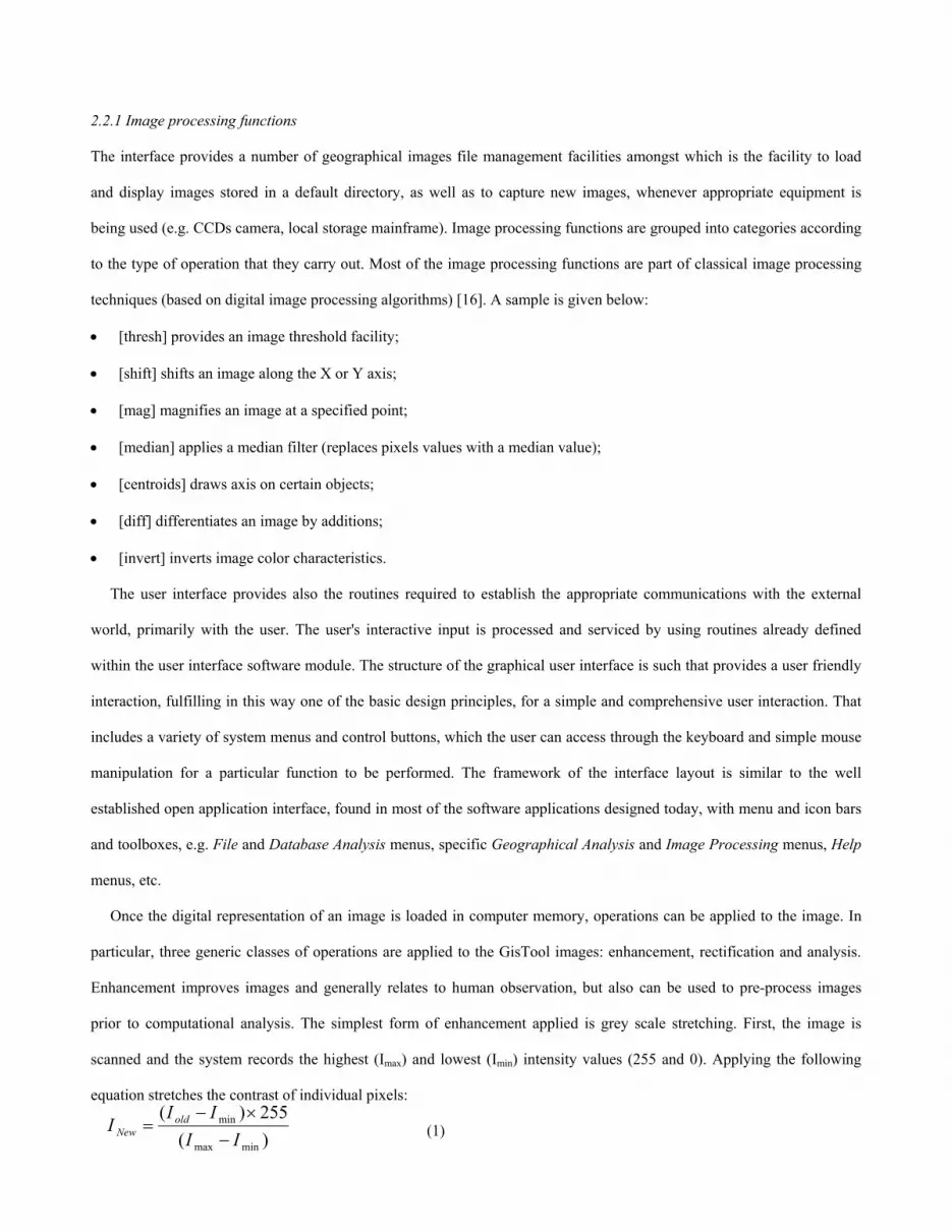
Once the digital representation of an image is loaded in computer memory, operations can be applied to the image. In
particular, three generic classes of operations are applied to the GisTool images: enhancement, rectification and analysis.
Enhancement improves images and generally relates to human observation, but also can be used to pre-process images
prior to computational analysis. The simplest form of enhancement applied is grey scale stretching. First, the image is
scanned and the system records the highest (Imax) and lowest (Imin) intensity values (255 and 0). Applying the following
equation stretches the contrast of individual pixels:
(1) )(min
II New −
=255)(
minmaxIII old ×−

)(xy∧
The colour properties of an image are mainly described using proportions of red, green and blue components. However,
in some cases colour transformation of the RGB components into HIS (hue, intensity, saturation) components is provided
for specific colour processing where it is easier to perform colour anticipation. In grey scale vision each picture element is
assigned a specific grey value, based on a method the basic principles of which were defined mathematically by Matheron
[17]. According to this method, if by y(xi) is the grey level of a pixel at spatial location xi on image grid, the unknown grey
level value , located at the spatial position x, is estimated by a weighted linear combination of n available
neighbor pixels:
(2) )yy ∑= λ ()(1 i
n
i i xx=
∧
where λi is the weight associated to the pixel y(xi) located at spatial position xi. It is actually a local reconstruction method.
The threshold technique is a binary vision technique. That is, the grey level image (shades of grey in a scale of 0-black
to 255-white) is reduced to a binary image, black or white, by representing all grey values above a specified level as white,
and all below this level as black. This technique is simple and fast, reducing the image complexity and processing time. As
it is shown in Fig. 2, this technique proceeds by comparing the given threshold value with the grey values of the image
elements. This threshold value determines which intensities should be set to white and which to black. The scene that is
produced from this binary image could be with a black background and the objects in white, or reversed. The simplest
strategy is to average the intensity over a local rectangular block (32x32; 64x64) of cells, using a small increment 5 out of
256 grey levels. A more sophisticated approach is thresholding based on histogram analysis. The histogram h(i) of an
image i(x,y) is a function of the permissible intensity values (e.g. 00 (black) to FF16 (white)). This technique enables a high
level contrast between the background and object to be obtained, and subsequently enables a considerable amount of
information to be easily extracted from the image and processed.
2.2.2 Statistical processing functions
Beyond the above image processing functions, the trainee can perform more advanced operations through the
geographic data analysis menus provided, by applying statistical and other mathematical functions (e.g. standard deviation,
averages, etc.), or even create SQL queries for retrieving valuable information from specific image databases. The level of
system's usage depends on specific users’ needs, knowledge and certain experience. Furthermore, since the development of
software technology today has led to flexible and open architecture applications, links are provided to certain spreadsheet
tools (such as MS Excel) and other specialized statistical analysis tools, as well as geographical data analysis and
presentation tools, such as Esri's ArcInfo. As a result, within this environment the trainee could undertake and perform

more specialized geographical image data processing and analysis. At any stage of the processing, results can be produced
in various forms, e.g. as tables, graphs, maps, or other reports.
Figure 2. GisTool image processing operations (thresholding left and scaling right).
3. Case studies
During our educational research work the idea was to implement and use an interactive and friendly environment for
geographical data management, where image data analysis and experimentation, as well as further research on
contemporary data analysis techniques, could easily be contacted. As a result the above mentioned geographical
information management system was developed and used as an educational platform (test-bed) where training and
experimentation on geographical data could easily be contacted by the student as well the researcher. For the time being,
the system has been used mainly into experimental educational and research applications [18], since it is still under
development and continuous integration with further functionality and tools.
The GisTool system provides a set of tools for displaying and analysing geographical data. By default any image
processing function is applied to the entire image area, however the user can select any part of the image to be processed. A
method used in our studies, quite often to get information from the imaginary data, is based on a combination of edge
detection (e.g. Laplace, Sobel) and image segmentation algorithms (e.g. thresholding) that aim to identify and extract
specific geographic data (see Fig. 3). In particular this is applied in order to search for significant breaks in a mountainous
environment (e.g. in image interpretation of satellite data) as well as in cases of cities regions interpretation (e.g. in
identification and classification of building zones).

Figure 3. Image enhancement of a local city region.
In some other cases, we rectified aerial photographs, as the primary source of base maps and thematic data, using at first
smoothing techniques and later pixel analysis techniques based on contrast manipulation procedures. Finally, in some other
cases dynamic processing has been performed by using digital maps embedded with text, sound, video, etc., as a part of a
multimedia presentation for the spatial changes of a city's population.
At earlier times, prior to its full implementation, specific parts have been applied into modelling and analysis of raster
images within robotic workcells aiming at real time control [19]. Today the system has been applied mainly in analysis of
spatial data: digital maps processing, cadastral tables processing and other relevant spatial applications, from students and
research colleagues. In particular, data analysis has been performed in different thematic attributes such as: land-uses,
population distribution (see Fig. 4), etc.
Figure 4. Sample report of geographical data aggregation.
Based on observations, comments and further feedback about the system's usage, the trainee is able to understand the basic
concepts that describe the geographical information systems and follow step by step the normal flow of the information

provided. On each step is provided all the required detailed information for the requested subjects as well as examples for
their comprehension. As a result the trainee learns about the nature and structure of the actual geographical data as well as
the procedures employed for their manipulation (insertion, classification, etc.). He is capable to perform various data
queries, according to the task is engaged to, and use the appropriate procedures to analyse them and finally to produce
results and conclusions in various presentation forms (text, tables, graphs, etc.).
4. Conclusion
The contemporary analysis and management of spatial data requires a progressive use of geographic information
management systems in all aspects of technical, organizational and political process [20]. An independency of a specific
software environment is required and therefore the necessity of new software tools is more than obvious [21].
In this framework an interactive environment for education and research in geographical systems was developed and
implemented in specific research case studies. While continuing to improve the described geographic information
management system some of the main activities that GisTool can support, are as follows:
• Collect and describe graphic and non-graphic geographical data.
• Perform image processing and analysis.
• Perform statistical analysis on geo-referenced data.
Within this environment the user has the ability to combine mapping and statistical processing to manage in this way
multivariable quantitative and qualitative information extracted from a large amount of geographical data organized in a
relational database. Additionally some of the benefits are:
• Open and expandable source
• Friendly and simple user’s interface.
• Compatible with many commercial data structures
• Visual programming environment
The level of system's usage depends on the goals, the knowledge and the experience of the user, student or researcher.
An advanced user, having some knowledge of programming, could create specific applications through the application's
programming interface based in Visual Basic and even extend further the system's functionality. At the same time a novice
user can use it as an educational and research tool. Actually the GisTool can act as a primary educational tool in
understanding the concept and the technology of analysing and management of spatial related data.

Currently, the system is going under web distribution aiming to be used as a distance learning tool in the geographical
educational and research domain. In the near future is scheduled the integration of spatial models into the system in
conjunction with the qualitative modelling tool mentioned above (QMTOOL), and their implementation into the evaluation
of spatial information.
Acknowledgements
The authors would like to thank Professor Edward Grant (North Carolina State University) for his helpful suggestions and
comments in the whole process of our research work. We wish also to acknowledge the assistance provided by many of our
students and colleagues in testing the application and providing valuable feedback. The views and conclusions expressed in
this paper are those of the authors.
References
[1] J. Antenucci, K. Brown, P. Croswell, & M. Kevany, Geographic information systems - A guide to the technology
(Boston: Chapman & Hall, 1991).
[2] G.B. Korte, The GIS book (New York, NY: OnWord Press, 1997).
[3] R.C. Gonzalez & R.E. Woods, Digital image processing (Reading, Mass.: Addison-Wesley, 1992).
[4] K.R. Castleman, Digital image processing (Englewood Cliffs, NJ: Prentice Hall, 1996).
[5] P.M. Atkinson & N.J. Tate, Advances in Remote Sensing and GIS Analysis (John Wiley & Sons: Berlin and New York,
1999).
[6] N. Efford, Digital image processing using Java (Reading, Mass.: Addison-Wesley, 2000).
[7] S. Morain & S.L. Baros, Raster Imagery in Geographic Information Systems (On Word press: New York, 1996).
[8] S.M. Smith and J.M. Brady, SUSAN: A new approach to low level image processing, International Journal of
Computer Vision, 23(1), 1997, 45-78.
[9] X. Zhang, Target Segmentation and Extraction from Geographic Images based on Multiscale Analysis, Proc. 5th
IEEE/WSES Conf. on Circuits, Systems, Communications and Computers, Rethymno, Greece, 2001, 84-89.
[10] D. Kotzinos, Internet Information System for travelers. Development of Digital mapping applications, PhD Thesis,
Technical University of Crete, Department of Production and Administration, Heraclion, Greece, 2001

[11] G.K. Adam, GisTool: An Integrated Environment for GIS Data Management, Proc. 2nd Inter. Conf. in Management
Information Systems, Lisbon, Portugal, 2000, 479-487.
[12] G.W. Dickson & J.C. Wetherbe, The management of information systems (New York, NY: McGraw-Hill, 1985).
[13] H.C. Lucas, Information systems concepts for management (New York, NY: McGraw-Hill, 1990).
[14] R.A. Schowengerdt, Techniques for image processing and classification in remote sensing (San Diego, CA: Academic
Press, 1983).
[15] G. Shaw & D. Wheeler, Statistical techniques in geographical analysis (New York, NY: John Wiley & Sons, 1985).
[16] I. Pitas, Digital image processing algorithms (Englewood Cliffs, NJ: Prentice Hall, 1993).
[17] G. Matheron, Principles of Geostatistics, Economic Geology, 58, 1963, 1246-1266.
[18] G.K. Adam, Expanding Environmental Education using GisTool, Proc. 5th Inter. Conf. on the Protection and
Restoration of the Environment, Thassos, Greece, 2000, 1215-1220.
[19] G.K. Adam and E. Grant, QMTOOL- a qualitative modelling and simulation CAD tool for designing automated
workcells, Proc. IEEE Inter. Conf. on Robotics and Automation, San Diego, CA, 1994, 1141-1146.
[20] M. Lepper, H. Scholten, R. Stern, The added value of geographical information systems in public and environmental
health (Dordrecht, NL: Kluwer, 1995).
[21] V. Pappas, Designing geographic information systems’ curricula: A basic approach, Proc. Conf. on The future of GIS
Education in Greece, Piraeus, 2000, 1-8.
Biographies
Dr. George Adam graduated with distinction with a Bachelor degree in Computing Machines
and Devices in 1989 from the Technical University of Sofia, Bulgaria. In 1990 he was granted a
scholarship (SERC award) for his postgraduate degree. He received his Ph.D. in Computer
Science from Strathclyde University, Glasgow, U.K., in 1993. He is currently an Adjunct
Lecturer in Computer Science at the Department of Planning and Regional Development at the
University of Thessaly, Volos, Greece. His research interests are mainly focused on
management of geographical information systems, applications of qualitative modelling and simulation techniques, and the
construction of interactive multimedia software using object-oriented methodologies. He is a member of the IEEE Robotics
& Automation Society and Computer Society, ACM and IASTED.

Dr. Vassilis Pappas is Assistant Professor in the University of Thessaly, Greece and Director of
the Laboratory of Computer Applications in Spatial Planning, Department of Planning and
Regional Development. Main teaching courses he is involved in: Geographic Information
Systems, Introduction to Informatics, Databases, etc. He is author of many monographs, papers,
works, presentations, etc, and he has participated in numerous research projects. As an
individual consultant he has worked in many National Organizations and in private firms, as a G.I.S. expert and spatial
planner. Also he has been reviewer, evaluator and short term IT expert in many EU programs. A pioneer of Greek GIS
society and member of many national and international associations and societies (Hellenic GIS society, Hellenic
Computer Society, Greek Planers Associations, Technical Chamber of Greece, IEEE, etc).


