Embed Size (px)
Citation preview

Volume 4: Annexure ISocial Report
Lesotho Highlands Development Authority
Contract LHDA No.: 6014
Contract Name: Professional Services for the
Environmental & Social Impact Assessment
(ESIA) for the Polihali Reservoir & Associated
Infrastructure
Document Ref: P2W-6014-DFR-0010
Document Date: 23 March 2018

ii
Revision History Version Issue Date Description of Changes
00 30/08/2017 First draft for Client review
01 06/10/2017 Second draft for Client review
02 08/11/2017 Final
03 23/03/2018 Final (revised impact assessment)

iii
Abbreviations and Acronyms AC Area Chief
ALC Area Liaison Committee
AoI Area of Influence
ART Anti-retroviral Treatment
BEDCO Basotho Enterprises Development Corporation
BPST Bulk Power Supply Telecommunications
CBO Community-based Organisation
CC Community Council
CGP Child Grants Programme
CHAL Christian Health Association of Lesotho
CHW Community Health Workers
CLC Combined Liaison Committee
CLO Community Liaison Officer
CoC Code of Conduct
CPI Consumer Price Index
DA District Administrator
DC District Council
DCS District Council Secretary
DES District Economic Strategies
DHMT District Health Management Team
DoE Department of Environment
DRWS Department of Rural Water Supply
ECCD Early Childhood Care and Development
EA Environmental Assessment
EFR Environmental Flow Requirement
EHS Environmental Health and Safety
EIA Environmental Impact Assessment
EIS Environmental Impact Statement
EMP Environmental Management Plan
EPPRP Emergency Prevention, Preparedness and Response Plan
ESIA Environmental and Social Impact Assessment
ESIS Environmental and Social Impact Statement
ESMS Environmental and Social Management Systems
ESS Environmental and Social Standards
ERM Environmental Resources Management Southern Africa (Pty) Ltd
EU European Union
FGD Focus Group Discussion
FOB Field Office Branch
FSL Full Supply Level
GIS Geographic Information System
GoL Government of Lesotho
GPS Geographic Positioning System
HCG Pregnancy Test
HTC HIV Testing and Counselling
I&APs Interested and Affected parties
ICM Integrated Catchment Management
IFC International Finance Corporation
ILO International Labour Organisation
KII Key Informant Interview
LAA Land Administration Authority
LDHS Lesotho Demographic and Health Study
LDS Lesotho Demographic Study
LEC Lesotho Electricity Company

Abbreviations and Acronyms
iv
LHDA Lesotho Highlands Development Authority
LHWC Lesotho Highlands Water Commission
LHWP Lesotho Highlands Water Project
LHWP II Lesotho Highlands Water Project Phase II
LNWMGA Lesotho National Wool and Mohair Grower’s Association
LR&SDF Livelihood Restoration and Social Development Framework
LTDC Lesotho Tourism Development Corporation
MC Municipal Council
MCA Millennium Challenge Account
MDR Multi Drug Resistant
MG Marketing Group
MoU Memorandum of Understanding
MSMEs Micro, Small and Medium Enterprises
NER Net Enrolment Rate
NEP National Environmental Policy
NES National Environment Secretariat
NFE Non-formal Education
NGO Non-government Organisation
NPSD National Policy on Social Development
NSDP National Strategic Development Plan
NSPS National Social Protection Strategy
NTS Non-technical Summary
NUL National University of Lesotho
OVC Orphans and Vulnerable Children
PC Principal Chief
PEPFAR The President's Emergency Plan for AIDS Relief
PHAP Public Health Action Plan
PHC Primary Health Care
PLRD Project Labour Recruitment Desk
PMTCT Prevention of Mother to Child Transmission
PNEAR Polihali North East Access Road
PPE Protective Personal Equipment
PP Public Participation
PPP Public Participation Process
PRAI Polihali Reservoir and Associated Infrastructure
PS Performance Standard
PSLC Primary School Leaving Certificate
PTR Pupil Teacher Ratio
PWAC Polihali Western Access Corridor
PWAR Polihali Western Access Road
RAP Resettlement Action Plan
RfP Request for Proposal
RSA Republic of South Africa
SADC Southern African Development Community
SDMP Social Development Master Plan
SEBS Socio-Economic Baseline Study
SHEQ Safety Health Environment and Quality
SSAs Sheering Shed Associations
STIs Sexually Transmitted Infections
TB Tuberculosis
TB-DOTS Tuberculosis-Directly Observed Treatment Shots
ToR Terms of Reference
TVET Technical and Vocational Education and Training
UNESCO United Nations Education, Scientific and Cultural Organisation
UNFPA United Nations Population Fund

Abbreviations and Acronyms
v
UNICEF United Nations Children's Fund
USAID United States Agency for International Development
USG United States Government
VDRL Syphilis Test
VHW Village Health Worker
VIP Ventilated Improved Pit Latrine
WB World Bank
WASCO Water and Sewerage Company
WFP World Food Programme
WHO World Health Organisation
WMGAs Wool and Mohair Growers Associations

vi
Glossary of Technical Terms Technical Term Definition
Catchment area The area from which rainfall flows into a river, lake, or reservoir.
In terms of this project, it refers to the local catchment of the Polihali reservoir
as defined by the red line in Figure 1.1.
Coffer dam A watertight enclosure pumped dry to permit construction work below the
waterline, as when building bridges or, as in the case of the current project, to
allow for the construction of the main dam wall across the river.
Community
engagement
Part of the Social and Environmental Assessment, community engagement is
an ongoing process involving disclosure of information, consultation with
affected communities, and the establishment of a grievance mechanism.
Compensation Payment in cash or in kind for an asset or a resource that is acquired or affected by LHWP Phase II activities.
Consultation Consultation involves interactive communication between the client and the
affected communities. The consultation process should be undertaken in a
manner that is inclusive and culturally appropriate and that provides the
affected communities with opportunities to express their views on projects risks,
impacts and mitigation measures, and allows the client to consider and respond
to them.
Dam A dam is a barrier constructed to hold back water and raise its level, forming a
reservoir used to generate electricity or as a water supply.
Disadvantaged or
vulnerable groups
Individuals or groups within the Project Area of influence who could experience
adverse impacts from the proposed project more severely than others based on
their vulnerable or disadvantaged status. This status may stem from an
individual's or group's race, colour, gender, language, religion, political, or other
opinion, national or social origin, property, birth or other status. In addition,
other factors should be considered such as gender, ethnicity, culture, sickness,
physical or mental disability, poverty or economic disadvantage, and
dependence on unique natural resources.
Diversion tunnel An underground passageway used to divert flowing water around a construction
site.
Economic
displacement
Loss of assets or access to assets that leads to loss of income sources or
means of livelihood.
Land acquisition Land acquisition refers to all methods of obtaining land for project purposes,
which may include outright purchase, expropriation of property and acquisition
of access rights, such as easements or rights of way. Land acquisition may also
include: (a) acquisition of unoccupied or unutilised land whether or not the
landholder relies upon such land for income or livelihood purposes; (b)
repossession of public land that is used or occupied by individuals or
households; and (c) project impacts that result in land being submerged or
otherwise rendered unusable or inaccessible. “Land” includes anything growing
on or permanently affixed to land, such as crops, buildings and other
improvements, and appurtenant water bodies.
Livelihood Livelihood refers to the full range of means that individuals, families, and
communities utilise to make a living, such as wage-based income, agriculture,
fishing, foraging, other natural resource-based livelihoods, petty trade, and
bartering.
Livelihood Restoration The measures that are required to mitigate the negative impacts on households that will be economically and physically displaced by LHWP Phase II, through loss of shelter and assets, and loss of access to resources, markets and services that support livelihoods. These measures are in addition to compensation, since compensation alone does not guarantee the restoration of livelihoods.
Local communities Community within the project's area of influence.
Project Areas of
influence
The project's area of influence includes the primary project site(s) and related
facilities that the client (including its contractors) develops or controls;
associated facilities that are not funded as part of the project (funding may be
provided separately by a client or a third party including the government), and
whose viability and existence depend exclusively on the project and whose
Abbreviations and Acronyms
vii
Technical Term Definition
goods or services are essential for the successful operation of the project;
areas potentially impacted by cumulative impacts from further planned
development of the project; and areas potentially affected by impacts from
unplanned but predictable developments caused by the project that may occur
later or at a different location. The area of influence does not include potential
impacts that would occur without the project or independently of the project.
Net Primary Enrolment
Rate
The number of pupils of official primary school age who are enrolled in primary education as a percentage of the total children of the official school age population
Physical displacement Relocation as a result of loss of or damage to homes / shelter.
Project’s area of
influence
The project's area of influence includes the primary project site(s) and related facilities that the client (including its contractors) develops or controls; associated facilities that are not funded as part of the project (funding may be provided separately by a client or a third party including the government), and whose viability and existence depend exclusively on the project and whose goods or services are essential for the successful operation of the project; areas potentially impacted by cumulative impacts from further planned development of the project; and areas potentially affected by impacts from unplanned but predictable developments caused by the project that may occur later or at a different location. The area of influence does not include potential impacts that would occur without the project or independently of the project.
Reservoir A large natural or artificial lake used as a source of water supply.
Resettlement action
plan
The document in which a project sponsor or the responsible entity specifies the
procedures that it will follow and the actions that it will take to mitigate adverse
effects, compensate losses, and provide development benefits to persons and
communities affected by an investment project.
Social Development Initiatives to ensure that communities in the Project Area become beneficiaries
of the development. It refers to a more open-ended programme of interventions
aimed at contributing to social and economic development of Project Area
communities. The scope of these interventions typically extends beyond directly
affected (physically and economically displaced) households and villages to
include other members of the Project Area communities.
Social Impacts When referring to social impacts this includes impacts received by the following
entities:
• Settlements, dispersed villages, solitary dwellings and mobile / semi-mobile
groups (including temporary and permanent human residents with both
formal and informal tenure of land/structures);
• Population dynamics including population size, structure, settlement
pattern and migration;
• Tangible and intangible cultural heritage sites and items, including
archaeological heritage;
• Ecosystem services, including provisioning services, regulating services,
supporting services and cultural services used by human receptors;
• Social infrastructure including both tangible (i.e. schools, community
centres, electricity and potable water services) and intangible items (i.e.
meeting places, shaded areas);
• Individual and communally owned assets (i.e. farm animals and/or grazing
land);
• Livelihood sources; including formal and informal activities;
• Community groups including civil society groups;
• Gender;
• Human rights; and community health, safety and security (including
wellbeing).

viii
Acknowledgements The authors would like to express their sincere appreciation to all the people who have assisted them
from the start of the project to the report writing. These include, ERM through its leadership and
support and lots of patience with everyone, the office and staff of LHDA in Maseru and at the Tlokoeng
Field Operations Branch. Their hands-on support during the undertaking of fieldwork was much
appreciated. Thanks are also extended to the Phase II PMU office and staff for their unwavering
support. Also to be thanked are the chiefs from all the areas the field teams worked in, for their support
and their acceptance of the teams. Not forgotten are the District Administrators’ offices of the districts
of Mokhotlong and Thaba-Tseka as well as all the Heads of Departments from the same Districts for
all the help they afforded the field teams. Last thanks are extended to the field teams who worked
tirelessly to produce the results.

E-i
Non-technical Summary Scope and Methods
The Social study is a component of the Environmental and Social Impact Assessment (ESIA) for the
Polihali Reservoir and Associated Infrastructure (PRAI) (LHDA Contract 6014). Specifically, the study
sought to describe the socio-economic context of the PRAI Project Area based on existing secondary
information and primary data collection through social data gathering using focus group discussions,
key informant interviews and general observations. The study also sought to identify and assess the
social impacts on local communities, both positive and negative, likely to result from the Project
implementation. Finally, the study was to identify and define measures for mitigating the impacts and
enhancing social conditions during and post-construction of the PRAI. The study was undertaken in
the whole of the PRAI Project Area, thus covering the catchment area and areas upstream and
downstream of the reservoir.
Baseline Social Environment
The Project Area is situated in the north-east of the Lesotho highlands proximate to Mokhotlong and
mostly comprises remote rural villages with limited access to formal public infrastructure. Mokhotlong
is the closest town to the Project Area, and in fact falls within the project catchment area. The built-
up area of Mapholaneng also falls within the Project Area. The settlement pattern is scattered clusters
of traditionally constructed homesteads, usually built of natural resources such as stone and thatch.
The Project Area has a dual administrative structure comprised of formal government, through the
decentralised district government offices, elected community councils and traditional authorities
(Principal and Area chiefs). Land in the area is communally owned and is kept in the trust of chiefs;
and acquisition is primarily through chiefs and inheritance.
Between 2013 and 2014, the population of the Project Area was estimated at 46 371 people, with an
average of 5.2 persons per household (CES, 2015b). In-migration into the Project Area is limited due
to its harsh environment (specifically the weather and poor soil quality) as well as lack of employment
opportunities. In turn, the local population tends to migrate out of the area in search of economic
opportunities, both within Lesotho and in South Africa.
The communities rely heavily on land-based livelihoods; namely crop and extensive livestock
farming. However, crop yields are low due to the poor quality of available arable land, and due to the
use of traditional cultivation methods. Crop production is mainly for household subsistence purposes,
with surplus often sold or bartered with neighbours. Livestock farming is mainly for commercial
purposes through sale of wool, mohair and animals, and is also regarded as a major source of income.
Crop production is the principal livelihood strategy, followed by remittances from permanent and
seasonal employment, sale of livestock products and social grants. Other livelihood strategies include
gathering and sale of natural resources.
A wide variety of natural resources are found in the Project Area, and these are communally owned
and utilised. These include a wide range of plants that are collected and used for food, medicinal
purposes and for sale; grazing land, a variety of grasses, trees/shrubs, rocks and sand, and small
animals. A majority of these natural resources are a source of livelihoods for many families in the
Project Area as they rely on their use on a daily basis.
Unemployment in the Project Area is high and those few who are employed work mainly in full-time
jobs or are either seasonally employed or self-employed. Formal employment is mainly found in the
public and services sector, i.e., government, shops and the hospitality industry. In general, income in
the Project Area increases significantly between March and June, and again between August and
September due to crop harvest and sales, and wool and mohair sales as payments for these are
received by farmers between August and November.

Non-technical Summary
E-ii
Access to infrastructure and services is usually aligned with road access, with such services being
schools, clinics, improved sanitation, water supply and electricity. There are eight health facilities
within the Project Area. These include one district hospital and seven health centres. The facilities
are located in the more accessible areas such as Mokhotlong town and Mapholaneng, with a few
scattered in the less accessible areas. This means that a majority of people are required to walk long
distances to get to the nearest facility, with local people sometimes having to walk up to 20km to
reach the nearest clinic or hospital for health support.
Although the main road through Mokhotlong is paved, minor and secondary feeder roads are un-
surfaced and become impassable after rains and snowfalls. Some of the villages are only accessible
on foot or with mules, donkeys and horses. Public transport is limited and most people tend to walk
to get to services and use pack donkeys or horses to carry their goods. Mokhotlong has heavy
pedestrian and pack animal traffic. Since roads have no sidewalks, animals and pedestrians share
the road with vehicles.
Primary schools are widely spread throughout the Project Area, thus enabling many children easy
access. However, some children still have to walk long distances to the nearest schools, thus resulting
in some children attending school erratically during the rainy season (when rivers and streams flood)
due to the lack of bridges. Secondary/ high schools are limited with difficult access due to bad roads
and lack of bridges. Here again, children have to walk long distances or alternatively have to rent
rooms in the villages near the secondary/ high schools.
Water is mostly collected from communal taps that are scattered throughout the Project Area;
however, in some communities the water taps are non-functional. Unprotected sources such as
springs and wells are also a common source of water, particularly in the more remote villages. Across
the Project Area, sanitation facilities are scarce, with those who have these facilities mostly owning
traditional pit latrines. Some areas such as Tloha-re-Bue and Mapholaneng have access to Ventilated
Improved Pit (VIP) latrines. Overall, the general lack of sanitation facilities means that people use
bushes near their homes, especially overgrown areas by the streams and rivers.
Telecommunication services in the Project Area are concentrated in the established town areas of
Mokhotlong and Mapholaneng. Here people have access to both cellular phones and landlines which
are found mainly in government offices, some big retail shops, and tourism establishments. Cellular
coverage is limited to the more built-up areas like Mokhotlong town and Mapholaneng and a few other
areas located near the towns and along the main A1 road.
Electricity is also restricted to the two towns and the villages along the main A1 road between
Mapholaneng and Mokhotlong town, as well as Ha Mojakisane and Ha Lehlohohonolo on the eastern
side of the Senqu River. The majority of households rely on fuelwood for heating and cooking
purposes, followed by paraffin and bottled gas. Passerina montana is commonly harvested for fuel
purposes. Candles are used mainly for lighting purposes.
Local markets and shops are mainly found in Mokhotlong town and Mapholaneng. Formal and
informal trading is common. Informal traders are found along the main and minor roads trading from
small makeshift stalls. Banking services are also mostly limited to the more established towns of
Mokhotlong and Mapholaneng.
There are only two police stations in the Project Area, one in Mokhotlong town and the other in
Mapholaneng. In most of the villages there are community policing forums (mahokela), which fight
crime at the village level and work hand in hand with the local police stations.

Non-technical Summary
E-iii
Key Project Activities Impacting the Social Environment
Land Acquisition, Resettlement and Compensation
In order to implement the Project, an estimated 5723 ha of land (reservoir and associated
infrastructure inclusive) will need to be permanently acquired from the Mokhotlong District’s total land
area of 4075km2 (~407 500 ha). The land take will affect four Community Councils, namely Seatle,
Bokong, Malingoaneng, and Mphokojoane Community Councils, and one Urban Council
(Mokhotlong).
The acquisition of land for the Project will result in both physical and economic displacement of people
and households. The main Project components that will result in displacement of households are the
Polihali village, site establishment area, dam and tunnel works areas, as well as the inundation area.
The land acquisition will occur in three phases (over a five-year period), as follows:
Phase 1. Temporary and permanent acquisition in the site establishment area for the Advance
Infrastructure. These activities will affect villages of Masakong and Ha Tlhakola villages, as well as
households from Ramonakalali, Mabunyaneng, Makalong and Tsekong. Masakong and Ha Tlhakola
will be affected by physical and economic displacement and the remainder by economic displacement
(Figure E.1).
Phase 2. Permanent land acquisition in the inundation area around Tloha-re-Bue and the remainder
of the site establishment area (for instance the Tunnel Works Area, Substation, but also the Polihali
North East Access Road (PNEAR), which is not part of this ESIA). Tloha-re-Bue is partly affected by
physical and economic displacement.
Phase 3. The remainder of the inundation area, covering several villages including Ha Jobere, Koung
Ha Phohla, Tsekong and Litsotsong, and Ha Sikantsi are all affected to varying degrees by physical
and economic displacement; and all economic displacement (loss of fields, trees and thickets within
the inundation area) affecting households in surrounding villages, which are not physically affected.
The land that will be affected is currently used for grazing, collection of natural resources, cultivation
of crops, and settlements. Figure E.1 indicates villages that will experience physical and economic
displacement.
Table E.1 highlights all the villages and the approximate number of households per village likely to
be physically displaced by the Project. Figures provided in this table are estimated numbers based
on the Feasibility Study and current predictions and will still need to be verified by the resettlement
specialist team.
Table E.1 Estimate of Villages and Households to be Displaced (refer to Figure E.1 for
locations)
Classification Village name Households below
reservoir demarcation
line (DL)
Households
dangerously located
Fully below Reservoir DL Map ref. 1 to 5
Ha Jobere 6 Unknown Ha Tlhakola 18 Unknown Lits'otsong 5 Unknown Tsekong 28 Unknown Ha Sekants’i 13 13
Partially below Reservoir DL Map ref. 6 to 8
Tloha-re-Bue 40 13
Koung Ha Phohla 32 36
Sekokong 3 5
Site establishment area Map ref. 9 & 10
Masakong 50 Unknown
Malingoaneng & Meeling 8 41
Potentially Dangerous Location (safety)
Liphokong Unknown (7)
Ha Mpesi Unknown (4)

Non-technical Summary
E-iv
Classification Village name Households below
reservoir demarcation
line (DL)
Households
dangerously located
Map ref. 11 to 16
Koung Ha Thunyane Unknown (3)
Ha Meta /Ha Manka Unknown (3)
Makhalong Unknown (3)
Lilimala Unknown (6)
Potential Isolation Map ref. 17 & 18
Bokone & Morojeleng Unknown Unknown
Total 18 203 95 (+26 unbudgeted for)
121
Figure E.1 Villages Likely to be Displaced by the Project
To mitigate for the loss associated with the Project land acquisition, LHDA has appointed a
resettlement planning consultant, as well as developed two critical documents, namely Phase II
Compensation Policy, 26 August, 2016 and the Livelihood Restoration and Social Development
Framework (LR&SDF), August, 2017.
The Phase II Compensation Policy provides the guiding principles for compensation of all losses that
will be incurred by Project affected households and communities. The Policy was developed on the
basis of consultations with affected communities, their authorities and other key stakeholders.
English and Sesotho versions of the Policy were made available to affected communities via the local
authority structures (District Councils, Urban Councils, Community Councils and Chiefs) as well as
through local participation structures set up for Phase II.
The Policy makes provisions in terms of losses of houses, associated structures and residential plots
as well as the loss of agricultural fields and communal assets (such as grazing land, brush, wood,
medicinal plants, useful grasses and wild vegetable). Further details are provided in Section 5.2.

Non-technical Summary
E-v
The Policy furthermore, defines households headed by orphans, by persons living with a disability or
by elderly, or indigent persons as vulnerable and indicates that vulnerable households will receive
individual attention from LHDA as well as the relevant government agencies.
The loss of access routes will be compensated for through the construction of footbridges and the
upgrading of certain roads within the PRAI local catchment. A contract for development of a Master
Plan for Minor Bridges and Roads is currently being commissioned by the LHDA (LHDA Contract
6019).
Construction Phase
A number of impacts may arise during the construction phase, relating to traffic safety and nuisance
(dust, noise) which can be mitigated through the implementation of a traffic management plan and
the EMP by the various contractors. There are other impacts related to the influx of job seekers,
increase in anti-social behaviours, etc. that will require other interventions requiring involvement from
the LHDA and relevant government departments.
There are also positive impacts associated with the construction phase such as the creation of
employment opportunities (the Project is proposing to create an estimated 3 500 temporary and
unskilled jobs that will be available to the locally affected people and other Lesotho nationals) and the
procurement of local goods and services.
Operational Phase
The risk of traffic accidents during the operational phase will remain but at a much lower level of
probability and therefore significance. Another impact that will carry through to the operational phase
is the result of anti-social behaviour and the need for ongoing management of STIs, HIV/AIDS, etc.
Positive impacts will include increased government revenue from the payment of taxes and sale of
water to South Africa; the creation of job opportunities (although limited); development of the tourism
sector; and improved access as a result of the development of the Polihali Western Access Road
(PWAR) and the upgrading of the PNEAR.
Key Mitigation and Enhancement Measures
The Phase II Agreement states that social development programmes and mitigation measures,
resettlement requirements and awareness campaigns will be implemented, the full extent of which
will be agreed by the Parties during the implementation. Some of the key socially related documents/
plans or policies developed by the LHDA are highlighted below; some of these have been developed
and others (such as Integrated Catchment Management, Social Development Master Plan and Public
Health Action Plan) are yet to be developed. The implementation of these will be the responsibility of
the LHDA with the assistance of appointed Consultants/ Contractors and Government at National and
District levels.
• LHDA Phase II Compensation Policy (August, 2016)
• LHWP Phase II Labour Recruitment Guidelines (2017)
• LHWP Phase II Contractor Procurement Framework (Draft August, 2016)
• Asset Registration Procedures for LHWP Phase II (October, 2017)
• LHWP Phase II Livelihood Restoration and Social Development Framework (LR&SDF) (August 2017)
• Social Development Master Plan (SDMP).
• Integrated Catchment Management (ICM)
• Public Health Action Plan (PHAP)

Non-technical Summary
E-vi
Summary of mitigation measures include:
• Appoint a Consultant to develop and implement a Resettlement Action Plan that is in compliance
with the provisions of the Phase II Compensation Policy and which aligns to the international
standards of the World Bank (already commissioned and underway).
• The RAP Consultant will develop and implement a Livelihood Restoration Plan to mitigate for the
loss of income associated with the Project’s land acquisition.
• All Contractors and sub-contractors must adhere to the provisions, principles and guidelines in
the LHDA Safety, Health, Environment and Quality (SHEQ) Management Framework for Phase
II as well as the approved EMP for their works/ contract.
• LHDA shall develop and implement a Traffic Management Policy including vehicle safety, driver
and passenger behaviour, use of drugs and alcohol, hours of operation, rest periods and accident
reporting and investigations.
• In collaboration with the Ministry of Education, LHDA shall develop, implement and produce the
required materials to be used for road traffic safety awareness campaigns.
• LHDA shall implement the Labour Recruitment Guidelines that all Contractors must adhere to for
hiring unskilled labour, i.e.:
• Local people are prioritised for unskilled labour - at least 80% of the workforce should be
hired from villages located within the affected community councils;
• There is no discrimination in recruitment, the workforce should comprise men, women,
disabled and people from different religious/ cultural backgrounds;
• Approved channels should be used for recruitment; and
• A grievance mechanism should be easily available to all workers and offer anonymity.
• Lesotho nationals are to be given preference for semi-skilled and skilled positions. If it can be
demonstrated that people with suitable skills and experience are not available, then South
Africans, people from South African Development Community (SADC) member states and other
foreigners can be employed; in that order.
• A Training and Skills Development Plan will be implemented to ensure that maximum skills
enhancement opportunities are offered to workers at all levels.
• In partnership with local authorities and relevant organisations, where available and appropriate
(e.g. donors, civil society and Non-government Organisations (NGOs)), assist in planning for
anticipated increased demands on public infrastructure and services in communities that are
significantly affected by in-migration due to Project activities.
• Collaborate with the Lesotho Tourism Development Corporation (LTDC) and Ministry of
Development Planning in fast tracking the implementation of a Tourism Master Plan for the
Project Area.
Social monitoring requirements during the construction phase by LHDA should be focussed on
ensuring that the scope of the RAP, such as asset registration and socio-economic baseline data
gathering, are conducted properly in order to provide a sound basis for monitoring the effectiveness
of the RAP implementation. Regular independent monitoring and evaluation audits of the RAP and
its implementation are required throughout advance works, construction and operational phases. In
addition, monitoring is required to verify the progress and effectiveness of livelihood restoration
projects that are implemented.
T-i
Table of Contents Section 1 Introduction ...................................................................................................... 1-1
1.1 Background ........................................................................................................................ 1-1
1.2 Study Team ........................................................................................................................ 1-1
1.3 Objective and Aims of the Social Study ............................................................................. 1-2
1.4 Project Location .................................................................................................................. 1-3
1.5 Project Description ............................................................................................................. 1-6
Section 2 Institutional and Legal Framework ................................................................ 2-1
2.1 Relevant Institutions ........................................................................................................... 2-1
2.1.1 Central Government...................................................................................................... 2-1
2.1.2 Local Government......................................................................................................... 2-2
2.1.3 Traditional Governance ................................................................................................ 2-4
2.2 Relevant Legislation and Policies ...................................................................................... 2-5
2.2.1 LHWP Treaty and LHDA Policies and Guidelines ........................................................ 2-5
2.2.2 Lesotho Legislation Relevant to Social Impact Assessments .................................... 2-10
2.3 International Standards .................................................................................................... 2-13
2.3.1 World Bank ESS and IFC PS ..................................................................................... 2-13
2.3.2 Voluntary Principles on Security and Human Rights .................................................. 2-14
2.3.3 International Labour Organisation Fundamental Conventions ................................... 2-15
Section 3 Approach and Methods .................................................................................. 3-1
3.1 Introduction ......................................................................................................................... 3-1
3.2 Approach ............................................................................................................................ 3-1
3.2.1 Literature review ........................................................................................................... 3-1
3.2.2 Site Reconnaissance Visit ............................................................................................ 3-3
3.2.3 Social Area of Influence ................................................................................................ 3-3
3.2.4 Planning for Data Collection ......................................................................................... 3-5
3.3 Methodology ....................................................................................................................... 3-5
3.3.1 Sampling ....................................................................................................................... 3-5
3.3.2 Execution ...................................................................................................................... 3-6
3.3.3 Data Management and Analysis ................................................................................... 3-7
3.3.4 Impact Assessment..................................................................................................... 3-11
Section 4 Baseline Environment ..................................................................................... 4-1
4.1 Demographic Profile ........................................................................................................... 4-1
4.1.1 Population Size and Distribution ................................................................................... 4-1
4.1.2 Ethnicity and Language ................................................................................................ 4-1
4.1.3 Religion ......................................................................................................................... 4-2
4.1.4 Residential Status of the Population ............................................................................. 4-2
4.1.5 Migration ....................................................................................................................... 4-4
4.2 Cultural Practices ............................................................................................................... 4-4

Table of Contents
T-ii
4.2.1 Cultural Practices .......................................................................................................... 4-4
4.2.2 Social Networks ............................................................................................................ 4-5
4.3 Land Tenure and Use......................................................................................................... 4-6
4.3.1 Ownership of Land ........................................................................................................ 4-6
4.3.2 Types of Land Tenure ................................................................................................... 4-7
4.3.3 Land Use Types ............................................................................................................ 4-8
4.4 Livelihood and Economic Activities .................................................................................. 4-10
4.4.1 National Overview ....................................................................................................... 4-10
4.4.2 District and the Project Area Overview ....................................................................... 4-10
4.4.3 Crop Production .......................................................................................................... 4-11
4.4.4 Livestock Production ................................................................................................... 4-15
4.4.5 Challenges to Agricultural Activities in the Project Area ............................................. 4-18
4.4.6 Employment and Unemployment ................................................................................ 4-19
4.4.7 District and Project Area Employment and Unemployment........................................ 4-21
4.5 Household Income and Expenditure ................................................................................ 4-24
4.5.1 Sources of Household Income .................................................................................... 4-24
4.5.2 Household Expenditure .............................................................................................. 4-27
4.6 Access and Utilisation of Natural Resources ................................................................... 4-28
4.6.1 Grazing Land .............................................................................................................. 4-29
4.6.2 Soils ............................................................................................................................ 4-30
4.6.3 Sand ............................................................................................................................ 4-31
4.6.4 Medicinal Plants .......................................................................................................... 4-31
4.6.5 Wild Vegetables .......................................................................................................... 4-32
4.6.6 Fuelwood .................................................................................................................... 4-32
4.6.7 Wild Animals ............................................................................................................... 4-33
4.7 Health Care ...................................................................................................................... 4-33
4.7.1 National Health Services ............................................................................................ 4-33
4.7.2 Health Care Provision ................................................................................................. 4-33
4.7.3 Services Offered at Health Centres in the Project Area ............................................. 4-35
4.7.4 Health Profile .............................................................................................................. 4-35
4.7.5 Utilisation of Health Services in the Project Area ....................................................... 4-36
4.7.6 Incidence and Prevalence of HIV ............................................................................... 4-37
4.7.7 Challenges to Health Care Provision .......................................................................... 4-38
4.7.8 Use of Traditional Healers and Traditional Medicine .................................................. 4-39
4.8 Education ......................................................................................................................... 4-40
4.8.1 National Education Services ....................................................................................... 4-40
4.8.2 Structure of the Education System ............................................................................. 4-40
4.8.3 Availability of Education Facilities ............................................................................... 4-41
4.8.4 Education Profile of Lesotho ....................................................................................... 4-43
4.8.5 Education Profile of Mokhotlong and Project Area ..................................................... 4-43

Table of Contents
T-iii
4.8.6 Provision of Education to the Poor and Marginalised ................................................. 4-45
4.8.7 Obstacles to Education ............................................................................................... 4-46
4.9 Public Services and Infrastructure ................................................................................... 4-46
4.9.1 Access to Potable Water and Sanitation Facilities ..................................................... 4-48
4.9.2 Access to Policing Services ........................................................................................ 4-51
4.9.3 Access to Local Court ................................................................................................. 4-52
4.9.4 Access to Banking Services ....................................................................................... 4-53
4.9.5 Access to Agricultural Input and Equipment ............................................................... 4-54
4.9.6 Access to Local Markets and Shops........................................................................... 4-54
4.9.7 Access to Telecommunications .................................................................................. 4-55
4.9.8 Access to Transportation ............................................................................................ 4-55
4.10 Vulnerability and Marginalisation ..................................................................................... 4-56
4.10.1 Women .................................................................................................................... 4-56
4.10.2 The Elderly .............................................................................................................. 4-57
4.10.3 Youths ..................................................................................................................... 4-57
4.10.4 Herd boys ................................................................................................................ 4-57
4.10.5 Orphaned Children.................................................................................................. 4-58
4.10.6 Disabled or Chronically Ill Persons ......................................................................... 4-58
Section 5 Impact Assessment ......................................................................................... 5-1
5.1 Introduction ......................................................................................................................... 5-1
5.2 Overview and Context ........................................................................................................ 5-1
5.2.1 Overview ....................................................................................................................... 5-1
5.2.2 Community Expectations Related to the Project .......................................................... 5-1
5.2.3 Project Area Context and Sense of Place .................................................................... 5-2
5.2.4 Local Economy ............................................................................................................. 5-5
5.2.5 Project Land Acquisition ............................................................................................... 5-5
5.3 Construction and Inundation Phase Impacts ................................................................... 5-10
5.3.1 Impact of Physical Displacement and Resettlement .................................................. 5-10
5.3.2 Economic Displacement ............................................................................................. 5-13
5.3.3 Impact of Site Clearance on Plants Used by Communities ........................................ 5-17
5.3.4 Impact of Reservoir Inundation on Plant Resources Used by Communities .............. 5-18
5.3.5 Creation of Employment Opportunities ....................................................................... 5-20
5.3.6 Procurement and Local Business Opportunities ........................................................ 5-23
5.3.7 Increased Cost of Living and Debt Generation ........................................................... 5-26
5.3.8 Increased Risk of Road Traffic Accidents ................................................................... 5-28
5.3.9 Increased Safety Risks to People and Animals .......................................................... 5-31
5.3.10 Disturbance from Increased Nuisance Factors (Noise, Dust, Vibration) ................ 5-32
5.3.11 Exacerbation of Anti-Social Behaviour ................................................................... 5-38
5.3.12 Increased Prevalence of Sexually Transmitted Infections (STIs) and HIV/AIDS ... 5-40
5.3.13 Increased Pressure on Social Infrastructure and Services..................................... 5-42

Table of Contents
T-iv
5.3.14 Disruption to Family and Community Structures .................................................... 5-44
5.4 Operation Phase .............................................................................................................. 5-46
5.4.1 Increased Government Revenue ................................................................................ 5-46
5.4.2 Economic Opportunities and Diversification ............................................................... 5-47
5.4.3 Increased Cost of Living ............................................................................................. 5-49
5.4.4 Growth of the Local Tourism Sector ........................................................................... 5-50
5.4.5 Continuation of Anti-Social Behaviour and Spread of STIs and HIV/AIDS ................ 5-52
Section 6 Mitigation and Monitoring .............................................................................. 6-1
6.1 Overview ............................................................................................................................ 6-1
6.2 Social Mitigation Measures ................................................................................................ 6-3
Section 7 References ....................................................................................................... 7-1
List of Figures
Figure 1.1 Geographic Location of the Project ........................................................................... 1-4 Figure 1.2 Proposed Polihali Dam Infrastructure Layout ............................................................ 1-5 Figure 1.3 Example of a CFRD (Mohale, Lesotho) .................................................................... 1-6 Figure 1.4 Example of quarry establishment .............................................................................. 1-7 Figure 1.5 Example of intake tower for transfer tunnel (Katse Dam, Lesotho) ........................... 1-7 Figure 2.1 Structure of Government and Traditional Authorities ................................................ 2-1 Figure 2.2 Community Councils within which the Project Area falls ........................................... 2-3 Figure 3.1 Project Areas of Influence ......................................................................................... 3-4 Figure 4.1 Gender and Age Distribution in the Project Area ...................................................... 4-1 Figure 4.2 Land Tenure Types Held by the Heads of Households within the Project Area ....... 4-8 Figure 4.3 Land Use in the Catchment Area .............................................................................. 4-9 Figure 4.4 Livelihood Strategies of the Affected Population in Percentages ............................ 4-11 Figure 4.5 Ownership of Arable Land ....................................................................................... 4-11 Figure 4.6 Typical River Bank Agricultural Fields ..................................................................... 4-12 Figure 4.7 Ownership of agricultural land by Gender ............................................................... 4-12 Figure 4.8 Number of Crop Fields Owned by Households ....................................................... 4-13 Figure 4.9 Process of Crop Cultivation throughout the Year .................................................... 4-13 Figure 4.10 Purpose of Crops in the Project Area ...................................................................... 4-14 Figure 4.11 Household reasons for not cultivating agricultural land ........................................... 4-14 Figure 4.12 Livestock Owned in the Project Area....................................................................... 4-15 Figure 4.13 Ownership and Sale of Sheep ................................................................................. 4-16 Figure 4.14 Ownership of Goats ................................................................................................. 4-16 Figure 4.15 Sale of Livestock Products ...................................................................................... 4-17 Figure 4.16 Supply Chain for the Sale of Wool and Mohair ....................................................... 4-18 Figure 4.17 Types of Regular Employment in the Project Area ................................................. 4-22 Figure 4.18 Location of Regular Employment in the Project Area.............................................. 4-22 Figure 4.19 Payment for Seasonal/temporary Employment in the Project Area ........................ 4-23 Figure 4.20 Types of Specialised Services in the Project Area .................................................. 4-24 Figure 4.21 Household Income Sources per Quartile in the Project Area .................................. 4-25 Figure 4.22 Household Income Trends per Quartile .................................................................. 4-26 Figure 4.23 Monthly Income Trend all Households Surveyed within the Project Area .............. 4-27 Figure 4.24 General Household Expenditure Trends ................................................................. 4-27 Figure 4.25 Household Agricultural Expenditure ........................................................................ 4-28 Figure 4.26 Areas where Natural Resources are Collected ....................................................... 4-29 Figure 4.27 Example of Local Grazing Area ............................................................................... 4-30 Figure 4.28 Example of Sand Mining along the River ................................................................ 4-31 Figure 4.29 Examples of Medicinal Plants found in the Project Area ......................................... 4-32

Table of Contents
T-v
Figure 4.30 Persons who Collect Fuelwood in a Household ...................................................... 4-32 Figure 4.31 Levels of Health Care Services in Lesotho ............................................................. 4-34 Figure 4.32 Closest Medical Facility used .................................................................................. 4-36 Figure 4.33 Typical Schools in the Project Area ......................................................................... 4-42 Figure 4.34 Distribution of Schooling Levels across the Project Area ........................................ 4-45 Figure 4.35 Map showing some Public Services and Infrastructure in the Catchment Area ..... 4-47 Figure 4.36 Protected and Unprotected Water Wells ................................................................. 4-49 Figure 4.37 Time taken from Household to Water Source ......................................................... 4-49 Figure 4.38 Example of Sanitation Facilities in the Project Area ................................................ 4-51 Figure 4.39 Access to Sanitation Facilities in the Project Area .................................................. 4-51 Figure 4.40 Access to Policing Services ..................................................................................... 4-52 Figure 4.41 Access to Local Courts ............................................................................................ 4-53 Figure 4.42 Access to Banking Services .................................................................................... 4-54 Figure 4.43 Access to Agricultural Inputs and Equipment .......................................................... 4-54 Figure 4.44 Access to Local Markets and Shops ....................................................................... 4-55 Figure 5.1 Photographs Illustrating the Look and ‘Feel’ of the Project Area (Top: view towards
dam wall location at centre; Bottom: view of Tloha-re-Bue near construction
areas) ......................................................................................................................... 5-4 Figure 5.2 Project Catchment Area ............................................................................................ 5-5 Figure 5.3 Villages Likely to be Displaced by the Project ........................................................... 5-7 Figure 5.4 Typical Roads, Pedestrians and Livestock on the Local Roads ............................. 5-28
List of Tables
Table 1.1 Authors and Contributors to this Report .................................................................... 1-1 Table 2.1 Main Government Branches, Powers and Functions ................................................ 2-1 Table 2.2 Local government composition at various Council levels .......................................... 2-2 Table 2.3 Principal and Area Chief Locations in the Project Area ............................................ 2-4 Table 2.4 Policies and Guidelines Relevant to Social Impact Assessments ............................. 2-5 Table 2.5 Legislation and Policies Relevant to Social Assessments ...................................... 2-10 Table 2.6 Summary of Relevant World Bank and IFC Safeguards ......................................... 2-13 Table 3.1 Summary of the Socio-economic Gap Analysis and Action Plan .............................. 3-2 Table 3.2 List of Departments, NGOs and Local leadership who participated in KIIs............... 3-6 Table 3.3 Schedule of Focus Group Discussions ..................................................................... 3-8 Table 3.4 Impact Significance Rating Table ............................................................................ 3-11 Table 3.5 Impact Characteristic Terminology .......................................................................... 3-11 Table 3.6 Designation Definitions ............................................................................................ 3-12 Table 4.1 Residential Status by Age, Gender, Ecological zone and District in Lesotho ........... 4-3 Table 4.2 Number of livestock by type in Lesotho and Mokhotlong ........................................ 4-15 Table 4.3 Percentage distribution of the employed labour force by sex, urban/rural residence
and type of employer ............................................................................................... 4-20 Table 4.4 Sectoral Employment .............................................................................................. 4-20 Table 4.5 Percentage Distribution of Unemployed Population by Age, Sex and Urban/Rural
Residence ................................................................................................................ 4-21 Table 4.6 Employment Status in Project Area ......................................................................... 4-21 Table 4.7 Types of Business in Project Area........................................................................... 4-23 Table 4.8 Health care Facilities in Project Area....................................................................... 4-34 Table 4.9 Distribution of Medical Personnel in Health Centres ............................................... 4-35 Table 4.10 Health Care Indicators ............................................................................................. 4-35 Table 4.11 Prevalence of HIV/AIDS in Lesotho ........................................................................ 4-37 Table 4.12 Time it takes to get to the nearest health care facility ............................................. 4-38 Table 4.13 Structure of the education services in Lesotho ....................................................... 4-40 Table 4.14 Distribution of schools by district ............................................................................. 4-42 Table 4.15 Education Services Profile ....................................................................................... 4-43 Table 4.16 Education Services Profile ....................................................................................... 4-44 Table 4.17 Access to Water Sources in Lesotho....................................................................... 4-48

Table of Contents
T-vi
Table 4.18 Access to Sanitation Facilities in Lesotho ............................................................... 4-50 Table 5.1 Land use distribution within the Catchment Area ...................................................... 5-6 Table 5.2 Estimate of Villages and Households to be Displaced .............................................. 5-6 Table 5.3 Impact of Physical Displacement of Households .................................................... 5-11 Table 5.4 Impact of Economic Displacement .......................................................................... 5-15 Table 5.5 Impact of Site Clearance on Plants used by Surrounding Communities................. 5-17 Table 5.6 Impact of Reservoir Inundation on Important Plant Resources ............................... 5-19 Table 5.7 Impact of Related to Creation of Employment Opportunities .................................. 5-21 Table 5.8 Indicative Procurement Spend ................................................................................ 5-23 Table 5.9 Procurement and Local Business Opportunities ..................................................... 5-25 Table 5.10 Increased Cost of Living and Debt Generation ....................................................... 5-27 Table 5.11 Increased Risks of Road Traffic Accidents .............................................................. 5-29 Table 5.12 Increased Safety Risks ............................................................................................ 5-32 Table 5.13 Disturbance from Increased Nuisance Factors ....................................................... 5-35 Table 5.14 Increased Anti-Social Behaviours ............................................................................ 5-39 Table 5.15 Increased Prevalence of STIs including HIV/AIDS .................................................. 5-41 Table 5.16 Increased Pressure on Social Infrastructure and Services ..................................... 5-43 Table 5.17 Disruption to Family and Community Structures ..................................................... 5-45 Table 5.18 Impact of Increased Government Revenue ............................................................. 5-47 Table 5.19 Economic Opportunities and Diversification ............................................................ 5-48 Table 5.20 Increased Cost of Living .......................................................................................... 5-50 Table 5.21 Growth of the Local Tourism Sector ........................................................................ 5-51 Table 5.22 Continuation of Anti-Social Behaviour and Spread of STIs and HIV/AIDS ............. 5-53 Table 6.1 Mitigation Measures for Social Study ........................................................................ 6-4

1-1
Section 1 Introduction
1.1 Background The Lesotho Highlands Water Project (LHWP) is a multi-billion Maloti/Rand bi-national project which
was established by the Treaty of 1986 signed between the governments of the Kingdom of Lesotho
and the Republic of South Africa (RSA). The LHWP will harness the water resources of the highlands
of Lesotho through the construction of a series of dams and tunnels for the mutual benefit of Lesotho
and the Republic of South Africa. While South Africa will benefit from the provision of water, Lesotho
will benefit through the generation of hydro-electricity. Phase II of the LHWP is needed to support the
water requirements in the Vaal River System in South Africa as per the Delivery Schedule (Consult 4
Consortium and SEED Consult, 2008).1
Phase I has been completed, while Phase II, the current phase, includes the construction of a
concrete-faced rockfill dam at Polihali, downstream of the confluence of the Khubelu and Senqu
(Orange) Rivers (this project), and a gravity tunnel that will connect Polihali Reservoir to the Katse
Reservoir. It also includes the construction and establishment of associated infrastructure, without
which the main components (dam and tunnel) could not be built, i.e. construction of access roads,
bridges, bulk utilities (power, water supplies, wastewater treatment and communications),
establishment of quarries and borrow pits, site camps, laydown areas, spoil areas, project housing
and site offices (the last two including both temporary and permanent structures).
According to the Lesotho Environment Act No. 10 of 2008 and associated Regulations, the Project
must obtain environmental authorisation through completion of an Environmental (and Social) Impact
Assessment (ESIA) process for development to proceed. Following a tender process, the Lesotho
Highlands Development Authority (LHDA) awarded the contract to complete the ESIA for the Polihali
Reservoir and Associated Infrastructure (PRAI) to Environmental Resources Management Southern
Africa (Pty) Ltd (ERM).
This report presents the findings from the Social Study that was carried out as part of the PRAI ESIA.
The study was undertaken in the whole of the PRAI Project Area, covering the catchment area and
areas upstream and downstream of the reservoir (refer to Figure 1.1 and Section 3.2.3 for a
description of the Project’s Area of Influence). The study was done to assess the impact of the PRAI
on the lives and livelihoods of the people residing within the Project Area; and to propose possible
mitigation measures for negative impacts and enhancements for positive impacts/ benefits.
1.2 Study Team The members of the team, their individual roles, qualifications and experience are listed in Table 1.1.
Table 1.1 Authors and Contributors to this Report
Person Role Organisation/
Company
Qualifications and experience
Jeanette Bloem Social Specialist Sechaba
Consultants MPhil Social Research Methodology
+15years of experience in social research
Thato Letsatsi Stakeholder
Engagement
Specialist
Sechaba
Consultants
BA Sociology and Public Administration
20 years of experience in public participation
process consulting
1 Environmental Impact Assessment Supporting Report (LHWC 001/219-2007; P RSA D000/006507), Consult 4 Consortium and SEED Consult, 2008.

Section 1 • Introduction
1-2
Person Role Organisation/
Company
Qualifications and experience
Khotso Mapepesa Social Specialist
Intern
Sechaba
Consultants
BSC Agriculture
+5 years of experience in public participation
Itumeleng Nhlabo Social Support Sechaba
Consultant
Diploma in Business Studies
+5 years of experience in social data collection
Manyefolo Moiloa Social Assistant Sechaba
Consultants
B. Ed Sesotho and English
+5 years of experience in social data collection
Keketso Sello Social Assistant Sechaba
Consultants B. Ed in Special Education
+5 years of experience in social data collection
‘Mats’eliso Putsoa Social Assistant Sechaba
Consultants BA Humanities – Development Studies
+5 years of experience in social data collection
‘Manthope Letsatsi Social Assistant
(field admin)
Sechaba
Consultants Certificate in Business Management
+1 year of experience in social data collection
Mokone Mohata Social Assistant Sechaba
Consultants Diploma in Personnel & Training Management
+5 years of experience in social data collection
Thabo Molisana Social Assistant Sechaba
Consultants BTEC Tourism Management
+5 years of experience in social data collection
Napo Bokaako Social Assistant Sechaba
Consultants Certificate in Health & Safety
5 years of experience in social data collection
Tiisetso Matjeane Social Assistant Sechaba
Consultants BA Accounting
+3 years of experience in social data collection
Retselisits’oe Mohapi
Social Assistant
(field admin)
Sechaba
Consultants BA Agriculture – Soil Sciences
+3 years of experience in social data collection
Chere Lemeke PPP Support Sechaba
Consultants
Diploma in Mechanical Engineering
15 years of experience in social data collection &
public consultation combined
Ntjapeli Matlanyane PPP support Sechaba
Consultants Cambridge Overseas School Certificate
+15 years of experience in social research & public
consultation combined
Teboho Ralits’oele Stakeholder Engagement Intern
Sechaba
Consultants BA Urban and Regional Planning.
Three years of experience in social research
Janet Mkhabela Social Assessment Integrator
ERM MSoc Sci. Policy & Development Studies
11 years of experience in social assessment and
public participation in Africa, specifically southern
Africa.
Zama Luthuli Consultation
Support
ERM(Intern) Completing a BA in Environmental Management
~3 years consulting experience
1.3 Objective and Aims of the Social Study The objective of the social impact study is to provide a description of the socio-economic context of
the Project Area in order to identify, assess and rate the significance of opportunities/ benefits and
adverse impacts on affected communities. The baseline description is based on the findings from the
previous Socio-economic study commissioned by the LHDA for Phase II, augmented by qualitative
data collection through Focus Group Discussions (FGDs) and Key Informant Interviews (KIIs).

Section 1 • Introduction
1-3
The key aims of the Social Study were to:
• Ensure that the Social study met the requirements of the Lesotho Environment Act No. 10 of 2008
and the Environmental Impact Assessment (EIA) Guidelines (2009), and other relevant national
legislation and standards;
• Describe prevailing socio-economic conditions prior to Project implementation;
• Identify, assess and rate the significance of opportunities/ benefits and adverse impacts on
affected communities; and
• Develop a practical, user-friendly Social Management Plan (SMP), as part of the Environment
Management Plan (EMP) which is relevant to the various types of contractors that will be
employed on the contract. The EMP will provide a full description of mitigation measures to be
implemented to prevent, reduce, or manage environmental impacts; it will describe how these
measures will be implemented and will provide environmental management objectives and
targets that can be audited and that are repeatable.
1.4 Project Location The proposed Project is located in the Mokhotlong District and more specifically, within the Highlands
of the Kingdom of Lesotho (hereafter referred to as Lesotho) (Figure 1.1). Lesotho is a landlocked
country that is surrounded by South Africa; and covers a land area of over 30 000 km2 with a
population slightly over two million. Administratively, the country is divided into 10 Districts, which are
further sub-divided into 80 constituencies consisting of 10 District Councils. The District Councils are
further sub-divided into one Municipal Council, 11 Urban Councils, and 64 local Community Councils.
The Project Area straddles four Community Councils namely Seate, Bokong, Menoaneng, and
Mphokojoane and one Urban Council (Mokhotlong). The Project Area falls within the areas under
the Principal Chiefs of Mokhotlong and Malingoaneng, who are assisted in fulfilling their mandate by
various Area Chiefs.
The Project Area is situated within the mountain agro-ecological zone and it is characterised by vast
mountains and valleys. Extremely erratic weather conditions comprising high winds and snowfalls are
a common phenomenon in the area.

1-4
Figure 1.1 Geographic Location of the Project

1-5
Figure 1.2 Proposed Polihali Dam Infrastructure Layout

Section 1 • Introduction
1-6
1.5 Project Description The development will comprise the following components (Figure 1.2):
Polihali Dam, Saddle Dam and Reservoir: The proposed Polihali Dam is a 164 m high, concrete-
faced rockfill dam (CFRD) (refer to Figure 1.3 for example) with a side channel spillway located
approximately 2 km downstream of the confluence of Khubelu and Senqu Rivers. The Saddle Dam
is a 50 m high, concrete-faced rockfill embankment dam. During construction, the works will be
protected by upstream and downstream embankment coffer dams with two diversion tunnels through
the left flank, one 7 m and one 9 m in diameter. The Full Supply Level (FSL) for Polihali Reservoir is
2 075 metres above sea level (masl). The flood demarcation level is 2 080 masl and exceeds the
1:100 year flood level in the upper reaches of Polihali Reservoir. The Reservoir will inundate an area
of approximately 5042 ha upstream of the Dam at the 2075 masl FSL (Consult 4 and SEED Consult,
2008). The land take up to the 2080 masl is equates to approximately 5600 ha.
Construction of the diversion tunnels will commence in Q1 of 2018 and be completed in Q3 of 2019.
Construction of the dam (main and saddle) will commence in Q1 of 2020 and is anticipated to be
completed by the end of 2024. Inundation of the reservoir is anticipated to take between 24 and 36
months to reach the FSL.
Figure 1.3 Example of a CFRD (Mohale, Lesotho)
Quarries and Borrow Pits: material for the rockfill embankments are proposed to be obtained from
quarries located on the left and right banks upstream of the Polihali Dam, primarily below the FSL
(refer to Figure 1.4 for an example of quarry establishment). It is also proposed that material suitable
for use as concrete aggregate will be obtained from the Tsilantso quarry. Advance geotechnical
investigations have been undertaken to: i) confirm the quarry locations, ii) test the suitability of sand
sourced from the Senqu and Khubelu Rivers near their confluence for use in concrete; and iii) locate
additional quarry sources for use as concrete aggregates near the proposed bridge sites along the
A1 Road. As the quarries are located in close proximity to some villages, quarrying activities, which
include blasting and having trucks haul materials from the quarry to construction sites are likely to
impact on the lives of the people residing nearby.
Where quarries and borrow pits are established above the FSL, these will be rehabilitated following
completion of the works.

Section 1 • Introduction
1-7
Figure 1.4 Example of quarry establishment
Source: M van Rooyen
Polihali to Katse Transfer Tunnel (Eastern Side): A tunnel will be constructed to transfer water
from the Polihali reservoir to the Katse reservoir. The transfer tunnel will comprise the intake works
and gate shaft at the western edge of the Polihali Reservoir (just upstream of the confluence with the
Khubelu and Senqu Rivers) (see Figure 1.5 for an example of an intake tower). Associated
infrastructure for construction will include site access roads, quarries, plant yards, labour
accommodation, spoil areas and other tunnel works areas. Tunnelling activities will be done using
both drill-and-blast methods and a Tunnel Boring Machine (TBM). The current ESIA only assesses
the tunnel works from the eastern works area to approximately halfway along the length of the tunnel.
The tunnel works area (access, spoil dump, laydown) is located in close proximity to Tloha-re-Bue
and Malingoaneng. This will have implications for the communities in these villages (safety, nuisance,
cemeteries, etc. as well as impacting on their leisure activities as it directly affects the area used for
horse races).
Tunnel construction should commence at the end of Q1 2020 and be completed during Q4 of 2025.
Figure 1.5 Example of intake tower for transfer tunnel (Katse Dam, Lesotho)

Section 1 • Introduction
1-8
Major Bridges (Senqu, Khubelu and Mabunyaneng Bridges), and Associated Road Works:
Major bridges will be constructed on the Senqu, Khubelu and Mabunyaneng Rivers on the existing
A1 national road between Oxbow and Mokhotlong. Construction of the Senqu bridge will commence
in Q1 2020 and should be completed by the end of Q1 2023, while construction of the Khubelu/
Mabunyaneng bridge will commence in Q2 of 2020 and be completed during Q2 of 2022. Portions of
the A1 near the bridge locations will be realigned due to inundation by the reservoir, and a number of
other existing roads and tracks will require replacement. A new pedestrian bridge (Tlhakola Bridge)
is proposed across the reservoir at Tlhakola. Note: the scope of the PRAI ESIA does not include the
replacement of existing roads and tracks that will be inundated or the construction of new feeder
roads and minor bridges.
Bulk Power Supply and Telecommunications (BPST) infrastructure to be located at the Polihali
Reservoir that is included in this ESIS are:
• A new substation at Masakong near the advanced infrastructure area;
• A new telecommunications mast on the hill; and
• A new 33kV powerline from Tlokoeng across the reservoir to the permanent camp area (for
future electrical distribution by Lesotho Electricity Company (LEC) on the west side of the
reservoir).
Note: the construction of a new 132kV powerline from Katse (Matsoku Intake substation) to
Polihali (Masakong substation) and new paved road from Ha Seshote to Polihali falls under a
separate ESIS for the Polihali Western Access Corridor (PWAC).
Construction of the BPST infrastructure is anticipated to commence in Q3 of 2018 and be completed
by Q3 of 2020.
Project Housing and Site Establishment: The Phase II works will be built under a number of
construction contracts, each of which will require accommodation facilities for staff and the labour
force, site offices, workshops, plant yards, quarries, explosives store and other works areas. In
general, all temporary accommodation, offices and buildings needed for a particular construction
contract will be provided by the relevant construction contractor and will removed at the end of
construction.
Where facilities will have long-term use during the operation of the scheme, these will be designed
and built to appropriate standards for permanent works under the advance infrastructure contracts.
The permanent facilities include:
• Staff accommodation at the Polihali Reservoir area, built as a village with all communal services.
This will be the accommodation for the Employer, Engineer and Contractor’s staff during
construction of the Main Works and for operations staff following the completion of dam and
tunnel construction;
• A visitors’ lodge at the staff village, which will become a tourist facility; and
• The Employer’s and Engineer’s offices at the dam site, which will become the operations staff
offices and visitor centre.
Temporary construction areas include labour camps and works areas for construction of the eastern
sections of the PWAR; BPST component, and Polihali-Katse Transfer Tunnel, and for the Polihali
Dam and Saddle Dam and bridges. The labour camps will be provided with a raw water supply
(contractors will provide their own water purification, sewage treatment and waste facilities). The
Transfer Tunnel and Dam works areas/ sites will be provided with a raw water supply and a power
supply.
All the above project components are going to impact on the lives and livelihoods of the people
residing within the Project Area, either negatively or positively. The proposed dam area is surrounded
by villages that are most likely going to be affected to a large extent during the construction phase of
the dam and its associated infrastructure. During this phase there will be increased heavy vehicle
road traffic traversing through and passing by some villages. This will therefore mean constant noise,

Section 1 • Introduction
1-9
from the road traffic and likely blasting activities and also dust from the same. People's fields and
housing structures are also going to be impacted and some households will need to be relocated
because of the project activities which will include reservoir inundation, amongst others.
However, there will be the positive impact of local people being employed by the different contractors.
The locals will also be able to rent out their houses and their businesses could grow. The impact on
fields will mean that the owners will receive compensation for their loss. Those households that will
need to be displaced will have to be relocated to other areas.
The operational phase of the project will also affect the people residing within the Project Area, though
to a lesser extent. This would be through ongoing employment of some local people and development
of the local tourism industry. The people will also benefit from the livelihoods restoration and social
developments plan that the LHDA will develop and implement.

2-1
Section 2 Institutional and Legal Framework
2.1 Relevant Institutions 2.1.1 Central Government
The Government of Lesotho is a constitutional monarchy with two spheres of government: central
and local (Figure 2.1).
Figure 2.1 Structure of Government and Traditional Authorities
The head of state is King Letsie III whose role is predominately ceremonial. The two houses that
make up the parliament are the elected National Assembly (lower house) and the hereditary and
appointed Senate (upper house). The national assembly is comprised of 120 members elected
through the mixed-member proportional representation system2. The term of office for the members
of parliament is five years. The prime minister is the leader of the majority party in the national
assembly, and the King appoints the cabinet, known as the Council of State, on the advice of the
prime minister. There are a total of 25 ministries that oversee the implementation of government
policies and plans. The Senate comprises 33 members; 22 are Principal Chiefs while 11 are
nominated by the King on the advice of the Council of State.
Governmental power is exercised by three branches of government, namely; the executive; the
judiciary; and the legislature. Their different roles are described in Table 2.1.
Table 2.1 Main Government Branches, Powers and Functions
Arms of State Composition Functions
Executive The executive is made up of The Cabinet and Government Ministries. The Cabinet comprises the Prime Minister and Ministers.
• Cabinet is responsible for all government policies and
the day-to-day running of the affairs of the state.
Judiciary The Judiciary is made up of the Appeal Court, the High Court, the Magistrate Courts and Traditional (customary courts) which exist predominately in rural areas. There is also a Labour Court.
• The Judiciary is responsible for the administration of
justice, interpretation of existing laws and
guardianship of the Constitution.
• The Labour Court is a specialist court dealing
exclusively with industrial and labour matters
2 Under the mixed-member proportional representation system two-thirds of the members of the national assembly are elected according to the first-past-the-post electoral system (one member per constituency) and one-third by proportional representation (the 'party-list' form of the system).
Monarchy
Executive Legislative Judiciary
Hous e of Ass embly Senate Appeal Court
Prime Minister Principa l Chiefs High Court
Cabinet
(Government Ministries )
Area Chiefs Magistrate Courts
District Counci l lor District Head of Departments Tradi tiona l Court
Urban Counci l s & Community Counci l s
Arms of Government
King
Communities
District Administrator
National Government
District Government
Headmen
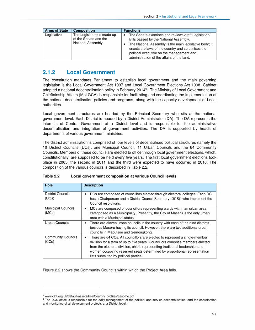
Section 2 • Institutional and Legal Framework
2-2
Arms of State Composition Functions
Legislative The Legislature is made up of the Senate and the National Assembly.
• The Senate examines and reviews draft Legislation/
Bills passed by the National Assembly.
• The National Assembly is the main legislative body; it
enacts the laws of the country and scrutinises the
political executive on the management and
administration of the affairs of the land.
2.1.2 Local Government
The constitution mandates Parliament to establish local government and the main governing
legislation is the Local Government Act 1997 and Local Government Elections Act 1998. Cabinet
adopted a national decentralisation policy in February 20143. The Ministry of Local Government and
Chieftainship Affairs (MoLGCA) is responsible for facilitating and coordinating the implementation of
the national decentralisation policies and programs, along with the capacity development of Local
authorities.
Local government structures are headed by the Principal Secretary who sits at the national
government level. Each District is headed by a District Administrator (DA). The DA represents the
interests of Central Government at a District level and is responsible for the administrative
decentralisation and integration of government activities. The DA is supported by heads of
departments of various government ministries.
The district administration is comprised of four levels of decentralised political structures namely the
10 District Councils (DCs), one Municipal Council, 11 Urban Councils and the 64 Community
Councils. Members of these councils are elected to office through local government elections, which,
constitutionally, are supposed to be held every five years. The first local government elections took
place in 2005, the second in 2011 and the third were expected to have occurred in 2016. The
composition of the various councils is described in Table 2.2.
Table 2.2 Local government composition at various Council levels
Role Description
District Councils
(DCs) • DCs are comprised of councillors elected through electoral colleges. Each DC
has a Chairperson and a District Council Secretary (DCS)4 who implement the
Council resolutions.
Municipal Councils
(MCs) • MCs are composed of councillors representing wards within an urban area
categorised as a Municipality. Presently, the City of Maseru is the only urban
area with a Municipal status.
Urban Councils • There are eleven urban councils in the country with each of the nine districts
besides Maseru having its council. However, there are two additional urban
councils in Maputsoe and Semongkong.
Community Councils
(CCs)
• There are 64 CCs. All councillors are elected to represent a single-member
division for a term of up to five years. Councillors comprise members elected
from the electoral division, chiefs representing traditional leadership, and
women occupying reserved seats determined by proportional representation
lists submitted by political parties.
Figure 2.2 shows the Community Councils within which the Project Area falls.
3 www.clgf.org.uk/default/assets/File/Country_profiles/Lesotho.pdf 4 The DCS office is responsible for the daily management of the political and service decentralisation, and the coordination and monitoring of all development projects at a District level.
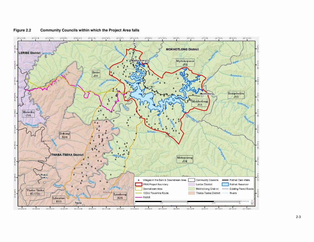
2-3
Figure 2.2 Community Councils within which the Project Area falls

Section 2 • Institutional and Legal Framework
2-4
The Local Authorities’ responsibilities include:
• Control of natural resources and environmental protection;
• Agricultural services;
• Land allocation;
• Preservation, improvement and control of designated forests;
• Village water supply;
• Public health;
• Education;
• Minor roads;
• Streets and public places;
• Burial grounds;
• Markets and the promotion of economic development;
• Parks, recreation and culture; and
• Fire prevention.
2.1.3 Traditional Governance
Traditional leadership in the country is through chieftainship which is hereditary. This leadership is
hierarchical consisting of the King, Principal Chiefs (PC), Area Chiefs (AC) and Village Chiefs (or
headmen). Each one of these Chiefs levels is represented in the DCs and CCs. The Principal Chiefs
are responsible for overseeing all issues of traditional governance in their respective areas; in turn,
the Area Chiefs take orders and advice from the Principal Chiefs. Area Chiefs tend to administer a
smaller administrative area compared to that of the PCs. Lastly, the Village Chiefs or headmen
function as assistants to the Area Chiefs and manage the daily administration of their villages and
report to the Area Chiefs. Over and above the customary functions that chiefs play are the civil
responsibilities which include the issuing of certificates i.e. birth and death papers; writing letters for
bank account and passport applications; maintaining law and order and adjudicating local disputes.
The Principal Chiefs in the Project Area are those of Mokhotlong and Malingoaneng. The locations of
Area Chiefs in the Project Area are provided in Table 2.3 according to their respective Principal
Chiefs.
Table 2.3 Principal and Area Chief Locations in the Project Area
Principal Chief of Mokhotlong Principal Chief of Malingoaneng
Salang
Ntlholohetsane
Thabang
Ha Mojakisane
Ha Rafolatsane
Libibing
Tsoenene
Matlakeng
Malubalube/Likhameng
Nkokamele
Ha Moeketsane
Lilatoleng
Linakeng
Motsitseng
Ha Makhabane
Kholokoe
Bafali
Ha Lebopo
Tloha-re-Bue
Mapholaneng
Ha 'Meta
Tlokoeng
Mofolaneng
Makhomalong
Maitisi (Ha Letjama)
Mahemeng
Ha Polihali
Ha 'Mei
Makhoarane Khotsang
Taung
Hlokoa-le-mafi
Maqalikeng
Mokhalong/Ha Lephakha
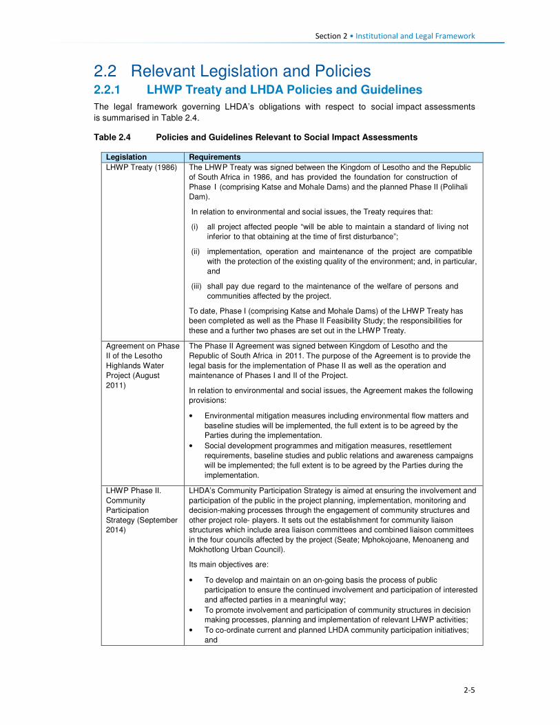
Section 2 • Institutional and Legal Framework
2-5
2.2 Relevant Legislation and Policies 2.2.1 LHWP Treaty and LHDA Policies and Guidelines
The legal framework governing LHDA’s obligations with respect to social impact assessments
is summarised in Table 2.4.
Table 2.4 Policies and Guidelines Relevant to Social Impact Assessments
Legislation Requirements
LHWP Treaty (1986) The LHWP Treaty was signed between the Kingdom of Lesotho and the Republic
of South Africa in 1986, and has provided the foundation for construction of
Phase I (comprising Katse and Mohale Dams) and the planned Phase II (Polihali
Dam).
In relation to environmental and social issues, the Treaty requires that:
(i) all project affected people “will be able to maintain a standard of living not
inferior to that obtaining at the time of first disturbance”;
(ii) implementation, operation and maintenance of the project are compatible
with the protection of the existing quality of the environment; and, in particular,
and
(iii) shall pay due regard to the maintenance of the welfare of persons and
communities affected by the project.
To date, Phase I (comprising Katse and Mohale Dams) of the LHWP Treaty has
been completed as well as the Phase II Feasibility Study; the responsibilities for
these and a further two phases are set out in the LHWP Treaty.
Agreement on Phase
II of the Lesotho
Highlands Water
Project (August
2011)
The Phase II Agreement was signed between Kingdom of Lesotho and the
Republic of South Africa in 2011. The purpose of the Agreement is to provide the
legal basis for the implementation of Phase II as well as the operation and
maintenance of Phases I and II of the Project.
In relation to environmental and social issues, the Agreement makes the following
provisions:
• Environmental mitigation measures including environmental flow matters and
baseline studies will be implemented, the full extent is to be agreed by the
Parties during the implementation.
• Social development programmes and mitigation measures, resettlement
requirements, baseline studies and public relations and awareness campaigns
will be implemented; the full extent is to be agreed by the Parties during the
implementation.
LHWP Phase II.
Community
Participation
Strategy (September
2014)
LHDA’s Community Participation Strategy is aimed at ensuring the involvement and
participation of the public in the project planning, implementation, monitoring and
decision-making processes through the engagement of community structures and
other project role- players. It sets out the establishment for community liaison
structures which include area liaison committees and combined liaison committees
in the four councils affected by the project (Seate; Mphokojoane, Menoaneng and
Mokhotlong Urban Council).
Its main objectives are:
• To develop and maintain on an on-going basis the process of public
participation to ensure the continued involvement and participation of interested
and affected parties in a meaningful way;
• To promote involvement and participation of community structures in decision
making processes, planning and implementation of relevant LHWP activities;
• To co-ordinate current and planned LHDA community participation initiatives;
and
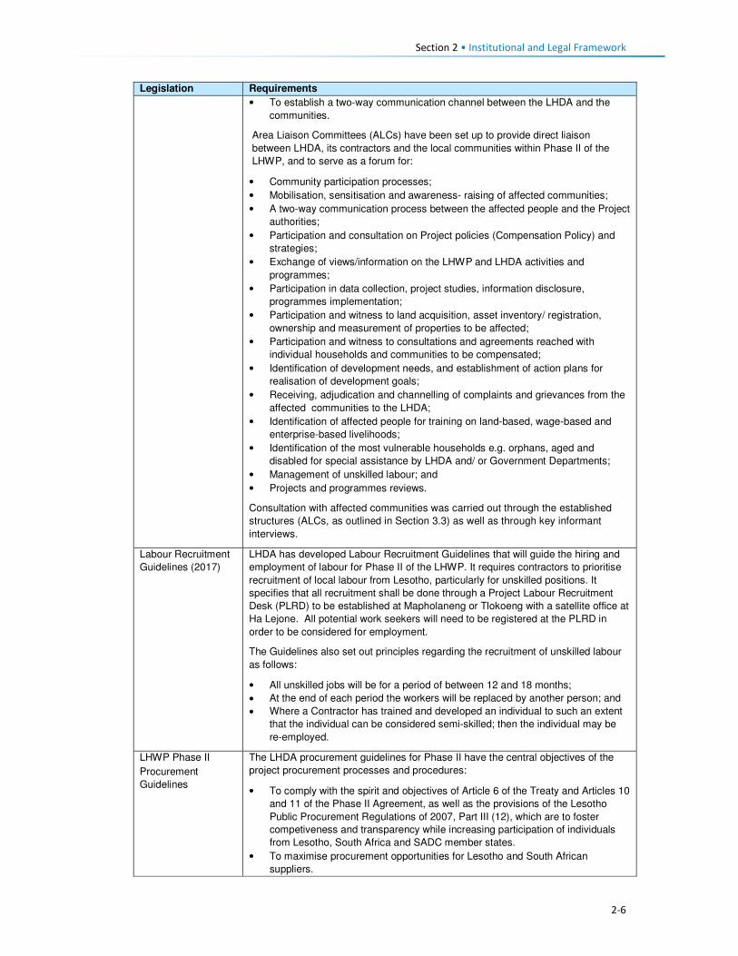
Section 2 • Institutional and Legal Framework
2-6
Legislation Requirements
• To establish a two-way communication channel between the LHDA and the
communities.
Area Liaison Committees (ALCs) have been set up to provide direct liaison
between LHDA, its contractors and the local communities within Phase II of the
LHWP, and to serve as a forum for:
• Community participation processes;
• Mobilisation, sensitisation and awareness- raising of affected communities;
• A two-way communication process between the affected people and the Project
authorities;
• Participation and consultation on Project policies (Compensation Policy) and
strategies;
• Exchange of views/information on the LHWP and LHDA activities and
programmes;
• Participation in data collection, project studies, information disclosure,
programmes implementation;
• Participation and witness to land acquisition, asset inventory/ registration,
ownership and measurement of properties to be affected;
• Participation and witness to consultations and agreements reached with
individual households and communities to be compensated;
• Identification of development needs, and establishment of action plans for
realisation of development goals;
• Receiving, adjudication and channelling of complaints and grievances from the
affected communities to the LHDA;
• Identification of affected people for training on land-based, wage-based and
enterprise-based livelihoods;
• Identification of the most vulnerable households e.g. orphans, aged and
disabled for special assistance by LHDA and/ or Government Departments;
• Management of unskilled labour; and
• Projects and programmes reviews.
Consultation with affected communities was carried out through the established
structures (ALCs, as outlined in Section 3.3) as well as through key informant
interviews.
Labour Recruitment
Guidelines (2017)
LHDA has developed Labour Recruitment Guidelines that will guide the hiring and
employment of labour for Phase II of the LHWP. It requires contractors to prioritise
recruitment of local labour from Lesotho, particularly for unskilled positions. It
specifies that all recruitment shall be done through a Project Labour Recruitment
Desk (PLRD) to be established at Mapholaneng or Tlokoeng with a satellite office at
Ha Lejone. All potential work seekers will need to be registered at the PLRD in
order to be considered for employment.
The Guidelines also set out principles regarding the recruitment of unskilled labour
as follows:
• All unskilled jobs will be for a period of between 12 and 18 months;
• At the end of each period the workers will be replaced by another person; and
• Where a Contractor has trained and developed an individual to such an extent
that the individual can be considered semi-skilled; then the individual may be
re-employed.
LHWP Phase II
Procurement
Guidelines
The LHDA procurement guidelines for Phase II have the central objectives of the
project procurement processes and procedures:
• To comply with the spirit and objectives of Article 6 of the Treaty and Articles 10
and 11 of the Phase II Agreement, as well as the provisions of the Lesotho
Public Procurement Regulations of 2007, Part III (12), which are to foster
competiveness and transparency while increasing participation of individuals
from Lesotho, South Africa and SADC member states.
• To maximise procurement opportunities for Lesotho and South African
suppliers.

Section 2 • Institutional and Legal Framework
2-7
Legislation Requirements
• To minimise the utilisation of imported goods, skills and labour, where
applicable, within the ambit of the laws governing Lesotho.
• To maximise skills and technology transfer through the training of individuals
and enterprise development opportunities for Lesotho-based companies and
black owned companies in the Republic of South Africa
LHWP Phase II
Contractor
Procurement
Framework (Draft
August, 2016)
The Contractor Procurement Framework provides an overview of the specific
requirements and approaches for the procurement of construction contracts for
Phase II of the LHWP. The Framework gives a basis to ensure that each contract is
procured in a manner compatible with the legal framework and the LHWP
procurement policy. The consultant responsible for each construction contract will
develop appropriate procedures to implement the Framework.
LHWP Phase II
Safety Health
Environment and
Quality Management
(SHEQ)
Management
Framework (April,
2017)
The Occupational Health and Safety of all employees is addressed by the SHEQ
Framework. The Framework provisions are applicable to all Consultants and
Contractors delivering work for, or on behalf of, the LHDA or its entities.
The aim of the Framework, is to:
• Assist Consultants or Contractors to adequately provide for implementing
sound SHEQ practices on site; and
• Inform Consultants and Contractors in advance of the SHEQ directive and
requirements that will be enforced during the project.
LHDA Phase II
Compensation Policy
(August, 2016)
The Policy applies to all losses of assets and income, and impacts on livelihoods
suffered by people, households, communities and institutions as a result of the
implementation of Phase II of the LHWP. According to the Policy all persons affected
by Phase II will be entitled to equitable treatment as embodied in the Policy. The Policy
objectives are:
• To minimise involuntary land take by investigating all possible Project design
alternatives;
• To ensure that affected people and communities, including host communities
are meaningfully consulted on Project designs, alternatives and impacts;
• To promote affected people’s participation in the planning, implementation and
monitoring of compensation, resettlement, mitigation and development
measures;
• To ensure that relocation of households and businesses is undertaken in a
participative, systematic and beneficial manner, involving both displaced and
host communities;
• To ensure that affected people are promptly, fairly and fully compensated for
their losses; and
• To ensure that direct compensation is accompanied by additional measures
where necessary to help restore livelihoods; and
• To ensure that existing cultural and religious practices are respected, and to
preserved to the maximum extent practical.
Compensation rates
The Policy states that compensation rates for Phase II have been declared under
the Compensation Regulations. The rates are adjusted annually for price escalation
using the Lesotho Consumer Price Index (CPI). Compensation for primary
residential dwellings and formal business structures will be based on the principle of
replacement cost. Consultations will occur with affected communities, their local
authorities and district stakeholders to explain the rates and the basis for their
calculations.
Where urban land and property are acquired, valuation will be carried out according
to the provisions of the Land Act of 2010 and the associated Regulations. All
valuations will be certified by LAA.
In the case of the provision of replacement agricultural land (land-for-land option),
the following principles will apply to the new land:

Section 2 • Institutional and Legal Framework
2-8
Legislation Requirements
• It will be identified and confirmed with the participation of the affected
households and should as far as possible be located in reasonable proximity to
where the displaced persons reside;
• It should be provided free of “transaction costs” such as registration fees,
transfer taxes or customary tributes.
Eligibility for compensation
The unit of entitlement for compensation against the loss of private property and
assets will be the owner or household, including orphaned minors who are entitled
to their parents’ estate. LHDA will ensure compliance with the regulations of the
Land Act of 2010 and the Legal Capacity of Married Persons Act of 2006.
Compensation for loss of communal resources
Communal resources include grazing land, brushwood, medicinal plants, useful
grasses and wild vegetables.
LHDA will calculate the total compensation amount payable for the communal
resources it is to acquire, based on the area of land lost and the number of affected
households.
Management rights to communal assets that will be acquired by the Project are held
by Community Councils. Compensation for the loss of communal assets will be
used for investment in approved community development ventures. The funds will
be managed by LHDA for the implementation of development projects that have
been agreed and prioritised by the affected communities and their local authorities.
Where some physically displaced households move outside their local community/
village to other host communities/ villages, the funds will be apportioned between
the concerned community/ villages based on the number of households relocating
to the host communities/ villages.
Downstream Impacts
Impacts on communities downstream of the Polihali Reservoir up to the confluence
of the Senqu and ‘Malibamatso Rivers caused by reduced river flows will be
mitigated through measures developed as part of the Project’s Phase II
environmental flow requirement (EFR) programme.
Disturbance allowance
A disturbance allowance will be paid to households, including households
enumerated on public land at the time of the Project’s socio-economic census
whose primary residential structure or structures are required to be relocated.
The allowance will be paid over three years from the date of disturbances. For
households electing to relocate to a destination of their own choice the allowance
will be paid in the form of a lump sum payment.
A lump sum disturbance allowance will be paid to small scale/informal traders
whose business structures are required to be relocated from their residential or
public land.
Owners of formal commercial enterprises will receive a disturbance allowance, the
value of which will be determined as part of the valuation exercise.
Evacuation Assistance
LHDA will provide transport to physically displaced households and businesses for
the removal of their assets, belongings and livestock to Project-designated and
approved relocation sites. Households electing to relocate to a destination of their
own choice will be paid a lump sum evacuation amount based on the relocation
destinations detailed in the compensation rates.
Asset Registration
Procedures for
LHWP Phase II
(October, 2017)
Asset registration and finalisation of compensation offers will be undertaken in three
steps i.e. asset registration, compensation options and compensation offer.
Asset Registration will entail:

Section 2 • Institutional and Legal Framework
2-9
Legislation Requirements
• Identification of affected assets and owners in the footprint of the project through
analysis of aerial imagery, field investigations and consultation with local authorities
and community structures;
• A cadastral survey of all affected land parcels as well as fixed assets (geo-
referenced and mapped) and Asset Inventory Forms signed by the affected
owner;
• Assets and beneficiary registration and preparation of Asset Verification Forms
(including GIS mapping and photographic evidence as well as communication
of the cut-off date); and
• Uploading of the asset and beneficiary data to FlowCentric, for in-system
checking and approval.
Compensation Options will involve :
• The creation of a compensation’s option form.
• Presentation and explanation of the options individually to beneficiaries
/households, who will be allowed at least one week to consider their preferences.
• Once options are confirmed, the Form will be signed by the parties for preparation
of Compensation Offers.
Compensation Offers – based on the selected compensation options:
• A Compensation Offer will be presented to the beneficiary/household. After a one
week “cooling-off” period, the Offer will be signed and executed.
• A copy of the Offer will be submitted to the LHWC for record purposes and
contingency transfer request.
LHWP Phase II
Livelihood
Restoration and
Social Development
Framework
(LR&SD) (August
2017)
The Livelihood Restoration and Social Development (LR&SD) Framework supplements
the Phase II Compensation Policy, and serves to provide a context for the
conceptualisation, planning and implementation of livelihood restoration measures and
social development initiatives on Phase II.
The focus areas of the LR&SD Framework are as follows:
• Livelihood restoration measures for households and communities directly
affected (physical and economic displacement) by implementation of Phase II.
These initiatives will be planned and implemented with the full participation of
affected households and communities and other stakeholders for effective
sustainability.
• Initiatives to support broad-based social and economic development in the
Phase II areas. These could include water and sanitation initiatives, public
health initiatives (to be implemented under the Phase II Public Health Action
Plan), and other initiatives to be finalised in conjunction with the Phase II
communities, government and other development partners.
Memorandum of
Understanding
(MoU) between
LHDA and Basotho
Enterprises
Development
Corporation
(BEDCO) (January
2015)
The objective of the MoU is to establish a platform for cooperation for the provision of
business development and advisory services within all the LHWP areas as part of the
initiatives for livelihoods improvement for the communities and individuals affected by
the implementation of Phases I and II of the LHWP. It entails:
• Coordinating efforts in developing and building skills capacity of affected
individuals and communities in Phases I and II of the LHWP in order to enable
the communities to optimise the potential benefits brought about by the
development activities of the LHWP;
• Developing design and conduct customised entrepreneurial and artisan skills
training programmes for communities in LHWP areas;
• Promoting Micro, Small & Medium Enterprises (MSMEs) and other livelihood
improvement activities among affected communities and individuals within
LHWP areas;
• Providing a pool of expert services for identification of business ideas,
development of project proposals, project appraisal and mentoring services for
business start-ups;
• Facilitating access to micro-finance for MSMEs

Section 2 • Institutional and Legal Framework
2-10
Legislation Requirements
• Sharing information knowledge and expertise in the area of small business
development, skills training and advisory services for communities and
individuals within the LHWP areas.
2.2.2 Lesotho Legislation Relevant to Social Impact Assessments
Legislation and policies of specific relevance to social impact assessments is summarised below.
Table 2.5 Legislation and Policies Relevant to Social Assessments
Legislation Requirement
Constitution of
Lesotho (Act No. 5 of
1993), as amended in
2001
Protection of the natural environment is enshrined in Section 36 which states
‘Lesotho shall adopt policies designed to protect and enhance the natural and
cultural environment of Lesotho for the benefit of both present and future
generations and shall endeavour to assure to all its citizens a sound and safe
environment adequate for their health and well- being’.
National
Environmental Policy,
1998
The overall goal of the Lesotho National Environmental Policy (NEP) is to
achieve sustainable livelihoods and development for Lesotho. The objectives of
the policy include:
• To secure for all Basotho a high quality of environment to enhance
health and well- being;
• To use and conserve the environment and natural resources for the benefit
of present and future generations, taking into account the rate of population
growth and productivity of available resources;
• To conserve Basotho cultural heritage and utilise it for the benefit of present
and future generations;
• To halt environmental degradation, and to restore, maintain and enhance
the ecosystems and ecological processes essential for the functioning of
the biosphere and to preserve biological diversity;
• To implement the principle of optimal sustainable yield in the use of natural
resources and ecosystems; and
• To ensure that the true and total costs of environmental use and abuse are
borne by the user, i.e., the “polluter pays” principle.
Environmental Act No.
10 of 2008
The Environment Act, 2008 provides a framework environmental law for the
implementation of the National Environmental Policy. It sets out the principles
of environmental management in Part II, section 3(2) of the Act.
The purpose of the Act is to protect and ensure proper management of the
environment, conservation and sustainable utilisation of natural resources of
Lesotho. The Act defines the broad activities and general principles of
environmental management in Lesotho. Section 4 of the Environment Act
provides for a right to a clean and healthy environment and imposes a corrective
duty to protect, maintain and enhance the environment and defines a citizen’s
right to take legal action against acts or omissions that damage the
environment. The Act provides for Environmental Impact Assessment (EIA),
audits and monitoring of projects.
National
Environmental Impact
Assessment
Guidelines (2009)
The EIA Guidelines set out the steps to be taken in carrying out the EIA
process. They are aimed at facilitating participation in and compliance with
Lesotho's EIA requirements by the developers. They are also aimed at
"integrating environmental concerns and economic development from the
earliest stages of the project development”. According to the Guidelines, the
objectives of an EIA in Lesotho are to:
• Integrate environmental considerations into development planning,
thereby promoting sustainable livelihoods;

Section 2 • Institutional and Legal Framework
2-11
Legislation Requirement
• Ensure that the environmental and socio-economic costs and benefits
of economic development projects are properly accounted for;
• Ensure that unwarranted negative impacts are avoided or mitigated at
an early stage in the planning process;
• Ensure that potential benefits are identified and enhanced;
• Carry out environmental and socio-economic studies of projects in
parallel with analysis of engineering and economic feasibility;
• Ensure that decision-makers are provided with information on
environmental costs and benefits to complement information on its
technical and economic feasibility at key decision points in the
development of a project;
• Ensure that all the affected and interested groups (local communities,
government authorities, developers, Non-government organisations
(NGOs), Community-based Organisations (CBOs), etc.) Participate in the
process;
• Set up a system to carry out mitigation, monitoring, auditing, and
enforcement.
National Strategic
Development Plan
2012/13 – 2017/18
The main goals of the National Strategic Development Plan are to:
• Pursue high, shared and employment creating economic growth;
• Develop key infrastructure;
• Enhance the skills base, technology adoption and foundation for
innovation;
• Improve health, combat HIV and AIDS and reduce social vulnerability;
• Reverse environmental degradation and adapt to climate change; and
• Promote peace, democratic governance and build effective institutions.
The NSDP Strategic Framework aims to build productive capacities and
create benefits of sustained broad-based growth in the form of jobs,
improved health, skills and capabilities and poverty reduction. The
Framework focusses on issues of development in the areas of investment;
financial sector development; trade; micro, small and medium enterprises
(MSMEs); agriculture and rural economy; manufacturing; tourism; mining;
infrastructure; skills and innovation; health and HIV and AIDS; social
protection; environment and climate change; and governance and
institutions.
Sustainable
Development Goals
(SDGs) 2016
The 2030 Agenda for Sustainable Development was adopted by all UN Member
States of which Lesotho is party to. The 2030 Agenda comprises a set of 17
Sustainable Development Goals (SDGs) to end poverty, fight inequality and
injustice, and tackle climate change by 2030.
District Economic
Strategies (DESs)
The District Economic Strategies (DESs) are structured along a bottom up
approach to the NSDP. They have been developed based on the employment
and economic development advantages for each District and its specific areas
towards achieving developments. The DES relies on four NSDP priority areas
which include economic growth generating activities, namely; manufacturing,
commercial agriculture, mining and tourism.
Lesotho Land Act No.
8 of 2010
The Land Act of 2010 is the principal legislation governing land ownership and
occupation, and the acquisition of property for public and development purposes.
Section 10(1) of the Act grants joint title to property to both spouses married in
community of property (under civil, customary or any other law, irrespective of the
date on which the marriage was entered into), and equal powers in land transactions.
Declaration of Land
Set Aside for Public
Purposes (Allocated
Land) Notice, 2012
(Legal Notice No. 71
of 2012)
The Legal Notice sets aside every right or interest in and to the allocated land (fields)
described as agricultural land delineated on Plan No 47283 held in the office of Chief
Surveyor, Maseru in extent 6492 hectares more or less situated at Polihali,
Mokhotlong District for public purposes. The Notice stipulates that the land is
required for the construction of Polihali Dam.

Section 2 • Institutional and Legal Framework
2-12
Legislation Requirement
Date of Surrender: On the date of publication of this notice in the gazette all interest
in or affecting the said land shall cease to subsist and the allottees interest in the
land shall revert to the State.
Compensation: The compensation is estimated at M300 million or more and shall be
apportioned to the claims accordingly.
Legal Capacity of
Married Persons Act
No. 9 of 2006
The Act grants equal powers on both spouses married in community of property,
giving them equal capacity to dispose of the assets of the joint estate, contract
debts for which the joint estate is liable, and administer the joint estate.
Lesotho National
Social Protection
Strategy (NSPS)
2014/15 – 2018/19
The NSPS implements the National Policy on Social Development (NPSD), in the
medium term. The policy provides a broad framework for development and
implementation of a harmonised and coordinated social protection agenda of
Government to ensure that different programmes implemented by different
Government and non‐Government agencies are complementary to each other
for sustainable development of the vulnerable.
The strategy addresses the risks and challenges across the life‐course. It
recognises that all citizens are exposed to different vulnerabilities through the
course of their lives, and responds to these vulnerabilities. The strategy is
structured around four key life‐course stages i.e. pregnancy and early childhood;
school age and youth; working age; and old age. It also includes the two
dimensions of shocks and of disability/chronic illness that may impact at any
stage of the life‐course.
The overall objective of the NSPS is to provide support to those that are unable
to construct a viable livelihood; to protect the assets and improve the resilience
of poor and vulnerable households; and to increase the productive capacity and
asset base of those households.
Lesotho Gender and
Development Policy
The Gender and Development Policy is a government tool geared towards
addressing the challenges of gender inequities and inequalities, poverty,
increased spread of HIV/ AIDS, retrenchment and unemployment by adopting a
rights-based approach to development. The policy is based on the realisation of
human rights of all, women and men alike, holding principles of equal
participation in development, non-discrimination and the empowerment of the
marginalised women and men, boys and girls.
Local Government Act
1997 as Amended by
Local Government
(Amendment) Act
2004
Schedule 2 of the Local Government Act, 1997 states that CCs’ functions include
control of natural resources, e.g. sands, stones and environmental protection,
e.g. control of natural resources, land/site allocation and physical planning,
agriculture and forestry, dongas, pollution, grazing control and water resources.
The Labour Code
Order (Amendment) of
2006
The Order provides that the employer shall not discriminate against a job
application on the basis of his or her HIV and AIDS status (refer to Section 235E
(1) of the Labour Code (Amendment) Order, 2006).
Part VII if the Labour Code Order relating to Health Safety and Welfare at work is
of particular relevance to this project. It deals with aspects such as fire prevention
and firefighting, the wearing of Protective Personal Equipment (PPE) and
clothing, removal of dust or fumes, etc.
Workmen’s
Compensation Act 13
of 1977 (amended by
LN 105 of 1995)
The Act directs employers on how to deal with compensation issues in the event
that an employee becomes injured or disabled in the line of duty, or in the event
that an employee dies while in the employ of the employer.
Public Health Order
12 of 1970
Stipulates that any exhumation of a body or other human remains from a
cemetery or other burial site requires a permit and that such permit shall be
obtained from the Department of Health by the legal representative or next of kin
or other duly authorised agent. The permit may prescribe conditions and
precautions under which such exhumation shall be conducted.
Section 75 makes provision for the Minister of Health to permit essential
exhumation of burial sites for any public, mining or infrastructure purpose.

Section 2 • Institutional and Legal Framework
2-13
Legislation Requirement
Removal of burial sites from an authorised cemetery requires a six-month
notification period of the intention to relocate graves.
2.3 International Standards The ESIA was required primarily to meet the requirements of the Lesotho Environment Act 10 of
2008, the national Environmental Impact Assessment (EIA) Guidelines (2009) and other relevant
national legislation, but was also seeks to address the requirements of the International Safeguards.
In this regard, the requirements of the World Bank and International Finance Corporation (IFC) in
respect of SIA requirements are described below. The World Bank is in the process of aligning their
Environmental and Social Safeguards (ESS) with the Performance Standards (PS) of the IFC and
there is no material difference between them.
2.3.1 World Bank ESS and IFC PS
Provisions of relevant ESS and PS safeguards are summarised in Table 2.6.
Table 2.6 Summary of Relevant World Bank and IFC Safeguards
Performance Standard (PS) Impact Assessment Requirements
ESS1 / PS1:
Assessment and Management
of Social and Environmental
Risks and Impacts
Underscores the importance of managing environmental and social
performance throughout the life of a project. It requires the client to
conduct a process of environmental and social assessment and to
establish and maintain an Environmental and Social Management System
(ESMS), appropriate to the nature and scale of the project and
commensurate with the level of its environmental and social risks and
impacts. It aims to:
• Identify and evaluate environmental and social risks and impacts of the
project;
• Adopt a mitigation hierarchy to anticipate and avoid, or where
avoidance is not possible, minimise, and, where residual impacts
remain, compensate/offset for risks and impacts to workers, affected
communities, and the environment;
• Promote improved environmental and social performance of clients
through the effective use of management systems;
• Ensure that grievances from affected communities and external
communications from other stakeholders are responded to and
managed appropriately;
• Promote and provide means for adequate engagement with affected
communities throughout the project cycle on issues that could
potentially affect them; and
• Ensure that relevant environmental and social information is disclosed
and disseminated.
ESS2 / PS2:
Labour and Working
Conditions
This standard recognises that the pursuit of economic growth through
employment creation and income generation should be accompanied by
protection of the fundamental rights of workers. PS2 aims to:
• Promote fair treatment, non-discrimination and equal opportunity of
workers;
• Establish, maintain and improve the worker-management relationship;
• Promote compliance with national employment and labour laws;
• Protect workers, including vulnerable categories of workers such as
children, migrant workers, workers engaged by third parties and
workers in the client’s supply chain; and
• Promote safe and healthy working conditions and the health of
workers; and avoid the use of forced labour.
ESS 3 / PS3: This standard recognises that increased economic activity and
urbanisation often generate increased levels of pollution to air, water, and

Section 2 • Institutional and Legal Framework
2-14
Performance Standard (PS) Impact Assessment Requirements
Resource Efficiency and
Pollution Prevention
land, and consume finite resources in a manner that may threaten people
and the environment at the local, regional, and global levels. Thus, PS3
aims to:
• Avoid or minimise pollution from project activities;
• Promote more sustainable use of resources (including energy and
water); and
• Reduce project-related Greenhouse Gas (GHG) emissions.
ESS 4 / PS4:
Community Health, Safety and
Security
This standard recognises that project activities, equipment, and
infrastructure can increase community exposure to risks and impacts. PS4
aims to:
• Anticipate and avoid adverse impacts on the health and safety of
affected communities during the project life from both routine and non-
routine circumstances; and
• Ensure that the safeguarding of personnel and property is carried out
in accordance with relevant human rights principles and in a manner
that avoids or minimises risks to the affected communities.
ESS 5 / PS5:
Land Acquisition, Restrictions
on Land Use and Involuntary
Resettlement
Note PS5 does not include
“Restrictions on Land Use” in
the title of PS5.
This standard recognises that project-related land acquisition and
restrictions on land use can have adverse impacts on communities and
persons that use this land. PS5 thus aims to:
• Avoid, and when avoidance is not possible, minimise displacement by
exploring alternative project designs;
• Avoid forced eviction;
• Anticipate and avoid, or where avoidance is not possible, minimise
adverse social and economic impacts from land acquisition or
restrictions on land use by (i) providing compensation for loss of
assets at replacement cost and (ii) ensuring that resettlement activities
are implemented with appropriate disclosure of information,
consultation and the informed participation of those affected; and
• Improve, or restore, the livelihoods and standards of living of displaced
persons.
ESS 6 / PS6:
Biodiversity Conservation and
Sustainable Management of
Living Natural Resources
This standard recognises that protecting and conserving biodiversity,
maintaining ecosystem services, and sustainably managing living natural
resources are fundamental to sustainable development. PS6 aims to:
• Protect and conserve biodiversity;
• Maintain the benefits from ecosystem services; and
• Promote the sustainable management of living natural resources
through the adoption of practices that integrate conservation needs
and development priorities.
ESS 8 / PS8:
Cultural Heritage
Recognises the importance of cultural heritage for current and future
generations. As such, PS8 aims to:
• Protect cultural heritage from the adverse impacts of project activities
and support its preservation; and
• Promote the equitable sharing of benefits from the use of cultural
heritage resources.
ESS 10:
Stakeholder Engagement and
Information Disclosure
Note: The IFC do not have an
equivalent performance
standard.
Recognises the importance of open and transparent engagement between
the Borrower (developer) and project stakeholders as an essential
element of good international practice. Effective stakeholder engagement
can improve the environmental and social sustainability of projects,
enhance project acceptance, and make a significant contribution to
successful project design and implementation.
2.3.2 Voluntary Principles on Security and Human Rights
The voluntary principles on security and human rights (www.voluntaryprinciples.org) provide a
framework to guide companies in maintaining the safety and security of their operations that ensures
respect for human rights and fundamental freedoms.
Section 2 • Institutional and Legal Framework
2-15
The principles cover the following aspects:
• The identification of security risks;
• The deployment and conduct of security personnel;
• Consultation between company, government, civil society and public security; and
• Responses to human rights abuses.
While Lesotho is not a signatory to these Principles, key human rights organisations are signatories
and IFC PS4 makes reference to the need to operate in accordance with relevant human rights
principles and in a manner that avoids or minimises risks to affected communities.
2.3.3 International Labour Organisation Fundamental Conventions
The International Labour Organisation (ILO) has identified eight conventions as "fundamental",
covering subjects that are considered as fundamental principles and rights at work. Lesotho has
ratified all of the ILO Fundamental Conventions, namely:
1. Freedom of Association and Protection of the Right to Organise Convention, 1948 (No. 87);
2. Right to Organise and Collective Bargaining Convention, 1949 (No. 98);
3. Forced Labour Convention, 1930 (No. 29);
4. Abolition of Forced Labour Convention, 1957 (No. 105);
5. Minimum Age Convention, 1973 (No. 138);
6. Worst Forms of Child Labour Convention, 1999 (No. 182);
7. Equal Remuneration Convention, 1951 (No. 100); and
8. Discrimination (Employment and Occupation) Convention, 1958 (No. 111).

3-1
Section 3 Approach and Methods
3.1 Introduction This section provides a description of the process and methods used to gather primary socio-
economic information within the Social Areas of Influence (Refer to Section 3.2.3).
3.2 Approach A four step approach to the data collection and analysis process was adopted and comprised the
following:
• Literature review,
• Site reconnaissance visit,
• Determining the Social Area of Influence; and
• Planning for data collection.
Each of all the four steps is described in more detail below.
3.2.1 Literature review
The objectives of the literature review process were to:
• Review all existing social specialist reports that had been commissioned by the LHDA between
2013 and 2016.
• Identify gaps in the available information that would require further secondary or primary research
to address.
• Identify a preliminary Social Area of Influence for the proposed Project.
• Identify further secondary sources of information that can be used during the compilation of the
report.
Box 3.1 List of Relevant Data Consulted for this Study
The review of the three baseline studies referenced above helped provide a broad understanding and
depth of the socio-economic status of the communities in the Project Area. In particular, the PHBS
(NHA, 2016) helps provide an overview of the health systems and nutrition status of the communities
• Socio-Economic Baseline Study (SEBS) (EOH Coastal & Environmental Services (CES) (2015b) (LHDA
Contract 6000) – the study was undertaken between 2013 and 2014 and finalised in March, 2015.
• Public Health Baseline Study (NHA, 2016) (LHDA Contract 6008) - the report was undertaken in three
stages between February 2014 and July 2015 and Draft Version 4 of the report is dated 28th January
2016.
• Baseline Income and Expenditure Report (CES, 2015a) (LHDA Contract 6000) - the specialist study
was undertaken between May 2013 and April 2014 and the report finalised in March 2015.
• Feasibility Study for Phase II – Stage 2: Main Report (Consult 4 and SEED Consult, 2009) (LHWC
Contract 001)
• Feasibility Study for Phase II – Stage 2: Social Impact Assessment Supporting Report (Consult 4 and
SEED Consult, 2008) (LHWC Contract 001)
• Panel of Experts & LHDA (2010) The ‘Lessons Learnt’ report from Phase 1A and Phase 1B Report 55
• Bureau of Statistics (Lesotho), 2013. Lesotho Demographic Survey, 2011, Vol 1, The Bureau of
Statistics, Maseru.
• Ministry of Health (Lesotho) and ICF International, 2016. Lesotho Health and Demographic Survey
2014. Maseru, Lesotho: Ministry of Health and ICF International.

Section 3 • Approach and Methods
3-2
in the Project Area. The findings of the desktop review of the three social documents are presented
in Table 3.1.
Table 3.1 Summary of the Socio-economic Gap Analysis and Action Plan
Baseline Report
Reference
Information Provided in
Available Baseline Reports
Key Limitations/ Gaps
Identified
Actions Required to Fill
Gaps
Socio-economic
Baseline Study
(SEBS) (CES,
2015b)
• Demographic profile of the
communities in the area.
• Education levels.
• Health status of
households.
• Types of land tenure and
use.
• Land ownership.
• Housing ownership and
types of housing.
• Occupation status and
types of income generation
by affected communities.
• Availability and access to
public services.
• Availability and access to
communal natural
resources.
• Some of data presented in
the SEBS are not clear or
in some instances the
tables do not present what
they are intended to
present.
• The SEBS divides the
communities into three (3)
catchments but does not
raise any unique features
about the communities.
• The information presented
in the tables is detailed for
the control area and none
for the actual reservoir
catchment and
downstream areas. By so
doing this does not allow
for one to look at the
trends/patterns for the
catchment and
downstream areas given
that the impacts vary
across these areas.
• The control area is taken
as part of the entire study
population without serving
as a “control group” in the
true sense of scientific
research.
• The data set is not
available for use for further
analysis.
• People’s opinions about
their social conditions do
not come through; only the
statistical interpretation of
the researcher comes
through.
• The data needs to be
updated using the 2016
Census if available at the
time of the study;
alternatively, the data from
the SEBS (CES, 2015b)
will be used as is.
• Updating of the SEBS
information using latest
available data sources
such as the 2014
Demographic Health
Survey, key informant
interviews with government
officials and NGOs.
• Focus group discussions
with the affected
communities to get
information on their
opinions about their socio-
economics conditions and
identify potential impacts of
the project and possible
mitigation measures.
Public Health
Baseline Survey
(PHBS) (NHA,
2016)
Focus is on:
• Household and Community
Nutrition.
• Vulnerable groups
(women, children, elderly).
• Sexual and reproductive
health and rights.
• Health services
assessment.
• There is no mention of
environmental health
related issues (water,
sanitation, waste disposal
etc.) and how they
generally influence the
health and well-being of
the community members.
• Collect the relevant
information on
environmental health for
inclusion in the integrated
social baseline report.
Baseline Income
and Expenditure • Brief socio-economic
baseline of the area.
• It does not integrate the
district level trend of
income and employment.
• To collect information from
the community level so it
can be integrated into the
report.

Section 3 • Approach and Methods
3-3
Baseline Report
Reference
Information Provided in
Available Baseline Reports
Key Limitations/ Gaps
Identified
Actions Required to Fill
Gaps
Survey (CES,
2015a)
• Income generation
activities of the
communities.
• Spending of the
communities
• To interview government
officials at a district level to
collect information on
employment, income and
spending at a district level.
The district level income
will be used to show
broader trends of these
economic aspects.
3.2.2 Site Reconnaissance Visit
A site reconnaissance visit was undertaken between 12 and 16 September 2016 by Debbie Weldon
(Project Manager), Jeanette Bloem (Social Specialist), Janet Mkhabela (Social & PP Integrator),
Thato Letsatsi (Public Participation Specialist), Stephen Gill (Senior Heritage Specialist) and Pusetso
Nyabela (Heritage Specialist). The purpose of the visit was for the Consultants to introduce
themselves to the District and traditional authorities as well as to get a preliminary understanding of
the scale of the Project Area and to conceptualise the best methods to be utilised to collect socio-
economic information. Subsequent to the visit, the Consultant revised the Social Areas of Influence
through the ground verification of the village clusters also using the ALCs furnished by the LHDA
Tlokoeng Field Office Branch (FOB) and developed data gathering tools.
3.2.3 Social Area of Influence
Based on the proposed Project activities for all phases of the Project, the social area of influence has
been determined to include both a direct, and an indirect, area of influence, each of which is described
below.
The Direct Area of Influence (AoI) comprises portions of the Seate, Menoaneng and Mphokojoane
Community Councils and the Mokhotlong Urban Council areas and the local catchment area of the
Polihali reservoir as defined by the LHDA, and downstream of the Polihali Reservoir up to the
confluence of the Senqu and ‘Malibamatso Rivers (35km stretch) and 5kms east and west of the
Senqu River (see Figure 3.1). The Direct AoI therefore includes:
• Households and communities located within the Project footprint (including the footprint of the
Polihali dam, tunnel works, site establishment and other ancillary infrastructure);
• Households located within areas that will experience changes in air or water quality, reduced
water flows, noise and vibration, visual and landscape, general disturbances, etc.;
• Areas of potential impact on livelihood resources such as agricultural or grazing land, fisheries;
• Settlements likely to experience physical and economic displacement due to the Project’s land
acquisition process; and
• Settlements that are likely to lose their cultural, social and health resources due to the proposed
Project.
The Indirect and Induced Areas of Influence comprise the remaining parts of the Mokhotlong
District not directly affected by the Project. This includes downstream parts of the Menoaneng and
Seate Community Councils and parts of the Bokong Community Council within Thaba-Tseka District
(downstream). These areas and communities fall outside of the direct footprint of the Project;
however, they may experience project benefits related to economic opportunities, increased
economic spend, or negative impacts associated with the presence of the project workforce, in-
migration, changes in water quality and flow downstream, etc.

3-4
Figure 3.1 Project Areas of Influence

Section 3 • Approach and Methods
3-5
3.2.4 Planning for Data Collection
The social data gathering process was planned to build upon the in-depth work already undertaken
where approximately 11,006 households were surveyed across the Project Area (CES, 2015b). Given
the fact that the previous social studies were undertaken roughly three years ago and the fact that
the Project Area is rural, the socio-economic information contained in these reports is deemed to be
valid. As such, a decision was made by the Consultant not to conduct additional household surveys
as part of the Social Specialist study for the ESIA; but, rather ground-truth and collect supplementary
data. The combination of existing information (from previous studies) and complementary data
collected was triangulated and collated into this updated and integrated socioeconomic report that
includes a detailed description of the demographics, livelihoods, access to public services and
infrastructure as well as dependence on, and utilisation of, natural resources.
Furthermore, it was anticipated that this approach would eliminate issues of stakeholder fatigue
associated with over-consultation, especially given that the resettlement planning specialist team was
expected to commence with the household census and asset inventory soon after the departure of
the ESIA social specialist team.
3.2.4.1 Development of Data Collection Tools
Multiple open-ended questionnaires were developed for different types of stakeholders engaged.
FGDs were planned with groups of men, women, and youths, and key informant interviews were
scheduled and held with various government and traditional authorities.
A FGD guide was developed and tailored to solicit information trends across different issues of
discussion at FGD sessions. The objective of the focus group discussions was to solicit from the
identified groups how they thought the PRAI is going to impact them and their livelihoods, be it
positively or negatively. If negatively how they thought the impacts should be mitigated and if
positively, how they think the impacts should be enhanced. The questions within the FGD guide
ranged from land tenure, livelihood strategies, which included farming and its challenges (both crop
and livestock), income generating activities and use of natural resources to earn a living, among
others. The tool also solicited information regarding infrastructure (health facilities, schools and
roads). The guide consisted of open-ended questions as a measure against the “yes” and “no”
responses from participants. Further, data validation questions were included in the guide to identify
instances where participants had negated themselves with their responses to similar questions.
The KII guide was tailored for individuals in specific roles within their communities, in government or
non-governmental space. The main purpose of KIIs was to ground truth information gathered from
the community members and that presented in the previous social studies as well as to gather
additional information to be used in updating the baseline. The interview guide consisted of open
ended questions to allow for in-depth discussions. The traditional leaders who were interviewed as
key informants were mainly to attain information relating to land tenure system and governance issues
within the Project Area. Besides the ground truthing of the FGD discussions, the government
department interviewees were also asked how they saw the PRAI impacting on their activities within
the Project Area.
3.3 Methodology 3.3.1 Sampling
Regarding sampling, the plan was to divide participants into three groups (men 36+ years; women 36
+ years and youth 18 – 35 years) with a maximum of 12 per group. The groups were to have at least
one representative from each of the villages in a cluster. However, during execution, this became
impractical due to the reasons highlighted in Section 3.2.4.

Section 3 • Approach and Methods
3-6
Key informant interviews were targeted at district heads of departments, traditional leaders, chiefs,
councillors, NGOs and Associations and other randomly selected informants, such as business
people.
3.3.2 Execution
The focus group discussions were held immediately after the completion of the community meetings
(pitsos) associated with the public participation process and participants were asked to form the three
groups as per the sampling plan. However, the participants did not adhere to this rule as they believed
that valuable information was going to be discussed in the groups. This meant that most of the FGDs
comprised of 20 or more people depending on the pitso attendance. In cases where more than 20
participants formed a group, the Consultant would sub-divide the group further to better accommodate
those present and to provide an environment more conducive to attendee participation. In Malubalube
participants refused to be divided into focus groups and demanded to be engaged as a group. In Ha
Makhabane, Linakeng and Ha Koeneo clusters the community meeting attendance was low, and a
decision was made to hold joint focus group sessions.
In Likomeng no focus group discussions were conducted as the members of this cluster had
participated in focus groups in Makhoatsing and Hlokoa-le-mafi. The villages that form these clusters
all fall under one Area Chief and when the Chief sent out messages about the meetings, people
attended the first two meetings that were held in Mohlanapeng and Hlokoa-le-mafi.
At the end of the focus group discussions, community members gathered for a feedback and a
consensus building session on issues discussed at each of the groups.
In total, 117 FGDs were held across the Project Area (Table 3.3). This represented 98% of the
intended 120. At a district level, KIIs were held with department heads, NGOs, Associations and
Chiefs/Councillors as well as business owners (Table 3.2).
Table 3.2 List of Departments, NGOs and Local leadership who participated in KIIs
District Heads of
Departments
NGOs/ Association Chiefs/councillors
• Agriculture,
• Education,
• Labour,
• Health,
• Public works,
• Social development,
• Disaster management,
• Culture
• Tourism,
• Meteorology
• Police, and
• Trade.
• Transformation Resource
Centre,
• Deutsche Gesellschaft für
Internationale
Zusammenarbeit (GIZ)
Participatory Initiative for
Social Accountability (PISA)
Lesotho (GIZ-PISA),
• Lesotho Red Cross Society,
• Touching Tiny Lives, and
• Mokhotlong Wool and
Mohair Growers
Association.
Business:
• Cashbuild
• Guest house
• Hardware and grocery store
• Ha Letjama,
• Ha Mojakisane,
• Hlokoa-le-mafi,
• Makhomalong,
• Mapholaneng, and
• Tloha-re-Bue.
At the community level, local chiefs and councillors were also interviewed to gather information
related to demographics, land tenure and management, access to and uses of natural resources.
One ad hoc meeting was held with the Mokhotlong Wool and Mohair Growers Association. A total of
27 KIIs were conducted with stakeholders.

Section 3 • Approach and Methods
3-7
The team held numerous informal conversations with various community members and made general
observations some of which are demonstrated in the pictures found throughout this report. The aim
of these ad hoc conversations and general observations was to verify some of the information that
was collected.
3.3.3 Data Management and Analysis
A tabular format was used to capture and collate the information gathered from all 117 FGDs
according to themes. Following this exercise, information from other secondary sources including the
three social baseline reports was captured for triangulation and cross referencing purposes. The data
was analysed according to recurring themes and integrated into this report.

3-8
Table 3.3 Schedule of Focus Group Discussions
Area Council Meeting Village Village Cluster Actual Villages Present during PPP/SIA sessions
Dow
nstr
eam
clu
ste
rs
Seate
Com
munity C
ouncil
Hlokoa-le-Mafi West_5 (Ha Lejone, Ha Makhabu, Liphookoaneng, Ha Cornela, Ha Nkhaulise, Hlokoa-le-Mafi)
Hloakoa le mafi, Ha Makhabu, Khamolane, Khotleng, Mafikeng, Liphokoaneng, Mohlanapeng, Thepung-Poka Lephene, Mapoteng, Nkhaolise, Thaka-Tsilo, Makhoatsing, Noha-Lia-Loana, Matseleng, Lihlabeng, Ha Liete, Molumong, Likomeng, Moeaneng
Ha Nts'asa West_6 (Ha Ntsasa, Ha Ramokobo, Mafika Lisiu, Ha Malelu, Ha Moatsoetlane, Ha Rahlena, Khamolane)
Ha Ntsasa,Ha Ramokobo, Khamolane, Lihlabeng, Sekhutlong, Tsepong
Taung West_7 (Taung/Khokooeng, Masakoaneng, Maqhaung, Makhiseng, Freistata, Liphofung, Letapeng, Manonyana)
Masokoaneng, Taung, Majakeng, Makhiseng, Ha Phatsoane, Ha Maotoana, Makhoaba, Letlapeng, Masalla, Hajeke, Ha Seotsanyane, Thepung, Marisele
Khotsang West_8 (Khotsang, Letlapeng, Nqobelle, Ha Setene, Semapong, Tena-Baphehi, Lipeleng)
Khotsang, Bahaoleng, Tena Baphehi, Makhoaba, Ha Mei, Letlapeng Nqobelle
Ha 'Mei West_8 (Ha Mei, Thuhloane, Tibising, Moeaneng, Motse-mocha) Tibising, Ha Mei, Thuhloane, Motse-Mocha
Makhoarane West_9 (Matikiring, Ha Matekase, Ha Letheha) Matikiring, Makokoaneng, Ha Letheha, Matekase, Makhoarane, Sekhutlonyaneng, Matikiki, Sekhutlong, Thuhloane,
Bo
ko
ng
Co
mm
un
ity C
ou
ncil
Mohlanapeng West_3 (Noha-lia-loana, Ha Hashepe, Tsotsoaneng, Khamolane, Porotong, Mohlanapeng, Khutlo-se-Nonne)
Noha Lia Loana, Letsatseng, Mohlanapeng, Ha Heshepe, Kholong, Likomeng-Ha Thaka-Tsilo, Mapoteng, Botsong, Mafikeng, Khotleng, Lekhalaneng, Likomeng ha Marutle, Tsutsoaneng, Mabuleng, Ha Letjama, Maitisi, Khutlo-se- Nonne, Ha Molise, Maqalikeng
Likomeng West_4 (Makoatsing, Letsatseng, Mokhoabong, Mapoteng, Khotleng, Likomeng (Ha Thakatsilo), Mafikeng, Ha Pokalephele, Lihlabeng, Ha Thoso)
People from this cluster attended sessions at Mohlanapeng & Hlokoa-le-mafi
Maqalikeng West_2 (Kholokoe, Mokhangoaneng, Thaba Sephara, Ha Kakuli, Maqalikeng, Khotolieng, Manokong)
Maqalikeng, Mokhangoaneng, Thaba-Sephara, Manokong, Ha Molise, Khotolieng
Mokhalong West_1 (Mokhalong, Mahuleng, Koting-sa-Mofao, Phaleng, Ha Lephakha, Makhapung, Ha Letebele (Ha Leruo))
Mokhalong, Mahuleng, Phaleng, Ha Lephakha
Men
oan
en
g
Co
mm
un
ity
Co
un
cil
Nkokamele East_1 (Likhameng, Liokhoane, Ha Motubehi, Mabeulung, Ha Lehloenya, Mochochononong, Nkokamele, Masakong, Ha Motseare, Makorotong, Taung 1 & Taung 2, Koma Koma)
Nkokamele, Ha Motseare, Nqobelle
Ha Moeketsane East_2 ( Ha Moeketsane, Ha Mohale, Phahameng,Ha 'Mamothopeng, Sephokong, Khorole, Tibising, Mafikeng)
Ha Moeketsane, Moreneng, Makorotong, Mafikeng, Tibising, Ha Moleko, Ha Mokoena, Ha Makaka

3-9
Area Council Meeting Village Village Cluster Actual Villages Present during PPP/SIA sessions
Lilatoleng East_3 ( Lilatoleng, Ha Sibi, Ha Ralitlhare, Ha Ntsika, Tsekong, Ha Lehloenya)
Ha Ntsika, Ha Sibi, Tsekong, Ha Ralitlhare, Ha Lehloenya, Bobatsi, Moeling, Lipeleng, Ha Lekhehle, Ha Taelo
Linakeng East_4 ( Ha Moropane, Ha Jontane, Ha Taelo, Ha Rajoalane, Kholoke, Linakeng (Ha Mphosi), Matlatseng, Sankoela (Makhahleleng)
Linakeng, Ha Mphosi, Likhahleng
Po
lih
ali C
atc
hm
en
t Seate
Co
mm
un
ity C
ou
ncil
Malingoaneng/ Khubelu
ALC S1 (Tloha-re-Bue, Malingoaneng, Masakong, Ha Tlhakola, Ha Ramonakalali, Ha Jobere, Sotoane)
Tloha-re-Bue, Masakong
Nts'upe ALC S2 (Nts'upe, Linokong) Ntsupe, Makorong, Phuthing, Terae Hoek, Mafikeng, Ha Tlontlollo,
Sebera ALC S3 (Sebera, Ha Nts'esanyane, Letsatsaneng, Likoting, Checheng)
Mateaneng, Teraeng, Sebera, Phokeng, Sekoka, Likoting, Letsaneng, Ha Ntsesanyane, Bolahla, Ha Ramoruti
Mapholaneng ALC S4 (Mapholaneng, Ha Leqabanyo) Mafika-Lisiu. Motete, Meketeng, Polomiti, Majakaneng, Ha Lechela, Ha Leqabanyo, Ha Ntsetsanyane, Makalieng, Taung, Likoung, Khubelu, Sefate, Mofolaneng, Tsepong, Phatlalla, Lithoteng, Perekising, Matebeng, Ha Matsieng
Mofolaneng ALC S5 (Mofolaneng, Likoung, Mokhoabong, Bochabela, Manganeng, Matebeng, Lithoteng)
Mofolaneng, Tsepong, Mangaung, Phatlalla, Mokhoabong, Lithoteng, Sefate, Likoung, Lipululeng, Matebeng, Bochabela, Lebakana
Mahemeng ALC S6 (Mahemeng, Rammeleke) Mahemeng, Tsieng
Men
oan
en
g C
om
mu
nit
y
Co
un
cil
Ha Rafolatsane ALC MG5 (Ha Rafolatsane, Hloahloeng, Molumong, Ha Molungoa, Ha Sekantsi, Ha Lehlohonolo, Manganeng, Majakaneng, Matsekeng)
Ha Rafolatsane, Ha Lehlohonolo, Majakaneng, Molumong, Ha Molungoa, Manganeng, Namoha, Ha Sekantsi, Lilemeleng, Lekhalong, Sehlabeng
Ha Koeneo ALC MG6 (Ha Koeneo, Maphiring, Likoae, Jermiston, St James, Lekhalong)
Ha Koeneo
Libibing ALC MG4 (Libibing II, Tlhakoaneng, Manganeng, Maotleng, Sekoting, Thoteng, Letsatseng, Sekaneng, E-eang, Janteu, Tutulung, Ha Motebang)
Libibing 1, Libibing 2, Letsatseng, Tlhakoaneng, Terateng, Sekoting, Manganeng, Moeling, Janteu, Maotleng
Matlakeng ALC MG3 (Matlakeng, Bokone, Morojeleng, Ha Phatoli, Ha Nts'abele, Taung, Ha Mofali, Ha Makere, Hlomohang, Moeling, Molalana-Motse Mocha)
Ha Ntsebele, Taung, Koeneng, Moeling, Tsoenene, Ha Mofali, Ha Phatoli,
Ts'oenene ALC MG2 (Ts'oenene, Meeling, Thajana, Phatoli, Khohlong, Ha Setsoto, Sekokong, Bochabela)
Bochabela, Thajane, Sekokong

3-10
Area Council Meeting Village Village Cluster Actual Villages Present during PPP/SIA sessions
Malubalube ALC MG1 (Malubalube, Likhameng/Moeaneng, Ntjolo, Phate, Masofeng)
Likhameng, Masoefeng, Moeaneng, Ha Phate, Malubalube
Mo
kh
otl
on
g
Urb
an
Co
un
cil
Salang ALC MU1 (Salang, Checha, Teropong) Checha, Ntlholohetsane
Bafali ALC MU2 (Bafali, Ha Poso, Ntsiking Bafali) Bafali, Bafatsana,Ntsining, Masaleng, Mabitseng, Ha Seeta, Bafali- Nkotoane,
Ntlholohetsane ALC MU3 (Ntlholohetsane1, Ntlholohetsane2) Ntlholohetsane, Senkoase
Thabang ALC MU4 (Thabang) Thabang, Mangaung, Liraholeng
Ha Mojakisane ALC MU5 (Ha Mojakisane) Mojakisane, Sekeketeng
Mp
ho
ko
joan
e C
om
mu
nit
y C
ou
ncil
Meta/Mabuleng ALC MP1 (Ha Maleka, Thoteng, Ha 'Meta, Kheseng, Ha Masetulo) Mabekong, Paballong, Khesing, Ha Meta, Litsoeneng, Moeaneng, Thoteng, Mokhalong, Pontseng, Kheseng, Koakoatsi, Lietsela, Sebothoane, Thoteng Ha Lesoeja, Masholoko, Moreneng, Sekoting Ha Tipi
Tlokoeng ALC MP2a (Tlokoeng, Liphokong, Botsola, Ha Mpesi, Makalong, Tlokoeng, Matebeleng)
Tlokoeng, Botsola, Maitisi, Mabelete, Mabeleteng, Ha Mpesi
Lilimala ALC MP2b (Lilimala, Tsekong, Majakaneng, Ha Konki, Lits'otsong) Lilimala, Makalong, Ha Konki, Tsilantso Ha Konki, Kanana, Litsotsong
Ha Lebopo (Mahesheleng)
ALC MP8 (Lebopo, Masuoaneng) Ha Lebopo, Ha Mathibeli, Ha Ramoruti, Mabothong, Koatanyane, Ha Koatake, Ha Ramohale, Sekokong
Ha Makhabane ALC MP6 (Ha Makhabane) Ha Makhabane
Makhomalong ALC MP3 (Makhomalong, Majakaneng, Moeaneng, Ha Mohlabakobo, Matsoapong, Phohla)
Matsoapong, Phohla, Makhomalong, Makaoteng
Sekokong ALC MP4 (Sekokong, Ha Moruti, Taung, Ha Koatake, Mobothong, Kanana, Makhoabeng, Ha Ramohale, Ha Mathibeli)
Ha Ramoruti, Mabothong, Ha Ramohale, Sekokong, Ha Lebopo, Ha Koatake, Taung, Ha Mathibeli, Kanana, Thotanyane
Ha Letjama ALC MP5 (Ha Letjama, Maitisi, Letlapeng, Ha Ts'ese, Mabuleng, Khohlong)
Khohlong, Letjama, Tshehle
Motsitseng ALC MP7 (Motsitseng, Sekoka, Lumang, Mpharane) Motsitseng, Sekoka

Section 3 • Approach and Methods
3-11
3.3.4 Impact Assessment
Impacts were assessed in accordance with the standard impact assessment methodology provided
by ERM and the ratings provided in Table 3.4. Significance ratings are assigned for impacts before
mitigation is applied (‘pre-mitigation) and after mitigation has been applied (‘residual’)5.
A more detailed description of the methodology is provided in the Environmental and Social Impact
Statement (ESIS).
Table 3.4 Impact Significance Rating Table
Evaluation of Significance Sensitivity/Vulnerability/Importance of Resource/Receptor
Low Medium High / Very High
Magnitude of
Impact
Negligible Negligible Negligible Negligible
Small Negligible Minor Moderate
Medium Minor Moderate Major
Large Moderate Major Critical
Positive Impacts
Positive Minor Moderate Major
3.3.4.1 Magnitude
Magnitude essentially describes the intensity of the change that is predicted to occur in the
resource/receptor as a result of the impact. A magnitude rating tends to reflect a combination of the
size of an area that may be affected, the duration over which the aspect may be altered, and the size,
degree or scale of that change. In essence, magnitude is a descriptor for the degree of change that
is predicted to occur in the resource or receptor.
For positive impacts (which are mostly socio-economic impacts) magnitude is generally categorised
as ‘Positive’ unless sufficient information is available to support a more robust characterisation and
to assign the degree of magnitude as Small, Medium or Large. For instance, if the number of jobs to
be assigned to local community members is confirmed or if the size or value of the contribution to the
national, regional or district economy is known then a magnitude rating can be assigned. If not, then
the significance rating is assigned based on the sensitivity of the feature impacted by a specific activity
or change.
The term ‘magnitude’ therefore encompasses all the characteristics of the predicted impact including:
• Extent;
• Duration;
• Scale;
• Frequency; and
• Likelihood (only used for unplanned events).
The impact characteristic terminology to be used during the impact assessment is summarised in
Table 3.5.
Table 3.5 Impact Characteristic Terminology
Characteristic Definition Designations
Type A descriptor indicating the relationship of the
impact to the Project (in terms of cause and
effect).
• Direct
• Indirect
• Induced
5 Residual impact ratings are often referred to as post-mitigation ratings elsewhere but are considered the same in this report.

Section 3 • Approach and Methods
3-12
Characteristic Definition Designations
Extent The “reach” of the impact (e.g. confined to a
small area around the Project Footprint,
projected for several kilometres, etc.).
• Local
• Regional
• International
Duration The time period over which a resource /
receptor is affected.
• Temporary
• Short-term
• Long-term
• Permanent
Scale The size of the impact (e.g. the size of the
area damaged or impacted; the fraction of a
resource that is lost or affected, etc.)
[no fixed designations; generally intended
to be a numerical value, where impacts
can be quantified e.g. % of habitat lost; or
where a numerical threshold may be
exceeded (e.g. air or noise standards]
Frequency A measure of the constancy or periodicity of
the impact.
[no fixed designations; generally intended
to be a numerical value where known (e.g.
blasting)]
The evaluation of pre-mitigation impact significance takes into account control measures that are
already part of or embedded within the Project design. This avoids the situation where an impact is
assigned a magnitude based on a hypothetical version of the Project that considers none of the
embedded controls that are defined as part of the project description. Examples of embedded controls
could include acoustic reduction measures around noisy equipment or servitude and buffer
requirements the development is obliged to implement and is part of the layout. Additional mitigation
measures aimed at further reducing the significance of impacts are proposed where necessary or
appropriate and are assessed as part of the ‘residual’ impact significance rating.
In the case of type, the designations are defined universally (i.e. the same definitions apply to all
resources/receptors and associated impacts). For these universally-defined designations, the
definitions are provided in Table 3.6.
Table 3.6 Designation Definitions
Designation Definition
Type
Direct Impacts that result from a direct interaction between the Project and a resource/receptor
(e.g. between occupation of a plot of land and the habitats which are affected).
Indirect Impacts that follow on from the direct interactions between the Project and its
environment as a result of subsequent interactions within the environment (e.g. viability
of a species population resulting from loss of part of a habitat as a result of the Project
occupying a plot of land).
Induced Impacts that result from other activities (which are not part of the Project) that happen as
a consequence of the Project (e.g. influx of camp followers resulting from the importation
of a large Project workforce).
Extent
Local Impacts that affect an area in proximity to the development area within an area defined
on a resource/receptor-specific basis.
Regional Impacts occurring at a regional scale as determined by administrative boundaries or
which affect regionally important resources or ecosystems.
International Impacts that extend across international boundaries or affect resources such as
features, resources or areas protected by international conventions.
Duration
Temporary Impacts are predicted to be of short duration (in the order of days) and/or
intermittent/occasional.
Short-term Impacts that are predicted to last only for the duration of the construction period.
Long-term Impacts that will continue for the life of the Project, but will cease when the Project stops
operating.
Section 3 • Approach and Methods
3-13
Designation Definition
Permanent Impacts that cause a permanent change in the affected receptor or resource (e.g.
removal or destruction of ecological habitat) that endures substantially beyond the
Project life time.
3.3.4.2 Sensitivity
Characterisation of sensitivity for social and cultural heritage receptors is based on the value of that
social and cultural heritage receptor/s and its vulnerability to the impact, taking into account the
receptor’s resilience, including ability to adapt to change or use alternatives where available.

4-1
Section 4 Baseline Environment
4.1 Demographic Profile This section describes the demographic characteristics of the country and the Project Area. These
include population size and distribution, ethnicity and language and migration patterns.
4.1.1 Population Size and Distribution
Lesotho has a population of over two million people and had a low population growth rate of one
percent per annum (between 2015 and 2016)6. In 2017, Lesotho’s population is projected to increase
by 26 102 people and reach 2 199 492 people by early 2018. According to the Lesotho Demographic
and Health Survey (LHDS) (2014) (Ministry of Health (Lesotho) and ICF International, 2016), there
are more females than males at 53% and 47%, respectively. The population of Lesotho is considered
to be young with 39% of the population aged below 15 years, while the proportion of people aged 65
and older is eight percent. The average household size was 3.3 persons. An estimated low of 25% of
the population resides in the urban areas and 75% reside in rural areas. This is indicative of the low
urbanisation rate of the country of four percent per annum.
According to the Socio-Economic Baseline Study (CES, 2015b), the population of the Project Area
was estimated to be 46 371 people between 2013 and 2014, with an average of 5.2 persons per
household. More recent population figures could not be obtained from the local authorities as a
majority indicated that they did not have updated figures. The population in the Project Area reflects
similar characteristics to the national population figures as described above (Figure 4.1).
Figure 4.1 Gender and Age Distribution in the Project Area
Source: Socio-Economic Baseline Study (CES, 2015b)
4.1.2 Ethnicity and Language
Lesotho is a homogenous nation regarding the ethnic composition of the population and culture.
Approximately 99% of the country’s population are Basotho who, in turn, belong to specific clans.
Basotho clans are mostly named after animals which were selected based on the animals’ character
6www.worldmeters.info/world-population/lesotho-population/

Section 4 • Baseline Environment
4-2
(Box 4.1). Some Zulu and Xhosa people from South Africa are found in different parts of the country
due to population migration. Chinese people are also found throughout the country.
Box 4.1 Basotho Clans
Bakoena – Koena (crocodile) Bafokeng –'Mutla (hare) Batloung – Tlou (elephant) Bats'oeneng – Ts'oene (baboon) Bakubung – Kubu (hippopotamus) Baphuthinq – Phuthi (duiker) Bahlaping – Tlhapi (fish) Bataung- Tau (Lion) Basia- Katse (cat) Bahlakoana – Koena (crocodile) Batlokoa – Katse (cat) Bathepu – Noha (snake) Matebele – named after their chiefs Bakhala – no English term
The official languages are Sesotho, which is spoken by the majority of the population, and English
(generally accepted as the language of business). Other commonly spoken languages are isiZulu,
followed by Phuthi, isiXhosa and Mandarin. A similar ethnic and language composition was evident
in the Project Area. Some Zulu people, who the social team met in the area, indicated that they were
either descendants of Zulus who migrated to Lesotho during tribal wars in South Africa or they
relocated to the area out of choice.
4.1.3 Religion
The majority of the Basotho population (90%) are Christians. The main denominations include
Catholic, Lesotho Evangelical, Anglican and other Christian denominations. Muslims, Hindus,
Buddhists and Baha'i comprise the remaining 10%. In the Mokhotlong district, Christianity is the
dominant religion, followed by traditional and cultural beliefs. Many church services include chanting,
drumming and cultural costumes.
Similarly, in the Project Area, Christianity is the most widely practised religion along with traditional
beliefs (ancestral spirits). The main denominations found are the Apostolic followed by Roman
Catholic, Lesotho Evangelical and Anglican. Similarly, the traditional and cultural beliefs are also
observed in the Project Area. Traditional healers and Apostolic Churches use the water pools in the
Senqu River to perform their religious obligations.
4.1.4 Residential Status of the Population
According to the Lesotho Demographic Health Survey (LDHS) 2014 (Ministry of Health (Lesotho) and
ICF International, 2016), in Lesotho, many people reside away from their home communities and
apart from their families for extended periods to pursue work or educational opportunities. The
majority of the population in the country lives within the household (77% males and 82% females);
followed by those who are elsewhere in the country and South Africa (9% men and 5% women) as
indicated in Table 4.1. More females than males are based on the household owing to the African
traditions and beliefs that a woman’s place is at home.

4-3
Table 4.1 Residential Status by Age, Gender, Ecological zone and District in Lesotho
MALE FEMALE
Background characteristics
In the household
Elsewhere in Lesotho
In RSA
In Other Country
Total Number In the household
Elsewhere in Lesotho
In RSA
In Other Country
Total Number
Age
0-9 89.9 8.8 1.2 0.0 100.0 4,360 90.6 8.3 1.0 0.1 100.0 4,494
10-19 83.7 14.7 1.6 0.0 100.0 4,571 81.0 17.9 1.0 0.1 100.0 4,492
20-29 66.6 20.4 12.9 0.1 100.0 3,633 69.8 23.2 6.9 0.1 100.0 3,519
30-39 63.1 17.2 19.7 0.0 100.0 2,466 72.7 14.7 12.5 0.1 100.0 2,403
40-49 62.3 14.2 23.3 0.2 100.0 1,541 72.6 11.9 14.5 0.0 100.0 1,518
50-59 67.2 9.8 23.0 0.0 100.0 1,100 87.1 6.2 6.7 0.0 100.0 1,561
60+ 90.6 5.1 4.3 0.0 100.0 1,488 93.4 5.1 1.4 0.0 100.0 2,242
Residence
Urban 81.0 11.8 7.1 0.1 100.0 4,768 85.1 11.3 3.4 0.2 100.0 5,526
Rural 75.8 14.3 9.9 0.0 100.0 14,400 80.1 14.4 5.4 0.0 100.0 14,703 Ecological Zone
Lowlands 78.0 12.3 9.0 0.0 100.0 10,390 82.8 12.2 4.9 0.1 100.0 11,390
Foothills 74.1 15.5 10.0 0.0 100.0 2,350 78.5 10.4 5.1 0.0 100.0 2,342
Mountains 78.2 15.4 6.3 0.0 100.0 4,000 82.2 14.3 3.5 0.0 100.0 4,568
Senqu River Valley
09.2 15.1 15.0 0.1 100.0 1,817 75.9 10.1 8.0 0.1 100.0 1,923
District
Butha-Buthe 79.0 11.4 9.6 0.0 100.0 1,211 84.9 9.5 5.5 0.0 100.0 1,198
Leribe 74.2 14.4 11.4 0.0 100.0 2,977 78.7 15.5 5.8 0.0 100.0 3,246
Berea 79.2 13.5 7.3 0.0 100.0 2,354 81.1 13.9 5.0 0.1 100.0 2,431
Maseru 82.2 11.7 6.0 0.1 100.0 4,290 85.7 11.0 3.0 0,2 100.0 4,742
Mafeteng 77.2 11.9 10.9 0.0 100.0 1,734 82.6 11.8 5.6 0.0 100.0 1,780 Mohale's Hoek 88.8 18.9 14.3 0.0 100.0 2,011 74.7 18.6 6.7 0.0 100.0 2,097
Quthing 88.9 14.2 16.8 0.1 100.0 1,170 75.3 14.4 10.2 0.1 100.0 1,287
Qacha'snek 77.1 12.8 10.0 0.0 100.0 658 85.4 9.6 5.0 0.0 100.0 680 Mokhotlong 79.6 14.3 6.0 0.0 100.0 1,230 81.6 14.9 3.5 0.0 100.0 1,203
Thaba-Tseka 78.7 17.3 3.9 0.0 100.0 1,533 83.4 15.0 1.6 0.0 100.0 1,567 Source: Lesotho Demographic Survey, 2011 (Bureau of Statistics (Lesotho), 2013)

Section 4 • Baseline Environment
4-4
The Mokhotlong district and Project Area population followed the national trends regarding residential
status, including people living in South Africa (six percent males and nearly four percent females).
Participants in focus group discussions indicated that some female youth often went to South Africa
to seek employment and return home when the job or contract has been finished/ terminated. These
youths highlighted the shortage of job opportunities in the District and Project Area as the motivation
for them seeking employment outside of the country.
4.1.5 Migration
In Lesotho, the majority of migrants were young men working in the South African mines; however,
since the 1990s the patterns of migration have changed substantially due to the general decline in
mine employment in South Africa. The decline in mine employment in South Africa for Basotho from
Lesotho has given rise to new forms of migration and an increase in female migration. The number
of skilled migrants has also been on the increase. Younger and single/separated women have
increasingly been employed in domestic work and on commercial farms in South Africa.
The common practice in the country is for people to move from rural areas to urban towns to look for
employment, especially in the textile industry. Immigrants are mostly of Asian origin in the garment
and textile industry. According to the 2011 Lesotho Demographic Survey (Bureau of Statistics
(Lesotho), 2013), three percent of the population enumerated in Mokhotlong were lifetime migrants
from other districts, and 11% were out-migrants of the same district. This shows that there are very
few in-migrants into the Mokhotlong District. There is very little in-migration to the Project Area. The
common practice is for people to relocate to place within the Project Area either due to the desire of
being closer to family members or closer to services such as schools and health facilities. Out-
migration to more distant locations was common in the Project Area with people moving either to the
lowlands or South Africa in search of employment opportunities.
4.2 Cultural Practices This section describes the cultural practices in Lesotho and the Project Area.
4.2.1 Cultural Practices
Basotho culture is centred around village life, with the majority of traditions and festivals based on the
seasons. The most common cultural activities are related to marriage, birth, and death, coming of
age (initiations), and giving thanks to the ancestors. These are described briefly in Box 4.2. More
specific information is provided in the Cultural Heritage (including Archaeology) Report (MM&A and
Pinto, 2017, P2W-6014-DFR-0003).
Both tangible and intangible heritage resources exist throughout Lesotho where people are still
involved in pottery, cowhide tanning coupled with bead work to make unique clothing for specific
ceremonies such as initiation graduations. The production of artefacts also includes musical
instruments, hats and baskets; however, the skill appears to be more prevalent amongst the elderly
than the youth.
Three hundred and fifty-five (355) heritage sites have been documented in the whole of Lesotho with
42 such sites having been recorded within the District of Mokhotlong alone. Twenty-four of the 42 are
directly relevant to the Polihali Catchment Area, 10 of these refer to rock shelters with rock art, lithics
or other material remains, many of which will be impacted by inundation. The historic structures/sites
of note were located at Likomeng, Makhiseng, Malingoaneng, Mahemeng and Tlokoeng within the
area of the Batlokoa, with Thabang, Motsitseng Ha Mankata, Ha Lebopo, Ha Rafolatsane, and
Molumong on the Khalahali side (for additional information refer to the Cultural Heritage (Including
Archaeology) Report, P2W-6014-DFR-0003).

Section 4 • Baseline Environment
4-5
Box 4.2 Significant Basotho Traditions
4.2.2 Social Networks
The extended family system is one of the most important social systems in Lesotho as elsewhere in
Africa, and more specifically in the rural areas than urban areas. The system is based on the concepts
of collectivism and mutual assistance, where extended families typically share property such as
livestock and activities such as farming, the building of houses, rituals, feasts and arbitration of
disputes among family members. In the more urban areas, the system is shifting as a result of
changing world views (increased exposure), education and mechanisation of agricultural activities.
However, in the Project Area, extended networks are still critical as people are heavily reliant on each
other for support.
Besides, the extended family systems, the most prominent social networks in rural Lesotho and the
Project Area are burial schemes, stokvels, cooperatives (matsema), Church associations, village
police and Village Health Workers/ Community Health Workers (VHW or CHWs). These are described
in detail below.
Burials schemes (mpate sheleng) are usually informal in that they are formed by people of low
income, whereby members pay as little as ten cents per month as a contribution towards having a
fund to assist each other in cases of the passing of family members or relatives or dependents. These
schemes remain prevalent in rural communities across Lesotho including the Project Area. Burial
schemes vary in what the money may cover; including the purchase of a coffin, groceries, a cow;
while others give out money upon the death of a member or covered relative and dependent (Irving,
2005).
Stokvels (mochaellano) are essentially a mechanism for enabling savings in the short-term; they vary
in structure across the country and may include:
• Rotational monthly sittings at homes of the individual members. The host prepares food and
alcohol which he/ or she sells to the other members to raise funds for him or herself.
• Members rotationally give a set amount of cash to a member of the group each month until each
member has been the recipient.
Marriage. This involves the payment of a dowry in the form of cattle (bohali). After the payment of bohali, a
sheep is slaughtered to welcome the bride-to-be into her new home and is given her marital name.
Births. Upon the birth of a child, certain cultural ceremonies and rites are performed including the baby
naming and welcoming of the child into the family. Some of these involve the slaughtering of a sheep;
however, due to the reduction in livestock herds, this tradition of slaughtering of sheep for babies is slowly
phasing out.
Deaths. When death occurs in a family, a cow is often slaughtered to accompany the deceased. The family
of the deceased usually wear mourning gowns for a month after which the dress is removed, and a
cleansing ceremony is performed by slaughtering of a sheep. In a case where the husband has passed, the
wife wears a mourning gown for three months to a year depending on circumstances, e.g. for a working
woman, the period is usually shorter. This is because there are a lot of restrictions associated with wearing a
mourning gown such as not being allowed to be away from home at sunset.
Initiation. The lebollo is a ceremony that is held when boys or girls attend their initiation. The initiates leave
home and stay at an initiation school for three to six months. After the initiation, feasts are held to celebrate
their return to their communities.
Giving thanks to the ancestors or Mokete oa Balimo. This is a ceremony performed to give thanks or
appease the ancestors by slaughtering of a cow whose hide is symbolically used as a blanket for the
ancestors who have visited the person in their dreams claiming to be cold. During this time people also ask
the ancestors for blessings.
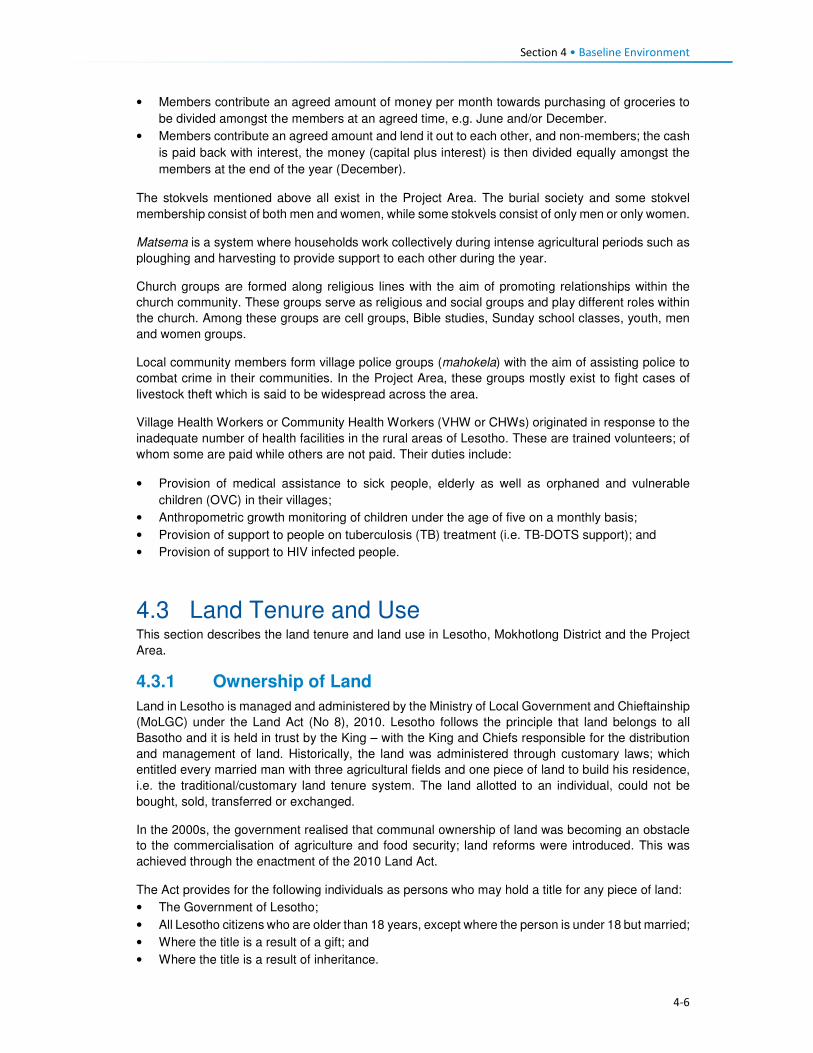
Section 4 • Baseline Environment
4-6
• Members contribute an agreed amount of money per month towards purchasing of groceries to
be divided amongst the members at an agreed time, e.g. June and/or December.
• Members contribute an agreed amount and lend it out to each other, and non-members; the cash
is paid back with interest, the money (capital plus interest) is then divided equally amongst the
members at the end of the year (December).
The stokvels mentioned above all exist in the Project Area. The burial society and some stokvel
membership consist of both men and women, while some stokvels consist of only men or only women.
Matsema is a system where households work collectively during intense agricultural periods such as
ploughing and harvesting to provide support to each other during the year.
Church groups are formed along religious lines with the aim of promoting relationships within the
church community. These groups serve as religious and social groups and play different roles within
the church. Among these groups are cell groups, Bible studies, Sunday school classes, youth, men
and women groups.
Local community members form village police groups (mahokela) with the aim of assisting police to
combat crime in their communities. In the Project Area, these groups mostly exist to fight cases of
livestock theft which is said to be widespread across the area.
Village Health Workers or Community Health Workers (VHW or CHWs) originated in response to the
inadequate number of health facilities in the rural areas of Lesotho. These are trained volunteers; of
whom some are paid while others are not paid. Their duties include:
• Provision of medical assistance to sick people, elderly as well as orphaned and vulnerable
children (OVC) in their villages;
• Anthropometric growth monitoring of children under the age of five on a monthly basis;
• Provision of support to people on tuberculosis (TB) treatment (i.e. TB-DOTS support); and
• Provision of support to HIV infected people.
4.3 Land Tenure and Use This section describes the land tenure and land use in Lesotho, Mokhotlong District and the Project
Area.
4.3.1 Ownership of Land
Land in Lesotho is managed and administered by the Ministry of Local Government and Chieftainship
(MoLGC) under the Land Act (No 8), 2010. Lesotho follows the principle that land belongs to all
Basotho and it is held in trust by the King – with the King and Chiefs responsible for the distribution
and management of land. Historically, the land was administered through customary laws; which
entitled every married man with three agricultural fields and one piece of land to build his residence,
i.e. the traditional/customary land tenure system. The land allotted to an individual, could not be
bought, sold, transferred or exchanged.
In the 2000s, the government realised that communal ownership of land was becoming an obstacle
to the commercialisation of agriculture and food security; land reforms were introduced. This was
achieved through the enactment of the 2010 Land Act.
The Act provides for the following individuals as persons who may hold a title for any piece of land:
• The Government of Lesotho;
• All Lesotho citizens who are older than 18 years, except where the person is under 18 but married;
• Where the title is a result of a gift; and
• Where the title is a result of inheritance.

Section 4 • Baseline Environment
4-7
To acquire land one has to apply for it from the chief and local authority under whose jurisdiction the
land is located. Foreigner citizens cannot own land as individuals; however, foreign enterprises which
have at least 20% shareholding of Basotho can acquire rights in land for investment purposes.
Under the 2010 law, agricultural land that has not been cultivated for at least three consecutive years
is regarded as ‘abandoned’ land. Therefore, the land is taken by the Chief to be reallocated to another
person. Lease holding or the right to occupy such land can be terminated.
4.3.2 Types of Land Tenure
Lesotho’s land tenure system recognises three types of title namely; leasehold, Form C and license.
There are, however, also households that occupy the land without the appropriate title in place, i.e.
through the traditional/customary tenure system under which the land was allocated to citizens
through chiefs and headmen on behalf of the King.
Leasehold acts as a check on private subdivision and allocation of land. Under the leasehold system,
the leaseholder has the right to use and enjoy the property for the agreed period. A leaseholder may
lease out that very land under a sub-lease agreement. In practice the leasehold of land is inherited
by the family of the leaseholder; in effect, the land is never returned to the state unless it has become
apparent that it has been abandoned. In Lesotho there are various forms of leasehold for both rural
and urban areas; namely:
• Residential leases for a period of 90 years;
• Commercial and industrial leases for periods of 30 and 60 years;
• Agricultural leases for periods of 10–90 years; and
• Others, including religious, educational and charitable leases for periods of 90 years.
Leasehold agreements are registered at the office of the Land Administration Authority (LAA). Before
the LAA came into being, the registration of title to land was registered at the Deeds Registry. The
Deeds Registry Act, No. 12 of 1967, states that the registration of titles to land under the legal system
of Lesotho does not confer the right of ownership, but the right of title to occupy and utilise the land
and its resources. The Land Act entitles the leaseholder to transfer the title sub-lease, or use their
land as collateral for accessing credit from financial institutions; the title can also be passed on via
inheritance to a named family member.
• Owners of leases for a primary place of residence are exempt from paying ground rent; however,
those who have a lease on a second property are required to pay annual ground rent to the LAA.
Owners of leases for land for commercial, industrial or agricultural purposes are required to pay
annual ground rent to the LAA.
• Form C was abolished by the Land Act (No. 17) of 1979, however, to this date people in the rural
areas are still issued with the Form C as proof of land tenure; it refers to land that is allotted by
the Chief. All forms issued before the 1979 Land Act remained valid. Form Cs and title deeds
can be converted into leases.
• Licence is a land tenure system used for agricultural land within the urban areas. The tenure right
is called a licence, and the land right is neither transferable, subject to inheritance nor negotiable.
Licences are held under customary law.
According to the 2011 LDS (LBS, 2013), the most prominent form of land tenure in Lesotho was
allocation by chiefs (61%), followed by inheritance/gift (29%) and purchase from somebody (seven
percent). A similar scenario was true for the Mokhotlong District where 66% had land allocated by the
chiefs, followed by those who had inherited the land (32%). Only two percent of Mokhotlong land
owners had acquired land through purchasing it from somebody.
The most prominent form of land tenure in the Project Area is through inheritance (31%), followed by
traditional/customary tenure (29%) and title deed (25%). Thirty-eight percent of the people residing in

Section 4 • Baseline Environment
4-8
Mokhotlong town have title deeds because it is a more urban area compared to the residents in the
downstream and catchment areas (42% and 37%, respectively) (refer to Figure 4.2). The “traditional”
tenure is the most predominant in both the catchment and downstream areas. The ownership of
arable land is discussed in Section 4.3.1 as part of the livelihoods activities. Land allocation in the
Project Area follows the same principles as elsewhere in the country.
Figure 4.2 Land Tenure Types Held by the Heads of Households within the Project Area
Source: Socio-Economic Baseline Study (CES, 2015b)
4.3.3 Land Use Types
Land is a major source of livelihoods in Lesotho and Mokhotlong and the Project Area in particular;
with the majority of households engaging in crop farming and extensive animal farming. The Project
Area is situated in the mountain zone and is characterised by high ranging mountains. The total area
of the Project Catchment is roughly 37 510 ha. Rangelands make up the greatest proportion of the
area at 52% (19 365.85 ha), followed by croplands at 35% (13 176 ha). The high mountains make up
seven percent (2687.7ha), while settlements make up six percent (2280.45ha) of the area (Soils,
Land Use and Land Capability Specialist Report P2W-6014-DFR-0007)) (refer to Figure 4.3).
The dominant land use types in the Project Area are grazing (refer to Section 4.8.4), cultivation,
housing, and small commercial activities such as shops and markets that serve the rural population.
The economy of the Project Area is highly dependent on agricultural activities (refer to Section 4.4),
and extensive areas of shrub lands are used to graze livestock or to grow crops. However, most of
the arable land used is degraded partly due to the cultivation methods used (extensive extractive
farming systems) which have led to significant soil degradation (Soils, Land Use and Land Capability
Specialist Report, P2W-6014-DFR-0007)).
0%
10%
20%
30%
40%
50%
Inheritance Traditional Form C Rental Title Deed Other
Catchment Area Downstream Area Mokhotlong Town
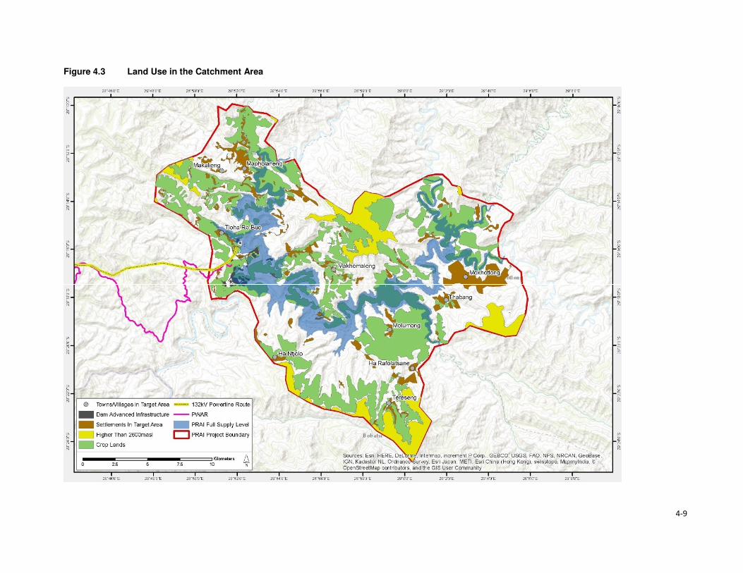
4-9
Figure 4.3 Land Use in the Catchment Area

Section 4• Baseline Environment
4-10
4.4 Livelihood and Economic Activities This section describes the economy and livelihoods at a national, district and the Project Area.
4.4.1 National Overview
The economy of Lesotho is based on agriculture, livestock, manufacturing, mining, and depends
heavily on inflows of workers’ remittances from workers in the South Africa mines, farms and domestic
work and receipts from the Southern African Customs Union (SACU). An estimated 50% of the
population earns income through informal crop cultivation or animal husbandry with nearly two-thirds
of the country's income coming from the agricultural sector. Lesotho’s Gross Domestic Product (GDP)
growth was estimated at three percent in 2016.
According to the Human Development Report, 57% of the population lives below the national poverty
line and the national poverty head count ratio at purchasing power parity (PPP) of USD 1.25 a day
stands at close to 59%. Poverty is highest in the rural areas. Unemployment remains high at estimated
levels between 24% and 28%. The rate stands at 29%, and inequality is unacceptably high at a GINI
coefficient of 0.5.
Efforts to promote inclusive growth are constrained by the pressure of high HIV prevalence (23% of
the total population) and the instability of receipts from the Southern African Customs Union (SACU),
which finances 50% of the budget. The country’s GDP is primarily reliant on three sectors, namely
services (67%); industry (31%) and the agricultural sector (seven percent).
4.4.2 District and the Project Area Overview
Mokhotlong District has a largely agrarian economy consisting of livestock rearing and cropping.
Animal husbandry in the District is undertaken mainly for commercial purposes (that is the production
of wool and mohair). The sheep and goats are reared primarily for wool and mohair; for the sole
purpose to sell to national and international markets (mostly South Africa). Crop production is mainly
for household subsistence purposes, and surplus is often sold or bartered with neighbours.
These agricultural activities are severely impacted by the erratic weather conditions (high winds,
snowfalls, etc.) associated with the mountainous terrain. Furthermore, the poor weather conditions
mean that crop production is only able to sustain households for three to nine months of the/ year.
Thus, households tend to make-up the shortfall through livestock rearing to generate household
income in the lean months as well as remittances from household members that are employed (if at
all). In general, income is limited due the high unemployment rate in the country and specifically in
the Project Area.
Crop production is the principal source of livelihood strategy practised in the Project Area, and this is
followed by remittances: permanent and seasonal employment, the sale of livestock products and
social grants, as indicated in Figure 4.4. The harvesting and sale of natural resources (wild plants,
fruit, timber, etc.) featured high as third to fifth principal livelihoods activities. Other interesting
livelihood strategies mentioned included subsistence from gathering and sale of wild plants.
The main livelihoods strategies of the population identified above are discussed in detail in the
subsequent sections.

Section 4 • Baseline Environment
4-11
Figure 4.4 Livelihood Strategies of the Affected Population in Percentages
Source: Socio-Economic Baseline Study (CES, 2015b)
4.4.3 Crop Production
4.4.3.1 Access to Arable Land
Arable land is a scarce resource in the Project Area, due to the mountainous terrain and soil
degradation resulting from soil erosion. The majority of arable land is located in the low lying areas
near the villages and along the river banks where sediments from soil erosion have settled. Some
agricultural fields are found on the slopes of the mountains, but these areas are considered less
productive in comparison with fields located along the river banks. As noted earlier croplands within
the Project Area constitutes 35% of the total land area (13 176 ha) (Soils, Land Use and Land
Capability Specialist Report, P2W-6014-DFR-0007)).
At an individual household level, access to arable land is often through inheritance, rental,
sharecropping and in rare cases, a person is allocated a piece of land on the mountain slopes by the
Chief. Furthermore, access to arable land is also dependent on the household location within the
Project Area. For instance, an average of 82% of the households in the catchment and downstream
areas owned arable land. In turn, only a third of families in Mokhotlong town had access to arable
land (Figures 4.5 and 4.6). It is important to understand the distinction in ownership of arable land;
Mokhotlong town is a developed area, and its property is zoned for specific land uses.
Figure 4.5 Ownership of Arable Land
Source: Socio-Economic Baseline Study (CES, 2015b)
0
10
20
30
40
1st 2nd 3rd 4th 5th
Livelihoods Ranking
Pe
rce
nta
ge
Crop production (major and minor) Remittances: permanent employment
Remittances: seasonal employment Sale of iivestock products
Social grants Business ownership
Traditonal/ Spiritual healers Gathering and sale of natural resources
Livestock production In-kind
0%
20%
40%
60%
80%
100%
Catchment Area Downstream Area Mokhotlong Town
No Yes

Section 4 • Baseline Environment
4-12
Figure 4.6 Typical River Bank Agricultural Fields
Source: J. Mkhabela
Concerning land ownership by gender, the average ownership of arable land by females is an
estimated 35% which is lower than that of males at 66%; as indicated in Figure 4.7. Traditionally,
upon marriage, men were automatically allocated fields, whereas women own arable land through
inheritance. However, this trend has changed due to the shortage of arable land – sometimes males
get married and are not given any crop fields.
The majority of households within the Project Area own a single crop field (35%), followed by those
who own two crop fields at 32%. Ownership of three crop fields accounts for 19% of the population,
and those who own between four or more crop fields was reported to be limited to eight and one
percent, respectively; refer to Figure 4.8 for the indicative percentage distribution of household
ownership of crop fields. Ownership of single to two crop-fields may also be linked to the general
shortage of arable land.
Figure 4.7 Ownership of agricultural land by Gender
Source: Socio-Economic Baseline Study (CES, 2015b)
0%
10%
20%
30%
40%
50%
60%
70%
80%
Catchment Area Downstream Area Mokhotlong Town
Female Male

Section 4 • Baseline Environment
4-13
Figure 4.8 Number of Crop Fields Owned by Households
Source: Socio-Economic Baseline Study (CES, 2015b)
4.4.3.2 Cultivation of Crops
Production of crops consists of cultivation of major and minor crops. Major crops are maize, wheat,
sorghum and beans. In turn, minor crops comprise beetroot, butternut, cabbage, pumpkins, spinach,
peppers, onions, tomatoes, carrots, turnips and others. These plants are all grown at different times
of the year depending on the weather conditions. The season for the cultivation of primary crops
begins in September with the preparation of fields, followed by cropping between October and
November. Throughout January and February, crop weeding and tending occur, and harvesting
begins in April to the end of July, refer to Figure 4.9 for the production of the major crops. Minor crops
are grown and harvested nine months of the year, except for during the winter.
Figure 4.9 Process of Crop Cultivation throughout the Year
4.4.3.3 Purpose of Crop Production
Crop production is mostly undertaken for only subsistence purposes across the Project Area; with
surplus sold only by a limited number of households. The subsistence use of crops can be attributed
to low crop yields and lack of alternatives to supplement their household income. As such, households
tend to keep their products for their consumption. Furthermore, crops are sometimes used to barter
with neighbours for other householder goods or as payment for services rendered. The sale of crop
products is undertaken amongst the villagers or in built areas such Mokhotlong and Mapholaneng
Towns where people have limited land to grow crops or do not have time to crop due to life demands.
0%
5%
10%
15%
20%
25%
30%
35%
40%
0 2 4 6 8 10 12 14

Section 4 • Baseline Environment
4-14
The general distribution of the main uses of crops produced in the Project Area is shown in Figure
4.10.
Figure 4.10 Purpose of Crops in the Project Area
Source: Socio-Economic Baseline Study (CES, 2015b)
Some households do not have access to agricultural fields and if they do not partake in any
sharecropping activities or work as labourers in other people's fields – then they will not have a
harvest. Participants gave the following reasons for not participating in crop production, namely:
• No fields for crop production;
• Lack of household labour to work the fields, and
• Lack of financial resources to undertake the farming.
Across the Project Area a lack of land to cultivate was the main reason provided for not partaking in
cropping activities; with the people of Mokhotlong town leading at 85% followed by the catchment
area (63%) and 59% downstream area (CES, 2015b). This barrier has resulted from the general
shortage of arable land across the Highlands of Lesotho and within the Project Area. Those who
highlighted a lack of household labour as a reason for not cropping – was linked to the households
with no youths or middle aged people, and the owner is either elderly or disabled thus they cannot
work the land. The reasons for households not cultivating their fields are indicated in Figure 4.11.
Figure 4.11 Household reasons for not cultivating agricultural land
Source: Socio-Economic Baseline Study (CES, 2015b)
0%
10%
20%
30%
40%
50%
60%
70%
80%
90%
Only subsistence Mostly subsistence Mostly Sale Only Sale
Catchment Area Downstream Area Mokhotlong Town
0%
10%
20%
30%
40%
50%
60%
70%
80%
90%
Elected not toanswer
Lack offinancial
resources
Lack ofhousehold
labour
Not Needed Other Lack of space
Catchment Area Downstream Area Mokhotlong Town

Section 4 • Baseline Environment
4-15
4.4.4 Livestock Production
The second important livelihood strategy of the population is livestock production; consisting of sheep,
goats and cattle, as well as pigs in limited numbers. Livestock is kept mostly for the sale of their
products rather than household consumption. During the 2013/14 Agriculture Year, there were 540
133 head of cattle and slightly over 2.1 million sheep and goats in Lesotho. On the other hand,
Mokhotlong had 40 932 head of cattle and close to 300 000 sheep and goats (Table 4.2).
Table 4.2 Number of livestock by type in Lesotho and Mokhotlong
Type of Livestock National Mokhotlong
Cattle 540,133 40,932
Sheep 1,346,596 198,849
Goats 824,698 94,277
Horses 55,926 9,103
Donkeys 103,859 13,870
Pigs 63,415 1,821
Chicken 453,083 28,824 Source: Lesotho Bureau of Statistics Statistical Report No. 8 of 2015 – Lesotho Livestock Statistics Report 2013/2014
On average, 61% of the households own sheep and goats because of their survival rate (cold and
snowy months of winter), and for the sale of wool and mohair. Figure 4.12 shows the ownership of
livestock across the Project Area by area. More households in Mokhotlong town own sheep than the
households in the catchment and downstream areas.
Figure 4.12 Livestock Owned in the Project Area
Source: Socio-Economic Baseline Study (CES, 2015b)
Livestock in the Project Area is kept by both men and women, but more prominently by men. Amongst
those who indicated not owning livestock, 69% were men and 66% female. The reasons for the
slightly higher number of males not owning livestock was not clarified in the SEBS (CES, 2015b);
however, this could be linked to poverty, or males engaged in formal employment and residing in
town with no space to rear livestock.
4.4.4.1 Ownership of Sheep
Sheep play a significant role in the households' survival, due to the income generated from the sale
of its products; mainly wool. Sheep are owned by both men and women, with men owning more than
women. On average women who own between one and five sheep accounted for eight percent of the
households and those that owned between six to 20 sheep at nine percent and only two percent owns
more than 50 sheep. Most of the men own between six and 20 sheep (18%), one to five sheep (12%)
and lastly 21 to 50 at nine percent, as indicated in Figure 4.13. The sale of sheep is low as they are
0%
10%
20%
30%
40%
50%
60%
70%
80%
Catchment Area Downstream Area Mokhotlong Town
Cattle Sheep Goats

Section 4 • Baseline Environment
4-16
a primary source of livelihoods for households. Over 61% households reported that they do not sell
any of their sheep. In turn, a combined 49% sell sheep in various quantities (Figure 4.13). Sheep that
are sold are often old and small. Therefore, the sale serves as a way of getting rid of old animals and
the money used to purchase new stock.
Figure 4.13 Ownership and Sale of Sheep
Source: Socio-Economic Baseline Study (CES, 2015b)
4.4.4.2 Ownership of Goats
Goats play a similar role to the household income as that of sheep, due to the revenue generated
from the sale of mohair. Goats are kept by both men and women; with men owning more as indicated
in Figure 4.14. In the same way, as with sheep, households typically do not sell their goats.
Figure 4.14 Ownership of Goats
�
Source: Socio-Economic Baseline Study (CES, 2015b)
4.4.4.3 Ownership of Cattle
Ownership of cattle is by both females and males in the Project Area but more prominent amongst
males. However, an average of 58% amongst both men and women households reported not owning
cattle. Cattle keeping is not widely common, and where it is owned, households own between one
and five (average 33%); with approximately 10% owning between six and 20 cattle. The primary uses
of cattle are working the fields, payment of dowry, funerals and sale when the household is strapped
for cash. One of the most commonly recurring responses regarding the sale of livestock, in general,
0%
20%
40%
60%
80%
100%
0 to 5 6 to 20 21 to 50 More than 50 None Owned
Female Male

Section 4 • Baseline Environment
4-17
was that livestock is mostly sold during the lean months to supplement the household income and
the household expenditure.
4.4.4.4 Sale of Livestock Products
As indicated above, the sale of livestock products forms a significant part of the household livelihoods
and income. The main products sold are skin hides, wool, mohair, milk and meat. The number of
households that sell various livestock is highlighted in Figure 4.15.
Figure 4.15 Sale of Livestock Products
Source: Socio-Economic Baseline Study (CES, 2015b)
4.4.4.5 Wool and Mohair Production and Value Chain
Wool sheep are very important in Lesotho, producing over 3 million kilograms of raw wool annually
for export. The sale of wool and mohair and live animals are the primary source of income in the
country. During the 2013/2014 Marketing Year, 1 425 408 sheep were shorn in the country, producing
3 860 768 kg of wool. During the same marketing year, 238 064 sheep were shorn in Mokhotlong,
producing 751 737 kg of wool. Mokhotlong produced the highest quantity of wool; constituting 19.5%
of the total wool for the year7.
The two officially recognised wool and mohair marketing outlets in Lesotho are private trading stations
authorised to deal in wool and mohair, and government shearing sheds placed at 1848 locations
across the country. Of these 11 are members of the Lesotho National Wool and Mohair Grower’s
Association (LNWMGA) which is the main existing herder apex organisation in the wool and mohair
sub-sector. The association is present in all districts with its growers associations at the district level
and Sheering Shed Associations (SSAs) at the lower level9. Normally farmers who use the
government shearing sheds are members of the Wool and Mohair Growers Associations (WMGAs)
and their marketing groups (MGs). Private trading stations are typically used by individuals not
affiliated with any group, though members of WMGAs and MGs also use the private stations for fast
payment. The WMGAs sell their wool and mohair through the South African Wool Board and the
South African Mohair Board and some of these are further exported to Europe and Asia.
In 2012 a project dedicated to assisting to develop the wool and mohair industry in the form of
marketing support, genetic improvement of communal flock through the introduction of quality rams,
training and mentorship was implemented, i.e. The Small Agricultural Development Project. The
project is expected to end in 2018.
7 Bureau of Statistics (Lesotho) Statistical Report No. 21 of 2015 – Livestock Products Report 2013/2014 8 There are 114 sheds which produce wool and mohair, plus another 70 which produce wool only. 9 Kingdom of Lesotho. Wool and Mohair Promotion Project (WAMPP), 2014.
3%
45%52%
No. of HH Selling Cattle Products No. of HH Selling Sheep Products
No. of HH Selling Goat Products
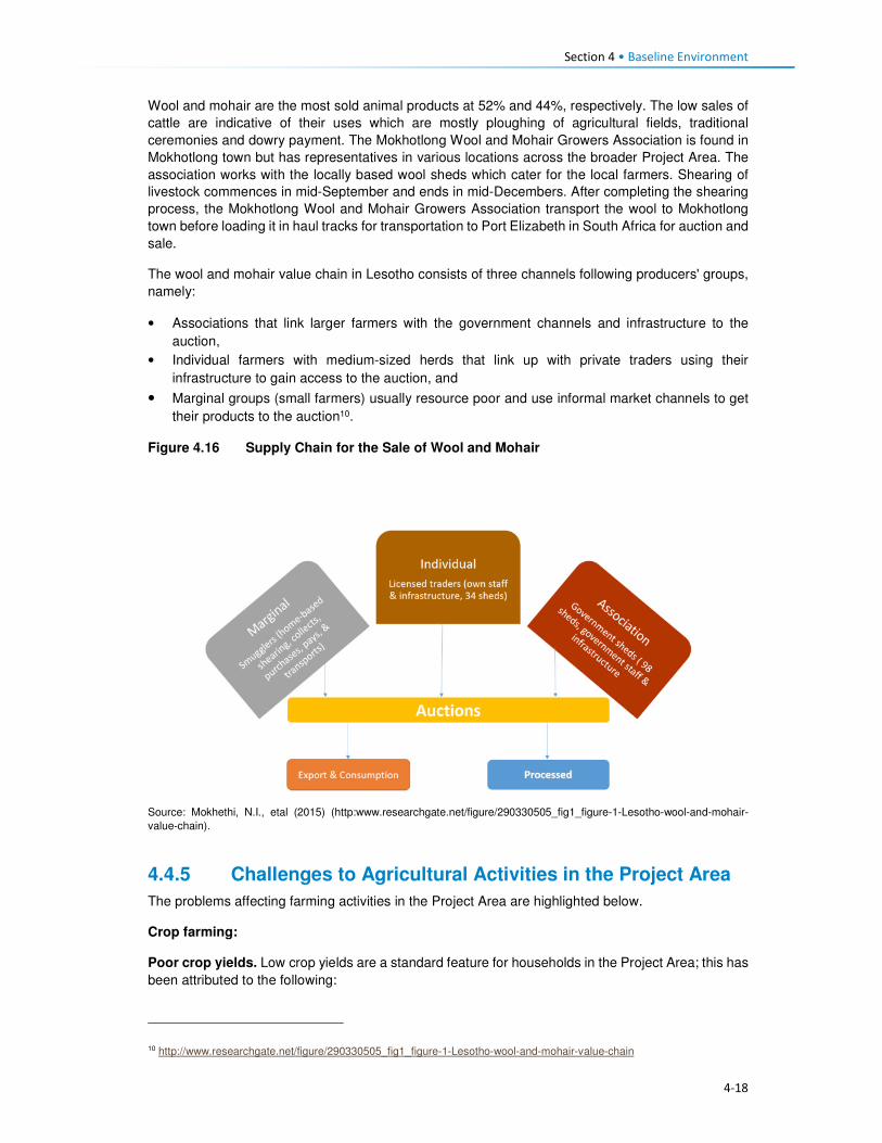
Section 4 • Baseline Environment
4-18
Wool and mohair are the most sold animal products at 52% and 44%, respectively. The low sales of
cattle are indicative of their uses which are mostly ploughing of agricultural fields, traditional
ceremonies and dowry payment. The Mokhotlong Wool and Mohair Growers Association is found in
Mokhotlong town but has representatives in various locations across the broader Project Area. The
association works with the locally based wool sheds which cater for the local farmers. Shearing of
livestock commences in mid-September and ends in mid-Decembers. After completing the shearing
process, the Mokhotlong Wool and Mohair Growers Association transport the wool to Mokhotlong
town before loading it in haul tracks for transportation to Port Elizabeth in South Africa for auction and
sale.
The wool and mohair value chain in Lesotho consists of three channels following producers' groups,
namely:
• Associations that link larger farmers with the government channels and infrastructure to the
auction,
• Individual farmers with medium-sized herds that link up with private traders using their
infrastructure to gain access to the auction, and
• Marginal groups (small farmers) usually resource poor and use informal market channels to get
their products to the auction10.
Figure 4.16 Supply Chain for the Sale of Wool and Mohair
Source: Mokhethi, N.I., etal (2015) (http:www.researchgate.net/figure/290330505_fig1_figure-1-Lesotho-wool-and-mohair-
value-chain).
4.4.5 Challenges to Agricultural Activities in the Project Area
The problems affecting farming activities in the Project Area are highlighted below.
Crop farming:
Poor crop yields. Low crop yields are a standard feature for households in the Project Area; this has
been attributed to the following:
10 http://www.researchgate.net/figure/290330505_fig1_figure-1-Lesotho-wool-and-mohair-value-chain

Section 4 • Baseline Environment
4-19
• Drought - even though the Project Area has multiple water resources, the land away from the
river banks is dry and with limited potential to install formal irrigation systems. Thus, many
households who own fields in areas that cannot be easily irrigated practise dry land cropping; and
manually water vegetable gardens.
• Poor weather conditions are another contributing factor to low yields. The Highlands are subject
to heavy/ flash floods and heavy snowfalls at different times of the year. According to the
respondents, the dry seasons have in recent years been reduced and the snowy season
extended; which in turn affect crop production and yields.
• As is common in rural Africa, the population of the Project Areas continues to use traditional
methods of preparation and cultivation of fields with limited or no mechanisation; which also
affects crop production and yields.
• The District Department of Agriculture has amongst its staff, Agricultural Extension Officers;
however, poor accessibility to some parts of the Project Area has resulted in Extension Officers
not being able to reach some part of the population to extend services.
• The soils in the Project Area are highly degraded due to soil erosion, and the mountainous terrain
characterised by rockiness, which has reduced the available land for cropping.
Livestock farming:
Overstocking. In the broader Project Area, overstocking is a major concern, and this is attributed to
livestock owners' unwillingness to reduce their livestock numbers, as well as inadequate monitoring
or control by the Department of Agriculture, which is enabling this trend. This has led to the livestock
herds overstretching the available pastures and resulted in significant land degradation and shortages
of food for livestock.
Cold weather. The erratic climatic conditions of the area also affect livestock, especially in winter
when it is snowing. The respondents indicated that most of the livestock deaths are reported at this
time of the year. None of the livestock farmers in the area has covered kraals where they keep
livestock, and since most cannot afford to purchase fodder to feed their livestock, the livestock
continues to graze outside, and that is when deaths occur.
Veterinary services. There is a lack of access to veterinary services for livestock owners in the area
due to the constraints related to accessibility issues, i.e. government extension services cannot reach
most parts of the Project Area.
Animal health. Livestock diseases are a major constraint to the development and improvement of
the livestock industry in the region. Vector-borne diseases and tick-borne diseases (especially
theileriosis and heartwater) severely limit livestock production. The livestock owners tend to rely on
medicinal plants to treat their sick livestock.
Poor breeding. The attributes and weaknesses of the indigenous animals, purebred exotics and
crossbreeds were reported as a constraint to livestock production. There is a low reproductive rate
due to high mortality rates of calves, which also hinders the raising of replacement stock, as well as
the lack of artificial insemination delivery services.
4.4.6 Employment and Unemployment
This section describes employment and unemployment conditions at a national level as well as in the
district and the Project Area.
4.4.6.1 National Employment and Unemployment
According to the 2011 Lesotho Demographic Survey, 28% of the population was employed in private
households, followed by those who are self-employed (20%, people working in RSA (18%), private
sector 16% and government at 10%. Overall, females were mostly employed in the private
households/homes i.e. domestic work (21%) than in any other sector. The Survey results further

Section 4 • Baseline Environment
4-20
demonstrate that females (23%) in urban areas were mostly engaged in the manufacturing sector
while 32% of urban males were employed in the private sector. In rural areas, the leading sector was
the Private households/homes with 38% and 26% for men and females respectively; refer to Table
4.3.
Table 4.3 Percentage distribution of the employed labour force by sex, urban/rural
residence and type of employer
Total Urban Rural
Employer Both
Sexes
Male Female Total Male Female Total Male Female
Total 100 100 100 100 100 100 100 100 100
Government 10.0 7.5 14.4 16.4 15.2 17.8 7.1 4.8 12.1
Parastatal 1.1 1.1 1.2 1.9 2.2 1.6 0.8 0.7 0.9
Private 16.0 17.0 14.2 26.1 31.6 20.1 11.4 12.1 10.1
Manufacturing 6.7 2.6 14.0 13.6 5.4 22.7 3.6 1.7 7.9
Self-Employed 20.3 19.8 21.3 19.0 20.5 17.5 20.9 19.6 23.9
Private
household
28.1 31.8 21.4 13.8 12.5 15.1 34.5 38.4 25.8
RSA 17.6 20.1 13.3 8.8 12.3 4.9 21.6 22.7 19.2
Other 0.2 0.2 0.3 0.4 0.4 0.4 0.1 0.1 0.2
Source: Lesotho Demographic Survey, 2011 (Bureau of Statistic (Lesotho), 2013)
The Survey highlighted that 52% of males against 16% females were engaged in agriculture primarily
subsistence farming. More women were employed in the manufacturing and processing industry
(23%) while men constituted five percent. The other industrial category that both males and females
participated in was wholesale and retail trade with 11%. An estimated 11% of men were engaged in
Construction. The second leading category where women (15%) were mostly involved in was
activities of households (private households); refer to Table 4.4.
Table 4.4 Sectoral Employment
Industry Male Female Total
Agriculture 51.6 16.3 38.4
Fishing and aquaculture 0.0 0.0 0.0
Mining and quarrying 3.3 0.4 2.2
Manufacturing and processing 5.2 22.5 11.7
Electricity, gas, steam and air conditioning supply 0.4 0.1 0.3
Water supply, waste management and remediation activities 0.5 0.2 0.4
Construction 10.5 1.9 7.3
Wholesale, retail trade and repair of motor vehicles and motorcycles 7.9 16.1 11.0
Transport, storage and communication 5.4 0.5 3.6
Accommodation and food service activities 0.5 1.9 1.0
Information and communication 0.8 0.8 0.8
Financial and Insurance activities 0.5 0.9 0.7
Real Estate activities 0.0 0.0 0.0
Professional, scientific and technical activities 0.6 0.9 0.7
Administrative and support services activities 3.4 2.8 3.2
Public administration and defence, compulsory social security 3.3 2.8 3.1
Education 2.2 9.9 5.1
Human health and social work activities 1.5 4.2 2.5
Arts, entertainment and recreation 0.2 0.3 0.3
Other service activities 0.7 1.9 1.2
Activities of households as employees, undifferentiated goods - and
services - producing activities of households for own use
1.4 15.2 6.5
Activities of extraterritorial organisations and bodies 0.2 0.3 0.2
Source: Lesotho Demographic Survey, 2011 (Bureau of Statistics (Lesotho), 2013)

Section 4 • Baseline Environment
4-21
The proportion of the unemployed population was 30% and 23% in age-groups 20 to 24 and 25 to 29
years, respectively. In age-group 20 to 24 years the proportion of the unemployed population was
33% for females and 28% for males. In rural areas, the population aged 20 to 24 years constituting
28.1% of men and 31% of females were unemployed, as compared to 29% of males and 36% of
women in urban areas. The proportion of the unemployed population is high among the youth across
the country; refer to Table 4.5.
Table 4.5 Percentage Distribution of Unemployed Population by Age, Sex and
Urban/Rural Residence
Lesotho Urban Rural
Age Total Male Female Total Male Female Total Male Female
10-14 0.7 0.5 1.1 0.6 0.0 1.4 0.7 0.7 0.9
15-19 9.5 7.6 12.9 7.0 5.9 8.5 10.3 8.1 14.8
20-24 29.8 28.2 32.7 31.7 28.5 35.9 29.2 28.1 31.4
25-29 23.2 23.0 23.4 22.7 21.8 24.0 23.3 23.4 23.2
30-34 15.4 17.1 12.4 15.7 17.4 13.5 15.3 17.0 12.0
35-39 8.5 10.2 5.6 7.7 8.9 6.2 8.8 10.6 5.3
40-44 5.0 5.0 4.9 5.6 6.1 4.9 4.7 4.7 4.9
45-49 3.6 4.2 2.6 5.1 6.0 3.9 3.1 3.7 2.0
50-54 2.0 2.1 1.9 2.1 2.6 1.4 2.0 2.0 2.1
55-59 1.1 1.1 1.3 0.7 1.2 0.2 1.3 1.0 1.7
60-64 0.6 0.7 0.5 0.5 0.8 0.0 0.7 0.7 0.7
65+ 0.4 0.3 0.7 0.5 0.9 0.0 0.4 0.1 1.1
Source: Lesotho Demographic Survey, 2011 (Bureau of Statistics (Lesotho), 2013)
4.4.7 District and Project Area Employment and Unemployment
A large proportion of the workforce in the Project Area does not work in the formal economy.
Employment in the Project Area can be divided into three types, namely, full-time jobs, seasonal
employment and self-employment (characterised by business ownership and provision of services).
No clear employment rates for the District were attained; as such the employment status of the
population is used to describe the employment characteristics of the District population. The
employment status for men was indicated as self-employment (20%), while women were mostly
homemakers (45%). The students’ category of employment status, showed 32% and 23% of the
population being students for both female and male and this was attributed to the report’s inclusion
of people of ten years and older in the assessment of employment status. The top five employment
categories for both males and females are indicated in Table 4.6.
Table 4.6 Employment Status in Project Area
Employment Status Female (%) Male (%)
Self-employment 9 20
Homemaker 45 18
Student 32 23
Unpaid family work 3 14
Paid employment 9 17
Source: Socio-Economic Baseline Study (CES, 2015b)
4.4.7.1 Paid Employment
The result of the SEBS (CES, 2015b), indicated that 42% of the households surveyed had at least
one family member that engaged in paid employment. Of these family members, 79% were employed
in full time paid employment, 18% in part time work and three percent in seasonal employment related
to agricultural production. The respondents that indicated that they were employed, whether part-time

Section 4 • Baseline Environment
4-22
or fulltime, worked in the, e.g. self-employment, hospitality, manufacturing, mining, and public sectors,
within the District.
The types of work of the paid employment were led by those working as domestic workers in a private
household (22%), followed by those employed in the public sector (government services) (18%), as
well as manufacturing and other sectors (15% respectively), refer to Figure 4.17.
Figure 4.17 Types of Regular Employment in the Project Area
Source: Socio-Economic Baseline Study (CES, 2015b)
Of those engaged in paid employment, 59% indicated that they were employed within their village or settlement – meaning they are employed by a neighbour or a local business; followed by 18% who work in a neighbouring village, and those who work in South Africa (10%). The remaining work in other parts of the country, refer to Figure 4.18. Those who work in South Africa are employed in KwaZulu-Natal and Free State provinces within the manufacturing and agricultural sectors.
Figure 4.18 Location of Regular Employment in the Project Area
Source: Socio-Economic Baseline Study (CES, 2015b)
21%
18%
15%
15%
8%
8%
5%
4%4% 1% 1%
Domestic work
Public sector
Manufacturing
Other
Mining
Private sector
Service delivery
Retail
59%18%
2%
1%
4%3%
3% 10%
Village
Nearby Village
Mapholaneng
Mokhotlong
Mokhotlong District
Maseru
Lesotho
South Africa

Section 4 • Baseline Environment
4-23
4.4.7.2 Seasonal/temporary employment
According to the SEBS (CES, 2015b), those employed in seasonal and part-time jobs, are often
expected to work several times per week, or several times per month at 40% and 33% respectively,
as indicated in Figure 4.19. Methods of payment for seasonal/temporary work vary significantly and
may include payment in cash, in-kind or in livestock or harvest (such as sheep or vegetables).
Payment with livestock is common amongst the herd boys – who often receive 12 sheep per year or
one cow per year as payment.
Figure 4.19 Payment for Seasonal/temporary Employment in the Project Area
Source: Socio-Economic Baseline Study (CES, 2015b)
4.4.7.3 Self- employment
The SEBS (CES, 2015b), divided self-employment into two categories, namely businesses, and
activities involving specialist skills.
Businesses. The types of businesses found in the Project Area are unsophisticated and focused on
meeting the population’s day to day needs. These businesses include shebeens and taverns, small
cafés, child minding, horse hire, milling, telephone services, and others. Table 4.7 highlights the top
10 business services identified through the SEBS (CES, 2015b). Most of these businesses are
located in the village where the owner of the business resides.
Table 4.7 Types of Business in Project Area
Business Type Percentage
Beer brewing 34
Other 16
Café 9
Fruit & vegetable sellers 8
Property renters 7
Clothing sellers 5
Tailors 5
General dealers 3
Taxi owners 2
Cell phone charging and airtime sales 2
Source: Socio-Economic Baseline Study (CES, 2015b)
Specialist skills: Numerous people in the Project Area also derive their livelihoods through the
provision of specialised services; such as builders (61%), thatchers (13%), herbalists (10%),
16%
40%
33%
11%
Weekly
Several times/ week
Several times/ month
> once / month
Section 4 • Baseline Environment
4-24
Community Health Workers (eight percent), birth attendants (five percent), circumcision surgeons
(one percent), and others indicated in Figure 4.20.
Figure 4.20 Types of Specialised Services in the Project Area
Source: Socio-Economic Baseline Study (CES, 2015b)
There are no income specifications for specialised services provision as each person charges their
specialised rate based on the work to be completed.
4.4.7.4 Unemployment in the Project Area
Unemployment in the Project Area was an estimated 91% of the entire population in the SEBS (CES,
2015b). Similar, to the national statistics on employment and unemployment, the SEBS (CES, 2015b),
included children in its calculation of the levels of unemployment – thus skewing the results as children
ages 0 to 14 do not form part of the economically active groups. Furthermore, CES (2015b) indicated
that their findings on this issue were distorted and believe that the respondents did not fully
understand that subsistence agricultural activities also form part of employment especially if income
is derived from such an activity.
4.5 Household Income and Expenditure 4.5.1 Sources of Household Income
The nature of livelihood strategies, and particularly those activities contributing the most to household
income, does shift as one considers different income quartiles (Figure 4.21). According to LHDA
Contract 6000 - Final Income and Expenditure Report (CES, 2015a), and consistent with the results
of other studies carried out in the Project Area and taking into account its rural and isolated nature,
approximately half of the surveyed population can be classified as ‘poor’ by accepted national and
international standards. High levels of variability of income were found within villages, highlighting the
need for diverse resettlement recovery strategies, even at village level. Seasonal patterns of the
sources of cash that household’s access was noted; these patterns impact poorer and wealthier
households differently regarding stress and opportunity, and also resilience to shocks.
Food insecurity emerged as a key vulnerability of, particularly, the poorest households in this study.
The results show high levels of dependence on purchased food among the most impoverished, and
therefore a concomitant vulnerability to food price increases.
Social ties and networks, as indicated by evidence of gifts originating at multiple levels, from within
villages to the district level to South Africa, make a significant contribution to household income and
0
10
20
30
40
50
60
70
Builders Thatchers Herbalists
Community Health Workers Birth attendants Diviners
Faith healers Circumcision surgeons

Section 4 • Baseline Environment
4-25
food security. Donations of food and clothing are especially common in the poorer households, while
gifts of cash were more common in wealthier households.
Differences between the quartiles:
Quartile 1 denoted poor households that receive the majority of their income from non-cash sources,
including meals given to children at school, and donations of non-perishable food and clothes and
these are followed by non-regular income, social grants and regular income.
Quartile 2 denoted poor households that rely on social grants and non-cash income sources.
The households in Q 1 and Q 2 – depend heavily on one or two income sources (45%), with a limited
risk distribution.
Quartile 3 comprises of households that derive the majority of its income from regular income,
followed closely by non-regular income and non-cash income.
Quartile 4 households derive earnings from multiple sources, with 35% of the total income derived
from regular income sources.
The different types of income sources relied on by the people in each quartile are presented in Figure
4.21.
Figure 4.21 Household Income Sources per Quartile in the Project Area
Source: Baseline Income and Expenditure Report (CES, 2015a)
There are four significant income streams in the area namely, regular income, non-cash income, non-
regular income and non-agriculture based income.
Some households (24%) in the Project Area received income from grants. Of the 24% who received
the grants, the old age pension receivers were highest at 85%, averaging LSL 438.40 per month.
Other grants received were child grants, disability grants, pauper’s grants, and public grants.
4.5.1.1 Annual Income Trends
Income in the Project Area increases significantly between March-June, and again between August
and September and this may be attributed to the following:

Section 4 • Baseline Environment
4-26
• The period (between March and June) marks the beginning of major crop harvesting, namely
wheat, maize and sorghum; and it is a period where poorer households are engaged as labourers.
Furthermore, depending on the household’s levels of poverty (regarding ownership of fields), the
household has an opportunity to derive an income from the sale of their crops.
• Even though mohair sales take place in April, the payments are only received by the farmers
between August and November when it has been sold at auction in Port Elizabeth, South Africa.
• The combination of the income generated during this time may explain the sustained peaks in
income between August and September through the various income streams.
In general, income drops between November and January, dropping further in December before
picking up again in February particularly for households in Quartile 1 and 2 (Figures 4.22 and 4.23).
Figure 4.22 Household Income Trends per Quartile
Source: Baseline Income and Expenditure Report (CES, 2015a)

Section 4 • Baseline Environment
4-27
Figure 4.23 Monthly Income Trend all Households Surveyed within the Project Area
Source: Baseline Income and Expenditure Report (CES, 2015a)
4.5.2 Household Expenditure
Household spending in the Project Area consists of animal purchase, cropping expenses, groceries,
non-food groceries, irregular expenses, livestock husbandry, other ongoing monthly expenses, and
non-business costs. Based on Figure 4.24, households within the 2nd and 3rd quartiles exhibited
similar expenditure trends, i.e. spending on food groceries, non-food groceries, cropping expenses,
etc. The wealthiest households (4th quartile) showed substantially different spending compared to
the people in other quartiles. They spent 21% of their income on groceries food, animal husbandry
(20%) and over 15% spent towards business expenses. In general, households in the Project Area
spend most of their income on purchasing food items, as indicated in Figure 4.24.
Figure 4.24 General Household Expenditure Trends
Source: Baseline Income and Expenditure Report (CES, 2015a)
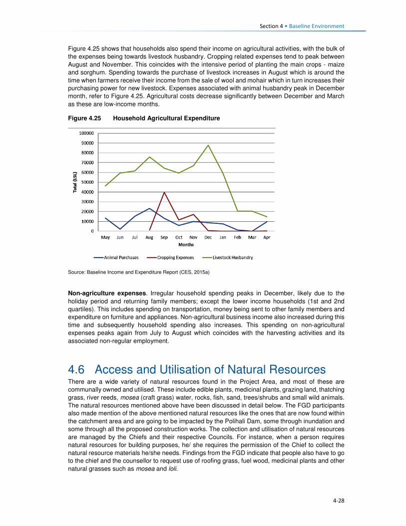
Section 4 • Baseline Environment
4-28
Figure 4.25 shows that households also spend their income on agricultural activities, with the bulk of
the expenses being towards livestock husbandry. Cropping related expenses tend to peak between
August and November. This coincides with the intensive period of planting the main crops - maize
and sorghum. Spending towards the purchase of livestock increases in August which is around the
time when farmers receive their income from the sale of wool and mohair which in turn increases their
purchasing power for new livestock. Expenses associated with animal husbandry peak in December
month, refer to Figure 4.25. Agricultural costs decrease significantly between December and March
as these are low-income months.
Figure 4.25 Household Agricultural Expenditure
Source: Baseline Income and Expenditure Report (CES, 2015a)
Non-agriculture expenses. Irregular household spending peaks in December, likely due to the
holiday period and returning family members; except the lower income households (1st and 2nd
quartiles). This includes spending on transportation, money being sent to other family members and
expenditure on furniture and appliances. Non-agricultural business income also increased during this
time and subsequently household spending also increases. This spending on non-agricultural
expenses peaks again from July to August which coincides with the harvesting activities and its
associated non-regular employment.
4.6 Access and Utilisation of Natural Resources There are a wide variety of natural resources found in the Project Area, and most of these are
communally owned and utilised. These include edible plants, medicinal plants, grazing land, thatching
grass, river reeds, mosea (craft grass) water, rocks, fish, sand, trees/shrubs and small wild animals.
The natural resources mentioned above have been discussed in detail below. The FGD participants
also made mention of the above mentioned natural resources like the ones that are now found within
the catchment area and are going to be impacted by the Polihali Dam, some through inundation and
some through all the proposed construction works. The collection and utilisation of natural resources
are managed by the Chiefs and their respective Councils. For instance, when a person requires
natural resources for building purposes, he/ she requires the permission of the Chief to collect the
natural resource materials he/she needs. Findings from the FGD indicate that people also have to go
to the chief and the counsellor to request use of roofing grass, fuel wood, medicinal plants and other
natural grasses such as mosea and loli.

Section 4 • Baseline Environment
4-29
The areas where natural resources are collected vary, for instance, rocks which are mostly used in
the construction of housing walls and kraals are readily available everywhere across the Project Area,
and people do not have to walk far to collect and utilise. However, the majority of the natural resources
are found in the forested area, hill/mountainous locations, and river banks, as indicated in Figure 4.26.
Figure 4.26 Areas where Natural Resources are Collected
Source: Lesotho Demographic Survey, 2011 (Bureau of Statistics (Lesotho), 2013)
4.6.1 Grazing Land
Grazing land in the Project Area is communal in nature and access to grazing land is governed by
the Chiefs and community Councillors. The Chiefs and Councillors are supported by locally
established Grazing and Pasture Committees, as well as by the Grazing Associations who work in
close collaboration with Principal Chiefs who oversee the management of grazing land. The Grazing
Associations are responsible for the management of pastures, improvement of livestock and the
rehabilitation of wetlands, marshes and bogs. In turn, the Grazing and Pasture Committees assist
village Chiefs with the general management of pastures. There are two active Grazing Associations
in the Project Area, namely:
• Khalahali Association which operates in Senqu, Bafali, Moremoholo, Mokhotlong/ Sanqebetu,
Tlakeng/ Sehong-hong, Makhapung, and Linakaneng/Sani.
• Tlokoeng Association which works within Bohale ba Nkoe, Mofolaneng, and Liseleng.
Pastures are often divided into three types of cattle posts – summer (these cattle posts are furthest
from home villages), winter (closer to home), and pastures that are close to home but are small and
cannot support large herds of livestock (refer to Figure 4.27). The livestock kept close to the villages
are often used for milking or ploughing or are the very young livestock. The majority of livestock,
therefore, spend significant time in summer and winter cattle posts. The FGD respondents also
attested to the cattle post usage patterns. Both the Grazing Associations and Committees play a
major role in ensuring sustainable use of the grazing area. They also ensure that livestock owners
adhere to the seasonal variations and also adhere to the grazing maintenance schedules that are set
by the relevant Chiefs, for the movement of livestock from one zone to another.
0%
5%
10%
15%
20%
25%
30%
35%
40%
45%
Forest/Thicket
Grazing Area Hilly orMountainous
Area
River Area Other Areas
Catchment Area Downstream Area Mokhotlong Town

Section 4 • Baseline Environment
4-30
Figure 4.27 Example of Local Grazing Area
Source: J. Mkhabela
All livestock in the area must be registered, and the livestock owners must be able to provide evidence
of their legal ownership of the livestock. The Chiefs are tasked with keeping records of herds of
livestock each household in their area owns. New households to the area must also seek permission
to use communal grazing land from the Chief and Council. The new comers must present the Chief
with proof of ownership of livestock and size of the herd of livestock owned.
According to the respondents, even with all these measures in place, grazing land in the area was
degraded due to people’s failure to adhere to the rules. Furthermore, the erratic weather conditions
of the area, heavy storms and snowfalls, soil erosion and severe droughts have contributed to the
degradation of grazing land. Others indicated that conflicting views on the regulation of grazing land
between the Chiefs and Community Council often lead to people disobeying the rules for grazing
management (for additional information, refer to the Rangelands Report, (P2W-6014-DFR-0009)).
4.6.2 Soils
The fresh alluvial deposits at the bottom of the inundation area have soils that are the most extensively
cultivated. Because of the nature of the parent material and the near level terrain, the area is
generally considered to be the most fertile (P2W-6014-DFR-0007). However, because there are
continuously fresh deposits after heavy storms, which are usually accompanied by erosion, the
landscapes are not very stable. As the area is located in the narrow valleys of the upper catchment,
there are no alluvial plains with more stable soils. Most of the soils are very friable and have more
than 50% sand, and are prone to physical losses and loss of fertility (Ministry of Agriculture, 1976).
Since the communities rely on subsistence farming, there is a heavy reliance by the communities on
the ability of the soils to provide food.
The soils in the area are used mainly for:
• Cultivation of food crops, mainly maize and wheat;
• Cultivation of fodder grasses;
• Settlements and the majority of households have gardens used for vegetable production; and
• Natural grassland primarily used for grazing livestock including sheep, goats and cattle.

Section 4 • Baseline Environment
4-31
There is evidence of active use on all of the landscapes, except where the terrain is steep and
completely inaccessible (Soils, Land Use and Land Capability specialist study (P2W-6014-DFR-
0007)).
4.6.3 Sand
Sand is found in abundance along river beds and sand mining is commonly undertaken for sale and
for construction purposes, refer to Figure 4.28. During the FGDs held within the Project Area,
participants residing within the catchment area of the Project Area expressed their concern about the
imminent loss of the sand due to dam impounding. They explained that they use the sand for building
purposes and will be at a total loss as to how they will access sand.
Figure 4.28 Example of Sand Mining along the River
Source: D Weldon
4.6.4 Medicinal Plants
A wide range of plants are collected in the Project Area predominantly for food, medicinal purposes
and for sale. The Biological and Archaeological (Including Heritage) Baseline and Impact Assessment
(LHDA C6002, CES, 2014) found approximately 60 plant species which the communities identified
as important natural resources. Of these, 30 species identified as important medicinal plants and
included Aloe aristata, Delosperma sp. and Artemesia afra. These are often used to treat a range of
ailments including sores, ulcers, headaches, cramps, muscular pains, headaches, sedatives and for
enhancing virility. Another 19 plant species were said to be utilised for spiritual purposes such as
increasing wealth and protection against lightning and evil spirits. The FGD participants also indicated
that they use some medicinal plants to protect themselves against the thokolosi and other evil forces,
which are said to be unseen but are believed to exist. They also pointed out that some of the plants
are only found in the area to be inundated and not anywhere else. Refer to Figure 4.29.

Section 4 • Baseline Environment
4-32
Figure 4.29 Examples of Medicinal Plants found in the Project Area
Source: J Bloem Lehasa
4.6.5 Wild Vegetables
FGD participants mentioned several types of wild vegetables that are found along the river, which
they consider to be now in danger of being inundated when the dam is completed. These wild
vegetables are used by the locals as a source of food to the communities and are collected by women
and girls to take home for cooking. The names of the wild vegetables growing along the rivers are
called papasane, semetsing/selae, thepe and seruoe (the last two grow on the fields and in these
cases they grow on the fields located near the rivers that are going to be inundated).
4.6.6 Fuelwood
Due to the high poverty levels, lack of electricity and extremely cold weather conditions of the Project
Area; there is a high demand for fuelwood. The SEBS (CES, 2015b) identified the plant species,
Passerina montana, as commonly harvested for fuel purposes. Approximately 85% of the households
in the area relied on fuelwood for household heating purposes; others indicated using fuel wood for
cooking purposes at 60%, while the rest use paraffin, bottled gas and electricity, especially those in
Mokhotlong town and Mapholaneng for the latter (FGD findings). It is also evident from the FGD
findings that women stockpile fuelwood in the summer months, in preparation for the winter months,
and also to limit the time spent in the cold going to collect wood.
The collection of fuelwood was indicated to be an activity undertaken mostly by adults and young
women in the Project Area with some assistance from adult and young men. In a small number of
wealthy households, the collection of fuelwood is undertaken by hired help, refer to Figure 4.30.
Figure 4.30 Persons who Collect Fuelwood in a Household
Source: Socio-Economic Baseline Study (CES, 2015b)
0%
10%
20%
30%
40%
50%
60%
Catchment Area Downstream Area Mokhotlong Town
Section 4 • Baseline Environment
4-33
Distances travelled to collect any source of household fuel vary significantly from village to village
based on the location of the fuel source. For instance, some women in FGDs indicated that they walk
for up to three hours (round trip) to collect fuelwood and this does not take into account the amount
of time spent gathering the wood. Furthermore, women reported that collection of fuelwood in summer
is undertaken almost daily to restock for the cold winter months.
4.6.7 Wild Animals
Rabbits, rock rabbits, deer, snakes, skunks and wild cats were said to be abundant within the
catchment area (FGD respondents). However, hunting of mammals in the Project Area is limited.
According to the SEBS (CES, 2015b), only 10% of the households were identified as partaking in any
hunting activities. These households indicated that they hunted antelope of various kinds, fox and
jackal, hare and rabbit and rock rabbit. The FGD respondents, however, mentioned that though they
are not allowed to hunt the animals, they do so for purposes of consumption, muti making for own
use and for selling. They explained that they use skunks to make a khoetsa that mothers put around
their young's necks to ward off evil spirits. Their fear is that the animals are going to run away when
the dam is impounded. The people also said as mitigation to the possible loss of wild animals, they
would like the LHDA to rescue and put them in a fenced off area where their children can visit and
learn about them in the future.
4.7 Health Care This section describes the provision of health care services in Lesotho, Mokhotlong District and the
Project Area.
4.7.1 National Health Services
The Ministry of Health (MoH) is responsible for the administration and management of health care
provision in Lesotho. The Ministry’s responsibilities include promotion and delivery of health services,
development of health policies, standards and guidelines, mobilisation of health resources, and
monitoring and evaluation of health sector interventions. Health care services are provided in
partnership with the Christian Health Association of Lesotho (CHAL), various non-governmental and
private sector organisations and development partners. The provision of health services is also
guided by the Lesotho National Health Strategic Plan for 2012/13-2016/17. Also, Lesotho is also a
signatory to the United Nations Millennium Development Goals (MDG). The MoH is committed to
addressing the following health issues as part of meeting the MDGs:
• MDG 1 – Eradicate poverty and hunger;
• MGD 4 – Reduce child mortality;
• MGD 5 – Improve maternal mortality; and
• MDG 6 – Combat HIV/AIDS, malaria and other diseases.
Furthermore, development partners are actively involved in the health care services in the country
through multilateral and bilateral partnerships. Multilateral partners include the European Union (EU),
the World Health Organisation (WHO), and other United Nations organisations such as the United
Nations Children’s Fund (UNICEF), and the United Nations Population Fund (UNFPA). Bilateral
partners include the United States Governments (USG) facilities such as the United States Agency
for International Development (USAID), the President’s Emergency Plan for AIDS Relief (PEPFAR).
These development partners mainly provide technical assistance and funding for specific health
programmes and general provision of health care.
4.7.2 Health Care Provision
Health care in Lesotho is provided through a three-tiered referral system starting with primary,
secondary and tertiary services (Figure 4.31). At the lowest level of this arrangement are found

Section 4 • Baseline Environment
4-34
primary health care (PHC) services, offered at the community level by Community Health Workers
(CHWs) along with the health centres and filter clinics. The secondary and tertiary levels serve as
referrals for complicated and specialised cases.
Figure 4.31 Levels of Health Care Services in Lesotho
Source: Public Health Baseline Study (NHA, 2016)
Lesotho has 372 health care facilities which comprise one national referral hospital, two specialised
hospitals, 18 hospitals, three filter clinics, 188 health centres, 48 private surgeries, 66 nurse clinics
and 46 pharmacies. Primary health care services consist of a network of CHWs of approximately
5000 nationwide.
Of these facilities, 58% of the hospitals are owned by the MoH, while 38% are belonging to CHAL;
the remaining facilities are either belonging to the Red Cross of Lesotho or are privately owned. At
the district level, health care services are organised into hospital services, health centre services and
community-level services. District Health Management Teams (DHMTs) are responsible for overall
district health services. The number of health facilities varies by the district with Maseru having the
most.
There are seven health centres within the Project Area, four of which belong to the government, the
CHAL owns two, and one is privately owned (Table 4.8). There is only one hospital that serves as the
main referral hospital for the health centres. This hospital has 100 beds and a single doctor servicing
the emergency room and the out-patient department. Respondents pointed out that they sometimes
have to go to health facilities that are outside the Project Area for the sole reason of it being nearer
to where they are living, such as the Semenanyane health centre.
Table 4.8 Health care Facilities in Project Area
Area Name of facilities Location of facilities Ownership of facilities
Catchment • Libibing health centre
• Mapholaneng health centre
• ‘Malebusa Bless clinic
• St James health centre
• Mokhotlong hospital
• St Peter's health centre
• Libibing
• Mapholaneng
• Mapholaneng
• St James
• Mokhotlong town
• Mokhotlong town
• Government
• Government
• Private
• CHAL
• Government
• CHAL
Downstream • Moeketsane health centre • Ha Moeketsane • Government
Tertiary Healthcare
Referral Hospital
Secondary Healthcare
Regional Hospitals
District Hospitals
Local Hospitals
Primary Healthcare
Filter Clinics
Health Health centres
Health Posts/Outreach Services
Village/Community Health Workers

Section 4 • Baseline Environment
4-35
Area Name of facilities Location of facilities Ownership of facilities
• Linakeng health centre • Linakeng • Government
4.7.3 Services Offered at Health Centres in the Project Area
All the health facilities provide primary health care services such as:
• Immunisations,
• Distribution of medication for chronic illnesses,
• HIV testing (using rapid HIV test kits) and counselling (HTC),
• Rapid tests for syphilis (VDRL), pregnancy (HCG), and
• Urine testing.
Three of the facilities, i.e. St James, St Peters and ‘Malebusa Bless health centres do not offer baby
delivery services due to a lack of equipment and delivery facilities.
Only Mokhotlong hospital has a laboratory, and as such, all samples collected at the health centres
are sent there.
Availability of Equipment at Health Facilities. All health care facilities in the district have recently
been revitalised and some new equipment brought in under the Millennium Challenge Account (MCA)
Health Project.
Availability of qualified medical personnel. In most facilities, there were four staff members that
include two registered nurses and two nursing assistants. St. Peters’ health centre was the only
facility that was understaffed and operated with only one nursing assistant. Refer to Table 4.9.
Table 4.9 Distribution of Medical Personnel in Health Centres
Name of facility Registered nurse/ midwife
Qualified nurse
Trained nurse assistant
Total number of staff
Libibing health centre 3 0 2 5
Mapholaneng health centre 0 3 1 4
Malebusa Bless clinic 2 0 2 4
St James health centre 2 0 2 4
St Peter's health centre 0 0 1 1
Moeketsane health centre 2 0 2 4
Source: Public Health Baseline Study (NHA, 2016)
4.7.4 Health Profile
Table 4.10 provides some of the key health indicators for Lesotho and shows that Lesotho did not
meet most of the targets for the various health related MDGs. According to World Health Organisation
(WHO) by 2014 Lesotho had made limited progress towards improving its health targets and goals.
Table 4.10 shows that one in 12 children in Lesotho dies before his/her fifth birthday, and one in every
17 children dies before celebrating their first birthday. About two-thirds of these deaths occur during
infancy.
Table 4.10 Health Care Indicators

Section 4 • Baseline Environment
4-36
Indicators National Outcomes Mokhotlong District Outcomes
Infant mortality rate 59 deaths/1,000 live births (2014)
77 deaths/1,000 live births (2014)
Under-five mortality rate 85 deaths/1,000 live births (2014)
91 deaths / 1,000 births of >5 (2014)
Maternal mortality ratio 1,024 deaths/100,000 live births (2014)
Life expectancy at birth 41.8 yrs. (2011) 41.8 yrs. (2011)
Male life expectancy at birth 39.41 yrs. (2011) 39.41 yrs. (2011)
Female life expectancy at birth 45.33 yrs. (2011) 45.33 yrs. (2011)
HIV prevalence rate 25% (2014) 17% (2014)
Adult ART coverage 35% (2014) 25% (2014)
Paediatric ART coverage 30% (2014) 31% (2014)
Prevention of Mother To Child Transmission (PMTCT) ART coverage
72% (2014) 54% (2014)
TB incidences (including HIV & TB) 788/100, 000 ( 2016)
Multi Drug Resistance (MDR) incidences 52 /100, 000 (2016)
TB treatment coverage 45% (2016)
HIV prevalence in TB 72% (2016)
Source: Lesotho Demographic Survey, 2011 (Bureau of Statistics (Lesotho), 2013); Lesotho Demographic and Health Survey, 2014; Ministry of Health (Lesotho) and ICF International, 2016; UNDP: Human Development Report 2016
4.7.5 Utilisation of Health Services in the Project Area
According to the Public Health Baseline Study (NHA, 2016) over half (51%) of the respondents
indicated that they used the facilities located in the neighbouring village (keeping in mind that a nearby
village may be located over 20 km away from the surveyed individuals’ home). In turn, only five
percent of the respondents indicated they had access to a health care facility within their village.
People residing in the catchment area and Mokhotlong town accessed the hospital the most at (99%
and 98% respectively), with only 53% of the people downstream accessing Mokhotlong hospital; as
indicated in Figure 4.32. FGD findings show that some villagers go to the hospital in Thaba-Tseka
rather than to those in Mokhotlong District, due to their proximity.
Figure 4.32 Closest Medical Facility used
Source: Socio-Economic Baseline Study (CES, 2015b)
0
10
20
30
40
50
60
70
80
90
100
CatchmentArea
DownstreamArea
MokhotlongTown
CatchmentArea
DownstreamArea
MokhotlongTown
Clinic Hospital
Village
Neighbouring Village
Closest Town
Mapholaneng Town
Mokhotlong Town
Other

Section 4 • Baseline Environment
4-37
4.7.6 Incidence and Prevalence of HIV
Lesotho is in the top 10 countries in the Southern Africa region hardest hit by HIV/AIDs. In 2015,
Lesotho had the second highest prevalence of HIV in Southern Africa, after Swaziland, at 22.7%. An
estimated 9900 people died from AIDs-related illnesses in 2015. The incidence of HIV has been
declining, from 30 000 new infections in 2005 to 18 000 new infections in 2015 (Table 4.11).
Table 4.11 Prevalence of HIV/AIDS in Lesotho
310 000 People living with HIV
23% Adult HIV prevalence
18 000 New HIV Infections
9900 AIDS-related deaths
42% Adults on antiretroviral treatment Source: UNAIDS Gap Report 2016
In 2014, an estimated 74% of the people with tuberculosis (TB) in Lesotho also tested positive for
HIV, and 72% of these are on Anti-Retroviral Treatment (ART).
Anti-retroviral treatment (ART) in Lesotho: In Lesotho, ARVs are provided free of charge and can
be collected at various health facilities. Forty-one percent of eligible adults are enrolled onto ART.
ART coverage for children was said to have improved and stood at 56% in 2015. This increase was
attributed to the introduction of satellite paediatric ART centres. According to Avert, in 2016, Lesotho
became the first African country to implement a 'Test and Treat' strategy whereby every person who
tests HIV positive is offered ART regardless of their CD4 count.
Barriers to HIV prevention programmes: Some HIV-related targets and strategies have been
developed within Lesotho’s HIV response; however, many obstacles and challenges are impeding
progress in HIV prevention; most of which are cultural and structural. Gender-based violence and low
paid textile factory work have been found to be significant drivers for the high HIV prevalence among
women in Lesotho, among others (www.avert.org/professionals/hiv-around-world/sub-saharan).
These are briefly described in Box 4.3.
Box 4.3 Barriers to HIV Prevention Programmes
Access to health care. As indicated above, access to health care in Lesotho varies considerably by gender, socio-economic status and geography. Factors affecting access to health care include insufficient funds to travel to health centres and a lack of medical personnel and supplies. As such, people who are living with the virus cannot always access the facilities to collect medication. Furthermore, an estimated four percent of people living with HIV were reportedly denied access to health care services due to their status - this discourages people living with the virus from seeking medical assistance.
HIV stigma and discrimination. According to the Lesotho Stigma Index Report 2014, HIV stigma and
discrimination remain significant barriers to accessing vital treatment, prevention and support services to
those affected. There have been reports of people being victimised because of their HIV positive status;
including verbal and physical abuse, and exclusion from social, religious and family gatherings or activities.
The report further indicated that 41% of its respondents experienced gossip about their HIV status, while 27%
reported being verbally insulted, harassed and threatened.
According to the LDHS, 2014 (MoH and ICF International, 2016), HIV prevalence in Mokhotlong was
estimated at 17%; and it was the lowest amongst all ten Districts in the country. The report further
indicates that HIV was most prominent amongst females (23%) compared to males (10%). Pregnant
women are automatically tested for HIV when they first present themselves to a health care facility;
therefore, more women than men know their HIV status.
HIV/ AIDS was reported at 5% in the PHBS (NHA, 2016), having caused approximately 38 deaths
amongst the respondents of the survey, which is relatively low. Data collected during the FGDs agrees
with the fact that there are high numbers of people infected with HIV. They further pointed out that

Section 4 • Baseline Environment
4-38
they have to go to the nearest health centres to get their ARVs and the problem is always the long
distances they have to travel to reach them.
The PHBS (NHA, 2016) found that testing for HIV in the area was common, with approximately 45%
of the respondents in the catchment area reporting that they had been tested for HIV two weeks
before the study; 45% in the downstream area and 34% in Mokhotlong town. Amongst those who got
tested 70% were women, it is unclear whether these women were tested because they were pregnant
or not. However, the PHBS (NHA, 2016) indicated that all those tested were there to check their
hypertension levels. Three of the 42 focus groups interviewed for the PHBS (NHA, 2016) noted that
the issue of HIV/AIDS is a significant social concern within their communities. Of these, two groups
pointed out that the situation has become worse; one group noted that the situation has improved.
The focus group that reported an improvement in the issue of HIV/AIDS pointed out that people in
the community are now educated about the disease and take the necessary medication. Those
present in the focus groups who reported that the issue is becoming worse indicated that stigma
surrounding HIV/AIDS remains high and that, despite the availability of medication, many people
continue to die from the disease.
Regarding taking antiretroviral medication, people who are sick reportedly took their medication;
however, some stopped as soon as they consider themselves healthy again and this has led to these
individuals getting sick again and dying.
Participants in FGDs for this SIA pointed out that the reasons that HIV positive people default from
taking their medication could be related to the long distances to health facilities as well as the bad
attitude of health personnel. FGD respondents were also of the view that the rate of infections was
increasing, which could mean that people no longer seem to fear the disease.
4.7.7 Challenges to Health Care Provision
Challenges to access and provision of health care in the country, district and Project Area are
described below. There are some challenges to the delivery of health care services in Lesotho, the
main ones being the following:
• The lack of qualified medical professionals (both nurses and doctors) particularly in the rural areas
due to the country’s terrain which creates barriers to accessibility. Most qualified medical
professionals do not want to work in rural areas where there is poor access to public services and
as a result, seek employment in urban areas and elsewhere in the world once they qualify.
Serious emergencies are often referred to neighbouring South Africa.
• The rural nature and mountainous terrain further cause barriers to the construction of formal
medical facilities. This has led to many people living in the rural areas having to travel between
10 and 20 kilometres to reach the closest facility. Thus, many people in the rural areas choose to
rely on traditional medicines to treat various ailments.
• Most of rural Lesotho lacks secondary roads, which means that most parts of the rural areas do
not have public transportation. The 2014 LDHS, 2014 (MoH and ICF International, 2016)
indicated that 72% of households’ members walk to reach the nearest health facility; while 22%
stated that they travel by car, truck, bus, or taxi, and the remaining six percent used a combination
of walking and bus or taxi. Among households who walk to reach a health facility 27% walk for
more than 120 minutes (Table 4.12). Data from the FGDs indicates that the participants were
also concerned about the insufficient number of health facilitates in the Project Area and the
subsequent long distances that they have walk to reach the nearest one.
Table 4.12 Time it takes to get to the nearest health care facility
Time to get to nearest health facility by walking
Residential Area
Minutes Urban Rural Total
<20 minutes 28.4 5.5 12.8

Section 4 • Baseline Environment
4-39
Time to get to nearest health facility by walking
Residential Area
Minutes Urban Rural Total
20-40 minutes 43.0 11.4 21.6
41-60 minutes 17.2 16.1 16.5
120 minutes 8.1 28.1 21.7
> 120 minutes 3.2 38.6 27.3
Source: Lesotho Demography Health Survey, 2014 (Ministry of Health (Lesotho) and ICF International, 2016)
• Participants in focus group discussions indicated that they had experienced further challenges in
accessing health care such as that of frequent shortages of medication and other supplies at the
health facilities. This is made worse by the fact that some people would have had to walk for
many hours to get to the health centres. People from Malubalube, Nkokamele as well as other
far off villages mentioned that they have to take as many as four to five hours to reach the nearest
health centre. This means that they sometimes have to sleep over to have a chance at being
seen and examined by the health centre personnel. The distances are tough on the people
especially when they are sick, and there are cases where some expectant mothers have given
birth to babies on the way to health centres.
• The country’s health system is also challenged by the continued increase of communicable
diseases related to the HIV epidemic – especially Tuberculosis (TB). Data gathered from the
FGDs conducted in the Project Area indicate that in addition to HIV and communicable diseases
mentioned above, the people living in the Project Area suffer from a number of illnesses ranging
from sugar diabetes, hypertension, and the common cold. The under five children are said to
suffer from fever, measles, common cold, pneumonia, diarrhoea and vomiting. The people
expressed their fear about a possible climate change for the worse that could be brought about
by the large expanse of water after the dam is impounded and that would bring more cold to the
already cold district. That would, in turn, mean more common cold and pneumonia cases.
4.7.8 Use of Traditional Healers and Traditional Medicine
The participants of FGDs indicated that they also consult traditional healers when they are sick. This
they also attribute to not being up to walking the long distances to the health centres. In some cases,
they go to the traditional healers because they believe that they, rather than the health facilities, can
help to resolve their problem. In some such cases, the consultation would be more about protecting
their households against evil spirits than physical healing. They do, however, take some forms of
ailments to the traditional healers, though most of these are the ones they believe are from
bewitchments, such as litṥere, kokoana, sejeso, litoromo, ho qobola and headache. They also
indicated that they sometimes started by consulting the traditional healer and if they are not cured,
they would then go to seek help at a health centre and vice versa. Illnesses that they take to health
centres include HIV /AIDS, TB, cancer, sugar diabetes, hypertension, common cold, sharp pains and
flu.
Accidents and injuries that often happen to the people living in the catchment area are falling off
horses, lightning strikes, dog bites, being swept away by flooding rivers and fight injuries. Women
mostly feel unsafe as they are more likely to be sexually and/or physically abused than most. Seniors
feel unsafe as there have been incidences of mugging along the way from receiving their pension
money.
The participants are hoping that LHDA will assist them by liaising with the relevant ministry to have
health centres built nearby them for easy access. Participants from Malubalube pointed out that there
is a building in their village that was intended to be used for health outreach services and it is now
standing vacant and not being used as planned. They wish to have LHDA see to it that the building
is upgraded to a health centre level so that it can serve their area which is quite huge. It would also
cut travel time to Libibing. Their health problems have not declined in number in the past three years.
Instead, they have become worse.

Section 4 • Baseline Environment
4-40
4.8 Education This section describes the provision of education services and infrastructure in Lesotho, Mokhotlong
District and the Project Area.
4.8.1 National Education Services
The Ministry of Education and Training (MoET) is responsible for the management, provision and
regulation of education and training in Lesotho. It is in charge of ensuring the accessibility, quality,
equity and relevance of education. As with many countries in southern Africa, formal education in
Lesotho was introduced and developed through a partnership between the government and religious
organisations; and has been heavily influenced by the work of missionaries. As a result, across the
country, the management of schools is largely (90%) in the hands of the churches; specifically, the
Anglican Church, Lesotho Evangelical Church and Roman Catholic Church.
Government’s involvement in the provision of education, apart from the administrative duties, is
mainly through subsidies; payment of teachers’ salaries and provision of other institutional support.
Teachers are employed under the MoET. The government pays the salaries of more than 95% of the
teachers including those who work at church managed schools. Furthermore, the Government
provides schooling facilities through its capital budget. The provision of education services is guided
by the Education Act (No. 3) of 2010, the Lesotho Education Sector Strategic Plan for 2005 – 2015,
the Higher Education Strategic Plan for 2013/14 – 2017/18 and the National Policy for Integrated
Early Childhood Care and Development (ECCD). Lesotho is also a signatory to the MDG and MoET
seeks to ensure that Lesotho fulfils MDG 2, that of achieving universal primary education by 2015
through the provision of:
• Free and compulsory primary education;
• Bursaries and grants to vulnerable children and households;
• Ongoing school feeding programme; and
• Infrastructure development.
There are also development partners that are actively involved in the education sector through
bilateral and multilateral partnerships. These include among others the European Union, Irish Aid and
United Nations Children’s Fund (UNICEF). The Global Partnership for Education has also played a
significant role in improving the education sector.
4.8.2 Structure of the Education System
After completion of pre-schooling, Lesotho’s education system consists of 12 years of school. The
seven years of primary (Grade 1 – 7); three years of junior secondary (Form A – C); two years of
higher secondary (Form D – E) and four years of tertiary. There is also a parallel technical vocational
diploma course (senior secondary + 3 years Technical and Vocational Education and Training
(TVET). The various cycles of education are highlighted in Table 4.13.
Table 4.13 Structure of the education services in Lesotho
Education Schooling level Age Years Qualification
Pre-school ECCD 3 - 5 3 • Attendance is not compulsory.

Section 4 • Baseline Environment
4-41
Education Schooling level Age Years Qualification
Primary Primary school 6 -13 7 • Attendance is compulsory for children
between the ages of 6 and 13 years old. At
this level, education is free.
• Upon completion of the seven years, pupils
have to write an exam for which they are
awarded the Primary School Leaving
Certificate (PSLC) by the MoET.
Middle Junior secondary school 13 - 16 3 • School fees are payable from this phase
upwards. Pupils who complete this level of
education receive a Junior Certificate from
the MoET.
Secondary High school 16 - 18 2 • School fees are payable at this phase.
Pupils who complete this level of education
receive a Lesotho General Certificate in
Secondary Education (LGCSE).
Technical secondary
school
16 - 18 3 • School fees are payable at this phase.
Pupils who complete this level of education
receive a Technical Vocational Diploma
(Senior Secondary + 3 year TVET).
Tertiary Teacher training/
education in technical
subjects
16 -20 2 • Certificate/Diploma is awarded.
University 18 + 4+ • Receipt of Degrees to Doctorate from the
relevant university.
• National University of Lesotho (NUL) was
the only university in Lesotho until recently
(2008) when Limkokwing University was
established.
4.8.3 Availability of Education Facilities
Lesotho has an estimated 2155 registered education facilities which comprise 14 tertiary/higher
education institutions, 25 technical/vocational centres, 399 secondary schools, 1477 primary schools
and 240 ECCD centres (Table 4.14 and Figure 4.33). TVET schools are found in seven of the 10
districts in Lesotho (i.e. Berea, Leribe, Maseru, Mohale’s Hoek, Mokhotlong, Quthing and Thaba-
Tseka).
There are more primary schools compared to other educational facilities, and this might be attributed
to the government’s drive to meeting its MDGs for the population to at least attain primary school
education. In addition to the above schooling levels and facilities, there are skills centres which are
focused on adult education which are referred to as non-formal education (NFE). These centres are
tailored towards educating out-of-school youth and adults who are illiterate or have only primary
schooling. This service focuses on literacy, numeracy and continuing education. The education
received in these centres is the equivalent of Grade 1 to 10. Participants of FGDs indicated that there
is a high number of pupils who drop out at primary school level. More boys are said to drop out than
girls, and this is attributed to them having to drop out to go and herd animals. Some are said to drop
out to go to initiation school. Male youth from Makhoarane in the downstream area stated that they
did not see the value of education and that they would rather engage in livestock farming. Those girls
who do drop out are said to do so to get married. This means that the government is in part failing to
meet its MDGs of ensuring that all children at least attain primary education.

Section 4 • Baseline Environment
4-42
At the district level, the education system is organised into early childhood development, primary,
secondary and high school and the MoET is decentralised through the Inspectorate. The number of
education facilities varies by district with Maseru district having the most. Table 4.14 shows the
distribution of schools by district.
Table 4.14 Distribution of schools by district
District
Levels of Education Total
ECCD Primary Secondary
Urban Rural Urban Rural
Butha-Buthe 18 14 68 9 13 122
Leribe 28 20 179 12 55 294
Berea 27 10 129 6 36 208
Maseru 34 62 190 29 44 358
Mafeteng 30 9 149 5 34 227 Mohale’s Hoek 27 4 167 4 21 223
Quthing 19 9 117 4 13 162
Qacha’s Nek 18 9 94 5 15 141
Mokhotlong 15 11 95 1 15 137
Thaba-Tseka 24 5 136 4 15 184
Total 240 1477 339 2056 Source: Lesotho Bureau of Statistics, Statistical Report No. 28 of 2015: Education Statistics Report 2014
Figure 4.33 Typical Schools in the Project Area
Source: J. Mkhabela
In the Project Area, the education system follows the national and district system. The MoET through
the Inspectorate is expected to support and supervise these schools. Following the pattern of number
of schools in the Mokhotlong District; there are also more primary schools in the Project Area and
very few Secondary schools. ECCD schools are also available in the Project Area.
A few NGOs work in the education sector in the Districts and provide support in the form of school
fees, uniforms, school shoes, toiletries and sanitary towels to children. These include Sentebale,
Hlokomela Bana and World Vision. Sentebale and Hlokomela Bana operate in Mokhotlong and the
Project Area.

Section 4 • Baseline Environment
4-43
4.8.4 Education Profile of Lesotho
Lesotho has the highest adult literacy rate (79%) in sub-Saharan Africa as well as amongst its female
population (93%)11. Men have slightly lower education levels than their female counterparts, and this
has been linked to the fact that boys particularly those in rural areas tend to dedicate their time to
herding livestock and not attending school or dropping out at the primary level; refer to Table 4.15.
The introduction of free and compulsory primary education in Lesotho has assisted Lesotho in fast-
tracking progress towards reaching the MDG 2. In 2012, progress towards achieving indicator 2.1
(Net Enrolment Rate (NER) in primary schools) and indicator 2.3 (Literacy rate among 15-24-year-
olds) were on track. Progress was, however, slow for indicators 2.2 (Proportion of pupils who reach
the last grade of primary school); refer to Table 4.15. Enrolment in secondary schools is low at 38%
as there are a limited number of secondary schools and tuition fees are required (the government
only subsidises orphan and vulnerable children). Also, children who want to enter high school may
be required to relocate from their homes to stay with relatives or friends who reside close to a
secondary school, and this requires financial contributions from parents which many in rural Lesotho
cannot afford; thus the children drop out. Findings from the FGDs indicate that some of the children
who manage to complete primary school are sometimes unable to attend secondary school due to
lack of school fees. Some parents have to sell livestock to put their children through Junior and Senior
High schools.
Table 4.15 Education Services Profile
Indicators MDG Baseline Outcomes Progress
Adult Literacy rate 79% (2015) Female youth (15 – 24 years) literacy rate 96% 98% (2012) On track
Male youth (15 – 24 years) literacy rate 83% 87% (2012) On track
Primary Education
Net Enrolment Rate12 82% 82% (2012) On track Proportion of pupils who reach last grade of primary school
61% 66% (2012) Slow progress
Source: Kingdom of Lesotho, 2013. Millennium Development Goals Status Report 2013
4.8.5 Education Profile of Mokhotlong and Project Area
The majority (58%) of the residents of Mokhotlong district have attained some primary schooling,
followed by those who have some secondary education (17%). Only eight percent of the population
was recorded as having no schooling – which is relatively low considering that Mokhotlong has poor
infrastructure specifically roads and has an economy that is solely dependent on agricultural activities.
Approximately 90% of the primary schools in Mokhotlong are found in rural parts of the District while
the other 10% are in urban areas. A similar trend was observed with the distribution of secondary
schools.
As with the situation in the District, the SEBS (CES, 2015b) indicates that a majority (59%) of the
population in the Project Area have attained some primary schooling and was, however, followed by
those who had no education at all (16%). Only 12% were reported to have completed primary school.
Regarding attainment of schooling by gender, a similar trend to the national and district levels is
observed with more men with no schooling. However, the trend differs significantly regarding those
who have some primary education, with more males compared to females and reverts to more
females having completed both primary and some junior secondary schooling. Observation during
FGDs showed that many people have at least attained primary school education, as many were able
11www.unesco.org/eri/cp/factsheets_ed/LS_EDFactSheet.pdf 12Net Primary Enrolment Rate is the number of pupils of official primary school age who are enrolled in primary education as a percentage of the total children of the official school age population
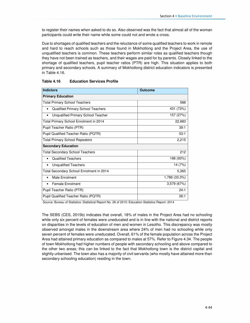
Section 4 • Baseline Environment
4-44
to register their names when asked to do so. Also observed was the fact that almost all of the woman
participants could write their name while some could not and wrote a cross.
Due to shortages of qualified teachers and the reluctance of some qualified teachers to work in remote
and hard to reach schools such as those found in Mokhotlong and the Project Area, the use of
unqualified teachers is common. These teachers perform similar roles as qualified teachers though
they have not been trained as teachers, and their wages are paid for by parents. Closely linked to the
shortage of qualified teachers, pupil teacher ratios (PTR) are high. This situation applies to both
primary and secondary schools. A summary of Mokhotlong district education indicators is presented
in Table 4.16.
Table 4.16 Education Services Profile
Indictors Outcome
Primary Education
Total Primary School Teachers 588
• Qualified Primary School Teachers 431 (73%)
• Unqualified Primary School Teacher 157 (27%)
Total Primary School Enrolment in 2014 22,883
Pupil Teacher Ratio (PTR) 39:1
Pupil Qualified Teacher Ratio (PQTR) 53:1
Total Primary School Repeaters 2,215
Secondary Education
Total Secondary School Teachers 212
• Qualified Teachers 198 (93%)
• Unqualified Teachers 14 (7%)
Total Secondary School Enrolment in 2014 5,365
• Male Enrolment 1,786 (33.3%)
• Female Enrolment 3,579 (67%)
Pupil Teacher Ratio (PTR) 24:1
Pupil Qualified Teacher Ratio (PQTR) 26:1
Source: Bureau of Statistics: Statistical Report No. 28 of 2015: Education Statistics Report: 2014
The SEBS (CES, 2015b) indicates that overall, 18% of males in the Project Area had no schooling
while only six percent of females were uneducated and is in line with the national and district reports
on disparities in the levels of education of men and women in Lesotho. This discrepancy was mostly
observed amongst males in the downstream area where 24% of men had no schooling while only
seven percent of females were uneducated. Overall, 61% of the female population across the Project
Area had attained primary education as compared to males at 57%. Refer to Figure 4.34. The people
of town Mokhotlong had higher numbers of people with secondary schooling and above compared to
the other two areas; this can be linked to the fact that Mokhotlong town is the district capital and
slightly urbanised. The town also has a majority of civil servants (who mostly have attained more than
secondary schooling education) residing in the town.

Section 4 • Baseline Environment
4-45
Figure 4.34 Distribution of Schooling Levels across the Project Area
Source: Socio-Economic Baseline Study (CES, 2015b)
Participants of FGDs were of the feeling that there are not enough schools in the Project Area,
especially downstream where children walk long distances to school and sometimes cannot attend
school regularly during the rainy season as the streams/rivers they have to cross flood. Children are
said to start school at a later age (eight or nine and not six years old) as the schools are too far.
People anticipate that LHDA will build schools nearby.
4.8.6 Provision of Education to the Poor and Marginalised
The government of Lesotho implements multiple programmes to ensure that the poor and
marginalised children get access to education services. Disabled and orphaned children, children
from extremely poor households and herd boys are regarded as vulnerable children (Orphans and
Vulnerable Children (OVC)). In order to ensure that these children receive an education, the MoET
has a school bursary scheme, which is paid directly to the schools. Another programme aimed at
assisting these OVC is the Child Grants Programme (CGP). This programme was started in 2009
and was financed by the European Commission with technical support from UNICEF-Lesotho. In
2013 the government of Lesotho took over the financing of the programme. The programme is run
specifically by the Ministry of Social Development (MoSD). The programme is non-conditional social
cash transfer targeted to poor and vulnerable households with the objectives of:
• Improving living standards of OVCs;
• Reducing malnutrition, improve health status; and
• Increasing school enrolment by OVCs.
Qualifying households are selected through a combination of proxy means which include testing and
community validation. The household is then registered on the National Information System for Social
Assistance (NISSA); and subsequently receive funds from the grant.
With the assistance of the World Food Programme (WFP), the government of Lesotho runs a school
feeding programme which provides food for children attending pre-school and primary schooling.
Through the programme, children receive two meals a day, breakfast and lunch. In 2015, the
programme was supporting over 50 000 pre-schoolers and 200 000 pupils in 1025 primary schools
throughout Lesotho13.
13http://www.lesothoreviw.com/education-training-2015.php
0
10
20
30
40
50
60
70
80
None Primary Secondary Secondary + Don’t know
Pe
rce
nta
ge
Catchment Area Male Catchment Area Female Mokhotlong Town Male
Mokhotlong Town Female Downstream Area Male Downstream Area Female

Section 4 • Baseline Environment
4-46
4.8.7 Obstacles to Education
While much has been achieved in ensuring that education services are provided to Basotho, the
sector continues to face challenges at the national and district levels as well as within the Project
Area. The following are some of the challenges faced:
• Low pass rates across all levels of schooling;
• Low standard of education provided at local schools;
• Poor retention rates of pupils at primary and secondary schooling levels due to the limited number
of schools;
• The mountainous terrain of Lesotho also acts as a barrier to construction of schooling facilities
and this has led to a shortage of schooling facilities as well as poor maintenance of existing
schools.
• In the remote rural areas, the learning environment is often poor and characterised by limited
infrastructure including unavailability of classrooms and equipment.
• The shortage of schooling infrastructure also results in pupils and teachers having to walk long
distances to reach the nearest school; this is particularly the case with secondary schooling.
• The limited secondary schooling infrastructure to absorb new entrants into the education system.
• There is a limited number of qualified teachers in the schooling system as many do not want to
transfer and work in remote rural areas with limited public services and infrastructure.
• Lack of public transportation and formal road infrastructure in many remote rural areas, as such
both teachers and pupils have to walk long distances to reach schooling facilities.
• Disparities in the distribution of schools in the country, with rural areas having limited numbers of
schools and urban more. This results in overcrowding of schools and higher teacher/ pupil ratios
which in turn affects the quality of learning and teaching.
• Extreme levels of poverty in the Project Area results in the inability of parents to pay school fees.
4.9 Public Services and Infrastructure This section describes access to public services and infrastructure in the Project Area such as potable
water, sanitation, telecommunications, energy/fuel sources, and roads/transportation; refer to Figure
4.35.
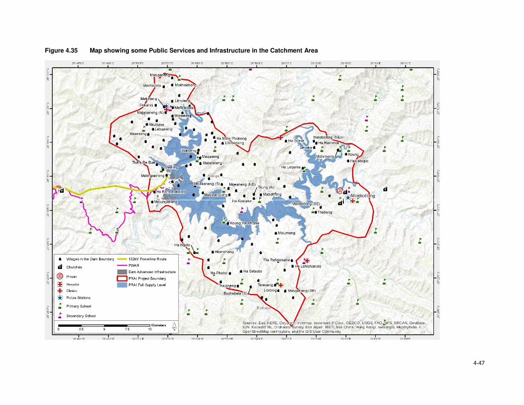
4-47
Figure 4.35 Map showing some Public Services and Infrastructure in the Catchment Area

Section 4 • Baseline Environment
4-48
4.9.1 Access to Potable Water and Sanitation Facilities
4.9.1.1 Access to Potable Water
Almost all urban households in Lesotho have access to improved water sources (96%), and only 77%
of the rural population has access to an improved water system. The type of water sources for urban
and rural populations differed significantly, while the urban population got its water from piped into
dwelling/ yard/ plot (68%), the rural communities got water from public taps/ stand pipes (56%). For
rural communities, this was followed by 23% of water sourced from unimproved water sources and
only five percent had access to piped water into the dwelling/ yard/plot. An estimated 38% of the
rural population had access to water 30 minutes or longer to collect water from which ever source
they use. Overall, the proportion of households obtaining water from improved drinking water sources
in Lesotho has increased from 79% in 2009 to 84% in 2014. Urban households' access to improved
drinking water sources increased from 91% to 97% while the proportion of rural households with
access to improved drinking water sources shifted from 74% in 2009 to 77% in 2014.
Water in urban areas is provided by the Water and Sewerage Company (WASCO), through the
installation of individual water supply. WASCO provided water is billed and paid for. Water in the rural
areas is provided by the Department Rural Water Supply (DRWS). DRWS has guidelines/standards
for communal water supply, that is, 50 metres' walk from each of the households. The Lesotho Rural
Water and Sanitation Project (WSP) in the rural areas provided for improved water and sanitation
services to 27 245 households or approximately 160 000 persons through the construction of new
water systems and ventilated improved pit latrines (VIP). The majority of the population indicated not
treating its water before consumption (88%). As per location, amongst those who reside in urban
settings, only 78% treated the water before consumption, and the rest did not. In turn, rural
households that do not treat water before consumption were at 92%. This was an expected outcome
given the financial constraints of the rural population compared to those who reside in urban settings.
The indicators for access to drinking water sources are provided in Table 4.17.
Table 4.17 Access to Water Sources in Lesotho
Access to drinking water Urban Rural Total
Water sources 96 77 82
Piped into dwelling / yard/ plot 68 5 22
Public tap/ standpipe 26 56 47
Tube well/ borehole 2 8 6
Protected spring 0,5 3 3
Protected well 1 6 5
Rain water 0 0 0
Bottled water 0,1 0 0
Unprotected well 2 10 8
Unprotected spring 2 12 9
Tanker truck/ car with small tank 0 0,5 0,4
Surface water 0,1 1 0,8
Time to obtain drinking water
Water on premises 69 6 23
Less than 30 minutes 25 55 47
30 minutes or longer 6 38 29
Don’t know 0,2 2 1
Source: Lesotho Demography Health Survey, 2014 (Ministry of Health (Lesotho) and ICF International, 2016)
In the Project Area water is mostly collected from communal taps that are scattered through the area.
Access to such communal taps is at 72% in the catchment area and 42% in the downstream area.

Section 4 • Baseline Environment
4-49
For Mokhotlong town, the use of taps includes both communal taps and piped water into the dwelling.
The population in the downstream area further relies on wells as a second source of water (40%).
The government installed the communal taps that the communities use through DRWS. However,
the communities complained that there were not enough communal taps to service their water needs.
In some communities the water taps were non-functional, this was as a result of faulty pipes or broken
taps or solar panels that supply the water pump with power. Villages whose taps were no longer
functioning returned to collecting water from unprotected sources such as springs or wells. Indicated
in Figure 4.36 are protected and unprotected water wells.
Figure 4.36 Protected and Unprotected Water Wells
Source: J Mkhabela
As indicated above, the majority of the households in the Project Area have access to improved water
sources, more specifically communal taps. However, with regards to the time, it takes each way to
reach the tap an estimated 86% of the households indicated having to walk for 30 minutes each way
to fetch water; while 13% walk for more than one hour each way to carry water, as indicated in Figure
4.37. The residents of Mokhotlong town, as expected did not have to walk far to collect water due to
the urban nature of the area. Data gathered from the FGDs also indicated that most villages in the
Project Area do have communal taps, though they pointed out that some of them are seasonal,
producing water only during the rainy season. They explained that when the taps dry up, they collect
water from springs and some even from nearby streams. Few of the interviewed communities take
more than one hour to collect water.
Figure 4.37 Time taken from Household to Water Source
Source: Socio-Economic Baseline Study (CES, 2015b)
Water is collected mostly two to three times per day by different households at 46% and 24%
respectively. Some households collect water more than three times a day.
0
20
40
60
80
100
0 to 15minutes
15 to 30minutes
30 to 45minutes
45 min. to 1hr.
> 1 hr.
Catchment area Downstream area Mokhotlong Town

Section 4 • Baseline Environment
4-50
4.9.1.2 Access to Sanitation Facilities
Approximately five in 10 households in Lesotho commonly use improved toilet facilities. These are
defined as non-shared facilities that prevent people from coming into contact with human waste and
thus reduce the transmission of cholera, typhoid, and other diseases (LDHS 2014 (MoH and ICF
International 2016). Overall, 29% of the households in Lesotho have no access to sanitation facilities,
with the majority of the population without toilets residing in the rural area (39%) and six percent in
urban areas. Shared/public toilet facilities are found in the urban areas compared to the rural areas
at 45% and nine percent respectively. Shared/public toilet facilities are common in urban areas,
especially in shopping centres and malls.
In general, the proportion of urban households with improved toilet facilities has increased since 2009,
rising from 26% to 41%; while in rural households, the proportion has more than doubled (rising from
22% to 50%). During this same period, the proportion of rural households without any toilet facilities
decreased from 45% to 38%. FGD respondents said there are few toilets in their villages and those
who don't have them use the bush. People anticipate that LHDA will build each household in the
Project Area a toilet so that the Polihali Dam does not become contaminated.
Table 4.18 Access to Sanitation Facilities in Lesotho
Access to Sanitation Facilities Urban Rural Total
Percentage
Improved 49 52 51
Flush/ pour flush14 to piped sewer 4 0 1
Flush/ pour flush to septic tank 3 0,2 1
Flush/ pour flush to pit latrine 0 0 0
Ventilated improved pit (VIP) latrine 7 16 14
Ordinary pit latrine 35 35 35
Shared facility 45 9 19
Flush/ pour flush to piped sewer 0,3 0 0,1
Flush/ pour flush to septic tank 0,3 0 0,1
Ventilated improved pit (VIP) latrine 6 1 2
Ordinary pit latrine 39 8 17
Unimproved facility 6 39 30
Flush/ pour flush not to piped sewer/ septic tank / pit latrine 0,4 0 0,1
Pit latrine without slap / open pit 1 1 1
No facility/ bush 5 38 29 Source: Lesotho Demography Health Survey, 2014 (Ministry of Health (Lesotho) and ICF International, 2016)
In the Project Area, the majority of the respondents indicated having no access to sanitation facilities.
This was observed mostly in the downstream area where 80% of the households had no access to
toilets, followed by 12% with access to VIP toilets, five percent with access to pit latrines and the
remaining three percent having access to other forms of sanitation facilities. In turn, the population in
the catchment area reported that 59% had no access to toilets, 27% had VIP and 11% pit latrines
and the remaining three percent had access to other forms of sanitation facilities. In Mokhotlong town,
the most common toilet facilities that the population has been VIP toilets (56%), followed by 31%
using without any form of sanitation facilities, nine percent used pit latrine and three percent had
14A pour flush toilet is a toilet without a cistern and whereby bath water is used to pour straight into the pan.
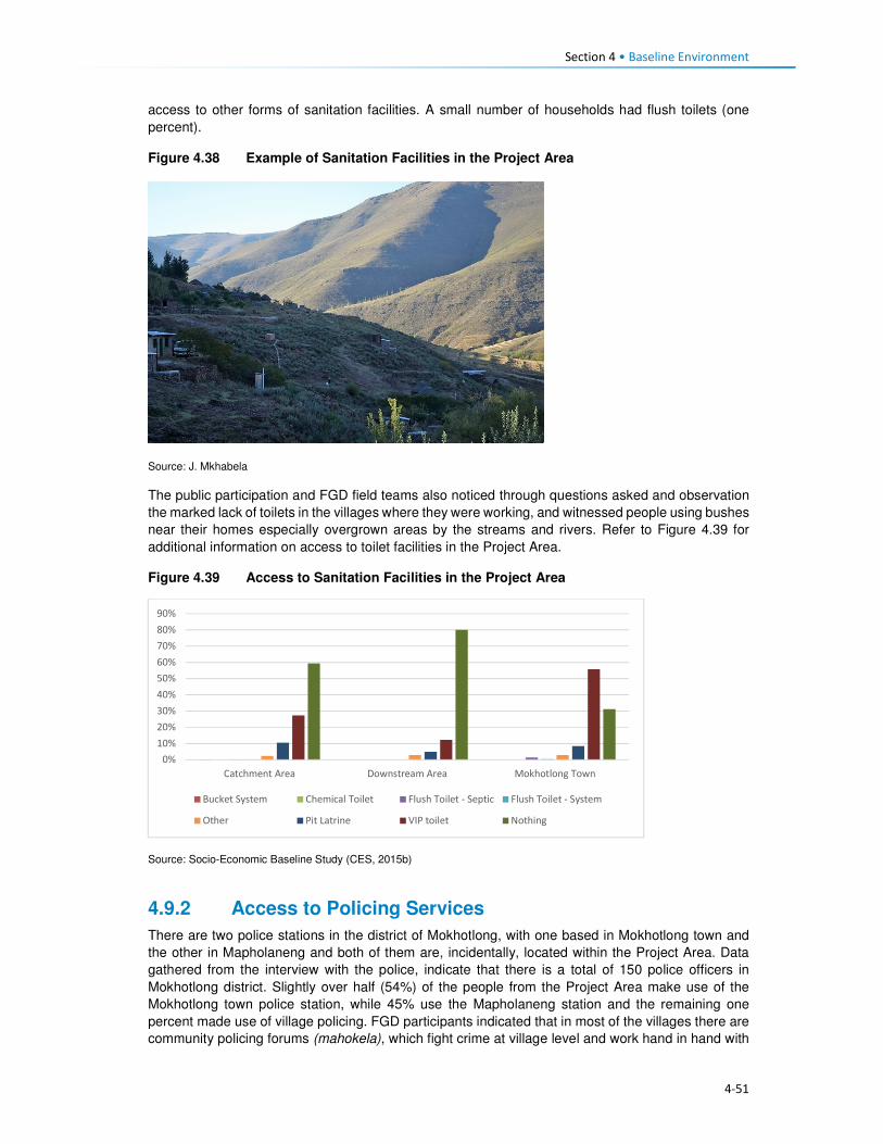
Section 4 • Baseline Environment
4-51
access to other forms of sanitation facilities. A small number of households had flush toilets (one
percent).
Figure 4.38 Example of Sanitation Facilities in the Project Area
Source: J. Mkhabela
The public participation and FGD field teams also noticed through questions asked and observation
the marked lack of toilets in the villages where they were working, and witnessed people using bushes
near their homes especially overgrown areas by the streams and rivers. Refer to Figure 4.39 for
additional information on access to toilet facilities in the Project Area.
Figure 4.39 Access to Sanitation Facilities in the Project Area
Source: Socio-Economic Baseline Study (CES, 2015b)
4.9.2 Access to Policing Services
There are two police stations in the district of Mokhotlong, with one based in Mokhotlong town and
the other in Mapholaneng and both of them are, incidentally, located within the Project Area. Data
gathered from the interview with the police, indicate that there is a total of 150 police officers in
Mokhotlong district. Slightly over half (54%) of the people from the Project Area make use of the
Mokhotlong town police station, while 45% use the Mapholaneng station and the remaining one
percent made use of village policing. FGD participants indicated that in most of the villages there are
community policing forums (mahokela), which fight crime at village level and work hand in hand with
0%
10%
20%
30%
40%
50%
60%
70%
80%
90%
Catchment Area Downstream Area Mokhotlong Town
Bucket System Chemical Toilet Flush Toilet - Septic Flush Toilet - System
Other Pit Latrine VIP toilet Nothing

Section 4 • Baseline Environment
4-52
the local police stations. They deal mainly with minor crimes, practicing what is known as Restorative
Justice. There is only one prison of minimum security in the district of Mokhotlong.
One of the aspects that community members requested from the LHDA was to assist with construction
of satellite police stations in their areas/villages as a measure to combating crime. Some of the crimes
that already exist in the Project Area are petty in nature (according to the interview conducted with a
police officer at Mokhotlong Police station), (including stock theft, home break-ins as well as stealing
of crops), however, for rural agrarian communities these are regarded as serious. There is concern
among the police about the increasing number of illegal firearms in the district, owned mostly by
dagga smugglers.
Crime prevention is slow due to a lack of vehicles for police and an expectation for police to walk
where cars cannot drive. There are six vehicles in the district; however, during servicing times only
two vehicles are available.
Figure 4.40 Access to Policing Services
Source: Socio-Economic Baseline Study (CES, 2015b)
According to the interviewed community members, crimes in the area were committed at any time of
the day in both homesteads and cattle posts. Recently the thieves were mostly armed with knives
and guns. The thieves were said to kill the watch dogs and sometimes the livestock owners too. The
scale of livestock theft was reported to be severe with thieves stealing the herd of livestock. The high
levels of livestock theft were attributed to increasing levels of poverty in the area as well as low police
presence in some villages. General home break-ins were reported to occur mainly in households
occupied by the elderly. Often the thieves would steal farming equipment, crops and general
household items such radios, televisions, etc. Other criminal activities experienced in the area were
rapes, domestic abuse, fighting, which the respondents attributed to alcohol abuse. FGD participants
from the whole Project Area cited stock theft as one of the big challenges experienced in livestock
keeping. The other crimes such as rapes, domestic abuse, fighting were also mentioned across the
Project Area by the FGD participants. They also anticipate that the commencement of the
construction works may bring more outsiders to the Project Area and thereby increase the incidences
of crime, especially livestock theft and theft of field crops.
4.9.3 Access to Local Court
From observation three magistrate courts were seen in Mokhotlong District, one at Mokhotlong town,
the others at Mapholaneng and Phahameng. Access to local court services, was indicated as easier
compared to other public services in the Project Area, with an average of 42% of the respondents
reporting to have a court within their village or neighbouring settlement, as reflected in Figure 4.41.
0%
10%
20%
30%
40%
50%
60%
70%
80%
90%
100%
Village Neighbouring
Village
Closest Town Mapholaneng
Town
Mokhotlong
Town
Other
Catchment Area
Downstream Area
Mokhotlong Town
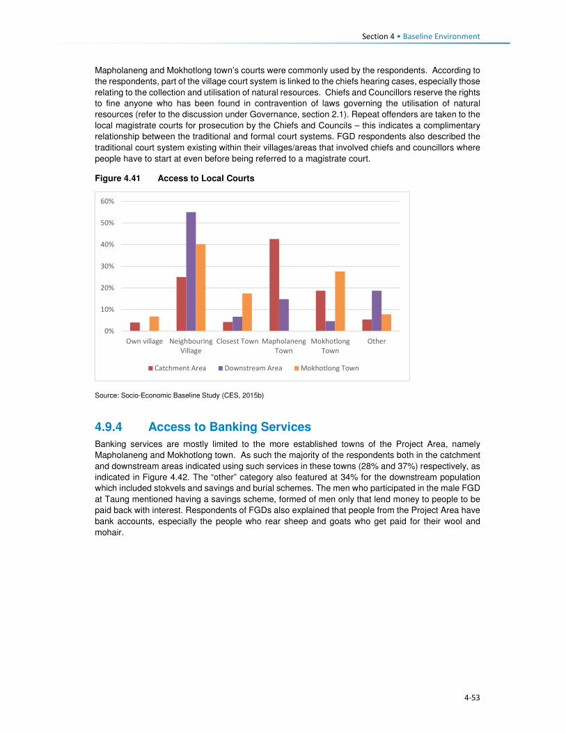
Section 4 • Baseline Environment
4-53
Mapholaneng and Mokhotlong town’s courts were commonly used by the respondents. According to
the respondents, part of the village court system is linked to the chiefs hearing cases, especially those
relating to the collection and utilisation of natural resources. Chiefs and Councillors reserve the rights
to fine anyone who has been found in contravention of laws governing the utilisation of natural
resources (refer to the discussion under Governance, section 2.1). Repeat offenders are taken to the
local magistrate courts for prosecution by the Chiefs and Councils – this indicates a complimentary
relationship between the traditional and formal court systems. FGD respondents also described the
traditional court system existing within their villages/areas that involved chiefs and councillors where
people have to start at even before being referred to a magistrate court.
Figure 4.41 Access to Local Courts
Source: Socio-Economic Baseline Study (CES, 2015b)
4.9.4 Access to Banking Services
Banking services are mostly limited to the more established towns of the Project Area, namely
Mapholaneng and Mokhotlong town. As such the majority of the respondents both in the catchment
and downstream areas indicated using such services in these towns (28% and 37%) respectively, as
indicated in Figure 4.42. The “other” category also featured at 34% for the downstream population
which included stokvels and savings and burial schemes. The men who participated in the male FGD
at Taung mentioned having a savings scheme, formed of men only that lend money to people to be
paid back with interest. Respondents of FGDs also explained that people from the Project Area have
bank accounts, especially the people who rear sheep and goats who get paid for their wool and
mohair.
0%
10%
20%
30%
40%
50%
60%
Own village Neighbouring
Village
Closest Town Mapholaneng
Town
Mokhotlong
Town
Other
Catchment Area Downstream Area Mokhotlong Town
Section 4 • Baseline Environment
4-54
Figure 4.42 Access to Banking Services
Source: Socio-Economic Baseline Study (CES, 2015b)
4.9.5 Access to Agricultural Input and Equipment
Again, the most established towns of Mapholaneng and Mokhotlong were identified as the main areas
where people purchase agricultural inputs and equipment. The population from the downstream area
indicated that they purchase their agricultural inputs and equipment in various locations, as indicated
below. This could be attributed to various factors but more specifically issues of access, some
downstream areas are located closer to Mokhotlong, Mapholaneng, Tlokoeng and Katse and these
areas also have outlets that sell agricultural inputs and equipment.
Figure 4.43 Access to Agricultural Inputs and Equipment
Source: Socio-Economic Baseline Study (CES, 2015b)
4.9.6 Access to Local Markets and Shops
Overall, 35% of food purchases were reported to occur within the home or neighbouring villages, with
the towns of Mapholaneng and Mokhotlong accounting for 23% and 24% of all purchases,
respectively. It stands to reason that easy access to food shops within one’s own village would reduce
the amount of time and cost incurred in purchasing food, whilst visiting the town area may result in
0%
10%20%
30%40%
50%60%
70%80%
90%100%
Own village NeighbouringVillage
Closest TownMapholaneng MokhotlongTown
Other
Catchment Area Downstream Area Mokhotlong Town
0%
10%
20%
30%
40%
50%
60%
70%
80%
90%
100%
Catchment Area Downstream Area Mokhotlong Town
Village Neighbouring Village Closest Town Mapholaneng Mokhotlong Town Other

Section 4 • Baseline Environment
4-55
increased time and travel costs in purchasing food and decrease the amount of food purchased in
order to cover the costs of transportation. Furthermore, people within the catchment area are likely to
purchase food stuff in Mokhotlong town which is closest to their locale, while people in the western
part of the catchment area would purchase food in Mapholaneng and Thaba-Tseka. The latter could
be better accessed by people from the villages downstream of the Dam, who are already located
within Thaba-Tseka District.
Figure 4.44 Access to Local Markets and Shops
Source: Socio-Economic Baseline Study (CES, 2015b)
4.9.7 Access to Telecommunications
Telecommunication services in the Project Area are concentrated in the established town areas of
Mokhotlong and Mapholaneng. In these areas, people have both access to landline telephones and
cellular phones. For obvious reasons, the number of households with cellular phones outweighs
those with landline telephones. The more remote parts of the Project Area have no cellular phone
signal as such, hence the ownership and use of cellular phones is limited, though the people pointed
out that they still buy and own cellular phones in the hope that they will eventually get
telecommunication towers. Similarly, to ownership of landline telephones, computer access was
found to be concentrated in the town areas. Overall, 22% of the population in the Project Area
reportedly did not have access to any means of telecommunications; information to these
communities is passed on through the word of mouth.
4.9.8 Access to Transportation
There is only one road that links Mapholaneng to Mokhotlong town. It is also one of the two only
tarred roads within Mokhotlong District. The other tarred road leads from Mokhotlong town to Sani
Pass. Besides these two there are other unpaved roads that form a network of roads that are used to
access villages located around the proposed dam. The roads are in different levels of disrepair with
some that were observed to be totally untraversable. The other major road that is found in the district
is the one connecting the District of Mokhotlong to that of Thaba-Tseka. It has been observed to be
unpaved and in a bad condition is some areas if not all. Some of the road and bridges are observed
to be going to be inundated when one looks at where the beacons have been installed.
The FGD respondents from the Project Area are concerned about the loss of the roads and bridges
to be inundated and would like the LHDA to replace them as a form of mitigation. The respondents
from the eastern side of the proposed dam are concerned that LHDA has not said anything to them
about a tarred road on their side of the dam. They complained that all the proposed project
infrastructure is on the Tlokoeng side of the dam. They are also concerned that there is no tarred
0%
20%
40%
60%
80%
100%
Catchment Area Downstream Area Mokhotlong Town
Village Neighbouring Village Closest Town
Mapholaneng Mokhotlong Town Other

Section 4 • Baseline Environment
4-56
road and bridge that seems to be planned to connect the Khalahali side of the dam to that of Tlokoeng.
They are very concerned that they are expected to go via Mokhotlong and Mapholaneng towns when
they travel to the other side of the river (Tlokoeng side). They are even worried that they will not be
able to cross the Senqu River to go and look for work when construction works commence.
The modes of transport currently used include walking, horse-riding, use of taxis and buses, with
donkeys used as beasts of burden and for transport. The respondents from the Project Area, including
downstream would like to see LHDA assist them with construction of feeder roads to make it easier
to reach their villages, health centres, schools and the Mokhotlong town.
4.10 Vulnerability and Marginalisation Vulnerable or disadvantage groups are defined by IFC as individuals or groups within the Project
Area who could experience adverse impacts from the proposed Project more severely than others
based on their vulnerable or disadvantaged status. This status may stem from an individual's or
group's race, colour, gender, language, religion, political, or other opinion, national or social origin,
property, birth or other status. In addition other factors should be considered such as gender, ethnicity,
culture, sickness, physical or mental disability, poverty or economic disadvantage, and dependence
on unique natural resources15. In the Project Area, the broad categories of people who should be
considered to have some level of vulnerability are:
• Women;
• The elderly;
• Youth;
• Herd boys;
• Orphaned children; and
• Disabled or chronically ill persons.
These groups are described in more detail in the following sections.
The Ministry of Social Development is responsible for leading and facilitating the provision of
sustainable social development services that are universally accessible to all groups of people in
Lesotho in collaboration with other key stakeholder. The ministry in partnership with other key
stakeholders has over the recent years implemented a number of social protection initiatives such as
the:
• School feeding programme that is linked to free primary education and health care,
• Old age pension which is offered on a universal basis to all qualifying citizens;
• Child grant programme (CGP);
• OVC bursary programme;
• Public assistance programme; and
• Implementation of the national information system for social assistance (NISSA); which begun as
a tool of the CGP.
In 2014 the ministry through the assistance of the European Union and UNICEF developed the
National Social Protection Strategy (2014/15 – 2018/19) which was officially launched in 2015 (See
Section 2.2).
4.10.1 Women
Women of the Project Area are mainly regarded as vulnerable due to the poor / or inadequate access
to public services such as health care. Women dwelling in a village without a health centre often give
15IFC Glossary of Terms, http://www1.ifc.org/wps/wcm/connect/corp_ext_content/ifc_external_corporate_site/home

Section 4 • Baseline Environment
4-57
birth at home or are expected to leave their homes to await childbirth in another village whilst living
with non-family/ non-relations. In case of medical emergencies during home births, women are often
at higher risk because of the lack of transportation.
Similarly, to most youths in the District and Project Area, the population has a shortage of high
schools, and the distances that will be required to walk to and from school discourages the people
from attending school. Women’s vulnerability as it relates to the Project may be linked to low potential
for women to securing to long-term permanent jobs due to their low levels of education and possibly
lack of skills to carryout jobs beyond cleaning services. Both women and youth of limited education
are more unlikely to secure jobs during the construction and operational phases and they would both
be deemed vulnerable.
Loss of land by female headed households due the Project land take will increase their vulnerability
should their land acquired by the Project be not replaced.
4.10.2 The Elderly
The elderly are generally recognised as being vulnerable due to their age. The elderly remains in
high social standing as long as they are productive; however, they lose this standing once they
become dependent on the younger generations for assistance in meeting their basic needs (e.g.
housing, water, food). Furthermore, the elderly is often targeted by criminals for their pension. The
elderly are usually not in a position to take advantage of the benefits typically associated with large
projects such as the Polihali Dam Project.
4.10.3 Youths
For the purposes of this assessment, youth are quantitatively defined as persons aged approximately
15 to 35 or, recognising variations by cultural context, qualitatively defined by their degree of
independence with respect to their obtainment of a livelihood, relationship status (i.e. marriage,
children), and living arrangements.
Youth can be recognised as vulnerable, though in a way distinct from other categories listed above.
Being at their physical prime but often facing an unknown future, youth may be seen as both
empowered and disempowered. Youth are vulnerable in the sense that they are between dependence
(childhood) and independence (adulthood) and, without access to resources and support to enable
their transition to adulthood, youth may face a large degree of instability in their lives. Youth only
inherit land once they have reached full adulthood and marriage, and until then are dependent on
their parents.
Another characteristic of youth is that it is a time when individuals are developing their identities and
questioning societal norms; when youth perceive that their economic and social prospects are poor,
they may engage in antisocial behaviour. Youths within the Project Area often lack the education,
skills and qualifications to secure meaningful jobs. In case of youths still in school, there exists a hope
that they will in the future, secure scholarships or bursaries and subsequently employment with the
Project to attained tertiary education.
4.10.4 Herd boys
Herd boys are often youths who left school early due to their impoverished families not being able to
pay for their way through school, while some leave school to pursue livestock herding in order to start
building their livestock herds. The lifestyle of herd boys is tough and dangerous due to the period of
time spent away from home living in cattle posts located high in the mountains. In the winter months
when it snows many die in fires when they fall asleep without putting fires out. Sometimes, herd boys
are killed by robbers raiding their cattle posts to steal livestock; or in violent fights between the
herders.
Herd boys who choose to leave their jobs in anticipation to secure permanent work with the Project
may be vulnerable should they fail to secure the anticipated jobs with the Project. Given the general

Section 4 • Baseline Environment
4-58
lack of employment opportunities and the herd boys lack of schooling and skills beyond livestock
herding, they will find it difficult to secure a new job thus losing their source of stable income.
4.10.5 Orphaned Children
Orphaned children in the area are vulnerable due to the poor care they receive from extended family
upon the death of their parents or guardians. They often do not attend school or receive any medical
care. The ages of orphans who are eligible for project related benefits range from 0 -17.
4.10.6 Disabled or Chronically Ill Persons
Disabled persons should be recognised as vulnerable as they are unlikely to be able to access the
Project benefits but would be vulnerable to change brought about by the Project. People living with
HIV/AIDS and TB can be considered to be disabled as their ability to remain healthy and maintain
their livelihoods is often compromised by their illness.

5-1
Section 5 Impact Assessment
5.1 Introduction This section provides a description of the predicted social impacts associated with implementation of
the Project. The impacts are mostly divided in accordance to the various phases of the Project, with
the exception of impacts whose impact significance remains unchanged in all phases.
5.2 Overview and Context 5.2.1 Overview
This section assesses the socio-economic impacts and benefits anticipated during the construction
and inundation phases of the Project. The impacts have been assessed against the backdrop of the
baseline socio-economic environment (Section 4). One of the most significant socio-economic impacts
arising from the Project is the need for resettlement of at least 203 households from below the FSL
and the relocation of a further 134 households that may be dangerously located, together with
extensive loss of arable and grazing land. This will result in a number of related impacts on the already
strained and limited natural resources in the area. The physical and economic displacement impacts
are described in Sections 5.3 and 5.3.1.1.
The construction phase of the Project is scheduled to take five to seven years to complete, with
construction activities ramping up during the construction of the dam and appurtenant works. At its
peak, 3500-4000 jobs will be created which will bring both benefits (local job creation) and negative
impacts (influx of work-seekers, anti-social behaviour, pressure on local infrastructure, etc.). The
realisation of the benefits and the mitigation of the impacts will take careful management and
collaboration between LHDA and various government departments as discussed below.
5.2.2 Community Expectations Related to the Project
During the stakeholder engagement process (undertaken between September 2016 (commencement
of sensitisation meetings) and March 2017), it was evident that the majority of people living in the
Project Area are in support of the Project and are hopeful of the many anticipated social and economic
benefits that will be realised. While many concerns and questions were raised, the communities are
impatient for the project to start, after many years of planning and ongoing consultation for different
studies. The communities in the Project Area have exceedingly high expectations of the real and
perceived benefits. The Stakeholder Engagement Report documents the issues and expectations
raised by all stakeholders consulted (Sechaba & ERM, 2017).
As with any large-scale project, the surrounding communities immediately begin to anticipate benefits;
some are real and some are possible but will not arise as a direct result of this Project. During the
stakeholder engagement and data gathering forums, people grabbed the opportunity to highlight their
needs16. Many of these needs are linked directly to the lack of social infrastructure and services in the
Project Area. It was evident that they anticipate that, over time, relevant authorities and service
providers will deliver much needed social infrastructure and services thus serving to improve their
overall quality of life. Based on this feedback, it is clear that the community have unreasonably high
expectations of LHDA, their appointed contractors, and other government authorities (e.g. LEC) in
terms of delivering benefits and addressing needs. While it is conceivable that, over time, social
infrastructure and services could be delivered, this is not going to be as a direct result of this Project
16 Respondents were asked to identify potential positive and negative impacts that they expected to arise as a result of the
Project; some of the positive impacts raised were perceived benefits/ needs that could potentially be delivered in the future by responsible parties’ due to improved access. They were informed that these benefits are not going to arise as a direct result of LHDA, the appointed contractors or the authorities.
Section 5 • Impact Assessment
5-2
or the Project role-players. The anticipated benefits based on high community expectations that were
raised in the meetings include:
• Provision and improvement of public services and infrastructure such as high schools, health
centres, improved road access, improved sanitation and water facilities;
• Electrification of local households;
• Early receipt of compensation for all losses incurred (i.e. prior to actual loss of land/ structures);
• Provision of scholarships and bursaries for local youths;
• Local upskilling and work experience;
• Creation of employment opportunities;
• Prioritisation of local people for all unskilled jobs;
• Sharing benefits of revenue paid by South Africa to the Government of Lesotho;
• New market opportunities to encourage trading and increased local business activity; and
• Reduction of crime due to increased police presence in the area.
It is possible that these high expectations, if not met, may lead to increased levels of dissatisfaction
and future grievances. Stakeholders have already indicated that there is a significant time lapse
between registering grievances to their resolution. It is, therefore, possible that if the expectations of
the Project are not met, levels of dissatisfaction may escalate to the point of general unrest and conflict.
Recommendations to address the high expectations of the Project stakeholders are proposed below.
5.2.2.1 Recommended Mitigation Measures
• Continued engagement with communities through the existing structures formed; with the LHDA
continuing to monitor the current stakeholder engagement procedures for improvements when
required;
• LHDA will clearly communicate with communities the ambit of LHDA / contractor responsibilities,
and government responsibilities, and shared responsibilities where formal MoUs exist;
• LHDA and the appointed contractors will implement measures to maximise local employment and
business developments and opportunities, as outlined in Sections 5.3.5.4 and 5.3.6.4;
• Through the CLCs, LHDA will increase awareness of the grievance resolution procedure amongst
the communities;
• LHDA must ensure that all registered stakeholder grievances are responded to timeously;
• LHDA will continuously monitor the use of the procedure;
• Communities throughout the Project Area should be included within livelihood restoration and
social development initiatives as part of the SDMP for LHWP Phase II, which will serve to address
some of the expectations of the local communities. LHDA and the appointed contractors will
continue to work closely with the CLCs to ensure on-going identification and management of
stakeholder issues and concerns, where possible, and in accordance with the SDMP;
• LHDA will regularly communicate information updates about the Project activities as well as SDMP
projects and benefits, as required; and
• LHDA must communicate and coordinate the planning and implementation of community projects
so that there is uniformity in their approach. This will avoid stakeholder confusion about the roles
of the various partners.
5.2.3 Project Area Context and Sense of Place
The Project Area is predominantly rural in character. Villages are scattered throughout the area, the
majority of which are relatively isolated given the degraded state of the road network. Those located
closest to the A1 between Mapholaneng and Mokhotlong are the most accessible. Except for villages
located on the more passable unpaved roads which are served by taxis, transport to and from villages
is generally on foot, donkey or horse and most household supplies are transported on donkeys.
The villages are each relatively small (mostly numbering between 20 and 100 homesteads) and
comprise residential structures and outbuildings, which are largely constructed of locally sourced

Section 5 • Impact Assessment
5-3
materials (stone, mud, and thatch). Houses in the larger settlements along the paved or major unpaved
roads may be of concrete brick and corrugated iron.
Most families use woody shrubs, cow dung and some wood as their primary fuel source; the cost of
other fuel sources is prohibitive for most households. The only villages that have electrical connections
are in Mokhotlong and Mapholaneng, and some villages along the A1. There are no large-scale
commercial or industrial developments in the area.
The surrounding landscape is generally steep and sparsely vegetated with grass interspersed with
rocky outcrops. Lower gradient slopes along the river and stream valleys and where deeper soils occur
on the plateau and higher slopes, are used for cropping predominantly maize and wheat. Cropping
and livestock farming is the mainstay of the majority of households. Noise and light levels are low.
For most of the population, this rural environment and lifestyle is all they know. The families living
throughout the area are reliant on the land and work very hard to sustain themselves. To them, this is
a harsh environment that is isolated and remote, resulting in limited opportunities and a lack of much
needed social infrastructure and essential services. To privileged outsiders, the peace and quiet, and
‘quaint’ traditional villages are considered to be a desirable relief from high-paced city life.
The photographs in Figure 5.1 illustrate the physical landscape and provides a general sense of the
remoteness and character of the Project Area.
Based on feedback during stakeholder engagement, the majority of the local people are looking
forward to the construction and operation of the Project. It appears that to most people, this symbolises
positive changes that will bring about much needed development and more diverse economic
opportunities. The anticipated changes are directly related to meeting basic needs and improving the
quality of life for local residents; including improved access to schooling, healthcare, water, sanitation,
electricity, transport options, and economic opportunities. People are also aware of some of the risks,
many of these were raised and have been incorporated and assessed as part of this SIA.
Sense of place is the unique value that is allocated to a specific place or area through the cognitive
experience of the user or viewer. It is generated by varying combinations of a range of factors
including; land use, character and quality of a landscape, as well as by the tangible and intangible
value assigned thereto. As such, sense of place is a subjective matter that differs from person to
person based on individual backgrounds, experiences, norms, values and aspirations. It is almost
impossible to describe, let alone quantify the sense of place and the potential impacts thereon. One
thing is for certain, this Project, and the associated Project components, will result in significant
changes to the area. Influx of workers and work-seekers will bring both positive and negative impacts,
there is potential for improved infrastructure and services, and there will be increased opportunities to
generate income resulting from greater demand for goods and services, as well as improved access
to outside markets.
While many factors that influence the sense of place are tangible (e.g. increased development, more
people, noise, visual changes, dust), sense of place can also be significantly altered as a result of a
change in intangible factors (e.g. socio-cultural norms and values). With an influx of people from
outside the area, as well as work experience and increased disposable income, the local people will
be exposed to differing world views, cultures, attitudes, norms and values. Naturally, people will begin
to change based on these interactions. This change will be experienced gradually overtime as people
slowly become influenced and affected by these external factors.

Section 5 • Impact Assessment
5-4
Figure 5.1 Photographs Illustrating the Look and ‘Feel’ of the Project Area (Top: view
towards dam wall location at centre; Bottom: view of Tloha-re-Bue near
construction areas)
Some residents (predominantly young and more educated people) will welcome these changes and
opportunities and will be able to maximise the resultant benefits. Other people (predominantly the
elderly, less educated and more traditional) may find it difficult to adapt to (or resist) the inevitable
changes and will therefore be more likely to experience the negative impacts more acutely. Either way,
the sense of place will be altered and cannot be prevented or reversed. The positive and negative
impacts described for the construction and operation phases of the Project can be mitigated, in part,
thus hopefully reducing the negative impacts and enhancing the positive impacts. However, change
is inevitable and cannot be fully controlled.
The changed sense of place (including changed culture, norms and values) could give rise to
increased levels of anxiety, tension and conflict. In response, the population may direct their
dissatisfaction toward the Project. Impacts on sense of place and changed socio-cultural norms and
values cannot be mitigated directly; they will be addressed indirectly through the mitigation measures
proposed for the socio-economic impacts detailed in the remainder of this section.

Section 5 • Impact Assessment
5-5
5.2.4 Local Economy
As described in Section 4.4, the population is currently relatively isolated with limited economic
opportunities beyond subsistence based agriculture. They have expressed high expectations for
employment and business opportunities associated with the Project, and they anticipate that these
opportunities will in turn bring about improvements in their standard of living. Comments raised during
stakeholder engagement are documented in Annexure K, Volume 3 (Sechaba & ERM, 2017). Many
opportunities will be created via direct, indirect and induced employment, procurement, and through
local business development opportunities to meet the increasing demand for goods and services by
Project workers and work-seekers. The majority of these opportunities will be available during the
construction phase and will decrease significantly during the operational phase. It is unlikely that the
high expectations for an improved standard of living will be realised. The anticipated impacts on the
local economy are discussed in Sections 5.3.5; 5.3.6; and 5.3.7.
5.2.5 Project Land Acquisition
In order to implement the Project, an estimated 5600 ha of land will need to be permanently acquired
from the Mokhotlong District’s total land area of 4 075km2 (~407 500 ha). The land acquired will equate
to approximately 1% of the total District area. The land take will affect four Community Councils which
the Project footprint will straddle, namely Seatle, Bokong, Malingoaneng, and Mphokojoane
Community Councils, and one Urban Council (Mokhotlong). The loss of land will occur mainly within
the catchment area indicated by the red line in Figure 5.2.
Figure 5.2 Project Catchment Area
The acquisition of land for the Project will result in both physical and economic displacement of people,
and households. The main Project components that will result in displacement of households are the
site establishment area, dam and tunnel works areas, as well as the inundation area. The land
acquisition will occur in three phases (over a five-year period). These phases are as follows:
Phase 1. Temporary and permanent acquisition in the site establishment area for the Advance
Infrastructure. These activities will affect villages of Masakong and Ha Tlhakola villages, as well as

Section 5 • Impact Assessment
5-6
households from Ramonakalali, Mabunyaneng, Makalong and Tsekong. Masakong and Ha Tlhakola
will be affected by physical and economic displacement and the remainder by economic displacement
(Figure 5.2).
Phase 2. Permanent land acquisition in the inundation area around Tloha-re-Bue and the remainder
of the site establishment area (for instance the Tunnel Works Area, Substation, but also the PNEAR-
not part of this ESIA). Tloha-re-Bue is partly affected by physical and economic displacement.
Phase 3. The remainder of the inundation area, covering several villages including Ha Jobere, Koung
Ha Phohla, Tsekong and Litsotsong, and Ha Sikantsi are all affected to varying degrees by physical
and economic displacement; and all economic displacement (loss of fields, trees and thickets within
the inundation area) affecting households in surrounding villages, which are not physically affected.
The land that will be affected is currently used for grazing, collection of natural resources, cultivation
of crops, and settlements as depicted in Table 5.1; with land used for grazing being most affected and
the primary land use of the land. Figure 5.3 indicates villages that will experience physical and
economic displacement.
Table 5.1 Land use distribution within the Catchment Area
Land use (across the Catchment Area) Land area per use
Cultivated areas 13 176 ha (35%) Settlement areas 2280 ha (6%)
Grazing areas 19 365 ha (52%)
Mountainous areas 2687 ha (7%)
Source: P2W-6014-DFR-0007, 2017
Table 5.2 highlights all the villages and the approximate number of households per village likely to
be physically displaced by the Project. Figures provided in this table are estimated numbers based
on the Feasibility Study and current predictions. These still need to be verified by the resettlement
specialist team
Table 5.2 Estimate of Villages and Households to be Displaced
Classification Village name Households below reservoir demarcation line (DL)
Households dangerously located
Fully below Reservoir DL Map ref. 1 to 5
Ha Jobere 6 Unknown
Ha Tlhakola 18 Unknown
Lits'otsong 5 Unknown
Tsekong 28 Unknown
Ha Sekants’i 13 13
Partially below Reservoir DL Map ref. 6 to 8
Tloha-re-Bue 40 13
Koung Ha Phohla 32 36
Sekokong 3 5
Site establishment area Map ref. 9 & 10
Masakong 50 Unknown
Malingoaneng & Meeling
8 41
Potentially Dangerous Location (safety) Map ref. 11 to 16
Liphokong Unknown (7)
Ha Mpesi Unknown (4)
Koung Ha Thunyane Unknown (3)
Ha Meta /Ha Manka Unknown (3)
Makhalong Unknown (3)
Lilimala Unknown (6)
Potential Isolation Map ref. 17 & 18
Bokone & Morojeleng Unknown Unknown
Total 18 203 95 (+26 unbudgeted for) 121

5-7
Figure 5.3 Villages Likely to be Displaced by the Project

Section 5 • Impact Assessment
5-8
To mitigate for the loss associated with the Project land acquisition, LHDA has appointed a
resettlement planning consultant, as well as developed two critical documents, namely Phase II
Compensation Policy, 26 August, 2016 and the Livelihood Restoration and Social Development
Framework (LR&SDF), August, 2017.
The Compensation Policy provides the guiding principles for compensation of all losses that will be
incurred by Project affected households and communities. The Policy was developed on the basis of
consultations with affected communities, their authorities and other key stakeholders. English and
Sesotho versions of the Policy were made available to affected communities via the local authority
structures (District Councils, Urban Councils, Community Councils and Chiefs) as well as through local
participation structures set up for Phase II. The Policy objectives are:
• To minimise involuntary land take by investigating all possible Project design alternatives;
• To ensure that affected people and communities, including host communities are meaningfully
consulted on Project designs, alternatives and impacts;
• To promote affected people’s participation in the planning, implementation and monitoring of
compensation, resettlement, mitigation and development measures;
• To ensure that relocation of households and businesses is undertaken in a participative,
systematic and beneficial manner, involving both displaced and host communities;
• To ensure that affected people are promptly, fairly and fully compensated for their losses; and
• To ensure that direct compensation is accompanied by additional measures where necessary to
help restore livelihoods.
The Policy makes the following provisions in terms of losses of houses, associated structures and
residential plots:
All structures requiring relocation will be compensated on the principles of replacement cost in the
form of replacement housing provided by the Project, direct construction by the owner (owner-builder
method), or lump sum cash compensation (which will be assessed on a case-by-case basis).
Provision for replacement housing will comply with the following criteria:
• Replacement houses will be constructed at Project-designated resettlement sites or sites within
the Project Area identified by households and approved by LHDA and local authorities.
• Replacement houses will have the same floor area as the current houses, with the exception of
houses that are less than 20 m2 – the house will be replaced with a 20 m2 structure.
• Replacement houses will be constructed with standard modern materials or traditional building
materials if requested by affected households.
• Replacement housing will adhere to the country’s building and sanitation standards as a minimum
requirement, with a twelve (12) month defects liability period.
• Households will participate in the design and layout of replacement houses and will be presented
with a number of final designs from which to choose.
• Each household will be provided with a toilet of at least ventilated improved pit latrine (VIP)
standard.
• An appropriate cooking and heating facility or traditional fireplace (where requested and feasible)
will be provided in the new house.
• Each new residential plot will be fenced, up to a maximum residential plot size of 1000 m2 and, if
a household has a larger fencing entitlement, the difference will be compensated as a lump sum.
Loss of agricultural fields will be compensated through one or a combination of replacement land,
lump sum or annual payments, and/ or annual grain payments. The provision of replacement land is
the preferred option.
LHDA has further developed a LR&SDF which aims to set the context for the restoration of the
livelihoods of households affected by Phase II, and to ensure the provision of opportunities for the
diversification and improvement of livelihood-earning activities. The main guiding principles for the
Framework are:

Section 5 • Impact Assessment
5-9
• Principle 1: Livelihood restoration and social development initiatives will be undertaken within a
framework that supports local, regional and national development.
• Principle 2: Livelihood restoration and social development initiatives will be informed by the views
of the affected communities.
• Principle 3: Partnerships will be established for the planning, implementation and handover of
livelihood restoration and social development initiatives to communities.
• Principle 4: Livelihood restoration measures and social development initiatives will be monitored
and evaluated in a controlled manner in partnership with the intended programme beneficiaries.
• Principle 5: The objectives of management of land, water and living resources are a matter of
societal choice involving all relevant sectors of society.
Compensation for fields will be made to the field holder and his/her legally verified heir(s) and
successor(s) by means of a lump sum payment or through an agreed number of instalments, up to a
maximum of 50 annual instalments, into a nominated account or through investment with an approved
financial institution. The form of payment will be considered on a case-by-case basis, taking account
of the economic status and means of the household, and the wishes and preferences of the spouse
and other household members. Lump sum payments will be discounted at the rate established under
the approved compensation rates.
Grain payments will be retained as a compensation option. Grain compensation will be directly
proportional to the area of land lost, and paid annually for a period of fifty (50) years. Compensation
payments for garden land may be made as a lump sum or on an annual basis (fifty (50) years),
according to the preference of the affected household, except where a household who had a food
garden relocates to an area of its own choice outside the Project area, in which case compensation
will be in the form of a lump sum. Lump sum payments will be discounted at the rate established
under the approved compensation rates.
Communal assets such as grazing land, brush, wood, medicinal plants, useful grasses and wild
vegetables will be compensated through the establishment of Compensation Funds which will be
setup at a Community Council level and will be managed by LHDA. Compensation Funds will be made
available for investment and implementation of community development projects agreed and
prioritised by the local Council and the affected households. As households will be allowed to resettle
outside of their Community Council areas, the Compensation Funds for loss of communal assets will
be dispensed between the affected local councils (including host councils) based on the number of
displaced households relocating within/ or to each area.
The Policy furthermore, defines households headed by orphans, by persons living with a disability or
by elderly, or indigent persons as vulnerable. The Policy indicates that vulnerable households will
receive individual attention from LHDA as well as the relevant government agencies. Where possible,
the assistance of certain NGOs will be requested at the expense of LHDA. As far as reasonably
possible, LHDA will ensure that vulnerable households are enabled to retain, and where possible,
improve upon the standard of living they had prior to being affected by the Project. Possible support
measures for vulnerable (although not limited to vulnerable) households could include skills training
opportunities as applicable; income-generating or alternative livelihood earning opportunities (subject
to detailed feasibility studies); and assistance to get access to available poverty alleviation or social
welfare programmes.
Loss of access routes will be compensated for through the construction of footbridges, upgrading of
certain roads. This study for this has been commissioned under Contract 6019.
Apart from temporary relocation to accelerated access to cultivation land will be facilitated through
temporary land acquisition which will become permanent acquisition as part of the resettlement
planning process for a particular area. The temporary relocation will be discussed with affected
households and suitable temporary relocation arrangements will be made to allow households to
continue their social lives and livelihood activities.

Section 5 • Impact Assessment
5-10
Additional impacts that are linked to the Project’s land requirements include the loss of access to
rangelands, and loss of graves. These impacts have been described, assessed and mitigated for in
the respective specialist studies. Refer to:
• Soils Specialist Study (ERS, 2017; P2W-6014-DFR-0007);
• Rangelands Specialist Study (Ramatla & Kheekhe, 2017; P2W-6014-DFR-0009);
• Cultural Heritage Specialist Study (MM&A, 2017; P2W-6014-DFR-0003); and
• Terrestrial Ecology Specialist Study (Ecorex & Kobisi; P2W-6014-DFR-0002).
5.3 Construction and Inundation Phase Impacts 5.3.1 Impact of Physical Displacement and Resettlement
5.3.1.1 Description of Impact
The IFC PS5 (2012) describes physical displacement as the relocation or loss of shelter and other
household structures, and/ or restrictions on land use. During the construction and inundation phases,
the Project will result in physical displacement and relocation of at least 203 households in 11 villages
below the reservoir FSL, and possibly an additional 108-134 households in 11 villages which are
dangerously located in relation to the reservoir and may need to be relocated (see Table 5.2). In
addition to the affected households, there will also be impacts to a range of community and social
infrastructure and services; including roads, water sources, schools, clinics, markets/ commercial
areas, small businesses, and even the prison located at the town of Mokhotlong.
As described in Section 5.2.5, during Phases 1 and 2, there will be permanent physical displacement
of households from Masakong and Ha Tlhakola (resulting from the Phase 1 advance works
programme), and of households in the inundation area around Tloha-re-Bue and the remainder of the
site establishment area during Phase 2. During Phase 3, there will be physical displacement of
households across the inundation area; covering several villages including Ha Jobere, Koung Ha
Phohla, Tsekong and Litsotsong, and Ha Sekants’i.
As part of Phase 1, the advance works programme requires temporary relocation of between 10 and
15 households from Masakong for ~3 years. This temporary relocation is to enable construction of the
access road to facilitate site establishment of the Eastern Facilities (e.g. Polihali Village, offices and
labour camps). During this time it is anticipated that these households will be temporarily housed in a
nearby location that does not pose any safety risks. Once road construction is complete and the area
is rehabilitated the households will be permanently relocated back to Masakong village. These
households will undergo two resettlement processes; while this will be extremely disruptive, the
intention is to avoid long-term displacement from their land/ village.
Table 5.2 and Figure 5.3 provide indicative figures and the location of households that are most likely
to require resettlement. It is evident that the largest physical losses will arise from inundation, as whole
villages will be affected and the greatest number of households. The exact numbers and locations of
households, infrastructure and services that will experience permanent and/or temporary physical
relocation are being refined as part of the RAP process.
5.3.1.2 Sensitivity of Receptors
The communities in the area are extremely poor and are geographically isolated, largely because of
poor road accessibility and limited telecommunication coverage. They are largely reliant on land-based
livelihoods and because of poor linkages with urban areas there is limited flow of money and goods.
There are vulnerable people in the local communities who, by virtue of their gender, age, physical or
mental disability, economic disadvantage or social status would be more adversely affected by the
Project, and who may be limited in their ability to take advantage of the Project’s development benefits
and deal with the negative consequences. Vulnerable people require special attention and

Section 5 • Impact Assessment
5-11
consultation, and include HIV/ AIDS affected people and households; people co-infected by HIV/AIDS
and tuberculosis (TB); child-headed households; people with mental health illnesses; people with
physical disabilities; sex workers; elderly; children and orphans, and herders. In line with the provisions
of the Land Act and the Phase II Compensation Policy, both owners (spouses) are required to sign
the asset verification and compensation offers, thus mitigating the patriarchal system in the area. A
Power of Attorney form will need to be completed if it is anticipated that one spouse will be unavailable
at the time of the asset verification and compensation offer.
Based on the above, households affected by physical displacement are considered to have High
sensitivity to this impact.
5.3.1.3 Assessment of Impact
The impact of physical displacement of households will be direct, negative and localised in nature.
The impact of physical displacement will be permanent. The magnitude of the unmitigated impact will
be Large given the high number of affected households, the extent of the disruption, and likely stress
to the affected families in the long-term - particularly until they are able to settle into new houses and
re-establish their livelihoods. Given the High sensitivity of these households, the overall significance
of this impact (pre-mitigation) is rated Critical.
The 10-15 households from Masakong that will be temporarily housed prior to permanent resettlement
will experience the most disruption over an extended period of time. They will experience this impact
most acutely.
Table 5.3 Impact of Physical Displacement of Households
Pre-Mitigation Impact Residual Impact
Type of Impact Direct negative
Magnitude Large Small-Medium
Sensitivity High High
Significance Critical* Moderate-Major
* The households from Masakong that will be resettled twice will be most acutely impacted.
** Note: The residual rating is based on a precautionary judgement that takes into account the disruption and stress caused to
affected households who have to relocate and the uncertainty as to how different households will respond to this. Households
will have differing residual rating depending on their final resettlement terms. Some households may respond positively while
others may adapt with difficulty. Based on the ESIA definitions, an impact of Moderate has an impact magnitude that is within
applicable standards, but falls somewhere in the range from a threshold below which the impact is minor, up to a level that
might be just short of breaching a legal limit, and requires that impacts are managed effectively and efficiently.
5.3.1.4 Mitigation Measures
In accordance with the mitigation hierarchy, the Project planning has aimed to minimise displacement
as far as possible, in the knowledge that resettlement is a highly significant social impact for affected
families (as well as delaying implementation of the Project and increasing costs).
Physical displacement requires a separate RAP (in accordance with international lender requirements
(e.g. ESS 5 / IFC PS5) that must take cognisance of the land-based livelihoods, social networks and
the wider community structures. Furthermore, many households are extremely poor and are therefore
more vulnerable to the impacts of displacement. Apart from replacing houses and compensating for
other assets affected by the Project in accordance with the agreed LHWP Phase II Compensation
Policy and rates schedule, affected households should be included in the development and
implementation of alternative livelihood strategies in accordance with the LHWP Phase II LR&SDF.
• LHDA will ensure that Resettlement Planning and Implementation (that forms part of a separate
contract (LHDA Contract No. 6015)) is compliant with all provisions of the LHWP Phase II
Compensation Policy and the agreed rates schedule.

Section 5 • Impact Assessment
5-12
Activities to be undertaken under the RAP include.
• Regular review and updating of the Phase II Community Participation Strategy developed by
LHDA that builds on the existing community structures established by LHDA in the form of ALCs
and is aligned with the requirements of the international lenders such as the World Bank.
• Asset registration of all community assets within the affected area in accordance with LHDA’s
Asset Registration Procedure (October 2017). Assets that will be recorded under the RAP include:
• Houses and associated structures – dwellings, toilets, storerooms, kraals, perimeter walls,
fencing and cattle posts;
• Other private physical assets – non-moveable assets such as residential land, agricultural
fields, gardens, trees, thickets and graves;
• Private enterprises such as shops and other business establishments; and
• Any public amenities and structures that may be affected, e.g. communal water point.
Asset registration shall include confirming proof of ownership of affected assets, and proof of
identity of affected owners.
• Socio-economic Census of affected persons, assets and other entities to establish an accurate
socio-economic profile that can be used as the basis for future monitoring.
• Compensation and Relocation planning by the appointed RAP consultant that shall include:
• Confirm eligibility of households requiring resettlement and the relocation options with the
affected households and local authorities, with a preference for identifying relocation options
on the same plot or village;
• Determine and record initial livelihood restoration preferences of affected households;
• Identify and confirm relocation sites; and undertake surveys of relocation sites where required;
• Assist LHDA with formal acquisition of the relocation sites;
• Undertake planning of relocation plots/sites, including land preparation requirements and any
required services/amenities and prepare physical layout plans for relocation plots/sites;
• Confirm house replacement preferences with affected households, and if appropriate cash
compensation;
• Prepare compensation and relocation plans with each affected household; and
• Prepare plans for relocation / compensation of affected graves.
• Prepare Resettlement Action Plans based on the information obtained during the previous listed
activities and include a costing for implementation and an implementation plan. The RAP must be
shared with communities at community meetings, and formally publicised.
• Mitigation for other community impacts Implement the recommendations/ measures that will
be proposed in the Bridges and Feeder Roads Master Plan and RAP to ensure that households
retain access to social services, community infrastructure and resources where the Project results
in severed access.
• Preparation of Tender Documents for implementation of the resettlement activities in
accordance with LHDA’s Procurement Policy and LHDA’s Anti-Corruption Policy.
• Resettlement Implementation (to be done by LHDA with support of the RAP consultant (under
LHDA Contract No. 6015)) which shall include:
• Signing of compensation agreements with affected communities;
• Payment of compensation (including facilitating opening of bank accounts for households);
and
• Implementation and management of the resettlement programme including preparation of
relocation sites; construction of replacement housing and amenities/services; physical

Section 5 • Impact Assessment
5-13
relocation of households and their belongings; and relocation of graves and other social
mitigation.
Additional aspects that shall be considered as part of the RAP contract include:
• The socio-economic census shall outline multiple providers of income and include a gender
analysis as a basis for facilitating different opportunities for employment of women;
• Criteria set for the socio-economic census for determining vulnerability of households shall ensure
that vulnerable groups (poor, elderly, ethnic minorities) are included;
• Compensation and other necessary assistance shall be provided before impacts of the Project
occur;
• Arrangements and resources for resettlement shall be adequate and assigned;
• The resettlement timetable shall be linked to the phasing of Project implementation;
• Physical and economic assistance to households will be provided during relocation;
• Households requiring relocation shall be properly briefed on the advantages and disadvantages
of different housing types to make informed decisions;
• Replacement housing structures shall be built to Lesotho’s building and safety standards;
• Grievance procedures shall be prepared and implemented; and
• A Monitoring and Evaluation Plan for resettlement shall be prepared and implemented, and mid-
term and long-term Monitoring and Evaluation audits conducted.
Masakong Households:
• The 10-15 households from Masakong that will be temporarily housed prior to permanent
resettlement will experience the most disruption over an extended period of time. These
households will experience this impact most acutely and should be treated as highly sensitive
households; and
• Where possible, temporary relocation should be avoided and a permanent site should be identified
upfront.
5.3.1.5 Residual Impact
Implementation of the RAP as stipulated under the mitigation measures above is predicted to reduce
the magnitude to Small-Medium; receptor sensitivity will remain High. Over time, as households adapt
to the new location, the residual impact significance should reduce to one of Moderate-Major
significance and possibly even lower in some cases. This is difficult to predict given that relocation
terms and details are still to be defined and agreed, these will differ by household and each household
will respond differently to the final relocation. As such, monitoring should extend for a suitable period
into operation in order to ensure that the quality of life of displaced persons is equal to or better than
prior to displacement.
5.3.2 Economic Displacement
5.3.2.1 Description of Impact
According to IFC PS5 (2012), economic displacement refers to the loss of assets or access to assets
that leads to loss of income sources or other means of livelihood. In this case, the construction and
operation of LHWP Phase II will result in the loss of access to agricultural land, grazing land, natural
resources, and access to markets.
During all phases of the RAP (Phases 1, 2 and 3), economic displacement will occur. During Phase
1, households in Masakong, Ha Tlhakola, Ramonakalali, Mabunyaneng, Makalong and Tsekong will
experience economic displacement. In Phase 2 the area around Tloha-re-Bue will be affected. Finally,
the remainder of the inundation (Phase 3) will result in economic losses to households from Ha Jobere,
Koung Ha Phohla, Tsekong, Litsotsong, Ha Sekants’I. Phase 3 will also lead to a loss of agricultural
fields, trees and thickets affecting households in a number of surrounding villages, which are not
physically affected. The RAP will identify the exact impacts, the individual households and customary
areas (and users) that will be affected.
Section 5 • Impact Assessment
5-14
Land users engaged in crop cultivation and livestock farming will experience economic displacement,
affecting their ability to produce food and cash crops/ produce. Given the shortage of arable land in
the area, it is expected that this loss of land will have a significant impact on food security, household
income and livelihoods for the affected families. This will be further aggravated for those who face
displacement relating to changing availability of other natural resources (e.g. medicinal and fuel
plants), indirectly impacting subsistence livelihoods and traditional household structures. To a lesser
extent, it is possible that construction disturbance may impact the potential for hunting wild animals,
although this is considered a marginal contribution to households. Economic displacement requires a
separate LRP (in accordance with international lender requirements).
This impact will be experienced directly as a result of a combination of: i) lost access to these land-
based livelihoods and resources from which the majority of the population in the Project Area derive
an income; ii) increased competition for land by displaced people and migrants moving into the area
(e.g. work-seekers); iii) lack of alternatives; and iv) increased time and cost due to extended traveling
distances to and from areas where resources are still available.
The main economic activities that will be affected by the Project are discussed below.
Loss of Access to Agricultural Land
Local livelihoods of the Project affected area are heavily dependent on crop production for household
subsistence and survival. Crops are grown for multiple purposes, primarily household consumption
(average 75%) followed by sale, bartering, and payment to others for services rendered. Some
households in the area do not engage in crop production. However, it is likely that a member of these
households is involved in agriculture as a worker or via a sharecropping arrangement.
Between 1000 and 1500 ha of land currently under cultivation will be lost to the Project. This loss
accounts for approximately 11% of the total land area (as at 2017) under cultivation across the Project
Area (Ecorex and Kobisi, 2017). Most of the productive agricultural land is located in the area that will
be inundated by the Reservoir. The exact number of fields to be affected and the number of
households to be affected by the loss of agricultural fields is currently unknown and this will be
confirmed and assessed as part of the RAP. Given the existing shortage of arable land within the
Project Area, there is a high likelihood that affected people may not be provided with like-for-like
replacement land for the loss of fields.
Loss of Access to Grazing Land
Livestock production is also an important livelihood source for local households. During the 2013/2014
agricultural year, Mokhotlong District had an estimated 40,932 head of cattle and approximately
300,000 sheep and goats (Section 4.4.4). As such, access to, and availability of, grazing land is
essential. Livestock grazing occurs across the Project Area and beyond; however, the majority of the
grazing that will be affected is of poor quality, reportedly due to overgrazing and a lack of adequate
management, exacerbated by the recent period (3-4 years) of low rainfall.
The Project will result in a loss of access to grazing areas, specifically resulting from inundation. All
directly affected grazing will be permanently lost and affected people will be expected to find alternate
grazing, thus placing an additional strain on existing grazing resources beyond the Project footprint.
Furthermore, FGD respondents indicated that local people are not willing to reduce their livestock
numbers, due to the income generated from the production of mohair, wool, and other produce.
Note, the impact of dam inundation on rangelands and soil and land use capability has been separately
assessed by the rangeland and soil specialists, respectively in Ramatla & Kheekhe (2017) and ERS
(2017), which include additional mitigation measures to improve land use capability.
Loss of Access to Natural Resources
Natural resources are collected by all households living in the area. These are used for household
consumption (57%), medicinal purposes (31%) and other uses (12%) (see Section 4.6). These
resources are collected across various locations within the broader Project Area including riverbanks,
grazing areas, and mountainous areas. The most important natural resources in the Project Area

Section 5 • Impact Assessment
5-15
include wood, brush, water, sand, wild plants and fruits, and medicinal plants used to cure various
illnesses for both humans and livestock. Some of these wild vegetables and medicinal plants only
grow along the riverine areas. Wood and brush are collected and used as sources of fuel for cooking
and heating in the households. Wild plants and fruit are collected for household consumption and sale
in order to supplement household food reserves and income. Sand is collected from the riverbeds of
the Khubelu and Senqu rivers for building material with the permission of the community councillors.
Project activities which will impact access to natural resources include:
• Vegetation clearance during construction;
• Establishment of temporary and permanent infrastructure;
• Inundation of the dam;
• Establishment of new settlements, grazing and agricultural fields; and
• Increased population due to in-migration of work and business-seekers.
The loss of access to natural resources may be exacerbated by the generally degraded vegetation in
the Project Area and increased competition for the remaining natural resources by both local people
and in-migrants. While this impact is related to other forms of economic displacement described
above, notably loss of arable and grazing land, this impact is assessed separately in Section 5.3.3
(site clearance for construction) and Section 5.3.4 (inundation).
5.3.2.2 Sensitivity of Receptors
As indicated in Section 5.3 the communities are extremely poor and highly reliant on a land-based
resource economy for their livelihoods; are geographically isolated and have little alternative sources
of income. The affected families are classed as having High sensitivity to economic displacement from
land take requirements for the Project. The receptors that will be most sensitive to the impact include
the direct owners of affected agricultural fields, livestock owners, those that practise sharecropping,
agricultural labourers. Users of natural resources will also be sensitive to the loss of resources;
however, many of these resources will be available elsewhere, albeit slightly further away.
5.3.2.3 Assessment of Impact
The impact of economic displacement will be direct and negative in nature. The impact will be localised
and experienced by the Project affected people who will lose access to agricultural land (cultivated
and grazing), and natural resources. Economic displacement impacts will occur during the various
construction and inundation phases; they will be permanent. The impact magnitude will be Large
owing to the significant reliance of the affected people on these livelihood activities, lack of skills and
experience to undertake alternate employment, and a lack of alternate work opportunities. The Large
magnitude and High sensitivity of the affected households will result in a Critical pre-mitigation
significance rating.
Table 5.4 Impact of Economic Displacement
Pre-Mitigation Impact Residual Impact
Type of Impact Direct negative
Magnitude Large Medium
Sensitivity High High
Significance Critical Major*
* It is difficult to assess the residual rating given that the details of compensation are not know and the ability to replace
livelihoods is dependent on many variable factors, including the willingness/ interest/ ability of the affected people to adopt new
livelihood strategies.
5.3.2.4 Mitigation Measures
As described in Section 5.2.5, LHDA has appointed Resettlement Specialists to develop a RAP and
LRP (LHDA Contract No. 6015). The RAP and all livelihood restoration and social development
interventions will be designed and implemented in compliance with all provisions of the LR&SDF,
LHDA’s Phase II Compensation Policy and the agreed rates schedule. These documents are aligned
with national requirements and international best practice guidelines. Unavoidable acquisition of
Section 5 • Impact Assessment
5-16
arable land, loss of grazing land and natural resources will be compensated in accordance with the
LHDA Phase II Compensation Policy and schedule of rates.
As part of the asset registration process for the RAP (LHDA Contract No. 6015) (outlined in Section
5.2.5), the following information needs to be collected prior to Project construction in order to verify
the extent of land acquisition and compensation required:
• Size of arable land units, and improvements to land;
• Common property resources such as rangeland and thickets/ woodlots; and
• Number of families and persons directly or indirectly affected by land acquisition through loss of
livelihood and/ or loss of agricultural opportunity, including sharecroppers.
LHDA will seek to ensure:
• The RAP contract is implemented effectively to ensure Project affected people are not left worse-
off following displacement;
• Allocation of replacement land is prioritised over lump sum cash payments;
• The socio-economic census conducted under the RAP is used to identify affected persons,
especially vulnerable persons, and is used to inform targeted livelihood restoration for those most
impacted by the Project;
• Displaced persons should be meaningfully consulted on decisions that affect their livelihoods and
well-being and shall be fully informed of their options and the compensation rates;
• Consultation and information disclosure is aligned to the Community Participation Strategy and
the requirements of the international safeguards;
• Assistance is provided to affected people to improve, or at least restore, incomes and living
standards to at least the equivalent level prior to construction, if not better;
• Compensation and other necessary assistance are provided before impacts occur (e.g.
compensation is paid prior to construction);
• Community compensation of grazing land should be provided where land-take may impact long
term grazing productivity (i.e. where reinstatement is unlikely to restore original land use);
• The LR&SDF is implemented and includes the affected communities and households and should
be developed to enhance future income earning and employment opportunities. Livelihood
restoration planning is initiated early;
• Organisational roles and the capacity to support livelihoods restoration are defined and
appropriate;
• A Monitoring and Evaluation Plan for livelihoods restoration is prepared and implemented, and a
mid-term and long-term Monitoring and Evaluation audit is conducted.
• Grievance mechanisms are developed and accessible, and grievances are tracked and
monitored, and a concerted effort is made to close out grievances timeously; and
• LHDA will collaborate with relevant authorities and organisations to initiate and develop projects
that aim to enhance agricultural production amongst the population of the Project Area. These
should address the application of more effective farming methods, approaches to increase crop
yields, and mechanisms to assist farmers in selling their produce at the highest possible prices.
Other Measures:
• Measures outlined by the soils, rangelands and terrestrial ecology specialists (ERS, 2017;
Ramatla & Kheekhe, 2017; and Ecorex & Kobisi, 2017, respectively) will also contribute to the
mitigation of the impacts related to economic displacement; and
• LHDA is developing an ICM Plan, which will aim to manage resources and land use within the
local catchment in order to ensure the sustainability of the Project into the long-term. The plan will
need to incorporate social considerations and obtain the buy-in of the affected communities in
order for any projects coming out of the ICM Plan to be successfully implemented.

Section 5 • Impact Assessment
5-17
5.3.2.5 Residual Impact
Implementation of the measures described above is predicted to result in a reduction of the magnitude
of the impact to Medium and therefore the impact significance could be reduced from Critical to Major.
The impact could further reduce over time once the affected households have adapted to the changes
that will be brought on by the Project and the various livelihood restoration projects are underway. It
is difficult to assess the residual rating given that the details of compensation are not known and the
ability to replace livelihoods is dependent on many variable factors, including the willingness/ interest/
ability of the affected people to adopt new livelihood strategies.
At present (as of March 2018), LHDA is implementing pilot projects for various livelihood/ social
development programmes including a vegetable tunnel, village chicken farming, bee farming, etc.
Once these have been refined, and the successful programmes implemented at a large scale, they
will have the potential to reduce the residual impact further.
5.3.3 Impact of Site Clearance on Plants Used by Communities
5.3.3.1 Description of Impact
This impact will involve the clearance of vegetation and topsoil in the infrastructure footprint over an
area of approximately 121 ha on the east side of the future Polihali Reservoir. Vegetation will also be
cleared for the dams, tunnel, major bridges and A1 realignment (a further 17 ha). This will be a direct
impact that will result in a loss of plant resources utilised by surrounding communities from villages
such as Masakong, Tloha-re-Bue and Polihali/ Ha Ramonakalali.
5.3.3.2 Sensitivity of Receptors
Most of the plant species utilised by local communities for food, medicinal or spiritual purposes are
located within the widespread Rocky Outcrop / Grassland Mosaic that is prevalent throughout the
Project Area. While this vegetation mosaic has been heavily overgrazed within the development
footprint and has moderate to low biodiversity value, a number of useful plant species were identified
within the general vicinity of the infrastructure footprints. These included widespread species used for
medicinal purposes, such as Dicoma anomala, Asclepias gibba, Cheilanthes eckloniana, Haemanthus
humilis and Gazania krebsiana, species used for firewood such as Diospyros austro-africana, Euryops
tysonii and Searsia divaricata, and species with important spiritual uses such as Gladiolus saundersii,
Helichrysum splendidum and Polygala hottentota. Given the high reliance of local communities on a
wide range of useful plants, although they appear to be widespread and fairly common within the
Project Area, their sensitivity to site clearance is assigned as Medium.
5.3.3.3 Assessment of Impact
The impact of site clearance on important plant resources will be long term to permanent and will have
a high intensity. However, the extent of the impact will be relatively small (limited to the impact
footprint), and the vegetation type is ecologically degraded, resulting in an impact magnitude of
Medium. Prior to the implementation of any mitigation measures, the significance of this impact on
important plant resources will be Moderate.
Table 5.5 Impact of Site Clearance on Plants used by Surrounding Communities
Grassland Rocky Ridges & Cliffs
Pre-Mitigation Impact Residual Impact Pre-Mitigation Impact Residual Impact
Type of Impact Direct negative Direct negative
Magnitude Medium Small Medium Small
Sensitivity Medium Medium Medium Medium
Significance Moderate Minor Moderate Minor

Section 5 • Impact Assessment
5-18
5.3.3.4 Mitigation Measures
The following measures are recommended as mitigation for the impact of site clearance on important
plant resources:
• Local traditional medicine practitioners and members of local communities should be allowed and
encouraged to harvest plant resources within the infrastructure footprint prior to site clearance;
• Local communities should be supported to start plant nurseries/ community gardens to propagate
and grow useful plant resources; and
• Plants rescued by the contractors should be planted in a nursey for use in landscaping of the
Polihali Village.
5.3.3.5 Residual Impact
Implementation of the measures described above and in the Construction EMP (Volume 2, Annexure
L.1) will reduce the magnitude of the impact to Small and the impact significance to Minor.
5.3.4 Impact of Reservoir Inundation on Plant Resources Used by Communities
Note: this impact has been incorporated into this SIA from the Terrestrial Ecology Specialist Report
(Ecorext & Kobisi; 2017).
5.3.4.1 Description of Impact
The inundation of the Polihali Reservoir will result in the flooding of approximately 5600 ha of habitat.
This will be a direct impact that will result in a loss of grassland, rocky outcrop and seep habitats
containing important plant resources that are utilised by surrounding communities. In addition,
inundation will flood several villages, several of which are expected to have spiral aloes planted around
homesteads.
5.3.4.2 Sensitivity of Receptors
Most of the plant species utilised by surrounding communities are located within the widespread Rocky
Outcrop/ Grassland Mosaic that is the dominant vegetation type within the inundation zone. This
vegetation mosaic has been heavily overgrazed and has moderate to low biodiversity. These include
widespread species used for medicinal and other purposes, such as Dicoma anomala, Asclepias
gibba, Cheilanthes eckloniana, Haemanthus humilis and Gazania krebsiana, species used for
firewood such as Diospyros austro-africana, Euryops tysonii and Searsia divaricata, and species with
important spiritual uses such as Gladiolus saundersii, Helichrysum splendidum and Polygala
hottentota. In addition, inundation will flood several villages which include individuals of Spiral Aloe
(Aloe polyphylla) – assessed as Critically Endangered in the wild - that are frequently planted outside
homesteads for cultural/spiritual and aesthetic purposes. Given the status of Spiral Aloes, their
sensitivity to inundation is considered to be High.
Due to the presence of culturally important plant species, the grassland and rocky habitats are
considered of Medium sensitivity.
5.3.4.3 Assessment of Impact
The impact of inundation on important plant resources will be permanent and of high intensity, and the
extent of the impact is large due to the size of the reservoir (5600 ha). Although the majority of the
species used appear to be reasonably common and widespread in the wild, community members are
highly dependent on plant species for food, fuel and medicinal uses. The presence of the reservoir
will require community members to travel further to collect such useful plants. Flooding of planted
spiral aloes located around homesteads in inundated villages will have direct impacts on this species
and may lead to an increase in harvesting of specimens in wild colonies to replace those flooded.
The number of spiral aloes that may be affected has not been quantified but several were seen in
villages that will be affected by flooding, such as Tloha-re-Bue. The impact magnitude is assessed as

Section 5 • Impact Assessment
5-19
Medium for useful plants in grassland and rocky habitats and Medium for spiral aloes inundated in
villages (subject to quantification).
The pre-mitigation significance of the inundation impact on useful plant resources is assessed as
Moderate for widespread species and Major for spiral aloes planted in villages. The significance of
this impact may be of lower significance if few aloes are located in villages to be flooded but is
evaluated higher on a precautionary basis until further quantification is done.
Table 5.6 Impact of Reservoir Inundation on Important Plant Resources
Grasslands including
seeps Rocky Ridges & Cliffs Spiral aloes (in villages)
Pre-
Mitigation
Impact
Residual
Impact
Pre-
Mitigation
Impact
Residual
Impact
Pre-
Mitigation
Impact
Residual
Impact
Type of Impact Direct negative Direct negative Direct negative
Magnitude Medium Small Medium Small Medium* Negligible
Sensitivity Medium Medium Medium Medium High High
Significance Moderate Minor Moderate Minor Major* Negligible
* Pending confirmation through census of spiral aloes.
5.3.4.4 Mitigation Measures
Mitigation measures for the impact of inundation on important plant resources include:
• Populations of plants considered to be important to local communities should be identified within
the inundation zone through discussions with traditional medicinal practitioners, followed by field
surveys to locate these populations;
• Local traditional medicine practitioners should be encouraged to harvest plant resources from
these key sites prior to inundation and support (and resources) provided to establish medicinal
plant nurseries around the reservoir;
• Local communities should be given support to harvest and stockpile firewood and other plant
resources from the entire inundation zone prior to inundation; and
• A census of spiral aloes located in villages that will be inundated should be undertaken to quantify
the number of aloes that will be affected. Homesteads that will be relocated should be supported
to translocate their spiral aloes to new resettlement areas as part of the RAP. Any spiral aloes
that homestead owners do not wish to relocate should be relocated to the Polihali Village for use
in landscaping and/ or transferred to a community garden.
5.3.4.5 Residual Impact
Implementation of the measures outlined above and in the EMP (Volume 2, Annexure L.1) should
reduce the magnitude of the impact on widespread useful plants in grasslands and rocky ridges/
cliffs to Small resulting in a reduction of impact significance to Minor.
Should all the Spiral Aloes be removed by their owners or moved by the LHDA should the owners
choose not to relocate them, the magnitude of the impact will be Negligible and the impact
significance to Negligible.
Section 5 • Impact Assessment
5-20
5.3.5 Creation of Employment Opportunities
5.3.5.1 Description of Impact
Employment (formal and informal) and other income generation opportunities in the Project Area and
District are scarce, specifically for those with no or low levels of education. The majority of the local
population are involved in subsistence agricultural activities (i.e. crop and livestock production) as their
primary livelihood strategy. Formal employment opportunities in the District are largely associated with
government services (e.g. district officials, police, teachers and medical personnel) and the tourism
industry; these require educated people. The majority of formal employment occurs in the larger towns.
There are some small enterprises providing basic services throughout the Project Area, these include
selling fresh and processed foods, basic groceries, alcohol, etc. These businesses are predominantly
located along the roads or clustered in larger settlements.
Levels of education across the Project Area are low, many learners drop out of school in order to assist
with family responsibilities and household tasks, these activities are usually linked to agriculture and
household chores. The population, especially the youth, lack work experience and skills; many of the
elderly people have worked in other parts of the country or in the mining sector in South Africa. The
main skills found in the area are elementary in nature and associated with agriculture. In FDGs,
respondents confirmed that some people in the Project Area have skills but lack formal qualifications
or certificates.
Based on feedback received during the stakeholder engagement activities (January to March 2017),
the population (specifically the youth) have particularly high expectations that the Project will afford
them the opportunity of waged employment. In addition, there is enthusiasm, as well as a sense of
entitlement to Project employment opportunities, justified by the direct negative impacts that they are
likely to experience. Tension (and potentially violence) could arise between local residents and work-
seekers who are competing for the same employment opportunities especially as migrant work-
seekers may have more work experience.
The contractors for the different construction components have not yet been appointed. They will be
appointed through a rigorous tender process that will be open for bidding by any company. As such,
the origin of the company and its workers is not yet known; the exact number of workers will depend
on the approach to construction proposed by the contractors. It is, however, anticipated that the
number of employment opportunities will peak between 3500 and 4000 people; the split between
skilled, semi-skilled and unskilled jobs is also unknown at present. Many of the construction tasks are
highly technical in nature and are likely to require specialised skills and expertise. It is expected that
the majority of skilled workers are likely to be part of the contractors’ permanent team of staff or may
be subcontracted for specific tasks from other firms.
The appointed contractors will be required to operate in accordance with LHDA’s Labour Recruitment
Guidelines. Employment of unskilled labour will be reserved for Lesotho nationals and priority will be
given to people from the Project Area. In an attempt to maximise employment (and the associated
benefits), the guideline requires that all employees should receive proper training and skills
development, employment contracts for a minimum of one month to one year or more depending on
the nature of the work, thus allowing the rotation of labour where more people will benefit. Short-term
or ‘casual’ labour will be for less than one month in duration. Local labour will be coordinated and hired
via an independently established PLRD (proposed to be located at Tlokoeng near Mokhotlong with a
satellite office at Ha Lejone) where work-seekers can register, and which will work closely with the
already established ALCs. The Guidelines specify that employment opportunities for both men and
women should be optimised, and that discrimination of any kind will not be permitted. Transparency
and fairness are core principles of the guideline.
For all other levels of employment (excluding unskilled), LHDA have stipulated that Lesotho nationals
are to be prioritised. Where it can be demonstrated that local personnel are not available, the
opportunities can be extended to South African nationals, Southern African Development Community
(SADC) member states, and finally worldwide.

Section 5 • Impact Assessment
5-21
Appropriate training and capacity building opportunities will be provided to all workers. Opportunities
for rehiring into more skilled positions will be considered and applied.
In addition to direct employment opportunities, many indirect and induced employment opportunities
will be created within the supply chain (indirect), and to meet the needs of the migrant work-seekers
and the Project workers who will have increased levels of disposable income.
5.3.5.2 Sensitivity of Receptors
The sensitivity of the communities in the Project Area is considered Medium given that, due to low
levels of education and a lack of suitable experience, the majority of local people are unlikely to qualify
for any positons other than unskilled labour. In addition, the communities have exceedingly high
expectations of the potential changes these short-term opportunities will provide in terms of improving
the standard of living. It is possible that some people may choose to leave casual agricultural work in
anticipation of being employed by the Project. Competition amongst residents of the area will be high,
as well as between residents and migrant work-seekers.
5.3.5.3 Assessment of Impact
Employment will be experienced as a direct, indirect and induced positive impact as it relates to the
Project, the associated supply chain, and the increased size of the population. The extent of the impact
as it relates to the construction phase will be both local, national, as well as international (specifically
SADC). The impact will be short-term with respect to the rotational basis of employment (12 to 18
months) but will provide the workers with skills/ experience for the long-term.
The magnitude of the impact as it relates to all employment opportunities is expected to be Medium
for local people who will be able to secure jobs with the Project. Therefore, the significance of the
impact in all phases is rated as Moderate.
Table 5.7 Impact of Related to Creation of Employment Opportunities
Pre-Mitigation Impact Residual Impact
Type of Impact Direct, indirect and induced; positive
Magnitude Medium Large
Sensitivity Medium Medium
Significance Moderate Major
5.3.5.4 Enhancement Measures
LHDA have developed the Phase II Labour Recruitment Guidelines in order to guide the recruitment
and management of labour. The intention of the Guidelines are to:
• Provide a recruitment mechanism that will ensure that labour requirements are met in an efficient
and timely manner;
• Optimise employment opportunities for both men and women;
• Promote fairness and transparency during recruitment processes;
• Ensure that the recruitment of labour is properly recorded, managed and that a good database is
kept;
• Promote coordination and cooperation between LHDA FOBs, contractors and local authorities
during the recruitment of labour; and
• Minimise labour disputes, and social, health and environmental impacts caused by people
migrating to the Project Area and construction sites, in search of employment opportunities.
• As per LHDA’s Labour Recruitment Guidelines, all appointed contractors and others recruiting
unskilled labour will ensure that:
• Local people are prioritised for unskilled labour - at least 80% of the unskilled workforce is hired
from villages located within the affected community councils;
• There is no discrimination in recruitment, the workforce should comprise men, women, disabled
and people from different religious/ cultural backgrounds;

Section 5 • Impact Assessment
5-22
• Approved channels should be used for recruitment;
• A grievance mechanism should be easily available to all workers and offer anonymity. Lesotho
nationals are to be given preference for semi-skilled and skilled positions. If it can be demonstrated
that people with suitable skills and experience are not available, then South Africans, people from
SADC member states and other foreigners can be employed; in that order;
• A training and skills development plan will be implemented to ensure that maximum skills
enhancement opportunities are offered to workers at all levels; and
• Prior to the end of each contract, the worker will be assessed and considered for reappointment
into more skilled positions based on demonstrated skills, willingness and experience.
The recruitment process is to draw on the following key players:
• PLRD - A Consultant will be appointed to establish a recruitment desk away from the construction
sites to facilitate the recruitment of unskilled labour at various strategic locations. PLRD will create
a database which can be used to list unskilled labour applications in collaboration with ALCs,
where they exist, area chiefs and councillors where community participation structures do not
exist, National Employment Services and district labour offices;
• ALCs and CLC - ALCs and CLC will be expected to co-ordinate their activities including
registration and recruitment of unskilled labour activities ALCs will facilitate the recruitment of
unskilled labour from the communities; and
• National Employment Services - LHDA will engage the services of the Ministry of Labour and
Employment working together with District Labour Offices to register unskilled work-seekers from
other parts of Lesotho along the same principles as described above and to submit these on a
regular basis to PLRD.
In addition to implementation of the measures outlined in the Labour Recruitment Guidelines, the
following measures are also to be implemented.
• LHDA and appointed contractors will adhere to the provisions of the Lesotho Labour Code Order,
1992 in matters relating to employee management;
• All appointed contractors will adhere to the ILO’s eight conventions related to the principles and
rights at work which Lesotho has ratified, namely:
• Freedom of Association and Protection of the Right to Organise Convention, 1948 (No. 87);
• Right to Organise and Collective Bargaining Convention, 1949 (No. 98);
• Forced Labour Convention, 1930 (No. 29);
• Abolition of Forced Labour Convention, 1957 (No. 105);
• Minimum Age Convention, 1973 (No. 138);
• Worst Forms of Child Labour Convention, 1999 (No. 182);
• Equal Remuneration Convention, 1951 (No. 100); and
• Discrimination (Employment and Occupation) Convention, 1958 (No. 111).
• LHDA is to implement a grievance resolution procedure that is easily accessible, culturally
appropriate and scaled to the potential risks and impacts of the Project. A grievance register must
be accessible to all local residents and other stakeholders in the Project Area. It should be
compliant with international lender requirements (such as World Bank ESS10); easy to use, offer
anonymity, and enable follow-up. Key steps of the grievance procedure include:
• Circulation of contact details of the assigned ‘grievance officer’ or other key contacts;
• Awareness raising among stakeholders regarding the grievance procedure and how it works;
and
• Establishment of a centralised electronic grievance register into which all grievances raised
with the contractor’s CLOs; LHDA Community Project Officers; ALCs and the PLRD will be
updated regularly, including all escalation actions, responses and response times.
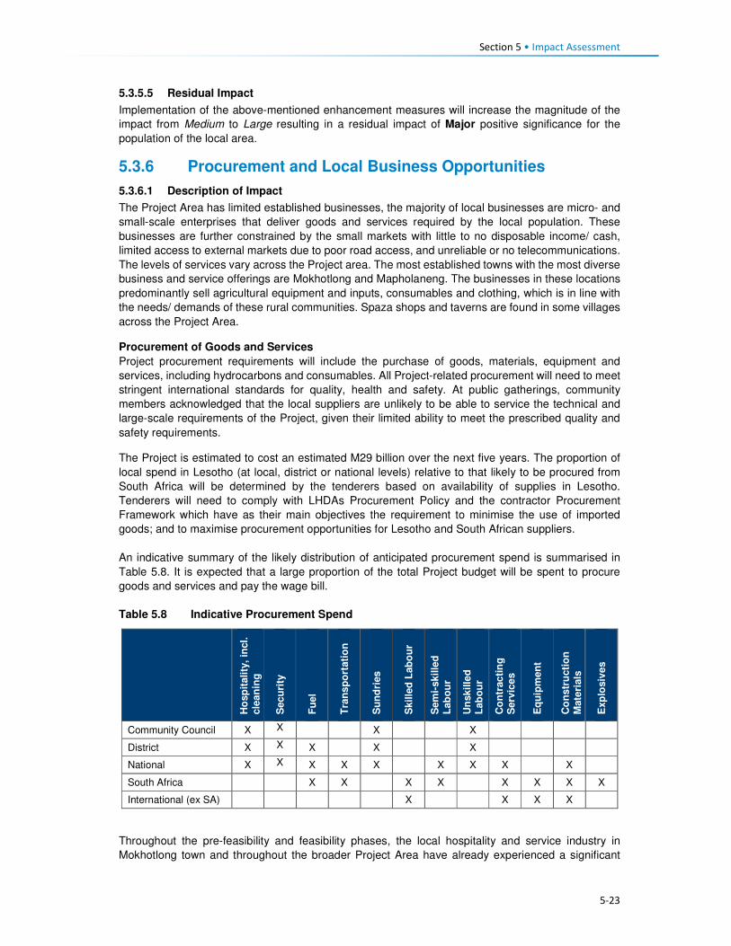
Section 5 • Impact Assessment
5-23
5.3.5.5 Residual Impact
Implementation of the above-mentioned enhancement measures will increase the magnitude of the
impact from Medium to Large resulting in a residual impact of Major positive significance for the
population of the local area.
5.3.6 Procurement and Local Business Opportunities
5.3.6.1 Description of Impact
The Project Area has limited established businesses, the majority of local businesses are micro- and
small-scale enterprises that deliver goods and services required by the local population. These
businesses are further constrained by the small markets with little to no disposable income/ cash,
limited access to external markets due to poor road access, and unreliable or no telecommunications.
The levels of services vary across the Project area. The most established towns with the most diverse
business and service offerings are Mokhotlong and Mapholaneng. The businesses in these locations
predominantly sell agricultural equipment and inputs, consumables and clothing, which is in line with
the needs/ demands of these rural communities. Spaza shops and taverns are found in some villages
across the Project Area.
Procurement of Goods and Services
Project procurement requirements will include the purchase of goods, materials, equipment and
services, including hydrocarbons and consumables. All Project-related procurement will need to meet
stringent international standards for quality, health and safety. At public gatherings, community
members acknowledged that the local suppliers are unlikely to be able to service the technical and
large-scale requirements of the Project, given their limited ability to meet the prescribed quality and
safety requirements.
The Project is estimated to cost an estimated M29 billion over the next five years. The proportion of
local spend in Lesotho (at local, district or national levels) relative to that likely to be procured from
South Africa will be determined by the tenderers based on availability of supplies in Lesotho.
Tenderers will need to comply with LHDAs Procurement Policy and the contractor Procurement
Framework which have as their main objectives the requirement to minimise the use of imported
goods; and to maximise procurement opportunities for Lesotho and South African suppliers.
An indicative summary of the likely distribution of anticipated procurement spend is summarised in
Table 5.8. It is expected that a large proportion of the total Project budget will be spent to procure
goods and services and pay the wage bill.
Table 5.8 Indicative Procurement Spend
Ho
sp
itality
, in
cl.
cle
an
ing
Secu
rity
Fu
el
Tra
nsp
ort
ati
on
Su
nd
ries
Skil
led
Lab
ou
r
Sem
i-skille
d
Lab
ou
r
Un
skille
d
Lab
ou
r
Co
ntr
acti
ng
S
erv
ice
s
Eq
uip
men
t
Co
nstr
ucti
on
M
ate
rials
Exp
losiv
es
Community Council X X X X
District X X X X X
National X X X X X X X X X
South Africa X X X X X X X X
International (ex SA) X X X X
Throughout the pre-feasibility and feasibility phases, the local hospitality and service industry in
Mokhotlong town and throughout the broader Project Area have already experienced a significant

Section 5 • Impact Assessment
5-24
increase in demand for accommodation and subsistence. Local Bed and Breakfast (B&B) facilities,
private households offering room rentals, food suppliers, and providers of basic consumables and care
items have responded to the demands for goods and services, thus already benefitting and generating
income.
To address issues related to procurement tenders/ processes and to encourage local suppliers to
partake in bidding for Project-related contracts, LHDA embarked on a roadshow titled “Phase II
Progress Update Construction Packages and Indicative Timelines”. The purpose of these workshops
was to:
• Inform potential suppliers and contractors of the Project and the associated opportunities;
• Encourage interested suppliers and contractors to bid for Project contracts;
• Provide suppliers and contractors with the procurement standards and guidelines; and
• Provide prospective suppliers/contractors with highlights of the challenges and lessons learnt by
LHDA in the procurement and administration of Phase I contracts, with the hope of avoiding some
of these problems in subsequent LHDA contracts.
The road shows were facilitated in South Africa (Durban and Johannesburg) and Lesotho (Maseru,
Mohale, and Mokhotlong).
The construction phase, from commencement of advance infrastructure through to tunnel completion
is approximately eight years. During this time, a number of contracts will be awarded for the various
components comprising Phase II, ranging from contracts aimed at MSMEs through to international
construction companies.
Local Enterprise Development
The Project Area is currently relatively isolated and there are not many people living there with
disposable income. People largely support themselves based on a range of subsistence-based
livelihood activities including crop and livestock farming, and harvesting of natural resources. Some
households, although unquantified, obtain some cash income from remittances sent by family
members who work on the mines in South Africa or Lesotho, although this may be decreasing with
the economic downturn in industry and mining, and ongoing retrenchments. With the influx of
construction companies and their workers, and the likely influx of work-seekers, there will be a new
market for people to sell their goods to. People across the Project Area indicated that they would sell
fresh produce or prepare food and beer to sell along the roads or at small ‘restaurants’ and ‘bars’.
In addition, there will be a demand for housing for migrants to the area. Many people have recognised
this as an opportunity to build new residential structures or to add rooms onto their homes which could
be rented out as a source of additional income.
Other, less ‘acceptable’ but highly likely income earning activities may become more prevalent, such
as prostitution and selling of marijuana. Prostitution is typically associated with projects of this nature
that are located in isolated areas where workers stay far away from their home towns and families.
Marijuana is grown, harvested and sold in areas close by and this activity may expand due to increased
demand, improved ease of transport, and new opportunities to sell to newcomers. This, however, will
depend on the level of police enforcement that may increase across the Project Area. The recreational
use of illegal substances by workers could generate health and safety risks on the Project site,
potentially posing risks to other workers, residents and construction equipment / machinery.
5.3.6.2 Sensitivity of Receptors
The sensitivity of the receptors is likely to be Medium for most people. Given the lack of established
businesses and low levels of education and skill, most people/ businesses will not be in a position to
secure procurement contracts. However, despite low levels of disposable income, people have already
demonstrated that they can and will respond to the increased demand for goods and services; this will
result in the formation of small and micro-enterprises.

Section 5 • Impact Assessment
5-25
5.3.6.3 Assessment of Impact
The impact will be direct as related to Project procurement and local purchases/ spending, indirect as
related to procurement via suppliers and induced as a result of the growth of small business in
response to the demand for goods and services related to work-seekers and increased levels of
disposable income. Overall, the impact will be positive, resulting in a range of benefits. Given the
current scarcity of suitably resourced and qualified local businesses, this positive impact will be
experienced at the national and international level (as related to large-scale Project procurement), and
at the local level for smaller-scale provision of goods and services (predominantly indirect and
induced). Procurement opportunities will be experienced during the advance works and remaining
construction phase (short-term).
The magnitude of this impact will be Small to Medium (depending on the ability of people to take
advantage of the direct, indirect and induced opportunities. National and International businesses will
benefit from the large procurement contracts. The impact is rated as Minor-Moderate significance
with the potential to develop further in the future.
Table 5.9 Procurement and Local Business Opportunities
Pre-Mitigation Impact Residual Impact
Type of Impact Direct, indirect and induced, positive
Magnitude Small-Medium Medium
Sensitivity Medium Medium
Significance Minor-Moderate Moderate
5.3.6.4 Enhancement Measures
Procurement
• LHDA have already put in place measures that aim to enhance the national and local benefits
related to procurement and local business development. All procurement must be undertaken in
accordance with the principles set out in the Phase II Agreement (Article 10 a, b, c) that stipulate
the following:
• All procurement processes shall foster competitiveness, transparency cost effectiveness
and quality;
• Preference shall be given to suppliers of goods and services from Lesotho, South Africa,
SADC member states and then internationally, in that order, provided that the above shall
be satisfied; and
• Consultants and contractors registered in Lesotho and in South Africa shall share the value
of all infrastructure works on equal monetary basis, taking into account amongst other
things, their shareholder and operational experience.
• LHDA will continue to broadcast or create awareness of potential opportunities for local suppliers
to tender for provision of goods and services and to facilitate linkages with relevant organisations
and institutions to support local suppliers;
• LHDA will closely monitor that prospective tenderers comply with the contractor Procurement
Framework to maximise procurement of local goods and services prior to and during the contract
implementation;
• LHDA (based on information provided by contractors) will disseminate information through the
PLRD regarding procurement opportunities and specific health, safety and quality requirements
as early as possible and in a manner that is transparent and accessible; and
• LHDA will implement a grievance resolution procedure to gather and address issues and concerns
of stakeholders regarding issues related to procurement.
Local Business and Social Development Opportunities
• In order to facilitate development of local MSMEs, LHDA has signed a Memorandum of
Understanding (MoU) with the Basotho Enterprises Development Corporation (BEDCO) to

Section 5 • Impact Assessment
5-26
establish a platform for cooperation for provision of business development and advisory services
within the LHWP areas as part of the initiatives for livelihoods improvement for affected people.
The MoU entails the following:
• Coordinating efforts in developing and building skills capacity of affected individuals and
communities in Phases I and II of the LHWP in order to enable the communities to optimise
the potential benefits brought about by the development activities of the LHWP;
• Developing and conducting customised entrepreneurial and artisan skills training
programmes for communities in LHWP areas;
• Promoting MSME and other livelihood improvement activities among affected communities
and individuals within LHWP areas;
• Providing a pool of expert services for the identification of business ideas and the
development of project proposals. Project appraisal and mentoring services will be available
for business start-ups;
• Facilitating access to micro-finance for MSMEs; and
• Sharing information, knowledge and expertise in the area of small business development,
skills training, and advisory services for communities and individuals within the LHWP areas.
• In addition to the above, LHDA and the appointed contractors should implement the following
measures.
• Where possible, LHDA and the appointed contractors should use local businesses as a source of
goods and services for the Project and any livelihood restoration and social development projects;
• LHDA will collaborate with relevant authorities, organisations, local entrepreneurs and community
groups to identify and develop projects that aim to build the capacity of local entrepreneurs in the
Project Area;
• LHDA (and its consultants) will collaborate with relevant authorities and organisations to identify
and develop projects that aim to enhance selected livelihood activities amongst the population of
the Project Area. This may include, but is not limited to, tourism and agricultural initiatives; and
• LHDA to implement a grievance resolution procedure as described in Section 5.3.5.4.
5.3.6.5 Residual Impact
Implementation of the above-mentioned enhancement measures would serve to increase the
magnitude of this impact to Medium resulting in a post-enhancement impact rating of Moderate
positive significance.
5.3.7 Increased Cost of Living and Debt Generation
5.3.7.1 Description of Impact
Most people living in the Project Area are not employed. They mostly rely on remittances from family
members, government grants and ad hoc income earned from selling of agricultural produce and
harvesting of natural resources. As such, there is a limited cash economy in most parts of the Project
Area.
Increased demand for goods and services is likely to result in increased prices. Families living in the
area currently do not pay for their land or housing other than where maintenance or expansions are
required. Even then, locally available materials are largely used for construction purposes. The prices
of food and basic household goods are most likely to increase and have the most prominent negative
effect on the cost of living for local residents.
Simultaneously, however, local people will be able to sell their goods / services at higher prices, thus
potentially generating more income. Some business people are concerned that during the construction
phase, customers will want to purchase goods on credit and may then leave without settling their debt
to the service providers.

Section 5 • Impact Assessment
5-27
5.3.7.2 Sensitivity of Receptors
Levels of income are low and the economy is largely subsistence based. As such, local people will be
sensitive to price increases, especially if they are not able to increase their income simultaneously.
However, the majority of people already rely on their subsistence crops for most of the year. Since
many community members indicated they are positive about the potential new opportunities to sell
goods and services and claim to be aware of the potentially negative consequences of the Project on
the local economy, the sensitivity of the majority of households to price increases is therefore rated
High. Households who are able to respond to demands for goods and services, and benefit through
increased income generation, will be far less sensitive (Medium) to this impact. People living in the
most isolated villages are likely to be the most sensitive as access to the area increases resulting in
increased demand and rising costs.
5.3.7.3 Assessment of the Impact
This impact will be indirect and negative for most people, primarily for the residents in the most isolated
locations. The Project’s need for goods and services and the related demand from work-seekers will
have an indirect effect on supply and demand, and prices of goods and services. The extent will be
local and the duration will be short-term as related to the construction phase. As Project workers leave
the area, incomes reduce and migrants begin moving away, prices may decrease slightly. However,
the area will be more accessible and is likely to attract visitors and business people, thus price will
remain elevated (levels are not known and difficult to predict). Based on the large scale of the Project
and the high numbers of people expected to move into the area (workers and work-seekers), the
magnitude of this impact is expected to be Large. Combined with the High sensitivity, the impact
significance is assessed to be of Major or Critical (negative) significance for the majority of
households.
Table 5.10 Increased Cost of Living and Debt Generation
Pre-Mitigation Impact Residual Impact
Type of Impact Indirect negative
Magnitude Large Medium
Sensitivity Medium, High* Medium, High* Significance Major, Critical* Moderate, Major*
* The sensitivity of households will vary, thus the significance of the impact will be variable.
5.3.7.4 Mitigation Measures
Recruitment procedures to enhance local employment and limit influx
• Apply the Labour Recruitment Guidelines and other mitigation measures as described in Section
5.3.5.4 to enhance local employment. This will serve to reduce the number of general workers
from outside the area, and discourage influx.
Local business and social development
• Apply the mitigation measures proposed in Section 5.3.6.4 to promote the use of local businesses
and assist more broadly in local business / social development; and
• LHDA shall collaborate with relevant authorities and organisations to identify and develop
programmes that aim to enhance selected livelihood activities amongst the population of the
Project Area. This may include, but is not limited to tourism and agricultural initiatives.
5.3.7.5 Recommended Mitigation Measures17
• LHDA will collaborate with service providers (such as BEDCO)18 to provide business development
and advisory services, and skills development, as part of livelihood improvement initiatives to
17 Recommended mitigation measures are those which LHDA should assist with implementation, but which may require other organisations and where the outcome or effectiveness is less under the control of LHDA. 18 LHDA have signed an MoU with BEDCO in January 2015 to collaborate on MSME development initiatives in the Phase I and II project areas over a period of 60 months. LHDA are also in the process of tendering various social development projects.

Section 5 • Impact Assessment
5-28
enable communities to optimise the potential benefits of the LHWP. This should include promotion
of MSMEs and their access to microfinance.
5.3.7.6 Residual Impact
With effective implementation of the mitigation measures, it is expected that the magnitude could
decrease from Large to Medium. The impact significance could therefore decrease from Critical or
Major to Moderate or Major (negative) significance post-mitigation for the construction phase.
5.3.8 Increased Risk of Road Traffic Accidents
5.3.8.1 Description of Impact
Across the broader Project Area, road infrastructure is limited, with the majority of the roads being
unpaved and unusable after heavy rains and snowfalls. The only paved road is the A1 national road
that connects Mokhotlong District and Town to Maseru via Butha-Buthe, Leribe and Berea Districts.
Vehicle ownership is limited; most car owners in the broader area live in Mokhotlong town. Public
transportation is limited due to inaccessibility/ poor road quality, and cost; there are more taxis
operating in the areas easily accessible from the A1. The majority of the population walk or use horses/
mules/ donkeys to commute. As such, road traffic and road traffic incidents are uncommon across the
area.
Adherence to pedestrian road usage rules amongst the population is low; often people are found
walking in the middle of the road with little attention to traffic; and herded and untended livestock are
often found on the streets – this was mostly observed in Mokhotlong and Mapholaneng Towns.
Furthermore, the majority of the households in the area are not fenced and small children wander
around, even close to roads, unaccompanied. Motivation for people not adhering to road rules may be
linked to the lack of pedestrian walkways along the paved roads, and the encroachment of informal
businesses into the road reserve where pedestrians are supposed to walk. Amongst vehicle users and
pedestrians, there is poor road safety awareness and limited enforcement of traffic rules.
Figure 5.4 Typical Roads, Pedestrians and Livestock on the Local Roads
The construction activities will generate a range of safety risks that the local population have not yet
been exposed to. Given that the roads are in such a bad state, and there is very limited traffic through
the area; the cars that do drive there are forced to travel at extremely slow speeds. As such, increased
traffic travelling at greater speeds is going to be one of the most prominent risks of the Project.

Section 5 • Impact Assessment
5-29
The commencement of the Project activities will be marked mainly by the construction and upgrading
of road infrastructure across the broader Project Area and subsequent introduction and increase in
road traffic associated with the commissioning of the site establishment areas. Following this, large-
scale construction activities will be undertaken during dam and tunnel construction. The increase in
road traffic movement will be attributed to the following factors:
• Transport of construction equipment and materials using large trucks;
• Transport of operational goods and personnel including trucks, light duty vehicles, buses and cars;
and
• Potentially increased movements associated with other road users making use of the upgraded
roads (e.g. small businesses, local commuters, influx of migrants, travellers).
The risks associated with increased road traffic movement, will arise from the poor safety awareness
of the population, and road improvements, which will allow drivers to increase their driving speeds.
The most significant of these risks will be injuries and/ or fatalities of drivers, pedestrians and
livestock in case of an accident. It is expected that approximately 250 vehicle trips will be undertaken
per day by Project associated vehicles during the advance works stage. The majority of these trips
will be limited to normal working hours, i.e. 07:00 – 18:00.
5.3.8.2 Sensitivity of Receptors
Initially, the sensitivity of the local population and animals to the increase/ introduction to road traffic
is expected to be High as they will not be used to high volumes of road traffic and the associated
risks. The most vulnerable to the impact will be children, due to their curious nature, as well as
livestock.
5.3.8.3 Assessment of Impact
The impact will be negative, direct (as related to Project vehicles) and indirect (as related to other
vehicles/ road users) in nature. The impact will be localised as it will be experienced by people living
within the wider Project Area. As it relates to the construction phase, the impact will be short-term.
The magnitude of the impact is expected to be Medium for most receptors. The impact is very likely
to occur, specifically in the early phases of the Project activities; it is rated as Major (negative)
significance.
Table 5.11 Increased Risks of Road Traffic Accidents
Pre-Mitigation Impact Residual Impact
Type of Impact Direct and indirect, negative
Magnitude Medium Small Sensitivity High High
Significance Major Moderate
5.3.8.4 Mitigation Measures
• All contractors and Sub-contractors will adhere to the provisions, principles and guidelines set in
the LHDA Safety Health Environment and Quality Management (SHEQ) Framework for the Phase
II Project;
• The appointed contractors will develop and implement a Traffic Management Plan for staff and
vehicles. This will focus on the movement of people to and from the site, site access control,
movement of material and equipment and road traffic control on and off site. The plan will also put
in place measures and controls to prevent to ensure pedestrian safety, or interrupt safe working
conditions of other employees;
• Appointed contractors will manage road traffic, erect road signage, and install traffic calming
measures. LHDA’s role is one of oversight; and
• Appointed contractors shall ensure the implementation of an inspection (pre-use/daily/
weekly/monthly) and maintenance programme to ensure all mechanical and electrical equipment
and fleet vehicles (their own and the contractors’) used on the project are maintained and kept in
safe, efficient working order and good repairs.

Section 5 • Impact Assessment
5-30
Driving Policies
• LHDA will develop and implement a Traffic Management Policy including vehicle safety, driver
and passenger behaviour, use of drugs and alcohol, hours of operation, rest periods and accident
reporting and investigations; and
• Appointed contractors will develop and implement a Driver Code of Conduct. The Code will
include:
• Performing mandatory vehicle safety checks;
• Strict enforcement of drug and alcohol policies; and
• Regular and random testing of drivers.
Collaboration
• In collaboration with the District Department of Roads, LHDA is to erect road signage and traffic
calming measures in areas of high foot traffic. In addition, all newly constructed and upgraded
roads must have adequate pedestrian paths and guard rails installed to prevent pedestrians and
livestock from wandering onto the road;
• In collaboration with the Ministry of Education, LHDA shall develop, implement and produce the
required materials to be used for road traffic safety awareness campaigns;
• All awareness raising activities for children shall be undertaken in schools by LHDA being assisted
by school teachers; and
• Community level awareness campaigns shall be led by LHDA representatives from Tlokoeng and
Katse FOBs in consultation with principal and area chiefs regarding the venue and suitable times.
Emergency Prevention, Preparedness and Response Plans (EPPRP)
• LHDA will develop and implement an EPPRP to address all non-routine events including road
traffic accidents resulting in injury or death of a person or livestock; and
• The LHDA Project SHEQ Manager shall ensure coordination between, and arrangements with,
Consultants, emergency services on site (where applicable), emergency services from nearby
local/district clinics and/or the District Environmental Office, and mutual aid partners (i.e. other
industries nearby who might have response capability) to provide for an effective interface
between Consultant and contractor personnel with emergency agencies.
Incident Reporting
• All incidents, nonconformities and hazards/risks identified will be reported and analysed. Any
person on the project site identifying a near-miss, nonconformity or risk must immediately report
the observation to their immediate Supervisor or Line Manager – who must complete an LHDA
Incident Flash Report;
• The appointed contractors shall ensure that procedures and systems are in place for reporting,
investigation, corrective action, closure and communication of all incidents. When an incident
occurs, the extent of the incident must be determined and relevant internal and external parties
be notified. The appointed contractor(s) shall ensure:
• All employees are aware of incident response actions and site incident notification
requirements;
• Reporting the incident to the relevant LHDA Representative – and authorities (if applicable);
• Completion and distribution within 24 hours of LHDA’s ‘Incident Flash Report’;
• Recording of full incident details in an LHDA ‘Incident Report’ and distribution within 72 hours;
• An incident investigation – employing a structured root cause analysis technique – is
conducted within 14 calendar days after the incident occurred to determine root causes of the
incident; and
• Corrective actions are planned, approved, implemented and tracked to closure within 30
calendar days after the conclusion of the incident investigation.

Section 5 • Impact Assessment
5-31
Compensation Plan
• All injuries and fatalities associated with road traffic incidences will be investigated by the police
services; and
• All compensation related to road traffic incidences will be undertaken in accordance to the
provisions of the Motor Vehicle Insurance Order No 26 of 1998.
Grievance Procedures
• LHDA is to implement a Grievance Resolution Procedure that is easily accessible, culturally
appropriate and scaled to the potential risks and impacts of the Project. It must be accessible to
all local residents, employees, and other stakeholders (as per Section 5.3.5.4).
5.3.8.5 Residual Impact
The implementation of mitigation measures is expected to reduce the magnitude of the impact to Small
and therefore the impact significance rating to Moderate (negative) significance.
5.3.9 Increased Safety Risks to People and Animals
5.3.9.1 Description of Impact
In addition to the traffic risks (as described in Section 5.3.8), the construction activities will generate a
range of safety risks that the population of the Project Area has not been exposed to, to date. Potential
safety risks may occur at the construction sites (e.g. excavated areas / trenches, exposed cables and
pipes, equipment and materials storage areas), quarry and borrow pit sites, and inundation areas/
exposed water body.
Exposed construction sites will pose a number of risks. Excavation for trenches or borrow pits will
result in relatively deep, steep-sided holes that people (and livestock) could fall into. Construction
equipment and materials (possibly including cables and pipes) will lie in the construction and storage
areas and many residents (notably children) will be inquisitive and may want to investigate these sites
and the materials. A lack of lighting at night will result in these sites being hazardous during dark, and
may result in people and animals falling into open trenches or pits.
Blasting at sites could result in flyrock during the blasting activities; residents are concerned that they,
or their belongings, could get injured/ damaged.
Given many of the above-mentioned risks and the nature of the Project, security personnel are likely
to be appointed to perform a range of security functions across the Project Area throughout the
construction phase. This, in itself, poses an additional potential risk; untrained or poorly trained
security personnel could exert unnecessary force, take advantage of their relative position of power,
or misuse a weapon; such actions could result in physical harm or be construed as intimidation. Such
force would infringe on the local community’s basic human rights regarding safety and security.
5.3.9.2 Sensitivity of Receptors
Initially, the sensitivity of the local population and animals to the construction safety risks will be
Medium given that they will not be used to the risks that will arise during construction. Children, in
particular, are going to be the most sensitive given that they are likely to want to investigate and
explore the construction sites, equipment and materials.
5.3.9.3 Assessment of the Impact
This negative and direct impact will be experienced at the local level for the duration of the construction
phase (short-term). The magnitude is Small given the relatively short duration and local extent of the
impact. It is likely that this impact will occur and it is rated as Minor (negative) significance.
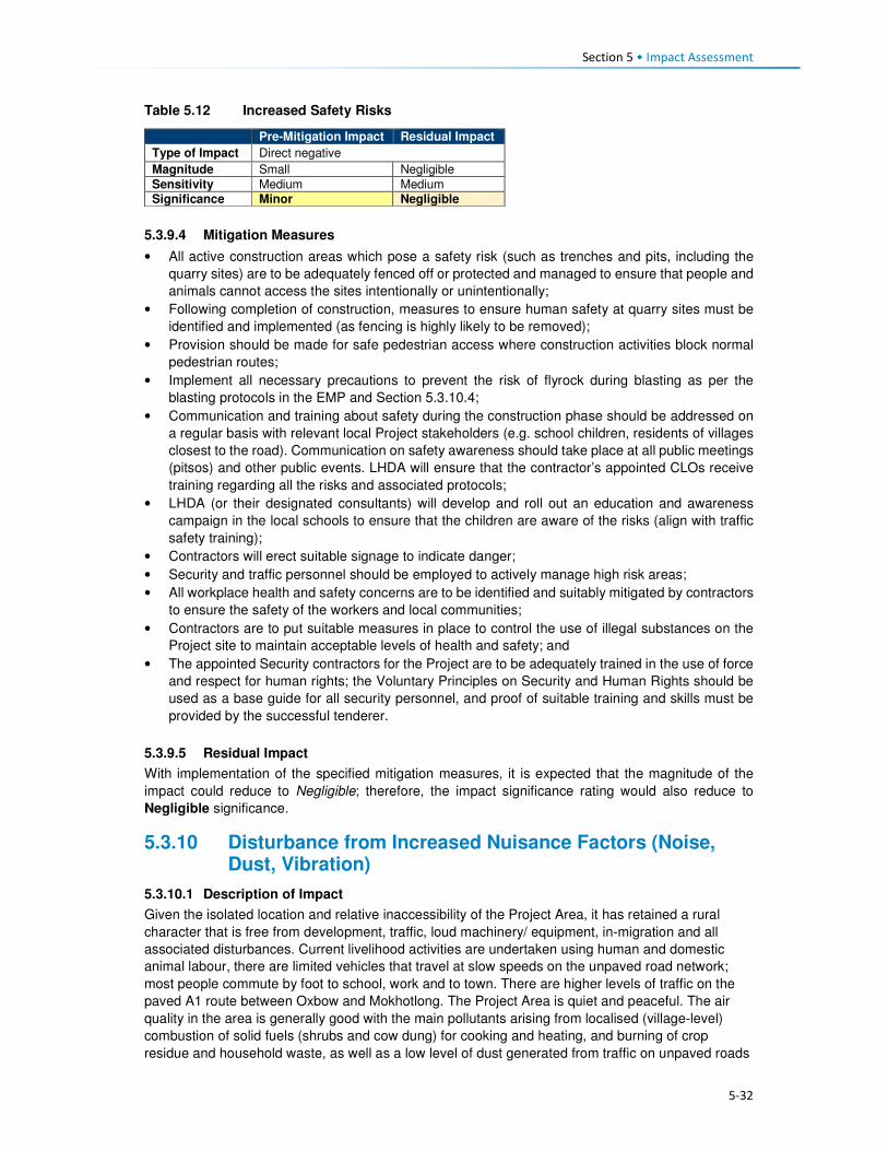
Section 5 • Impact Assessment
5-32
Table 5.12 Increased Safety Risks
Pre-Mitigation Impact Residual Impact
Type of Impact Direct negative
Magnitude Small Negligible
Sensitivity Medium Medium Significance Minor Negligible
5.3.9.4 Mitigation Measures
• All active construction areas which pose a safety risk (such as trenches and pits, including the
quarry sites) are to be adequately fenced off or protected and managed to ensure that people and
animals cannot access the sites intentionally or unintentionally;
• Following completion of construction, measures to ensure human safety at quarry sites must be
identified and implemented (as fencing is highly likely to be removed);
• Provision should be made for safe pedestrian access where construction activities block normal
pedestrian routes;
• Implement all necessary precautions to prevent the risk of flyrock during blasting as per the
blasting protocols in the EMP and Section 5.3.10.4;
• Communication and training about safety during the construction phase should be addressed on
a regular basis with relevant local Project stakeholders (e.g. school children, residents of villages
closest to the road). Communication on safety awareness should take place at all public meetings
(pitsos) and other public events. LHDA will ensure that the contractor’s appointed CLOs receive
training regarding all the risks and associated protocols;
• LHDA (or their designated consultants) will develop and roll out an education and awareness
campaign in the local schools to ensure that the children are aware of the risks (align with traffic
safety training);
• Contractors will erect suitable signage to indicate danger;
• Security and traffic personnel should be employed to actively manage high risk areas;
• All workplace health and safety concerns are to be identified and suitably mitigated by contractors
to ensure the safety of the workers and local communities;
• Contractors are to put suitable measures in place to control the use of illegal substances on the
Project site to maintain acceptable levels of health and safety; and
• The appointed Security contractors for the Project are to be adequately trained in the use of force
and respect for human rights; the Voluntary Principles on Security and Human Rights should be
used as a base guide for all security personnel, and proof of suitable training and skills must be
provided by the successful tenderer.
5.3.9.5 Residual Impact
With implementation of the specified mitigation measures, it is expected that the magnitude of the
impact could reduce to Negligible; therefore, the impact significance rating would also reduce to
Negligible significance.
5.3.10 Disturbance from Increased Nuisance Factors (Noise, Dust, Vibration)
5.3.10.1 Description of Impact
Given the isolated location and relative inaccessibility of the Project Area, it has retained a rural
character that is free from development, traffic, loud machinery/ equipment, in-migration and all
associated disturbances. Current livelihood activities are undertaken using human and domestic
animal labour, there are limited vehicles that travel at slow speeds on the unpaved road network;
most people commute by foot to school, work and to town. There are higher levels of traffic on the
paved A1 route between Oxbow and Mokhotlong. The Project Area is quiet and peaceful. The air
quality in the area is generally good with the main pollutants arising from localised (village-level)
combustion of solid fuels (shrubs and cow dung) for cooking and heating, and burning of crop
residue and household waste, as well as a low level of dust generated from traffic on unpaved roads

Section 5 • Impact Assessment
5-33
and vehicle emissions. Wind blown dust and some smoke from burning grassland occurs in the drier
months.
Construction activities will generate uncharacteristic disturbances resulting in a range of nuisance
factors (notably increased levels of noise and decreased air quality). Air, noise and vibration
disturbances will occur on commencement of Project advance works with site clearing, blasting in
places, access road construction, establishment of camp/ laydown/ assembly areas, the placement
of fill, and stockpiling of soil and rock. These nuisance factors will continue to varying levels and
across the Project Area for the duration of the construction phase (estimated at 5 years). The
advance works will predominantly affect Masakong and Ha Tlhakola villages due to their proximity to
the site establishment areas. Construction of the dam and transfer tunnel, and ongoing activities at
the camps, works areas, quarries etc., will create disturbances that will largely affect Masakong, Ha
Tlhakola, Polihali, Ha Ramonakalali and Tloha-re-Bue villages due to their proximity to these
activities. Disturbances related to traffic noise and dust generation will affect villages located along
the transport routes, notably along the A1, PNEAR and PWAR19. The extent of these disturbances is
anticipated to vary substantially on a daily basis depending on the type and schedule of activities,
and the prevailing weather.
The number of construction contractors and staffing for each contract is not yet known. During the
advance infrastructure programme, they will be working regular working hours; however, for the dam
and tunnel construction, they will work on a 24-hour schedule for seven days a week. The potential
activities that will generate the disturbances in the Project Area are:
• Travel and operation of construction vehicles and heavy machinery of different types (mainly
diesel powered);
• Use of mobile diesel generators;
• The presence of construction workers and work-seekers;
• Blasting at the quarry sites and at various locations, as required; and
• Bulldozing and exposure of disturbed bare ground and soil / rock dumps.
Construction vehicles (including transport of large volumes of rock / aggregate from quarries and
crushing plants), and machinery will be used on an almost ongoing basis throughout construction
and will be the sources of most noise and dust disturbance (along with intermittent blasting). Diesel
powered generators will be used during advance works until high voltage electricity is supplied via a
new 132kV powerline. During night time construction works, the noise levels will be most significant
given the very low prevailing ambient noise levels at night. These sounds will disturb sleep patterns
and could result in a lack of productivity and focus during day time tasks, and general irritation of
local residents.
It is expected that construction workers will either be housed in the designated, access-controlled
construction camps, or they will be employed from the local villages and therefore reside in their own
homes. During work hours, the presence of the workers can result in elevated noise levels linked to
actual work activities, as well as loud conversations between the workers. Waste will be generated
and could potentially be discarded in the village areas or along access routes.
Blasting will be required at the quarry sites and at various locations where hard ground needs
levelling or rock needs to be removed. Blasting will result in intermittent loud noise and dust
generation. In addition, it is likely that there may be flyrock associated with each blast, depending on
the manner in which blasting is managed. Arable land is scarce and crop yields are already relatively
low and therefore further reduction in yield due to inability to plow fields due to rocks is not desirable
and would require redress.
19 Traffic-related impacts along the PWAR are assessed under the PWAC ESIA (ERM, 2017), while construction of the PNEAR is covered under a separate EMP. Increased traffic on the A1 (as well as NAR (A8) have not been assessed and a separate traffic assessment is recommended (see Section 11).

Section 5 • Impact Assessment
5-34
Dust will largely be generated by the clearance of topsoil and exposure of loose sand or soil as the
construction crew clear the footprint for the Project infrastructure and begin blasting and removing
rock from the construction footprint and quarry sites. The exposed soil will be blown across the area
during dry periods and as a result of the passage of construction vehicles back and forth, especially
during the dry winter periods between May and October. Increased levels of dust can be a nuisance
in that it could dirty houses and the clean washing hung out to dry; it may aggravate those with
existing respiratory conditions; and it could impact crops and the quality of wool / mohair.
Physically, these nuisance factors will lead to noise, dust and potentially (for some people) an
unwanted visual change in the landscape character. Some people may experience emotional and
psychological distress as a result of the ongoing disturbances; this is most likely to be the case near
schools and healthcare facilities where learning and healing could be affected, and in the closest
villages. The majority of the construction-related disturbances will occur at a local level and will affect
households, infrastructure, villages and road users in the immediate vicinity of the Project working
area footprint. Nuisance factors may also be exacerbated by indirect in-migration of work-seekers
into the Project Area; they will place additional pressure on the already strained social infrastructure
and services (e.g. housing, sanitation, water, healthcare, schooling, policing) in the surrounding
villages.
5.3.10.2 Sensitivity of Receptors
Local residents are accustomed to living in an environment free from the disturbances that can be
expected from construction-related nuisance factors. As such, all residents will be affected; however,
it is expected that most will adapt to/ accept the disturbances, which are short-term in nature.
Masakong, Ha Tlhakola, Polihali, Ha Ramonakalali and Tloha-re-Bue villages are located closest to
the Project footprint, while numerous other villages are located along the main transport routes.
These villages will be the most impacted given their proximity to the construction sites. Masakong
and Ha Tlhakola villages are going to be directly affected by the advance works, the dam and tunnel
construction, as well as by activities resulting from other Project components (beyond the scope of
this Contract).
Besides the most directly affected villages, other receptors that may be more sensitive than others to
these nuisance factors include:
• Residents located near to the construction sites where work is undertaken at night; noise levels
are elevated at night;
• Students at nearby schools who are likely to find it difficult to concentrate on their classes when
noise levels are elevated. In addition, the activities are going to be new and exciting and will
captivate the attention of many students, thus distracting them and diverting their attention away
from their lessons;
• Patients at healthcare facilities may find it difficult to rest and heal;
• People with respiratory conditions could experience an exacerbation of the condition as a result
of increased levels of dust in their environment;
• People who have livelihood activities located closest to the directly affected footprint (e.g. crops,
grazing) may incur damages to their produce resulting from the flyrock and dust; and
• Sites of religious/ traditional and cultural significance could be disturbed.
How each individual experiences these disturbance factors is highly subjective; for instance, some
will welcome the sounds as an indication of development and anticipation of a better life; while
others will place higher value on the silence associated with a rural environment. The sensitivity of
the majority of receptors is likely to be Medium; sensitivity is rated as High for the most sensitive
receptors.
5.3.10.3 Assessment of Impacts
The disturbances arising as a result of the construction phase nuisance factors will be negative and
direct in nature (as related to Project activities). Some indirect impacts could be experienced as a
result of the presence of work-seekers/ new-comers to the area resulting in pressure on social

Section 5 • Impact Assessment
5-35
infrastructure and services. The impact will be experienced locally, largely at a site level (around the
Project footprint and along transport routes). The direct construction-related disturbances are highly
likely to occur and will persist for the duration of the construction phase (short-term); Masakong and
Ha Tlhakola will be most affected given their close proximity to all activities. The magnitude of this
impact is anticipated to be Medium. For the most sensitive receptors, the impact is assessed as
Major significance (negative), while for the majority it is considered to be of Moderate (negative)
significance.
Table 5.13 Disturbance from Increased Nuisance Factors
Highly sensitive receptors (Schools, health care, close villages)
Less sensitive receptors (Residents further from construction)
Pre-Mitigation Impact
Residual Impact Pre-Mitigation Impact
Residual Impact
Type of Impact
Direct negative Direct negative
Magnitude Medium Small Medium Small
Sensitivity High High Medium Medium
Significance Major Moderate Moderate Minor
5.3.10.4 Mitigation Measures
Recruitment procedures to limit influx
• Apply the LHDA Recruitment Guidelines and the mitigation measures described in Section 5.3.5
to enhance local employment. This will serve to reduce the number of general workers from
outside the area, and discourage influx.
Workforce management
• All construction staff will agree to a Code of Conduct (CoC) that outlines protocols and standards
for working in the Project Area as part of their contract. The CoC should address the following:
• Respect for local residents, including being considerate about noise levels, privacy, and local
customs;
• Respect for existing livelihood activities and the environment;
• Respect for community water supplies (to prevent pollution and overuse);
• No hunting, snaring or unauthorised taking of any property belonging to someone else,
including removal of natural resources;
• Zero tolerance of illegal activities by construction personnel including: illegal sale or purchase
of alcohol; sale, purchase or consumption of drugs; illegal gambling or fighting;
• Compliance with the Traffic Management Plan (to be developed by the contractors in
accordance with the Traffic and Transportation Policy to be developed by LHDA) and all
associated regulations, including compliance with drug and alcohol policies and random
testing; and
• Disciplinary measures for not adhering to the CoC. Notably, stock theft and similar crimes
conducted by contractor staff shall be managed as dismissible offences.
• Workers found to be in contravention of the CoC will face disciplinary procedures that could result
in dismissal. Theft or purposeful damage to property should be dismissible offences.
Ongoing engagement and grievance management
• LHDA will present the schedule and approach to construction to the district authorities and
community leadership structures to enable their understanding of the Project roll out;
• LHDA will regularly review and update the Community Participation Strategy; this strategy is to be
agreed upon by local community structures through the appointed ALCs;
• The contractor shall appoint appropriately trained and experienced staff to implement stakeholder
engagement during the course of work and shall assign adequate resources; and

Section 5 • Impact Assessment
5-36
• Apply all mitigation measures as described in Section 5.3.5 regarding a grievance resolution
procedure.
Engineering and Operational Practices
• Implement all measures described in the Construction EMP (Volume 2, Annexure L.1).
• All diesel-powered construction, earth moving, and equipment must be kept at a high level of
maintenance. This must include the regular inspection and, if necessary, replacement of intake
and exhaust silencers. Any change in the noise emission characteristics of equipment must serve
as trigger for withdrawing it for maintenance.
• All appointed contractors to include noise management provisions as part of onsite work
inductions.
• Conduct quarterly (as a minimum) noise surveys for the duration of the Project’s advance
infrastructure and construction activities to adjust mitigation measures to address the levels of
noise accordingly.
• All appointed contractors shall adhere to the provisions of Section 8.11 of the SHEQ Framework
(ERM, 2017; Volume 2, Annexure L.1) (maintenance of equipment, machinery, tools and
vehicles).
Generic construction phase management measures
• Traffic Management
• Implement all measures described in the Construction EMP (Volume 2, Annexure L.1);
• LHDA will develop a Traffic Management Policy including vehicle safety, driver and passenger
behaviour, speed limits, use of drugs and alcohol, hours of operation, rest periods and
accident reporting and investigation requirements;
• contractors will compile a traffic management plan / method statement relevant to their
activities, which shall include a protocol for handling accidents involving other vehicles,
pedestrians, animals or property;
• LHDA will undertake traffic safety awareness sessions at schools and in communities along
the PWAC during construction and early operation (until completion of dam construction). This
should be done in collaboration with the Roads Directorate and Ministry of Education, as
appropriate;
• Safe crossings are to be provided for pedestrian and animals during construction, and they
are to be given right of way;
• The appointed contractor/s will have the necessary insurance / contingency budget in place
for costs incurred with accidents involving other vehicles, people, animals, agricultural land,
or infrastructure; and
• The contractor will be required to compensate any affected community member for injured
animals in terms of agreed protocols.
• Dust suppression and emissions management
• Site clearance is to be minimised as far as possible to reduce the potential for dust, and other
impacts;
• Dust suppression measures are to be implemented as specified in the EMP, which shall
include wetting of roads during windy conditions and covering of soil mounds;
• Install an onsite weather station to monitor general weather conditions. When wind speeds
above 25 km/hr are expected, this should trigger implementation of measures to minimise
dust emissions;
• Ensure an adequate water supply on site for effective dust/particulate matter suppression,
using non-potable water where possible;
• Ensure equipment is readily available on site to clean any dry spillages;
• Ensure fine-powdered materials are delivered in enclosed tankers and stored in areas suitable
for emission control systems to prevent escape of material and overfilling during delivery;
• For smaller supplies of fine-powder materials, ensure bags are sealed after use and stored in
contained buildings to prevent dust;
• Use water-assisted dust sweeper(s) on the access and local roads, to remove, as necessary,
any material tracked out of the site;

Section 5 • Impact Assessment
5-37
• Ensure vehicles carrying materials or spoil entering and leaving sites are covered to prevent
escape of materials during transport;
• Where reasonable and feasible, haul roads will be maintained with water carts and graders,
and the condition of the roads will be monitored especially in high risk areas and/or during
high risk periods;
• Contractors must ensure all construction vehicles comply with their relevant emission
standards. Furthermore, contractors must provide confirmation that all off road diesel
equipment would meet best available diesel emissions standards or be fitted with a diesel
exhaust treatment device where possible;
• Contractors must, where possible and available, use low-sulphur diesel in vehicles to minimise
harmful emissions; and
• Contractors must avoid, where practicable and possible, the use of diesel or petrol powered
generators, and use mains electricity or battery powered equipment
• Noise management
• Noise management measures are to be implemented as specified in the EMP;
• Workers are to be considerate regarding noise levels and associated disruption to local
people; this is to be outlined in their CoC; and
• Noisy activities (e.g. blasting) are not to be scheduled at critical times (e.g. school exams,
religious services/ celebrations), where located in close proximity. LHDA will consult local
leaders, school principals, healthcare workers and religious leaders regarding important
events or occasions that may be negatively affected by construction noise in order to try to
schedule these activities at different times.
• Blasting and vibration
• LHDA and its contractor(s) shall develop blast designs and procedures that will keep noise
and blasting to a minimum without compromising blast requirements. Blast plans are to be
compiled as method statements to be approved by the Resident Engineer;
• All blasting activities will be undertaken following a planned schedule and the local
communities informed of this in advance;
• Asset condition surveys should be undertaken by contractors prior to construction and in
accordance with LHDA’s Protocol for Asset Condition Survey, Damage Mitigation and
Remediation (2017). This process must be overseen by the relevant Engineers, who in turn
will be monitored by LHDA;
• All safety measures related to blasting are to be implemented as specified in the EMP; and
• LHDA and its contractor(s) shall ensure that no blasting activities occur at night.
• Waste management and water source management
• Waste management measures are to be implemented as specified in the EMP. This is to
include the use of portable toilets and rubbish bins (to avoid littering); and
• Water management measures shall include controls on use of community water supply points
by construction workers who may not be familiar with protocols of keeping supplies clean and
uncontaminated.
• Earthworks and Stockpiling
• Stockpiles shall be located away from sensitive receptors and, where necessary, covered with
anchored fabrics, or seeded with sterile grass;
• Re-vegetate earthworks and exposed areas/soil stockpiles to stabilise surfaces as soon as
practicable; and
• Where practical, only remove any cover for exposed areas in small areas during work and not
all at once.

Section 5 • Impact Assessment
5-38
5.3.10.5 Residual Impact
Post-mitigation, it is expected that the magnitude of the disturbance resulting from increased
nuisance factors resulting from construction activities could be reduced to Small, resulting in a
decreased impact significance of Minor-Moderate (negative) significance.
5.3.11 Exacerbation of Anti-Social Behaviour
5.3.11.1 Description of Impact
Currently, the Project Area does not experience much outsider in-migration given its physical
isolation, lack of economic opportunities, and the limited social infrastructure and services. On the
contrary, many people, specifically young men and women, leave their villages in search of better
opportunities in the larger towns or further afield into the lowlands of Lesotho, and to South Africa.
Most of the population comprises local Basotho people who have lived in the area for many years.
STIs and HIV are reported to be two of the most common health concerns amongst adults; the
stigma around these diseases is still negative and many men refuse to attend the clinics for testing
or treatment (see Section 5.3.12 for separate assessment of increased prevalence of STIs and
HIV20). The most commonly reported crime is stock theft, which is cited to be common throughout
the area.
Construction of Katse Dam under LHWP Phase I resulted in a significant amount of influx of workers
and work-seekers. People moved to the Phase I areas in the hope that there would be generally
improved levels of social infrastructure and services, and a more diverse economy providing a
broader range of economic opportunities. This influx resulted in a significant increase in anti-social
behaviour as can be expected in such situations.
High levels of migrants into areas that are relatively homogenous and stable, such as the Project
Area, often result in heightened levels of conflict and tension. Migrants will bring with them differing
cultures, religious beliefs, norms and values; they influence young people to change in a manner
that may not be accepted by the more conservative/ traditional sector of the population. Inevitable
disputes arise linked to jealousy over relationships between local people and ‘outsiders’. High levels
of crime, drug and alcohol abuse, increased incidence of sex workers, domestic violence,
establishment of informal settlements, high prevalence of STIs and HIV, and general tensions due to
increased competition are common in the local communities that host large-scale projects of this
nature. These impacts typically occur as a result of increased competition for jobs, limited access to
basic resources and services, increased income, and different cultural backgrounds/ beliefs. Some
of the anti-social behaviour likely to occur are described below.
• Increase in crime levels given that many of the migrants to the area will not have income or access
to land to generate a livelihood. Stock theft is the most likely crime given that there is not much
else of value to steal; livestock is extremely valuable and considered to be an indicator of wealth;
• An increase in disposable income within the Project Area (among workers) could result in an
increase in alcohol and drug abuse, increased incidences of prostitution and casual sexual
relations. These activities could lead to an increased incidence of STIs and HIV, and increased
numbers of teenage and unwanted pregnancies. The increased prevalence of diseases would
affect contractors, employees, local residents and the families/ sexual partners of anyone
becoming infected in the Project Area;
• Young girls are likely to enter into relationships with migrant workers (and work-seekers) in the
hope that they will be able to leave the area and secure a ‘better’ lifestyle. However, they are likely
to end up dropping out of school with unwanted pregnancies, STIs and HIV. There is also a general
20 This impact is assessed separately in Section 5.3.12 given the already high prevalence rate and the high likelihood of the impact occurring.

Section 5 • Impact Assessment
5-39
concern that levels of STIs and HIV will become more prevalent, specifically because the existing
rates are generally high and many people still refuse testing and treatment;
• General unrest may arise as a result of increased pressure for resources, resentment towards
those who secure employment and procurement opportunities as well as benefits from other
Projects (specifically if the beneficiaries are from outside the area);
5.3.11.2 Sensitivity of Receptors
The population of the Project Area is going to be susceptible to the inevitable increase in anti-social
behaviour as described above given the prevailing high levels of poverty and low levels of economic
opportunity, and is therefore assessed as having High sensitivity to this impact. Increased crime/
stock theft is likely. Many hopeful local people will enter into relationships with in-migrants in
anticipation of a better life with an employed partner. STIs and HIV levels are likely to escalate given
the current attitude and contraction rates, as will unwanted pregnancies. Conflict, drugs and alcohol
abuse, and ultimately changed norms and values can be expected.
5.3.11.3 Assessment of the Impact
This negative impact will arise as a direct result of construction workers, and indirectly via migrant
work-seekers to the area. The impact will be experienced at a local level; however, the impact
duration will be long-term as improved access and the attraction to the area will facilitate ongoing
migration in and out of the Project Area. This impact will affect the individuals and families that
engage in such activities, while crime could affect anyone. The magnitude of the impact is rated
Medium. Together with the High sensitivity of the receptors, the impact is assessed as Major pre-
mitigation.
Table 5.14 Increased Anti-Social Behaviours
Pre-Mitigation Impact Residual Impact
Type of Impact Direct and indirect negative
Magnitude Medium Small to Medium
Sensitivity High High
Significance Major Moderate-Major
5.3.11.4 Mitigation Measures
Recruitment procedures to limit influx
• Apply all mitigation measures as described in Section 5.3.5 (and as per LHDA Labour Recruitment
Guidelines) to enhance local employment. This will serve to reduce the number of general workers
from outside the area, and discourage influx.
Workforce management
• Apply all workforce-related mitigation measures as described in Section 5.3.10.4. Notably, stock
theft and similar crimes conducted by contractor staff shall be managed as dismissible offences;
• Apply all mitigation and management measures proposed by the relevant EMPs regarding
contractor Camp Management;
• Workers from outside the Project Area are to work on a rotational basis, allowing them time to
return home to visit their families and rest, with the cost of their return journey covered by the
contractor/s;
• Contractors will provide health care facilities for their staff, including local labour. They are to be
equipped with adequate medical staff and resources to handle common diseases (including STIs
and HIV) and work related injuries; and
• LHDA will appoint experienced professionals to develop and implement a PHAP, which is
expected to specify additional recommendations for improved health care provision for affected
stakeholders.

Section 5 • Impact Assessment
5-40
Ongoing engagement and grievance management
• LHDA to implement a grievance resolution procedure as described in Section 5.3.5; and
• As part of induction, the appointed contractor will develop a brochure containing basic socio-
cultural information, to be approved by LHDA, to be distributed to all new employees on the Project
Site.
5.3.11.5 Residual Impact
Implementation of the measures described above is predicted to result in a reduction of the magnitude
of the impact to Small-Medium and the impact significance to Moderate-Major (negative) significance.
The elevated magnitude and significance rating is due to the fact that this impact will largely arise as
a result of indirect factors that are beyond the control of LHDA to mitigate/ manage.
5.3.12 Increased Prevalence of Sexually Transmitted Infections (STIs) and HIV/AIDS
5.3.12.1 Description of Impact
Lesotho has one of the highest HIV/AIDS prevalence rates in Southern Africa at 23%. The prevalence
of HIV/AIDS in Mokhotlong District was estimated to be 17% in 2014, and 5% within the Project Area
(CES, 2015a)21. Migration trends in the Project Area indicate significant out-migration by locals who
migrate out of the area to search for employment opportunities and return home when they have not
secured jobs or upon the termination of employment contracts. The presence of in-migrants,
construction workers directly and indirectly employed by the Project is likely to contribute to the
transmission of HIV/ AIDs and other Sexually Transmitted Infections (STIs) in the area.
The direct and indirect Project activities likely to exacerbate the transmission of STIs and HIV/AIDS
are:
• Drivers, who typically have high rates of HIV or STIs, are likely to engage in casual high risk sexual
activity; thus spreading infections in the Project Area and beyond;
• In-migration of workers and work-seekers who are already infected may transmit the infections;
• A predominantly male workforce and migrant population (some with disposable income) may
engage in high risk sexual activities with commercial sex workers and local women;
• Local men in the community with increased disposable income may partake in transactional sex
or seek additional sexual partners; and
• Existing stigma and taboos around STIs and HIV/AIDS will make it challenging to negotiate safe
sex practices such as the use of condoms (including the use of female condoms).
A research study22 undertaken by the Medical Research Council of South Africa in 1995 prior to the
construction of Mohale Dam, found a high prevalence of STIs and HIV infection in a population
characterised by low levels of knowledge about STI and HIV, high risk sexual behaviour (e.g. low
condom use and multiple partners) and evidence of inappropriate health seeking behaviour for STIs.
The researchers at the time believed that this situation was going to be exacerbated during the
construction of the dam due to the then imminent influx of several thousand male workers, most of
whom would arrive without families. While increased levels of HIV/AIDS were reported in the
Highlands after dam construction it is unclear the extent to which it can be attributed directly to the
LHWP Phase I (Hitchcock, 2015).
Comparing the situation in Mohale to that of Mokhotlong, there is a significant difference in the findings
in terms of the knowledge levels of HIV/AIDS contraction, prevention and management. The LDS
(Bureau of Statistics, 2013) found that an average of 80% of the District population ages 14 to 49
years old demonstrated knowledge of HIV/ AIDS contraction, prevention and management. However,
21 The figure for the Project Area is likely to be highly inaccurate given access to testing facilities, recorded attitudes towards the disease, extent and nature of the study. 22The study was conducted across 89 villages involving 7500 people.

Section 5 • Impact Assessment
5-41
awareness and knowledge about the disease does not mean that people will refrain from engaging in
unsafe sexual behaviour.
Contraction of the disease will lead to poor health outcomes and in some cases inability to work.
Where a person had secured employment with the Project and can no longer work, the Project will
have to carry the costs of finding and training of replacement staff.
5.3.12.2 Sensitivity of Receptors
Statistics indicate that although Lesotho has high HIV/AIDS rates, the Mokhotlong District infection
rates are significantly lower. The Project surveys suggest that many of the people in the Project Area
are aware and informed about the disease and associated STIs despite there still being a stigma linked
to the disease and resistance to implementing precautions. However, rates may have remained
relatively low in the area due to limited in- and out-migration, but this is expected to change as a result
of the Project activities. As such, the sensitivity of the receptors is regarded as High.
5.3.12.3 Assessment of Impact
The increased spread of STIs, including HIV/AIDS will have a direct and indirect negative impact.
Initially the impact will be localised; however, upon completion of the construction phase of the Project,
migrant labour and work-seekers will return to their places of origin (or elsewhere) where they may
spread the disease further. Depending on the type of STI contracted, the impact duration will vary from
short-term to permanent. The impact magnitude is assessed as being Medium. Combined with a High
receptor sensitivity, the impact is rated as Major (negative) significance.
Table 5.15 Increased Prevalence of STIs including HIV/AIDS
Pre-Mitigation Impact Residual Impact
Type of Impact Direct and Indirect negative
Magnitude Medium Small
Sensitivity High High
Significance Major Moderate
5.3.12.4 Mitigation Measures
Collaboration with Local Health Care Services
• To reduce the possible spread of STIs and HIV/AIDS, LHDA should collaborate with local and
regional healthcare services in order to:
• Strengthen local educational programmes, focusing on the prevention of STIs and HIV/AIDS in
the Project Area and along the major transport routes; and
• Ensure that local health centres have sufficient capacity and resources to provide prevention
information/ measures, testing counselling and treatment for STIs and HIV/AIDS.
HIV Workplace Policy and Programme
• The appointed contractors will implement an HIV/AIDS programme as per specifications of the
SHEQ Framework to reduce the risk of the transfer of HIV between and among the contractor’s
employees, their families and the local communities. The programme will include voluntary
counselling and testing (VCT) of individuals, and HIV/AIDS awareness training and access to
ongoing support for affected individuals;
• The appointed contractors shall arrange for, provide a suitable venue, and instruct all employees
to attend the HIV awareness programme; ensuring that their employees and their subcontractor
employees are aware of this programme;
• The appointed contractors must:
• Conduct information, education and communication campaigns, at least every other month,
addressed to all the project site employees (including all Subcontractors’ personnel, and all
truck drivers and crew making deliveries to site for construction activities) and to the immediate
local communities, concerning the risks, dangers and impact, and appropriate avoidance

Section 5 • Impact Assessment
5-42
behaviour with respect to, sexually transmitted diseases or STIs in general and HIV/AIDS in
particular;
• Provide male/ female condoms for all employees, as appropriate, free of charge;
• Provide for voluntary STI and HIV/AIDS screening, diagnosis, counselling and referral to a
dedicated national STI and HIV/AIDS programme, (unless otherwise agreed) to all employees;
and
• Monitor outcomes, in collaboration with national HIV/AIDS authorities.
Employee Code of Conduct
• All appointed contractors shall implement the Employee Code of Conduct as per the provisions of
the Lesotho Labour Code.
5.3.12.5 Residual Impact
Implementation of the above measures may result in a reduction of the magnitude of the impact to
Small which reduces the impact significance from Major to Moderate. However, people who contract
HIV/AIDS will have it for life and will require long term anti-retroviral treatment, and for those affected
the impact, at an individual level will be Major. While LHDA and the contractors can do a lot, their
ability to control this impact is going to be limited by cultural norms and practices and individual free
will.
5.3.13 Increased Pressure on Social Infrastructure and Services
5.3.13.1 Description of Impact
The Project Area is generally poorly served with very few social infrastructure and services. Villages,
specifically Mokhotlong and Mapholaneng, are more developed given that they are relatively
accessible; however, the remainder of the area lacks clinics, water, sanitation, electricity, and waste
management and has only a few under-resourced primary schools. The Social Baseline (Section 4)
provides more details in this regard.
Influx of migrants into the area, including Project workers and work-seekers, will place additional
pressure on the already strained infrastructure and services. It is most likely that the majority of
migrants will be single men, as such, there would be less impact on the need for schooling; there will
be increased demand for land, housing, healthcare, water, sanitation and waste management.
Migrants are most likely to settle in the more established villages/ towns, close to the PLRDs, which
are proposed to be located at Mapholaneng or Tlokoeng (main office). It is proposed that the appointed
workers from outside the Project Area will be housed in the labour camps near the construction sites.
It is anticipated that it may be possible that employees from the local villages could reside at home
and be transported to the work areas but this will be determined by the needs of the contractors.
Given the high number of construction jobs and the low likelihood that local people will qualify for many
of the jobs, it is highly probable that there will be significant influx of workers alone. Besides Project
workers, the anticipation of employment, other income generation opportunities, and benefits linked
to improved local infrastructure and services, will result in significant influx to the area. This influx is
likely to commence during PWAR construction activities and escalate as the scale of construction
works expands.
In the current absence of sufficient social infrastructure and services, any additional pressure resulting
from influx cannot be accommodated or sustained over time. As migrant work-seekers and those
anticipating access to services realise that the socio-economic environment cannot sustain them and
that they are unlikely to qualify for jobs, some people may leave the area in search of opportunities
elsewhere. However, the majority of migrants will stay as they will remain hopeful that they will secure
income-earning opportunities.

Section 5 • Impact Assessment
5-43
5.3.13.2 Sensitivity of the Resource
Given the already strained social infrastructure and services in the Project Area, additional pressure
from outsiders would further overload the existing services, such as clinics. There is limited land to
give to newcomers for farming, natural resources are in short supply, and water and sanitation services
are inadequate. The existing infrastructure and services are of High sensitivity to further pressure, as
are the local population who require access to them.
5.3.13.3 Assessment of the Impact
The influx of workers and work-seekers for the Project construction phase would have a direct
(workers) and indirect (work-seekers) impact on infrastructure and services. The impact will be
experienced at the local level for the entire construction phase (short-term), commencing earlier,
during the PWAR construction activities. Migrants are likely to settle in, or close to, Mokhotlong or
Tlokoeng (near the PLRDs) in anticipation of construction opportunities. The magnitude of the impact
related to influx resulting in increased pressure on social infrastructure and services during
construction is expected to be Medium to Large which combined with the High sensitivity would result
in an impact of Major to Critical (negative) significance.
Table 5.16 Increased Pressure on Social Infrastructure and Services
Pre-Mitigation Impact Residual Impact
Type of Impact Direct and indirect negative
Magnitude Medium to Large Small to Medium
Sensitivity High High
Significance Major to Critical Moderate to Major
5.3.13.4 Required Mitigation Measures23
Recruitment procedures to limit influx
• Apply all mitigation measures as specified in Section 5.3.5 (and as per LHDA Labour Recruitment
Guidelines) to enhance local employment. This will serve to reduce the number of general workers
from outside the area, and discourage influx; and
• Ensure communities in the Project Area are fully informed of the preferential labour policy for
recruiting workers from local villages and how they are required to register for work well in advance
of construction in order that sourcing of local labour is maximised.
Workforce management
• Apply all mitigation and management measures proposed by the relevant EMPs regarding
contractor Camp Management24; and
• Apply all mitigation measures applicable to the workforce as specified in Section 5.3.10.4, to
ensure that all the basic needs of the appointed Project workers (migrants) are provided for.
Ongoing engagement and grievance management
• Implement all measures as described in Section 5.3.5.
23 Required mitigation are the measures that LHDA will need to implement to reduce the impact significance while
Recommended mitigation measures ar those that are desirable to implement but where the outcome is reliant on other parties and the effectiveness is less certain or under the influence of LHDA. 24 Note: assessment of impacts and mitigation requirements of the PWAC construction camps are not included in this ESIA but
are included under the PWAC EMP.

Section 5 • Impact Assessment
5-44
5.3.13.5 Recommended Mitigation Measures
Social development
• LHDA will, in partnership with local authorities and relevant organisations (e.g. donors, civil society
and NGOs), where available and appropriate, assist in planning for anticipated increased
demands on public infrastructure and services in communities that are significantly affected by in-
migration due to Project activities; and
• Develop and implement a SDMP, as described in the LHWP Phase II LR&SDF, as a means of
delivering socio-economic development benefits to villages located in the Project Area that will be
affected as a result of the Project.
5.3.13.6 Residual Impact
Implementation of the above mitigation measures is expected to reduce the magnitude of this impact
to Small or Medium (specifically as related to Project workers), and therefore, the residual significance
could reduce to one of Moderate to Major (negative) significance.
5.3.14 Disruption to Family and Community Structures
5.3.14.1 Description of Impact
Education levels within the Project Area are low, and skills are largely linked to agriculture and those
needed to construct and maintain local infrastructure (e.g. residential dwellings, agricultural structures,
and community infrastructure). It was reported that many people do not see the value of education
given that local economic and livelihood activities do not require high levels of education; it is
uncommon for people to attain high levels of education and enter into careers that generate wealth.
Pressure to ensure immediate survival (as opposed to medium-long-term planning regarding career
development and income generation options) drives decisions around education and work; thus the
school drop-out rate is high. People leave school to support with daily household tasks and to generate
income and produce food.
Young women and girls typically assist with tasks around the home and young men and boys usually
undertake agricultural work (e.g. as herders) with aspirations of accruing livestock of their own.
Farming expertise is passed through generations, where parents teach their children cropping and
livestock raising skills. Agricultural work is hard and does not generate much cash income; in fact, it
is poorly paid at best and often unpaid; produce is largely used for home consumption or for bartering.
Work in the home is unpaid. Young adults, and in some instances children, leave their villages in
search of paid employment as income generation opportunities locally are extremely limited.
Employment opportunities (albeit relatively limited in duration) offered by the Project contractors will
provide income that is likely to be far beyond what is generated by agricultural work, and those who
are employed will learn new skills that may enable them to secure construction work in the future.
There are also high expectations that the employment opportunities will lead to an improved standard
of living. Some people fear that young men and women will reject their existing farming and household
responsibilities in favour of paid employment in the construction sector. This may cause a shortage of
available farming skills and family support networks during the construction phase, and beyond.
Others, however, indicated that those who do get construction jobs will be able to pay others to harvest
their crops, manage livestock or assist with household tasks. For the people who get construction work
it is probable that they would aim to secure further work in the construction sector with their newly
acquired skills and experience, leading to a longer term disruption to social and economic networks.
Community members and school staff fear that the possibility of securing gainful employment will lead
to a further increase in the school drop-out rate, or that parents who get jobs may force children to
drop out of school to fulfil household obligations in the parent’s absence.
Due to necessity, it is expected that most people will be required to return to their farming and
household responsibilities after construction is completed, if they are unable to secure further paid
employment elsewhere.

Section 5 • Impact Assessment
5-45
Over time, more and more people, especially the youth and younger men in particular who get
construction jobs, may not wish to farm as their parents and forefathers have done, and availability of
agricultural skills may diminish. However, for now, agriculture is critical and families must continue
their farming activities in order to survive. With increased access to markets and transport, farming
may become more lucrative in the future. It will remain a primary livelihood activity out of necessity for
a relatively long time.
5.3.14.2 Sensitivity of Receptors
Given the size and capabilities of the population, there are likely to be many people who do not secure
construction phase employment and who will be in a position to support households with home-based
and agricultural tasks in the absence of those who pursue Project employment opportunities. Hiring of
local labour will take people away from their existing tasks, result in an increased rate of school drop-
outs, and potentially generate greater dissatisfaction with the existing lifestyle, sensitivity is considered
to be Medium.
5.3.14.3 Assessment of the Impact
As per the Labour Recruitment Guidelines, the Project will offer limited-term unskilled contracts for the
duration of the construction phase (short-term). While the number of employment opportunities and
job requirements are not yet known, it is expected that these opportunities will be relatively small in
comparison to the size of the eligible population; despite the fair number of employment opportunities
that are likely to be available. Following construction, it is conceivable that while some people will
attempt to secure further paid employment outside the agricultural sector, most are likely to be forced
to return to existing livelihood activities and household responsibilities. This indirect impact will be
experienced at the local level and many people will benefit. Given the short-term nature of the impact,
the magnitude is considered to be Medium to Small. It is unlikely that the Project would result in a
permanent loss of household support or farming expertise. The impact significance is rated as
Moderate to Minor (negative) significance.
Table 5.17 Disruption to Family and Community Structures
Pre-Mitigation Impact Residual Impact
Type of Impact Indirect negative
Magnitude Medium-Small Small
Sensitivity Medium Medium
Significance Moderate-Minor Minor
5.3.14.4 Required Mitigation Measures
• Implement the Labour Recruitment Guidelines and allocate maximum number of unskilled and
semi-skilled jobs to local residents, and additional mitigation measures as described in Section
5.3.5 to ensure that recruitment is fair and representative of people from all Project-affected
villages;
• To avoid further school drop-outs measures are to be defined together with relevant authorities,
leaders and PLRD to define criteria that prevent youth from leaving school in favour of short-term
employment. These may include:
• Minimum education qualifications for people below the age of 20;
• Letter from school or community leader stating that applicant did not drop-out of school
specifically as a result of the Project; or
• Employment of people from as many households as possible to distribute income across
households.
• Share types of job opportunities, including capacity and qualification requirements long in advance
of recruitment to provide people with motivation to complete schooling to the required level, thus
discouraging school drop-outs; and
• Implement a skills development and capacity building programme well in advance of recruitment
to ensure that a suitable number of people attain the necessary skills.

Section 5 • Impact Assessment
5-46
5.3.14.5 Recommended Mitigation Measures
• LHDA will collaborate with relevant authorities and organisations to develop programmes that aim
to enhance agricultural production amongst the population of the Project Area. These should
address the application of more effective farming methods, approaches to increase crop yields,
and mechanisms to assist farmers in selling their produce at the highest possible prices.
5.3.14.6 Residual Impact
It is expected that through the implementation of the above measures, the magnitude of this impact
would reduce to Small and the significance rating could be reduced to one of Minor (negative)
significance post-mitigation.
5.4 Operation Phase 5.4.1 Increased Government Revenue
5.4.1.1 Description of Impact
The economy of Lesotho is un-diverse and relies heavily on a narrow economic base of textile
manufacturing, agriculture, remittances, and regional customs revenue. The majority of the population
live in rural areas and rely on subsistence-based agriculture. The country relies heavily on South Africa
for employment opportunities and the majority of imports, specifically food; the climatic conditions
place an additional strain on the area.
The Government of Lesotho (GoL) derives revenue from the sale of its water to South Africa,
amounting to M8.9 billion (as of November 2017), or averaging M750 million/year – equivalent to ~10%
of the Government’s revenue and ~7% of the GDP (combined percentage contribution of the water
and sanitation sector) (African Economic Outlook, 2016). The revenue received by the GoL is
expected to increase at the start of operations due to the increased amount of water available and
sold to South Africa. Allocation of the revenues to meet Lesotho’s needs is solely based on
Government spending priorities driven by the GoL’s policies, development plans and programmes. As
such, future expenditure in the Project Area is at the discretion of the authorities. However, critics of
LHWP Phase I perceive that an insufficient portion of these revenues are spent locally on assisting
Project-affected communities.
The revenue and taxes paid to Government contributes to funding public infrastructure and services
or for the payment of the country’s debt. The impact of Project revenue cannot be accurately quantified
at this stage as the allocation of increased Government revenue to development locally or nationally
or into other purposes is unknown. It is likely that the revenue received by Government could be used
for socio-economic development but not specifically in the Project Area.
While there were no major concerns voiced about political corruption by stakeholders, research
suggests that corruption remains a concern in Lesotho. Lesotho scored 43 (0 being highly corrupt and
100 being very clean) on Transparency International’s 2017 Corruption Perception Index (CPI), which
measures the degree to which corruption is perceived to exist in the public sector. The average score
internationally was 43. Lesotho’s score increased from 39 in 2016. Given this perception, it is likely
that key stakeholders could be sceptical and will observe and monitor the Project activities (e.g.
governance, financial) closely.
5.4.1.2 Sensitivity of Receptors
Given the general lack of economic diversity; the high reliance on outside markets; the CPI status and
high poverty levels, the sensitivity is considered to be High.
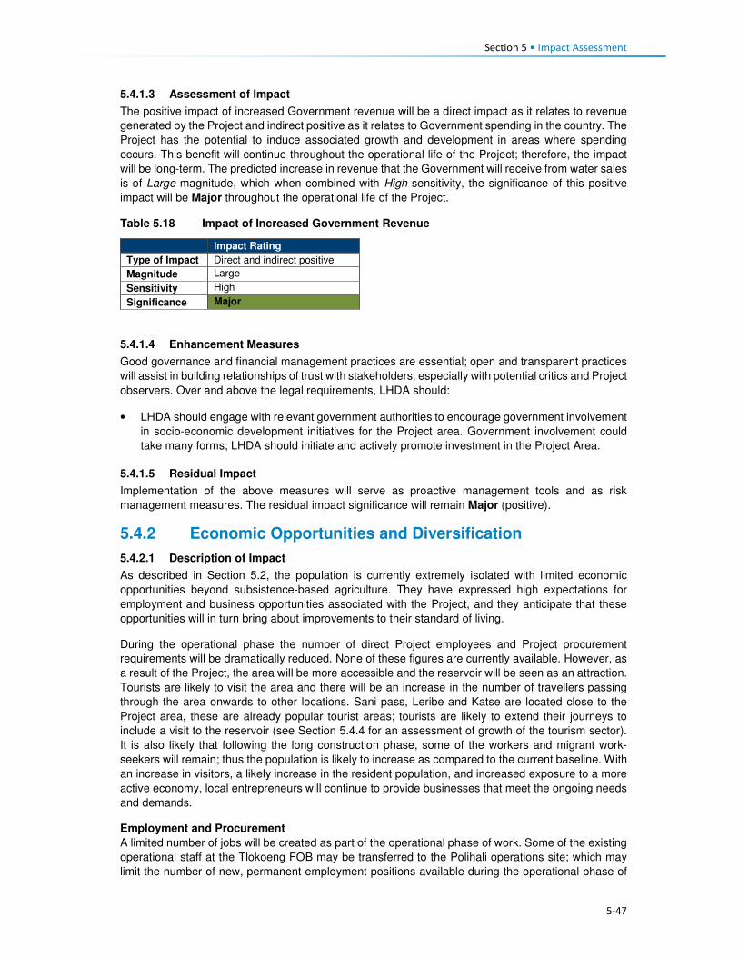
Section 5 • Impact Assessment
5-47
5.4.1.3 Assessment of Impact
The positive impact of increased Government revenue will be a direct impact as it relates to revenue
generated by the Project and indirect positive as it relates to Government spending in the country. The
Project has the potential to induce associated growth and development in areas where spending
occurs. This benefit will continue throughout the operational life of the Project; therefore, the impact
will be long-term. The predicted increase in revenue that the Government will receive from water sales
is of Large magnitude, which when combined with High sensitivity, the significance of this positive
impact will be Major throughout the operational life of the Project.
Table 5.18 Impact of Increased Government Revenue
Impact Rating
Type of Impact Direct and indirect positive
Magnitude Large
Sensitivity High
Significance Major
5.4.1.4 Enhancement Measures
Good governance and financial management practices are essential; open and transparent practices
will assist in building relationships of trust with stakeholders, especially with potential critics and Project
observers. Over and above the legal requirements, LHDA should:
• LHDA should engage with relevant government authorities to encourage government involvement
in socio-economic development initiatives for the Project area. Government involvement could
take many forms; LHDA should initiate and actively promote investment in the Project Area.
5.4.1.5 Residual Impact
Implementation of the above measures will serve as proactive management tools and as risk
management measures. The residual impact significance will remain Major (positive).
5.4.2 Economic Opportunities and Diversification
5.4.2.1 Description of Impact
As described in Section 5.2, the population is currently extremely isolated with limited economic
opportunities beyond subsistence-based agriculture. They have expressed high expectations for
employment and business opportunities associated with the Project, and they anticipate that these
opportunities will in turn bring about improvements to their standard of living.
During the operational phase the number of direct Project employees and Project procurement
requirements will be dramatically reduced. None of these figures are currently available. However, as
a result of the Project, the area will be more accessible and the reservoir will be seen as an attraction.
Tourists are likely to visit the area and there will be an increase in the number of travellers passing
through the area onwards to other locations. Sani pass, Leribe and Katse are located close to the
Project area, these are already popular tourist areas; tourists are likely to extend their journeys to
include a visit to the reservoir (see Section 5.4.4 for an assessment of growth of the tourism sector).
It is also likely that following the long construction phase, some of the workers and migrant work-
seekers will remain; thus the population is likely to increase as compared to the current baseline. With
an increase in visitors, a likely increase in the resident population, and increased exposure to a more
active economy, local entrepreneurs will continue to provide businesses that meet the ongoing needs
and demands.
Employment and Procurement
A limited number of jobs will be created as part of the operational phase of work. Some of the existing
operational staff at the Tlokoeng FOB may be transferred to the Polihali operations site; which may
limit the number of new, permanent employment positions available during the operational phase of

Section 5 • Impact Assessment
5-48
the Project. Indirect employment opportunities within the supply chain will remain (but at a lower level
of intensity), e.g. maintenance activities, security services, hospitality work at the proposed tourist
lodge and visitor’s centre associated with the Operations Centre.
Procurement contracts during operation are likely to be smaller and focused mainly on technical
requirements and maintenance services. As such, a limited number of locally-based businesses will
be able to service the operational needs – which will include fuel supply, food, and office materials.
Alternate Livelihood Opportunities
The economy, which is almost exclusively focused on agriculture, is likely to become more diversified
through an influx of people with a greater variety of skills and offerings. Agriculture is likely to remain
the foundation of the economy for most households. However, the need to offer alternate goods and
services (e.g. accommodation, meals, fresh produce, cleaning, entertainment/ recreation, curios) to
the operational workers, newcomers, and local people should result in diversification of the economy
of Mokhotlong. In the future, post-construction, many people are likely to have an improved opportunity
to generate income from other activities beyond agriculture.
While economic opportunities and the possibility for economic diversification will arise as a result of
increased demand from operational workers, work-seekers and visitors; the onus will remain on
individuals to start-up/ enhance businesses to benefit from the increase in demand. It is likely that
these opportunities could be taken by outsiders with the means to respond quickly to the demand.
Locals may find it more difficult to set-up competitive businesses due to a lack of skill and financial
resources. The harsh environment of the area may also restrict the degree to which diversification of
the economy can be achieved post-dam construction.
5.4.2.2 Sensitivity of Receptors
It is expected that the influx of migrants (potentially with more expertise and resources) will result in
increased competition for local jobs, procurement contracts and to establish required businesses. The
communities in the Project Area can be considered to have Medium sensitivity in that the economic
opportunities will be available, but the majority of the population are unlikely to have the skills or capital
to access/ optimise the opportunities. Many households/ individuals are likely to be able to set-up
small initiatives that will increase their ability to earn additional income – at the very least, the market
for their surplus agricultural produce and curios will increase.
5.4.2.3 Assessment of Impact
The benefits to the local economy would be experienced as a positive impact that would deliver direct,
indirect and induced opportunities. Direct Project opportunities will be more limited in the local
economy; these are more likely to generate national and international benefits. The impact will be
experienced at the local level as a result of localised demand for goods and services through increased
spending by workers, residents, commuters and visitors/tourists. The operational phase will be long-
term to permanent. The magnitude of this impact is expected to be Low-Medium, which in the context
of the Medium sensitivity of the receptors results in an impact predicted to be of Minor to Moderate
significance.
Table 5.19 Economic Opportunities and Diversification
Pre-Mitigation Impact Residual Impact
Type of Impact Direct, indirect and induced. Positive
Magnitude Low-Medium Medium Sensitivity Medium Medium
Significance Minor-Moderate Moderate
5.4.2.4 Enhancement Measures
• Continue implementation of livelihood restoration and social development projects with directly
affected households and communities until it can be demonstrated that local residents directly
affected by the project are self-sufficient and able to sustain their livelihoods.

Section 5 • Impact Assessment
5-49
• As per Section 5.3.6.4, LHDA will support MSME development through collaboration with service
providers such as BEDCO, which should include all affected parts of the extended Project Area,
as part of LHDA’s commitment to social development under the SDMP.
5.4.2.5 Residual Impact
Through sustained implementation of the enhancement measures, the magnitude of this impact could
increase to Medium. Receptor sensitivity will remain Medium, thus resulting in a residual significance
rating of Moderate (positive) significance.
5.4.3 Increased Cost of Living
5.4.3.1 Description of Impact
As described in Section 5.3.7, the cost of goods and services is likely to increase gradually throughout
the construction phase and remain elevated throughout the operational phase. It is likely that the prices
of goods and services may readjust to meet market demand, reaching a more stable/ normalised level.
Given that the population of the area is likely to remain somewhat elevated, and economic
diversification is probable, prices will stabilise, albeit at a higher relative level than they are currently.
In addition to the increased costs of items, goods and services that were previously not offered for
purchase may become available. The area will be more accessible and attractive to visitors and new
residents, they are likely to bring new merchants that sell an increased diversity of goods, thus
tempting people to purchase goods that ordinarily would not have been available to them. Currently,
there is limited public transport with few taxis operating in the area; and away from the A1 paved road
most people walk or use donkeys and horses for transporting larger items. With the improved road
networks there is likely to be an expansion of transport options available representing an increased
cost of living to residents unaccustomed to paying for transport.
Post construction and the completion of the associated job opportunities, the general standard of living
could deteriorate over time as a result of decreased levels of affordability (linked to decreased income
compared to the more prosperous construction phase) although it is still expected to remain better
than before construction. The standard of living could be counterbalanced by improved economic
opportunities and improved accessibility to markets and critical social infrastructure and services (as
assessed in Section 5.4.2). The villages close to the A1 and to the more established towns of
Mokhotlong and Mapholaneng will be the least affected given that they are relatively well served
population centres.
5.4.3.2 Sensitivity of the Receptors
The sensitivity of the population will vary. Some people will be able to increase and maintain their
increased levels of income generation, while others (specifically the elderly and more traditional
people) will continue their lifestyles in a manner similar to current levels. Similar to the construction
phase, the most isolated villages will be most affected by price increases, and the population will begin
to adapt to the impact over time. Everyone will be affected by an increase in the cost of living; some
people will be able to accommodate the increase, and given the expectation and potential for new
market opportunities, the overall sensitivity of the population is rated as Medium. The people who
cannot increase their income will be more sensitive to the impact, but many people will have begun to
adjust to the increased cost of living during the five-year construction phase.
5.4.3.3 Assessment of the Impact
This impact is negative and will continue as an indirect consequence of the changed nature of the
area. The impact will be experienced at the local level and will be permanent, it is likely to affect most
people. The magnitude will be Medium and will gradually decrease over time as the market adjusts to
demand. People are likely to adjust to the cost of living over time, albeit with difficulty. The significance
is likely to be one of Moderate (negative) significance.

Section 5 • Impact Assessment
5-50
Table 5.20 Increased Cost of Living
Pre-Mitigation Impact Residual Impact
Type of Impact Indirect negative
Magnitude Medium Medium Sensitivity Medium Medium
Significance Moderate Moderate
5.4.3.4 Required Mitigation Measures
• Implement all required and recommended measures described in Section 5.3.7.
• Implement social development projects under the SDMP, as outlined in the LHWP Phase II
LR&SDF as a means of delivering socio-economic benefits to assist in combatting some of the
challenges households may experience.
5.4.3.5 Residual Impact
There is little that can be done by LHDA directly to significantly reduce the cost of living. Also, it is
uncertain the extent to which the recommended interventions by LHDA and GoL will be effective in
providing additional livelihood support to the local population that could help to moderate the increased
cost of living that is expected. As such, it is anticipated that as a worst case scenario the magnitude
will remain unchanged at Medium; therefore the impact is assessed to remain at Moderate (negative)
significance. It is likely that as the market adjusts, the sensitivity of many households will decrease
and the impact will normalise.
5.4.4 Growth of the Local Tourism Sector
5.4.4.1 Description of Impact
The contribution of tourism to the national economy appears to be increasing. In 2014, the direct
contribution of tourism to GDP was 6%; it was forecast to rise to 8% in 2015. This contribution primarily
reflects the economic activity generated by industries such as hotels, travel agents, airlines and
passenger transportation services (excluding commuter services). The sector employed ~23,500
people in 2014 (5% of the economically active population). In the Mokhotlong District, tourism is seen
as a significant economic activity, which is facilitated by its proximity to the Drakensberg Mountains in
South Africa and the famous Sani Pass road. No data were available on the contribution of tourism to
the economy of Mokhotlong; however, there are a significant number of tourists visiting the area
attracted by the skiing resort, Sani Pass and other natural features of the area. Furthermore, several
new hotels are being constructed in Mokhotlong Town, in anticipation of this Project and anticipated
future tourists.
Establishment of the reservoir is likely to attract visitors who would value the aesthetic presence of the
reservoir and who enjoy water-based recreational activities that may be developed at the site.
Improved road networks will generally enhance accessibility to other parts of the Project Area which
are currently inaccessible due to poor road conditions or a lack of roads. It is therefore anticipated that
the presence of the Project will facilitate further development of the tourism sector throughout the
Mokhotlong District.
The increased number of tourists in the area is expected to boost the local economy especially in
terms of spending by tourists. Participants in interviews indicated that they would be able to sell
Basotho arts and crafts as well as medicinal plants to tourists. There will be opportunities for people
to start a range of small businesses, including hospitality services (e.g. accommodation, meals,
transport), tour guiding services (e.g. hiking trails, botanical/ avian/ ecological trails), amongst others.
The growth of the tourism sector will also facilitate creation of induced employment for local people,
especially the youth. It must be realised, however, that it will take considerable time for tourism to
increase, even after the five-year construction phase is completed; establishing tourism facilities and
activities will require investment of funding and support to local entrepreneurs. At Katse Dam, tourism
is seasonal and visitors tend to spend only one or two nights, mainly on drive through journeys or for
workshops/conferences, as there are limited tourism-related activities despite the 20 year existence

Section 5 • Impact Assessment
5-51
of the dam. However, it is hoped that Polihali Dam may be able to capitalise more successfully on its
proximity to the Drakensberg and greater accessibility to tourists from Gauteng and KZN. Even though
the industry is unlikely to become very large, it will bring about positive impacts to those who take up
the opportunities.
5.4.4.2 Sensitivity of Receptors
The growth and increased number of tourists in the Project Area is likely to stimulate a change in the
livelihoods of the locals who become involved in the sector. However, there exist barriers for locals
fully partaking in the sector, including limited skills and resources to maximise the opportunities
presented, as well as competition from in-migrants who may have more experience in the sector.
Therefore, the sensitivity of the receptors is regarded as Medium.
5.4.4.3 Assessment of Impact
Growth and development of the tourism sector will be experienced as an indirect and induced positive
impact. The impact will be localised but with the potential to extend to the Katse dam area due to the
improved road connection between Leribe and Mokhotlong Districts; therefore, the impact has the
potential to extend regionally. The magnitude of the impact will be Small-Medium depending on the
uptake of the opportunities associated with growth of the tourism sector. Overall, the impact is rated
as one of Minor to Moderate positive significance.
Table 5.21 Growth of the Local Tourism Sector
Pre-Mitigation Impact Residual Impact
Type of Impact Induced positive
Magnitude Small – Medium Medium
Sensitivity Medium Medium
Significance Minor - Moderate Moderate
5.4.4.4 Enhancement Measures
• LHDA are collaborating with the LTDC and Ministry of Development Planning to fast-track
implementation of the Tourism Master Plan and to identify and co-develop or support tourism
initiatives in the Project Area.
• LHDA should consider collaboration with the Ministry of Education, Ministry of Trade and Industry,
LTDC and Ministry of Development Planning to establish a business training centre in Mokhotlong
Town. The purpose of the centre would be:
• To provide training and development to start-up and small businesses; as well as to facilitate
provision for micro-loans for tourism related entities.
• To run capacity building and training sessions to support local businesses to improve their
offerings, and to meet the strict health, safety and quality standards required for procurement
by LHDA.
5.4.4.5 Residual Impact
The implementation of the mitigation measures has the potential to increase magnitude to Medium;
hence the impact could become one of Moderate (positive) significance.
Section 5 • Impact Assessment
5-52
5.4.5 Continuation of Anti-Social Behaviour and Spread of STIs and HIV/AIDS
5.4.5.1 Description of Impact
Anti-social behaviour, as described in detail in Section 5.3.11, is expected to continue into the
operational life of the Project to some extent. There will no longer be Project workers and many migrant
work-seekers will likely leave the area in search of opportunities elsewhere. As a result of increased
accessibility and an inevitable flow of ‘outsiders’ through the area, norms, values and customs will
continue to change; people will continue to be exposed to different views and ways of life. Migration
in and out of the area will likely be driven more by economic / market reasons, as well as travel to
schools and other social facilities that may be of a higher standard than those present in the Project
Area.
As with the construction phase impact, HIV and STIs, casual sexual relationships, prostitution,
unwanted pregnancies, an increase in drug and alcohol abuse, and crime (e.g. theft of livestock) are
likely to persist to some degree. Long distance truck drivers and migrants in search of work
opportunities are likely to be the most significant contributors to the spread of HIV and STIs; and may
increase a demand for prostitution and attract local women to enter into relationships with them.
Stock theft will continue to be an issue, given that the road network will be dramatically improved; thus
enabling easy access and ‘get away’. Once again, increased policing may serve to discourage this.
Increased exposure to people from outside the Project Area (an area that is currently very isolated
and insular) during the construction phase and throughout the operational phase, will lead to an
inevitable change to norms, culture and values. This will largely result from an enhanced worldview
and adoption of attitudes, wants and desires that come from more established, commercial and
diverse locations. Together with anti-social behaviour and the other dramatic physical, economic and
social changes to the area, there will be a significant change in the sense of place of the area. Sense
of place is described and discussed in Section 5.2.3; it has not been assessed. While a change in the
sense of place is inevitable, directly and indirectly, as a result of this Project, the nature, magnitude
and significance of the impact will differ for all people.
5.4.5.2 Sensitivity of Receptors
Following the eight year construction phase, people would already have experienced an increase in
the anti-social behaviour. While an increase in anti-social behaviour is not desirable, people will have
adapted to the increased risks and exposure. Their levels of sensitivity will have reduced to Medium.
5.4.5.3 Assessment of the Impact
While the level of confidence in this impact is low, the negative impact of ongoing anti-social behaviour
and spread of HIV/AIDS is expected to continue into the operational phase as a result of the inevitable
changes that the eight year construction phase will precipitate, and as an indirect result of ‘outsiders’
visiting and travelling through the area. The impact will be experienced at a local level; however, STI
and HIV infections will spread into the areas where the road users and work-seekers originate and
migrate to. The duration will be long-term to permanent, specifically as related to diseases such as
HIV/AIDS which, for those affected, will have permanent impacts on them and their families. This
impact could affect individuals and families in different ways and to varying degrees. The magnitude
of the impact is rated Medium compared to the Large magnitude during dam construction. When
combined with the Medium sensitivity of the receptors, the impact is assessed as being Moderate
(negative) significance.

Section 5 • Impact Assessment
5-53
Table 5.22 Continuation of Anti-Social Behaviour and Spread of STIs and HIV/AIDS
Pre-Mitigation Impact Residual Impact
Type of Impact Indirect negative
Magnitude Medium Medium
Sensitivity Medium Medium
Significance Moderate Moderate
5.4.5.4 Recommended Mitigation Measures
• During the operational phase there are limited interventions that can be implemented directly by
LHDA. However, LHDA should assist by motivating and supporting relevant departments in the
GoL to identify potential projects and interventions that could result in improvements to anti-social
behaviour. These are likely to include improved education and training, recreational facilities and
activities, crime awareness and management interventions, improved health awareness
campaigns (specifically linked to sexual health and well-being).
5.4.5.5 Residual Impact
Given that LHDA cannot do much to mitigate this indirect impact, and that mitigation is largely the
responsibility of GoL, the residual significance rating will remain Moderate. Over time, the significance
is likely to reduce as the population adapts.

6-1
Section 6 Mitigation and Monitoring
6.1 Overview Mitigation for social impacts of the Project is the responsibility of the LHDA, with delegation of certain
responsibilities to the appointed RAP Consultants who will implement the physical and economic
resettlement requirements, and the appointed Contractors who need to manage day to day
construction related aspects that will or may impact communities. In several cases LHDA and the RAP
consultants will be required to oversee the success of the mitigation measures proposed in this report
and contained in the EMP.
All mitigation measures identified in this report have been compiled into one overall mitigation table in
which responsibilities are assigned to LHDA, RAP Consultant or Contractor.
The LHDA has a legal obligation to restore the livelihoods of individuals, households and communities
affected by the LHWP. These obligations are specified in the Treaty on the Lesotho Highlands Water
Project (1986), the LHDA Order (1986) and the Phase II Agreement (2011), where reference is made
to the maintenance of the “standard of living”, “welfare” and “income” of affected persons and
communities. The Phase II Agreement additionally states that “Social development programmes and
mitigation measures, resettlement requirements and awareness campaigns will be implemented, the
full extent to be agreed by the Parties during the implementation”. Some of the key socially related
documents / plans or policies developed by the LHDA are highlighted below. The implementation of
these will be the responsibility of the LHDA with the assistance of appointed Consultants/ Contractors
and Government at Nation and District levels.
A Phase II Compensation Policy has been prepared for Phase II to ensure that these obligations are
met. The Policy describes compensation and relocation entitlements for the loss of land and assets,
as well as other support measures. It also stipulates that livelihood restoration initiatives are required,
to be undertaken within the framework of sustainable development and emerging income-generating
opportunities so that individuals and communities can continue with improved livelihood-earning
activities after withdrawal of Project inputs and support.
LHDA’s right to undertake compulsory acquisition of land carries with it a responsibility to ensure that
those affected do not bear an unfair share of the negative impacts of the Project. In the simplest terms,
this responsibility should be to ensure that the standard of living of all affected persons is restored to
the level enjoyed before the commencement of the Project implementation. To the extent that LHDA
is successful in restoring those living standards for all affected, the adverse impacts will have been
minimised and possibly prevented. The management and mitigation actions for land acquisition and
resettlement will be described in detail in the RAP that is being undertaken under a separate contract
to LHDA. Depending on how well the resettlement is planned and executed, it should go a long way
in compensating for the loss of community assets and disruption. Implementation of the RAP must be
well-aligned with the Environmental and Social Management Plan (ESMP) and will also monitor that
the social mitigation requirements of this study are undertaken and effective.
Labour Recruitment Guidelines have also been developed to ensure that the LHDA meet the
stipulations of the Treaty and Signed Phase II Agreement. Key players in the recruitment process will
be:
Project Labour Recruitment Desk (PLRD). LHDA will appoint a service provider to establish and
implement a Project Labour Recruitment Desk (PLRD for the Project. The PLRD, will be tasked with
the following:
• Establish a recruitment desk away from the construction sites to facilitate the recruitment of the
unskilled labour at various strategic locations;

Section 6 • Mitigation and Monitoring
6-2
• Create a database which can be used to list unskilled labour applications in collaboration with
ALCs, where they exist, area chiefs and councillors where community participation structures do
not exist, NES and district labour offices;
• In consultation with the ALCs, respond to labour requirements from contractors and provide names
and contact details of applicants;
• Advise each ALC and NES of the successful candidates and notify them about the time required
for the candidates to report to contractors’ recruitment offices;
• Register and address employment complaints relating to recruitment process; and
• Meet with the ALCs of the community structures at the agreed times to report on the progress
made in recruitment of labour and to disclose any pertinent information on recruitment of labour;
and other recruitment related responsibilities.
Area Liaison Committees (ALCs). ALCs and CLCs will be expected to co-ordinate their activities
including registration and recruitment of unskilled labour activities. ALCs will facilitate the recruitment
of unskilled labour from the communities by assuming the following roles and responsibilities:
• Maintaining lists of job seekers with details of names, district, village, age, sex, education/
qualifications, identity numbers, and contact details and regularly submit these lists to the PLRD
for capture on the database;
• Registering employment complaints relating to recruitment processes, address them where they
can and where they cannot, pass them to PLRD; and
• Meeting with PLRD at agreed times to review the recruitment processes and obtain reports on
recruitment of all types of labour provided to different contractors.
National Employment Services (NES). LHDA will engage the services of NES of the Ministry of Labour
and Employment working together with District Labour Offices to register unskilled job seekers from
other parts of Lesotho along the same principles as described above and to submit these on a regular
basis to PLRD.
To promote social development efforts, the LHDA has developed the Livelihood Restoration and
Social Development Framework. Section 6.5 of the LR&SD Framework outlines LHDA’s proposed
approach to addressing socio-economic development needs through the development and
implementation of a Social Development Master Plan (SDMP). As proposed, the SDMP will identify
the key components for sustainable development based on full participation of the communities living
in the Phase II area. Implementation of the SDMP should, in part, serve to address the expectations
of the local communities. LHDA’s proposed approach to the SDMP 1:
• A Social Development Master Plan (SDMP) for Phase II will be prepared by a consultant in
consultation with LHDA, local communities, GoL and other development partners. The SDMP will
describe the approved projects to be implemented in the Phase II area, institutional arrangements
for implementation of each SDMP component, provide a programme and timeframe, and describe
funding requirements and responsibilities.
• Approved projects in the SDMP will be implemented by appointed service providers according to
the programme and timeframe established in the SDMP.
• The following key tasks are envisaged to be carried out by the consultant who will be engaged to
prepare the SDMP:
• Provide an overall framework and guidance for Lesotho Highlands Development Authority and
relevant government ministries/departments on how best to take a proactive and consistent
stance on social development initiatives in the Polihali Area in line with Vision 2020 and other
policy guidelines.
• Identify and analyse all social development activities/projects already being carried out in the
Polihali catchment area (including scheduling, costing and responsibility for implementation).
• Prioritise those social development activities that have the most impact and identify those that
should be improved, expanded and potentially eliminated.

Section 6 • Mitigation and Monitoring
6-3
• Develop a Social Development Master Plan that details key components for sustainable
development informed by full participation of communities living in the Phase II area.
• Review the consultation and stakeholder engagement process that already exists, identify
gaps and strengthen participatory engagement on LHDA-related social development priorities.
• Establish and delineate the roles and responsibilities of LHDA, government, local authorities,
civil society/local NGOS and other stakeholders in relation to managing social development
activities in the area.
• Illustrate opportunities for synergies with other community-based development programmes
such as livelihood restoration programmes, community based natural resources management,
integrated catchment management as well as similar programmes being implemented by aid
agencies such as EU, IFAD, UNDP, UNEP, etc.
• Prepare and present projects together with detailed budget breakdowns, including potential
additional sources of finance and technical support that would be available through relevant
stakeholders as well as Memoranda of Understanding (MoU) to support implementation of the
social development projects sustainably in the short-medium term.
• Describe existing and proposed organisational frameworks that will be used to implement and
administer the SDMP (including identification of agencies that might be responsible for overall
co-ordination of activities). Any training and skills development requirements for LHDA staff
involved with community development must also be illustrated.
• Describe how the social development initiatives would be monitored and evaluated.
• Social development projects and programmes will be handed over, where applicable, to the
relevant government agencies for ongoing support and oversight as shall be agreed and
formalised through MoUs.
• A monitoring and evaluation programme will be developed to determine the outcomes/ impacts of
social development programmes.
An ICM Plan must also be developed. The overall aim of the plan should be to improve land use
practices and in doing so, reduce sediment transport and thereby improve the health of the rivers in
the catchment as a whole. The plan should develop appropriate incentives, with funds ring-fenced in
a trust or similar entity, to ensure participation of land users and long-term sustainability. Appropriate
incentives aimed at changing unsustainable land use practices could include payment for catchment
protection services, awards, and/or fines. Recommendations on what the ICM should contain are
provided in the Environmental and Social Impact Statement (P2W-6014-DFR-0011).
The LHDA has commissioned a Public Health Impact Assessment and a PHAP Contract LHDA No.
6018, which is currently (October 2017) out to tender.
6.2 Social Mitigation Measures Mitigation measures specific to the social impacts identified have been included in Table 6.1. Further
mitigation measures have been identified by other specialists that relate to impact of physical
displacement but are not repeated here (Refer to Soils, Land Use and Land Capability (P2W-6014-
DFR-0007), Terrestrial Ecology (P2W-6014-DFR-0002) and Rangelands (P2W-6014-DFR-0009)).

6-4
Table 6.1 Mitigation Measures for Social Study
Ref Activity Requirements / specifications Responsibility Scheduling /
Timing/
Frequency
Phase Performance
Indicator(s)
Training
Requirements
1 Physical and Economic Displacement
Objective: To manage and mitigate the losses associated with economic and physical displacement
1.1 Develop and
implement a
Resettlement
Action Plan
• Development and implementation of
the RAP in accordance with the
agreed scope of work and LHDA’s
Compensation Policy.
• Establishment of grievance
mechanism prior to project
implementation to facilitate the
resolution of affected community
concerns and grievances ensuring
ongoing interaction with the
communities in order to build trust and
maintain relationships throughout
project implementation.
• Ensure the socioeconomic census
determines the multiple providers of
income and includes a gender
analysis as a basis for facilitating
different opportunities for employment
of women.
• Criteria are set for the socioeconomic
census for determining vulnerability of
households so that vulnerable groups
(poor, elderly) to ensure these
households are the focus of
opportunities for livelihood restoration.
• Compensation and other necessary
assistance is provided before impacts
of the project occur.
• Arrangements and resources for
resettlement are adequate and
assigned.
LHDA
RAP Consultant
Prior to
commencement
of advance
works and
construction
and ongoing
throughout
Project
implementation
Prior to
commencement of
advance works and
construction and
ongoing throughout
Project implementation
• Resettlement Action Plan in place
• Community consultation on RAP undertaken
• Grievance resolution mechanism established
• Monitoring and evaluation system established to monitor implementation activities and quality of life of project affected people is equal to or better prior to displacement
To be determined by
RAP Consultant
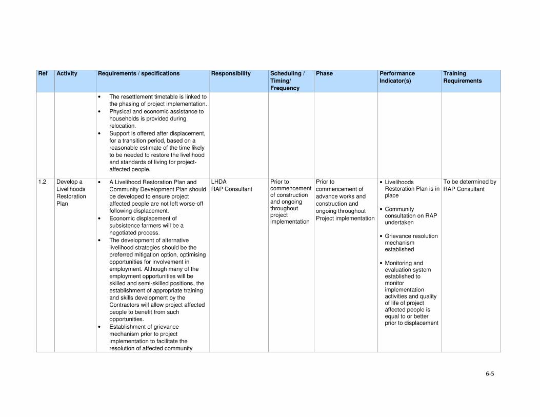
6-5
Ref Activity Requirements / specifications Responsibility Scheduling /
Timing/
Frequency
Phase Performance
Indicator(s)
Training
Requirements
• The resettlement timetable is linked to
the phasing of project implementation.
• Physical and economic assistance to
households is provided during
relocation.
• Support is offered after displacement,
for a transition period, based on a
reasonable estimate of the time likely
to be needed to restore the livelihood
and standards of living for project-
affected people.
1.2 Develop a
Livelihoods
Restoration
Plan
• A Livelihood Restoration Plan and
Community Development Plan should
be developed to ensure project
affected people are not left worse-off
following displacement.
• Economic displacement of
subsistence farmers will be a
negotiated process.
• The development of alternative
livelihood strategies should be the
preferred mitigation option, optimising
opportunities for involvement in
employment. Although many of the
employment opportunities will be
skilled and semi-skilled positions, the
establishment of appropriate training
and skills development by the
Contractors will allow project affected
people to benefit from such
opportunities.
• Establishment of grievance
mechanism prior to project
implementation to facilitate the
resolution of affected community
LHDA
RAP Consultant
Prior to commencement of construction and ongoing throughout project implementation
Prior to
commencement of
advance works and
construction and
ongoing throughout
Project implementation
• Livelihoods Restoration Plan is in place
• Community consultation on RAP undertaken
• Grievance resolution mechanism established
• Monitoring and evaluation system established to monitor implementation activities and quality of life of project affected people is equal to or better prior to displacement
To be determined by
RAP Consultant

6-6
Ref Activity Requirements / specifications Responsibility Scheduling /
Timing/
Frequency
Phase Performance
Indicator(s)
Training
Requirements
concerns and grievances ensuring
ongoing interaction with the
communities in order to build trust and
maintain relationships throughout
project implementation.
• LHDA should be encouraged to seek
partnerships with relevant authorities
and organisations to develop
programmes that aim to enhance
agricultural production amongst the
population of the Project Area.
1.3 Develop a
Social
Development
Master Plan
• Appoint a consultant to develop the community projects as part of the SDMP.
• Social development projects and programmes will be handed over, where applicable, to the relevant government agencies for ongoing support and oversight as shall be agreed and formalised through Memoranda of Understanding (MoUs).
• A monitoring and evaluation programme will be developed to determine the outcomes/ impacts of social development programmes.
LHDA
Government entities
NGOs/ CBOs
Prior to
commencement
of advance
works and
construction
and ongoing
throughout
Project
implementation
Prior to
commencement of
advance works and
construction and
ongoing throughout
Project implementation
• Appointment of
Consultant
• Social Development
Master Plan in place
• Identification of
community
development
projects
• Implementation of
community
development
projects
• Monitoring plans in
place
To be determined by
the Consultant
2 Increased prevalence of STIs and HIV/AIDs
Objective: to reduce the spread and increase of STIs and HIV/AIDs
2.1 Management
of STIs incl.
HIV/AIDs
• Strengthen local educational
programmes that are ‘women and youth
friendly’, focusing on the control of STIs
and particularly HIV / AIDs.
LHDA
Government entities
Prior to
advance works
construction
Prior to and throughout
advance works
construction and
operational phases
• Presence of
educational
programmes
• Records of women
and youth enrolment
HIV/ AIDs training
programme
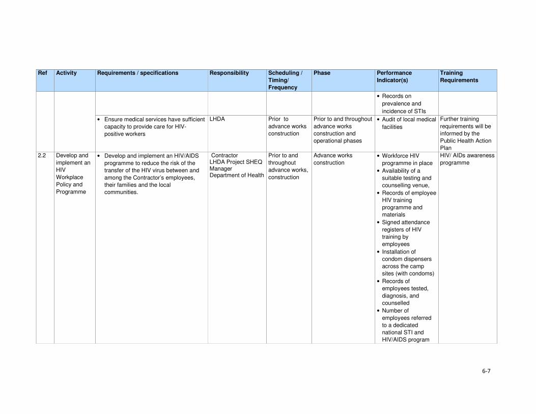
6-7
Ref Activity Requirements / specifications Responsibility Scheduling /
Timing/
Frequency
Phase Performance
Indicator(s)
Training
Requirements
• Records on
prevalence and
incidence of STIs
• Ensure medical services have sufficient
capacity to provide care for HIV-
positive workers
LHDA Prior to
advance works
construction
Prior to and throughout
advance works
construction and
operational phases
• Audit of local medical
facilities
Further training
requirements will be
informed by the
Public Health Action
Plan
2.2 Develop and
implement an
HIV
Workplace
Policy and
Programme
• Develop and implement an HIV/AIDS
programme to reduce the risk of the
transfer of the HIV virus between and
among the Contractor’s employees,
their families and the local
communities.
Contractor LHDA Project SHEQ Manager Department of Health
Prior to and
throughout
advance works,
construction
Advance works
construction
• Workforce HIV
programme in place
• Availability of a
suitable testing and
counselling venue,
• Records of employee
HIV training
programme and
materials
• Signed attendance
registers of HIV
training by
employees
• Installation of
condom dispensers
across the camp
sites (with condoms)
• Records of
employees tested,
diagnosis, and
counselled
• Number of
employees referred
to a dedicated
national STI and
HIV/AIDS program
HIV/ AIDs awareness
programme

6-8
Ref Activity Requirements / specifications Responsibility Scheduling /
Timing/
Frequency
Phase Performance
Indicator(s)
Training
Requirements
• Record of monitoring
of outcomes.
2.3 Develop an Emergency Prevention, Preparedness and Response Plan.
• In collaboration with the local and
district Government, local emergency
providers and local health care
facilities, develop and implement
EPPRPs.
• The Plan will cover all incidents
presenting risks to public safety and the
affected communities in proximity to the
various Project Sites and the
surrounding environment.
LHDA: Environmental, Health and Safety Management Unit Government entities NGOs
Prior to
advance works
construction
Throughout advance
works construction and
operational phases
• Record of
stakeholder
engagement
• Presence
Emergency
Prevention,
Preparedness and
Response Plans
(EPPRPs)
• Charter of roles and
responsibilities
• Review of incident
reports
• Annual review of
policies and plans
To be determined in
the EPPRPs
• Update EPPRPs on an annual basis,
based on the outcomes of the review of
incident reports.
LHDA Prior to and
throughout
advance works
On-going update • Updated EPPRPs
2.4 Minimise incidences of sexually transmitted infections (STIs) including HIV/AIDS.
Develop and implement an HIV/AIDS Prevention Programmes for its workforce.
LHDA Contractor
Prior to
advance works
and ongoing
Prior to and throughout
advance works
construction
• Health educational
programmes and
materials in place
• Internal training
records
• Number of HIV tests
undertaken every 6
months
• Records on
prevalence and
incidence of STIs)
• Number of people
receiving HIV / STI
treatment (ARVs)

6-9
Ref Activity Requirements / specifications Responsibility Scheduling /
Timing/
Frequency
Phase Performance
Indicator(s)
Training
Requirements
• Number of fatalities
linked to HIV / STIs
annually
2.5 Risk planning, management and communication
Liaise with the appointed Consultant for the PHAP and the appointed Consultants for the other major engineering packages to identify the appropriate off-site facilities for major medical treatment (local clinic, district hospitals or regional hospitals) in developing detailed.
LHDA Project SHEQ Manager Contractors Emergency services personnel
Quarterly Throughout advanced
and construction • Records of full
scale ‘live’
rehearsals of a
response plan
• Emergency
communications
procedure in place
• Emergency
checklists that can
be quickly
accessed by
management,
response
personnel and
employees
live’ rehearsals
3 Risks associated with road traffic
Objective: To reduce the risks associated with increased road traffic in the Project Area and to proactively monitor and manage project related vehicle traffic
3.1 Manage traffic
impacts
related to the
Project
• Assess impacts of selected
transportation routes and provide
detailed mitigation to be implemented in
Traffic Management Plan.
LHDA Prior to
advance works
and ongoing
Prior to and through
advance works • Traffic assessment
• Traffic Management
Plan
To be determined by
LHDA
3.2 Improve Road
Signage • Implement road signs demarcating
speed limits and identifying common
pedestrian / livestock crossings.
Contractor
Department of Roads
advance works,
construction
Advance works,
construction • Number of signs
erected
3.3 Develop
community
awareness
• Conduct community consultations to
identify potential high risk areas for
traffic accidents.
LHDA Prior to
advance works
Prior to and throughout
advance works
construction
• Records of
engagement

6-10
Ref Activity Requirements / specifications Responsibility Scheduling /
Timing/
Frequency
Phase Performance
Indicator(s)
Training
Requirements
and
coordination
procedure on
public safety
• Inform communities when traffic will
increase prior to vehicle movements
commencing.
Contractor Throughout
advance works
construction
and operational
phases
Prior to and throughout
advance works
construction
• Records of
information dispersal
/ engagement
• Number of notices
placed on community
notice boards
• Number of signs
erected
• Engage with communities along
transport routes on road safety and
accident prevention.
LHDA Throughout
advance works
construction
and operational
phases
Prior to and throughout
advance works
construction
• Records of
engagement
4 Increase in anti-social behaviours
Objective: To proactively manage incidences of antisocial behaviours
4.1 Management of antisocial behaviours
• Collaborate with local partners and
government to provide education and
awareness programme focused at
managing anti-social behaviour.
• Support an education and awareness
programme targeted at managing anti-
social behaviour in the area. Through
sponsoring campaigns on drug and
alcohol abuse, sexual abuse, etc.
LHDA
District governments
Prior to
advance works
and ongoing
Prior to advance works
and construction • Number locals who
attend sessions on
antisocial
behaviours.
Various awareness
campaigns
4.2 Workforce management
• Meet the daily needs of Project
personnel via the provision of housing,
water, subsistence, power, sanitation,
health care facilities and recreation
facilities.
• Implement Workforce Code of
Conduct.
• Allow construction workers (from
outside the area) to return home over
the weekends or on a regular basis to
EPC contractor (LHDA oversight)
Advance works and construction
Throughout Advance works and
construction
• Workforce Code of
Conduct in place

6-11
Ref Activity Requirements / specifications Responsibility Scheduling /
Timing/
Frequency
Phase Performance
Indicator(s)
Training
Requirements
visit their families in order to minimise
the interactions between the migrant
workforce and locals. The appointed
contractor will facilitate these visits
accordingly.
4.3 Management of in-migration
• Widely advertise employment
opportunities, emphasising the types of
jobs to be created and skills required
as well the policy for employment
LHDA
Contractor
Prior to
advance works
and ongoing
Prior to and throughout
advance works
construction and
operational phases
• Advertise of jobs on
national and
countrywide
N/A
5 Creation of employment
Objective: To maximise recruitment of people from the local communities, broader Project Area and from Lesotho
5.1 Maximise
employment
opportunities
• Promote employment of local people
through rotational basis for unskilled
workers.
• Establish accessible satellite offices in
the area to facilitate easy access.
• Provide on the job training for those
employed.
Contractor
LHDA
Prior to
advance works
and ongoing
Prior to and throughout
advance works
construction and
operational phases
• Number of local
people employed
• Number of satellite
offices established
• Training records
• Numbers of people
trained
To be determined by
the contractor and
LHDA
H&S training
6 Procurement of goods and services
Objective: to maximise the project spend in the local economy
6.1 Develop and
implement
local content
policy
• Establish a policy that seeks to
maximise local/ in country purchasing
of goods and services.
• Set- out targets for all contractors to
meet in terms of local procurement.
• On-going training and capacity building
of local businesses.
• Split the large contracts into smaller
components in order to allow small
businesses to share in the project.
LHDA
Government entities
Prior to
advance works
and ongoing
Prior to and throughout
advance works
construction and
operational phases
• Number of local
business trained
• Training schedule
and materials
• Number of large
contracts split into
smaller contracts
• Review of large
tender contracts
7 Loss of access to natural resources
Objective: to rescue some plants from the inundation area prior to the dam filling

6-12
Ref Activity Requirements / specifications Responsibility Scheduling /
Timing/
Frequency
Phase Performance
Indicator(s)
Training
Requirements
7.1 Search and
rescue of
priority plants
– advanced
infrastructure
• Appoint suitably qualified or
experienced botanist to conduct active
searches for priority species prior to
infrastructure site clearance.
• Conduct foot searches of advanced
infrastructure, tunnel inlet and dam wall
and quarry areas to recover priority
plants.
• Bag, store and look after plants in
temporary nursery area/s prior to use in
landscaping of infrastructure areas or
community garden(s).
• Collect seeds of suitable plants for
landscaping and propagation in a
community garden.
• Replant rescued plants and seeds in
accordance with landscaping plan.
• Landscaping shall prioritise use of
indigenous naturally occurring plants
and shall include a list of suitable
plants.
LHDA: botanical
team to be appointed
Prior to
advance works
Preparation and during
site clearance
• Botanist appointed
• Proof of active
searches in form of
documentation and
retrieved plants.
• Nursery established
for temporary
relocation of
rescued plants and
seeds.
• Dedicated nursery
manager appointed
to manage the
nursery and recover
seeds.
• Landscaping plan
developed for
infrastructure areas
dominated by
indigenous plants.
Nursery staff trained
in plant rescue and
propagation
8 Stakeholder Consultation
Objective: to promote open and transparent communication with stakeholders
8.1 Implement a
Stakeholder
Engagement
Plan /
Programme
for the Project
• Proactive engagement of community
leaders and members on the planned
project.
• Ensure easy access to grievance
protocol for stakeholders.
LHDA
Contractor
Prior to and throughout
advance works
construction and
operational phases
• Records of all
interactions with
communities
• Records of
grievances recorded

7-1
Section 7 References
Bureau of Statistics (Lesotho), Statistical Report No. 6 of 2015 - 2013/2014 Agricultural Production
Survey Crops
Bureau of Statistics (Lesotho), Statistical Report No.8 of 2015 - Lesotho Livestock Statistics Report
2013/2014
Bureau of Statistics (Lesotho), Statistical Report No.21 of 2015 - Livestock Products Report
2013/2014
Bureau of Statistics (Lesotho), Statistical Report No. 28 of 2015 – 2014 Education Statistics Report
Bureau of Statistics (Lesotho), 2013, Lesotho Demographic Survey, 2011, Vol 1, The Bureau of
Statistics, Maseru
CES, 2014. Biological and Archaeological (Including Heritage) Baseline and Impact Assessment;
Contract LHDA No. 6002.
Consult 4 and SEED Consult, 2009. Feasibility Study for Phase II – Main Report. Lesotho Highlands
Water Commission. LHWC 001/224-2007; P RSA D000/00/7007.
Consult 4 Consortium and SEED Consult, 2008. Feasibility Study for Phase II – Consultation and
Social Issues Supporting Report. Lesotho Highlands Water Commission. LHWC 001/215-2007; P
RSA D000/00/6107.
Consult 4 Consortium and SEED Consult, 2008. Feasibility Study for Phase II - Environmental Impact
Assessment Supporting Report. Lesotho Highlands Water Commission. LHWC 001/219-2007; P
RSA D000/00/6507.
Consult 4 and SEED Consult, 2008. Feasibility Study for Phase II - Social Impact Assessment
Supporting Report. Lesotho Highlands Water Commission. LHWC 001/216-2007; P RSA
D000/00/6207.
Ecorex and Kobisi, K. 2017. Terrestrial Ecology Report for Polihali Reservoir and Associated
Infrastructure. LHDA Contract No. 6014 (P2W-6014-DFR-0002).
EOH Coastal and Environmental Services (CES), 2014. Lesotho Highlands Water Project Phase II:
Baseline Botanical Survey: Lesotho Highlands Water Project Phase II: LHDA Contract 6002.
EOH Coastal and Environmental Services (CES), 2015a. Lesotho Highlands Water Project Phase II:
Baseline Income and Expenditure Report. Lesotho Highlands Water Project Phase II: LHDA Contract
No. 6000
EOH Coastal and Environmental Services (CES), 2015b. Lesotho Highlands Water Project Phase II:
Socio-Economic Baseline Study Report. Lesotho Highlands Water Project Phase II: LHDA Contract
No. 6000
ERS. 2017.Soils, Land Use and Land Capability Report for Polihali Reservoir and Associated
Infrastructure. LHDA Contract No. 6014 (P2W-6014-DFR-0007).
Government of Lesotho. Constitution of Lesotho Act No. 5 of 1993, Maseru
Government of Lesotho. Education Act No.3 of 2010, Maseru
Government of Lesotho. Environmental Act No 10 of 2008, Maseru

Section 7• References
7-2
Government of Lesotho. Gender and Development Policy, 2003, Maseru
Government of Lesotho. Local Governance and Non-State Actors Support Programme – Information
Handbook: Mokhotlong District Report 3, 2009, Maseru
Government of Lesotho. Lesotho Land Act No. 17 of 1979, Maseru
Government of Lesotho. Lesotho Land Act No. 8 of 2010, Maseru
Government of Lesotho. Lesotho: Legal Capacity of Married Persons Act of 2006, Maseru
Government of Lesotho Ministry of Development Planning. National Strategic Development Plan
2012/13 – 2017/18 “Growth and Development Strategic Framework, 2013, Maseru
Government of Lesotho. Ministry of Education and Training. Kingdom of Lesotho. Lesotho Education
Sector Plan 2005 – 2015, Maseru, March 2015
Government of Lesotho. Lesotho National Health Strategic Plan 2012/13 – 2016/17, April, 2013,
Maseru
Government of Lesotho. National Environmental Impact Assessment Guidelines 2009, Maseru
Government of Lesotho. National Environment Policy, 1998, Maseru
Government of the Kingdom of Lesotho. Lesotho National Social Protection Strategy (NSPS)
2014/15 – 2018/19, Maseru, 2014
Government of the Kingdom of Lesotho. Millennium Development Goals Status Report 2013,
Maseru, 2014
Government of the Kingdom of Lesotho. National Policy for Integrated Early Childhood Care and
Development, Maseru, 2013
Government of Lesotho. Local Government Act 1997 as Amended by Local Government
(Amendment) Act 2004, Maseru, 2004
Government of Lesotho. The Labour Code (Amendment) Act No. 5 of 2006, Maseru
Government of Lesotho. Workmen’s Compensation Act No. 3 of 1977, Maseru
Government of Lesotho. Public Health Order 12 of 1970, Maseru
Government of Lesotho. Motor Vehicle Insurance Order No. 26 of 1989, Maseru
Government of Lesotho. Deeds Registry Act No. 12 of 1967, Maseru
IFC, 2012. International Finance Corporation Performance Standards on Environmental and Social
Sustainability, January, 2012
Kingdom of Lesotho, 2013. Higher Education Strategic Plan 2013/14 – 2017/18, Maseru
Kingdom of Lesotho, 2013. Millennium Development Goals Status Report 2013
Kingdom of Lesotho, 2014. Wool and Mohair Promotion Project (WAMPP) Final Project design report.
September, 2014
Lesotho Highlands Development Authority, 2011. Agreement on Phase II of the Lesotho Highlands
Water Project Between the Government of the Kingdom of Lesotho and the Government of the
Republic of South Africa. Maseru.

Section 7• References
7-3
Lesotho Highlands Water Project Phase II Asset Registration Procedures, October 2017
Lesotho Highlands Water Project Phase II Community Participation Strategy, September 2014
Lesotho Highlands Water Project Phase II Compensation Policy, August 2016
Lesotho Highlands Water Project Phase II Contractor Procurement Framework (Draft), August 2016
Lesotho Highlands Water Project Phase II Livelihood Restoration and Social Development
Framework, August 2017
Local Governance and Non-State Actors Support Programme – Information Handbook: Mokhotlong
District Report 3, 2009
Ministry of Health (Lesotho) and ICF International, 2016. Lesotho Health and Demographic Survey
2014. Maseru, Lesotho: Ministry of Health and ICF International.
MM&A and Pinto, H. Cultural Heritage (including Archaeology) Report for Polihali Reservoir and
Associated Infrastructure. LHDA Contract No. 6014. (P2W-6014-DFR-0003)
NHA Development Consultants, 2016. Lesotho Highlands Water Project Phase II: Public Health
Baseline Study Report. Lesotho Highlands Water Project Phase II: LHDA Contract No. 6008
Panel of Experts & LHDA, 2010. The ‘Lessons Learnt’ report from Phase 1A and Phase 1B Report
55.
Ramatla, S. and Kheekhe, M. 2017. Rangelands Report for Polihali Reservoir and Associated
Infrastructure. LHDA Contract No. 6014 (P2W-6014-DFR-0009).
Rori Consultancy, 2017. Lesotho Highlands Water Project Phase II: Safety, Health, Environment and
Quality (SHEQ) Management Framework.
Sechaba and ERM. 2017. Stakeholder Engagement Report for Polihali Reservoir and Associated
Infrastructure ESIA. LHDA Contract No. 6014 (P2W-6014-NPD-0015).
UN-Habitat, 2005. Land Tenure, Housing Rights and Gender in Lesotho
UNAIDS, 2016. Gap Report
UNDP, 2016. Human Development Report 2016: Human Development for Everyone
World Bank, 2016. World Bank Environmental and Social Framework. World Bank, Washington, DC
6014 ESIA Specialist Studies
Ecorex and Kobisi, 2017. Terrestrial Ecology Report. P2W-6014-DFR-0002
MM&A and Pinto, 2017. Cultural Heritage incorporating Archaeology Report. P2W-6014-DFR-0003
Matela and Kuenene, 2017. Soils, Land Use and land Capability Report. P2W-6014-DFR-0007
Ramatla, 2017. Rangelands Report. P2W-6014-DFR-0009
Web resources
AVERT (1986-2017) (http://www.avert.org/professionals/hiv-around-world/sub-saharan-africa)
Commonwealth Local Government Forum (2017)
http://www.clgf.org.uk/default/assets/File/Country_profiles/Lesotho.pdf

Section 7• References
7-4
Mokhethi, N.I., etal (2015) (http:www.researchgate.net/figure/290330505_fig1_figure-1-Lesotho-
wool-and-mohair-value-chain)
UN (2016) (http:/www.un.org/sustainabledevelopment/sustainable-development-goals)
UNESCO (2012) (http://www.unesco.org/eri/cp/factsheets_ed/LS_EDFactSheet.pdf)
http://www.worldmeters.info/world-population/lesotho-population/
Wade Publications CC (2015) (http://www.lesothoreview.com/education-training-2015.php)
World Bank Group - International Finance Corporation (2017)
http://www1.ifc.org/wps/wcm/connect/corp_ext_content/ifc_external_corporate_site/home

Volume 4: Annexure ISocial Report
Lesotho Highlands Development Authority
Contract LHDA No.: 6014
Contract Name: Professional Services for the
Environmental & Social Impact Assessment
(ESIA) for the Polihali Reservoir & Associated
Infrastructure
Document Ref: P2W-6014-DFR-0010
Document Date: 23 March 2018
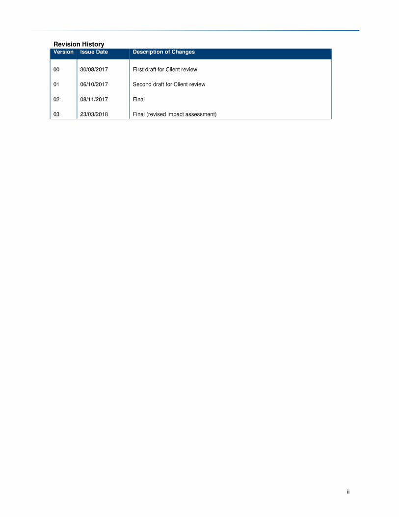
ii
Revision History Version Issue Date Description of Changes
00 30/08/2017 First draft for Client review
01 06/10/2017 Second draft for Client review
02 08/11/2017 Final
03 23/03/2018 Final (revised impact assessment)

iii
Abbreviations and Acronyms AC Area Chief
ALC Area Liaison Committee
AoI Area of Influence
ART Anti-retroviral Treatment
BEDCO Basotho Enterprises Development Corporation
BPST Bulk Power Supply Telecommunications
CBO Community-based Organisation
CC Community Council
CGP Child Grants Programme
CHAL Christian Health Association of Lesotho
CHW Community Health Workers
CLC Combined Liaison Committee
CLO Community Liaison Officer
CoC Code of Conduct
CPI Consumer Price Index
DA District Administrator
DC District Council
DCS District Council Secretary
DES District Economic Strategies
DHMT District Health Management Team
DoE Department of Environment
DRWS Department of Rural Water Supply
ECCD Early Childhood Care and Development
EA Environmental Assessment
EFR Environmental Flow Requirement
EHS Environmental Health and Safety
EIA Environmental Impact Assessment
EIS Environmental Impact Statement
EMP Environmental Management Plan
EPPRP Emergency Prevention, Preparedness and Response Plan
ESIA Environmental and Social Impact Assessment
ESIS Environmental and Social Impact Statement
ESMS Environmental and Social Management Systems
ESS Environmental and Social Standards
ERM Environmental Resources Management Southern Africa (Pty) Ltd
EU European Union
FGD Focus Group Discussion
FOB Field Office Branch
FSL Full Supply Level
GIS Geographic Information System
GoL Government of Lesotho
GPS Geographic Positioning System
HCG Pregnancy Test
HTC HIV Testing and Counselling
I&APs Interested and Affected parties
ICM Integrated Catchment Management
IFC International Finance Corporation
ILO International Labour Organisation
KII Key Informant Interview
LAA Land Administration Authority
LDHS Lesotho Demographic and Health Study
LDS Lesotho Demographic Study
LEC Lesotho Electricity Company

Abbreviations and Acronyms
iv
LHDA Lesotho Highlands Development Authority
LHWC Lesotho Highlands Water Commission
LHWP Lesotho Highlands Water Project
LHWP II Lesotho Highlands Water Project Phase II
LNWMGA Lesotho National Wool and Mohair Grower’s Association
LR&SDF Livelihood Restoration and Social Development Framework
LTDC Lesotho Tourism Development Corporation
MC Municipal Council
MCA Millennium Challenge Account
MDR Multi Drug Resistant
MG Marketing Group
MoU Memorandum of Understanding
MSMEs Micro, Small and Medium Enterprises
NER Net Enrolment Rate
NEP National Environmental Policy
NES National Environment Secretariat
NFE Non-formal Education
NGO Non-government Organisation
NPSD National Policy on Social Development
NSDP National Strategic Development Plan
NSPS National Social Protection Strategy
NTS Non-technical Summary
NUL National University of Lesotho
OVC Orphans and Vulnerable Children
PC Principal Chief
PEPFAR The President's Emergency Plan for AIDS Relief
PHAP Public Health Action Plan
PHC Primary Health Care
PLRD Project Labour Recruitment Desk
PMTCT Prevention of Mother to Child Transmission
PNEAR Polihali North East Access Road
PPE Protective Personal Equipment
PP Public Participation
PPP Public Participation Process
PRAI Polihali Reservoir and Associated Infrastructure
PS Performance Standard
PSLC Primary School Leaving Certificate
PTR Pupil Teacher Ratio
PWAC Polihali Western Access Corridor
PWAR Polihali Western Access Road
RAP Resettlement Action Plan
RfP Request for Proposal
RSA Republic of South Africa
SADC Southern African Development Community
SDMP Social Development Master Plan
SEBS Socio-Economic Baseline Study
SHEQ Safety Health Environment and Quality
SSAs Sheering Shed Associations
STIs Sexually Transmitted Infections
TB Tuberculosis
TB-DOTS Tuberculosis-Directly Observed Treatment Shots
ToR Terms of Reference
TVET Technical and Vocational Education and Training
UNESCO United Nations Education, Scientific and Cultural Organisation
UNFPA United Nations Population Fund

Abbreviations and Acronyms
v
UNICEF United Nations Children's Fund
USAID United States Agency for International Development
USG United States Government
VDRL Syphilis Test
VHW Village Health Worker
VIP Ventilated Improved Pit Latrine
WB World Bank
WASCO Water and Sewerage Company
WFP World Food Programme
WHO World Health Organisation
WMGAs Wool and Mohair Growers Associations

vi
Glossary of Technical Terms Technical Term Definition
Catchment area The area from which rainfall flows into a river, lake, or reservoir.
In terms of this project, it refers to the local catchment of the Polihali reservoir
as defined by the red line in Figure 1.1.
Coffer dam A watertight enclosure pumped dry to permit construction work below the
waterline, as when building bridges or, as in the case of the current project, to
allow for the construction of the main dam wall across the river.
Community
engagement
Part of the Social and Environmental Assessment, community engagement is
an ongoing process involving disclosure of information, consultation with
affected communities, and the establishment of a grievance mechanism.
Compensation Payment in cash or in kind for an asset or a resource that is acquired or affected by LHWP Phase II activities.
Consultation Consultation involves interactive communication between the client and the
affected communities. The consultation process should be undertaken in a
manner that is inclusive and culturally appropriate and that provides the
affected communities with opportunities to express their views on projects risks,
impacts and mitigation measures, and allows the client to consider and respond
to them.
Dam A dam is a barrier constructed to hold back water and raise its level, forming a
reservoir used to generate electricity or as a water supply.
Disadvantaged or
vulnerable groups
Individuals or groups within the Project Area of influence who could experience
adverse impacts from the proposed project more severely than others based on
their vulnerable or disadvantaged status. This status may stem from an
individual's or group's race, colour, gender, language, religion, political, or other
opinion, national or social origin, property, birth or other status. In addition,
other factors should be considered such as gender, ethnicity, culture, sickness,
physical or mental disability, poverty or economic disadvantage, and
dependence on unique natural resources.
Diversion tunnel An underground passageway used to divert flowing water around a construction
site.
Economic
displacement
Loss of assets or access to assets that leads to loss of income sources or
means of livelihood.
Land acquisition Land acquisition refers to all methods of obtaining land for project purposes,
which may include outright purchase, expropriation of property and acquisition
of access rights, such as easements or rights of way. Land acquisition may also
include: (a) acquisition of unoccupied or unutilised land whether or not the
landholder relies upon such land for income or livelihood purposes; (b)
repossession of public land that is used or occupied by individuals or
households; and (c) project impacts that result in land being submerged or
otherwise rendered unusable or inaccessible. “Land” includes anything growing
on or permanently affixed to land, such as crops, buildings and other
improvements, and appurtenant water bodies.
Livelihood Livelihood refers to the full range of means that individuals, families, and
communities utilise to make a living, such as wage-based income, agriculture,
fishing, foraging, other natural resource-based livelihoods, petty trade, and
bartering.
Livelihood Restoration The measures that are required to mitigate the negative impacts on households that will be economically and physically displaced by LHWP Phase II, through loss of shelter and assets, and loss of access to resources, markets and services that support livelihoods. These measures are in addition to compensation, since compensation alone does not guarantee the restoration of livelihoods.
Local communities Community within the project's area of influence.
Project Areas of
influence
The project's area of influence includes the primary project site(s) and related
facilities that the client (including its contractors) develops or controls;
associated facilities that are not funded as part of the project (funding may be
provided separately by a client or a third party including the government), and
whose viability and existence depend exclusively on the project and whose

Abbreviations and Acronyms
vii
Technical Term Definition
goods or services are essential for the successful operation of the project;
areas potentially impacted by cumulative impacts from further planned
development of the project; and areas potentially affected by impacts from
unplanned but predictable developments caused by the project that may occur
later or at a different location. The area of influence does not include potential
impacts that would occur without the project or independently of the project.
Net Primary Enrolment
Rate
The number of pupils of official primary school age who are enrolled in primary education as a percentage of the total children of the official school age population
Physical displacement Relocation as a result of loss of or damage to homes / shelter.
Project’s area of
influence
The project's area of influence includes the primary project site(s) and related facilities that the client (including its contractors) develops or controls; associated facilities that are not funded as part of the project (funding may be provided separately by a client or a third party including the government), and whose viability and existence depend exclusively on the project and whose goods or services are essential for the successful operation of the project; areas potentially impacted by cumulative impacts from further planned development of the project; and areas potentially affected by impacts from unplanned but predictable developments caused by the project that may occur later or at a different location. The area of influence does not include potential impacts that would occur without the project or independently of the project.
Reservoir A large natural or artificial lake used as a source of water supply.
Resettlement action
plan
The document in which a project sponsor or the responsible entity specifies the
procedures that it will follow and the actions that it will take to mitigate adverse
effects, compensate losses, and provide development benefits to persons and
communities affected by an investment project.
Social Development Initiatives to ensure that communities in the Project Area become beneficiaries
of the development. It refers to a more open-ended programme of interventions
aimed at contributing to social and economic development of Project Area
communities. The scope of these interventions typically extends beyond directly
affected (physically and economically displaced) households and villages to
include other members of the Project Area communities.
Social Impacts When referring to social impacts this includes impacts received by the following
entities:
• Settlements, dispersed villages, solitary dwellings and mobile / semi-mobile
groups (including temporary and permanent human residents with both
formal and informal tenure of land/structures);
• Population dynamics including population size, structure, settlement
pattern and migration;
• Tangible and intangible cultural heritage sites and items, including
archaeological heritage;
• Ecosystem services, including provisioning services, regulating services,
supporting services and cultural services used by human receptors;
• Social infrastructure including both tangible (i.e. schools, community
centres, electricity and potable water services) and intangible items (i.e.
meeting places, shaded areas);
• Individual and communally owned assets (i.e. farm animals and/or grazing
land);
• Livelihood sources; including formal and informal activities;
• Community groups including civil society groups;
• Gender;
• Human rights; and community health, safety and security (including
wellbeing).
viii
Acknowledgements The authors would like to express their sincere appreciation to all the people who have assisted them
from the start of the project to the report writing. These include, ERM through its leadership and
support and lots of patience with everyone, the office and staff of LHDA in Maseru and at the Tlokoeng
Field Operations Branch. Their hands-on support during the undertaking of fieldwork was much
appreciated. Thanks are also extended to the Phase II PMU office and staff for their unwavering
support. Also to be thanked are the chiefs from all the areas the field teams worked in, for their support
and their acceptance of the teams. Not forgotten are the District Administrators’ offices of the districts
of Mokhotlong and Thaba-Tseka as well as all the Heads of Departments from the same Districts for
all the help they afforded the field teams. Last thanks are extended to the field teams who worked
tirelessly to produce the results.

E-i
Non-technical Summary Scope and Methods
The Social study is a component of the Environmental and Social Impact Assessment (ESIA) for the
Polihali Reservoir and Associated Infrastructure (PRAI) (LHDA Contract 6014). Specifically, the study
sought to describe the socio-economic context of the PRAI Project Area based on existing secondary
information and primary data collection through social data gathering using focus group discussions,
key informant interviews and general observations. The study also sought to identify and assess the
social impacts on local communities, both positive and negative, likely to result from the Project
implementation. Finally, the study was to identify and define measures for mitigating the impacts and
enhancing social conditions during and post-construction of the PRAI. The study was undertaken in
the whole of the PRAI Project Area, thus covering the catchment area and areas upstream and
downstream of the reservoir.
Baseline Social Environment
The Project Area is situated in the north-east of the Lesotho highlands proximate to Mokhotlong and
mostly comprises remote rural villages with limited access to formal public infrastructure. Mokhotlong
is the closest town to the Project Area, and in fact falls within the project catchment area. The built-
up area of Mapholaneng also falls within the Project Area. The settlement pattern is scattered clusters
of traditionally constructed homesteads, usually built of natural resources such as stone and thatch.
The Project Area has a dual administrative structure comprised of formal government, through the
decentralised district government offices, elected community councils and traditional authorities
(Principal and Area chiefs). Land in the area is communally owned and is kept in the trust of chiefs;
and acquisition is primarily through chiefs and inheritance.
Between 2013 and 2014, the population of the Project Area was estimated at 46 371 people, with an
average of 5.2 persons per household (CES, 2015b). In-migration into the Project Area is limited due
to its harsh environment (specifically the weather and poor soil quality) as well as lack of employment
opportunities. In turn, the local population tends to migrate out of the area in search of economic
opportunities, both within Lesotho and in South Africa.
The communities rely heavily on land-based livelihoods; namely crop and extensive livestock
farming. However, crop yields are low due to the poor quality of available arable land, and due to the
use of traditional cultivation methods. Crop production is mainly for household subsistence purposes,
with surplus often sold or bartered with neighbours. Livestock farming is mainly for commercial
purposes through sale of wool, mohair and animals, and is also regarded as a major source of income.
Crop production is the principal livelihood strategy, followed by remittances from permanent and
seasonal employment, sale of livestock products and social grants. Other livelihood strategies include
gathering and sale of natural resources.
A wide variety of natural resources are found in the Project Area, and these are communally owned
and utilised. These include a wide range of plants that are collected and used for food, medicinal
purposes and for sale; grazing land, a variety of grasses, trees/shrubs, rocks and sand, and small
animals. A majority of these natural resources are a source of livelihoods for many families in the
Project Area as they rely on their use on a daily basis.
Unemployment in the Project Area is high and those few who are employed work mainly in full-time
jobs or are either seasonally employed or self-employed. Formal employment is mainly found in the
public and services sector, i.e., government, shops and the hospitality industry. In general, income in
the Project Area increases significantly between March and June, and again between August and
September due to crop harvest and sales, and wool and mohair sales as payments for these are
received by farmers between August and November.

Non-technical Summary
E-ii
Access to infrastructure and services is usually aligned with road access, with such services being
schools, clinics, improved sanitation, water supply and electricity. There are eight health facilities
within the Project Area. These include one district hospital and seven health centres. The facilities
are located in the more accessible areas such as Mokhotlong town and Mapholaneng, with a few
scattered in the less accessible areas. This means that a majority of people are required to walk long
distances to get to the nearest facility, with local people sometimes having to walk up to 20km to
reach the nearest clinic or hospital for health support.
Although the main road through Mokhotlong is paved, minor and secondary feeder roads are un-
surfaced and become impassable after rains and snowfalls. Some of the villages are only accessible
on foot or with mules, donkeys and horses. Public transport is limited and most people tend to walk
to get to services and use pack donkeys or horses to carry their goods. Mokhotlong has heavy
pedestrian and pack animal traffic. Since roads have no sidewalks, animals and pedestrians share
the road with vehicles.
Primary schools are widely spread throughout the Project Area, thus enabling many children easy
access. However, some children still have to walk long distances to the nearest schools, thus resulting
in some children attending school erratically during the rainy season (when rivers and streams flood)
due to the lack of bridges. Secondary/ high schools are limited with difficult access due to bad roads
and lack of bridges. Here again, children have to walk long distances or alternatively have to rent
rooms in the villages near the secondary/ high schools.
Water is mostly collected from communal taps that are scattered throughout the Project Area;
however, in some communities the water taps are non-functional. Unprotected sources such as
springs and wells are also a common source of water, particularly in the more remote villages. Across
the Project Area, sanitation facilities are scarce, with those who have these facilities mostly owning
traditional pit latrines. Some areas such as Tloha-re-Bue and Mapholaneng have access to Ventilated
Improved Pit (VIP) latrines. Overall, the general lack of sanitation facilities means that people use
bushes near their homes, especially overgrown areas by the streams and rivers.
Telecommunication services in the Project Area are concentrated in the established town areas of
Mokhotlong and Mapholaneng. Here people have access to both cellular phones and landlines which
are found mainly in government offices, some big retail shops, and tourism establishments. Cellular
coverage is limited to the more built-up areas like Mokhotlong town and Mapholaneng and a few other
areas located near the towns and along the main A1 road.
Electricity is also restricted to the two towns and the villages along the main A1 road between
Mapholaneng and Mokhotlong town, as well as Ha Mojakisane and Ha Lehlohohonolo on the eastern
side of the Senqu River. The majority of households rely on fuelwood for heating and cooking
purposes, followed by paraffin and bottled gas. Passerina montana is commonly harvested for fuel
purposes. Candles are used mainly for lighting purposes.
Local markets and shops are mainly found in Mokhotlong town and Mapholaneng. Formal and
informal trading is common. Informal traders are found along the main and minor roads trading from
small makeshift stalls. Banking services are also mostly limited to the more established towns of
Mokhotlong and Mapholaneng.
There are only two police stations in the Project Area, one in Mokhotlong town and the other in
Mapholaneng. In most of the villages there are community policing forums (mahokela), which fight
crime at the village level and work hand in hand with the local police stations.

Non-technical Summary
E-iii
Key Project Activities Impacting the Social Environment
Land Acquisition, Resettlement and Compensation
In order to implement the Project, an estimated 5723 ha of land (reservoir and associated
infrastructure inclusive) will need to be permanently acquired from the Mokhotlong District’s total land
area of 4075km2 (~407 500 ha). The land take will affect four Community Councils, namely Seatle,
Bokong, Malingoaneng, and Mphokojoane Community Councils, and one Urban Council
(Mokhotlong).
The acquisition of land for the Project will result in both physical and economic displacement of people
and households. The main Project components that will result in displacement of households are the
Polihali village, site establishment area, dam and tunnel works areas, as well as the inundation area.
The land acquisition will occur in three phases (over a five-year period), as follows:
Phase 1. Temporary and permanent acquisition in the site establishment area for the Advance
Infrastructure. These activities will affect villages of Masakong and Ha Tlhakola villages, as well as
households from Ramonakalali, Mabunyaneng, Makalong and Tsekong. Masakong and Ha Tlhakola
will be affected by physical and economic displacement and the remainder by economic displacement
(Figure E.1).
Phase 2. Permanent land acquisition in the inundation area around Tloha-re-Bue and the remainder
of the site establishment area (for instance the Tunnel Works Area, Substation, but also the Polihali
North East Access Road (PNEAR), which is not part of this ESIA). Tloha-re-Bue is partly affected by
physical and economic displacement.
Phase 3. The remainder of the inundation area, covering several villages including Ha Jobere, Koung
Ha Phohla, Tsekong and Litsotsong, and Ha Sikantsi are all affected to varying degrees by physical
and economic displacement; and all economic displacement (loss of fields, trees and thickets within
the inundation area) affecting households in surrounding villages, which are not physically affected.
The land that will be affected is currently used for grazing, collection of natural resources, cultivation
of crops, and settlements. Figure E.1 indicates villages that will experience physical and economic
displacement.
Table E.1 highlights all the villages and the approximate number of households per village likely to
be physically displaced by the Project. Figures provided in this table are estimated numbers based
on the Feasibility Study and current predictions and will still need to be verified by the resettlement
specialist team.
Table E.1 Estimate of Villages and Households to be Displaced (refer to Figure E.1 for
locations)
Classification Village name Households below
reservoir demarcation
line (DL)
Households
dangerously located
Fully below Reservoir DL Map ref. 1 to 5
Ha Jobere 6 Unknown Ha Tlhakola 18 Unknown Lits'otsong 5 Unknown Tsekong 28 Unknown Ha Sekants’i 13 13
Partially below Reservoir DL Map ref. 6 to 8
Tloha-re-Bue 40 13
Koung Ha Phohla 32 36
Sekokong 3 5
Site establishment area Map ref. 9 & 10
Masakong 50 Unknown
Malingoaneng & Meeling 8 41
Potentially Dangerous Location (safety)
Liphokong Unknown (7)
Ha Mpesi Unknown (4)

Non-technical Summary
E-iv
Classification Village name Households below
reservoir demarcation
line (DL)
Households
dangerously located
Map ref. 11 to 16
Koung Ha Thunyane Unknown (3)
Ha Meta /Ha Manka Unknown (3)
Makhalong Unknown (3)
Lilimala Unknown (6)
Potential Isolation Map ref. 17 & 18
Bokone & Morojeleng Unknown Unknown
Total 18 203 95 (+26 unbudgeted for)
121
Figure E.1 Villages Likely to be Displaced by the Project
To mitigate for the loss associated with the Project land acquisition, LHDA has appointed a
resettlement planning consultant, as well as developed two critical documents, namely Phase II
Compensation Policy, 26 August, 2016 and the Livelihood Restoration and Social Development
Framework (LR&SDF), August, 2017.
The Phase II Compensation Policy provides the guiding principles for compensation of all losses that
will be incurred by Project affected households and communities. The Policy was developed on the
basis of consultations with affected communities, their authorities and other key stakeholders.
English and Sesotho versions of the Policy were made available to affected communities via the local
authority structures (District Councils, Urban Councils, Community Councils and Chiefs) as well as
through local participation structures set up for Phase II.
The Policy makes provisions in terms of losses of houses, associated structures and residential plots
as well as the loss of agricultural fields and communal assets (such as grazing land, brush, wood,
medicinal plants, useful grasses and wild vegetable). Further details are provided in Section 5.2.
Non-technical Summary
E-v
The Policy furthermore, defines households headed by orphans, by persons living with a disability or
by elderly, or indigent persons as vulnerable and indicates that vulnerable households will receive
individual attention from LHDA as well as the relevant government agencies.
The loss of access routes will be compensated for through the construction of footbridges and the
upgrading of certain roads within the PRAI local catchment. A contract for development of a Master
Plan for Minor Bridges and Roads is currently being commissioned by the LHDA (LHDA Contract
6019).
Construction Phase
A number of impacts may arise during the construction phase, relating to traffic safety and nuisance
(dust, noise) which can be mitigated through the implementation of a traffic management plan and
the EMP by the various contractors. There are other impacts related to the influx of job seekers,
increase in anti-social behaviours, etc. that will require other interventions requiring involvement from
the LHDA and relevant government departments.
There are also positive impacts associated with the construction phase such as the creation of
employment opportunities (the Project is proposing to create an estimated 3 500 temporary and
unskilled jobs that will be available to the locally affected people and other Lesotho nationals) and the
procurement of local goods and services.
Operational Phase
The risk of traffic accidents during the operational phase will remain but at a much lower level of
probability and therefore significance. Another impact that will carry through to the operational phase
is the result of anti-social behaviour and the need for ongoing management of STIs, HIV/AIDS, etc.
Positive impacts will include increased government revenue from the payment of taxes and sale of
water to South Africa; the creation of job opportunities (although limited); development of the tourism
sector; and improved access as a result of the development of the Polihali Western Access Road
(PWAR) and the upgrading of the PNEAR.
Key Mitigation and Enhancement Measures
The Phase II Agreement states that social development programmes and mitigation measures,
resettlement requirements and awareness campaigns will be implemented, the full extent of which
will be agreed by the Parties during the implementation. Some of the key socially related documents/
plans or policies developed by the LHDA are highlighted below; some of these have been developed
and others (such as Integrated Catchment Management, Social Development Master Plan and Public
Health Action Plan) are yet to be developed. The implementation of these will be the responsibility of
the LHDA with the assistance of appointed Consultants/ Contractors and Government at National and
District levels.
• LHDA Phase II Compensation Policy (August, 2016)
• LHWP Phase II Labour Recruitment Guidelines (2017)
• LHWP Phase II Contractor Procurement Framework (Draft August, 2016)
• Asset Registration Procedures for LHWP Phase II (October, 2017)
• LHWP Phase II Livelihood Restoration and Social Development Framework (LR&SDF) (August 2017)
• Social Development Master Plan (SDMP).
• Integrated Catchment Management (ICM)
• Public Health Action Plan (PHAP)

Non-technical Summary
E-vi
Summary of mitigation measures include:
• Appoint a Consultant to develop and implement a Resettlement Action Plan that is in compliance
with the provisions of the Phase II Compensation Policy and which aligns to the international
standards of the World Bank (already commissioned and underway).
• The RAP Consultant will develop and implement a Livelihood Restoration Plan to mitigate for the
loss of income associated with the Project’s land acquisition.
• All Contractors and sub-contractors must adhere to the provisions, principles and guidelines in
the LHDA Safety, Health, Environment and Quality (SHEQ) Management Framework for Phase
II as well as the approved EMP for their works/ contract.
• LHDA shall develop and implement a Traffic Management Policy including vehicle safety, driver
and passenger behaviour, use of drugs and alcohol, hours of operation, rest periods and accident
reporting and investigations.
• In collaboration with the Ministry of Education, LHDA shall develop, implement and produce the
required materials to be used for road traffic safety awareness campaigns.
• LHDA shall implement the Labour Recruitment Guidelines that all Contractors must adhere to for
hiring unskilled labour, i.e.:
• Local people are prioritised for unskilled labour - at least 80% of the workforce should be
hired from villages located within the affected community councils;
• There is no discrimination in recruitment, the workforce should comprise men, women,
disabled and people from different religious/ cultural backgrounds;
• Approved channels should be used for recruitment; and
• A grievance mechanism should be easily available to all workers and offer anonymity.
• Lesotho nationals are to be given preference for semi-skilled and skilled positions. If it can be
demonstrated that people with suitable skills and experience are not available, then South
Africans, people from South African Development Community (SADC) member states and other
foreigners can be employed; in that order.
• A Training and Skills Development Plan will be implemented to ensure that maximum skills
enhancement opportunities are offered to workers at all levels.
• In partnership with local authorities and relevant organisations, where available and appropriate
(e.g. donors, civil society and Non-government Organisations (NGOs)), assist in planning for
anticipated increased demands on public infrastructure and services in communities that are
significantly affected by in-migration due to Project activities.
• Collaborate with the Lesotho Tourism Development Corporation (LTDC) and Ministry of
Development Planning in fast tracking the implementation of a Tourism Master Plan for the
Project Area.
Social monitoring requirements during the construction phase by LHDA should be focussed on
ensuring that the scope of the RAP, such as asset registration and socio-economic baseline data
gathering, are conducted properly in order to provide a sound basis for monitoring the effectiveness
of the RAP implementation. Regular independent monitoring and evaluation audits of the RAP and
its implementation are required throughout advance works, construction and operational phases. In
addition, monitoring is required to verify the progress and effectiveness of livelihood restoration
projects that are implemented.

T-i
Table of Contents Section 1 Introduction ...................................................................................................... 1-1
1.1 Background ........................................................................................................................ 1-1
1.2 Study Team ........................................................................................................................ 1-1
1.3 Objective and Aims of the Social Study ............................................................................. 1-2
1.4 Project Location .................................................................................................................. 1-3
1.5 Project Description ............................................................................................................. 1-6
Section 2 Institutional and Legal Framework ................................................................ 2-1
2.1 Relevant Institutions ........................................................................................................... 2-1
2.1.1 Central Government...................................................................................................... 2-1
2.1.2 Local Government......................................................................................................... 2-2
2.1.3 Traditional Governance ................................................................................................ 2-4
2.2 Relevant Legislation and Policies ...................................................................................... 2-5
2.2.1 LHWP Treaty and LHDA Policies and Guidelines ........................................................ 2-5
2.2.2 Lesotho Legislation Relevant to Social Impact Assessments .................................... 2-10
2.3 International Standards .................................................................................................... 2-13
2.3.1 World Bank ESS and IFC PS ..................................................................................... 2-13
2.3.2 Voluntary Principles on Security and Human Rights .................................................. 2-14
2.3.3 International Labour Organisation Fundamental Conventions ................................... 2-15
Section 3 Approach and Methods .................................................................................. 3-1
3.1 Introduction ......................................................................................................................... 3-1
3.2 Approach ............................................................................................................................ 3-1
3.2.1 Literature review ........................................................................................................... 3-1
3.2.2 Site Reconnaissance Visit ............................................................................................ 3-3
3.2.3 Social Area of Influence ................................................................................................ 3-3
3.2.4 Planning for Data Collection ......................................................................................... 3-5
3.3 Methodology ....................................................................................................................... 3-5
3.3.1 Sampling ....................................................................................................................... 3-5
3.3.2 Execution ...................................................................................................................... 3-6
3.3.3 Data Management and Analysis ................................................................................... 3-7
3.3.4 Impact Assessment..................................................................................................... 3-11
Section 4 Baseline Environment ..................................................................................... 4-1
4.1 Demographic Profile ........................................................................................................... 4-1
4.1.1 Population Size and Distribution ................................................................................... 4-1
4.1.2 Ethnicity and Language ................................................................................................ 4-1
4.1.3 Religion ......................................................................................................................... 4-2
4.1.4 Residential Status of the Population ............................................................................. 4-2
4.1.5 Migration ....................................................................................................................... 4-4
4.2 Cultural Practices ............................................................................................................... 4-4

Table of Contents
T-ii
4.2.1 Cultural Practices .......................................................................................................... 4-4
4.2.2 Social Networks ............................................................................................................ 4-5
4.3 Land Tenure and Use......................................................................................................... 4-6
4.3.1 Ownership of Land ........................................................................................................ 4-6
4.3.2 Types of Land Tenure ................................................................................................... 4-7
4.3.3 Land Use Types ............................................................................................................ 4-8
4.4 Livelihood and Economic Activities .................................................................................. 4-10
4.4.1 National Overview ....................................................................................................... 4-10
4.4.2 District and the Project Area Overview ....................................................................... 4-10
4.4.3 Crop Production .......................................................................................................... 4-11
4.4.4 Livestock Production ................................................................................................... 4-15
4.4.5 Challenges to Agricultural Activities in the Project Area ............................................. 4-18
4.4.6 Employment and Unemployment ................................................................................ 4-19
4.4.7 District and Project Area Employment and Unemployment........................................ 4-21
4.5 Household Income and Expenditure ................................................................................ 4-24
4.5.1 Sources of Household Income .................................................................................... 4-24
4.5.2 Household Expenditure .............................................................................................. 4-27
4.6 Access and Utilisation of Natural Resources ................................................................... 4-28
4.6.1 Grazing Land .............................................................................................................. 4-29
4.6.2 Soils ............................................................................................................................ 4-30
4.6.3 Sand ............................................................................................................................ 4-31
4.6.4 Medicinal Plants .......................................................................................................... 4-31
4.6.5 Wild Vegetables .......................................................................................................... 4-32
4.6.6 Fuelwood .................................................................................................................... 4-32
4.6.7 Wild Animals ............................................................................................................... 4-33
4.7 Health Care ...................................................................................................................... 4-33
4.7.1 National Health Services ............................................................................................ 4-33
4.7.2 Health Care Provision ................................................................................................. 4-33
4.7.3 Services Offered at Health Centres in the Project Area ............................................. 4-35
4.7.4 Health Profile .............................................................................................................. 4-35
4.7.5 Utilisation of Health Services in the Project Area ....................................................... 4-36
4.7.6 Incidence and Prevalence of HIV ............................................................................... 4-37
4.7.7 Challenges to Health Care Provision .......................................................................... 4-38
4.7.8 Use of Traditional Healers and Traditional Medicine .................................................. 4-39
4.8 Education ......................................................................................................................... 4-40
4.8.1 National Education Services ....................................................................................... 4-40
4.8.2 Structure of the Education System ............................................................................. 4-40
4.8.3 Availability of Education Facilities ............................................................................... 4-41
4.8.4 Education Profile of Lesotho ....................................................................................... 4-43
4.8.5 Education Profile of Mokhotlong and Project Area ..................................................... 4-43
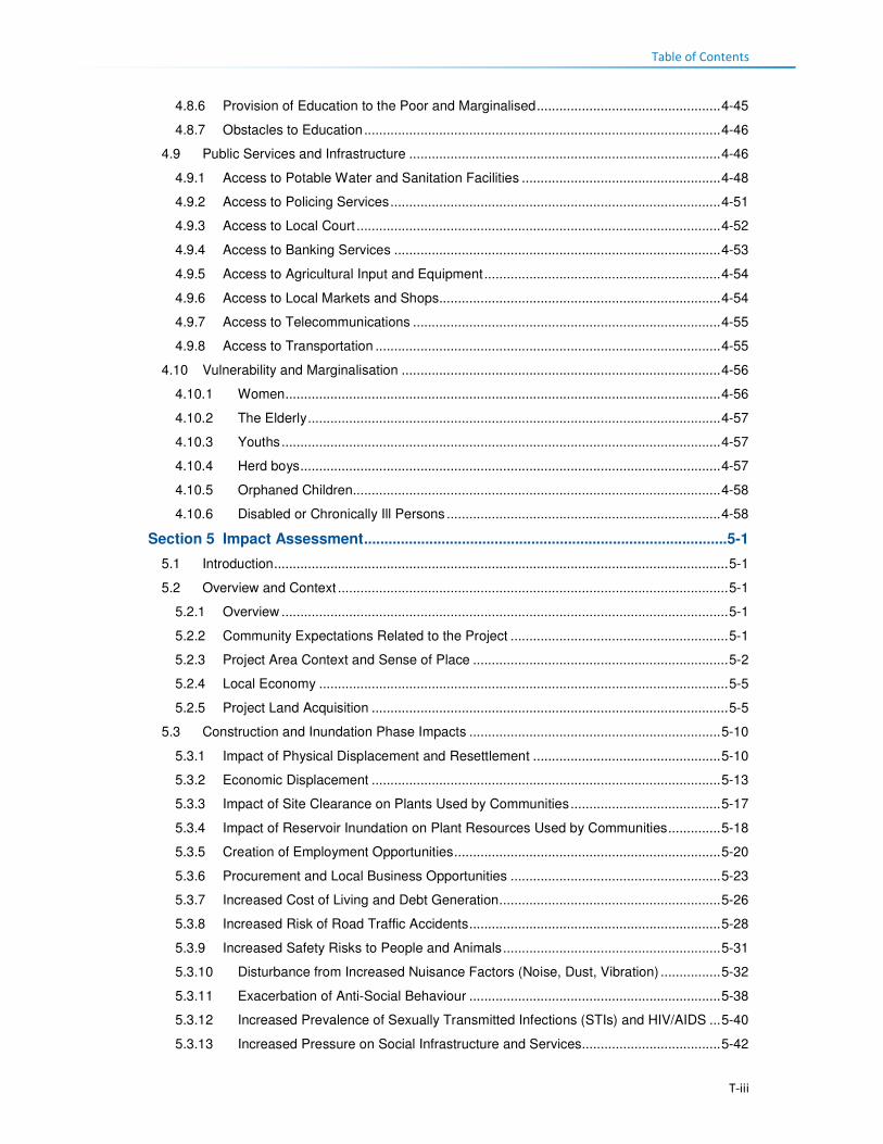
Table of Contents
T-iii
4.8.6 Provision of Education to the Poor and Marginalised ................................................. 4-45
4.8.7 Obstacles to Education ............................................................................................... 4-46
4.9 Public Services and Infrastructure ................................................................................... 4-46
4.9.1 Access to Potable Water and Sanitation Facilities ..................................................... 4-48
4.9.2 Access to Policing Services ........................................................................................ 4-51
4.9.3 Access to Local Court ................................................................................................. 4-52
4.9.4 Access to Banking Services ....................................................................................... 4-53
4.9.5 Access to Agricultural Input and Equipment ............................................................... 4-54
4.9.6 Access to Local Markets and Shops........................................................................... 4-54
4.9.7 Access to Telecommunications .................................................................................. 4-55
4.9.8 Access to Transportation ............................................................................................ 4-55
4.10 Vulnerability and Marginalisation ..................................................................................... 4-56
4.10.1 Women .................................................................................................................... 4-56
4.10.2 The Elderly .............................................................................................................. 4-57
4.10.3 Youths ..................................................................................................................... 4-57
4.10.4 Herd boys ................................................................................................................ 4-57
4.10.5 Orphaned Children.................................................................................................. 4-58
4.10.6 Disabled or Chronically Ill Persons ......................................................................... 4-58
Section 5 Impact Assessment ......................................................................................... 5-1
5.1 Introduction ......................................................................................................................... 5-1
5.2 Overview and Context ........................................................................................................ 5-1
5.2.1 Overview ....................................................................................................................... 5-1
5.2.2 Community Expectations Related to the Project .......................................................... 5-1
5.2.3 Project Area Context and Sense of Place .................................................................... 5-2
5.2.4 Local Economy ............................................................................................................. 5-5
5.2.5 Project Land Acquisition ............................................................................................... 5-5
5.3 Construction and Inundation Phase Impacts ................................................................... 5-10
5.3.1 Impact of Physical Displacement and Resettlement .................................................. 5-10
5.3.2 Economic Displacement ............................................................................................. 5-13
5.3.3 Impact of Site Clearance on Plants Used by Communities ........................................ 5-17
5.3.4 Impact of Reservoir Inundation on Plant Resources Used by Communities .............. 5-18
5.3.5 Creation of Employment Opportunities ....................................................................... 5-20
5.3.6 Procurement and Local Business Opportunities ........................................................ 5-23
5.3.7 Increased Cost of Living and Debt Generation ........................................................... 5-26
5.3.8 Increased Risk of Road Traffic Accidents ................................................................... 5-28
5.3.9 Increased Safety Risks to People and Animals .......................................................... 5-31
5.3.10 Disturbance from Increased Nuisance Factors (Noise, Dust, Vibration) ................ 5-32
5.3.11 Exacerbation of Anti-Social Behaviour ................................................................... 5-38
5.3.12 Increased Prevalence of Sexually Transmitted Infections (STIs) and HIV/AIDS ... 5-40
5.3.13 Increased Pressure on Social Infrastructure and Services..................................... 5-42

Table of Contents
T-iv
5.3.14 Disruption to Family and Community Structures .................................................... 5-44
5.4 Operation Phase .............................................................................................................. 5-46
5.4.1 Increased Government Revenue ................................................................................ 5-46
5.4.2 Economic Opportunities and Diversification ............................................................... 5-47
5.4.3 Increased Cost of Living ............................................................................................. 5-49
5.4.4 Growth of the Local Tourism Sector ........................................................................... 5-50
5.4.5 Continuation of Anti-Social Behaviour and Spread of STIs and HIV/AIDS ................ 5-52
Section 6 Mitigation and Monitoring .............................................................................. 6-1
6.1 Overview ............................................................................................................................ 6-1
6.2 Social Mitigation Measures ................................................................................................ 6-3
Section 7 References ....................................................................................................... 7-1
List of Figures
Figure 1.1 Geographic Location of the Project ........................................................................... 1-4 Figure 1.2 Proposed Polihali Dam Infrastructure Layout ............................................................ 1-5 Figure 1.3 Example of a CFRD (Mohale, Lesotho) .................................................................... 1-6 Figure 1.4 Example of quarry establishment .............................................................................. 1-7 Figure 1.5 Example of intake tower for transfer tunnel (Katse Dam, Lesotho) ........................... 1-7 Figure 2.1 Structure of Government and Traditional Authorities ................................................ 2-1 Figure 2.2 Community Councils within which the Project Area falls ........................................... 2-3 Figure 3.1 Project Areas of Influence ......................................................................................... 3-4 Figure 4.1 Gender and Age Distribution in the Project Area ...................................................... 4-1 Figure 4.2 Land Tenure Types Held by the Heads of Households within the Project Area ....... 4-8 Figure 4.3 Land Use in the Catchment Area .............................................................................. 4-9 Figure 4.4 Livelihood Strategies of the Affected Population in Percentages ............................ 4-11 Figure 4.5 Ownership of Arable Land ....................................................................................... 4-11 Figure 4.6 Typical River Bank Agricultural Fields ..................................................................... 4-12 Figure 4.7 Ownership of agricultural land by Gender ............................................................... 4-12 Figure 4.8 Number of Crop Fields Owned by Households ....................................................... 4-13 Figure 4.9 Process of Crop Cultivation throughout the Year .................................................... 4-13 Figure 4.10 Purpose of Crops in the Project Area ...................................................................... 4-14 Figure 4.11 Household reasons for not cultivating agricultural land ........................................... 4-14 Figure 4.12 Livestock Owned in the Project Area....................................................................... 4-15 Figure 4.13 Ownership and Sale of Sheep ................................................................................. 4-16 Figure 4.14 Ownership of Goats ................................................................................................. 4-16 Figure 4.15 Sale of Livestock Products ...................................................................................... 4-17 Figure 4.16 Supply Chain for the Sale of Wool and Mohair ....................................................... 4-18 Figure 4.17 Types of Regular Employment in the Project Area ................................................. 4-22 Figure 4.18 Location of Regular Employment in the Project Area.............................................. 4-22 Figure 4.19 Payment for Seasonal/temporary Employment in the Project Area ........................ 4-23 Figure 4.20 Types of Specialised Services in the Project Area .................................................. 4-24 Figure 4.21 Household Income Sources per Quartile in the Project Area .................................. 4-25 Figure 4.22 Household Income Trends per Quartile .................................................................. 4-26 Figure 4.23 Monthly Income Trend all Households Surveyed within the Project Area .............. 4-27 Figure 4.24 General Household Expenditure Trends ................................................................. 4-27 Figure 4.25 Household Agricultural Expenditure ........................................................................ 4-28 Figure 4.26 Areas where Natural Resources are Collected ....................................................... 4-29 Figure 4.27 Example of Local Grazing Area ............................................................................... 4-30 Figure 4.28 Example of Sand Mining along the River ................................................................ 4-31 Figure 4.29 Examples of Medicinal Plants found in the Project Area ......................................... 4-32

Table of Contents
T-v
Figure 4.30 Persons who Collect Fuelwood in a Household ...................................................... 4-32 Figure 4.31 Levels of Health Care Services in Lesotho ............................................................. 4-34 Figure 4.32 Closest Medical Facility used .................................................................................. 4-36 Figure 4.33 Typical Schools in the Project Area ......................................................................... 4-42 Figure 4.34 Distribution of Schooling Levels across the Project Area ........................................ 4-45 Figure 4.35 Map showing some Public Services and Infrastructure in the Catchment Area ..... 4-47 Figure 4.36 Protected and Unprotected Water Wells ................................................................. 4-49 Figure 4.37 Time taken from Household to Water Source ......................................................... 4-49 Figure 4.38 Example of Sanitation Facilities in the Project Area ................................................ 4-51 Figure 4.39 Access to Sanitation Facilities in the Project Area .................................................. 4-51 Figure 4.40 Access to Policing Services ..................................................................................... 4-52 Figure 4.41 Access to Local Courts ............................................................................................ 4-53 Figure 4.42 Access to Banking Services .................................................................................... 4-54 Figure 4.43 Access to Agricultural Inputs and Equipment .......................................................... 4-54 Figure 4.44 Access to Local Markets and Shops ....................................................................... 4-55 Figure 5.1 Photographs Illustrating the Look and ‘Feel’ of the Project Area (Top: view towards
dam wall location at centre; Bottom: view of Tloha-re-Bue near construction
areas) ......................................................................................................................... 5-4 Figure 5.2 Project Catchment Area ............................................................................................ 5-5 Figure 5.3 Villages Likely to be Displaced by the Project ........................................................... 5-7 Figure 5.4 Typical Roads, Pedestrians and Livestock on the Local Roads ............................. 5-28
List of Tables
Table 1.1 Authors and Contributors to this Report .................................................................... 1-1 Table 2.1 Main Government Branches, Powers and Functions ................................................ 2-1 Table 2.2 Local government composition at various Council levels .......................................... 2-2 Table 2.3 Principal and Area Chief Locations in the Project Area ............................................ 2-4 Table 2.4 Policies and Guidelines Relevant to Social Impact Assessments ............................. 2-5 Table 2.5 Legislation and Policies Relevant to Social Assessments ...................................... 2-10 Table 2.6 Summary of Relevant World Bank and IFC Safeguards ......................................... 2-13 Table 3.1 Summary of the Socio-economic Gap Analysis and Action Plan .............................. 3-2 Table 3.2 List of Departments, NGOs and Local leadership who participated in KIIs............... 3-6 Table 3.3 Schedule of Focus Group Discussions ..................................................................... 3-8 Table 3.4 Impact Significance Rating Table ............................................................................ 3-11 Table 3.5 Impact Characteristic Terminology .......................................................................... 3-11 Table 3.6 Designation Definitions ............................................................................................ 3-12 Table 4.1 Residential Status by Age, Gender, Ecological zone and District in Lesotho ........... 4-3 Table 4.2 Number of livestock by type in Lesotho and Mokhotlong ........................................ 4-15 Table 4.3 Percentage distribution of the employed labour force by sex, urban/rural residence
and type of employer ............................................................................................... 4-20 Table 4.4 Sectoral Employment .............................................................................................. 4-20 Table 4.5 Percentage Distribution of Unemployed Population by Age, Sex and Urban/Rural
Residence ................................................................................................................ 4-21 Table 4.6 Employment Status in Project Area ......................................................................... 4-21 Table 4.7 Types of Business in Project Area........................................................................... 4-23 Table 4.8 Health care Facilities in Project Area....................................................................... 4-34 Table 4.9 Distribution of Medical Personnel in Health Centres ............................................... 4-35 Table 4.10 Health Care Indicators ............................................................................................. 4-35 Table 4.11 Prevalence of HIV/AIDS in Lesotho ........................................................................ 4-37 Table 4.12 Time it takes to get to the nearest health care facility ............................................. 4-38 Table 4.13 Structure of the education services in Lesotho ....................................................... 4-40 Table 4.14 Distribution of schools by district ............................................................................. 4-42 Table 4.15 Education Services Profile ....................................................................................... 4-43 Table 4.16 Education Services Profile ....................................................................................... 4-44 Table 4.17 Access to Water Sources in Lesotho....................................................................... 4-48

Table of Contents
T-vi
Table 4.18 Access to Sanitation Facilities in Lesotho ............................................................... 4-50 Table 5.1 Land use distribution within the Catchment Area ...................................................... 5-6 Table 5.2 Estimate of Villages and Households to be Displaced .............................................. 5-6 Table 5.3 Impact of Physical Displacement of Households .................................................... 5-11 Table 5.4 Impact of Economic Displacement .......................................................................... 5-15 Table 5.5 Impact of Site Clearance on Plants used by Surrounding Communities................. 5-17 Table 5.6 Impact of Reservoir Inundation on Important Plant Resources ............................... 5-19 Table 5.7 Impact of Related to Creation of Employment Opportunities .................................. 5-21 Table 5.8 Indicative Procurement Spend ................................................................................ 5-23 Table 5.9 Procurement and Local Business Opportunities ..................................................... 5-25 Table 5.10 Increased Cost of Living and Debt Generation ....................................................... 5-27 Table 5.11 Increased Risks of Road Traffic Accidents .............................................................. 5-29 Table 5.12 Increased Safety Risks ............................................................................................ 5-32 Table 5.13 Disturbance from Increased Nuisance Factors ....................................................... 5-35 Table 5.14 Increased Anti-Social Behaviours ............................................................................ 5-39 Table 5.15 Increased Prevalence of STIs including HIV/AIDS .................................................. 5-41 Table 5.16 Increased Pressure on Social Infrastructure and Services ..................................... 5-43 Table 5.17 Disruption to Family and Community Structures ..................................................... 5-45 Table 5.18 Impact of Increased Government Revenue ............................................................. 5-47 Table 5.19 Economic Opportunities and Diversification ............................................................ 5-48 Table 5.20 Increased Cost of Living .......................................................................................... 5-50 Table 5.21 Growth of the Local Tourism Sector ........................................................................ 5-51 Table 5.22 Continuation of Anti-Social Behaviour and Spread of STIs and HIV/AIDS ............. 5-53 Table 6.1 Mitigation Measures for Social Study ........................................................................ 6-4

1-1
Section 1 Introduction
1.1 Background The Lesotho Highlands Water Project (LHWP) is a multi-billion Maloti/Rand bi-national project which
was established by the Treaty of 1986 signed between the governments of the Kingdom of Lesotho
and the Republic of South Africa (RSA). The LHWP will harness the water resources of the highlands
of Lesotho through the construction of a series of dams and tunnels for the mutual benefit of Lesotho
and the Republic of South Africa. While South Africa will benefit from the provision of water, Lesotho
will benefit through the generation of hydro-electricity. Phase II of the LHWP is needed to support the
water requirements in the Vaal River System in South Africa as per the Delivery Schedule (Consult 4
Consortium and SEED Consult, 2008).1
Phase I has been completed, while Phase II, the current phase, includes the construction of a
concrete-faced rockfill dam at Polihali, downstream of the confluence of the Khubelu and Senqu
(Orange) Rivers (this project), and a gravity tunnel that will connect Polihali Reservoir to the Katse
Reservoir. It also includes the construction and establishment of associated infrastructure, without
which the main components (dam and tunnel) could not be built, i.e. construction of access roads,
bridges, bulk utilities (power, water supplies, wastewater treatment and communications),
establishment of quarries and borrow pits, site camps, laydown areas, spoil areas, project housing
and site offices (the last two including both temporary and permanent structures).
According to the Lesotho Environment Act No. 10 of 2008 and associated Regulations, the Project
must obtain environmental authorisation through completion of an Environmental (and Social) Impact
Assessment (ESIA) process for development to proceed. Following a tender process, the Lesotho
Highlands Development Authority (LHDA) awarded the contract to complete the ESIA for the Polihali
Reservoir and Associated Infrastructure (PRAI) to Environmental Resources Management Southern
Africa (Pty) Ltd (ERM).
This report presents the findings from the Social Study that was carried out as part of the PRAI ESIA.
The study was undertaken in the whole of the PRAI Project Area, covering the catchment area and
areas upstream and downstream of the reservoir (refer to Figure 1.1 and Section 3.2.3 for a
description of the Project’s Area of Influence). The study was done to assess the impact of the PRAI
on the lives and livelihoods of the people residing within the Project Area; and to propose possible
mitigation measures for negative impacts and enhancements for positive impacts/ benefits.
1.2 Study Team The members of the team, their individual roles, qualifications and experience are listed in Table 1.1.
Table 1.1 Authors and Contributors to this Report
Person Role Organisation/
Company
Qualifications and experience
Jeanette Bloem Social Specialist Sechaba
Consultants MPhil Social Research Methodology
+15years of experience in social research
Thato Letsatsi Stakeholder
Engagement
Specialist
Sechaba
Consultants
BA Sociology and Public Administration
20 years of experience in public participation
process consulting
1 Environmental Impact Assessment Supporting Report (LHWC 001/219-2007; P RSA D000/006507), Consult 4 Consortium and SEED Consult, 2008.
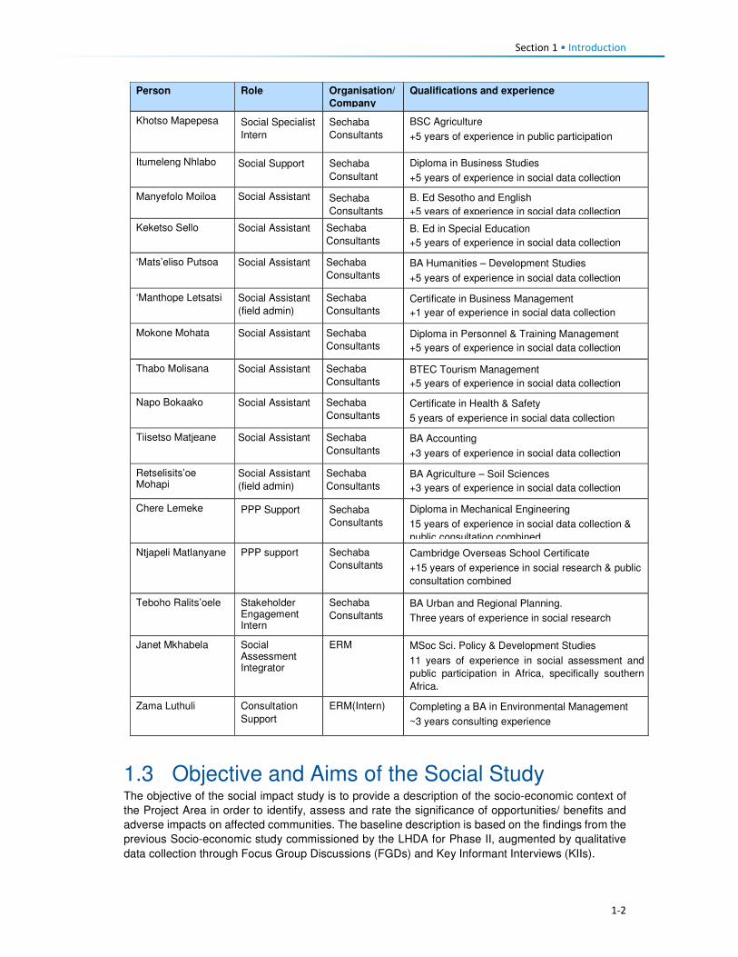
Section 1 • Introduction
1-2
Person Role Organisation/
Company
Qualifications and experience
Khotso Mapepesa Social Specialist
Intern
Sechaba
Consultants
BSC Agriculture
+5 years of experience in public participation
Itumeleng Nhlabo Social Support Sechaba
Consultant
Diploma in Business Studies
+5 years of experience in social data collection
Manyefolo Moiloa Social Assistant Sechaba
Consultants
B. Ed Sesotho and English
+5 years of experience in social data collection
Keketso Sello Social Assistant Sechaba
Consultants B. Ed in Special Education
+5 years of experience in social data collection
‘Mats’eliso Putsoa Social Assistant Sechaba
Consultants BA Humanities – Development Studies
+5 years of experience in social data collection
‘Manthope Letsatsi Social Assistant
(field admin)
Sechaba
Consultants Certificate in Business Management
+1 year of experience in social data collection
Mokone Mohata Social Assistant Sechaba
Consultants Diploma in Personnel & Training Management
+5 years of experience in social data collection
Thabo Molisana Social Assistant Sechaba
Consultants BTEC Tourism Management
+5 years of experience in social data collection
Napo Bokaako Social Assistant Sechaba
Consultants Certificate in Health & Safety
5 years of experience in social data collection
Tiisetso Matjeane Social Assistant Sechaba
Consultants BA Accounting
+3 years of experience in social data collection
Retselisits’oe Mohapi
Social Assistant
(field admin)
Sechaba
Consultants BA Agriculture – Soil Sciences
+3 years of experience in social data collection
Chere Lemeke PPP Support Sechaba
Consultants
Diploma in Mechanical Engineering
15 years of experience in social data collection &
public consultation combined
Ntjapeli Matlanyane PPP support Sechaba
Consultants Cambridge Overseas School Certificate
+15 years of experience in social research & public
consultation combined
Teboho Ralits’oele Stakeholder Engagement Intern
Sechaba
Consultants BA Urban and Regional Planning.
Three years of experience in social research
Janet Mkhabela Social Assessment Integrator
ERM MSoc Sci. Policy & Development Studies
11 years of experience in social assessment and
public participation in Africa, specifically southern
Africa.
Zama Luthuli Consultation
Support
ERM(Intern) Completing a BA in Environmental Management
~3 years consulting experience
1.3 Objective and Aims of the Social Study The objective of the social impact study is to provide a description of the socio-economic context of
the Project Area in order to identify, assess and rate the significance of opportunities/ benefits and
adverse impacts on affected communities. The baseline description is based on the findings from the
previous Socio-economic study commissioned by the LHDA for Phase II, augmented by qualitative
data collection through Focus Group Discussions (FGDs) and Key Informant Interviews (KIIs).

Section 1 • Introduction
1-3
The key aims of the Social Study were to:
• Ensure that the Social study met the requirements of the Lesotho Environment Act No. 10 of 2008
and the Environmental Impact Assessment (EIA) Guidelines (2009), and other relevant national
legislation and standards;
• Describe prevailing socio-economic conditions prior to Project implementation;
• Identify, assess and rate the significance of opportunities/ benefits and adverse impacts on
affected communities; and
• Develop a practical, user-friendly Social Management Plan (SMP), as part of the Environment
Management Plan (EMP) which is relevant to the various types of contractors that will be
employed on the contract. The EMP will provide a full description of mitigation measures to be
implemented to prevent, reduce, or manage environmental impacts; it will describe how these
measures will be implemented and will provide environmental management objectives and
targets that can be audited and that are repeatable.
1.4 Project Location The proposed Project is located in the Mokhotlong District and more specifically, within the Highlands
of the Kingdom of Lesotho (hereafter referred to as Lesotho) (Figure 1.1). Lesotho is a landlocked
country that is surrounded by South Africa; and covers a land area of over 30 000 km2 with a
population slightly over two million. Administratively, the country is divided into 10 Districts, which are
further sub-divided into 80 constituencies consisting of 10 District Councils. The District Councils are
further sub-divided into one Municipal Council, 11 Urban Councils, and 64 local Community Councils.
The Project Area straddles four Community Councils namely Seate, Bokong, Menoaneng, and
Mphokojoane and one Urban Council (Mokhotlong). The Project Area falls within the areas under
the Principal Chiefs of Mokhotlong and Malingoaneng, who are assisted in fulfilling their mandate by
various Area Chiefs.
The Project Area is situated within the mountain agro-ecological zone and it is characterised by vast
mountains and valleys. Extremely erratic weather conditions comprising high winds and snowfalls are
a common phenomenon in the area.

1-4
Figure 1.1 Geographic Location of the Project

1-5
Figure 1.2 Proposed Polihali Dam Infrastructure Layout

Section 1 • Introduction
1-6
1.5 Project Description The development will comprise the following components (Figure 1.2):
Polihali Dam, Saddle Dam and Reservoir: The proposed Polihali Dam is a 164 m high, concrete-
faced rockfill dam (CFRD) (refer to Figure 1.3 for example) with a side channel spillway located
approximately 2 km downstream of the confluence of Khubelu and Senqu Rivers. The Saddle Dam
is a 50 m high, concrete-faced rockfill embankment dam. During construction, the works will be
protected by upstream and downstream embankment coffer dams with two diversion tunnels through
the left flank, one 7 m and one 9 m in diameter. The Full Supply Level (FSL) for Polihali Reservoir is
2 075 metres above sea level (masl). The flood demarcation level is 2 080 masl and exceeds the
1:100 year flood level in the upper reaches of Polihali Reservoir. The Reservoir will inundate an area
of approximately 5042 ha upstream of the Dam at the 2075 masl FSL (Consult 4 and SEED Consult,
2008). The land take up to the 2080 masl is equates to approximately 5600 ha.
Construction of the diversion tunnels will commence in Q1 of 2018 and be completed in Q3 of 2019.
Construction of the dam (main and saddle) will commence in Q1 of 2020 and is anticipated to be
completed by the end of 2024. Inundation of the reservoir is anticipated to take between 24 and 36
months to reach the FSL.
Figure 1.3 Example of a CFRD (Mohale, Lesotho)
Quarries and Borrow Pits: material for the rockfill embankments are proposed to be obtained from
quarries located on the left and right banks upstream of the Polihali Dam, primarily below the FSL
(refer to Figure 1.4 for an example of quarry establishment). It is also proposed that material suitable
for use as concrete aggregate will be obtained from the Tsilantso quarry. Advance geotechnical
investigations have been undertaken to: i) confirm the quarry locations, ii) test the suitability of sand
sourced from the Senqu and Khubelu Rivers near their confluence for use in concrete; and iii) locate
additional quarry sources for use as concrete aggregates near the proposed bridge sites along the
A1 Road. As the quarries are located in close proximity to some villages, quarrying activities, which
include blasting and having trucks haul materials from the quarry to construction sites are likely to
impact on the lives of the people residing nearby.
Where quarries and borrow pits are established above the FSL, these will be rehabilitated following
completion of the works.

Section 1 • Introduction
1-7
Figure 1.4 Example of quarry establishment
Source: M van Rooyen
Polihali to Katse Transfer Tunnel (Eastern Side): A tunnel will be constructed to transfer water
from the Polihali reservoir to the Katse reservoir. The transfer tunnel will comprise the intake works
and gate shaft at the western edge of the Polihali Reservoir (just upstream of the confluence with the
Khubelu and Senqu Rivers) (see Figure 1.5 for an example of an intake tower). Associated
infrastructure for construction will include site access roads, quarries, plant yards, labour
accommodation, spoil areas and other tunnel works areas. Tunnelling activities will be done using
both drill-and-blast methods and a Tunnel Boring Machine (TBM). The current ESIA only assesses
the tunnel works from the eastern works area to approximately halfway along the length of the tunnel.
The tunnel works area (access, spoil dump, laydown) is located in close proximity to Tloha-re-Bue
and Malingoaneng. This will have implications for the communities in these villages (safety, nuisance,
cemeteries, etc. as well as impacting on their leisure activities as it directly affects the area used for
horse races).
Tunnel construction should commence at the end of Q1 2020 and be completed during Q4 of 2025.
Figure 1.5 Example of intake tower for transfer tunnel (Katse Dam, Lesotho)

Section 1 • Introduction
1-8
Major Bridges (Senqu, Khubelu and Mabunyaneng Bridges), and Associated Road Works:
Major bridges will be constructed on the Senqu, Khubelu and Mabunyaneng Rivers on the existing
A1 national road between Oxbow and Mokhotlong. Construction of the Senqu bridge will commence
in Q1 2020 and should be completed by the end of Q1 2023, while construction of the Khubelu/
Mabunyaneng bridge will commence in Q2 of 2020 and be completed during Q2 of 2022. Portions of
the A1 near the bridge locations will be realigned due to inundation by the reservoir, and a number of
other existing roads and tracks will require replacement. A new pedestrian bridge (Tlhakola Bridge)
is proposed across the reservoir at Tlhakola. Note: the scope of the PRAI ESIA does not include the
replacement of existing roads and tracks that will be inundated or the construction of new feeder
roads and minor bridges.
Bulk Power Supply and Telecommunications (BPST) infrastructure to be located at the Polihali
Reservoir that is included in this ESIS are:
• A new substation at Masakong near the advanced infrastructure area;
• A new telecommunications mast on the hill; and
• A new 33kV powerline from Tlokoeng across the reservoir to the permanent camp area (for
future electrical distribution by Lesotho Electricity Company (LEC) on the west side of the
reservoir).
Note: the construction of a new 132kV powerline from Katse (Matsoku Intake substation) to
Polihali (Masakong substation) and new paved road from Ha Seshote to Polihali falls under a
separate ESIS for the Polihali Western Access Corridor (PWAC).
Construction of the BPST infrastructure is anticipated to commence in Q3 of 2018 and be completed
by Q3 of 2020.
Project Housing and Site Establishment: The Phase II works will be built under a number of
construction contracts, each of which will require accommodation facilities for staff and the labour
force, site offices, workshops, plant yards, quarries, explosives store and other works areas. In
general, all temporary accommodation, offices and buildings needed for a particular construction
contract will be provided by the relevant construction contractor and will removed at the end of
construction.
Where facilities will have long-term use during the operation of the scheme, these will be designed
and built to appropriate standards for permanent works under the advance infrastructure contracts.
The permanent facilities include:
• Staff accommodation at the Polihali Reservoir area, built as a village with all communal services.
This will be the accommodation for the Employer, Engineer and Contractor’s staff during
construction of the Main Works and for operations staff following the completion of dam and
tunnel construction;
• A visitors’ lodge at the staff village, which will become a tourist facility; and
• The Employer’s and Engineer’s offices at the dam site, which will become the operations staff
offices and visitor centre.
Temporary construction areas include labour camps and works areas for construction of the eastern
sections of the PWAR; BPST component, and Polihali-Katse Transfer Tunnel, and for the Polihali
Dam and Saddle Dam and bridges. The labour camps will be provided with a raw water supply
(contractors will provide their own water purification, sewage treatment and waste facilities). The
Transfer Tunnel and Dam works areas/ sites will be provided with a raw water supply and a power
supply.
All the above project components are going to impact on the lives and livelihoods of the people
residing within the Project Area, either negatively or positively. The proposed dam area is surrounded
by villages that are most likely going to be affected to a large extent during the construction phase of
the dam and its associated infrastructure. During this phase there will be increased heavy vehicle
road traffic traversing through and passing by some villages. This will therefore mean constant noise,

Section 1 • Introduction
1-9
from the road traffic and likely blasting activities and also dust from the same. People's fields and
housing structures are also going to be impacted and some households will need to be relocated
because of the project activities which will include reservoir inundation, amongst others.
However, there will be the positive impact of local people being employed by the different contractors.
The locals will also be able to rent out their houses and their businesses could grow. The impact on
fields will mean that the owners will receive compensation for their loss. Those households that will
need to be displaced will have to be relocated to other areas.
The operational phase of the project will also affect the people residing within the Project Area, though
to a lesser extent. This would be through ongoing employment of some local people and development
of the local tourism industry. The people will also benefit from the livelihoods restoration and social
developments plan that the LHDA will develop and implement.

2-1
Section 2 Institutional and Legal Framework
2.1 Relevant Institutions 2.1.1 Central Government
The Government of Lesotho is a constitutional monarchy with two spheres of government: central
and local (Figure 2.1).
Figure 2.1 Structure of Government and Traditional Authorities
The head of state is King Letsie III whose role is predominately ceremonial. The two houses that
make up the parliament are the elected National Assembly (lower house) and the hereditary and
appointed Senate (upper house). The national assembly is comprised of 120 members elected
through the mixed-member proportional representation system2. The term of office for the members
of parliament is five years. The prime minister is the leader of the majority party in the national
assembly, and the King appoints the cabinet, known as the Council of State, on the advice of the
prime minister. There are a total of 25 ministries that oversee the implementation of government
policies and plans. The Senate comprises 33 members; 22 are Principal Chiefs while 11 are
nominated by the King on the advice of the Council of State.
Governmental power is exercised by three branches of government, namely; the executive; the
judiciary; and the legislature. Their different roles are described in Table 2.1.
Table 2.1 Main Government Branches, Powers and Functions
Arms of State Composition Functions
Executive The executive is made up of The Cabinet and Government Ministries. The Cabinet comprises the Prime Minister and Ministers.
• Cabinet is responsible for all government policies and
the day-to-day running of the affairs of the state.
Judiciary The Judiciary is made up of the Appeal Court, the High Court, the Magistrate Courts and Traditional (customary courts) which exist predominately in rural areas. There is also a Labour Court.
• The Judiciary is responsible for the administration of
justice, interpretation of existing laws and
guardianship of the Constitution.
• The Labour Court is a specialist court dealing
exclusively with industrial and labour matters
2 Under the mixed-member proportional representation system two-thirds of the members of the national assembly are elected according to the first-past-the-post electoral system (one member per constituency) and one-third by proportional representation (the 'party-list' form of the system).
Monarchy
Executive Legislative Judiciary
Hous e of Ass embly Senate Appeal Court
Prime Minister Principa l Chiefs High Court
Cabinet
(Government Ministries )
Area Chiefs Magistrate Courts
District Counci l lor District Head of Departments Tradi tiona l Court
Urban Counci l s & Community Counci l s
Arms of Government
King
Communities
District Administrator
National Government
District Government
Headmen

Section 2 • Institutional and Legal Framework
2-2
Arms of State Composition Functions
Legislative The Legislature is made up of the Senate and the National Assembly.
• The Senate examines and reviews draft Legislation/
Bills passed by the National Assembly.
• The National Assembly is the main legislative body; it
enacts the laws of the country and scrutinises the
political executive on the management and
administration of the affairs of the land.
2.1.2 Local Government
The constitution mandates Parliament to establish local government and the main governing
legislation is the Local Government Act 1997 and Local Government Elections Act 1998. Cabinet
adopted a national decentralisation policy in February 20143. The Ministry of Local Government and
Chieftainship Affairs (MoLGCA) is responsible for facilitating and coordinating the implementation of
the national decentralisation policies and programs, along with the capacity development of Local
authorities.
Local government structures are headed by the Principal Secretary who sits at the national
government level. Each District is headed by a District Administrator (DA). The DA represents the
interests of Central Government at a District level and is responsible for the administrative
decentralisation and integration of government activities. The DA is supported by heads of
departments of various government ministries.
The district administration is comprised of four levels of decentralised political structures namely the
10 District Councils (DCs), one Municipal Council, 11 Urban Councils and the 64 Community
Councils. Members of these councils are elected to office through local government elections, which,
constitutionally, are supposed to be held every five years. The first local government elections took
place in 2005, the second in 2011 and the third were expected to have occurred in 2016. The
composition of the various councils is described in Table 2.2.
Table 2.2 Local government composition at various Council levels
Role Description
District Councils
(DCs) • DCs are comprised of councillors elected through electoral colleges. Each DC
has a Chairperson and a District Council Secretary (DCS)4 who implement the
Council resolutions.
Municipal Councils
(MCs) • MCs are composed of councillors representing wards within an urban area
categorised as a Municipality. Presently, the City of Maseru is the only urban
area with a Municipal status.
Urban Councils • There are eleven urban councils in the country with each of the nine districts
besides Maseru having its council. However, there are two additional urban
councils in Maputsoe and Semongkong.
Community Councils
(CCs)
• There are 64 CCs. All councillors are elected to represent a single-member
division for a term of up to five years. Councillors comprise members elected
from the electoral division, chiefs representing traditional leadership, and
women occupying reserved seats determined by proportional representation
lists submitted by political parties.
Figure 2.2 shows the Community Councils within which the Project Area falls.
3 www.clgf.org.uk/default/assets/File/Country_profiles/Lesotho.pdf 4 The DCS office is responsible for the daily management of the political and service decentralisation, and the coordination and monitoring of all development projects at a District level.

2-3
Figure 2.2 Community Councils within which the Project Area falls

Section 2 • Institutional and Legal Framework
2-4
The Local Authorities’ responsibilities include:
• Control of natural resources and environmental protection;
• Agricultural services;
• Land allocation;
• Preservation, improvement and control of designated forests;
• Village water supply;
• Public health;
• Education;
• Minor roads;
• Streets and public places;
• Burial grounds;
• Markets and the promotion of economic development;
• Parks, recreation and culture; and
• Fire prevention.
2.1.3 Traditional Governance
Traditional leadership in the country is through chieftainship which is hereditary. This leadership is
hierarchical consisting of the King, Principal Chiefs (PC), Area Chiefs (AC) and Village Chiefs (or
headmen). Each one of these Chiefs levels is represented in the DCs and CCs. The Principal Chiefs
are responsible for overseeing all issues of traditional governance in their respective areas; in turn,
the Area Chiefs take orders and advice from the Principal Chiefs. Area Chiefs tend to administer a
smaller administrative area compared to that of the PCs. Lastly, the Village Chiefs or headmen
function as assistants to the Area Chiefs and manage the daily administration of their villages and
report to the Area Chiefs. Over and above the customary functions that chiefs play are the civil
responsibilities which include the issuing of certificates i.e. birth and death papers; writing letters for
bank account and passport applications; maintaining law and order and adjudicating local disputes.
The Principal Chiefs in the Project Area are those of Mokhotlong and Malingoaneng. The locations of
Area Chiefs in the Project Area are provided in Table 2.3 according to their respective Principal
Chiefs.
Table 2.3 Principal and Area Chief Locations in the Project Area
Principal Chief of Mokhotlong Principal Chief of Malingoaneng
Salang
Ntlholohetsane
Thabang
Ha Mojakisane
Ha Rafolatsane
Libibing
Tsoenene
Matlakeng
Malubalube/Likhameng
Nkokamele
Ha Moeketsane
Lilatoleng
Linakeng
Motsitseng
Ha Makhabane
Kholokoe
Bafali
Ha Lebopo
Tloha-re-Bue
Mapholaneng
Ha 'Meta
Tlokoeng
Mofolaneng
Makhomalong
Maitisi (Ha Letjama)
Mahemeng
Ha Polihali
Ha 'Mei
Makhoarane Khotsang
Taung
Hlokoa-le-mafi
Maqalikeng
Mokhalong/Ha Lephakha
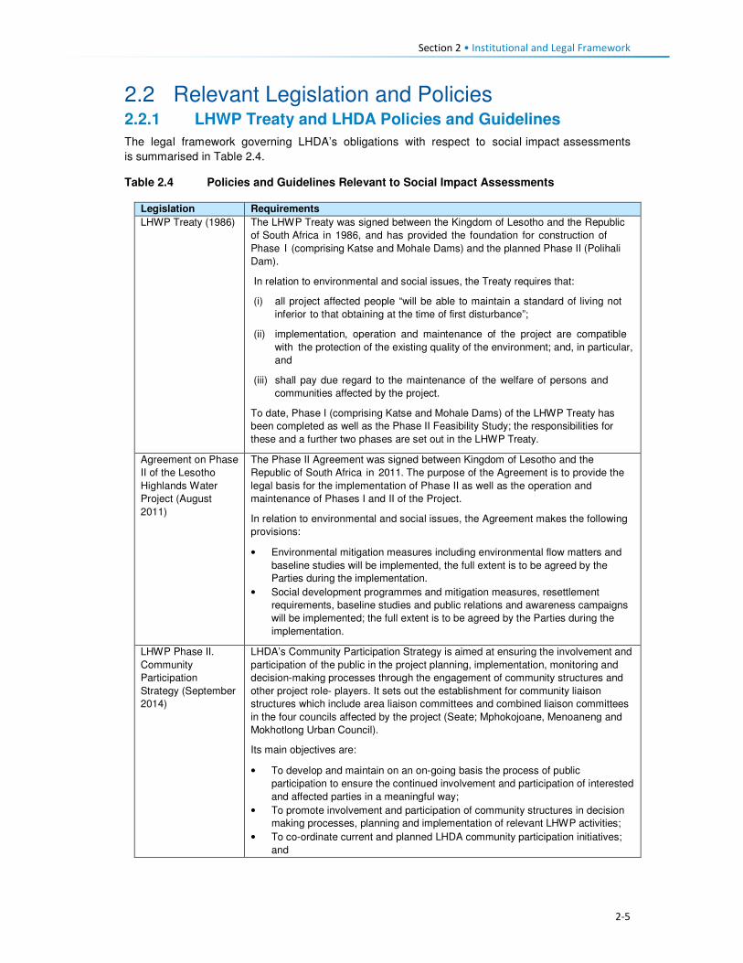
Section 2 • Institutional and Legal Framework
2-5
2.2 Relevant Legislation and Policies 2.2.1 LHWP Treaty and LHDA Policies and Guidelines
The legal framework governing LHDA’s obligations with respect to social impact assessments
is summarised in Table 2.4.
Table 2.4 Policies and Guidelines Relevant to Social Impact Assessments
Legislation Requirements
LHWP Treaty (1986) The LHWP Treaty was signed between the Kingdom of Lesotho and the Republic
of South Africa in 1986, and has provided the foundation for construction of
Phase I (comprising Katse and Mohale Dams) and the planned Phase II (Polihali
Dam).
In relation to environmental and social issues, the Treaty requires that:
(i) all project affected people “will be able to maintain a standard of living not
inferior to that obtaining at the time of first disturbance”;
(ii) implementation, operation and maintenance of the project are compatible
with the protection of the existing quality of the environment; and, in particular,
and
(iii) shall pay due regard to the maintenance of the welfare of persons and
communities affected by the project.
To date, Phase I (comprising Katse and Mohale Dams) of the LHWP Treaty has
been completed as well as the Phase II Feasibility Study; the responsibilities for
these and a further two phases are set out in the LHWP Treaty.
Agreement on Phase
II of the Lesotho
Highlands Water
Project (August
2011)
The Phase II Agreement was signed between Kingdom of Lesotho and the
Republic of South Africa in 2011. The purpose of the Agreement is to provide the
legal basis for the implementation of Phase II as well as the operation and
maintenance of Phases I and II of the Project.
In relation to environmental and social issues, the Agreement makes the following
provisions:
• Environmental mitigation measures including environmental flow matters and
baseline studies will be implemented, the full extent is to be agreed by the
Parties during the implementation.
• Social development programmes and mitigation measures, resettlement
requirements, baseline studies and public relations and awareness campaigns
will be implemented; the full extent is to be agreed by the Parties during the
implementation.
LHWP Phase II.
Community
Participation
Strategy (September
2014)
LHDA’s Community Participation Strategy is aimed at ensuring the involvement and
participation of the public in the project planning, implementation, monitoring and
decision-making processes through the engagement of community structures and
other project role- players. It sets out the establishment for community liaison
structures which include area liaison committees and combined liaison committees
in the four councils affected by the project (Seate; Mphokojoane, Menoaneng and
Mokhotlong Urban Council).
Its main objectives are:
• To develop and maintain on an on-going basis the process of public
participation to ensure the continued involvement and participation of interested
and affected parties in a meaningful way;
• To promote involvement and participation of community structures in decision
making processes, planning and implementation of relevant LHWP activities;
• To co-ordinate current and planned LHDA community participation initiatives;
and

Section 2 • Institutional and Legal Framework
2-6
Legislation Requirements
• To establish a two-way communication channel between the LHDA and the
communities.
Area Liaison Committees (ALCs) have been set up to provide direct liaison
between LHDA, its contractors and the local communities within Phase II of the
LHWP, and to serve as a forum for:
• Community participation processes;
• Mobilisation, sensitisation and awareness- raising of affected communities;
• A two-way communication process between the affected people and the Project
authorities;
• Participation and consultation on Project policies (Compensation Policy) and
strategies;
• Exchange of views/information on the LHWP and LHDA activities and
programmes;
• Participation in data collection, project studies, information disclosure,
programmes implementation;
• Participation and witness to land acquisition, asset inventory/ registration,
ownership and measurement of properties to be affected;
• Participation and witness to consultations and agreements reached with
individual households and communities to be compensated;
• Identification of development needs, and establishment of action plans for
realisation of development goals;
• Receiving, adjudication and channelling of complaints and grievances from the
affected communities to the LHDA;
• Identification of affected people for training on land-based, wage-based and
enterprise-based livelihoods;
• Identification of the most vulnerable households e.g. orphans, aged and
disabled for special assistance by LHDA and/ or Government Departments;
• Management of unskilled labour; and
• Projects and programmes reviews.
Consultation with affected communities was carried out through the established
structures (ALCs, as outlined in Section 3.3) as well as through key informant
interviews.
Labour Recruitment
Guidelines (2017)
LHDA has developed Labour Recruitment Guidelines that will guide the hiring and
employment of labour for Phase II of the LHWP. It requires contractors to prioritise
recruitment of local labour from Lesotho, particularly for unskilled positions. It
specifies that all recruitment shall be done through a Project Labour Recruitment
Desk (PLRD) to be established at Mapholaneng or Tlokoeng with a satellite office at
Ha Lejone. All potential work seekers will need to be registered at the PLRD in
order to be considered for employment.
The Guidelines also set out principles regarding the recruitment of unskilled labour
as follows:
• All unskilled jobs will be for a period of between 12 and 18 months;
• At the end of each period the workers will be replaced by another person; and
• Where a Contractor has trained and developed an individual to such an extent
that the individual can be considered semi-skilled; then the individual may be
re-employed.
LHWP Phase II
Procurement
Guidelines
The LHDA procurement guidelines for Phase II have the central objectives of the
project procurement processes and procedures:
• To comply with the spirit and objectives of Article 6 of the Treaty and Articles 10
and 11 of the Phase II Agreement, as well as the provisions of the Lesotho
Public Procurement Regulations of 2007, Part III (12), which are to foster
competiveness and transparency while increasing participation of individuals
from Lesotho, South Africa and SADC member states.
• To maximise procurement opportunities for Lesotho and South African
suppliers.

Section 2 • Institutional and Legal Framework
2-7
Legislation Requirements
• To minimise the utilisation of imported goods, skills and labour, where
applicable, within the ambit of the laws governing Lesotho.
• To maximise skills and technology transfer through the training of individuals
and enterprise development opportunities for Lesotho-based companies and
black owned companies in the Republic of South Africa
LHWP Phase II
Contractor
Procurement
Framework (Draft
August, 2016)
The Contractor Procurement Framework provides an overview of the specific
requirements and approaches for the procurement of construction contracts for
Phase II of the LHWP. The Framework gives a basis to ensure that each contract is
procured in a manner compatible with the legal framework and the LHWP
procurement policy. The consultant responsible for each construction contract will
develop appropriate procedures to implement the Framework.
LHWP Phase II
Safety Health
Environment and
Quality Management
(SHEQ)
Management
Framework (April,
2017)
The Occupational Health and Safety of all employees is addressed by the SHEQ
Framework. The Framework provisions are applicable to all Consultants and
Contractors delivering work for, or on behalf of, the LHDA or its entities.
The aim of the Framework, is to:
• Assist Consultants or Contractors to adequately provide for implementing
sound SHEQ practices on site; and
• Inform Consultants and Contractors in advance of the SHEQ directive and
requirements that will be enforced during the project.
LHDA Phase II
Compensation Policy
(August, 2016)
The Policy applies to all losses of assets and income, and impacts on livelihoods
suffered by people, households, communities and institutions as a result of the
implementation of Phase II of the LHWP. According to the Policy all persons affected
by Phase II will be entitled to equitable treatment as embodied in the Policy. The Policy
objectives are:
• To minimise involuntary land take by investigating all possible Project design
alternatives;
• To ensure that affected people and communities, including host communities
are meaningfully consulted on Project designs, alternatives and impacts;
• To promote affected people’s participation in the planning, implementation and
monitoring of compensation, resettlement, mitigation and development
measures;
• To ensure that relocation of households and businesses is undertaken in a
participative, systematic and beneficial manner, involving both displaced and
host communities;
• To ensure that affected people are promptly, fairly and fully compensated for
their losses; and
• To ensure that direct compensation is accompanied by additional measures
where necessary to help restore livelihoods; and
• To ensure that existing cultural and religious practices are respected, and to
preserved to the maximum extent practical.
Compensation rates
The Policy states that compensation rates for Phase II have been declared under
the Compensation Regulations. The rates are adjusted annually for price escalation
using the Lesotho Consumer Price Index (CPI). Compensation for primary
residential dwellings and formal business structures will be based on the principle of
replacement cost. Consultations will occur with affected communities, their local
authorities and district stakeholders to explain the rates and the basis for their
calculations.
Where urban land and property are acquired, valuation will be carried out according
to the provisions of the Land Act of 2010 and the associated Regulations. All
valuations will be certified by LAA.
In the case of the provision of replacement agricultural land (land-for-land option),
the following principles will apply to the new land:

Section 2 • Institutional and Legal Framework
2-8
Legislation Requirements
• It will be identified and confirmed with the participation of the affected
households and should as far as possible be located in reasonable proximity to
where the displaced persons reside;
• It should be provided free of “transaction costs” such as registration fees,
transfer taxes or customary tributes.
Eligibility for compensation
The unit of entitlement for compensation against the loss of private property and
assets will be the owner or household, including orphaned minors who are entitled
to their parents’ estate. LHDA will ensure compliance with the regulations of the
Land Act of 2010 and the Legal Capacity of Married Persons Act of 2006.
Compensation for loss of communal resources
Communal resources include grazing land, brushwood, medicinal plants, useful
grasses and wild vegetables.
LHDA will calculate the total compensation amount payable for the communal
resources it is to acquire, based on the area of land lost and the number of affected
households.
Management rights to communal assets that will be acquired by the Project are held
by Community Councils. Compensation for the loss of communal assets will be
used for investment in approved community development ventures. The funds will
be managed by LHDA for the implementation of development projects that have
been agreed and prioritised by the affected communities and their local authorities.
Where some physically displaced households move outside their local community/
village to other host communities/ villages, the funds will be apportioned between
the concerned community/ villages based on the number of households relocating
to the host communities/ villages.
Downstream Impacts
Impacts on communities downstream of the Polihali Reservoir up to the confluence
of the Senqu and ‘Malibamatso Rivers caused by reduced river flows will be
mitigated through measures developed as part of the Project’s Phase II
environmental flow requirement (EFR) programme.
Disturbance allowance
A disturbance allowance will be paid to households, including households
enumerated on public land at the time of the Project’s socio-economic census
whose primary residential structure or structures are required to be relocated.
The allowance will be paid over three years from the date of disturbances. For
households electing to relocate to a destination of their own choice the allowance
will be paid in the form of a lump sum payment.
A lump sum disturbance allowance will be paid to small scale/informal traders
whose business structures are required to be relocated from their residential or
public land.
Owners of formal commercial enterprises will receive a disturbance allowance, the
value of which will be determined as part of the valuation exercise.
Evacuation Assistance
LHDA will provide transport to physically displaced households and businesses for
the removal of their assets, belongings and livestock to Project-designated and
approved relocation sites. Households electing to relocate to a destination of their
own choice will be paid a lump sum evacuation amount based on the relocation
destinations detailed in the compensation rates.
Asset Registration
Procedures for
LHWP Phase II
(October, 2017)
Asset registration and finalisation of compensation offers will be undertaken in three
steps i.e. asset registration, compensation options and compensation offer.
Asset Registration will entail:

Section 2 • Institutional and Legal Framework
2-9
Legislation Requirements
• Identification of affected assets and owners in the footprint of the project through
analysis of aerial imagery, field investigations and consultation with local authorities
and community structures;
• A cadastral survey of all affected land parcels as well as fixed assets (geo-
referenced and mapped) and Asset Inventory Forms signed by the affected
owner;
• Assets and beneficiary registration and preparation of Asset Verification Forms
(including GIS mapping and photographic evidence as well as communication
of the cut-off date); and
• Uploading of the asset and beneficiary data to FlowCentric, for in-system
checking and approval.
Compensation Options will involve :
• The creation of a compensation’s option form.
• Presentation and explanation of the options individually to beneficiaries
/households, who will be allowed at least one week to consider their preferences.
• Once options are confirmed, the Form will be signed by the parties for preparation
of Compensation Offers.
Compensation Offers – based on the selected compensation options:
• A Compensation Offer will be presented to the beneficiary/household. After a one
week “cooling-off” period, the Offer will be signed and executed.
• A copy of the Offer will be submitted to the LHWC for record purposes and
contingency transfer request.
LHWP Phase II
Livelihood
Restoration and
Social Development
Framework
(LR&SD) (August
2017)
The Livelihood Restoration and Social Development (LR&SD) Framework supplements
the Phase II Compensation Policy, and serves to provide a context for the
conceptualisation, planning and implementation of livelihood restoration measures and
social development initiatives on Phase II.
The focus areas of the LR&SD Framework are as follows:
• Livelihood restoration measures for households and communities directly
affected (physical and economic displacement) by implementation of Phase II.
These initiatives will be planned and implemented with the full participation of
affected households and communities and other stakeholders for effective
sustainability.
• Initiatives to support broad-based social and economic development in the
Phase II areas. These could include water and sanitation initiatives, public
health initiatives (to be implemented under the Phase II Public Health Action
Plan), and other initiatives to be finalised in conjunction with the Phase II
communities, government and other development partners.
Memorandum of
Understanding
(MoU) between
LHDA and Basotho
Enterprises
Development
Corporation
(BEDCO) (January
2015)
The objective of the MoU is to establish a platform for cooperation for the provision of
business development and advisory services within all the LHWP areas as part of the
initiatives for livelihoods improvement for the communities and individuals affected by
the implementation of Phases I and II of the LHWP. It entails:
• Coordinating efforts in developing and building skills capacity of affected
individuals and communities in Phases I and II of the LHWP in order to enable
the communities to optimise the potential benefits brought about by the
development activities of the LHWP;
• Developing design and conduct customised entrepreneurial and artisan skills
training programmes for communities in LHWP areas;
• Promoting Micro, Small & Medium Enterprises (MSMEs) and other livelihood
improvement activities among affected communities and individuals within
LHWP areas;
• Providing a pool of expert services for identification of business ideas,
development of project proposals, project appraisal and mentoring services for
business start-ups;
• Facilitating access to micro-finance for MSMEs

Section 2 • Institutional and Legal Framework
2-10
Legislation Requirements
• Sharing information knowledge and expertise in the area of small business
development, skills training and advisory services for communities and
individuals within the LHWP areas.
2.2.2 Lesotho Legislation Relevant to Social Impact Assessments
Legislation and policies of specific relevance to social impact assessments is summarised below.
Table 2.5 Legislation and Policies Relevant to Social Assessments
Legislation Requirement
Constitution of
Lesotho (Act No. 5 of
1993), as amended in
2001
Protection of the natural environment is enshrined in Section 36 which states
‘Lesotho shall adopt policies designed to protect and enhance the natural and
cultural environment of Lesotho for the benefit of both present and future
generations and shall endeavour to assure to all its citizens a sound and safe
environment adequate for their health and well- being’.
National
Environmental Policy,
1998
The overall goal of the Lesotho National Environmental Policy (NEP) is to
achieve sustainable livelihoods and development for Lesotho. The objectives of
the policy include:
• To secure for all Basotho a high quality of environment to enhance
health and well- being;
• To use and conserve the environment and natural resources for the benefit
of present and future generations, taking into account the rate of population
growth and productivity of available resources;
• To conserve Basotho cultural heritage and utilise it for the benefit of present
and future generations;
• To halt environmental degradation, and to restore, maintain and enhance
the ecosystems and ecological processes essential for the functioning of
the biosphere and to preserve biological diversity;
• To implement the principle of optimal sustainable yield in the use of natural
resources and ecosystems; and
• To ensure that the true and total costs of environmental use and abuse are
borne by the user, i.e., the “polluter pays” principle.
Environmental Act No.
10 of 2008
The Environment Act, 2008 provides a framework environmental law for the
implementation of the National Environmental Policy. It sets out the principles
of environmental management in Part II, section 3(2) of the Act.
The purpose of the Act is to protect and ensure proper management of the
environment, conservation and sustainable utilisation of natural resources of
Lesotho. The Act defines the broad activities and general principles of
environmental management in Lesotho. Section 4 of the Environment Act
provides for a right to a clean and healthy environment and imposes a corrective
duty to protect, maintain and enhance the environment and defines a citizen’s
right to take legal action against acts or omissions that damage the
environment. The Act provides for Environmental Impact Assessment (EIA),
audits and monitoring of projects.
National
Environmental Impact
Assessment
Guidelines (2009)
The EIA Guidelines set out the steps to be taken in carrying out the EIA
process. They are aimed at facilitating participation in and compliance with
Lesotho's EIA requirements by the developers. They are also aimed at
"integrating environmental concerns and economic development from the
earliest stages of the project development”. According to the Guidelines, the
objectives of an EIA in Lesotho are to:
• Integrate environmental considerations into development planning,
thereby promoting sustainable livelihoods;

Section 2 • Institutional and Legal Framework
2-11
Legislation Requirement
• Ensure that the environmental and socio-economic costs and benefits
of economic development projects are properly accounted for;
• Ensure that unwarranted negative impacts are avoided or mitigated at
an early stage in the planning process;
• Ensure that potential benefits are identified and enhanced;
• Carry out environmental and socio-economic studies of projects in
parallel with analysis of engineering and economic feasibility;
• Ensure that decision-makers are provided with information on
environmental costs and benefits to complement information on its
technical and economic feasibility at key decision points in the
development of a project;
• Ensure that all the affected and interested groups (local communities,
government authorities, developers, Non-government organisations
(NGOs), Community-based Organisations (CBOs), etc.) Participate in the
process;
• Set up a system to carry out mitigation, monitoring, auditing, and
enforcement.
National Strategic
Development Plan
2012/13 – 2017/18
The main goals of the National Strategic Development Plan are to:
• Pursue high, shared and employment creating economic growth;
• Develop key infrastructure;
• Enhance the skills base, technology adoption and foundation for
innovation;
• Improve health, combat HIV and AIDS and reduce social vulnerability;
• Reverse environmental degradation and adapt to climate change; and
• Promote peace, democratic governance and build effective institutions.
The NSDP Strategic Framework aims to build productive capacities and
create benefits of sustained broad-based growth in the form of jobs,
improved health, skills and capabilities and poverty reduction. The
Framework focusses on issues of development in the areas of investment;
financial sector development; trade; micro, small and medium enterprises
(MSMEs); agriculture and rural economy; manufacturing; tourism; mining;
infrastructure; skills and innovation; health and HIV and AIDS; social
protection; environment and climate change; and governance and
institutions.
Sustainable
Development Goals
(SDGs) 2016
The 2030 Agenda for Sustainable Development was adopted by all UN Member
States of which Lesotho is party to. The 2030 Agenda comprises a set of 17
Sustainable Development Goals (SDGs) to end poverty, fight inequality and
injustice, and tackle climate change by 2030.
District Economic
Strategies (DESs)
The District Economic Strategies (DESs) are structured along a bottom up
approach to the NSDP. They have been developed based on the employment
and economic development advantages for each District and its specific areas
towards achieving developments. The DES relies on four NSDP priority areas
which include economic growth generating activities, namely; manufacturing,
commercial agriculture, mining and tourism.
Lesotho Land Act No.
8 of 2010
The Land Act of 2010 is the principal legislation governing land ownership and
occupation, and the acquisition of property for public and development purposes.
Section 10(1) of the Act grants joint title to property to both spouses married in
community of property (under civil, customary or any other law, irrespective of the
date on which the marriage was entered into), and equal powers in land transactions.
Declaration of Land
Set Aside for Public
Purposes (Allocated
Land) Notice, 2012
(Legal Notice No. 71
of 2012)
The Legal Notice sets aside every right or interest in and to the allocated land (fields)
described as agricultural land delineated on Plan No 47283 held in the office of Chief
Surveyor, Maseru in extent 6492 hectares more or less situated at Polihali,
Mokhotlong District for public purposes. The Notice stipulates that the land is
required for the construction of Polihali Dam.

Section 2 • Institutional and Legal Framework
2-12
Legislation Requirement
Date of Surrender: On the date of publication of this notice in the gazette all interest
in or affecting the said land shall cease to subsist and the allottees interest in the
land shall revert to the State.
Compensation: The compensation is estimated at M300 million or more and shall be
apportioned to the claims accordingly.
Legal Capacity of
Married Persons Act
No. 9 of 2006
The Act grants equal powers on both spouses married in community of property,
giving them equal capacity to dispose of the assets of the joint estate, contract
debts for which the joint estate is liable, and administer the joint estate.
Lesotho National
Social Protection
Strategy (NSPS)
2014/15 – 2018/19
The NSPS implements the National Policy on Social Development (NPSD), in the
medium term. The policy provides a broad framework for development and
implementation of a harmonised and coordinated social protection agenda of
Government to ensure that different programmes implemented by different
Government and non‐Government agencies are complementary to each other
for sustainable development of the vulnerable.
The strategy addresses the risks and challenges across the life‐course. It
recognises that all citizens are exposed to different vulnerabilities through the
course of their lives, and responds to these vulnerabilities. The strategy is
structured around four key life‐course stages i.e. pregnancy and early childhood;
school age and youth; working age; and old age. It also includes the two
dimensions of shocks and of disability/chronic illness that may impact at any
stage of the life‐course.
The overall objective of the NSPS is to provide support to those that are unable
to construct a viable livelihood; to protect the assets and improve the resilience
of poor and vulnerable households; and to increase the productive capacity and
asset base of those households.
Lesotho Gender and
Development Policy
The Gender and Development Policy is a government tool geared towards
addressing the challenges of gender inequities and inequalities, poverty,
increased spread of HIV/ AIDS, retrenchment and unemployment by adopting a
rights-based approach to development. The policy is based on the realisation of
human rights of all, women and men alike, holding principles of equal
participation in development, non-discrimination and the empowerment of the
marginalised women and men, boys and girls.
Local Government Act
1997 as Amended by
Local Government
(Amendment) Act
2004
Schedule 2 of the Local Government Act, 1997 states that CCs’ functions include
control of natural resources, e.g. sands, stones and environmental protection,
e.g. control of natural resources, land/site allocation and physical planning,
agriculture and forestry, dongas, pollution, grazing control and water resources.
The Labour Code
Order (Amendment) of
2006
The Order provides that the employer shall not discriminate against a job
application on the basis of his or her HIV and AIDS status (refer to Section 235E
(1) of the Labour Code (Amendment) Order, 2006).
Part VII if the Labour Code Order relating to Health Safety and Welfare at work is
of particular relevance to this project. It deals with aspects such as fire prevention
and firefighting, the wearing of Protective Personal Equipment (PPE) and
clothing, removal of dust or fumes, etc.
Workmen’s
Compensation Act 13
of 1977 (amended by
LN 105 of 1995)
The Act directs employers on how to deal with compensation issues in the event
that an employee becomes injured or disabled in the line of duty, or in the event
that an employee dies while in the employ of the employer.
Public Health Order
12 of 1970
Stipulates that any exhumation of a body or other human remains from a
cemetery or other burial site requires a permit and that such permit shall be
obtained from the Department of Health by the legal representative or next of kin
or other duly authorised agent. The permit may prescribe conditions and
precautions under which such exhumation shall be conducted.
Section 75 makes provision for the Minister of Health to permit essential
exhumation of burial sites for any public, mining or infrastructure purpose.

Section 2 • Institutional and Legal Framework
2-13
Legislation Requirement
Removal of burial sites from an authorised cemetery requires a six-month
notification period of the intention to relocate graves.
2.3 International Standards The ESIA was required primarily to meet the requirements of the Lesotho Environment Act 10 of
2008, the national Environmental Impact Assessment (EIA) Guidelines (2009) and other relevant
national legislation, but was also seeks to address the requirements of the International Safeguards.
In this regard, the requirements of the World Bank and International Finance Corporation (IFC) in
respect of SIA requirements are described below. The World Bank is in the process of aligning their
Environmental and Social Safeguards (ESS) with the Performance Standards (PS) of the IFC and
there is no material difference between them.
2.3.1 World Bank ESS and IFC PS
Provisions of relevant ESS and PS safeguards are summarised in Table 2.6.
Table 2.6 Summary of Relevant World Bank and IFC Safeguards
Performance Standard (PS) Impact Assessment Requirements
ESS1 / PS1:
Assessment and Management
of Social and Environmental
Risks and Impacts
Underscores the importance of managing environmental and social
performance throughout the life of a project. It requires the client to
conduct a process of environmental and social assessment and to
establish and maintain an Environmental and Social Management System
(ESMS), appropriate to the nature and scale of the project and
commensurate with the level of its environmental and social risks and
impacts. It aims to:
• Identify and evaluate environmental and social risks and impacts of the
project;
• Adopt a mitigation hierarchy to anticipate and avoid, or where
avoidance is not possible, minimise, and, where residual impacts
remain, compensate/offset for risks and impacts to workers, affected
communities, and the environment;
• Promote improved environmental and social performance of clients
through the effective use of management systems;
• Ensure that grievances from affected communities and external
communications from other stakeholders are responded to and
managed appropriately;
• Promote and provide means for adequate engagement with affected
communities throughout the project cycle on issues that could
potentially affect them; and
• Ensure that relevant environmental and social information is disclosed
and disseminated.
ESS2 / PS2:
Labour and Working
Conditions
This standard recognises that the pursuit of economic growth through
employment creation and income generation should be accompanied by
protection of the fundamental rights of workers. PS2 aims to:
• Promote fair treatment, non-discrimination and equal opportunity of
workers;
• Establish, maintain and improve the worker-management relationship;
• Promote compliance with national employment and labour laws;
• Protect workers, including vulnerable categories of workers such as
children, migrant workers, workers engaged by third parties and
workers in the client’s supply chain; and
• Promote safe and healthy working conditions and the health of
workers; and avoid the use of forced labour.
ESS 3 / PS3: This standard recognises that increased economic activity and
urbanisation often generate increased levels of pollution to air, water, and
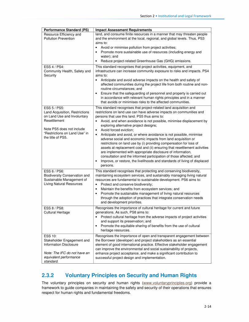
Section 2 • Institutional and Legal Framework
2-14
Performance Standard (PS) Impact Assessment Requirements
Resource Efficiency and
Pollution Prevention
land, and consume finite resources in a manner that may threaten people
and the environment at the local, regional, and global levels. Thus, PS3
aims to:
• Avoid or minimise pollution from project activities;
• Promote more sustainable use of resources (including energy and
water); and
• Reduce project-related Greenhouse Gas (GHG) emissions.
ESS 4 / PS4:
Community Health, Safety and
Security
This standard recognises that project activities, equipment, and
infrastructure can increase community exposure to risks and impacts. PS4
aims to:
• Anticipate and avoid adverse impacts on the health and safety of
affected communities during the project life from both routine and non-
routine circumstances; and
• Ensure that the safeguarding of personnel and property is carried out
in accordance with relevant human rights principles and in a manner
that avoids or minimises risks to the affected communities.
ESS 5 / PS5:
Land Acquisition, Restrictions
on Land Use and Involuntary
Resettlement
Note PS5 does not include
“Restrictions on Land Use” in
the title of PS5.
This standard recognises that project-related land acquisition and
restrictions on land use can have adverse impacts on communities and
persons that use this land. PS5 thus aims to:
• Avoid, and when avoidance is not possible, minimise displacement by
exploring alternative project designs;
• Avoid forced eviction;
• Anticipate and avoid, or where avoidance is not possible, minimise
adverse social and economic impacts from land acquisition or
restrictions on land use by (i) providing compensation for loss of
assets at replacement cost and (ii) ensuring that resettlement activities
are implemented with appropriate disclosure of information,
consultation and the informed participation of those affected; and
• Improve, or restore, the livelihoods and standards of living of displaced
persons.
ESS 6 / PS6:
Biodiversity Conservation and
Sustainable Management of
Living Natural Resources
This standard recognises that protecting and conserving biodiversity,
maintaining ecosystem services, and sustainably managing living natural
resources are fundamental to sustainable development. PS6 aims to:
• Protect and conserve biodiversity;
• Maintain the benefits from ecosystem services; and
• Promote the sustainable management of living natural resources
through the adoption of practices that integrate conservation needs
and development priorities.
ESS 8 / PS8:
Cultural Heritage
Recognises the importance of cultural heritage for current and future
generations. As such, PS8 aims to:
• Protect cultural heritage from the adverse impacts of project activities
and support its preservation; and
• Promote the equitable sharing of benefits from the use of cultural
heritage resources.
ESS 10:
Stakeholder Engagement and
Information Disclosure
Note: The IFC do not have an
equivalent performance
standard.
Recognises the importance of open and transparent engagement between
the Borrower (developer) and project stakeholders as an essential
element of good international practice. Effective stakeholder engagement
can improve the environmental and social sustainability of projects,
enhance project acceptance, and make a significant contribution to
successful project design and implementation.
2.3.2 Voluntary Principles on Security and Human Rights
The voluntary principles on security and human rights (www.voluntaryprinciples.org) provide a
framework to guide companies in maintaining the safety and security of their operations that ensures
respect for human rights and fundamental freedoms.

Section 2 • Institutional and Legal Framework
2-15
The principles cover the following aspects:
• The identification of security risks;
• The deployment and conduct of security personnel;
• Consultation between company, government, civil society and public security; and
• Responses to human rights abuses.
While Lesotho is not a signatory to these Principles, key human rights organisations are signatories
and IFC PS4 makes reference to the need to operate in accordance with relevant human rights
principles and in a manner that avoids or minimises risks to affected communities.
2.3.3 International Labour Organisation Fundamental Conventions
The International Labour Organisation (ILO) has identified eight conventions as "fundamental",
covering subjects that are considered as fundamental principles and rights at work. Lesotho has
ratified all of the ILO Fundamental Conventions, namely:
1. Freedom of Association and Protection of the Right to Organise Convention, 1948 (No. 87);
2. Right to Organise and Collective Bargaining Convention, 1949 (No. 98);
3. Forced Labour Convention, 1930 (No. 29);
4. Abolition of Forced Labour Convention, 1957 (No. 105);
5. Minimum Age Convention, 1973 (No. 138);
6. Worst Forms of Child Labour Convention, 1999 (No. 182);
7. Equal Remuneration Convention, 1951 (No. 100); and
8. Discrimination (Employment and Occupation) Convention, 1958 (No. 111).

3-1
Section 3 Approach and Methods
3.1 Introduction This section provides a description of the process and methods used to gather primary socio-
economic information within the Social Areas of Influence (Refer to Section 3.2.3).
3.2 Approach A four step approach to the data collection and analysis process was adopted and comprised the
following:
• Literature review,
• Site reconnaissance visit,
• Determining the Social Area of Influence; and
• Planning for data collection.
Each of all the four steps is described in more detail below.
3.2.1 Literature review
The objectives of the literature review process were to:
• Review all existing social specialist reports that had been commissioned by the LHDA between
2013 and 2016.
• Identify gaps in the available information that would require further secondary or primary research
to address.
• Identify a preliminary Social Area of Influence for the proposed Project.
• Identify further secondary sources of information that can be used during the compilation of the
report.
Box 3.1 List of Relevant Data Consulted for this Study
The review of the three baseline studies referenced above helped provide a broad understanding and
depth of the socio-economic status of the communities in the Project Area. In particular, the PHBS
(NHA, 2016) helps provide an overview of the health systems and nutrition status of the communities
• Socio-Economic Baseline Study (SEBS) (EOH Coastal & Environmental Services (CES) (2015b) (LHDA
Contract 6000) – the study was undertaken between 2013 and 2014 and finalised in March, 2015.
• Public Health Baseline Study (NHA, 2016) (LHDA Contract 6008) - the report was undertaken in three
stages between February 2014 and July 2015 and Draft Version 4 of the report is dated 28th January
2016.
• Baseline Income and Expenditure Report (CES, 2015a) (LHDA Contract 6000) - the specialist study
was undertaken between May 2013 and April 2014 and the report finalised in March 2015.
• Feasibility Study for Phase II – Stage 2: Main Report (Consult 4 and SEED Consult, 2009) (LHWC
Contract 001)
• Feasibility Study for Phase II – Stage 2: Social Impact Assessment Supporting Report (Consult 4 and
SEED Consult, 2008) (LHWC Contract 001)
• Panel of Experts & LHDA (2010) The ‘Lessons Learnt’ report from Phase 1A and Phase 1B Report 55
• Bureau of Statistics (Lesotho), 2013. Lesotho Demographic Survey, 2011, Vol 1, The Bureau of
Statistics, Maseru.
• Ministry of Health (Lesotho) and ICF International, 2016. Lesotho Health and Demographic Survey
2014. Maseru, Lesotho: Ministry of Health and ICF International.

Section 3 • Approach and Methods
3-2
in the Project Area. The findings of the desktop review of the three social documents are presented
in Table 3.1.
Table 3.1 Summary of the Socio-economic Gap Analysis and Action Plan
Baseline Report
Reference
Information Provided in
Available Baseline Reports
Key Limitations/ Gaps
Identified
Actions Required to Fill
Gaps
Socio-economic
Baseline Study
(SEBS) (CES,
2015b)
• Demographic profile of the
communities in the area.
• Education levels.
• Health status of
households.
• Types of land tenure and
use.
• Land ownership.
• Housing ownership and
types of housing.
• Occupation status and
types of income generation
by affected communities.
• Availability and access to
public services.
• Availability and access to
communal natural
resources.
• Some of data presented in
the SEBS are not clear or
in some instances the
tables do not present what
they are intended to
present.
• The SEBS divides the
communities into three (3)
catchments but does not
raise any unique features
about the communities.
• The information presented
in the tables is detailed for
the control area and none
for the actual reservoir
catchment and
downstream areas. By so
doing this does not allow
for one to look at the
trends/patterns for the
catchment and
downstream areas given
that the impacts vary
across these areas.
• The control area is taken
as part of the entire study
population without serving
as a “control group” in the
true sense of scientific
research.
• The data set is not
available for use for further
analysis.
• People’s opinions about
their social conditions do
not come through; only the
statistical interpretation of
the researcher comes
through.
• The data needs to be
updated using the 2016
Census if available at the
time of the study;
alternatively, the data from
the SEBS (CES, 2015b)
will be used as is.
• Updating of the SEBS
information using latest
available data sources
such as the 2014
Demographic Health
Survey, key informant
interviews with government
officials and NGOs.
• Focus group discussions
with the affected
communities to get
information on their
opinions about their socio-
economics conditions and
identify potential impacts of
the project and possible
mitigation measures.
Public Health
Baseline Survey
(PHBS) (NHA,
2016)
Focus is on:
• Household and Community
Nutrition.
• Vulnerable groups
(women, children, elderly).
• Sexual and reproductive
health and rights.
• Health services
assessment.
• There is no mention of
environmental health
related issues (water,
sanitation, waste disposal
etc.) and how they
generally influence the
health and well-being of
the community members.
• Collect the relevant
information on
environmental health for
inclusion in the integrated
social baseline report.
Baseline Income
and Expenditure • Brief socio-economic
baseline of the area.
• It does not integrate the
district level trend of
income and employment.
• To collect information from
the community level so it
can be integrated into the
report.

Section 3 • Approach and Methods
3-3
Baseline Report
Reference
Information Provided in
Available Baseline Reports
Key Limitations/ Gaps
Identified
Actions Required to Fill
Gaps
Survey (CES,
2015a)
• Income generation
activities of the
communities.
• Spending of the
communities
• To interview government
officials at a district level to
collect information on
employment, income and
spending at a district level.
The district level income
will be used to show
broader trends of these
economic aspects.
3.2.2 Site Reconnaissance Visit
A site reconnaissance visit was undertaken between 12 and 16 September 2016 by Debbie Weldon
(Project Manager), Jeanette Bloem (Social Specialist), Janet Mkhabela (Social & PP Integrator),
Thato Letsatsi (Public Participation Specialist), Stephen Gill (Senior Heritage Specialist) and Pusetso
Nyabela (Heritage Specialist). The purpose of the visit was for the Consultants to introduce
themselves to the District and traditional authorities as well as to get a preliminary understanding of
the scale of the Project Area and to conceptualise the best methods to be utilised to collect socio-
economic information. Subsequent to the visit, the Consultant revised the Social Areas of Influence
through the ground verification of the village clusters also using the ALCs furnished by the LHDA
Tlokoeng Field Office Branch (FOB) and developed data gathering tools.
3.2.3 Social Area of Influence
Based on the proposed Project activities for all phases of the Project, the social area of influence has
been determined to include both a direct, and an indirect, area of influence, each of which is described
below.
The Direct Area of Influence (AoI) comprises portions of the Seate, Menoaneng and Mphokojoane
Community Councils and the Mokhotlong Urban Council areas and the local catchment area of the
Polihali reservoir as defined by the LHDA, and downstream of the Polihali Reservoir up to the
confluence of the Senqu and ‘Malibamatso Rivers (35km stretch) and 5kms east and west of the
Senqu River (see Figure 3.1). The Direct AoI therefore includes:
• Households and communities located within the Project footprint (including the footprint of the
Polihali dam, tunnel works, site establishment and other ancillary infrastructure);
• Households located within areas that will experience changes in air or water quality, reduced
water flows, noise and vibration, visual and landscape, general disturbances, etc.;
• Areas of potential impact on livelihood resources such as agricultural or grazing land, fisheries;
• Settlements likely to experience physical and economic displacement due to the Project’s land
acquisition process; and
• Settlements that are likely to lose their cultural, social and health resources due to the proposed
Project.
The Indirect and Induced Areas of Influence comprise the remaining parts of the Mokhotlong
District not directly affected by the Project. This includes downstream parts of the Menoaneng and
Seate Community Councils and parts of the Bokong Community Council within Thaba-Tseka District
(downstream). These areas and communities fall outside of the direct footprint of the Project;
however, they may experience project benefits related to economic opportunities, increased
economic spend, or negative impacts associated with the presence of the project workforce, in-
migration, changes in water quality and flow downstream, etc.

3-4
Figure 3.1 Project Areas of Influence

Section 3 • Approach and Methods
3-5
3.2.4 Planning for Data Collection
The social data gathering process was planned to build upon the in-depth work already undertaken
where approximately 11,006 households were surveyed across the Project Area (CES, 2015b). Given
the fact that the previous social studies were undertaken roughly three years ago and the fact that
the Project Area is rural, the socio-economic information contained in these reports is deemed to be
valid. As such, a decision was made by the Consultant not to conduct additional household surveys
as part of the Social Specialist study for the ESIA; but, rather ground-truth and collect supplementary
data. The combination of existing information (from previous studies) and complementary data
collected was triangulated and collated into this updated and integrated socioeconomic report that
includes a detailed description of the demographics, livelihoods, access to public services and
infrastructure as well as dependence on, and utilisation of, natural resources.
Furthermore, it was anticipated that this approach would eliminate issues of stakeholder fatigue
associated with over-consultation, especially given that the resettlement planning specialist team was
expected to commence with the household census and asset inventory soon after the departure of
the ESIA social specialist team.
3.2.4.1 Development of Data Collection Tools
Multiple open-ended questionnaires were developed for different types of stakeholders engaged.
FGDs were planned with groups of men, women, and youths, and key informant interviews were
scheduled and held with various government and traditional authorities.
A FGD guide was developed and tailored to solicit information trends across different issues of
discussion at FGD sessions. The objective of the focus group discussions was to solicit from the
identified groups how they thought the PRAI is going to impact them and their livelihoods, be it
positively or negatively. If negatively how they thought the impacts should be mitigated and if
positively, how they think the impacts should be enhanced. The questions within the FGD guide
ranged from land tenure, livelihood strategies, which included farming and its challenges (both crop
and livestock), income generating activities and use of natural resources to earn a living, among
others. The tool also solicited information regarding infrastructure (health facilities, schools and
roads). The guide consisted of open-ended questions as a measure against the “yes” and “no”
responses from participants. Further, data validation questions were included in the guide to identify
instances where participants had negated themselves with their responses to similar questions.
The KII guide was tailored for individuals in specific roles within their communities, in government or
non-governmental space. The main purpose of KIIs was to ground truth information gathered from
the community members and that presented in the previous social studies as well as to gather
additional information to be used in updating the baseline. The interview guide consisted of open
ended questions to allow for in-depth discussions. The traditional leaders who were interviewed as
key informants were mainly to attain information relating to land tenure system and governance issues
within the Project Area. Besides the ground truthing of the FGD discussions, the government
department interviewees were also asked how they saw the PRAI impacting on their activities within
the Project Area.
3.3 Methodology 3.3.1 Sampling
Regarding sampling, the plan was to divide participants into three groups (men 36+ years; women 36
+ years and youth 18 – 35 years) with a maximum of 12 per group. The groups were to have at least
one representative from each of the villages in a cluster. However, during execution, this became
impractical due to the reasons highlighted in Section 3.2.4.
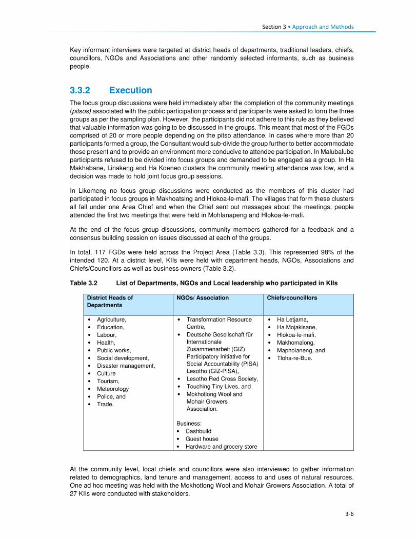
Section 3 • Approach and Methods
3-6
Key informant interviews were targeted at district heads of departments, traditional leaders, chiefs,
councillors, NGOs and Associations and other randomly selected informants, such as business
people.
3.3.2 Execution
The focus group discussions were held immediately after the completion of the community meetings
(pitsos) associated with the public participation process and participants were asked to form the three
groups as per the sampling plan. However, the participants did not adhere to this rule as they believed
that valuable information was going to be discussed in the groups. This meant that most of the FGDs
comprised of 20 or more people depending on the pitso attendance. In cases where more than 20
participants formed a group, the Consultant would sub-divide the group further to better accommodate
those present and to provide an environment more conducive to attendee participation. In Malubalube
participants refused to be divided into focus groups and demanded to be engaged as a group. In Ha
Makhabane, Linakeng and Ha Koeneo clusters the community meeting attendance was low, and a
decision was made to hold joint focus group sessions.
In Likomeng no focus group discussions were conducted as the members of this cluster had
participated in focus groups in Makhoatsing and Hlokoa-le-mafi. The villages that form these clusters
all fall under one Area Chief and when the Chief sent out messages about the meetings, people
attended the first two meetings that were held in Mohlanapeng and Hlokoa-le-mafi.
At the end of the focus group discussions, community members gathered for a feedback and a
consensus building session on issues discussed at each of the groups.
In total, 117 FGDs were held across the Project Area (Table 3.3). This represented 98% of the
intended 120. At a district level, KIIs were held with department heads, NGOs, Associations and
Chiefs/Councillors as well as business owners (Table 3.2).
Table 3.2 List of Departments, NGOs and Local leadership who participated in KIIs
District Heads of
Departments
NGOs/ Association Chiefs/councillors
• Agriculture,
• Education,
• Labour,
• Health,
• Public works,
• Social development,
• Disaster management,
• Culture
• Tourism,
• Meteorology
• Police, and
• Trade.
• Transformation Resource
Centre,
• Deutsche Gesellschaft für
Internationale
Zusammenarbeit (GIZ)
Participatory Initiative for
Social Accountability (PISA)
Lesotho (GIZ-PISA),
• Lesotho Red Cross Society,
• Touching Tiny Lives, and
• Mokhotlong Wool and
Mohair Growers
Association.
Business:
• Cashbuild
• Guest house
• Hardware and grocery store
• Ha Letjama,
• Ha Mojakisane,
• Hlokoa-le-mafi,
• Makhomalong,
• Mapholaneng, and
• Tloha-re-Bue.
At the community level, local chiefs and councillors were also interviewed to gather information
related to demographics, land tenure and management, access to and uses of natural resources.
One ad hoc meeting was held with the Mokhotlong Wool and Mohair Growers Association. A total of
27 KIIs were conducted with stakeholders.
Section 3 • Approach and Methods
3-7
The team held numerous informal conversations with various community members and made general
observations some of which are demonstrated in the pictures found throughout this report. The aim
of these ad hoc conversations and general observations was to verify some of the information that
was collected.
3.3.3 Data Management and Analysis
A tabular format was used to capture and collate the information gathered from all 117 FGDs
according to themes. Following this exercise, information from other secondary sources including the
three social baseline reports was captured for triangulation and cross referencing purposes. The data
was analysed according to recurring themes and integrated into this report.

3-8
Table 3.3 Schedule of Focus Group Discussions
Area Council Meeting Village Village Cluster Actual Villages Present during PPP/SIA sessions
Dow
nstr
eam
clu
ste
rs
Seate
Com
munity C
ouncil
Hlokoa-le-Mafi West_5 (Ha Lejone, Ha Makhabu, Liphookoaneng, Ha Cornela, Ha Nkhaulise, Hlokoa-le-Mafi)
Hloakoa le mafi, Ha Makhabu, Khamolane, Khotleng, Mafikeng, Liphokoaneng, Mohlanapeng, Thepung-Poka Lephene, Mapoteng, Nkhaolise, Thaka-Tsilo, Makhoatsing, Noha-Lia-Loana, Matseleng, Lihlabeng, Ha Liete, Molumong, Likomeng, Moeaneng
Ha Nts'asa West_6 (Ha Ntsasa, Ha Ramokobo, Mafika Lisiu, Ha Malelu, Ha Moatsoetlane, Ha Rahlena, Khamolane)
Ha Ntsasa,Ha Ramokobo, Khamolane, Lihlabeng, Sekhutlong, Tsepong
Taung West_7 (Taung/Khokooeng, Masakoaneng, Maqhaung, Makhiseng, Freistata, Liphofung, Letapeng, Manonyana)
Masokoaneng, Taung, Majakeng, Makhiseng, Ha Phatsoane, Ha Maotoana, Makhoaba, Letlapeng, Masalla, Hajeke, Ha Seotsanyane, Thepung, Marisele
Khotsang West_8 (Khotsang, Letlapeng, Nqobelle, Ha Setene, Semapong, Tena-Baphehi, Lipeleng)
Khotsang, Bahaoleng, Tena Baphehi, Makhoaba, Ha Mei, Letlapeng Nqobelle
Ha 'Mei West_8 (Ha Mei, Thuhloane, Tibising, Moeaneng, Motse-mocha) Tibising, Ha Mei, Thuhloane, Motse-Mocha
Makhoarane West_9 (Matikiring, Ha Matekase, Ha Letheha) Matikiring, Makokoaneng, Ha Letheha, Matekase, Makhoarane, Sekhutlonyaneng, Matikiki, Sekhutlong, Thuhloane,
Bo
ko
ng
Co
mm
un
ity C
ou
ncil
Mohlanapeng West_3 (Noha-lia-loana, Ha Hashepe, Tsotsoaneng, Khamolane, Porotong, Mohlanapeng, Khutlo-se-Nonne)
Noha Lia Loana, Letsatseng, Mohlanapeng, Ha Heshepe, Kholong, Likomeng-Ha Thaka-Tsilo, Mapoteng, Botsong, Mafikeng, Khotleng, Lekhalaneng, Likomeng ha Marutle, Tsutsoaneng, Mabuleng, Ha Letjama, Maitisi, Khutlo-se- Nonne, Ha Molise, Maqalikeng
Likomeng West_4 (Makoatsing, Letsatseng, Mokhoabong, Mapoteng, Khotleng, Likomeng (Ha Thakatsilo), Mafikeng, Ha Pokalephele, Lihlabeng, Ha Thoso)
People from this cluster attended sessions at Mohlanapeng & Hlokoa-le-mafi
Maqalikeng West_2 (Kholokoe, Mokhangoaneng, Thaba Sephara, Ha Kakuli, Maqalikeng, Khotolieng, Manokong)
Maqalikeng, Mokhangoaneng, Thaba-Sephara, Manokong, Ha Molise, Khotolieng
Mokhalong West_1 (Mokhalong, Mahuleng, Koting-sa-Mofao, Phaleng, Ha Lephakha, Makhapung, Ha Letebele (Ha Leruo))
Mokhalong, Mahuleng, Phaleng, Ha Lephakha
Men
oan
en
g
Co
mm
un
ity
Co
un
cil
Nkokamele East_1 (Likhameng, Liokhoane, Ha Motubehi, Mabeulung, Ha Lehloenya, Mochochononong, Nkokamele, Masakong, Ha Motseare, Makorotong, Taung 1 & Taung 2, Koma Koma)
Nkokamele, Ha Motseare, Nqobelle
Ha Moeketsane East_2 ( Ha Moeketsane, Ha Mohale, Phahameng,Ha 'Mamothopeng, Sephokong, Khorole, Tibising, Mafikeng)
Ha Moeketsane, Moreneng, Makorotong, Mafikeng, Tibising, Ha Moleko, Ha Mokoena, Ha Makaka

3-9
Area Council Meeting Village Village Cluster Actual Villages Present during PPP/SIA sessions
Lilatoleng East_3 ( Lilatoleng, Ha Sibi, Ha Ralitlhare, Ha Ntsika, Tsekong, Ha Lehloenya)
Ha Ntsika, Ha Sibi, Tsekong, Ha Ralitlhare, Ha Lehloenya, Bobatsi, Moeling, Lipeleng, Ha Lekhehle, Ha Taelo
Linakeng East_4 ( Ha Moropane, Ha Jontane, Ha Taelo, Ha Rajoalane, Kholoke, Linakeng (Ha Mphosi), Matlatseng, Sankoela (Makhahleleng)
Linakeng, Ha Mphosi, Likhahleng
Po
lih
ali C
atc
hm
en
t Seate
Co
mm
un
ity C
ou
ncil
Malingoaneng/ Khubelu
ALC S1 (Tloha-re-Bue, Malingoaneng, Masakong, Ha Tlhakola, Ha Ramonakalali, Ha Jobere, Sotoane)
Tloha-re-Bue, Masakong
Nts'upe ALC S2 (Nts'upe, Linokong) Ntsupe, Makorong, Phuthing, Terae Hoek, Mafikeng, Ha Tlontlollo,
Sebera ALC S3 (Sebera, Ha Nts'esanyane, Letsatsaneng, Likoting, Checheng)
Mateaneng, Teraeng, Sebera, Phokeng, Sekoka, Likoting, Letsaneng, Ha Ntsesanyane, Bolahla, Ha Ramoruti
Mapholaneng ALC S4 (Mapholaneng, Ha Leqabanyo) Mafika-Lisiu. Motete, Meketeng, Polomiti, Majakaneng, Ha Lechela, Ha Leqabanyo, Ha Ntsetsanyane, Makalieng, Taung, Likoung, Khubelu, Sefate, Mofolaneng, Tsepong, Phatlalla, Lithoteng, Perekising, Matebeng, Ha Matsieng
Mofolaneng ALC S5 (Mofolaneng, Likoung, Mokhoabong, Bochabela, Manganeng, Matebeng, Lithoteng)
Mofolaneng, Tsepong, Mangaung, Phatlalla, Mokhoabong, Lithoteng, Sefate, Likoung, Lipululeng, Matebeng, Bochabela, Lebakana
Mahemeng ALC S6 (Mahemeng, Rammeleke) Mahemeng, Tsieng
Men
oan
en
g C
om
mu
nit
y
Co
un
cil
Ha Rafolatsane ALC MG5 (Ha Rafolatsane, Hloahloeng, Molumong, Ha Molungoa, Ha Sekantsi, Ha Lehlohonolo, Manganeng, Majakaneng, Matsekeng)
Ha Rafolatsane, Ha Lehlohonolo, Majakaneng, Molumong, Ha Molungoa, Manganeng, Namoha, Ha Sekantsi, Lilemeleng, Lekhalong, Sehlabeng
Ha Koeneo ALC MG6 (Ha Koeneo, Maphiring, Likoae, Jermiston, St James, Lekhalong)
Ha Koeneo
Libibing ALC MG4 (Libibing II, Tlhakoaneng, Manganeng, Maotleng, Sekoting, Thoteng, Letsatseng, Sekaneng, E-eang, Janteu, Tutulung, Ha Motebang)
Libibing 1, Libibing 2, Letsatseng, Tlhakoaneng, Terateng, Sekoting, Manganeng, Moeling, Janteu, Maotleng
Matlakeng ALC MG3 (Matlakeng, Bokone, Morojeleng, Ha Phatoli, Ha Nts'abele, Taung, Ha Mofali, Ha Makere, Hlomohang, Moeling, Molalana-Motse Mocha)
Ha Ntsebele, Taung, Koeneng, Moeling, Tsoenene, Ha Mofali, Ha Phatoli,
Ts'oenene ALC MG2 (Ts'oenene, Meeling, Thajana, Phatoli, Khohlong, Ha Setsoto, Sekokong, Bochabela)
Bochabela, Thajane, Sekokong

3-10
Area Council Meeting Village Village Cluster Actual Villages Present during PPP/SIA sessions
Malubalube ALC MG1 (Malubalube, Likhameng/Moeaneng, Ntjolo, Phate, Masofeng)
Likhameng, Masoefeng, Moeaneng, Ha Phate, Malubalube
Mo
kh
otl
on
g
Urb
an
Co
un
cil
Salang ALC MU1 (Salang, Checha, Teropong) Checha, Ntlholohetsane
Bafali ALC MU2 (Bafali, Ha Poso, Ntsiking Bafali) Bafali, Bafatsana,Ntsining, Masaleng, Mabitseng, Ha Seeta, Bafali- Nkotoane,
Ntlholohetsane ALC MU3 (Ntlholohetsane1, Ntlholohetsane2) Ntlholohetsane, Senkoase
Thabang ALC MU4 (Thabang) Thabang, Mangaung, Liraholeng
Ha Mojakisane ALC MU5 (Ha Mojakisane) Mojakisane, Sekeketeng
Mp
ho
ko
joan
e C
om
mu
nit
y C
ou
ncil
Meta/Mabuleng ALC MP1 (Ha Maleka, Thoteng, Ha 'Meta, Kheseng, Ha Masetulo) Mabekong, Paballong, Khesing, Ha Meta, Litsoeneng, Moeaneng, Thoteng, Mokhalong, Pontseng, Kheseng, Koakoatsi, Lietsela, Sebothoane, Thoteng Ha Lesoeja, Masholoko, Moreneng, Sekoting Ha Tipi
Tlokoeng ALC MP2a (Tlokoeng, Liphokong, Botsola, Ha Mpesi, Makalong, Tlokoeng, Matebeleng)
Tlokoeng, Botsola, Maitisi, Mabelete, Mabeleteng, Ha Mpesi
Lilimala ALC MP2b (Lilimala, Tsekong, Majakaneng, Ha Konki, Lits'otsong) Lilimala, Makalong, Ha Konki, Tsilantso Ha Konki, Kanana, Litsotsong
Ha Lebopo (Mahesheleng)
ALC MP8 (Lebopo, Masuoaneng) Ha Lebopo, Ha Mathibeli, Ha Ramoruti, Mabothong, Koatanyane, Ha Koatake, Ha Ramohale, Sekokong
Ha Makhabane ALC MP6 (Ha Makhabane) Ha Makhabane
Makhomalong ALC MP3 (Makhomalong, Majakaneng, Moeaneng, Ha Mohlabakobo, Matsoapong, Phohla)
Matsoapong, Phohla, Makhomalong, Makaoteng
Sekokong ALC MP4 (Sekokong, Ha Moruti, Taung, Ha Koatake, Mobothong, Kanana, Makhoabeng, Ha Ramohale, Ha Mathibeli)
Ha Ramoruti, Mabothong, Ha Ramohale, Sekokong, Ha Lebopo, Ha Koatake, Taung, Ha Mathibeli, Kanana, Thotanyane
Ha Letjama ALC MP5 (Ha Letjama, Maitisi, Letlapeng, Ha Ts'ese, Mabuleng, Khohlong)
Khohlong, Letjama, Tshehle
Motsitseng ALC MP7 (Motsitseng, Sekoka, Lumang, Mpharane) Motsitseng, Sekoka

Section 3 • Approach and Methods
3-11
3.3.4 Impact Assessment
Impacts were assessed in accordance with the standard impact assessment methodology provided
by ERM and the ratings provided in Table 3.4. Significance ratings are assigned for impacts before
mitigation is applied (‘pre-mitigation) and after mitigation has been applied (‘residual’)5.
A more detailed description of the methodology is provided in the Environmental and Social Impact
Statement (ESIS).
Table 3.4 Impact Significance Rating Table
Evaluation of Significance Sensitivity/Vulnerability/Importance of Resource/Receptor
Low Medium High / Very High
Magnitude of
Impact
Negligible Negligible Negligible Negligible
Small Negligible Minor Moderate
Medium Minor Moderate Major
Large Moderate Major Critical
Positive Impacts
Positive Minor Moderate Major
3.3.4.1 Magnitude
Magnitude essentially describes the intensity of the change that is predicted to occur in the
resource/receptor as a result of the impact. A magnitude rating tends to reflect a combination of the
size of an area that may be affected, the duration over which the aspect may be altered, and the size,
degree or scale of that change. In essence, magnitude is a descriptor for the degree of change that
is predicted to occur in the resource or receptor.
For positive impacts (which are mostly socio-economic impacts) magnitude is generally categorised
as ‘Positive’ unless sufficient information is available to support a more robust characterisation and
to assign the degree of magnitude as Small, Medium or Large. For instance, if the number of jobs to
be assigned to local community members is confirmed or if the size or value of the contribution to the
national, regional or district economy is known then a magnitude rating can be assigned. If not, then
the significance rating is assigned based on the sensitivity of the feature impacted by a specific activity
or change.
The term ‘magnitude’ therefore encompasses all the characteristics of the predicted impact including:
• Extent;
• Duration;
• Scale;
• Frequency; and
• Likelihood (only used for unplanned events).
The impact characteristic terminology to be used during the impact assessment is summarised in
Table 3.5.
Table 3.5 Impact Characteristic Terminology
Characteristic Definition Designations
Type A descriptor indicating the relationship of the
impact to the Project (in terms of cause and
effect).
• Direct
• Indirect
• Induced
5 Residual impact ratings are often referred to as post-mitigation ratings elsewhere but are considered the same in this report.

Section 3 • Approach and Methods
3-12
Characteristic Definition Designations
Extent The “reach” of the impact (e.g. confined to a
small area around the Project Footprint,
projected for several kilometres, etc.).
• Local
• Regional
• International
Duration The time period over which a resource /
receptor is affected.
• Temporary
• Short-term
• Long-term
• Permanent
Scale The size of the impact (e.g. the size of the
area damaged or impacted; the fraction of a
resource that is lost or affected, etc.)
[no fixed designations; generally intended
to be a numerical value, where impacts
can be quantified e.g. % of habitat lost; or
where a numerical threshold may be
exceeded (e.g. air or noise standards]
Frequency A measure of the constancy or periodicity of
the impact.
[no fixed designations; generally intended
to be a numerical value where known (e.g.
blasting)]
The evaluation of pre-mitigation impact significance takes into account control measures that are
already part of or embedded within the Project design. This avoids the situation where an impact is
assigned a magnitude based on a hypothetical version of the Project that considers none of the
embedded controls that are defined as part of the project description. Examples of embedded controls
could include acoustic reduction measures around noisy equipment or servitude and buffer
requirements the development is obliged to implement and is part of the layout. Additional mitigation
measures aimed at further reducing the significance of impacts are proposed where necessary or
appropriate and are assessed as part of the ‘residual’ impact significance rating.
In the case of type, the designations are defined universally (i.e. the same definitions apply to all
resources/receptors and associated impacts). For these universally-defined designations, the
definitions are provided in Table 3.6.
Table 3.6 Designation Definitions
Designation Definition
Type
Direct Impacts that result from a direct interaction between the Project and a resource/receptor
(e.g. between occupation of a plot of land and the habitats which are affected).
Indirect Impacts that follow on from the direct interactions between the Project and its
environment as a result of subsequent interactions within the environment (e.g. viability
of a species population resulting from loss of part of a habitat as a result of the Project
occupying a plot of land).
Induced Impacts that result from other activities (which are not part of the Project) that happen as
a consequence of the Project (e.g. influx of camp followers resulting from the importation
of a large Project workforce).
Extent
Local Impacts that affect an area in proximity to the development area within an area defined
on a resource/receptor-specific basis.
Regional Impacts occurring at a regional scale as determined by administrative boundaries or
which affect regionally important resources or ecosystems.
International Impacts that extend across international boundaries or affect resources such as
features, resources or areas protected by international conventions.
Duration
Temporary Impacts are predicted to be of short duration (in the order of days) and/or
intermittent/occasional.
Short-term Impacts that are predicted to last only for the duration of the construction period.
Long-term Impacts that will continue for the life of the Project, but will cease when the Project stops
operating.

Section 3 • Approach and Methods
3-13
Designation Definition
Permanent Impacts that cause a permanent change in the affected receptor or resource (e.g.
removal or destruction of ecological habitat) that endures substantially beyond the
Project life time.
3.3.4.2 Sensitivity
Characterisation of sensitivity for social and cultural heritage receptors is based on the value of that
social and cultural heritage receptor/s and its vulnerability to the impact, taking into account the
receptor’s resilience, including ability to adapt to change or use alternatives where available.

4-1
Section 4 Baseline Environment
4.1 Demographic Profile This section describes the demographic characteristics of the country and the Project Area. These
include population size and distribution, ethnicity and language and migration patterns.
4.1.1 Population Size and Distribution
Lesotho has a population of over two million people and had a low population growth rate of one
percent per annum (between 2015 and 2016)6. In 2017, Lesotho’s population is projected to increase
by 26 102 people and reach 2 199 492 people by early 2018. According to the Lesotho Demographic
and Health Survey (LHDS) (2014) (Ministry of Health (Lesotho) and ICF International, 2016), there
are more females than males at 53% and 47%, respectively. The population of Lesotho is considered
to be young with 39% of the population aged below 15 years, while the proportion of people aged 65
and older is eight percent. The average household size was 3.3 persons. An estimated low of 25% of
the population resides in the urban areas and 75% reside in rural areas. This is indicative of the low
urbanisation rate of the country of four percent per annum.
According to the Socio-Economic Baseline Study (CES, 2015b), the population of the Project Area
was estimated to be 46 371 people between 2013 and 2014, with an average of 5.2 persons per
household. More recent population figures could not be obtained from the local authorities as a
majority indicated that they did not have updated figures. The population in the Project Area reflects
similar characteristics to the national population figures as described above (Figure 4.1).
Figure 4.1 Gender and Age Distribution in the Project Area
Source: Socio-Economic Baseline Study (CES, 2015b)
4.1.2 Ethnicity and Language
Lesotho is a homogenous nation regarding the ethnic composition of the population and culture.
Approximately 99% of the country’s population are Basotho who, in turn, belong to specific clans.
Basotho clans are mostly named after animals which were selected based on the animals’ character
6www.worldmeters.info/world-population/lesotho-population/

Section 4 • Baseline Environment
4-2
(Box 4.1). Some Zulu and Xhosa people from South Africa are found in different parts of the country
due to population migration. Chinese people are also found throughout the country.
Box 4.1 Basotho Clans
Bakoena – Koena (crocodile) Bafokeng –'Mutla (hare) Batloung – Tlou (elephant) Bats'oeneng – Ts'oene (baboon) Bakubung – Kubu (hippopotamus) Baphuthinq – Phuthi (duiker) Bahlaping – Tlhapi (fish) Bataung- Tau (Lion) Basia- Katse (cat) Bahlakoana – Koena (crocodile) Batlokoa – Katse (cat) Bathepu – Noha (snake) Matebele – named after their chiefs Bakhala – no English term
The official languages are Sesotho, which is spoken by the majority of the population, and English
(generally accepted as the language of business). Other commonly spoken languages are isiZulu,
followed by Phuthi, isiXhosa and Mandarin. A similar ethnic and language composition was evident
in the Project Area. Some Zulu people, who the social team met in the area, indicated that they were
either descendants of Zulus who migrated to Lesotho during tribal wars in South Africa or they
relocated to the area out of choice.
4.1.3 Religion
The majority of the Basotho population (90%) are Christians. The main denominations include
Catholic, Lesotho Evangelical, Anglican and other Christian denominations. Muslims, Hindus,
Buddhists and Baha'i comprise the remaining 10%. In the Mokhotlong district, Christianity is the
dominant religion, followed by traditional and cultural beliefs. Many church services include chanting,
drumming and cultural costumes.
Similarly, in the Project Area, Christianity is the most widely practised religion along with traditional
beliefs (ancestral spirits). The main denominations found are the Apostolic followed by Roman
Catholic, Lesotho Evangelical and Anglican. Similarly, the traditional and cultural beliefs are also
observed in the Project Area. Traditional healers and Apostolic Churches use the water pools in the
Senqu River to perform their religious obligations.
4.1.4 Residential Status of the Population
According to the Lesotho Demographic Health Survey (LDHS) 2014 (Ministry of Health (Lesotho) and
ICF International, 2016), in Lesotho, many people reside away from their home communities and
apart from their families for extended periods to pursue work or educational opportunities. The
majority of the population in the country lives within the household (77% males and 82% females);
followed by those who are elsewhere in the country and South Africa (9% men and 5% women) as
indicated in Table 4.1. More females than males are based on the household owing to the African
traditions and beliefs that a woman’s place is at home.

4-3
Table 4.1 Residential Status by Age, Gender, Ecological zone and District in Lesotho
MALE FEMALE
Background characteristics
In the household
Elsewhere in Lesotho
In RSA
In Other Country
Total Number In the household
Elsewhere in Lesotho
In RSA
In Other Country
Total Number
Age
0-9 89.9 8.8 1.2 0.0 100.0 4,360 90.6 8.3 1.0 0.1 100.0 4,494
10-19 83.7 14.7 1.6 0.0 100.0 4,571 81.0 17.9 1.0 0.1 100.0 4,492
20-29 66.6 20.4 12.9 0.1 100.0 3,633 69.8 23.2 6.9 0.1 100.0 3,519
30-39 63.1 17.2 19.7 0.0 100.0 2,466 72.7 14.7 12.5 0.1 100.0 2,403
40-49 62.3 14.2 23.3 0.2 100.0 1,541 72.6 11.9 14.5 0.0 100.0 1,518
50-59 67.2 9.8 23.0 0.0 100.0 1,100 87.1 6.2 6.7 0.0 100.0 1,561
60+ 90.6 5.1 4.3 0.0 100.0 1,488 93.4 5.1 1.4 0.0 100.0 2,242
Residence
Urban 81.0 11.8 7.1 0.1 100.0 4,768 85.1 11.3 3.4 0.2 100.0 5,526
Rural 75.8 14.3 9.9 0.0 100.0 14,400 80.1 14.4 5.4 0.0 100.0 14,703 Ecological Zone
Lowlands 78.0 12.3 9.0 0.0 100.0 10,390 82.8 12.2 4.9 0.1 100.0 11,390
Foothills 74.1 15.5 10.0 0.0 100.0 2,350 78.5 10.4 5.1 0.0 100.0 2,342
Mountains 78.2 15.4 6.3 0.0 100.0 4,000 82.2 14.3 3.5 0.0 100.0 4,568
Senqu River Valley
09.2 15.1 15.0 0.1 100.0 1,817 75.9 10.1 8.0 0.1 100.0 1,923
District
Butha-Buthe 79.0 11.4 9.6 0.0 100.0 1,211 84.9 9.5 5.5 0.0 100.0 1,198
Leribe 74.2 14.4 11.4 0.0 100.0 2,977 78.7 15.5 5.8 0.0 100.0 3,246
Berea 79.2 13.5 7.3 0.0 100.0 2,354 81.1 13.9 5.0 0.1 100.0 2,431
Maseru 82.2 11.7 6.0 0.1 100.0 4,290 85.7 11.0 3.0 0,2 100.0 4,742
Mafeteng 77.2 11.9 10.9 0.0 100.0 1,734 82.6 11.8 5.6 0.0 100.0 1,780 Mohale's Hoek 88.8 18.9 14.3 0.0 100.0 2,011 74.7 18.6 6.7 0.0 100.0 2,097
Quthing 88.9 14.2 16.8 0.1 100.0 1,170 75.3 14.4 10.2 0.1 100.0 1,287
Qacha'snek 77.1 12.8 10.0 0.0 100.0 658 85.4 9.6 5.0 0.0 100.0 680 Mokhotlong 79.6 14.3 6.0 0.0 100.0 1,230 81.6 14.9 3.5 0.0 100.0 1,203
Thaba-Tseka 78.7 17.3 3.9 0.0 100.0 1,533 83.4 15.0 1.6 0.0 100.0 1,567 Source: Lesotho Demographic Survey, 2011 (Bureau of Statistics (Lesotho), 2013)

Section 4 • Baseline Environment
4-4
The Mokhotlong district and Project Area population followed the national trends regarding residential
status, including people living in South Africa (six percent males and nearly four percent females).
Participants in focus group discussions indicated that some female youth often went to South Africa
to seek employment and return home when the job or contract has been finished/ terminated. These
youths highlighted the shortage of job opportunities in the District and Project Area as the motivation
for them seeking employment outside of the country.
4.1.5 Migration
In Lesotho, the majority of migrants were young men working in the South African mines; however,
since the 1990s the patterns of migration have changed substantially due to the general decline in
mine employment in South Africa. The decline in mine employment in South Africa for Basotho from
Lesotho has given rise to new forms of migration and an increase in female migration. The number
of skilled migrants has also been on the increase. Younger and single/separated women have
increasingly been employed in domestic work and on commercial farms in South Africa.
The common practice in the country is for people to move from rural areas to urban towns to look for
employment, especially in the textile industry. Immigrants are mostly of Asian origin in the garment
and textile industry. According to the 2011 Lesotho Demographic Survey (Bureau of Statistics
(Lesotho), 2013), three percent of the population enumerated in Mokhotlong were lifetime migrants
from other districts, and 11% were out-migrants of the same district. This shows that there are very
few in-migrants into the Mokhotlong District. There is very little in-migration to the Project Area. The
common practice is for people to relocate to place within the Project Area either due to the desire of
being closer to family members or closer to services such as schools and health facilities. Out-
migration to more distant locations was common in the Project Area with people moving either to the
lowlands or South Africa in search of employment opportunities.
4.2 Cultural Practices This section describes the cultural practices in Lesotho and the Project Area.
4.2.1 Cultural Practices
Basotho culture is centred around village life, with the majority of traditions and festivals based on the
seasons. The most common cultural activities are related to marriage, birth, and death, coming of
age (initiations), and giving thanks to the ancestors. These are described briefly in Box 4.2. More
specific information is provided in the Cultural Heritage (including Archaeology) Report (MM&A and
Pinto, 2017, P2W-6014-DFR-0003).
Both tangible and intangible heritage resources exist throughout Lesotho where people are still
involved in pottery, cowhide tanning coupled with bead work to make unique clothing for specific
ceremonies such as initiation graduations. The production of artefacts also includes musical
instruments, hats and baskets; however, the skill appears to be more prevalent amongst the elderly
than the youth.
Three hundred and fifty-five (355) heritage sites have been documented in the whole of Lesotho with
42 such sites having been recorded within the District of Mokhotlong alone. Twenty-four of the 42 are
directly relevant to the Polihali Catchment Area, 10 of these refer to rock shelters with rock art, lithics
or other material remains, many of which will be impacted by inundation. The historic structures/sites
of note were located at Likomeng, Makhiseng, Malingoaneng, Mahemeng and Tlokoeng within the
area of the Batlokoa, with Thabang, Motsitseng Ha Mankata, Ha Lebopo, Ha Rafolatsane, and
Molumong on the Khalahali side (for additional information refer to the Cultural Heritage (Including
Archaeology) Report, P2W-6014-DFR-0003).

Section 4 • Baseline Environment
4-5
Box 4.2 Significant Basotho Traditions
4.2.2 Social Networks
The extended family system is one of the most important social systems in Lesotho as elsewhere in
Africa, and more specifically in the rural areas than urban areas. The system is based on the concepts
of collectivism and mutual assistance, where extended families typically share property such as
livestock and activities such as farming, the building of houses, rituals, feasts and arbitration of
disputes among family members. In the more urban areas, the system is shifting as a result of
changing world views (increased exposure), education and mechanisation of agricultural activities.
However, in the Project Area, extended networks are still critical as people are heavily reliant on each
other for support.
Besides, the extended family systems, the most prominent social networks in rural Lesotho and the
Project Area are burial schemes, stokvels, cooperatives (matsema), Church associations, village
police and Village Health Workers/ Community Health Workers (VHW or CHWs). These are described
in detail below.
Burials schemes (mpate sheleng) are usually informal in that they are formed by people of low
income, whereby members pay as little as ten cents per month as a contribution towards having a
fund to assist each other in cases of the passing of family members or relatives or dependents. These
schemes remain prevalent in rural communities across Lesotho including the Project Area. Burial
schemes vary in what the money may cover; including the purchase of a coffin, groceries, a cow;
while others give out money upon the death of a member or covered relative and dependent (Irving,
2005).
Stokvels (mochaellano) are essentially a mechanism for enabling savings in the short-term; they vary
in structure across the country and may include:
• Rotational monthly sittings at homes of the individual members. The host prepares food and
alcohol which he/ or she sells to the other members to raise funds for him or herself.
• Members rotationally give a set amount of cash to a member of the group each month until each
member has been the recipient.
Marriage. This involves the payment of a dowry in the form of cattle (bohali). After the payment of bohali, a
sheep is slaughtered to welcome the bride-to-be into her new home and is given her marital name.
Births. Upon the birth of a child, certain cultural ceremonies and rites are performed including the baby
naming and welcoming of the child into the family. Some of these involve the slaughtering of a sheep;
however, due to the reduction in livestock herds, this tradition of slaughtering of sheep for babies is slowly
phasing out.
Deaths. When death occurs in a family, a cow is often slaughtered to accompany the deceased. The family
of the deceased usually wear mourning gowns for a month after which the dress is removed, and a
cleansing ceremony is performed by slaughtering of a sheep. In a case where the husband has passed, the
wife wears a mourning gown for three months to a year depending on circumstances, e.g. for a working
woman, the period is usually shorter. This is because there are a lot of restrictions associated with wearing a
mourning gown such as not being allowed to be away from home at sunset.
Initiation. The lebollo is a ceremony that is held when boys or girls attend their initiation. The initiates leave
home and stay at an initiation school for three to six months. After the initiation, feasts are held to celebrate
their return to their communities.
Giving thanks to the ancestors or Mokete oa Balimo. This is a ceremony performed to give thanks or
appease the ancestors by slaughtering of a cow whose hide is symbolically used as a blanket for the
ancestors who have visited the person in their dreams claiming to be cold. During this time people also ask
the ancestors for blessings.

Section 4 • Baseline Environment
4-6
• Members contribute an agreed amount of money per month towards purchasing of groceries to
be divided amongst the members at an agreed time, e.g. June and/or December.
• Members contribute an agreed amount and lend it out to each other, and non-members; the cash
is paid back with interest, the money (capital plus interest) is then divided equally amongst the
members at the end of the year (December).
The stokvels mentioned above all exist in the Project Area. The burial society and some stokvel
membership consist of both men and women, while some stokvels consist of only men or only women.
Matsema is a system where households work collectively during intense agricultural periods such as
ploughing and harvesting to provide support to each other during the year.
Church groups are formed along religious lines with the aim of promoting relationships within the
church community. These groups serve as religious and social groups and play different roles within
the church. Among these groups are cell groups, Bible studies, Sunday school classes, youth, men
and women groups.
Local community members form village police groups (mahokela) with the aim of assisting police to
combat crime in their communities. In the Project Area, these groups mostly exist to fight cases of
livestock theft which is said to be widespread across the area.
Village Health Workers or Community Health Workers (VHW or CHWs) originated in response to the
inadequate number of health facilities in the rural areas of Lesotho. These are trained volunteers; of
whom some are paid while others are not paid. Their duties include:
• Provision of medical assistance to sick people, elderly as well as orphaned and vulnerable
children (OVC) in their villages;
• Anthropometric growth monitoring of children under the age of five on a monthly basis;
• Provision of support to people on tuberculosis (TB) treatment (i.e. TB-DOTS support); and
• Provision of support to HIV infected people.
4.3 Land Tenure and Use This section describes the land tenure and land use in Lesotho, Mokhotlong District and the Project
Area.
4.3.1 Ownership of Land
Land in Lesotho is managed and administered by the Ministry of Local Government and Chieftainship
(MoLGC) under the Land Act (No 8), 2010. Lesotho follows the principle that land belongs to all
Basotho and it is held in trust by the King – with the King and Chiefs responsible for the distribution
and management of land. Historically, the land was administered through customary laws; which
entitled every married man with three agricultural fields and one piece of land to build his residence,
i.e. the traditional/customary land tenure system. The land allotted to an individual, could not be
bought, sold, transferred or exchanged.
In the 2000s, the government realised that communal ownership of land was becoming an obstacle
to the commercialisation of agriculture and food security; land reforms were introduced. This was
achieved through the enactment of the 2010 Land Act.
The Act provides for the following individuals as persons who may hold a title for any piece of land:
• The Government of Lesotho;
• All Lesotho citizens who are older than 18 years, except where the person is under 18 but married;
• Where the title is a result of a gift; and
• Where the title is a result of inheritance.

Section 4 • Baseline Environment
4-7
To acquire land one has to apply for it from the chief and local authority under whose jurisdiction the
land is located. Foreigner citizens cannot own land as individuals; however, foreign enterprises which
have at least 20% shareholding of Basotho can acquire rights in land for investment purposes.
Under the 2010 law, agricultural land that has not been cultivated for at least three consecutive years
is regarded as ‘abandoned’ land. Therefore, the land is taken by the Chief to be reallocated to another
person. Lease holding or the right to occupy such land can be terminated.
4.3.2 Types of Land Tenure
Lesotho’s land tenure system recognises three types of title namely; leasehold, Form C and license.
There are, however, also households that occupy the land without the appropriate title in place, i.e.
through the traditional/customary tenure system under which the land was allocated to citizens
through chiefs and headmen on behalf of the King.
Leasehold acts as a check on private subdivision and allocation of land. Under the leasehold system,
the leaseholder has the right to use and enjoy the property for the agreed period. A leaseholder may
lease out that very land under a sub-lease agreement. In practice the leasehold of land is inherited
by the family of the leaseholder; in effect, the land is never returned to the state unless it has become
apparent that it has been abandoned. In Lesotho there are various forms of leasehold for both rural
and urban areas; namely:
• Residential leases for a period of 90 years;
• Commercial and industrial leases for periods of 30 and 60 years;
• Agricultural leases for periods of 10–90 years; and
• Others, including religious, educational and charitable leases for periods of 90 years.
Leasehold agreements are registered at the office of the Land Administration Authority (LAA). Before
the LAA came into being, the registration of title to land was registered at the Deeds Registry. The
Deeds Registry Act, No. 12 of 1967, states that the registration of titles to land under the legal system
of Lesotho does not confer the right of ownership, but the right of title to occupy and utilise the land
and its resources. The Land Act entitles the leaseholder to transfer the title sub-lease, or use their
land as collateral for accessing credit from financial institutions; the title can also be passed on via
inheritance to a named family member.
• Owners of leases for a primary place of residence are exempt from paying ground rent; however,
those who have a lease on a second property are required to pay annual ground rent to the LAA.
Owners of leases for land for commercial, industrial or agricultural purposes are required to pay
annual ground rent to the LAA.
• Form C was abolished by the Land Act (No. 17) of 1979, however, to this date people in the rural
areas are still issued with the Form C as proof of land tenure; it refers to land that is allotted by
the Chief. All forms issued before the 1979 Land Act remained valid. Form Cs and title deeds
can be converted into leases.
• Licence is a land tenure system used for agricultural land within the urban areas. The tenure right
is called a licence, and the land right is neither transferable, subject to inheritance nor negotiable.
Licences are held under customary law.
According to the 2011 LDS (LBS, 2013), the most prominent form of land tenure in Lesotho was
allocation by chiefs (61%), followed by inheritance/gift (29%) and purchase from somebody (seven
percent). A similar scenario was true for the Mokhotlong District where 66% had land allocated by the
chiefs, followed by those who had inherited the land (32%). Only two percent of Mokhotlong land
owners had acquired land through purchasing it from somebody.
The most prominent form of land tenure in the Project Area is through inheritance (31%), followed by
traditional/customary tenure (29%) and title deed (25%). Thirty-eight percent of the people residing in

Section 4 • Baseline Environment
4-8
Mokhotlong town have title deeds because it is a more urban area compared to the residents in the
downstream and catchment areas (42% and 37%, respectively) (refer to Figure 4.2). The “traditional”
tenure is the most predominant in both the catchment and downstream areas. The ownership of
arable land is discussed in Section 4.3.1 as part of the livelihoods activities. Land allocation in the
Project Area follows the same principles as elsewhere in the country.
Figure 4.2 Land Tenure Types Held by the Heads of Households within the Project Area
Source: Socio-Economic Baseline Study (CES, 2015b)
4.3.3 Land Use Types
Land is a major source of livelihoods in Lesotho and Mokhotlong and the Project Area in particular;
with the majority of households engaging in crop farming and extensive animal farming. The Project
Area is situated in the mountain zone and is characterised by high ranging mountains. The total area
of the Project Catchment is roughly 37 510 ha. Rangelands make up the greatest proportion of the
area at 52% (19 365.85 ha), followed by croplands at 35% (13 176 ha). The high mountains make up
seven percent (2687.7ha), while settlements make up six percent (2280.45ha) of the area (Soils,
Land Use and Land Capability Specialist Report P2W-6014-DFR-0007)) (refer to Figure 4.3).
The dominant land use types in the Project Area are grazing (refer to Section 4.8.4), cultivation,
housing, and small commercial activities such as shops and markets that serve the rural population.
The economy of the Project Area is highly dependent on agricultural activities (refer to Section 4.4),
and extensive areas of shrub lands are used to graze livestock or to grow crops. However, most of
the arable land used is degraded partly due to the cultivation methods used (extensive extractive
farming systems) which have led to significant soil degradation (Soils, Land Use and Land Capability
Specialist Report, P2W-6014-DFR-0007)).
0%
10%
20%
30%
40%
50%
Inheritance Traditional Form C Rental Title Deed Other
Catchment Area Downstream Area Mokhotlong Town

4-9
Figure 4.3 Land Use in the Catchment Area

Section 4• Baseline Environment
4-10
4.4 Livelihood and Economic Activities This section describes the economy and livelihoods at a national, district and the Project Area.
4.4.1 National Overview
The economy of Lesotho is based on agriculture, livestock, manufacturing, mining, and depends
heavily on inflows of workers’ remittances from workers in the South Africa mines, farms and domestic
work and receipts from the Southern African Customs Union (SACU). An estimated 50% of the
population earns income through informal crop cultivation or animal husbandry with nearly two-thirds
of the country's income coming from the agricultural sector. Lesotho’s Gross Domestic Product (GDP)
growth was estimated at three percent in 2016.
According to the Human Development Report, 57% of the population lives below the national poverty
line and the national poverty head count ratio at purchasing power parity (PPP) of USD 1.25 a day
stands at close to 59%. Poverty is highest in the rural areas. Unemployment remains high at estimated
levels between 24% and 28%. The rate stands at 29%, and inequality is unacceptably high at a GINI
coefficient of 0.5.
Efforts to promote inclusive growth are constrained by the pressure of high HIV prevalence (23% of
the total population) and the instability of receipts from the Southern African Customs Union (SACU),
which finances 50% of the budget. The country’s GDP is primarily reliant on three sectors, namely
services (67%); industry (31%) and the agricultural sector (seven percent).
4.4.2 District and the Project Area Overview
Mokhotlong District has a largely agrarian economy consisting of livestock rearing and cropping.
Animal husbandry in the District is undertaken mainly for commercial purposes (that is the production
of wool and mohair). The sheep and goats are reared primarily for wool and mohair; for the sole
purpose to sell to national and international markets (mostly South Africa). Crop production is mainly
for household subsistence purposes, and surplus is often sold or bartered with neighbours.
These agricultural activities are severely impacted by the erratic weather conditions (high winds,
snowfalls, etc.) associated with the mountainous terrain. Furthermore, the poor weather conditions
mean that crop production is only able to sustain households for three to nine months of the/ year.
Thus, households tend to make-up the shortfall through livestock rearing to generate household
income in the lean months as well as remittances from household members that are employed (if at
all). In general, income is limited due the high unemployment rate in the country and specifically in
the Project Area.
Crop production is the principal source of livelihood strategy practised in the Project Area, and this is
followed by remittances: permanent and seasonal employment, the sale of livestock products and
social grants, as indicated in Figure 4.4. The harvesting and sale of natural resources (wild plants,
fruit, timber, etc.) featured high as third to fifth principal livelihoods activities. Other interesting
livelihood strategies mentioned included subsistence from gathering and sale of wild plants.
The main livelihoods strategies of the population identified above are discussed in detail in the
subsequent sections.
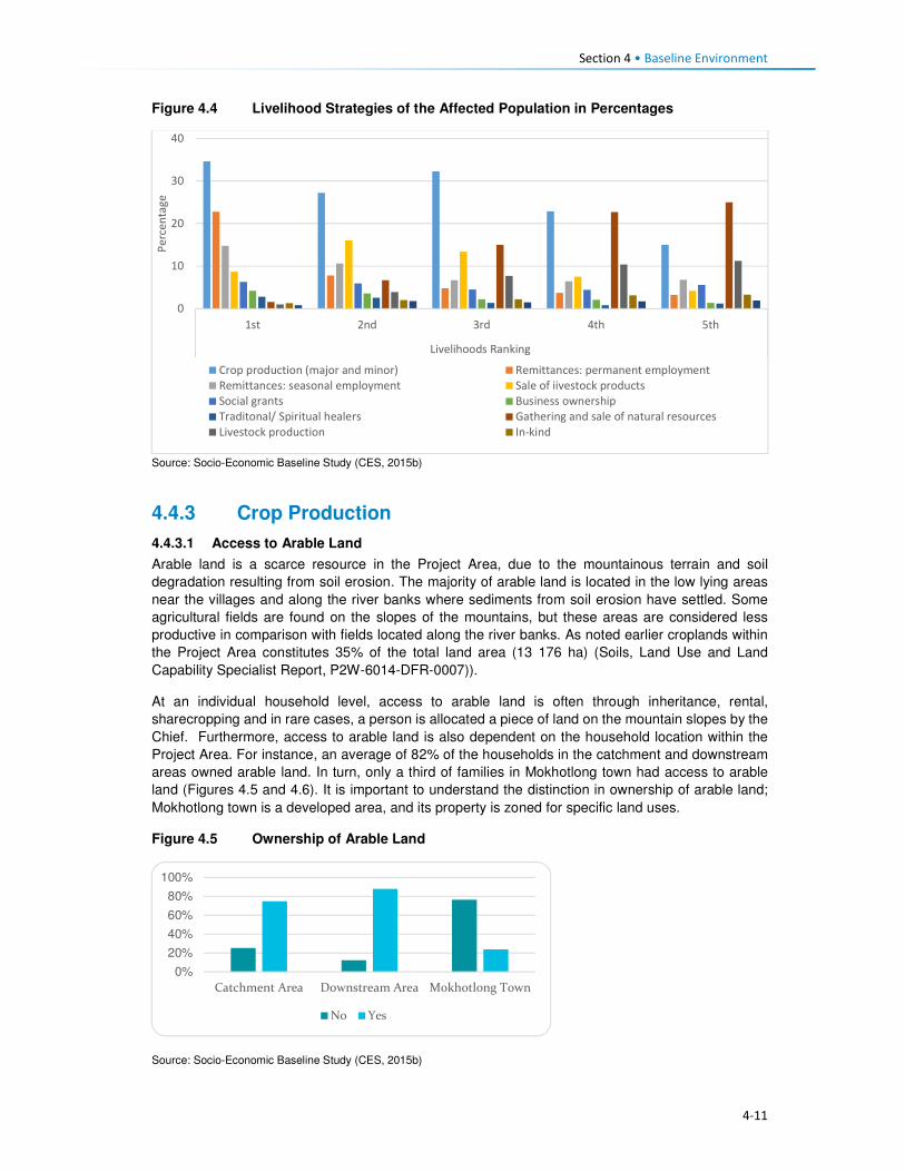
Section 4 • Baseline Environment
4-11
Figure 4.4 Livelihood Strategies of the Affected Population in Percentages
Source: Socio-Economic Baseline Study (CES, 2015b)
4.4.3 Crop Production
4.4.3.1 Access to Arable Land
Arable land is a scarce resource in the Project Area, due to the mountainous terrain and soil
degradation resulting from soil erosion. The majority of arable land is located in the low lying areas
near the villages and along the river banks where sediments from soil erosion have settled. Some
agricultural fields are found on the slopes of the mountains, but these areas are considered less
productive in comparison with fields located along the river banks. As noted earlier croplands within
the Project Area constitutes 35% of the total land area (13 176 ha) (Soils, Land Use and Land
Capability Specialist Report, P2W-6014-DFR-0007)).
At an individual household level, access to arable land is often through inheritance, rental,
sharecropping and in rare cases, a person is allocated a piece of land on the mountain slopes by the
Chief. Furthermore, access to arable land is also dependent on the household location within the
Project Area. For instance, an average of 82% of the households in the catchment and downstream
areas owned arable land. In turn, only a third of families in Mokhotlong town had access to arable
land (Figures 4.5 and 4.6). It is important to understand the distinction in ownership of arable land;
Mokhotlong town is a developed area, and its property is zoned for specific land uses.
Figure 4.5 Ownership of Arable Land
Source: Socio-Economic Baseline Study (CES, 2015b)
0
10
20
30
40
1st 2nd 3rd 4th 5th
Livelihoods Ranking
Pe
rce
nta
ge
Crop production (major and minor) Remittances: permanent employment
Remittances: seasonal employment Sale of iivestock products
Social grants Business ownership
Traditonal/ Spiritual healers Gathering and sale of natural resources
Livestock production In-kind
0%
20%
40%
60%
80%
100%
Catchment Area Downstream Area Mokhotlong Town
No Yes

Section 4 • Baseline Environment
4-12
Figure 4.6 Typical River Bank Agricultural Fields
Source: J. Mkhabela
Concerning land ownership by gender, the average ownership of arable land by females is an
estimated 35% which is lower than that of males at 66%; as indicated in Figure 4.7. Traditionally,
upon marriage, men were automatically allocated fields, whereas women own arable land through
inheritance. However, this trend has changed due to the shortage of arable land – sometimes males
get married and are not given any crop fields.
The majority of households within the Project Area own a single crop field (35%), followed by those
who own two crop fields at 32%. Ownership of three crop fields accounts for 19% of the population,
and those who own between four or more crop fields was reported to be limited to eight and one
percent, respectively; refer to Figure 4.8 for the indicative percentage distribution of household
ownership of crop fields. Ownership of single to two crop-fields may also be linked to the general
shortage of arable land.
Figure 4.7 Ownership of agricultural land by Gender
Source: Socio-Economic Baseline Study (CES, 2015b)
0%
10%
20%
30%
40%
50%
60%
70%
80%
Catchment Area Downstream Area Mokhotlong Town
Female Male

Section 4 • Baseline Environment
4-13
Figure 4.8 Number of Crop Fields Owned by Households
Source: Socio-Economic Baseline Study (CES, 2015b)
4.4.3.2 Cultivation of Crops
Production of crops consists of cultivation of major and minor crops. Major crops are maize, wheat,
sorghum and beans. In turn, minor crops comprise beetroot, butternut, cabbage, pumpkins, spinach,
peppers, onions, tomatoes, carrots, turnips and others. These plants are all grown at different times
of the year depending on the weather conditions. The season for the cultivation of primary crops
begins in September with the preparation of fields, followed by cropping between October and
November. Throughout January and February, crop weeding and tending occur, and harvesting
begins in April to the end of July, refer to Figure 4.9 for the production of the major crops. Minor crops
are grown and harvested nine months of the year, except for during the winter.
Figure 4.9 Process of Crop Cultivation throughout the Year
4.4.3.3 Purpose of Crop Production
Crop production is mostly undertaken for only subsistence purposes across the Project Area; with
surplus sold only by a limited number of households. The subsistence use of crops can be attributed
to low crop yields and lack of alternatives to supplement their household income. As such, households
tend to keep their products for their consumption. Furthermore, crops are sometimes used to barter
with neighbours for other householder goods or as payment for services rendered. The sale of crop
products is undertaken amongst the villagers or in built areas such Mokhotlong and Mapholaneng
Towns where people have limited land to grow crops or do not have time to crop due to life demands.
0%
5%
10%
15%
20%
25%
30%
35%
40%
0 2 4 6 8 10 12 14

Section 4 • Baseline Environment
4-14
The general distribution of the main uses of crops produced in the Project Area is shown in Figure
4.10.
Figure 4.10 Purpose of Crops in the Project Area
Source: Socio-Economic Baseline Study (CES, 2015b)
Some households do not have access to agricultural fields and if they do not partake in any
sharecropping activities or work as labourers in other people's fields – then they will not have a
harvest. Participants gave the following reasons for not participating in crop production, namely:
• No fields for crop production;
• Lack of household labour to work the fields, and
• Lack of financial resources to undertake the farming.
Across the Project Area a lack of land to cultivate was the main reason provided for not partaking in
cropping activities; with the people of Mokhotlong town leading at 85% followed by the catchment
area (63%) and 59% downstream area (CES, 2015b). This barrier has resulted from the general
shortage of arable land across the Highlands of Lesotho and within the Project Area. Those who
highlighted a lack of household labour as a reason for not cropping – was linked to the households
with no youths or middle aged people, and the owner is either elderly or disabled thus they cannot
work the land. The reasons for households not cultivating their fields are indicated in Figure 4.11.
Figure 4.11 Household reasons for not cultivating agricultural land
Source: Socio-Economic Baseline Study (CES, 2015b)
0%
10%
20%
30%
40%
50%
60%
70%
80%
90%
Only subsistence Mostly subsistence Mostly Sale Only Sale
Catchment Area Downstream Area Mokhotlong Town
0%
10%
20%
30%
40%
50%
60%
70%
80%
90%
Elected not toanswer
Lack offinancial
resources
Lack ofhousehold
labour
Not Needed Other Lack of space
Catchment Area Downstream Area Mokhotlong Town

Section 4 • Baseline Environment
4-15
4.4.4 Livestock Production
The second important livelihood strategy of the population is livestock production; consisting of sheep,
goats and cattle, as well as pigs in limited numbers. Livestock is kept mostly for the sale of their
products rather than household consumption. During the 2013/14 Agriculture Year, there were 540
133 head of cattle and slightly over 2.1 million sheep and goats in Lesotho. On the other hand,
Mokhotlong had 40 932 head of cattle and close to 300 000 sheep and goats (Table 4.2).
Table 4.2 Number of livestock by type in Lesotho and Mokhotlong
Type of Livestock National Mokhotlong
Cattle 540,133 40,932
Sheep 1,346,596 198,849
Goats 824,698 94,277
Horses 55,926 9,103
Donkeys 103,859 13,870
Pigs 63,415 1,821
Chicken 453,083 28,824 Source: Lesotho Bureau of Statistics Statistical Report No. 8 of 2015 – Lesotho Livestock Statistics Report 2013/2014
On average, 61% of the households own sheep and goats because of their survival rate (cold and
snowy months of winter), and for the sale of wool and mohair. Figure 4.12 shows the ownership of
livestock across the Project Area by area. More households in Mokhotlong town own sheep than the
households in the catchment and downstream areas.
Figure 4.12 Livestock Owned in the Project Area
Source: Socio-Economic Baseline Study (CES, 2015b)
Livestock in the Project Area is kept by both men and women, but more prominently by men. Amongst
those who indicated not owning livestock, 69% were men and 66% female. The reasons for the
slightly higher number of males not owning livestock was not clarified in the SEBS (CES, 2015b);
however, this could be linked to poverty, or males engaged in formal employment and residing in
town with no space to rear livestock.
4.4.4.1 Ownership of Sheep
Sheep play a significant role in the households' survival, due to the income generated from the sale
of its products; mainly wool. Sheep are owned by both men and women, with men owning more than
women. On average women who own between one and five sheep accounted for eight percent of the
households and those that owned between six to 20 sheep at nine percent and only two percent owns
more than 50 sheep. Most of the men own between six and 20 sheep (18%), one to five sheep (12%)
and lastly 21 to 50 at nine percent, as indicated in Figure 4.13. The sale of sheep is low as they are
0%
10%
20%
30%
40%
50%
60%
70%
80%
Catchment Area Downstream Area Mokhotlong Town
Cattle Sheep Goats

Section 4 • Baseline Environment
4-16
a primary source of livelihoods for households. Over 61% households reported that they do not sell
any of their sheep. In turn, a combined 49% sell sheep in various quantities (Figure 4.13). Sheep that
are sold are often old and small. Therefore, the sale serves as a way of getting rid of old animals and
the money used to purchase new stock.
Figure 4.13 Ownership and Sale of Sheep
Source: Socio-Economic Baseline Study (CES, 2015b)
4.4.4.2 Ownership of Goats
Goats play a similar role to the household income as that of sheep, due to the revenue generated
from the sale of mohair. Goats are kept by both men and women; with men owning more as indicated
in Figure 4.14. In the same way, as with sheep, households typically do not sell their goats.
Figure 4.14 Ownership of Goats
�
Source: Socio-Economic Baseline Study (CES, 2015b)
4.4.4.3 Ownership of Cattle
Ownership of cattle is by both females and males in the Project Area but more prominent amongst
males. However, an average of 58% amongst both men and women households reported not owning
cattle. Cattle keeping is not widely common, and where it is owned, households own between one
and five (average 33%); with approximately 10% owning between six and 20 cattle. The primary uses
of cattle are working the fields, payment of dowry, funerals and sale when the household is strapped
for cash. One of the most commonly recurring responses regarding the sale of livestock, in general,
0%
20%
40%
60%
80%
100%
0 to 5 6 to 20 21 to 50 More than 50 None Owned
Female Male

Section 4 • Baseline Environment
4-17
was that livestock is mostly sold during the lean months to supplement the household income and
the household expenditure.
4.4.4.4 Sale of Livestock Products
As indicated above, the sale of livestock products forms a significant part of the household livelihoods
and income. The main products sold are skin hides, wool, mohair, milk and meat. The number of
households that sell various livestock is highlighted in Figure 4.15.
Figure 4.15 Sale of Livestock Products
Source: Socio-Economic Baseline Study (CES, 2015b)
4.4.4.5 Wool and Mohair Production and Value Chain
Wool sheep are very important in Lesotho, producing over 3 million kilograms of raw wool annually
for export. The sale of wool and mohair and live animals are the primary source of income in the
country. During the 2013/2014 Marketing Year, 1 425 408 sheep were shorn in the country, producing
3 860 768 kg of wool. During the same marketing year, 238 064 sheep were shorn in Mokhotlong,
producing 751 737 kg of wool. Mokhotlong produced the highest quantity of wool; constituting 19.5%
of the total wool for the year7.
The two officially recognised wool and mohair marketing outlets in Lesotho are private trading stations
authorised to deal in wool and mohair, and government shearing sheds placed at 1848 locations
across the country. Of these 11 are members of the Lesotho National Wool and Mohair Grower’s
Association (LNWMGA) which is the main existing herder apex organisation in the wool and mohair
sub-sector. The association is present in all districts with its growers associations at the district level
and Sheering Shed Associations (SSAs) at the lower level9. Normally farmers who use the
government shearing sheds are members of the Wool and Mohair Growers Associations (WMGAs)
and their marketing groups (MGs). Private trading stations are typically used by individuals not
affiliated with any group, though members of WMGAs and MGs also use the private stations for fast
payment. The WMGAs sell their wool and mohair through the South African Wool Board and the
South African Mohair Board and some of these are further exported to Europe and Asia.
In 2012 a project dedicated to assisting to develop the wool and mohair industry in the form of
marketing support, genetic improvement of communal flock through the introduction of quality rams,
training and mentorship was implemented, i.e. The Small Agricultural Development Project. The
project is expected to end in 2018.
7 Bureau of Statistics (Lesotho) Statistical Report No. 21 of 2015 – Livestock Products Report 2013/2014 8 There are 114 sheds which produce wool and mohair, plus another 70 which produce wool only. 9 Kingdom of Lesotho. Wool and Mohair Promotion Project (WAMPP), 2014.
3%
45%52%
No. of HH Selling Cattle Products No. of HH Selling Sheep Products
No. of HH Selling Goat Products

Section 4 • Baseline Environment
4-18
Wool and mohair are the most sold animal products at 52% and 44%, respectively. The low sales of
cattle are indicative of their uses which are mostly ploughing of agricultural fields, traditional
ceremonies and dowry payment. The Mokhotlong Wool and Mohair Growers Association is found in
Mokhotlong town but has representatives in various locations across the broader Project Area. The
association works with the locally based wool sheds which cater for the local farmers. Shearing of
livestock commences in mid-September and ends in mid-Decembers. After completing the shearing
process, the Mokhotlong Wool and Mohair Growers Association transport the wool to Mokhotlong
town before loading it in haul tracks for transportation to Port Elizabeth in South Africa for auction and
sale.
The wool and mohair value chain in Lesotho consists of three channels following producers' groups,
namely:
• Associations that link larger farmers with the government channels and infrastructure to the
auction,
• Individual farmers with medium-sized herds that link up with private traders using their
infrastructure to gain access to the auction, and
• Marginal groups (small farmers) usually resource poor and use informal market channels to get
their products to the auction10.
Figure 4.16 Supply Chain for the Sale of Wool and Mohair
Source: Mokhethi, N.I., etal (2015) (http:www.researchgate.net/figure/290330505_fig1_figure-1-Lesotho-wool-and-mohair-
value-chain).
4.4.5 Challenges to Agricultural Activities in the Project Area
The problems affecting farming activities in the Project Area are highlighted below.
Crop farming:
Poor crop yields. Low crop yields are a standard feature for households in the Project Area; this has
been attributed to the following:
10 http://www.researchgate.net/figure/290330505_fig1_figure-1-Lesotho-wool-and-mohair-value-chain

Section 4 • Baseline Environment
4-19
• Drought - even though the Project Area has multiple water resources, the land away from the
river banks is dry and with limited potential to install formal irrigation systems. Thus, many
households who own fields in areas that cannot be easily irrigated practise dry land cropping; and
manually water vegetable gardens.
• Poor weather conditions are another contributing factor to low yields. The Highlands are subject
to heavy/ flash floods and heavy snowfalls at different times of the year. According to the
respondents, the dry seasons have in recent years been reduced and the snowy season
extended; which in turn affect crop production and yields.
• As is common in rural Africa, the population of the Project Areas continues to use traditional
methods of preparation and cultivation of fields with limited or no mechanisation; which also
affects crop production and yields.
• The District Department of Agriculture has amongst its staff, Agricultural Extension Officers;
however, poor accessibility to some parts of the Project Area has resulted in Extension Officers
not being able to reach some part of the population to extend services.
• The soils in the Project Area are highly degraded due to soil erosion, and the mountainous terrain
characterised by rockiness, which has reduced the available land for cropping.
Livestock farming:
Overstocking. In the broader Project Area, overstocking is a major concern, and this is attributed to
livestock owners' unwillingness to reduce their livestock numbers, as well as inadequate monitoring
or control by the Department of Agriculture, which is enabling this trend. This has led to the livestock
herds overstretching the available pastures and resulted in significant land degradation and shortages
of food for livestock.
Cold weather. The erratic climatic conditions of the area also affect livestock, especially in winter
when it is snowing. The respondents indicated that most of the livestock deaths are reported at this
time of the year. None of the livestock farmers in the area has covered kraals where they keep
livestock, and since most cannot afford to purchase fodder to feed their livestock, the livestock
continues to graze outside, and that is when deaths occur.
Veterinary services. There is a lack of access to veterinary services for livestock owners in the area
due to the constraints related to accessibility issues, i.e. government extension services cannot reach
most parts of the Project Area.
Animal health. Livestock diseases are a major constraint to the development and improvement of
the livestock industry in the region. Vector-borne diseases and tick-borne diseases (especially
theileriosis and heartwater) severely limit livestock production. The livestock owners tend to rely on
medicinal plants to treat their sick livestock.
Poor breeding. The attributes and weaknesses of the indigenous animals, purebred exotics and
crossbreeds were reported as a constraint to livestock production. There is a low reproductive rate
due to high mortality rates of calves, which also hinders the raising of replacement stock, as well as
the lack of artificial insemination delivery services.
4.4.6 Employment and Unemployment
This section describes employment and unemployment conditions at a national level as well as in the
district and the Project Area.
4.4.6.1 National Employment and Unemployment
According to the 2011 Lesotho Demographic Survey, 28% of the population was employed in private
households, followed by those who are self-employed (20%, people working in RSA (18%), private
sector 16% and government at 10%. Overall, females were mostly employed in the private
households/homes i.e. domestic work (21%) than in any other sector. The Survey results further

Section 4 • Baseline Environment
4-20
demonstrate that females (23%) in urban areas were mostly engaged in the manufacturing sector
while 32% of urban males were employed in the private sector. In rural areas, the leading sector was
the Private households/homes with 38% and 26% for men and females respectively; refer to Table
4.3.
Table 4.3 Percentage distribution of the employed labour force by sex, urban/rural
residence and type of employer
Total Urban Rural
Employer Both
Sexes
Male Female Total Male Female Total Male Female
Total 100 100 100 100 100 100 100 100 100
Government 10.0 7.5 14.4 16.4 15.2 17.8 7.1 4.8 12.1
Parastatal 1.1 1.1 1.2 1.9 2.2 1.6 0.8 0.7 0.9
Private 16.0 17.0 14.2 26.1 31.6 20.1 11.4 12.1 10.1
Manufacturing 6.7 2.6 14.0 13.6 5.4 22.7 3.6 1.7 7.9
Self-Employed 20.3 19.8 21.3 19.0 20.5 17.5 20.9 19.6 23.9
Private
household
28.1 31.8 21.4 13.8 12.5 15.1 34.5 38.4 25.8
RSA 17.6 20.1 13.3 8.8 12.3 4.9 21.6 22.7 19.2
Other 0.2 0.2 0.3 0.4 0.4 0.4 0.1 0.1 0.2
Source: Lesotho Demographic Survey, 2011 (Bureau of Statistic (Lesotho), 2013)
The Survey highlighted that 52% of males against 16% females were engaged in agriculture primarily
subsistence farming. More women were employed in the manufacturing and processing industry
(23%) while men constituted five percent. The other industrial category that both males and females
participated in was wholesale and retail trade with 11%. An estimated 11% of men were engaged in
Construction. The second leading category where women (15%) were mostly involved in was
activities of households (private households); refer to Table 4.4.
Table 4.4 Sectoral Employment
Industry Male Female Total
Agriculture 51.6 16.3 38.4
Fishing and aquaculture 0.0 0.0 0.0
Mining and quarrying 3.3 0.4 2.2
Manufacturing and processing 5.2 22.5 11.7
Electricity, gas, steam and air conditioning supply 0.4 0.1 0.3
Water supply, waste management and remediation activities 0.5 0.2 0.4
Construction 10.5 1.9 7.3
Wholesale, retail trade and repair of motor vehicles and motorcycles 7.9 16.1 11.0
Transport, storage and communication 5.4 0.5 3.6
Accommodation and food service activities 0.5 1.9 1.0
Information and communication 0.8 0.8 0.8
Financial and Insurance activities 0.5 0.9 0.7
Real Estate activities 0.0 0.0 0.0
Professional, scientific and technical activities 0.6 0.9 0.7
Administrative and support services activities 3.4 2.8 3.2
Public administration and defence, compulsory social security 3.3 2.8 3.1
Education 2.2 9.9 5.1
Human health and social work activities 1.5 4.2 2.5
Arts, entertainment and recreation 0.2 0.3 0.3
Other service activities 0.7 1.9 1.2
Activities of households as employees, undifferentiated goods - and
services - producing activities of households for own use
1.4 15.2 6.5
Activities of extraterritorial organisations and bodies 0.2 0.3 0.2
Source: Lesotho Demographic Survey, 2011 (Bureau of Statistics (Lesotho), 2013)
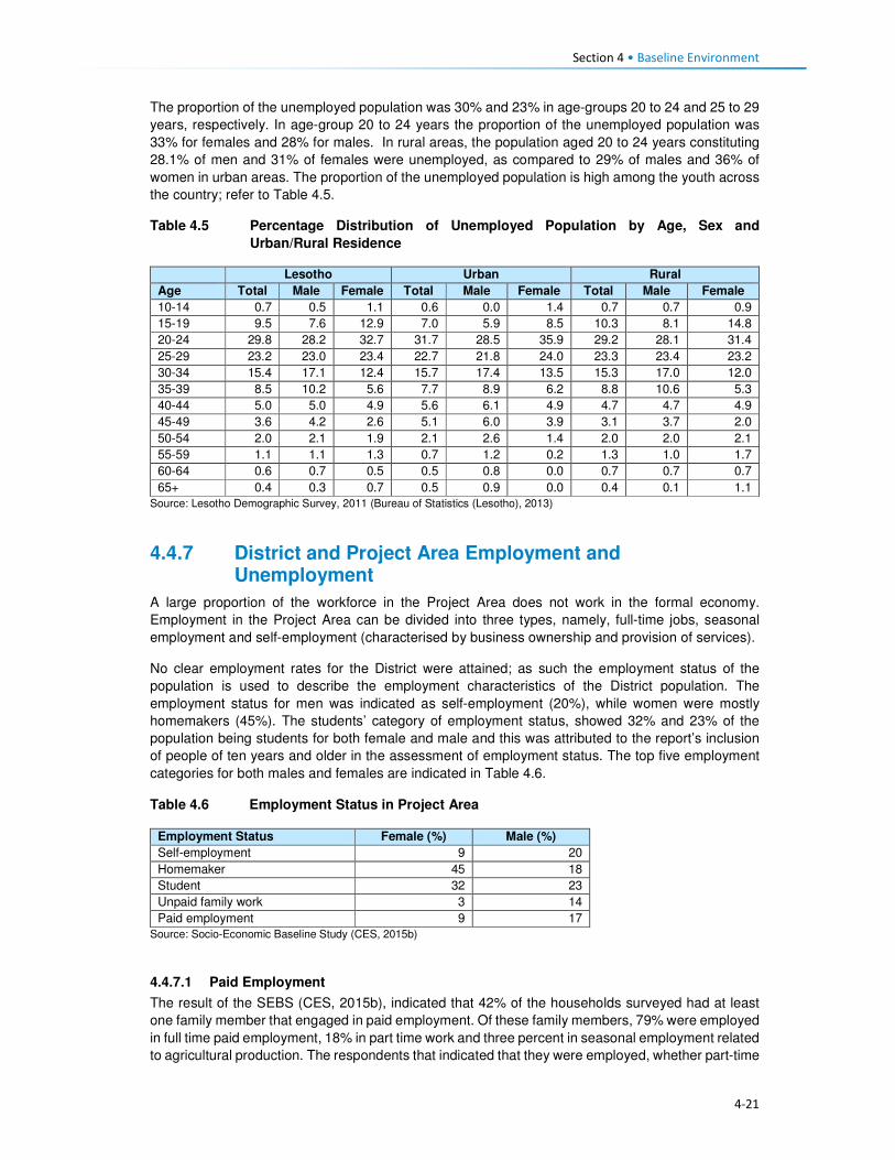
Section 4 • Baseline Environment
4-21
The proportion of the unemployed population was 30% and 23% in age-groups 20 to 24 and 25 to 29
years, respectively. In age-group 20 to 24 years the proportion of the unemployed population was
33% for females and 28% for males. In rural areas, the population aged 20 to 24 years constituting
28.1% of men and 31% of females were unemployed, as compared to 29% of males and 36% of
women in urban areas. The proportion of the unemployed population is high among the youth across
the country; refer to Table 4.5.
Table 4.5 Percentage Distribution of Unemployed Population by Age, Sex and
Urban/Rural Residence
Lesotho Urban Rural
Age Total Male Female Total Male Female Total Male Female
10-14 0.7 0.5 1.1 0.6 0.0 1.4 0.7 0.7 0.9
15-19 9.5 7.6 12.9 7.0 5.9 8.5 10.3 8.1 14.8
20-24 29.8 28.2 32.7 31.7 28.5 35.9 29.2 28.1 31.4
25-29 23.2 23.0 23.4 22.7 21.8 24.0 23.3 23.4 23.2
30-34 15.4 17.1 12.4 15.7 17.4 13.5 15.3 17.0 12.0
35-39 8.5 10.2 5.6 7.7 8.9 6.2 8.8 10.6 5.3
40-44 5.0 5.0 4.9 5.6 6.1 4.9 4.7 4.7 4.9
45-49 3.6 4.2 2.6 5.1 6.0 3.9 3.1 3.7 2.0
50-54 2.0 2.1 1.9 2.1 2.6 1.4 2.0 2.0 2.1
55-59 1.1 1.1 1.3 0.7 1.2 0.2 1.3 1.0 1.7
60-64 0.6 0.7 0.5 0.5 0.8 0.0 0.7 0.7 0.7
65+ 0.4 0.3 0.7 0.5 0.9 0.0 0.4 0.1 1.1
Source: Lesotho Demographic Survey, 2011 (Bureau of Statistics (Lesotho), 2013)
4.4.7 District and Project Area Employment and Unemployment
A large proportion of the workforce in the Project Area does not work in the formal economy.
Employment in the Project Area can be divided into three types, namely, full-time jobs, seasonal
employment and self-employment (characterised by business ownership and provision of services).
No clear employment rates for the District were attained; as such the employment status of the
population is used to describe the employment characteristics of the District population. The
employment status for men was indicated as self-employment (20%), while women were mostly
homemakers (45%). The students’ category of employment status, showed 32% and 23% of the
population being students for both female and male and this was attributed to the report’s inclusion
of people of ten years and older in the assessment of employment status. The top five employment
categories for both males and females are indicated in Table 4.6.
Table 4.6 Employment Status in Project Area
Employment Status Female (%) Male (%)
Self-employment 9 20
Homemaker 45 18
Student 32 23
Unpaid family work 3 14
Paid employment 9 17
Source: Socio-Economic Baseline Study (CES, 2015b)
4.4.7.1 Paid Employment
The result of the SEBS (CES, 2015b), indicated that 42% of the households surveyed had at least
one family member that engaged in paid employment. Of these family members, 79% were employed
in full time paid employment, 18% in part time work and three percent in seasonal employment related
to agricultural production. The respondents that indicated that they were employed, whether part-time
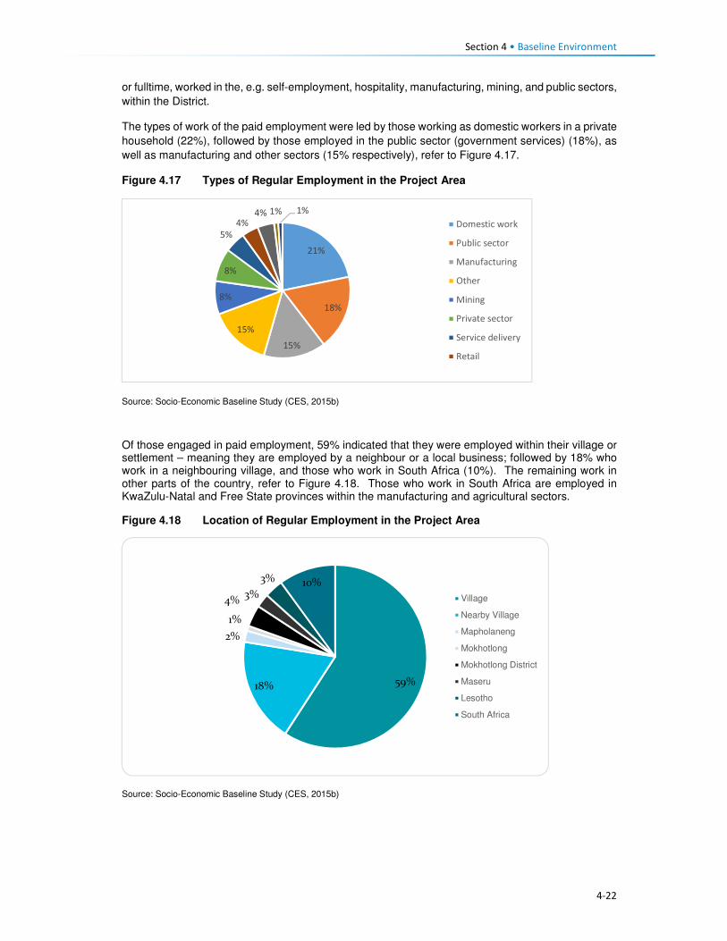
Section 4 • Baseline Environment
4-22
or fulltime, worked in the, e.g. self-employment, hospitality, manufacturing, mining, and public sectors,
within the District.
The types of work of the paid employment were led by those working as domestic workers in a private
household (22%), followed by those employed in the public sector (government services) (18%), as
well as manufacturing and other sectors (15% respectively), refer to Figure 4.17.
Figure 4.17 Types of Regular Employment in the Project Area
Source: Socio-Economic Baseline Study (CES, 2015b)
Of those engaged in paid employment, 59% indicated that they were employed within their village or settlement – meaning they are employed by a neighbour or a local business; followed by 18% who work in a neighbouring village, and those who work in South Africa (10%). The remaining work in other parts of the country, refer to Figure 4.18. Those who work in South Africa are employed in KwaZulu-Natal and Free State provinces within the manufacturing and agricultural sectors.
Figure 4.18 Location of Regular Employment in the Project Area
Source: Socio-Economic Baseline Study (CES, 2015b)
21%
18%
15%
15%
8%
8%
5%
4%4% 1% 1%
Domestic work
Public sector
Manufacturing
Other
Mining
Private sector
Service delivery
Retail
59%18%
2%
1%
4%3%
3% 10%
Village
Nearby Village
Mapholaneng
Mokhotlong
Mokhotlong District
Maseru
Lesotho
South Africa
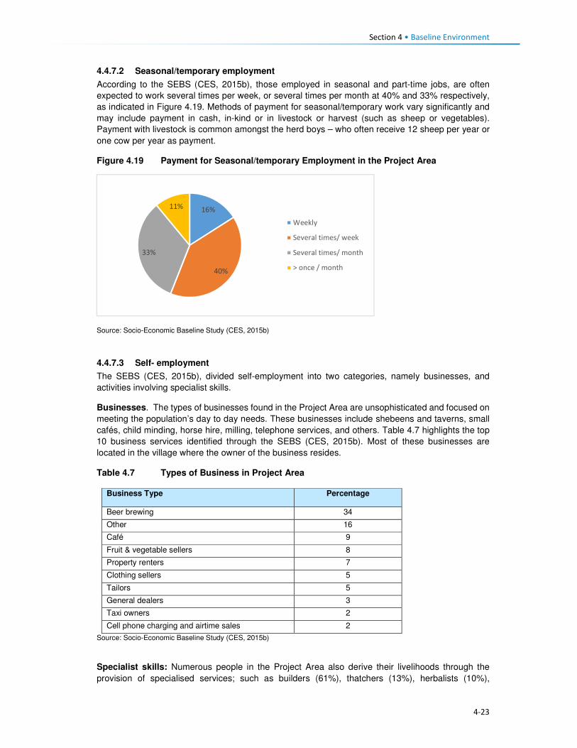
Section 4 • Baseline Environment
4-23
4.4.7.2 Seasonal/temporary employment
According to the SEBS (CES, 2015b), those employed in seasonal and part-time jobs, are often
expected to work several times per week, or several times per month at 40% and 33% respectively,
as indicated in Figure 4.19. Methods of payment for seasonal/temporary work vary significantly and
may include payment in cash, in-kind or in livestock or harvest (such as sheep or vegetables).
Payment with livestock is common amongst the herd boys – who often receive 12 sheep per year or
one cow per year as payment.
Figure 4.19 Payment for Seasonal/temporary Employment in the Project Area
Source: Socio-Economic Baseline Study (CES, 2015b)
4.4.7.3 Self- employment
The SEBS (CES, 2015b), divided self-employment into two categories, namely businesses, and
activities involving specialist skills.
Businesses. The types of businesses found in the Project Area are unsophisticated and focused on
meeting the population’s day to day needs. These businesses include shebeens and taverns, small
cafés, child minding, horse hire, milling, telephone services, and others. Table 4.7 highlights the top
10 business services identified through the SEBS (CES, 2015b). Most of these businesses are
located in the village where the owner of the business resides.
Table 4.7 Types of Business in Project Area
Business Type Percentage
Beer brewing 34
Other 16
Café 9
Fruit & vegetable sellers 8
Property renters 7
Clothing sellers 5
Tailors 5
General dealers 3
Taxi owners 2
Cell phone charging and airtime sales 2
Source: Socio-Economic Baseline Study (CES, 2015b)
Specialist skills: Numerous people in the Project Area also derive their livelihoods through the
provision of specialised services; such as builders (61%), thatchers (13%), herbalists (10%),
16%
40%
33%
11%
Weekly
Several times/ week
Several times/ month
> once / month

Section 4 • Baseline Environment
4-24
Community Health Workers (eight percent), birth attendants (five percent), circumcision surgeons
(one percent), and others indicated in Figure 4.20.
Figure 4.20 Types of Specialised Services in the Project Area
Source: Socio-Economic Baseline Study (CES, 2015b)
There are no income specifications for specialised services provision as each person charges their
specialised rate based on the work to be completed.
4.4.7.4 Unemployment in the Project Area
Unemployment in the Project Area was an estimated 91% of the entire population in the SEBS (CES,
2015b). Similar, to the national statistics on employment and unemployment, the SEBS (CES, 2015b),
included children in its calculation of the levels of unemployment – thus skewing the results as children
ages 0 to 14 do not form part of the economically active groups. Furthermore, CES (2015b) indicated
that their findings on this issue were distorted and believe that the respondents did not fully
understand that subsistence agricultural activities also form part of employment especially if income
is derived from such an activity.
4.5 Household Income and Expenditure 4.5.1 Sources of Household Income
The nature of livelihood strategies, and particularly those activities contributing the most to household
income, does shift as one considers different income quartiles (Figure 4.21). According to LHDA
Contract 6000 - Final Income and Expenditure Report (CES, 2015a), and consistent with the results
of other studies carried out in the Project Area and taking into account its rural and isolated nature,
approximately half of the surveyed population can be classified as ‘poor’ by accepted national and
international standards. High levels of variability of income were found within villages, highlighting the
need for diverse resettlement recovery strategies, even at village level. Seasonal patterns of the
sources of cash that household’s access was noted; these patterns impact poorer and wealthier
households differently regarding stress and opportunity, and also resilience to shocks.
Food insecurity emerged as a key vulnerability of, particularly, the poorest households in this study.
The results show high levels of dependence on purchased food among the most impoverished, and
therefore a concomitant vulnerability to food price increases.
Social ties and networks, as indicated by evidence of gifts originating at multiple levels, from within
villages to the district level to South Africa, make a significant contribution to household income and
0
10
20
30
40
50
60
70
Builders Thatchers Herbalists
Community Health Workers Birth attendants Diviners
Faith healers Circumcision surgeons

Section 4 • Baseline Environment
4-25
food security. Donations of food and clothing are especially common in the poorer households, while
gifts of cash were more common in wealthier households.
Differences between the quartiles:
Quartile 1 denoted poor households that receive the majority of their income from non-cash sources,
including meals given to children at school, and donations of non-perishable food and clothes and
these are followed by non-regular income, social grants and regular income.
Quartile 2 denoted poor households that rely on social grants and non-cash income sources.
The households in Q 1 and Q 2 – depend heavily on one or two income sources (45%), with a limited
risk distribution.
Quartile 3 comprises of households that derive the majority of its income from regular income,
followed closely by non-regular income and non-cash income.
Quartile 4 households derive earnings from multiple sources, with 35% of the total income derived
from regular income sources.
The different types of income sources relied on by the people in each quartile are presented in Figure
4.21.
Figure 4.21 Household Income Sources per Quartile in the Project Area
Source: Baseline Income and Expenditure Report (CES, 2015a)
There are four significant income streams in the area namely, regular income, non-cash income, non-
regular income and non-agriculture based income.
Some households (24%) in the Project Area received income from grants. Of the 24% who received
the grants, the old age pension receivers were highest at 85%, averaging LSL 438.40 per month.
Other grants received were child grants, disability grants, pauper’s grants, and public grants.
4.5.1.1 Annual Income Trends
Income in the Project Area increases significantly between March-June, and again between August
and September and this may be attributed to the following:

Section 4 • Baseline Environment
4-26
• The period (between March and June) marks the beginning of major crop harvesting, namely
wheat, maize and sorghum; and it is a period where poorer households are engaged as labourers.
Furthermore, depending on the household’s levels of poverty (regarding ownership of fields), the
household has an opportunity to derive an income from the sale of their crops.
• Even though mohair sales take place in April, the payments are only received by the farmers
between August and November when it has been sold at auction in Port Elizabeth, South Africa.
• The combination of the income generated during this time may explain the sustained peaks in
income between August and September through the various income streams.
In general, income drops between November and January, dropping further in December before
picking up again in February particularly for households in Quartile 1 and 2 (Figures 4.22 and 4.23).
Figure 4.22 Household Income Trends per Quartile
Source: Baseline Income and Expenditure Report (CES, 2015a)

Section 4 • Baseline Environment
4-27
Figure 4.23 Monthly Income Trend all Households Surveyed within the Project Area
Source: Baseline Income and Expenditure Report (CES, 2015a)
4.5.2 Household Expenditure
Household spending in the Project Area consists of animal purchase, cropping expenses, groceries,
non-food groceries, irregular expenses, livestock husbandry, other ongoing monthly expenses, and
non-business costs. Based on Figure 4.24, households within the 2nd and 3rd quartiles exhibited
similar expenditure trends, i.e. spending on food groceries, non-food groceries, cropping expenses,
etc. The wealthiest households (4th quartile) showed substantially different spending compared to
the people in other quartiles. They spent 21% of their income on groceries food, animal husbandry
(20%) and over 15% spent towards business expenses. In general, households in the Project Area
spend most of their income on purchasing food items, as indicated in Figure 4.24.
Figure 4.24 General Household Expenditure Trends
Source: Baseline Income and Expenditure Report (CES, 2015a)

Section 4 • Baseline Environment
4-28
Figure 4.25 shows that households also spend their income on agricultural activities, with the bulk of
the expenses being towards livestock husbandry. Cropping related expenses tend to peak between
August and November. This coincides with the intensive period of planting the main crops - maize
and sorghum. Spending towards the purchase of livestock increases in August which is around the
time when farmers receive their income from the sale of wool and mohair which in turn increases their
purchasing power for new livestock. Expenses associated with animal husbandry peak in December
month, refer to Figure 4.25. Agricultural costs decrease significantly between December and March
as these are low-income months.
Figure 4.25 Household Agricultural Expenditure
Source: Baseline Income and Expenditure Report (CES, 2015a)
Non-agriculture expenses. Irregular household spending peaks in December, likely due to the
holiday period and returning family members; except the lower income households (1st and 2nd
quartiles). This includes spending on transportation, money being sent to other family members and
expenditure on furniture and appliances. Non-agricultural business income also increased during this
time and subsequently household spending also increases. This spending on non-agricultural
expenses peaks again from July to August which coincides with the harvesting activities and its
associated non-regular employment.
4.6 Access and Utilisation of Natural Resources There are a wide variety of natural resources found in the Project Area, and most of these are
communally owned and utilised. These include edible plants, medicinal plants, grazing land, thatching
grass, river reeds, mosea (craft grass) water, rocks, fish, sand, trees/shrubs and small wild animals.
The natural resources mentioned above have been discussed in detail below. The FGD participants
also made mention of the above mentioned natural resources like the ones that are now found within
the catchment area and are going to be impacted by the Polihali Dam, some through inundation and
some through all the proposed construction works. The collection and utilisation of natural resources
are managed by the Chiefs and their respective Councils. For instance, when a person requires
natural resources for building purposes, he/ she requires the permission of the Chief to collect the
natural resource materials he/she needs. Findings from the FGD indicate that people also have to go
to the chief and the counsellor to request use of roofing grass, fuel wood, medicinal plants and other
natural grasses such as mosea and loli.

Section 4 • Baseline Environment
4-29
The areas where natural resources are collected vary, for instance, rocks which are mostly used in
the construction of housing walls and kraals are readily available everywhere across the Project Area,
and people do not have to walk far to collect and utilise. However, the majority of the natural resources
are found in the forested area, hill/mountainous locations, and river banks, as indicated in Figure 4.26.
Figure 4.26 Areas where Natural Resources are Collected
Source: Lesotho Demographic Survey, 2011 (Bureau of Statistics (Lesotho), 2013)
4.6.1 Grazing Land
Grazing land in the Project Area is communal in nature and access to grazing land is governed by
the Chiefs and community Councillors. The Chiefs and Councillors are supported by locally
established Grazing and Pasture Committees, as well as by the Grazing Associations who work in
close collaboration with Principal Chiefs who oversee the management of grazing land. The Grazing
Associations are responsible for the management of pastures, improvement of livestock and the
rehabilitation of wetlands, marshes and bogs. In turn, the Grazing and Pasture Committees assist
village Chiefs with the general management of pastures. There are two active Grazing Associations
in the Project Area, namely:
• Khalahali Association which operates in Senqu, Bafali, Moremoholo, Mokhotlong/ Sanqebetu,
Tlakeng/ Sehong-hong, Makhapung, and Linakaneng/Sani.
• Tlokoeng Association which works within Bohale ba Nkoe, Mofolaneng, and Liseleng.
Pastures are often divided into three types of cattle posts – summer (these cattle posts are furthest
from home villages), winter (closer to home), and pastures that are close to home but are small and
cannot support large herds of livestock (refer to Figure 4.27). The livestock kept close to the villages
are often used for milking or ploughing or are the very young livestock. The majority of livestock,
therefore, spend significant time in summer and winter cattle posts. The FGD respondents also
attested to the cattle post usage patterns. Both the Grazing Associations and Committees play a
major role in ensuring sustainable use of the grazing area. They also ensure that livestock owners
adhere to the seasonal variations and also adhere to the grazing maintenance schedules that are set
by the relevant Chiefs, for the movement of livestock from one zone to another.
0%
5%
10%
15%
20%
25%
30%
35%
40%
45%
Forest/Thicket
Grazing Area Hilly orMountainous
Area
River Area Other Areas
Catchment Area Downstream Area Mokhotlong Town

Section 4 • Baseline Environment
4-30
Figure 4.27 Example of Local Grazing Area
Source: J. Mkhabela
All livestock in the area must be registered, and the livestock owners must be able to provide evidence
of their legal ownership of the livestock. The Chiefs are tasked with keeping records of herds of
livestock each household in their area owns. New households to the area must also seek permission
to use communal grazing land from the Chief and Council. The new comers must present the Chief
with proof of ownership of livestock and size of the herd of livestock owned.
According to the respondents, even with all these measures in place, grazing land in the area was
degraded due to people’s failure to adhere to the rules. Furthermore, the erratic weather conditions
of the area, heavy storms and snowfalls, soil erosion and severe droughts have contributed to the
degradation of grazing land. Others indicated that conflicting views on the regulation of grazing land
between the Chiefs and Community Council often lead to people disobeying the rules for grazing
management (for additional information, refer to the Rangelands Report, (P2W-6014-DFR-0009)).
4.6.2 Soils
The fresh alluvial deposits at the bottom of the inundation area have soils that are the most extensively
cultivated. Because of the nature of the parent material and the near level terrain, the area is
generally considered to be the most fertile (P2W-6014-DFR-0007). However, because there are
continuously fresh deposits after heavy storms, which are usually accompanied by erosion, the
landscapes are not very stable. As the area is located in the narrow valleys of the upper catchment,
there are no alluvial plains with more stable soils. Most of the soils are very friable and have more
than 50% sand, and are prone to physical losses and loss of fertility (Ministry of Agriculture, 1976).
Since the communities rely on subsistence farming, there is a heavy reliance by the communities on
the ability of the soils to provide food.
The soils in the area are used mainly for:
• Cultivation of food crops, mainly maize and wheat;
• Cultivation of fodder grasses;
• Settlements and the majority of households have gardens used for vegetable production; and
• Natural grassland primarily used for grazing livestock including sheep, goats and cattle.

Section 4 • Baseline Environment
4-31
There is evidence of active use on all of the landscapes, except where the terrain is steep and
completely inaccessible (Soils, Land Use and Land Capability specialist study (P2W-6014-DFR-
0007)).
4.6.3 Sand
Sand is found in abundance along river beds and sand mining is commonly undertaken for sale and
for construction purposes, refer to Figure 4.28. During the FGDs held within the Project Area,
participants residing within the catchment area of the Project Area expressed their concern about the
imminent loss of the sand due to dam impounding. They explained that they use the sand for building
purposes and will be at a total loss as to how they will access sand.
Figure 4.28 Example of Sand Mining along the River
Source: D Weldon
4.6.4 Medicinal Plants
A wide range of plants are collected in the Project Area predominantly for food, medicinal purposes
and for sale. The Biological and Archaeological (Including Heritage) Baseline and Impact Assessment
(LHDA C6002, CES, 2014) found approximately 60 plant species which the communities identified
as important natural resources. Of these, 30 species identified as important medicinal plants and
included Aloe aristata, Delosperma sp. and Artemesia afra. These are often used to treat a range of
ailments including sores, ulcers, headaches, cramps, muscular pains, headaches, sedatives and for
enhancing virility. Another 19 plant species were said to be utilised for spiritual purposes such as
increasing wealth and protection against lightning and evil spirits. The FGD participants also indicated
that they use some medicinal plants to protect themselves against the thokolosi and other evil forces,
which are said to be unseen but are believed to exist. They also pointed out that some of the plants
are only found in the area to be inundated and not anywhere else. Refer to Figure 4.29.

Section 4 • Baseline Environment
4-32
Figure 4.29 Examples of Medicinal Plants found in the Project Area
Source: J Bloem Lehasa
4.6.5 Wild Vegetables
FGD participants mentioned several types of wild vegetables that are found along the river, which
they consider to be now in danger of being inundated when the dam is completed. These wild
vegetables are used by the locals as a source of food to the communities and are collected by women
and girls to take home for cooking. The names of the wild vegetables growing along the rivers are
called papasane, semetsing/selae, thepe and seruoe (the last two grow on the fields and in these
cases they grow on the fields located near the rivers that are going to be inundated).
4.6.6 Fuelwood
Due to the high poverty levels, lack of electricity and extremely cold weather conditions of the Project
Area; there is a high demand for fuelwood. The SEBS (CES, 2015b) identified the plant species,
Passerina montana, as commonly harvested for fuel purposes. Approximately 85% of the households
in the area relied on fuelwood for household heating purposes; others indicated using fuel wood for
cooking purposes at 60%, while the rest use paraffin, bottled gas and electricity, especially those in
Mokhotlong town and Mapholaneng for the latter (FGD findings). It is also evident from the FGD
findings that women stockpile fuelwood in the summer months, in preparation for the winter months,
and also to limit the time spent in the cold going to collect wood.
The collection of fuelwood was indicated to be an activity undertaken mostly by adults and young
women in the Project Area with some assistance from adult and young men. In a small number of
wealthy households, the collection of fuelwood is undertaken by hired help, refer to Figure 4.30.
Figure 4.30 Persons who Collect Fuelwood in a Household
Source: Socio-Economic Baseline Study (CES, 2015b)
0%
10%
20%
30%
40%
50%
60%
Catchment Area Downstream Area Mokhotlong Town

Section 4 • Baseline Environment
4-33
Distances travelled to collect any source of household fuel vary significantly from village to village
based on the location of the fuel source. For instance, some women in FGDs indicated that they walk
for up to three hours (round trip) to collect fuelwood and this does not take into account the amount
of time spent gathering the wood. Furthermore, women reported that collection of fuelwood in summer
is undertaken almost daily to restock for the cold winter months.
4.6.7 Wild Animals
Rabbits, rock rabbits, deer, snakes, skunks and wild cats were said to be abundant within the
catchment area (FGD respondents). However, hunting of mammals in the Project Area is limited.
According to the SEBS (CES, 2015b), only 10% of the households were identified as partaking in any
hunting activities. These households indicated that they hunted antelope of various kinds, fox and
jackal, hare and rabbit and rock rabbit. The FGD respondents, however, mentioned that though they
are not allowed to hunt the animals, they do so for purposes of consumption, muti making for own
use and for selling. They explained that they use skunks to make a khoetsa that mothers put around
their young's necks to ward off evil spirits. Their fear is that the animals are going to run away when
the dam is impounded. The people also said as mitigation to the possible loss of wild animals, they
would like the LHDA to rescue and put them in a fenced off area where their children can visit and
learn about them in the future.
4.7 Health Care This section describes the provision of health care services in Lesotho, Mokhotlong District and the
Project Area.
4.7.1 National Health Services
The Ministry of Health (MoH) is responsible for the administration and management of health care
provision in Lesotho. The Ministry’s responsibilities include promotion and delivery of health services,
development of health policies, standards and guidelines, mobilisation of health resources, and
monitoring and evaluation of health sector interventions. Health care services are provided in
partnership with the Christian Health Association of Lesotho (CHAL), various non-governmental and
private sector organisations and development partners. The provision of health services is also
guided by the Lesotho National Health Strategic Plan for 2012/13-2016/17. Also, Lesotho is also a
signatory to the United Nations Millennium Development Goals (MDG). The MoH is committed to
addressing the following health issues as part of meeting the MDGs:
• MDG 1 – Eradicate poverty and hunger;
• MGD 4 – Reduce child mortality;
• MGD 5 – Improve maternal mortality; and
• MDG 6 – Combat HIV/AIDS, malaria and other diseases.
Furthermore, development partners are actively involved in the health care services in the country
through multilateral and bilateral partnerships. Multilateral partners include the European Union (EU),
the World Health Organisation (WHO), and other United Nations organisations such as the United
Nations Children’s Fund (UNICEF), and the United Nations Population Fund (UNFPA). Bilateral
partners include the United States Governments (USG) facilities such as the United States Agency
for International Development (USAID), the President’s Emergency Plan for AIDS Relief (PEPFAR).
These development partners mainly provide technical assistance and funding for specific health
programmes and general provision of health care.
4.7.2 Health Care Provision
Health care in Lesotho is provided through a three-tiered referral system starting with primary,
secondary and tertiary services (Figure 4.31). At the lowest level of this arrangement are found

Section 4 • Baseline Environment
4-34
primary health care (PHC) services, offered at the community level by Community Health Workers
(CHWs) along with the health centres and filter clinics. The secondary and tertiary levels serve as
referrals for complicated and specialised cases.
Figure 4.31 Levels of Health Care Services in Lesotho
Source: Public Health Baseline Study (NHA, 2016)
Lesotho has 372 health care facilities which comprise one national referral hospital, two specialised
hospitals, 18 hospitals, three filter clinics, 188 health centres, 48 private surgeries, 66 nurse clinics
and 46 pharmacies. Primary health care services consist of a network of CHWs of approximately
5000 nationwide.
Of these facilities, 58% of the hospitals are owned by the MoH, while 38% are belonging to CHAL;
the remaining facilities are either belonging to the Red Cross of Lesotho or are privately owned. At
the district level, health care services are organised into hospital services, health centre services and
community-level services. District Health Management Teams (DHMTs) are responsible for overall
district health services. The number of health facilities varies by the district with Maseru having the
most.
There are seven health centres within the Project Area, four of which belong to the government, the
CHAL owns two, and one is privately owned (Table 4.8). There is only one hospital that serves as the
main referral hospital for the health centres. This hospital has 100 beds and a single doctor servicing
the emergency room and the out-patient department. Respondents pointed out that they sometimes
have to go to health facilities that are outside the Project Area for the sole reason of it being nearer
to where they are living, such as the Semenanyane health centre.
Table 4.8 Health care Facilities in Project Area
Area Name of facilities Location of facilities Ownership of facilities
Catchment • Libibing health centre
• Mapholaneng health centre
• ‘Malebusa Bless clinic
• St James health centre
• Mokhotlong hospital
• St Peter's health centre
• Libibing
• Mapholaneng
• Mapholaneng
• St James
• Mokhotlong town
• Mokhotlong town
• Government
• Government
• Private
• CHAL
• Government
• CHAL
Downstream • Moeketsane health centre • Ha Moeketsane • Government
Tertiary Healthcare
Referral Hospital
Secondary Healthcare
Regional Hospitals
District Hospitals
Local Hospitals
Primary Healthcare
Filter Clinics
Health Health centres
Health Posts/Outreach Services
Village/Community Health Workers
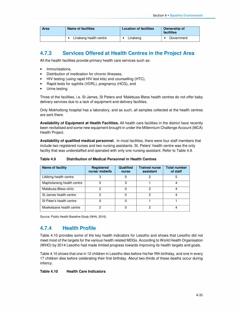
Section 4 • Baseline Environment
4-35
Area Name of facilities Location of facilities Ownership of facilities
• Linakeng health centre • Linakeng • Government
4.7.3 Services Offered at Health Centres in the Project Area
All the health facilities provide primary health care services such as:
• Immunisations,
• Distribution of medication for chronic illnesses,
• HIV testing (using rapid HIV test kits) and counselling (HTC),
• Rapid tests for syphilis (VDRL), pregnancy (HCG), and
• Urine testing.
Three of the facilities, i.e. St James, St Peters and ‘Malebusa Bless health centres do not offer baby
delivery services due to a lack of equipment and delivery facilities.
Only Mokhotlong hospital has a laboratory, and as such, all samples collected at the health centres
are sent there.
Availability of Equipment at Health Facilities. All health care facilities in the district have recently
been revitalised and some new equipment brought in under the Millennium Challenge Account (MCA)
Health Project.
Availability of qualified medical personnel. In most facilities, there were four staff members that
include two registered nurses and two nursing assistants. St. Peters’ health centre was the only
facility that was understaffed and operated with only one nursing assistant. Refer to Table 4.9.
Table 4.9 Distribution of Medical Personnel in Health Centres
Name of facility Registered nurse/ midwife
Qualified nurse
Trained nurse assistant
Total number of staff
Libibing health centre 3 0 2 5
Mapholaneng health centre 0 3 1 4
Malebusa Bless clinic 2 0 2 4
St James health centre 2 0 2 4
St Peter's health centre 0 0 1 1
Moeketsane health centre 2 0 2 4
Source: Public Health Baseline Study (NHA, 2016)
4.7.4 Health Profile
Table 4.10 provides some of the key health indicators for Lesotho and shows that Lesotho did not
meet most of the targets for the various health related MDGs. According to World Health Organisation
(WHO) by 2014 Lesotho had made limited progress towards improving its health targets and goals.
Table 4.10 shows that one in 12 children in Lesotho dies before his/her fifth birthday, and one in every
17 children dies before celebrating their first birthday. About two-thirds of these deaths occur during
infancy.
Table 4.10 Health Care Indicators

Section 4 • Baseline Environment
4-36
Indicators National Outcomes Mokhotlong District Outcomes
Infant mortality rate 59 deaths/1,000 live births (2014)
77 deaths/1,000 live births (2014)
Under-five mortality rate 85 deaths/1,000 live births (2014)
91 deaths / 1,000 births of >5 (2014)
Maternal mortality ratio 1,024 deaths/100,000 live births (2014)
Life expectancy at birth 41.8 yrs. (2011) 41.8 yrs. (2011)
Male life expectancy at birth 39.41 yrs. (2011) 39.41 yrs. (2011)
Female life expectancy at birth 45.33 yrs. (2011) 45.33 yrs. (2011)
HIV prevalence rate 25% (2014) 17% (2014)
Adult ART coverage 35% (2014) 25% (2014)
Paediatric ART coverage 30% (2014) 31% (2014)
Prevention of Mother To Child Transmission (PMTCT) ART coverage
72% (2014) 54% (2014)
TB incidences (including HIV & TB) 788/100, 000 ( 2016)
Multi Drug Resistance (MDR) incidences 52 /100, 000 (2016)
TB treatment coverage 45% (2016)
HIV prevalence in TB 72% (2016)
Source: Lesotho Demographic Survey, 2011 (Bureau of Statistics (Lesotho), 2013); Lesotho Demographic and Health Survey, 2014; Ministry of Health (Lesotho) and ICF International, 2016; UNDP: Human Development Report 2016
4.7.5 Utilisation of Health Services in the Project Area
According to the Public Health Baseline Study (NHA, 2016) over half (51%) of the respondents
indicated that they used the facilities located in the neighbouring village (keeping in mind that a nearby
village may be located over 20 km away from the surveyed individuals’ home). In turn, only five
percent of the respondents indicated they had access to a health care facility within their village.
People residing in the catchment area and Mokhotlong town accessed the hospital the most at (99%
and 98% respectively), with only 53% of the people downstream accessing Mokhotlong hospital; as
indicated in Figure 4.32. FGD findings show that some villagers go to the hospital in Thaba-Tseka
rather than to those in Mokhotlong District, due to their proximity.
Figure 4.32 Closest Medical Facility used
Source: Socio-Economic Baseline Study (CES, 2015b)
0
10
20
30
40
50
60
70
80
90
100
CatchmentArea
DownstreamArea
MokhotlongTown
CatchmentArea
DownstreamArea
MokhotlongTown
Clinic Hospital
Village
Neighbouring Village
Closest Town
Mapholaneng Town
Mokhotlong Town
Other

Section 4 • Baseline Environment
4-37
4.7.6 Incidence and Prevalence of HIV
Lesotho is in the top 10 countries in the Southern Africa region hardest hit by HIV/AIDs. In 2015,
Lesotho had the second highest prevalence of HIV in Southern Africa, after Swaziland, at 22.7%. An
estimated 9900 people died from AIDs-related illnesses in 2015. The incidence of HIV has been
declining, from 30 000 new infections in 2005 to 18 000 new infections in 2015 (Table 4.11).
Table 4.11 Prevalence of HIV/AIDS in Lesotho
310 000 People living with HIV
23% Adult HIV prevalence
18 000 New HIV Infections
9900 AIDS-related deaths
42% Adults on antiretroviral treatment Source: UNAIDS Gap Report 2016
In 2014, an estimated 74% of the people with tuberculosis (TB) in Lesotho also tested positive for
HIV, and 72% of these are on Anti-Retroviral Treatment (ART).
Anti-retroviral treatment (ART) in Lesotho: In Lesotho, ARVs are provided free of charge and can
be collected at various health facilities. Forty-one percent of eligible adults are enrolled onto ART.
ART coverage for children was said to have improved and stood at 56% in 2015. This increase was
attributed to the introduction of satellite paediatric ART centres. According to Avert, in 2016, Lesotho
became the first African country to implement a 'Test and Treat' strategy whereby every person who
tests HIV positive is offered ART regardless of their CD4 count.
Barriers to HIV prevention programmes: Some HIV-related targets and strategies have been
developed within Lesotho’s HIV response; however, many obstacles and challenges are impeding
progress in HIV prevention; most of which are cultural and structural. Gender-based violence and low
paid textile factory work have been found to be significant drivers for the high HIV prevalence among
women in Lesotho, among others (www.avert.org/professionals/hiv-around-world/sub-saharan).
These are briefly described in Box 4.3.
Box 4.3 Barriers to HIV Prevention Programmes
Access to health care. As indicated above, access to health care in Lesotho varies considerably by gender, socio-economic status and geography. Factors affecting access to health care include insufficient funds to travel to health centres and a lack of medical personnel and supplies. As such, people who are living with the virus cannot always access the facilities to collect medication. Furthermore, an estimated four percent of people living with HIV were reportedly denied access to health care services due to their status - this discourages people living with the virus from seeking medical assistance.
HIV stigma and discrimination. According to the Lesotho Stigma Index Report 2014, HIV stigma and
discrimination remain significant barriers to accessing vital treatment, prevention and support services to
those affected. There have been reports of people being victimised because of their HIV positive status;
including verbal and physical abuse, and exclusion from social, religious and family gatherings or activities.
The report further indicated that 41% of its respondents experienced gossip about their HIV status, while 27%
reported being verbally insulted, harassed and threatened.
According to the LDHS, 2014 (MoH and ICF International, 2016), HIV prevalence in Mokhotlong was
estimated at 17%; and it was the lowest amongst all ten Districts in the country. The report further
indicates that HIV was most prominent amongst females (23%) compared to males (10%). Pregnant
women are automatically tested for HIV when they first present themselves to a health care facility;
therefore, more women than men know their HIV status.
HIV/ AIDS was reported at 5% in the PHBS (NHA, 2016), having caused approximately 38 deaths
amongst the respondents of the survey, which is relatively low. Data collected during the FGDs agrees
with the fact that there are high numbers of people infected with HIV. They further pointed out that

Section 4 • Baseline Environment
4-38
they have to go to the nearest health centres to get their ARVs and the problem is always the long
distances they have to travel to reach them.
The PHBS (NHA, 2016) found that testing for HIV in the area was common, with approximately 45%
of the respondents in the catchment area reporting that they had been tested for HIV two weeks
before the study; 45% in the downstream area and 34% in Mokhotlong town. Amongst those who got
tested 70% were women, it is unclear whether these women were tested because they were pregnant
or not. However, the PHBS (NHA, 2016) indicated that all those tested were there to check their
hypertension levels. Three of the 42 focus groups interviewed for the PHBS (NHA, 2016) noted that
the issue of HIV/AIDS is a significant social concern within their communities. Of these, two groups
pointed out that the situation has become worse; one group noted that the situation has improved.
The focus group that reported an improvement in the issue of HIV/AIDS pointed out that people in
the community are now educated about the disease and take the necessary medication. Those
present in the focus groups who reported that the issue is becoming worse indicated that stigma
surrounding HIV/AIDS remains high and that, despite the availability of medication, many people
continue to die from the disease.
Regarding taking antiretroviral medication, people who are sick reportedly took their medication;
however, some stopped as soon as they consider themselves healthy again and this has led to these
individuals getting sick again and dying.
Participants in FGDs for this SIA pointed out that the reasons that HIV positive people default from
taking their medication could be related to the long distances to health facilities as well as the bad
attitude of health personnel. FGD respondents were also of the view that the rate of infections was
increasing, which could mean that people no longer seem to fear the disease.
4.7.7 Challenges to Health Care Provision
Challenges to access and provision of health care in the country, district and Project Area are
described below. There are some challenges to the delivery of health care services in Lesotho, the
main ones being the following:
• The lack of qualified medical professionals (both nurses and doctors) particularly in the rural areas
due to the country’s terrain which creates barriers to accessibility. Most qualified medical
professionals do not want to work in rural areas where there is poor access to public services and
as a result, seek employment in urban areas and elsewhere in the world once they qualify.
Serious emergencies are often referred to neighbouring South Africa.
• The rural nature and mountainous terrain further cause barriers to the construction of formal
medical facilities. This has led to many people living in the rural areas having to travel between
10 and 20 kilometres to reach the closest facility. Thus, many people in the rural areas choose to
rely on traditional medicines to treat various ailments.
• Most of rural Lesotho lacks secondary roads, which means that most parts of the rural areas do
not have public transportation. The 2014 LDHS, 2014 (MoH and ICF International, 2016)
indicated that 72% of households’ members walk to reach the nearest health facility; while 22%
stated that they travel by car, truck, bus, or taxi, and the remaining six percent used a combination
of walking and bus or taxi. Among households who walk to reach a health facility 27% walk for
more than 120 minutes (Table 4.12). Data from the FGDs indicates that the participants were
also concerned about the insufficient number of health facilitates in the Project Area and the
subsequent long distances that they have walk to reach the nearest one.
Table 4.12 Time it takes to get to the nearest health care facility
Time to get to nearest health facility by walking
Residential Area
Minutes Urban Rural Total
<20 minutes 28.4 5.5 12.8

Section 4 • Baseline Environment
4-39
Time to get to nearest health facility by walking
Residential Area
Minutes Urban Rural Total
20-40 minutes 43.0 11.4 21.6
41-60 minutes 17.2 16.1 16.5
120 minutes 8.1 28.1 21.7
> 120 minutes 3.2 38.6 27.3
Source: Lesotho Demography Health Survey, 2014 (Ministry of Health (Lesotho) and ICF International, 2016)
• Participants in focus group discussions indicated that they had experienced further challenges in
accessing health care such as that of frequent shortages of medication and other supplies at the
health facilities. This is made worse by the fact that some people would have had to walk for
many hours to get to the health centres. People from Malubalube, Nkokamele as well as other
far off villages mentioned that they have to take as many as four to five hours to reach the nearest
health centre. This means that they sometimes have to sleep over to have a chance at being
seen and examined by the health centre personnel. The distances are tough on the people
especially when they are sick, and there are cases where some expectant mothers have given
birth to babies on the way to health centres.
• The country’s health system is also challenged by the continued increase of communicable
diseases related to the HIV epidemic – especially Tuberculosis (TB). Data gathered from the
FGDs conducted in the Project Area indicate that in addition to HIV and communicable diseases
mentioned above, the people living in the Project Area suffer from a number of illnesses ranging
from sugar diabetes, hypertension, and the common cold. The under five children are said to
suffer from fever, measles, common cold, pneumonia, diarrhoea and vomiting. The people
expressed their fear about a possible climate change for the worse that could be brought about
by the large expanse of water after the dam is impounded and that would bring more cold to the
already cold district. That would, in turn, mean more common cold and pneumonia cases.
4.7.8 Use of Traditional Healers and Traditional Medicine
The participants of FGDs indicated that they also consult traditional healers when they are sick. This
they also attribute to not being up to walking the long distances to the health centres. In some cases,
they go to the traditional healers because they believe that they, rather than the health facilities, can
help to resolve their problem. In some such cases, the consultation would be more about protecting
their households against evil spirits than physical healing. They do, however, take some forms of
ailments to the traditional healers, though most of these are the ones they believe are from
bewitchments, such as litṥere, kokoana, sejeso, litoromo, ho qobola and headache. They also
indicated that they sometimes started by consulting the traditional healer and if they are not cured,
they would then go to seek help at a health centre and vice versa. Illnesses that they take to health
centres include HIV /AIDS, TB, cancer, sugar diabetes, hypertension, common cold, sharp pains and
flu.
Accidents and injuries that often happen to the people living in the catchment area are falling off
horses, lightning strikes, dog bites, being swept away by flooding rivers and fight injuries. Women
mostly feel unsafe as they are more likely to be sexually and/or physically abused than most. Seniors
feel unsafe as there have been incidences of mugging along the way from receiving their pension
money.
The participants are hoping that LHDA will assist them by liaising with the relevant ministry to have
health centres built nearby them for easy access. Participants from Malubalube pointed out that there
is a building in their village that was intended to be used for health outreach services and it is now
standing vacant and not being used as planned. They wish to have LHDA see to it that the building
is upgraded to a health centre level so that it can serve their area which is quite huge. It would also
cut travel time to Libibing. Their health problems have not declined in number in the past three years.
Instead, they have become worse.
Section 4 • Baseline Environment
4-40
4.8 Education This section describes the provision of education services and infrastructure in Lesotho, Mokhotlong
District and the Project Area.
4.8.1 National Education Services
The Ministry of Education and Training (MoET) is responsible for the management, provision and
regulation of education and training in Lesotho. It is in charge of ensuring the accessibility, quality,
equity and relevance of education. As with many countries in southern Africa, formal education in
Lesotho was introduced and developed through a partnership between the government and religious
organisations; and has been heavily influenced by the work of missionaries. As a result, across the
country, the management of schools is largely (90%) in the hands of the churches; specifically, the
Anglican Church, Lesotho Evangelical Church and Roman Catholic Church.
Government’s involvement in the provision of education, apart from the administrative duties, is
mainly through subsidies; payment of teachers’ salaries and provision of other institutional support.
Teachers are employed under the MoET. The government pays the salaries of more than 95% of the
teachers including those who work at church managed schools. Furthermore, the Government
provides schooling facilities through its capital budget. The provision of education services is guided
by the Education Act (No. 3) of 2010, the Lesotho Education Sector Strategic Plan for 2005 – 2015,
the Higher Education Strategic Plan for 2013/14 – 2017/18 and the National Policy for Integrated
Early Childhood Care and Development (ECCD). Lesotho is also a signatory to the MDG and MoET
seeks to ensure that Lesotho fulfils MDG 2, that of achieving universal primary education by 2015
through the provision of:
• Free and compulsory primary education;
• Bursaries and grants to vulnerable children and households;
• Ongoing school feeding programme; and
• Infrastructure development.
There are also development partners that are actively involved in the education sector through
bilateral and multilateral partnerships. These include among others the European Union, Irish Aid and
United Nations Children’s Fund (UNICEF). The Global Partnership for Education has also played a
significant role in improving the education sector.
4.8.2 Structure of the Education System
After completion of pre-schooling, Lesotho’s education system consists of 12 years of school. The
seven years of primary (Grade 1 – 7); three years of junior secondary (Form A – C); two years of
higher secondary (Form D – E) and four years of tertiary. There is also a parallel technical vocational
diploma course (senior secondary + 3 years Technical and Vocational Education and Training
(TVET). The various cycles of education are highlighted in Table 4.13.
Table 4.13 Structure of the education services in Lesotho
Education Schooling level Age Years Qualification
Pre-school ECCD 3 - 5 3 • Attendance is not compulsory.

Section 4 • Baseline Environment
4-41
Education Schooling level Age Years Qualification
Primary Primary school 6 -13 7 • Attendance is compulsory for children
between the ages of 6 and 13 years old. At
this level, education is free.
• Upon completion of the seven years, pupils
have to write an exam for which they are
awarded the Primary School Leaving
Certificate (PSLC) by the MoET.
Middle Junior secondary school 13 - 16 3 • School fees are payable from this phase
upwards. Pupils who complete this level of
education receive a Junior Certificate from
the MoET.
Secondary High school 16 - 18 2 • School fees are payable at this phase.
Pupils who complete this level of education
receive a Lesotho General Certificate in
Secondary Education (LGCSE).
Technical secondary
school
16 - 18 3 • School fees are payable at this phase.
Pupils who complete this level of education
receive a Technical Vocational Diploma
(Senior Secondary + 3 year TVET).
Tertiary Teacher training/
education in technical
subjects
16 -20 2 • Certificate/Diploma is awarded.
University 18 + 4+ • Receipt of Degrees to Doctorate from the
relevant university.
• National University of Lesotho (NUL) was
the only university in Lesotho until recently
(2008) when Limkokwing University was
established.
4.8.3 Availability of Education Facilities
Lesotho has an estimated 2155 registered education facilities which comprise 14 tertiary/higher
education institutions, 25 technical/vocational centres, 399 secondary schools, 1477 primary schools
and 240 ECCD centres (Table 4.14 and Figure 4.33). TVET schools are found in seven of the 10
districts in Lesotho (i.e. Berea, Leribe, Maseru, Mohale’s Hoek, Mokhotlong, Quthing and Thaba-
Tseka).
There are more primary schools compared to other educational facilities, and this might be attributed
to the government’s drive to meeting its MDGs for the population to at least attain primary school
education. In addition to the above schooling levels and facilities, there are skills centres which are
focused on adult education which are referred to as non-formal education (NFE). These centres are
tailored towards educating out-of-school youth and adults who are illiterate or have only primary
schooling. This service focuses on literacy, numeracy and continuing education. The education
received in these centres is the equivalent of Grade 1 to 10. Participants of FGDs indicated that there
is a high number of pupils who drop out at primary school level. More boys are said to drop out than
girls, and this is attributed to them having to drop out to go and herd animals. Some are said to drop
out to go to initiation school. Male youth from Makhoarane in the downstream area stated that they
did not see the value of education and that they would rather engage in livestock farming. Those girls
who do drop out are said to do so to get married. This means that the government is in part failing to
meet its MDGs of ensuring that all children at least attain primary education.

Section 4 • Baseline Environment
4-42
At the district level, the education system is organised into early childhood development, primary,
secondary and high school and the MoET is decentralised through the Inspectorate. The number of
education facilities varies by district with Maseru district having the most. Table 4.14 shows the
distribution of schools by district.
Table 4.14 Distribution of schools by district
District
Levels of Education Total
ECCD Primary Secondary
Urban Rural Urban Rural
Butha-Buthe 18 14 68 9 13 122
Leribe 28 20 179 12 55 294
Berea 27 10 129 6 36 208
Maseru 34 62 190 29 44 358
Mafeteng 30 9 149 5 34 227 Mohale’s Hoek 27 4 167 4 21 223
Quthing 19 9 117 4 13 162
Qacha’s Nek 18 9 94 5 15 141
Mokhotlong 15 11 95 1 15 137
Thaba-Tseka 24 5 136 4 15 184
Total 240 1477 339 2056 Source: Lesotho Bureau of Statistics, Statistical Report No. 28 of 2015: Education Statistics Report 2014
Figure 4.33 Typical Schools in the Project Area
Source: J. Mkhabela
In the Project Area, the education system follows the national and district system. The MoET through
the Inspectorate is expected to support and supervise these schools. Following the pattern of number
of schools in the Mokhotlong District; there are also more primary schools in the Project Area and
very few Secondary schools. ECCD schools are also available in the Project Area.
A few NGOs work in the education sector in the Districts and provide support in the form of school
fees, uniforms, school shoes, toiletries and sanitary towels to children. These include Sentebale,
Hlokomela Bana and World Vision. Sentebale and Hlokomela Bana operate in Mokhotlong and the
Project Area.

Section 4 • Baseline Environment
4-43
4.8.4 Education Profile of Lesotho
Lesotho has the highest adult literacy rate (79%) in sub-Saharan Africa as well as amongst its female
population (93%)11. Men have slightly lower education levels than their female counterparts, and this
has been linked to the fact that boys particularly those in rural areas tend to dedicate their time to
herding livestock and not attending school or dropping out at the primary level; refer to Table 4.15.
The introduction of free and compulsory primary education in Lesotho has assisted Lesotho in fast-
tracking progress towards reaching the MDG 2. In 2012, progress towards achieving indicator 2.1
(Net Enrolment Rate (NER) in primary schools) and indicator 2.3 (Literacy rate among 15-24-year-
olds) were on track. Progress was, however, slow for indicators 2.2 (Proportion of pupils who reach
the last grade of primary school); refer to Table 4.15. Enrolment in secondary schools is low at 38%
as there are a limited number of secondary schools and tuition fees are required (the government
only subsidises orphan and vulnerable children). Also, children who want to enter high school may
be required to relocate from their homes to stay with relatives or friends who reside close to a
secondary school, and this requires financial contributions from parents which many in rural Lesotho
cannot afford; thus the children drop out. Findings from the FGDs indicate that some of the children
who manage to complete primary school are sometimes unable to attend secondary school due to
lack of school fees. Some parents have to sell livestock to put their children through Junior and Senior
High schools.
Table 4.15 Education Services Profile
Indicators MDG Baseline Outcomes Progress
Adult Literacy rate 79% (2015) Female youth (15 – 24 years) literacy rate 96% 98% (2012) On track
Male youth (15 – 24 years) literacy rate 83% 87% (2012) On track
Primary Education
Net Enrolment Rate12 82% 82% (2012) On track Proportion of pupils who reach last grade of primary school
61% 66% (2012) Slow progress
Source: Kingdom of Lesotho, 2013. Millennium Development Goals Status Report 2013
4.8.5 Education Profile of Mokhotlong and Project Area
The majority (58%) of the residents of Mokhotlong district have attained some primary schooling,
followed by those who have some secondary education (17%). Only eight percent of the population
was recorded as having no schooling – which is relatively low considering that Mokhotlong has poor
infrastructure specifically roads and has an economy that is solely dependent on agricultural activities.
Approximately 90% of the primary schools in Mokhotlong are found in rural parts of the District while
the other 10% are in urban areas. A similar trend was observed with the distribution of secondary
schools.
As with the situation in the District, the SEBS (CES, 2015b) indicates that a majority (59%) of the
population in the Project Area have attained some primary schooling and was, however, followed by
those who had no education at all (16%). Only 12% were reported to have completed primary school.
Regarding attainment of schooling by gender, a similar trend to the national and district levels is
observed with more men with no schooling. However, the trend differs significantly regarding those
who have some primary education, with more males compared to females and reverts to more
females having completed both primary and some junior secondary schooling. Observation during
FGDs showed that many people have at least attained primary school education, as many were able
11www.unesco.org/eri/cp/factsheets_ed/LS_EDFactSheet.pdf 12Net Primary Enrolment Rate is the number of pupils of official primary school age who are enrolled in primary education as a percentage of the total children of the official school age population

Section 4 • Baseline Environment
4-44
to register their names when asked to do so. Also observed was the fact that almost all of the woman
participants could write their name while some could not and wrote a cross.
Due to shortages of qualified teachers and the reluctance of some qualified teachers to work in remote
and hard to reach schools such as those found in Mokhotlong and the Project Area, the use of
unqualified teachers is common. These teachers perform similar roles as qualified teachers though
they have not been trained as teachers, and their wages are paid for by parents. Closely linked to the
shortage of qualified teachers, pupil teacher ratios (PTR) are high. This situation applies to both
primary and secondary schools. A summary of Mokhotlong district education indicators is presented
in Table 4.16.
Table 4.16 Education Services Profile
Indictors Outcome
Primary Education
Total Primary School Teachers 588
• Qualified Primary School Teachers 431 (73%)
• Unqualified Primary School Teacher 157 (27%)
Total Primary School Enrolment in 2014 22,883
Pupil Teacher Ratio (PTR) 39:1
Pupil Qualified Teacher Ratio (PQTR) 53:1
Total Primary School Repeaters 2,215
Secondary Education
Total Secondary School Teachers 212
• Qualified Teachers 198 (93%)
• Unqualified Teachers 14 (7%)
Total Secondary School Enrolment in 2014 5,365
• Male Enrolment 1,786 (33.3%)
• Female Enrolment 3,579 (67%)
Pupil Teacher Ratio (PTR) 24:1
Pupil Qualified Teacher Ratio (PQTR) 26:1
Source: Bureau of Statistics: Statistical Report No. 28 of 2015: Education Statistics Report: 2014
The SEBS (CES, 2015b) indicates that overall, 18% of males in the Project Area had no schooling
while only six percent of females were uneducated and is in line with the national and district reports
on disparities in the levels of education of men and women in Lesotho. This discrepancy was mostly
observed amongst males in the downstream area where 24% of men had no schooling while only
seven percent of females were uneducated. Overall, 61% of the female population across the Project
Area had attained primary education as compared to males at 57%. Refer to Figure 4.34. The people
of town Mokhotlong had higher numbers of people with secondary schooling and above compared to
the other two areas; this can be linked to the fact that Mokhotlong town is the district capital and
slightly urbanised. The town also has a majority of civil servants (who mostly have attained more than
secondary schooling education) residing in the town.
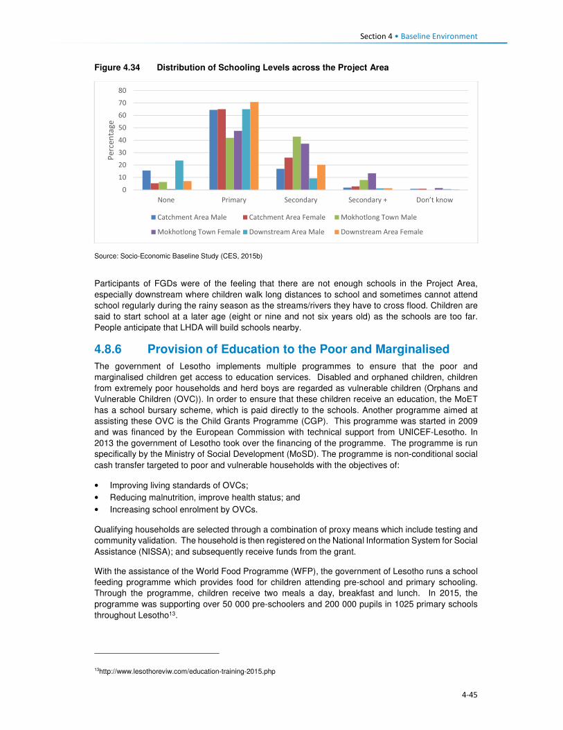
Section 4 • Baseline Environment
4-45
Figure 4.34 Distribution of Schooling Levels across the Project Area
Source: Socio-Economic Baseline Study (CES, 2015b)
Participants of FGDs were of the feeling that there are not enough schools in the Project Area,
especially downstream where children walk long distances to school and sometimes cannot attend
school regularly during the rainy season as the streams/rivers they have to cross flood. Children are
said to start school at a later age (eight or nine and not six years old) as the schools are too far.
People anticipate that LHDA will build schools nearby.
4.8.6 Provision of Education to the Poor and Marginalised
The government of Lesotho implements multiple programmes to ensure that the poor and
marginalised children get access to education services. Disabled and orphaned children, children
from extremely poor households and herd boys are regarded as vulnerable children (Orphans and
Vulnerable Children (OVC)). In order to ensure that these children receive an education, the MoET
has a school bursary scheme, which is paid directly to the schools. Another programme aimed at
assisting these OVC is the Child Grants Programme (CGP). This programme was started in 2009
and was financed by the European Commission with technical support from UNICEF-Lesotho. In
2013 the government of Lesotho took over the financing of the programme. The programme is run
specifically by the Ministry of Social Development (MoSD). The programme is non-conditional social
cash transfer targeted to poor and vulnerable households with the objectives of:
• Improving living standards of OVCs;
• Reducing malnutrition, improve health status; and
• Increasing school enrolment by OVCs.
Qualifying households are selected through a combination of proxy means which include testing and
community validation. The household is then registered on the National Information System for Social
Assistance (NISSA); and subsequently receive funds from the grant.
With the assistance of the World Food Programme (WFP), the government of Lesotho runs a school
feeding programme which provides food for children attending pre-school and primary schooling.
Through the programme, children receive two meals a day, breakfast and lunch. In 2015, the
programme was supporting over 50 000 pre-schoolers and 200 000 pupils in 1025 primary schools
throughout Lesotho13.
13http://www.lesothoreviw.com/education-training-2015.php
0
10
20
30
40
50
60
70
80
None Primary Secondary Secondary + Don’t know
Pe
rce
nta
ge
Catchment Area Male Catchment Area Female Mokhotlong Town Male
Mokhotlong Town Female Downstream Area Male Downstream Area Female
Section 4 • Baseline Environment
4-46
4.8.7 Obstacles to Education
While much has been achieved in ensuring that education services are provided to Basotho, the
sector continues to face challenges at the national and district levels as well as within the Project
Area. The following are some of the challenges faced:
• Low pass rates across all levels of schooling;
• Low standard of education provided at local schools;
• Poor retention rates of pupils at primary and secondary schooling levels due to the limited number
of schools;
• The mountainous terrain of Lesotho also acts as a barrier to construction of schooling facilities
and this has led to a shortage of schooling facilities as well as poor maintenance of existing
schools.
• In the remote rural areas, the learning environment is often poor and characterised by limited
infrastructure including unavailability of classrooms and equipment.
• The shortage of schooling infrastructure also results in pupils and teachers having to walk long
distances to reach the nearest school; this is particularly the case with secondary schooling.
• The limited secondary schooling infrastructure to absorb new entrants into the education system.
• There is a limited number of qualified teachers in the schooling system as many do not want to
transfer and work in remote rural areas with limited public services and infrastructure.
• Lack of public transportation and formal road infrastructure in many remote rural areas, as such
both teachers and pupils have to walk long distances to reach schooling facilities.
• Disparities in the distribution of schools in the country, with rural areas having limited numbers of
schools and urban more. This results in overcrowding of schools and higher teacher/ pupil ratios
which in turn affects the quality of learning and teaching.
• Extreme levels of poverty in the Project Area results in the inability of parents to pay school fees.
4.9 Public Services and Infrastructure This section describes access to public services and infrastructure in the Project Area such as potable
water, sanitation, telecommunications, energy/fuel sources, and roads/transportation; refer to Figure
4.35.

4-47
Figure 4.35 Map showing some Public Services and Infrastructure in the Catchment Area

Section 4 • Baseline Environment
4-48
4.9.1 Access to Potable Water and Sanitation Facilities
4.9.1.1 Access to Potable Water
Almost all urban households in Lesotho have access to improved water sources (96%), and only 77%
of the rural population has access to an improved water system. The type of water sources for urban
and rural populations differed significantly, while the urban population got its water from piped into
dwelling/ yard/ plot (68%), the rural communities got water from public taps/ stand pipes (56%). For
rural communities, this was followed by 23% of water sourced from unimproved water sources and
only five percent had access to piped water into the dwelling/ yard/plot. An estimated 38% of the
rural population had access to water 30 minutes or longer to collect water from which ever source
they use. Overall, the proportion of households obtaining water from improved drinking water sources
in Lesotho has increased from 79% in 2009 to 84% in 2014. Urban households' access to improved
drinking water sources increased from 91% to 97% while the proportion of rural households with
access to improved drinking water sources shifted from 74% in 2009 to 77% in 2014.
Water in urban areas is provided by the Water and Sewerage Company (WASCO), through the
installation of individual water supply. WASCO provided water is billed and paid for. Water in the rural
areas is provided by the Department Rural Water Supply (DRWS). DRWS has guidelines/standards
for communal water supply, that is, 50 metres' walk from each of the households. The Lesotho Rural
Water and Sanitation Project (WSP) in the rural areas provided for improved water and sanitation
services to 27 245 households or approximately 160 000 persons through the construction of new
water systems and ventilated improved pit latrines (VIP). The majority of the population indicated not
treating its water before consumption (88%). As per location, amongst those who reside in urban
settings, only 78% treated the water before consumption, and the rest did not. In turn, rural
households that do not treat water before consumption were at 92%. This was an expected outcome
given the financial constraints of the rural population compared to those who reside in urban settings.
The indicators for access to drinking water sources are provided in Table 4.17.
Table 4.17 Access to Water Sources in Lesotho
Access to drinking water Urban Rural Total
Water sources 96 77 82
Piped into dwelling / yard/ plot 68 5 22
Public tap/ standpipe 26 56 47
Tube well/ borehole 2 8 6
Protected spring 0,5 3 3
Protected well 1 6 5
Rain water 0 0 0
Bottled water 0,1 0 0
Unprotected well 2 10 8
Unprotected spring 2 12 9
Tanker truck/ car with small tank 0 0,5 0,4
Surface water 0,1 1 0,8
Time to obtain drinking water
Water on premises 69 6 23
Less than 30 minutes 25 55 47
30 minutes or longer 6 38 29
Don’t know 0,2 2 1
Source: Lesotho Demography Health Survey, 2014 (Ministry of Health (Lesotho) and ICF International, 2016)
In the Project Area water is mostly collected from communal taps that are scattered through the area.
Access to such communal taps is at 72% in the catchment area and 42% in the downstream area.

Section 4 • Baseline Environment
4-49
For Mokhotlong town, the use of taps includes both communal taps and piped water into the dwelling.
The population in the downstream area further relies on wells as a second source of water (40%).
The government installed the communal taps that the communities use through DRWS. However,
the communities complained that there were not enough communal taps to service their water needs.
In some communities the water taps were non-functional, this was as a result of faulty pipes or broken
taps or solar panels that supply the water pump with power. Villages whose taps were no longer
functioning returned to collecting water from unprotected sources such as springs or wells. Indicated
in Figure 4.36 are protected and unprotected water wells.
Figure 4.36 Protected and Unprotected Water Wells
Source: J Mkhabela
As indicated above, the majority of the households in the Project Area have access to improved water
sources, more specifically communal taps. However, with regards to the time, it takes each way to
reach the tap an estimated 86% of the households indicated having to walk for 30 minutes each way
to fetch water; while 13% walk for more than one hour each way to carry water, as indicated in Figure
4.37. The residents of Mokhotlong town, as expected did not have to walk far to collect water due to
the urban nature of the area. Data gathered from the FGDs also indicated that most villages in the
Project Area do have communal taps, though they pointed out that some of them are seasonal,
producing water only during the rainy season. They explained that when the taps dry up, they collect
water from springs and some even from nearby streams. Few of the interviewed communities take
more than one hour to collect water.
Figure 4.37 Time taken from Household to Water Source
Source: Socio-Economic Baseline Study (CES, 2015b)
Water is collected mostly two to three times per day by different households at 46% and 24%
respectively. Some households collect water more than three times a day.
0
20
40
60
80
100
0 to 15minutes
15 to 30minutes
30 to 45minutes
45 min. to 1hr.
> 1 hr.
Catchment area Downstream area Mokhotlong Town

Section 4 • Baseline Environment
4-50
4.9.1.2 Access to Sanitation Facilities
Approximately five in 10 households in Lesotho commonly use improved toilet facilities. These are
defined as non-shared facilities that prevent people from coming into contact with human waste and
thus reduce the transmission of cholera, typhoid, and other diseases (LDHS 2014 (MoH and ICF
International 2016). Overall, 29% of the households in Lesotho have no access to sanitation facilities,
with the majority of the population without toilets residing in the rural area (39%) and six percent in
urban areas. Shared/public toilet facilities are found in the urban areas compared to the rural areas
at 45% and nine percent respectively. Shared/public toilet facilities are common in urban areas,
especially in shopping centres and malls.
In general, the proportion of urban households with improved toilet facilities has increased since 2009,
rising from 26% to 41%; while in rural households, the proportion has more than doubled (rising from
22% to 50%). During this same period, the proportion of rural households without any toilet facilities
decreased from 45% to 38%. FGD respondents said there are few toilets in their villages and those
who don't have them use the bush. People anticipate that LHDA will build each household in the
Project Area a toilet so that the Polihali Dam does not become contaminated.
Table 4.18 Access to Sanitation Facilities in Lesotho
Access to Sanitation Facilities Urban Rural Total
Percentage
Improved 49 52 51
Flush/ pour flush14 to piped sewer 4 0 1
Flush/ pour flush to septic tank 3 0,2 1
Flush/ pour flush to pit latrine 0 0 0
Ventilated improved pit (VIP) latrine 7 16 14
Ordinary pit latrine 35 35 35
Shared facility 45 9 19
Flush/ pour flush to piped sewer 0,3 0 0,1
Flush/ pour flush to septic tank 0,3 0 0,1
Ventilated improved pit (VIP) latrine 6 1 2
Ordinary pit latrine 39 8 17
Unimproved facility 6 39 30
Flush/ pour flush not to piped sewer/ septic tank / pit latrine 0,4 0 0,1
Pit latrine without slap / open pit 1 1 1
No facility/ bush 5 38 29 Source: Lesotho Demography Health Survey, 2014 (Ministry of Health (Lesotho) and ICF International, 2016)
In the Project Area, the majority of the respondents indicated having no access to sanitation facilities.
This was observed mostly in the downstream area where 80% of the households had no access to
toilets, followed by 12% with access to VIP toilets, five percent with access to pit latrines and the
remaining three percent having access to other forms of sanitation facilities. In turn, the population in
the catchment area reported that 59% had no access to toilets, 27% had VIP and 11% pit latrines
and the remaining three percent had access to other forms of sanitation facilities. In Mokhotlong town,
the most common toilet facilities that the population has been VIP toilets (56%), followed by 31%
using without any form of sanitation facilities, nine percent used pit latrine and three percent had
14A pour flush toilet is a toilet without a cistern and whereby bath water is used to pour straight into the pan.

Section 4 • Baseline Environment
4-51
access to other forms of sanitation facilities. A small number of households had flush toilets (one
percent).
Figure 4.38 Example of Sanitation Facilities in the Project Area
Source: J. Mkhabela
The public participation and FGD field teams also noticed through questions asked and observation
the marked lack of toilets in the villages where they were working, and witnessed people using bushes
near their homes especially overgrown areas by the streams and rivers. Refer to Figure 4.39 for
additional information on access to toilet facilities in the Project Area.
Figure 4.39 Access to Sanitation Facilities in the Project Area
Source: Socio-Economic Baseline Study (CES, 2015b)
4.9.2 Access to Policing Services
There are two police stations in the district of Mokhotlong, with one based in Mokhotlong town and
the other in Mapholaneng and both of them are, incidentally, located within the Project Area. Data
gathered from the interview with the police, indicate that there is a total of 150 police officers in
Mokhotlong district. Slightly over half (54%) of the people from the Project Area make use of the
Mokhotlong town police station, while 45% use the Mapholaneng station and the remaining one
percent made use of village policing. FGD participants indicated that in most of the villages there are
community policing forums (mahokela), which fight crime at village level and work hand in hand with
0%
10%
20%
30%
40%
50%
60%
70%
80%
90%
Catchment Area Downstream Area Mokhotlong Town
Bucket System Chemical Toilet Flush Toilet - Septic Flush Toilet - System
Other Pit Latrine VIP toilet Nothing

Section 4 • Baseline Environment
4-52
the local police stations. They deal mainly with minor crimes, practicing what is known as Restorative
Justice. There is only one prison of minimum security in the district of Mokhotlong.
One of the aspects that community members requested from the LHDA was to assist with construction
of satellite police stations in their areas/villages as a measure to combating crime. Some of the crimes
that already exist in the Project Area are petty in nature (according to the interview conducted with a
police officer at Mokhotlong Police station), (including stock theft, home break-ins as well as stealing
of crops), however, for rural agrarian communities these are regarded as serious. There is concern
among the police about the increasing number of illegal firearms in the district, owned mostly by
dagga smugglers.
Crime prevention is slow due to a lack of vehicles for police and an expectation for police to walk
where cars cannot drive. There are six vehicles in the district; however, during servicing times only
two vehicles are available.
Figure 4.40 Access to Policing Services
Source: Socio-Economic Baseline Study (CES, 2015b)
According to the interviewed community members, crimes in the area were committed at any time of
the day in both homesteads and cattle posts. Recently the thieves were mostly armed with knives
and guns. The thieves were said to kill the watch dogs and sometimes the livestock owners too. The
scale of livestock theft was reported to be severe with thieves stealing the herd of livestock. The high
levels of livestock theft were attributed to increasing levels of poverty in the area as well as low police
presence in some villages. General home break-ins were reported to occur mainly in households
occupied by the elderly. Often the thieves would steal farming equipment, crops and general
household items such radios, televisions, etc. Other criminal activities experienced in the area were
rapes, domestic abuse, fighting, which the respondents attributed to alcohol abuse. FGD participants
from the whole Project Area cited stock theft as one of the big challenges experienced in livestock
keeping. The other crimes such as rapes, domestic abuse, fighting were also mentioned across the
Project Area by the FGD participants. They also anticipate that the commencement of the
construction works may bring more outsiders to the Project Area and thereby increase the incidences
of crime, especially livestock theft and theft of field crops.
4.9.3 Access to Local Court
From observation three magistrate courts were seen in Mokhotlong District, one at Mokhotlong town,
the others at Mapholaneng and Phahameng. Access to local court services, was indicated as easier
compared to other public services in the Project Area, with an average of 42% of the respondents
reporting to have a court within their village or neighbouring settlement, as reflected in Figure 4.41.
0%
10%
20%
30%
40%
50%
60%
70%
80%
90%
100%
Village Neighbouring
Village
Closest Town Mapholaneng
Town
Mokhotlong
Town
Other
Catchment Area
Downstream Area
Mokhotlong Town

Section 4 • Baseline Environment
4-53
Mapholaneng and Mokhotlong town’s courts were commonly used by the respondents. According to
the respondents, part of the village court system is linked to the chiefs hearing cases, especially those
relating to the collection and utilisation of natural resources. Chiefs and Councillors reserve the rights
to fine anyone who has been found in contravention of laws governing the utilisation of natural
resources (refer to the discussion under Governance, section 2.1). Repeat offenders are taken to the
local magistrate courts for prosecution by the Chiefs and Councils – this indicates a complimentary
relationship between the traditional and formal court systems. FGD respondents also described the
traditional court system existing within their villages/areas that involved chiefs and councillors where
people have to start at even before being referred to a magistrate court.
Figure 4.41 Access to Local Courts
Source: Socio-Economic Baseline Study (CES, 2015b)
4.9.4 Access to Banking Services
Banking services are mostly limited to the more established towns of the Project Area, namely
Mapholaneng and Mokhotlong town. As such the majority of the respondents both in the catchment
and downstream areas indicated using such services in these towns (28% and 37%) respectively, as
indicated in Figure 4.42. The “other” category also featured at 34% for the downstream population
which included stokvels and savings and burial schemes. The men who participated in the male FGD
at Taung mentioned having a savings scheme, formed of men only that lend money to people to be
paid back with interest. Respondents of FGDs also explained that people from the Project Area have
bank accounts, especially the people who rear sheep and goats who get paid for their wool and
mohair.
0%
10%
20%
30%
40%
50%
60%
Own village Neighbouring
Village
Closest Town Mapholaneng
Town
Mokhotlong
Town
Other
Catchment Area Downstream Area Mokhotlong Town

Section 4 • Baseline Environment
4-54
Figure 4.42 Access to Banking Services
Source: Socio-Economic Baseline Study (CES, 2015b)
4.9.5 Access to Agricultural Input and Equipment
Again, the most established towns of Mapholaneng and Mokhotlong were identified as the main areas
where people purchase agricultural inputs and equipment. The population from the downstream area
indicated that they purchase their agricultural inputs and equipment in various locations, as indicated
below. This could be attributed to various factors but more specifically issues of access, some
downstream areas are located closer to Mokhotlong, Mapholaneng, Tlokoeng and Katse and these
areas also have outlets that sell agricultural inputs and equipment.
Figure 4.43 Access to Agricultural Inputs and Equipment
Source: Socio-Economic Baseline Study (CES, 2015b)
4.9.6 Access to Local Markets and Shops
Overall, 35% of food purchases were reported to occur within the home or neighbouring villages, with
the towns of Mapholaneng and Mokhotlong accounting for 23% and 24% of all purchases,
respectively. It stands to reason that easy access to food shops within one’s own village would reduce
the amount of time and cost incurred in purchasing food, whilst visiting the town area may result in
0%
10%20%
30%40%
50%60%
70%80%
90%100%
Own village NeighbouringVillage
Closest TownMapholaneng MokhotlongTown
Other
Catchment Area Downstream Area Mokhotlong Town
0%
10%
20%
30%
40%
50%
60%
70%
80%
90%
100%
Catchment Area Downstream Area Mokhotlong Town
Village Neighbouring Village Closest Town Mapholaneng Mokhotlong Town Other

Section 4 • Baseline Environment
4-55
increased time and travel costs in purchasing food and decrease the amount of food purchased in
order to cover the costs of transportation. Furthermore, people within the catchment area are likely to
purchase food stuff in Mokhotlong town which is closest to their locale, while people in the western
part of the catchment area would purchase food in Mapholaneng and Thaba-Tseka. The latter could
be better accessed by people from the villages downstream of the Dam, who are already located
within Thaba-Tseka District.
Figure 4.44 Access to Local Markets and Shops
Source: Socio-Economic Baseline Study (CES, 2015b)
4.9.7 Access to Telecommunications
Telecommunication services in the Project Area are concentrated in the established town areas of
Mokhotlong and Mapholaneng. In these areas, people have both access to landline telephones and
cellular phones. For obvious reasons, the number of households with cellular phones outweighs
those with landline telephones. The more remote parts of the Project Area have no cellular phone
signal as such, hence the ownership and use of cellular phones is limited, though the people pointed
out that they still buy and own cellular phones in the hope that they will eventually get
telecommunication towers. Similarly, to ownership of landline telephones, computer access was
found to be concentrated in the town areas. Overall, 22% of the population in the Project Area
reportedly did not have access to any means of telecommunications; information to these
communities is passed on through the word of mouth.
4.9.8 Access to Transportation
There is only one road that links Mapholaneng to Mokhotlong town. It is also one of the two only
tarred roads within Mokhotlong District. The other tarred road leads from Mokhotlong town to Sani
Pass. Besides these two there are other unpaved roads that form a network of roads that are used to
access villages located around the proposed dam. The roads are in different levels of disrepair with
some that were observed to be totally untraversable. The other major road that is found in the district
is the one connecting the District of Mokhotlong to that of Thaba-Tseka. It has been observed to be
unpaved and in a bad condition is some areas if not all. Some of the road and bridges are observed
to be going to be inundated when one looks at where the beacons have been installed.
The FGD respondents from the Project Area are concerned about the loss of the roads and bridges
to be inundated and would like the LHDA to replace them as a form of mitigation. The respondents
from the eastern side of the proposed dam are concerned that LHDA has not said anything to them
about a tarred road on their side of the dam. They complained that all the proposed project
infrastructure is on the Tlokoeng side of the dam. They are also concerned that there is no tarred
0%
20%
40%
60%
80%
100%
Catchment Area Downstream Area Mokhotlong Town
Village Neighbouring Village Closest Town
Mapholaneng Mokhotlong Town Other

Section 4 • Baseline Environment
4-56
road and bridge that seems to be planned to connect the Khalahali side of the dam to that of Tlokoeng.
They are very concerned that they are expected to go via Mokhotlong and Mapholaneng towns when
they travel to the other side of the river (Tlokoeng side). They are even worried that they will not be
able to cross the Senqu River to go and look for work when construction works commence.
The modes of transport currently used include walking, horse-riding, use of taxis and buses, with
donkeys used as beasts of burden and for transport. The respondents from the Project Area, including
downstream would like to see LHDA assist them with construction of feeder roads to make it easier
to reach their villages, health centres, schools and the Mokhotlong town.
4.10 Vulnerability and Marginalisation Vulnerable or disadvantage groups are defined by IFC as individuals or groups within the Project
Area who could experience adverse impacts from the proposed Project more severely than others
based on their vulnerable or disadvantaged status. This status may stem from an individual's or
group's race, colour, gender, language, religion, political, or other opinion, national or social origin,
property, birth or other status. In addition other factors should be considered such as gender, ethnicity,
culture, sickness, physical or mental disability, poverty or economic disadvantage, and dependence
on unique natural resources15. In the Project Area, the broad categories of people who should be
considered to have some level of vulnerability are:
• Women;
• The elderly;
• Youth;
• Herd boys;
• Orphaned children; and
• Disabled or chronically ill persons.
These groups are described in more detail in the following sections.
The Ministry of Social Development is responsible for leading and facilitating the provision of
sustainable social development services that are universally accessible to all groups of people in
Lesotho in collaboration with other key stakeholder. The ministry in partnership with other key
stakeholders has over the recent years implemented a number of social protection initiatives such as
the:
• School feeding programme that is linked to free primary education and health care,
• Old age pension which is offered on a universal basis to all qualifying citizens;
• Child grant programme (CGP);
• OVC bursary programme;
• Public assistance programme; and
• Implementation of the national information system for social assistance (NISSA); which begun as
a tool of the CGP.
In 2014 the ministry through the assistance of the European Union and UNICEF developed the
National Social Protection Strategy (2014/15 – 2018/19) which was officially launched in 2015 (See
Section 2.2).
4.10.1 Women
Women of the Project Area are mainly regarded as vulnerable due to the poor / or inadequate access
to public services such as health care. Women dwelling in a village without a health centre often give
15IFC Glossary of Terms, http://www1.ifc.org/wps/wcm/connect/corp_ext_content/ifc_external_corporate_site/home
Section 4 • Baseline Environment
4-57
birth at home or are expected to leave their homes to await childbirth in another village whilst living
with non-family/ non-relations. In case of medical emergencies during home births, women are often
at higher risk because of the lack of transportation.
Similarly, to most youths in the District and Project Area, the population has a shortage of high
schools, and the distances that will be required to walk to and from school discourages the people
from attending school. Women’s vulnerability as it relates to the Project may be linked to low potential
for women to securing to long-term permanent jobs due to their low levels of education and possibly
lack of skills to carryout jobs beyond cleaning services. Both women and youth of limited education
are more unlikely to secure jobs during the construction and operational phases and they would both
be deemed vulnerable.
Loss of land by female headed households due the Project land take will increase their vulnerability
should their land acquired by the Project be not replaced.
4.10.2 The Elderly
The elderly are generally recognised as being vulnerable due to their age. The elderly remains in
high social standing as long as they are productive; however, they lose this standing once they
become dependent on the younger generations for assistance in meeting their basic needs (e.g.
housing, water, food). Furthermore, the elderly is often targeted by criminals for their pension. The
elderly are usually not in a position to take advantage of the benefits typically associated with large
projects such as the Polihali Dam Project.
4.10.3 Youths
For the purposes of this assessment, youth are quantitatively defined as persons aged approximately
15 to 35 or, recognising variations by cultural context, qualitatively defined by their degree of
independence with respect to their obtainment of a livelihood, relationship status (i.e. marriage,
children), and living arrangements.
Youth can be recognised as vulnerable, though in a way distinct from other categories listed above.
Being at their physical prime but often facing an unknown future, youth may be seen as both
empowered and disempowered. Youth are vulnerable in the sense that they are between dependence
(childhood) and independence (adulthood) and, without access to resources and support to enable
their transition to adulthood, youth may face a large degree of instability in their lives. Youth only
inherit land once they have reached full adulthood and marriage, and until then are dependent on
their parents.
Another characteristic of youth is that it is a time when individuals are developing their identities and
questioning societal norms; when youth perceive that their economic and social prospects are poor,
they may engage in antisocial behaviour. Youths within the Project Area often lack the education,
skills and qualifications to secure meaningful jobs. In case of youths still in school, there exists a hope
that they will in the future, secure scholarships or bursaries and subsequently employment with the
Project to attained tertiary education.
4.10.4 Herd boys
Herd boys are often youths who left school early due to their impoverished families not being able to
pay for their way through school, while some leave school to pursue livestock herding in order to start
building their livestock herds. The lifestyle of herd boys is tough and dangerous due to the period of
time spent away from home living in cattle posts located high in the mountains. In the winter months
when it snows many die in fires when they fall asleep without putting fires out. Sometimes, herd boys
are killed by robbers raiding their cattle posts to steal livestock; or in violent fights between the
herders.
Herd boys who choose to leave their jobs in anticipation to secure permanent work with the Project
may be vulnerable should they fail to secure the anticipated jobs with the Project. Given the general

Section 4 • Baseline Environment
4-58
lack of employment opportunities and the herd boys lack of schooling and skills beyond livestock
herding, they will find it difficult to secure a new job thus losing their source of stable income.
4.10.5 Orphaned Children
Orphaned children in the area are vulnerable due to the poor care they receive from extended family
upon the death of their parents or guardians. They often do not attend school or receive any medical
care. The ages of orphans who are eligible for project related benefits range from 0 -17.
4.10.6 Disabled or Chronically Ill Persons
Disabled persons should be recognised as vulnerable as they are unlikely to be able to access the
Project benefits but would be vulnerable to change brought about by the Project. People living with
HIV/AIDS and TB can be considered to be disabled as their ability to remain healthy and maintain
their livelihoods is often compromised by their illness.

5-1
Section 5 Impact Assessment
5.1 Introduction This section provides a description of the predicted social impacts associated with implementation of
the Project. The impacts are mostly divided in accordance to the various phases of the Project, with
the exception of impacts whose impact significance remains unchanged in all phases.
5.2 Overview and Context 5.2.1 Overview
This section assesses the socio-economic impacts and benefits anticipated during the construction
and inundation phases of the Project. The impacts have been assessed against the backdrop of the
baseline socio-economic environment (Section 4). One of the most significant socio-economic impacts
arising from the Project is the need for resettlement of at least 203 households from below the FSL
and the relocation of a further 134 households that may be dangerously located, together with
extensive loss of arable and grazing land. This will result in a number of related impacts on the already
strained and limited natural resources in the area. The physical and economic displacement impacts
are described in Sections 5.3 and 5.3.1.1.
The construction phase of the Project is scheduled to take five to seven years to complete, with
construction activities ramping up during the construction of the dam and appurtenant works. At its
peak, 3500-4000 jobs will be created which will bring both benefits (local job creation) and negative
impacts (influx of work-seekers, anti-social behaviour, pressure on local infrastructure, etc.). The
realisation of the benefits and the mitigation of the impacts will take careful management and
collaboration between LHDA and various government departments as discussed below.
5.2.2 Community Expectations Related to the Project
During the stakeholder engagement process (undertaken between September 2016 (commencement
of sensitisation meetings) and March 2017), it was evident that the majority of people living in the
Project Area are in support of the Project and are hopeful of the many anticipated social and economic
benefits that will be realised. While many concerns and questions were raised, the communities are
impatient for the project to start, after many years of planning and ongoing consultation for different
studies. The communities in the Project Area have exceedingly high expectations of the real and
perceived benefits. The Stakeholder Engagement Report documents the issues and expectations
raised by all stakeholders consulted (Sechaba & ERM, 2017).
As with any large-scale project, the surrounding communities immediately begin to anticipate benefits;
some are real and some are possible but will not arise as a direct result of this Project. During the
stakeholder engagement and data gathering forums, people grabbed the opportunity to highlight their
needs16. Many of these needs are linked directly to the lack of social infrastructure and services in the
Project Area. It was evident that they anticipate that, over time, relevant authorities and service
providers will deliver much needed social infrastructure and services thus serving to improve their
overall quality of life. Based on this feedback, it is clear that the community have unreasonably high
expectations of LHDA, their appointed contractors, and other government authorities (e.g. LEC) in
terms of delivering benefits and addressing needs. While it is conceivable that, over time, social
infrastructure and services could be delivered, this is not going to be as a direct result of this Project
16 Respondents were asked to identify potential positive and negative impacts that they expected to arise as a result of the
Project; some of the positive impacts raised were perceived benefits/ needs that could potentially be delivered in the future by responsible parties’ due to improved access. They were informed that these benefits are not going to arise as a direct result of LHDA, the appointed contractors or the authorities.

Section 5 • Impact Assessment
5-2
or the Project role-players. The anticipated benefits based on high community expectations that were
raised in the meetings include:
• Provision and improvement of public services and infrastructure such as high schools, health
centres, improved road access, improved sanitation and water facilities;
• Electrification of local households;
• Early receipt of compensation for all losses incurred (i.e. prior to actual loss of land/ structures);
• Provision of scholarships and bursaries for local youths;
• Local upskilling and work experience;
• Creation of employment opportunities;
• Prioritisation of local people for all unskilled jobs;
• Sharing benefits of revenue paid by South Africa to the Government of Lesotho;
• New market opportunities to encourage trading and increased local business activity; and
• Reduction of crime due to increased police presence in the area.
It is possible that these high expectations, if not met, may lead to increased levels of dissatisfaction
and future grievances. Stakeholders have already indicated that there is a significant time lapse
between registering grievances to their resolution. It is, therefore, possible that if the expectations of
the Project are not met, levels of dissatisfaction may escalate to the point of general unrest and conflict.
Recommendations to address the high expectations of the Project stakeholders are proposed below.
5.2.2.1 Recommended Mitigation Measures
• Continued engagement with communities through the existing structures formed; with the LHDA
continuing to monitor the current stakeholder engagement procedures for improvements when
required;
• LHDA will clearly communicate with communities the ambit of LHDA / contractor responsibilities,
and government responsibilities, and shared responsibilities where formal MoUs exist;
• LHDA and the appointed contractors will implement measures to maximise local employment and
business developments and opportunities, as outlined in Sections 5.3.5.4 and 5.3.6.4;
• Through the CLCs, LHDA will increase awareness of the grievance resolution procedure amongst
the communities;
• LHDA must ensure that all registered stakeholder grievances are responded to timeously;
• LHDA will continuously monitor the use of the procedure;
• Communities throughout the Project Area should be included within livelihood restoration and
social development initiatives as part of the SDMP for LHWP Phase II, which will serve to address
some of the expectations of the local communities. LHDA and the appointed contractors will
continue to work closely with the CLCs to ensure on-going identification and management of
stakeholder issues and concerns, where possible, and in accordance with the SDMP;
• LHDA will regularly communicate information updates about the Project activities as well as SDMP
projects and benefits, as required; and
• LHDA must communicate and coordinate the planning and implementation of community projects
so that there is uniformity in their approach. This will avoid stakeholder confusion about the roles
of the various partners.
5.2.3 Project Area Context and Sense of Place
The Project Area is predominantly rural in character. Villages are scattered throughout the area, the
majority of which are relatively isolated given the degraded state of the road network. Those located
closest to the A1 between Mapholaneng and Mokhotlong are the most accessible. Except for villages
located on the more passable unpaved roads which are served by taxis, transport to and from villages
is generally on foot, donkey or horse and most household supplies are transported on donkeys.
The villages are each relatively small (mostly numbering between 20 and 100 homesteads) and
comprise residential structures and outbuildings, which are largely constructed of locally sourced
Section 5 • Impact Assessment
5-3
materials (stone, mud, and thatch). Houses in the larger settlements along the paved or major unpaved
roads may be of concrete brick and corrugated iron.
Most families use woody shrubs, cow dung and some wood as their primary fuel source; the cost of
other fuel sources is prohibitive for most households. The only villages that have electrical connections
are in Mokhotlong and Mapholaneng, and some villages along the A1. There are no large-scale
commercial or industrial developments in the area.
The surrounding landscape is generally steep and sparsely vegetated with grass interspersed with
rocky outcrops. Lower gradient slopes along the river and stream valleys and where deeper soils occur
on the plateau and higher slopes, are used for cropping predominantly maize and wheat. Cropping
and livestock farming is the mainstay of the majority of households. Noise and light levels are low.
For most of the population, this rural environment and lifestyle is all they know. The families living
throughout the area are reliant on the land and work very hard to sustain themselves. To them, this is
a harsh environment that is isolated and remote, resulting in limited opportunities and a lack of much
needed social infrastructure and essential services. To privileged outsiders, the peace and quiet, and
‘quaint’ traditional villages are considered to be a desirable relief from high-paced city life.
The photographs in Figure 5.1 illustrate the physical landscape and provides a general sense of the
remoteness and character of the Project Area.
Based on feedback during stakeholder engagement, the majority of the local people are looking
forward to the construction and operation of the Project. It appears that to most people, this symbolises
positive changes that will bring about much needed development and more diverse economic
opportunities. The anticipated changes are directly related to meeting basic needs and improving the
quality of life for local residents; including improved access to schooling, healthcare, water, sanitation,
electricity, transport options, and economic opportunities. People are also aware of some of the risks,
many of these were raised and have been incorporated and assessed as part of this SIA.
Sense of place is the unique value that is allocated to a specific place or area through the cognitive
experience of the user or viewer. It is generated by varying combinations of a range of factors
including; land use, character and quality of a landscape, as well as by the tangible and intangible
value assigned thereto. As such, sense of place is a subjective matter that differs from person to
person based on individual backgrounds, experiences, norms, values and aspirations. It is almost
impossible to describe, let alone quantify the sense of place and the potential impacts thereon. One
thing is for certain, this Project, and the associated Project components, will result in significant
changes to the area. Influx of workers and work-seekers will bring both positive and negative impacts,
there is potential for improved infrastructure and services, and there will be increased opportunities to
generate income resulting from greater demand for goods and services, as well as improved access
to outside markets.
While many factors that influence the sense of place are tangible (e.g. increased development, more
people, noise, visual changes, dust), sense of place can also be significantly altered as a result of a
change in intangible factors (e.g. socio-cultural norms and values). With an influx of people from
outside the area, as well as work experience and increased disposable income, the local people will
be exposed to differing world views, cultures, attitudes, norms and values. Naturally, people will begin
to change based on these interactions. This change will be experienced gradually overtime as people
slowly become influenced and affected by these external factors.

Section 5 • Impact Assessment
5-4
Figure 5.1 Photographs Illustrating the Look and ‘Feel’ of the Project Area (Top: view
towards dam wall location at centre; Bottom: view of Tloha-re-Bue near
construction areas)
Some residents (predominantly young and more educated people) will welcome these changes and
opportunities and will be able to maximise the resultant benefits. Other people (predominantly the
elderly, less educated and more traditional) may find it difficult to adapt to (or resist) the inevitable
changes and will therefore be more likely to experience the negative impacts more acutely. Either way,
the sense of place will be altered and cannot be prevented or reversed. The positive and negative
impacts described for the construction and operation phases of the Project can be mitigated, in part,
thus hopefully reducing the negative impacts and enhancing the positive impacts. However, change
is inevitable and cannot be fully controlled.
The changed sense of place (including changed culture, norms and values) could give rise to
increased levels of anxiety, tension and conflict. In response, the population may direct their
dissatisfaction toward the Project. Impacts on sense of place and changed socio-cultural norms and
values cannot be mitigated directly; they will be addressed indirectly through the mitigation measures
proposed for the socio-economic impacts detailed in the remainder of this section.

Section 5 • Impact Assessment
5-5
5.2.4 Local Economy
As described in Section 4.4, the population is currently relatively isolated with limited economic
opportunities beyond subsistence based agriculture. They have expressed high expectations for
employment and business opportunities associated with the Project, and they anticipate that these
opportunities will in turn bring about improvements in their standard of living. Comments raised during
stakeholder engagement are documented in Annexure K, Volume 3 (Sechaba & ERM, 2017). Many
opportunities will be created via direct, indirect and induced employment, procurement, and through
local business development opportunities to meet the increasing demand for goods and services by
Project workers and work-seekers. The majority of these opportunities will be available during the
construction phase and will decrease significantly during the operational phase. It is unlikely that the
high expectations for an improved standard of living will be realised. The anticipated impacts on the
local economy are discussed in Sections 5.3.5; 5.3.6; and 5.3.7.
5.2.5 Project Land Acquisition
In order to implement the Project, an estimated 5600 ha of land will need to be permanently acquired
from the Mokhotlong District’s total land area of 4 075km2 (~407 500 ha). The land acquired will equate
to approximately 1% of the total District area. The land take will affect four Community Councils which
the Project footprint will straddle, namely Seatle, Bokong, Malingoaneng, and Mphokojoane
Community Councils, and one Urban Council (Mokhotlong). The loss of land will occur mainly within
the catchment area indicated by the red line in Figure 5.2.
Figure 5.2 Project Catchment Area
The acquisition of land for the Project will result in both physical and economic displacement of people,
and households. The main Project components that will result in displacement of households are the
site establishment area, dam and tunnel works areas, as well as the inundation area. The land
acquisition will occur in three phases (over a five-year period). These phases are as follows:
Phase 1. Temporary and permanent acquisition in the site establishment area for the Advance
Infrastructure. These activities will affect villages of Masakong and Ha Tlhakola villages, as well as

Section 5 • Impact Assessment
5-6
households from Ramonakalali, Mabunyaneng, Makalong and Tsekong. Masakong and Ha Tlhakola
will be affected by physical and economic displacement and the remainder by economic displacement
(Figure 5.2).
Phase 2. Permanent land acquisition in the inundation area around Tloha-re-Bue and the remainder
of the site establishment area (for instance the Tunnel Works Area, Substation, but also the PNEAR-
not part of this ESIA). Tloha-re-Bue is partly affected by physical and economic displacement.
Phase 3. The remainder of the inundation area, covering several villages including Ha Jobere, Koung
Ha Phohla, Tsekong and Litsotsong, and Ha Sikantsi are all affected to varying degrees by physical
and economic displacement; and all economic displacement (loss of fields, trees and thickets within
the inundation area) affecting households in surrounding villages, which are not physically affected.
The land that will be affected is currently used for grazing, collection of natural resources, cultivation
of crops, and settlements as depicted in Table 5.1; with land used for grazing being most affected and
the primary land use of the land. Figure 5.3 indicates villages that will experience physical and
economic displacement.
Table 5.1 Land use distribution within the Catchment Area
Land use (across the Catchment Area) Land area per use
Cultivated areas 13 176 ha (35%) Settlement areas 2280 ha (6%)
Grazing areas 19 365 ha (52%)
Mountainous areas 2687 ha (7%)
Source: P2W-6014-DFR-0007, 2017
Table 5.2 highlights all the villages and the approximate number of households per village likely to
be physically displaced by the Project. Figures provided in this table are estimated numbers based
on the Feasibility Study and current predictions. These still need to be verified by the resettlement
specialist team
Table 5.2 Estimate of Villages and Households to be Displaced
Classification Village name Households below reservoir demarcation line (DL)
Households dangerously located
Fully below Reservoir DL Map ref. 1 to 5
Ha Jobere 6 Unknown
Ha Tlhakola 18 Unknown
Lits'otsong 5 Unknown
Tsekong 28 Unknown
Ha Sekants’i 13 13
Partially below Reservoir DL Map ref. 6 to 8
Tloha-re-Bue 40 13
Koung Ha Phohla 32 36
Sekokong 3 5
Site establishment area Map ref. 9 & 10
Masakong 50 Unknown
Malingoaneng & Meeling
8 41
Potentially Dangerous Location (safety) Map ref. 11 to 16
Liphokong Unknown (7)
Ha Mpesi Unknown (4)
Koung Ha Thunyane Unknown (3)
Ha Meta /Ha Manka Unknown (3)
Makhalong Unknown (3)
Lilimala Unknown (6)
Potential Isolation Map ref. 17 & 18
Bokone & Morojeleng Unknown Unknown
Total 18 203 95 (+26 unbudgeted for) 121

5-7
Figure 5.3 Villages Likely to be Displaced by the Project
Section 5 • Impact Assessment
5-8
To mitigate for the loss associated with the Project land acquisition, LHDA has appointed a
resettlement planning consultant, as well as developed two critical documents, namely Phase II
Compensation Policy, 26 August, 2016 and the Livelihood Restoration and Social Development
Framework (LR&SDF), August, 2017.
The Compensation Policy provides the guiding principles for compensation of all losses that will be
incurred by Project affected households and communities. The Policy was developed on the basis of
consultations with affected communities, their authorities and other key stakeholders. English and
Sesotho versions of the Policy were made available to affected communities via the local authority
structures (District Councils, Urban Councils, Community Councils and Chiefs) as well as through local
participation structures set up for Phase II. The Policy objectives are:
• To minimise involuntary land take by investigating all possible Project design alternatives;
• To ensure that affected people and communities, including host communities are meaningfully
consulted on Project designs, alternatives and impacts;
• To promote affected people’s participation in the planning, implementation and monitoring of
compensation, resettlement, mitigation and development measures;
• To ensure that relocation of households and businesses is undertaken in a participative,
systematic and beneficial manner, involving both displaced and host communities;
• To ensure that affected people are promptly, fairly and fully compensated for their losses; and
• To ensure that direct compensation is accompanied by additional measures where necessary to
help restore livelihoods.
The Policy makes the following provisions in terms of losses of houses, associated structures and
residential plots:
All structures requiring relocation will be compensated on the principles of replacement cost in the
form of replacement housing provided by the Project, direct construction by the owner (owner-builder
method), or lump sum cash compensation (which will be assessed on a case-by-case basis).
Provision for replacement housing will comply with the following criteria:
• Replacement houses will be constructed at Project-designated resettlement sites or sites within
the Project Area identified by households and approved by LHDA and local authorities.
• Replacement houses will have the same floor area as the current houses, with the exception of
houses that are less than 20 m2 – the house will be replaced with a 20 m2 structure.
• Replacement houses will be constructed with standard modern materials or traditional building
materials if requested by affected households.
• Replacement housing will adhere to the country’s building and sanitation standards as a minimum
requirement, with a twelve (12) month defects liability period.
• Households will participate in the design and layout of replacement houses and will be presented
with a number of final designs from which to choose.
• Each household will be provided with a toilet of at least ventilated improved pit latrine (VIP)
standard.
• An appropriate cooking and heating facility or traditional fireplace (where requested and feasible)
will be provided in the new house.
• Each new residential plot will be fenced, up to a maximum residential plot size of 1000 m2 and, if
a household has a larger fencing entitlement, the difference will be compensated as a lump sum.
Loss of agricultural fields will be compensated through one or a combination of replacement land,
lump sum or annual payments, and/ or annual grain payments. The provision of replacement land is
the preferred option.
LHDA has further developed a LR&SDF which aims to set the context for the restoration of the
livelihoods of households affected by Phase II, and to ensure the provision of opportunities for the
diversification and improvement of livelihood-earning activities. The main guiding principles for the
Framework are:

Section 5 • Impact Assessment
5-9
• Principle 1: Livelihood restoration and social development initiatives will be undertaken within a
framework that supports local, regional and national development.
• Principle 2: Livelihood restoration and social development initiatives will be informed by the views
of the affected communities.
• Principle 3: Partnerships will be established for the planning, implementation and handover of
livelihood restoration and social development initiatives to communities.
• Principle 4: Livelihood restoration measures and social development initiatives will be monitored
and evaluated in a controlled manner in partnership with the intended programme beneficiaries.
• Principle 5: The objectives of management of land, water and living resources are a matter of
societal choice involving all relevant sectors of society.
Compensation for fields will be made to the field holder and his/her legally verified heir(s) and
successor(s) by means of a lump sum payment or through an agreed number of instalments, up to a
maximum of 50 annual instalments, into a nominated account or through investment with an approved
financial institution. The form of payment will be considered on a case-by-case basis, taking account
of the economic status and means of the household, and the wishes and preferences of the spouse
and other household members. Lump sum payments will be discounted at the rate established under
the approved compensation rates.
Grain payments will be retained as a compensation option. Grain compensation will be directly
proportional to the area of land lost, and paid annually for a period of fifty (50) years. Compensation
payments for garden land may be made as a lump sum or on an annual basis (fifty (50) years),
according to the preference of the affected household, except where a household who had a food
garden relocates to an area of its own choice outside the Project area, in which case compensation
will be in the form of a lump sum. Lump sum payments will be discounted at the rate established
under the approved compensation rates.
Communal assets such as grazing land, brush, wood, medicinal plants, useful grasses and wild
vegetables will be compensated through the establishment of Compensation Funds which will be
setup at a Community Council level and will be managed by LHDA. Compensation Funds will be made
available for investment and implementation of community development projects agreed and
prioritised by the local Council and the affected households. As households will be allowed to resettle
outside of their Community Council areas, the Compensation Funds for loss of communal assets will
be dispensed between the affected local councils (including host councils) based on the number of
displaced households relocating within/ or to each area.
The Policy furthermore, defines households headed by orphans, by persons living with a disability or
by elderly, or indigent persons as vulnerable. The Policy indicates that vulnerable households will
receive individual attention from LHDA as well as the relevant government agencies. Where possible,
the assistance of certain NGOs will be requested at the expense of LHDA. As far as reasonably
possible, LHDA will ensure that vulnerable households are enabled to retain, and where possible,
improve upon the standard of living they had prior to being affected by the Project. Possible support
measures for vulnerable (although not limited to vulnerable) households could include skills training
opportunities as applicable; income-generating or alternative livelihood earning opportunities (subject
to detailed feasibility studies); and assistance to get access to available poverty alleviation or social
welfare programmes.
Loss of access routes will be compensated for through the construction of footbridges, upgrading of
certain roads. This study for this has been commissioned under Contract 6019.
Apart from temporary relocation to accelerated access to cultivation land will be facilitated through
temporary land acquisition which will become permanent acquisition as part of the resettlement
planning process for a particular area. The temporary relocation will be discussed with affected
households and suitable temporary relocation arrangements will be made to allow households to
continue their social lives and livelihood activities.
Section 5 • Impact Assessment
5-10
Additional impacts that are linked to the Project’s land requirements include the loss of access to
rangelands, and loss of graves. These impacts have been described, assessed and mitigated for in
the respective specialist studies. Refer to:
• Soils Specialist Study (ERS, 2017; P2W-6014-DFR-0007);
• Rangelands Specialist Study (Ramatla & Kheekhe, 2017; P2W-6014-DFR-0009);
• Cultural Heritage Specialist Study (MM&A, 2017; P2W-6014-DFR-0003); and
• Terrestrial Ecology Specialist Study (Ecorex & Kobisi; P2W-6014-DFR-0002).
5.3 Construction and Inundation Phase Impacts 5.3.1 Impact of Physical Displacement and Resettlement
5.3.1.1 Description of Impact
The IFC PS5 (2012) describes physical displacement as the relocation or loss of shelter and other
household structures, and/ or restrictions on land use. During the construction and inundation phases,
the Project will result in physical displacement and relocation of at least 203 households in 11 villages
below the reservoir FSL, and possibly an additional 108-134 households in 11 villages which are
dangerously located in relation to the reservoir and may need to be relocated (see Table 5.2). In
addition to the affected households, there will also be impacts to a range of community and social
infrastructure and services; including roads, water sources, schools, clinics, markets/ commercial
areas, small businesses, and even the prison located at the town of Mokhotlong.
As described in Section 5.2.5, during Phases 1 and 2, there will be permanent physical displacement
of households from Masakong and Ha Tlhakola (resulting from the Phase 1 advance works
programme), and of households in the inundation area around Tloha-re-Bue and the remainder of the
site establishment area during Phase 2. During Phase 3, there will be physical displacement of
households across the inundation area; covering several villages including Ha Jobere, Koung Ha
Phohla, Tsekong and Litsotsong, and Ha Sekants’i.
As part of Phase 1, the advance works programme requires temporary relocation of between 10 and
15 households from Masakong for ~3 years. This temporary relocation is to enable construction of the
access road to facilitate site establishment of the Eastern Facilities (e.g. Polihali Village, offices and
labour camps). During this time it is anticipated that these households will be temporarily housed in a
nearby location that does not pose any safety risks. Once road construction is complete and the area
is rehabilitated the households will be permanently relocated back to Masakong village. These
households will undergo two resettlement processes; while this will be extremely disruptive, the
intention is to avoid long-term displacement from their land/ village.
Table 5.2 and Figure 5.3 provide indicative figures and the location of households that are most likely
to require resettlement. It is evident that the largest physical losses will arise from inundation, as whole
villages will be affected and the greatest number of households. The exact numbers and locations of
households, infrastructure and services that will experience permanent and/or temporary physical
relocation are being refined as part of the RAP process.
5.3.1.2 Sensitivity of Receptors
The communities in the area are extremely poor and are geographically isolated, largely because of
poor road accessibility and limited telecommunication coverage. They are largely reliant on land-based
livelihoods and because of poor linkages with urban areas there is limited flow of money and goods.
There are vulnerable people in the local communities who, by virtue of their gender, age, physical or
mental disability, economic disadvantage or social status would be more adversely affected by the
Project, and who may be limited in their ability to take advantage of the Project’s development benefits
and deal with the negative consequences. Vulnerable people require special attention and

Section 5 • Impact Assessment
5-11
consultation, and include HIV/ AIDS affected people and households; people co-infected by HIV/AIDS
and tuberculosis (TB); child-headed households; people with mental health illnesses; people with
physical disabilities; sex workers; elderly; children and orphans, and herders. In line with the provisions
of the Land Act and the Phase II Compensation Policy, both owners (spouses) are required to sign
the asset verification and compensation offers, thus mitigating the patriarchal system in the area. A
Power of Attorney form will need to be completed if it is anticipated that one spouse will be unavailable
at the time of the asset verification and compensation offer.
Based on the above, households affected by physical displacement are considered to have High
sensitivity to this impact.
5.3.1.3 Assessment of Impact
The impact of physical displacement of households will be direct, negative and localised in nature.
The impact of physical displacement will be permanent. The magnitude of the unmitigated impact will
be Large given the high number of affected households, the extent of the disruption, and likely stress
to the affected families in the long-term - particularly until they are able to settle into new houses and
re-establish their livelihoods. Given the High sensitivity of these households, the overall significance
of this impact (pre-mitigation) is rated Critical.
The 10-15 households from Masakong that will be temporarily housed prior to permanent resettlement
will experience the most disruption over an extended period of time. They will experience this impact
most acutely.
Table 5.3 Impact of Physical Displacement of Households
Pre-Mitigation Impact Residual Impact
Type of Impact Direct negative
Magnitude Large Small-Medium
Sensitivity High High
Significance Critical* Moderate-Major
* The households from Masakong that will be resettled twice will be most acutely impacted.
** Note: The residual rating is based on a precautionary judgement that takes into account the disruption and stress caused to
affected households who have to relocate and the uncertainty as to how different households will respond to this. Households
will have differing residual rating depending on their final resettlement terms. Some households may respond positively while
others may adapt with difficulty. Based on the ESIA definitions, an impact of Moderate has an impact magnitude that is within
applicable standards, but falls somewhere in the range from a threshold below which the impact is minor, up to a level that
might be just short of breaching a legal limit, and requires that impacts are managed effectively and efficiently.
5.3.1.4 Mitigation Measures
In accordance with the mitigation hierarchy, the Project planning has aimed to minimise displacement
as far as possible, in the knowledge that resettlement is a highly significant social impact for affected
families (as well as delaying implementation of the Project and increasing costs).
Physical displacement requires a separate RAP (in accordance with international lender requirements
(e.g. ESS 5 / IFC PS5) that must take cognisance of the land-based livelihoods, social networks and
the wider community structures. Furthermore, many households are extremely poor and are therefore
more vulnerable to the impacts of displacement. Apart from replacing houses and compensating for
other assets affected by the Project in accordance with the agreed LHWP Phase II Compensation
Policy and rates schedule, affected households should be included in the development and
implementation of alternative livelihood strategies in accordance with the LHWP Phase II LR&SDF.
• LHDA will ensure that Resettlement Planning and Implementation (that forms part of a separate
contract (LHDA Contract No. 6015)) is compliant with all provisions of the LHWP Phase II
Compensation Policy and the agreed rates schedule.

Section 5 • Impact Assessment
5-12
Activities to be undertaken under the RAP include.
• Regular review and updating of the Phase II Community Participation Strategy developed by
LHDA that builds on the existing community structures established by LHDA in the form of ALCs
and is aligned with the requirements of the international lenders such as the World Bank.
• Asset registration of all community assets within the affected area in accordance with LHDA’s
Asset Registration Procedure (October 2017). Assets that will be recorded under the RAP include:
• Houses and associated structures – dwellings, toilets, storerooms, kraals, perimeter walls,
fencing and cattle posts;
• Other private physical assets – non-moveable assets such as residential land, agricultural
fields, gardens, trees, thickets and graves;
• Private enterprises such as shops and other business establishments; and
• Any public amenities and structures that may be affected, e.g. communal water point.
Asset registration shall include confirming proof of ownership of affected assets, and proof of
identity of affected owners.
• Socio-economic Census of affected persons, assets and other entities to establish an accurate
socio-economic profile that can be used as the basis for future monitoring.
• Compensation and Relocation planning by the appointed RAP consultant that shall include:
• Confirm eligibility of households requiring resettlement and the relocation options with the
affected households and local authorities, with a preference for identifying relocation options
on the same plot or village;
• Determine and record initial livelihood restoration preferences of affected households;
• Identify and confirm relocation sites; and undertake surveys of relocation sites where required;
• Assist LHDA with formal acquisition of the relocation sites;
• Undertake planning of relocation plots/sites, including land preparation requirements and any
required services/amenities and prepare physical layout plans for relocation plots/sites;
• Confirm house replacement preferences with affected households, and if appropriate cash
compensation;
• Prepare compensation and relocation plans with each affected household; and
• Prepare plans for relocation / compensation of affected graves.
• Prepare Resettlement Action Plans based on the information obtained during the previous listed
activities and include a costing for implementation and an implementation plan. The RAP must be
shared with communities at community meetings, and formally publicised.
• Mitigation for other community impacts Implement the recommendations/ measures that will
be proposed in the Bridges and Feeder Roads Master Plan and RAP to ensure that households
retain access to social services, community infrastructure and resources where the Project results
in severed access.
• Preparation of Tender Documents for implementation of the resettlement activities in
accordance with LHDA’s Procurement Policy and LHDA’s Anti-Corruption Policy.
• Resettlement Implementation (to be done by LHDA with support of the RAP consultant (under
LHDA Contract No. 6015)) which shall include:
• Signing of compensation agreements with affected communities;
• Payment of compensation (including facilitating opening of bank accounts for households);
and
• Implementation and management of the resettlement programme including preparation of
relocation sites; construction of replacement housing and amenities/services; physical

Section 5 • Impact Assessment
5-13
relocation of households and their belongings; and relocation of graves and other social
mitigation.
Additional aspects that shall be considered as part of the RAP contract include:
• The socio-economic census shall outline multiple providers of income and include a gender
analysis as a basis for facilitating different opportunities for employment of women;
• Criteria set for the socio-economic census for determining vulnerability of households shall ensure
that vulnerable groups (poor, elderly, ethnic minorities) are included;
• Compensation and other necessary assistance shall be provided before impacts of the Project
occur;
• Arrangements and resources for resettlement shall be adequate and assigned;
• The resettlement timetable shall be linked to the phasing of Project implementation;
• Physical and economic assistance to households will be provided during relocation;
• Households requiring relocation shall be properly briefed on the advantages and disadvantages
of different housing types to make informed decisions;
• Replacement housing structures shall be built to Lesotho’s building and safety standards;
• Grievance procedures shall be prepared and implemented; and
• A Monitoring and Evaluation Plan for resettlement shall be prepared and implemented, and mid-
term and long-term Monitoring and Evaluation audits conducted.
Masakong Households:
• The 10-15 households from Masakong that will be temporarily housed prior to permanent
resettlement will experience the most disruption over an extended period of time. These
households will experience this impact most acutely and should be treated as highly sensitive
households; and
• Where possible, temporary relocation should be avoided and a permanent site should be identified
upfront.
5.3.1.5 Residual Impact
Implementation of the RAP as stipulated under the mitigation measures above is predicted to reduce
the magnitude to Small-Medium; receptor sensitivity will remain High. Over time, as households adapt
to the new location, the residual impact significance should reduce to one of Moderate-Major
significance and possibly even lower in some cases. This is difficult to predict given that relocation
terms and details are still to be defined and agreed, these will differ by household and each household
will respond differently to the final relocation. As such, monitoring should extend for a suitable period
into operation in order to ensure that the quality of life of displaced persons is equal to or better than
prior to displacement.
5.3.2 Economic Displacement
5.3.2.1 Description of Impact
According to IFC PS5 (2012), economic displacement refers to the loss of assets or access to assets
that leads to loss of income sources or other means of livelihood. In this case, the construction and
operation of LHWP Phase II will result in the loss of access to agricultural land, grazing land, natural
resources, and access to markets.
During all phases of the RAP (Phases 1, 2 and 3), economic displacement will occur. During Phase
1, households in Masakong, Ha Tlhakola, Ramonakalali, Mabunyaneng, Makalong and Tsekong will
experience economic displacement. In Phase 2 the area around Tloha-re-Bue will be affected. Finally,
the remainder of the inundation (Phase 3) will result in economic losses to households from Ha Jobere,
Koung Ha Phohla, Tsekong, Litsotsong, Ha Sekants’I. Phase 3 will also lead to a loss of agricultural
fields, trees and thickets affecting households in a number of surrounding villages, which are not
physically affected. The RAP will identify the exact impacts, the individual households and customary
areas (and users) that will be affected.

Section 5 • Impact Assessment
5-14
Land users engaged in crop cultivation and livestock farming will experience economic displacement,
affecting their ability to produce food and cash crops/ produce. Given the shortage of arable land in
the area, it is expected that this loss of land will have a significant impact on food security, household
income and livelihoods for the affected families. This will be further aggravated for those who face
displacement relating to changing availability of other natural resources (e.g. medicinal and fuel
plants), indirectly impacting subsistence livelihoods and traditional household structures. To a lesser
extent, it is possible that construction disturbance may impact the potential for hunting wild animals,
although this is considered a marginal contribution to households. Economic displacement requires a
separate LRP (in accordance with international lender requirements).
This impact will be experienced directly as a result of a combination of: i) lost access to these land-
based livelihoods and resources from which the majority of the population in the Project Area derive
an income; ii) increased competition for land by displaced people and migrants moving into the area
(e.g. work-seekers); iii) lack of alternatives; and iv) increased time and cost due to extended traveling
distances to and from areas where resources are still available.
The main economic activities that will be affected by the Project are discussed below.
Loss of Access to Agricultural Land
Local livelihoods of the Project affected area are heavily dependent on crop production for household
subsistence and survival. Crops are grown for multiple purposes, primarily household consumption
(average 75%) followed by sale, bartering, and payment to others for services rendered. Some
households in the area do not engage in crop production. However, it is likely that a member of these
households is involved in agriculture as a worker or via a sharecropping arrangement.
Between 1000 and 1500 ha of land currently under cultivation will be lost to the Project. This loss
accounts for approximately 11% of the total land area (as at 2017) under cultivation across the Project
Area (Ecorex and Kobisi, 2017). Most of the productive agricultural land is located in the area that will
be inundated by the Reservoir. The exact number of fields to be affected and the number of
households to be affected by the loss of agricultural fields is currently unknown and this will be
confirmed and assessed as part of the RAP. Given the existing shortage of arable land within the
Project Area, there is a high likelihood that affected people may not be provided with like-for-like
replacement land for the loss of fields.
Loss of Access to Grazing Land
Livestock production is also an important livelihood source for local households. During the 2013/2014
agricultural year, Mokhotlong District had an estimated 40,932 head of cattle and approximately
300,000 sheep and goats (Section 4.4.4). As such, access to, and availability of, grazing land is
essential. Livestock grazing occurs across the Project Area and beyond; however, the majority of the
grazing that will be affected is of poor quality, reportedly due to overgrazing and a lack of adequate
management, exacerbated by the recent period (3-4 years) of low rainfall.
The Project will result in a loss of access to grazing areas, specifically resulting from inundation. All
directly affected grazing will be permanently lost and affected people will be expected to find alternate
grazing, thus placing an additional strain on existing grazing resources beyond the Project footprint.
Furthermore, FGD respondents indicated that local people are not willing to reduce their livestock
numbers, due to the income generated from the production of mohair, wool, and other produce.
Note, the impact of dam inundation on rangelands and soil and land use capability has been separately
assessed by the rangeland and soil specialists, respectively in Ramatla & Kheekhe (2017) and ERS
(2017), which include additional mitigation measures to improve land use capability.
Loss of Access to Natural Resources
Natural resources are collected by all households living in the area. These are used for household
consumption (57%), medicinal purposes (31%) and other uses (12%) (see Section 4.6). These
resources are collected across various locations within the broader Project Area including riverbanks,
grazing areas, and mountainous areas. The most important natural resources in the Project Area

Section 5 • Impact Assessment
5-15
include wood, brush, water, sand, wild plants and fruits, and medicinal plants used to cure various
illnesses for both humans and livestock. Some of these wild vegetables and medicinal plants only
grow along the riverine areas. Wood and brush are collected and used as sources of fuel for cooking
and heating in the households. Wild plants and fruit are collected for household consumption and sale
in order to supplement household food reserves and income. Sand is collected from the riverbeds of
the Khubelu and Senqu rivers for building material with the permission of the community councillors.
Project activities which will impact access to natural resources include:
• Vegetation clearance during construction;
• Establishment of temporary and permanent infrastructure;
• Inundation of the dam;
• Establishment of new settlements, grazing and agricultural fields; and
• Increased population due to in-migration of work and business-seekers.
The loss of access to natural resources may be exacerbated by the generally degraded vegetation in
the Project Area and increased competition for the remaining natural resources by both local people
and in-migrants. While this impact is related to other forms of economic displacement described
above, notably loss of arable and grazing land, this impact is assessed separately in Section 5.3.3
(site clearance for construction) and Section 5.3.4 (inundation).
5.3.2.2 Sensitivity of Receptors
As indicated in Section 5.3 the communities are extremely poor and highly reliant on a land-based
resource economy for their livelihoods; are geographically isolated and have little alternative sources
of income. The affected families are classed as having High sensitivity to economic displacement from
land take requirements for the Project. The receptors that will be most sensitive to the impact include
the direct owners of affected agricultural fields, livestock owners, those that practise sharecropping,
agricultural labourers. Users of natural resources will also be sensitive to the loss of resources;
however, many of these resources will be available elsewhere, albeit slightly further away.
5.3.2.3 Assessment of Impact
The impact of economic displacement will be direct and negative in nature. The impact will be localised
and experienced by the Project affected people who will lose access to agricultural land (cultivated
and grazing), and natural resources. Economic displacement impacts will occur during the various
construction and inundation phases; they will be permanent. The impact magnitude will be Large
owing to the significant reliance of the affected people on these livelihood activities, lack of skills and
experience to undertake alternate employment, and a lack of alternate work opportunities. The Large
magnitude and High sensitivity of the affected households will result in a Critical pre-mitigation
significance rating.
Table 5.4 Impact of Economic Displacement
Pre-Mitigation Impact Residual Impact
Type of Impact Direct negative
Magnitude Large Medium
Sensitivity High High
Significance Critical Major*
* It is difficult to assess the residual rating given that the details of compensation are not know and the ability to replace
livelihoods is dependent on many variable factors, including the willingness/ interest/ ability of the affected people to adopt new
livelihood strategies.
5.3.2.4 Mitigation Measures
As described in Section 5.2.5, LHDA has appointed Resettlement Specialists to develop a RAP and
LRP (LHDA Contract No. 6015). The RAP and all livelihood restoration and social development
interventions will be designed and implemented in compliance with all provisions of the LR&SDF,
LHDA’s Phase II Compensation Policy and the agreed rates schedule. These documents are aligned
with national requirements and international best practice guidelines. Unavoidable acquisition of

Section 5 • Impact Assessment
5-16
arable land, loss of grazing land and natural resources will be compensated in accordance with the
LHDA Phase II Compensation Policy and schedule of rates.
As part of the asset registration process for the RAP (LHDA Contract No. 6015) (outlined in Section
5.2.5), the following information needs to be collected prior to Project construction in order to verify
the extent of land acquisition and compensation required:
• Size of arable land units, and improvements to land;
• Common property resources such as rangeland and thickets/ woodlots; and
• Number of families and persons directly or indirectly affected by land acquisition through loss of
livelihood and/ or loss of agricultural opportunity, including sharecroppers.
LHDA will seek to ensure:
• The RAP contract is implemented effectively to ensure Project affected people are not left worse-
off following displacement;
• Allocation of replacement land is prioritised over lump sum cash payments;
• The socio-economic census conducted under the RAP is used to identify affected persons,
especially vulnerable persons, and is used to inform targeted livelihood restoration for those most
impacted by the Project;
• Displaced persons should be meaningfully consulted on decisions that affect their livelihoods and
well-being and shall be fully informed of their options and the compensation rates;
• Consultation and information disclosure is aligned to the Community Participation Strategy and
the requirements of the international safeguards;
• Assistance is provided to affected people to improve, or at least restore, incomes and living
standards to at least the equivalent level prior to construction, if not better;
• Compensation and other necessary assistance are provided before impacts occur (e.g.
compensation is paid prior to construction);
• Community compensation of grazing land should be provided where land-take may impact long
term grazing productivity (i.e. where reinstatement is unlikely to restore original land use);
• The LR&SDF is implemented and includes the affected communities and households and should
be developed to enhance future income earning and employment opportunities. Livelihood
restoration planning is initiated early;
• Organisational roles and the capacity to support livelihoods restoration are defined and
appropriate;
• A Monitoring and Evaluation Plan for livelihoods restoration is prepared and implemented, and a
mid-term and long-term Monitoring and Evaluation audit is conducted.
• Grievance mechanisms are developed and accessible, and grievances are tracked and
monitored, and a concerted effort is made to close out grievances timeously; and
• LHDA will collaborate with relevant authorities and organisations to initiate and develop projects
that aim to enhance agricultural production amongst the population of the Project Area. These
should address the application of more effective farming methods, approaches to increase crop
yields, and mechanisms to assist farmers in selling their produce at the highest possible prices.
Other Measures:
• Measures outlined by the soils, rangelands and terrestrial ecology specialists (ERS, 2017;
Ramatla & Kheekhe, 2017; and Ecorex & Kobisi, 2017, respectively) will also contribute to the
mitigation of the impacts related to economic displacement; and
• LHDA is developing an ICM Plan, which will aim to manage resources and land use within the
local catchment in order to ensure the sustainability of the Project into the long-term. The plan will
need to incorporate social considerations and obtain the buy-in of the affected communities in
order for any projects coming out of the ICM Plan to be successfully implemented.

Section 5 • Impact Assessment
5-17
5.3.2.5 Residual Impact
Implementation of the measures described above is predicted to result in a reduction of the magnitude
of the impact to Medium and therefore the impact significance could be reduced from Critical to Major.
The impact could further reduce over time once the affected households have adapted to the changes
that will be brought on by the Project and the various livelihood restoration projects are underway. It
is difficult to assess the residual rating given that the details of compensation are not known and the
ability to replace livelihoods is dependent on many variable factors, including the willingness/ interest/
ability of the affected people to adopt new livelihood strategies.
At present (as of March 2018), LHDA is implementing pilot projects for various livelihood/ social
development programmes including a vegetable tunnel, village chicken farming, bee farming, etc.
Once these have been refined, and the successful programmes implemented at a large scale, they
will have the potential to reduce the residual impact further.
5.3.3 Impact of Site Clearance on Plants Used by Communities
5.3.3.1 Description of Impact
This impact will involve the clearance of vegetation and topsoil in the infrastructure footprint over an
area of approximately 121 ha on the east side of the future Polihali Reservoir. Vegetation will also be
cleared for the dams, tunnel, major bridges and A1 realignment (a further 17 ha). This will be a direct
impact that will result in a loss of plant resources utilised by surrounding communities from villages
such as Masakong, Tloha-re-Bue and Polihali/ Ha Ramonakalali.
5.3.3.2 Sensitivity of Receptors
Most of the plant species utilised by local communities for food, medicinal or spiritual purposes are
located within the widespread Rocky Outcrop / Grassland Mosaic that is prevalent throughout the
Project Area. While this vegetation mosaic has been heavily overgrazed within the development
footprint and has moderate to low biodiversity value, a number of useful plant species were identified
within the general vicinity of the infrastructure footprints. These included widespread species used for
medicinal purposes, such as Dicoma anomala, Asclepias gibba, Cheilanthes eckloniana, Haemanthus
humilis and Gazania krebsiana, species used for firewood such as Diospyros austro-africana, Euryops
tysonii and Searsia divaricata, and species with important spiritual uses such as Gladiolus saundersii,
Helichrysum splendidum and Polygala hottentota. Given the high reliance of local communities on a
wide range of useful plants, although they appear to be widespread and fairly common within the
Project Area, their sensitivity to site clearance is assigned as Medium.
5.3.3.3 Assessment of Impact
The impact of site clearance on important plant resources will be long term to permanent and will have
a high intensity. However, the extent of the impact will be relatively small (limited to the impact
footprint), and the vegetation type is ecologically degraded, resulting in an impact magnitude of
Medium. Prior to the implementation of any mitigation measures, the significance of this impact on
important plant resources will be Moderate.
Table 5.5 Impact of Site Clearance on Plants used by Surrounding Communities
Grassland Rocky Ridges & Cliffs
Pre-Mitigation Impact Residual Impact Pre-Mitigation Impact Residual Impact
Type of Impact Direct negative Direct negative
Magnitude Medium Small Medium Small
Sensitivity Medium Medium Medium Medium
Significance Moderate Minor Moderate Minor

Section 5 • Impact Assessment
5-18
5.3.3.4 Mitigation Measures
The following measures are recommended as mitigation for the impact of site clearance on important
plant resources:
• Local traditional medicine practitioners and members of local communities should be allowed and
encouraged to harvest plant resources within the infrastructure footprint prior to site clearance;
• Local communities should be supported to start plant nurseries/ community gardens to propagate
and grow useful plant resources; and
• Plants rescued by the contractors should be planted in a nursey for use in landscaping of the
Polihali Village.
5.3.3.5 Residual Impact
Implementation of the measures described above and in the Construction EMP (Volume 2, Annexure
L.1) will reduce the magnitude of the impact to Small and the impact significance to Minor.
5.3.4 Impact of Reservoir Inundation on Plant Resources Used by Communities
Note: this impact has been incorporated into this SIA from the Terrestrial Ecology Specialist Report
(Ecorext & Kobisi; 2017).
5.3.4.1 Description of Impact
The inundation of the Polihali Reservoir will result in the flooding of approximately 5600 ha of habitat.
This will be a direct impact that will result in a loss of grassland, rocky outcrop and seep habitats
containing important plant resources that are utilised by surrounding communities. In addition,
inundation will flood several villages, several of which are expected to have spiral aloes planted around
homesteads.
5.3.4.2 Sensitivity of Receptors
Most of the plant species utilised by surrounding communities are located within the widespread Rocky
Outcrop/ Grassland Mosaic that is the dominant vegetation type within the inundation zone. This
vegetation mosaic has been heavily overgrazed and has moderate to low biodiversity. These include
widespread species used for medicinal and other purposes, such as Dicoma anomala, Asclepias
gibba, Cheilanthes eckloniana, Haemanthus humilis and Gazania krebsiana, species used for
firewood such as Diospyros austro-africana, Euryops tysonii and Searsia divaricata, and species with
important spiritual uses such as Gladiolus saundersii, Helichrysum splendidum and Polygala
hottentota. In addition, inundation will flood several villages which include individuals of Spiral Aloe
(Aloe polyphylla) – assessed as Critically Endangered in the wild - that are frequently planted outside
homesteads for cultural/spiritual and aesthetic purposes. Given the status of Spiral Aloes, their
sensitivity to inundation is considered to be High.
Due to the presence of culturally important plant species, the grassland and rocky habitats are
considered of Medium sensitivity.
5.3.4.3 Assessment of Impact
The impact of inundation on important plant resources will be permanent and of high intensity, and the
extent of the impact is large due to the size of the reservoir (5600 ha). Although the majority of the
species used appear to be reasonably common and widespread in the wild, community members are
highly dependent on plant species for food, fuel and medicinal uses. The presence of the reservoir
will require community members to travel further to collect such useful plants. Flooding of planted
spiral aloes located around homesteads in inundated villages will have direct impacts on this species
and may lead to an increase in harvesting of specimens in wild colonies to replace those flooded.
The number of spiral aloes that may be affected has not been quantified but several were seen in
villages that will be affected by flooding, such as Tloha-re-Bue. The impact magnitude is assessed as

Section 5 • Impact Assessment
5-19
Medium for useful plants in grassland and rocky habitats and Medium for spiral aloes inundated in
villages (subject to quantification).
The pre-mitigation significance of the inundation impact on useful plant resources is assessed as
Moderate for widespread species and Major for spiral aloes planted in villages. The significance of
this impact may be of lower significance if few aloes are located in villages to be flooded but is
evaluated higher on a precautionary basis until further quantification is done.
Table 5.6 Impact of Reservoir Inundation on Important Plant Resources
Grasslands including
seeps Rocky Ridges & Cliffs Spiral aloes (in villages)
Pre-
Mitigation
Impact
Residual
Impact
Pre-
Mitigation
Impact
Residual
Impact
Pre-
Mitigation
Impact
Residual
Impact
Type of Impact Direct negative Direct negative Direct negative
Magnitude Medium Small Medium Small Medium* Negligible
Sensitivity Medium Medium Medium Medium High High
Significance Moderate Minor Moderate Minor Major* Negligible
* Pending confirmation through census of spiral aloes.
5.3.4.4 Mitigation Measures
Mitigation measures for the impact of inundation on important plant resources include:
• Populations of plants considered to be important to local communities should be identified within
the inundation zone through discussions with traditional medicinal practitioners, followed by field
surveys to locate these populations;
• Local traditional medicine practitioners should be encouraged to harvest plant resources from
these key sites prior to inundation and support (and resources) provided to establish medicinal
plant nurseries around the reservoir;
• Local communities should be given support to harvest and stockpile firewood and other plant
resources from the entire inundation zone prior to inundation; and
• A census of spiral aloes located in villages that will be inundated should be undertaken to quantify
the number of aloes that will be affected. Homesteads that will be relocated should be supported
to translocate their spiral aloes to new resettlement areas as part of the RAP. Any spiral aloes
that homestead owners do not wish to relocate should be relocated to the Polihali Village for use
in landscaping and/ or transferred to a community garden.
5.3.4.5 Residual Impact
Implementation of the measures outlined above and in the EMP (Volume 2, Annexure L.1) should
reduce the magnitude of the impact on widespread useful plants in grasslands and rocky ridges/
cliffs to Small resulting in a reduction of impact significance to Minor.
Should all the Spiral Aloes be removed by their owners or moved by the LHDA should the owners
choose not to relocate them, the magnitude of the impact will be Negligible and the impact
significance to Negligible.

Section 5 • Impact Assessment
5-20
5.3.5 Creation of Employment Opportunities
5.3.5.1 Description of Impact
Employment (formal and informal) and other income generation opportunities in the Project Area and
District are scarce, specifically for those with no or low levels of education. The majority of the local
population are involved in subsistence agricultural activities (i.e. crop and livestock production) as their
primary livelihood strategy. Formal employment opportunities in the District are largely associated with
government services (e.g. district officials, police, teachers and medical personnel) and the tourism
industry; these require educated people. The majority of formal employment occurs in the larger towns.
There are some small enterprises providing basic services throughout the Project Area, these include
selling fresh and processed foods, basic groceries, alcohol, etc. These businesses are predominantly
located along the roads or clustered in larger settlements.
Levels of education across the Project Area are low, many learners drop out of school in order to assist
with family responsibilities and household tasks, these activities are usually linked to agriculture and
household chores. The population, especially the youth, lack work experience and skills; many of the
elderly people have worked in other parts of the country or in the mining sector in South Africa. The
main skills found in the area are elementary in nature and associated with agriculture. In FDGs,
respondents confirmed that some people in the Project Area have skills but lack formal qualifications
or certificates.
Based on feedback received during the stakeholder engagement activities (January to March 2017),
the population (specifically the youth) have particularly high expectations that the Project will afford
them the opportunity of waged employment. In addition, there is enthusiasm, as well as a sense of
entitlement to Project employment opportunities, justified by the direct negative impacts that they are
likely to experience. Tension (and potentially violence) could arise between local residents and work-
seekers who are competing for the same employment opportunities especially as migrant work-
seekers may have more work experience.
The contractors for the different construction components have not yet been appointed. They will be
appointed through a rigorous tender process that will be open for bidding by any company. As such,
the origin of the company and its workers is not yet known; the exact number of workers will depend
on the approach to construction proposed by the contractors. It is, however, anticipated that the
number of employment opportunities will peak between 3500 and 4000 people; the split between
skilled, semi-skilled and unskilled jobs is also unknown at present. Many of the construction tasks are
highly technical in nature and are likely to require specialised skills and expertise. It is expected that
the majority of skilled workers are likely to be part of the contractors’ permanent team of staff or may
be subcontracted for specific tasks from other firms.
The appointed contractors will be required to operate in accordance with LHDA’s Labour Recruitment
Guidelines. Employment of unskilled labour will be reserved for Lesotho nationals and priority will be
given to people from the Project Area. In an attempt to maximise employment (and the associated
benefits), the guideline requires that all employees should receive proper training and skills
development, employment contracts for a minimum of one month to one year or more depending on
the nature of the work, thus allowing the rotation of labour where more people will benefit. Short-term
or ‘casual’ labour will be for less than one month in duration. Local labour will be coordinated and hired
via an independently established PLRD (proposed to be located at Tlokoeng near Mokhotlong with a
satellite office at Ha Lejone) where work-seekers can register, and which will work closely with the
already established ALCs. The Guidelines specify that employment opportunities for both men and
women should be optimised, and that discrimination of any kind will not be permitted. Transparency
and fairness are core principles of the guideline.
For all other levels of employment (excluding unskilled), LHDA have stipulated that Lesotho nationals
are to be prioritised. Where it can be demonstrated that local personnel are not available, the
opportunities can be extended to South African nationals, Southern African Development Community
(SADC) member states, and finally worldwide.
Section 5 • Impact Assessment
5-21
Appropriate training and capacity building opportunities will be provided to all workers. Opportunities
for rehiring into more skilled positions will be considered and applied.
In addition to direct employment opportunities, many indirect and induced employment opportunities
will be created within the supply chain (indirect), and to meet the needs of the migrant work-seekers
and the Project workers who will have increased levels of disposable income.
5.3.5.2 Sensitivity of Receptors
The sensitivity of the communities in the Project Area is considered Medium given that, due to low
levels of education and a lack of suitable experience, the majority of local people are unlikely to qualify
for any positons other than unskilled labour. In addition, the communities have exceedingly high
expectations of the potential changes these short-term opportunities will provide in terms of improving
the standard of living. It is possible that some people may choose to leave casual agricultural work in
anticipation of being employed by the Project. Competition amongst residents of the area will be high,
as well as between residents and migrant work-seekers.
5.3.5.3 Assessment of Impact
Employment will be experienced as a direct, indirect and induced positive impact as it relates to the
Project, the associated supply chain, and the increased size of the population. The extent of the impact
as it relates to the construction phase will be both local, national, as well as international (specifically
SADC). The impact will be short-term with respect to the rotational basis of employment (12 to 18
months) but will provide the workers with skills/ experience for the long-term.
The magnitude of the impact as it relates to all employment opportunities is expected to be Medium
for local people who will be able to secure jobs with the Project. Therefore, the significance of the
impact in all phases is rated as Moderate.
Table 5.7 Impact of Related to Creation of Employment Opportunities
Pre-Mitigation Impact Residual Impact
Type of Impact Direct, indirect and induced; positive
Magnitude Medium Large
Sensitivity Medium Medium
Significance Moderate Major
5.3.5.4 Enhancement Measures
LHDA have developed the Phase II Labour Recruitment Guidelines in order to guide the recruitment
and management of labour. The intention of the Guidelines are to:
• Provide a recruitment mechanism that will ensure that labour requirements are met in an efficient
and timely manner;
• Optimise employment opportunities for both men and women;
• Promote fairness and transparency during recruitment processes;
• Ensure that the recruitment of labour is properly recorded, managed and that a good database is
kept;
• Promote coordination and cooperation between LHDA FOBs, contractors and local authorities
during the recruitment of labour; and
• Minimise labour disputes, and social, health and environmental impacts caused by people
migrating to the Project Area and construction sites, in search of employment opportunities.
• As per LHDA’s Labour Recruitment Guidelines, all appointed contractors and others recruiting
unskilled labour will ensure that:
• Local people are prioritised for unskilled labour - at least 80% of the unskilled workforce is hired
from villages located within the affected community councils;
• There is no discrimination in recruitment, the workforce should comprise men, women, disabled
and people from different religious/ cultural backgrounds;

Section 5 • Impact Assessment
5-22
• Approved channels should be used for recruitment;
• A grievance mechanism should be easily available to all workers and offer anonymity. Lesotho
nationals are to be given preference for semi-skilled and skilled positions. If it can be demonstrated
that people with suitable skills and experience are not available, then South Africans, people from
SADC member states and other foreigners can be employed; in that order;
• A training and skills development plan will be implemented to ensure that maximum skills
enhancement opportunities are offered to workers at all levels; and
• Prior to the end of each contract, the worker will be assessed and considered for reappointment
into more skilled positions based on demonstrated skills, willingness and experience.
The recruitment process is to draw on the following key players:
• PLRD - A Consultant will be appointed to establish a recruitment desk away from the construction
sites to facilitate the recruitment of unskilled labour at various strategic locations. PLRD will create
a database which can be used to list unskilled labour applications in collaboration with ALCs,
where they exist, area chiefs and councillors where community participation structures do not
exist, National Employment Services and district labour offices;
• ALCs and CLC - ALCs and CLC will be expected to co-ordinate their activities including
registration and recruitment of unskilled labour activities ALCs will facilitate the recruitment of
unskilled labour from the communities; and
• National Employment Services - LHDA will engage the services of the Ministry of Labour and
Employment working together with District Labour Offices to register unskilled work-seekers from
other parts of Lesotho along the same principles as described above and to submit these on a
regular basis to PLRD.
In addition to implementation of the measures outlined in the Labour Recruitment Guidelines, the
following measures are also to be implemented.
• LHDA and appointed contractors will adhere to the provisions of the Lesotho Labour Code Order,
1992 in matters relating to employee management;
• All appointed contractors will adhere to the ILO’s eight conventions related to the principles and
rights at work which Lesotho has ratified, namely:
• Freedom of Association and Protection of the Right to Organise Convention, 1948 (No. 87);
• Right to Organise and Collective Bargaining Convention, 1949 (No. 98);
• Forced Labour Convention, 1930 (No. 29);
• Abolition of Forced Labour Convention, 1957 (No. 105);
• Minimum Age Convention, 1973 (No. 138);
• Worst Forms of Child Labour Convention, 1999 (No. 182);
• Equal Remuneration Convention, 1951 (No. 100); and
• Discrimination (Employment and Occupation) Convention, 1958 (No. 111).
• LHDA is to implement a grievance resolution procedure that is easily accessible, culturally
appropriate and scaled to the potential risks and impacts of the Project. A grievance register must
be accessible to all local residents and other stakeholders in the Project Area. It should be
compliant with international lender requirements (such as World Bank ESS10); easy to use, offer
anonymity, and enable follow-up. Key steps of the grievance procedure include:
• Circulation of contact details of the assigned ‘grievance officer’ or other key contacts;
• Awareness raising among stakeholders regarding the grievance procedure and how it works;
and
• Establishment of a centralised electronic grievance register into which all grievances raised
with the contractor’s CLOs; LHDA Community Project Officers; ALCs and the PLRD will be
updated regularly, including all escalation actions, responses and response times.

Section 5 • Impact Assessment
5-23
5.3.5.5 Residual Impact
Implementation of the above-mentioned enhancement measures will increase the magnitude of the
impact from Medium to Large resulting in a residual impact of Major positive significance for the
population of the local area.
5.3.6 Procurement and Local Business Opportunities
5.3.6.1 Description of Impact
The Project Area has limited established businesses, the majority of local businesses are micro- and
small-scale enterprises that deliver goods and services required by the local population. These
businesses are further constrained by the small markets with little to no disposable income/ cash,
limited access to external markets due to poor road access, and unreliable or no telecommunications.
The levels of services vary across the Project area. The most established towns with the most diverse
business and service offerings are Mokhotlong and Mapholaneng. The businesses in these locations
predominantly sell agricultural equipment and inputs, consumables and clothing, which is in line with
the needs/ demands of these rural communities. Spaza shops and taverns are found in some villages
across the Project Area.
Procurement of Goods and Services
Project procurement requirements will include the purchase of goods, materials, equipment and
services, including hydrocarbons and consumables. All Project-related procurement will need to meet
stringent international standards for quality, health and safety. At public gatherings, community
members acknowledged that the local suppliers are unlikely to be able to service the technical and
large-scale requirements of the Project, given their limited ability to meet the prescribed quality and
safety requirements.
The Project is estimated to cost an estimated M29 billion over the next five years. The proportion of
local spend in Lesotho (at local, district or national levels) relative to that likely to be procured from
South Africa will be determined by the tenderers based on availability of supplies in Lesotho.
Tenderers will need to comply with LHDAs Procurement Policy and the contractor Procurement
Framework which have as their main objectives the requirement to minimise the use of imported
goods; and to maximise procurement opportunities for Lesotho and South African suppliers.
An indicative summary of the likely distribution of anticipated procurement spend is summarised in
Table 5.8. It is expected that a large proportion of the total Project budget will be spent to procure
goods and services and pay the wage bill.
Table 5.8 Indicative Procurement Spend
Ho
sp
itality
, in
cl.
cle
an
ing
Secu
rity
Fu
el
Tra
nsp
ort
ati
on
Su
nd
ries
Skil
led
Lab
ou
r
Sem
i-skille
d
Lab
ou
r
Un
skille
d
Lab
ou
r
Co
ntr
acti
ng
S
erv
ice
s
Eq
uip
men
t
Co
nstr
ucti
on
M
ate
rials
Exp
losiv
es
Community Council X X X X
District X X X X X
National X X X X X X X X X
South Africa X X X X X X X X
International (ex SA) X X X X
Throughout the pre-feasibility and feasibility phases, the local hospitality and service industry in
Mokhotlong town and throughout the broader Project Area have already experienced a significant

Section 5 • Impact Assessment
5-24
increase in demand for accommodation and subsistence. Local Bed and Breakfast (B&B) facilities,
private households offering room rentals, food suppliers, and providers of basic consumables and care
items have responded to the demands for goods and services, thus already benefitting and generating
income.
To address issues related to procurement tenders/ processes and to encourage local suppliers to
partake in bidding for Project-related contracts, LHDA embarked on a roadshow titled “Phase II
Progress Update Construction Packages and Indicative Timelines”. The purpose of these workshops
was to:
• Inform potential suppliers and contractors of the Project and the associated opportunities;
• Encourage interested suppliers and contractors to bid for Project contracts;
• Provide suppliers and contractors with the procurement standards and guidelines; and
• Provide prospective suppliers/contractors with highlights of the challenges and lessons learnt by
LHDA in the procurement and administration of Phase I contracts, with the hope of avoiding some
of these problems in subsequent LHDA contracts.
The road shows were facilitated in South Africa (Durban and Johannesburg) and Lesotho (Maseru,
Mohale, and Mokhotlong).
The construction phase, from commencement of advance infrastructure through to tunnel completion
is approximately eight years. During this time, a number of contracts will be awarded for the various
components comprising Phase II, ranging from contracts aimed at MSMEs through to international
construction companies.
Local Enterprise Development
The Project Area is currently relatively isolated and there are not many people living there with
disposable income. People largely support themselves based on a range of subsistence-based
livelihood activities including crop and livestock farming, and harvesting of natural resources. Some
households, although unquantified, obtain some cash income from remittances sent by family
members who work on the mines in South Africa or Lesotho, although this may be decreasing with
the economic downturn in industry and mining, and ongoing retrenchments. With the influx of
construction companies and their workers, and the likely influx of work-seekers, there will be a new
market for people to sell their goods to. People across the Project Area indicated that they would sell
fresh produce or prepare food and beer to sell along the roads or at small ‘restaurants’ and ‘bars’.
In addition, there will be a demand for housing for migrants to the area. Many people have recognised
this as an opportunity to build new residential structures or to add rooms onto their homes which could
be rented out as a source of additional income.
Other, less ‘acceptable’ but highly likely income earning activities may become more prevalent, such
as prostitution and selling of marijuana. Prostitution is typically associated with projects of this nature
that are located in isolated areas where workers stay far away from their home towns and families.
Marijuana is grown, harvested and sold in areas close by and this activity may expand due to increased
demand, improved ease of transport, and new opportunities to sell to newcomers. This, however, will
depend on the level of police enforcement that may increase across the Project Area. The recreational
use of illegal substances by workers could generate health and safety risks on the Project site,
potentially posing risks to other workers, residents and construction equipment / machinery.
5.3.6.2 Sensitivity of Receptors
The sensitivity of the receptors is likely to be Medium for most people. Given the lack of established
businesses and low levels of education and skill, most people/ businesses will not be in a position to
secure procurement contracts. However, despite low levels of disposable income, people have already
demonstrated that they can and will respond to the increased demand for goods and services; this will
result in the formation of small and micro-enterprises.

Section 5 • Impact Assessment
5-25
5.3.6.3 Assessment of Impact
The impact will be direct as related to Project procurement and local purchases/ spending, indirect as
related to procurement via suppliers and induced as a result of the growth of small business in
response to the demand for goods and services related to work-seekers and increased levels of
disposable income. Overall, the impact will be positive, resulting in a range of benefits. Given the
current scarcity of suitably resourced and qualified local businesses, this positive impact will be
experienced at the national and international level (as related to large-scale Project procurement), and
at the local level for smaller-scale provision of goods and services (predominantly indirect and
induced). Procurement opportunities will be experienced during the advance works and remaining
construction phase (short-term).
The magnitude of this impact will be Small to Medium (depending on the ability of people to take
advantage of the direct, indirect and induced opportunities. National and International businesses will
benefit from the large procurement contracts. The impact is rated as Minor-Moderate significance
with the potential to develop further in the future.
Table 5.9 Procurement and Local Business Opportunities
Pre-Mitigation Impact Residual Impact
Type of Impact Direct, indirect and induced, positive
Magnitude Small-Medium Medium
Sensitivity Medium Medium
Significance Minor-Moderate Moderate
5.3.6.4 Enhancement Measures
Procurement
• LHDA have already put in place measures that aim to enhance the national and local benefits
related to procurement and local business development. All procurement must be undertaken in
accordance with the principles set out in the Phase II Agreement (Article 10 a, b, c) that stipulate
the following:
• All procurement processes shall foster competitiveness, transparency cost effectiveness
and quality;
• Preference shall be given to suppliers of goods and services from Lesotho, South Africa,
SADC member states and then internationally, in that order, provided that the above shall
be satisfied; and
• Consultants and contractors registered in Lesotho and in South Africa shall share the value
of all infrastructure works on equal monetary basis, taking into account amongst other
things, their shareholder and operational experience.
• LHDA will continue to broadcast or create awareness of potential opportunities for local suppliers
to tender for provision of goods and services and to facilitate linkages with relevant organisations
and institutions to support local suppliers;
• LHDA will closely monitor that prospective tenderers comply with the contractor Procurement
Framework to maximise procurement of local goods and services prior to and during the contract
implementation;
• LHDA (based on information provided by contractors) will disseminate information through the
PLRD regarding procurement opportunities and specific health, safety and quality requirements
as early as possible and in a manner that is transparent and accessible; and
• LHDA will implement a grievance resolution procedure to gather and address issues and concerns
of stakeholders regarding issues related to procurement.
Local Business and Social Development Opportunities
• In order to facilitate development of local MSMEs, LHDA has signed a Memorandum of
Understanding (MoU) with the Basotho Enterprises Development Corporation (BEDCO) to

Section 5 • Impact Assessment
5-26
establish a platform for cooperation for provision of business development and advisory services
within the LHWP areas as part of the initiatives for livelihoods improvement for affected people.
The MoU entails the following:
• Coordinating efforts in developing and building skills capacity of affected individuals and
communities in Phases I and II of the LHWP in order to enable the communities to optimise
the potential benefits brought about by the development activities of the LHWP;
• Developing and conducting customised entrepreneurial and artisan skills training
programmes for communities in LHWP areas;
• Promoting MSME and other livelihood improvement activities among affected communities
and individuals within LHWP areas;
• Providing a pool of expert services for the identification of business ideas and the
development of project proposals. Project appraisal and mentoring services will be available
for business start-ups;
• Facilitating access to micro-finance for MSMEs; and
• Sharing information, knowledge and expertise in the area of small business development,
skills training, and advisory services for communities and individuals within the LHWP areas.
• In addition to the above, LHDA and the appointed contractors should implement the following
measures.
• Where possible, LHDA and the appointed contractors should use local businesses as a source of
goods and services for the Project and any livelihood restoration and social development projects;
• LHDA will collaborate with relevant authorities, organisations, local entrepreneurs and community
groups to identify and develop projects that aim to build the capacity of local entrepreneurs in the
Project Area;
• LHDA (and its consultants) will collaborate with relevant authorities and organisations to identify
and develop projects that aim to enhance selected livelihood activities amongst the population of
the Project Area. This may include, but is not limited to, tourism and agricultural initiatives; and
• LHDA to implement a grievance resolution procedure as described in Section 5.3.5.4.
5.3.6.5 Residual Impact
Implementation of the above-mentioned enhancement measures would serve to increase the
magnitude of this impact to Medium resulting in a post-enhancement impact rating of Moderate
positive significance.
5.3.7 Increased Cost of Living and Debt Generation
5.3.7.1 Description of Impact
Most people living in the Project Area are not employed. They mostly rely on remittances from family
members, government grants and ad hoc income earned from selling of agricultural produce and
harvesting of natural resources. As such, there is a limited cash economy in most parts of the Project
Area.
Increased demand for goods and services is likely to result in increased prices. Families living in the
area currently do not pay for their land or housing other than where maintenance or expansions are
required. Even then, locally available materials are largely used for construction purposes. The prices
of food and basic household goods are most likely to increase and have the most prominent negative
effect on the cost of living for local residents.
Simultaneously, however, local people will be able to sell their goods / services at higher prices, thus
potentially generating more income. Some business people are concerned that during the construction
phase, customers will want to purchase goods on credit and may then leave without settling their debt
to the service providers.
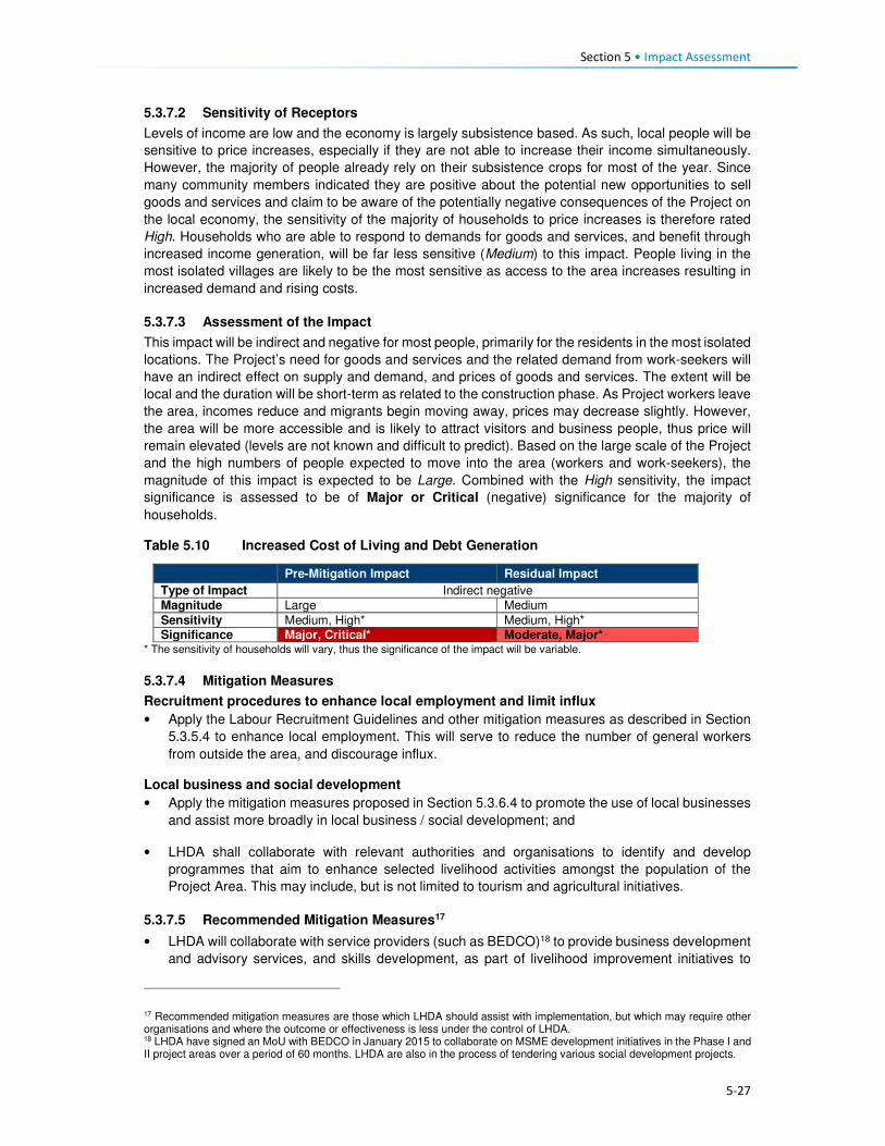
Section 5 • Impact Assessment
5-27
5.3.7.2 Sensitivity of Receptors
Levels of income are low and the economy is largely subsistence based. As such, local people will be
sensitive to price increases, especially if they are not able to increase their income simultaneously.
However, the majority of people already rely on their subsistence crops for most of the year. Since
many community members indicated they are positive about the potential new opportunities to sell
goods and services and claim to be aware of the potentially negative consequences of the Project on
the local economy, the sensitivity of the majority of households to price increases is therefore rated
High. Households who are able to respond to demands for goods and services, and benefit through
increased income generation, will be far less sensitive (Medium) to this impact. People living in the
most isolated villages are likely to be the most sensitive as access to the area increases resulting in
increased demand and rising costs.
5.3.7.3 Assessment of the Impact
This impact will be indirect and negative for most people, primarily for the residents in the most isolated
locations. The Project’s need for goods and services and the related demand from work-seekers will
have an indirect effect on supply and demand, and prices of goods and services. The extent will be
local and the duration will be short-term as related to the construction phase. As Project workers leave
the area, incomes reduce and migrants begin moving away, prices may decrease slightly. However,
the area will be more accessible and is likely to attract visitors and business people, thus price will
remain elevated (levels are not known and difficult to predict). Based on the large scale of the Project
and the high numbers of people expected to move into the area (workers and work-seekers), the
magnitude of this impact is expected to be Large. Combined with the High sensitivity, the impact
significance is assessed to be of Major or Critical (negative) significance for the majority of
households.
Table 5.10 Increased Cost of Living and Debt Generation
Pre-Mitigation Impact Residual Impact
Type of Impact Indirect negative
Magnitude Large Medium
Sensitivity Medium, High* Medium, High* Significance Major, Critical* Moderate, Major*
* The sensitivity of households will vary, thus the significance of the impact will be variable.
5.3.7.4 Mitigation Measures
Recruitment procedures to enhance local employment and limit influx
• Apply the Labour Recruitment Guidelines and other mitigation measures as described in Section
5.3.5.4 to enhance local employment. This will serve to reduce the number of general workers
from outside the area, and discourage influx.
Local business and social development
• Apply the mitigation measures proposed in Section 5.3.6.4 to promote the use of local businesses
and assist more broadly in local business / social development; and
• LHDA shall collaborate with relevant authorities and organisations to identify and develop
programmes that aim to enhance selected livelihood activities amongst the population of the
Project Area. This may include, but is not limited to tourism and agricultural initiatives.
5.3.7.5 Recommended Mitigation Measures17
• LHDA will collaborate with service providers (such as BEDCO)18 to provide business development
and advisory services, and skills development, as part of livelihood improvement initiatives to
17 Recommended mitigation measures are those which LHDA should assist with implementation, but which may require other organisations and where the outcome or effectiveness is less under the control of LHDA. 18 LHDA have signed an MoU with BEDCO in January 2015 to collaborate on MSME development initiatives in the Phase I and II project areas over a period of 60 months. LHDA are also in the process of tendering various social development projects.
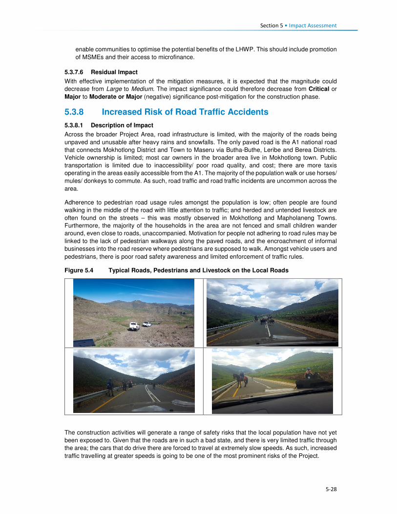
Section 5 • Impact Assessment
5-28
enable communities to optimise the potential benefits of the LHWP. This should include promotion
of MSMEs and their access to microfinance.
5.3.7.6 Residual Impact
With effective implementation of the mitigation measures, it is expected that the magnitude could
decrease from Large to Medium. The impact significance could therefore decrease from Critical or
Major to Moderate or Major (negative) significance post-mitigation for the construction phase.
5.3.8 Increased Risk of Road Traffic Accidents
5.3.8.1 Description of Impact
Across the broader Project Area, road infrastructure is limited, with the majority of the roads being
unpaved and unusable after heavy rains and snowfalls. The only paved road is the A1 national road
that connects Mokhotlong District and Town to Maseru via Butha-Buthe, Leribe and Berea Districts.
Vehicle ownership is limited; most car owners in the broader area live in Mokhotlong town. Public
transportation is limited due to inaccessibility/ poor road quality, and cost; there are more taxis
operating in the areas easily accessible from the A1. The majority of the population walk or use horses/
mules/ donkeys to commute. As such, road traffic and road traffic incidents are uncommon across the
area.
Adherence to pedestrian road usage rules amongst the population is low; often people are found
walking in the middle of the road with little attention to traffic; and herded and untended livestock are
often found on the streets – this was mostly observed in Mokhotlong and Mapholaneng Towns.
Furthermore, the majority of the households in the area are not fenced and small children wander
around, even close to roads, unaccompanied. Motivation for people not adhering to road rules may be
linked to the lack of pedestrian walkways along the paved roads, and the encroachment of informal
businesses into the road reserve where pedestrians are supposed to walk. Amongst vehicle users and
pedestrians, there is poor road safety awareness and limited enforcement of traffic rules.
Figure 5.4 Typical Roads, Pedestrians and Livestock on the Local Roads
The construction activities will generate a range of safety risks that the local population have not yet
been exposed to. Given that the roads are in such a bad state, and there is very limited traffic through
the area; the cars that do drive there are forced to travel at extremely slow speeds. As such, increased
traffic travelling at greater speeds is going to be one of the most prominent risks of the Project.

Section 5 • Impact Assessment
5-29
The commencement of the Project activities will be marked mainly by the construction and upgrading
of road infrastructure across the broader Project Area and subsequent introduction and increase in
road traffic associated with the commissioning of the site establishment areas. Following this, large-
scale construction activities will be undertaken during dam and tunnel construction. The increase in
road traffic movement will be attributed to the following factors:
• Transport of construction equipment and materials using large trucks;
• Transport of operational goods and personnel including trucks, light duty vehicles, buses and cars;
and
• Potentially increased movements associated with other road users making use of the upgraded
roads (e.g. small businesses, local commuters, influx of migrants, travellers).
The risks associated with increased road traffic movement, will arise from the poor safety awareness
of the population, and road improvements, which will allow drivers to increase their driving speeds.
The most significant of these risks will be injuries and/ or fatalities of drivers, pedestrians and
livestock in case of an accident. It is expected that approximately 250 vehicle trips will be undertaken
per day by Project associated vehicles during the advance works stage. The majority of these trips
will be limited to normal working hours, i.e. 07:00 – 18:00.
5.3.8.2 Sensitivity of Receptors
Initially, the sensitivity of the local population and animals to the increase/ introduction to road traffic
is expected to be High as they will not be used to high volumes of road traffic and the associated
risks. The most vulnerable to the impact will be children, due to their curious nature, as well as
livestock.
5.3.8.3 Assessment of Impact
The impact will be negative, direct (as related to Project vehicles) and indirect (as related to other
vehicles/ road users) in nature. The impact will be localised as it will be experienced by people living
within the wider Project Area. As it relates to the construction phase, the impact will be short-term.
The magnitude of the impact is expected to be Medium for most receptors. The impact is very likely
to occur, specifically in the early phases of the Project activities; it is rated as Major (negative)
significance.
Table 5.11 Increased Risks of Road Traffic Accidents
Pre-Mitigation Impact Residual Impact
Type of Impact Direct and indirect, negative
Magnitude Medium Small Sensitivity High High
Significance Major Moderate
5.3.8.4 Mitigation Measures
• All contractors and Sub-contractors will adhere to the provisions, principles and guidelines set in
the LHDA Safety Health Environment and Quality Management (SHEQ) Framework for the Phase
II Project;
• The appointed contractors will develop and implement a Traffic Management Plan for staff and
vehicles. This will focus on the movement of people to and from the site, site access control,
movement of material and equipment and road traffic control on and off site. The plan will also put
in place measures and controls to prevent to ensure pedestrian safety, or interrupt safe working
conditions of other employees;
• Appointed contractors will manage road traffic, erect road signage, and install traffic calming
measures. LHDA’s role is one of oversight; and
• Appointed contractors shall ensure the implementation of an inspection (pre-use/daily/
weekly/monthly) and maintenance programme to ensure all mechanical and electrical equipment
and fleet vehicles (their own and the contractors’) used on the project are maintained and kept in
safe, efficient working order and good repairs.

Section 5 • Impact Assessment
5-30
Driving Policies
• LHDA will develop and implement a Traffic Management Policy including vehicle safety, driver
and passenger behaviour, use of drugs and alcohol, hours of operation, rest periods and accident
reporting and investigations; and
• Appointed contractors will develop and implement a Driver Code of Conduct. The Code will
include:
• Performing mandatory vehicle safety checks;
• Strict enforcement of drug and alcohol policies; and
• Regular and random testing of drivers.
Collaboration
• In collaboration with the District Department of Roads, LHDA is to erect road signage and traffic
calming measures in areas of high foot traffic. In addition, all newly constructed and upgraded
roads must have adequate pedestrian paths and guard rails installed to prevent pedestrians and
livestock from wandering onto the road;
• In collaboration with the Ministry of Education, LHDA shall develop, implement and produce the
required materials to be used for road traffic safety awareness campaigns;
• All awareness raising activities for children shall be undertaken in schools by LHDA being assisted
by school teachers; and
• Community level awareness campaigns shall be led by LHDA representatives from Tlokoeng and
Katse FOBs in consultation with principal and area chiefs regarding the venue and suitable times.
Emergency Prevention, Preparedness and Response Plans (EPPRP)
• LHDA will develop and implement an EPPRP to address all non-routine events including road
traffic accidents resulting in injury or death of a person or livestock; and
• The LHDA Project SHEQ Manager shall ensure coordination between, and arrangements with,
Consultants, emergency services on site (where applicable), emergency services from nearby
local/district clinics and/or the District Environmental Office, and mutual aid partners (i.e. other
industries nearby who might have response capability) to provide for an effective interface
between Consultant and contractor personnel with emergency agencies.
Incident Reporting
• All incidents, nonconformities and hazards/risks identified will be reported and analysed. Any
person on the project site identifying a near-miss, nonconformity or risk must immediately report
the observation to their immediate Supervisor or Line Manager – who must complete an LHDA
Incident Flash Report;
• The appointed contractors shall ensure that procedures and systems are in place for reporting,
investigation, corrective action, closure and communication of all incidents. When an incident
occurs, the extent of the incident must be determined and relevant internal and external parties
be notified. The appointed contractor(s) shall ensure:
• All employees are aware of incident response actions and site incident notification
requirements;
• Reporting the incident to the relevant LHDA Representative – and authorities (if applicable);
• Completion and distribution within 24 hours of LHDA’s ‘Incident Flash Report’;
• Recording of full incident details in an LHDA ‘Incident Report’ and distribution within 72 hours;
• An incident investigation – employing a structured root cause analysis technique – is
conducted within 14 calendar days after the incident occurred to determine root causes of the
incident; and
• Corrective actions are planned, approved, implemented and tracked to closure within 30
calendar days after the conclusion of the incident investigation.

Section 5 • Impact Assessment
5-31
Compensation Plan
• All injuries and fatalities associated with road traffic incidences will be investigated by the police
services; and
• All compensation related to road traffic incidences will be undertaken in accordance to the
provisions of the Motor Vehicle Insurance Order No 26 of 1998.
Grievance Procedures
• LHDA is to implement a Grievance Resolution Procedure that is easily accessible, culturally
appropriate and scaled to the potential risks and impacts of the Project. It must be accessible to
all local residents, employees, and other stakeholders (as per Section 5.3.5.4).
5.3.8.5 Residual Impact
The implementation of mitigation measures is expected to reduce the magnitude of the impact to Small
and therefore the impact significance rating to Moderate (negative) significance.
5.3.9 Increased Safety Risks to People and Animals
5.3.9.1 Description of Impact
In addition to the traffic risks (as described in Section 5.3.8), the construction activities will generate a
range of safety risks that the population of the Project Area has not been exposed to, to date. Potential
safety risks may occur at the construction sites (e.g. excavated areas / trenches, exposed cables and
pipes, equipment and materials storage areas), quarry and borrow pit sites, and inundation areas/
exposed water body.
Exposed construction sites will pose a number of risks. Excavation for trenches or borrow pits will
result in relatively deep, steep-sided holes that people (and livestock) could fall into. Construction
equipment and materials (possibly including cables and pipes) will lie in the construction and storage
areas and many residents (notably children) will be inquisitive and may want to investigate these sites
and the materials. A lack of lighting at night will result in these sites being hazardous during dark, and
may result in people and animals falling into open trenches or pits.
Blasting at sites could result in flyrock during the blasting activities; residents are concerned that they,
or their belongings, could get injured/ damaged.
Given many of the above-mentioned risks and the nature of the Project, security personnel are likely
to be appointed to perform a range of security functions across the Project Area throughout the
construction phase. This, in itself, poses an additional potential risk; untrained or poorly trained
security personnel could exert unnecessary force, take advantage of their relative position of power,
or misuse a weapon; such actions could result in physical harm or be construed as intimidation. Such
force would infringe on the local community’s basic human rights regarding safety and security.
5.3.9.2 Sensitivity of Receptors
Initially, the sensitivity of the local population and animals to the construction safety risks will be
Medium given that they will not be used to the risks that will arise during construction. Children, in
particular, are going to be the most sensitive given that they are likely to want to investigate and
explore the construction sites, equipment and materials.
5.3.9.3 Assessment of the Impact
This negative and direct impact will be experienced at the local level for the duration of the construction
phase (short-term). The magnitude is Small given the relatively short duration and local extent of the
impact. It is likely that this impact will occur and it is rated as Minor (negative) significance.

Section 5 • Impact Assessment
5-32
Table 5.12 Increased Safety Risks
Pre-Mitigation Impact Residual Impact
Type of Impact Direct negative
Magnitude Small Negligible
Sensitivity Medium Medium Significance Minor Negligible
5.3.9.4 Mitigation Measures
• All active construction areas which pose a safety risk (such as trenches and pits, including the
quarry sites) are to be adequately fenced off or protected and managed to ensure that people and
animals cannot access the sites intentionally or unintentionally;
• Following completion of construction, measures to ensure human safety at quarry sites must be
identified and implemented (as fencing is highly likely to be removed);
• Provision should be made for safe pedestrian access where construction activities block normal
pedestrian routes;
• Implement all necessary precautions to prevent the risk of flyrock during blasting as per the
blasting protocols in the EMP and Section 5.3.10.4;
• Communication and training about safety during the construction phase should be addressed on
a regular basis with relevant local Project stakeholders (e.g. school children, residents of villages
closest to the road). Communication on safety awareness should take place at all public meetings
(pitsos) and other public events. LHDA will ensure that the contractor’s appointed CLOs receive
training regarding all the risks and associated protocols;
• LHDA (or their designated consultants) will develop and roll out an education and awareness
campaign in the local schools to ensure that the children are aware of the risks (align with traffic
safety training);
• Contractors will erect suitable signage to indicate danger;
• Security and traffic personnel should be employed to actively manage high risk areas;
• All workplace health and safety concerns are to be identified and suitably mitigated by contractors
to ensure the safety of the workers and local communities;
• Contractors are to put suitable measures in place to control the use of illegal substances on the
Project site to maintain acceptable levels of health and safety; and
• The appointed Security contractors for the Project are to be adequately trained in the use of force
and respect for human rights; the Voluntary Principles on Security and Human Rights should be
used as a base guide for all security personnel, and proof of suitable training and skills must be
provided by the successful tenderer.
5.3.9.5 Residual Impact
With implementation of the specified mitigation measures, it is expected that the magnitude of the
impact could reduce to Negligible; therefore, the impact significance rating would also reduce to
Negligible significance.
5.3.10 Disturbance from Increased Nuisance Factors (Noise, Dust, Vibration)
5.3.10.1 Description of Impact
Given the isolated location and relative inaccessibility of the Project Area, it has retained a rural
character that is free from development, traffic, loud machinery/ equipment, in-migration and all
associated disturbances. Current livelihood activities are undertaken using human and domestic
animal labour, there are limited vehicles that travel at slow speeds on the unpaved road network;
most people commute by foot to school, work and to town. There are higher levels of traffic on the
paved A1 route between Oxbow and Mokhotlong. The Project Area is quiet and peaceful. The air
quality in the area is generally good with the main pollutants arising from localised (village-level)
combustion of solid fuels (shrubs and cow dung) for cooking and heating, and burning of crop
residue and household waste, as well as a low level of dust generated from traffic on unpaved roads

Section 5 • Impact Assessment
5-33
and vehicle emissions. Wind blown dust and some smoke from burning grassland occurs in the drier
months.
Construction activities will generate uncharacteristic disturbances resulting in a range of nuisance
factors (notably increased levels of noise and decreased air quality). Air, noise and vibration
disturbances will occur on commencement of Project advance works with site clearing, blasting in
places, access road construction, establishment of camp/ laydown/ assembly areas, the placement
of fill, and stockpiling of soil and rock. These nuisance factors will continue to varying levels and
across the Project Area for the duration of the construction phase (estimated at 5 years). The
advance works will predominantly affect Masakong and Ha Tlhakola villages due to their proximity to
the site establishment areas. Construction of the dam and transfer tunnel, and ongoing activities at
the camps, works areas, quarries etc., will create disturbances that will largely affect Masakong, Ha
Tlhakola, Polihali, Ha Ramonakalali and Tloha-re-Bue villages due to their proximity to these
activities. Disturbances related to traffic noise and dust generation will affect villages located along
the transport routes, notably along the A1, PNEAR and PWAR19. The extent of these disturbances is
anticipated to vary substantially on a daily basis depending on the type and schedule of activities,
and the prevailing weather.
The number of construction contractors and staffing for each contract is not yet known. During the
advance infrastructure programme, they will be working regular working hours; however, for the dam
and tunnel construction, they will work on a 24-hour schedule for seven days a week. The potential
activities that will generate the disturbances in the Project Area are:
• Travel and operation of construction vehicles and heavy machinery of different types (mainly
diesel powered);
• Use of mobile diesel generators;
• The presence of construction workers and work-seekers;
• Blasting at the quarry sites and at various locations, as required; and
• Bulldozing and exposure of disturbed bare ground and soil / rock dumps.
Construction vehicles (including transport of large volumes of rock / aggregate from quarries and
crushing plants), and machinery will be used on an almost ongoing basis throughout construction
and will be the sources of most noise and dust disturbance (along with intermittent blasting). Diesel
powered generators will be used during advance works until high voltage electricity is supplied via a
new 132kV powerline. During night time construction works, the noise levels will be most significant
given the very low prevailing ambient noise levels at night. These sounds will disturb sleep patterns
and could result in a lack of productivity and focus during day time tasks, and general irritation of
local residents.
It is expected that construction workers will either be housed in the designated, access-controlled
construction camps, or they will be employed from the local villages and therefore reside in their own
homes. During work hours, the presence of the workers can result in elevated noise levels linked to
actual work activities, as well as loud conversations between the workers. Waste will be generated
and could potentially be discarded in the village areas or along access routes.
Blasting will be required at the quarry sites and at various locations where hard ground needs
levelling or rock needs to be removed. Blasting will result in intermittent loud noise and dust
generation. In addition, it is likely that there may be flyrock associated with each blast, depending on
the manner in which blasting is managed. Arable land is scarce and crop yields are already relatively
low and therefore further reduction in yield due to inability to plow fields due to rocks is not desirable
and would require redress.
19 Traffic-related impacts along the PWAR are assessed under the PWAC ESIA (ERM, 2017), while construction of the PNEAR is covered under a separate EMP. Increased traffic on the A1 (as well as NAR (A8) have not been assessed and a separate traffic assessment is recommended (see Section 11).

Section 5 • Impact Assessment
5-34
Dust will largely be generated by the clearance of topsoil and exposure of loose sand or soil as the
construction crew clear the footprint for the Project infrastructure and begin blasting and removing
rock from the construction footprint and quarry sites. The exposed soil will be blown across the area
during dry periods and as a result of the passage of construction vehicles back and forth, especially
during the dry winter periods between May and October. Increased levels of dust can be a nuisance
in that it could dirty houses and the clean washing hung out to dry; it may aggravate those with
existing respiratory conditions; and it could impact crops and the quality of wool / mohair.
Physically, these nuisance factors will lead to noise, dust and potentially (for some people) an
unwanted visual change in the landscape character. Some people may experience emotional and
psychological distress as a result of the ongoing disturbances; this is most likely to be the case near
schools and healthcare facilities where learning and healing could be affected, and in the closest
villages. The majority of the construction-related disturbances will occur at a local level and will affect
households, infrastructure, villages and road users in the immediate vicinity of the Project working
area footprint. Nuisance factors may also be exacerbated by indirect in-migration of work-seekers
into the Project Area; they will place additional pressure on the already strained social infrastructure
and services (e.g. housing, sanitation, water, healthcare, schooling, policing) in the surrounding
villages.
5.3.10.2 Sensitivity of Receptors
Local residents are accustomed to living in an environment free from the disturbances that can be
expected from construction-related nuisance factors. As such, all residents will be affected; however,
it is expected that most will adapt to/ accept the disturbances, which are short-term in nature.
Masakong, Ha Tlhakola, Polihali, Ha Ramonakalali and Tloha-re-Bue villages are located closest to
the Project footprint, while numerous other villages are located along the main transport routes.
These villages will be the most impacted given their proximity to the construction sites. Masakong
and Ha Tlhakola villages are going to be directly affected by the advance works, the dam and tunnel
construction, as well as by activities resulting from other Project components (beyond the scope of
this Contract).
Besides the most directly affected villages, other receptors that may be more sensitive than others to
these nuisance factors include:
• Residents located near to the construction sites where work is undertaken at night; noise levels
are elevated at night;
• Students at nearby schools who are likely to find it difficult to concentrate on their classes when
noise levels are elevated. In addition, the activities are going to be new and exciting and will
captivate the attention of many students, thus distracting them and diverting their attention away
from their lessons;
• Patients at healthcare facilities may find it difficult to rest and heal;
• People with respiratory conditions could experience an exacerbation of the condition as a result
of increased levels of dust in their environment;
• People who have livelihood activities located closest to the directly affected footprint (e.g. crops,
grazing) may incur damages to their produce resulting from the flyrock and dust; and
• Sites of religious/ traditional and cultural significance could be disturbed.
How each individual experiences these disturbance factors is highly subjective; for instance, some
will welcome the sounds as an indication of development and anticipation of a better life; while
others will place higher value on the silence associated with a rural environment. The sensitivity of
the majority of receptors is likely to be Medium; sensitivity is rated as High for the most sensitive
receptors.
5.3.10.3 Assessment of Impacts
The disturbances arising as a result of the construction phase nuisance factors will be negative and
direct in nature (as related to Project activities). Some indirect impacts could be experienced as a
result of the presence of work-seekers/ new-comers to the area resulting in pressure on social
Section 5 • Impact Assessment
5-35
infrastructure and services. The impact will be experienced locally, largely at a site level (around the
Project footprint and along transport routes). The direct construction-related disturbances are highly
likely to occur and will persist for the duration of the construction phase (short-term); Masakong and
Ha Tlhakola will be most affected given their close proximity to all activities. The magnitude of this
impact is anticipated to be Medium. For the most sensitive receptors, the impact is assessed as
Major significance (negative), while for the majority it is considered to be of Moderate (negative)
significance.
Table 5.13 Disturbance from Increased Nuisance Factors
Highly sensitive receptors (Schools, health care, close villages)
Less sensitive receptors (Residents further from construction)
Pre-Mitigation Impact
Residual Impact Pre-Mitigation Impact
Residual Impact
Type of Impact
Direct negative Direct negative
Magnitude Medium Small Medium Small
Sensitivity High High Medium Medium
Significance Major Moderate Moderate Minor
5.3.10.4 Mitigation Measures
Recruitment procedures to limit influx
• Apply the LHDA Recruitment Guidelines and the mitigation measures described in Section 5.3.5
to enhance local employment. This will serve to reduce the number of general workers from
outside the area, and discourage influx.
Workforce management
• All construction staff will agree to a Code of Conduct (CoC) that outlines protocols and standards
for working in the Project Area as part of their contract. The CoC should address the following:
• Respect for local residents, including being considerate about noise levels, privacy, and local
customs;
• Respect for existing livelihood activities and the environment;
• Respect for community water supplies (to prevent pollution and overuse);
• No hunting, snaring or unauthorised taking of any property belonging to someone else,
including removal of natural resources;
• Zero tolerance of illegal activities by construction personnel including: illegal sale or purchase
of alcohol; sale, purchase or consumption of drugs; illegal gambling or fighting;
• Compliance with the Traffic Management Plan (to be developed by the contractors in
accordance with the Traffic and Transportation Policy to be developed by LHDA) and all
associated regulations, including compliance with drug and alcohol policies and random
testing; and
• Disciplinary measures for not adhering to the CoC. Notably, stock theft and similar crimes
conducted by contractor staff shall be managed as dismissible offences.
• Workers found to be in contravention of the CoC will face disciplinary procedures that could result
in dismissal. Theft or purposeful damage to property should be dismissible offences.
Ongoing engagement and grievance management
• LHDA will present the schedule and approach to construction to the district authorities and
community leadership structures to enable their understanding of the Project roll out;
• LHDA will regularly review and update the Community Participation Strategy; this strategy is to be
agreed upon by local community structures through the appointed ALCs;
• The contractor shall appoint appropriately trained and experienced staff to implement stakeholder
engagement during the course of work and shall assign adequate resources; and

Section 5 • Impact Assessment
5-36
• Apply all mitigation measures as described in Section 5.3.5 regarding a grievance resolution
procedure.
Engineering and Operational Practices
• Implement all measures described in the Construction EMP (Volume 2, Annexure L.1).
• All diesel-powered construction, earth moving, and equipment must be kept at a high level of
maintenance. This must include the regular inspection and, if necessary, replacement of intake
and exhaust silencers. Any change in the noise emission characteristics of equipment must serve
as trigger for withdrawing it for maintenance.
• All appointed contractors to include noise management provisions as part of onsite work
inductions.
• Conduct quarterly (as a minimum) noise surveys for the duration of the Project’s advance
infrastructure and construction activities to adjust mitigation measures to address the levels of
noise accordingly.
• All appointed contractors shall adhere to the provisions of Section 8.11 of the SHEQ Framework
(ERM, 2017; Volume 2, Annexure L.1) (maintenance of equipment, machinery, tools and
vehicles).
Generic construction phase management measures
• Traffic Management
• Implement all measures described in the Construction EMP (Volume 2, Annexure L.1);
• LHDA will develop a Traffic Management Policy including vehicle safety, driver and passenger
behaviour, speed limits, use of drugs and alcohol, hours of operation, rest periods and
accident reporting and investigation requirements;
• contractors will compile a traffic management plan / method statement relevant to their
activities, which shall include a protocol for handling accidents involving other vehicles,
pedestrians, animals or property;
• LHDA will undertake traffic safety awareness sessions at schools and in communities along
the PWAC during construction and early operation (until completion of dam construction). This
should be done in collaboration with the Roads Directorate and Ministry of Education, as
appropriate;
• Safe crossings are to be provided for pedestrian and animals during construction, and they
are to be given right of way;
• The appointed contractor/s will have the necessary insurance / contingency budget in place
for costs incurred with accidents involving other vehicles, people, animals, agricultural land,
or infrastructure; and
• The contractor will be required to compensate any affected community member for injured
animals in terms of agreed protocols.
• Dust suppression and emissions management
• Site clearance is to be minimised as far as possible to reduce the potential for dust, and other
impacts;
• Dust suppression measures are to be implemented as specified in the EMP, which shall
include wetting of roads during windy conditions and covering of soil mounds;
• Install an onsite weather station to monitor general weather conditions. When wind speeds
above 25 km/hr are expected, this should trigger implementation of measures to minimise
dust emissions;
• Ensure an adequate water supply on site for effective dust/particulate matter suppression,
using non-potable water where possible;
• Ensure equipment is readily available on site to clean any dry spillages;
• Ensure fine-powdered materials are delivered in enclosed tankers and stored in areas suitable
for emission control systems to prevent escape of material and overfilling during delivery;
• For smaller supplies of fine-powder materials, ensure bags are sealed after use and stored in
contained buildings to prevent dust;
• Use water-assisted dust sweeper(s) on the access and local roads, to remove, as necessary,
any material tracked out of the site;

Section 5 • Impact Assessment
5-37
• Ensure vehicles carrying materials or spoil entering and leaving sites are covered to prevent
escape of materials during transport;
• Where reasonable and feasible, haul roads will be maintained with water carts and graders,
and the condition of the roads will be monitored especially in high risk areas and/or during
high risk periods;
• Contractors must ensure all construction vehicles comply with their relevant emission
standards. Furthermore, contractors must provide confirmation that all off road diesel
equipment would meet best available diesel emissions standards or be fitted with a diesel
exhaust treatment device where possible;
• Contractors must, where possible and available, use low-sulphur diesel in vehicles to minimise
harmful emissions; and
• Contractors must avoid, where practicable and possible, the use of diesel or petrol powered
generators, and use mains electricity or battery powered equipment
• Noise management
• Noise management measures are to be implemented as specified in the EMP;
• Workers are to be considerate regarding noise levels and associated disruption to local
people; this is to be outlined in their CoC; and
• Noisy activities (e.g. blasting) are not to be scheduled at critical times (e.g. school exams,
religious services/ celebrations), where located in close proximity. LHDA will consult local
leaders, school principals, healthcare workers and religious leaders regarding important
events or occasions that may be negatively affected by construction noise in order to try to
schedule these activities at different times.
• Blasting and vibration
• LHDA and its contractor(s) shall develop blast designs and procedures that will keep noise
and blasting to a minimum without compromising blast requirements. Blast plans are to be
compiled as method statements to be approved by the Resident Engineer;
• All blasting activities will be undertaken following a planned schedule and the local
communities informed of this in advance;
• Asset condition surveys should be undertaken by contractors prior to construction and in
accordance with LHDA’s Protocol for Asset Condition Survey, Damage Mitigation and
Remediation (2017). This process must be overseen by the relevant Engineers, who in turn
will be monitored by LHDA;
• All safety measures related to blasting are to be implemented as specified in the EMP; and
• LHDA and its contractor(s) shall ensure that no blasting activities occur at night.
• Waste management and water source management
• Waste management measures are to be implemented as specified in the EMP. This is to
include the use of portable toilets and rubbish bins (to avoid littering); and
• Water management measures shall include controls on use of community water supply points
by construction workers who may not be familiar with protocols of keeping supplies clean and
uncontaminated.
• Earthworks and Stockpiling
• Stockpiles shall be located away from sensitive receptors and, where necessary, covered with
anchored fabrics, or seeded with sterile grass;
• Re-vegetate earthworks and exposed areas/soil stockpiles to stabilise surfaces as soon as
practicable; and
• Where practical, only remove any cover for exposed areas in small areas during work and not
all at once.

Section 5 • Impact Assessment
5-38
5.3.10.5 Residual Impact
Post-mitigation, it is expected that the magnitude of the disturbance resulting from increased
nuisance factors resulting from construction activities could be reduced to Small, resulting in a
decreased impact significance of Minor-Moderate (negative) significance.
5.3.11 Exacerbation of Anti-Social Behaviour
5.3.11.1 Description of Impact
Currently, the Project Area does not experience much outsider in-migration given its physical
isolation, lack of economic opportunities, and the limited social infrastructure and services. On the
contrary, many people, specifically young men and women, leave their villages in search of better
opportunities in the larger towns or further afield into the lowlands of Lesotho, and to South Africa.
Most of the population comprises local Basotho people who have lived in the area for many years.
STIs and HIV are reported to be two of the most common health concerns amongst adults; the
stigma around these diseases is still negative and many men refuse to attend the clinics for testing
or treatment (see Section 5.3.12 for separate assessment of increased prevalence of STIs and
HIV20). The most commonly reported crime is stock theft, which is cited to be common throughout
the area.
Construction of Katse Dam under LHWP Phase I resulted in a significant amount of influx of workers
and work-seekers. People moved to the Phase I areas in the hope that there would be generally
improved levels of social infrastructure and services, and a more diverse economy providing a
broader range of economic opportunities. This influx resulted in a significant increase in anti-social
behaviour as can be expected in such situations.
High levels of migrants into areas that are relatively homogenous and stable, such as the Project
Area, often result in heightened levels of conflict and tension. Migrants will bring with them differing
cultures, religious beliefs, norms and values; they influence young people to change in a manner
that may not be accepted by the more conservative/ traditional sector of the population. Inevitable
disputes arise linked to jealousy over relationships between local people and ‘outsiders’. High levels
of crime, drug and alcohol abuse, increased incidence of sex workers, domestic violence,
establishment of informal settlements, high prevalence of STIs and HIV, and general tensions due to
increased competition are common in the local communities that host large-scale projects of this
nature. These impacts typically occur as a result of increased competition for jobs, limited access to
basic resources and services, increased income, and different cultural backgrounds/ beliefs. Some
of the anti-social behaviour likely to occur are described below.
• Increase in crime levels given that many of the migrants to the area will not have income or access
to land to generate a livelihood. Stock theft is the most likely crime given that there is not much
else of value to steal; livestock is extremely valuable and considered to be an indicator of wealth;
• An increase in disposable income within the Project Area (among workers) could result in an
increase in alcohol and drug abuse, increased incidences of prostitution and casual sexual
relations. These activities could lead to an increased incidence of STIs and HIV, and increased
numbers of teenage and unwanted pregnancies. The increased prevalence of diseases would
affect contractors, employees, local residents and the families/ sexual partners of anyone
becoming infected in the Project Area;
• Young girls are likely to enter into relationships with migrant workers (and work-seekers) in the
hope that they will be able to leave the area and secure a ‘better’ lifestyle. However, they are likely
to end up dropping out of school with unwanted pregnancies, STIs and HIV. There is also a general
20 This impact is assessed separately in Section 5.3.12 given the already high prevalence rate and the high likelihood of the impact occurring.

Section 5 • Impact Assessment
5-39
concern that levels of STIs and HIV will become more prevalent, specifically because the existing
rates are generally high and many people still refuse testing and treatment;
• General unrest may arise as a result of increased pressure for resources, resentment towards
those who secure employment and procurement opportunities as well as benefits from other
Projects (specifically if the beneficiaries are from outside the area);
5.3.11.2 Sensitivity of Receptors
The population of the Project Area is going to be susceptible to the inevitable increase in anti-social
behaviour as described above given the prevailing high levels of poverty and low levels of economic
opportunity, and is therefore assessed as having High sensitivity to this impact. Increased crime/
stock theft is likely. Many hopeful local people will enter into relationships with in-migrants in
anticipation of a better life with an employed partner. STIs and HIV levels are likely to escalate given
the current attitude and contraction rates, as will unwanted pregnancies. Conflict, drugs and alcohol
abuse, and ultimately changed norms and values can be expected.
5.3.11.3 Assessment of the Impact
This negative impact will arise as a direct result of construction workers, and indirectly via migrant
work-seekers to the area. The impact will be experienced at a local level; however, the impact
duration will be long-term as improved access and the attraction to the area will facilitate ongoing
migration in and out of the Project Area. This impact will affect the individuals and families that
engage in such activities, while crime could affect anyone. The magnitude of the impact is rated
Medium. Together with the High sensitivity of the receptors, the impact is assessed as Major pre-
mitigation.
Table 5.14 Increased Anti-Social Behaviours
Pre-Mitigation Impact Residual Impact
Type of Impact Direct and indirect negative
Magnitude Medium Small to Medium
Sensitivity High High
Significance Major Moderate-Major
5.3.11.4 Mitigation Measures
Recruitment procedures to limit influx
• Apply all mitigation measures as described in Section 5.3.5 (and as per LHDA Labour Recruitment
Guidelines) to enhance local employment. This will serve to reduce the number of general workers
from outside the area, and discourage influx.
Workforce management
• Apply all workforce-related mitigation measures as described in Section 5.3.10.4. Notably, stock
theft and similar crimes conducted by contractor staff shall be managed as dismissible offences;
• Apply all mitigation and management measures proposed by the relevant EMPs regarding
contractor Camp Management;
• Workers from outside the Project Area are to work on a rotational basis, allowing them time to
return home to visit their families and rest, with the cost of their return journey covered by the
contractor/s;
• Contractors will provide health care facilities for their staff, including local labour. They are to be
equipped with adequate medical staff and resources to handle common diseases (including STIs
and HIV) and work related injuries; and
• LHDA will appoint experienced professionals to develop and implement a PHAP, which is
expected to specify additional recommendations for improved health care provision for affected
stakeholders.
Section 5 • Impact Assessment
5-40
Ongoing engagement and grievance management
• LHDA to implement a grievance resolution procedure as described in Section 5.3.5; and
• As part of induction, the appointed contractor will develop a brochure containing basic socio-
cultural information, to be approved by LHDA, to be distributed to all new employees on the Project
Site.
5.3.11.5 Residual Impact
Implementation of the measures described above is predicted to result in a reduction of the magnitude
of the impact to Small-Medium and the impact significance to Moderate-Major (negative) significance.
The elevated magnitude and significance rating is due to the fact that this impact will largely arise as
a result of indirect factors that are beyond the control of LHDA to mitigate/ manage.
5.3.12 Increased Prevalence of Sexually Transmitted Infections (STIs) and HIV/AIDS
5.3.12.1 Description of Impact
Lesotho has one of the highest HIV/AIDS prevalence rates in Southern Africa at 23%. The prevalence
of HIV/AIDS in Mokhotlong District was estimated to be 17% in 2014, and 5% within the Project Area
(CES, 2015a)21. Migration trends in the Project Area indicate significant out-migration by locals who
migrate out of the area to search for employment opportunities and return home when they have not
secured jobs or upon the termination of employment contracts. The presence of in-migrants,
construction workers directly and indirectly employed by the Project is likely to contribute to the
transmission of HIV/ AIDs and other Sexually Transmitted Infections (STIs) in the area.
The direct and indirect Project activities likely to exacerbate the transmission of STIs and HIV/AIDS
are:
• Drivers, who typically have high rates of HIV or STIs, are likely to engage in casual high risk sexual
activity; thus spreading infections in the Project Area and beyond;
• In-migration of workers and work-seekers who are already infected may transmit the infections;
• A predominantly male workforce and migrant population (some with disposable income) may
engage in high risk sexual activities with commercial sex workers and local women;
• Local men in the community with increased disposable income may partake in transactional sex
or seek additional sexual partners; and
• Existing stigma and taboos around STIs and HIV/AIDS will make it challenging to negotiate safe
sex practices such as the use of condoms (including the use of female condoms).
A research study22 undertaken by the Medical Research Council of South Africa in 1995 prior to the
construction of Mohale Dam, found a high prevalence of STIs and HIV infection in a population
characterised by low levels of knowledge about STI and HIV, high risk sexual behaviour (e.g. low
condom use and multiple partners) and evidence of inappropriate health seeking behaviour for STIs.
The researchers at the time believed that this situation was going to be exacerbated during the
construction of the dam due to the then imminent influx of several thousand male workers, most of
whom would arrive without families. While increased levels of HIV/AIDS were reported in the
Highlands after dam construction it is unclear the extent to which it can be attributed directly to the
LHWP Phase I (Hitchcock, 2015).
Comparing the situation in Mohale to that of Mokhotlong, there is a significant difference in the findings
in terms of the knowledge levels of HIV/AIDS contraction, prevention and management. The LDS
(Bureau of Statistics, 2013) found that an average of 80% of the District population ages 14 to 49
years old demonstrated knowledge of HIV/ AIDS contraction, prevention and management. However,
21 The figure for the Project Area is likely to be highly inaccurate given access to testing facilities, recorded attitudes towards the disease, extent and nature of the study. 22The study was conducted across 89 villages involving 7500 people.
Section 5 • Impact Assessment
5-41
awareness and knowledge about the disease does not mean that people will refrain from engaging in
unsafe sexual behaviour.
Contraction of the disease will lead to poor health outcomes and in some cases inability to work.
Where a person had secured employment with the Project and can no longer work, the Project will
have to carry the costs of finding and training of replacement staff.
5.3.12.2 Sensitivity of Receptors
Statistics indicate that although Lesotho has high HIV/AIDS rates, the Mokhotlong District infection
rates are significantly lower. The Project surveys suggest that many of the people in the Project Area
are aware and informed about the disease and associated STIs despite there still being a stigma linked
to the disease and resistance to implementing precautions. However, rates may have remained
relatively low in the area due to limited in- and out-migration, but this is expected to change as a result
of the Project activities. As such, the sensitivity of the receptors is regarded as High.
5.3.12.3 Assessment of Impact
The increased spread of STIs, including HIV/AIDS will have a direct and indirect negative impact.
Initially the impact will be localised; however, upon completion of the construction phase of the Project,
migrant labour and work-seekers will return to their places of origin (or elsewhere) where they may
spread the disease further. Depending on the type of STI contracted, the impact duration will vary from
short-term to permanent. The impact magnitude is assessed as being Medium. Combined with a High
receptor sensitivity, the impact is rated as Major (negative) significance.
Table 5.15 Increased Prevalence of STIs including HIV/AIDS
Pre-Mitigation Impact Residual Impact
Type of Impact Direct and Indirect negative
Magnitude Medium Small
Sensitivity High High
Significance Major Moderate
5.3.12.4 Mitigation Measures
Collaboration with Local Health Care Services
• To reduce the possible spread of STIs and HIV/AIDS, LHDA should collaborate with local and
regional healthcare services in order to:
• Strengthen local educational programmes, focusing on the prevention of STIs and HIV/AIDS in
the Project Area and along the major transport routes; and
• Ensure that local health centres have sufficient capacity and resources to provide prevention
information/ measures, testing counselling and treatment for STIs and HIV/AIDS.
HIV Workplace Policy and Programme
• The appointed contractors will implement an HIV/AIDS programme as per specifications of the
SHEQ Framework to reduce the risk of the transfer of HIV between and among the contractor’s
employees, their families and the local communities. The programme will include voluntary
counselling and testing (VCT) of individuals, and HIV/AIDS awareness training and access to
ongoing support for affected individuals;
• The appointed contractors shall arrange for, provide a suitable venue, and instruct all employees
to attend the HIV awareness programme; ensuring that their employees and their subcontractor
employees are aware of this programme;
• The appointed contractors must:
• Conduct information, education and communication campaigns, at least every other month,
addressed to all the project site employees (including all Subcontractors’ personnel, and all
truck drivers and crew making deliveries to site for construction activities) and to the immediate
local communities, concerning the risks, dangers and impact, and appropriate avoidance

Section 5 • Impact Assessment
5-42
behaviour with respect to, sexually transmitted diseases or STIs in general and HIV/AIDS in
particular;
• Provide male/ female condoms for all employees, as appropriate, free of charge;
• Provide for voluntary STI and HIV/AIDS screening, diagnosis, counselling and referral to a
dedicated national STI and HIV/AIDS programme, (unless otherwise agreed) to all employees;
and
• Monitor outcomes, in collaboration with national HIV/AIDS authorities.
Employee Code of Conduct
• All appointed contractors shall implement the Employee Code of Conduct as per the provisions of
the Lesotho Labour Code.
5.3.12.5 Residual Impact
Implementation of the above measures may result in a reduction of the magnitude of the impact to
Small which reduces the impact significance from Major to Moderate. However, people who contract
HIV/AIDS will have it for life and will require long term anti-retroviral treatment, and for those affected
the impact, at an individual level will be Major. While LHDA and the contractors can do a lot, their
ability to control this impact is going to be limited by cultural norms and practices and individual free
will.
5.3.13 Increased Pressure on Social Infrastructure and Services
5.3.13.1 Description of Impact
The Project Area is generally poorly served with very few social infrastructure and services. Villages,
specifically Mokhotlong and Mapholaneng, are more developed given that they are relatively
accessible; however, the remainder of the area lacks clinics, water, sanitation, electricity, and waste
management and has only a few under-resourced primary schools. The Social Baseline (Section 4)
provides more details in this regard.
Influx of migrants into the area, including Project workers and work-seekers, will place additional
pressure on the already strained infrastructure and services. It is most likely that the majority of
migrants will be single men, as such, there would be less impact on the need for schooling; there will
be increased demand for land, housing, healthcare, water, sanitation and waste management.
Migrants are most likely to settle in the more established villages/ towns, close to the PLRDs, which
are proposed to be located at Mapholaneng or Tlokoeng (main office). It is proposed that the appointed
workers from outside the Project Area will be housed in the labour camps near the construction sites.
It is anticipated that it may be possible that employees from the local villages could reside at home
and be transported to the work areas but this will be determined by the needs of the contractors.
Given the high number of construction jobs and the low likelihood that local people will qualify for many
of the jobs, it is highly probable that there will be significant influx of workers alone. Besides Project
workers, the anticipation of employment, other income generation opportunities, and benefits linked
to improved local infrastructure and services, will result in significant influx to the area. This influx is
likely to commence during PWAR construction activities and escalate as the scale of construction
works expands.
In the current absence of sufficient social infrastructure and services, any additional pressure resulting
from influx cannot be accommodated or sustained over time. As migrant work-seekers and those
anticipating access to services realise that the socio-economic environment cannot sustain them and
that they are unlikely to qualify for jobs, some people may leave the area in search of opportunities
elsewhere. However, the majority of migrants will stay as they will remain hopeful that they will secure
income-earning opportunities.
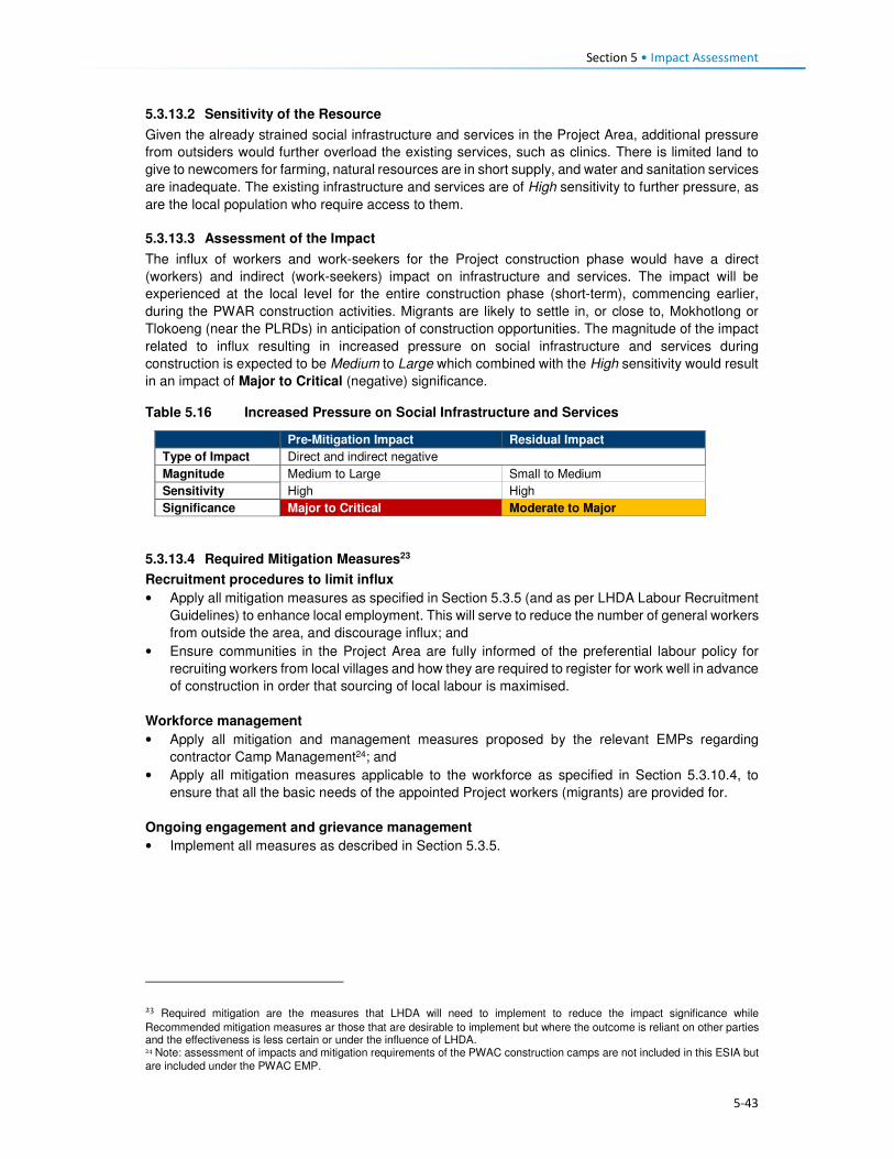
Section 5 • Impact Assessment
5-43
5.3.13.2 Sensitivity of the Resource
Given the already strained social infrastructure and services in the Project Area, additional pressure
from outsiders would further overload the existing services, such as clinics. There is limited land to
give to newcomers for farming, natural resources are in short supply, and water and sanitation services
are inadequate. The existing infrastructure and services are of High sensitivity to further pressure, as
are the local population who require access to them.
5.3.13.3 Assessment of the Impact
The influx of workers and work-seekers for the Project construction phase would have a direct
(workers) and indirect (work-seekers) impact on infrastructure and services. The impact will be
experienced at the local level for the entire construction phase (short-term), commencing earlier,
during the PWAR construction activities. Migrants are likely to settle in, or close to, Mokhotlong or
Tlokoeng (near the PLRDs) in anticipation of construction opportunities. The magnitude of the impact
related to influx resulting in increased pressure on social infrastructure and services during
construction is expected to be Medium to Large which combined with the High sensitivity would result
in an impact of Major to Critical (negative) significance.
Table 5.16 Increased Pressure on Social Infrastructure and Services
Pre-Mitigation Impact Residual Impact
Type of Impact Direct and indirect negative
Magnitude Medium to Large Small to Medium
Sensitivity High High
Significance Major to Critical Moderate to Major
5.3.13.4 Required Mitigation Measures23
Recruitment procedures to limit influx
• Apply all mitigation measures as specified in Section 5.3.5 (and as per LHDA Labour Recruitment
Guidelines) to enhance local employment. This will serve to reduce the number of general workers
from outside the area, and discourage influx; and
• Ensure communities in the Project Area are fully informed of the preferential labour policy for
recruiting workers from local villages and how they are required to register for work well in advance
of construction in order that sourcing of local labour is maximised.
Workforce management
• Apply all mitigation and management measures proposed by the relevant EMPs regarding
contractor Camp Management24; and
• Apply all mitigation measures applicable to the workforce as specified in Section 5.3.10.4, to
ensure that all the basic needs of the appointed Project workers (migrants) are provided for.
Ongoing engagement and grievance management
• Implement all measures as described in Section 5.3.5.
23 Required mitigation are the measures that LHDA will need to implement to reduce the impact significance while
Recommended mitigation measures ar those that are desirable to implement but where the outcome is reliant on other parties and the effectiveness is less certain or under the influence of LHDA. 24 Note: assessment of impacts and mitigation requirements of the PWAC construction camps are not included in this ESIA but
are included under the PWAC EMP.
Section 5 • Impact Assessment
5-44
5.3.13.5 Recommended Mitigation Measures
Social development
• LHDA will, in partnership with local authorities and relevant organisations (e.g. donors, civil society
and NGOs), where available and appropriate, assist in planning for anticipated increased
demands on public infrastructure and services in communities that are significantly affected by in-
migration due to Project activities; and
• Develop and implement a SDMP, as described in the LHWP Phase II LR&SDF, as a means of
delivering socio-economic development benefits to villages located in the Project Area that will be
affected as a result of the Project.
5.3.13.6 Residual Impact
Implementation of the above mitigation measures is expected to reduce the magnitude of this impact
to Small or Medium (specifically as related to Project workers), and therefore, the residual significance
could reduce to one of Moderate to Major (negative) significance.
5.3.14 Disruption to Family and Community Structures
5.3.14.1 Description of Impact
Education levels within the Project Area are low, and skills are largely linked to agriculture and those
needed to construct and maintain local infrastructure (e.g. residential dwellings, agricultural structures,
and community infrastructure). It was reported that many people do not see the value of education
given that local economic and livelihood activities do not require high levels of education; it is
uncommon for people to attain high levels of education and enter into careers that generate wealth.
Pressure to ensure immediate survival (as opposed to medium-long-term planning regarding career
development and income generation options) drives decisions around education and work; thus the
school drop-out rate is high. People leave school to support with daily household tasks and to generate
income and produce food.
Young women and girls typically assist with tasks around the home and young men and boys usually
undertake agricultural work (e.g. as herders) with aspirations of accruing livestock of their own.
Farming expertise is passed through generations, where parents teach their children cropping and
livestock raising skills. Agricultural work is hard and does not generate much cash income; in fact, it
is poorly paid at best and often unpaid; produce is largely used for home consumption or for bartering.
Work in the home is unpaid. Young adults, and in some instances children, leave their villages in
search of paid employment as income generation opportunities locally are extremely limited.
Employment opportunities (albeit relatively limited in duration) offered by the Project contractors will
provide income that is likely to be far beyond what is generated by agricultural work, and those who
are employed will learn new skills that may enable them to secure construction work in the future.
There are also high expectations that the employment opportunities will lead to an improved standard
of living. Some people fear that young men and women will reject their existing farming and household
responsibilities in favour of paid employment in the construction sector. This may cause a shortage of
available farming skills and family support networks during the construction phase, and beyond.
Others, however, indicated that those who do get construction jobs will be able to pay others to harvest
their crops, manage livestock or assist with household tasks. For the people who get construction work
it is probable that they would aim to secure further work in the construction sector with their newly
acquired skills and experience, leading to a longer term disruption to social and economic networks.
Community members and school staff fear that the possibility of securing gainful employment will lead
to a further increase in the school drop-out rate, or that parents who get jobs may force children to
drop out of school to fulfil household obligations in the parent’s absence.
Due to necessity, it is expected that most people will be required to return to their farming and
household responsibilities after construction is completed, if they are unable to secure further paid
employment elsewhere.

Section 5 • Impact Assessment
5-45
Over time, more and more people, especially the youth and younger men in particular who get
construction jobs, may not wish to farm as their parents and forefathers have done, and availability of
agricultural skills may diminish. However, for now, agriculture is critical and families must continue
their farming activities in order to survive. With increased access to markets and transport, farming
may become more lucrative in the future. It will remain a primary livelihood activity out of necessity for
a relatively long time.
5.3.14.2 Sensitivity of Receptors
Given the size and capabilities of the population, there are likely to be many people who do not secure
construction phase employment and who will be in a position to support households with home-based
and agricultural tasks in the absence of those who pursue Project employment opportunities. Hiring of
local labour will take people away from their existing tasks, result in an increased rate of school drop-
outs, and potentially generate greater dissatisfaction with the existing lifestyle, sensitivity is considered
to be Medium.
5.3.14.3 Assessment of the Impact
As per the Labour Recruitment Guidelines, the Project will offer limited-term unskilled contracts for the
duration of the construction phase (short-term). While the number of employment opportunities and
job requirements are not yet known, it is expected that these opportunities will be relatively small in
comparison to the size of the eligible population; despite the fair number of employment opportunities
that are likely to be available. Following construction, it is conceivable that while some people will
attempt to secure further paid employment outside the agricultural sector, most are likely to be forced
to return to existing livelihood activities and household responsibilities. This indirect impact will be
experienced at the local level and many people will benefit. Given the short-term nature of the impact,
the magnitude is considered to be Medium to Small. It is unlikely that the Project would result in a
permanent loss of household support or farming expertise. The impact significance is rated as
Moderate to Minor (negative) significance.
Table 5.17 Disruption to Family and Community Structures
Pre-Mitigation Impact Residual Impact
Type of Impact Indirect negative
Magnitude Medium-Small Small
Sensitivity Medium Medium
Significance Moderate-Minor Minor
5.3.14.4 Required Mitigation Measures
• Implement the Labour Recruitment Guidelines and allocate maximum number of unskilled and
semi-skilled jobs to local residents, and additional mitigation measures as described in Section
5.3.5 to ensure that recruitment is fair and representative of people from all Project-affected
villages;
• To avoid further school drop-outs measures are to be defined together with relevant authorities,
leaders and PLRD to define criteria that prevent youth from leaving school in favour of short-term
employment. These may include:
• Minimum education qualifications for people below the age of 20;
• Letter from school or community leader stating that applicant did not drop-out of school
specifically as a result of the Project; or
• Employment of people from as many households as possible to distribute income across
households.
• Share types of job opportunities, including capacity and qualification requirements long in advance
of recruitment to provide people with motivation to complete schooling to the required level, thus
discouraging school drop-outs; and
• Implement a skills development and capacity building programme well in advance of recruitment
to ensure that a suitable number of people attain the necessary skills.

Section 5 • Impact Assessment
5-46
5.3.14.5 Recommended Mitigation Measures
• LHDA will collaborate with relevant authorities and organisations to develop programmes that aim
to enhance agricultural production amongst the population of the Project Area. These should
address the application of more effective farming methods, approaches to increase crop yields,
and mechanisms to assist farmers in selling their produce at the highest possible prices.
5.3.14.6 Residual Impact
It is expected that through the implementation of the above measures, the magnitude of this impact
would reduce to Small and the significance rating could be reduced to one of Minor (negative)
significance post-mitigation.
5.4 Operation Phase 5.4.1 Increased Government Revenue
5.4.1.1 Description of Impact
The economy of Lesotho is un-diverse and relies heavily on a narrow economic base of textile
manufacturing, agriculture, remittances, and regional customs revenue. The majority of the population
live in rural areas and rely on subsistence-based agriculture. The country relies heavily on South Africa
for employment opportunities and the majority of imports, specifically food; the climatic conditions
place an additional strain on the area.
The Government of Lesotho (GoL) derives revenue from the sale of its water to South Africa,
amounting to M8.9 billion (as of November 2017), or averaging M750 million/year – equivalent to ~10%
of the Government’s revenue and ~7% of the GDP (combined percentage contribution of the water
and sanitation sector) (African Economic Outlook, 2016). The revenue received by the GoL is
expected to increase at the start of operations due to the increased amount of water available and
sold to South Africa. Allocation of the revenues to meet Lesotho’s needs is solely based on
Government spending priorities driven by the GoL’s policies, development plans and programmes. As
such, future expenditure in the Project Area is at the discretion of the authorities. However, critics of
LHWP Phase I perceive that an insufficient portion of these revenues are spent locally on assisting
Project-affected communities.
The revenue and taxes paid to Government contributes to funding public infrastructure and services
or for the payment of the country’s debt. The impact of Project revenue cannot be accurately quantified
at this stage as the allocation of increased Government revenue to development locally or nationally
or into other purposes is unknown. It is likely that the revenue received by Government could be used
for socio-economic development but not specifically in the Project Area.
While there were no major concerns voiced about political corruption by stakeholders, research
suggests that corruption remains a concern in Lesotho. Lesotho scored 43 (0 being highly corrupt and
100 being very clean) on Transparency International’s 2017 Corruption Perception Index (CPI), which
measures the degree to which corruption is perceived to exist in the public sector. The average score
internationally was 43. Lesotho’s score increased from 39 in 2016. Given this perception, it is likely
that key stakeholders could be sceptical and will observe and monitor the Project activities (e.g.
governance, financial) closely.
5.4.1.2 Sensitivity of Receptors
Given the general lack of economic diversity; the high reliance on outside markets; the CPI status and
high poverty levels, the sensitivity is considered to be High.

Section 5 • Impact Assessment
5-47
5.4.1.3 Assessment of Impact
The positive impact of increased Government revenue will be a direct impact as it relates to revenue
generated by the Project and indirect positive as it relates to Government spending in the country. The
Project has the potential to induce associated growth and development in areas where spending
occurs. This benefit will continue throughout the operational life of the Project; therefore, the impact
will be long-term. The predicted increase in revenue that the Government will receive from water sales
is of Large magnitude, which when combined with High sensitivity, the significance of this positive
impact will be Major throughout the operational life of the Project.
Table 5.18 Impact of Increased Government Revenue
Impact Rating
Type of Impact Direct and indirect positive
Magnitude Large
Sensitivity High
Significance Major
5.4.1.4 Enhancement Measures
Good governance and financial management practices are essential; open and transparent practices
will assist in building relationships of trust with stakeholders, especially with potential critics and Project
observers. Over and above the legal requirements, LHDA should:
• LHDA should engage with relevant government authorities to encourage government involvement
in socio-economic development initiatives for the Project area. Government involvement could
take many forms; LHDA should initiate and actively promote investment in the Project Area.
5.4.1.5 Residual Impact
Implementation of the above measures will serve as proactive management tools and as risk
management measures. The residual impact significance will remain Major (positive).
5.4.2 Economic Opportunities and Diversification
5.4.2.1 Description of Impact
As described in Section 5.2, the population is currently extremely isolated with limited economic
opportunities beyond subsistence-based agriculture. They have expressed high expectations for
employment and business opportunities associated with the Project, and they anticipate that these
opportunities will in turn bring about improvements to their standard of living.
During the operational phase the number of direct Project employees and Project procurement
requirements will be dramatically reduced. None of these figures are currently available. However, as
a result of the Project, the area will be more accessible and the reservoir will be seen as an attraction.
Tourists are likely to visit the area and there will be an increase in the number of travellers passing
through the area onwards to other locations. Sani pass, Leribe and Katse are located close to the
Project area, these are already popular tourist areas; tourists are likely to extend their journeys to
include a visit to the reservoir (see Section 5.4.4 for an assessment of growth of the tourism sector).
It is also likely that following the long construction phase, some of the workers and migrant work-
seekers will remain; thus the population is likely to increase as compared to the current baseline. With
an increase in visitors, a likely increase in the resident population, and increased exposure to a more
active economy, local entrepreneurs will continue to provide businesses that meet the ongoing needs
and demands.
Employment and Procurement
A limited number of jobs will be created as part of the operational phase of work. Some of the existing
operational staff at the Tlokoeng FOB may be transferred to the Polihali operations site; which may
limit the number of new, permanent employment positions available during the operational phase of

Section 5 • Impact Assessment
5-48
the Project. Indirect employment opportunities within the supply chain will remain (but at a lower level
of intensity), e.g. maintenance activities, security services, hospitality work at the proposed tourist
lodge and visitor’s centre associated with the Operations Centre.
Procurement contracts during operation are likely to be smaller and focused mainly on technical
requirements and maintenance services. As such, a limited number of locally-based businesses will
be able to service the operational needs – which will include fuel supply, food, and office materials.
Alternate Livelihood Opportunities
The economy, which is almost exclusively focused on agriculture, is likely to become more diversified
through an influx of people with a greater variety of skills and offerings. Agriculture is likely to remain
the foundation of the economy for most households. However, the need to offer alternate goods and
services (e.g. accommodation, meals, fresh produce, cleaning, entertainment/ recreation, curios) to
the operational workers, newcomers, and local people should result in diversification of the economy
of Mokhotlong. In the future, post-construction, many people are likely to have an improved opportunity
to generate income from other activities beyond agriculture.
While economic opportunities and the possibility for economic diversification will arise as a result of
increased demand from operational workers, work-seekers and visitors; the onus will remain on
individuals to start-up/ enhance businesses to benefit from the increase in demand. It is likely that
these opportunities could be taken by outsiders with the means to respond quickly to the demand.
Locals may find it more difficult to set-up competitive businesses due to a lack of skill and financial
resources. The harsh environment of the area may also restrict the degree to which diversification of
the economy can be achieved post-dam construction.
5.4.2.2 Sensitivity of Receptors
It is expected that the influx of migrants (potentially with more expertise and resources) will result in
increased competition for local jobs, procurement contracts and to establish required businesses. The
communities in the Project Area can be considered to have Medium sensitivity in that the economic
opportunities will be available, but the majority of the population are unlikely to have the skills or capital
to access/ optimise the opportunities. Many households/ individuals are likely to be able to set-up
small initiatives that will increase their ability to earn additional income – at the very least, the market
for their surplus agricultural produce and curios will increase.
5.4.2.3 Assessment of Impact
The benefits to the local economy would be experienced as a positive impact that would deliver direct,
indirect and induced opportunities. Direct Project opportunities will be more limited in the local
economy; these are more likely to generate national and international benefits. The impact will be
experienced at the local level as a result of localised demand for goods and services through increased
spending by workers, residents, commuters and visitors/tourists. The operational phase will be long-
term to permanent. The magnitude of this impact is expected to be Low-Medium, which in the context
of the Medium sensitivity of the receptors results in an impact predicted to be of Minor to Moderate
significance.
Table 5.19 Economic Opportunities and Diversification
Pre-Mitigation Impact Residual Impact
Type of Impact Direct, indirect and induced. Positive
Magnitude Low-Medium Medium Sensitivity Medium Medium
Significance Minor-Moderate Moderate
5.4.2.4 Enhancement Measures
• Continue implementation of livelihood restoration and social development projects with directly
affected households and communities until it can be demonstrated that local residents directly
affected by the project are self-sufficient and able to sustain their livelihoods.
Section 5 • Impact Assessment
5-49
• As per Section 5.3.6.4, LHDA will support MSME development through collaboration with service
providers such as BEDCO, which should include all affected parts of the extended Project Area,
as part of LHDA’s commitment to social development under the SDMP.
5.4.2.5 Residual Impact
Through sustained implementation of the enhancement measures, the magnitude of this impact could
increase to Medium. Receptor sensitivity will remain Medium, thus resulting in a residual significance
rating of Moderate (positive) significance.
5.4.3 Increased Cost of Living
5.4.3.1 Description of Impact
As described in Section 5.3.7, the cost of goods and services is likely to increase gradually throughout
the construction phase and remain elevated throughout the operational phase. It is likely that the prices
of goods and services may readjust to meet market demand, reaching a more stable/ normalised level.
Given that the population of the area is likely to remain somewhat elevated, and economic
diversification is probable, prices will stabilise, albeit at a higher relative level than they are currently.
In addition to the increased costs of items, goods and services that were previously not offered for
purchase may become available. The area will be more accessible and attractive to visitors and new
residents, they are likely to bring new merchants that sell an increased diversity of goods, thus
tempting people to purchase goods that ordinarily would not have been available to them. Currently,
there is limited public transport with few taxis operating in the area; and away from the A1 paved road
most people walk or use donkeys and horses for transporting larger items. With the improved road
networks there is likely to be an expansion of transport options available representing an increased
cost of living to residents unaccustomed to paying for transport.
Post construction and the completion of the associated job opportunities, the general standard of living
could deteriorate over time as a result of decreased levels of affordability (linked to decreased income
compared to the more prosperous construction phase) although it is still expected to remain better
than before construction. The standard of living could be counterbalanced by improved economic
opportunities and improved accessibility to markets and critical social infrastructure and services (as
assessed in Section 5.4.2). The villages close to the A1 and to the more established towns of
Mokhotlong and Mapholaneng will be the least affected given that they are relatively well served
population centres.
5.4.3.2 Sensitivity of the Receptors
The sensitivity of the population will vary. Some people will be able to increase and maintain their
increased levels of income generation, while others (specifically the elderly and more traditional
people) will continue their lifestyles in a manner similar to current levels. Similar to the construction
phase, the most isolated villages will be most affected by price increases, and the population will begin
to adapt to the impact over time. Everyone will be affected by an increase in the cost of living; some
people will be able to accommodate the increase, and given the expectation and potential for new
market opportunities, the overall sensitivity of the population is rated as Medium. The people who
cannot increase their income will be more sensitive to the impact, but many people will have begun to
adjust to the increased cost of living during the five-year construction phase.
5.4.3.3 Assessment of the Impact
This impact is negative and will continue as an indirect consequence of the changed nature of the
area. The impact will be experienced at the local level and will be permanent, it is likely to affect most
people. The magnitude will be Medium and will gradually decrease over time as the market adjusts to
demand. People are likely to adjust to the cost of living over time, albeit with difficulty. The significance
is likely to be one of Moderate (negative) significance.

Section 5 • Impact Assessment
5-50
Table 5.20 Increased Cost of Living
Pre-Mitigation Impact Residual Impact
Type of Impact Indirect negative
Magnitude Medium Medium Sensitivity Medium Medium
Significance Moderate Moderate
5.4.3.4 Required Mitigation Measures
• Implement all required and recommended measures described in Section 5.3.7.
• Implement social development projects under the SDMP, as outlined in the LHWP Phase II
LR&SDF as a means of delivering socio-economic benefits to assist in combatting some of the
challenges households may experience.
5.4.3.5 Residual Impact
There is little that can be done by LHDA directly to significantly reduce the cost of living. Also, it is
uncertain the extent to which the recommended interventions by LHDA and GoL will be effective in
providing additional livelihood support to the local population that could help to moderate the increased
cost of living that is expected. As such, it is anticipated that as a worst case scenario the magnitude
will remain unchanged at Medium; therefore the impact is assessed to remain at Moderate (negative)
significance. It is likely that as the market adjusts, the sensitivity of many households will decrease
and the impact will normalise.
5.4.4 Growth of the Local Tourism Sector
5.4.4.1 Description of Impact
The contribution of tourism to the national economy appears to be increasing. In 2014, the direct
contribution of tourism to GDP was 6%; it was forecast to rise to 8% in 2015. This contribution primarily
reflects the economic activity generated by industries such as hotels, travel agents, airlines and
passenger transportation services (excluding commuter services). The sector employed ~23,500
people in 2014 (5% of the economically active population). In the Mokhotlong District, tourism is seen
as a significant economic activity, which is facilitated by its proximity to the Drakensberg Mountains in
South Africa and the famous Sani Pass road. No data were available on the contribution of tourism to
the economy of Mokhotlong; however, there are a significant number of tourists visiting the area
attracted by the skiing resort, Sani Pass and other natural features of the area. Furthermore, several
new hotels are being constructed in Mokhotlong Town, in anticipation of this Project and anticipated
future tourists.
Establishment of the reservoir is likely to attract visitors who would value the aesthetic presence of the
reservoir and who enjoy water-based recreational activities that may be developed at the site.
Improved road networks will generally enhance accessibility to other parts of the Project Area which
are currently inaccessible due to poor road conditions or a lack of roads. It is therefore anticipated that
the presence of the Project will facilitate further development of the tourism sector throughout the
Mokhotlong District.
The increased number of tourists in the area is expected to boost the local economy especially in
terms of spending by tourists. Participants in interviews indicated that they would be able to sell
Basotho arts and crafts as well as medicinal plants to tourists. There will be opportunities for people
to start a range of small businesses, including hospitality services (e.g. accommodation, meals,
transport), tour guiding services (e.g. hiking trails, botanical/ avian/ ecological trails), amongst others.
The growth of the tourism sector will also facilitate creation of induced employment for local people,
especially the youth. It must be realised, however, that it will take considerable time for tourism to
increase, even after the five-year construction phase is completed; establishing tourism facilities and
activities will require investment of funding and support to local entrepreneurs. At Katse Dam, tourism
is seasonal and visitors tend to spend only one or two nights, mainly on drive through journeys or for
workshops/conferences, as there are limited tourism-related activities despite the 20 year existence

Section 5 • Impact Assessment
5-51
of the dam. However, it is hoped that Polihali Dam may be able to capitalise more successfully on its
proximity to the Drakensberg and greater accessibility to tourists from Gauteng and KZN. Even though
the industry is unlikely to become very large, it will bring about positive impacts to those who take up
the opportunities.
5.4.4.2 Sensitivity of Receptors
The growth and increased number of tourists in the Project Area is likely to stimulate a change in the
livelihoods of the locals who become involved in the sector. However, there exist barriers for locals
fully partaking in the sector, including limited skills and resources to maximise the opportunities
presented, as well as competition from in-migrants who may have more experience in the sector.
Therefore, the sensitivity of the receptors is regarded as Medium.
5.4.4.3 Assessment of Impact
Growth and development of the tourism sector will be experienced as an indirect and induced positive
impact. The impact will be localised but with the potential to extend to the Katse dam area due to the
improved road connection between Leribe and Mokhotlong Districts; therefore, the impact has the
potential to extend regionally. The magnitude of the impact will be Small-Medium depending on the
uptake of the opportunities associated with growth of the tourism sector. Overall, the impact is rated
as one of Minor to Moderate positive significance.
Table 5.21 Growth of the Local Tourism Sector
Pre-Mitigation Impact Residual Impact
Type of Impact Induced positive
Magnitude Small – Medium Medium
Sensitivity Medium Medium
Significance Minor - Moderate Moderate
5.4.4.4 Enhancement Measures
• LHDA are collaborating with the LTDC and Ministry of Development Planning to fast-track
implementation of the Tourism Master Plan and to identify and co-develop or support tourism
initiatives in the Project Area.
• LHDA should consider collaboration with the Ministry of Education, Ministry of Trade and Industry,
LTDC and Ministry of Development Planning to establish a business training centre in Mokhotlong
Town. The purpose of the centre would be:
• To provide training and development to start-up and small businesses; as well as to facilitate
provision for micro-loans for tourism related entities.
• To run capacity building and training sessions to support local businesses to improve their
offerings, and to meet the strict health, safety and quality standards required for procurement
by LHDA.
5.4.4.5 Residual Impact
The implementation of the mitigation measures has the potential to increase magnitude to Medium;
hence the impact could become one of Moderate (positive) significance.

Section 5 • Impact Assessment
5-52
5.4.5 Continuation of Anti-Social Behaviour and Spread of STIs and HIV/AIDS
5.4.5.1 Description of Impact
Anti-social behaviour, as described in detail in Section 5.3.11, is expected to continue into the
operational life of the Project to some extent. There will no longer be Project workers and many migrant
work-seekers will likely leave the area in search of opportunities elsewhere. As a result of increased
accessibility and an inevitable flow of ‘outsiders’ through the area, norms, values and customs will
continue to change; people will continue to be exposed to different views and ways of life. Migration
in and out of the area will likely be driven more by economic / market reasons, as well as travel to
schools and other social facilities that may be of a higher standard than those present in the Project
Area.
As with the construction phase impact, HIV and STIs, casual sexual relationships, prostitution,
unwanted pregnancies, an increase in drug and alcohol abuse, and crime (e.g. theft of livestock) are
likely to persist to some degree. Long distance truck drivers and migrants in search of work
opportunities are likely to be the most significant contributors to the spread of HIV and STIs; and may
increase a demand for prostitution and attract local women to enter into relationships with them.
Stock theft will continue to be an issue, given that the road network will be dramatically improved; thus
enabling easy access and ‘get away’. Once again, increased policing may serve to discourage this.
Increased exposure to people from outside the Project Area (an area that is currently very isolated
and insular) during the construction phase and throughout the operational phase, will lead to an
inevitable change to norms, culture and values. This will largely result from an enhanced worldview
and adoption of attitudes, wants and desires that come from more established, commercial and
diverse locations. Together with anti-social behaviour and the other dramatic physical, economic and
social changes to the area, there will be a significant change in the sense of place of the area. Sense
of place is described and discussed in Section 5.2.3; it has not been assessed. While a change in the
sense of place is inevitable, directly and indirectly, as a result of this Project, the nature, magnitude
and significance of the impact will differ for all people.
5.4.5.2 Sensitivity of Receptors
Following the eight year construction phase, people would already have experienced an increase in
the anti-social behaviour. While an increase in anti-social behaviour is not desirable, people will have
adapted to the increased risks and exposure. Their levels of sensitivity will have reduced to Medium.
5.4.5.3 Assessment of the Impact
While the level of confidence in this impact is low, the negative impact of ongoing anti-social behaviour
and spread of HIV/AIDS is expected to continue into the operational phase as a result of the inevitable
changes that the eight year construction phase will precipitate, and as an indirect result of ‘outsiders’
visiting and travelling through the area. The impact will be experienced at a local level; however, STI
and HIV infections will spread into the areas where the road users and work-seekers originate and
migrate to. The duration will be long-term to permanent, specifically as related to diseases such as
HIV/AIDS which, for those affected, will have permanent impacts on them and their families. This
impact could affect individuals and families in different ways and to varying degrees. The magnitude
of the impact is rated Medium compared to the Large magnitude during dam construction. When
combined with the Medium sensitivity of the receptors, the impact is assessed as being Moderate
(negative) significance.

Section 5 • Impact Assessment
5-53
Table 5.22 Continuation of Anti-Social Behaviour and Spread of STIs and HIV/AIDS
Pre-Mitigation Impact Residual Impact
Type of Impact Indirect negative
Magnitude Medium Medium
Sensitivity Medium Medium
Significance Moderate Moderate
5.4.5.4 Recommended Mitigation Measures
• During the operational phase there are limited interventions that can be implemented directly by
LHDA. However, LHDA should assist by motivating and supporting relevant departments in the
GoL to identify potential projects and interventions that could result in improvements to anti-social
behaviour. These are likely to include improved education and training, recreational facilities and
activities, crime awareness and management interventions, improved health awareness
campaigns (specifically linked to sexual health and well-being).
5.4.5.5 Residual Impact
Given that LHDA cannot do much to mitigate this indirect impact, and that mitigation is largely the
responsibility of GoL, the residual significance rating will remain Moderate. Over time, the significance
is likely to reduce as the population adapts.

6-1
Section 6 Mitigation and Monitoring
6.1 Overview Mitigation for social impacts of the Project is the responsibility of the LHDA, with delegation of certain
responsibilities to the appointed RAP Consultants who will implement the physical and economic
resettlement requirements, and the appointed Contractors who need to manage day to day
construction related aspects that will or may impact communities. In several cases LHDA and the RAP
consultants will be required to oversee the success of the mitigation measures proposed in this report
and contained in the EMP.
All mitigation measures identified in this report have been compiled into one overall mitigation table in
which responsibilities are assigned to LHDA, RAP Consultant or Contractor.
The LHDA has a legal obligation to restore the livelihoods of individuals, households and communities
affected by the LHWP. These obligations are specified in the Treaty on the Lesotho Highlands Water
Project (1986), the LHDA Order (1986) and the Phase II Agreement (2011), where reference is made
to the maintenance of the “standard of living”, “welfare” and “income” of affected persons and
communities. The Phase II Agreement additionally states that “Social development programmes and
mitigation measures, resettlement requirements and awareness campaigns will be implemented, the
full extent to be agreed by the Parties during the implementation”. Some of the key socially related
documents / plans or policies developed by the LHDA are highlighted below. The implementation of
these will be the responsibility of the LHDA with the assistance of appointed Consultants/ Contractors
and Government at Nation and District levels.
A Phase II Compensation Policy has been prepared for Phase II to ensure that these obligations are
met. The Policy describes compensation and relocation entitlements for the loss of land and assets,
as well as other support measures. It also stipulates that livelihood restoration initiatives are required,
to be undertaken within the framework of sustainable development and emerging income-generating
opportunities so that individuals and communities can continue with improved livelihood-earning
activities after withdrawal of Project inputs and support.
LHDA’s right to undertake compulsory acquisition of land carries with it a responsibility to ensure that
those affected do not bear an unfair share of the negative impacts of the Project. In the simplest terms,
this responsibility should be to ensure that the standard of living of all affected persons is restored to
the level enjoyed before the commencement of the Project implementation. To the extent that LHDA
is successful in restoring those living standards for all affected, the adverse impacts will have been
minimised and possibly prevented. The management and mitigation actions for land acquisition and
resettlement will be described in detail in the RAP that is being undertaken under a separate contract
to LHDA. Depending on how well the resettlement is planned and executed, it should go a long way
in compensating for the loss of community assets and disruption. Implementation of the RAP must be
well-aligned with the Environmental and Social Management Plan (ESMP) and will also monitor that
the social mitigation requirements of this study are undertaken and effective.
Labour Recruitment Guidelines have also been developed to ensure that the LHDA meet the
stipulations of the Treaty and Signed Phase II Agreement. Key players in the recruitment process will
be:
Project Labour Recruitment Desk (PLRD). LHDA will appoint a service provider to establish and
implement a Project Labour Recruitment Desk (PLRD for the Project. The PLRD, will be tasked with
the following:
• Establish a recruitment desk away from the construction sites to facilitate the recruitment of the
unskilled labour at various strategic locations;
Section 6 • Mitigation and Monitoring
6-2
• Create a database which can be used to list unskilled labour applications in collaboration with
ALCs, where they exist, area chiefs and councillors where community participation structures do
not exist, NES and district labour offices;
• In consultation with the ALCs, respond to labour requirements from contractors and provide names
and contact details of applicants;
• Advise each ALC and NES of the successful candidates and notify them about the time required
for the candidates to report to contractors’ recruitment offices;
• Register and address employment complaints relating to recruitment process; and
• Meet with the ALCs of the community structures at the agreed times to report on the progress
made in recruitment of labour and to disclose any pertinent information on recruitment of labour;
and other recruitment related responsibilities.
Area Liaison Committees (ALCs). ALCs and CLCs will be expected to co-ordinate their activities
including registration and recruitment of unskilled labour activities. ALCs will facilitate the recruitment
of unskilled labour from the communities by assuming the following roles and responsibilities:
• Maintaining lists of job seekers with details of names, district, village, age, sex, education/
qualifications, identity numbers, and contact details and regularly submit these lists to the PLRD
for capture on the database;
• Registering employment complaints relating to recruitment processes, address them where they
can and where they cannot, pass them to PLRD; and
• Meeting with PLRD at agreed times to review the recruitment processes and obtain reports on
recruitment of all types of labour provided to different contractors.
National Employment Services (NES). LHDA will engage the services of NES of the Ministry of Labour
and Employment working together with District Labour Offices to register unskilled job seekers from
other parts of Lesotho along the same principles as described above and to submit these on a regular
basis to PLRD.
To promote social development efforts, the LHDA has developed the Livelihood Restoration and
Social Development Framework. Section 6.5 of the LR&SD Framework outlines LHDA’s proposed
approach to addressing socio-economic development needs through the development and
implementation of a Social Development Master Plan (SDMP). As proposed, the SDMP will identify
the key components for sustainable development based on full participation of the communities living
in the Phase II area. Implementation of the SDMP should, in part, serve to address the expectations
of the local communities. LHDA’s proposed approach to the SDMP 1:
• A Social Development Master Plan (SDMP) for Phase II will be prepared by a consultant in
consultation with LHDA, local communities, GoL and other development partners. The SDMP will
describe the approved projects to be implemented in the Phase II area, institutional arrangements
for implementation of each SDMP component, provide a programme and timeframe, and describe
funding requirements and responsibilities.
• Approved projects in the SDMP will be implemented by appointed service providers according to
the programme and timeframe established in the SDMP.
• The following key tasks are envisaged to be carried out by the consultant who will be engaged to
prepare the SDMP:
• Provide an overall framework and guidance for Lesotho Highlands Development Authority and
relevant government ministries/departments on how best to take a proactive and consistent
stance on social development initiatives in the Polihali Area in line with Vision 2020 and other
policy guidelines.
• Identify and analyse all social development activities/projects already being carried out in the
Polihali catchment area (including scheduling, costing and responsibility for implementation).
• Prioritise those social development activities that have the most impact and identify those that
should be improved, expanded and potentially eliminated.

Section 6 • Mitigation and Monitoring
6-3
• Develop a Social Development Master Plan that details key components for sustainable
development informed by full participation of communities living in the Phase II area.
• Review the consultation and stakeholder engagement process that already exists, identify
gaps and strengthen participatory engagement on LHDA-related social development priorities.
• Establish and delineate the roles and responsibilities of LHDA, government, local authorities,
civil society/local NGOS and other stakeholders in relation to managing social development
activities in the area.
• Illustrate opportunities for synergies with other community-based development programmes
such as livelihood restoration programmes, community based natural resources management,
integrated catchment management as well as similar programmes being implemented by aid
agencies such as EU, IFAD, UNDP, UNEP, etc.
• Prepare and present projects together with detailed budget breakdowns, including potential
additional sources of finance and technical support that would be available through relevant
stakeholders as well as Memoranda of Understanding (MoU) to support implementation of the
social development projects sustainably in the short-medium term.
• Describe existing and proposed organisational frameworks that will be used to implement and
administer the SDMP (including identification of agencies that might be responsible for overall
co-ordination of activities). Any training and skills development requirements for LHDA staff
involved with community development must also be illustrated.
• Describe how the social development initiatives would be monitored and evaluated.
• Social development projects and programmes will be handed over, where applicable, to the
relevant government agencies for ongoing support and oversight as shall be agreed and
formalised through MoUs.
• A monitoring and evaluation programme will be developed to determine the outcomes/ impacts of
social development programmes.
An ICM Plan must also be developed. The overall aim of the plan should be to improve land use
practices and in doing so, reduce sediment transport and thereby improve the health of the rivers in
the catchment as a whole. The plan should develop appropriate incentives, with funds ring-fenced in
a trust or similar entity, to ensure participation of land users and long-term sustainability. Appropriate
incentives aimed at changing unsustainable land use practices could include payment for catchment
protection services, awards, and/or fines. Recommendations on what the ICM should contain are
provided in the Environmental and Social Impact Statement (P2W-6014-DFR-0011).
The LHDA has commissioned a Public Health Impact Assessment and a PHAP Contract LHDA No.
6018, which is currently (October 2017) out to tender.
6.2 Social Mitigation Measures Mitigation measures specific to the social impacts identified have been included in Table 6.1. Further
mitigation measures have been identified by other specialists that relate to impact of physical
displacement but are not repeated here (Refer to Soils, Land Use and Land Capability (P2W-6014-
DFR-0007), Terrestrial Ecology (P2W-6014-DFR-0002) and Rangelands (P2W-6014-DFR-0009)).

6-4
Table 6.1 Mitigation Measures for Social Study
Ref Activity Requirements / specifications Responsibility Scheduling /
Timing/
Frequency
Phase Performance
Indicator(s)
Training
Requirements
1 Physical and Economic Displacement
Objective: To manage and mitigate the losses associated with economic and physical displacement
1.1 Develop and
implement a
Resettlement
Action Plan
• Development and implementation of
the RAP in accordance with the
agreed scope of work and LHDA’s
Compensation Policy.
• Establishment of grievance
mechanism prior to project
implementation to facilitate the
resolution of affected community
concerns and grievances ensuring
ongoing interaction with the
communities in order to build trust and
maintain relationships throughout
project implementation.
• Ensure the socioeconomic census
determines the multiple providers of
income and includes a gender
analysis as a basis for facilitating
different opportunities for employment
of women.
• Criteria are set for the socioeconomic
census for determining vulnerability of
households so that vulnerable groups
(poor, elderly) to ensure these
households are the focus of
opportunities for livelihood restoration.
• Compensation and other necessary
assistance is provided before impacts
of the project occur.
• Arrangements and resources for
resettlement are adequate and
assigned.
LHDA
RAP Consultant
Prior to
commencement
of advance
works and
construction
and ongoing
throughout
Project
implementation
Prior to
commencement of
advance works and
construction and
ongoing throughout
Project implementation
• Resettlement Action Plan in place
• Community consultation on RAP undertaken
• Grievance resolution mechanism established
• Monitoring and evaluation system established to monitor implementation activities and quality of life of project affected people is equal to or better prior to displacement
To be determined by
RAP Consultant

6-5
Ref Activity Requirements / specifications Responsibility Scheduling /
Timing/
Frequency
Phase Performance
Indicator(s)
Training
Requirements
• The resettlement timetable is linked to
the phasing of project implementation.
• Physical and economic assistance to
households is provided during
relocation.
• Support is offered after displacement,
for a transition period, based on a
reasonable estimate of the time likely
to be needed to restore the livelihood
and standards of living for project-
affected people.
1.2 Develop a
Livelihoods
Restoration
Plan
• A Livelihood Restoration Plan and
Community Development Plan should
be developed to ensure project
affected people are not left worse-off
following displacement.
• Economic displacement of
subsistence farmers will be a
negotiated process.
• The development of alternative
livelihood strategies should be the
preferred mitigation option, optimising
opportunities for involvement in
employment. Although many of the
employment opportunities will be
skilled and semi-skilled positions, the
establishment of appropriate training
and skills development by the
Contractors will allow project affected
people to benefit from such
opportunities.
• Establishment of grievance
mechanism prior to project
implementation to facilitate the
resolution of affected community
LHDA
RAP Consultant
Prior to commencement of construction and ongoing throughout project implementation
Prior to
commencement of
advance works and
construction and
ongoing throughout
Project implementation
• Livelihoods Restoration Plan is in place
• Community consultation on RAP undertaken
• Grievance resolution mechanism established
• Monitoring and evaluation system established to monitor implementation activities and quality of life of project affected people is equal to or better prior to displacement
To be determined by
RAP Consultant

6-6
Ref Activity Requirements / specifications Responsibility Scheduling /
Timing/
Frequency
Phase Performance
Indicator(s)
Training
Requirements
concerns and grievances ensuring
ongoing interaction with the
communities in order to build trust and
maintain relationships throughout
project implementation.
• LHDA should be encouraged to seek
partnerships with relevant authorities
and organisations to develop
programmes that aim to enhance
agricultural production amongst the
population of the Project Area.
1.3 Develop a
Social
Development
Master Plan
• Appoint a consultant to develop the community projects as part of the SDMP.
• Social development projects and programmes will be handed over, where applicable, to the relevant government agencies for ongoing support and oversight as shall be agreed and formalised through Memoranda of Understanding (MoUs).
• A monitoring and evaluation programme will be developed to determine the outcomes/ impacts of social development programmes.
LHDA
Government entities
NGOs/ CBOs
Prior to
commencement
of advance
works and
construction
and ongoing
throughout
Project
implementation
Prior to
commencement of
advance works and
construction and
ongoing throughout
Project implementation
• Appointment of
Consultant
• Social Development
Master Plan in place
• Identification of
community
development
projects
• Implementation of
community
development
projects
• Monitoring plans in
place
To be determined by
the Consultant
2 Increased prevalence of STIs and HIV/AIDs
Objective: to reduce the spread and increase of STIs and HIV/AIDs
2.1 Management
of STIs incl.
HIV/AIDs
• Strengthen local educational
programmes that are ‘women and youth
friendly’, focusing on the control of STIs
and particularly HIV / AIDs.
LHDA
Government entities
Prior to
advance works
construction
Prior to and throughout
advance works
construction and
operational phases
• Presence of
educational
programmes
• Records of women
and youth enrolment
HIV/ AIDs training
programme

6-7
Ref Activity Requirements / specifications Responsibility Scheduling /
Timing/
Frequency
Phase Performance
Indicator(s)
Training
Requirements
• Records on
prevalence and
incidence of STIs
• Ensure medical services have sufficient
capacity to provide care for HIV-
positive workers
LHDA Prior to
advance works
construction
Prior to and throughout
advance works
construction and
operational phases
• Audit of local medical
facilities
Further training
requirements will be
informed by the
Public Health Action
Plan
2.2 Develop and
implement an
HIV
Workplace
Policy and
Programme
• Develop and implement an HIV/AIDS
programme to reduce the risk of the
transfer of the HIV virus between and
among the Contractor’s employees,
their families and the local
communities.
Contractor LHDA Project SHEQ Manager Department of Health
Prior to and
throughout
advance works,
construction
Advance works
construction
• Workforce HIV
programme in place
• Availability of a
suitable testing and
counselling venue,
• Records of employee
HIV training
programme and
materials
• Signed attendance
registers of HIV
training by
employees
• Installation of
condom dispensers
across the camp
sites (with condoms)
• Records of
employees tested,
diagnosis, and
counselled
• Number of
employees referred
to a dedicated
national STI and
HIV/AIDS program
HIV/ AIDs awareness
programme

6-8
Ref Activity Requirements / specifications Responsibility Scheduling /
Timing/
Frequency
Phase Performance
Indicator(s)
Training
Requirements
• Record of monitoring
of outcomes.
2.3 Develop an Emergency Prevention, Preparedness and Response Plan.
• In collaboration with the local and
district Government, local emergency
providers and local health care
facilities, develop and implement
EPPRPs.
• The Plan will cover all incidents
presenting risks to public safety and the
affected communities in proximity to the
various Project Sites and the
surrounding environment.
LHDA: Environmental, Health and Safety Management Unit Government entities NGOs
Prior to
advance works
construction
Throughout advance
works construction and
operational phases
• Record of
stakeholder
engagement
• Presence
Emergency
Prevention,
Preparedness and
Response Plans
(EPPRPs)
• Charter of roles and
responsibilities
• Review of incident
reports
• Annual review of
policies and plans
To be determined in
the EPPRPs
• Update EPPRPs on an annual basis,
based on the outcomes of the review of
incident reports.
LHDA Prior to and
throughout
advance works
On-going update • Updated EPPRPs
2.4 Minimise incidences of sexually transmitted infections (STIs) including HIV/AIDS.
Develop and implement an HIV/AIDS Prevention Programmes for its workforce.
LHDA Contractor
Prior to
advance works
and ongoing
Prior to and throughout
advance works
construction
• Health educational
programmes and
materials in place
• Internal training
records
• Number of HIV tests
undertaken every 6
months
• Records on
prevalence and
incidence of STIs)
• Number of people
receiving HIV / STI
treatment (ARVs)

6-9
Ref Activity Requirements / specifications Responsibility Scheduling /
Timing/
Frequency
Phase Performance
Indicator(s)
Training
Requirements
• Number of fatalities
linked to HIV / STIs
annually
2.5 Risk planning, management and communication
Liaise with the appointed Consultant for the PHAP and the appointed Consultants for the other major engineering packages to identify the appropriate off-site facilities for major medical treatment (local clinic, district hospitals or regional hospitals) in developing detailed.
LHDA Project SHEQ Manager Contractors Emergency services personnel
Quarterly Throughout advanced
and construction • Records of full
scale ‘live’
rehearsals of a
response plan
• Emergency
communications
procedure in place
• Emergency
checklists that can
be quickly
accessed by
management,
response
personnel and
employees
live’ rehearsals
3 Risks associated with road traffic
Objective: To reduce the risks associated with increased road traffic in the Project Area and to proactively monitor and manage project related vehicle traffic
3.1 Manage traffic
impacts
related to the
Project
• Assess impacts of selected
transportation routes and provide
detailed mitigation to be implemented in
Traffic Management Plan.
LHDA Prior to
advance works
and ongoing
Prior to and through
advance works • Traffic assessment
• Traffic Management
Plan
To be determined by
LHDA
3.2 Improve Road
Signage • Implement road signs demarcating
speed limits and identifying common
pedestrian / livestock crossings.
Contractor
Department of Roads
advance works,
construction
Advance works,
construction • Number of signs
erected
3.3 Develop
community
awareness
• Conduct community consultations to
identify potential high risk areas for
traffic accidents.
LHDA Prior to
advance works
Prior to and throughout
advance works
construction
• Records of
engagement

6-10
Ref Activity Requirements / specifications Responsibility Scheduling /
Timing/
Frequency
Phase Performance
Indicator(s)
Training
Requirements
and
coordination
procedure on
public safety
• Inform communities when traffic will
increase prior to vehicle movements
commencing.
Contractor Throughout
advance works
construction
and operational
phases
Prior to and throughout
advance works
construction
• Records of
information dispersal
/ engagement
• Number of notices
placed on community
notice boards
• Number of signs
erected
• Engage with communities along
transport routes on road safety and
accident prevention.
LHDA Throughout
advance works
construction
and operational
phases
Prior to and throughout
advance works
construction
• Records of
engagement
4 Increase in anti-social behaviours
Objective: To proactively manage incidences of antisocial behaviours
4.1 Management of antisocial behaviours
• Collaborate with local partners and
government to provide education and
awareness programme focused at
managing anti-social behaviour.
• Support an education and awareness
programme targeted at managing anti-
social behaviour in the area. Through
sponsoring campaigns on drug and
alcohol abuse, sexual abuse, etc.
LHDA
District governments
Prior to
advance works
and ongoing
Prior to advance works
and construction • Number locals who
attend sessions on
antisocial
behaviours.
Various awareness
campaigns
4.2 Workforce management
• Meet the daily needs of Project
personnel via the provision of housing,
water, subsistence, power, sanitation,
health care facilities and recreation
facilities.
• Implement Workforce Code of
Conduct.
• Allow construction workers (from
outside the area) to return home over
the weekends or on a regular basis to
EPC contractor (LHDA oversight)
Advance works and construction
Throughout Advance works and
construction
• Workforce Code of
Conduct in place

6-11
Ref Activity Requirements / specifications Responsibility Scheduling /
Timing/
Frequency
Phase Performance
Indicator(s)
Training
Requirements
visit their families in order to minimise
the interactions between the migrant
workforce and locals. The appointed
contractor will facilitate these visits
accordingly.
4.3 Management of in-migration
• Widely advertise employment
opportunities, emphasising the types of
jobs to be created and skills required
as well the policy for employment
LHDA
Contractor
Prior to
advance works
and ongoing
Prior to and throughout
advance works
construction and
operational phases
• Advertise of jobs on
national and
countrywide
N/A
5 Creation of employment
Objective: To maximise recruitment of people from the local communities, broader Project Area and from Lesotho
5.1 Maximise
employment
opportunities
• Promote employment of local people
through rotational basis for unskilled
workers.
• Establish accessible satellite offices in
the area to facilitate easy access.
• Provide on the job training for those
employed.
Contractor
LHDA
Prior to
advance works
and ongoing
Prior to and throughout
advance works
construction and
operational phases
• Number of local
people employed
• Number of satellite
offices established
• Training records
• Numbers of people
trained
To be determined by
the contractor and
LHDA
H&S training
6 Procurement of goods and services
Objective: to maximise the project spend in the local economy
6.1 Develop and
implement
local content
policy
• Establish a policy that seeks to
maximise local/ in country purchasing
of goods and services.
• Set- out targets for all contractors to
meet in terms of local procurement.
• On-going training and capacity building
of local businesses.
• Split the large contracts into smaller
components in order to allow small
businesses to share in the project.
LHDA
Government entities
Prior to
advance works
and ongoing
Prior to and throughout
advance works
construction and
operational phases
• Number of local
business trained
• Training schedule
and materials
• Number of large
contracts split into
smaller contracts
• Review of large
tender contracts
7 Loss of access to natural resources
Objective: to rescue some plants from the inundation area prior to the dam filling

6-12
Ref Activity Requirements / specifications Responsibility Scheduling /
Timing/
Frequency
Phase Performance
Indicator(s)
Training
Requirements
7.1 Search and
rescue of
priority plants
– advanced
infrastructure
• Appoint suitably qualified or
experienced botanist to conduct active
searches for priority species prior to
infrastructure site clearance.
• Conduct foot searches of advanced
infrastructure, tunnel inlet and dam wall
and quarry areas to recover priority
plants.
• Bag, store and look after plants in
temporary nursery area/s prior to use in
landscaping of infrastructure areas or
community garden(s).
• Collect seeds of suitable plants for
landscaping and propagation in a
community garden.
• Replant rescued plants and seeds in
accordance with landscaping plan.
• Landscaping shall prioritise use of
indigenous naturally occurring plants
and shall include a list of suitable
plants.
LHDA: botanical
team to be appointed
Prior to
advance works
Preparation and during
site clearance
• Botanist appointed
• Proof of active
searches in form of
documentation and
retrieved plants.
• Nursery established
for temporary
relocation of
rescued plants and
seeds.
• Dedicated nursery
manager appointed
to manage the
nursery and recover
seeds.
• Landscaping plan
developed for
infrastructure areas
dominated by
indigenous plants.
Nursery staff trained
in plant rescue and
propagation
8 Stakeholder Consultation
Objective: to promote open and transparent communication with stakeholders
8.1 Implement a
Stakeholder
Engagement
Plan /
Programme
for the Project
• Proactive engagement of community
leaders and members on the planned
project.
• Ensure easy access to grievance
protocol for stakeholders.
LHDA
Contractor
Prior to and throughout
advance works
construction and
operational phases
• Records of all
interactions with
communities
• Records of
grievances recorded

7-1
Section 7 References
Bureau of Statistics (Lesotho), Statistical Report No. 6 of 2015 - 2013/2014 Agricultural Production
Survey Crops
Bureau of Statistics (Lesotho), Statistical Report No.8 of 2015 - Lesotho Livestock Statistics Report
2013/2014
Bureau of Statistics (Lesotho), Statistical Report No.21 of 2015 - Livestock Products Report
2013/2014
Bureau of Statistics (Lesotho), Statistical Report No. 28 of 2015 – 2014 Education Statistics Report
Bureau of Statistics (Lesotho), 2013, Lesotho Demographic Survey, 2011, Vol 1, The Bureau of
Statistics, Maseru
CES, 2014. Biological and Archaeological (Including Heritage) Baseline and Impact Assessment;
Contract LHDA No. 6002.
Consult 4 and SEED Consult, 2009. Feasibility Study for Phase II – Main Report. Lesotho Highlands
Water Commission. LHWC 001/224-2007; P RSA D000/00/7007.
Consult 4 Consortium and SEED Consult, 2008. Feasibility Study for Phase II – Consultation and
Social Issues Supporting Report. Lesotho Highlands Water Commission. LHWC 001/215-2007; P
RSA D000/00/6107.
Consult 4 Consortium and SEED Consult, 2008. Feasibility Study for Phase II - Environmental Impact
Assessment Supporting Report. Lesotho Highlands Water Commission. LHWC 001/219-2007; P
RSA D000/00/6507.
Consult 4 and SEED Consult, 2008. Feasibility Study for Phase II - Social Impact Assessment
Supporting Report. Lesotho Highlands Water Commission. LHWC 001/216-2007; P RSA
D000/00/6207.
Ecorex and Kobisi, K. 2017. Terrestrial Ecology Report for Polihali Reservoir and Associated
Infrastructure. LHDA Contract No. 6014 (P2W-6014-DFR-0002).
EOH Coastal and Environmental Services (CES), 2014. Lesotho Highlands Water Project Phase II:
Baseline Botanical Survey: Lesotho Highlands Water Project Phase II: LHDA Contract 6002.
EOH Coastal and Environmental Services (CES), 2015a. Lesotho Highlands Water Project Phase II:
Baseline Income and Expenditure Report. Lesotho Highlands Water Project Phase II: LHDA Contract
No. 6000
EOH Coastal and Environmental Services (CES), 2015b. Lesotho Highlands Water Project Phase II:
Socio-Economic Baseline Study Report. Lesotho Highlands Water Project Phase II: LHDA Contract
No. 6000
ERS. 2017.Soils, Land Use and Land Capability Report for Polihali Reservoir and Associated
Infrastructure. LHDA Contract No. 6014 (P2W-6014-DFR-0007).
Government of Lesotho. Constitution of Lesotho Act No. 5 of 1993, Maseru
Government of Lesotho. Education Act No.3 of 2010, Maseru
Government of Lesotho. Environmental Act No 10 of 2008, Maseru

Section 7• References
7-2
Government of Lesotho. Gender and Development Policy, 2003, Maseru
Government of Lesotho. Local Governance and Non-State Actors Support Programme – Information
Handbook: Mokhotlong District Report 3, 2009, Maseru
Government of Lesotho. Lesotho Land Act No. 17 of 1979, Maseru
Government of Lesotho. Lesotho Land Act No. 8 of 2010, Maseru
Government of Lesotho. Lesotho: Legal Capacity of Married Persons Act of 2006, Maseru
Government of Lesotho Ministry of Development Planning. National Strategic Development Plan
2012/13 – 2017/18 “Growth and Development Strategic Framework, 2013, Maseru
Government of Lesotho. Ministry of Education and Training. Kingdom of Lesotho. Lesotho Education
Sector Plan 2005 – 2015, Maseru, March 2015
Government of Lesotho. Lesotho National Health Strategic Plan 2012/13 – 2016/17, April, 2013,
Maseru
Government of Lesotho. National Environmental Impact Assessment Guidelines 2009, Maseru
Government of Lesotho. National Environment Policy, 1998, Maseru
Government of the Kingdom of Lesotho. Lesotho National Social Protection Strategy (NSPS)
2014/15 – 2018/19, Maseru, 2014
Government of the Kingdom of Lesotho. Millennium Development Goals Status Report 2013,
Maseru, 2014
Government of the Kingdom of Lesotho. National Policy for Integrated Early Childhood Care and
Development, Maseru, 2013
Government of Lesotho. Local Government Act 1997 as Amended by Local Government
(Amendment) Act 2004, Maseru, 2004
Government of Lesotho. The Labour Code (Amendment) Act No. 5 of 2006, Maseru
Government of Lesotho. Workmen’s Compensation Act No. 3 of 1977, Maseru
Government of Lesotho. Public Health Order 12 of 1970, Maseru
Government of Lesotho. Motor Vehicle Insurance Order No. 26 of 1989, Maseru
Government of Lesotho. Deeds Registry Act No. 12 of 1967, Maseru
IFC, 2012. International Finance Corporation Performance Standards on Environmental and Social
Sustainability, January, 2012
Kingdom of Lesotho, 2013. Higher Education Strategic Plan 2013/14 – 2017/18, Maseru
Kingdom of Lesotho, 2013. Millennium Development Goals Status Report 2013
Kingdom of Lesotho, 2014. Wool and Mohair Promotion Project (WAMPP) Final Project design report.
September, 2014
Lesotho Highlands Development Authority, 2011. Agreement on Phase II of the Lesotho Highlands
Water Project Between the Government of the Kingdom of Lesotho and the Government of the
Republic of South Africa. Maseru.

Section 7• References
7-3
Lesotho Highlands Water Project Phase II Asset Registration Procedures, October 2017
Lesotho Highlands Water Project Phase II Community Participation Strategy, September 2014
Lesotho Highlands Water Project Phase II Compensation Policy, August 2016
Lesotho Highlands Water Project Phase II Contractor Procurement Framework (Draft), August 2016
Lesotho Highlands Water Project Phase II Livelihood Restoration and Social Development
Framework, August 2017
Local Governance and Non-State Actors Support Programme – Information Handbook: Mokhotlong
District Report 3, 2009
Ministry of Health (Lesotho) and ICF International, 2016. Lesotho Health and Demographic Survey
2014. Maseru, Lesotho: Ministry of Health and ICF International.
MM&A and Pinto, H. Cultural Heritage (including Archaeology) Report for Polihali Reservoir and
Associated Infrastructure. LHDA Contract No. 6014. (P2W-6014-DFR-0003)
NHA Development Consultants, 2016. Lesotho Highlands Water Project Phase II: Public Health
Baseline Study Report. Lesotho Highlands Water Project Phase II: LHDA Contract No. 6008
Panel of Experts & LHDA, 2010. The ‘Lessons Learnt’ report from Phase 1A and Phase 1B Report
55.
Ramatla, S. and Kheekhe, M. 2017. Rangelands Report for Polihali Reservoir and Associated
Infrastructure. LHDA Contract No. 6014 (P2W-6014-DFR-0009).
Rori Consultancy, 2017. Lesotho Highlands Water Project Phase II: Safety, Health, Environment and
Quality (SHEQ) Management Framework.
Sechaba and ERM. 2017. Stakeholder Engagement Report for Polihali Reservoir and Associated
Infrastructure ESIA. LHDA Contract No. 6014 (P2W-6014-NPD-0015).
UN-Habitat, 2005. Land Tenure, Housing Rights and Gender in Lesotho
UNAIDS, 2016. Gap Report
UNDP, 2016. Human Development Report 2016: Human Development for Everyone
World Bank, 2016. World Bank Environmental and Social Framework. World Bank, Washington, DC
6014 ESIA Specialist Studies
Ecorex and Kobisi, 2017. Terrestrial Ecology Report. P2W-6014-DFR-0002
MM&A and Pinto, 2017. Cultural Heritage incorporating Archaeology Report. P2W-6014-DFR-0003
Matela and Kuenene, 2017. Soils, Land Use and land Capability Report. P2W-6014-DFR-0007
Ramatla, 2017. Rangelands Report. P2W-6014-DFR-0009
Web resources
AVERT (1986-2017) (http://www.avert.org/professionals/hiv-around-world/sub-saharan-africa)
Commonwealth Local Government Forum (2017)
http://www.clgf.org.uk/default/assets/File/Country_profiles/Lesotho.pdf
Section 7• References
7-4
Mokhethi, N.I., etal (2015) (http:www.researchgate.net/figure/290330505_fig1_figure-1-Lesotho-
wool-and-mohair-value-chain)
UN (2016) (http:/www.un.org/sustainabledevelopment/sustainable-development-goals)
UNESCO (2012) (http://www.unesco.org/eri/cp/factsheets_ed/LS_EDFactSheet.pdf)
http://www.worldmeters.info/world-population/lesotho-population/
Wade Publications CC (2015) (http://www.lesothoreview.com/education-training-2015.php)
World Bank Group - International Finance Corporation (2017)
http://www1.ifc.org/wps/wcm/connect/corp_ext_content/ifc_external_corporate_site/home

Volume 4: Annexure ISocial Report
Lesotho Highlands Development Authority
Contract LHDA No.: 6014
Contract Name: Professional Services for the
Environmental & Social Impact Assessment
(ESIA) for the Polihali Reservoir & Associated
Infrastructure
Document Ref: P2W-6014-DFR-0010
Document Date: 23 March 2018

ii
Revision History Version Issue Date Description of Changes
00 30/08/2017 First draft for Client review
01 06/10/2017 Second draft for Client review
02 08/11/2017 Final
03 23/03/2018 Final (revised impact assessment)
iii
Abbreviations and Acronyms AC Area Chief
ALC Area Liaison Committee
AoI Area of Influence
ART Anti-retroviral Treatment
BEDCO Basotho Enterprises Development Corporation
BPST Bulk Power Supply Telecommunications
CBO Community-based Organisation
CC Community Council
CGP Child Grants Programme
CHAL Christian Health Association of Lesotho
CHW Community Health Workers
CLC Combined Liaison Committee
CLO Community Liaison Officer
CoC Code of Conduct
CPI Consumer Price Index
DA District Administrator
DC District Council
DCS District Council Secretary
DES District Economic Strategies
DHMT District Health Management Team
DoE Department of Environment
DRWS Department of Rural Water Supply
ECCD Early Childhood Care and Development
EA Environmental Assessment
EFR Environmental Flow Requirement
EHS Environmental Health and Safety
EIA Environmental Impact Assessment
EIS Environmental Impact Statement
EMP Environmental Management Plan
EPPRP Emergency Prevention, Preparedness and Response Plan
ESIA Environmental and Social Impact Assessment
ESIS Environmental and Social Impact Statement
ESMS Environmental and Social Management Systems
ESS Environmental and Social Standards
ERM Environmental Resources Management Southern Africa (Pty) Ltd
EU European Union
FGD Focus Group Discussion
FOB Field Office Branch
FSL Full Supply Level
GIS Geographic Information System
GoL Government of Lesotho
GPS Geographic Positioning System
HCG Pregnancy Test
HTC HIV Testing and Counselling
I&APs Interested and Affected parties
ICM Integrated Catchment Management
IFC International Finance Corporation
ILO International Labour Organisation
KII Key Informant Interview
LAA Land Administration Authority
LDHS Lesotho Demographic and Health Study
LDS Lesotho Demographic Study
LEC Lesotho Electricity Company

Abbreviations and Acronyms
iv
LHDA Lesotho Highlands Development Authority
LHWC Lesotho Highlands Water Commission
LHWP Lesotho Highlands Water Project
LHWP II Lesotho Highlands Water Project Phase II
LNWMGA Lesotho National Wool and Mohair Grower’s Association
LR&SDF Livelihood Restoration and Social Development Framework
LTDC Lesotho Tourism Development Corporation
MC Municipal Council
MCA Millennium Challenge Account
MDR Multi Drug Resistant
MG Marketing Group
MoU Memorandum of Understanding
MSMEs Micro, Small and Medium Enterprises
NER Net Enrolment Rate
NEP National Environmental Policy
NES National Environment Secretariat
NFE Non-formal Education
NGO Non-government Organisation
NPSD National Policy on Social Development
NSDP National Strategic Development Plan
NSPS National Social Protection Strategy
NTS Non-technical Summary
NUL National University of Lesotho
OVC Orphans and Vulnerable Children
PC Principal Chief
PEPFAR The President's Emergency Plan for AIDS Relief
PHAP Public Health Action Plan
PHC Primary Health Care
PLRD Project Labour Recruitment Desk
PMTCT Prevention of Mother to Child Transmission
PNEAR Polihali North East Access Road
PPE Protective Personal Equipment
PP Public Participation
PPP Public Participation Process
PRAI Polihali Reservoir and Associated Infrastructure
PS Performance Standard
PSLC Primary School Leaving Certificate
PTR Pupil Teacher Ratio
PWAC Polihali Western Access Corridor
PWAR Polihali Western Access Road
RAP Resettlement Action Plan
RfP Request for Proposal
RSA Republic of South Africa
SADC Southern African Development Community
SDMP Social Development Master Plan
SEBS Socio-Economic Baseline Study
SHEQ Safety Health Environment and Quality
SSAs Sheering Shed Associations
STIs Sexually Transmitted Infections
TB Tuberculosis
TB-DOTS Tuberculosis-Directly Observed Treatment Shots
ToR Terms of Reference
TVET Technical and Vocational Education and Training
UNESCO United Nations Education, Scientific and Cultural Organisation
UNFPA United Nations Population Fund

Abbreviations and Acronyms
v
UNICEF United Nations Children's Fund
USAID United States Agency for International Development
USG United States Government
VDRL Syphilis Test
VHW Village Health Worker
VIP Ventilated Improved Pit Latrine
WB World Bank
WASCO Water and Sewerage Company
WFP World Food Programme
WHO World Health Organisation
WMGAs Wool and Mohair Growers Associations

vi
Glossary of Technical Terms Technical Term Definition
Catchment area The area from which rainfall flows into a river, lake, or reservoir.
In terms of this project, it refers to the local catchment of the Polihali reservoir
as defined by the red line in Figure 1.1.
Coffer dam A watertight enclosure pumped dry to permit construction work below the
waterline, as when building bridges or, as in the case of the current project, to
allow for the construction of the main dam wall across the river.
Community
engagement
Part of the Social and Environmental Assessment, community engagement is
an ongoing process involving disclosure of information, consultation with
affected communities, and the establishment of a grievance mechanism.
Compensation Payment in cash or in kind for an asset or a resource that is acquired or affected by LHWP Phase II activities.
Consultation Consultation involves interactive communication between the client and the
affected communities. The consultation process should be undertaken in a
manner that is inclusive and culturally appropriate and that provides the
affected communities with opportunities to express their views on projects risks,
impacts and mitigation measures, and allows the client to consider and respond
to them.
Dam A dam is a barrier constructed to hold back water and raise its level, forming a
reservoir used to generate electricity or as a water supply.
Disadvantaged or
vulnerable groups
Individuals or groups within the Project Area of influence who could experience
adverse impacts from the proposed project more severely than others based on
their vulnerable or disadvantaged status. This status may stem from an
individual's or group's race, colour, gender, language, religion, political, or other
opinion, national or social origin, property, birth or other status. In addition,
other factors should be considered such as gender, ethnicity, culture, sickness,
physical or mental disability, poverty or economic disadvantage, and
dependence on unique natural resources.
Diversion tunnel An underground passageway used to divert flowing water around a construction
site.
Economic
displacement
Loss of assets or access to assets that leads to loss of income sources or
means of livelihood.
Land acquisition Land acquisition refers to all methods of obtaining land for project purposes,
which may include outright purchase, expropriation of property and acquisition
of access rights, such as easements or rights of way. Land acquisition may also
include: (a) acquisition of unoccupied or unutilised land whether or not the
landholder relies upon such land for income or livelihood purposes; (b)
repossession of public land that is used or occupied by individuals or
households; and (c) project impacts that result in land being submerged or
otherwise rendered unusable or inaccessible. “Land” includes anything growing
on or permanently affixed to land, such as crops, buildings and other
improvements, and appurtenant water bodies.
Livelihood Livelihood refers to the full range of means that individuals, families, and
communities utilise to make a living, such as wage-based income, agriculture,
fishing, foraging, other natural resource-based livelihoods, petty trade, and
bartering.
Livelihood Restoration The measures that are required to mitigate the negative impacts on households that will be economically and physically displaced by LHWP Phase II, through loss of shelter and assets, and loss of access to resources, markets and services that support livelihoods. These measures are in addition to compensation, since compensation alone does not guarantee the restoration of livelihoods.
Local communities Community within the project's area of influence.
Project Areas of
influence
The project's area of influence includes the primary project site(s) and related
facilities that the client (including its contractors) develops or controls;
associated facilities that are not funded as part of the project (funding may be
provided separately by a client or a third party including the government), and
whose viability and existence depend exclusively on the project and whose

Abbreviations and Acronyms
vii
Technical Term Definition
goods or services are essential for the successful operation of the project;
areas potentially impacted by cumulative impacts from further planned
development of the project; and areas potentially affected by impacts from
unplanned but predictable developments caused by the project that may occur
later or at a different location. The area of influence does not include potential
impacts that would occur without the project or independently of the project.
Net Primary Enrolment
Rate
The number of pupils of official primary school age who are enrolled in primary education as a percentage of the total children of the official school age population
Physical displacement Relocation as a result of loss of or damage to homes / shelter.
Project’s area of
influence
The project's area of influence includes the primary project site(s) and related facilities that the client (including its contractors) develops or controls; associated facilities that are not funded as part of the project (funding may be provided separately by a client or a third party including the government), and whose viability and existence depend exclusively on the project and whose goods or services are essential for the successful operation of the project; areas potentially impacted by cumulative impacts from further planned development of the project; and areas potentially affected by impacts from unplanned but predictable developments caused by the project that may occur later or at a different location. The area of influence does not include potential impacts that would occur without the project or independently of the project.
Reservoir A large natural or artificial lake used as a source of water supply.
Resettlement action
plan
The document in which a project sponsor or the responsible entity specifies the
procedures that it will follow and the actions that it will take to mitigate adverse
effects, compensate losses, and provide development benefits to persons and
communities affected by an investment project.
Social Development Initiatives to ensure that communities in the Project Area become beneficiaries
of the development. It refers to a more open-ended programme of interventions
aimed at contributing to social and economic development of Project Area
communities. The scope of these interventions typically extends beyond directly
affected (physically and economically displaced) households and villages to
include other members of the Project Area communities.
Social Impacts When referring to social impacts this includes impacts received by the following
entities:
• Settlements, dispersed villages, solitary dwellings and mobile / semi-mobile
groups (including temporary and permanent human residents with both
formal and informal tenure of land/structures);
• Population dynamics including population size, structure, settlement
pattern and migration;
• Tangible and intangible cultural heritage sites and items, including
archaeological heritage;
• Ecosystem services, including provisioning services, regulating services,
supporting services and cultural services used by human receptors;
• Social infrastructure including both tangible (i.e. schools, community
centres, electricity and potable water services) and intangible items (i.e.
meeting places, shaded areas);
• Individual and communally owned assets (i.e. farm animals and/or grazing
land);
• Livelihood sources; including formal and informal activities;
• Community groups including civil society groups;
• Gender;
• Human rights; and community health, safety and security (including
wellbeing).

viii
Acknowledgements The authors would like to express their sincere appreciation to all the people who have assisted them
from the start of the project to the report writing. These include, ERM through its leadership and
support and lots of patience with everyone, the office and staff of LHDA in Maseru and at the Tlokoeng
Field Operations Branch. Their hands-on support during the undertaking of fieldwork was much
appreciated. Thanks are also extended to the Phase II PMU office and staff for their unwavering
support. Also to be thanked are the chiefs from all the areas the field teams worked in, for their support
and their acceptance of the teams. Not forgotten are the District Administrators’ offices of the districts
of Mokhotlong and Thaba-Tseka as well as all the Heads of Departments from the same Districts for
all the help they afforded the field teams. Last thanks are extended to the field teams who worked
tirelessly to produce the results.

E-i
Non-technical Summary Scope and Methods
The Social study is a component of the Environmental and Social Impact Assessment (ESIA) for the
Polihali Reservoir and Associated Infrastructure (PRAI) (LHDA Contract 6014). Specifically, the study
sought to describe the socio-economic context of the PRAI Project Area based on existing secondary
information and primary data collection through social data gathering using focus group discussions,
key informant interviews and general observations. The study also sought to identify and assess the
social impacts on local communities, both positive and negative, likely to result from the Project
implementation. Finally, the study was to identify and define measures for mitigating the impacts and
enhancing social conditions during and post-construction of the PRAI. The study was undertaken in
the whole of the PRAI Project Area, thus covering the catchment area and areas upstream and
downstream of the reservoir.
Baseline Social Environment
The Project Area is situated in the north-east of the Lesotho highlands proximate to Mokhotlong and
mostly comprises remote rural villages with limited access to formal public infrastructure. Mokhotlong
is the closest town to the Project Area, and in fact falls within the project catchment area. The built-
up area of Mapholaneng also falls within the Project Area. The settlement pattern is scattered clusters
of traditionally constructed homesteads, usually built of natural resources such as stone and thatch.
The Project Area has a dual administrative structure comprised of formal government, through the
decentralised district government offices, elected community councils and traditional authorities
(Principal and Area chiefs). Land in the area is communally owned and is kept in the trust of chiefs;
and acquisition is primarily through chiefs and inheritance.
Between 2013 and 2014, the population of the Project Area was estimated at 46 371 people, with an
average of 5.2 persons per household (CES, 2015b). In-migration into the Project Area is limited due
to its harsh environment (specifically the weather and poor soil quality) as well as lack of employment
opportunities. In turn, the local population tends to migrate out of the area in search of economic
opportunities, both within Lesotho and in South Africa.
The communities rely heavily on land-based livelihoods; namely crop and extensive livestock
farming. However, crop yields are low due to the poor quality of available arable land, and due to the
use of traditional cultivation methods. Crop production is mainly for household subsistence purposes,
with surplus often sold or bartered with neighbours. Livestock farming is mainly for commercial
purposes through sale of wool, mohair and animals, and is also regarded as a major source of income.
Crop production is the principal livelihood strategy, followed by remittances from permanent and
seasonal employment, sale of livestock products and social grants. Other livelihood strategies include
gathering and sale of natural resources.
A wide variety of natural resources are found in the Project Area, and these are communally owned
and utilised. These include a wide range of plants that are collected and used for food, medicinal
purposes and for sale; grazing land, a variety of grasses, trees/shrubs, rocks and sand, and small
animals. A majority of these natural resources are a source of livelihoods for many families in the
Project Area as they rely on their use on a daily basis.
Unemployment in the Project Area is high and those few who are employed work mainly in full-time
jobs or are either seasonally employed or self-employed. Formal employment is mainly found in the
public and services sector, i.e., government, shops and the hospitality industry. In general, income in
the Project Area increases significantly between March and June, and again between August and
September due to crop harvest and sales, and wool and mohair sales as payments for these are
received by farmers between August and November.

Non-technical Summary
E-ii
Access to infrastructure and services is usually aligned with road access, with such services being
schools, clinics, improved sanitation, water supply and electricity. There are eight health facilities
within the Project Area. These include one district hospital and seven health centres. The facilities
are located in the more accessible areas such as Mokhotlong town and Mapholaneng, with a few
scattered in the less accessible areas. This means that a majority of people are required to walk long
distances to get to the nearest facility, with local people sometimes having to walk up to 20km to
reach the nearest clinic or hospital for health support.
Although the main road through Mokhotlong is paved, minor and secondary feeder roads are un-
surfaced and become impassable after rains and snowfalls. Some of the villages are only accessible
on foot or with mules, donkeys and horses. Public transport is limited and most people tend to walk
to get to services and use pack donkeys or horses to carry their goods. Mokhotlong has heavy
pedestrian and pack animal traffic. Since roads have no sidewalks, animals and pedestrians share
the road with vehicles.
Primary schools are widely spread throughout the Project Area, thus enabling many children easy
access. However, some children still have to walk long distances to the nearest schools, thus resulting
in some children attending school erratically during the rainy season (when rivers and streams flood)
due to the lack of bridges. Secondary/ high schools are limited with difficult access due to bad roads
and lack of bridges. Here again, children have to walk long distances or alternatively have to rent
rooms in the villages near the secondary/ high schools.
Water is mostly collected from communal taps that are scattered throughout the Project Area;
however, in some communities the water taps are non-functional. Unprotected sources such as
springs and wells are also a common source of water, particularly in the more remote villages. Across
the Project Area, sanitation facilities are scarce, with those who have these facilities mostly owning
traditional pit latrines. Some areas such as Tloha-re-Bue and Mapholaneng have access to Ventilated
Improved Pit (VIP) latrines. Overall, the general lack of sanitation facilities means that people use
bushes near their homes, especially overgrown areas by the streams and rivers.
Telecommunication services in the Project Area are concentrated in the established town areas of
Mokhotlong and Mapholaneng. Here people have access to both cellular phones and landlines which
are found mainly in government offices, some big retail shops, and tourism establishments. Cellular
coverage is limited to the more built-up areas like Mokhotlong town and Mapholaneng and a few other
areas located near the towns and along the main A1 road.
Electricity is also restricted to the two towns and the villages along the main A1 road between
Mapholaneng and Mokhotlong town, as well as Ha Mojakisane and Ha Lehlohohonolo on the eastern
side of the Senqu River. The majority of households rely on fuelwood for heating and cooking
purposes, followed by paraffin and bottled gas. Passerina montana is commonly harvested for fuel
purposes. Candles are used mainly for lighting purposes.
Local markets and shops are mainly found in Mokhotlong town and Mapholaneng. Formal and
informal trading is common. Informal traders are found along the main and minor roads trading from
small makeshift stalls. Banking services are also mostly limited to the more established towns of
Mokhotlong and Mapholaneng.
There are only two police stations in the Project Area, one in Mokhotlong town and the other in
Mapholaneng. In most of the villages there are community policing forums (mahokela), which fight
crime at the village level and work hand in hand with the local police stations.

Non-technical Summary
E-iii
Key Project Activities Impacting the Social Environment
Land Acquisition, Resettlement and Compensation
In order to implement the Project, an estimated 5723 ha of land (reservoir and associated
infrastructure inclusive) will need to be permanently acquired from the Mokhotlong District’s total land
area of 4075km2 (~407 500 ha). The land take will affect four Community Councils, namely Seatle,
Bokong, Malingoaneng, and Mphokojoane Community Councils, and one Urban Council
(Mokhotlong).
The acquisition of land for the Project will result in both physical and economic displacement of people
and households. The main Project components that will result in displacement of households are the
Polihali village, site establishment area, dam and tunnel works areas, as well as the inundation area.
The land acquisition will occur in three phases (over a five-year period), as follows:
Phase 1. Temporary and permanent acquisition in the site establishment area for the Advance
Infrastructure. These activities will affect villages of Masakong and Ha Tlhakola villages, as well as
households from Ramonakalali, Mabunyaneng, Makalong and Tsekong. Masakong and Ha Tlhakola
will be affected by physical and economic displacement and the remainder by economic displacement
(Figure E.1).
Phase 2. Permanent land acquisition in the inundation area around Tloha-re-Bue and the remainder
of the site establishment area (for instance the Tunnel Works Area, Substation, but also the Polihali
North East Access Road (PNEAR), which is not part of this ESIA). Tloha-re-Bue is partly affected by
physical and economic displacement.
Phase 3. The remainder of the inundation area, covering several villages including Ha Jobere, Koung
Ha Phohla, Tsekong and Litsotsong, and Ha Sikantsi are all affected to varying degrees by physical
and economic displacement; and all economic displacement (loss of fields, trees and thickets within
the inundation area) affecting households in surrounding villages, which are not physically affected.
The land that will be affected is currently used for grazing, collection of natural resources, cultivation
of crops, and settlements. Figure E.1 indicates villages that will experience physical and economic
displacement.
Table E.1 highlights all the villages and the approximate number of households per village likely to
be physically displaced by the Project. Figures provided in this table are estimated numbers based
on the Feasibility Study and current predictions and will still need to be verified by the resettlement
specialist team.
Table E.1 Estimate of Villages and Households to be Displaced (refer to Figure E.1 for
locations)
Classification Village name Households below
reservoir demarcation
line (DL)
Households
dangerously located
Fully below Reservoir DL Map ref. 1 to 5
Ha Jobere 6 Unknown Ha Tlhakola 18 Unknown Lits'otsong 5 Unknown Tsekong 28 Unknown Ha Sekants’i 13 13
Partially below Reservoir DL Map ref. 6 to 8
Tloha-re-Bue 40 13
Koung Ha Phohla 32 36
Sekokong 3 5
Site establishment area Map ref. 9 & 10
Masakong 50 Unknown
Malingoaneng & Meeling 8 41
Potentially Dangerous Location (safety)
Liphokong Unknown (7)
Ha Mpesi Unknown (4)

Non-technical Summary
E-iv
Classification Village name Households below
reservoir demarcation
line (DL)
Households
dangerously located
Map ref. 11 to 16
Koung Ha Thunyane Unknown (3)
Ha Meta /Ha Manka Unknown (3)
Makhalong Unknown (3)
Lilimala Unknown (6)
Potential Isolation Map ref. 17 & 18
Bokone & Morojeleng Unknown Unknown
Total 18 203 95 (+26 unbudgeted for)
121
Figure E.1 Villages Likely to be Displaced by the Project
To mitigate for the loss associated with the Project land acquisition, LHDA has appointed a
resettlement planning consultant, as well as developed two critical documents, namely Phase II
Compensation Policy, 26 August, 2016 and the Livelihood Restoration and Social Development
Framework (LR&SDF), August, 2017.
The Phase II Compensation Policy provides the guiding principles for compensation of all losses that
will be incurred by Project affected households and communities. The Policy was developed on the
basis of consultations with affected communities, their authorities and other key stakeholders.
English and Sesotho versions of the Policy were made available to affected communities via the local
authority structures (District Councils, Urban Councils, Community Councils and Chiefs) as well as
through local participation structures set up for Phase II.
The Policy makes provisions in terms of losses of houses, associated structures and residential plots
as well as the loss of agricultural fields and communal assets (such as grazing land, brush, wood,
medicinal plants, useful grasses and wild vegetable). Further details are provided in Section 5.2.

Non-technical Summary
E-v
The Policy furthermore, defines households headed by orphans, by persons living with a disability or
by elderly, or indigent persons as vulnerable and indicates that vulnerable households will receive
individual attention from LHDA as well as the relevant government agencies.
The loss of access routes will be compensated for through the construction of footbridges and the
upgrading of certain roads within the PRAI local catchment. A contract for development of a Master
Plan for Minor Bridges and Roads is currently being commissioned by the LHDA (LHDA Contract
6019).
Construction Phase
A number of impacts may arise during the construction phase, relating to traffic safety and nuisance
(dust, noise) which can be mitigated through the implementation of a traffic management plan and
the EMP by the various contractors. There are other impacts related to the influx of job seekers,
increase in anti-social behaviours, etc. that will require other interventions requiring involvement from
the LHDA and relevant government departments.
There are also positive impacts associated with the construction phase such as the creation of
employment opportunities (the Project is proposing to create an estimated 3 500 temporary and
unskilled jobs that will be available to the locally affected people and other Lesotho nationals) and the
procurement of local goods and services.
Operational Phase
The risk of traffic accidents during the operational phase will remain but at a much lower level of
probability and therefore significance. Another impact that will carry through to the operational phase
is the result of anti-social behaviour and the need for ongoing management of STIs, HIV/AIDS, etc.
Positive impacts will include increased government revenue from the payment of taxes and sale of
water to South Africa; the creation of job opportunities (although limited); development of the tourism
sector; and improved access as a result of the development of the Polihali Western Access Road
(PWAR) and the upgrading of the PNEAR.
Key Mitigation and Enhancement Measures
The Phase II Agreement states that social development programmes and mitigation measures,
resettlement requirements and awareness campaigns will be implemented, the full extent of which
will be agreed by the Parties during the implementation. Some of the key socially related documents/
plans or policies developed by the LHDA are highlighted below; some of these have been developed
and others (such as Integrated Catchment Management, Social Development Master Plan and Public
Health Action Plan) are yet to be developed. The implementation of these will be the responsibility of
the LHDA with the assistance of appointed Consultants/ Contractors and Government at National and
District levels.
• LHDA Phase II Compensation Policy (August, 2016)
• LHWP Phase II Labour Recruitment Guidelines (2017)
• LHWP Phase II Contractor Procurement Framework (Draft August, 2016)
• Asset Registration Procedures for LHWP Phase II (October, 2017)
• LHWP Phase II Livelihood Restoration and Social Development Framework (LR&SDF) (August 2017)
• Social Development Master Plan (SDMP).
• Integrated Catchment Management (ICM)
• Public Health Action Plan (PHAP)

Non-technical Summary
E-vi
Summary of mitigation measures include:
• Appoint a Consultant to develop and implement a Resettlement Action Plan that is in compliance
with the provisions of the Phase II Compensation Policy and which aligns to the international
standards of the World Bank (already commissioned and underway).
• The RAP Consultant will develop and implement a Livelihood Restoration Plan to mitigate for the
loss of income associated with the Project’s land acquisition.
• All Contractors and sub-contractors must adhere to the provisions, principles and guidelines in
the LHDA Safety, Health, Environment and Quality (SHEQ) Management Framework for Phase
II as well as the approved EMP for their works/ contract.
• LHDA shall develop and implement a Traffic Management Policy including vehicle safety, driver
and passenger behaviour, use of drugs and alcohol, hours of operation, rest periods and accident
reporting and investigations.
• In collaboration with the Ministry of Education, LHDA shall develop, implement and produce the
required materials to be used for road traffic safety awareness campaigns.
• LHDA shall implement the Labour Recruitment Guidelines that all Contractors must adhere to for
hiring unskilled labour, i.e.:
• Local people are prioritised for unskilled labour - at least 80% of the workforce should be
hired from villages located within the affected community councils;
• There is no discrimination in recruitment, the workforce should comprise men, women,
disabled and people from different religious/ cultural backgrounds;
• Approved channels should be used for recruitment; and
• A grievance mechanism should be easily available to all workers and offer anonymity.
• Lesotho nationals are to be given preference for semi-skilled and skilled positions. If it can be
demonstrated that people with suitable skills and experience are not available, then South
Africans, people from South African Development Community (SADC) member states and other
foreigners can be employed; in that order.
• A Training and Skills Development Plan will be implemented to ensure that maximum skills
enhancement opportunities are offered to workers at all levels.
• In partnership with local authorities and relevant organisations, where available and appropriate
(e.g. donors, civil society and Non-government Organisations (NGOs)), assist in planning for
anticipated increased demands on public infrastructure and services in communities that are
significantly affected by in-migration due to Project activities.
• Collaborate with the Lesotho Tourism Development Corporation (LTDC) and Ministry of
Development Planning in fast tracking the implementation of a Tourism Master Plan for the
Project Area.
Social monitoring requirements during the construction phase by LHDA should be focussed on
ensuring that the scope of the RAP, such as asset registration and socio-economic baseline data
gathering, are conducted properly in order to provide a sound basis for monitoring the effectiveness
of the RAP implementation. Regular independent monitoring and evaluation audits of the RAP and
its implementation are required throughout advance works, construction and operational phases. In
addition, monitoring is required to verify the progress and effectiveness of livelihood restoration
projects that are implemented.

T-i
Table of Contents Section 1 Introduction ...................................................................................................... 1-1
1.1 Background ........................................................................................................................ 1-1
1.2 Study Team ........................................................................................................................ 1-1
1.3 Objective and Aims of the Social Study ............................................................................. 1-2
1.4 Project Location .................................................................................................................. 1-3
1.5 Project Description ............................................................................................................. 1-6
Section 2 Institutional and Legal Framework ................................................................ 2-1
2.1 Relevant Institutions ........................................................................................................... 2-1
2.1.1 Central Government...................................................................................................... 2-1
2.1.2 Local Government......................................................................................................... 2-2
2.1.3 Traditional Governance ................................................................................................ 2-4
2.2 Relevant Legislation and Policies ...................................................................................... 2-5
2.2.1 LHWP Treaty and LHDA Policies and Guidelines ........................................................ 2-5
2.2.2 Lesotho Legislation Relevant to Social Impact Assessments .................................... 2-10
2.3 International Standards .................................................................................................... 2-13
2.3.1 World Bank ESS and IFC PS ..................................................................................... 2-13
2.3.2 Voluntary Principles on Security and Human Rights .................................................. 2-14
2.3.3 International Labour Organisation Fundamental Conventions ................................... 2-15
Section 3 Approach and Methods .................................................................................. 3-1
3.1 Introduction ......................................................................................................................... 3-1
3.2 Approach ............................................................................................................................ 3-1
3.2.1 Literature review ........................................................................................................... 3-1
3.2.2 Site Reconnaissance Visit ............................................................................................ 3-3
3.2.3 Social Area of Influence ................................................................................................ 3-3
3.2.4 Planning for Data Collection ......................................................................................... 3-5
3.3 Methodology ....................................................................................................................... 3-5
3.3.1 Sampling ....................................................................................................................... 3-5
3.3.2 Execution ...................................................................................................................... 3-6
3.3.3 Data Management and Analysis ................................................................................... 3-7
3.3.4 Impact Assessment..................................................................................................... 3-11
Section 4 Baseline Environment ..................................................................................... 4-1
4.1 Demographic Profile ........................................................................................................... 4-1
4.1.1 Population Size and Distribution ................................................................................... 4-1
4.1.2 Ethnicity and Language ................................................................................................ 4-1
4.1.3 Religion ......................................................................................................................... 4-2
4.1.4 Residential Status of the Population ............................................................................. 4-2
4.1.5 Migration ....................................................................................................................... 4-4
4.2 Cultural Practices ............................................................................................................... 4-4

Table of Contents
T-ii
4.2.1 Cultural Practices .......................................................................................................... 4-4
4.2.2 Social Networks ............................................................................................................ 4-5
4.3 Land Tenure and Use......................................................................................................... 4-6
4.3.1 Ownership of Land ........................................................................................................ 4-6
4.3.2 Types of Land Tenure ................................................................................................... 4-7
4.3.3 Land Use Types ............................................................................................................ 4-8
4.4 Livelihood and Economic Activities .................................................................................. 4-10
4.4.1 National Overview ....................................................................................................... 4-10
4.4.2 District and the Project Area Overview ....................................................................... 4-10
4.4.3 Crop Production .......................................................................................................... 4-11
4.4.4 Livestock Production ................................................................................................... 4-15
4.4.5 Challenges to Agricultural Activities in the Project Area ............................................. 4-18
4.4.6 Employment and Unemployment ................................................................................ 4-19
4.4.7 District and Project Area Employment and Unemployment........................................ 4-21
4.5 Household Income and Expenditure ................................................................................ 4-24
4.5.1 Sources of Household Income .................................................................................... 4-24
4.5.2 Household Expenditure .............................................................................................. 4-27
4.6 Access and Utilisation of Natural Resources ................................................................... 4-28
4.6.1 Grazing Land .............................................................................................................. 4-29
4.6.2 Soils ............................................................................................................................ 4-30
4.6.3 Sand ............................................................................................................................ 4-31
4.6.4 Medicinal Plants .......................................................................................................... 4-31
4.6.5 Wild Vegetables .......................................................................................................... 4-32
4.6.6 Fuelwood .................................................................................................................... 4-32
4.6.7 Wild Animals ............................................................................................................... 4-33
4.7 Health Care ...................................................................................................................... 4-33
4.7.1 National Health Services ............................................................................................ 4-33
4.7.2 Health Care Provision ................................................................................................. 4-33
4.7.3 Services Offered at Health Centres in the Project Area ............................................. 4-35
4.7.4 Health Profile .............................................................................................................. 4-35
4.7.5 Utilisation of Health Services in the Project Area ....................................................... 4-36
4.7.6 Incidence and Prevalence of HIV ............................................................................... 4-37
4.7.7 Challenges to Health Care Provision .......................................................................... 4-38
4.7.8 Use of Traditional Healers and Traditional Medicine .................................................. 4-39
4.8 Education ......................................................................................................................... 4-40
4.8.1 National Education Services ....................................................................................... 4-40
4.8.2 Structure of the Education System ............................................................................. 4-40
4.8.3 Availability of Education Facilities ............................................................................... 4-41
4.8.4 Education Profile of Lesotho ....................................................................................... 4-43
4.8.5 Education Profile of Mokhotlong and Project Area ..................................................... 4-43

Table of Contents
T-iii
4.8.6 Provision of Education to the Poor and Marginalised ................................................. 4-45
4.8.7 Obstacles to Education ............................................................................................... 4-46
4.9 Public Services and Infrastructure ................................................................................... 4-46
4.9.1 Access to Potable Water and Sanitation Facilities ..................................................... 4-48
4.9.2 Access to Policing Services ........................................................................................ 4-51
4.9.3 Access to Local Court ................................................................................................. 4-52
4.9.4 Access to Banking Services ....................................................................................... 4-53
4.9.5 Access to Agricultural Input and Equipment ............................................................... 4-54
4.9.6 Access to Local Markets and Shops........................................................................... 4-54
4.9.7 Access to Telecommunications .................................................................................. 4-55
4.9.8 Access to Transportation ............................................................................................ 4-55
4.10 Vulnerability and Marginalisation ..................................................................................... 4-56
4.10.1 Women .................................................................................................................... 4-56
4.10.2 The Elderly .............................................................................................................. 4-57
4.10.3 Youths ..................................................................................................................... 4-57
4.10.4 Herd boys ................................................................................................................ 4-57
4.10.5 Orphaned Children.................................................................................................. 4-58
4.10.6 Disabled or Chronically Ill Persons ......................................................................... 4-58
Section 5 Impact Assessment ......................................................................................... 5-1
5.1 Introduction ......................................................................................................................... 5-1
5.2 Overview and Context ........................................................................................................ 5-1
5.2.1 Overview ....................................................................................................................... 5-1
5.2.2 Community Expectations Related to the Project .......................................................... 5-1
5.2.3 Project Area Context and Sense of Place .................................................................... 5-2
5.2.4 Local Economy ............................................................................................................. 5-5
5.2.5 Project Land Acquisition ............................................................................................... 5-5
5.3 Construction and Inundation Phase Impacts ................................................................... 5-10
5.3.1 Impact of Physical Displacement and Resettlement .................................................. 5-10
5.3.2 Economic Displacement ............................................................................................. 5-13
5.3.3 Impact of Site Clearance on Plants Used by Communities ........................................ 5-17
5.3.4 Impact of Reservoir Inundation on Plant Resources Used by Communities .............. 5-18
5.3.5 Creation of Employment Opportunities ....................................................................... 5-20
5.3.6 Procurement and Local Business Opportunities ........................................................ 5-23
5.3.7 Increased Cost of Living and Debt Generation ........................................................... 5-26
5.3.8 Increased Risk of Road Traffic Accidents ................................................................... 5-28
5.3.9 Increased Safety Risks to People and Animals .......................................................... 5-31
5.3.10 Disturbance from Increased Nuisance Factors (Noise, Dust, Vibration) ................ 5-32
5.3.11 Exacerbation of Anti-Social Behaviour ................................................................... 5-38
5.3.12 Increased Prevalence of Sexually Transmitted Infections (STIs) and HIV/AIDS ... 5-40
5.3.13 Increased Pressure on Social Infrastructure and Services..................................... 5-42

Table of Contents
T-iv
5.3.14 Disruption to Family and Community Structures .................................................... 5-44
5.4 Operation Phase .............................................................................................................. 5-46
5.4.1 Increased Government Revenue ................................................................................ 5-46
5.4.2 Economic Opportunities and Diversification ............................................................... 5-47
5.4.3 Increased Cost of Living ............................................................................................. 5-49
5.4.4 Growth of the Local Tourism Sector ........................................................................... 5-50
5.4.5 Continuation of Anti-Social Behaviour and Spread of STIs and HIV/AIDS ................ 5-52
Section 6 Mitigation and Monitoring .............................................................................. 6-1
6.1 Overview ............................................................................................................................ 6-1
6.2 Social Mitigation Measures ................................................................................................ 6-3
Section 7 References ....................................................................................................... 7-1
List of Figures
Figure 1.1 Geographic Location of the Project ........................................................................... 1-4 Figure 1.2 Proposed Polihali Dam Infrastructure Layout ............................................................ 1-5 Figure 1.3 Example of a CFRD (Mohale, Lesotho) .................................................................... 1-6 Figure 1.4 Example of quarry establishment .............................................................................. 1-7 Figure 1.5 Example of intake tower for transfer tunnel (Katse Dam, Lesotho) ........................... 1-7 Figure 2.1 Structure of Government and Traditional Authorities ................................................ 2-1 Figure 2.2 Community Councils within which the Project Area falls ........................................... 2-3 Figure 3.1 Project Areas of Influence ......................................................................................... 3-4 Figure 4.1 Gender and Age Distribution in the Project Area ...................................................... 4-1 Figure 4.2 Land Tenure Types Held by the Heads of Households within the Project Area ....... 4-8 Figure 4.3 Land Use in the Catchment Area .............................................................................. 4-9 Figure 4.4 Livelihood Strategies of the Affected Population in Percentages ............................ 4-11 Figure 4.5 Ownership of Arable Land ....................................................................................... 4-11 Figure 4.6 Typical River Bank Agricultural Fields ..................................................................... 4-12 Figure 4.7 Ownership of agricultural land by Gender ............................................................... 4-12 Figure 4.8 Number of Crop Fields Owned by Households ....................................................... 4-13 Figure 4.9 Process of Crop Cultivation throughout the Year .................................................... 4-13 Figure 4.10 Purpose of Crops in the Project Area ...................................................................... 4-14 Figure 4.11 Household reasons for not cultivating agricultural land ........................................... 4-14 Figure 4.12 Livestock Owned in the Project Area....................................................................... 4-15 Figure 4.13 Ownership and Sale of Sheep ................................................................................. 4-16 Figure 4.14 Ownership of Goats ................................................................................................. 4-16 Figure 4.15 Sale of Livestock Products ...................................................................................... 4-17 Figure 4.16 Supply Chain for the Sale of Wool and Mohair ....................................................... 4-18 Figure 4.17 Types of Regular Employment in the Project Area ................................................. 4-22 Figure 4.18 Location of Regular Employment in the Project Area.............................................. 4-22 Figure 4.19 Payment for Seasonal/temporary Employment in the Project Area ........................ 4-23 Figure 4.20 Types of Specialised Services in the Project Area .................................................. 4-24 Figure 4.21 Household Income Sources per Quartile in the Project Area .................................. 4-25 Figure 4.22 Household Income Trends per Quartile .................................................................. 4-26 Figure 4.23 Monthly Income Trend all Households Surveyed within the Project Area .............. 4-27 Figure 4.24 General Household Expenditure Trends ................................................................. 4-27 Figure 4.25 Household Agricultural Expenditure ........................................................................ 4-28 Figure 4.26 Areas where Natural Resources are Collected ....................................................... 4-29 Figure 4.27 Example of Local Grazing Area ............................................................................... 4-30 Figure 4.28 Example of Sand Mining along the River ................................................................ 4-31 Figure 4.29 Examples of Medicinal Plants found in the Project Area ......................................... 4-32

Table of Contents
T-v
Figure 4.30 Persons who Collect Fuelwood in a Household ...................................................... 4-32 Figure 4.31 Levels of Health Care Services in Lesotho ............................................................. 4-34 Figure 4.32 Closest Medical Facility used .................................................................................. 4-36 Figure 4.33 Typical Schools in the Project Area ......................................................................... 4-42 Figure 4.34 Distribution of Schooling Levels across the Project Area ........................................ 4-45 Figure 4.35 Map showing some Public Services and Infrastructure in the Catchment Area ..... 4-47 Figure 4.36 Protected and Unprotected Water Wells ................................................................. 4-49 Figure 4.37 Time taken from Household to Water Source ......................................................... 4-49 Figure 4.38 Example of Sanitation Facilities in the Project Area ................................................ 4-51 Figure 4.39 Access to Sanitation Facilities in the Project Area .................................................. 4-51 Figure 4.40 Access to Policing Services ..................................................................................... 4-52 Figure 4.41 Access to Local Courts ............................................................................................ 4-53 Figure 4.42 Access to Banking Services .................................................................................... 4-54 Figure 4.43 Access to Agricultural Inputs and Equipment .......................................................... 4-54 Figure 4.44 Access to Local Markets and Shops ....................................................................... 4-55 Figure 5.1 Photographs Illustrating the Look and ‘Feel’ of the Project Area (Top: view towards
dam wall location at centre; Bottom: view of Tloha-re-Bue near construction
areas) ......................................................................................................................... 5-4 Figure 5.2 Project Catchment Area ............................................................................................ 5-5 Figure 5.3 Villages Likely to be Displaced by the Project ........................................................... 5-7 Figure 5.4 Typical Roads, Pedestrians and Livestock on the Local Roads ............................. 5-28
List of Tables
Table 1.1 Authors and Contributors to this Report .................................................................... 1-1 Table 2.1 Main Government Branches, Powers and Functions ................................................ 2-1 Table 2.2 Local government composition at various Council levels .......................................... 2-2 Table 2.3 Principal and Area Chief Locations in the Project Area ............................................ 2-4 Table 2.4 Policies and Guidelines Relevant to Social Impact Assessments ............................. 2-5 Table 2.5 Legislation and Policies Relevant to Social Assessments ...................................... 2-10 Table 2.6 Summary of Relevant World Bank and IFC Safeguards ......................................... 2-13 Table 3.1 Summary of the Socio-economic Gap Analysis and Action Plan .............................. 3-2 Table 3.2 List of Departments, NGOs and Local leadership who participated in KIIs............... 3-6 Table 3.3 Schedule of Focus Group Discussions ..................................................................... 3-8 Table 3.4 Impact Significance Rating Table ............................................................................ 3-11 Table 3.5 Impact Characteristic Terminology .......................................................................... 3-11 Table 3.6 Designation Definitions ............................................................................................ 3-12 Table 4.1 Residential Status by Age, Gender, Ecological zone and District in Lesotho ........... 4-3 Table 4.2 Number of livestock by type in Lesotho and Mokhotlong ........................................ 4-15 Table 4.3 Percentage distribution of the employed labour force by sex, urban/rural residence
and type of employer ............................................................................................... 4-20 Table 4.4 Sectoral Employment .............................................................................................. 4-20 Table 4.5 Percentage Distribution of Unemployed Population by Age, Sex and Urban/Rural
Residence ................................................................................................................ 4-21 Table 4.6 Employment Status in Project Area ......................................................................... 4-21 Table 4.7 Types of Business in Project Area........................................................................... 4-23 Table 4.8 Health care Facilities in Project Area....................................................................... 4-34 Table 4.9 Distribution of Medical Personnel in Health Centres ............................................... 4-35 Table 4.10 Health Care Indicators ............................................................................................. 4-35 Table 4.11 Prevalence of HIV/AIDS in Lesotho ........................................................................ 4-37 Table 4.12 Time it takes to get to the nearest health care facility ............................................. 4-38 Table 4.13 Structure of the education services in Lesotho ....................................................... 4-40 Table 4.14 Distribution of schools by district ............................................................................. 4-42 Table 4.15 Education Services Profile ....................................................................................... 4-43 Table 4.16 Education Services Profile ....................................................................................... 4-44 Table 4.17 Access to Water Sources in Lesotho....................................................................... 4-48

Table of Contents
T-vi
Table 4.18 Access to Sanitation Facilities in Lesotho ............................................................... 4-50 Table 5.1 Land use distribution within the Catchment Area ...................................................... 5-6 Table 5.2 Estimate of Villages and Households to be Displaced .............................................. 5-6 Table 5.3 Impact of Physical Displacement of Households .................................................... 5-11 Table 5.4 Impact of Economic Displacement .......................................................................... 5-15 Table 5.5 Impact of Site Clearance on Plants used by Surrounding Communities................. 5-17 Table 5.6 Impact of Reservoir Inundation on Important Plant Resources ............................... 5-19 Table 5.7 Impact of Related to Creation of Employment Opportunities .................................. 5-21 Table 5.8 Indicative Procurement Spend ................................................................................ 5-23 Table 5.9 Procurement and Local Business Opportunities ..................................................... 5-25 Table 5.10 Increased Cost of Living and Debt Generation ....................................................... 5-27 Table 5.11 Increased Risks of Road Traffic Accidents .............................................................. 5-29 Table 5.12 Increased Safety Risks ............................................................................................ 5-32 Table 5.13 Disturbance from Increased Nuisance Factors ....................................................... 5-35 Table 5.14 Increased Anti-Social Behaviours ............................................................................ 5-39 Table 5.15 Increased Prevalence of STIs including HIV/AIDS .................................................. 5-41 Table 5.16 Increased Pressure on Social Infrastructure and Services ..................................... 5-43 Table 5.17 Disruption to Family and Community Structures ..................................................... 5-45 Table 5.18 Impact of Increased Government Revenue ............................................................. 5-47 Table 5.19 Economic Opportunities and Diversification ............................................................ 5-48 Table 5.20 Increased Cost of Living .......................................................................................... 5-50 Table 5.21 Growth of the Local Tourism Sector ........................................................................ 5-51 Table 5.22 Continuation of Anti-Social Behaviour and Spread of STIs and HIV/AIDS ............. 5-53 Table 6.1 Mitigation Measures for Social Study ........................................................................ 6-4
1-1
Section 1 Introduction
1.1 Background The Lesotho Highlands Water Project (LHWP) is a multi-billion Maloti/Rand bi-national project which
was established by the Treaty of 1986 signed between the governments of the Kingdom of Lesotho
and the Republic of South Africa (RSA). The LHWP will harness the water resources of the highlands
of Lesotho through the construction of a series of dams and tunnels for the mutual benefit of Lesotho
and the Republic of South Africa. While South Africa will benefit from the provision of water, Lesotho
will benefit through the generation of hydro-electricity. Phase II of the LHWP is needed to support the
water requirements in the Vaal River System in South Africa as per the Delivery Schedule (Consult 4
Consortium and SEED Consult, 2008).1
Phase I has been completed, while Phase II, the current phase, includes the construction of a
concrete-faced rockfill dam at Polihali, downstream of the confluence of the Khubelu and Senqu
(Orange) Rivers (this project), and a gravity tunnel that will connect Polihali Reservoir to the Katse
Reservoir. It also includes the construction and establishment of associated infrastructure, without
which the main components (dam and tunnel) could not be built, i.e. construction of access roads,
bridges, bulk utilities (power, water supplies, wastewater treatment and communications),
establishment of quarries and borrow pits, site camps, laydown areas, spoil areas, project housing
and site offices (the last two including both temporary and permanent structures).
According to the Lesotho Environment Act No. 10 of 2008 and associated Regulations, the Project
must obtain environmental authorisation through completion of an Environmental (and Social) Impact
Assessment (ESIA) process for development to proceed. Following a tender process, the Lesotho
Highlands Development Authority (LHDA) awarded the contract to complete the ESIA for the Polihali
Reservoir and Associated Infrastructure (PRAI) to Environmental Resources Management Southern
Africa (Pty) Ltd (ERM).
This report presents the findings from the Social Study that was carried out as part of the PRAI ESIA.
The study was undertaken in the whole of the PRAI Project Area, covering the catchment area and
areas upstream and downstream of the reservoir (refer to Figure 1.1 and Section 3.2.3 for a
description of the Project’s Area of Influence). The study was done to assess the impact of the PRAI
on the lives and livelihoods of the people residing within the Project Area; and to propose possible
mitigation measures for negative impacts and enhancements for positive impacts/ benefits.
1.2 Study Team The members of the team, their individual roles, qualifications and experience are listed in Table 1.1.
Table 1.1 Authors and Contributors to this Report
Person Role Organisation/
Company
Qualifications and experience
Jeanette Bloem Social Specialist Sechaba
Consultants MPhil Social Research Methodology
+15years of experience in social research
Thato Letsatsi Stakeholder
Engagement
Specialist
Sechaba
Consultants
BA Sociology and Public Administration
20 years of experience in public participation
process consulting
1 Environmental Impact Assessment Supporting Report (LHWC 001/219-2007; P RSA D000/006507), Consult 4 Consortium and SEED Consult, 2008.

Section 1 • Introduction
1-2
Person Role Organisation/
Company
Qualifications and experience
Khotso Mapepesa Social Specialist
Intern
Sechaba
Consultants
BSC Agriculture
+5 years of experience in public participation
Itumeleng Nhlabo Social Support Sechaba
Consultant
Diploma in Business Studies
+5 years of experience in social data collection
Manyefolo Moiloa Social Assistant Sechaba
Consultants
B. Ed Sesotho and English
+5 years of experience in social data collection
Keketso Sello Social Assistant Sechaba
Consultants B. Ed in Special Education
+5 years of experience in social data collection
‘Mats’eliso Putsoa Social Assistant Sechaba
Consultants BA Humanities – Development Studies
+5 years of experience in social data collection
‘Manthope Letsatsi Social Assistant
(field admin)
Sechaba
Consultants Certificate in Business Management
+1 year of experience in social data collection
Mokone Mohata Social Assistant Sechaba
Consultants Diploma in Personnel & Training Management
+5 years of experience in social data collection
Thabo Molisana Social Assistant Sechaba
Consultants BTEC Tourism Management
+5 years of experience in social data collection
Napo Bokaako Social Assistant Sechaba
Consultants Certificate in Health & Safety
5 years of experience in social data collection
Tiisetso Matjeane Social Assistant Sechaba
Consultants BA Accounting
+3 years of experience in social data collection
Retselisits’oe Mohapi
Social Assistant
(field admin)
Sechaba
Consultants BA Agriculture – Soil Sciences
+3 years of experience in social data collection
Chere Lemeke PPP Support Sechaba
Consultants
Diploma in Mechanical Engineering
15 years of experience in social data collection &
public consultation combined
Ntjapeli Matlanyane PPP support Sechaba
Consultants Cambridge Overseas School Certificate
+15 years of experience in social research & public
consultation combined
Teboho Ralits’oele Stakeholder Engagement Intern
Sechaba
Consultants BA Urban and Regional Planning.
Three years of experience in social research
Janet Mkhabela Social Assessment Integrator
ERM MSoc Sci. Policy & Development Studies
11 years of experience in social assessment and
public participation in Africa, specifically southern
Africa.
Zama Luthuli Consultation
Support
ERM(Intern) Completing a BA in Environmental Management
~3 years consulting experience
1.3 Objective and Aims of the Social Study The objective of the social impact study is to provide a description of the socio-economic context of
the Project Area in order to identify, assess and rate the significance of opportunities/ benefits and
adverse impacts on affected communities. The baseline description is based on the findings from the
previous Socio-economic study commissioned by the LHDA for Phase II, augmented by qualitative
data collection through Focus Group Discussions (FGDs) and Key Informant Interviews (KIIs).

Section 1 • Introduction
1-3
The key aims of the Social Study were to:
• Ensure that the Social study met the requirements of the Lesotho Environment Act No. 10 of 2008
and the Environmental Impact Assessment (EIA) Guidelines (2009), and other relevant national
legislation and standards;
• Describe prevailing socio-economic conditions prior to Project implementation;
• Identify, assess and rate the significance of opportunities/ benefits and adverse impacts on
affected communities; and
• Develop a practical, user-friendly Social Management Plan (SMP), as part of the Environment
Management Plan (EMP) which is relevant to the various types of contractors that will be
employed on the contract. The EMP will provide a full description of mitigation measures to be
implemented to prevent, reduce, or manage environmental impacts; it will describe how these
measures will be implemented and will provide environmental management objectives and
targets that can be audited and that are repeatable.
1.4 Project Location The proposed Project is located in the Mokhotlong District and more specifically, within the Highlands
of the Kingdom of Lesotho (hereafter referred to as Lesotho) (Figure 1.1). Lesotho is a landlocked
country that is surrounded by South Africa; and covers a land area of over 30 000 km2 with a
population slightly over two million. Administratively, the country is divided into 10 Districts, which are
further sub-divided into 80 constituencies consisting of 10 District Councils. The District Councils are
further sub-divided into one Municipal Council, 11 Urban Councils, and 64 local Community Councils.
The Project Area straddles four Community Councils namely Seate, Bokong, Menoaneng, and
Mphokojoane and one Urban Council (Mokhotlong). The Project Area falls within the areas under
the Principal Chiefs of Mokhotlong and Malingoaneng, who are assisted in fulfilling their mandate by
various Area Chiefs.
The Project Area is situated within the mountain agro-ecological zone and it is characterised by vast
mountains and valleys. Extremely erratic weather conditions comprising high winds and snowfalls are
a common phenomenon in the area.

1-4
Figure 1.1 Geographic Location of the Project

1-5
Figure 1.2 Proposed Polihali Dam Infrastructure Layout

Section 1 • Introduction
1-6
1.5 Project Description The development will comprise the following components (Figure 1.2):
Polihali Dam, Saddle Dam and Reservoir: The proposed Polihali Dam is a 164 m high, concrete-
faced rockfill dam (CFRD) (refer to Figure 1.3 for example) with a side channel spillway located
approximately 2 km downstream of the confluence of Khubelu and Senqu Rivers. The Saddle Dam
is a 50 m high, concrete-faced rockfill embankment dam. During construction, the works will be
protected by upstream and downstream embankment coffer dams with two diversion tunnels through
the left flank, one 7 m and one 9 m in diameter. The Full Supply Level (FSL) for Polihali Reservoir is
2 075 metres above sea level (masl). The flood demarcation level is 2 080 masl and exceeds the
1:100 year flood level in the upper reaches of Polihali Reservoir. The Reservoir will inundate an area
of approximately 5042 ha upstream of the Dam at the 2075 masl FSL (Consult 4 and SEED Consult,
2008). The land take up to the 2080 masl is equates to approximately 5600 ha.
Construction of the diversion tunnels will commence in Q1 of 2018 and be completed in Q3 of 2019.
Construction of the dam (main and saddle) will commence in Q1 of 2020 and is anticipated to be
completed by the end of 2024. Inundation of the reservoir is anticipated to take between 24 and 36
months to reach the FSL.
Figure 1.3 Example of a CFRD (Mohale, Lesotho)
Quarries and Borrow Pits: material for the rockfill embankments are proposed to be obtained from
quarries located on the left and right banks upstream of the Polihali Dam, primarily below the FSL
(refer to Figure 1.4 for an example of quarry establishment). It is also proposed that material suitable
for use as concrete aggregate will be obtained from the Tsilantso quarry. Advance geotechnical
investigations have been undertaken to: i) confirm the quarry locations, ii) test the suitability of sand
sourced from the Senqu and Khubelu Rivers near their confluence for use in concrete; and iii) locate
additional quarry sources for use as concrete aggregates near the proposed bridge sites along the
A1 Road. As the quarries are located in close proximity to some villages, quarrying activities, which
include blasting and having trucks haul materials from the quarry to construction sites are likely to
impact on the lives of the people residing nearby.
Where quarries and borrow pits are established above the FSL, these will be rehabilitated following
completion of the works.

Section 1 • Introduction
1-7
Figure 1.4 Example of quarry establishment
Source: M van Rooyen
Polihali to Katse Transfer Tunnel (Eastern Side): A tunnel will be constructed to transfer water
from the Polihali reservoir to the Katse reservoir. The transfer tunnel will comprise the intake works
and gate shaft at the western edge of the Polihali Reservoir (just upstream of the confluence with the
Khubelu and Senqu Rivers) (see Figure 1.5 for an example of an intake tower). Associated
infrastructure for construction will include site access roads, quarries, plant yards, labour
accommodation, spoil areas and other tunnel works areas. Tunnelling activities will be done using
both drill-and-blast methods and a Tunnel Boring Machine (TBM). The current ESIA only assesses
the tunnel works from the eastern works area to approximately halfway along the length of the tunnel.
The tunnel works area (access, spoil dump, laydown) is located in close proximity to Tloha-re-Bue
and Malingoaneng. This will have implications for the communities in these villages (safety, nuisance,
cemeteries, etc. as well as impacting on their leisure activities as it directly affects the area used for
horse races).
Tunnel construction should commence at the end of Q1 2020 and be completed during Q4 of 2025.
Figure 1.5 Example of intake tower for transfer tunnel (Katse Dam, Lesotho)

Section 1 • Introduction
1-8
Major Bridges (Senqu, Khubelu and Mabunyaneng Bridges), and Associated Road Works:
Major bridges will be constructed on the Senqu, Khubelu and Mabunyaneng Rivers on the existing
A1 national road between Oxbow and Mokhotlong. Construction of the Senqu bridge will commence
in Q1 2020 and should be completed by the end of Q1 2023, while construction of the Khubelu/
Mabunyaneng bridge will commence in Q2 of 2020 and be completed during Q2 of 2022. Portions of
the A1 near the bridge locations will be realigned due to inundation by the reservoir, and a number of
other existing roads and tracks will require replacement. A new pedestrian bridge (Tlhakola Bridge)
is proposed across the reservoir at Tlhakola. Note: the scope of the PRAI ESIA does not include the
replacement of existing roads and tracks that will be inundated or the construction of new feeder
roads and minor bridges.
Bulk Power Supply and Telecommunications (BPST) infrastructure to be located at the Polihali
Reservoir that is included in this ESIS are:
• A new substation at Masakong near the advanced infrastructure area;
• A new telecommunications mast on the hill; and
• A new 33kV powerline from Tlokoeng across the reservoir to the permanent camp area (for
future electrical distribution by Lesotho Electricity Company (LEC) on the west side of the
reservoir).
Note: the construction of a new 132kV powerline from Katse (Matsoku Intake substation) to
Polihali (Masakong substation) and new paved road from Ha Seshote to Polihali falls under a
separate ESIS for the Polihali Western Access Corridor (PWAC).
Construction of the BPST infrastructure is anticipated to commence in Q3 of 2018 and be completed
by Q3 of 2020.
Project Housing and Site Establishment: The Phase II works will be built under a number of
construction contracts, each of which will require accommodation facilities for staff and the labour
force, site offices, workshops, plant yards, quarries, explosives store and other works areas. In
general, all temporary accommodation, offices and buildings needed for a particular construction
contract will be provided by the relevant construction contractor and will removed at the end of
construction.
Where facilities will have long-term use during the operation of the scheme, these will be designed
and built to appropriate standards for permanent works under the advance infrastructure contracts.
The permanent facilities include:
• Staff accommodation at the Polihali Reservoir area, built as a village with all communal services.
This will be the accommodation for the Employer, Engineer and Contractor’s staff during
construction of the Main Works and for operations staff following the completion of dam and
tunnel construction;
• A visitors’ lodge at the staff village, which will become a tourist facility; and
• The Employer’s and Engineer’s offices at the dam site, which will become the operations staff
offices and visitor centre.
Temporary construction areas include labour camps and works areas for construction of the eastern
sections of the PWAR; BPST component, and Polihali-Katse Transfer Tunnel, and for the Polihali
Dam and Saddle Dam and bridges. The labour camps will be provided with a raw water supply
(contractors will provide their own water purification, sewage treatment and waste facilities). The
Transfer Tunnel and Dam works areas/ sites will be provided with a raw water supply and a power
supply.
All the above project components are going to impact on the lives and livelihoods of the people
residing within the Project Area, either negatively or positively. The proposed dam area is surrounded
by villages that are most likely going to be affected to a large extent during the construction phase of
the dam and its associated infrastructure. During this phase there will be increased heavy vehicle
road traffic traversing through and passing by some villages. This will therefore mean constant noise,
Section 1 • Introduction
1-9
from the road traffic and likely blasting activities and also dust from the same. People's fields and
housing structures are also going to be impacted and some households will need to be relocated
because of the project activities which will include reservoir inundation, amongst others.
However, there will be the positive impact of local people being employed by the different contractors.
The locals will also be able to rent out their houses and their businesses could grow. The impact on
fields will mean that the owners will receive compensation for their loss. Those households that will
need to be displaced will have to be relocated to other areas.
The operational phase of the project will also affect the people residing within the Project Area, though
to a lesser extent. This would be through ongoing employment of some local people and development
of the local tourism industry. The people will also benefit from the livelihoods restoration and social
developments plan that the LHDA will develop and implement.

2-1
Section 2 Institutional and Legal Framework
2.1 Relevant Institutions 2.1.1 Central Government
The Government of Lesotho is a constitutional monarchy with two spheres of government: central
and local (Figure 2.1).
Figure 2.1 Structure of Government and Traditional Authorities
The head of state is King Letsie III whose role is predominately ceremonial. The two houses that
make up the parliament are the elected National Assembly (lower house) and the hereditary and
appointed Senate (upper house). The national assembly is comprised of 120 members elected
through the mixed-member proportional representation system2. The term of office for the members
of parliament is five years. The prime minister is the leader of the majority party in the national
assembly, and the King appoints the cabinet, known as the Council of State, on the advice of the
prime minister. There are a total of 25 ministries that oversee the implementation of government
policies and plans. The Senate comprises 33 members; 22 are Principal Chiefs while 11 are
nominated by the King on the advice of the Council of State.
Governmental power is exercised by three branches of government, namely; the executive; the
judiciary; and the legislature. Their different roles are described in Table 2.1.
Table 2.1 Main Government Branches, Powers and Functions
Arms of State Composition Functions
Executive The executive is made up of The Cabinet and Government Ministries. The Cabinet comprises the Prime Minister and Ministers.
• Cabinet is responsible for all government policies and
the day-to-day running of the affairs of the state.
Judiciary The Judiciary is made up of the Appeal Court, the High Court, the Magistrate Courts and Traditional (customary courts) which exist predominately in rural areas. There is also a Labour Court.
• The Judiciary is responsible for the administration of
justice, interpretation of existing laws and
guardianship of the Constitution.
• The Labour Court is a specialist court dealing
exclusively with industrial and labour matters
2 Under the mixed-member proportional representation system two-thirds of the members of the national assembly are elected according to the first-past-the-post electoral system (one member per constituency) and one-third by proportional representation (the 'party-list' form of the system).
Monarchy
Executive Legislative Judiciary
Hous e of Ass embly Senate Appeal Court
Prime Minister Principa l Chiefs High Court
Cabinet
(Government Ministries )
Area Chiefs Magistrate Courts
District Counci l lor District Head of Departments Tradi tiona l Court
Urban Counci l s & Community Counci l s
Arms of Government
King
Communities
District Administrator
National Government
District Government
Headmen

Section 2 • Institutional and Legal Framework
2-2
Arms of State Composition Functions
Legislative The Legislature is made up of the Senate and the National Assembly.
• The Senate examines and reviews draft Legislation/
Bills passed by the National Assembly.
• The National Assembly is the main legislative body; it
enacts the laws of the country and scrutinises the
political executive on the management and
administration of the affairs of the land.
2.1.2 Local Government
The constitution mandates Parliament to establish local government and the main governing
legislation is the Local Government Act 1997 and Local Government Elections Act 1998. Cabinet
adopted a national decentralisation policy in February 20143. The Ministry of Local Government and
Chieftainship Affairs (MoLGCA) is responsible for facilitating and coordinating the implementation of
the national decentralisation policies and programs, along with the capacity development of Local
authorities.
Local government structures are headed by the Principal Secretary who sits at the national
government level. Each District is headed by a District Administrator (DA). The DA represents the
interests of Central Government at a District level and is responsible for the administrative
decentralisation and integration of government activities. The DA is supported by heads of
departments of various government ministries.
The district administration is comprised of four levels of decentralised political structures namely the
10 District Councils (DCs), one Municipal Council, 11 Urban Councils and the 64 Community
Councils. Members of these councils are elected to office through local government elections, which,
constitutionally, are supposed to be held every five years. The first local government elections took
place in 2005, the second in 2011 and the third were expected to have occurred in 2016. The
composition of the various councils is described in Table 2.2.
Table 2.2 Local government composition at various Council levels
Role Description
District Councils
(DCs) • DCs are comprised of councillors elected through electoral colleges. Each DC
has a Chairperson and a District Council Secretary (DCS)4 who implement the
Council resolutions.
Municipal Councils
(MCs) • MCs are composed of councillors representing wards within an urban area
categorised as a Municipality. Presently, the City of Maseru is the only urban
area with a Municipal status.
Urban Councils • There are eleven urban councils in the country with each of the nine districts
besides Maseru having its council. However, there are two additional urban
councils in Maputsoe and Semongkong.
Community Councils
(CCs)
• There are 64 CCs. All councillors are elected to represent a single-member
division for a term of up to five years. Councillors comprise members elected
from the electoral division, chiefs representing traditional leadership, and
women occupying reserved seats determined by proportional representation
lists submitted by political parties.
Figure 2.2 shows the Community Councils within which the Project Area falls.
3 www.clgf.org.uk/default/assets/File/Country_profiles/Lesotho.pdf 4 The DCS office is responsible for the daily management of the political and service decentralisation, and the coordination and monitoring of all development projects at a District level.

2-3
Figure 2.2 Community Councils within which the Project Area falls

Section 2 • Institutional and Legal Framework
2-4
The Local Authorities’ responsibilities include:
• Control of natural resources and environmental protection;
• Agricultural services;
• Land allocation;
• Preservation, improvement and control of designated forests;
• Village water supply;
• Public health;
• Education;
• Minor roads;
• Streets and public places;
• Burial grounds;
• Markets and the promotion of economic development;
• Parks, recreation and culture; and
• Fire prevention.
2.1.3 Traditional Governance
Traditional leadership in the country is through chieftainship which is hereditary. This leadership is
hierarchical consisting of the King, Principal Chiefs (PC), Area Chiefs (AC) and Village Chiefs (or
headmen). Each one of these Chiefs levels is represented in the DCs and CCs. The Principal Chiefs
are responsible for overseeing all issues of traditional governance in their respective areas; in turn,
the Area Chiefs take orders and advice from the Principal Chiefs. Area Chiefs tend to administer a
smaller administrative area compared to that of the PCs. Lastly, the Village Chiefs or headmen
function as assistants to the Area Chiefs and manage the daily administration of their villages and
report to the Area Chiefs. Over and above the customary functions that chiefs play are the civil
responsibilities which include the issuing of certificates i.e. birth and death papers; writing letters for
bank account and passport applications; maintaining law and order and adjudicating local disputes.
The Principal Chiefs in the Project Area are those of Mokhotlong and Malingoaneng. The locations of
Area Chiefs in the Project Area are provided in Table 2.3 according to their respective Principal
Chiefs.
Table 2.3 Principal and Area Chief Locations in the Project Area
Principal Chief of Mokhotlong Principal Chief of Malingoaneng
Salang
Ntlholohetsane
Thabang
Ha Mojakisane
Ha Rafolatsane
Libibing
Tsoenene
Matlakeng
Malubalube/Likhameng
Nkokamele
Ha Moeketsane
Lilatoleng
Linakeng
Motsitseng
Ha Makhabane
Kholokoe
Bafali
Ha Lebopo
Tloha-re-Bue
Mapholaneng
Ha 'Meta
Tlokoeng
Mofolaneng
Makhomalong
Maitisi (Ha Letjama)
Mahemeng
Ha Polihali
Ha 'Mei
Makhoarane Khotsang
Taung
Hlokoa-le-mafi
Maqalikeng
Mokhalong/Ha Lephakha

Section 2 • Institutional and Legal Framework
2-5
2.2 Relevant Legislation and Policies 2.2.1 LHWP Treaty and LHDA Policies and Guidelines
The legal framework governing LHDA’s obligations with respect to social impact assessments
is summarised in Table 2.4.
Table 2.4 Policies and Guidelines Relevant to Social Impact Assessments
Legislation Requirements
LHWP Treaty (1986) The LHWP Treaty was signed between the Kingdom of Lesotho and the Republic
of South Africa in 1986, and has provided the foundation for construction of
Phase I (comprising Katse and Mohale Dams) and the planned Phase II (Polihali
Dam).
In relation to environmental and social issues, the Treaty requires that:
(i) all project affected people “will be able to maintain a standard of living not
inferior to that obtaining at the time of first disturbance”;
(ii) implementation, operation and maintenance of the project are compatible
with the protection of the existing quality of the environment; and, in particular,
and
(iii) shall pay due regard to the maintenance of the welfare of persons and
communities affected by the project.
To date, Phase I (comprising Katse and Mohale Dams) of the LHWP Treaty has
been completed as well as the Phase II Feasibility Study; the responsibilities for
these and a further two phases are set out in the LHWP Treaty.
Agreement on Phase
II of the Lesotho
Highlands Water
Project (August
2011)
The Phase II Agreement was signed between Kingdom of Lesotho and the
Republic of South Africa in 2011. The purpose of the Agreement is to provide the
legal basis for the implementation of Phase II as well as the operation and
maintenance of Phases I and II of the Project.
In relation to environmental and social issues, the Agreement makes the following
provisions:
• Environmental mitigation measures including environmental flow matters and
baseline studies will be implemented, the full extent is to be agreed by the
Parties during the implementation.
• Social development programmes and mitigation measures, resettlement
requirements, baseline studies and public relations and awareness campaigns
will be implemented; the full extent is to be agreed by the Parties during the
implementation.
LHWP Phase II.
Community
Participation
Strategy (September
2014)
LHDA’s Community Participation Strategy is aimed at ensuring the involvement and
participation of the public in the project planning, implementation, monitoring and
decision-making processes through the engagement of community structures and
other project role- players. It sets out the establishment for community liaison
structures which include area liaison committees and combined liaison committees
in the four councils affected by the project (Seate; Mphokojoane, Menoaneng and
Mokhotlong Urban Council).
Its main objectives are:
• To develop and maintain on an on-going basis the process of public
participation to ensure the continued involvement and participation of interested
and affected parties in a meaningful way;
• To promote involvement and participation of community structures in decision
making processes, planning and implementation of relevant LHWP activities;
• To co-ordinate current and planned LHDA community participation initiatives;
and
Section 2 • Institutional and Legal Framework
2-6
Legislation Requirements
• To establish a two-way communication channel between the LHDA and the
communities.
Area Liaison Committees (ALCs) have been set up to provide direct liaison
between LHDA, its contractors and the local communities within Phase II of the
LHWP, and to serve as a forum for:
• Community participation processes;
• Mobilisation, sensitisation and awareness- raising of affected communities;
• A two-way communication process between the affected people and the Project
authorities;
• Participation and consultation on Project policies (Compensation Policy) and
strategies;
• Exchange of views/information on the LHWP and LHDA activities and
programmes;
• Participation in data collection, project studies, information disclosure,
programmes implementation;
• Participation and witness to land acquisition, asset inventory/ registration,
ownership and measurement of properties to be affected;
• Participation and witness to consultations and agreements reached with
individual households and communities to be compensated;
• Identification of development needs, and establishment of action plans for
realisation of development goals;
• Receiving, adjudication and channelling of complaints and grievances from the
affected communities to the LHDA;
• Identification of affected people for training on land-based, wage-based and
enterprise-based livelihoods;
• Identification of the most vulnerable households e.g. orphans, aged and
disabled for special assistance by LHDA and/ or Government Departments;
• Management of unskilled labour; and
• Projects and programmes reviews.
Consultation with affected communities was carried out through the established
structures (ALCs, as outlined in Section 3.3) as well as through key informant
interviews.
Labour Recruitment
Guidelines (2017)
LHDA has developed Labour Recruitment Guidelines that will guide the hiring and
employment of labour for Phase II of the LHWP. It requires contractors to prioritise
recruitment of local labour from Lesotho, particularly for unskilled positions. It
specifies that all recruitment shall be done through a Project Labour Recruitment
Desk (PLRD) to be established at Mapholaneng or Tlokoeng with a satellite office at
Ha Lejone. All potential work seekers will need to be registered at the PLRD in
order to be considered for employment.
The Guidelines also set out principles regarding the recruitment of unskilled labour
as follows:
• All unskilled jobs will be for a period of between 12 and 18 months;
• At the end of each period the workers will be replaced by another person; and
• Where a Contractor has trained and developed an individual to such an extent
that the individual can be considered semi-skilled; then the individual may be
re-employed.
LHWP Phase II
Procurement
Guidelines
The LHDA procurement guidelines for Phase II have the central objectives of the
project procurement processes and procedures:
• To comply with the spirit and objectives of Article 6 of the Treaty and Articles 10
and 11 of the Phase II Agreement, as well as the provisions of the Lesotho
Public Procurement Regulations of 2007, Part III (12), which are to foster
competiveness and transparency while increasing participation of individuals
from Lesotho, South Africa and SADC member states.
• To maximise procurement opportunities for Lesotho and South African
suppliers.
Section 2 • Institutional and Legal Framework
2-7
Legislation Requirements
• To minimise the utilisation of imported goods, skills and labour, where
applicable, within the ambit of the laws governing Lesotho.
• To maximise skills and technology transfer through the training of individuals
and enterprise development opportunities for Lesotho-based companies and
black owned companies in the Republic of South Africa
LHWP Phase II
Contractor
Procurement
Framework (Draft
August, 2016)
The Contractor Procurement Framework provides an overview of the specific
requirements and approaches for the procurement of construction contracts for
Phase II of the LHWP. The Framework gives a basis to ensure that each contract is
procured in a manner compatible with the legal framework and the LHWP
procurement policy. The consultant responsible for each construction contract will
develop appropriate procedures to implement the Framework.
LHWP Phase II
Safety Health
Environment and
Quality Management
(SHEQ)
Management
Framework (April,
2017)
The Occupational Health and Safety of all employees is addressed by the SHEQ
Framework. The Framework provisions are applicable to all Consultants and
Contractors delivering work for, or on behalf of, the LHDA or its entities.
The aim of the Framework, is to:
• Assist Consultants or Contractors to adequately provide for implementing
sound SHEQ practices on site; and
• Inform Consultants and Contractors in advance of the SHEQ directive and
requirements that will be enforced during the project.
LHDA Phase II
Compensation Policy
(August, 2016)
The Policy applies to all losses of assets and income, and impacts on livelihoods
suffered by people, households, communities and institutions as a result of the
implementation of Phase II of the LHWP. According to the Policy all persons affected
by Phase II will be entitled to equitable treatment as embodied in the Policy. The Policy
objectives are:
• To minimise involuntary land take by investigating all possible Project design
alternatives;
• To ensure that affected people and communities, including host communities
are meaningfully consulted on Project designs, alternatives and impacts;
• To promote affected people’s participation in the planning, implementation and
monitoring of compensation, resettlement, mitigation and development
measures;
• To ensure that relocation of households and businesses is undertaken in a
participative, systematic and beneficial manner, involving both displaced and
host communities;
• To ensure that affected people are promptly, fairly and fully compensated for
their losses; and
• To ensure that direct compensation is accompanied by additional measures
where necessary to help restore livelihoods; and
• To ensure that existing cultural and religious practices are respected, and to
preserved to the maximum extent practical.
Compensation rates
The Policy states that compensation rates for Phase II have been declared under
the Compensation Regulations. The rates are adjusted annually for price escalation
using the Lesotho Consumer Price Index (CPI). Compensation for primary
residential dwellings and formal business structures will be based on the principle of
replacement cost. Consultations will occur with affected communities, their local
authorities and district stakeholders to explain the rates and the basis for their
calculations.
Where urban land and property are acquired, valuation will be carried out according
to the provisions of the Land Act of 2010 and the associated Regulations. All
valuations will be certified by LAA.
In the case of the provision of replacement agricultural land (land-for-land option),
the following principles will apply to the new land:
Section 2 • Institutional and Legal Framework
2-8
Legislation Requirements
• It will be identified and confirmed with the participation of the affected
households and should as far as possible be located in reasonable proximity to
where the displaced persons reside;
• It should be provided free of “transaction costs” such as registration fees,
transfer taxes or customary tributes.
Eligibility for compensation
The unit of entitlement for compensation against the loss of private property and
assets will be the owner or household, including orphaned minors who are entitled
to their parents’ estate. LHDA will ensure compliance with the regulations of the
Land Act of 2010 and the Legal Capacity of Married Persons Act of 2006.
Compensation for loss of communal resources
Communal resources include grazing land, brushwood, medicinal plants, useful
grasses and wild vegetables.
LHDA will calculate the total compensation amount payable for the communal
resources it is to acquire, based on the area of land lost and the number of affected
households.
Management rights to communal assets that will be acquired by the Project are held
by Community Councils. Compensation for the loss of communal assets will be
used for investment in approved community development ventures. The funds will
be managed by LHDA for the implementation of development projects that have
been agreed and prioritised by the affected communities and their local authorities.
Where some physically displaced households move outside their local community/
village to other host communities/ villages, the funds will be apportioned between
the concerned community/ villages based on the number of households relocating
to the host communities/ villages.
Downstream Impacts
Impacts on communities downstream of the Polihali Reservoir up to the confluence
of the Senqu and ‘Malibamatso Rivers caused by reduced river flows will be
mitigated through measures developed as part of the Project’s Phase II
environmental flow requirement (EFR) programme.
Disturbance allowance
A disturbance allowance will be paid to households, including households
enumerated on public land at the time of the Project’s socio-economic census
whose primary residential structure or structures are required to be relocated.
The allowance will be paid over three years from the date of disturbances. For
households electing to relocate to a destination of their own choice the allowance
will be paid in the form of a lump sum payment.
A lump sum disturbance allowance will be paid to small scale/informal traders
whose business structures are required to be relocated from their residential or
public land.
Owners of formal commercial enterprises will receive a disturbance allowance, the
value of which will be determined as part of the valuation exercise.
Evacuation Assistance
LHDA will provide transport to physically displaced households and businesses for
the removal of their assets, belongings and livestock to Project-designated and
approved relocation sites. Households electing to relocate to a destination of their
own choice will be paid a lump sum evacuation amount based on the relocation
destinations detailed in the compensation rates.
Asset Registration
Procedures for
LHWP Phase II
(October, 2017)
Asset registration and finalisation of compensation offers will be undertaken in three
steps i.e. asset registration, compensation options and compensation offer.
Asset Registration will entail:

Section 2 • Institutional and Legal Framework
2-9
Legislation Requirements
• Identification of affected assets and owners in the footprint of the project through
analysis of aerial imagery, field investigations and consultation with local authorities
and community structures;
• A cadastral survey of all affected land parcels as well as fixed assets (geo-
referenced and mapped) and Asset Inventory Forms signed by the affected
owner;
• Assets and beneficiary registration and preparation of Asset Verification Forms
(including GIS mapping and photographic evidence as well as communication
of the cut-off date); and
• Uploading of the asset and beneficiary data to FlowCentric, for in-system
checking and approval.
Compensation Options will involve :
• The creation of a compensation’s option form.
• Presentation and explanation of the options individually to beneficiaries
/households, who will be allowed at least one week to consider their preferences.
• Once options are confirmed, the Form will be signed by the parties for preparation
of Compensation Offers.
Compensation Offers – based on the selected compensation options:
• A Compensation Offer will be presented to the beneficiary/household. After a one
week “cooling-off” period, the Offer will be signed and executed.
• A copy of the Offer will be submitted to the LHWC for record purposes and
contingency transfer request.
LHWP Phase II
Livelihood
Restoration and
Social Development
Framework
(LR&SD) (August
2017)
The Livelihood Restoration and Social Development (LR&SD) Framework supplements
the Phase II Compensation Policy, and serves to provide a context for the
conceptualisation, planning and implementation of livelihood restoration measures and
social development initiatives on Phase II.
The focus areas of the LR&SD Framework are as follows:
• Livelihood restoration measures for households and communities directly
affected (physical and economic displacement) by implementation of Phase II.
These initiatives will be planned and implemented with the full participation of
affected households and communities and other stakeholders for effective
sustainability.
• Initiatives to support broad-based social and economic development in the
Phase II areas. These could include water and sanitation initiatives, public
health initiatives (to be implemented under the Phase II Public Health Action
Plan), and other initiatives to be finalised in conjunction with the Phase II
communities, government and other development partners.
Memorandum of
Understanding
(MoU) between
LHDA and Basotho
Enterprises
Development
Corporation
(BEDCO) (January
2015)
The objective of the MoU is to establish a platform for cooperation for the provision of
business development and advisory services within all the LHWP areas as part of the
initiatives for livelihoods improvement for the communities and individuals affected by
the implementation of Phases I and II of the LHWP. It entails:
• Coordinating efforts in developing and building skills capacity of affected
individuals and communities in Phases I and II of the LHWP in order to enable
the communities to optimise the potential benefits brought about by the
development activities of the LHWP;
• Developing design and conduct customised entrepreneurial and artisan skills
training programmes for communities in LHWP areas;
• Promoting Micro, Small & Medium Enterprises (MSMEs) and other livelihood
improvement activities among affected communities and individuals within
LHWP areas;
• Providing a pool of expert services for identification of business ideas,
development of project proposals, project appraisal and mentoring services for
business start-ups;
• Facilitating access to micro-finance for MSMEs

Section 2 • Institutional and Legal Framework
2-10
Legislation Requirements
• Sharing information knowledge and expertise in the area of small business
development, skills training and advisory services for communities and
individuals within the LHWP areas.
2.2.2 Lesotho Legislation Relevant to Social Impact Assessments
Legislation and policies of specific relevance to social impact assessments is summarised below.
Table 2.5 Legislation and Policies Relevant to Social Assessments
Legislation Requirement
Constitution of
Lesotho (Act No. 5 of
1993), as amended in
2001
Protection of the natural environment is enshrined in Section 36 which states
‘Lesotho shall adopt policies designed to protect and enhance the natural and
cultural environment of Lesotho for the benefit of both present and future
generations and shall endeavour to assure to all its citizens a sound and safe
environment adequate for their health and well- being’.
National
Environmental Policy,
1998
The overall goal of the Lesotho National Environmental Policy (NEP) is to
achieve sustainable livelihoods and development for Lesotho. The objectives of
the policy include:
• To secure for all Basotho a high quality of environment to enhance
health and well- being;
• To use and conserve the environment and natural resources for the benefit
of present and future generations, taking into account the rate of population
growth and productivity of available resources;
• To conserve Basotho cultural heritage and utilise it for the benefit of present
and future generations;
• To halt environmental degradation, and to restore, maintain and enhance
the ecosystems and ecological processes essential for the functioning of
the biosphere and to preserve biological diversity;
• To implement the principle of optimal sustainable yield in the use of natural
resources and ecosystems; and
• To ensure that the true and total costs of environmental use and abuse are
borne by the user, i.e., the “polluter pays” principle.
Environmental Act No.
10 of 2008
The Environment Act, 2008 provides a framework environmental law for the
implementation of the National Environmental Policy. It sets out the principles
of environmental management in Part II, section 3(2) of the Act.
The purpose of the Act is to protect and ensure proper management of the
environment, conservation and sustainable utilisation of natural resources of
Lesotho. The Act defines the broad activities and general principles of
environmental management in Lesotho. Section 4 of the Environment Act
provides for a right to a clean and healthy environment and imposes a corrective
duty to protect, maintain and enhance the environment and defines a citizen’s
right to take legal action against acts or omissions that damage the
environment. The Act provides for Environmental Impact Assessment (EIA),
audits and monitoring of projects.
National
Environmental Impact
Assessment
Guidelines (2009)
The EIA Guidelines set out the steps to be taken in carrying out the EIA
process. They are aimed at facilitating participation in and compliance with
Lesotho's EIA requirements by the developers. They are also aimed at
"integrating environmental concerns and economic development from the
earliest stages of the project development”. According to the Guidelines, the
objectives of an EIA in Lesotho are to:
• Integrate environmental considerations into development planning,
thereby promoting sustainable livelihoods;

Section 2 • Institutional and Legal Framework
2-11
Legislation Requirement
• Ensure that the environmental and socio-economic costs and benefits
of economic development projects are properly accounted for;
• Ensure that unwarranted negative impacts are avoided or mitigated at
an early stage in the planning process;
• Ensure that potential benefits are identified and enhanced;
• Carry out environmental and socio-economic studies of projects in
parallel with analysis of engineering and economic feasibility;
• Ensure that decision-makers are provided with information on
environmental costs and benefits to complement information on its
technical and economic feasibility at key decision points in the
development of a project;
• Ensure that all the affected and interested groups (local communities,
government authorities, developers, Non-government organisations
(NGOs), Community-based Organisations (CBOs), etc.) Participate in the
process;
• Set up a system to carry out mitigation, monitoring, auditing, and
enforcement.
National Strategic
Development Plan
2012/13 – 2017/18
The main goals of the National Strategic Development Plan are to:
• Pursue high, shared and employment creating economic growth;
• Develop key infrastructure;
• Enhance the skills base, technology adoption and foundation for
innovation;
• Improve health, combat HIV and AIDS and reduce social vulnerability;
• Reverse environmental degradation and adapt to climate change; and
• Promote peace, democratic governance and build effective institutions.
The NSDP Strategic Framework aims to build productive capacities and
create benefits of sustained broad-based growth in the form of jobs,
improved health, skills and capabilities and poverty reduction. The
Framework focusses on issues of development in the areas of investment;
financial sector development; trade; micro, small and medium enterprises
(MSMEs); agriculture and rural economy; manufacturing; tourism; mining;
infrastructure; skills and innovation; health and HIV and AIDS; social
protection; environment and climate change; and governance and
institutions.
Sustainable
Development Goals
(SDGs) 2016
The 2030 Agenda for Sustainable Development was adopted by all UN Member
States of which Lesotho is party to. The 2030 Agenda comprises a set of 17
Sustainable Development Goals (SDGs) to end poverty, fight inequality and
injustice, and tackle climate change by 2030.
District Economic
Strategies (DESs)
The District Economic Strategies (DESs) are structured along a bottom up
approach to the NSDP. They have been developed based on the employment
and economic development advantages for each District and its specific areas
towards achieving developments. The DES relies on four NSDP priority areas
which include economic growth generating activities, namely; manufacturing,
commercial agriculture, mining and tourism.
Lesotho Land Act No.
8 of 2010
The Land Act of 2010 is the principal legislation governing land ownership and
occupation, and the acquisition of property for public and development purposes.
Section 10(1) of the Act grants joint title to property to both spouses married in
community of property (under civil, customary or any other law, irrespective of the
date on which the marriage was entered into), and equal powers in land transactions.
Declaration of Land
Set Aside for Public
Purposes (Allocated
Land) Notice, 2012
(Legal Notice No. 71
of 2012)
The Legal Notice sets aside every right or interest in and to the allocated land (fields)
described as agricultural land delineated on Plan No 47283 held in the office of Chief
Surveyor, Maseru in extent 6492 hectares more or less situated at Polihali,
Mokhotlong District for public purposes. The Notice stipulates that the land is
required for the construction of Polihali Dam.

Section 2 • Institutional and Legal Framework
2-12
Legislation Requirement
Date of Surrender: On the date of publication of this notice in the gazette all interest
in or affecting the said land shall cease to subsist and the allottees interest in the
land shall revert to the State.
Compensation: The compensation is estimated at M300 million or more and shall be
apportioned to the claims accordingly.
Legal Capacity of
Married Persons Act
No. 9 of 2006
The Act grants equal powers on both spouses married in community of property,
giving them equal capacity to dispose of the assets of the joint estate, contract
debts for which the joint estate is liable, and administer the joint estate.
Lesotho National
Social Protection
Strategy (NSPS)
2014/15 – 2018/19
The NSPS implements the National Policy on Social Development (NPSD), in the
medium term. The policy provides a broad framework for development and
implementation of a harmonised and coordinated social protection agenda of
Government to ensure that different programmes implemented by different
Government and non‐Government agencies are complementary to each other
for sustainable development of the vulnerable.
The strategy addresses the risks and challenges across the life‐course. It
recognises that all citizens are exposed to different vulnerabilities through the
course of their lives, and responds to these vulnerabilities. The strategy is
structured around four key life‐course stages i.e. pregnancy and early childhood;
school age and youth; working age; and old age. It also includes the two
dimensions of shocks and of disability/chronic illness that may impact at any
stage of the life‐course.
The overall objective of the NSPS is to provide support to those that are unable
to construct a viable livelihood; to protect the assets and improve the resilience
of poor and vulnerable households; and to increase the productive capacity and
asset base of those households.
Lesotho Gender and
Development Policy
The Gender and Development Policy is a government tool geared towards
addressing the challenges of gender inequities and inequalities, poverty,
increased spread of HIV/ AIDS, retrenchment and unemployment by adopting a
rights-based approach to development. The policy is based on the realisation of
human rights of all, women and men alike, holding principles of equal
participation in development, non-discrimination and the empowerment of the
marginalised women and men, boys and girls.
Local Government Act
1997 as Amended by
Local Government
(Amendment) Act
2004
Schedule 2 of the Local Government Act, 1997 states that CCs’ functions include
control of natural resources, e.g. sands, stones and environmental protection,
e.g. control of natural resources, land/site allocation and physical planning,
agriculture and forestry, dongas, pollution, grazing control and water resources.
The Labour Code
Order (Amendment) of
2006
The Order provides that the employer shall not discriminate against a job
application on the basis of his or her HIV and AIDS status (refer to Section 235E
(1) of the Labour Code (Amendment) Order, 2006).
Part VII if the Labour Code Order relating to Health Safety and Welfare at work is
of particular relevance to this project. It deals with aspects such as fire prevention
and firefighting, the wearing of Protective Personal Equipment (PPE) and
clothing, removal of dust or fumes, etc.
Workmen’s
Compensation Act 13
of 1977 (amended by
LN 105 of 1995)
The Act directs employers on how to deal with compensation issues in the event
that an employee becomes injured or disabled in the line of duty, or in the event
that an employee dies while in the employ of the employer.
Public Health Order
12 of 1970
Stipulates that any exhumation of a body or other human remains from a
cemetery or other burial site requires a permit and that such permit shall be
obtained from the Department of Health by the legal representative or next of kin
or other duly authorised agent. The permit may prescribe conditions and
precautions under which such exhumation shall be conducted.
Section 75 makes provision for the Minister of Health to permit essential
exhumation of burial sites for any public, mining or infrastructure purpose.

Section 2 • Institutional and Legal Framework
2-13
Legislation Requirement
Removal of burial sites from an authorised cemetery requires a six-month
notification period of the intention to relocate graves.
2.3 International Standards The ESIA was required primarily to meet the requirements of the Lesotho Environment Act 10 of
2008, the national Environmental Impact Assessment (EIA) Guidelines (2009) and other relevant
national legislation, but was also seeks to address the requirements of the International Safeguards.
In this regard, the requirements of the World Bank and International Finance Corporation (IFC) in
respect of SIA requirements are described below. The World Bank is in the process of aligning their
Environmental and Social Safeguards (ESS) with the Performance Standards (PS) of the IFC and
there is no material difference between them.
2.3.1 World Bank ESS and IFC PS
Provisions of relevant ESS and PS safeguards are summarised in Table 2.6.
Table 2.6 Summary of Relevant World Bank and IFC Safeguards
Performance Standard (PS) Impact Assessment Requirements
ESS1 / PS1:
Assessment and Management
of Social and Environmental
Risks and Impacts
Underscores the importance of managing environmental and social
performance throughout the life of a project. It requires the client to
conduct a process of environmental and social assessment and to
establish and maintain an Environmental and Social Management System
(ESMS), appropriate to the nature and scale of the project and
commensurate with the level of its environmental and social risks and
impacts. It aims to:
• Identify and evaluate environmental and social risks and impacts of the
project;
• Adopt a mitigation hierarchy to anticipate and avoid, or where
avoidance is not possible, minimise, and, where residual impacts
remain, compensate/offset for risks and impacts to workers, affected
communities, and the environment;
• Promote improved environmental and social performance of clients
through the effective use of management systems;
• Ensure that grievances from affected communities and external
communications from other stakeholders are responded to and
managed appropriately;
• Promote and provide means for adequate engagement with affected
communities throughout the project cycle on issues that could
potentially affect them; and
• Ensure that relevant environmental and social information is disclosed
and disseminated.
ESS2 / PS2:
Labour and Working
Conditions
This standard recognises that the pursuit of economic growth through
employment creation and income generation should be accompanied by
protection of the fundamental rights of workers. PS2 aims to:
• Promote fair treatment, non-discrimination and equal opportunity of
workers;
• Establish, maintain and improve the worker-management relationship;
• Promote compliance with national employment and labour laws;
• Protect workers, including vulnerable categories of workers such as
children, migrant workers, workers engaged by third parties and
workers in the client’s supply chain; and
• Promote safe and healthy working conditions and the health of
workers; and avoid the use of forced labour.
ESS 3 / PS3: This standard recognises that increased economic activity and
urbanisation often generate increased levels of pollution to air, water, and

Section 2 • Institutional and Legal Framework
2-14
Performance Standard (PS) Impact Assessment Requirements
Resource Efficiency and
Pollution Prevention
land, and consume finite resources in a manner that may threaten people
and the environment at the local, regional, and global levels. Thus, PS3
aims to:
• Avoid or minimise pollution from project activities;
• Promote more sustainable use of resources (including energy and
water); and
• Reduce project-related Greenhouse Gas (GHG) emissions.
ESS 4 / PS4:
Community Health, Safety and
Security
This standard recognises that project activities, equipment, and
infrastructure can increase community exposure to risks and impacts. PS4
aims to:
• Anticipate and avoid adverse impacts on the health and safety of
affected communities during the project life from both routine and non-
routine circumstances; and
• Ensure that the safeguarding of personnel and property is carried out
in accordance with relevant human rights principles and in a manner
that avoids or minimises risks to the affected communities.
ESS 5 / PS5:
Land Acquisition, Restrictions
on Land Use and Involuntary
Resettlement
Note PS5 does not include
“Restrictions on Land Use” in
the title of PS5.
This standard recognises that project-related land acquisition and
restrictions on land use can have adverse impacts on communities and
persons that use this land. PS5 thus aims to:
• Avoid, and when avoidance is not possible, minimise displacement by
exploring alternative project designs;
• Avoid forced eviction;
• Anticipate and avoid, or where avoidance is not possible, minimise
adverse social and economic impacts from land acquisition or
restrictions on land use by (i) providing compensation for loss of
assets at replacement cost and (ii) ensuring that resettlement activities
are implemented with appropriate disclosure of information,
consultation and the informed participation of those affected; and
• Improve, or restore, the livelihoods and standards of living of displaced
persons.
ESS 6 / PS6:
Biodiversity Conservation and
Sustainable Management of
Living Natural Resources
This standard recognises that protecting and conserving biodiversity,
maintaining ecosystem services, and sustainably managing living natural
resources are fundamental to sustainable development. PS6 aims to:
• Protect and conserve biodiversity;
• Maintain the benefits from ecosystem services; and
• Promote the sustainable management of living natural resources
through the adoption of practices that integrate conservation needs
and development priorities.
ESS 8 / PS8:
Cultural Heritage
Recognises the importance of cultural heritage for current and future
generations. As such, PS8 aims to:
• Protect cultural heritage from the adverse impacts of project activities
and support its preservation; and
• Promote the equitable sharing of benefits from the use of cultural
heritage resources.
ESS 10:
Stakeholder Engagement and
Information Disclosure
Note: The IFC do not have an
equivalent performance
standard.
Recognises the importance of open and transparent engagement between
the Borrower (developer) and project stakeholders as an essential
element of good international practice. Effective stakeholder engagement
can improve the environmental and social sustainability of projects,
enhance project acceptance, and make a significant contribution to
successful project design and implementation.
2.3.2 Voluntary Principles on Security and Human Rights
The voluntary principles on security and human rights (www.voluntaryprinciples.org) provide a
framework to guide companies in maintaining the safety and security of their operations that ensures
respect for human rights and fundamental freedoms.

Section 2 • Institutional and Legal Framework
2-15
The principles cover the following aspects:
• The identification of security risks;
• The deployment and conduct of security personnel;
• Consultation between company, government, civil society and public security; and
• Responses to human rights abuses.
While Lesotho is not a signatory to these Principles, key human rights organisations are signatories
and IFC PS4 makes reference to the need to operate in accordance with relevant human rights
principles and in a manner that avoids or minimises risks to affected communities.
2.3.3 International Labour Organisation Fundamental Conventions
The International Labour Organisation (ILO) has identified eight conventions as "fundamental",
covering subjects that are considered as fundamental principles and rights at work. Lesotho has
ratified all of the ILO Fundamental Conventions, namely:
1. Freedom of Association and Protection of the Right to Organise Convention, 1948 (No. 87);
2. Right to Organise and Collective Bargaining Convention, 1949 (No. 98);
3. Forced Labour Convention, 1930 (No. 29);
4. Abolition of Forced Labour Convention, 1957 (No. 105);
5. Minimum Age Convention, 1973 (No. 138);
6. Worst Forms of Child Labour Convention, 1999 (No. 182);
7. Equal Remuneration Convention, 1951 (No. 100); and
8. Discrimination (Employment and Occupation) Convention, 1958 (No. 111).
3-1
Section 3 Approach and Methods
3.1 Introduction This section provides a description of the process and methods used to gather primary socio-
economic information within the Social Areas of Influence (Refer to Section 3.2.3).
3.2 Approach A four step approach to the data collection and analysis process was adopted and comprised the
following:
• Literature review,
• Site reconnaissance visit,
• Determining the Social Area of Influence; and
• Planning for data collection.
Each of all the four steps is described in more detail below.
3.2.1 Literature review
The objectives of the literature review process were to:
• Review all existing social specialist reports that had been commissioned by the LHDA between
2013 and 2016.
• Identify gaps in the available information that would require further secondary or primary research
to address.
• Identify a preliminary Social Area of Influence for the proposed Project.
• Identify further secondary sources of information that can be used during the compilation of the
report.
Box 3.1 List of Relevant Data Consulted for this Study
The review of the three baseline studies referenced above helped provide a broad understanding and
depth of the socio-economic status of the communities in the Project Area. In particular, the PHBS
(NHA, 2016) helps provide an overview of the health systems and nutrition status of the communities
• Socio-Economic Baseline Study (SEBS) (EOH Coastal & Environmental Services (CES) (2015b) (LHDA
Contract 6000) – the study was undertaken between 2013 and 2014 and finalised in March, 2015.
• Public Health Baseline Study (NHA, 2016) (LHDA Contract 6008) - the report was undertaken in three
stages between February 2014 and July 2015 and Draft Version 4 of the report is dated 28th January
2016.
• Baseline Income and Expenditure Report (CES, 2015a) (LHDA Contract 6000) - the specialist study
was undertaken between May 2013 and April 2014 and the report finalised in March 2015.
• Feasibility Study for Phase II – Stage 2: Main Report (Consult 4 and SEED Consult, 2009) (LHWC
Contract 001)
• Feasibility Study for Phase II – Stage 2: Social Impact Assessment Supporting Report (Consult 4 and
SEED Consult, 2008) (LHWC Contract 001)
• Panel of Experts & LHDA (2010) The ‘Lessons Learnt’ report from Phase 1A and Phase 1B Report 55
• Bureau of Statistics (Lesotho), 2013. Lesotho Demographic Survey, 2011, Vol 1, The Bureau of
Statistics, Maseru.
• Ministry of Health (Lesotho) and ICF International, 2016. Lesotho Health and Demographic Survey
2014. Maseru, Lesotho: Ministry of Health and ICF International.

Section 3 • Approach and Methods
3-2
in the Project Area. The findings of the desktop review of the three social documents are presented
in Table 3.1.
Table 3.1 Summary of the Socio-economic Gap Analysis and Action Plan
Baseline Report
Reference
Information Provided in
Available Baseline Reports
Key Limitations/ Gaps
Identified
Actions Required to Fill
Gaps
Socio-economic
Baseline Study
(SEBS) (CES,
2015b)
• Demographic profile of the
communities in the area.
• Education levels.
• Health status of
households.
• Types of land tenure and
use.
• Land ownership.
• Housing ownership and
types of housing.
• Occupation status and
types of income generation
by affected communities.
• Availability and access to
public services.
• Availability and access to
communal natural
resources.
• Some of data presented in
the SEBS are not clear or
in some instances the
tables do not present what
they are intended to
present.
• The SEBS divides the
communities into three (3)
catchments but does not
raise any unique features
about the communities.
• The information presented
in the tables is detailed for
the control area and none
for the actual reservoir
catchment and
downstream areas. By so
doing this does not allow
for one to look at the
trends/patterns for the
catchment and
downstream areas given
that the impacts vary
across these areas.
• The control area is taken
as part of the entire study
population without serving
as a “control group” in the
true sense of scientific
research.
• The data set is not
available for use for further
analysis.
• People’s opinions about
their social conditions do
not come through; only the
statistical interpretation of
the researcher comes
through.
• The data needs to be
updated using the 2016
Census if available at the
time of the study;
alternatively, the data from
the SEBS (CES, 2015b)
will be used as is.
• Updating of the SEBS
information using latest
available data sources
such as the 2014
Demographic Health
Survey, key informant
interviews with government
officials and NGOs.
• Focus group discussions
with the affected
communities to get
information on their
opinions about their socio-
economics conditions and
identify potential impacts of
the project and possible
mitigation measures.
Public Health
Baseline Survey
(PHBS) (NHA,
2016)
Focus is on:
• Household and Community
Nutrition.
• Vulnerable groups
(women, children, elderly).
• Sexual and reproductive
health and rights.
• Health services
assessment.
• There is no mention of
environmental health
related issues (water,
sanitation, waste disposal
etc.) and how they
generally influence the
health and well-being of
the community members.
• Collect the relevant
information on
environmental health for
inclusion in the integrated
social baseline report.
Baseline Income
and Expenditure • Brief socio-economic
baseline of the area.
• It does not integrate the
district level trend of
income and employment.
• To collect information from
the community level so it
can be integrated into the
report.

Section 3 • Approach and Methods
3-3
Baseline Report
Reference
Information Provided in
Available Baseline Reports
Key Limitations/ Gaps
Identified
Actions Required to Fill
Gaps
Survey (CES,
2015a)
• Income generation
activities of the
communities.
• Spending of the
communities
• To interview government
officials at a district level to
collect information on
employment, income and
spending at a district level.
The district level income
will be used to show
broader trends of these
economic aspects.
3.2.2 Site Reconnaissance Visit
A site reconnaissance visit was undertaken between 12 and 16 September 2016 by Debbie Weldon
(Project Manager), Jeanette Bloem (Social Specialist), Janet Mkhabela (Social & PP Integrator),
Thato Letsatsi (Public Participation Specialist), Stephen Gill (Senior Heritage Specialist) and Pusetso
Nyabela (Heritage Specialist). The purpose of the visit was for the Consultants to introduce
themselves to the District and traditional authorities as well as to get a preliminary understanding of
the scale of the Project Area and to conceptualise the best methods to be utilised to collect socio-
economic information. Subsequent to the visit, the Consultant revised the Social Areas of Influence
through the ground verification of the village clusters also using the ALCs furnished by the LHDA
Tlokoeng Field Office Branch (FOB) and developed data gathering tools.
3.2.3 Social Area of Influence
Based on the proposed Project activities for all phases of the Project, the social area of influence has
been determined to include both a direct, and an indirect, area of influence, each of which is described
below.
The Direct Area of Influence (AoI) comprises portions of the Seate, Menoaneng and Mphokojoane
Community Councils and the Mokhotlong Urban Council areas and the local catchment area of the
Polihali reservoir as defined by the LHDA, and downstream of the Polihali Reservoir up to the
confluence of the Senqu and ‘Malibamatso Rivers (35km stretch) and 5kms east and west of the
Senqu River (see Figure 3.1). The Direct AoI therefore includes:
• Households and communities located within the Project footprint (including the footprint of the
Polihali dam, tunnel works, site establishment and other ancillary infrastructure);
• Households located within areas that will experience changes in air or water quality, reduced
water flows, noise and vibration, visual and landscape, general disturbances, etc.;
• Areas of potential impact on livelihood resources such as agricultural or grazing land, fisheries;
• Settlements likely to experience physical and economic displacement due to the Project’s land
acquisition process; and
• Settlements that are likely to lose their cultural, social and health resources due to the proposed
Project.
The Indirect and Induced Areas of Influence comprise the remaining parts of the Mokhotlong
District not directly affected by the Project. This includes downstream parts of the Menoaneng and
Seate Community Councils and parts of the Bokong Community Council within Thaba-Tseka District
(downstream). These areas and communities fall outside of the direct footprint of the Project;
however, they may experience project benefits related to economic opportunities, increased
economic spend, or negative impacts associated with the presence of the project workforce, in-
migration, changes in water quality and flow downstream, etc.

3-4
Figure 3.1 Project Areas of Influence

Section 3 • Approach and Methods
3-5
3.2.4 Planning for Data Collection
The social data gathering process was planned to build upon the in-depth work already undertaken
where approximately 11,006 households were surveyed across the Project Area (CES, 2015b). Given
the fact that the previous social studies were undertaken roughly three years ago and the fact that
the Project Area is rural, the socio-economic information contained in these reports is deemed to be
valid. As such, a decision was made by the Consultant not to conduct additional household surveys
as part of the Social Specialist study for the ESIA; but, rather ground-truth and collect supplementary
data. The combination of existing information (from previous studies) and complementary data
collected was triangulated and collated into this updated and integrated socioeconomic report that
includes a detailed description of the demographics, livelihoods, access to public services and
infrastructure as well as dependence on, and utilisation of, natural resources.
Furthermore, it was anticipated that this approach would eliminate issues of stakeholder fatigue
associated with over-consultation, especially given that the resettlement planning specialist team was
expected to commence with the household census and asset inventory soon after the departure of
the ESIA social specialist team.
3.2.4.1 Development of Data Collection Tools
Multiple open-ended questionnaires were developed for different types of stakeholders engaged.
FGDs were planned with groups of men, women, and youths, and key informant interviews were
scheduled and held with various government and traditional authorities.
A FGD guide was developed and tailored to solicit information trends across different issues of
discussion at FGD sessions. The objective of the focus group discussions was to solicit from the
identified groups how they thought the PRAI is going to impact them and their livelihoods, be it
positively or negatively. If negatively how they thought the impacts should be mitigated and if
positively, how they think the impacts should be enhanced. The questions within the FGD guide
ranged from land tenure, livelihood strategies, which included farming and its challenges (both crop
and livestock), income generating activities and use of natural resources to earn a living, among
others. The tool also solicited information regarding infrastructure (health facilities, schools and
roads). The guide consisted of open-ended questions as a measure against the “yes” and “no”
responses from participants. Further, data validation questions were included in the guide to identify
instances where participants had negated themselves with their responses to similar questions.
The KII guide was tailored for individuals in specific roles within their communities, in government or
non-governmental space. The main purpose of KIIs was to ground truth information gathered from
the community members and that presented in the previous social studies as well as to gather
additional information to be used in updating the baseline. The interview guide consisted of open
ended questions to allow for in-depth discussions. The traditional leaders who were interviewed as
key informants were mainly to attain information relating to land tenure system and governance issues
within the Project Area. Besides the ground truthing of the FGD discussions, the government
department interviewees were also asked how they saw the PRAI impacting on their activities within
the Project Area.
3.3 Methodology 3.3.1 Sampling
Regarding sampling, the plan was to divide participants into three groups (men 36+ years; women 36
+ years and youth 18 – 35 years) with a maximum of 12 per group. The groups were to have at least
one representative from each of the villages in a cluster. However, during execution, this became
impractical due to the reasons highlighted in Section 3.2.4.

Section 3 • Approach and Methods
3-6
Key informant interviews were targeted at district heads of departments, traditional leaders, chiefs,
councillors, NGOs and Associations and other randomly selected informants, such as business
people.
3.3.2 Execution
The focus group discussions were held immediately after the completion of the community meetings
(pitsos) associated with the public participation process and participants were asked to form the three
groups as per the sampling plan. However, the participants did not adhere to this rule as they believed
that valuable information was going to be discussed in the groups. This meant that most of the FGDs
comprised of 20 or more people depending on the pitso attendance. In cases where more than 20
participants formed a group, the Consultant would sub-divide the group further to better accommodate
those present and to provide an environment more conducive to attendee participation. In Malubalube
participants refused to be divided into focus groups and demanded to be engaged as a group. In Ha
Makhabane, Linakeng and Ha Koeneo clusters the community meeting attendance was low, and a
decision was made to hold joint focus group sessions.
In Likomeng no focus group discussions were conducted as the members of this cluster had
participated in focus groups in Makhoatsing and Hlokoa-le-mafi. The villages that form these clusters
all fall under one Area Chief and when the Chief sent out messages about the meetings, people
attended the first two meetings that were held in Mohlanapeng and Hlokoa-le-mafi.
At the end of the focus group discussions, community members gathered for a feedback and a
consensus building session on issues discussed at each of the groups.
In total, 117 FGDs were held across the Project Area (Table 3.3). This represented 98% of the
intended 120. At a district level, KIIs were held with department heads, NGOs, Associations and
Chiefs/Councillors as well as business owners (Table 3.2).
Table 3.2 List of Departments, NGOs and Local leadership who participated in KIIs
District Heads of
Departments
NGOs/ Association Chiefs/councillors
• Agriculture,
• Education,
• Labour,
• Health,
• Public works,
• Social development,
• Disaster management,
• Culture
• Tourism,
• Meteorology
• Police, and
• Trade.
• Transformation Resource
Centre,
• Deutsche Gesellschaft für
Internationale
Zusammenarbeit (GIZ)
Participatory Initiative for
Social Accountability (PISA)
Lesotho (GIZ-PISA),
• Lesotho Red Cross Society,
• Touching Tiny Lives, and
• Mokhotlong Wool and
Mohair Growers
Association.
Business:
• Cashbuild
• Guest house
• Hardware and grocery store
• Ha Letjama,
• Ha Mojakisane,
• Hlokoa-le-mafi,
• Makhomalong,
• Mapholaneng, and
• Tloha-re-Bue.
At the community level, local chiefs and councillors were also interviewed to gather information
related to demographics, land tenure and management, access to and uses of natural resources.
One ad hoc meeting was held with the Mokhotlong Wool and Mohair Growers Association. A total of
27 KIIs were conducted with stakeholders.

Section 3 • Approach and Methods
3-7
The team held numerous informal conversations with various community members and made general
observations some of which are demonstrated in the pictures found throughout this report. The aim
of these ad hoc conversations and general observations was to verify some of the information that
was collected.
3.3.3 Data Management and Analysis
A tabular format was used to capture and collate the information gathered from all 117 FGDs
according to themes. Following this exercise, information from other secondary sources including the
three social baseline reports was captured for triangulation and cross referencing purposes. The data
was analysed according to recurring themes and integrated into this report.
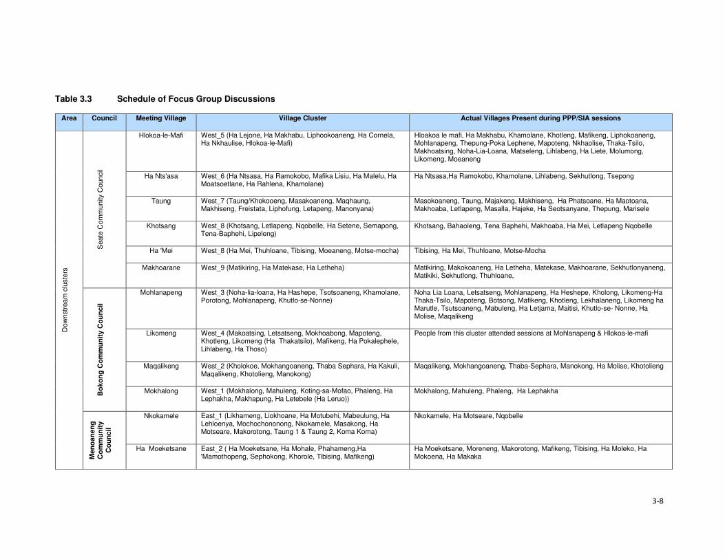
3-8
Table 3.3 Schedule of Focus Group Discussions
Area Council Meeting Village Village Cluster Actual Villages Present during PPP/SIA sessions
Dow
nstr
eam
clu
ste
rs
Seate
Com
munity C
ouncil
Hlokoa-le-Mafi West_5 (Ha Lejone, Ha Makhabu, Liphookoaneng, Ha Cornela, Ha Nkhaulise, Hlokoa-le-Mafi)
Hloakoa le mafi, Ha Makhabu, Khamolane, Khotleng, Mafikeng, Liphokoaneng, Mohlanapeng, Thepung-Poka Lephene, Mapoteng, Nkhaolise, Thaka-Tsilo, Makhoatsing, Noha-Lia-Loana, Matseleng, Lihlabeng, Ha Liete, Molumong, Likomeng, Moeaneng
Ha Nts'asa West_6 (Ha Ntsasa, Ha Ramokobo, Mafika Lisiu, Ha Malelu, Ha Moatsoetlane, Ha Rahlena, Khamolane)
Ha Ntsasa,Ha Ramokobo, Khamolane, Lihlabeng, Sekhutlong, Tsepong
Taung West_7 (Taung/Khokooeng, Masakoaneng, Maqhaung, Makhiseng, Freistata, Liphofung, Letapeng, Manonyana)
Masokoaneng, Taung, Majakeng, Makhiseng, Ha Phatsoane, Ha Maotoana, Makhoaba, Letlapeng, Masalla, Hajeke, Ha Seotsanyane, Thepung, Marisele
Khotsang West_8 (Khotsang, Letlapeng, Nqobelle, Ha Setene, Semapong, Tena-Baphehi, Lipeleng)
Khotsang, Bahaoleng, Tena Baphehi, Makhoaba, Ha Mei, Letlapeng Nqobelle
Ha 'Mei West_8 (Ha Mei, Thuhloane, Tibising, Moeaneng, Motse-mocha) Tibising, Ha Mei, Thuhloane, Motse-Mocha
Makhoarane West_9 (Matikiring, Ha Matekase, Ha Letheha) Matikiring, Makokoaneng, Ha Letheha, Matekase, Makhoarane, Sekhutlonyaneng, Matikiki, Sekhutlong, Thuhloane,
Bo
ko
ng
Co
mm
un
ity C
ou
ncil
Mohlanapeng West_3 (Noha-lia-loana, Ha Hashepe, Tsotsoaneng, Khamolane, Porotong, Mohlanapeng, Khutlo-se-Nonne)
Noha Lia Loana, Letsatseng, Mohlanapeng, Ha Heshepe, Kholong, Likomeng-Ha Thaka-Tsilo, Mapoteng, Botsong, Mafikeng, Khotleng, Lekhalaneng, Likomeng ha Marutle, Tsutsoaneng, Mabuleng, Ha Letjama, Maitisi, Khutlo-se- Nonne, Ha Molise, Maqalikeng
Likomeng West_4 (Makoatsing, Letsatseng, Mokhoabong, Mapoteng, Khotleng, Likomeng (Ha Thakatsilo), Mafikeng, Ha Pokalephele, Lihlabeng, Ha Thoso)
People from this cluster attended sessions at Mohlanapeng & Hlokoa-le-mafi
Maqalikeng West_2 (Kholokoe, Mokhangoaneng, Thaba Sephara, Ha Kakuli, Maqalikeng, Khotolieng, Manokong)
Maqalikeng, Mokhangoaneng, Thaba-Sephara, Manokong, Ha Molise, Khotolieng
Mokhalong West_1 (Mokhalong, Mahuleng, Koting-sa-Mofao, Phaleng, Ha Lephakha, Makhapung, Ha Letebele (Ha Leruo))
Mokhalong, Mahuleng, Phaleng, Ha Lephakha
Men
oan
en
g
Co
mm
un
ity
Co
un
cil
Nkokamele East_1 (Likhameng, Liokhoane, Ha Motubehi, Mabeulung, Ha Lehloenya, Mochochononong, Nkokamele, Masakong, Ha Motseare, Makorotong, Taung 1 & Taung 2, Koma Koma)
Nkokamele, Ha Motseare, Nqobelle
Ha Moeketsane East_2 ( Ha Moeketsane, Ha Mohale, Phahameng,Ha 'Mamothopeng, Sephokong, Khorole, Tibising, Mafikeng)
Ha Moeketsane, Moreneng, Makorotong, Mafikeng, Tibising, Ha Moleko, Ha Mokoena, Ha Makaka

3-9
Area Council Meeting Village Village Cluster Actual Villages Present during PPP/SIA sessions
Lilatoleng East_3 ( Lilatoleng, Ha Sibi, Ha Ralitlhare, Ha Ntsika, Tsekong, Ha Lehloenya)
Ha Ntsika, Ha Sibi, Tsekong, Ha Ralitlhare, Ha Lehloenya, Bobatsi, Moeling, Lipeleng, Ha Lekhehle, Ha Taelo
Linakeng East_4 ( Ha Moropane, Ha Jontane, Ha Taelo, Ha Rajoalane, Kholoke, Linakeng (Ha Mphosi), Matlatseng, Sankoela (Makhahleleng)
Linakeng, Ha Mphosi, Likhahleng
Po
lih
ali C
atc
hm
en
t Seate
Co
mm
un
ity C
ou
ncil
Malingoaneng/ Khubelu
ALC S1 (Tloha-re-Bue, Malingoaneng, Masakong, Ha Tlhakola, Ha Ramonakalali, Ha Jobere, Sotoane)
Tloha-re-Bue, Masakong
Nts'upe ALC S2 (Nts'upe, Linokong) Ntsupe, Makorong, Phuthing, Terae Hoek, Mafikeng, Ha Tlontlollo,
Sebera ALC S3 (Sebera, Ha Nts'esanyane, Letsatsaneng, Likoting, Checheng)
Mateaneng, Teraeng, Sebera, Phokeng, Sekoka, Likoting, Letsaneng, Ha Ntsesanyane, Bolahla, Ha Ramoruti
Mapholaneng ALC S4 (Mapholaneng, Ha Leqabanyo) Mafika-Lisiu. Motete, Meketeng, Polomiti, Majakaneng, Ha Lechela, Ha Leqabanyo, Ha Ntsetsanyane, Makalieng, Taung, Likoung, Khubelu, Sefate, Mofolaneng, Tsepong, Phatlalla, Lithoteng, Perekising, Matebeng, Ha Matsieng
Mofolaneng ALC S5 (Mofolaneng, Likoung, Mokhoabong, Bochabela, Manganeng, Matebeng, Lithoteng)
Mofolaneng, Tsepong, Mangaung, Phatlalla, Mokhoabong, Lithoteng, Sefate, Likoung, Lipululeng, Matebeng, Bochabela, Lebakana
Mahemeng ALC S6 (Mahemeng, Rammeleke) Mahemeng, Tsieng
Men
oan
en
g C
om
mu
nit
y
Co
un
cil
Ha Rafolatsane ALC MG5 (Ha Rafolatsane, Hloahloeng, Molumong, Ha Molungoa, Ha Sekantsi, Ha Lehlohonolo, Manganeng, Majakaneng, Matsekeng)
Ha Rafolatsane, Ha Lehlohonolo, Majakaneng, Molumong, Ha Molungoa, Manganeng, Namoha, Ha Sekantsi, Lilemeleng, Lekhalong, Sehlabeng
Ha Koeneo ALC MG6 (Ha Koeneo, Maphiring, Likoae, Jermiston, St James, Lekhalong)
Ha Koeneo
Libibing ALC MG4 (Libibing II, Tlhakoaneng, Manganeng, Maotleng, Sekoting, Thoteng, Letsatseng, Sekaneng, E-eang, Janteu, Tutulung, Ha Motebang)
Libibing 1, Libibing 2, Letsatseng, Tlhakoaneng, Terateng, Sekoting, Manganeng, Moeling, Janteu, Maotleng
Matlakeng ALC MG3 (Matlakeng, Bokone, Morojeleng, Ha Phatoli, Ha Nts'abele, Taung, Ha Mofali, Ha Makere, Hlomohang, Moeling, Molalana-Motse Mocha)
Ha Ntsebele, Taung, Koeneng, Moeling, Tsoenene, Ha Mofali, Ha Phatoli,
Ts'oenene ALC MG2 (Ts'oenene, Meeling, Thajana, Phatoli, Khohlong, Ha Setsoto, Sekokong, Bochabela)
Bochabela, Thajane, Sekokong
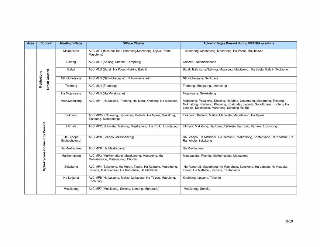
3-10
Area Council Meeting Village Village Cluster Actual Villages Present during PPP/SIA sessions
Malubalube ALC MG1 (Malubalube, Likhameng/Moeaneng, Ntjolo, Phate, Masofeng)
Likhameng, Masoefeng, Moeaneng, Ha Phate, Malubalube
Mo
kh
otl
on
g
Urb
an
Co
un
cil
Salang ALC MU1 (Salang, Checha, Teropong) Checha, Ntlholohetsane
Bafali ALC MU2 (Bafali, Ha Poso, Ntsiking Bafali) Bafali, Bafatsana,Ntsining, Masaleng, Mabitseng, Ha Seeta, Bafali- Nkotoane,
Ntlholohetsane ALC MU3 (Ntlholohetsane1, Ntlholohetsane2) Ntlholohetsane, Senkoase
Thabang ALC MU4 (Thabang) Thabang, Mangaung, Liraholeng
Ha Mojakisane ALC MU5 (Ha Mojakisane) Mojakisane, Sekeketeng
Mp
ho
ko
joan
e C
om
mu
nit
y C
ou
ncil
Meta/Mabuleng ALC MP1 (Ha Maleka, Thoteng, Ha 'Meta, Kheseng, Ha Masetulo) Mabekong, Paballong, Khesing, Ha Meta, Litsoeneng, Moeaneng, Thoteng, Mokhalong, Pontseng, Kheseng, Koakoatsi, Lietsela, Sebothoane, Thoteng Ha Lesoeja, Masholoko, Moreneng, Sekoting Ha Tipi
Tlokoeng ALC MP2a (Tlokoeng, Liphokong, Botsola, Ha Mpesi, Makalong, Tlokoeng, Matebeleng)
Tlokoeng, Botsola, Maitisi, Mabelete, Mabeleteng, Ha Mpesi
Lilimala ALC MP2b (Lilimala, Tsekong, Majakaneng, Ha Konki, Lits'otsong) Lilimala, Makalong, Ha Konki, Tsilantso Ha Konki, Kanana, Litsotsong
Ha Lebopo (Mahesheleng)
ALC MP8 (Lebopo, Masuoaneng) Ha Lebopo, Ha Mathibeli, Ha Ramoruti, Mabothong, Koatanyane, Ha Koatake, Ha Ramohale, Sekokong
Ha Makhabane ALC MP6 (Ha Makhabane) Ha Makhabane
Makhomalong ALC MP3 (Makhomalong, Majakaneng, Moeaneng, Ha Mohlabakobo, Matsoapong, Phohla)
Matsoapong, Phohla, Makhomalong, Makaoteng
Sekokong ALC MP4 (Sekokong, Ha Moruti, Taung, Ha Koatake, Mobothong, Kanana, Makhoabeng, Ha Ramohale, Ha Mathibeli)
Ha Ramoruti, Mabothong, Ha Ramohale, Sekokong, Ha Lebopo, Ha Koatake, Taung, Ha Mathibeli, Kanana, Thotanyane
Ha Letjama ALC MP5 (Ha Letjama, Maitisi, Letlapeng, Ha Ts'ese, Mabuleng, Khohlong)
Khohlong, Letjama, Tshehle
Motsitseng ALC MP7 (Motsitseng, Sekoka, Lumang, Mpharane) Motsitseng, Sekoka

Section 3 • Approach and Methods
3-11
3.3.4 Impact Assessment
Impacts were assessed in accordance with the standard impact assessment methodology provided
by ERM and the ratings provided in Table 3.4. Significance ratings are assigned for impacts before
mitigation is applied (‘pre-mitigation) and after mitigation has been applied (‘residual’)5.
A more detailed description of the methodology is provided in the Environmental and Social Impact
Statement (ESIS).
Table 3.4 Impact Significance Rating Table
Evaluation of Significance Sensitivity/Vulnerability/Importance of Resource/Receptor
Low Medium High / Very High
Magnitude of
Impact
Negligible Negligible Negligible Negligible
Small Negligible Minor Moderate
Medium Minor Moderate Major
Large Moderate Major Critical
Positive Impacts
Positive Minor Moderate Major
3.3.4.1 Magnitude
Magnitude essentially describes the intensity of the change that is predicted to occur in the
resource/receptor as a result of the impact. A magnitude rating tends to reflect a combination of the
size of an area that may be affected, the duration over which the aspect may be altered, and the size,
degree or scale of that change. In essence, magnitude is a descriptor for the degree of change that
is predicted to occur in the resource or receptor.
For positive impacts (which are mostly socio-economic impacts) magnitude is generally categorised
as ‘Positive’ unless sufficient information is available to support a more robust characterisation and
to assign the degree of magnitude as Small, Medium or Large. For instance, if the number of jobs to
be assigned to local community members is confirmed or if the size or value of the contribution to the
national, regional or district economy is known then a magnitude rating can be assigned. If not, then
the significance rating is assigned based on the sensitivity of the feature impacted by a specific activity
or change.
The term ‘magnitude’ therefore encompasses all the characteristics of the predicted impact including:
• Extent;
• Duration;
• Scale;
• Frequency; and
• Likelihood (only used for unplanned events).
The impact characteristic terminology to be used during the impact assessment is summarised in
Table 3.5.
Table 3.5 Impact Characteristic Terminology
Characteristic Definition Designations
Type A descriptor indicating the relationship of the
impact to the Project (in terms of cause and
effect).
• Direct
• Indirect
• Induced
5 Residual impact ratings are often referred to as post-mitigation ratings elsewhere but are considered the same in this report.

Section 3 • Approach and Methods
3-12
Characteristic Definition Designations
Extent The “reach” of the impact (e.g. confined to a
small area around the Project Footprint,
projected for several kilometres, etc.).
• Local
• Regional
• International
Duration The time period over which a resource /
receptor is affected.
• Temporary
• Short-term
• Long-term
• Permanent
Scale The size of the impact (e.g. the size of the
area damaged or impacted; the fraction of a
resource that is lost or affected, etc.)
[no fixed designations; generally intended
to be a numerical value, where impacts
can be quantified e.g. % of habitat lost; or
where a numerical threshold may be
exceeded (e.g. air or noise standards]
Frequency A measure of the constancy or periodicity of
the impact.
[no fixed designations; generally intended
to be a numerical value where known (e.g.
blasting)]
The evaluation of pre-mitigation impact significance takes into account control measures that are
already part of or embedded within the Project design. This avoids the situation where an impact is
assigned a magnitude based on a hypothetical version of the Project that considers none of the
embedded controls that are defined as part of the project description. Examples of embedded controls
could include acoustic reduction measures around noisy equipment or servitude and buffer
requirements the development is obliged to implement and is part of the layout. Additional mitigation
measures aimed at further reducing the significance of impacts are proposed where necessary or
appropriate and are assessed as part of the ‘residual’ impact significance rating.
In the case of type, the designations are defined universally (i.e. the same definitions apply to all
resources/receptors and associated impacts). For these universally-defined designations, the
definitions are provided in Table 3.6.
Table 3.6 Designation Definitions
Designation Definition
Type
Direct Impacts that result from a direct interaction between the Project and a resource/receptor
(e.g. between occupation of a plot of land and the habitats which are affected).
Indirect Impacts that follow on from the direct interactions between the Project and its
environment as a result of subsequent interactions within the environment (e.g. viability
of a species population resulting from loss of part of a habitat as a result of the Project
occupying a plot of land).
Induced Impacts that result from other activities (which are not part of the Project) that happen as
a consequence of the Project (e.g. influx of camp followers resulting from the importation
of a large Project workforce).
Extent
Local Impacts that affect an area in proximity to the development area within an area defined
on a resource/receptor-specific basis.
Regional Impacts occurring at a regional scale as determined by administrative boundaries or
which affect regionally important resources or ecosystems.
International Impacts that extend across international boundaries or affect resources such as
features, resources or areas protected by international conventions.
Duration
Temporary Impacts are predicted to be of short duration (in the order of days) and/or
intermittent/occasional.
Short-term Impacts that are predicted to last only for the duration of the construction period.
Long-term Impacts that will continue for the life of the Project, but will cease when the Project stops
operating.

Section 3 • Approach and Methods
3-13
Designation Definition
Permanent Impacts that cause a permanent change in the affected receptor or resource (e.g.
removal or destruction of ecological habitat) that endures substantially beyond the
Project life time.
3.3.4.2 Sensitivity
Characterisation of sensitivity for social and cultural heritage receptors is based on the value of that
social and cultural heritage receptor/s and its vulnerability to the impact, taking into account the
receptor’s resilience, including ability to adapt to change or use alternatives where available.

4-1
Section 4 Baseline Environment
4.1 Demographic Profile This section describes the demographic characteristics of the country and the Project Area. These
include population size and distribution, ethnicity and language and migration patterns.
4.1.1 Population Size and Distribution
Lesotho has a population of over two million people and had a low population growth rate of one
percent per annum (between 2015 and 2016)6. In 2017, Lesotho’s population is projected to increase
by 26 102 people and reach 2 199 492 people by early 2018. According to the Lesotho Demographic
and Health Survey (LHDS) (2014) (Ministry of Health (Lesotho) and ICF International, 2016), there
are more females than males at 53% and 47%, respectively. The population of Lesotho is considered
to be young with 39% of the population aged below 15 years, while the proportion of people aged 65
and older is eight percent. The average household size was 3.3 persons. An estimated low of 25% of
the population resides in the urban areas and 75% reside in rural areas. This is indicative of the low
urbanisation rate of the country of four percent per annum.
According to the Socio-Economic Baseline Study (CES, 2015b), the population of the Project Area
was estimated to be 46 371 people between 2013 and 2014, with an average of 5.2 persons per
household. More recent population figures could not be obtained from the local authorities as a
majority indicated that they did not have updated figures. The population in the Project Area reflects
similar characteristics to the national population figures as described above (Figure 4.1).
Figure 4.1 Gender and Age Distribution in the Project Area
Source: Socio-Economic Baseline Study (CES, 2015b)
4.1.2 Ethnicity and Language
Lesotho is a homogenous nation regarding the ethnic composition of the population and culture.
Approximately 99% of the country’s population are Basotho who, in turn, belong to specific clans.
Basotho clans are mostly named after animals which were selected based on the animals’ character
6www.worldmeters.info/world-population/lesotho-population/

Section 4 • Baseline Environment
4-2
(Box 4.1). Some Zulu and Xhosa people from South Africa are found in different parts of the country
due to population migration. Chinese people are also found throughout the country.
Box 4.1 Basotho Clans
Bakoena – Koena (crocodile) Bafokeng –'Mutla (hare) Batloung – Tlou (elephant) Bats'oeneng – Ts'oene (baboon) Bakubung – Kubu (hippopotamus) Baphuthinq – Phuthi (duiker) Bahlaping – Tlhapi (fish) Bataung- Tau (Lion) Basia- Katse (cat) Bahlakoana – Koena (crocodile) Batlokoa – Katse (cat) Bathepu – Noha (snake) Matebele – named after their chiefs Bakhala – no English term
The official languages are Sesotho, which is spoken by the majority of the population, and English
(generally accepted as the language of business). Other commonly spoken languages are isiZulu,
followed by Phuthi, isiXhosa and Mandarin. A similar ethnic and language composition was evident
in the Project Area. Some Zulu people, who the social team met in the area, indicated that they were
either descendants of Zulus who migrated to Lesotho during tribal wars in South Africa or they
relocated to the area out of choice.
4.1.3 Religion
The majority of the Basotho population (90%) are Christians. The main denominations include
Catholic, Lesotho Evangelical, Anglican and other Christian denominations. Muslims, Hindus,
Buddhists and Baha'i comprise the remaining 10%. In the Mokhotlong district, Christianity is the
dominant religion, followed by traditional and cultural beliefs. Many church services include chanting,
drumming and cultural costumes.
Similarly, in the Project Area, Christianity is the most widely practised religion along with traditional
beliefs (ancestral spirits). The main denominations found are the Apostolic followed by Roman
Catholic, Lesotho Evangelical and Anglican. Similarly, the traditional and cultural beliefs are also
observed in the Project Area. Traditional healers and Apostolic Churches use the water pools in the
Senqu River to perform their religious obligations.
4.1.4 Residential Status of the Population
According to the Lesotho Demographic Health Survey (LDHS) 2014 (Ministry of Health (Lesotho) and
ICF International, 2016), in Lesotho, many people reside away from their home communities and
apart from their families for extended periods to pursue work or educational opportunities. The
majority of the population in the country lives within the household (77% males and 82% females);
followed by those who are elsewhere in the country and South Africa (9% men and 5% women) as
indicated in Table 4.1. More females than males are based on the household owing to the African
traditions and beliefs that a woman’s place is at home.

4-3
Table 4.1 Residential Status by Age, Gender, Ecological zone and District in Lesotho
MALE FEMALE
Background characteristics
In the household
Elsewhere in Lesotho
In RSA
In Other Country
Total Number In the household
Elsewhere in Lesotho
In RSA
In Other Country
Total Number
Age
0-9 89.9 8.8 1.2 0.0 100.0 4,360 90.6 8.3 1.0 0.1 100.0 4,494
10-19 83.7 14.7 1.6 0.0 100.0 4,571 81.0 17.9 1.0 0.1 100.0 4,492
20-29 66.6 20.4 12.9 0.1 100.0 3,633 69.8 23.2 6.9 0.1 100.0 3,519
30-39 63.1 17.2 19.7 0.0 100.0 2,466 72.7 14.7 12.5 0.1 100.0 2,403
40-49 62.3 14.2 23.3 0.2 100.0 1,541 72.6 11.9 14.5 0.0 100.0 1,518
50-59 67.2 9.8 23.0 0.0 100.0 1,100 87.1 6.2 6.7 0.0 100.0 1,561
60+ 90.6 5.1 4.3 0.0 100.0 1,488 93.4 5.1 1.4 0.0 100.0 2,242
Residence
Urban 81.0 11.8 7.1 0.1 100.0 4,768 85.1 11.3 3.4 0.2 100.0 5,526
Rural 75.8 14.3 9.9 0.0 100.0 14,400 80.1 14.4 5.4 0.0 100.0 14,703 Ecological Zone
Lowlands 78.0 12.3 9.0 0.0 100.0 10,390 82.8 12.2 4.9 0.1 100.0 11,390
Foothills 74.1 15.5 10.0 0.0 100.0 2,350 78.5 10.4 5.1 0.0 100.0 2,342
Mountains 78.2 15.4 6.3 0.0 100.0 4,000 82.2 14.3 3.5 0.0 100.0 4,568
Senqu River Valley
09.2 15.1 15.0 0.1 100.0 1,817 75.9 10.1 8.0 0.1 100.0 1,923
District
Butha-Buthe 79.0 11.4 9.6 0.0 100.0 1,211 84.9 9.5 5.5 0.0 100.0 1,198
Leribe 74.2 14.4 11.4 0.0 100.0 2,977 78.7 15.5 5.8 0.0 100.0 3,246
Berea 79.2 13.5 7.3 0.0 100.0 2,354 81.1 13.9 5.0 0.1 100.0 2,431
Maseru 82.2 11.7 6.0 0.1 100.0 4,290 85.7 11.0 3.0 0,2 100.0 4,742
Mafeteng 77.2 11.9 10.9 0.0 100.0 1,734 82.6 11.8 5.6 0.0 100.0 1,780 Mohale's Hoek 88.8 18.9 14.3 0.0 100.0 2,011 74.7 18.6 6.7 0.0 100.0 2,097
Quthing 88.9 14.2 16.8 0.1 100.0 1,170 75.3 14.4 10.2 0.1 100.0 1,287
Qacha'snek 77.1 12.8 10.0 0.0 100.0 658 85.4 9.6 5.0 0.0 100.0 680 Mokhotlong 79.6 14.3 6.0 0.0 100.0 1,230 81.6 14.9 3.5 0.0 100.0 1,203
Thaba-Tseka 78.7 17.3 3.9 0.0 100.0 1,533 83.4 15.0 1.6 0.0 100.0 1,567 Source: Lesotho Demographic Survey, 2011 (Bureau of Statistics (Lesotho), 2013)
Section 4 • Baseline Environment
4-4
The Mokhotlong district and Project Area population followed the national trends regarding residential
status, including people living in South Africa (six percent males and nearly four percent females).
Participants in focus group discussions indicated that some female youth often went to South Africa
to seek employment and return home when the job or contract has been finished/ terminated. These
youths highlighted the shortage of job opportunities in the District and Project Area as the motivation
for them seeking employment outside of the country.
4.1.5 Migration
In Lesotho, the majority of migrants were young men working in the South African mines; however,
since the 1990s the patterns of migration have changed substantially due to the general decline in
mine employment in South Africa. The decline in mine employment in South Africa for Basotho from
Lesotho has given rise to new forms of migration and an increase in female migration. The number
of skilled migrants has also been on the increase. Younger and single/separated women have
increasingly been employed in domestic work and on commercial farms in South Africa.
The common practice in the country is for people to move from rural areas to urban towns to look for
employment, especially in the textile industry. Immigrants are mostly of Asian origin in the garment
and textile industry. According to the 2011 Lesotho Demographic Survey (Bureau of Statistics
(Lesotho), 2013), three percent of the population enumerated in Mokhotlong were lifetime migrants
from other districts, and 11% were out-migrants of the same district. This shows that there are very
few in-migrants into the Mokhotlong District. There is very little in-migration to the Project Area. The
common practice is for people to relocate to place within the Project Area either due to the desire of
being closer to family members or closer to services such as schools and health facilities. Out-
migration to more distant locations was common in the Project Area with people moving either to the
lowlands or South Africa in search of employment opportunities.
4.2 Cultural Practices This section describes the cultural practices in Lesotho and the Project Area.
4.2.1 Cultural Practices
Basotho culture is centred around village life, with the majority of traditions and festivals based on the
seasons. The most common cultural activities are related to marriage, birth, and death, coming of
age (initiations), and giving thanks to the ancestors. These are described briefly in Box 4.2. More
specific information is provided in the Cultural Heritage (including Archaeology) Report (MM&A and
Pinto, 2017, P2W-6014-DFR-0003).
Both tangible and intangible heritage resources exist throughout Lesotho where people are still
involved in pottery, cowhide tanning coupled with bead work to make unique clothing for specific
ceremonies such as initiation graduations. The production of artefacts also includes musical
instruments, hats and baskets; however, the skill appears to be more prevalent amongst the elderly
than the youth.
Three hundred and fifty-five (355) heritage sites have been documented in the whole of Lesotho with
42 such sites having been recorded within the District of Mokhotlong alone. Twenty-four of the 42 are
directly relevant to the Polihali Catchment Area, 10 of these refer to rock shelters with rock art, lithics
or other material remains, many of which will be impacted by inundation. The historic structures/sites
of note were located at Likomeng, Makhiseng, Malingoaneng, Mahemeng and Tlokoeng within the
area of the Batlokoa, with Thabang, Motsitseng Ha Mankata, Ha Lebopo, Ha Rafolatsane, and
Molumong on the Khalahali side (for additional information refer to the Cultural Heritage (Including
Archaeology) Report, P2W-6014-DFR-0003).
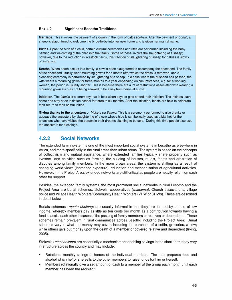
Section 4 • Baseline Environment
4-5
Box 4.2 Significant Basotho Traditions
4.2.2 Social Networks
The extended family system is one of the most important social systems in Lesotho as elsewhere in
Africa, and more specifically in the rural areas than urban areas. The system is based on the concepts
of collectivism and mutual assistance, where extended families typically share property such as
livestock and activities such as farming, the building of houses, rituals, feasts and arbitration of
disputes among family members. In the more urban areas, the system is shifting as a result of
changing world views (increased exposure), education and mechanisation of agricultural activities.
However, in the Project Area, extended networks are still critical as people are heavily reliant on each
other for support.
Besides, the extended family systems, the most prominent social networks in rural Lesotho and the
Project Area are burial schemes, stokvels, cooperatives (matsema), Church associations, village
police and Village Health Workers/ Community Health Workers (VHW or CHWs). These are described
in detail below.
Burials schemes (mpate sheleng) are usually informal in that they are formed by people of low
income, whereby members pay as little as ten cents per month as a contribution towards having a
fund to assist each other in cases of the passing of family members or relatives or dependents. These
schemes remain prevalent in rural communities across Lesotho including the Project Area. Burial
schemes vary in what the money may cover; including the purchase of a coffin, groceries, a cow;
while others give out money upon the death of a member or covered relative and dependent (Irving,
2005).
Stokvels (mochaellano) are essentially a mechanism for enabling savings in the short-term; they vary
in structure across the country and may include:
• Rotational monthly sittings at homes of the individual members. The host prepares food and
alcohol which he/ or she sells to the other members to raise funds for him or herself.
• Members rotationally give a set amount of cash to a member of the group each month until each
member has been the recipient.
Marriage. This involves the payment of a dowry in the form of cattle (bohali). After the payment of bohali, a
sheep is slaughtered to welcome the bride-to-be into her new home and is given her marital name.
Births. Upon the birth of a child, certain cultural ceremonies and rites are performed including the baby
naming and welcoming of the child into the family. Some of these involve the slaughtering of a sheep;
however, due to the reduction in livestock herds, this tradition of slaughtering of sheep for babies is slowly
phasing out.
Deaths. When death occurs in a family, a cow is often slaughtered to accompany the deceased. The family
of the deceased usually wear mourning gowns for a month after which the dress is removed, and a
cleansing ceremony is performed by slaughtering of a sheep. In a case where the husband has passed, the
wife wears a mourning gown for three months to a year depending on circumstances, e.g. for a working
woman, the period is usually shorter. This is because there are a lot of restrictions associated with wearing a
mourning gown such as not being allowed to be away from home at sunset.
Initiation. The lebollo is a ceremony that is held when boys or girls attend their initiation. The initiates leave
home and stay at an initiation school for three to six months. After the initiation, feasts are held to celebrate
their return to their communities.
Giving thanks to the ancestors or Mokete oa Balimo. This is a ceremony performed to give thanks or
appease the ancestors by slaughtering of a cow whose hide is symbolically used as a blanket for the
ancestors who have visited the person in their dreams claiming to be cold. During this time people also ask
the ancestors for blessings.

Section 4 • Baseline Environment
4-6
• Members contribute an agreed amount of money per month towards purchasing of groceries to
be divided amongst the members at an agreed time, e.g. June and/or December.
• Members contribute an agreed amount and lend it out to each other, and non-members; the cash
is paid back with interest, the money (capital plus interest) is then divided equally amongst the
members at the end of the year (December).
The stokvels mentioned above all exist in the Project Area. The burial society and some stokvel
membership consist of both men and women, while some stokvels consist of only men or only women.
Matsema is a system where households work collectively during intense agricultural periods such as
ploughing and harvesting to provide support to each other during the year.
Church groups are formed along religious lines with the aim of promoting relationships within the
church community. These groups serve as religious and social groups and play different roles within
the church. Among these groups are cell groups, Bible studies, Sunday school classes, youth, men
and women groups.
Local community members form village police groups (mahokela) with the aim of assisting police to
combat crime in their communities. In the Project Area, these groups mostly exist to fight cases of
livestock theft which is said to be widespread across the area.
Village Health Workers or Community Health Workers (VHW or CHWs) originated in response to the
inadequate number of health facilities in the rural areas of Lesotho. These are trained volunteers; of
whom some are paid while others are not paid. Their duties include:
• Provision of medical assistance to sick people, elderly as well as orphaned and vulnerable
children (OVC) in their villages;
• Anthropometric growth monitoring of children under the age of five on a monthly basis;
• Provision of support to people on tuberculosis (TB) treatment (i.e. TB-DOTS support); and
• Provision of support to HIV infected people.
4.3 Land Tenure and Use This section describes the land tenure and land use in Lesotho, Mokhotlong District and the Project
Area.
4.3.1 Ownership of Land
Land in Lesotho is managed and administered by the Ministry of Local Government and Chieftainship
(MoLGC) under the Land Act (No 8), 2010. Lesotho follows the principle that land belongs to all
Basotho and it is held in trust by the King – with the King and Chiefs responsible for the distribution
and management of land. Historically, the land was administered through customary laws; which
entitled every married man with three agricultural fields and one piece of land to build his residence,
i.e. the traditional/customary land tenure system. The land allotted to an individual, could not be
bought, sold, transferred or exchanged.
In the 2000s, the government realised that communal ownership of land was becoming an obstacle
to the commercialisation of agriculture and food security; land reforms were introduced. This was
achieved through the enactment of the 2010 Land Act.
The Act provides for the following individuals as persons who may hold a title for any piece of land:
• The Government of Lesotho;
• All Lesotho citizens who are older than 18 years, except where the person is under 18 but married;
• Where the title is a result of a gift; and
• Where the title is a result of inheritance.

Section 4 • Baseline Environment
4-7
To acquire land one has to apply for it from the chief and local authority under whose jurisdiction the
land is located. Foreigner citizens cannot own land as individuals; however, foreign enterprises which
have at least 20% shareholding of Basotho can acquire rights in land for investment purposes.
Under the 2010 law, agricultural land that has not been cultivated for at least three consecutive years
is regarded as ‘abandoned’ land. Therefore, the land is taken by the Chief to be reallocated to another
person. Lease holding or the right to occupy such land can be terminated.
4.3.2 Types of Land Tenure
Lesotho’s land tenure system recognises three types of title namely; leasehold, Form C and license.
There are, however, also households that occupy the land without the appropriate title in place, i.e.
through the traditional/customary tenure system under which the land was allocated to citizens
through chiefs and headmen on behalf of the King.
Leasehold acts as a check on private subdivision and allocation of land. Under the leasehold system,
the leaseholder has the right to use and enjoy the property for the agreed period. A leaseholder may
lease out that very land under a sub-lease agreement. In practice the leasehold of land is inherited
by the family of the leaseholder; in effect, the land is never returned to the state unless it has become
apparent that it has been abandoned. In Lesotho there are various forms of leasehold for both rural
and urban areas; namely:
• Residential leases for a period of 90 years;
• Commercial and industrial leases for periods of 30 and 60 years;
• Agricultural leases for periods of 10–90 years; and
• Others, including religious, educational and charitable leases for periods of 90 years.
Leasehold agreements are registered at the office of the Land Administration Authority (LAA). Before
the LAA came into being, the registration of title to land was registered at the Deeds Registry. The
Deeds Registry Act, No. 12 of 1967, states that the registration of titles to land under the legal system
of Lesotho does not confer the right of ownership, but the right of title to occupy and utilise the land
and its resources. The Land Act entitles the leaseholder to transfer the title sub-lease, or use their
land as collateral for accessing credit from financial institutions; the title can also be passed on via
inheritance to a named family member.
• Owners of leases for a primary place of residence are exempt from paying ground rent; however,
those who have a lease on a second property are required to pay annual ground rent to the LAA.
Owners of leases for land for commercial, industrial or agricultural purposes are required to pay
annual ground rent to the LAA.
• Form C was abolished by the Land Act (No. 17) of 1979, however, to this date people in the rural
areas are still issued with the Form C as proof of land tenure; it refers to land that is allotted by
the Chief. All forms issued before the 1979 Land Act remained valid. Form Cs and title deeds
can be converted into leases.
• Licence is a land tenure system used for agricultural land within the urban areas. The tenure right
is called a licence, and the land right is neither transferable, subject to inheritance nor negotiable.
Licences are held under customary law.
According to the 2011 LDS (LBS, 2013), the most prominent form of land tenure in Lesotho was
allocation by chiefs (61%), followed by inheritance/gift (29%) and purchase from somebody (seven
percent). A similar scenario was true for the Mokhotlong District where 66% had land allocated by the
chiefs, followed by those who had inherited the land (32%). Only two percent of Mokhotlong land
owners had acquired land through purchasing it from somebody.
The most prominent form of land tenure in the Project Area is through inheritance (31%), followed by
traditional/customary tenure (29%) and title deed (25%). Thirty-eight percent of the people residing in

Section 4 • Baseline Environment
4-8
Mokhotlong town have title deeds because it is a more urban area compared to the residents in the
downstream and catchment areas (42% and 37%, respectively) (refer to Figure 4.2). The “traditional”
tenure is the most predominant in both the catchment and downstream areas. The ownership of
arable land is discussed in Section 4.3.1 as part of the livelihoods activities. Land allocation in the
Project Area follows the same principles as elsewhere in the country.
Figure 4.2 Land Tenure Types Held by the Heads of Households within the Project Area
Source: Socio-Economic Baseline Study (CES, 2015b)
4.3.3 Land Use Types
Land is a major source of livelihoods in Lesotho and Mokhotlong and the Project Area in particular;
with the majority of households engaging in crop farming and extensive animal farming. The Project
Area is situated in the mountain zone and is characterised by high ranging mountains. The total area
of the Project Catchment is roughly 37 510 ha. Rangelands make up the greatest proportion of the
area at 52% (19 365.85 ha), followed by croplands at 35% (13 176 ha). The high mountains make up
seven percent (2687.7ha), while settlements make up six percent (2280.45ha) of the area (Soils,
Land Use and Land Capability Specialist Report P2W-6014-DFR-0007)) (refer to Figure 4.3).
The dominant land use types in the Project Area are grazing (refer to Section 4.8.4), cultivation,
housing, and small commercial activities such as shops and markets that serve the rural population.
The economy of the Project Area is highly dependent on agricultural activities (refer to Section 4.4),
and extensive areas of shrub lands are used to graze livestock or to grow crops. However, most of
the arable land used is degraded partly due to the cultivation methods used (extensive extractive
farming systems) which have led to significant soil degradation (Soils, Land Use and Land Capability
Specialist Report, P2W-6014-DFR-0007)).
0%
10%
20%
30%
40%
50%
Inheritance Traditional Form C Rental Title Deed Other
Catchment Area Downstream Area Mokhotlong Town

4-9
Figure 4.3 Land Use in the Catchment Area

Section 4• Baseline Environment
4-10
4.4 Livelihood and Economic Activities This section describes the economy and livelihoods at a national, district and the Project Area.
4.4.1 National Overview
The economy of Lesotho is based on agriculture, livestock, manufacturing, mining, and depends
heavily on inflows of workers’ remittances from workers in the South Africa mines, farms and domestic
work and receipts from the Southern African Customs Union (SACU). An estimated 50% of the
population earns income through informal crop cultivation or animal husbandry with nearly two-thirds
of the country's income coming from the agricultural sector. Lesotho’s Gross Domestic Product (GDP)
growth was estimated at three percent in 2016.
According to the Human Development Report, 57% of the population lives below the national poverty
line and the national poverty head count ratio at purchasing power parity (PPP) of USD 1.25 a day
stands at close to 59%. Poverty is highest in the rural areas. Unemployment remains high at estimated
levels between 24% and 28%. The rate stands at 29%, and inequality is unacceptably high at a GINI
coefficient of 0.5.
Efforts to promote inclusive growth are constrained by the pressure of high HIV prevalence (23% of
the total population) and the instability of receipts from the Southern African Customs Union (SACU),
which finances 50% of the budget. The country’s GDP is primarily reliant on three sectors, namely
services (67%); industry (31%) and the agricultural sector (seven percent).
4.4.2 District and the Project Area Overview
Mokhotlong District has a largely agrarian economy consisting of livestock rearing and cropping.
Animal husbandry in the District is undertaken mainly for commercial purposes (that is the production
of wool and mohair). The sheep and goats are reared primarily for wool and mohair; for the sole
purpose to sell to national and international markets (mostly South Africa). Crop production is mainly
for household subsistence purposes, and surplus is often sold or bartered with neighbours.
These agricultural activities are severely impacted by the erratic weather conditions (high winds,
snowfalls, etc.) associated with the mountainous terrain. Furthermore, the poor weather conditions
mean that crop production is only able to sustain households for three to nine months of the/ year.
Thus, households tend to make-up the shortfall through livestock rearing to generate household
income in the lean months as well as remittances from household members that are employed (if at
all). In general, income is limited due the high unemployment rate in the country and specifically in
the Project Area.
Crop production is the principal source of livelihood strategy practised in the Project Area, and this is
followed by remittances: permanent and seasonal employment, the sale of livestock products and
social grants, as indicated in Figure 4.4. The harvesting and sale of natural resources (wild plants,
fruit, timber, etc.) featured high as third to fifth principal livelihoods activities. Other interesting
livelihood strategies mentioned included subsistence from gathering and sale of wild plants.
The main livelihoods strategies of the population identified above are discussed in detail in the
subsequent sections.

Section 4 • Baseline Environment
4-11
Figure 4.4 Livelihood Strategies of the Affected Population in Percentages
Source: Socio-Economic Baseline Study (CES, 2015b)
4.4.3 Crop Production
4.4.3.1 Access to Arable Land
Arable land is a scarce resource in the Project Area, due to the mountainous terrain and soil
degradation resulting from soil erosion. The majority of arable land is located in the low lying areas
near the villages and along the river banks where sediments from soil erosion have settled. Some
agricultural fields are found on the slopes of the mountains, but these areas are considered less
productive in comparison with fields located along the river banks. As noted earlier croplands within
the Project Area constitutes 35% of the total land area (13 176 ha) (Soils, Land Use and Land
Capability Specialist Report, P2W-6014-DFR-0007)).
At an individual household level, access to arable land is often through inheritance, rental,
sharecropping and in rare cases, a person is allocated a piece of land on the mountain slopes by the
Chief. Furthermore, access to arable land is also dependent on the household location within the
Project Area. For instance, an average of 82% of the households in the catchment and downstream
areas owned arable land. In turn, only a third of families in Mokhotlong town had access to arable
land (Figures 4.5 and 4.6). It is important to understand the distinction in ownership of arable land;
Mokhotlong town is a developed area, and its property is zoned for specific land uses.
Figure 4.5 Ownership of Arable Land
Source: Socio-Economic Baseline Study (CES, 2015b)
0
10
20
30
40
1st 2nd 3rd 4th 5th
Livelihoods Ranking
Pe
rce
nta
ge
Crop production (major and minor) Remittances: permanent employment
Remittances: seasonal employment Sale of iivestock products
Social grants Business ownership
Traditonal/ Spiritual healers Gathering and sale of natural resources
Livestock production In-kind
0%
20%
40%
60%
80%
100%
Catchment Area Downstream Area Mokhotlong Town
No Yes

Section 4 • Baseline Environment
4-12
Figure 4.6 Typical River Bank Agricultural Fields
Source: J. Mkhabela
Concerning land ownership by gender, the average ownership of arable land by females is an
estimated 35% which is lower than that of males at 66%; as indicated in Figure 4.7. Traditionally,
upon marriage, men were automatically allocated fields, whereas women own arable land through
inheritance. However, this trend has changed due to the shortage of arable land – sometimes males
get married and are not given any crop fields.
The majority of households within the Project Area own a single crop field (35%), followed by those
who own two crop fields at 32%. Ownership of three crop fields accounts for 19% of the population,
and those who own between four or more crop fields was reported to be limited to eight and one
percent, respectively; refer to Figure 4.8 for the indicative percentage distribution of household
ownership of crop fields. Ownership of single to two crop-fields may also be linked to the general
shortage of arable land.
Figure 4.7 Ownership of agricultural land by Gender
Source: Socio-Economic Baseline Study (CES, 2015b)
0%
10%
20%
30%
40%
50%
60%
70%
80%
Catchment Area Downstream Area Mokhotlong Town
Female Male

Section 4 • Baseline Environment
4-13
Figure 4.8 Number of Crop Fields Owned by Households
Source: Socio-Economic Baseline Study (CES, 2015b)
4.4.3.2 Cultivation of Crops
Production of crops consists of cultivation of major and minor crops. Major crops are maize, wheat,
sorghum and beans. In turn, minor crops comprise beetroot, butternut, cabbage, pumpkins, spinach,
peppers, onions, tomatoes, carrots, turnips and others. These plants are all grown at different times
of the year depending on the weather conditions. The season for the cultivation of primary crops
begins in September with the preparation of fields, followed by cropping between October and
November. Throughout January and February, crop weeding and tending occur, and harvesting
begins in April to the end of July, refer to Figure 4.9 for the production of the major crops. Minor crops
are grown and harvested nine months of the year, except for during the winter.
Figure 4.9 Process of Crop Cultivation throughout the Year
4.4.3.3 Purpose of Crop Production
Crop production is mostly undertaken for only subsistence purposes across the Project Area; with
surplus sold only by a limited number of households. The subsistence use of crops can be attributed
to low crop yields and lack of alternatives to supplement their household income. As such, households
tend to keep their products for their consumption. Furthermore, crops are sometimes used to barter
with neighbours for other householder goods or as payment for services rendered. The sale of crop
products is undertaken amongst the villagers or in built areas such Mokhotlong and Mapholaneng
Towns where people have limited land to grow crops or do not have time to crop due to life demands.
0%
5%
10%
15%
20%
25%
30%
35%
40%
0 2 4 6 8 10 12 14

Section 4 • Baseline Environment
4-14
The general distribution of the main uses of crops produced in the Project Area is shown in Figure
4.10.
Figure 4.10 Purpose of Crops in the Project Area
Source: Socio-Economic Baseline Study (CES, 2015b)
Some households do not have access to agricultural fields and if they do not partake in any
sharecropping activities or work as labourers in other people's fields – then they will not have a
harvest. Participants gave the following reasons for not participating in crop production, namely:
• No fields for crop production;
• Lack of household labour to work the fields, and
• Lack of financial resources to undertake the farming.
Across the Project Area a lack of land to cultivate was the main reason provided for not partaking in
cropping activities; with the people of Mokhotlong town leading at 85% followed by the catchment
area (63%) and 59% downstream area (CES, 2015b). This barrier has resulted from the general
shortage of arable land across the Highlands of Lesotho and within the Project Area. Those who
highlighted a lack of household labour as a reason for not cropping – was linked to the households
with no youths or middle aged people, and the owner is either elderly or disabled thus they cannot
work the land. The reasons for households not cultivating their fields are indicated in Figure 4.11.
Figure 4.11 Household reasons for not cultivating agricultural land
Source: Socio-Economic Baseline Study (CES, 2015b)
0%
10%
20%
30%
40%
50%
60%
70%
80%
90%
Only subsistence Mostly subsistence Mostly Sale Only Sale
Catchment Area Downstream Area Mokhotlong Town
0%
10%
20%
30%
40%
50%
60%
70%
80%
90%
Elected not toanswer
Lack offinancial
resources
Lack ofhousehold
labour
Not Needed Other Lack of space
Catchment Area Downstream Area Mokhotlong Town

Section 4 • Baseline Environment
4-15
4.4.4 Livestock Production
The second important livelihood strategy of the population is livestock production; consisting of sheep,
goats and cattle, as well as pigs in limited numbers. Livestock is kept mostly for the sale of their
products rather than household consumption. During the 2013/14 Agriculture Year, there were 540
133 head of cattle and slightly over 2.1 million sheep and goats in Lesotho. On the other hand,
Mokhotlong had 40 932 head of cattle and close to 300 000 sheep and goats (Table 4.2).
Table 4.2 Number of livestock by type in Lesotho and Mokhotlong
Type of Livestock National Mokhotlong
Cattle 540,133 40,932
Sheep 1,346,596 198,849
Goats 824,698 94,277
Horses 55,926 9,103
Donkeys 103,859 13,870
Pigs 63,415 1,821
Chicken 453,083 28,824 Source: Lesotho Bureau of Statistics Statistical Report No. 8 of 2015 – Lesotho Livestock Statistics Report 2013/2014
On average, 61% of the households own sheep and goats because of their survival rate (cold and
snowy months of winter), and for the sale of wool and mohair. Figure 4.12 shows the ownership of
livestock across the Project Area by area. More households in Mokhotlong town own sheep than the
households in the catchment and downstream areas.
Figure 4.12 Livestock Owned in the Project Area
Source: Socio-Economic Baseline Study (CES, 2015b)
Livestock in the Project Area is kept by both men and women, but more prominently by men. Amongst
those who indicated not owning livestock, 69% were men and 66% female. The reasons for the
slightly higher number of males not owning livestock was not clarified in the SEBS (CES, 2015b);
however, this could be linked to poverty, or males engaged in formal employment and residing in
town with no space to rear livestock.
4.4.4.1 Ownership of Sheep
Sheep play a significant role in the households' survival, due to the income generated from the sale
of its products; mainly wool. Sheep are owned by both men and women, with men owning more than
women. On average women who own between one and five sheep accounted for eight percent of the
households and those that owned between six to 20 sheep at nine percent and only two percent owns
more than 50 sheep. Most of the men own between six and 20 sheep (18%), one to five sheep (12%)
and lastly 21 to 50 at nine percent, as indicated in Figure 4.13. The sale of sheep is low as they are
0%
10%
20%
30%
40%
50%
60%
70%
80%
Catchment Area Downstream Area Mokhotlong Town
Cattle Sheep Goats

Section 4 • Baseline Environment
4-16
a primary source of livelihoods for households. Over 61% households reported that they do not sell
any of their sheep. In turn, a combined 49% sell sheep in various quantities (Figure 4.13). Sheep that
are sold are often old and small. Therefore, the sale serves as a way of getting rid of old animals and
the money used to purchase new stock.
Figure 4.13 Ownership and Sale of Sheep
Source: Socio-Economic Baseline Study (CES, 2015b)
4.4.4.2 Ownership of Goats
Goats play a similar role to the household income as that of sheep, due to the revenue generated
from the sale of mohair. Goats are kept by both men and women; with men owning more as indicated
in Figure 4.14. In the same way, as with sheep, households typically do not sell their goats.
Figure 4.14 Ownership of Goats
�
Source: Socio-Economic Baseline Study (CES, 2015b)
4.4.4.3 Ownership of Cattle
Ownership of cattle is by both females and males in the Project Area but more prominent amongst
males. However, an average of 58% amongst both men and women households reported not owning
cattle. Cattle keeping is not widely common, and where it is owned, households own between one
and five (average 33%); with approximately 10% owning between six and 20 cattle. The primary uses
of cattle are working the fields, payment of dowry, funerals and sale when the household is strapped
for cash. One of the most commonly recurring responses regarding the sale of livestock, in general,
0%
20%
40%
60%
80%
100%
0 to 5 6 to 20 21 to 50 More than 50 None Owned
Female Male
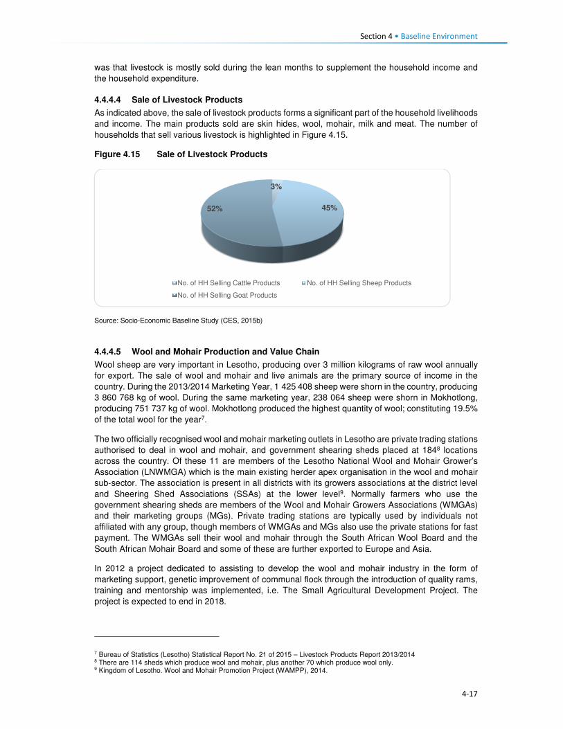
Section 4 • Baseline Environment
4-17
was that livestock is mostly sold during the lean months to supplement the household income and
the household expenditure.
4.4.4.4 Sale of Livestock Products
As indicated above, the sale of livestock products forms a significant part of the household livelihoods
and income. The main products sold are skin hides, wool, mohair, milk and meat. The number of
households that sell various livestock is highlighted in Figure 4.15.
Figure 4.15 Sale of Livestock Products
Source: Socio-Economic Baseline Study (CES, 2015b)
4.4.4.5 Wool and Mohair Production and Value Chain
Wool sheep are very important in Lesotho, producing over 3 million kilograms of raw wool annually
for export. The sale of wool and mohair and live animals are the primary source of income in the
country. During the 2013/2014 Marketing Year, 1 425 408 sheep were shorn in the country, producing
3 860 768 kg of wool. During the same marketing year, 238 064 sheep were shorn in Mokhotlong,
producing 751 737 kg of wool. Mokhotlong produced the highest quantity of wool; constituting 19.5%
of the total wool for the year7.
The two officially recognised wool and mohair marketing outlets in Lesotho are private trading stations
authorised to deal in wool and mohair, and government shearing sheds placed at 1848 locations
across the country. Of these 11 are members of the Lesotho National Wool and Mohair Grower’s
Association (LNWMGA) which is the main existing herder apex organisation in the wool and mohair
sub-sector. The association is present in all districts with its growers associations at the district level
and Sheering Shed Associations (SSAs) at the lower level9. Normally farmers who use the
government shearing sheds are members of the Wool and Mohair Growers Associations (WMGAs)
and their marketing groups (MGs). Private trading stations are typically used by individuals not
affiliated with any group, though members of WMGAs and MGs also use the private stations for fast
payment. The WMGAs sell their wool and mohair through the South African Wool Board and the
South African Mohair Board and some of these are further exported to Europe and Asia.
In 2012 a project dedicated to assisting to develop the wool and mohair industry in the form of
marketing support, genetic improvement of communal flock through the introduction of quality rams,
training and mentorship was implemented, i.e. The Small Agricultural Development Project. The
project is expected to end in 2018.
7 Bureau of Statistics (Lesotho) Statistical Report No. 21 of 2015 – Livestock Products Report 2013/2014 8 There are 114 sheds which produce wool and mohair, plus another 70 which produce wool only. 9 Kingdom of Lesotho. Wool and Mohair Promotion Project (WAMPP), 2014.
3%
45%52%
No. of HH Selling Cattle Products No. of HH Selling Sheep Products
No. of HH Selling Goat Products

Section 4 • Baseline Environment
4-18
Wool and mohair are the most sold animal products at 52% and 44%, respectively. The low sales of
cattle are indicative of their uses which are mostly ploughing of agricultural fields, traditional
ceremonies and dowry payment. The Mokhotlong Wool and Mohair Growers Association is found in
Mokhotlong town but has representatives in various locations across the broader Project Area. The
association works with the locally based wool sheds which cater for the local farmers. Shearing of
livestock commences in mid-September and ends in mid-Decembers. After completing the shearing
process, the Mokhotlong Wool and Mohair Growers Association transport the wool to Mokhotlong
town before loading it in haul tracks for transportation to Port Elizabeth in South Africa for auction and
sale.
The wool and mohair value chain in Lesotho consists of three channels following producers' groups,
namely:
• Associations that link larger farmers with the government channels and infrastructure to the
auction,
• Individual farmers with medium-sized herds that link up with private traders using their
infrastructure to gain access to the auction, and
• Marginal groups (small farmers) usually resource poor and use informal market channels to get
their products to the auction10.
Figure 4.16 Supply Chain for the Sale of Wool and Mohair
Source: Mokhethi, N.I., etal (2015) (http:www.researchgate.net/figure/290330505_fig1_figure-1-Lesotho-wool-and-mohair-
value-chain).
4.4.5 Challenges to Agricultural Activities in the Project Area
The problems affecting farming activities in the Project Area are highlighted below.
Crop farming:
Poor crop yields. Low crop yields are a standard feature for households in the Project Area; this has
been attributed to the following:
10 http://www.researchgate.net/figure/290330505_fig1_figure-1-Lesotho-wool-and-mohair-value-chain
Section 4 • Baseline Environment
4-19
• Drought - even though the Project Area has multiple water resources, the land away from the
river banks is dry and with limited potential to install formal irrigation systems. Thus, many
households who own fields in areas that cannot be easily irrigated practise dry land cropping; and
manually water vegetable gardens.
• Poor weather conditions are another contributing factor to low yields. The Highlands are subject
to heavy/ flash floods and heavy snowfalls at different times of the year. According to the
respondents, the dry seasons have in recent years been reduced and the snowy season
extended; which in turn affect crop production and yields.
• As is common in rural Africa, the population of the Project Areas continues to use traditional
methods of preparation and cultivation of fields with limited or no mechanisation; which also
affects crop production and yields.
• The District Department of Agriculture has amongst its staff, Agricultural Extension Officers;
however, poor accessibility to some parts of the Project Area has resulted in Extension Officers
not being able to reach some part of the population to extend services.
• The soils in the Project Area are highly degraded due to soil erosion, and the mountainous terrain
characterised by rockiness, which has reduced the available land for cropping.
Livestock farming:
Overstocking. In the broader Project Area, overstocking is a major concern, and this is attributed to
livestock owners' unwillingness to reduce their livestock numbers, as well as inadequate monitoring
or control by the Department of Agriculture, which is enabling this trend. This has led to the livestock
herds overstretching the available pastures and resulted in significant land degradation and shortages
of food for livestock.
Cold weather. The erratic climatic conditions of the area also affect livestock, especially in winter
when it is snowing. The respondents indicated that most of the livestock deaths are reported at this
time of the year. None of the livestock farmers in the area has covered kraals where they keep
livestock, and since most cannot afford to purchase fodder to feed their livestock, the livestock
continues to graze outside, and that is when deaths occur.
Veterinary services. There is a lack of access to veterinary services for livestock owners in the area
due to the constraints related to accessibility issues, i.e. government extension services cannot reach
most parts of the Project Area.
Animal health. Livestock diseases are a major constraint to the development and improvement of
the livestock industry in the region. Vector-borne diseases and tick-borne diseases (especially
theileriosis and heartwater) severely limit livestock production. The livestock owners tend to rely on
medicinal plants to treat their sick livestock.
Poor breeding. The attributes and weaknesses of the indigenous animals, purebred exotics and
crossbreeds were reported as a constraint to livestock production. There is a low reproductive rate
due to high mortality rates of calves, which also hinders the raising of replacement stock, as well as
the lack of artificial insemination delivery services.
4.4.6 Employment and Unemployment
This section describes employment and unemployment conditions at a national level as well as in the
district and the Project Area.
4.4.6.1 National Employment and Unemployment
According to the 2011 Lesotho Demographic Survey, 28% of the population was employed in private
households, followed by those who are self-employed (20%, people working in RSA (18%), private
sector 16% and government at 10%. Overall, females were mostly employed in the private
households/homes i.e. domestic work (21%) than in any other sector. The Survey results further

Section 4 • Baseline Environment
4-20
demonstrate that females (23%) in urban areas were mostly engaged in the manufacturing sector
while 32% of urban males were employed in the private sector. In rural areas, the leading sector was
the Private households/homes with 38% and 26% for men and females respectively; refer to Table
4.3.
Table 4.3 Percentage distribution of the employed labour force by sex, urban/rural
residence and type of employer
Total Urban Rural
Employer Both
Sexes
Male Female Total Male Female Total Male Female
Total 100 100 100 100 100 100 100 100 100
Government 10.0 7.5 14.4 16.4 15.2 17.8 7.1 4.8 12.1
Parastatal 1.1 1.1 1.2 1.9 2.2 1.6 0.8 0.7 0.9
Private 16.0 17.0 14.2 26.1 31.6 20.1 11.4 12.1 10.1
Manufacturing 6.7 2.6 14.0 13.6 5.4 22.7 3.6 1.7 7.9
Self-Employed 20.3 19.8 21.3 19.0 20.5 17.5 20.9 19.6 23.9
Private
household
28.1 31.8 21.4 13.8 12.5 15.1 34.5 38.4 25.8
RSA 17.6 20.1 13.3 8.8 12.3 4.9 21.6 22.7 19.2
Other 0.2 0.2 0.3 0.4 0.4 0.4 0.1 0.1 0.2
Source: Lesotho Demographic Survey, 2011 (Bureau of Statistic (Lesotho), 2013)
The Survey highlighted that 52% of males against 16% females were engaged in agriculture primarily
subsistence farming. More women were employed in the manufacturing and processing industry
(23%) while men constituted five percent. The other industrial category that both males and females
participated in was wholesale and retail trade with 11%. An estimated 11% of men were engaged in
Construction. The second leading category where women (15%) were mostly involved in was
activities of households (private households); refer to Table 4.4.
Table 4.4 Sectoral Employment
Industry Male Female Total
Agriculture 51.6 16.3 38.4
Fishing and aquaculture 0.0 0.0 0.0
Mining and quarrying 3.3 0.4 2.2
Manufacturing and processing 5.2 22.5 11.7
Electricity, gas, steam and air conditioning supply 0.4 0.1 0.3
Water supply, waste management and remediation activities 0.5 0.2 0.4
Construction 10.5 1.9 7.3
Wholesale, retail trade and repair of motor vehicles and motorcycles 7.9 16.1 11.0
Transport, storage and communication 5.4 0.5 3.6
Accommodation and food service activities 0.5 1.9 1.0
Information and communication 0.8 0.8 0.8
Financial and Insurance activities 0.5 0.9 0.7
Real Estate activities 0.0 0.0 0.0
Professional, scientific and technical activities 0.6 0.9 0.7
Administrative and support services activities 3.4 2.8 3.2
Public administration and defence, compulsory social security 3.3 2.8 3.1
Education 2.2 9.9 5.1
Human health and social work activities 1.5 4.2 2.5
Arts, entertainment and recreation 0.2 0.3 0.3
Other service activities 0.7 1.9 1.2
Activities of households as employees, undifferentiated goods - and
services - producing activities of households for own use
1.4 15.2 6.5
Activities of extraterritorial organisations and bodies 0.2 0.3 0.2
Source: Lesotho Demographic Survey, 2011 (Bureau of Statistics (Lesotho), 2013)

Section 4 • Baseline Environment
4-21
The proportion of the unemployed population was 30% and 23% in age-groups 20 to 24 and 25 to 29
years, respectively. In age-group 20 to 24 years the proportion of the unemployed population was
33% for females and 28% for males. In rural areas, the population aged 20 to 24 years constituting
28.1% of men and 31% of females were unemployed, as compared to 29% of males and 36% of
women in urban areas. The proportion of the unemployed population is high among the youth across
the country; refer to Table 4.5.
Table 4.5 Percentage Distribution of Unemployed Population by Age, Sex and
Urban/Rural Residence
Lesotho Urban Rural
Age Total Male Female Total Male Female Total Male Female
10-14 0.7 0.5 1.1 0.6 0.0 1.4 0.7 0.7 0.9
15-19 9.5 7.6 12.9 7.0 5.9 8.5 10.3 8.1 14.8
20-24 29.8 28.2 32.7 31.7 28.5 35.9 29.2 28.1 31.4
25-29 23.2 23.0 23.4 22.7 21.8 24.0 23.3 23.4 23.2
30-34 15.4 17.1 12.4 15.7 17.4 13.5 15.3 17.0 12.0
35-39 8.5 10.2 5.6 7.7 8.9 6.2 8.8 10.6 5.3
40-44 5.0 5.0 4.9 5.6 6.1 4.9 4.7 4.7 4.9
45-49 3.6 4.2 2.6 5.1 6.0 3.9 3.1 3.7 2.0
50-54 2.0 2.1 1.9 2.1 2.6 1.4 2.0 2.0 2.1
55-59 1.1 1.1 1.3 0.7 1.2 0.2 1.3 1.0 1.7
60-64 0.6 0.7 0.5 0.5 0.8 0.0 0.7 0.7 0.7
65+ 0.4 0.3 0.7 0.5 0.9 0.0 0.4 0.1 1.1
Source: Lesotho Demographic Survey, 2011 (Bureau of Statistics (Lesotho), 2013)
4.4.7 District and Project Area Employment and Unemployment
A large proportion of the workforce in the Project Area does not work in the formal economy.
Employment in the Project Area can be divided into three types, namely, full-time jobs, seasonal
employment and self-employment (characterised by business ownership and provision of services).
No clear employment rates for the District were attained; as such the employment status of the
population is used to describe the employment characteristics of the District population. The
employment status for men was indicated as self-employment (20%), while women were mostly
homemakers (45%). The students’ category of employment status, showed 32% and 23% of the
population being students for both female and male and this was attributed to the report’s inclusion
of people of ten years and older in the assessment of employment status. The top five employment
categories for both males and females are indicated in Table 4.6.
Table 4.6 Employment Status in Project Area
Employment Status Female (%) Male (%)
Self-employment 9 20
Homemaker 45 18
Student 32 23
Unpaid family work 3 14
Paid employment 9 17
Source: Socio-Economic Baseline Study (CES, 2015b)
4.4.7.1 Paid Employment
The result of the SEBS (CES, 2015b), indicated that 42% of the households surveyed had at least
one family member that engaged in paid employment. Of these family members, 79% were employed
in full time paid employment, 18% in part time work and three percent in seasonal employment related
to agricultural production. The respondents that indicated that they were employed, whether part-time

Section 4 • Baseline Environment
4-22
or fulltime, worked in the, e.g. self-employment, hospitality, manufacturing, mining, and public sectors,
within the District.
The types of work of the paid employment were led by those working as domestic workers in a private
household (22%), followed by those employed in the public sector (government services) (18%), as
well as manufacturing and other sectors (15% respectively), refer to Figure 4.17.
Figure 4.17 Types of Regular Employment in the Project Area
Source: Socio-Economic Baseline Study (CES, 2015b)
Of those engaged in paid employment, 59% indicated that they were employed within their village or settlement – meaning they are employed by a neighbour or a local business; followed by 18% who work in a neighbouring village, and those who work in South Africa (10%). The remaining work in other parts of the country, refer to Figure 4.18. Those who work in South Africa are employed in KwaZulu-Natal and Free State provinces within the manufacturing and agricultural sectors.
Figure 4.18 Location of Regular Employment in the Project Area
Source: Socio-Economic Baseline Study (CES, 2015b)
21%
18%
15%
15%
8%
8%
5%
4%4% 1% 1%
Domestic work
Public sector
Manufacturing
Other
Mining
Private sector
Service delivery
Retail
59%18%
2%
1%
4%3%
3% 10%
Village
Nearby Village
Mapholaneng
Mokhotlong
Mokhotlong District
Maseru
Lesotho
South Africa

Section 4 • Baseline Environment
4-23
4.4.7.2 Seasonal/temporary employment
According to the SEBS (CES, 2015b), those employed in seasonal and part-time jobs, are often
expected to work several times per week, or several times per month at 40% and 33% respectively,
as indicated in Figure 4.19. Methods of payment for seasonal/temporary work vary significantly and
may include payment in cash, in-kind or in livestock or harvest (such as sheep or vegetables).
Payment with livestock is common amongst the herd boys – who often receive 12 sheep per year or
one cow per year as payment.
Figure 4.19 Payment for Seasonal/temporary Employment in the Project Area
Source: Socio-Economic Baseline Study (CES, 2015b)
4.4.7.3 Self- employment
The SEBS (CES, 2015b), divided self-employment into two categories, namely businesses, and
activities involving specialist skills.
Businesses. The types of businesses found in the Project Area are unsophisticated and focused on
meeting the population’s day to day needs. These businesses include shebeens and taverns, small
cafés, child minding, horse hire, milling, telephone services, and others. Table 4.7 highlights the top
10 business services identified through the SEBS (CES, 2015b). Most of these businesses are
located in the village where the owner of the business resides.
Table 4.7 Types of Business in Project Area
Business Type Percentage
Beer brewing 34
Other 16
Café 9
Fruit & vegetable sellers 8
Property renters 7
Clothing sellers 5
Tailors 5
General dealers 3
Taxi owners 2
Cell phone charging and airtime sales 2
Source: Socio-Economic Baseline Study (CES, 2015b)
Specialist skills: Numerous people in the Project Area also derive their livelihoods through the
provision of specialised services; such as builders (61%), thatchers (13%), herbalists (10%),
16%
40%
33%
11%
Weekly
Several times/ week
Several times/ month
> once / month

Section 4 • Baseline Environment
4-24
Community Health Workers (eight percent), birth attendants (five percent), circumcision surgeons
(one percent), and others indicated in Figure 4.20.
Figure 4.20 Types of Specialised Services in the Project Area
Source: Socio-Economic Baseline Study (CES, 2015b)
There are no income specifications for specialised services provision as each person charges their
specialised rate based on the work to be completed.
4.4.7.4 Unemployment in the Project Area
Unemployment in the Project Area was an estimated 91% of the entire population in the SEBS (CES,
2015b). Similar, to the national statistics on employment and unemployment, the SEBS (CES, 2015b),
included children in its calculation of the levels of unemployment – thus skewing the results as children
ages 0 to 14 do not form part of the economically active groups. Furthermore, CES (2015b) indicated
that their findings on this issue were distorted and believe that the respondents did not fully
understand that subsistence agricultural activities also form part of employment especially if income
is derived from such an activity.
4.5 Household Income and Expenditure 4.5.1 Sources of Household Income
The nature of livelihood strategies, and particularly those activities contributing the most to household
income, does shift as one considers different income quartiles (Figure 4.21). According to LHDA
Contract 6000 - Final Income and Expenditure Report (CES, 2015a), and consistent with the results
of other studies carried out in the Project Area and taking into account its rural and isolated nature,
approximately half of the surveyed population can be classified as ‘poor’ by accepted national and
international standards. High levels of variability of income were found within villages, highlighting the
need for diverse resettlement recovery strategies, even at village level. Seasonal patterns of the
sources of cash that household’s access was noted; these patterns impact poorer and wealthier
households differently regarding stress and opportunity, and also resilience to shocks.
Food insecurity emerged as a key vulnerability of, particularly, the poorest households in this study.
The results show high levels of dependence on purchased food among the most impoverished, and
therefore a concomitant vulnerability to food price increases.
Social ties and networks, as indicated by evidence of gifts originating at multiple levels, from within
villages to the district level to South Africa, make a significant contribution to household income and
0
10
20
30
40
50
60
70
Builders Thatchers Herbalists
Community Health Workers Birth attendants Diviners
Faith healers Circumcision surgeons

Section 4 • Baseline Environment
4-25
food security. Donations of food and clothing are especially common in the poorer households, while
gifts of cash were more common in wealthier households.
Differences between the quartiles:
Quartile 1 denoted poor households that receive the majority of their income from non-cash sources,
including meals given to children at school, and donations of non-perishable food and clothes and
these are followed by non-regular income, social grants and regular income.
Quartile 2 denoted poor households that rely on social grants and non-cash income sources.
The households in Q 1 and Q 2 – depend heavily on one or two income sources (45%), with a limited
risk distribution.
Quartile 3 comprises of households that derive the majority of its income from regular income,
followed closely by non-regular income and non-cash income.
Quartile 4 households derive earnings from multiple sources, with 35% of the total income derived
from regular income sources.
The different types of income sources relied on by the people in each quartile are presented in Figure
4.21.
Figure 4.21 Household Income Sources per Quartile in the Project Area
Source: Baseline Income and Expenditure Report (CES, 2015a)
There are four significant income streams in the area namely, regular income, non-cash income, non-
regular income and non-agriculture based income.
Some households (24%) in the Project Area received income from grants. Of the 24% who received
the grants, the old age pension receivers were highest at 85%, averaging LSL 438.40 per month.
Other grants received were child grants, disability grants, pauper’s grants, and public grants.
4.5.1.1 Annual Income Trends
Income in the Project Area increases significantly between March-June, and again between August
and September and this may be attributed to the following:

Section 4 • Baseline Environment
4-26
• The period (between March and June) marks the beginning of major crop harvesting, namely
wheat, maize and sorghum; and it is a period where poorer households are engaged as labourers.
Furthermore, depending on the household’s levels of poverty (regarding ownership of fields), the
household has an opportunity to derive an income from the sale of their crops.
• Even though mohair sales take place in April, the payments are only received by the farmers
between August and November when it has been sold at auction in Port Elizabeth, South Africa.
• The combination of the income generated during this time may explain the sustained peaks in
income between August and September through the various income streams.
In general, income drops between November and January, dropping further in December before
picking up again in February particularly for households in Quartile 1 and 2 (Figures 4.22 and 4.23).
Figure 4.22 Household Income Trends per Quartile
Source: Baseline Income and Expenditure Report (CES, 2015a)

Section 4 • Baseline Environment
4-27
Figure 4.23 Monthly Income Trend all Households Surveyed within the Project Area
Source: Baseline Income and Expenditure Report (CES, 2015a)
4.5.2 Household Expenditure
Household spending in the Project Area consists of animal purchase, cropping expenses, groceries,
non-food groceries, irregular expenses, livestock husbandry, other ongoing monthly expenses, and
non-business costs. Based on Figure 4.24, households within the 2nd and 3rd quartiles exhibited
similar expenditure trends, i.e. spending on food groceries, non-food groceries, cropping expenses,
etc. The wealthiest households (4th quartile) showed substantially different spending compared to
the people in other quartiles. They spent 21% of their income on groceries food, animal husbandry
(20%) and over 15% spent towards business expenses. In general, households in the Project Area
spend most of their income on purchasing food items, as indicated in Figure 4.24.
Figure 4.24 General Household Expenditure Trends
Source: Baseline Income and Expenditure Report (CES, 2015a)

Section 4 • Baseline Environment
4-28
Figure 4.25 shows that households also spend their income on agricultural activities, with the bulk of
the expenses being towards livestock husbandry. Cropping related expenses tend to peak between
August and November. This coincides with the intensive period of planting the main crops - maize
and sorghum. Spending towards the purchase of livestock increases in August which is around the
time when farmers receive their income from the sale of wool and mohair which in turn increases their
purchasing power for new livestock. Expenses associated with animal husbandry peak in December
month, refer to Figure 4.25. Agricultural costs decrease significantly between December and March
as these are low-income months.
Figure 4.25 Household Agricultural Expenditure
Source: Baseline Income and Expenditure Report (CES, 2015a)
Non-agriculture expenses. Irregular household spending peaks in December, likely due to the
holiday period and returning family members; except the lower income households (1st and 2nd
quartiles). This includes spending on transportation, money being sent to other family members and
expenditure on furniture and appliances. Non-agricultural business income also increased during this
time and subsequently household spending also increases. This spending on non-agricultural
expenses peaks again from July to August which coincides with the harvesting activities and its
associated non-regular employment.
4.6 Access and Utilisation of Natural Resources There are a wide variety of natural resources found in the Project Area, and most of these are
communally owned and utilised. These include edible plants, medicinal plants, grazing land, thatching
grass, river reeds, mosea (craft grass) water, rocks, fish, sand, trees/shrubs and small wild animals.
The natural resources mentioned above have been discussed in detail below. The FGD participants
also made mention of the above mentioned natural resources like the ones that are now found within
the catchment area and are going to be impacted by the Polihali Dam, some through inundation and
some through all the proposed construction works. The collection and utilisation of natural resources
are managed by the Chiefs and their respective Councils. For instance, when a person requires
natural resources for building purposes, he/ she requires the permission of the Chief to collect the
natural resource materials he/she needs. Findings from the FGD indicate that people also have to go
to the chief and the counsellor to request use of roofing grass, fuel wood, medicinal plants and other
natural grasses such as mosea and loli.

Section 4 • Baseline Environment
4-29
The areas where natural resources are collected vary, for instance, rocks which are mostly used in
the construction of housing walls and kraals are readily available everywhere across the Project Area,
and people do not have to walk far to collect and utilise. However, the majority of the natural resources
are found in the forested area, hill/mountainous locations, and river banks, as indicated in Figure 4.26.
Figure 4.26 Areas where Natural Resources are Collected
Source: Lesotho Demographic Survey, 2011 (Bureau of Statistics (Lesotho), 2013)
4.6.1 Grazing Land
Grazing land in the Project Area is communal in nature and access to grazing land is governed by
the Chiefs and community Councillors. The Chiefs and Councillors are supported by locally
established Grazing and Pasture Committees, as well as by the Grazing Associations who work in
close collaboration with Principal Chiefs who oversee the management of grazing land. The Grazing
Associations are responsible for the management of pastures, improvement of livestock and the
rehabilitation of wetlands, marshes and bogs. In turn, the Grazing and Pasture Committees assist
village Chiefs with the general management of pastures. There are two active Grazing Associations
in the Project Area, namely:
• Khalahali Association which operates in Senqu, Bafali, Moremoholo, Mokhotlong/ Sanqebetu,
Tlakeng/ Sehong-hong, Makhapung, and Linakaneng/Sani.
• Tlokoeng Association which works within Bohale ba Nkoe, Mofolaneng, and Liseleng.
Pastures are often divided into three types of cattle posts – summer (these cattle posts are furthest
from home villages), winter (closer to home), and pastures that are close to home but are small and
cannot support large herds of livestock (refer to Figure 4.27). The livestock kept close to the villages
are often used for milking or ploughing or are the very young livestock. The majority of livestock,
therefore, spend significant time in summer and winter cattle posts. The FGD respondents also
attested to the cattle post usage patterns. Both the Grazing Associations and Committees play a
major role in ensuring sustainable use of the grazing area. They also ensure that livestock owners
adhere to the seasonal variations and also adhere to the grazing maintenance schedules that are set
by the relevant Chiefs, for the movement of livestock from one zone to another.
0%
5%
10%
15%
20%
25%
30%
35%
40%
45%
Forest/Thicket
Grazing Area Hilly orMountainous
Area
River Area Other Areas
Catchment Area Downstream Area Mokhotlong Town

Section 4 • Baseline Environment
4-30
Figure 4.27 Example of Local Grazing Area
Source: J. Mkhabela
All livestock in the area must be registered, and the livestock owners must be able to provide evidence
of their legal ownership of the livestock. The Chiefs are tasked with keeping records of herds of
livestock each household in their area owns. New households to the area must also seek permission
to use communal grazing land from the Chief and Council. The new comers must present the Chief
with proof of ownership of livestock and size of the herd of livestock owned.
According to the respondents, even with all these measures in place, grazing land in the area was
degraded due to people’s failure to adhere to the rules. Furthermore, the erratic weather conditions
of the area, heavy storms and snowfalls, soil erosion and severe droughts have contributed to the
degradation of grazing land. Others indicated that conflicting views on the regulation of grazing land
between the Chiefs and Community Council often lead to people disobeying the rules for grazing
management (for additional information, refer to the Rangelands Report, (P2W-6014-DFR-0009)).
4.6.2 Soils
The fresh alluvial deposits at the bottom of the inundation area have soils that are the most extensively
cultivated. Because of the nature of the parent material and the near level terrain, the area is
generally considered to be the most fertile (P2W-6014-DFR-0007). However, because there are
continuously fresh deposits after heavy storms, which are usually accompanied by erosion, the
landscapes are not very stable. As the area is located in the narrow valleys of the upper catchment,
there are no alluvial plains with more stable soils. Most of the soils are very friable and have more
than 50% sand, and are prone to physical losses and loss of fertility (Ministry of Agriculture, 1976).
Since the communities rely on subsistence farming, there is a heavy reliance by the communities on
the ability of the soils to provide food.
The soils in the area are used mainly for:
• Cultivation of food crops, mainly maize and wheat;
• Cultivation of fodder grasses;
• Settlements and the majority of households have gardens used for vegetable production; and
• Natural grassland primarily used for grazing livestock including sheep, goats and cattle.

Section 4 • Baseline Environment
4-31
There is evidence of active use on all of the landscapes, except where the terrain is steep and
completely inaccessible (Soils, Land Use and Land Capability specialist study (P2W-6014-DFR-
0007)).
4.6.3 Sand
Sand is found in abundance along river beds and sand mining is commonly undertaken for sale and
for construction purposes, refer to Figure 4.28. During the FGDs held within the Project Area,
participants residing within the catchment area of the Project Area expressed their concern about the
imminent loss of the sand due to dam impounding. They explained that they use the sand for building
purposes and will be at a total loss as to how they will access sand.
Figure 4.28 Example of Sand Mining along the River
Source: D Weldon
4.6.4 Medicinal Plants
A wide range of plants are collected in the Project Area predominantly for food, medicinal purposes
and for sale. The Biological and Archaeological (Including Heritage) Baseline and Impact Assessment
(LHDA C6002, CES, 2014) found approximately 60 plant species which the communities identified
as important natural resources. Of these, 30 species identified as important medicinal plants and
included Aloe aristata, Delosperma sp. and Artemesia afra. These are often used to treat a range of
ailments including sores, ulcers, headaches, cramps, muscular pains, headaches, sedatives and for
enhancing virility. Another 19 plant species were said to be utilised for spiritual purposes such as
increasing wealth and protection against lightning and evil spirits. The FGD participants also indicated
that they use some medicinal plants to protect themselves against the thokolosi and other evil forces,
which are said to be unseen but are believed to exist. They also pointed out that some of the plants
are only found in the area to be inundated and not anywhere else. Refer to Figure 4.29.

Section 4 • Baseline Environment
4-32
Figure 4.29 Examples of Medicinal Plants found in the Project Area
Source: J Bloem Lehasa
4.6.5 Wild Vegetables
FGD participants mentioned several types of wild vegetables that are found along the river, which
they consider to be now in danger of being inundated when the dam is completed. These wild
vegetables are used by the locals as a source of food to the communities and are collected by women
and girls to take home for cooking. The names of the wild vegetables growing along the rivers are
called papasane, semetsing/selae, thepe and seruoe (the last two grow on the fields and in these
cases they grow on the fields located near the rivers that are going to be inundated).
4.6.6 Fuelwood
Due to the high poverty levels, lack of electricity and extremely cold weather conditions of the Project
Area; there is a high demand for fuelwood. The SEBS (CES, 2015b) identified the plant species,
Passerina montana, as commonly harvested for fuel purposes. Approximately 85% of the households
in the area relied on fuelwood for household heating purposes; others indicated using fuel wood for
cooking purposes at 60%, while the rest use paraffin, bottled gas and electricity, especially those in
Mokhotlong town and Mapholaneng for the latter (FGD findings). It is also evident from the FGD
findings that women stockpile fuelwood in the summer months, in preparation for the winter months,
and also to limit the time spent in the cold going to collect wood.
The collection of fuelwood was indicated to be an activity undertaken mostly by adults and young
women in the Project Area with some assistance from adult and young men. In a small number of
wealthy households, the collection of fuelwood is undertaken by hired help, refer to Figure 4.30.
Figure 4.30 Persons who Collect Fuelwood in a Household
Source: Socio-Economic Baseline Study (CES, 2015b)
0%
10%
20%
30%
40%
50%
60%
Catchment Area Downstream Area Mokhotlong Town

Section 4 • Baseline Environment
4-33
Distances travelled to collect any source of household fuel vary significantly from village to village
based on the location of the fuel source. For instance, some women in FGDs indicated that they walk
for up to three hours (round trip) to collect fuelwood and this does not take into account the amount
of time spent gathering the wood. Furthermore, women reported that collection of fuelwood in summer
is undertaken almost daily to restock for the cold winter months.
4.6.7 Wild Animals
Rabbits, rock rabbits, deer, snakes, skunks and wild cats were said to be abundant within the
catchment area (FGD respondents). However, hunting of mammals in the Project Area is limited.
According to the SEBS (CES, 2015b), only 10% of the households were identified as partaking in any
hunting activities. These households indicated that they hunted antelope of various kinds, fox and
jackal, hare and rabbit and rock rabbit. The FGD respondents, however, mentioned that though they
are not allowed to hunt the animals, they do so for purposes of consumption, muti making for own
use and for selling. They explained that they use skunks to make a khoetsa that mothers put around
their young's necks to ward off evil spirits. Their fear is that the animals are going to run away when
the dam is impounded. The people also said as mitigation to the possible loss of wild animals, they
would like the LHDA to rescue and put them in a fenced off area where their children can visit and
learn about them in the future.
4.7 Health Care This section describes the provision of health care services in Lesotho, Mokhotlong District and the
Project Area.
4.7.1 National Health Services
The Ministry of Health (MoH) is responsible for the administration and management of health care
provision in Lesotho. The Ministry’s responsibilities include promotion and delivery of health services,
development of health policies, standards and guidelines, mobilisation of health resources, and
monitoring and evaluation of health sector interventions. Health care services are provided in
partnership with the Christian Health Association of Lesotho (CHAL), various non-governmental and
private sector organisations and development partners. The provision of health services is also
guided by the Lesotho National Health Strategic Plan for 2012/13-2016/17. Also, Lesotho is also a
signatory to the United Nations Millennium Development Goals (MDG). The MoH is committed to
addressing the following health issues as part of meeting the MDGs:
• MDG 1 – Eradicate poverty and hunger;
• MGD 4 – Reduce child mortality;
• MGD 5 – Improve maternal mortality; and
• MDG 6 – Combat HIV/AIDS, malaria and other diseases.
Furthermore, development partners are actively involved in the health care services in the country
through multilateral and bilateral partnerships. Multilateral partners include the European Union (EU),
the World Health Organisation (WHO), and other United Nations organisations such as the United
Nations Children’s Fund (UNICEF), and the United Nations Population Fund (UNFPA). Bilateral
partners include the United States Governments (USG) facilities such as the United States Agency
for International Development (USAID), the President’s Emergency Plan for AIDS Relief (PEPFAR).
These development partners mainly provide technical assistance and funding for specific health
programmes and general provision of health care.
4.7.2 Health Care Provision
Health care in Lesotho is provided through a three-tiered referral system starting with primary,
secondary and tertiary services (Figure 4.31). At the lowest level of this arrangement are found

Section 4 • Baseline Environment
4-34
primary health care (PHC) services, offered at the community level by Community Health Workers
(CHWs) along with the health centres and filter clinics. The secondary and tertiary levels serve as
referrals for complicated and specialised cases.
Figure 4.31 Levels of Health Care Services in Lesotho
Source: Public Health Baseline Study (NHA, 2016)
Lesotho has 372 health care facilities which comprise one national referral hospital, two specialised
hospitals, 18 hospitals, three filter clinics, 188 health centres, 48 private surgeries, 66 nurse clinics
and 46 pharmacies. Primary health care services consist of a network of CHWs of approximately
5000 nationwide.
Of these facilities, 58% of the hospitals are owned by the MoH, while 38% are belonging to CHAL;
the remaining facilities are either belonging to the Red Cross of Lesotho or are privately owned. At
the district level, health care services are organised into hospital services, health centre services and
community-level services. District Health Management Teams (DHMTs) are responsible for overall
district health services. The number of health facilities varies by the district with Maseru having the
most.
There are seven health centres within the Project Area, four of which belong to the government, the
CHAL owns two, and one is privately owned (Table 4.8). There is only one hospital that serves as the
main referral hospital for the health centres. This hospital has 100 beds and a single doctor servicing
the emergency room and the out-patient department. Respondents pointed out that they sometimes
have to go to health facilities that are outside the Project Area for the sole reason of it being nearer
to where they are living, such as the Semenanyane health centre.
Table 4.8 Health care Facilities in Project Area
Area Name of facilities Location of facilities Ownership of facilities
Catchment • Libibing health centre
• Mapholaneng health centre
• ‘Malebusa Bless clinic
• St James health centre
• Mokhotlong hospital
• St Peter's health centre
• Libibing
• Mapholaneng
• Mapholaneng
• St James
• Mokhotlong town
• Mokhotlong town
• Government
• Government
• Private
• CHAL
• Government
• CHAL
Downstream • Moeketsane health centre • Ha Moeketsane • Government
Tertiary Healthcare
Referral Hospital
Secondary Healthcare
Regional Hospitals
District Hospitals
Local Hospitals
Primary Healthcare
Filter Clinics
Health Health centres
Health Posts/Outreach Services
Village/Community Health Workers

Section 4 • Baseline Environment
4-35
Area Name of facilities Location of facilities Ownership of facilities
• Linakeng health centre • Linakeng • Government
4.7.3 Services Offered at Health Centres in the Project Area
All the health facilities provide primary health care services such as:
• Immunisations,
• Distribution of medication for chronic illnesses,
• HIV testing (using rapid HIV test kits) and counselling (HTC),
• Rapid tests for syphilis (VDRL), pregnancy (HCG), and
• Urine testing.
Three of the facilities, i.e. St James, St Peters and ‘Malebusa Bless health centres do not offer baby
delivery services due to a lack of equipment and delivery facilities.
Only Mokhotlong hospital has a laboratory, and as such, all samples collected at the health centres
are sent there.
Availability of Equipment at Health Facilities. All health care facilities in the district have recently
been revitalised and some new equipment brought in under the Millennium Challenge Account (MCA)
Health Project.
Availability of qualified medical personnel. In most facilities, there were four staff members that
include two registered nurses and two nursing assistants. St. Peters’ health centre was the only
facility that was understaffed and operated with only one nursing assistant. Refer to Table 4.9.
Table 4.9 Distribution of Medical Personnel in Health Centres
Name of facility Registered nurse/ midwife
Qualified nurse
Trained nurse assistant
Total number of staff
Libibing health centre 3 0 2 5
Mapholaneng health centre 0 3 1 4
Malebusa Bless clinic 2 0 2 4
St James health centre 2 0 2 4
St Peter's health centre 0 0 1 1
Moeketsane health centre 2 0 2 4
Source: Public Health Baseline Study (NHA, 2016)
4.7.4 Health Profile
Table 4.10 provides some of the key health indicators for Lesotho and shows that Lesotho did not
meet most of the targets for the various health related MDGs. According to World Health Organisation
(WHO) by 2014 Lesotho had made limited progress towards improving its health targets and goals.
Table 4.10 shows that one in 12 children in Lesotho dies before his/her fifth birthday, and one in every
17 children dies before celebrating their first birthday. About two-thirds of these deaths occur during
infancy.
Table 4.10 Health Care Indicators

Section 4 • Baseline Environment
4-36
Indicators National Outcomes Mokhotlong District Outcomes
Infant mortality rate 59 deaths/1,000 live births (2014)
77 deaths/1,000 live births (2014)
Under-five mortality rate 85 deaths/1,000 live births (2014)
91 deaths / 1,000 births of >5 (2014)
Maternal mortality ratio 1,024 deaths/100,000 live births (2014)
Life expectancy at birth 41.8 yrs. (2011) 41.8 yrs. (2011)
Male life expectancy at birth 39.41 yrs. (2011) 39.41 yrs. (2011)
Female life expectancy at birth 45.33 yrs. (2011) 45.33 yrs. (2011)
HIV prevalence rate 25% (2014) 17% (2014)
Adult ART coverage 35% (2014) 25% (2014)
Paediatric ART coverage 30% (2014) 31% (2014)
Prevention of Mother To Child Transmission (PMTCT) ART coverage
72% (2014) 54% (2014)
TB incidences (including HIV & TB) 788/100, 000 ( 2016)
Multi Drug Resistance (MDR) incidences 52 /100, 000 (2016)
TB treatment coverage 45% (2016)
HIV prevalence in TB 72% (2016)
Source: Lesotho Demographic Survey, 2011 (Bureau of Statistics (Lesotho), 2013); Lesotho Demographic and Health Survey, 2014; Ministry of Health (Lesotho) and ICF International, 2016; UNDP: Human Development Report 2016
4.7.5 Utilisation of Health Services in the Project Area
According to the Public Health Baseline Study (NHA, 2016) over half (51%) of the respondents
indicated that they used the facilities located in the neighbouring village (keeping in mind that a nearby
village may be located over 20 km away from the surveyed individuals’ home). In turn, only five
percent of the respondents indicated they had access to a health care facility within their village.
People residing in the catchment area and Mokhotlong town accessed the hospital the most at (99%
and 98% respectively), with only 53% of the people downstream accessing Mokhotlong hospital; as
indicated in Figure 4.32. FGD findings show that some villagers go to the hospital in Thaba-Tseka
rather than to those in Mokhotlong District, due to their proximity.
Figure 4.32 Closest Medical Facility used
Source: Socio-Economic Baseline Study (CES, 2015b)
0
10
20
30
40
50
60
70
80
90
100
CatchmentArea
DownstreamArea
MokhotlongTown
CatchmentArea
DownstreamArea
MokhotlongTown
Clinic Hospital
Village
Neighbouring Village
Closest Town
Mapholaneng Town
Mokhotlong Town
Other

Section 4 • Baseline Environment
4-37
4.7.6 Incidence and Prevalence of HIV
Lesotho is in the top 10 countries in the Southern Africa region hardest hit by HIV/AIDs. In 2015,
Lesotho had the second highest prevalence of HIV in Southern Africa, after Swaziland, at 22.7%. An
estimated 9900 people died from AIDs-related illnesses in 2015. The incidence of HIV has been
declining, from 30 000 new infections in 2005 to 18 000 new infections in 2015 (Table 4.11).
Table 4.11 Prevalence of HIV/AIDS in Lesotho
310 000 People living with HIV
23% Adult HIV prevalence
18 000 New HIV Infections
9900 AIDS-related deaths
42% Adults on antiretroviral treatment Source: UNAIDS Gap Report 2016
In 2014, an estimated 74% of the people with tuberculosis (TB) in Lesotho also tested positive for
HIV, and 72% of these are on Anti-Retroviral Treatment (ART).
Anti-retroviral treatment (ART) in Lesotho: In Lesotho, ARVs are provided free of charge and can
be collected at various health facilities. Forty-one percent of eligible adults are enrolled onto ART.
ART coverage for children was said to have improved and stood at 56% in 2015. This increase was
attributed to the introduction of satellite paediatric ART centres. According to Avert, in 2016, Lesotho
became the first African country to implement a 'Test and Treat' strategy whereby every person who
tests HIV positive is offered ART regardless of their CD4 count.
Barriers to HIV prevention programmes: Some HIV-related targets and strategies have been
developed within Lesotho’s HIV response; however, many obstacles and challenges are impeding
progress in HIV prevention; most of which are cultural and structural. Gender-based violence and low
paid textile factory work have been found to be significant drivers for the high HIV prevalence among
women in Lesotho, among others (www.avert.org/professionals/hiv-around-world/sub-saharan).
These are briefly described in Box 4.3.
Box 4.3 Barriers to HIV Prevention Programmes
Access to health care. As indicated above, access to health care in Lesotho varies considerably by gender, socio-economic status and geography. Factors affecting access to health care include insufficient funds to travel to health centres and a lack of medical personnel and supplies. As such, people who are living with the virus cannot always access the facilities to collect medication. Furthermore, an estimated four percent of people living with HIV were reportedly denied access to health care services due to their status - this discourages people living with the virus from seeking medical assistance.
HIV stigma and discrimination. According to the Lesotho Stigma Index Report 2014, HIV stigma and
discrimination remain significant barriers to accessing vital treatment, prevention and support services to
those affected. There have been reports of people being victimised because of their HIV positive status;
including verbal and physical abuse, and exclusion from social, religious and family gatherings or activities.
The report further indicated that 41% of its respondents experienced gossip about their HIV status, while 27%
reported being verbally insulted, harassed and threatened.
According to the LDHS, 2014 (MoH and ICF International, 2016), HIV prevalence in Mokhotlong was
estimated at 17%; and it was the lowest amongst all ten Districts in the country. The report further
indicates that HIV was most prominent amongst females (23%) compared to males (10%). Pregnant
women are automatically tested for HIV when they first present themselves to a health care facility;
therefore, more women than men know their HIV status.
HIV/ AIDS was reported at 5% in the PHBS (NHA, 2016), having caused approximately 38 deaths
amongst the respondents of the survey, which is relatively low. Data collected during the FGDs agrees
with the fact that there are high numbers of people infected with HIV. They further pointed out that
Section 4 • Baseline Environment
4-38
they have to go to the nearest health centres to get their ARVs and the problem is always the long
distances they have to travel to reach them.
The PHBS (NHA, 2016) found that testing for HIV in the area was common, with approximately 45%
of the respondents in the catchment area reporting that they had been tested for HIV two weeks
before the study; 45% in the downstream area and 34% in Mokhotlong town. Amongst those who got
tested 70% were women, it is unclear whether these women were tested because they were pregnant
or not. However, the PHBS (NHA, 2016) indicated that all those tested were there to check their
hypertension levels. Three of the 42 focus groups interviewed for the PHBS (NHA, 2016) noted that
the issue of HIV/AIDS is a significant social concern within their communities. Of these, two groups
pointed out that the situation has become worse; one group noted that the situation has improved.
The focus group that reported an improvement in the issue of HIV/AIDS pointed out that people in
the community are now educated about the disease and take the necessary medication. Those
present in the focus groups who reported that the issue is becoming worse indicated that stigma
surrounding HIV/AIDS remains high and that, despite the availability of medication, many people
continue to die from the disease.
Regarding taking antiretroviral medication, people who are sick reportedly took their medication;
however, some stopped as soon as they consider themselves healthy again and this has led to these
individuals getting sick again and dying.
Participants in FGDs for this SIA pointed out that the reasons that HIV positive people default from
taking their medication could be related to the long distances to health facilities as well as the bad
attitude of health personnel. FGD respondents were also of the view that the rate of infections was
increasing, which could mean that people no longer seem to fear the disease.
4.7.7 Challenges to Health Care Provision
Challenges to access and provision of health care in the country, district and Project Area are
described below. There are some challenges to the delivery of health care services in Lesotho, the
main ones being the following:
• The lack of qualified medical professionals (both nurses and doctors) particularly in the rural areas
due to the country’s terrain which creates barriers to accessibility. Most qualified medical
professionals do not want to work in rural areas where there is poor access to public services and
as a result, seek employment in urban areas and elsewhere in the world once they qualify.
Serious emergencies are often referred to neighbouring South Africa.
• The rural nature and mountainous terrain further cause barriers to the construction of formal
medical facilities. This has led to many people living in the rural areas having to travel between
10 and 20 kilometres to reach the closest facility. Thus, many people in the rural areas choose to
rely on traditional medicines to treat various ailments.
• Most of rural Lesotho lacks secondary roads, which means that most parts of the rural areas do
not have public transportation. The 2014 LDHS, 2014 (MoH and ICF International, 2016)
indicated that 72% of households’ members walk to reach the nearest health facility; while 22%
stated that they travel by car, truck, bus, or taxi, and the remaining six percent used a combination
of walking and bus or taxi. Among households who walk to reach a health facility 27% walk for
more than 120 minutes (Table 4.12). Data from the FGDs indicates that the participants were
also concerned about the insufficient number of health facilitates in the Project Area and the
subsequent long distances that they have walk to reach the nearest one.
Table 4.12 Time it takes to get to the nearest health care facility
Time to get to nearest health facility by walking
Residential Area
Minutes Urban Rural Total
<20 minutes 28.4 5.5 12.8
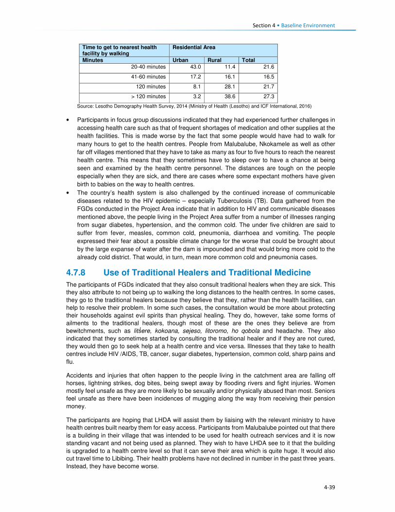
Section 4 • Baseline Environment
4-39
Time to get to nearest health facility by walking
Residential Area
Minutes Urban Rural Total
20-40 minutes 43.0 11.4 21.6
41-60 minutes 17.2 16.1 16.5
120 minutes 8.1 28.1 21.7
> 120 minutes 3.2 38.6 27.3
Source: Lesotho Demography Health Survey, 2014 (Ministry of Health (Lesotho) and ICF International, 2016)
• Participants in focus group discussions indicated that they had experienced further challenges in
accessing health care such as that of frequent shortages of medication and other supplies at the
health facilities. This is made worse by the fact that some people would have had to walk for
many hours to get to the health centres. People from Malubalube, Nkokamele as well as other
far off villages mentioned that they have to take as many as four to five hours to reach the nearest
health centre. This means that they sometimes have to sleep over to have a chance at being
seen and examined by the health centre personnel. The distances are tough on the people
especially when they are sick, and there are cases where some expectant mothers have given
birth to babies on the way to health centres.
• The country’s health system is also challenged by the continued increase of communicable
diseases related to the HIV epidemic – especially Tuberculosis (TB). Data gathered from the
FGDs conducted in the Project Area indicate that in addition to HIV and communicable diseases
mentioned above, the people living in the Project Area suffer from a number of illnesses ranging
from sugar diabetes, hypertension, and the common cold. The under five children are said to
suffer from fever, measles, common cold, pneumonia, diarrhoea and vomiting. The people
expressed their fear about a possible climate change for the worse that could be brought about
by the large expanse of water after the dam is impounded and that would bring more cold to the
already cold district. That would, in turn, mean more common cold and pneumonia cases.
4.7.8 Use of Traditional Healers and Traditional Medicine
The participants of FGDs indicated that they also consult traditional healers when they are sick. This
they also attribute to not being up to walking the long distances to the health centres. In some cases,
they go to the traditional healers because they believe that they, rather than the health facilities, can
help to resolve their problem. In some such cases, the consultation would be more about protecting
their households against evil spirits than physical healing. They do, however, take some forms of
ailments to the traditional healers, though most of these are the ones they believe are from
bewitchments, such as litṥere, kokoana, sejeso, litoromo, ho qobola and headache. They also
indicated that they sometimes started by consulting the traditional healer and if they are not cured,
they would then go to seek help at a health centre and vice versa. Illnesses that they take to health
centres include HIV /AIDS, TB, cancer, sugar diabetes, hypertension, common cold, sharp pains and
flu.
Accidents and injuries that often happen to the people living in the catchment area are falling off
horses, lightning strikes, dog bites, being swept away by flooding rivers and fight injuries. Women
mostly feel unsafe as they are more likely to be sexually and/or physically abused than most. Seniors
feel unsafe as there have been incidences of mugging along the way from receiving their pension
money.
The participants are hoping that LHDA will assist them by liaising with the relevant ministry to have
health centres built nearby them for easy access. Participants from Malubalube pointed out that there
is a building in their village that was intended to be used for health outreach services and it is now
standing vacant and not being used as planned. They wish to have LHDA see to it that the building
is upgraded to a health centre level so that it can serve their area which is quite huge. It would also
cut travel time to Libibing. Their health problems have not declined in number in the past three years.
Instead, they have become worse.

Section 4 • Baseline Environment
4-40
4.8 Education This section describes the provision of education services and infrastructure in Lesotho, Mokhotlong
District and the Project Area.
4.8.1 National Education Services
The Ministry of Education and Training (MoET) is responsible for the management, provision and
regulation of education and training in Lesotho. It is in charge of ensuring the accessibility, quality,
equity and relevance of education. As with many countries in southern Africa, formal education in
Lesotho was introduced and developed through a partnership between the government and religious
organisations; and has been heavily influenced by the work of missionaries. As a result, across the
country, the management of schools is largely (90%) in the hands of the churches; specifically, the
Anglican Church, Lesotho Evangelical Church and Roman Catholic Church.
Government’s involvement in the provision of education, apart from the administrative duties, is
mainly through subsidies; payment of teachers’ salaries and provision of other institutional support.
Teachers are employed under the MoET. The government pays the salaries of more than 95% of the
teachers including those who work at church managed schools. Furthermore, the Government
provides schooling facilities through its capital budget. The provision of education services is guided
by the Education Act (No. 3) of 2010, the Lesotho Education Sector Strategic Plan for 2005 – 2015,
the Higher Education Strategic Plan for 2013/14 – 2017/18 and the National Policy for Integrated
Early Childhood Care and Development (ECCD). Lesotho is also a signatory to the MDG and MoET
seeks to ensure that Lesotho fulfils MDG 2, that of achieving universal primary education by 2015
through the provision of:
• Free and compulsory primary education;
• Bursaries and grants to vulnerable children and households;
• Ongoing school feeding programme; and
• Infrastructure development.
There are also development partners that are actively involved in the education sector through
bilateral and multilateral partnerships. These include among others the European Union, Irish Aid and
United Nations Children’s Fund (UNICEF). The Global Partnership for Education has also played a
significant role in improving the education sector.
4.8.2 Structure of the Education System
After completion of pre-schooling, Lesotho’s education system consists of 12 years of school. The
seven years of primary (Grade 1 – 7); three years of junior secondary (Form A – C); two years of
higher secondary (Form D – E) and four years of tertiary. There is also a parallel technical vocational
diploma course (senior secondary + 3 years Technical and Vocational Education and Training
(TVET). The various cycles of education are highlighted in Table 4.13.
Table 4.13 Structure of the education services in Lesotho
Education Schooling level Age Years Qualification
Pre-school ECCD 3 - 5 3 • Attendance is not compulsory.

Section 4 • Baseline Environment
4-41
Education Schooling level Age Years Qualification
Primary Primary school 6 -13 7 • Attendance is compulsory for children
between the ages of 6 and 13 years old. At
this level, education is free.
• Upon completion of the seven years, pupils
have to write an exam for which they are
awarded the Primary School Leaving
Certificate (PSLC) by the MoET.
Middle Junior secondary school 13 - 16 3 • School fees are payable from this phase
upwards. Pupils who complete this level of
education receive a Junior Certificate from
the MoET.
Secondary High school 16 - 18 2 • School fees are payable at this phase.
Pupils who complete this level of education
receive a Lesotho General Certificate in
Secondary Education (LGCSE).
Technical secondary
school
16 - 18 3 • School fees are payable at this phase.
Pupils who complete this level of education
receive a Technical Vocational Diploma
(Senior Secondary + 3 year TVET).
Tertiary Teacher training/
education in technical
subjects
16 -20 2 • Certificate/Diploma is awarded.
University 18 + 4+ • Receipt of Degrees to Doctorate from the
relevant university.
• National University of Lesotho (NUL) was
the only university in Lesotho until recently
(2008) when Limkokwing University was
established.
4.8.3 Availability of Education Facilities
Lesotho has an estimated 2155 registered education facilities which comprise 14 tertiary/higher
education institutions, 25 technical/vocational centres, 399 secondary schools, 1477 primary schools
and 240 ECCD centres (Table 4.14 and Figure 4.33). TVET schools are found in seven of the 10
districts in Lesotho (i.e. Berea, Leribe, Maseru, Mohale’s Hoek, Mokhotlong, Quthing and Thaba-
Tseka).
There are more primary schools compared to other educational facilities, and this might be attributed
to the government’s drive to meeting its MDGs for the population to at least attain primary school
education. In addition to the above schooling levels and facilities, there are skills centres which are
focused on adult education which are referred to as non-formal education (NFE). These centres are
tailored towards educating out-of-school youth and adults who are illiterate or have only primary
schooling. This service focuses on literacy, numeracy and continuing education. The education
received in these centres is the equivalent of Grade 1 to 10. Participants of FGDs indicated that there
is a high number of pupils who drop out at primary school level. More boys are said to drop out than
girls, and this is attributed to them having to drop out to go and herd animals. Some are said to drop
out to go to initiation school. Male youth from Makhoarane in the downstream area stated that they
did not see the value of education and that they would rather engage in livestock farming. Those girls
who do drop out are said to do so to get married. This means that the government is in part failing to
meet its MDGs of ensuring that all children at least attain primary education.
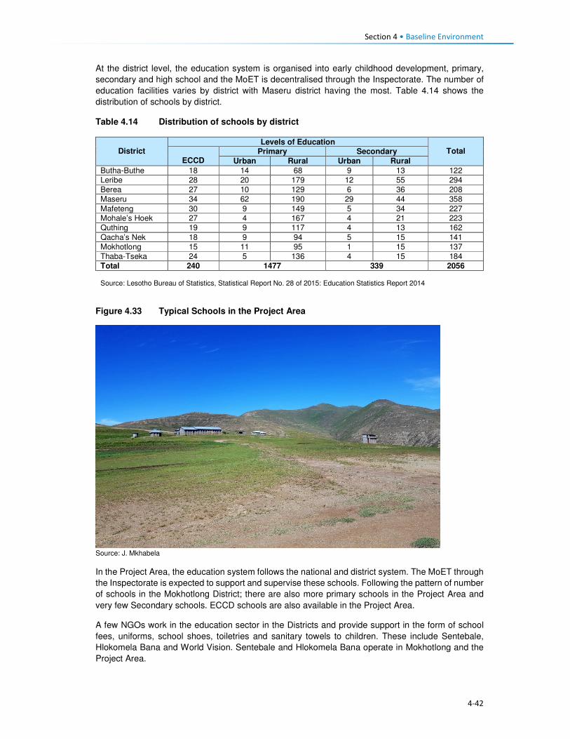
Section 4 • Baseline Environment
4-42
At the district level, the education system is organised into early childhood development, primary,
secondary and high school and the MoET is decentralised through the Inspectorate. The number of
education facilities varies by district with Maseru district having the most. Table 4.14 shows the
distribution of schools by district.
Table 4.14 Distribution of schools by district
District
Levels of Education Total
ECCD Primary Secondary
Urban Rural Urban Rural
Butha-Buthe 18 14 68 9 13 122
Leribe 28 20 179 12 55 294
Berea 27 10 129 6 36 208
Maseru 34 62 190 29 44 358
Mafeteng 30 9 149 5 34 227 Mohale’s Hoek 27 4 167 4 21 223
Quthing 19 9 117 4 13 162
Qacha’s Nek 18 9 94 5 15 141
Mokhotlong 15 11 95 1 15 137
Thaba-Tseka 24 5 136 4 15 184
Total 240 1477 339 2056 Source: Lesotho Bureau of Statistics, Statistical Report No. 28 of 2015: Education Statistics Report 2014
Figure 4.33 Typical Schools in the Project Area
Source: J. Mkhabela
In the Project Area, the education system follows the national and district system. The MoET through
the Inspectorate is expected to support and supervise these schools. Following the pattern of number
of schools in the Mokhotlong District; there are also more primary schools in the Project Area and
very few Secondary schools. ECCD schools are also available in the Project Area.
A few NGOs work in the education sector in the Districts and provide support in the form of school
fees, uniforms, school shoes, toiletries and sanitary towels to children. These include Sentebale,
Hlokomela Bana and World Vision. Sentebale and Hlokomela Bana operate in Mokhotlong and the
Project Area.
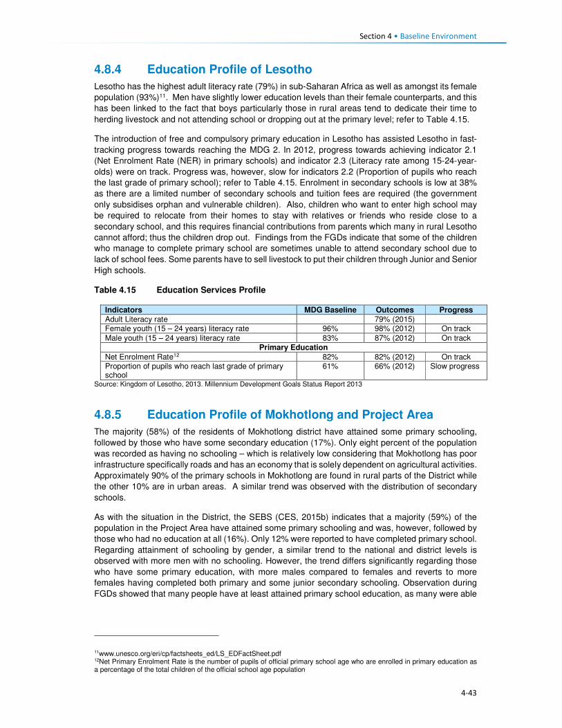
Section 4 • Baseline Environment
4-43
4.8.4 Education Profile of Lesotho
Lesotho has the highest adult literacy rate (79%) in sub-Saharan Africa as well as amongst its female
population (93%)11. Men have slightly lower education levels than their female counterparts, and this
has been linked to the fact that boys particularly those in rural areas tend to dedicate their time to
herding livestock and not attending school or dropping out at the primary level; refer to Table 4.15.
The introduction of free and compulsory primary education in Lesotho has assisted Lesotho in fast-
tracking progress towards reaching the MDG 2. In 2012, progress towards achieving indicator 2.1
(Net Enrolment Rate (NER) in primary schools) and indicator 2.3 (Literacy rate among 15-24-year-
olds) were on track. Progress was, however, slow for indicators 2.2 (Proportion of pupils who reach
the last grade of primary school); refer to Table 4.15. Enrolment in secondary schools is low at 38%
as there are a limited number of secondary schools and tuition fees are required (the government
only subsidises orphan and vulnerable children). Also, children who want to enter high school may
be required to relocate from their homes to stay with relatives or friends who reside close to a
secondary school, and this requires financial contributions from parents which many in rural Lesotho
cannot afford; thus the children drop out. Findings from the FGDs indicate that some of the children
who manage to complete primary school are sometimes unable to attend secondary school due to
lack of school fees. Some parents have to sell livestock to put their children through Junior and Senior
High schools.
Table 4.15 Education Services Profile
Indicators MDG Baseline Outcomes Progress
Adult Literacy rate 79% (2015) Female youth (15 – 24 years) literacy rate 96% 98% (2012) On track
Male youth (15 – 24 years) literacy rate 83% 87% (2012) On track
Primary Education
Net Enrolment Rate12 82% 82% (2012) On track Proportion of pupils who reach last grade of primary school
61% 66% (2012) Slow progress
Source: Kingdom of Lesotho, 2013. Millennium Development Goals Status Report 2013
4.8.5 Education Profile of Mokhotlong and Project Area
The majority (58%) of the residents of Mokhotlong district have attained some primary schooling,
followed by those who have some secondary education (17%). Only eight percent of the population
was recorded as having no schooling – which is relatively low considering that Mokhotlong has poor
infrastructure specifically roads and has an economy that is solely dependent on agricultural activities.
Approximately 90% of the primary schools in Mokhotlong are found in rural parts of the District while
the other 10% are in urban areas. A similar trend was observed with the distribution of secondary
schools.
As with the situation in the District, the SEBS (CES, 2015b) indicates that a majority (59%) of the
population in the Project Area have attained some primary schooling and was, however, followed by
those who had no education at all (16%). Only 12% were reported to have completed primary school.
Regarding attainment of schooling by gender, a similar trend to the national and district levels is
observed with more men with no schooling. However, the trend differs significantly regarding those
who have some primary education, with more males compared to females and reverts to more
females having completed both primary and some junior secondary schooling. Observation during
FGDs showed that many people have at least attained primary school education, as many were able
11www.unesco.org/eri/cp/factsheets_ed/LS_EDFactSheet.pdf 12Net Primary Enrolment Rate is the number of pupils of official primary school age who are enrolled in primary education as a percentage of the total children of the official school age population

Section 4 • Baseline Environment
4-44
to register their names when asked to do so. Also observed was the fact that almost all of the woman
participants could write their name while some could not and wrote a cross.
Due to shortages of qualified teachers and the reluctance of some qualified teachers to work in remote
and hard to reach schools such as those found in Mokhotlong and the Project Area, the use of
unqualified teachers is common. These teachers perform similar roles as qualified teachers though
they have not been trained as teachers, and their wages are paid for by parents. Closely linked to the
shortage of qualified teachers, pupil teacher ratios (PTR) are high. This situation applies to both
primary and secondary schools. A summary of Mokhotlong district education indicators is presented
in Table 4.16.
Table 4.16 Education Services Profile
Indictors Outcome
Primary Education
Total Primary School Teachers 588
• Qualified Primary School Teachers 431 (73%)
• Unqualified Primary School Teacher 157 (27%)
Total Primary School Enrolment in 2014 22,883
Pupil Teacher Ratio (PTR) 39:1
Pupil Qualified Teacher Ratio (PQTR) 53:1
Total Primary School Repeaters 2,215
Secondary Education
Total Secondary School Teachers 212
• Qualified Teachers 198 (93%)
• Unqualified Teachers 14 (7%)
Total Secondary School Enrolment in 2014 5,365
• Male Enrolment 1,786 (33.3%)
• Female Enrolment 3,579 (67%)
Pupil Teacher Ratio (PTR) 24:1
Pupil Qualified Teacher Ratio (PQTR) 26:1
Source: Bureau of Statistics: Statistical Report No. 28 of 2015: Education Statistics Report: 2014
The SEBS (CES, 2015b) indicates that overall, 18% of males in the Project Area had no schooling
while only six percent of females were uneducated and is in line with the national and district reports
on disparities in the levels of education of men and women in Lesotho. This discrepancy was mostly
observed amongst males in the downstream area where 24% of men had no schooling while only
seven percent of females were uneducated. Overall, 61% of the female population across the Project
Area had attained primary education as compared to males at 57%. Refer to Figure 4.34. The people
of town Mokhotlong had higher numbers of people with secondary schooling and above compared to
the other two areas; this can be linked to the fact that Mokhotlong town is the district capital and
slightly urbanised. The town also has a majority of civil servants (who mostly have attained more than
secondary schooling education) residing in the town.

Section 4 • Baseline Environment
4-45
Figure 4.34 Distribution of Schooling Levels across the Project Area
Source: Socio-Economic Baseline Study (CES, 2015b)
Participants of FGDs were of the feeling that there are not enough schools in the Project Area,
especially downstream where children walk long distances to school and sometimes cannot attend
school regularly during the rainy season as the streams/rivers they have to cross flood. Children are
said to start school at a later age (eight or nine and not six years old) as the schools are too far.
People anticipate that LHDA will build schools nearby.
4.8.6 Provision of Education to the Poor and Marginalised
The government of Lesotho implements multiple programmes to ensure that the poor and
marginalised children get access to education services. Disabled and orphaned children, children
from extremely poor households and herd boys are regarded as vulnerable children (Orphans and
Vulnerable Children (OVC)). In order to ensure that these children receive an education, the MoET
has a school bursary scheme, which is paid directly to the schools. Another programme aimed at
assisting these OVC is the Child Grants Programme (CGP). This programme was started in 2009
and was financed by the European Commission with technical support from UNICEF-Lesotho. In
2013 the government of Lesotho took over the financing of the programme. The programme is run
specifically by the Ministry of Social Development (MoSD). The programme is non-conditional social
cash transfer targeted to poor and vulnerable households with the objectives of:
• Improving living standards of OVCs;
• Reducing malnutrition, improve health status; and
• Increasing school enrolment by OVCs.
Qualifying households are selected through a combination of proxy means which include testing and
community validation. The household is then registered on the National Information System for Social
Assistance (NISSA); and subsequently receive funds from the grant.
With the assistance of the World Food Programme (WFP), the government of Lesotho runs a school
feeding programme which provides food for children attending pre-school and primary schooling.
Through the programme, children receive two meals a day, breakfast and lunch. In 2015, the
programme was supporting over 50 000 pre-schoolers and 200 000 pupils in 1025 primary schools
throughout Lesotho13.
13http://www.lesothoreviw.com/education-training-2015.php
0
10
20
30
40
50
60
70
80
None Primary Secondary Secondary + Don’t know
Pe
rce
nta
ge
Catchment Area Male Catchment Area Female Mokhotlong Town Male
Mokhotlong Town Female Downstream Area Male Downstream Area Female

Section 4 • Baseline Environment
4-46
4.8.7 Obstacles to Education
While much has been achieved in ensuring that education services are provided to Basotho, the
sector continues to face challenges at the national and district levels as well as within the Project
Area. The following are some of the challenges faced:
• Low pass rates across all levels of schooling;
• Low standard of education provided at local schools;
• Poor retention rates of pupils at primary and secondary schooling levels due to the limited number
of schools;
• The mountainous terrain of Lesotho also acts as a barrier to construction of schooling facilities
and this has led to a shortage of schooling facilities as well as poor maintenance of existing
schools.
• In the remote rural areas, the learning environment is often poor and characterised by limited
infrastructure including unavailability of classrooms and equipment.
• The shortage of schooling infrastructure also results in pupils and teachers having to walk long
distances to reach the nearest school; this is particularly the case with secondary schooling.
• The limited secondary schooling infrastructure to absorb new entrants into the education system.
• There is a limited number of qualified teachers in the schooling system as many do not want to
transfer and work in remote rural areas with limited public services and infrastructure.
• Lack of public transportation and formal road infrastructure in many remote rural areas, as such
both teachers and pupils have to walk long distances to reach schooling facilities.
• Disparities in the distribution of schools in the country, with rural areas having limited numbers of
schools and urban more. This results in overcrowding of schools and higher teacher/ pupil ratios
which in turn affects the quality of learning and teaching.
• Extreme levels of poverty in the Project Area results in the inability of parents to pay school fees.
4.9 Public Services and Infrastructure This section describes access to public services and infrastructure in the Project Area such as potable
water, sanitation, telecommunications, energy/fuel sources, and roads/transportation; refer to Figure
4.35.

4-47
Figure 4.35 Map showing some Public Services and Infrastructure in the Catchment Area

Section 4 • Baseline Environment
4-48
4.9.1 Access to Potable Water and Sanitation Facilities
4.9.1.1 Access to Potable Water
Almost all urban households in Lesotho have access to improved water sources (96%), and only 77%
of the rural population has access to an improved water system. The type of water sources for urban
and rural populations differed significantly, while the urban population got its water from piped into
dwelling/ yard/ plot (68%), the rural communities got water from public taps/ stand pipes (56%). For
rural communities, this was followed by 23% of water sourced from unimproved water sources and
only five percent had access to piped water into the dwelling/ yard/plot. An estimated 38% of the
rural population had access to water 30 minutes or longer to collect water from which ever source
they use. Overall, the proportion of households obtaining water from improved drinking water sources
in Lesotho has increased from 79% in 2009 to 84% in 2014. Urban households' access to improved
drinking water sources increased from 91% to 97% while the proportion of rural households with
access to improved drinking water sources shifted from 74% in 2009 to 77% in 2014.
Water in urban areas is provided by the Water and Sewerage Company (WASCO), through the
installation of individual water supply. WASCO provided water is billed and paid for. Water in the rural
areas is provided by the Department Rural Water Supply (DRWS). DRWS has guidelines/standards
for communal water supply, that is, 50 metres' walk from each of the households. The Lesotho Rural
Water and Sanitation Project (WSP) in the rural areas provided for improved water and sanitation
services to 27 245 households or approximately 160 000 persons through the construction of new
water systems and ventilated improved pit latrines (VIP). The majority of the population indicated not
treating its water before consumption (88%). As per location, amongst those who reside in urban
settings, only 78% treated the water before consumption, and the rest did not. In turn, rural
households that do not treat water before consumption were at 92%. This was an expected outcome
given the financial constraints of the rural population compared to those who reside in urban settings.
The indicators for access to drinking water sources are provided in Table 4.17.
Table 4.17 Access to Water Sources in Lesotho
Access to drinking water Urban Rural Total
Water sources 96 77 82
Piped into dwelling / yard/ plot 68 5 22
Public tap/ standpipe 26 56 47
Tube well/ borehole 2 8 6
Protected spring 0,5 3 3
Protected well 1 6 5
Rain water 0 0 0
Bottled water 0,1 0 0
Unprotected well 2 10 8
Unprotected spring 2 12 9
Tanker truck/ car with small tank 0 0,5 0,4
Surface water 0,1 1 0,8
Time to obtain drinking water
Water on premises 69 6 23
Less than 30 minutes 25 55 47
30 minutes or longer 6 38 29
Don’t know 0,2 2 1
Source: Lesotho Demography Health Survey, 2014 (Ministry of Health (Lesotho) and ICF International, 2016)
In the Project Area water is mostly collected from communal taps that are scattered through the area.
Access to such communal taps is at 72% in the catchment area and 42% in the downstream area.

Section 4 • Baseline Environment
4-49
For Mokhotlong town, the use of taps includes both communal taps and piped water into the dwelling.
The population in the downstream area further relies on wells as a second source of water (40%).
The government installed the communal taps that the communities use through DRWS. However,
the communities complained that there were not enough communal taps to service their water needs.
In some communities the water taps were non-functional, this was as a result of faulty pipes or broken
taps or solar panels that supply the water pump with power. Villages whose taps were no longer
functioning returned to collecting water from unprotected sources such as springs or wells. Indicated
in Figure 4.36 are protected and unprotected water wells.
Figure 4.36 Protected and Unprotected Water Wells
Source: J Mkhabela
As indicated above, the majority of the households in the Project Area have access to improved water
sources, more specifically communal taps. However, with regards to the time, it takes each way to
reach the tap an estimated 86% of the households indicated having to walk for 30 minutes each way
to fetch water; while 13% walk for more than one hour each way to carry water, as indicated in Figure
4.37. The residents of Mokhotlong town, as expected did not have to walk far to collect water due to
the urban nature of the area. Data gathered from the FGDs also indicated that most villages in the
Project Area do have communal taps, though they pointed out that some of them are seasonal,
producing water only during the rainy season. They explained that when the taps dry up, they collect
water from springs and some even from nearby streams. Few of the interviewed communities take
more than one hour to collect water.
Figure 4.37 Time taken from Household to Water Source
Source: Socio-Economic Baseline Study (CES, 2015b)
Water is collected mostly two to three times per day by different households at 46% and 24%
respectively. Some households collect water more than three times a day.
0
20
40
60
80
100
0 to 15minutes
15 to 30minutes
30 to 45minutes
45 min. to 1hr.
> 1 hr.
Catchment area Downstream area Mokhotlong Town

Section 4 • Baseline Environment
4-50
4.9.1.2 Access to Sanitation Facilities
Approximately five in 10 households in Lesotho commonly use improved toilet facilities. These are
defined as non-shared facilities that prevent people from coming into contact with human waste and
thus reduce the transmission of cholera, typhoid, and other diseases (LDHS 2014 (MoH and ICF
International 2016). Overall, 29% of the households in Lesotho have no access to sanitation facilities,
with the majority of the population without toilets residing in the rural area (39%) and six percent in
urban areas. Shared/public toilet facilities are found in the urban areas compared to the rural areas
at 45% and nine percent respectively. Shared/public toilet facilities are common in urban areas,
especially in shopping centres and malls.
In general, the proportion of urban households with improved toilet facilities has increased since 2009,
rising from 26% to 41%; while in rural households, the proportion has more than doubled (rising from
22% to 50%). During this same period, the proportion of rural households without any toilet facilities
decreased from 45% to 38%. FGD respondents said there are few toilets in their villages and those
who don't have them use the bush. People anticipate that LHDA will build each household in the
Project Area a toilet so that the Polihali Dam does not become contaminated.
Table 4.18 Access to Sanitation Facilities in Lesotho
Access to Sanitation Facilities Urban Rural Total
Percentage
Improved 49 52 51
Flush/ pour flush14 to piped sewer 4 0 1
Flush/ pour flush to septic tank 3 0,2 1
Flush/ pour flush to pit latrine 0 0 0
Ventilated improved pit (VIP) latrine 7 16 14
Ordinary pit latrine 35 35 35
Shared facility 45 9 19
Flush/ pour flush to piped sewer 0,3 0 0,1
Flush/ pour flush to septic tank 0,3 0 0,1
Ventilated improved pit (VIP) latrine 6 1 2
Ordinary pit latrine 39 8 17
Unimproved facility 6 39 30
Flush/ pour flush not to piped sewer/ septic tank / pit latrine 0,4 0 0,1
Pit latrine without slap / open pit 1 1 1
No facility/ bush 5 38 29 Source: Lesotho Demography Health Survey, 2014 (Ministry of Health (Lesotho) and ICF International, 2016)
In the Project Area, the majority of the respondents indicated having no access to sanitation facilities.
This was observed mostly in the downstream area where 80% of the households had no access to
toilets, followed by 12% with access to VIP toilets, five percent with access to pit latrines and the
remaining three percent having access to other forms of sanitation facilities. In turn, the population in
the catchment area reported that 59% had no access to toilets, 27% had VIP and 11% pit latrines
and the remaining three percent had access to other forms of sanitation facilities. In Mokhotlong town,
the most common toilet facilities that the population has been VIP toilets (56%), followed by 31%
using without any form of sanitation facilities, nine percent used pit latrine and three percent had
14A pour flush toilet is a toilet without a cistern and whereby bath water is used to pour straight into the pan.

Section 4 • Baseline Environment
4-51
access to other forms of sanitation facilities. A small number of households had flush toilets (one
percent).
Figure 4.38 Example of Sanitation Facilities in the Project Area
Source: J. Mkhabela
The public participation and FGD field teams also noticed through questions asked and observation
the marked lack of toilets in the villages where they were working, and witnessed people using bushes
near their homes especially overgrown areas by the streams and rivers. Refer to Figure 4.39 for
additional information on access to toilet facilities in the Project Area.
Figure 4.39 Access to Sanitation Facilities in the Project Area
Source: Socio-Economic Baseline Study (CES, 2015b)
4.9.2 Access to Policing Services
There are two police stations in the district of Mokhotlong, with one based in Mokhotlong town and
the other in Mapholaneng and both of them are, incidentally, located within the Project Area. Data
gathered from the interview with the police, indicate that there is a total of 150 police officers in
Mokhotlong district. Slightly over half (54%) of the people from the Project Area make use of the
Mokhotlong town police station, while 45% use the Mapholaneng station and the remaining one
percent made use of village policing. FGD participants indicated that in most of the villages there are
community policing forums (mahokela), which fight crime at village level and work hand in hand with
0%
10%
20%
30%
40%
50%
60%
70%
80%
90%
Catchment Area Downstream Area Mokhotlong Town
Bucket System Chemical Toilet Flush Toilet - Septic Flush Toilet - System
Other Pit Latrine VIP toilet Nothing
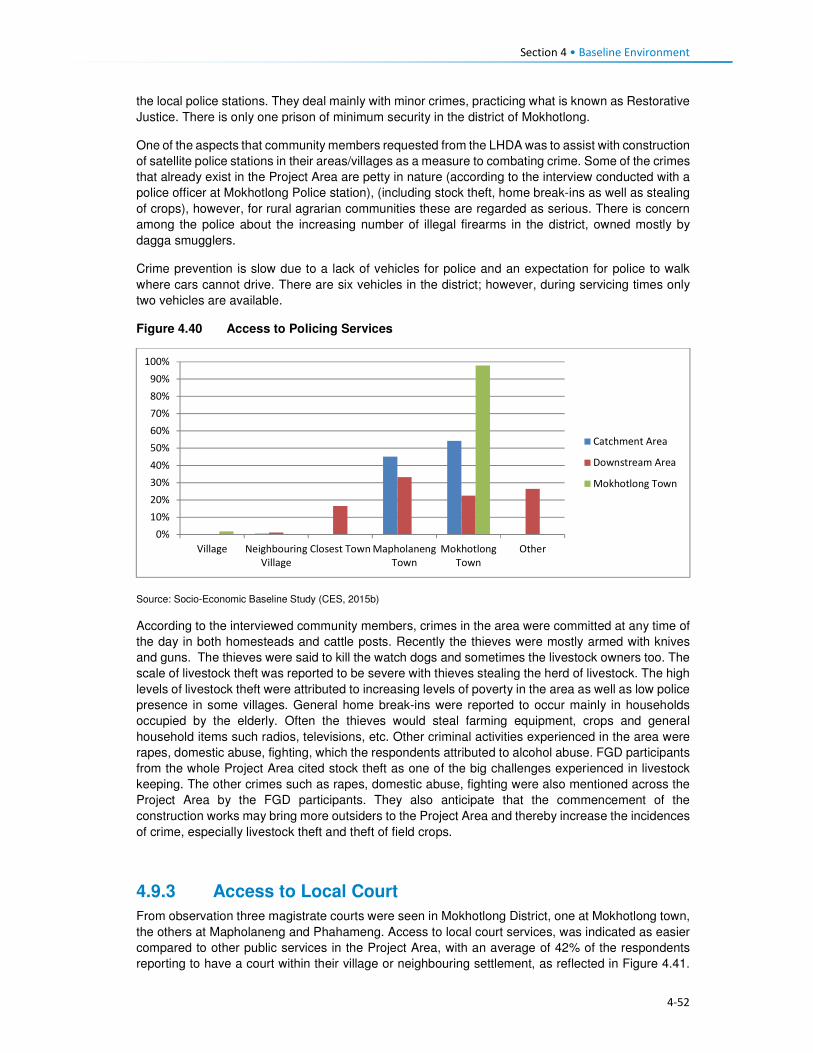
Section 4 • Baseline Environment
4-52
the local police stations. They deal mainly with minor crimes, practicing what is known as Restorative
Justice. There is only one prison of minimum security in the district of Mokhotlong.
One of the aspects that community members requested from the LHDA was to assist with construction
of satellite police stations in their areas/villages as a measure to combating crime. Some of the crimes
that already exist in the Project Area are petty in nature (according to the interview conducted with a
police officer at Mokhotlong Police station), (including stock theft, home break-ins as well as stealing
of crops), however, for rural agrarian communities these are regarded as serious. There is concern
among the police about the increasing number of illegal firearms in the district, owned mostly by
dagga smugglers.
Crime prevention is slow due to a lack of vehicles for police and an expectation for police to walk
where cars cannot drive. There are six vehicles in the district; however, during servicing times only
two vehicles are available.
Figure 4.40 Access to Policing Services
Source: Socio-Economic Baseline Study (CES, 2015b)
According to the interviewed community members, crimes in the area were committed at any time of
the day in both homesteads and cattle posts. Recently the thieves were mostly armed with knives
and guns. The thieves were said to kill the watch dogs and sometimes the livestock owners too. The
scale of livestock theft was reported to be severe with thieves stealing the herd of livestock. The high
levels of livestock theft were attributed to increasing levels of poverty in the area as well as low police
presence in some villages. General home break-ins were reported to occur mainly in households
occupied by the elderly. Often the thieves would steal farming equipment, crops and general
household items such radios, televisions, etc. Other criminal activities experienced in the area were
rapes, domestic abuse, fighting, which the respondents attributed to alcohol abuse. FGD participants
from the whole Project Area cited stock theft as one of the big challenges experienced in livestock
keeping. The other crimes such as rapes, domestic abuse, fighting were also mentioned across the
Project Area by the FGD participants. They also anticipate that the commencement of the
construction works may bring more outsiders to the Project Area and thereby increase the incidences
of crime, especially livestock theft and theft of field crops.
4.9.3 Access to Local Court
From observation three magistrate courts were seen in Mokhotlong District, one at Mokhotlong town,
the others at Mapholaneng and Phahameng. Access to local court services, was indicated as easier
compared to other public services in the Project Area, with an average of 42% of the respondents
reporting to have a court within their village or neighbouring settlement, as reflected in Figure 4.41.
0%
10%
20%
30%
40%
50%
60%
70%
80%
90%
100%
Village Neighbouring
Village
Closest Town Mapholaneng
Town
Mokhotlong
Town
Other
Catchment Area
Downstream Area
Mokhotlong Town

Section 4 • Baseline Environment
4-53
Mapholaneng and Mokhotlong town’s courts were commonly used by the respondents. According to
the respondents, part of the village court system is linked to the chiefs hearing cases, especially those
relating to the collection and utilisation of natural resources. Chiefs and Councillors reserve the rights
to fine anyone who has been found in contravention of laws governing the utilisation of natural
resources (refer to the discussion under Governance, section 2.1). Repeat offenders are taken to the
local magistrate courts for prosecution by the Chiefs and Councils – this indicates a complimentary
relationship between the traditional and formal court systems. FGD respondents also described the
traditional court system existing within their villages/areas that involved chiefs and councillors where
people have to start at even before being referred to a magistrate court.
Figure 4.41 Access to Local Courts
Source: Socio-Economic Baseline Study (CES, 2015b)
4.9.4 Access to Banking Services
Banking services are mostly limited to the more established towns of the Project Area, namely
Mapholaneng and Mokhotlong town. As such the majority of the respondents both in the catchment
and downstream areas indicated using such services in these towns (28% and 37%) respectively, as
indicated in Figure 4.42. The “other” category also featured at 34% for the downstream population
which included stokvels and savings and burial schemes. The men who participated in the male FGD
at Taung mentioned having a savings scheme, formed of men only that lend money to people to be
paid back with interest. Respondents of FGDs also explained that people from the Project Area have
bank accounts, especially the people who rear sheep and goats who get paid for their wool and
mohair.
0%
10%
20%
30%
40%
50%
60%
Own village Neighbouring
Village
Closest Town Mapholaneng
Town
Mokhotlong
Town
Other
Catchment Area Downstream Area Mokhotlong Town

Section 4 • Baseline Environment
4-54
Figure 4.42 Access to Banking Services
Source: Socio-Economic Baseline Study (CES, 2015b)
4.9.5 Access to Agricultural Input and Equipment
Again, the most established towns of Mapholaneng and Mokhotlong were identified as the main areas
where people purchase agricultural inputs and equipment. The population from the downstream area
indicated that they purchase their agricultural inputs and equipment in various locations, as indicated
below. This could be attributed to various factors but more specifically issues of access, some
downstream areas are located closer to Mokhotlong, Mapholaneng, Tlokoeng and Katse and these
areas also have outlets that sell agricultural inputs and equipment.
Figure 4.43 Access to Agricultural Inputs and Equipment
Source: Socio-Economic Baseline Study (CES, 2015b)
4.9.6 Access to Local Markets and Shops
Overall, 35% of food purchases were reported to occur within the home or neighbouring villages, with
the towns of Mapholaneng and Mokhotlong accounting for 23% and 24% of all purchases,
respectively. It stands to reason that easy access to food shops within one’s own village would reduce
the amount of time and cost incurred in purchasing food, whilst visiting the town area may result in
0%
10%20%
30%40%
50%60%
70%80%
90%100%
Own village NeighbouringVillage
Closest TownMapholaneng MokhotlongTown
Other
Catchment Area Downstream Area Mokhotlong Town
0%
10%
20%
30%
40%
50%
60%
70%
80%
90%
100%
Catchment Area Downstream Area Mokhotlong Town
Village Neighbouring Village Closest Town Mapholaneng Mokhotlong Town Other

Section 4 • Baseline Environment
4-55
increased time and travel costs in purchasing food and decrease the amount of food purchased in
order to cover the costs of transportation. Furthermore, people within the catchment area are likely to
purchase food stuff in Mokhotlong town which is closest to their locale, while people in the western
part of the catchment area would purchase food in Mapholaneng and Thaba-Tseka. The latter could
be better accessed by people from the villages downstream of the Dam, who are already located
within Thaba-Tseka District.
Figure 4.44 Access to Local Markets and Shops
Source: Socio-Economic Baseline Study (CES, 2015b)
4.9.7 Access to Telecommunications
Telecommunication services in the Project Area are concentrated in the established town areas of
Mokhotlong and Mapholaneng. In these areas, people have both access to landline telephones and
cellular phones. For obvious reasons, the number of households with cellular phones outweighs
those with landline telephones. The more remote parts of the Project Area have no cellular phone
signal as such, hence the ownership and use of cellular phones is limited, though the people pointed
out that they still buy and own cellular phones in the hope that they will eventually get
telecommunication towers. Similarly, to ownership of landline telephones, computer access was
found to be concentrated in the town areas. Overall, 22% of the population in the Project Area
reportedly did not have access to any means of telecommunications; information to these
communities is passed on through the word of mouth.
4.9.8 Access to Transportation
There is only one road that links Mapholaneng to Mokhotlong town. It is also one of the two only
tarred roads within Mokhotlong District. The other tarred road leads from Mokhotlong town to Sani
Pass. Besides these two there are other unpaved roads that form a network of roads that are used to
access villages located around the proposed dam. The roads are in different levels of disrepair with
some that were observed to be totally untraversable. The other major road that is found in the district
is the one connecting the District of Mokhotlong to that of Thaba-Tseka. It has been observed to be
unpaved and in a bad condition is some areas if not all. Some of the road and bridges are observed
to be going to be inundated when one looks at where the beacons have been installed.
The FGD respondents from the Project Area are concerned about the loss of the roads and bridges
to be inundated and would like the LHDA to replace them as a form of mitigation. The respondents
from the eastern side of the proposed dam are concerned that LHDA has not said anything to them
about a tarred road on their side of the dam. They complained that all the proposed project
infrastructure is on the Tlokoeng side of the dam. They are also concerned that there is no tarred
0%
20%
40%
60%
80%
100%
Catchment Area Downstream Area Mokhotlong Town
Village Neighbouring Village Closest Town
Mapholaneng Mokhotlong Town Other

Section 4 • Baseline Environment
4-56
road and bridge that seems to be planned to connect the Khalahali side of the dam to that of Tlokoeng.
They are very concerned that they are expected to go via Mokhotlong and Mapholaneng towns when
they travel to the other side of the river (Tlokoeng side). They are even worried that they will not be
able to cross the Senqu River to go and look for work when construction works commence.
The modes of transport currently used include walking, horse-riding, use of taxis and buses, with
donkeys used as beasts of burden and for transport. The respondents from the Project Area, including
downstream would like to see LHDA assist them with construction of feeder roads to make it easier
to reach their villages, health centres, schools and the Mokhotlong town.
4.10 Vulnerability and Marginalisation Vulnerable or disadvantage groups are defined by IFC as individuals or groups within the Project
Area who could experience adverse impacts from the proposed Project more severely than others
based on their vulnerable or disadvantaged status. This status may stem from an individual's or
group's race, colour, gender, language, religion, political, or other opinion, national or social origin,
property, birth or other status. In addition other factors should be considered such as gender, ethnicity,
culture, sickness, physical or mental disability, poverty or economic disadvantage, and dependence
on unique natural resources15. In the Project Area, the broad categories of people who should be
considered to have some level of vulnerability are:
• Women;
• The elderly;
• Youth;
• Herd boys;
• Orphaned children; and
• Disabled or chronically ill persons.
These groups are described in more detail in the following sections.
The Ministry of Social Development is responsible for leading and facilitating the provision of
sustainable social development services that are universally accessible to all groups of people in
Lesotho in collaboration with other key stakeholder. The ministry in partnership with other key
stakeholders has over the recent years implemented a number of social protection initiatives such as
the:
• School feeding programme that is linked to free primary education and health care,
• Old age pension which is offered on a universal basis to all qualifying citizens;
• Child grant programme (CGP);
• OVC bursary programme;
• Public assistance programme; and
• Implementation of the national information system for social assistance (NISSA); which begun as
a tool of the CGP.
In 2014 the ministry through the assistance of the European Union and UNICEF developed the
National Social Protection Strategy (2014/15 – 2018/19) which was officially launched in 2015 (See
Section 2.2).
4.10.1 Women
Women of the Project Area are mainly regarded as vulnerable due to the poor / or inadequate access
to public services such as health care. Women dwelling in a village without a health centre often give
15IFC Glossary of Terms, http://www1.ifc.org/wps/wcm/connect/corp_ext_content/ifc_external_corporate_site/home

Section 4 • Baseline Environment
4-57
birth at home or are expected to leave their homes to await childbirth in another village whilst living
with non-family/ non-relations. In case of medical emergencies during home births, women are often
at higher risk because of the lack of transportation.
Similarly, to most youths in the District and Project Area, the population has a shortage of high
schools, and the distances that will be required to walk to and from school discourages the people
from attending school. Women’s vulnerability as it relates to the Project may be linked to low potential
for women to securing to long-term permanent jobs due to their low levels of education and possibly
lack of skills to carryout jobs beyond cleaning services. Both women and youth of limited education
are more unlikely to secure jobs during the construction and operational phases and they would both
be deemed vulnerable.
Loss of land by female headed households due the Project land take will increase their vulnerability
should their land acquired by the Project be not replaced.
4.10.2 The Elderly
The elderly are generally recognised as being vulnerable due to their age. The elderly remains in
high social standing as long as they are productive; however, they lose this standing once they
become dependent on the younger generations for assistance in meeting their basic needs (e.g.
housing, water, food). Furthermore, the elderly is often targeted by criminals for their pension. The
elderly are usually not in a position to take advantage of the benefits typically associated with large
projects such as the Polihali Dam Project.
4.10.3 Youths
For the purposes of this assessment, youth are quantitatively defined as persons aged approximately
15 to 35 or, recognising variations by cultural context, qualitatively defined by their degree of
independence with respect to their obtainment of a livelihood, relationship status (i.e. marriage,
children), and living arrangements.
Youth can be recognised as vulnerable, though in a way distinct from other categories listed above.
Being at their physical prime but often facing an unknown future, youth may be seen as both
empowered and disempowered. Youth are vulnerable in the sense that they are between dependence
(childhood) and independence (adulthood) and, without access to resources and support to enable
their transition to adulthood, youth may face a large degree of instability in their lives. Youth only
inherit land once they have reached full adulthood and marriage, and until then are dependent on
their parents.
Another characteristic of youth is that it is a time when individuals are developing their identities and
questioning societal norms; when youth perceive that their economic and social prospects are poor,
they may engage in antisocial behaviour. Youths within the Project Area often lack the education,
skills and qualifications to secure meaningful jobs. In case of youths still in school, there exists a hope
that they will in the future, secure scholarships or bursaries and subsequently employment with the
Project to attained tertiary education.
4.10.4 Herd boys
Herd boys are often youths who left school early due to their impoverished families not being able to
pay for their way through school, while some leave school to pursue livestock herding in order to start
building their livestock herds. The lifestyle of herd boys is tough and dangerous due to the period of
time spent away from home living in cattle posts located high in the mountains. In the winter months
when it snows many die in fires when they fall asleep without putting fires out. Sometimes, herd boys
are killed by robbers raiding their cattle posts to steal livestock; or in violent fights between the
herders.
Herd boys who choose to leave their jobs in anticipation to secure permanent work with the Project
may be vulnerable should they fail to secure the anticipated jobs with the Project. Given the general

Section 4 • Baseline Environment
4-58
lack of employment opportunities and the herd boys lack of schooling and skills beyond livestock
herding, they will find it difficult to secure a new job thus losing their source of stable income.
4.10.5 Orphaned Children
Orphaned children in the area are vulnerable due to the poor care they receive from extended family
upon the death of their parents or guardians. They often do not attend school or receive any medical
care. The ages of orphans who are eligible for project related benefits range from 0 -17.
4.10.6 Disabled or Chronically Ill Persons
Disabled persons should be recognised as vulnerable as they are unlikely to be able to access the
Project benefits but would be vulnerable to change brought about by the Project. People living with
HIV/AIDS and TB can be considered to be disabled as their ability to remain healthy and maintain
their livelihoods is often compromised by their illness.
5-1
Section 5 Impact Assessment
5.1 Introduction This section provides a description of the predicted social impacts associated with implementation of
the Project. The impacts are mostly divided in accordance to the various phases of the Project, with
the exception of impacts whose impact significance remains unchanged in all phases.
5.2 Overview and Context 5.2.1 Overview
This section assesses the socio-economic impacts and benefits anticipated during the construction
and inundation phases of the Project. The impacts have been assessed against the backdrop of the
baseline socio-economic environment (Section 4). One of the most significant socio-economic impacts
arising from the Project is the need for resettlement of at least 203 households from below the FSL
and the relocation of a further 134 households that may be dangerously located, together with
extensive loss of arable and grazing land. This will result in a number of related impacts on the already
strained and limited natural resources in the area. The physical and economic displacement impacts
are described in Sections 5.3 and 5.3.1.1.
The construction phase of the Project is scheduled to take five to seven years to complete, with
construction activities ramping up during the construction of the dam and appurtenant works. At its
peak, 3500-4000 jobs will be created which will bring both benefits (local job creation) and negative
impacts (influx of work-seekers, anti-social behaviour, pressure on local infrastructure, etc.). The
realisation of the benefits and the mitigation of the impacts will take careful management and
collaboration between LHDA and various government departments as discussed below.
5.2.2 Community Expectations Related to the Project
During the stakeholder engagement process (undertaken between September 2016 (commencement
of sensitisation meetings) and March 2017), it was evident that the majority of people living in the
Project Area are in support of the Project and are hopeful of the many anticipated social and economic
benefits that will be realised. While many concerns and questions were raised, the communities are
impatient for the project to start, after many years of planning and ongoing consultation for different
studies. The communities in the Project Area have exceedingly high expectations of the real and
perceived benefits. The Stakeholder Engagement Report documents the issues and expectations
raised by all stakeholders consulted (Sechaba & ERM, 2017).
As with any large-scale project, the surrounding communities immediately begin to anticipate benefits;
some are real and some are possible but will not arise as a direct result of this Project. During the
stakeholder engagement and data gathering forums, people grabbed the opportunity to highlight their
needs16. Many of these needs are linked directly to the lack of social infrastructure and services in the
Project Area. It was evident that they anticipate that, over time, relevant authorities and service
providers will deliver much needed social infrastructure and services thus serving to improve their
overall quality of life. Based on this feedback, it is clear that the community have unreasonably high
expectations of LHDA, their appointed contractors, and other government authorities (e.g. LEC) in
terms of delivering benefits and addressing needs. While it is conceivable that, over time, social
infrastructure and services could be delivered, this is not going to be as a direct result of this Project
16 Respondents were asked to identify potential positive and negative impacts that they expected to arise as a result of the
Project; some of the positive impacts raised were perceived benefits/ needs that could potentially be delivered in the future by responsible parties’ due to improved access. They were informed that these benefits are not going to arise as a direct result of LHDA, the appointed contractors or the authorities.

Section 5 • Impact Assessment
5-2
or the Project role-players. The anticipated benefits based on high community expectations that were
raised in the meetings include:
• Provision and improvement of public services and infrastructure such as high schools, health
centres, improved road access, improved sanitation and water facilities;
• Electrification of local households;
• Early receipt of compensation for all losses incurred (i.e. prior to actual loss of land/ structures);
• Provision of scholarships and bursaries for local youths;
• Local upskilling and work experience;
• Creation of employment opportunities;
• Prioritisation of local people for all unskilled jobs;
• Sharing benefits of revenue paid by South Africa to the Government of Lesotho;
• New market opportunities to encourage trading and increased local business activity; and
• Reduction of crime due to increased police presence in the area.
It is possible that these high expectations, if not met, may lead to increased levels of dissatisfaction
and future grievances. Stakeholders have already indicated that there is a significant time lapse
between registering grievances to their resolution. It is, therefore, possible that if the expectations of
the Project are not met, levels of dissatisfaction may escalate to the point of general unrest and conflict.
Recommendations to address the high expectations of the Project stakeholders are proposed below.
5.2.2.1 Recommended Mitigation Measures
• Continued engagement with communities through the existing structures formed; with the LHDA
continuing to monitor the current stakeholder engagement procedures for improvements when
required;
• LHDA will clearly communicate with communities the ambit of LHDA / contractor responsibilities,
and government responsibilities, and shared responsibilities where formal MoUs exist;
• LHDA and the appointed contractors will implement measures to maximise local employment and
business developments and opportunities, as outlined in Sections 5.3.5.4 and 5.3.6.4;
• Through the CLCs, LHDA will increase awareness of the grievance resolution procedure amongst
the communities;
• LHDA must ensure that all registered stakeholder grievances are responded to timeously;
• LHDA will continuously monitor the use of the procedure;
• Communities throughout the Project Area should be included within livelihood restoration and
social development initiatives as part of the SDMP for LHWP Phase II, which will serve to address
some of the expectations of the local communities. LHDA and the appointed contractors will
continue to work closely with the CLCs to ensure on-going identification and management of
stakeholder issues and concerns, where possible, and in accordance with the SDMP;
• LHDA will regularly communicate information updates about the Project activities as well as SDMP
projects and benefits, as required; and
• LHDA must communicate and coordinate the planning and implementation of community projects
so that there is uniformity in their approach. This will avoid stakeholder confusion about the roles
of the various partners.
5.2.3 Project Area Context and Sense of Place
The Project Area is predominantly rural in character. Villages are scattered throughout the area, the
majority of which are relatively isolated given the degraded state of the road network. Those located
closest to the A1 between Mapholaneng and Mokhotlong are the most accessible. Except for villages
located on the more passable unpaved roads which are served by taxis, transport to and from villages
is generally on foot, donkey or horse and most household supplies are transported on donkeys.
The villages are each relatively small (mostly numbering between 20 and 100 homesteads) and
comprise residential structures and outbuildings, which are largely constructed of locally sourced

Section 5 • Impact Assessment
5-3
materials (stone, mud, and thatch). Houses in the larger settlements along the paved or major unpaved
roads may be of concrete brick and corrugated iron.
Most families use woody shrubs, cow dung and some wood as their primary fuel source; the cost of
other fuel sources is prohibitive for most households. The only villages that have electrical connections
are in Mokhotlong and Mapholaneng, and some villages along the A1. There are no large-scale
commercial or industrial developments in the area.
The surrounding landscape is generally steep and sparsely vegetated with grass interspersed with
rocky outcrops. Lower gradient slopes along the river and stream valleys and where deeper soils occur
on the plateau and higher slopes, are used for cropping predominantly maize and wheat. Cropping
and livestock farming is the mainstay of the majority of households. Noise and light levels are low.
For most of the population, this rural environment and lifestyle is all they know. The families living
throughout the area are reliant on the land and work very hard to sustain themselves. To them, this is
a harsh environment that is isolated and remote, resulting in limited opportunities and a lack of much
needed social infrastructure and essential services. To privileged outsiders, the peace and quiet, and
‘quaint’ traditional villages are considered to be a desirable relief from high-paced city life.
The photographs in Figure 5.1 illustrate the physical landscape and provides a general sense of the
remoteness and character of the Project Area.
Based on feedback during stakeholder engagement, the majority of the local people are looking
forward to the construction and operation of the Project. It appears that to most people, this symbolises
positive changes that will bring about much needed development and more diverse economic
opportunities. The anticipated changes are directly related to meeting basic needs and improving the
quality of life for local residents; including improved access to schooling, healthcare, water, sanitation,
electricity, transport options, and economic opportunities. People are also aware of some of the risks,
many of these were raised and have been incorporated and assessed as part of this SIA.
Sense of place is the unique value that is allocated to a specific place or area through the cognitive
experience of the user or viewer. It is generated by varying combinations of a range of factors
including; land use, character and quality of a landscape, as well as by the tangible and intangible
value assigned thereto. As such, sense of place is a subjective matter that differs from person to
person based on individual backgrounds, experiences, norms, values and aspirations. It is almost
impossible to describe, let alone quantify the sense of place and the potential impacts thereon. One
thing is for certain, this Project, and the associated Project components, will result in significant
changes to the area. Influx of workers and work-seekers will bring both positive and negative impacts,
there is potential for improved infrastructure and services, and there will be increased opportunities to
generate income resulting from greater demand for goods and services, as well as improved access
to outside markets.
While many factors that influence the sense of place are tangible (e.g. increased development, more
people, noise, visual changes, dust), sense of place can also be significantly altered as a result of a
change in intangible factors (e.g. socio-cultural norms and values). With an influx of people from
outside the area, as well as work experience and increased disposable income, the local people will
be exposed to differing world views, cultures, attitudes, norms and values. Naturally, people will begin
to change based on these interactions. This change will be experienced gradually overtime as people
slowly become influenced and affected by these external factors.

Section 5 • Impact Assessment
5-4
Figure 5.1 Photographs Illustrating the Look and ‘Feel’ of the Project Area (Top: view
towards dam wall location at centre; Bottom: view of Tloha-re-Bue near
construction areas)
Some residents (predominantly young and more educated people) will welcome these changes and
opportunities and will be able to maximise the resultant benefits. Other people (predominantly the
elderly, less educated and more traditional) may find it difficult to adapt to (or resist) the inevitable
changes and will therefore be more likely to experience the negative impacts more acutely. Either way,
the sense of place will be altered and cannot be prevented or reversed. The positive and negative
impacts described for the construction and operation phases of the Project can be mitigated, in part,
thus hopefully reducing the negative impacts and enhancing the positive impacts. However, change
is inevitable and cannot be fully controlled.
The changed sense of place (including changed culture, norms and values) could give rise to
increased levels of anxiety, tension and conflict. In response, the population may direct their
dissatisfaction toward the Project. Impacts on sense of place and changed socio-cultural norms and
values cannot be mitigated directly; they will be addressed indirectly through the mitigation measures
proposed for the socio-economic impacts detailed in the remainder of this section.
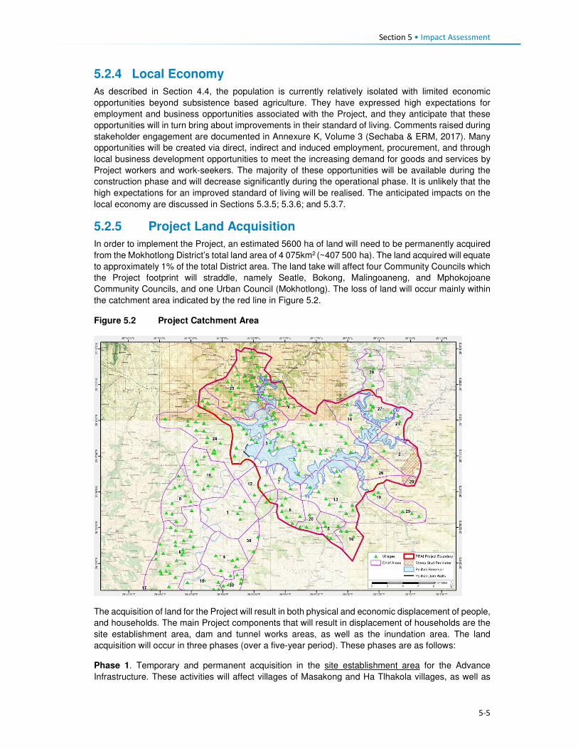
Section 5 • Impact Assessment
5-5
5.2.4 Local Economy
As described in Section 4.4, the population is currently relatively isolated with limited economic
opportunities beyond subsistence based agriculture. They have expressed high expectations for
employment and business opportunities associated with the Project, and they anticipate that these
opportunities will in turn bring about improvements in their standard of living. Comments raised during
stakeholder engagement are documented in Annexure K, Volume 3 (Sechaba & ERM, 2017). Many
opportunities will be created via direct, indirect and induced employment, procurement, and through
local business development opportunities to meet the increasing demand for goods and services by
Project workers and work-seekers. The majority of these opportunities will be available during the
construction phase and will decrease significantly during the operational phase. It is unlikely that the
high expectations for an improved standard of living will be realised. The anticipated impacts on the
local economy are discussed in Sections 5.3.5; 5.3.6; and 5.3.7.
5.2.5 Project Land Acquisition
In order to implement the Project, an estimated 5600 ha of land will need to be permanently acquired
from the Mokhotlong District’s total land area of 4 075km2 (~407 500 ha). The land acquired will equate
to approximately 1% of the total District area. The land take will affect four Community Councils which
the Project footprint will straddle, namely Seatle, Bokong, Malingoaneng, and Mphokojoane
Community Councils, and one Urban Council (Mokhotlong). The loss of land will occur mainly within
the catchment area indicated by the red line in Figure 5.2.
Figure 5.2 Project Catchment Area
The acquisition of land for the Project will result in both physical and economic displacement of people,
and households. The main Project components that will result in displacement of households are the
site establishment area, dam and tunnel works areas, as well as the inundation area. The land
acquisition will occur in three phases (over a five-year period). These phases are as follows:
Phase 1. Temporary and permanent acquisition in the site establishment area for the Advance
Infrastructure. These activities will affect villages of Masakong and Ha Tlhakola villages, as well as

Section 5 • Impact Assessment
5-6
households from Ramonakalali, Mabunyaneng, Makalong and Tsekong. Masakong and Ha Tlhakola
will be affected by physical and economic displacement and the remainder by economic displacement
(Figure 5.2).
Phase 2. Permanent land acquisition in the inundation area around Tloha-re-Bue and the remainder
of the site establishment area (for instance the Tunnel Works Area, Substation, but also the PNEAR-
not part of this ESIA). Tloha-re-Bue is partly affected by physical and economic displacement.
Phase 3. The remainder of the inundation area, covering several villages including Ha Jobere, Koung
Ha Phohla, Tsekong and Litsotsong, and Ha Sikantsi are all affected to varying degrees by physical
and economic displacement; and all economic displacement (loss of fields, trees and thickets within
the inundation area) affecting households in surrounding villages, which are not physically affected.
The land that will be affected is currently used for grazing, collection of natural resources, cultivation
of crops, and settlements as depicted in Table 5.1; with land used for grazing being most affected and
the primary land use of the land. Figure 5.3 indicates villages that will experience physical and
economic displacement.
Table 5.1 Land use distribution within the Catchment Area
Land use (across the Catchment Area) Land area per use
Cultivated areas 13 176 ha (35%) Settlement areas 2280 ha (6%)
Grazing areas 19 365 ha (52%)
Mountainous areas 2687 ha (7%)
Source: P2W-6014-DFR-0007, 2017
Table 5.2 highlights all the villages and the approximate number of households per village likely to
be physically displaced by the Project. Figures provided in this table are estimated numbers based
on the Feasibility Study and current predictions. These still need to be verified by the resettlement
specialist team
Table 5.2 Estimate of Villages and Households to be Displaced
Classification Village name Households below reservoir demarcation line (DL)
Households dangerously located
Fully below Reservoir DL Map ref. 1 to 5
Ha Jobere 6 Unknown
Ha Tlhakola 18 Unknown
Lits'otsong 5 Unknown
Tsekong 28 Unknown
Ha Sekants’i 13 13
Partially below Reservoir DL Map ref. 6 to 8
Tloha-re-Bue 40 13
Koung Ha Phohla 32 36
Sekokong 3 5
Site establishment area Map ref. 9 & 10
Masakong 50 Unknown
Malingoaneng & Meeling
8 41
Potentially Dangerous Location (safety) Map ref. 11 to 16
Liphokong Unknown (7)
Ha Mpesi Unknown (4)
Koung Ha Thunyane Unknown (3)
Ha Meta /Ha Manka Unknown (3)
Makhalong Unknown (3)
Lilimala Unknown (6)
Potential Isolation Map ref. 17 & 18
Bokone & Morojeleng Unknown Unknown
Total 18 203 95 (+26 unbudgeted for) 121

5-7
Figure 5.3 Villages Likely to be Displaced by the Project

Section 5 • Impact Assessment
5-8
To mitigate for the loss associated with the Project land acquisition, LHDA has appointed a
resettlement planning consultant, as well as developed two critical documents, namely Phase II
Compensation Policy, 26 August, 2016 and the Livelihood Restoration and Social Development
Framework (LR&SDF), August, 2017.
The Compensation Policy provides the guiding principles for compensation of all losses that will be
incurred by Project affected households and communities. The Policy was developed on the basis of
consultations with affected communities, their authorities and other key stakeholders. English and
Sesotho versions of the Policy were made available to affected communities via the local authority
structures (District Councils, Urban Councils, Community Councils and Chiefs) as well as through local
participation structures set up for Phase II. The Policy objectives are:
• To minimise involuntary land take by investigating all possible Project design alternatives;
• To ensure that affected people and communities, including host communities are meaningfully
consulted on Project designs, alternatives and impacts;
• To promote affected people’s participation in the planning, implementation and monitoring of
compensation, resettlement, mitigation and development measures;
• To ensure that relocation of households and businesses is undertaken in a participative,
systematic and beneficial manner, involving both displaced and host communities;
• To ensure that affected people are promptly, fairly and fully compensated for their losses; and
• To ensure that direct compensation is accompanied by additional measures where necessary to
help restore livelihoods.
The Policy makes the following provisions in terms of losses of houses, associated structures and
residential plots:
All structures requiring relocation will be compensated on the principles of replacement cost in the
form of replacement housing provided by the Project, direct construction by the owner (owner-builder
method), or lump sum cash compensation (which will be assessed on a case-by-case basis).
Provision for replacement housing will comply with the following criteria:
• Replacement houses will be constructed at Project-designated resettlement sites or sites within
the Project Area identified by households and approved by LHDA and local authorities.
• Replacement houses will have the same floor area as the current houses, with the exception of
houses that are less than 20 m2 – the house will be replaced with a 20 m2 structure.
• Replacement houses will be constructed with standard modern materials or traditional building
materials if requested by affected households.
• Replacement housing will adhere to the country’s building and sanitation standards as a minimum
requirement, with a twelve (12) month defects liability period.
• Households will participate in the design and layout of replacement houses and will be presented
with a number of final designs from which to choose.
• Each household will be provided with a toilet of at least ventilated improved pit latrine (VIP)
standard.
• An appropriate cooking and heating facility or traditional fireplace (where requested and feasible)
will be provided in the new house.
• Each new residential plot will be fenced, up to a maximum residential plot size of 1000 m2 and, if
a household has a larger fencing entitlement, the difference will be compensated as a lump sum.
Loss of agricultural fields will be compensated through one or a combination of replacement land,
lump sum or annual payments, and/ or annual grain payments. The provision of replacement land is
the preferred option.
LHDA has further developed a LR&SDF which aims to set the context for the restoration of the
livelihoods of households affected by Phase II, and to ensure the provision of opportunities for the
diversification and improvement of livelihood-earning activities. The main guiding principles for the
Framework are:

Section 5 • Impact Assessment
5-9
• Principle 1: Livelihood restoration and social development initiatives will be undertaken within a
framework that supports local, regional and national development.
• Principle 2: Livelihood restoration and social development initiatives will be informed by the views
of the affected communities.
• Principle 3: Partnerships will be established for the planning, implementation and handover of
livelihood restoration and social development initiatives to communities.
• Principle 4: Livelihood restoration measures and social development initiatives will be monitored
and evaluated in a controlled manner in partnership with the intended programme beneficiaries.
• Principle 5: The objectives of management of land, water and living resources are a matter of
societal choice involving all relevant sectors of society.
Compensation for fields will be made to the field holder and his/her legally verified heir(s) and
successor(s) by means of a lump sum payment or through an agreed number of instalments, up to a
maximum of 50 annual instalments, into a nominated account or through investment with an approved
financial institution. The form of payment will be considered on a case-by-case basis, taking account
of the economic status and means of the household, and the wishes and preferences of the spouse
and other household members. Lump sum payments will be discounted at the rate established under
the approved compensation rates.
Grain payments will be retained as a compensation option. Grain compensation will be directly
proportional to the area of land lost, and paid annually for a period of fifty (50) years. Compensation
payments for garden land may be made as a lump sum or on an annual basis (fifty (50) years),
according to the preference of the affected household, except where a household who had a food
garden relocates to an area of its own choice outside the Project area, in which case compensation
will be in the form of a lump sum. Lump sum payments will be discounted at the rate established
under the approved compensation rates.
Communal assets such as grazing land, brush, wood, medicinal plants, useful grasses and wild
vegetables will be compensated through the establishment of Compensation Funds which will be
setup at a Community Council level and will be managed by LHDA. Compensation Funds will be made
available for investment and implementation of community development projects agreed and
prioritised by the local Council and the affected households. As households will be allowed to resettle
outside of their Community Council areas, the Compensation Funds for loss of communal assets will
be dispensed between the affected local councils (including host councils) based on the number of
displaced households relocating within/ or to each area.
The Policy furthermore, defines households headed by orphans, by persons living with a disability or
by elderly, or indigent persons as vulnerable. The Policy indicates that vulnerable households will
receive individual attention from LHDA as well as the relevant government agencies. Where possible,
the assistance of certain NGOs will be requested at the expense of LHDA. As far as reasonably
possible, LHDA will ensure that vulnerable households are enabled to retain, and where possible,
improve upon the standard of living they had prior to being affected by the Project. Possible support
measures for vulnerable (although not limited to vulnerable) households could include skills training
opportunities as applicable; income-generating or alternative livelihood earning opportunities (subject
to detailed feasibility studies); and assistance to get access to available poverty alleviation or social
welfare programmes.
Loss of access routes will be compensated for through the construction of footbridges, upgrading of
certain roads. This study for this has been commissioned under Contract 6019.
Apart from temporary relocation to accelerated access to cultivation land will be facilitated through
temporary land acquisition which will become permanent acquisition as part of the resettlement
planning process for a particular area. The temporary relocation will be discussed with affected
households and suitable temporary relocation arrangements will be made to allow households to
continue their social lives and livelihood activities.

Section 5 • Impact Assessment
5-10
Additional impacts that are linked to the Project’s land requirements include the loss of access to
rangelands, and loss of graves. These impacts have been described, assessed and mitigated for in
the respective specialist studies. Refer to:
• Soils Specialist Study (ERS, 2017; P2W-6014-DFR-0007);
• Rangelands Specialist Study (Ramatla & Kheekhe, 2017; P2W-6014-DFR-0009);
• Cultural Heritage Specialist Study (MM&A, 2017; P2W-6014-DFR-0003); and
• Terrestrial Ecology Specialist Study (Ecorex & Kobisi; P2W-6014-DFR-0002).
5.3 Construction and Inundation Phase Impacts 5.3.1 Impact of Physical Displacement and Resettlement
5.3.1.1 Description of Impact
The IFC PS5 (2012) describes physical displacement as the relocation or loss of shelter and other
household structures, and/ or restrictions on land use. During the construction and inundation phases,
the Project will result in physical displacement and relocation of at least 203 households in 11 villages
below the reservoir FSL, and possibly an additional 108-134 households in 11 villages which are
dangerously located in relation to the reservoir and may need to be relocated (see Table 5.2). In
addition to the affected households, there will also be impacts to a range of community and social
infrastructure and services; including roads, water sources, schools, clinics, markets/ commercial
areas, small businesses, and even the prison located at the town of Mokhotlong.
As described in Section 5.2.5, during Phases 1 and 2, there will be permanent physical displacement
of households from Masakong and Ha Tlhakola (resulting from the Phase 1 advance works
programme), and of households in the inundation area around Tloha-re-Bue and the remainder of the
site establishment area during Phase 2. During Phase 3, there will be physical displacement of
households across the inundation area; covering several villages including Ha Jobere, Koung Ha
Phohla, Tsekong and Litsotsong, and Ha Sekants’i.
As part of Phase 1, the advance works programme requires temporary relocation of between 10 and
15 households from Masakong for ~3 years. This temporary relocation is to enable construction of the
access road to facilitate site establishment of the Eastern Facilities (e.g. Polihali Village, offices and
labour camps). During this time it is anticipated that these households will be temporarily housed in a
nearby location that does not pose any safety risks. Once road construction is complete and the area
is rehabilitated the households will be permanently relocated back to Masakong village. These
households will undergo two resettlement processes; while this will be extremely disruptive, the
intention is to avoid long-term displacement from their land/ village.
Table 5.2 and Figure 5.3 provide indicative figures and the location of households that are most likely
to require resettlement. It is evident that the largest physical losses will arise from inundation, as whole
villages will be affected and the greatest number of households. The exact numbers and locations of
households, infrastructure and services that will experience permanent and/or temporary physical
relocation are being refined as part of the RAP process.
5.3.1.2 Sensitivity of Receptors
The communities in the area are extremely poor and are geographically isolated, largely because of
poor road accessibility and limited telecommunication coverage. They are largely reliant on land-based
livelihoods and because of poor linkages with urban areas there is limited flow of money and goods.
There are vulnerable people in the local communities who, by virtue of their gender, age, physical or
mental disability, economic disadvantage or social status would be more adversely affected by the
Project, and who may be limited in their ability to take advantage of the Project’s development benefits
and deal with the negative consequences. Vulnerable people require special attention and
Section 5 • Impact Assessment
5-11
consultation, and include HIV/ AIDS affected people and households; people co-infected by HIV/AIDS
and tuberculosis (TB); child-headed households; people with mental health illnesses; people with
physical disabilities; sex workers; elderly; children and orphans, and herders. In line with the provisions
of the Land Act and the Phase II Compensation Policy, both owners (spouses) are required to sign
the asset verification and compensation offers, thus mitigating the patriarchal system in the area. A
Power of Attorney form will need to be completed if it is anticipated that one spouse will be unavailable
at the time of the asset verification and compensation offer.
Based on the above, households affected by physical displacement are considered to have High
sensitivity to this impact.
5.3.1.3 Assessment of Impact
The impact of physical displacement of households will be direct, negative and localised in nature.
The impact of physical displacement will be permanent. The magnitude of the unmitigated impact will
be Large given the high number of affected households, the extent of the disruption, and likely stress
to the affected families in the long-term - particularly until they are able to settle into new houses and
re-establish their livelihoods. Given the High sensitivity of these households, the overall significance
of this impact (pre-mitigation) is rated Critical.
The 10-15 households from Masakong that will be temporarily housed prior to permanent resettlement
will experience the most disruption over an extended period of time. They will experience this impact
most acutely.
Table 5.3 Impact of Physical Displacement of Households
Pre-Mitigation Impact Residual Impact
Type of Impact Direct negative
Magnitude Large Small-Medium
Sensitivity High High
Significance Critical* Moderate-Major
* The households from Masakong that will be resettled twice will be most acutely impacted.
** Note: The residual rating is based on a precautionary judgement that takes into account the disruption and stress caused to
affected households who have to relocate and the uncertainty as to how different households will respond to this. Households
will have differing residual rating depending on their final resettlement terms. Some households may respond positively while
others may adapt with difficulty. Based on the ESIA definitions, an impact of Moderate has an impact magnitude that is within
applicable standards, but falls somewhere in the range from a threshold below which the impact is minor, up to a level that
might be just short of breaching a legal limit, and requires that impacts are managed effectively and efficiently.
5.3.1.4 Mitigation Measures
In accordance with the mitigation hierarchy, the Project planning has aimed to minimise displacement
as far as possible, in the knowledge that resettlement is a highly significant social impact for affected
families (as well as delaying implementation of the Project and increasing costs).
Physical displacement requires a separate RAP (in accordance with international lender requirements
(e.g. ESS 5 / IFC PS5) that must take cognisance of the land-based livelihoods, social networks and
the wider community structures. Furthermore, many households are extremely poor and are therefore
more vulnerable to the impacts of displacement. Apart from replacing houses and compensating for
other assets affected by the Project in accordance with the agreed LHWP Phase II Compensation
Policy and rates schedule, affected households should be included in the development and
implementation of alternative livelihood strategies in accordance with the LHWP Phase II LR&SDF.
• LHDA will ensure that Resettlement Planning and Implementation (that forms part of a separate
contract (LHDA Contract No. 6015)) is compliant with all provisions of the LHWP Phase II
Compensation Policy and the agreed rates schedule.
Section 5 • Impact Assessment
5-12
Activities to be undertaken under the RAP include.
• Regular review and updating of the Phase II Community Participation Strategy developed by
LHDA that builds on the existing community structures established by LHDA in the form of ALCs
and is aligned with the requirements of the international lenders such as the World Bank.
• Asset registration of all community assets within the affected area in accordance with LHDA’s
Asset Registration Procedure (October 2017). Assets that will be recorded under the RAP include:
• Houses and associated structures – dwellings, toilets, storerooms, kraals, perimeter walls,
fencing and cattle posts;
• Other private physical assets – non-moveable assets such as residential land, agricultural
fields, gardens, trees, thickets and graves;
• Private enterprises such as shops and other business establishments; and
• Any public amenities and structures that may be affected, e.g. communal water point.
Asset registration shall include confirming proof of ownership of affected assets, and proof of
identity of affected owners.
• Socio-economic Census of affected persons, assets and other entities to establish an accurate
socio-economic profile that can be used as the basis for future monitoring.
• Compensation and Relocation planning by the appointed RAP consultant that shall include:
• Confirm eligibility of households requiring resettlement and the relocation options with the
affected households and local authorities, with a preference for identifying relocation options
on the same plot or village;
• Determine and record initial livelihood restoration preferences of affected households;
• Identify and confirm relocation sites; and undertake surveys of relocation sites where required;
• Assist LHDA with formal acquisition of the relocation sites;
• Undertake planning of relocation plots/sites, including land preparation requirements and any
required services/amenities and prepare physical layout plans for relocation plots/sites;
• Confirm house replacement preferences with affected households, and if appropriate cash
compensation;
• Prepare compensation and relocation plans with each affected household; and
• Prepare plans for relocation / compensation of affected graves.
• Prepare Resettlement Action Plans based on the information obtained during the previous listed
activities and include a costing for implementation and an implementation plan. The RAP must be
shared with communities at community meetings, and formally publicised.
• Mitigation for other community impacts Implement the recommendations/ measures that will
be proposed in the Bridges and Feeder Roads Master Plan and RAP to ensure that households
retain access to social services, community infrastructure and resources where the Project results
in severed access.
• Preparation of Tender Documents for implementation of the resettlement activities in
accordance with LHDA’s Procurement Policy and LHDA’s Anti-Corruption Policy.
• Resettlement Implementation (to be done by LHDA with support of the RAP consultant (under
LHDA Contract No. 6015)) which shall include:
• Signing of compensation agreements with affected communities;
• Payment of compensation (including facilitating opening of bank accounts for households);
and
• Implementation and management of the resettlement programme including preparation of
relocation sites; construction of replacement housing and amenities/services; physical

Section 5 • Impact Assessment
5-13
relocation of households and their belongings; and relocation of graves and other social
mitigation.
Additional aspects that shall be considered as part of the RAP contract include:
• The socio-economic census shall outline multiple providers of income and include a gender
analysis as a basis for facilitating different opportunities for employment of women;
• Criteria set for the socio-economic census for determining vulnerability of households shall ensure
that vulnerable groups (poor, elderly, ethnic minorities) are included;
• Compensation and other necessary assistance shall be provided before impacts of the Project
occur;
• Arrangements and resources for resettlement shall be adequate and assigned;
• The resettlement timetable shall be linked to the phasing of Project implementation;
• Physical and economic assistance to households will be provided during relocation;
• Households requiring relocation shall be properly briefed on the advantages and disadvantages
of different housing types to make informed decisions;
• Replacement housing structures shall be built to Lesotho’s building and safety standards;
• Grievance procedures shall be prepared and implemented; and
• A Monitoring and Evaluation Plan for resettlement shall be prepared and implemented, and mid-
term and long-term Monitoring and Evaluation audits conducted.
Masakong Households:
• The 10-15 households from Masakong that will be temporarily housed prior to permanent
resettlement will experience the most disruption over an extended period of time. These
households will experience this impact most acutely and should be treated as highly sensitive
households; and
• Where possible, temporary relocation should be avoided and a permanent site should be identified
upfront.
5.3.1.5 Residual Impact
Implementation of the RAP as stipulated under the mitigation measures above is predicted to reduce
the magnitude to Small-Medium; receptor sensitivity will remain High. Over time, as households adapt
to the new location, the residual impact significance should reduce to one of Moderate-Major
significance and possibly even lower in some cases. This is difficult to predict given that relocation
terms and details are still to be defined and agreed, these will differ by household and each household
will respond differently to the final relocation. As such, monitoring should extend for a suitable period
into operation in order to ensure that the quality of life of displaced persons is equal to or better than
prior to displacement.
5.3.2 Economic Displacement
5.3.2.1 Description of Impact
According to IFC PS5 (2012), economic displacement refers to the loss of assets or access to assets
that leads to loss of income sources or other means of livelihood. In this case, the construction and
operation of LHWP Phase II will result in the loss of access to agricultural land, grazing land, natural
resources, and access to markets.
During all phases of the RAP (Phases 1, 2 and 3), economic displacement will occur. During Phase
1, households in Masakong, Ha Tlhakola, Ramonakalali, Mabunyaneng, Makalong and Tsekong will
experience economic displacement. In Phase 2 the area around Tloha-re-Bue will be affected. Finally,
the remainder of the inundation (Phase 3) will result in economic losses to households from Ha Jobere,
Koung Ha Phohla, Tsekong, Litsotsong, Ha Sekants’I. Phase 3 will also lead to a loss of agricultural
fields, trees and thickets affecting households in a number of surrounding villages, which are not
physically affected. The RAP will identify the exact impacts, the individual households and customary
areas (and users) that will be affected.

Section 5 • Impact Assessment
5-14
Land users engaged in crop cultivation and livestock farming will experience economic displacement,
affecting their ability to produce food and cash crops/ produce. Given the shortage of arable land in
the area, it is expected that this loss of land will have a significant impact on food security, household
income and livelihoods for the affected families. This will be further aggravated for those who face
displacement relating to changing availability of other natural resources (e.g. medicinal and fuel
plants), indirectly impacting subsistence livelihoods and traditional household structures. To a lesser
extent, it is possible that construction disturbance may impact the potential for hunting wild animals,
although this is considered a marginal contribution to households. Economic displacement requires a
separate LRP (in accordance with international lender requirements).
This impact will be experienced directly as a result of a combination of: i) lost access to these land-
based livelihoods and resources from which the majority of the population in the Project Area derive
an income; ii) increased competition for land by displaced people and migrants moving into the area
(e.g. work-seekers); iii) lack of alternatives; and iv) increased time and cost due to extended traveling
distances to and from areas where resources are still available.
The main economic activities that will be affected by the Project are discussed below.
Loss of Access to Agricultural Land
Local livelihoods of the Project affected area are heavily dependent on crop production for household
subsistence and survival. Crops are grown for multiple purposes, primarily household consumption
(average 75%) followed by sale, bartering, and payment to others for services rendered. Some
households in the area do not engage in crop production. However, it is likely that a member of these
households is involved in agriculture as a worker or via a sharecropping arrangement.
Between 1000 and 1500 ha of land currently under cultivation will be lost to the Project. This loss
accounts for approximately 11% of the total land area (as at 2017) under cultivation across the Project
Area (Ecorex and Kobisi, 2017). Most of the productive agricultural land is located in the area that will
be inundated by the Reservoir. The exact number of fields to be affected and the number of
households to be affected by the loss of agricultural fields is currently unknown and this will be
confirmed and assessed as part of the RAP. Given the existing shortage of arable land within the
Project Area, there is a high likelihood that affected people may not be provided with like-for-like
replacement land for the loss of fields.
Loss of Access to Grazing Land
Livestock production is also an important livelihood source for local households. During the 2013/2014
agricultural year, Mokhotlong District had an estimated 40,932 head of cattle and approximately
300,000 sheep and goats (Section 4.4.4). As such, access to, and availability of, grazing land is
essential. Livestock grazing occurs across the Project Area and beyond; however, the majority of the
grazing that will be affected is of poor quality, reportedly due to overgrazing and a lack of adequate
management, exacerbated by the recent period (3-4 years) of low rainfall.
The Project will result in a loss of access to grazing areas, specifically resulting from inundation. All
directly affected grazing will be permanently lost and affected people will be expected to find alternate
grazing, thus placing an additional strain on existing grazing resources beyond the Project footprint.
Furthermore, FGD respondents indicated that local people are not willing to reduce their livestock
numbers, due to the income generated from the production of mohair, wool, and other produce.
Note, the impact of dam inundation on rangelands and soil and land use capability has been separately
assessed by the rangeland and soil specialists, respectively in Ramatla & Kheekhe (2017) and ERS
(2017), which include additional mitigation measures to improve land use capability.
Loss of Access to Natural Resources
Natural resources are collected by all households living in the area. These are used for household
consumption (57%), medicinal purposes (31%) and other uses (12%) (see Section 4.6). These
resources are collected across various locations within the broader Project Area including riverbanks,
grazing areas, and mountainous areas. The most important natural resources in the Project Area

Section 5 • Impact Assessment
5-15
include wood, brush, water, sand, wild plants and fruits, and medicinal plants used to cure various
illnesses for both humans and livestock. Some of these wild vegetables and medicinal plants only
grow along the riverine areas. Wood and brush are collected and used as sources of fuel for cooking
and heating in the households. Wild plants and fruit are collected for household consumption and sale
in order to supplement household food reserves and income. Sand is collected from the riverbeds of
the Khubelu and Senqu rivers for building material with the permission of the community councillors.
Project activities which will impact access to natural resources include:
• Vegetation clearance during construction;
• Establishment of temporary and permanent infrastructure;
• Inundation of the dam;
• Establishment of new settlements, grazing and agricultural fields; and
• Increased population due to in-migration of work and business-seekers.
The loss of access to natural resources may be exacerbated by the generally degraded vegetation in
the Project Area and increased competition for the remaining natural resources by both local people
and in-migrants. While this impact is related to other forms of economic displacement described
above, notably loss of arable and grazing land, this impact is assessed separately in Section 5.3.3
(site clearance for construction) and Section 5.3.4 (inundation).
5.3.2.2 Sensitivity of Receptors
As indicated in Section 5.3 the communities are extremely poor and highly reliant on a land-based
resource economy for their livelihoods; are geographically isolated and have little alternative sources
of income. The affected families are classed as having High sensitivity to economic displacement from
land take requirements for the Project. The receptors that will be most sensitive to the impact include
the direct owners of affected agricultural fields, livestock owners, those that practise sharecropping,
agricultural labourers. Users of natural resources will also be sensitive to the loss of resources;
however, many of these resources will be available elsewhere, albeit slightly further away.
5.3.2.3 Assessment of Impact
The impact of economic displacement will be direct and negative in nature. The impact will be localised
and experienced by the Project affected people who will lose access to agricultural land (cultivated
and grazing), and natural resources. Economic displacement impacts will occur during the various
construction and inundation phases; they will be permanent. The impact magnitude will be Large
owing to the significant reliance of the affected people on these livelihood activities, lack of skills and
experience to undertake alternate employment, and a lack of alternate work opportunities. The Large
magnitude and High sensitivity of the affected households will result in a Critical pre-mitigation
significance rating.
Table 5.4 Impact of Economic Displacement
Pre-Mitigation Impact Residual Impact
Type of Impact Direct negative
Magnitude Large Medium
Sensitivity High High
Significance Critical Major*
* It is difficult to assess the residual rating given that the details of compensation are not know and the ability to replace
livelihoods is dependent on many variable factors, including the willingness/ interest/ ability of the affected people to adopt new
livelihood strategies.
5.3.2.4 Mitigation Measures
As described in Section 5.2.5, LHDA has appointed Resettlement Specialists to develop a RAP and
LRP (LHDA Contract No. 6015). The RAP and all livelihood restoration and social development
interventions will be designed and implemented in compliance with all provisions of the LR&SDF,
LHDA’s Phase II Compensation Policy and the agreed rates schedule. These documents are aligned
with national requirements and international best practice guidelines. Unavoidable acquisition of

Section 5 • Impact Assessment
5-16
arable land, loss of grazing land and natural resources will be compensated in accordance with the
LHDA Phase II Compensation Policy and schedule of rates.
As part of the asset registration process for the RAP (LHDA Contract No. 6015) (outlined in Section
5.2.5), the following information needs to be collected prior to Project construction in order to verify
the extent of land acquisition and compensation required:
• Size of arable land units, and improvements to land;
• Common property resources such as rangeland and thickets/ woodlots; and
• Number of families and persons directly or indirectly affected by land acquisition through loss of
livelihood and/ or loss of agricultural opportunity, including sharecroppers.
LHDA will seek to ensure:
• The RAP contract is implemented effectively to ensure Project affected people are not left worse-
off following displacement;
• Allocation of replacement land is prioritised over lump sum cash payments;
• The socio-economic census conducted under the RAP is used to identify affected persons,
especially vulnerable persons, and is used to inform targeted livelihood restoration for those most
impacted by the Project;
• Displaced persons should be meaningfully consulted on decisions that affect their livelihoods and
well-being and shall be fully informed of their options and the compensation rates;
• Consultation and information disclosure is aligned to the Community Participation Strategy and
the requirements of the international safeguards;
• Assistance is provided to affected people to improve, or at least restore, incomes and living
standards to at least the equivalent level prior to construction, if not better;
• Compensation and other necessary assistance are provided before impacts occur (e.g.
compensation is paid prior to construction);
• Community compensation of grazing land should be provided where land-take may impact long
term grazing productivity (i.e. where reinstatement is unlikely to restore original land use);
• The LR&SDF is implemented and includes the affected communities and households and should
be developed to enhance future income earning and employment opportunities. Livelihood
restoration planning is initiated early;
• Organisational roles and the capacity to support livelihoods restoration are defined and
appropriate;
• A Monitoring and Evaluation Plan for livelihoods restoration is prepared and implemented, and a
mid-term and long-term Monitoring and Evaluation audit is conducted.
• Grievance mechanisms are developed and accessible, and grievances are tracked and
monitored, and a concerted effort is made to close out grievances timeously; and
• LHDA will collaborate with relevant authorities and organisations to initiate and develop projects
that aim to enhance agricultural production amongst the population of the Project Area. These
should address the application of more effective farming methods, approaches to increase crop
yields, and mechanisms to assist farmers in selling their produce at the highest possible prices.
Other Measures:
• Measures outlined by the soils, rangelands and terrestrial ecology specialists (ERS, 2017;
Ramatla & Kheekhe, 2017; and Ecorex & Kobisi, 2017, respectively) will also contribute to the
mitigation of the impacts related to economic displacement; and
• LHDA is developing an ICM Plan, which will aim to manage resources and land use within the
local catchment in order to ensure the sustainability of the Project into the long-term. The plan will
need to incorporate social considerations and obtain the buy-in of the affected communities in
order for any projects coming out of the ICM Plan to be successfully implemented.

Section 5 • Impact Assessment
5-17
5.3.2.5 Residual Impact
Implementation of the measures described above is predicted to result in a reduction of the magnitude
of the impact to Medium and therefore the impact significance could be reduced from Critical to Major.
The impact could further reduce over time once the affected households have adapted to the changes
that will be brought on by the Project and the various livelihood restoration projects are underway. It
is difficult to assess the residual rating given that the details of compensation are not known and the
ability to replace livelihoods is dependent on many variable factors, including the willingness/ interest/
ability of the affected people to adopt new livelihood strategies.
At present (as of March 2018), LHDA is implementing pilot projects for various livelihood/ social
development programmes including a vegetable tunnel, village chicken farming, bee farming, etc.
Once these have been refined, and the successful programmes implemented at a large scale, they
will have the potential to reduce the residual impact further.
5.3.3 Impact of Site Clearance on Plants Used by Communities
5.3.3.1 Description of Impact
This impact will involve the clearance of vegetation and topsoil in the infrastructure footprint over an
area of approximately 121 ha on the east side of the future Polihali Reservoir. Vegetation will also be
cleared for the dams, tunnel, major bridges and A1 realignment (a further 17 ha). This will be a direct
impact that will result in a loss of plant resources utilised by surrounding communities from villages
such as Masakong, Tloha-re-Bue and Polihali/ Ha Ramonakalali.
5.3.3.2 Sensitivity of Receptors
Most of the plant species utilised by local communities for food, medicinal or spiritual purposes are
located within the widespread Rocky Outcrop / Grassland Mosaic that is prevalent throughout the
Project Area. While this vegetation mosaic has been heavily overgrazed within the development
footprint and has moderate to low biodiversity value, a number of useful plant species were identified
within the general vicinity of the infrastructure footprints. These included widespread species used for
medicinal purposes, such as Dicoma anomala, Asclepias gibba, Cheilanthes eckloniana, Haemanthus
humilis and Gazania krebsiana, species used for firewood such as Diospyros austro-africana, Euryops
tysonii and Searsia divaricata, and species with important spiritual uses such as Gladiolus saundersii,
Helichrysum splendidum and Polygala hottentota. Given the high reliance of local communities on a
wide range of useful plants, although they appear to be widespread and fairly common within the
Project Area, their sensitivity to site clearance is assigned as Medium.
5.3.3.3 Assessment of Impact
The impact of site clearance on important plant resources will be long term to permanent and will have
a high intensity. However, the extent of the impact will be relatively small (limited to the impact
footprint), and the vegetation type is ecologically degraded, resulting in an impact magnitude of
Medium. Prior to the implementation of any mitigation measures, the significance of this impact on
important plant resources will be Moderate.
Table 5.5 Impact of Site Clearance on Plants used by Surrounding Communities
Grassland Rocky Ridges & Cliffs
Pre-Mitigation Impact Residual Impact Pre-Mitigation Impact Residual Impact
Type of Impact Direct negative Direct negative
Magnitude Medium Small Medium Small
Sensitivity Medium Medium Medium Medium
Significance Moderate Minor Moderate Minor

Section 5 • Impact Assessment
5-18
5.3.3.4 Mitigation Measures
The following measures are recommended as mitigation for the impact of site clearance on important
plant resources:
• Local traditional medicine practitioners and members of local communities should be allowed and
encouraged to harvest plant resources within the infrastructure footprint prior to site clearance;
• Local communities should be supported to start plant nurseries/ community gardens to propagate
and grow useful plant resources; and
• Plants rescued by the contractors should be planted in a nursey for use in landscaping of the
Polihali Village.
5.3.3.5 Residual Impact
Implementation of the measures described above and in the Construction EMP (Volume 2, Annexure
L.1) will reduce the magnitude of the impact to Small and the impact significance to Minor.
5.3.4 Impact of Reservoir Inundation on Plant Resources Used by Communities
Note: this impact has been incorporated into this SIA from the Terrestrial Ecology Specialist Report
(Ecorext & Kobisi; 2017).
5.3.4.1 Description of Impact
The inundation of the Polihali Reservoir will result in the flooding of approximately 5600 ha of habitat.
This will be a direct impact that will result in a loss of grassland, rocky outcrop and seep habitats
containing important plant resources that are utilised by surrounding communities. In addition,
inundation will flood several villages, several of which are expected to have spiral aloes planted around
homesteads.
5.3.4.2 Sensitivity of Receptors
Most of the plant species utilised by surrounding communities are located within the widespread Rocky
Outcrop/ Grassland Mosaic that is the dominant vegetation type within the inundation zone. This
vegetation mosaic has been heavily overgrazed and has moderate to low biodiversity. These include
widespread species used for medicinal and other purposes, such as Dicoma anomala, Asclepias
gibba, Cheilanthes eckloniana, Haemanthus humilis and Gazania krebsiana, species used for
firewood such as Diospyros austro-africana, Euryops tysonii and Searsia divaricata, and species with
important spiritual uses such as Gladiolus saundersii, Helichrysum splendidum and Polygala
hottentota. In addition, inundation will flood several villages which include individuals of Spiral Aloe
(Aloe polyphylla) – assessed as Critically Endangered in the wild - that are frequently planted outside
homesteads for cultural/spiritual and aesthetic purposes. Given the status of Spiral Aloes, their
sensitivity to inundation is considered to be High.
Due to the presence of culturally important plant species, the grassland and rocky habitats are
considered of Medium sensitivity.
5.3.4.3 Assessment of Impact
The impact of inundation on important plant resources will be permanent and of high intensity, and the
extent of the impact is large due to the size of the reservoir (5600 ha). Although the majority of the
species used appear to be reasonably common and widespread in the wild, community members are
highly dependent on plant species for food, fuel and medicinal uses. The presence of the reservoir
will require community members to travel further to collect such useful plants. Flooding of planted
spiral aloes located around homesteads in inundated villages will have direct impacts on this species
and may lead to an increase in harvesting of specimens in wild colonies to replace those flooded.
The number of spiral aloes that may be affected has not been quantified but several were seen in
villages that will be affected by flooding, such as Tloha-re-Bue. The impact magnitude is assessed as

Section 5 • Impact Assessment
5-19
Medium for useful plants in grassland and rocky habitats and Medium for spiral aloes inundated in
villages (subject to quantification).
The pre-mitigation significance of the inundation impact on useful plant resources is assessed as
Moderate for widespread species and Major for spiral aloes planted in villages. The significance of
this impact may be of lower significance if few aloes are located in villages to be flooded but is
evaluated higher on a precautionary basis until further quantification is done.
Table 5.6 Impact of Reservoir Inundation on Important Plant Resources
Grasslands including
seeps Rocky Ridges & Cliffs Spiral aloes (in villages)
Pre-
Mitigation
Impact
Residual
Impact
Pre-
Mitigation
Impact
Residual
Impact
Pre-
Mitigation
Impact
Residual
Impact
Type of Impact Direct negative Direct negative Direct negative
Magnitude Medium Small Medium Small Medium* Negligible
Sensitivity Medium Medium Medium Medium High High
Significance Moderate Minor Moderate Minor Major* Negligible
* Pending confirmation through census of spiral aloes.
5.3.4.4 Mitigation Measures
Mitigation measures for the impact of inundation on important plant resources include:
• Populations of plants considered to be important to local communities should be identified within
the inundation zone through discussions with traditional medicinal practitioners, followed by field
surveys to locate these populations;
• Local traditional medicine practitioners should be encouraged to harvest plant resources from
these key sites prior to inundation and support (and resources) provided to establish medicinal
plant nurseries around the reservoir;
• Local communities should be given support to harvest and stockpile firewood and other plant
resources from the entire inundation zone prior to inundation; and
• A census of spiral aloes located in villages that will be inundated should be undertaken to quantify
the number of aloes that will be affected. Homesteads that will be relocated should be supported
to translocate their spiral aloes to new resettlement areas as part of the RAP. Any spiral aloes
that homestead owners do not wish to relocate should be relocated to the Polihali Village for use
in landscaping and/ or transferred to a community garden.
5.3.4.5 Residual Impact
Implementation of the measures outlined above and in the EMP (Volume 2, Annexure L.1) should
reduce the magnitude of the impact on widespread useful plants in grasslands and rocky ridges/
cliffs to Small resulting in a reduction of impact significance to Minor.
Should all the Spiral Aloes be removed by their owners or moved by the LHDA should the owners
choose not to relocate them, the magnitude of the impact will be Negligible and the impact
significance to Negligible.

Section 5 • Impact Assessment
5-20
5.3.5 Creation of Employment Opportunities
5.3.5.1 Description of Impact
Employment (formal and informal) and other income generation opportunities in the Project Area and
District are scarce, specifically for those with no or low levels of education. The majority of the local
population are involved in subsistence agricultural activities (i.e. crop and livestock production) as their
primary livelihood strategy. Formal employment opportunities in the District are largely associated with
government services (e.g. district officials, police, teachers and medical personnel) and the tourism
industry; these require educated people. The majority of formal employment occurs in the larger towns.
There are some small enterprises providing basic services throughout the Project Area, these include
selling fresh and processed foods, basic groceries, alcohol, etc. These businesses are predominantly
located along the roads or clustered in larger settlements.
Levels of education across the Project Area are low, many learners drop out of school in order to assist
with family responsibilities and household tasks, these activities are usually linked to agriculture and
household chores. The population, especially the youth, lack work experience and skills; many of the
elderly people have worked in other parts of the country or in the mining sector in South Africa. The
main skills found in the area are elementary in nature and associated with agriculture. In FDGs,
respondents confirmed that some people in the Project Area have skills but lack formal qualifications
or certificates.
Based on feedback received during the stakeholder engagement activities (January to March 2017),
the population (specifically the youth) have particularly high expectations that the Project will afford
them the opportunity of waged employment. In addition, there is enthusiasm, as well as a sense of
entitlement to Project employment opportunities, justified by the direct negative impacts that they are
likely to experience. Tension (and potentially violence) could arise between local residents and work-
seekers who are competing for the same employment opportunities especially as migrant work-
seekers may have more work experience.
The contractors for the different construction components have not yet been appointed. They will be
appointed through a rigorous tender process that will be open for bidding by any company. As such,
the origin of the company and its workers is not yet known; the exact number of workers will depend
on the approach to construction proposed by the contractors. It is, however, anticipated that the
number of employment opportunities will peak between 3500 and 4000 people; the split between
skilled, semi-skilled and unskilled jobs is also unknown at present. Many of the construction tasks are
highly technical in nature and are likely to require specialised skills and expertise. It is expected that
the majority of skilled workers are likely to be part of the contractors’ permanent team of staff or may
be subcontracted for specific tasks from other firms.
The appointed contractors will be required to operate in accordance with LHDA’s Labour Recruitment
Guidelines. Employment of unskilled labour will be reserved for Lesotho nationals and priority will be
given to people from the Project Area. In an attempt to maximise employment (and the associated
benefits), the guideline requires that all employees should receive proper training and skills
development, employment contracts for a minimum of one month to one year or more depending on
the nature of the work, thus allowing the rotation of labour where more people will benefit. Short-term
or ‘casual’ labour will be for less than one month in duration. Local labour will be coordinated and hired
via an independently established PLRD (proposed to be located at Tlokoeng near Mokhotlong with a
satellite office at Ha Lejone) where work-seekers can register, and which will work closely with the
already established ALCs. The Guidelines specify that employment opportunities for both men and
women should be optimised, and that discrimination of any kind will not be permitted. Transparency
and fairness are core principles of the guideline.
For all other levels of employment (excluding unskilled), LHDA have stipulated that Lesotho nationals
are to be prioritised. Where it can be demonstrated that local personnel are not available, the
opportunities can be extended to South African nationals, Southern African Development Community
(SADC) member states, and finally worldwide.

Section 5 • Impact Assessment
5-21
Appropriate training and capacity building opportunities will be provided to all workers. Opportunities
for rehiring into more skilled positions will be considered and applied.
In addition to direct employment opportunities, many indirect and induced employment opportunities
will be created within the supply chain (indirect), and to meet the needs of the migrant work-seekers
and the Project workers who will have increased levels of disposable income.
5.3.5.2 Sensitivity of Receptors
The sensitivity of the communities in the Project Area is considered Medium given that, due to low
levels of education and a lack of suitable experience, the majority of local people are unlikely to qualify
for any positons other than unskilled labour. In addition, the communities have exceedingly high
expectations of the potential changes these short-term opportunities will provide in terms of improving
the standard of living. It is possible that some people may choose to leave casual agricultural work in
anticipation of being employed by the Project. Competition amongst residents of the area will be high,
as well as between residents and migrant work-seekers.
5.3.5.3 Assessment of Impact
Employment will be experienced as a direct, indirect and induced positive impact as it relates to the
Project, the associated supply chain, and the increased size of the population. The extent of the impact
as it relates to the construction phase will be both local, national, as well as international (specifically
SADC). The impact will be short-term with respect to the rotational basis of employment (12 to 18
months) but will provide the workers with skills/ experience for the long-term.
The magnitude of the impact as it relates to all employment opportunities is expected to be Medium
for local people who will be able to secure jobs with the Project. Therefore, the significance of the
impact in all phases is rated as Moderate.
Table 5.7 Impact of Related to Creation of Employment Opportunities
Pre-Mitigation Impact Residual Impact
Type of Impact Direct, indirect and induced; positive
Magnitude Medium Large
Sensitivity Medium Medium
Significance Moderate Major
5.3.5.4 Enhancement Measures
LHDA have developed the Phase II Labour Recruitment Guidelines in order to guide the recruitment
and management of labour. The intention of the Guidelines are to:
• Provide a recruitment mechanism that will ensure that labour requirements are met in an efficient
and timely manner;
• Optimise employment opportunities for both men and women;
• Promote fairness and transparency during recruitment processes;
• Ensure that the recruitment of labour is properly recorded, managed and that a good database is
kept;
• Promote coordination and cooperation between LHDA FOBs, contractors and local authorities
during the recruitment of labour; and
• Minimise labour disputes, and social, health and environmental impacts caused by people
migrating to the Project Area and construction sites, in search of employment opportunities.
• As per LHDA’s Labour Recruitment Guidelines, all appointed contractors and others recruiting
unskilled labour will ensure that:
• Local people are prioritised for unskilled labour - at least 80% of the unskilled workforce is hired
from villages located within the affected community councils;
• There is no discrimination in recruitment, the workforce should comprise men, women, disabled
and people from different religious/ cultural backgrounds;

Section 5 • Impact Assessment
5-22
• Approved channels should be used for recruitment;
• A grievance mechanism should be easily available to all workers and offer anonymity. Lesotho
nationals are to be given preference for semi-skilled and skilled positions. If it can be demonstrated
that people with suitable skills and experience are not available, then South Africans, people from
SADC member states and other foreigners can be employed; in that order;
• A training and skills development plan will be implemented to ensure that maximum skills
enhancement opportunities are offered to workers at all levels; and
• Prior to the end of each contract, the worker will be assessed and considered for reappointment
into more skilled positions based on demonstrated skills, willingness and experience.
The recruitment process is to draw on the following key players:
• PLRD - A Consultant will be appointed to establish a recruitment desk away from the construction
sites to facilitate the recruitment of unskilled labour at various strategic locations. PLRD will create
a database which can be used to list unskilled labour applications in collaboration with ALCs,
where they exist, area chiefs and councillors where community participation structures do not
exist, National Employment Services and district labour offices;
• ALCs and CLC - ALCs and CLC will be expected to co-ordinate their activities including
registration and recruitment of unskilled labour activities ALCs will facilitate the recruitment of
unskilled labour from the communities; and
• National Employment Services - LHDA will engage the services of the Ministry of Labour and
Employment working together with District Labour Offices to register unskilled work-seekers from
other parts of Lesotho along the same principles as described above and to submit these on a
regular basis to PLRD.
In addition to implementation of the measures outlined in the Labour Recruitment Guidelines, the
following measures are also to be implemented.
• LHDA and appointed contractors will adhere to the provisions of the Lesotho Labour Code Order,
1992 in matters relating to employee management;
• All appointed contractors will adhere to the ILO’s eight conventions related to the principles and
rights at work which Lesotho has ratified, namely:
• Freedom of Association and Protection of the Right to Organise Convention, 1948 (No. 87);
• Right to Organise and Collective Bargaining Convention, 1949 (No. 98);
• Forced Labour Convention, 1930 (No. 29);
• Abolition of Forced Labour Convention, 1957 (No. 105);
• Minimum Age Convention, 1973 (No. 138);
• Worst Forms of Child Labour Convention, 1999 (No. 182);
• Equal Remuneration Convention, 1951 (No. 100); and
• Discrimination (Employment and Occupation) Convention, 1958 (No. 111).
• LHDA is to implement a grievance resolution procedure that is easily accessible, culturally
appropriate and scaled to the potential risks and impacts of the Project. A grievance register must
be accessible to all local residents and other stakeholders in the Project Area. It should be
compliant with international lender requirements (such as World Bank ESS10); easy to use, offer
anonymity, and enable follow-up. Key steps of the grievance procedure include:
• Circulation of contact details of the assigned ‘grievance officer’ or other key contacts;
• Awareness raising among stakeholders regarding the grievance procedure and how it works;
and
• Establishment of a centralised electronic grievance register into which all grievances raised
with the contractor’s CLOs; LHDA Community Project Officers; ALCs and the PLRD will be
updated regularly, including all escalation actions, responses and response times.

Section 5 • Impact Assessment
5-23
5.3.5.5 Residual Impact
Implementation of the above-mentioned enhancement measures will increase the magnitude of the
impact from Medium to Large resulting in a residual impact of Major positive significance for the
population of the local area.
5.3.6 Procurement and Local Business Opportunities
5.3.6.1 Description of Impact
The Project Area has limited established businesses, the majority of local businesses are micro- and
small-scale enterprises that deliver goods and services required by the local population. These
businesses are further constrained by the small markets with little to no disposable income/ cash,
limited access to external markets due to poor road access, and unreliable or no telecommunications.
The levels of services vary across the Project area. The most established towns with the most diverse
business and service offerings are Mokhotlong and Mapholaneng. The businesses in these locations
predominantly sell agricultural equipment and inputs, consumables and clothing, which is in line with
the needs/ demands of these rural communities. Spaza shops and taverns are found in some villages
across the Project Area.
Procurement of Goods and Services
Project procurement requirements will include the purchase of goods, materials, equipment and
services, including hydrocarbons and consumables. All Project-related procurement will need to meet
stringent international standards for quality, health and safety. At public gatherings, community
members acknowledged that the local suppliers are unlikely to be able to service the technical and
large-scale requirements of the Project, given their limited ability to meet the prescribed quality and
safety requirements.
The Project is estimated to cost an estimated M29 billion over the next five years. The proportion of
local spend in Lesotho (at local, district or national levels) relative to that likely to be procured from
South Africa will be determined by the tenderers based on availability of supplies in Lesotho.
Tenderers will need to comply with LHDAs Procurement Policy and the contractor Procurement
Framework which have as their main objectives the requirement to minimise the use of imported
goods; and to maximise procurement opportunities for Lesotho and South African suppliers.
An indicative summary of the likely distribution of anticipated procurement spend is summarised in
Table 5.8. It is expected that a large proportion of the total Project budget will be spent to procure
goods and services and pay the wage bill.
Table 5.8 Indicative Procurement Spend
Ho
sp
itality
, in
cl.
cle
an
ing
Secu
rity
Fu
el
Tra
nsp
ort
ati
on
Su
nd
ries
Skil
led
Lab
ou
r
Sem
i-skille
d
Lab
ou
r
Un
skille
d
Lab
ou
r
Co
ntr
acti
ng
S
erv
ice
s
Eq
uip
men
t
Co
nstr
ucti
on
M
ate
rials
Exp
losiv
es
Community Council X X X X
District X X X X X
National X X X X X X X X X
South Africa X X X X X X X X
International (ex SA) X X X X
Throughout the pre-feasibility and feasibility phases, the local hospitality and service industry in
Mokhotlong town and throughout the broader Project Area have already experienced a significant

Section 5 • Impact Assessment
5-24
increase in demand for accommodation and subsistence. Local Bed and Breakfast (B&B) facilities,
private households offering room rentals, food suppliers, and providers of basic consumables and care
items have responded to the demands for goods and services, thus already benefitting and generating
income.
To address issues related to procurement tenders/ processes and to encourage local suppliers to
partake in bidding for Project-related contracts, LHDA embarked on a roadshow titled “Phase II
Progress Update Construction Packages and Indicative Timelines”. The purpose of these workshops
was to:
• Inform potential suppliers and contractors of the Project and the associated opportunities;
• Encourage interested suppliers and contractors to bid for Project contracts;
• Provide suppliers and contractors with the procurement standards and guidelines; and
• Provide prospective suppliers/contractors with highlights of the challenges and lessons learnt by
LHDA in the procurement and administration of Phase I contracts, with the hope of avoiding some
of these problems in subsequent LHDA contracts.
The road shows were facilitated in South Africa (Durban and Johannesburg) and Lesotho (Maseru,
Mohale, and Mokhotlong).
The construction phase, from commencement of advance infrastructure through to tunnel completion
is approximately eight years. During this time, a number of contracts will be awarded for the various
components comprising Phase II, ranging from contracts aimed at MSMEs through to international
construction companies.
Local Enterprise Development
The Project Area is currently relatively isolated and there are not many people living there with
disposable income. People largely support themselves based on a range of subsistence-based
livelihood activities including crop and livestock farming, and harvesting of natural resources. Some
households, although unquantified, obtain some cash income from remittances sent by family
members who work on the mines in South Africa or Lesotho, although this may be decreasing with
the economic downturn in industry and mining, and ongoing retrenchments. With the influx of
construction companies and their workers, and the likely influx of work-seekers, there will be a new
market for people to sell their goods to. People across the Project Area indicated that they would sell
fresh produce or prepare food and beer to sell along the roads or at small ‘restaurants’ and ‘bars’.
In addition, there will be a demand for housing for migrants to the area. Many people have recognised
this as an opportunity to build new residential structures or to add rooms onto their homes which could
be rented out as a source of additional income.
Other, less ‘acceptable’ but highly likely income earning activities may become more prevalent, such
as prostitution and selling of marijuana. Prostitution is typically associated with projects of this nature
that are located in isolated areas where workers stay far away from their home towns and families.
Marijuana is grown, harvested and sold in areas close by and this activity may expand due to increased
demand, improved ease of transport, and new opportunities to sell to newcomers. This, however, will
depend on the level of police enforcement that may increase across the Project Area. The recreational
use of illegal substances by workers could generate health and safety risks on the Project site,
potentially posing risks to other workers, residents and construction equipment / machinery.
5.3.6.2 Sensitivity of Receptors
The sensitivity of the receptors is likely to be Medium for most people. Given the lack of established
businesses and low levels of education and skill, most people/ businesses will not be in a position to
secure procurement contracts. However, despite low levels of disposable income, people have already
demonstrated that they can and will respond to the increased demand for goods and services; this will
result in the formation of small and micro-enterprises.

Section 5 • Impact Assessment
5-25
5.3.6.3 Assessment of Impact
The impact will be direct as related to Project procurement and local purchases/ spending, indirect as
related to procurement via suppliers and induced as a result of the growth of small business in
response to the demand for goods and services related to work-seekers and increased levels of
disposable income. Overall, the impact will be positive, resulting in a range of benefits. Given the
current scarcity of suitably resourced and qualified local businesses, this positive impact will be
experienced at the national and international level (as related to large-scale Project procurement), and
at the local level for smaller-scale provision of goods and services (predominantly indirect and
induced). Procurement opportunities will be experienced during the advance works and remaining
construction phase (short-term).
The magnitude of this impact will be Small to Medium (depending on the ability of people to take
advantage of the direct, indirect and induced opportunities. National and International businesses will
benefit from the large procurement contracts. The impact is rated as Minor-Moderate significance
with the potential to develop further in the future.
Table 5.9 Procurement and Local Business Opportunities
Pre-Mitigation Impact Residual Impact
Type of Impact Direct, indirect and induced, positive
Magnitude Small-Medium Medium
Sensitivity Medium Medium
Significance Minor-Moderate Moderate
5.3.6.4 Enhancement Measures
Procurement
• LHDA have already put in place measures that aim to enhance the national and local benefits
related to procurement and local business development. All procurement must be undertaken in
accordance with the principles set out in the Phase II Agreement (Article 10 a, b, c) that stipulate
the following:
• All procurement processes shall foster competitiveness, transparency cost effectiveness
and quality;
• Preference shall be given to suppliers of goods and services from Lesotho, South Africa,
SADC member states and then internationally, in that order, provided that the above shall
be satisfied; and
• Consultants and contractors registered in Lesotho and in South Africa shall share the value
of all infrastructure works on equal monetary basis, taking into account amongst other
things, their shareholder and operational experience.
• LHDA will continue to broadcast or create awareness of potential opportunities for local suppliers
to tender for provision of goods and services and to facilitate linkages with relevant organisations
and institutions to support local suppliers;
• LHDA will closely monitor that prospective tenderers comply with the contractor Procurement
Framework to maximise procurement of local goods and services prior to and during the contract
implementation;
• LHDA (based on information provided by contractors) will disseminate information through the
PLRD regarding procurement opportunities and specific health, safety and quality requirements
as early as possible and in a manner that is transparent and accessible; and
• LHDA will implement a grievance resolution procedure to gather and address issues and concerns
of stakeholders regarding issues related to procurement.
Local Business and Social Development Opportunities
• In order to facilitate development of local MSMEs, LHDA has signed a Memorandum of
Understanding (MoU) with the Basotho Enterprises Development Corporation (BEDCO) to

Section 5 • Impact Assessment
5-26
establish a platform for cooperation for provision of business development and advisory services
within the LHWP areas as part of the initiatives for livelihoods improvement for affected people.
The MoU entails the following:
• Coordinating efforts in developing and building skills capacity of affected individuals and
communities in Phases I and II of the LHWP in order to enable the communities to optimise
the potential benefits brought about by the development activities of the LHWP;
• Developing and conducting customised entrepreneurial and artisan skills training
programmes for communities in LHWP areas;
• Promoting MSME and other livelihood improvement activities among affected communities
and individuals within LHWP areas;
• Providing a pool of expert services for the identification of business ideas and the
development of project proposals. Project appraisal and mentoring services will be available
for business start-ups;
• Facilitating access to micro-finance for MSMEs; and
• Sharing information, knowledge and expertise in the area of small business development,
skills training, and advisory services for communities and individuals within the LHWP areas.
• In addition to the above, LHDA and the appointed contractors should implement the following
measures.
• Where possible, LHDA and the appointed contractors should use local businesses as a source of
goods and services for the Project and any livelihood restoration and social development projects;
• LHDA will collaborate with relevant authorities, organisations, local entrepreneurs and community
groups to identify and develop projects that aim to build the capacity of local entrepreneurs in the
Project Area;
• LHDA (and its consultants) will collaborate with relevant authorities and organisations to identify
and develop projects that aim to enhance selected livelihood activities amongst the population of
the Project Area. This may include, but is not limited to, tourism and agricultural initiatives; and
• LHDA to implement a grievance resolution procedure as described in Section 5.3.5.4.
5.3.6.5 Residual Impact
Implementation of the above-mentioned enhancement measures would serve to increase the
magnitude of this impact to Medium resulting in a post-enhancement impact rating of Moderate
positive significance.
5.3.7 Increased Cost of Living and Debt Generation
5.3.7.1 Description of Impact
Most people living in the Project Area are not employed. They mostly rely on remittances from family
members, government grants and ad hoc income earned from selling of agricultural produce and
harvesting of natural resources. As such, there is a limited cash economy in most parts of the Project
Area.
Increased demand for goods and services is likely to result in increased prices. Families living in the
area currently do not pay for their land or housing other than where maintenance or expansions are
required. Even then, locally available materials are largely used for construction purposes. The prices
of food and basic household goods are most likely to increase and have the most prominent negative
effect on the cost of living for local residents.
Simultaneously, however, local people will be able to sell their goods / services at higher prices, thus
potentially generating more income. Some business people are concerned that during the construction
phase, customers will want to purchase goods on credit and may then leave without settling their debt
to the service providers.

Section 5 • Impact Assessment
5-27
5.3.7.2 Sensitivity of Receptors
Levels of income are low and the economy is largely subsistence based. As such, local people will be
sensitive to price increases, especially if they are not able to increase their income simultaneously.
However, the majority of people already rely on their subsistence crops for most of the year. Since
many community members indicated they are positive about the potential new opportunities to sell
goods and services and claim to be aware of the potentially negative consequences of the Project on
the local economy, the sensitivity of the majority of households to price increases is therefore rated
High. Households who are able to respond to demands for goods and services, and benefit through
increased income generation, will be far less sensitive (Medium) to this impact. People living in the
most isolated villages are likely to be the most sensitive as access to the area increases resulting in
increased demand and rising costs.
5.3.7.3 Assessment of the Impact
This impact will be indirect and negative for most people, primarily for the residents in the most isolated
locations. The Project’s need for goods and services and the related demand from work-seekers will
have an indirect effect on supply and demand, and prices of goods and services. The extent will be
local and the duration will be short-term as related to the construction phase. As Project workers leave
the area, incomes reduce and migrants begin moving away, prices may decrease slightly. However,
the area will be more accessible and is likely to attract visitors and business people, thus price will
remain elevated (levels are not known and difficult to predict). Based on the large scale of the Project
and the high numbers of people expected to move into the area (workers and work-seekers), the
magnitude of this impact is expected to be Large. Combined with the High sensitivity, the impact
significance is assessed to be of Major or Critical (negative) significance for the majority of
households.
Table 5.10 Increased Cost of Living and Debt Generation
Pre-Mitigation Impact Residual Impact
Type of Impact Indirect negative
Magnitude Large Medium
Sensitivity Medium, High* Medium, High* Significance Major, Critical* Moderate, Major*
* The sensitivity of households will vary, thus the significance of the impact will be variable.
5.3.7.4 Mitigation Measures
Recruitment procedures to enhance local employment and limit influx
• Apply the Labour Recruitment Guidelines and other mitigation measures as described in Section
5.3.5.4 to enhance local employment. This will serve to reduce the number of general workers
from outside the area, and discourage influx.
Local business and social development
• Apply the mitigation measures proposed in Section 5.3.6.4 to promote the use of local businesses
and assist more broadly in local business / social development; and
• LHDA shall collaborate with relevant authorities and organisations to identify and develop
programmes that aim to enhance selected livelihood activities amongst the population of the
Project Area. This may include, but is not limited to tourism and agricultural initiatives.
5.3.7.5 Recommended Mitigation Measures17
• LHDA will collaborate with service providers (such as BEDCO)18 to provide business development
and advisory services, and skills development, as part of livelihood improvement initiatives to
17 Recommended mitigation measures are those which LHDA should assist with implementation, but which may require other organisations and where the outcome or effectiveness is less under the control of LHDA. 18 LHDA have signed an MoU with BEDCO in January 2015 to collaborate on MSME development initiatives in the Phase I and II project areas over a period of 60 months. LHDA are also in the process of tendering various social development projects.

Section 5 • Impact Assessment
5-28
enable communities to optimise the potential benefits of the LHWP. This should include promotion
of MSMEs and their access to microfinance.
5.3.7.6 Residual Impact
With effective implementation of the mitigation measures, it is expected that the magnitude could
decrease from Large to Medium. The impact significance could therefore decrease from Critical or
Major to Moderate or Major (negative) significance post-mitigation for the construction phase.
5.3.8 Increased Risk of Road Traffic Accidents
5.3.8.1 Description of Impact
Across the broader Project Area, road infrastructure is limited, with the majority of the roads being
unpaved and unusable after heavy rains and snowfalls. The only paved road is the A1 national road
that connects Mokhotlong District and Town to Maseru via Butha-Buthe, Leribe and Berea Districts.
Vehicle ownership is limited; most car owners in the broader area live in Mokhotlong town. Public
transportation is limited due to inaccessibility/ poor road quality, and cost; there are more taxis
operating in the areas easily accessible from the A1. The majority of the population walk or use horses/
mules/ donkeys to commute. As such, road traffic and road traffic incidents are uncommon across the
area.
Adherence to pedestrian road usage rules amongst the population is low; often people are found
walking in the middle of the road with little attention to traffic; and herded and untended livestock are
often found on the streets – this was mostly observed in Mokhotlong and Mapholaneng Towns.
Furthermore, the majority of the households in the area are not fenced and small children wander
around, even close to roads, unaccompanied. Motivation for people not adhering to road rules may be
linked to the lack of pedestrian walkways along the paved roads, and the encroachment of informal
businesses into the road reserve where pedestrians are supposed to walk. Amongst vehicle users and
pedestrians, there is poor road safety awareness and limited enforcement of traffic rules.
Figure 5.4 Typical Roads, Pedestrians and Livestock on the Local Roads
The construction activities will generate a range of safety risks that the local population have not yet
been exposed to. Given that the roads are in such a bad state, and there is very limited traffic through
the area; the cars that do drive there are forced to travel at extremely slow speeds. As such, increased
traffic travelling at greater speeds is going to be one of the most prominent risks of the Project.

Section 5 • Impact Assessment
5-29
The commencement of the Project activities will be marked mainly by the construction and upgrading
of road infrastructure across the broader Project Area and subsequent introduction and increase in
road traffic associated with the commissioning of the site establishment areas. Following this, large-
scale construction activities will be undertaken during dam and tunnel construction. The increase in
road traffic movement will be attributed to the following factors:
• Transport of construction equipment and materials using large trucks;
• Transport of operational goods and personnel including trucks, light duty vehicles, buses and cars;
and
• Potentially increased movements associated with other road users making use of the upgraded
roads (e.g. small businesses, local commuters, influx of migrants, travellers).
The risks associated with increased road traffic movement, will arise from the poor safety awareness
of the population, and road improvements, which will allow drivers to increase their driving speeds.
The most significant of these risks will be injuries and/ or fatalities of drivers, pedestrians and
livestock in case of an accident. It is expected that approximately 250 vehicle trips will be undertaken
per day by Project associated vehicles during the advance works stage. The majority of these trips
will be limited to normal working hours, i.e. 07:00 – 18:00.
5.3.8.2 Sensitivity of Receptors
Initially, the sensitivity of the local population and animals to the increase/ introduction to road traffic
is expected to be High as they will not be used to high volumes of road traffic and the associated
risks. The most vulnerable to the impact will be children, due to their curious nature, as well as
livestock.
5.3.8.3 Assessment of Impact
The impact will be negative, direct (as related to Project vehicles) and indirect (as related to other
vehicles/ road users) in nature. The impact will be localised as it will be experienced by people living
within the wider Project Area. As it relates to the construction phase, the impact will be short-term.
The magnitude of the impact is expected to be Medium for most receptors. The impact is very likely
to occur, specifically in the early phases of the Project activities; it is rated as Major (negative)
significance.
Table 5.11 Increased Risks of Road Traffic Accidents
Pre-Mitigation Impact Residual Impact
Type of Impact Direct and indirect, negative
Magnitude Medium Small Sensitivity High High
Significance Major Moderate
5.3.8.4 Mitigation Measures
• All contractors and Sub-contractors will adhere to the provisions, principles and guidelines set in
the LHDA Safety Health Environment and Quality Management (SHEQ) Framework for the Phase
II Project;
• The appointed contractors will develop and implement a Traffic Management Plan for staff and
vehicles. This will focus on the movement of people to and from the site, site access control,
movement of material and equipment and road traffic control on and off site. The plan will also put
in place measures and controls to prevent to ensure pedestrian safety, or interrupt safe working
conditions of other employees;
• Appointed contractors will manage road traffic, erect road signage, and install traffic calming
measures. LHDA’s role is one of oversight; and
• Appointed contractors shall ensure the implementation of an inspection (pre-use/daily/
weekly/monthly) and maintenance programme to ensure all mechanical and electrical equipment
and fleet vehicles (their own and the contractors’) used on the project are maintained and kept in
safe, efficient working order and good repairs.

Section 5 • Impact Assessment
5-30
Driving Policies
• LHDA will develop and implement a Traffic Management Policy including vehicle safety, driver
and passenger behaviour, use of drugs and alcohol, hours of operation, rest periods and accident
reporting and investigations; and
• Appointed contractors will develop and implement a Driver Code of Conduct. The Code will
include:
• Performing mandatory vehicle safety checks;
• Strict enforcement of drug and alcohol policies; and
• Regular and random testing of drivers.
Collaboration
• In collaboration with the District Department of Roads, LHDA is to erect road signage and traffic
calming measures in areas of high foot traffic. In addition, all newly constructed and upgraded
roads must have adequate pedestrian paths and guard rails installed to prevent pedestrians and
livestock from wandering onto the road;
• In collaboration with the Ministry of Education, LHDA shall develop, implement and produce the
required materials to be used for road traffic safety awareness campaigns;
• All awareness raising activities for children shall be undertaken in schools by LHDA being assisted
by school teachers; and
• Community level awareness campaigns shall be led by LHDA representatives from Tlokoeng and
Katse FOBs in consultation with principal and area chiefs regarding the venue and suitable times.
Emergency Prevention, Preparedness and Response Plans (EPPRP)
• LHDA will develop and implement an EPPRP to address all non-routine events including road
traffic accidents resulting in injury or death of a person or livestock; and
• The LHDA Project SHEQ Manager shall ensure coordination between, and arrangements with,
Consultants, emergency services on site (where applicable), emergency services from nearby
local/district clinics and/or the District Environmental Office, and mutual aid partners (i.e. other
industries nearby who might have response capability) to provide for an effective interface
between Consultant and contractor personnel with emergency agencies.
Incident Reporting
• All incidents, nonconformities and hazards/risks identified will be reported and analysed. Any
person on the project site identifying a near-miss, nonconformity or risk must immediately report
the observation to their immediate Supervisor or Line Manager – who must complete an LHDA
Incident Flash Report;
• The appointed contractors shall ensure that procedures and systems are in place for reporting,
investigation, corrective action, closure and communication of all incidents. When an incident
occurs, the extent of the incident must be determined and relevant internal and external parties
be notified. The appointed contractor(s) shall ensure:
• All employees are aware of incident response actions and site incident notification
requirements;
• Reporting the incident to the relevant LHDA Representative – and authorities (if applicable);
• Completion and distribution within 24 hours of LHDA’s ‘Incident Flash Report’;
• Recording of full incident details in an LHDA ‘Incident Report’ and distribution within 72 hours;
• An incident investigation – employing a structured root cause analysis technique – is
conducted within 14 calendar days after the incident occurred to determine root causes of the
incident; and
• Corrective actions are planned, approved, implemented and tracked to closure within 30
calendar days after the conclusion of the incident investigation.

Section 5 • Impact Assessment
5-31
Compensation Plan
• All injuries and fatalities associated with road traffic incidences will be investigated by the police
services; and
• All compensation related to road traffic incidences will be undertaken in accordance to the
provisions of the Motor Vehicle Insurance Order No 26 of 1998.
Grievance Procedures
• LHDA is to implement a Grievance Resolution Procedure that is easily accessible, culturally
appropriate and scaled to the potential risks and impacts of the Project. It must be accessible to
all local residents, employees, and other stakeholders (as per Section 5.3.5.4).
5.3.8.5 Residual Impact
The implementation of mitigation measures is expected to reduce the magnitude of the impact to Small
and therefore the impact significance rating to Moderate (negative) significance.
5.3.9 Increased Safety Risks to People and Animals
5.3.9.1 Description of Impact
In addition to the traffic risks (as described in Section 5.3.8), the construction activities will generate a
range of safety risks that the population of the Project Area has not been exposed to, to date. Potential
safety risks may occur at the construction sites (e.g. excavated areas / trenches, exposed cables and
pipes, equipment and materials storage areas), quarry and borrow pit sites, and inundation areas/
exposed water body.
Exposed construction sites will pose a number of risks. Excavation for trenches or borrow pits will
result in relatively deep, steep-sided holes that people (and livestock) could fall into. Construction
equipment and materials (possibly including cables and pipes) will lie in the construction and storage
areas and many residents (notably children) will be inquisitive and may want to investigate these sites
and the materials. A lack of lighting at night will result in these sites being hazardous during dark, and
may result in people and animals falling into open trenches or pits.
Blasting at sites could result in flyrock during the blasting activities; residents are concerned that they,
or their belongings, could get injured/ damaged.
Given many of the above-mentioned risks and the nature of the Project, security personnel are likely
to be appointed to perform a range of security functions across the Project Area throughout the
construction phase. This, in itself, poses an additional potential risk; untrained or poorly trained
security personnel could exert unnecessary force, take advantage of their relative position of power,
or misuse a weapon; such actions could result in physical harm or be construed as intimidation. Such
force would infringe on the local community’s basic human rights regarding safety and security.
5.3.9.2 Sensitivity of Receptors
Initially, the sensitivity of the local population and animals to the construction safety risks will be
Medium given that they will not be used to the risks that will arise during construction. Children, in
particular, are going to be the most sensitive given that they are likely to want to investigate and
explore the construction sites, equipment and materials.
5.3.9.3 Assessment of the Impact
This negative and direct impact will be experienced at the local level for the duration of the construction
phase (short-term). The magnitude is Small given the relatively short duration and local extent of the
impact. It is likely that this impact will occur and it is rated as Minor (negative) significance.

Section 5 • Impact Assessment
5-32
Table 5.12 Increased Safety Risks
Pre-Mitigation Impact Residual Impact
Type of Impact Direct negative
Magnitude Small Negligible
Sensitivity Medium Medium Significance Minor Negligible
5.3.9.4 Mitigation Measures
• All active construction areas which pose a safety risk (such as trenches and pits, including the
quarry sites) are to be adequately fenced off or protected and managed to ensure that people and
animals cannot access the sites intentionally or unintentionally;
• Following completion of construction, measures to ensure human safety at quarry sites must be
identified and implemented (as fencing is highly likely to be removed);
• Provision should be made for safe pedestrian access where construction activities block normal
pedestrian routes;
• Implement all necessary precautions to prevent the risk of flyrock during blasting as per the
blasting protocols in the EMP and Section 5.3.10.4;
• Communication and training about safety during the construction phase should be addressed on
a regular basis with relevant local Project stakeholders (e.g. school children, residents of villages
closest to the road). Communication on safety awareness should take place at all public meetings
(pitsos) and other public events. LHDA will ensure that the contractor’s appointed CLOs receive
training regarding all the risks and associated protocols;
• LHDA (or their designated consultants) will develop and roll out an education and awareness
campaign in the local schools to ensure that the children are aware of the risks (align with traffic
safety training);
• Contractors will erect suitable signage to indicate danger;
• Security and traffic personnel should be employed to actively manage high risk areas;
• All workplace health and safety concerns are to be identified and suitably mitigated by contractors
to ensure the safety of the workers and local communities;
• Contractors are to put suitable measures in place to control the use of illegal substances on the
Project site to maintain acceptable levels of health and safety; and
• The appointed Security contractors for the Project are to be adequately trained in the use of force
and respect for human rights; the Voluntary Principles on Security and Human Rights should be
used as a base guide for all security personnel, and proof of suitable training and skills must be
provided by the successful tenderer.
5.3.9.5 Residual Impact
With implementation of the specified mitigation measures, it is expected that the magnitude of the
impact could reduce to Negligible; therefore, the impact significance rating would also reduce to
Negligible significance.
5.3.10 Disturbance from Increased Nuisance Factors (Noise, Dust, Vibration)
5.3.10.1 Description of Impact
Given the isolated location and relative inaccessibility of the Project Area, it has retained a rural
character that is free from development, traffic, loud machinery/ equipment, in-migration and all
associated disturbances. Current livelihood activities are undertaken using human and domestic
animal labour, there are limited vehicles that travel at slow speeds on the unpaved road network;
most people commute by foot to school, work and to town. There are higher levels of traffic on the
paved A1 route between Oxbow and Mokhotlong. The Project Area is quiet and peaceful. The air
quality in the area is generally good with the main pollutants arising from localised (village-level)
combustion of solid fuels (shrubs and cow dung) for cooking and heating, and burning of crop
residue and household waste, as well as a low level of dust generated from traffic on unpaved roads

Section 5 • Impact Assessment
5-33
and vehicle emissions. Wind blown dust and some smoke from burning grassland occurs in the drier
months.
Construction activities will generate uncharacteristic disturbances resulting in a range of nuisance
factors (notably increased levels of noise and decreased air quality). Air, noise and vibration
disturbances will occur on commencement of Project advance works with site clearing, blasting in
places, access road construction, establishment of camp/ laydown/ assembly areas, the placement
of fill, and stockpiling of soil and rock. These nuisance factors will continue to varying levels and
across the Project Area for the duration of the construction phase (estimated at 5 years). The
advance works will predominantly affect Masakong and Ha Tlhakola villages due to their proximity to
the site establishment areas. Construction of the dam and transfer tunnel, and ongoing activities at
the camps, works areas, quarries etc., will create disturbances that will largely affect Masakong, Ha
Tlhakola, Polihali, Ha Ramonakalali and Tloha-re-Bue villages due to their proximity to these
activities. Disturbances related to traffic noise and dust generation will affect villages located along
the transport routes, notably along the A1, PNEAR and PWAR19. The extent of these disturbances is
anticipated to vary substantially on a daily basis depending on the type and schedule of activities,
and the prevailing weather.
The number of construction contractors and staffing for each contract is not yet known. During the
advance infrastructure programme, they will be working regular working hours; however, for the dam
and tunnel construction, they will work on a 24-hour schedule for seven days a week. The potential
activities that will generate the disturbances in the Project Area are:
• Travel and operation of construction vehicles and heavy machinery of different types (mainly
diesel powered);
• Use of mobile diesel generators;
• The presence of construction workers and work-seekers;
• Blasting at the quarry sites and at various locations, as required; and
• Bulldozing and exposure of disturbed bare ground and soil / rock dumps.
Construction vehicles (including transport of large volumes of rock / aggregate from quarries and
crushing plants), and machinery will be used on an almost ongoing basis throughout construction
and will be the sources of most noise and dust disturbance (along with intermittent blasting). Diesel
powered generators will be used during advance works until high voltage electricity is supplied via a
new 132kV powerline. During night time construction works, the noise levels will be most significant
given the very low prevailing ambient noise levels at night. These sounds will disturb sleep patterns
and could result in a lack of productivity and focus during day time tasks, and general irritation of
local residents.
It is expected that construction workers will either be housed in the designated, access-controlled
construction camps, or they will be employed from the local villages and therefore reside in their own
homes. During work hours, the presence of the workers can result in elevated noise levels linked to
actual work activities, as well as loud conversations between the workers. Waste will be generated
and could potentially be discarded in the village areas or along access routes.
Blasting will be required at the quarry sites and at various locations where hard ground needs
levelling or rock needs to be removed. Blasting will result in intermittent loud noise and dust
generation. In addition, it is likely that there may be flyrock associated with each blast, depending on
the manner in which blasting is managed. Arable land is scarce and crop yields are already relatively
low and therefore further reduction in yield due to inability to plow fields due to rocks is not desirable
and would require redress.
19 Traffic-related impacts along the PWAR are assessed under the PWAC ESIA (ERM, 2017), while construction of the PNEAR is covered under a separate EMP. Increased traffic on the A1 (as well as NAR (A8) have not been assessed and a separate traffic assessment is recommended (see Section 11).

Section 5 • Impact Assessment
5-34
Dust will largely be generated by the clearance of topsoil and exposure of loose sand or soil as the
construction crew clear the footprint for the Project infrastructure and begin blasting and removing
rock from the construction footprint and quarry sites. The exposed soil will be blown across the area
during dry periods and as a result of the passage of construction vehicles back and forth, especially
during the dry winter periods between May and October. Increased levels of dust can be a nuisance
in that it could dirty houses and the clean washing hung out to dry; it may aggravate those with
existing respiratory conditions; and it could impact crops and the quality of wool / mohair.
Physically, these nuisance factors will lead to noise, dust and potentially (for some people) an
unwanted visual change in the landscape character. Some people may experience emotional and
psychological distress as a result of the ongoing disturbances; this is most likely to be the case near
schools and healthcare facilities where learning and healing could be affected, and in the closest
villages. The majority of the construction-related disturbances will occur at a local level and will affect
households, infrastructure, villages and road users in the immediate vicinity of the Project working
area footprint. Nuisance factors may also be exacerbated by indirect in-migration of work-seekers
into the Project Area; they will place additional pressure on the already strained social infrastructure
and services (e.g. housing, sanitation, water, healthcare, schooling, policing) in the surrounding
villages.
5.3.10.2 Sensitivity of Receptors
Local residents are accustomed to living in an environment free from the disturbances that can be
expected from construction-related nuisance factors. As such, all residents will be affected; however,
it is expected that most will adapt to/ accept the disturbances, which are short-term in nature.
Masakong, Ha Tlhakola, Polihali, Ha Ramonakalali and Tloha-re-Bue villages are located closest to
the Project footprint, while numerous other villages are located along the main transport routes.
These villages will be the most impacted given their proximity to the construction sites. Masakong
and Ha Tlhakola villages are going to be directly affected by the advance works, the dam and tunnel
construction, as well as by activities resulting from other Project components (beyond the scope of
this Contract).
Besides the most directly affected villages, other receptors that may be more sensitive than others to
these nuisance factors include:
• Residents located near to the construction sites where work is undertaken at night; noise levels
are elevated at night;
• Students at nearby schools who are likely to find it difficult to concentrate on their classes when
noise levels are elevated. In addition, the activities are going to be new and exciting and will
captivate the attention of many students, thus distracting them and diverting their attention away
from their lessons;
• Patients at healthcare facilities may find it difficult to rest and heal;
• People with respiratory conditions could experience an exacerbation of the condition as a result
of increased levels of dust in their environment;
• People who have livelihood activities located closest to the directly affected footprint (e.g. crops,
grazing) may incur damages to their produce resulting from the flyrock and dust; and
• Sites of religious/ traditional and cultural significance could be disturbed.
How each individual experiences these disturbance factors is highly subjective; for instance, some
will welcome the sounds as an indication of development and anticipation of a better life; while
others will place higher value on the silence associated with a rural environment. The sensitivity of
the majority of receptors is likely to be Medium; sensitivity is rated as High for the most sensitive
receptors.
5.3.10.3 Assessment of Impacts
The disturbances arising as a result of the construction phase nuisance factors will be negative and
direct in nature (as related to Project activities). Some indirect impacts could be experienced as a
result of the presence of work-seekers/ new-comers to the area resulting in pressure on social

Section 5 • Impact Assessment
5-35
infrastructure and services. The impact will be experienced locally, largely at a site level (around the
Project footprint and along transport routes). The direct construction-related disturbances are highly
likely to occur and will persist for the duration of the construction phase (short-term); Masakong and
Ha Tlhakola will be most affected given their close proximity to all activities. The magnitude of this
impact is anticipated to be Medium. For the most sensitive receptors, the impact is assessed as
Major significance (negative), while for the majority it is considered to be of Moderate (negative)
significance.
Table 5.13 Disturbance from Increased Nuisance Factors
Highly sensitive receptors (Schools, health care, close villages)
Less sensitive receptors (Residents further from construction)
Pre-Mitigation Impact
Residual Impact Pre-Mitigation Impact
Residual Impact
Type of Impact
Direct negative Direct negative
Magnitude Medium Small Medium Small
Sensitivity High High Medium Medium
Significance Major Moderate Moderate Minor
5.3.10.4 Mitigation Measures
Recruitment procedures to limit influx
• Apply the LHDA Recruitment Guidelines and the mitigation measures described in Section 5.3.5
to enhance local employment. This will serve to reduce the number of general workers from
outside the area, and discourage influx.
Workforce management
• All construction staff will agree to a Code of Conduct (CoC) that outlines protocols and standards
for working in the Project Area as part of their contract. The CoC should address the following:
• Respect for local residents, including being considerate about noise levels, privacy, and local
customs;
• Respect for existing livelihood activities and the environment;
• Respect for community water supplies (to prevent pollution and overuse);
• No hunting, snaring or unauthorised taking of any property belonging to someone else,
including removal of natural resources;
• Zero tolerance of illegal activities by construction personnel including: illegal sale or purchase
of alcohol; sale, purchase or consumption of drugs; illegal gambling or fighting;
• Compliance with the Traffic Management Plan (to be developed by the contractors in
accordance with the Traffic and Transportation Policy to be developed by LHDA) and all
associated regulations, including compliance with drug and alcohol policies and random
testing; and
• Disciplinary measures for not adhering to the CoC. Notably, stock theft and similar crimes
conducted by contractor staff shall be managed as dismissible offences.
• Workers found to be in contravention of the CoC will face disciplinary procedures that could result
in dismissal. Theft or purposeful damage to property should be dismissible offences.
Ongoing engagement and grievance management
• LHDA will present the schedule and approach to construction to the district authorities and
community leadership structures to enable their understanding of the Project roll out;
• LHDA will regularly review and update the Community Participation Strategy; this strategy is to be
agreed upon by local community structures through the appointed ALCs;
• The contractor shall appoint appropriately trained and experienced staff to implement stakeholder
engagement during the course of work and shall assign adequate resources; and
Section 5 • Impact Assessment
5-36
• Apply all mitigation measures as described in Section 5.3.5 regarding a grievance resolution
procedure.
Engineering and Operational Practices
• Implement all measures described in the Construction EMP (Volume 2, Annexure L.1).
• All diesel-powered construction, earth moving, and equipment must be kept at a high level of
maintenance. This must include the regular inspection and, if necessary, replacement of intake
and exhaust silencers. Any change in the noise emission characteristics of equipment must serve
as trigger for withdrawing it for maintenance.
• All appointed contractors to include noise management provisions as part of onsite work
inductions.
• Conduct quarterly (as a minimum) noise surveys for the duration of the Project’s advance
infrastructure and construction activities to adjust mitigation measures to address the levels of
noise accordingly.
• All appointed contractors shall adhere to the provisions of Section 8.11 of the SHEQ Framework
(ERM, 2017; Volume 2, Annexure L.1) (maintenance of equipment, machinery, tools and
vehicles).
Generic construction phase management measures
• Traffic Management
• Implement all measures described in the Construction EMP (Volume 2, Annexure L.1);
• LHDA will develop a Traffic Management Policy including vehicle safety, driver and passenger
behaviour, speed limits, use of drugs and alcohol, hours of operation, rest periods and
accident reporting and investigation requirements;
• contractors will compile a traffic management plan / method statement relevant to their
activities, which shall include a protocol for handling accidents involving other vehicles,
pedestrians, animals or property;
• LHDA will undertake traffic safety awareness sessions at schools and in communities along
the PWAC during construction and early operation (until completion of dam construction). This
should be done in collaboration with the Roads Directorate and Ministry of Education, as
appropriate;
• Safe crossings are to be provided for pedestrian and animals during construction, and they
are to be given right of way;
• The appointed contractor/s will have the necessary insurance / contingency budget in place
for costs incurred with accidents involving other vehicles, people, animals, agricultural land,
or infrastructure; and
• The contractor will be required to compensate any affected community member for injured
animals in terms of agreed protocols.
• Dust suppression and emissions management
• Site clearance is to be minimised as far as possible to reduce the potential for dust, and other
impacts;
• Dust suppression measures are to be implemented as specified in the EMP, which shall
include wetting of roads during windy conditions and covering of soil mounds;
• Install an onsite weather station to monitor general weather conditions. When wind speeds
above 25 km/hr are expected, this should trigger implementation of measures to minimise
dust emissions;
• Ensure an adequate water supply on site for effective dust/particulate matter suppression,
using non-potable water where possible;
• Ensure equipment is readily available on site to clean any dry spillages;
• Ensure fine-powdered materials are delivered in enclosed tankers and stored in areas suitable
for emission control systems to prevent escape of material and overfilling during delivery;
• For smaller supplies of fine-powder materials, ensure bags are sealed after use and stored in
contained buildings to prevent dust;
• Use water-assisted dust sweeper(s) on the access and local roads, to remove, as necessary,
any material tracked out of the site;

Section 5 • Impact Assessment
5-37
• Ensure vehicles carrying materials or spoil entering and leaving sites are covered to prevent
escape of materials during transport;
• Where reasonable and feasible, haul roads will be maintained with water carts and graders,
and the condition of the roads will be monitored especially in high risk areas and/or during
high risk periods;
• Contractors must ensure all construction vehicles comply with their relevant emission
standards. Furthermore, contractors must provide confirmation that all off road diesel
equipment would meet best available diesel emissions standards or be fitted with a diesel
exhaust treatment device where possible;
• Contractors must, where possible and available, use low-sulphur diesel in vehicles to minimise
harmful emissions; and
• Contractors must avoid, where practicable and possible, the use of diesel or petrol powered
generators, and use mains electricity or battery powered equipment
• Noise management
• Noise management measures are to be implemented as specified in the EMP;
• Workers are to be considerate regarding noise levels and associated disruption to local
people; this is to be outlined in their CoC; and
• Noisy activities (e.g. blasting) are not to be scheduled at critical times (e.g. school exams,
religious services/ celebrations), where located in close proximity. LHDA will consult local
leaders, school principals, healthcare workers and religious leaders regarding important
events or occasions that may be negatively affected by construction noise in order to try to
schedule these activities at different times.
• Blasting and vibration
• LHDA and its contractor(s) shall develop blast designs and procedures that will keep noise
and blasting to a minimum without compromising blast requirements. Blast plans are to be
compiled as method statements to be approved by the Resident Engineer;
• All blasting activities will be undertaken following a planned schedule and the local
communities informed of this in advance;
• Asset condition surveys should be undertaken by contractors prior to construction and in
accordance with LHDA’s Protocol for Asset Condition Survey, Damage Mitigation and
Remediation (2017). This process must be overseen by the relevant Engineers, who in turn
will be monitored by LHDA;
• All safety measures related to blasting are to be implemented as specified in the EMP; and
• LHDA and its contractor(s) shall ensure that no blasting activities occur at night.
• Waste management and water source management
• Waste management measures are to be implemented as specified in the EMP. This is to
include the use of portable toilets and rubbish bins (to avoid littering); and
• Water management measures shall include controls on use of community water supply points
by construction workers who may not be familiar with protocols of keeping supplies clean and
uncontaminated.
• Earthworks and Stockpiling
• Stockpiles shall be located away from sensitive receptors and, where necessary, covered with
anchored fabrics, or seeded with sterile grass;
• Re-vegetate earthworks and exposed areas/soil stockpiles to stabilise surfaces as soon as
practicable; and
• Where practical, only remove any cover for exposed areas in small areas during work and not
all at once.

Section 5 • Impact Assessment
5-38
5.3.10.5 Residual Impact
Post-mitigation, it is expected that the magnitude of the disturbance resulting from increased
nuisance factors resulting from construction activities could be reduced to Small, resulting in a
decreased impact significance of Minor-Moderate (negative) significance.
5.3.11 Exacerbation of Anti-Social Behaviour
5.3.11.1 Description of Impact
Currently, the Project Area does not experience much outsider in-migration given its physical
isolation, lack of economic opportunities, and the limited social infrastructure and services. On the
contrary, many people, specifically young men and women, leave their villages in search of better
opportunities in the larger towns or further afield into the lowlands of Lesotho, and to South Africa.
Most of the population comprises local Basotho people who have lived in the area for many years.
STIs and HIV are reported to be two of the most common health concerns amongst adults; the
stigma around these diseases is still negative and many men refuse to attend the clinics for testing
or treatment (see Section 5.3.12 for separate assessment of increased prevalence of STIs and
HIV20). The most commonly reported crime is stock theft, which is cited to be common throughout
the area.
Construction of Katse Dam under LHWP Phase I resulted in a significant amount of influx of workers
and work-seekers. People moved to the Phase I areas in the hope that there would be generally
improved levels of social infrastructure and services, and a more diverse economy providing a
broader range of economic opportunities. This influx resulted in a significant increase in anti-social
behaviour as can be expected in such situations.
High levels of migrants into areas that are relatively homogenous and stable, such as the Project
Area, often result in heightened levels of conflict and tension. Migrants will bring with them differing
cultures, religious beliefs, norms and values; they influence young people to change in a manner
that may not be accepted by the more conservative/ traditional sector of the population. Inevitable
disputes arise linked to jealousy over relationships between local people and ‘outsiders’. High levels
of crime, drug and alcohol abuse, increased incidence of sex workers, domestic violence,
establishment of informal settlements, high prevalence of STIs and HIV, and general tensions due to
increased competition are common in the local communities that host large-scale projects of this
nature. These impacts typically occur as a result of increased competition for jobs, limited access to
basic resources and services, increased income, and different cultural backgrounds/ beliefs. Some
of the anti-social behaviour likely to occur are described below.
• Increase in crime levels given that many of the migrants to the area will not have income or access
to land to generate a livelihood. Stock theft is the most likely crime given that there is not much
else of value to steal; livestock is extremely valuable and considered to be an indicator of wealth;
• An increase in disposable income within the Project Area (among workers) could result in an
increase in alcohol and drug abuse, increased incidences of prostitution and casual sexual
relations. These activities could lead to an increased incidence of STIs and HIV, and increased
numbers of teenage and unwanted pregnancies. The increased prevalence of diseases would
affect contractors, employees, local residents and the families/ sexual partners of anyone
becoming infected in the Project Area;
• Young girls are likely to enter into relationships with migrant workers (and work-seekers) in the
hope that they will be able to leave the area and secure a ‘better’ lifestyle. However, they are likely
to end up dropping out of school with unwanted pregnancies, STIs and HIV. There is also a general
20 This impact is assessed separately in Section 5.3.12 given the already high prevalence rate and the high likelihood of the impact occurring.
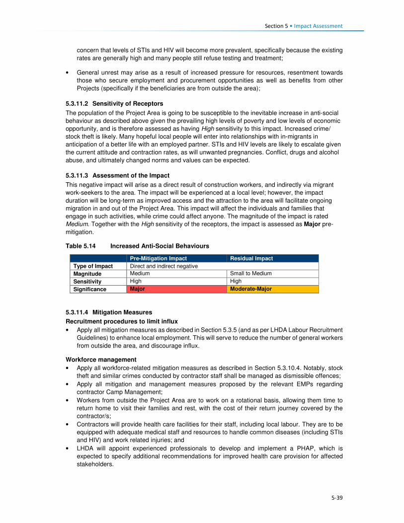
Section 5 • Impact Assessment
5-39
concern that levels of STIs and HIV will become more prevalent, specifically because the existing
rates are generally high and many people still refuse testing and treatment;
• General unrest may arise as a result of increased pressure for resources, resentment towards
those who secure employment and procurement opportunities as well as benefits from other
Projects (specifically if the beneficiaries are from outside the area);
5.3.11.2 Sensitivity of Receptors
The population of the Project Area is going to be susceptible to the inevitable increase in anti-social
behaviour as described above given the prevailing high levels of poverty and low levels of economic
opportunity, and is therefore assessed as having High sensitivity to this impact. Increased crime/
stock theft is likely. Many hopeful local people will enter into relationships with in-migrants in
anticipation of a better life with an employed partner. STIs and HIV levels are likely to escalate given
the current attitude and contraction rates, as will unwanted pregnancies. Conflict, drugs and alcohol
abuse, and ultimately changed norms and values can be expected.
5.3.11.3 Assessment of the Impact
This negative impact will arise as a direct result of construction workers, and indirectly via migrant
work-seekers to the area. The impact will be experienced at a local level; however, the impact
duration will be long-term as improved access and the attraction to the area will facilitate ongoing
migration in and out of the Project Area. This impact will affect the individuals and families that
engage in such activities, while crime could affect anyone. The magnitude of the impact is rated
Medium. Together with the High sensitivity of the receptors, the impact is assessed as Major pre-
mitigation.
Table 5.14 Increased Anti-Social Behaviours
Pre-Mitigation Impact Residual Impact
Type of Impact Direct and indirect negative
Magnitude Medium Small to Medium
Sensitivity High High
Significance Major Moderate-Major
5.3.11.4 Mitigation Measures
Recruitment procedures to limit influx
• Apply all mitigation measures as described in Section 5.3.5 (and as per LHDA Labour Recruitment
Guidelines) to enhance local employment. This will serve to reduce the number of general workers
from outside the area, and discourage influx.
Workforce management
• Apply all workforce-related mitigation measures as described in Section 5.3.10.4. Notably, stock
theft and similar crimes conducted by contractor staff shall be managed as dismissible offences;
• Apply all mitigation and management measures proposed by the relevant EMPs regarding
contractor Camp Management;
• Workers from outside the Project Area are to work on a rotational basis, allowing them time to
return home to visit their families and rest, with the cost of their return journey covered by the
contractor/s;
• Contractors will provide health care facilities for their staff, including local labour. They are to be
equipped with adequate medical staff and resources to handle common diseases (including STIs
and HIV) and work related injuries; and
• LHDA will appoint experienced professionals to develop and implement a PHAP, which is
expected to specify additional recommendations for improved health care provision for affected
stakeholders.

Section 5 • Impact Assessment
5-40
Ongoing engagement and grievance management
• LHDA to implement a grievance resolution procedure as described in Section 5.3.5; and
• As part of induction, the appointed contractor will develop a brochure containing basic socio-
cultural information, to be approved by LHDA, to be distributed to all new employees on the Project
Site.
5.3.11.5 Residual Impact
Implementation of the measures described above is predicted to result in a reduction of the magnitude
of the impact to Small-Medium and the impact significance to Moderate-Major (negative) significance.
The elevated magnitude and significance rating is due to the fact that this impact will largely arise as
a result of indirect factors that are beyond the control of LHDA to mitigate/ manage.
5.3.12 Increased Prevalence of Sexually Transmitted Infections (STIs) and HIV/AIDS
5.3.12.1 Description of Impact
Lesotho has one of the highest HIV/AIDS prevalence rates in Southern Africa at 23%. The prevalence
of HIV/AIDS in Mokhotlong District was estimated to be 17% in 2014, and 5% within the Project Area
(CES, 2015a)21. Migration trends in the Project Area indicate significant out-migration by locals who
migrate out of the area to search for employment opportunities and return home when they have not
secured jobs or upon the termination of employment contracts. The presence of in-migrants,
construction workers directly and indirectly employed by the Project is likely to contribute to the
transmission of HIV/ AIDs and other Sexually Transmitted Infections (STIs) in the area.
The direct and indirect Project activities likely to exacerbate the transmission of STIs and HIV/AIDS
are:
• Drivers, who typically have high rates of HIV or STIs, are likely to engage in casual high risk sexual
activity; thus spreading infections in the Project Area and beyond;
• In-migration of workers and work-seekers who are already infected may transmit the infections;
• A predominantly male workforce and migrant population (some with disposable income) may
engage in high risk sexual activities with commercial sex workers and local women;
• Local men in the community with increased disposable income may partake in transactional sex
or seek additional sexual partners; and
• Existing stigma and taboos around STIs and HIV/AIDS will make it challenging to negotiate safe
sex practices such as the use of condoms (including the use of female condoms).
A research study22 undertaken by the Medical Research Council of South Africa in 1995 prior to the
construction of Mohale Dam, found a high prevalence of STIs and HIV infection in a population
characterised by low levels of knowledge about STI and HIV, high risk sexual behaviour (e.g. low
condom use and multiple partners) and evidence of inappropriate health seeking behaviour for STIs.
The researchers at the time believed that this situation was going to be exacerbated during the
construction of the dam due to the then imminent influx of several thousand male workers, most of
whom would arrive without families. While increased levels of HIV/AIDS were reported in the
Highlands after dam construction it is unclear the extent to which it can be attributed directly to the
LHWP Phase I (Hitchcock, 2015).
Comparing the situation in Mohale to that of Mokhotlong, there is a significant difference in the findings
in terms of the knowledge levels of HIV/AIDS contraction, prevention and management. The LDS
(Bureau of Statistics, 2013) found that an average of 80% of the District population ages 14 to 49
years old demonstrated knowledge of HIV/ AIDS contraction, prevention and management. However,
21 The figure for the Project Area is likely to be highly inaccurate given access to testing facilities, recorded attitudes towards the disease, extent and nature of the study. 22The study was conducted across 89 villages involving 7500 people.

Section 5 • Impact Assessment
5-41
awareness and knowledge about the disease does not mean that people will refrain from engaging in
unsafe sexual behaviour.
Contraction of the disease will lead to poor health outcomes and in some cases inability to work.
Where a person had secured employment with the Project and can no longer work, the Project will
have to carry the costs of finding and training of replacement staff.
5.3.12.2 Sensitivity of Receptors
Statistics indicate that although Lesotho has high HIV/AIDS rates, the Mokhotlong District infection
rates are significantly lower. The Project surveys suggest that many of the people in the Project Area
are aware and informed about the disease and associated STIs despite there still being a stigma linked
to the disease and resistance to implementing precautions. However, rates may have remained
relatively low in the area due to limited in- and out-migration, but this is expected to change as a result
of the Project activities. As such, the sensitivity of the receptors is regarded as High.
5.3.12.3 Assessment of Impact
The increased spread of STIs, including HIV/AIDS will have a direct and indirect negative impact.
Initially the impact will be localised; however, upon completion of the construction phase of the Project,
migrant labour and work-seekers will return to their places of origin (or elsewhere) where they may
spread the disease further. Depending on the type of STI contracted, the impact duration will vary from
short-term to permanent. The impact magnitude is assessed as being Medium. Combined with a High
receptor sensitivity, the impact is rated as Major (negative) significance.
Table 5.15 Increased Prevalence of STIs including HIV/AIDS
Pre-Mitigation Impact Residual Impact
Type of Impact Direct and Indirect negative
Magnitude Medium Small
Sensitivity High High
Significance Major Moderate
5.3.12.4 Mitigation Measures
Collaboration with Local Health Care Services
• To reduce the possible spread of STIs and HIV/AIDS, LHDA should collaborate with local and
regional healthcare services in order to:
• Strengthen local educational programmes, focusing on the prevention of STIs and HIV/AIDS in
the Project Area and along the major transport routes; and
• Ensure that local health centres have sufficient capacity and resources to provide prevention
information/ measures, testing counselling and treatment for STIs and HIV/AIDS.
HIV Workplace Policy and Programme
• The appointed contractors will implement an HIV/AIDS programme as per specifications of the
SHEQ Framework to reduce the risk of the transfer of HIV between and among the contractor’s
employees, their families and the local communities. The programme will include voluntary
counselling and testing (VCT) of individuals, and HIV/AIDS awareness training and access to
ongoing support for affected individuals;
• The appointed contractors shall arrange for, provide a suitable venue, and instruct all employees
to attend the HIV awareness programme; ensuring that their employees and their subcontractor
employees are aware of this programme;
• The appointed contractors must:
• Conduct information, education and communication campaigns, at least every other month,
addressed to all the project site employees (including all Subcontractors’ personnel, and all
truck drivers and crew making deliveries to site for construction activities) and to the immediate
local communities, concerning the risks, dangers and impact, and appropriate avoidance
Section 5 • Impact Assessment
5-42
behaviour with respect to, sexually transmitted diseases or STIs in general and HIV/AIDS in
particular;
• Provide male/ female condoms for all employees, as appropriate, free of charge;
• Provide for voluntary STI and HIV/AIDS screening, diagnosis, counselling and referral to a
dedicated national STI and HIV/AIDS programme, (unless otherwise agreed) to all employees;
and
• Monitor outcomes, in collaboration with national HIV/AIDS authorities.
Employee Code of Conduct
• All appointed contractors shall implement the Employee Code of Conduct as per the provisions of
the Lesotho Labour Code.
5.3.12.5 Residual Impact
Implementation of the above measures may result in a reduction of the magnitude of the impact to
Small which reduces the impact significance from Major to Moderate. However, people who contract
HIV/AIDS will have it for life and will require long term anti-retroviral treatment, and for those affected
the impact, at an individual level will be Major. While LHDA and the contractors can do a lot, their
ability to control this impact is going to be limited by cultural norms and practices and individual free
will.
5.3.13 Increased Pressure on Social Infrastructure and Services
5.3.13.1 Description of Impact
The Project Area is generally poorly served with very few social infrastructure and services. Villages,
specifically Mokhotlong and Mapholaneng, are more developed given that they are relatively
accessible; however, the remainder of the area lacks clinics, water, sanitation, electricity, and waste
management and has only a few under-resourced primary schools. The Social Baseline (Section 4)
provides more details in this regard.
Influx of migrants into the area, including Project workers and work-seekers, will place additional
pressure on the already strained infrastructure and services. It is most likely that the majority of
migrants will be single men, as such, there would be less impact on the need for schooling; there will
be increased demand for land, housing, healthcare, water, sanitation and waste management.
Migrants are most likely to settle in the more established villages/ towns, close to the PLRDs, which
are proposed to be located at Mapholaneng or Tlokoeng (main office). It is proposed that the appointed
workers from outside the Project Area will be housed in the labour camps near the construction sites.
It is anticipated that it may be possible that employees from the local villages could reside at home
and be transported to the work areas but this will be determined by the needs of the contractors.
Given the high number of construction jobs and the low likelihood that local people will qualify for many
of the jobs, it is highly probable that there will be significant influx of workers alone. Besides Project
workers, the anticipation of employment, other income generation opportunities, and benefits linked
to improved local infrastructure and services, will result in significant influx to the area. This influx is
likely to commence during PWAR construction activities and escalate as the scale of construction
works expands.
In the current absence of sufficient social infrastructure and services, any additional pressure resulting
from influx cannot be accommodated or sustained over time. As migrant work-seekers and those
anticipating access to services realise that the socio-economic environment cannot sustain them and
that they are unlikely to qualify for jobs, some people may leave the area in search of opportunities
elsewhere. However, the majority of migrants will stay as they will remain hopeful that they will secure
income-earning opportunities.

Section 5 • Impact Assessment
5-43
5.3.13.2 Sensitivity of the Resource
Given the already strained social infrastructure and services in the Project Area, additional pressure
from outsiders would further overload the existing services, such as clinics. There is limited land to
give to newcomers for farming, natural resources are in short supply, and water and sanitation services
are inadequate. The existing infrastructure and services are of High sensitivity to further pressure, as
are the local population who require access to them.
5.3.13.3 Assessment of the Impact
The influx of workers and work-seekers for the Project construction phase would have a direct
(workers) and indirect (work-seekers) impact on infrastructure and services. The impact will be
experienced at the local level for the entire construction phase (short-term), commencing earlier,
during the PWAR construction activities. Migrants are likely to settle in, or close to, Mokhotlong or
Tlokoeng (near the PLRDs) in anticipation of construction opportunities. The magnitude of the impact
related to influx resulting in increased pressure on social infrastructure and services during
construction is expected to be Medium to Large which combined with the High sensitivity would result
in an impact of Major to Critical (negative) significance.
Table 5.16 Increased Pressure on Social Infrastructure and Services
Pre-Mitigation Impact Residual Impact
Type of Impact Direct and indirect negative
Magnitude Medium to Large Small to Medium
Sensitivity High High
Significance Major to Critical Moderate to Major
5.3.13.4 Required Mitigation Measures23
Recruitment procedures to limit influx
• Apply all mitigation measures as specified in Section 5.3.5 (and as per LHDA Labour Recruitment
Guidelines) to enhance local employment. This will serve to reduce the number of general workers
from outside the area, and discourage influx; and
• Ensure communities in the Project Area are fully informed of the preferential labour policy for
recruiting workers from local villages and how they are required to register for work well in advance
of construction in order that sourcing of local labour is maximised.
Workforce management
• Apply all mitigation and management measures proposed by the relevant EMPs regarding
contractor Camp Management24; and
• Apply all mitigation measures applicable to the workforce as specified in Section 5.3.10.4, to
ensure that all the basic needs of the appointed Project workers (migrants) are provided for.
Ongoing engagement and grievance management
• Implement all measures as described in Section 5.3.5.
23 Required mitigation are the measures that LHDA will need to implement to reduce the impact significance while
Recommended mitigation measures ar those that are desirable to implement but where the outcome is reliant on other parties and the effectiveness is less certain or under the influence of LHDA. 24 Note: assessment of impacts and mitigation requirements of the PWAC construction camps are not included in this ESIA but
are included under the PWAC EMP.

Section 5 • Impact Assessment
5-44
5.3.13.5 Recommended Mitigation Measures
Social development
• LHDA will, in partnership with local authorities and relevant organisations (e.g. donors, civil society
and NGOs), where available and appropriate, assist in planning for anticipated increased
demands on public infrastructure and services in communities that are significantly affected by in-
migration due to Project activities; and
• Develop and implement a SDMP, as described in the LHWP Phase II LR&SDF, as a means of
delivering socio-economic development benefits to villages located in the Project Area that will be
affected as a result of the Project.
5.3.13.6 Residual Impact
Implementation of the above mitigation measures is expected to reduce the magnitude of this impact
to Small or Medium (specifically as related to Project workers), and therefore, the residual significance
could reduce to one of Moderate to Major (negative) significance.
5.3.14 Disruption to Family and Community Structures
5.3.14.1 Description of Impact
Education levels within the Project Area are low, and skills are largely linked to agriculture and those
needed to construct and maintain local infrastructure (e.g. residential dwellings, agricultural structures,
and community infrastructure). It was reported that many people do not see the value of education
given that local economic and livelihood activities do not require high levels of education; it is
uncommon for people to attain high levels of education and enter into careers that generate wealth.
Pressure to ensure immediate survival (as opposed to medium-long-term planning regarding career
development and income generation options) drives decisions around education and work; thus the
school drop-out rate is high. People leave school to support with daily household tasks and to generate
income and produce food.
Young women and girls typically assist with tasks around the home and young men and boys usually
undertake agricultural work (e.g. as herders) with aspirations of accruing livestock of their own.
Farming expertise is passed through generations, where parents teach their children cropping and
livestock raising skills. Agricultural work is hard and does not generate much cash income; in fact, it
is poorly paid at best and often unpaid; produce is largely used for home consumption or for bartering.
Work in the home is unpaid. Young adults, and in some instances children, leave their villages in
search of paid employment as income generation opportunities locally are extremely limited.
Employment opportunities (albeit relatively limited in duration) offered by the Project contractors will
provide income that is likely to be far beyond what is generated by agricultural work, and those who
are employed will learn new skills that may enable them to secure construction work in the future.
There are also high expectations that the employment opportunities will lead to an improved standard
of living. Some people fear that young men and women will reject their existing farming and household
responsibilities in favour of paid employment in the construction sector. This may cause a shortage of
available farming skills and family support networks during the construction phase, and beyond.
Others, however, indicated that those who do get construction jobs will be able to pay others to harvest
their crops, manage livestock or assist with household tasks. For the people who get construction work
it is probable that they would aim to secure further work in the construction sector with their newly
acquired skills and experience, leading to a longer term disruption to social and economic networks.
Community members and school staff fear that the possibility of securing gainful employment will lead
to a further increase in the school drop-out rate, or that parents who get jobs may force children to
drop out of school to fulfil household obligations in the parent’s absence.
Due to necessity, it is expected that most people will be required to return to their farming and
household responsibilities after construction is completed, if they are unable to secure further paid
employment elsewhere.

Section 5 • Impact Assessment
5-45
Over time, more and more people, especially the youth and younger men in particular who get
construction jobs, may not wish to farm as their parents and forefathers have done, and availability of
agricultural skills may diminish. However, for now, agriculture is critical and families must continue
their farming activities in order to survive. With increased access to markets and transport, farming
may become more lucrative in the future. It will remain a primary livelihood activity out of necessity for
a relatively long time.
5.3.14.2 Sensitivity of Receptors
Given the size and capabilities of the population, there are likely to be many people who do not secure
construction phase employment and who will be in a position to support households with home-based
and agricultural tasks in the absence of those who pursue Project employment opportunities. Hiring of
local labour will take people away from their existing tasks, result in an increased rate of school drop-
outs, and potentially generate greater dissatisfaction with the existing lifestyle, sensitivity is considered
to be Medium.
5.3.14.3 Assessment of the Impact
As per the Labour Recruitment Guidelines, the Project will offer limited-term unskilled contracts for the
duration of the construction phase (short-term). While the number of employment opportunities and
job requirements are not yet known, it is expected that these opportunities will be relatively small in
comparison to the size of the eligible population; despite the fair number of employment opportunities
that are likely to be available. Following construction, it is conceivable that while some people will
attempt to secure further paid employment outside the agricultural sector, most are likely to be forced
to return to existing livelihood activities and household responsibilities. This indirect impact will be
experienced at the local level and many people will benefit. Given the short-term nature of the impact,
the magnitude is considered to be Medium to Small. It is unlikely that the Project would result in a
permanent loss of household support or farming expertise. The impact significance is rated as
Moderate to Minor (negative) significance.
Table 5.17 Disruption to Family and Community Structures
Pre-Mitigation Impact Residual Impact
Type of Impact Indirect negative
Magnitude Medium-Small Small
Sensitivity Medium Medium
Significance Moderate-Minor Minor
5.3.14.4 Required Mitigation Measures
• Implement the Labour Recruitment Guidelines and allocate maximum number of unskilled and
semi-skilled jobs to local residents, and additional mitigation measures as described in Section
5.3.5 to ensure that recruitment is fair and representative of people from all Project-affected
villages;
• To avoid further school drop-outs measures are to be defined together with relevant authorities,
leaders and PLRD to define criteria that prevent youth from leaving school in favour of short-term
employment. These may include:
• Minimum education qualifications for people below the age of 20;
• Letter from school or community leader stating that applicant did not drop-out of school
specifically as a result of the Project; or
• Employment of people from as many households as possible to distribute income across
households.
• Share types of job opportunities, including capacity and qualification requirements long in advance
of recruitment to provide people with motivation to complete schooling to the required level, thus
discouraging school drop-outs; and
• Implement a skills development and capacity building programme well in advance of recruitment
to ensure that a suitable number of people attain the necessary skills.

Section 5 • Impact Assessment
5-46
5.3.14.5 Recommended Mitigation Measures
• LHDA will collaborate with relevant authorities and organisations to develop programmes that aim
to enhance agricultural production amongst the population of the Project Area. These should
address the application of more effective farming methods, approaches to increase crop yields,
and mechanisms to assist farmers in selling their produce at the highest possible prices.
5.3.14.6 Residual Impact
It is expected that through the implementation of the above measures, the magnitude of this impact
would reduce to Small and the significance rating could be reduced to one of Minor (negative)
significance post-mitigation.
5.4 Operation Phase 5.4.1 Increased Government Revenue
5.4.1.1 Description of Impact
The economy of Lesotho is un-diverse and relies heavily on a narrow economic base of textile
manufacturing, agriculture, remittances, and regional customs revenue. The majority of the population
live in rural areas and rely on subsistence-based agriculture. The country relies heavily on South Africa
for employment opportunities and the majority of imports, specifically food; the climatic conditions
place an additional strain on the area.
The Government of Lesotho (GoL) derives revenue from the sale of its water to South Africa,
amounting to M8.9 billion (as of November 2017), or averaging M750 million/year – equivalent to ~10%
of the Government’s revenue and ~7% of the GDP (combined percentage contribution of the water
and sanitation sector) (African Economic Outlook, 2016). The revenue received by the GoL is
expected to increase at the start of operations due to the increased amount of water available and
sold to South Africa. Allocation of the revenues to meet Lesotho’s needs is solely based on
Government spending priorities driven by the GoL’s policies, development plans and programmes. As
such, future expenditure in the Project Area is at the discretion of the authorities. However, critics of
LHWP Phase I perceive that an insufficient portion of these revenues are spent locally on assisting
Project-affected communities.
The revenue and taxes paid to Government contributes to funding public infrastructure and services
or for the payment of the country’s debt. The impact of Project revenue cannot be accurately quantified
at this stage as the allocation of increased Government revenue to development locally or nationally
or into other purposes is unknown. It is likely that the revenue received by Government could be used
for socio-economic development but not specifically in the Project Area.
While there were no major concerns voiced about political corruption by stakeholders, research
suggests that corruption remains a concern in Lesotho. Lesotho scored 43 (0 being highly corrupt and
100 being very clean) on Transparency International’s 2017 Corruption Perception Index (CPI), which
measures the degree to which corruption is perceived to exist in the public sector. The average score
internationally was 43. Lesotho’s score increased from 39 in 2016. Given this perception, it is likely
that key stakeholders could be sceptical and will observe and monitor the Project activities (e.g.
governance, financial) closely.
5.4.1.2 Sensitivity of Receptors
Given the general lack of economic diversity; the high reliance on outside markets; the CPI status and
high poverty levels, the sensitivity is considered to be High.

Section 5 • Impact Assessment
5-47
5.4.1.3 Assessment of Impact
The positive impact of increased Government revenue will be a direct impact as it relates to revenue
generated by the Project and indirect positive as it relates to Government spending in the country. The
Project has the potential to induce associated growth and development in areas where spending
occurs. This benefit will continue throughout the operational life of the Project; therefore, the impact
will be long-term. The predicted increase in revenue that the Government will receive from water sales
is of Large magnitude, which when combined with High sensitivity, the significance of this positive
impact will be Major throughout the operational life of the Project.
Table 5.18 Impact of Increased Government Revenue
Impact Rating
Type of Impact Direct and indirect positive
Magnitude Large
Sensitivity High
Significance Major
5.4.1.4 Enhancement Measures
Good governance and financial management practices are essential; open and transparent practices
will assist in building relationships of trust with stakeholders, especially with potential critics and Project
observers. Over and above the legal requirements, LHDA should:
• LHDA should engage with relevant government authorities to encourage government involvement
in socio-economic development initiatives for the Project area. Government involvement could
take many forms; LHDA should initiate and actively promote investment in the Project Area.
5.4.1.5 Residual Impact
Implementation of the above measures will serve as proactive management tools and as risk
management measures. The residual impact significance will remain Major (positive).
5.4.2 Economic Opportunities and Diversification
5.4.2.1 Description of Impact
As described in Section 5.2, the population is currently extremely isolated with limited economic
opportunities beyond subsistence-based agriculture. They have expressed high expectations for
employment and business opportunities associated with the Project, and they anticipate that these
opportunities will in turn bring about improvements to their standard of living.
During the operational phase the number of direct Project employees and Project procurement
requirements will be dramatically reduced. None of these figures are currently available. However, as
a result of the Project, the area will be more accessible and the reservoir will be seen as an attraction.
Tourists are likely to visit the area and there will be an increase in the number of travellers passing
through the area onwards to other locations. Sani pass, Leribe and Katse are located close to the
Project area, these are already popular tourist areas; tourists are likely to extend their journeys to
include a visit to the reservoir (see Section 5.4.4 for an assessment of growth of the tourism sector).
It is also likely that following the long construction phase, some of the workers and migrant work-
seekers will remain; thus the population is likely to increase as compared to the current baseline. With
an increase in visitors, a likely increase in the resident population, and increased exposure to a more
active economy, local entrepreneurs will continue to provide businesses that meet the ongoing needs
and demands.
Employment and Procurement
A limited number of jobs will be created as part of the operational phase of work. Some of the existing
operational staff at the Tlokoeng FOB may be transferred to the Polihali operations site; which may
limit the number of new, permanent employment positions available during the operational phase of

Section 5 • Impact Assessment
5-48
the Project. Indirect employment opportunities within the supply chain will remain (but at a lower level
of intensity), e.g. maintenance activities, security services, hospitality work at the proposed tourist
lodge and visitor’s centre associated with the Operations Centre.
Procurement contracts during operation are likely to be smaller and focused mainly on technical
requirements and maintenance services. As such, a limited number of locally-based businesses will
be able to service the operational needs – which will include fuel supply, food, and office materials.
Alternate Livelihood Opportunities
The economy, which is almost exclusively focused on agriculture, is likely to become more diversified
through an influx of people with a greater variety of skills and offerings. Agriculture is likely to remain
the foundation of the economy for most households. However, the need to offer alternate goods and
services (e.g. accommodation, meals, fresh produce, cleaning, entertainment/ recreation, curios) to
the operational workers, newcomers, and local people should result in diversification of the economy
of Mokhotlong. In the future, post-construction, many people are likely to have an improved opportunity
to generate income from other activities beyond agriculture.
While economic opportunities and the possibility for economic diversification will arise as a result of
increased demand from operational workers, work-seekers and visitors; the onus will remain on
individuals to start-up/ enhance businesses to benefit from the increase in demand. It is likely that
these opportunities could be taken by outsiders with the means to respond quickly to the demand.
Locals may find it more difficult to set-up competitive businesses due to a lack of skill and financial
resources. The harsh environment of the area may also restrict the degree to which diversification of
the economy can be achieved post-dam construction.
5.4.2.2 Sensitivity of Receptors
It is expected that the influx of migrants (potentially with more expertise and resources) will result in
increased competition for local jobs, procurement contracts and to establish required businesses. The
communities in the Project Area can be considered to have Medium sensitivity in that the economic
opportunities will be available, but the majority of the population are unlikely to have the skills or capital
to access/ optimise the opportunities. Many households/ individuals are likely to be able to set-up
small initiatives that will increase their ability to earn additional income – at the very least, the market
for their surplus agricultural produce and curios will increase.
5.4.2.3 Assessment of Impact
The benefits to the local economy would be experienced as a positive impact that would deliver direct,
indirect and induced opportunities. Direct Project opportunities will be more limited in the local
economy; these are more likely to generate national and international benefits. The impact will be
experienced at the local level as a result of localised demand for goods and services through increased
spending by workers, residents, commuters and visitors/tourists. The operational phase will be long-
term to permanent. The magnitude of this impact is expected to be Low-Medium, which in the context
of the Medium sensitivity of the receptors results in an impact predicted to be of Minor to Moderate
significance.
Table 5.19 Economic Opportunities and Diversification
Pre-Mitigation Impact Residual Impact
Type of Impact Direct, indirect and induced. Positive
Magnitude Low-Medium Medium Sensitivity Medium Medium
Significance Minor-Moderate Moderate
5.4.2.4 Enhancement Measures
• Continue implementation of livelihood restoration and social development projects with directly
affected households and communities until it can be demonstrated that local residents directly
affected by the project are self-sufficient and able to sustain their livelihoods.

Section 5 • Impact Assessment
5-49
• As per Section 5.3.6.4, LHDA will support MSME development through collaboration with service
providers such as BEDCO, which should include all affected parts of the extended Project Area,
as part of LHDA’s commitment to social development under the SDMP.
5.4.2.5 Residual Impact
Through sustained implementation of the enhancement measures, the magnitude of this impact could
increase to Medium. Receptor sensitivity will remain Medium, thus resulting in a residual significance
rating of Moderate (positive) significance.
5.4.3 Increased Cost of Living
5.4.3.1 Description of Impact
As described in Section 5.3.7, the cost of goods and services is likely to increase gradually throughout
the construction phase and remain elevated throughout the operational phase. It is likely that the prices
of goods and services may readjust to meet market demand, reaching a more stable/ normalised level.
Given that the population of the area is likely to remain somewhat elevated, and economic
diversification is probable, prices will stabilise, albeit at a higher relative level than they are currently.
In addition to the increased costs of items, goods and services that were previously not offered for
purchase may become available. The area will be more accessible and attractive to visitors and new
residents, they are likely to bring new merchants that sell an increased diversity of goods, thus
tempting people to purchase goods that ordinarily would not have been available to them. Currently,
there is limited public transport with few taxis operating in the area; and away from the A1 paved road
most people walk or use donkeys and horses for transporting larger items. With the improved road
networks there is likely to be an expansion of transport options available representing an increased
cost of living to residents unaccustomed to paying for transport.
Post construction and the completion of the associated job opportunities, the general standard of living
could deteriorate over time as a result of decreased levels of affordability (linked to decreased income
compared to the more prosperous construction phase) although it is still expected to remain better
than before construction. The standard of living could be counterbalanced by improved economic
opportunities and improved accessibility to markets and critical social infrastructure and services (as
assessed in Section 5.4.2). The villages close to the A1 and to the more established towns of
Mokhotlong and Mapholaneng will be the least affected given that they are relatively well served
population centres.
5.4.3.2 Sensitivity of the Receptors
The sensitivity of the population will vary. Some people will be able to increase and maintain their
increased levels of income generation, while others (specifically the elderly and more traditional
people) will continue their lifestyles in a manner similar to current levels. Similar to the construction
phase, the most isolated villages will be most affected by price increases, and the population will begin
to adapt to the impact over time. Everyone will be affected by an increase in the cost of living; some
people will be able to accommodate the increase, and given the expectation and potential for new
market opportunities, the overall sensitivity of the population is rated as Medium. The people who
cannot increase their income will be more sensitive to the impact, but many people will have begun to
adjust to the increased cost of living during the five-year construction phase.
5.4.3.3 Assessment of the Impact
This impact is negative and will continue as an indirect consequence of the changed nature of the
area. The impact will be experienced at the local level and will be permanent, it is likely to affect most
people. The magnitude will be Medium and will gradually decrease over time as the market adjusts to
demand. People are likely to adjust to the cost of living over time, albeit with difficulty. The significance
is likely to be one of Moderate (negative) significance.

Section 5 • Impact Assessment
5-50
Table 5.20 Increased Cost of Living
Pre-Mitigation Impact Residual Impact
Type of Impact Indirect negative
Magnitude Medium Medium Sensitivity Medium Medium
Significance Moderate Moderate
5.4.3.4 Required Mitigation Measures
• Implement all required and recommended measures described in Section 5.3.7.
• Implement social development projects under the SDMP, as outlined in the LHWP Phase II
LR&SDF as a means of delivering socio-economic benefits to assist in combatting some of the
challenges households may experience.
5.4.3.5 Residual Impact
There is little that can be done by LHDA directly to significantly reduce the cost of living. Also, it is
uncertain the extent to which the recommended interventions by LHDA and GoL will be effective in
providing additional livelihood support to the local population that could help to moderate the increased
cost of living that is expected. As such, it is anticipated that as a worst case scenario the magnitude
will remain unchanged at Medium; therefore the impact is assessed to remain at Moderate (negative)
significance. It is likely that as the market adjusts, the sensitivity of many households will decrease
and the impact will normalise.
5.4.4 Growth of the Local Tourism Sector
5.4.4.1 Description of Impact
The contribution of tourism to the national economy appears to be increasing. In 2014, the direct
contribution of tourism to GDP was 6%; it was forecast to rise to 8% in 2015. This contribution primarily
reflects the economic activity generated by industries such as hotels, travel agents, airlines and
passenger transportation services (excluding commuter services). The sector employed ~23,500
people in 2014 (5% of the economically active population). In the Mokhotlong District, tourism is seen
as a significant economic activity, which is facilitated by its proximity to the Drakensberg Mountains in
South Africa and the famous Sani Pass road. No data were available on the contribution of tourism to
the economy of Mokhotlong; however, there are a significant number of tourists visiting the area
attracted by the skiing resort, Sani Pass and other natural features of the area. Furthermore, several
new hotels are being constructed in Mokhotlong Town, in anticipation of this Project and anticipated
future tourists.
Establishment of the reservoir is likely to attract visitors who would value the aesthetic presence of the
reservoir and who enjoy water-based recreational activities that may be developed at the site.
Improved road networks will generally enhance accessibility to other parts of the Project Area which
are currently inaccessible due to poor road conditions or a lack of roads. It is therefore anticipated that
the presence of the Project will facilitate further development of the tourism sector throughout the
Mokhotlong District.
The increased number of tourists in the area is expected to boost the local economy especially in
terms of spending by tourists. Participants in interviews indicated that they would be able to sell
Basotho arts and crafts as well as medicinal plants to tourists. There will be opportunities for people
to start a range of small businesses, including hospitality services (e.g. accommodation, meals,
transport), tour guiding services (e.g. hiking trails, botanical/ avian/ ecological trails), amongst others.
The growth of the tourism sector will also facilitate creation of induced employment for local people,
especially the youth. It must be realised, however, that it will take considerable time for tourism to
increase, even after the five-year construction phase is completed; establishing tourism facilities and
activities will require investment of funding and support to local entrepreneurs. At Katse Dam, tourism
is seasonal and visitors tend to spend only one or two nights, mainly on drive through journeys or for
workshops/conferences, as there are limited tourism-related activities despite the 20 year existence

Section 5 • Impact Assessment
5-51
of the dam. However, it is hoped that Polihali Dam may be able to capitalise more successfully on its
proximity to the Drakensberg and greater accessibility to tourists from Gauteng and KZN. Even though
the industry is unlikely to become very large, it will bring about positive impacts to those who take up
the opportunities.
5.4.4.2 Sensitivity of Receptors
The growth and increased number of tourists in the Project Area is likely to stimulate a change in the
livelihoods of the locals who become involved in the sector. However, there exist barriers for locals
fully partaking in the sector, including limited skills and resources to maximise the opportunities
presented, as well as competition from in-migrants who may have more experience in the sector.
Therefore, the sensitivity of the receptors is regarded as Medium.
5.4.4.3 Assessment of Impact
Growth and development of the tourism sector will be experienced as an indirect and induced positive
impact. The impact will be localised but with the potential to extend to the Katse dam area due to the
improved road connection between Leribe and Mokhotlong Districts; therefore, the impact has the
potential to extend regionally. The magnitude of the impact will be Small-Medium depending on the
uptake of the opportunities associated with growth of the tourism sector. Overall, the impact is rated
as one of Minor to Moderate positive significance.
Table 5.21 Growth of the Local Tourism Sector
Pre-Mitigation Impact Residual Impact
Type of Impact Induced positive
Magnitude Small – Medium Medium
Sensitivity Medium Medium
Significance Minor - Moderate Moderate
5.4.4.4 Enhancement Measures
• LHDA are collaborating with the LTDC and Ministry of Development Planning to fast-track
implementation of the Tourism Master Plan and to identify and co-develop or support tourism
initiatives in the Project Area.
• LHDA should consider collaboration with the Ministry of Education, Ministry of Trade and Industry,
LTDC and Ministry of Development Planning to establish a business training centre in Mokhotlong
Town. The purpose of the centre would be:
• To provide training and development to start-up and small businesses; as well as to facilitate
provision for micro-loans for tourism related entities.
• To run capacity building and training sessions to support local businesses to improve their
offerings, and to meet the strict health, safety and quality standards required for procurement
by LHDA.
5.4.4.5 Residual Impact
The implementation of the mitigation measures has the potential to increase magnitude to Medium;
hence the impact could become one of Moderate (positive) significance.

Section 5 • Impact Assessment
5-52
5.4.5 Continuation of Anti-Social Behaviour and Spread of STIs and HIV/AIDS
5.4.5.1 Description of Impact
Anti-social behaviour, as described in detail in Section 5.3.11, is expected to continue into the
operational life of the Project to some extent. There will no longer be Project workers and many migrant
work-seekers will likely leave the area in search of opportunities elsewhere. As a result of increased
accessibility and an inevitable flow of ‘outsiders’ through the area, norms, values and customs will
continue to change; people will continue to be exposed to different views and ways of life. Migration
in and out of the area will likely be driven more by economic / market reasons, as well as travel to
schools and other social facilities that may be of a higher standard than those present in the Project
Area.
As with the construction phase impact, HIV and STIs, casual sexual relationships, prostitution,
unwanted pregnancies, an increase in drug and alcohol abuse, and crime (e.g. theft of livestock) are
likely to persist to some degree. Long distance truck drivers and migrants in search of work
opportunities are likely to be the most significant contributors to the spread of HIV and STIs; and may
increase a demand for prostitution and attract local women to enter into relationships with them.
Stock theft will continue to be an issue, given that the road network will be dramatically improved; thus
enabling easy access and ‘get away’. Once again, increased policing may serve to discourage this.
Increased exposure to people from outside the Project Area (an area that is currently very isolated
and insular) during the construction phase and throughout the operational phase, will lead to an
inevitable change to norms, culture and values. This will largely result from an enhanced worldview
and adoption of attitudes, wants and desires that come from more established, commercial and
diverse locations. Together with anti-social behaviour and the other dramatic physical, economic and
social changes to the area, there will be a significant change in the sense of place of the area. Sense
of place is described and discussed in Section 5.2.3; it has not been assessed. While a change in the
sense of place is inevitable, directly and indirectly, as a result of this Project, the nature, magnitude
and significance of the impact will differ for all people.
5.4.5.2 Sensitivity of Receptors
Following the eight year construction phase, people would already have experienced an increase in
the anti-social behaviour. While an increase in anti-social behaviour is not desirable, people will have
adapted to the increased risks and exposure. Their levels of sensitivity will have reduced to Medium.
5.4.5.3 Assessment of the Impact
While the level of confidence in this impact is low, the negative impact of ongoing anti-social behaviour
and spread of HIV/AIDS is expected to continue into the operational phase as a result of the inevitable
changes that the eight year construction phase will precipitate, and as an indirect result of ‘outsiders’
visiting and travelling through the area. The impact will be experienced at a local level; however, STI
and HIV infections will spread into the areas where the road users and work-seekers originate and
migrate to. The duration will be long-term to permanent, specifically as related to diseases such as
HIV/AIDS which, for those affected, will have permanent impacts on them and their families. This
impact could affect individuals and families in different ways and to varying degrees. The magnitude
of the impact is rated Medium compared to the Large magnitude during dam construction. When
combined with the Medium sensitivity of the receptors, the impact is assessed as being Moderate
(negative) significance.

Section 5 • Impact Assessment
5-53
Table 5.22 Continuation of Anti-Social Behaviour and Spread of STIs and HIV/AIDS
Pre-Mitigation Impact Residual Impact
Type of Impact Indirect negative
Magnitude Medium Medium
Sensitivity Medium Medium
Significance Moderate Moderate
5.4.5.4 Recommended Mitigation Measures
• During the operational phase there are limited interventions that can be implemented directly by
LHDA. However, LHDA should assist by motivating and supporting relevant departments in the
GoL to identify potential projects and interventions that could result in improvements to anti-social
behaviour. These are likely to include improved education and training, recreational facilities and
activities, crime awareness and management interventions, improved health awareness
campaigns (specifically linked to sexual health and well-being).
5.4.5.5 Residual Impact
Given that LHDA cannot do much to mitigate this indirect impact, and that mitigation is largely the
responsibility of GoL, the residual significance rating will remain Moderate. Over time, the significance
is likely to reduce as the population adapts.

6-1
Section 6 Mitigation and Monitoring
6.1 Overview Mitigation for social impacts of the Project is the responsibility of the LHDA, with delegation of certain
responsibilities to the appointed RAP Consultants who will implement the physical and economic
resettlement requirements, and the appointed Contractors who need to manage day to day
construction related aspects that will or may impact communities. In several cases LHDA and the RAP
consultants will be required to oversee the success of the mitigation measures proposed in this report
and contained in the EMP.
All mitigation measures identified in this report have been compiled into one overall mitigation table in
which responsibilities are assigned to LHDA, RAP Consultant or Contractor.
The LHDA has a legal obligation to restore the livelihoods of individuals, households and communities
affected by the LHWP. These obligations are specified in the Treaty on the Lesotho Highlands Water
Project (1986), the LHDA Order (1986) and the Phase II Agreement (2011), where reference is made
to the maintenance of the “standard of living”, “welfare” and “income” of affected persons and
communities. The Phase II Agreement additionally states that “Social development programmes and
mitigation measures, resettlement requirements and awareness campaigns will be implemented, the
full extent to be agreed by the Parties during the implementation”. Some of the key socially related
documents / plans or policies developed by the LHDA are highlighted below. The implementation of
these will be the responsibility of the LHDA with the assistance of appointed Consultants/ Contractors
and Government at Nation and District levels.
A Phase II Compensation Policy has been prepared for Phase II to ensure that these obligations are
met. The Policy describes compensation and relocation entitlements for the loss of land and assets,
as well as other support measures. It also stipulates that livelihood restoration initiatives are required,
to be undertaken within the framework of sustainable development and emerging income-generating
opportunities so that individuals and communities can continue with improved livelihood-earning
activities after withdrawal of Project inputs and support.
LHDA’s right to undertake compulsory acquisition of land carries with it a responsibility to ensure that
those affected do not bear an unfair share of the negative impacts of the Project. In the simplest terms,
this responsibility should be to ensure that the standard of living of all affected persons is restored to
the level enjoyed before the commencement of the Project implementation. To the extent that LHDA
is successful in restoring those living standards for all affected, the adverse impacts will have been
minimised and possibly prevented. The management and mitigation actions for land acquisition and
resettlement will be described in detail in the RAP that is being undertaken under a separate contract
to LHDA. Depending on how well the resettlement is planned and executed, it should go a long way
in compensating for the loss of community assets and disruption. Implementation of the RAP must be
well-aligned with the Environmental and Social Management Plan (ESMP) and will also monitor that
the social mitigation requirements of this study are undertaken and effective.
Labour Recruitment Guidelines have also been developed to ensure that the LHDA meet the
stipulations of the Treaty and Signed Phase II Agreement. Key players in the recruitment process will
be:
Project Labour Recruitment Desk (PLRD). LHDA will appoint a service provider to establish and
implement a Project Labour Recruitment Desk (PLRD for the Project. The PLRD, will be tasked with
the following:
• Establish a recruitment desk away from the construction sites to facilitate the recruitment of the
unskilled labour at various strategic locations;

Section 6 • Mitigation and Monitoring
6-2
• Create a database which can be used to list unskilled labour applications in collaboration with
ALCs, where they exist, area chiefs and councillors where community participation structures do
not exist, NES and district labour offices;
• In consultation with the ALCs, respond to labour requirements from contractors and provide names
and contact details of applicants;
• Advise each ALC and NES of the successful candidates and notify them about the time required
for the candidates to report to contractors’ recruitment offices;
• Register and address employment complaints relating to recruitment process; and
• Meet with the ALCs of the community structures at the agreed times to report on the progress
made in recruitment of labour and to disclose any pertinent information on recruitment of labour;
and other recruitment related responsibilities.
Area Liaison Committees (ALCs). ALCs and CLCs will be expected to co-ordinate their activities
including registration and recruitment of unskilled labour activities. ALCs will facilitate the recruitment
of unskilled labour from the communities by assuming the following roles and responsibilities:
• Maintaining lists of job seekers with details of names, district, village, age, sex, education/
qualifications, identity numbers, and contact details and regularly submit these lists to the PLRD
for capture on the database;
• Registering employment complaints relating to recruitment processes, address them where they
can and where they cannot, pass them to PLRD; and
• Meeting with PLRD at agreed times to review the recruitment processes and obtain reports on
recruitment of all types of labour provided to different contractors.
National Employment Services (NES). LHDA will engage the services of NES of the Ministry of Labour
and Employment working together with District Labour Offices to register unskilled job seekers from
other parts of Lesotho along the same principles as described above and to submit these on a regular
basis to PLRD.
To promote social development efforts, the LHDA has developed the Livelihood Restoration and
Social Development Framework. Section 6.5 of the LR&SD Framework outlines LHDA’s proposed
approach to addressing socio-economic development needs through the development and
implementation of a Social Development Master Plan (SDMP). As proposed, the SDMP will identify
the key components for sustainable development based on full participation of the communities living
in the Phase II area. Implementation of the SDMP should, in part, serve to address the expectations
of the local communities. LHDA’s proposed approach to the SDMP 1:
• A Social Development Master Plan (SDMP) for Phase II will be prepared by a consultant in
consultation with LHDA, local communities, GoL and other development partners. The SDMP will
describe the approved projects to be implemented in the Phase II area, institutional arrangements
for implementation of each SDMP component, provide a programme and timeframe, and describe
funding requirements and responsibilities.
• Approved projects in the SDMP will be implemented by appointed service providers according to
the programme and timeframe established in the SDMP.
• The following key tasks are envisaged to be carried out by the consultant who will be engaged to
prepare the SDMP:
• Provide an overall framework and guidance for Lesotho Highlands Development Authority and
relevant government ministries/departments on how best to take a proactive and consistent
stance on social development initiatives in the Polihali Area in line with Vision 2020 and other
policy guidelines.
• Identify and analyse all social development activities/projects already being carried out in the
Polihali catchment area (including scheduling, costing and responsibility for implementation).
• Prioritise those social development activities that have the most impact and identify those that
should be improved, expanded and potentially eliminated.

Section 6 • Mitigation and Monitoring
6-3
• Develop a Social Development Master Plan that details key components for sustainable
development informed by full participation of communities living in the Phase II area.
• Review the consultation and stakeholder engagement process that already exists, identify
gaps and strengthen participatory engagement on LHDA-related social development priorities.
• Establish and delineate the roles and responsibilities of LHDA, government, local authorities,
civil society/local NGOS and other stakeholders in relation to managing social development
activities in the area.
• Illustrate opportunities for synergies with other community-based development programmes
such as livelihood restoration programmes, community based natural resources management,
integrated catchment management as well as similar programmes being implemented by aid
agencies such as EU, IFAD, UNDP, UNEP, etc.
• Prepare and present projects together with detailed budget breakdowns, including potential
additional sources of finance and technical support that would be available through relevant
stakeholders as well as Memoranda of Understanding (MoU) to support implementation of the
social development projects sustainably in the short-medium term.
• Describe existing and proposed organisational frameworks that will be used to implement and
administer the SDMP (including identification of agencies that might be responsible for overall
co-ordination of activities). Any training and skills development requirements for LHDA staff
involved with community development must also be illustrated.
• Describe how the social development initiatives would be monitored and evaluated.
• Social development projects and programmes will be handed over, where applicable, to the
relevant government agencies for ongoing support and oversight as shall be agreed and
formalised through MoUs.
• A monitoring and evaluation programme will be developed to determine the outcomes/ impacts of
social development programmes.
An ICM Plan must also be developed. The overall aim of the plan should be to improve land use
practices and in doing so, reduce sediment transport and thereby improve the health of the rivers in
the catchment as a whole. The plan should develop appropriate incentives, with funds ring-fenced in
a trust or similar entity, to ensure participation of land users and long-term sustainability. Appropriate
incentives aimed at changing unsustainable land use practices could include payment for catchment
protection services, awards, and/or fines. Recommendations on what the ICM should contain are
provided in the Environmental and Social Impact Statement (P2W-6014-DFR-0011).
The LHDA has commissioned a Public Health Impact Assessment and a PHAP Contract LHDA No.
6018, which is currently (October 2017) out to tender.
6.2 Social Mitigation Measures Mitigation measures specific to the social impacts identified have been included in Table 6.1. Further
mitigation measures have been identified by other specialists that relate to impact of physical
displacement but are not repeated here (Refer to Soils, Land Use and Land Capability (P2W-6014-
DFR-0007), Terrestrial Ecology (P2W-6014-DFR-0002) and Rangelands (P2W-6014-DFR-0009)).

6-4
Table 6.1 Mitigation Measures for Social Study
Ref Activity Requirements / specifications Responsibility Scheduling /
Timing/
Frequency
Phase Performance
Indicator(s)
Training
Requirements
1 Physical and Economic Displacement
Objective: To manage and mitigate the losses associated with economic and physical displacement
1.1 Develop and
implement a
Resettlement
Action Plan
• Development and implementation of
the RAP in accordance with the
agreed scope of work and LHDA’s
Compensation Policy.
• Establishment of grievance
mechanism prior to project
implementation to facilitate the
resolution of affected community
concerns and grievances ensuring
ongoing interaction with the
communities in order to build trust and
maintain relationships throughout
project implementation.
• Ensure the socioeconomic census
determines the multiple providers of
income and includes a gender
analysis as a basis for facilitating
different opportunities for employment
of women.
• Criteria are set for the socioeconomic
census for determining vulnerability of
households so that vulnerable groups
(poor, elderly) to ensure these
households are the focus of
opportunities for livelihood restoration.
• Compensation and other necessary
assistance is provided before impacts
of the project occur.
• Arrangements and resources for
resettlement are adequate and
assigned.
LHDA
RAP Consultant
Prior to
commencement
of advance
works and
construction
and ongoing
throughout
Project
implementation
Prior to
commencement of
advance works and
construction and
ongoing throughout
Project implementation
• Resettlement Action Plan in place
• Community consultation on RAP undertaken
• Grievance resolution mechanism established
• Monitoring and evaluation system established to monitor implementation activities and quality of life of project affected people is equal to or better prior to displacement
To be determined by
RAP Consultant

6-5
Ref Activity Requirements / specifications Responsibility Scheduling /
Timing/
Frequency
Phase Performance
Indicator(s)
Training
Requirements
• The resettlement timetable is linked to
the phasing of project implementation.
• Physical and economic assistance to
households is provided during
relocation.
• Support is offered after displacement,
for a transition period, based on a
reasonable estimate of the time likely
to be needed to restore the livelihood
and standards of living for project-
affected people.
1.2 Develop a
Livelihoods
Restoration
Plan
• A Livelihood Restoration Plan and
Community Development Plan should
be developed to ensure project
affected people are not left worse-off
following displacement.
• Economic displacement of
subsistence farmers will be a
negotiated process.
• The development of alternative
livelihood strategies should be the
preferred mitigation option, optimising
opportunities for involvement in
employment. Although many of the
employment opportunities will be
skilled and semi-skilled positions, the
establishment of appropriate training
and skills development by the
Contractors will allow project affected
people to benefit from such
opportunities.
• Establishment of grievance
mechanism prior to project
implementation to facilitate the
resolution of affected community
LHDA
RAP Consultant
Prior to commencement of construction and ongoing throughout project implementation
Prior to
commencement of
advance works and
construction and
ongoing throughout
Project implementation
• Livelihoods Restoration Plan is in place
• Community consultation on RAP undertaken
• Grievance resolution mechanism established
• Monitoring and evaluation system established to monitor implementation activities and quality of life of project affected people is equal to or better prior to displacement
To be determined by
RAP Consultant
6-6
Ref Activity Requirements / specifications Responsibility Scheduling /
Timing/
Frequency
Phase Performance
Indicator(s)
Training
Requirements
concerns and grievances ensuring
ongoing interaction with the
communities in order to build trust and
maintain relationships throughout
project implementation.
• LHDA should be encouraged to seek
partnerships with relevant authorities
and organisations to develop
programmes that aim to enhance
agricultural production amongst the
population of the Project Area.
1.3 Develop a
Social
Development
Master Plan
• Appoint a consultant to develop the community projects as part of the SDMP.
• Social development projects and programmes will be handed over, where applicable, to the relevant government agencies for ongoing support and oversight as shall be agreed and formalised through Memoranda of Understanding (MoUs).
• A monitoring and evaluation programme will be developed to determine the outcomes/ impacts of social development programmes.
LHDA
Government entities
NGOs/ CBOs
Prior to
commencement
of advance
works and
construction
and ongoing
throughout
Project
implementation
Prior to
commencement of
advance works and
construction and
ongoing throughout
Project implementation
• Appointment of
Consultant
• Social Development
Master Plan in place
• Identification of
community
development
projects
• Implementation of
community
development
projects
• Monitoring plans in
place
To be determined by
the Consultant
2 Increased prevalence of STIs and HIV/AIDs
Objective: to reduce the spread and increase of STIs and HIV/AIDs
2.1 Management
of STIs incl.
HIV/AIDs
• Strengthen local educational
programmes that are ‘women and youth
friendly’, focusing on the control of STIs
and particularly HIV / AIDs.
LHDA
Government entities
Prior to
advance works
construction
Prior to and throughout
advance works
construction and
operational phases
• Presence of
educational
programmes
• Records of women
and youth enrolment
HIV/ AIDs training
programme

6-7
Ref Activity Requirements / specifications Responsibility Scheduling /
Timing/
Frequency
Phase Performance
Indicator(s)
Training
Requirements
• Records on
prevalence and
incidence of STIs
• Ensure medical services have sufficient
capacity to provide care for HIV-
positive workers
LHDA Prior to
advance works
construction
Prior to and throughout
advance works
construction and
operational phases
• Audit of local medical
facilities
Further training
requirements will be
informed by the
Public Health Action
Plan
2.2 Develop and
implement an
HIV
Workplace
Policy and
Programme
• Develop and implement an HIV/AIDS
programme to reduce the risk of the
transfer of the HIV virus between and
among the Contractor’s employees,
their families and the local
communities.
Contractor LHDA Project SHEQ Manager Department of Health
Prior to and
throughout
advance works,
construction
Advance works
construction
• Workforce HIV
programme in place
• Availability of a
suitable testing and
counselling venue,
• Records of employee
HIV training
programme and
materials
• Signed attendance
registers of HIV
training by
employees
• Installation of
condom dispensers
across the camp
sites (with condoms)
• Records of
employees tested,
diagnosis, and
counselled
• Number of
employees referred
to a dedicated
national STI and
HIV/AIDS program
HIV/ AIDs awareness
programme
6-8
Ref Activity Requirements / specifications Responsibility Scheduling /
Timing/
Frequency
Phase Performance
Indicator(s)
Training
Requirements
• Record of monitoring
of outcomes.
2.3 Develop an Emergency Prevention, Preparedness and Response Plan.
• In collaboration with the local and
district Government, local emergency
providers and local health care
facilities, develop and implement
EPPRPs.
• The Plan will cover all incidents
presenting risks to public safety and the
affected communities in proximity to the
various Project Sites and the
surrounding environment.
LHDA: Environmental, Health and Safety Management Unit Government entities NGOs
Prior to
advance works
construction
Throughout advance
works construction and
operational phases
• Record of
stakeholder
engagement
• Presence
Emergency
Prevention,
Preparedness and
Response Plans
(EPPRPs)
• Charter of roles and
responsibilities
• Review of incident
reports
• Annual review of
policies and plans
To be determined in
the EPPRPs
• Update EPPRPs on an annual basis,
based on the outcomes of the review of
incident reports.
LHDA Prior to and
throughout
advance works
On-going update • Updated EPPRPs
2.4 Minimise incidences of sexually transmitted infections (STIs) including HIV/AIDS.
Develop and implement an HIV/AIDS Prevention Programmes for its workforce.
LHDA Contractor
Prior to
advance works
and ongoing
Prior to and throughout
advance works
construction
• Health educational
programmes and
materials in place
• Internal training
records
• Number of HIV tests
undertaken every 6
months
• Records on
prevalence and
incidence of STIs)
• Number of people
receiving HIV / STI
treatment (ARVs)

6-9
Ref Activity Requirements / specifications Responsibility Scheduling /
Timing/
Frequency
Phase Performance
Indicator(s)
Training
Requirements
• Number of fatalities
linked to HIV / STIs
annually
2.5 Risk planning, management and communication
Liaise with the appointed Consultant for the PHAP and the appointed Consultants for the other major engineering packages to identify the appropriate off-site facilities for major medical treatment (local clinic, district hospitals or regional hospitals) in developing detailed.
LHDA Project SHEQ Manager Contractors Emergency services personnel
Quarterly Throughout advanced
and construction • Records of full
scale ‘live’
rehearsals of a
response plan
• Emergency
communications
procedure in place
• Emergency
checklists that can
be quickly
accessed by
management,
response
personnel and
employees
live’ rehearsals
3 Risks associated with road traffic
Objective: To reduce the risks associated with increased road traffic in the Project Area and to proactively monitor and manage project related vehicle traffic
3.1 Manage traffic
impacts
related to the
Project
• Assess impacts of selected
transportation routes and provide
detailed mitigation to be implemented in
Traffic Management Plan.
LHDA Prior to
advance works
and ongoing
Prior to and through
advance works • Traffic assessment
• Traffic Management
Plan
To be determined by
LHDA
3.2 Improve Road
Signage • Implement road signs demarcating
speed limits and identifying common
pedestrian / livestock crossings.
Contractor
Department of Roads
advance works,
construction
Advance works,
construction • Number of signs
erected
3.3 Develop
community
awareness
• Conduct community consultations to
identify potential high risk areas for
traffic accidents.
LHDA Prior to
advance works
Prior to and throughout
advance works
construction
• Records of
engagement

6-10
Ref Activity Requirements / specifications Responsibility Scheduling /
Timing/
Frequency
Phase Performance
Indicator(s)
Training
Requirements
and
coordination
procedure on
public safety
• Inform communities when traffic will
increase prior to vehicle movements
commencing.
Contractor Throughout
advance works
construction
and operational
phases
Prior to and throughout
advance works
construction
• Records of
information dispersal
/ engagement
• Number of notices
placed on community
notice boards
• Number of signs
erected
• Engage with communities along
transport routes on road safety and
accident prevention.
LHDA Throughout
advance works
construction
and operational
phases
Prior to and throughout
advance works
construction
• Records of
engagement
4 Increase in anti-social behaviours
Objective: To proactively manage incidences of antisocial behaviours
4.1 Management of antisocial behaviours
• Collaborate with local partners and
government to provide education and
awareness programme focused at
managing anti-social behaviour.
• Support an education and awareness
programme targeted at managing anti-
social behaviour in the area. Through
sponsoring campaigns on drug and
alcohol abuse, sexual abuse, etc.
LHDA
District governments
Prior to
advance works
and ongoing
Prior to advance works
and construction • Number locals who
attend sessions on
antisocial
behaviours.
Various awareness
campaigns
4.2 Workforce management
• Meet the daily needs of Project
personnel via the provision of housing,
water, subsistence, power, sanitation,
health care facilities and recreation
facilities.
• Implement Workforce Code of
Conduct.
• Allow construction workers (from
outside the area) to return home over
the weekends or on a regular basis to
EPC contractor (LHDA oversight)
Advance works and construction
Throughout Advance works and
construction
• Workforce Code of
Conduct in place

6-11
Ref Activity Requirements / specifications Responsibility Scheduling /
Timing/
Frequency
Phase Performance
Indicator(s)
Training
Requirements
visit their families in order to minimise
the interactions between the migrant
workforce and locals. The appointed
contractor will facilitate these visits
accordingly.
4.3 Management of in-migration
• Widely advertise employment
opportunities, emphasising the types of
jobs to be created and skills required
as well the policy for employment
LHDA
Contractor
Prior to
advance works
and ongoing
Prior to and throughout
advance works
construction and
operational phases
• Advertise of jobs on
national and
countrywide
N/A
5 Creation of employment
Objective: To maximise recruitment of people from the local communities, broader Project Area and from Lesotho
5.1 Maximise
employment
opportunities
• Promote employment of local people
through rotational basis for unskilled
workers.
• Establish accessible satellite offices in
the area to facilitate easy access.
• Provide on the job training for those
employed.
Contractor
LHDA
Prior to
advance works
and ongoing
Prior to and throughout
advance works
construction and
operational phases
• Number of local
people employed
• Number of satellite
offices established
• Training records
• Numbers of people
trained
To be determined by
the contractor and
LHDA
H&S training
6 Procurement of goods and services
Objective: to maximise the project spend in the local economy
6.1 Develop and
implement
local content
policy
• Establish a policy that seeks to
maximise local/ in country purchasing
of goods and services.
• Set- out targets for all contractors to
meet in terms of local procurement.
• On-going training and capacity building
of local businesses.
• Split the large contracts into smaller
components in order to allow small
businesses to share in the project.
LHDA
Government entities
Prior to
advance works
and ongoing
Prior to and throughout
advance works
construction and
operational phases
• Number of local
business trained
• Training schedule
and materials
• Number of large
contracts split into
smaller contracts
• Review of large
tender contracts
7 Loss of access to natural resources
Objective: to rescue some plants from the inundation area prior to the dam filling

6-12
Ref Activity Requirements / specifications Responsibility Scheduling /
Timing/
Frequency
Phase Performance
Indicator(s)
Training
Requirements
7.1 Search and
rescue of
priority plants
– advanced
infrastructure
• Appoint suitably qualified or
experienced botanist to conduct active
searches for priority species prior to
infrastructure site clearance.
• Conduct foot searches of advanced
infrastructure, tunnel inlet and dam wall
and quarry areas to recover priority
plants.
• Bag, store and look after plants in
temporary nursery area/s prior to use in
landscaping of infrastructure areas or
community garden(s).
• Collect seeds of suitable plants for
landscaping and propagation in a
community garden.
• Replant rescued plants and seeds in
accordance with landscaping plan.
• Landscaping shall prioritise use of
indigenous naturally occurring plants
and shall include a list of suitable
plants.
LHDA: botanical
team to be appointed
Prior to
advance works
Preparation and during
site clearance
• Botanist appointed
• Proof of active
searches in form of
documentation and
retrieved plants.
• Nursery established
for temporary
relocation of
rescued plants and
seeds.
• Dedicated nursery
manager appointed
to manage the
nursery and recover
seeds.
• Landscaping plan
developed for
infrastructure areas
dominated by
indigenous plants.
Nursery staff trained
in plant rescue and
propagation
8 Stakeholder Consultation
Objective: to promote open and transparent communication with stakeholders
8.1 Implement a
Stakeholder
Engagement
Plan /
Programme
for the Project
• Proactive engagement of community
leaders and members on the planned
project.
• Ensure easy access to grievance
protocol for stakeholders.
LHDA
Contractor
Prior to and throughout
advance works
construction and
operational phases
• Records of all
interactions with
communities
• Records of
grievances recorded

7-1
Section 7 References
Bureau of Statistics (Lesotho), Statistical Report No. 6 of 2015 - 2013/2014 Agricultural Production
Survey Crops
Bureau of Statistics (Lesotho), Statistical Report No.8 of 2015 - Lesotho Livestock Statistics Report
2013/2014
Bureau of Statistics (Lesotho), Statistical Report No.21 of 2015 - Livestock Products Report
2013/2014
Bureau of Statistics (Lesotho), Statistical Report No. 28 of 2015 – 2014 Education Statistics Report
Bureau of Statistics (Lesotho), 2013, Lesotho Demographic Survey, 2011, Vol 1, The Bureau of
Statistics, Maseru
CES, 2014. Biological and Archaeological (Including Heritage) Baseline and Impact Assessment;
Contract LHDA No. 6002.
Consult 4 and SEED Consult, 2009. Feasibility Study for Phase II – Main Report. Lesotho Highlands
Water Commission. LHWC 001/224-2007; P RSA D000/00/7007.
Consult 4 Consortium and SEED Consult, 2008. Feasibility Study for Phase II – Consultation and
Social Issues Supporting Report. Lesotho Highlands Water Commission. LHWC 001/215-2007; P
RSA D000/00/6107.
Consult 4 Consortium and SEED Consult, 2008. Feasibility Study for Phase II - Environmental Impact
Assessment Supporting Report. Lesotho Highlands Water Commission. LHWC 001/219-2007; P
RSA D000/00/6507.
Consult 4 and SEED Consult, 2008. Feasibility Study for Phase II - Social Impact Assessment
Supporting Report. Lesotho Highlands Water Commission. LHWC 001/216-2007; P RSA
D000/00/6207.
Ecorex and Kobisi, K. 2017. Terrestrial Ecology Report for Polihali Reservoir and Associated
Infrastructure. LHDA Contract No. 6014 (P2W-6014-DFR-0002).
EOH Coastal and Environmental Services (CES), 2014. Lesotho Highlands Water Project Phase II:
Baseline Botanical Survey: Lesotho Highlands Water Project Phase II: LHDA Contract 6002.
EOH Coastal and Environmental Services (CES), 2015a. Lesotho Highlands Water Project Phase II:
Baseline Income and Expenditure Report. Lesotho Highlands Water Project Phase II: LHDA Contract
No. 6000
EOH Coastal and Environmental Services (CES), 2015b. Lesotho Highlands Water Project Phase II:
Socio-Economic Baseline Study Report. Lesotho Highlands Water Project Phase II: LHDA Contract
No. 6000
ERS. 2017.Soils, Land Use and Land Capability Report for Polihali Reservoir and Associated
Infrastructure. LHDA Contract No. 6014 (P2W-6014-DFR-0007).
Government of Lesotho. Constitution of Lesotho Act No. 5 of 1993, Maseru
Government of Lesotho. Education Act No.3 of 2010, Maseru
Government of Lesotho. Environmental Act No 10 of 2008, Maseru

Section 7• References
7-2
Government of Lesotho. Gender and Development Policy, 2003, Maseru
Government of Lesotho. Local Governance and Non-State Actors Support Programme – Information
Handbook: Mokhotlong District Report 3, 2009, Maseru
Government of Lesotho. Lesotho Land Act No. 17 of 1979, Maseru
Government of Lesotho. Lesotho Land Act No. 8 of 2010, Maseru
Government of Lesotho. Lesotho: Legal Capacity of Married Persons Act of 2006, Maseru
Government of Lesotho Ministry of Development Planning. National Strategic Development Plan
2012/13 – 2017/18 “Growth and Development Strategic Framework, 2013, Maseru
Government of Lesotho. Ministry of Education and Training. Kingdom of Lesotho. Lesotho Education
Sector Plan 2005 – 2015, Maseru, March 2015
Government of Lesotho. Lesotho National Health Strategic Plan 2012/13 – 2016/17, April, 2013,
Maseru
Government of Lesotho. National Environmental Impact Assessment Guidelines 2009, Maseru
Government of Lesotho. National Environment Policy, 1998, Maseru
Government of the Kingdom of Lesotho. Lesotho National Social Protection Strategy (NSPS)
2014/15 – 2018/19, Maseru, 2014
Government of the Kingdom of Lesotho. Millennium Development Goals Status Report 2013,
Maseru, 2014
Government of the Kingdom of Lesotho. National Policy for Integrated Early Childhood Care and
Development, Maseru, 2013
Government of Lesotho. Local Government Act 1997 as Amended by Local Government
(Amendment) Act 2004, Maseru, 2004
Government of Lesotho. The Labour Code (Amendment) Act No. 5 of 2006, Maseru
Government of Lesotho. Workmen’s Compensation Act No. 3 of 1977, Maseru
Government of Lesotho. Public Health Order 12 of 1970, Maseru
Government of Lesotho. Motor Vehicle Insurance Order No. 26 of 1989, Maseru
Government of Lesotho. Deeds Registry Act No. 12 of 1967, Maseru
IFC, 2012. International Finance Corporation Performance Standards on Environmental and Social
Sustainability, January, 2012
Kingdom of Lesotho, 2013. Higher Education Strategic Plan 2013/14 – 2017/18, Maseru
Kingdom of Lesotho, 2013. Millennium Development Goals Status Report 2013
Kingdom of Lesotho, 2014. Wool and Mohair Promotion Project (WAMPP) Final Project design report.
September, 2014
Lesotho Highlands Development Authority, 2011. Agreement on Phase II of the Lesotho Highlands
Water Project Between the Government of the Kingdom of Lesotho and the Government of the
Republic of South Africa. Maseru.

Section 7• References
7-3
Lesotho Highlands Water Project Phase II Asset Registration Procedures, October 2017
Lesotho Highlands Water Project Phase II Community Participation Strategy, September 2014
Lesotho Highlands Water Project Phase II Compensation Policy, August 2016
Lesotho Highlands Water Project Phase II Contractor Procurement Framework (Draft), August 2016
Lesotho Highlands Water Project Phase II Livelihood Restoration and Social Development
Framework, August 2017
Local Governance and Non-State Actors Support Programme – Information Handbook: Mokhotlong
District Report 3, 2009
Ministry of Health (Lesotho) and ICF International, 2016. Lesotho Health and Demographic Survey
2014. Maseru, Lesotho: Ministry of Health and ICF International.
MM&A and Pinto, H. Cultural Heritage (including Archaeology) Report for Polihali Reservoir and
Associated Infrastructure. LHDA Contract No. 6014. (P2W-6014-DFR-0003)
NHA Development Consultants, 2016. Lesotho Highlands Water Project Phase II: Public Health
Baseline Study Report. Lesotho Highlands Water Project Phase II: LHDA Contract No. 6008
Panel of Experts & LHDA, 2010. The ‘Lessons Learnt’ report from Phase 1A and Phase 1B Report
55.
Ramatla, S. and Kheekhe, M. 2017. Rangelands Report for Polihali Reservoir and Associated
Infrastructure. LHDA Contract No. 6014 (P2W-6014-DFR-0009).
Rori Consultancy, 2017. Lesotho Highlands Water Project Phase II: Safety, Health, Environment and
Quality (SHEQ) Management Framework.
Sechaba and ERM. 2017. Stakeholder Engagement Report for Polihali Reservoir and Associated
Infrastructure ESIA. LHDA Contract No. 6014 (P2W-6014-NPD-0015).
UN-Habitat, 2005. Land Tenure, Housing Rights and Gender in Lesotho
UNAIDS, 2016. Gap Report
UNDP, 2016. Human Development Report 2016: Human Development for Everyone
World Bank, 2016. World Bank Environmental and Social Framework. World Bank, Washington, DC
6014 ESIA Specialist Studies
Ecorex and Kobisi, 2017. Terrestrial Ecology Report. P2W-6014-DFR-0002
MM&A and Pinto, 2017. Cultural Heritage incorporating Archaeology Report. P2W-6014-DFR-0003
Matela and Kuenene, 2017. Soils, Land Use and land Capability Report. P2W-6014-DFR-0007
Ramatla, 2017. Rangelands Report. P2W-6014-DFR-0009
Web resources
AVERT (1986-2017) (http://www.avert.org/professionals/hiv-around-world/sub-saharan-africa)
Commonwealth Local Government Forum (2017)
http://www.clgf.org.uk/default/assets/File/Country_profiles/Lesotho.pdf

Section 7• References
7-4
Mokhethi, N.I., etal (2015) (http:www.researchgate.net/figure/290330505_fig1_figure-1-Lesotho-
wool-and-mohair-value-chain)
UN (2016) (http:/www.un.org/sustainabledevelopment/sustainable-development-goals)
UNESCO (2012) (http://www.unesco.org/eri/cp/factsheets_ed/LS_EDFactSheet.pdf)
http://www.worldmeters.info/world-population/lesotho-population/
Wade Publications CC (2015) (http://www.lesothoreview.com/education-training-2015.php)
World Bank Group - International Finance Corporation (2017)
http://www1.ifc.org/wps/wcm/connect/corp_ext_content/ifc_external_corporate_site/home

Volume 4: Annexure ISocial Report
Lesotho Highlands Development Authority
Contract LHDA No.: 6014
Contract Name: Professional Services for the
Environmental & Social Impact Assessment
(ESIA) for the Polihali Reservoir & Associated
Infrastructure
Document Ref: P2W-6014-DFR-0010
Document Date: 23 March 2018

ii
Revision History Version Issue Date Description of Changes
00 30/08/2017 First draft for Client review
01 06/10/2017 Second draft for Client review
02 08/11/2017 Final
03 23/03/2018 Final (revised impact assessment)

iii
Abbreviations and Acronyms AC Area Chief
ALC Area Liaison Committee
AoI Area of Influence
ART Anti-retroviral Treatment
BEDCO Basotho Enterprises Development Corporation
BPST Bulk Power Supply Telecommunications
CBO Community-based Organisation
CC Community Council
CGP Child Grants Programme
CHAL Christian Health Association of Lesotho
CHW Community Health Workers
CLC Combined Liaison Committee
CLO Community Liaison Officer
CoC Code of Conduct
CPI Consumer Price Index
DA District Administrator
DC District Council
DCS District Council Secretary
DES District Economic Strategies
DHMT District Health Management Team
DoE Department of Environment
DRWS Department of Rural Water Supply
ECCD Early Childhood Care and Development
EA Environmental Assessment
EFR Environmental Flow Requirement
EHS Environmental Health and Safety
EIA Environmental Impact Assessment
EIS Environmental Impact Statement
EMP Environmental Management Plan
EPPRP Emergency Prevention, Preparedness and Response Plan
ESIA Environmental and Social Impact Assessment
ESIS Environmental and Social Impact Statement
ESMS Environmental and Social Management Systems
ESS Environmental and Social Standards
ERM Environmental Resources Management Southern Africa (Pty) Ltd
EU European Union
FGD Focus Group Discussion
FOB Field Office Branch
FSL Full Supply Level
GIS Geographic Information System
GoL Government of Lesotho
GPS Geographic Positioning System
HCG Pregnancy Test
HTC HIV Testing and Counselling
I&APs Interested and Affected parties
ICM Integrated Catchment Management
IFC International Finance Corporation
ILO International Labour Organisation
KII Key Informant Interview
LAA Land Administration Authority
LDHS Lesotho Demographic and Health Study
LDS Lesotho Demographic Study
LEC Lesotho Electricity Company

Abbreviations and Acronyms
iv
LHDA Lesotho Highlands Development Authority
LHWC Lesotho Highlands Water Commission
LHWP Lesotho Highlands Water Project
LHWP II Lesotho Highlands Water Project Phase II
LNWMGA Lesotho National Wool and Mohair Grower’s Association
LR&SDF Livelihood Restoration and Social Development Framework
LTDC Lesotho Tourism Development Corporation
MC Municipal Council
MCA Millennium Challenge Account
MDR Multi Drug Resistant
MG Marketing Group
MoU Memorandum of Understanding
MSMEs Micro, Small and Medium Enterprises
NER Net Enrolment Rate
NEP National Environmental Policy
NES National Environment Secretariat
NFE Non-formal Education
NGO Non-government Organisation
NPSD National Policy on Social Development
NSDP National Strategic Development Plan
NSPS National Social Protection Strategy
NTS Non-technical Summary
NUL National University of Lesotho
OVC Orphans and Vulnerable Children
PC Principal Chief
PEPFAR The President's Emergency Plan for AIDS Relief
PHAP Public Health Action Plan
PHC Primary Health Care
PLRD Project Labour Recruitment Desk
PMTCT Prevention of Mother to Child Transmission
PNEAR Polihali North East Access Road
PPE Protective Personal Equipment
PP Public Participation
PPP Public Participation Process
PRAI Polihali Reservoir and Associated Infrastructure
PS Performance Standard
PSLC Primary School Leaving Certificate
PTR Pupil Teacher Ratio
PWAC Polihali Western Access Corridor
PWAR Polihali Western Access Road
RAP Resettlement Action Plan
RfP Request for Proposal
RSA Republic of South Africa
SADC Southern African Development Community
SDMP Social Development Master Plan
SEBS Socio-Economic Baseline Study
SHEQ Safety Health Environment and Quality
SSAs Sheering Shed Associations
STIs Sexually Transmitted Infections
TB Tuberculosis
TB-DOTS Tuberculosis-Directly Observed Treatment Shots
ToR Terms of Reference
TVET Technical and Vocational Education and Training
UNESCO United Nations Education, Scientific and Cultural Organisation
UNFPA United Nations Population Fund

Abbreviations and Acronyms
v
UNICEF United Nations Children's Fund
USAID United States Agency for International Development
USG United States Government
VDRL Syphilis Test
VHW Village Health Worker
VIP Ventilated Improved Pit Latrine
WB World Bank
WASCO Water and Sewerage Company
WFP World Food Programme
WHO World Health Organisation
WMGAs Wool and Mohair Growers Associations
vi
Glossary of Technical Terms Technical Term Definition
Catchment area The area from which rainfall flows into a river, lake, or reservoir.
In terms of this project, it refers to the local catchment of the Polihali reservoir
as defined by the red line in Figure 1.1.
Coffer dam A watertight enclosure pumped dry to permit construction work below the
waterline, as when building bridges or, as in the case of the current project, to
allow for the construction of the main dam wall across the river.
Community
engagement
Part of the Social and Environmental Assessment, community engagement is
an ongoing process involving disclosure of information, consultation with
affected communities, and the establishment of a grievance mechanism.
Compensation Payment in cash or in kind for an asset or a resource that is acquired or affected by LHWP Phase II activities.
Consultation Consultation involves interactive communication between the client and the
affected communities. The consultation process should be undertaken in a
manner that is inclusive and culturally appropriate and that provides the
affected communities with opportunities to express their views on projects risks,
impacts and mitigation measures, and allows the client to consider and respond
to them.
Dam A dam is a barrier constructed to hold back water and raise its level, forming a
reservoir used to generate electricity or as a water supply.
Disadvantaged or
vulnerable groups
Individuals or groups within the Project Area of influence who could experience
adverse impacts from the proposed project more severely than others based on
their vulnerable or disadvantaged status. This status may stem from an
individual's or group's race, colour, gender, language, religion, political, or other
opinion, national or social origin, property, birth or other status. In addition,
other factors should be considered such as gender, ethnicity, culture, sickness,
physical or mental disability, poverty or economic disadvantage, and
dependence on unique natural resources.
Diversion tunnel An underground passageway used to divert flowing water around a construction
site.
Economic
displacement
Loss of assets or access to assets that leads to loss of income sources or
means of livelihood.
Land acquisition Land acquisition refers to all methods of obtaining land for project purposes,
which may include outright purchase, expropriation of property and acquisition
of access rights, such as easements or rights of way. Land acquisition may also
include: (a) acquisition of unoccupied or unutilised land whether or not the
landholder relies upon such land for income or livelihood purposes; (b)
repossession of public land that is used or occupied by individuals or
households; and (c) project impacts that result in land being submerged or
otherwise rendered unusable or inaccessible. “Land” includes anything growing
on or permanently affixed to land, such as crops, buildings and other
improvements, and appurtenant water bodies.
Livelihood Livelihood refers to the full range of means that individuals, families, and
communities utilise to make a living, such as wage-based income, agriculture,
fishing, foraging, other natural resource-based livelihoods, petty trade, and
bartering.
Livelihood Restoration The measures that are required to mitigate the negative impacts on households that will be economically and physically displaced by LHWP Phase II, through loss of shelter and assets, and loss of access to resources, markets and services that support livelihoods. These measures are in addition to compensation, since compensation alone does not guarantee the restoration of livelihoods.
Local communities Community within the project's area of influence.
Project Areas of
influence
The project's area of influence includes the primary project site(s) and related
facilities that the client (including its contractors) develops or controls;
associated facilities that are not funded as part of the project (funding may be
provided separately by a client or a third party including the government), and
whose viability and existence depend exclusively on the project and whose
Abbreviations and Acronyms
vii
Technical Term Definition
goods or services are essential for the successful operation of the project;
areas potentially impacted by cumulative impacts from further planned
development of the project; and areas potentially affected by impacts from
unplanned but predictable developments caused by the project that may occur
later or at a different location. The area of influence does not include potential
impacts that would occur without the project or independently of the project.
Net Primary Enrolment
Rate
The number of pupils of official primary school age who are enrolled in primary education as a percentage of the total children of the official school age population
Physical displacement Relocation as a result of loss of or damage to homes / shelter.
Project’s area of
influence
The project's area of influence includes the primary project site(s) and related facilities that the client (including its contractors) develops or controls; associated facilities that are not funded as part of the project (funding may be provided separately by a client or a third party including the government), and whose viability and existence depend exclusively on the project and whose goods or services are essential for the successful operation of the project; areas potentially impacted by cumulative impacts from further planned development of the project; and areas potentially affected by impacts from unplanned but predictable developments caused by the project that may occur later or at a different location. The area of influence does not include potential impacts that would occur without the project or independently of the project.
Reservoir A large natural or artificial lake used as a source of water supply.
Resettlement action
plan
The document in which a project sponsor or the responsible entity specifies the
procedures that it will follow and the actions that it will take to mitigate adverse
effects, compensate losses, and provide development benefits to persons and
communities affected by an investment project.
Social Development Initiatives to ensure that communities in the Project Area become beneficiaries
of the development. It refers to a more open-ended programme of interventions
aimed at contributing to social and economic development of Project Area
communities. The scope of these interventions typically extends beyond directly
affected (physically and economically displaced) households and villages to
include other members of the Project Area communities.
Social Impacts When referring to social impacts this includes impacts received by the following
entities:
• Settlements, dispersed villages, solitary dwellings and mobile / semi-mobile
groups (including temporary and permanent human residents with both
formal and informal tenure of land/structures);
• Population dynamics including population size, structure, settlement
pattern and migration;
• Tangible and intangible cultural heritage sites and items, including
archaeological heritage;
• Ecosystem services, including provisioning services, regulating services,
supporting services and cultural services used by human receptors;
• Social infrastructure including both tangible (i.e. schools, community
centres, electricity and potable water services) and intangible items (i.e.
meeting places, shaded areas);
• Individual and communally owned assets (i.e. farm animals and/or grazing
land);
• Livelihood sources; including formal and informal activities;
• Community groups including civil society groups;
• Gender;
• Human rights; and community health, safety and security (including
wellbeing).

viii
Acknowledgements The authors would like to express their sincere appreciation to all the people who have assisted them
from the start of the project to the report writing. These include, ERM through its leadership and
support and lots of patience with everyone, the office and staff of LHDA in Maseru and at the Tlokoeng
Field Operations Branch. Their hands-on support during the undertaking of fieldwork was much
appreciated. Thanks are also extended to the Phase II PMU office and staff for their unwavering
support. Also to be thanked are the chiefs from all the areas the field teams worked in, for their support
and their acceptance of the teams. Not forgotten are the District Administrators’ offices of the districts
of Mokhotlong and Thaba-Tseka as well as all the Heads of Departments from the same Districts for
all the help they afforded the field teams. Last thanks are extended to the field teams who worked
tirelessly to produce the results.

E-i
Non-technical Summary Scope and Methods
The Social study is a component of the Environmental and Social Impact Assessment (ESIA) for the
Polihali Reservoir and Associated Infrastructure (PRAI) (LHDA Contract 6014). Specifically, the study
sought to describe the socio-economic context of the PRAI Project Area based on existing secondary
information and primary data collection through social data gathering using focus group discussions,
key informant interviews and general observations. The study also sought to identify and assess the
social impacts on local communities, both positive and negative, likely to result from the Project
implementation. Finally, the study was to identify and define measures for mitigating the impacts and
enhancing social conditions during and post-construction of the PRAI. The study was undertaken in
the whole of the PRAI Project Area, thus covering the catchment area and areas upstream and
downstream of the reservoir.
Baseline Social Environment
The Project Area is situated in the north-east of the Lesotho highlands proximate to Mokhotlong and
mostly comprises remote rural villages with limited access to formal public infrastructure. Mokhotlong
is the closest town to the Project Area, and in fact falls within the project catchment area. The built-
up area of Mapholaneng also falls within the Project Area. The settlement pattern is scattered clusters
of traditionally constructed homesteads, usually built of natural resources such as stone and thatch.
The Project Area has a dual administrative structure comprised of formal government, through the
decentralised district government offices, elected community councils and traditional authorities
(Principal and Area chiefs). Land in the area is communally owned and is kept in the trust of chiefs;
and acquisition is primarily through chiefs and inheritance.
Between 2013 and 2014, the population of the Project Area was estimated at 46 371 people, with an
average of 5.2 persons per household (CES, 2015b). In-migration into the Project Area is limited due
to its harsh environment (specifically the weather and poor soil quality) as well as lack of employment
opportunities. In turn, the local population tends to migrate out of the area in search of economic
opportunities, both within Lesotho and in South Africa.
The communities rely heavily on land-based livelihoods; namely crop and extensive livestock
farming. However, crop yields are low due to the poor quality of available arable land, and due to the
use of traditional cultivation methods. Crop production is mainly for household subsistence purposes,
with surplus often sold or bartered with neighbours. Livestock farming is mainly for commercial
purposes through sale of wool, mohair and animals, and is also regarded as a major source of income.
Crop production is the principal livelihood strategy, followed by remittances from permanent and
seasonal employment, sale of livestock products and social grants. Other livelihood strategies include
gathering and sale of natural resources.
A wide variety of natural resources are found in the Project Area, and these are communally owned
and utilised. These include a wide range of plants that are collected and used for food, medicinal
purposes and for sale; grazing land, a variety of grasses, trees/shrubs, rocks and sand, and small
animals. A majority of these natural resources are a source of livelihoods for many families in the
Project Area as they rely on their use on a daily basis.
Unemployment in the Project Area is high and those few who are employed work mainly in full-time
jobs or are either seasonally employed or self-employed. Formal employment is mainly found in the
public and services sector, i.e., government, shops and the hospitality industry. In general, income in
the Project Area increases significantly between March and June, and again between August and
September due to crop harvest and sales, and wool and mohair sales as payments for these are
received by farmers between August and November.

Non-technical Summary
E-ii
Access to infrastructure and services is usually aligned with road access, with such services being
schools, clinics, improved sanitation, water supply and electricity. There are eight health facilities
within the Project Area. These include one district hospital and seven health centres. The facilities
are located in the more accessible areas such as Mokhotlong town and Mapholaneng, with a few
scattered in the less accessible areas. This means that a majority of people are required to walk long
distances to get to the nearest facility, with local people sometimes having to walk up to 20km to
reach the nearest clinic or hospital for health support.
Although the main road through Mokhotlong is paved, minor and secondary feeder roads are un-
surfaced and become impassable after rains and snowfalls. Some of the villages are only accessible
on foot or with mules, donkeys and horses. Public transport is limited and most people tend to walk
to get to services and use pack donkeys or horses to carry their goods. Mokhotlong has heavy
pedestrian and pack animal traffic. Since roads have no sidewalks, animals and pedestrians share
the road with vehicles.
Primary schools are widely spread throughout the Project Area, thus enabling many children easy
access. However, some children still have to walk long distances to the nearest schools, thus resulting
in some children attending school erratically during the rainy season (when rivers and streams flood)
due to the lack of bridges. Secondary/ high schools are limited with difficult access due to bad roads
and lack of bridges. Here again, children have to walk long distances or alternatively have to rent
rooms in the villages near the secondary/ high schools.
Water is mostly collected from communal taps that are scattered throughout the Project Area;
however, in some communities the water taps are non-functional. Unprotected sources such as
springs and wells are also a common source of water, particularly in the more remote villages. Across
the Project Area, sanitation facilities are scarce, with those who have these facilities mostly owning
traditional pit latrines. Some areas such as Tloha-re-Bue and Mapholaneng have access to Ventilated
Improved Pit (VIP) latrines. Overall, the general lack of sanitation facilities means that people use
bushes near their homes, especially overgrown areas by the streams and rivers.
Telecommunication services in the Project Area are concentrated in the established town areas of
Mokhotlong and Mapholaneng. Here people have access to both cellular phones and landlines which
are found mainly in government offices, some big retail shops, and tourism establishments. Cellular
coverage is limited to the more built-up areas like Mokhotlong town and Mapholaneng and a few other
areas located near the towns and along the main A1 road.
Electricity is also restricted to the two towns and the villages along the main A1 road between
Mapholaneng and Mokhotlong town, as well as Ha Mojakisane and Ha Lehlohohonolo on the eastern
side of the Senqu River. The majority of households rely on fuelwood for heating and cooking
purposes, followed by paraffin and bottled gas. Passerina montana is commonly harvested for fuel
purposes. Candles are used mainly for lighting purposes.
Local markets and shops are mainly found in Mokhotlong town and Mapholaneng. Formal and
informal trading is common. Informal traders are found along the main and minor roads trading from
small makeshift stalls. Banking services are also mostly limited to the more established towns of
Mokhotlong and Mapholaneng.
There are only two police stations in the Project Area, one in Mokhotlong town and the other in
Mapholaneng. In most of the villages there are community policing forums (mahokela), which fight
crime at the village level and work hand in hand with the local police stations.

Non-technical Summary
E-iii
Key Project Activities Impacting the Social Environment
Land Acquisition, Resettlement and Compensation
In order to implement the Project, an estimated 5723 ha of land (reservoir and associated
infrastructure inclusive) will need to be permanently acquired from the Mokhotlong District’s total land
area of 4075km2 (~407 500 ha). The land take will affect four Community Councils, namely Seatle,
Bokong, Malingoaneng, and Mphokojoane Community Councils, and one Urban Council
(Mokhotlong).
The acquisition of land for the Project will result in both physical and economic displacement of people
and households. The main Project components that will result in displacement of households are the
Polihali village, site establishment area, dam and tunnel works areas, as well as the inundation area.
The land acquisition will occur in three phases (over a five-year period), as follows:
Phase 1. Temporary and permanent acquisition in the site establishment area for the Advance
Infrastructure. These activities will affect villages of Masakong and Ha Tlhakola villages, as well as
households from Ramonakalali, Mabunyaneng, Makalong and Tsekong. Masakong and Ha Tlhakola
will be affected by physical and economic displacement and the remainder by economic displacement
(Figure E.1).
Phase 2. Permanent land acquisition in the inundation area around Tloha-re-Bue and the remainder
of the site establishment area (for instance the Tunnel Works Area, Substation, but also the Polihali
North East Access Road (PNEAR), which is not part of this ESIA). Tloha-re-Bue is partly affected by
physical and economic displacement.
Phase 3. The remainder of the inundation area, covering several villages including Ha Jobere, Koung
Ha Phohla, Tsekong and Litsotsong, and Ha Sikantsi are all affected to varying degrees by physical
and economic displacement; and all economic displacement (loss of fields, trees and thickets within
the inundation area) affecting households in surrounding villages, which are not physically affected.
The land that will be affected is currently used for grazing, collection of natural resources, cultivation
of crops, and settlements. Figure E.1 indicates villages that will experience physical and economic
displacement.
Table E.1 highlights all the villages and the approximate number of households per village likely to
be physically displaced by the Project. Figures provided in this table are estimated numbers based
on the Feasibility Study and current predictions and will still need to be verified by the resettlement
specialist team.
Table E.1 Estimate of Villages and Households to be Displaced (refer to Figure E.1 for
locations)
Classification Village name Households below
reservoir demarcation
line (DL)
Households
dangerously located
Fully below Reservoir DL Map ref. 1 to 5
Ha Jobere 6 Unknown Ha Tlhakola 18 Unknown Lits'otsong 5 Unknown Tsekong 28 Unknown Ha Sekants’i 13 13
Partially below Reservoir DL Map ref. 6 to 8
Tloha-re-Bue 40 13
Koung Ha Phohla 32 36
Sekokong 3 5
Site establishment area Map ref. 9 & 10
Masakong 50 Unknown
Malingoaneng & Meeling 8 41
Potentially Dangerous Location (safety)
Liphokong Unknown (7)
Ha Mpesi Unknown (4)

Non-technical Summary
E-iv
Classification Village name Households below
reservoir demarcation
line (DL)
Households
dangerously located
Map ref. 11 to 16
Koung Ha Thunyane Unknown (3)
Ha Meta /Ha Manka Unknown (3)
Makhalong Unknown (3)
Lilimala Unknown (6)
Potential Isolation Map ref. 17 & 18
Bokone & Morojeleng Unknown Unknown
Total 18 203 95 (+26 unbudgeted for)
121
Figure E.1 Villages Likely to be Displaced by the Project
To mitigate for the loss associated with the Project land acquisition, LHDA has appointed a
resettlement planning consultant, as well as developed two critical documents, namely Phase II
Compensation Policy, 26 August, 2016 and the Livelihood Restoration and Social Development
Framework (LR&SDF), August, 2017.
The Phase II Compensation Policy provides the guiding principles for compensation of all losses that
will be incurred by Project affected households and communities. The Policy was developed on the
basis of consultations with affected communities, their authorities and other key stakeholders.
English and Sesotho versions of the Policy were made available to affected communities via the local
authority structures (District Councils, Urban Councils, Community Councils and Chiefs) as well as
through local participation structures set up for Phase II.
The Policy makes provisions in terms of losses of houses, associated structures and residential plots
as well as the loss of agricultural fields and communal assets (such as grazing land, brush, wood,
medicinal plants, useful grasses and wild vegetable). Further details are provided in Section 5.2.

Non-technical Summary
E-v
The Policy furthermore, defines households headed by orphans, by persons living with a disability or
by elderly, or indigent persons as vulnerable and indicates that vulnerable households will receive
individual attention from LHDA as well as the relevant government agencies.
The loss of access routes will be compensated for through the construction of footbridges and the
upgrading of certain roads within the PRAI local catchment. A contract for development of a Master
Plan for Minor Bridges and Roads is currently being commissioned by the LHDA (LHDA Contract
6019).
Construction Phase
A number of impacts may arise during the construction phase, relating to traffic safety and nuisance
(dust, noise) which can be mitigated through the implementation of a traffic management plan and
the EMP by the various contractors. There are other impacts related to the influx of job seekers,
increase in anti-social behaviours, etc. that will require other interventions requiring involvement from
the LHDA and relevant government departments.
There are also positive impacts associated with the construction phase such as the creation of
employment opportunities (the Project is proposing to create an estimated 3 500 temporary and
unskilled jobs that will be available to the locally affected people and other Lesotho nationals) and the
procurement of local goods and services.
Operational Phase
The risk of traffic accidents during the operational phase will remain but at a much lower level of
probability and therefore significance. Another impact that will carry through to the operational phase
is the result of anti-social behaviour and the need for ongoing management of STIs, HIV/AIDS, etc.
Positive impacts will include increased government revenue from the payment of taxes and sale of
water to South Africa; the creation of job opportunities (although limited); development of the tourism
sector; and improved access as a result of the development of the Polihali Western Access Road
(PWAR) and the upgrading of the PNEAR.
Key Mitigation and Enhancement Measures
The Phase II Agreement states that social development programmes and mitigation measures,
resettlement requirements and awareness campaigns will be implemented, the full extent of which
will be agreed by the Parties during the implementation. Some of the key socially related documents/
plans or policies developed by the LHDA are highlighted below; some of these have been developed
and others (such as Integrated Catchment Management, Social Development Master Plan and Public
Health Action Plan) are yet to be developed. The implementation of these will be the responsibility of
the LHDA with the assistance of appointed Consultants/ Contractors and Government at National and
District levels.
• LHDA Phase II Compensation Policy (August, 2016)
• LHWP Phase II Labour Recruitment Guidelines (2017)
• LHWP Phase II Contractor Procurement Framework (Draft August, 2016)
• Asset Registration Procedures for LHWP Phase II (October, 2017)
• LHWP Phase II Livelihood Restoration and Social Development Framework (LR&SDF) (August 2017)
• Social Development Master Plan (SDMP).
• Integrated Catchment Management (ICM)
• Public Health Action Plan (PHAP)

Non-technical Summary
E-vi
Summary of mitigation measures include:
• Appoint a Consultant to develop and implement a Resettlement Action Plan that is in compliance
with the provisions of the Phase II Compensation Policy and which aligns to the international
standards of the World Bank (already commissioned and underway).
• The RAP Consultant will develop and implement a Livelihood Restoration Plan to mitigate for the
loss of income associated with the Project’s land acquisition.
• All Contractors and sub-contractors must adhere to the provisions, principles and guidelines in
the LHDA Safety, Health, Environment and Quality (SHEQ) Management Framework for Phase
II as well as the approved EMP for their works/ contract.
• LHDA shall develop and implement a Traffic Management Policy including vehicle safety, driver
and passenger behaviour, use of drugs and alcohol, hours of operation, rest periods and accident
reporting and investigations.
• In collaboration with the Ministry of Education, LHDA shall develop, implement and produce the
required materials to be used for road traffic safety awareness campaigns.
• LHDA shall implement the Labour Recruitment Guidelines that all Contractors must adhere to for
hiring unskilled labour, i.e.:
• Local people are prioritised for unskilled labour - at least 80% of the workforce should be
hired from villages located within the affected community councils;
• There is no discrimination in recruitment, the workforce should comprise men, women,
disabled and people from different religious/ cultural backgrounds;
• Approved channels should be used for recruitment; and
• A grievance mechanism should be easily available to all workers and offer anonymity.
• Lesotho nationals are to be given preference for semi-skilled and skilled positions. If it can be
demonstrated that people with suitable skills and experience are not available, then South
Africans, people from South African Development Community (SADC) member states and other
foreigners can be employed; in that order.
• A Training and Skills Development Plan will be implemented to ensure that maximum skills
enhancement opportunities are offered to workers at all levels.
• In partnership with local authorities and relevant organisations, where available and appropriate
(e.g. donors, civil society and Non-government Organisations (NGOs)), assist in planning for
anticipated increased demands on public infrastructure and services in communities that are
significantly affected by in-migration due to Project activities.
• Collaborate with the Lesotho Tourism Development Corporation (LTDC) and Ministry of
Development Planning in fast tracking the implementation of a Tourism Master Plan for the
Project Area.
Social monitoring requirements during the construction phase by LHDA should be focussed on
ensuring that the scope of the RAP, such as asset registration and socio-economic baseline data
gathering, are conducted properly in order to provide a sound basis for monitoring the effectiveness
of the RAP implementation. Regular independent monitoring and evaluation audits of the RAP and
its implementation are required throughout advance works, construction and operational phases. In
addition, monitoring is required to verify the progress and effectiveness of livelihood restoration
projects that are implemented.

T-i
Table of Contents Section 1 Introduction ...................................................................................................... 1-1
1.1 Background ........................................................................................................................ 1-1
1.2 Study Team ........................................................................................................................ 1-1
1.3 Objective and Aims of the Social Study ............................................................................. 1-2
1.4 Project Location .................................................................................................................. 1-3
1.5 Project Description ............................................................................................................. 1-6
Section 2 Institutional and Legal Framework ................................................................ 2-1
2.1 Relevant Institutions ........................................................................................................... 2-1
2.1.1 Central Government...................................................................................................... 2-1
2.1.2 Local Government......................................................................................................... 2-2
2.1.3 Traditional Governance ................................................................................................ 2-4
2.2 Relevant Legislation and Policies ...................................................................................... 2-5
2.2.1 LHWP Treaty and LHDA Policies and Guidelines ........................................................ 2-5
2.2.2 Lesotho Legislation Relevant to Social Impact Assessments .................................... 2-10
2.3 International Standards .................................................................................................... 2-13
2.3.1 World Bank ESS and IFC PS ..................................................................................... 2-13
2.3.2 Voluntary Principles on Security and Human Rights .................................................. 2-14
2.3.3 International Labour Organisation Fundamental Conventions ................................... 2-15
Section 3 Approach and Methods .................................................................................. 3-1
3.1 Introduction ......................................................................................................................... 3-1
3.2 Approach ............................................................................................................................ 3-1
3.2.1 Literature review ........................................................................................................... 3-1
3.2.2 Site Reconnaissance Visit ............................................................................................ 3-3
3.2.3 Social Area of Influence ................................................................................................ 3-3
3.2.4 Planning for Data Collection ......................................................................................... 3-5
3.3 Methodology ....................................................................................................................... 3-5
3.3.1 Sampling ....................................................................................................................... 3-5
3.3.2 Execution ...................................................................................................................... 3-6
3.3.3 Data Management and Analysis ................................................................................... 3-7
3.3.4 Impact Assessment..................................................................................................... 3-11
Section 4 Baseline Environment ..................................................................................... 4-1
4.1 Demographic Profile ........................................................................................................... 4-1
4.1.1 Population Size and Distribution ................................................................................... 4-1
4.1.2 Ethnicity and Language ................................................................................................ 4-1
4.1.3 Religion ......................................................................................................................... 4-2
4.1.4 Residential Status of the Population ............................................................................. 4-2
4.1.5 Migration ....................................................................................................................... 4-4
4.2 Cultural Practices ............................................................................................................... 4-4

Table of Contents
T-ii
4.2.1 Cultural Practices .......................................................................................................... 4-4
4.2.2 Social Networks ............................................................................................................ 4-5
4.3 Land Tenure and Use......................................................................................................... 4-6
4.3.1 Ownership of Land ........................................................................................................ 4-6
4.3.2 Types of Land Tenure ................................................................................................... 4-7
4.3.3 Land Use Types ............................................................................................................ 4-8
4.4 Livelihood and Economic Activities .................................................................................. 4-10
4.4.1 National Overview ....................................................................................................... 4-10
4.4.2 District and the Project Area Overview ....................................................................... 4-10
4.4.3 Crop Production .......................................................................................................... 4-11
4.4.4 Livestock Production ................................................................................................... 4-15
4.4.5 Challenges to Agricultural Activities in the Project Area ............................................. 4-18
4.4.6 Employment and Unemployment ................................................................................ 4-19
4.4.7 District and Project Area Employment and Unemployment........................................ 4-21
4.5 Household Income and Expenditure ................................................................................ 4-24
4.5.1 Sources of Household Income .................................................................................... 4-24
4.5.2 Household Expenditure .............................................................................................. 4-27
4.6 Access and Utilisation of Natural Resources ................................................................... 4-28
4.6.1 Grazing Land .............................................................................................................. 4-29
4.6.2 Soils ............................................................................................................................ 4-30
4.6.3 Sand ............................................................................................................................ 4-31
4.6.4 Medicinal Plants .......................................................................................................... 4-31
4.6.5 Wild Vegetables .......................................................................................................... 4-32
4.6.6 Fuelwood .................................................................................................................... 4-32
4.6.7 Wild Animals ............................................................................................................... 4-33
4.7 Health Care ...................................................................................................................... 4-33
4.7.1 National Health Services ............................................................................................ 4-33
4.7.2 Health Care Provision ................................................................................................. 4-33
4.7.3 Services Offered at Health Centres in the Project Area ............................................. 4-35
4.7.4 Health Profile .............................................................................................................. 4-35
4.7.5 Utilisation of Health Services in the Project Area ....................................................... 4-36
4.7.6 Incidence and Prevalence of HIV ............................................................................... 4-37
4.7.7 Challenges to Health Care Provision .......................................................................... 4-38
4.7.8 Use of Traditional Healers and Traditional Medicine .................................................. 4-39
4.8 Education ......................................................................................................................... 4-40
4.8.1 National Education Services ....................................................................................... 4-40
4.8.2 Structure of the Education System ............................................................................. 4-40
4.8.3 Availability of Education Facilities ............................................................................... 4-41
4.8.4 Education Profile of Lesotho ....................................................................................... 4-43
4.8.5 Education Profile of Mokhotlong and Project Area ..................................................... 4-43

Table of Contents
T-iii
4.8.6 Provision of Education to the Poor and Marginalised ................................................. 4-45
4.8.7 Obstacles to Education ............................................................................................... 4-46
4.9 Public Services and Infrastructure ................................................................................... 4-46
4.9.1 Access to Potable Water and Sanitation Facilities ..................................................... 4-48
4.9.2 Access to Policing Services ........................................................................................ 4-51
4.9.3 Access to Local Court ................................................................................................. 4-52
4.9.4 Access to Banking Services ....................................................................................... 4-53
4.9.5 Access to Agricultural Input and Equipment ............................................................... 4-54
4.9.6 Access to Local Markets and Shops........................................................................... 4-54
4.9.7 Access to Telecommunications .................................................................................. 4-55
4.9.8 Access to Transportation ............................................................................................ 4-55
4.10 Vulnerability and Marginalisation ..................................................................................... 4-56
4.10.1 Women .................................................................................................................... 4-56
4.10.2 The Elderly .............................................................................................................. 4-57
4.10.3 Youths ..................................................................................................................... 4-57
4.10.4 Herd boys ................................................................................................................ 4-57
4.10.5 Orphaned Children.................................................................................................. 4-58
4.10.6 Disabled or Chronically Ill Persons ......................................................................... 4-58
Section 5 Impact Assessment ......................................................................................... 5-1
5.1 Introduction ......................................................................................................................... 5-1
5.2 Overview and Context ........................................................................................................ 5-1
5.2.1 Overview ....................................................................................................................... 5-1
5.2.2 Community Expectations Related to the Project .......................................................... 5-1
5.2.3 Project Area Context and Sense of Place .................................................................... 5-2
5.2.4 Local Economy ............................................................................................................. 5-5
5.2.5 Project Land Acquisition ............................................................................................... 5-5
5.3 Construction and Inundation Phase Impacts ................................................................... 5-10
5.3.1 Impact of Physical Displacement and Resettlement .................................................. 5-10
5.3.2 Economic Displacement ............................................................................................. 5-13
5.3.3 Impact of Site Clearance on Plants Used by Communities ........................................ 5-17
5.3.4 Impact of Reservoir Inundation on Plant Resources Used by Communities .............. 5-18
5.3.5 Creation of Employment Opportunities ....................................................................... 5-20
5.3.6 Procurement and Local Business Opportunities ........................................................ 5-23
5.3.7 Increased Cost of Living and Debt Generation ........................................................... 5-26
5.3.8 Increased Risk of Road Traffic Accidents ................................................................... 5-28
5.3.9 Increased Safety Risks to People and Animals .......................................................... 5-31
5.3.10 Disturbance from Increased Nuisance Factors (Noise, Dust, Vibration) ................ 5-32
5.3.11 Exacerbation of Anti-Social Behaviour ................................................................... 5-38
5.3.12 Increased Prevalence of Sexually Transmitted Infections (STIs) and HIV/AIDS ... 5-40
5.3.13 Increased Pressure on Social Infrastructure and Services..................................... 5-42

Table of Contents
T-iv
5.3.14 Disruption to Family and Community Structures .................................................... 5-44
5.4 Operation Phase .............................................................................................................. 5-46
5.4.1 Increased Government Revenue ................................................................................ 5-46
5.4.2 Economic Opportunities and Diversification ............................................................... 5-47
5.4.3 Increased Cost of Living ............................................................................................. 5-49
5.4.4 Growth of the Local Tourism Sector ........................................................................... 5-50
5.4.5 Continuation of Anti-Social Behaviour and Spread of STIs and HIV/AIDS ................ 5-52
Section 6 Mitigation and Monitoring .............................................................................. 6-1
6.1 Overview ............................................................................................................................ 6-1
6.2 Social Mitigation Measures ................................................................................................ 6-3
Section 7 References ....................................................................................................... 7-1
List of Figures
Figure 1.1 Geographic Location of the Project ........................................................................... 1-4 Figure 1.2 Proposed Polihali Dam Infrastructure Layout ............................................................ 1-5 Figure 1.3 Example of a CFRD (Mohale, Lesotho) .................................................................... 1-6 Figure 1.4 Example of quarry establishment .............................................................................. 1-7 Figure 1.5 Example of intake tower for transfer tunnel (Katse Dam, Lesotho) ........................... 1-7 Figure 2.1 Structure of Government and Traditional Authorities ................................................ 2-1 Figure 2.2 Community Councils within which the Project Area falls ........................................... 2-3 Figure 3.1 Project Areas of Influence ......................................................................................... 3-4 Figure 4.1 Gender and Age Distribution in the Project Area ...................................................... 4-1 Figure 4.2 Land Tenure Types Held by the Heads of Households within the Project Area ....... 4-8 Figure 4.3 Land Use in the Catchment Area .............................................................................. 4-9 Figure 4.4 Livelihood Strategies of the Affected Population in Percentages ............................ 4-11 Figure 4.5 Ownership of Arable Land ....................................................................................... 4-11 Figure 4.6 Typical River Bank Agricultural Fields ..................................................................... 4-12 Figure 4.7 Ownership of agricultural land by Gender ............................................................... 4-12 Figure 4.8 Number of Crop Fields Owned by Households ....................................................... 4-13 Figure 4.9 Process of Crop Cultivation throughout the Year .................................................... 4-13 Figure 4.10 Purpose of Crops in the Project Area ...................................................................... 4-14 Figure 4.11 Household reasons for not cultivating agricultural land ........................................... 4-14 Figure 4.12 Livestock Owned in the Project Area....................................................................... 4-15 Figure 4.13 Ownership and Sale of Sheep ................................................................................. 4-16 Figure 4.14 Ownership of Goats ................................................................................................. 4-16 Figure 4.15 Sale of Livestock Products ...................................................................................... 4-17 Figure 4.16 Supply Chain for the Sale of Wool and Mohair ....................................................... 4-18 Figure 4.17 Types of Regular Employment in the Project Area ................................................. 4-22 Figure 4.18 Location of Regular Employment in the Project Area.............................................. 4-22 Figure 4.19 Payment for Seasonal/temporary Employment in the Project Area ........................ 4-23 Figure 4.20 Types of Specialised Services in the Project Area .................................................. 4-24 Figure 4.21 Household Income Sources per Quartile in the Project Area .................................. 4-25 Figure 4.22 Household Income Trends per Quartile .................................................................. 4-26 Figure 4.23 Monthly Income Trend all Households Surveyed within the Project Area .............. 4-27 Figure 4.24 General Household Expenditure Trends ................................................................. 4-27 Figure 4.25 Household Agricultural Expenditure ........................................................................ 4-28 Figure 4.26 Areas where Natural Resources are Collected ....................................................... 4-29 Figure 4.27 Example of Local Grazing Area ............................................................................... 4-30 Figure 4.28 Example of Sand Mining along the River ................................................................ 4-31 Figure 4.29 Examples of Medicinal Plants found in the Project Area ......................................... 4-32

Table of Contents
T-v
Figure 4.30 Persons who Collect Fuelwood in a Household ...................................................... 4-32 Figure 4.31 Levels of Health Care Services in Lesotho ............................................................. 4-34 Figure 4.32 Closest Medical Facility used .................................................................................. 4-36 Figure 4.33 Typical Schools in the Project Area ......................................................................... 4-42 Figure 4.34 Distribution of Schooling Levels across the Project Area ........................................ 4-45 Figure 4.35 Map showing some Public Services and Infrastructure in the Catchment Area ..... 4-47 Figure 4.36 Protected and Unprotected Water Wells ................................................................. 4-49 Figure 4.37 Time taken from Household to Water Source ......................................................... 4-49 Figure 4.38 Example of Sanitation Facilities in the Project Area ................................................ 4-51 Figure 4.39 Access to Sanitation Facilities in the Project Area .................................................. 4-51 Figure 4.40 Access to Policing Services ..................................................................................... 4-52 Figure 4.41 Access to Local Courts ............................................................................................ 4-53 Figure 4.42 Access to Banking Services .................................................................................... 4-54 Figure 4.43 Access to Agricultural Inputs and Equipment .......................................................... 4-54 Figure 4.44 Access to Local Markets and Shops ....................................................................... 4-55 Figure 5.1 Photographs Illustrating the Look and ‘Feel’ of the Project Area (Top: view towards
dam wall location at centre; Bottom: view of Tloha-re-Bue near construction
areas) ......................................................................................................................... 5-4 Figure 5.2 Project Catchment Area ............................................................................................ 5-5 Figure 5.3 Villages Likely to be Displaced by the Project ........................................................... 5-7 Figure 5.4 Typical Roads, Pedestrians and Livestock on the Local Roads ............................. 5-28
List of Tables
Table 1.1 Authors and Contributors to this Report .................................................................... 1-1 Table 2.1 Main Government Branches, Powers and Functions ................................................ 2-1 Table 2.2 Local government composition at various Council levels .......................................... 2-2 Table 2.3 Principal and Area Chief Locations in the Project Area ............................................ 2-4 Table 2.4 Policies and Guidelines Relevant to Social Impact Assessments ............................. 2-5 Table 2.5 Legislation and Policies Relevant to Social Assessments ...................................... 2-10 Table 2.6 Summary of Relevant World Bank and IFC Safeguards ......................................... 2-13 Table 3.1 Summary of the Socio-economic Gap Analysis and Action Plan .............................. 3-2 Table 3.2 List of Departments, NGOs and Local leadership who participated in KIIs............... 3-6 Table 3.3 Schedule of Focus Group Discussions ..................................................................... 3-8 Table 3.4 Impact Significance Rating Table ............................................................................ 3-11 Table 3.5 Impact Characteristic Terminology .......................................................................... 3-11 Table 3.6 Designation Definitions ............................................................................................ 3-12 Table 4.1 Residential Status by Age, Gender, Ecological zone and District in Lesotho ........... 4-3 Table 4.2 Number of livestock by type in Lesotho and Mokhotlong ........................................ 4-15 Table 4.3 Percentage distribution of the employed labour force by sex, urban/rural residence
and type of employer ............................................................................................... 4-20 Table 4.4 Sectoral Employment .............................................................................................. 4-20 Table 4.5 Percentage Distribution of Unemployed Population by Age, Sex and Urban/Rural
Residence ................................................................................................................ 4-21 Table 4.6 Employment Status in Project Area ......................................................................... 4-21 Table 4.7 Types of Business in Project Area........................................................................... 4-23 Table 4.8 Health care Facilities in Project Area....................................................................... 4-34 Table 4.9 Distribution of Medical Personnel in Health Centres ............................................... 4-35 Table 4.10 Health Care Indicators ............................................................................................. 4-35 Table 4.11 Prevalence of HIV/AIDS in Lesotho ........................................................................ 4-37 Table 4.12 Time it takes to get to the nearest health care facility ............................................. 4-38 Table 4.13 Structure of the education services in Lesotho ....................................................... 4-40 Table 4.14 Distribution of schools by district ............................................................................. 4-42 Table 4.15 Education Services Profile ....................................................................................... 4-43 Table 4.16 Education Services Profile ....................................................................................... 4-44 Table 4.17 Access to Water Sources in Lesotho....................................................................... 4-48

Table of Contents
T-vi
Table 4.18 Access to Sanitation Facilities in Lesotho ............................................................... 4-50 Table 5.1 Land use distribution within the Catchment Area ...................................................... 5-6 Table 5.2 Estimate of Villages and Households to be Displaced .............................................. 5-6 Table 5.3 Impact of Physical Displacement of Households .................................................... 5-11 Table 5.4 Impact of Economic Displacement .......................................................................... 5-15 Table 5.5 Impact of Site Clearance on Plants used by Surrounding Communities................. 5-17 Table 5.6 Impact of Reservoir Inundation on Important Plant Resources ............................... 5-19 Table 5.7 Impact of Related to Creation of Employment Opportunities .................................. 5-21 Table 5.8 Indicative Procurement Spend ................................................................................ 5-23 Table 5.9 Procurement and Local Business Opportunities ..................................................... 5-25 Table 5.10 Increased Cost of Living and Debt Generation ....................................................... 5-27 Table 5.11 Increased Risks of Road Traffic Accidents .............................................................. 5-29 Table 5.12 Increased Safety Risks ............................................................................................ 5-32 Table 5.13 Disturbance from Increased Nuisance Factors ....................................................... 5-35 Table 5.14 Increased Anti-Social Behaviours ............................................................................ 5-39 Table 5.15 Increased Prevalence of STIs including HIV/AIDS .................................................. 5-41 Table 5.16 Increased Pressure on Social Infrastructure and Services ..................................... 5-43 Table 5.17 Disruption to Family and Community Structures ..................................................... 5-45 Table 5.18 Impact of Increased Government Revenue ............................................................. 5-47 Table 5.19 Economic Opportunities and Diversification ............................................................ 5-48 Table 5.20 Increased Cost of Living .......................................................................................... 5-50 Table 5.21 Growth of the Local Tourism Sector ........................................................................ 5-51 Table 5.22 Continuation of Anti-Social Behaviour and Spread of STIs and HIV/AIDS ............. 5-53 Table 6.1 Mitigation Measures for Social Study ........................................................................ 6-4

1-1
Section 1 Introduction
1.1 Background The Lesotho Highlands Water Project (LHWP) is a multi-billion Maloti/Rand bi-national project which
was established by the Treaty of 1986 signed between the governments of the Kingdom of Lesotho
and the Republic of South Africa (RSA). The LHWP will harness the water resources of the highlands
of Lesotho through the construction of a series of dams and tunnels for the mutual benefit of Lesotho
and the Republic of South Africa. While South Africa will benefit from the provision of water, Lesotho
will benefit through the generation of hydro-electricity. Phase II of the LHWP is needed to support the
water requirements in the Vaal River System in South Africa as per the Delivery Schedule (Consult 4
Consortium and SEED Consult, 2008).1
Phase I has been completed, while Phase II, the current phase, includes the construction of a
concrete-faced rockfill dam at Polihali, downstream of the confluence of the Khubelu and Senqu
(Orange) Rivers (this project), and a gravity tunnel that will connect Polihali Reservoir to the Katse
Reservoir. It also includes the construction and establishment of associated infrastructure, without
which the main components (dam and tunnel) could not be built, i.e. construction of access roads,
bridges, bulk utilities (power, water supplies, wastewater treatment and communications),
establishment of quarries and borrow pits, site camps, laydown areas, spoil areas, project housing
and site offices (the last two including both temporary and permanent structures).
According to the Lesotho Environment Act No. 10 of 2008 and associated Regulations, the Project
must obtain environmental authorisation through completion of an Environmental (and Social) Impact
Assessment (ESIA) process for development to proceed. Following a tender process, the Lesotho
Highlands Development Authority (LHDA) awarded the contract to complete the ESIA for the Polihali
Reservoir and Associated Infrastructure (PRAI) to Environmental Resources Management Southern
Africa (Pty) Ltd (ERM).
This report presents the findings from the Social Study that was carried out as part of the PRAI ESIA.
The study was undertaken in the whole of the PRAI Project Area, covering the catchment area and
areas upstream and downstream of the reservoir (refer to Figure 1.1 and Section 3.2.3 for a
description of the Project’s Area of Influence). The study was done to assess the impact of the PRAI
on the lives and livelihoods of the people residing within the Project Area; and to propose possible
mitigation measures for negative impacts and enhancements for positive impacts/ benefits.
1.2 Study Team The members of the team, their individual roles, qualifications and experience are listed in Table 1.1.
Table 1.1 Authors and Contributors to this Report
Person Role Organisation/
Company
Qualifications and experience
Jeanette Bloem Social Specialist Sechaba
Consultants MPhil Social Research Methodology
+15years of experience in social research
Thato Letsatsi Stakeholder
Engagement
Specialist
Sechaba
Consultants
BA Sociology and Public Administration
20 years of experience in public participation
process consulting
1 Environmental Impact Assessment Supporting Report (LHWC 001/219-2007; P RSA D000/006507), Consult 4 Consortium and SEED Consult, 2008.

Section 1 • Introduction
1-2
Person Role Organisation/
Company
Qualifications and experience
Khotso Mapepesa Social Specialist
Intern
Sechaba
Consultants
BSC Agriculture
+5 years of experience in public participation
Itumeleng Nhlabo Social Support Sechaba
Consultant
Diploma in Business Studies
+5 years of experience in social data collection
Manyefolo Moiloa Social Assistant Sechaba
Consultants
B. Ed Sesotho and English
+5 years of experience in social data collection
Keketso Sello Social Assistant Sechaba
Consultants B. Ed in Special Education
+5 years of experience in social data collection
‘Mats’eliso Putsoa Social Assistant Sechaba
Consultants BA Humanities – Development Studies
+5 years of experience in social data collection
‘Manthope Letsatsi Social Assistant
(field admin)
Sechaba
Consultants Certificate in Business Management
+1 year of experience in social data collection
Mokone Mohata Social Assistant Sechaba
Consultants Diploma in Personnel & Training Management
+5 years of experience in social data collection
Thabo Molisana Social Assistant Sechaba
Consultants BTEC Tourism Management
+5 years of experience in social data collection
Napo Bokaako Social Assistant Sechaba
Consultants Certificate in Health & Safety
5 years of experience in social data collection
Tiisetso Matjeane Social Assistant Sechaba
Consultants BA Accounting
+3 years of experience in social data collection
Retselisits’oe Mohapi
Social Assistant
(field admin)
Sechaba
Consultants BA Agriculture – Soil Sciences
+3 years of experience in social data collection
Chere Lemeke PPP Support Sechaba
Consultants
Diploma in Mechanical Engineering
15 years of experience in social data collection &
public consultation combined
Ntjapeli Matlanyane PPP support Sechaba
Consultants Cambridge Overseas School Certificate
+15 years of experience in social research & public
consultation combined
Teboho Ralits’oele Stakeholder Engagement Intern
Sechaba
Consultants BA Urban and Regional Planning.
Three years of experience in social research
Janet Mkhabela Social Assessment Integrator
ERM MSoc Sci. Policy & Development Studies
11 years of experience in social assessment and
public participation in Africa, specifically southern
Africa.
Zama Luthuli Consultation
Support
ERM(Intern) Completing a BA in Environmental Management
~3 years consulting experience
1.3 Objective and Aims of the Social Study The objective of the social impact study is to provide a description of the socio-economic context of
the Project Area in order to identify, assess and rate the significance of opportunities/ benefits and
adverse impacts on affected communities. The baseline description is based on the findings from the
previous Socio-economic study commissioned by the LHDA for Phase II, augmented by qualitative
data collection through Focus Group Discussions (FGDs) and Key Informant Interviews (KIIs).
Section 1 • Introduction
1-3
The key aims of the Social Study were to:
• Ensure that the Social study met the requirements of the Lesotho Environment Act No. 10 of 2008
and the Environmental Impact Assessment (EIA) Guidelines (2009), and other relevant national
legislation and standards;
• Describe prevailing socio-economic conditions prior to Project implementation;
• Identify, assess and rate the significance of opportunities/ benefits and adverse impacts on
affected communities; and
• Develop a practical, user-friendly Social Management Plan (SMP), as part of the Environment
Management Plan (EMP) which is relevant to the various types of contractors that will be
employed on the contract. The EMP will provide a full description of mitigation measures to be
implemented to prevent, reduce, or manage environmental impacts; it will describe how these
measures will be implemented and will provide environmental management objectives and
targets that can be audited and that are repeatable.
1.4 Project Location The proposed Project is located in the Mokhotlong District and more specifically, within the Highlands
of the Kingdom of Lesotho (hereafter referred to as Lesotho) (Figure 1.1). Lesotho is a landlocked
country that is surrounded by South Africa; and covers a land area of over 30 000 km2 with a
population slightly over two million. Administratively, the country is divided into 10 Districts, which are
further sub-divided into 80 constituencies consisting of 10 District Councils. The District Councils are
further sub-divided into one Municipal Council, 11 Urban Councils, and 64 local Community Councils.
The Project Area straddles four Community Councils namely Seate, Bokong, Menoaneng, and
Mphokojoane and one Urban Council (Mokhotlong). The Project Area falls within the areas under
the Principal Chiefs of Mokhotlong and Malingoaneng, who are assisted in fulfilling their mandate by
various Area Chiefs.
The Project Area is situated within the mountain agro-ecological zone and it is characterised by vast
mountains and valleys. Extremely erratic weather conditions comprising high winds and snowfalls are
a common phenomenon in the area.

1-4
Figure 1.1 Geographic Location of the Project

1-5
Figure 1.2 Proposed Polihali Dam Infrastructure Layout

Section 1 • Introduction
1-6
1.5 Project Description The development will comprise the following components (Figure 1.2):
Polihali Dam, Saddle Dam and Reservoir: The proposed Polihali Dam is a 164 m high, concrete-
faced rockfill dam (CFRD) (refer to Figure 1.3 for example) with a side channel spillway located
approximately 2 km downstream of the confluence of Khubelu and Senqu Rivers. The Saddle Dam
is a 50 m high, concrete-faced rockfill embankment dam. During construction, the works will be
protected by upstream and downstream embankment coffer dams with two diversion tunnels through
the left flank, one 7 m and one 9 m in diameter. The Full Supply Level (FSL) for Polihali Reservoir is
2 075 metres above sea level (masl). The flood demarcation level is 2 080 masl and exceeds the
1:100 year flood level in the upper reaches of Polihali Reservoir. The Reservoir will inundate an area
of approximately 5042 ha upstream of the Dam at the 2075 masl FSL (Consult 4 and SEED Consult,
2008). The land take up to the 2080 masl is equates to approximately 5600 ha.
Construction of the diversion tunnels will commence in Q1 of 2018 and be completed in Q3 of 2019.
Construction of the dam (main and saddle) will commence in Q1 of 2020 and is anticipated to be
completed by the end of 2024. Inundation of the reservoir is anticipated to take between 24 and 36
months to reach the FSL.
Figure 1.3 Example of a CFRD (Mohale, Lesotho)
Quarries and Borrow Pits: material for the rockfill embankments are proposed to be obtained from
quarries located on the left and right banks upstream of the Polihali Dam, primarily below the FSL
(refer to Figure 1.4 for an example of quarry establishment). It is also proposed that material suitable
for use as concrete aggregate will be obtained from the Tsilantso quarry. Advance geotechnical
investigations have been undertaken to: i) confirm the quarry locations, ii) test the suitability of sand
sourced from the Senqu and Khubelu Rivers near their confluence for use in concrete; and iii) locate
additional quarry sources for use as concrete aggregates near the proposed bridge sites along the
A1 Road. As the quarries are located in close proximity to some villages, quarrying activities, which
include blasting and having trucks haul materials from the quarry to construction sites are likely to
impact on the lives of the people residing nearby.
Where quarries and borrow pits are established above the FSL, these will be rehabilitated following
completion of the works.
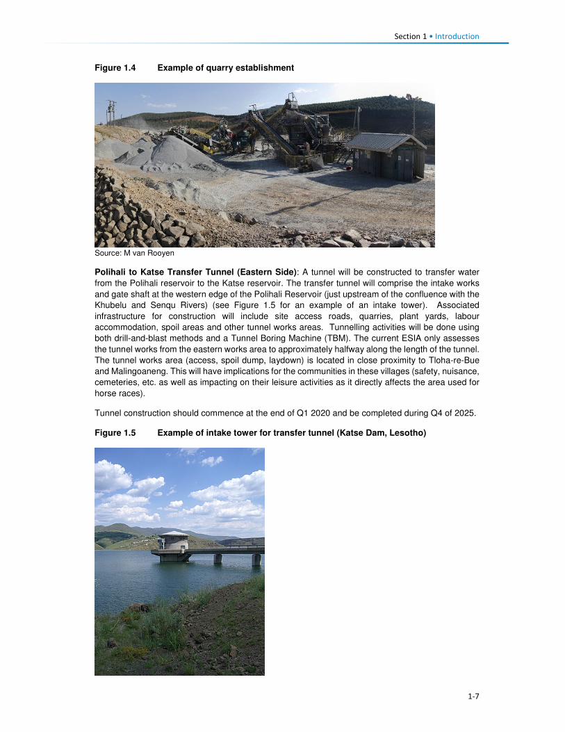
Section 1 • Introduction
1-7
Figure 1.4 Example of quarry establishment
Source: M van Rooyen
Polihali to Katse Transfer Tunnel (Eastern Side): A tunnel will be constructed to transfer water
from the Polihali reservoir to the Katse reservoir. The transfer tunnel will comprise the intake works
and gate shaft at the western edge of the Polihali Reservoir (just upstream of the confluence with the
Khubelu and Senqu Rivers) (see Figure 1.5 for an example of an intake tower). Associated
infrastructure for construction will include site access roads, quarries, plant yards, labour
accommodation, spoil areas and other tunnel works areas. Tunnelling activities will be done using
both drill-and-blast methods and a Tunnel Boring Machine (TBM). The current ESIA only assesses
the tunnel works from the eastern works area to approximately halfway along the length of the tunnel.
The tunnel works area (access, spoil dump, laydown) is located in close proximity to Tloha-re-Bue
and Malingoaneng. This will have implications for the communities in these villages (safety, nuisance,
cemeteries, etc. as well as impacting on their leisure activities as it directly affects the area used for
horse races).
Tunnel construction should commence at the end of Q1 2020 and be completed during Q4 of 2025.
Figure 1.5 Example of intake tower for transfer tunnel (Katse Dam, Lesotho)

Section 1 • Introduction
1-8
Major Bridges (Senqu, Khubelu and Mabunyaneng Bridges), and Associated Road Works:
Major bridges will be constructed on the Senqu, Khubelu and Mabunyaneng Rivers on the existing
A1 national road between Oxbow and Mokhotlong. Construction of the Senqu bridge will commence
in Q1 2020 and should be completed by the end of Q1 2023, while construction of the Khubelu/
Mabunyaneng bridge will commence in Q2 of 2020 and be completed during Q2 of 2022. Portions of
the A1 near the bridge locations will be realigned due to inundation by the reservoir, and a number of
other existing roads and tracks will require replacement. A new pedestrian bridge (Tlhakola Bridge)
is proposed across the reservoir at Tlhakola. Note: the scope of the PRAI ESIA does not include the
replacement of existing roads and tracks that will be inundated or the construction of new feeder
roads and minor bridges.
Bulk Power Supply and Telecommunications (BPST) infrastructure to be located at the Polihali
Reservoir that is included in this ESIS are:
• A new substation at Masakong near the advanced infrastructure area;
• A new telecommunications mast on the hill; and
• A new 33kV powerline from Tlokoeng across the reservoir to the permanent camp area (for
future electrical distribution by Lesotho Electricity Company (LEC) on the west side of the
reservoir).
Note: the construction of a new 132kV powerline from Katse (Matsoku Intake substation) to
Polihali (Masakong substation) and new paved road from Ha Seshote to Polihali falls under a
separate ESIS for the Polihali Western Access Corridor (PWAC).
Construction of the BPST infrastructure is anticipated to commence in Q3 of 2018 and be completed
by Q3 of 2020.
Project Housing and Site Establishment: The Phase II works will be built under a number of
construction contracts, each of which will require accommodation facilities for staff and the labour
force, site offices, workshops, plant yards, quarries, explosives store and other works areas. In
general, all temporary accommodation, offices and buildings needed for a particular construction
contract will be provided by the relevant construction contractor and will removed at the end of
construction.
Where facilities will have long-term use during the operation of the scheme, these will be designed
and built to appropriate standards for permanent works under the advance infrastructure contracts.
The permanent facilities include:
• Staff accommodation at the Polihali Reservoir area, built as a village with all communal services.
This will be the accommodation for the Employer, Engineer and Contractor’s staff during
construction of the Main Works and for operations staff following the completion of dam and
tunnel construction;
• A visitors’ lodge at the staff village, which will become a tourist facility; and
• The Employer’s and Engineer’s offices at the dam site, which will become the operations staff
offices and visitor centre.
Temporary construction areas include labour camps and works areas for construction of the eastern
sections of the PWAR; BPST component, and Polihali-Katse Transfer Tunnel, and for the Polihali
Dam and Saddle Dam and bridges. The labour camps will be provided with a raw water supply
(contractors will provide their own water purification, sewage treatment and waste facilities). The
Transfer Tunnel and Dam works areas/ sites will be provided with a raw water supply and a power
supply.
All the above project components are going to impact on the lives and livelihoods of the people
residing within the Project Area, either negatively or positively. The proposed dam area is surrounded
by villages that are most likely going to be affected to a large extent during the construction phase of
the dam and its associated infrastructure. During this phase there will be increased heavy vehicle
road traffic traversing through and passing by some villages. This will therefore mean constant noise,

Section 1 • Introduction
1-9
from the road traffic and likely blasting activities and also dust from the same. People's fields and
housing structures are also going to be impacted and some households will need to be relocated
because of the project activities which will include reservoir inundation, amongst others.
However, there will be the positive impact of local people being employed by the different contractors.
The locals will also be able to rent out their houses and their businesses could grow. The impact on
fields will mean that the owners will receive compensation for their loss. Those households that will
need to be displaced will have to be relocated to other areas.
The operational phase of the project will also affect the people residing within the Project Area, though
to a lesser extent. This would be through ongoing employment of some local people and development
of the local tourism industry. The people will also benefit from the livelihoods restoration and social
developments plan that the LHDA will develop and implement.

2-1
Section 2 Institutional and Legal Framework
2.1 Relevant Institutions 2.1.1 Central Government
The Government of Lesotho is a constitutional monarchy with two spheres of government: central
and local (Figure 2.1).
Figure 2.1 Structure of Government and Traditional Authorities
The head of state is King Letsie III whose role is predominately ceremonial. The two houses that
make up the parliament are the elected National Assembly (lower house) and the hereditary and
appointed Senate (upper house). The national assembly is comprised of 120 members elected
through the mixed-member proportional representation system2. The term of office for the members
of parliament is five years. The prime minister is the leader of the majority party in the national
assembly, and the King appoints the cabinet, known as the Council of State, on the advice of the
prime minister. There are a total of 25 ministries that oversee the implementation of government
policies and plans. The Senate comprises 33 members; 22 are Principal Chiefs while 11 are
nominated by the King on the advice of the Council of State.
Governmental power is exercised by three branches of government, namely; the executive; the
judiciary; and the legislature. Their different roles are described in Table 2.1.
Table 2.1 Main Government Branches, Powers and Functions
Arms of State Composition Functions
Executive The executive is made up of The Cabinet and Government Ministries. The Cabinet comprises the Prime Minister and Ministers.
• Cabinet is responsible for all government policies and
the day-to-day running of the affairs of the state.
Judiciary The Judiciary is made up of the Appeal Court, the High Court, the Magistrate Courts and Traditional (customary courts) which exist predominately in rural areas. There is also a Labour Court.
• The Judiciary is responsible for the administration of
justice, interpretation of existing laws and
guardianship of the Constitution.
• The Labour Court is a specialist court dealing
exclusively with industrial and labour matters
2 Under the mixed-member proportional representation system two-thirds of the members of the national assembly are elected according to the first-past-the-post electoral system (one member per constituency) and one-third by proportional representation (the 'party-list' form of the system).
Monarchy
Executive Legislative Judiciary
Hous e of Ass embly Senate Appeal Court
Prime Minister Principa l Chiefs High Court
Cabinet
(Government Ministries )
Area Chiefs Magistrate Courts
District Counci l lor District Head of Departments Tradi tiona l Court
Urban Counci l s & Community Counci l s
Arms of Government
King
Communities
District Administrator
National Government
District Government
Headmen

Section 2 • Institutional and Legal Framework
2-2
Arms of State Composition Functions
Legislative The Legislature is made up of the Senate and the National Assembly.
• The Senate examines and reviews draft Legislation/
Bills passed by the National Assembly.
• The National Assembly is the main legislative body; it
enacts the laws of the country and scrutinises the
political executive on the management and
administration of the affairs of the land.
2.1.2 Local Government
The constitution mandates Parliament to establish local government and the main governing
legislation is the Local Government Act 1997 and Local Government Elections Act 1998. Cabinet
adopted a national decentralisation policy in February 20143. The Ministry of Local Government and
Chieftainship Affairs (MoLGCA) is responsible for facilitating and coordinating the implementation of
the national decentralisation policies and programs, along with the capacity development of Local
authorities.
Local government structures are headed by the Principal Secretary who sits at the national
government level. Each District is headed by a District Administrator (DA). The DA represents the
interests of Central Government at a District level and is responsible for the administrative
decentralisation and integration of government activities. The DA is supported by heads of
departments of various government ministries.
The district administration is comprised of four levels of decentralised political structures namely the
10 District Councils (DCs), one Municipal Council, 11 Urban Councils and the 64 Community
Councils. Members of these councils are elected to office through local government elections, which,
constitutionally, are supposed to be held every five years. The first local government elections took
place in 2005, the second in 2011 and the third were expected to have occurred in 2016. The
composition of the various councils is described in Table 2.2.
Table 2.2 Local government composition at various Council levels
Role Description
District Councils
(DCs) • DCs are comprised of councillors elected through electoral colleges. Each DC
has a Chairperson and a District Council Secretary (DCS)4 who implement the
Council resolutions.
Municipal Councils
(MCs) • MCs are composed of councillors representing wards within an urban area
categorised as a Municipality. Presently, the City of Maseru is the only urban
area with a Municipal status.
Urban Councils • There are eleven urban councils in the country with each of the nine districts
besides Maseru having its council. However, there are two additional urban
councils in Maputsoe and Semongkong.
Community Councils
(CCs)
• There are 64 CCs. All councillors are elected to represent a single-member
division for a term of up to five years. Councillors comprise members elected
from the electoral division, chiefs representing traditional leadership, and
women occupying reserved seats determined by proportional representation
lists submitted by political parties.
Figure 2.2 shows the Community Councils within which the Project Area falls.
3 www.clgf.org.uk/default/assets/File/Country_profiles/Lesotho.pdf 4 The DCS office is responsible for the daily management of the political and service decentralisation, and the coordination and monitoring of all development projects at a District level.

2-3
Figure 2.2 Community Councils within which the Project Area falls

Section 2 • Institutional and Legal Framework
2-4
The Local Authorities’ responsibilities include:
• Control of natural resources and environmental protection;
• Agricultural services;
• Land allocation;
• Preservation, improvement and control of designated forests;
• Village water supply;
• Public health;
• Education;
• Minor roads;
• Streets and public places;
• Burial grounds;
• Markets and the promotion of economic development;
• Parks, recreation and culture; and
• Fire prevention.
2.1.3 Traditional Governance
Traditional leadership in the country is through chieftainship which is hereditary. This leadership is
hierarchical consisting of the King, Principal Chiefs (PC), Area Chiefs (AC) and Village Chiefs (or
headmen). Each one of these Chiefs levels is represented in the DCs and CCs. The Principal Chiefs
are responsible for overseeing all issues of traditional governance in their respective areas; in turn,
the Area Chiefs take orders and advice from the Principal Chiefs. Area Chiefs tend to administer a
smaller administrative area compared to that of the PCs. Lastly, the Village Chiefs or headmen
function as assistants to the Area Chiefs and manage the daily administration of their villages and
report to the Area Chiefs. Over and above the customary functions that chiefs play are the civil
responsibilities which include the issuing of certificates i.e. birth and death papers; writing letters for
bank account and passport applications; maintaining law and order and adjudicating local disputes.
The Principal Chiefs in the Project Area are those of Mokhotlong and Malingoaneng. The locations of
Area Chiefs in the Project Area are provided in Table 2.3 according to their respective Principal
Chiefs.
Table 2.3 Principal and Area Chief Locations in the Project Area
Principal Chief of Mokhotlong Principal Chief of Malingoaneng
Salang
Ntlholohetsane
Thabang
Ha Mojakisane
Ha Rafolatsane
Libibing
Tsoenene
Matlakeng
Malubalube/Likhameng
Nkokamele
Ha Moeketsane
Lilatoleng
Linakeng
Motsitseng
Ha Makhabane
Kholokoe
Bafali
Ha Lebopo
Tloha-re-Bue
Mapholaneng
Ha 'Meta
Tlokoeng
Mofolaneng
Makhomalong
Maitisi (Ha Letjama)
Mahemeng
Ha Polihali
Ha 'Mei
Makhoarane Khotsang
Taung
Hlokoa-le-mafi
Maqalikeng
Mokhalong/Ha Lephakha

Section 2 • Institutional and Legal Framework
2-5
2.2 Relevant Legislation and Policies 2.2.1 LHWP Treaty and LHDA Policies and Guidelines
The legal framework governing LHDA’s obligations with respect to social impact assessments
is summarised in Table 2.4.
Table 2.4 Policies and Guidelines Relevant to Social Impact Assessments
Legislation Requirements
LHWP Treaty (1986) The LHWP Treaty was signed between the Kingdom of Lesotho and the Republic
of South Africa in 1986, and has provided the foundation for construction of
Phase I (comprising Katse and Mohale Dams) and the planned Phase II (Polihali
Dam).
In relation to environmental and social issues, the Treaty requires that:
(i) all project affected people “will be able to maintain a standard of living not
inferior to that obtaining at the time of first disturbance”;
(ii) implementation, operation and maintenance of the project are compatible
with the protection of the existing quality of the environment; and, in particular,
and
(iii) shall pay due regard to the maintenance of the welfare of persons and
communities affected by the project.
To date, Phase I (comprising Katse and Mohale Dams) of the LHWP Treaty has
been completed as well as the Phase II Feasibility Study; the responsibilities for
these and a further two phases are set out in the LHWP Treaty.
Agreement on Phase
II of the Lesotho
Highlands Water
Project (August
2011)
The Phase II Agreement was signed between Kingdom of Lesotho and the
Republic of South Africa in 2011. The purpose of the Agreement is to provide the
legal basis for the implementation of Phase II as well as the operation and
maintenance of Phases I and II of the Project.
In relation to environmental and social issues, the Agreement makes the following
provisions:
• Environmental mitigation measures including environmental flow matters and
baseline studies will be implemented, the full extent is to be agreed by the
Parties during the implementation.
• Social development programmes and mitigation measures, resettlement
requirements, baseline studies and public relations and awareness campaigns
will be implemented; the full extent is to be agreed by the Parties during the
implementation.
LHWP Phase II.
Community
Participation
Strategy (September
2014)
LHDA’s Community Participation Strategy is aimed at ensuring the involvement and
participation of the public in the project planning, implementation, monitoring and
decision-making processes through the engagement of community structures and
other project role- players. It sets out the establishment for community liaison
structures which include area liaison committees and combined liaison committees
in the four councils affected by the project (Seate; Mphokojoane, Menoaneng and
Mokhotlong Urban Council).
Its main objectives are:
• To develop and maintain on an on-going basis the process of public
participation to ensure the continued involvement and participation of interested
and affected parties in a meaningful way;
• To promote involvement and participation of community structures in decision
making processes, planning and implementation of relevant LHWP activities;
• To co-ordinate current and planned LHDA community participation initiatives;
and

Section 2 • Institutional and Legal Framework
2-6
Legislation Requirements
• To establish a two-way communication channel between the LHDA and the
communities.
Area Liaison Committees (ALCs) have been set up to provide direct liaison
between LHDA, its contractors and the local communities within Phase II of the
LHWP, and to serve as a forum for:
• Community participation processes;
• Mobilisation, sensitisation and awareness- raising of affected communities;
• A two-way communication process between the affected people and the Project
authorities;
• Participation and consultation on Project policies (Compensation Policy) and
strategies;
• Exchange of views/information on the LHWP and LHDA activities and
programmes;
• Participation in data collection, project studies, information disclosure,
programmes implementation;
• Participation and witness to land acquisition, asset inventory/ registration,
ownership and measurement of properties to be affected;
• Participation and witness to consultations and agreements reached with
individual households and communities to be compensated;
• Identification of development needs, and establishment of action plans for
realisation of development goals;
• Receiving, adjudication and channelling of complaints and grievances from the
affected communities to the LHDA;
• Identification of affected people for training on land-based, wage-based and
enterprise-based livelihoods;
• Identification of the most vulnerable households e.g. orphans, aged and
disabled for special assistance by LHDA and/ or Government Departments;
• Management of unskilled labour; and
• Projects and programmes reviews.
Consultation with affected communities was carried out through the established
structures (ALCs, as outlined in Section 3.3) as well as through key informant
interviews.
Labour Recruitment
Guidelines (2017)
LHDA has developed Labour Recruitment Guidelines that will guide the hiring and
employment of labour for Phase II of the LHWP. It requires contractors to prioritise
recruitment of local labour from Lesotho, particularly for unskilled positions. It
specifies that all recruitment shall be done through a Project Labour Recruitment
Desk (PLRD) to be established at Mapholaneng or Tlokoeng with a satellite office at
Ha Lejone. All potential work seekers will need to be registered at the PLRD in
order to be considered for employment.
The Guidelines also set out principles regarding the recruitment of unskilled labour
as follows:
• All unskilled jobs will be for a period of between 12 and 18 months;
• At the end of each period the workers will be replaced by another person; and
• Where a Contractor has trained and developed an individual to such an extent
that the individual can be considered semi-skilled; then the individual may be
re-employed.
LHWP Phase II
Procurement
Guidelines
The LHDA procurement guidelines for Phase II have the central objectives of the
project procurement processes and procedures:
• To comply with the spirit and objectives of Article 6 of the Treaty and Articles 10
and 11 of the Phase II Agreement, as well as the provisions of the Lesotho
Public Procurement Regulations of 2007, Part III (12), which are to foster
competiveness and transparency while increasing participation of individuals
from Lesotho, South Africa and SADC member states.
• To maximise procurement opportunities for Lesotho and South African
suppliers.

Section 2 • Institutional and Legal Framework
2-7
Legislation Requirements
• To minimise the utilisation of imported goods, skills and labour, where
applicable, within the ambit of the laws governing Lesotho.
• To maximise skills and technology transfer through the training of individuals
and enterprise development opportunities for Lesotho-based companies and
black owned companies in the Republic of South Africa
LHWP Phase II
Contractor
Procurement
Framework (Draft
August, 2016)
The Contractor Procurement Framework provides an overview of the specific
requirements and approaches for the procurement of construction contracts for
Phase II of the LHWP. The Framework gives a basis to ensure that each contract is
procured in a manner compatible with the legal framework and the LHWP
procurement policy. The consultant responsible for each construction contract will
develop appropriate procedures to implement the Framework.
LHWP Phase II
Safety Health
Environment and
Quality Management
(SHEQ)
Management
Framework (April,
2017)
The Occupational Health and Safety of all employees is addressed by the SHEQ
Framework. The Framework provisions are applicable to all Consultants and
Contractors delivering work for, or on behalf of, the LHDA or its entities.
The aim of the Framework, is to:
• Assist Consultants or Contractors to adequately provide for implementing
sound SHEQ practices on site; and
• Inform Consultants and Contractors in advance of the SHEQ directive and
requirements that will be enforced during the project.
LHDA Phase II
Compensation Policy
(August, 2016)
The Policy applies to all losses of assets and income, and impacts on livelihoods
suffered by people, households, communities and institutions as a result of the
implementation of Phase II of the LHWP. According to the Policy all persons affected
by Phase II will be entitled to equitable treatment as embodied in the Policy. The Policy
objectives are:
• To minimise involuntary land take by investigating all possible Project design
alternatives;
• To ensure that affected people and communities, including host communities
are meaningfully consulted on Project designs, alternatives and impacts;
• To promote affected people’s participation in the planning, implementation and
monitoring of compensation, resettlement, mitigation and development
measures;
• To ensure that relocation of households and businesses is undertaken in a
participative, systematic and beneficial manner, involving both displaced and
host communities;
• To ensure that affected people are promptly, fairly and fully compensated for
their losses; and
• To ensure that direct compensation is accompanied by additional measures
where necessary to help restore livelihoods; and
• To ensure that existing cultural and religious practices are respected, and to
preserved to the maximum extent practical.
Compensation rates
The Policy states that compensation rates for Phase II have been declared under
the Compensation Regulations. The rates are adjusted annually for price escalation
using the Lesotho Consumer Price Index (CPI). Compensation for primary
residential dwellings and formal business structures will be based on the principle of
replacement cost. Consultations will occur with affected communities, their local
authorities and district stakeholders to explain the rates and the basis for their
calculations.
Where urban land and property are acquired, valuation will be carried out according
to the provisions of the Land Act of 2010 and the associated Regulations. All
valuations will be certified by LAA.
In the case of the provision of replacement agricultural land (land-for-land option),
the following principles will apply to the new land:

Section 2 • Institutional and Legal Framework
2-8
Legislation Requirements
• It will be identified and confirmed with the participation of the affected
households and should as far as possible be located in reasonable proximity to
where the displaced persons reside;
• It should be provided free of “transaction costs” such as registration fees,
transfer taxes or customary tributes.
Eligibility for compensation
The unit of entitlement for compensation against the loss of private property and
assets will be the owner or household, including orphaned minors who are entitled
to their parents’ estate. LHDA will ensure compliance with the regulations of the
Land Act of 2010 and the Legal Capacity of Married Persons Act of 2006.
Compensation for loss of communal resources
Communal resources include grazing land, brushwood, medicinal plants, useful
grasses and wild vegetables.
LHDA will calculate the total compensation amount payable for the communal
resources it is to acquire, based on the area of land lost and the number of affected
households.
Management rights to communal assets that will be acquired by the Project are held
by Community Councils. Compensation for the loss of communal assets will be
used for investment in approved community development ventures. The funds will
be managed by LHDA for the implementation of development projects that have
been agreed and prioritised by the affected communities and their local authorities.
Where some physically displaced households move outside their local community/
village to other host communities/ villages, the funds will be apportioned between
the concerned community/ villages based on the number of households relocating
to the host communities/ villages.
Downstream Impacts
Impacts on communities downstream of the Polihali Reservoir up to the confluence
of the Senqu and ‘Malibamatso Rivers caused by reduced river flows will be
mitigated through measures developed as part of the Project’s Phase II
environmental flow requirement (EFR) programme.
Disturbance allowance
A disturbance allowance will be paid to households, including households
enumerated on public land at the time of the Project’s socio-economic census
whose primary residential structure or structures are required to be relocated.
The allowance will be paid over three years from the date of disturbances. For
households electing to relocate to a destination of their own choice the allowance
will be paid in the form of a lump sum payment.
A lump sum disturbance allowance will be paid to small scale/informal traders
whose business structures are required to be relocated from their residential or
public land.
Owners of formal commercial enterprises will receive a disturbance allowance, the
value of which will be determined as part of the valuation exercise.
Evacuation Assistance
LHDA will provide transport to physically displaced households and businesses for
the removal of their assets, belongings and livestock to Project-designated and
approved relocation sites. Households electing to relocate to a destination of their
own choice will be paid a lump sum evacuation amount based on the relocation
destinations detailed in the compensation rates.
Asset Registration
Procedures for
LHWP Phase II
(October, 2017)
Asset registration and finalisation of compensation offers will be undertaken in three
steps i.e. asset registration, compensation options and compensation offer.
Asset Registration will entail:

Section 2 • Institutional and Legal Framework
2-9
Legislation Requirements
• Identification of affected assets and owners in the footprint of the project through
analysis of aerial imagery, field investigations and consultation with local authorities
and community structures;
• A cadastral survey of all affected land parcels as well as fixed assets (geo-
referenced and mapped) and Asset Inventory Forms signed by the affected
owner;
• Assets and beneficiary registration and preparation of Asset Verification Forms
(including GIS mapping and photographic evidence as well as communication
of the cut-off date); and
• Uploading of the asset and beneficiary data to FlowCentric, for in-system
checking and approval.
Compensation Options will involve :
• The creation of a compensation’s option form.
• Presentation and explanation of the options individually to beneficiaries
/households, who will be allowed at least one week to consider their preferences.
• Once options are confirmed, the Form will be signed by the parties for preparation
of Compensation Offers.
Compensation Offers – based on the selected compensation options:
• A Compensation Offer will be presented to the beneficiary/household. After a one
week “cooling-off” period, the Offer will be signed and executed.
• A copy of the Offer will be submitted to the LHWC for record purposes and
contingency transfer request.
LHWP Phase II
Livelihood
Restoration and
Social Development
Framework
(LR&SD) (August
2017)
The Livelihood Restoration and Social Development (LR&SD) Framework supplements
the Phase II Compensation Policy, and serves to provide a context for the
conceptualisation, planning and implementation of livelihood restoration measures and
social development initiatives on Phase II.
The focus areas of the LR&SD Framework are as follows:
• Livelihood restoration measures for households and communities directly
affected (physical and economic displacement) by implementation of Phase II.
These initiatives will be planned and implemented with the full participation of
affected households and communities and other stakeholders for effective
sustainability.
• Initiatives to support broad-based social and economic development in the
Phase II areas. These could include water and sanitation initiatives, public
health initiatives (to be implemented under the Phase II Public Health Action
Plan), and other initiatives to be finalised in conjunction with the Phase II
communities, government and other development partners.
Memorandum of
Understanding
(MoU) between
LHDA and Basotho
Enterprises
Development
Corporation
(BEDCO) (January
2015)
The objective of the MoU is to establish a platform for cooperation for the provision of
business development and advisory services within all the LHWP areas as part of the
initiatives for livelihoods improvement for the communities and individuals affected by
the implementation of Phases I and II of the LHWP. It entails:
• Coordinating efforts in developing and building skills capacity of affected
individuals and communities in Phases I and II of the LHWP in order to enable
the communities to optimise the potential benefits brought about by the
development activities of the LHWP;
• Developing design and conduct customised entrepreneurial and artisan skills
training programmes for communities in LHWP areas;
• Promoting Micro, Small & Medium Enterprises (MSMEs) and other livelihood
improvement activities among affected communities and individuals within
LHWP areas;
• Providing a pool of expert services for identification of business ideas,
development of project proposals, project appraisal and mentoring services for
business start-ups;
• Facilitating access to micro-finance for MSMEs
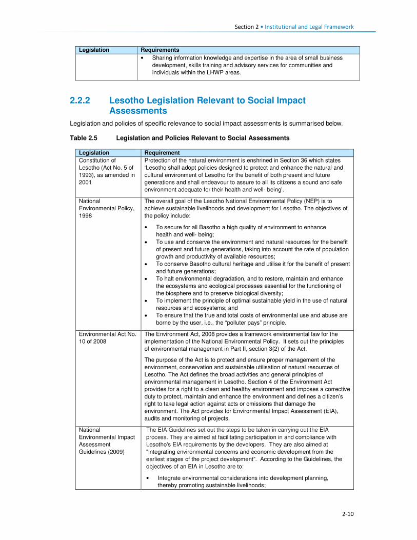
Section 2 • Institutional and Legal Framework
2-10
Legislation Requirements
• Sharing information knowledge and expertise in the area of small business
development, skills training and advisory services for communities and
individuals within the LHWP areas.
2.2.2 Lesotho Legislation Relevant to Social Impact Assessments
Legislation and policies of specific relevance to social impact assessments is summarised below.
Table 2.5 Legislation and Policies Relevant to Social Assessments
Legislation Requirement
Constitution of
Lesotho (Act No. 5 of
1993), as amended in
2001
Protection of the natural environment is enshrined in Section 36 which states
‘Lesotho shall adopt policies designed to protect and enhance the natural and
cultural environment of Lesotho for the benefit of both present and future
generations and shall endeavour to assure to all its citizens a sound and safe
environment adequate for their health and well- being’.
National
Environmental Policy,
1998
The overall goal of the Lesotho National Environmental Policy (NEP) is to
achieve sustainable livelihoods and development for Lesotho. The objectives of
the policy include:
• To secure for all Basotho a high quality of environment to enhance
health and well- being;
• To use and conserve the environment and natural resources for the benefit
of present and future generations, taking into account the rate of population
growth and productivity of available resources;
• To conserve Basotho cultural heritage and utilise it for the benefit of present
and future generations;
• To halt environmental degradation, and to restore, maintain and enhance
the ecosystems and ecological processes essential for the functioning of
the biosphere and to preserve biological diversity;
• To implement the principle of optimal sustainable yield in the use of natural
resources and ecosystems; and
• To ensure that the true and total costs of environmental use and abuse are
borne by the user, i.e., the “polluter pays” principle.
Environmental Act No.
10 of 2008
The Environment Act, 2008 provides a framework environmental law for the
implementation of the National Environmental Policy. It sets out the principles
of environmental management in Part II, section 3(2) of the Act.
The purpose of the Act is to protect and ensure proper management of the
environment, conservation and sustainable utilisation of natural resources of
Lesotho. The Act defines the broad activities and general principles of
environmental management in Lesotho. Section 4 of the Environment Act
provides for a right to a clean and healthy environment and imposes a corrective
duty to protect, maintain and enhance the environment and defines a citizen’s
right to take legal action against acts or omissions that damage the
environment. The Act provides for Environmental Impact Assessment (EIA),
audits and monitoring of projects.
National
Environmental Impact
Assessment
Guidelines (2009)
The EIA Guidelines set out the steps to be taken in carrying out the EIA
process. They are aimed at facilitating participation in and compliance with
Lesotho's EIA requirements by the developers. They are also aimed at
"integrating environmental concerns and economic development from the
earliest stages of the project development”. According to the Guidelines, the
objectives of an EIA in Lesotho are to:
• Integrate environmental considerations into development planning,
thereby promoting sustainable livelihoods;

Section 2 • Institutional and Legal Framework
2-11
Legislation Requirement
• Ensure that the environmental and socio-economic costs and benefits
of economic development projects are properly accounted for;
• Ensure that unwarranted negative impacts are avoided or mitigated at
an early stage in the planning process;
• Ensure that potential benefits are identified and enhanced;
• Carry out environmental and socio-economic studies of projects in
parallel with analysis of engineering and economic feasibility;
• Ensure that decision-makers are provided with information on
environmental costs and benefits to complement information on its
technical and economic feasibility at key decision points in the
development of a project;
• Ensure that all the affected and interested groups (local communities,
government authorities, developers, Non-government organisations
(NGOs), Community-based Organisations (CBOs), etc.) Participate in the
process;
• Set up a system to carry out mitigation, monitoring, auditing, and
enforcement.
National Strategic
Development Plan
2012/13 – 2017/18
The main goals of the National Strategic Development Plan are to:
• Pursue high, shared and employment creating economic growth;
• Develop key infrastructure;
• Enhance the skills base, technology adoption and foundation for
innovation;
• Improve health, combat HIV and AIDS and reduce social vulnerability;
• Reverse environmental degradation and adapt to climate change; and
• Promote peace, democratic governance and build effective institutions.
The NSDP Strategic Framework aims to build productive capacities and
create benefits of sustained broad-based growth in the form of jobs,
improved health, skills and capabilities and poverty reduction. The
Framework focusses on issues of development in the areas of investment;
financial sector development; trade; micro, small and medium enterprises
(MSMEs); agriculture and rural economy; manufacturing; tourism; mining;
infrastructure; skills and innovation; health and HIV and AIDS; social
protection; environment and climate change; and governance and
institutions.
Sustainable
Development Goals
(SDGs) 2016
The 2030 Agenda for Sustainable Development was adopted by all UN Member
States of which Lesotho is party to. The 2030 Agenda comprises a set of 17
Sustainable Development Goals (SDGs) to end poverty, fight inequality and
injustice, and tackle climate change by 2030.
District Economic
Strategies (DESs)
The District Economic Strategies (DESs) are structured along a bottom up
approach to the NSDP. They have been developed based on the employment
and economic development advantages for each District and its specific areas
towards achieving developments. The DES relies on four NSDP priority areas
which include economic growth generating activities, namely; manufacturing,
commercial agriculture, mining and tourism.
Lesotho Land Act No.
8 of 2010
The Land Act of 2010 is the principal legislation governing land ownership and
occupation, and the acquisition of property for public and development purposes.
Section 10(1) of the Act grants joint title to property to both spouses married in
community of property (under civil, customary or any other law, irrespective of the
date on which the marriage was entered into), and equal powers in land transactions.
Declaration of Land
Set Aside for Public
Purposes (Allocated
Land) Notice, 2012
(Legal Notice No. 71
of 2012)
The Legal Notice sets aside every right or interest in and to the allocated land (fields)
described as agricultural land delineated on Plan No 47283 held in the office of Chief
Surveyor, Maseru in extent 6492 hectares more or less situated at Polihali,
Mokhotlong District for public purposes. The Notice stipulates that the land is
required for the construction of Polihali Dam.

Section 2 • Institutional and Legal Framework
2-12
Legislation Requirement
Date of Surrender: On the date of publication of this notice in the gazette all interest
in or affecting the said land shall cease to subsist and the allottees interest in the
land shall revert to the State.
Compensation: The compensation is estimated at M300 million or more and shall be
apportioned to the claims accordingly.
Legal Capacity of
Married Persons Act
No. 9 of 2006
The Act grants equal powers on both spouses married in community of property,
giving them equal capacity to dispose of the assets of the joint estate, contract
debts for which the joint estate is liable, and administer the joint estate.
Lesotho National
Social Protection
Strategy (NSPS)
2014/15 – 2018/19
The NSPS implements the National Policy on Social Development (NPSD), in the
medium term. The policy provides a broad framework for development and
implementation of a harmonised and coordinated social protection agenda of
Government to ensure that different programmes implemented by different
Government and non‐Government agencies are complementary to each other
for sustainable development of the vulnerable.
The strategy addresses the risks and challenges across the life‐course. It
recognises that all citizens are exposed to different vulnerabilities through the
course of their lives, and responds to these vulnerabilities. The strategy is
structured around four key life‐course stages i.e. pregnancy and early childhood;
school age and youth; working age; and old age. It also includes the two
dimensions of shocks and of disability/chronic illness that may impact at any
stage of the life‐course.
The overall objective of the NSPS is to provide support to those that are unable
to construct a viable livelihood; to protect the assets and improve the resilience
of poor and vulnerable households; and to increase the productive capacity and
asset base of those households.
Lesotho Gender and
Development Policy
The Gender and Development Policy is a government tool geared towards
addressing the challenges of gender inequities and inequalities, poverty,
increased spread of HIV/ AIDS, retrenchment and unemployment by adopting a
rights-based approach to development. The policy is based on the realisation of
human rights of all, women and men alike, holding principles of equal
participation in development, non-discrimination and the empowerment of the
marginalised women and men, boys and girls.
Local Government Act
1997 as Amended by
Local Government
(Amendment) Act
2004
Schedule 2 of the Local Government Act, 1997 states that CCs’ functions include
control of natural resources, e.g. sands, stones and environmental protection,
e.g. control of natural resources, land/site allocation and physical planning,
agriculture and forestry, dongas, pollution, grazing control and water resources.
The Labour Code
Order (Amendment) of
2006
The Order provides that the employer shall not discriminate against a job
application on the basis of his or her HIV and AIDS status (refer to Section 235E
(1) of the Labour Code (Amendment) Order, 2006).
Part VII if the Labour Code Order relating to Health Safety and Welfare at work is
of particular relevance to this project. It deals with aspects such as fire prevention
and firefighting, the wearing of Protective Personal Equipment (PPE) and
clothing, removal of dust or fumes, etc.
Workmen’s
Compensation Act 13
of 1977 (amended by
LN 105 of 1995)
The Act directs employers on how to deal with compensation issues in the event
that an employee becomes injured or disabled in the line of duty, or in the event
that an employee dies while in the employ of the employer.
Public Health Order
12 of 1970
Stipulates that any exhumation of a body or other human remains from a
cemetery or other burial site requires a permit and that such permit shall be
obtained from the Department of Health by the legal representative or next of kin
or other duly authorised agent. The permit may prescribe conditions and
precautions under which such exhumation shall be conducted.
Section 75 makes provision for the Minister of Health to permit essential
exhumation of burial sites for any public, mining or infrastructure purpose.

Section 2 • Institutional and Legal Framework
2-13
Legislation Requirement
Removal of burial sites from an authorised cemetery requires a six-month
notification period of the intention to relocate graves.
2.3 International Standards The ESIA was required primarily to meet the requirements of the Lesotho Environment Act 10 of
2008, the national Environmental Impact Assessment (EIA) Guidelines (2009) and other relevant
national legislation, but was also seeks to address the requirements of the International Safeguards.
In this regard, the requirements of the World Bank and International Finance Corporation (IFC) in
respect of SIA requirements are described below. The World Bank is in the process of aligning their
Environmental and Social Safeguards (ESS) with the Performance Standards (PS) of the IFC and
there is no material difference between them.
2.3.1 World Bank ESS and IFC PS
Provisions of relevant ESS and PS safeguards are summarised in Table 2.6.
Table 2.6 Summary of Relevant World Bank and IFC Safeguards
Performance Standard (PS) Impact Assessment Requirements
ESS1 / PS1:
Assessment and Management
of Social and Environmental
Risks and Impacts
Underscores the importance of managing environmental and social
performance throughout the life of a project. It requires the client to
conduct a process of environmental and social assessment and to
establish and maintain an Environmental and Social Management System
(ESMS), appropriate to the nature and scale of the project and
commensurate with the level of its environmental and social risks and
impacts. It aims to:
• Identify and evaluate environmental and social risks and impacts of the
project;
• Adopt a mitigation hierarchy to anticipate and avoid, or where
avoidance is not possible, minimise, and, where residual impacts
remain, compensate/offset for risks and impacts to workers, affected
communities, and the environment;
• Promote improved environmental and social performance of clients
through the effective use of management systems;
• Ensure that grievances from affected communities and external
communications from other stakeholders are responded to and
managed appropriately;
• Promote and provide means for adequate engagement with affected
communities throughout the project cycle on issues that could
potentially affect them; and
• Ensure that relevant environmental and social information is disclosed
and disseminated.
ESS2 / PS2:
Labour and Working
Conditions
This standard recognises that the pursuit of economic growth through
employment creation and income generation should be accompanied by
protection of the fundamental rights of workers. PS2 aims to:
• Promote fair treatment, non-discrimination and equal opportunity of
workers;
• Establish, maintain and improve the worker-management relationship;
• Promote compliance with national employment and labour laws;
• Protect workers, including vulnerable categories of workers such as
children, migrant workers, workers engaged by third parties and
workers in the client’s supply chain; and
• Promote safe and healthy working conditions and the health of
workers; and avoid the use of forced labour.
ESS 3 / PS3: This standard recognises that increased economic activity and
urbanisation often generate increased levels of pollution to air, water, and

Section 2 • Institutional and Legal Framework
2-14
Performance Standard (PS) Impact Assessment Requirements
Resource Efficiency and
Pollution Prevention
land, and consume finite resources in a manner that may threaten people
and the environment at the local, regional, and global levels. Thus, PS3
aims to:
• Avoid or minimise pollution from project activities;
• Promote more sustainable use of resources (including energy and
water); and
• Reduce project-related Greenhouse Gas (GHG) emissions.
ESS 4 / PS4:
Community Health, Safety and
Security
This standard recognises that project activities, equipment, and
infrastructure can increase community exposure to risks and impacts. PS4
aims to:
• Anticipate and avoid adverse impacts on the health and safety of
affected communities during the project life from both routine and non-
routine circumstances; and
• Ensure that the safeguarding of personnel and property is carried out
in accordance with relevant human rights principles and in a manner
that avoids or minimises risks to the affected communities.
ESS 5 / PS5:
Land Acquisition, Restrictions
on Land Use and Involuntary
Resettlement
Note PS5 does not include
“Restrictions on Land Use” in
the title of PS5.
This standard recognises that project-related land acquisition and
restrictions on land use can have adverse impacts on communities and
persons that use this land. PS5 thus aims to:
• Avoid, and when avoidance is not possible, minimise displacement by
exploring alternative project designs;
• Avoid forced eviction;
• Anticipate and avoid, or where avoidance is not possible, minimise
adverse social and economic impacts from land acquisition or
restrictions on land use by (i) providing compensation for loss of
assets at replacement cost and (ii) ensuring that resettlement activities
are implemented with appropriate disclosure of information,
consultation and the informed participation of those affected; and
• Improve, or restore, the livelihoods and standards of living of displaced
persons.
ESS 6 / PS6:
Biodiversity Conservation and
Sustainable Management of
Living Natural Resources
This standard recognises that protecting and conserving biodiversity,
maintaining ecosystem services, and sustainably managing living natural
resources are fundamental to sustainable development. PS6 aims to:
• Protect and conserve biodiversity;
• Maintain the benefits from ecosystem services; and
• Promote the sustainable management of living natural resources
through the adoption of practices that integrate conservation needs
and development priorities.
ESS 8 / PS8:
Cultural Heritage
Recognises the importance of cultural heritage for current and future
generations. As such, PS8 aims to:
• Protect cultural heritage from the adverse impacts of project activities
and support its preservation; and
• Promote the equitable sharing of benefits from the use of cultural
heritage resources.
ESS 10:
Stakeholder Engagement and
Information Disclosure
Note: The IFC do not have an
equivalent performance
standard.
Recognises the importance of open and transparent engagement between
the Borrower (developer) and project stakeholders as an essential
element of good international practice. Effective stakeholder engagement
can improve the environmental and social sustainability of projects,
enhance project acceptance, and make a significant contribution to
successful project design and implementation.
2.3.2 Voluntary Principles on Security and Human Rights
The voluntary principles on security and human rights (www.voluntaryprinciples.org) provide a
framework to guide companies in maintaining the safety and security of their operations that ensures
respect for human rights and fundamental freedoms.

Section 2 • Institutional and Legal Framework
2-15
The principles cover the following aspects:
• The identification of security risks;
• The deployment and conduct of security personnel;
• Consultation between company, government, civil society and public security; and
• Responses to human rights abuses.
While Lesotho is not a signatory to these Principles, key human rights organisations are signatories
and IFC PS4 makes reference to the need to operate in accordance with relevant human rights
principles and in a manner that avoids or minimises risks to affected communities.
2.3.3 International Labour Organisation Fundamental Conventions
The International Labour Organisation (ILO) has identified eight conventions as "fundamental",
covering subjects that are considered as fundamental principles and rights at work. Lesotho has
ratified all of the ILO Fundamental Conventions, namely:
1. Freedom of Association and Protection of the Right to Organise Convention, 1948 (No. 87);
2. Right to Organise and Collective Bargaining Convention, 1949 (No. 98);
3. Forced Labour Convention, 1930 (No. 29);
4. Abolition of Forced Labour Convention, 1957 (No. 105);
5. Minimum Age Convention, 1973 (No. 138);
6. Worst Forms of Child Labour Convention, 1999 (No. 182);
7. Equal Remuneration Convention, 1951 (No. 100); and
8. Discrimination (Employment and Occupation) Convention, 1958 (No. 111).

3-1
Section 3 Approach and Methods
3.1 Introduction This section provides a description of the process and methods used to gather primary socio-
economic information within the Social Areas of Influence (Refer to Section 3.2.3).
3.2 Approach A four step approach to the data collection and analysis process was adopted and comprised the
following:
• Literature review,
• Site reconnaissance visit,
• Determining the Social Area of Influence; and
• Planning for data collection.
Each of all the four steps is described in more detail below.
3.2.1 Literature review
The objectives of the literature review process were to:
• Review all existing social specialist reports that had been commissioned by the LHDA between
2013 and 2016.
• Identify gaps in the available information that would require further secondary or primary research
to address.
• Identify a preliminary Social Area of Influence for the proposed Project.
• Identify further secondary sources of information that can be used during the compilation of the
report.
Box 3.1 List of Relevant Data Consulted for this Study
The review of the three baseline studies referenced above helped provide a broad understanding and
depth of the socio-economic status of the communities in the Project Area. In particular, the PHBS
(NHA, 2016) helps provide an overview of the health systems and nutrition status of the communities
• Socio-Economic Baseline Study (SEBS) (EOH Coastal & Environmental Services (CES) (2015b) (LHDA
Contract 6000) – the study was undertaken between 2013 and 2014 and finalised in March, 2015.
• Public Health Baseline Study (NHA, 2016) (LHDA Contract 6008) - the report was undertaken in three
stages between February 2014 and July 2015 and Draft Version 4 of the report is dated 28th January
2016.
• Baseline Income and Expenditure Report (CES, 2015a) (LHDA Contract 6000) - the specialist study
was undertaken between May 2013 and April 2014 and the report finalised in March 2015.
• Feasibility Study for Phase II – Stage 2: Main Report (Consult 4 and SEED Consult, 2009) (LHWC
Contract 001)
• Feasibility Study for Phase II – Stage 2: Social Impact Assessment Supporting Report (Consult 4 and
SEED Consult, 2008) (LHWC Contract 001)
• Panel of Experts & LHDA (2010) The ‘Lessons Learnt’ report from Phase 1A and Phase 1B Report 55
• Bureau of Statistics (Lesotho), 2013. Lesotho Demographic Survey, 2011, Vol 1, The Bureau of
Statistics, Maseru.
• Ministry of Health (Lesotho) and ICF International, 2016. Lesotho Health and Demographic Survey
2014. Maseru, Lesotho: Ministry of Health and ICF International.

Section 3 • Approach and Methods
3-2
in the Project Area. The findings of the desktop review of the three social documents are presented
in Table 3.1.
Table 3.1 Summary of the Socio-economic Gap Analysis and Action Plan
Baseline Report
Reference
Information Provided in
Available Baseline Reports
Key Limitations/ Gaps
Identified
Actions Required to Fill
Gaps
Socio-economic
Baseline Study
(SEBS) (CES,
2015b)
• Demographic profile of the
communities in the area.
• Education levels.
• Health status of
households.
• Types of land tenure and
use.
• Land ownership.
• Housing ownership and
types of housing.
• Occupation status and
types of income generation
by affected communities.
• Availability and access to
public services.
• Availability and access to
communal natural
resources.
• Some of data presented in
the SEBS are not clear or
in some instances the
tables do not present what
they are intended to
present.
• The SEBS divides the
communities into three (3)
catchments but does not
raise any unique features
about the communities.
• The information presented
in the tables is detailed for
the control area and none
for the actual reservoir
catchment and
downstream areas. By so
doing this does not allow
for one to look at the
trends/patterns for the
catchment and
downstream areas given
that the impacts vary
across these areas.
• The control area is taken
as part of the entire study
population without serving
as a “control group” in the
true sense of scientific
research.
• The data set is not
available for use for further
analysis.
• People’s opinions about
their social conditions do
not come through; only the
statistical interpretation of
the researcher comes
through.
• The data needs to be
updated using the 2016
Census if available at the
time of the study;
alternatively, the data from
the SEBS (CES, 2015b)
will be used as is.
• Updating of the SEBS
information using latest
available data sources
such as the 2014
Demographic Health
Survey, key informant
interviews with government
officials and NGOs.
• Focus group discussions
with the affected
communities to get
information on their
opinions about their socio-
economics conditions and
identify potential impacts of
the project and possible
mitigation measures.
Public Health
Baseline Survey
(PHBS) (NHA,
2016)
Focus is on:
• Household and Community
Nutrition.
• Vulnerable groups
(women, children, elderly).
• Sexual and reproductive
health and rights.
• Health services
assessment.
• There is no mention of
environmental health
related issues (water,
sanitation, waste disposal
etc.) and how they
generally influence the
health and well-being of
the community members.
• Collect the relevant
information on
environmental health for
inclusion in the integrated
social baseline report.
Baseline Income
and Expenditure • Brief socio-economic
baseline of the area.
• It does not integrate the
district level trend of
income and employment.
• To collect information from
the community level so it
can be integrated into the
report.

Section 3 • Approach and Methods
3-3
Baseline Report
Reference
Information Provided in
Available Baseline Reports
Key Limitations/ Gaps
Identified
Actions Required to Fill
Gaps
Survey (CES,
2015a)
• Income generation
activities of the
communities.
• Spending of the
communities
• To interview government
officials at a district level to
collect information on
employment, income and
spending at a district level.
The district level income
will be used to show
broader trends of these
economic aspects.
3.2.2 Site Reconnaissance Visit
A site reconnaissance visit was undertaken between 12 and 16 September 2016 by Debbie Weldon
(Project Manager), Jeanette Bloem (Social Specialist), Janet Mkhabela (Social & PP Integrator),
Thato Letsatsi (Public Participation Specialist), Stephen Gill (Senior Heritage Specialist) and Pusetso
Nyabela (Heritage Specialist). The purpose of the visit was for the Consultants to introduce
themselves to the District and traditional authorities as well as to get a preliminary understanding of
the scale of the Project Area and to conceptualise the best methods to be utilised to collect socio-
economic information. Subsequent to the visit, the Consultant revised the Social Areas of Influence
through the ground verification of the village clusters also using the ALCs furnished by the LHDA
Tlokoeng Field Office Branch (FOB) and developed data gathering tools.
3.2.3 Social Area of Influence
Based on the proposed Project activities for all phases of the Project, the social area of influence has
been determined to include both a direct, and an indirect, area of influence, each of which is described
below.
The Direct Area of Influence (AoI) comprises portions of the Seate, Menoaneng and Mphokojoane
Community Councils and the Mokhotlong Urban Council areas and the local catchment area of the
Polihali reservoir as defined by the LHDA, and downstream of the Polihali Reservoir up to the
confluence of the Senqu and ‘Malibamatso Rivers (35km stretch) and 5kms east and west of the
Senqu River (see Figure 3.1). The Direct AoI therefore includes:
• Households and communities located within the Project footprint (including the footprint of the
Polihali dam, tunnel works, site establishment and other ancillary infrastructure);
• Households located within areas that will experience changes in air or water quality, reduced
water flows, noise and vibration, visual and landscape, general disturbances, etc.;
• Areas of potential impact on livelihood resources such as agricultural or grazing land, fisheries;
• Settlements likely to experience physical and economic displacement due to the Project’s land
acquisition process; and
• Settlements that are likely to lose their cultural, social and health resources due to the proposed
Project.
The Indirect and Induced Areas of Influence comprise the remaining parts of the Mokhotlong
District not directly affected by the Project. This includes downstream parts of the Menoaneng and
Seate Community Councils and parts of the Bokong Community Council within Thaba-Tseka District
(downstream). These areas and communities fall outside of the direct footprint of the Project;
however, they may experience project benefits related to economic opportunities, increased
economic spend, or negative impacts associated with the presence of the project workforce, in-
migration, changes in water quality and flow downstream, etc.

3-4
Figure 3.1 Project Areas of Influence
Section 3 • Approach and Methods
3-5
3.2.4 Planning for Data Collection
The social data gathering process was planned to build upon the in-depth work already undertaken
where approximately 11,006 households were surveyed across the Project Area (CES, 2015b). Given
the fact that the previous social studies were undertaken roughly three years ago and the fact that
the Project Area is rural, the socio-economic information contained in these reports is deemed to be
valid. As such, a decision was made by the Consultant not to conduct additional household surveys
as part of the Social Specialist study for the ESIA; but, rather ground-truth and collect supplementary
data. The combination of existing information (from previous studies) and complementary data
collected was triangulated and collated into this updated and integrated socioeconomic report that
includes a detailed description of the demographics, livelihoods, access to public services and
infrastructure as well as dependence on, and utilisation of, natural resources.
Furthermore, it was anticipated that this approach would eliminate issues of stakeholder fatigue
associated with over-consultation, especially given that the resettlement planning specialist team was
expected to commence with the household census and asset inventory soon after the departure of
the ESIA social specialist team.
3.2.4.1 Development of Data Collection Tools
Multiple open-ended questionnaires were developed for different types of stakeholders engaged.
FGDs were planned with groups of men, women, and youths, and key informant interviews were
scheduled and held with various government and traditional authorities.
A FGD guide was developed and tailored to solicit information trends across different issues of
discussion at FGD sessions. The objective of the focus group discussions was to solicit from the
identified groups how they thought the PRAI is going to impact them and their livelihoods, be it
positively or negatively. If negatively how they thought the impacts should be mitigated and if
positively, how they think the impacts should be enhanced. The questions within the FGD guide
ranged from land tenure, livelihood strategies, which included farming and its challenges (both crop
and livestock), income generating activities and use of natural resources to earn a living, among
others. The tool also solicited information regarding infrastructure (health facilities, schools and
roads). The guide consisted of open-ended questions as a measure against the “yes” and “no”
responses from participants. Further, data validation questions were included in the guide to identify
instances where participants had negated themselves with their responses to similar questions.
The KII guide was tailored for individuals in specific roles within their communities, in government or
non-governmental space. The main purpose of KIIs was to ground truth information gathered from
the community members and that presented in the previous social studies as well as to gather
additional information to be used in updating the baseline. The interview guide consisted of open
ended questions to allow for in-depth discussions. The traditional leaders who were interviewed as
key informants were mainly to attain information relating to land tenure system and governance issues
within the Project Area. Besides the ground truthing of the FGD discussions, the government
department interviewees were also asked how they saw the PRAI impacting on their activities within
the Project Area.
3.3 Methodology 3.3.1 Sampling
Regarding sampling, the plan was to divide participants into three groups (men 36+ years; women 36
+ years and youth 18 – 35 years) with a maximum of 12 per group. The groups were to have at least
one representative from each of the villages in a cluster. However, during execution, this became
impractical due to the reasons highlighted in Section 3.2.4.

Section 3 • Approach and Methods
3-6
Key informant interviews were targeted at district heads of departments, traditional leaders, chiefs,
councillors, NGOs and Associations and other randomly selected informants, such as business
people.
3.3.2 Execution
The focus group discussions were held immediately after the completion of the community meetings
(pitsos) associated with the public participation process and participants were asked to form the three
groups as per the sampling plan. However, the participants did not adhere to this rule as they believed
that valuable information was going to be discussed in the groups. This meant that most of the FGDs
comprised of 20 or more people depending on the pitso attendance. In cases where more than 20
participants formed a group, the Consultant would sub-divide the group further to better accommodate
those present and to provide an environment more conducive to attendee participation. In Malubalube
participants refused to be divided into focus groups and demanded to be engaged as a group. In Ha
Makhabane, Linakeng and Ha Koeneo clusters the community meeting attendance was low, and a
decision was made to hold joint focus group sessions.
In Likomeng no focus group discussions were conducted as the members of this cluster had
participated in focus groups in Makhoatsing and Hlokoa-le-mafi. The villages that form these clusters
all fall under one Area Chief and when the Chief sent out messages about the meetings, people
attended the first two meetings that were held in Mohlanapeng and Hlokoa-le-mafi.
At the end of the focus group discussions, community members gathered for a feedback and a
consensus building session on issues discussed at each of the groups.
In total, 117 FGDs were held across the Project Area (Table 3.3). This represented 98% of the
intended 120. At a district level, KIIs were held with department heads, NGOs, Associations and
Chiefs/Councillors as well as business owners (Table 3.2).
Table 3.2 List of Departments, NGOs and Local leadership who participated in KIIs
District Heads of
Departments
NGOs/ Association Chiefs/councillors
• Agriculture,
• Education,
• Labour,
• Health,
• Public works,
• Social development,
• Disaster management,
• Culture
• Tourism,
• Meteorology
• Police, and
• Trade.
• Transformation Resource
Centre,
• Deutsche Gesellschaft für
Internationale
Zusammenarbeit (GIZ)
Participatory Initiative for
Social Accountability (PISA)
Lesotho (GIZ-PISA),
• Lesotho Red Cross Society,
• Touching Tiny Lives, and
• Mokhotlong Wool and
Mohair Growers
Association.
Business:
• Cashbuild
• Guest house
• Hardware and grocery store
• Ha Letjama,
• Ha Mojakisane,
• Hlokoa-le-mafi,
• Makhomalong,
• Mapholaneng, and
• Tloha-re-Bue.
At the community level, local chiefs and councillors were also interviewed to gather information
related to demographics, land tenure and management, access to and uses of natural resources.
One ad hoc meeting was held with the Mokhotlong Wool and Mohair Growers Association. A total of
27 KIIs were conducted with stakeholders.

Section 3 • Approach and Methods
3-7
The team held numerous informal conversations with various community members and made general
observations some of which are demonstrated in the pictures found throughout this report. The aim
of these ad hoc conversations and general observations was to verify some of the information that
was collected.
3.3.3 Data Management and Analysis
A tabular format was used to capture and collate the information gathered from all 117 FGDs
according to themes. Following this exercise, information from other secondary sources including the
three social baseline reports was captured for triangulation and cross referencing purposes. The data
was analysed according to recurring themes and integrated into this report.

3-8
Table 3.3 Schedule of Focus Group Discussions
Area Council Meeting Village Village Cluster Actual Villages Present during PPP/SIA sessions
Dow
nstr
eam
clu
ste
rs
Seate
Com
munity C
ouncil
Hlokoa-le-Mafi West_5 (Ha Lejone, Ha Makhabu, Liphookoaneng, Ha Cornela, Ha Nkhaulise, Hlokoa-le-Mafi)
Hloakoa le mafi, Ha Makhabu, Khamolane, Khotleng, Mafikeng, Liphokoaneng, Mohlanapeng, Thepung-Poka Lephene, Mapoteng, Nkhaolise, Thaka-Tsilo, Makhoatsing, Noha-Lia-Loana, Matseleng, Lihlabeng, Ha Liete, Molumong, Likomeng, Moeaneng
Ha Nts'asa West_6 (Ha Ntsasa, Ha Ramokobo, Mafika Lisiu, Ha Malelu, Ha Moatsoetlane, Ha Rahlena, Khamolane)
Ha Ntsasa,Ha Ramokobo, Khamolane, Lihlabeng, Sekhutlong, Tsepong
Taung West_7 (Taung/Khokooeng, Masakoaneng, Maqhaung, Makhiseng, Freistata, Liphofung, Letapeng, Manonyana)
Masokoaneng, Taung, Majakeng, Makhiseng, Ha Phatsoane, Ha Maotoana, Makhoaba, Letlapeng, Masalla, Hajeke, Ha Seotsanyane, Thepung, Marisele
Khotsang West_8 (Khotsang, Letlapeng, Nqobelle, Ha Setene, Semapong, Tena-Baphehi, Lipeleng)
Khotsang, Bahaoleng, Tena Baphehi, Makhoaba, Ha Mei, Letlapeng Nqobelle
Ha 'Mei West_8 (Ha Mei, Thuhloane, Tibising, Moeaneng, Motse-mocha) Tibising, Ha Mei, Thuhloane, Motse-Mocha
Makhoarane West_9 (Matikiring, Ha Matekase, Ha Letheha) Matikiring, Makokoaneng, Ha Letheha, Matekase, Makhoarane, Sekhutlonyaneng, Matikiki, Sekhutlong, Thuhloane,
Bo
ko
ng
Co
mm
un
ity C
ou
ncil
Mohlanapeng West_3 (Noha-lia-loana, Ha Hashepe, Tsotsoaneng, Khamolane, Porotong, Mohlanapeng, Khutlo-se-Nonne)
Noha Lia Loana, Letsatseng, Mohlanapeng, Ha Heshepe, Kholong, Likomeng-Ha Thaka-Tsilo, Mapoteng, Botsong, Mafikeng, Khotleng, Lekhalaneng, Likomeng ha Marutle, Tsutsoaneng, Mabuleng, Ha Letjama, Maitisi, Khutlo-se- Nonne, Ha Molise, Maqalikeng
Likomeng West_4 (Makoatsing, Letsatseng, Mokhoabong, Mapoteng, Khotleng, Likomeng (Ha Thakatsilo), Mafikeng, Ha Pokalephele, Lihlabeng, Ha Thoso)
People from this cluster attended sessions at Mohlanapeng & Hlokoa-le-mafi
Maqalikeng West_2 (Kholokoe, Mokhangoaneng, Thaba Sephara, Ha Kakuli, Maqalikeng, Khotolieng, Manokong)
Maqalikeng, Mokhangoaneng, Thaba-Sephara, Manokong, Ha Molise, Khotolieng
Mokhalong West_1 (Mokhalong, Mahuleng, Koting-sa-Mofao, Phaleng, Ha Lephakha, Makhapung, Ha Letebele (Ha Leruo))
Mokhalong, Mahuleng, Phaleng, Ha Lephakha
Men
oan
en
g
Co
mm
un
ity
Co
un
cil
Nkokamele East_1 (Likhameng, Liokhoane, Ha Motubehi, Mabeulung, Ha Lehloenya, Mochochononong, Nkokamele, Masakong, Ha Motseare, Makorotong, Taung 1 & Taung 2, Koma Koma)
Nkokamele, Ha Motseare, Nqobelle
Ha Moeketsane East_2 ( Ha Moeketsane, Ha Mohale, Phahameng,Ha 'Mamothopeng, Sephokong, Khorole, Tibising, Mafikeng)
Ha Moeketsane, Moreneng, Makorotong, Mafikeng, Tibising, Ha Moleko, Ha Mokoena, Ha Makaka

3-9
Area Council Meeting Village Village Cluster Actual Villages Present during PPP/SIA sessions
Lilatoleng East_3 ( Lilatoleng, Ha Sibi, Ha Ralitlhare, Ha Ntsika, Tsekong, Ha Lehloenya)
Ha Ntsika, Ha Sibi, Tsekong, Ha Ralitlhare, Ha Lehloenya, Bobatsi, Moeling, Lipeleng, Ha Lekhehle, Ha Taelo
Linakeng East_4 ( Ha Moropane, Ha Jontane, Ha Taelo, Ha Rajoalane, Kholoke, Linakeng (Ha Mphosi), Matlatseng, Sankoela (Makhahleleng)
Linakeng, Ha Mphosi, Likhahleng
Po
lih
ali C
atc
hm
en
t Seate
Co
mm
un
ity C
ou
ncil
Malingoaneng/ Khubelu
ALC S1 (Tloha-re-Bue, Malingoaneng, Masakong, Ha Tlhakola, Ha Ramonakalali, Ha Jobere, Sotoane)
Tloha-re-Bue, Masakong
Nts'upe ALC S2 (Nts'upe, Linokong) Ntsupe, Makorong, Phuthing, Terae Hoek, Mafikeng, Ha Tlontlollo,
Sebera ALC S3 (Sebera, Ha Nts'esanyane, Letsatsaneng, Likoting, Checheng)
Mateaneng, Teraeng, Sebera, Phokeng, Sekoka, Likoting, Letsaneng, Ha Ntsesanyane, Bolahla, Ha Ramoruti
Mapholaneng ALC S4 (Mapholaneng, Ha Leqabanyo) Mafika-Lisiu. Motete, Meketeng, Polomiti, Majakaneng, Ha Lechela, Ha Leqabanyo, Ha Ntsetsanyane, Makalieng, Taung, Likoung, Khubelu, Sefate, Mofolaneng, Tsepong, Phatlalla, Lithoteng, Perekising, Matebeng, Ha Matsieng
Mofolaneng ALC S5 (Mofolaneng, Likoung, Mokhoabong, Bochabela, Manganeng, Matebeng, Lithoteng)
Mofolaneng, Tsepong, Mangaung, Phatlalla, Mokhoabong, Lithoteng, Sefate, Likoung, Lipululeng, Matebeng, Bochabela, Lebakana
Mahemeng ALC S6 (Mahemeng, Rammeleke) Mahemeng, Tsieng
Men
oan
en
g C
om
mu
nit
y
Co
un
cil
Ha Rafolatsane ALC MG5 (Ha Rafolatsane, Hloahloeng, Molumong, Ha Molungoa, Ha Sekantsi, Ha Lehlohonolo, Manganeng, Majakaneng, Matsekeng)
Ha Rafolatsane, Ha Lehlohonolo, Majakaneng, Molumong, Ha Molungoa, Manganeng, Namoha, Ha Sekantsi, Lilemeleng, Lekhalong, Sehlabeng
Ha Koeneo ALC MG6 (Ha Koeneo, Maphiring, Likoae, Jermiston, St James, Lekhalong)
Ha Koeneo
Libibing ALC MG4 (Libibing II, Tlhakoaneng, Manganeng, Maotleng, Sekoting, Thoteng, Letsatseng, Sekaneng, E-eang, Janteu, Tutulung, Ha Motebang)
Libibing 1, Libibing 2, Letsatseng, Tlhakoaneng, Terateng, Sekoting, Manganeng, Moeling, Janteu, Maotleng
Matlakeng ALC MG3 (Matlakeng, Bokone, Morojeleng, Ha Phatoli, Ha Nts'abele, Taung, Ha Mofali, Ha Makere, Hlomohang, Moeling, Molalana-Motse Mocha)
Ha Ntsebele, Taung, Koeneng, Moeling, Tsoenene, Ha Mofali, Ha Phatoli,
Ts'oenene ALC MG2 (Ts'oenene, Meeling, Thajana, Phatoli, Khohlong, Ha Setsoto, Sekokong, Bochabela)
Bochabela, Thajane, Sekokong

3-10
Area Council Meeting Village Village Cluster Actual Villages Present during PPP/SIA sessions
Malubalube ALC MG1 (Malubalube, Likhameng/Moeaneng, Ntjolo, Phate, Masofeng)
Likhameng, Masoefeng, Moeaneng, Ha Phate, Malubalube
Mo
kh
otl
on
g
Urb
an
Co
un
cil
Salang ALC MU1 (Salang, Checha, Teropong) Checha, Ntlholohetsane
Bafali ALC MU2 (Bafali, Ha Poso, Ntsiking Bafali) Bafali, Bafatsana,Ntsining, Masaleng, Mabitseng, Ha Seeta, Bafali- Nkotoane,
Ntlholohetsane ALC MU3 (Ntlholohetsane1, Ntlholohetsane2) Ntlholohetsane, Senkoase
Thabang ALC MU4 (Thabang) Thabang, Mangaung, Liraholeng
Ha Mojakisane ALC MU5 (Ha Mojakisane) Mojakisane, Sekeketeng
Mp
ho
ko
joan
e C
om
mu
nit
y C
ou
ncil
Meta/Mabuleng ALC MP1 (Ha Maleka, Thoteng, Ha 'Meta, Kheseng, Ha Masetulo) Mabekong, Paballong, Khesing, Ha Meta, Litsoeneng, Moeaneng, Thoteng, Mokhalong, Pontseng, Kheseng, Koakoatsi, Lietsela, Sebothoane, Thoteng Ha Lesoeja, Masholoko, Moreneng, Sekoting Ha Tipi
Tlokoeng ALC MP2a (Tlokoeng, Liphokong, Botsola, Ha Mpesi, Makalong, Tlokoeng, Matebeleng)
Tlokoeng, Botsola, Maitisi, Mabelete, Mabeleteng, Ha Mpesi
Lilimala ALC MP2b (Lilimala, Tsekong, Majakaneng, Ha Konki, Lits'otsong) Lilimala, Makalong, Ha Konki, Tsilantso Ha Konki, Kanana, Litsotsong
Ha Lebopo (Mahesheleng)
ALC MP8 (Lebopo, Masuoaneng) Ha Lebopo, Ha Mathibeli, Ha Ramoruti, Mabothong, Koatanyane, Ha Koatake, Ha Ramohale, Sekokong
Ha Makhabane ALC MP6 (Ha Makhabane) Ha Makhabane
Makhomalong ALC MP3 (Makhomalong, Majakaneng, Moeaneng, Ha Mohlabakobo, Matsoapong, Phohla)
Matsoapong, Phohla, Makhomalong, Makaoteng
Sekokong ALC MP4 (Sekokong, Ha Moruti, Taung, Ha Koatake, Mobothong, Kanana, Makhoabeng, Ha Ramohale, Ha Mathibeli)
Ha Ramoruti, Mabothong, Ha Ramohale, Sekokong, Ha Lebopo, Ha Koatake, Taung, Ha Mathibeli, Kanana, Thotanyane
Ha Letjama ALC MP5 (Ha Letjama, Maitisi, Letlapeng, Ha Ts'ese, Mabuleng, Khohlong)
Khohlong, Letjama, Tshehle
Motsitseng ALC MP7 (Motsitseng, Sekoka, Lumang, Mpharane) Motsitseng, Sekoka
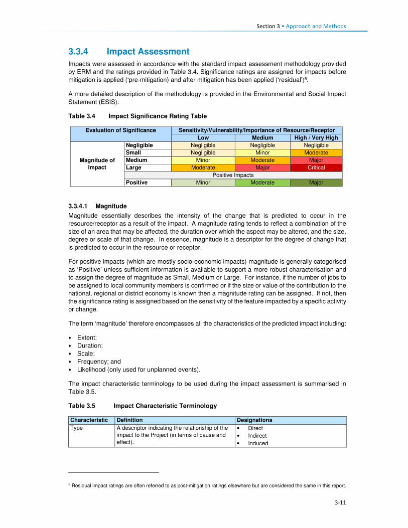
Section 3 • Approach and Methods
3-11
3.3.4 Impact Assessment
Impacts were assessed in accordance with the standard impact assessment methodology provided
by ERM and the ratings provided in Table 3.4. Significance ratings are assigned for impacts before
mitigation is applied (‘pre-mitigation) and after mitigation has been applied (‘residual’)5.
A more detailed description of the methodology is provided in the Environmental and Social Impact
Statement (ESIS).
Table 3.4 Impact Significance Rating Table
Evaluation of Significance Sensitivity/Vulnerability/Importance of Resource/Receptor
Low Medium High / Very High
Magnitude of
Impact
Negligible Negligible Negligible Negligible
Small Negligible Minor Moderate
Medium Minor Moderate Major
Large Moderate Major Critical
Positive Impacts
Positive Minor Moderate Major
3.3.4.1 Magnitude
Magnitude essentially describes the intensity of the change that is predicted to occur in the
resource/receptor as a result of the impact. A magnitude rating tends to reflect a combination of the
size of an area that may be affected, the duration over which the aspect may be altered, and the size,
degree or scale of that change. In essence, magnitude is a descriptor for the degree of change that
is predicted to occur in the resource or receptor.
For positive impacts (which are mostly socio-economic impacts) magnitude is generally categorised
as ‘Positive’ unless sufficient information is available to support a more robust characterisation and
to assign the degree of magnitude as Small, Medium or Large. For instance, if the number of jobs to
be assigned to local community members is confirmed or if the size or value of the contribution to the
national, regional or district economy is known then a magnitude rating can be assigned. If not, then
the significance rating is assigned based on the sensitivity of the feature impacted by a specific activity
or change.
The term ‘magnitude’ therefore encompasses all the characteristics of the predicted impact including:
• Extent;
• Duration;
• Scale;
• Frequency; and
• Likelihood (only used for unplanned events).
The impact characteristic terminology to be used during the impact assessment is summarised in
Table 3.5.
Table 3.5 Impact Characteristic Terminology
Characteristic Definition Designations
Type A descriptor indicating the relationship of the
impact to the Project (in terms of cause and
effect).
• Direct
• Indirect
• Induced
5 Residual impact ratings are often referred to as post-mitigation ratings elsewhere but are considered the same in this report.

Section 3 • Approach and Methods
3-12
Characteristic Definition Designations
Extent The “reach” of the impact (e.g. confined to a
small area around the Project Footprint,
projected for several kilometres, etc.).
• Local
• Regional
• International
Duration The time period over which a resource /
receptor is affected.
• Temporary
• Short-term
• Long-term
• Permanent
Scale The size of the impact (e.g. the size of the
area damaged or impacted; the fraction of a
resource that is lost or affected, etc.)
[no fixed designations; generally intended
to be a numerical value, where impacts
can be quantified e.g. % of habitat lost; or
where a numerical threshold may be
exceeded (e.g. air or noise standards]
Frequency A measure of the constancy or periodicity of
the impact.
[no fixed designations; generally intended
to be a numerical value where known (e.g.
blasting)]
The evaluation of pre-mitigation impact significance takes into account control measures that are
already part of or embedded within the Project design. This avoids the situation where an impact is
assigned a magnitude based on a hypothetical version of the Project that considers none of the
embedded controls that are defined as part of the project description. Examples of embedded controls
could include acoustic reduction measures around noisy equipment or servitude and buffer
requirements the development is obliged to implement and is part of the layout. Additional mitigation
measures aimed at further reducing the significance of impacts are proposed where necessary or
appropriate and are assessed as part of the ‘residual’ impact significance rating.
In the case of type, the designations are defined universally (i.e. the same definitions apply to all
resources/receptors and associated impacts). For these universally-defined designations, the
definitions are provided in Table 3.6.
Table 3.6 Designation Definitions
Designation Definition
Type
Direct Impacts that result from a direct interaction between the Project and a resource/receptor
(e.g. between occupation of a plot of land and the habitats which are affected).
Indirect Impacts that follow on from the direct interactions between the Project and its
environment as a result of subsequent interactions within the environment (e.g. viability
of a species population resulting from loss of part of a habitat as a result of the Project
occupying a plot of land).
Induced Impacts that result from other activities (which are not part of the Project) that happen as
a consequence of the Project (e.g. influx of camp followers resulting from the importation
of a large Project workforce).
Extent
Local Impacts that affect an area in proximity to the development area within an area defined
on a resource/receptor-specific basis.
Regional Impacts occurring at a regional scale as determined by administrative boundaries or
which affect regionally important resources or ecosystems.
International Impacts that extend across international boundaries or affect resources such as
features, resources or areas protected by international conventions.
Duration
Temporary Impacts are predicted to be of short duration (in the order of days) and/or
intermittent/occasional.
Short-term Impacts that are predicted to last only for the duration of the construction period.
Long-term Impacts that will continue for the life of the Project, but will cease when the Project stops
operating.

Section 3 • Approach and Methods
3-13
Designation Definition
Permanent Impacts that cause a permanent change in the affected receptor or resource (e.g.
removal or destruction of ecological habitat) that endures substantially beyond the
Project life time.
3.3.4.2 Sensitivity
Characterisation of sensitivity for social and cultural heritage receptors is based on the value of that
social and cultural heritage receptor/s and its vulnerability to the impact, taking into account the
receptor’s resilience, including ability to adapt to change or use alternatives where available.

4-1
Section 4 Baseline Environment
4.1 Demographic Profile This section describes the demographic characteristics of the country and the Project Area. These
include population size and distribution, ethnicity and language and migration patterns.
4.1.1 Population Size and Distribution
Lesotho has a population of over two million people and had a low population growth rate of one
percent per annum (between 2015 and 2016)6. In 2017, Lesotho’s population is projected to increase
by 26 102 people and reach 2 199 492 people by early 2018. According to the Lesotho Demographic
and Health Survey (LHDS) (2014) (Ministry of Health (Lesotho) and ICF International, 2016), there
are more females than males at 53% and 47%, respectively. The population of Lesotho is considered
to be young with 39% of the population aged below 15 years, while the proportion of people aged 65
and older is eight percent. The average household size was 3.3 persons. An estimated low of 25% of
the population resides in the urban areas and 75% reside in rural areas. This is indicative of the low
urbanisation rate of the country of four percent per annum.
According to the Socio-Economic Baseline Study (CES, 2015b), the population of the Project Area
was estimated to be 46 371 people between 2013 and 2014, with an average of 5.2 persons per
household. More recent population figures could not be obtained from the local authorities as a
majority indicated that they did not have updated figures. The population in the Project Area reflects
similar characteristics to the national population figures as described above (Figure 4.1).
Figure 4.1 Gender and Age Distribution in the Project Area
Source: Socio-Economic Baseline Study (CES, 2015b)
4.1.2 Ethnicity and Language
Lesotho is a homogenous nation regarding the ethnic composition of the population and culture.
Approximately 99% of the country’s population are Basotho who, in turn, belong to specific clans.
Basotho clans are mostly named after animals which were selected based on the animals’ character
6www.worldmeters.info/world-population/lesotho-population/

Section 4 • Baseline Environment
4-2
(Box 4.1). Some Zulu and Xhosa people from South Africa are found in different parts of the country
due to population migration. Chinese people are also found throughout the country.
Box 4.1 Basotho Clans
Bakoena – Koena (crocodile) Bafokeng –'Mutla (hare) Batloung – Tlou (elephant) Bats'oeneng – Ts'oene (baboon) Bakubung – Kubu (hippopotamus) Baphuthinq – Phuthi (duiker) Bahlaping – Tlhapi (fish) Bataung- Tau (Lion) Basia- Katse (cat) Bahlakoana – Koena (crocodile) Batlokoa – Katse (cat) Bathepu – Noha (snake) Matebele – named after their chiefs Bakhala – no English term
The official languages are Sesotho, which is spoken by the majority of the population, and English
(generally accepted as the language of business). Other commonly spoken languages are isiZulu,
followed by Phuthi, isiXhosa and Mandarin. A similar ethnic and language composition was evident
in the Project Area. Some Zulu people, who the social team met in the area, indicated that they were
either descendants of Zulus who migrated to Lesotho during tribal wars in South Africa or they
relocated to the area out of choice.
4.1.3 Religion
The majority of the Basotho population (90%) are Christians. The main denominations include
Catholic, Lesotho Evangelical, Anglican and other Christian denominations. Muslims, Hindus,
Buddhists and Baha'i comprise the remaining 10%. In the Mokhotlong district, Christianity is the
dominant religion, followed by traditional and cultural beliefs. Many church services include chanting,
drumming and cultural costumes.
Similarly, in the Project Area, Christianity is the most widely practised religion along with traditional
beliefs (ancestral spirits). The main denominations found are the Apostolic followed by Roman
Catholic, Lesotho Evangelical and Anglican. Similarly, the traditional and cultural beliefs are also
observed in the Project Area. Traditional healers and Apostolic Churches use the water pools in the
Senqu River to perform their religious obligations.
4.1.4 Residential Status of the Population
According to the Lesotho Demographic Health Survey (LDHS) 2014 (Ministry of Health (Lesotho) and
ICF International, 2016), in Lesotho, many people reside away from their home communities and
apart from their families for extended periods to pursue work or educational opportunities. The
majority of the population in the country lives within the household (77% males and 82% females);
followed by those who are elsewhere in the country and South Africa (9% men and 5% women) as
indicated in Table 4.1. More females than males are based on the household owing to the African
traditions and beliefs that a woman’s place is at home.

4-3
Table 4.1 Residential Status by Age, Gender, Ecological zone and District in Lesotho
MALE FEMALE
Background characteristics
In the household
Elsewhere in Lesotho
In RSA
In Other Country
Total Number In the household
Elsewhere in Lesotho
In RSA
In Other Country
Total Number
Age
0-9 89.9 8.8 1.2 0.0 100.0 4,360 90.6 8.3 1.0 0.1 100.0 4,494
10-19 83.7 14.7 1.6 0.0 100.0 4,571 81.0 17.9 1.0 0.1 100.0 4,492
20-29 66.6 20.4 12.9 0.1 100.0 3,633 69.8 23.2 6.9 0.1 100.0 3,519
30-39 63.1 17.2 19.7 0.0 100.0 2,466 72.7 14.7 12.5 0.1 100.0 2,403
40-49 62.3 14.2 23.3 0.2 100.0 1,541 72.6 11.9 14.5 0.0 100.0 1,518
50-59 67.2 9.8 23.0 0.0 100.0 1,100 87.1 6.2 6.7 0.0 100.0 1,561
60+ 90.6 5.1 4.3 0.0 100.0 1,488 93.4 5.1 1.4 0.0 100.0 2,242
Residence
Urban 81.0 11.8 7.1 0.1 100.0 4,768 85.1 11.3 3.4 0.2 100.0 5,526
Rural 75.8 14.3 9.9 0.0 100.0 14,400 80.1 14.4 5.4 0.0 100.0 14,703 Ecological Zone
Lowlands 78.0 12.3 9.0 0.0 100.0 10,390 82.8 12.2 4.9 0.1 100.0 11,390
Foothills 74.1 15.5 10.0 0.0 100.0 2,350 78.5 10.4 5.1 0.0 100.0 2,342
Mountains 78.2 15.4 6.3 0.0 100.0 4,000 82.2 14.3 3.5 0.0 100.0 4,568
Senqu River Valley
09.2 15.1 15.0 0.1 100.0 1,817 75.9 10.1 8.0 0.1 100.0 1,923
District
Butha-Buthe 79.0 11.4 9.6 0.0 100.0 1,211 84.9 9.5 5.5 0.0 100.0 1,198
Leribe 74.2 14.4 11.4 0.0 100.0 2,977 78.7 15.5 5.8 0.0 100.0 3,246
Berea 79.2 13.5 7.3 0.0 100.0 2,354 81.1 13.9 5.0 0.1 100.0 2,431
Maseru 82.2 11.7 6.0 0.1 100.0 4,290 85.7 11.0 3.0 0,2 100.0 4,742
Mafeteng 77.2 11.9 10.9 0.0 100.0 1,734 82.6 11.8 5.6 0.0 100.0 1,780 Mohale's Hoek 88.8 18.9 14.3 0.0 100.0 2,011 74.7 18.6 6.7 0.0 100.0 2,097
Quthing 88.9 14.2 16.8 0.1 100.0 1,170 75.3 14.4 10.2 0.1 100.0 1,287
Qacha'snek 77.1 12.8 10.0 0.0 100.0 658 85.4 9.6 5.0 0.0 100.0 680 Mokhotlong 79.6 14.3 6.0 0.0 100.0 1,230 81.6 14.9 3.5 0.0 100.0 1,203
Thaba-Tseka 78.7 17.3 3.9 0.0 100.0 1,533 83.4 15.0 1.6 0.0 100.0 1,567 Source: Lesotho Demographic Survey, 2011 (Bureau of Statistics (Lesotho), 2013)

Section 4 • Baseline Environment
4-4
The Mokhotlong district and Project Area population followed the national trends regarding residential
status, including people living in South Africa (six percent males and nearly four percent females).
Participants in focus group discussions indicated that some female youth often went to South Africa
to seek employment and return home when the job or contract has been finished/ terminated. These
youths highlighted the shortage of job opportunities in the District and Project Area as the motivation
for them seeking employment outside of the country.
4.1.5 Migration
In Lesotho, the majority of migrants were young men working in the South African mines; however,
since the 1990s the patterns of migration have changed substantially due to the general decline in
mine employment in South Africa. The decline in mine employment in South Africa for Basotho from
Lesotho has given rise to new forms of migration and an increase in female migration. The number
of skilled migrants has also been on the increase. Younger and single/separated women have
increasingly been employed in domestic work and on commercial farms in South Africa.
The common practice in the country is for people to move from rural areas to urban towns to look for
employment, especially in the textile industry. Immigrants are mostly of Asian origin in the garment
and textile industry. According to the 2011 Lesotho Demographic Survey (Bureau of Statistics
(Lesotho), 2013), three percent of the population enumerated in Mokhotlong were lifetime migrants
from other districts, and 11% were out-migrants of the same district. This shows that there are very
few in-migrants into the Mokhotlong District. There is very little in-migration to the Project Area. The
common practice is for people to relocate to place within the Project Area either due to the desire of
being closer to family members or closer to services such as schools and health facilities. Out-
migration to more distant locations was common in the Project Area with people moving either to the
lowlands or South Africa in search of employment opportunities.
4.2 Cultural Practices This section describes the cultural practices in Lesotho and the Project Area.
4.2.1 Cultural Practices
Basotho culture is centred around village life, with the majority of traditions and festivals based on the
seasons. The most common cultural activities are related to marriage, birth, and death, coming of
age (initiations), and giving thanks to the ancestors. These are described briefly in Box 4.2. More
specific information is provided in the Cultural Heritage (including Archaeology) Report (MM&A and
Pinto, 2017, P2W-6014-DFR-0003).
Both tangible and intangible heritage resources exist throughout Lesotho where people are still
involved in pottery, cowhide tanning coupled with bead work to make unique clothing for specific
ceremonies such as initiation graduations. The production of artefacts also includes musical
instruments, hats and baskets; however, the skill appears to be more prevalent amongst the elderly
than the youth.
Three hundred and fifty-five (355) heritage sites have been documented in the whole of Lesotho with
42 such sites having been recorded within the District of Mokhotlong alone. Twenty-four of the 42 are
directly relevant to the Polihali Catchment Area, 10 of these refer to rock shelters with rock art, lithics
or other material remains, many of which will be impacted by inundation. The historic structures/sites
of note were located at Likomeng, Makhiseng, Malingoaneng, Mahemeng and Tlokoeng within the
area of the Batlokoa, with Thabang, Motsitseng Ha Mankata, Ha Lebopo, Ha Rafolatsane, and
Molumong on the Khalahali side (for additional information refer to the Cultural Heritage (Including
Archaeology) Report, P2W-6014-DFR-0003).

Section 4 • Baseline Environment
4-5
Box 4.2 Significant Basotho Traditions
4.2.2 Social Networks
The extended family system is one of the most important social systems in Lesotho as elsewhere in
Africa, and more specifically in the rural areas than urban areas. The system is based on the concepts
of collectivism and mutual assistance, where extended families typically share property such as
livestock and activities such as farming, the building of houses, rituals, feasts and arbitration of
disputes among family members. In the more urban areas, the system is shifting as a result of
changing world views (increased exposure), education and mechanisation of agricultural activities.
However, in the Project Area, extended networks are still critical as people are heavily reliant on each
other for support.
Besides, the extended family systems, the most prominent social networks in rural Lesotho and the
Project Area are burial schemes, stokvels, cooperatives (matsema), Church associations, village
police and Village Health Workers/ Community Health Workers (VHW or CHWs). These are described
in detail below.
Burials schemes (mpate sheleng) are usually informal in that they are formed by people of low
income, whereby members pay as little as ten cents per month as a contribution towards having a
fund to assist each other in cases of the passing of family members or relatives or dependents. These
schemes remain prevalent in rural communities across Lesotho including the Project Area. Burial
schemes vary in what the money may cover; including the purchase of a coffin, groceries, a cow;
while others give out money upon the death of a member or covered relative and dependent (Irving,
2005).
Stokvels (mochaellano) are essentially a mechanism for enabling savings in the short-term; they vary
in structure across the country and may include:
• Rotational monthly sittings at homes of the individual members. The host prepares food and
alcohol which he/ or she sells to the other members to raise funds for him or herself.
• Members rotationally give a set amount of cash to a member of the group each month until each
member has been the recipient.
Marriage. This involves the payment of a dowry in the form of cattle (bohali). After the payment of bohali, a
sheep is slaughtered to welcome the bride-to-be into her new home and is given her marital name.
Births. Upon the birth of a child, certain cultural ceremonies and rites are performed including the baby
naming and welcoming of the child into the family. Some of these involve the slaughtering of a sheep;
however, due to the reduction in livestock herds, this tradition of slaughtering of sheep for babies is slowly
phasing out.
Deaths. When death occurs in a family, a cow is often slaughtered to accompany the deceased. The family
of the deceased usually wear mourning gowns for a month after which the dress is removed, and a
cleansing ceremony is performed by slaughtering of a sheep. In a case where the husband has passed, the
wife wears a mourning gown for three months to a year depending on circumstances, e.g. for a working
woman, the period is usually shorter. This is because there are a lot of restrictions associated with wearing a
mourning gown such as not being allowed to be away from home at sunset.
Initiation. The lebollo is a ceremony that is held when boys or girls attend their initiation. The initiates leave
home and stay at an initiation school for three to six months. After the initiation, feasts are held to celebrate
their return to their communities.
Giving thanks to the ancestors or Mokete oa Balimo. This is a ceremony performed to give thanks or
appease the ancestors by slaughtering of a cow whose hide is symbolically used as a blanket for the
ancestors who have visited the person in their dreams claiming to be cold. During this time people also ask
the ancestors for blessings.

Section 4 • Baseline Environment
4-6
• Members contribute an agreed amount of money per month towards purchasing of groceries to
be divided amongst the members at an agreed time, e.g. June and/or December.
• Members contribute an agreed amount and lend it out to each other, and non-members; the cash
is paid back with interest, the money (capital plus interest) is then divided equally amongst the
members at the end of the year (December).
The stokvels mentioned above all exist in the Project Area. The burial society and some stokvel
membership consist of both men and women, while some stokvels consist of only men or only women.
Matsema is a system where households work collectively during intense agricultural periods such as
ploughing and harvesting to provide support to each other during the year.
Church groups are formed along religious lines with the aim of promoting relationships within the
church community. These groups serve as religious and social groups and play different roles within
the church. Among these groups are cell groups, Bible studies, Sunday school classes, youth, men
and women groups.
Local community members form village police groups (mahokela) with the aim of assisting police to
combat crime in their communities. In the Project Area, these groups mostly exist to fight cases of
livestock theft which is said to be widespread across the area.
Village Health Workers or Community Health Workers (VHW or CHWs) originated in response to the
inadequate number of health facilities in the rural areas of Lesotho. These are trained volunteers; of
whom some are paid while others are not paid. Their duties include:
• Provision of medical assistance to sick people, elderly as well as orphaned and vulnerable
children (OVC) in their villages;
• Anthropometric growth monitoring of children under the age of five on a monthly basis;
• Provision of support to people on tuberculosis (TB) treatment (i.e. TB-DOTS support); and
• Provision of support to HIV infected people.
4.3 Land Tenure and Use This section describes the land tenure and land use in Lesotho, Mokhotlong District and the Project
Area.
4.3.1 Ownership of Land
Land in Lesotho is managed and administered by the Ministry of Local Government and Chieftainship
(MoLGC) under the Land Act (No 8), 2010. Lesotho follows the principle that land belongs to all
Basotho and it is held in trust by the King – with the King and Chiefs responsible for the distribution
and management of land. Historically, the land was administered through customary laws; which
entitled every married man with three agricultural fields and one piece of land to build his residence,
i.e. the traditional/customary land tenure system. The land allotted to an individual, could not be
bought, sold, transferred or exchanged.
In the 2000s, the government realised that communal ownership of land was becoming an obstacle
to the commercialisation of agriculture and food security; land reforms were introduced. This was
achieved through the enactment of the 2010 Land Act.
The Act provides for the following individuals as persons who may hold a title for any piece of land:
• The Government of Lesotho;
• All Lesotho citizens who are older than 18 years, except where the person is under 18 but married;
• Where the title is a result of a gift; and
• Where the title is a result of inheritance.

Section 4 • Baseline Environment
4-7
To acquire land one has to apply for it from the chief and local authority under whose jurisdiction the
land is located. Foreigner citizens cannot own land as individuals; however, foreign enterprises which
have at least 20% shareholding of Basotho can acquire rights in land for investment purposes.
Under the 2010 law, agricultural land that has not been cultivated for at least three consecutive years
is regarded as ‘abandoned’ land. Therefore, the land is taken by the Chief to be reallocated to another
person. Lease holding or the right to occupy such land can be terminated.
4.3.2 Types of Land Tenure
Lesotho’s land tenure system recognises three types of title namely; leasehold, Form C and license.
There are, however, also households that occupy the land without the appropriate title in place, i.e.
through the traditional/customary tenure system under which the land was allocated to citizens
through chiefs and headmen on behalf of the King.
Leasehold acts as a check on private subdivision and allocation of land. Under the leasehold system,
the leaseholder has the right to use and enjoy the property for the agreed period. A leaseholder may
lease out that very land under a sub-lease agreement. In practice the leasehold of land is inherited
by the family of the leaseholder; in effect, the land is never returned to the state unless it has become
apparent that it has been abandoned. In Lesotho there are various forms of leasehold for both rural
and urban areas; namely:
• Residential leases for a period of 90 years;
• Commercial and industrial leases for periods of 30 and 60 years;
• Agricultural leases for periods of 10–90 years; and
• Others, including religious, educational and charitable leases for periods of 90 years.
Leasehold agreements are registered at the office of the Land Administration Authority (LAA). Before
the LAA came into being, the registration of title to land was registered at the Deeds Registry. The
Deeds Registry Act, No. 12 of 1967, states that the registration of titles to land under the legal system
of Lesotho does not confer the right of ownership, but the right of title to occupy and utilise the land
and its resources. The Land Act entitles the leaseholder to transfer the title sub-lease, or use their
land as collateral for accessing credit from financial institutions; the title can also be passed on via
inheritance to a named family member.
• Owners of leases for a primary place of residence are exempt from paying ground rent; however,
those who have a lease on a second property are required to pay annual ground rent to the LAA.
Owners of leases for land for commercial, industrial or agricultural purposes are required to pay
annual ground rent to the LAA.
• Form C was abolished by the Land Act (No. 17) of 1979, however, to this date people in the rural
areas are still issued with the Form C as proof of land tenure; it refers to land that is allotted by
the Chief. All forms issued before the 1979 Land Act remained valid. Form Cs and title deeds
can be converted into leases.
• Licence is a land tenure system used for agricultural land within the urban areas. The tenure right
is called a licence, and the land right is neither transferable, subject to inheritance nor negotiable.
Licences are held under customary law.
According to the 2011 LDS (LBS, 2013), the most prominent form of land tenure in Lesotho was
allocation by chiefs (61%), followed by inheritance/gift (29%) and purchase from somebody (seven
percent). A similar scenario was true for the Mokhotlong District where 66% had land allocated by the
chiefs, followed by those who had inherited the land (32%). Only two percent of Mokhotlong land
owners had acquired land through purchasing it from somebody.
The most prominent form of land tenure in the Project Area is through inheritance (31%), followed by
traditional/customary tenure (29%) and title deed (25%). Thirty-eight percent of the people residing in

Section 4 • Baseline Environment
4-8
Mokhotlong town have title deeds because it is a more urban area compared to the residents in the
downstream and catchment areas (42% and 37%, respectively) (refer to Figure 4.2). The “traditional”
tenure is the most predominant in both the catchment and downstream areas. The ownership of
arable land is discussed in Section 4.3.1 as part of the livelihoods activities. Land allocation in the
Project Area follows the same principles as elsewhere in the country.
Figure 4.2 Land Tenure Types Held by the Heads of Households within the Project Area
Source: Socio-Economic Baseline Study (CES, 2015b)
4.3.3 Land Use Types
Land is a major source of livelihoods in Lesotho and Mokhotlong and the Project Area in particular;
with the majority of households engaging in crop farming and extensive animal farming. The Project
Area is situated in the mountain zone and is characterised by high ranging mountains. The total area
of the Project Catchment is roughly 37 510 ha. Rangelands make up the greatest proportion of the
area at 52% (19 365.85 ha), followed by croplands at 35% (13 176 ha). The high mountains make up
seven percent (2687.7ha), while settlements make up six percent (2280.45ha) of the area (Soils,
Land Use and Land Capability Specialist Report P2W-6014-DFR-0007)) (refer to Figure 4.3).
The dominant land use types in the Project Area are grazing (refer to Section 4.8.4), cultivation,
housing, and small commercial activities such as shops and markets that serve the rural population.
The economy of the Project Area is highly dependent on agricultural activities (refer to Section 4.4),
and extensive areas of shrub lands are used to graze livestock or to grow crops. However, most of
the arable land used is degraded partly due to the cultivation methods used (extensive extractive
farming systems) which have led to significant soil degradation (Soils, Land Use and Land Capability
Specialist Report, P2W-6014-DFR-0007)).
0%
10%
20%
30%
40%
50%
Inheritance Traditional Form C Rental Title Deed Other
Catchment Area Downstream Area Mokhotlong Town

4-9
Figure 4.3 Land Use in the Catchment Area
Section 4• Baseline Environment
4-10
4.4 Livelihood and Economic Activities This section describes the economy and livelihoods at a national, district and the Project Area.
4.4.1 National Overview
The economy of Lesotho is based on agriculture, livestock, manufacturing, mining, and depends
heavily on inflows of workers’ remittances from workers in the South Africa mines, farms and domestic
work and receipts from the Southern African Customs Union (SACU). An estimated 50% of the
population earns income through informal crop cultivation or animal husbandry with nearly two-thirds
of the country's income coming from the agricultural sector. Lesotho’s Gross Domestic Product (GDP)
growth was estimated at three percent in 2016.
According to the Human Development Report, 57% of the population lives below the national poverty
line and the national poverty head count ratio at purchasing power parity (PPP) of USD 1.25 a day
stands at close to 59%. Poverty is highest in the rural areas. Unemployment remains high at estimated
levels between 24% and 28%. The rate stands at 29%, and inequality is unacceptably high at a GINI
coefficient of 0.5.
Efforts to promote inclusive growth are constrained by the pressure of high HIV prevalence (23% of
the total population) and the instability of receipts from the Southern African Customs Union (SACU),
which finances 50% of the budget. The country’s GDP is primarily reliant on three sectors, namely
services (67%); industry (31%) and the agricultural sector (seven percent).
4.4.2 District and the Project Area Overview
Mokhotlong District has a largely agrarian economy consisting of livestock rearing and cropping.
Animal husbandry in the District is undertaken mainly for commercial purposes (that is the production
of wool and mohair). The sheep and goats are reared primarily for wool and mohair; for the sole
purpose to sell to national and international markets (mostly South Africa). Crop production is mainly
for household subsistence purposes, and surplus is often sold or bartered with neighbours.
These agricultural activities are severely impacted by the erratic weather conditions (high winds,
snowfalls, etc.) associated with the mountainous terrain. Furthermore, the poor weather conditions
mean that crop production is only able to sustain households for three to nine months of the/ year.
Thus, households tend to make-up the shortfall through livestock rearing to generate household
income in the lean months as well as remittances from household members that are employed (if at
all). In general, income is limited due the high unemployment rate in the country and specifically in
the Project Area.
Crop production is the principal source of livelihood strategy practised in the Project Area, and this is
followed by remittances: permanent and seasonal employment, the sale of livestock products and
social grants, as indicated in Figure 4.4. The harvesting and sale of natural resources (wild plants,
fruit, timber, etc.) featured high as third to fifth principal livelihoods activities. Other interesting
livelihood strategies mentioned included subsistence from gathering and sale of wild plants.
The main livelihoods strategies of the population identified above are discussed in detail in the
subsequent sections.

Section 4 • Baseline Environment
4-11
Figure 4.4 Livelihood Strategies of the Affected Population in Percentages
Source: Socio-Economic Baseline Study (CES, 2015b)
4.4.3 Crop Production
4.4.3.1 Access to Arable Land
Arable land is a scarce resource in the Project Area, due to the mountainous terrain and soil
degradation resulting from soil erosion. The majority of arable land is located in the low lying areas
near the villages and along the river banks where sediments from soil erosion have settled. Some
agricultural fields are found on the slopes of the mountains, but these areas are considered less
productive in comparison with fields located along the river banks. As noted earlier croplands within
the Project Area constitutes 35% of the total land area (13 176 ha) (Soils, Land Use and Land
Capability Specialist Report, P2W-6014-DFR-0007)).
At an individual household level, access to arable land is often through inheritance, rental,
sharecropping and in rare cases, a person is allocated a piece of land on the mountain slopes by the
Chief. Furthermore, access to arable land is also dependent on the household location within the
Project Area. For instance, an average of 82% of the households in the catchment and downstream
areas owned arable land. In turn, only a third of families in Mokhotlong town had access to arable
land (Figures 4.5 and 4.6). It is important to understand the distinction in ownership of arable land;
Mokhotlong town is a developed area, and its property is zoned for specific land uses.
Figure 4.5 Ownership of Arable Land
Source: Socio-Economic Baseline Study (CES, 2015b)
0
10
20
30
40
1st 2nd 3rd 4th 5th
Livelihoods Ranking
Pe
rce
nta
ge
Crop production (major and minor) Remittances: permanent employment
Remittances: seasonal employment Sale of iivestock products
Social grants Business ownership
Traditonal/ Spiritual healers Gathering and sale of natural resources
Livestock production In-kind
0%
20%
40%
60%
80%
100%
Catchment Area Downstream Area Mokhotlong Town
No Yes
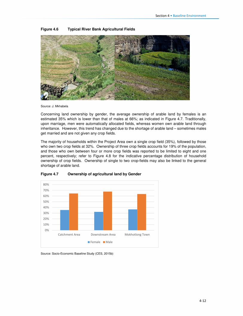
Section 4 • Baseline Environment
4-12
Figure 4.6 Typical River Bank Agricultural Fields
Source: J. Mkhabela
Concerning land ownership by gender, the average ownership of arable land by females is an
estimated 35% which is lower than that of males at 66%; as indicated in Figure 4.7. Traditionally,
upon marriage, men were automatically allocated fields, whereas women own arable land through
inheritance. However, this trend has changed due to the shortage of arable land – sometimes males
get married and are not given any crop fields.
The majority of households within the Project Area own a single crop field (35%), followed by those
who own two crop fields at 32%. Ownership of three crop fields accounts for 19% of the population,
and those who own between four or more crop fields was reported to be limited to eight and one
percent, respectively; refer to Figure 4.8 for the indicative percentage distribution of household
ownership of crop fields. Ownership of single to two crop-fields may also be linked to the general
shortage of arable land.
Figure 4.7 Ownership of agricultural land by Gender
Source: Socio-Economic Baseline Study (CES, 2015b)
0%
10%
20%
30%
40%
50%
60%
70%
80%
Catchment Area Downstream Area Mokhotlong Town
Female Male

Section 4 • Baseline Environment
4-13
Figure 4.8 Number of Crop Fields Owned by Households
Source: Socio-Economic Baseline Study (CES, 2015b)
4.4.3.2 Cultivation of Crops
Production of crops consists of cultivation of major and minor crops. Major crops are maize, wheat,
sorghum and beans. In turn, minor crops comprise beetroot, butternut, cabbage, pumpkins, spinach,
peppers, onions, tomatoes, carrots, turnips and others. These plants are all grown at different times
of the year depending on the weather conditions. The season for the cultivation of primary crops
begins in September with the preparation of fields, followed by cropping between October and
November. Throughout January and February, crop weeding and tending occur, and harvesting
begins in April to the end of July, refer to Figure 4.9 for the production of the major crops. Minor crops
are grown and harvested nine months of the year, except for during the winter.
Figure 4.9 Process of Crop Cultivation throughout the Year
4.4.3.3 Purpose of Crop Production
Crop production is mostly undertaken for only subsistence purposes across the Project Area; with
surplus sold only by a limited number of households. The subsistence use of crops can be attributed
to low crop yields and lack of alternatives to supplement their household income. As such, households
tend to keep their products for their consumption. Furthermore, crops are sometimes used to barter
with neighbours for other householder goods or as payment for services rendered. The sale of crop
products is undertaken amongst the villagers or in built areas such Mokhotlong and Mapholaneng
Towns where people have limited land to grow crops or do not have time to crop due to life demands.
0%
5%
10%
15%
20%
25%
30%
35%
40%
0 2 4 6 8 10 12 14

Section 4 • Baseline Environment
4-14
The general distribution of the main uses of crops produced in the Project Area is shown in Figure
4.10.
Figure 4.10 Purpose of Crops in the Project Area
Source: Socio-Economic Baseline Study (CES, 2015b)
Some households do not have access to agricultural fields and if they do not partake in any
sharecropping activities or work as labourers in other people's fields – then they will not have a
harvest. Participants gave the following reasons for not participating in crop production, namely:
• No fields for crop production;
• Lack of household labour to work the fields, and
• Lack of financial resources to undertake the farming.
Across the Project Area a lack of land to cultivate was the main reason provided for not partaking in
cropping activities; with the people of Mokhotlong town leading at 85% followed by the catchment
area (63%) and 59% downstream area (CES, 2015b). This barrier has resulted from the general
shortage of arable land across the Highlands of Lesotho and within the Project Area. Those who
highlighted a lack of household labour as a reason for not cropping – was linked to the households
with no youths or middle aged people, and the owner is either elderly or disabled thus they cannot
work the land. The reasons for households not cultivating their fields are indicated in Figure 4.11.
Figure 4.11 Household reasons for not cultivating agricultural land
Source: Socio-Economic Baseline Study (CES, 2015b)
0%
10%
20%
30%
40%
50%
60%
70%
80%
90%
Only subsistence Mostly subsistence Mostly Sale Only Sale
Catchment Area Downstream Area Mokhotlong Town
0%
10%
20%
30%
40%
50%
60%
70%
80%
90%
Elected not toanswer
Lack offinancial
resources
Lack ofhousehold
labour
Not Needed Other Lack of space
Catchment Area Downstream Area Mokhotlong Town
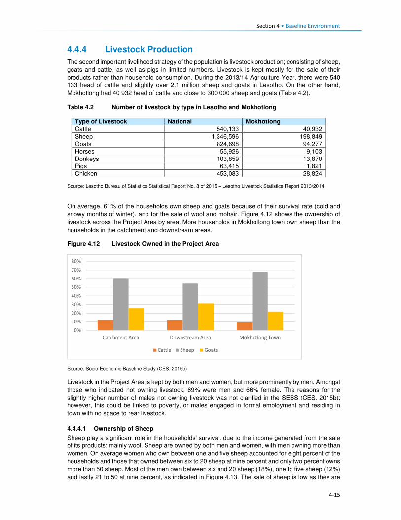
Section 4 • Baseline Environment
4-15
4.4.4 Livestock Production
The second important livelihood strategy of the population is livestock production; consisting of sheep,
goats and cattle, as well as pigs in limited numbers. Livestock is kept mostly for the sale of their
products rather than household consumption. During the 2013/14 Agriculture Year, there were 540
133 head of cattle and slightly over 2.1 million sheep and goats in Lesotho. On the other hand,
Mokhotlong had 40 932 head of cattle and close to 300 000 sheep and goats (Table 4.2).
Table 4.2 Number of livestock by type in Lesotho and Mokhotlong
Type of Livestock National Mokhotlong
Cattle 540,133 40,932
Sheep 1,346,596 198,849
Goats 824,698 94,277
Horses 55,926 9,103
Donkeys 103,859 13,870
Pigs 63,415 1,821
Chicken 453,083 28,824 Source: Lesotho Bureau of Statistics Statistical Report No. 8 of 2015 – Lesotho Livestock Statistics Report 2013/2014
On average, 61% of the households own sheep and goats because of their survival rate (cold and
snowy months of winter), and for the sale of wool and mohair. Figure 4.12 shows the ownership of
livestock across the Project Area by area. More households in Mokhotlong town own sheep than the
households in the catchment and downstream areas.
Figure 4.12 Livestock Owned in the Project Area
Source: Socio-Economic Baseline Study (CES, 2015b)
Livestock in the Project Area is kept by both men and women, but more prominently by men. Amongst
those who indicated not owning livestock, 69% were men and 66% female. The reasons for the
slightly higher number of males not owning livestock was not clarified in the SEBS (CES, 2015b);
however, this could be linked to poverty, or males engaged in formal employment and residing in
town with no space to rear livestock.
4.4.4.1 Ownership of Sheep
Sheep play a significant role in the households' survival, due to the income generated from the sale
of its products; mainly wool. Sheep are owned by both men and women, with men owning more than
women. On average women who own between one and five sheep accounted for eight percent of the
households and those that owned between six to 20 sheep at nine percent and only two percent owns
more than 50 sheep. Most of the men own between six and 20 sheep (18%), one to five sheep (12%)
and lastly 21 to 50 at nine percent, as indicated in Figure 4.13. The sale of sheep is low as they are
0%
10%
20%
30%
40%
50%
60%
70%
80%
Catchment Area Downstream Area Mokhotlong Town
Cattle Sheep Goats

Section 4 • Baseline Environment
4-16
a primary source of livelihoods for households. Over 61% households reported that they do not sell
any of their sheep. In turn, a combined 49% sell sheep in various quantities (Figure 4.13). Sheep that
are sold are often old and small. Therefore, the sale serves as a way of getting rid of old animals and
the money used to purchase new stock.
Figure 4.13 Ownership and Sale of Sheep
Source: Socio-Economic Baseline Study (CES, 2015b)
4.4.4.2 Ownership of Goats
Goats play a similar role to the household income as that of sheep, due to the revenue generated
from the sale of mohair. Goats are kept by both men and women; with men owning more as indicated
in Figure 4.14. In the same way, as with sheep, households typically do not sell their goats.
Figure 4.14 Ownership of Goats
�
Source: Socio-Economic Baseline Study (CES, 2015b)
4.4.4.3 Ownership of Cattle
Ownership of cattle is by both females and males in the Project Area but more prominent amongst
males. However, an average of 58% amongst both men and women households reported not owning
cattle. Cattle keeping is not widely common, and where it is owned, households own between one
and five (average 33%); with approximately 10% owning between six and 20 cattle. The primary uses
of cattle are working the fields, payment of dowry, funerals and sale when the household is strapped
for cash. One of the most commonly recurring responses regarding the sale of livestock, in general,
0%
20%
40%
60%
80%
100%
0 to 5 6 to 20 21 to 50 More than 50 None Owned
Female Male

Section 4 • Baseline Environment
4-17
was that livestock is mostly sold during the lean months to supplement the household income and
the household expenditure.
4.4.4.4 Sale of Livestock Products
As indicated above, the sale of livestock products forms a significant part of the household livelihoods
and income. The main products sold are skin hides, wool, mohair, milk and meat. The number of
households that sell various livestock is highlighted in Figure 4.15.
Figure 4.15 Sale of Livestock Products
Source: Socio-Economic Baseline Study (CES, 2015b)
4.4.4.5 Wool and Mohair Production and Value Chain
Wool sheep are very important in Lesotho, producing over 3 million kilograms of raw wool annually
for export. The sale of wool and mohair and live animals are the primary source of income in the
country. During the 2013/2014 Marketing Year, 1 425 408 sheep were shorn in the country, producing
3 860 768 kg of wool. During the same marketing year, 238 064 sheep were shorn in Mokhotlong,
producing 751 737 kg of wool. Mokhotlong produced the highest quantity of wool; constituting 19.5%
of the total wool for the year7.
The two officially recognised wool and mohair marketing outlets in Lesotho are private trading stations
authorised to deal in wool and mohair, and government shearing sheds placed at 1848 locations
across the country. Of these 11 are members of the Lesotho National Wool and Mohair Grower’s
Association (LNWMGA) which is the main existing herder apex organisation in the wool and mohair
sub-sector. The association is present in all districts with its growers associations at the district level
and Sheering Shed Associations (SSAs) at the lower level9. Normally farmers who use the
government shearing sheds are members of the Wool and Mohair Growers Associations (WMGAs)
and their marketing groups (MGs). Private trading stations are typically used by individuals not
affiliated with any group, though members of WMGAs and MGs also use the private stations for fast
payment. The WMGAs sell their wool and mohair through the South African Wool Board and the
South African Mohair Board and some of these are further exported to Europe and Asia.
In 2012 a project dedicated to assisting to develop the wool and mohair industry in the form of
marketing support, genetic improvement of communal flock through the introduction of quality rams,
training and mentorship was implemented, i.e. The Small Agricultural Development Project. The
project is expected to end in 2018.
7 Bureau of Statistics (Lesotho) Statistical Report No. 21 of 2015 – Livestock Products Report 2013/2014 8 There are 114 sheds which produce wool and mohair, plus another 70 which produce wool only. 9 Kingdom of Lesotho. Wool and Mohair Promotion Project (WAMPP), 2014.
3%
45%52%
No. of HH Selling Cattle Products No. of HH Selling Sheep Products
No. of HH Selling Goat Products

Section 4 • Baseline Environment
4-18
Wool and mohair are the most sold animal products at 52% and 44%, respectively. The low sales of
cattle are indicative of their uses which are mostly ploughing of agricultural fields, traditional
ceremonies and dowry payment. The Mokhotlong Wool and Mohair Growers Association is found in
Mokhotlong town but has representatives in various locations across the broader Project Area. The
association works with the locally based wool sheds which cater for the local farmers. Shearing of
livestock commences in mid-September and ends in mid-Decembers. After completing the shearing
process, the Mokhotlong Wool and Mohair Growers Association transport the wool to Mokhotlong
town before loading it in haul tracks for transportation to Port Elizabeth in South Africa for auction and
sale.
The wool and mohair value chain in Lesotho consists of three channels following producers' groups,
namely:
• Associations that link larger farmers with the government channels and infrastructure to the
auction,
• Individual farmers with medium-sized herds that link up with private traders using their
infrastructure to gain access to the auction, and
• Marginal groups (small farmers) usually resource poor and use informal market channels to get
their products to the auction10.
Figure 4.16 Supply Chain for the Sale of Wool and Mohair
Source: Mokhethi, N.I., etal (2015) (http:www.researchgate.net/figure/290330505_fig1_figure-1-Lesotho-wool-and-mohair-
value-chain).
4.4.5 Challenges to Agricultural Activities in the Project Area
The problems affecting farming activities in the Project Area are highlighted below.
Crop farming:
Poor crop yields. Low crop yields are a standard feature for households in the Project Area; this has
been attributed to the following:
10 http://www.researchgate.net/figure/290330505_fig1_figure-1-Lesotho-wool-and-mohair-value-chain

Section 4 • Baseline Environment
4-19
• Drought - even though the Project Area has multiple water resources, the land away from the
river banks is dry and with limited potential to install formal irrigation systems. Thus, many
households who own fields in areas that cannot be easily irrigated practise dry land cropping; and
manually water vegetable gardens.
• Poor weather conditions are another contributing factor to low yields. The Highlands are subject
to heavy/ flash floods and heavy snowfalls at different times of the year. According to the
respondents, the dry seasons have in recent years been reduced and the snowy season
extended; which in turn affect crop production and yields.
• As is common in rural Africa, the population of the Project Areas continues to use traditional
methods of preparation and cultivation of fields with limited or no mechanisation; which also
affects crop production and yields.
• The District Department of Agriculture has amongst its staff, Agricultural Extension Officers;
however, poor accessibility to some parts of the Project Area has resulted in Extension Officers
not being able to reach some part of the population to extend services.
• The soils in the Project Area are highly degraded due to soil erosion, and the mountainous terrain
characterised by rockiness, which has reduced the available land for cropping.
Livestock farming:
Overstocking. In the broader Project Area, overstocking is a major concern, and this is attributed to
livestock owners' unwillingness to reduce their livestock numbers, as well as inadequate monitoring
or control by the Department of Agriculture, which is enabling this trend. This has led to the livestock
herds overstretching the available pastures and resulted in significant land degradation and shortages
of food for livestock.
Cold weather. The erratic climatic conditions of the area also affect livestock, especially in winter
when it is snowing. The respondents indicated that most of the livestock deaths are reported at this
time of the year. None of the livestock farmers in the area has covered kraals where they keep
livestock, and since most cannot afford to purchase fodder to feed their livestock, the livestock
continues to graze outside, and that is when deaths occur.
Veterinary services. There is a lack of access to veterinary services for livestock owners in the area
due to the constraints related to accessibility issues, i.e. government extension services cannot reach
most parts of the Project Area.
Animal health. Livestock diseases are a major constraint to the development and improvement of
the livestock industry in the region. Vector-borne diseases and tick-borne diseases (especially
theileriosis and heartwater) severely limit livestock production. The livestock owners tend to rely on
medicinal plants to treat their sick livestock.
Poor breeding. The attributes and weaknesses of the indigenous animals, purebred exotics and
crossbreeds were reported as a constraint to livestock production. There is a low reproductive rate
due to high mortality rates of calves, which also hinders the raising of replacement stock, as well as
the lack of artificial insemination delivery services.
4.4.6 Employment and Unemployment
This section describes employment and unemployment conditions at a national level as well as in the
district and the Project Area.
4.4.6.1 National Employment and Unemployment
According to the 2011 Lesotho Demographic Survey, 28% of the population was employed in private
households, followed by those who are self-employed (20%, people working in RSA (18%), private
sector 16% and government at 10%. Overall, females were mostly employed in the private
households/homes i.e. domestic work (21%) than in any other sector. The Survey results further

Section 4 • Baseline Environment
4-20
demonstrate that females (23%) in urban areas were mostly engaged in the manufacturing sector
while 32% of urban males were employed in the private sector. In rural areas, the leading sector was
the Private households/homes with 38% and 26% for men and females respectively; refer to Table
4.3.
Table 4.3 Percentage distribution of the employed labour force by sex, urban/rural
residence and type of employer
Total Urban Rural
Employer Both
Sexes
Male Female Total Male Female Total Male Female
Total 100 100 100 100 100 100 100 100 100
Government 10.0 7.5 14.4 16.4 15.2 17.8 7.1 4.8 12.1
Parastatal 1.1 1.1 1.2 1.9 2.2 1.6 0.8 0.7 0.9
Private 16.0 17.0 14.2 26.1 31.6 20.1 11.4 12.1 10.1
Manufacturing 6.7 2.6 14.0 13.6 5.4 22.7 3.6 1.7 7.9
Self-Employed 20.3 19.8 21.3 19.0 20.5 17.5 20.9 19.6 23.9
Private
household
28.1 31.8 21.4 13.8 12.5 15.1 34.5 38.4 25.8
RSA 17.6 20.1 13.3 8.8 12.3 4.9 21.6 22.7 19.2
Other 0.2 0.2 0.3 0.4 0.4 0.4 0.1 0.1 0.2
Source: Lesotho Demographic Survey, 2011 (Bureau of Statistic (Lesotho), 2013)
The Survey highlighted that 52% of males against 16% females were engaged in agriculture primarily
subsistence farming. More women were employed in the manufacturing and processing industry
(23%) while men constituted five percent. The other industrial category that both males and females
participated in was wholesale and retail trade with 11%. An estimated 11% of men were engaged in
Construction. The second leading category where women (15%) were mostly involved in was
activities of households (private households); refer to Table 4.4.
Table 4.4 Sectoral Employment
Industry Male Female Total
Agriculture 51.6 16.3 38.4
Fishing and aquaculture 0.0 0.0 0.0
Mining and quarrying 3.3 0.4 2.2
Manufacturing and processing 5.2 22.5 11.7
Electricity, gas, steam and air conditioning supply 0.4 0.1 0.3
Water supply, waste management and remediation activities 0.5 0.2 0.4
Construction 10.5 1.9 7.3
Wholesale, retail trade and repair of motor vehicles and motorcycles 7.9 16.1 11.0
Transport, storage and communication 5.4 0.5 3.6
Accommodation and food service activities 0.5 1.9 1.0
Information and communication 0.8 0.8 0.8
Financial and Insurance activities 0.5 0.9 0.7
Real Estate activities 0.0 0.0 0.0
Professional, scientific and technical activities 0.6 0.9 0.7
Administrative and support services activities 3.4 2.8 3.2
Public administration and defence, compulsory social security 3.3 2.8 3.1
Education 2.2 9.9 5.1
Human health and social work activities 1.5 4.2 2.5
Arts, entertainment and recreation 0.2 0.3 0.3
Other service activities 0.7 1.9 1.2
Activities of households as employees, undifferentiated goods - and
services - producing activities of households for own use
1.4 15.2 6.5
Activities of extraterritorial organisations and bodies 0.2 0.3 0.2
Source: Lesotho Demographic Survey, 2011 (Bureau of Statistics (Lesotho), 2013)

Section 4 • Baseline Environment
4-21
The proportion of the unemployed population was 30% and 23% in age-groups 20 to 24 and 25 to 29
years, respectively. In age-group 20 to 24 years the proportion of the unemployed population was
33% for females and 28% for males. In rural areas, the population aged 20 to 24 years constituting
28.1% of men and 31% of females were unemployed, as compared to 29% of males and 36% of
women in urban areas. The proportion of the unemployed population is high among the youth across
the country; refer to Table 4.5.
Table 4.5 Percentage Distribution of Unemployed Population by Age, Sex and
Urban/Rural Residence
Lesotho Urban Rural
Age Total Male Female Total Male Female Total Male Female
10-14 0.7 0.5 1.1 0.6 0.0 1.4 0.7 0.7 0.9
15-19 9.5 7.6 12.9 7.0 5.9 8.5 10.3 8.1 14.8
20-24 29.8 28.2 32.7 31.7 28.5 35.9 29.2 28.1 31.4
25-29 23.2 23.0 23.4 22.7 21.8 24.0 23.3 23.4 23.2
30-34 15.4 17.1 12.4 15.7 17.4 13.5 15.3 17.0 12.0
35-39 8.5 10.2 5.6 7.7 8.9 6.2 8.8 10.6 5.3
40-44 5.0 5.0 4.9 5.6 6.1 4.9 4.7 4.7 4.9
45-49 3.6 4.2 2.6 5.1 6.0 3.9 3.1 3.7 2.0
50-54 2.0 2.1 1.9 2.1 2.6 1.4 2.0 2.0 2.1
55-59 1.1 1.1 1.3 0.7 1.2 0.2 1.3 1.0 1.7
60-64 0.6 0.7 0.5 0.5 0.8 0.0 0.7 0.7 0.7
65+ 0.4 0.3 0.7 0.5 0.9 0.0 0.4 0.1 1.1
Source: Lesotho Demographic Survey, 2011 (Bureau of Statistics (Lesotho), 2013)
4.4.7 District and Project Area Employment and Unemployment
A large proportion of the workforce in the Project Area does not work in the formal economy.
Employment in the Project Area can be divided into three types, namely, full-time jobs, seasonal
employment and self-employment (characterised by business ownership and provision of services).
No clear employment rates for the District were attained; as such the employment status of the
population is used to describe the employment characteristics of the District population. The
employment status for men was indicated as self-employment (20%), while women were mostly
homemakers (45%). The students’ category of employment status, showed 32% and 23% of the
population being students for both female and male and this was attributed to the report’s inclusion
of people of ten years and older in the assessment of employment status. The top five employment
categories for both males and females are indicated in Table 4.6.
Table 4.6 Employment Status in Project Area
Employment Status Female (%) Male (%)
Self-employment 9 20
Homemaker 45 18
Student 32 23
Unpaid family work 3 14
Paid employment 9 17
Source: Socio-Economic Baseline Study (CES, 2015b)
4.4.7.1 Paid Employment
The result of the SEBS (CES, 2015b), indicated that 42% of the households surveyed had at least
one family member that engaged in paid employment. Of these family members, 79% were employed
in full time paid employment, 18% in part time work and three percent in seasonal employment related
to agricultural production. The respondents that indicated that they were employed, whether part-time

Section 4 • Baseline Environment
4-22
or fulltime, worked in the, e.g. self-employment, hospitality, manufacturing, mining, and public sectors,
within the District.
The types of work of the paid employment were led by those working as domestic workers in a private
household (22%), followed by those employed in the public sector (government services) (18%), as
well as manufacturing and other sectors (15% respectively), refer to Figure 4.17.
Figure 4.17 Types of Regular Employment in the Project Area
Source: Socio-Economic Baseline Study (CES, 2015b)
Of those engaged in paid employment, 59% indicated that they were employed within their village or settlement – meaning they are employed by a neighbour or a local business; followed by 18% who work in a neighbouring village, and those who work in South Africa (10%). The remaining work in other parts of the country, refer to Figure 4.18. Those who work in South Africa are employed in KwaZulu-Natal and Free State provinces within the manufacturing and agricultural sectors.
Figure 4.18 Location of Regular Employment in the Project Area
Source: Socio-Economic Baseline Study (CES, 2015b)
21%
18%
15%
15%
8%
8%
5%
4%4% 1% 1%
Domestic work
Public sector
Manufacturing
Other
Mining
Private sector
Service delivery
Retail
59%18%
2%
1%
4%3%
3% 10%
Village
Nearby Village
Mapholaneng
Mokhotlong
Mokhotlong District
Maseru
Lesotho
South Africa

Section 4 • Baseline Environment
4-23
4.4.7.2 Seasonal/temporary employment
According to the SEBS (CES, 2015b), those employed in seasonal and part-time jobs, are often
expected to work several times per week, or several times per month at 40% and 33% respectively,
as indicated in Figure 4.19. Methods of payment for seasonal/temporary work vary significantly and
may include payment in cash, in-kind or in livestock or harvest (such as sheep or vegetables).
Payment with livestock is common amongst the herd boys – who often receive 12 sheep per year or
one cow per year as payment.
Figure 4.19 Payment for Seasonal/temporary Employment in the Project Area
Source: Socio-Economic Baseline Study (CES, 2015b)
4.4.7.3 Self- employment
The SEBS (CES, 2015b), divided self-employment into two categories, namely businesses, and
activities involving specialist skills.
Businesses. The types of businesses found in the Project Area are unsophisticated and focused on
meeting the population’s day to day needs. These businesses include shebeens and taverns, small
cafés, child minding, horse hire, milling, telephone services, and others. Table 4.7 highlights the top
10 business services identified through the SEBS (CES, 2015b). Most of these businesses are
located in the village where the owner of the business resides.
Table 4.7 Types of Business in Project Area
Business Type Percentage
Beer brewing 34
Other 16
Café 9
Fruit & vegetable sellers 8
Property renters 7
Clothing sellers 5
Tailors 5
General dealers 3
Taxi owners 2
Cell phone charging and airtime sales 2
Source: Socio-Economic Baseline Study (CES, 2015b)
Specialist skills: Numerous people in the Project Area also derive their livelihoods through the
provision of specialised services; such as builders (61%), thatchers (13%), herbalists (10%),
16%
40%
33%
11%
Weekly
Several times/ week
Several times/ month
> once / month

Section 4 • Baseline Environment
4-24
Community Health Workers (eight percent), birth attendants (five percent), circumcision surgeons
(one percent), and others indicated in Figure 4.20.
Figure 4.20 Types of Specialised Services in the Project Area
Source: Socio-Economic Baseline Study (CES, 2015b)
There are no income specifications for specialised services provision as each person charges their
specialised rate based on the work to be completed.
4.4.7.4 Unemployment in the Project Area
Unemployment in the Project Area was an estimated 91% of the entire population in the SEBS (CES,
2015b). Similar, to the national statistics on employment and unemployment, the SEBS (CES, 2015b),
included children in its calculation of the levels of unemployment – thus skewing the results as children
ages 0 to 14 do not form part of the economically active groups. Furthermore, CES (2015b) indicated
that their findings on this issue were distorted and believe that the respondents did not fully
understand that subsistence agricultural activities also form part of employment especially if income
is derived from such an activity.
4.5 Household Income and Expenditure 4.5.1 Sources of Household Income
The nature of livelihood strategies, and particularly those activities contributing the most to household
income, does shift as one considers different income quartiles (Figure 4.21). According to LHDA
Contract 6000 - Final Income and Expenditure Report (CES, 2015a), and consistent with the results
of other studies carried out in the Project Area and taking into account its rural and isolated nature,
approximately half of the surveyed population can be classified as ‘poor’ by accepted national and
international standards. High levels of variability of income were found within villages, highlighting the
need for diverse resettlement recovery strategies, even at village level. Seasonal patterns of the
sources of cash that household’s access was noted; these patterns impact poorer and wealthier
households differently regarding stress and opportunity, and also resilience to shocks.
Food insecurity emerged as a key vulnerability of, particularly, the poorest households in this study.
The results show high levels of dependence on purchased food among the most impoverished, and
therefore a concomitant vulnerability to food price increases.
Social ties and networks, as indicated by evidence of gifts originating at multiple levels, from within
villages to the district level to South Africa, make a significant contribution to household income and
0
10
20
30
40
50
60
70
Builders Thatchers Herbalists
Community Health Workers Birth attendants Diviners
Faith healers Circumcision surgeons

Section 4 • Baseline Environment
4-25
food security. Donations of food and clothing are especially common in the poorer households, while
gifts of cash were more common in wealthier households.
Differences between the quartiles:
Quartile 1 denoted poor households that receive the majority of their income from non-cash sources,
including meals given to children at school, and donations of non-perishable food and clothes and
these are followed by non-regular income, social grants and regular income.
Quartile 2 denoted poor households that rely on social grants and non-cash income sources.
The households in Q 1 and Q 2 – depend heavily on one or two income sources (45%), with a limited
risk distribution.
Quartile 3 comprises of households that derive the majority of its income from regular income,
followed closely by non-regular income and non-cash income.
Quartile 4 households derive earnings from multiple sources, with 35% of the total income derived
from regular income sources.
The different types of income sources relied on by the people in each quartile are presented in Figure
4.21.
Figure 4.21 Household Income Sources per Quartile in the Project Area
Source: Baseline Income and Expenditure Report (CES, 2015a)
There are four significant income streams in the area namely, regular income, non-cash income, non-
regular income and non-agriculture based income.
Some households (24%) in the Project Area received income from grants. Of the 24% who received
the grants, the old age pension receivers were highest at 85%, averaging LSL 438.40 per month.
Other grants received were child grants, disability grants, pauper’s grants, and public grants.
4.5.1.1 Annual Income Trends
Income in the Project Area increases significantly between March-June, and again between August
and September and this may be attributed to the following:

Section 4 • Baseline Environment
4-26
• The period (between March and June) marks the beginning of major crop harvesting, namely
wheat, maize and sorghum; and it is a period where poorer households are engaged as labourers.
Furthermore, depending on the household’s levels of poverty (regarding ownership of fields), the
household has an opportunity to derive an income from the sale of their crops.
• Even though mohair sales take place in April, the payments are only received by the farmers
between August and November when it has been sold at auction in Port Elizabeth, South Africa.
• The combination of the income generated during this time may explain the sustained peaks in
income between August and September through the various income streams.
In general, income drops between November and January, dropping further in December before
picking up again in February particularly for households in Quartile 1 and 2 (Figures 4.22 and 4.23).
Figure 4.22 Household Income Trends per Quartile
Source: Baseline Income and Expenditure Report (CES, 2015a)
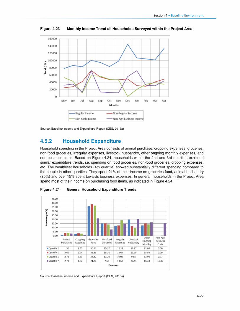
Section 4 • Baseline Environment
4-27
Figure 4.23 Monthly Income Trend all Households Surveyed within the Project Area
Source: Baseline Income and Expenditure Report (CES, 2015a)
4.5.2 Household Expenditure
Household spending in the Project Area consists of animal purchase, cropping expenses, groceries,
non-food groceries, irregular expenses, livestock husbandry, other ongoing monthly expenses, and
non-business costs. Based on Figure 4.24, households within the 2nd and 3rd quartiles exhibited
similar expenditure trends, i.e. spending on food groceries, non-food groceries, cropping expenses,
etc. The wealthiest households (4th quartile) showed substantially different spending compared to
the people in other quartiles. They spent 21% of their income on groceries food, animal husbandry
(20%) and over 15% spent towards business expenses. In general, households in the Project Area
spend most of their income on purchasing food items, as indicated in Figure 4.24.
Figure 4.24 General Household Expenditure Trends
Source: Baseline Income and Expenditure Report (CES, 2015a)

Section 4 • Baseline Environment
4-28
Figure 4.25 shows that households also spend their income on agricultural activities, with the bulk of
the expenses being towards livestock husbandry. Cropping related expenses tend to peak between
August and November. This coincides with the intensive period of planting the main crops - maize
and sorghum. Spending towards the purchase of livestock increases in August which is around the
time when farmers receive their income from the sale of wool and mohair which in turn increases their
purchasing power for new livestock. Expenses associated with animal husbandry peak in December
month, refer to Figure 4.25. Agricultural costs decrease significantly between December and March
as these are low-income months.
Figure 4.25 Household Agricultural Expenditure
Source: Baseline Income and Expenditure Report (CES, 2015a)
Non-agriculture expenses. Irregular household spending peaks in December, likely due to the
holiday period and returning family members; except the lower income households (1st and 2nd
quartiles). This includes spending on transportation, money being sent to other family members and
expenditure on furniture and appliances. Non-agricultural business income also increased during this
time and subsequently household spending also increases. This spending on non-agricultural
expenses peaks again from July to August which coincides with the harvesting activities and its
associated non-regular employment.
4.6 Access and Utilisation of Natural Resources There are a wide variety of natural resources found in the Project Area, and most of these are
communally owned and utilised. These include edible plants, medicinal plants, grazing land, thatching
grass, river reeds, mosea (craft grass) water, rocks, fish, sand, trees/shrubs and small wild animals.
The natural resources mentioned above have been discussed in detail below. The FGD participants
also made mention of the above mentioned natural resources like the ones that are now found within
the catchment area and are going to be impacted by the Polihali Dam, some through inundation and
some through all the proposed construction works. The collection and utilisation of natural resources
are managed by the Chiefs and their respective Councils. For instance, when a person requires
natural resources for building purposes, he/ she requires the permission of the Chief to collect the
natural resource materials he/she needs. Findings from the FGD indicate that people also have to go
to the chief and the counsellor to request use of roofing grass, fuel wood, medicinal plants and other
natural grasses such as mosea and loli.
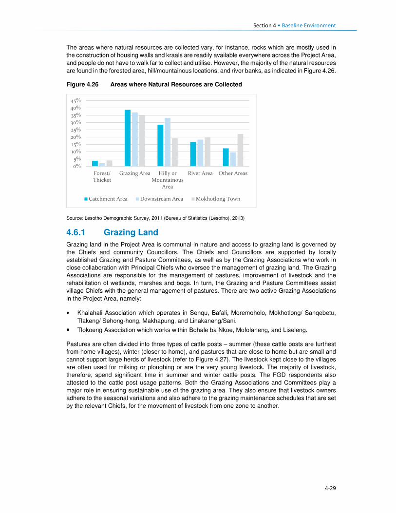
Section 4 • Baseline Environment
4-29
The areas where natural resources are collected vary, for instance, rocks which are mostly used in
the construction of housing walls and kraals are readily available everywhere across the Project Area,
and people do not have to walk far to collect and utilise. However, the majority of the natural resources
are found in the forested area, hill/mountainous locations, and river banks, as indicated in Figure 4.26.
Figure 4.26 Areas where Natural Resources are Collected
Source: Lesotho Demographic Survey, 2011 (Bureau of Statistics (Lesotho), 2013)
4.6.1 Grazing Land
Grazing land in the Project Area is communal in nature and access to grazing land is governed by
the Chiefs and community Councillors. The Chiefs and Councillors are supported by locally
established Grazing and Pasture Committees, as well as by the Grazing Associations who work in
close collaboration with Principal Chiefs who oversee the management of grazing land. The Grazing
Associations are responsible for the management of pastures, improvement of livestock and the
rehabilitation of wetlands, marshes and bogs. In turn, the Grazing and Pasture Committees assist
village Chiefs with the general management of pastures. There are two active Grazing Associations
in the Project Area, namely:
• Khalahali Association which operates in Senqu, Bafali, Moremoholo, Mokhotlong/ Sanqebetu,
Tlakeng/ Sehong-hong, Makhapung, and Linakaneng/Sani.
• Tlokoeng Association which works within Bohale ba Nkoe, Mofolaneng, and Liseleng.
Pastures are often divided into three types of cattle posts – summer (these cattle posts are furthest
from home villages), winter (closer to home), and pastures that are close to home but are small and
cannot support large herds of livestock (refer to Figure 4.27). The livestock kept close to the villages
are often used for milking or ploughing or are the very young livestock. The majority of livestock,
therefore, spend significant time in summer and winter cattle posts. The FGD respondents also
attested to the cattle post usage patterns. Both the Grazing Associations and Committees play a
major role in ensuring sustainable use of the grazing area. They also ensure that livestock owners
adhere to the seasonal variations and also adhere to the grazing maintenance schedules that are set
by the relevant Chiefs, for the movement of livestock from one zone to another.
0%
5%
10%
15%
20%
25%
30%
35%
40%
45%
Forest/Thicket
Grazing Area Hilly orMountainous
Area
River Area Other Areas
Catchment Area Downstream Area Mokhotlong Town

Section 4 • Baseline Environment
4-30
Figure 4.27 Example of Local Grazing Area
Source: J. Mkhabela
All livestock in the area must be registered, and the livestock owners must be able to provide evidence
of their legal ownership of the livestock. The Chiefs are tasked with keeping records of herds of
livestock each household in their area owns. New households to the area must also seek permission
to use communal grazing land from the Chief and Council. The new comers must present the Chief
with proof of ownership of livestock and size of the herd of livestock owned.
According to the respondents, even with all these measures in place, grazing land in the area was
degraded due to people’s failure to adhere to the rules. Furthermore, the erratic weather conditions
of the area, heavy storms and snowfalls, soil erosion and severe droughts have contributed to the
degradation of grazing land. Others indicated that conflicting views on the regulation of grazing land
between the Chiefs and Community Council often lead to people disobeying the rules for grazing
management (for additional information, refer to the Rangelands Report, (P2W-6014-DFR-0009)).
4.6.2 Soils
The fresh alluvial deposits at the bottom of the inundation area have soils that are the most extensively
cultivated. Because of the nature of the parent material and the near level terrain, the area is
generally considered to be the most fertile (P2W-6014-DFR-0007). However, because there are
continuously fresh deposits after heavy storms, which are usually accompanied by erosion, the
landscapes are not very stable. As the area is located in the narrow valleys of the upper catchment,
there are no alluvial plains with more stable soils. Most of the soils are very friable and have more
than 50% sand, and are prone to physical losses and loss of fertility (Ministry of Agriculture, 1976).
Since the communities rely on subsistence farming, there is a heavy reliance by the communities on
the ability of the soils to provide food.
The soils in the area are used mainly for:
• Cultivation of food crops, mainly maize and wheat;
• Cultivation of fodder grasses;
• Settlements and the majority of households have gardens used for vegetable production; and
• Natural grassland primarily used for grazing livestock including sheep, goats and cattle.
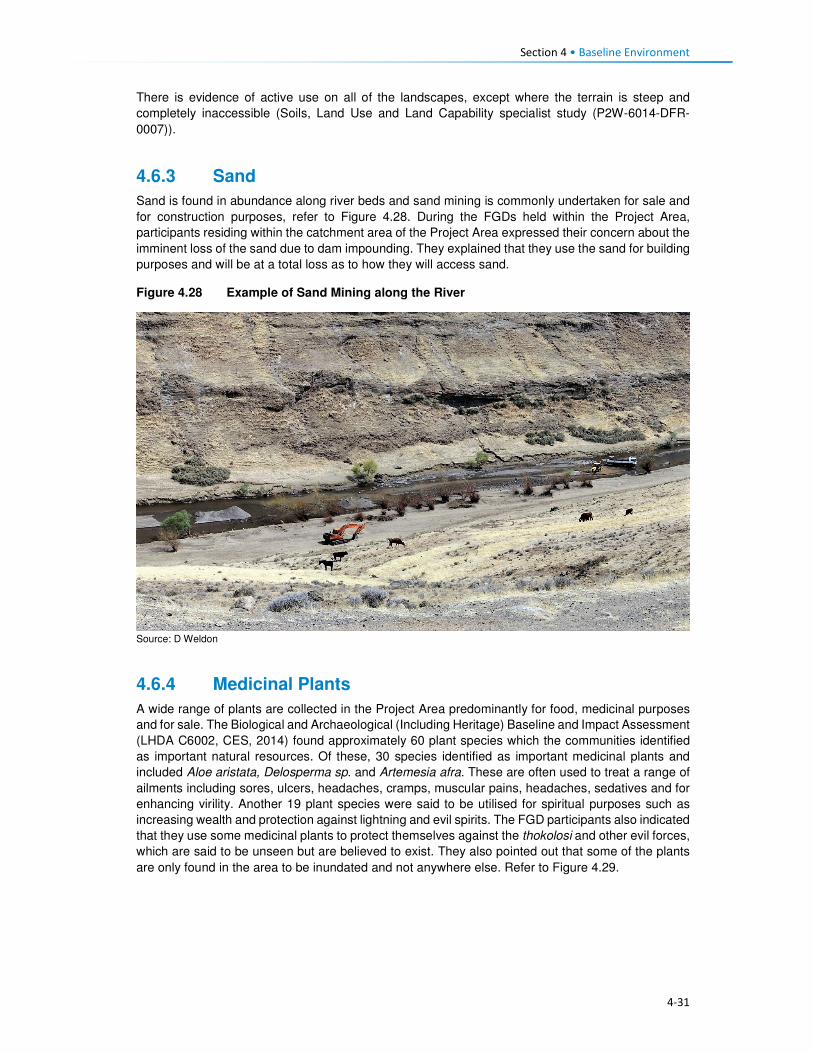
Section 4 • Baseline Environment
4-31
There is evidence of active use on all of the landscapes, except where the terrain is steep and
completely inaccessible (Soils, Land Use and Land Capability specialist study (P2W-6014-DFR-
0007)).
4.6.3 Sand
Sand is found in abundance along river beds and sand mining is commonly undertaken for sale and
for construction purposes, refer to Figure 4.28. During the FGDs held within the Project Area,
participants residing within the catchment area of the Project Area expressed their concern about the
imminent loss of the sand due to dam impounding. They explained that they use the sand for building
purposes and will be at a total loss as to how they will access sand.
Figure 4.28 Example of Sand Mining along the River
Source: D Weldon
4.6.4 Medicinal Plants
A wide range of plants are collected in the Project Area predominantly for food, medicinal purposes
and for sale. The Biological and Archaeological (Including Heritage) Baseline and Impact Assessment
(LHDA C6002, CES, 2014) found approximately 60 plant species which the communities identified
as important natural resources. Of these, 30 species identified as important medicinal plants and
included Aloe aristata, Delosperma sp. and Artemesia afra. These are often used to treat a range of
ailments including sores, ulcers, headaches, cramps, muscular pains, headaches, sedatives and for
enhancing virility. Another 19 plant species were said to be utilised for spiritual purposes such as
increasing wealth and protection against lightning and evil spirits. The FGD participants also indicated
that they use some medicinal plants to protect themselves against the thokolosi and other evil forces,
which are said to be unseen but are believed to exist. They also pointed out that some of the plants
are only found in the area to be inundated and not anywhere else. Refer to Figure 4.29.
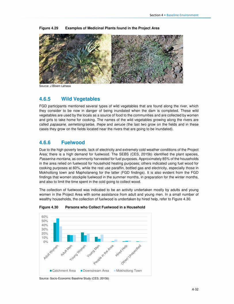
Section 4 • Baseline Environment
4-32
Figure 4.29 Examples of Medicinal Plants found in the Project Area
Source: J Bloem Lehasa
4.6.5 Wild Vegetables
FGD participants mentioned several types of wild vegetables that are found along the river, which
they consider to be now in danger of being inundated when the dam is completed. These wild
vegetables are used by the locals as a source of food to the communities and are collected by women
and girls to take home for cooking. The names of the wild vegetables growing along the rivers are
called papasane, semetsing/selae, thepe and seruoe (the last two grow on the fields and in these
cases they grow on the fields located near the rivers that are going to be inundated).
4.6.6 Fuelwood
Due to the high poverty levels, lack of electricity and extremely cold weather conditions of the Project
Area; there is a high demand for fuelwood. The SEBS (CES, 2015b) identified the plant species,
Passerina montana, as commonly harvested for fuel purposes. Approximately 85% of the households
in the area relied on fuelwood for household heating purposes; others indicated using fuel wood for
cooking purposes at 60%, while the rest use paraffin, bottled gas and electricity, especially those in
Mokhotlong town and Mapholaneng for the latter (FGD findings). It is also evident from the FGD
findings that women stockpile fuelwood in the summer months, in preparation for the winter months,
and also to limit the time spent in the cold going to collect wood.
The collection of fuelwood was indicated to be an activity undertaken mostly by adults and young
women in the Project Area with some assistance from adult and young men. In a small number of
wealthy households, the collection of fuelwood is undertaken by hired help, refer to Figure 4.30.
Figure 4.30 Persons who Collect Fuelwood in a Household
Source: Socio-Economic Baseline Study (CES, 2015b)
0%
10%
20%
30%
40%
50%
60%
Catchment Area Downstream Area Mokhotlong Town

Section 4 • Baseline Environment
4-33
Distances travelled to collect any source of household fuel vary significantly from village to village
based on the location of the fuel source. For instance, some women in FGDs indicated that they walk
for up to three hours (round trip) to collect fuelwood and this does not take into account the amount
of time spent gathering the wood. Furthermore, women reported that collection of fuelwood in summer
is undertaken almost daily to restock for the cold winter months.
4.6.7 Wild Animals
Rabbits, rock rabbits, deer, snakes, skunks and wild cats were said to be abundant within the
catchment area (FGD respondents). However, hunting of mammals in the Project Area is limited.
According to the SEBS (CES, 2015b), only 10% of the households were identified as partaking in any
hunting activities. These households indicated that they hunted antelope of various kinds, fox and
jackal, hare and rabbit and rock rabbit. The FGD respondents, however, mentioned that though they
are not allowed to hunt the animals, they do so for purposes of consumption, muti making for own
use and for selling. They explained that they use skunks to make a khoetsa that mothers put around
their young's necks to ward off evil spirits. Their fear is that the animals are going to run away when
the dam is impounded. The people also said as mitigation to the possible loss of wild animals, they
would like the LHDA to rescue and put them in a fenced off area where their children can visit and
learn about them in the future.
4.7 Health Care This section describes the provision of health care services in Lesotho, Mokhotlong District and the
Project Area.
4.7.1 National Health Services
The Ministry of Health (MoH) is responsible for the administration and management of health care
provision in Lesotho. The Ministry’s responsibilities include promotion and delivery of health services,
development of health policies, standards and guidelines, mobilisation of health resources, and
monitoring and evaluation of health sector interventions. Health care services are provided in
partnership with the Christian Health Association of Lesotho (CHAL), various non-governmental and
private sector organisations and development partners. The provision of health services is also
guided by the Lesotho National Health Strategic Plan for 2012/13-2016/17. Also, Lesotho is also a
signatory to the United Nations Millennium Development Goals (MDG). The MoH is committed to
addressing the following health issues as part of meeting the MDGs:
• MDG 1 – Eradicate poverty and hunger;
• MGD 4 – Reduce child mortality;
• MGD 5 – Improve maternal mortality; and
• MDG 6 – Combat HIV/AIDS, malaria and other diseases.
Furthermore, development partners are actively involved in the health care services in the country
through multilateral and bilateral partnerships. Multilateral partners include the European Union (EU),
the World Health Organisation (WHO), and other United Nations organisations such as the United
Nations Children’s Fund (UNICEF), and the United Nations Population Fund (UNFPA). Bilateral
partners include the United States Governments (USG) facilities such as the United States Agency
for International Development (USAID), the President’s Emergency Plan for AIDS Relief (PEPFAR).
These development partners mainly provide technical assistance and funding for specific health
programmes and general provision of health care.
4.7.2 Health Care Provision
Health care in Lesotho is provided through a three-tiered referral system starting with primary,
secondary and tertiary services (Figure 4.31). At the lowest level of this arrangement are found
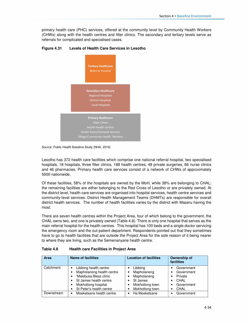
Section 4 • Baseline Environment
4-34
primary health care (PHC) services, offered at the community level by Community Health Workers
(CHWs) along with the health centres and filter clinics. The secondary and tertiary levels serve as
referrals for complicated and specialised cases.
Figure 4.31 Levels of Health Care Services in Lesotho
Source: Public Health Baseline Study (NHA, 2016)
Lesotho has 372 health care facilities which comprise one national referral hospital, two specialised
hospitals, 18 hospitals, three filter clinics, 188 health centres, 48 private surgeries, 66 nurse clinics
and 46 pharmacies. Primary health care services consist of a network of CHWs of approximately
5000 nationwide.
Of these facilities, 58% of the hospitals are owned by the MoH, while 38% are belonging to CHAL;
the remaining facilities are either belonging to the Red Cross of Lesotho or are privately owned. At
the district level, health care services are organised into hospital services, health centre services and
community-level services. District Health Management Teams (DHMTs) are responsible for overall
district health services. The number of health facilities varies by the district with Maseru having the
most.
There are seven health centres within the Project Area, four of which belong to the government, the
CHAL owns two, and one is privately owned (Table 4.8). There is only one hospital that serves as the
main referral hospital for the health centres. This hospital has 100 beds and a single doctor servicing
the emergency room and the out-patient department. Respondents pointed out that they sometimes
have to go to health facilities that are outside the Project Area for the sole reason of it being nearer
to where they are living, such as the Semenanyane health centre.
Table 4.8 Health care Facilities in Project Area
Area Name of facilities Location of facilities Ownership of facilities
Catchment • Libibing health centre
• Mapholaneng health centre
• ‘Malebusa Bless clinic
• St James health centre
• Mokhotlong hospital
• St Peter's health centre
• Libibing
• Mapholaneng
• Mapholaneng
• St James
• Mokhotlong town
• Mokhotlong town
• Government
• Government
• Private
• CHAL
• Government
• CHAL
Downstream • Moeketsane health centre • Ha Moeketsane • Government
Tertiary Healthcare
Referral Hospital
Secondary Healthcare
Regional Hospitals
District Hospitals
Local Hospitals
Primary Healthcare
Filter Clinics
Health Health centres
Health Posts/Outreach Services
Village/Community Health Workers

Section 4 • Baseline Environment
4-35
Area Name of facilities Location of facilities Ownership of facilities
• Linakeng health centre • Linakeng • Government
4.7.3 Services Offered at Health Centres in the Project Area
All the health facilities provide primary health care services such as:
• Immunisations,
• Distribution of medication for chronic illnesses,
• HIV testing (using rapid HIV test kits) and counselling (HTC),
• Rapid tests for syphilis (VDRL), pregnancy (HCG), and
• Urine testing.
Three of the facilities, i.e. St James, St Peters and ‘Malebusa Bless health centres do not offer baby
delivery services due to a lack of equipment and delivery facilities.
Only Mokhotlong hospital has a laboratory, and as such, all samples collected at the health centres
are sent there.
Availability of Equipment at Health Facilities. All health care facilities in the district have recently
been revitalised and some new equipment brought in under the Millennium Challenge Account (MCA)
Health Project.
Availability of qualified medical personnel. In most facilities, there were four staff members that
include two registered nurses and two nursing assistants. St. Peters’ health centre was the only
facility that was understaffed and operated with only one nursing assistant. Refer to Table 4.9.
Table 4.9 Distribution of Medical Personnel in Health Centres
Name of facility Registered nurse/ midwife
Qualified nurse
Trained nurse assistant
Total number of staff
Libibing health centre 3 0 2 5
Mapholaneng health centre 0 3 1 4
Malebusa Bless clinic 2 0 2 4
St James health centre 2 0 2 4
St Peter's health centre 0 0 1 1
Moeketsane health centre 2 0 2 4
Source: Public Health Baseline Study (NHA, 2016)
4.7.4 Health Profile
Table 4.10 provides some of the key health indicators for Lesotho and shows that Lesotho did not
meet most of the targets for the various health related MDGs. According to World Health Organisation
(WHO) by 2014 Lesotho had made limited progress towards improving its health targets and goals.
Table 4.10 shows that one in 12 children in Lesotho dies before his/her fifth birthday, and one in every
17 children dies before celebrating their first birthday. About two-thirds of these deaths occur during
infancy.
Table 4.10 Health Care Indicators
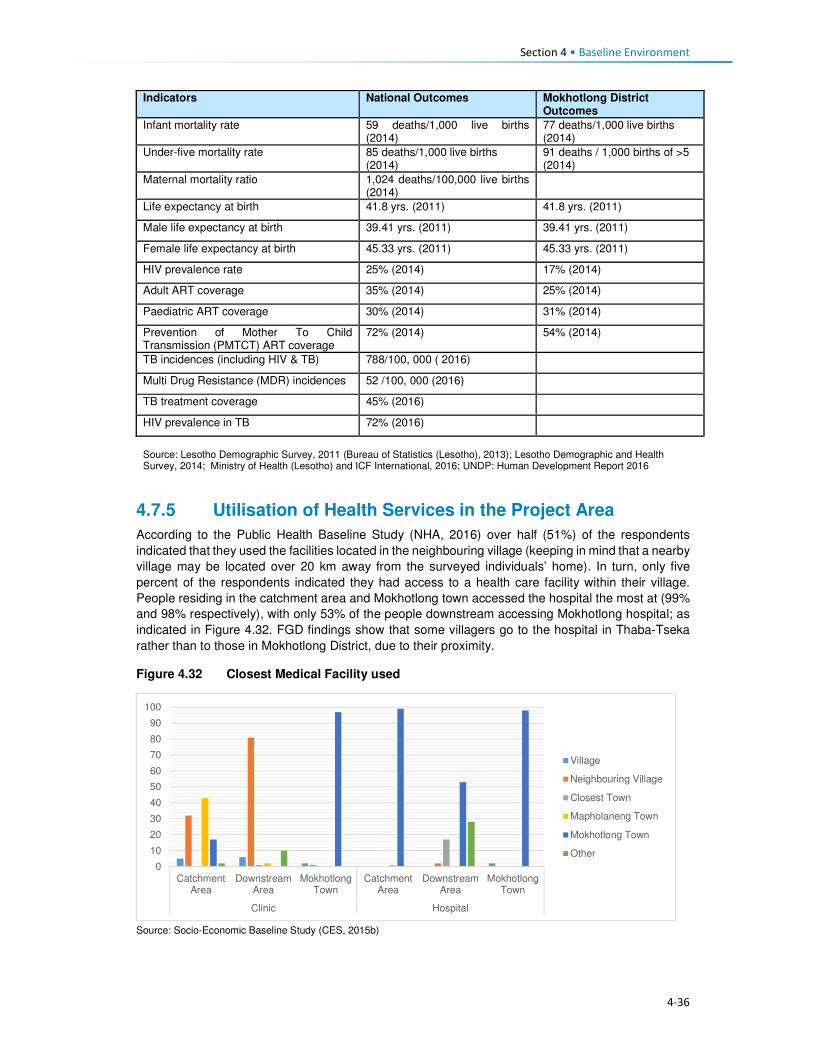
Section 4 • Baseline Environment
4-36
Indicators National Outcomes Mokhotlong District Outcomes
Infant mortality rate 59 deaths/1,000 live births (2014)
77 deaths/1,000 live births (2014)
Under-five mortality rate 85 deaths/1,000 live births (2014)
91 deaths / 1,000 births of >5 (2014)
Maternal mortality ratio 1,024 deaths/100,000 live births (2014)
Life expectancy at birth 41.8 yrs. (2011) 41.8 yrs. (2011)
Male life expectancy at birth 39.41 yrs. (2011) 39.41 yrs. (2011)
Female life expectancy at birth 45.33 yrs. (2011) 45.33 yrs. (2011)
HIV prevalence rate 25% (2014) 17% (2014)
Adult ART coverage 35% (2014) 25% (2014)
Paediatric ART coverage 30% (2014) 31% (2014)
Prevention of Mother To Child Transmission (PMTCT) ART coverage
72% (2014) 54% (2014)
TB incidences (including HIV & TB) 788/100, 000 ( 2016)
Multi Drug Resistance (MDR) incidences 52 /100, 000 (2016)
TB treatment coverage 45% (2016)
HIV prevalence in TB 72% (2016)
Source: Lesotho Demographic Survey, 2011 (Bureau of Statistics (Lesotho), 2013); Lesotho Demographic and Health Survey, 2014; Ministry of Health (Lesotho) and ICF International, 2016; UNDP: Human Development Report 2016
4.7.5 Utilisation of Health Services in the Project Area
According to the Public Health Baseline Study (NHA, 2016) over half (51%) of the respondents
indicated that they used the facilities located in the neighbouring village (keeping in mind that a nearby
village may be located over 20 km away from the surveyed individuals’ home). In turn, only five
percent of the respondents indicated they had access to a health care facility within their village.
People residing in the catchment area and Mokhotlong town accessed the hospital the most at (99%
and 98% respectively), with only 53% of the people downstream accessing Mokhotlong hospital; as
indicated in Figure 4.32. FGD findings show that some villagers go to the hospital in Thaba-Tseka
rather than to those in Mokhotlong District, due to their proximity.
Figure 4.32 Closest Medical Facility used
Source: Socio-Economic Baseline Study (CES, 2015b)
0
10
20
30
40
50
60
70
80
90
100
CatchmentArea
DownstreamArea
MokhotlongTown
CatchmentArea
DownstreamArea
MokhotlongTown
Clinic Hospital
Village
Neighbouring Village
Closest Town
Mapholaneng Town
Mokhotlong Town
Other

Section 4 • Baseline Environment
4-37
4.7.6 Incidence and Prevalence of HIV
Lesotho is in the top 10 countries in the Southern Africa region hardest hit by HIV/AIDs. In 2015,
Lesotho had the second highest prevalence of HIV in Southern Africa, after Swaziland, at 22.7%. An
estimated 9900 people died from AIDs-related illnesses in 2015. The incidence of HIV has been
declining, from 30 000 new infections in 2005 to 18 000 new infections in 2015 (Table 4.11).
Table 4.11 Prevalence of HIV/AIDS in Lesotho
310 000 People living with HIV
23% Adult HIV prevalence
18 000 New HIV Infections
9900 AIDS-related deaths
42% Adults on antiretroviral treatment Source: UNAIDS Gap Report 2016
In 2014, an estimated 74% of the people with tuberculosis (TB) in Lesotho also tested positive for
HIV, and 72% of these are on Anti-Retroviral Treatment (ART).
Anti-retroviral treatment (ART) in Lesotho: In Lesotho, ARVs are provided free of charge and can
be collected at various health facilities. Forty-one percent of eligible adults are enrolled onto ART.
ART coverage for children was said to have improved and stood at 56% in 2015. This increase was
attributed to the introduction of satellite paediatric ART centres. According to Avert, in 2016, Lesotho
became the first African country to implement a 'Test and Treat' strategy whereby every person who
tests HIV positive is offered ART regardless of their CD4 count.
Barriers to HIV prevention programmes: Some HIV-related targets and strategies have been
developed within Lesotho’s HIV response; however, many obstacles and challenges are impeding
progress in HIV prevention; most of which are cultural and structural. Gender-based violence and low
paid textile factory work have been found to be significant drivers for the high HIV prevalence among
women in Lesotho, among others (www.avert.org/professionals/hiv-around-world/sub-saharan).
These are briefly described in Box 4.3.
Box 4.3 Barriers to HIV Prevention Programmes
Access to health care. As indicated above, access to health care in Lesotho varies considerably by gender, socio-economic status and geography. Factors affecting access to health care include insufficient funds to travel to health centres and a lack of medical personnel and supplies. As such, people who are living with the virus cannot always access the facilities to collect medication. Furthermore, an estimated four percent of people living with HIV were reportedly denied access to health care services due to their status - this discourages people living with the virus from seeking medical assistance.
HIV stigma and discrimination. According to the Lesotho Stigma Index Report 2014, HIV stigma and
discrimination remain significant barriers to accessing vital treatment, prevention and support services to
those affected. There have been reports of people being victimised because of their HIV positive status;
including verbal and physical abuse, and exclusion from social, religious and family gatherings or activities.
The report further indicated that 41% of its respondents experienced gossip about their HIV status, while 27%
reported being verbally insulted, harassed and threatened.
According to the LDHS, 2014 (MoH and ICF International, 2016), HIV prevalence in Mokhotlong was
estimated at 17%; and it was the lowest amongst all ten Districts in the country. The report further
indicates that HIV was most prominent amongst females (23%) compared to males (10%). Pregnant
women are automatically tested for HIV when they first present themselves to a health care facility;
therefore, more women than men know their HIV status.
HIV/ AIDS was reported at 5% in the PHBS (NHA, 2016), having caused approximately 38 deaths
amongst the respondents of the survey, which is relatively low. Data collected during the FGDs agrees
with the fact that there are high numbers of people infected with HIV. They further pointed out that

Section 4 • Baseline Environment
4-38
they have to go to the nearest health centres to get their ARVs and the problem is always the long
distances they have to travel to reach them.
The PHBS (NHA, 2016) found that testing for HIV in the area was common, with approximately 45%
of the respondents in the catchment area reporting that they had been tested for HIV two weeks
before the study; 45% in the downstream area and 34% in Mokhotlong town. Amongst those who got
tested 70% were women, it is unclear whether these women were tested because they were pregnant
or not. However, the PHBS (NHA, 2016) indicated that all those tested were there to check their
hypertension levels. Three of the 42 focus groups interviewed for the PHBS (NHA, 2016) noted that
the issue of HIV/AIDS is a significant social concern within their communities. Of these, two groups
pointed out that the situation has become worse; one group noted that the situation has improved.
The focus group that reported an improvement in the issue of HIV/AIDS pointed out that people in
the community are now educated about the disease and take the necessary medication. Those
present in the focus groups who reported that the issue is becoming worse indicated that stigma
surrounding HIV/AIDS remains high and that, despite the availability of medication, many people
continue to die from the disease.
Regarding taking antiretroviral medication, people who are sick reportedly took their medication;
however, some stopped as soon as they consider themselves healthy again and this has led to these
individuals getting sick again and dying.
Participants in FGDs for this SIA pointed out that the reasons that HIV positive people default from
taking their medication could be related to the long distances to health facilities as well as the bad
attitude of health personnel. FGD respondents were also of the view that the rate of infections was
increasing, which could mean that people no longer seem to fear the disease.
4.7.7 Challenges to Health Care Provision
Challenges to access and provision of health care in the country, district and Project Area are
described below. There are some challenges to the delivery of health care services in Lesotho, the
main ones being the following:
• The lack of qualified medical professionals (both nurses and doctors) particularly in the rural areas
due to the country’s terrain which creates barriers to accessibility. Most qualified medical
professionals do not want to work in rural areas where there is poor access to public services and
as a result, seek employment in urban areas and elsewhere in the world once they qualify.
Serious emergencies are often referred to neighbouring South Africa.
• The rural nature and mountainous terrain further cause barriers to the construction of formal
medical facilities. This has led to many people living in the rural areas having to travel between
10 and 20 kilometres to reach the closest facility. Thus, many people in the rural areas choose to
rely on traditional medicines to treat various ailments.
• Most of rural Lesotho lacks secondary roads, which means that most parts of the rural areas do
not have public transportation. The 2014 LDHS, 2014 (MoH and ICF International, 2016)
indicated that 72% of households’ members walk to reach the nearest health facility; while 22%
stated that they travel by car, truck, bus, or taxi, and the remaining six percent used a combination
of walking and bus or taxi. Among households who walk to reach a health facility 27% walk for
more than 120 minutes (Table 4.12). Data from the FGDs indicates that the participants were
also concerned about the insufficient number of health facilitates in the Project Area and the
subsequent long distances that they have walk to reach the nearest one.
Table 4.12 Time it takes to get to the nearest health care facility
Time to get to nearest health facility by walking
Residential Area
Minutes Urban Rural Total
<20 minutes 28.4 5.5 12.8

Section 4 • Baseline Environment
4-39
Time to get to nearest health facility by walking
Residential Area
Minutes Urban Rural Total
20-40 minutes 43.0 11.4 21.6
41-60 minutes 17.2 16.1 16.5
120 minutes 8.1 28.1 21.7
> 120 minutes 3.2 38.6 27.3
Source: Lesotho Demography Health Survey, 2014 (Ministry of Health (Lesotho) and ICF International, 2016)
• Participants in focus group discussions indicated that they had experienced further challenges in
accessing health care such as that of frequent shortages of medication and other supplies at the
health facilities. This is made worse by the fact that some people would have had to walk for
many hours to get to the health centres. People from Malubalube, Nkokamele as well as other
far off villages mentioned that they have to take as many as four to five hours to reach the nearest
health centre. This means that they sometimes have to sleep over to have a chance at being
seen and examined by the health centre personnel. The distances are tough on the people
especially when they are sick, and there are cases where some expectant mothers have given
birth to babies on the way to health centres.
• The country’s health system is also challenged by the continued increase of communicable
diseases related to the HIV epidemic – especially Tuberculosis (TB). Data gathered from the
FGDs conducted in the Project Area indicate that in addition to HIV and communicable diseases
mentioned above, the people living in the Project Area suffer from a number of illnesses ranging
from sugar diabetes, hypertension, and the common cold. The under five children are said to
suffer from fever, measles, common cold, pneumonia, diarrhoea and vomiting. The people
expressed their fear about a possible climate change for the worse that could be brought about
by the large expanse of water after the dam is impounded and that would bring more cold to the
already cold district. That would, in turn, mean more common cold and pneumonia cases.
4.7.8 Use of Traditional Healers and Traditional Medicine
The participants of FGDs indicated that they also consult traditional healers when they are sick. This
they also attribute to not being up to walking the long distances to the health centres. In some cases,
they go to the traditional healers because they believe that they, rather than the health facilities, can
help to resolve their problem. In some such cases, the consultation would be more about protecting
their households against evil spirits than physical healing. They do, however, take some forms of
ailments to the traditional healers, though most of these are the ones they believe are from
bewitchments, such as litṥere, kokoana, sejeso, litoromo, ho qobola and headache. They also
indicated that they sometimes started by consulting the traditional healer and if they are not cured,
they would then go to seek help at a health centre and vice versa. Illnesses that they take to health
centres include HIV /AIDS, TB, cancer, sugar diabetes, hypertension, common cold, sharp pains and
flu.
Accidents and injuries that often happen to the people living in the catchment area are falling off
horses, lightning strikes, dog bites, being swept away by flooding rivers and fight injuries. Women
mostly feel unsafe as they are more likely to be sexually and/or physically abused than most. Seniors
feel unsafe as there have been incidences of mugging along the way from receiving their pension
money.
The participants are hoping that LHDA will assist them by liaising with the relevant ministry to have
health centres built nearby them for easy access. Participants from Malubalube pointed out that there
is a building in their village that was intended to be used for health outreach services and it is now
standing vacant and not being used as planned. They wish to have LHDA see to it that the building
is upgraded to a health centre level so that it can serve their area which is quite huge. It would also
cut travel time to Libibing. Their health problems have not declined in number in the past three years.
Instead, they have become worse.

Section 4 • Baseline Environment
4-40
4.8 Education This section describes the provision of education services and infrastructure in Lesotho, Mokhotlong
District and the Project Area.
4.8.1 National Education Services
The Ministry of Education and Training (MoET) is responsible for the management, provision and
regulation of education and training in Lesotho. It is in charge of ensuring the accessibility, quality,
equity and relevance of education. As with many countries in southern Africa, formal education in
Lesotho was introduced and developed through a partnership between the government and religious
organisations; and has been heavily influenced by the work of missionaries. As a result, across the
country, the management of schools is largely (90%) in the hands of the churches; specifically, the
Anglican Church, Lesotho Evangelical Church and Roman Catholic Church.
Government’s involvement in the provision of education, apart from the administrative duties, is
mainly through subsidies; payment of teachers’ salaries and provision of other institutional support.
Teachers are employed under the MoET. The government pays the salaries of more than 95% of the
teachers including those who work at church managed schools. Furthermore, the Government
provides schooling facilities through its capital budget. The provision of education services is guided
by the Education Act (No. 3) of 2010, the Lesotho Education Sector Strategic Plan for 2005 – 2015,
the Higher Education Strategic Plan for 2013/14 – 2017/18 and the National Policy for Integrated
Early Childhood Care and Development (ECCD). Lesotho is also a signatory to the MDG and MoET
seeks to ensure that Lesotho fulfils MDG 2, that of achieving universal primary education by 2015
through the provision of:
• Free and compulsory primary education;
• Bursaries and grants to vulnerable children and households;
• Ongoing school feeding programme; and
• Infrastructure development.
There are also development partners that are actively involved in the education sector through
bilateral and multilateral partnerships. These include among others the European Union, Irish Aid and
United Nations Children’s Fund (UNICEF). The Global Partnership for Education has also played a
significant role in improving the education sector.
4.8.2 Structure of the Education System
After completion of pre-schooling, Lesotho’s education system consists of 12 years of school. The
seven years of primary (Grade 1 – 7); three years of junior secondary (Form A – C); two years of
higher secondary (Form D – E) and four years of tertiary. There is also a parallel technical vocational
diploma course (senior secondary + 3 years Technical and Vocational Education and Training
(TVET). The various cycles of education are highlighted in Table 4.13.
Table 4.13 Structure of the education services in Lesotho
Education Schooling level Age Years Qualification
Pre-school ECCD 3 - 5 3 • Attendance is not compulsory.
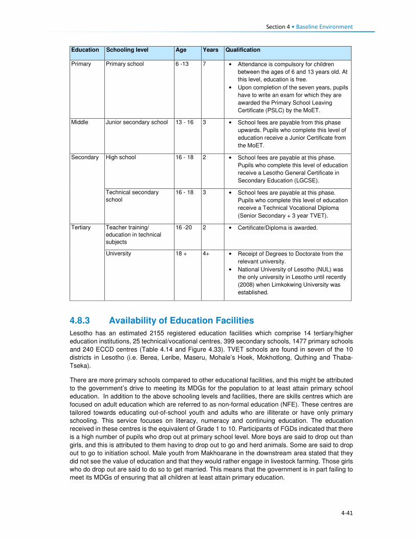
Section 4 • Baseline Environment
4-41
Education Schooling level Age Years Qualification
Primary Primary school 6 -13 7 • Attendance is compulsory for children
between the ages of 6 and 13 years old. At
this level, education is free.
• Upon completion of the seven years, pupils
have to write an exam for which they are
awarded the Primary School Leaving
Certificate (PSLC) by the MoET.
Middle Junior secondary school 13 - 16 3 • School fees are payable from this phase
upwards. Pupils who complete this level of
education receive a Junior Certificate from
the MoET.
Secondary High school 16 - 18 2 • School fees are payable at this phase.
Pupils who complete this level of education
receive a Lesotho General Certificate in
Secondary Education (LGCSE).
Technical secondary
school
16 - 18 3 • School fees are payable at this phase.
Pupils who complete this level of education
receive a Technical Vocational Diploma
(Senior Secondary + 3 year TVET).
Tertiary Teacher training/
education in technical
subjects
16 -20 2 • Certificate/Diploma is awarded.
University 18 + 4+ • Receipt of Degrees to Doctorate from the
relevant university.
• National University of Lesotho (NUL) was
the only university in Lesotho until recently
(2008) when Limkokwing University was
established.
4.8.3 Availability of Education Facilities
Lesotho has an estimated 2155 registered education facilities which comprise 14 tertiary/higher
education institutions, 25 technical/vocational centres, 399 secondary schools, 1477 primary schools
and 240 ECCD centres (Table 4.14 and Figure 4.33). TVET schools are found in seven of the 10
districts in Lesotho (i.e. Berea, Leribe, Maseru, Mohale’s Hoek, Mokhotlong, Quthing and Thaba-
Tseka).
There are more primary schools compared to other educational facilities, and this might be attributed
to the government’s drive to meeting its MDGs for the population to at least attain primary school
education. In addition to the above schooling levels and facilities, there are skills centres which are
focused on adult education which are referred to as non-formal education (NFE). These centres are
tailored towards educating out-of-school youth and adults who are illiterate or have only primary
schooling. This service focuses on literacy, numeracy and continuing education. The education
received in these centres is the equivalent of Grade 1 to 10. Participants of FGDs indicated that there
is a high number of pupils who drop out at primary school level. More boys are said to drop out than
girls, and this is attributed to them having to drop out to go and herd animals. Some are said to drop
out to go to initiation school. Male youth from Makhoarane in the downstream area stated that they
did not see the value of education and that they would rather engage in livestock farming. Those girls
who do drop out are said to do so to get married. This means that the government is in part failing to
meet its MDGs of ensuring that all children at least attain primary education.

Section 4 • Baseline Environment
4-42
At the district level, the education system is organised into early childhood development, primary,
secondary and high school and the MoET is decentralised through the Inspectorate. The number of
education facilities varies by district with Maseru district having the most. Table 4.14 shows the
distribution of schools by district.
Table 4.14 Distribution of schools by district
District
Levels of Education Total
ECCD Primary Secondary
Urban Rural Urban Rural
Butha-Buthe 18 14 68 9 13 122
Leribe 28 20 179 12 55 294
Berea 27 10 129 6 36 208
Maseru 34 62 190 29 44 358
Mafeteng 30 9 149 5 34 227 Mohale’s Hoek 27 4 167 4 21 223
Quthing 19 9 117 4 13 162
Qacha’s Nek 18 9 94 5 15 141
Mokhotlong 15 11 95 1 15 137
Thaba-Tseka 24 5 136 4 15 184
Total 240 1477 339 2056 Source: Lesotho Bureau of Statistics, Statistical Report No. 28 of 2015: Education Statistics Report 2014
Figure 4.33 Typical Schools in the Project Area
Source: J. Mkhabela
In the Project Area, the education system follows the national and district system. The MoET through
the Inspectorate is expected to support and supervise these schools. Following the pattern of number
of schools in the Mokhotlong District; there are also more primary schools in the Project Area and
very few Secondary schools. ECCD schools are also available in the Project Area.
A few NGOs work in the education sector in the Districts and provide support in the form of school
fees, uniforms, school shoes, toiletries and sanitary towels to children. These include Sentebale,
Hlokomela Bana and World Vision. Sentebale and Hlokomela Bana operate in Mokhotlong and the
Project Area.

Section 4 • Baseline Environment
4-43
4.8.4 Education Profile of Lesotho
Lesotho has the highest adult literacy rate (79%) in sub-Saharan Africa as well as amongst its female
population (93%)11. Men have slightly lower education levels than their female counterparts, and this
has been linked to the fact that boys particularly those in rural areas tend to dedicate their time to
herding livestock and not attending school or dropping out at the primary level; refer to Table 4.15.
The introduction of free and compulsory primary education in Lesotho has assisted Lesotho in fast-
tracking progress towards reaching the MDG 2. In 2012, progress towards achieving indicator 2.1
(Net Enrolment Rate (NER) in primary schools) and indicator 2.3 (Literacy rate among 15-24-year-
olds) were on track. Progress was, however, slow for indicators 2.2 (Proportion of pupils who reach
the last grade of primary school); refer to Table 4.15. Enrolment in secondary schools is low at 38%
as there are a limited number of secondary schools and tuition fees are required (the government
only subsidises orphan and vulnerable children). Also, children who want to enter high school may
be required to relocate from their homes to stay with relatives or friends who reside close to a
secondary school, and this requires financial contributions from parents which many in rural Lesotho
cannot afford; thus the children drop out. Findings from the FGDs indicate that some of the children
who manage to complete primary school are sometimes unable to attend secondary school due to
lack of school fees. Some parents have to sell livestock to put their children through Junior and Senior
High schools.
Table 4.15 Education Services Profile
Indicators MDG Baseline Outcomes Progress
Adult Literacy rate 79% (2015) Female youth (15 – 24 years) literacy rate 96% 98% (2012) On track
Male youth (15 – 24 years) literacy rate 83% 87% (2012) On track
Primary Education
Net Enrolment Rate12 82% 82% (2012) On track Proportion of pupils who reach last grade of primary school
61% 66% (2012) Slow progress
Source: Kingdom of Lesotho, 2013. Millennium Development Goals Status Report 2013
4.8.5 Education Profile of Mokhotlong and Project Area
The majority (58%) of the residents of Mokhotlong district have attained some primary schooling,
followed by those who have some secondary education (17%). Only eight percent of the population
was recorded as having no schooling – which is relatively low considering that Mokhotlong has poor
infrastructure specifically roads and has an economy that is solely dependent on agricultural activities.
Approximately 90% of the primary schools in Mokhotlong are found in rural parts of the District while
the other 10% are in urban areas. A similar trend was observed with the distribution of secondary
schools.
As with the situation in the District, the SEBS (CES, 2015b) indicates that a majority (59%) of the
population in the Project Area have attained some primary schooling and was, however, followed by
those who had no education at all (16%). Only 12% were reported to have completed primary school.
Regarding attainment of schooling by gender, a similar trend to the national and district levels is
observed with more men with no schooling. However, the trend differs significantly regarding those
who have some primary education, with more males compared to females and reverts to more
females having completed both primary and some junior secondary schooling. Observation during
FGDs showed that many people have at least attained primary school education, as many were able
11www.unesco.org/eri/cp/factsheets_ed/LS_EDFactSheet.pdf 12Net Primary Enrolment Rate is the number of pupils of official primary school age who are enrolled in primary education as a percentage of the total children of the official school age population

Section 4 • Baseline Environment
4-44
to register their names when asked to do so. Also observed was the fact that almost all of the woman
participants could write their name while some could not and wrote a cross.
Due to shortages of qualified teachers and the reluctance of some qualified teachers to work in remote
and hard to reach schools such as those found in Mokhotlong and the Project Area, the use of
unqualified teachers is common. These teachers perform similar roles as qualified teachers though
they have not been trained as teachers, and their wages are paid for by parents. Closely linked to the
shortage of qualified teachers, pupil teacher ratios (PTR) are high. This situation applies to both
primary and secondary schools. A summary of Mokhotlong district education indicators is presented
in Table 4.16.
Table 4.16 Education Services Profile
Indictors Outcome
Primary Education
Total Primary School Teachers 588
• Qualified Primary School Teachers 431 (73%)
• Unqualified Primary School Teacher 157 (27%)
Total Primary School Enrolment in 2014 22,883
Pupil Teacher Ratio (PTR) 39:1
Pupil Qualified Teacher Ratio (PQTR) 53:1
Total Primary School Repeaters 2,215
Secondary Education
Total Secondary School Teachers 212
• Qualified Teachers 198 (93%)
• Unqualified Teachers 14 (7%)
Total Secondary School Enrolment in 2014 5,365
• Male Enrolment 1,786 (33.3%)
• Female Enrolment 3,579 (67%)
Pupil Teacher Ratio (PTR) 24:1
Pupil Qualified Teacher Ratio (PQTR) 26:1
Source: Bureau of Statistics: Statistical Report No. 28 of 2015: Education Statistics Report: 2014
The SEBS (CES, 2015b) indicates that overall, 18% of males in the Project Area had no schooling
while only six percent of females were uneducated and is in line with the national and district reports
on disparities in the levels of education of men and women in Lesotho. This discrepancy was mostly
observed amongst males in the downstream area where 24% of men had no schooling while only
seven percent of females were uneducated. Overall, 61% of the female population across the Project
Area had attained primary education as compared to males at 57%. Refer to Figure 4.34. The people
of town Mokhotlong had higher numbers of people with secondary schooling and above compared to
the other two areas; this can be linked to the fact that Mokhotlong town is the district capital and
slightly urbanised. The town also has a majority of civil servants (who mostly have attained more than
secondary schooling education) residing in the town.

Section 4 • Baseline Environment
4-45
Figure 4.34 Distribution of Schooling Levels across the Project Area
Source: Socio-Economic Baseline Study (CES, 2015b)
Participants of FGDs were of the feeling that there are not enough schools in the Project Area,
especially downstream where children walk long distances to school and sometimes cannot attend
school regularly during the rainy season as the streams/rivers they have to cross flood. Children are
said to start school at a later age (eight or nine and not six years old) as the schools are too far.
People anticipate that LHDA will build schools nearby.
4.8.6 Provision of Education to the Poor and Marginalised
The government of Lesotho implements multiple programmes to ensure that the poor and
marginalised children get access to education services. Disabled and orphaned children, children
from extremely poor households and herd boys are regarded as vulnerable children (Orphans and
Vulnerable Children (OVC)). In order to ensure that these children receive an education, the MoET
has a school bursary scheme, which is paid directly to the schools. Another programme aimed at
assisting these OVC is the Child Grants Programme (CGP). This programme was started in 2009
and was financed by the European Commission with technical support from UNICEF-Lesotho. In
2013 the government of Lesotho took over the financing of the programme. The programme is run
specifically by the Ministry of Social Development (MoSD). The programme is non-conditional social
cash transfer targeted to poor and vulnerable households with the objectives of:
• Improving living standards of OVCs;
• Reducing malnutrition, improve health status; and
• Increasing school enrolment by OVCs.
Qualifying households are selected through a combination of proxy means which include testing and
community validation. The household is then registered on the National Information System for Social
Assistance (NISSA); and subsequently receive funds from the grant.
With the assistance of the World Food Programme (WFP), the government of Lesotho runs a school
feeding programme which provides food for children attending pre-school and primary schooling.
Through the programme, children receive two meals a day, breakfast and lunch. In 2015, the
programme was supporting over 50 000 pre-schoolers and 200 000 pupils in 1025 primary schools
throughout Lesotho13.
13http://www.lesothoreviw.com/education-training-2015.php
0
10
20
30
40
50
60
70
80
None Primary Secondary Secondary + Don’t know
Pe
rce
nta
ge
Catchment Area Male Catchment Area Female Mokhotlong Town Male
Mokhotlong Town Female Downstream Area Male Downstream Area Female

Section 4 • Baseline Environment
4-46
4.8.7 Obstacles to Education
While much has been achieved in ensuring that education services are provided to Basotho, the
sector continues to face challenges at the national and district levels as well as within the Project
Area. The following are some of the challenges faced:
• Low pass rates across all levels of schooling;
• Low standard of education provided at local schools;
• Poor retention rates of pupils at primary and secondary schooling levels due to the limited number
of schools;
• The mountainous terrain of Lesotho also acts as a barrier to construction of schooling facilities
and this has led to a shortage of schooling facilities as well as poor maintenance of existing
schools.
• In the remote rural areas, the learning environment is often poor and characterised by limited
infrastructure including unavailability of classrooms and equipment.
• The shortage of schooling infrastructure also results in pupils and teachers having to walk long
distances to reach the nearest school; this is particularly the case with secondary schooling.
• The limited secondary schooling infrastructure to absorb new entrants into the education system.
• There is a limited number of qualified teachers in the schooling system as many do not want to
transfer and work in remote rural areas with limited public services and infrastructure.
• Lack of public transportation and formal road infrastructure in many remote rural areas, as such
both teachers and pupils have to walk long distances to reach schooling facilities.
• Disparities in the distribution of schools in the country, with rural areas having limited numbers of
schools and urban more. This results in overcrowding of schools and higher teacher/ pupil ratios
which in turn affects the quality of learning and teaching.
• Extreme levels of poverty in the Project Area results in the inability of parents to pay school fees.
4.9 Public Services and Infrastructure This section describes access to public services and infrastructure in the Project Area such as potable
water, sanitation, telecommunications, energy/fuel sources, and roads/transportation; refer to Figure
4.35.

4-47
Figure 4.35 Map showing some Public Services and Infrastructure in the Catchment Area
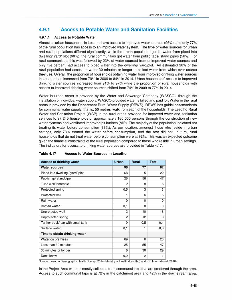
Section 4 • Baseline Environment
4-48
4.9.1 Access to Potable Water and Sanitation Facilities
4.9.1.1 Access to Potable Water
Almost all urban households in Lesotho have access to improved water sources (96%), and only 77%
of the rural population has access to an improved water system. The type of water sources for urban
and rural populations differed significantly, while the urban population got its water from piped into
dwelling/ yard/ plot (68%), the rural communities got water from public taps/ stand pipes (56%). For
rural communities, this was followed by 23% of water sourced from unimproved water sources and
only five percent had access to piped water into the dwelling/ yard/plot. An estimated 38% of the
rural population had access to water 30 minutes or longer to collect water from which ever source
they use. Overall, the proportion of households obtaining water from improved drinking water sources
in Lesotho has increased from 79% in 2009 to 84% in 2014. Urban households' access to improved
drinking water sources increased from 91% to 97% while the proportion of rural households with
access to improved drinking water sources shifted from 74% in 2009 to 77% in 2014.
Water in urban areas is provided by the Water and Sewerage Company (WASCO), through the
installation of individual water supply. WASCO provided water is billed and paid for. Water in the rural
areas is provided by the Department Rural Water Supply (DRWS). DRWS has guidelines/standards
for communal water supply, that is, 50 metres' walk from each of the households. The Lesotho Rural
Water and Sanitation Project (WSP) in the rural areas provided for improved water and sanitation
services to 27 245 households or approximately 160 000 persons through the construction of new
water systems and ventilated improved pit latrines (VIP). The majority of the population indicated not
treating its water before consumption (88%). As per location, amongst those who reside in urban
settings, only 78% treated the water before consumption, and the rest did not. In turn, rural
households that do not treat water before consumption were at 92%. This was an expected outcome
given the financial constraints of the rural population compared to those who reside in urban settings.
The indicators for access to drinking water sources are provided in Table 4.17.
Table 4.17 Access to Water Sources in Lesotho
Access to drinking water Urban Rural Total
Water sources 96 77 82
Piped into dwelling / yard/ plot 68 5 22
Public tap/ standpipe 26 56 47
Tube well/ borehole 2 8 6
Protected spring 0,5 3 3
Protected well 1 6 5
Rain water 0 0 0
Bottled water 0,1 0 0
Unprotected well 2 10 8
Unprotected spring 2 12 9
Tanker truck/ car with small tank 0 0,5 0,4
Surface water 0,1 1 0,8
Time to obtain drinking water
Water on premises 69 6 23
Less than 30 minutes 25 55 47
30 minutes or longer 6 38 29
Don’t know 0,2 2 1
Source: Lesotho Demography Health Survey, 2014 (Ministry of Health (Lesotho) and ICF International, 2016)
In the Project Area water is mostly collected from communal taps that are scattered through the area.
Access to such communal taps is at 72% in the catchment area and 42% in the downstream area.

Section 4 • Baseline Environment
4-49
For Mokhotlong town, the use of taps includes both communal taps and piped water into the dwelling.
The population in the downstream area further relies on wells as a second source of water (40%).
The government installed the communal taps that the communities use through DRWS. However,
the communities complained that there were not enough communal taps to service their water needs.
In some communities the water taps were non-functional, this was as a result of faulty pipes or broken
taps or solar panels that supply the water pump with power. Villages whose taps were no longer
functioning returned to collecting water from unprotected sources such as springs or wells. Indicated
in Figure 4.36 are protected and unprotected water wells.
Figure 4.36 Protected and Unprotected Water Wells
Source: J Mkhabela
As indicated above, the majority of the households in the Project Area have access to improved water
sources, more specifically communal taps. However, with regards to the time, it takes each way to
reach the tap an estimated 86% of the households indicated having to walk for 30 minutes each way
to fetch water; while 13% walk for more than one hour each way to carry water, as indicated in Figure
4.37. The residents of Mokhotlong town, as expected did not have to walk far to collect water due to
the urban nature of the area. Data gathered from the FGDs also indicated that most villages in the
Project Area do have communal taps, though they pointed out that some of them are seasonal,
producing water only during the rainy season. They explained that when the taps dry up, they collect
water from springs and some even from nearby streams. Few of the interviewed communities take
more than one hour to collect water.
Figure 4.37 Time taken from Household to Water Source
Source: Socio-Economic Baseline Study (CES, 2015b)
Water is collected mostly two to three times per day by different households at 46% and 24%
respectively. Some households collect water more than three times a day.
0
20
40
60
80
100
0 to 15minutes
15 to 30minutes
30 to 45minutes
45 min. to 1hr.
> 1 hr.
Catchment area Downstream area Mokhotlong Town

Section 4 • Baseline Environment
4-50
4.9.1.2 Access to Sanitation Facilities
Approximately five in 10 households in Lesotho commonly use improved toilet facilities. These are
defined as non-shared facilities that prevent people from coming into contact with human waste and
thus reduce the transmission of cholera, typhoid, and other diseases (LDHS 2014 (MoH and ICF
International 2016). Overall, 29% of the households in Lesotho have no access to sanitation facilities,
with the majority of the population without toilets residing in the rural area (39%) and six percent in
urban areas. Shared/public toilet facilities are found in the urban areas compared to the rural areas
at 45% and nine percent respectively. Shared/public toilet facilities are common in urban areas,
especially in shopping centres and malls.
In general, the proportion of urban households with improved toilet facilities has increased since 2009,
rising from 26% to 41%; while in rural households, the proportion has more than doubled (rising from
22% to 50%). During this same period, the proportion of rural households without any toilet facilities
decreased from 45% to 38%. FGD respondents said there are few toilets in their villages and those
who don't have them use the bush. People anticipate that LHDA will build each household in the
Project Area a toilet so that the Polihali Dam does not become contaminated.
Table 4.18 Access to Sanitation Facilities in Lesotho
Access to Sanitation Facilities Urban Rural Total
Percentage
Improved 49 52 51
Flush/ pour flush14 to piped sewer 4 0 1
Flush/ pour flush to septic tank 3 0,2 1
Flush/ pour flush to pit latrine 0 0 0
Ventilated improved pit (VIP) latrine 7 16 14
Ordinary pit latrine 35 35 35
Shared facility 45 9 19
Flush/ pour flush to piped sewer 0,3 0 0,1
Flush/ pour flush to septic tank 0,3 0 0,1
Ventilated improved pit (VIP) latrine 6 1 2
Ordinary pit latrine 39 8 17
Unimproved facility 6 39 30
Flush/ pour flush not to piped sewer/ septic tank / pit latrine 0,4 0 0,1
Pit latrine without slap / open pit 1 1 1
No facility/ bush 5 38 29 Source: Lesotho Demography Health Survey, 2014 (Ministry of Health (Lesotho) and ICF International, 2016)
In the Project Area, the majority of the respondents indicated having no access to sanitation facilities.
This was observed mostly in the downstream area where 80% of the households had no access to
toilets, followed by 12% with access to VIP toilets, five percent with access to pit latrines and the
remaining three percent having access to other forms of sanitation facilities. In turn, the population in
the catchment area reported that 59% had no access to toilets, 27% had VIP and 11% pit latrines
and the remaining three percent had access to other forms of sanitation facilities. In Mokhotlong town,
the most common toilet facilities that the population has been VIP toilets (56%), followed by 31%
using without any form of sanitation facilities, nine percent used pit latrine and three percent had
14A pour flush toilet is a toilet without a cistern and whereby bath water is used to pour straight into the pan.

Section 4 • Baseline Environment
4-51
access to other forms of sanitation facilities. A small number of households had flush toilets (one
percent).
Figure 4.38 Example of Sanitation Facilities in the Project Area
Source: J. Mkhabela
The public participation and FGD field teams also noticed through questions asked and observation
the marked lack of toilets in the villages where they were working, and witnessed people using bushes
near their homes especially overgrown areas by the streams and rivers. Refer to Figure 4.39 for
additional information on access to toilet facilities in the Project Area.
Figure 4.39 Access to Sanitation Facilities in the Project Area
Source: Socio-Economic Baseline Study (CES, 2015b)
4.9.2 Access to Policing Services
There are two police stations in the district of Mokhotlong, with one based in Mokhotlong town and
the other in Mapholaneng and both of them are, incidentally, located within the Project Area. Data
gathered from the interview with the police, indicate that there is a total of 150 police officers in
Mokhotlong district. Slightly over half (54%) of the people from the Project Area make use of the
Mokhotlong town police station, while 45% use the Mapholaneng station and the remaining one
percent made use of village policing. FGD participants indicated that in most of the villages there are
community policing forums (mahokela), which fight crime at village level and work hand in hand with
0%
10%
20%
30%
40%
50%
60%
70%
80%
90%
Catchment Area Downstream Area Mokhotlong Town
Bucket System Chemical Toilet Flush Toilet - Septic Flush Toilet - System
Other Pit Latrine VIP toilet Nothing

Section 4 • Baseline Environment
4-52
the local police stations. They deal mainly with minor crimes, practicing what is known as Restorative
Justice. There is only one prison of minimum security in the district of Mokhotlong.
One of the aspects that community members requested from the LHDA was to assist with construction
of satellite police stations in their areas/villages as a measure to combating crime. Some of the crimes
that already exist in the Project Area are petty in nature (according to the interview conducted with a
police officer at Mokhotlong Police station), (including stock theft, home break-ins as well as stealing
of crops), however, for rural agrarian communities these are regarded as serious. There is concern
among the police about the increasing number of illegal firearms in the district, owned mostly by
dagga smugglers.
Crime prevention is slow due to a lack of vehicles for police and an expectation for police to walk
where cars cannot drive. There are six vehicles in the district; however, during servicing times only
two vehicles are available.
Figure 4.40 Access to Policing Services
Source: Socio-Economic Baseline Study (CES, 2015b)
According to the interviewed community members, crimes in the area were committed at any time of
the day in both homesteads and cattle posts. Recently the thieves were mostly armed with knives
and guns. The thieves were said to kill the watch dogs and sometimes the livestock owners too. The
scale of livestock theft was reported to be severe with thieves stealing the herd of livestock. The high
levels of livestock theft were attributed to increasing levels of poverty in the area as well as low police
presence in some villages. General home break-ins were reported to occur mainly in households
occupied by the elderly. Often the thieves would steal farming equipment, crops and general
household items such radios, televisions, etc. Other criminal activities experienced in the area were
rapes, domestic abuse, fighting, which the respondents attributed to alcohol abuse. FGD participants
from the whole Project Area cited stock theft as one of the big challenges experienced in livestock
keeping. The other crimes such as rapes, domestic abuse, fighting were also mentioned across the
Project Area by the FGD participants. They also anticipate that the commencement of the
construction works may bring more outsiders to the Project Area and thereby increase the incidences
of crime, especially livestock theft and theft of field crops.
4.9.3 Access to Local Court
From observation three magistrate courts were seen in Mokhotlong District, one at Mokhotlong town,
the others at Mapholaneng and Phahameng. Access to local court services, was indicated as easier
compared to other public services in the Project Area, with an average of 42% of the respondents
reporting to have a court within their village or neighbouring settlement, as reflected in Figure 4.41.
0%
10%
20%
30%
40%
50%
60%
70%
80%
90%
100%
Village Neighbouring
Village
Closest Town Mapholaneng
Town
Mokhotlong
Town
Other
Catchment Area
Downstream Area
Mokhotlong Town

Section 4 • Baseline Environment
4-53
Mapholaneng and Mokhotlong town’s courts were commonly used by the respondents. According to
the respondents, part of the village court system is linked to the chiefs hearing cases, especially those
relating to the collection and utilisation of natural resources. Chiefs and Councillors reserve the rights
to fine anyone who has been found in contravention of laws governing the utilisation of natural
resources (refer to the discussion under Governance, section 2.1). Repeat offenders are taken to the
local magistrate courts for prosecution by the Chiefs and Councils – this indicates a complimentary
relationship between the traditional and formal court systems. FGD respondents also described the
traditional court system existing within their villages/areas that involved chiefs and councillors where
people have to start at even before being referred to a magistrate court.
Figure 4.41 Access to Local Courts
Source: Socio-Economic Baseline Study (CES, 2015b)
4.9.4 Access to Banking Services
Banking services are mostly limited to the more established towns of the Project Area, namely
Mapholaneng and Mokhotlong town. As such the majority of the respondents both in the catchment
and downstream areas indicated using such services in these towns (28% and 37%) respectively, as
indicated in Figure 4.42. The “other” category also featured at 34% for the downstream population
which included stokvels and savings and burial schemes. The men who participated in the male FGD
at Taung mentioned having a savings scheme, formed of men only that lend money to people to be
paid back with interest. Respondents of FGDs also explained that people from the Project Area have
bank accounts, especially the people who rear sheep and goats who get paid for their wool and
mohair.
0%
10%
20%
30%
40%
50%
60%
Own village Neighbouring
Village
Closest Town Mapholaneng
Town
Mokhotlong
Town
Other
Catchment Area Downstream Area Mokhotlong Town

Section 4 • Baseline Environment
4-54
Figure 4.42 Access to Banking Services
Source: Socio-Economic Baseline Study (CES, 2015b)
4.9.5 Access to Agricultural Input and Equipment
Again, the most established towns of Mapholaneng and Mokhotlong were identified as the main areas
where people purchase agricultural inputs and equipment. The population from the downstream area
indicated that they purchase their agricultural inputs and equipment in various locations, as indicated
below. This could be attributed to various factors but more specifically issues of access, some
downstream areas are located closer to Mokhotlong, Mapholaneng, Tlokoeng and Katse and these
areas also have outlets that sell agricultural inputs and equipment.
Figure 4.43 Access to Agricultural Inputs and Equipment
Source: Socio-Economic Baseline Study (CES, 2015b)
4.9.6 Access to Local Markets and Shops
Overall, 35% of food purchases were reported to occur within the home or neighbouring villages, with
the towns of Mapholaneng and Mokhotlong accounting for 23% and 24% of all purchases,
respectively. It stands to reason that easy access to food shops within one’s own village would reduce
the amount of time and cost incurred in purchasing food, whilst visiting the town area may result in
0%
10%20%
30%40%
50%60%
70%80%
90%100%
Own village NeighbouringVillage
Closest TownMapholaneng MokhotlongTown
Other
Catchment Area Downstream Area Mokhotlong Town
0%
10%
20%
30%
40%
50%
60%
70%
80%
90%
100%
Catchment Area Downstream Area Mokhotlong Town
Village Neighbouring Village Closest Town Mapholaneng Mokhotlong Town Other

Section 4 • Baseline Environment
4-55
increased time and travel costs in purchasing food and decrease the amount of food purchased in
order to cover the costs of transportation. Furthermore, people within the catchment area are likely to
purchase food stuff in Mokhotlong town which is closest to their locale, while people in the western
part of the catchment area would purchase food in Mapholaneng and Thaba-Tseka. The latter could
be better accessed by people from the villages downstream of the Dam, who are already located
within Thaba-Tseka District.
Figure 4.44 Access to Local Markets and Shops
Source: Socio-Economic Baseline Study (CES, 2015b)
4.9.7 Access to Telecommunications
Telecommunication services in the Project Area are concentrated in the established town areas of
Mokhotlong and Mapholaneng. In these areas, people have both access to landline telephones and
cellular phones. For obvious reasons, the number of households with cellular phones outweighs
those with landline telephones. The more remote parts of the Project Area have no cellular phone
signal as such, hence the ownership and use of cellular phones is limited, though the people pointed
out that they still buy and own cellular phones in the hope that they will eventually get
telecommunication towers. Similarly, to ownership of landline telephones, computer access was
found to be concentrated in the town areas. Overall, 22% of the population in the Project Area
reportedly did not have access to any means of telecommunications; information to these
communities is passed on through the word of mouth.
4.9.8 Access to Transportation
There is only one road that links Mapholaneng to Mokhotlong town. It is also one of the two only
tarred roads within Mokhotlong District. The other tarred road leads from Mokhotlong town to Sani
Pass. Besides these two there are other unpaved roads that form a network of roads that are used to
access villages located around the proposed dam. The roads are in different levels of disrepair with
some that were observed to be totally untraversable. The other major road that is found in the district
is the one connecting the District of Mokhotlong to that of Thaba-Tseka. It has been observed to be
unpaved and in a bad condition is some areas if not all. Some of the road and bridges are observed
to be going to be inundated when one looks at where the beacons have been installed.
The FGD respondents from the Project Area are concerned about the loss of the roads and bridges
to be inundated and would like the LHDA to replace them as a form of mitigation. The respondents
from the eastern side of the proposed dam are concerned that LHDA has not said anything to them
about a tarred road on their side of the dam. They complained that all the proposed project
infrastructure is on the Tlokoeng side of the dam. They are also concerned that there is no tarred
0%
20%
40%
60%
80%
100%
Catchment Area Downstream Area Mokhotlong Town
Village Neighbouring Village Closest Town
Mapholaneng Mokhotlong Town Other

Section 4 • Baseline Environment
4-56
road and bridge that seems to be planned to connect the Khalahali side of the dam to that of Tlokoeng.
They are very concerned that they are expected to go via Mokhotlong and Mapholaneng towns when
they travel to the other side of the river (Tlokoeng side). They are even worried that they will not be
able to cross the Senqu River to go and look for work when construction works commence.
The modes of transport currently used include walking, horse-riding, use of taxis and buses, with
donkeys used as beasts of burden and for transport. The respondents from the Project Area, including
downstream would like to see LHDA assist them with construction of feeder roads to make it easier
to reach their villages, health centres, schools and the Mokhotlong town.
4.10 Vulnerability and Marginalisation Vulnerable or disadvantage groups are defined by IFC as individuals or groups within the Project
Area who could experience adverse impacts from the proposed Project more severely than others
based on their vulnerable or disadvantaged status. This status may stem from an individual's or
group's race, colour, gender, language, religion, political, or other opinion, national or social origin,
property, birth or other status. In addition other factors should be considered such as gender, ethnicity,
culture, sickness, physical or mental disability, poverty or economic disadvantage, and dependence
on unique natural resources15. In the Project Area, the broad categories of people who should be
considered to have some level of vulnerability are:
• Women;
• The elderly;
• Youth;
• Herd boys;
• Orphaned children; and
• Disabled or chronically ill persons.
These groups are described in more detail in the following sections.
The Ministry of Social Development is responsible for leading and facilitating the provision of
sustainable social development services that are universally accessible to all groups of people in
Lesotho in collaboration with other key stakeholder. The ministry in partnership with other key
stakeholders has over the recent years implemented a number of social protection initiatives such as
the:
• School feeding programme that is linked to free primary education and health care,
• Old age pension which is offered on a universal basis to all qualifying citizens;
• Child grant programme (CGP);
• OVC bursary programme;
• Public assistance programme; and
• Implementation of the national information system for social assistance (NISSA); which begun as
a tool of the CGP.
In 2014 the ministry through the assistance of the European Union and UNICEF developed the
National Social Protection Strategy (2014/15 – 2018/19) which was officially launched in 2015 (See
Section 2.2).
4.10.1 Women
Women of the Project Area are mainly regarded as vulnerable due to the poor / or inadequate access
to public services such as health care. Women dwelling in a village without a health centre often give
15IFC Glossary of Terms, http://www1.ifc.org/wps/wcm/connect/corp_ext_content/ifc_external_corporate_site/home

Section 4 • Baseline Environment
4-57
birth at home or are expected to leave their homes to await childbirth in another village whilst living
with non-family/ non-relations. In case of medical emergencies during home births, women are often
at higher risk because of the lack of transportation.
Similarly, to most youths in the District and Project Area, the population has a shortage of high
schools, and the distances that will be required to walk to and from school discourages the people
from attending school. Women’s vulnerability as it relates to the Project may be linked to low potential
for women to securing to long-term permanent jobs due to their low levels of education and possibly
lack of skills to carryout jobs beyond cleaning services. Both women and youth of limited education
are more unlikely to secure jobs during the construction and operational phases and they would both
be deemed vulnerable.
Loss of land by female headed households due the Project land take will increase their vulnerability
should their land acquired by the Project be not replaced.
4.10.2 The Elderly
The elderly are generally recognised as being vulnerable due to their age. The elderly remains in
high social standing as long as they are productive; however, they lose this standing once they
become dependent on the younger generations for assistance in meeting their basic needs (e.g.
housing, water, food). Furthermore, the elderly is often targeted by criminals for their pension. The
elderly are usually not in a position to take advantage of the benefits typically associated with large
projects such as the Polihali Dam Project.
4.10.3 Youths
For the purposes of this assessment, youth are quantitatively defined as persons aged approximately
15 to 35 or, recognising variations by cultural context, qualitatively defined by their degree of
independence with respect to their obtainment of a livelihood, relationship status (i.e. marriage,
children), and living arrangements.
Youth can be recognised as vulnerable, though in a way distinct from other categories listed above.
Being at their physical prime but often facing an unknown future, youth may be seen as both
empowered and disempowered. Youth are vulnerable in the sense that they are between dependence
(childhood) and independence (adulthood) and, without access to resources and support to enable
their transition to adulthood, youth may face a large degree of instability in their lives. Youth only
inherit land once they have reached full adulthood and marriage, and until then are dependent on
their parents.
Another characteristic of youth is that it is a time when individuals are developing their identities and
questioning societal norms; when youth perceive that their economic and social prospects are poor,
they may engage in antisocial behaviour. Youths within the Project Area often lack the education,
skills and qualifications to secure meaningful jobs. In case of youths still in school, there exists a hope
that they will in the future, secure scholarships or bursaries and subsequently employment with the
Project to attained tertiary education.
4.10.4 Herd boys
Herd boys are often youths who left school early due to their impoverished families not being able to
pay for their way through school, while some leave school to pursue livestock herding in order to start
building their livestock herds. The lifestyle of herd boys is tough and dangerous due to the period of
time spent away from home living in cattle posts located high in the mountains. In the winter months
when it snows many die in fires when they fall asleep without putting fires out. Sometimes, herd boys
are killed by robbers raiding their cattle posts to steal livestock; or in violent fights between the
herders.
Herd boys who choose to leave their jobs in anticipation to secure permanent work with the Project
may be vulnerable should they fail to secure the anticipated jobs with the Project. Given the general

Section 4 • Baseline Environment
4-58
lack of employment opportunities and the herd boys lack of schooling and skills beyond livestock
herding, they will find it difficult to secure a new job thus losing their source of stable income.
4.10.5 Orphaned Children
Orphaned children in the area are vulnerable due to the poor care they receive from extended family
upon the death of their parents or guardians. They often do not attend school or receive any medical
care. The ages of orphans who are eligible for project related benefits range from 0 -17.
4.10.6 Disabled or Chronically Ill Persons
Disabled persons should be recognised as vulnerable as they are unlikely to be able to access the
Project benefits but would be vulnerable to change brought about by the Project. People living with
HIV/AIDS and TB can be considered to be disabled as their ability to remain healthy and maintain
their livelihoods is often compromised by their illness.

5-1
Section 5 Impact Assessment
5.1 Introduction This section provides a description of the predicted social impacts associated with implementation of
the Project. The impacts are mostly divided in accordance to the various phases of the Project, with
the exception of impacts whose impact significance remains unchanged in all phases.
5.2 Overview and Context 5.2.1 Overview
This section assesses the socio-economic impacts and benefits anticipated during the construction
and inundation phases of the Project. The impacts have been assessed against the backdrop of the
baseline socio-economic environment (Section 4). One of the most significant socio-economic impacts
arising from the Project is the need for resettlement of at least 203 households from below the FSL
and the relocation of a further 134 households that may be dangerously located, together with
extensive loss of arable and grazing land. This will result in a number of related impacts on the already
strained and limited natural resources in the area. The physical and economic displacement impacts
are described in Sections 5.3 and 5.3.1.1.
The construction phase of the Project is scheduled to take five to seven years to complete, with
construction activities ramping up during the construction of the dam and appurtenant works. At its
peak, 3500-4000 jobs will be created which will bring both benefits (local job creation) and negative
impacts (influx of work-seekers, anti-social behaviour, pressure on local infrastructure, etc.). The
realisation of the benefits and the mitigation of the impacts will take careful management and
collaboration between LHDA and various government departments as discussed below.
5.2.2 Community Expectations Related to the Project
During the stakeholder engagement process (undertaken between September 2016 (commencement
of sensitisation meetings) and March 2017), it was evident that the majority of people living in the
Project Area are in support of the Project and are hopeful of the many anticipated social and economic
benefits that will be realised. While many concerns and questions were raised, the communities are
impatient for the project to start, after many years of planning and ongoing consultation for different
studies. The communities in the Project Area have exceedingly high expectations of the real and
perceived benefits. The Stakeholder Engagement Report documents the issues and expectations
raised by all stakeholders consulted (Sechaba & ERM, 2017).
As with any large-scale project, the surrounding communities immediately begin to anticipate benefits;
some are real and some are possible but will not arise as a direct result of this Project. During the
stakeholder engagement and data gathering forums, people grabbed the opportunity to highlight their
needs16. Many of these needs are linked directly to the lack of social infrastructure and services in the
Project Area. It was evident that they anticipate that, over time, relevant authorities and service
providers will deliver much needed social infrastructure and services thus serving to improve their
overall quality of life. Based on this feedback, it is clear that the community have unreasonably high
expectations of LHDA, their appointed contractors, and other government authorities (e.g. LEC) in
terms of delivering benefits and addressing needs. While it is conceivable that, over time, social
infrastructure and services could be delivered, this is not going to be as a direct result of this Project
16 Respondents were asked to identify potential positive and negative impacts that they expected to arise as a result of the
Project; some of the positive impacts raised were perceived benefits/ needs that could potentially be delivered in the future by responsible parties’ due to improved access. They were informed that these benefits are not going to arise as a direct result of LHDA, the appointed contractors or the authorities.

Section 5 • Impact Assessment
5-2
or the Project role-players. The anticipated benefits based on high community expectations that were
raised in the meetings include:
• Provision and improvement of public services and infrastructure such as high schools, health
centres, improved road access, improved sanitation and water facilities;
• Electrification of local households;
• Early receipt of compensation for all losses incurred (i.e. prior to actual loss of land/ structures);
• Provision of scholarships and bursaries for local youths;
• Local upskilling and work experience;
• Creation of employment opportunities;
• Prioritisation of local people for all unskilled jobs;
• Sharing benefits of revenue paid by South Africa to the Government of Lesotho;
• New market opportunities to encourage trading and increased local business activity; and
• Reduction of crime due to increased police presence in the area.
It is possible that these high expectations, if not met, may lead to increased levels of dissatisfaction
and future grievances. Stakeholders have already indicated that there is a significant time lapse
between registering grievances to their resolution. It is, therefore, possible that if the expectations of
the Project are not met, levels of dissatisfaction may escalate to the point of general unrest and conflict.
Recommendations to address the high expectations of the Project stakeholders are proposed below.
5.2.2.1 Recommended Mitigation Measures
• Continued engagement with communities through the existing structures formed; with the LHDA
continuing to monitor the current stakeholder engagement procedures for improvements when
required;
• LHDA will clearly communicate with communities the ambit of LHDA / contractor responsibilities,
and government responsibilities, and shared responsibilities where formal MoUs exist;
• LHDA and the appointed contractors will implement measures to maximise local employment and
business developments and opportunities, as outlined in Sections 5.3.5.4 and 5.3.6.4;
• Through the CLCs, LHDA will increase awareness of the grievance resolution procedure amongst
the communities;
• LHDA must ensure that all registered stakeholder grievances are responded to timeously;
• LHDA will continuously monitor the use of the procedure;
• Communities throughout the Project Area should be included within livelihood restoration and
social development initiatives as part of the SDMP for LHWP Phase II, which will serve to address
some of the expectations of the local communities. LHDA and the appointed contractors will
continue to work closely with the CLCs to ensure on-going identification and management of
stakeholder issues and concerns, where possible, and in accordance with the SDMP;
• LHDA will regularly communicate information updates about the Project activities as well as SDMP
projects and benefits, as required; and
• LHDA must communicate and coordinate the planning and implementation of community projects
so that there is uniformity in their approach. This will avoid stakeholder confusion about the roles
of the various partners.
5.2.3 Project Area Context and Sense of Place
The Project Area is predominantly rural in character. Villages are scattered throughout the area, the
majority of which are relatively isolated given the degraded state of the road network. Those located
closest to the A1 between Mapholaneng and Mokhotlong are the most accessible. Except for villages
located on the more passable unpaved roads which are served by taxis, transport to and from villages
is generally on foot, donkey or horse and most household supplies are transported on donkeys.
The villages are each relatively small (mostly numbering between 20 and 100 homesteads) and
comprise residential structures and outbuildings, which are largely constructed of locally sourced

Section 5 • Impact Assessment
5-3
materials (stone, mud, and thatch). Houses in the larger settlements along the paved or major unpaved
roads may be of concrete brick and corrugated iron.
Most families use woody shrubs, cow dung and some wood as their primary fuel source; the cost of
other fuel sources is prohibitive for most households. The only villages that have electrical connections
are in Mokhotlong and Mapholaneng, and some villages along the A1. There are no large-scale
commercial or industrial developments in the area.
The surrounding landscape is generally steep and sparsely vegetated with grass interspersed with
rocky outcrops. Lower gradient slopes along the river and stream valleys and where deeper soils occur
on the plateau and higher slopes, are used for cropping predominantly maize and wheat. Cropping
and livestock farming is the mainstay of the majority of households. Noise and light levels are low.
For most of the population, this rural environment and lifestyle is all they know. The families living
throughout the area are reliant on the land and work very hard to sustain themselves. To them, this is
a harsh environment that is isolated and remote, resulting in limited opportunities and a lack of much
needed social infrastructure and essential services. To privileged outsiders, the peace and quiet, and
‘quaint’ traditional villages are considered to be a desirable relief from high-paced city life.
The photographs in Figure 5.1 illustrate the physical landscape and provides a general sense of the
remoteness and character of the Project Area.
Based on feedback during stakeholder engagement, the majority of the local people are looking
forward to the construction and operation of the Project. It appears that to most people, this symbolises
positive changes that will bring about much needed development and more diverse economic
opportunities. The anticipated changes are directly related to meeting basic needs and improving the
quality of life for local residents; including improved access to schooling, healthcare, water, sanitation,
electricity, transport options, and economic opportunities. People are also aware of some of the risks,
many of these were raised and have been incorporated and assessed as part of this SIA.
Sense of place is the unique value that is allocated to a specific place or area through the cognitive
experience of the user or viewer. It is generated by varying combinations of a range of factors
including; land use, character and quality of a landscape, as well as by the tangible and intangible
value assigned thereto. As such, sense of place is a subjective matter that differs from person to
person based on individual backgrounds, experiences, norms, values and aspirations. It is almost
impossible to describe, let alone quantify the sense of place and the potential impacts thereon. One
thing is for certain, this Project, and the associated Project components, will result in significant
changes to the area. Influx of workers and work-seekers will bring both positive and negative impacts,
there is potential for improved infrastructure and services, and there will be increased opportunities to
generate income resulting from greater demand for goods and services, as well as improved access
to outside markets.
While many factors that influence the sense of place are tangible (e.g. increased development, more
people, noise, visual changes, dust), sense of place can also be significantly altered as a result of a
change in intangible factors (e.g. socio-cultural norms and values). With an influx of people from
outside the area, as well as work experience and increased disposable income, the local people will
be exposed to differing world views, cultures, attitudes, norms and values. Naturally, people will begin
to change based on these interactions. This change will be experienced gradually overtime as people
slowly become influenced and affected by these external factors.
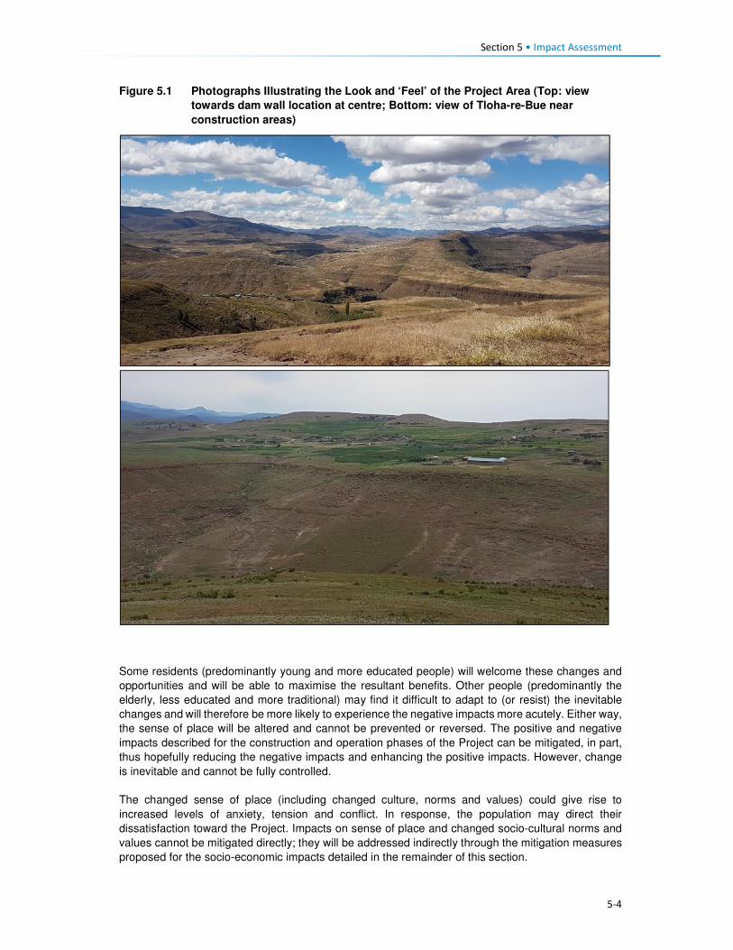
Section 5 • Impact Assessment
5-4
Figure 5.1 Photographs Illustrating the Look and ‘Feel’ of the Project Area (Top: view
towards dam wall location at centre; Bottom: view of Tloha-re-Bue near
construction areas)
Some residents (predominantly young and more educated people) will welcome these changes and
opportunities and will be able to maximise the resultant benefits. Other people (predominantly the
elderly, less educated and more traditional) may find it difficult to adapt to (or resist) the inevitable
changes and will therefore be more likely to experience the negative impacts more acutely. Either way,
the sense of place will be altered and cannot be prevented or reversed. The positive and negative
impacts described for the construction and operation phases of the Project can be mitigated, in part,
thus hopefully reducing the negative impacts and enhancing the positive impacts. However, change
is inevitable and cannot be fully controlled.
The changed sense of place (including changed culture, norms and values) could give rise to
increased levels of anxiety, tension and conflict. In response, the population may direct their
dissatisfaction toward the Project. Impacts on sense of place and changed socio-cultural norms and
values cannot be mitigated directly; they will be addressed indirectly through the mitigation measures
proposed for the socio-economic impacts detailed in the remainder of this section.

Section 5 • Impact Assessment
5-5
5.2.4 Local Economy
As described in Section 4.4, the population is currently relatively isolated with limited economic
opportunities beyond subsistence based agriculture. They have expressed high expectations for
employment and business opportunities associated with the Project, and they anticipate that these
opportunities will in turn bring about improvements in their standard of living. Comments raised during
stakeholder engagement are documented in Annexure K, Volume 3 (Sechaba & ERM, 2017). Many
opportunities will be created via direct, indirect and induced employment, procurement, and through
local business development opportunities to meet the increasing demand for goods and services by
Project workers and work-seekers. The majority of these opportunities will be available during the
construction phase and will decrease significantly during the operational phase. It is unlikely that the
high expectations for an improved standard of living will be realised. The anticipated impacts on the
local economy are discussed in Sections 5.3.5; 5.3.6; and 5.3.7.
5.2.5 Project Land Acquisition
In order to implement the Project, an estimated 5600 ha of land will need to be permanently acquired
from the Mokhotlong District’s total land area of 4 075km2 (~407 500 ha). The land acquired will equate
to approximately 1% of the total District area. The land take will affect four Community Councils which
the Project footprint will straddle, namely Seatle, Bokong, Malingoaneng, and Mphokojoane
Community Councils, and one Urban Council (Mokhotlong). The loss of land will occur mainly within
the catchment area indicated by the red line in Figure 5.2.
Figure 5.2 Project Catchment Area
The acquisition of land for the Project will result in both physical and economic displacement of people,
and households. The main Project components that will result in displacement of households are the
site establishment area, dam and tunnel works areas, as well as the inundation area. The land
acquisition will occur in three phases (over a five-year period). These phases are as follows:
Phase 1. Temporary and permanent acquisition in the site establishment area for the Advance
Infrastructure. These activities will affect villages of Masakong and Ha Tlhakola villages, as well as

Section 5 • Impact Assessment
5-6
households from Ramonakalali, Mabunyaneng, Makalong and Tsekong. Masakong and Ha Tlhakola
will be affected by physical and economic displacement and the remainder by economic displacement
(Figure 5.2).
Phase 2. Permanent land acquisition in the inundation area around Tloha-re-Bue and the remainder
of the site establishment area (for instance the Tunnel Works Area, Substation, but also the PNEAR-
not part of this ESIA). Tloha-re-Bue is partly affected by physical and economic displacement.
Phase 3. The remainder of the inundation area, covering several villages including Ha Jobere, Koung
Ha Phohla, Tsekong and Litsotsong, and Ha Sikantsi are all affected to varying degrees by physical
and economic displacement; and all economic displacement (loss of fields, trees and thickets within
the inundation area) affecting households in surrounding villages, which are not physically affected.
The land that will be affected is currently used for grazing, collection of natural resources, cultivation
of crops, and settlements as depicted in Table 5.1; with land used for grazing being most affected and
the primary land use of the land. Figure 5.3 indicates villages that will experience physical and
economic displacement.
Table 5.1 Land use distribution within the Catchment Area
Land use (across the Catchment Area) Land area per use
Cultivated areas 13 176 ha (35%) Settlement areas 2280 ha (6%)
Grazing areas 19 365 ha (52%)
Mountainous areas 2687 ha (7%)
Source: P2W-6014-DFR-0007, 2017
Table 5.2 highlights all the villages and the approximate number of households per village likely to
be physically displaced by the Project. Figures provided in this table are estimated numbers based
on the Feasibility Study and current predictions. These still need to be verified by the resettlement
specialist team
Table 5.2 Estimate of Villages and Households to be Displaced
Classification Village name Households below reservoir demarcation line (DL)
Households dangerously located
Fully below Reservoir DL Map ref. 1 to 5
Ha Jobere 6 Unknown
Ha Tlhakola 18 Unknown
Lits'otsong 5 Unknown
Tsekong 28 Unknown
Ha Sekants’i 13 13
Partially below Reservoir DL Map ref. 6 to 8
Tloha-re-Bue 40 13
Koung Ha Phohla 32 36
Sekokong 3 5
Site establishment area Map ref. 9 & 10
Masakong 50 Unknown
Malingoaneng & Meeling
8 41
Potentially Dangerous Location (safety) Map ref. 11 to 16
Liphokong Unknown (7)
Ha Mpesi Unknown (4)
Koung Ha Thunyane Unknown (3)
Ha Meta /Ha Manka Unknown (3)
Makhalong Unknown (3)
Lilimala Unknown (6)
Potential Isolation Map ref. 17 & 18
Bokone & Morojeleng Unknown Unknown
Total 18 203 95 (+26 unbudgeted for) 121
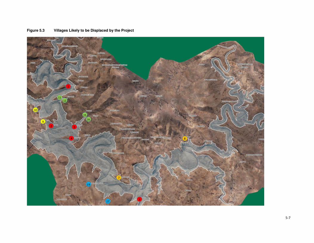
5-7
Figure 5.3 Villages Likely to be Displaced by the Project

Section 5 • Impact Assessment
5-8
To mitigate for the loss associated with the Project land acquisition, LHDA has appointed a
resettlement planning consultant, as well as developed two critical documents, namely Phase II
Compensation Policy, 26 August, 2016 and the Livelihood Restoration and Social Development
Framework (LR&SDF), August, 2017.
The Compensation Policy provides the guiding principles for compensation of all losses that will be
incurred by Project affected households and communities. The Policy was developed on the basis of
consultations with affected communities, their authorities and other key stakeholders. English and
Sesotho versions of the Policy were made available to affected communities via the local authority
structures (District Councils, Urban Councils, Community Councils and Chiefs) as well as through local
participation structures set up for Phase II. The Policy objectives are:
• To minimise involuntary land take by investigating all possible Project design alternatives;
• To ensure that affected people and communities, including host communities are meaningfully
consulted on Project designs, alternatives and impacts;
• To promote affected people’s participation in the planning, implementation and monitoring of
compensation, resettlement, mitigation and development measures;
• To ensure that relocation of households and businesses is undertaken in a participative,
systematic and beneficial manner, involving both displaced and host communities;
• To ensure that affected people are promptly, fairly and fully compensated for their losses; and
• To ensure that direct compensation is accompanied by additional measures where necessary to
help restore livelihoods.
The Policy makes the following provisions in terms of losses of houses, associated structures and
residential plots:
All structures requiring relocation will be compensated on the principles of replacement cost in the
form of replacement housing provided by the Project, direct construction by the owner (owner-builder
method), or lump sum cash compensation (which will be assessed on a case-by-case basis).
Provision for replacement housing will comply with the following criteria:
• Replacement houses will be constructed at Project-designated resettlement sites or sites within
the Project Area identified by households and approved by LHDA and local authorities.
• Replacement houses will have the same floor area as the current houses, with the exception of
houses that are less than 20 m2 – the house will be replaced with a 20 m2 structure.
• Replacement houses will be constructed with standard modern materials or traditional building
materials if requested by affected households.
• Replacement housing will adhere to the country’s building and sanitation standards as a minimum
requirement, with a twelve (12) month defects liability period.
• Households will participate in the design and layout of replacement houses and will be presented
with a number of final designs from which to choose.
• Each household will be provided with a toilet of at least ventilated improved pit latrine (VIP)
standard.
• An appropriate cooking and heating facility or traditional fireplace (where requested and feasible)
will be provided in the new house.
• Each new residential plot will be fenced, up to a maximum residential plot size of 1000 m2 and, if
a household has a larger fencing entitlement, the difference will be compensated as a lump sum.
Loss of agricultural fields will be compensated through one or a combination of replacement land,
lump sum or annual payments, and/ or annual grain payments. The provision of replacement land is
the preferred option.
LHDA has further developed a LR&SDF which aims to set the context for the restoration of the
livelihoods of households affected by Phase II, and to ensure the provision of opportunities for the
diversification and improvement of livelihood-earning activities. The main guiding principles for the
Framework are:

Section 5 • Impact Assessment
5-9
• Principle 1: Livelihood restoration and social development initiatives will be undertaken within a
framework that supports local, regional and national development.
• Principle 2: Livelihood restoration and social development initiatives will be informed by the views
of the affected communities.
• Principle 3: Partnerships will be established for the planning, implementation and handover of
livelihood restoration and social development initiatives to communities.
• Principle 4: Livelihood restoration measures and social development initiatives will be monitored
and evaluated in a controlled manner in partnership with the intended programme beneficiaries.
• Principle 5: The objectives of management of land, water and living resources are a matter of
societal choice involving all relevant sectors of society.
Compensation for fields will be made to the field holder and his/her legally verified heir(s) and
successor(s) by means of a lump sum payment or through an agreed number of instalments, up to a
maximum of 50 annual instalments, into a nominated account or through investment with an approved
financial institution. The form of payment will be considered on a case-by-case basis, taking account
of the economic status and means of the household, and the wishes and preferences of the spouse
and other household members. Lump sum payments will be discounted at the rate established under
the approved compensation rates.
Grain payments will be retained as a compensation option. Grain compensation will be directly
proportional to the area of land lost, and paid annually for a period of fifty (50) years. Compensation
payments for garden land may be made as a lump sum or on an annual basis (fifty (50) years),
according to the preference of the affected household, except where a household who had a food
garden relocates to an area of its own choice outside the Project area, in which case compensation
will be in the form of a lump sum. Lump sum payments will be discounted at the rate established
under the approved compensation rates.
Communal assets such as grazing land, brush, wood, medicinal plants, useful grasses and wild
vegetables will be compensated through the establishment of Compensation Funds which will be
setup at a Community Council level and will be managed by LHDA. Compensation Funds will be made
available for investment and implementation of community development projects agreed and
prioritised by the local Council and the affected households. As households will be allowed to resettle
outside of their Community Council areas, the Compensation Funds for loss of communal assets will
be dispensed between the affected local councils (including host councils) based on the number of
displaced households relocating within/ or to each area.
The Policy furthermore, defines households headed by orphans, by persons living with a disability or
by elderly, or indigent persons as vulnerable. The Policy indicates that vulnerable households will
receive individual attention from LHDA as well as the relevant government agencies. Where possible,
the assistance of certain NGOs will be requested at the expense of LHDA. As far as reasonably
possible, LHDA will ensure that vulnerable households are enabled to retain, and where possible,
improve upon the standard of living they had prior to being affected by the Project. Possible support
measures for vulnerable (although not limited to vulnerable) households could include skills training
opportunities as applicable; income-generating or alternative livelihood earning opportunities (subject
to detailed feasibility studies); and assistance to get access to available poverty alleviation or social
welfare programmes.
Loss of access routes will be compensated for through the construction of footbridges, upgrading of
certain roads. This study for this has been commissioned under Contract 6019.
Apart from temporary relocation to accelerated access to cultivation land will be facilitated through
temporary land acquisition which will become permanent acquisition as part of the resettlement
planning process for a particular area. The temporary relocation will be discussed with affected
households and suitable temporary relocation arrangements will be made to allow households to
continue their social lives and livelihood activities.

Section 5 • Impact Assessment
5-10
Additional impacts that are linked to the Project’s land requirements include the loss of access to
rangelands, and loss of graves. These impacts have been described, assessed and mitigated for in
the respective specialist studies. Refer to:
• Soils Specialist Study (ERS, 2017; P2W-6014-DFR-0007);
• Rangelands Specialist Study (Ramatla & Kheekhe, 2017; P2W-6014-DFR-0009);
• Cultural Heritage Specialist Study (MM&A, 2017; P2W-6014-DFR-0003); and
• Terrestrial Ecology Specialist Study (Ecorex & Kobisi; P2W-6014-DFR-0002).
5.3 Construction and Inundation Phase Impacts 5.3.1 Impact of Physical Displacement and Resettlement
5.3.1.1 Description of Impact
The IFC PS5 (2012) describes physical displacement as the relocation or loss of shelter and other
household structures, and/ or restrictions on land use. During the construction and inundation phases,
the Project will result in physical displacement and relocation of at least 203 households in 11 villages
below the reservoir FSL, and possibly an additional 108-134 households in 11 villages which are
dangerously located in relation to the reservoir and may need to be relocated (see Table 5.2). In
addition to the affected households, there will also be impacts to a range of community and social
infrastructure and services; including roads, water sources, schools, clinics, markets/ commercial
areas, small businesses, and even the prison located at the town of Mokhotlong.
As described in Section 5.2.5, during Phases 1 and 2, there will be permanent physical displacement
of households from Masakong and Ha Tlhakola (resulting from the Phase 1 advance works
programme), and of households in the inundation area around Tloha-re-Bue and the remainder of the
site establishment area during Phase 2. During Phase 3, there will be physical displacement of
households across the inundation area; covering several villages including Ha Jobere, Koung Ha
Phohla, Tsekong and Litsotsong, and Ha Sekants’i.
As part of Phase 1, the advance works programme requires temporary relocation of between 10 and
15 households from Masakong for ~3 years. This temporary relocation is to enable construction of the
access road to facilitate site establishment of the Eastern Facilities (e.g. Polihali Village, offices and
labour camps). During this time it is anticipated that these households will be temporarily housed in a
nearby location that does not pose any safety risks. Once road construction is complete and the area
is rehabilitated the households will be permanently relocated back to Masakong village. These
households will undergo two resettlement processes; while this will be extremely disruptive, the
intention is to avoid long-term displacement from their land/ village.
Table 5.2 and Figure 5.3 provide indicative figures and the location of households that are most likely
to require resettlement. It is evident that the largest physical losses will arise from inundation, as whole
villages will be affected and the greatest number of households. The exact numbers and locations of
households, infrastructure and services that will experience permanent and/or temporary physical
relocation are being refined as part of the RAP process.
5.3.1.2 Sensitivity of Receptors
The communities in the area are extremely poor and are geographically isolated, largely because of
poor road accessibility and limited telecommunication coverage. They are largely reliant on land-based
livelihoods and because of poor linkages with urban areas there is limited flow of money and goods.
There are vulnerable people in the local communities who, by virtue of their gender, age, physical or
mental disability, economic disadvantage or social status would be more adversely affected by the
Project, and who may be limited in their ability to take advantage of the Project’s development benefits
and deal with the negative consequences. Vulnerable people require special attention and

Section 5 • Impact Assessment
5-11
consultation, and include HIV/ AIDS affected people and households; people co-infected by HIV/AIDS
and tuberculosis (TB); child-headed households; people with mental health illnesses; people with
physical disabilities; sex workers; elderly; children and orphans, and herders. In line with the provisions
of the Land Act and the Phase II Compensation Policy, both owners (spouses) are required to sign
the asset verification and compensation offers, thus mitigating the patriarchal system in the area. A
Power of Attorney form will need to be completed if it is anticipated that one spouse will be unavailable
at the time of the asset verification and compensation offer.
Based on the above, households affected by physical displacement are considered to have High
sensitivity to this impact.
5.3.1.3 Assessment of Impact
The impact of physical displacement of households will be direct, negative and localised in nature.
The impact of physical displacement will be permanent. The magnitude of the unmitigated impact will
be Large given the high number of affected households, the extent of the disruption, and likely stress
to the affected families in the long-term - particularly until they are able to settle into new houses and
re-establish their livelihoods. Given the High sensitivity of these households, the overall significance
of this impact (pre-mitigation) is rated Critical.
The 10-15 households from Masakong that will be temporarily housed prior to permanent resettlement
will experience the most disruption over an extended period of time. They will experience this impact
most acutely.
Table 5.3 Impact of Physical Displacement of Households
Pre-Mitigation Impact Residual Impact
Type of Impact Direct negative
Magnitude Large Small-Medium
Sensitivity High High
Significance Critical* Moderate-Major
* The households from Masakong that will be resettled twice will be most acutely impacted.
** Note: The residual rating is based on a precautionary judgement that takes into account the disruption and stress caused to
affected households who have to relocate and the uncertainty as to how different households will respond to this. Households
will have differing residual rating depending on their final resettlement terms. Some households may respond positively while
others may adapt with difficulty. Based on the ESIA definitions, an impact of Moderate has an impact magnitude that is within
applicable standards, but falls somewhere in the range from a threshold below which the impact is minor, up to a level that
might be just short of breaching a legal limit, and requires that impacts are managed effectively and efficiently.
5.3.1.4 Mitigation Measures
In accordance with the mitigation hierarchy, the Project planning has aimed to minimise displacement
as far as possible, in the knowledge that resettlement is a highly significant social impact for affected
families (as well as delaying implementation of the Project and increasing costs).
Physical displacement requires a separate RAP (in accordance with international lender requirements
(e.g. ESS 5 / IFC PS5) that must take cognisance of the land-based livelihoods, social networks and
the wider community structures. Furthermore, many households are extremely poor and are therefore
more vulnerable to the impacts of displacement. Apart from replacing houses and compensating for
other assets affected by the Project in accordance with the agreed LHWP Phase II Compensation
Policy and rates schedule, affected households should be included in the development and
implementation of alternative livelihood strategies in accordance with the LHWP Phase II LR&SDF.
• LHDA will ensure that Resettlement Planning and Implementation (that forms part of a separate
contract (LHDA Contract No. 6015)) is compliant with all provisions of the LHWP Phase II
Compensation Policy and the agreed rates schedule.

Section 5 • Impact Assessment
5-12
Activities to be undertaken under the RAP include.
• Regular review and updating of the Phase II Community Participation Strategy developed by
LHDA that builds on the existing community structures established by LHDA in the form of ALCs
and is aligned with the requirements of the international lenders such as the World Bank.
• Asset registration of all community assets within the affected area in accordance with LHDA’s
Asset Registration Procedure (October 2017). Assets that will be recorded under the RAP include:
• Houses and associated structures – dwellings, toilets, storerooms, kraals, perimeter walls,
fencing and cattle posts;
• Other private physical assets – non-moveable assets such as residential land, agricultural
fields, gardens, trees, thickets and graves;
• Private enterprises such as shops and other business establishments; and
• Any public amenities and structures that may be affected, e.g. communal water point.
Asset registration shall include confirming proof of ownership of affected assets, and proof of
identity of affected owners.
• Socio-economic Census of affected persons, assets and other entities to establish an accurate
socio-economic profile that can be used as the basis for future monitoring.
• Compensation and Relocation planning by the appointed RAP consultant that shall include:
• Confirm eligibility of households requiring resettlement and the relocation options with the
affected households and local authorities, with a preference for identifying relocation options
on the same plot or village;
• Determine and record initial livelihood restoration preferences of affected households;
• Identify and confirm relocation sites; and undertake surveys of relocation sites where required;
• Assist LHDA with formal acquisition of the relocation sites;
• Undertake planning of relocation plots/sites, including land preparation requirements and any
required services/amenities and prepare physical layout plans for relocation plots/sites;
• Confirm house replacement preferences with affected households, and if appropriate cash
compensation;
• Prepare compensation and relocation plans with each affected household; and
• Prepare plans for relocation / compensation of affected graves.
• Prepare Resettlement Action Plans based on the information obtained during the previous listed
activities and include a costing for implementation and an implementation plan. The RAP must be
shared with communities at community meetings, and formally publicised.
• Mitigation for other community impacts Implement the recommendations/ measures that will
be proposed in the Bridges and Feeder Roads Master Plan and RAP to ensure that households
retain access to social services, community infrastructure and resources where the Project results
in severed access.
• Preparation of Tender Documents for implementation of the resettlement activities in
accordance with LHDA’s Procurement Policy and LHDA’s Anti-Corruption Policy.
• Resettlement Implementation (to be done by LHDA with support of the RAP consultant (under
LHDA Contract No. 6015)) which shall include:
• Signing of compensation agreements with affected communities;
• Payment of compensation (including facilitating opening of bank accounts for households);
and
• Implementation and management of the resettlement programme including preparation of
relocation sites; construction of replacement housing and amenities/services; physical

Section 5 • Impact Assessment
5-13
relocation of households and their belongings; and relocation of graves and other social
mitigation.
Additional aspects that shall be considered as part of the RAP contract include:
• The socio-economic census shall outline multiple providers of income and include a gender
analysis as a basis for facilitating different opportunities for employment of women;
• Criteria set for the socio-economic census for determining vulnerability of households shall ensure
that vulnerable groups (poor, elderly, ethnic minorities) are included;
• Compensation and other necessary assistance shall be provided before impacts of the Project
occur;
• Arrangements and resources for resettlement shall be adequate and assigned;
• The resettlement timetable shall be linked to the phasing of Project implementation;
• Physical and economic assistance to households will be provided during relocation;
• Households requiring relocation shall be properly briefed on the advantages and disadvantages
of different housing types to make informed decisions;
• Replacement housing structures shall be built to Lesotho’s building and safety standards;
• Grievance procedures shall be prepared and implemented; and
• A Monitoring and Evaluation Plan for resettlement shall be prepared and implemented, and mid-
term and long-term Monitoring and Evaluation audits conducted.
Masakong Households:
• The 10-15 households from Masakong that will be temporarily housed prior to permanent
resettlement will experience the most disruption over an extended period of time. These
households will experience this impact most acutely and should be treated as highly sensitive
households; and
• Where possible, temporary relocation should be avoided and a permanent site should be identified
upfront.
5.3.1.5 Residual Impact
Implementation of the RAP as stipulated under the mitigation measures above is predicted to reduce
the magnitude to Small-Medium; receptor sensitivity will remain High. Over time, as households adapt
to the new location, the residual impact significance should reduce to one of Moderate-Major
significance and possibly even lower in some cases. This is difficult to predict given that relocation
terms and details are still to be defined and agreed, these will differ by household and each household
will respond differently to the final relocation. As such, monitoring should extend for a suitable period
into operation in order to ensure that the quality of life of displaced persons is equal to or better than
prior to displacement.
5.3.2 Economic Displacement
5.3.2.1 Description of Impact
According to IFC PS5 (2012), economic displacement refers to the loss of assets or access to assets
that leads to loss of income sources or other means of livelihood. In this case, the construction and
operation of LHWP Phase II will result in the loss of access to agricultural land, grazing land, natural
resources, and access to markets.
During all phases of the RAP (Phases 1, 2 and 3), economic displacement will occur. During Phase
1, households in Masakong, Ha Tlhakola, Ramonakalali, Mabunyaneng, Makalong and Tsekong will
experience economic displacement. In Phase 2 the area around Tloha-re-Bue will be affected. Finally,
the remainder of the inundation (Phase 3) will result in economic losses to households from Ha Jobere,
Koung Ha Phohla, Tsekong, Litsotsong, Ha Sekants’I. Phase 3 will also lead to a loss of agricultural
fields, trees and thickets affecting households in a number of surrounding villages, which are not
physically affected. The RAP will identify the exact impacts, the individual households and customary
areas (and users) that will be affected.

Section 5 • Impact Assessment
5-14
Land users engaged in crop cultivation and livestock farming will experience economic displacement,
affecting their ability to produce food and cash crops/ produce. Given the shortage of arable land in
the area, it is expected that this loss of land will have a significant impact on food security, household
income and livelihoods for the affected families. This will be further aggravated for those who face
displacement relating to changing availability of other natural resources (e.g. medicinal and fuel
plants), indirectly impacting subsistence livelihoods and traditional household structures. To a lesser
extent, it is possible that construction disturbance may impact the potential for hunting wild animals,
although this is considered a marginal contribution to households. Economic displacement requires a
separate LRP (in accordance with international lender requirements).
This impact will be experienced directly as a result of a combination of: i) lost access to these land-
based livelihoods and resources from which the majority of the population in the Project Area derive
an income; ii) increased competition for land by displaced people and migrants moving into the area
(e.g. work-seekers); iii) lack of alternatives; and iv) increased time and cost due to extended traveling
distances to and from areas where resources are still available.
The main economic activities that will be affected by the Project are discussed below.
Loss of Access to Agricultural Land
Local livelihoods of the Project affected area are heavily dependent on crop production for household
subsistence and survival. Crops are grown for multiple purposes, primarily household consumption
(average 75%) followed by sale, bartering, and payment to others for services rendered. Some
households in the area do not engage in crop production. However, it is likely that a member of these
households is involved in agriculture as a worker or via a sharecropping arrangement.
Between 1000 and 1500 ha of land currently under cultivation will be lost to the Project. This loss
accounts for approximately 11% of the total land area (as at 2017) under cultivation across the Project
Area (Ecorex and Kobisi, 2017). Most of the productive agricultural land is located in the area that will
be inundated by the Reservoir. The exact number of fields to be affected and the number of
households to be affected by the loss of agricultural fields is currently unknown and this will be
confirmed and assessed as part of the RAP. Given the existing shortage of arable land within the
Project Area, there is a high likelihood that affected people may not be provided with like-for-like
replacement land for the loss of fields.
Loss of Access to Grazing Land
Livestock production is also an important livelihood source for local households. During the 2013/2014
agricultural year, Mokhotlong District had an estimated 40,932 head of cattle and approximately
300,000 sheep and goats (Section 4.4.4). As such, access to, and availability of, grazing land is
essential. Livestock grazing occurs across the Project Area and beyond; however, the majority of the
grazing that will be affected is of poor quality, reportedly due to overgrazing and a lack of adequate
management, exacerbated by the recent period (3-4 years) of low rainfall.
The Project will result in a loss of access to grazing areas, specifically resulting from inundation. All
directly affected grazing will be permanently lost and affected people will be expected to find alternate
grazing, thus placing an additional strain on existing grazing resources beyond the Project footprint.
Furthermore, FGD respondents indicated that local people are not willing to reduce their livestock
numbers, due to the income generated from the production of mohair, wool, and other produce.
Note, the impact of dam inundation on rangelands and soil and land use capability has been separately
assessed by the rangeland and soil specialists, respectively in Ramatla & Kheekhe (2017) and ERS
(2017), which include additional mitigation measures to improve land use capability.
Loss of Access to Natural Resources
Natural resources are collected by all households living in the area. These are used for household
consumption (57%), medicinal purposes (31%) and other uses (12%) (see Section 4.6). These
resources are collected across various locations within the broader Project Area including riverbanks,
grazing areas, and mountainous areas. The most important natural resources in the Project Area

Section 5 • Impact Assessment
5-15
include wood, brush, water, sand, wild plants and fruits, and medicinal plants used to cure various
illnesses for both humans and livestock. Some of these wild vegetables and medicinal plants only
grow along the riverine areas. Wood and brush are collected and used as sources of fuel for cooking
and heating in the households. Wild plants and fruit are collected for household consumption and sale
in order to supplement household food reserves and income. Sand is collected from the riverbeds of
the Khubelu and Senqu rivers for building material with the permission of the community councillors.
Project activities which will impact access to natural resources include:
• Vegetation clearance during construction;
• Establishment of temporary and permanent infrastructure;
• Inundation of the dam;
• Establishment of new settlements, grazing and agricultural fields; and
• Increased population due to in-migration of work and business-seekers.
The loss of access to natural resources may be exacerbated by the generally degraded vegetation in
the Project Area and increased competition for the remaining natural resources by both local people
and in-migrants. While this impact is related to other forms of economic displacement described
above, notably loss of arable and grazing land, this impact is assessed separately in Section 5.3.3
(site clearance for construction) and Section 5.3.4 (inundation).
5.3.2.2 Sensitivity of Receptors
As indicated in Section 5.3 the communities are extremely poor and highly reliant on a land-based
resource economy for their livelihoods; are geographically isolated and have little alternative sources
of income. The affected families are classed as having High sensitivity to economic displacement from
land take requirements for the Project. The receptors that will be most sensitive to the impact include
the direct owners of affected agricultural fields, livestock owners, those that practise sharecropping,
agricultural labourers. Users of natural resources will also be sensitive to the loss of resources;
however, many of these resources will be available elsewhere, albeit slightly further away.
5.3.2.3 Assessment of Impact
The impact of economic displacement will be direct and negative in nature. The impact will be localised
and experienced by the Project affected people who will lose access to agricultural land (cultivated
and grazing), and natural resources. Economic displacement impacts will occur during the various
construction and inundation phases; they will be permanent. The impact magnitude will be Large
owing to the significant reliance of the affected people on these livelihood activities, lack of skills and
experience to undertake alternate employment, and a lack of alternate work opportunities. The Large
magnitude and High sensitivity of the affected households will result in a Critical pre-mitigation
significance rating.
Table 5.4 Impact of Economic Displacement
Pre-Mitigation Impact Residual Impact
Type of Impact Direct negative
Magnitude Large Medium
Sensitivity High High
Significance Critical Major*
* It is difficult to assess the residual rating given that the details of compensation are not know and the ability to replace
livelihoods is dependent on many variable factors, including the willingness/ interest/ ability of the affected people to adopt new
livelihood strategies.
5.3.2.4 Mitigation Measures
As described in Section 5.2.5, LHDA has appointed Resettlement Specialists to develop a RAP and
LRP (LHDA Contract No. 6015). The RAP and all livelihood restoration and social development
interventions will be designed and implemented in compliance with all provisions of the LR&SDF,
LHDA’s Phase II Compensation Policy and the agreed rates schedule. These documents are aligned
with national requirements and international best practice guidelines. Unavoidable acquisition of

Section 5 • Impact Assessment
5-16
arable land, loss of grazing land and natural resources will be compensated in accordance with the
LHDA Phase II Compensation Policy and schedule of rates.
As part of the asset registration process for the RAP (LHDA Contract No. 6015) (outlined in Section
5.2.5), the following information needs to be collected prior to Project construction in order to verify
the extent of land acquisition and compensation required:
• Size of arable land units, and improvements to land;
• Common property resources such as rangeland and thickets/ woodlots; and
• Number of families and persons directly or indirectly affected by land acquisition through loss of
livelihood and/ or loss of agricultural opportunity, including sharecroppers.
LHDA will seek to ensure:
• The RAP contract is implemented effectively to ensure Project affected people are not left worse-
off following displacement;
• Allocation of replacement land is prioritised over lump sum cash payments;
• The socio-economic census conducted under the RAP is used to identify affected persons,
especially vulnerable persons, and is used to inform targeted livelihood restoration for those most
impacted by the Project;
• Displaced persons should be meaningfully consulted on decisions that affect their livelihoods and
well-being and shall be fully informed of their options and the compensation rates;
• Consultation and information disclosure is aligned to the Community Participation Strategy and
the requirements of the international safeguards;
• Assistance is provided to affected people to improve, or at least restore, incomes and living
standards to at least the equivalent level prior to construction, if not better;
• Compensation and other necessary assistance are provided before impacts occur (e.g.
compensation is paid prior to construction);
• Community compensation of grazing land should be provided where land-take may impact long
term grazing productivity (i.e. where reinstatement is unlikely to restore original land use);
• The LR&SDF is implemented and includes the affected communities and households and should
be developed to enhance future income earning and employment opportunities. Livelihood
restoration planning is initiated early;
• Organisational roles and the capacity to support livelihoods restoration are defined and
appropriate;
• A Monitoring and Evaluation Plan for livelihoods restoration is prepared and implemented, and a
mid-term and long-term Monitoring and Evaluation audit is conducted.
• Grievance mechanisms are developed and accessible, and grievances are tracked and
monitored, and a concerted effort is made to close out grievances timeously; and
• LHDA will collaborate with relevant authorities and organisations to initiate and develop projects
that aim to enhance agricultural production amongst the population of the Project Area. These
should address the application of more effective farming methods, approaches to increase crop
yields, and mechanisms to assist farmers in selling their produce at the highest possible prices.
Other Measures:
• Measures outlined by the soils, rangelands and terrestrial ecology specialists (ERS, 2017;
Ramatla & Kheekhe, 2017; and Ecorex & Kobisi, 2017, respectively) will also contribute to the
mitigation of the impacts related to economic displacement; and
• LHDA is developing an ICM Plan, which will aim to manage resources and land use within the
local catchment in order to ensure the sustainability of the Project into the long-term. The plan will
need to incorporate social considerations and obtain the buy-in of the affected communities in
order for any projects coming out of the ICM Plan to be successfully implemented.

Section 5 • Impact Assessment
5-17
5.3.2.5 Residual Impact
Implementation of the measures described above is predicted to result in a reduction of the magnitude
of the impact to Medium and therefore the impact significance could be reduced from Critical to Major.
The impact could further reduce over time once the affected households have adapted to the changes
that will be brought on by the Project and the various livelihood restoration projects are underway. It
is difficult to assess the residual rating given that the details of compensation are not known and the
ability to replace livelihoods is dependent on many variable factors, including the willingness/ interest/
ability of the affected people to adopt new livelihood strategies.
At present (as of March 2018), LHDA is implementing pilot projects for various livelihood/ social
development programmes including a vegetable tunnel, village chicken farming, bee farming, etc.
Once these have been refined, and the successful programmes implemented at a large scale, they
will have the potential to reduce the residual impact further.
5.3.3 Impact of Site Clearance on Plants Used by Communities
5.3.3.1 Description of Impact
This impact will involve the clearance of vegetation and topsoil in the infrastructure footprint over an
area of approximately 121 ha on the east side of the future Polihali Reservoir. Vegetation will also be
cleared for the dams, tunnel, major bridges and A1 realignment (a further 17 ha). This will be a direct
impact that will result in a loss of plant resources utilised by surrounding communities from villages
such as Masakong, Tloha-re-Bue and Polihali/ Ha Ramonakalali.
5.3.3.2 Sensitivity of Receptors
Most of the plant species utilised by local communities for food, medicinal or spiritual purposes are
located within the widespread Rocky Outcrop / Grassland Mosaic that is prevalent throughout the
Project Area. While this vegetation mosaic has been heavily overgrazed within the development
footprint and has moderate to low biodiversity value, a number of useful plant species were identified
within the general vicinity of the infrastructure footprints. These included widespread species used for
medicinal purposes, such as Dicoma anomala, Asclepias gibba, Cheilanthes eckloniana, Haemanthus
humilis and Gazania krebsiana, species used for firewood such as Diospyros austro-africana, Euryops
tysonii and Searsia divaricata, and species with important spiritual uses such as Gladiolus saundersii,
Helichrysum splendidum and Polygala hottentota. Given the high reliance of local communities on a
wide range of useful plants, although they appear to be widespread and fairly common within the
Project Area, their sensitivity to site clearance is assigned as Medium.
5.3.3.3 Assessment of Impact
The impact of site clearance on important plant resources will be long term to permanent and will have
a high intensity. However, the extent of the impact will be relatively small (limited to the impact
footprint), and the vegetation type is ecologically degraded, resulting in an impact magnitude of
Medium. Prior to the implementation of any mitigation measures, the significance of this impact on
important plant resources will be Moderate.
Table 5.5 Impact of Site Clearance on Plants used by Surrounding Communities
Grassland Rocky Ridges & Cliffs
Pre-Mitigation Impact Residual Impact Pre-Mitigation Impact Residual Impact
Type of Impact Direct negative Direct negative
Magnitude Medium Small Medium Small
Sensitivity Medium Medium Medium Medium
Significance Moderate Minor Moderate Minor

Section 5 • Impact Assessment
5-18
5.3.3.4 Mitigation Measures
The following measures are recommended as mitigation for the impact of site clearance on important
plant resources:
• Local traditional medicine practitioners and members of local communities should be allowed and
encouraged to harvest plant resources within the infrastructure footprint prior to site clearance;
• Local communities should be supported to start plant nurseries/ community gardens to propagate
and grow useful plant resources; and
• Plants rescued by the contractors should be planted in a nursey for use in landscaping of the
Polihali Village.
5.3.3.5 Residual Impact
Implementation of the measures described above and in the Construction EMP (Volume 2, Annexure
L.1) will reduce the magnitude of the impact to Small and the impact significance to Minor.
5.3.4 Impact of Reservoir Inundation on Plant Resources Used by Communities
Note: this impact has been incorporated into this SIA from the Terrestrial Ecology Specialist Report
(Ecorext & Kobisi; 2017).
5.3.4.1 Description of Impact
The inundation of the Polihali Reservoir will result in the flooding of approximately 5600 ha of habitat.
This will be a direct impact that will result in a loss of grassland, rocky outcrop and seep habitats
containing important plant resources that are utilised by surrounding communities. In addition,
inundation will flood several villages, several of which are expected to have spiral aloes planted around
homesteads.
5.3.4.2 Sensitivity of Receptors
Most of the plant species utilised by surrounding communities are located within the widespread Rocky
Outcrop/ Grassland Mosaic that is the dominant vegetation type within the inundation zone. This
vegetation mosaic has been heavily overgrazed and has moderate to low biodiversity. These include
widespread species used for medicinal and other purposes, such as Dicoma anomala, Asclepias
gibba, Cheilanthes eckloniana, Haemanthus humilis and Gazania krebsiana, species used for
firewood such as Diospyros austro-africana, Euryops tysonii and Searsia divaricata, and species with
important spiritual uses such as Gladiolus saundersii, Helichrysum splendidum and Polygala
hottentota. In addition, inundation will flood several villages which include individuals of Spiral Aloe
(Aloe polyphylla) – assessed as Critically Endangered in the wild - that are frequently planted outside
homesteads for cultural/spiritual and aesthetic purposes. Given the status of Spiral Aloes, their
sensitivity to inundation is considered to be High.
Due to the presence of culturally important plant species, the grassland and rocky habitats are
considered of Medium sensitivity.
5.3.4.3 Assessment of Impact
The impact of inundation on important plant resources will be permanent and of high intensity, and the
extent of the impact is large due to the size of the reservoir (5600 ha). Although the majority of the
species used appear to be reasonably common and widespread in the wild, community members are
highly dependent on plant species for food, fuel and medicinal uses. The presence of the reservoir
will require community members to travel further to collect such useful plants. Flooding of planted
spiral aloes located around homesteads in inundated villages will have direct impacts on this species
and may lead to an increase in harvesting of specimens in wild colonies to replace those flooded.
The number of spiral aloes that may be affected has not been quantified but several were seen in
villages that will be affected by flooding, such as Tloha-re-Bue. The impact magnitude is assessed as

Section 5 • Impact Assessment
5-19
Medium for useful plants in grassland and rocky habitats and Medium for spiral aloes inundated in
villages (subject to quantification).
The pre-mitigation significance of the inundation impact on useful plant resources is assessed as
Moderate for widespread species and Major for spiral aloes planted in villages. The significance of
this impact may be of lower significance if few aloes are located in villages to be flooded but is
evaluated higher on a precautionary basis until further quantification is done.
Table 5.6 Impact of Reservoir Inundation on Important Plant Resources
Grasslands including
seeps Rocky Ridges & Cliffs Spiral aloes (in villages)
Pre-
Mitigation
Impact
Residual
Impact
Pre-
Mitigation
Impact
Residual
Impact
Pre-
Mitigation
Impact
Residual
Impact
Type of Impact Direct negative Direct negative Direct negative
Magnitude Medium Small Medium Small Medium* Negligible
Sensitivity Medium Medium Medium Medium High High
Significance Moderate Minor Moderate Minor Major* Negligible
* Pending confirmation through census of spiral aloes.
5.3.4.4 Mitigation Measures
Mitigation measures for the impact of inundation on important plant resources include:
• Populations of plants considered to be important to local communities should be identified within
the inundation zone through discussions with traditional medicinal practitioners, followed by field
surveys to locate these populations;
• Local traditional medicine practitioners should be encouraged to harvest plant resources from
these key sites prior to inundation and support (and resources) provided to establish medicinal
plant nurseries around the reservoir;
• Local communities should be given support to harvest and stockpile firewood and other plant
resources from the entire inundation zone prior to inundation; and
• A census of spiral aloes located in villages that will be inundated should be undertaken to quantify
the number of aloes that will be affected. Homesteads that will be relocated should be supported
to translocate their spiral aloes to new resettlement areas as part of the RAP. Any spiral aloes
that homestead owners do not wish to relocate should be relocated to the Polihali Village for use
in landscaping and/ or transferred to a community garden.
5.3.4.5 Residual Impact
Implementation of the measures outlined above and in the EMP (Volume 2, Annexure L.1) should
reduce the magnitude of the impact on widespread useful plants in grasslands and rocky ridges/
cliffs to Small resulting in a reduction of impact significance to Minor.
Should all the Spiral Aloes be removed by their owners or moved by the LHDA should the owners
choose not to relocate them, the magnitude of the impact will be Negligible and the impact
significance to Negligible.

Section 5 • Impact Assessment
5-20
5.3.5 Creation of Employment Opportunities
5.3.5.1 Description of Impact
Employment (formal and informal) and other income generation opportunities in the Project Area and
District are scarce, specifically for those with no or low levels of education. The majority of the local
population are involved in subsistence agricultural activities (i.e. crop and livestock production) as their
primary livelihood strategy. Formal employment opportunities in the District are largely associated with
government services (e.g. district officials, police, teachers and medical personnel) and the tourism
industry; these require educated people. The majority of formal employment occurs in the larger towns.
There are some small enterprises providing basic services throughout the Project Area, these include
selling fresh and processed foods, basic groceries, alcohol, etc. These businesses are predominantly
located along the roads or clustered in larger settlements.
Levels of education across the Project Area are low, many learners drop out of school in order to assist
with family responsibilities and household tasks, these activities are usually linked to agriculture and
household chores. The population, especially the youth, lack work experience and skills; many of the
elderly people have worked in other parts of the country or in the mining sector in South Africa. The
main skills found in the area are elementary in nature and associated with agriculture. In FDGs,
respondents confirmed that some people in the Project Area have skills but lack formal qualifications
or certificates.
Based on feedback received during the stakeholder engagement activities (January to March 2017),
the population (specifically the youth) have particularly high expectations that the Project will afford
them the opportunity of waged employment. In addition, there is enthusiasm, as well as a sense of
entitlement to Project employment opportunities, justified by the direct negative impacts that they are
likely to experience. Tension (and potentially violence) could arise between local residents and work-
seekers who are competing for the same employment opportunities especially as migrant work-
seekers may have more work experience.
The contractors for the different construction components have not yet been appointed. They will be
appointed through a rigorous tender process that will be open for bidding by any company. As such,
the origin of the company and its workers is not yet known; the exact number of workers will depend
on the approach to construction proposed by the contractors. It is, however, anticipated that the
number of employment opportunities will peak between 3500 and 4000 people; the split between
skilled, semi-skilled and unskilled jobs is also unknown at present. Many of the construction tasks are
highly technical in nature and are likely to require specialised skills and expertise. It is expected that
the majority of skilled workers are likely to be part of the contractors’ permanent team of staff or may
be subcontracted for specific tasks from other firms.
The appointed contractors will be required to operate in accordance with LHDA’s Labour Recruitment
Guidelines. Employment of unskilled labour will be reserved for Lesotho nationals and priority will be
given to people from the Project Area. In an attempt to maximise employment (and the associated
benefits), the guideline requires that all employees should receive proper training and skills
development, employment contracts for a minimum of one month to one year or more depending on
the nature of the work, thus allowing the rotation of labour where more people will benefit. Short-term
or ‘casual’ labour will be for less than one month in duration. Local labour will be coordinated and hired
via an independently established PLRD (proposed to be located at Tlokoeng near Mokhotlong with a
satellite office at Ha Lejone) where work-seekers can register, and which will work closely with the
already established ALCs. The Guidelines specify that employment opportunities for both men and
women should be optimised, and that discrimination of any kind will not be permitted. Transparency
and fairness are core principles of the guideline.
For all other levels of employment (excluding unskilled), LHDA have stipulated that Lesotho nationals
are to be prioritised. Where it can be demonstrated that local personnel are not available, the
opportunities can be extended to South African nationals, Southern African Development Community
(SADC) member states, and finally worldwide.

Section 5 • Impact Assessment
5-21
Appropriate training and capacity building opportunities will be provided to all workers. Opportunities
for rehiring into more skilled positions will be considered and applied.
In addition to direct employment opportunities, many indirect and induced employment opportunities
will be created within the supply chain (indirect), and to meet the needs of the migrant work-seekers
and the Project workers who will have increased levels of disposable income.
5.3.5.2 Sensitivity of Receptors
The sensitivity of the communities in the Project Area is considered Medium given that, due to low
levels of education and a lack of suitable experience, the majority of local people are unlikely to qualify
for any positons other than unskilled labour. In addition, the communities have exceedingly high
expectations of the potential changes these short-term opportunities will provide in terms of improving
the standard of living. It is possible that some people may choose to leave casual agricultural work in
anticipation of being employed by the Project. Competition amongst residents of the area will be high,
as well as between residents and migrant work-seekers.
5.3.5.3 Assessment of Impact
Employment will be experienced as a direct, indirect and induced positive impact as it relates to the
Project, the associated supply chain, and the increased size of the population. The extent of the impact
as it relates to the construction phase will be both local, national, as well as international (specifically
SADC). The impact will be short-term with respect to the rotational basis of employment (12 to 18
months) but will provide the workers with skills/ experience for the long-term.
The magnitude of the impact as it relates to all employment opportunities is expected to be Medium
for local people who will be able to secure jobs with the Project. Therefore, the significance of the
impact in all phases is rated as Moderate.
Table 5.7 Impact of Related to Creation of Employment Opportunities
Pre-Mitigation Impact Residual Impact
Type of Impact Direct, indirect and induced; positive
Magnitude Medium Large
Sensitivity Medium Medium
Significance Moderate Major
5.3.5.4 Enhancement Measures
LHDA have developed the Phase II Labour Recruitment Guidelines in order to guide the recruitment
and management of labour. The intention of the Guidelines are to:
• Provide a recruitment mechanism that will ensure that labour requirements are met in an efficient
and timely manner;
• Optimise employment opportunities for both men and women;
• Promote fairness and transparency during recruitment processes;
• Ensure that the recruitment of labour is properly recorded, managed and that a good database is
kept;
• Promote coordination and cooperation between LHDA FOBs, contractors and local authorities
during the recruitment of labour; and
• Minimise labour disputes, and social, health and environmental impacts caused by people
migrating to the Project Area and construction sites, in search of employment opportunities.
• As per LHDA’s Labour Recruitment Guidelines, all appointed contractors and others recruiting
unskilled labour will ensure that:
• Local people are prioritised for unskilled labour - at least 80% of the unskilled workforce is hired
from villages located within the affected community councils;
• There is no discrimination in recruitment, the workforce should comprise men, women, disabled
and people from different religious/ cultural backgrounds;

Section 5 • Impact Assessment
5-22
• Approved channels should be used for recruitment;
• A grievance mechanism should be easily available to all workers and offer anonymity. Lesotho
nationals are to be given preference for semi-skilled and skilled positions. If it can be demonstrated
that people with suitable skills and experience are not available, then South Africans, people from
SADC member states and other foreigners can be employed; in that order;
• A training and skills development plan will be implemented to ensure that maximum skills
enhancement opportunities are offered to workers at all levels; and
• Prior to the end of each contract, the worker will be assessed and considered for reappointment
into more skilled positions based on demonstrated skills, willingness and experience.
The recruitment process is to draw on the following key players:
• PLRD - A Consultant will be appointed to establish a recruitment desk away from the construction
sites to facilitate the recruitment of unskilled labour at various strategic locations. PLRD will create
a database which can be used to list unskilled labour applications in collaboration with ALCs,
where they exist, area chiefs and councillors where community participation structures do not
exist, National Employment Services and district labour offices;
• ALCs and CLC - ALCs and CLC will be expected to co-ordinate their activities including
registration and recruitment of unskilled labour activities ALCs will facilitate the recruitment of
unskilled labour from the communities; and
• National Employment Services - LHDA will engage the services of the Ministry of Labour and
Employment working together with District Labour Offices to register unskilled work-seekers from
other parts of Lesotho along the same principles as described above and to submit these on a
regular basis to PLRD.
In addition to implementation of the measures outlined in the Labour Recruitment Guidelines, the
following measures are also to be implemented.
• LHDA and appointed contractors will adhere to the provisions of the Lesotho Labour Code Order,
1992 in matters relating to employee management;
• All appointed contractors will adhere to the ILO’s eight conventions related to the principles and
rights at work which Lesotho has ratified, namely:
• Freedom of Association and Protection of the Right to Organise Convention, 1948 (No. 87);
• Right to Organise and Collective Bargaining Convention, 1949 (No. 98);
• Forced Labour Convention, 1930 (No. 29);
• Abolition of Forced Labour Convention, 1957 (No. 105);
• Minimum Age Convention, 1973 (No. 138);
• Worst Forms of Child Labour Convention, 1999 (No. 182);
• Equal Remuneration Convention, 1951 (No. 100); and
• Discrimination (Employment and Occupation) Convention, 1958 (No. 111).
• LHDA is to implement a grievance resolution procedure that is easily accessible, culturally
appropriate and scaled to the potential risks and impacts of the Project. A grievance register must
be accessible to all local residents and other stakeholders in the Project Area. It should be
compliant with international lender requirements (such as World Bank ESS10); easy to use, offer
anonymity, and enable follow-up. Key steps of the grievance procedure include:
• Circulation of contact details of the assigned ‘grievance officer’ or other key contacts;
• Awareness raising among stakeholders regarding the grievance procedure and how it works;
and
• Establishment of a centralised electronic grievance register into which all grievances raised
with the contractor’s CLOs; LHDA Community Project Officers; ALCs and the PLRD will be
updated regularly, including all escalation actions, responses and response times.

Section 5 • Impact Assessment
5-23
5.3.5.5 Residual Impact
Implementation of the above-mentioned enhancement measures will increase the magnitude of the
impact from Medium to Large resulting in a residual impact of Major positive significance for the
population of the local area.
5.3.6 Procurement and Local Business Opportunities
5.3.6.1 Description of Impact
The Project Area has limited established businesses, the majority of local businesses are micro- and
small-scale enterprises that deliver goods and services required by the local population. These
businesses are further constrained by the small markets with little to no disposable income/ cash,
limited access to external markets due to poor road access, and unreliable or no telecommunications.
The levels of services vary across the Project area. The most established towns with the most diverse
business and service offerings are Mokhotlong and Mapholaneng. The businesses in these locations
predominantly sell agricultural equipment and inputs, consumables and clothing, which is in line with
the needs/ demands of these rural communities. Spaza shops and taverns are found in some villages
across the Project Area.
Procurement of Goods and Services
Project procurement requirements will include the purchase of goods, materials, equipment and
services, including hydrocarbons and consumables. All Project-related procurement will need to meet
stringent international standards for quality, health and safety. At public gatherings, community
members acknowledged that the local suppliers are unlikely to be able to service the technical and
large-scale requirements of the Project, given their limited ability to meet the prescribed quality and
safety requirements.
The Project is estimated to cost an estimated M29 billion over the next five years. The proportion of
local spend in Lesotho (at local, district or national levels) relative to that likely to be procured from
South Africa will be determined by the tenderers based on availability of supplies in Lesotho.
Tenderers will need to comply with LHDAs Procurement Policy and the contractor Procurement
Framework which have as their main objectives the requirement to minimise the use of imported
goods; and to maximise procurement opportunities for Lesotho and South African suppliers.
An indicative summary of the likely distribution of anticipated procurement spend is summarised in
Table 5.8. It is expected that a large proportion of the total Project budget will be spent to procure
goods and services and pay the wage bill.
Table 5.8 Indicative Procurement Spend
Ho
sp
itality
, in
cl.
cle
an
ing
Secu
rity
Fu
el
Tra
nsp
ort
ati
on
Su
nd
ries
Skil
led
Lab
ou
r
Sem
i-skille
d
Lab
ou
r
Un
skille
d
Lab
ou
r
Co
ntr
acti
ng
S
erv
ice
s
Eq
uip
men
t
Co
nstr
ucti
on
M
ate
rials
Exp
losiv
es
Community Council X X X X
District X X X X X
National X X X X X X X X X
South Africa X X X X X X X X
International (ex SA) X X X X
Throughout the pre-feasibility and feasibility phases, the local hospitality and service industry in
Mokhotlong town and throughout the broader Project Area have already experienced a significant
Section 5 • Impact Assessment
5-24
increase in demand for accommodation and subsistence. Local Bed and Breakfast (B&B) facilities,
private households offering room rentals, food suppliers, and providers of basic consumables and care
items have responded to the demands for goods and services, thus already benefitting and generating
income.
To address issues related to procurement tenders/ processes and to encourage local suppliers to
partake in bidding for Project-related contracts, LHDA embarked on a roadshow titled “Phase II
Progress Update Construction Packages and Indicative Timelines”. The purpose of these workshops
was to:
• Inform potential suppliers and contractors of the Project and the associated opportunities;
• Encourage interested suppliers and contractors to bid for Project contracts;
• Provide suppliers and contractors with the procurement standards and guidelines; and
• Provide prospective suppliers/contractors with highlights of the challenges and lessons learnt by
LHDA in the procurement and administration of Phase I contracts, with the hope of avoiding some
of these problems in subsequent LHDA contracts.
The road shows were facilitated in South Africa (Durban and Johannesburg) and Lesotho (Maseru,
Mohale, and Mokhotlong).
The construction phase, from commencement of advance infrastructure through to tunnel completion
is approximately eight years. During this time, a number of contracts will be awarded for the various
components comprising Phase II, ranging from contracts aimed at MSMEs through to international
construction companies.
Local Enterprise Development
The Project Area is currently relatively isolated and there are not many people living there with
disposable income. People largely support themselves based on a range of subsistence-based
livelihood activities including crop and livestock farming, and harvesting of natural resources. Some
households, although unquantified, obtain some cash income from remittances sent by family
members who work on the mines in South Africa or Lesotho, although this may be decreasing with
the economic downturn in industry and mining, and ongoing retrenchments. With the influx of
construction companies and their workers, and the likely influx of work-seekers, there will be a new
market for people to sell their goods to. People across the Project Area indicated that they would sell
fresh produce or prepare food and beer to sell along the roads or at small ‘restaurants’ and ‘bars’.
In addition, there will be a demand for housing for migrants to the area. Many people have recognised
this as an opportunity to build new residential structures or to add rooms onto their homes which could
be rented out as a source of additional income.
Other, less ‘acceptable’ but highly likely income earning activities may become more prevalent, such
as prostitution and selling of marijuana. Prostitution is typically associated with projects of this nature
that are located in isolated areas where workers stay far away from their home towns and families.
Marijuana is grown, harvested and sold in areas close by and this activity may expand due to increased
demand, improved ease of transport, and new opportunities to sell to newcomers. This, however, will
depend on the level of police enforcement that may increase across the Project Area. The recreational
use of illegal substances by workers could generate health and safety risks on the Project site,
potentially posing risks to other workers, residents and construction equipment / machinery.
5.3.6.2 Sensitivity of Receptors
The sensitivity of the receptors is likely to be Medium for most people. Given the lack of established
businesses and low levels of education and skill, most people/ businesses will not be in a position to
secure procurement contracts. However, despite low levels of disposable income, people have already
demonstrated that they can and will respond to the increased demand for goods and services; this will
result in the formation of small and micro-enterprises.

Section 5 • Impact Assessment
5-25
5.3.6.3 Assessment of Impact
The impact will be direct as related to Project procurement and local purchases/ spending, indirect as
related to procurement via suppliers and induced as a result of the growth of small business in
response to the demand for goods and services related to work-seekers and increased levels of
disposable income. Overall, the impact will be positive, resulting in a range of benefits. Given the
current scarcity of suitably resourced and qualified local businesses, this positive impact will be
experienced at the national and international level (as related to large-scale Project procurement), and
at the local level for smaller-scale provision of goods and services (predominantly indirect and
induced). Procurement opportunities will be experienced during the advance works and remaining
construction phase (short-term).
The magnitude of this impact will be Small to Medium (depending on the ability of people to take
advantage of the direct, indirect and induced opportunities. National and International businesses will
benefit from the large procurement contracts. The impact is rated as Minor-Moderate significance
with the potential to develop further in the future.
Table 5.9 Procurement and Local Business Opportunities
Pre-Mitigation Impact Residual Impact
Type of Impact Direct, indirect and induced, positive
Magnitude Small-Medium Medium
Sensitivity Medium Medium
Significance Minor-Moderate Moderate
5.3.6.4 Enhancement Measures
Procurement
• LHDA have already put in place measures that aim to enhance the national and local benefits
related to procurement and local business development. All procurement must be undertaken in
accordance with the principles set out in the Phase II Agreement (Article 10 a, b, c) that stipulate
the following:
• All procurement processes shall foster competitiveness, transparency cost effectiveness
and quality;
• Preference shall be given to suppliers of goods and services from Lesotho, South Africa,
SADC member states and then internationally, in that order, provided that the above shall
be satisfied; and
• Consultants and contractors registered in Lesotho and in South Africa shall share the value
of all infrastructure works on equal monetary basis, taking into account amongst other
things, their shareholder and operational experience.
• LHDA will continue to broadcast or create awareness of potential opportunities for local suppliers
to tender for provision of goods and services and to facilitate linkages with relevant organisations
and institutions to support local suppliers;
• LHDA will closely monitor that prospective tenderers comply with the contractor Procurement
Framework to maximise procurement of local goods and services prior to and during the contract
implementation;
• LHDA (based on information provided by contractors) will disseminate information through the
PLRD regarding procurement opportunities and specific health, safety and quality requirements
as early as possible and in a manner that is transparent and accessible; and
• LHDA will implement a grievance resolution procedure to gather and address issues and concerns
of stakeholders regarding issues related to procurement.
Local Business and Social Development Opportunities
• In order to facilitate development of local MSMEs, LHDA has signed a Memorandum of
Understanding (MoU) with the Basotho Enterprises Development Corporation (BEDCO) to

Section 5 • Impact Assessment
5-26
establish a platform for cooperation for provision of business development and advisory services
within the LHWP areas as part of the initiatives for livelihoods improvement for affected people.
The MoU entails the following:
• Coordinating efforts in developing and building skills capacity of affected individuals and
communities in Phases I and II of the LHWP in order to enable the communities to optimise
the potential benefits brought about by the development activities of the LHWP;
• Developing and conducting customised entrepreneurial and artisan skills training
programmes for communities in LHWP areas;
• Promoting MSME and other livelihood improvement activities among affected communities
and individuals within LHWP areas;
• Providing a pool of expert services for the identification of business ideas and the
development of project proposals. Project appraisal and mentoring services will be available
for business start-ups;
• Facilitating access to micro-finance for MSMEs; and
• Sharing information, knowledge and expertise in the area of small business development,
skills training, and advisory services for communities and individuals within the LHWP areas.
• In addition to the above, LHDA and the appointed contractors should implement the following
measures.
• Where possible, LHDA and the appointed contractors should use local businesses as a source of
goods and services for the Project and any livelihood restoration and social development projects;
• LHDA will collaborate with relevant authorities, organisations, local entrepreneurs and community
groups to identify and develop projects that aim to build the capacity of local entrepreneurs in the
Project Area;
• LHDA (and its consultants) will collaborate with relevant authorities and organisations to identify
and develop projects that aim to enhance selected livelihood activities amongst the population of
the Project Area. This may include, but is not limited to, tourism and agricultural initiatives; and
• LHDA to implement a grievance resolution procedure as described in Section 5.3.5.4.
5.3.6.5 Residual Impact
Implementation of the above-mentioned enhancement measures would serve to increase the
magnitude of this impact to Medium resulting in a post-enhancement impact rating of Moderate
positive significance.
5.3.7 Increased Cost of Living and Debt Generation
5.3.7.1 Description of Impact
Most people living in the Project Area are not employed. They mostly rely on remittances from family
members, government grants and ad hoc income earned from selling of agricultural produce and
harvesting of natural resources. As such, there is a limited cash economy in most parts of the Project
Area.
Increased demand for goods and services is likely to result in increased prices. Families living in the
area currently do not pay for their land or housing other than where maintenance or expansions are
required. Even then, locally available materials are largely used for construction purposes. The prices
of food and basic household goods are most likely to increase and have the most prominent negative
effect on the cost of living for local residents.
Simultaneously, however, local people will be able to sell their goods / services at higher prices, thus
potentially generating more income. Some business people are concerned that during the construction
phase, customers will want to purchase goods on credit and may then leave without settling their debt
to the service providers.

Section 5 • Impact Assessment
5-27
5.3.7.2 Sensitivity of Receptors
Levels of income are low and the economy is largely subsistence based. As such, local people will be
sensitive to price increases, especially if they are not able to increase their income simultaneously.
However, the majority of people already rely on their subsistence crops for most of the year. Since
many community members indicated they are positive about the potential new opportunities to sell
goods and services and claim to be aware of the potentially negative consequences of the Project on
the local economy, the sensitivity of the majority of households to price increases is therefore rated
High. Households who are able to respond to demands for goods and services, and benefit through
increased income generation, will be far less sensitive (Medium) to this impact. People living in the
most isolated villages are likely to be the most sensitive as access to the area increases resulting in
increased demand and rising costs.
5.3.7.3 Assessment of the Impact
This impact will be indirect and negative for most people, primarily for the residents in the most isolated
locations. The Project’s need for goods and services and the related demand from work-seekers will
have an indirect effect on supply and demand, and prices of goods and services. The extent will be
local and the duration will be short-term as related to the construction phase. As Project workers leave
the area, incomes reduce and migrants begin moving away, prices may decrease slightly. However,
the area will be more accessible and is likely to attract visitors and business people, thus price will
remain elevated (levels are not known and difficult to predict). Based on the large scale of the Project
and the high numbers of people expected to move into the area (workers and work-seekers), the
magnitude of this impact is expected to be Large. Combined with the High sensitivity, the impact
significance is assessed to be of Major or Critical (negative) significance for the majority of
households.
Table 5.10 Increased Cost of Living and Debt Generation
Pre-Mitigation Impact Residual Impact
Type of Impact Indirect negative
Magnitude Large Medium
Sensitivity Medium, High* Medium, High* Significance Major, Critical* Moderate, Major*
* The sensitivity of households will vary, thus the significance of the impact will be variable.
5.3.7.4 Mitigation Measures
Recruitment procedures to enhance local employment and limit influx
• Apply the Labour Recruitment Guidelines and other mitigation measures as described in Section
5.3.5.4 to enhance local employment. This will serve to reduce the number of general workers
from outside the area, and discourage influx.
Local business and social development
• Apply the mitigation measures proposed in Section 5.3.6.4 to promote the use of local businesses
and assist more broadly in local business / social development; and
• LHDA shall collaborate with relevant authorities and organisations to identify and develop
programmes that aim to enhance selected livelihood activities amongst the population of the
Project Area. This may include, but is not limited to tourism and agricultural initiatives.
5.3.7.5 Recommended Mitigation Measures17
• LHDA will collaborate with service providers (such as BEDCO)18 to provide business development
and advisory services, and skills development, as part of livelihood improvement initiatives to
17 Recommended mitigation measures are those which LHDA should assist with implementation, but which may require other organisations and where the outcome or effectiveness is less under the control of LHDA. 18 LHDA have signed an MoU with BEDCO in January 2015 to collaborate on MSME development initiatives in the Phase I and II project areas over a period of 60 months. LHDA are also in the process of tendering various social development projects.

Section 5 • Impact Assessment
5-28
enable communities to optimise the potential benefits of the LHWP. This should include promotion
of MSMEs and their access to microfinance.
5.3.7.6 Residual Impact
With effective implementation of the mitigation measures, it is expected that the magnitude could
decrease from Large to Medium. The impact significance could therefore decrease from Critical or
Major to Moderate or Major (negative) significance post-mitigation for the construction phase.
5.3.8 Increased Risk of Road Traffic Accidents
5.3.8.1 Description of Impact
Across the broader Project Area, road infrastructure is limited, with the majority of the roads being
unpaved and unusable after heavy rains and snowfalls. The only paved road is the A1 national road
that connects Mokhotlong District and Town to Maseru via Butha-Buthe, Leribe and Berea Districts.
Vehicle ownership is limited; most car owners in the broader area live in Mokhotlong town. Public
transportation is limited due to inaccessibility/ poor road quality, and cost; there are more taxis
operating in the areas easily accessible from the A1. The majority of the population walk or use horses/
mules/ donkeys to commute. As such, road traffic and road traffic incidents are uncommon across the
area.
Adherence to pedestrian road usage rules amongst the population is low; often people are found
walking in the middle of the road with little attention to traffic; and herded and untended livestock are
often found on the streets – this was mostly observed in Mokhotlong and Mapholaneng Towns.
Furthermore, the majority of the households in the area are not fenced and small children wander
around, even close to roads, unaccompanied. Motivation for people not adhering to road rules may be
linked to the lack of pedestrian walkways along the paved roads, and the encroachment of informal
businesses into the road reserve where pedestrians are supposed to walk. Amongst vehicle users and
pedestrians, there is poor road safety awareness and limited enforcement of traffic rules.
Figure 5.4 Typical Roads, Pedestrians and Livestock on the Local Roads
The construction activities will generate a range of safety risks that the local population have not yet
been exposed to. Given that the roads are in such a bad state, and there is very limited traffic through
the area; the cars that do drive there are forced to travel at extremely slow speeds. As such, increased
traffic travelling at greater speeds is going to be one of the most prominent risks of the Project.

Section 5 • Impact Assessment
5-29
The commencement of the Project activities will be marked mainly by the construction and upgrading
of road infrastructure across the broader Project Area and subsequent introduction and increase in
road traffic associated with the commissioning of the site establishment areas. Following this, large-
scale construction activities will be undertaken during dam and tunnel construction. The increase in
road traffic movement will be attributed to the following factors:
• Transport of construction equipment and materials using large trucks;
• Transport of operational goods and personnel including trucks, light duty vehicles, buses and cars;
and
• Potentially increased movements associated with other road users making use of the upgraded
roads (e.g. small businesses, local commuters, influx of migrants, travellers).
The risks associated with increased road traffic movement, will arise from the poor safety awareness
of the population, and road improvements, which will allow drivers to increase their driving speeds.
The most significant of these risks will be injuries and/ or fatalities of drivers, pedestrians and
livestock in case of an accident. It is expected that approximately 250 vehicle trips will be undertaken
per day by Project associated vehicles during the advance works stage. The majority of these trips
will be limited to normal working hours, i.e. 07:00 – 18:00.
5.3.8.2 Sensitivity of Receptors
Initially, the sensitivity of the local population and animals to the increase/ introduction to road traffic
is expected to be High as they will not be used to high volumes of road traffic and the associated
risks. The most vulnerable to the impact will be children, due to their curious nature, as well as
livestock.
5.3.8.3 Assessment of Impact
The impact will be negative, direct (as related to Project vehicles) and indirect (as related to other
vehicles/ road users) in nature. The impact will be localised as it will be experienced by people living
within the wider Project Area. As it relates to the construction phase, the impact will be short-term.
The magnitude of the impact is expected to be Medium for most receptors. The impact is very likely
to occur, specifically in the early phases of the Project activities; it is rated as Major (negative)
significance.
Table 5.11 Increased Risks of Road Traffic Accidents
Pre-Mitigation Impact Residual Impact
Type of Impact Direct and indirect, negative
Magnitude Medium Small Sensitivity High High
Significance Major Moderate
5.3.8.4 Mitigation Measures
• All contractors and Sub-contractors will adhere to the provisions, principles and guidelines set in
the LHDA Safety Health Environment and Quality Management (SHEQ) Framework for the Phase
II Project;
• The appointed contractors will develop and implement a Traffic Management Plan for staff and
vehicles. This will focus on the movement of people to and from the site, site access control,
movement of material and equipment and road traffic control on and off site. The plan will also put
in place measures and controls to prevent to ensure pedestrian safety, or interrupt safe working
conditions of other employees;
• Appointed contractors will manage road traffic, erect road signage, and install traffic calming
measures. LHDA’s role is one of oversight; and
• Appointed contractors shall ensure the implementation of an inspection (pre-use/daily/
weekly/monthly) and maintenance programme to ensure all mechanical and electrical equipment
and fleet vehicles (their own and the contractors’) used on the project are maintained and kept in
safe, efficient working order and good repairs.

Section 5 • Impact Assessment
5-30
Driving Policies
• LHDA will develop and implement a Traffic Management Policy including vehicle safety, driver
and passenger behaviour, use of drugs and alcohol, hours of operation, rest periods and accident
reporting and investigations; and
• Appointed contractors will develop and implement a Driver Code of Conduct. The Code will
include:
• Performing mandatory vehicle safety checks;
• Strict enforcement of drug and alcohol policies; and
• Regular and random testing of drivers.
Collaboration
• In collaboration with the District Department of Roads, LHDA is to erect road signage and traffic
calming measures in areas of high foot traffic. In addition, all newly constructed and upgraded
roads must have adequate pedestrian paths and guard rails installed to prevent pedestrians and
livestock from wandering onto the road;
• In collaboration with the Ministry of Education, LHDA shall develop, implement and produce the
required materials to be used for road traffic safety awareness campaigns;
• All awareness raising activities for children shall be undertaken in schools by LHDA being assisted
by school teachers; and
• Community level awareness campaigns shall be led by LHDA representatives from Tlokoeng and
Katse FOBs in consultation with principal and area chiefs regarding the venue and suitable times.
Emergency Prevention, Preparedness and Response Plans (EPPRP)
• LHDA will develop and implement an EPPRP to address all non-routine events including road
traffic accidents resulting in injury or death of a person or livestock; and
• The LHDA Project SHEQ Manager shall ensure coordination between, and arrangements with,
Consultants, emergency services on site (where applicable), emergency services from nearby
local/district clinics and/or the District Environmental Office, and mutual aid partners (i.e. other
industries nearby who might have response capability) to provide for an effective interface
between Consultant and contractor personnel with emergency agencies.
Incident Reporting
• All incidents, nonconformities and hazards/risks identified will be reported and analysed. Any
person on the project site identifying a near-miss, nonconformity or risk must immediately report
the observation to their immediate Supervisor or Line Manager – who must complete an LHDA
Incident Flash Report;
• The appointed contractors shall ensure that procedures and systems are in place for reporting,
investigation, corrective action, closure and communication of all incidents. When an incident
occurs, the extent of the incident must be determined and relevant internal and external parties
be notified. The appointed contractor(s) shall ensure:
• All employees are aware of incident response actions and site incident notification
requirements;
• Reporting the incident to the relevant LHDA Representative – and authorities (if applicable);
• Completion and distribution within 24 hours of LHDA’s ‘Incident Flash Report’;
• Recording of full incident details in an LHDA ‘Incident Report’ and distribution within 72 hours;
• An incident investigation – employing a structured root cause analysis technique – is
conducted within 14 calendar days after the incident occurred to determine root causes of the
incident; and
• Corrective actions are planned, approved, implemented and tracked to closure within 30
calendar days after the conclusion of the incident investigation.

Section 5 • Impact Assessment
5-31
Compensation Plan
• All injuries and fatalities associated with road traffic incidences will be investigated by the police
services; and
• All compensation related to road traffic incidences will be undertaken in accordance to the
provisions of the Motor Vehicle Insurance Order No 26 of 1998.
Grievance Procedures
• LHDA is to implement a Grievance Resolution Procedure that is easily accessible, culturally
appropriate and scaled to the potential risks and impacts of the Project. It must be accessible to
all local residents, employees, and other stakeholders (as per Section 5.3.5.4).
5.3.8.5 Residual Impact
The implementation of mitigation measures is expected to reduce the magnitude of the impact to Small
and therefore the impact significance rating to Moderate (negative) significance.
5.3.9 Increased Safety Risks to People and Animals
5.3.9.1 Description of Impact
In addition to the traffic risks (as described in Section 5.3.8), the construction activities will generate a
range of safety risks that the population of the Project Area has not been exposed to, to date. Potential
safety risks may occur at the construction sites (e.g. excavated areas / trenches, exposed cables and
pipes, equipment and materials storage areas), quarry and borrow pit sites, and inundation areas/
exposed water body.
Exposed construction sites will pose a number of risks. Excavation for trenches or borrow pits will
result in relatively deep, steep-sided holes that people (and livestock) could fall into. Construction
equipment and materials (possibly including cables and pipes) will lie in the construction and storage
areas and many residents (notably children) will be inquisitive and may want to investigate these sites
and the materials. A lack of lighting at night will result in these sites being hazardous during dark, and
may result in people and animals falling into open trenches or pits.
Blasting at sites could result in flyrock during the blasting activities; residents are concerned that they,
or their belongings, could get injured/ damaged.
Given many of the above-mentioned risks and the nature of the Project, security personnel are likely
to be appointed to perform a range of security functions across the Project Area throughout the
construction phase. This, in itself, poses an additional potential risk; untrained or poorly trained
security personnel could exert unnecessary force, take advantage of their relative position of power,
or misuse a weapon; such actions could result in physical harm or be construed as intimidation. Such
force would infringe on the local community’s basic human rights regarding safety and security.
5.3.9.2 Sensitivity of Receptors
Initially, the sensitivity of the local population and animals to the construction safety risks will be
Medium given that they will not be used to the risks that will arise during construction. Children, in
particular, are going to be the most sensitive given that they are likely to want to investigate and
explore the construction sites, equipment and materials.
5.3.9.3 Assessment of the Impact
This negative and direct impact will be experienced at the local level for the duration of the construction
phase (short-term). The magnitude is Small given the relatively short duration and local extent of the
impact. It is likely that this impact will occur and it is rated as Minor (negative) significance.

Section 5 • Impact Assessment
5-32
Table 5.12 Increased Safety Risks
Pre-Mitigation Impact Residual Impact
Type of Impact Direct negative
Magnitude Small Negligible
Sensitivity Medium Medium Significance Minor Negligible
5.3.9.4 Mitigation Measures
• All active construction areas which pose a safety risk (such as trenches and pits, including the
quarry sites) are to be adequately fenced off or protected and managed to ensure that people and
animals cannot access the sites intentionally or unintentionally;
• Following completion of construction, measures to ensure human safety at quarry sites must be
identified and implemented (as fencing is highly likely to be removed);
• Provision should be made for safe pedestrian access where construction activities block normal
pedestrian routes;
• Implement all necessary precautions to prevent the risk of flyrock during blasting as per the
blasting protocols in the EMP and Section 5.3.10.4;
• Communication and training about safety during the construction phase should be addressed on
a regular basis with relevant local Project stakeholders (e.g. school children, residents of villages
closest to the road). Communication on safety awareness should take place at all public meetings
(pitsos) and other public events. LHDA will ensure that the contractor’s appointed CLOs receive
training regarding all the risks and associated protocols;
• LHDA (or their designated consultants) will develop and roll out an education and awareness
campaign in the local schools to ensure that the children are aware of the risks (align with traffic
safety training);
• Contractors will erect suitable signage to indicate danger;
• Security and traffic personnel should be employed to actively manage high risk areas;
• All workplace health and safety concerns are to be identified and suitably mitigated by contractors
to ensure the safety of the workers and local communities;
• Contractors are to put suitable measures in place to control the use of illegal substances on the
Project site to maintain acceptable levels of health and safety; and
• The appointed Security contractors for the Project are to be adequately trained in the use of force
and respect for human rights; the Voluntary Principles on Security and Human Rights should be
used as a base guide for all security personnel, and proof of suitable training and skills must be
provided by the successful tenderer.
5.3.9.5 Residual Impact
With implementation of the specified mitigation measures, it is expected that the magnitude of the
impact could reduce to Negligible; therefore, the impact significance rating would also reduce to
Negligible significance.
5.3.10 Disturbance from Increased Nuisance Factors (Noise, Dust, Vibration)
5.3.10.1 Description of Impact
Given the isolated location and relative inaccessibility of the Project Area, it has retained a rural
character that is free from development, traffic, loud machinery/ equipment, in-migration and all
associated disturbances. Current livelihood activities are undertaken using human and domestic
animal labour, there are limited vehicles that travel at slow speeds on the unpaved road network;
most people commute by foot to school, work and to town. There are higher levels of traffic on the
paved A1 route between Oxbow and Mokhotlong. The Project Area is quiet and peaceful. The air
quality in the area is generally good with the main pollutants arising from localised (village-level)
combustion of solid fuels (shrubs and cow dung) for cooking and heating, and burning of crop
residue and household waste, as well as a low level of dust generated from traffic on unpaved roads
Section 5 • Impact Assessment
5-33
and vehicle emissions. Wind blown dust and some smoke from burning grassland occurs in the drier
months.
Construction activities will generate uncharacteristic disturbances resulting in a range of nuisance
factors (notably increased levels of noise and decreased air quality). Air, noise and vibration
disturbances will occur on commencement of Project advance works with site clearing, blasting in
places, access road construction, establishment of camp/ laydown/ assembly areas, the placement
of fill, and stockpiling of soil and rock. These nuisance factors will continue to varying levels and
across the Project Area for the duration of the construction phase (estimated at 5 years). The
advance works will predominantly affect Masakong and Ha Tlhakola villages due to their proximity to
the site establishment areas. Construction of the dam and transfer tunnel, and ongoing activities at
the camps, works areas, quarries etc., will create disturbances that will largely affect Masakong, Ha
Tlhakola, Polihali, Ha Ramonakalali and Tloha-re-Bue villages due to their proximity to these
activities. Disturbances related to traffic noise and dust generation will affect villages located along
the transport routes, notably along the A1, PNEAR and PWAR19. The extent of these disturbances is
anticipated to vary substantially on a daily basis depending on the type and schedule of activities,
and the prevailing weather.
The number of construction contractors and staffing for each contract is not yet known. During the
advance infrastructure programme, they will be working regular working hours; however, for the dam
and tunnel construction, they will work on a 24-hour schedule for seven days a week. The potential
activities that will generate the disturbances in the Project Area are:
• Travel and operation of construction vehicles and heavy machinery of different types (mainly
diesel powered);
• Use of mobile diesel generators;
• The presence of construction workers and work-seekers;
• Blasting at the quarry sites and at various locations, as required; and
• Bulldozing and exposure of disturbed bare ground and soil / rock dumps.
Construction vehicles (including transport of large volumes of rock / aggregate from quarries and
crushing plants), and machinery will be used on an almost ongoing basis throughout construction
and will be the sources of most noise and dust disturbance (along with intermittent blasting). Diesel
powered generators will be used during advance works until high voltage electricity is supplied via a
new 132kV powerline. During night time construction works, the noise levels will be most significant
given the very low prevailing ambient noise levels at night. These sounds will disturb sleep patterns
and could result in a lack of productivity and focus during day time tasks, and general irritation of
local residents.
It is expected that construction workers will either be housed in the designated, access-controlled
construction camps, or they will be employed from the local villages and therefore reside in their own
homes. During work hours, the presence of the workers can result in elevated noise levels linked to
actual work activities, as well as loud conversations between the workers. Waste will be generated
and could potentially be discarded in the village areas or along access routes.
Blasting will be required at the quarry sites and at various locations where hard ground needs
levelling or rock needs to be removed. Blasting will result in intermittent loud noise and dust
generation. In addition, it is likely that there may be flyrock associated with each blast, depending on
the manner in which blasting is managed. Arable land is scarce and crop yields are already relatively
low and therefore further reduction in yield due to inability to plow fields due to rocks is not desirable
and would require redress.
19 Traffic-related impacts along the PWAR are assessed under the PWAC ESIA (ERM, 2017), while construction of the PNEAR is covered under a separate EMP. Increased traffic on the A1 (as well as NAR (A8) have not been assessed and a separate traffic assessment is recommended (see Section 11).

Section 5 • Impact Assessment
5-34
Dust will largely be generated by the clearance of topsoil and exposure of loose sand or soil as the
construction crew clear the footprint for the Project infrastructure and begin blasting and removing
rock from the construction footprint and quarry sites. The exposed soil will be blown across the area
during dry periods and as a result of the passage of construction vehicles back and forth, especially
during the dry winter periods between May and October. Increased levels of dust can be a nuisance
in that it could dirty houses and the clean washing hung out to dry; it may aggravate those with
existing respiratory conditions; and it could impact crops and the quality of wool / mohair.
Physically, these nuisance factors will lead to noise, dust and potentially (for some people) an
unwanted visual change in the landscape character. Some people may experience emotional and
psychological distress as a result of the ongoing disturbances; this is most likely to be the case near
schools and healthcare facilities where learning and healing could be affected, and in the closest
villages. The majority of the construction-related disturbances will occur at a local level and will affect
households, infrastructure, villages and road users in the immediate vicinity of the Project working
area footprint. Nuisance factors may also be exacerbated by indirect in-migration of work-seekers
into the Project Area; they will place additional pressure on the already strained social infrastructure
and services (e.g. housing, sanitation, water, healthcare, schooling, policing) in the surrounding
villages.
5.3.10.2 Sensitivity of Receptors
Local residents are accustomed to living in an environment free from the disturbances that can be
expected from construction-related nuisance factors. As such, all residents will be affected; however,
it is expected that most will adapt to/ accept the disturbances, which are short-term in nature.
Masakong, Ha Tlhakola, Polihali, Ha Ramonakalali and Tloha-re-Bue villages are located closest to
the Project footprint, while numerous other villages are located along the main transport routes.
These villages will be the most impacted given their proximity to the construction sites. Masakong
and Ha Tlhakola villages are going to be directly affected by the advance works, the dam and tunnel
construction, as well as by activities resulting from other Project components (beyond the scope of
this Contract).
Besides the most directly affected villages, other receptors that may be more sensitive than others to
these nuisance factors include:
• Residents located near to the construction sites where work is undertaken at night; noise levels
are elevated at night;
• Students at nearby schools who are likely to find it difficult to concentrate on their classes when
noise levels are elevated. In addition, the activities are going to be new and exciting and will
captivate the attention of many students, thus distracting them and diverting their attention away
from their lessons;
• Patients at healthcare facilities may find it difficult to rest and heal;
• People with respiratory conditions could experience an exacerbation of the condition as a result
of increased levels of dust in their environment;
• People who have livelihood activities located closest to the directly affected footprint (e.g. crops,
grazing) may incur damages to their produce resulting from the flyrock and dust; and
• Sites of religious/ traditional and cultural significance could be disturbed.
How each individual experiences these disturbance factors is highly subjective; for instance, some
will welcome the sounds as an indication of development and anticipation of a better life; while
others will place higher value on the silence associated with a rural environment. The sensitivity of
the majority of receptors is likely to be Medium; sensitivity is rated as High for the most sensitive
receptors.
5.3.10.3 Assessment of Impacts
The disturbances arising as a result of the construction phase nuisance factors will be negative and
direct in nature (as related to Project activities). Some indirect impacts could be experienced as a
result of the presence of work-seekers/ new-comers to the area resulting in pressure on social

Section 5 • Impact Assessment
5-35
infrastructure and services. The impact will be experienced locally, largely at a site level (around the
Project footprint and along transport routes). The direct construction-related disturbances are highly
likely to occur and will persist for the duration of the construction phase (short-term); Masakong and
Ha Tlhakola will be most affected given their close proximity to all activities. The magnitude of this
impact is anticipated to be Medium. For the most sensitive receptors, the impact is assessed as
Major significance (negative), while for the majority it is considered to be of Moderate (negative)
significance.
Table 5.13 Disturbance from Increased Nuisance Factors
Highly sensitive receptors (Schools, health care, close villages)
Less sensitive receptors (Residents further from construction)
Pre-Mitigation Impact
Residual Impact Pre-Mitigation Impact
Residual Impact
Type of Impact
Direct negative Direct negative
Magnitude Medium Small Medium Small
Sensitivity High High Medium Medium
Significance Major Moderate Moderate Minor
5.3.10.4 Mitigation Measures
Recruitment procedures to limit influx
• Apply the LHDA Recruitment Guidelines and the mitigation measures described in Section 5.3.5
to enhance local employment. This will serve to reduce the number of general workers from
outside the area, and discourage influx.
Workforce management
• All construction staff will agree to a Code of Conduct (CoC) that outlines protocols and standards
for working in the Project Area as part of their contract. The CoC should address the following:
• Respect for local residents, including being considerate about noise levels, privacy, and local
customs;
• Respect for existing livelihood activities and the environment;
• Respect for community water supplies (to prevent pollution and overuse);
• No hunting, snaring or unauthorised taking of any property belonging to someone else,
including removal of natural resources;
• Zero tolerance of illegal activities by construction personnel including: illegal sale or purchase
of alcohol; sale, purchase or consumption of drugs; illegal gambling or fighting;
• Compliance with the Traffic Management Plan (to be developed by the contractors in
accordance with the Traffic and Transportation Policy to be developed by LHDA) and all
associated regulations, including compliance with drug and alcohol policies and random
testing; and
• Disciplinary measures for not adhering to the CoC. Notably, stock theft and similar crimes
conducted by contractor staff shall be managed as dismissible offences.
• Workers found to be in contravention of the CoC will face disciplinary procedures that could result
in dismissal. Theft or purposeful damage to property should be dismissible offences.
Ongoing engagement and grievance management
• LHDA will present the schedule and approach to construction to the district authorities and
community leadership structures to enable their understanding of the Project roll out;
• LHDA will regularly review and update the Community Participation Strategy; this strategy is to be
agreed upon by local community structures through the appointed ALCs;
• The contractor shall appoint appropriately trained and experienced staff to implement stakeholder
engagement during the course of work and shall assign adequate resources; and

Section 5 • Impact Assessment
5-36
• Apply all mitigation measures as described in Section 5.3.5 regarding a grievance resolution
procedure.
Engineering and Operational Practices
• Implement all measures described in the Construction EMP (Volume 2, Annexure L.1).
• All diesel-powered construction, earth moving, and equipment must be kept at a high level of
maintenance. This must include the regular inspection and, if necessary, replacement of intake
and exhaust silencers. Any change in the noise emission characteristics of equipment must serve
as trigger for withdrawing it for maintenance.
• All appointed contractors to include noise management provisions as part of onsite work
inductions.
• Conduct quarterly (as a minimum) noise surveys for the duration of the Project’s advance
infrastructure and construction activities to adjust mitigation measures to address the levels of
noise accordingly.
• All appointed contractors shall adhere to the provisions of Section 8.11 of the SHEQ Framework
(ERM, 2017; Volume 2, Annexure L.1) (maintenance of equipment, machinery, tools and
vehicles).
Generic construction phase management measures
• Traffic Management
• Implement all measures described in the Construction EMP (Volume 2, Annexure L.1);
• LHDA will develop a Traffic Management Policy including vehicle safety, driver and passenger
behaviour, speed limits, use of drugs and alcohol, hours of operation, rest periods and
accident reporting and investigation requirements;
• contractors will compile a traffic management plan / method statement relevant to their
activities, which shall include a protocol for handling accidents involving other vehicles,
pedestrians, animals or property;
• LHDA will undertake traffic safety awareness sessions at schools and in communities along
the PWAC during construction and early operation (until completion of dam construction). This
should be done in collaboration with the Roads Directorate and Ministry of Education, as
appropriate;
• Safe crossings are to be provided for pedestrian and animals during construction, and they
are to be given right of way;
• The appointed contractor/s will have the necessary insurance / contingency budget in place
for costs incurred with accidents involving other vehicles, people, animals, agricultural land,
or infrastructure; and
• The contractor will be required to compensate any affected community member for injured
animals in terms of agreed protocols.
• Dust suppression and emissions management
• Site clearance is to be minimised as far as possible to reduce the potential for dust, and other
impacts;
• Dust suppression measures are to be implemented as specified in the EMP, which shall
include wetting of roads during windy conditions and covering of soil mounds;
• Install an onsite weather station to monitor general weather conditions. When wind speeds
above 25 km/hr are expected, this should trigger implementation of measures to minimise
dust emissions;
• Ensure an adequate water supply on site for effective dust/particulate matter suppression,
using non-potable water where possible;
• Ensure equipment is readily available on site to clean any dry spillages;
• Ensure fine-powdered materials are delivered in enclosed tankers and stored in areas suitable
for emission control systems to prevent escape of material and overfilling during delivery;
• For smaller supplies of fine-powder materials, ensure bags are sealed after use and stored in
contained buildings to prevent dust;
• Use water-assisted dust sweeper(s) on the access and local roads, to remove, as necessary,
any material tracked out of the site;

Section 5 • Impact Assessment
5-37
• Ensure vehicles carrying materials or spoil entering and leaving sites are covered to prevent
escape of materials during transport;
• Where reasonable and feasible, haul roads will be maintained with water carts and graders,
and the condition of the roads will be monitored especially in high risk areas and/or during
high risk periods;
• Contractors must ensure all construction vehicles comply with their relevant emission
standards. Furthermore, contractors must provide confirmation that all off road diesel
equipment would meet best available diesel emissions standards or be fitted with a diesel
exhaust treatment device where possible;
• Contractors must, where possible and available, use low-sulphur diesel in vehicles to minimise
harmful emissions; and
• Contractors must avoid, where practicable and possible, the use of diesel or petrol powered
generators, and use mains electricity or battery powered equipment
• Noise management
• Noise management measures are to be implemented as specified in the EMP;
• Workers are to be considerate regarding noise levels and associated disruption to local
people; this is to be outlined in their CoC; and
• Noisy activities (e.g. blasting) are not to be scheduled at critical times (e.g. school exams,
religious services/ celebrations), where located in close proximity. LHDA will consult local
leaders, school principals, healthcare workers and religious leaders regarding important
events or occasions that may be negatively affected by construction noise in order to try to
schedule these activities at different times.
• Blasting and vibration
• LHDA and its contractor(s) shall develop blast designs and procedures that will keep noise
and blasting to a minimum without compromising blast requirements. Blast plans are to be
compiled as method statements to be approved by the Resident Engineer;
• All blasting activities will be undertaken following a planned schedule and the local
communities informed of this in advance;
• Asset condition surveys should be undertaken by contractors prior to construction and in
accordance with LHDA’s Protocol for Asset Condition Survey, Damage Mitigation and
Remediation (2017). This process must be overseen by the relevant Engineers, who in turn
will be monitored by LHDA;
• All safety measures related to blasting are to be implemented as specified in the EMP; and
• LHDA and its contractor(s) shall ensure that no blasting activities occur at night.
• Waste management and water source management
• Waste management measures are to be implemented as specified in the EMP. This is to
include the use of portable toilets and rubbish bins (to avoid littering); and
• Water management measures shall include controls on use of community water supply points
by construction workers who may not be familiar with protocols of keeping supplies clean and
uncontaminated.
• Earthworks and Stockpiling
• Stockpiles shall be located away from sensitive receptors and, where necessary, covered with
anchored fabrics, or seeded with sterile grass;
• Re-vegetate earthworks and exposed areas/soil stockpiles to stabilise surfaces as soon as
practicable; and
• Where practical, only remove any cover for exposed areas in small areas during work and not
all at once.

Section 5 • Impact Assessment
5-38
5.3.10.5 Residual Impact
Post-mitigation, it is expected that the magnitude of the disturbance resulting from increased
nuisance factors resulting from construction activities could be reduced to Small, resulting in a
decreased impact significance of Minor-Moderate (negative) significance.
5.3.11 Exacerbation of Anti-Social Behaviour
5.3.11.1 Description of Impact
Currently, the Project Area does not experience much outsider in-migration given its physical
isolation, lack of economic opportunities, and the limited social infrastructure and services. On the
contrary, many people, specifically young men and women, leave their villages in search of better
opportunities in the larger towns or further afield into the lowlands of Lesotho, and to South Africa.
Most of the population comprises local Basotho people who have lived in the area for many years.
STIs and HIV are reported to be two of the most common health concerns amongst adults; the
stigma around these diseases is still negative and many men refuse to attend the clinics for testing
or treatment (see Section 5.3.12 for separate assessment of increased prevalence of STIs and
HIV20). The most commonly reported crime is stock theft, which is cited to be common throughout
the area.
Construction of Katse Dam under LHWP Phase I resulted in a significant amount of influx of workers
and work-seekers. People moved to the Phase I areas in the hope that there would be generally
improved levels of social infrastructure and services, and a more diverse economy providing a
broader range of economic opportunities. This influx resulted in a significant increase in anti-social
behaviour as can be expected in such situations.
High levels of migrants into areas that are relatively homogenous and stable, such as the Project
Area, often result in heightened levels of conflict and tension. Migrants will bring with them differing
cultures, religious beliefs, norms and values; they influence young people to change in a manner
that may not be accepted by the more conservative/ traditional sector of the population. Inevitable
disputes arise linked to jealousy over relationships between local people and ‘outsiders’. High levels
of crime, drug and alcohol abuse, increased incidence of sex workers, domestic violence,
establishment of informal settlements, high prevalence of STIs and HIV, and general tensions due to
increased competition are common in the local communities that host large-scale projects of this
nature. These impacts typically occur as a result of increased competition for jobs, limited access to
basic resources and services, increased income, and different cultural backgrounds/ beliefs. Some
of the anti-social behaviour likely to occur are described below.
• Increase in crime levels given that many of the migrants to the area will not have income or access
to land to generate a livelihood. Stock theft is the most likely crime given that there is not much
else of value to steal; livestock is extremely valuable and considered to be an indicator of wealth;
• An increase in disposable income within the Project Area (among workers) could result in an
increase in alcohol and drug abuse, increased incidences of prostitution and casual sexual
relations. These activities could lead to an increased incidence of STIs and HIV, and increased
numbers of teenage and unwanted pregnancies. The increased prevalence of diseases would
affect contractors, employees, local residents and the families/ sexual partners of anyone
becoming infected in the Project Area;
• Young girls are likely to enter into relationships with migrant workers (and work-seekers) in the
hope that they will be able to leave the area and secure a ‘better’ lifestyle. However, they are likely
to end up dropping out of school with unwanted pregnancies, STIs and HIV. There is also a general
20 This impact is assessed separately in Section 5.3.12 given the already high prevalence rate and the high likelihood of the impact occurring.

Section 5 • Impact Assessment
5-39
concern that levels of STIs and HIV will become more prevalent, specifically because the existing
rates are generally high and many people still refuse testing and treatment;
• General unrest may arise as a result of increased pressure for resources, resentment towards
those who secure employment and procurement opportunities as well as benefits from other
Projects (specifically if the beneficiaries are from outside the area);
5.3.11.2 Sensitivity of Receptors
The population of the Project Area is going to be susceptible to the inevitable increase in anti-social
behaviour as described above given the prevailing high levels of poverty and low levels of economic
opportunity, and is therefore assessed as having High sensitivity to this impact. Increased crime/
stock theft is likely. Many hopeful local people will enter into relationships with in-migrants in
anticipation of a better life with an employed partner. STIs and HIV levels are likely to escalate given
the current attitude and contraction rates, as will unwanted pregnancies. Conflict, drugs and alcohol
abuse, and ultimately changed norms and values can be expected.
5.3.11.3 Assessment of the Impact
This negative impact will arise as a direct result of construction workers, and indirectly via migrant
work-seekers to the area. The impact will be experienced at a local level; however, the impact
duration will be long-term as improved access and the attraction to the area will facilitate ongoing
migration in and out of the Project Area. This impact will affect the individuals and families that
engage in such activities, while crime could affect anyone. The magnitude of the impact is rated
Medium. Together with the High sensitivity of the receptors, the impact is assessed as Major pre-
mitigation.
Table 5.14 Increased Anti-Social Behaviours
Pre-Mitigation Impact Residual Impact
Type of Impact Direct and indirect negative
Magnitude Medium Small to Medium
Sensitivity High High
Significance Major Moderate-Major
5.3.11.4 Mitigation Measures
Recruitment procedures to limit influx
• Apply all mitigation measures as described in Section 5.3.5 (and as per LHDA Labour Recruitment
Guidelines) to enhance local employment. This will serve to reduce the number of general workers
from outside the area, and discourage influx.
Workforce management
• Apply all workforce-related mitigation measures as described in Section 5.3.10.4. Notably, stock
theft and similar crimes conducted by contractor staff shall be managed as dismissible offences;
• Apply all mitigation and management measures proposed by the relevant EMPs regarding
contractor Camp Management;
• Workers from outside the Project Area are to work on a rotational basis, allowing them time to
return home to visit their families and rest, with the cost of their return journey covered by the
contractor/s;
• Contractors will provide health care facilities for their staff, including local labour. They are to be
equipped with adequate medical staff and resources to handle common diseases (including STIs
and HIV) and work related injuries; and
• LHDA will appoint experienced professionals to develop and implement a PHAP, which is
expected to specify additional recommendations for improved health care provision for affected
stakeholders.

Section 5 • Impact Assessment
5-40
Ongoing engagement and grievance management
• LHDA to implement a grievance resolution procedure as described in Section 5.3.5; and
• As part of induction, the appointed contractor will develop a brochure containing basic socio-
cultural information, to be approved by LHDA, to be distributed to all new employees on the Project
Site.
5.3.11.5 Residual Impact
Implementation of the measures described above is predicted to result in a reduction of the magnitude
of the impact to Small-Medium and the impact significance to Moderate-Major (negative) significance.
The elevated magnitude and significance rating is due to the fact that this impact will largely arise as
a result of indirect factors that are beyond the control of LHDA to mitigate/ manage.
5.3.12 Increased Prevalence of Sexually Transmitted Infections (STIs) and HIV/AIDS
5.3.12.1 Description of Impact
Lesotho has one of the highest HIV/AIDS prevalence rates in Southern Africa at 23%. The prevalence
of HIV/AIDS in Mokhotlong District was estimated to be 17% in 2014, and 5% within the Project Area
(CES, 2015a)21. Migration trends in the Project Area indicate significant out-migration by locals who
migrate out of the area to search for employment opportunities and return home when they have not
secured jobs or upon the termination of employment contracts. The presence of in-migrants,
construction workers directly and indirectly employed by the Project is likely to contribute to the
transmission of HIV/ AIDs and other Sexually Transmitted Infections (STIs) in the area.
The direct and indirect Project activities likely to exacerbate the transmission of STIs and HIV/AIDS
are:
• Drivers, who typically have high rates of HIV or STIs, are likely to engage in casual high risk sexual
activity; thus spreading infections in the Project Area and beyond;
• In-migration of workers and work-seekers who are already infected may transmit the infections;
• A predominantly male workforce and migrant population (some with disposable income) may
engage in high risk sexual activities with commercial sex workers and local women;
• Local men in the community with increased disposable income may partake in transactional sex
or seek additional sexual partners; and
• Existing stigma and taboos around STIs and HIV/AIDS will make it challenging to negotiate safe
sex practices such as the use of condoms (including the use of female condoms).
A research study22 undertaken by the Medical Research Council of South Africa in 1995 prior to the
construction of Mohale Dam, found a high prevalence of STIs and HIV infection in a population
characterised by low levels of knowledge about STI and HIV, high risk sexual behaviour (e.g. low
condom use and multiple partners) and evidence of inappropriate health seeking behaviour for STIs.
The researchers at the time believed that this situation was going to be exacerbated during the
construction of the dam due to the then imminent influx of several thousand male workers, most of
whom would arrive without families. While increased levels of HIV/AIDS were reported in the
Highlands after dam construction it is unclear the extent to which it can be attributed directly to the
LHWP Phase I (Hitchcock, 2015).
Comparing the situation in Mohale to that of Mokhotlong, there is a significant difference in the findings
in terms of the knowledge levels of HIV/AIDS contraction, prevention and management. The LDS
(Bureau of Statistics, 2013) found that an average of 80% of the District population ages 14 to 49
years old demonstrated knowledge of HIV/ AIDS contraction, prevention and management. However,
21 The figure for the Project Area is likely to be highly inaccurate given access to testing facilities, recorded attitudes towards the disease, extent and nature of the study. 22The study was conducted across 89 villages involving 7500 people.

Section 5 • Impact Assessment
5-41
awareness and knowledge about the disease does not mean that people will refrain from engaging in
unsafe sexual behaviour.
Contraction of the disease will lead to poor health outcomes and in some cases inability to work.
Where a person had secured employment with the Project and can no longer work, the Project will
have to carry the costs of finding and training of replacement staff.
5.3.12.2 Sensitivity of Receptors
Statistics indicate that although Lesotho has high HIV/AIDS rates, the Mokhotlong District infection
rates are significantly lower. The Project surveys suggest that many of the people in the Project Area
are aware and informed about the disease and associated STIs despite there still being a stigma linked
to the disease and resistance to implementing precautions. However, rates may have remained
relatively low in the area due to limited in- and out-migration, but this is expected to change as a result
of the Project activities. As such, the sensitivity of the receptors is regarded as High.
5.3.12.3 Assessment of Impact
The increased spread of STIs, including HIV/AIDS will have a direct and indirect negative impact.
Initially the impact will be localised; however, upon completion of the construction phase of the Project,
migrant labour and work-seekers will return to their places of origin (or elsewhere) where they may
spread the disease further. Depending on the type of STI contracted, the impact duration will vary from
short-term to permanent. The impact magnitude is assessed as being Medium. Combined with a High
receptor sensitivity, the impact is rated as Major (negative) significance.
Table 5.15 Increased Prevalence of STIs including HIV/AIDS
Pre-Mitigation Impact Residual Impact
Type of Impact Direct and Indirect negative
Magnitude Medium Small
Sensitivity High High
Significance Major Moderate
5.3.12.4 Mitigation Measures
Collaboration with Local Health Care Services
• To reduce the possible spread of STIs and HIV/AIDS, LHDA should collaborate with local and
regional healthcare services in order to:
• Strengthen local educational programmes, focusing on the prevention of STIs and HIV/AIDS in
the Project Area and along the major transport routes; and
• Ensure that local health centres have sufficient capacity and resources to provide prevention
information/ measures, testing counselling and treatment for STIs and HIV/AIDS.
HIV Workplace Policy and Programme
• The appointed contractors will implement an HIV/AIDS programme as per specifications of the
SHEQ Framework to reduce the risk of the transfer of HIV between and among the contractor’s
employees, their families and the local communities. The programme will include voluntary
counselling and testing (VCT) of individuals, and HIV/AIDS awareness training and access to
ongoing support for affected individuals;
• The appointed contractors shall arrange for, provide a suitable venue, and instruct all employees
to attend the HIV awareness programme; ensuring that their employees and their subcontractor
employees are aware of this programme;
• The appointed contractors must:
• Conduct information, education and communication campaigns, at least every other month,
addressed to all the project site employees (including all Subcontractors’ personnel, and all
truck drivers and crew making deliveries to site for construction activities) and to the immediate
local communities, concerning the risks, dangers and impact, and appropriate avoidance

Section 5 • Impact Assessment
5-42
behaviour with respect to, sexually transmitted diseases or STIs in general and HIV/AIDS in
particular;
• Provide male/ female condoms for all employees, as appropriate, free of charge;
• Provide for voluntary STI and HIV/AIDS screening, diagnosis, counselling and referral to a
dedicated national STI and HIV/AIDS programme, (unless otherwise agreed) to all employees;
and
• Monitor outcomes, in collaboration with national HIV/AIDS authorities.
Employee Code of Conduct
• All appointed contractors shall implement the Employee Code of Conduct as per the provisions of
the Lesotho Labour Code.
5.3.12.5 Residual Impact
Implementation of the above measures may result in a reduction of the magnitude of the impact to
Small which reduces the impact significance from Major to Moderate. However, people who contract
HIV/AIDS will have it for life and will require long term anti-retroviral treatment, and for those affected
the impact, at an individual level will be Major. While LHDA and the contractors can do a lot, their
ability to control this impact is going to be limited by cultural norms and practices and individual free
will.
5.3.13 Increased Pressure on Social Infrastructure and Services
5.3.13.1 Description of Impact
The Project Area is generally poorly served with very few social infrastructure and services. Villages,
specifically Mokhotlong and Mapholaneng, are more developed given that they are relatively
accessible; however, the remainder of the area lacks clinics, water, sanitation, electricity, and waste
management and has only a few under-resourced primary schools. The Social Baseline (Section 4)
provides more details in this regard.
Influx of migrants into the area, including Project workers and work-seekers, will place additional
pressure on the already strained infrastructure and services. It is most likely that the majority of
migrants will be single men, as such, there would be less impact on the need for schooling; there will
be increased demand for land, housing, healthcare, water, sanitation and waste management.
Migrants are most likely to settle in the more established villages/ towns, close to the PLRDs, which
are proposed to be located at Mapholaneng or Tlokoeng (main office). It is proposed that the appointed
workers from outside the Project Area will be housed in the labour camps near the construction sites.
It is anticipated that it may be possible that employees from the local villages could reside at home
and be transported to the work areas but this will be determined by the needs of the contractors.
Given the high number of construction jobs and the low likelihood that local people will qualify for many
of the jobs, it is highly probable that there will be significant influx of workers alone. Besides Project
workers, the anticipation of employment, other income generation opportunities, and benefits linked
to improved local infrastructure and services, will result in significant influx to the area. This influx is
likely to commence during PWAR construction activities and escalate as the scale of construction
works expands.
In the current absence of sufficient social infrastructure and services, any additional pressure resulting
from influx cannot be accommodated or sustained over time. As migrant work-seekers and those
anticipating access to services realise that the socio-economic environment cannot sustain them and
that they are unlikely to qualify for jobs, some people may leave the area in search of opportunities
elsewhere. However, the majority of migrants will stay as they will remain hopeful that they will secure
income-earning opportunities.

Section 5 • Impact Assessment
5-43
5.3.13.2 Sensitivity of the Resource
Given the already strained social infrastructure and services in the Project Area, additional pressure
from outsiders would further overload the existing services, such as clinics. There is limited land to
give to newcomers for farming, natural resources are in short supply, and water and sanitation services
are inadequate. The existing infrastructure and services are of High sensitivity to further pressure, as
are the local population who require access to them.
5.3.13.3 Assessment of the Impact
The influx of workers and work-seekers for the Project construction phase would have a direct
(workers) and indirect (work-seekers) impact on infrastructure and services. The impact will be
experienced at the local level for the entire construction phase (short-term), commencing earlier,
during the PWAR construction activities. Migrants are likely to settle in, or close to, Mokhotlong or
Tlokoeng (near the PLRDs) in anticipation of construction opportunities. The magnitude of the impact
related to influx resulting in increased pressure on social infrastructure and services during
construction is expected to be Medium to Large which combined with the High sensitivity would result
in an impact of Major to Critical (negative) significance.
Table 5.16 Increased Pressure on Social Infrastructure and Services
Pre-Mitigation Impact Residual Impact
Type of Impact Direct and indirect negative
Magnitude Medium to Large Small to Medium
Sensitivity High High
Significance Major to Critical Moderate to Major
5.3.13.4 Required Mitigation Measures23
Recruitment procedures to limit influx
• Apply all mitigation measures as specified in Section 5.3.5 (and as per LHDA Labour Recruitment
Guidelines) to enhance local employment. This will serve to reduce the number of general workers
from outside the area, and discourage influx; and
• Ensure communities in the Project Area are fully informed of the preferential labour policy for
recruiting workers from local villages and how they are required to register for work well in advance
of construction in order that sourcing of local labour is maximised.
Workforce management
• Apply all mitigation and management measures proposed by the relevant EMPs regarding
contractor Camp Management24; and
• Apply all mitigation measures applicable to the workforce as specified in Section 5.3.10.4, to
ensure that all the basic needs of the appointed Project workers (migrants) are provided for.
Ongoing engagement and grievance management
• Implement all measures as described in Section 5.3.5.
23 Required mitigation are the measures that LHDA will need to implement to reduce the impact significance while
Recommended mitigation measures ar those that are desirable to implement but where the outcome is reliant on other parties and the effectiveness is less certain or under the influence of LHDA. 24 Note: assessment of impacts and mitigation requirements of the PWAC construction camps are not included in this ESIA but
are included under the PWAC EMP.

Section 5 • Impact Assessment
5-44
5.3.13.5 Recommended Mitigation Measures
Social development
• LHDA will, in partnership with local authorities and relevant organisations (e.g. donors, civil society
and NGOs), where available and appropriate, assist in planning for anticipated increased
demands on public infrastructure and services in communities that are significantly affected by in-
migration due to Project activities; and
• Develop and implement a SDMP, as described in the LHWP Phase II LR&SDF, as a means of
delivering socio-economic development benefits to villages located in the Project Area that will be
affected as a result of the Project.
5.3.13.6 Residual Impact
Implementation of the above mitigation measures is expected to reduce the magnitude of this impact
to Small or Medium (specifically as related to Project workers), and therefore, the residual significance
could reduce to one of Moderate to Major (negative) significance.
5.3.14 Disruption to Family and Community Structures
5.3.14.1 Description of Impact
Education levels within the Project Area are low, and skills are largely linked to agriculture and those
needed to construct and maintain local infrastructure (e.g. residential dwellings, agricultural structures,
and community infrastructure). It was reported that many people do not see the value of education
given that local economic and livelihood activities do not require high levels of education; it is
uncommon for people to attain high levels of education and enter into careers that generate wealth.
Pressure to ensure immediate survival (as opposed to medium-long-term planning regarding career
development and income generation options) drives decisions around education and work; thus the
school drop-out rate is high. People leave school to support with daily household tasks and to generate
income and produce food.
Young women and girls typically assist with tasks around the home and young men and boys usually
undertake agricultural work (e.g. as herders) with aspirations of accruing livestock of their own.
Farming expertise is passed through generations, where parents teach their children cropping and
livestock raising skills. Agricultural work is hard and does not generate much cash income; in fact, it
is poorly paid at best and often unpaid; produce is largely used for home consumption or for bartering.
Work in the home is unpaid. Young adults, and in some instances children, leave their villages in
search of paid employment as income generation opportunities locally are extremely limited.
Employment opportunities (albeit relatively limited in duration) offered by the Project contractors will
provide income that is likely to be far beyond what is generated by agricultural work, and those who
are employed will learn new skills that may enable them to secure construction work in the future.
There are also high expectations that the employment opportunities will lead to an improved standard
of living. Some people fear that young men and women will reject their existing farming and household
responsibilities in favour of paid employment in the construction sector. This may cause a shortage of
available farming skills and family support networks during the construction phase, and beyond.
Others, however, indicated that those who do get construction jobs will be able to pay others to harvest
their crops, manage livestock or assist with household tasks. For the people who get construction work
it is probable that they would aim to secure further work in the construction sector with their newly
acquired skills and experience, leading to a longer term disruption to social and economic networks.
Community members and school staff fear that the possibility of securing gainful employment will lead
to a further increase in the school drop-out rate, or that parents who get jobs may force children to
drop out of school to fulfil household obligations in the parent’s absence.
Due to necessity, it is expected that most people will be required to return to their farming and
household responsibilities after construction is completed, if they are unable to secure further paid
employment elsewhere.

Section 5 • Impact Assessment
5-45
Over time, more and more people, especially the youth and younger men in particular who get
construction jobs, may not wish to farm as their parents and forefathers have done, and availability of
agricultural skills may diminish. However, for now, agriculture is critical and families must continue
their farming activities in order to survive. With increased access to markets and transport, farming
may become more lucrative in the future. It will remain a primary livelihood activity out of necessity for
a relatively long time.
5.3.14.2 Sensitivity of Receptors
Given the size and capabilities of the population, there are likely to be many people who do not secure
construction phase employment and who will be in a position to support households with home-based
and agricultural tasks in the absence of those who pursue Project employment opportunities. Hiring of
local labour will take people away from their existing tasks, result in an increased rate of school drop-
outs, and potentially generate greater dissatisfaction with the existing lifestyle, sensitivity is considered
to be Medium.
5.3.14.3 Assessment of the Impact
As per the Labour Recruitment Guidelines, the Project will offer limited-term unskilled contracts for the
duration of the construction phase (short-term). While the number of employment opportunities and
job requirements are not yet known, it is expected that these opportunities will be relatively small in
comparison to the size of the eligible population; despite the fair number of employment opportunities
that are likely to be available. Following construction, it is conceivable that while some people will
attempt to secure further paid employment outside the agricultural sector, most are likely to be forced
to return to existing livelihood activities and household responsibilities. This indirect impact will be
experienced at the local level and many people will benefit. Given the short-term nature of the impact,
the magnitude is considered to be Medium to Small. It is unlikely that the Project would result in a
permanent loss of household support or farming expertise. The impact significance is rated as
Moderate to Minor (negative) significance.
Table 5.17 Disruption to Family and Community Structures
Pre-Mitigation Impact Residual Impact
Type of Impact Indirect negative
Magnitude Medium-Small Small
Sensitivity Medium Medium
Significance Moderate-Minor Minor
5.3.14.4 Required Mitigation Measures
• Implement the Labour Recruitment Guidelines and allocate maximum number of unskilled and
semi-skilled jobs to local residents, and additional mitigation measures as described in Section
5.3.5 to ensure that recruitment is fair and representative of people from all Project-affected
villages;
• To avoid further school drop-outs measures are to be defined together with relevant authorities,
leaders and PLRD to define criteria that prevent youth from leaving school in favour of short-term
employment. These may include:
• Minimum education qualifications for people below the age of 20;
• Letter from school or community leader stating that applicant did not drop-out of school
specifically as a result of the Project; or
• Employment of people from as many households as possible to distribute income across
households.
• Share types of job opportunities, including capacity and qualification requirements long in advance
of recruitment to provide people with motivation to complete schooling to the required level, thus
discouraging school drop-outs; and
• Implement a skills development and capacity building programme well in advance of recruitment
to ensure that a suitable number of people attain the necessary skills.

Section 5 • Impact Assessment
5-46
5.3.14.5 Recommended Mitigation Measures
• LHDA will collaborate with relevant authorities and organisations to develop programmes that aim
to enhance agricultural production amongst the population of the Project Area. These should
address the application of more effective farming methods, approaches to increase crop yields,
and mechanisms to assist farmers in selling their produce at the highest possible prices.
5.3.14.6 Residual Impact
It is expected that through the implementation of the above measures, the magnitude of this impact
would reduce to Small and the significance rating could be reduced to one of Minor (negative)
significance post-mitigation.
5.4 Operation Phase 5.4.1 Increased Government Revenue
5.4.1.1 Description of Impact
The economy of Lesotho is un-diverse and relies heavily on a narrow economic base of textile
manufacturing, agriculture, remittances, and regional customs revenue. The majority of the population
live in rural areas and rely on subsistence-based agriculture. The country relies heavily on South Africa
for employment opportunities and the majority of imports, specifically food; the climatic conditions
place an additional strain on the area.
The Government of Lesotho (GoL) derives revenue from the sale of its water to South Africa,
amounting to M8.9 billion (as of November 2017), or averaging M750 million/year – equivalent to ~10%
of the Government’s revenue and ~7% of the GDP (combined percentage contribution of the water
and sanitation sector) (African Economic Outlook, 2016). The revenue received by the GoL is
expected to increase at the start of operations due to the increased amount of water available and
sold to South Africa. Allocation of the revenues to meet Lesotho’s needs is solely based on
Government spending priorities driven by the GoL’s policies, development plans and programmes. As
such, future expenditure in the Project Area is at the discretion of the authorities. However, critics of
LHWP Phase I perceive that an insufficient portion of these revenues are spent locally on assisting
Project-affected communities.
The revenue and taxes paid to Government contributes to funding public infrastructure and services
or for the payment of the country’s debt. The impact of Project revenue cannot be accurately quantified
at this stage as the allocation of increased Government revenue to development locally or nationally
or into other purposes is unknown. It is likely that the revenue received by Government could be used
for socio-economic development but not specifically in the Project Area.
While there were no major concerns voiced about political corruption by stakeholders, research
suggests that corruption remains a concern in Lesotho. Lesotho scored 43 (0 being highly corrupt and
100 being very clean) on Transparency International’s 2017 Corruption Perception Index (CPI), which
measures the degree to which corruption is perceived to exist in the public sector. The average score
internationally was 43. Lesotho’s score increased from 39 in 2016. Given this perception, it is likely
that key stakeholders could be sceptical and will observe and monitor the Project activities (e.g.
governance, financial) closely.
5.4.1.2 Sensitivity of Receptors
Given the general lack of economic diversity; the high reliance on outside markets; the CPI status and
high poverty levels, the sensitivity is considered to be High.

Section 5 • Impact Assessment
5-47
5.4.1.3 Assessment of Impact
The positive impact of increased Government revenue will be a direct impact as it relates to revenue
generated by the Project and indirect positive as it relates to Government spending in the country. The
Project has the potential to induce associated growth and development in areas where spending
occurs. This benefit will continue throughout the operational life of the Project; therefore, the impact
will be long-term. The predicted increase in revenue that the Government will receive from water sales
is of Large magnitude, which when combined with High sensitivity, the significance of this positive
impact will be Major throughout the operational life of the Project.
Table 5.18 Impact of Increased Government Revenue
Impact Rating
Type of Impact Direct and indirect positive
Magnitude Large
Sensitivity High
Significance Major
5.4.1.4 Enhancement Measures
Good governance and financial management practices are essential; open and transparent practices
will assist in building relationships of trust with stakeholders, especially with potential critics and Project
observers. Over and above the legal requirements, LHDA should:
• LHDA should engage with relevant government authorities to encourage government involvement
in socio-economic development initiatives for the Project area. Government involvement could
take many forms; LHDA should initiate and actively promote investment in the Project Area.
5.4.1.5 Residual Impact
Implementation of the above measures will serve as proactive management tools and as risk
management measures. The residual impact significance will remain Major (positive).
5.4.2 Economic Opportunities and Diversification
5.4.2.1 Description of Impact
As described in Section 5.2, the population is currently extremely isolated with limited economic
opportunities beyond subsistence-based agriculture. They have expressed high expectations for
employment and business opportunities associated with the Project, and they anticipate that these
opportunities will in turn bring about improvements to their standard of living.
During the operational phase the number of direct Project employees and Project procurement
requirements will be dramatically reduced. None of these figures are currently available. However, as
a result of the Project, the area will be more accessible and the reservoir will be seen as an attraction.
Tourists are likely to visit the area and there will be an increase in the number of travellers passing
through the area onwards to other locations. Sani pass, Leribe and Katse are located close to the
Project area, these are already popular tourist areas; tourists are likely to extend their journeys to
include a visit to the reservoir (see Section 5.4.4 for an assessment of growth of the tourism sector).
It is also likely that following the long construction phase, some of the workers and migrant work-
seekers will remain; thus the population is likely to increase as compared to the current baseline. With
an increase in visitors, a likely increase in the resident population, and increased exposure to a more
active economy, local entrepreneurs will continue to provide businesses that meet the ongoing needs
and demands.
Employment and Procurement
A limited number of jobs will be created as part of the operational phase of work. Some of the existing
operational staff at the Tlokoeng FOB may be transferred to the Polihali operations site; which may
limit the number of new, permanent employment positions available during the operational phase of

Section 5 • Impact Assessment
5-48
the Project. Indirect employment opportunities within the supply chain will remain (but at a lower level
of intensity), e.g. maintenance activities, security services, hospitality work at the proposed tourist
lodge and visitor’s centre associated with the Operations Centre.
Procurement contracts during operation are likely to be smaller and focused mainly on technical
requirements and maintenance services. As such, a limited number of locally-based businesses will
be able to service the operational needs – which will include fuel supply, food, and office materials.
Alternate Livelihood Opportunities
The economy, which is almost exclusively focused on agriculture, is likely to become more diversified
through an influx of people with a greater variety of skills and offerings. Agriculture is likely to remain
the foundation of the economy for most households. However, the need to offer alternate goods and
services (e.g. accommodation, meals, fresh produce, cleaning, entertainment/ recreation, curios) to
the operational workers, newcomers, and local people should result in diversification of the economy
of Mokhotlong. In the future, post-construction, many people are likely to have an improved opportunity
to generate income from other activities beyond agriculture.
While economic opportunities and the possibility for economic diversification will arise as a result of
increased demand from operational workers, work-seekers and visitors; the onus will remain on
individuals to start-up/ enhance businesses to benefit from the increase in demand. It is likely that
these opportunities could be taken by outsiders with the means to respond quickly to the demand.
Locals may find it more difficult to set-up competitive businesses due to a lack of skill and financial
resources. The harsh environment of the area may also restrict the degree to which diversification of
the economy can be achieved post-dam construction.
5.4.2.2 Sensitivity of Receptors
It is expected that the influx of migrants (potentially with more expertise and resources) will result in
increased competition for local jobs, procurement contracts and to establish required businesses. The
communities in the Project Area can be considered to have Medium sensitivity in that the economic
opportunities will be available, but the majority of the population are unlikely to have the skills or capital
to access/ optimise the opportunities. Many households/ individuals are likely to be able to set-up
small initiatives that will increase their ability to earn additional income – at the very least, the market
for their surplus agricultural produce and curios will increase.
5.4.2.3 Assessment of Impact
The benefits to the local economy would be experienced as a positive impact that would deliver direct,
indirect and induced opportunities. Direct Project opportunities will be more limited in the local
economy; these are more likely to generate national and international benefits. The impact will be
experienced at the local level as a result of localised demand for goods and services through increased
spending by workers, residents, commuters and visitors/tourists. The operational phase will be long-
term to permanent. The magnitude of this impact is expected to be Low-Medium, which in the context
of the Medium sensitivity of the receptors results in an impact predicted to be of Minor to Moderate
significance.
Table 5.19 Economic Opportunities and Diversification
Pre-Mitigation Impact Residual Impact
Type of Impact Direct, indirect and induced. Positive
Magnitude Low-Medium Medium Sensitivity Medium Medium
Significance Minor-Moderate Moderate
5.4.2.4 Enhancement Measures
• Continue implementation of livelihood restoration and social development projects with directly
affected households and communities until it can be demonstrated that local residents directly
affected by the project are self-sufficient and able to sustain their livelihoods.

Section 5 • Impact Assessment
5-49
• As per Section 5.3.6.4, LHDA will support MSME development through collaboration with service
providers such as BEDCO, which should include all affected parts of the extended Project Area,
as part of LHDA’s commitment to social development under the SDMP.
5.4.2.5 Residual Impact
Through sustained implementation of the enhancement measures, the magnitude of this impact could
increase to Medium. Receptor sensitivity will remain Medium, thus resulting in a residual significance
rating of Moderate (positive) significance.
5.4.3 Increased Cost of Living
5.4.3.1 Description of Impact
As described in Section 5.3.7, the cost of goods and services is likely to increase gradually throughout
the construction phase and remain elevated throughout the operational phase. It is likely that the prices
of goods and services may readjust to meet market demand, reaching a more stable/ normalised level.
Given that the population of the area is likely to remain somewhat elevated, and economic
diversification is probable, prices will stabilise, albeit at a higher relative level than they are currently.
In addition to the increased costs of items, goods and services that were previously not offered for
purchase may become available. The area will be more accessible and attractive to visitors and new
residents, they are likely to bring new merchants that sell an increased diversity of goods, thus
tempting people to purchase goods that ordinarily would not have been available to them. Currently,
there is limited public transport with few taxis operating in the area; and away from the A1 paved road
most people walk or use donkeys and horses for transporting larger items. With the improved road
networks there is likely to be an expansion of transport options available representing an increased
cost of living to residents unaccustomed to paying for transport.
Post construction and the completion of the associated job opportunities, the general standard of living
could deteriorate over time as a result of decreased levels of affordability (linked to decreased income
compared to the more prosperous construction phase) although it is still expected to remain better
than before construction. The standard of living could be counterbalanced by improved economic
opportunities and improved accessibility to markets and critical social infrastructure and services (as
assessed in Section 5.4.2). The villages close to the A1 and to the more established towns of
Mokhotlong and Mapholaneng will be the least affected given that they are relatively well served
population centres.
5.4.3.2 Sensitivity of the Receptors
The sensitivity of the population will vary. Some people will be able to increase and maintain their
increased levels of income generation, while others (specifically the elderly and more traditional
people) will continue their lifestyles in a manner similar to current levels. Similar to the construction
phase, the most isolated villages will be most affected by price increases, and the population will begin
to adapt to the impact over time. Everyone will be affected by an increase in the cost of living; some
people will be able to accommodate the increase, and given the expectation and potential for new
market opportunities, the overall sensitivity of the population is rated as Medium. The people who
cannot increase their income will be more sensitive to the impact, but many people will have begun to
adjust to the increased cost of living during the five-year construction phase.
5.4.3.3 Assessment of the Impact
This impact is negative and will continue as an indirect consequence of the changed nature of the
area. The impact will be experienced at the local level and will be permanent, it is likely to affect most
people. The magnitude will be Medium and will gradually decrease over time as the market adjusts to
demand. People are likely to adjust to the cost of living over time, albeit with difficulty. The significance
is likely to be one of Moderate (negative) significance.

Section 5 • Impact Assessment
5-50
Table 5.20 Increased Cost of Living
Pre-Mitigation Impact Residual Impact
Type of Impact Indirect negative
Magnitude Medium Medium Sensitivity Medium Medium
Significance Moderate Moderate
5.4.3.4 Required Mitigation Measures
• Implement all required and recommended measures described in Section 5.3.7.
• Implement social development projects under the SDMP, as outlined in the LHWP Phase II
LR&SDF as a means of delivering socio-economic benefits to assist in combatting some of the
challenges households may experience.
5.4.3.5 Residual Impact
There is little that can be done by LHDA directly to significantly reduce the cost of living. Also, it is
uncertain the extent to which the recommended interventions by LHDA and GoL will be effective in
providing additional livelihood support to the local population that could help to moderate the increased
cost of living that is expected. As such, it is anticipated that as a worst case scenario the magnitude
will remain unchanged at Medium; therefore the impact is assessed to remain at Moderate (negative)
significance. It is likely that as the market adjusts, the sensitivity of many households will decrease
and the impact will normalise.
5.4.4 Growth of the Local Tourism Sector
5.4.4.1 Description of Impact
The contribution of tourism to the national economy appears to be increasing. In 2014, the direct
contribution of tourism to GDP was 6%; it was forecast to rise to 8% in 2015. This contribution primarily
reflects the economic activity generated by industries such as hotels, travel agents, airlines and
passenger transportation services (excluding commuter services). The sector employed ~23,500
people in 2014 (5% of the economically active population). In the Mokhotlong District, tourism is seen
as a significant economic activity, which is facilitated by its proximity to the Drakensberg Mountains in
South Africa and the famous Sani Pass road. No data were available on the contribution of tourism to
the economy of Mokhotlong; however, there are a significant number of tourists visiting the area
attracted by the skiing resort, Sani Pass and other natural features of the area. Furthermore, several
new hotels are being constructed in Mokhotlong Town, in anticipation of this Project and anticipated
future tourists.
Establishment of the reservoir is likely to attract visitors who would value the aesthetic presence of the
reservoir and who enjoy water-based recreational activities that may be developed at the site.
Improved road networks will generally enhance accessibility to other parts of the Project Area which
are currently inaccessible due to poor road conditions or a lack of roads. It is therefore anticipated that
the presence of the Project will facilitate further development of the tourism sector throughout the
Mokhotlong District.
The increased number of tourists in the area is expected to boost the local economy especially in
terms of spending by tourists. Participants in interviews indicated that they would be able to sell
Basotho arts and crafts as well as medicinal plants to tourists. There will be opportunities for people
to start a range of small businesses, including hospitality services (e.g. accommodation, meals,
transport), tour guiding services (e.g. hiking trails, botanical/ avian/ ecological trails), amongst others.
The growth of the tourism sector will also facilitate creation of induced employment for local people,
especially the youth. It must be realised, however, that it will take considerable time for tourism to
increase, even after the five-year construction phase is completed; establishing tourism facilities and
activities will require investment of funding and support to local entrepreneurs. At Katse Dam, tourism
is seasonal and visitors tend to spend only one or two nights, mainly on drive through journeys or for
workshops/conferences, as there are limited tourism-related activities despite the 20 year existence
Section 5 • Impact Assessment
5-51
of the dam. However, it is hoped that Polihali Dam may be able to capitalise more successfully on its
proximity to the Drakensberg and greater accessibility to tourists from Gauteng and KZN. Even though
the industry is unlikely to become very large, it will bring about positive impacts to those who take up
the opportunities.
5.4.4.2 Sensitivity of Receptors
The growth and increased number of tourists in the Project Area is likely to stimulate a change in the
livelihoods of the locals who become involved in the sector. However, there exist barriers for locals
fully partaking in the sector, including limited skills and resources to maximise the opportunities
presented, as well as competition from in-migrants who may have more experience in the sector.
Therefore, the sensitivity of the receptors is regarded as Medium.
5.4.4.3 Assessment of Impact
Growth and development of the tourism sector will be experienced as an indirect and induced positive
impact. The impact will be localised but with the potential to extend to the Katse dam area due to the
improved road connection between Leribe and Mokhotlong Districts; therefore, the impact has the
potential to extend regionally. The magnitude of the impact will be Small-Medium depending on the
uptake of the opportunities associated with growth of the tourism sector. Overall, the impact is rated
as one of Minor to Moderate positive significance.
Table 5.21 Growth of the Local Tourism Sector
Pre-Mitigation Impact Residual Impact
Type of Impact Induced positive
Magnitude Small – Medium Medium
Sensitivity Medium Medium
Significance Minor - Moderate Moderate
5.4.4.4 Enhancement Measures
• LHDA are collaborating with the LTDC and Ministry of Development Planning to fast-track
implementation of the Tourism Master Plan and to identify and co-develop or support tourism
initiatives in the Project Area.
• LHDA should consider collaboration with the Ministry of Education, Ministry of Trade and Industry,
LTDC and Ministry of Development Planning to establish a business training centre in Mokhotlong
Town. The purpose of the centre would be:
• To provide training and development to start-up and small businesses; as well as to facilitate
provision for micro-loans for tourism related entities.
• To run capacity building and training sessions to support local businesses to improve their
offerings, and to meet the strict health, safety and quality standards required for procurement
by LHDA.
5.4.4.5 Residual Impact
The implementation of the mitigation measures has the potential to increase magnitude to Medium;
hence the impact could become one of Moderate (positive) significance.

Section 5 • Impact Assessment
5-52
5.4.5 Continuation of Anti-Social Behaviour and Spread of STIs and HIV/AIDS
5.4.5.1 Description of Impact
Anti-social behaviour, as described in detail in Section 5.3.11, is expected to continue into the
operational life of the Project to some extent. There will no longer be Project workers and many migrant
work-seekers will likely leave the area in search of opportunities elsewhere. As a result of increased
accessibility and an inevitable flow of ‘outsiders’ through the area, norms, values and customs will
continue to change; people will continue to be exposed to different views and ways of life. Migration
in and out of the area will likely be driven more by economic / market reasons, as well as travel to
schools and other social facilities that may be of a higher standard than those present in the Project
Area.
As with the construction phase impact, HIV and STIs, casual sexual relationships, prostitution,
unwanted pregnancies, an increase in drug and alcohol abuse, and crime (e.g. theft of livestock) are
likely to persist to some degree. Long distance truck drivers and migrants in search of work
opportunities are likely to be the most significant contributors to the spread of HIV and STIs; and may
increase a demand for prostitution and attract local women to enter into relationships with them.
Stock theft will continue to be an issue, given that the road network will be dramatically improved; thus
enabling easy access and ‘get away’. Once again, increased policing may serve to discourage this.
Increased exposure to people from outside the Project Area (an area that is currently very isolated
and insular) during the construction phase and throughout the operational phase, will lead to an
inevitable change to norms, culture and values. This will largely result from an enhanced worldview
and adoption of attitudes, wants and desires that come from more established, commercial and
diverse locations. Together with anti-social behaviour and the other dramatic physical, economic and
social changes to the area, there will be a significant change in the sense of place of the area. Sense
of place is described and discussed in Section 5.2.3; it has not been assessed. While a change in the
sense of place is inevitable, directly and indirectly, as a result of this Project, the nature, magnitude
and significance of the impact will differ for all people.
5.4.5.2 Sensitivity of Receptors
Following the eight year construction phase, people would already have experienced an increase in
the anti-social behaviour. While an increase in anti-social behaviour is not desirable, people will have
adapted to the increased risks and exposure. Their levels of sensitivity will have reduced to Medium.
5.4.5.3 Assessment of the Impact
While the level of confidence in this impact is low, the negative impact of ongoing anti-social behaviour
and spread of HIV/AIDS is expected to continue into the operational phase as a result of the inevitable
changes that the eight year construction phase will precipitate, and as an indirect result of ‘outsiders’
visiting and travelling through the area. The impact will be experienced at a local level; however, STI
and HIV infections will spread into the areas where the road users and work-seekers originate and
migrate to. The duration will be long-term to permanent, specifically as related to diseases such as
HIV/AIDS which, for those affected, will have permanent impacts on them and their families. This
impact could affect individuals and families in different ways and to varying degrees. The magnitude
of the impact is rated Medium compared to the Large magnitude during dam construction. When
combined with the Medium sensitivity of the receptors, the impact is assessed as being Moderate
(negative) significance.
Section 5 • Impact Assessment
5-53
Table 5.22 Continuation of Anti-Social Behaviour and Spread of STIs and HIV/AIDS
Pre-Mitigation Impact Residual Impact
Type of Impact Indirect negative
Magnitude Medium Medium
Sensitivity Medium Medium
Significance Moderate Moderate
5.4.5.4 Recommended Mitigation Measures
• During the operational phase there are limited interventions that can be implemented directly by
LHDA. However, LHDA should assist by motivating and supporting relevant departments in the
GoL to identify potential projects and interventions that could result in improvements to anti-social
behaviour. These are likely to include improved education and training, recreational facilities and
activities, crime awareness and management interventions, improved health awareness
campaigns (specifically linked to sexual health and well-being).
5.4.5.5 Residual Impact
Given that LHDA cannot do much to mitigate this indirect impact, and that mitigation is largely the
responsibility of GoL, the residual significance rating will remain Moderate. Over time, the significance
is likely to reduce as the population adapts.
6-1
Section 6 Mitigation and Monitoring
6.1 Overview Mitigation for social impacts of the Project is the responsibility of the LHDA, with delegation of certain
responsibilities to the appointed RAP Consultants who will implement the physical and economic
resettlement requirements, and the appointed Contractors who need to manage day to day
construction related aspects that will or may impact communities. In several cases LHDA and the RAP
consultants will be required to oversee the success of the mitigation measures proposed in this report
and contained in the EMP.
All mitigation measures identified in this report have been compiled into one overall mitigation table in
which responsibilities are assigned to LHDA, RAP Consultant or Contractor.
The LHDA has a legal obligation to restore the livelihoods of individuals, households and communities
affected by the LHWP. These obligations are specified in the Treaty on the Lesotho Highlands Water
Project (1986), the LHDA Order (1986) and the Phase II Agreement (2011), where reference is made
to the maintenance of the “standard of living”, “welfare” and “income” of affected persons and
communities. The Phase II Agreement additionally states that “Social development programmes and
mitigation measures, resettlement requirements and awareness campaigns will be implemented, the
full extent to be agreed by the Parties during the implementation”. Some of the key socially related
documents / plans or policies developed by the LHDA are highlighted below. The implementation of
these will be the responsibility of the LHDA with the assistance of appointed Consultants/ Contractors
and Government at Nation and District levels.
A Phase II Compensation Policy has been prepared for Phase II to ensure that these obligations are
met. The Policy describes compensation and relocation entitlements for the loss of land and assets,
as well as other support measures. It also stipulates that livelihood restoration initiatives are required,
to be undertaken within the framework of sustainable development and emerging income-generating
opportunities so that individuals and communities can continue with improved livelihood-earning
activities after withdrawal of Project inputs and support.
LHDA’s right to undertake compulsory acquisition of land carries with it a responsibility to ensure that
those affected do not bear an unfair share of the negative impacts of the Project. In the simplest terms,
this responsibility should be to ensure that the standard of living of all affected persons is restored to
the level enjoyed before the commencement of the Project implementation. To the extent that LHDA
is successful in restoring those living standards for all affected, the adverse impacts will have been
minimised and possibly prevented. The management and mitigation actions for land acquisition and
resettlement will be described in detail in the RAP that is being undertaken under a separate contract
to LHDA. Depending on how well the resettlement is planned and executed, it should go a long way
in compensating for the loss of community assets and disruption. Implementation of the RAP must be
well-aligned with the Environmental and Social Management Plan (ESMP) and will also monitor that
the social mitigation requirements of this study are undertaken and effective.
Labour Recruitment Guidelines have also been developed to ensure that the LHDA meet the
stipulations of the Treaty and Signed Phase II Agreement. Key players in the recruitment process will
be:
Project Labour Recruitment Desk (PLRD). LHDA will appoint a service provider to establish and
implement a Project Labour Recruitment Desk (PLRD for the Project. The PLRD, will be tasked with
the following:
• Establish a recruitment desk away from the construction sites to facilitate the recruitment of the
unskilled labour at various strategic locations;

Section 6 • Mitigation and Monitoring
6-2
• Create a database which can be used to list unskilled labour applications in collaboration with
ALCs, where they exist, area chiefs and councillors where community participation structures do
not exist, NES and district labour offices;
• In consultation with the ALCs, respond to labour requirements from contractors and provide names
and contact details of applicants;
• Advise each ALC and NES of the successful candidates and notify them about the time required
for the candidates to report to contractors’ recruitment offices;
• Register and address employment complaints relating to recruitment process; and
• Meet with the ALCs of the community structures at the agreed times to report on the progress
made in recruitment of labour and to disclose any pertinent information on recruitment of labour;
and other recruitment related responsibilities.
Area Liaison Committees (ALCs). ALCs and CLCs will be expected to co-ordinate their activities
including registration and recruitment of unskilled labour activities. ALCs will facilitate the recruitment
of unskilled labour from the communities by assuming the following roles and responsibilities:
• Maintaining lists of job seekers with details of names, district, village, age, sex, education/
qualifications, identity numbers, and contact details and regularly submit these lists to the PLRD
for capture on the database;
• Registering employment complaints relating to recruitment processes, address them where they
can and where they cannot, pass them to PLRD; and
• Meeting with PLRD at agreed times to review the recruitment processes and obtain reports on
recruitment of all types of labour provided to different contractors.
National Employment Services (NES). LHDA will engage the services of NES of the Ministry of Labour
and Employment working together with District Labour Offices to register unskilled job seekers from
other parts of Lesotho along the same principles as described above and to submit these on a regular
basis to PLRD.
To promote social development efforts, the LHDA has developed the Livelihood Restoration and
Social Development Framework. Section 6.5 of the LR&SD Framework outlines LHDA’s proposed
approach to addressing socio-economic development needs through the development and
implementation of a Social Development Master Plan (SDMP). As proposed, the SDMP will identify
the key components for sustainable development based on full participation of the communities living
in the Phase II area. Implementation of the SDMP should, in part, serve to address the expectations
of the local communities. LHDA’s proposed approach to the SDMP 1:
• A Social Development Master Plan (SDMP) for Phase II will be prepared by a consultant in
consultation with LHDA, local communities, GoL and other development partners. The SDMP will
describe the approved projects to be implemented in the Phase II area, institutional arrangements
for implementation of each SDMP component, provide a programme and timeframe, and describe
funding requirements and responsibilities.
• Approved projects in the SDMP will be implemented by appointed service providers according to
the programme and timeframe established in the SDMP.
• The following key tasks are envisaged to be carried out by the consultant who will be engaged to
prepare the SDMP:
• Provide an overall framework and guidance for Lesotho Highlands Development Authority and
relevant government ministries/departments on how best to take a proactive and consistent
stance on social development initiatives in the Polihali Area in line with Vision 2020 and other
policy guidelines.
• Identify and analyse all social development activities/projects already being carried out in the
Polihali catchment area (including scheduling, costing and responsibility for implementation).
• Prioritise those social development activities that have the most impact and identify those that
should be improved, expanded and potentially eliminated.

Section 6 • Mitigation and Monitoring
6-3
• Develop a Social Development Master Plan that details key components for sustainable
development informed by full participation of communities living in the Phase II area.
• Review the consultation and stakeholder engagement process that already exists, identify
gaps and strengthen participatory engagement on LHDA-related social development priorities.
• Establish and delineate the roles and responsibilities of LHDA, government, local authorities,
civil society/local NGOS and other stakeholders in relation to managing social development
activities in the area.
• Illustrate opportunities for synergies with other community-based development programmes
such as livelihood restoration programmes, community based natural resources management,
integrated catchment management as well as similar programmes being implemented by aid
agencies such as EU, IFAD, UNDP, UNEP, etc.
• Prepare and present projects together with detailed budget breakdowns, including potential
additional sources of finance and technical support that would be available through relevant
stakeholders as well as Memoranda of Understanding (MoU) to support implementation of the
social development projects sustainably in the short-medium term.
• Describe existing and proposed organisational frameworks that will be used to implement and
administer the SDMP (including identification of agencies that might be responsible for overall
co-ordination of activities). Any training and skills development requirements for LHDA staff
involved with community development must also be illustrated.
• Describe how the social development initiatives would be monitored and evaluated.
• Social development projects and programmes will be handed over, where applicable, to the
relevant government agencies for ongoing support and oversight as shall be agreed and
formalised through MoUs.
• A monitoring and evaluation programme will be developed to determine the outcomes/ impacts of
social development programmes.
An ICM Plan must also be developed. The overall aim of the plan should be to improve land use
practices and in doing so, reduce sediment transport and thereby improve the health of the rivers in
the catchment as a whole. The plan should develop appropriate incentives, with funds ring-fenced in
a trust or similar entity, to ensure participation of land users and long-term sustainability. Appropriate
incentives aimed at changing unsustainable land use practices could include payment for catchment
protection services, awards, and/or fines. Recommendations on what the ICM should contain are
provided in the Environmental and Social Impact Statement (P2W-6014-DFR-0011).
The LHDA has commissioned a Public Health Impact Assessment and a PHAP Contract LHDA No.
6018, which is currently (October 2017) out to tender.
6.2 Social Mitigation Measures Mitigation measures specific to the social impacts identified have been included in Table 6.1. Further
mitigation measures have been identified by other specialists that relate to impact of physical
displacement but are not repeated here (Refer to Soils, Land Use and Land Capability (P2W-6014-
DFR-0007), Terrestrial Ecology (P2W-6014-DFR-0002) and Rangelands (P2W-6014-DFR-0009)).

6-4
Table 6.1 Mitigation Measures for Social Study
Ref Activity Requirements / specifications Responsibility Scheduling /
Timing/
Frequency
Phase Performance
Indicator(s)
Training
Requirements
1 Physical and Economic Displacement
Objective: To manage and mitigate the losses associated with economic and physical displacement
1.1 Develop and
implement a
Resettlement
Action Plan
• Development and implementation of
the RAP in accordance with the
agreed scope of work and LHDA’s
Compensation Policy.
• Establishment of grievance
mechanism prior to project
implementation to facilitate the
resolution of affected community
concerns and grievances ensuring
ongoing interaction with the
communities in order to build trust and
maintain relationships throughout
project implementation.
• Ensure the socioeconomic census
determines the multiple providers of
income and includes a gender
analysis as a basis for facilitating
different opportunities for employment
of women.
• Criteria are set for the socioeconomic
census for determining vulnerability of
households so that vulnerable groups
(poor, elderly) to ensure these
households are the focus of
opportunities for livelihood restoration.
• Compensation and other necessary
assistance is provided before impacts
of the project occur.
• Arrangements and resources for
resettlement are adequate and
assigned.
LHDA
RAP Consultant
Prior to
commencement
of advance
works and
construction
and ongoing
throughout
Project
implementation
Prior to
commencement of
advance works and
construction and
ongoing throughout
Project implementation
• Resettlement Action Plan in place
• Community consultation on RAP undertaken
• Grievance resolution mechanism established
• Monitoring and evaluation system established to monitor implementation activities and quality of life of project affected people is equal to or better prior to displacement
To be determined by
RAP Consultant

6-5
Ref Activity Requirements / specifications Responsibility Scheduling /
Timing/
Frequency
Phase Performance
Indicator(s)
Training
Requirements
• The resettlement timetable is linked to
the phasing of project implementation.
• Physical and economic assistance to
households is provided during
relocation.
• Support is offered after displacement,
for a transition period, based on a
reasonable estimate of the time likely
to be needed to restore the livelihood
and standards of living for project-
affected people.
1.2 Develop a
Livelihoods
Restoration
Plan
• A Livelihood Restoration Plan and
Community Development Plan should
be developed to ensure project
affected people are not left worse-off
following displacement.
• Economic displacement of
subsistence farmers will be a
negotiated process.
• The development of alternative
livelihood strategies should be the
preferred mitigation option, optimising
opportunities for involvement in
employment. Although many of the
employment opportunities will be
skilled and semi-skilled positions, the
establishment of appropriate training
and skills development by the
Contractors will allow project affected
people to benefit from such
opportunities.
• Establishment of grievance
mechanism prior to project
implementation to facilitate the
resolution of affected community
LHDA
RAP Consultant
Prior to commencement of construction and ongoing throughout project implementation
Prior to
commencement of
advance works and
construction and
ongoing throughout
Project implementation
• Livelihoods Restoration Plan is in place
• Community consultation on RAP undertaken
• Grievance resolution mechanism established
• Monitoring and evaluation system established to monitor implementation activities and quality of life of project affected people is equal to or better prior to displacement
To be determined by
RAP Consultant

6-6
Ref Activity Requirements / specifications Responsibility Scheduling /
Timing/
Frequency
Phase Performance
Indicator(s)
Training
Requirements
concerns and grievances ensuring
ongoing interaction with the
communities in order to build trust and
maintain relationships throughout
project implementation.
• LHDA should be encouraged to seek
partnerships with relevant authorities
and organisations to develop
programmes that aim to enhance
agricultural production amongst the
population of the Project Area.
1.3 Develop a
Social
Development
Master Plan
• Appoint a consultant to develop the community projects as part of the SDMP.
• Social development projects and programmes will be handed over, where applicable, to the relevant government agencies for ongoing support and oversight as shall be agreed and formalised through Memoranda of Understanding (MoUs).
• A monitoring and evaluation programme will be developed to determine the outcomes/ impacts of social development programmes.
LHDA
Government entities
NGOs/ CBOs
Prior to
commencement
of advance
works and
construction
and ongoing
throughout
Project
implementation
Prior to
commencement of
advance works and
construction and
ongoing throughout
Project implementation
• Appointment of
Consultant
• Social Development
Master Plan in place
• Identification of
community
development
projects
• Implementation of
community
development
projects
• Monitoring plans in
place
To be determined by
the Consultant
2 Increased prevalence of STIs and HIV/AIDs
Objective: to reduce the spread and increase of STIs and HIV/AIDs
2.1 Management
of STIs incl.
HIV/AIDs
• Strengthen local educational
programmes that are ‘women and youth
friendly’, focusing on the control of STIs
and particularly HIV / AIDs.
LHDA
Government entities
Prior to
advance works
construction
Prior to and throughout
advance works
construction and
operational phases
• Presence of
educational
programmes
• Records of women
and youth enrolment
HIV/ AIDs training
programme

6-7
Ref Activity Requirements / specifications Responsibility Scheduling /
Timing/
Frequency
Phase Performance
Indicator(s)
Training
Requirements
• Records on
prevalence and
incidence of STIs
• Ensure medical services have sufficient
capacity to provide care for HIV-
positive workers
LHDA Prior to
advance works
construction
Prior to and throughout
advance works
construction and
operational phases
• Audit of local medical
facilities
Further training
requirements will be
informed by the
Public Health Action
Plan
2.2 Develop and
implement an
HIV
Workplace
Policy and
Programme
• Develop and implement an HIV/AIDS
programme to reduce the risk of the
transfer of the HIV virus between and
among the Contractor’s employees,
their families and the local
communities.
Contractor LHDA Project SHEQ Manager Department of Health
Prior to and
throughout
advance works,
construction
Advance works
construction
• Workforce HIV
programme in place
• Availability of a
suitable testing and
counselling venue,
• Records of employee
HIV training
programme and
materials
• Signed attendance
registers of HIV
training by
employees
• Installation of
condom dispensers
across the camp
sites (with condoms)
• Records of
employees tested,
diagnosis, and
counselled
• Number of
employees referred
to a dedicated
national STI and
HIV/AIDS program
HIV/ AIDs awareness
programme

6-8
Ref Activity Requirements / specifications Responsibility Scheduling /
Timing/
Frequency
Phase Performance
Indicator(s)
Training
Requirements
• Record of monitoring
of outcomes.
2.3 Develop an Emergency Prevention, Preparedness and Response Plan.
• In collaboration with the local and
district Government, local emergency
providers and local health care
facilities, develop and implement
EPPRPs.
• The Plan will cover all incidents
presenting risks to public safety and the
affected communities in proximity to the
various Project Sites and the
surrounding environment.
LHDA: Environmental, Health and Safety Management Unit Government entities NGOs
Prior to
advance works
construction
Throughout advance
works construction and
operational phases
• Record of
stakeholder
engagement
• Presence
Emergency
Prevention,
Preparedness and
Response Plans
(EPPRPs)
• Charter of roles and
responsibilities
• Review of incident
reports
• Annual review of
policies and plans
To be determined in
the EPPRPs
• Update EPPRPs on an annual basis,
based on the outcomes of the review of
incident reports.
LHDA Prior to and
throughout
advance works
On-going update • Updated EPPRPs
2.4 Minimise incidences of sexually transmitted infections (STIs) including HIV/AIDS.
Develop and implement an HIV/AIDS Prevention Programmes for its workforce.
LHDA Contractor
Prior to
advance works
and ongoing
Prior to and throughout
advance works
construction
• Health educational
programmes and
materials in place
• Internal training
records
• Number of HIV tests
undertaken every 6
months
• Records on
prevalence and
incidence of STIs)
• Number of people
receiving HIV / STI
treatment (ARVs)

6-9
Ref Activity Requirements / specifications Responsibility Scheduling /
Timing/
Frequency
Phase Performance
Indicator(s)
Training
Requirements
• Number of fatalities
linked to HIV / STIs
annually
2.5 Risk planning, management and communication
Liaise with the appointed Consultant for the PHAP and the appointed Consultants for the other major engineering packages to identify the appropriate off-site facilities for major medical treatment (local clinic, district hospitals or regional hospitals) in developing detailed.
LHDA Project SHEQ Manager Contractors Emergency services personnel
Quarterly Throughout advanced
and construction • Records of full
scale ‘live’
rehearsals of a
response plan
• Emergency
communications
procedure in place
• Emergency
checklists that can
be quickly
accessed by
management,
response
personnel and
employees
live’ rehearsals
3 Risks associated with road traffic
Objective: To reduce the risks associated with increased road traffic in the Project Area and to proactively monitor and manage project related vehicle traffic
3.1 Manage traffic
impacts
related to the
Project
• Assess impacts of selected
transportation routes and provide
detailed mitigation to be implemented in
Traffic Management Plan.
LHDA Prior to
advance works
and ongoing
Prior to and through
advance works • Traffic assessment
• Traffic Management
Plan
To be determined by
LHDA
3.2 Improve Road
Signage • Implement road signs demarcating
speed limits and identifying common
pedestrian / livestock crossings.
Contractor
Department of Roads
advance works,
construction
Advance works,
construction • Number of signs
erected
3.3 Develop
community
awareness
• Conduct community consultations to
identify potential high risk areas for
traffic accidents.
LHDA Prior to
advance works
Prior to and throughout
advance works
construction
• Records of
engagement

6-10
Ref Activity Requirements / specifications Responsibility Scheduling /
Timing/
Frequency
Phase Performance
Indicator(s)
Training
Requirements
and
coordination
procedure on
public safety
• Inform communities when traffic will
increase prior to vehicle movements
commencing.
Contractor Throughout
advance works
construction
and operational
phases
Prior to and throughout
advance works
construction
• Records of
information dispersal
/ engagement
• Number of notices
placed on community
notice boards
• Number of signs
erected
• Engage with communities along
transport routes on road safety and
accident prevention.
LHDA Throughout
advance works
construction
and operational
phases
Prior to and throughout
advance works
construction
• Records of
engagement
4 Increase in anti-social behaviours
Objective: To proactively manage incidences of antisocial behaviours
4.1 Management of antisocial behaviours
• Collaborate with local partners and
government to provide education and
awareness programme focused at
managing anti-social behaviour.
• Support an education and awareness
programme targeted at managing anti-
social behaviour in the area. Through
sponsoring campaigns on drug and
alcohol abuse, sexual abuse, etc.
LHDA
District governments
Prior to
advance works
and ongoing
Prior to advance works
and construction • Number locals who
attend sessions on
antisocial
behaviours.
Various awareness
campaigns
4.2 Workforce management
• Meet the daily needs of Project
personnel via the provision of housing,
water, subsistence, power, sanitation,
health care facilities and recreation
facilities.
• Implement Workforce Code of
Conduct.
• Allow construction workers (from
outside the area) to return home over
the weekends or on a regular basis to
EPC contractor (LHDA oversight)
Advance works and construction
Throughout Advance works and
construction
• Workforce Code of
Conduct in place

6-11
Ref Activity Requirements / specifications Responsibility Scheduling /
Timing/
Frequency
Phase Performance
Indicator(s)
Training
Requirements
visit their families in order to minimise
the interactions between the migrant
workforce and locals. The appointed
contractor will facilitate these visits
accordingly.
4.3 Management of in-migration
• Widely advertise employment
opportunities, emphasising the types of
jobs to be created and skills required
as well the policy for employment
LHDA
Contractor
Prior to
advance works
and ongoing
Prior to and throughout
advance works
construction and
operational phases
• Advertise of jobs on
national and
countrywide
N/A
5 Creation of employment
Objective: To maximise recruitment of people from the local communities, broader Project Area and from Lesotho
5.1 Maximise
employment
opportunities
• Promote employment of local people
through rotational basis for unskilled
workers.
• Establish accessible satellite offices in
the area to facilitate easy access.
• Provide on the job training for those
employed.
Contractor
LHDA
Prior to
advance works
and ongoing
Prior to and throughout
advance works
construction and
operational phases
• Number of local
people employed
• Number of satellite
offices established
• Training records
• Numbers of people
trained
To be determined by
the contractor and
LHDA
H&S training
6 Procurement of goods and services
Objective: to maximise the project spend in the local economy
6.1 Develop and
implement
local content
policy
• Establish a policy that seeks to
maximise local/ in country purchasing
of goods and services.
• Set- out targets for all contractors to
meet in terms of local procurement.
• On-going training and capacity building
of local businesses.
• Split the large contracts into smaller
components in order to allow small
businesses to share in the project.
LHDA
Government entities
Prior to
advance works
and ongoing
Prior to and throughout
advance works
construction and
operational phases
• Number of local
business trained
• Training schedule
and materials
• Number of large
contracts split into
smaller contracts
• Review of large
tender contracts
7 Loss of access to natural resources
Objective: to rescue some plants from the inundation area prior to the dam filling
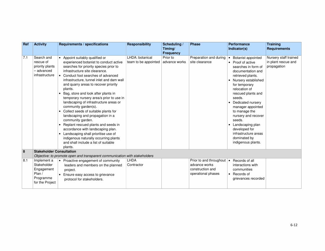
6-12
Ref Activity Requirements / specifications Responsibility Scheduling /
Timing/
Frequency
Phase Performance
Indicator(s)
Training
Requirements
7.1 Search and
rescue of
priority plants
– advanced
infrastructure
• Appoint suitably qualified or
experienced botanist to conduct active
searches for priority species prior to
infrastructure site clearance.
• Conduct foot searches of advanced
infrastructure, tunnel inlet and dam wall
and quarry areas to recover priority
plants.
• Bag, store and look after plants in
temporary nursery area/s prior to use in
landscaping of infrastructure areas or
community garden(s).
• Collect seeds of suitable plants for
landscaping and propagation in a
community garden.
• Replant rescued plants and seeds in
accordance with landscaping plan.
• Landscaping shall prioritise use of
indigenous naturally occurring plants
and shall include a list of suitable
plants.
LHDA: botanical
team to be appointed
Prior to
advance works
Preparation and during
site clearance
• Botanist appointed
• Proof of active
searches in form of
documentation and
retrieved plants.
• Nursery established
for temporary
relocation of
rescued plants and
seeds.
• Dedicated nursery
manager appointed
to manage the
nursery and recover
seeds.
• Landscaping plan
developed for
infrastructure areas
dominated by
indigenous plants.
Nursery staff trained
in plant rescue and
propagation
8 Stakeholder Consultation
Objective: to promote open and transparent communication with stakeholders
8.1 Implement a
Stakeholder
Engagement
Plan /
Programme
for the Project
• Proactive engagement of community
leaders and members on the planned
project.
• Ensure easy access to grievance
protocol for stakeholders.
LHDA
Contractor
Prior to and throughout
advance works
construction and
operational phases
• Records of all
interactions with
communities
• Records of
grievances recorded

7-1
Section 7 References
Bureau of Statistics (Lesotho), Statistical Report No. 6 of 2015 - 2013/2014 Agricultural Production
Survey Crops
Bureau of Statistics (Lesotho), Statistical Report No.8 of 2015 - Lesotho Livestock Statistics Report
2013/2014
Bureau of Statistics (Lesotho), Statistical Report No.21 of 2015 - Livestock Products Report
2013/2014
Bureau of Statistics (Lesotho), Statistical Report No. 28 of 2015 – 2014 Education Statistics Report
Bureau of Statistics (Lesotho), 2013, Lesotho Demographic Survey, 2011, Vol 1, The Bureau of
Statistics, Maseru
CES, 2014. Biological and Archaeological (Including Heritage) Baseline and Impact Assessment;
Contract LHDA No. 6002.
Consult 4 and SEED Consult, 2009. Feasibility Study for Phase II – Main Report. Lesotho Highlands
Water Commission. LHWC 001/224-2007; P RSA D000/00/7007.
Consult 4 Consortium and SEED Consult, 2008. Feasibility Study for Phase II – Consultation and
Social Issues Supporting Report. Lesotho Highlands Water Commission. LHWC 001/215-2007; P
RSA D000/00/6107.
Consult 4 Consortium and SEED Consult, 2008. Feasibility Study for Phase II - Environmental Impact
Assessment Supporting Report. Lesotho Highlands Water Commission. LHWC 001/219-2007; P
RSA D000/00/6507.
Consult 4 and SEED Consult, 2008. Feasibility Study for Phase II - Social Impact Assessment
Supporting Report. Lesotho Highlands Water Commission. LHWC 001/216-2007; P RSA
D000/00/6207.
Ecorex and Kobisi, K. 2017. Terrestrial Ecology Report for Polihali Reservoir and Associated
Infrastructure. LHDA Contract No. 6014 (P2W-6014-DFR-0002).
EOH Coastal and Environmental Services (CES), 2014. Lesotho Highlands Water Project Phase II:
Baseline Botanical Survey: Lesotho Highlands Water Project Phase II: LHDA Contract 6002.
EOH Coastal and Environmental Services (CES), 2015a. Lesotho Highlands Water Project Phase II:
Baseline Income and Expenditure Report. Lesotho Highlands Water Project Phase II: LHDA Contract
No. 6000
EOH Coastal and Environmental Services (CES), 2015b. Lesotho Highlands Water Project Phase II:
Socio-Economic Baseline Study Report. Lesotho Highlands Water Project Phase II: LHDA Contract
No. 6000
ERS. 2017.Soils, Land Use and Land Capability Report for Polihali Reservoir and Associated
Infrastructure. LHDA Contract No. 6014 (P2W-6014-DFR-0007).
Government of Lesotho. Constitution of Lesotho Act No. 5 of 1993, Maseru
Government of Lesotho. Education Act No.3 of 2010, Maseru
Government of Lesotho. Environmental Act No 10 of 2008, Maseru

Section 7• References
7-2
Government of Lesotho. Gender and Development Policy, 2003, Maseru
Government of Lesotho. Local Governance and Non-State Actors Support Programme – Information
Handbook: Mokhotlong District Report 3, 2009, Maseru
Government of Lesotho. Lesotho Land Act No. 17 of 1979, Maseru
Government of Lesotho. Lesotho Land Act No. 8 of 2010, Maseru
Government of Lesotho. Lesotho: Legal Capacity of Married Persons Act of 2006, Maseru
Government of Lesotho Ministry of Development Planning. National Strategic Development Plan
2012/13 – 2017/18 “Growth and Development Strategic Framework, 2013, Maseru
Government of Lesotho. Ministry of Education and Training. Kingdom of Lesotho. Lesotho Education
Sector Plan 2005 – 2015, Maseru, March 2015
Government of Lesotho. Lesotho National Health Strategic Plan 2012/13 – 2016/17, April, 2013,
Maseru
Government of Lesotho. National Environmental Impact Assessment Guidelines 2009, Maseru
Government of Lesotho. National Environment Policy, 1998, Maseru
Government of the Kingdom of Lesotho. Lesotho National Social Protection Strategy (NSPS)
2014/15 – 2018/19, Maseru, 2014
Government of the Kingdom of Lesotho. Millennium Development Goals Status Report 2013,
Maseru, 2014
Government of the Kingdom of Lesotho. National Policy for Integrated Early Childhood Care and
Development, Maseru, 2013
Government of Lesotho. Local Government Act 1997 as Amended by Local Government
(Amendment) Act 2004, Maseru, 2004
Government of Lesotho. The Labour Code (Amendment) Act No. 5 of 2006, Maseru
Government of Lesotho. Workmen’s Compensation Act No. 3 of 1977, Maseru
Government of Lesotho. Public Health Order 12 of 1970, Maseru
Government of Lesotho. Motor Vehicle Insurance Order No. 26 of 1989, Maseru
Government of Lesotho. Deeds Registry Act No. 12 of 1967, Maseru
IFC, 2012. International Finance Corporation Performance Standards on Environmental and Social
Sustainability, January, 2012
Kingdom of Lesotho, 2013. Higher Education Strategic Plan 2013/14 – 2017/18, Maseru
Kingdom of Lesotho, 2013. Millennium Development Goals Status Report 2013
Kingdom of Lesotho, 2014. Wool and Mohair Promotion Project (WAMPP) Final Project design report.
September, 2014
Lesotho Highlands Development Authority, 2011. Agreement on Phase II of the Lesotho Highlands
Water Project Between the Government of the Kingdom of Lesotho and the Government of the
Republic of South Africa. Maseru.

Section 7• References
7-3
Lesotho Highlands Water Project Phase II Asset Registration Procedures, October 2017
Lesotho Highlands Water Project Phase II Community Participation Strategy, September 2014
Lesotho Highlands Water Project Phase II Compensation Policy, August 2016
Lesotho Highlands Water Project Phase II Contractor Procurement Framework (Draft), August 2016
Lesotho Highlands Water Project Phase II Livelihood Restoration and Social Development
Framework, August 2017
Local Governance and Non-State Actors Support Programme – Information Handbook: Mokhotlong
District Report 3, 2009
Ministry of Health (Lesotho) and ICF International, 2016. Lesotho Health and Demographic Survey
2014. Maseru, Lesotho: Ministry of Health and ICF International.
MM&A and Pinto, H. Cultural Heritage (including Archaeology) Report for Polihali Reservoir and
Associated Infrastructure. LHDA Contract No. 6014. (P2W-6014-DFR-0003)
NHA Development Consultants, 2016. Lesotho Highlands Water Project Phase II: Public Health
Baseline Study Report. Lesotho Highlands Water Project Phase II: LHDA Contract No. 6008
Panel of Experts & LHDA, 2010. The ‘Lessons Learnt’ report from Phase 1A and Phase 1B Report
55.
Ramatla, S. and Kheekhe, M. 2017. Rangelands Report for Polihali Reservoir and Associated
Infrastructure. LHDA Contract No. 6014 (P2W-6014-DFR-0009).
Rori Consultancy, 2017. Lesotho Highlands Water Project Phase II: Safety, Health, Environment and
Quality (SHEQ) Management Framework.
Sechaba and ERM. 2017. Stakeholder Engagement Report for Polihali Reservoir and Associated
Infrastructure ESIA. LHDA Contract No. 6014 (P2W-6014-NPD-0015).
UN-Habitat, 2005. Land Tenure, Housing Rights and Gender in Lesotho
UNAIDS, 2016. Gap Report
UNDP, 2016. Human Development Report 2016: Human Development for Everyone
World Bank, 2016. World Bank Environmental and Social Framework. World Bank, Washington, DC
6014 ESIA Specialist Studies
Ecorex and Kobisi, 2017. Terrestrial Ecology Report. P2W-6014-DFR-0002
MM&A and Pinto, 2017. Cultural Heritage incorporating Archaeology Report. P2W-6014-DFR-0003
Matela and Kuenene, 2017. Soils, Land Use and land Capability Report. P2W-6014-DFR-0007
Ramatla, 2017. Rangelands Report. P2W-6014-DFR-0009
Web resources
AVERT (1986-2017) (http://www.avert.org/professionals/hiv-around-world/sub-saharan-africa)
Commonwealth Local Government Forum (2017)
http://www.clgf.org.uk/default/assets/File/Country_profiles/Lesotho.pdf

Section 7• References
7-4
Mokhethi, N.I., etal (2015) (http:www.researchgate.net/figure/290330505_fig1_figure-1-Lesotho-
wool-and-mohair-value-chain)
UN (2016) (http:/www.un.org/sustainabledevelopment/sustainable-development-goals)
UNESCO (2012) (http://www.unesco.org/eri/cp/factsheets_ed/LS_EDFactSheet.pdf)
http://www.worldmeters.info/world-population/lesotho-population/
Wade Publications CC (2015) (http://www.lesothoreview.com/education-training-2015.php)
World Bank Group - International Finance Corporation (2017)
http://www1.ifc.org/wps/wcm/connect/corp_ext_content/ifc_external_corporate_site/home
Volume 4: Annexure ISocial Report
Lesotho Highlands Development Authority
Contract LHDA No.: 6014
Contract Name: Professional Services for the
Environmental & Social Impact Assessment
(ESIA) for the Polihali Reservoir & Associated
Infrastructure
Document Ref: P2W-6014-DFR-0010
Document Date: 23 March 2018

ii
Revision History Version Issue Date Description of Changes
00 30/08/2017 First draft for Client review
01 06/10/2017 Second draft for Client review
02 08/11/2017 Final
03 23/03/2018 Final (revised impact assessment)

iii
Abbreviations and Acronyms AC Area Chief
ALC Area Liaison Committee
AoI Area of Influence
ART Anti-retroviral Treatment
BEDCO Basotho Enterprises Development Corporation
BPST Bulk Power Supply Telecommunications
CBO Community-based Organisation
CC Community Council
CGP Child Grants Programme
CHAL Christian Health Association of Lesotho
CHW Community Health Workers
CLC Combined Liaison Committee
CLO Community Liaison Officer
CoC Code of Conduct
CPI Consumer Price Index
DA District Administrator
DC District Council
DCS District Council Secretary
DES District Economic Strategies
DHMT District Health Management Team
DoE Department of Environment
DRWS Department of Rural Water Supply
ECCD Early Childhood Care and Development
EA Environmental Assessment
EFR Environmental Flow Requirement
EHS Environmental Health and Safety
EIA Environmental Impact Assessment
EIS Environmental Impact Statement
EMP Environmental Management Plan
EPPRP Emergency Prevention, Preparedness and Response Plan
ESIA Environmental and Social Impact Assessment
ESIS Environmental and Social Impact Statement
ESMS Environmental and Social Management Systems
ESS Environmental and Social Standards
ERM Environmental Resources Management Southern Africa (Pty) Ltd
EU European Union
FGD Focus Group Discussion
FOB Field Office Branch
FSL Full Supply Level
GIS Geographic Information System
GoL Government of Lesotho
GPS Geographic Positioning System
HCG Pregnancy Test
HTC HIV Testing and Counselling
I&APs Interested and Affected parties
ICM Integrated Catchment Management
IFC International Finance Corporation
ILO International Labour Organisation
KII Key Informant Interview
LAA Land Administration Authority
LDHS Lesotho Demographic and Health Study
LDS Lesotho Demographic Study
LEC Lesotho Electricity Company
Abbreviations and Acronyms
iv
LHDA Lesotho Highlands Development Authority
LHWC Lesotho Highlands Water Commission
LHWP Lesotho Highlands Water Project
LHWP II Lesotho Highlands Water Project Phase II
LNWMGA Lesotho National Wool and Mohair Grower’s Association
LR&SDF Livelihood Restoration and Social Development Framework
LTDC Lesotho Tourism Development Corporation
MC Municipal Council
MCA Millennium Challenge Account
MDR Multi Drug Resistant
MG Marketing Group
MoU Memorandum of Understanding
MSMEs Micro, Small and Medium Enterprises
NER Net Enrolment Rate
NEP National Environmental Policy
NES National Environment Secretariat
NFE Non-formal Education
NGO Non-government Organisation
NPSD National Policy on Social Development
NSDP National Strategic Development Plan
NSPS National Social Protection Strategy
NTS Non-technical Summary
NUL National University of Lesotho
OVC Orphans and Vulnerable Children
PC Principal Chief
PEPFAR The President's Emergency Plan for AIDS Relief
PHAP Public Health Action Plan
PHC Primary Health Care
PLRD Project Labour Recruitment Desk
PMTCT Prevention of Mother to Child Transmission
PNEAR Polihali North East Access Road
PPE Protective Personal Equipment
PP Public Participation
PPP Public Participation Process
PRAI Polihali Reservoir and Associated Infrastructure
PS Performance Standard
PSLC Primary School Leaving Certificate
PTR Pupil Teacher Ratio
PWAC Polihali Western Access Corridor
PWAR Polihali Western Access Road
RAP Resettlement Action Plan
RfP Request for Proposal
RSA Republic of South Africa
SADC Southern African Development Community
SDMP Social Development Master Plan
SEBS Socio-Economic Baseline Study
SHEQ Safety Health Environment and Quality
SSAs Sheering Shed Associations
STIs Sexually Transmitted Infections
TB Tuberculosis
TB-DOTS Tuberculosis-Directly Observed Treatment Shots
ToR Terms of Reference
TVET Technical and Vocational Education and Training
UNESCO United Nations Education, Scientific and Cultural Organisation
UNFPA United Nations Population Fund

Abbreviations and Acronyms
v
UNICEF United Nations Children's Fund
USAID United States Agency for International Development
USG United States Government
VDRL Syphilis Test
VHW Village Health Worker
VIP Ventilated Improved Pit Latrine
WB World Bank
WASCO Water and Sewerage Company
WFP World Food Programme
WHO World Health Organisation
WMGAs Wool and Mohair Growers Associations

vi
Glossary of Technical Terms Technical Term Definition
Catchment area The area from which rainfall flows into a river, lake, or reservoir.
In terms of this project, it refers to the local catchment of the Polihali reservoir
as defined by the red line in Figure 1.1.
Coffer dam A watertight enclosure pumped dry to permit construction work below the
waterline, as when building bridges or, as in the case of the current project, to
allow for the construction of the main dam wall across the river.
Community
engagement
Part of the Social and Environmental Assessment, community engagement is
an ongoing process involving disclosure of information, consultation with
affected communities, and the establishment of a grievance mechanism.
Compensation Payment in cash or in kind for an asset or a resource that is acquired or affected by LHWP Phase II activities.
Consultation Consultation involves interactive communication between the client and the
affected communities. The consultation process should be undertaken in a
manner that is inclusive and culturally appropriate and that provides the
affected communities with opportunities to express their views on projects risks,
impacts and mitigation measures, and allows the client to consider and respond
to them.
Dam A dam is a barrier constructed to hold back water and raise its level, forming a
reservoir used to generate electricity or as a water supply.
Disadvantaged or
vulnerable groups
Individuals or groups within the Project Area of influence who could experience
adverse impacts from the proposed project more severely than others based on
their vulnerable or disadvantaged status. This status may stem from an
individual's or group's race, colour, gender, language, religion, political, or other
opinion, national or social origin, property, birth or other status. In addition,
other factors should be considered such as gender, ethnicity, culture, sickness,
physical or mental disability, poverty or economic disadvantage, and
dependence on unique natural resources.
Diversion tunnel An underground passageway used to divert flowing water around a construction
site.
Economic
displacement
Loss of assets or access to assets that leads to loss of income sources or
means of livelihood.
Land acquisition Land acquisition refers to all methods of obtaining land for project purposes,
which may include outright purchase, expropriation of property and acquisition
of access rights, such as easements or rights of way. Land acquisition may also
include: (a) acquisition of unoccupied or unutilised land whether or not the
landholder relies upon such land for income or livelihood purposes; (b)
repossession of public land that is used or occupied by individuals or
households; and (c) project impacts that result in land being submerged or
otherwise rendered unusable or inaccessible. “Land” includes anything growing
on or permanently affixed to land, such as crops, buildings and other
improvements, and appurtenant water bodies.
Livelihood Livelihood refers to the full range of means that individuals, families, and
communities utilise to make a living, such as wage-based income, agriculture,
fishing, foraging, other natural resource-based livelihoods, petty trade, and
bartering.
Livelihood Restoration The measures that are required to mitigate the negative impacts on households that will be economically and physically displaced by LHWP Phase II, through loss of shelter and assets, and loss of access to resources, markets and services that support livelihoods. These measures are in addition to compensation, since compensation alone does not guarantee the restoration of livelihoods.
Local communities Community within the project's area of influence.
Project Areas of
influence
The project's area of influence includes the primary project site(s) and related
facilities that the client (including its contractors) develops or controls;
associated facilities that are not funded as part of the project (funding may be
provided separately by a client or a third party including the government), and
whose viability and existence depend exclusively on the project and whose

Abbreviations and Acronyms
vii
Technical Term Definition
goods or services are essential for the successful operation of the project;
areas potentially impacted by cumulative impacts from further planned
development of the project; and areas potentially affected by impacts from
unplanned but predictable developments caused by the project that may occur
later or at a different location. The area of influence does not include potential
impacts that would occur without the project or independently of the project.
Net Primary Enrolment
Rate
The number of pupils of official primary school age who are enrolled in primary education as a percentage of the total children of the official school age population
Physical displacement Relocation as a result of loss of or damage to homes / shelter.
Project’s area of
influence
The project's area of influence includes the primary project site(s) and related facilities that the client (including its contractors) develops or controls; associated facilities that are not funded as part of the project (funding may be provided separately by a client or a third party including the government), and whose viability and existence depend exclusively on the project and whose goods or services are essential for the successful operation of the project; areas potentially impacted by cumulative impacts from further planned development of the project; and areas potentially affected by impacts from unplanned but predictable developments caused by the project that may occur later or at a different location. The area of influence does not include potential impacts that would occur without the project or independently of the project.
Reservoir A large natural or artificial lake used as a source of water supply.
Resettlement action
plan
The document in which a project sponsor or the responsible entity specifies the
procedures that it will follow and the actions that it will take to mitigate adverse
effects, compensate losses, and provide development benefits to persons and
communities affected by an investment project.
Social Development Initiatives to ensure that communities in the Project Area become beneficiaries
of the development. It refers to a more open-ended programme of interventions
aimed at contributing to social and economic development of Project Area
communities. The scope of these interventions typically extends beyond directly
affected (physically and economically displaced) households and villages to
include other members of the Project Area communities.
Social Impacts When referring to social impacts this includes impacts received by the following
entities:
• Settlements, dispersed villages, solitary dwellings and mobile / semi-mobile
groups (including temporary and permanent human residents with both
formal and informal tenure of land/structures);
• Population dynamics including population size, structure, settlement
pattern and migration;
• Tangible and intangible cultural heritage sites and items, including
archaeological heritage;
• Ecosystem services, including provisioning services, regulating services,
supporting services and cultural services used by human receptors;
• Social infrastructure including both tangible (i.e. schools, community
centres, electricity and potable water services) and intangible items (i.e.
meeting places, shaded areas);
• Individual and communally owned assets (i.e. farm animals and/or grazing
land);
• Livelihood sources; including formal and informal activities;
• Community groups including civil society groups;
• Gender;
• Human rights; and community health, safety and security (including
wellbeing).

viii
Acknowledgements The authors would like to express their sincere appreciation to all the people who have assisted them
from the start of the project to the report writing. These include, ERM through its leadership and
support and lots of patience with everyone, the office and staff of LHDA in Maseru and at the Tlokoeng
Field Operations Branch. Their hands-on support during the undertaking of fieldwork was much
appreciated. Thanks are also extended to the Phase II PMU office and staff for their unwavering
support. Also to be thanked are the chiefs from all the areas the field teams worked in, for their support
and their acceptance of the teams. Not forgotten are the District Administrators’ offices of the districts
of Mokhotlong and Thaba-Tseka as well as all the Heads of Departments from the same Districts for
all the help they afforded the field teams. Last thanks are extended to the field teams who worked
tirelessly to produce the results.
E-i
Non-technical Summary Scope and Methods
The Social study is a component of the Environmental and Social Impact Assessment (ESIA) for the
Polihali Reservoir and Associated Infrastructure (PRAI) (LHDA Contract 6014). Specifically, the study
sought to describe the socio-economic context of the PRAI Project Area based on existing secondary
information and primary data collection through social data gathering using focus group discussions,
key informant interviews and general observations. The study also sought to identify and assess the
social impacts on local communities, both positive and negative, likely to result from the Project
implementation. Finally, the study was to identify and define measures for mitigating the impacts and
enhancing social conditions during and post-construction of the PRAI. The study was undertaken in
the whole of the PRAI Project Area, thus covering the catchment area and areas upstream and
downstream of the reservoir.
Baseline Social Environment
The Project Area is situated in the north-east of the Lesotho highlands proximate to Mokhotlong and
mostly comprises remote rural villages with limited access to formal public infrastructure. Mokhotlong
is the closest town to the Project Area, and in fact falls within the project catchment area. The built-
up area of Mapholaneng also falls within the Project Area. The settlement pattern is scattered clusters
of traditionally constructed homesteads, usually built of natural resources such as stone and thatch.
The Project Area has a dual administrative structure comprised of formal government, through the
decentralised district government offices, elected community councils and traditional authorities
(Principal and Area chiefs). Land in the area is communally owned and is kept in the trust of chiefs;
and acquisition is primarily through chiefs and inheritance.
Between 2013 and 2014, the population of the Project Area was estimated at 46 371 people, with an
average of 5.2 persons per household (CES, 2015b). In-migration into the Project Area is limited due
to its harsh environment (specifically the weather and poor soil quality) as well as lack of employment
opportunities. In turn, the local population tends to migrate out of the area in search of economic
opportunities, both within Lesotho and in South Africa.
The communities rely heavily on land-based livelihoods; namely crop and extensive livestock
farming. However, crop yields are low due to the poor quality of available arable land, and due to the
use of traditional cultivation methods. Crop production is mainly for household subsistence purposes,
with surplus often sold or bartered with neighbours. Livestock farming is mainly for commercial
purposes through sale of wool, mohair and animals, and is also regarded as a major source of income.
Crop production is the principal livelihood strategy, followed by remittances from permanent and
seasonal employment, sale of livestock products and social grants. Other livelihood strategies include
gathering and sale of natural resources.
A wide variety of natural resources are found in the Project Area, and these are communally owned
and utilised. These include a wide range of plants that are collected and used for food, medicinal
purposes and for sale; grazing land, a variety of grasses, trees/shrubs, rocks and sand, and small
animals. A majority of these natural resources are a source of livelihoods for many families in the
Project Area as they rely on their use on a daily basis.
Unemployment in the Project Area is high and those few who are employed work mainly in full-time
jobs or are either seasonally employed or self-employed. Formal employment is mainly found in the
public and services sector, i.e., government, shops and the hospitality industry. In general, income in
the Project Area increases significantly between March and June, and again between August and
September due to crop harvest and sales, and wool and mohair sales as payments for these are
received by farmers between August and November.

Non-technical Summary
E-ii
Access to infrastructure and services is usually aligned with road access, with such services being
schools, clinics, improved sanitation, water supply and electricity. There are eight health facilities
within the Project Area. These include one district hospital and seven health centres. The facilities
are located in the more accessible areas such as Mokhotlong town and Mapholaneng, with a few
scattered in the less accessible areas. This means that a majority of people are required to walk long
distances to get to the nearest facility, with local people sometimes having to walk up to 20km to
reach the nearest clinic or hospital for health support.
Although the main road through Mokhotlong is paved, minor and secondary feeder roads are un-
surfaced and become impassable after rains and snowfalls. Some of the villages are only accessible
on foot or with mules, donkeys and horses. Public transport is limited and most people tend to walk
to get to services and use pack donkeys or horses to carry their goods. Mokhotlong has heavy
pedestrian and pack animal traffic. Since roads have no sidewalks, animals and pedestrians share
the road with vehicles.
Primary schools are widely spread throughout the Project Area, thus enabling many children easy
access. However, some children still have to walk long distances to the nearest schools, thus resulting
in some children attending school erratically during the rainy season (when rivers and streams flood)
due to the lack of bridges. Secondary/ high schools are limited with difficult access due to bad roads
and lack of bridges. Here again, children have to walk long distances or alternatively have to rent
rooms in the villages near the secondary/ high schools.
Water is mostly collected from communal taps that are scattered throughout the Project Area;
however, in some communities the water taps are non-functional. Unprotected sources such as
springs and wells are also a common source of water, particularly in the more remote villages. Across
the Project Area, sanitation facilities are scarce, with those who have these facilities mostly owning
traditional pit latrines. Some areas such as Tloha-re-Bue and Mapholaneng have access to Ventilated
Improved Pit (VIP) latrines. Overall, the general lack of sanitation facilities means that people use
bushes near their homes, especially overgrown areas by the streams and rivers.
Telecommunication services in the Project Area are concentrated in the established town areas of
Mokhotlong and Mapholaneng. Here people have access to both cellular phones and landlines which
are found mainly in government offices, some big retail shops, and tourism establishments. Cellular
coverage is limited to the more built-up areas like Mokhotlong town and Mapholaneng and a few other
areas located near the towns and along the main A1 road.
Electricity is also restricted to the two towns and the villages along the main A1 road between
Mapholaneng and Mokhotlong town, as well as Ha Mojakisane and Ha Lehlohohonolo on the eastern
side of the Senqu River. The majority of households rely on fuelwood for heating and cooking
purposes, followed by paraffin and bottled gas. Passerina montana is commonly harvested for fuel
purposes. Candles are used mainly for lighting purposes.
Local markets and shops are mainly found in Mokhotlong town and Mapholaneng. Formal and
informal trading is common. Informal traders are found along the main and minor roads trading from
small makeshift stalls. Banking services are also mostly limited to the more established towns of
Mokhotlong and Mapholaneng.
There are only two police stations in the Project Area, one in Mokhotlong town and the other in
Mapholaneng. In most of the villages there are community policing forums (mahokela), which fight
crime at the village level and work hand in hand with the local police stations.

Non-technical Summary
E-iii
Key Project Activities Impacting the Social Environment
Land Acquisition, Resettlement and Compensation
In order to implement the Project, an estimated 5723 ha of land (reservoir and associated
infrastructure inclusive) will need to be permanently acquired from the Mokhotlong District’s total land
area of 4075km2 (~407 500 ha). The land take will affect four Community Councils, namely Seatle,
Bokong, Malingoaneng, and Mphokojoane Community Councils, and one Urban Council
(Mokhotlong).
The acquisition of land for the Project will result in both physical and economic displacement of people
and households. The main Project components that will result in displacement of households are the
Polihali village, site establishment area, dam and tunnel works areas, as well as the inundation area.
The land acquisition will occur in three phases (over a five-year period), as follows:
Phase 1. Temporary and permanent acquisition in the site establishment area for the Advance
Infrastructure. These activities will affect villages of Masakong and Ha Tlhakola villages, as well as
households from Ramonakalali, Mabunyaneng, Makalong and Tsekong. Masakong and Ha Tlhakola
will be affected by physical and economic displacement and the remainder by economic displacement
(Figure E.1).
Phase 2. Permanent land acquisition in the inundation area around Tloha-re-Bue and the remainder
of the site establishment area (for instance the Tunnel Works Area, Substation, but also the Polihali
North East Access Road (PNEAR), which is not part of this ESIA). Tloha-re-Bue is partly affected by
physical and economic displacement.
Phase 3. The remainder of the inundation area, covering several villages including Ha Jobere, Koung
Ha Phohla, Tsekong and Litsotsong, and Ha Sikantsi are all affected to varying degrees by physical
and economic displacement; and all economic displacement (loss of fields, trees and thickets within
the inundation area) affecting households in surrounding villages, which are not physically affected.
The land that will be affected is currently used for grazing, collection of natural resources, cultivation
of crops, and settlements. Figure E.1 indicates villages that will experience physical and economic
displacement.
Table E.1 highlights all the villages and the approximate number of households per village likely to
be physically displaced by the Project. Figures provided in this table are estimated numbers based
on the Feasibility Study and current predictions and will still need to be verified by the resettlement
specialist team.
Table E.1 Estimate of Villages and Households to be Displaced (refer to Figure E.1 for
locations)
Classification Village name Households below
reservoir demarcation
line (DL)
Households
dangerously located
Fully below Reservoir DL Map ref. 1 to 5
Ha Jobere 6 Unknown Ha Tlhakola 18 Unknown Lits'otsong 5 Unknown Tsekong 28 Unknown Ha Sekants’i 13 13
Partially below Reservoir DL Map ref. 6 to 8
Tloha-re-Bue 40 13
Koung Ha Phohla 32 36
Sekokong 3 5
Site establishment area Map ref. 9 & 10
Masakong 50 Unknown
Malingoaneng & Meeling 8 41
Potentially Dangerous Location (safety)
Liphokong Unknown (7)
Ha Mpesi Unknown (4)

Non-technical Summary
E-iv
Classification Village name Households below
reservoir demarcation
line (DL)
Households
dangerously located
Map ref. 11 to 16
Koung Ha Thunyane Unknown (3)
Ha Meta /Ha Manka Unknown (3)
Makhalong Unknown (3)
Lilimala Unknown (6)
Potential Isolation Map ref. 17 & 18
Bokone & Morojeleng Unknown Unknown
Total 18 203 95 (+26 unbudgeted for)
121
Figure E.1 Villages Likely to be Displaced by the Project
To mitigate for the loss associated with the Project land acquisition, LHDA has appointed a
resettlement planning consultant, as well as developed two critical documents, namely Phase II
Compensation Policy, 26 August, 2016 and the Livelihood Restoration and Social Development
Framework (LR&SDF), August, 2017.
The Phase II Compensation Policy provides the guiding principles for compensation of all losses that
will be incurred by Project affected households and communities. The Policy was developed on the
basis of consultations with affected communities, their authorities and other key stakeholders.
English and Sesotho versions of the Policy were made available to affected communities via the local
authority structures (District Councils, Urban Councils, Community Councils and Chiefs) as well as
through local participation structures set up for Phase II.
The Policy makes provisions in terms of losses of houses, associated structures and residential plots
as well as the loss of agricultural fields and communal assets (such as grazing land, brush, wood,
medicinal plants, useful grasses and wild vegetable). Further details are provided in Section 5.2.

Non-technical Summary
E-v
The Policy furthermore, defines households headed by orphans, by persons living with a disability or
by elderly, or indigent persons as vulnerable and indicates that vulnerable households will receive
individual attention from LHDA as well as the relevant government agencies.
The loss of access routes will be compensated for through the construction of footbridges and the
upgrading of certain roads within the PRAI local catchment. A contract for development of a Master
Plan for Minor Bridges and Roads is currently being commissioned by the LHDA (LHDA Contract
6019).
Construction Phase
A number of impacts may arise during the construction phase, relating to traffic safety and nuisance
(dust, noise) which can be mitigated through the implementation of a traffic management plan and
the EMP by the various contractors. There are other impacts related to the influx of job seekers,
increase in anti-social behaviours, etc. that will require other interventions requiring involvement from
the LHDA and relevant government departments.
There are also positive impacts associated with the construction phase such as the creation of
employment opportunities (the Project is proposing to create an estimated 3 500 temporary and
unskilled jobs that will be available to the locally affected people and other Lesotho nationals) and the
procurement of local goods and services.
Operational Phase
The risk of traffic accidents during the operational phase will remain but at a much lower level of
probability and therefore significance. Another impact that will carry through to the operational phase
is the result of anti-social behaviour and the need for ongoing management of STIs, HIV/AIDS, etc.
Positive impacts will include increased government revenue from the payment of taxes and sale of
water to South Africa; the creation of job opportunities (although limited); development of the tourism
sector; and improved access as a result of the development of the Polihali Western Access Road
(PWAR) and the upgrading of the PNEAR.
Key Mitigation and Enhancement Measures
The Phase II Agreement states that social development programmes and mitigation measures,
resettlement requirements and awareness campaigns will be implemented, the full extent of which
will be agreed by the Parties during the implementation. Some of the key socially related documents/
plans or policies developed by the LHDA are highlighted below; some of these have been developed
and others (such as Integrated Catchment Management, Social Development Master Plan and Public
Health Action Plan) are yet to be developed. The implementation of these will be the responsibility of
the LHDA with the assistance of appointed Consultants/ Contractors and Government at National and
District levels.
• LHDA Phase II Compensation Policy (August, 2016)
• LHWP Phase II Labour Recruitment Guidelines (2017)
• LHWP Phase II Contractor Procurement Framework (Draft August, 2016)
• Asset Registration Procedures for LHWP Phase II (October, 2017)
• LHWP Phase II Livelihood Restoration and Social Development Framework (LR&SDF) (August 2017)
• Social Development Master Plan (SDMP).
• Integrated Catchment Management (ICM)
• Public Health Action Plan (PHAP)

Non-technical Summary
E-vi
Summary of mitigation measures include:
• Appoint a Consultant to develop and implement a Resettlement Action Plan that is in compliance
with the provisions of the Phase II Compensation Policy and which aligns to the international
standards of the World Bank (already commissioned and underway).
• The RAP Consultant will develop and implement a Livelihood Restoration Plan to mitigate for the
loss of income associated with the Project’s land acquisition.
• All Contractors and sub-contractors must adhere to the provisions, principles and guidelines in
the LHDA Safety, Health, Environment and Quality (SHEQ) Management Framework for Phase
II as well as the approved EMP for their works/ contract.
• LHDA shall develop and implement a Traffic Management Policy including vehicle safety, driver
and passenger behaviour, use of drugs and alcohol, hours of operation, rest periods and accident
reporting and investigations.
• In collaboration with the Ministry of Education, LHDA shall develop, implement and produce the
required materials to be used for road traffic safety awareness campaigns.
• LHDA shall implement the Labour Recruitment Guidelines that all Contractors must adhere to for
hiring unskilled labour, i.e.:
• Local people are prioritised for unskilled labour - at least 80% of the workforce should be
hired from villages located within the affected community councils;
• There is no discrimination in recruitment, the workforce should comprise men, women,
disabled and people from different religious/ cultural backgrounds;
• Approved channels should be used for recruitment; and
• A grievance mechanism should be easily available to all workers and offer anonymity.
• Lesotho nationals are to be given preference for semi-skilled and skilled positions. If it can be
demonstrated that people with suitable skills and experience are not available, then South
Africans, people from South African Development Community (SADC) member states and other
foreigners can be employed; in that order.
• A Training and Skills Development Plan will be implemented to ensure that maximum skills
enhancement opportunities are offered to workers at all levels.
• In partnership with local authorities and relevant organisations, where available and appropriate
(e.g. donors, civil society and Non-government Organisations (NGOs)), assist in planning for
anticipated increased demands on public infrastructure and services in communities that are
significantly affected by in-migration due to Project activities.
• Collaborate with the Lesotho Tourism Development Corporation (LTDC) and Ministry of
Development Planning in fast tracking the implementation of a Tourism Master Plan for the
Project Area.
Social monitoring requirements during the construction phase by LHDA should be focussed on
ensuring that the scope of the RAP, such as asset registration and socio-economic baseline data
gathering, are conducted properly in order to provide a sound basis for monitoring the effectiveness
of the RAP implementation. Regular independent monitoring and evaluation audits of the RAP and
its implementation are required throughout advance works, construction and operational phases. In
addition, monitoring is required to verify the progress and effectiveness of livelihood restoration
projects that are implemented.

T-i
Table of Contents Section 1 Introduction ...................................................................................................... 1-1
1.1 Background ........................................................................................................................ 1-1
1.2 Study Team ........................................................................................................................ 1-1
1.3 Objective and Aims of the Social Study ............................................................................. 1-2
1.4 Project Location .................................................................................................................. 1-3
1.5 Project Description ............................................................................................................. 1-6
Section 2 Institutional and Legal Framework ................................................................ 2-1
2.1 Relevant Institutions ........................................................................................................... 2-1
2.1.1 Central Government...................................................................................................... 2-1
2.1.2 Local Government......................................................................................................... 2-2
2.1.3 Traditional Governance ................................................................................................ 2-4
2.2 Relevant Legislation and Policies ...................................................................................... 2-5
2.2.1 LHWP Treaty and LHDA Policies and Guidelines ........................................................ 2-5
2.2.2 Lesotho Legislation Relevant to Social Impact Assessments .................................... 2-10
2.3 International Standards .................................................................................................... 2-13
2.3.1 World Bank ESS and IFC PS ..................................................................................... 2-13
2.3.2 Voluntary Principles on Security and Human Rights .................................................. 2-14
2.3.3 International Labour Organisation Fundamental Conventions ................................... 2-15
Section 3 Approach and Methods .................................................................................. 3-1
3.1 Introduction ......................................................................................................................... 3-1
3.2 Approach ............................................................................................................................ 3-1
3.2.1 Literature review ........................................................................................................... 3-1
3.2.2 Site Reconnaissance Visit ............................................................................................ 3-3
3.2.3 Social Area of Influence ................................................................................................ 3-3
3.2.4 Planning for Data Collection ......................................................................................... 3-5
3.3 Methodology ....................................................................................................................... 3-5
3.3.1 Sampling ....................................................................................................................... 3-5
3.3.2 Execution ...................................................................................................................... 3-6
3.3.3 Data Management and Analysis ................................................................................... 3-7
3.3.4 Impact Assessment..................................................................................................... 3-11
Section 4 Baseline Environment ..................................................................................... 4-1
4.1 Demographic Profile ........................................................................................................... 4-1
4.1.1 Population Size and Distribution ................................................................................... 4-1
4.1.2 Ethnicity and Language ................................................................................................ 4-1
4.1.3 Religion ......................................................................................................................... 4-2
4.1.4 Residential Status of the Population ............................................................................. 4-2
4.1.5 Migration ....................................................................................................................... 4-4
4.2 Cultural Practices ............................................................................................................... 4-4
Table of Contents
T-ii
4.2.1 Cultural Practices .......................................................................................................... 4-4
4.2.2 Social Networks ............................................................................................................ 4-5
4.3 Land Tenure and Use......................................................................................................... 4-6
4.3.1 Ownership of Land ........................................................................................................ 4-6
4.3.2 Types of Land Tenure ................................................................................................... 4-7
4.3.3 Land Use Types ............................................................................................................ 4-8
4.4 Livelihood and Economic Activities .................................................................................. 4-10
4.4.1 National Overview ....................................................................................................... 4-10
4.4.2 District and the Project Area Overview ....................................................................... 4-10
4.4.3 Crop Production .......................................................................................................... 4-11
4.4.4 Livestock Production ................................................................................................... 4-15
4.4.5 Challenges to Agricultural Activities in the Project Area ............................................. 4-18
4.4.6 Employment and Unemployment ................................................................................ 4-19
4.4.7 District and Project Area Employment and Unemployment........................................ 4-21
4.5 Household Income and Expenditure ................................................................................ 4-24
4.5.1 Sources of Household Income .................................................................................... 4-24
4.5.2 Household Expenditure .............................................................................................. 4-27
4.6 Access and Utilisation of Natural Resources ................................................................... 4-28
4.6.1 Grazing Land .............................................................................................................. 4-29
4.6.2 Soils ............................................................................................................................ 4-30
4.6.3 Sand ............................................................................................................................ 4-31
4.6.4 Medicinal Plants .......................................................................................................... 4-31
4.6.5 Wild Vegetables .......................................................................................................... 4-32
4.6.6 Fuelwood .................................................................................................................... 4-32
4.6.7 Wild Animals ............................................................................................................... 4-33
4.7 Health Care ...................................................................................................................... 4-33
4.7.1 National Health Services ............................................................................................ 4-33
4.7.2 Health Care Provision ................................................................................................. 4-33
4.7.3 Services Offered at Health Centres in the Project Area ............................................. 4-35
4.7.4 Health Profile .............................................................................................................. 4-35
4.7.5 Utilisation of Health Services in the Project Area ....................................................... 4-36
4.7.6 Incidence and Prevalence of HIV ............................................................................... 4-37
4.7.7 Challenges to Health Care Provision .......................................................................... 4-38
4.7.8 Use of Traditional Healers and Traditional Medicine .................................................. 4-39
4.8 Education ......................................................................................................................... 4-40
4.8.1 National Education Services ....................................................................................... 4-40
4.8.2 Structure of the Education System ............................................................................. 4-40
4.8.3 Availability of Education Facilities ............................................................................... 4-41
4.8.4 Education Profile of Lesotho ....................................................................................... 4-43
4.8.5 Education Profile of Mokhotlong and Project Area ..................................................... 4-43

Table of Contents
T-iii
4.8.6 Provision of Education to the Poor and Marginalised ................................................. 4-45
4.8.7 Obstacles to Education ............................................................................................... 4-46
4.9 Public Services and Infrastructure ................................................................................... 4-46
4.9.1 Access to Potable Water and Sanitation Facilities ..................................................... 4-48
4.9.2 Access to Policing Services ........................................................................................ 4-51
4.9.3 Access to Local Court ................................................................................................. 4-52
4.9.4 Access to Banking Services ....................................................................................... 4-53
4.9.5 Access to Agricultural Input and Equipment ............................................................... 4-54
4.9.6 Access to Local Markets and Shops........................................................................... 4-54
4.9.7 Access to Telecommunications .................................................................................. 4-55
4.9.8 Access to Transportation ............................................................................................ 4-55
4.10 Vulnerability and Marginalisation ..................................................................................... 4-56
4.10.1 Women .................................................................................................................... 4-56
4.10.2 The Elderly .............................................................................................................. 4-57
4.10.3 Youths ..................................................................................................................... 4-57
4.10.4 Herd boys ................................................................................................................ 4-57
4.10.5 Orphaned Children.................................................................................................. 4-58
4.10.6 Disabled or Chronically Ill Persons ......................................................................... 4-58
Section 5 Impact Assessment ......................................................................................... 5-1
5.1 Introduction ......................................................................................................................... 5-1
5.2 Overview and Context ........................................................................................................ 5-1
5.2.1 Overview ....................................................................................................................... 5-1
5.2.2 Community Expectations Related to the Project .......................................................... 5-1
5.2.3 Project Area Context and Sense of Place .................................................................... 5-2
5.2.4 Local Economy ............................................................................................................. 5-5
5.2.5 Project Land Acquisition ............................................................................................... 5-5
5.3 Construction and Inundation Phase Impacts ................................................................... 5-10
5.3.1 Impact of Physical Displacement and Resettlement .................................................. 5-10
5.3.2 Economic Displacement ............................................................................................. 5-13
5.3.3 Impact of Site Clearance on Plants Used by Communities ........................................ 5-17
5.3.4 Impact of Reservoir Inundation on Plant Resources Used by Communities .............. 5-18
5.3.5 Creation of Employment Opportunities ....................................................................... 5-20
5.3.6 Procurement and Local Business Opportunities ........................................................ 5-23
5.3.7 Increased Cost of Living and Debt Generation ........................................................... 5-26
5.3.8 Increased Risk of Road Traffic Accidents ................................................................... 5-28
5.3.9 Increased Safety Risks to People and Animals .......................................................... 5-31
5.3.10 Disturbance from Increased Nuisance Factors (Noise, Dust, Vibration) ................ 5-32
5.3.11 Exacerbation of Anti-Social Behaviour ................................................................... 5-38
5.3.12 Increased Prevalence of Sexually Transmitted Infections (STIs) and HIV/AIDS ... 5-40
5.3.13 Increased Pressure on Social Infrastructure and Services..................................... 5-42
Table of Contents
T-iv
5.3.14 Disruption to Family and Community Structures .................................................... 5-44
5.4 Operation Phase .............................................................................................................. 5-46
5.4.1 Increased Government Revenue ................................................................................ 5-46
5.4.2 Economic Opportunities and Diversification ............................................................... 5-47
5.4.3 Increased Cost of Living ............................................................................................. 5-49
5.4.4 Growth of the Local Tourism Sector ........................................................................... 5-50
5.4.5 Continuation of Anti-Social Behaviour and Spread of STIs and HIV/AIDS ................ 5-52
Section 6 Mitigation and Monitoring .............................................................................. 6-1
6.1 Overview ............................................................................................................................ 6-1
6.2 Social Mitigation Measures ................................................................................................ 6-3
Section 7 References ....................................................................................................... 7-1
List of Figures
Figure 1.1 Geographic Location of the Project ........................................................................... 1-4 Figure 1.2 Proposed Polihali Dam Infrastructure Layout ............................................................ 1-5 Figure 1.3 Example of a CFRD (Mohale, Lesotho) .................................................................... 1-6 Figure 1.4 Example of quarry establishment .............................................................................. 1-7 Figure 1.5 Example of intake tower for transfer tunnel (Katse Dam, Lesotho) ........................... 1-7 Figure 2.1 Structure of Government and Traditional Authorities ................................................ 2-1 Figure 2.2 Community Councils within which the Project Area falls ........................................... 2-3 Figure 3.1 Project Areas of Influence ......................................................................................... 3-4 Figure 4.1 Gender and Age Distribution in the Project Area ...................................................... 4-1 Figure 4.2 Land Tenure Types Held by the Heads of Households within the Project Area ....... 4-8 Figure 4.3 Land Use in the Catchment Area .............................................................................. 4-9 Figure 4.4 Livelihood Strategies of the Affected Population in Percentages ............................ 4-11 Figure 4.5 Ownership of Arable Land ....................................................................................... 4-11 Figure 4.6 Typical River Bank Agricultural Fields ..................................................................... 4-12 Figure 4.7 Ownership of agricultural land by Gender ............................................................... 4-12 Figure 4.8 Number of Crop Fields Owned by Households ....................................................... 4-13 Figure 4.9 Process of Crop Cultivation throughout the Year .................................................... 4-13 Figure 4.10 Purpose of Crops in the Project Area ...................................................................... 4-14 Figure 4.11 Household reasons for not cultivating agricultural land ........................................... 4-14 Figure 4.12 Livestock Owned in the Project Area....................................................................... 4-15 Figure 4.13 Ownership and Sale of Sheep ................................................................................. 4-16 Figure 4.14 Ownership of Goats ................................................................................................. 4-16 Figure 4.15 Sale of Livestock Products ...................................................................................... 4-17 Figure 4.16 Supply Chain for the Sale of Wool and Mohair ....................................................... 4-18 Figure 4.17 Types of Regular Employment in the Project Area ................................................. 4-22 Figure 4.18 Location of Regular Employment in the Project Area.............................................. 4-22 Figure 4.19 Payment for Seasonal/temporary Employment in the Project Area ........................ 4-23 Figure 4.20 Types of Specialised Services in the Project Area .................................................. 4-24 Figure 4.21 Household Income Sources per Quartile in the Project Area .................................. 4-25 Figure 4.22 Household Income Trends per Quartile .................................................................. 4-26 Figure 4.23 Monthly Income Trend all Households Surveyed within the Project Area .............. 4-27 Figure 4.24 General Household Expenditure Trends ................................................................. 4-27 Figure 4.25 Household Agricultural Expenditure ........................................................................ 4-28 Figure 4.26 Areas where Natural Resources are Collected ....................................................... 4-29 Figure 4.27 Example of Local Grazing Area ............................................................................... 4-30 Figure 4.28 Example of Sand Mining along the River ................................................................ 4-31 Figure 4.29 Examples of Medicinal Plants found in the Project Area ......................................... 4-32

Table of Contents
T-v
Figure 4.30 Persons who Collect Fuelwood in a Household ...................................................... 4-32 Figure 4.31 Levels of Health Care Services in Lesotho ............................................................. 4-34 Figure 4.32 Closest Medical Facility used .................................................................................. 4-36 Figure 4.33 Typical Schools in the Project Area ......................................................................... 4-42 Figure 4.34 Distribution of Schooling Levels across the Project Area ........................................ 4-45 Figure 4.35 Map showing some Public Services and Infrastructure in the Catchment Area ..... 4-47 Figure 4.36 Protected and Unprotected Water Wells ................................................................. 4-49 Figure 4.37 Time taken from Household to Water Source ......................................................... 4-49 Figure 4.38 Example of Sanitation Facilities in the Project Area ................................................ 4-51 Figure 4.39 Access to Sanitation Facilities in the Project Area .................................................. 4-51 Figure 4.40 Access to Policing Services ..................................................................................... 4-52 Figure 4.41 Access to Local Courts ............................................................................................ 4-53 Figure 4.42 Access to Banking Services .................................................................................... 4-54 Figure 4.43 Access to Agricultural Inputs and Equipment .......................................................... 4-54 Figure 4.44 Access to Local Markets and Shops ....................................................................... 4-55 Figure 5.1 Photographs Illustrating the Look and ‘Feel’ of the Project Area (Top: view towards
dam wall location at centre; Bottom: view of Tloha-re-Bue near construction
areas) ......................................................................................................................... 5-4 Figure 5.2 Project Catchment Area ............................................................................................ 5-5 Figure 5.3 Villages Likely to be Displaced by the Project ........................................................... 5-7 Figure 5.4 Typical Roads, Pedestrians and Livestock on the Local Roads ............................. 5-28
List of Tables
Table 1.1 Authors and Contributors to this Report .................................................................... 1-1 Table 2.1 Main Government Branches, Powers and Functions ................................................ 2-1 Table 2.2 Local government composition at various Council levels .......................................... 2-2 Table 2.3 Principal and Area Chief Locations in the Project Area ............................................ 2-4 Table 2.4 Policies and Guidelines Relevant to Social Impact Assessments ............................. 2-5 Table 2.5 Legislation and Policies Relevant to Social Assessments ...................................... 2-10 Table 2.6 Summary of Relevant World Bank and IFC Safeguards ......................................... 2-13 Table 3.1 Summary of the Socio-economic Gap Analysis and Action Plan .............................. 3-2 Table 3.2 List of Departments, NGOs and Local leadership who participated in KIIs............... 3-6 Table 3.3 Schedule of Focus Group Discussions ..................................................................... 3-8 Table 3.4 Impact Significance Rating Table ............................................................................ 3-11 Table 3.5 Impact Characteristic Terminology .......................................................................... 3-11 Table 3.6 Designation Definitions ............................................................................................ 3-12 Table 4.1 Residential Status by Age, Gender, Ecological zone and District in Lesotho ........... 4-3 Table 4.2 Number of livestock by type in Lesotho and Mokhotlong ........................................ 4-15 Table 4.3 Percentage distribution of the employed labour force by sex, urban/rural residence
and type of employer ............................................................................................... 4-20 Table 4.4 Sectoral Employment .............................................................................................. 4-20 Table 4.5 Percentage Distribution of Unemployed Population by Age, Sex and Urban/Rural
Residence ................................................................................................................ 4-21 Table 4.6 Employment Status in Project Area ......................................................................... 4-21 Table 4.7 Types of Business in Project Area........................................................................... 4-23 Table 4.8 Health care Facilities in Project Area....................................................................... 4-34 Table 4.9 Distribution of Medical Personnel in Health Centres ............................................... 4-35 Table 4.10 Health Care Indicators ............................................................................................. 4-35 Table 4.11 Prevalence of HIV/AIDS in Lesotho ........................................................................ 4-37 Table 4.12 Time it takes to get to the nearest health care facility ............................................. 4-38 Table 4.13 Structure of the education services in Lesotho ....................................................... 4-40 Table 4.14 Distribution of schools by district ............................................................................. 4-42 Table 4.15 Education Services Profile ....................................................................................... 4-43 Table 4.16 Education Services Profile ....................................................................................... 4-44 Table 4.17 Access to Water Sources in Lesotho....................................................................... 4-48
Table of Contents
T-vi
Table 4.18 Access to Sanitation Facilities in Lesotho ............................................................... 4-50 Table 5.1 Land use distribution within the Catchment Area ...................................................... 5-6 Table 5.2 Estimate of Villages and Households to be Displaced .............................................. 5-6 Table 5.3 Impact of Physical Displacement of Households .................................................... 5-11 Table 5.4 Impact of Economic Displacement .......................................................................... 5-15 Table 5.5 Impact of Site Clearance on Plants used by Surrounding Communities................. 5-17 Table 5.6 Impact of Reservoir Inundation on Important Plant Resources ............................... 5-19 Table 5.7 Impact of Related to Creation of Employment Opportunities .................................. 5-21 Table 5.8 Indicative Procurement Spend ................................................................................ 5-23 Table 5.9 Procurement and Local Business Opportunities ..................................................... 5-25 Table 5.10 Increased Cost of Living and Debt Generation ....................................................... 5-27 Table 5.11 Increased Risks of Road Traffic Accidents .............................................................. 5-29 Table 5.12 Increased Safety Risks ............................................................................................ 5-32 Table 5.13 Disturbance from Increased Nuisance Factors ....................................................... 5-35 Table 5.14 Increased Anti-Social Behaviours ............................................................................ 5-39 Table 5.15 Increased Prevalence of STIs including HIV/AIDS .................................................. 5-41 Table 5.16 Increased Pressure on Social Infrastructure and Services ..................................... 5-43 Table 5.17 Disruption to Family and Community Structures ..................................................... 5-45 Table 5.18 Impact of Increased Government Revenue ............................................................. 5-47 Table 5.19 Economic Opportunities and Diversification ............................................................ 5-48 Table 5.20 Increased Cost of Living .......................................................................................... 5-50 Table 5.21 Growth of the Local Tourism Sector ........................................................................ 5-51 Table 5.22 Continuation of Anti-Social Behaviour and Spread of STIs and HIV/AIDS ............. 5-53 Table 6.1 Mitigation Measures for Social Study ........................................................................ 6-4

1-1
Section 1 Introduction
1.1 Background The Lesotho Highlands Water Project (LHWP) is a multi-billion Maloti/Rand bi-national project which
was established by the Treaty of 1986 signed between the governments of the Kingdom of Lesotho
and the Republic of South Africa (RSA). The LHWP will harness the water resources of the highlands
of Lesotho through the construction of a series of dams and tunnels for the mutual benefit of Lesotho
and the Republic of South Africa. While South Africa will benefit from the provision of water, Lesotho
will benefit through the generation of hydro-electricity. Phase II of the LHWP is needed to support the
water requirements in the Vaal River System in South Africa as per the Delivery Schedule (Consult 4
Consortium and SEED Consult, 2008).1
Phase I has been completed, while Phase II, the current phase, includes the construction of a
concrete-faced rockfill dam at Polihali, downstream of the confluence of the Khubelu and Senqu
(Orange) Rivers (this project), and a gravity tunnel that will connect Polihali Reservoir to the Katse
Reservoir. It also includes the construction and establishment of associated infrastructure, without
which the main components (dam and tunnel) could not be built, i.e. construction of access roads,
bridges, bulk utilities (power, water supplies, wastewater treatment and communications),
establishment of quarries and borrow pits, site camps, laydown areas, spoil areas, project housing
and site offices (the last two including both temporary and permanent structures).
According to the Lesotho Environment Act No. 10 of 2008 and associated Regulations, the Project
must obtain environmental authorisation through completion of an Environmental (and Social) Impact
Assessment (ESIA) process for development to proceed. Following a tender process, the Lesotho
Highlands Development Authority (LHDA) awarded the contract to complete the ESIA for the Polihali
Reservoir and Associated Infrastructure (PRAI) to Environmental Resources Management Southern
Africa (Pty) Ltd (ERM).
This report presents the findings from the Social Study that was carried out as part of the PRAI ESIA.
The study was undertaken in the whole of the PRAI Project Area, covering the catchment area and
areas upstream and downstream of the reservoir (refer to Figure 1.1 and Section 3.2.3 for a
description of the Project’s Area of Influence). The study was done to assess the impact of the PRAI
on the lives and livelihoods of the people residing within the Project Area; and to propose possible
mitigation measures for negative impacts and enhancements for positive impacts/ benefits.
1.2 Study Team The members of the team, their individual roles, qualifications and experience are listed in Table 1.1.
Table 1.1 Authors and Contributors to this Report
Person Role Organisation/
Company
Qualifications and experience
Jeanette Bloem Social Specialist Sechaba
Consultants MPhil Social Research Methodology
+15years of experience in social research
Thato Letsatsi Stakeholder
Engagement
Specialist
Sechaba
Consultants
BA Sociology and Public Administration
20 years of experience in public participation
process consulting
1 Environmental Impact Assessment Supporting Report (LHWC 001/219-2007; P RSA D000/006507), Consult 4 Consortium and SEED Consult, 2008.

Section 1 • Introduction
1-2
Person Role Organisation/
Company
Qualifications and experience
Khotso Mapepesa Social Specialist
Intern
Sechaba
Consultants
BSC Agriculture
+5 years of experience in public participation
Itumeleng Nhlabo Social Support Sechaba
Consultant
Diploma in Business Studies
+5 years of experience in social data collection
Manyefolo Moiloa Social Assistant Sechaba
Consultants
B. Ed Sesotho and English
+5 years of experience in social data collection
Keketso Sello Social Assistant Sechaba
Consultants B. Ed in Special Education
+5 years of experience in social data collection
‘Mats’eliso Putsoa Social Assistant Sechaba
Consultants BA Humanities – Development Studies
+5 years of experience in social data collection
‘Manthope Letsatsi Social Assistant
(field admin)
Sechaba
Consultants Certificate in Business Management
+1 year of experience in social data collection
Mokone Mohata Social Assistant Sechaba
Consultants Diploma in Personnel & Training Management
+5 years of experience in social data collection
Thabo Molisana Social Assistant Sechaba
Consultants BTEC Tourism Management
+5 years of experience in social data collection
Napo Bokaako Social Assistant Sechaba
Consultants Certificate in Health & Safety
5 years of experience in social data collection
Tiisetso Matjeane Social Assistant Sechaba
Consultants BA Accounting
+3 years of experience in social data collection
Retselisits’oe Mohapi
Social Assistant
(field admin)
Sechaba
Consultants BA Agriculture – Soil Sciences
+3 years of experience in social data collection
Chere Lemeke PPP Support Sechaba
Consultants
Diploma in Mechanical Engineering
15 years of experience in social data collection &
public consultation combined
Ntjapeli Matlanyane PPP support Sechaba
Consultants Cambridge Overseas School Certificate
+15 years of experience in social research & public
consultation combined
Teboho Ralits’oele Stakeholder Engagement Intern
Sechaba
Consultants BA Urban and Regional Planning.
Three years of experience in social research
Janet Mkhabela Social Assessment Integrator
ERM MSoc Sci. Policy & Development Studies
11 years of experience in social assessment and
public participation in Africa, specifically southern
Africa.
Zama Luthuli Consultation
Support
ERM(Intern) Completing a BA in Environmental Management
~3 years consulting experience
1.3 Objective and Aims of the Social Study The objective of the social impact study is to provide a description of the socio-economic context of
the Project Area in order to identify, assess and rate the significance of opportunities/ benefits and
adverse impacts on affected communities. The baseline description is based on the findings from the
previous Socio-economic study commissioned by the LHDA for Phase II, augmented by qualitative
data collection through Focus Group Discussions (FGDs) and Key Informant Interviews (KIIs).

Section 1 • Introduction
1-3
The key aims of the Social Study were to:
• Ensure that the Social study met the requirements of the Lesotho Environment Act No. 10 of 2008
and the Environmental Impact Assessment (EIA) Guidelines (2009), and other relevant national
legislation and standards;
• Describe prevailing socio-economic conditions prior to Project implementation;
• Identify, assess and rate the significance of opportunities/ benefits and adverse impacts on
affected communities; and
• Develop a practical, user-friendly Social Management Plan (SMP), as part of the Environment
Management Plan (EMP) which is relevant to the various types of contractors that will be
employed on the contract. The EMP will provide a full description of mitigation measures to be
implemented to prevent, reduce, or manage environmental impacts; it will describe how these
measures will be implemented and will provide environmental management objectives and
targets that can be audited and that are repeatable.
1.4 Project Location The proposed Project is located in the Mokhotlong District and more specifically, within the Highlands
of the Kingdom of Lesotho (hereafter referred to as Lesotho) (Figure 1.1). Lesotho is a landlocked
country that is surrounded by South Africa; and covers a land area of over 30 000 km2 with a
population slightly over two million. Administratively, the country is divided into 10 Districts, which are
further sub-divided into 80 constituencies consisting of 10 District Councils. The District Councils are
further sub-divided into one Municipal Council, 11 Urban Councils, and 64 local Community Councils.
The Project Area straddles four Community Councils namely Seate, Bokong, Menoaneng, and
Mphokojoane and one Urban Council (Mokhotlong). The Project Area falls within the areas under
the Principal Chiefs of Mokhotlong and Malingoaneng, who are assisted in fulfilling their mandate by
various Area Chiefs.
The Project Area is situated within the mountain agro-ecological zone and it is characterised by vast
mountains and valleys. Extremely erratic weather conditions comprising high winds and snowfalls are
a common phenomenon in the area.

1-4
Figure 1.1 Geographic Location of the Project

1-5
Figure 1.2 Proposed Polihali Dam Infrastructure Layout

Section 1 • Introduction
1-6
1.5 Project Description The development will comprise the following components (Figure 1.2):
Polihali Dam, Saddle Dam and Reservoir: The proposed Polihali Dam is a 164 m high, concrete-
faced rockfill dam (CFRD) (refer to Figure 1.3 for example) with a side channel spillway located
approximately 2 km downstream of the confluence of Khubelu and Senqu Rivers. The Saddle Dam
is a 50 m high, concrete-faced rockfill embankment dam. During construction, the works will be
protected by upstream and downstream embankment coffer dams with two diversion tunnels through
the left flank, one 7 m and one 9 m in diameter. The Full Supply Level (FSL) for Polihali Reservoir is
2 075 metres above sea level (masl). The flood demarcation level is 2 080 masl and exceeds the
1:100 year flood level in the upper reaches of Polihali Reservoir. The Reservoir will inundate an area
of approximately 5042 ha upstream of the Dam at the 2075 masl FSL (Consult 4 and SEED Consult,
2008). The land take up to the 2080 masl is equates to approximately 5600 ha.
Construction of the diversion tunnels will commence in Q1 of 2018 and be completed in Q3 of 2019.
Construction of the dam (main and saddle) will commence in Q1 of 2020 and is anticipated to be
completed by the end of 2024. Inundation of the reservoir is anticipated to take between 24 and 36
months to reach the FSL.
Figure 1.3 Example of a CFRD (Mohale, Lesotho)
Quarries and Borrow Pits: material for the rockfill embankments are proposed to be obtained from
quarries located on the left and right banks upstream of the Polihali Dam, primarily below the FSL
(refer to Figure 1.4 for an example of quarry establishment). It is also proposed that material suitable
for use as concrete aggregate will be obtained from the Tsilantso quarry. Advance geotechnical
investigations have been undertaken to: i) confirm the quarry locations, ii) test the suitability of sand
sourced from the Senqu and Khubelu Rivers near their confluence for use in concrete; and iii) locate
additional quarry sources for use as concrete aggregates near the proposed bridge sites along the
A1 Road. As the quarries are located in close proximity to some villages, quarrying activities, which
include blasting and having trucks haul materials from the quarry to construction sites are likely to
impact on the lives of the people residing nearby.
Where quarries and borrow pits are established above the FSL, these will be rehabilitated following
completion of the works.

Section 1 • Introduction
1-7
Figure 1.4 Example of quarry establishment
Source: M van Rooyen
Polihali to Katse Transfer Tunnel (Eastern Side): A tunnel will be constructed to transfer water
from the Polihali reservoir to the Katse reservoir. The transfer tunnel will comprise the intake works
and gate shaft at the western edge of the Polihali Reservoir (just upstream of the confluence with the
Khubelu and Senqu Rivers) (see Figure 1.5 for an example of an intake tower). Associated
infrastructure for construction will include site access roads, quarries, plant yards, labour
accommodation, spoil areas and other tunnel works areas. Tunnelling activities will be done using
both drill-and-blast methods and a Tunnel Boring Machine (TBM). The current ESIA only assesses
the tunnel works from the eastern works area to approximately halfway along the length of the tunnel.
The tunnel works area (access, spoil dump, laydown) is located in close proximity to Tloha-re-Bue
and Malingoaneng. This will have implications for the communities in these villages (safety, nuisance,
cemeteries, etc. as well as impacting on their leisure activities as it directly affects the area used for
horse races).
Tunnel construction should commence at the end of Q1 2020 and be completed during Q4 of 2025.
Figure 1.5 Example of intake tower for transfer tunnel (Katse Dam, Lesotho)

Section 1 • Introduction
1-8
Major Bridges (Senqu, Khubelu and Mabunyaneng Bridges), and Associated Road Works:
Major bridges will be constructed on the Senqu, Khubelu and Mabunyaneng Rivers on the existing
A1 national road between Oxbow and Mokhotlong. Construction of the Senqu bridge will commence
in Q1 2020 and should be completed by the end of Q1 2023, while construction of the Khubelu/
Mabunyaneng bridge will commence in Q2 of 2020 and be completed during Q2 of 2022. Portions of
the A1 near the bridge locations will be realigned due to inundation by the reservoir, and a number of
other existing roads and tracks will require replacement. A new pedestrian bridge (Tlhakola Bridge)
is proposed across the reservoir at Tlhakola. Note: the scope of the PRAI ESIA does not include the
replacement of existing roads and tracks that will be inundated or the construction of new feeder
roads and minor bridges.
Bulk Power Supply and Telecommunications (BPST) infrastructure to be located at the Polihali
Reservoir that is included in this ESIS are:
• A new substation at Masakong near the advanced infrastructure area;
• A new telecommunications mast on the hill; and
• A new 33kV powerline from Tlokoeng across the reservoir to the permanent camp area (for
future electrical distribution by Lesotho Electricity Company (LEC) on the west side of the
reservoir).
Note: the construction of a new 132kV powerline from Katse (Matsoku Intake substation) to
Polihali (Masakong substation) and new paved road from Ha Seshote to Polihali falls under a
separate ESIS for the Polihali Western Access Corridor (PWAC).
Construction of the BPST infrastructure is anticipated to commence in Q3 of 2018 and be completed
by Q3 of 2020.
Project Housing and Site Establishment: The Phase II works will be built under a number of
construction contracts, each of which will require accommodation facilities for staff and the labour
force, site offices, workshops, plant yards, quarries, explosives store and other works areas. In
general, all temporary accommodation, offices and buildings needed for a particular construction
contract will be provided by the relevant construction contractor and will removed at the end of
construction.
Where facilities will have long-term use during the operation of the scheme, these will be designed
and built to appropriate standards for permanent works under the advance infrastructure contracts.
The permanent facilities include:
• Staff accommodation at the Polihali Reservoir area, built as a village with all communal services.
This will be the accommodation for the Employer, Engineer and Contractor’s staff during
construction of the Main Works and for operations staff following the completion of dam and
tunnel construction;
• A visitors’ lodge at the staff village, which will become a tourist facility; and
• The Employer’s and Engineer’s offices at the dam site, which will become the operations staff
offices and visitor centre.
Temporary construction areas include labour camps and works areas for construction of the eastern
sections of the PWAR; BPST component, and Polihali-Katse Transfer Tunnel, and for the Polihali
Dam and Saddle Dam and bridges. The labour camps will be provided with a raw water supply
(contractors will provide their own water purification, sewage treatment and waste facilities). The
Transfer Tunnel and Dam works areas/ sites will be provided with a raw water supply and a power
supply.
All the above project components are going to impact on the lives and livelihoods of the people
residing within the Project Area, either negatively or positively. The proposed dam area is surrounded
by villages that are most likely going to be affected to a large extent during the construction phase of
the dam and its associated infrastructure. During this phase there will be increased heavy vehicle
road traffic traversing through and passing by some villages. This will therefore mean constant noise,

Section 1 • Introduction
1-9
from the road traffic and likely blasting activities and also dust from the same. People's fields and
housing structures are also going to be impacted and some households will need to be relocated
because of the project activities which will include reservoir inundation, amongst others.
However, there will be the positive impact of local people being employed by the different contractors.
The locals will also be able to rent out their houses and their businesses could grow. The impact on
fields will mean that the owners will receive compensation for their loss. Those households that will
need to be displaced will have to be relocated to other areas.
The operational phase of the project will also affect the people residing within the Project Area, though
to a lesser extent. This would be through ongoing employment of some local people and development
of the local tourism industry. The people will also benefit from the livelihoods restoration and social
developments plan that the LHDA will develop and implement.
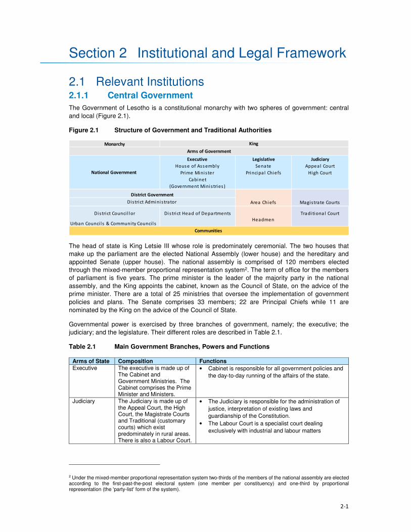
2-1
Section 2 Institutional and Legal Framework
2.1 Relevant Institutions 2.1.1 Central Government
The Government of Lesotho is a constitutional monarchy with two spheres of government: central
and local (Figure 2.1).
Figure 2.1 Structure of Government and Traditional Authorities
The head of state is King Letsie III whose role is predominately ceremonial. The two houses that
make up the parliament are the elected National Assembly (lower house) and the hereditary and
appointed Senate (upper house). The national assembly is comprised of 120 members elected
through the mixed-member proportional representation system2. The term of office for the members
of parliament is five years. The prime minister is the leader of the majority party in the national
assembly, and the King appoints the cabinet, known as the Council of State, on the advice of the
prime minister. There are a total of 25 ministries that oversee the implementation of government
policies and plans. The Senate comprises 33 members; 22 are Principal Chiefs while 11 are
nominated by the King on the advice of the Council of State.
Governmental power is exercised by three branches of government, namely; the executive; the
judiciary; and the legislature. Their different roles are described in Table 2.1.
Table 2.1 Main Government Branches, Powers and Functions
Arms of State Composition Functions
Executive The executive is made up of The Cabinet and Government Ministries. The Cabinet comprises the Prime Minister and Ministers.
• Cabinet is responsible for all government policies and
the day-to-day running of the affairs of the state.
Judiciary The Judiciary is made up of the Appeal Court, the High Court, the Magistrate Courts and Traditional (customary courts) which exist predominately in rural areas. There is also a Labour Court.
• The Judiciary is responsible for the administration of
justice, interpretation of existing laws and
guardianship of the Constitution.
• The Labour Court is a specialist court dealing
exclusively with industrial and labour matters
2 Under the mixed-member proportional representation system two-thirds of the members of the national assembly are elected according to the first-past-the-post electoral system (one member per constituency) and one-third by proportional representation (the 'party-list' form of the system).
Monarchy
Executive Legislative Judiciary
Hous e of Ass embly Senate Appeal Court
Prime Minister Principa l Chiefs High Court
Cabinet
(Government Ministries )
Area Chiefs Magistrate Courts
District Counci l lor District Head of Departments Tradi tiona l Court
Urban Counci l s & Community Counci l s
Arms of Government
King
Communities
District Administrator
National Government
District Government
Headmen

Section 2 • Institutional and Legal Framework
2-2
Arms of State Composition Functions
Legislative The Legislature is made up of the Senate and the National Assembly.
• The Senate examines and reviews draft Legislation/
Bills passed by the National Assembly.
• The National Assembly is the main legislative body; it
enacts the laws of the country and scrutinises the
political executive on the management and
administration of the affairs of the land.
2.1.2 Local Government
The constitution mandates Parliament to establish local government and the main governing
legislation is the Local Government Act 1997 and Local Government Elections Act 1998. Cabinet
adopted a national decentralisation policy in February 20143. The Ministry of Local Government and
Chieftainship Affairs (MoLGCA) is responsible for facilitating and coordinating the implementation of
the national decentralisation policies and programs, along with the capacity development of Local
authorities.
Local government structures are headed by the Principal Secretary who sits at the national
government level. Each District is headed by a District Administrator (DA). The DA represents the
interests of Central Government at a District level and is responsible for the administrative
decentralisation and integration of government activities. The DA is supported by heads of
departments of various government ministries.
The district administration is comprised of four levels of decentralised political structures namely the
10 District Councils (DCs), one Municipal Council, 11 Urban Councils and the 64 Community
Councils. Members of these councils are elected to office through local government elections, which,
constitutionally, are supposed to be held every five years. The first local government elections took
place in 2005, the second in 2011 and the third were expected to have occurred in 2016. The
composition of the various councils is described in Table 2.2.
Table 2.2 Local government composition at various Council levels
Role Description
District Councils
(DCs) • DCs are comprised of councillors elected through electoral colleges. Each DC
has a Chairperson and a District Council Secretary (DCS)4 who implement the
Council resolutions.
Municipal Councils
(MCs) • MCs are composed of councillors representing wards within an urban area
categorised as a Municipality. Presently, the City of Maseru is the only urban
area with a Municipal status.
Urban Councils • There are eleven urban councils in the country with each of the nine districts
besides Maseru having its council. However, there are two additional urban
councils in Maputsoe and Semongkong.
Community Councils
(CCs)
• There are 64 CCs. All councillors are elected to represent a single-member
division for a term of up to five years. Councillors comprise members elected
from the electoral division, chiefs representing traditional leadership, and
women occupying reserved seats determined by proportional representation
lists submitted by political parties.
Figure 2.2 shows the Community Councils within which the Project Area falls.
3 www.clgf.org.uk/default/assets/File/Country_profiles/Lesotho.pdf 4 The DCS office is responsible for the daily management of the political and service decentralisation, and the coordination and monitoring of all development projects at a District level.

2-3
Figure 2.2 Community Councils within which the Project Area falls

Section 2 • Institutional and Legal Framework
2-4
The Local Authorities’ responsibilities include:
• Control of natural resources and environmental protection;
• Agricultural services;
• Land allocation;
• Preservation, improvement and control of designated forests;
• Village water supply;
• Public health;
• Education;
• Minor roads;
• Streets and public places;
• Burial grounds;
• Markets and the promotion of economic development;
• Parks, recreation and culture; and
• Fire prevention.
2.1.3 Traditional Governance
Traditional leadership in the country is through chieftainship which is hereditary. This leadership is
hierarchical consisting of the King, Principal Chiefs (PC), Area Chiefs (AC) and Village Chiefs (or
headmen). Each one of these Chiefs levels is represented in the DCs and CCs. The Principal Chiefs
are responsible for overseeing all issues of traditional governance in their respective areas; in turn,
the Area Chiefs take orders and advice from the Principal Chiefs. Area Chiefs tend to administer a
smaller administrative area compared to that of the PCs. Lastly, the Village Chiefs or headmen
function as assistants to the Area Chiefs and manage the daily administration of their villages and
report to the Area Chiefs. Over and above the customary functions that chiefs play are the civil
responsibilities which include the issuing of certificates i.e. birth and death papers; writing letters for
bank account and passport applications; maintaining law and order and adjudicating local disputes.
The Principal Chiefs in the Project Area are those of Mokhotlong and Malingoaneng. The locations of
Area Chiefs in the Project Area are provided in Table 2.3 according to their respective Principal
Chiefs.
Table 2.3 Principal and Area Chief Locations in the Project Area
Principal Chief of Mokhotlong Principal Chief of Malingoaneng
Salang
Ntlholohetsane
Thabang
Ha Mojakisane
Ha Rafolatsane
Libibing
Tsoenene
Matlakeng
Malubalube/Likhameng
Nkokamele
Ha Moeketsane
Lilatoleng
Linakeng
Motsitseng
Ha Makhabane
Kholokoe
Bafali
Ha Lebopo
Tloha-re-Bue
Mapholaneng
Ha 'Meta
Tlokoeng
Mofolaneng
Makhomalong
Maitisi (Ha Letjama)
Mahemeng
Ha Polihali
Ha 'Mei
Makhoarane Khotsang
Taung
Hlokoa-le-mafi
Maqalikeng
Mokhalong/Ha Lephakha

Section 2 • Institutional and Legal Framework
2-5
2.2 Relevant Legislation and Policies 2.2.1 LHWP Treaty and LHDA Policies and Guidelines
The legal framework governing LHDA’s obligations with respect to social impact assessments
is summarised in Table 2.4.
Table 2.4 Policies and Guidelines Relevant to Social Impact Assessments
Legislation Requirements
LHWP Treaty (1986) The LHWP Treaty was signed between the Kingdom of Lesotho and the Republic
of South Africa in 1986, and has provided the foundation for construction of
Phase I (comprising Katse and Mohale Dams) and the planned Phase II (Polihali
Dam).
In relation to environmental and social issues, the Treaty requires that:
(i) all project affected people “will be able to maintain a standard of living not
inferior to that obtaining at the time of first disturbance”;
(ii) implementation, operation and maintenance of the project are compatible
with the protection of the existing quality of the environment; and, in particular,
and
(iii) shall pay due regard to the maintenance of the welfare of persons and
communities affected by the project.
To date, Phase I (comprising Katse and Mohale Dams) of the LHWP Treaty has
been completed as well as the Phase II Feasibility Study; the responsibilities for
these and a further two phases are set out in the LHWP Treaty.
Agreement on Phase
II of the Lesotho
Highlands Water
Project (August
2011)
The Phase II Agreement was signed between Kingdom of Lesotho and the
Republic of South Africa in 2011. The purpose of the Agreement is to provide the
legal basis for the implementation of Phase II as well as the operation and
maintenance of Phases I and II of the Project.
In relation to environmental and social issues, the Agreement makes the following
provisions:
• Environmental mitigation measures including environmental flow matters and
baseline studies will be implemented, the full extent is to be agreed by the
Parties during the implementation.
• Social development programmes and mitigation measures, resettlement
requirements, baseline studies and public relations and awareness campaigns
will be implemented; the full extent is to be agreed by the Parties during the
implementation.
LHWP Phase II.
Community
Participation
Strategy (September
2014)
LHDA’s Community Participation Strategy is aimed at ensuring the involvement and
participation of the public in the project planning, implementation, monitoring and
decision-making processes through the engagement of community structures and
other project role- players. It sets out the establishment for community liaison
structures which include area liaison committees and combined liaison committees
in the four councils affected by the project (Seate; Mphokojoane, Menoaneng and
Mokhotlong Urban Council).
Its main objectives are:
• To develop and maintain on an on-going basis the process of public
participation to ensure the continued involvement and participation of interested
and affected parties in a meaningful way;
• To promote involvement and participation of community structures in decision
making processes, planning and implementation of relevant LHWP activities;
• To co-ordinate current and planned LHDA community participation initiatives;
and

Section 2 • Institutional and Legal Framework
2-6
Legislation Requirements
• To establish a two-way communication channel between the LHDA and the
communities.
Area Liaison Committees (ALCs) have been set up to provide direct liaison
between LHDA, its contractors and the local communities within Phase II of the
LHWP, and to serve as a forum for:
• Community participation processes;
• Mobilisation, sensitisation and awareness- raising of affected communities;
• A two-way communication process between the affected people and the Project
authorities;
• Participation and consultation on Project policies (Compensation Policy) and
strategies;
• Exchange of views/information on the LHWP and LHDA activities and
programmes;
• Participation in data collection, project studies, information disclosure,
programmes implementation;
• Participation and witness to land acquisition, asset inventory/ registration,
ownership and measurement of properties to be affected;
• Participation and witness to consultations and agreements reached with
individual households and communities to be compensated;
• Identification of development needs, and establishment of action plans for
realisation of development goals;
• Receiving, adjudication and channelling of complaints and grievances from the
affected communities to the LHDA;
• Identification of affected people for training on land-based, wage-based and
enterprise-based livelihoods;
• Identification of the most vulnerable households e.g. orphans, aged and
disabled for special assistance by LHDA and/ or Government Departments;
• Management of unskilled labour; and
• Projects and programmes reviews.
Consultation with affected communities was carried out through the established
structures (ALCs, as outlined in Section 3.3) as well as through key informant
interviews.
Labour Recruitment
Guidelines (2017)
LHDA has developed Labour Recruitment Guidelines that will guide the hiring and
employment of labour for Phase II of the LHWP. It requires contractors to prioritise
recruitment of local labour from Lesotho, particularly for unskilled positions. It
specifies that all recruitment shall be done through a Project Labour Recruitment
Desk (PLRD) to be established at Mapholaneng or Tlokoeng with a satellite office at
Ha Lejone. All potential work seekers will need to be registered at the PLRD in
order to be considered for employment.
The Guidelines also set out principles regarding the recruitment of unskilled labour
as follows:
• All unskilled jobs will be for a period of between 12 and 18 months;
• At the end of each period the workers will be replaced by another person; and
• Where a Contractor has trained and developed an individual to such an extent
that the individual can be considered semi-skilled; then the individual may be
re-employed.
LHWP Phase II
Procurement
Guidelines
The LHDA procurement guidelines for Phase II have the central objectives of the
project procurement processes and procedures:
• To comply with the spirit and objectives of Article 6 of the Treaty and Articles 10
and 11 of the Phase II Agreement, as well as the provisions of the Lesotho
Public Procurement Regulations of 2007, Part III (12), which are to foster
competiveness and transparency while increasing participation of individuals
from Lesotho, South Africa and SADC member states.
• To maximise procurement opportunities for Lesotho and South African
suppliers.

Section 2 • Institutional and Legal Framework
2-7
Legislation Requirements
• To minimise the utilisation of imported goods, skills and labour, where
applicable, within the ambit of the laws governing Lesotho.
• To maximise skills and technology transfer through the training of individuals
and enterprise development opportunities for Lesotho-based companies and
black owned companies in the Republic of South Africa
LHWP Phase II
Contractor
Procurement
Framework (Draft
August, 2016)
The Contractor Procurement Framework provides an overview of the specific
requirements and approaches for the procurement of construction contracts for
Phase II of the LHWP. The Framework gives a basis to ensure that each contract is
procured in a manner compatible with the legal framework and the LHWP
procurement policy. The consultant responsible for each construction contract will
develop appropriate procedures to implement the Framework.
LHWP Phase II
Safety Health
Environment and
Quality Management
(SHEQ)
Management
Framework (April,
2017)
The Occupational Health and Safety of all employees is addressed by the SHEQ
Framework. The Framework provisions are applicable to all Consultants and
Contractors delivering work for, or on behalf of, the LHDA or its entities.
The aim of the Framework, is to:
• Assist Consultants or Contractors to adequately provide for implementing
sound SHEQ practices on site; and
• Inform Consultants and Contractors in advance of the SHEQ directive and
requirements that will be enforced during the project.
LHDA Phase II
Compensation Policy
(August, 2016)
The Policy applies to all losses of assets and income, and impacts on livelihoods
suffered by people, households, communities and institutions as a result of the
implementation of Phase II of the LHWP. According to the Policy all persons affected
by Phase II will be entitled to equitable treatment as embodied in the Policy. The Policy
objectives are:
• To minimise involuntary land take by investigating all possible Project design
alternatives;
• To ensure that affected people and communities, including host communities
are meaningfully consulted on Project designs, alternatives and impacts;
• To promote affected people’s participation in the planning, implementation and
monitoring of compensation, resettlement, mitigation and development
measures;
• To ensure that relocation of households and businesses is undertaken in a
participative, systematic and beneficial manner, involving both displaced and
host communities;
• To ensure that affected people are promptly, fairly and fully compensated for
their losses; and
• To ensure that direct compensation is accompanied by additional measures
where necessary to help restore livelihoods; and
• To ensure that existing cultural and religious practices are respected, and to
preserved to the maximum extent practical.
Compensation rates
The Policy states that compensation rates for Phase II have been declared under
the Compensation Regulations. The rates are adjusted annually for price escalation
using the Lesotho Consumer Price Index (CPI). Compensation for primary
residential dwellings and formal business structures will be based on the principle of
replacement cost. Consultations will occur with affected communities, their local
authorities and district stakeholders to explain the rates and the basis for their
calculations.
Where urban land and property are acquired, valuation will be carried out according
to the provisions of the Land Act of 2010 and the associated Regulations. All
valuations will be certified by LAA.
In the case of the provision of replacement agricultural land (land-for-land option),
the following principles will apply to the new land:

Section 2 • Institutional and Legal Framework
2-8
Legislation Requirements
• It will be identified and confirmed with the participation of the affected
households and should as far as possible be located in reasonable proximity to
where the displaced persons reside;
• It should be provided free of “transaction costs” such as registration fees,
transfer taxes or customary tributes.
Eligibility for compensation
The unit of entitlement for compensation against the loss of private property and
assets will be the owner or household, including orphaned minors who are entitled
to their parents’ estate. LHDA will ensure compliance with the regulations of the
Land Act of 2010 and the Legal Capacity of Married Persons Act of 2006.
Compensation for loss of communal resources
Communal resources include grazing land, brushwood, medicinal plants, useful
grasses and wild vegetables.
LHDA will calculate the total compensation amount payable for the communal
resources it is to acquire, based on the area of land lost and the number of affected
households.
Management rights to communal assets that will be acquired by the Project are held
by Community Councils. Compensation for the loss of communal assets will be
used for investment in approved community development ventures. The funds will
be managed by LHDA for the implementation of development projects that have
been agreed and prioritised by the affected communities and their local authorities.
Where some physically displaced households move outside their local community/
village to other host communities/ villages, the funds will be apportioned between
the concerned community/ villages based on the number of households relocating
to the host communities/ villages.
Downstream Impacts
Impacts on communities downstream of the Polihali Reservoir up to the confluence
of the Senqu and ‘Malibamatso Rivers caused by reduced river flows will be
mitigated through measures developed as part of the Project’s Phase II
environmental flow requirement (EFR) programme.
Disturbance allowance
A disturbance allowance will be paid to households, including households
enumerated on public land at the time of the Project’s socio-economic census
whose primary residential structure or structures are required to be relocated.
The allowance will be paid over three years from the date of disturbances. For
households electing to relocate to a destination of their own choice the allowance
will be paid in the form of a lump sum payment.
A lump sum disturbance allowance will be paid to small scale/informal traders
whose business structures are required to be relocated from their residential or
public land.
Owners of formal commercial enterprises will receive a disturbance allowance, the
value of which will be determined as part of the valuation exercise.
Evacuation Assistance
LHDA will provide transport to physically displaced households and businesses for
the removal of their assets, belongings and livestock to Project-designated and
approved relocation sites. Households electing to relocate to a destination of their
own choice will be paid a lump sum evacuation amount based on the relocation
destinations detailed in the compensation rates.
Asset Registration
Procedures for
LHWP Phase II
(October, 2017)
Asset registration and finalisation of compensation offers will be undertaken in three
steps i.e. asset registration, compensation options and compensation offer.
Asset Registration will entail:

Section 2 • Institutional and Legal Framework
2-9
Legislation Requirements
• Identification of affected assets and owners in the footprint of the project through
analysis of aerial imagery, field investigations and consultation with local authorities
and community structures;
• A cadastral survey of all affected land parcels as well as fixed assets (geo-
referenced and mapped) and Asset Inventory Forms signed by the affected
owner;
• Assets and beneficiary registration and preparation of Asset Verification Forms
(including GIS mapping and photographic evidence as well as communication
of the cut-off date); and
• Uploading of the asset and beneficiary data to FlowCentric, for in-system
checking and approval.
Compensation Options will involve :
• The creation of a compensation’s option form.
• Presentation and explanation of the options individually to beneficiaries
/households, who will be allowed at least one week to consider their preferences.
• Once options are confirmed, the Form will be signed by the parties for preparation
of Compensation Offers.
Compensation Offers – based on the selected compensation options:
• A Compensation Offer will be presented to the beneficiary/household. After a one
week “cooling-off” period, the Offer will be signed and executed.
• A copy of the Offer will be submitted to the LHWC for record purposes and
contingency transfer request.
LHWP Phase II
Livelihood
Restoration and
Social Development
Framework
(LR&SD) (August
2017)
The Livelihood Restoration and Social Development (LR&SD) Framework supplements
the Phase II Compensation Policy, and serves to provide a context for the
conceptualisation, planning and implementation of livelihood restoration measures and
social development initiatives on Phase II.
The focus areas of the LR&SD Framework are as follows:
• Livelihood restoration measures for households and communities directly
affected (physical and economic displacement) by implementation of Phase II.
These initiatives will be planned and implemented with the full participation of
affected households and communities and other stakeholders for effective
sustainability.
• Initiatives to support broad-based social and economic development in the
Phase II areas. These could include water and sanitation initiatives, public
health initiatives (to be implemented under the Phase II Public Health Action
Plan), and other initiatives to be finalised in conjunction with the Phase II
communities, government and other development partners.
Memorandum of
Understanding
(MoU) between
LHDA and Basotho
Enterprises
Development
Corporation
(BEDCO) (January
2015)
The objective of the MoU is to establish a platform for cooperation for the provision of
business development and advisory services within all the LHWP areas as part of the
initiatives for livelihoods improvement for the communities and individuals affected by
the implementation of Phases I and II of the LHWP. It entails:
• Coordinating efforts in developing and building skills capacity of affected
individuals and communities in Phases I and II of the LHWP in order to enable
the communities to optimise the potential benefits brought about by the
development activities of the LHWP;
• Developing design and conduct customised entrepreneurial and artisan skills
training programmes for communities in LHWP areas;
• Promoting Micro, Small & Medium Enterprises (MSMEs) and other livelihood
improvement activities among affected communities and individuals within
LHWP areas;
• Providing a pool of expert services for identification of business ideas,
development of project proposals, project appraisal and mentoring services for
business start-ups;
• Facilitating access to micro-finance for MSMEs

Section 2 • Institutional and Legal Framework
2-10
Legislation Requirements
• Sharing information knowledge and expertise in the area of small business
development, skills training and advisory services for communities and
individuals within the LHWP areas.
2.2.2 Lesotho Legislation Relevant to Social Impact Assessments
Legislation and policies of specific relevance to social impact assessments is summarised below.
Table 2.5 Legislation and Policies Relevant to Social Assessments
Legislation Requirement
Constitution of
Lesotho (Act No. 5 of
1993), as amended in
2001
Protection of the natural environment is enshrined in Section 36 which states
‘Lesotho shall adopt policies designed to protect and enhance the natural and
cultural environment of Lesotho for the benefit of both present and future
generations and shall endeavour to assure to all its citizens a sound and safe
environment adequate for their health and well- being’.
National
Environmental Policy,
1998
The overall goal of the Lesotho National Environmental Policy (NEP) is to
achieve sustainable livelihoods and development for Lesotho. The objectives of
the policy include:
• To secure for all Basotho a high quality of environment to enhance
health and well- being;
• To use and conserve the environment and natural resources for the benefit
of present and future generations, taking into account the rate of population
growth and productivity of available resources;
• To conserve Basotho cultural heritage and utilise it for the benefit of present
and future generations;
• To halt environmental degradation, and to restore, maintain and enhance
the ecosystems and ecological processes essential for the functioning of
the biosphere and to preserve biological diversity;
• To implement the principle of optimal sustainable yield in the use of natural
resources and ecosystems; and
• To ensure that the true and total costs of environmental use and abuse are
borne by the user, i.e., the “polluter pays” principle.
Environmental Act No.
10 of 2008
The Environment Act, 2008 provides a framework environmental law for the
implementation of the National Environmental Policy. It sets out the principles
of environmental management in Part II, section 3(2) of the Act.
The purpose of the Act is to protect and ensure proper management of the
environment, conservation and sustainable utilisation of natural resources of
Lesotho. The Act defines the broad activities and general principles of
environmental management in Lesotho. Section 4 of the Environment Act
provides for a right to a clean and healthy environment and imposes a corrective
duty to protect, maintain and enhance the environment and defines a citizen’s
right to take legal action against acts or omissions that damage the
environment. The Act provides for Environmental Impact Assessment (EIA),
audits and monitoring of projects.
National
Environmental Impact
Assessment
Guidelines (2009)
The EIA Guidelines set out the steps to be taken in carrying out the EIA
process. They are aimed at facilitating participation in and compliance with
Lesotho's EIA requirements by the developers. They are also aimed at
"integrating environmental concerns and economic development from the
earliest stages of the project development”. According to the Guidelines, the
objectives of an EIA in Lesotho are to:
• Integrate environmental considerations into development planning,
thereby promoting sustainable livelihoods;
Section 2 • Institutional and Legal Framework
2-11
Legislation Requirement
• Ensure that the environmental and socio-economic costs and benefits
of economic development projects are properly accounted for;
• Ensure that unwarranted negative impacts are avoided or mitigated at
an early stage in the planning process;
• Ensure that potential benefits are identified and enhanced;
• Carry out environmental and socio-economic studies of projects in
parallel with analysis of engineering and economic feasibility;
• Ensure that decision-makers are provided with information on
environmental costs and benefits to complement information on its
technical and economic feasibility at key decision points in the
development of a project;
• Ensure that all the affected and interested groups (local communities,
government authorities, developers, Non-government organisations
(NGOs), Community-based Organisations (CBOs), etc.) Participate in the
process;
• Set up a system to carry out mitigation, monitoring, auditing, and
enforcement.
National Strategic
Development Plan
2012/13 – 2017/18
The main goals of the National Strategic Development Plan are to:
• Pursue high, shared and employment creating economic growth;
• Develop key infrastructure;
• Enhance the skills base, technology adoption and foundation for
innovation;
• Improve health, combat HIV and AIDS and reduce social vulnerability;
• Reverse environmental degradation and adapt to climate change; and
• Promote peace, democratic governance and build effective institutions.
The NSDP Strategic Framework aims to build productive capacities and
create benefits of sustained broad-based growth in the form of jobs,
improved health, skills and capabilities and poverty reduction. The
Framework focusses on issues of development in the areas of investment;
financial sector development; trade; micro, small and medium enterprises
(MSMEs); agriculture and rural economy; manufacturing; tourism; mining;
infrastructure; skills and innovation; health and HIV and AIDS; social
protection; environment and climate change; and governance and
institutions.
Sustainable
Development Goals
(SDGs) 2016
The 2030 Agenda for Sustainable Development was adopted by all UN Member
States of which Lesotho is party to. The 2030 Agenda comprises a set of 17
Sustainable Development Goals (SDGs) to end poverty, fight inequality and
injustice, and tackle climate change by 2030.
District Economic
Strategies (DESs)
The District Economic Strategies (DESs) are structured along a bottom up
approach to the NSDP. They have been developed based on the employment
and economic development advantages for each District and its specific areas
towards achieving developments. The DES relies on four NSDP priority areas
which include economic growth generating activities, namely; manufacturing,
commercial agriculture, mining and tourism.
Lesotho Land Act No.
8 of 2010
The Land Act of 2010 is the principal legislation governing land ownership and
occupation, and the acquisition of property for public and development purposes.
Section 10(1) of the Act grants joint title to property to both spouses married in
community of property (under civil, customary or any other law, irrespective of the
date on which the marriage was entered into), and equal powers in land transactions.
Declaration of Land
Set Aside for Public
Purposes (Allocated
Land) Notice, 2012
(Legal Notice No. 71
of 2012)
The Legal Notice sets aside every right or interest in and to the allocated land (fields)
described as agricultural land delineated on Plan No 47283 held in the office of Chief
Surveyor, Maseru in extent 6492 hectares more or less situated at Polihali,
Mokhotlong District for public purposes. The Notice stipulates that the land is
required for the construction of Polihali Dam.

Section 2 • Institutional and Legal Framework
2-12
Legislation Requirement
Date of Surrender: On the date of publication of this notice in the gazette all interest
in or affecting the said land shall cease to subsist and the allottees interest in the
land shall revert to the State.
Compensation: The compensation is estimated at M300 million or more and shall be
apportioned to the claims accordingly.
Legal Capacity of
Married Persons Act
No. 9 of 2006
The Act grants equal powers on both spouses married in community of property,
giving them equal capacity to dispose of the assets of the joint estate, contract
debts for which the joint estate is liable, and administer the joint estate.
Lesotho National
Social Protection
Strategy (NSPS)
2014/15 – 2018/19
The NSPS implements the National Policy on Social Development (NPSD), in the
medium term. The policy provides a broad framework for development and
implementation of a harmonised and coordinated social protection agenda of
Government to ensure that different programmes implemented by different
Government and non‐Government agencies are complementary to each other
for sustainable development of the vulnerable.
The strategy addresses the risks and challenges across the life‐course. It
recognises that all citizens are exposed to different vulnerabilities through the
course of their lives, and responds to these vulnerabilities. The strategy is
structured around four key life‐course stages i.e. pregnancy and early childhood;
school age and youth; working age; and old age. It also includes the two
dimensions of shocks and of disability/chronic illness that may impact at any
stage of the life‐course.
The overall objective of the NSPS is to provide support to those that are unable
to construct a viable livelihood; to protect the assets and improve the resilience
of poor and vulnerable households; and to increase the productive capacity and
asset base of those households.
Lesotho Gender and
Development Policy
The Gender and Development Policy is a government tool geared towards
addressing the challenges of gender inequities and inequalities, poverty,
increased spread of HIV/ AIDS, retrenchment and unemployment by adopting a
rights-based approach to development. The policy is based on the realisation of
human rights of all, women and men alike, holding principles of equal
participation in development, non-discrimination and the empowerment of the
marginalised women and men, boys and girls.
Local Government Act
1997 as Amended by
Local Government
(Amendment) Act
2004
Schedule 2 of the Local Government Act, 1997 states that CCs’ functions include
control of natural resources, e.g. sands, stones and environmental protection,
e.g. control of natural resources, land/site allocation and physical planning,
agriculture and forestry, dongas, pollution, grazing control and water resources.
The Labour Code
Order (Amendment) of
2006
The Order provides that the employer shall not discriminate against a job
application on the basis of his or her HIV and AIDS status (refer to Section 235E
(1) of the Labour Code (Amendment) Order, 2006).
Part VII if the Labour Code Order relating to Health Safety and Welfare at work is
of particular relevance to this project. It deals with aspects such as fire prevention
and firefighting, the wearing of Protective Personal Equipment (PPE) and
clothing, removal of dust or fumes, etc.
Workmen’s
Compensation Act 13
of 1977 (amended by
LN 105 of 1995)
The Act directs employers on how to deal with compensation issues in the event
that an employee becomes injured or disabled in the line of duty, or in the event
that an employee dies while in the employ of the employer.
Public Health Order
12 of 1970
Stipulates that any exhumation of a body or other human remains from a
cemetery or other burial site requires a permit and that such permit shall be
obtained from the Department of Health by the legal representative or next of kin
or other duly authorised agent. The permit may prescribe conditions and
precautions under which such exhumation shall be conducted.
Section 75 makes provision for the Minister of Health to permit essential
exhumation of burial sites for any public, mining or infrastructure purpose.
Section 2 • Institutional and Legal Framework
2-13
Legislation Requirement
Removal of burial sites from an authorised cemetery requires a six-month
notification period of the intention to relocate graves.
2.3 International Standards The ESIA was required primarily to meet the requirements of the Lesotho Environment Act 10 of
2008, the national Environmental Impact Assessment (EIA) Guidelines (2009) and other relevant
national legislation, but was also seeks to address the requirements of the International Safeguards.
In this regard, the requirements of the World Bank and International Finance Corporation (IFC) in
respect of SIA requirements are described below. The World Bank is in the process of aligning their
Environmental and Social Safeguards (ESS) with the Performance Standards (PS) of the IFC and
there is no material difference between them.
2.3.1 World Bank ESS and IFC PS
Provisions of relevant ESS and PS safeguards are summarised in Table 2.6.
Table 2.6 Summary of Relevant World Bank and IFC Safeguards
Performance Standard (PS) Impact Assessment Requirements
ESS1 / PS1:
Assessment and Management
of Social and Environmental
Risks and Impacts
Underscores the importance of managing environmental and social
performance throughout the life of a project. It requires the client to
conduct a process of environmental and social assessment and to
establish and maintain an Environmental and Social Management System
(ESMS), appropriate to the nature and scale of the project and
commensurate with the level of its environmental and social risks and
impacts. It aims to:
• Identify and evaluate environmental and social risks and impacts of the
project;
• Adopt a mitigation hierarchy to anticipate and avoid, or where
avoidance is not possible, minimise, and, where residual impacts
remain, compensate/offset for risks and impacts to workers, affected
communities, and the environment;
• Promote improved environmental and social performance of clients
through the effective use of management systems;
• Ensure that grievances from affected communities and external
communications from other stakeholders are responded to and
managed appropriately;
• Promote and provide means for adequate engagement with affected
communities throughout the project cycle on issues that could
potentially affect them; and
• Ensure that relevant environmental and social information is disclosed
and disseminated.
ESS2 / PS2:
Labour and Working
Conditions
This standard recognises that the pursuit of economic growth through
employment creation and income generation should be accompanied by
protection of the fundamental rights of workers. PS2 aims to:
• Promote fair treatment, non-discrimination and equal opportunity of
workers;
• Establish, maintain and improve the worker-management relationship;
• Promote compliance with national employment and labour laws;
• Protect workers, including vulnerable categories of workers such as
children, migrant workers, workers engaged by third parties and
workers in the client’s supply chain; and
• Promote safe and healthy working conditions and the health of
workers; and avoid the use of forced labour.
ESS 3 / PS3: This standard recognises that increased economic activity and
urbanisation often generate increased levels of pollution to air, water, and

Section 2 • Institutional and Legal Framework
2-14
Performance Standard (PS) Impact Assessment Requirements
Resource Efficiency and
Pollution Prevention
land, and consume finite resources in a manner that may threaten people
and the environment at the local, regional, and global levels. Thus, PS3
aims to:
• Avoid or minimise pollution from project activities;
• Promote more sustainable use of resources (including energy and
water); and
• Reduce project-related Greenhouse Gas (GHG) emissions.
ESS 4 / PS4:
Community Health, Safety and
Security
This standard recognises that project activities, equipment, and
infrastructure can increase community exposure to risks and impacts. PS4
aims to:
• Anticipate and avoid adverse impacts on the health and safety of
affected communities during the project life from both routine and non-
routine circumstances; and
• Ensure that the safeguarding of personnel and property is carried out
in accordance with relevant human rights principles and in a manner
that avoids or minimises risks to the affected communities.
ESS 5 / PS5:
Land Acquisition, Restrictions
on Land Use and Involuntary
Resettlement
Note PS5 does not include
“Restrictions on Land Use” in
the title of PS5.
This standard recognises that project-related land acquisition and
restrictions on land use can have adverse impacts on communities and
persons that use this land. PS5 thus aims to:
• Avoid, and when avoidance is not possible, minimise displacement by
exploring alternative project designs;
• Avoid forced eviction;
• Anticipate and avoid, or where avoidance is not possible, minimise
adverse social and economic impacts from land acquisition or
restrictions on land use by (i) providing compensation for loss of
assets at replacement cost and (ii) ensuring that resettlement activities
are implemented with appropriate disclosure of information,
consultation and the informed participation of those affected; and
• Improve, or restore, the livelihoods and standards of living of displaced
persons.
ESS 6 / PS6:
Biodiversity Conservation and
Sustainable Management of
Living Natural Resources
This standard recognises that protecting and conserving biodiversity,
maintaining ecosystem services, and sustainably managing living natural
resources are fundamental to sustainable development. PS6 aims to:
• Protect and conserve biodiversity;
• Maintain the benefits from ecosystem services; and
• Promote the sustainable management of living natural resources
through the adoption of practices that integrate conservation needs
and development priorities.
ESS 8 / PS8:
Cultural Heritage
Recognises the importance of cultural heritage for current and future
generations. As such, PS8 aims to:
• Protect cultural heritage from the adverse impacts of project activities
and support its preservation; and
• Promote the equitable sharing of benefits from the use of cultural
heritage resources.
ESS 10:
Stakeholder Engagement and
Information Disclosure
Note: The IFC do not have an
equivalent performance
standard.
Recognises the importance of open and transparent engagement between
the Borrower (developer) and project stakeholders as an essential
element of good international practice. Effective stakeholder engagement
can improve the environmental and social sustainability of projects,
enhance project acceptance, and make a significant contribution to
successful project design and implementation.
2.3.2 Voluntary Principles on Security and Human Rights
The voluntary principles on security and human rights (www.voluntaryprinciples.org) provide a
framework to guide companies in maintaining the safety and security of their operations that ensures
respect for human rights and fundamental freedoms.

Section 2 • Institutional and Legal Framework
2-15
The principles cover the following aspects:
• The identification of security risks;
• The deployment and conduct of security personnel;
• Consultation between company, government, civil society and public security; and
• Responses to human rights abuses.
While Lesotho is not a signatory to these Principles, key human rights organisations are signatories
and IFC PS4 makes reference to the need to operate in accordance with relevant human rights
principles and in a manner that avoids or minimises risks to affected communities.
2.3.3 International Labour Organisation Fundamental Conventions
The International Labour Organisation (ILO) has identified eight conventions as "fundamental",
covering subjects that are considered as fundamental principles and rights at work. Lesotho has
ratified all of the ILO Fundamental Conventions, namely:
1. Freedom of Association and Protection of the Right to Organise Convention, 1948 (No. 87);
2. Right to Organise and Collective Bargaining Convention, 1949 (No. 98);
3. Forced Labour Convention, 1930 (No. 29);
4. Abolition of Forced Labour Convention, 1957 (No. 105);
5. Minimum Age Convention, 1973 (No. 138);
6. Worst Forms of Child Labour Convention, 1999 (No. 182);
7. Equal Remuneration Convention, 1951 (No. 100); and
8. Discrimination (Employment and Occupation) Convention, 1958 (No. 111).

3-1
Section 3 Approach and Methods
3.1 Introduction This section provides a description of the process and methods used to gather primary socio-
economic information within the Social Areas of Influence (Refer to Section 3.2.3).
3.2 Approach A four step approach to the data collection and analysis process was adopted and comprised the
following:
• Literature review,
• Site reconnaissance visit,
• Determining the Social Area of Influence; and
• Planning for data collection.
Each of all the four steps is described in more detail below.
3.2.1 Literature review
The objectives of the literature review process were to:
• Review all existing social specialist reports that had been commissioned by the LHDA between
2013 and 2016.
• Identify gaps in the available information that would require further secondary or primary research
to address.
• Identify a preliminary Social Area of Influence for the proposed Project.
• Identify further secondary sources of information that can be used during the compilation of the
report.
Box 3.1 List of Relevant Data Consulted for this Study
The review of the three baseline studies referenced above helped provide a broad understanding and
depth of the socio-economic status of the communities in the Project Area. In particular, the PHBS
(NHA, 2016) helps provide an overview of the health systems and nutrition status of the communities
• Socio-Economic Baseline Study (SEBS) (EOH Coastal & Environmental Services (CES) (2015b) (LHDA
Contract 6000) – the study was undertaken between 2013 and 2014 and finalised in March, 2015.
• Public Health Baseline Study (NHA, 2016) (LHDA Contract 6008) - the report was undertaken in three
stages between February 2014 and July 2015 and Draft Version 4 of the report is dated 28th January
2016.
• Baseline Income and Expenditure Report (CES, 2015a) (LHDA Contract 6000) - the specialist study
was undertaken between May 2013 and April 2014 and the report finalised in March 2015.
• Feasibility Study for Phase II – Stage 2: Main Report (Consult 4 and SEED Consult, 2009) (LHWC
Contract 001)
• Feasibility Study for Phase II – Stage 2: Social Impact Assessment Supporting Report (Consult 4 and
SEED Consult, 2008) (LHWC Contract 001)
• Panel of Experts & LHDA (2010) The ‘Lessons Learnt’ report from Phase 1A and Phase 1B Report 55
• Bureau of Statistics (Lesotho), 2013. Lesotho Demographic Survey, 2011, Vol 1, The Bureau of
Statistics, Maseru.
• Ministry of Health (Lesotho) and ICF International, 2016. Lesotho Health and Demographic Survey
2014. Maseru, Lesotho: Ministry of Health and ICF International.
Section 3 • Approach and Methods
3-2
in the Project Area. The findings of the desktop review of the three social documents are presented
in Table 3.1.
Table 3.1 Summary of the Socio-economic Gap Analysis and Action Plan
Baseline Report
Reference
Information Provided in
Available Baseline Reports
Key Limitations/ Gaps
Identified
Actions Required to Fill
Gaps
Socio-economic
Baseline Study
(SEBS) (CES,
2015b)
• Demographic profile of the
communities in the area.
• Education levels.
• Health status of
households.
• Types of land tenure and
use.
• Land ownership.
• Housing ownership and
types of housing.
• Occupation status and
types of income generation
by affected communities.
• Availability and access to
public services.
• Availability and access to
communal natural
resources.
• Some of data presented in
the SEBS are not clear or
in some instances the
tables do not present what
they are intended to
present.
• The SEBS divides the
communities into three (3)
catchments but does not
raise any unique features
about the communities.
• The information presented
in the tables is detailed for
the control area and none
for the actual reservoir
catchment and
downstream areas. By so
doing this does not allow
for one to look at the
trends/patterns for the
catchment and
downstream areas given
that the impacts vary
across these areas.
• The control area is taken
as part of the entire study
population without serving
as a “control group” in the
true sense of scientific
research.
• The data set is not
available for use for further
analysis.
• People’s opinions about
their social conditions do
not come through; only the
statistical interpretation of
the researcher comes
through.
• The data needs to be
updated using the 2016
Census if available at the
time of the study;
alternatively, the data from
the SEBS (CES, 2015b)
will be used as is.
• Updating of the SEBS
information using latest
available data sources
such as the 2014
Demographic Health
Survey, key informant
interviews with government
officials and NGOs.
• Focus group discussions
with the affected
communities to get
information on their
opinions about their socio-
economics conditions and
identify potential impacts of
the project and possible
mitigation measures.
Public Health
Baseline Survey
(PHBS) (NHA,
2016)
Focus is on:
• Household and Community
Nutrition.
• Vulnerable groups
(women, children, elderly).
• Sexual and reproductive
health and rights.
• Health services
assessment.
• There is no mention of
environmental health
related issues (water,
sanitation, waste disposal
etc.) and how they
generally influence the
health and well-being of
the community members.
• Collect the relevant
information on
environmental health for
inclusion in the integrated
social baseline report.
Baseline Income
and Expenditure • Brief socio-economic
baseline of the area.
• It does not integrate the
district level trend of
income and employment.
• To collect information from
the community level so it
can be integrated into the
report.
Section 3 • Approach and Methods
3-3
Baseline Report
Reference
Information Provided in
Available Baseline Reports
Key Limitations/ Gaps
Identified
Actions Required to Fill
Gaps
Survey (CES,
2015a)
• Income generation
activities of the
communities.
• Spending of the
communities
• To interview government
officials at a district level to
collect information on
employment, income and
spending at a district level.
The district level income
will be used to show
broader trends of these
economic aspects.
3.2.2 Site Reconnaissance Visit
A site reconnaissance visit was undertaken between 12 and 16 September 2016 by Debbie Weldon
(Project Manager), Jeanette Bloem (Social Specialist), Janet Mkhabela (Social & PP Integrator),
Thato Letsatsi (Public Participation Specialist), Stephen Gill (Senior Heritage Specialist) and Pusetso
Nyabela (Heritage Specialist). The purpose of the visit was for the Consultants to introduce
themselves to the District and traditional authorities as well as to get a preliminary understanding of
the scale of the Project Area and to conceptualise the best methods to be utilised to collect socio-
economic information. Subsequent to the visit, the Consultant revised the Social Areas of Influence
through the ground verification of the village clusters also using the ALCs furnished by the LHDA
Tlokoeng Field Office Branch (FOB) and developed data gathering tools.
3.2.3 Social Area of Influence
Based on the proposed Project activities for all phases of the Project, the social area of influence has
been determined to include both a direct, and an indirect, area of influence, each of which is described
below.
The Direct Area of Influence (AoI) comprises portions of the Seate, Menoaneng and Mphokojoane
Community Councils and the Mokhotlong Urban Council areas and the local catchment area of the
Polihali reservoir as defined by the LHDA, and downstream of the Polihali Reservoir up to the
confluence of the Senqu and ‘Malibamatso Rivers (35km stretch) and 5kms east and west of the
Senqu River (see Figure 3.1). The Direct AoI therefore includes:
• Households and communities located within the Project footprint (including the footprint of the
Polihali dam, tunnel works, site establishment and other ancillary infrastructure);
• Households located within areas that will experience changes in air or water quality, reduced
water flows, noise and vibration, visual and landscape, general disturbances, etc.;
• Areas of potential impact on livelihood resources such as agricultural or grazing land, fisheries;
• Settlements likely to experience physical and economic displacement due to the Project’s land
acquisition process; and
• Settlements that are likely to lose their cultural, social and health resources due to the proposed
Project.
The Indirect and Induced Areas of Influence comprise the remaining parts of the Mokhotlong
District not directly affected by the Project. This includes downstream parts of the Menoaneng and
Seate Community Councils and parts of the Bokong Community Council within Thaba-Tseka District
(downstream). These areas and communities fall outside of the direct footprint of the Project;
however, they may experience project benefits related to economic opportunities, increased
economic spend, or negative impacts associated with the presence of the project workforce, in-
migration, changes in water quality and flow downstream, etc.
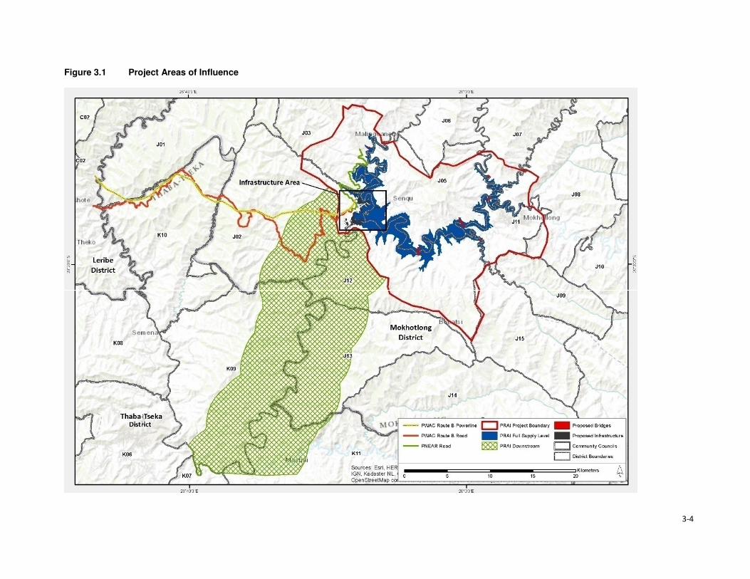
3-4
Figure 3.1 Project Areas of Influence

Section 3 • Approach and Methods
3-5
3.2.4 Planning for Data Collection
The social data gathering process was planned to build upon the in-depth work already undertaken
where approximately 11,006 households were surveyed across the Project Area (CES, 2015b). Given
the fact that the previous social studies were undertaken roughly three years ago and the fact that
the Project Area is rural, the socio-economic information contained in these reports is deemed to be
valid. As such, a decision was made by the Consultant not to conduct additional household surveys
as part of the Social Specialist study for the ESIA; but, rather ground-truth and collect supplementary
data. The combination of existing information (from previous studies) and complementary data
collected was triangulated and collated into this updated and integrated socioeconomic report that
includes a detailed description of the demographics, livelihoods, access to public services and
infrastructure as well as dependence on, and utilisation of, natural resources.
Furthermore, it was anticipated that this approach would eliminate issues of stakeholder fatigue
associated with over-consultation, especially given that the resettlement planning specialist team was
expected to commence with the household census and asset inventory soon after the departure of
the ESIA social specialist team.
3.2.4.1 Development of Data Collection Tools
Multiple open-ended questionnaires were developed for different types of stakeholders engaged.
FGDs were planned with groups of men, women, and youths, and key informant interviews were
scheduled and held with various government and traditional authorities.
A FGD guide was developed and tailored to solicit information trends across different issues of
discussion at FGD sessions. The objective of the focus group discussions was to solicit from the
identified groups how they thought the PRAI is going to impact them and their livelihoods, be it
positively or negatively. If negatively how they thought the impacts should be mitigated and if
positively, how they think the impacts should be enhanced. The questions within the FGD guide
ranged from land tenure, livelihood strategies, which included farming and its challenges (both crop
and livestock), income generating activities and use of natural resources to earn a living, among
others. The tool also solicited information regarding infrastructure (health facilities, schools and
roads). The guide consisted of open-ended questions as a measure against the “yes” and “no”
responses from participants. Further, data validation questions were included in the guide to identify
instances where participants had negated themselves with their responses to similar questions.
The KII guide was tailored for individuals in specific roles within their communities, in government or
non-governmental space. The main purpose of KIIs was to ground truth information gathered from
the community members and that presented in the previous social studies as well as to gather
additional information to be used in updating the baseline. The interview guide consisted of open
ended questions to allow for in-depth discussions. The traditional leaders who were interviewed as
key informants were mainly to attain information relating to land tenure system and governance issues
within the Project Area. Besides the ground truthing of the FGD discussions, the government
department interviewees were also asked how they saw the PRAI impacting on their activities within
the Project Area.
3.3 Methodology 3.3.1 Sampling
Regarding sampling, the plan was to divide participants into three groups (men 36+ years; women 36
+ years and youth 18 – 35 years) with a maximum of 12 per group. The groups were to have at least
one representative from each of the villages in a cluster. However, during execution, this became
impractical due to the reasons highlighted in Section 3.2.4.

Section 3 • Approach and Methods
3-6
Key informant interviews were targeted at district heads of departments, traditional leaders, chiefs,
councillors, NGOs and Associations and other randomly selected informants, such as business
people.
3.3.2 Execution
The focus group discussions were held immediately after the completion of the community meetings
(pitsos) associated with the public participation process and participants were asked to form the three
groups as per the sampling plan. However, the participants did not adhere to this rule as they believed
that valuable information was going to be discussed in the groups. This meant that most of the FGDs
comprised of 20 or more people depending on the pitso attendance. In cases where more than 20
participants formed a group, the Consultant would sub-divide the group further to better accommodate
those present and to provide an environment more conducive to attendee participation. In Malubalube
participants refused to be divided into focus groups and demanded to be engaged as a group. In Ha
Makhabane, Linakeng and Ha Koeneo clusters the community meeting attendance was low, and a
decision was made to hold joint focus group sessions.
In Likomeng no focus group discussions were conducted as the members of this cluster had
participated in focus groups in Makhoatsing and Hlokoa-le-mafi. The villages that form these clusters
all fall under one Area Chief and when the Chief sent out messages about the meetings, people
attended the first two meetings that were held in Mohlanapeng and Hlokoa-le-mafi.
At the end of the focus group discussions, community members gathered for a feedback and a
consensus building session on issues discussed at each of the groups.
In total, 117 FGDs were held across the Project Area (Table 3.3). This represented 98% of the
intended 120. At a district level, KIIs were held with department heads, NGOs, Associations and
Chiefs/Councillors as well as business owners (Table 3.2).
Table 3.2 List of Departments, NGOs and Local leadership who participated in KIIs
District Heads of
Departments
NGOs/ Association Chiefs/councillors
• Agriculture,
• Education,
• Labour,
• Health,
• Public works,
• Social development,
• Disaster management,
• Culture
• Tourism,
• Meteorology
• Police, and
• Trade.
• Transformation Resource
Centre,
• Deutsche Gesellschaft für
Internationale
Zusammenarbeit (GIZ)
Participatory Initiative for
Social Accountability (PISA)
Lesotho (GIZ-PISA),
• Lesotho Red Cross Society,
• Touching Tiny Lives, and
• Mokhotlong Wool and
Mohair Growers
Association.
Business:
• Cashbuild
• Guest house
• Hardware and grocery store
• Ha Letjama,
• Ha Mojakisane,
• Hlokoa-le-mafi,
• Makhomalong,
• Mapholaneng, and
• Tloha-re-Bue.
At the community level, local chiefs and councillors were also interviewed to gather information
related to demographics, land tenure and management, access to and uses of natural resources.
One ad hoc meeting was held with the Mokhotlong Wool and Mohair Growers Association. A total of
27 KIIs were conducted with stakeholders.

Section 3 • Approach and Methods
3-7
The team held numerous informal conversations with various community members and made general
observations some of which are demonstrated in the pictures found throughout this report. The aim
of these ad hoc conversations and general observations was to verify some of the information that
was collected.
3.3.3 Data Management and Analysis
A tabular format was used to capture and collate the information gathered from all 117 FGDs
according to themes. Following this exercise, information from other secondary sources including the
three social baseline reports was captured for triangulation and cross referencing purposes. The data
was analysed according to recurring themes and integrated into this report.

3-8
Table 3.3 Schedule of Focus Group Discussions
Area Council Meeting Village Village Cluster Actual Villages Present during PPP/SIA sessions
Dow
nstr
eam
clu
ste
rs
Seate
Com
munity C
ouncil
Hlokoa-le-Mafi West_5 (Ha Lejone, Ha Makhabu, Liphookoaneng, Ha Cornela, Ha Nkhaulise, Hlokoa-le-Mafi)
Hloakoa le mafi, Ha Makhabu, Khamolane, Khotleng, Mafikeng, Liphokoaneng, Mohlanapeng, Thepung-Poka Lephene, Mapoteng, Nkhaolise, Thaka-Tsilo, Makhoatsing, Noha-Lia-Loana, Matseleng, Lihlabeng, Ha Liete, Molumong, Likomeng, Moeaneng
Ha Nts'asa West_6 (Ha Ntsasa, Ha Ramokobo, Mafika Lisiu, Ha Malelu, Ha Moatsoetlane, Ha Rahlena, Khamolane)
Ha Ntsasa,Ha Ramokobo, Khamolane, Lihlabeng, Sekhutlong, Tsepong
Taung West_7 (Taung/Khokooeng, Masakoaneng, Maqhaung, Makhiseng, Freistata, Liphofung, Letapeng, Manonyana)
Masokoaneng, Taung, Majakeng, Makhiseng, Ha Phatsoane, Ha Maotoana, Makhoaba, Letlapeng, Masalla, Hajeke, Ha Seotsanyane, Thepung, Marisele
Khotsang West_8 (Khotsang, Letlapeng, Nqobelle, Ha Setene, Semapong, Tena-Baphehi, Lipeleng)
Khotsang, Bahaoleng, Tena Baphehi, Makhoaba, Ha Mei, Letlapeng Nqobelle
Ha 'Mei West_8 (Ha Mei, Thuhloane, Tibising, Moeaneng, Motse-mocha) Tibising, Ha Mei, Thuhloane, Motse-Mocha
Makhoarane West_9 (Matikiring, Ha Matekase, Ha Letheha) Matikiring, Makokoaneng, Ha Letheha, Matekase, Makhoarane, Sekhutlonyaneng, Matikiki, Sekhutlong, Thuhloane,
Bo
ko
ng
Co
mm
un
ity C
ou
ncil
Mohlanapeng West_3 (Noha-lia-loana, Ha Hashepe, Tsotsoaneng, Khamolane, Porotong, Mohlanapeng, Khutlo-se-Nonne)
Noha Lia Loana, Letsatseng, Mohlanapeng, Ha Heshepe, Kholong, Likomeng-Ha Thaka-Tsilo, Mapoteng, Botsong, Mafikeng, Khotleng, Lekhalaneng, Likomeng ha Marutle, Tsutsoaneng, Mabuleng, Ha Letjama, Maitisi, Khutlo-se- Nonne, Ha Molise, Maqalikeng
Likomeng West_4 (Makoatsing, Letsatseng, Mokhoabong, Mapoteng, Khotleng, Likomeng (Ha Thakatsilo), Mafikeng, Ha Pokalephele, Lihlabeng, Ha Thoso)
People from this cluster attended sessions at Mohlanapeng & Hlokoa-le-mafi
Maqalikeng West_2 (Kholokoe, Mokhangoaneng, Thaba Sephara, Ha Kakuli, Maqalikeng, Khotolieng, Manokong)
Maqalikeng, Mokhangoaneng, Thaba-Sephara, Manokong, Ha Molise, Khotolieng
Mokhalong West_1 (Mokhalong, Mahuleng, Koting-sa-Mofao, Phaleng, Ha Lephakha, Makhapung, Ha Letebele (Ha Leruo))
Mokhalong, Mahuleng, Phaleng, Ha Lephakha
Men
oan
en
g
Co
mm
un
ity
Co
un
cil
Nkokamele East_1 (Likhameng, Liokhoane, Ha Motubehi, Mabeulung, Ha Lehloenya, Mochochononong, Nkokamele, Masakong, Ha Motseare, Makorotong, Taung 1 & Taung 2, Koma Koma)
Nkokamele, Ha Motseare, Nqobelle
Ha Moeketsane East_2 ( Ha Moeketsane, Ha Mohale, Phahameng,Ha 'Mamothopeng, Sephokong, Khorole, Tibising, Mafikeng)
Ha Moeketsane, Moreneng, Makorotong, Mafikeng, Tibising, Ha Moleko, Ha Mokoena, Ha Makaka

3-9
Area Council Meeting Village Village Cluster Actual Villages Present during PPP/SIA sessions
Lilatoleng East_3 ( Lilatoleng, Ha Sibi, Ha Ralitlhare, Ha Ntsika, Tsekong, Ha Lehloenya)
Ha Ntsika, Ha Sibi, Tsekong, Ha Ralitlhare, Ha Lehloenya, Bobatsi, Moeling, Lipeleng, Ha Lekhehle, Ha Taelo
Linakeng East_4 ( Ha Moropane, Ha Jontane, Ha Taelo, Ha Rajoalane, Kholoke, Linakeng (Ha Mphosi), Matlatseng, Sankoela (Makhahleleng)
Linakeng, Ha Mphosi, Likhahleng
Po
lih
ali C
atc
hm
en
t Seate
Co
mm
un
ity C
ou
ncil
Malingoaneng/ Khubelu
ALC S1 (Tloha-re-Bue, Malingoaneng, Masakong, Ha Tlhakola, Ha Ramonakalali, Ha Jobere, Sotoane)
Tloha-re-Bue, Masakong
Nts'upe ALC S2 (Nts'upe, Linokong) Ntsupe, Makorong, Phuthing, Terae Hoek, Mafikeng, Ha Tlontlollo,
Sebera ALC S3 (Sebera, Ha Nts'esanyane, Letsatsaneng, Likoting, Checheng)
Mateaneng, Teraeng, Sebera, Phokeng, Sekoka, Likoting, Letsaneng, Ha Ntsesanyane, Bolahla, Ha Ramoruti
Mapholaneng ALC S4 (Mapholaneng, Ha Leqabanyo) Mafika-Lisiu. Motete, Meketeng, Polomiti, Majakaneng, Ha Lechela, Ha Leqabanyo, Ha Ntsetsanyane, Makalieng, Taung, Likoung, Khubelu, Sefate, Mofolaneng, Tsepong, Phatlalla, Lithoteng, Perekising, Matebeng, Ha Matsieng
Mofolaneng ALC S5 (Mofolaneng, Likoung, Mokhoabong, Bochabela, Manganeng, Matebeng, Lithoteng)
Mofolaneng, Tsepong, Mangaung, Phatlalla, Mokhoabong, Lithoteng, Sefate, Likoung, Lipululeng, Matebeng, Bochabela, Lebakana
Mahemeng ALC S6 (Mahemeng, Rammeleke) Mahemeng, Tsieng
Men
oan
en
g C
om
mu
nit
y
Co
un
cil
Ha Rafolatsane ALC MG5 (Ha Rafolatsane, Hloahloeng, Molumong, Ha Molungoa, Ha Sekantsi, Ha Lehlohonolo, Manganeng, Majakaneng, Matsekeng)
Ha Rafolatsane, Ha Lehlohonolo, Majakaneng, Molumong, Ha Molungoa, Manganeng, Namoha, Ha Sekantsi, Lilemeleng, Lekhalong, Sehlabeng
Ha Koeneo ALC MG6 (Ha Koeneo, Maphiring, Likoae, Jermiston, St James, Lekhalong)
Ha Koeneo
Libibing ALC MG4 (Libibing II, Tlhakoaneng, Manganeng, Maotleng, Sekoting, Thoteng, Letsatseng, Sekaneng, E-eang, Janteu, Tutulung, Ha Motebang)
Libibing 1, Libibing 2, Letsatseng, Tlhakoaneng, Terateng, Sekoting, Manganeng, Moeling, Janteu, Maotleng
Matlakeng ALC MG3 (Matlakeng, Bokone, Morojeleng, Ha Phatoli, Ha Nts'abele, Taung, Ha Mofali, Ha Makere, Hlomohang, Moeling, Molalana-Motse Mocha)
Ha Ntsebele, Taung, Koeneng, Moeling, Tsoenene, Ha Mofali, Ha Phatoli,
Ts'oenene ALC MG2 (Ts'oenene, Meeling, Thajana, Phatoli, Khohlong, Ha Setsoto, Sekokong, Bochabela)
Bochabela, Thajane, Sekokong

3-10
Area Council Meeting Village Village Cluster Actual Villages Present during PPP/SIA sessions
Malubalube ALC MG1 (Malubalube, Likhameng/Moeaneng, Ntjolo, Phate, Masofeng)
Likhameng, Masoefeng, Moeaneng, Ha Phate, Malubalube
Mo
kh
otl
on
g
Urb
an
Co
un
cil
Salang ALC MU1 (Salang, Checha, Teropong) Checha, Ntlholohetsane
Bafali ALC MU2 (Bafali, Ha Poso, Ntsiking Bafali) Bafali, Bafatsana,Ntsining, Masaleng, Mabitseng, Ha Seeta, Bafali- Nkotoane,
Ntlholohetsane ALC MU3 (Ntlholohetsane1, Ntlholohetsane2) Ntlholohetsane, Senkoase
Thabang ALC MU4 (Thabang) Thabang, Mangaung, Liraholeng
Ha Mojakisane ALC MU5 (Ha Mojakisane) Mojakisane, Sekeketeng
Mp
ho
ko
joan
e C
om
mu
nit
y C
ou
ncil
Meta/Mabuleng ALC MP1 (Ha Maleka, Thoteng, Ha 'Meta, Kheseng, Ha Masetulo) Mabekong, Paballong, Khesing, Ha Meta, Litsoeneng, Moeaneng, Thoteng, Mokhalong, Pontseng, Kheseng, Koakoatsi, Lietsela, Sebothoane, Thoteng Ha Lesoeja, Masholoko, Moreneng, Sekoting Ha Tipi
Tlokoeng ALC MP2a (Tlokoeng, Liphokong, Botsola, Ha Mpesi, Makalong, Tlokoeng, Matebeleng)
Tlokoeng, Botsola, Maitisi, Mabelete, Mabeleteng, Ha Mpesi
Lilimala ALC MP2b (Lilimala, Tsekong, Majakaneng, Ha Konki, Lits'otsong) Lilimala, Makalong, Ha Konki, Tsilantso Ha Konki, Kanana, Litsotsong
Ha Lebopo (Mahesheleng)
ALC MP8 (Lebopo, Masuoaneng) Ha Lebopo, Ha Mathibeli, Ha Ramoruti, Mabothong, Koatanyane, Ha Koatake, Ha Ramohale, Sekokong
Ha Makhabane ALC MP6 (Ha Makhabane) Ha Makhabane
Makhomalong ALC MP3 (Makhomalong, Majakaneng, Moeaneng, Ha Mohlabakobo, Matsoapong, Phohla)
Matsoapong, Phohla, Makhomalong, Makaoteng
Sekokong ALC MP4 (Sekokong, Ha Moruti, Taung, Ha Koatake, Mobothong, Kanana, Makhoabeng, Ha Ramohale, Ha Mathibeli)
Ha Ramoruti, Mabothong, Ha Ramohale, Sekokong, Ha Lebopo, Ha Koatake, Taung, Ha Mathibeli, Kanana, Thotanyane
Ha Letjama ALC MP5 (Ha Letjama, Maitisi, Letlapeng, Ha Ts'ese, Mabuleng, Khohlong)
Khohlong, Letjama, Tshehle
Motsitseng ALC MP7 (Motsitseng, Sekoka, Lumang, Mpharane) Motsitseng, Sekoka

Section 3 • Approach and Methods
3-11
3.3.4 Impact Assessment
Impacts were assessed in accordance with the standard impact assessment methodology provided
by ERM and the ratings provided in Table 3.4. Significance ratings are assigned for impacts before
mitigation is applied (‘pre-mitigation) and after mitigation has been applied (‘residual’)5.
A more detailed description of the methodology is provided in the Environmental and Social Impact
Statement (ESIS).
Table 3.4 Impact Significance Rating Table
Evaluation of Significance Sensitivity/Vulnerability/Importance of Resource/Receptor
Low Medium High / Very High
Magnitude of
Impact
Negligible Negligible Negligible Negligible
Small Negligible Minor Moderate
Medium Minor Moderate Major
Large Moderate Major Critical
Positive Impacts
Positive Minor Moderate Major
3.3.4.1 Magnitude
Magnitude essentially describes the intensity of the change that is predicted to occur in the
resource/receptor as a result of the impact. A magnitude rating tends to reflect a combination of the
size of an area that may be affected, the duration over which the aspect may be altered, and the size,
degree or scale of that change. In essence, magnitude is a descriptor for the degree of change that
is predicted to occur in the resource or receptor.
For positive impacts (which are mostly socio-economic impacts) magnitude is generally categorised
as ‘Positive’ unless sufficient information is available to support a more robust characterisation and
to assign the degree of magnitude as Small, Medium or Large. For instance, if the number of jobs to
be assigned to local community members is confirmed or if the size or value of the contribution to the
national, regional or district economy is known then a magnitude rating can be assigned. If not, then
the significance rating is assigned based on the sensitivity of the feature impacted by a specific activity
or change.
The term ‘magnitude’ therefore encompasses all the characteristics of the predicted impact including:
• Extent;
• Duration;
• Scale;
• Frequency; and
• Likelihood (only used for unplanned events).
The impact characteristic terminology to be used during the impact assessment is summarised in
Table 3.5.
Table 3.5 Impact Characteristic Terminology
Characteristic Definition Designations
Type A descriptor indicating the relationship of the
impact to the Project (in terms of cause and
effect).
• Direct
• Indirect
• Induced
5 Residual impact ratings are often referred to as post-mitigation ratings elsewhere but are considered the same in this report.
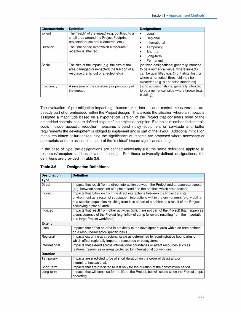
Section 3 • Approach and Methods
3-12
Characteristic Definition Designations
Extent The “reach” of the impact (e.g. confined to a
small area around the Project Footprint,
projected for several kilometres, etc.).
• Local
• Regional
• International
Duration The time period over which a resource /
receptor is affected.
• Temporary
• Short-term
• Long-term
• Permanent
Scale The size of the impact (e.g. the size of the
area damaged or impacted; the fraction of a
resource that is lost or affected, etc.)
[no fixed designations; generally intended
to be a numerical value, where impacts
can be quantified e.g. % of habitat lost; or
where a numerical threshold may be
exceeded (e.g. air or noise standards]
Frequency A measure of the constancy or periodicity of
the impact.
[no fixed designations; generally intended
to be a numerical value where known (e.g.
blasting)]
The evaluation of pre-mitigation impact significance takes into account control measures that are
already part of or embedded within the Project design. This avoids the situation where an impact is
assigned a magnitude based on a hypothetical version of the Project that considers none of the
embedded controls that are defined as part of the project description. Examples of embedded controls
could include acoustic reduction measures around noisy equipment or servitude and buffer
requirements the development is obliged to implement and is part of the layout. Additional mitigation
measures aimed at further reducing the significance of impacts are proposed where necessary or
appropriate and are assessed as part of the ‘residual’ impact significance rating.
In the case of type, the designations are defined universally (i.e. the same definitions apply to all
resources/receptors and associated impacts). For these universally-defined designations, the
definitions are provided in Table 3.6.
Table 3.6 Designation Definitions
Designation Definition
Type
Direct Impacts that result from a direct interaction between the Project and a resource/receptor
(e.g. between occupation of a plot of land and the habitats which are affected).
Indirect Impacts that follow on from the direct interactions between the Project and its
environment as a result of subsequent interactions within the environment (e.g. viability
of a species population resulting from loss of part of a habitat as a result of the Project
occupying a plot of land).
Induced Impacts that result from other activities (which are not part of the Project) that happen as
a consequence of the Project (e.g. influx of camp followers resulting from the importation
of a large Project workforce).
Extent
Local Impacts that affect an area in proximity to the development area within an area defined
on a resource/receptor-specific basis.
Regional Impacts occurring at a regional scale as determined by administrative boundaries or
which affect regionally important resources or ecosystems.
International Impacts that extend across international boundaries or affect resources such as
features, resources or areas protected by international conventions.
Duration
Temporary Impacts are predicted to be of short duration (in the order of days) and/or
intermittent/occasional.
Short-term Impacts that are predicted to last only for the duration of the construction period.
Long-term Impacts that will continue for the life of the Project, but will cease when the Project stops
operating.

Section 3 • Approach and Methods
3-13
Designation Definition
Permanent Impacts that cause a permanent change in the affected receptor or resource (e.g.
removal or destruction of ecological habitat) that endures substantially beyond the
Project life time.
3.3.4.2 Sensitivity
Characterisation of sensitivity for social and cultural heritage receptors is based on the value of that
social and cultural heritage receptor/s and its vulnerability to the impact, taking into account the
receptor’s resilience, including ability to adapt to change or use alternatives where available.
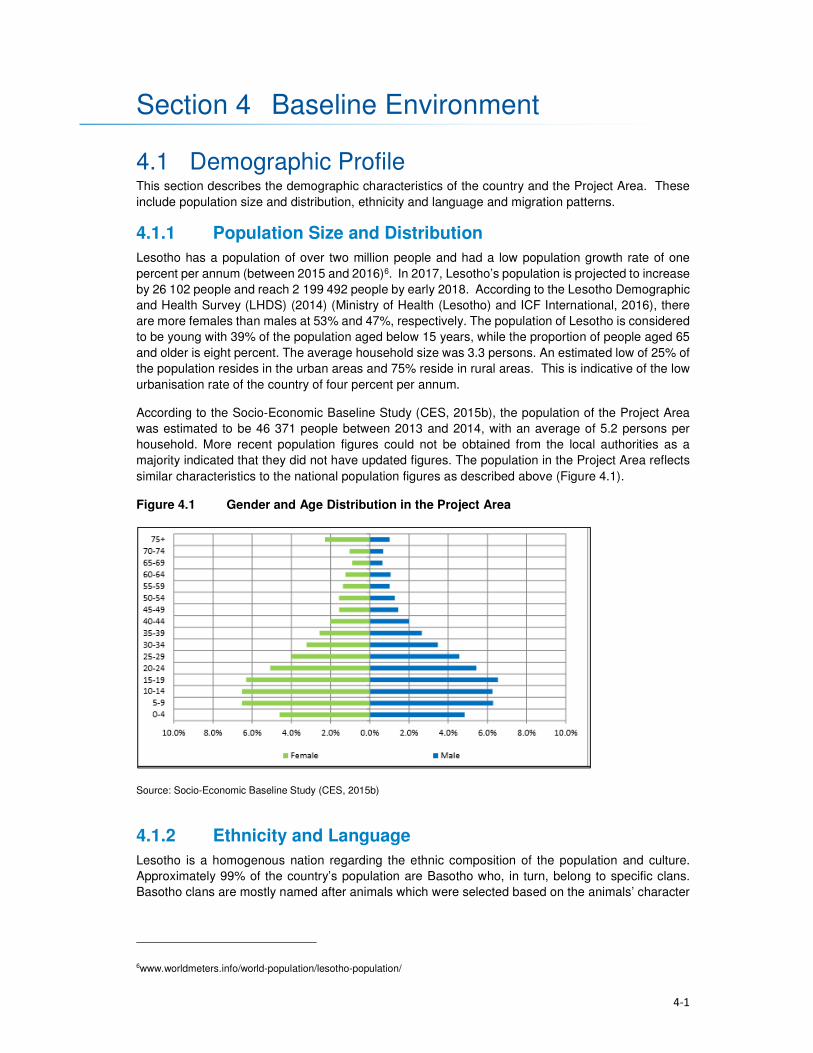
4-1
Section 4 Baseline Environment
4.1 Demographic Profile This section describes the demographic characteristics of the country and the Project Area. These
include population size and distribution, ethnicity and language and migration patterns.
4.1.1 Population Size and Distribution
Lesotho has a population of over two million people and had a low population growth rate of one
percent per annum (between 2015 and 2016)6. In 2017, Lesotho’s population is projected to increase
by 26 102 people and reach 2 199 492 people by early 2018. According to the Lesotho Demographic
and Health Survey (LHDS) (2014) (Ministry of Health (Lesotho) and ICF International, 2016), there
are more females than males at 53% and 47%, respectively. The population of Lesotho is considered
to be young with 39% of the population aged below 15 years, while the proportion of people aged 65
and older is eight percent. The average household size was 3.3 persons. An estimated low of 25% of
the population resides in the urban areas and 75% reside in rural areas. This is indicative of the low
urbanisation rate of the country of four percent per annum.
According to the Socio-Economic Baseline Study (CES, 2015b), the population of the Project Area
was estimated to be 46 371 people between 2013 and 2014, with an average of 5.2 persons per
household. More recent population figures could not be obtained from the local authorities as a
majority indicated that they did not have updated figures. The population in the Project Area reflects
similar characteristics to the national population figures as described above (Figure 4.1).
Figure 4.1 Gender and Age Distribution in the Project Area
Source: Socio-Economic Baseline Study (CES, 2015b)
4.1.2 Ethnicity and Language
Lesotho is a homogenous nation regarding the ethnic composition of the population and culture.
Approximately 99% of the country’s population are Basotho who, in turn, belong to specific clans.
Basotho clans are mostly named after animals which were selected based on the animals’ character
6www.worldmeters.info/world-population/lesotho-population/
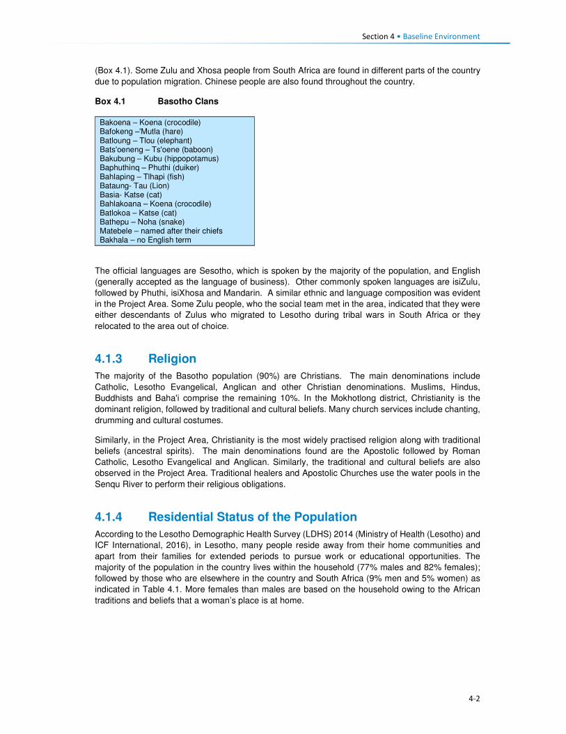
Section 4 • Baseline Environment
4-2
(Box 4.1). Some Zulu and Xhosa people from South Africa are found in different parts of the country
due to population migration. Chinese people are also found throughout the country.
Box 4.1 Basotho Clans
Bakoena – Koena (crocodile) Bafokeng –'Mutla (hare) Batloung – Tlou (elephant) Bats'oeneng – Ts'oene (baboon) Bakubung – Kubu (hippopotamus) Baphuthinq – Phuthi (duiker) Bahlaping – Tlhapi (fish) Bataung- Tau (Lion) Basia- Katse (cat) Bahlakoana – Koena (crocodile) Batlokoa – Katse (cat) Bathepu – Noha (snake) Matebele – named after their chiefs Bakhala – no English term
The official languages are Sesotho, which is spoken by the majority of the population, and English
(generally accepted as the language of business). Other commonly spoken languages are isiZulu,
followed by Phuthi, isiXhosa and Mandarin. A similar ethnic and language composition was evident
in the Project Area. Some Zulu people, who the social team met in the area, indicated that they were
either descendants of Zulus who migrated to Lesotho during tribal wars in South Africa or they
relocated to the area out of choice.
4.1.3 Religion
The majority of the Basotho population (90%) are Christians. The main denominations include
Catholic, Lesotho Evangelical, Anglican and other Christian denominations. Muslims, Hindus,
Buddhists and Baha'i comprise the remaining 10%. In the Mokhotlong district, Christianity is the
dominant religion, followed by traditional and cultural beliefs. Many church services include chanting,
drumming and cultural costumes.
Similarly, in the Project Area, Christianity is the most widely practised religion along with traditional
beliefs (ancestral spirits). The main denominations found are the Apostolic followed by Roman
Catholic, Lesotho Evangelical and Anglican. Similarly, the traditional and cultural beliefs are also
observed in the Project Area. Traditional healers and Apostolic Churches use the water pools in the
Senqu River to perform their religious obligations.
4.1.4 Residential Status of the Population
According to the Lesotho Demographic Health Survey (LDHS) 2014 (Ministry of Health (Lesotho) and
ICF International, 2016), in Lesotho, many people reside away from their home communities and
apart from their families for extended periods to pursue work or educational opportunities. The
majority of the population in the country lives within the household (77% males and 82% females);
followed by those who are elsewhere in the country and South Africa (9% men and 5% women) as
indicated in Table 4.1. More females than males are based on the household owing to the African
traditions and beliefs that a woman’s place is at home.
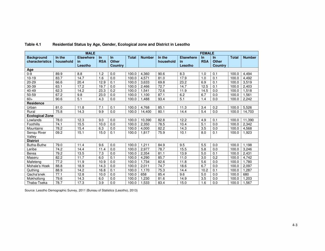
4-3
Table 4.1 Residential Status by Age, Gender, Ecological zone and District in Lesotho
MALE FEMALE
Background characteristics
In the household
Elsewhere in Lesotho
In RSA
In Other Country
Total Number In the household
Elsewhere in Lesotho
In RSA
In Other Country
Total Number
Age
0-9 89.9 8.8 1.2 0.0 100.0 4,360 90.6 8.3 1.0 0.1 100.0 4,494
10-19 83.7 14.7 1.6 0.0 100.0 4,571 81.0 17.9 1.0 0.1 100.0 4,492
20-29 66.6 20.4 12.9 0.1 100.0 3,633 69.8 23.2 6.9 0.1 100.0 3,519
30-39 63.1 17.2 19.7 0.0 100.0 2,466 72.7 14.7 12.5 0.1 100.0 2,403
40-49 62.3 14.2 23.3 0.2 100.0 1,541 72.6 11.9 14.5 0.0 100.0 1,518
50-59 67.2 9.8 23.0 0.0 100.0 1,100 87.1 6.2 6.7 0.0 100.0 1,561
60+ 90.6 5.1 4.3 0.0 100.0 1,488 93.4 5.1 1.4 0.0 100.0 2,242
Residence
Urban 81.0 11.8 7.1 0.1 100.0 4,768 85.1 11.3 3.4 0.2 100.0 5,526
Rural 75.8 14.3 9.9 0.0 100.0 14,400 80.1 14.4 5.4 0.0 100.0 14,703 Ecological Zone
Lowlands 78.0 12.3 9.0 0.0 100.0 10,390 82.8 12.2 4.9 0.1 100.0 11,390
Foothills 74.1 15.5 10.0 0.0 100.0 2,350 78.5 10.4 5.1 0.0 100.0 2,342
Mountains 78.2 15.4 6.3 0.0 100.0 4,000 82.2 14.3 3.5 0.0 100.0 4,568
Senqu River Valley
09.2 15.1 15.0 0.1 100.0 1,817 75.9 10.1 8.0 0.1 100.0 1,923
District
Butha-Buthe 79.0 11.4 9.6 0.0 100.0 1,211 84.9 9.5 5.5 0.0 100.0 1,198
Leribe 74.2 14.4 11.4 0.0 100.0 2,977 78.7 15.5 5.8 0.0 100.0 3,246
Berea 79.2 13.5 7.3 0.0 100.0 2,354 81.1 13.9 5.0 0.1 100.0 2,431
Maseru 82.2 11.7 6.0 0.1 100.0 4,290 85.7 11.0 3.0 0,2 100.0 4,742
Mafeteng 77.2 11.9 10.9 0.0 100.0 1,734 82.6 11.8 5.6 0.0 100.0 1,780 Mohale's Hoek 88.8 18.9 14.3 0.0 100.0 2,011 74.7 18.6 6.7 0.0 100.0 2,097
Quthing 88.9 14.2 16.8 0.1 100.0 1,170 75.3 14.4 10.2 0.1 100.0 1,287
Qacha'snek 77.1 12.8 10.0 0.0 100.0 658 85.4 9.6 5.0 0.0 100.0 680 Mokhotlong 79.6 14.3 6.0 0.0 100.0 1,230 81.6 14.9 3.5 0.0 100.0 1,203
Thaba-Tseka 78.7 17.3 3.9 0.0 100.0 1,533 83.4 15.0 1.6 0.0 100.0 1,567 Source: Lesotho Demographic Survey, 2011 (Bureau of Statistics (Lesotho), 2013)

Section 4 • Baseline Environment
4-4
The Mokhotlong district and Project Area population followed the national trends regarding residential
status, including people living in South Africa (six percent males and nearly four percent females).
Participants in focus group discussions indicated that some female youth often went to South Africa
to seek employment and return home when the job or contract has been finished/ terminated. These
youths highlighted the shortage of job opportunities in the District and Project Area as the motivation
for them seeking employment outside of the country.
4.1.5 Migration
In Lesotho, the majority of migrants were young men working in the South African mines; however,
since the 1990s the patterns of migration have changed substantially due to the general decline in
mine employment in South Africa. The decline in mine employment in South Africa for Basotho from
Lesotho has given rise to new forms of migration and an increase in female migration. The number
of skilled migrants has also been on the increase. Younger and single/separated women have
increasingly been employed in domestic work and on commercial farms in South Africa.
The common practice in the country is for people to move from rural areas to urban towns to look for
employment, especially in the textile industry. Immigrants are mostly of Asian origin in the garment
and textile industry. According to the 2011 Lesotho Demographic Survey (Bureau of Statistics
(Lesotho), 2013), three percent of the population enumerated in Mokhotlong were lifetime migrants
from other districts, and 11% were out-migrants of the same district. This shows that there are very
few in-migrants into the Mokhotlong District. There is very little in-migration to the Project Area. The
common practice is for people to relocate to place within the Project Area either due to the desire of
being closer to family members or closer to services such as schools and health facilities. Out-
migration to more distant locations was common in the Project Area with people moving either to the
lowlands or South Africa in search of employment opportunities.
4.2 Cultural Practices This section describes the cultural practices in Lesotho and the Project Area.
4.2.1 Cultural Practices
Basotho culture is centred around village life, with the majority of traditions and festivals based on the
seasons. The most common cultural activities are related to marriage, birth, and death, coming of
age (initiations), and giving thanks to the ancestors. These are described briefly in Box 4.2. More
specific information is provided in the Cultural Heritage (including Archaeology) Report (MM&A and
Pinto, 2017, P2W-6014-DFR-0003).
Both tangible and intangible heritage resources exist throughout Lesotho where people are still
involved in pottery, cowhide tanning coupled with bead work to make unique clothing for specific
ceremonies such as initiation graduations. The production of artefacts also includes musical
instruments, hats and baskets; however, the skill appears to be more prevalent amongst the elderly
than the youth.
Three hundred and fifty-five (355) heritage sites have been documented in the whole of Lesotho with
42 such sites having been recorded within the District of Mokhotlong alone. Twenty-four of the 42 are
directly relevant to the Polihali Catchment Area, 10 of these refer to rock shelters with rock art, lithics
or other material remains, many of which will be impacted by inundation. The historic structures/sites
of note were located at Likomeng, Makhiseng, Malingoaneng, Mahemeng and Tlokoeng within the
area of the Batlokoa, with Thabang, Motsitseng Ha Mankata, Ha Lebopo, Ha Rafolatsane, and
Molumong on the Khalahali side (for additional information refer to the Cultural Heritage (Including
Archaeology) Report, P2W-6014-DFR-0003).

Section 4 • Baseline Environment
4-5
Box 4.2 Significant Basotho Traditions
4.2.2 Social Networks
The extended family system is one of the most important social systems in Lesotho as elsewhere in
Africa, and more specifically in the rural areas than urban areas. The system is based on the concepts
of collectivism and mutual assistance, where extended families typically share property such as
livestock and activities such as farming, the building of houses, rituals, feasts and arbitration of
disputes among family members. In the more urban areas, the system is shifting as a result of
changing world views (increased exposure), education and mechanisation of agricultural activities.
However, in the Project Area, extended networks are still critical as people are heavily reliant on each
other for support.
Besides, the extended family systems, the most prominent social networks in rural Lesotho and the
Project Area are burial schemes, stokvels, cooperatives (matsema), Church associations, village
police and Village Health Workers/ Community Health Workers (VHW or CHWs). These are described
in detail below.
Burials schemes (mpate sheleng) are usually informal in that they are formed by people of low
income, whereby members pay as little as ten cents per month as a contribution towards having a
fund to assist each other in cases of the passing of family members or relatives or dependents. These
schemes remain prevalent in rural communities across Lesotho including the Project Area. Burial
schemes vary in what the money may cover; including the purchase of a coffin, groceries, a cow;
while others give out money upon the death of a member or covered relative and dependent (Irving,
2005).
Stokvels (mochaellano) are essentially a mechanism for enabling savings in the short-term; they vary
in structure across the country and may include:
• Rotational monthly sittings at homes of the individual members. The host prepares food and
alcohol which he/ or she sells to the other members to raise funds for him or herself.
• Members rotationally give a set amount of cash to a member of the group each month until each
member has been the recipient.
Marriage. This involves the payment of a dowry in the form of cattle (bohali). After the payment of bohali, a
sheep is slaughtered to welcome the bride-to-be into her new home and is given her marital name.
Births. Upon the birth of a child, certain cultural ceremonies and rites are performed including the baby
naming and welcoming of the child into the family. Some of these involve the slaughtering of a sheep;
however, due to the reduction in livestock herds, this tradition of slaughtering of sheep for babies is slowly
phasing out.
Deaths. When death occurs in a family, a cow is often slaughtered to accompany the deceased. The family
of the deceased usually wear mourning gowns for a month after which the dress is removed, and a
cleansing ceremony is performed by slaughtering of a sheep. In a case where the husband has passed, the
wife wears a mourning gown for three months to a year depending on circumstances, e.g. for a working
woman, the period is usually shorter. This is because there are a lot of restrictions associated with wearing a
mourning gown such as not being allowed to be away from home at sunset.
Initiation. The lebollo is a ceremony that is held when boys or girls attend their initiation. The initiates leave
home and stay at an initiation school for three to six months. After the initiation, feasts are held to celebrate
their return to their communities.
Giving thanks to the ancestors or Mokete oa Balimo. This is a ceremony performed to give thanks or
appease the ancestors by slaughtering of a cow whose hide is symbolically used as a blanket for the
ancestors who have visited the person in their dreams claiming to be cold. During this time people also ask
the ancestors for blessings.

Section 4 • Baseline Environment
4-6
• Members contribute an agreed amount of money per month towards purchasing of groceries to
be divided amongst the members at an agreed time, e.g. June and/or December.
• Members contribute an agreed amount and lend it out to each other, and non-members; the cash
is paid back with interest, the money (capital plus interest) is then divided equally amongst the
members at the end of the year (December).
The stokvels mentioned above all exist in the Project Area. The burial society and some stokvel
membership consist of both men and women, while some stokvels consist of only men or only women.
Matsema is a system where households work collectively during intense agricultural periods such as
ploughing and harvesting to provide support to each other during the year.
Church groups are formed along religious lines with the aim of promoting relationships within the
church community. These groups serve as religious and social groups and play different roles within
the church. Among these groups are cell groups, Bible studies, Sunday school classes, youth, men
and women groups.
Local community members form village police groups (mahokela) with the aim of assisting police to
combat crime in their communities. In the Project Area, these groups mostly exist to fight cases of
livestock theft which is said to be widespread across the area.
Village Health Workers or Community Health Workers (VHW or CHWs) originated in response to the
inadequate number of health facilities in the rural areas of Lesotho. These are trained volunteers; of
whom some are paid while others are not paid. Their duties include:
• Provision of medical assistance to sick people, elderly as well as orphaned and vulnerable
children (OVC) in their villages;
• Anthropometric growth monitoring of children under the age of five on a monthly basis;
• Provision of support to people on tuberculosis (TB) treatment (i.e. TB-DOTS support); and
• Provision of support to HIV infected people.
4.3 Land Tenure and Use This section describes the land tenure and land use in Lesotho, Mokhotlong District and the Project
Area.
4.3.1 Ownership of Land
Land in Lesotho is managed and administered by the Ministry of Local Government and Chieftainship
(MoLGC) under the Land Act (No 8), 2010. Lesotho follows the principle that land belongs to all
Basotho and it is held in trust by the King – with the King and Chiefs responsible for the distribution
and management of land. Historically, the land was administered through customary laws; which
entitled every married man with three agricultural fields and one piece of land to build his residence,
i.e. the traditional/customary land tenure system. The land allotted to an individual, could not be
bought, sold, transferred or exchanged.
In the 2000s, the government realised that communal ownership of land was becoming an obstacle
to the commercialisation of agriculture and food security; land reforms were introduced. This was
achieved through the enactment of the 2010 Land Act.
The Act provides for the following individuals as persons who may hold a title for any piece of land:
• The Government of Lesotho;
• All Lesotho citizens who are older than 18 years, except where the person is under 18 but married;
• Where the title is a result of a gift; and
• Where the title is a result of inheritance.

Section 4 • Baseline Environment
4-7
To acquire land one has to apply for it from the chief and local authority under whose jurisdiction the
land is located. Foreigner citizens cannot own land as individuals; however, foreign enterprises which
have at least 20% shareholding of Basotho can acquire rights in land for investment purposes.
Under the 2010 law, agricultural land that has not been cultivated for at least three consecutive years
is regarded as ‘abandoned’ land. Therefore, the land is taken by the Chief to be reallocated to another
person. Lease holding or the right to occupy such land can be terminated.
4.3.2 Types of Land Tenure
Lesotho’s land tenure system recognises three types of title namely; leasehold, Form C and license.
There are, however, also households that occupy the land without the appropriate title in place, i.e.
through the traditional/customary tenure system under which the land was allocated to citizens
through chiefs and headmen on behalf of the King.
Leasehold acts as a check on private subdivision and allocation of land. Under the leasehold system,
the leaseholder has the right to use and enjoy the property for the agreed period. A leaseholder may
lease out that very land under a sub-lease agreement. In practice the leasehold of land is inherited
by the family of the leaseholder; in effect, the land is never returned to the state unless it has become
apparent that it has been abandoned. In Lesotho there are various forms of leasehold for both rural
and urban areas; namely:
• Residential leases for a period of 90 years;
• Commercial and industrial leases for periods of 30 and 60 years;
• Agricultural leases for periods of 10–90 years; and
• Others, including religious, educational and charitable leases for periods of 90 years.
Leasehold agreements are registered at the office of the Land Administration Authority (LAA). Before
the LAA came into being, the registration of title to land was registered at the Deeds Registry. The
Deeds Registry Act, No. 12 of 1967, states that the registration of titles to land under the legal system
of Lesotho does not confer the right of ownership, but the right of title to occupy and utilise the land
and its resources. The Land Act entitles the leaseholder to transfer the title sub-lease, or use their
land as collateral for accessing credit from financial institutions; the title can also be passed on via
inheritance to a named family member.
• Owners of leases for a primary place of residence are exempt from paying ground rent; however,
those who have a lease on a second property are required to pay annual ground rent to the LAA.
Owners of leases for land for commercial, industrial or agricultural purposes are required to pay
annual ground rent to the LAA.
• Form C was abolished by the Land Act (No. 17) of 1979, however, to this date people in the rural
areas are still issued with the Form C as proof of land tenure; it refers to land that is allotted by
the Chief. All forms issued before the 1979 Land Act remained valid. Form Cs and title deeds
can be converted into leases.
• Licence is a land tenure system used for agricultural land within the urban areas. The tenure right
is called a licence, and the land right is neither transferable, subject to inheritance nor negotiable.
Licences are held under customary law.
According to the 2011 LDS (LBS, 2013), the most prominent form of land tenure in Lesotho was
allocation by chiefs (61%), followed by inheritance/gift (29%) and purchase from somebody (seven
percent). A similar scenario was true for the Mokhotlong District where 66% had land allocated by the
chiefs, followed by those who had inherited the land (32%). Only two percent of Mokhotlong land
owners had acquired land through purchasing it from somebody.
The most prominent form of land tenure in the Project Area is through inheritance (31%), followed by
traditional/customary tenure (29%) and title deed (25%). Thirty-eight percent of the people residing in
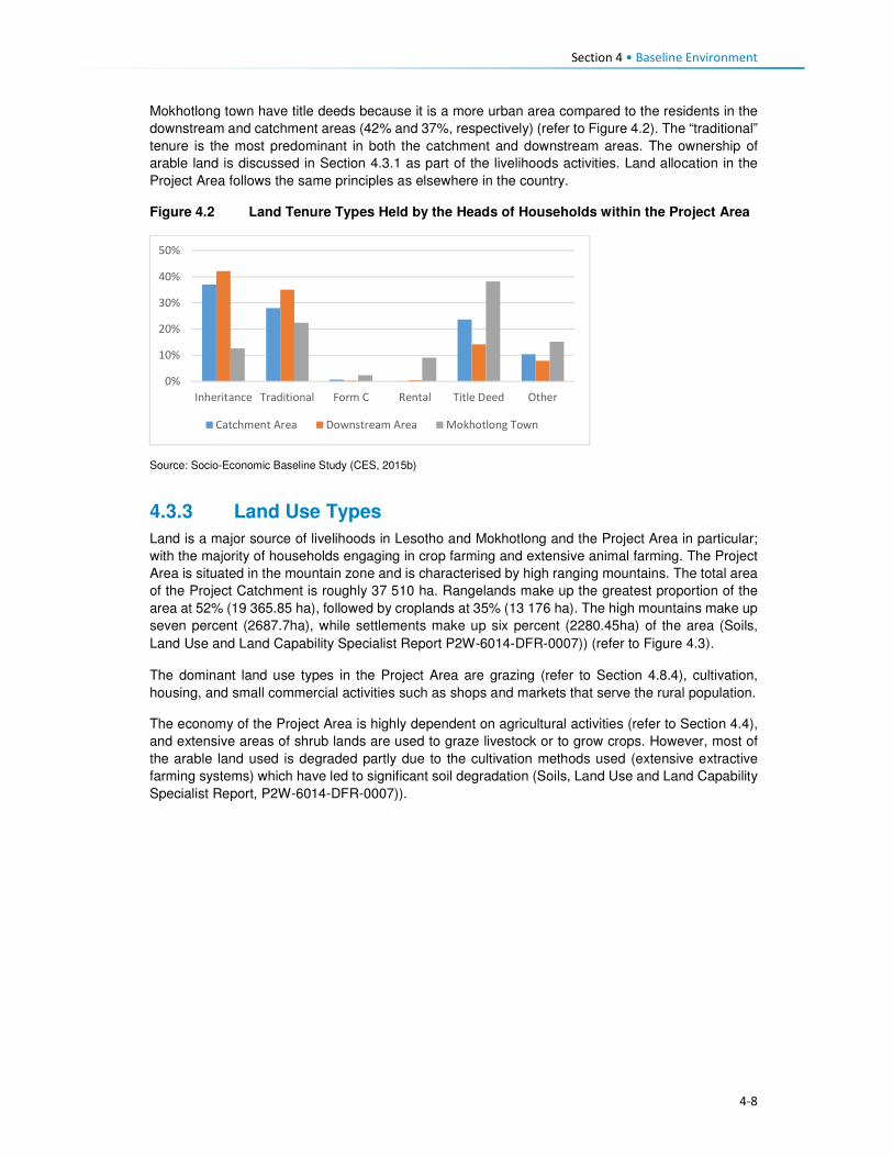
Section 4 • Baseline Environment
4-8
Mokhotlong town have title deeds because it is a more urban area compared to the residents in the
downstream and catchment areas (42% and 37%, respectively) (refer to Figure 4.2). The “traditional”
tenure is the most predominant in both the catchment and downstream areas. The ownership of
arable land is discussed in Section 4.3.1 as part of the livelihoods activities. Land allocation in the
Project Area follows the same principles as elsewhere in the country.
Figure 4.2 Land Tenure Types Held by the Heads of Households within the Project Area
Source: Socio-Economic Baseline Study (CES, 2015b)
4.3.3 Land Use Types
Land is a major source of livelihoods in Lesotho and Mokhotlong and the Project Area in particular;
with the majority of households engaging in crop farming and extensive animal farming. The Project
Area is situated in the mountain zone and is characterised by high ranging mountains. The total area
of the Project Catchment is roughly 37 510 ha. Rangelands make up the greatest proportion of the
area at 52% (19 365.85 ha), followed by croplands at 35% (13 176 ha). The high mountains make up
seven percent (2687.7ha), while settlements make up six percent (2280.45ha) of the area (Soils,
Land Use and Land Capability Specialist Report P2W-6014-DFR-0007)) (refer to Figure 4.3).
The dominant land use types in the Project Area are grazing (refer to Section 4.8.4), cultivation,
housing, and small commercial activities such as shops and markets that serve the rural population.
The economy of the Project Area is highly dependent on agricultural activities (refer to Section 4.4),
and extensive areas of shrub lands are used to graze livestock or to grow crops. However, most of
the arable land used is degraded partly due to the cultivation methods used (extensive extractive
farming systems) which have led to significant soil degradation (Soils, Land Use and Land Capability
Specialist Report, P2W-6014-DFR-0007)).
0%
10%
20%
30%
40%
50%
Inheritance Traditional Form C Rental Title Deed Other
Catchment Area Downstream Area Mokhotlong Town

4-9
Figure 4.3 Land Use in the Catchment Area

Section 4• Baseline Environment
4-10
4.4 Livelihood and Economic Activities This section describes the economy and livelihoods at a national, district and the Project Area.
4.4.1 National Overview
The economy of Lesotho is based on agriculture, livestock, manufacturing, mining, and depends
heavily on inflows of workers’ remittances from workers in the South Africa mines, farms and domestic
work and receipts from the Southern African Customs Union (SACU). An estimated 50% of the
population earns income through informal crop cultivation or animal husbandry with nearly two-thirds
of the country's income coming from the agricultural sector. Lesotho’s Gross Domestic Product (GDP)
growth was estimated at three percent in 2016.
According to the Human Development Report, 57% of the population lives below the national poverty
line and the national poverty head count ratio at purchasing power parity (PPP) of USD 1.25 a day
stands at close to 59%. Poverty is highest in the rural areas. Unemployment remains high at estimated
levels between 24% and 28%. The rate stands at 29%, and inequality is unacceptably high at a GINI
coefficient of 0.5.
Efforts to promote inclusive growth are constrained by the pressure of high HIV prevalence (23% of
the total population) and the instability of receipts from the Southern African Customs Union (SACU),
which finances 50% of the budget. The country’s GDP is primarily reliant on three sectors, namely
services (67%); industry (31%) and the agricultural sector (seven percent).
4.4.2 District and the Project Area Overview
Mokhotlong District has a largely agrarian economy consisting of livestock rearing and cropping.
Animal husbandry in the District is undertaken mainly for commercial purposes (that is the production
of wool and mohair). The sheep and goats are reared primarily for wool and mohair; for the sole
purpose to sell to national and international markets (mostly South Africa). Crop production is mainly
for household subsistence purposes, and surplus is often sold or bartered with neighbours.
These agricultural activities are severely impacted by the erratic weather conditions (high winds,
snowfalls, etc.) associated with the mountainous terrain. Furthermore, the poor weather conditions
mean that crop production is only able to sustain households for three to nine months of the/ year.
Thus, households tend to make-up the shortfall through livestock rearing to generate household
income in the lean months as well as remittances from household members that are employed (if at
all). In general, income is limited due the high unemployment rate in the country and specifically in
the Project Area.
Crop production is the principal source of livelihood strategy practised in the Project Area, and this is
followed by remittances: permanent and seasonal employment, the sale of livestock products and
social grants, as indicated in Figure 4.4. The harvesting and sale of natural resources (wild plants,
fruit, timber, etc.) featured high as third to fifth principal livelihoods activities. Other interesting
livelihood strategies mentioned included subsistence from gathering and sale of wild plants.
The main livelihoods strategies of the population identified above are discussed in detail in the
subsequent sections.

Section 4 • Baseline Environment
4-11
Figure 4.4 Livelihood Strategies of the Affected Population in Percentages
Source: Socio-Economic Baseline Study (CES, 2015b)
4.4.3 Crop Production
4.4.3.1 Access to Arable Land
Arable land is a scarce resource in the Project Area, due to the mountainous terrain and soil
degradation resulting from soil erosion. The majority of arable land is located in the low lying areas
near the villages and along the river banks where sediments from soil erosion have settled. Some
agricultural fields are found on the slopes of the mountains, but these areas are considered less
productive in comparison with fields located along the river banks. As noted earlier croplands within
the Project Area constitutes 35% of the total land area (13 176 ha) (Soils, Land Use and Land
Capability Specialist Report, P2W-6014-DFR-0007)).
At an individual household level, access to arable land is often through inheritance, rental,
sharecropping and in rare cases, a person is allocated a piece of land on the mountain slopes by the
Chief. Furthermore, access to arable land is also dependent on the household location within the
Project Area. For instance, an average of 82% of the households in the catchment and downstream
areas owned arable land. In turn, only a third of families in Mokhotlong town had access to arable
land (Figures 4.5 and 4.6). It is important to understand the distinction in ownership of arable land;
Mokhotlong town is a developed area, and its property is zoned for specific land uses.
Figure 4.5 Ownership of Arable Land
Source: Socio-Economic Baseline Study (CES, 2015b)
0
10
20
30
40
1st 2nd 3rd 4th 5th
Livelihoods Ranking
Pe
rce
nta
ge
Crop production (major and minor) Remittances: permanent employment
Remittances: seasonal employment Sale of iivestock products
Social grants Business ownership
Traditonal/ Spiritual healers Gathering and sale of natural resources
Livestock production In-kind
0%
20%
40%
60%
80%
100%
Catchment Area Downstream Area Mokhotlong Town
No Yes

Section 4 • Baseline Environment
4-12
Figure 4.6 Typical River Bank Agricultural Fields
Source: J. Mkhabela
Concerning land ownership by gender, the average ownership of arable land by females is an
estimated 35% which is lower than that of males at 66%; as indicated in Figure 4.7. Traditionally,
upon marriage, men were automatically allocated fields, whereas women own arable land through
inheritance. However, this trend has changed due to the shortage of arable land – sometimes males
get married and are not given any crop fields.
The majority of households within the Project Area own a single crop field (35%), followed by those
who own two crop fields at 32%. Ownership of three crop fields accounts for 19% of the population,
and those who own between four or more crop fields was reported to be limited to eight and one
percent, respectively; refer to Figure 4.8 for the indicative percentage distribution of household
ownership of crop fields. Ownership of single to two crop-fields may also be linked to the general
shortage of arable land.
Figure 4.7 Ownership of agricultural land by Gender
Source: Socio-Economic Baseline Study (CES, 2015b)
0%
10%
20%
30%
40%
50%
60%
70%
80%
Catchment Area Downstream Area Mokhotlong Town
Female Male

Section 4 • Baseline Environment
4-13
Figure 4.8 Number of Crop Fields Owned by Households
Source: Socio-Economic Baseline Study (CES, 2015b)
4.4.3.2 Cultivation of Crops
Production of crops consists of cultivation of major and minor crops. Major crops are maize, wheat,
sorghum and beans. In turn, minor crops comprise beetroot, butternut, cabbage, pumpkins, spinach,
peppers, onions, tomatoes, carrots, turnips and others. These plants are all grown at different times
of the year depending on the weather conditions. The season for the cultivation of primary crops
begins in September with the preparation of fields, followed by cropping between October and
November. Throughout January and February, crop weeding and tending occur, and harvesting
begins in April to the end of July, refer to Figure 4.9 for the production of the major crops. Minor crops
are grown and harvested nine months of the year, except for during the winter.
Figure 4.9 Process of Crop Cultivation throughout the Year
4.4.3.3 Purpose of Crop Production
Crop production is mostly undertaken for only subsistence purposes across the Project Area; with
surplus sold only by a limited number of households. The subsistence use of crops can be attributed
to low crop yields and lack of alternatives to supplement their household income. As such, households
tend to keep their products for their consumption. Furthermore, crops are sometimes used to barter
with neighbours for other householder goods or as payment for services rendered. The sale of crop
products is undertaken amongst the villagers or in built areas such Mokhotlong and Mapholaneng
Towns where people have limited land to grow crops or do not have time to crop due to life demands.
0%
5%
10%
15%
20%
25%
30%
35%
40%
0 2 4 6 8 10 12 14

Section 4 • Baseline Environment
4-14
The general distribution of the main uses of crops produced in the Project Area is shown in Figure
4.10.
Figure 4.10 Purpose of Crops in the Project Area
Source: Socio-Economic Baseline Study (CES, 2015b)
Some households do not have access to agricultural fields and if they do not partake in any
sharecropping activities or work as labourers in other people's fields – then they will not have a
harvest. Participants gave the following reasons for not participating in crop production, namely:
• No fields for crop production;
• Lack of household labour to work the fields, and
• Lack of financial resources to undertake the farming.
Across the Project Area a lack of land to cultivate was the main reason provided for not partaking in
cropping activities; with the people of Mokhotlong town leading at 85% followed by the catchment
area (63%) and 59% downstream area (CES, 2015b). This barrier has resulted from the general
shortage of arable land across the Highlands of Lesotho and within the Project Area. Those who
highlighted a lack of household labour as a reason for not cropping – was linked to the households
with no youths or middle aged people, and the owner is either elderly or disabled thus they cannot
work the land. The reasons for households not cultivating their fields are indicated in Figure 4.11.
Figure 4.11 Household reasons for not cultivating agricultural land
Source: Socio-Economic Baseline Study (CES, 2015b)
0%
10%
20%
30%
40%
50%
60%
70%
80%
90%
Only subsistence Mostly subsistence Mostly Sale Only Sale
Catchment Area Downstream Area Mokhotlong Town
0%
10%
20%
30%
40%
50%
60%
70%
80%
90%
Elected not toanswer
Lack offinancial
resources
Lack ofhousehold
labour
Not Needed Other Lack of space
Catchment Area Downstream Area Mokhotlong Town

Section 4 • Baseline Environment
4-15
4.4.4 Livestock Production
The second important livelihood strategy of the population is livestock production; consisting of sheep,
goats and cattle, as well as pigs in limited numbers. Livestock is kept mostly for the sale of their
products rather than household consumption. During the 2013/14 Agriculture Year, there were 540
133 head of cattle and slightly over 2.1 million sheep and goats in Lesotho. On the other hand,
Mokhotlong had 40 932 head of cattle and close to 300 000 sheep and goats (Table 4.2).
Table 4.2 Number of livestock by type in Lesotho and Mokhotlong
Type of Livestock National Mokhotlong
Cattle 540,133 40,932
Sheep 1,346,596 198,849
Goats 824,698 94,277
Horses 55,926 9,103
Donkeys 103,859 13,870
Pigs 63,415 1,821
Chicken 453,083 28,824 Source: Lesotho Bureau of Statistics Statistical Report No. 8 of 2015 – Lesotho Livestock Statistics Report 2013/2014
On average, 61% of the households own sheep and goats because of their survival rate (cold and
snowy months of winter), and for the sale of wool and mohair. Figure 4.12 shows the ownership of
livestock across the Project Area by area. More households in Mokhotlong town own sheep than the
households in the catchment and downstream areas.
Figure 4.12 Livestock Owned in the Project Area
Source: Socio-Economic Baseline Study (CES, 2015b)
Livestock in the Project Area is kept by both men and women, but more prominently by men. Amongst
those who indicated not owning livestock, 69% were men and 66% female. The reasons for the
slightly higher number of males not owning livestock was not clarified in the SEBS (CES, 2015b);
however, this could be linked to poverty, or males engaged in formal employment and residing in
town with no space to rear livestock.
4.4.4.1 Ownership of Sheep
Sheep play a significant role in the households' survival, due to the income generated from the sale
of its products; mainly wool. Sheep are owned by both men and women, with men owning more than
women. On average women who own between one and five sheep accounted for eight percent of the
households and those that owned between six to 20 sheep at nine percent and only two percent owns
more than 50 sheep. Most of the men own between six and 20 sheep (18%), one to five sheep (12%)
and lastly 21 to 50 at nine percent, as indicated in Figure 4.13. The sale of sheep is low as they are
0%
10%
20%
30%
40%
50%
60%
70%
80%
Catchment Area Downstream Area Mokhotlong Town
Cattle Sheep Goats

Section 4 • Baseline Environment
4-16
a primary source of livelihoods for households. Over 61% households reported that they do not sell
any of their sheep. In turn, a combined 49% sell sheep in various quantities (Figure 4.13). Sheep that
are sold are often old and small. Therefore, the sale serves as a way of getting rid of old animals and
the money used to purchase new stock.
Figure 4.13 Ownership and Sale of Sheep
Source: Socio-Economic Baseline Study (CES, 2015b)
4.4.4.2 Ownership of Goats
Goats play a similar role to the household income as that of sheep, due to the revenue generated
from the sale of mohair. Goats are kept by both men and women; with men owning more as indicated
in Figure 4.14. In the same way, as with sheep, households typically do not sell their goats.
Figure 4.14 Ownership of Goats
�
Source: Socio-Economic Baseline Study (CES, 2015b)
4.4.4.3 Ownership of Cattle
Ownership of cattle is by both females and males in the Project Area but more prominent amongst
males. However, an average of 58% amongst both men and women households reported not owning
cattle. Cattle keeping is not widely common, and where it is owned, households own between one
and five (average 33%); with approximately 10% owning between six and 20 cattle. The primary uses
of cattle are working the fields, payment of dowry, funerals and sale when the household is strapped
for cash. One of the most commonly recurring responses regarding the sale of livestock, in general,
0%
20%
40%
60%
80%
100%
0 to 5 6 to 20 21 to 50 More than 50 None Owned
Female Male

Section 4 • Baseline Environment
4-17
was that livestock is mostly sold during the lean months to supplement the household income and
the household expenditure.
4.4.4.4 Sale of Livestock Products
As indicated above, the sale of livestock products forms a significant part of the household livelihoods
and income. The main products sold are skin hides, wool, mohair, milk and meat. The number of
households that sell various livestock is highlighted in Figure 4.15.
Figure 4.15 Sale of Livestock Products
Source: Socio-Economic Baseline Study (CES, 2015b)
4.4.4.5 Wool and Mohair Production and Value Chain
Wool sheep are very important in Lesotho, producing over 3 million kilograms of raw wool annually
for export. The sale of wool and mohair and live animals are the primary source of income in the
country. During the 2013/2014 Marketing Year, 1 425 408 sheep were shorn in the country, producing
3 860 768 kg of wool. During the same marketing year, 238 064 sheep were shorn in Mokhotlong,
producing 751 737 kg of wool. Mokhotlong produced the highest quantity of wool; constituting 19.5%
of the total wool for the year7.
The two officially recognised wool and mohair marketing outlets in Lesotho are private trading stations
authorised to deal in wool and mohair, and government shearing sheds placed at 1848 locations
across the country. Of these 11 are members of the Lesotho National Wool and Mohair Grower’s
Association (LNWMGA) which is the main existing herder apex organisation in the wool and mohair
sub-sector. The association is present in all districts with its growers associations at the district level
and Sheering Shed Associations (SSAs) at the lower level9. Normally farmers who use the
government shearing sheds are members of the Wool and Mohair Growers Associations (WMGAs)
and their marketing groups (MGs). Private trading stations are typically used by individuals not
affiliated with any group, though members of WMGAs and MGs also use the private stations for fast
payment. The WMGAs sell their wool and mohair through the South African Wool Board and the
South African Mohair Board and some of these are further exported to Europe and Asia.
In 2012 a project dedicated to assisting to develop the wool and mohair industry in the form of
marketing support, genetic improvement of communal flock through the introduction of quality rams,
training and mentorship was implemented, i.e. The Small Agricultural Development Project. The
project is expected to end in 2018.
7 Bureau of Statistics (Lesotho) Statistical Report No. 21 of 2015 – Livestock Products Report 2013/2014 8 There are 114 sheds which produce wool and mohair, plus another 70 which produce wool only. 9 Kingdom of Lesotho. Wool and Mohair Promotion Project (WAMPP), 2014.
3%
45%52%
No. of HH Selling Cattle Products No. of HH Selling Sheep Products
No. of HH Selling Goat Products

Section 4 • Baseline Environment
4-18
Wool and mohair are the most sold animal products at 52% and 44%, respectively. The low sales of
cattle are indicative of their uses which are mostly ploughing of agricultural fields, traditional
ceremonies and dowry payment. The Mokhotlong Wool and Mohair Growers Association is found in
Mokhotlong town but has representatives in various locations across the broader Project Area. The
association works with the locally based wool sheds which cater for the local farmers. Shearing of
livestock commences in mid-September and ends in mid-Decembers. After completing the shearing
process, the Mokhotlong Wool and Mohair Growers Association transport the wool to Mokhotlong
town before loading it in haul tracks for transportation to Port Elizabeth in South Africa for auction and
sale.
The wool and mohair value chain in Lesotho consists of three channels following producers' groups,
namely:
• Associations that link larger farmers with the government channels and infrastructure to the
auction,
• Individual farmers with medium-sized herds that link up with private traders using their
infrastructure to gain access to the auction, and
• Marginal groups (small farmers) usually resource poor and use informal market channels to get
their products to the auction10.
Figure 4.16 Supply Chain for the Sale of Wool and Mohair
Source: Mokhethi, N.I., etal (2015) (http:www.researchgate.net/figure/290330505_fig1_figure-1-Lesotho-wool-and-mohair-
value-chain).
4.4.5 Challenges to Agricultural Activities in the Project Area
The problems affecting farming activities in the Project Area are highlighted below.
Crop farming:
Poor crop yields. Low crop yields are a standard feature for households in the Project Area; this has
been attributed to the following:
10 http://www.researchgate.net/figure/290330505_fig1_figure-1-Lesotho-wool-and-mohair-value-chain

Section 4 • Baseline Environment
4-19
• Drought - even though the Project Area has multiple water resources, the land away from the
river banks is dry and with limited potential to install formal irrigation systems. Thus, many
households who own fields in areas that cannot be easily irrigated practise dry land cropping; and
manually water vegetable gardens.
• Poor weather conditions are another contributing factor to low yields. The Highlands are subject
to heavy/ flash floods and heavy snowfalls at different times of the year. According to the
respondents, the dry seasons have in recent years been reduced and the snowy season
extended; which in turn affect crop production and yields.
• As is common in rural Africa, the population of the Project Areas continues to use traditional
methods of preparation and cultivation of fields with limited or no mechanisation; which also
affects crop production and yields.
• The District Department of Agriculture has amongst its staff, Agricultural Extension Officers;
however, poor accessibility to some parts of the Project Area has resulted in Extension Officers
not being able to reach some part of the population to extend services.
• The soils in the Project Area are highly degraded due to soil erosion, and the mountainous terrain
characterised by rockiness, which has reduced the available land for cropping.
Livestock farming:
Overstocking. In the broader Project Area, overstocking is a major concern, and this is attributed to
livestock owners' unwillingness to reduce their livestock numbers, as well as inadequate monitoring
or control by the Department of Agriculture, which is enabling this trend. This has led to the livestock
herds overstretching the available pastures and resulted in significant land degradation and shortages
of food for livestock.
Cold weather. The erratic climatic conditions of the area also affect livestock, especially in winter
when it is snowing. The respondents indicated that most of the livestock deaths are reported at this
time of the year. None of the livestock farmers in the area has covered kraals where they keep
livestock, and since most cannot afford to purchase fodder to feed their livestock, the livestock
continues to graze outside, and that is when deaths occur.
Veterinary services. There is a lack of access to veterinary services for livestock owners in the area
due to the constraints related to accessibility issues, i.e. government extension services cannot reach
most parts of the Project Area.
Animal health. Livestock diseases are a major constraint to the development and improvement of
the livestock industry in the region. Vector-borne diseases and tick-borne diseases (especially
theileriosis and heartwater) severely limit livestock production. The livestock owners tend to rely on
medicinal plants to treat their sick livestock.
Poor breeding. The attributes and weaknesses of the indigenous animals, purebred exotics and
crossbreeds were reported as a constraint to livestock production. There is a low reproductive rate
due to high mortality rates of calves, which also hinders the raising of replacement stock, as well as
the lack of artificial insemination delivery services.
4.4.6 Employment and Unemployment
This section describes employment and unemployment conditions at a national level as well as in the
district and the Project Area.
4.4.6.1 National Employment and Unemployment
According to the 2011 Lesotho Demographic Survey, 28% of the population was employed in private
households, followed by those who are self-employed (20%, people working in RSA (18%), private
sector 16% and government at 10%. Overall, females were mostly employed in the private
households/homes i.e. domestic work (21%) than in any other sector. The Survey results further

Section 4 • Baseline Environment
4-20
demonstrate that females (23%) in urban areas were mostly engaged in the manufacturing sector
while 32% of urban males were employed in the private sector. In rural areas, the leading sector was
the Private households/homes with 38% and 26% for men and females respectively; refer to Table
4.3.
Table 4.3 Percentage distribution of the employed labour force by sex, urban/rural
residence and type of employer
Total Urban Rural
Employer Both
Sexes
Male Female Total Male Female Total Male Female
Total 100 100 100 100 100 100 100 100 100
Government 10.0 7.5 14.4 16.4 15.2 17.8 7.1 4.8 12.1
Parastatal 1.1 1.1 1.2 1.9 2.2 1.6 0.8 0.7 0.9
Private 16.0 17.0 14.2 26.1 31.6 20.1 11.4 12.1 10.1
Manufacturing 6.7 2.6 14.0 13.6 5.4 22.7 3.6 1.7 7.9
Self-Employed 20.3 19.8 21.3 19.0 20.5 17.5 20.9 19.6 23.9
Private
household
28.1 31.8 21.4 13.8 12.5 15.1 34.5 38.4 25.8
RSA 17.6 20.1 13.3 8.8 12.3 4.9 21.6 22.7 19.2
Other 0.2 0.2 0.3 0.4 0.4 0.4 0.1 0.1 0.2
Source: Lesotho Demographic Survey, 2011 (Bureau of Statistic (Lesotho), 2013)
The Survey highlighted that 52% of males against 16% females were engaged in agriculture primarily
subsistence farming. More women were employed in the manufacturing and processing industry
(23%) while men constituted five percent. The other industrial category that both males and females
participated in was wholesale and retail trade with 11%. An estimated 11% of men were engaged in
Construction. The second leading category where women (15%) were mostly involved in was
activities of households (private households); refer to Table 4.4.
Table 4.4 Sectoral Employment
Industry Male Female Total
Agriculture 51.6 16.3 38.4
Fishing and aquaculture 0.0 0.0 0.0
Mining and quarrying 3.3 0.4 2.2
Manufacturing and processing 5.2 22.5 11.7
Electricity, gas, steam and air conditioning supply 0.4 0.1 0.3
Water supply, waste management and remediation activities 0.5 0.2 0.4
Construction 10.5 1.9 7.3
Wholesale, retail trade and repair of motor vehicles and motorcycles 7.9 16.1 11.0
Transport, storage and communication 5.4 0.5 3.6
Accommodation and food service activities 0.5 1.9 1.0
Information and communication 0.8 0.8 0.8
Financial and Insurance activities 0.5 0.9 0.7
Real Estate activities 0.0 0.0 0.0
Professional, scientific and technical activities 0.6 0.9 0.7
Administrative and support services activities 3.4 2.8 3.2
Public administration and defence, compulsory social security 3.3 2.8 3.1
Education 2.2 9.9 5.1
Human health and social work activities 1.5 4.2 2.5
Arts, entertainment and recreation 0.2 0.3 0.3
Other service activities 0.7 1.9 1.2
Activities of households as employees, undifferentiated goods - and
services - producing activities of households for own use
1.4 15.2 6.5
Activities of extraterritorial organisations and bodies 0.2 0.3 0.2
Source: Lesotho Demographic Survey, 2011 (Bureau of Statistics (Lesotho), 2013)

Section 4 • Baseline Environment
4-21
The proportion of the unemployed population was 30% and 23% in age-groups 20 to 24 and 25 to 29
years, respectively. In age-group 20 to 24 years the proportion of the unemployed population was
33% for females and 28% for males. In rural areas, the population aged 20 to 24 years constituting
28.1% of men and 31% of females were unemployed, as compared to 29% of males and 36% of
women in urban areas. The proportion of the unemployed population is high among the youth across
the country; refer to Table 4.5.
Table 4.5 Percentage Distribution of Unemployed Population by Age, Sex and
Urban/Rural Residence
Lesotho Urban Rural
Age Total Male Female Total Male Female Total Male Female
10-14 0.7 0.5 1.1 0.6 0.0 1.4 0.7 0.7 0.9
15-19 9.5 7.6 12.9 7.0 5.9 8.5 10.3 8.1 14.8
20-24 29.8 28.2 32.7 31.7 28.5 35.9 29.2 28.1 31.4
25-29 23.2 23.0 23.4 22.7 21.8 24.0 23.3 23.4 23.2
30-34 15.4 17.1 12.4 15.7 17.4 13.5 15.3 17.0 12.0
35-39 8.5 10.2 5.6 7.7 8.9 6.2 8.8 10.6 5.3
40-44 5.0 5.0 4.9 5.6 6.1 4.9 4.7 4.7 4.9
45-49 3.6 4.2 2.6 5.1 6.0 3.9 3.1 3.7 2.0
50-54 2.0 2.1 1.9 2.1 2.6 1.4 2.0 2.0 2.1
55-59 1.1 1.1 1.3 0.7 1.2 0.2 1.3 1.0 1.7
60-64 0.6 0.7 0.5 0.5 0.8 0.0 0.7 0.7 0.7
65+ 0.4 0.3 0.7 0.5 0.9 0.0 0.4 0.1 1.1
Source: Lesotho Demographic Survey, 2011 (Bureau of Statistics (Lesotho), 2013)
4.4.7 District and Project Area Employment and Unemployment
A large proportion of the workforce in the Project Area does not work in the formal economy.
Employment in the Project Area can be divided into three types, namely, full-time jobs, seasonal
employment and self-employment (characterised by business ownership and provision of services).
No clear employment rates for the District were attained; as such the employment status of the
population is used to describe the employment characteristics of the District population. The
employment status for men was indicated as self-employment (20%), while women were mostly
homemakers (45%). The students’ category of employment status, showed 32% and 23% of the
population being students for both female and male and this was attributed to the report’s inclusion
of people of ten years and older in the assessment of employment status. The top five employment
categories for both males and females are indicated in Table 4.6.
Table 4.6 Employment Status in Project Area
Employment Status Female (%) Male (%)
Self-employment 9 20
Homemaker 45 18
Student 32 23
Unpaid family work 3 14
Paid employment 9 17
Source: Socio-Economic Baseline Study (CES, 2015b)
4.4.7.1 Paid Employment
The result of the SEBS (CES, 2015b), indicated that 42% of the households surveyed had at least
one family member that engaged in paid employment. Of these family members, 79% were employed
in full time paid employment, 18% in part time work and three percent in seasonal employment related
to agricultural production. The respondents that indicated that they were employed, whether part-time

Section 4 • Baseline Environment
4-22
or fulltime, worked in the, e.g. self-employment, hospitality, manufacturing, mining, and public sectors,
within the District.
The types of work of the paid employment were led by those working as domestic workers in a private
household (22%), followed by those employed in the public sector (government services) (18%), as
well as manufacturing and other sectors (15% respectively), refer to Figure 4.17.
Figure 4.17 Types of Regular Employment in the Project Area
Source: Socio-Economic Baseline Study (CES, 2015b)
Of those engaged in paid employment, 59% indicated that they were employed within their village or settlement – meaning they are employed by a neighbour or a local business; followed by 18% who work in a neighbouring village, and those who work in South Africa (10%). The remaining work in other parts of the country, refer to Figure 4.18. Those who work in South Africa are employed in KwaZulu-Natal and Free State provinces within the manufacturing and agricultural sectors.
Figure 4.18 Location of Regular Employment in the Project Area
Source: Socio-Economic Baseline Study (CES, 2015b)
21%
18%
15%
15%
8%
8%
5%
4%4% 1% 1%
Domestic work
Public sector
Manufacturing
Other
Mining
Private sector
Service delivery
Retail
59%18%
2%
1%
4%3%
3% 10%
Village
Nearby Village
Mapholaneng
Mokhotlong
Mokhotlong District
Maseru
Lesotho
South Africa

Section 4 • Baseline Environment
4-23
4.4.7.2 Seasonal/temporary employment
According to the SEBS (CES, 2015b), those employed in seasonal and part-time jobs, are often
expected to work several times per week, or several times per month at 40% and 33% respectively,
as indicated in Figure 4.19. Methods of payment for seasonal/temporary work vary significantly and
may include payment in cash, in-kind or in livestock or harvest (such as sheep or vegetables).
Payment with livestock is common amongst the herd boys – who often receive 12 sheep per year or
one cow per year as payment.
Figure 4.19 Payment for Seasonal/temporary Employment in the Project Area
Source: Socio-Economic Baseline Study (CES, 2015b)
4.4.7.3 Self- employment
The SEBS (CES, 2015b), divided self-employment into two categories, namely businesses, and
activities involving specialist skills.
Businesses. The types of businesses found in the Project Area are unsophisticated and focused on
meeting the population’s day to day needs. These businesses include shebeens and taverns, small
cafés, child minding, horse hire, milling, telephone services, and others. Table 4.7 highlights the top
10 business services identified through the SEBS (CES, 2015b). Most of these businesses are
located in the village where the owner of the business resides.
Table 4.7 Types of Business in Project Area
Business Type Percentage
Beer brewing 34
Other 16
Café 9
Fruit & vegetable sellers 8
Property renters 7
Clothing sellers 5
Tailors 5
General dealers 3
Taxi owners 2
Cell phone charging and airtime sales 2
Source: Socio-Economic Baseline Study (CES, 2015b)
Specialist skills: Numerous people in the Project Area also derive their livelihoods through the
provision of specialised services; such as builders (61%), thatchers (13%), herbalists (10%),
16%
40%
33%
11%
Weekly
Several times/ week
Several times/ month
> once / month

Section 4 • Baseline Environment
4-24
Community Health Workers (eight percent), birth attendants (five percent), circumcision surgeons
(one percent), and others indicated in Figure 4.20.
Figure 4.20 Types of Specialised Services in the Project Area
Source: Socio-Economic Baseline Study (CES, 2015b)
There are no income specifications for specialised services provision as each person charges their
specialised rate based on the work to be completed.
4.4.7.4 Unemployment in the Project Area
Unemployment in the Project Area was an estimated 91% of the entire population in the SEBS (CES,
2015b). Similar, to the national statistics on employment and unemployment, the SEBS (CES, 2015b),
included children in its calculation of the levels of unemployment – thus skewing the results as children
ages 0 to 14 do not form part of the economically active groups. Furthermore, CES (2015b) indicated
that their findings on this issue were distorted and believe that the respondents did not fully
understand that subsistence agricultural activities also form part of employment especially if income
is derived from such an activity.
4.5 Household Income and Expenditure 4.5.1 Sources of Household Income
The nature of livelihood strategies, and particularly those activities contributing the most to household
income, does shift as one considers different income quartiles (Figure 4.21). According to LHDA
Contract 6000 - Final Income and Expenditure Report (CES, 2015a), and consistent with the results
of other studies carried out in the Project Area and taking into account its rural and isolated nature,
approximately half of the surveyed population can be classified as ‘poor’ by accepted national and
international standards. High levels of variability of income were found within villages, highlighting the
need for diverse resettlement recovery strategies, even at village level. Seasonal patterns of the
sources of cash that household’s access was noted; these patterns impact poorer and wealthier
households differently regarding stress and opportunity, and also resilience to shocks.
Food insecurity emerged as a key vulnerability of, particularly, the poorest households in this study.
The results show high levels of dependence on purchased food among the most impoverished, and
therefore a concomitant vulnerability to food price increases.
Social ties and networks, as indicated by evidence of gifts originating at multiple levels, from within
villages to the district level to South Africa, make a significant contribution to household income and
0
10
20
30
40
50
60
70
Builders Thatchers Herbalists
Community Health Workers Birth attendants Diviners
Faith healers Circumcision surgeons
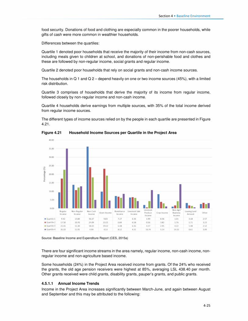
Section 4 • Baseline Environment
4-25
food security. Donations of food and clothing are especially common in the poorer households, while
gifts of cash were more common in wealthier households.
Differences between the quartiles:
Quartile 1 denoted poor households that receive the majority of their income from non-cash sources,
including meals given to children at school, and donations of non-perishable food and clothes and
these are followed by non-regular income, social grants and regular income.
Quartile 2 denoted poor households that rely on social grants and non-cash income sources.
The households in Q 1 and Q 2 – depend heavily on one or two income sources (45%), with a limited
risk distribution.
Quartile 3 comprises of households that derive the majority of its income from regular income,
followed closely by non-regular income and non-cash income.
Quartile 4 households derive earnings from multiple sources, with 35% of the total income derived
from regular income sources.
The different types of income sources relied on by the people in each quartile are presented in Figure
4.21.
Figure 4.21 Household Income Sources per Quartile in the Project Area
Source: Baseline Income and Expenditure Report (CES, 2015a)
There are four significant income streams in the area namely, regular income, non-cash income, non-
regular income and non-agriculture based income.
Some households (24%) in the Project Area received income from grants. Of the 24% who received
the grants, the old age pension receivers were highest at 85%, averaging LSL 438.40 per month.
Other grants received were child grants, disability grants, pauper’s grants, and public grants.
4.5.1.1 Annual Income Trends
Income in the Project Area increases significantly between March-June, and again between August
and September and this may be attributed to the following:

Section 4 • Baseline Environment
4-26
• The period (between March and June) marks the beginning of major crop harvesting, namely
wheat, maize and sorghum; and it is a period where poorer households are engaged as labourers.
Furthermore, depending on the household’s levels of poverty (regarding ownership of fields), the
household has an opportunity to derive an income from the sale of their crops.
• Even though mohair sales take place in April, the payments are only received by the farmers
between August and November when it has been sold at auction in Port Elizabeth, South Africa.
• The combination of the income generated during this time may explain the sustained peaks in
income between August and September through the various income streams.
In general, income drops between November and January, dropping further in December before
picking up again in February particularly for households in Quartile 1 and 2 (Figures 4.22 and 4.23).
Figure 4.22 Household Income Trends per Quartile
Source: Baseline Income and Expenditure Report (CES, 2015a)

Section 4 • Baseline Environment
4-27
Figure 4.23 Monthly Income Trend all Households Surveyed within the Project Area
Source: Baseline Income and Expenditure Report (CES, 2015a)
4.5.2 Household Expenditure
Household spending in the Project Area consists of animal purchase, cropping expenses, groceries,
non-food groceries, irregular expenses, livestock husbandry, other ongoing monthly expenses, and
non-business costs. Based on Figure 4.24, households within the 2nd and 3rd quartiles exhibited
similar expenditure trends, i.e. spending on food groceries, non-food groceries, cropping expenses,
etc. The wealthiest households (4th quartile) showed substantially different spending compared to
the people in other quartiles. They spent 21% of their income on groceries food, animal husbandry
(20%) and over 15% spent towards business expenses. In general, households in the Project Area
spend most of their income on purchasing food items, as indicated in Figure 4.24.
Figure 4.24 General Household Expenditure Trends
Source: Baseline Income and Expenditure Report (CES, 2015a)

Section 4 • Baseline Environment
4-28
Figure 4.25 shows that households also spend their income on agricultural activities, with the bulk of
the expenses being towards livestock husbandry. Cropping related expenses tend to peak between
August and November. This coincides with the intensive period of planting the main crops - maize
and sorghum. Spending towards the purchase of livestock increases in August which is around the
time when farmers receive their income from the sale of wool and mohair which in turn increases their
purchasing power for new livestock. Expenses associated with animal husbandry peak in December
month, refer to Figure 4.25. Agricultural costs decrease significantly between December and March
as these are low-income months.
Figure 4.25 Household Agricultural Expenditure
Source: Baseline Income and Expenditure Report (CES, 2015a)
Non-agriculture expenses. Irregular household spending peaks in December, likely due to the
holiday period and returning family members; except the lower income households (1st and 2nd
quartiles). This includes spending on transportation, money being sent to other family members and
expenditure on furniture and appliances. Non-agricultural business income also increased during this
time and subsequently household spending also increases. This spending on non-agricultural
expenses peaks again from July to August which coincides with the harvesting activities and its
associated non-regular employment.
4.6 Access and Utilisation of Natural Resources There are a wide variety of natural resources found in the Project Area, and most of these are
communally owned and utilised. These include edible plants, medicinal plants, grazing land, thatching
grass, river reeds, mosea (craft grass) water, rocks, fish, sand, trees/shrubs and small wild animals.
The natural resources mentioned above have been discussed in detail below. The FGD participants
also made mention of the above mentioned natural resources like the ones that are now found within
the catchment area and are going to be impacted by the Polihali Dam, some through inundation and
some through all the proposed construction works. The collection and utilisation of natural resources
are managed by the Chiefs and their respective Councils. For instance, when a person requires
natural resources for building purposes, he/ she requires the permission of the Chief to collect the
natural resource materials he/she needs. Findings from the FGD indicate that people also have to go
to the chief and the counsellor to request use of roofing grass, fuel wood, medicinal plants and other
natural grasses such as mosea and loli.

Section 4 • Baseline Environment
4-29
The areas where natural resources are collected vary, for instance, rocks which are mostly used in
the construction of housing walls and kraals are readily available everywhere across the Project Area,
and people do not have to walk far to collect and utilise. However, the majority of the natural resources
are found in the forested area, hill/mountainous locations, and river banks, as indicated in Figure 4.26.
Figure 4.26 Areas where Natural Resources are Collected
Source: Lesotho Demographic Survey, 2011 (Bureau of Statistics (Lesotho), 2013)
4.6.1 Grazing Land
Grazing land in the Project Area is communal in nature and access to grazing land is governed by
the Chiefs and community Councillors. The Chiefs and Councillors are supported by locally
established Grazing and Pasture Committees, as well as by the Grazing Associations who work in
close collaboration with Principal Chiefs who oversee the management of grazing land. The Grazing
Associations are responsible for the management of pastures, improvement of livestock and the
rehabilitation of wetlands, marshes and bogs. In turn, the Grazing and Pasture Committees assist
village Chiefs with the general management of pastures. There are two active Grazing Associations
in the Project Area, namely:
• Khalahali Association which operates in Senqu, Bafali, Moremoholo, Mokhotlong/ Sanqebetu,
Tlakeng/ Sehong-hong, Makhapung, and Linakaneng/Sani.
• Tlokoeng Association which works within Bohale ba Nkoe, Mofolaneng, and Liseleng.
Pastures are often divided into three types of cattle posts – summer (these cattle posts are furthest
from home villages), winter (closer to home), and pastures that are close to home but are small and
cannot support large herds of livestock (refer to Figure 4.27). The livestock kept close to the villages
are often used for milking or ploughing or are the very young livestock. The majority of livestock,
therefore, spend significant time in summer and winter cattle posts. The FGD respondents also
attested to the cattle post usage patterns. Both the Grazing Associations and Committees play a
major role in ensuring sustainable use of the grazing area. They also ensure that livestock owners
adhere to the seasonal variations and also adhere to the grazing maintenance schedules that are set
by the relevant Chiefs, for the movement of livestock from one zone to another.
0%
5%
10%
15%
20%
25%
30%
35%
40%
45%
Forest/Thicket
Grazing Area Hilly orMountainous
Area
River Area Other Areas
Catchment Area Downstream Area Mokhotlong Town
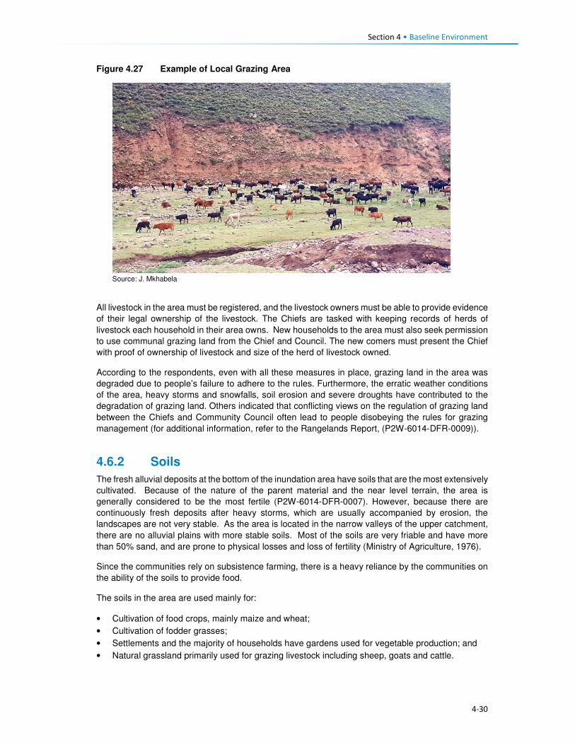
Section 4 • Baseline Environment
4-30
Figure 4.27 Example of Local Grazing Area
Source: J. Mkhabela
All livestock in the area must be registered, and the livestock owners must be able to provide evidence
of their legal ownership of the livestock. The Chiefs are tasked with keeping records of herds of
livestock each household in their area owns. New households to the area must also seek permission
to use communal grazing land from the Chief and Council. The new comers must present the Chief
with proof of ownership of livestock and size of the herd of livestock owned.
According to the respondents, even with all these measures in place, grazing land in the area was
degraded due to people’s failure to adhere to the rules. Furthermore, the erratic weather conditions
of the area, heavy storms and snowfalls, soil erosion and severe droughts have contributed to the
degradation of grazing land. Others indicated that conflicting views on the regulation of grazing land
between the Chiefs and Community Council often lead to people disobeying the rules for grazing
management (for additional information, refer to the Rangelands Report, (P2W-6014-DFR-0009)).
4.6.2 Soils
The fresh alluvial deposits at the bottom of the inundation area have soils that are the most extensively
cultivated. Because of the nature of the parent material and the near level terrain, the area is
generally considered to be the most fertile (P2W-6014-DFR-0007). However, because there are
continuously fresh deposits after heavy storms, which are usually accompanied by erosion, the
landscapes are not very stable. As the area is located in the narrow valleys of the upper catchment,
there are no alluvial plains with more stable soils. Most of the soils are very friable and have more
than 50% sand, and are prone to physical losses and loss of fertility (Ministry of Agriculture, 1976).
Since the communities rely on subsistence farming, there is a heavy reliance by the communities on
the ability of the soils to provide food.
The soils in the area are used mainly for:
• Cultivation of food crops, mainly maize and wheat;
• Cultivation of fodder grasses;
• Settlements and the majority of households have gardens used for vegetable production; and
• Natural grassland primarily used for grazing livestock including sheep, goats and cattle.

Section 4 • Baseline Environment
4-31
There is evidence of active use on all of the landscapes, except where the terrain is steep and
completely inaccessible (Soils, Land Use and Land Capability specialist study (P2W-6014-DFR-
0007)).
4.6.3 Sand
Sand is found in abundance along river beds and sand mining is commonly undertaken for sale and
for construction purposes, refer to Figure 4.28. During the FGDs held within the Project Area,
participants residing within the catchment area of the Project Area expressed their concern about the
imminent loss of the sand due to dam impounding. They explained that they use the sand for building
purposes and will be at a total loss as to how they will access sand.
Figure 4.28 Example of Sand Mining along the River
Source: D Weldon
4.6.4 Medicinal Plants
A wide range of plants are collected in the Project Area predominantly for food, medicinal purposes
and for sale. The Biological and Archaeological (Including Heritage) Baseline and Impact Assessment
(LHDA C6002, CES, 2014) found approximately 60 plant species which the communities identified
as important natural resources. Of these, 30 species identified as important medicinal plants and
included Aloe aristata, Delosperma sp. and Artemesia afra. These are often used to treat a range of
ailments including sores, ulcers, headaches, cramps, muscular pains, headaches, sedatives and for
enhancing virility. Another 19 plant species were said to be utilised for spiritual purposes such as
increasing wealth and protection against lightning and evil spirits. The FGD participants also indicated
that they use some medicinal plants to protect themselves against the thokolosi and other evil forces,
which are said to be unseen but are believed to exist. They also pointed out that some of the plants
are only found in the area to be inundated and not anywhere else. Refer to Figure 4.29.

Section 4 • Baseline Environment
4-32
Figure 4.29 Examples of Medicinal Plants found in the Project Area
Source: J Bloem Lehasa
4.6.5 Wild Vegetables
FGD participants mentioned several types of wild vegetables that are found along the river, which
they consider to be now in danger of being inundated when the dam is completed. These wild
vegetables are used by the locals as a source of food to the communities and are collected by women
and girls to take home for cooking. The names of the wild vegetables growing along the rivers are
called papasane, semetsing/selae, thepe and seruoe (the last two grow on the fields and in these
cases they grow on the fields located near the rivers that are going to be inundated).
4.6.6 Fuelwood
Due to the high poverty levels, lack of electricity and extremely cold weather conditions of the Project
Area; there is a high demand for fuelwood. The SEBS (CES, 2015b) identified the plant species,
Passerina montana, as commonly harvested for fuel purposes. Approximately 85% of the households
in the area relied on fuelwood for household heating purposes; others indicated using fuel wood for
cooking purposes at 60%, while the rest use paraffin, bottled gas and electricity, especially those in
Mokhotlong town and Mapholaneng for the latter (FGD findings). It is also evident from the FGD
findings that women stockpile fuelwood in the summer months, in preparation for the winter months,
and also to limit the time spent in the cold going to collect wood.
The collection of fuelwood was indicated to be an activity undertaken mostly by adults and young
women in the Project Area with some assistance from adult and young men. In a small number of
wealthy households, the collection of fuelwood is undertaken by hired help, refer to Figure 4.30.
Figure 4.30 Persons who Collect Fuelwood in a Household
Source: Socio-Economic Baseline Study (CES, 2015b)
0%
10%
20%
30%
40%
50%
60%
Catchment Area Downstream Area Mokhotlong Town

Section 4 • Baseline Environment
4-33
Distances travelled to collect any source of household fuel vary significantly from village to village
based on the location of the fuel source. For instance, some women in FGDs indicated that they walk
for up to three hours (round trip) to collect fuelwood and this does not take into account the amount
of time spent gathering the wood. Furthermore, women reported that collection of fuelwood in summer
is undertaken almost daily to restock for the cold winter months.
4.6.7 Wild Animals
Rabbits, rock rabbits, deer, snakes, skunks and wild cats were said to be abundant within the
catchment area (FGD respondents). However, hunting of mammals in the Project Area is limited.
According to the SEBS (CES, 2015b), only 10% of the households were identified as partaking in any
hunting activities. These households indicated that they hunted antelope of various kinds, fox and
jackal, hare and rabbit and rock rabbit. The FGD respondents, however, mentioned that though they
are not allowed to hunt the animals, they do so for purposes of consumption, muti making for own
use and for selling. They explained that they use skunks to make a khoetsa that mothers put around
their young's necks to ward off evil spirits. Their fear is that the animals are going to run away when
the dam is impounded. The people also said as mitigation to the possible loss of wild animals, they
would like the LHDA to rescue and put them in a fenced off area where their children can visit and
learn about them in the future.
4.7 Health Care This section describes the provision of health care services in Lesotho, Mokhotlong District and the
Project Area.
4.7.1 National Health Services
The Ministry of Health (MoH) is responsible for the administration and management of health care
provision in Lesotho. The Ministry’s responsibilities include promotion and delivery of health services,
development of health policies, standards and guidelines, mobilisation of health resources, and
monitoring and evaluation of health sector interventions. Health care services are provided in
partnership with the Christian Health Association of Lesotho (CHAL), various non-governmental and
private sector organisations and development partners. The provision of health services is also
guided by the Lesotho National Health Strategic Plan for 2012/13-2016/17. Also, Lesotho is also a
signatory to the United Nations Millennium Development Goals (MDG). The MoH is committed to
addressing the following health issues as part of meeting the MDGs:
• MDG 1 – Eradicate poverty and hunger;
• MGD 4 – Reduce child mortality;
• MGD 5 – Improve maternal mortality; and
• MDG 6 – Combat HIV/AIDS, malaria and other diseases.
Furthermore, development partners are actively involved in the health care services in the country
through multilateral and bilateral partnerships. Multilateral partners include the European Union (EU),
the World Health Organisation (WHO), and other United Nations organisations such as the United
Nations Children’s Fund (UNICEF), and the United Nations Population Fund (UNFPA). Bilateral
partners include the United States Governments (USG) facilities such as the United States Agency
for International Development (USAID), the President’s Emergency Plan for AIDS Relief (PEPFAR).
These development partners mainly provide technical assistance and funding for specific health
programmes and general provision of health care.
4.7.2 Health Care Provision
Health care in Lesotho is provided through a three-tiered referral system starting with primary,
secondary and tertiary services (Figure 4.31). At the lowest level of this arrangement are found

Section 4 • Baseline Environment
4-34
primary health care (PHC) services, offered at the community level by Community Health Workers
(CHWs) along with the health centres and filter clinics. The secondary and tertiary levels serve as
referrals for complicated and specialised cases.
Figure 4.31 Levels of Health Care Services in Lesotho
Source: Public Health Baseline Study (NHA, 2016)
Lesotho has 372 health care facilities which comprise one national referral hospital, two specialised
hospitals, 18 hospitals, three filter clinics, 188 health centres, 48 private surgeries, 66 nurse clinics
and 46 pharmacies. Primary health care services consist of a network of CHWs of approximately
5000 nationwide.
Of these facilities, 58% of the hospitals are owned by the MoH, while 38% are belonging to CHAL;
the remaining facilities are either belonging to the Red Cross of Lesotho or are privately owned. At
the district level, health care services are organised into hospital services, health centre services and
community-level services. District Health Management Teams (DHMTs) are responsible for overall
district health services. The number of health facilities varies by the district with Maseru having the
most.
There are seven health centres within the Project Area, four of which belong to the government, the
CHAL owns two, and one is privately owned (Table 4.8). There is only one hospital that serves as the
main referral hospital for the health centres. This hospital has 100 beds and a single doctor servicing
the emergency room and the out-patient department. Respondents pointed out that they sometimes
have to go to health facilities that are outside the Project Area for the sole reason of it being nearer
to where they are living, such as the Semenanyane health centre.
Table 4.8 Health care Facilities in Project Area
Area Name of facilities Location of facilities Ownership of facilities
Catchment • Libibing health centre
• Mapholaneng health centre
• ‘Malebusa Bless clinic
• St James health centre
• Mokhotlong hospital
• St Peter's health centre
• Libibing
• Mapholaneng
• Mapholaneng
• St James
• Mokhotlong town
• Mokhotlong town
• Government
• Government
• Private
• CHAL
• Government
• CHAL
Downstream • Moeketsane health centre • Ha Moeketsane • Government
Tertiary Healthcare
Referral Hospital
Secondary Healthcare
Regional Hospitals
District Hospitals
Local Hospitals
Primary Healthcare
Filter Clinics
Health Health centres
Health Posts/Outreach Services
Village/Community Health Workers

Section 4 • Baseline Environment
4-35
Area Name of facilities Location of facilities Ownership of facilities
• Linakeng health centre • Linakeng • Government
4.7.3 Services Offered at Health Centres in the Project Area
All the health facilities provide primary health care services such as:
• Immunisations,
• Distribution of medication for chronic illnesses,
• HIV testing (using rapid HIV test kits) and counselling (HTC),
• Rapid tests for syphilis (VDRL), pregnancy (HCG), and
• Urine testing.
Three of the facilities, i.e. St James, St Peters and ‘Malebusa Bless health centres do not offer baby
delivery services due to a lack of equipment and delivery facilities.
Only Mokhotlong hospital has a laboratory, and as such, all samples collected at the health centres
are sent there.
Availability of Equipment at Health Facilities. All health care facilities in the district have recently
been revitalised and some new equipment brought in under the Millennium Challenge Account (MCA)
Health Project.
Availability of qualified medical personnel. In most facilities, there were four staff members that
include two registered nurses and two nursing assistants. St. Peters’ health centre was the only
facility that was understaffed and operated with only one nursing assistant. Refer to Table 4.9.
Table 4.9 Distribution of Medical Personnel in Health Centres
Name of facility Registered nurse/ midwife
Qualified nurse
Trained nurse assistant
Total number of staff
Libibing health centre 3 0 2 5
Mapholaneng health centre 0 3 1 4
Malebusa Bless clinic 2 0 2 4
St James health centre 2 0 2 4
St Peter's health centre 0 0 1 1
Moeketsane health centre 2 0 2 4
Source: Public Health Baseline Study (NHA, 2016)
4.7.4 Health Profile
Table 4.10 provides some of the key health indicators for Lesotho and shows that Lesotho did not
meet most of the targets for the various health related MDGs. According to World Health Organisation
(WHO) by 2014 Lesotho had made limited progress towards improving its health targets and goals.
Table 4.10 shows that one in 12 children in Lesotho dies before his/her fifth birthday, and one in every
17 children dies before celebrating their first birthday. About two-thirds of these deaths occur during
infancy.
Table 4.10 Health Care Indicators

Section 4 • Baseline Environment
4-36
Indicators National Outcomes Mokhotlong District Outcomes
Infant mortality rate 59 deaths/1,000 live births (2014)
77 deaths/1,000 live births (2014)
Under-five mortality rate 85 deaths/1,000 live births (2014)
91 deaths / 1,000 births of >5 (2014)
Maternal mortality ratio 1,024 deaths/100,000 live births (2014)
Life expectancy at birth 41.8 yrs. (2011) 41.8 yrs. (2011)
Male life expectancy at birth 39.41 yrs. (2011) 39.41 yrs. (2011)
Female life expectancy at birth 45.33 yrs. (2011) 45.33 yrs. (2011)
HIV prevalence rate 25% (2014) 17% (2014)
Adult ART coverage 35% (2014) 25% (2014)
Paediatric ART coverage 30% (2014) 31% (2014)
Prevention of Mother To Child Transmission (PMTCT) ART coverage
72% (2014) 54% (2014)
TB incidences (including HIV & TB) 788/100, 000 ( 2016)
Multi Drug Resistance (MDR) incidences 52 /100, 000 (2016)
TB treatment coverage 45% (2016)
HIV prevalence in TB 72% (2016)
Source: Lesotho Demographic Survey, 2011 (Bureau of Statistics (Lesotho), 2013); Lesotho Demographic and Health Survey, 2014; Ministry of Health (Lesotho) and ICF International, 2016; UNDP: Human Development Report 2016
4.7.5 Utilisation of Health Services in the Project Area
According to the Public Health Baseline Study (NHA, 2016) over half (51%) of the respondents
indicated that they used the facilities located in the neighbouring village (keeping in mind that a nearby
village may be located over 20 km away from the surveyed individuals’ home). In turn, only five
percent of the respondents indicated they had access to a health care facility within their village.
People residing in the catchment area and Mokhotlong town accessed the hospital the most at (99%
and 98% respectively), with only 53% of the people downstream accessing Mokhotlong hospital; as
indicated in Figure 4.32. FGD findings show that some villagers go to the hospital in Thaba-Tseka
rather than to those in Mokhotlong District, due to their proximity.
Figure 4.32 Closest Medical Facility used
Source: Socio-Economic Baseline Study (CES, 2015b)
0
10
20
30
40
50
60
70
80
90
100
CatchmentArea
DownstreamArea
MokhotlongTown
CatchmentArea
DownstreamArea
MokhotlongTown
Clinic Hospital
Village
Neighbouring Village
Closest Town
Mapholaneng Town
Mokhotlong Town
Other

Section 4 • Baseline Environment
4-37
4.7.6 Incidence and Prevalence of HIV
Lesotho is in the top 10 countries in the Southern Africa region hardest hit by HIV/AIDs. In 2015,
Lesotho had the second highest prevalence of HIV in Southern Africa, after Swaziland, at 22.7%. An
estimated 9900 people died from AIDs-related illnesses in 2015. The incidence of HIV has been
declining, from 30 000 new infections in 2005 to 18 000 new infections in 2015 (Table 4.11).
Table 4.11 Prevalence of HIV/AIDS in Lesotho
310 000 People living with HIV
23% Adult HIV prevalence
18 000 New HIV Infections
9900 AIDS-related deaths
42% Adults on antiretroviral treatment Source: UNAIDS Gap Report 2016
In 2014, an estimated 74% of the people with tuberculosis (TB) in Lesotho also tested positive for
HIV, and 72% of these are on Anti-Retroviral Treatment (ART).
Anti-retroviral treatment (ART) in Lesotho: In Lesotho, ARVs are provided free of charge and can
be collected at various health facilities. Forty-one percent of eligible adults are enrolled onto ART.
ART coverage for children was said to have improved and stood at 56% in 2015. This increase was
attributed to the introduction of satellite paediatric ART centres. According to Avert, in 2016, Lesotho
became the first African country to implement a 'Test and Treat' strategy whereby every person who
tests HIV positive is offered ART regardless of their CD4 count.
Barriers to HIV prevention programmes: Some HIV-related targets and strategies have been
developed within Lesotho’s HIV response; however, many obstacles and challenges are impeding
progress in HIV prevention; most of which are cultural and structural. Gender-based violence and low
paid textile factory work have been found to be significant drivers for the high HIV prevalence among
women in Lesotho, among others (www.avert.org/professionals/hiv-around-world/sub-saharan).
These are briefly described in Box 4.3.
Box 4.3 Barriers to HIV Prevention Programmes
Access to health care. As indicated above, access to health care in Lesotho varies considerably by gender, socio-economic status and geography. Factors affecting access to health care include insufficient funds to travel to health centres and a lack of medical personnel and supplies. As such, people who are living with the virus cannot always access the facilities to collect medication. Furthermore, an estimated four percent of people living with HIV were reportedly denied access to health care services due to their status - this discourages people living with the virus from seeking medical assistance.
HIV stigma and discrimination. According to the Lesotho Stigma Index Report 2014, HIV stigma and
discrimination remain significant barriers to accessing vital treatment, prevention and support services to
those affected. There have been reports of people being victimised because of their HIV positive status;
including verbal and physical abuse, and exclusion from social, religious and family gatherings or activities.
The report further indicated that 41% of its respondents experienced gossip about their HIV status, while 27%
reported being verbally insulted, harassed and threatened.
According to the LDHS, 2014 (MoH and ICF International, 2016), HIV prevalence in Mokhotlong was
estimated at 17%; and it was the lowest amongst all ten Districts in the country. The report further
indicates that HIV was most prominent amongst females (23%) compared to males (10%). Pregnant
women are automatically tested for HIV when they first present themselves to a health care facility;
therefore, more women than men know their HIV status.
HIV/ AIDS was reported at 5% in the PHBS (NHA, 2016), having caused approximately 38 deaths
amongst the respondents of the survey, which is relatively low. Data collected during the FGDs agrees
with the fact that there are high numbers of people infected with HIV. They further pointed out that

Section 4 • Baseline Environment
4-38
they have to go to the nearest health centres to get their ARVs and the problem is always the long
distances they have to travel to reach them.
The PHBS (NHA, 2016) found that testing for HIV in the area was common, with approximately 45%
of the respondents in the catchment area reporting that they had been tested for HIV two weeks
before the study; 45% in the downstream area and 34% in Mokhotlong town. Amongst those who got
tested 70% were women, it is unclear whether these women were tested because they were pregnant
or not. However, the PHBS (NHA, 2016) indicated that all those tested were there to check their
hypertension levels. Three of the 42 focus groups interviewed for the PHBS (NHA, 2016) noted that
the issue of HIV/AIDS is a significant social concern within their communities. Of these, two groups
pointed out that the situation has become worse; one group noted that the situation has improved.
The focus group that reported an improvement in the issue of HIV/AIDS pointed out that people in
the community are now educated about the disease and take the necessary medication. Those
present in the focus groups who reported that the issue is becoming worse indicated that stigma
surrounding HIV/AIDS remains high and that, despite the availability of medication, many people
continue to die from the disease.
Regarding taking antiretroviral medication, people who are sick reportedly took their medication;
however, some stopped as soon as they consider themselves healthy again and this has led to these
individuals getting sick again and dying.
Participants in FGDs for this SIA pointed out that the reasons that HIV positive people default from
taking their medication could be related to the long distances to health facilities as well as the bad
attitude of health personnel. FGD respondents were also of the view that the rate of infections was
increasing, which could mean that people no longer seem to fear the disease.
4.7.7 Challenges to Health Care Provision
Challenges to access and provision of health care in the country, district and Project Area are
described below. There are some challenges to the delivery of health care services in Lesotho, the
main ones being the following:
• The lack of qualified medical professionals (both nurses and doctors) particularly in the rural areas
due to the country’s terrain which creates barriers to accessibility. Most qualified medical
professionals do not want to work in rural areas where there is poor access to public services and
as a result, seek employment in urban areas and elsewhere in the world once they qualify.
Serious emergencies are often referred to neighbouring South Africa.
• The rural nature and mountainous terrain further cause barriers to the construction of formal
medical facilities. This has led to many people living in the rural areas having to travel between
10 and 20 kilometres to reach the closest facility. Thus, many people in the rural areas choose to
rely on traditional medicines to treat various ailments.
• Most of rural Lesotho lacks secondary roads, which means that most parts of the rural areas do
not have public transportation. The 2014 LDHS, 2014 (MoH and ICF International, 2016)
indicated that 72% of households’ members walk to reach the nearest health facility; while 22%
stated that they travel by car, truck, bus, or taxi, and the remaining six percent used a combination
of walking and bus or taxi. Among households who walk to reach a health facility 27% walk for
more than 120 minutes (Table 4.12). Data from the FGDs indicates that the participants were
also concerned about the insufficient number of health facilitates in the Project Area and the
subsequent long distances that they have walk to reach the nearest one.
Table 4.12 Time it takes to get to the nearest health care facility
Time to get to nearest health facility by walking
Residential Area
Minutes Urban Rural Total
<20 minutes 28.4 5.5 12.8

Section 4 • Baseline Environment
4-39
Time to get to nearest health facility by walking
Residential Area
Minutes Urban Rural Total
20-40 minutes 43.0 11.4 21.6
41-60 minutes 17.2 16.1 16.5
120 minutes 8.1 28.1 21.7
> 120 minutes 3.2 38.6 27.3
Source: Lesotho Demography Health Survey, 2014 (Ministry of Health (Lesotho) and ICF International, 2016)
• Participants in focus group discussions indicated that they had experienced further challenges in
accessing health care such as that of frequent shortages of medication and other supplies at the
health facilities. This is made worse by the fact that some people would have had to walk for
many hours to get to the health centres. People from Malubalube, Nkokamele as well as other
far off villages mentioned that they have to take as many as four to five hours to reach the nearest
health centre. This means that they sometimes have to sleep over to have a chance at being
seen and examined by the health centre personnel. The distances are tough on the people
especially when they are sick, and there are cases where some expectant mothers have given
birth to babies on the way to health centres.
• The country’s health system is also challenged by the continued increase of communicable
diseases related to the HIV epidemic – especially Tuberculosis (TB). Data gathered from the
FGDs conducted in the Project Area indicate that in addition to HIV and communicable diseases
mentioned above, the people living in the Project Area suffer from a number of illnesses ranging
from sugar diabetes, hypertension, and the common cold. The under five children are said to
suffer from fever, measles, common cold, pneumonia, diarrhoea and vomiting. The people
expressed their fear about a possible climate change for the worse that could be brought about
by the large expanse of water after the dam is impounded and that would bring more cold to the
already cold district. That would, in turn, mean more common cold and pneumonia cases.
4.7.8 Use of Traditional Healers and Traditional Medicine
The participants of FGDs indicated that they also consult traditional healers when they are sick. This
they also attribute to not being up to walking the long distances to the health centres. In some cases,
they go to the traditional healers because they believe that they, rather than the health facilities, can
help to resolve their problem. In some such cases, the consultation would be more about protecting
their households against evil spirits than physical healing. They do, however, take some forms of
ailments to the traditional healers, though most of these are the ones they believe are from
bewitchments, such as litṥere, kokoana, sejeso, litoromo, ho qobola and headache. They also
indicated that they sometimes started by consulting the traditional healer and if they are not cured,
they would then go to seek help at a health centre and vice versa. Illnesses that they take to health
centres include HIV /AIDS, TB, cancer, sugar diabetes, hypertension, common cold, sharp pains and
flu.
Accidents and injuries that often happen to the people living in the catchment area are falling off
horses, lightning strikes, dog bites, being swept away by flooding rivers and fight injuries. Women
mostly feel unsafe as they are more likely to be sexually and/or physically abused than most. Seniors
feel unsafe as there have been incidences of mugging along the way from receiving their pension
money.
The participants are hoping that LHDA will assist them by liaising with the relevant ministry to have
health centres built nearby them for easy access. Participants from Malubalube pointed out that there
is a building in their village that was intended to be used for health outreach services and it is now
standing vacant and not being used as planned. They wish to have LHDA see to it that the building
is upgraded to a health centre level so that it can serve their area which is quite huge. It would also
cut travel time to Libibing. Their health problems have not declined in number in the past three years.
Instead, they have become worse.

Section 4 • Baseline Environment
4-40
4.8 Education This section describes the provision of education services and infrastructure in Lesotho, Mokhotlong
District and the Project Area.
4.8.1 National Education Services
The Ministry of Education and Training (MoET) is responsible for the management, provision and
regulation of education and training in Lesotho. It is in charge of ensuring the accessibility, quality,
equity and relevance of education. As with many countries in southern Africa, formal education in
Lesotho was introduced and developed through a partnership between the government and religious
organisations; and has been heavily influenced by the work of missionaries. As a result, across the
country, the management of schools is largely (90%) in the hands of the churches; specifically, the
Anglican Church, Lesotho Evangelical Church and Roman Catholic Church.
Government’s involvement in the provision of education, apart from the administrative duties, is
mainly through subsidies; payment of teachers’ salaries and provision of other institutional support.
Teachers are employed under the MoET. The government pays the salaries of more than 95% of the
teachers including those who work at church managed schools. Furthermore, the Government
provides schooling facilities through its capital budget. The provision of education services is guided
by the Education Act (No. 3) of 2010, the Lesotho Education Sector Strategic Plan for 2005 – 2015,
the Higher Education Strategic Plan for 2013/14 – 2017/18 and the National Policy for Integrated
Early Childhood Care and Development (ECCD). Lesotho is also a signatory to the MDG and MoET
seeks to ensure that Lesotho fulfils MDG 2, that of achieving universal primary education by 2015
through the provision of:
• Free and compulsory primary education;
• Bursaries and grants to vulnerable children and households;
• Ongoing school feeding programme; and
• Infrastructure development.
There are also development partners that are actively involved in the education sector through
bilateral and multilateral partnerships. These include among others the European Union, Irish Aid and
United Nations Children’s Fund (UNICEF). The Global Partnership for Education has also played a
significant role in improving the education sector.
4.8.2 Structure of the Education System
After completion of pre-schooling, Lesotho’s education system consists of 12 years of school. The
seven years of primary (Grade 1 – 7); three years of junior secondary (Form A – C); two years of
higher secondary (Form D – E) and four years of tertiary. There is also a parallel technical vocational
diploma course (senior secondary + 3 years Technical and Vocational Education and Training
(TVET). The various cycles of education are highlighted in Table 4.13.
Table 4.13 Structure of the education services in Lesotho
Education Schooling level Age Years Qualification
Pre-school ECCD 3 - 5 3 • Attendance is not compulsory.

Section 4 • Baseline Environment
4-41
Education Schooling level Age Years Qualification
Primary Primary school 6 -13 7 • Attendance is compulsory for children
between the ages of 6 and 13 years old. At
this level, education is free.
• Upon completion of the seven years, pupils
have to write an exam for which they are
awarded the Primary School Leaving
Certificate (PSLC) by the MoET.
Middle Junior secondary school 13 - 16 3 • School fees are payable from this phase
upwards. Pupils who complete this level of
education receive a Junior Certificate from
the MoET.
Secondary High school 16 - 18 2 • School fees are payable at this phase.
Pupils who complete this level of education
receive a Lesotho General Certificate in
Secondary Education (LGCSE).
Technical secondary
school
16 - 18 3 • School fees are payable at this phase.
Pupils who complete this level of education
receive a Technical Vocational Diploma
(Senior Secondary + 3 year TVET).
Tertiary Teacher training/
education in technical
subjects
16 -20 2 • Certificate/Diploma is awarded.
University 18 + 4+ • Receipt of Degrees to Doctorate from the
relevant university.
• National University of Lesotho (NUL) was
the only university in Lesotho until recently
(2008) when Limkokwing University was
established.
4.8.3 Availability of Education Facilities
Lesotho has an estimated 2155 registered education facilities which comprise 14 tertiary/higher
education institutions, 25 technical/vocational centres, 399 secondary schools, 1477 primary schools
and 240 ECCD centres (Table 4.14 and Figure 4.33). TVET schools are found in seven of the 10
districts in Lesotho (i.e. Berea, Leribe, Maseru, Mohale’s Hoek, Mokhotlong, Quthing and Thaba-
Tseka).
There are more primary schools compared to other educational facilities, and this might be attributed
to the government’s drive to meeting its MDGs for the population to at least attain primary school
education. In addition to the above schooling levels and facilities, there are skills centres which are
focused on adult education which are referred to as non-formal education (NFE). These centres are
tailored towards educating out-of-school youth and adults who are illiterate or have only primary
schooling. This service focuses on literacy, numeracy and continuing education. The education
received in these centres is the equivalent of Grade 1 to 10. Participants of FGDs indicated that there
is a high number of pupils who drop out at primary school level. More boys are said to drop out than
girls, and this is attributed to them having to drop out to go and herd animals. Some are said to drop
out to go to initiation school. Male youth from Makhoarane in the downstream area stated that they
did not see the value of education and that they would rather engage in livestock farming. Those girls
who do drop out are said to do so to get married. This means that the government is in part failing to
meet its MDGs of ensuring that all children at least attain primary education.

Section 4 • Baseline Environment
4-42
At the district level, the education system is organised into early childhood development, primary,
secondary and high school and the MoET is decentralised through the Inspectorate. The number of
education facilities varies by district with Maseru district having the most. Table 4.14 shows the
distribution of schools by district.
Table 4.14 Distribution of schools by district
District
Levels of Education Total
ECCD Primary Secondary
Urban Rural Urban Rural
Butha-Buthe 18 14 68 9 13 122
Leribe 28 20 179 12 55 294
Berea 27 10 129 6 36 208
Maseru 34 62 190 29 44 358
Mafeteng 30 9 149 5 34 227 Mohale’s Hoek 27 4 167 4 21 223
Quthing 19 9 117 4 13 162
Qacha’s Nek 18 9 94 5 15 141
Mokhotlong 15 11 95 1 15 137
Thaba-Tseka 24 5 136 4 15 184
Total 240 1477 339 2056 Source: Lesotho Bureau of Statistics, Statistical Report No. 28 of 2015: Education Statistics Report 2014
Figure 4.33 Typical Schools in the Project Area
Source: J. Mkhabela
In the Project Area, the education system follows the national and district system. The MoET through
the Inspectorate is expected to support and supervise these schools. Following the pattern of number
of schools in the Mokhotlong District; there are also more primary schools in the Project Area and
very few Secondary schools. ECCD schools are also available in the Project Area.
A few NGOs work in the education sector in the Districts and provide support in the form of school
fees, uniforms, school shoes, toiletries and sanitary towels to children. These include Sentebale,
Hlokomela Bana and World Vision. Sentebale and Hlokomela Bana operate in Mokhotlong and the
Project Area.

Section 4 • Baseline Environment
4-43
4.8.4 Education Profile of Lesotho
Lesotho has the highest adult literacy rate (79%) in sub-Saharan Africa as well as amongst its female
population (93%)11. Men have slightly lower education levels than their female counterparts, and this
has been linked to the fact that boys particularly those in rural areas tend to dedicate their time to
herding livestock and not attending school or dropping out at the primary level; refer to Table 4.15.
The introduction of free and compulsory primary education in Lesotho has assisted Lesotho in fast-
tracking progress towards reaching the MDG 2. In 2012, progress towards achieving indicator 2.1
(Net Enrolment Rate (NER) in primary schools) and indicator 2.3 (Literacy rate among 15-24-year-
olds) were on track. Progress was, however, slow for indicators 2.2 (Proportion of pupils who reach
the last grade of primary school); refer to Table 4.15. Enrolment in secondary schools is low at 38%
as there are a limited number of secondary schools and tuition fees are required (the government
only subsidises orphan and vulnerable children). Also, children who want to enter high school may
be required to relocate from their homes to stay with relatives or friends who reside close to a
secondary school, and this requires financial contributions from parents which many in rural Lesotho
cannot afford; thus the children drop out. Findings from the FGDs indicate that some of the children
who manage to complete primary school are sometimes unable to attend secondary school due to
lack of school fees. Some parents have to sell livestock to put their children through Junior and Senior
High schools.
Table 4.15 Education Services Profile
Indicators MDG Baseline Outcomes Progress
Adult Literacy rate 79% (2015) Female youth (15 – 24 years) literacy rate 96% 98% (2012) On track
Male youth (15 – 24 years) literacy rate 83% 87% (2012) On track
Primary Education
Net Enrolment Rate12 82% 82% (2012) On track Proportion of pupils who reach last grade of primary school
61% 66% (2012) Slow progress
Source: Kingdom of Lesotho, 2013. Millennium Development Goals Status Report 2013
4.8.5 Education Profile of Mokhotlong and Project Area
The majority (58%) of the residents of Mokhotlong district have attained some primary schooling,
followed by those who have some secondary education (17%). Only eight percent of the population
was recorded as having no schooling – which is relatively low considering that Mokhotlong has poor
infrastructure specifically roads and has an economy that is solely dependent on agricultural activities.
Approximately 90% of the primary schools in Mokhotlong are found in rural parts of the District while
the other 10% are in urban areas. A similar trend was observed with the distribution of secondary
schools.
As with the situation in the District, the SEBS (CES, 2015b) indicates that a majority (59%) of the
population in the Project Area have attained some primary schooling and was, however, followed by
those who had no education at all (16%). Only 12% were reported to have completed primary school.
Regarding attainment of schooling by gender, a similar trend to the national and district levels is
observed with more men with no schooling. However, the trend differs significantly regarding those
who have some primary education, with more males compared to females and reverts to more
females having completed both primary and some junior secondary schooling. Observation during
FGDs showed that many people have at least attained primary school education, as many were able
11www.unesco.org/eri/cp/factsheets_ed/LS_EDFactSheet.pdf 12Net Primary Enrolment Rate is the number of pupils of official primary school age who are enrolled in primary education as a percentage of the total children of the official school age population

Section 4 • Baseline Environment
4-44
to register their names when asked to do so. Also observed was the fact that almost all of the woman
participants could write their name while some could not and wrote a cross.
Due to shortages of qualified teachers and the reluctance of some qualified teachers to work in remote
and hard to reach schools such as those found in Mokhotlong and the Project Area, the use of
unqualified teachers is common. These teachers perform similar roles as qualified teachers though
they have not been trained as teachers, and their wages are paid for by parents. Closely linked to the
shortage of qualified teachers, pupil teacher ratios (PTR) are high. This situation applies to both
primary and secondary schools. A summary of Mokhotlong district education indicators is presented
in Table 4.16.
Table 4.16 Education Services Profile
Indictors Outcome
Primary Education
Total Primary School Teachers 588
• Qualified Primary School Teachers 431 (73%)
• Unqualified Primary School Teacher 157 (27%)
Total Primary School Enrolment in 2014 22,883
Pupil Teacher Ratio (PTR) 39:1
Pupil Qualified Teacher Ratio (PQTR) 53:1
Total Primary School Repeaters 2,215
Secondary Education
Total Secondary School Teachers 212
• Qualified Teachers 198 (93%)
• Unqualified Teachers 14 (7%)
Total Secondary School Enrolment in 2014 5,365
• Male Enrolment 1,786 (33.3%)
• Female Enrolment 3,579 (67%)
Pupil Teacher Ratio (PTR) 24:1
Pupil Qualified Teacher Ratio (PQTR) 26:1
Source: Bureau of Statistics: Statistical Report No. 28 of 2015: Education Statistics Report: 2014
The SEBS (CES, 2015b) indicates that overall, 18% of males in the Project Area had no schooling
while only six percent of females were uneducated and is in line with the national and district reports
on disparities in the levels of education of men and women in Lesotho. This discrepancy was mostly
observed amongst males in the downstream area where 24% of men had no schooling while only
seven percent of females were uneducated. Overall, 61% of the female population across the Project
Area had attained primary education as compared to males at 57%. Refer to Figure 4.34. The people
of town Mokhotlong had higher numbers of people with secondary schooling and above compared to
the other two areas; this can be linked to the fact that Mokhotlong town is the district capital and
slightly urbanised. The town also has a majority of civil servants (who mostly have attained more than
secondary schooling education) residing in the town.

Section 4 • Baseline Environment
4-45
Figure 4.34 Distribution of Schooling Levels across the Project Area
Source: Socio-Economic Baseline Study (CES, 2015b)
Participants of FGDs were of the feeling that there are not enough schools in the Project Area,
especially downstream where children walk long distances to school and sometimes cannot attend
school regularly during the rainy season as the streams/rivers they have to cross flood. Children are
said to start school at a later age (eight or nine and not six years old) as the schools are too far.
People anticipate that LHDA will build schools nearby.
4.8.6 Provision of Education to the Poor and Marginalised
The government of Lesotho implements multiple programmes to ensure that the poor and
marginalised children get access to education services. Disabled and orphaned children, children
from extremely poor households and herd boys are regarded as vulnerable children (Orphans and
Vulnerable Children (OVC)). In order to ensure that these children receive an education, the MoET
has a school bursary scheme, which is paid directly to the schools. Another programme aimed at
assisting these OVC is the Child Grants Programme (CGP). This programme was started in 2009
and was financed by the European Commission with technical support from UNICEF-Lesotho. In
2013 the government of Lesotho took over the financing of the programme. The programme is run
specifically by the Ministry of Social Development (MoSD). The programme is non-conditional social
cash transfer targeted to poor and vulnerable households with the objectives of:
• Improving living standards of OVCs;
• Reducing malnutrition, improve health status; and
• Increasing school enrolment by OVCs.
Qualifying households are selected through a combination of proxy means which include testing and
community validation. The household is then registered on the National Information System for Social
Assistance (NISSA); and subsequently receive funds from the grant.
With the assistance of the World Food Programme (WFP), the government of Lesotho runs a school
feeding programme which provides food for children attending pre-school and primary schooling.
Through the programme, children receive two meals a day, breakfast and lunch. In 2015, the
programme was supporting over 50 000 pre-schoolers and 200 000 pupils in 1025 primary schools
throughout Lesotho13.
13http://www.lesothoreviw.com/education-training-2015.php
0
10
20
30
40
50
60
70
80
None Primary Secondary Secondary + Don’t know
Pe
rce
nta
ge
Catchment Area Male Catchment Area Female Mokhotlong Town Male
Mokhotlong Town Female Downstream Area Male Downstream Area Female

Section 4 • Baseline Environment
4-46
4.8.7 Obstacles to Education
While much has been achieved in ensuring that education services are provided to Basotho, the
sector continues to face challenges at the national and district levels as well as within the Project
Area. The following are some of the challenges faced:
• Low pass rates across all levels of schooling;
• Low standard of education provided at local schools;
• Poor retention rates of pupils at primary and secondary schooling levels due to the limited number
of schools;
• The mountainous terrain of Lesotho also acts as a barrier to construction of schooling facilities
and this has led to a shortage of schooling facilities as well as poor maintenance of existing
schools.
• In the remote rural areas, the learning environment is often poor and characterised by limited
infrastructure including unavailability of classrooms and equipment.
• The shortage of schooling infrastructure also results in pupils and teachers having to walk long
distances to reach the nearest school; this is particularly the case with secondary schooling.
• The limited secondary schooling infrastructure to absorb new entrants into the education system.
• There is a limited number of qualified teachers in the schooling system as many do not want to
transfer and work in remote rural areas with limited public services and infrastructure.
• Lack of public transportation and formal road infrastructure in many remote rural areas, as such
both teachers and pupils have to walk long distances to reach schooling facilities.
• Disparities in the distribution of schools in the country, with rural areas having limited numbers of
schools and urban more. This results in overcrowding of schools and higher teacher/ pupil ratios
which in turn affects the quality of learning and teaching.
• Extreme levels of poverty in the Project Area results in the inability of parents to pay school fees.
4.9 Public Services and Infrastructure This section describes access to public services and infrastructure in the Project Area such as potable
water, sanitation, telecommunications, energy/fuel sources, and roads/transportation; refer to Figure
4.35.
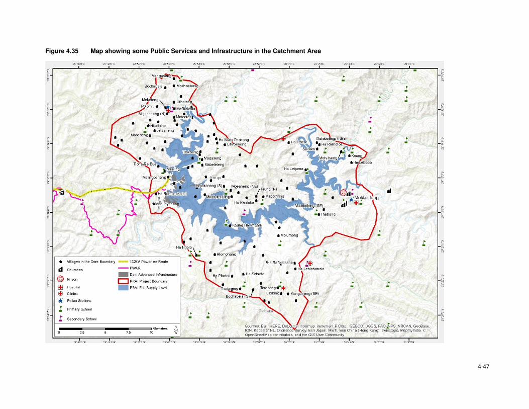
4-47
Figure 4.35 Map showing some Public Services and Infrastructure in the Catchment Area

Section 4 • Baseline Environment
4-48
4.9.1 Access to Potable Water and Sanitation Facilities
4.9.1.1 Access to Potable Water
Almost all urban households in Lesotho have access to improved water sources (96%), and only 77%
of the rural population has access to an improved water system. The type of water sources for urban
and rural populations differed significantly, while the urban population got its water from piped into
dwelling/ yard/ plot (68%), the rural communities got water from public taps/ stand pipes (56%). For
rural communities, this was followed by 23% of water sourced from unimproved water sources and
only five percent had access to piped water into the dwelling/ yard/plot. An estimated 38% of the
rural population had access to water 30 minutes or longer to collect water from which ever source
they use. Overall, the proportion of households obtaining water from improved drinking water sources
in Lesotho has increased from 79% in 2009 to 84% in 2014. Urban households' access to improved
drinking water sources increased from 91% to 97% while the proportion of rural households with
access to improved drinking water sources shifted from 74% in 2009 to 77% in 2014.
Water in urban areas is provided by the Water and Sewerage Company (WASCO), through the
installation of individual water supply. WASCO provided water is billed and paid for. Water in the rural
areas is provided by the Department Rural Water Supply (DRWS). DRWS has guidelines/standards
for communal water supply, that is, 50 metres' walk from each of the households. The Lesotho Rural
Water and Sanitation Project (WSP) in the rural areas provided for improved water and sanitation
services to 27 245 households or approximately 160 000 persons through the construction of new
water systems and ventilated improved pit latrines (VIP). The majority of the population indicated not
treating its water before consumption (88%). As per location, amongst those who reside in urban
settings, only 78% treated the water before consumption, and the rest did not. In turn, rural
households that do not treat water before consumption were at 92%. This was an expected outcome
given the financial constraints of the rural population compared to those who reside in urban settings.
The indicators for access to drinking water sources are provided in Table 4.17.
Table 4.17 Access to Water Sources in Lesotho
Access to drinking water Urban Rural Total
Water sources 96 77 82
Piped into dwelling / yard/ plot 68 5 22
Public tap/ standpipe 26 56 47
Tube well/ borehole 2 8 6
Protected spring 0,5 3 3
Protected well 1 6 5
Rain water 0 0 0
Bottled water 0,1 0 0
Unprotected well 2 10 8
Unprotected spring 2 12 9
Tanker truck/ car with small tank 0 0,5 0,4
Surface water 0,1 1 0,8
Time to obtain drinking water
Water on premises 69 6 23
Less than 30 minutes 25 55 47
30 minutes or longer 6 38 29
Don’t know 0,2 2 1
Source: Lesotho Demography Health Survey, 2014 (Ministry of Health (Lesotho) and ICF International, 2016)
In the Project Area water is mostly collected from communal taps that are scattered through the area.
Access to such communal taps is at 72% in the catchment area and 42% in the downstream area.
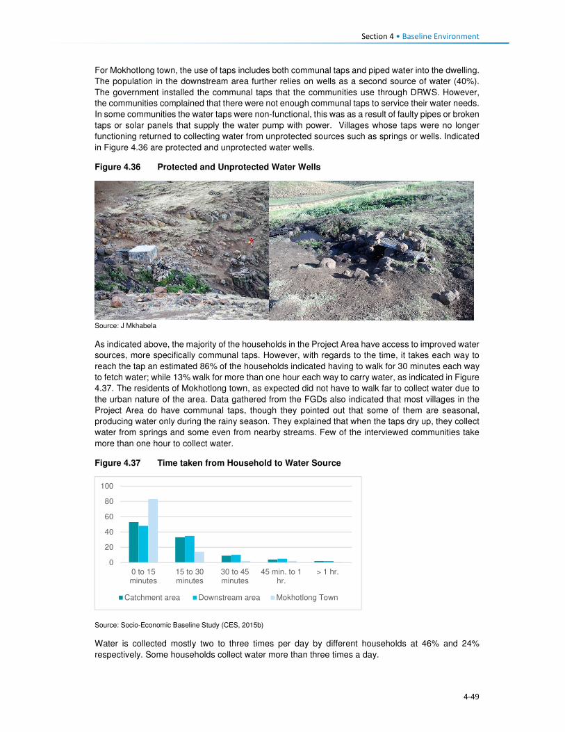
Section 4 • Baseline Environment
4-49
For Mokhotlong town, the use of taps includes both communal taps and piped water into the dwelling.
The population in the downstream area further relies on wells as a second source of water (40%).
The government installed the communal taps that the communities use through DRWS. However,
the communities complained that there were not enough communal taps to service their water needs.
In some communities the water taps were non-functional, this was as a result of faulty pipes or broken
taps or solar panels that supply the water pump with power. Villages whose taps were no longer
functioning returned to collecting water from unprotected sources such as springs or wells. Indicated
in Figure 4.36 are protected and unprotected water wells.
Figure 4.36 Protected and Unprotected Water Wells
Source: J Mkhabela
As indicated above, the majority of the households in the Project Area have access to improved water
sources, more specifically communal taps. However, with regards to the time, it takes each way to
reach the tap an estimated 86% of the households indicated having to walk for 30 minutes each way
to fetch water; while 13% walk for more than one hour each way to carry water, as indicated in Figure
4.37. The residents of Mokhotlong town, as expected did not have to walk far to collect water due to
the urban nature of the area. Data gathered from the FGDs also indicated that most villages in the
Project Area do have communal taps, though they pointed out that some of them are seasonal,
producing water only during the rainy season. They explained that when the taps dry up, they collect
water from springs and some even from nearby streams. Few of the interviewed communities take
more than one hour to collect water.
Figure 4.37 Time taken from Household to Water Source
Source: Socio-Economic Baseline Study (CES, 2015b)
Water is collected mostly two to three times per day by different households at 46% and 24%
respectively. Some households collect water more than three times a day.
0
20
40
60
80
100
0 to 15minutes
15 to 30minutes
30 to 45minutes
45 min. to 1hr.
> 1 hr.
Catchment area Downstream area Mokhotlong Town

Section 4 • Baseline Environment
4-50
4.9.1.2 Access to Sanitation Facilities
Approximately five in 10 households in Lesotho commonly use improved toilet facilities. These are
defined as non-shared facilities that prevent people from coming into contact with human waste and
thus reduce the transmission of cholera, typhoid, and other diseases (LDHS 2014 (MoH and ICF
International 2016). Overall, 29% of the households in Lesotho have no access to sanitation facilities,
with the majority of the population without toilets residing in the rural area (39%) and six percent in
urban areas. Shared/public toilet facilities are found in the urban areas compared to the rural areas
at 45% and nine percent respectively. Shared/public toilet facilities are common in urban areas,
especially in shopping centres and malls.
In general, the proportion of urban households with improved toilet facilities has increased since 2009,
rising from 26% to 41%; while in rural households, the proportion has more than doubled (rising from
22% to 50%). During this same period, the proportion of rural households without any toilet facilities
decreased from 45% to 38%. FGD respondents said there are few toilets in their villages and those
who don't have them use the bush. People anticipate that LHDA will build each household in the
Project Area a toilet so that the Polihali Dam does not become contaminated.
Table 4.18 Access to Sanitation Facilities in Lesotho
Access to Sanitation Facilities Urban Rural Total
Percentage
Improved 49 52 51
Flush/ pour flush14 to piped sewer 4 0 1
Flush/ pour flush to septic tank 3 0,2 1
Flush/ pour flush to pit latrine 0 0 0
Ventilated improved pit (VIP) latrine 7 16 14
Ordinary pit latrine 35 35 35
Shared facility 45 9 19
Flush/ pour flush to piped sewer 0,3 0 0,1
Flush/ pour flush to septic tank 0,3 0 0,1
Ventilated improved pit (VIP) latrine 6 1 2
Ordinary pit latrine 39 8 17
Unimproved facility 6 39 30
Flush/ pour flush not to piped sewer/ septic tank / pit latrine 0,4 0 0,1
Pit latrine without slap / open pit 1 1 1
No facility/ bush 5 38 29 Source: Lesotho Demography Health Survey, 2014 (Ministry of Health (Lesotho) and ICF International, 2016)
In the Project Area, the majority of the respondents indicated having no access to sanitation facilities.
This was observed mostly in the downstream area where 80% of the households had no access to
toilets, followed by 12% with access to VIP toilets, five percent with access to pit latrines and the
remaining three percent having access to other forms of sanitation facilities. In turn, the population in
the catchment area reported that 59% had no access to toilets, 27% had VIP and 11% pit latrines
and the remaining three percent had access to other forms of sanitation facilities. In Mokhotlong town,
the most common toilet facilities that the population has been VIP toilets (56%), followed by 31%
using without any form of sanitation facilities, nine percent used pit latrine and three percent had
14A pour flush toilet is a toilet without a cistern and whereby bath water is used to pour straight into the pan.

Section 4 • Baseline Environment
4-51
access to other forms of sanitation facilities. A small number of households had flush toilets (one
percent).
Figure 4.38 Example of Sanitation Facilities in the Project Area
Source: J. Mkhabela
The public participation and FGD field teams also noticed through questions asked and observation
the marked lack of toilets in the villages where they were working, and witnessed people using bushes
near their homes especially overgrown areas by the streams and rivers. Refer to Figure 4.39 for
additional information on access to toilet facilities in the Project Area.
Figure 4.39 Access to Sanitation Facilities in the Project Area
Source: Socio-Economic Baseline Study (CES, 2015b)
4.9.2 Access to Policing Services
There are two police stations in the district of Mokhotlong, with one based in Mokhotlong town and
the other in Mapholaneng and both of them are, incidentally, located within the Project Area. Data
gathered from the interview with the police, indicate that there is a total of 150 police officers in
Mokhotlong district. Slightly over half (54%) of the people from the Project Area make use of the
Mokhotlong town police station, while 45% use the Mapholaneng station and the remaining one
percent made use of village policing. FGD participants indicated that in most of the villages there are
community policing forums (mahokela), which fight crime at village level and work hand in hand with
0%
10%
20%
30%
40%
50%
60%
70%
80%
90%
Catchment Area Downstream Area Mokhotlong Town
Bucket System Chemical Toilet Flush Toilet - Septic Flush Toilet - System
Other Pit Latrine VIP toilet Nothing

Section 4 • Baseline Environment
4-52
the local police stations. They deal mainly with minor crimes, practicing what is known as Restorative
Justice. There is only one prison of minimum security in the district of Mokhotlong.
One of the aspects that community members requested from the LHDA was to assist with construction
of satellite police stations in their areas/villages as a measure to combating crime. Some of the crimes
that already exist in the Project Area are petty in nature (according to the interview conducted with a
police officer at Mokhotlong Police station), (including stock theft, home break-ins as well as stealing
of crops), however, for rural agrarian communities these are regarded as serious. There is concern
among the police about the increasing number of illegal firearms in the district, owned mostly by
dagga smugglers.
Crime prevention is slow due to a lack of vehicles for police and an expectation for police to walk
where cars cannot drive. There are six vehicles in the district; however, during servicing times only
two vehicles are available.
Figure 4.40 Access to Policing Services
Source: Socio-Economic Baseline Study (CES, 2015b)
According to the interviewed community members, crimes in the area were committed at any time of
the day in both homesteads and cattle posts. Recently the thieves were mostly armed with knives
and guns. The thieves were said to kill the watch dogs and sometimes the livestock owners too. The
scale of livestock theft was reported to be severe with thieves stealing the herd of livestock. The high
levels of livestock theft were attributed to increasing levels of poverty in the area as well as low police
presence in some villages. General home break-ins were reported to occur mainly in households
occupied by the elderly. Often the thieves would steal farming equipment, crops and general
household items such radios, televisions, etc. Other criminal activities experienced in the area were
rapes, domestic abuse, fighting, which the respondents attributed to alcohol abuse. FGD participants
from the whole Project Area cited stock theft as one of the big challenges experienced in livestock
keeping. The other crimes such as rapes, domestic abuse, fighting were also mentioned across the
Project Area by the FGD participants. They also anticipate that the commencement of the
construction works may bring more outsiders to the Project Area and thereby increase the incidences
of crime, especially livestock theft and theft of field crops.
4.9.3 Access to Local Court
From observation three magistrate courts were seen in Mokhotlong District, one at Mokhotlong town,
the others at Mapholaneng and Phahameng. Access to local court services, was indicated as easier
compared to other public services in the Project Area, with an average of 42% of the respondents
reporting to have a court within their village or neighbouring settlement, as reflected in Figure 4.41.
0%
10%
20%
30%
40%
50%
60%
70%
80%
90%
100%
Village Neighbouring
Village
Closest Town Mapholaneng
Town
Mokhotlong
Town
Other
Catchment Area
Downstream Area
Mokhotlong Town

Section 4 • Baseline Environment
4-53
Mapholaneng and Mokhotlong town’s courts were commonly used by the respondents. According to
the respondents, part of the village court system is linked to the chiefs hearing cases, especially those
relating to the collection and utilisation of natural resources. Chiefs and Councillors reserve the rights
to fine anyone who has been found in contravention of laws governing the utilisation of natural
resources (refer to the discussion under Governance, section 2.1). Repeat offenders are taken to the
local magistrate courts for prosecution by the Chiefs and Councils – this indicates a complimentary
relationship between the traditional and formal court systems. FGD respondents also described the
traditional court system existing within their villages/areas that involved chiefs and councillors where
people have to start at even before being referred to a magistrate court.
Figure 4.41 Access to Local Courts
Source: Socio-Economic Baseline Study (CES, 2015b)
4.9.4 Access to Banking Services
Banking services are mostly limited to the more established towns of the Project Area, namely
Mapholaneng and Mokhotlong town. As such the majority of the respondents both in the catchment
and downstream areas indicated using such services in these towns (28% and 37%) respectively, as
indicated in Figure 4.42. The “other” category also featured at 34% for the downstream population
which included stokvels and savings and burial schemes. The men who participated in the male FGD
at Taung mentioned having a savings scheme, formed of men only that lend money to people to be
paid back with interest. Respondents of FGDs also explained that people from the Project Area have
bank accounts, especially the people who rear sheep and goats who get paid for their wool and
mohair.
0%
10%
20%
30%
40%
50%
60%
Own village Neighbouring
Village
Closest Town Mapholaneng
Town
Mokhotlong
Town
Other
Catchment Area Downstream Area Mokhotlong Town

Section 4 • Baseline Environment
4-54
Figure 4.42 Access to Banking Services
Source: Socio-Economic Baseline Study (CES, 2015b)
4.9.5 Access to Agricultural Input and Equipment
Again, the most established towns of Mapholaneng and Mokhotlong were identified as the main areas
where people purchase agricultural inputs and equipment. The population from the downstream area
indicated that they purchase their agricultural inputs and equipment in various locations, as indicated
below. This could be attributed to various factors but more specifically issues of access, some
downstream areas are located closer to Mokhotlong, Mapholaneng, Tlokoeng and Katse and these
areas also have outlets that sell agricultural inputs and equipment.
Figure 4.43 Access to Agricultural Inputs and Equipment
Source: Socio-Economic Baseline Study (CES, 2015b)
4.9.6 Access to Local Markets and Shops
Overall, 35% of food purchases were reported to occur within the home or neighbouring villages, with
the towns of Mapholaneng and Mokhotlong accounting for 23% and 24% of all purchases,
respectively. It stands to reason that easy access to food shops within one’s own village would reduce
the amount of time and cost incurred in purchasing food, whilst visiting the town area may result in
0%
10%20%
30%40%
50%60%
70%80%
90%100%
Own village NeighbouringVillage
Closest TownMapholaneng MokhotlongTown
Other
Catchment Area Downstream Area Mokhotlong Town
0%
10%
20%
30%
40%
50%
60%
70%
80%
90%
100%
Catchment Area Downstream Area Mokhotlong Town
Village Neighbouring Village Closest Town Mapholaneng Mokhotlong Town Other

Section 4 • Baseline Environment
4-55
increased time and travel costs in purchasing food and decrease the amount of food purchased in
order to cover the costs of transportation. Furthermore, people within the catchment area are likely to
purchase food stuff in Mokhotlong town which is closest to their locale, while people in the western
part of the catchment area would purchase food in Mapholaneng and Thaba-Tseka. The latter could
be better accessed by people from the villages downstream of the Dam, who are already located
within Thaba-Tseka District.
Figure 4.44 Access to Local Markets and Shops
Source: Socio-Economic Baseline Study (CES, 2015b)
4.9.7 Access to Telecommunications
Telecommunication services in the Project Area are concentrated in the established town areas of
Mokhotlong and Mapholaneng. In these areas, people have both access to landline telephones and
cellular phones. For obvious reasons, the number of households with cellular phones outweighs
those with landline telephones. The more remote parts of the Project Area have no cellular phone
signal as such, hence the ownership and use of cellular phones is limited, though the people pointed
out that they still buy and own cellular phones in the hope that they will eventually get
telecommunication towers. Similarly, to ownership of landline telephones, computer access was
found to be concentrated in the town areas. Overall, 22% of the population in the Project Area
reportedly did not have access to any means of telecommunications; information to these
communities is passed on through the word of mouth.
4.9.8 Access to Transportation
There is only one road that links Mapholaneng to Mokhotlong town. It is also one of the two only
tarred roads within Mokhotlong District. The other tarred road leads from Mokhotlong town to Sani
Pass. Besides these two there are other unpaved roads that form a network of roads that are used to
access villages located around the proposed dam. The roads are in different levels of disrepair with
some that were observed to be totally untraversable. The other major road that is found in the district
is the one connecting the District of Mokhotlong to that of Thaba-Tseka. It has been observed to be
unpaved and in a bad condition is some areas if not all. Some of the road and bridges are observed
to be going to be inundated when one looks at where the beacons have been installed.
The FGD respondents from the Project Area are concerned about the loss of the roads and bridges
to be inundated and would like the LHDA to replace them as a form of mitigation. The respondents
from the eastern side of the proposed dam are concerned that LHDA has not said anything to them
about a tarred road on their side of the dam. They complained that all the proposed project
infrastructure is on the Tlokoeng side of the dam. They are also concerned that there is no tarred
0%
20%
40%
60%
80%
100%
Catchment Area Downstream Area Mokhotlong Town
Village Neighbouring Village Closest Town
Mapholaneng Mokhotlong Town Other
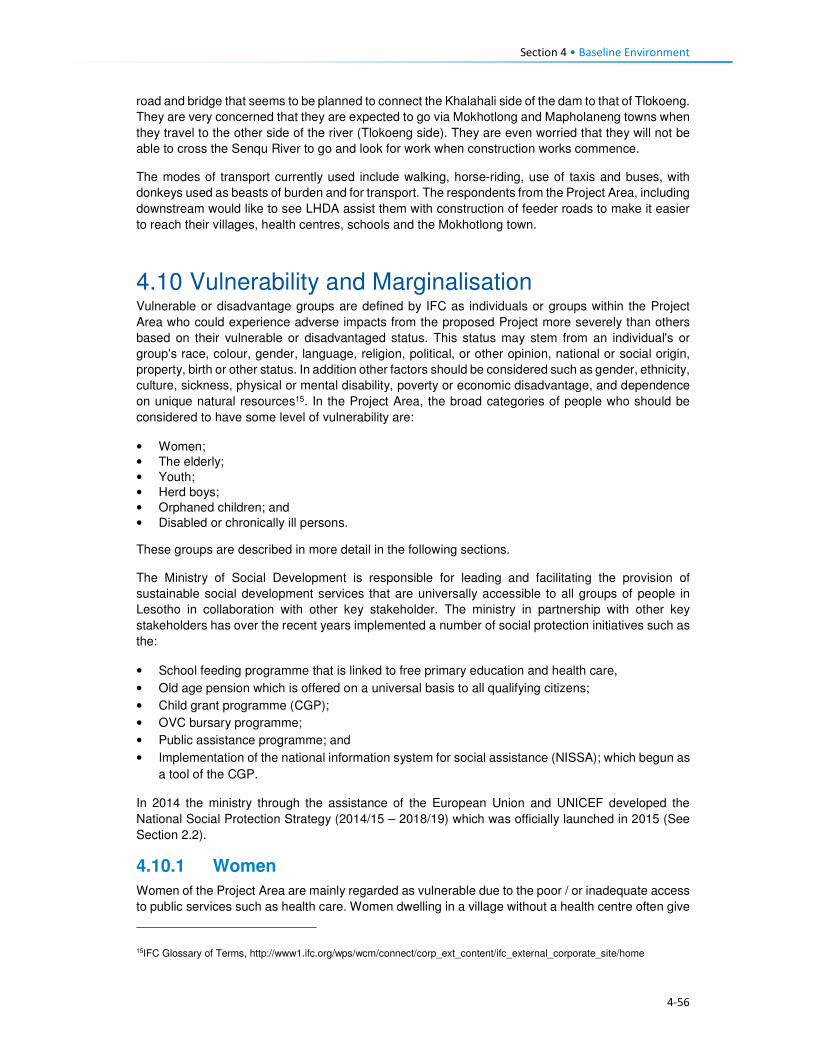
Section 4 • Baseline Environment
4-56
road and bridge that seems to be planned to connect the Khalahali side of the dam to that of Tlokoeng.
They are very concerned that they are expected to go via Mokhotlong and Mapholaneng towns when
they travel to the other side of the river (Tlokoeng side). They are even worried that they will not be
able to cross the Senqu River to go and look for work when construction works commence.
The modes of transport currently used include walking, horse-riding, use of taxis and buses, with
donkeys used as beasts of burden and for transport. The respondents from the Project Area, including
downstream would like to see LHDA assist them with construction of feeder roads to make it easier
to reach their villages, health centres, schools and the Mokhotlong town.
4.10 Vulnerability and Marginalisation Vulnerable or disadvantage groups are defined by IFC as individuals or groups within the Project
Area who could experience adverse impacts from the proposed Project more severely than others
based on their vulnerable or disadvantaged status. This status may stem from an individual's or
group's race, colour, gender, language, religion, political, or other opinion, national or social origin,
property, birth or other status. In addition other factors should be considered such as gender, ethnicity,
culture, sickness, physical or mental disability, poverty or economic disadvantage, and dependence
on unique natural resources15. In the Project Area, the broad categories of people who should be
considered to have some level of vulnerability are:
• Women;
• The elderly;
• Youth;
• Herd boys;
• Orphaned children; and
• Disabled or chronically ill persons.
These groups are described in more detail in the following sections.
The Ministry of Social Development is responsible for leading and facilitating the provision of
sustainable social development services that are universally accessible to all groups of people in
Lesotho in collaboration with other key stakeholder. The ministry in partnership with other key
stakeholders has over the recent years implemented a number of social protection initiatives such as
the:
• School feeding programme that is linked to free primary education and health care,
• Old age pension which is offered on a universal basis to all qualifying citizens;
• Child grant programme (CGP);
• OVC bursary programme;
• Public assistance programme; and
• Implementation of the national information system for social assistance (NISSA); which begun as
a tool of the CGP.
In 2014 the ministry through the assistance of the European Union and UNICEF developed the
National Social Protection Strategy (2014/15 – 2018/19) which was officially launched in 2015 (See
Section 2.2).
4.10.1 Women
Women of the Project Area are mainly regarded as vulnerable due to the poor / or inadequate access
to public services such as health care. Women dwelling in a village without a health centre often give
15IFC Glossary of Terms, http://www1.ifc.org/wps/wcm/connect/corp_ext_content/ifc_external_corporate_site/home

Section 4 • Baseline Environment
4-57
birth at home or are expected to leave their homes to await childbirth in another village whilst living
with non-family/ non-relations. In case of medical emergencies during home births, women are often
at higher risk because of the lack of transportation.
Similarly, to most youths in the District and Project Area, the population has a shortage of high
schools, and the distances that will be required to walk to and from school discourages the people
from attending school. Women’s vulnerability as it relates to the Project may be linked to low potential
for women to securing to long-term permanent jobs due to their low levels of education and possibly
lack of skills to carryout jobs beyond cleaning services. Both women and youth of limited education
are more unlikely to secure jobs during the construction and operational phases and they would both
be deemed vulnerable.
Loss of land by female headed households due the Project land take will increase their vulnerability
should their land acquired by the Project be not replaced.
4.10.2 The Elderly
The elderly are generally recognised as being vulnerable due to their age. The elderly remains in
high social standing as long as they are productive; however, they lose this standing once they
become dependent on the younger generations for assistance in meeting their basic needs (e.g.
housing, water, food). Furthermore, the elderly is often targeted by criminals for their pension. The
elderly are usually not in a position to take advantage of the benefits typically associated with large
projects such as the Polihali Dam Project.
4.10.3 Youths
For the purposes of this assessment, youth are quantitatively defined as persons aged approximately
15 to 35 or, recognising variations by cultural context, qualitatively defined by their degree of
independence with respect to their obtainment of a livelihood, relationship status (i.e. marriage,
children), and living arrangements.
Youth can be recognised as vulnerable, though in a way distinct from other categories listed above.
Being at their physical prime but often facing an unknown future, youth may be seen as both
empowered and disempowered. Youth are vulnerable in the sense that they are between dependence
(childhood) and independence (adulthood) and, without access to resources and support to enable
their transition to adulthood, youth may face a large degree of instability in their lives. Youth only
inherit land once they have reached full adulthood and marriage, and until then are dependent on
their parents.
Another characteristic of youth is that it is a time when individuals are developing their identities and
questioning societal norms; when youth perceive that their economic and social prospects are poor,
they may engage in antisocial behaviour. Youths within the Project Area often lack the education,
skills and qualifications to secure meaningful jobs. In case of youths still in school, there exists a hope
that they will in the future, secure scholarships or bursaries and subsequently employment with the
Project to attained tertiary education.
4.10.4 Herd boys
Herd boys are often youths who left school early due to their impoverished families not being able to
pay for their way through school, while some leave school to pursue livestock herding in order to start
building their livestock herds. The lifestyle of herd boys is tough and dangerous due to the period of
time spent away from home living in cattle posts located high in the mountains. In the winter months
when it snows many die in fires when they fall asleep without putting fires out. Sometimes, herd boys
are killed by robbers raiding their cattle posts to steal livestock; or in violent fights between the
herders.
Herd boys who choose to leave their jobs in anticipation to secure permanent work with the Project
may be vulnerable should they fail to secure the anticipated jobs with the Project. Given the general
Section 4 • Baseline Environment
4-58
lack of employment opportunities and the herd boys lack of schooling and skills beyond livestock
herding, they will find it difficult to secure a new job thus losing their source of stable income.
4.10.5 Orphaned Children
Orphaned children in the area are vulnerable due to the poor care they receive from extended family
upon the death of their parents or guardians. They often do not attend school or receive any medical
care. The ages of orphans who are eligible for project related benefits range from 0 -17.
4.10.6 Disabled or Chronically Ill Persons
Disabled persons should be recognised as vulnerable as they are unlikely to be able to access the
Project benefits but would be vulnerable to change brought about by the Project. People living with
HIV/AIDS and TB can be considered to be disabled as their ability to remain healthy and maintain
their livelihoods is often compromised by their illness.

5-1
Section 5 Impact Assessment
5.1 Introduction This section provides a description of the predicted social impacts associated with implementation of
the Project. The impacts are mostly divided in accordance to the various phases of the Project, with
the exception of impacts whose impact significance remains unchanged in all phases.
5.2 Overview and Context 5.2.1 Overview
This section assesses the socio-economic impacts and benefits anticipated during the construction
and inundation phases of the Project. The impacts have been assessed against the backdrop of the
baseline socio-economic environment (Section 4). One of the most significant socio-economic impacts
arising from the Project is the need for resettlement of at least 203 households from below the FSL
and the relocation of a further 134 households that may be dangerously located, together with
extensive loss of arable and grazing land. This will result in a number of related impacts on the already
strained and limited natural resources in the area. The physical and economic displacement impacts
are described in Sections 5.3 and 5.3.1.1.
The construction phase of the Project is scheduled to take five to seven years to complete, with
construction activities ramping up during the construction of the dam and appurtenant works. At its
peak, 3500-4000 jobs will be created which will bring both benefits (local job creation) and negative
impacts (influx of work-seekers, anti-social behaviour, pressure on local infrastructure, etc.). The
realisation of the benefits and the mitigation of the impacts will take careful management and
collaboration between LHDA and various government departments as discussed below.
5.2.2 Community Expectations Related to the Project
During the stakeholder engagement process (undertaken between September 2016 (commencement
of sensitisation meetings) and March 2017), it was evident that the majority of people living in the
Project Area are in support of the Project and are hopeful of the many anticipated social and economic
benefits that will be realised. While many concerns and questions were raised, the communities are
impatient for the project to start, after many years of planning and ongoing consultation for different
studies. The communities in the Project Area have exceedingly high expectations of the real and
perceived benefits. The Stakeholder Engagement Report documents the issues and expectations
raised by all stakeholders consulted (Sechaba & ERM, 2017).
As with any large-scale project, the surrounding communities immediately begin to anticipate benefits;
some are real and some are possible but will not arise as a direct result of this Project. During the
stakeholder engagement and data gathering forums, people grabbed the opportunity to highlight their
needs16. Many of these needs are linked directly to the lack of social infrastructure and services in the
Project Area. It was evident that they anticipate that, over time, relevant authorities and service
providers will deliver much needed social infrastructure and services thus serving to improve their
overall quality of life. Based on this feedback, it is clear that the community have unreasonably high
expectations of LHDA, their appointed contractors, and other government authorities (e.g. LEC) in
terms of delivering benefits and addressing needs. While it is conceivable that, over time, social
infrastructure and services could be delivered, this is not going to be as a direct result of this Project
16 Respondents were asked to identify potential positive and negative impacts that they expected to arise as a result of the
Project; some of the positive impacts raised were perceived benefits/ needs that could potentially be delivered in the future by responsible parties’ due to improved access. They were informed that these benefits are not going to arise as a direct result of LHDA, the appointed contractors or the authorities.

Section 5 • Impact Assessment
5-2
or the Project role-players. The anticipated benefits based on high community expectations that were
raised in the meetings include:
• Provision and improvement of public services and infrastructure such as high schools, health
centres, improved road access, improved sanitation and water facilities;
• Electrification of local households;
• Early receipt of compensation for all losses incurred (i.e. prior to actual loss of land/ structures);
• Provision of scholarships and bursaries for local youths;
• Local upskilling and work experience;
• Creation of employment opportunities;
• Prioritisation of local people for all unskilled jobs;
• Sharing benefits of revenue paid by South Africa to the Government of Lesotho;
• New market opportunities to encourage trading and increased local business activity; and
• Reduction of crime due to increased police presence in the area.
It is possible that these high expectations, if not met, may lead to increased levels of dissatisfaction
and future grievances. Stakeholders have already indicated that there is a significant time lapse
between registering grievances to their resolution. It is, therefore, possible that if the expectations of
the Project are not met, levels of dissatisfaction may escalate to the point of general unrest and conflict.
Recommendations to address the high expectations of the Project stakeholders are proposed below.
5.2.2.1 Recommended Mitigation Measures
• Continued engagement with communities through the existing structures formed; with the LHDA
continuing to monitor the current stakeholder engagement procedures for improvements when
required;
• LHDA will clearly communicate with communities the ambit of LHDA / contractor responsibilities,
and government responsibilities, and shared responsibilities where formal MoUs exist;
• LHDA and the appointed contractors will implement measures to maximise local employment and
business developments and opportunities, as outlined in Sections 5.3.5.4 and 5.3.6.4;
• Through the CLCs, LHDA will increase awareness of the grievance resolution procedure amongst
the communities;
• LHDA must ensure that all registered stakeholder grievances are responded to timeously;
• LHDA will continuously monitor the use of the procedure;
• Communities throughout the Project Area should be included within livelihood restoration and
social development initiatives as part of the SDMP for LHWP Phase II, which will serve to address
some of the expectations of the local communities. LHDA and the appointed contractors will
continue to work closely with the CLCs to ensure on-going identification and management of
stakeholder issues and concerns, where possible, and in accordance with the SDMP;
• LHDA will regularly communicate information updates about the Project activities as well as SDMP
projects and benefits, as required; and
• LHDA must communicate and coordinate the planning and implementation of community projects
so that there is uniformity in their approach. This will avoid stakeholder confusion about the roles
of the various partners.
5.2.3 Project Area Context and Sense of Place
The Project Area is predominantly rural in character. Villages are scattered throughout the area, the
majority of which are relatively isolated given the degraded state of the road network. Those located
closest to the A1 between Mapholaneng and Mokhotlong are the most accessible. Except for villages
located on the more passable unpaved roads which are served by taxis, transport to and from villages
is generally on foot, donkey or horse and most household supplies are transported on donkeys.
The villages are each relatively small (mostly numbering between 20 and 100 homesteads) and
comprise residential structures and outbuildings, which are largely constructed of locally sourced

Section 5 • Impact Assessment
5-3
materials (stone, mud, and thatch). Houses in the larger settlements along the paved or major unpaved
roads may be of concrete brick and corrugated iron.
Most families use woody shrubs, cow dung and some wood as their primary fuel source; the cost of
other fuel sources is prohibitive for most households. The only villages that have electrical connections
are in Mokhotlong and Mapholaneng, and some villages along the A1. There are no large-scale
commercial or industrial developments in the area.
The surrounding landscape is generally steep and sparsely vegetated with grass interspersed with
rocky outcrops. Lower gradient slopes along the river and stream valleys and where deeper soils occur
on the plateau and higher slopes, are used for cropping predominantly maize and wheat. Cropping
and livestock farming is the mainstay of the majority of households. Noise and light levels are low.
For most of the population, this rural environment and lifestyle is all they know. The families living
throughout the area are reliant on the land and work very hard to sustain themselves. To them, this is
a harsh environment that is isolated and remote, resulting in limited opportunities and a lack of much
needed social infrastructure and essential services. To privileged outsiders, the peace and quiet, and
‘quaint’ traditional villages are considered to be a desirable relief from high-paced city life.
The photographs in Figure 5.1 illustrate the physical landscape and provides a general sense of the
remoteness and character of the Project Area.
Based on feedback during stakeholder engagement, the majority of the local people are looking
forward to the construction and operation of the Project. It appears that to most people, this symbolises
positive changes that will bring about much needed development and more diverse economic
opportunities. The anticipated changes are directly related to meeting basic needs and improving the
quality of life for local residents; including improved access to schooling, healthcare, water, sanitation,
electricity, transport options, and economic opportunities. People are also aware of some of the risks,
many of these were raised and have been incorporated and assessed as part of this SIA.
Sense of place is the unique value that is allocated to a specific place or area through the cognitive
experience of the user or viewer. It is generated by varying combinations of a range of factors
including; land use, character and quality of a landscape, as well as by the tangible and intangible
value assigned thereto. As such, sense of place is a subjective matter that differs from person to
person based on individual backgrounds, experiences, norms, values and aspirations. It is almost
impossible to describe, let alone quantify the sense of place and the potential impacts thereon. One
thing is for certain, this Project, and the associated Project components, will result in significant
changes to the area. Influx of workers and work-seekers will bring both positive and negative impacts,
there is potential for improved infrastructure and services, and there will be increased opportunities to
generate income resulting from greater demand for goods and services, as well as improved access
to outside markets.
While many factors that influence the sense of place are tangible (e.g. increased development, more
people, noise, visual changes, dust), sense of place can also be significantly altered as a result of a
change in intangible factors (e.g. socio-cultural norms and values). With an influx of people from
outside the area, as well as work experience and increased disposable income, the local people will
be exposed to differing world views, cultures, attitudes, norms and values. Naturally, people will begin
to change based on these interactions. This change will be experienced gradually overtime as people
slowly become influenced and affected by these external factors.

Section 5 • Impact Assessment
5-4
Figure 5.1 Photographs Illustrating the Look and ‘Feel’ of the Project Area (Top: view
towards dam wall location at centre; Bottom: view of Tloha-re-Bue near
construction areas)
Some residents (predominantly young and more educated people) will welcome these changes and
opportunities and will be able to maximise the resultant benefits. Other people (predominantly the
elderly, less educated and more traditional) may find it difficult to adapt to (or resist) the inevitable
changes and will therefore be more likely to experience the negative impacts more acutely. Either way,
the sense of place will be altered and cannot be prevented or reversed. The positive and negative
impacts described for the construction and operation phases of the Project can be mitigated, in part,
thus hopefully reducing the negative impacts and enhancing the positive impacts. However, change
is inevitable and cannot be fully controlled.
The changed sense of place (including changed culture, norms and values) could give rise to
increased levels of anxiety, tension and conflict. In response, the population may direct their
dissatisfaction toward the Project. Impacts on sense of place and changed socio-cultural norms and
values cannot be mitigated directly; they will be addressed indirectly through the mitigation measures
proposed for the socio-economic impacts detailed in the remainder of this section.

Section 5 • Impact Assessment
5-5
5.2.4 Local Economy
As described in Section 4.4, the population is currently relatively isolated with limited economic
opportunities beyond subsistence based agriculture. They have expressed high expectations for
employment and business opportunities associated with the Project, and they anticipate that these
opportunities will in turn bring about improvements in their standard of living. Comments raised during
stakeholder engagement are documented in Annexure K, Volume 3 (Sechaba & ERM, 2017). Many
opportunities will be created via direct, indirect and induced employment, procurement, and through
local business development opportunities to meet the increasing demand for goods and services by
Project workers and work-seekers. The majority of these opportunities will be available during the
construction phase and will decrease significantly during the operational phase. It is unlikely that the
high expectations for an improved standard of living will be realised. The anticipated impacts on the
local economy are discussed in Sections 5.3.5; 5.3.6; and 5.3.7.
5.2.5 Project Land Acquisition
In order to implement the Project, an estimated 5600 ha of land will need to be permanently acquired
from the Mokhotlong District’s total land area of 4 075km2 (~407 500 ha). The land acquired will equate
to approximately 1% of the total District area. The land take will affect four Community Councils which
the Project footprint will straddle, namely Seatle, Bokong, Malingoaneng, and Mphokojoane
Community Councils, and one Urban Council (Mokhotlong). The loss of land will occur mainly within
the catchment area indicated by the red line in Figure 5.2.
Figure 5.2 Project Catchment Area
The acquisition of land for the Project will result in both physical and economic displacement of people,
and households. The main Project components that will result in displacement of households are the
site establishment area, dam and tunnel works areas, as well as the inundation area. The land
acquisition will occur in three phases (over a five-year period). These phases are as follows:
Phase 1. Temporary and permanent acquisition in the site establishment area for the Advance
Infrastructure. These activities will affect villages of Masakong and Ha Tlhakola villages, as well as

Section 5 • Impact Assessment
5-6
households from Ramonakalali, Mabunyaneng, Makalong and Tsekong. Masakong and Ha Tlhakola
will be affected by physical and economic displacement and the remainder by economic displacement
(Figure 5.2).
Phase 2. Permanent land acquisition in the inundation area around Tloha-re-Bue and the remainder
of the site establishment area (for instance the Tunnel Works Area, Substation, but also the PNEAR-
not part of this ESIA). Tloha-re-Bue is partly affected by physical and economic displacement.
Phase 3. The remainder of the inundation area, covering several villages including Ha Jobere, Koung
Ha Phohla, Tsekong and Litsotsong, and Ha Sikantsi are all affected to varying degrees by physical
and economic displacement; and all economic displacement (loss of fields, trees and thickets within
the inundation area) affecting households in surrounding villages, which are not physically affected.
The land that will be affected is currently used for grazing, collection of natural resources, cultivation
of crops, and settlements as depicted in Table 5.1; with land used for grazing being most affected and
the primary land use of the land. Figure 5.3 indicates villages that will experience physical and
economic displacement.
Table 5.1 Land use distribution within the Catchment Area
Land use (across the Catchment Area) Land area per use
Cultivated areas 13 176 ha (35%) Settlement areas 2280 ha (6%)
Grazing areas 19 365 ha (52%)
Mountainous areas 2687 ha (7%)
Source: P2W-6014-DFR-0007, 2017
Table 5.2 highlights all the villages and the approximate number of households per village likely to
be physically displaced by the Project. Figures provided in this table are estimated numbers based
on the Feasibility Study and current predictions. These still need to be verified by the resettlement
specialist team
Table 5.2 Estimate of Villages and Households to be Displaced
Classification Village name Households below reservoir demarcation line (DL)
Households dangerously located
Fully below Reservoir DL Map ref. 1 to 5
Ha Jobere 6 Unknown
Ha Tlhakola 18 Unknown
Lits'otsong 5 Unknown
Tsekong 28 Unknown
Ha Sekants’i 13 13
Partially below Reservoir DL Map ref. 6 to 8
Tloha-re-Bue 40 13
Koung Ha Phohla 32 36
Sekokong 3 5
Site establishment area Map ref. 9 & 10
Masakong 50 Unknown
Malingoaneng & Meeling
8 41
Potentially Dangerous Location (safety) Map ref. 11 to 16
Liphokong Unknown (7)
Ha Mpesi Unknown (4)
Koung Ha Thunyane Unknown (3)
Ha Meta /Ha Manka Unknown (3)
Makhalong Unknown (3)
Lilimala Unknown (6)
Potential Isolation Map ref. 17 & 18
Bokone & Morojeleng Unknown Unknown
Total 18 203 95 (+26 unbudgeted for) 121

5-7
Figure 5.3 Villages Likely to be Displaced by the Project

Section 5 • Impact Assessment
5-8
To mitigate for the loss associated with the Project land acquisition, LHDA has appointed a
resettlement planning consultant, as well as developed two critical documents, namely Phase II
Compensation Policy, 26 August, 2016 and the Livelihood Restoration and Social Development
Framework (LR&SDF), August, 2017.
The Compensation Policy provides the guiding principles for compensation of all losses that will be
incurred by Project affected households and communities. The Policy was developed on the basis of
consultations with affected communities, their authorities and other key stakeholders. English and
Sesotho versions of the Policy were made available to affected communities via the local authority
structures (District Councils, Urban Councils, Community Councils and Chiefs) as well as through local
participation structures set up for Phase II. The Policy objectives are:
• To minimise involuntary land take by investigating all possible Project design alternatives;
• To ensure that affected people and communities, including host communities are meaningfully
consulted on Project designs, alternatives and impacts;
• To promote affected people’s participation in the planning, implementation and monitoring of
compensation, resettlement, mitigation and development measures;
• To ensure that relocation of households and businesses is undertaken in a participative,
systematic and beneficial manner, involving both displaced and host communities;
• To ensure that affected people are promptly, fairly and fully compensated for their losses; and
• To ensure that direct compensation is accompanied by additional measures where necessary to
help restore livelihoods.
The Policy makes the following provisions in terms of losses of houses, associated structures and
residential plots:
All structures requiring relocation will be compensated on the principles of replacement cost in the
form of replacement housing provided by the Project, direct construction by the owner (owner-builder
method), or lump sum cash compensation (which will be assessed on a case-by-case basis).
Provision for replacement housing will comply with the following criteria:
• Replacement houses will be constructed at Project-designated resettlement sites or sites within
the Project Area identified by households and approved by LHDA and local authorities.
• Replacement houses will have the same floor area as the current houses, with the exception of
houses that are less than 20 m2 – the house will be replaced with a 20 m2 structure.
• Replacement houses will be constructed with standard modern materials or traditional building
materials if requested by affected households.
• Replacement housing will adhere to the country’s building and sanitation standards as a minimum
requirement, with a twelve (12) month defects liability period.
• Households will participate in the design and layout of replacement houses and will be presented
with a number of final designs from which to choose.
• Each household will be provided with a toilet of at least ventilated improved pit latrine (VIP)
standard.
• An appropriate cooking and heating facility or traditional fireplace (where requested and feasible)
will be provided in the new house.
• Each new residential plot will be fenced, up to a maximum residential plot size of 1000 m2 and, if
a household has a larger fencing entitlement, the difference will be compensated as a lump sum.
Loss of agricultural fields will be compensated through one or a combination of replacement land,
lump sum or annual payments, and/ or annual grain payments. The provision of replacement land is
the preferred option.
LHDA has further developed a LR&SDF which aims to set the context for the restoration of the
livelihoods of households affected by Phase II, and to ensure the provision of opportunities for the
diversification and improvement of livelihood-earning activities. The main guiding principles for the
Framework are:
Section 5 • Impact Assessment
5-9
• Principle 1: Livelihood restoration and social development initiatives will be undertaken within a
framework that supports local, regional and national development.
• Principle 2: Livelihood restoration and social development initiatives will be informed by the views
of the affected communities.
• Principle 3: Partnerships will be established for the planning, implementation and handover of
livelihood restoration and social development initiatives to communities.
• Principle 4: Livelihood restoration measures and social development initiatives will be monitored
and evaluated in a controlled manner in partnership with the intended programme beneficiaries.
• Principle 5: The objectives of management of land, water and living resources are a matter of
societal choice involving all relevant sectors of society.
Compensation for fields will be made to the field holder and his/her legally verified heir(s) and
successor(s) by means of a lump sum payment or through an agreed number of instalments, up to a
maximum of 50 annual instalments, into a nominated account or through investment with an approved
financial institution. The form of payment will be considered on a case-by-case basis, taking account
of the economic status and means of the household, and the wishes and preferences of the spouse
and other household members. Lump sum payments will be discounted at the rate established under
the approved compensation rates.
Grain payments will be retained as a compensation option. Grain compensation will be directly
proportional to the area of land lost, and paid annually for a period of fifty (50) years. Compensation
payments for garden land may be made as a lump sum or on an annual basis (fifty (50) years),
according to the preference of the affected household, except where a household who had a food
garden relocates to an area of its own choice outside the Project area, in which case compensation
will be in the form of a lump sum. Lump sum payments will be discounted at the rate established
under the approved compensation rates.
Communal assets such as grazing land, brush, wood, medicinal plants, useful grasses and wild
vegetables will be compensated through the establishment of Compensation Funds which will be
setup at a Community Council level and will be managed by LHDA. Compensation Funds will be made
available for investment and implementation of community development projects agreed and
prioritised by the local Council and the affected households. As households will be allowed to resettle
outside of their Community Council areas, the Compensation Funds for loss of communal assets will
be dispensed between the affected local councils (including host councils) based on the number of
displaced households relocating within/ or to each area.
The Policy furthermore, defines households headed by orphans, by persons living with a disability or
by elderly, or indigent persons as vulnerable. The Policy indicates that vulnerable households will
receive individual attention from LHDA as well as the relevant government agencies. Where possible,
the assistance of certain NGOs will be requested at the expense of LHDA. As far as reasonably
possible, LHDA will ensure that vulnerable households are enabled to retain, and where possible,
improve upon the standard of living they had prior to being affected by the Project. Possible support
measures for vulnerable (although not limited to vulnerable) households could include skills training
opportunities as applicable; income-generating or alternative livelihood earning opportunities (subject
to detailed feasibility studies); and assistance to get access to available poverty alleviation or social
welfare programmes.
Loss of access routes will be compensated for through the construction of footbridges, upgrading of
certain roads. This study for this has been commissioned under Contract 6019.
Apart from temporary relocation to accelerated access to cultivation land will be facilitated through
temporary land acquisition which will become permanent acquisition as part of the resettlement
planning process for a particular area. The temporary relocation will be discussed with affected
households and suitable temporary relocation arrangements will be made to allow households to
continue their social lives and livelihood activities.

Section 5 • Impact Assessment
5-10
Additional impacts that are linked to the Project’s land requirements include the loss of access to
rangelands, and loss of graves. These impacts have been described, assessed and mitigated for in
the respective specialist studies. Refer to:
• Soils Specialist Study (ERS, 2017; P2W-6014-DFR-0007);
• Rangelands Specialist Study (Ramatla & Kheekhe, 2017; P2W-6014-DFR-0009);
• Cultural Heritage Specialist Study (MM&A, 2017; P2W-6014-DFR-0003); and
• Terrestrial Ecology Specialist Study (Ecorex & Kobisi; P2W-6014-DFR-0002).
5.3 Construction and Inundation Phase Impacts 5.3.1 Impact of Physical Displacement and Resettlement
5.3.1.1 Description of Impact
The IFC PS5 (2012) describes physical displacement as the relocation or loss of shelter and other
household structures, and/ or restrictions on land use. During the construction and inundation phases,
the Project will result in physical displacement and relocation of at least 203 households in 11 villages
below the reservoir FSL, and possibly an additional 108-134 households in 11 villages which are
dangerously located in relation to the reservoir and may need to be relocated (see Table 5.2). In
addition to the affected households, there will also be impacts to a range of community and social
infrastructure and services; including roads, water sources, schools, clinics, markets/ commercial
areas, small businesses, and even the prison located at the town of Mokhotlong.
As described in Section 5.2.5, during Phases 1 and 2, there will be permanent physical displacement
of households from Masakong and Ha Tlhakola (resulting from the Phase 1 advance works
programme), and of households in the inundation area around Tloha-re-Bue and the remainder of the
site establishment area during Phase 2. During Phase 3, there will be physical displacement of
households across the inundation area; covering several villages including Ha Jobere, Koung Ha
Phohla, Tsekong and Litsotsong, and Ha Sekants’i.
As part of Phase 1, the advance works programme requires temporary relocation of between 10 and
15 households from Masakong for ~3 years. This temporary relocation is to enable construction of the
access road to facilitate site establishment of the Eastern Facilities (e.g. Polihali Village, offices and
labour camps). During this time it is anticipated that these households will be temporarily housed in a
nearby location that does not pose any safety risks. Once road construction is complete and the area
is rehabilitated the households will be permanently relocated back to Masakong village. These
households will undergo two resettlement processes; while this will be extremely disruptive, the
intention is to avoid long-term displacement from their land/ village.
Table 5.2 and Figure 5.3 provide indicative figures and the location of households that are most likely
to require resettlement. It is evident that the largest physical losses will arise from inundation, as whole
villages will be affected and the greatest number of households. The exact numbers and locations of
households, infrastructure and services that will experience permanent and/or temporary physical
relocation are being refined as part of the RAP process.
5.3.1.2 Sensitivity of Receptors
The communities in the area are extremely poor and are geographically isolated, largely because of
poor road accessibility and limited telecommunication coverage. They are largely reliant on land-based
livelihoods and because of poor linkages with urban areas there is limited flow of money and goods.
There are vulnerable people in the local communities who, by virtue of their gender, age, physical or
mental disability, economic disadvantage or social status would be more adversely affected by the
Project, and who may be limited in their ability to take advantage of the Project’s development benefits
and deal with the negative consequences. Vulnerable people require special attention and

Section 5 • Impact Assessment
5-11
consultation, and include HIV/ AIDS affected people and households; people co-infected by HIV/AIDS
and tuberculosis (TB); child-headed households; people with mental health illnesses; people with
physical disabilities; sex workers; elderly; children and orphans, and herders. In line with the provisions
of the Land Act and the Phase II Compensation Policy, both owners (spouses) are required to sign
the asset verification and compensation offers, thus mitigating the patriarchal system in the area. A
Power of Attorney form will need to be completed if it is anticipated that one spouse will be unavailable
at the time of the asset verification and compensation offer.
Based on the above, households affected by physical displacement are considered to have High
sensitivity to this impact.
5.3.1.3 Assessment of Impact
The impact of physical displacement of households will be direct, negative and localised in nature.
The impact of physical displacement will be permanent. The magnitude of the unmitigated impact will
be Large given the high number of affected households, the extent of the disruption, and likely stress
to the affected families in the long-term - particularly until they are able to settle into new houses and
re-establish their livelihoods. Given the High sensitivity of these households, the overall significance
of this impact (pre-mitigation) is rated Critical.
The 10-15 households from Masakong that will be temporarily housed prior to permanent resettlement
will experience the most disruption over an extended period of time. They will experience this impact
most acutely.
Table 5.3 Impact of Physical Displacement of Households
Pre-Mitigation Impact Residual Impact
Type of Impact Direct negative
Magnitude Large Small-Medium
Sensitivity High High
Significance Critical* Moderate-Major
* The households from Masakong that will be resettled twice will be most acutely impacted.
** Note: The residual rating is based on a precautionary judgement that takes into account the disruption and stress caused to
affected households who have to relocate and the uncertainty as to how different households will respond to this. Households
will have differing residual rating depending on their final resettlement terms. Some households may respond positively while
others may adapt with difficulty. Based on the ESIA definitions, an impact of Moderate has an impact magnitude that is within
applicable standards, but falls somewhere in the range from a threshold below which the impact is minor, up to a level that
might be just short of breaching a legal limit, and requires that impacts are managed effectively and efficiently.
5.3.1.4 Mitigation Measures
In accordance with the mitigation hierarchy, the Project planning has aimed to minimise displacement
as far as possible, in the knowledge that resettlement is a highly significant social impact for affected
families (as well as delaying implementation of the Project and increasing costs).
Physical displacement requires a separate RAP (in accordance with international lender requirements
(e.g. ESS 5 / IFC PS5) that must take cognisance of the land-based livelihoods, social networks and
the wider community structures. Furthermore, many households are extremely poor and are therefore
more vulnerable to the impacts of displacement. Apart from replacing houses and compensating for
other assets affected by the Project in accordance with the agreed LHWP Phase II Compensation
Policy and rates schedule, affected households should be included in the development and
implementation of alternative livelihood strategies in accordance with the LHWP Phase II LR&SDF.
• LHDA will ensure that Resettlement Planning and Implementation (that forms part of a separate
contract (LHDA Contract No. 6015)) is compliant with all provisions of the LHWP Phase II
Compensation Policy and the agreed rates schedule.

Section 5 • Impact Assessment
5-12
Activities to be undertaken under the RAP include.
• Regular review and updating of the Phase II Community Participation Strategy developed by
LHDA that builds on the existing community structures established by LHDA in the form of ALCs
and is aligned with the requirements of the international lenders such as the World Bank.
• Asset registration of all community assets within the affected area in accordance with LHDA’s
Asset Registration Procedure (October 2017). Assets that will be recorded under the RAP include:
• Houses and associated structures – dwellings, toilets, storerooms, kraals, perimeter walls,
fencing and cattle posts;
• Other private physical assets – non-moveable assets such as residential land, agricultural
fields, gardens, trees, thickets and graves;
• Private enterprises such as shops and other business establishments; and
• Any public amenities and structures that may be affected, e.g. communal water point.
Asset registration shall include confirming proof of ownership of affected assets, and proof of
identity of affected owners.
• Socio-economic Census of affected persons, assets and other entities to establish an accurate
socio-economic profile that can be used as the basis for future monitoring.
• Compensation and Relocation planning by the appointed RAP consultant that shall include:
• Confirm eligibility of households requiring resettlement and the relocation options with the
affected households and local authorities, with a preference for identifying relocation options
on the same plot or village;
• Determine and record initial livelihood restoration preferences of affected households;
• Identify and confirm relocation sites; and undertake surveys of relocation sites where required;
• Assist LHDA with formal acquisition of the relocation sites;
• Undertake planning of relocation plots/sites, including land preparation requirements and any
required services/amenities and prepare physical layout plans for relocation plots/sites;
• Confirm house replacement preferences with affected households, and if appropriate cash
compensation;
• Prepare compensation and relocation plans with each affected household; and
• Prepare plans for relocation / compensation of affected graves.
• Prepare Resettlement Action Plans based on the information obtained during the previous listed
activities and include a costing for implementation and an implementation plan. The RAP must be
shared with communities at community meetings, and formally publicised.
• Mitigation for other community impacts Implement the recommendations/ measures that will
be proposed in the Bridges and Feeder Roads Master Plan and RAP to ensure that households
retain access to social services, community infrastructure and resources where the Project results
in severed access.
• Preparation of Tender Documents for implementation of the resettlement activities in
accordance with LHDA’s Procurement Policy and LHDA’s Anti-Corruption Policy.
• Resettlement Implementation (to be done by LHDA with support of the RAP consultant (under
LHDA Contract No. 6015)) which shall include:
• Signing of compensation agreements with affected communities;
• Payment of compensation (including facilitating opening of bank accounts for households);
and
• Implementation and management of the resettlement programme including preparation of
relocation sites; construction of replacement housing and amenities/services; physical

Section 5 • Impact Assessment
5-13
relocation of households and their belongings; and relocation of graves and other social
mitigation.
Additional aspects that shall be considered as part of the RAP contract include:
• The socio-economic census shall outline multiple providers of income and include a gender
analysis as a basis for facilitating different opportunities for employment of women;
• Criteria set for the socio-economic census for determining vulnerability of households shall ensure
that vulnerable groups (poor, elderly, ethnic minorities) are included;
• Compensation and other necessary assistance shall be provided before impacts of the Project
occur;
• Arrangements and resources for resettlement shall be adequate and assigned;
• The resettlement timetable shall be linked to the phasing of Project implementation;
• Physical and economic assistance to households will be provided during relocation;
• Households requiring relocation shall be properly briefed on the advantages and disadvantages
of different housing types to make informed decisions;
• Replacement housing structures shall be built to Lesotho’s building and safety standards;
• Grievance procedures shall be prepared and implemented; and
• A Monitoring and Evaluation Plan for resettlement shall be prepared and implemented, and mid-
term and long-term Monitoring and Evaluation audits conducted.
Masakong Households:
• The 10-15 households from Masakong that will be temporarily housed prior to permanent
resettlement will experience the most disruption over an extended period of time. These
households will experience this impact most acutely and should be treated as highly sensitive
households; and
• Where possible, temporary relocation should be avoided and a permanent site should be identified
upfront.
5.3.1.5 Residual Impact
Implementation of the RAP as stipulated under the mitigation measures above is predicted to reduce
the magnitude to Small-Medium; receptor sensitivity will remain High. Over time, as households adapt
to the new location, the residual impact significance should reduce to one of Moderate-Major
significance and possibly even lower in some cases. This is difficult to predict given that relocation
terms and details are still to be defined and agreed, these will differ by household and each household
will respond differently to the final relocation. As such, monitoring should extend for a suitable period
into operation in order to ensure that the quality of life of displaced persons is equal to or better than
prior to displacement.
5.3.2 Economic Displacement
5.3.2.1 Description of Impact
According to IFC PS5 (2012), economic displacement refers to the loss of assets or access to assets
that leads to loss of income sources or other means of livelihood. In this case, the construction and
operation of LHWP Phase II will result in the loss of access to agricultural land, grazing land, natural
resources, and access to markets.
During all phases of the RAP (Phases 1, 2 and 3), economic displacement will occur. During Phase
1, households in Masakong, Ha Tlhakola, Ramonakalali, Mabunyaneng, Makalong and Tsekong will
experience economic displacement. In Phase 2 the area around Tloha-re-Bue will be affected. Finally,
the remainder of the inundation (Phase 3) will result in economic losses to households from Ha Jobere,
Koung Ha Phohla, Tsekong, Litsotsong, Ha Sekants’I. Phase 3 will also lead to a loss of agricultural
fields, trees and thickets affecting households in a number of surrounding villages, which are not
physically affected. The RAP will identify the exact impacts, the individual households and customary
areas (and users) that will be affected.

Section 5 • Impact Assessment
5-14
Land users engaged in crop cultivation and livestock farming will experience economic displacement,
affecting their ability to produce food and cash crops/ produce. Given the shortage of arable land in
the area, it is expected that this loss of land will have a significant impact on food security, household
income and livelihoods for the affected families. This will be further aggravated for those who face
displacement relating to changing availability of other natural resources (e.g. medicinal and fuel
plants), indirectly impacting subsistence livelihoods and traditional household structures. To a lesser
extent, it is possible that construction disturbance may impact the potential for hunting wild animals,
although this is considered a marginal contribution to households. Economic displacement requires a
separate LRP (in accordance with international lender requirements).
This impact will be experienced directly as a result of a combination of: i) lost access to these land-
based livelihoods and resources from which the majority of the population in the Project Area derive
an income; ii) increased competition for land by displaced people and migrants moving into the area
(e.g. work-seekers); iii) lack of alternatives; and iv) increased time and cost due to extended traveling
distances to and from areas where resources are still available.
The main economic activities that will be affected by the Project are discussed below.
Loss of Access to Agricultural Land
Local livelihoods of the Project affected area are heavily dependent on crop production for household
subsistence and survival. Crops are grown for multiple purposes, primarily household consumption
(average 75%) followed by sale, bartering, and payment to others for services rendered. Some
households in the area do not engage in crop production. However, it is likely that a member of these
households is involved in agriculture as a worker or via a sharecropping arrangement.
Between 1000 and 1500 ha of land currently under cultivation will be lost to the Project. This loss
accounts for approximately 11% of the total land area (as at 2017) under cultivation across the Project
Area (Ecorex and Kobisi, 2017). Most of the productive agricultural land is located in the area that will
be inundated by the Reservoir. The exact number of fields to be affected and the number of
households to be affected by the loss of agricultural fields is currently unknown and this will be
confirmed and assessed as part of the RAP. Given the existing shortage of arable land within the
Project Area, there is a high likelihood that affected people may not be provided with like-for-like
replacement land for the loss of fields.
Loss of Access to Grazing Land
Livestock production is also an important livelihood source for local households. During the 2013/2014
agricultural year, Mokhotlong District had an estimated 40,932 head of cattle and approximately
300,000 sheep and goats (Section 4.4.4). As such, access to, and availability of, grazing land is
essential. Livestock grazing occurs across the Project Area and beyond; however, the majority of the
grazing that will be affected is of poor quality, reportedly due to overgrazing and a lack of adequate
management, exacerbated by the recent period (3-4 years) of low rainfall.
The Project will result in a loss of access to grazing areas, specifically resulting from inundation. All
directly affected grazing will be permanently lost and affected people will be expected to find alternate
grazing, thus placing an additional strain on existing grazing resources beyond the Project footprint.
Furthermore, FGD respondents indicated that local people are not willing to reduce their livestock
numbers, due to the income generated from the production of mohair, wool, and other produce.
Note, the impact of dam inundation on rangelands and soil and land use capability has been separately
assessed by the rangeland and soil specialists, respectively in Ramatla & Kheekhe (2017) and ERS
(2017), which include additional mitigation measures to improve land use capability.
Loss of Access to Natural Resources
Natural resources are collected by all households living in the area. These are used for household
consumption (57%), medicinal purposes (31%) and other uses (12%) (see Section 4.6). These
resources are collected across various locations within the broader Project Area including riverbanks,
grazing areas, and mountainous areas. The most important natural resources in the Project Area
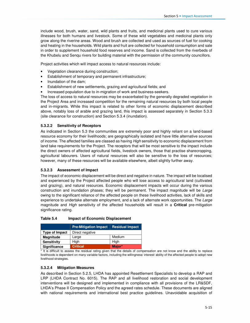
Section 5 • Impact Assessment
5-15
include wood, brush, water, sand, wild plants and fruits, and medicinal plants used to cure various
illnesses for both humans and livestock. Some of these wild vegetables and medicinal plants only
grow along the riverine areas. Wood and brush are collected and used as sources of fuel for cooking
and heating in the households. Wild plants and fruit are collected for household consumption and sale
in order to supplement household food reserves and income. Sand is collected from the riverbeds of
the Khubelu and Senqu rivers for building material with the permission of the community councillors.
Project activities which will impact access to natural resources include:
• Vegetation clearance during construction;
• Establishment of temporary and permanent infrastructure;
• Inundation of the dam;
• Establishment of new settlements, grazing and agricultural fields; and
• Increased population due to in-migration of work and business-seekers.
The loss of access to natural resources may be exacerbated by the generally degraded vegetation in
the Project Area and increased competition for the remaining natural resources by both local people
and in-migrants. While this impact is related to other forms of economic displacement described
above, notably loss of arable and grazing land, this impact is assessed separately in Section 5.3.3
(site clearance for construction) and Section 5.3.4 (inundation).
5.3.2.2 Sensitivity of Receptors
As indicated in Section 5.3 the communities are extremely poor and highly reliant on a land-based
resource economy for their livelihoods; are geographically isolated and have little alternative sources
of income. The affected families are classed as having High sensitivity to economic displacement from
land take requirements for the Project. The receptors that will be most sensitive to the impact include
the direct owners of affected agricultural fields, livestock owners, those that practise sharecropping,
agricultural labourers. Users of natural resources will also be sensitive to the loss of resources;
however, many of these resources will be available elsewhere, albeit slightly further away.
5.3.2.3 Assessment of Impact
The impact of economic displacement will be direct and negative in nature. The impact will be localised
and experienced by the Project affected people who will lose access to agricultural land (cultivated
and grazing), and natural resources. Economic displacement impacts will occur during the various
construction and inundation phases; they will be permanent. The impact magnitude will be Large
owing to the significant reliance of the affected people on these livelihood activities, lack of skills and
experience to undertake alternate employment, and a lack of alternate work opportunities. The Large
magnitude and High sensitivity of the affected households will result in a Critical pre-mitigation
significance rating.
Table 5.4 Impact of Economic Displacement
Pre-Mitigation Impact Residual Impact
Type of Impact Direct negative
Magnitude Large Medium
Sensitivity High High
Significance Critical Major*
* It is difficult to assess the residual rating given that the details of compensation are not know and the ability to replace
livelihoods is dependent on many variable factors, including the willingness/ interest/ ability of the affected people to adopt new
livelihood strategies.
5.3.2.4 Mitigation Measures
As described in Section 5.2.5, LHDA has appointed Resettlement Specialists to develop a RAP and
LRP (LHDA Contract No. 6015). The RAP and all livelihood restoration and social development
interventions will be designed and implemented in compliance with all provisions of the LR&SDF,
LHDA’s Phase II Compensation Policy and the agreed rates schedule. These documents are aligned
with national requirements and international best practice guidelines. Unavoidable acquisition of

Section 5 • Impact Assessment
5-16
arable land, loss of grazing land and natural resources will be compensated in accordance with the
LHDA Phase II Compensation Policy and schedule of rates.
As part of the asset registration process for the RAP (LHDA Contract No. 6015) (outlined in Section
5.2.5), the following information needs to be collected prior to Project construction in order to verify
the extent of land acquisition and compensation required:
• Size of arable land units, and improvements to land;
• Common property resources such as rangeland and thickets/ woodlots; and
• Number of families and persons directly or indirectly affected by land acquisition through loss of
livelihood and/ or loss of agricultural opportunity, including sharecroppers.
LHDA will seek to ensure:
• The RAP contract is implemented effectively to ensure Project affected people are not left worse-
off following displacement;
• Allocation of replacement land is prioritised over lump sum cash payments;
• The socio-economic census conducted under the RAP is used to identify affected persons,
especially vulnerable persons, and is used to inform targeted livelihood restoration for those most
impacted by the Project;
• Displaced persons should be meaningfully consulted on decisions that affect their livelihoods and
well-being and shall be fully informed of their options and the compensation rates;
• Consultation and information disclosure is aligned to the Community Participation Strategy and
the requirements of the international safeguards;
• Assistance is provided to affected people to improve, or at least restore, incomes and living
standards to at least the equivalent level prior to construction, if not better;
• Compensation and other necessary assistance are provided before impacts occur (e.g.
compensation is paid prior to construction);
• Community compensation of grazing land should be provided where land-take may impact long
term grazing productivity (i.e. where reinstatement is unlikely to restore original land use);
• The LR&SDF is implemented and includes the affected communities and households and should
be developed to enhance future income earning and employment opportunities. Livelihood
restoration planning is initiated early;
• Organisational roles and the capacity to support livelihoods restoration are defined and
appropriate;
• A Monitoring and Evaluation Plan for livelihoods restoration is prepared and implemented, and a
mid-term and long-term Monitoring and Evaluation audit is conducted.
• Grievance mechanisms are developed and accessible, and grievances are tracked and
monitored, and a concerted effort is made to close out grievances timeously; and
• LHDA will collaborate with relevant authorities and organisations to initiate and develop projects
that aim to enhance agricultural production amongst the population of the Project Area. These
should address the application of more effective farming methods, approaches to increase crop
yields, and mechanisms to assist farmers in selling their produce at the highest possible prices.
Other Measures:
• Measures outlined by the soils, rangelands and terrestrial ecology specialists (ERS, 2017;
Ramatla & Kheekhe, 2017; and Ecorex & Kobisi, 2017, respectively) will also contribute to the
mitigation of the impacts related to economic displacement; and
• LHDA is developing an ICM Plan, which will aim to manage resources and land use within the
local catchment in order to ensure the sustainability of the Project into the long-term. The plan will
need to incorporate social considerations and obtain the buy-in of the affected communities in
order for any projects coming out of the ICM Plan to be successfully implemented.

Section 5 • Impact Assessment
5-17
5.3.2.5 Residual Impact
Implementation of the measures described above is predicted to result in a reduction of the magnitude
of the impact to Medium and therefore the impact significance could be reduced from Critical to Major.
The impact could further reduce over time once the affected households have adapted to the changes
that will be brought on by the Project and the various livelihood restoration projects are underway. It
is difficult to assess the residual rating given that the details of compensation are not known and the
ability to replace livelihoods is dependent on many variable factors, including the willingness/ interest/
ability of the affected people to adopt new livelihood strategies.
At present (as of March 2018), LHDA is implementing pilot projects for various livelihood/ social
development programmes including a vegetable tunnel, village chicken farming, bee farming, etc.
Once these have been refined, and the successful programmes implemented at a large scale, they
will have the potential to reduce the residual impact further.
5.3.3 Impact of Site Clearance on Plants Used by Communities
5.3.3.1 Description of Impact
This impact will involve the clearance of vegetation and topsoil in the infrastructure footprint over an
area of approximately 121 ha on the east side of the future Polihali Reservoir. Vegetation will also be
cleared for the dams, tunnel, major bridges and A1 realignment (a further 17 ha). This will be a direct
impact that will result in a loss of plant resources utilised by surrounding communities from villages
such as Masakong, Tloha-re-Bue and Polihali/ Ha Ramonakalali.
5.3.3.2 Sensitivity of Receptors
Most of the plant species utilised by local communities for food, medicinal or spiritual purposes are
located within the widespread Rocky Outcrop / Grassland Mosaic that is prevalent throughout the
Project Area. While this vegetation mosaic has been heavily overgrazed within the development
footprint and has moderate to low biodiversity value, a number of useful plant species were identified
within the general vicinity of the infrastructure footprints. These included widespread species used for
medicinal purposes, such as Dicoma anomala, Asclepias gibba, Cheilanthes eckloniana, Haemanthus
humilis and Gazania krebsiana, species used for firewood such as Diospyros austro-africana, Euryops
tysonii and Searsia divaricata, and species with important spiritual uses such as Gladiolus saundersii,
Helichrysum splendidum and Polygala hottentota. Given the high reliance of local communities on a
wide range of useful plants, although they appear to be widespread and fairly common within the
Project Area, their sensitivity to site clearance is assigned as Medium.
5.3.3.3 Assessment of Impact
The impact of site clearance on important plant resources will be long term to permanent and will have
a high intensity. However, the extent of the impact will be relatively small (limited to the impact
footprint), and the vegetation type is ecologically degraded, resulting in an impact magnitude of
Medium. Prior to the implementation of any mitigation measures, the significance of this impact on
important plant resources will be Moderate.
Table 5.5 Impact of Site Clearance on Plants used by Surrounding Communities
Grassland Rocky Ridges & Cliffs
Pre-Mitigation Impact Residual Impact Pre-Mitigation Impact Residual Impact
Type of Impact Direct negative Direct negative
Magnitude Medium Small Medium Small
Sensitivity Medium Medium Medium Medium
Significance Moderate Minor Moderate Minor
Section 5 • Impact Assessment
5-18
5.3.3.4 Mitigation Measures
The following measures are recommended as mitigation for the impact of site clearance on important
plant resources:
• Local traditional medicine practitioners and members of local communities should be allowed and
encouraged to harvest plant resources within the infrastructure footprint prior to site clearance;
• Local communities should be supported to start plant nurseries/ community gardens to propagate
and grow useful plant resources; and
• Plants rescued by the contractors should be planted in a nursey for use in landscaping of the
Polihali Village.
5.3.3.5 Residual Impact
Implementation of the measures described above and in the Construction EMP (Volume 2, Annexure
L.1) will reduce the magnitude of the impact to Small and the impact significance to Minor.
5.3.4 Impact of Reservoir Inundation on Plant Resources Used by Communities
Note: this impact has been incorporated into this SIA from the Terrestrial Ecology Specialist Report
(Ecorext & Kobisi; 2017).
5.3.4.1 Description of Impact
The inundation of the Polihali Reservoir will result in the flooding of approximately 5600 ha of habitat.
This will be a direct impact that will result in a loss of grassland, rocky outcrop and seep habitats
containing important plant resources that are utilised by surrounding communities. In addition,
inundation will flood several villages, several of which are expected to have spiral aloes planted around
homesteads.
5.3.4.2 Sensitivity of Receptors
Most of the plant species utilised by surrounding communities are located within the widespread Rocky
Outcrop/ Grassland Mosaic that is the dominant vegetation type within the inundation zone. This
vegetation mosaic has been heavily overgrazed and has moderate to low biodiversity. These include
widespread species used for medicinal and other purposes, such as Dicoma anomala, Asclepias
gibba, Cheilanthes eckloniana, Haemanthus humilis and Gazania krebsiana, species used for
firewood such as Diospyros austro-africana, Euryops tysonii and Searsia divaricata, and species with
important spiritual uses such as Gladiolus saundersii, Helichrysum splendidum and Polygala
hottentota. In addition, inundation will flood several villages which include individuals of Spiral Aloe
(Aloe polyphylla) – assessed as Critically Endangered in the wild - that are frequently planted outside
homesteads for cultural/spiritual and aesthetic purposes. Given the status of Spiral Aloes, their
sensitivity to inundation is considered to be High.
Due to the presence of culturally important plant species, the grassland and rocky habitats are
considered of Medium sensitivity.
5.3.4.3 Assessment of Impact
The impact of inundation on important plant resources will be permanent and of high intensity, and the
extent of the impact is large due to the size of the reservoir (5600 ha). Although the majority of the
species used appear to be reasonably common and widespread in the wild, community members are
highly dependent on plant species for food, fuel and medicinal uses. The presence of the reservoir
will require community members to travel further to collect such useful plants. Flooding of planted
spiral aloes located around homesteads in inundated villages will have direct impacts on this species
and may lead to an increase in harvesting of specimens in wild colonies to replace those flooded.
The number of spiral aloes that may be affected has not been quantified but several were seen in
villages that will be affected by flooding, such as Tloha-re-Bue. The impact magnitude is assessed as

Section 5 • Impact Assessment
5-19
Medium for useful plants in grassland and rocky habitats and Medium for spiral aloes inundated in
villages (subject to quantification).
The pre-mitigation significance of the inundation impact on useful plant resources is assessed as
Moderate for widespread species and Major for spiral aloes planted in villages. The significance of
this impact may be of lower significance if few aloes are located in villages to be flooded but is
evaluated higher on a precautionary basis until further quantification is done.
Table 5.6 Impact of Reservoir Inundation on Important Plant Resources
Grasslands including
seeps Rocky Ridges & Cliffs Spiral aloes (in villages)
Pre-
Mitigation
Impact
Residual
Impact
Pre-
Mitigation
Impact
Residual
Impact
Pre-
Mitigation
Impact
Residual
Impact
Type of Impact Direct negative Direct negative Direct negative
Magnitude Medium Small Medium Small Medium* Negligible
Sensitivity Medium Medium Medium Medium High High
Significance Moderate Minor Moderate Minor Major* Negligible
* Pending confirmation through census of spiral aloes.
5.3.4.4 Mitigation Measures
Mitigation measures for the impact of inundation on important plant resources include:
• Populations of plants considered to be important to local communities should be identified within
the inundation zone through discussions with traditional medicinal practitioners, followed by field
surveys to locate these populations;
• Local traditional medicine practitioners should be encouraged to harvest plant resources from
these key sites prior to inundation and support (and resources) provided to establish medicinal
plant nurseries around the reservoir;
• Local communities should be given support to harvest and stockpile firewood and other plant
resources from the entire inundation zone prior to inundation; and
• A census of spiral aloes located in villages that will be inundated should be undertaken to quantify
the number of aloes that will be affected. Homesteads that will be relocated should be supported
to translocate their spiral aloes to new resettlement areas as part of the RAP. Any spiral aloes
that homestead owners do not wish to relocate should be relocated to the Polihali Village for use
in landscaping and/ or transferred to a community garden.
5.3.4.5 Residual Impact
Implementation of the measures outlined above and in the EMP (Volume 2, Annexure L.1) should
reduce the magnitude of the impact on widespread useful plants in grasslands and rocky ridges/
cliffs to Small resulting in a reduction of impact significance to Minor.
Should all the Spiral Aloes be removed by their owners or moved by the LHDA should the owners
choose not to relocate them, the magnitude of the impact will be Negligible and the impact
significance to Negligible.

Section 5 • Impact Assessment
5-20
5.3.5 Creation of Employment Opportunities
5.3.5.1 Description of Impact
Employment (formal and informal) and other income generation opportunities in the Project Area and
District are scarce, specifically for those with no or low levels of education. The majority of the local
population are involved in subsistence agricultural activities (i.e. crop and livestock production) as their
primary livelihood strategy. Formal employment opportunities in the District are largely associated with
government services (e.g. district officials, police, teachers and medical personnel) and the tourism
industry; these require educated people. The majority of formal employment occurs in the larger towns.
There are some small enterprises providing basic services throughout the Project Area, these include
selling fresh and processed foods, basic groceries, alcohol, etc. These businesses are predominantly
located along the roads or clustered in larger settlements.
Levels of education across the Project Area are low, many learners drop out of school in order to assist
with family responsibilities and household tasks, these activities are usually linked to agriculture and
household chores. The population, especially the youth, lack work experience and skills; many of the
elderly people have worked in other parts of the country or in the mining sector in South Africa. The
main skills found in the area are elementary in nature and associated with agriculture. In FDGs,
respondents confirmed that some people in the Project Area have skills but lack formal qualifications
or certificates.
Based on feedback received during the stakeholder engagement activities (January to March 2017),
the population (specifically the youth) have particularly high expectations that the Project will afford
them the opportunity of waged employment. In addition, there is enthusiasm, as well as a sense of
entitlement to Project employment opportunities, justified by the direct negative impacts that they are
likely to experience. Tension (and potentially violence) could arise between local residents and work-
seekers who are competing for the same employment opportunities especially as migrant work-
seekers may have more work experience.
The contractors for the different construction components have not yet been appointed. They will be
appointed through a rigorous tender process that will be open for bidding by any company. As such,
the origin of the company and its workers is not yet known; the exact number of workers will depend
on the approach to construction proposed by the contractors. It is, however, anticipated that the
number of employment opportunities will peak between 3500 and 4000 people; the split between
skilled, semi-skilled and unskilled jobs is also unknown at present. Many of the construction tasks are
highly technical in nature and are likely to require specialised skills and expertise. It is expected that
the majority of skilled workers are likely to be part of the contractors’ permanent team of staff or may
be subcontracted for specific tasks from other firms.
The appointed contractors will be required to operate in accordance with LHDA’s Labour Recruitment
Guidelines. Employment of unskilled labour will be reserved for Lesotho nationals and priority will be
given to people from the Project Area. In an attempt to maximise employment (and the associated
benefits), the guideline requires that all employees should receive proper training and skills
development, employment contracts for a minimum of one month to one year or more depending on
the nature of the work, thus allowing the rotation of labour where more people will benefit. Short-term
or ‘casual’ labour will be for less than one month in duration. Local labour will be coordinated and hired
via an independently established PLRD (proposed to be located at Tlokoeng near Mokhotlong with a
satellite office at Ha Lejone) where work-seekers can register, and which will work closely with the
already established ALCs. The Guidelines specify that employment opportunities for both men and
women should be optimised, and that discrimination of any kind will not be permitted. Transparency
and fairness are core principles of the guideline.
For all other levels of employment (excluding unskilled), LHDA have stipulated that Lesotho nationals
are to be prioritised. Where it can be demonstrated that local personnel are not available, the
opportunities can be extended to South African nationals, Southern African Development Community
(SADC) member states, and finally worldwide.

Section 5 • Impact Assessment
5-21
Appropriate training and capacity building opportunities will be provided to all workers. Opportunities
for rehiring into more skilled positions will be considered and applied.
In addition to direct employment opportunities, many indirect and induced employment opportunities
will be created within the supply chain (indirect), and to meet the needs of the migrant work-seekers
and the Project workers who will have increased levels of disposable income.
5.3.5.2 Sensitivity of Receptors
The sensitivity of the communities in the Project Area is considered Medium given that, due to low
levels of education and a lack of suitable experience, the majority of local people are unlikely to qualify
for any positons other than unskilled labour. In addition, the communities have exceedingly high
expectations of the potential changes these short-term opportunities will provide in terms of improving
the standard of living. It is possible that some people may choose to leave casual agricultural work in
anticipation of being employed by the Project. Competition amongst residents of the area will be high,
as well as between residents and migrant work-seekers.
5.3.5.3 Assessment of Impact
Employment will be experienced as a direct, indirect and induced positive impact as it relates to the
Project, the associated supply chain, and the increased size of the population. The extent of the impact
as it relates to the construction phase will be both local, national, as well as international (specifically
SADC). The impact will be short-term with respect to the rotational basis of employment (12 to 18
months) but will provide the workers with skills/ experience for the long-term.
The magnitude of the impact as it relates to all employment opportunities is expected to be Medium
for local people who will be able to secure jobs with the Project. Therefore, the significance of the
impact in all phases is rated as Moderate.
Table 5.7 Impact of Related to Creation of Employment Opportunities
Pre-Mitigation Impact Residual Impact
Type of Impact Direct, indirect and induced; positive
Magnitude Medium Large
Sensitivity Medium Medium
Significance Moderate Major
5.3.5.4 Enhancement Measures
LHDA have developed the Phase II Labour Recruitment Guidelines in order to guide the recruitment
and management of labour. The intention of the Guidelines are to:
• Provide a recruitment mechanism that will ensure that labour requirements are met in an efficient
and timely manner;
• Optimise employment opportunities for both men and women;
• Promote fairness and transparency during recruitment processes;
• Ensure that the recruitment of labour is properly recorded, managed and that a good database is
kept;
• Promote coordination and cooperation between LHDA FOBs, contractors and local authorities
during the recruitment of labour; and
• Minimise labour disputes, and social, health and environmental impacts caused by people
migrating to the Project Area and construction sites, in search of employment opportunities.
• As per LHDA’s Labour Recruitment Guidelines, all appointed contractors and others recruiting
unskilled labour will ensure that:
• Local people are prioritised for unskilled labour - at least 80% of the unskilled workforce is hired
from villages located within the affected community councils;
• There is no discrimination in recruitment, the workforce should comprise men, women, disabled
and people from different religious/ cultural backgrounds;

Section 5 • Impact Assessment
5-22
• Approved channels should be used for recruitment;
• A grievance mechanism should be easily available to all workers and offer anonymity. Lesotho
nationals are to be given preference for semi-skilled and skilled positions. If it can be demonstrated
that people with suitable skills and experience are not available, then South Africans, people from
SADC member states and other foreigners can be employed; in that order;
• A training and skills development plan will be implemented to ensure that maximum skills
enhancement opportunities are offered to workers at all levels; and
• Prior to the end of each contract, the worker will be assessed and considered for reappointment
into more skilled positions based on demonstrated skills, willingness and experience.
The recruitment process is to draw on the following key players:
• PLRD - A Consultant will be appointed to establish a recruitment desk away from the construction
sites to facilitate the recruitment of unskilled labour at various strategic locations. PLRD will create
a database which can be used to list unskilled labour applications in collaboration with ALCs,
where they exist, area chiefs and councillors where community participation structures do not
exist, National Employment Services and district labour offices;
• ALCs and CLC - ALCs and CLC will be expected to co-ordinate their activities including
registration and recruitment of unskilled labour activities ALCs will facilitate the recruitment of
unskilled labour from the communities; and
• National Employment Services - LHDA will engage the services of the Ministry of Labour and
Employment working together with District Labour Offices to register unskilled work-seekers from
other parts of Lesotho along the same principles as described above and to submit these on a
regular basis to PLRD.
In addition to implementation of the measures outlined in the Labour Recruitment Guidelines, the
following measures are also to be implemented.
• LHDA and appointed contractors will adhere to the provisions of the Lesotho Labour Code Order,
1992 in matters relating to employee management;
• All appointed contractors will adhere to the ILO’s eight conventions related to the principles and
rights at work which Lesotho has ratified, namely:
• Freedom of Association and Protection of the Right to Organise Convention, 1948 (No. 87);
• Right to Organise and Collective Bargaining Convention, 1949 (No. 98);
• Forced Labour Convention, 1930 (No. 29);
• Abolition of Forced Labour Convention, 1957 (No. 105);
• Minimum Age Convention, 1973 (No. 138);
• Worst Forms of Child Labour Convention, 1999 (No. 182);
• Equal Remuneration Convention, 1951 (No. 100); and
• Discrimination (Employment and Occupation) Convention, 1958 (No. 111).
• LHDA is to implement a grievance resolution procedure that is easily accessible, culturally
appropriate and scaled to the potential risks and impacts of the Project. A grievance register must
be accessible to all local residents and other stakeholders in the Project Area. It should be
compliant with international lender requirements (such as World Bank ESS10); easy to use, offer
anonymity, and enable follow-up. Key steps of the grievance procedure include:
• Circulation of contact details of the assigned ‘grievance officer’ or other key contacts;
• Awareness raising among stakeholders regarding the grievance procedure and how it works;
and
• Establishment of a centralised electronic grievance register into which all grievances raised
with the contractor’s CLOs; LHDA Community Project Officers; ALCs and the PLRD will be
updated regularly, including all escalation actions, responses and response times.

Section 5 • Impact Assessment
5-23
5.3.5.5 Residual Impact
Implementation of the above-mentioned enhancement measures will increase the magnitude of the
impact from Medium to Large resulting in a residual impact of Major positive significance for the
population of the local area.
5.3.6 Procurement and Local Business Opportunities
5.3.6.1 Description of Impact
The Project Area has limited established businesses, the majority of local businesses are micro- and
small-scale enterprises that deliver goods and services required by the local population. These
businesses are further constrained by the small markets with little to no disposable income/ cash,
limited access to external markets due to poor road access, and unreliable or no telecommunications.
The levels of services vary across the Project area. The most established towns with the most diverse
business and service offerings are Mokhotlong and Mapholaneng. The businesses in these locations
predominantly sell agricultural equipment and inputs, consumables and clothing, which is in line with
the needs/ demands of these rural communities. Spaza shops and taverns are found in some villages
across the Project Area.
Procurement of Goods and Services
Project procurement requirements will include the purchase of goods, materials, equipment and
services, including hydrocarbons and consumables. All Project-related procurement will need to meet
stringent international standards for quality, health and safety. At public gatherings, community
members acknowledged that the local suppliers are unlikely to be able to service the technical and
large-scale requirements of the Project, given their limited ability to meet the prescribed quality and
safety requirements.
The Project is estimated to cost an estimated M29 billion over the next five years. The proportion of
local spend in Lesotho (at local, district or national levels) relative to that likely to be procured from
South Africa will be determined by the tenderers based on availability of supplies in Lesotho.
Tenderers will need to comply with LHDAs Procurement Policy and the contractor Procurement
Framework which have as their main objectives the requirement to minimise the use of imported
goods; and to maximise procurement opportunities for Lesotho and South African suppliers.
An indicative summary of the likely distribution of anticipated procurement spend is summarised in
Table 5.8. It is expected that a large proportion of the total Project budget will be spent to procure
goods and services and pay the wage bill.
Table 5.8 Indicative Procurement Spend
Ho
sp
itality
, in
cl.
cle
an
ing
Secu
rity
Fu
el
Tra
nsp
ort
ati
on
Su
nd
ries
Skil
led
Lab
ou
r
Sem
i-skille
d
Lab
ou
r
Un
skille
d
Lab
ou
r
Co
ntr
acti
ng
S
erv
ice
s
Eq
uip
men
t
Co
nstr
ucti
on
M
ate
rials
Exp
losiv
es
Community Council X X X X
District X X X X X
National X X X X X X X X X
South Africa X X X X X X X X
International (ex SA) X X X X
Throughout the pre-feasibility and feasibility phases, the local hospitality and service industry in
Mokhotlong town and throughout the broader Project Area have already experienced a significant

Section 5 • Impact Assessment
5-24
increase in demand for accommodation and subsistence. Local Bed and Breakfast (B&B) facilities,
private households offering room rentals, food suppliers, and providers of basic consumables and care
items have responded to the demands for goods and services, thus already benefitting and generating
income.
To address issues related to procurement tenders/ processes and to encourage local suppliers to
partake in bidding for Project-related contracts, LHDA embarked on a roadshow titled “Phase II
Progress Update Construction Packages and Indicative Timelines”. The purpose of these workshops
was to:
• Inform potential suppliers and contractors of the Project and the associated opportunities;
• Encourage interested suppliers and contractors to bid for Project contracts;
• Provide suppliers and contractors with the procurement standards and guidelines; and
• Provide prospective suppliers/contractors with highlights of the challenges and lessons learnt by
LHDA in the procurement and administration of Phase I contracts, with the hope of avoiding some
of these problems in subsequent LHDA contracts.
The road shows were facilitated in South Africa (Durban and Johannesburg) and Lesotho (Maseru,
Mohale, and Mokhotlong).
The construction phase, from commencement of advance infrastructure through to tunnel completion
is approximately eight years. During this time, a number of contracts will be awarded for the various
components comprising Phase II, ranging from contracts aimed at MSMEs through to international
construction companies.
Local Enterprise Development
The Project Area is currently relatively isolated and there are not many people living there with
disposable income. People largely support themselves based on a range of subsistence-based
livelihood activities including crop and livestock farming, and harvesting of natural resources. Some
households, although unquantified, obtain some cash income from remittances sent by family
members who work on the mines in South Africa or Lesotho, although this may be decreasing with
the economic downturn in industry and mining, and ongoing retrenchments. With the influx of
construction companies and their workers, and the likely influx of work-seekers, there will be a new
market for people to sell their goods to. People across the Project Area indicated that they would sell
fresh produce or prepare food and beer to sell along the roads or at small ‘restaurants’ and ‘bars’.
In addition, there will be a demand for housing for migrants to the area. Many people have recognised
this as an opportunity to build new residential structures or to add rooms onto their homes which could
be rented out as a source of additional income.
Other, less ‘acceptable’ but highly likely income earning activities may become more prevalent, such
as prostitution and selling of marijuana. Prostitution is typically associated with projects of this nature
that are located in isolated areas where workers stay far away from their home towns and families.
Marijuana is grown, harvested and sold in areas close by and this activity may expand due to increased
demand, improved ease of transport, and new opportunities to sell to newcomers. This, however, will
depend on the level of police enforcement that may increase across the Project Area. The recreational
use of illegal substances by workers could generate health and safety risks on the Project site,
potentially posing risks to other workers, residents and construction equipment / machinery.
5.3.6.2 Sensitivity of Receptors
The sensitivity of the receptors is likely to be Medium for most people. Given the lack of established
businesses and low levels of education and skill, most people/ businesses will not be in a position to
secure procurement contracts. However, despite low levels of disposable income, people have already
demonstrated that they can and will respond to the increased demand for goods and services; this will
result in the formation of small and micro-enterprises.

Section 5 • Impact Assessment
5-25
5.3.6.3 Assessment of Impact
The impact will be direct as related to Project procurement and local purchases/ spending, indirect as
related to procurement via suppliers and induced as a result of the growth of small business in
response to the demand for goods and services related to work-seekers and increased levels of
disposable income. Overall, the impact will be positive, resulting in a range of benefits. Given the
current scarcity of suitably resourced and qualified local businesses, this positive impact will be
experienced at the national and international level (as related to large-scale Project procurement), and
at the local level for smaller-scale provision of goods and services (predominantly indirect and
induced). Procurement opportunities will be experienced during the advance works and remaining
construction phase (short-term).
The magnitude of this impact will be Small to Medium (depending on the ability of people to take
advantage of the direct, indirect and induced opportunities. National and International businesses will
benefit from the large procurement contracts. The impact is rated as Minor-Moderate significance
with the potential to develop further in the future.
Table 5.9 Procurement and Local Business Opportunities
Pre-Mitigation Impact Residual Impact
Type of Impact Direct, indirect and induced, positive
Magnitude Small-Medium Medium
Sensitivity Medium Medium
Significance Minor-Moderate Moderate
5.3.6.4 Enhancement Measures
Procurement
• LHDA have already put in place measures that aim to enhance the national and local benefits
related to procurement and local business development. All procurement must be undertaken in
accordance with the principles set out in the Phase II Agreement (Article 10 a, b, c) that stipulate
the following:
• All procurement processes shall foster competitiveness, transparency cost effectiveness
and quality;
• Preference shall be given to suppliers of goods and services from Lesotho, South Africa,
SADC member states and then internationally, in that order, provided that the above shall
be satisfied; and
• Consultants and contractors registered in Lesotho and in South Africa shall share the value
of all infrastructure works on equal monetary basis, taking into account amongst other
things, their shareholder and operational experience.
• LHDA will continue to broadcast or create awareness of potential opportunities for local suppliers
to tender for provision of goods and services and to facilitate linkages with relevant organisations
and institutions to support local suppliers;
• LHDA will closely monitor that prospective tenderers comply with the contractor Procurement
Framework to maximise procurement of local goods and services prior to and during the contract
implementation;
• LHDA (based on information provided by contractors) will disseminate information through the
PLRD regarding procurement opportunities and specific health, safety and quality requirements
as early as possible and in a manner that is transparent and accessible; and
• LHDA will implement a grievance resolution procedure to gather and address issues and concerns
of stakeholders regarding issues related to procurement.
Local Business and Social Development Opportunities
• In order to facilitate development of local MSMEs, LHDA has signed a Memorandum of
Understanding (MoU) with the Basotho Enterprises Development Corporation (BEDCO) to

Section 5 • Impact Assessment
5-26
establish a platform for cooperation for provision of business development and advisory services
within the LHWP areas as part of the initiatives for livelihoods improvement for affected people.
The MoU entails the following:
• Coordinating efforts in developing and building skills capacity of affected individuals and
communities in Phases I and II of the LHWP in order to enable the communities to optimise
the potential benefits brought about by the development activities of the LHWP;
• Developing and conducting customised entrepreneurial and artisan skills training
programmes for communities in LHWP areas;
• Promoting MSME and other livelihood improvement activities among affected communities
and individuals within LHWP areas;
• Providing a pool of expert services for the identification of business ideas and the
development of project proposals. Project appraisal and mentoring services will be available
for business start-ups;
• Facilitating access to micro-finance for MSMEs; and
• Sharing information, knowledge and expertise in the area of small business development,
skills training, and advisory services for communities and individuals within the LHWP areas.
• In addition to the above, LHDA and the appointed contractors should implement the following
measures.
• Where possible, LHDA and the appointed contractors should use local businesses as a source of
goods and services for the Project and any livelihood restoration and social development projects;
• LHDA will collaborate with relevant authorities, organisations, local entrepreneurs and community
groups to identify and develop projects that aim to build the capacity of local entrepreneurs in the
Project Area;
• LHDA (and its consultants) will collaborate with relevant authorities and organisations to identify
and develop projects that aim to enhance selected livelihood activities amongst the population of
the Project Area. This may include, but is not limited to, tourism and agricultural initiatives; and
• LHDA to implement a grievance resolution procedure as described in Section 5.3.5.4.
5.3.6.5 Residual Impact
Implementation of the above-mentioned enhancement measures would serve to increase the
magnitude of this impact to Medium resulting in a post-enhancement impact rating of Moderate
positive significance.
5.3.7 Increased Cost of Living and Debt Generation
5.3.7.1 Description of Impact
Most people living in the Project Area are not employed. They mostly rely on remittances from family
members, government grants and ad hoc income earned from selling of agricultural produce and
harvesting of natural resources. As such, there is a limited cash economy in most parts of the Project
Area.
Increased demand for goods and services is likely to result in increased prices. Families living in the
area currently do not pay for their land or housing other than where maintenance or expansions are
required. Even then, locally available materials are largely used for construction purposes. The prices
of food and basic household goods are most likely to increase and have the most prominent negative
effect on the cost of living for local residents.
Simultaneously, however, local people will be able to sell their goods / services at higher prices, thus
potentially generating more income. Some business people are concerned that during the construction
phase, customers will want to purchase goods on credit and may then leave without settling their debt
to the service providers.

Section 5 • Impact Assessment
5-27
5.3.7.2 Sensitivity of Receptors
Levels of income are low and the economy is largely subsistence based. As such, local people will be
sensitive to price increases, especially if they are not able to increase their income simultaneously.
However, the majority of people already rely on their subsistence crops for most of the year. Since
many community members indicated they are positive about the potential new opportunities to sell
goods and services and claim to be aware of the potentially negative consequences of the Project on
the local economy, the sensitivity of the majority of households to price increases is therefore rated
High. Households who are able to respond to demands for goods and services, and benefit through
increased income generation, will be far less sensitive (Medium) to this impact. People living in the
most isolated villages are likely to be the most sensitive as access to the area increases resulting in
increased demand and rising costs.
5.3.7.3 Assessment of the Impact
This impact will be indirect and negative for most people, primarily for the residents in the most isolated
locations. The Project’s need for goods and services and the related demand from work-seekers will
have an indirect effect on supply and demand, and prices of goods and services. The extent will be
local and the duration will be short-term as related to the construction phase. As Project workers leave
the area, incomes reduce and migrants begin moving away, prices may decrease slightly. However,
the area will be more accessible and is likely to attract visitors and business people, thus price will
remain elevated (levels are not known and difficult to predict). Based on the large scale of the Project
and the high numbers of people expected to move into the area (workers and work-seekers), the
magnitude of this impact is expected to be Large. Combined with the High sensitivity, the impact
significance is assessed to be of Major or Critical (negative) significance for the majority of
households.
Table 5.10 Increased Cost of Living and Debt Generation
Pre-Mitigation Impact Residual Impact
Type of Impact Indirect negative
Magnitude Large Medium
Sensitivity Medium, High* Medium, High* Significance Major, Critical* Moderate, Major*
* The sensitivity of households will vary, thus the significance of the impact will be variable.
5.3.7.4 Mitigation Measures
Recruitment procedures to enhance local employment and limit influx
• Apply the Labour Recruitment Guidelines and other mitigation measures as described in Section
5.3.5.4 to enhance local employment. This will serve to reduce the number of general workers
from outside the area, and discourage influx.
Local business and social development
• Apply the mitigation measures proposed in Section 5.3.6.4 to promote the use of local businesses
and assist more broadly in local business / social development; and
• LHDA shall collaborate with relevant authorities and organisations to identify and develop
programmes that aim to enhance selected livelihood activities amongst the population of the
Project Area. This may include, but is not limited to tourism and agricultural initiatives.
5.3.7.5 Recommended Mitigation Measures17
• LHDA will collaborate with service providers (such as BEDCO)18 to provide business development
and advisory services, and skills development, as part of livelihood improvement initiatives to
17 Recommended mitigation measures are those which LHDA should assist with implementation, but which may require other organisations and where the outcome or effectiveness is less under the control of LHDA. 18 LHDA have signed an MoU with BEDCO in January 2015 to collaborate on MSME development initiatives in the Phase I and II project areas over a period of 60 months. LHDA are also in the process of tendering various social development projects.

Section 5 • Impact Assessment
5-28
enable communities to optimise the potential benefits of the LHWP. This should include promotion
of MSMEs and their access to microfinance.
5.3.7.6 Residual Impact
With effective implementation of the mitigation measures, it is expected that the magnitude could
decrease from Large to Medium. The impact significance could therefore decrease from Critical or
Major to Moderate or Major (negative) significance post-mitigation for the construction phase.
5.3.8 Increased Risk of Road Traffic Accidents
5.3.8.1 Description of Impact
Across the broader Project Area, road infrastructure is limited, with the majority of the roads being
unpaved and unusable after heavy rains and snowfalls. The only paved road is the A1 national road
that connects Mokhotlong District and Town to Maseru via Butha-Buthe, Leribe and Berea Districts.
Vehicle ownership is limited; most car owners in the broader area live in Mokhotlong town. Public
transportation is limited due to inaccessibility/ poor road quality, and cost; there are more taxis
operating in the areas easily accessible from the A1. The majority of the population walk or use horses/
mules/ donkeys to commute. As such, road traffic and road traffic incidents are uncommon across the
area.
Adherence to pedestrian road usage rules amongst the population is low; often people are found
walking in the middle of the road with little attention to traffic; and herded and untended livestock are
often found on the streets – this was mostly observed in Mokhotlong and Mapholaneng Towns.
Furthermore, the majority of the households in the area are not fenced and small children wander
around, even close to roads, unaccompanied. Motivation for people not adhering to road rules may be
linked to the lack of pedestrian walkways along the paved roads, and the encroachment of informal
businesses into the road reserve where pedestrians are supposed to walk. Amongst vehicle users and
pedestrians, there is poor road safety awareness and limited enforcement of traffic rules.
Figure 5.4 Typical Roads, Pedestrians and Livestock on the Local Roads
The construction activities will generate a range of safety risks that the local population have not yet
been exposed to. Given that the roads are in such a bad state, and there is very limited traffic through
the area; the cars that do drive there are forced to travel at extremely slow speeds. As such, increased
traffic travelling at greater speeds is going to be one of the most prominent risks of the Project.

Section 5 • Impact Assessment
5-29
The commencement of the Project activities will be marked mainly by the construction and upgrading
of road infrastructure across the broader Project Area and subsequent introduction and increase in
road traffic associated with the commissioning of the site establishment areas. Following this, large-
scale construction activities will be undertaken during dam and tunnel construction. The increase in
road traffic movement will be attributed to the following factors:
• Transport of construction equipment and materials using large trucks;
• Transport of operational goods and personnel including trucks, light duty vehicles, buses and cars;
and
• Potentially increased movements associated with other road users making use of the upgraded
roads (e.g. small businesses, local commuters, influx of migrants, travellers).
The risks associated with increased road traffic movement, will arise from the poor safety awareness
of the population, and road improvements, which will allow drivers to increase their driving speeds.
The most significant of these risks will be injuries and/ or fatalities of drivers, pedestrians and
livestock in case of an accident. It is expected that approximately 250 vehicle trips will be undertaken
per day by Project associated vehicles during the advance works stage. The majority of these trips
will be limited to normal working hours, i.e. 07:00 – 18:00.
5.3.8.2 Sensitivity of Receptors
Initially, the sensitivity of the local population and animals to the increase/ introduction to road traffic
is expected to be High as they will not be used to high volumes of road traffic and the associated
risks. The most vulnerable to the impact will be children, due to their curious nature, as well as
livestock.
5.3.8.3 Assessment of Impact
The impact will be negative, direct (as related to Project vehicles) and indirect (as related to other
vehicles/ road users) in nature. The impact will be localised as it will be experienced by people living
within the wider Project Area. As it relates to the construction phase, the impact will be short-term.
The magnitude of the impact is expected to be Medium for most receptors. The impact is very likely
to occur, specifically in the early phases of the Project activities; it is rated as Major (negative)
significance.
Table 5.11 Increased Risks of Road Traffic Accidents
Pre-Mitigation Impact Residual Impact
Type of Impact Direct and indirect, negative
Magnitude Medium Small Sensitivity High High
Significance Major Moderate
5.3.8.4 Mitigation Measures
• All contractors and Sub-contractors will adhere to the provisions, principles and guidelines set in
the LHDA Safety Health Environment and Quality Management (SHEQ) Framework for the Phase
II Project;
• The appointed contractors will develop and implement a Traffic Management Plan for staff and
vehicles. This will focus on the movement of people to and from the site, site access control,
movement of material and equipment and road traffic control on and off site. The plan will also put
in place measures and controls to prevent to ensure pedestrian safety, or interrupt safe working
conditions of other employees;
• Appointed contractors will manage road traffic, erect road signage, and install traffic calming
measures. LHDA’s role is one of oversight; and
• Appointed contractors shall ensure the implementation of an inspection (pre-use/daily/
weekly/monthly) and maintenance programme to ensure all mechanical and electrical equipment
and fleet vehicles (their own and the contractors’) used on the project are maintained and kept in
safe, efficient working order and good repairs.

Section 5 • Impact Assessment
5-30
Driving Policies
• LHDA will develop and implement a Traffic Management Policy including vehicle safety, driver
and passenger behaviour, use of drugs and alcohol, hours of operation, rest periods and accident
reporting and investigations; and
• Appointed contractors will develop and implement a Driver Code of Conduct. The Code will
include:
• Performing mandatory vehicle safety checks;
• Strict enforcement of drug and alcohol policies; and
• Regular and random testing of drivers.
Collaboration
• In collaboration with the District Department of Roads, LHDA is to erect road signage and traffic
calming measures in areas of high foot traffic. In addition, all newly constructed and upgraded
roads must have adequate pedestrian paths and guard rails installed to prevent pedestrians and
livestock from wandering onto the road;
• In collaboration with the Ministry of Education, LHDA shall develop, implement and produce the
required materials to be used for road traffic safety awareness campaigns;
• All awareness raising activities for children shall be undertaken in schools by LHDA being assisted
by school teachers; and
• Community level awareness campaigns shall be led by LHDA representatives from Tlokoeng and
Katse FOBs in consultation with principal and area chiefs regarding the venue and suitable times.
Emergency Prevention, Preparedness and Response Plans (EPPRP)
• LHDA will develop and implement an EPPRP to address all non-routine events including road
traffic accidents resulting in injury or death of a person or livestock; and
• The LHDA Project SHEQ Manager shall ensure coordination between, and arrangements with,
Consultants, emergency services on site (where applicable), emergency services from nearby
local/district clinics and/or the District Environmental Office, and mutual aid partners (i.e. other
industries nearby who might have response capability) to provide for an effective interface
between Consultant and contractor personnel with emergency agencies.
Incident Reporting
• All incidents, nonconformities and hazards/risks identified will be reported and analysed. Any
person on the project site identifying a near-miss, nonconformity or risk must immediately report
the observation to their immediate Supervisor or Line Manager – who must complete an LHDA
Incident Flash Report;
• The appointed contractors shall ensure that procedures and systems are in place for reporting,
investigation, corrective action, closure and communication of all incidents. When an incident
occurs, the extent of the incident must be determined and relevant internal and external parties
be notified. The appointed contractor(s) shall ensure:
• All employees are aware of incident response actions and site incident notification
requirements;
• Reporting the incident to the relevant LHDA Representative – and authorities (if applicable);
• Completion and distribution within 24 hours of LHDA’s ‘Incident Flash Report’;
• Recording of full incident details in an LHDA ‘Incident Report’ and distribution within 72 hours;
• An incident investigation – employing a structured root cause analysis technique – is
conducted within 14 calendar days after the incident occurred to determine root causes of the
incident; and
• Corrective actions are planned, approved, implemented and tracked to closure within 30
calendar days after the conclusion of the incident investigation.

Section 5 • Impact Assessment
5-31
Compensation Plan
• All injuries and fatalities associated with road traffic incidences will be investigated by the police
services; and
• All compensation related to road traffic incidences will be undertaken in accordance to the
provisions of the Motor Vehicle Insurance Order No 26 of 1998.
Grievance Procedures
• LHDA is to implement a Grievance Resolution Procedure that is easily accessible, culturally
appropriate and scaled to the potential risks and impacts of the Project. It must be accessible to
all local residents, employees, and other stakeholders (as per Section 5.3.5.4).
5.3.8.5 Residual Impact
The implementation of mitigation measures is expected to reduce the magnitude of the impact to Small
and therefore the impact significance rating to Moderate (negative) significance.
5.3.9 Increased Safety Risks to People and Animals
5.3.9.1 Description of Impact
In addition to the traffic risks (as described in Section 5.3.8), the construction activities will generate a
range of safety risks that the population of the Project Area has not been exposed to, to date. Potential
safety risks may occur at the construction sites (e.g. excavated areas / trenches, exposed cables and
pipes, equipment and materials storage areas), quarry and borrow pit sites, and inundation areas/
exposed water body.
Exposed construction sites will pose a number of risks. Excavation for trenches or borrow pits will
result in relatively deep, steep-sided holes that people (and livestock) could fall into. Construction
equipment and materials (possibly including cables and pipes) will lie in the construction and storage
areas and many residents (notably children) will be inquisitive and may want to investigate these sites
and the materials. A lack of lighting at night will result in these sites being hazardous during dark, and
may result in people and animals falling into open trenches or pits.
Blasting at sites could result in flyrock during the blasting activities; residents are concerned that they,
or their belongings, could get injured/ damaged.
Given many of the above-mentioned risks and the nature of the Project, security personnel are likely
to be appointed to perform a range of security functions across the Project Area throughout the
construction phase. This, in itself, poses an additional potential risk; untrained or poorly trained
security personnel could exert unnecessary force, take advantage of their relative position of power,
or misuse a weapon; such actions could result in physical harm or be construed as intimidation. Such
force would infringe on the local community’s basic human rights regarding safety and security.
5.3.9.2 Sensitivity of Receptors
Initially, the sensitivity of the local population and animals to the construction safety risks will be
Medium given that they will not be used to the risks that will arise during construction. Children, in
particular, are going to be the most sensitive given that they are likely to want to investigate and
explore the construction sites, equipment and materials.
5.3.9.3 Assessment of the Impact
This negative and direct impact will be experienced at the local level for the duration of the construction
phase (short-term). The magnitude is Small given the relatively short duration and local extent of the
impact. It is likely that this impact will occur and it is rated as Minor (negative) significance.

Section 5 • Impact Assessment
5-32
Table 5.12 Increased Safety Risks
Pre-Mitigation Impact Residual Impact
Type of Impact Direct negative
Magnitude Small Negligible
Sensitivity Medium Medium Significance Minor Negligible
5.3.9.4 Mitigation Measures
• All active construction areas which pose a safety risk (such as trenches and pits, including the
quarry sites) are to be adequately fenced off or protected and managed to ensure that people and
animals cannot access the sites intentionally or unintentionally;
• Following completion of construction, measures to ensure human safety at quarry sites must be
identified and implemented (as fencing is highly likely to be removed);
• Provision should be made for safe pedestrian access where construction activities block normal
pedestrian routes;
• Implement all necessary precautions to prevent the risk of flyrock during blasting as per the
blasting protocols in the EMP and Section 5.3.10.4;
• Communication and training about safety during the construction phase should be addressed on
a regular basis with relevant local Project stakeholders (e.g. school children, residents of villages
closest to the road). Communication on safety awareness should take place at all public meetings
(pitsos) and other public events. LHDA will ensure that the contractor’s appointed CLOs receive
training regarding all the risks and associated protocols;
• LHDA (or their designated consultants) will develop and roll out an education and awareness
campaign in the local schools to ensure that the children are aware of the risks (align with traffic
safety training);
• Contractors will erect suitable signage to indicate danger;
• Security and traffic personnel should be employed to actively manage high risk areas;
• All workplace health and safety concerns are to be identified and suitably mitigated by contractors
to ensure the safety of the workers and local communities;
• Contractors are to put suitable measures in place to control the use of illegal substances on the
Project site to maintain acceptable levels of health and safety; and
• The appointed Security contractors for the Project are to be adequately trained in the use of force
and respect for human rights; the Voluntary Principles on Security and Human Rights should be
used as a base guide for all security personnel, and proof of suitable training and skills must be
provided by the successful tenderer.
5.3.9.5 Residual Impact
With implementation of the specified mitigation measures, it is expected that the magnitude of the
impact could reduce to Negligible; therefore, the impact significance rating would also reduce to
Negligible significance.
5.3.10 Disturbance from Increased Nuisance Factors (Noise, Dust, Vibration)
5.3.10.1 Description of Impact
Given the isolated location and relative inaccessibility of the Project Area, it has retained a rural
character that is free from development, traffic, loud machinery/ equipment, in-migration and all
associated disturbances. Current livelihood activities are undertaken using human and domestic
animal labour, there are limited vehicles that travel at slow speeds on the unpaved road network;
most people commute by foot to school, work and to town. There are higher levels of traffic on the
paved A1 route between Oxbow and Mokhotlong. The Project Area is quiet and peaceful. The air
quality in the area is generally good with the main pollutants arising from localised (village-level)
combustion of solid fuels (shrubs and cow dung) for cooking and heating, and burning of crop
residue and household waste, as well as a low level of dust generated from traffic on unpaved roads

Section 5 • Impact Assessment
5-33
and vehicle emissions. Wind blown dust and some smoke from burning grassland occurs in the drier
months.
Construction activities will generate uncharacteristic disturbances resulting in a range of nuisance
factors (notably increased levels of noise and decreased air quality). Air, noise and vibration
disturbances will occur on commencement of Project advance works with site clearing, blasting in
places, access road construction, establishment of camp/ laydown/ assembly areas, the placement
of fill, and stockpiling of soil and rock. These nuisance factors will continue to varying levels and
across the Project Area for the duration of the construction phase (estimated at 5 years). The
advance works will predominantly affect Masakong and Ha Tlhakola villages due to their proximity to
the site establishment areas. Construction of the dam and transfer tunnel, and ongoing activities at
the camps, works areas, quarries etc., will create disturbances that will largely affect Masakong, Ha
Tlhakola, Polihali, Ha Ramonakalali and Tloha-re-Bue villages due to their proximity to these
activities. Disturbances related to traffic noise and dust generation will affect villages located along
the transport routes, notably along the A1, PNEAR and PWAR19. The extent of these disturbances is
anticipated to vary substantially on a daily basis depending on the type and schedule of activities,
and the prevailing weather.
The number of construction contractors and staffing for each contract is not yet known. During the
advance infrastructure programme, they will be working regular working hours; however, for the dam
and tunnel construction, they will work on a 24-hour schedule for seven days a week. The potential
activities that will generate the disturbances in the Project Area are:
• Travel and operation of construction vehicles and heavy machinery of different types (mainly
diesel powered);
• Use of mobile diesel generators;
• The presence of construction workers and work-seekers;
• Blasting at the quarry sites and at various locations, as required; and
• Bulldozing and exposure of disturbed bare ground and soil / rock dumps.
Construction vehicles (including transport of large volumes of rock / aggregate from quarries and
crushing plants), and machinery will be used on an almost ongoing basis throughout construction
and will be the sources of most noise and dust disturbance (along with intermittent blasting). Diesel
powered generators will be used during advance works until high voltage electricity is supplied via a
new 132kV powerline. During night time construction works, the noise levels will be most significant
given the very low prevailing ambient noise levels at night. These sounds will disturb sleep patterns
and could result in a lack of productivity and focus during day time tasks, and general irritation of
local residents.
It is expected that construction workers will either be housed in the designated, access-controlled
construction camps, or they will be employed from the local villages and therefore reside in their own
homes. During work hours, the presence of the workers can result in elevated noise levels linked to
actual work activities, as well as loud conversations between the workers. Waste will be generated
and could potentially be discarded in the village areas or along access routes.
Blasting will be required at the quarry sites and at various locations where hard ground needs
levelling or rock needs to be removed. Blasting will result in intermittent loud noise and dust
generation. In addition, it is likely that there may be flyrock associated with each blast, depending on
the manner in which blasting is managed. Arable land is scarce and crop yields are already relatively
low and therefore further reduction in yield due to inability to plow fields due to rocks is not desirable
and would require redress.
19 Traffic-related impacts along the PWAR are assessed under the PWAC ESIA (ERM, 2017), while construction of the PNEAR is covered under a separate EMP. Increased traffic on the A1 (as well as NAR (A8) have not been assessed and a separate traffic assessment is recommended (see Section 11).

Section 5 • Impact Assessment
5-34
Dust will largely be generated by the clearance of topsoil and exposure of loose sand or soil as the
construction crew clear the footprint for the Project infrastructure and begin blasting and removing
rock from the construction footprint and quarry sites. The exposed soil will be blown across the area
during dry periods and as a result of the passage of construction vehicles back and forth, especially
during the dry winter periods between May and October. Increased levels of dust can be a nuisance
in that it could dirty houses and the clean washing hung out to dry; it may aggravate those with
existing respiratory conditions; and it could impact crops and the quality of wool / mohair.
Physically, these nuisance factors will lead to noise, dust and potentially (for some people) an
unwanted visual change in the landscape character. Some people may experience emotional and
psychological distress as a result of the ongoing disturbances; this is most likely to be the case near
schools and healthcare facilities where learning and healing could be affected, and in the closest
villages. The majority of the construction-related disturbances will occur at a local level and will affect
households, infrastructure, villages and road users in the immediate vicinity of the Project working
area footprint. Nuisance factors may also be exacerbated by indirect in-migration of work-seekers
into the Project Area; they will place additional pressure on the already strained social infrastructure
and services (e.g. housing, sanitation, water, healthcare, schooling, policing) in the surrounding
villages.
5.3.10.2 Sensitivity of Receptors
Local residents are accustomed to living in an environment free from the disturbances that can be
expected from construction-related nuisance factors. As such, all residents will be affected; however,
it is expected that most will adapt to/ accept the disturbances, which are short-term in nature.
Masakong, Ha Tlhakola, Polihali, Ha Ramonakalali and Tloha-re-Bue villages are located closest to
the Project footprint, while numerous other villages are located along the main transport routes.
These villages will be the most impacted given their proximity to the construction sites. Masakong
and Ha Tlhakola villages are going to be directly affected by the advance works, the dam and tunnel
construction, as well as by activities resulting from other Project components (beyond the scope of
this Contract).
Besides the most directly affected villages, other receptors that may be more sensitive than others to
these nuisance factors include:
• Residents located near to the construction sites where work is undertaken at night; noise levels
are elevated at night;
• Students at nearby schools who are likely to find it difficult to concentrate on their classes when
noise levels are elevated. In addition, the activities are going to be new and exciting and will
captivate the attention of many students, thus distracting them and diverting their attention away
from their lessons;
• Patients at healthcare facilities may find it difficult to rest and heal;
• People with respiratory conditions could experience an exacerbation of the condition as a result
of increased levels of dust in their environment;
• People who have livelihood activities located closest to the directly affected footprint (e.g. crops,
grazing) may incur damages to their produce resulting from the flyrock and dust; and
• Sites of religious/ traditional and cultural significance could be disturbed.
How each individual experiences these disturbance factors is highly subjective; for instance, some
will welcome the sounds as an indication of development and anticipation of a better life; while
others will place higher value on the silence associated with a rural environment. The sensitivity of
the majority of receptors is likely to be Medium; sensitivity is rated as High for the most sensitive
receptors.
5.3.10.3 Assessment of Impacts
The disturbances arising as a result of the construction phase nuisance factors will be negative and
direct in nature (as related to Project activities). Some indirect impacts could be experienced as a
result of the presence of work-seekers/ new-comers to the area resulting in pressure on social

Section 5 • Impact Assessment
5-35
infrastructure and services. The impact will be experienced locally, largely at a site level (around the
Project footprint and along transport routes). The direct construction-related disturbances are highly
likely to occur and will persist for the duration of the construction phase (short-term); Masakong and
Ha Tlhakola will be most affected given their close proximity to all activities. The magnitude of this
impact is anticipated to be Medium. For the most sensitive receptors, the impact is assessed as
Major significance (negative), while for the majority it is considered to be of Moderate (negative)
significance.
Table 5.13 Disturbance from Increased Nuisance Factors
Highly sensitive receptors (Schools, health care, close villages)
Less sensitive receptors (Residents further from construction)
Pre-Mitigation Impact
Residual Impact Pre-Mitigation Impact
Residual Impact
Type of Impact
Direct negative Direct negative
Magnitude Medium Small Medium Small
Sensitivity High High Medium Medium
Significance Major Moderate Moderate Minor
5.3.10.4 Mitigation Measures
Recruitment procedures to limit influx
• Apply the LHDA Recruitment Guidelines and the mitigation measures described in Section 5.3.5
to enhance local employment. This will serve to reduce the number of general workers from
outside the area, and discourage influx.
Workforce management
• All construction staff will agree to a Code of Conduct (CoC) that outlines protocols and standards
for working in the Project Area as part of their contract. The CoC should address the following:
• Respect for local residents, including being considerate about noise levels, privacy, and local
customs;
• Respect for existing livelihood activities and the environment;
• Respect for community water supplies (to prevent pollution and overuse);
• No hunting, snaring or unauthorised taking of any property belonging to someone else,
including removal of natural resources;
• Zero tolerance of illegal activities by construction personnel including: illegal sale or purchase
of alcohol; sale, purchase or consumption of drugs; illegal gambling or fighting;
• Compliance with the Traffic Management Plan (to be developed by the contractors in
accordance with the Traffic and Transportation Policy to be developed by LHDA) and all
associated regulations, including compliance with drug and alcohol policies and random
testing; and
• Disciplinary measures for not adhering to the CoC. Notably, stock theft and similar crimes
conducted by contractor staff shall be managed as dismissible offences.
• Workers found to be in contravention of the CoC will face disciplinary procedures that could result
in dismissal. Theft or purposeful damage to property should be dismissible offences.
Ongoing engagement and grievance management
• LHDA will present the schedule and approach to construction to the district authorities and
community leadership structures to enable their understanding of the Project roll out;
• LHDA will regularly review and update the Community Participation Strategy; this strategy is to be
agreed upon by local community structures through the appointed ALCs;
• The contractor shall appoint appropriately trained and experienced staff to implement stakeholder
engagement during the course of work and shall assign adequate resources; and

Section 5 • Impact Assessment
5-36
• Apply all mitigation measures as described in Section 5.3.5 regarding a grievance resolution
procedure.
Engineering and Operational Practices
• Implement all measures described in the Construction EMP (Volume 2, Annexure L.1).
• All diesel-powered construction, earth moving, and equipment must be kept at a high level of
maintenance. This must include the regular inspection and, if necessary, replacement of intake
and exhaust silencers. Any change in the noise emission characteristics of equipment must serve
as trigger for withdrawing it for maintenance.
• All appointed contractors to include noise management provisions as part of onsite work
inductions.
• Conduct quarterly (as a minimum) noise surveys for the duration of the Project’s advance
infrastructure and construction activities to adjust mitigation measures to address the levels of
noise accordingly.
• All appointed contractors shall adhere to the provisions of Section 8.11 of the SHEQ Framework
(ERM, 2017; Volume 2, Annexure L.1) (maintenance of equipment, machinery, tools and
vehicles).
Generic construction phase management measures
• Traffic Management
• Implement all measures described in the Construction EMP (Volume 2, Annexure L.1);
• LHDA will develop a Traffic Management Policy including vehicle safety, driver and passenger
behaviour, speed limits, use of drugs and alcohol, hours of operation, rest periods and
accident reporting and investigation requirements;
• contractors will compile a traffic management plan / method statement relevant to their
activities, which shall include a protocol for handling accidents involving other vehicles,
pedestrians, animals or property;
• LHDA will undertake traffic safety awareness sessions at schools and in communities along
the PWAC during construction and early operation (until completion of dam construction). This
should be done in collaboration with the Roads Directorate and Ministry of Education, as
appropriate;
• Safe crossings are to be provided for pedestrian and animals during construction, and they
are to be given right of way;
• The appointed contractor/s will have the necessary insurance / contingency budget in place
for costs incurred with accidents involving other vehicles, people, animals, agricultural land,
or infrastructure; and
• The contractor will be required to compensate any affected community member for injured
animals in terms of agreed protocols.
• Dust suppression and emissions management
• Site clearance is to be minimised as far as possible to reduce the potential for dust, and other
impacts;
• Dust suppression measures are to be implemented as specified in the EMP, which shall
include wetting of roads during windy conditions and covering of soil mounds;
• Install an onsite weather station to monitor general weather conditions. When wind speeds
above 25 km/hr are expected, this should trigger implementation of measures to minimise
dust emissions;
• Ensure an adequate water supply on site for effective dust/particulate matter suppression,
using non-potable water where possible;
• Ensure equipment is readily available on site to clean any dry spillages;
• Ensure fine-powdered materials are delivered in enclosed tankers and stored in areas suitable
for emission control systems to prevent escape of material and overfilling during delivery;
• For smaller supplies of fine-powder materials, ensure bags are sealed after use and stored in
contained buildings to prevent dust;
• Use water-assisted dust sweeper(s) on the access and local roads, to remove, as necessary,
any material tracked out of the site;

Section 5 • Impact Assessment
5-37
• Ensure vehicles carrying materials or spoil entering and leaving sites are covered to prevent
escape of materials during transport;
• Where reasonable and feasible, haul roads will be maintained with water carts and graders,
and the condition of the roads will be monitored especially in high risk areas and/or during
high risk periods;
• Contractors must ensure all construction vehicles comply with their relevant emission
standards. Furthermore, contractors must provide confirmation that all off road diesel
equipment would meet best available diesel emissions standards or be fitted with a diesel
exhaust treatment device where possible;
• Contractors must, where possible and available, use low-sulphur diesel in vehicles to minimise
harmful emissions; and
• Contractors must avoid, where practicable and possible, the use of diesel or petrol powered
generators, and use mains electricity or battery powered equipment
• Noise management
• Noise management measures are to be implemented as specified in the EMP;
• Workers are to be considerate regarding noise levels and associated disruption to local
people; this is to be outlined in their CoC; and
• Noisy activities (e.g. blasting) are not to be scheduled at critical times (e.g. school exams,
religious services/ celebrations), where located in close proximity. LHDA will consult local
leaders, school principals, healthcare workers and religious leaders regarding important
events or occasions that may be negatively affected by construction noise in order to try to
schedule these activities at different times.
• Blasting and vibration
• LHDA and its contractor(s) shall develop blast designs and procedures that will keep noise
and blasting to a minimum without compromising blast requirements. Blast plans are to be
compiled as method statements to be approved by the Resident Engineer;
• All blasting activities will be undertaken following a planned schedule and the local
communities informed of this in advance;
• Asset condition surveys should be undertaken by contractors prior to construction and in
accordance with LHDA’s Protocol for Asset Condition Survey, Damage Mitigation and
Remediation (2017). This process must be overseen by the relevant Engineers, who in turn
will be monitored by LHDA;
• All safety measures related to blasting are to be implemented as specified in the EMP; and
• LHDA and its contractor(s) shall ensure that no blasting activities occur at night.
• Waste management and water source management
• Waste management measures are to be implemented as specified in the EMP. This is to
include the use of portable toilets and rubbish bins (to avoid littering); and
• Water management measures shall include controls on use of community water supply points
by construction workers who may not be familiar with protocols of keeping supplies clean and
uncontaminated.
• Earthworks and Stockpiling
• Stockpiles shall be located away from sensitive receptors and, where necessary, covered with
anchored fabrics, or seeded with sterile grass;
• Re-vegetate earthworks and exposed areas/soil stockpiles to stabilise surfaces as soon as
practicable; and
• Where practical, only remove any cover for exposed areas in small areas during work and not
all at once.
Section 5 • Impact Assessment
5-38
5.3.10.5 Residual Impact
Post-mitigation, it is expected that the magnitude of the disturbance resulting from increased
nuisance factors resulting from construction activities could be reduced to Small, resulting in a
decreased impact significance of Minor-Moderate (negative) significance.
5.3.11 Exacerbation of Anti-Social Behaviour
5.3.11.1 Description of Impact
Currently, the Project Area does not experience much outsider in-migration given its physical
isolation, lack of economic opportunities, and the limited social infrastructure and services. On the
contrary, many people, specifically young men and women, leave their villages in search of better
opportunities in the larger towns or further afield into the lowlands of Lesotho, and to South Africa.
Most of the population comprises local Basotho people who have lived in the area for many years.
STIs and HIV are reported to be two of the most common health concerns amongst adults; the
stigma around these diseases is still negative and many men refuse to attend the clinics for testing
or treatment (see Section 5.3.12 for separate assessment of increased prevalence of STIs and
HIV20). The most commonly reported crime is stock theft, which is cited to be common throughout
the area.
Construction of Katse Dam under LHWP Phase I resulted in a significant amount of influx of workers
and work-seekers. People moved to the Phase I areas in the hope that there would be generally
improved levels of social infrastructure and services, and a more diverse economy providing a
broader range of economic opportunities. This influx resulted in a significant increase in anti-social
behaviour as can be expected in such situations.
High levels of migrants into areas that are relatively homogenous and stable, such as the Project
Area, often result in heightened levels of conflict and tension. Migrants will bring with them differing
cultures, religious beliefs, norms and values; they influence young people to change in a manner
that may not be accepted by the more conservative/ traditional sector of the population. Inevitable
disputes arise linked to jealousy over relationships between local people and ‘outsiders’. High levels
of crime, drug and alcohol abuse, increased incidence of sex workers, domestic violence,
establishment of informal settlements, high prevalence of STIs and HIV, and general tensions due to
increased competition are common in the local communities that host large-scale projects of this
nature. These impacts typically occur as a result of increased competition for jobs, limited access to
basic resources and services, increased income, and different cultural backgrounds/ beliefs. Some
of the anti-social behaviour likely to occur are described below.
• Increase in crime levels given that many of the migrants to the area will not have income or access
to land to generate a livelihood. Stock theft is the most likely crime given that there is not much
else of value to steal; livestock is extremely valuable and considered to be an indicator of wealth;
• An increase in disposable income within the Project Area (among workers) could result in an
increase in alcohol and drug abuse, increased incidences of prostitution and casual sexual
relations. These activities could lead to an increased incidence of STIs and HIV, and increased
numbers of teenage and unwanted pregnancies. The increased prevalence of diseases would
affect contractors, employees, local residents and the families/ sexual partners of anyone
becoming infected in the Project Area;
• Young girls are likely to enter into relationships with migrant workers (and work-seekers) in the
hope that they will be able to leave the area and secure a ‘better’ lifestyle. However, they are likely
to end up dropping out of school with unwanted pregnancies, STIs and HIV. There is also a general
20 This impact is assessed separately in Section 5.3.12 given the already high prevalence rate and the high likelihood of the impact occurring.

Section 5 • Impact Assessment
5-39
concern that levels of STIs and HIV will become more prevalent, specifically because the existing
rates are generally high and many people still refuse testing and treatment;
• General unrest may arise as a result of increased pressure for resources, resentment towards
those who secure employment and procurement opportunities as well as benefits from other
Projects (specifically if the beneficiaries are from outside the area);
5.3.11.2 Sensitivity of Receptors
The population of the Project Area is going to be susceptible to the inevitable increase in anti-social
behaviour as described above given the prevailing high levels of poverty and low levels of economic
opportunity, and is therefore assessed as having High sensitivity to this impact. Increased crime/
stock theft is likely. Many hopeful local people will enter into relationships with in-migrants in
anticipation of a better life with an employed partner. STIs and HIV levels are likely to escalate given
the current attitude and contraction rates, as will unwanted pregnancies. Conflict, drugs and alcohol
abuse, and ultimately changed norms and values can be expected.
5.3.11.3 Assessment of the Impact
This negative impact will arise as a direct result of construction workers, and indirectly via migrant
work-seekers to the area. The impact will be experienced at a local level; however, the impact
duration will be long-term as improved access and the attraction to the area will facilitate ongoing
migration in and out of the Project Area. This impact will affect the individuals and families that
engage in such activities, while crime could affect anyone. The magnitude of the impact is rated
Medium. Together with the High sensitivity of the receptors, the impact is assessed as Major pre-
mitigation.
Table 5.14 Increased Anti-Social Behaviours
Pre-Mitigation Impact Residual Impact
Type of Impact Direct and indirect negative
Magnitude Medium Small to Medium
Sensitivity High High
Significance Major Moderate-Major
5.3.11.4 Mitigation Measures
Recruitment procedures to limit influx
• Apply all mitigation measures as described in Section 5.3.5 (and as per LHDA Labour Recruitment
Guidelines) to enhance local employment. This will serve to reduce the number of general workers
from outside the area, and discourage influx.
Workforce management
• Apply all workforce-related mitigation measures as described in Section 5.3.10.4. Notably, stock
theft and similar crimes conducted by contractor staff shall be managed as dismissible offences;
• Apply all mitigation and management measures proposed by the relevant EMPs regarding
contractor Camp Management;
• Workers from outside the Project Area are to work on a rotational basis, allowing them time to
return home to visit their families and rest, with the cost of their return journey covered by the
contractor/s;
• Contractors will provide health care facilities for their staff, including local labour. They are to be
equipped with adequate medical staff and resources to handle common diseases (including STIs
and HIV) and work related injuries; and
• LHDA will appoint experienced professionals to develop and implement a PHAP, which is
expected to specify additional recommendations for improved health care provision for affected
stakeholders.

Section 5 • Impact Assessment
5-40
Ongoing engagement and grievance management
• LHDA to implement a grievance resolution procedure as described in Section 5.3.5; and
• As part of induction, the appointed contractor will develop a brochure containing basic socio-
cultural information, to be approved by LHDA, to be distributed to all new employees on the Project
Site.
5.3.11.5 Residual Impact
Implementation of the measures described above is predicted to result in a reduction of the magnitude
of the impact to Small-Medium and the impact significance to Moderate-Major (negative) significance.
The elevated magnitude and significance rating is due to the fact that this impact will largely arise as
a result of indirect factors that are beyond the control of LHDA to mitigate/ manage.
5.3.12 Increased Prevalence of Sexually Transmitted Infections (STIs) and HIV/AIDS
5.3.12.1 Description of Impact
Lesotho has one of the highest HIV/AIDS prevalence rates in Southern Africa at 23%. The prevalence
of HIV/AIDS in Mokhotlong District was estimated to be 17% in 2014, and 5% within the Project Area
(CES, 2015a)21. Migration trends in the Project Area indicate significant out-migration by locals who
migrate out of the area to search for employment opportunities and return home when they have not
secured jobs or upon the termination of employment contracts. The presence of in-migrants,
construction workers directly and indirectly employed by the Project is likely to contribute to the
transmission of HIV/ AIDs and other Sexually Transmitted Infections (STIs) in the area.
The direct and indirect Project activities likely to exacerbate the transmission of STIs and HIV/AIDS
are:
• Drivers, who typically have high rates of HIV or STIs, are likely to engage in casual high risk sexual
activity; thus spreading infections in the Project Area and beyond;
• In-migration of workers and work-seekers who are already infected may transmit the infections;
• A predominantly male workforce and migrant population (some with disposable income) may
engage in high risk sexual activities with commercial sex workers and local women;
• Local men in the community with increased disposable income may partake in transactional sex
or seek additional sexual partners; and
• Existing stigma and taboos around STIs and HIV/AIDS will make it challenging to negotiate safe
sex practices such as the use of condoms (including the use of female condoms).
A research study22 undertaken by the Medical Research Council of South Africa in 1995 prior to the
construction of Mohale Dam, found a high prevalence of STIs and HIV infection in a population
characterised by low levels of knowledge about STI and HIV, high risk sexual behaviour (e.g. low
condom use and multiple partners) and evidence of inappropriate health seeking behaviour for STIs.
The researchers at the time believed that this situation was going to be exacerbated during the
construction of the dam due to the then imminent influx of several thousand male workers, most of
whom would arrive without families. While increased levels of HIV/AIDS were reported in the
Highlands after dam construction it is unclear the extent to which it can be attributed directly to the
LHWP Phase I (Hitchcock, 2015).
Comparing the situation in Mohale to that of Mokhotlong, there is a significant difference in the findings
in terms of the knowledge levels of HIV/AIDS contraction, prevention and management. The LDS
(Bureau of Statistics, 2013) found that an average of 80% of the District population ages 14 to 49
years old demonstrated knowledge of HIV/ AIDS contraction, prevention and management. However,
21 The figure for the Project Area is likely to be highly inaccurate given access to testing facilities, recorded attitudes towards the disease, extent and nature of the study. 22The study was conducted across 89 villages involving 7500 people.

Section 5 • Impact Assessment
5-41
awareness and knowledge about the disease does not mean that people will refrain from engaging in
unsafe sexual behaviour.
Contraction of the disease will lead to poor health outcomes and in some cases inability to work.
Where a person had secured employment with the Project and can no longer work, the Project will
have to carry the costs of finding and training of replacement staff.
5.3.12.2 Sensitivity of Receptors
Statistics indicate that although Lesotho has high HIV/AIDS rates, the Mokhotlong District infection
rates are significantly lower. The Project surveys suggest that many of the people in the Project Area
are aware and informed about the disease and associated STIs despite there still being a stigma linked
to the disease and resistance to implementing precautions. However, rates may have remained
relatively low in the area due to limited in- and out-migration, but this is expected to change as a result
of the Project activities. As such, the sensitivity of the receptors is regarded as High.
5.3.12.3 Assessment of Impact
The increased spread of STIs, including HIV/AIDS will have a direct and indirect negative impact.
Initially the impact will be localised; however, upon completion of the construction phase of the Project,
migrant labour and work-seekers will return to their places of origin (or elsewhere) where they may
spread the disease further. Depending on the type of STI contracted, the impact duration will vary from
short-term to permanent. The impact magnitude is assessed as being Medium. Combined with a High
receptor sensitivity, the impact is rated as Major (negative) significance.
Table 5.15 Increased Prevalence of STIs including HIV/AIDS
Pre-Mitigation Impact Residual Impact
Type of Impact Direct and Indirect negative
Magnitude Medium Small
Sensitivity High High
Significance Major Moderate
5.3.12.4 Mitigation Measures
Collaboration with Local Health Care Services
• To reduce the possible spread of STIs and HIV/AIDS, LHDA should collaborate with local and
regional healthcare services in order to:
• Strengthen local educational programmes, focusing on the prevention of STIs and HIV/AIDS in
the Project Area and along the major transport routes; and
• Ensure that local health centres have sufficient capacity and resources to provide prevention
information/ measures, testing counselling and treatment for STIs and HIV/AIDS.
HIV Workplace Policy and Programme
• The appointed contractors will implement an HIV/AIDS programme as per specifications of the
SHEQ Framework to reduce the risk of the transfer of HIV between and among the contractor’s
employees, their families and the local communities. The programme will include voluntary
counselling and testing (VCT) of individuals, and HIV/AIDS awareness training and access to
ongoing support for affected individuals;
• The appointed contractors shall arrange for, provide a suitable venue, and instruct all employees
to attend the HIV awareness programme; ensuring that their employees and their subcontractor
employees are aware of this programme;
• The appointed contractors must:
• Conduct information, education and communication campaigns, at least every other month,
addressed to all the project site employees (including all Subcontractors’ personnel, and all
truck drivers and crew making deliveries to site for construction activities) and to the immediate
local communities, concerning the risks, dangers and impact, and appropriate avoidance

Section 5 • Impact Assessment
5-42
behaviour with respect to, sexually transmitted diseases or STIs in general and HIV/AIDS in
particular;
• Provide male/ female condoms for all employees, as appropriate, free of charge;
• Provide for voluntary STI and HIV/AIDS screening, diagnosis, counselling and referral to a
dedicated national STI and HIV/AIDS programme, (unless otherwise agreed) to all employees;
and
• Monitor outcomes, in collaboration with national HIV/AIDS authorities.
Employee Code of Conduct
• All appointed contractors shall implement the Employee Code of Conduct as per the provisions of
the Lesotho Labour Code.
5.3.12.5 Residual Impact
Implementation of the above measures may result in a reduction of the magnitude of the impact to
Small which reduces the impact significance from Major to Moderate. However, people who contract
HIV/AIDS will have it for life and will require long term anti-retroviral treatment, and for those affected
the impact, at an individual level will be Major. While LHDA and the contractors can do a lot, their
ability to control this impact is going to be limited by cultural norms and practices and individual free
will.
5.3.13 Increased Pressure on Social Infrastructure and Services
5.3.13.1 Description of Impact
The Project Area is generally poorly served with very few social infrastructure and services. Villages,
specifically Mokhotlong and Mapholaneng, are more developed given that they are relatively
accessible; however, the remainder of the area lacks clinics, water, sanitation, electricity, and waste
management and has only a few under-resourced primary schools. The Social Baseline (Section 4)
provides more details in this regard.
Influx of migrants into the area, including Project workers and work-seekers, will place additional
pressure on the already strained infrastructure and services. It is most likely that the majority of
migrants will be single men, as such, there would be less impact on the need for schooling; there will
be increased demand for land, housing, healthcare, water, sanitation and waste management.
Migrants are most likely to settle in the more established villages/ towns, close to the PLRDs, which
are proposed to be located at Mapholaneng or Tlokoeng (main office). It is proposed that the appointed
workers from outside the Project Area will be housed in the labour camps near the construction sites.
It is anticipated that it may be possible that employees from the local villages could reside at home
and be transported to the work areas but this will be determined by the needs of the contractors.
Given the high number of construction jobs and the low likelihood that local people will qualify for many
of the jobs, it is highly probable that there will be significant influx of workers alone. Besides Project
workers, the anticipation of employment, other income generation opportunities, and benefits linked
to improved local infrastructure and services, will result in significant influx to the area. This influx is
likely to commence during PWAR construction activities and escalate as the scale of construction
works expands.
In the current absence of sufficient social infrastructure and services, any additional pressure resulting
from influx cannot be accommodated or sustained over time. As migrant work-seekers and those
anticipating access to services realise that the socio-economic environment cannot sustain them and
that they are unlikely to qualify for jobs, some people may leave the area in search of opportunities
elsewhere. However, the majority of migrants will stay as they will remain hopeful that they will secure
income-earning opportunities.

Section 5 • Impact Assessment
5-43
5.3.13.2 Sensitivity of the Resource
Given the already strained social infrastructure and services in the Project Area, additional pressure
from outsiders would further overload the existing services, such as clinics. There is limited land to
give to newcomers for farming, natural resources are in short supply, and water and sanitation services
are inadequate. The existing infrastructure and services are of High sensitivity to further pressure, as
are the local population who require access to them.
5.3.13.3 Assessment of the Impact
The influx of workers and work-seekers for the Project construction phase would have a direct
(workers) and indirect (work-seekers) impact on infrastructure and services. The impact will be
experienced at the local level for the entire construction phase (short-term), commencing earlier,
during the PWAR construction activities. Migrants are likely to settle in, or close to, Mokhotlong or
Tlokoeng (near the PLRDs) in anticipation of construction opportunities. The magnitude of the impact
related to influx resulting in increased pressure on social infrastructure and services during
construction is expected to be Medium to Large which combined with the High sensitivity would result
in an impact of Major to Critical (negative) significance.
Table 5.16 Increased Pressure on Social Infrastructure and Services
Pre-Mitigation Impact Residual Impact
Type of Impact Direct and indirect negative
Magnitude Medium to Large Small to Medium
Sensitivity High High
Significance Major to Critical Moderate to Major
5.3.13.4 Required Mitigation Measures23
Recruitment procedures to limit influx
• Apply all mitigation measures as specified in Section 5.3.5 (and as per LHDA Labour Recruitment
Guidelines) to enhance local employment. This will serve to reduce the number of general workers
from outside the area, and discourage influx; and
• Ensure communities in the Project Area are fully informed of the preferential labour policy for
recruiting workers from local villages and how they are required to register for work well in advance
of construction in order that sourcing of local labour is maximised.
Workforce management
• Apply all mitigation and management measures proposed by the relevant EMPs regarding
contractor Camp Management24; and
• Apply all mitigation measures applicable to the workforce as specified in Section 5.3.10.4, to
ensure that all the basic needs of the appointed Project workers (migrants) are provided for.
Ongoing engagement and grievance management
• Implement all measures as described in Section 5.3.5.
23 Required mitigation are the measures that LHDA will need to implement to reduce the impact significance while
Recommended mitigation measures ar those that are desirable to implement but where the outcome is reliant on other parties and the effectiveness is less certain or under the influence of LHDA. 24 Note: assessment of impacts and mitigation requirements of the PWAC construction camps are not included in this ESIA but
are included under the PWAC EMP.

Section 5 • Impact Assessment
5-44
5.3.13.5 Recommended Mitigation Measures
Social development
• LHDA will, in partnership with local authorities and relevant organisations (e.g. donors, civil society
and NGOs), where available and appropriate, assist in planning for anticipated increased
demands on public infrastructure and services in communities that are significantly affected by in-
migration due to Project activities; and
• Develop and implement a SDMP, as described in the LHWP Phase II LR&SDF, as a means of
delivering socio-economic development benefits to villages located in the Project Area that will be
affected as a result of the Project.
5.3.13.6 Residual Impact
Implementation of the above mitigation measures is expected to reduce the magnitude of this impact
to Small or Medium (specifically as related to Project workers), and therefore, the residual significance
could reduce to one of Moderate to Major (negative) significance.
5.3.14 Disruption to Family and Community Structures
5.3.14.1 Description of Impact
Education levels within the Project Area are low, and skills are largely linked to agriculture and those
needed to construct and maintain local infrastructure (e.g. residential dwellings, agricultural structures,
and community infrastructure). It was reported that many people do not see the value of education
given that local economic and livelihood activities do not require high levels of education; it is
uncommon for people to attain high levels of education and enter into careers that generate wealth.
Pressure to ensure immediate survival (as opposed to medium-long-term planning regarding career
development and income generation options) drives decisions around education and work; thus the
school drop-out rate is high. People leave school to support with daily household tasks and to generate
income and produce food.
Young women and girls typically assist with tasks around the home and young men and boys usually
undertake agricultural work (e.g. as herders) with aspirations of accruing livestock of their own.
Farming expertise is passed through generations, where parents teach their children cropping and
livestock raising skills. Agricultural work is hard and does not generate much cash income; in fact, it
is poorly paid at best and often unpaid; produce is largely used for home consumption or for bartering.
Work in the home is unpaid. Young adults, and in some instances children, leave their villages in
search of paid employment as income generation opportunities locally are extremely limited.
Employment opportunities (albeit relatively limited in duration) offered by the Project contractors will
provide income that is likely to be far beyond what is generated by agricultural work, and those who
are employed will learn new skills that may enable them to secure construction work in the future.
There are also high expectations that the employment opportunities will lead to an improved standard
of living. Some people fear that young men and women will reject their existing farming and household
responsibilities in favour of paid employment in the construction sector. This may cause a shortage of
available farming skills and family support networks during the construction phase, and beyond.
Others, however, indicated that those who do get construction jobs will be able to pay others to harvest
their crops, manage livestock or assist with household tasks. For the people who get construction work
it is probable that they would aim to secure further work in the construction sector with their newly
acquired skills and experience, leading to a longer term disruption to social and economic networks.
Community members and school staff fear that the possibility of securing gainful employment will lead
to a further increase in the school drop-out rate, or that parents who get jobs may force children to
drop out of school to fulfil household obligations in the parent’s absence.
Due to necessity, it is expected that most people will be required to return to their farming and
household responsibilities after construction is completed, if they are unable to secure further paid
employment elsewhere.

Section 5 • Impact Assessment
5-45
Over time, more and more people, especially the youth and younger men in particular who get
construction jobs, may not wish to farm as their parents and forefathers have done, and availability of
agricultural skills may diminish. However, for now, agriculture is critical and families must continue
their farming activities in order to survive. With increased access to markets and transport, farming
may become more lucrative in the future. It will remain a primary livelihood activity out of necessity for
a relatively long time.
5.3.14.2 Sensitivity of Receptors
Given the size and capabilities of the population, there are likely to be many people who do not secure
construction phase employment and who will be in a position to support households with home-based
and agricultural tasks in the absence of those who pursue Project employment opportunities. Hiring of
local labour will take people away from their existing tasks, result in an increased rate of school drop-
outs, and potentially generate greater dissatisfaction with the existing lifestyle, sensitivity is considered
to be Medium.
5.3.14.3 Assessment of the Impact
As per the Labour Recruitment Guidelines, the Project will offer limited-term unskilled contracts for the
duration of the construction phase (short-term). While the number of employment opportunities and
job requirements are not yet known, it is expected that these opportunities will be relatively small in
comparison to the size of the eligible population; despite the fair number of employment opportunities
that are likely to be available. Following construction, it is conceivable that while some people will
attempt to secure further paid employment outside the agricultural sector, most are likely to be forced
to return to existing livelihood activities and household responsibilities. This indirect impact will be
experienced at the local level and many people will benefit. Given the short-term nature of the impact,
the magnitude is considered to be Medium to Small. It is unlikely that the Project would result in a
permanent loss of household support or farming expertise. The impact significance is rated as
Moderate to Minor (negative) significance.
Table 5.17 Disruption to Family and Community Structures
Pre-Mitigation Impact Residual Impact
Type of Impact Indirect negative
Magnitude Medium-Small Small
Sensitivity Medium Medium
Significance Moderate-Minor Minor
5.3.14.4 Required Mitigation Measures
• Implement the Labour Recruitment Guidelines and allocate maximum number of unskilled and
semi-skilled jobs to local residents, and additional mitigation measures as described in Section
5.3.5 to ensure that recruitment is fair and representative of people from all Project-affected
villages;
• To avoid further school drop-outs measures are to be defined together with relevant authorities,
leaders and PLRD to define criteria that prevent youth from leaving school in favour of short-term
employment. These may include:
• Minimum education qualifications for people below the age of 20;
• Letter from school or community leader stating that applicant did not drop-out of school
specifically as a result of the Project; or
• Employment of people from as many households as possible to distribute income across
households.
• Share types of job opportunities, including capacity and qualification requirements long in advance
of recruitment to provide people with motivation to complete schooling to the required level, thus
discouraging school drop-outs; and
• Implement a skills development and capacity building programme well in advance of recruitment
to ensure that a suitable number of people attain the necessary skills.

Section 5 • Impact Assessment
5-46
5.3.14.5 Recommended Mitigation Measures
• LHDA will collaborate with relevant authorities and organisations to develop programmes that aim
to enhance agricultural production amongst the population of the Project Area. These should
address the application of more effective farming methods, approaches to increase crop yields,
and mechanisms to assist farmers in selling their produce at the highest possible prices.
5.3.14.6 Residual Impact
It is expected that through the implementation of the above measures, the magnitude of this impact
would reduce to Small and the significance rating could be reduced to one of Minor (negative)
significance post-mitigation.
5.4 Operation Phase 5.4.1 Increased Government Revenue
5.4.1.1 Description of Impact
The economy of Lesotho is un-diverse and relies heavily on a narrow economic base of textile
manufacturing, agriculture, remittances, and regional customs revenue. The majority of the population
live in rural areas and rely on subsistence-based agriculture. The country relies heavily on South Africa
for employment opportunities and the majority of imports, specifically food; the climatic conditions
place an additional strain on the area.
The Government of Lesotho (GoL) derives revenue from the sale of its water to South Africa,
amounting to M8.9 billion (as of November 2017), or averaging M750 million/year – equivalent to ~10%
of the Government’s revenue and ~7% of the GDP (combined percentage contribution of the water
and sanitation sector) (African Economic Outlook, 2016). The revenue received by the GoL is
expected to increase at the start of operations due to the increased amount of water available and
sold to South Africa. Allocation of the revenues to meet Lesotho’s needs is solely based on
Government spending priorities driven by the GoL’s policies, development plans and programmes. As
such, future expenditure in the Project Area is at the discretion of the authorities. However, critics of
LHWP Phase I perceive that an insufficient portion of these revenues are spent locally on assisting
Project-affected communities.
The revenue and taxes paid to Government contributes to funding public infrastructure and services
or for the payment of the country’s debt. The impact of Project revenue cannot be accurately quantified
at this stage as the allocation of increased Government revenue to development locally or nationally
or into other purposes is unknown. It is likely that the revenue received by Government could be used
for socio-economic development but not specifically in the Project Area.
While there were no major concerns voiced about political corruption by stakeholders, research
suggests that corruption remains a concern in Lesotho. Lesotho scored 43 (0 being highly corrupt and
100 being very clean) on Transparency International’s 2017 Corruption Perception Index (CPI), which
measures the degree to which corruption is perceived to exist in the public sector. The average score
internationally was 43. Lesotho’s score increased from 39 in 2016. Given this perception, it is likely
that key stakeholders could be sceptical and will observe and monitor the Project activities (e.g.
governance, financial) closely.
5.4.1.2 Sensitivity of Receptors
Given the general lack of economic diversity; the high reliance on outside markets; the CPI status and
high poverty levels, the sensitivity is considered to be High.

Section 5 • Impact Assessment
5-47
5.4.1.3 Assessment of Impact
The positive impact of increased Government revenue will be a direct impact as it relates to revenue
generated by the Project and indirect positive as it relates to Government spending in the country. The
Project has the potential to induce associated growth and development in areas where spending
occurs. This benefit will continue throughout the operational life of the Project; therefore, the impact
will be long-term. The predicted increase in revenue that the Government will receive from water sales
is of Large magnitude, which when combined with High sensitivity, the significance of this positive
impact will be Major throughout the operational life of the Project.
Table 5.18 Impact of Increased Government Revenue
Impact Rating
Type of Impact Direct and indirect positive
Magnitude Large
Sensitivity High
Significance Major
5.4.1.4 Enhancement Measures
Good governance and financial management practices are essential; open and transparent practices
will assist in building relationships of trust with stakeholders, especially with potential critics and Project
observers. Over and above the legal requirements, LHDA should:
• LHDA should engage with relevant government authorities to encourage government involvement
in socio-economic development initiatives for the Project area. Government involvement could
take many forms; LHDA should initiate and actively promote investment in the Project Area.
5.4.1.5 Residual Impact
Implementation of the above measures will serve as proactive management tools and as risk
management measures. The residual impact significance will remain Major (positive).
5.4.2 Economic Opportunities and Diversification
5.4.2.1 Description of Impact
As described in Section 5.2, the population is currently extremely isolated with limited economic
opportunities beyond subsistence-based agriculture. They have expressed high expectations for
employment and business opportunities associated with the Project, and they anticipate that these
opportunities will in turn bring about improvements to their standard of living.
During the operational phase the number of direct Project employees and Project procurement
requirements will be dramatically reduced. None of these figures are currently available. However, as
a result of the Project, the area will be more accessible and the reservoir will be seen as an attraction.
Tourists are likely to visit the area and there will be an increase in the number of travellers passing
through the area onwards to other locations. Sani pass, Leribe and Katse are located close to the
Project area, these are already popular tourist areas; tourists are likely to extend their journeys to
include a visit to the reservoir (see Section 5.4.4 for an assessment of growth of the tourism sector).
It is also likely that following the long construction phase, some of the workers and migrant work-
seekers will remain; thus the population is likely to increase as compared to the current baseline. With
an increase in visitors, a likely increase in the resident population, and increased exposure to a more
active economy, local entrepreneurs will continue to provide businesses that meet the ongoing needs
and demands.
Employment and Procurement
A limited number of jobs will be created as part of the operational phase of work. Some of the existing
operational staff at the Tlokoeng FOB may be transferred to the Polihali operations site; which may
limit the number of new, permanent employment positions available during the operational phase of
Section 5 • Impact Assessment
5-48
the Project. Indirect employment opportunities within the supply chain will remain (but at a lower level
of intensity), e.g. maintenance activities, security services, hospitality work at the proposed tourist
lodge and visitor’s centre associated with the Operations Centre.
Procurement contracts during operation are likely to be smaller and focused mainly on technical
requirements and maintenance services. As such, a limited number of locally-based businesses will
be able to service the operational needs – which will include fuel supply, food, and office materials.
Alternate Livelihood Opportunities
The economy, which is almost exclusively focused on agriculture, is likely to become more diversified
through an influx of people with a greater variety of skills and offerings. Agriculture is likely to remain
the foundation of the economy for most households. However, the need to offer alternate goods and
services (e.g. accommodation, meals, fresh produce, cleaning, entertainment/ recreation, curios) to
the operational workers, newcomers, and local people should result in diversification of the economy
of Mokhotlong. In the future, post-construction, many people are likely to have an improved opportunity
to generate income from other activities beyond agriculture.
While economic opportunities and the possibility for economic diversification will arise as a result of
increased demand from operational workers, work-seekers and visitors; the onus will remain on
individuals to start-up/ enhance businesses to benefit from the increase in demand. It is likely that
these opportunities could be taken by outsiders with the means to respond quickly to the demand.
Locals may find it more difficult to set-up competitive businesses due to a lack of skill and financial
resources. The harsh environment of the area may also restrict the degree to which diversification of
the economy can be achieved post-dam construction.
5.4.2.2 Sensitivity of Receptors
It is expected that the influx of migrants (potentially with more expertise and resources) will result in
increased competition for local jobs, procurement contracts and to establish required businesses. The
communities in the Project Area can be considered to have Medium sensitivity in that the economic
opportunities will be available, but the majority of the population are unlikely to have the skills or capital
to access/ optimise the opportunities. Many households/ individuals are likely to be able to set-up
small initiatives that will increase their ability to earn additional income – at the very least, the market
for their surplus agricultural produce and curios will increase.
5.4.2.3 Assessment of Impact
The benefits to the local economy would be experienced as a positive impact that would deliver direct,
indirect and induced opportunities. Direct Project opportunities will be more limited in the local
economy; these are more likely to generate national and international benefits. The impact will be
experienced at the local level as a result of localised demand for goods and services through increased
spending by workers, residents, commuters and visitors/tourists. The operational phase will be long-
term to permanent. The magnitude of this impact is expected to be Low-Medium, which in the context
of the Medium sensitivity of the receptors results in an impact predicted to be of Minor to Moderate
significance.
Table 5.19 Economic Opportunities and Diversification
Pre-Mitigation Impact Residual Impact
Type of Impact Direct, indirect and induced. Positive
Magnitude Low-Medium Medium Sensitivity Medium Medium
Significance Minor-Moderate Moderate
5.4.2.4 Enhancement Measures
• Continue implementation of livelihood restoration and social development projects with directly
affected households and communities until it can be demonstrated that local residents directly
affected by the project are self-sufficient and able to sustain their livelihoods.

Section 5 • Impact Assessment
5-49
• As per Section 5.3.6.4, LHDA will support MSME development through collaboration with service
providers such as BEDCO, which should include all affected parts of the extended Project Area,
as part of LHDA’s commitment to social development under the SDMP.
5.4.2.5 Residual Impact
Through sustained implementation of the enhancement measures, the magnitude of this impact could
increase to Medium. Receptor sensitivity will remain Medium, thus resulting in a residual significance
rating of Moderate (positive) significance.
5.4.3 Increased Cost of Living
5.4.3.1 Description of Impact
As described in Section 5.3.7, the cost of goods and services is likely to increase gradually throughout
the construction phase and remain elevated throughout the operational phase. It is likely that the prices
of goods and services may readjust to meet market demand, reaching a more stable/ normalised level.
Given that the population of the area is likely to remain somewhat elevated, and economic
diversification is probable, prices will stabilise, albeit at a higher relative level than they are currently.
In addition to the increased costs of items, goods and services that were previously not offered for
purchase may become available. The area will be more accessible and attractive to visitors and new
residents, they are likely to bring new merchants that sell an increased diversity of goods, thus
tempting people to purchase goods that ordinarily would not have been available to them. Currently,
there is limited public transport with few taxis operating in the area; and away from the A1 paved road
most people walk or use donkeys and horses for transporting larger items. With the improved road
networks there is likely to be an expansion of transport options available representing an increased
cost of living to residents unaccustomed to paying for transport.
Post construction and the completion of the associated job opportunities, the general standard of living
could deteriorate over time as a result of decreased levels of affordability (linked to decreased income
compared to the more prosperous construction phase) although it is still expected to remain better
than before construction. The standard of living could be counterbalanced by improved economic
opportunities and improved accessibility to markets and critical social infrastructure and services (as
assessed in Section 5.4.2). The villages close to the A1 and to the more established towns of
Mokhotlong and Mapholaneng will be the least affected given that they are relatively well served
population centres.
5.4.3.2 Sensitivity of the Receptors
The sensitivity of the population will vary. Some people will be able to increase and maintain their
increased levels of income generation, while others (specifically the elderly and more traditional
people) will continue their lifestyles in a manner similar to current levels. Similar to the construction
phase, the most isolated villages will be most affected by price increases, and the population will begin
to adapt to the impact over time. Everyone will be affected by an increase in the cost of living; some
people will be able to accommodate the increase, and given the expectation and potential for new
market opportunities, the overall sensitivity of the population is rated as Medium. The people who
cannot increase their income will be more sensitive to the impact, but many people will have begun to
adjust to the increased cost of living during the five-year construction phase.
5.4.3.3 Assessment of the Impact
This impact is negative and will continue as an indirect consequence of the changed nature of the
area. The impact will be experienced at the local level and will be permanent, it is likely to affect most
people. The magnitude will be Medium and will gradually decrease over time as the market adjusts to
demand. People are likely to adjust to the cost of living over time, albeit with difficulty. The significance
is likely to be one of Moderate (negative) significance.
Section 5 • Impact Assessment
5-50
Table 5.20 Increased Cost of Living
Pre-Mitigation Impact Residual Impact
Type of Impact Indirect negative
Magnitude Medium Medium Sensitivity Medium Medium
Significance Moderate Moderate
5.4.3.4 Required Mitigation Measures
• Implement all required and recommended measures described in Section 5.3.7.
• Implement social development projects under the SDMP, as outlined in the LHWP Phase II
LR&SDF as a means of delivering socio-economic benefits to assist in combatting some of the
challenges households may experience.
5.4.3.5 Residual Impact
There is little that can be done by LHDA directly to significantly reduce the cost of living. Also, it is
uncertain the extent to which the recommended interventions by LHDA and GoL will be effective in
providing additional livelihood support to the local population that could help to moderate the increased
cost of living that is expected. As such, it is anticipated that as a worst case scenario the magnitude
will remain unchanged at Medium; therefore the impact is assessed to remain at Moderate (negative)
significance. It is likely that as the market adjusts, the sensitivity of many households will decrease
and the impact will normalise.
5.4.4 Growth of the Local Tourism Sector
5.4.4.1 Description of Impact
The contribution of tourism to the national economy appears to be increasing. In 2014, the direct
contribution of tourism to GDP was 6%; it was forecast to rise to 8% in 2015. This contribution primarily
reflects the economic activity generated by industries such as hotels, travel agents, airlines and
passenger transportation services (excluding commuter services). The sector employed ~23,500
people in 2014 (5% of the economically active population). In the Mokhotlong District, tourism is seen
as a significant economic activity, which is facilitated by its proximity to the Drakensberg Mountains in
South Africa and the famous Sani Pass road. No data were available on the contribution of tourism to
the economy of Mokhotlong; however, there are a significant number of tourists visiting the area
attracted by the skiing resort, Sani Pass and other natural features of the area. Furthermore, several
new hotels are being constructed in Mokhotlong Town, in anticipation of this Project and anticipated
future tourists.
Establishment of the reservoir is likely to attract visitors who would value the aesthetic presence of the
reservoir and who enjoy water-based recreational activities that may be developed at the site.
Improved road networks will generally enhance accessibility to other parts of the Project Area which
are currently inaccessible due to poor road conditions or a lack of roads. It is therefore anticipated that
the presence of the Project will facilitate further development of the tourism sector throughout the
Mokhotlong District.
The increased number of tourists in the area is expected to boost the local economy especially in
terms of spending by tourists. Participants in interviews indicated that they would be able to sell
Basotho arts and crafts as well as medicinal plants to tourists. There will be opportunities for people
to start a range of small businesses, including hospitality services (e.g. accommodation, meals,
transport), tour guiding services (e.g. hiking trails, botanical/ avian/ ecological trails), amongst others.
The growth of the tourism sector will also facilitate creation of induced employment for local people,
especially the youth. It must be realised, however, that it will take considerable time for tourism to
increase, even after the five-year construction phase is completed; establishing tourism facilities and
activities will require investment of funding and support to local entrepreneurs. At Katse Dam, tourism
is seasonal and visitors tend to spend only one or two nights, mainly on drive through journeys or for
workshops/conferences, as there are limited tourism-related activities despite the 20 year existence

Section 5 • Impact Assessment
5-51
of the dam. However, it is hoped that Polihali Dam may be able to capitalise more successfully on its
proximity to the Drakensberg and greater accessibility to tourists from Gauteng and KZN. Even though
the industry is unlikely to become very large, it will bring about positive impacts to those who take up
the opportunities.
5.4.4.2 Sensitivity of Receptors
The growth and increased number of tourists in the Project Area is likely to stimulate a change in the
livelihoods of the locals who become involved in the sector. However, there exist barriers for locals
fully partaking in the sector, including limited skills and resources to maximise the opportunities
presented, as well as competition from in-migrants who may have more experience in the sector.
Therefore, the sensitivity of the receptors is regarded as Medium.
5.4.4.3 Assessment of Impact
Growth and development of the tourism sector will be experienced as an indirect and induced positive
impact. The impact will be localised but with the potential to extend to the Katse dam area due to the
improved road connection between Leribe and Mokhotlong Districts; therefore, the impact has the
potential to extend regionally. The magnitude of the impact will be Small-Medium depending on the
uptake of the opportunities associated with growth of the tourism sector. Overall, the impact is rated
as one of Minor to Moderate positive significance.
Table 5.21 Growth of the Local Tourism Sector
Pre-Mitigation Impact Residual Impact
Type of Impact Induced positive
Magnitude Small – Medium Medium
Sensitivity Medium Medium
Significance Minor - Moderate Moderate
5.4.4.4 Enhancement Measures
• LHDA are collaborating with the LTDC and Ministry of Development Planning to fast-track
implementation of the Tourism Master Plan and to identify and co-develop or support tourism
initiatives in the Project Area.
• LHDA should consider collaboration with the Ministry of Education, Ministry of Trade and Industry,
LTDC and Ministry of Development Planning to establish a business training centre in Mokhotlong
Town. The purpose of the centre would be:
• To provide training and development to start-up and small businesses; as well as to facilitate
provision for micro-loans for tourism related entities.
• To run capacity building and training sessions to support local businesses to improve their
offerings, and to meet the strict health, safety and quality standards required for procurement
by LHDA.
5.4.4.5 Residual Impact
The implementation of the mitigation measures has the potential to increase magnitude to Medium;
hence the impact could become one of Moderate (positive) significance.

Section 5 • Impact Assessment
5-52
5.4.5 Continuation of Anti-Social Behaviour and Spread of STIs and HIV/AIDS
5.4.5.1 Description of Impact
Anti-social behaviour, as described in detail in Section 5.3.11, is expected to continue into the
operational life of the Project to some extent. There will no longer be Project workers and many migrant
work-seekers will likely leave the area in search of opportunities elsewhere. As a result of increased
accessibility and an inevitable flow of ‘outsiders’ through the area, norms, values and customs will
continue to change; people will continue to be exposed to different views and ways of life. Migration
in and out of the area will likely be driven more by economic / market reasons, as well as travel to
schools and other social facilities that may be of a higher standard than those present in the Project
Area.
As with the construction phase impact, HIV and STIs, casual sexual relationships, prostitution,
unwanted pregnancies, an increase in drug and alcohol abuse, and crime (e.g. theft of livestock) are
likely to persist to some degree. Long distance truck drivers and migrants in search of work
opportunities are likely to be the most significant contributors to the spread of HIV and STIs; and may
increase a demand for prostitution and attract local women to enter into relationships with them.
Stock theft will continue to be an issue, given that the road network will be dramatically improved; thus
enabling easy access and ‘get away’. Once again, increased policing may serve to discourage this.
Increased exposure to people from outside the Project Area (an area that is currently very isolated
and insular) during the construction phase and throughout the operational phase, will lead to an
inevitable change to norms, culture and values. This will largely result from an enhanced worldview
and adoption of attitudes, wants and desires that come from more established, commercial and
diverse locations. Together with anti-social behaviour and the other dramatic physical, economic and
social changes to the area, there will be a significant change in the sense of place of the area. Sense
of place is described and discussed in Section 5.2.3; it has not been assessed. While a change in the
sense of place is inevitable, directly and indirectly, as a result of this Project, the nature, magnitude
and significance of the impact will differ for all people.
5.4.5.2 Sensitivity of Receptors
Following the eight year construction phase, people would already have experienced an increase in
the anti-social behaviour. While an increase in anti-social behaviour is not desirable, people will have
adapted to the increased risks and exposure. Their levels of sensitivity will have reduced to Medium.
5.4.5.3 Assessment of the Impact
While the level of confidence in this impact is low, the negative impact of ongoing anti-social behaviour
and spread of HIV/AIDS is expected to continue into the operational phase as a result of the inevitable
changes that the eight year construction phase will precipitate, and as an indirect result of ‘outsiders’
visiting and travelling through the area. The impact will be experienced at a local level; however, STI
and HIV infections will spread into the areas where the road users and work-seekers originate and
migrate to. The duration will be long-term to permanent, specifically as related to diseases such as
HIV/AIDS which, for those affected, will have permanent impacts on them and their families. This
impact could affect individuals and families in different ways and to varying degrees. The magnitude
of the impact is rated Medium compared to the Large magnitude during dam construction. When
combined with the Medium sensitivity of the receptors, the impact is assessed as being Moderate
(negative) significance.

Section 5 • Impact Assessment
5-53
Table 5.22 Continuation of Anti-Social Behaviour and Spread of STIs and HIV/AIDS
Pre-Mitigation Impact Residual Impact
Type of Impact Indirect negative
Magnitude Medium Medium
Sensitivity Medium Medium
Significance Moderate Moderate
5.4.5.4 Recommended Mitigation Measures
• During the operational phase there are limited interventions that can be implemented directly by
LHDA. However, LHDA should assist by motivating and supporting relevant departments in the
GoL to identify potential projects and interventions that could result in improvements to anti-social
behaviour. These are likely to include improved education and training, recreational facilities and
activities, crime awareness and management interventions, improved health awareness
campaigns (specifically linked to sexual health and well-being).
5.4.5.5 Residual Impact
Given that LHDA cannot do much to mitigate this indirect impact, and that mitigation is largely the
responsibility of GoL, the residual significance rating will remain Moderate. Over time, the significance
is likely to reduce as the population adapts.

6-1
Section 6 Mitigation and Monitoring
6.1 Overview Mitigation for social impacts of the Project is the responsibility of the LHDA, with delegation of certain
responsibilities to the appointed RAP Consultants who will implement the physical and economic
resettlement requirements, and the appointed Contractors who need to manage day to day
construction related aspects that will or may impact communities. In several cases LHDA and the RAP
consultants will be required to oversee the success of the mitigation measures proposed in this report
and contained in the EMP.
All mitigation measures identified in this report have been compiled into one overall mitigation table in
which responsibilities are assigned to LHDA, RAP Consultant or Contractor.
The LHDA has a legal obligation to restore the livelihoods of individuals, households and communities
affected by the LHWP. These obligations are specified in the Treaty on the Lesotho Highlands Water
Project (1986), the LHDA Order (1986) and the Phase II Agreement (2011), where reference is made
to the maintenance of the “standard of living”, “welfare” and “income” of affected persons and
communities. The Phase II Agreement additionally states that “Social development programmes and
mitigation measures, resettlement requirements and awareness campaigns will be implemented, the
full extent to be agreed by the Parties during the implementation”. Some of the key socially related
documents / plans or policies developed by the LHDA are highlighted below. The implementation of
these will be the responsibility of the LHDA with the assistance of appointed Consultants/ Contractors
and Government at Nation and District levels.
A Phase II Compensation Policy has been prepared for Phase II to ensure that these obligations are
met. The Policy describes compensation and relocation entitlements for the loss of land and assets,
as well as other support measures. It also stipulates that livelihood restoration initiatives are required,
to be undertaken within the framework of sustainable development and emerging income-generating
opportunities so that individuals and communities can continue with improved livelihood-earning
activities after withdrawal of Project inputs and support.
LHDA’s right to undertake compulsory acquisition of land carries with it a responsibility to ensure that
those affected do not bear an unfair share of the negative impacts of the Project. In the simplest terms,
this responsibility should be to ensure that the standard of living of all affected persons is restored to
the level enjoyed before the commencement of the Project implementation. To the extent that LHDA
is successful in restoring those living standards for all affected, the adverse impacts will have been
minimised and possibly prevented. The management and mitigation actions for land acquisition and
resettlement will be described in detail in the RAP that is being undertaken under a separate contract
to LHDA. Depending on how well the resettlement is planned and executed, it should go a long way
in compensating for the loss of community assets and disruption. Implementation of the RAP must be
well-aligned with the Environmental and Social Management Plan (ESMP) and will also monitor that
the social mitigation requirements of this study are undertaken and effective.
Labour Recruitment Guidelines have also been developed to ensure that the LHDA meet the
stipulations of the Treaty and Signed Phase II Agreement. Key players in the recruitment process will
be:
Project Labour Recruitment Desk (PLRD). LHDA will appoint a service provider to establish and
implement a Project Labour Recruitment Desk (PLRD for the Project. The PLRD, will be tasked with
the following:
• Establish a recruitment desk away from the construction sites to facilitate the recruitment of the
unskilled labour at various strategic locations;

Section 6 • Mitigation and Monitoring
6-2
• Create a database which can be used to list unskilled labour applications in collaboration with
ALCs, where they exist, area chiefs and councillors where community participation structures do
not exist, NES and district labour offices;
• In consultation with the ALCs, respond to labour requirements from contractors and provide names
and contact details of applicants;
• Advise each ALC and NES of the successful candidates and notify them about the time required
for the candidates to report to contractors’ recruitment offices;
• Register and address employment complaints relating to recruitment process; and
• Meet with the ALCs of the community structures at the agreed times to report on the progress
made in recruitment of labour and to disclose any pertinent information on recruitment of labour;
and other recruitment related responsibilities.
Area Liaison Committees (ALCs). ALCs and CLCs will be expected to co-ordinate their activities
including registration and recruitment of unskilled labour activities. ALCs will facilitate the recruitment
of unskilled labour from the communities by assuming the following roles and responsibilities:
• Maintaining lists of job seekers with details of names, district, village, age, sex, education/
qualifications, identity numbers, and contact details and regularly submit these lists to the PLRD
for capture on the database;
• Registering employment complaints relating to recruitment processes, address them where they
can and where they cannot, pass them to PLRD; and
• Meeting with PLRD at agreed times to review the recruitment processes and obtain reports on
recruitment of all types of labour provided to different contractors.
National Employment Services (NES). LHDA will engage the services of NES of the Ministry of Labour
and Employment working together with District Labour Offices to register unskilled job seekers from
other parts of Lesotho along the same principles as described above and to submit these on a regular
basis to PLRD.
To promote social development efforts, the LHDA has developed the Livelihood Restoration and
Social Development Framework. Section 6.5 of the LR&SD Framework outlines LHDA’s proposed
approach to addressing socio-economic development needs through the development and
implementation of a Social Development Master Plan (SDMP). As proposed, the SDMP will identify
the key components for sustainable development based on full participation of the communities living
in the Phase II area. Implementation of the SDMP should, in part, serve to address the expectations
of the local communities. LHDA’s proposed approach to the SDMP 1:
• A Social Development Master Plan (SDMP) for Phase II will be prepared by a consultant in
consultation with LHDA, local communities, GoL and other development partners. The SDMP will
describe the approved projects to be implemented in the Phase II area, institutional arrangements
for implementation of each SDMP component, provide a programme and timeframe, and describe
funding requirements and responsibilities.
• Approved projects in the SDMP will be implemented by appointed service providers according to
the programme and timeframe established in the SDMP.
• The following key tasks are envisaged to be carried out by the consultant who will be engaged to
prepare the SDMP:
• Provide an overall framework and guidance for Lesotho Highlands Development Authority and
relevant government ministries/departments on how best to take a proactive and consistent
stance on social development initiatives in the Polihali Area in line with Vision 2020 and other
policy guidelines.
• Identify and analyse all social development activities/projects already being carried out in the
Polihali catchment area (including scheduling, costing and responsibility for implementation).
• Prioritise those social development activities that have the most impact and identify those that
should be improved, expanded and potentially eliminated.

Section 6 • Mitigation and Monitoring
6-3
• Develop a Social Development Master Plan that details key components for sustainable
development informed by full participation of communities living in the Phase II area.
• Review the consultation and stakeholder engagement process that already exists, identify
gaps and strengthen participatory engagement on LHDA-related social development priorities.
• Establish and delineate the roles and responsibilities of LHDA, government, local authorities,
civil society/local NGOS and other stakeholders in relation to managing social development
activities in the area.
• Illustrate opportunities for synergies with other community-based development programmes
such as livelihood restoration programmes, community based natural resources management,
integrated catchment management as well as similar programmes being implemented by aid
agencies such as EU, IFAD, UNDP, UNEP, etc.
• Prepare and present projects together with detailed budget breakdowns, including potential
additional sources of finance and technical support that would be available through relevant
stakeholders as well as Memoranda of Understanding (MoU) to support implementation of the
social development projects sustainably in the short-medium term.
• Describe existing and proposed organisational frameworks that will be used to implement and
administer the SDMP (including identification of agencies that might be responsible for overall
co-ordination of activities). Any training and skills development requirements for LHDA staff
involved with community development must also be illustrated.
• Describe how the social development initiatives would be monitored and evaluated.
• Social development projects and programmes will be handed over, where applicable, to the
relevant government agencies for ongoing support and oversight as shall be agreed and
formalised through MoUs.
• A monitoring and evaluation programme will be developed to determine the outcomes/ impacts of
social development programmes.
An ICM Plan must also be developed. The overall aim of the plan should be to improve land use
practices and in doing so, reduce sediment transport and thereby improve the health of the rivers in
the catchment as a whole. The plan should develop appropriate incentives, with funds ring-fenced in
a trust or similar entity, to ensure participation of land users and long-term sustainability. Appropriate
incentives aimed at changing unsustainable land use practices could include payment for catchment
protection services, awards, and/or fines. Recommendations on what the ICM should contain are
provided in the Environmental and Social Impact Statement (P2W-6014-DFR-0011).
The LHDA has commissioned a Public Health Impact Assessment and a PHAP Contract LHDA No.
6018, which is currently (October 2017) out to tender.
6.2 Social Mitigation Measures Mitigation measures specific to the social impacts identified have been included in Table 6.1. Further
mitigation measures have been identified by other specialists that relate to impact of physical
displacement but are not repeated here (Refer to Soils, Land Use and Land Capability (P2W-6014-
DFR-0007), Terrestrial Ecology (P2W-6014-DFR-0002) and Rangelands (P2W-6014-DFR-0009)).
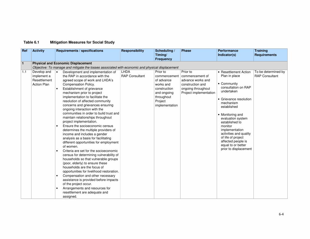
6-4
Table 6.1 Mitigation Measures for Social Study
Ref Activity Requirements / specifications Responsibility Scheduling /
Timing/
Frequency
Phase Performance
Indicator(s)
Training
Requirements
1 Physical and Economic Displacement
Objective: To manage and mitigate the losses associated with economic and physical displacement
1.1 Develop and
implement a
Resettlement
Action Plan
• Development and implementation of
the RAP in accordance with the
agreed scope of work and LHDA’s
Compensation Policy.
• Establishment of grievance
mechanism prior to project
implementation to facilitate the
resolution of affected community
concerns and grievances ensuring
ongoing interaction with the
communities in order to build trust and
maintain relationships throughout
project implementation.
• Ensure the socioeconomic census
determines the multiple providers of
income and includes a gender
analysis as a basis for facilitating
different opportunities for employment
of women.
• Criteria are set for the socioeconomic
census for determining vulnerability of
households so that vulnerable groups
(poor, elderly) to ensure these
households are the focus of
opportunities for livelihood restoration.
• Compensation and other necessary
assistance is provided before impacts
of the project occur.
• Arrangements and resources for
resettlement are adequate and
assigned.
LHDA
RAP Consultant
Prior to
commencement
of advance
works and
construction
and ongoing
throughout
Project
implementation
Prior to
commencement of
advance works and
construction and
ongoing throughout
Project implementation
• Resettlement Action Plan in place
• Community consultation on RAP undertaken
• Grievance resolution mechanism established
• Monitoring and evaluation system established to monitor implementation activities and quality of life of project affected people is equal to or better prior to displacement
To be determined by
RAP Consultant

6-5
Ref Activity Requirements / specifications Responsibility Scheduling /
Timing/
Frequency
Phase Performance
Indicator(s)
Training
Requirements
• The resettlement timetable is linked to
the phasing of project implementation.
• Physical and economic assistance to
households is provided during
relocation.
• Support is offered after displacement,
for a transition period, based on a
reasonable estimate of the time likely
to be needed to restore the livelihood
and standards of living for project-
affected people.
1.2 Develop a
Livelihoods
Restoration
Plan
• A Livelihood Restoration Plan and
Community Development Plan should
be developed to ensure project
affected people are not left worse-off
following displacement.
• Economic displacement of
subsistence farmers will be a
negotiated process.
• The development of alternative
livelihood strategies should be the
preferred mitigation option, optimising
opportunities for involvement in
employment. Although many of the
employment opportunities will be
skilled and semi-skilled positions, the
establishment of appropriate training
and skills development by the
Contractors will allow project affected
people to benefit from such
opportunities.
• Establishment of grievance
mechanism prior to project
implementation to facilitate the
resolution of affected community
LHDA
RAP Consultant
Prior to commencement of construction and ongoing throughout project implementation
Prior to
commencement of
advance works and
construction and
ongoing throughout
Project implementation
• Livelihoods Restoration Plan is in place
• Community consultation on RAP undertaken
• Grievance resolution mechanism established
• Monitoring and evaluation system established to monitor implementation activities and quality of life of project affected people is equal to or better prior to displacement
To be determined by
RAP Consultant

6-6
Ref Activity Requirements / specifications Responsibility Scheduling /
Timing/
Frequency
Phase Performance
Indicator(s)
Training
Requirements
concerns and grievances ensuring
ongoing interaction with the
communities in order to build trust and
maintain relationships throughout
project implementation.
• LHDA should be encouraged to seek
partnerships with relevant authorities
and organisations to develop
programmes that aim to enhance
agricultural production amongst the
population of the Project Area.
1.3 Develop a
Social
Development
Master Plan
• Appoint a consultant to develop the community projects as part of the SDMP.
• Social development projects and programmes will be handed over, where applicable, to the relevant government agencies for ongoing support and oversight as shall be agreed and formalised through Memoranda of Understanding (MoUs).
• A monitoring and evaluation programme will be developed to determine the outcomes/ impacts of social development programmes.
LHDA
Government entities
NGOs/ CBOs
Prior to
commencement
of advance
works and
construction
and ongoing
throughout
Project
implementation
Prior to
commencement of
advance works and
construction and
ongoing throughout
Project implementation
• Appointment of
Consultant
• Social Development
Master Plan in place
• Identification of
community
development
projects
• Implementation of
community
development
projects
• Monitoring plans in
place
To be determined by
the Consultant
2 Increased prevalence of STIs and HIV/AIDs
Objective: to reduce the spread and increase of STIs and HIV/AIDs
2.1 Management
of STIs incl.
HIV/AIDs
• Strengthen local educational
programmes that are ‘women and youth
friendly’, focusing on the control of STIs
and particularly HIV / AIDs.
LHDA
Government entities
Prior to
advance works
construction
Prior to and throughout
advance works
construction and
operational phases
• Presence of
educational
programmes
• Records of women
and youth enrolment
HIV/ AIDs training
programme

6-7
Ref Activity Requirements / specifications Responsibility Scheduling /
Timing/
Frequency
Phase Performance
Indicator(s)
Training
Requirements
• Records on
prevalence and
incidence of STIs
• Ensure medical services have sufficient
capacity to provide care for HIV-
positive workers
LHDA Prior to
advance works
construction
Prior to and throughout
advance works
construction and
operational phases
• Audit of local medical
facilities
Further training
requirements will be
informed by the
Public Health Action
Plan
2.2 Develop and
implement an
HIV
Workplace
Policy and
Programme
• Develop and implement an HIV/AIDS
programme to reduce the risk of the
transfer of the HIV virus between and
among the Contractor’s employees,
their families and the local
communities.
Contractor LHDA Project SHEQ Manager Department of Health
Prior to and
throughout
advance works,
construction
Advance works
construction
• Workforce HIV
programme in place
• Availability of a
suitable testing and
counselling venue,
• Records of employee
HIV training
programme and
materials
• Signed attendance
registers of HIV
training by
employees
• Installation of
condom dispensers
across the camp
sites (with condoms)
• Records of
employees tested,
diagnosis, and
counselled
• Number of
employees referred
to a dedicated
national STI and
HIV/AIDS program
HIV/ AIDs awareness
programme

6-8
Ref Activity Requirements / specifications Responsibility Scheduling /
Timing/
Frequency
Phase Performance
Indicator(s)
Training
Requirements
• Record of monitoring
of outcomes.
2.3 Develop an Emergency Prevention, Preparedness and Response Plan.
• In collaboration with the local and
district Government, local emergency
providers and local health care
facilities, develop and implement
EPPRPs.
• The Plan will cover all incidents
presenting risks to public safety and the
affected communities in proximity to the
various Project Sites and the
surrounding environment.
LHDA: Environmental, Health and Safety Management Unit Government entities NGOs
Prior to
advance works
construction
Throughout advance
works construction and
operational phases
• Record of
stakeholder
engagement
• Presence
Emergency
Prevention,
Preparedness and
Response Plans
(EPPRPs)
• Charter of roles and
responsibilities
• Review of incident
reports
• Annual review of
policies and plans
To be determined in
the EPPRPs
• Update EPPRPs on an annual basis,
based on the outcomes of the review of
incident reports.
LHDA Prior to and
throughout
advance works
On-going update • Updated EPPRPs
2.4 Minimise incidences of sexually transmitted infections (STIs) including HIV/AIDS.
Develop and implement an HIV/AIDS Prevention Programmes for its workforce.
LHDA Contractor
Prior to
advance works
and ongoing
Prior to and throughout
advance works
construction
• Health educational
programmes and
materials in place
• Internal training
records
• Number of HIV tests
undertaken every 6
months
• Records on
prevalence and
incidence of STIs)
• Number of people
receiving HIV / STI
treatment (ARVs)

6-9
Ref Activity Requirements / specifications Responsibility Scheduling /
Timing/
Frequency
Phase Performance
Indicator(s)
Training
Requirements
• Number of fatalities
linked to HIV / STIs
annually
2.5 Risk planning, management and communication
Liaise with the appointed Consultant for the PHAP and the appointed Consultants for the other major engineering packages to identify the appropriate off-site facilities for major medical treatment (local clinic, district hospitals or regional hospitals) in developing detailed.
LHDA Project SHEQ Manager Contractors Emergency services personnel
Quarterly Throughout advanced
and construction • Records of full
scale ‘live’
rehearsals of a
response plan
• Emergency
communications
procedure in place
• Emergency
checklists that can
be quickly
accessed by
management,
response
personnel and
employees
live’ rehearsals
3 Risks associated with road traffic
Objective: To reduce the risks associated with increased road traffic in the Project Area and to proactively monitor and manage project related vehicle traffic
3.1 Manage traffic
impacts
related to the
Project
• Assess impacts of selected
transportation routes and provide
detailed mitigation to be implemented in
Traffic Management Plan.
LHDA Prior to
advance works
and ongoing
Prior to and through
advance works • Traffic assessment
• Traffic Management
Plan
To be determined by
LHDA
3.2 Improve Road
Signage • Implement road signs demarcating
speed limits and identifying common
pedestrian / livestock crossings.
Contractor
Department of Roads
advance works,
construction
Advance works,
construction • Number of signs
erected
3.3 Develop
community
awareness
• Conduct community consultations to
identify potential high risk areas for
traffic accidents.
LHDA Prior to
advance works
Prior to and throughout
advance works
construction
• Records of
engagement

6-10
Ref Activity Requirements / specifications Responsibility Scheduling /
Timing/
Frequency
Phase Performance
Indicator(s)
Training
Requirements
and
coordination
procedure on
public safety
• Inform communities when traffic will
increase prior to vehicle movements
commencing.
Contractor Throughout
advance works
construction
and operational
phases
Prior to and throughout
advance works
construction
• Records of
information dispersal
/ engagement
• Number of notices
placed on community
notice boards
• Number of signs
erected
• Engage with communities along
transport routes on road safety and
accident prevention.
LHDA Throughout
advance works
construction
and operational
phases
Prior to and throughout
advance works
construction
• Records of
engagement
4 Increase in anti-social behaviours
Objective: To proactively manage incidences of antisocial behaviours
4.1 Management of antisocial behaviours
• Collaborate with local partners and
government to provide education and
awareness programme focused at
managing anti-social behaviour.
• Support an education and awareness
programme targeted at managing anti-
social behaviour in the area. Through
sponsoring campaigns on drug and
alcohol abuse, sexual abuse, etc.
LHDA
District governments
Prior to
advance works
and ongoing
Prior to advance works
and construction • Number locals who
attend sessions on
antisocial
behaviours.
Various awareness
campaigns
4.2 Workforce management
• Meet the daily needs of Project
personnel via the provision of housing,
water, subsistence, power, sanitation,
health care facilities and recreation
facilities.
• Implement Workforce Code of
Conduct.
• Allow construction workers (from
outside the area) to return home over
the weekends or on a regular basis to
EPC contractor (LHDA oversight)
Advance works and construction
Throughout Advance works and
construction
• Workforce Code of
Conduct in place
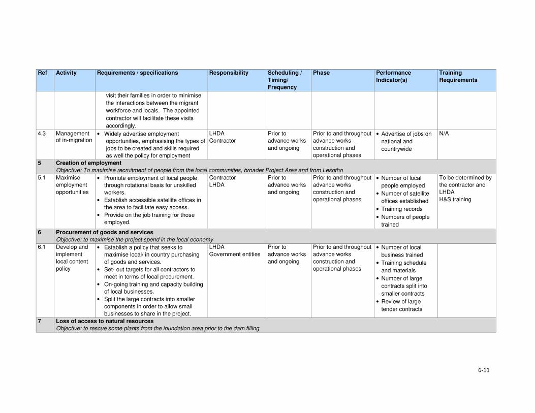
6-11
Ref Activity Requirements / specifications Responsibility Scheduling /
Timing/
Frequency
Phase Performance
Indicator(s)
Training
Requirements
visit their families in order to minimise
the interactions between the migrant
workforce and locals. The appointed
contractor will facilitate these visits
accordingly.
4.3 Management of in-migration
• Widely advertise employment
opportunities, emphasising the types of
jobs to be created and skills required
as well the policy for employment
LHDA
Contractor
Prior to
advance works
and ongoing
Prior to and throughout
advance works
construction and
operational phases
• Advertise of jobs on
national and
countrywide
N/A
5 Creation of employment
Objective: To maximise recruitment of people from the local communities, broader Project Area and from Lesotho
5.1 Maximise
employment
opportunities
• Promote employment of local people
through rotational basis for unskilled
workers.
• Establish accessible satellite offices in
the area to facilitate easy access.
• Provide on the job training for those
employed.
Contractor
LHDA
Prior to
advance works
and ongoing
Prior to and throughout
advance works
construction and
operational phases
• Number of local
people employed
• Number of satellite
offices established
• Training records
• Numbers of people
trained
To be determined by
the contractor and
LHDA
H&S training
6 Procurement of goods and services
Objective: to maximise the project spend in the local economy
6.1 Develop and
implement
local content
policy
• Establish a policy that seeks to
maximise local/ in country purchasing
of goods and services.
• Set- out targets for all contractors to
meet in terms of local procurement.
• On-going training and capacity building
of local businesses.
• Split the large contracts into smaller
components in order to allow small
businesses to share in the project.
LHDA
Government entities
Prior to
advance works
and ongoing
Prior to and throughout
advance works
construction and
operational phases
• Number of local
business trained
• Training schedule
and materials
• Number of large
contracts split into
smaller contracts
• Review of large
tender contracts
7 Loss of access to natural resources
Objective: to rescue some plants from the inundation area prior to the dam filling

6-12
Ref Activity Requirements / specifications Responsibility Scheduling /
Timing/
Frequency
Phase Performance
Indicator(s)
Training
Requirements
7.1 Search and
rescue of
priority plants
– advanced
infrastructure
• Appoint suitably qualified or
experienced botanist to conduct active
searches for priority species prior to
infrastructure site clearance.
• Conduct foot searches of advanced
infrastructure, tunnel inlet and dam wall
and quarry areas to recover priority
plants.
• Bag, store and look after plants in
temporary nursery area/s prior to use in
landscaping of infrastructure areas or
community garden(s).
• Collect seeds of suitable plants for
landscaping and propagation in a
community garden.
• Replant rescued plants and seeds in
accordance with landscaping plan.
• Landscaping shall prioritise use of
indigenous naturally occurring plants
and shall include a list of suitable
plants.
LHDA: botanical
team to be appointed
Prior to
advance works
Preparation and during
site clearance
• Botanist appointed
• Proof of active
searches in form of
documentation and
retrieved plants.
• Nursery established
for temporary
relocation of
rescued plants and
seeds.
• Dedicated nursery
manager appointed
to manage the
nursery and recover
seeds.
• Landscaping plan
developed for
infrastructure areas
dominated by
indigenous plants.
Nursery staff trained
in plant rescue and
propagation
8 Stakeholder Consultation
Objective: to promote open and transparent communication with stakeholders
8.1 Implement a
Stakeholder
Engagement
Plan /
Programme
for the Project
• Proactive engagement of community
leaders and members on the planned
project.
• Ensure easy access to grievance
protocol for stakeholders.
LHDA
Contractor
Prior to and throughout
advance works
construction and
operational phases
• Records of all
interactions with
communities
• Records of
grievances recorded
7-1
Section 7 References
Bureau of Statistics (Lesotho), Statistical Report No. 6 of 2015 - 2013/2014 Agricultural Production
Survey Crops
Bureau of Statistics (Lesotho), Statistical Report No.8 of 2015 - Lesotho Livestock Statistics Report
2013/2014
Bureau of Statistics (Lesotho), Statistical Report No.21 of 2015 - Livestock Products Report
2013/2014
Bureau of Statistics (Lesotho), Statistical Report No. 28 of 2015 – 2014 Education Statistics Report
Bureau of Statistics (Lesotho), 2013, Lesotho Demographic Survey, 2011, Vol 1, The Bureau of
Statistics, Maseru
CES, 2014. Biological and Archaeological (Including Heritage) Baseline and Impact Assessment;
Contract LHDA No. 6002.
Consult 4 and SEED Consult, 2009. Feasibility Study for Phase II – Main Report. Lesotho Highlands
Water Commission. LHWC 001/224-2007; P RSA D000/00/7007.
Consult 4 Consortium and SEED Consult, 2008. Feasibility Study for Phase II – Consultation and
Social Issues Supporting Report. Lesotho Highlands Water Commission. LHWC 001/215-2007; P
RSA D000/00/6107.
Consult 4 Consortium and SEED Consult, 2008. Feasibility Study for Phase II - Environmental Impact
Assessment Supporting Report. Lesotho Highlands Water Commission. LHWC 001/219-2007; P
RSA D000/00/6507.
Consult 4 and SEED Consult, 2008. Feasibility Study for Phase II - Social Impact Assessment
Supporting Report. Lesotho Highlands Water Commission. LHWC 001/216-2007; P RSA
D000/00/6207.
Ecorex and Kobisi, K. 2017. Terrestrial Ecology Report for Polihali Reservoir and Associated
Infrastructure. LHDA Contract No. 6014 (P2W-6014-DFR-0002).
EOH Coastal and Environmental Services (CES), 2014. Lesotho Highlands Water Project Phase II:
Baseline Botanical Survey: Lesotho Highlands Water Project Phase II: LHDA Contract 6002.
EOH Coastal and Environmental Services (CES), 2015a. Lesotho Highlands Water Project Phase II:
Baseline Income and Expenditure Report. Lesotho Highlands Water Project Phase II: LHDA Contract
No. 6000
EOH Coastal and Environmental Services (CES), 2015b. Lesotho Highlands Water Project Phase II:
Socio-Economic Baseline Study Report. Lesotho Highlands Water Project Phase II: LHDA Contract
No. 6000
ERS. 2017.Soils, Land Use and Land Capability Report for Polihali Reservoir and Associated
Infrastructure. LHDA Contract No. 6014 (P2W-6014-DFR-0007).
Government of Lesotho. Constitution of Lesotho Act No. 5 of 1993, Maseru
Government of Lesotho. Education Act No.3 of 2010, Maseru
Government of Lesotho. Environmental Act No 10 of 2008, Maseru
Section 7• References
7-2
Government of Lesotho. Gender and Development Policy, 2003, Maseru
Government of Lesotho. Local Governance and Non-State Actors Support Programme – Information
Handbook: Mokhotlong District Report 3, 2009, Maseru
Government of Lesotho. Lesotho Land Act No. 17 of 1979, Maseru
Government of Lesotho. Lesotho Land Act No. 8 of 2010, Maseru
Government of Lesotho. Lesotho: Legal Capacity of Married Persons Act of 2006, Maseru
Government of Lesotho Ministry of Development Planning. National Strategic Development Plan
2012/13 – 2017/18 “Growth and Development Strategic Framework, 2013, Maseru
Government of Lesotho. Ministry of Education and Training. Kingdom of Lesotho. Lesotho Education
Sector Plan 2005 – 2015, Maseru, March 2015
Government of Lesotho. Lesotho National Health Strategic Plan 2012/13 – 2016/17, April, 2013,
Maseru
Government of Lesotho. National Environmental Impact Assessment Guidelines 2009, Maseru
Government of Lesotho. National Environment Policy, 1998, Maseru
Government of the Kingdom of Lesotho. Lesotho National Social Protection Strategy (NSPS)
2014/15 – 2018/19, Maseru, 2014
Government of the Kingdom of Lesotho. Millennium Development Goals Status Report 2013,
Maseru, 2014
Government of the Kingdom of Lesotho. National Policy for Integrated Early Childhood Care and
Development, Maseru, 2013
Government of Lesotho. Local Government Act 1997 as Amended by Local Government
(Amendment) Act 2004, Maseru, 2004
Government of Lesotho. The Labour Code (Amendment) Act No. 5 of 2006, Maseru
Government of Lesotho. Workmen’s Compensation Act No. 3 of 1977, Maseru
Government of Lesotho. Public Health Order 12 of 1970, Maseru
Government of Lesotho. Motor Vehicle Insurance Order No. 26 of 1989, Maseru
Government of Lesotho. Deeds Registry Act No. 12 of 1967, Maseru
IFC, 2012. International Finance Corporation Performance Standards on Environmental and Social
Sustainability, January, 2012
Kingdom of Lesotho, 2013. Higher Education Strategic Plan 2013/14 – 2017/18, Maseru
Kingdom of Lesotho, 2013. Millennium Development Goals Status Report 2013
Kingdom of Lesotho, 2014. Wool and Mohair Promotion Project (WAMPP) Final Project design report.
September, 2014
Lesotho Highlands Development Authority, 2011. Agreement on Phase II of the Lesotho Highlands
Water Project Between the Government of the Kingdom of Lesotho and the Government of the
Republic of South Africa. Maseru.

Section 7• References
7-3
Lesotho Highlands Water Project Phase II Asset Registration Procedures, October 2017
Lesotho Highlands Water Project Phase II Community Participation Strategy, September 2014
Lesotho Highlands Water Project Phase II Compensation Policy, August 2016
Lesotho Highlands Water Project Phase II Contractor Procurement Framework (Draft), August 2016
Lesotho Highlands Water Project Phase II Livelihood Restoration and Social Development
Framework, August 2017
Local Governance and Non-State Actors Support Programme – Information Handbook: Mokhotlong
District Report 3, 2009
Ministry of Health (Lesotho) and ICF International, 2016. Lesotho Health and Demographic Survey
2014. Maseru, Lesotho: Ministry of Health and ICF International.
MM&A and Pinto, H. Cultural Heritage (including Archaeology) Report for Polihali Reservoir and
Associated Infrastructure. LHDA Contract No. 6014. (P2W-6014-DFR-0003)
NHA Development Consultants, 2016. Lesotho Highlands Water Project Phase II: Public Health
Baseline Study Report. Lesotho Highlands Water Project Phase II: LHDA Contract No. 6008
Panel of Experts & LHDA, 2010. The ‘Lessons Learnt’ report from Phase 1A and Phase 1B Report
55.
Ramatla, S. and Kheekhe, M. 2017. Rangelands Report for Polihali Reservoir and Associated
Infrastructure. LHDA Contract No. 6014 (P2W-6014-DFR-0009).
Rori Consultancy, 2017. Lesotho Highlands Water Project Phase II: Safety, Health, Environment and
Quality (SHEQ) Management Framework.
Sechaba and ERM. 2017. Stakeholder Engagement Report for Polihali Reservoir and Associated
Infrastructure ESIA. LHDA Contract No. 6014 (P2W-6014-NPD-0015).
UN-Habitat, 2005. Land Tenure, Housing Rights and Gender in Lesotho
UNAIDS, 2016. Gap Report
UNDP, 2016. Human Development Report 2016: Human Development for Everyone
World Bank, 2016. World Bank Environmental and Social Framework. World Bank, Washington, DC
6014 ESIA Specialist Studies
Ecorex and Kobisi, 2017. Terrestrial Ecology Report. P2W-6014-DFR-0002
MM&A and Pinto, 2017. Cultural Heritage incorporating Archaeology Report. P2W-6014-DFR-0003
Matela and Kuenene, 2017. Soils, Land Use and land Capability Report. P2W-6014-DFR-0007
Ramatla, 2017. Rangelands Report. P2W-6014-DFR-0009
Web resources
AVERT (1986-2017) (http://www.avert.org/professionals/hiv-around-world/sub-saharan-africa)
Commonwealth Local Government Forum (2017)
http://www.clgf.org.uk/default/assets/File/Country_profiles/Lesotho.pdf

Section 7• References
7-4
Mokhethi, N.I., etal (2015) (http:www.researchgate.net/figure/290330505_fig1_figure-1-Lesotho-
wool-and-mohair-value-chain)
UN (2016) (http:/www.un.org/sustainabledevelopment/sustainable-development-goals)
UNESCO (2012) (http://www.unesco.org/eri/cp/factsheets_ed/LS_EDFactSheet.pdf)
http://www.worldmeters.info/world-population/lesotho-population/
Wade Publications CC (2015) (http://www.lesothoreview.com/education-training-2015.php)
World Bank Group - International Finance Corporation (2017)
http://www1.ifc.org/wps/wcm/connect/corp_ext_content/ifc_external_corporate_site/home

Volume 4: Annexure ISocial Report
Lesotho Highlands Development Authority
Contract LHDA No.: 6014
Contract Name: Professional Services for the
Environmental & Social Impact Assessment
(ESIA) for the Polihali Reservoir & Associated
Infrastructure
Document Ref: P2W-6014-DFR-0010
Document Date: 23 March 2018

ii
Revision History Version Issue Date Description of Changes
00 30/08/2017 First draft for Client review
01 06/10/2017 Second draft for Client review
02 08/11/2017 Final
03 23/03/2018 Final (revised impact assessment)

iii
Abbreviations and Acronyms AC Area Chief
ALC Area Liaison Committee
AoI Area of Influence
ART Anti-retroviral Treatment
BEDCO Basotho Enterprises Development Corporation
BPST Bulk Power Supply Telecommunications
CBO Community-based Organisation
CC Community Council
CGP Child Grants Programme
CHAL Christian Health Association of Lesotho
CHW Community Health Workers
CLC Combined Liaison Committee
CLO Community Liaison Officer
CoC Code of Conduct
CPI Consumer Price Index
DA District Administrator
DC District Council
DCS District Council Secretary
DES District Economic Strategies
DHMT District Health Management Team
DoE Department of Environment
DRWS Department of Rural Water Supply
ECCD Early Childhood Care and Development
EA Environmental Assessment
EFR Environmental Flow Requirement
EHS Environmental Health and Safety
EIA Environmental Impact Assessment
EIS Environmental Impact Statement
EMP Environmental Management Plan
EPPRP Emergency Prevention, Preparedness and Response Plan
ESIA Environmental and Social Impact Assessment
ESIS Environmental and Social Impact Statement
ESMS Environmental and Social Management Systems
ESS Environmental and Social Standards
ERM Environmental Resources Management Southern Africa (Pty) Ltd
EU European Union
FGD Focus Group Discussion
FOB Field Office Branch
FSL Full Supply Level
GIS Geographic Information System
GoL Government of Lesotho
GPS Geographic Positioning System
HCG Pregnancy Test
HTC HIV Testing and Counselling
I&APs Interested and Affected parties
ICM Integrated Catchment Management
IFC International Finance Corporation
ILO International Labour Organisation
KII Key Informant Interview
LAA Land Administration Authority
LDHS Lesotho Demographic and Health Study
LDS Lesotho Demographic Study
LEC Lesotho Electricity Company

Abbreviations and Acronyms
iv
LHDA Lesotho Highlands Development Authority
LHWC Lesotho Highlands Water Commission
LHWP Lesotho Highlands Water Project
LHWP II Lesotho Highlands Water Project Phase II
LNWMGA Lesotho National Wool and Mohair Grower’s Association
LR&SDF Livelihood Restoration and Social Development Framework
LTDC Lesotho Tourism Development Corporation
MC Municipal Council
MCA Millennium Challenge Account
MDR Multi Drug Resistant
MG Marketing Group
MoU Memorandum of Understanding
MSMEs Micro, Small and Medium Enterprises
NER Net Enrolment Rate
NEP National Environmental Policy
NES National Environment Secretariat
NFE Non-formal Education
NGO Non-government Organisation
NPSD National Policy on Social Development
NSDP National Strategic Development Plan
NSPS National Social Protection Strategy
NTS Non-technical Summary
NUL National University of Lesotho
OVC Orphans and Vulnerable Children
PC Principal Chief
PEPFAR The President's Emergency Plan for AIDS Relief
PHAP Public Health Action Plan
PHC Primary Health Care
PLRD Project Labour Recruitment Desk
PMTCT Prevention of Mother to Child Transmission
PNEAR Polihali North East Access Road
PPE Protective Personal Equipment
PP Public Participation
PPP Public Participation Process
PRAI Polihali Reservoir and Associated Infrastructure
PS Performance Standard
PSLC Primary School Leaving Certificate
PTR Pupil Teacher Ratio
PWAC Polihali Western Access Corridor
PWAR Polihali Western Access Road
RAP Resettlement Action Plan
RfP Request for Proposal
RSA Republic of South Africa
SADC Southern African Development Community
SDMP Social Development Master Plan
SEBS Socio-Economic Baseline Study
SHEQ Safety Health Environment and Quality
SSAs Sheering Shed Associations
STIs Sexually Transmitted Infections
TB Tuberculosis
TB-DOTS Tuberculosis-Directly Observed Treatment Shots
ToR Terms of Reference
TVET Technical and Vocational Education and Training
UNESCO United Nations Education, Scientific and Cultural Organisation
UNFPA United Nations Population Fund
Abbreviations and Acronyms
v
UNICEF United Nations Children's Fund
USAID United States Agency for International Development
USG United States Government
VDRL Syphilis Test
VHW Village Health Worker
VIP Ventilated Improved Pit Latrine
WB World Bank
WASCO Water and Sewerage Company
WFP World Food Programme
WHO World Health Organisation
WMGAs Wool and Mohair Growers Associations

vi
Glossary of Technical Terms Technical Term Definition
Catchment area The area from which rainfall flows into a river, lake, or reservoir.
In terms of this project, it refers to the local catchment of the Polihali reservoir
as defined by the red line in Figure 1.1.
Coffer dam A watertight enclosure pumped dry to permit construction work below the
waterline, as when building bridges or, as in the case of the current project, to
allow for the construction of the main dam wall across the river.
Community
engagement
Part of the Social and Environmental Assessment, community engagement is
an ongoing process involving disclosure of information, consultation with
affected communities, and the establishment of a grievance mechanism.
Compensation Payment in cash or in kind for an asset or a resource that is acquired or affected by LHWP Phase II activities.
Consultation Consultation involves interactive communication between the client and the
affected communities. The consultation process should be undertaken in a
manner that is inclusive and culturally appropriate and that provides the
affected communities with opportunities to express their views on projects risks,
impacts and mitigation measures, and allows the client to consider and respond
to them.
Dam A dam is a barrier constructed to hold back water and raise its level, forming a
reservoir used to generate electricity or as a water supply.
Disadvantaged or
vulnerable groups
Individuals or groups within the Project Area of influence who could experience
adverse impacts from the proposed project more severely than others based on
their vulnerable or disadvantaged status. This status may stem from an
individual's or group's race, colour, gender, language, religion, political, or other
opinion, national or social origin, property, birth or other status. In addition,
other factors should be considered such as gender, ethnicity, culture, sickness,
physical or mental disability, poverty or economic disadvantage, and
dependence on unique natural resources.
Diversion tunnel An underground passageway used to divert flowing water around a construction
site.
Economic
displacement
Loss of assets or access to assets that leads to loss of income sources or
means of livelihood.
Land acquisition Land acquisition refers to all methods of obtaining land for project purposes,
which may include outright purchase, expropriation of property and acquisition
of access rights, such as easements or rights of way. Land acquisition may also
include: (a) acquisition of unoccupied or unutilised land whether or not the
landholder relies upon such land for income or livelihood purposes; (b)
repossession of public land that is used or occupied by individuals or
households; and (c) project impacts that result in land being submerged or
otherwise rendered unusable or inaccessible. “Land” includes anything growing
on or permanently affixed to land, such as crops, buildings and other
improvements, and appurtenant water bodies.
Livelihood Livelihood refers to the full range of means that individuals, families, and
communities utilise to make a living, such as wage-based income, agriculture,
fishing, foraging, other natural resource-based livelihoods, petty trade, and
bartering.
Livelihood Restoration The measures that are required to mitigate the negative impacts on households that will be economically and physically displaced by LHWP Phase II, through loss of shelter and assets, and loss of access to resources, markets and services that support livelihoods. These measures are in addition to compensation, since compensation alone does not guarantee the restoration of livelihoods.
Local communities Community within the project's area of influence.
Project Areas of
influence
The project's area of influence includes the primary project site(s) and related
facilities that the client (including its contractors) develops or controls;
associated facilities that are not funded as part of the project (funding may be
provided separately by a client or a third party including the government), and
whose viability and existence depend exclusively on the project and whose

Abbreviations and Acronyms
vii
Technical Term Definition
goods or services are essential for the successful operation of the project;
areas potentially impacted by cumulative impacts from further planned
development of the project; and areas potentially affected by impacts from
unplanned but predictable developments caused by the project that may occur
later or at a different location. The area of influence does not include potential
impacts that would occur without the project or independently of the project.
Net Primary Enrolment
Rate
The number of pupils of official primary school age who are enrolled in primary education as a percentage of the total children of the official school age population
Physical displacement Relocation as a result of loss of or damage to homes / shelter.
Project’s area of
influence
The project's area of influence includes the primary project site(s) and related facilities that the client (including its contractors) develops or controls; associated facilities that are not funded as part of the project (funding may be provided separately by a client or a third party including the government), and whose viability and existence depend exclusively on the project and whose goods or services are essential for the successful operation of the project; areas potentially impacted by cumulative impacts from further planned development of the project; and areas potentially affected by impacts from unplanned but predictable developments caused by the project that may occur later or at a different location. The area of influence does not include potential impacts that would occur without the project or independently of the project.
Reservoir A large natural or artificial lake used as a source of water supply.
Resettlement action
plan
The document in which a project sponsor or the responsible entity specifies the
procedures that it will follow and the actions that it will take to mitigate adverse
effects, compensate losses, and provide development benefits to persons and
communities affected by an investment project.
Social Development Initiatives to ensure that communities in the Project Area become beneficiaries
of the development. It refers to a more open-ended programme of interventions
aimed at contributing to social and economic development of Project Area
communities. The scope of these interventions typically extends beyond directly
affected (physically and economically displaced) households and villages to
include other members of the Project Area communities.
Social Impacts When referring to social impacts this includes impacts received by the following
entities:
• Settlements, dispersed villages, solitary dwellings and mobile / semi-mobile
groups (including temporary and permanent human residents with both
formal and informal tenure of land/structures);
• Population dynamics including population size, structure, settlement
pattern and migration;
• Tangible and intangible cultural heritage sites and items, including
archaeological heritage;
• Ecosystem services, including provisioning services, regulating services,
supporting services and cultural services used by human receptors;
• Social infrastructure including both tangible (i.e. schools, community
centres, electricity and potable water services) and intangible items (i.e.
meeting places, shaded areas);
• Individual and communally owned assets (i.e. farm animals and/or grazing
land);
• Livelihood sources; including formal and informal activities;
• Community groups including civil society groups;
• Gender;
• Human rights; and community health, safety and security (including
wellbeing).

viii
Acknowledgements The authors would like to express their sincere appreciation to all the people who have assisted them
from the start of the project to the report writing. These include, ERM through its leadership and
support and lots of patience with everyone, the office and staff of LHDA in Maseru and at the Tlokoeng
Field Operations Branch. Their hands-on support during the undertaking of fieldwork was much
appreciated. Thanks are also extended to the Phase II PMU office and staff for their unwavering
support. Also to be thanked are the chiefs from all the areas the field teams worked in, for their support
and their acceptance of the teams. Not forgotten are the District Administrators’ offices of the districts
of Mokhotlong and Thaba-Tseka as well as all the Heads of Departments from the same Districts for
all the help they afforded the field teams. Last thanks are extended to the field teams who worked
tirelessly to produce the results.

E-i
Non-technical Summary Scope and Methods
The Social study is a component of the Environmental and Social Impact Assessment (ESIA) for the
Polihali Reservoir and Associated Infrastructure (PRAI) (LHDA Contract 6014). Specifically, the study
sought to describe the socio-economic context of the PRAI Project Area based on existing secondary
information and primary data collection through social data gathering using focus group discussions,
key informant interviews and general observations. The study also sought to identify and assess the
social impacts on local communities, both positive and negative, likely to result from the Project
implementation. Finally, the study was to identify and define measures for mitigating the impacts and
enhancing social conditions during and post-construction of the PRAI. The study was undertaken in
the whole of the PRAI Project Area, thus covering the catchment area and areas upstream and
downstream of the reservoir.
Baseline Social Environment
The Project Area is situated in the north-east of the Lesotho highlands proximate to Mokhotlong and
mostly comprises remote rural villages with limited access to formal public infrastructure. Mokhotlong
is the closest town to the Project Area, and in fact falls within the project catchment area. The built-
up area of Mapholaneng also falls within the Project Area. The settlement pattern is scattered clusters
of traditionally constructed homesteads, usually built of natural resources such as stone and thatch.
The Project Area has a dual administrative structure comprised of formal government, through the
decentralised district government offices, elected community councils and traditional authorities
(Principal and Area chiefs). Land in the area is communally owned and is kept in the trust of chiefs;
and acquisition is primarily through chiefs and inheritance.
Between 2013 and 2014, the population of the Project Area was estimated at 46 371 people, with an
average of 5.2 persons per household (CES, 2015b). In-migration into the Project Area is limited due
to its harsh environment (specifically the weather and poor soil quality) as well as lack of employment
opportunities. In turn, the local population tends to migrate out of the area in search of economic
opportunities, both within Lesotho and in South Africa.
The communities rely heavily on land-based livelihoods; namely crop and extensive livestock
farming. However, crop yields are low due to the poor quality of available arable land, and due to the
use of traditional cultivation methods. Crop production is mainly for household subsistence purposes,
with surplus often sold or bartered with neighbours. Livestock farming is mainly for commercial
purposes through sale of wool, mohair and animals, and is also regarded as a major source of income.
Crop production is the principal livelihood strategy, followed by remittances from permanent and
seasonal employment, sale of livestock products and social grants. Other livelihood strategies include
gathering and sale of natural resources.
A wide variety of natural resources are found in the Project Area, and these are communally owned
and utilised. These include a wide range of plants that are collected and used for food, medicinal
purposes and for sale; grazing land, a variety of grasses, trees/shrubs, rocks and sand, and small
animals. A majority of these natural resources are a source of livelihoods for many families in the
Project Area as they rely on their use on a daily basis.
Unemployment in the Project Area is high and those few who are employed work mainly in full-time
jobs or are either seasonally employed or self-employed. Formal employment is mainly found in the
public and services sector, i.e., government, shops and the hospitality industry. In general, income in
the Project Area increases significantly between March and June, and again between August and
September due to crop harvest and sales, and wool and mohair sales as payments for these are
received by farmers between August and November.
Non-technical Summary
E-ii
Access to infrastructure and services is usually aligned with road access, with such services being
schools, clinics, improved sanitation, water supply and electricity. There are eight health facilities
within the Project Area. These include one district hospital and seven health centres. The facilities
are located in the more accessible areas such as Mokhotlong town and Mapholaneng, with a few
scattered in the less accessible areas. This means that a majority of people are required to walk long
distances to get to the nearest facility, with local people sometimes having to walk up to 20km to
reach the nearest clinic or hospital for health support.
Although the main road through Mokhotlong is paved, minor and secondary feeder roads are un-
surfaced and become impassable after rains and snowfalls. Some of the villages are only accessible
on foot or with mules, donkeys and horses. Public transport is limited and most people tend to walk
to get to services and use pack donkeys or horses to carry their goods. Mokhotlong has heavy
pedestrian and pack animal traffic. Since roads have no sidewalks, animals and pedestrians share
the road with vehicles.
Primary schools are widely spread throughout the Project Area, thus enabling many children easy
access. However, some children still have to walk long distances to the nearest schools, thus resulting
in some children attending school erratically during the rainy season (when rivers and streams flood)
due to the lack of bridges. Secondary/ high schools are limited with difficult access due to bad roads
and lack of bridges. Here again, children have to walk long distances or alternatively have to rent
rooms in the villages near the secondary/ high schools.
Water is mostly collected from communal taps that are scattered throughout the Project Area;
however, in some communities the water taps are non-functional. Unprotected sources such as
springs and wells are also a common source of water, particularly in the more remote villages. Across
the Project Area, sanitation facilities are scarce, with those who have these facilities mostly owning
traditional pit latrines. Some areas such as Tloha-re-Bue and Mapholaneng have access to Ventilated
Improved Pit (VIP) latrines. Overall, the general lack of sanitation facilities means that people use
bushes near their homes, especially overgrown areas by the streams and rivers.
Telecommunication services in the Project Area are concentrated in the established town areas of
Mokhotlong and Mapholaneng. Here people have access to both cellular phones and landlines which
are found mainly in government offices, some big retail shops, and tourism establishments. Cellular
coverage is limited to the more built-up areas like Mokhotlong town and Mapholaneng and a few other
areas located near the towns and along the main A1 road.
Electricity is also restricted to the two towns and the villages along the main A1 road between
Mapholaneng and Mokhotlong town, as well as Ha Mojakisane and Ha Lehlohohonolo on the eastern
side of the Senqu River. The majority of households rely on fuelwood for heating and cooking
purposes, followed by paraffin and bottled gas. Passerina montana is commonly harvested for fuel
purposes. Candles are used mainly for lighting purposes.
Local markets and shops are mainly found in Mokhotlong town and Mapholaneng. Formal and
informal trading is common. Informal traders are found along the main and minor roads trading from
small makeshift stalls. Banking services are also mostly limited to the more established towns of
Mokhotlong and Mapholaneng.
There are only two police stations in the Project Area, one in Mokhotlong town and the other in
Mapholaneng. In most of the villages there are community policing forums (mahokela), which fight
crime at the village level and work hand in hand with the local police stations.
Non-technical Summary
E-iii
Key Project Activities Impacting the Social Environment
Land Acquisition, Resettlement and Compensation
In order to implement the Project, an estimated 5723 ha of land (reservoir and associated
infrastructure inclusive) will need to be permanently acquired from the Mokhotlong District’s total land
area of 4075km2 (~407 500 ha). The land take will affect four Community Councils, namely Seatle,
Bokong, Malingoaneng, and Mphokojoane Community Councils, and one Urban Council
(Mokhotlong).
The acquisition of land for the Project will result in both physical and economic displacement of people
and households. The main Project components that will result in displacement of households are the
Polihali village, site establishment area, dam and tunnel works areas, as well as the inundation area.
The land acquisition will occur in three phases (over a five-year period), as follows:
Phase 1. Temporary and permanent acquisition in the site establishment area for the Advance
Infrastructure. These activities will affect villages of Masakong and Ha Tlhakola villages, as well as
households from Ramonakalali, Mabunyaneng, Makalong and Tsekong. Masakong and Ha Tlhakola
will be affected by physical and economic displacement and the remainder by economic displacement
(Figure E.1).
Phase 2. Permanent land acquisition in the inundation area around Tloha-re-Bue and the remainder
of the site establishment area (for instance the Tunnel Works Area, Substation, but also the Polihali
North East Access Road (PNEAR), which is not part of this ESIA). Tloha-re-Bue is partly affected by
physical and economic displacement.
Phase 3. The remainder of the inundation area, covering several villages including Ha Jobere, Koung
Ha Phohla, Tsekong and Litsotsong, and Ha Sikantsi are all affected to varying degrees by physical
and economic displacement; and all economic displacement (loss of fields, trees and thickets within
the inundation area) affecting households in surrounding villages, which are not physically affected.
The land that will be affected is currently used for grazing, collection of natural resources, cultivation
of crops, and settlements. Figure E.1 indicates villages that will experience physical and economic
displacement.
Table E.1 highlights all the villages and the approximate number of households per village likely to
be physically displaced by the Project. Figures provided in this table are estimated numbers based
on the Feasibility Study and current predictions and will still need to be verified by the resettlement
specialist team.
Table E.1 Estimate of Villages and Households to be Displaced (refer to Figure E.1 for
locations)
Classification Village name Households below
reservoir demarcation
line (DL)
Households
dangerously located
Fully below Reservoir DL Map ref. 1 to 5
Ha Jobere 6 Unknown Ha Tlhakola 18 Unknown Lits'otsong 5 Unknown Tsekong 28 Unknown Ha Sekants’i 13 13
Partially below Reservoir DL Map ref. 6 to 8
Tloha-re-Bue 40 13
Koung Ha Phohla 32 36
Sekokong 3 5
Site establishment area Map ref. 9 & 10
Masakong 50 Unknown
Malingoaneng & Meeling 8 41
Potentially Dangerous Location (safety)
Liphokong Unknown (7)
Ha Mpesi Unknown (4)
Non-technical Summary
E-iv
Classification Village name Households below
reservoir demarcation
line (DL)
Households
dangerously located
Map ref. 11 to 16
Koung Ha Thunyane Unknown (3)
Ha Meta /Ha Manka Unknown (3)
Makhalong Unknown (3)
Lilimala Unknown (6)
Potential Isolation Map ref. 17 & 18
Bokone & Morojeleng Unknown Unknown
Total 18 203 95 (+26 unbudgeted for)
121
Figure E.1 Villages Likely to be Displaced by the Project
To mitigate for the loss associated with the Project land acquisition, LHDA has appointed a
resettlement planning consultant, as well as developed two critical documents, namely Phase II
Compensation Policy, 26 August, 2016 and the Livelihood Restoration and Social Development
Framework (LR&SDF), August, 2017.
The Phase II Compensation Policy provides the guiding principles for compensation of all losses that
will be incurred by Project affected households and communities. The Policy was developed on the
basis of consultations with affected communities, their authorities and other key stakeholders.
English and Sesotho versions of the Policy were made available to affected communities via the local
authority structures (District Councils, Urban Councils, Community Councils and Chiefs) as well as
through local participation structures set up for Phase II.
The Policy makes provisions in terms of losses of houses, associated structures and residential plots
as well as the loss of agricultural fields and communal assets (such as grazing land, brush, wood,
medicinal plants, useful grasses and wild vegetable). Further details are provided in Section 5.2.

Non-technical Summary
E-v
The Policy furthermore, defines households headed by orphans, by persons living with a disability or
by elderly, or indigent persons as vulnerable and indicates that vulnerable households will receive
individual attention from LHDA as well as the relevant government agencies.
The loss of access routes will be compensated for through the construction of footbridges and the
upgrading of certain roads within the PRAI local catchment. A contract for development of a Master
Plan for Minor Bridges and Roads is currently being commissioned by the LHDA (LHDA Contract
6019).
Construction Phase
A number of impacts may arise during the construction phase, relating to traffic safety and nuisance
(dust, noise) which can be mitigated through the implementation of a traffic management plan and
the EMP by the various contractors. There are other impacts related to the influx of job seekers,
increase in anti-social behaviours, etc. that will require other interventions requiring involvement from
the LHDA and relevant government departments.
There are also positive impacts associated with the construction phase such as the creation of
employment opportunities (the Project is proposing to create an estimated 3 500 temporary and
unskilled jobs that will be available to the locally affected people and other Lesotho nationals) and the
procurement of local goods and services.
Operational Phase
The risk of traffic accidents during the operational phase will remain but at a much lower level of
probability and therefore significance. Another impact that will carry through to the operational phase
is the result of anti-social behaviour and the need for ongoing management of STIs, HIV/AIDS, etc.
Positive impacts will include increased government revenue from the payment of taxes and sale of
water to South Africa; the creation of job opportunities (although limited); development of the tourism
sector; and improved access as a result of the development of the Polihali Western Access Road
(PWAR) and the upgrading of the PNEAR.
Key Mitigation and Enhancement Measures
The Phase II Agreement states that social development programmes and mitigation measures,
resettlement requirements and awareness campaigns will be implemented, the full extent of which
will be agreed by the Parties during the implementation. Some of the key socially related documents/
plans or policies developed by the LHDA are highlighted below; some of these have been developed
and others (such as Integrated Catchment Management, Social Development Master Plan and Public
Health Action Plan) are yet to be developed. The implementation of these will be the responsibility of
the LHDA with the assistance of appointed Consultants/ Contractors and Government at National and
District levels.
• LHDA Phase II Compensation Policy (August, 2016)
• LHWP Phase II Labour Recruitment Guidelines (2017)
• LHWP Phase II Contractor Procurement Framework (Draft August, 2016)
• Asset Registration Procedures for LHWP Phase II (October, 2017)
• LHWP Phase II Livelihood Restoration and Social Development Framework (LR&SDF) (August 2017)
• Social Development Master Plan (SDMP).
• Integrated Catchment Management (ICM)
• Public Health Action Plan (PHAP)
Non-technical Summary
E-vi
Summary of mitigation measures include:
• Appoint a Consultant to develop and implement a Resettlement Action Plan that is in compliance
with the provisions of the Phase II Compensation Policy and which aligns to the international
standards of the World Bank (already commissioned and underway).
• The RAP Consultant will develop and implement a Livelihood Restoration Plan to mitigate for the
loss of income associated with the Project’s land acquisition.
• All Contractors and sub-contractors must adhere to the provisions, principles and guidelines in
the LHDA Safety, Health, Environment and Quality (SHEQ) Management Framework for Phase
II as well as the approved EMP for their works/ contract.
• LHDA shall develop and implement a Traffic Management Policy including vehicle safety, driver
and passenger behaviour, use of drugs and alcohol, hours of operation, rest periods and accident
reporting and investigations.
• In collaboration with the Ministry of Education, LHDA shall develop, implement and produce the
required materials to be used for road traffic safety awareness campaigns.
• LHDA shall implement the Labour Recruitment Guidelines that all Contractors must adhere to for
hiring unskilled labour, i.e.:
• Local people are prioritised for unskilled labour - at least 80% of the workforce should be
hired from villages located within the affected community councils;
• There is no discrimination in recruitment, the workforce should comprise men, women,
disabled and people from different religious/ cultural backgrounds;
• Approved channels should be used for recruitment; and
• A grievance mechanism should be easily available to all workers and offer anonymity.
• Lesotho nationals are to be given preference for semi-skilled and skilled positions. If it can be
demonstrated that people with suitable skills and experience are not available, then South
Africans, people from South African Development Community (SADC) member states and other
foreigners can be employed; in that order.
• A Training and Skills Development Plan will be implemented to ensure that maximum skills
enhancement opportunities are offered to workers at all levels.
• In partnership with local authorities and relevant organisations, where available and appropriate
(e.g. donors, civil society and Non-government Organisations (NGOs)), assist in planning for
anticipated increased demands on public infrastructure and services in communities that are
significantly affected by in-migration due to Project activities.
• Collaborate with the Lesotho Tourism Development Corporation (LTDC) and Ministry of
Development Planning in fast tracking the implementation of a Tourism Master Plan for the
Project Area.
Social monitoring requirements during the construction phase by LHDA should be focussed on
ensuring that the scope of the RAP, such as asset registration and socio-economic baseline data
gathering, are conducted properly in order to provide a sound basis for monitoring the effectiveness
of the RAP implementation. Regular independent monitoring and evaluation audits of the RAP and
its implementation are required throughout advance works, construction and operational phases. In
addition, monitoring is required to verify the progress and effectiveness of livelihood restoration
projects that are implemented.

T-i
Table of Contents Section 1 Introduction ...................................................................................................... 1-1
1.1 Background ........................................................................................................................ 1-1
1.2 Study Team ........................................................................................................................ 1-1
1.3 Objective and Aims of the Social Study ............................................................................. 1-2
1.4 Project Location .................................................................................................................. 1-3
1.5 Project Description ............................................................................................................. 1-6
Section 2 Institutional and Legal Framework ................................................................ 2-1
2.1 Relevant Institutions ........................................................................................................... 2-1
2.1.1 Central Government...................................................................................................... 2-1
2.1.2 Local Government......................................................................................................... 2-2
2.1.3 Traditional Governance ................................................................................................ 2-4
2.2 Relevant Legislation and Policies ...................................................................................... 2-5
2.2.1 LHWP Treaty and LHDA Policies and Guidelines ........................................................ 2-5
2.2.2 Lesotho Legislation Relevant to Social Impact Assessments .................................... 2-10
2.3 International Standards .................................................................................................... 2-13
2.3.1 World Bank ESS and IFC PS ..................................................................................... 2-13
2.3.2 Voluntary Principles on Security and Human Rights .................................................. 2-14
2.3.3 International Labour Organisation Fundamental Conventions ................................... 2-15
Section 3 Approach and Methods .................................................................................. 3-1
3.1 Introduction ......................................................................................................................... 3-1
3.2 Approach ............................................................................................................................ 3-1
3.2.1 Literature review ........................................................................................................... 3-1
3.2.2 Site Reconnaissance Visit ............................................................................................ 3-3
3.2.3 Social Area of Influence ................................................................................................ 3-3
3.2.4 Planning for Data Collection ......................................................................................... 3-5
3.3 Methodology ....................................................................................................................... 3-5
3.3.1 Sampling ....................................................................................................................... 3-5
3.3.2 Execution ...................................................................................................................... 3-6
3.3.3 Data Management and Analysis ................................................................................... 3-7
3.3.4 Impact Assessment..................................................................................................... 3-11
Section 4 Baseline Environment ..................................................................................... 4-1
4.1 Demographic Profile ........................................................................................................... 4-1
4.1.1 Population Size and Distribution ................................................................................... 4-1
4.1.2 Ethnicity and Language ................................................................................................ 4-1
4.1.3 Religion ......................................................................................................................... 4-2
4.1.4 Residential Status of the Population ............................................................................. 4-2
4.1.5 Migration ....................................................................................................................... 4-4
4.2 Cultural Practices ............................................................................................................... 4-4

Table of Contents
T-ii
4.2.1 Cultural Practices .......................................................................................................... 4-4
4.2.2 Social Networks ............................................................................................................ 4-5
4.3 Land Tenure and Use......................................................................................................... 4-6
4.3.1 Ownership of Land ........................................................................................................ 4-6
4.3.2 Types of Land Tenure ................................................................................................... 4-7
4.3.3 Land Use Types ............................................................................................................ 4-8
4.4 Livelihood and Economic Activities .................................................................................. 4-10
4.4.1 National Overview ....................................................................................................... 4-10
4.4.2 District and the Project Area Overview ....................................................................... 4-10
4.4.3 Crop Production .......................................................................................................... 4-11
4.4.4 Livestock Production ................................................................................................... 4-15
4.4.5 Challenges to Agricultural Activities in the Project Area ............................................. 4-18
4.4.6 Employment and Unemployment ................................................................................ 4-19
4.4.7 District and Project Area Employment and Unemployment........................................ 4-21
4.5 Household Income and Expenditure ................................................................................ 4-24
4.5.1 Sources of Household Income .................................................................................... 4-24
4.5.2 Household Expenditure .............................................................................................. 4-27
4.6 Access and Utilisation of Natural Resources ................................................................... 4-28
4.6.1 Grazing Land .............................................................................................................. 4-29
4.6.2 Soils ............................................................................................................................ 4-30
4.6.3 Sand ............................................................................................................................ 4-31
4.6.4 Medicinal Plants .......................................................................................................... 4-31
4.6.5 Wild Vegetables .......................................................................................................... 4-32
4.6.6 Fuelwood .................................................................................................................... 4-32
4.6.7 Wild Animals ............................................................................................................... 4-33
4.7 Health Care ...................................................................................................................... 4-33
4.7.1 National Health Services ............................................................................................ 4-33
4.7.2 Health Care Provision ................................................................................................. 4-33
4.7.3 Services Offered at Health Centres in the Project Area ............................................. 4-35
4.7.4 Health Profile .............................................................................................................. 4-35
4.7.5 Utilisation of Health Services in the Project Area ....................................................... 4-36
4.7.6 Incidence and Prevalence of HIV ............................................................................... 4-37
4.7.7 Challenges to Health Care Provision .......................................................................... 4-38
4.7.8 Use of Traditional Healers and Traditional Medicine .................................................. 4-39
4.8 Education ......................................................................................................................... 4-40
4.8.1 National Education Services ....................................................................................... 4-40
4.8.2 Structure of the Education System ............................................................................. 4-40
4.8.3 Availability of Education Facilities ............................................................................... 4-41
4.8.4 Education Profile of Lesotho ....................................................................................... 4-43
4.8.5 Education Profile of Mokhotlong and Project Area ..................................................... 4-43

Table of Contents
T-iii
4.8.6 Provision of Education to the Poor and Marginalised ................................................. 4-45
4.8.7 Obstacles to Education ............................................................................................... 4-46
4.9 Public Services and Infrastructure ................................................................................... 4-46
4.9.1 Access to Potable Water and Sanitation Facilities ..................................................... 4-48
4.9.2 Access to Policing Services ........................................................................................ 4-51
4.9.3 Access to Local Court ................................................................................................. 4-52
4.9.4 Access to Banking Services ....................................................................................... 4-53
4.9.5 Access to Agricultural Input and Equipment ............................................................... 4-54
4.9.6 Access to Local Markets and Shops........................................................................... 4-54
4.9.7 Access to Telecommunications .................................................................................. 4-55
4.9.8 Access to Transportation ............................................................................................ 4-55
4.10 Vulnerability and Marginalisation ..................................................................................... 4-56
4.10.1 Women .................................................................................................................... 4-56
4.10.2 The Elderly .............................................................................................................. 4-57
4.10.3 Youths ..................................................................................................................... 4-57
4.10.4 Herd boys ................................................................................................................ 4-57
4.10.5 Orphaned Children.................................................................................................. 4-58
4.10.6 Disabled or Chronically Ill Persons ......................................................................... 4-58
Section 5 Impact Assessment ......................................................................................... 5-1
5.1 Introduction ......................................................................................................................... 5-1
5.2 Overview and Context ........................................................................................................ 5-1
5.2.1 Overview ....................................................................................................................... 5-1
5.2.2 Community Expectations Related to the Project .......................................................... 5-1
5.2.3 Project Area Context and Sense of Place .................................................................... 5-2
5.2.4 Local Economy ............................................................................................................. 5-5
5.2.5 Project Land Acquisition ............................................................................................... 5-5
5.3 Construction and Inundation Phase Impacts ................................................................... 5-10
5.3.1 Impact of Physical Displacement and Resettlement .................................................. 5-10
5.3.2 Economic Displacement ............................................................................................. 5-13
5.3.3 Impact of Site Clearance on Plants Used by Communities ........................................ 5-17
5.3.4 Impact of Reservoir Inundation on Plant Resources Used by Communities .............. 5-18
5.3.5 Creation of Employment Opportunities ....................................................................... 5-20
5.3.6 Procurement and Local Business Opportunities ........................................................ 5-23
5.3.7 Increased Cost of Living and Debt Generation ........................................................... 5-26
5.3.8 Increased Risk of Road Traffic Accidents ................................................................... 5-28
5.3.9 Increased Safety Risks to People and Animals .......................................................... 5-31
5.3.10 Disturbance from Increased Nuisance Factors (Noise, Dust, Vibration) ................ 5-32
5.3.11 Exacerbation of Anti-Social Behaviour ................................................................... 5-38
5.3.12 Increased Prevalence of Sexually Transmitted Infections (STIs) and HIV/AIDS ... 5-40
5.3.13 Increased Pressure on Social Infrastructure and Services..................................... 5-42

Table of Contents
T-iv
5.3.14 Disruption to Family and Community Structures .................................................... 5-44
5.4 Operation Phase .............................................................................................................. 5-46
5.4.1 Increased Government Revenue ................................................................................ 5-46
5.4.2 Economic Opportunities and Diversification ............................................................... 5-47
5.4.3 Increased Cost of Living ............................................................................................. 5-49
5.4.4 Growth of the Local Tourism Sector ........................................................................... 5-50
5.4.5 Continuation of Anti-Social Behaviour and Spread of STIs and HIV/AIDS ................ 5-52
Section 6 Mitigation and Monitoring .............................................................................. 6-1
6.1 Overview ............................................................................................................................ 6-1
6.2 Social Mitigation Measures ................................................................................................ 6-3
Section 7 References ....................................................................................................... 7-1
List of Figures
Figure 1.1 Geographic Location of the Project ........................................................................... 1-4 Figure 1.2 Proposed Polihali Dam Infrastructure Layout ............................................................ 1-5 Figure 1.3 Example of a CFRD (Mohale, Lesotho) .................................................................... 1-6 Figure 1.4 Example of quarry establishment .............................................................................. 1-7 Figure 1.5 Example of intake tower for transfer tunnel (Katse Dam, Lesotho) ........................... 1-7 Figure 2.1 Structure of Government and Traditional Authorities ................................................ 2-1 Figure 2.2 Community Councils within which the Project Area falls ........................................... 2-3 Figure 3.1 Project Areas of Influence ......................................................................................... 3-4 Figure 4.1 Gender and Age Distribution in the Project Area ...................................................... 4-1 Figure 4.2 Land Tenure Types Held by the Heads of Households within the Project Area ....... 4-8 Figure 4.3 Land Use in the Catchment Area .............................................................................. 4-9 Figure 4.4 Livelihood Strategies of the Affected Population in Percentages ............................ 4-11 Figure 4.5 Ownership of Arable Land ....................................................................................... 4-11 Figure 4.6 Typical River Bank Agricultural Fields ..................................................................... 4-12 Figure 4.7 Ownership of agricultural land by Gender ............................................................... 4-12 Figure 4.8 Number of Crop Fields Owned by Households ....................................................... 4-13 Figure 4.9 Process of Crop Cultivation throughout the Year .................................................... 4-13 Figure 4.10 Purpose of Crops in the Project Area ...................................................................... 4-14 Figure 4.11 Household reasons for not cultivating agricultural land ........................................... 4-14 Figure 4.12 Livestock Owned in the Project Area....................................................................... 4-15 Figure 4.13 Ownership and Sale of Sheep ................................................................................. 4-16 Figure 4.14 Ownership of Goats ................................................................................................. 4-16 Figure 4.15 Sale of Livestock Products ...................................................................................... 4-17 Figure 4.16 Supply Chain for the Sale of Wool and Mohair ....................................................... 4-18 Figure 4.17 Types of Regular Employment in the Project Area ................................................. 4-22 Figure 4.18 Location of Regular Employment in the Project Area.............................................. 4-22 Figure 4.19 Payment for Seasonal/temporary Employment in the Project Area ........................ 4-23 Figure 4.20 Types of Specialised Services in the Project Area .................................................. 4-24 Figure 4.21 Household Income Sources per Quartile in the Project Area .................................. 4-25 Figure 4.22 Household Income Trends per Quartile .................................................................. 4-26 Figure 4.23 Monthly Income Trend all Households Surveyed within the Project Area .............. 4-27 Figure 4.24 General Household Expenditure Trends ................................................................. 4-27 Figure 4.25 Household Agricultural Expenditure ........................................................................ 4-28 Figure 4.26 Areas where Natural Resources are Collected ....................................................... 4-29 Figure 4.27 Example of Local Grazing Area ............................................................................... 4-30 Figure 4.28 Example of Sand Mining along the River ................................................................ 4-31 Figure 4.29 Examples of Medicinal Plants found in the Project Area ......................................... 4-32
Table of Contents
T-v
Figure 4.30 Persons who Collect Fuelwood in a Household ...................................................... 4-32 Figure 4.31 Levels of Health Care Services in Lesotho ............................................................. 4-34 Figure 4.32 Closest Medical Facility used .................................................................................. 4-36 Figure 4.33 Typical Schools in the Project Area ......................................................................... 4-42 Figure 4.34 Distribution of Schooling Levels across the Project Area ........................................ 4-45 Figure 4.35 Map showing some Public Services and Infrastructure in the Catchment Area ..... 4-47 Figure 4.36 Protected and Unprotected Water Wells ................................................................. 4-49 Figure 4.37 Time taken from Household to Water Source ......................................................... 4-49 Figure 4.38 Example of Sanitation Facilities in the Project Area ................................................ 4-51 Figure 4.39 Access to Sanitation Facilities in the Project Area .................................................. 4-51 Figure 4.40 Access to Policing Services ..................................................................................... 4-52 Figure 4.41 Access to Local Courts ............................................................................................ 4-53 Figure 4.42 Access to Banking Services .................................................................................... 4-54 Figure 4.43 Access to Agricultural Inputs and Equipment .......................................................... 4-54 Figure 4.44 Access to Local Markets and Shops ....................................................................... 4-55 Figure 5.1 Photographs Illustrating the Look and ‘Feel’ of the Project Area (Top: view towards
dam wall location at centre; Bottom: view of Tloha-re-Bue near construction
areas) ......................................................................................................................... 5-4 Figure 5.2 Project Catchment Area ............................................................................................ 5-5 Figure 5.3 Villages Likely to be Displaced by the Project ........................................................... 5-7 Figure 5.4 Typical Roads, Pedestrians and Livestock on the Local Roads ............................. 5-28
List of Tables
Table 1.1 Authors and Contributors to this Report .................................................................... 1-1 Table 2.1 Main Government Branches, Powers and Functions ................................................ 2-1 Table 2.2 Local government composition at various Council levels .......................................... 2-2 Table 2.3 Principal and Area Chief Locations in the Project Area ............................................ 2-4 Table 2.4 Policies and Guidelines Relevant to Social Impact Assessments ............................. 2-5 Table 2.5 Legislation and Policies Relevant to Social Assessments ...................................... 2-10 Table 2.6 Summary of Relevant World Bank and IFC Safeguards ......................................... 2-13 Table 3.1 Summary of the Socio-economic Gap Analysis and Action Plan .............................. 3-2 Table 3.2 List of Departments, NGOs and Local leadership who participated in KIIs............... 3-6 Table 3.3 Schedule of Focus Group Discussions ..................................................................... 3-8 Table 3.4 Impact Significance Rating Table ............................................................................ 3-11 Table 3.5 Impact Characteristic Terminology .......................................................................... 3-11 Table 3.6 Designation Definitions ............................................................................................ 3-12 Table 4.1 Residential Status by Age, Gender, Ecological zone and District in Lesotho ........... 4-3 Table 4.2 Number of livestock by type in Lesotho and Mokhotlong ........................................ 4-15 Table 4.3 Percentage distribution of the employed labour force by sex, urban/rural residence
and type of employer ............................................................................................... 4-20 Table 4.4 Sectoral Employment .............................................................................................. 4-20 Table 4.5 Percentage Distribution of Unemployed Population by Age, Sex and Urban/Rural
Residence ................................................................................................................ 4-21 Table 4.6 Employment Status in Project Area ......................................................................... 4-21 Table 4.7 Types of Business in Project Area........................................................................... 4-23 Table 4.8 Health care Facilities in Project Area....................................................................... 4-34 Table 4.9 Distribution of Medical Personnel in Health Centres ............................................... 4-35 Table 4.10 Health Care Indicators ............................................................................................. 4-35 Table 4.11 Prevalence of HIV/AIDS in Lesotho ........................................................................ 4-37 Table 4.12 Time it takes to get to the nearest health care facility ............................................. 4-38 Table 4.13 Structure of the education services in Lesotho ....................................................... 4-40 Table 4.14 Distribution of schools by district ............................................................................. 4-42 Table 4.15 Education Services Profile ....................................................................................... 4-43 Table 4.16 Education Services Profile ....................................................................................... 4-44 Table 4.17 Access to Water Sources in Lesotho....................................................................... 4-48

Table of Contents
T-vi
Table 4.18 Access to Sanitation Facilities in Lesotho ............................................................... 4-50 Table 5.1 Land use distribution within the Catchment Area ...................................................... 5-6 Table 5.2 Estimate of Villages and Households to be Displaced .............................................. 5-6 Table 5.3 Impact of Physical Displacement of Households .................................................... 5-11 Table 5.4 Impact of Economic Displacement .......................................................................... 5-15 Table 5.5 Impact of Site Clearance on Plants used by Surrounding Communities................. 5-17 Table 5.6 Impact of Reservoir Inundation on Important Plant Resources ............................... 5-19 Table 5.7 Impact of Related to Creation of Employment Opportunities .................................. 5-21 Table 5.8 Indicative Procurement Spend ................................................................................ 5-23 Table 5.9 Procurement and Local Business Opportunities ..................................................... 5-25 Table 5.10 Increased Cost of Living and Debt Generation ....................................................... 5-27 Table 5.11 Increased Risks of Road Traffic Accidents .............................................................. 5-29 Table 5.12 Increased Safety Risks ............................................................................................ 5-32 Table 5.13 Disturbance from Increased Nuisance Factors ....................................................... 5-35 Table 5.14 Increased Anti-Social Behaviours ............................................................................ 5-39 Table 5.15 Increased Prevalence of STIs including HIV/AIDS .................................................. 5-41 Table 5.16 Increased Pressure on Social Infrastructure and Services ..................................... 5-43 Table 5.17 Disruption to Family and Community Structures ..................................................... 5-45 Table 5.18 Impact of Increased Government Revenue ............................................................. 5-47 Table 5.19 Economic Opportunities and Diversification ............................................................ 5-48 Table 5.20 Increased Cost of Living .......................................................................................... 5-50 Table 5.21 Growth of the Local Tourism Sector ........................................................................ 5-51 Table 5.22 Continuation of Anti-Social Behaviour and Spread of STIs and HIV/AIDS ............. 5-53 Table 6.1 Mitigation Measures for Social Study ........................................................................ 6-4

1-1
Section 1 Introduction
1.1 Background The Lesotho Highlands Water Project (LHWP) is a multi-billion Maloti/Rand bi-national project which
was established by the Treaty of 1986 signed between the governments of the Kingdom of Lesotho
and the Republic of South Africa (RSA). The LHWP will harness the water resources of the highlands
of Lesotho through the construction of a series of dams and tunnels for the mutual benefit of Lesotho
and the Republic of South Africa. While South Africa will benefit from the provision of water, Lesotho
will benefit through the generation of hydro-electricity. Phase II of the LHWP is needed to support the
water requirements in the Vaal River System in South Africa as per the Delivery Schedule (Consult 4
Consortium and SEED Consult, 2008).1
Phase I has been completed, while Phase II, the current phase, includes the construction of a
concrete-faced rockfill dam at Polihali, downstream of the confluence of the Khubelu and Senqu
(Orange) Rivers (this project), and a gravity tunnel that will connect Polihali Reservoir to the Katse
Reservoir. It also includes the construction and establishment of associated infrastructure, without
which the main components (dam and tunnel) could not be built, i.e. construction of access roads,
bridges, bulk utilities (power, water supplies, wastewater treatment and communications),
establishment of quarries and borrow pits, site camps, laydown areas, spoil areas, project housing
and site offices (the last two including both temporary and permanent structures).
According to the Lesotho Environment Act No. 10 of 2008 and associated Regulations, the Project
must obtain environmental authorisation through completion of an Environmental (and Social) Impact
Assessment (ESIA) process for development to proceed. Following a tender process, the Lesotho
Highlands Development Authority (LHDA) awarded the contract to complete the ESIA for the Polihali
Reservoir and Associated Infrastructure (PRAI) to Environmental Resources Management Southern
Africa (Pty) Ltd (ERM).
This report presents the findings from the Social Study that was carried out as part of the PRAI ESIA.
The study was undertaken in the whole of the PRAI Project Area, covering the catchment area and
areas upstream and downstream of the reservoir (refer to Figure 1.1 and Section 3.2.3 for a
description of the Project’s Area of Influence). The study was done to assess the impact of the PRAI
on the lives and livelihoods of the people residing within the Project Area; and to propose possible
mitigation measures for negative impacts and enhancements for positive impacts/ benefits.
1.2 Study Team The members of the team, their individual roles, qualifications and experience are listed in Table 1.1.
Table 1.1 Authors and Contributors to this Report
Person Role Organisation/
Company
Qualifications and experience
Jeanette Bloem Social Specialist Sechaba
Consultants MPhil Social Research Methodology
+15years of experience in social research
Thato Letsatsi Stakeholder
Engagement
Specialist
Sechaba
Consultants
BA Sociology and Public Administration
20 years of experience in public participation
process consulting
1 Environmental Impact Assessment Supporting Report (LHWC 001/219-2007; P RSA D000/006507), Consult 4 Consortium and SEED Consult, 2008.

Section 1 • Introduction
1-2
Person Role Organisation/
Company
Qualifications and experience
Khotso Mapepesa Social Specialist
Intern
Sechaba
Consultants
BSC Agriculture
+5 years of experience in public participation
Itumeleng Nhlabo Social Support Sechaba
Consultant
Diploma in Business Studies
+5 years of experience in social data collection
Manyefolo Moiloa Social Assistant Sechaba
Consultants
B. Ed Sesotho and English
+5 years of experience in social data collection
Keketso Sello Social Assistant Sechaba
Consultants B. Ed in Special Education
+5 years of experience in social data collection
‘Mats’eliso Putsoa Social Assistant Sechaba
Consultants BA Humanities – Development Studies
+5 years of experience in social data collection
‘Manthope Letsatsi Social Assistant
(field admin)
Sechaba
Consultants Certificate in Business Management
+1 year of experience in social data collection
Mokone Mohata Social Assistant Sechaba
Consultants Diploma in Personnel & Training Management
+5 years of experience in social data collection
Thabo Molisana Social Assistant Sechaba
Consultants BTEC Tourism Management
+5 years of experience in social data collection
Napo Bokaako Social Assistant Sechaba
Consultants Certificate in Health & Safety
5 years of experience in social data collection
Tiisetso Matjeane Social Assistant Sechaba
Consultants BA Accounting
+3 years of experience in social data collection
Retselisits’oe Mohapi
Social Assistant
(field admin)
Sechaba
Consultants BA Agriculture – Soil Sciences
+3 years of experience in social data collection
Chere Lemeke PPP Support Sechaba
Consultants
Diploma in Mechanical Engineering
15 years of experience in social data collection &
public consultation combined
Ntjapeli Matlanyane PPP support Sechaba
Consultants Cambridge Overseas School Certificate
+15 years of experience in social research & public
consultation combined
Teboho Ralits’oele Stakeholder Engagement Intern
Sechaba
Consultants BA Urban and Regional Planning.
Three years of experience in social research
Janet Mkhabela Social Assessment Integrator
ERM MSoc Sci. Policy & Development Studies
11 years of experience in social assessment and
public participation in Africa, specifically southern
Africa.
Zama Luthuli Consultation
Support
ERM(Intern) Completing a BA in Environmental Management
~3 years consulting experience
1.3 Objective and Aims of the Social Study The objective of the social impact study is to provide a description of the socio-economic context of
the Project Area in order to identify, assess and rate the significance of opportunities/ benefits and
adverse impacts on affected communities. The baseline description is based on the findings from the
previous Socio-economic study commissioned by the LHDA for Phase II, augmented by qualitative
data collection through Focus Group Discussions (FGDs) and Key Informant Interviews (KIIs).

Section 1 • Introduction
1-3
The key aims of the Social Study were to:
• Ensure that the Social study met the requirements of the Lesotho Environment Act No. 10 of 2008
and the Environmental Impact Assessment (EIA) Guidelines (2009), and other relevant national
legislation and standards;
• Describe prevailing socio-economic conditions prior to Project implementation;
• Identify, assess and rate the significance of opportunities/ benefits and adverse impacts on
affected communities; and
• Develop a practical, user-friendly Social Management Plan (SMP), as part of the Environment
Management Plan (EMP) which is relevant to the various types of contractors that will be
employed on the contract. The EMP will provide a full description of mitigation measures to be
implemented to prevent, reduce, or manage environmental impacts; it will describe how these
measures will be implemented and will provide environmental management objectives and
targets that can be audited and that are repeatable.
1.4 Project Location The proposed Project is located in the Mokhotlong District and more specifically, within the Highlands
of the Kingdom of Lesotho (hereafter referred to as Lesotho) (Figure 1.1). Lesotho is a landlocked
country that is surrounded by South Africa; and covers a land area of over 30 000 km2 with a
population slightly over two million. Administratively, the country is divided into 10 Districts, which are
further sub-divided into 80 constituencies consisting of 10 District Councils. The District Councils are
further sub-divided into one Municipal Council, 11 Urban Councils, and 64 local Community Councils.
The Project Area straddles four Community Councils namely Seate, Bokong, Menoaneng, and
Mphokojoane and one Urban Council (Mokhotlong). The Project Area falls within the areas under
the Principal Chiefs of Mokhotlong and Malingoaneng, who are assisted in fulfilling their mandate by
various Area Chiefs.
The Project Area is situated within the mountain agro-ecological zone and it is characterised by vast
mountains and valleys. Extremely erratic weather conditions comprising high winds and snowfalls are
a common phenomenon in the area.
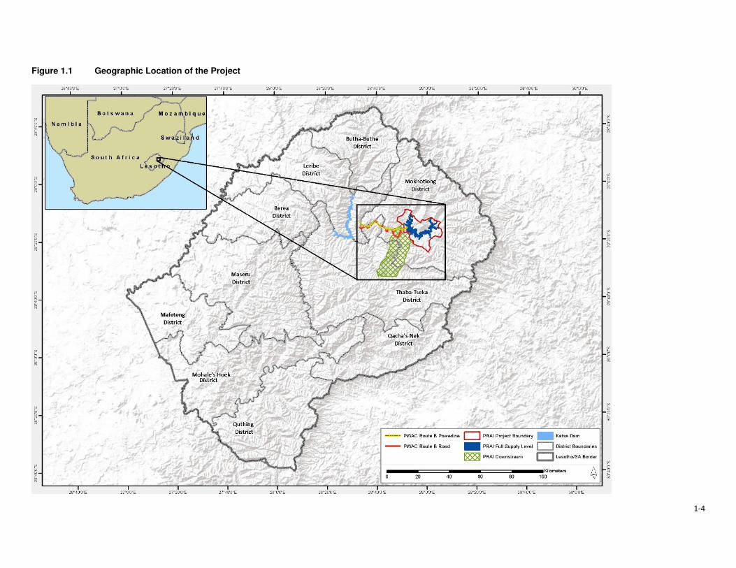
1-4
Figure 1.1 Geographic Location of the Project
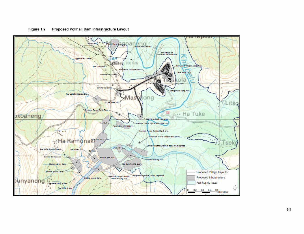
1-5
Figure 1.2 Proposed Polihali Dam Infrastructure Layout
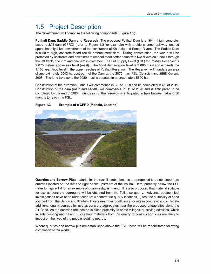
Section 1 • Introduction
1-6
1.5 Project Description The development will comprise the following components (Figure 1.2):
Polihali Dam, Saddle Dam and Reservoir: The proposed Polihali Dam is a 164 m high, concrete-
faced rockfill dam (CFRD) (refer to Figure 1.3 for example) with a side channel spillway located
approximately 2 km downstream of the confluence of Khubelu and Senqu Rivers. The Saddle Dam
is a 50 m high, concrete-faced rockfill embankment dam. During construction, the works will be
protected by upstream and downstream embankment coffer dams with two diversion tunnels through
the left flank, one 7 m and one 9 m in diameter. The Full Supply Level (FSL) for Polihali Reservoir is
2 075 metres above sea level (masl). The flood demarcation level is 2 080 masl and exceeds the
1:100 year flood level in the upper reaches of Polihali Reservoir. The Reservoir will inundate an area
of approximately 5042 ha upstream of the Dam at the 2075 masl FSL (Consult 4 and SEED Consult,
2008). The land take up to the 2080 masl is equates to approximately 5600 ha.
Construction of the diversion tunnels will commence in Q1 of 2018 and be completed in Q3 of 2019.
Construction of the dam (main and saddle) will commence in Q1 of 2020 and is anticipated to be
completed by the end of 2024. Inundation of the reservoir is anticipated to take between 24 and 36
months to reach the FSL.
Figure 1.3 Example of a CFRD (Mohale, Lesotho)
Quarries and Borrow Pits: material for the rockfill embankments are proposed to be obtained from
quarries located on the left and right banks upstream of the Polihali Dam, primarily below the FSL
(refer to Figure 1.4 for an example of quarry establishment). It is also proposed that material suitable
for use as concrete aggregate will be obtained from the Tsilantso quarry. Advance geotechnical
investigations have been undertaken to: i) confirm the quarry locations, ii) test the suitability of sand
sourced from the Senqu and Khubelu Rivers near their confluence for use in concrete; and iii) locate
additional quarry sources for use as concrete aggregates near the proposed bridge sites along the
A1 Road. As the quarries are located in close proximity to some villages, quarrying activities, which
include blasting and having trucks haul materials from the quarry to construction sites are likely to
impact on the lives of the people residing nearby.
Where quarries and borrow pits are established above the FSL, these will be rehabilitated following
completion of the works.

Section 1 • Introduction
1-7
Figure 1.4 Example of quarry establishment
Source: M van Rooyen
Polihali to Katse Transfer Tunnel (Eastern Side): A tunnel will be constructed to transfer water
from the Polihali reservoir to the Katse reservoir. The transfer tunnel will comprise the intake works
and gate shaft at the western edge of the Polihali Reservoir (just upstream of the confluence with the
Khubelu and Senqu Rivers) (see Figure 1.5 for an example of an intake tower). Associated
infrastructure for construction will include site access roads, quarries, plant yards, labour
accommodation, spoil areas and other tunnel works areas. Tunnelling activities will be done using
both drill-and-blast methods and a Tunnel Boring Machine (TBM). The current ESIA only assesses
the tunnel works from the eastern works area to approximately halfway along the length of the tunnel.
The tunnel works area (access, spoil dump, laydown) is located in close proximity to Tloha-re-Bue
and Malingoaneng. This will have implications for the communities in these villages (safety, nuisance,
cemeteries, etc. as well as impacting on their leisure activities as it directly affects the area used for
horse races).
Tunnel construction should commence at the end of Q1 2020 and be completed during Q4 of 2025.
Figure 1.5 Example of intake tower for transfer tunnel (Katse Dam, Lesotho)
Section 1 • Introduction
1-8
Major Bridges (Senqu, Khubelu and Mabunyaneng Bridges), and Associated Road Works:
Major bridges will be constructed on the Senqu, Khubelu and Mabunyaneng Rivers on the existing
A1 national road between Oxbow and Mokhotlong. Construction of the Senqu bridge will commence
in Q1 2020 and should be completed by the end of Q1 2023, while construction of the Khubelu/
Mabunyaneng bridge will commence in Q2 of 2020 and be completed during Q2 of 2022. Portions of
the A1 near the bridge locations will be realigned due to inundation by the reservoir, and a number of
other existing roads and tracks will require replacement. A new pedestrian bridge (Tlhakola Bridge)
is proposed across the reservoir at Tlhakola. Note: the scope of the PRAI ESIA does not include the
replacement of existing roads and tracks that will be inundated or the construction of new feeder
roads and minor bridges.
Bulk Power Supply and Telecommunications (BPST) infrastructure to be located at the Polihali
Reservoir that is included in this ESIS are:
• A new substation at Masakong near the advanced infrastructure area;
• A new telecommunications mast on the hill; and
• A new 33kV powerline from Tlokoeng across the reservoir to the permanent camp area (for
future electrical distribution by Lesotho Electricity Company (LEC) on the west side of the
reservoir).
Note: the construction of a new 132kV powerline from Katse (Matsoku Intake substation) to
Polihali (Masakong substation) and new paved road from Ha Seshote to Polihali falls under a
separate ESIS for the Polihali Western Access Corridor (PWAC).
Construction of the BPST infrastructure is anticipated to commence in Q3 of 2018 and be completed
by Q3 of 2020.
Project Housing and Site Establishment: The Phase II works will be built under a number of
construction contracts, each of which will require accommodation facilities for staff and the labour
force, site offices, workshops, plant yards, quarries, explosives store and other works areas. In
general, all temporary accommodation, offices and buildings needed for a particular construction
contract will be provided by the relevant construction contractor and will removed at the end of
construction.
Where facilities will have long-term use during the operation of the scheme, these will be designed
and built to appropriate standards for permanent works under the advance infrastructure contracts.
The permanent facilities include:
• Staff accommodation at the Polihali Reservoir area, built as a village with all communal services.
This will be the accommodation for the Employer, Engineer and Contractor’s staff during
construction of the Main Works and for operations staff following the completion of dam and
tunnel construction;
• A visitors’ lodge at the staff village, which will become a tourist facility; and
• The Employer’s and Engineer’s offices at the dam site, which will become the operations staff
offices and visitor centre.
Temporary construction areas include labour camps and works areas for construction of the eastern
sections of the PWAR; BPST component, and Polihali-Katse Transfer Tunnel, and for the Polihali
Dam and Saddle Dam and bridges. The labour camps will be provided with a raw water supply
(contractors will provide their own water purification, sewage treatment and waste facilities). The
Transfer Tunnel and Dam works areas/ sites will be provided with a raw water supply and a power
supply.
All the above project components are going to impact on the lives and livelihoods of the people
residing within the Project Area, either negatively or positively. The proposed dam area is surrounded
by villages that are most likely going to be affected to a large extent during the construction phase of
the dam and its associated infrastructure. During this phase there will be increased heavy vehicle
road traffic traversing through and passing by some villages. This will therefore mean constant noise,

Section 1 • Introduction
1-9
from the road traffic and likely blasting activities and also dust from the same. People's fields and
housing structures are also going to be impacted and some households will need to be relocated
because of the project activities which will include reservoir inundation, amongst others.
However, there will be the positive impact of local people being employed by the different contractors.
The locals will also be able to rent out their houses and their businesses could grow. The impact on
fields will mean that the owners will receive compensation for their loss. Those households that will
need to be displaced will have to be relocated to other areas.
The operational phase of the project will also affect the people residing within the Project Area, though
to a lesser extent. This would be through ongoing employment of some local people and development
of the local tourism industry. The people will also benefit from the livelihoods restoration and social
developments plan that the LHDA will develop and implement.

2-1
Section 2 Institutional and Legal Framework
2.1 Relevant Institutions 2.1.1 Central Government
The Government of Lesotho is a constitutional monarchy with two spheres of government: central
and local (Figure 2.1).
Figure 2.1 Structure of Government and Traditional Authorities
The head of state is King Letsie III whose role is predominately ceremonial. The two houses that
make up the parliament are the elected National Assembly (lower house) and the hereditary and
appointed Senate (upper house). The national assembly is comprised of 120 members elected
through the mixed-member proportional representation system2. The term of office for the members
of parliament is five years. The prime minister is the leader of the majority party in the national
assembly, and the King appoints the cabinet, known as the Council of State, on the advice of the
prime minister. There are a total of 25 ministries that oversee the implementation of government
policies and plans. The Senate comprises 33 members; 22 are Principal Chiefs while 11 are
nominated by the King on the advice of the Council of State.
Governmental power is exercised by three branches of government, namely; the executive; the
judiciary; and the legislature. Their different roles are described in Table 2.1.
Table 2.1 Main Government Branches, Powers and Functions
Arms of State Composition Functions
Executive The executive is made up of The Cabinet and Government Ministries. The Cabinet comprises the Prime Minister and Ministers.
• Cabinet is responsible for all government policies and
the day-to-day running of the affairs of the state.
Judiciary The Judiciary is made up of the Appeal Court, the High Court, the Magistrate Courts and Traditional (customary courts) which exist predominately in rural areas. There is also a Labour Court.
• The Judiciary is responsible for the administration of
justice, interpretation of existing laws and
guardianship of the Constitution.
• The Labour Court is a specialist court dealing
exclusively with industrial and labour matters
2 Under the mixed-member proportional representation system two-thirds of the members of the national assembly are elected according to the first-past-the-post electoral system (one member per constituency) and one-third by proportional representation (the 'party-list' form of the system).
Monarchy
Executive Legislative Judiciary
Hous e of Ass embly Senate Appeal Court
Prime Minister Principa l Chiefs High Court
Cabinet
(Government Ministries )
Area Chiefs Magistrate Courts
District Counci l lor District Head of Departments Tradi tiona l Court
Urban Counci l s & Community Counci l s
Arms of Government
King
Communities
District Administrator
National Government
District Government
Headmen

Section 2 • Institutional and Legal Framework
2-2
Arms of State Composition Functions
Legislative The Legislature is made up of the Senate and the National Assembly.
• The Senate examines and reviews draft Legislation/
Bills passed by the National Assembly.
• The National Assembly is the main legislative body; it
enacts the laws of the country and scrutinises the
political executive on the management and
administration of the affairs of the land.
2.1.2 Local Government
The constitution mandates Parliament to establish local government and the main governing
legislation is the Local Government Act 1997 and Local Government Elections Act 1998. Cabinet
adopted a national decentralisation policy in February 20143. The Ministry of Local Government and
Chieftainship Affairs (MoLGCA) is responsible for facilitating and coordinating the implementation of
the national decentralisation policies and programs, along with the capacity development of Local
authorities.
Local government structures are headed by the Principal Secretary who sits at the national
government level. Each District is headed by a District Administrator (DA). The DA represents the
interests of Central Government at a District level and is responsible for the administrative
decentralisation and integration of government activities. The DA is supported by heads of
departments of various government ministries.
The district administration is comprised of four levels of decentralised political structures namely the
10 District Councils (DCs), one Municipal Council, 11 Urban Councils and the 64 Community
Councils. Members of these councils are elected to office through local government elections, which,
constitutionally, are supposed to be held every five years. The first local government elections took
place in 2005, the second in 2011 and the third were expected to have occurred in 2016. The
composition of the various councils is described in Table 2.2.
Table 2.2 Local government composition at various Council levels
Role Description
District Councils
(DCs) • DCs are comprised of councillors elected through electoral colleges. Each DC
has a Chairperson and a District Council Secretary (DCS)4 who implement the
Council resolutions.
Municipal Councils
(MCs) • MCs are composed of councillors representing wards within an urban area
categorised as a Municipality. Presently, the City of Maseru is the only urban
area with a Municipal status.
Urban Councils • There are eleven urban councils in the country with each of the nine districts
besides Maseru having its council. However, there are two additional urban
councils in Maputsoe and Semongkong.
Community Councils
(CCs)
• There are 64 CCs. All councillors are elected to represent a single-member
division for a term of up to five years. Councillors comprise members elected
from the electoral division, chiefs representing traditional leadership, and
women occupying reserved seats determined by proportional representation
lists submitted by political parties.
Figure 2.2 shows the Community Councils within which the Project Area falls.
3 www.clgf.org.uk/default/assets/File/Country_profiles/Lesotho.pdf 4 The DCS office is responsible for the daily management of the political and service decentralisation, and the coordination and monitoring of all development projects at a District level.

2-3
Figure 2.2 Community Councils within which the Project Area falls
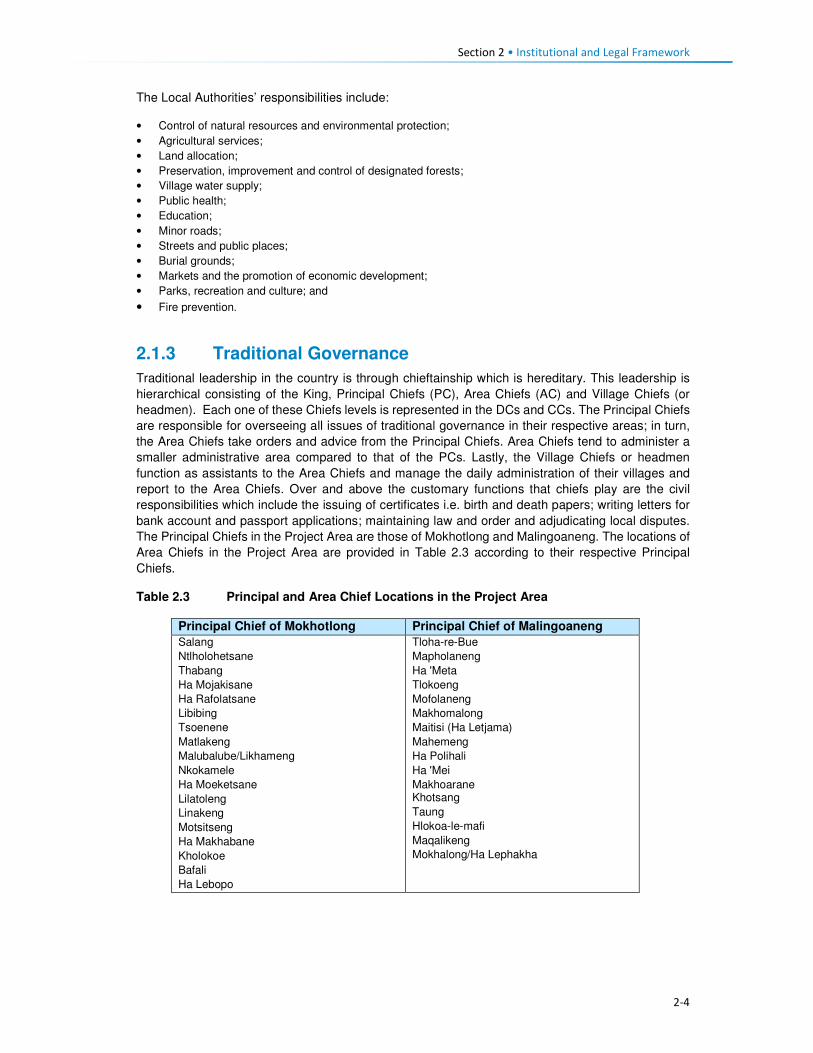
Section 2 • Institutional and Legal Framework
2-4
The Local Authorities’ responsibilities include:
• Control of natural resources and environmental protection;
• Agricultural services;
• Land allocation;
• Preservation, improvement and control of designated forests;
• Village water supply;
• Public health;
• Education;
• Minor roads;
• Streets and public places;
• Burial grounds;
• Markets and the promotion of economic development;
• Parks, recreation and culture; and
• Fire prevention.
2.1.3 Traditional Governance
Traditional leadership in the country is through chieftainship which is hereditary. This leadership is
hierarchical consisting of the King, Principal Chiefs (PC), Area Chiefs (AC) and Village Chiefs (or
headmen). Each one of these Chiefs levels is represented in the DCs and CCs. The Principal Chiefs
are responsible for overseeing all issues of traditional governance in their respective areas; in turn,
the Area Chiefs take orders and advice from the Principal Chiefs. Area Chiefs tend to administer a
smaller administrative area compared to that of the PCs. Lastly, the Village Chiefs or headmen
function as assistants to the Area Chiefs and manage the daily administration of their villages and
report to the Area Chiefs. Over and above the customary functions that chiefs play are the civil
responsibilities which include the issuing of certificates i.e. birth and death papers; writing letters for
bank account and passport applications; maintaining law and order and adjudicating local disputes.
The Principal Chiefs in the Project Area are those of Mokhotlong and Malingoaneng. The locations of
Area Chiefs in the Project Area are provided in Table 2.3 according to their respective Principal
Chiefs.
Table 2.3 Principal and Area Chief Locations in the Project Area
Principal Chief of Mokhotlong Principal Chief of Malingoaneng
Salang
Ntlholohetsane
Thabang
Ha Mojakisane
Ha Rafolatsane
Libibing
Tsoenene
Matlakeng
Malubalube/Likhameng
Nkokamele
Ha Moeketsane
Lilatoleng
Linakeng
Motsitseng
Ha Makhabane
Kholokoe
Bafali
Ha Lebopo
Tloha-re-Bue
Mapholaneng
Ha 'Meta
Tlokoeng
Mofolaneng
Makhomalong
Maitisi (Ha Letjama)
Mahemeng
Ha Polihali
Ha 'Mei
Makhoarane Khotsang
Taung
Hlokoa-le-mafi
Maqalikeng
Mokhalong/Ha Lephakha

Section 2 • Institutional and Legal Framework
2-5
2.2 Relevant Legislation and Policies 2.2.1 LHWP Treaty and LHDA Policies and Guidelines
The legal framework governing LHDA’s obligations with respect to social impact assessments
is summarised in Table 2.4.
Table 2.4 Policies and Guidelines Relevant to Social Impact Assessments
Legislation Requirements
LHWP Treaty (1986) The LHWP Treaty was signed between the Kingdom of Lesotho and the Republic
of South Africa in 1986, and has provided the foundation for construction of
Phase I (comprising Katse and Mohale Dams) and the planned Phase II (Polihali
Dam).
In relation to environmental and social issues, the Treaty requires that:
(i) all project affected people “will be able to maintain a standard of living not
inferior to that obtaining at the time of first disturbance”;
(ii) implementation, operation and maintenance of the project are compatible
with the protection of the existing quality of the environment; and, in particular,
and
(iii) shall pay due regard to the maintenance of the welfare of persons and
communities affected by the project.
To date, Phase I (comprising Katse and Mohale Dams) of the LHWP Treaty has
been completed as well as the Phase II Feasibility Study; the responsibilities for
these and a further two phases are set out in the LHWP Treaty.
Agreement on Phase
II of the Lesotho
Highlands Water
Project (August
2011)
The Phase II Agreement was signed between Kingdom of Lesotho and the
Republic of South Africa in 2011. The purpose of the Agreement is to provide the
legal basis for the implementation of Phase II as well as the operation and
maintenance of Phases I and II of the Project.
In relation to environmental and social issues, the Agreement makes the following
provisions:
• Environmental mitigation measures including environmental flow matters and
baseline studies will be implemented, the full extent is to be agreed by the
Parties during the implementation.
• Social development programmes and mitigation measures, resettlement
requirements, baseline studies and public relations and awareness campaigns
will be implemented; the full extent is to be agreed by the Parties during the
implementation.
LHWP Phase II.
Community
Participation
Strategy (September
2014)
LHDA’s Community Participation Strategy is aimed at ensuring the involvement and
participation of the public in the project planning, implementation, monitoring and
decision-making processes through the engagement of community structures and
other project role- players. It sets out the establishment for community liaison
structures which include area liaison committees and combined liaison committees
in the four councils affected by the project (Seate; Mphokojoane, Menoaneng and
Mokhotlong Urban Council).
Its main objectives are:
• To develop and maintain on an on-going basis the process of public
participation to ensure the continued involvement and participation of interested
and affected parties in a meaningful way;
• To promote involvement and participation of community structures in decision
making processes, planning and implementation of relevant LHWP activities;
• To co-ordinate current and planned LHDA community participation initiatives;
and

Section 2 • Institutional and Legal Framework
2-6
Legislation Requirements
• To establish a two-way communication channel between the LHDA and the
communities.
Area Liaison Committees (ALCs) have been set up to provide direct liaison
between LHDA, its contractors and the local communities within Phase II of the
LHWP, and to serve as a forum for:
• Community participation processes;
• Mobilisation, sensitisation and awareness- raising of affected communities;
• A two-way communication process between the affected people and the Project
authorities;
• Participation and consultation on Project policies (Compensation Policy) and
strategies;
• Exchange of views/information on the LHWP and LHDA activities and
programmes;
• Participation in data collection, project studies, information disclosure,
programmes implementation;
• Participation and witness to land acquisition, asset inventory/ registration,
ownership and measurement of properties to be affected;
• Participation and witness to consultations and agreements reached with
individual households and communities to be compensated;
• Identification of development needs, and establishment of action plans for
realisation of development goals;
• Receiving, adjudication and channelling of complaints and grievances from the
affected communities to the LHDA;
• Identification of affected people for training on land-based, wage-based and
enterprise-based livelihoods;
• Identification of the most vulnerable households e.g. orphans, aged and
disabled for special assistance by LHDA and/ or Government Departments;
• Management of unskilled labour; and
• Projects and programmes reviews.
Consultation with affected communities was carried out through the established
structures (ALCs, as outlined in Section 3.3) as well as through key informant
interviews.
Labour Recruitment
Guidelines (2017)
LHDA has developed Labour Recruitment Guidelines that will guide the hiring and
employment of labour for Phase II of the LHWP. It requires contractors to prioritise
recruitment of local labour from Lesotho, particularly for unskilled positions. It
specifies that all recruitment shall be done through a Project Labour Recruitment
Desk (PLRD) to be established at Mapholaneng or Tlokoeng with a satellite office at
Ha Lejone. All potential work seekers will need to be registered at the PLRD in
order to be considered for employment.
The Guidelines also set out principles regarding the recruitment of unskilled labour
as follows:
• All unskilled jobs will be for a period of between 12 and 18 months;
• At the end of each period the workers will be replaced by another person; and
• Where a Contractor has trained and developed an individual to such an extent
that the individual can be considered semi-skilled; then the individual may be
re-employed.
LHWP Phase II
Procurement
Guidelines
The LHDA procurement guidelines for Phase II have the central objectives of the
project procurement processes and procedures:
• To comply with the spirit and objectives of Article 6 of the Treaty and Articles 10
and 11 of the Phase II Agreement, as well as the provisions of the Lesotho
Public Procurement Regulations of 2007, Part III (12), which are to foster
competiveness and transparency while increasing participation of individuals
from Lesotho, South Africa and SADC member states.
• To maximise procurement opportunities for Lesotho and South African
suppliers.

Section 2 • Institutional and Legal Framework
2-7
Legislation Requirements
• To minimise the utilisation of imported goods, skills and labour, where
applicable, within the ambit of the laws governing Lesotho.
• To maximise skills and technology transfer through the training of individuals
and enterprise development opportunities for Lesotho-based companies and
black owned companies in the Republic of South Africa
LHWP Phase II
Contractor
Procurement
Framework (Draft
August, 2016)
The Contractor Procurement Framework provides an overview of the specific
requirements and approaches for the procurement of construction contracts for
Phase II of the LHWP. The Framework gives a basis to ensure that each contract is
procured in a manner compatible with the legal framework and the LHWP
procurement policy. The consultant responsible for each construction contract will
develop appropriate procedures to implement the Framework.
LHWP Phase II
Safety Health
Environment and
Quality Management
(SHEQ)
Management
Framework (April,
2017)
The Occupational Health and Safety of all employees is addressed by the SHEQ
Framework. The Framework provisions are applicable to all Consultants and
Contractors delivering work for, or on behalf of, the LHDA or its entities.
The aim of the Framework, is to:
• Assist Consultants or Contractors to adequately provide for implementing
sound SHEQ practices on site; and
• Inform Consultants and Contractors in advance of the SHEQ directive and
requirements that will be enforced during the project.
LHDA Phase II
Compensation Policy
(August, 2016)
The Policy applies to all losses of assets and income, and impacts on livelihoods
suffered by people, households, communities and institutions as a result of the
implementation of Phase II of the LHWP. According to the Policy all persons affected
by Phase II will be entitled to equitable treatment as embodied in the Policy. The Policy
objectives are:
• To minimise involuntary land take by investigating all possible Project design
alternatives;
• To ensure that affected people and communities, including host communities
are meaningfully consulted on Project designs, alternatives and impacts;
• To promote affected people’s participation in the planning, implementation and
monitoring of compensation, resettlement, mitigation and development
measures;
• To ensure that relocation of households and businesses is undertaken in a
participative, systematic and beneficial manner, involving both displaced and
host communities;
• To ensure that affected people are promptly, fairly and fully compensated for
their losses; and
• To ensure that direct compensation is accompanied by additional measures
where necessary to help restore livelihoods; and
• To ensure that existing cultural and religious practices are respected, and to
preserved to the maximum extent practical.
Compensation rates
The Policy states that compensation rates for Phase II have been declared under
the Compensation Regulations. The rates are adjusted annually for price escalation
using the Lesotho Consumer Price Index (CPI). Compensation for primary
residential dwellings and formal business structures will be based on the principle of
replacement cost. Consultations will occur with affected communities, their local
authorities and district stakeholders to explain the rates and the basis for their
calculations.
Where urban land and property are acquired, valuation will be carried out according
to the provisions of the Land Act of 2010 and the associated Regulations. All
valuations will be certified by LAA.
In the case of the provision of replacement agricultural land (land-for-land option),
the following principles will apply to the new land:

Section 2 • Institutional and Legal Framework
2-8
Legislation Requirements
• It will be identified and confirmed with the participation of the affected
households and should as far as possible be located in reasonable proximity to
where the displaced persons reside;
• It should be provided free of “transaction costs” such as registration fees,
transfer taxes or customary tributes.
Eligibility for compensation
The unit of entitlement for compensation against the loss of private property and
assets will be the owner or household, including orphaned minors who are entitled
to their parents’ estate. LHDA will ensure compliance with the regulations of the
Land Act of 2010 and the Legal Capacity of Married Persons Act of 2006.
Compensation for loss of communal resources
Communal resources include grazing land, brushwood, medicinal plants, useful
grasses and wild vegetables.
LHDA will calculate the total compensation amount payable for the communal
resources it is to acquire, based on the area of land lost and the number of affected
households.
Management rights to communal assets that will be acquired by the Project are held
by Community Councils. Compensation for the loss of communal assets will be
used for investment in approved community development ventures. The funds will
be managed by LHDA for the implementation of development projects that have
been agreed and prioritised by the affected communities and their local authorities.
Where some physically displaced households move outside their local community/
village to other host communities/ villages, the funds will be apportioned between
the concerned community/ villages based on the number of households relocating
to the host communities/ villages.
Downstream Impacts
Impacts on communities downstream of the Polihali Reservoir up to the confluence
of the Senqu and ‘Malibamatso Rivers caused by reduced river flows will be
mitigated through measures developed as part of the Project’s Phase II
environmental flow requirement (EFR) programme.
Disturbance allowance
A disturbance allowance will be paid to households, including households
enumerated on public land at the time of the Project’s socio-economic census
whose primary residential structure or structures are required to be relocated.
The allowance will be paid over three years from the date of disturbances. For
households electing to relocate to a destination of their own choice the allowance
will be paid in the form of a lump sum payment.
A lump sum disturbance allowance will be paid to small scale/informal traders
whose business structures are required to be relocated from their residential or
public land.
Owners of formal commercial enterprises will receive a disturbance allowance, the
value of which will be determined as part of the valuation exercise.
Evacuation Assistance
LHDA will provide transport to physically displaced households and businesses for
the removal of their assets, belongings and livestock to Project-designated and
approved relocation sites. Households electing to relocate to a destination of their
own choice will be paid a lump sum evacuation amount based on the relocation
destinations detailed in the compensation rates.
Asset Registration
Procedures for
LHWP Phase II
(October, 2017)
Asset registration and finalisation of compensation offers will be undertaken in three
steps i.e. asset registration, compensation options and compensation offer.
Asset Registration will entail:
Section 2 • Institutional and Legal Framework
2-9
Legislation Requirements
• Identification of affected assets and owners in the footprint of the project through
analysis of aerial imagery, field investigations and consultation with local authorities
and community structures;
• A cadastral survey of all affected land parcels as well as fixed assets (geo-
referenced and mapped) and Asset Inventory Forms signed by the affected
owner;
• Assets and beneficiary registration and preparation of Asset Verification Forms
(including GIS mapping and photographic evidence as well as communication
of the cut-off date); and
• Uploading of the asset and beneficiary data to FlowCentric, for in-system
checking and approval.
Compensation Options will involve :
• The creation of a compensation’s option form.
• Presentation and explanation of the options individually to beneficiaries
/households, who will be allowed at least one week to consider their preferences.
• Once options are confirmed, the Form will be signed by the parties for preparation
of Compensation Offers.
Compensation Offers – based on the selected compensation options:
• A Compensation Offer will be presented to the beneficiary/household. After a one
week “cooling-off” period, the Offer will be signed and executed.
• A copy of the Offer will be submitted to the LHWC for record purposes and
contingency transfer request.
LHWP Phase II
Livelihood
Restoration and
Social Development
Framework
(LR&SD) (August
2017)
The Livelihood Restoration and Social Development (LR&SD) Framework supplements
the Phase II Compensation Policy, and serves to provide a context for the
conceptualisation, planning and implementation of livelihood restoration measures and
social development initiatives on Phase II.
The focus areas of the LR&SD Framework are as follows:
• Livelihood restoration measures for households and communities directly
affected (physical and economic displacement) by implementation of Phase II.
These initiatives will be planned and implemented with the full participation of
affected households and communities and other stakeholders for effective
sustainability.
• Initiatives to support broad-based social and economic development in the
Phase II areas. These could include water and sanitation initiatives, public
health initiatives (to be implemented under the Phase II Public Health Action
Plan), and other initiatives to be finalised in conjunction with the Phase II
communities, government and other development partners.
Memorandum of
Understanding
(MoU) between
LHDA and Basotho
Enterprises
Development
Corporation
(BEDCO) (January
2015)
The objective of the MoU is to establish a platform for cooperation for the provision of
business development and advisory services within all the LHWP areas as part of the
initiatives for livelihoods improvement for the communities and individuals affected by
the implementation of Phases I and II of the LHWP. It entails:
• Coordinating efforts in developing and building skills capacity of affected
individuals and communities in Phases I and II of the LHWP in order to enable
the communities to optimise the potential benefits brought about by the
development activities of the LHWP;
• Developing design and conduct customised entrepreneurial and artisan skills
training programmes for communities in LHWP areas;
• Promoting Micro, Small & Medium Enterprises (MSMEs) and other livelihood
improvement activities among affected communities and individuals within
LHWP areas;
• Providing a pool of expert services for identification of business ideas,
development of project proposals, project appraisal and mentoring services for
business start-ups;
• Facilitating access to micro-finance for MSMEs

Section 2 • Institutional and Legal Framework
2-10
Legislation Requirements
• Sharing information knowledge and expertise in the area of small business
development, skills training and advisory services for communities and
individuals within the LHWP areas.
2.2.2 Lesotho Legislation Relevant to Social Impact Assessments
Legislation and policies of specific relevance to social impact assessments is summarised below.
Table 2.5 Legislation and Policies Relevant to Social Assessments
Legislation Requirement
Constitution of
Lesotho (Act No. 5 of
1993), as amended in
2001
Protection of the natural environment is enshrined in Section 36 which states
‘Lesotho shall adopt policies designed to protect and enhance the natural and
cultural environment of Lesotho for the benefit of both present and future
generations and shall endeavour to assure to all its citizens a sound and safe
environment adequate for their health and well- being’.
National
Environmental Policy,
1998
The overall goal of the Lesotho National Environmental Policy (NEP) is to
achieve sustainable livelihoods and development for Lesotho. The objectives of
the policy include:
• To secure for all Basotho a high quality of environment to enhance
health and well- being;
• To use and conserve the environment and natural resources for the benefit
of present and future generations, taking into account the rate of population
growth and productivity of available resources;
• To conserve Basotho cultural heritage and utilise it for the benefit of present
and future generations;
• To halt environmental degradation, and to restore, maintain and enhance
the ecosystems and ecological processes essential for the functioning of
the biosphere and to preserve biological diversity;
• To implement the principle of optimal sustainable yield in the use of natural
resources and ecosystems; and
• To ensure that the true and total costs of environmental use and abuse are
borne by the user, i.e., the “polluter pays” principle.
Environmental Act No.
10 of 2008
The Environment Act, 2008 provides a framework environmental law for the
implementation of the National Environmental Policy. It sets out the principles
of environmental management in Part II, section 3(2) of the Act.
The purpose of the Act is to protect and ensure proper management of the
environment, conservation and sustainable utilisation of natural resources of
Lesotho. The Act defines the broad activities and general principles of
environmental management in Lesotho. Section 4 of the Environment Act
provides for a right to a clean and healthy environment and imposes a corrective
duty to protect, maintain and enhance the environment and defines a citizen’s
right to take legal action against acts or omissions that damage the
environment. The Act provides for Environmental Impact Assessment (EIA),
audits and monitoring of projects.
National
Environmental Impact
Assessment
Guidelines (2009)
The EIA Guidelines set out the steps to be taken in carrying out the EIA
process. They are aimed at facilitating participation in and compliance with
Lesotho's EIA requirements by the developers. They are also aimed at
"integrating environmental concerns and economic development from the
earliest stages of the project development”. According to the Guidelines, the
objectives of an EIA in Lesotho are to:
• Integrate environmental considerations into development planning,
thereby promoting sustainable livelihoods;

Section 2 • Institutional and Legal Framework
2-11
Legislation Requirement
• Ensure that the environmental and socio-economic costs and benefits
of economic development projects are properly accounted for;
• Ensure that unwarranted negative impacts are avoided or mitigated at
an early stage in the planning process;
• Ensure that potential benefits are identified and enhanced;
• Carry out environmental and socio-economic studies of projects in
parallel with analysis of engineering and economic feasibility;
• Ensure that decision-makers are provided with information on
environmental costs and benefits to complement information on its
technical and economic feasibility at key decision points in the
development of a project;
• Ensure that all the affected and interested groups (local communities,
government authorities, developers, Non-government organisations
(NGOs), Community-based Organisations (CBOs), etc.) Participate in the
process;
• Set up a system to carry out mitigation, monitoring, auditing, and
enforcement.
National Strategic
Development Plan
2012/13 – 2017/18
The main goals of the National Strategic Development Plan are to:
• Pursue high, shared and employment creating economic growth;
• Develop key infrastructure;
• Enhance the skills base, technology adoption and foundation for
innovation;
• Improve health, combat HIV and AIDS and reduce social vulnerability;
• Reverse environmental degradation and adapt to climate change; and
• Promote peace, democratic governance and build effective institutions.
The NSDP Strategic Framework aims to build productive capacities and
create benefits of sustained broad-based growth in the form of jobs,
improved health, skills and capabilities and poverty reduction. The
Framework focusses on issues of development in the areas of investment;
financial sector development; trade; micro, small and medium enterprises
(MSMEs); agriculture and rural economy; manufacturing; tourism; mining;
infrastructure; skills and innovation; health and HIV and AIDS; social
protection; environment and climate change; and governance and
institutions.
Sustainable
Development Goals
(SDGs) 2016
The 2030 Agenda for Sustainable Development was adopted by all UN Member
States of which Lesotho is party to. The 2030 Agenda comprises a set of 17
Sustainable Development Goals (SDGs) to end poverty, fight inequality and
injustice, and tackle climate change by 2030.
District Economic
Strategies (DESs)
The District Economic Strategies (DESs) are structured along a bottom up
approach to the NSDP. They have been developed based on the employment
and economic development advantages for each District and its specific areas
towards achieving developments. The DES relies on four NSDP priority areas
which include economic growth generating activities, namely; manufacturing,
commercial agriculture, mining and tourism.
Lesotho Land Act No.
8 of 2010
The Land Act of 2010 is the principal legislation governing land ownership and
occupation, and the acquisition of property for public and development purposes.
Section 10(1) of the Act grants joint title to property to both spouses married in
community of property (under civil, customary or any other law, irrespective of the
date on which the marriage was entered into), and equal powers in land transactions.
Declaration of Land
Set Aside for Public
Purposes (Allocated
Land) Notice, 2012
(Legal Notice No. 71
of 2012)
The Legal Notice sets aside every right or interest in and to the allocated land (fields)
described as agricultural land delineated on Plan No 47283 held in the office of Chief
Surveyor, Maseru in extent 6492 hectares more or less situated at Polihali,
Mokhotlong District for public purposes. The Notice stipulates that the land is
required for the construction of Polihali Dam.
Section 2 • Institutional and Legal Framework
2-12
Legislation Requirement
Date of Surrender: On the date of publication of this notice in the gazette all interest
in or affecting the said land shall cease to subsist and the allottees interest in the
land shall revert to the State.
Compensation: The compensation is estimated at M300 million or more and shall be
apportioned to the claims accordingly.
Legal Capacity of
Married Persons Act
No. 9 of 2006
The Act grants equal powers on both spouses married in community of property,
giving them equal capacity to dispose of the assets of the joint estate, contract
debts for which the joint estate is liable, and administer the joint estate.
Lesotho National
Social Protection
Strategy (NSPS)
2014/15 – 2018/19
The NSPS implements the National Policy on Social Development (NPSD), in the
medium term. The policy provides a broad framework for development and
implementation of a harmonised and coordinated social protection agenda of
Government to ensure that different programmes implemented by different
Government and non‐Government agencies are complementary to each other
for sustainable development of the vulnerable.
The strategy addresses the risks and challenges across the life‐course. It
recognises that all citizens are exposed to different vulnerabilities through the
course of their lives, and responds to these vulnerabilities. The strategy is
structured around four key life‐course stages i.e. pregnancy and early childhood;
school age and youth; working age; and old age. It also includes the two
dimensions of shocks and of disability/chronic illness that may impact at any
stage of the life‐course.
The overall objective of the NSPS is to provide support to those that are unable
to construct a viable livelihood; to protect the assets and improve the resilience
of poor and vulnerable households; and to increase the productive capacity and
asset base of those households.
Lesotho Gender and
Development Policy
The Gender and Development Policy is a government tool geared towards
addressing the challenges of gender inequities and inequalities, poverty,
increased spread of HIV/ AIDS, retrenchment and unemployment by adopting a
rights-based approach to development. The policy is based on the realisation of
human rights of all, women and men alike, holding principles of equal
participation in development, non-discrimination and the empowerment of the
marginalised women and men, boys and girls.
Local Government Act
1997 as Amended by
Local Government
(Amendment) Act
2004
Schedule 2 of the Local Government Act, 1997 states that CCs’ functions include
control of natural resources, e.g. sands, stones and environmental protection,
e.g. control of natural resources, land/site allocation and physical planning,
agriculture and forestry, dongas, pollution, grazing control and water resources.
The Labour Code
Order (Amendment) of
2006
The Order provides that the employer shall not discriminate against a job
application on the basis of his or her HIV and AIDS status (refer to Section 235E
(1) of the Labour Code (Amendment) Order, 2006).
Part VII if the Labour Code Order relating to Health Safety and Welfare at work is
of particular relevance to this project. It deals with aspects such as fire prevention
and firefighting, the wearing of Protective Personal Equipment (PPE) and
clothing, removal of dust or fumes, etc.
Workmen’s
Compensation Act 13
of 1977 (amended by
LN 105 of 1995)
The Act directs employers on how to deal with compensation issues in the event
that an employee becomes injured or disabled in the line of duty, or in the event
that an employee dies while in the employ of the employer.
Public Health Order
12 of 1970
Stipulates that any exhumation of a body or other human remains from a
cemetery or other burial site requires a permit and that such permit shall be
obtained from the Department of Health by the legal representative or next of kin
or other duly authorised agent. The permit may prescribe conditions and
precautions under which such exhumation shall be conducted.
Section 75 makes provision for the Minister of Health to permit essential
exhumation of burial sites for any public, mining or infrastructure purpose.

Section 2 • Institutional and Legal Framework
2-13
Legislation Requirement
Removal of burial sites from an authorised cemetery requires a six-month
notification period of the intention to relocate graves.
2.3 International Standards The ESIA was required primarily to meet the requirements of the Lesotho Environment Act 10 of
2008, the national Environmental Impact Assessment (EIA) Guidelines (2009) and other relevant
national legislation, but was also seeks to address the requirements of the International Safeguards.
In this regard, the requirements of the World Bank and International Finance Corporation (IFC) in
respect of SIA requirements are described below. The World Bank is in the process of aligning their
Environmental and Social Safeguards (ESS) with the Performance Standards (PS) of the IFC and
there is no material difference between them.
2.3.1 World Bank ESS and IFC PS
Provisions of relevant ESS and PS safeguards are summarised in Table 2.6.
Table 2.6 Summary of Relevant World Bank and IFC Safeguards
Performance Standard (PS) Impact Assessment Requirements
ESS1 / PS1:
Assessment and Management
of Social and Environmental
Risks and Impacts
Underscores the importance of managing environmental and social
performance throughout the life of a project. It requires the client to
conduct a process of environmental and social assessment and to
establish and maintain an Environmental and Social Management System
(ESMS), appropriate to the nature and scale of the project and
commensurate with the level of its environmental and social risks and
impacts. It aims to:
• Identify and evaluate environmental and social risks and impacts of the
project;
• Adopt a mitigation hierarchy to anticipate and avoid, or where
avoidance is not possible, minimise, and, where residual impacts
remain, compensate/offset for risks and impacts to workers, affected
communities, and the environment;
• Promote improved environmental and social performance of clients
through the effective use of management systems;
• Ensure that grievances from affected communities and external
communications from other stakeholders are responded to and
managed appropriately;
• Promote and provide means for adequate engagement with affected
communities throughout the project cycle on issues that could
potentially affect them; and
• Ensure that relevant environmental and social information is disclosed
and disseminated.
ESS2 / PS2:
Labour and Working
Conditions
This standard recognises that the pursuit of economic growth through
employment creation and income generation should be accompanied by
protection of the fundamental rights of workers. PS2 aims to:
• Promote fair treatment, non-discrimination and equal opportunity of
workers;
• Establish, maintain and improve the worker-management relationship;
• Promote compliance with national employment and labour laws;
• Protect workers, including vulnerable categories of workers such as
children, migrant workers, workers engaged by third parties and
workers in the client’s supply chain; and
• Promote safe and healthy working conditions and the health of
workers; and avoid the use of forced labour.
ESS 3 / PS3: This standard recognises that increased economic activity and
urbanisation often generate increased levels of pollution to air, water, and

Section 2 • Institutional and Legal Framework
2-14
Performance Standard (PS) Impact Assessment Requirements
Resource Efficiency and
Pollution Prevention
land, and consume finite resources in a manner that may threaten people
and the environment at the local, regional, and global levels. Thus, PS3
aims to:
• Avoid or minimise pollution from project activities;
• Promote more sustainable use of resources (including energy and
water); and
• Reduce project-related Greenhouse Gas (GHG) emissions.
ESS 4 / PS4:
Community Health, Safety and
Security
This standard recognises that project activities, equipment, and
infrastructure can increase community exposure to risks and impacts. PS4
aims to:
• Anticipate and avoid adverse impacts on the health and safety of
affected communities during the project life from both routine and non-
routine circumstances; and
• Ensure that the safeguarding of personnel and property is carried out
in accordance with relevant human rights principles and in a manner
that avoids or minimises risks to the affected communities.
ESS 5 / PS5:
Land Acquisition, Restrictions
on Land Use and Involuntary
Resettlement
Note PS5 does not include
“Restrictions on Land Use” in
the title of PS5.
This standard recognises that project-related land acquisition and
restrictions on land use can have adverse impacts on communities and
persons that use this land. PS5 thus aims to:
• Avoid, and when avoidance is not possible, minimise displacement by
exploring alternative project designs;
• Avoid forced eviction;
• Anticipate and avoid, or where avoidance is not possible, minimise
adverse social and economic impacts from land acquisition or
restrictions on land use by (i) providing compensation for loss of
assets at replacement cost and (ii) ensuring that resettlement activities
are implemented with appropriate disclosure of information,
consultation and the informed participation of those affected; and
• Improve, or restore, the livelihoods and standards of living of displaced
persons.
ESS 6 / PS6:
Biodiversity Conservation and
Sustainable Management of
Living Natural Resources
This standard recognises that protecting and conserving biodiversity,
maintaining ecosystem services, and sustainably managing living natural
resources are fundamental to sustainable development. PS6 aims to:
• Protect and conserve biodiversity;
• Maintain the benefits from ecosystem services; and
• Promote the sustainable management of living natural resources
through the adoption of practices that integrate conservation needs
and development priorities.
ESS 8 / PS8:
Cultural Heritage
Recognises the importance of cultural heritage for current and future
generations. As such, PS8 aims to:
• Protect cultural heritage from the adverse impacts of project activities
and support its preservation; and
• Promote the equitable sharing of benefits from the use of cultural
heritage resources.
ESS 10:
Stakeholder Engagement and
Information Disclosure
Note: The IFC do not have an
equivalent performance
standard.
Recognises the importance of open and transparent engagement between
the Borrower (developer) and project stakeholders as an essential
element of good international practice. Effective stakeholder engagement
can improve the environmental and social sustainability of projects,
enhance project acceptance, and make a significant contribution to
successful project design and implementation.
2.3.2 Voluntary Principles on Security and Human Rights
The voluntary principles on security and human rights (www.voluntaryprinciples.org) provide a
framework to guide companies in maintaining the safety and security of their operations that ensures
respect for human rights and fundamental freedoms.

Section 2 • Institutional and Legal Framework
2-15
The principles cover the following aspects:
• The identification of security risks;
• The deployment and conduct of security personnel;
• Consultation between company, government, civil society and public security; and
• Responses to human rights abuses.
While Lesotho is not a signatory to these Principles, key human rights organisations are signatories
and IFC PS4 makes reference to the need to operate in accordance with relevant human rights
principles and in a manner that avoids or minimises risks to affected communities.
2.3.3 International Labour Organisation Fundamental Conventions
The International Labour Organisation (ILO) has identified eight conventions as "fundamental",
covering subjects that are considered as fundamental principles and rights at work. Lesotho has
ratified all of the ILO Fundamental Conventions, namely:
1. Freedom of Association and Protection of the Right to Organise Convention, 1948 (No. 87);
2. Right to Organise and Collective Bargaining Convention, 1949 (No. 98);
3. Forced Labour Convention, 1930 (No. 29);
4. Abolition of Forced Labour Convention, 1957 (No. 105);
5. Minimum Age Convention, 1973 (No. 138);
6. Worst Forms of Child Labour Convention, 1999 (No. 182);
7. Equal Remuneration Convention, 1951 (No. 100); and
8. Discrimination (Employment and Occupation) Convention, 1958 (No. 111).

3-1
Section 3 Approach and Methods
3.1 Introduction This section provides a description of the process and methods used to gather primary socio-
economic information within the Social Areas of Influence (Refer to Section 3.2.3).
3.2 Approach A four step approach to the data collection and analysis process was adopted and comprised the
following:
• Literature review,
• Site reconnaissance visit,
• Determining the Social Area of Influence; and
• Planning for data collection.
Each of all the four steps is described in more detail below.
3.2.1 Literature review
The objectives of the literature review process were to:
• Review all existing social specialist reports that had been commissioned by the LHDA between
2013 and 2016.
• Identify gaps in the available information that would require further secondary or primary research
to address.
• Identify a preliminary Social Area of Influence for the proposed Project.
• Identify further secondary sources of information that can be used during the compilation of the
report.
Box 3.1 List of Relevant Data Consulted for this Study
The review of the three baseline studies referenced above helped provide a broad understanding and
depth of the socio-economic status of the communities in the Project Area. In particular, the PHBS
(NHA, 2016) helps provide an overview of the health systems and nutrition status of the communities
• Socio-Economic Baseline Study (SEBS) (EOH Coastal & Environmental Services (CES) (2015b) (LHDA
Contract 6000) – the study was undertaken between 2013 and 2014 and finalised in March, 2015.
• Public Health Baseline Study (NHA, 2016) (LHDA Contract 6008) - the report was undertaken in three
stages between February 2014 and July 2015 and Draft Version 4 of the report is dated 28th January
2016.
• Baseline Income and Expenditure Report (CES, 2015a) (LHDA Contract 6000) - the specialist study
was undertaken between May 2013 and April 2014 and the report finalised in March 2015.
• Feasibility Study for Phase II – Stage 2: Main Report (Consult 4 and SEED Consult, 2009) (LHWC
Contract 001)
• Feasibility Study for Phase II – Stage 2: Social Impact Assessment Supporting Report (Consult 4 and
SEED Consult, 2008) (LHWC Contract 001)
• Panel of Experts & LHDA (2010) The ‘Lessons Learnt’ report from Phase 1A and Phase 1B Report 55
• Bureau of Statistics (Lesotho), 2013. Lesotho Demographic Survey, 2011, Vol 1, The Bureau of
Statistics, Maseru.
• Ministry of Health (Lesotho) and ICF International, 2016. Lesotho Health and Demographic Survey
2014. Maseru, Lesotho: Ministry of Health and ICF International.

Section 3 • Approach and Methods
3-2
in the Project Area. The findings of the desktop review of the three social documents are presented
in Table 3.1.
Table 3.1 Summary of the Socio-economic Gap Analysis and Action Plan
Baseline Report
Reference
Information Provided in
Available Baseline Reports
Key Limitations/ Gaps
Identified
Actions Required to Fill
Gaps
Socio-economic
Baseline Study
(SEBS) (CES,
2015b)
• Demographic profile of the
communities in the area.
• Education levels.
• Health status of
households.
• Types of land tenure and
use.
• Land ownership.
• Housing ownership and
types of housing.
• Occupation status and
types of income generation
by affected communities.
• Availability and access to
public services.
• Availability and access to
communal natural
resources.
• Some of data presented in
the SEBS are not clear or
in some instances the
tables do not present what
they are intended to
present.
• The SEBS divides the
communities into three (3)
catchments but does not
raise any unique features
about the communities.
• The information presented
in the tables is detailed for
the control area and none
for the actual reservoir
catchment and
downstream areas. By so
doing this does not allow
for one to look at the
trends/patterns for the
catchment and
downstream areas given
that the impacts vary
across these areas.
• The control area is taken
as part of the entire study
population without serving
as a “control group” in the
true sense of scientific
research.
• The data set is not
available for use for further
analysis.
• People’s opinions about
their social conditions do
not come through; only the
statistical interpretation of
the researcher comes
through.
• The data needs to be
updated using the 2016
Census if available at the
time of the study;
alternatively, the data from
the SEBS (CES, 2015b)
will be used as is.
• Updating of the SEBS
information using latest
available data sources
such as the 2014
Demographic Health
Survey, key informant
interviews with government
officials and NGOs.
• Focus group discussions
with the affected
communities to get
information on their
opinions about their socio-
economics conditions and
identify potential impacts of
the project and possible
mitigation measures.
Public Health
Baseline Survey
(PHBS) (NHA,
2016)
Focus is on:
• Household and Community
Nutrition.
• Vulnerable groups
(women, children, elderly).
• Sexual and reproductive
health and rights.
• Health services
assessment.
• There is no mention of
environmental health
related issues (water,
sanitation, waste disposal
etc.) and how they
generally influence the
health and well-being of
the community members.
• Collect the relevant
information on
environmental health for
inclusion in the integrated
social baseline report.
Baseline Income
and Expenditure • Brief socio-economic
baseline of the area.
• It does not integrate the
district level trend of
income and employment.
• To collect information from
the community level so it
can be integrated into the
report.

Section 3 • Approach and Methods
3-3
Baseline Report
Reference
Information Provided in
Available Baseline Reports
Key Limitations/ Gaps
Identified
Actions Required to Fill
Gaps
Survey (CES,
2015a)
• Income generation
activities of the
communities.
• Spending of the
communities
• To interview government
officials at a district level to
collect information on
employment, income and
spending at a district level.
The district level income
will be used to show
broader trends of these
economic aspects.
3.2.2 Site Reconnaissance Visit
A site reconnaissance visit was undertaken between 12 and 16 September 2016 by Debbie Weldon
(Project Manager), Jeanette Bloem (Social Specialist), Janet Mkhabela (Social & PP Integrator),
Thato Letsatsi (Public Participation Specialist), Stephen Gill (Senior Heritage Specialist) and Pusetso
Nyabela (Heritage Specialist). The purpose of the visit was for the Consultants to introduce
themselves to the District and traditional authorities as well as to get a preliminary understanding of
the scale of the Project Area and to conceptualise the best methods to be utilised to collect socio-
economic information. Subsequent to the visit, the Consultant revised the Social Areas of Influence
through the ground verification of the village clusters also using the ALCs furnished by the LHDA
Tlokoeng Field Office Branch (FOB) and developed data gathering tools.
3.2.3 Social Area of Influence
Based on the proposed Project activities for all phases of the Project, the social area of influence has
been determined to include both a direct, and an indirect, area of influence, each of which is described
below.
The Direct Area of Influence (AoI) comprises portions of the Seate, Menoaneng and Mphokojoane
Community Councils and the Mokhotlong Urban Council areas and the local catchment area of the
Polihali reservoir as defined by the LHDA, and downstream of the Polihali Reservoir up to the
confluence of the Senqu and ‘Malibamatso Rivers (35km stretch) and 5kms east and west of the
Senqu River (see Figure 3.1). The Direct AoI therefore includes:
• Households and communities located within the Project footprint (including the footprint of the
Polihali dam, tunnel works, site establishment and other ancillary infrastructure);
• Households located within areas that will experience changes in air or water quality, reduced
water flows, noise and vibration, visual and landscape, general disturbances, etc.;
• Areas of potential impact on livelihood resources such as agricultural or grazing land, fisheries;
• Settlements likely to experience physical and economic displacement due to the Project’s land
acquisition process; and
• Settlements that are likely to lose their cultural, social and health resources due to the proposed
Project.
The Indirect and Induced Areas of Influence comprise the remaining parts of the Mokhotlong
District not directly affected by the Project. This includes downstream parts of the Menoaneng and
Seate Community Councils and parts of the Bokong Community Council within Thaba-Tseka District
(downstream). These areas and communities fall outside of the direct footprint of the Project;
however, they may experience project benefits related to economic opportunities, increased
economic spend, or negative impacts associated with the presence of the project workforce, in-
migration, changes in water quality and flow downstream, etc.

3-4
Figure 3.1 Project Areas of Influence

Section 3 • Approach and Methods
3-5
3.2.4 Planning for Data Collection
The social data gathering process was planned to build upon the in-depth work already undertaken
where approximately 11,006 households were surveyed across the Project Area (CES, 2015b). Given
the fact that the previous social studies were undertaken roughly three years ago and the fact that
the Project Area is rural, the socio-economic information contained in these reports is deemed to be
valid. As such, a decision was made by the Consultant not to conduct additional household surveys
as part of the Social Specialist study for the ESIA; but, rather ground-truth and collect supplementary
data. The combination of existing information (from previous studies) and complementary data
collected was triangulated and collated into this updated and integrated socioeconomic report that
includes a detailed description of the demographics, livelihoods, access to public services and
infrastructure as well as dependence on, and utilisation of, natural resources.
Furthermore, it was anticipated that this approach would eliminate issues of stakeholder fatigue
associated with over-consultation, especially given that the resettlement planning specialist team was
expected to commence with the household census and asset inventory soon after the departure of
the ESIA social specialist team.
3.2.4.1 Development of Data Collection Tools
Multiple open-ended questionnaires were developed for different types of stakeholders engaged.
FGDs were planned with groups of men, women, and youths, and key informant interviews were
scheduled and held with various government and traditional authorities.
A FGD guide was developed and tailored to solicit information trends across different issues of
discussion at FGD sessions. The objective of the focus group discussions was to solicit from the
identified groups how they thought the PRAI is going to impact them and their livelihoods, be it
positively or negatively. If negatively how they thought the impacts should be mitigated and if
positively, how they think the impacts should be enhanced. The questions within the FGD guide
ranged from land tenure, livelihood strategies, which included farming and its challenges (both crop
and livestock), income generating activities and use of natural resources to earn a living, among
others. The tool also solicited information regarding infrastructure (health facilities, schools and
roads). The guide consisted of open-ended questions as a measure against the “yes” and “no”
responses from participants. Further, data validation questions were included in the guide to identify
instances where participants had negated themselves with their responses to similar questions.
The KII guide was tailored for individuals in specific roles within their communities, in government or
non-governmental space. The main purpose of KIIs was to ground truth information gathered from
the community members and that presented in the previous social studies as well as to gather
additional information to be used in updating the baseline. The interview guide consisted of open
ended questions to allow for in-depth discussions. The traditional leaders who were interviewed as
key informants were mainly to attain information relating to land tenure system and governance issues
within the Project Area. Besides the ground truthing of the FGD discussions, the government
department interviewees were also asked how they saw the PRAI impacting on their activities within
the Project Area.
3.3 Methodology 3.3.1 Sampling
Regarding sampling, the plan was to divide participants into three groups (men 36+ years; women 36
+ years and youth 18 – 35 years) with a maximum of 12 per group. The groups were to have at least
one representative from each of the villages in a cluster. However, during execution, this became
impractical due to the reasons highlighted in Section 3.2.4.

Section 3 • Approach and Methods
3-6
Key informant interviews were targeted at district heads of departments, traditional leaders, chiefs,
councillors, NGOs and Associations and other randomly selected informants, such as business
people.
3.3.2 Execution
The focus group discussions were held immediately after the completion of the community meetings
(pitsos) associated with the public participation process and participants were asked to form the three
groups as per the sampling plan. However, the participants did not adhere to this rule as they believed
that valuable information was going to be discussed in the groups. This meant that most of the FGDs
comprised of 20 or more people depending on the pitso attendance. In cases where more than 20
participants formed a group, the Consultant would sub-divide the group further to better accommodate
those present and to provide an environment more conducive to attendee participation. In Malubalube
participants refused to be divided into focus groups and demanded to be engaged as a group. In Ha
Makhabane, Linakeng and Ha Koeneo clusters the community meeting attendance was low, and a
decision was made to hold joint focus group sessions.
In Likomeng no focus group discussions were conducted as the members of this cluster had
participated in focus groups in Makhoatsing and Hlokoa-le-mafi. The villages that form these clusters
all fall under one Area Chief and when the Chief sent out messages about the meetings, people
attended the first two meetings that were held in Mohlanapeng and Hlokoa-le-mafi.
At the end of the focus group discussions, community members gathered for a feedback and a
consensus building session on issues discussed at each of the groups.
In total, 117 FGDs were held across the Project Area (Table 3.3). This represented 98% of the
intended 120. At a district level, KIIs were held with department heads, NGOs, Associations and
Chiefs/Councillors as well as business owners (Table 3.2).
Table 3.2 List of Departments, NGOs and Local leadership who participated in KIIs
District Heads of
Departments
NGOs/ Association Chiefs/councillors
• Agriculture,
• Education,
• Labour,
• Health,
• Public works,
• Social development,
• Disaster management,
• Culture
• Tourism,
• Meteorology
• Police, and
• Trade.
• Transformation Resource
Centre,
• Deutsche Gesellschaft für
Internationale
Zusammenarbeit (GIZ)
Participatory Initiative for
Social Accountability (PISA)
Lesotho (GIZ-PISA),
• Lesotho Red Cross Society,
• Touching Tiny Lives, and
• Mokhotlong Wool and
Mohair Growers
Association.
Business:
• Cashbuild
• Guest house
• Hardware and grocery store
• Ha Letjama,
• Ha Mojakisane,
• Hlokoa-le-mafi,
• Makhomalong,
• Mapholaneng, and
• Tloha-re-Bue.
At the community level, local chiefs and councillors were also interviewed to gather information
related to demographics, land tenure and management, access to and uses of natural resources.
One ad hoc meeting was held with the Mokhotlong Wool and Mohair Growers Association. A total of
27 KIIs were conducted with stakeholders.

Section 3 • Approach and Methods
3-7
The team held numerous informal conversations with various community members and made general
observations some of which are demonstrated in the pictures found throughout this report. The aim
of these ad hoc conversations and general observations was to verify some of the information that
was collected.
3.3.3 Data Management and Analysis
A tabular format was used to capture and collate the information gathered from all 117 FGDs
according to themes. Following this exercise, information from other secondary sources including the
three social baseline reports was captured for triangulation and cross referencing purposes. The data
was analysed according to recurring themes and integrated into this report.

3-8
Table 3.3 Schedule of Focus Group Discussions
Area Council Meeting Village Village Cluster Actual Villages Present during PPP/SIA sessions
Dow
nstr
eam
clu
ste
rs
Seate
Com
munity C
ouncil
Hlokoa-le-Mafi West_5 (Ha Lejone, Ha Makhabu, Liphookoaneng, Ha Cornela, Ha Nkhaulise, Hlokoa-le-Mafi)
Hloakoa le mafi, Ha Makhabu, Khamolane, Khotleng, Mafikeng, Liphokoaneng, Mohlanapeng, Thepung-Poka Lephene, Mapoteng, Nkhaolise, Thaka-Tsilo, Makhoatsing, Noha-Lia-Loana, Matseleng, Lihlabeng, Ha Liete, Molumong, Likomeng, Moeaneng
Ha Nts'asa West_6 (Ha Ntsasa, Ha Ramokobo, Mafika Lisiu, Ha Malelu, Ha Moatsoetlane, Ha Rahlena, Khamolane)
Ha Ntsasa,Ha Ramokobo, Khamolane, Lihlabeng, Sekhutlong, Tsepong
Taung West_7 (Taung/Khokooeng, Masakoaneng, Maqhaung, Makhiseng, Freistata, Liphofung, Letapeng, Manonyana)
Masokoaneng, Taung, Majakeng, Makhiseng, Ha Phatsoane, Ha Maotoana, Makhoaba, Letlapeng, Masalla, Hajeke, Ha Seotsanyane, Thepung, Marisele
Khotsang West_8 (Khotsang, Letlapeng, Nqobelle, Ha Setene, Semapong, Tena-Baphehi, Lipeleng)
Khotsang, Bahaoleng, Tena Baphehi, Makhoaba, Ha Mei, Letlapeng Nqobelle
Ha 'Mei West_8 (Ha Mei, Thuhloane, Tibising, Moeaneng, Motse-mocha) Tibising, Ha Mei, Thuhloane, Motse-Mocha
Makhoarane West_9 (Matikiring, Ha Matekase, Ha Letheha) Matikiring, Makokoaneng, Ha Letheha, Matekase, Makhoarane, Sekhutlonyaneng, Matikiki, Sekhutlong, Thuhloane,
Bo
ko
ng
Co
mm
un
ity C
ou
ncil
Mohlanapeng West_3 (Noha-lia-loana, Ha Hashepe, Tsotsoaneng, Khamolane, Porotong, Mohlanapeng, Khutlo-se-Nonne)
Noha Lia Loana, Letsatseng, Mohlanapeng, Ha Heshepe, Kholong, Likomeng-Ha Thaka-Tsilo, Mapoteng, Botsong, Mafikeng, Khotleng, Lekhalaneng, Likomeng ha Marutle, Tsutsoaneng, Mabuleng, Ha Letjama, Maitisi, Khutlo-se- Nonne, Ha Molise, Maqalikeng
Likomeng West_4 (Makoatsing, Letsatseng, Mokhoabong, Mapoteng, Khotleng, Likomeng (Ha Thakatsilo), Mafikeng, Ha Pokalephele, Lihlabeng, Ha Thoso)
People from this cluster attended sessions at Mohlanapeng & Hlokoa-le-mafi
Maqalikeng West_2 (Kholokoe, Mokhangoaneng, Thaba Sephara, Ha Kakuli, Maqalikeng, Khotolieng, Manokong)
Maqalikeng, Mokhangoaneng, Thaba-Sephara, Manokong, Ha Molise, Khotolieng
Mokhalong West_1 (Mokhalong, Mahuleng, Koting-sa-Mofao, Phaleng, Ha Lephakha, Makhapung, Ha Letebele (Ha Leruo))
Mokhalong, Mahuleng, Phaleng, Ha Lephakha
Men
oan
en
g
Co
mm
un
ity
Co
un
cil
Nkokamele East_1 (Likhameng, Liokhoane, Ha Motubehi, Mabeulung, Ha Lehloenya, Mochochononong, Nkokamele, Masakong, Ha Motseare, Makorotong, Taung 1 & Taung 2, Koma Koma)
Nkokamele, Ha Motseare, Nqobelle
Ha Moeketsane East_2 ( Ha Moeketsane, Ha Mohale, Phahameng,Ha 'Mamothopeng, Sephokong, Khorole, Tibising, Mafikeng)
Ha Moeketsane, Moreneng, Makorotong, Mafikeng, Tibising, Ha Moleko, Ha Mokoena, Ha Makaka
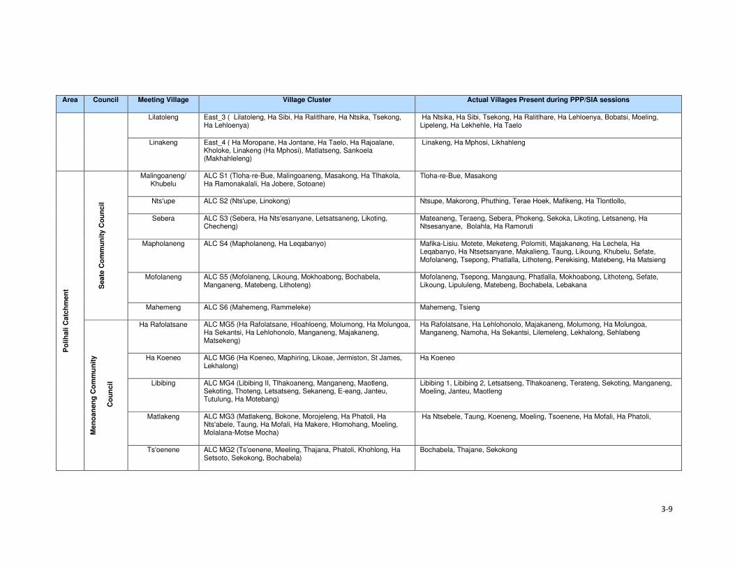
3-9
Area Council Meeting Village Village Cluster Actual Villages Present during PPP/SIA sessions
Lilatoleng East_3 ( Lilatoleng, Ha Sibi, Ha Ralitlhare, Ha Ntsika, Tsekong, Ha Lehloenya)
Ha Ntsika, Ha Sibi, Tsekong, Ha Ralitlhare, Ha Lehloenya, Bobatsi, Moeling, Lipeleng, Ha Lekhehle, Ha Taelo
Linakeng East_4 ( Ha Moropane, Ha Jontane, Ha Taelo, Ha Rajoalane, Kholoke, Linakeng (Ha Mphosi), Matlatseng, Sankoela (Makhahleleng)
Linakeng, Ha Mphosi, Likhahleng
Po
lih
ali C
atc
hm
en
t Seate
Co
mm
un
ity C
ou
ncil
Malingoaneng/ Khubelu
ALC S1 (Tloha-re-Bue, Malingoaneng, Masakong, Ha Tlhakola, Ha Ramonakalali, Ha Jobere, Sotoane)
Tloha-re-Bue, Masakong
Nts'upe ALC S2 (Nts'upe, Linokong) Ntsupe, Makorong, Phuthing, Terae Hoek, Mafikeng, Ha Tlontlollo,
Sebera ALC S3 (Sebera, Ha Nts'esanyane, Letsatsaneng, Likoting, Checheng)
Mateaneng, Teraeng, Sebera, Phokeng, Sekoka, Likoting, Letsaneng, Ha Ntsesanyane, Bolahla, Ha Ramoruti
Mapholaneng ALC S4 (Mapholaneng, Ha Leqabanyo) Mafika-Lisiu. Motete, Meketeng, Polomiti, Majakaneng, Ha Lechela, Ha Leqabanyo, Ha Ntsetsanyane, Makalieng, Taung, Likoung, Khubelu, Sefate, Mofolaneng, Tsepong, Phatlalla, Lithoteng, Perekising, Matebeng, Ha Matsieng
Mofolaneng ALC S5 (Mofolaneng, Likoung, Mokhoabong, Bochabela, Manganeng, Matebeng, Lithoteng)
Mofolaneng, Tsepong, Mangaung, Phatlalla, Mokhoabong, Lithoteng, Sefate, Likoung, Lipululeng, Matebeng, Bochabela, Lebakana
Mahemeng ALC S6 (Mahemeng, Rammeleke) Mahemeng, Tsieng
Men
oan
en
g C
om
mu
nit
y
Co
un
cil
Ha Rafolatsane ALC MG5 (Ha Rafolatsane, Hloahloeng, Molumong, Ha Molungoa, Ha Sekantsi, Ha Lehlohonolo, Manganeng, Majakaneng, Matsekeng)
Ha Rafolatsane, Ha Lehlohonolo, Majakaneng, Molumong, Ha Molungoa, Manganeng, Namoha, Ha Sekantsi, Lilemeleng, Lekhalong, Sehlabeng
Ha Koeneo ALC MG6 (Ha Koeneo, Maphiring, Likoae, Jermiston, St James, Lekhalong)
Ha Koeneo
Libibing ALC MG4 (Libibing II, Tlhakoaneng, Manganeng, Maotleng, Sekoting, Thoteng, Letsatseng, Sekaneng, E-eang, Janteu, Tutulung, Ha Motebang)
Libibing 1, Libibing 2, Letsatseng, Tlhakoaneng, Terateng, Sekoting, Manganeng, Moeling, Janteu, Maotleng
Matlakeng ALC MG3 (Matlakeng, Bokone, Morojeleng, Ha Phatoli, Ha Nts'abele, Taung, Ha Mofali, Ha Makere, Hlomohang, Moeling, Molalana-Motse Mocha)
Ha Ntsebele, Taung, Koeneng, Moeling, Tsoenene, Ha Mofali, Ha Phatoli,
Ts'oenene ALC MG2 (Ts'oenene, Meeling, Thajana, Phatoli, Khohlong, Ha Setsoto, Sekokong, Bochabela)
Bochabela, Thajane, Sekokong

3-10
Area Council Meeting Village Village Cluster Actual Villages Present during PPP/SIA sessions
Malubalube ALC MG1 (Malubalube, Likhameng/Moeaneng, Ntjolo, Phate, Masofeng)
Likhameng, Masoefeng, Moeaneng, Ha Phate, Malubalube
Mo
kh
otl
on
g
Urb
an
Co
un
cil
Salang ALC MU1 (Salang, Checha, Teropong) Checha, Ntlholohetsane
Bafali ALC MU2 (Bafali, Ha Poso, Ntsiking Bafali) Bafali, Bafatsana,Ntsining, Masaleng, Mabitseng, Ha Seeta, Bafali- Nkotoane,
Ntlholohetsane ALC MU3 (Ntlholohetsane1, Ntlholohetsane2) Ntlholohetsane, Senkoase
Thabang ALC MU4 (Thabang) Thabang, Mangaung, Liraholeng
Ha Mojakisane ALC MU5 (Ha Mojakisane) Mojakisane, Sekeketeng
Mp
ho
ko
joan
e C
om
mu
nit
y C
ou
ncil
Meta/Mabuleng ALC MP1 (Ha Maleka, Thoteng, Ha 'Meta, Kheseng, Ha Masetulo) Mabekong, Paballong, Khesing, Ha Meta, Litsoeneng, Moeaneng, Thoteng, Mokhalong, Pontseng, Kheseng, Koakoatsi, Lietsela, Sebothoane, Thoteng Ha Lesoeja, Masholoko, Moreneng, Sekoting Ha Tipi
Tlokoeng ALC MP2a (Tlokoeng, Liphokong, Botsola, Ha Mpesi, Makalong, Tlokoeng, Matebeleng)
Tlokoeng, Botsola, Maitisi, Mabelete, Mabeleteng, Ha Mpesi
Lilimala ALC MP2b (Lilimala, Tsekong, Majakaneng, Ha Konki, Lits'otsong) Lilimala, Makalong, Ha Konki, Tsilantso Ha Konki, Kanana, Litsotsong
Ha Lebopo (Mahesheleng)
ALC MP8 (Lebopo, Masuoaneng) Ha Lebopo, Ha Mathibeli, Ha Ramoruti, Mabothong, Koatanyane, Ha Koatake, Ha Ramohale, Sekokong
Ha Makhabane ALC MP6 (Ha Makhabane) Ha Makhabane
Makhomalong ALC MP3 (Makhomalong, Majakaneng, Moeaneng, Ha Mohlabakobo, Matsoapong, Phohla)
Matsoapong, Phohla, Makhomalong, Makaoteng
Sekokong ALC MP4 (Sekokong, Ha Moruti, Taung, Ha Koatake, Mobothong, Kanana, Makhoabeng, Ha Ramohale, Ha Mathibeli)
Ha Ramoruti, Mabothong, Ha Ramohale, Sekokong, Ha Lebopo, Ha Koatake, Taung, Ha Mathibeli, Kanana, Thotanyane
Ha Letjama ALC MP5 (Ha Letjama, Maitisi, Letlapeng, Ha Ts'ese, Mabuleng, Khohlong)
Khohlong, Letjama, Tshehle
Motsitseng ALC MP7 (Motsitseng, Sekoka, Lumang, Mpharane) Motsitseng, Sekoka

Section 3 • Approach and Methods
3-11
3.3.4 Impact Assessment
Impacts were assessed in accordance with the standard impact assessment methodology provided
by ERM and the ratings provided in Table 3.4. Significance ratings are assigned for impacts before
mitigation is applied (‘pre-mitigation) and after mitigation has been applied (‘residual’)5.
A more detailed description of the methodology is provided in the Environmental and Social Impact
Statement (ESIS).
Table 3.4 Impact Significance Rating Table
Evaluation of Significance Sensitivity/Vulnerability/Importance of Resource/Receptor
Low Medium High / Very High
Magnitude of
Impact
Negligible Negligible Negligible Negligible
Small Negligible Minor Moderate
Medium Minor Moderate Major
Large Moderate Major Critical
Positive Impacts
Positive Minor Moderate Major
3.3.4.1 Magnitude
Magnitude essentially describes the intensity of the change that is predicted to occur in the
resource/receptor as a result of the impact. A magnitude rating tends to reflect a combination of the
size of an area that may be affected, the duration over which the aspect may be altered, and the size,
degree or scale of that change. In essence, magnitude is a descriptor for the degree of change that
is predicted to occur in the resource or receptor.
For positive impacts (which are mostly socio-economic impacts) magnitude is generally categorised
as ‘Positive’ unless sufficient information is available to support a more robust characterisation and
to assign the degree of magnitude as Small, Medium or Large. For instance, if the number of jobs to
be assigned to local community members is confirmed or if the size or value of the contribution to the
national, regional or district economy is known then a magnitude rating can be assigned. If not, then
the significance rating is assigned based on the sensitivity of the feature impacted by a specific activity
or change.
The term ‘magnitude’ therefore encompasses all the characteristics of the predicted impact including:
• Extent;
• Duration;
• Scale;
• Frequency; and
• Likelihood (only used for unplanned events).
The impact characteristic terminology to be used during the impact assessment is summarised in
Table 3.5.
Table 3.5 Impact Characteristic Terminology
Characteristic Definition Designations
Type A descriptor indicating the relationship of the
impact to the Project (in terms of cause and
effect).
• Direct
• Indirect
• Induced
5 Residual impact ratings are often referred to as post-mitigation ratings elsewhere but are considered the same in this report.

Section 3 • Approach and Methods
3-12
Characteristic Definition Designations
Extent The “reach” of the impact (e.g. confined to a
small area around the Project Footprint,
projected for several kilometres, etc.).
• Local
• Regional
• International
Duration The time period over which a resource /
receptor is affected.
• Temporary
• Short-term
• Long-term
• Permanent
Scale The size of the impact (e.g. the size of the
area damaged or impacted; the fraction of a
resource that is lost or affected, etc.)
[no fixed designations; generally intended
to be a numerical value, where impacts
can be quantified e.g. % of habitat lost; or
where a numerical threshold may be
exceeded (e.g. air or noise standards]
Frequency A measure of the constancy or periodicity of
the impact.
[no fixed designations; generally intended
to be a numerical value where known (e.g.
blasting)]
The evaluation of pre-mitigation impact significance takes into account control measures that are
already part of or embedded within the Project design. This avoids the situation where an impact is
assigned a magnitude based on a hypothetical version of the Project that considers none of the
embedded controls that are defined as part of the project description. Examples of embedded controls
could include acoustic reduction measures around noisy equipment or servitude and buffer
requirements the development is obliged to implement and is part of the layout. Additional mitigation
measures aimed at further reducing the significance of impacts are proposed where necessary or
appropriate and are assessed as part of the ‘residual’ impact significance rating.
In the case of type, the designations are defined universally (i.e. the same definitions apply to all
resources/receptors and associated impacts). For these universally-defined designations, the
definitions are provided in Table 3.6.
Table 3.6 Designation Definitions
Designation Definition
Type
Direct Impacts that result from a direct interaction between the Project and a resource/receptor
(e.g. between occupation of a plot of land and the habitats which are affected).
Indirect Impacts that follow on from the direct interactions between the Project and its
environment as a result of subsequent interactions within the environment (e.g. viability
of a species population resulting from loss of part of a habitat as a result of the Project
occupying a plot of land).
Induced Impacts that result from other activities (which are not part of the Project) that happen as
a consequence of the Project (e.g. influx of camp followers resulting from the importation
of a large Project workforce).
Extent
Local Impacts that affect an area in proximity to the development area within an area defined
on a resource/receptor-specific basis.
Regional Impacts occurring at a regional scale as determined by administrative boundaries or
which affect regionally important resources or ecosystems.
International Impacts that extend across international boundaries or affect resources such as
features, resources or areas protected by international conventions.
Duration
Temporary Impacts are predicted to be of short duration (in the order of days) and/or
intermittent/occasional.
Short-term Impacts that are predicted to last only for the duration of the construction period.
Long-term Impacts that will continue for the life of the Project, but will cease when the Project stops
operating.

Section 3 • Approach and Methods
3-13
Designation Definition
Permanent Impacts that cause a permanent change in the affected receptor or resource (e.g.
removal or destruction of ecological habitat) that endures substantially beyond the
Project life time.
3.3.4.2 Sensitivity
Characterisation of sensitivity for social and cultural heritage receptors is based on the value of that
social and cultural heritage receptor/s and its vulnerability to the impact, taking into account the
receptor’s resilience, including ability to adapt to change or use alternatives where available.

4-1
Section 4 Baseline Environment
4.1 Demographic Profile This section describes the demographic characteristics of the country and the Project Area. These
include population size and distribution, ethnicity and language and migration patterns.
4.1.1 Population Size and Distribution
Lesotho has a population of over two million people and had a low population growth rate of one
percent per annum (between 2015 and 2016)6. In 2017, Lesotho’s population is projected to increase
by 26 102 people and reach 2 199 492 people by early 2018. According to the Lesotho Demographic
and Health Survey (LHDS) (2014) (Ministry of Health (Lesotho) and ICF International, 2016), there
are more females than males at 53% and 47%, respectively. The population of Lesotho is considered
to be young with 39% of the population aged below 15 years, while the proportion of people aged 65
and older is eight percent. The average household size was 3.3 persons. An estimated low of 25% of
the population resides in the urban areas and 75% reside in rural areas. This is indicative of the low
urbanisation rate of the country of four percent per annum.
According to the Socio-Economic Baseline Study (CES, 2015b), the population of the Project Area
was estimated to be 46 371 people between 2013 and 2014, with an average of 5.2 persons per
household. More recent population figures could not be obtained from the local authorities as a
majority indicated that they did not have updated figures. The population in the Project Area reflects
similar characteristics to the national population figures as described above (Figure 4.1).
Figure 4.1 Gender and Age Distribution in the Project Area
Source: Socio-Economic Baseline Study (CES, 2015b)
4.1.2 Ethnicity and Language
Lesotho is a homogenous nation regarding the ethnic composition of the population and culture.
Approximately 99% of the country’s population are Basotho who, in turn, belong to specific clans.
Basotho clans are mostly named after animals which were selected based on the animals’ character
6www.worldmeters.info/world-population/lesotho-population/

Section 4 • Baseline Environment
4-2
(Box 4.1). Some Zulu and Xhosa people from South Africa are found in different parts of the country
due to population migration. Chinese people are also found throughout the country.
Box 4.1 Basotho Clans
Bakoena – Koena (crocodile) Bafokeng –'Mutla (hare) Batloung – Tlou (elephant) Bats'oeneng – Ts'oene (baboon) Bakubung – Kubu (hippopotamus) Baphuthinq – Phuthi (duiker) Bahlaping – Tlhapi (fish) Bataung- Tau (Lion) Basia- Katse (cat) Bahlakoana – Koena (crocodile) Batlokoa – Katse (cat) Bathepu – Noha (snake) Matebele – named after their chiefs Bakhala – no English term
The official languages are Sesotho, which is spoken by the majority of the population, and English
(generally accepted as the language of business). Other commonly spoken languages are isiZulu,
followed by Phuthi, isiXhosa and Mandarin. A similar ethnic and language composition was evident
in the Project Area. Some Zulu people, who the social team met in the area, indicated that they were
either descendants of Zulus who migrated to Lesotho during tribal wars in South Africa or they
relocated to the area out of choice.
4.1.3 Religion
The majority of the Basotho population (90%) are Christians. The main denominations include
Catholic, Lesotho Evangelical, Anglican and other Christian denominations. Muslims, Hindus,
Buddhists and Baha'i comprise the remaining 10%. In the Mokhotlong district, Christianity is the
dominant religion, followed by traditional and cultural beliefs. Many church services include chanting,
drumming and cultural costumes.
Similarly, in the Project Area, Christianity is the most widely practised religion along with traditional
beliefs (ancestral spirits). The main denominations found are the Apostolic followed by Roman
Catholic, Lesotho Evangelical and Anglican. Similarly, the traditional and cultural beliefs are also
observed in the Project Area. Traditional healers and Apostolic Churches use the water pools in the
Senqu River to perform their religious obligations.
4.1.4 Residential Status of the Population
According to the Lesotho Demographic Health Survey (LDHS) 2014 (Ministry of Health (Lesotho) and
ICF International, 2016), in Lesotho, many people reside away from their home communities and
apart from their families for extended periods to pursue work or educational opportunities. The
majority of the population in the country lives within the household (77% males and 82% females);
followed by those who are elsewhere in the country and South Africa (9% men and 5% women) as
indicated in Table 4.1. More females than males are based on the household owing to the African
traditions and beliefs that a woman’s place is at home.

4-3
Table 4.1 Residential Status by Age, Gender, Ecological zone and District in Lesotho
MALE FEMALE
Background characteristics
In the household
Elsewhere in Lesotho
In RSA
In Other Country
Total Number In the household
Elsewhere in Lesotho
In RSA
In Other Country
Total Number
Age
0-9 89.9 8.8 1.2 0.0 100.0 4,360 90.6 8.3 1.0 0.1 100.0 4,494
10-19 83.7 14.7 1.6 0.0 100.0 4,571 81.0 17.9 1.0 0.1 100.0 4,492
20-29 66.6 20.4 12.9 0.1 100.0 3,633 69.8 23.2 6.9 0.1 100.0 3,519
30-39 63.1 17.2 19.7 0.0 100.0 2,466 72.7 14.7 12.5 0.1 100.0 2,403
40-49 62.3 14.2 23.3 0.2 100.0 1,541 72.6 11.9 14.5 0.0 100.0 1,518
50-59 67.2 9.8 23.0 0.0 100.0 1,100 87.1 6.2 6.7 0.0 100.0 1,561
60+ 90.6 5.1 4.3 0.0 100.0 1,488 93.4 5.1 1.4 0.0 100.0 2,242
Residence
Urban 81.0 11.8 7.1 0.1 100.0 4,768 85.1 11.3 3.4 0.2 100.0 5,526
Rural 75.8 14.3 9.9 0.0 100.0 14,400 80.1 14.4 5.4 0.0 100.0 14,703 Ecological Zone
Lowlands 78.0 12.3 9.0 0.0 100.0 10,390 82.8 12.2 4.9 0.1 100.0 11,390
Foothills 74.1 15.5 10.0 0.0 100.0 2,350 78.5 10.4 5.1 0.0 100.0 2,342
Mountains 78.2 15.4 6.3 0.0 100.0 4,000 82.2 14.3 3.5 0.0 100.0 4,568
Senqu River Valley
09.2 15.1 15.0 0.1 100.0 1,817 75.9 10.1 8.0 0.1 100.0 1,923
District
Butha-Buthe 79.0 11.4 9.6 0.0 100.0 1,211 84.9 9.5 5.5 0.0 100.0 1,198
Leribe 74.2 14.4 11.4 0.0 100.0 2,977 78.7 15.5 5.8 0.0 100.0 3,246
Berea 79.2 13.5 7.3 0.0 100.0 2,354 81.1 13.9 5.0 0.1 100.0 2,431
Maseru 82.2 11.7 6.0 0.1 100.0 4,290 85.7 11.0 3.0 0,2 100.0 4,742
Mafeteng 77.2 11.9 10.9 0.0 100.0 1,734 82.6 11.8 5.6 0.0 100.0 1,780 Mohale's Hoek 88.8 18.9 14.3 0.0 100.0 2,011 74.7 18.6 6.7 0.0 100.0 2,097
Quthing 88.9 14.2 16.8 0.1 100.0 1,170 75.3 14.4 10.2 0.1 100.0 1,287
Qacha'snek 77.1 12.8 10.0 0.0 100.0 658 85.4 9.6 5.0 0.0 100.0 680 Mokhotlong 79.6 14.3 6.0 0.0 100.0 1,230 81.6 14.9 3.5 0.0 100.0 1,203
Thaba-Tseka 78.7 17.3 3.9 0.0 100.0 1,533 83.4 15.0 1.6 0.0 100.0 1,567 Source: Lesotho Demographic Survey, 2011 (Bureau of Statistics (Lesotho), 2013)

Section 4 • Baseline Environment
4-4
The Mokhotlong district and Project Area population followed the national trends regarding residential
status, including people living in South Africa (six percent males and nearly four percent females).
Participants in focus group discussions indicated that some female youth often went to South Africa
to seek employment and return home when the job or contract has been finished/ terminated. These
youths highlighted the shortage of job opportunities in the District and Project Area as the motivation
for them seeking employment outside of the country.
4.1.5 Migration
In Lesotho, the majority of migrants were young men working in the South African mines; however,
since the 1990s the patterns of migration have changed substantially due to the general decline in
mine employment in South Africa. The decline in mine employment in South Africa for Basotho from
Lesotho has given rise to new forms of migration and an increase in female migration. The number
of skilled migrants has also been on the increase. Younger and single/separated women have
increasingly been employed in domestic work and on commercial farms in South Africa.
The common practice in the country is for people to move from rural areas to urban towns to look for
employment, especially in the textile industry. Immigrants are mostly of Asian origin in the garment
and textile industry. According to the 2011 Lesotho Demographic Survey (Bureau of Statistics
(Lesotho), 2013), three percent of the population enumerated in Mokhotlong were lifetime migrants
from other districts, and 11% were out-migrants of the same district. This shows that there are very
few in-migrants into the Mokhotlong District. There is very little in-migration to the Project Area. The
common practice is for people to relocate to place within the Project Area either due to the desire of
being closer to family members or closer to services such as schools and health facilities. Out-
migration to more distant locations was common in the Project Area with people moving either to the
lowlands or South Africa in search of employment opportunities.
4.2 Cultural Practices This section describes the cultural practices in Lesotho and the Project Area.
4.2.1 Cultural Practices
Basotho culture is centred around village life, with the majority of traditions and festivals based on the
seasons. The most common cultural activities are related to marriage, birth, and death, coming of
age (initiations), and giving thanks to the ancestors. These are described briefly in Box 4.2. More
specific information is provided in the Cultural Heritage (including Archaeology) Report (MM&A and
Pinto, 2017, P2W-6014-DFR-0003).
Both tangible and intangible heritage resources exist throughout Lesotho where people are still
involved in pottery, cowhide tanning coupled with bead work to make unique clothing for specific
ceremonies such as initiation graduations. The production of artefacts also includes musical
instruments, hats and baskets; however, the skill appears to be more prevalent amongst the elderly
than the youth.
Three hundred and fifty-five (355) heritage sites have been documented in the whole of Lesotho with
42 such sites having been recorded within the District of Mokhotlong alone. Twenty-four of the 42 are
directly relevant to the Polihali Catchment Area, 10 of these refer to rock shelters with rock art, lithics
or other material remains, many of which will be impacted by inundation. The historic structures/sites
of note were located at Likomeng, Makhiseng, Malingoaneng, Mahemeng and Tlokoeng within the
area of the Batlokoa, with Thabang, Motsitseng Ha Mankata, Ha Lebopo, Ha Rafolatsane, and
Molumong on the Khalahali side (for additional information refer to the Cultural Heritage (Including
Archaeology) Report, P2W-6014-DFR-0003).

Section 4 • Baseline Environment
4-5
Box 4.2 Significant Basotho Traditions
4.2.2 Social Networks
The extended family system is one of the most important social systems in Lesotho as elsewhere in
Africa, and more specifically in the rural areas than urban areas. The system is based on the concepts
of collectivism and mutual assistance, where extended families typically share property such as
livestock and activities such as farming, the building of houses, rituals, feasts and arbitration of
disputes among family members. In the more urban areas, the system is shifting as a result of
changing world views (increased exposure), education and mechanisation of agricultural activities.
However, in the Project Area, extended networks are still critical as people are heavily reliant on each
other for support.
Besides, the extended family systems, the most prominent social networks in rural Lesotho and the
Project Area are burial schemes, stokvels, cooperatives (matsema), Church associations, village
police and Village Health Workers/ Community Health Workers (VHW or CHWs). These are described
in detail below.
Burials schemes (mpate sheleng) are usually informal in that they are formed by people of low
income, whereby members pay as little as ten cents per month as a contribution towards having a
fund to assist each other in cases of the passing of family members or relatives or dependents. These
schemes remain prevalent in rural communities across Lesotho including the Project Area. Burial
schemes vary in what the money may cover; including the purchase of a coffin, groceries, a cow;
while others give out money upon the death of a member or covered relative and dependent (Irving,
2005).
Stokvels (mochaellano) are essentially a mechanism for enabling savings in the short-term; they vary
in structure across the country and may include:
• Rotational monthly sittings at homes of the individual members. The host prepares food and
alcohol which he/ or she sells to the other members to raise funds for him or herself.
• Members rotationally give a set amount of cash to a member of the group each month until each
member has been the recipient.
Marriage. This involves the payment of a dowry in the form of cattle (bohali). After the payment of bohali, a
sheep is slaughtered to welcome the bride-to-be into her new home and is given her marital name.
Births. Upon the birth of a child, certain cultural ceremonies and rites are performed including the baby
naming and welcoming of the child into the family. Some of these involve the slaughtering of a sheep;
however, due to the reduction in livestock herds, this tradition of slaughtering of sheep for babies is slowly
phasing out.
Deaths. When death occurs in a family, a cow is often slaughtered to accompany the deceased. The family
of the deceased usually wear mourning gowns for a month after which the dress is removed, and a
cleansing ceremony is performed by slaughtering of a sheep. In a case where the husband has passed, the
wife wears a mourning gown for three months to a year depending on circumstances, e.g. for a working
woman, the period is usually shorter. This is because there are a lot of restrictions associated with wearing a
mourning gown such as not being allowed to be away from home at sunset.
Initiation. The lebollo is a ceremony that is held when boys or girls attend their initiation. The initiates leave
home and stay at an initiation school for three to six months. After the initiation, feasts are held to celebrate
their return to their communities.
Giving thanks to the ancestors or Mokete oa Balimo. This is a ceremony performed to give thanks or
appease the ancestors by slaughtering of a cow whose hide is symbolically used as a blanket for the
ancestors who have visited the person in their dreams claiming to be cold. During this time people also ask
the ancestors for blessings.

Section 4 • Baseline Environment
4-6
• Members contribute an agreed amount of money per month towards purchasing of groceries to
be divided amongst the members at an agreed time, e.g. June and/or December.
• Members contribute an agreed amount and lend it out to each other, and non-members; the cash
is paid back with interest, the money (capital plus interest) is then divided equally amongst the
members at the end of the year (December).
The stokvels mentioned above all exist in the Project Area. The burial society and some stokvel
membership consist of both men and women, while some stokvels consist of only men or only women.
Matsema is a system where households work collectively during intense agricultural periods such as
ploughing and harvesting to provide support to each other during the year.
Church groups are formed along religious lines with the aim of promoting relationships within the
church community. These groups serve as religious and social groups and play different roles within
the church. Among these groups are cell groups, Bible studies, Sunday school classes, youth, men
and women groups.
Local community members form village police groups (mahokela) with the aim of assisting police to
combat crime in their communities. In the Project Area, these groups mostly exist to fight cases of
livestock theft which is said to be widespread across the area.
Village Health Workers or Community Health Workers (VHW or CHWs) originated in response to the
inadequate number of health facilities in the rural areas of Lesotho. These are trained volunteers; of
whom some are paid while others are not paid. Their duties include:
• Provision of medical assistance to sick people, elderly as well as orphaned and vulnerable
children (OVC) in their villages;
• Anthropometric growth monitoring of children under the age of five on a monthly basis;
• Provision of support to people on tuberculosis (TB) treatment (i.e. TB-DOTS support); and
• Provision of support to HIV infected people.
4.3 Land Tenure and Use This section describes the land tenure and land use in Lesotho, Mokhotlong District and the Project
Area.
4.3.1 Ownership of Land
Land in Lesotho is managed and administered by the Ministry of Local Government and Chieftainship
(MoLGC) under the Land Act (No 8), 2010. Lesotho follows the principle that land belongs to all
Basotho and it is held in trust by the King – with the King and Chiefs responsible for the distribution
and management of land. Historically, the land was administered through customary laws; which
entitled every married man with three agricultural fields and one piece of land to build his residence,
i.e. the traditional/customary land tenure system. The land allotted to an individual, could not be
bought, sold, transferred or exchanged.
In the 2000s, the government realised that communal ownership of land was becoming an obstacle
to the commercialisation of agriculture and food security; land reforms were introduced. This was
achieved through the enactment of the 2010 Land Act.
The Act provides for the following individuals as persons who may hold a title for any piece of land:
• The Government of Lesotho;
• All Lesotho citizens who are older than 18 years, except where the person is under 18 but married;
• Where the title is a result of a gift; and
• Where the title is a result of inheritance.

Section 4 • Baseline Environment
4-7
To acquire land one has to apply for it from the chief and local authority under whose jurisdiction the
land is located. Foreigner citizens cannot own land as individuals; however, foreign enterprises which
have at least 20% shareholding of Basotho can acquire rights in land for investment purposes.
Under the 2010 law, agricultural land that has not been cultivated for at least three consecutive years
is regarded as ‘abandoned’ land. Therefore, the land is taken by the Chief to be reallocated to another
person. Lease holding or the right to occupy such land can be terminated.
4.3.2 Types of Land Tenure
Lesotho’s land tenure system recognises three types of title namely; leasehold, Form C and license.
There are, however, also households that occupy the land without the appropriate title in place, i.e.
through the traditional/customary tenure system under which the land was allocated to citizens
through chiefs and headmen on behalf of the King.
Leasehold acts as a check on private subdivision and allocation of land. Under the leasehold system,
the leaseholder has the right to use and enjoy the property for the agreed period. A leaseholder may
lease out that very land under a sub-lease agreement. In practice the leasehold of land is inherited
by the family of the leaseholder; in effect, the land is never returned to the state unless it has become
apparent that it has been abandoned. In Lesotho there are various forms of leasehold for both rural
and urban areas; namely:
• Residential leases for a period of 90 years;
• Commercial and industrial leases for periods of 30 and 60 years;
• Agricultural leases for periods of 10–90 years; and
• Others, including religious, educational and charitable leases for periods of 90 years.
Leasehold agreements are registered at the office of the Land Administration Authority (LAA). Before
the LAA came into being, the registration of title to land was registered at the Deeds Registry. The
Deeds Registry Act, No. 12 of 1967, states that the registration of titles to land under the legal system
of Lesotho does not confer the right of ownership, but the right of title to occupy and utilise the land
and its resources. The Land Act entitles the leaseholder to transfer the title sub-lease, or use their
land as collateral for accessing credit from financial institutions; the title can also be passed on via
inheritance to a named family member.
• Owners of leases for a primary place of residence are exempt from paying ground rent; however,
those who have a lease on a second property are required to pay annual ground rent to the LAA.
Owners of leases for land for commercial, industrial or agricultural purposes are required to pay
annual ground rent to the LAA.
• Form C was abolished by the Land Act (No. 17) of 1979, however, to this date people in the rural
areas are still issued with the Form C as proof of land tenure; it refers to land that is allotted by
the Chief. All forms issued before the 1979 Land Act remained valid. Form Cs and title deeds
can be converted into leases.
• Licence is a land tenure system used for agricultural land within the urban areas. The tenure right
is called a licence, and the land right is neither transferable, subject to inheritance nor negotiable.
Licences are held under customary law.
According to the 2011 LDS (LBS, 2013), the most prominent form of land tenure in Lesotho was
allocation by chiefs (61%), followed by inheritance/gift (29%) and purchase from somebody (seven
percent). A similar scenario was true for the Mokhotlong District where 66% had land allocated by the
chiefs, followed by those who had inherited the land (32%). Only two percent of Mokhotlong land
owners had acquired land through purchasing it from somebody.
The most prominent form of land tenure in the Project Area is through inheritance (31%), followed by
traditional/customary tenure (29%) and title deed (25%). Thirty-eight percent of the people residing in

Section 4 • Baseline Environment
4-8
Mokhotlong town have title deeds because it is a more urban area compared to the residents in the
downstream and catchment areas (42% and 37%, respectively) (refer to Figure 4.2). The “traditional”
tenure is the most predominant in both the catchment and downstream areas. The ownership of
arable land is discussed in Section 4.3.1 as part of the livelihoods activities. Land allocation in the
Project Area follows the same principles as elsewhere in the country.
Figure 4.2 Land Tenure Types Held by the Heads of Households within the Project Area
Source: Socio-Economic Baseline Study (CES, 2015b)
4.3.3 Land Use Types
Land is a major source of livelihoods in Lesotho and Mokhotlong and the Project Area in particular;
with the majority of households engaging in crop farming and extensive animal farming. The Project
Area is situated in the mountain zone and is characterised by high ranging mountains. The total area
of the Project Catchment is roughly 37 510 ha. Rangelands make up the greatest proportion of the
area at 52% (19 365.85 ha), followed by croplands at 35% (13 176 ha). The high mountains make up
seven percent (2687.7ha), while settlements make up six percent (2280.45ha) of the area (Soils,
Land Use and Land Capability Specialist Report P2W-6014-DFR-0007)) (refer to Figure 4.3).
The dominant land use types in the Project Area are grazing (refer to Section 4.8.4), cultivation,
housing, and small commercial activities such as shops and markets that serve the rural population.
The economy of the Project Area is highly dependent on agricultural activities (refer to Section 4.4),
and extensive areas of shrub lands are used to graze livestock or to grow crops. However, most of
the arable land used is degraded partly due to the cultivation methods used (extensive extractive
farming systems) which have led to significant soil degradation (Soils, Land Use and Land Capability
Specialist Report, P2W-6014-DFR-0007)).
0%
10%
20%
30%
40%
50%
Inheritance Traditional Form C Rental Title Deed Other
Catchment Area Downstream Area Mokhotlong Town

4-9
Figure 4.3 Land Use in the Catchment Area

Section 4• Baseline Environment
4-10
4.4 Livelihood and Economic Activities This section describes the economy and livelihoods at a national, district and the Project Area.
4.4.1 National Overview
The economy of Lesotho is based on agriculture, livestock, manufacturing, mining, and depends
heavily on inflows of workers’ remittances from workers in the South Africa mines, farms and domestic
work and receipts from the Southern African Customs Union (SACU). An estimated 50% of the
population earns income through informal crop cultivation or animal husbandry with nearly two-thirds
of the country's income coming from the agricultural sector. Lesotho’s Gross Domestic Product (GDP)
growth was estimated at three percent in 2016.
According to the Human Development Report, 57% of the population lives below the national poverty
line and the national poverty head count ratio at purchasing power parity (PPP) of USD 1.25 a day
stands at close to 59%. Poverty is highest in the rural areas. Unemployment remains high at estimated
levels between 24% and 28%. The rate stands at 29%, and inequality is unacceptably high at a GINI
coefficient of 0.5.
Efforts to promote inclusive growth are constrained by the pressure of high HIV prevalence (23% of
the total population) and the instability of receipts from the Southern African Customs Union (SACU),
which finances 50% of the budget. The country’s GDP is primarily reliant on three sectors, namely
services (67%); industry (31%) and the agricultural sector (seven percent).
4.4.2 District and the Project Area Overview
Mokhotlong District has a largely agrarian economy consisting of livestock rearing and cropping.
Animal husbandry in the District is undertaken mainly for commercial purposes (that is the production
of wool and mohair). The sheep and goats are reared primarily for wool and mohair; for the sole
purpose to sell to national and international markets (mostly South Africa). Crop production is mainly
for household subsistence purposes, and surplus is often sold or bartered with neighbours.
These agricultural activities are severely impacted by the erratic weather conditions (high winds,
snowfalls, etc.) associated with the mountainous terrain. Furthermore, the poor weather conditions
mean that crop production is only able to sustain households for three to nine months of the/ year.
Thus, households tend to make-up the shortfall through livestock rearing to generate household
income in the lean months as well as remittances from household members that are employed (if at
all). In general, income is limited due the high unemployment rate in the country and specifically in
the Project Area.
Crop production is the principal source of livelihood strategy practised in the Project Area, and this is
followed by remittances: permanent and seasonal employment, the sale of livestock products and
social grants, as indicated in Figure 4.4. The harvesting and sale of natural resources (wild plants,
fruit, timber, etc.) featured high as third to fifth principal livelihoods activities. Other interesting
livelihood strategies mentioned included subsistence from gathering and sale of wild plants.
The main livelihoods strategies of the population identified above are discussed in detail in the
subsequent sections.

Section 4 • Baseline Environment
4-11
Figure 4.4 Livelihood Strategies of the Affected Population in Percentages
Source: Socio-Economic Baseline Study (CES, 2015b)
4.4.3 Crop Production
4.4.3.1 Access to Arable Land
Arable land is a scarce resource in the Project Area, due to the mountainous terrain and soil
degradation resulting from soil erosion. The majority of arable land is located in the low lying areas
near the villages and along the river banks where sediments from soil erosion have settled. Some
agricultural fields are found on the slopes of the mountains, but these areas are considered less
productive in comparison with fields located along the river banks. As noted earlier croplands within
the Project Area constitutes 35% of the total land area (13 176 ha) (Soils, Land Use and Land
Capability Specialist Report, P2W-6014-DFR-0007)).
At an individual household level, access to arable land is often through inheritance, rental,
sharecropping and in rare cases, a person is allocated a piece of land on the mountain slopes by the
Chief. Furthermore, access to arable land is also dependent on the household location within the
Project Area. For instance, an average of 82% of the households in the catchment and downstream
areas owned arable land. In turn, only a third of families in Mokhotlong town had access to arable
land (Figures 4.5 and 4.6). It is important to understand the distinction in ownership of arable land;
Mokhotlong town is a developed area, and its property is zoned for specific land uses.
Figure 4.5 Ownership of Arable Land
Source: Socio-Economic Baseline Study (CES, 2015b)
0
10
20
30
40
1st 2nd 3rd 4th 5th
Livelihoods Ranking
Pe
rce
nta
ge
Crop production (major and minor) Remittances: permanent employment
Remittances: seasonal employment Sale of iivestock products
Social grants Business ownership
Traditonal/ Spiritual healers Gathering and sale of natural resources
Livestock production In-kind
0%
20%
40%
60%
80%
100%
Catchment Area Downstream Area Mokhotlong Town
No Yes

Section 4 • Baseline Environment
4-12
Figure 4.6 Typical River Bank Agricultural Fields
Source: J. Mkhabela
Concerning land ownership by gender, the average ownership of arable land by females is an
estimated 35% which is lower than that of males at 66%; as indicated in Figure 4.7. Traditionally,
upon marriage, men were automatically allocated fields, whereas women own arable land through
inheritance. However, this trend has changed due to the shortage of arable land – sometimes males
get married and are not given any crop fields.
The majority of households within the Project Area own a single crop field (35%), followed by those
who own two crop fields at 32%. Ownership of three crop fields accounts for 19% of the population,
and those who own between four or more crop fields was reported to be limited to eight and one
percent, respectively; refer to Figure 4.8 for the indicative percentage distribution of household
ownership of crop fields. Ownership of single to two crop-fields may also be linked to the general
shortage of arable land.
Figure 4.7 Ownership of agricultural land by Gender
Source: Socio-Economic Baseline Study (CES, 2015b)
0%
10%
20%
30%
40%
50%
60%
70%
80%
Catchment Area Downstream Area Mokhotlong Town
Female Male
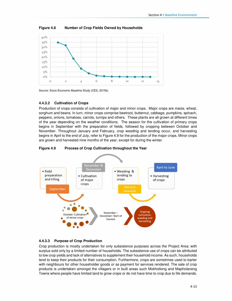
Section 4 • Baseline Environment
4-13
Figure 4.8 Number of Crop Fields Owned by Households
Source: Socio-Economic Baseline Study (CES, 2015b)
4.4.3.2 Cultivation of Crops
Production of crops consists of cultivation of major and minor crops. Major crops are maize, wheat,
sorghum and beans. In turn, minor crops comprise beetroot, butternut, cabbage, pumpkins, spinach,
peppers, onions, tomatoes, carrots, turnips and others. These plants are all grown at different times
of the year depending on the weather conditions. The season for the cultivation of primary crops
begins in September with the preparation of fields, followed by cropping between October and
November. Throughout January and February, crop weeding and tending occur, and harvesting
begins in April to the end of July, refer to Figure 4.9 for the production of the major crops. Minor crops
are grown and harvested nine months of the year, except for during the winter.
Figure 4.9 Process of Crop Cultivation throughout the Year
4.4.3.3 Purpose of Crop Production
Crop production is mostly undertaken for only subsistence purposes across the Project Area; with
surplus sold only by a limited number of households. The subsistence use of crops can be attributed
to low crop yields and lack of alternatives to supplement their household income. As such, households
tend to keep their products for their consumption. Furthermore, crops are sometimes used to barter
with neighbours for other householder goods or as payment for services rendered. The sale of crop
products is undertaken amongst the villagers or in built areas such Mokhotlong and Mapholaneng
Towns where people have limited land to grow crops or do not have time to crop due to life demands.
0%
5%
10%
15%
20%
25%
30%
35%
40%
0 2 4 6 8 10 12 14
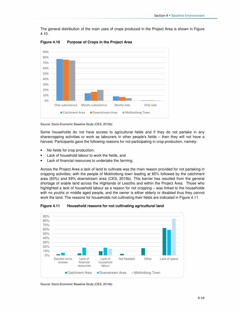
Section 4 • Baseline Environment
4-14
The general distribution of the main uses of crops produced in the Project Area is shown in Figure
4.10.
Figure 4.10 Purpose of Crops in the Project Area
Source: Socio-Economic Baseline Study (CES, 2015b)
Some households do not have access to agricultural fields and if they do not partake in any
sharecropping activities or work as labourers in other people's fields – then they will not have a
harvest. Participants gave the following reasons for not participating in crop production, namely:
• No fields for crop production;
• Lack of household labour to work the fields, and
• Lack of financial resources to undertake the farming.
Across the Project Area a lack of land to cultivate was the main reason provided for not partaking in
cropping activities; with the people of Mokhotlong town leading at 85% followed by the catchment
area (63%) and 59% downstream area (CES, 2015b). This barrier has resulted from the general
shortage of arable land across the Highlands of Lesotho and within the Project Area. Those who
highlighted a lack of household labour as a reason for not cropping – was linked to the households
with no youths or middle aged people, and the owner is either elderly or disabled thus they cannot
work the land. The reasons for households not cultivating their fields are indicated in Figure 4.11.
Figure 4.11 Household reasons for not cultivating agricultural land
Source: Socio-Economic Baseline Study (CES, 2015b)
0%
10%
20%
30%
40%
50%
60%
70%
80%
90%
Only subsistence Mostly subsistence Mostly Sale Only Sale
Catchment Area Downstream Area Mokhotlong Town
0%
10%
20%
30%
40%
50%
60%
70%
80%
90%
Elected not toanswer
Lack offinancial
resources
Lack ofhousehold
labour
Not Needed Other Lack of space
Catchment Area Downstream Area Mokhotlong Town

Section 4 • Baseline Environment
4-15
4.4.4 Livestock Production
The second important livelihood strategy of the population is livestock production; consisting of sheep,
goats and cattle, as well as pigs in limited numbers. Livestock is kept mostly for the sale of their
products rather than household consumption. During the 2013/14 Agriculture Year, there were 540
133 head of cattle and slightly over 2.1 million sheep and goats in Lesotho. On the other hand,
Mokhotlong had 40 932 head of cattle and close to 300 000 sheep and goats (Table 4.2).
Table 4.2 Number of livestock by type in Lesotho and Mokhotlong
Type of Livestock National Mokhotlong
Cattle 540,133 40,932
Sheep 1,346,596 198,849
Goats 824,698 94,277
Horses 55,926 9,103
Donkeys 103,859 13,870
Pigs 63,415 1,821
Chicken 453,083 28,824 Source: Lesotho Bureau of Statistics Statistical Report No. 8 of 2015 – Lesotho Livestock Statistics Report 2013/2014
On average, 61% of the households own sheep and goats because of their survival rate (cold and
snowy months of winter), and for the sale of wool and mohair. Figure 4.12 shows the ownership of
livestock across the Project Area by area. More households in Mokhotlong town own sheep than the
households in the catchment and downstream areas.
Figure 4.12 Livestock Owned in the Project Area
Source: Socio-Economic Baseline Study (CES, 2015b)
Livestock in the Project Area is kept by both men and women, but more prominently by men. Amongst
those who indicated not owning livestock, 69% were men and 66% female. The reasons for the
slightly higher number of males not owning livestock was not clarified in the SEBS (CES, 2015b);
however, this could be linked to poverty, or males engaged in formal employment and residing in
town with no space to rear livestock.
4.4.4.1 Ownership of Sheep
Sheep play a significant role in the households' survival, due to the income generated from the sale
of its products; mainly wool. Sheep are owned by both men and women, with men owning more than
women. On average women who own between one and five sheep accounted for eight percent of the
households and those that owned between six to 20 sheep at nine percent and only two percent owns
more than 50 sheep. Most of the men own between six and 20 sheep (18%), one to five sheep (12%)
and lastly 21 to 50 at nine percent, as indicated in Figure 4.13. The sale of sheep is low as they are
0%
10%
20%
30%
40%
50%
60%
70%
80%
Catchment Area Downstream Area Mokhotlong Town
Cattle Sheep Goats

Section 4 • Baseline Environment
4-16
a primary source of livelihoods for households. Over 61% households reported that they do not sell
any of their sheep. In turn, a combined 49% sell sheep in various quantities (Figure 4.13). Sheep that
are sold are often old and small. Therefore, the sale serves as a way of getting rid of old animals and
the money used to purchase new stock.
Figure 4.13 Ownership and Sale of Sheep
Source: Socio-Economic Baseline Study (CES, 2015b)
4.4.4.2 Ownership of Goats
Goats play a similar role to the household income as that of sheep, due to the revenue generated
from the sale of mohair. Goats are kept by both men and women; with men owning more as indicated
in Figure 4.14. In the same way, as with sheep, households typically do not sell their goats.
Figure 4.14 Ownership of Goats
�
Source: Socio-Economic Baseline Study (CES, 2015b)
4.4.4.3 Ownership of Cattle
Ownership of cattle is by both females and males in the Project Area but more prominent amongst
males. However, an average of 58% amongst both men and women households reported not owning
cattle. Cattle keeping is not widely common, and where it is owned, households own between one
and five (average 33%); with approximately 10% owning between six and 20 cattle. The primary uses
of cattle are working the fields, payment of dowry, funerals and sale when the household is strapped
for cash. One of the most commonly recurring responses regarding the sale of livestock, in general,
0%
20%
40%
60%
80%
100%
0 to 5 6 to 20 21 to 50 More than 50 None Owned
Female Male

Section 4 • Baseline Environment
4-17
was that livestock is mostly sold during the lean months to supplement the household income and
the household expenditure.
4.4.4.4 Sale of Livestock Products
As indicated above, the sale of livestock products forms a significant part of the household livelihoods
and income. The main products sold are skin hides, wool, mohair, milk and meat. The number of
households that sell various livestock is highlighted in Figure 4.15.
Figure 4.15 Sale of Livestock Products
Source: Socio-Economic Baseline Study (CES, 2015b)
4.4.4.5 Wool and Mohair Production and Value Chain
Wool sheep are very important in Lesotho, producing over 3 million kilograms of raw wool annually
for export. The sale of wool and mohair and live animals are the primary source of income in the
country. During the 2013/2014 Marketing Year, 1 425 408 sheep were shorn in the country, producing
3 860 768 kg of wool. During the same marketing year, 238 064 sheep were shorn in Mokhotlong,
producing 751 737 kg of wool. Mokhotlong produced the highest quantity of wool; constituting 19.5%
of the total wool for the year7.
The two officially recognised wool and mohair marketing outlets in Lesotho are private trading stations
authorised to deal in wool and mohair, and government shearing sheds placed at 1848 locations
across the country. Of these 11 are members of the Lesotho National Wool and Mohair Grower’s
Association (LNWMGA) which is the main existing herder apex organisation in the wool and mohair
sub-sector. The association is present in all districts with its growers associations at the district level
and Sheering Shed Associations (SSAs) at the lower level9. Normally farmers who use the
government shearing sheds are members of the Wool and Mohair Growers Associations (WMGAs)
and their marketing groups (MGs). Private trading stations are typically used by individuals not
affiliated with any group, though members of WMGAs and MGs also use the private stations for fast
payment. The WMGAs sell their wool and mohair through the South African Wool Board and the
South African Mohair Board and some of these are further exported to Europe and Asia.
In 2012 a project dedicated to assisting to develop the wool and mohair industry in the form of
marketing support, genetic improvement of communal flock through the introduction of quality rams,
training and mentorship was implemented, i.e. The Small Agricultural Development Project. The
project is expected to end in 2018.
7 Bureau of Statistics (Lesotho) Statistical Report No. 21 of 2015 – Livestock Products Report 2013/2014 8 There are 114 sheds which produce wool and mohair, plus another 70 which produce wool only. 9 Kingdom of Lesotho. Wool and Mohair Promotion Project (WAMPP), 2014.
3%
45%52%
No. of HH Selling Cattle Products No. of HH Selling Sheep Products
No. of HH Selling Goat Products

Section 4 • Baseline Environment
4-18
Wool and mohair are the most sold animal products at 52% and 44%, respectively. The low sales of
cattle are indicative of their uses which are mostly ploughing of agricultural fields, traditional
ceremonies and dowry payment. The Mokhotlong Wool and Mohair Growers Association is found in
Mokhotlong town but has representatives in various locations across the broader Project Area. The
association works with the locally based wool sheds which cater for the local farmers. Shearing of
livestock commences in mid-September and ends in mid-Decembers. After completing the shearing
process, the Mokhotlong Wool and Mohair Growers Association transport the wool to Mokhotlong
town before loading it in haul tracks for transportation to Port Elizabeth in South Africa for auction and
sale.
The wool and mohair value chain in Lesotho consists of three channels following producers' groups,
namely:
• Associations that link larger farmers with the government channels and infrastructure to the
auction,
• Individual farmers with medium-sized herds that link up with private traders using their
infrastructure to gain access to the auction, and
• Marginal groups (small farmers) usually resource poor and use informal market channels to get
their products to the auction10.
Figure 4.16 Supply Chain for the Sale of Wool and Mohair
Source: Mokhethi, N.I., etal (2015) (http:www.researchgate.net/figure/290330505_fig1_figure-1-Lesotho-wool-and-mohair-
value-chain).
4.4.5 Challenges to Agricultural Activities in the Project Area
The problems affecting farming activities in the Project Area are highlighted below.
Crop farming:
Poor crop yields. Low crop yields are a standard feature for households in the Project Area; this has
been attributed to the following:
10 http://www.researchgate.net/figure/290330505_fig1_figure-1-Lesotho-wool-and-mohair-value-chain

Section 4 • Baseline Environment
4-19
• Drought - even though the Project Area has multiple water resources, the land away from the
river banks is dry and with limited potential to install formal irrigation systems. Thus, many
households who own fields in areas that cannot be easily irrigated practise dry land cropping; and
manually water vegetable gardens.
• Poor weather conditions are another contributing factor to low yields. The Highlands are subject
to heavy/ flash floods and heavy snowfalls at different times of the year. According to the
respondents, the dry seasons have in recent years been reduced and the snowy season
extended; which in turn affect crop production and yields.
• As is common in rural Africa, the population of the Project Areas continues to use traditional
methods of preparation and cultivation of fields with limited or no mechanisation; which also
affects crop production and yields.
• The District Department of Agriculture has amongst its staff, Agricultural Extension Officers;
however, poor accessibility to some parts of the Project Area has resulted in Extension Officers
not being able to reach some part of the population to extend services.
• The soils in the Project Area are highly degraded due to soil erosion, and the mountainous terrain
characterised by rockiness, which has reduced the available land for cropping.
Livestock farming:
Overstocking. In the broader Project Area, overstocking is a major concern, and this is attributed to
livestock owners' unwillingness to reduce their livestock numbers, as well as inadequate monitoring
or control by the Department of Agriculture, which is enabling this trend. This has led to the livestock
herds overstretching the available pastures and resulted in significant land degradation and shortages
of food for livestock.
Cold weather. The erratic climatic conditions of the area also affect livestock, especially in winter
when it is snowing. The respondents indicated that most of the livestock deaths are reported at this
time of the year. None of the livestock farmers in the area has covered kraals where they keep
livestock, and since most cannot afford to purchase fodder to feed their livestock, the livestock
continues to graze outside, and that is when deaths occur.
Veterinary services. There is a lack of access to veterinary services for livestock owners in the area
due to the constraints related to accessibility issues, i.e. government extension services cannot reach
most parts of the Project Area.
Animal health. Livestock diseases are a major constraint to the development and improvement of
the livestock industry in the region. Vector-borne diseases and tick-borne diseases (especially
theileriosis and heartwater) severely limit livestock production. The livestock owners tend to rely on
medicinal plants to treat their sick livestock.
Poor breeding. The attributes and weaknesses of the indigenous animals, purebred exotics and
crossbreeds were reported as a constraint to livestock production. There is a low reproductive rate
due to high mortality rates of calves, which also hinders the raising of replacement stock, as well as
the lack of artificial insemination delivery services.
4.4.6 Employment and Unemployment
This section describes employment and unemployment conditions at a national level as well as in the
district and the Project Area.
4.4.6.1 National Employment and Unemployment
According to the 2011 Lesotho Demographic Survey, 28% of the population was employed in private
households, followed by those who are self-employed (20%, people working in RSA (18%), private
sector 16% and government at 10%. Overall, females were mostly employed in the private
households/homes i.e. domestic work (21%) than in any other sector. The Survey results further
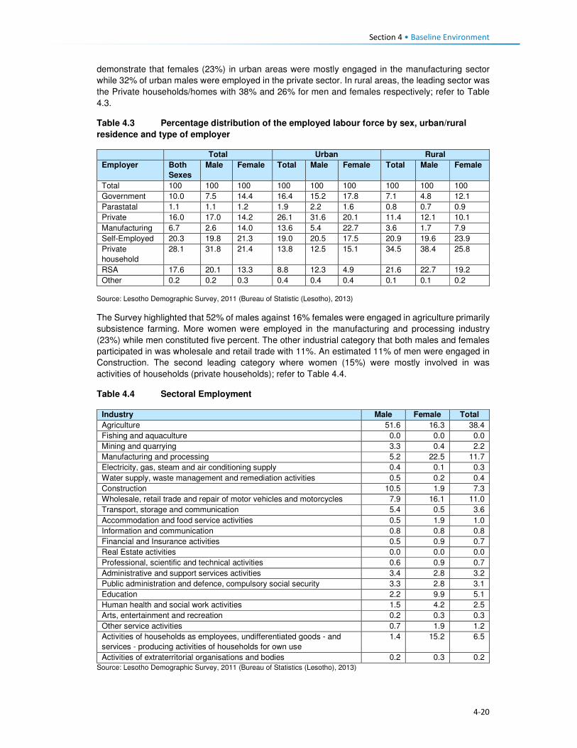
Section 4 • Baseline Environment
4-20
demonstrate that females (23%) in urban areas were mostly engaged in the manufacturing sector
while 32% of urban males were employed in the private sector. In rural areas, the leading sector was
the Private households/homes with 38% and 26% for men and females respectively; refer to Table
4.3.
Table 4.3 Percentage distribution of the employed labour force by sex, urban/rural
residence and type of employer
Total Urban Rural
Employer Both
Sexes
Male Female Total Male Female Total Male Female
Total 100 100 100 100 100 100 100 100 100
Government 10.0 7.5 14.4 16.4 15.2 17.8 7.1 4.8 12.1
Parastatal 1.1 1.1 1.2 1.9 2.2 1.6 0.8 0.7 0.9
Private 16.0 17.0 14.2 26.1 31.6 20.1 11.4 12.1 10.1
Manufacturing 6.7 2.6 14.0 13.6 5.4 22.7 3.6 1.7 7.9
Self-Employed 20.3 19.8 21.3 19.0 20.5 17.5 20.9 19.6 23.9
Private
household
28.1 31.8 21.4 13.8 12.5 15.1 34.5 38.4 25.8
RSA 17.6 20.1 13.3 8.8 12.3 4.9 21.6 22.7 19.2
Other 0.2 0.2 0.3 0.4 0.4 0.4 0.1 0.1 0.2
Source: Lesotho Demographic Survey, 2011 (Bureau of Statistic (Lesotho), 2013)
The Survey highlighted that 52% of males against 16% females were engaged in agriculture primarily
subsistence farming. More women were employed in the manufacturing and processing industry
(23%) while men constituted five percent. The other industrial category that both males and females
participated in was wholesale and retail trade with 11%. An estimated 11% of men were engaged in
Construction. The second leading category where women (15%) were mostly involved in was
activities of households (private households); refer to Table 4.4.
Table 4.4 Sectoral Employment
Industry Male Female Total
Agriculture 51.6 16.3 38.4
Fishing and aquaculture 0.0 0.0 0.0
Mining and quarrying 3.3 0.4 2.2
Manufacturing and processing 5.2 22.5 11.7
Electricity, gas, steam and air conditioning supply 0.4 0.1 0.3
Water supply, waste management and remediation activities 0.5 0.2 0.4
Construction 10.5 1.9 7.3
Wholesale, retail trade and repair of motor vehicles and motorcycles 7.9 16.1 11.0
Transport, storage and communication 5.4 0.5 3.6
Accommodation and food service activities 0.5 1.9 1.0
Information and communication 0.8 0.8 0.8
Financial and Insurance activities 0.5 0.9 0.7
Real Estate activities 0.0 0.0 0.0
Professional, scientific and technical activities 0.6 0.9 0.7
Administrative and support services activities 3.4 2.8 3.2
Public administration and defence, compulsory social security 3.3 2.8 3.1
Education 2.2 9.9 5.1
Human health and social work activities 1.5 4.2 2.5
Arts, entertainment and recreation 0.2 0.3 0.3
Other service activities 0.7 1.9 1.2
Activities of households as employees, undifferentiated goods - and
services - producing activities of households for own use
1.4 15.2 6.5
Activities of extraterritorial organisations and bodies 0.2 0.3 0.2
Source: Lesotho Demographic Survey, 2011 (Bureau of Statistics (Lesotho), 2013)

Section 4 • Baseline Environment
4-21
The proportion of the unemployed population was 30% and 23% in age-groups 20 to 24 and 25 to 29
years, respectively. In age-group 20 to 24 years the proportion of the unemployed population was
33% for females and 28% for males. In rural areas, the population aged 20 to 24 years constituting
28.1% of men and 31% of females were unemployed, as compared to 29% of males and 36% of
women in urban areas. The proportion of the unemployed population is high among the youth across
the country; refer to Table 4.5.
Table 4.5 Percentage Distribution of Unemployed Population by Age, Sex and
Urban/Rural Residence
Lesotho Urban Rural
Age Total Male Female Total Male Female Total Male Female
10-14 0.7 0.5 1.1 0.6 0.0 1.4 0.7 0.7 0.9
15-19 9.5 7.6 12.9 7.0 5.9 8.5 10.3 8.1 14.8
20-24 29.8 28.2 32.7 31.7 28.5 35.9 29.2 28.1 31.4
25-29 23.2 23.0 23.4 22.7 21.8 24.0 23.3 23.4 23.2
30-34 15.4 17.1 12.4 15.7 17.4 13.5 15.3 17.0 12.0
35-39 8.5 10.2 5.6 7.7 8.9 6.2 8.8 10.6 5.3
40-44 5.0 5.0 4.9 5.6 6.1 4.9 4.7 4.7 4.9
45-49 3.6 4.2 2.6 5.1 6.0 3.9 3.1 3.7 2.0
50-54 2.0 2.1 1.9 2.1 2.6 1.4 2.0 2.0 2.1
55-59 1.1 1.1 1.3 0.7 1.2 0.2 1.3 1.0 1.7
60-64 0.6 0.7 0.5 0.5 0.8 0.0 0.7 0.7 0.7
65+ 0.4 0.3 0.7 0.5 0.9 0.0 0.4 0.1 1.1
Source: Lesotho Demographic Survey, 2011 (Bureau of Statistics (Lesotho), 2013)
4.4.7 District and Project Area Employment and Unemployment
A large proportion of the workforce in the Project Area does not work in the formal economy.
Employment in the Project Area can be divided into three types, namely, full-time jobs, seasonal
employment and self-employment (characterised by business ownership and provision of services).
No clear employment rates for the District were attained; as such the employment status of the
population is used to describe the employment characteristics of the District population. The
employment status for men was indicated as self-employment (20%), while women were mostly
homemakers (45%). The students’ category of employment status, showed 32% and 23% of the
population being students for both female and male and this was attributed to the report’s inclusion
of people of ten years and older in the assessment of employment status. The top five employment
categories for both males and females are indicated in Table 4.6.
Table 4.6 Employment Status in Project Area
Employment Status Female (%) Male (%)
Self-employment 9 20
Homemaker 45 18
Student 32 23
Unpaid family work 3 14
Paid employment 9 17
Source: Socio-Economic Baseline Study (CES, 2015b)
4.4.7.1 Paid Employment
The result of the SEBS (CES, 2015b), indicated that 42% of the households surveyed had at least
one family member that engaged in paid employment. Of these family members, 79% were employed
in full time paid employment, 18% in part time work and three percent in seasonal employment related
to agricultural production. The respondents that indicated that they were employed, whether part-time

Section 4 • Baseline Environment
4-22
or fulltime, worked in the, e.g. self-employment, hospitality, manufacturing, mining, and public sectors,
within the District.
The types of work of the paid employment were led by those working as domestic workers in a private
household (22%), followed by those employed in the public sector (government services) (18%), as
well as manufacturing and other sectors (15% respectively), refer to Figure 4.17.
Figure 4.17 Types of Regular Employment in the Project Area
Source: Socio-Economic Baseline Study (CES, 2015b)
Of those engaged in paid employment, 59% indicated that they were employed within their village or settlement – meaning they are employed by a neighbour or a local business; followed by 18% who work in a neighbouring village, and those who work in South Africa (10%). The remaining work in other parts of the country, refer to Figure 4.18. Those who work in South Africa are employed in KwaZulu-Natal and Free State provinces within the manufacturing and agricultural sectors.
Figure 4.18 Location of Regular Employment in the Project Area
Source: Socio-Economic Baseline Study (CES, 2015b)
21%
18%
15%
15%
8%
8%
5%
4%4% 1% 1%
Domestic work
Public sector
Manufacturing
Other
Mining
Private sector
Service delivery
Retail
59%18%
2%
1%
4%3%
3% 10%
Village
Nearby Village
Mapholaneng
Mokhotlong
Mokhotlong District
Maseru
Lesotho
South Africa

Section 4 • Baseline Environment
4-23
4.4.7.2 Seasonal/temporary employment
According to the SEBS (CES, 2015b), those employed in seasonal and part-time jobs, are often
expected to work several times per week, or several times per month at 40% and 33% respectively,
as indicated in Figure 4.19. Methods of payment for seasonal/temporary work vary significantly and
may include payment in cash, in-kind or in livestock or harvest (such as sheep or vegetables).
Payment with livestock is common amongst the herd boys – who often receive 12 sheep per year or
one cow per year as payment.
Figure 4.19 Payment for Seasonal/temporary Employment in the Project Area
Source: Socio-Economic Baseline Study (CES, 2015b)
4.4.7.3 Self- employment
The SEBS (CES, 2015b), divided self-employment into two categories, namely businesses, and
activities involving specialist skills.
Businesses. The types of businesses found in the Project Area are unsophisticated and focused on
meeting the population’s day to day needs. These businesses include shebeens and taverns, small
cafés, child minding, horse hire, milling, telephone services, and others. Table 4.7 highlights the top
10 business services identified through the SEBS (CES, 2015b). Most of these businesses are
located in the village where the owner of the business resides.
Table 4.7 Types of Business in Project Area
Business Type Percentage
Beer brewing 34
Other 16
Café 9
Fruit & vegetable sellers 8
Property renters 7
Clothing sellers 5
Tailors 5
General dealers 3
Taxi owners 2
Cell phone charging and airtime sales 2
Source: Socio-Economic Baseline Study (CES, 2015b)
Specialist skills: Numerous people in the Project Area also derive their livelihoods through the
provision of specialised services; such as builders (61%), thatchers (13%), herbalists (10%),
16%
40%
33%
11%
Weekly
Several times/ week
Several times/ month
> once / month

Section 4 • Baseline Environment
4-24
Community Health Workers (eight percent), birth attendants (five percent), circumcision surgeons
(one percent), and others indicated in Figure 4.20.
Figure 4.20 Types of Specialised Services in the Project Area
Source: Socio-Economic Baseline Study (CES, 2015b)
There are no income specifications for specialised services provision as each person charges their
specialised rate based on the work to be completed.
4.4.7.4 Unemployment in the Project Area
Unemployment in the Project Area was an estimated 91% of the entire population in the SEBS (CES,
2015b). Similar, to the national statistics on employment and unemployment, the SEBS (CES, 2015b),
included children in its calculation of the levels of unemployment – thus skewing the results as children
ages 0 to 14 do not form part of the economically active groups. Furthermore, CES (2015b) indicated
that their findings on this issue were distorted and believe that the respondents did not fully
understand that subsistence agricultural activities also form part of employment especially if income
is derived from such an activity.
4.5 Household Income and Expenditure 4.5.1 Sources of Household Income
The nature of livelihood strategies, and particularly those activities contributing the most to household
income, does shift as one considers different income quartiles (Figure 4.21). According to LHDA
Contract 6000 - Final Income and Expenditure Report (CES, 2015a), and consistent with the results
of other studies carried out in the Project Area and taking into account its rural and isolated nature,
approximately half of the surveyed population can be classified as ‘poor’ by accepted national and
international standards. High levels of variability of income were found within villages, highlighting the
need for diverse resettlement recovery strategies, even at village level. Seasonal patterns of the
sources of cash that household’s access was noted; these patterns impact poorer and wealthier
households differently regarding stress and opportunity, and also resilience to shocks.
Food insecurity emerged as a key vulnerability of, particularly, the poorest households in this study.
The results show high levels of dependence on purchased food among the most impoverished, and
therefore a concomitant vulnerability to food price increases.
Social ties and networks, as indicated by evidence of gifts originating at multiple levels, from within
villages to the district level to South Africa, make a significant contribution to household income and
0
10
20
30
40
50
60
70
Builders Thatchers Herbalists
Community Health Workers Birth attendants Diviners
Faith healers Circumcision surgeons

Section 4 • Baseline Environment
4-25
food security. Donations of food and clothing are especially common in the poorer households, while
gifts of cash were more common in wealthier households.
Differences between the quartiles:
Quartile 1 denoted poor households that receive the majority of their income from non-cash sources,
including meals given to children at school, and donations of non-perishable food and clothes and
these are followed by non-regular income, social grants and regular income.
Quartile 2 denoted poor households that rely on social grants and non-cash income sources.
The households in Q 1 and Q 2 – depend heavily on one or two income sources (45%), with a limited
risk distribution.
Quartile 3 comprises of households that derive the majority of its income from regular income,
followed closely by non-regular income and non-cash income.
Quartile 4 households derive earnings from multiple sources, with 35% of the total income derived
from regular income sources.
The different types of income sources relied on by the people in each quartile are presented in Figure
4.21.
Figure 4.21 Household Income Sources per Quartile in the Project Area
Source: Baseline Income and Expenditure Report (CES, 2015a)
There are four significant income streams in the area namely, regular income, non-cash income, non-
regular income and non-agriculture based income.
Some households (24%) in the Project Area received income from grants. Of the 24% who received
the grants, the old age pension receivers were highest at 85%, averaging LSL 438.40 per month.
Other grants received were child grants, disability grants, pauper’s grants, and public grants.
4.5.1.1 Annual Income Trends
Income in the Project Area increases significantly between March-June, and again between August
and September and this may be attributed to the following:
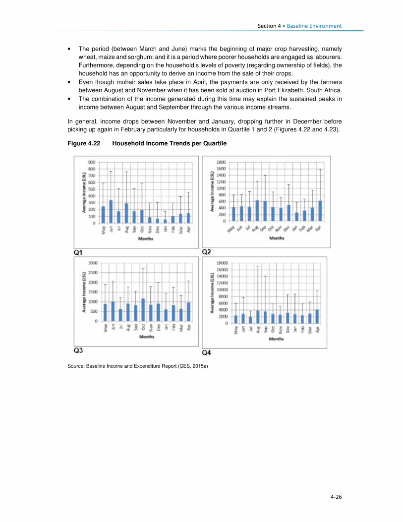
Section 4 • Baseline Environment
4-26
• The period (between March and June) marks the beginning of major crop harvesting, namely
wheat, maize and sorghum; and it is a period where poorer households are engaged as labourers.
Furthermore, depending on the household’s levels of poverty (regarding ownership of fields), the
household has an opportunity to derive an income from the sale of their crops.
• Even though mohair sales take place in April, the payments are only received by the farmers
between August and November when it has been sold at auction in Port Elizabeth, South Africa.
• The combination of the income generated during this time may explain the sustained peaks in
income between August and September through the various income streams.
In general, income drops between November and January, dropping further in December before
picking up again in February particularly for households in Quartile 1 and 2 (Figures 4.22 and 4.23).
Figure 4.22 Household Income Trends per Quartile
Source: Baseline Income and Expenditure Report (CES, 2015a)

Section 4 • Baseline Environment
4-27
Figure 4.23 Monthly Income Trend all Households Surveyed within the Project Area
Source: Baseline Income and Expenditure Report (CES, 2015a)
4.5.2 Household Expenditure
Household spending in the Project Area consists of animal purchase, cropping expenses, groceries,
non-food groceries, irregular expenses, livestock husbandry, other ongoing monthly expenses, and
non-business costs. Based on Figure 4.24, households within the 2nd and 3rd quartiles exhibited
similar expenditure trends, i.e. spending on food groceries, non-food groceries, cropping expenses,
etc. The wealthiest households (4th quartile) showed substantially different spending compared to
the people in other quartiles. They spent 21% of their income on groceries food, animal husbandry
(20%) and over 15% spent towards business expenses. In general, households in the Project Area
spend most of their income on purchasing food items, as indicated in Figure 4.24.
Figure 4.24 General Household Expenditure Trends
Source: Baseline Income and Expenditure Report (CES, 2015a)

Section 4 • Baseline Environment
4-28
Figure 4.25 shows that households also spend their income on agricultural activities, with the bulk of
the expenses being towards livestock husbandry. Cropping related expenses tend to peak between
August and November. This coincides with the intensive period of planting the main crops - maize
and sorghum. Spending towards the purchase of livestock increases in August which is around the
time when farmers receive their income from the sale of wool and mohair which in turn increases their
purchasing power for new livestock. Expenses associated with animal husbandry peak in December
month, refer to Figure 4.25. Agricultural costs decrease significantly between December and March
as these are low-income months.
Figure 4.25 Household Agricultural Expenditure
Source: Baseline Income and Expenditure Report (CES, 2015a)
Non-agriculture expenses. Irregular household spending peaks in December, likely due to the
holiday period and returning family members; except the lower income households (1st and 2nd
quartiles). This includes spending on transportation, money being sent to other family members and
expenditure on furniture and appliances. Non-agricultural business income also increased during this
time and subsequently household spending also increases. This spending on non-agricultural
expenses peaks again from July to August which coincides with the harvesting activities and its
associated non-regular employment.
4.6 Access and Utilisation of Natural Resources There are a wide variety of natural resources found in the Project Area, and most of these are
communally owned and utilised. These include edible plants, medicinal plants, grazing land, thatching
grass, river reeds, mosea (craft grass) water, rocks, fish, sand, trees/shrubs and small wild animals.
The natural resources mentioned above have been discussed in detail below. The FGD participants
also made mention of the above mentioned natural resources like the ones that are now found within
the catchment area and are going to be impacted by the Polihali Dam, some through inundation and
some through all the proposed construction works. The collection and utilisation of natural resources
are managed by the Chiefs and their respective Councils. For instance, when a person requires
natural resources for building purposes, he/ she requires the permission of the Chief to collect the
natural resource materials he/she needs. Findings from the FGD indicate that people also have to go
to the chief and the counsellor to request use of roofing grass, fuel wood, medicinal plants and other
natural grasses such as mosea and loli.

Section 4 • Baseline Environment
4-29
The areas where natural resources are collected vary, for instance, rocks which are mostly used in
the construction of housing walls and kraals are readily available everywhere across the Project Area,
and people do not have to walk far to collect and utilise. However, the majority of the natural resources
are found in the forested area, hill/mountainous locations, and river banks, as indicated in Figure 4.26.
Figure 4.26 Areas where Natural Resources are Collected
Source: Lesotho Demographic Survey, 2011 (Bureau of Statistics (Lesotho), 2013)
4.6.1 Grazing Land
Grazing land in the Project Area is communal in nature and access to grazing land is governed by
the Chiefs and community Councillors. The Chiefs and Councillors are supported by locally
established Grazing and Pasture Committees, as well as by the Grazing Associations who work in
close collaboration with Principal Chiefs who oversee the management of grazing land. The Grazing
Associations are responsible for the management of pastures, improvement of livestock and the
rehabilitation of wetlands, marshes and bogs. In turn, the Grazing and Pasture Committees assist
village Chiefs with the general management of pastures. There are two active Grazing Associations
in the Project Area, namely:
• Khalahali Association which operates in Senqu, Bafali, Moremoholo, Mokhotlong/ Sanqebetu,
Tlakeng/ Sehong-hong, Makhapung, and Linakaneng/Sani.
• Tlokoeng Association which works within Bohale ba Nkoe, Mofolaneng, and Liseleng.
Pastures are often divided into three types of cattle posts – summer (these cattle posts are furthest
from home villages), winter (closer to home), and pastures that are close to home but are small and
cannot support large herds of livestock (refer to Figure 4.27). The livestock kept close to the villages
are often used for milking or ploughing or are the very young livestock. The majority of livestock,
therefore, spend significant time in summer and winter cattle posts. The FGD respondents also
attested to the cattle post usage patterns. Both the Grazing Associations and Committees play a
major role in ensuring sustainable use of the grazing area. They also ensure that livestock owners
adhere to the seasonal variations and also adhere to the grazing maintenance schedules that are set
by the relevant Chiefs, for the movement of livestock from one zone to another.
0%
5%
10%
15%
20%
25%
30%
35%
40%
45%
Forest/Thicket
Grazing Area Hilly orMountainous
Area
River Area Other Areas
Catchment Area Downstream Area Mokhotlong Town

Section 4 • Baseline Environment
4-30
Figure 4.27 Example of Local Grazing Area
Source: J. Mkhabela
All livestock in the area must be registered, and the livestock owners must be able to provide evidence
of their legal ownership of the livestock. The Chiefs are tasked with keeping records of herds of
livestock each household in their area owns. New households to the area must also seek permission
to use communal grazing land from the Chief and Council. The new comers must present the Chief
with proof of ownership of livestock and size of the herd of livestock owned.
According to the respondents, even with all these measures in place, grazing land in the area was
degraded due to people’s failure to adhere to the rules. Furthermore, the erratic weather conditions
of the area, heavy storms and snowfalls, soil erosion and severe droughts have contributed to the
degradation of grazing land. Others indicated that conflicting views on the regulation of grazing land
between the Chiefs and Community Council often lead to people disobeying the rules for grazing
management (for additional information, refer to the Rangelands Report, (P2W-6014-DFR-0009)).
4.6.2 Soils
The fresh alluvial deposits at the bottom of the inundation area have soils that are the most extensively
cultivated. Because of the nature of the parent material and the near level terrain, the area is
generally considered to be the most fertile (P2W-6014-DFR-0007). However, because there are
continuously fresh deposits after heavy storms, which are usually accompanied by erosion, the
landscapes are not very stable. As the area is located in the narrow valleys of the upper catchment,
there are no alluvial plains with more stable soils. Most of the soils are very friable and have more
than 50% sand, and are prone to physical losses and loss of fertility (Ministry of Agriculture, 1976).
Since the communities rely on subsistence farming, there is a heavy reliance by the communities on
the ability of the soils to provide food.
The soils in the area are used mainly for:
• Cultivation of food crops, mainly maize and wheat;
• Cultivation of fodder grasses;
• Settlements and the majority of households have gardens used for vegetable production; and
• Natural grassland primarily used for grazing livestock including sheep, goats and cattle.

Section 4 • Baseline Environment
4-31
There is evidence of active use on all of the landscapes, except where the terrain is steep and
completely inaccessible (Soils, Land Use and Land Capability specialist study (P2W-6014-DFR-
0007)).
4.6.3 Sand
Sand is found in abundance along river beds and sand mining is commonly undertaken for sale and
for construction purposes, refer to Figure 4.28. During the FGDs held within the Project Area,
participants residing within the catchment area of the Project Area expressed their concern about the
imminent loss of the sand due to dam impounding. They explained that they use the sand for building
purposes and will be at a total loss as to how they will access sand.
Figure 4.28 Example of Sand Mining along the River
Source: D Weldon
4.6.4 Medicinal Plants
A wide range of plants are collected in the Project Area predominantly for food, medicinal purposes
and for sale. The Biological and Archaeological (Including Heritage) Baseline and Impact Assessment
(LHDA C6002, CES, 2014) found approximately 60 plant species which the communities identified
as important natural resources. Of these, 30 species identified as important medicinal plants and
included Aloe aristata, Delosperma sp. and Artemesia afra. These are often used to treat a range of
ailments including sores, ulcers, headaches, cramps, muscular pains, headaches, sedatives and for
enhancing virility. Another 19 plant species were said to be utilised for spiritual purposes such as
increasing wealth and protection against lightning and evil spirits. The FGD participants also indicated
that they use some medicinal plants to protect themselves against the thokolosi and other evil forces,
which are said to be unseen but are believed to exist. They also pointed out that some of the plants
are only found in the area to be inundated and not anywhere else. Refer to Figure 4.29.

Section 4 • Baseline Environment
4-32
Figure 4.29 Examples of Medicinal Plants found in the Project Area
Source: J Bloem Lehasa
4.6.5 Wild Vegetables
FGD participants mentioned several types of wild vegetables that are found along the river, which
they consider to be now in danger of being inundated when the dam is completed. These wild
vegetables are used by the locals as a source of food to the communities and are collected by women
and girls to take home for cooking. The names of the wild vegetables growing along the rivers are
called papasane, semetsing/selae, thepe and seruoe (the last two grow on the fields and in these
cases they grow on the fields located near the rivers that are going to be inundated).
4.6.6 Fuelwood
Due to the high poverty levels, lack of electricity and extremely cold weather conditions of the Project
Area; there is a high demand for fuelwood. The SEBS (CES, 2015b) identified the plant species,
Passerina montana, as commonly harvested for fuel purposes. Approximately 85% of the households
in the area relied on fuelwood for household heating purposes; others indicated using fuel wood for
cooking purposes at 60%, while the rest use paraffin, bottled gas and electricity, especially those in
Mokhotlong town and Mapholaneng for the latter (FGD findings). It is also evident from the FGD
findings that women stockpile fuelwood in the summer months, in preparation for the winter months,
and also to limit the time spent in the cold going to collect wood.
The collection of fuelwood was indicated to be an activity undertaken mostly by adults and young
women in the Project Area with some assistance from adult and young men. In a small number of
wealthy households, the collection of fuelwood is undertaken by hired help, refer to Figure 4.30.
Figure 4.30 Persons who Collect Fuelwood in a Household
Source: Socio-Economic Baseline Study (CES, 2015b)
0%
10%
20%
30%
40%
50%
60%
Catchment Area Downstream Area Mokhotlong Town

Section 4 • Baseline Environment
4-33
Distances travelled to collect any source of household fuel vary significantly from village to village
based on the location of the fuel source. For instance, some women in FGDs indicated that they walk
for up to three hours (round trip) to collect fuelwood and this does not take into account the amount
of time spent gathering the wood. Furthermore, women reported that collection of fuelwood in summer
is undertaken almost daily to restock for the cold winter months.
4.6.7 Wild Animals
Rabbits, rock rabbits, deer, snakes, skunks and wild cats were said to be abundant within the
catchment area (FGD respondents). However, hunting of mammals in the Project Area is limited.
According to the SEBS (CES, 2015b), only 10% of the households were identified as partaking in any
hunting activities. These households indicated that they hunted antelope of various kinds, fox and
jackal, hare and rabbit and rock rabbit. The FGD respondents, however, mentioned that though they
are not allowed to hunt the animals, they do so for purposes of consumption, muti making for own
use and for selling. They explained that they use skunks to make a khoetsa that mothers put around
their young's necks to ward off evil spirits. Their fear is that the animals are going to run away when
the dam is impounded. The people also said as mitigation to the possible loss of wild animals, they
would like the LHDA to rescue and put them in a fenced off area where their children can visit and
learn about them in the future.
4.7 Health Care This section describes the provision of health care services in Lesotho, Mokhotlong District and the
Project Area.
4.7.1 National Health Services
The Ministry of Health (MoH) is responsible for the administration and management of health care
provision in Lesotho. The Ministry’s responsibilities include promotion and delivery of health services,
development of health policies, standards and guidelines, mobilisation of health resources, and
monitoring and evaluation of health sector interventions. Health care services are provided in
partnership with the Christian Health Association of Lesotho (CHAL), various non-governmental and
private sector organisations and development partners. The provision of health services is also
guided by the Lesotho National Health Strategic Plan for 2012/13-2016/17. Also, Lesotho is also a
signatory to the United Nations Millennium Development Goals (MDG). The MoH is committed to
addressing the following health issues as part of meeting the MDGs:
• MDG 1 – Eradicate poverty and hunger;
• MGD 4 – Reduce child mortality;
• MGD 5 – Improve maternal mortality; and
• MDG 6 – Combat HIV/AIDS, malaria and other diseases.
Furthermore, development partners are actively involved in the health care services in the country
through multilateral and bilateral partnerships. Multilateral partners include the European Union (EU),
the World Health Organisation (WHO), and other United Nations organisations such as the United
Nations Children’s Fund (UNICEF), and the United Nations Population Fund (UNFPA). Bilateral
partners include the United States Governments (USG) facilities such as the United States Agency
for International Development (USAID), the President’s Emergency Plan for AIDS Relief (PEPFAR).
These development partners mainly provide technical assistance and funding for specific health
programmes and general provision of health care.
4.7.2 Health Care Provision
Health care in Lesotho is provided through a three-tiered referral system starting with primary,
secondary and tertiary services (Figure 4.31). At the lowest level of this arrangement are found

Section 4 • Baseline Environment
4-34
primary health care (PHC) services, offered at the community level by Community Health Workers
(CHWs) along with the health centres and filter clinics. The secondary and tertiary levels serve as
referrals for complicated and specialised cases.
Figure 4.31 Levels of Health Care Services in Lesotho
Source: Public Health Baseline Study (NHA, 2016)
Lesotho has 372 health care facilities which comprise one national referral hospital, two specialised
hospitals, 18 hospitals, three filter clinics, 188 health centres, 48 private surgeries, 66 nurse clinics
and 46 pharmacies. Primary health care services consist of a network of CHWs of approximately
5000 nationwide.
Of these facilities, 58% of the hospitals are owned by the MoH, while 38% are belonging to CHAL;
the remaining facilities are either belonging to the Red Cross of Lesotho or are privately owned. At
the district level, health care services are organised into hospital services, health centre services and
community-level services. District Health Management Teams (DHMTs) are responsible for overall
district health services. The number of health facilities varies by the district with Maseru having the
most.
There are seven health centres within the Project Area, four of which belong to the government, the
CHAL owns two, and one is privately owned (Table 4.8). There is only one hospital that serves as the
main referral hospital for the health centres. This hospital has 100 beds and a single doctor servicing
the emergency room and the out-patient department. Respondents pointed out that they sometimes
have to go to health facilities that are outside the Project Area for the sole reason of it being nearer
to where they are living, such as the Semenanyane health centre.
Table 4.8 Health care Facilities in Project Area
Area Name of facilities Location of facilities Ownership of facilities
Catchment • Libibing health centre
• Mapholaneng health centre
• ‘Malebusa Bless clinic
• St James health centre
• Mokhotlong hospital
• St Peter's health centre
• Libibing
• Mapholaneng
• Mapholaneng
• St James
• Mokhotlong town
• Mokhotlong town
• Government
• Government
• Private
• CHAL
• Government
• CHAL
Downstream • Moeketsane health centre • Ha Moeketsane • Government
Tertiary Healthcare
Referral Hospital
Secondary Healthcare
Regional Hospitals
District Hospitals
Local Hospitals
Primary Healthcare
Filter Clinics
Health Health centres
Health Posts/Outreach Services
Village/Community Health Workers

Section 4 • Baseline Environment
4-35
Area Name of facilities Location of facilities Ownership of facilities
• Linakeng health centre • Linakeng • Government
4.7.3 Services Offered at Health Centres in the Project Area
All the health facilities provide primary health care services such as:
• Immunisations,
• Distribution of medication for chronic illnesses,
• HIV testing (using rapid HIV test kits) and counselling (HTC),
• Rapid tests for syphilis (VDRL), pregnancy (HCG), and
• Urine testing.
Three of the facilities, i.e. St James, St Peters and ‘Malebusa Bless health centres do not offer baby
delivery services due to a lack of equipment and delivery facilities.
Only Mokhotlong hospital has a laboratory, and as such, all samples collected at the health centres
are sent there.
Availability of Equipment at Health Facilities. All health care facilities in the district have recently
been revitalised and some new equipment brought in under the Millennium Challenge Account (MCA)
Health Project.
Availability of qualified medical personnel. In most facilities, there were four staff members that
include two registered nurses and two nursing assistants. St. Peters’ health centre was the only
facility that was understaffed and operated with only one nursing assistant. Refer to Table 4.9.
Table 4.9 Distribution of Medical Personnel in Health Centres
Name of facility Registered nurse/ midwife
Qualified nurse
Trained nurse assistant
Total number of staff
Libibing health centre 3 0 2 5
Mapholaneng health centre 0 3 1 4
Malebusa Bless clinic 2 0 2 4
St James health centre 2 0 2 4
St Peter's health centre 0 0 1 1
Moeketsane health centre 2 0 2 4
Source: Public Health Baseline Study (NHA, 2016)
4.7.4 Health Profile
Table 4.10 provides some of the key health indicators for Lesotho and shows that Lesotho did not
meet most of the targets for the various health related MDGs. According to World Health Organisation
(WHO) by 2014 Lesotho had made limited progress towards improving its health targets and goals.
Table 4.10 shows that one in 12 children in Lesotho dies before his/her fifth birthday, and one in every
17 children dies before celebrating their first birthday. About two-thirds of these deaths occur during
infancy.
Table 4.10 Health Care Indicators

Section 4 • Baseline Environment
4-36
Indicators National Outcomes Mokhotlong District Outcomes
Infant mortality rate 59 deaths/1,000 live births (2014)
77 deaths/1,000 live births (2014)
Under-five mortality rate 85 deaths/1,000 live births (2014)
91 deaths / 1,000 births of >5 (2014)
Maternal mortality ratio 1,024 deaths/100,000 live births (2014)
Life expectancy at birth 41.8 yrs. (2011) 41.8 yrs. (2011)
Male life expectancy at birth 39.41 yrs. (2011) 39.41 yrs. (2011)
Female life expectancy at birth 45.33 yrs. (2011) 45.33 yrs. (2011)
HIV prevalence rate 25% (2014) 17% (2014)
Adult ART coverage 35% (2014) 25% (2014)
Paediatric ART coverage 30% (2014) 31% (2014)
Prevention of Mother To Child Transmission (PMTCT) ART coverage
72% (2014) 54% (2014)
TB incidences (including HIV & TB) 788/100, 000 ( 2016)
Multi Drug Resistance (MDR) incidences 52 /100, 000 (2016)
TB treatment coverage 45% (2016)
HIV prevalence in TB 72% (2016)
Source: Lesotho Demographic Survey, 2011 (Bureau of Statistics (Lesotho), 2013); Lesotho Demographic and Health Survey, 2014; Ministry of Health (Lesotho) and ICF International, 2016; UNDP: Human Development Report 2016
4.7.5 Utilisation of Health Services in the Project Area
According to the Public Health Baseline Study (NHA, 2016) over half (51%) of the respondents
indicated that they used the facilities located in the neighbouring village (keeping in mind that a nearby
village may be located over 20 km away from the surveyed individuals’ home). In turn, only five
percent of the respondents indicated they had access to a health care facility within their village.
People residing in the catchment area and Mokhotlong town accessed the hospital the most at (99%
and 98% respectively), with only 53% of the people downstream accessing Mokhotlong hospital; as
indicated in Figure 4.32. FGD findings show that some villagers go to the hospital in Thaba-Tseka
rather than to those in Mokhotlong District, due to their proximity.
Figure 4.32 Closest Medical Facility used
Source: Socio-Economic Baseline Study (CES, 2015b)
0
10
20
30
40
50
60
70
80
90
100
CatchmentArea
DownstreamArea
MokhotlongTown
CatchmentArea
DownstreamArea
MokhotlongTown
Clinic Hospital
Village
Neighbouring Village
Closest Town
Mapholaneng Town
Mokhotlong Town
Other
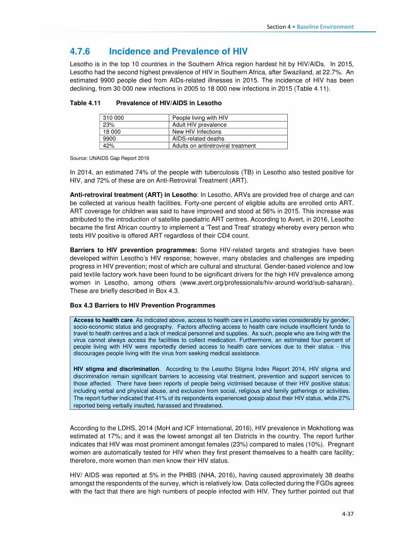
Section 4 • Baseline Environment
4-37
4.7.6 Incidence and Prevalence of HIV
Lesotho is in the top 10 countries in the Southern Africa region hardest hit by HIV/AIDs. In 2015,
Lesotho had the second highest prevalence of HIV in Southern Africa, after Swaziland, at 22.7%. An
estimated 9900 people died from AIDs-related illnesses in 2015. The incidence of HIV has been
declining, from 30 000 new infections in 2005 to 18 000 new infections in 2015 (Table 4.11).
Table 4.11 Prevalence of HIV/AIDS in Lesotho
310 000 People living with HIV
23% Adult HIV prevalence
18 000 New HIV Infections
9900 AIDS-related deaths
42% Adults on antiretroviral treatment Source: UNAIDS Gap Report 2016
In 2014, an estimated 74% of the people with tuberculosis (TB) in Lesotho also tested positive for
HIV, and 72% of these are on Anti-Retroviral Treatment (ART).
Anti-retroviral treatment (ART) in Lesotho: In Lesotho, ARVs are provided free of charge and can
be collected at various health facilities. Forty-one percent of eligible adults are enrolled onto ART.
ART coverage for children was said to have improved and stood at 56% in 2015. This increase was
attributed to the introduction of satellite paediatric ART centres. According to Avert, in 2016, Lesotho
became the first African country to implement a 'Test and Treat' strategy whereby every person who
tests HIV positive is offered ART regardless of their CD4 count.
Barriers to HIV prevention programmes: Some HIV-related targets and strategies have been
developed within Lesotho’s HIV response; however, many obstacles and challenges are impeding
progress in HIV prevention; most of which are cultural and structural. Gender-based violence and low
paid textile factory work have been found to be significant drivers for the high HIV prevalence among
women in Lesotho, among others (www.avert.org/professionals/hiv-around-world/sub-saharan).
These are briefly described in Box 4.3.
Box 4.3 Barriers to HIV Prevention Programmes
Access to health care. As indicated above, access to health care in Lesotho varies considerably by gender, socio-economic status and geography. Factors affecting access to health care include insufficient funds to travel to health centres and a lack of medical personnel and supplies. As such, people who are living with the virus cannot always access the facilities to collect medication. Furthermore, an estimated four percent of people living with HIV were reportedly denied access to health care services due to their status - this discourages people living with the virus from seeking medical assistance.
HIV stigma and discrimination. According to the Lesotho Stigma Index Report 2014, HIV stigma and
discrimination remain significant barriers to accessing vital treatment, prevention and support services to
those affected. There have been reports of people being victimised because of their HIV positive status;
including verbal and physical abuse, and exclusion from social, religious and family gatherings or activities.
The report further indicated that 41% of its respondents experienced gossip about their HIV status, while 27%
reported being verbally insulted, harassed and threatened.
According to the LDHS, 2014 (MoH and ICF International, 2016), HIV prevalence in Mokhotlong was
estimated at 17%; and it was the lowest amongst all ten Districts in the country. The report further
indicates that HIV was most prominent amongst females (23%) compared to males (10%). Pregnant
women are automatically tested for HIV when they first present themselves to a health care facility;
therefore, more women than men know their HIV status.
HIV/ AIDS was reported at 5% in the PHBS (NHA, 2016), having caused approximately 38 deaths
amongst the respondents of the survey, which is relatively low. Data collected during the FGDs agrees
with the fact that there are high numbers of people infected with HIV. They further pointed out that

Section 4 • Baseline Environment
4-38
they have to go to the nearest health centres to get their ARVs and the problem is always the long
distances they have to travel to reach them.
The PHBS (NHA, 2016) found that testing for HIV in the area was common, with approximately 45%
of the respondents in the catchment area reporting that they had been tested for HIV two weeks
before the study; 45% in the downstream area and 34% in Mokhotlong town. Amongst those who got
tested 70% were women, it is unclear whether these women were tested because they were pregnant
or not. However, the PHBS (NHA, 2016) indicated that all those tested were there to check their
hypertension levels. Three of the 42 focus groups interviewed for the PHBS (NHA, 2016) noted that
the issue of HIV/AIDS is a significant social concern within their communities. Of these, two groups
pointed out that the situation has become worse; one group noted that the situation has improved.
The focus group that reported an improvement in the issue of HIV/AIDS pointed out that people in
the community are now educated about the disease and take the necessary medication. Those
present in the focus groups who reported that the issue is becoming worse indicated that stigma
surrounding HIV/AIDS remains high and that, despite the availability of medication, many people
continue to die from the disease.
Regarding taking antiretroviral medication, people who are sick reportedly took their medication;
however, some stopped as soon as they consider themselves healthy again and this has led to these
individuals getting sick again and dying.
Participants in FGDs for this SIA pointed out that the reasons that HIV positive people default from
taking their medication could be related to the long distances to health facilities as well as the bad
attitude of health personnel. FGD respondents were also of the view that the rate of infections was
increasing, which could mean that people no longer seem to fear the disease.
4.7.7 Challenges to Health Care Provision
Challenges to access and provision of health care in the country, district and Project Area are
described below. There are some challenges to the delivery of health care services in Lesotho, the
main ones being the following:
• The lack of qualified medical professionals (both nurses and doctors) particularly in the rural areas
due to the country’s terrain which creates barriers to accessibility. Most qualified medical
professionals do not want to work in rural areas where there is poor access to public services and
as a result, seek employment in urban areas and elsewhere in the world once they qualify.
Serious emergencies are often referred to neighbouring South Africa.
• The rural nature and mountainous terrain further cause barriers to the construction of formal
medical facilities. This has led to many people living in the rural areas having to travel between
10 and 20 kilometres to reach the closest facility. Thus, many people in the rural areas choose to
rely on traditional medicines to treat various ailments.
• Most of rural Lesotho lacks secondary roads, which means that most parts of the rural areas do
not have public transportation. The 2014 LDHS, 2014 (MoH and ICF International, 2016)
indicated that 72% of households’ members walk to reach the nearest health facility; while 22%
stated that they travel by car, truck, bus, or taxi, and the remaining six percent used a combination
of walking and bus or taxi. Among households who walk to reach a health facility 27% walk for
more than 120 minutes (Table 4.12). Data from the FGDs indicates that the participants were
also concerned about the insufficient number of health facilitates in the Project Area and the
subsequent long distances that they have walk to reach the nearest one.
Table 4.12 Time it takes to get to the nearest health care facility
Time to get to nearest health facility by walking
Residential Area
Minutes Urban Rural Total
<20 minutes 28.4 5.5 12.8

Section 4 • Baseline Environment
4-39
Time to get to nearest health facility by walking
Residential Area
Minutes Urban Rural Total
20-40 minutes 43.0 11.4 21.6
41-60 minutes 17.2 16.1 16.5
120 minutes 8.1 28.1 21.7
> 120 minutes 3.2 38.6 27.3
Source: Lesotho Demography Health Survey, 2014 (Ministry of Health (Lesotho) and ICF International, 2016)
• Participants in focus group discussions indicated that they had experienced further challenges in
accessing health care such as that of frequent shortages of medication and other supplies at the
health facilities. This is made worse by the fact that some people would have had to walk for
many hours to get to the health centres. People from Malubalube, Nkokamele as well as other
far off villages mentioned that they have to take as many as four to five hours to reach the nearest
health centre. This means that they sometimes have to sleep over to have a chance at being
seen and examined by the health centre personnel. The distances are tough on the people
especially when they are sick, and there are cases where some expectant mothers have given
birth to babies on the way to health centres.
• The country’s health system is also challenged by the continued increase of communicable
diseases related to the HIV epidemic – especially Tuberculosis (TB). Data gathered from the
FGDs conducted in the Project Area indicate that in addition to HIV and communicable diseases
mentioned above, the people living in the Project Area suffer from a number of illnesses ranging
from sugar diabetes, hypertension, and the common cold. The under five children are said to
suffer from fever, measles, common cold, pneumonia, diarrhoea and vomiting. The people
expressed their fear about a possible climate change for the worse that could be brought about
by the large expanse of water after the dam is impounded and that would bring more cold to the
already cold district. That would, in turn, mean more common cold and pneumonia cases.
4.7.8 Use of Traditional Healers and Traditional Medicine
The participants of FGDs indicated that they also consult traditional healers when they are sick. This
they also attribute to not being up to walking the long distances to the health centres. In some cases,
they go to the traditional healers because they believe that they, rather than the health facilities, can
help to resolve their problem. In some such cases, the consultation would be more about protecting
their households against evil spirits than physical healing. They do, however, take some forms of
ailments to the traditional healers, though most of these are the ones they believe are from
bewitchments, such as litṥere, kokoana, sejeso, litoromo, ho qobola and headache. They also
indicated that they sometimes started by consulting the traditional healer and if they are not cured,
they would then go to seek help at a health centre and vice versa. Illnesses that they take to health
centres include HIV /AIDS, TB, cancer, sugar diabetes, hypertension, common cold, sharp pains and
flu.
Accidents and injuries that often happen to the people living in the catchment area are falling off
horses, lightning strikes, dog bites, being swept away by flooding rivers and fight injuries. Women
mostly feel unsafe as they are more likely to be sexually and/or physically abused than most. Seniors
feel unsafe as there have been incidences of mugging along the way from receiving their pension
money.
The participants are hoping that LHDA will assist them by liaising with the relevant ministry to have
health centres built nearby them for easy access. Participants from Malubalube pointed out that there
is a building in their village that was intended to be used for health outreach services and it is now
standing vacant and not being used as planned. They wish to have LHDA see to it that the building
is upgraded to a health centre level so that it can serve their area which is quite huge. It would also
cut travel time to Libibing. Their health problems have not declined in number in the past three years.
Instead, they have become worse.

Section 4 • Baseline Environment
4-40
4.8 Education This section describes the provision of education services and infrastructure in Lesotho, Mokhotlong
District and the Project Area.
4.8.1 National Education Services
The Ministry of Education and Training (MoET) is responsible for the management, provision and
regulation of education and training in Lesotho. It is in charge of ensuring the accessibility, quality,
equity and relevance of education. As with many countries in southern Africa, formal education in
Lesotho was introduced and developed through a partnership between the government and religious
organisations; and has been heavily influenced by the work of missionaries. As a result, across the
country, the management of schools is largely (90%) in the hands of the churches; specifically, the
Anglican Church, Lesotho Evangelical Church and Roman Catholic Church.
Government’s involvement in the provision of education, apart from the administrative duties, is
mainly through subsidies; payment of teachers’ salaries and provision of other institutional support.
Teachers are employed under the MoET. The government pays the salaries of more than 95% of the
teachers including those who work at church managed schools. Furthermore, the Government
provides schooling facilities through its capital budget. The provision of education services is guided
by the Education Act (No. 3) of 2010, the Lesotho Education Sector Strategic Plan for 2005 – 2015,
the Higher Education Strategic Plan for 2013/14 – 2017/18 and the National Policy for Integrated
Early Childhood Care and Development (ECCD). Lesotho is also a signatory to the MDG and MoET
seeks to ensure that Lesotho fulfils MDG 2, that of achieving universal primary education by 2015
through the provision of:
• Free and compulsory primary education;
• Bursaries and grants to vulnerable children and households;
• Ongoing school feeding programme; and
• Infrastructure development.
There are also development partners that are actively involved in the education sector through
bilateral and multilateral partnerships. These include among others the European Union, Irish Aid and
United Nations Children’s Fund (UNICEF). The Global Partnership for Education has also played a
significant role in improving the education sector.
4.8.2 Structure of the Education System
After completion of pre-schooling, Lesotho’s education system consists of 12 years of school. The
seven years of primary (Grade 1 – 7); three years of junior secondary (Form A – C); two years of
higher secondary (Form D – E) and four years of tertiary. There is also a parallel technical vocational
diploma course (senior secondary + 3 years Technical and Vocational Education and Training
(TVET). The various cycles of education are highlighted in Table 4.13.
Table 4.13 Structure of the education services in Lesotho
Education Schooling level Age Years Qualification
Pre-school ECCD 3 - 5 3 • Attendance is not compulsory.

Section 4 • Baseline Environment
4-41
Education Schooling level Age Years Qualification
Primary Primary school 6 -13 7 • Attendance is compulsory for children
between the ages of 6 and 13 years old. At
this level, education is free.
• Upon completion of the seven years, pupils
have to write an exam for which they are
awarded the Primary School Leaving
Certificate (PSLC) by the MoET.
Middle Junior secondary school 13 - 16 3 • School fees are payable from this phase
upwards. Pupils who complete this level of
education receive a Junior Certificate from
the MoET.
Secondary High school 16 - 18 2 • School fees are payable at this phase.
Pupils who complete this level of education
receive a Lesotho General Certificate in
Secondary Education (LGCSE).
Technical secondary
school
16 - 18 3 • School fees are payable at this phase.
Pupils who complete this level of education
receive a Technical Vocational Diploma
(Senior Secondary + 3 year TVET).
Tertiary Teacher training/
education in technical
subjects
16 -20 2 • Certificate/Diploma is awarded.
University 18 + 4+ • Receipt of Degrees to Doctorate from the
relevant university.
• National University of Lesotho (NUL) was
the only university in Lesotho until recently
(2008) when Limkokwing University was
established.
4.8.3 Availability of Education Facilities
Lesotho has an estimated 2155 registered education facilities which comprise 14 tertiary/higher
education institutions, 25 technical/vocational centres, 399 secondary schools, 1477 primary schools
and 240 ECCD centres (Table 4.14 and Figure 4.33). TVET schools are found in seven of the 10
districts in Lesotho (i.e. Berea, Leribe, Maseru, Mohale’s Hoek, Mokhotlong, Quthing and Thaba-
Tseka).
There are more primary schools compared to other educational facilities, and this might be attributed
to the government’s drive to meeting its MDGs for the population to at least attain primary school
education. In addition to the above schooling levels and facilities, there are skills centres which are
focused on adult education which are referred to as non-formal education (NFE). These centres are
tailored towards educating out-of-school youth and adults who are illiterate or have only primary
schooling. This service focuses on literacy, numeracy and continuing education. The education
received in these centres is the equivalent of Grade 1 to 10. Participants of FGDs indicated that there
is a high number of pupils who drop out at primary school level. More boys are said to drop out than
girls, and this is attributed to them having to drop out to go and herd animals. Some are said to drop
out to go to initiation school. Male youth from Makhoarane in the downstream area stated that they
did not see the value of education and that they would rather engage in livestock farming. Those girls
who do drop out are said to do so to get married. This means that the government is in part failing to
meet its MDGs of ensuring that all children at least attain primary education.

Section 4 • Baseline Environment
4-42
At the district level, the education system is organised into early childhood development, primary,
secondary and high school and the MoET is decentralised through the Inspectorate. The number of
education facilities varies by district with Maseru district having the most. Table 4.14 shows the
distribution of schools by district.
Table 4.14 Distribution of schools by district
District
Levels of Education Total
ECCD Primary Secondary
Urban Rural Urban Rural
Butha-Buthe 18 14 68 9 13 122
Leribe 28 20 179 12 55 294
Berea 27 10 129 6 36 208
Maseru 34 62 190 29 44 358
Mafeteng 30 9 149 5 34 227 Mohale’s Hoek 27 4 167 4 21 223
Quthing 19 9 117 4 13 162
Qacha’s Nek 18 9 94 5 15 141
Mokhotlong 15 11 95 1 15 137
Thaba-Tseka 24 5 136 4 15 184
Total 240 1477 339 2056 Source: Lesotho Bureau of Statistics, Statistical Report No. 28 of 2015: Education Statistics Report 2014
Figure 4.33 Typical Schools in the Project Area
Source: J. Mkhabela
In the Project Area, the education system follows the national and district system. The MoET through
the Inspectorate is expected to support and supervise these schools. Following the pattern of number
of schools in the Mokhotlong District; there are also more primary schools in the Project Area and
very few Secondary schools. ECCD schools are also available in the Project Area.
A few NGOs work in the education sector in the Districts and provide support in the form of school
fees, uniforms, school shoes, toiletries and sanitary towels to children. These include Sentebale,
Hlokomela Bana and World Vision. Sentebale and Hlokomela Bana operate in Mokhotlong and the
Project Area.

Section 4 • Baseline Environment
4-43
4.8.4 Education Profile of Lesotho
Lesotho has the highest adult literacy rate (79%) in sub-Saharan Africa as well as amongst its female
population (93%)11. Men have slightly lower education levels than their female counterparts, and this
has been linked to the fact that boys particularly those in rural areas tend to dedicate their time to
herding livestock and not attending school or dropping out at the primary level; refer to Table 4.15.
The introduction of free and compulsory primary education in Lesotho has assisted Lesotho in fast-
tracking progress towards reaching the MDG 2. In 2012, progress towards achieving indicator 2.1
(Net Enrolment Rate (NER) in primary schools) and indicator 2.3 (Literacy rate among 15-24-year-
olds) were on track. Progress was, however, slow for indicators 2.2 (Proportion of pupils who reach
the last grade of primary school); refer to Table 4.15. Enrolment in secondary schools is low at 38%
as there are a limited number of secondary schools and tuition fees are required (the government
only subsidises orphan and vulnerable children). Also, children who want to enter high school may
be required to relocate from their homes to stay with relatives or friends who reside close to a
secondary school, and this requires financial contributions from parents which many in rural Lesotho
cannot afford; thus the children drop out. Findings from the FGDs indicate that some of the children
who manage to complete primary school are sometimes unable to attend secondary school due to
lack of school fees. Some parents have to sell livestock to put their children through Junior and Senior
High schools.
Table 4.15 Education Services Profile
Indicators MDG Baseline Outcomes Progress
Adult Literacy rate 79% (2015) Female youth (15 – 24 years) literacy rate 96% 98% (2012) On track
Male youth (15 – 24 years) literacy rate 83% 87% (2012) On track
Primary Education
Net Enrolment Rate12 82% 82% (2012) On track Proportion of pupils who reach last grade of primary school
61% 66% (2012) Slow progress
Source: Kingdom of Lesotho, 2013. Millennium Development Goals Status Report 2013
4.8.5 Education Profile of Mokhotlong and Project Area
The majority (58%) of the residents of Mokhotlong district have attained some primary schooling,
followed by those who have some secondary education (17%). Only eight percent of the population
was recorded as having no schooling – which is relatively low considering that Mokhotlong has poor
infrastructure specifically roads and has an economy that is solely dependent on agricultural activities.
Approximately 90% of the primary schools in Mokhotlong are found in rural parts of the District while
the other 10% are in urban areas. A similar trend was observed with the distribution of secondary
schools.
As with the situation in the District, the SEBS (CES, 2015b) indicates that a majority (59%) of the
population in the Project Area have attained some primary schooling and was, however, followed by
those who had no education at all (16%). Only 12% were reported to have completed primary school.
Regarding attainment of schooling by gender, a similar trend to the national and district levels is
observed with more men with no schooling. However, the trend differs significantly regarding those
who have some primary education, with more males compared to females and reverts to more
females having completed both primary and some junior secondary schooling. Observation during
FGDs showed that many people have at least attained primary school education, as many were able
11www.unesco.org/eri/cp/factsheets_ed/LS_EDFactSheet.pdf 12Net Primary Enrolment Rate is the number of pupils of official primary school age who are enrolled in primary education as a percentage of the total children of the official school age population

Section 4 • Baseline Environment
4-44
to register their names when asked to do so. Also observed was the fact that almost all of the woman
participants could write their name while some could not and wrote a cross.
Due to shortages of qualified teachers and the reluctance of some qualified teachers to work in remote
and hard to reach schools such as those found in Mokhotlong and the Project Area, the use of
unqualified teachers is common. These teachers perform similar roles as qualified teachers though
they have not been trained as teachers, and their wages are paid for by parents. Closely linked to the
shortage of qualified teachers, pupil teacher ratios (PTR) are high. This situation applies to both
primary and secondary schools. A summary of Mokhotlong district education indicators is presented
in Table 4.16.
Table 4.16 Education Services Profile
Indictors Outcome
Primary Education
Total Primary School Teachers 588
• Qualified Primary School Teachers 431 (73%)
• Unqualified Primary School Teacher 157 (27%)
Total Primary School Enrolment in 2014 22,883
Pupil Teacher Ratio (PTR) 39:1
Pupil Qualified Teacher Ratio (PQTR) 53:1
Total Primary School Repeaters 2,215
Secondary Education
Total Secondary School Teachers 212
• Qualified Teachers 198 (93%)
• Unqualified Teachers 14 (7%)
Total Secondary School Enrolment in 2014 5,365
• Male Enrolment 1,786 (33.3%)
• Female Enrolment 3,579 (67%)
Pupil Teacher Ratio (PTR) 24:1
Pupil Qualified Teacher Ratio (PQTR) 26:1
Source: Bureau of Statistics: Statistical Report No. 28 of 2015: Education Statistics Report: 2014
The SEBS (CES, 2015b) indicates that overall, 18% of males in the Project Area had no schooling
while only six percent of females were uneducated and is in line with the national and district reports
on disparities in the levels of education of men and women in Lesotho. This discrepancy was mostly
observed amongst males in the downstream area where 24% of men had no schooling while only
seven percent of females were uneducated. Overall, 61% of the female population across the Project
Area had attained primary education as compared to males at 57%. Refer to Figure 4.34. The people
of town Mokhotlong had higher numbers of people with secondary schooling and above compared to
the other two areas; this can be linked to the fact that Mokhotlong town is the district capital and
slightly urbanised. The town also has a majority of civil servants (who mostly have attained more than
secondary schooling education) residing in the town.

Section 4 • Baseline Environment
4-45
Figure 4.34 Distribution of Schooling Levels across the Project Area
Source: Socio-Economic Baseline Study (CES, 2015b)
Participants of FGDs were of the feeling that there are not enough schools in the Project Area,
especially downstream where children walk long distances to school and sometimes cannot attend
school regularly during the rainy season as the streams/rivers they have to cross flood. Children are
said to start school at a later age (eight or nine and not six years old) as the schools are too far.
People anticipate that LHDA will build schools nearby.
4.8.6 Provision of Education to the Poor and Marginalised
The government of Lesotho implements multiple programmes to ensure that the poor and
marginalised children get access to education services. Disabled and orphaned children, children
from extremely poor households and herd boys are regarded as vulnerable children (Orphans and
Vulnerable Children (OVC)). In order to ensure that these children receive an education, the MoET
has a school bursary scheme, which is paid directly to the schools. Another programme aimed at
assisting these OVC is the Child Grants Programme (CGP). This programme was started in 2009
and was financed by the European Commission with technical support from UNICEF-Lesotho. In
2013 the government of Lesotho took over the financing of the programme. The programme is run
specifically by the Ministry of Social Development (MoSD). The programme is non-conditional social
cash transfer targeted to poor and vulnerable households with the objectives of:
• Improving living standards of OVCs;
• Reducing malnutrition, improve health status; and
• Increasing school enrolment by OVCs.
Qualifying households are selected through a combination of proxy means which include testing and
community validation. The household is then registered on the National Information System for Social
Assistance (NISSA); and subsequently receive funds from the grant.
With the assistance of the World Food Programme (WFP), the government of Lesotho runs a school
feeding programme which provides food for children attending pre-school and primary schooling.
Through the programme, children receive two meals a day, breakfast and lunch. In 2015, the
programme was supporting over 50 000 pre-schoolers and 200 000 pupils in 1025 primary schools
throughout Lesotho13.
13http://www.lesothoreviw.com/education-training-2015.php
0
10
20
30
40
50
60
70
80
None Primary Secondary Secondary + Don’t know
Pe
rce
nta
ge
Catchment Area Male Catchment Area Female Mokhotlong Town Male
Mokhotlong Town Female Downstream Area Male Downstream Area Female

Section 4 • Baseline Environment
4-46
4.8.7 Obstacles to Education
While much has been achieved in ensuring that education services are provided to Basotho, the
sector continues to face challenges at the national and district levels as well as within the Project
Area. The following are some of the challenges faced:
• Low pass rates across all levels of schooling;
• Low standard of education provided at local schools;
• Poor retention rates of pupils at primary and secondary schooling levels due to the limited number
of schools;
• The mountainous terrain of Lesotho also acts as a barrier to construction of schooling facilities
and this has led to a shortage of schooling facilities as well as poor maintenance of existing
schools.
• In the remote rural areas, the learning environment is often poor and characterised by limited
infrastructure including unavailability of classrooms and equipment.
• The shortage of schooling infrastructure also results in pupils and teachers having to walk long
distances to reach the nearest school; this is particularly the case with secondary schooling.
• The limited secondary schooling infrastructure to absorb new entrants into the education system.
• There is a limited number of qualified teachers in the schooling system as many do not want to
transfer and work in remote rural areas with limited public services and infrastructure.
• Lack of public transportation and formal road infrastructure in many remote rural areas, as such
both teachers and pupils have to walk long distances to reach schooling facilities.
• Disparities in the distribution of schools in the country, with rural areas having limited numbers of
schools and urban more. This results in overcrowding of schools and higher teacher/ pupil ratios
which in turn affects the quality of learning and teaching.
• Extreme levels of poverty in the Project Area results in the inability of parents to pay school fees.
4.9 Public Services and Infrastructure This section describes access to public services and infrastructure in the Project Area such as potable
water, sanitation, telecommunications, energy/fuel sources, and roads/transportation; refer to Figure
4.35.

4-47
Figure 4.35 Map showing some Public Services and Infrastructure in the Catchment Area

Section 4 • Baseline Environment
4-48
4.9.1 Access to Potable Water and Sanitation Facilities
4.9.1.1 Access to Potable Water
Almost all urban households in Lesotho have access to improved water sources (96%), and only 77%
of the rural population has access to an improved water system. The type of water sources for urban
and rural populations differed significantly, while the urban population got its water from piped into
dwelling/ yard/ plot (68%), the rural communities got water from public taps/ stand pipes (56%). For
rural communities, this was followed by 23% of water sourced from unimproved water sources and
only five percent had access to piped water into the dwelling/ yard/plot. An estimated 38% of the
rural population had access to water 30 minutes or longer to collect water from which ever source
they use. Overall, the proportion of households obtaining water from improved drinking water sources
in Lesotho has increased from 79% in 2009 to 84% in 2014. Urban households' access to improved
drinking water sources increased from 91% to 97% while the proportion of rural households with
access to improved drinking water sources shifted from 74% in 2009 to 77% in 2014.
Water in urban areas is provided by the Water and Sewerage Company (WASCO), through the
installation of individual water supply. WASCO provided water is billed and paid for. Water in the rural
areas is provided by the Department Rural Water Supply (DRWS). DRWS has guidelines/standards
for communal water supply, that is, 50 metres' walk from each of the households. The Lesotho Rural
Water and Sanitation Project (WSP) in the rural areas provided for improved water and sanitation
services to 27 245 households or approximately 160 000 persons through the construction of new
water systems and ventilated improved pit latrines (VIP). The majority of the population indicated not
treating its water before consumption (88%). As per location, amongst those who reside in urban
settings, only 78% treated the water before consumption, and the rest did not. In turn, rural
households that do not treat water before consumption were at 92%. This was an expected outcome
given the financial constraints of the rural population compared to those who reside in urban settings.
The indicators for access to drinking water sources are provided in Table 4.17.
Table 4.17 Access to Water Sources in Lesotho
Access to drinking water Urban Rural Total
Water sources 96 77 82
Piped into dwelling / yard/ plot 68 5 22
Public tap/ standpipe 26 56 47
Tube well/ borehole 2 8 6
Protected spring 0,5 3 3
Protected well 1 6 5
Rain water 0 0 0
Bottled water 0,1 0 0
Unprotected well 2 10 8
Unprotected spring 2 12 9
Tanker truck/ car with small tank 0 0,5 0,4
Surface water 0,1 1 0,8
Time to obtain drinking water
Water on premises 69 6 23
Less than 30 minutes 25 55 47
30 minutes or longer 6 38 29
Don’t know 0,2 2 1
Source: Lesotho Demography Health Survey, 2014 (Ministry of Health (Lesotho) and ICF International, 2016)
In the Project Area water is mostly collected from communal taps that are scattered through the area.
Access to such communal taps is at 72% in the catchment area and 42% in the downstream area.

Section 4 • Baseline Environment
4-49
For Mokhotlong town, the use of taps includes both communal taps and piped water into the dwelling.
The population in the downstream area further relies on wells as a second source of water (40%).
The government installed the communal taps that the communities use through DRWS. However,
the communities complained that there were not enough communal taps to service their water needs.
In some communities the water taps were non-functional, this was as a result of faulty pipes or broken
taps or solar panels that supply the water pump with power. Villages whose taps were no longer
functioning returned to collecting water from unprotected sources such as springs or wells. Indicated
in Figure 4.36 are protected and unprotected water wells.
Figure 4.36 Protected and Unprotected Water Wells
Source: J Mkhabela
As indicated above, the majority of the households in the Project Area have access to improved water
sources, more specifically communal taps. However, with regards to the time, it takes each way to
reach the tap an estimated 86% of the households indicated having to walk for 30 minutes each way
to fetch water; while 13% walk for more than one hour each way to carry water, as indicated in Figure
4.37. The residents of Mokhotlong town, as expected did not have to walk far to collect water due to
the urban nature of the area. Data gathered from the FGDs also indicated that most villages in the
Project Area do have communal taps, though they pointed out that some of them are seasonal,
producing water only during the rainy season. They explained that when the taps dry up, they collect
water from springs and some even from nearby streams. Few of the interviewed communities take
more than one hour to collect water.
Figure 4.37 Time taken from Household to Water Source
Source: Socio-Economic Baseline Study (CES, 2015b)
Water is collected mostly two to three times per day by different households at 46% and 24%
respectively. Some households collect water more than three times a day.
0
20
40
60
80
100
0 to 15minutes
15 to 30minutes
30 to 45minutes
45 min. to 1hr.
> 1 hr.
Catchment area Downstream area Mokhotlong Town
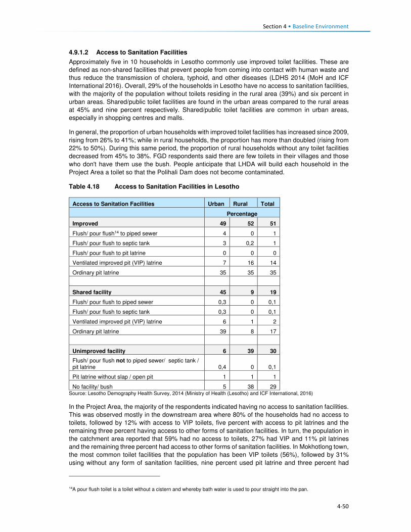
Section 4 • Baseline Environment
4-50
4.9.1.2 Access to Sanitation Facilities
Approximately five in 10 households in Lesotho commonly use improved toilet facilities. These are
defined as non-shared facilities that prevent people from coming into contact with human waste and
thus reduce the transmission of cholera, typhoid, and other diseases (LDHS 2014 (MoH and ICF
International 2016). Overall, 29% of the households in Lesotho have no access to sanitation facilities,
with the majority of the population without toilets residing in the rural area (39%) and six percent in
urban areas. Shared/public toilet facilities are found in the urban areas compared to the rural areas
at 45% and nine percent respectively. Shared/public toilet facilities are common in urban areas,
especially in shopping centres and malls.
In general, the proportion of urban households with improved toilet facilities has increased since 2009,
rising from 26% to 41%; while in rural households, the proportion has more than doubled (rising from
22% to 50%). During this same period, the proportion of rural households without any toilet facilities
decreased from 45% to 38%. FGD respondents said there are few toilets in their villages and those
who don't have them use the bush. People anticipate that LHDA will build each household in the
Project Area a toilet so that the Polihali Dam does not become contaminated.
Table 4.18 Access to Sanitation Facilities in Lesotho
Access to Sanitation Facilities Urban Rural Total
Percentage
Improved 49 52 51
Flush/ pour flush14 to piped sewer 4 0 1
Flush/ pour flush to septic tank 3 0,2 1
Flush/ pour flush to pit latrine 0 0 0
Ventilated improved pit (VIP) latrine 7 16 14
Ordinary pit latrine 35 35 35
Shared facility 45 9 19
Flush/ pour flush to piped sewer 0,3 0 0,1
Flush/ pour flush to septic tank 0,3 0 0,1
Ventilated improved pit (VIP) latrine 6 1 2
Ordinary pit latrine 39 8 17
Unimproved facility 6 39 30
Flush/ pour flush not to piped sewer/ septic tank / pit latrine 0,4 0 0,1
Pit latrine without slap / open pit 1 1 1
No facility/ bush 5 38 29 Source: Lesotho Demography Health Survey, 2014 (Ministry of Health (Lesotho) and ICF International, 2016)
In the Project Area, the majority of the respondents indicated having no access to sanitation facilities.
This was observed mostly in the downstream area where 80% of the households had no access to
toilets, followed by 12% with access to VIP toilets, five percent with access to pit latrines and the
remaining three percent having access to other forms of sanitation facilities. In turn, the population in
the catchment area reported that 59% had no access to toilets, 27% had VIP and 11% pit latrines
and the remaining three percent had access to other forms of sanitation facilities. In Mokhotlong town,
the most common toilet facilities that the population has been VIP toilets (56%), followed by 31%
using without any form of sanitation facilities, nine percent used pit latrine and three percent had
14A pour flush toilet is a toilet without a cistern and whereby bath water is used to pour straight into the pan.

Section 4 • Baseline Environment
4-51
access to other forms of sanitation facilities. A small number of households had flush toilets (one
percent).
Figure 4.38 Example of Sanitation Facilities in the Project Area
Source: J. Mkhabela
The public participation and FGD field teams also noticed through questions asked and observation
the marked lack of toilets in the villages where they were working, and witnessed people using bushes
near their homes especially overgrown areas by the streams and rivers. Refer to Figure 4.39 for
additional information on access to toilet facilities in the Project Area.
Figure 4.39 Access to Sanitation Facilities in the Project Area
Source: Socio-Economic Baseline Study (CES, 2015b)
4.9.2 Access to Policing Services
There are two police stations in the district of Mokhotlong, with one based in Mokhotlong town and
the other in Mapholaneng and both of them are, incidentally, located within the Project Area. Data
gathered from the interview with the police, indicate that there is a total of 150 police officers in
Mokhotlong district. Slightly over half (54%) of the people from the Project Area make use of the
Mokhotlong town police station, while 45% use the Mapholaneng station and the remaining one
percent made use of village policing. FGD participants indicated that in most of the villages there are
community policing forums (mahokela), which fight crime at village level and work hand in hand with
0%
10%
20%
30%
40%
50%
60%
70%
80%
90%
Catchment Area Downstream Area Mokhotlong Town
Bucket System Chemical Toilet Flush Toilet - Septic Flush Toilet - System
Other Pit Latrine VIP toilet Nothing

Section 4 • Baseline Environment
4-52
the local police stations. They deal mainly with minor crimes, practicing what is known as Restorative
Justice. There is only one prison of minimum security in the district of Mokhotlong.
One of the aspects that community members requested from the LHDA was to assist with construction
of satellite police stations in their areas/villages as a measure to combating crime. Some of the crimes
that already exist in the Project Area are petty in nature (according to the interview conducted with a
police officer at Mokhotlong Police station), (including stock theft, home break-ins as well as stealing
of crops), however, for rural agrarian communities these are regarded as serious. There is concern
among the police about the increasing number of illegal firearms in the district, owned mostly by
dagga smugglers.
Crime prevention is slow due to a lack of vehicles for police and an expectation for police to walk
where cars cannot drive. There are six vehicles in the district; however, during servicing times only
two vehicles are available.
Figure 4.40 Access to Policing Services
Source: Socio-Economic Baseline Study (CES, 2015b)
According to the interviewed community members, crimes in the area were committed at any time of
the day in both homesteads and cattle posts. Recently the thieves were mostly armed with knives
and guns. The thieves were said to kill the watch dogs and sometimes the livestock owners too. The
scale of livestock theft was reported to be severe with thieves stealing the herd of livestock. The high
levels of livestock theft were attributed to increasing levels of poverty in the area as well as low police
presence in some villages. General home break-ins were reported to occur mainly in households
occupied by the elderly. Often the thieves would steal farming equipment, crops and general
household items such radios, televisions, etc. Other criminal activities experienced in the area were
rapes, domestic abuse, fighting, which the respondents attributed to alcohol abuse. FGD participants
from the whole Project Area cited stock theft as one of the big challenges experienced in livestock
keeping. The other crimes such as rapes, domestic abuse, fighting were also mentioned across the
Project Area by the FGD participants. They also anticipate that the commencement of the
construction works may bring more outsiders to the Project Area and thereby increase the incidences
of crime, especially livestock theft and theft of field crops.
4.9.3 Access to Local Court
From observation three magistrate courts were seen in Mokhotlong District, one at Mokhotlong town,
the others at Mapholaneng and Phahameng. Access to local court services, was indicated as easier
compared to other public services in the Project Area, with an average of 42% of the respondents
reporting to have a court within their village or neighbouring settlement, as reflected in Figure 4.41.
0%
10%
20%
30%
40%
50%
60%
70%
80%
90%
100%
Village Neighbouring
Village
Closest Town Mapholaneng
Town
Mokhotlong
Town
Other
Catchment Area
Downstream Area
Mokhotlong Town

Section 4 • Baseline Environment
4-53
Mapholaneng and Mokhotlong town’s courts were commonly used by the respondents. According to
the respondents, part of the village court system is linked to the chiefs hearing cases, especially those
relating to the collection and utilisation of natural resources. Chiefs and Councillors reserve the rights
to fine anyone who has been found in contravention of laws governing the utilisation of natural
resources (refer to the discussion under Governance, section 2.1). Repeat offenders are taken to the
local magistrate courts for prosecution by the Chiefs and Councils – this indicates a complimentary
relationship between the traditional and formal court systems. FGD respondents also described the
traditional court system existing within their villages/areas that involved chiefs and councillors where
people have to start at even before being referred to a magistrate court.
Figure 4.41 Access to Local Courts
Source: Socio-Economic Baseline Study (CES, 2015b)
4.9.4 Access to Banking Services
Banking services are mostly limited to the more established towns of the Project Area, namely
Mapholaneng and Mokhotlong town. As such the majority of the respondents both in the catchment
and downstream areas indicated using such services in these towns (28% and 37%) respectively, as
indicated in Figure 4.42. The “other” category also featured at 34% for the downstream population
which included stokvels and savings and burial schemes. The men who participated in the male FGD
at Taung mentioned having a savings scheme, formed of men only that lend money to people to be
paid back with interest. Respondents of FGDs also explained that people from the Project Area have
bank accounts, especially the people who rear sheep and goats who get paid for their wool and
mohair.
0%
10%
20%
30%
40%
50%
60%
Own village Neighbouring
Village
Closest Town Mapholaneng
Town
Mokhotlong
Town
Other
Catchment Area Downstream Area Mokhotlong Town

Section 4 • Baseline Environment
4-54
Figure 4.42 Access to Banking Services
Source: Socio-Economic Baseline Study (CES, 2015b)
4.9.5 Access to Agricultural Input and Equipment
Again, the most established towns of Mapholaneng and Mokhotlong were identified as the main areas
where people purchase agricultural inputs and equipment. The population from the downstream area
indicated that they purchase their agricultural inputs and equipment in various locations, as indicated
below. This could be attributed to various factors but more specifically issues of access, some
downstream areas are located closer to Mokhotlong, Mapholaneng, Tlokoeng and Katse and these
areas also have outlets that sell agricultural inputs and equipment.
Figure 4.43 Access to Agricultural Inputs and Equipment
Source: Socio-Economic Baseline Study (CES, 2015b)
4.9.6 Access to Local Markets and Shops
Overall, 35% of food purchases were reported to occur within the home or neighbouring villages, with
the towns of Mapholaneng and Mokhotlong accounting for 23% and 24% of all purchases,
respectively. It stands to reason that easy access to food shops within one’s own village would reduce
the amount of time and cost incurred in purchasing food, whilst visiting the town area may result in
0%
10%20%
30%40%
50%60%
70%80%
90%100%
Own village NeighbouringVillage
Closest TownMapholaneng MokhotlongTown
Other
Catchment Area Downstream Area Mokhotlong Town
0%
10%
20%
30%
40%
50%
60%
70%
80%
90%
100%
Catchment Area Downstream Area Mokhotlong Town
Village Neighbouring Village Closest Town Mapholaneng Mokhotlong Town Other

Section 4 • Baseline Environment
4-55
increased time and travel costs in purchasing food and decrease the amount of food purchased in
order to cover the costs of transportation. Furthermore, people within the catchment area are likely to
purchase food stuff in Mokhotlong town which is closest to their locale, while people in the western
part of the catchment area would purchase food in Mapholaneng and Thaba-Tseka. The latter could
be better accessed by people from the villages downstream of the Dam, who are already located
within Thaba-Tseka District.
Figure 4.44 Access to Local Markets and Shops
Source: Socio-Economic Baseline Study (CES, 2015b)
4.9.7 Access to Telecommunications
Telecommunication services in the Project Area are concentrated in the established town areas of
Mokhotlong and Mapholaneng. In these areas, people have both access to landline telephones and
cellular phones. For obvious reasons, the number of households with cellular phones outweighs
those with landline telephones. The more remote parts of the Project Area have no cellular phone
signal as such, hence the ownership and use of cellular phones is limited, though the people pointed
out that they still buy and own cellular phones in the hope that they will eventually get
telecommunication towers. Similarly, to ownership of landline telephones, computer access was
found to be concentrated in the town areas. Overall, 22% of the population in the Project Area
reportedly did not have access to any means of telecommunications; information to these
communities is passed on through the word of mouth.
4.9.8 Access to Transportation
There is only one road that links Mapholaneng to Mokhotlong town. It is also one of the two only
tarred roads within Mokhotlong District. The other tarred road leads from Mokhotlong town to Sani
Pass. Besides these two there are other unpaved roads that form a network of roads that are used to
access villages located around the proposed dam. The roads are in different levels of disrepair with
some that were observed to be totally untraversable. The other major road that is found in the district
is the one connecting the District of Mokhotlong to that of Thaba-Tseka. It has been observed to be
unpaved and in a bad condition is some areas if not all. Some of the road and bridges are observed
to be going to be inundated when one looks at where the beacons have been installed.
The FGD respondents from the Project Area are concerned about the loss of the roads and bridges
to be inundated and would like the LHDA to replace them as a form of mitigation. The respondents
from the eastern side of the proposed dam are concerned that LHDA has not said anything to them
about a tarred road on their side of the dam. They complained that all the proposed project
infrastructure is on the Tlokoeng side of the dam. They are also concerned that there is no tarred
0%
20%
40%
60%
80%
100%
Catchment Area Downstream Area Mokhotlong Town
Village Neighbouring Village Closest Town
Mapholaneng Mokhotlong Town Other

Section 4 • Baseline Environment
4-56
road and bridge that seems to be planned to connect the Khalahali side of the dam to that of Tlokoeng.
They are very concerned that they are expected to go via Mokhotlong and Mapholaneng towns when
they travel to the other side of the river (Tlokoeng side). They are even worried that they will not be
able to cross the Senqu River to go and look for work when construction works commence.
The modes of transport currently used include walking, horse-riding, use of taxis and buses, with
donkeys used as beasts of burden and for transport. The respondents from the Project Area, including
downstream would like to see LHDA assist them with construction of feeder roads to make it easier
to reach their villages, health centres, schools and the Mokhotlong town.
4.10 Vulnerability and Marginalisation Vulnerable or disadvantage groups are defined by IFC as individuals or groups within the Project
Area who could experience adverse impacts from the proposed Project more severely than others
based on their vulnerable or disadvantaged status. This status may stem from an individual's or
group's race, colour, gender, language, religion, political, or other opinion, national or social origin,
property, birth or other status. In addition other factors should be considered such as gender, ethnicity,
culture, sickness, physical or mental disability, poverty or economic disadvantage, and dependence
on unique natural resources15. In the Project Area, the broad categories of people who should be
considered to have some level of vulnerability are:
• Women;
• The elderly;
• Youth;
• Herd boys;
• Orphaned children; and
• Disabled or chronically ill persons.
These groups are described in more detail in the following sections.
The Ministry of Social Development is responsible for leading and facilitating the provision of
sustainable social development services that are universally accessible to all groups of people in
Lesotho in collaboration with other key stakeholder. The ministry in partnership with other key
stakeholders has over the recent years implemented a number of social protection initiatives such as
the:
• School feeding programme that is linked to free primary education and health care,
• Old age pension which is offered on a universal basis to all qualifying citizens;
• Child grant programme (CGP);
• OVC bursary programme;
• Public assistance programme; and
• Implementation of the national information system for social assistance (NISSA); which begun as
a tool of the CGP.
In 2014 the ministry through the assistance of the European Union and UNICEF developed the
National Social Protection Strategy (2014/15 – 2018/19) which was officially launched in 2015 (See
Section 2.2).
4.10.1 Women
Women of the Project Area are mainly regarded as vulnerable due to the poor / or inadequate access
to public services such as health care. Women dwelling in a village without a health centre often give
15IFC Glossary of Terms, http://www1.ifc.org/wps/wcm/connect/corp_ext_content/ifc_external_corporate_site/home

Section 4 • Baseline Environment
4-57
birth at home or are expected to leave their homes to await childbirth in another village whilst living
with non-family/ non-relations. In case of medical emergencies during home births, women are often
at higher risk because of the lack of transportation.
Similarly, to most youths in the District and Project Area, the population has a shortage of high
schools, and the distances that will be required to walk to and from school discourages the people
from attending school. Women’s vulnerability as it relates to the Project may be linked to low potential
for women to securing to long-term permanent jobs due to their low levels of education and possibly
lack of skills to carryout jobs beyond cleaning services. Both women and youth of limited education
are more unlikely to secure jobs during the construction and operational phases and they would both
be deemed vulnerable.
Loss of land by female headed households due the Project land take will increase their vulnerability
should their land acquired by the Project be not replaced.
4.10.2 The Elderly
The elderly are generally recognised as being vulnerable due to their age. The elderly remains in
high social standing as long as they are productive; however, they lose this standing once they
become dependent on the younger generations for assistance in meeting their basic needs (e.g.
housing, water, food). Furthermore, the elderly is often targeted by criminals for their pension. The
elderly are usually not in a position to take advantage of the benefits typically associated with large
projects such as the Polihali Dam Project.
4.10.3 Youths
For the purposes of this assessment, youth are quantitatively defined as persons aged approximately
15 to 35 or, recognising variations by cultural context, qualitatively defined by their degree of
independence with respect to their obtainment of a livelihood, relationship status (i.e. marriage,
children), and living arrangements.
Youth can be recognised as vulnerable, though in a way distinct from other categories listed above.
Being at their physical prime but often facing an unknown future, youth may be seen as both
empowered and disempowered. Youth are vulnerable in the sense that they are between dependence
(childhood) and independence (adulthood) and, without access to resources and support to enable
their transition to adulthood, youth may face a large degree of instability in their lives. Youth only
inherit land once they have reached full adulthood and marriage, and until then are dependent on
their parents.
Another characteristic of youth is that it is a time when individuals are developing their identities and
questioning societal norms; when youth perceive that their economic and social prospects are poor,
they may engage in antisocial behaviour. Youths within the Project Area often lack the education,
skills and qualifications to secure meaningful jobs. In case of youths still in school, there exists a hope
that they will in the future, secure scholarships or bursaries and subsequently employment with the
Project to attained tertiary education.
4.10.4 Herd boys
Herd boys are often youths who left school early due to their impoverished families not being able to
pay for their way through school, while some leave school to pursue livestock herding in order to start
building their livestock herds. The lifestyle of herd boys is tough and dangerous due to the period of
time spent away from home living in cattle posts located high in the mountains. In the winter months
when it snows many die in fires when they fall asleep without putting fires out. Sometimes, herd boys
are killed by robbers raiding their cattle posts to steal livestock; or in violent fights between the
herders.
Herd boys who choose to leave their jobs in anticipation to secure permanent work with the Project
may be vulnerable should they fail to secure the anticipated jobs with the Project. Given the general

Section 4 • Baseline Environment
4-58
lack of employment opportunities and the herd boys lack of schooling and skills beyond livestock
herding, they will find it difficult to secure a new job thus losing their source of stable income.
4.10.5 Orphaned Children
Orphaned children in the area are vulnerable due to the poor care they receive from extended family
upon the death of their parents or guardians. They often do not attend school or receive any medical
care. The ages of orphans who are eligible for project related benefits range from 0 -17.
4.10.6 Disabled or Chronically Ill Persons
Disabled persons should be recognised as vulnerable as they are unlikely to be able to access the
Project benefits but would be vulnerable to change brought about by the Project. People living with
HIV/AIDS and TB can be considered to be disabled as their ability to remain healthy and maintain
their livelihoods is often compromised by their illness.

5-1
Section 5 Impact Assessment
5.1 Introduction This section provides a description of the predicted social impacts associated with implementation of
the Project. The impacts are mostly divided in accordance to the various phases of the Project, with
the exception of impacts whose impact significance remains unchanged in all phases.
5.2 Overview and Context 5.2.1 Overview
This section assesses the socio-economic impacts and benefits anticipated during the construction
and inundation phases of the Project. The impacts have been assessed against the backdrop of the
baseline socio-economic environment (Section 4). One of the most significant socio-economic impacts
arising from the Project is the need for resettlement of at least 203 households from below the FSL
and the relocation of a further 134 households that may be dangerously located, together with
extensive loss of arable and grazing land. This will result in a number of related impacts on the already
strained and limited natural resources in the area. The physical and economic displacement impacts
are described in Sections 5.3 and 5.3.1.1.
The construction phase of the Project is scheduled to take five to seven years to complete, with
construction activities ramping up during the construction of the dam and appurtenant works. At its
peak, 3500-4000 jobs will be created which will bring both benefits (local job creation) and negative
impacts (influx of work-seekers, anti-social behaviour, pressure on local infrastructure, etc.). The
realisation of the benefits and the mitigation of the impacts will take careful management and
collaboration between LHDA and various government departments as discussed below.
5.2.2 Community Expectations Related to the Project
During the stakeholder engagement process (undertaken between September 2016 (commencement
of sensitisation meetings) and March 2017), it was evident that the majority of people living in the
Project Area are in support of the Project and are hopeful of the many anticipated social and economic
benefits that will be realised. While many concerns and questions were raised, the communities are
impatient for the project to start, after many years of planning and ongoing consultation for different
studies. The communities in the Project Area have exceedingly high expectations of the real and
perceived benefits. The Stakeholder Engagement Report documents the issues and expectations
raised by all stakeholders consulted (Sechaba & ERM, 2017).
As with any large-scale project, the surrounding communities immediately begin to anticipate benefits;
some are real and some are possible but will not arise as a direct result of this Project. During the
stakeholder engagement and data gathering forums, people grabbed the opportunity to highlight their
needs16. Many of these needs are linked directly to the lack of social infrastructure and services in the
Project Area. It was evident that they anticipate that, over time, relevant authorities and service
providers will deliver much needed social infrastructure and services thus serving to improve their
overall quality of life. Based on this feedback, it is clear that the community have unreasonably high
expectations of LHDA, their appointed contractors, and other government authorities (e.g. LEC) in
terms of delivering benefits and addressing needs. While it is conceivable that, over time, social
infrastructure and services could be delivered, this is not going to be as a direct result of this Project
16 Respondents were asked to identify potential positive and negative impacts that they expected to arise as a result of the
Project; some of the positive impacts raised were perceived benefits/ needs that could potentially be delivered in the future by responsible parties’ due to improved access. They were informed that these benefits are not going to arise as a direct result of LHDA, the appointed contractors or the authorities.

Section 5 • Impact Assessment
5-2
or the Project role-players. The anticipated benefits based on high community expectations that were
raised in the meetings include:
• Provision and improvement of public services and infrastructure such as high schools, health
centres, improved road access, improved sanitation and water facilities;
• Electrification of local households;
• Early receipt of compensation for all losses incurred (i.e. prior to actual loss of land/ structures);
• Provision of scholarships and bursaries for local youths;
• Local upskilling and work experience;
• Creation of employment opportunities;
• Prioritisation of local people for all unskilled jobs;
• Sharing benefits of revenue paid by South Africa to the Government of Lesotho;
• New market opportunities to encourage trading and increased local business activity; and
• Reduction of crime due to increased police presence in the area.
It is possible that these high expectations, if not met, may lead to increased levels of dissatisfaction
and future grievances. Stakeholders have already indicated that there is a significant time lapse
between registering grievances to their resolution. It is, therefore, possible that if the expectations of
the Project are not met, levels of dissatisfaction may escalate to the point of general unrest and conflict.
Recommendations to address the high expectations of the Project stakeholders are proposed below.
5.2.2.1 Recommended Mitigation Measures
• Continued engagement with communities through the existing structures formed; with the LHDA
continuing to monitor the current stakeholder engagement procedures for improvements when
required;
• LHDA will clearly communicate with communities the ambit of LHDA / contractor responsibilities,
and government responsibilities, and shared responsibilities where formal MoUs exist;
• LHDA and the appointed contractors will implement measures to maximise local employment and
business developments and opportunities, as outlined in Sections 5.3.5.4 and 5.3.6.4;
• Through the CLCs, LHDA will increase awareness of the grievance resolution procedure amongst
the communities;
• LHDA must ensure that all registered stakeholder grievances are responded to timeously;
• LHDA will continuously monitor the use of the procedure;
• Communities throughout the Project Area should be included within livelihood restoration and
social development initiatives as part of the SDMP for LHWP Phase II, which will serve to address
some of the expectations of the local communities. LHDA and the appointed contractors will
continue to work closely with the CLCs to ensure on-going identification and management of
stakeholder issues and concerns, where possible, and in accordance with the SDMP;
• LHDA will regularly communicate information updates about the Project activities as well as SDMP
projects and benefits, as required; and
• LHDA must communicate and coordinate the planning and implementation of community projects
so that there is uniformity in their approach. This will avoid stakeholder confusion about the roles
of the various partners.
5.2.3 Project Area Context and Sense of Place
The Project Area is predominantly rural in character. Villages are scattered throughout the area, the
majority of which are relatively isolated given the degraded state of the road network. Those located
closest to the A1 between Mapholaneng and Mokhotlong are the most accessible. Except for villages
located on the more passable unpaved roads which are served by taxis, transport to and from villages
is generally on foot, donkey or horse and most household supplies are transported on donkeys.
The villages are each relatively small (mostly numbering between 20 and 100 homesteads) and
comprise residential structures and outbuildings, which are largely constructed of locally sourced

Section 5 • Impact Assessment
5-3
materials (stone, mud, and thatch). Houses in the larger settlements along the paved or major unpaved
roads may be of concrete brick and corrugated iron.
Most families use woody shrubs, cow dung and some wood as their primary fuel source; the cost of
other fuel sources is prohibitive for most households. The only villages that have electrical connections
are in Mokhotlong and Mapholaneng, and some villages along the A1. There are no large-scale
commercial or industrial developments in the area.
The surrounding landscape is generally steep and sparsely vegetated with grass interspersed with
rocky outcrops. Lower gradient slopes along the river and stream valleys and where deeper soils occur
on the plateau and higher slopes, are used for cropping predominantly maize and wheat. Cropping
and livestock farming is the mainstay of the majority of households. Noise and light levels are low.
For most of the population, this rural environment and lifestyle is all they know. The families living
throughout the area are reliant on the land and work very hard to sustain themselves. To them, this is
a harsh environment that is isolated and remote, resulting in limited opportunities and a lack of much
needed social infrastructure and essential services. To privileged outsiders, the peace and quiet, and
‘quaint’ traditional villages are considered to be a desirable relief from high-paced city life.
The photographs in Figure 5.1 illustrate the physical landscape and provides a general sense of the
remoteness and character of the Project Area.
Based on feedback during stakeholder engagement, the majority of the local people are looking
forward to the construction and operation of the Project. It appears that to most people, this symbolises
positive changes that will bring about much needed development and more diverse economic
opportunities. The anticipated changes are directly related to meeting basic needs and improving the
quality of life for local residents; including improved access to schooling, healthcare, water, sanitation,
electricity, transport options, and economic opportunities. People are also aware of some of the risks,
many of these were raised and have been incorporated and assessed as part of this SIA.
Sense of place is the unique value that is allocated to a specific place or area through the cognitive
experience of the user or viewer. It is generated by varying combinations of a range of factors
including; land use, character and quality of a landscape, as well as by the tangible and intangible
value assigned thereto. As such, sense of place is a subjective matter that differs from person to
person based on individual backgrounds, experiences, norms, values and aspirations. It is almost
impossible to describe, let alone quantify the sense of place and the potential impacts thereon. One
thing is for certain, this Project, and the associated Project components, will result in significant
changes to the area. Influx of workers and work-seekers will bring both positive and negative impacts,
there is potential for improved infrastructure and services, and there will be increased opportunities to
generate income resulting from greater demand for goods and services, as well as improved access
to outside markets.
While many factors that influence the sense of place are tangible (e.g. increased development, more
people, noise, visual changes, dust), sense of place can also be significantly altered as a result of a
change in intangible factors (e.g. socio-cultural norms and values). With an influx of people from
outside the area, as well as work experience and increased disposable income, the local people will
be exposed to differing world views, cultures, attitudes, norms and values. Naturally, people will begin
to change based on these interactions. This change will be experienced gradually overtime as people
slowly become influenced and affected by these external factors.

Section 5 • Impact Assessment
5-4
Figure 5.1 Photographs Illustrating the Look and ‘Feel’ of the Project Area (Top: view
towards dam wall location at centre; Bottom: view of Tloha-re-Bue near
construction areas)
Some residents (predominantly young and more educated people) will welcome these changes and
opportunities and will be able to maximise the resultant benefits. Other people (predominantly the
elderly, less educated and more traditional) may find it difficult to adapt to (or resist) the inevitable
changes and will therefore be more likely to experience the negative impacts more acutely. Either way,
the sense of place will be altered and cannot be prevented or reversed. The positive and negative
impacts described for the construction and operation phases of the Project can be mitigated, in part,
thus hopefully reducing the negative impacts and enhancing the positive impacts. However, change
is inevitable and cannot be fully controlled.
The changed sense of place (including changed culture, norms and values) could give rise to
increased levels of anxiety, tension and conflict. In response, the population may direct their
dissatisfaction toward the Project. Impacts on sense of place and changed socio-cultural norms and
values cannot be mitigated directly; they will be addressed indirectly through the mitigation measures
proposed for the socio-economic impacts detailed in the remainder of this section.

Section 5 • Impact Assessment
5-5
5.2.4 Local Economy
As described in Section 4.4, the population is currently relatively isolated with limited economic
opportunities beyond subsistence based agriculture. They have expressed high expectations for
employment and business opportunities associated with the Project, and they anticipate that these
opportunities will in turn bring about improvements in their standard of living. Comments raised during
stakeholder engagement are documented in Annexure K, Volume 3 (Sechaba & ERM, 2017). Many
opportunities will be created via direct, indirect and induced employment, procurement, and through
local business development opportunities to meet the increasing demand for goods and services by
Project workers and work-seekers. The majority of these opportunities will be available during the
construction phase and will decrease significantly during the operational phase. It is unlikely that the
high expectations for an improved standard of living will be realised. The anticipated impacts on the
local economy are discussed in Sections 5.3.5; 5.3.6; and 5.3.7.
5.2.5 Project Land Acquisition
In order to implement the Project, an estimated 5600 ha of land will need to be permanently acquired
from the Mokhotlong District’s total land area of 4 075km2 (~407 500 ha). The land acquired will equate
to approximately 1% of the total District area. The land take will affect four Community Councils which
the Project footprint will straddle, namely Seatle, Bokong, Malingoaneng, and Mphokojoane
Community Councils, and one Urban Council (Mokhotlong). The loss of land will occur mainly within
the catchment area indicated by the red line in Figure 5.2.
Figure 5.2 Project Catchment Area
The acquisition of land for the Project will result in both physical and economic displacement of people,
and households. The main Project components that will result in displacement of households are the
site establishment area, dam and tunnel works areas, as well as the inundation area. The land
acquisition will occur in three phases (over a five-year period). These phases are as follows:
Phase 1. Temporary and permanent acquisition in the site establishment area for the Advance
Infrastructure. These activities will affect villages of Masakong and Ha Tlhakola villages, as well as
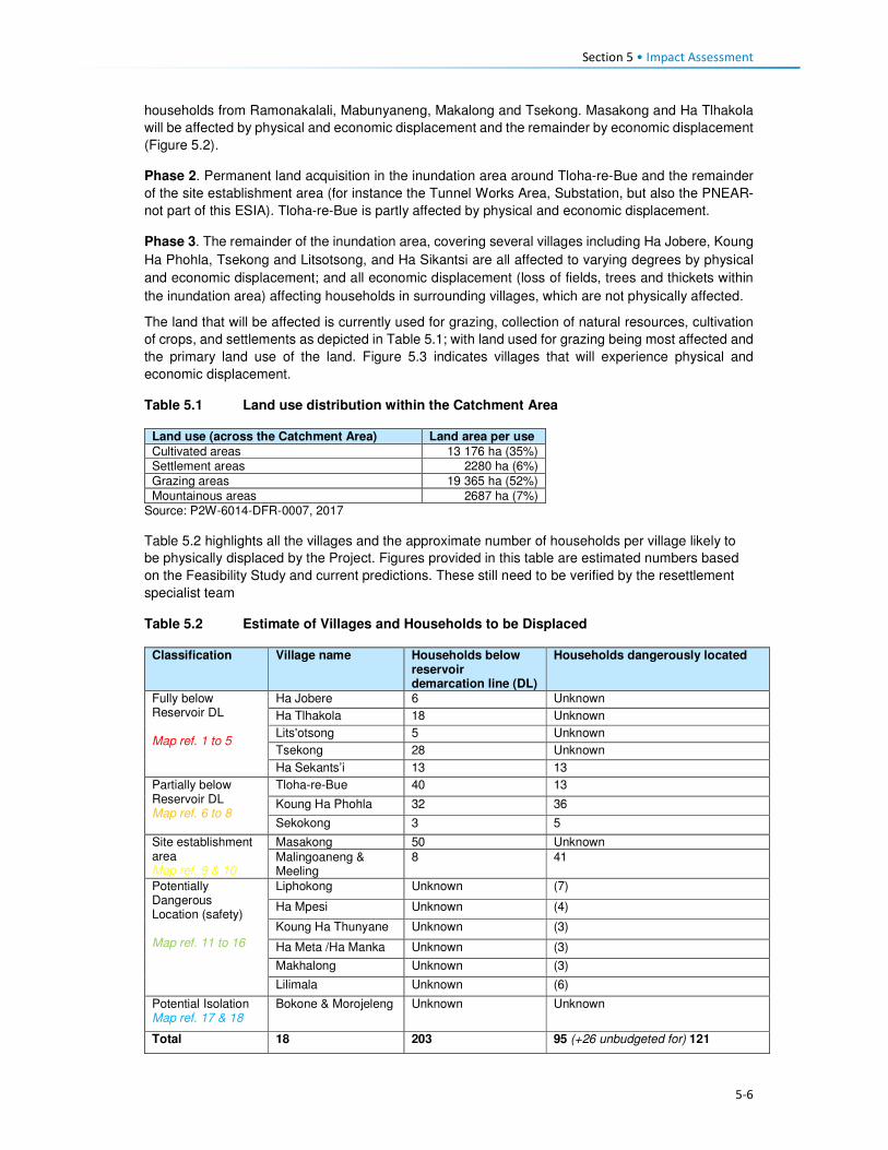
Section 5 • Impact Assessment
5-6
households from Ramonakalali, Mabunyaneng, Makalong and Tsekong. Masakong and Ha Tlhakola
will be affected by physical and economic displacement and the remainder by economic displacement
(Figure 5.2).
Phase 2. Permanent land acquisition in the inundation area around Tloha-re-Bue and the remainder
of the site establishment area (for instance the Tunnel Works Area, Substation, but also the PNEAR-
not part of this ESIA). Tloha-re-Bue is partly affected by physical and economic displacement.
Phase 3. The remainder of the inundation area, covering several villages including Ha Jobere, Koung
Ha Phohla, Tsekong and Litsotsong, and Ha Sikantsi are all affected to varying degrees by physical
and economic displacement; and all economic displacement (loss of fields, trees and thickets within
the inundation area) affecting households in surrounding villages, which are not physically affected.
The land that will be affected is currently used for grazing, collection of natural resources, cultivation
of crops, and settlements as depicted in Table 5.1; with land used for grazing being most affected and
the primary land use of the land. Figure 5.3 indicates villages that will experience physical and
economic displacement.
Table 5.1 Land use distribution within the Catchment Area
Land use (across the Catchment Area) Land area per use
Cultivated areas 13 176 ha (35%) Settlement areas 2280 ha (6%)
Grazing areas 19 365 ha (52%)
Mountainous areas 2687 ha (7%)
Source: P2W-6014-DFR-0007, 2017
Table 5.2 highlights all the villages and the approximate number of households per village likely to
be physically displaced by the Project. Figures provided in this table are estimated numbers based
on the Feasibility Study and current predictions. These still need to be verified by the resettlement
specialist team
Table 5.2 Estimate of Villages and Households to be Displaced
Classification Village name Households below reservoir demarcation line (DL)
Households dangerously located
Fully below Reservoir DL Map ref. 1 to 5
Ha Jobere 6 Unknown
Ha Tlhakola 18 Unknown
Lits'otsong 5 Unknown
Tsekong 28 Unknown
Ha Sekants’i 13 13
Partially below Reservoir DL Map ref. 6 to 8
Tloha-re-Bue 40 13
Koung Ha Phohla 32 36
Sekokong 3 5
Site establishment area Map ref. 9 & 10
Masakong 50 Unknown
Malingoaneng & Meeling
8 41
Potentially Dangerous Location (safety) Map ref. 11 to 16
Liphokong Unknown (7)
Ha Mpesi Unknown (4)
Koung Ha Thunyane Unknown (3)
Ha Meta /Ha Manka Unknown (3)
Makhalong Unknown (3)
Lilimala Unknown (6)
Potential Isolation Map ref. 17 & 18
Bokone & Morojeleng Unknown Unknown
Total 18 203 95 (+26 unbudgeted for) 121

5-7
Figure 5.3 Villages Likely to be Displaced by the Project

Section 5 • Impact Assessment
5-8
To mitigate for the loss associated with the Project land acquisition, LHDA has appointed a
resettlement planning consultant, as well as developed two critical documents, namely Phase II
Compensation Policy, 26 August, 2016 and the Livelihood Restoration and Social Development
Framework (LR&SDF), August, 2017.
The Compensation Policy provides the guiding principles for compensation of all losses that will be
incurred by Project affected households and communities. The Policy was developed on the basis of
consultations with affected communities, their authorities and other key stakeholders. English and
Sesotho versions of the Policy were made available to affected communities via the local authority
structures (District Councils, Urban Councils, Community Councils and Chiefs) as well as through local
participation structures set up for Phase II. The Policy objectives are:
• To minimise involuntary land take by investigating all possible Project design alternatives;
• To ensure that affected people and communities, including host communities are meaningfully
consulted on Project designs, alternatives and impacts;
• To promote affected people’s participation in the planning, implementation and monitoring of
compensation, resettlement, mitigation and development measures;
• To ensure that relocation of households and businesses is undertaken in a participative,
systematic and beneficial manner, involving both displaced and host communities;
• To ensure that affected people are promptly, fairly and fully compensated for their losses; and
• To ensure that direct compensation is accompanied by additional measures where necessary to
help restore livelihoods.
The Policy makes the following provisions in terms of losses of houses, associated structures and
residential plots:
All structures requiring relocation will be compensated on the principles of replacement cost in the
form of replacement housing provided by the Project, direct construction by the owner (owner-builder
method), or lump sum cash compensation (which will be assessed on a case-by-case basis).
Provision for replacement housing will comply with the following criteria:
• Replacement houses will be constructed at Project-designated resettlement sites or sites within
the Project Area identified by households and approved by LHDA and local authorities.
• Replacement houses will have the same floor area as the current houses, with the exception of
houses that are less than 20 m2 – the house will be replaced with a 20 m2 structure.
• Replacement houses will be constructed with standard modern materials or traditional building
materials if requested by affected households.
• Replacement housing will adhere to the country’s building and sanitation standards as a minimum
requirement, with a twelve (12) month defects liability period.
• Households will participate in the design and layout of replacement houses and will be presented
with a number of final designs from which to choose.
• Each household will be provided with a toilet of at least ventilated improved pit latrine (VIP)
standard.
• An appropriate cooking and heating facility or traditional fireplace (where requested and feasible)
will be provided in the new house.
• Each new residential plot will be fenced, up to a maximum residential plot size of 1000 m2 and, if
a household has a larger fencing entitlement, the difference will be compensated as a lump sum.
Loss of agricultural fields will be compensated through one or a combination of replacement land,
lump sum or annual payments, and/ or annual grain payments. The provision of replacement land is
the preferred option.
LHDA has further developed a LR&SDF which aims to set the context for the restoration of the
livelihoods of households affected by Phase II, and to ensure the provision of opportunities for the
diversification and improvement of livelihood-earning activities. The main guiding principles for the
Framework are:

Section 5 • Impact Assessment
5-9
• Principle 1: Livelihood restoration and social development initiatives will be undertaken within a
framework that supports local, regional and national development.
• Principle 2: Livelihood restoration and social development initiatives will be informed by the views
of the affected communities.
• Principle 3: Partnerships will be established for the planning, implementation and handover of
livelihood restoration and social development initiatives to communities.
• Principle 4: Livelihood restoration measures and social development initiatives will be monitored
and evaluated in a controlled manner in partnership with the intended programme beneficiaries.
• Principle 5: The objectives of management of land, water and living resources are a matter of
societal choice involving all relevant sectors of society.
Compensation for fields will be made to the field holder and his/her legally verified heir(s) and
successor(s) by means of a lump sum payment or through an agreed number of instalments, up to a
maximum of 50 annual instalments, into a nominated account or through investment with an approved
financial institution. The form of payment will be considered on a case-by-case basis, taking account
of the economic status and means of the household, and the wishes and preferences of the spouse
and other household members. Lump sum payments will be discounted at the rate established under
the approved compensation rates.
Grain payments will be retained as a compensation option. Grain compensation will be directly
proportional to the area of land lost, and paid annually for a period of fifty (50) years. Compensation
payments for garden land may be made as a lump sum or on an annual basis (fifty (50) years),
according to the preference of the affected household, except where a household who had a food
garden relocates to an area of its own choice outside the Project area, in which case compensation
will be in the form of a lump sum. Lump sum payments will be discounted at the rate established
under the approved compensation rates.
Communal assets such as grazing land, brush, wood, medicinal plants, useful grasses and wild
vegetables will be compensated through the establishment of Compensation Funds which will be
setup at a Community Council level and will be managed by LHDA. Compensation Funds will be made
available for investment and implementation of community development projects agreed and
prioritised by the local Council and the affected households. As households will be allowed to resettle
outside of their Community Council areas, the Compensation Funds for loss of communal assets will
be dispensed between the affected local councils (including host councils) based on the number of
displaced households relocating within/ or to each area.
The Policy furthermore, defines households headed by orphans, by persons living with a disability or
by elderly, or indigent persons as vulnerable. The Policy indicates that vulnerable households will
receive individual attention from LHDA as well as the relevant government agencies. Where possible,
the assistance of certain NGOs will be requested at the expense of LHDA. As far as reasonably
possible, LHDA will ensure that vulnerable households are enabled to retain, and where possible,
improve upon the standard of living they had prior to being affected by the Project. Possible support
measures for vulnerable (although not limited to vulnerable) households could include skills training
opportunities as applicable; income-generating or alternative livelihood earning opportunities (subject
to detailed feasibility studies); and assistance to get access to available poverty alleviation or social
welfare programmes.
Loss of access routes will be compensated for through the construction of footbridges, upgrading of
certain roads. This study for this has been commissioned under Contract 6019.
Apart from temporary relocation to accelerated access to cultivation land will be facilitated through
temporary land acquisition which will become permanent acquisition as part of the resettlement
planning process for a particular area. The temporary relocation will be discussed with affected
households and suitable temporary relocation arrangements will be made to allow households to
continue their social lives and livelihood activities.

Section 5 • Impact Assessment
5-10
Additional impacts that are linked to the Project’s land requirements include the loss of access to
rangelands, and loss of graves. These impacts have been described, assessed and mitigated for in
the respective specialist studies. Refer to:
• Soils Specialist Study (ERS, 2017; P2W-6014-DFR-0007);
• Rangelands Specialist Study (Ramatla & Kheekhe, 2017; P2W-6014-DFR-0009);
• Cultural Heritage Specialist Study (MM&A, 2017; P2W-6014-DFR-0003); and
• Terrestrial Ecology Specialist Study (Ecorex & Kobisi; P2W-6014-DFR-0002).
5.3 Construction and Inundation Phase Impacts 5.3.1 Impact of Physical Displacement and Resettlement
5.3.1.1 Description of Impact
The IFC PS5 (2012) describes physical displacement as the relocation or loss of shelter and other
household structures, and/ or restrictions on land use. During the construction and inundation phases,
the Project will result in physical displacement and relocation of at least 203 households in 11 villages
below the reservoir FSL, and possibly an additional 108-134 households in 11 villages which are
dangerously located in relation to the reservoir and may need to be relocated (see Table 5.2). In
addition to the affected households, there will also be impacts to a range of community and social
infrastructure and services; including roads, water sources, schools, clinics, markets/ commercial
areas, small businesses, and even the prison located at the town of Mokhotlong.
As described in Section 5.2.5, during Phases 1 and 2, there will be permanent physical displacement
of households from Masakong and Ha Tlhakola (resulting from the Phase 1 advance works
programme), and of households in the inundation area around Tloha-re-Bue and the remainder of the
site establishment area during Phase 2. During Phase 3, there will be physical displacement of
households across the inundation area; covering several villages including Ha Jobere, Koung Ha
Phohla, Tsekong and Litsotsong, and Ha Sekants’i.
As part of Phase 1, the advance works programme requires temporary relocation of between 10 and
15 households from Masakong for ~3 years. This temporary relocation is to enable construction of the
access road to facilitate site establishment of the Eastern Facilities (e.g. Polihali Village, offices and
labour camps). During this time it is anticipated that these households will be temporarily housed in a
nearby location that does not pose any safety risks. Once road construction is complete and the area
is rehabilitated the households will be permanently relocated back to Masakong village. These
households will undergo two resettlement processes; while this will be extremely disruptive, the
intention is to avoid long-term displacement from their land/ village.
Table 5.2 and Figure 5.3 provide indicative figures and the location of households that are most likely
to require resettlement. It is evident that the largest physical losses will arise from inundation, as whole
villages will be affected and the greatest number of households. The exact numbers and locations of
households, infrastructure and services that will experience permanent and/or temporary physical
relocation are being refined as part of the RAP process.
5.3.1.2 Sensitivity of Receptors
The communities in the area are extremely poor and are geographically isolated, largely because of
poor road accessibility and limited telecommunication coverage. They are largely reliant on land-based
livelihoods and because of poor linkages with urban areas there is limited flow of money and goods.
There are vulnerable people in the local communities who, by virtue of their gender, age, physical or
mental disability, economic disadvantage or social status would be more adversely affected by the
Project, and who may be limited in their ability to take advantage of the Project’s development benefits
and deal with the negative consequences. Vulnerable people require special attention and

Section 5 • Impact Assessment
5-11
consultation, and include HIV/ AIDS affected people and households; people co-infected by HIV/AIDS
and tuberculosis (TB); child-headed households; people with mental health illnesses; people with
physical disabilities; sex workers; elderly; children and orphans, and herders. In line with the provisions
of the Land Act and the Phase II Compensation Policy, both owners (spouses) are required to sign
the asset verification and compensation offers, thus mitigating the patriarchal system in the area. A
Power of Attorney form will need to be completed if it is anticipated that one spouse will be unavailable
at the time of the asset verification and compensation offer.
Based on the above, households affected by physical displacement are considered to have High
sensitivity to this impact.
5.3.1.3 Assessment of Impact
The impact of physical displacement of households will be direct, negative and localised in nature.
The impact of physical displacement will be permanent. The magnitude of the unmitigated impact will
be Large given the high number of affected households, the extent of the disruption, and likely stress
to the affected families in the long-term - particularly until they are able to settle into new houses and
re-establish their livelihoods. Given the High sensitivity of these households, the overall significance
of this impact (pre-mitigation) is rated Critical.
The 10-15 households from Masakong that will be temporarily housed prior to permanent resettlement
will experience the most disruption over an extended period of time. They will experience this impact
most acutely.
Table 5.3 Impact of Physical Displacement of Households
Pre-Mitigation Impact Residual Impact
Type of Impact Direct negative
Magnitude Large Small-Medium
Sensitivity High High
Significance Critical* Moderate-Major
* The households from Masakong that will be resettled twice will be most acutely impacted.
** Note: The residual rating is based on a precautionary judgement that takes into account the disruption and stress caused to
affected households who have to relocate and the uncertainty as to how different households will respond to this. Households
will have differing residual rating depending on their final resettlement terms. Some households may respond positively while
others may adapt with difficulty. Based on the ESIA definitions, an impact of Moderate has an impact magnitude that is within
applicable standards, but falls somewhere in the range from a threshold below which the impact is minor, up to a level that
might be just short of breaching a legal limit, and requires that impacts are managed effectively and efficiently.
5.3.1.4 Mitigation Measures
In accordance with the mitigation hierarchy, the Project planning has aimed to minimise displacement
as far as possible, in the knowledge that resettlement is a highly significant social impact for affected
families (as well as delaying implementation of the Project and increasing costs).
Physical displacement requires a separate RAP (in accordance with international lender requirements
(e.g. ESS 5 / IFC PS5) that must take cognisance of the land-based livelihoods, social networks and
the wider community structures. Furthermore, many households are extremely poor and are therefore
more vulnerable to the impacts of displacement. Apart from replacing houses and compensating for
other assets affected by the Project in accordance with the agreed LHWP Phase II Compensation
Policy and rates schedule, affected households should be included in the development and
implementation of alternative livelihood strategies in accordance with the LHWP Phase II LR&SDF.
• LHDA will ensure that Resettlement Planning and Implementation (that forms part of a separate
contract (LHDA Contract No. 6015)) is compliant with all provisions of the LHWP Phase II
Compensation Policy and the agreed rates schedule.

Section 5 • Impact Assessment
5-12
Activities to be undertaken under the RAP include.
• Regular review and updating of the Phase II Community Participation Strategy developed by
LHDA that builds on the existing community structures established by LHDA in the form of ALCs
and is aligned with the requirements of the international lenders such as the World Bank.
• Asset registration of all community assets within the affected area in accordance with LHDA’s
Asset Registration Procedure (October 2017). Assets that will be recorded under the RAP include:
• Houses and associated structures – dwellings, toilets, storerooms, kraals, perimeter walls,
fencing and cattle posts;
• Other private physical assets – non-moveable assets such as residential land, agricultural
fields, gardens, trees, thickets and graves;
• Private enterprises such as shops and other business establishments; and
• Any public amenities and structures that may be affected, e.g. communal water point.
Asset registration shall include confirming proof of ownership of affected assets, and proof of
identity of affected owners.
• Socio-economic Census of affected persons, assets and other entities to establish an accurate
socio-economic profile that can be used as the basis for future monitoring.
• Compensation and Relocation planning by the appointed RAP consultant that shall include:
• Confirm eligibility of households requiring resettlement and the relocation options with the
affected households and local authorities, with a preference for identifying relocation options
on the same plot or village;
• Determine and record initial livelihood restoration preferences of affected households;
• Identify and confirm relocation sites; and undertake surveys of relocation sites where required;
• Assist LHDA with formal acquisition of the relocation sites;
• Undertake planning of relocation plots/sites, including land preparation requirements and any
required services/amenities and prepare physical layout plans for relocation plots/sites;
• Confirm house replacement preferences with affected households, and if appropriate cash
compensation;
• Prepare compensation and relocation plans with each affected household; and
• Prepare plans for relocation / compensation of affected graves.
• Prepare Resettlement Action Plans based on the information obtained during the previous listed
activities and include a costing for implementation and an implementation plan. The RAP must be
shared with communities at community meetings, and formally publicised.
• Mitigation for other community impacts Implement the recommendations/ measures that will
be proposed in the Bridges and Feeder Roads Master Plan and RAP to ensure that households
retain access to social services, community infrastructure and resources where the Project results
in severed access.
• Preparation of Tender Documents for implementation of the resettlement activities in
accordance with LHDA’s Procurement Policy and LHDA’s Anti-Corruption Policy.
• Resettlement Implementation (to be done by LHDA with support of the RAP consultant (under
LHDA Contract No. 6015)) which shall include:
• Signing of compensation agreements with affected communities;
• Payment of compensation (including facilitating opening of bank accounts for households);
and
• Implementation and management of the resettlement programme including preparation of
relocation sites; construction of replacement housing and amenities/services; physical
Section 5 • Impact Assessment
5-13
relocation of households and their belongings; and relocation of graves and other social
mitigation.
Additional aspects that shall be considered as part of the RAP contract include:
• The socio-economic census shall outline multiple providers of income and include a gender
analysis as a basis for facilitating different opportunities for employment of women;
• Criteria set for the socio-economic census for determining vulnerability of households shall ensure
that vulnerable groups (poor, elderly, ethnic minorities) are included;
• Compensation and other necessary assistance shall be provided before impacts of the Project
occur;
• Arrangements and resources for resettlement shall be adequate and assigned;
• The resettlement timetable shall be linked to the phasing of Project implementation;
• Physical and economic assistance to households will be provided during relocation;
• Households requiring relocation shall be properly briefed on the advantages and disadvantages
of different housing types to make informed decisions;
• Replacement housing structures shall be built to Lesotho’s building and safety standards;
• Grievance procedures shall be prepared and implemented; and
• A Monitoring and Evaluation Plan for resettlement shall be prepared and implemented, and mid-
term and long-term Monitoring and Evaluation audits conducted.
Masakong Households:
• The 10-15 households from Masakong that will be temporarily housed prior to permanent
resettlement will experience the most disruption over an extended period of time. These
households will experience this impact most acutely and should be treated as highly sensitive
households; and
• Where possible, temporary relocation should be avoided and a permanent site should be identified
upfront.
5.3.1.5 Residual Impact
Implementation of the RAP as stipulated under the mitigation measures above is predicted to reduce
the magnitude to Small-Medium; receptor sensitivity will remain High. Over time, as households adapt
to the new location, the residual impact significance should reduce to one of Moderate-Major
significance and possibly even lower in some cases. This is difficult to predict given that relocation
terms and details are still to be defined and agreed, these will differ by household and each household
will respond differently to the final relocation. As such, monitoring should extend for a suitable period
into operation in order to ensure that the quality of life of displaced persons is equal to or better than
prior to displacement.
5.3.2 Economic Displacement
5.3.2.1 Description of Impact
According to IFC PS5 (2012), economic displacement refers to the loss of assets or access to assets
that leads to loss of income sources or other means of livelihood. In this case, the construction and
operation of LHWP Phase II will result in the loss of access to agricultural land, grazing land, natural
resources, and access to markets.
During all phases of the RAP (Phases 1, 2 and 3), economic displacement will occur. During Phase
1, households in Masakong, Ha Tlhakola, Ramonakalali, Mabunyaneng, Makalong and Tsekong will
experience economic displacement. In Phase 2 the area around Tloha-re-Bue will be affected. Finally,
the remainder of the inundation (Phase 3) will result in economic losses to households from Ha Jobere,
Koung Ha Phohla, Tsekong, Litsotsong, Ha Sekants’I. Phase 3 will also lead to a loss of agricultural
fields, trees and thickets affecting households in a number of surrounding villages, which are not
physically affected. The RAP will identify the exact impacts, the individual households and customary
areas (and users) that will be affected.

Section 5 • Impact Assessment
5-14
Land users engaged in crop cultivation and livestock farming will experience economic displacement,
affecting their ability to produce food and cash crops/ produce. Given the shortage of arable land in
the area, it is expected that this loss of land will have a significant impact on food security, household
income and livelihoods for the affected families. This will be further aggravated for those who face
displacement relating to changing availability of other natural resources (e.g. medicinal and fuel
plants), indirectly impacting subsistence livelihoods and traditional household structures. To a lesser
extent, it is possible that construction disturbance may impact the potential for hunting wild animals,
although this is considered a marginal contribution to households. Economic displacement requires a
separate LRP (in accordance with international lender requirements).
This impact will be experienced directly as a result of a combination of: i) lost access to these land-
based livelihoods and resources from which the majority of the population in the Project Area derive
an income; ii) increased competition for land by displaced people and migrants moving into the area
(e.g. work-seekers); iii) lack of alternatives; and iv) increased time and cost due to extended traveling
distances to and from areas where resources are still available.
The main economic activities that will be affected by the Project are discussed below.
Loss of Access to Agricultural Land
Local livelihoods of the Project affected area are heavily dependent on crop production for household
subsistence and survival. Crops are grown for multiple purposes, primarily household consumption
(average 75%) followed by sale, bartering, and payment to others for services rendered. Some
households in the area do not engage in crop production. However, it is likely that a member of these
households is involved in agriculture as a worker or via a sharecropping arrangement.
Between 1000 and 1500 ha of land currently under cultivation will be lost to the Project. This loss
accounts for approximately 11% of the total land area (as at 2017) under cultivation across the Project
Area (Ecorex and Kobisi, 2017). Most of the productive agricultural land is located in the area that will
be inundated by the Reservoir. The exact number of fields to be affected and the number of
households to be affected by the loss of agricultural fields is currently unknown and this will be
confirmed and assessed as part of the RAP. Given the existing shortage of arable land within the
Project Area, there is a high likelihood that affected people may not be provided with like-for-like
replacement land for the loss of fields.
Loss of Access to Grazing Land
Livestock production is also an important livelihood source for local households. During the 2013/2014
agricultural year, Mokhotlong District had an estimated 40,932 head of cattle and approximately
300,000 sheep and goats (Section 4.4.4). As such, access to, and availability of, grazing land is
essential. Livestock grazing occurs across the Project Area and beyond; however, the majority of the
grazing that will be affected is of poor quality, reportedly due to overgrazing and a lack of adequate
management, exacerbated by the recent period (3-4 years) of low rainfall.
The Project will result in a loss of access to grazing areas, specifically resulting from inundation. All
directly affected grazing will be permanently lost and affected people will be expected to find alternate
grazing, thus placing an additional strain on existing grazing resources beyond the Project footprint.
Furthermore, FGD respondents indicated that local people are not willing to reduce their livestock
numbers, due to the income generated from the production of mohair, wool, and other produce.
Note, the impact of dam inundation on rangelands and soil and land use capability has been separately
assessed by the rangeland and soil specialists, respectively in Ramatla & Kheekhe (2017) and ERS
(2017), which include additional mitigation measures to improve land use capability.
Loss of Access to Natural Resources
Natural resources are collected by all households living in the area. These are used for household
consumption (57%), medicinal purposes (31%) and other uses (12%) (see Section 4.6). These
resources are collected across various locations within the broader Project Area including riverbanks,
grazing areas, and mountainous areas. The most important natural resources in the Project Area

Section 5 • Impact Assessment
5-15
include wood, brush, water, sand, wild plants and fruits, and medicinal plants used to cure various
illnesses for both humans and livestock. Some of these wild vegetables and medicinal plants only
grow along the riverine areas. Wood and brush are collected and used as sources of fuel for cooking
and heating in the households. Wild plants and fruit are collected for household consumption and sale
in order to supplement household food reserves and income. Sand is collected from the riverbeds of
the Khubelu and Senqu rivers for building material with the permission of the community councillors.
Project activities which will impact access to natural resources include:
• Vegetation clearance during construction;
• Establishment of temporary and permanent infrastructure;
• Inundation of the dam;
• Establishment of new settlements, grazing and agricultural fields; and
• Increased population due to in-migration of work and business-seekers.
The loss of access to natural resources may be exacerbated by the generally degraded vegetation in
the Project Area and increased competition for the remaining natural resources by both local people
and in-migrants. While this impact is related to other forms of economic displacement described
above, notably loss of arable and grazing land, this impact is assessed separately in Section 5.3.3
(site clearance for construction) and Section 5.3.4 (inundation).
5.3.2.2 Sensitivity of Receptors
As indicated in Section 5.3 the communities are extremely poor and highly reliant on a land-based
resource economy for their livelihoods; are geographically isolated and have little alternative sources
of income. The affected families are classed as having High sensitivity to economic displacement from
land take requirements for the Project. The receptors that will be most sensitive to the impact include
the direct owners of affected agricultural fields, livestock owners, those that practise sharecropping,
agricultural labourers. Users of natural resources will also be sensitive to the loss of resources;
however, many of these resources will be available elsewhere, albeit slightly further away.
5.3.2.3 Assessment of Impact
The impact of economic displacement will be direct and negative in nature. The impact will be localised
and experienced by the Project affected people who will lose access to agricultural land (cultivated
and grazing), and natural resources. Economic displacement impacts will occur during the various
construction and inundation phases; they will be permanent. The impact magnitude will be Large
owing to the significant reliance of the affected people on these livelihood activities, lack of skills and
experience to undertake alternate employment, and a lack of alternate work opportunities. The Large
magnitude and High sensitivity of the affected households will result in a Critical pre-mitigation
significance rating.
Table 5.4 Impact of Economic Displacement
Pre-Mitigation Impact Residual Impact
Type of Impact Direct negative
Magnitude Large Medium
Sensitivity High High
Significance Critical Major*
* It is difficult to assess the residual rating given that the details of compensation are not know and the ability to replace
livelihoods is dependent on many variable factors, including the willingness/ interest/ ability of the affected people to adopt new
livelihood strategies.
5.3.2.4 Mitigation Measures
As described in Section 5.2.5, LHDA has appointed Resettlement Specialists to develop a RAP and
LRP (LHDA Contract No. 6015). The RAP and all livelihood restoration and social development
interventions will be designed and implemented in compliance with all provisions of the LR&SDF,
LHDA’s Phase II Compensation Policy and the agreed rates schedule. These documents are aligned
with national requirements and international best practice guidelines. Unavoidable acquisition of

Section 5 • Impact Assessment
5-16
arable land, loss of grazing land and natural resources will be compensated in accordance with the
LHDA Phase II Compensation Policy and schedule of rates.
As part of the asset registration process for the RAP (LHDA Contract No. 6015) (outlined in Section
5.2.5), the following information needs to be collected prior to Project construction in order to verify
the extent of land acquisition and compensation required:
• Size of arable land units, and improvements to land;
• Common property resources such as rangeland and thickets/ woodlots; and
• Number of families and persons directly or indirectly affected by land acquisition through loss of
livelihood and/ or loss of agricultural opportunity, including sharecroppers.
LHDA will seek to ensure:
• The RAP contract is implemented effectively to ensure Project affected people are not left worse-
off following displacement;
• Allocation of replacement land is prioritised over lump sum cash payments;
• The socio-economic census conducted under the RAP is used to identify affected persons,
especially vulnerable persons, and is used to inform targeted livelihood restoration for those most
impacted by the Project;
• Displaced persons should be meaningfully consulted on decisions that affect their livelihoods and
well-being and shall be fully informed of their options and the compensation rates;
• Consultation and information disclosure is aligned to the Community Participation Strategy and
the requirements of the international safeguards;
• Assistance is provided to affected people to improve, or at least restore, incomes and living
standards to at least the equivalent level prior to construction, if not better;
• Compensation and other necessary assistance are provided before impacts occur (e.g.
compensation is paid prior to construction);
• Community compensation of grazing land should be provided where land-take may impact long
term grazing productivity (i.e. where reinstatement is unlikely to restore original land use);
• The LR&SDF is implemented and includes the affected communities and households and should
be developed to enhance future income earning and employment opportunities. Livelihood
restoration planning is initiated early;
• Organisational roles and the capacity to support livelihoods restoration are defined and
appropriate;
• A Monitoring and Evaluation Plan for livelihoods restoration is prepared and implemented, and a
mid-term and long-term Monitoring and Evaluation audit is conducted.
• Grievance mechanisms are developed and accessible, and grievances are tracked and
monitored, and a concerted effort is made to close out grievances timeously; and
• LHDA will collaborate with relevant authorities and organisations to initiate and develop projects
that aim to enhance agricultural production amongst the population of the Project Area. These
should address the application of more effective farming methods, approaches to increase crop
yields, and mechanisms to assist farmers in selling their produce at the highest possible prices.
Other Measures:
• Measures outlined by the soils, rangelands and terrestrial ecology specialists (ERS, 2017;
Ramatla & Kheekhe, 2017; and Ecorex & Kobisi, 2017, respectively) will also contribute to the
mitigation of the impacts related to economic displacement; and
• LHDA is developing an ICM Plan, which will aim to manage resources and land use within the
local catchment in order to ensure the sustainability of the Project into the long-term. The plan will
need to incorporate social considerations and obtain the buy-in of the affected communities in
order for any projects coming out of the ICM Plan to be successfully implemented.
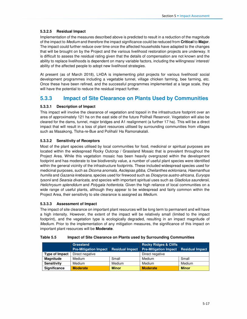
Section 5 • Impact Assessment
5-17
5.3.2.5 Residual Impact
Implementation of the measures described above is predicted to result in a reduction of the magnitude
of the impact to Medium and therefore the impact significance could be reduced from Critical to Major.
The impact could further reduce over time once the affected households have adapted to the changes
that will be brought on by the Project and the various livelihood restoration projects are underway. It
is difficult to assess the residual rating given that the details of compensation are not known and the
ability to replace livelihoods is dependent on many variable factors, including the willingness/ interest/
ability of the affected people to adopt new livelihood strategies.
At present (as of March 2018), LHDA is implementing pilot projects for various livelihood/ social
development programmes including a vegetable tunnel, village chicken farming, bee farming, etc.
Once these have been refined, and the successful programmes implemented at a large scale, they
will have the potential to reduce the residual impact further.
5.3.3 Impact of Site Clearance on Plants Used by Communities
5.3.3.1 Description of Impact
This impact will involve the clearance of vegetation and topsoil in the infrastructure footprint over an
area of approximately 121 ha on the east side of the future Polihali Reservoir. Vegetation will also be
cleared for the dams, tunnel, major bridges and A1 realignment (a further 17 ha). This will be a direct
impact that will result in a loss of plant resources utilised by surrounding communities from villages
such as Masakong, Tloha-re-Bue and Polihali/ Ha Ramonakalali.
5.3.3.2 Sensitivity of Receptors
Most of the plant species utilised by local communities for food, medicinal or spiritual purposes are
located within the widespread Rocky Outcrop / Grassland Mosaic that is prevalent throughout the
Project Area. While this vegetation mosaic has been heavily overgrazed within the development
footprint and has moderate to low biodiversity value, a number of useful plant species were identified
within the general vicinity of the infrastructure footprints. These included widespread species used for
medicinal purposes, such as Dicoma anomala, Asclepias gibba, Cheilanthes eckloniana, Haemanthus
humilis and Gazania krebsiana, species used for firewood such as Diospyros austro-africana, Euryops
tysonii and Searsia divaricata, and species with important spiritual uses such as Gladiolus saundersii,
Helichrysum splendidum and Polygala hottentota. Given the high reliance of local communities on a
wide range of useful plants, although they appear to be widespread and fairly common within the
Project Area, their sensitivity to site clearance is assigned as Medium.
5.3.3.3 Assessment of Impact
The impact of site clearance on important plant resources will be long term to permanent and will have
a high intensity. However, the extent of the impact will be relatively small (limited to the impact
footprint), and the vegetation type is ecologically degraded, resulting in an impact magnitude of
Medium. Prior to the implementation of any mitigation measures, the significance of this impact on
important plant resources will be Moderate.
Table 5.5 Impact of Site Clearance on Plants used by Surrounding Communities
Grassland Rocky Ridges & Cliffs
Pre-Mitigation Impact Residual Impact Pre-Mitigation Impact Residual Impact
Type of Impact Direct negative Direct negative
Magnitude Medium Small Medium Small
Sensitivity Medium Medium Medium Medium
Significance Moderate Minor Moderate Minor

Section 5 • Impact Assessment
5-18
5.3.3.4 Mitigation Measures
The following measures are recommended as mitigation for the impact of site clearance on important
plant resources:
• Local traditional medicine practitioners and members of local communities should be allowed and
encouraged to harvest plant resources within the infrastructure footprint prior to site clearance;
• Local communities should be supported to start plant nurseries/ community gardens to propagate
and grow useful plant resources; and
• Plants rescued by the contractors should be planted in a nursey for use in landscaping of the
Polihali Village.
5.3.3.5 Residual Impact
Implementation of the measures described above and in the Construction EMP (Volume 2, Annexure
L.1) will reduce the magnitude of the impact to Small and the impact significance to Minor.
5.3.4 Impact of Reservoir Inundation on Plant Resources Used by Communities
Note: this impact has been incorporated into this SIA from the Terrestrial Ecology Specialist Report
(Ecorext & Kobisi; 2017).
5.3.4.1 Description of Impact
The inundation of the Polihali Reservoir will result in the flooding of approximately 5600 ha of habitat.
This will be a direct impact that will result in a loss of grassland, rocky outcrop and seep habitats
containing important plant resources that are utilised by surrounding communities. In addition,
inundation will flood several villages, several of which are expected to have spiral aloes planted around
homesteads.
5.3.4.2 Sensitivity of Receptors
Most of the plant species utilised by surrounding communities are located within the widespread Rocky
Outcrop/ Grassland Mosaic that is the dominant vegetation type within the inundation zone. This
vegetation mosaic has been heavily overgrazed and has moderate to low biodiversity. These include
widespread species used for medicinal and other purposes, such as Dicoma anomala, Asclepias
gibba, Cheilanthes eckloniana, Haemanthus humilis and Gazania krebsiana, species used for
firewood such as Diospyros austro-africana, Euryops tysonii and Searsia divaricata, and species with
important spiritual uses such as Gladiolus saundersii, Helichrysum splendidum and Polygala
hottentota. In addition, inundation will flood several villages which include individuals of Spiral Aloe
(Aloe polyphylla) – assessed as Critically Endangered in the wild - that are frequently planted outside
homesteads for cultural/spiritual and aesthetic purposes. Given the status of Spiral Aloes, their
sensitivity to inundation is considered to be High.
Due to the presence of culturally important plant species, the grassland and rocky habitats are
considered of Medium sensitivity.
5.3.4.3 Assessment of Impact
The impact of inundation on important plant resources will be permanent and of high intensity, and the
extent of the impact is large due to the size of the reservoir (5600 ha). Although the majority of the
species used appear to be reasonably common and widespread in the wild, community members are
highly dependent on plant species for food, fuel and medicinal uses. The presence of the reservoir
will require community members to travel further to collect such useful plants. Flooding of planted
spiral aloes located around homesteads in inundated villages will have direct impacts on this species
and may lead to an increase in harvesting of specimens in wild colonies to replace those flooded.
The number of spiral aloes that may be affected has not been quantified but several were seen in
villages that will be affected by flooding, such as Tloha-re-Bue. The impact magnitude is assessed as
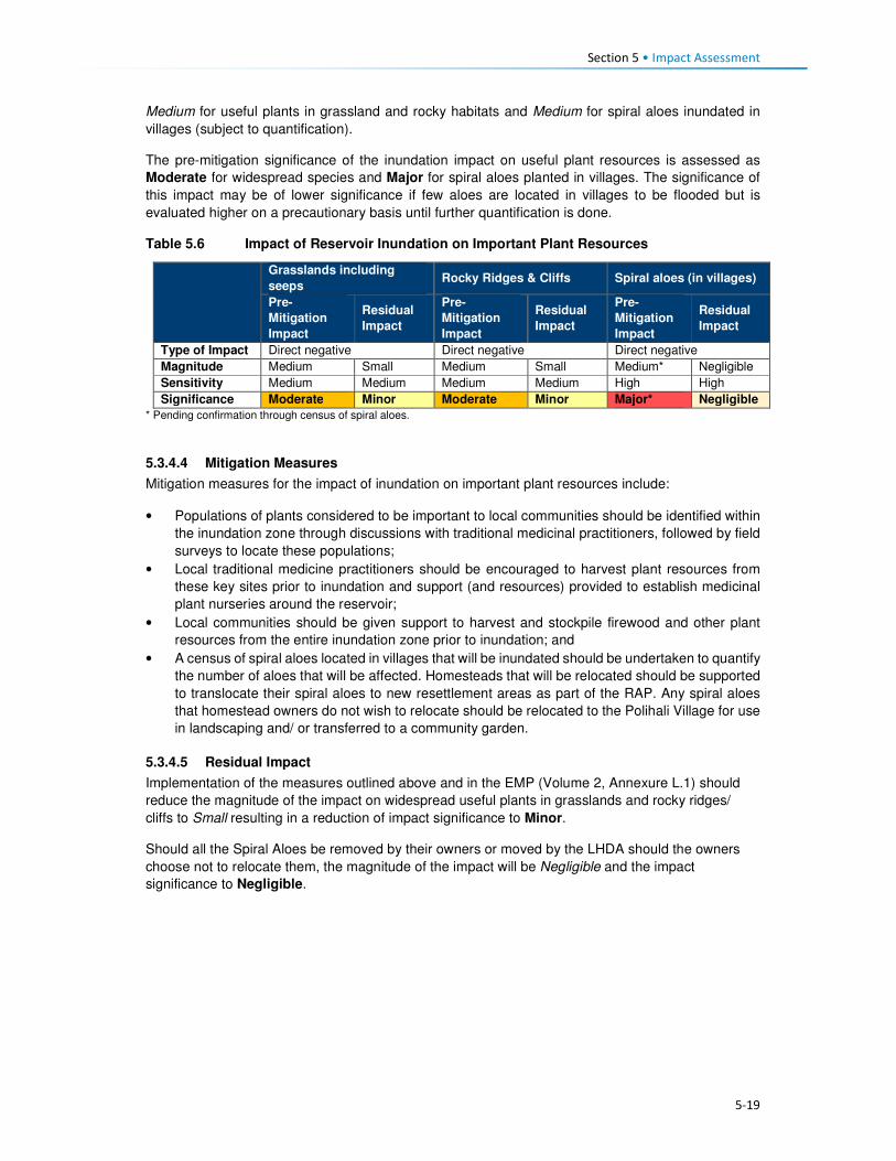
Section 5 • Impact Assessment
5-19
Medium for useful plants in grassland and rocky habitats and Medium for spiral aloes inundated in
villages (subject to quantification).
The pre-mitigation significance of the inundation impact on useful plant resources is assessed as
Moderate for widespread species and Major for spiral aloes planted in villages. The significance of
this impact may be of lower significance if few aloes are located in villages to be flooded but is
evaluated higher on a precautionary basis until further quantification is done.
Table 5.6 Impact of Reservoir Inundation on Important Plant Resources
Grasslands including
seeps Rocky Ridges & Cliffs Spiral aloes (in villages)
Pre-
Mitigation
Impact
Residual
Impact
Pre-
Mitigation
Impact
Residual
Impact
Pre-
Mitigation
Impact
Residual
Impact
Type of Impact Direct negative Direct negative Direct negative
Magnitude Medium Small Medium Small Medium* Negligible
Sensitivity Medium Medium Medium Medium High High
Significance Moderate Minor Moderate Minor Major* Negligible
* Pending confirmation through census of spiral aloes.
5.3.4.4 Mitigation Measures
Mitigation measures for the impact of inundation on important plant resources include:
• Populations of plants considered to be important to local communities should be identified within
the inundation zone through discussions with traditional medicinal practitioners, followed by field
surveys to locate these populations;
• Local traditional medicine practitioners should be encouraged to harvest plant resources from
these key sites prior to inundation and support (and resources) provided to establish medicinal
plant nurseries around the reservoir;
• Local communities should be given support to harvest and stockpile firewood and other plant
resources from the entire inundation zone prior to inundation; and
• A census of spiral aloes located in villages that will be inundated should be undertaken to quantify
the number of aloes that will be affected. Homesteads that will be relocated should be supported
to translocate their spiral aloes to new resettlement areas as part of the RAP. Any spiral aloes
that homestead owners do not wish to relocate should be relocated to the Polihali Village for use
in landscaping and/ or transferred to a community garden.
5.3.4.5 Residual Impact
Implementation of the measures outlined above and in the EMP (Volume 2, Annexure L.1) should
reduce the magnitude of the impact on widespread useful plants in grasslands and rocky ridges/
cliffs to Small resulting in a reduction of impact significance to Minor.
Should all the Spiral Aloes be removed by their owners or moved by the LHDA should the owners
choose not to relocate them, the magnitude of the impact will be Negligible and the impact
significance to Negligible.

Section 5 • Impact Assessment
5-20
5.3.5 Creation of Employment Opportunities
5.3.5.1 Description of Impact
Employment (formal and informal) and other income generation opportunities in the Project Area and
District are scarce, specifically for those with no or low levels of education. The majority of the local
population are involved in subsistence agricultural activities (i.e. crop and livestock production) as their
primary livelihood strategy. Formal employment opportunities in the District are largely associated with
government services (e.g. district officials, police, teachers and medical personnel) and the tourism
industry; these require educated people. The majority of formal employment occurs in the larger towns.
There are some small enterprises providing basic services throughout the Project Area, these include
selling fresh and processed foods, basic groceries, alcohol, etc. These businesses are predominantly
located along the roads or clustered in larger settlements.
Levels of education across the Project Area are low, many learners drop out of school in order to assist
with family responsibilities and household tasks, these activities are usually linked to agriculture and
household chores. The population, especially the youth, lack work experience and skills; many of the
elderly people have worked in other parts of the country or in the mining sector in South Africa. The
main skills found in the area are elementary in nature and associated with agriculture. In FDGs,
respondents confirmed that some people in the Project Area have skills but lack formal qualifications
or certificates.
Based on feedback received during the stakeholder engagement activities (January to March 2017),
the population (specifically the youth) have particularly high expectations that the Project will afford
them the opportunity of waged employment. In addition, there is enthusiasm, as well as a sense of
entitlement to Project employment opportunities, justified by the direct negative impacts that they are
likely to experience. Tension (and potentially violence) could arise between local residents and work-
seekers who are competing for the same employment opportunities especially as migrant work-
seekers may have more work experience.
The contractors for the different construction components have not yet been appointed. They will be
appointed through a rigorous tender process that will be open for bidding by any company. As such,
the origin of the company and its workers is not yet known; the exact number of workers will depend
on the approach to construction proposed by the contractors. It is, however, anticipated that the
number of employment opportunities will peak between 3500 and 4000 people; the split between
skilled, semi-skilled and unskilled jobs is also unknown at present. Many of the construction tasks are
highly technical in nature and are likely to require specialised skills and expertise. It is expected that
the majority of skilled workers are likely to be part of the contractors’ permanent team of staff or may
be subcontracted for specific tasks from other firms.
The appointed contractors will be required to operate in accordance with LHDA’s Labour Recruitment
Guidelines. Employment of unskilled labour will be reserved for Lesotho nationals and priority will be
given to people from the Project Area. In an attempt to maximise employment (and the associated
benefits), the guideline requires that all employees should receive proper training and skills
development, employment contracts for a minimum of one month to one year or more depending on
the nature of the work, thus allowing the rotation of labour where more people will benefit. Short-term
or ‘casual’ labour will be for less than one month in duration. Local labour will be coordinated and hired
via an independently established PLRD (proposed to be located at Tlokoeng near Mokhotlong with a
satellite office at Ha Lejone) where work-seekers can register, and which will work closely with the
already established ALCs. The Guidelines specify that employment opportunities for both men and
women should be optimised, and that discrimination of any kind will not be permitted. Transparency
and fairness are core principles of the guideline.
For all other levels of employment (excluding unskilled), LHDA have stipulated that Lesotho nationals
are to be prioritised. Where it can be demonstrated that local personnel are not available, the
opportunities can be extended to South African nationals, Southern African Development Community
(SADC) member states, and finally worldwide.

Section 5 • Impact Assessment
5-21
Appropriate training and capacity building opportunities will be provided to all workers. Opportunities
for rehiring into more skilled positions will be considered and applied.
In addition to direct employment opportunities, many indirect and induced employment opportunities
will be created within the supply chain (indirect), and to meet the needs of the migrant work-seekers
and the Project workers who will have increased levels of disposable income.
5.3.5.2 Sensitivity of Receptors
The sensitivity of the communities in the Project Area is considered Medium given that, due to low
levels of education and a lack of suitable experience, the majority of local people are unlikely to qualify
for any positons other than unskilled labour. In addition, the communities have exceedingly high
expectations of the potential changes these short-term opportunities will provide in terms of improving
the standard of living. It is possible that some people may choose to leave casual agricultural work in
anticipation of being employed by the Project. Competition amongst residents of the area will be high,
as well as between residents and migrant work-seekers.
5.3.5.3 Assessment of Impact
Employment will be experienced as a direct, indirect and induced positive impact as it relates to the
Project, the associated supply chain, and the increased size of the population. The extent of the impact
as it relates to the construction phase will be both local, national, as well as international (specifically
SADC). The impact will be short-term with respect to the rotational basis of employment (12 to 18
months) but will provide the workers with skills/ experience for the long-term.
The magnitude of the impact as it relates to all employment opportunities is expected to be Medium
for local people who will be able to secure jobs with the Project. Therefore, the significance of the
impact in all phases is rated as Moderate.
Table 5.7 Impact of Related to Creation of Employment Opportunities
Pre-Mitigation Impact Residual Impact
Type of Impact Direct, indirect and induced; positive
Magnitude Medium Large
Sensitivity Medium Medium
Significance Moderate Major
5.3.5.4 Enhancement Measures
LHDA have developed the Phase II Labour Recruitment Guidelines in order to guide the recruitment
and management of labour. The intention of the Guidelines are to:
• Provide a recruitment mechanism that will ensure that labour requirements are met in an efficient
and timely manner;
• Optimise employment opportunities for both men and women;
• Promote fairness and transparency during recruitment processes;
• Ensure that the recruitment of labour is properly recorded, managed and that a good database is
kept;
• Promote coordination and cooperation between LHDA FOBs, contractors and local authorities
during the recruitment of labour; and
• Minimise labour disputes, and social, health and environmental impacts caused by people
migrating to the Project Area and construction sites, in search of employment opportunities.
• As per LHDA’s Labour Recruitment Guidelines, all appointed contractors and others recruiting
unskilled labour will ensure that:
• Local people are prioritised for unskilled labour - at least 80% of the unskilled workforce is hired
from villages located within the affected community councils;
• There is no discrimination in recruitment, the workforce should comprise men, women, disabled
and people from different religious/ cultural backgrounds;
Section 5 • Impact Assessment
5-22
• Approved channels should be used for recruitment;
• A grievance mechanism should be easily available to all workers and offer anonymity. Lesotho
nationals are to be given preference for semi-skilled and skilled positions. If it can be demonstrated
that people with suitable skills and experience are not available, then South Africans, people from
SADC member states and other foreigners can be employed; in that order;
• A training and skills development plan will be implemented to ensure that maximum skills
enhancement opportunities are offered to workers at all levels; and
• Prior to the end of each contract, the worker will be assessed and considered for reappointment
into more skilled positions based on demonstrated skills, willingness and experience.
The recruitment process is to draw on the following key players:
• PLRD - A Consultant will be appointed to establish a recruitment desk away from the construction
sites to facilitate the recruitment of unskilled labour at various strategic locations. PLRD will create
a database which can be used to list unskilled labour applications in collaboration with ALCs,
where they exist, area chiefs and councillors where community participation structures do not
exist, National Employment Services and district labour offices;
• ALCs and CLC - ALCs and CLC will be expected to co-ordinate their activities including
registration and recruitment of unskilled labour activities ALCs will facilitate the recruitment of
unskilled labour from the communities; and
• National Employment Services - LHDA will engage the services of the Ministry of Labour and
Employment working together with District Labour Offices to register unskilled work-seekers from
other parts of Lesotho along the same principles as described above and to submit these on a
regular basis to PLRD.
In addition to implementation of the measures outlined in the Labour Recruitment Guidelines, the
following measures are also to be implemented.
• LHDA and appointed contractors will adhere to the provisions of the Lesotho Labour Code Order,
1992 in matters relating to employee management;
• All appointed contractors will adhere to the ILO’s eight conventions related to the principles and
rights at work which Lesotho has ratified, namely:
• Freedom of Association and Protection of the Right to Organise Convention, 1948 (No. 87);
• Right to Organise and Collective Bargaining Convention, 1949 (No. 98);
• Forced Labour Convention, 1930 (No. 29);
• Abolition of Forced Labour Convention, 1957 (No. 105);
• Minimum Age Convention, 1973 (No. 138);
• Worst Forms of Child Labour Convention, 1999 (No. 182);
• Equal Remuneration Convention, 1951 (No. 100); and
• Discrimination (Employment and Occupation) Convention, 1958 (No. 111).
• LHDA is to implement a grievance resolution procedure that is easily accessible, culturally
appropriate and scaled to the potential risks and impacts of the Project. A grievance register must
be accessible to all local residents and other stakeholders in the Project Area. It should be
compliant with international lender requirements (such as World Bank ESS10); easy to use, offer
anonymity, and enable follow-up. Key steps of the grievance procedure include:
• Circulation of contact details of the assigned ‘grievance officer’ or other key contacts;
• Awareness raising among stakeholders regarding the grievance procedure and how it works;
and
• Establishment of a centralised electronic grievance register into which all grievances raised
with the contractor’s CLOs; LHDA Community Project Officers; ALCs and the PLRD will be
updated regularly, including all escalation actions, responses and response times.

Section 5 • Impact Assessment
5-23
5.3.5.5 Residual Impact
Implementation of the above-mentioned enhancement measures will increase the magnitude of the
impact from Medium to Large resulting in a residual impact of Major positive significance for the
population of the local area.
5.3.6 Procurement and Local Business Opportunities
5.3.6.1 Description of Impact
The Project Area has limited established businesses, the majority of local businesses are micro- and
small-scale enterprises that deliver goods and services required by the local population. These
businesses are further constrained by the small markets with little to no disposable income/ cash,
limited access to external markets due to poor road access, and unreliable or no telecommunications.
The levels of services vary across the Project area. The most established towns with the most diverse
business and service offerings are Mokhotlong and Mapholaneng. The businesses in these locations
predominantly sell agricultural equipment and inputs, consumables and clothing, which is in line with
the needs/ demands of these rural communities. Spaza shops and taverns are found in some villages
across the Project Area.
Procurement of Goods and Services
Project procurement requirements will include the purchase of goods, materials, equipment and
services, including hydrocarbons and consumables. All Project-related procurement will need to meet
stringent international standards for quality, health and safety. At public gatherings, community
members acknowledged that the local suppliers are unlikely to be able to service the technical and
large-scale requirements of the Project, given their limited ability to meet the prescribed quality and
safety requirements.
The Project is estimated to cost an estimated M29 billion over the next five years. The proportion of
local spend in Lesotho (at local, district or national levels) relative to that likely to be procured from
South Africa will be determined by the tenderers based on availability of supplies in Lesotho.
Tenderers will need to comply with LHDAs Procurement Policy and the contractor Procurement
Framework which have as their main objectives the requirement to minimise the use of imported
goods; and to maximise procurement opportunities for Lesotho and South African suppliers.
An indicative summary of the likely distribution of anticipated procurement spend is summarised in
Table 5.8. It is expected that a large proportion of the total Project budget will be spent to procure
goods and services and pay the wage bill.
Table 5.8 Indicative Procurement Spend
Ho
sp
itality
, in
cl.
cle
an
ing
Secu
rity
Fu
el
Tra
nsp
ort
ati
on
Su
nd
ries
Skil
led
Lab
ou
r
Sem
i-skille
d
Lab
ou
r
Un
skille
d
Lab
ou
r
Co
ntr
acti
ng
S
erv
ice
s
Eq
uip
men
t
Co
nstr
ucti
on
M
ate
rials
Exp
losiv
es
Community Council X X X X
District X X X X X
National X X X X X X X X X
South Africa X X X X X X X X
International (ex SA) X X X X
Throughout the pre-feasibility and feasibility phases, the local hospitality and service industry in
Mokhotlong town and throughout the broader Project Area have already experienced a significant

Section 5 • Impact Assessment
5-24
increase in demand for accommodation and subsistence. Local Bed and Breakfast (B&B) facilities,
private households offering room rentals, food suppliers, and providers of basic consumables and care
items have responded to the demands for goods and services, thus already benefitting and generating
income.
To address issues related to procurement tenders/ processes and to encourage local suppliers to
partake in bidding for Project-related contracts, LHDA embarked on a roadshow titled “Phase II
Progress Update Construction Packages and Indicative Timelines”. The purpose of these workshops
was to:
• Inform potential suppliers and contractors of the Project and the associated opportunities;
• Encourage interested suppliers and contractors to bid for Project contracts;
• Provide suppliers and contractors with the procurement standards and guidelines; and
• Provide prospective suppliers/contractors with highlights of the challenges and lessons learnt by
LHDA in the procurement and administration of Phase I contracts, with the hope of avoiding some
of these problems in subsequent LHDA contracts.
The road shows were facilitated in South Africa (Durban and Johannesburg) and Lesotho (Maseru,
Mohale, and Mokhotlong).
The construction phase, from commencement of advance infrastructure through to tunnel completion
is approximately eight years. During this time, a number of contracts will be awarded for the various
components comprising Phase II, ranging from contracts aimed at MSMEs through to international
construction companies.
Local Enterprise Development
The Project Area is currently relatively isolated and there are not many people living there with
disposable income. People largely support themselves based on a range of subsistence-based
livelihood activities including crop and livestock farming, and harvesting of natural resources. Some
households, although unquantified, obtain some cash income from remittances sent by family
members who work on the mines in South Africa or Lesotho, although this may be decreasing with
the economic downturn in industry and mining, and ongoing retrenchments. With the influx of
construction companies and their workers, and the likely influx of work-seekers, there will be a new
market for people to sell their goods to. People across the Project Area indicated that they would sell
fresh produce or prepare food and beer to sell along the roads or at small ‘restaurants’ and ‘bars’.
In addition, there will be a demand for housing for migrants to the area. Many people have recognised
this as an opportunity to build new residential structures or to add rooms onto their homes which could
be rented out as a source of additional income.
Other, less ‘acceptable’ but highly likely income earning activities may become more prevalent, such
as prostitution and selling of marijuana. Prostitution is typically associated with projects of this nature
that are located in isolated areas where workers stay far away from their home towns and families.
Marijuana is grown, harvested and sold in areas close by and this activity may expand due to increased
demand, improved ease of transport, and new opportunities to sell to newcomers. This, however, will
depend on the level of police enforcement that may increase across the Project Area. The recreational
use of illegal substances by workers could generate health and safety risks on the Project site,
potentially posing risks to other workers, residents and construction equipment / machinery.
5.3.6.2 Sensitivity of Receptors
The sensitivity of the receptors is likely to be Medium for most people. Given the lack of established
businesses and low levels of education and skill, most people/ businesses will not be in a position to
secure procurement contracts. However, despite low levels of disposable income, people have already
demonstrated that they can and will respond to the increased demand for goods and services; this will
result in the formation of small and micro-enterprises.
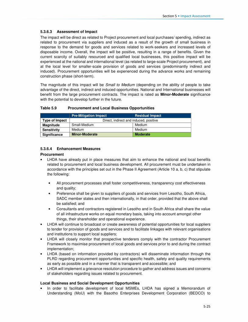
Section 5 • Impact Assessment
5-25
5.3.6.3 Assessment of Impact
The impact will be direct as related to Project procurement and local purchases/ spending, indirect as
related to procurement via suppliers and induced as a result of the growth of small business in
response to the demand for goods and services related to work-seekers and increased levels of
disposable income. Overall, the impact will be positive, resulting in a range of benefits. Given the
current scarcity of suitably resourced and qualified local businesses, this positive impact will be
experienced at the national and international level (as related to large-scale Project procurement), and
at the local level for smaller-scale provision of goods and services (predominantly indirect and
induced). Procurement opportunities will be experienced during the advance works and remaining
construction phase (short-term).
The magnitude of this impact will be Small to Medium (depending on the ability of people to take
advantage of the direct, indirect and induced opportunities. National and International businesses will
benefit from the large procurement contracts. The impact is rated as Minor-Moderate significance
with the potential to develop further in the future.
Table 5.9 Procurement and Local Business Opportunities
Pre-Mitigation Impact Residual Impact
Type of Impact Direct, indirect and induced, positive
Magnitude Small-Medium Medium
Sensitivity Medium Medium
Significance Minor-Moderate Moderate
5.3.6.4 Enhancement Measures
Procurement
• LHDA have already put in place measures that aim to enhance the national and local benefits
related to procurement and local business development. All procurement must be undertaken in
accordance with the principles set out in the Phase II Agreement (Article 10 a, b, c) that stipulate
the following:
• All procurement processes shall foster competitiveness, transparency cost effectiveness
and quality;
• Preference shall be given to suppliers of goods and services from Lesotho, South Africa,
SADC member states and then internationally, in that order, provided that the above shall
be satisfied; and
• Consultants and contractors registered in Lesotho and in South Africa shall share the value
of all infrastructure works on equal monetary basis, taking into account amongst other
things, their shareholder and operational experience.
• LHDA will continue to broadcast or create awareness of potential opportunities for local suppliers
to tender for provision of goods and services and to facilitate linkages with relevant organisations
and institutions to support local suppliers;
• LHDA will closely monitor that prospective tenderers comply with the contractor Procurement
Framework to maximise procurement of local goods and services prior to and during the contract
implementation;
• LHDA (based on information provided by contractors) will disseminate information through the
PLRD regarding procurement opportunities and specific health, safety and quality requirements
as early as possible and in a manner that is transparent and accessible; and
• LHDA will implement a grievance resolution procedure to gather and address issues and concerns
of stakeholders regarding issues related to procurement.
Local Business and Social Development Opportunities
• In order to facilitate development of local MSMEs, LHDA has signed a Memorandum of
Understanding (MoU) with the Basotho Enterprises Development Corporation (BEDCO) to
Section 5 • Impact Assessment
5-26
establish a platform for cooperation for provision of business development and advisory services
within the LHWP areas as part of the initiatives for livelihoods improvement for affected people.
The MoU entails the following:
• Coordinating efforts in developing and building skills capacity of affected individuals and
communities in Phases I and II of the LHWP in order to enable the communities to optimise
the potential benefits brought about by the development activities of the LHWP;
• Developing and conducting customised entrepreneurial and artisan skills training
programmes for communities in LHWP areas;
• Promoting MSME and other livelihood improvement activities among affected communities
and individuals within LHWP areas;
• Providing a pool of expert services for the identification of business ideas and the
development of project proposals. Project appraisal and mentoring services will be available
for business start-ups;
• Facilitating access to micro-finance for MSMEs; and
• Sharing information, knowledge and expertise in the area of small business development,
skills training, and advisory services for communities and individuals within the LHWP areas.
• In addition to the above, LHDA and the appointed contractors should implement the following
measures.
• Where possible, LHDA and the appointed contractors should use local businesses as a source of
goods and services for the Project and any livelihood restoration and social development projects;
• LHDA will collaborate with relevant authorities, organisations, local entrepreneurs and community
groups to identify and develop projects that aim to build the capacity of local entrepreneurs in the
Project Area;
• LHDA (and its consultants) will collaborate with relevant authorities and organisations to identify
and develop projects that aim to enhance selected livelihood activities amongst the population of
the Project Area. This may include, but is not limited to, tourism and agricultural initiatives; and
• LHDA to implement a grievance resolution procedure as described in Section 5.3.5.4.
5.3.6.5 Residual Impact
Implementation of the above-mentioned enhancement measures would serve to increase the
magnitude of this impact to Medium resulting in a post-enhancement impact rating of Moderate
positive significance.
5.3.7 Increased Cost of Living and Debt Generation
5.3.7.1 Description of Impact
Most people living in the Project Area are not employed. They mostly rely on remittances from family
members, government grants and ad hoc income earned from selling of agricultural produce and
harvesting of natural resources. As such, there is a limited cash economy in most parts of the Project
Area.
Increased demand for goods and services is likely to result in increased prices. Families living in the
area currently do not pay for their land or housing other than where maintenance or expansions are
required. Even then, locally available materials are largely used for construction purposes. The prices
of food and basic household goods are most likely to increase and have the most prominent negative
effect on the cost of living for local residents.
Simultaneously, however, local people will be able to sell their goods / services at higher prices, thus
potentially generating more income. Some business people are concerned that during the construction
phase, customers will want to purchase goods on credit and may then leave without settling their debt
to the service providers.

Section 5 • Impact Assessment
5-27
5.3.7.2 Sensitivity of Receptors
Levels of income are low and the economy is largely subsistence based. As such, local people will be
sensitive to price increases, especially if they are not able to increase their income simultaneously.
However, the majority of people already rely on their subsistence crops for most of the year. Since
many community members indicated they are positive about the potential new opportunities to sell
goods and services and claim to be aware of the potentially negative consequences of the Project on
the local economy, the sensitivity of the majority of households to price increases is therefore rated
High. Households who are able to respond to demands for goods and services, and benefit through
increased income generation, will be far less sensitive (Medium) to this impact. People living in the
most isolated villages are likely to be the most sensitive as access to the area increases resulting in
increased demand and rising costs.
5.3.7.3 Assessment of the Impact
This impact will be indirect and negative for most people, primarily for the residents in the most isolated
locations. The Project’s need for goods and services and the related demand from work-seekers will
have an indirect effect on supply and demand, and prices of goods and services. The extent will be
local and the duration will be short-term as related to the construction phase. As Project workers leave
the area, incomes reduce and migrants begin moving away, prices may decrease slightly. However,
the area will be more accessible and is likely to attract visitors and business people, thus price will
remain elevated (levels are not known and difficult to predict). Based on the large scale of the Project
and the high numbers of people expected to move into the area (workers and work-seekers), the
magnitude of this impact is expected to be Large. Combined with the High sensitivity, the impact
significance is assessed to be of Major or Critical (negative) significance for the majority of
households.
Table 5.10 Increased Cost of Living and Debt Generation
Pre-Mitigation Impact Residual Impact
Type of Impact Indirect negative
Magnitude Large Medium
Sensitivity Medium, High* Medium, High* Significance Major, Critical* Moderate, Major*
* The sensitivity of households will vary, thus the significance of the impact will be variable.
5.3.7.4 Mitigation Measures
Recruitment procedures to enhance local employment and limit influx
• Apply the Labour Recruitment Guidelines and other mitigation measures as described in Section
5.3.5.4 to enhance local employment. This will serve to reduce the number of general workers
from outside the area, and discourage influx.
Local business and social development
• Apply the mitigation measures proposed in Section 5.3.6.4 to promote the use of local businesses
and assist more broadly in local business / social development; and
• LHDA shall collaborate with relevant authorities and organisations to identify and develop
programmes that aim to enhance selected livelihood activities amongst the population of the
Project Area. This may include, but is not limited to tourism and agricultural initiatives.
5.3.7.5 Recommended Mitigation Measures17
• LHDA will collaborate with service providers (such as BEDCO)18 to provide business development
and advisory services, and skills development, as part of livelihood improvement initiatives to
17 Recommended mitigation measures are those which LHDA should assist with implementation, but which may require other organisations and where the outcome or effectiveness is less under the control of LHDA. 18 LHDA have signed an MoU with BEDCO in January 2015 to collaborate on MSME development initiatives in the Phase I and II project areas over a period of 60 months. LHDA are also in the process of tendering various social development projects.

Section 5 • Impact Assessment
5-28
enable communities to optimise the potential benefits of the LHWP. This should include promotion
of MSMEs and their access to microfinance.
5.3.7.6 Residual Impact
With effective implementation of the mitigation measures, it is expected that the magnitude could
decrease from Large to Medium. The impact significance could therefore decrease from Critical or
Major to Moderate or Major (negative) significance post-mitigation for the construction phase.
5.3.8 Increased Risk of Road Traffic Accidents
5.3.8.1 Description of Impact
Across the broader Project Area, road infrastructure is limited, with the majority of the roads being
unpaved and unusable after heavy rains and snowfalls. The only paved road is the A1 national road
that connects Mokhotlong District and Town to Maseru via Butha-Buthe, Leribe and Berea Districts.
Vehicle ownership is limited; most car owners in the broader area live in Mokhotlong town. Public
transportation is limited due to inaccessibility/ poor road quality, and cost; there are more taxis
operating in the areas easily accessible from the A1. The majority of the population walk or use horses/
mules/ donkeys to commute. As such, road traffic and road traffic incidents are uncommon across the
area.
Adherence to pedestrian road usage rules amongst the population is low; often people are found
walking in the middle of the road with little attention to traffic; and herded and untended livestock are
often found on the streets – this was mostly observed in Mokhotlong and Mapholaneng Towns.
Furthermore, the majority of the households in the area are not fenced and small children wander
around, even close to roads, unaccompanied. Motivation for people not adhering to road rules may be
linked to the lack of pedestrian walkways along the paved roads, and the encroachment of informal
businesses into the road reserve where pedestrians are supposed to walk. Amongst vehicle users and
pedestrians, there is poor road safety awareness and limited enforcement of traffic rules.
Figure 5.4 Typical Roads, Pedestrians and Livestock on the Local Roads
The construction activities will generate a range of safety risks that the local population have not yet
been exposed to. Given that the roads are in such a bad state, and there is very limited traffic through
the area; the cars that do drive there are forced to travel at extremely slow speeds. As such, increased
traffic travelling at greater speeds is going to be one of the most prominent risks of the Project.
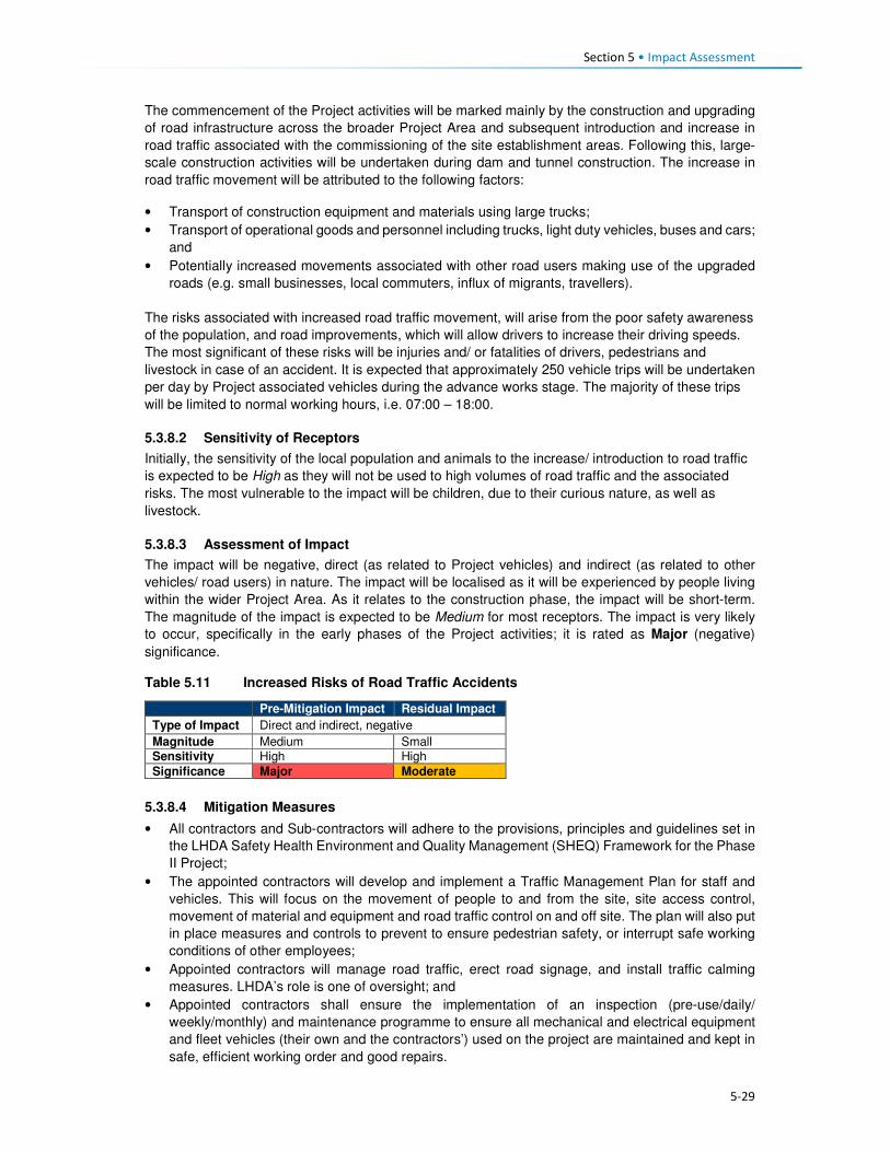
Section 5 • Impact Assessment
5-29
The commencement of the Project activities will be marked mainly by the construction and upgrading
of road infrastructure across the broader Project Area and subsequent introduction and increase in
road traffic associated with the commissioning of the site establishment areas. Following this, large-
scale construction activities will be undertaken during dam and tunnel construction. The increase in
road traffic movement will be attributed to the following factors:
• Transport of construction equipment and materials using large trucks;
• Transport of operational goods and personnel including trucks, light duty vehicles, buses and cars;
and
• Potentially increased movements associated with other road users making use of the upgraded
roads (e.g. small businesses, local commuters, influx of migrants, travellers).
The risks associated with increased road traffic movement, will arise from the poor safety awareness
of the population, and road improvements, which will allow drivers to increase their driving speeds.
The most significant of these risks will be injuries and/ or fatalities of drivers, pedestrians and
livestock in case of an accident. It is expected that approximately 250 vehicle trips will be undertaken
per day by Project associated vehicles during the advance works stage. The majority of these trips
will be limited to normal working hours, i.e. 07:00 – 18:00.
5.3.8.2 Sensitivity of Receptors
Initially, the sensitivity of the local population and animals to the increase/ introduction to road traffic
is expected to be High as they will not be used to high volumes of road traffic and the associated
risks. The most vulnerable to the impact will be children, due to their curious nature, as well as
livestock.
5.3.8.3 Assessment of Impact
The impact will be negative, direct (as related to Project vehicles) and indirect (as related to other
vehicles/ road users) in nature. The impact will be localised as it will be experienced by people living
within the wider Project Area. As it relates to the construction phase, the impact will be short-term.
The magnitude of the impact is expected to be Medium for most receptors. The impact is very likely
to occur, specifically in the early phases of the Project activities; it is rated as Major (negative)
significance.
Table 5.11 Increased Risks of Road Traffic Accidents
Pre-Mitigation Impact Residual Impact
Type of Impact Direct and indirect, negative
Magnitude Medium Small Sensitivity High High
Significance Major Moderate
5.3.8.4 Mitigation Measures
• All contractors and Sub-contractors will adhere to the provisions, principles and guidelines set in
the LHDA Safety Health Environment and Quality Management (SHEQ) Framework for the Phase
II Project;
• The appointed contractors will develop and implement a Traffic Management Plan for staff and
vehicles. This will focus on the movement of people to and from the site, site access control,
movement of material and equipment and road traffic control on and off site. The plan will also put
in place measures and controls to prevent to ensure pedestrian safety, or interrupt safe working
conditions of other employees;
• Appointed contractors will manage road traffic, erect road signage, and install traffic calming
measures. LHDA’s role is one of oversight; and
• Appointed contractors shall ensure the implementation of an inspection (pre-use/daily/
weekly/monthly) and maintenance programme to ensure all mechanical and electrical equipment
and fleet vehicles (their own and the contractors’) used on the project are maintained and kept in
safe, efficient working order and good repairs.
Section 5 • Impact Assessment
5-30
Driving Policies
• LHDA will develop and implement a Traffic Management Policy including vehicle safety, driver
and passenger behaviour, use of drugs and alcohol, hours of operation, rest periods and accident
reporting and investigations; and
• Appointed contractors will develop and implement a Driver Code of Conduct. The Code will
include:
• Performing mandatory vehicle safety checks;
• Strict enforcement of drug and alcohol policies; and
• Regular and random testing of drivers.
Collaboration
• In collaboration with the District Department of Roads, LHDA is to erect road signage and traffic
calming measures in areas of high foot traffic. In addition, all newly constructed and upgraded
roads must have adequate pedestrian paths and guard rails installed to prevent pedestrians and
livestock from wandering onto the road;
• In collaboration with the Ministry of Education, LHDA shall develop, implement and produce the
required materials to be used for road traffic safety awareness campaigns;
• All awareness raising activities for children shall be undertaken in schools by LHDA being assisted
by school teachers; and
• Community level awareness campaigns shall be led by LHDA representatives from Tlokoeng and
Katse FOBs in consultation with principal and area chiefs regarding the venue and suitable times.
Emergency Prevention, Preparedness and Response Plans (EPPRP)
• LHDA will develop and implement an EPPRP to address all non-routine events including road
traffic accidents resulting in injury or death of a person or livestock; and
• The LHDA Project SHEQ Manager shall ensure coordination between, and arrangements with,
Consultants, emergency services on site (where applicable), emergency services from nearby
local/district clinics and/or the District Environmental Office, and mutual aid partners (i.e. other
industries nearby who might have response capability) to provide for an effective interface
between Consultant and contractor personnel with emergency agencies.
Incident Reporting
• All incidents, nonconformities and hazards/risks identified will be reported and analysed. Any
person on the project site identifying a near-miss, nonconformity or risk must immediately report
the observation to their immediate Supervisor or Line Manager – who must complete an LHDA
Incident Flash Report;
• The appointed contractors shall ensure that procedures and systems are in place for reporting,
investigation, corrective action, closure and communication of all incidents. When an incident
occurs, the extent of the incident must be determined and relevant internal and external parties
be notified. The appointed contractor(s) shall ensure:
• All employees are aware of incident response actions and site incident notification
requirements;
• Reporting the incident to the relevant LHDA Representative – and authorities (if applicable);
• Completion and distribution within 24 hours of LHDA’s ‘Incident Flash Report’;
• Recording of full incident details in an LHDA ‘Incident Report’ and distribution within 72 hours;
• An incident investigation – employing a structured root cause analysis technique – is
conducted within 14 calendar days after the incident occurred to determine root causes of the
incident; and
• Corrective actions are planned, approved, implemented and tracked to closure within 30
calendar days after the conclusion of the incident investigation.
Section 5 • Impact Assessment
5-31
Compensation Plan
• All injuries and fatalities associated with road traffic incidences will be investigated by the police
services; and
• All compensation related to road traffic incidences will be undertaken in accordance to the
provisions of the Motor Vehicle Insurance Order No 26 of 1998.
Grievance Procedures
• LHDA is to implement a Grievance Resolution Procedure that is easily accessible, culturally
appropriate and scaled to the potential risks and impacts of the Project. It must be accessible to
all local residents, employees, and other stakeholders (as per Section 5.3.5.4).
5.3.8.5 Residual Impact
The implementation of mitigation measures is expected to reduce the magnitude of the impact to Small
and therefore the impact significance rating to Moderate (negative) significance.
5.3.9 Increased Safety Risks to People and Animals
5.3.9.1 Description of Impact
In addition to the traffic risks (as described in Section 5.3.8), the construction activities will generate a
range of safety risks that the population of the Project Area has not been exposed to, to date. Potential
safety risks may occur at the construction sites (e.g. excavated areas / trenches, exposed cables and
pipes, equipment and materials storage areas), quarry and borrow pit sites, and inundation areas/
exposed water body.
Exposed construction sites will pose a number of risks. Excavation for trenches or borrow pits will
result in relatively deep, steep-sided holes that people (and livestock) could fall into. Construction
equipment and materials (possibly including cables and pipes) will lie in the construction and storage
areas and many residents (notably children) will be inquisitive and may want to investigate these sites
and the materials. A lack of lighting at night will result in these sites being hazardous during dark, and
may result in people and animals falling into open trenches or pits.
Blasting at sites could result in flyrock during the blasting activities; residents are concerned that they,
or their belongings, could get injured/ damaged.
Given many of the above-mentioned risks and the nature of the Project, security personnel are likely
to be appointed to perform a range of security functions across the Project Area throughout the
construction phase. This, in itself, poses an additional potential risk; untrained or poorly trained
security personnel could exert unnecessary force, take advantage of their relative position of power,
or misuse a weapon; such actions could result in physical harm or be construed as intimidation. Such
force would infringe on the local community’s basic human rights regarding safety and security.
5.3.9.2 Sensitivity of Receptors
Initially, the sensitivity of the local population and animals to the construction safety risks will be
Medium given that they will not be used to the risks that will arise during construction. Children, in
particular, are going to be the most sensitive given that they are likely to want to investigate and
explore the construction sites, equipment and materials.
5.3.9.3 Assessment of the Impact
This negative and direct impact will be experienced at the local level for the duration of the construction
phase (short-term). The magnitude is Small given the relatively short duration and local extent of the
impact. It is likely that this impact will occur and it is rated as Minor (negative) significance.

Section 5 • Impact Assessment
5-32
Table 5.12 Increased Safety Risks
Pre-Mitigation Impact Residual Impact
Type of Impact Direct negative
Magnitude Small Negligible
Sensitivity Medium Medium Significance Minor Negligible
5.3.9.4 Mitigation Measures
• All active construction areas which pose a safety risk (such as trenches and pits, including the
quarry sites) are to be adequately fenced off or protected and managed to ensure that people and
animals cannot access the sites intentionally or unintentionally;
• Following completion of construction, measures to ensure human safety at quarry sites must be
identified and implemented (as fencing is highly likely to be removed);
• Provision should be made for safe pedestrian access where construction activities block normal
pedestrian routes;
• Implement all necessary precautions to prevent the risk of flyrock during blasting as per the
blasting protocols in the EMP and Section 5.3.10.4;
• Communication and training about safety during the construction phase should be addressed on
a regular basis with relevant local Project stakeholders (e.g. school children, residents of villages
closest to the road). Communication on safety awareness should take place at all public meetings
(pitsos) and other public events. LHDA will ensure that the contractor’s appointed CLOs receive
training regarding all the risks and associated protocols;
• LHDA (or their designated consultants) will develop and roll out an education and awareness
campaign in the local schools to ensure that the children are aware of the risks (align with traffic
safety training);
• Contractors will erect suitable signage to indicate danger;
• Security and traffic personnel should be employed to actively manage high risk areas;
• All workplace health and safety concerns are to be identified and suitably mitigated by contractors
to ensure the safety of the workers and local communities;
• Contractors are to put suitable measures in place to control the use of illegal substances on the
Project site to maintain acceptable levels of health and safety; and
• The appointed Security contractors for the Project are to be adequately trained in the use of force
and respect for human rights; the Voluntary Principles on Security and Human Rights should be
used as a base guide for all security personnel, and proof of suitable training and skills must be
provided by the successful tenderer.
5.3.9.5 Residual Impact
With implementation of the specified mitigation measures, it is expected that the magnitude of the
impact could reduce to Negligible; therefore, the impact significance rating would also reduce to
Negligible significance.
5.3.10 Disturbance from Increased Nuisance Factors (Noise, Dust, Vibration)
5.3.10.1 Description of Impact
Given the isolated location and relative inaccessibility of the Project Area, it has retained a rural
character that is free from development, traffic, loud machinery/ equipment, in-migration and all
associated disturbances. Current livelihood activities are undertaken using human and domestic
animal labour, there are limited vehicles that travel at slow speeds on the unpaved road network;
most people commute by foot to school, work and to town. There are higher levels of traffic on the
paved A1 route between Oxbow and Mokhotlong. The Project Area is quiet and peaceful. The air
quality in the area is generally good with the main pollutants arising from localised (village-level)
combustion of solid fuels (shrubs and cow dung) for cooking and heating, and burning of crop
residue and household waste, as well as a low level of dust generated from traffic on unpaved roads

Section 5 • Impact Assessment
5-33
and vehicle emissions. Wind blown dust and some smoke from burning grassland occurs in the drier
months.
Construction activities will generate uncharacteristic disturbances resulting in a range of nuisance
factors (notably increased levels of noise and decreased air quality). Air, noise and vibration
disturbances will occur on commencement of Project advance works with site clearing, blasting in
places, access road construction, establishment of camp/ laydown/ assembly areas, the placement
of fill, and stockpiling of soil and rock. These nuisance factors will continue to varying levels and
across the Project Area for the duration of the construction phase (estimated at 5 years). The
advance works will predominantly affect Masakong and Ha Tlhakola villages due to their proximity to
the site establishment areas. Construction of the dam and transfer tunnel, and ongoing activities at
the camps, works areas, quarries etc., will create disturbances that will largely affect Masakong, Ha
Tlhakola, Polihali, Ha Ramonakalali and Tloha-re-Bue villages due to their proximity to these
activities. Disturbances related to traffic noise and dust generation will affect villages located along
the transport routes, notably along the A1, PNEAR and PWAR19. The extent of these disturbances is
anticipated to vary substantially on a daily basis depending on the type and schedule of activities,
and the prevailing weather.
The number of construction contractors and staffing for each contract is not yet known. During the
advance infrastructure programme, they will be working regular working hours; however, for the dam
and tunnel construction, they will work on a 24-hour schedule for seven days a week. The potential
activities that will generate the disturbances in the Project Area are:
• Travel and operation of construction vehicles and heavy machinery of different types (mainly
diesel powered);
• Use of mobile diesel generators;
• The presence of construction workers and work-seekers;
• Blasting at the quarry sites and at various locations, as required; and
• Bulldozing and exposure of disturbed bare ground and soil / rock dumps.
Construction vehicles (including transport of large volumes of rock / aggregate from quarries and
crushing plants), and machinery will be used on an almost ongoing basis throughout construction
and will be the sources of most noise and dust disturbance (along with intermittent blasting). Diesel
powered generators will be used during advance works until high voltage electricity is supplied via a
new 132kV powerline. During night time construction works, the noise levels will be most significant
given the very low prevailing ambient noise levels at night. These sounds will disturb sleep patterns
and could result in a lack of productivity and focus during day time tasks, and general irritation of
local residents.
It is expected that construction workers will either be housed in the designated, access-controlled
construction camps, or they will be employed from the local villages and therefore reside in their own
homes. During work hours, the presence of the workers can result in elevated noise levels linked to
actual work activities, as well as loud conversations between the workers. Waste will be generated
and could potentially be discarded in the village areas or along access routes.
Blasting will be required at the quarry sites and at various locations where hard ground needs
levelling or rock needs to be removed. Blasting will result in intermittent loud noise and dust
generation. In addition, it is likely that there may be flyrock associated with each blast, depending on
the manner in which blasting is managed. Arable land is scarce and crop yields are already relatively
low and therefore further reduction in yield due to inability to plow fields due to rocks is not desirable
and would require redress.
19 Traffic-related impacts along the PWAR are assessed under the PWAC ESIA (ERM, 2017), while construction of the PNEAR is covered under a separate EMP. Increased traffic on the A1 (as well as NAR (A8) have not been assessed and a separate traffic assessment is recommended (see Section 11).
Section 5 • Impact Assessment
5-34
Dust will largely be generated by the clearance of topsoil and exposure of loose sand or soil as the
construction crew clear the footprint for the Project infrastructure and begin blasting and removing
rock from the construction footprint and quarry sites. The exposed soil will be blown across the area
during dry periods and as a result of the passage of construction vehicles back and forth, especially
during the dry winter periods between May and October. Increased levels of dust can be a nuisance
in that it could dirty houses and the clean washing hung out to dry; it may aggravate those with
existing respiratory conditions; and it could impact crops and the quality of wool / mohair.
Physically, these nuisance factors will lead to noise, dust and potentially (for some people) an
unwanted visual change in the landscape character. Some people may experience emotional and
psychological distress as a result of the ongoing disturbances; this is most likely to be the case near
schools and healthcare facilities where learning and healing could be affected, and in the closest
villages. The majority of the construction-related disturbances will occur at a local level and will affect
households, infrastructure, villages and road users in the immediate vicinity of the Project working
area footprint. Nuisance factors may also be exacerbated by indirect in-migration of work-seekers
into the Project Area; they will place additional pressure on the already strained social infrastructure
and services (e.g. housing, sanitation, water, healthcare, schooling, policing) in the surrounding
villages.
5.3.10.2 Sensitivity of Receptors
Local residents are accustomed to living in an environment free from the disturbances that can be
expected from construction-related nuisance factors. As such, all residents will be affected; however,
it is expected that most will adapt to/ accept the disturbances, which are short-term in nature.
Masakong, Ha Tlhakola, Polihali, Ha Ramonakalali and Tloha-re-Bue villages are located closest to
the Project footprint, while numerous other villages are located along the main transport routes.
These villages will be the most impacted given their proximity to the construction sites. Masakong
and Ha Tlhakola villages are going to be directly affected by the advance works, the dam and tunnel
construction, as well as by activities resulting from other Project components (beyond the scope of
this Contract).
Besides the most directly affected villages, other receptors that may be more sensitive than others to
these nuisance factors include:
• Residents located near to the construction sites where work is undertaken at night; noise levels
are elevated at night;
• Students at nearby schools who are likely to find it difficult to concentrate on their classes when
noise levels are elevated. In addition, the activities are going to be new and exciting and will
captivate the attention of many students, thus distracting them and diverting their attention away
from their lessons;
• Patients at healthcare facilities may find it difficult to rest and heal;
• People with respiratory conditions could experience an exacerbation of the condition as a result
of increased levels of dust in their environment;
• People who have livelihood activities located closest to the directly affected footprint (e.g. crops,
grazing) may incur damages to their produce resulting from the flyrock and dust; and
• Sites of religious/ traditional and cultural significance could be disturbed.
How each individual experiences these disturbance factors is highly subjective; for instance, some
will welcome the sounds as an indication of development and anticipation of a better life; while
others will place higher value on the silence associated with a rural environment. The sensitivity of
the majority of receptors is likely to be Medium; sensitivity is rated as High for the most sensitive
receptors.
5.3.10.3 Assessment of Impacts
The disturbances arising as a result of the construction phase nuisance factors will be negative and
direct in nature (as related to Project activities). Some indirect impacts could be experienced as a
result of the presence of work-seekers/ new-comers to the area resulting in pressure on social

Section 5 • Impact Assessment
5-35
infrastructure and services. The impact will be experienced locally, largely at a site level (around the
Project footprint and along transport routes). The direct construction-related disturbances are highly
likely to occur and will persist for the duration of the construction phase (short-term); Masakong and
Ha Tlhakola will be most affected given their close proximity to all activities. The magnitude of this
impact is anticipated to be Medium. For the most sensitive receptors, the impact is assessed as
Major significance (negative), while for the majority it is considered to be of Moderate (negative)
significance.
Table 5.13 Disturbance from Increased Nuisance Factors
Highly sensitive receptors (Schools, health care, close villages)
Less sensitive receptors (Residents further from construction)
Pre-Mitigation Impact
Residual Impact Pre-Mitigation Impact
Residual Impact
Type of Impact
Direct negative Direct negative
Magnitude Medium Small Medium Small
Sensitivity High High Medium Medium
Significance Major Moderate Moderate Minor
5.3.10.4 Mitigation Measures
Recruitment procedures to limit influx
• Apply the LHDA Recruitment Guidelines and the mitigation measures described in Section 5.3.5
to enhance local employment. This will serve to reduce the number of general workers from
outside the area, and discourage influx.
Workforce management
• All construction staff will agree to a Code of Conduct (CoC) that outlines protocols and standards
for working in the Project Area as part of their contract. The CoC should address the following:
• Respect for local residents, including being considerate about noise levels, privacy, and local
customs;
• Respect for existing livelihood activities and the environment;
• Respect for community water supplies (to prevent pollution and overuse);
• No hunting, snaring or unauthorised taking of any property belonging to someone else,
including removal of natural resources;
• Zero tolerance of illegal activities by construction personnel including: illegal sale or purchase
of alcohol; sale, purchase or consumption of drugs; illegal gambling or fighting;
• Compliance with the Traffic Management Plan (to be developed by the contractors in
accordance with the Traffic and Transportation Policy to be developed by LHDA) and all
associated regulations, including compliance with drug and alcohol policies and random
testing; and
• Disciplinary measures for not adhering to the CoC. Notably, stock theft and similar crimes
conducted by contractor staff shall be managed as dismissible offences.
• Workers found to be in contravention of the CoC will face disciplinary procedures that could result
in dismissal. Theft or purposeful damage to property should be dismissible offences.
Ongoing engagement and grievance management
• LHDA will present the schedule and approach to construction to the district authorities and
community leadership structures to enable their understanding of the Project roll out;
• LHDA will regularly review and update the Community Participation Strategy; this strategy is to be
agreed upon by local community structures through the appointed ALCs;
• The contractor shall appoint appropriately trained and experienced staff to implement stakeholder
engagement during the course of work and shall assign adequate resources; and

Section 5 • Impact Assessment
5-36
• Apply all mitigation measures as described in Section 5.3.5 regarding a grievance resolution
procedure.
Engineering and Operational Practices
• Implement all measures described in the Construction EMP (Volume 2, Annexure L.1).
• All diesel-powered construction, earth moving, and equipment must be kept at a high level of
maintenance. This must include the regular inspection and, if necessary, replacement of intake
and exhaust silencers. Any change in the noise emission characteristics of equipment must serve
as trigger for withdrawing it for maintenance.
• All appointed contractors to include noise management provisions as part of onsite work
inductions.
• Conduct quarterly (as a minimum) noise surveys for the duration of the Project’s advance
infrastructure and construction activities to adjust mitigation measures to address the levels of
noise accordingly.
• All appointed contractors shall adhere to the provisions of Section 8.11 of the SHEQ Framework
(ERM, 2017; Volume 2, Annexure L.1) (maintenance of equipment, machinery, tools and
vehicles).
Generic construction phase management measures
• Traffic Management
• Implement all measures described in the Construction EMP (Volume 2, Annexure L.1);
• LHDA will develop a Traffic Management Policy including vehicle safety, driver and passenger
behaviour, speed limits, use of drugs and alcohol, hours of operation, rest periods and
accident reporting and investigation requirements;
• contractors will compile a traffic management plan / method statement relevant to their
activities, which shall include a protocol for handling accidents involving other vehicles,
pedestrians, animals or property;
• LHDA will undertake traffic safety awareness sessions at schools and in communities along
the PWAC during construction and early operation (until completion of dam construction). This
should be done in collaboration with the Roads Directorate and Ministry of Education, as
appropriate;
• Safe crossings are to be provided for pedestrian and animals during construction, and they
are to be given right of way;
• The appointed contractor/s will have the necessary insurance / contingency budget in place
for costs incurred with accidents involving other vehicles, people, animals, agricultural land,
or infrastructure; and
• The contractor will be required to compensate any affected community member for injured
animals in terms of agreed protocols.
• Dust suppression and emissions management
• Site clearance is to be minimised as far as possible to reduce the potential for dust, and other
impacts;
• Dust suppression measures are to be implemented as specified in the EMP, which shall
include wetting of roads during windy conditions and covering of soil mounds;
• Install an onsite weather station to monitor general weather conditions. When wind speeds
above 25 km/hr are expected, this should trigger implementation of measures to minimise
dust emissions;
• Ensure an adequate water supply on site for effective dust/particulate matter suppression,
using non-potable water where possible;
• Ensure equipment is readily available on site to clean any dry spillages;
• Ensure fine-powdered materials are delivered in enclosed tankers and stored in areas suitable
for emission control systems to prevent escape of material and overfilling during delivery;
• For smaller supplies of fine-powder materials, ensure bags are sealed after use and stored in
contained buildings to prevent dust;
• Use water-assisted dust sweeper(s) on the access and local roads, to remove, as necessary,
any material tracked out of the site;
Section 5 • Impact Assessment
5-37
• Ensure vehicles carrying materials or spoil entering and leaving sites are covered to prevent
escape of materials during transport;
• Where reasonable and feasible, haul roads will be maintained with water carts and graders,
and the condition of the roads will be monitored especially in high risk areas and/or during
high risk periods;
• Contractors must ensure all construction vehicles comply with their relevant emission
standards. Furthermore, contractors must provide confirmation that all off road diesel
equipment would meet best available diesel emissions standards or be fitted with a diesel
exhaust treatment device where possible;
• Contractors must, where possible and available, use low-sulphur diesel in vehicles to minimise
harmful emissions; and
• Contractors must avoid, where practicable and possible, the use of diesel or petrol powered
generators, and use mains electricity or battery powered equipment
• Noise management
• Noise management measures are to be implemented as specified in the EMP;
• Workers are to be considerate regarding noise levels and associated disruption to local
people; this is to be outlined in their CoC; and
• Noisy activities (e.g. blasting) are not to be scheduled at critical times (e.g. school exams,
religious services/ celebrations), where located in close proximity. LHDA will consult local
leaders, school principals, healthcare workers and religious leaders regarding important
events or occasions that may be negatively affected by construction noise in order to try to
schedule these activities at different times.
• Blasting and vibration
• LHDA and its contractor(s) shall develop blast designs and procedures that will keep noise
and blasting to a minimum without compromising blast requirements. Blast plans are to be
compiled as method statements to be approved by the Resident Engineer;
• All blasting activities will be undertaken following a planned schedule and the local
communities informed of this in advance;
• Asset condition surveys should be undertaken by contractors prior to construction and in
accordance with LHDA’s Protocol for Asset Condition Survey, Damage Mitigation and
Remediation (2017). This process must be overseen by the relevant Engineers, who in turn
will be monitored by LHDA;
• All safety measures related to blasting are to be implemented as specified in the EMP; and
• LHDA and its contractor(s) shall ensure that no blasting activities occur at night.
• Waste management and water source management
• Waste management measures are to be implemented as specified in the EMP. This is to
include the use of portable toilets and rubbish bins (to avoid littering); and
• Water management measures shall include controls on use of community water supply points
by construction workers who may not be familiar with protocols of keeping supplies clean and
uncontaminated.
• Earthworks and Stockpiling
• Stockpiles shall be located away from sensitive receptors and, where necessary, covered with
anchored fabrics, or seeded with sterile grass;
• Re-vegetate earthworks and exposed areas/soil stockpiles to stabilise surfaces as soon as
practicable; and
• Where practical, only remove any cover for exposed areas in small areas during work and not
all at once.

Section 5 • Impact Assessment
5-38
5.3.10.5 Residual Impact
Post-mitigation, it is expected that the magnitude of the disturbance resulting from increased
nuisance factors resulting from construction activities could be reduced to Small, resulting in a
decreased impact significance of Minor-Moderate (negative) significance.
5.3.11 Exacerbation of Anti-Social Behaviour
5.3.11.1 Description of Impact
Currently, the Project Area does not experience much outsider in-migration given its physical
isolation, lack of economic opportunities, and the limited social infrastructure and services. On the
contrary, many people, specifically young men and women, leave their villages in search of better
opportunities in the larger towns or further afield into the lowlands of Lesotho, and to South Africa.
Most of the population comprises local Basotho people who have lived in the area for many years.
STIs and HIV are reported to be two of the most common health concerns amongst adults; the
stigma around these diseases is still negative and many men refuse to attend the clinics for testing
or treatment (see Section 5.3.12 for separate assessment of increased prevalence of STIs and
HIV20). The most commonly reported crime is stock theft, which is cited to be common throughout
the area.
Construction of Katse Dam under LHWP Phase I resulted in a significant amount of influx of workers
and work-seekers. People moved to the Phase I areas in the hope that there would be generally
improved levels of social infrastructure and services, and a more diverse economy providing a
broader range of economic opportunities. This influx resulted in a significant increase in anti-social
behaviour as can be expected in such situations.
High levels of migrants into areas that are relatively homogenous and stable, such as the Project
Area, often result in heightened levels of conflict and tension. Migrants will bring with them differing
cultures, religious beliefs, norms and values; they influence young people to change in a manner
that may not be accepted by the more conservative/ traditional sector of the population. Inevitable
disputes arise linked to jealousy over relationships between local people and ‘outsiders’. High levels
of crime, drug and alcohol abuse, increased incidence of sex workers, domestic violence,
establishment of informal settlements, high prevalence of STIs and HIV, and general tensions due to
increased competition are common in the local communities that host large-scale projects of this
nature. These impacts typically occur as a result of increased competition for jobs, limited access to
basic resources and services, increased income, and different cultural backgrounds/ beliefs. Some
of the anti-social behaviour likely to occur are described below.
• Increase in crime levels given that many of the migrants to the area will not have income or access
to land to generate a livelihood. Stock theft is the most likely crime given that there is not much
else of value to steal; livestock is extremely valuable and considered to be an indicator of wealth;
• An increase in disposable income within the Project Area (among workers) could result in an
increase in alcohol and drug abuse, increased incidences of prostitution and casual sexual
relations. These activities could lead to an increased incidence of STIs and HIV, and increased
numbers of teenage and unwanted pregnancies. The increased prevalence of diseases would
affect contractors, employees, local residents and the families/ sexual partners of anyone
becoming infected in the Project Area;
• Young girls are likely to enter into relationships with migrant workers (and work-seekers) in the
hope that they will be able to leave the area and secure a ‘better’ lifestyle. However, they are likely
to end up dropping out of school with unwanted pregnancies, STIs and HIV. There is also a general
20 This impact is assessed separately in Section 5.3.12 given the already high prevalence rate and the high likelihood of the impact occurring.

Section 5 • Impact Assessment
5-39
concern that levels of STIs and HIV will become more prevalent, specifically because the existing
rates are generally high and many people still refuse testing and treatment;
• General unrest may arise as a result of increased pressure for resources, resentment towards
those who secure employment and procurement opportunities as well as benefits from other
Projects (specifically if the beneficiaries are from outside the area);
5.3.11.2 Sensitivity of Receptors
The population of the Project Area is going to be susceptible to the inevitable increase in anti-social
behaviour as described above given the prevailing high levels of poverty and low levels of economic
opportunity, and is therefore assessed as having High sensitivity to this impact. Increased crime/
stock theft is likely. Many hopeful local people will enter into relationships with in-migrants in
anticipation of a better life with an employed partner. STIs and HIV levels are likely to escalate given
the current attitude and contraction rates, as will unwanted pregnancies. Conflict, drugs and alcohol
abuse, and ultimately changed norms and values can be expected.
5.3.11.3 Assessment of the Impact
This negative impact will arise as a direct result of construction workers, and indirectly via migrant
work-seekers to the area. The impact will be experienced at a local level; however, the impact
duration will be long-term as improved access and the attraction to the area will facilitate ongoing
migration in and out of the Project Area. This impact will affect the individuals and families that
engage in such activities, while crime could affect anyone. The magnitude of the impact is rated
Medium. Together with the High sensitivity of the receptors, the impact is assessed as Major pre-
mitigation.
Table 5.14 Increased Anti-Social Behaviours
Pre-Mitigation Impact Residual Impact
Type of Impact Direct and indirect negative
Magnitude Medium Small to Medium
Sensitivity High High
Significance Major Moderate-Major
5.3.11.4 Mitigation Measures
Recruitment procedures to limit influx
• Apply all mitigation measures as described in Section 5.3.5 (and as per LHDA Labour Recruitment
Guidelines) to enhance local employment. This will serve to reduce the number of general workers
from outside the area, and discourage influx.
Workforce management
• Apply all workforce-related mitigation measures as described in Section 5.3.10.4. Notably, stock
theft and similar crimes conducted by contractor staff shall be managed as dismissible offences;
• Apply all mitigation and management measures proposed by the relevant EMPs regarding
contractor Camp Management;
• Workers from outside the Project Area are to work on a rotational basis, allowing them time to
return home to visit their families and rest, with the cost of their return journey covered by the
contractor/s;
• Contractors will provide health care facilities for their staff, including local labour. They are to be
equipped with adequate medical staff and resources to handle common diseases (including STIs
and HIV) and work related injuries; and
• LHDA will appoint experienced professionals to develop and implement a PHAP, which is
expected to specify additional recommendations for improved health care provision for affected
stakeholders.

Section 5 • Impact Assessment
5-40
Ongoing engagement and grievance management
• LHDA to implement a grievance resolution procedure as described in Section 5.3.5; and
• As part of induction, the appointed contractor will develop a brochure containing basic socio-
cultural information, to be approved by LHDA, to be distributed to all new employees on the Project
Site.
5.3.11.5 Residual Impact
Implementation of the measures described above is predicted to result in a reduction of the magnitude
of the impact to Small-Medium and the impact significance to Moderate-Major (negative) significance.
The elevated magnitude and significance rating is due to the fact that this impact will largely arise as
a result of indirect factors that are beyond the control of LHDA to mitigate/ manage.
5.3.12 Increased Prevalence of Sexually Transmitted Infections (STIs) and HIV/AIDS
5.3.12.1 Description of Impact
Lesotho has one of the highest HIV/AIDS prevalence rates in Southern Africa at 23%. The prevalence
of HIV/AIDS in Mokhotlong District was estimated to be 17% in 2014, and 5% within the Project Area
(CES, 2015a)21. Migration trends in the Project Area indicate significant out-migration by locals who
migrate out of the area to search for employment opportunities and return home when they have not
secured jobs or upon the termination of employment contracts. The presence of in-migrants,
construction workers directly and indirectly employed by the Project is likely to contribute to the
transmission of HIV/ AIDs and other Sexually Transmitted Infections (STIs) in the area.
The direct and indirect Project activities likely to exacerbate the transmission of STIs and HIV/AIDS
are:
• Drivers, who typically have high rates of HIV or STIs, are likely to engage in casual high risk sexual
activity; thus spreading infections in the Project Area and beyond;
• In-migration of workers and work-seekers who are already infected may transmit the infections;
• A predominantly male workforce and migrant population (some with disposable income) may
engage in high risk sexual activities with commercial sex workers and local women;
• Local men in the community with increased disposable income may partake in transactional sex
or seek additional sexual partners; and
• Existing stigma and taboos around STIs and HIV/AIDS will make it challenging to negotiate safe
sex practices such as the use of condoms (including the use of female condoms).
A research study22 undertaken by the Medical Research Council of South Africa in 1995 prior to the
construction of Mohale Dam, found a high prevalence of STIs and HIV infection in a population
characterised by low levels of knowledge about STI and HIV, high risk sexual behaviour (e.g. low
condom use and multiple partners) and evidence of inappropriate health seeking behaviour for STIs.
The researchers at the time believed that this situation was going to be exacerbated during the
construction of the dam due to the then imminent influx of several thousand male workers, most of
whom would arrive without families. While increased levels of HIV/AIDS were reported in the
Highlands after dam construction it is unclear the extent to which it can be attributed directly to the
LHWP Phase I (Hitchcock, 2015).
Comparing the situation in Mohale to that of Mokhotlong, there is a significant difference in the findings
in terms of the knowledge levels of HIV/AIDS contraction, prevention and management. The LDS
(Bureau of Statistics, 2013) found that an average of 80% of the District population ages 14 to 49
years old demonstrated knowledge of HIV/ AIDS contraction, prevention and management. However,
21 The figure for the Project Area is likely to be highly inaccurate given access to testing facilities, recorded attitudes towards the disease, extent and nature of the study. 22The study was conducted across 89 villages involving 7500 people.

Section 5 • Impact Assessment
5-41
awareness and knowledge about the disease does not mean that people will refrain from engaging in
unsafe sexual behaviour.
Contraction of the disease will lead to poor health outcomes and in some cases inability to work.
Where a person had secured employment with the Project and can no longer work, the Project will
have to carry the costs of finding and training of replacement staff.
5.3.12.2 Sensitivity of Receptors
Statistics indicate that although Lesotho has high HIV/AIDS rates, the Mokhotlong District infection
rates are significantly lower. The Project surveys suggest that many of the people in the Project Area
are aware and informed about the disease and associated STIs despite there still being a stigma linked
to the disease and resistance to implementing precautions. However, rates may have remained
relatively low in the area due to limited in- and out-migration, but this is expected to change as a result
of the Project activities. As such, the sensitivity of the receptors is regarded as High.
5.3.12.3 Assessment of Impact
The increased spread of STIs, including HIV/AIDS will have a direct and indirect negative impact.
Initially the impact will be localised; however, upon completion of the construction phase of the Project,
migrant labour and work-seekers will return to their places of origin (or elsewhere) where they may
spread the disease further. Depending on the type of STI contracted, the impact duration will vary from
short-term to permanent. The impact magnitude is assessed as being Medium. Combined with a High
receptor sensitivity, the impact is rated as Major (negative) significance.
Table 5.15 Increased Prevalence of STIs including HIV/AIDS
Pre-Mitigation Impact Residual Impact
Type of Impact Direct and Indirect negative
Magnitude Medium Small
Sensitivity High High
Significance Major Moderate
5.3.12.4 Mitigation Measures
Collaboration with Local Health Care Services
• To reduce the possible spread of STIs and HIV/AIDS, LHDA should collaborate with local and
regional healthcare services in order to:
• Strengthen local educational programmes, focusing on the prevention of STIs and HIV/AIDS in
the Project Area and along the major transport routes; and
• Ensure that local health centres have sufficient capacity and resources to provide prevention
information/ measures, testing counselling and treatment for STIs and HIV/AIDS.
HIV Workplace Policy and Programme
• The appointed contractors will implement an HIV/AIDS programme as per specifications of the
SHEQ Framework to reduce the risk of the transfer of HIV between and among the contractor’s
employees, their families and the local communities. The programme will include voluntary
counselling and testing (VCT) of individuals, and HIV/AIDS awareness training and access to
ongoing support for affected individuals;
• The appointed contractors shall arrange for, provide a suitable venue, and instruct all employees
to attend the HIV awareness programme; ensuring that their employees and their subcontractor
employees are aware of this programme;
• The appointed contractors must:
• Conduct information, education and communication campaigns, at least every other month,
addressed to all the project site employees (including all Subcontractors’ personnel, and all
truck drivers and crew making deliveries to site for construction activities) and to the immediate
local communities, concerning the risks, dangers and impact, and appropriate avoidance

Section 5 • Impact Assessment
5-42
behaviour with respect to, sexually transmitted diseases or STIs in general and HIV/AIDS in
particular;
• Provide male/ female condoms for all employees, as appropriate, free of charge;
• Provide for voluntary STI and HIV/AIDS screening, diagnosis, counselling and referral to a
dedicated national STI and HIV/AIDS programme, (unless otherwise agreed) to all employees;
and
• Monitor outcomes, in collaboration with national HIV/AIDS authorities.
Employee Code of Conduct
• All appointed contractors shall implement the Employee Code of Conduct as per the provisions of
the Lesotho Labour Code.
5.3.12.5 Residual Impact
Implementation of the above measures may result in a reduction of the magnitude of the impact to
Small which reduces the impact significance from Major to Moderate. However, people who contract
HIV/AIDS will have it for life and will require long term anti-retroviral treatment, and for those affected
the impact, at an individual level will be Major. While LHDA and the contractors can do a lot, their
ability to control this impact is going to be limited by cultural norms and practices and individual free
will.
5.3.13 Increased Pressure on Social Infrastructure and Services
5.3.13.1 Description of Impact
The Project Area is generally poorly served with very few social infrastructure and services. Villages,
specifically Mokhotlong and Mapholaneng, are more developed given that they are relatively
accessible; however, the remainder of the area lacks clinics, water, sanitation, electricity, and waste
management and has only a few under-resourced primary schools. The Social Baseline (Section 4)
provides more details in this regard.
Influx of migrants into the area, including Project workers and work-seekers, will place additional
pressure on the already strained infrastructure and services. It is most likely that the majority of
migrants will be single men, as such, there would be less impact on the need for schooling; there will
be increased demand for land, housing, healthcare, water, sanitation and waste management.
Migrants are most likely to settle in the more established villages/ towns, close to the PLRDs, which
are proposed to be located at Mapholaneng or Tlokoeng (main office). It is proposed that the appointed
workers from outside the Project Area will be housed in the labour camps near the construction sites.
It is anticipated that it may be possible that employees from the local villages could reside at home
and be transported to the work areas but this will be determined by the needs of the contractors.
Given the high number of construction jobs and the low likelihood that local people will qualify for many
of the jobs, it is highly probable that there will be significant influx of workers alone. Besides Project
workers, the anticipation of employment, other income generation opportunities, and benefits linked
to improved local infrastructure and services, will result in significant influx to the area. This influx is
likely to commence during PWAR construction activities and escalate as the scale of construction
works expands.
In the current absence of sufficient social infrastructure and services, any additional pressure resulting
from influx cannot be accommodated or sustained over time. As migrant work-seekers and those
anticipating access to services realise that the socio-economic environment cannot sustain them and
that they are unlikely to qualify for jobs, some people may leave the area in search of opportunities
elsewhere. However, the majority of migrants will stay as they will remain hopeful that they will secure
income-earning opportunities.

Section 5 • Impact Assessment
5-43
5.3.13.2 Sensitivity of the Resource
Given the already strained social infrastructure and services in the Project Area, additional pressure
from outsiders would further overload the existing services, such as clinics. There is limited land to
give to newcomers for farming, natural resources are in short supply, and water and sanitation services
are inadequate. The existing infrastructure and services are of High sensitivity to further pressure, as
are the local population who require access to them.
5.3.13.3 Assessment of the Impact
The influx of workers and work-seekers for the Project construction phase would have a direct
(workers) and indirect (work-seekers) impact on infrastructure and services. The impact will be
experienced at the local level for the entire construction phase (short-term), commencing earlier,
during the PWAR construction activities. Migrants are likely to settle in, or close to, Mokhotlong or
Tlokoeng (near the PLRDs) in anticipation of construction opportunities. The magnitude of the impact
related to influx resulting in increased pressure on social infrastructure and services during
construction is expected to be Medium to Large which combined with the High sensitivity would result
in an impact of Major to Critical (negative) significance.
Table 5.16 Increased Pressure on Social Infrastructure and Services
Pre-Mitigation Impact Residual Impact
Type of Impact Direct and indirect negative
Magnitude Medium to Large Small to Medium
Sensitivity High High
Significance Major to Critical Moderate to Major
5.3.13.4 Required Mitigation Measures23
Recruitment procedures to limit influx
• Apply all mitigation measures as specified in Section 5.3.5 (and as per LHDA Labour Recruitment
Guidelines) to enhance local employment. This will serve to reduce the number of general workers
from outside the area, and discourage influx; and
• Ensure communities in the Project Area are fully informed of the preferential labour policy for
recruiting workers from local villages and how they are required to register for work well in advance
of construction in order that sourcing of local labour is maximised.
Workforce management
• Apply all mitigation and management measures proposed by the relevant EMPs regarding
contractor Camp Management24; and
• Apply all mitigation measures applicable to the workforce as specified in Section 5.3.10.4, to
ensure that all the basic needs of the appointed Project workers (migrants) are provided for.
Ongoing engagement and grievance management
• Implement all measures as described in Section 5.3.5.
23 Required mitigation are the measures that LHDA will need to implement to reduce the impact significance while
Recommended mitigation measures ar those that are desirable to implement but where the outcome is reliant on other parties and the effectiveness is less certain or under the influence of LHDA. 24 Note: assessment of impacts and mitigation requirements of the PWAC construction camps are not included in this ESIA but
are included under the PWAC EMP.

Section 5 • Impact Assessment
5-44
5.3.13.5 Recommended Mitigation Measures
Social development
• LHDA will, in partnership with local authorities and relevant organisations (e.g. donors, civil society
and NGOs), where available and appropriate, assist in planning for anticipated increased
demands on public infrastructure and services in communities that are significantly affected by in-
migration due to Project activities; and
• Develop and implement a SDMP, as described in the LHWP Phase II LR&SDF, as a means of
delivering socio-economic development benefits to villages located in the Project Area that will be
affected as a result of the Project.
5.3.13.6 Residual Impact
Implementation of the above mitigation measures is expected to reduce the magnitude of this impact
to Small or Medium (specifically as related to Project workers), and therefore, the residual significance
could reduce to one of Moderate to Major (negative) significance.
5.3.14 Disruption to Family and Community Structures
5.3.14.1 Description of Impact
Education levels within the Project Area are low, and skills are largely linked to agriculture and those
needed to construct and maintain local infrastructure (e.g. residential dwellings, agricultural structures,
and community infrastructure). It was reported that many people do not see the value of education
given that local economic and livelihood activities do not require high levels of education; it is
uncommon for people to attain high levels of education and enter into careers that generate wealth.
Pressure to ensure immediate survival (as opposed to medium-long-term planning regarding career
development and income generation options) drives decisions around education and work; thus the
school drop-out rate is high. People leave school to support with daily household tasks and to generate
income and produce food.
Young women and girls typically assist with tasks around the home and young men and boys usually
undertake agricultural work (e.g. as herders) with aspirations of accruing livestock of their own.
Farming expertise is passed through generations, where parents teach their children cropping and
livestock raising skills. Agricultural work is hard and does not generate much cash income; in fact, it
is poorly paid at best and often unpaid; produce is largely used for home consumption or for bartering.
Work in the home is unpaid. Young adults, and in some instances children, leave their villages in
search of paid employment as income generation opportunities locally are extremely limited.
Employment opportunities (albeit relatively limited in duration) offered by the Project contractors will
provide income that is likely to be far beyond what is generated by agricultural work, and those who
are employed will learn new skills that may enable them to secure construction work in the future.
There are also high expectations that the employment opportunities will lead to an improved standard
of living. Some people fear that young men and women will reject their existing farming and household
responsibilities in favour of paid employment in the construction sector. This may cause a shortage of
available farming skills and family support networks during the construction phase, and beyond.
Others, however, indicated that those who do get construction jobs will be able to pay others to harvest
their crops, manage livestock or assist with household tasks. For the people who get construction work
it is probable that they would aim to secure further work in the construction sector with their newly
acquired skills and experience, leading to a longer term disruption to social and economic networks.
Community members and school staff fear that the possibility of securing gainful employment will lead
to a further increase in the school drop-out rate, or that parents who get jobs may force children to
drop out of school to fulfil household obligations in the parent’s absence.
Due to necessity, it is expected that most people will be required to return to their farming and
household responsibilities after construction is completed, if they are unable to secure further paid
employment elsewhere.
Section 5 • Impact Assessment
5-45
Over time, more and more people, especially the youth and younger men in particular who get
construction jobs, may not wish to farm as their parents and forefathers have done, and availability of
agricultural skills may diminish. However, for now, agriculture is critical and families must continue
their farming activities in order to survive. With increased access to markets and transport, farming
may become more lucrative in the future. It will remain a primary livelihood activity out of necessity for
a relatively long time.
5.3.14.2 Sensitivity of Receptors
Given the size and capabilities of the population, there are likely to be many people who do not secure
construction phase employment and who will be in a position to support households with home-based
and agricultural tasks in the absence of those who pursue Project employment opportunities. Hiring of
local labour will take people away from their existing tasks, result in an increased rate of school drop-
outs, and potentially generate greater dissatisfaction with the existing lifestyle, sensitivity is considered
to be Medium.
5.3.14.3 Assessment of the Impact
As per the Labour Recruitment Guidelines, the Project will offer limited-term unskilled contracts for the
duration of the construction phase (short-term). While the number of employment opportunities and
job requirements are not yet known, it is expected that these opportunities will be relatively small in
comparison to the size of the eligible population; despite the fair number of employment opportunities
that are likely to be available. Following construction, it is conceivable that while some people will
attempt to secure further paid employment outside the agricultural sector, most are likely to be forced
to return to existing livelihood activities and household responsibilities. This indirect impact will be
experienced at the local level and many people will benefit. Given the short-term nature of the impact,
the magnitude is considered to be Medium to Small. It is unlikely that the Project would result in a
permanent loss of household support or farming expertise. The impact significance is rated as
Moderate to Minor (negative) significance.
Table 5.17 Disruption to Family and Community Structures
Pre-Mitigation Impact Residual Impact
Type of Impact Indirect negative
Magnitude Medium-Small Small
Sensitivity Medium Medium
Significance Moderate-Minor Minor
5.3.14.4 Required Mitigation Measures
• Implement the Labour Recruitment Guidelines and allocate maximum number of unskilled and
semi-skilled jobs to local residents, and additional mitigation measures as described in Section
5.3.5 to ensure that recruitment is fair and representative of people from all Project-affected
villages;
• To avoid further school drop-outs measures are to be defined together with relevant authorities,
leaders and PLRD to define criteria that prevent youth from leaving school in favour of short-term
employment. These may include:
• Minimum education qualifications for people below the age of 20;
• Letter from school or community leader stating that applicant did not drop-out of school
specifically as a result of the Project; or
• Employment of people from as many households as possible to distribute income across
households.
• Share types of job opportunities, including capacity and qualification requirements long in advance
of recruitment to provide people with motivation to complete schooling to the required level, thus
discouraging school drop-outs; and
• Implement a skills development and capacity building programme well in advance of recruitment
to ensure that a suitable number of people attain the necessary skills.
Section 5 • Impact Assessment
5-46
5.3.14.5 Recommended Mitigation Measures
• LHDA will collaborate with relevant authorities and organisations to develop programmes that aim
to enhance agricultural production amongst the population of the Project Area. These should
address the application of more effective farming methods, approaches to increase crop yields,
and mechanisms to assist farmers in selling their produce at the highest possible prices.
5.3.14.6 Residual Impact
It is expected that through the implementation of the above measures, the magnitude of this impact
would reduce to Small and the significance rating could be reduced to one of Minor (negative)
significance post-mitigation.
5.4 Operation Phase 5.4.1 Increased Government Revenue
5.4.1.1 Description of Impact
The economy of Lesotho is un-diverse and relies heavily on a narrow economic base of textile
manufacturing, agriculture, remittances, and regional customs revenue. The majority of the population
live in rural areas and rely on subsistence-based agriculture. The country relies heavily on South Africa
for employment opportunities and the majority of imports, specifically food; the climatic conditions
place an additional strain on the area.
The Government of Lesotho (GoL) derives revenue from the sale of its water to South Africa,
amounting to M8.9 billion (as of November 2017), or averaging M750 million/year – equivalent to ~10%
of the Government’s revenue and ~7% of the GDP (combined percentage contribution of the water
and sanitation sector) (African Economic Outlook, 2016). The revenue received by the GoL is
expected to increase at the start of operations due to the increased amount of water available and
sold to South Africa. Allocation of the revenues to meet Lesotho’s needs is solely based on
Government spending priorities driven by the GoL’s policies, development plans and programmes. As
such, future expenditure in the Project Area is at the discretion of the authorities. However, critics of
LHWP Phase I perceive that an insufficient portion of these revenues are spent locally on assisting
Project-affected communities.
The revenue and taxes paid to Government contributes to funding public infrastructure and services
or for the payment of the country’s debt. The impact of Project revenue cannot be accurately quantified
at this stage as the allocation of increased Government revenue to development locally or nationally
or into other purposes is unknown. It is likely that the revenue received by Government could be used
for socio-economic development but not specifically in the Project Area.
While there were no major concerns voiced about political corruption by stakeholders, research
suggests that corruption remains a concern in Lesotho. Lesotho scored 43 (0 being highly corrupt and
100 being very clean) on Transparency International’s 2017 Corruption Perception Index (CPI), which
measures the degree to which corruption is perceived to exist in the public sector. The average score
internationally was 43. Lesotho’s score increased from 39 in 2016. Given this perception, it is likely
that key stakeholders could be sceptical and will observe and monitor the Project activities (e.g.
governance, financial) closely.
5.4.1.2 Sensitivity of Receptors
Given the general lack of economic diversity; the high reliance on outside markets; the CPI status and
high poverty levels, the sensitivity is considered to be High.

Section 5 • Impact Assessment
5-47
5.4.1.3 Assessment of Impact
The positive impact of increased Government revenue will be a direct impact as it relates to revenue
generated by the Project and indirect positive as it relates to Government spending in the country. The
Project has the potential to induce associated growth and development in areas where spending
occurs. This benefit will continue throughout the operational life of the Project; therefore, the impact
will be long-term. The predicted increase in revenue that the Government will receive from water sales
is of Large magnitude, which when combined with High sensitivity, the significance of this positive
impact will be Major throughout the operational life of the Project.
Table 5.18 Impact of Increased Government Revenue
Impact Rating
Type of Impact Direct and indirect positive
Magnitude Large
Sensitivity High
Significance Major
5.4.1.4 Enhancement Measures
Good governance and financial management practices are essential; open and transparent practices
will assist in building relationships of trust with stakeholders, especially with potential critics and Project
observers. Over and above the legal requirements, LHDA should:
• LHDA should engage with relevant government authorities to encourage government involvement
in socio-economic development initiatives for the Project area. Government involvement could
take many forms; LHDA should initiate and actively promote investment in the Project Area.
5.4.1.5 Residual Impact
Implementation of the above measures will serve as proactive management tools and as risk
management measures. The residual impact significance will remain Major (positive).
5.4.2 Economic Opportunities and Diversification
5.4.2.1 Description of Impact
As described in Section 5.2, the population is currently extremely isolated with limited economic
opportunities beyond subsistence-based agriculture. They have expressed high expectations for
employment and business opportunities associated with the Project, and they anticipate that these
opportunities will in turn bring about improvements to their standard of living.
During the operational phase the number of direct Project employees and Project procurement
requirements will be dramatically reduced. None of these figures are currently available. However, as
a result of the Project, the area will be more accessible and the reservoir will be seen as an attraction.
Tourists are likely to visit the area and there will be an increase in the number of travellers passing
through the area onwards to other locations. Sani pass, Leribe and Katse are located close to the
Project area, these are already popular tourist areas; tourists are likely to extend their journeys to
include a visit to the reservoir (see Section 5.4.4 for an assessment of growth of the tourism sector).
It is also likely that following the long construction phase, some of the workers and migrant work-
seekers will remain; thus the population is likely to increase as compared to the current baseline. With
an increase in visitors, a likely increase in the resident population, and increased exposure to a more
active economy, local entrepreneurs will continue to provide businesses that meet the ongoing needs
and demands.
Employment and Procurement
A limited number of jobs will be created as part of the operational phase of work. Some of the existing
operational staff at the Tlokoeng FOB may be transferred to the Polihali operations site; which may
limit the number of new, permanent employment positions available during the operational phase of

Section 5 • Impact Assessment
5-48
the Project. Indirect employment opportunities within the supply chain will remain (but at a lower level
of intensity), e.g. maintenance activities, security services, hospitality work at the proposed tourist
lodge and visitor’s centre associated with the Operations Centre.
Procurement contracts during operation are likely to be smaller and focused mainly on technical
requirements and maintenance services. As such, a limited number of locally-based businesses will
be able to service the operational needs – which will include fuel supply, food, and office materials.
Alternate Livelihood Opportunities
The economy, which is almost exclusively focused on agriculture, is likely to become more diversified
through an influx of people with a greater variety of skills and offerings. Agriculture is likely to remain
the foundation of the economy for most households. However, the need to offer alternate goods and
services (e.g. accommodation, meals, fresh produce, cleaning, entertainment/ recreation, curios) to
the operational workers, newcomers, and local people should result in diversification of the economy
of Mokhotlong. In the future, post-construction, many people are likely to have an improved opportunity
to generate income from other activities beyond agriculture.
While economic opportunities and the possibility for economic diversification will arise as a result of
increased demand from operational workers, work-seekers and visitors; the onus will remain on
individuals to start-up/ enhance businesses to benefit from the increase in demand. It is likely that
these opportunities could be taken by outsiders with the means to respond quickly to the demand.
Locals may find it more difficult to set-up competitive businesses due to a lack of skill and financial
resources. The harsh environment of the area may also restrict the degree to which diversification of
the economy can be achieved post-dam construction.
5.4.2.2 Sensitivity of Receptors
It is expected that the influx of migrants (potentially with more expertise and resources) will result in
increased competition for local jobs, procurement contracts and to establish required businesses. The
communities in the Project Area can be considered to have Medium sensitivity in that the economic
opportunities will be available, but the majority of the population are unlikely to have the skills or capital
to access/ optimise the opportunities. Many households/ individuals are likely to be able to set-up
small initiatives that will increase their ability to earn additional income – at the very least, the market
for their surplus agricultural produce and curios will increase.
5.4.2.3 Assessment of Impact
The benefits to the local economy would be experienced as a positive impact that would deliver direct,
indirect and induced opportunities. Direct Project opportunities will be more limited in the local
economy; these are more likely to generate national and international benefits. The impact will be
experienced at the local level as a result of localised demand for goods and services through increased
spending by workers, residents, commuters and visitors/tourists. The operational phase will be long-
term to permanent. The magnitude of this impact is expected to be Low-Medium, which in the context
of the Medium sensitivity of the receptors results in an impact predicted to be of Minor to Moderate
significance.
Table 5.19 Economic Opportunities and Diversification
Pre-Mitigation Impact Residual Impact
Type of Impact Direct, indirect and induced. Positive
Magnitude Low-Medium Medium Sensitivity Medium Medium
Significance Minor-Moderate Moderate
5.4.2.4 Enhancement Measures
• Continue implementation of livelihood restoration and social development projects with directly
affected households and communities until it can be demonstrated that local residents directly
affected by the project are self-sufficient and able to sustain their livelihoods.

Section 5 • Impact Assessment
5-49
• As per Section 5.3.6.4, LHDA will support MSME development through collaboration with service
providers such as BEDCO, which should include all affected parts of the extended Project Area,
as part of LHDA’s commitment to social development under the SDMP.
5.4.2.5 Residual Impact
Through sustained implementation of the enhancement measures, the magnitude of this impact could
increase to Medium. Receptor sensitivity will remain Medium, thus resulting in a residual significance
rating of Moderate (positive) significance.
5.4.3 Increased Cost of Living
5.4.3.1 Description of Impact
As described in Section 5.3.7, the cost of goods and services is likely to increase gradually throughout
the construction phase and remain elevated throughout the operational phase. It is likely that the prices
of goods and services may readjust to meet market demand, reaching a more stable/ normalised level.
Given that the population of the area is likely to remain somewhat elevated, and economic
diversification is probable, prices will stabilise, albeit at a higher relative level than they are currently.
In addition to the increased costs of items, goods and services that were previously not offered for
purchase may become available. The area will be more accessible and attractive to visitors and new
residents, they are likely to bring new merchants that sell an increased diversity of goods, thus
tempting people to purchase goods that ordinarily would not have been available to them. Currently,
there is limited public transport with few taxis operating in the area; and away from the A1 paved road
most people walk or use donkeys and horses for transporting larger items. With the improved road
networks there is likely to be an expansion of transport options available representing an increased
cost of living to residents unaccustomed to paying for transport.
Post construction and the completion of the associated job opportunities, the general standard of living
could deteriorate over time as a result of decreased levels of affordability (linked to decreased income
compared to the more prosperous construction phase) although it is still expected to remain better
than before construction. The standard of living could be counterbalanced by improved economic
opportunities and improved accessibility to markets and critical social infrastructure and services (as
assessed in Section 5.4.2). The villages close to the A1 and to the more established towns of
Mokhotlong and Mapholaneng will be the least affected given that they are relatively well served
population centres.
5.4.3.2 Sensitivity of the Receptors
The sensitivity of the population will vary. Some people will be able to increase and maintain their
increased levels of income generation, while others (specifically the elderly and more traditional
people) will continue their lifestyles in a manner similar to current levels. Similar to the construction
phase, the most isolated villages will be most affected by price increases, and the population will begin
to adapt to the impact over time. Everyone will be affected by an increase in the cost of living; some
people will be able to accommodate the increase, and given the expectation and potential for new
market opportunities, the overall sensitivity of the population is rated as Medium. The people who
cannot increase their income will be more sensitive to the impact, but many people will have begun to
adjust to the increased cost of living during the five-year construction phase.
5.4.3.3 Assessment of the Impact
This impact is negative and will continue as an indirect consequence of the changed nature of the
area. The impact will be experienced at the local level and will be permanent, it is likely to affect most
people. The magnitude will be Medium and will gradually decrease over time as the market adjusts to
demand. People are likely to adjust to the cost of living over time, albeit with difficulty. The significance
is likely to be one of Moderate (negative) significance.

Section 5 • Impact Assessment
5-50
Table 5.20 Increased Cost of Living
Pre-Mitigation Impact Residual Impact
Type of Impact Indirect negative
Magnitude Medium Medium Sensitivity Medium Medium
Significance Moderate Moderate
5.4.3.4 Required Mitigation Measures
• Implement all required and recommended measures described in Section 5.3.7.
• Implement social development projects under the SDMP, as outlined in the LHWP Phase II
LR&SDF as a means of delivering socio-economic benefits to assist in combatting some of the
challenges households may experience.
5.4.3.5 Residual Impact
There is little that can be done by LHDA directly to significantly reduce the cost of living. Also, it is
uncertain the extent to which the recommended interventions by LHDA and GoL will be effective in
providing additional livelihood support to the local population that could help to moderate the increased
cost of living that is expected. As such, it is anticipated that as a worst case scenario the magnitude
will remain unchanged at Medium; therefore the impact is assessed to remain at Moderate (negative)
significance. It is likely that as the market adjusts, the sensitivity of many households will decrease
and the impact will normalise.
5.4.4 Growth of the Local Tourism Sector
5.4.4.1 Description of Impact
The contribution of tourism to the national economy appears to be increasing. In 2014, the direct
contribution of tourism to GDP was 6%; it was forecast to rise to 8% in 2015. This contribution primarily
reflects the economic activity generated by industries such as hotels, travel agents, airlines and
passenger transportation services (excluding commuter services). The sector employed ~23,500
people in 2014 (5% of the economically active population). In the Mokhotlong District, tourism is seen
as a significant economic activity, which is facilitated by its proximity to the Drakensberg Mountains in
South Africa and the famous Sani Pass road. No data were available on the contribution of tourism to
the economy of Mokhotlong; however, there are a significant number of tourists visiting the area
attracted by the skiing resort, Sani Pass and other natural features of the area. Furthermore, several
new hotels are being constructed in Mokhotlong Town, in anticipation of this Project and anticipated
future tourists.
Establishment of the reservoir is likely to attract visitors who would value the aesthetic presence of the
reservoir and who enjoy water-based recreational activities that may be developed at the site.
Improved road networks will generally enhance accessibility to other parts of the Project Area which
are currently inaccessible due to poor road conditions or a lack of roads. It is therefore anticipated that
the presence of the Project will facilitate further development of the tourism sector throughout the
Mokhotlong District.
The increased number of tourists in the area is expected to boost the local economy especially in
terms of spending by tourists. Participants in interviews indicated that they would be able to sell
Basotho arts and crafts as well as medicinal plants to tourists. There will be opportunities for people
to start a range of small businesses, including hospitality services (e.g. accommodation, meals,
transport), tour guiding services (e.g. hiking trails, botanical/ avian/ ecological trails), amongst others.
The growth of the tourism sector will also facilitate creation of induced employment for local people,
especially the youth. It must be realised, however, that it will take considerable time for tourism to
increase, even after the five-year construction phase is completed; establishing tourism facilities and
activities will require investment of funding and support to local entrepreneurs. At Katse Dam, tourism
is seasonal and visitors tend to spend only one or two nights, mainly on drive through journeys or for
workshops/conferences, as there are limited tourism-related activities despite the 20 year existence

Section 5 • Impact Assessment
5-51
of the dam. However, it is hoped that Polihali Dam may be able to capitalise more successfully on its
proximity to the Drakensberg and greater accessibility to tourists from Gauteng and KZN. Even though
the industry is unlikely to become very large, it will bring about positive impacts to those who take up
the opportunities.
5.4.4.2 Sensitivity of Receptors
The growth and increased number of tourists in the Project Area is likely to stimulate a change in the
livelihoods of the locals who become involved in the sector. However, there exist barriers for locals
fully partaking in the sector, including limited skills and resources to maximise the opportunities
presented, as well as competition from in-migrants who may have more experience in the sector.
Therefore, the sensitivity of the receptors is regarded as Medium.
5.4.4.3 Assessment of Impact
Growth and development of the tourism sector will be experienced as an indirect and induced positive
impact. The impact will be localised but with the potential to extend to the Katse dam area due to the
improved road connection between Leribe and Mokhotlong Districts; therefore, the impact has the
potential to extend regionally. The magnitude of the impact will be Small-Medium depending on the
uptake of the opportunities associated with growth of the tourism sector. Overall, the impact is rated
as one of Minor to Moderate positive significance.
Table 5.21 Growth of the Local Tourism Sector
Pre-Mitigation Impact Residual Impact
Type of Impact Induced positive
Magnitude Small – Medium Medium
Sensitivity Medium Medium
Significance Minor - Moderate Moderate
5.4.4.4 Enhancement Measures
• LHDA are collaborating with the LTDC and Ministry of Development Planning to fast-track
implementation of the Tourism Master Plan and to identify and co-develop or support tourism
initiatives in the Project Area.
• LHDA should consider collaboration with the Ministry of Education, Ministry of Trade and Industry,
LTDC and Ministry of Development Planning to establish a business training centre in Mokhotlong
Town. The purpose of the centre would be:
• To provide training and development to start-up and small businesses; as well as to facilitate
provision for micro-loans for tourism related entities.
• To run capacity building and training sessions to support local businesses to improve their
offerings, and to meet the strict health, safety and quality standards required for procurement
by LHDA.
5.4.4.5 Residual Impact
The implementation of the mitigation measures has the potential to increase magnitude to Medium;
hence the impact could become one of Moderate (positive) significance.

Section 5 • Impact Assessment
5-52
5.4.5 Continuation of Anti-Social Behaviour and Spread of STIs and HIV/AIDS
5.4.5.1 Description of Impact
Anti-social behaviour, as described in detail in Section 5.3.11, is expected to continue into the
operational life of the Project to some extent. There will no longer be Project workers and many migrant
work-seekers will likely leave the area in search of opportunities elsewhere. As a result of increased
accessibility and an inevitable flow of ‘outsiders’ through the area, norms, values and customs will
continue to change; people will continue to be exposed to different views and ways of life. Migration
in and out of the area will likely be driven more by economic / market reasons, as well as travel to
schools and other social facilities that may be of a higher standard than those present in the Project
Area.
As with the construction phase impact, HIV and STIs, casual sexual relationships, prostitution,
unwanted pregnancies, an increase in drug and alcohol abuse, and crime (e.g. theft of livestock) are
likely to persist to some degree. Long distance truck drivers and migrants in search of work
opportunities are likely to be the most significant contributors to the spread of HIV and STIs; and may
increase a demand for prostitution and attract local women to enter into relationships with them.
Stock theft will continue to be an issue, given that the road network will be dramatically improved; thus
enabling easy access and ‘get away’. Once again, increased policing may serve to discourage this.
Increased exposure to people from outside the Project Area (an area that is currently very isolated
and insular) during the construction phase and throughout the operational phase, will lead to an
inevitable change to norms, culture and values. This will largely result from an enhanced worldview
and adoption of attitudes, wants and desires that come from more established, commercial and
diverse locations. Together with anti-social behaviour and the other dramatic physical, economic and
social changes to the area, there will be a significant change in the sense of place of the area. Sense
of place is described and discussed in Section 5.2.3; it has not been assessed. While a change in the
sense of place is inevitable, directly and indirectly, as a result of this Project, the nature, magnitude
and significance of the impact will differ for all people.
5.4.5.2 Sensitivity of Receptors
Following the eight year construction phase, people would already have experienced an increase in
the anti-social behaviour. While an increase in anti-social behaviour is not desirable, people will have
adapted to the increased risks and exposure. Their levels of sensitivity will have reduced to Medium.
5.4.5.3 Assessment of the Impact
While the level of confidence in this impact is low, the negative impact of ongoing anti-social behaviour
and spread of HIV/AIDS is expected to continue into the operational phase as a result of the inevitable
changes that the eight year construction phase will precipitate, and as an indirect result of ‘outsiders’
visiting and travelling through the area. The impact will be experienced at a local level; however, STI
and HIV infections will spread into the areas where the road users and work-seekers originate and
migrate to. The duration will be long-term to permanent, specifically as related to diseases such as
HIV/AIDS which, for those affected, will have permanent impacts on them and their families. This
impact could affect individuals and families in different ways and to varying degrees. The magnitude
of the impact is rated Medium compared to the Large magnitude during dam construction. When
combined with the Medium sensitivity of the receptors, the impact is assessed as being Moderate
(negative) significance.

Section 5 • Impact Assessment
5-53
Table 5.22 Continuation of Anti-Social Behaviour and Spread of STIs and HIV/AIDS
Pre-Mitigation Impact Residual Impact
Type of Impact Indirect negative
Magnitude Medium Medium
Sensitivity Medium Medium
Significance Moderate Moderate
5.4.5.4 Recommended Mitigation Measures
• During the operational phase there are limited interventions that can be implemented directly by
LHDA. However, LHDA should assist by motivating and supporting relevant departments in the
GoL to identify potential projects and interventions that could result in improvements to anti-social
behaviour. These are likely to include improved education and training, recreational facilities and
activities, crime awareness and management interventions, improved health awareness
campaigns (specifically linked to sexual health and well-being).
5.4.5.5 Residual Impact
Given that LHDA cannot do much to mitigate this indirect impact, and that mitigation is largely the
responsibility of GoL, the residual significance rating will remain Moderate. Over time, the significance
is likely to reduce as the population adapts.

6-1
Section 6 Mitigation and Monitoring
6.1 Overview Mitigation for social impacts of the Project is the responsibility of the LHDA, with delegation of certain
responsibilities to the appointed RAP Consultants who will implement the physical and economic
resettlement requirements, and the appointed Contractors who need to manage day to day
construction related aspects that will or may impact communities. In several cases LHDA and the RAP
consultants will be required to oversee the success of the mitigation measures proposed in this report
and contained in the EMP.
All mitigation measures identified in this report have been compiled into one overall mitigation table in
which responsibilities are assigned to LHDA, RAP Consultant or Contractor.
The LHDA has a legal obligation to restore the livelihoods of individuals, households and communities
affected by the LHWP. These obligations are specified in the Treaty on the Lesotho Highlands Water
Project (1986), the LHDA Order (1986) and the Phase II Agreement (2011), where reference is made
to the maintenance of the “standard of living”, “welfare” and “income” of affected persons and
communities. The Phase II Agreement additionally states that “Social development programmes and
mitigation measures, resettlement requirements and awareness campaigns will be implemented, the
full extent to be agreed by the Parties during the implementation”. Some of the key socially related
documents / plans or policies developed by the LHDA are highlighted below. The implementation of
these will be the responsibility of the LHDA with the assistance of appointed Consultants/ Contractors
and Government at Nation and District levels.
A Phase II Compensation Policy has been prepared for Phase II to ensure that these obligations are
met. The Policy describes compensation and relocation entitlements for the loss of land and assets,
as well as other support measures. It also stipulates that livelihood restoration initiatives are required,
to be undertaken within the framework of sustainable development and emerging income-generating
opportunities so that individuals and communities can continue with improved livelihood-earning
activities after withdrawal of Project inputs and support.
LHDA’s right to undertake compulsory acquisition of land carries with it a responsibility to ensure that
those affected do not bear an unfair share of the negative impacts of the Project. In the simplest terms,
this responsibility should be to ensure that the standard of living of all affected persons is restored to
the level enjoyed before the commencement of the Project implementation. To the extent that LHDA
is successful in restoring those living standards for all affected, the adverse impacts will have been
minimised and possibly prevented. The management and mitigation actions for land acquisition and
resettlement will be described in detail in the RAP that is being undertaken under a separate contract
to LHDA. Depending on how well the resettlement is planned and executed, it should go a long way
in compensating for the loss of community assets and disruption. Implementation of the RAP must be
well-aligned with the Environmental and Social Management Plan (ESMP) and will also monitor that
the social mitigation requirements of this study are undertaken and effective.
Labour Recruitment Guidelines have also been developed to ensure that the LHDA meet the
stipulations of the Treaty and Signed Phase II Agreement. Key players in the recruitment process will
be:
Project Labour Recruitment Desk (PLRD). LHDA will appoint a service provider to establish and
implement a Project Labour Recruitment Desk (PLRD for the Project. The PLRD, will be tasked with
the following:
• Establish a recruitment desk away from the construction sites to facilitate the recruitment of the
unskilled labour at various strategic locations;

Section 6 • Mitigation and Monitoring
6-2
• Create a database which can be used to list unskilled labour applications in collaboration with
ALCs, where they exist, area chiefs and councillors where community participation structures do
not exist, NES and district labour offices;
• In consultation with the ALCs, respond to labour requirements from contractors and provide names
and contact details of applicants;
• Advise each ALC and NES of the successful candidates and notify them about the time required
for the candidates to report to contractors’ recruitment offices;
• Register and address employment complaints relating to recruitment process; and
• Meet with the ALCs of the community structures at the agreed times to report on the progress
made in recruitment of labour and to disclose any pertinent information on recruitment of labour;
and other recruitment related responsibilities.
Area Liaison Committees (ALCs). ALCs and CLCs will be expected to co-ordinate their activities
including registration and recruitment of unskilled labour activities. ALCs will facilitate the recruitment
of unskilled labour from the communities by assuming the following roles and responsibilities:
• Maintaining lists of job seekers with details of names, district, village, age, sex, education/
qualifications, identity numbers, and contact details and regularly submit these lists to the PLRD
for capture on the database;
• Registering employment complaints relating to recruitment processes, address them where they
can and where they cannot, pass them to PLRD; and
• Meeting with PLRD at agreed times to review the recruitment processes and obtain reports on
recruitment of all types of labour provided to different contractors.
National Employment Services (NES). LHDA will engage the services of NES of the Ministry of Labour
and Employment working together with District Labour Offices to register unskilled job seekers from
other parts of Lesotho along the same principles as described above and to submit these on a regular
basis to PLRD.
To promote social development efforts, the LHDA has developed the Livelihood Restoration and
Social Development Framework. Section 6.5 of the LR&SD Framework outlines LHDA’s proposed
approach to addressing socio-economic development needs through the development and
implementation of a Social Development Master Plan (SDMP). As proposed, the SDMP will identify
the key components for sustainable development based on full participation of the communities living
in the Phase II area. Implementation of the SDMP should, in part, serve to address the expectations
of the local communities. LHDA’s proposed approach to the SDMP 1:
• A Social Development Master Plan (SDMP) for Phase II will be prepared by a consultant in
consultation with LHDA, local communities, GoL and other development partners. The SDMP will
describe the approved projects to be implemented in the Phase II area, institutional arrangements
for implementation of each SDMP component, provide a programme and timeframe, and describe
funding requirements and responsibilities.
• Approved projects in the SDMP will be implemented by appointed service providers according to
the programme and timeframe established in the SDMP.
• The following key tasks are envisaged to be carried out by the consultant who will be engaged to
prepare the SDMP:
• Provide an overall framework and guidance for Lesotho Highlands Development Authority and
relevant government ministries/departments on how best to take a proactive and consistent
stance on social development initiatives in the Polihali Area in line with Vision 2020 and other
policy guidelines.
• Identify and analyse all social development activities/projects already being carried out in the
Polihali catchment area (including scheduling, costing and responsibility for implementation).
• Prioritise those social development activities that have the most impact and identify those that
should be improved, expanded and potentially eliminated.
Section 6 • Mitigation and Monitoring
6-3
• Develop a Social Development Master Plan that details key components for sustainable
development informed by full participation of communities living in the Phase II area.
• Review the consultation and stakeholder engagement process that already exists, identify
gaps and strengthen participatory engagement on LHDA-related social development priorities.
• Establish and delineate the roles and responsibilities of LHDA, government, local authorities,
civil society/local NGOS and other stakeholders in relation to managing social development
activities in the area.
• Illustrate opportunities for synergies with other community-based development programmes
such as livelihood restoration programmes, community based natural resources management,
integrated catchment management as well as similar programmes being implemented by aid
agencies such as EU, IFAD, UNDP, UNEP, etc.
• Prepare and present projects together with detailed budget breakdowns, including potential
additional sources of finance and technical support that would be available through relevant
stakeholders as well as Memoranda of Understanding (MoU) to support implementation of the
social development projects sustainably in the short-medium term.
• Describe existing and proposed organisational frameworks that will be used to implement and
administer the SDMP (including identification of agencies that might be responsible for overall
co-ordination of activities). Any training and skills development requirements for LHDA staff
involved with community development must also be illustrated.
• Describe how the social development initiatives would be monitored and evaluated.
• Social development projects and programmes will be handed over, where applicable, to the
relevant government agencies for ongoing support and oversight as shall be agreed and
formalised through MoUs.
• A monitoring and evaluation programme will be developed to determine the outcomes/ impacts of
social development programmes.
An ICM Plan must also be developed. The overall aim of the plan should be to improve land use
practices and in doing so, reduce sediment transport and thereby improve the health of the rivers in
the catchment as a whole. The plan should develop appropriate incentives, with funds ring-fenced in
a trust or similar entity, to ensure participation of land users and long-term sustainability. Appropriate
incentives aimed at changing unsustainable land use practices could include payment for catchment
protection services, awards, and/or fines. Recommendations on what the ICM should contain are
provided in the Environmental and Social Impact Statement (P2W-6014-DFR-0011).
The LHDA has commissioned a Public Health Impact Assessment and a PHAP Contract LHDA No.
6018, which is currently (October 2017) out to tender.
6.2 Social Mitigation Measures Mitigation measures specific to the social impacts identified have been included in Table 6.1. Further
mitigation measures have been identified by other specialists that relate to impact of physical
displacement but are not repeated here (Refer to Soils, Land Use and Land Capability (P2W-6014-
DFR-0007), Terrestrial Ecology (P2W-6014-DFR-0002) and Rangelands (P2W-6014-DFR-0009)).

6-4
Table 6.1 Mitigation Measures for Social Study
Ref Activity Requirements / specifications Responsibility Scheduling /
Timing/
Frequency
Phase Performance
Indicator(s)
Training
Requirements
1 Physical and Economic Displacement
Objective: To manage and mitigate the losses associated with economic and physical displacement
1.1 Develop and
implement a
Resettlement
Action Plan
• Development and implementation of
the RAP in accordance with the
agreed scope of work and LHDA’s
Compensation Policy.
• Establishment of grievance
mechanism prior to project
implementation to facilitate the
resolution of affected community
concerns and grievances ensuring
ongoing interaction with the
communities in order to build trust and
maintain relationships throughout
project implementation.
• Ensure the socioeconomic census
determines the multiple providers of
income and includes a gender
analysis as a basis for facilitating
different opportunities for employment
of women.
• Criteria are set for the socioeconomic
census for determining vulnerability of
households so that vulnerable groups
(poor, elderly) to ensure these
households are the focus of
opportunities for livelihood restoration.
• Compensation and other necessary
assistance is provided before impacts
of the project occur.
• Arrangements and resources for
resettlement are adequate and
assigned.
LHDA
RAP Consultant
Prior to
commencement
of advance
works and
construction
and ongoing
throughout
Project
implementation
Prior to
commencement of
advance works and
construction and
ongoing throughout
Project implementation
• Resettlement Action Plan in place
• Community consultation on RAP undertaken
• Grievance resolution mechanism established
• Monitoring and evaluation system established to monitor implementation activities and quality of life of project affected people is equal to or better prior to displacement
To be determined by
RAP Consultant

6-5
Ref Activity Requirements / specifications Responsibility Scheduling /
Timing/
Frequency
Phase Performance
Indicator(s)
Training
Requirements
• The resettlement timetable is linked to
the phasing of project implementation.
• Physical and economic assistance to
households is provided during
relocation.
• Support is offered after displacement,
for a transition period, based on a
reasonable estimate of the time likely
to be needed to restore the livelihood
and standards of living for project-
affected people.
1.2 Develop a
Livelihoods
Restoration
Plan
• A Livelihood Restoration Plan and
Community Development Plan should
be developed to ensure project
affected people are not left worse-off
following displacement.
• Economic displacement of
subsistence farmers will be a
negotiated process.
• The development of alternative
livelihood strategies should be the
preferred mitigation option, optimising
opportunities for involvement in
employment. Although many of the
employment opportunities will be
skilled and semi-skilled positions, the
establishment of appropriate training
and skills development by the
Contractors will allow project affected
people to benefit from such
opportunities.
• Establishment of grievance
mechanism prior to project
implementation to facilitate the
resolution of affected community
LHDA
RAP Consultant
Prior to commencement of construction and ongoing throughout project implementation
Prior to
commencement of
advance works and
construction and
ongoing throughout
Project implementation
• Livelihoods Restoration Plan is in place
• Community consultation on RAP undertaken
• Grievance resolution mechanism established
• Monitoring and evaluation system established to monitor implementation activities and quality of life of project affected people is equal to or better prior to displacement
To be determined by
RAP Consultant

6-6
Ref Activity Requirements / specifications Responsibility Scheduling /
Timing/
Frequency
Phase Performance
Indicator(s)
Training
Requirements
concerns and grievances ensuring
ongoing interaction with the
communities in order to build trust and
maintain relationships throughout
project implementation.
• LHDA should be encouraged to seek
partnerships with relevant authorities
and organisations to develop
programmes that aim to enhance
agricultural production amongst the
population of the Project Area.
1.3 Develop a
Social
Development
Master Plan
• Appoint a consultant to develop the community projects as part of the SDMP.
• Social development projects and programmes will be handed over, where applicable, to the relevant government agencies for ongoing support and oversight as shall be agreed and formalised through Memoranda of Understanding (MoUs).
• A monitoring and evaluation programme will be developed to determine the outcomes/ impacts of social development programmes.
LHDA
Government entities
NGOs/ CBOs
Prior to
commencement
of advance
works and
construction
and ongoing
throughout
Project
implementation
Prior to
commencement of
advance works and
construction and
ongoing throughout
Project implementation
• Appointment of
Consultant
• Social Development
Master Plan in place
• Identification of
community
development
projects
• Implementation of
community
development
projects
• Monitoring plans in
place
To be determined by
the Consultant
2 Increased prevalence of STIs and HIV/AIDs
Objective: to reduce the spread and increase of STIs and HIV/AIDs
2.1 Management
of STIs incl.
HIV/AIDs
• Strengthen local educational
programmes that are ‘women and youth
friendly’, focusing on the control of STIs
and particularly HIV / AIDs.
LHDA
Government entities
Prior to
advance works
construction
Prior to and throughout
advance works
construction and
operational phases
• Presence of
educational
programmes
• Records of women
and youth enrolment
HIV/ AIDs training
programme

6-7
Ref Activity Requirements / specifications Responsibility Scheduling /
Timing/
Frequency
Phase Performance
Indicator(s)
Training
Requirements
• Records on
prevalence and
incidence of STIs
• Ensure medical services have sufficient
capacity to provide care for HIV-
positive workers
LHDA Prior to
advance works
construction
Prior to and throughout
advance works
construction and
operational phases
• Audit of local medical
facilities
Further training
requirements will be
informed by the
Public Health Action
Plan
2.2 Develop and
implement an
HIV
Workplace
Policy and
Programme
• Develop and implement an HIV/AIDS
programme to reduce the risk of the
transfer of the HIV virus between and
among the Contractor’s employees,
their families and the local
communities.
Contractor LHDA Project SHEQ Manager Department of Health
Prior to and
throughout
advance works,
construction
Advance works
construction
• Workforce HIV
programme in place
• Availability of a
suitable testing and
counselling venue,
• Records of employee
HIV training
programme and
materials
• Signed attendance
registers of HIV
training by
employees
• Installation of
condom dispensers
across the camp
sites (with condoms)
• Records of
employees tested,
diagnosis, and
counselled
• Number of
employees referred
to a dedicated
national STI and
HIV/AIDS program
HIV/ AIDs awareness
programme

6-8
Ref Activity Requirements / specifications Responsibility Scheduling /
Timing/
Frequency
Phase Performance
Indicator(s)
Training
Requirements
• Record of monitoring
of outcomes.
2.3 Develop an Emergency Prevention, Preparedness and Response Plan.
• In collaboration with the local and
district Government, local emergency
providers and local health care
facilities, develop and implement
EPPRPs.
• The Plan will cover all incidents
presenting risks to public safety and the
affected communities in proximity to the
various Project Sites and the
surrounding environment.
LHDA: Environmental, Health and Safety Management Unit Government entities NGOs
Prior to
advance works
construction
Throughout advance
works construction and
operational phases
• Record of
stakeholder
engagement
• Presence
Emergency
Prevention,
Preparedness and
Response Plans
(EPPRPs)
• Charter of roles and
responsibilities
• Review of incident
reports
• Annual review of
policies and plans
To be determined in
the EPPRPs
• Update EPPRPs on an annual basis,
based on the outcomes of the review of
incident reports.
LHDA Prior to and
throughout
advance works
On-going update • Updated EPPRPs
2.4 Minimise incidences of sexually transmitted infections (STIs) including HIV/AIDS.
Develop and implement an HIV/AIDS Prevention Programmes for its workforce.
LHDA Contractor
Prior to
advance works
and ongoing
Prior to and throughout
advance works
construction
• Health educational
programmes and
materials in place
• Internal training
records
• Number of HIV tests
undertaken every 6
months
• Records on
prevalence and
incidence of STIs)
• Number of people
receiving HIV / STI
treatment (ARVs)
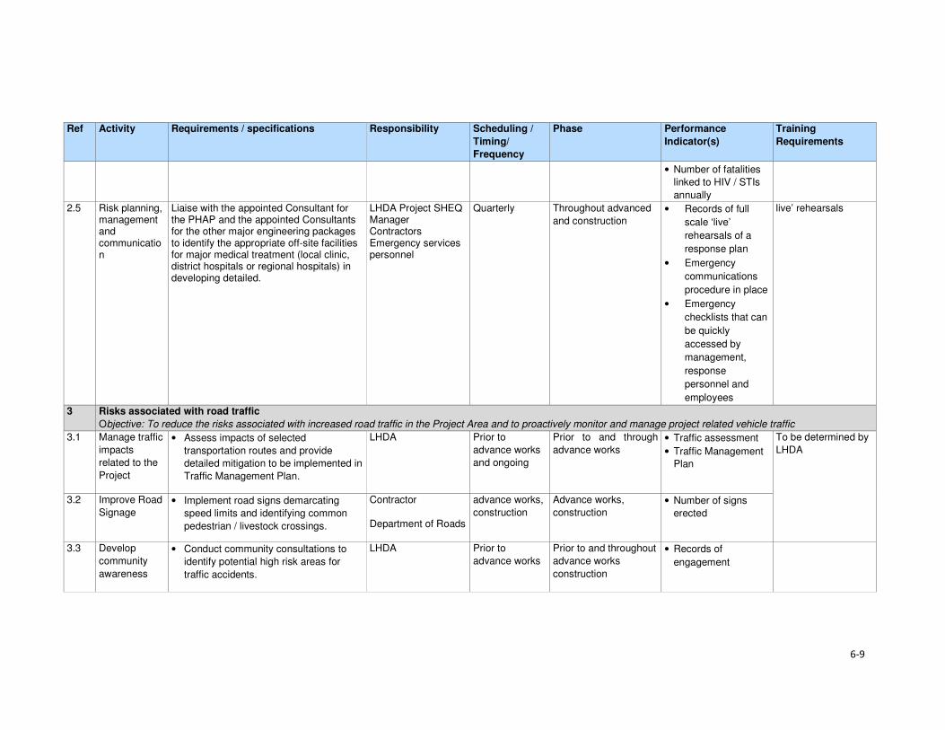
6-9
Ref Activity Requirements / specifications Responsibility Scheduling /
Timing/
Frequency
Phase Performance
Indicator(s)
Training
Requirements
• Number of fatalities
linked to HIV / STIs
annually
2.5 Risk planning, management and communication
Liaise with the appointed Consultant for the PHAP and the appointed Consultants for the other major engineering packages to identify the appropriate off-site facilities for major medical treatment (local clinic, district hospitals or regional hospitals) in developing detailed.
LHDA Project SHEQ Manager Contractors Emergency services personnel
Quarterly Throughout advanced
and construction • Records of full
scale ‘live’
rehearsals of a
response plan
• Emergency
communications
procedure in place
• Emergency
checklists that can
be quickly
accessed by
management,
response
personnel and
employees
live’ rehearsals
3 Risks associated with road traffic
Objective: To reduce the risks associated with increased road traffic in the Project Area and to proactively monitor and manage project related vehicle traffic
3.1 Manage traffic
impacts
related to the
Project
• Assess impacts of selected
transportation routes and provide
detailed mitigation to be implemented in
Traffic Management Plan.
LHDA Prior to
advance works
and ongoing
Prior to and through
advance works • Traffic assessment
• Traffic Management
Plan
To be determined by
LHDA
3.2 Improve Road
Signage • Implement road signs demarcating
speed limits and identifying common
pedestrian / livestock crossings.
Contractor
Department of Roads
advance works,
construction
Advance works,
construction • Number of signs
erected
3.3 Develop
community
awareness
• Conduct community consultations to
identify potential high risk areas for
traffic accidents.
LHDA Prior to
advance works
Prior to and throughout
advance works
construction
• Records of
engagement
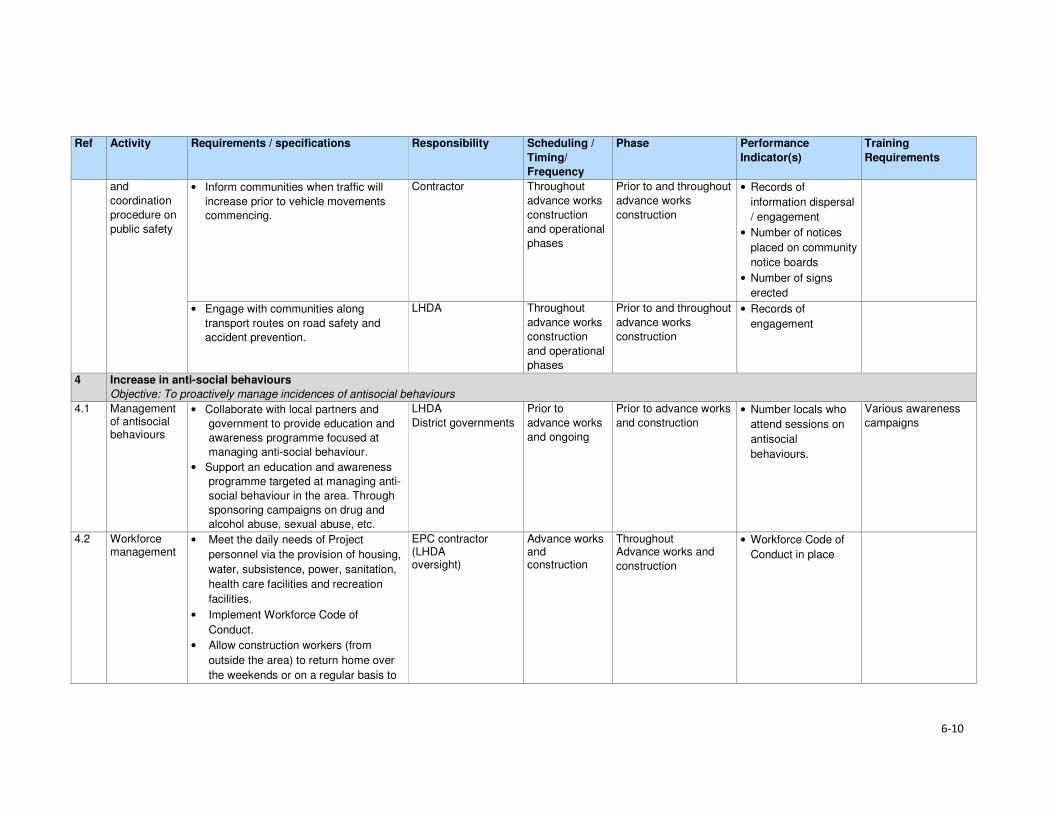
6-10
Ref Activity Requirements / specifications Responsibility Scheduling /
Timing/
Frequency
Phase Performance
Indicator(s)
Training
Requirements
and
coordination
procedure on
public safety
• Inform communities when traffic will
increase prior to vehicle movements
commencing.
Contractor Throughout
advance works
construction
and operational
phases
Prior to and throughout
advance works
construction
• Records of
information dispersal
/ engagement
• Number of notices
placed on community
notice boards
• Number of signs
erected
• Engage with communities along
transport routes on road safety and
accident prevention.
LHDA Throughout
advance works
construction
and operational
phases
Prior to and throughout
advance works
construction
• Records of
engagement
4 Increase in anti-social behaviours
Objective: To proactively manage incidences of antisocial behaviours
4.1 Management of antisocial behaviours
• Collaborate with local partners and
government to provide education and
awareness programme focused at
managing anti-social behaviour.
• Support an education and awareness
programme targeted at managing anti-
social behaviour in the area. Through
sponsoring campaigns on drug and
alcohol abuse, sexual abuse, etc.
LHDA
District governments
Prior to
advance works
and ongoing
Prior to advance works
and construction • Number locals who
attend sessions on
antisocial
behaviours.
Various awareness
campaigns
4.2 Workforce management
• Meet the daily needs of Project
personnel via the provision of housing,
water, subsistence, power, sanitation,
health care facilities and recreation
facilities.
• Implement Workforce Code of
Conduct.
• Allow construction workers (from
outside the area) to return home over
the weekends or on a regular basis to
EPC contractor (LHDA oversight)
Advance works and construction
Throughout Advance works and
construction
• Workforce Code of
Conduct in place

6-11
Ref Activity Requirements / specifications Responsibility Scheduling /
Timing/
Frequency
Phase Performance
Indicator(s)
Training
Requirements
visit their families in order to minimise
the interactions between the migrant
workforce and locals. The appointed
contractor will facilitate these visits
accordingly.
4.3 Management of in-migration
• Widely advertise employment
opportunities, emphasising the types of
jobs to be created and skills required
as well the policy for employment
LHDA
Contractor
Prior to
advance works
and ongoing
Prior to and throughout
advance works
construction and
operational phases
• Advertise of jobs on
national and
countrywide
N/A
5 Creation of employment
Objective: To maximise recruitment of people from the local communities, broader Project Area and from Lesotho
5.1 Maximise
employment
opportunities
• Promote employment of local people
through rotational basis for unskilled
workers.
• Establish accessible satellite offices in
the area to facilitate easy access.
• Provide on the job training for those
employed.
Contractor
LHDA
Prior to
advance works
and ongoing
Prior to and throughout
advance works
construction and
operational phases
• Number of local
people employed
• Number of satellite
offices established
• Training records
• Numbers of people
trained
To be determined by
the contractor and
LHDA
H&S training
6 Procurement of goods and services
Objective: to maximise the project spend in the local economy
6.1 Develop and
implement
local content
policy
• Establish a policy that seeks to
maximise local/ in country purchasing
of goods and services.
• Set- out targets for all contractors to
meet in terms of local procurement.
• On-going training and capacity building
of local businesses.
• Split the large contracts into smaller
components in order to allow small
businesses to share in the project.
LHDA
Government entities
Prior to
advance works
and ongoing
Prior to and throughout
advance works
construction and
operational phases
• Number of local
business trained
• Training schedule
and materials
• Number of large
contracts split into
smaller contracts
• Review of large
tender contracts
7 Loss of access to natural resources
Objective: to rescue some plants from the inundation area prior to the dam filling

6-12
Ref Activity Requirements / specifications Responsibility Scheduling /
Timing/
Frequency
Phase Performance
Indicator(s)
Training
Requirements
7.1 Search and
rescue of
priority plants
– advanced
infrastructure
• Appoint suitably qualified or
experienced botanist to conduct active
searches for priority species prior to
infrastructure site clearance.
• Conduct foot searches of advanced
infrastructure, tunnel inlet and dam wall
and quarry areas to recover priority
plants.
• Bag, store and look after plants in
temporary nursery area/s prior to use in
landscaping of infrastructure areas or
community garden(s).
• Collect seeds of suitable plants for
landscaping and propagation in a
community garden.
• Replant rescued plants and seeds in
accordance with landscaping plan.
• Landscaping shall prioritise use of
indigenous naturally occurring plants
and shall include a list of suitable
plants.
LHDA: botanical
team to be appointed
Prior to
advance works
Preparation and during
site clearance
• Botanist appointed
• Proof of active
searches in form of
documentation and
retrieved plants.
• Nursery established
for temporary
relocation of
rescued plants and
seeds.
• Dedicated nursery
manager appointed
to manage the
nursery and recover
seeds.
• Landscaping plan
developed for
infrastructure areas
dominated by
indigenous plants.
Nursery staff trained
in plant rescue and
propagation
8 Stakeholder Consultation
Objective: to promote open and transparent communication with stakeholders
8.1 Implement a
Stakeholder
Engagement
Plan /
Programme
for the Project
• Proactive engagement of community
leaders and members on the planned
project.
• Ensure easy access to grievance
protocol for stakeholders.
LHDA
Contractor
Prior to and throughout
advance works
construction and
operational phases
• Records of all
interactions with
communities
• Records of
grievances recorded

7-1
Section 7 References
Bureau of Statistics (Lesotho), Statistical Report No. 6 of 2015 - 2013/2014 Agricultural Production
Survey Crops
Bureau of Statistics (Lesotho), Statistical Report No.8 of 2015 - Lesotho Livestock Statistics Report
2013/2014
Bureau of Statistics (Lesotho), Statistical Report No.21 of 2015 - Livestock Products Report
2013/2014
Bureau of Statistics (Lesotho), Statistical Report No. 28 of 2015 – 2014 Education Statistics Report
Bureau of Statistics (Lesotho), 2013, Lesotho Demographic Survey, 2011, Vol 1, The Bureau of
Statistics, Maseru
CES, 2014. Biological and Archaeological (Including Heritage) Baseline and Impact Assessment;
Contract LHDA No. 6002.
Consult 4 and SEED Consult, 2009. Feasibility Study for Phase II – Main Report. Lesotho Highlands
Water Commission. LHWC 001/224-2007; P RSA D000/00/7007.
Consult 4 Consortium and SEED Consult, 2008. Feasibility Study for Phase II – Consultation and
Social Issues Supporting Report. Lesotho Highlands Water Commission. LHWC 001/215-2007; P
RSA D000/00/6107.
Consult 4 Consortium and SEED Consult, 2008. Feasibility Study for Phase II - Environmental Impact
Assessment Supporting Report. Lesotho Highlands Water Commission. LHWC 001/219-2007; P
RSA D000/00/6507.
Consult 4 and SEED Consult, 2008. Feasibility Study for Phase II - Social Impact Assessment
Supporting Report. Lesotho Highlands Water Commission. LHWC 001/216-2007; P RSA
D000/00/6207.
Ecorex and Kobisi, K. 2017. Terrestrial Ecology Report for Polihali Reservoir and Associated
Infrastructure. LHDA Contract No. 6014 (P2W-6014-DFR-0002).
EOH Coastal and Environmental Services (CES), 2014. Lesotho Highlands Water Project Phase II:
Baseline Botanical Survey: Lesotho Highlands Water Project Phase II: LHDA Contract 6002.
EOH Coastal and Environmental Services (CES), 2015a. Lesotho Highlands Water Project Phase II:
Baseline Income and Expenditure Report. Lesotho Highlands Water Project Phase II: LHDA Contract
No. 6000
EOH Coastal and Environmental Services (CES), 2015b. Lesotho Highlands Water Project Phase II:
Socio-Economic Baseline Study Report. Lesotho Highlands Water Project Phase II: LHDA Contract
No. 6000
ERS. 2017.Soils, Land Use and Land Capability Report for Polihali Reservoir and Associated
Infrastructure. LHDA Contract No. 6014 (P2W-6014-DFR-0007).
Government of Lesotho. Constitution of Lesotho Act No. 5 of 1993, Maseru
Government of Lesotho. Education Act No.3 of 2010, Maseru
Government of Lesotho. Environmental Act No 10 of 2008, Maseru

Section 7• References
7-2
Government of Lesotho. Gender and Development Policy, 2003, Maseru
Government of Lesotho. Local Governance and Non-State Actors Support Programme – Information
Handbook: Mokhotlong District Report 3, 2009, Maseru
Government of Lesotho. Lesotho Land Act No. 17 of 1979, Maseru
Government of Lesotho. Lesotho Land Act No. 8 of 2010, Maseru
Government of Lesotho. Lesotho: Legal Capacity of Married Persons Act of 2006, Maseru
Government of Lesotho Ministry of Development Planning. National Strategic Development Plan
2012/13 – 2017/18 “Growth and Development Strategic Framework, 2013, Maseru
Government of Lesotho. Ministry of Education and Training. Kingdom of Lesotho. Lesotho Education
Sector Plan 2005 – 2015, Maseru, March 2015
Government of Lesotho. Lesotho National Health Strategic Plan 2012/13 – 2016/17, April, 2013,
Maseru
Government of Lesotho. National Environmental Impact Assessment Guidelines 2009, Maseru
Government of Lesotho. National Environment Policy, 1998, Maseru
Government of the Kingdom of Lesotho. Lesotho National Social Protection Strategy (NSPS)
2014/15 – 2018/19, Maseru, 2014
Government of the Kingdom of Lesotho. Millennium Development Goals Status Report 2013,
Maseru, 2014
Government of the Kingdom of Lesotho. National Policy for Integrated Early Childhood Care and
Development, Maseru, 2013
Government of Lesotho. Local Government Act 1997 as Amended by Local Government
(Amendment) Act 2004, Maseru, 2004
Government of Lesotho. The Labour Code (Amendment) Act No. 5 of 2006, Maseru
Government of Lesotho. Workmen’s Compensation Act No. 3 of 1977, Maseru
Government of Lesotho. Public Health Order 12 of 1970, Maseru
Government of Lesotho. Motor Vehicle Insurance Order No. 26 of 1989, Maseru
Government of Lesotho. Deeds Registry Act No. 12 of 1967, Maseru
IFC, 2012. International Finance Corporation Performance Standards on Environmental and Social
Sustainability, January, 2012
Kingdom of Lesotho, 2013. Higher Education Strategic Plan 2013/14 – 2017/18, Maseru
Kingdom of Lesotho, 2013. Millennium Development Goals Status Report 2013
Kingdom of Lesotho, 2014. Wool and Mohair Promotion Project (WAMPP) Final Project design report.
September, 2014
Lesotho Highlands Development Authority, 2011. Agreement on Phase II of the Lesotho Highlands
Water Project Between the Government of the Kingdom of Lesotho and the Government of the
Republic of South Africa. Maseru.
Section 7• References
7-3
Lesotho Highlands Water Project Phase II Asset Registration Procedures, October 2017
Lesotho Highlands Water Project Phase II Community Participation Strategy, September 2014
Lesotho Highlands Water Project Phase II Compensation Policy, August 2016
Lesotho Highlands Water Project Phase II Contractor Procurement Framework (Draft), August 2016
Lesotho Highlands Water Project Phase II Livelihood Restoration and Social Development
Framework, August 2017
Local Governance and Non-State Actors Support Programme – Information Handbook: Mokhotlong
District Report 3, 2009
Ministry of Health (Lesotho) and ICF International, 2016. Lesotho Health and Demographic Survey
2014. Maseru, Lesotho: Ministry of Health and ICF International.
MM&A and Pinto, H. Cultural Heritage (including Archaeology) Report for Polihali Reservoir and
Associated Infrastructure. LHDA Contract No. 6014. (P2W-6014-DFR-0003)
NHA Development Consultants, 2016. Lesotho Highlands Water Project Phase II: Public Health
Baseline Study Report. Lesotho Highlands Water Project Phase II: LHDA Contract No. 6008
Panel of Experts & LHDA, 2010. The ‘Lessons Learnt’ report from Phase 1A and Phase 1B Report
55.
Ramatla, S. and Kheekhe, M. 2017. Rangelands Report for Polihali Reservoir and Associated
Infrastructure. LHDA Contract No. 6014 (P2W-6014-DFR-0009).
Rori Consultancy, 2017. Lesotho Highlands Water Project Phase II: Safety, Health, Environment and
Quality (SHEQ) Management Framework.
Sechaba and ERM. 2017. Stakeholder Engagement Report for Polihali Reservoir and Associated
Infrastructure ESIA. LHDA Contract No. 6014 (P2W-6014-NPD-0015).
UN-Habitat, 2005. Land Tenure, Housing Rights and Gender in Lesotho
UNAIDS, 2016. Gap Report
UNDP, 2016. Human Development Report 2016: Human Development for Everyone
World Bank, 2016. World Bank Environmental and Social Framework. World Bank, Washington, DC
6014 ESIA Specialist Studies
Ecorex and Kobisi, 2017. Terrestrial Ecology Report. P2W-6014-DFR-0002
MM&A and Pinto, 2017. Cultural Heritage incorporating Archaeology Report. P2W-6014-DFR-0003
Matela and Kuenene, 2017. Soils, Land Use and land Capability Report. P2W-6014-DFR-0007
Ramatla, 2017. Rangelands Report. P2W-6014-DFR-0009
Web resources
AVERT (1986-2017) (http://www.avert.org/professionals/hiv-around-world/sub-saharan-africa)
Commonwealth Local Government Forum (2017)
http://www.clgf.org.uk/default/assets/File/Country_profiles/Lesotho.pdf

Section 7• References
7-4
Mokhethi, N.I., etal (2015) (http:www.researchgate.net/figure/290330505_fig1_figure-1-Lesotho-
wool-and-mohair-value-chain)
UN (2016) (http:/www.un.org/sustainabledevelopment/sustainable-development-goals)
UNESCO (2012) (http://www.unesco.org/eri/cp/factsheets_ed/LS_EDFactSheet.pdf)
http://www.worldmeters.info/world-population/lesotho-population/
Wade Publications CC (2015) (http://www.lesothoreview.com/education-training-2015.php)
World Bank Group - International Finance Corporation (2017)
http://www1.ifc.org/wps/wcm/connect/corp_ext_content/ifc_external_corporate_site/home