Embed Size (px)
Citation preview
Issue no. 24, Jan 2021
1/12
European Facility for Airborne Researchfor environmental and geo-sciences
NEWSLETTER
EUFAR MANAGEMENT & STRATEGY
The EUFAR AISBL - an international non-profit association under Belgian law - was officially constituted on 23 January 2018 by eight founding Members. These are (in alphabetical order of their home country): VITO, CzechGlobe, CNRS, Météo-France, ONERA, DLR, University of Warsaw, Met Office). Then INCAS, FUB and University of Chieti-Pescara were unanimously admitted in January 2018, followed by CNR, and University of Tel Aviv in January 2019. The year 2019 also marked the admission of two Polish Partners: MGGP AERO and CBK-PAN.
In total, the EUFAR AISBL is currently composed of 13 Members from 9 countries. The lists of General Assembly representatives appointed by the organisations and Executive Board members are provided in the following tables:
The Executive Board met fifteen times and the General Assembly five times since October 2017. The majority of these meetings have taken place using web-conferencing or other online methods, with the main annual GA meeting being held in Brussels. However, with the Covid pandemic in 2020, web-conferencing was used for this too.
For more information, please contact [email protected].
EUFAR AISBL Members and Partners
Countries Organisations General Assembly representatives (organisation level)
Belgium VITO Bart Deronde Ils Reusen (deputy)
Czech-Republic CzechGlobe Jan Hanus
France
CNRS Gérard AncelletPaola Formenti (deputy)
Météo France Philippe Bougeault (President)
ONERABernard RosierStéphane Minisclour (deputy)Philippe Brouard (deputy)
GermanyDLR Stefanie Holzwarth ( Vice-President)
Andreas Minikin (deputy)
FUB Thomas Ruhtz
Israel TAU Eyal Ben Dor
ItalyUNICH Piero Di Carlo
CNR Francesco CairoStefano Pignatti (deputy)
Poland UW Hanna Pawłowska
Romania INCAS Andreea CalcanNicolae-Sorin Vâjâiac (deputy)
UK Met Office Phil Brown
Founding Members
Members admitted on 26 Jan 2018
Members admitted on 31 Jan 2019
Countries Executive Board members (country level)
Belgium Bart Deronde
Czech-Republic Jan Hanus
France Paola Formenti (Vice-Chair)
Germany Thomas Ruthz
Israel
Italy Francesco Cairo
Poland Hanna Pawłowska
Romania Andreea Calcan
UK Phil Brown (Chair) Stacey Harvery (Treasurer)
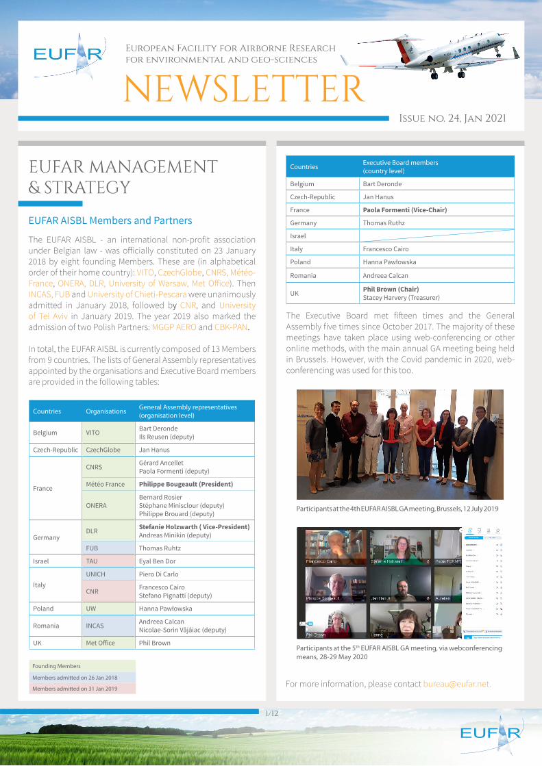
Participants at the 4th EUFAR AISBL GA meeting, Brussels, 12 July 2019
Participants at the 5th EUFAR AISBL GA meeting, via webconferencing means, 28-29 May 2020
Issue no. 24, Jan 2021
2/12
NEWSENVRI Newsletter August 2020
DLR studies changes in atmospheric pollution due to the Covid-19 pandemic
EUFAR collaborates with the ENVRI Community of Research Infrastructures that support multi-disciplinary research in the environmental sciences. You can read the latest ENVRI Newsletter for August 2020 here.
One of the main articles in this newsletter concerns the publication of an open-access book “Towards Interoperable Research Infrastructures for Environmental and Earth Sciences” that has been published by Springer. This provides a systematic overview of the data-related challenges that are being addressed across the ENVRI community and brings together much of the technical knowledge in data and service provision that has been assembled during the community development period. The the book can be downloaded in pdf format using links that are provided on the webpage above.
For more information please contact Phil Brown.
A German team, under the leadership of the German Aerospace Center (Deutsches Zentrum für Luft- und Raumfahrt; DLR) and the Max Planck Institute for Chemistry (MPIC), wants to find out how strongly the restrictions in the wake of the COVID 19 pandemic will affect the atmosphere. Over the next two weeks, as part of the BLUESKY research programme, scientists will measure concentrations of trace gases and pollutants in the air over European urban areas and in the flight corridor to North America. The aim of these research missions is to investigate how reduced emissions from industry and transport are changing atmospheric chemistry and physics.
ENVRI community illustration showing the participating Research Infrastructures
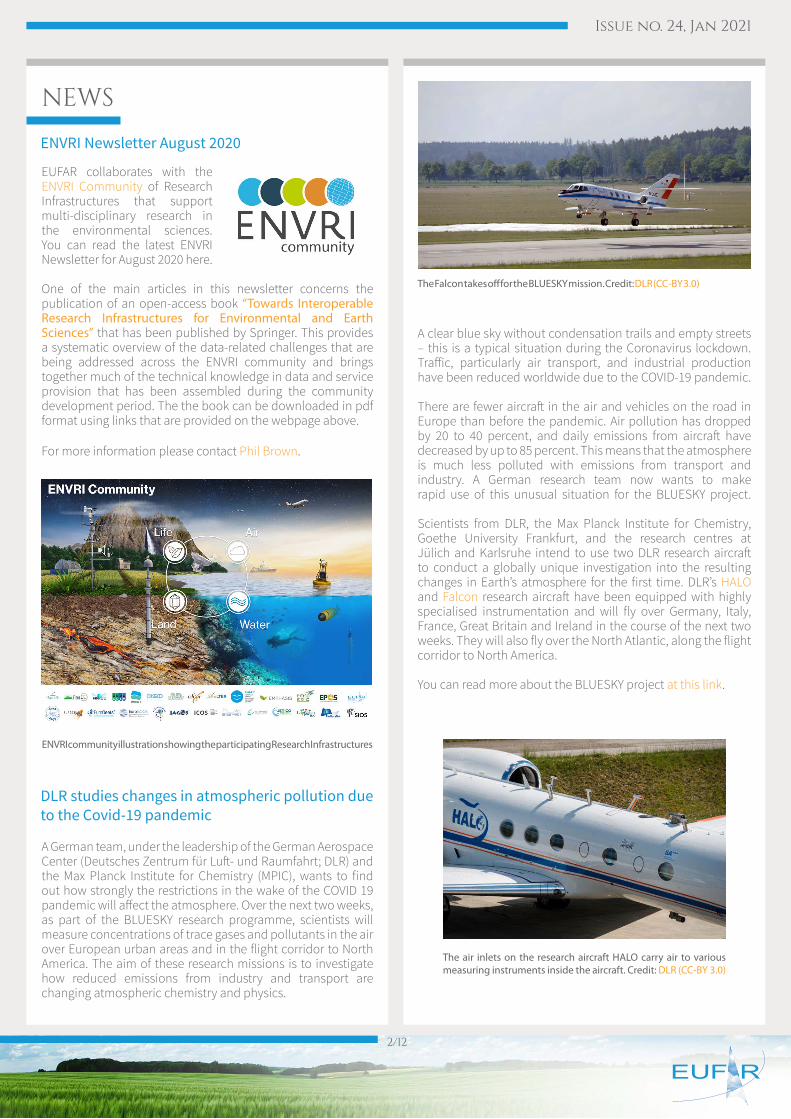
The Fal con takes off for the BLUESKY mis sion. Credit: DLR (CC-BY 3.0)
The air inlets on the research aircraft HALO carry air to various measuring instruments inside the aircraft. Credit: DLR (CC-BY 3.0)
A clear blue sky without condensation trails and empty streets – this is a typical situation during the Coronavirus lockdown. Traffic, particularly air transport, and industrial production have been reduced worldwide due to the COVID-19 pandemic. There are fewer aircraft in the air and vehicles on the road in Europe than before the pandemic. Air pollution has dropped by 20 to 40 percent, and daily emissions from aircraft have decreased by up to 85 percent. This means that the atmosphere is much less polluted with emissions from transport and industry. A German research team now wants to make rapid use of this unusual situation for the BLUESKY project. Scientists from DLR, the Max Planck Institute for Chemistry, Goethe University Frankfurt, and the research centres at Jülich and Karlsruhe intend to use two DLR research aircraft to conduct a globally unique investigation into the resulting changes in Earth’s atmosphere for the first time. DLR’s HALO and Falcon research aircraft have been equipped with highly specialised instrumentation and will fly over Germany, Italy, France, Great Britain and Ireland in the course of the next two weeks. They will also fly over the North Atlantic, along the flight corridor to North America.
You can read more about the BLUESKY project at this link.
Issue no. 24, Jan 2021
3/12
Aircraft measurements of air quality in the UK
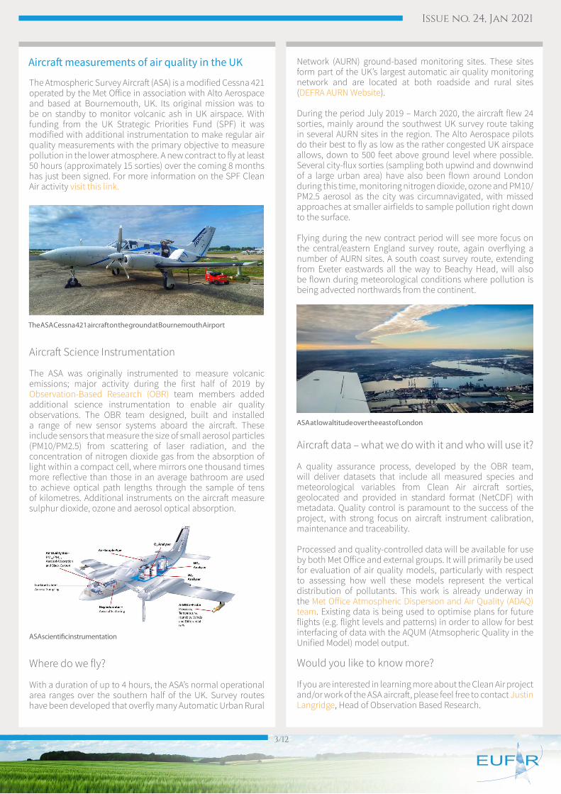
The Atmospheric Survey Aircraft (ASA) is a modified Cessna 421 operated by the Met Office in association with Alto Aerospace and based at Bournemouth, UK. Its original mission was to be on standby to monitor volcanic ash in UK airspace. With funding from the UK Strategic Priorities Fund (SPF) it was modified with additional instrumentation to make regular air quality measurements with the primary objective to measure pollution in the lower atmosphere. A new contract to fly at least 50 hours (approximately 15 sorties) over the coming 8 months has just been signed. For more information on the SPF Clean Air activity visit this link.
Aircraft Science Instrumentation
The ASA was originally instrumented to measure volcanic emissions; major activity during the first half of 2019 by Observation-Based Research (OBR) team members added additional science instrumentation to enable air quality observations. The OBR team designed, built and installed a range of new sensor systems aboard the aircraft. These include sensors that measure the size of small aerosol particles (PM10/PM2.5) from scattering of laser radiation, and the concentration of nitrogen dioxide gas from the absorption of light within a compact cell, where mirrors one thousand times more reflective than those in an average bathroom are used to achieve optical path lengths through the sample of tens of kilometres. Additional instruments on the aircraft measure sulphur dioxide, ozone and aerosol optical absorption.
Where do we fly?
With a duration of up to 4 hours, the ASA’s normal operational area ranges over the southern half of the UK. Survey routes have been developed that overfly many Automatic Urban Rural
Network (AURN) ground-based monitoring sites. These sites form part of the UK’s largest automatic air quality monitoring network and are located at both roadside and rural sites (DEFRA AURN Website).
During the period July 2019 – March 2020, the aircraft flew 24 sorties, mainly around the southwest UK survey route taking in several AURN sites in the region. The Alto Aerospace pilots do their best to fly as low as the rather congested UK airspace allows, down to 500 feet above ground level where possible. Several city-flux sorties (sampling both upwind and downwind of a large urban area) have also been flown around London during this time, monitoring nitrogen dioxide, ozone and PM10/PM2.5 aerosol as the city was circumnavigated, with missed approaches at smaller airfields to sample pollution right down to the surface.
Flying during the new contract period will see more focus on the central/eastern England survey route, again overflying a number of AURN sites. A south coast survey route, extending from Exeter eastwards all the way to Beachy Head, will also be flown during meteorological conditions where pollution is being advected northwards from the continent.
Aircraft data – what we do with it and who will use it?
A quality assurance process, developed by the OBR team, will deliver datasets that include all measured species and meteorological variables from Clean Air aircraft sorties, geolocated and provided in standard format (NetCDF) with metadata. Quality control is paramount to the success of the project, with strong focus on aircraft instrument calibration, maintenance and traceability.
Processed and quality-controlled data will be available for use by both Met Office and external groups. It will primarily be used for evaluation of air quality models, particularly with respect to assessing how well these models represent the vertical distribution of pollutants. This work is already underway in the Met Office Atmospheric Dispersion and Air Quality (ADAQ) team. Existing data is being used to optimise plans for future flights (e.g. flight levels and patterns) in order to allow for best interfacing of data with the AQUM (Atmsopheric Quality in the Unified Model) model output.
Would you like to know more?
If you are interested in learning more about the Clean Air project and/or work of the ASA aircraft, please feel free to contact Justin Langridge, Head of Observation Based Research.
The ASA Cessna 421 aircraft on the ground at Bournemouth Airport
ASA at low altitude over the east of London
ASA scientific instrumentation
Issue no. 24, Jan 2021
4/12
AIRBORNE RESEARCH STORIES
The French national research agency CNRS awarded SAFIRE, one of EUFAR operators, with a “Collective Crystal” medal as a national recognition of the merit and quality of the teamwork, commitment and motivation of the EUFAR staff involved in air-borne research for many years to successfully meet the various needs of scientific user communities.
The SAFIRE management team congratulates the staff of the SAFIRE mixed reserach unit and thanks all those who com-mit for the success of SAFIRE mission in support of airborne research.
To read the congratulation letter from CNRS President Antoine Petit, click here (in French).
Congratulations to SAFIRE from EUFAR!
Lights on the EUFAR SAFIRE operator and transnational access projects by young scientists!
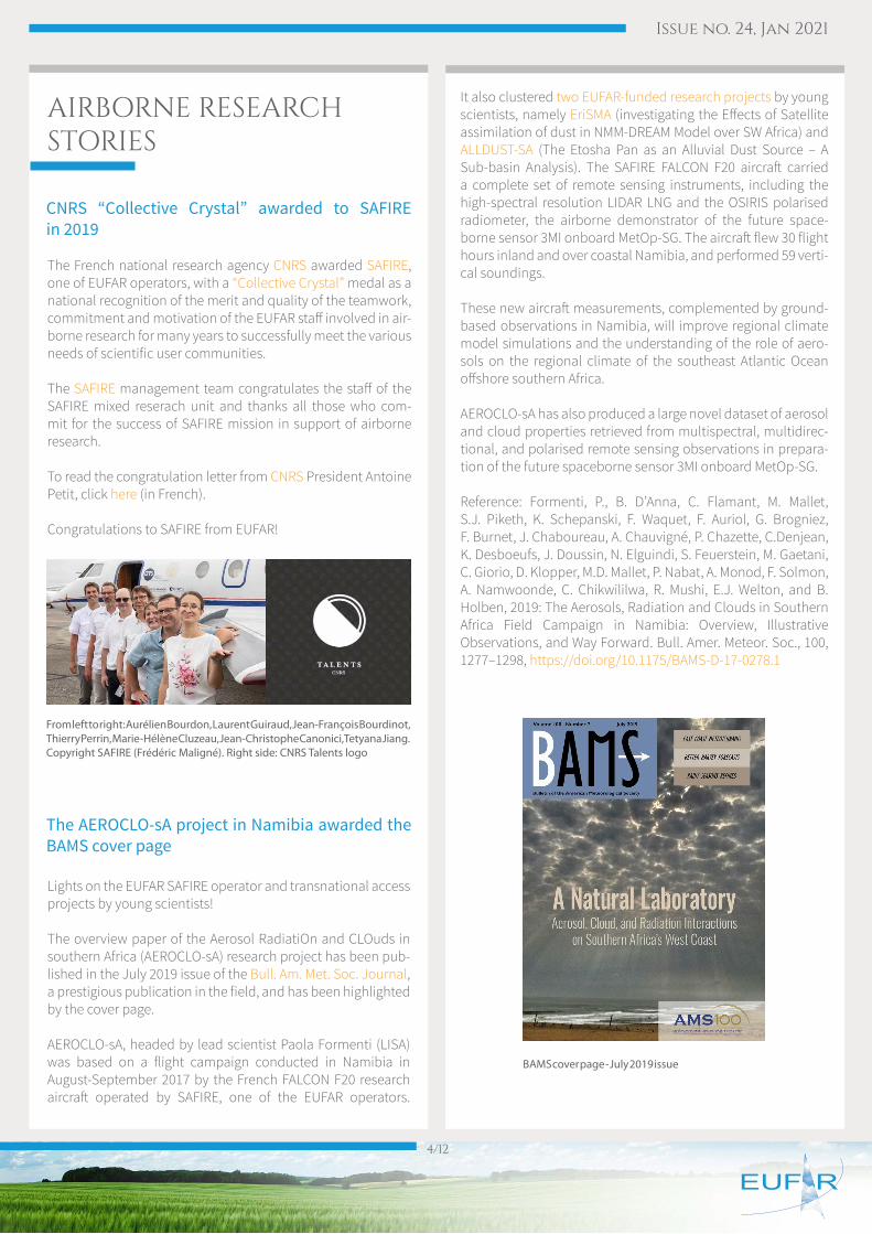
The overview paper of the Aerosol RadiatiOn and CLOuds in southern Africa (AEROCLO-sA) research project has been pub-lished in the July 2019 issue of the Bull. Am. Met. Soc. Journal, a prestigious publication in the field, and has been highlighted by the cover page.
AEROCLO-sA, headed by lead scientist Paola Formenti (LISA) was based on a flight campaign conducted in Namibia in August-September 2017 by the French FALCON F20 research aircraft operated by SAFIRE, one of the EUFAR operators.
CNRS “Collective Crystal” awarded to SAFIRE in 2019
The AEROCLO-sA project in Namibia awarded the BAMS cover page
From left to right: Aurélien Bourdon, Laurent Guiraud, Jean-François Bourdinot, Thierry Perrin, Marie-Hélène Cluzeau, Jean-Christophe Canonici, Tetyana Jiang. Copyright SAFIRE (Frédéric Maligné). Right side: CNRS Talents logo
It also clustered two EUFAR-funded research projects by young scientists, namely EriSMA (investigating the Effects of Satellite assimilation of dust in NMM-DREAM Model over SW Africa) and ALLDUST-SA (The Etosha Pan as an Alluvial Dust Source – A Sub-basin Analysis). The SAFIRE FALCON F20 aircraft carried a complete set of remote sensing instruments, including the high-spectral resolution LIDAR LNG and the OSIRIS polarised radiometer, the airborne demonstrator of the future space-borne sensor 3MI onboard MetOp-SG. The aircraft flew 30 flight hours inland and over coastal Namibia, and performed 59 verti-cal soundings.
These new aircraft measurements, complemented by ground-based observations in Namibia, will improve regional climate model simulations and the understanding of the role of aero-sols on the regional climate of the southeast Atlantic Ocean offshore southern Africa.
AEROCLO-sA has also produced a large novel dataset of aerosol and cloud properties retrieved from multispectral, multidirec-tional, and polarised remote sensing observations in prepara-tion of the future spaceborne sensor 3MI onboard MetOp-SG.
Reference: Formenti, P., B. D’Anna, C. Flamant, M. Mallet, S.J. Piketh, K. Schepanski, F. Waquet, F. Auriol, G. Brogniez, F. Burnet, J. Chaboureau, A. Chauvigné, P. Chazette, C.Denjean, K. Desboeufs, J. Doussin, N. Elguindi, S. Feuerstein, M. Gaetani, C. Giorio, D. Klopper, M.D. Mallet, P. Nabat, A. Monod, F. Solmon, A. Namwoonde, C. Chikwililwa, R. Mushi, E.J. Welton, and B. Holben, 2019: The Aerosols, Radiation and Clouds in Southern Africa Field Campaign in Namibia: Overview, Illustrative Observations, and Way Forward. Bull. Amer. Meteor. Soc., 100, 1277–1298, https://doi.org/10.1175/BAMS-D-17-0278.1
BAMS cover page - July 2019 issue
Issue no. 24, Jan 2021
5/12
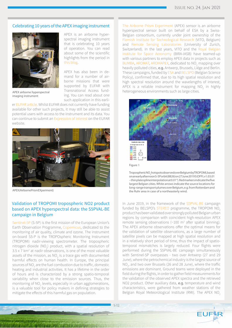
The Airborne Prism Experiment (APEX) sensor is an airborne hyperspectral sensor built on behalf of ESA by a Swiss-Belgian consortium, currently under joint ownership of the Flemish Institute for Technological Research (VITO, Belgium) and Remote Sensing Laboratories (University of Zurich, Switzerland). In the last years, VITO and the Royal Belgian Institute for Space Aeronomy (BIRA-IASB) have teamed-up with various partners to employ APEX data in projects such as BUMBA, AROMAT, AROMAPEX, dedicated to NO2 mapping over heavily polluted cities, e.g. Antwerp, Brussels, Liége and Berlin. These campaigns, funded by ESA and BELSPO (Belgian Science Policy), confirmed that, due to its high spatial resolution and high spectral resolution around the wavelengths of interest, APEX is a reliable instrument for mapping NO2 in highly heterogeneous environments such as large cities.
In June 2019, in the framework of the S5PVAL-BE campaign funded by BELSPO’s STEREO programme, the TROPOMI NO2 product has been validated over strongly polluted Belgian urban regions by comparison with coincident high-resolution APEX remote sensing observations (~100 m2 after spatial binning). The APEX airborne observations offer the optimal means for the validation of satellite observations, as a large number of satellite pixels can be mapped at high spatial resolution and in a relatively short period of time, thus the impact of spatio-temporal mismatches is largely reduced. Four flights were performed during the S5PVAL-BE campaign simultaneously with Sentinel-5P overpasses - two over Antwerp (27 and 29 June), where the petrochemical industry is the largest source of NO2, and two over Brussels (26 and 28 June), where the traffic emissions are dominant. Ground teams were deployed in the field during the flights, in order to gather field measurements for the validation of the observed APEX spectra and the retrieved NO2 product. Other auxiliary data, e.g. temperature and wind characteristics, were gathered from weather stations of the Belgian Royal Meteorological Institute (RMI). The APEX NO2
Sentinel-5P (S-5P) is the first mission of the European Union’s Earth Observation Programme, Copernicus, dedicated to the monitoring of air quality, climate and ozone. The instrument on-board S5-P is the TROPOspheric Monitoring Instrument (TROPOMI) nadir-viewing spectrometer. The tropospheric nitrogen dioxide (NO2) product, with a spatial resolution of 3.5 x 7 km2 at nadir observations, is one of the most valuable assets of the mission, as NO2 is a trace gas with documented harmful effects on human health. In Europe, the principal sources of NO2 are the fuel combustion due to traffic, domestic heating and industrial activities. It has a lifetime in the order of hours and is characterized by a strong spatio-temporal variability when close to the emission sources. Thus, the monitoring of NO2 levels, especially in urban agglomerations, is a valuable tool for policy makers in defining strategies to mitigate the effects of this harmful gas on population.
Validation of TROPOMI tropospheric NO2 product based on APEX hyperspectral data: the S5PVAL-BE campaign in Belgium
APEX is an airborne hyper-spectral imaging instrument that is celebrating 10 years of operation. You can read about some of the scientific highlights from the period in this blog.
APEX has also been in de-mand for a number of air-borne missions that were supported by EUFAR with Transnational Access fund-ing. You can read about one such application in this earli-
er EUFAR article. Whilst EUFAR does not currently have funding available for other such projects, it may still be able to assist potential users with access to the instrument and its data. You can continue to submit an Expression of Interest on the EUFAR website.
Celebrating 10 years of the APEX imaging instrument
APEX airborne hyperspectral imaging instrument
APEX (Airborne Prism EXperiment)
Figure 1
Tropospheric NO2 hotspots observed over Belgium by TROPOMI, based on an early afternoon S-5P orbit (8826) on 27 June 2019 5 (OFFL v1.03.01 – thin plate spline interpolation at 0.01°). Red markers indicate the five largest Belgian cities. White arrows indicate the source locations for long-range transport plumes over Belgium, e.g. from Rotterdam and the Ruhr area in case of a northeasterly wind.
Issue no. 24, Jan 2021
6/12
retrieval uses as input customized datasets, e.g. dark-current corrected imagery, produced by VITO Remote Sensing for the spectral region 470-510nm.
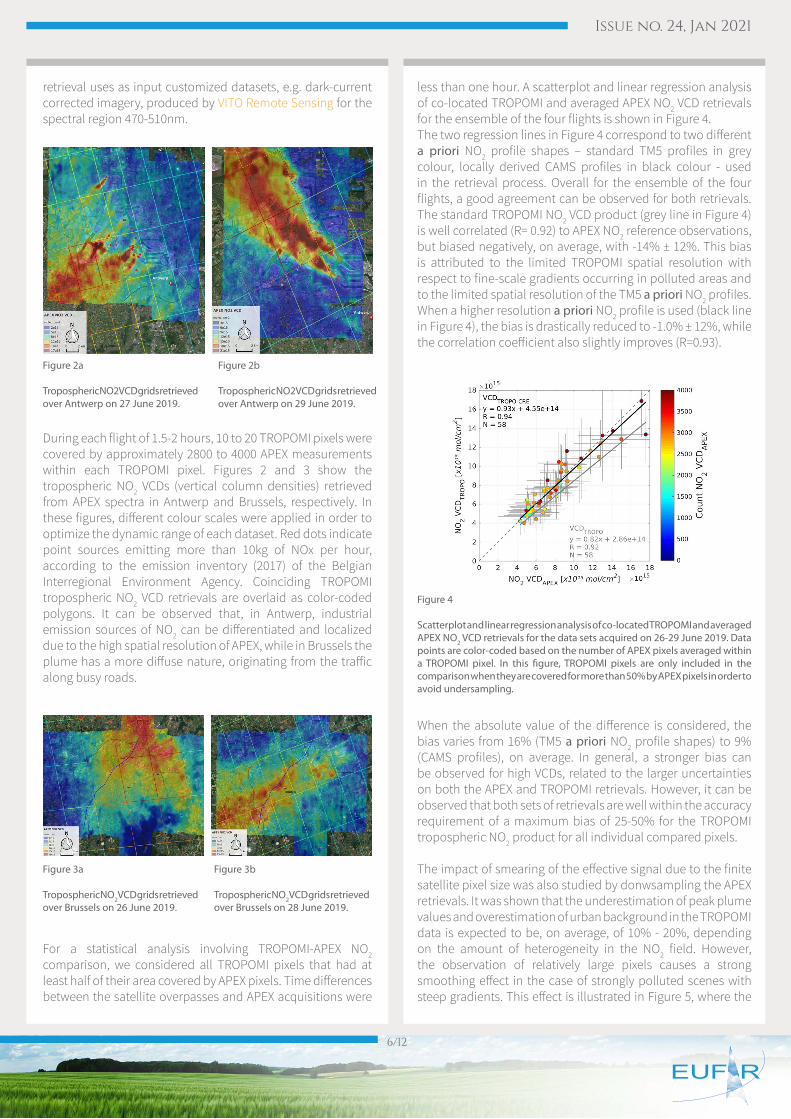
During each flight of 1.5-2 hours, 10 to 20 TROPOMI pixels were covered by approximately 2800 to 4000 APEX measurements within each TROPOMI pixel. Figures 2 and 3 show the tropospheric NO2 VCDs (vertical column densities) retrieved from APEX spectra in Antwerp and Brussels, respectively. In these figures, different colour scales were applied in order to optimize the dynamic range of each dataset. Red dots indicate point sources emitting more than 10kg of NOx per hour, according to the emission inventory (2017) of the Belgian Interregional Environment Agency. Coinciding TROPOMI tropospheric NO2 VCD retrievals are overlaid as color-coded polygons. It can be observed that, in Antwerp, industrial emission sources of NO2 can be differentiated and localized due to the high spatial resolution of APEX, while in Brussels the plume has a more diffuse nature, originating from the traffic along busy roads.
For a statistical analysis involving TROPOMI-APEX NO2 comparison, we considered all TROPOMI pixels that had at least half of their area covered by APEX pixels. Time differences between the satellite overpasses and APEX acquisitions were
less than one hour. A scatterplot and linear regression analysis of co-located TROPOMI and averaged APEX NO2 VCD retrievals for the ensemble of the four flights is shown in Figure 4.The two regression lines in Figure 4 correspond to two different a priori NO2 profile shapes – standard TM5 profiles in grey colour, locally derived CAMS profiles in black colour - used in the retrieval process. Overall for the ensemble of the four flights, a good agreement can be observed for both retrievals. The standard TROPOMI NO2 VCD product (grey line in Figure 4) is well correlated (R= 0.92) to APEX NO2 reference observations, but biased negatively, on average, with -14% ± 12%. This bias is attributed to the limited TROPOMI spatial resolution with respect to fine-scale gradients occurring in polluted areas and to the limited spatial resolution of the TM5 a priori NO2 profiles. When a higher resolution a priori NO2 profile is used (black line in Figure 4), the bias is drastically reduced to -1.0% ± 12%, while the correlation coefficient also slightly improves (R=0.93).
When the absolute value of the difference is considered, the bias varies from 16% (TM5 a priori NO2 profile shapes) to 9% (CAMS profiles), on average. In general, a stronger bias can be observed for high VCDs, related to the larger uncertainties on both the APEX and TROPOMI retrievals. However, it can be observed that both sets of retrievals are well within the accuracy requirement of a maximum bias of 25-50% for the TROPOMI tropospheric NO2 product for all individual compared pixels.
The impact of smearing of the effective signal due to the finite satellite pixel size was also studied by donwsampling the APEX retrievals. It was shown that the underestimation of peak plume values and overestimation of urban background in the TROPOMI data is expected to be, on average, of 10% - 20%, depending on the amount of heterogeneity in the NO2 field. However, the observation of relatively large pixels causes a strong smoothing effect in the case of strongly polluted scenes with steep gradients. This effect is illustrated in Figure 5, where the
Figure 2a
Tropospheric NO2 VCD grids retrieved over Antwerp on 27 June 2019.
Figure 3a
Tropospheric NO2 VCD grids retrieved over Brussels on 26 June 2019.
Figure 3b
Tropospheric NO2 VCD grids retrieved over Brussels on 28 June 2019.
Figure 2b
Tropospheric NO2 VCD grids retrieved over Antwerp on 29 June 2019.
Figure 4
Scatterplot and linear regression analysis of co-located TROPOMI and averaged APEX NO2 VCD retrievals for the data sets acquired on 26-29 June 2019. Data points are color-coded based on the number of APEX pixels averaged within a TROPOMI pixel. In this figure, TROPOMI pixels are only included in the comparison when they are covered for more than 50% by APEX pixels in order to avoid undersampling.
Issue no. 24, Jan 2021
7/12
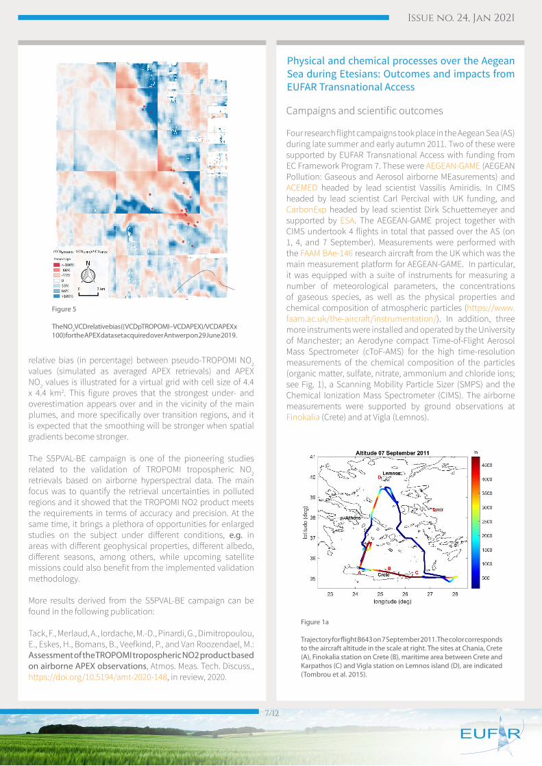
relative bias (in percentage) between pseudo-TROPOMI NO2 values (simulated as averaged APEX retrievals) and APEX NO2 values is illustrated for a virtual grid with cell size of 4.4 x 4.4 km2. This figure proves that the strongest under- and overestimation appears over and in the vicinity of the main plumes, and more specifically over transition regions, and it is expected that the smoothing will be stronger when spatial gradients become stronger.
The S5PVAL-BE campaign is one of the pioneering studies related to the validation of TROPOMI tropospheric NO2 retrievals based on airborne hyperspectral data. The main focus was to quantify the retrieval uncertainties in polluted regions and it showed that the TROPOMI NO2 product meets the requirements in terms of accuracy and precision. At the same time, it brings a plethora of opportunities for enlarged studies on the subject under different conditions, e.g. in areas with different geophysical properties, different albedo, different seasons, among others, while upcoming satellite missions could also benefit from the implemented validation methodology.
More results derived from the S5PVAL-BE campaign can be found in the following publication:
Tack, F., Merlaud, A., Iordache, M.-D., Pinardi, G., Dimitropoulou, E., Eskes, H., Bomans, B., Veefkind, P., and Van Roozendael, M.: Assessment of the TROPOMI tropospheric NO2 product based on airborne APEX observations, Atmos. Meas. Tech. Discuss., https://doi.org/10.5194/amt-2020-148, in review, 2020.
Campaigns and scientific outcomes
Four research flight campaigns took place in the Aegean Sea (AS) during late summer and early autumn 2011. Two of these were supported by EUFAR Transnational Access with funding from EC Framework Program 7. These were AEGEAN-GAME (AEGEAN Pollution: Gaseous and Aerosol airborne MEasurements) and ACEMED headed by lead scientist Vassilis Amiridis. In CIMS headed by lead scientist Carl Percival with UK funding, and CarbonExp headed by lead scientist Dirk Schuettemeyer and supported by ESA. The AEGEAN-GAME project together with CIMS undertook 4 flights in total that passed over the AS (on 1, 4, and 7 September). Measurements were performed with the FAAM BAe-146 research aircraft from the UK which was the main measurement platform for AEGEAN-GAME. In particular, it was equipped with a suite of instruments for measuring a number of meteorological parameters, the concentrations of gaseous species, as well as the physical properties and chemical composition of atmospheric particles (https://www.faam.ac.uk/the-aircraft/instrumentation/). In addition, three more instruments were installed and operated by the University of Manchester; an Aerodyne compact Time-of-Flight Aerosol Mass Spectrometer (cToF-AMS) for the high time-resolution measurements of the chemical composition of the particles (organic matter, sulfate, nitrate, ammonium and chloride ions; see Fig. 1), a Scanning Mobility Particle Sizer (SMPS) and the Chemical Ionization Mass Spectrometer (CIMS). The airborne measurements were supported by ground observations at Finokalia (Crete) and at Vigla (Lemnos).
Figure 5
The NO2 VCD relative bias ((VCDpTROPOMI – VCDAPEX)/ VCDAPEX x 100) for the APEX data set acquired over Antwerp on 29 June 2019.
Figure 1a
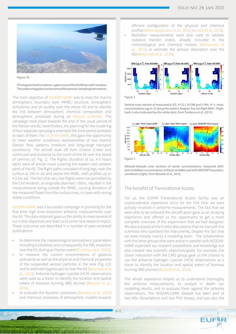
Trajectory for flight B643 on 7 September 2011. The color corresponds to the aircraft altitude in the scale at right. The sites at Chania, Crete (A), Finokalia station on Crete (B), maritime area between Crete and Karpathos (C) and Vigla station on Lemnos island (D), are indicated (Tombrou et al. 2015).
Physical and chemical processes over the Aegean Sea during Etesians: Outcomes and impacts from EUFAR Transnational Access
Issue no. 24, Jan 2021
8/12
The main objective of AEGEAN-GAME was to map the marine atmospheric boundary layer (MABL) structure, atmospheric turbulence and air quality over the whole AS and to identify the link between atmospheric chemical composition and atmospheric processes during an Etesian outbreak. The campaign took place towards the end of the usual period of the Etesian winds; nevertheless, the planning for the clustering of four separate campaigns extended the time period available to each of them. For AEGEAN-GAME, this gave the opportunity to meet weather conditions representative of two distinct Etesian flow patterns (medium and long-range transport conditions). The aircraft took off from Chania (Crete) and continued anticlockwise to the north of the AS over the island of Lemnos (cf. Fig. 1). The flights (duration of ca. 4-5 hours each) were of similar route covering the eastern and western parts of the AS. The flight paths consisted of long legs, near the surface at 150 m asl and above the MABL, with profiles up to 4.5 km asl. The fact that very low flights were not permitted by the Civil Aviation, as originally planned (~50m), resulted in the measurements being outside the MABL, causing deviation of the measured fluxes from the surface ones, in cases with strong stable conditions.
AEGEAN-GAME was a successful campaign in providing for the first time high time-resolution airborne measurements over the AS. The data obtained gave us the ability to meet several of our initial objectives and lead us to some new research topics. These outcomes are described in a number of peer-reviewed publications:
• to determine the meteorological atmospheric parameters including turbulence and consequently the PBL evolution over the AS, during an Etesian event (Tombrou et al., 2015).
• to measure the current concentrations of gaseous pollutants as well as the physical and chemical properties of the suspended aerosol particles in the area (Fig. 2,3) and to estimate hygroscopicity over the AS (Bezantakos et al., 2013). Airborne hydrogen cyanide (HCN) observations were used as a tracer to identify the location and spatial extent of biomass burning (BB) plumes (Bossioli et al., 2016).
• to evaluate the dynamic processes (Dandou et al., 2017) and chemical processes of atmospheric models towards
efficient configuration of the physical and chemical profiles (Athanasopoulou et al., 2016; Bossioli et al., 2016).
• Radiation measurements were also used to validate radiative transfer codes, already included in the meteorological and chemical models (Methymaki et al., 2016) or estimate the aerosol absorption over the AS(Methymaki et al., 2020).
The benefits of Transnational Access
For us, the EUFAR Transnational Access facility was an unprecedented experience since for the first time we were actively involved in airborne measurements. The fact that we were able to be onboard the aircraft apart gave us an amazing experience and offered us the opportunity to get a more complete overview of the experiment that we had designed. We also enjoyed all the fruitful discussions that we had with the scientists who operated the instruments, despite the fact that we were initially mainly a modeling team. The collaboration with the other groups that were active in parallel with AEGEAN-GAME expanded our research possibilities and knowledge but also created new scientific objectives/goals. For example, the closer interaction with the CIMS group gave us the chance to use the airborne hydrogen cyanide (HCN) observations as a tracer to identify the location and spatial extent of biomass burning (BB) plumes (Bossioli et al., 2016).
The whole experience helped us to understand thoroughly the airborne measurements, to analyze in depth our modeling results, and to evaluate them against the airborne observations. The AEGEAN-GAME dataset has been part of two MSc dissertations and two PhD theses, and was also the
Figure 1b
The Aegean Sea from above - a glance out of the FAAM’ aircraft’s window. The underwing pylon carries some of the aerosol-sampling instruments.
Figure 2
Vertical cross section of measured a) SO_4^(2-), b) OM and c) NH_4^+, mass concentrations (μg m-3) along the eastern Aegean Sea, for flight B641. Flight track is also indicated by the white dots, from Tombrou et al. (2015)
Figure 3
Altitude-latitude cross sections of ozone concentrations: measured (left) and modelled concentrations without (middle) and with MOZART boundary conditions (right), from Bossioli et al., 2016.
Issue no. 24, Jan 2021
9/12
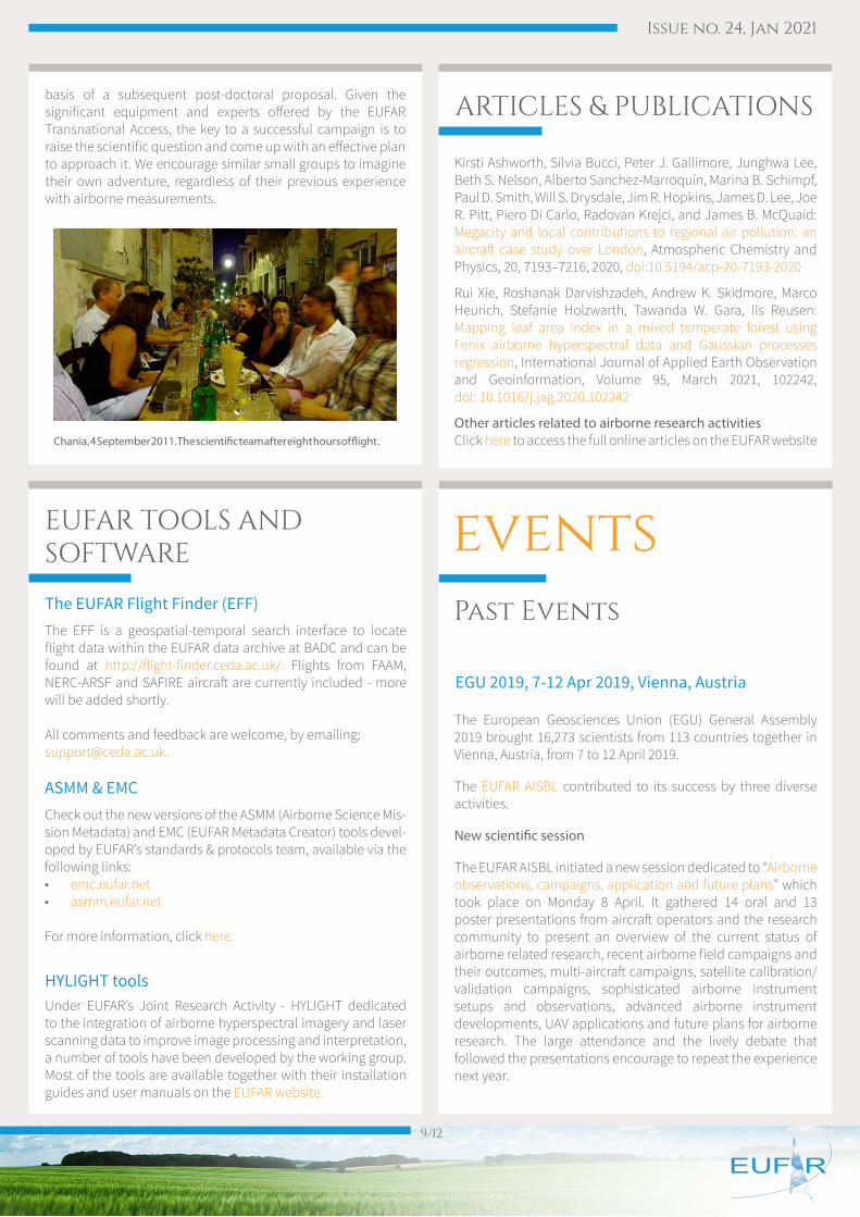
basis of a subsequent post-doctoral proposal. Given the significant equipment and experts offered by the EUFAR Transnational Access, the key to a successful campaign is to raise the scientific question and come up with an effective plan to approach it. We encourage similar small groups to imagine their own adventure, regardless of their previous experience with airborne measurements.
Chania, 4 September 2011. The scientific team after eight hours of flight .
EUFAR TOOLS AND SOFTWARE
The EFF is a geospatial-temporal search interface to locate flight data within the EUFAR data archive at BADC and can be found at http://flight-finder.ceda.ac.uk/. Flights from FAAM, NERC-ARSF and SAFIRE aircraft are currently included - more will be added shortly.
All comments and feedback are welcome, by emailing:[email protected].
Check out the new versions of the ASMM (Airborne Science Mis-sion Metadata) and EMC (EUFAR Metadata Creator) tools devel-oped by EUFAR’s standards & protocols team, available via the following links:• emc.eufar.net• asmm.eufar.net
For more information, click here.
Under EUFAR’s Joint Research Activity - HYLIGHT dedicated to the integration of airborne hyperspectral imagery and laser scanning data to improve image processing and interpretation, a number of tools have been developed by the working group. Most of the tools are available together with their installation guides and user manuals on the EUFAR website.
The EUFAR Flight Finder (EFF)
ASMM & EMC
HYLIGHT tools
ARTICLES & PUBLICATIONS
Kirsti Ashworth, Silvia Bucci, Peter J. Gallimore, Junghwa Lee, Beth S. Nelson, Alberto Sanchez-Marroquín, Marina B. Schimpf, Paul D. Smith, Will S. Drysdale, Jim R. Hopkins, James D. Lee, Joe R. Pitt, Piero Di Carlo, Radovan Krejci, and James B. McQuaid: Megacity and local contributions to regional air pollution: an aircraft case study over London, Atmospheric Chemistry and Physics, 20, 7193–7216, 2020, doi:10.5194/acp-20-7193-2020
Rui Xie, Roshanak Darvishzadeh, Andrew K. Skidmore, Marco Heurich, Stefanie Holzwarth, Tawanda W. Gara, Ils Reusen: Mapping leaf area index in a mixed temperate forest using Fenix airborne hyperspectral data and Gaussian processes regression, International Journal of Applied Earth Observation and Geoinformation, Volume 95, March 2021, 102242, doi: 10.1016/j.jag.2020.102242
Other articles related to airborne research activitiesClick here to access the full online articles on the EUFAR website
The European Geosciences Union (EGU) General Assembly 2019 brought 16,273 scientists from 113 countries together in Vienna, Austria, from 7 to 12 April 2019.
The EUFAR AISBL contributed to its success by three diverse activities.
New scientific session
The EUFAR AISBL initiated a new session dedicated to “Airborne observations, campaigns, application and future plans” which took place on Monday 8 April. It gathered 14 oral and 13 poster presentations from aircraft operators and the research community to present an overview of the current status of airborne related research, recent airborne field campaigns and their outcomes, multi-aircraft campaigns, satellite calibration/validation campaigns, sophisticated airborne instrument setups and observations, advanced airborne instrument developments, UAV applications and future plans for airborne research. The large attendance and the lively debate that followed the presentations encourage to repeat the experience next year.
EGU 2019, 7-12 Apr 2019, Vienna, Austria
eventsPast Events
Issue no. 24, Jan 2021
10/12
Townhall meeting
The EUFAR AISBL promoted a townhall meeting on the ACROSS project by Christopher Cantrell (LISA/CNRS, France) on Tuesday 9 April. ACROSS is a multiplatform project being planned to study urban-biogenic atmosphere interactions around the Paris megacity. Scientists from France, Germany, Great Britain and Romania exchanged about possible future collaborations
and multi-agency, multi-aircraft projects to describe the mechanisms of aging and mixing of the Parisian pollution plumes as they travel to the suburban forests.
ENVRI joint booth
Finally, members of the EUFAR AISBL attended the ENVRI joint booth and contributed to the lunchtime talks program. These Multi-Domain talks concern a wide range of objectives in the atmosphere, biosphere/ecosystems, hydrosphere and lithosphere domains. The booth was installed at the entrance Hall of the main EGU building and was continuously visited by the many members attending the conference. It was henceforth a great occasion to discuss with potential users of airborne research and with the actors of Environmental and Earth System Research Infrastructures and projects across Europe.
Presentation by Chris Cantrell at the ACROSS Townhall Meeting
Presentation by Damien Boulanger at the scientific session: airborne data as a link between EUFAR and IAGOS
Lunchtime-talk by Thomas Ruhtz at the ENVRI joint booth
ENVRIplus Final Dissemination Event and 11th BEERi, Brussels, Belgium, 4-5 June 2019
EGU 2020, 4-8 May 2020, Vienna, Austria
EUFAR online workshop on Atmospheric tempera-ture measurement from research and operational aircraft, 11-12 November 2020
EUFAR attended in Brussels the ENVRIplus final dissemination event titled “Collaboration for the impactful Earth system science – European Environmental Research Infrastructures” on 4 June 2019, and 11th BEERi meeting on 5 June 2019. Much of this meeting was given to continued discussion of the form in which the ENVRI community will continue its existence. Since ENVRI intends to represent the whole environmental research infrastructure community at high levels, EUFAR intends to maintain its involvement.
The EGU has had to cancel the 2020 General Assembly in Vienna due to the ongoing Covid-19 crisis. However, it was keen to take advantage of all the work that was done in preparing abstracts for oral or poster presentation and to run an online event. This had scheduled session times with online chat available. You can read more about this on the EGU 2020 website.
Abstracts that were originally submitted to the EUFAR-supported session “Airborne observations, campaigns, application and future plans” have been merged with others to make the combined Session GI4.1 Open session on atmosphere, land and ocean monitoring.
This session took place on Thursday 7 May, 10:45–12:30. Giving support to this session in particular and the whole event was a valuable initiative to maintain scientific interaction in the present restricted environment.
EUFAR held an online workshop to examine the status of atmospheric temperature measurements from both research and operational aircraft. 35 scientists and engineers from Europe and the USA participated.
The atmospheric temperature is a key state parameter for both research and operational meteorological purposes. Measurements of temperature underpin the majority of research studies of atmospheric physical and chemical processes including large- and small-scale dynamics, cloud, precipitation and aerosol processes and radiative transfer. The provision of unbiased temperature measurements within liquid-phase clouds remains a challenge, especially where the clouds are supercooled. In the operational meteorological sphere, systems such as AMDAR and MODE-S have provided increasingly large numbers of observations that are assimilated into Numerical Weather Prediction (NWP) models. Indeed, the importance of these observations has recently been demonstrated by the rapid decline in their availability as airline fleets have been grounded during the Covid-19 pandemic which has had a measurable impact on NWP model performance. Removal of biases in these data would impact on their usability for long-term climate-monitoring purposes.
Nevertheless, temperature measurements from aircraft moving at speeds of 100 ms-1 or more remain subject to significant constraints that are due to the types of sensors in use, the impacts of their protective housings and kinetic energy of the airstream that impinges on them. All measurements are subject to a range of corrections that must be applied iteratively to account for these factors.

Issue no. 24, Jan 2021
11/12
This online workshop aimed to bring together interested scientists from both the research and operational observations communities so as to:
• Survey current developments in airborne temperature sensorsW
• Compare data processing algorithms that are used across the research and operational communities
• Identify and quantify errors and biases in measurements and how these may be minimized
• Make recommendations on best practices in airborne temperature measurement
The meeting Agenda and presentations can be accessed via https://www.eufar.net/event/event/atmospheric-temperature-measurement-from-research-and-operational-aircraft-an-online-workshop-324457/
UPCOMING EVENTS
Paper submission for Whispers, 24-26 March 2021 is open: www.ieee-whispers.com/paper-submission/
EUFAR and ESA are organizing a joint session entitled Airborne hyperspectral campaign results in support of current and future hyperspectral satellite missions. The session chairs are Ils Reusen (EUFAR) and Malcolm Davidson/Dirk Schuettemeyer (ESA)
Images obtained by state-of-the-art airborne hyperspectral sensors like APEX, HYPLANT, AVIRIS-NG, etc. are used to support current and future hyperspectral satellite missions like CHIME, PRISMA, EnMAP, FLEX, HyspIRI/SBG and several others.
Often airborne hyperspectral campaigns in combination with simultaneous ground measurements are organized to develop or test new algorithms for deriving fit-for-purpose information from airborne hyperspectral images before applying these algorithms to satellite images.
We invite researchers to present their airborne hyperspectral campaign results and to discuss how these results support current or future hyperspectral satellite missions.
The submission deadline for Abstract, Full paper or Already accepted/published journal papers is 15 February 2021: www.ieee-whispers.com/important-dates/
WHISPERS, 24-26 March 2021, online
EGU 2021, Vienna, Austria, 19-30 April 2021
IGARSS 2021, Brussels, Belgium, 11-16 July 2021
The EGU General Assembly 2021 will bring together geoscientists from all over the world to one meeting covering all disciplines of the Earth, planetary and space sciences. The EGU aims to provide a forum where scientists, especially
early career researchers, can present their work and discuss their ideas with experts in all fields of geoscience. Due to the ongoing Covid pandemic, EGU 2021 will be again be organised as an online event https://www.egu21.eu/
Abstract submission deadline: 20 January 2021, 13:00 CET
IGARSS (IEEE Geoscience and Remote Sensing Society) is holding its 41st Annual Symposium in Brussels and online, 11-16 July 2021. The conference organisation is a joint effort of the Low Countries, the Netherlands and Belgium, with Crossing Borders as the overall theme of the conference.
Crossing Borders
• Between Countries and Research Institutes
• Between Types of Platforms (from satellites to drones)
• Between Data Sources
• Between Disciplines
IGARSS 2021 website: https://IGARSS2021.com
IGARSS 2021 paper submission: https://igarss2021.com/papers.php (deadline is 25 January 2021)
IGARSS 2021 student paper competition: https://www.igarss2021.com/StudentPaperCompetition.asp (deadline is 25 January 2021)
Issue no. 24, Jan 2021
12/12
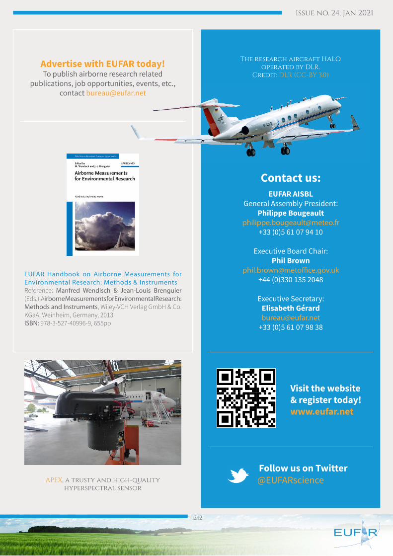
The research aircraft HALO operated by DLR.
Credit: DLR (CC-BY 3.0)
APEX, a trusty and high-qualityhyperspectral sensor
Visit the website & register today!www.eufar.net
Contact us:EUFAR AISBL
General Assembly President: Philippe Bougeault
[email protected]+33 (0)5 61 07 94 10
Executive Board Chair: Phil Brown
[email protected]+44 (0)330 135 2048
Executive Secretary: Elisabeth Gé[email protected]
+33 (0)5 61 07 98 38
Follow us on Twitter @EUFARscience
Advertise with EUFAR today!To publish airborne research related
publications, job opportunities, events, etc., contact [email protected]
EUFAR Handbook on Airborne Measurements for Environmental Research: Methods & Instruments Reference: Manfred Wendisch & Jean-Louis Brenguier (Eds.), Airborne Measurements for Environmental Research: Methods and Instruments, Wiley-VCH Verlag GmbH & Co. KGaA, Weinheim, Germany, 2013ISBN: 978-3-527-40996-9, 655pp


