Embed Size (px)
Citation preview
THE UNIVERSITY OF DODOMACOLLEGE OF EDUCATION
SCHOOL OF EDUCATION STUDIES
DEPARTMENT OF SOCIAL AND BUSINESS STUDIES EDUCATION.
COURSE NAME: REMOTE SENSING AND GIS
COURSE CODE: GO221
COURSE INSTRUCTOR: Mr. MKANACHI Mohamed, A.
LECTURE DAY: WEDNESDAY at 10.00am to 12.00pm
SUBMISSION DATE: 3rd June, 2015
NATURE OF THE WORK: INDIVIDUAL ASSIGNMENT
PARTICIPANT DETAILS:-
NAME SEX REG.NO: D.PROGR. SGN.MOHAMEDI, Shida M T/UDOM/
2013/03069
BED ADMAN
QUESTION;
Give clear discussion on remote sensing platforms and types of remote
sensing platforms.
Remote sensing is the science and art of acquiringinformation about the Earth's surface without actually beingin contact with it. This can be done by using remote sensorswhich mounted in different platforms. A platform is thevehicle or carrier for remote sensors for which they areborne (Seige et. al., 2000.) The platform on which aparticular sensor is housed determines a number ofattributes, which may dictate the use of particular sensors.These attributes include: distance the sensor is from theobject of interest, periodicity of image acquisition, timingof image acquisition, and location and extent of coverage.
Therefore Platforms refer to the structures or vehicles on
which remote sensing instruments are mounted. There are
three broad categories of remote sensing platforms which are
ground based, airborne, and satellite.
Ground based platform; A wide variety of ground basedplatforms are used in remote sensing. Some of the morecommon ones are hand held devices, tripods, towers andcranes. Instruments that are ground-based are often used tomeasure the quantity and quality of light coming from thesun or for close range characterization of objects. Forexample, to study properties of a single plant or a smallpatch of grass, it would make sense to use a ground basedinstrument.
Ground based platforms can also be classified according tooperational range. These includes Short range systems whichoperate at ranges of 50-100m with panoramic scanning and areoften used to map building interiors or small objects,Medium range systems which operate at distances of 150-250m,also achieving millimeter accuracies in high definitionsurveying in 3D modeling applications e.g bridge and dammonitoring and Long range systems which can measure atdistances of up to 1km and are frequently used in open-pitmining and topographic survey applications( Ebner, 1988).
Laboratory instruments are used almost exclusively forresearch, sensor calibration, and quality control. Much ofwhat is learned from laboratory work is used to understandhow remote sensing can be better utilized to identifydifferent materials. This contributes to the development ofnew sensors that improve on existing technologies.
Field instruments are also largely used for researchpurposes. This type of remote sensing instrument is oftenhand-held or mounted on a tripod or other similar support.
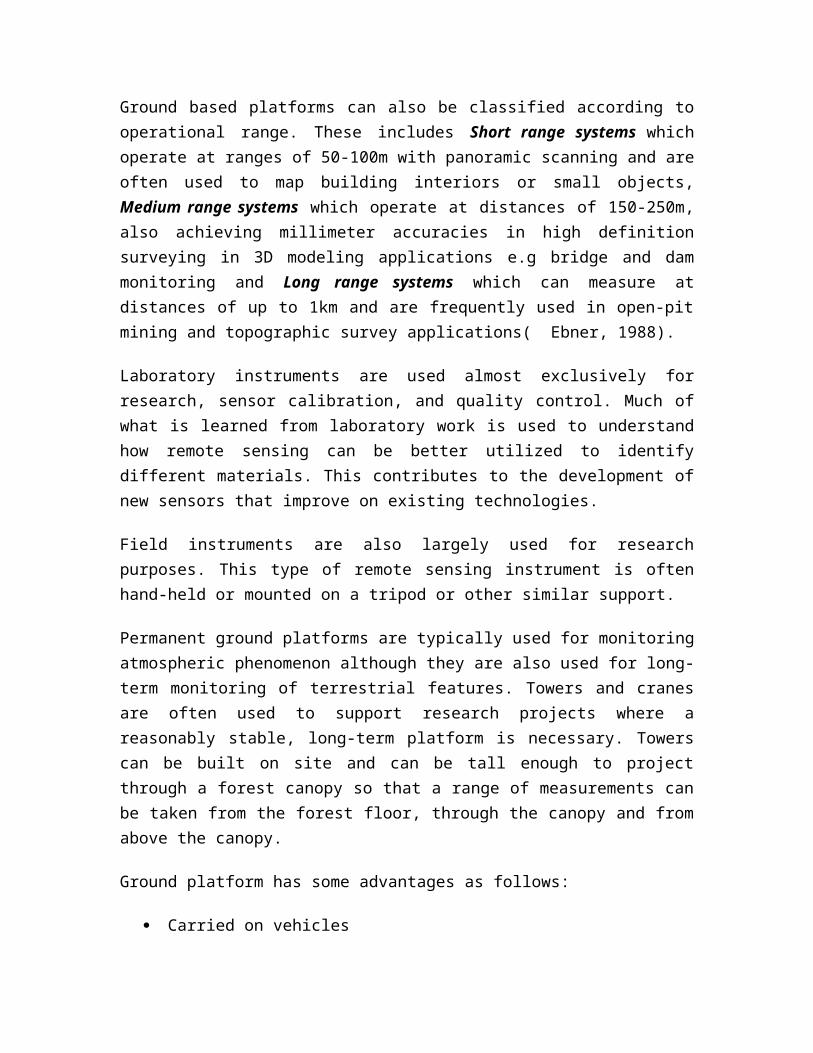
Permanent ground platforms are typically used for monitoringatmospheric phenomenon although they are also used for long-term monitoring of terrestrial features. Towers and cranesare often used to support research projects where areasonably stable, long-term platform is necessary. Towerscan be built on site and can be tall enough to projectthrough a forest canopy so that a range of measurements canbe taken from the forest floor, through the canopy and fromabove the canopy.
Ground platform has some advantages as follows:
Carried on vehicles
Linked to data loggers in the vans.
Used to support cameras and scanners e.g. a Land Roverfitted with an extending aerial
Offer greater rigidity e.g. In a tower
It is useful tool in tracking and monitoring tropicalcyclones e.g the radar
It is simple to use
But some limitations on using ground platform are asfollows:
Vehicles limited to roads, and the range is confined tosmall area along or around the road.
Very unstable in windy conditions.
SOURCE: (Research on the Natural Resources in Canada)
Airborne platform; Airborne platforms were the sole non-ground-based platforms for early remote sensing work. Thefirst aerial images were acquired with a camera carriedaloft by a balloon in 1859. Balloons are rarely used todaybecause they are not very stable and the course of flight isnot always predictable
At present, airplanes are the most common airborne platform.Nearly the whole spectrum of civilian and military aircraftis used for remote sensing applications. When altitude andstability requirements for a sensor are not too demanding,simple, low-cost aircraft can be used as platforms. However,as requirements for greater instrument stability or higheraltitudes become necessary, more sophisticated aircraft mustbe used.
In this airborne, aircraft are divided into three categories(low, mid, and high) based on their altitude restrictions.In general, the higher an aircraft can fly, the more stablea platform it is, but correspondingly more costly to operateand maintain. (Cracknel, 2008)
Low altitude aircraft typically fly below altitudes wheresupplemental oxygen or pressurization are needed (12,500feet above sea level). They are good for acquiring highspatial resolution data limited to a relatively small area.Included in this class are the common fixed-wing, propellerdriven planes used by private pilots, such as the Cessna 172or 182, and Piper Cherokee. Helicopters are usually used forlow altitude applications where the ability to hover isrequired. Helicopters are quite expensive to operate andthey are typically used only when needed. Ultra-lightaircraft are a class of aircraft that is gaining popularity.The Federal Aviation Authority (FAA) defines an ultra-lightas a single seat powered flying machine that weighs less
than 254 pounds, has a top speed of 55 knots (63 mph),stalls at 24 knots (28 mph) or less and carries no more than5 gal. of fuel. Ultra-light aircraft may be a reasonablealternative to larger aircraft.
Mid altitude aircraft have an altitude limit under 30,000feet above sea level. This includes a number of turbo-propaircraft. Often at higher altitudes, there is lessturbulence so stability is better. This class of airplane isused when stability is more important and when it isnecessary or desired to acquire imagery from a greaterdistance than available from low altitude aircraft. Theseaircraft can obtain greater areal coverage more quickly thanlow altitude platforms. An example of this class is the C-130 cargo plane
High altitude aircraft can fly at altitudes greater than30,000 feet above sea level. This class of airplane isusually powered by jet engines and is used for specializedtasks, such as atmospheric studies, research to simulatesatellite platforms, and other applications where a highaltitude platform is required. High altitude aircraft aregood for acquiring large areal coverage with typically lowerspatial resolutions.
Another class of aircraft that has been in use for manyyears is remote control aircraft, or drones. Remotelycontrolled aircraft are often used for conditions when itmay be too hazardous to fly. They have been used extensivelyby the military.
Airborne (Aircraft) have several useful advantages asplatforms for remote sensing systems;
Aircraft can fly at relatively low altitudes thusallowing for sub-meter sensor spatial resolution.
Aircraft can easily change their schedule to avoidweather problems such as clouds, which may block apassive sensor's view of the ground.
Last minute timing changes can be made to adjust forillumination from the sun, the location of the area tobe visited and additional revisits to that location.
Sensor maintenance, repair and configuration changesare easily made to aircraft platforms.
Aircraft flight paths know no boundaries exceptpolitical boundaries.
However Airborne platform can have some disadvantages inremote sensing:-
Getting permission to intrude into foreign airspace canbe a lengthy and frustrating process.
The low altitude flown by aircraft narrows the field ofview to the sensor requiring many passes to cover alarge area on the ground.
The turnaround time it takes to get the data to theuser is delayed due to the necessity of returning theaircraft to the airport before transferring the rawimage data to the data provider's facility forpreprocessing.
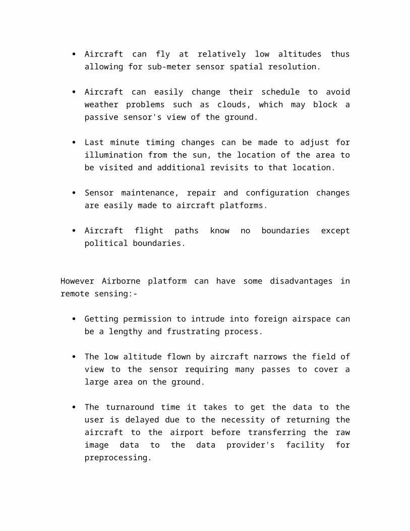
SOURCE: Earth Data Fugro.
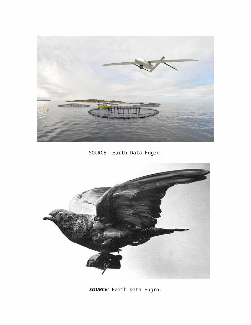
SOURCE: Earth Data Fugro.
Space born platform; the most stable platform aloft is asatellite, which is space borne. Examples of space born areRockets, Satellites and space shuttles. Space borneplatforms range from 100 to 36000 km above the earth’ssurface.
The first remote sensing satellite was launched in 1960 formeteorology purposes. Now, over a hundred remote sensingsatellites have been launched and more are being launchedevery year. The Space Shuttle is a unique spacecraft thatfunctions as a remote sensing satellite and can be reusedfor a number of missions (Schroeder, 2000).
Satellites can be classified by their orbital geometry andtiming. Three orbits commonly used for remote sensingsatellites are geostationary, equatorial and Sunsynchronous. A geostationary satellite has a period ofrotation equal to that of Earth (24 hours) so the satellitealways stays over the same location on Earth. Communicationsand weather satellites often use geostationary orbits withmany of them located over the equator. In an equatorialorbit, a satellite circles Earth at a low inclination (theangle between the orbital plane and the equatorial plane).The Space Shuttle uses an equatorial orbit with aninclination of 57 degrees. ( see the diagram bellow)
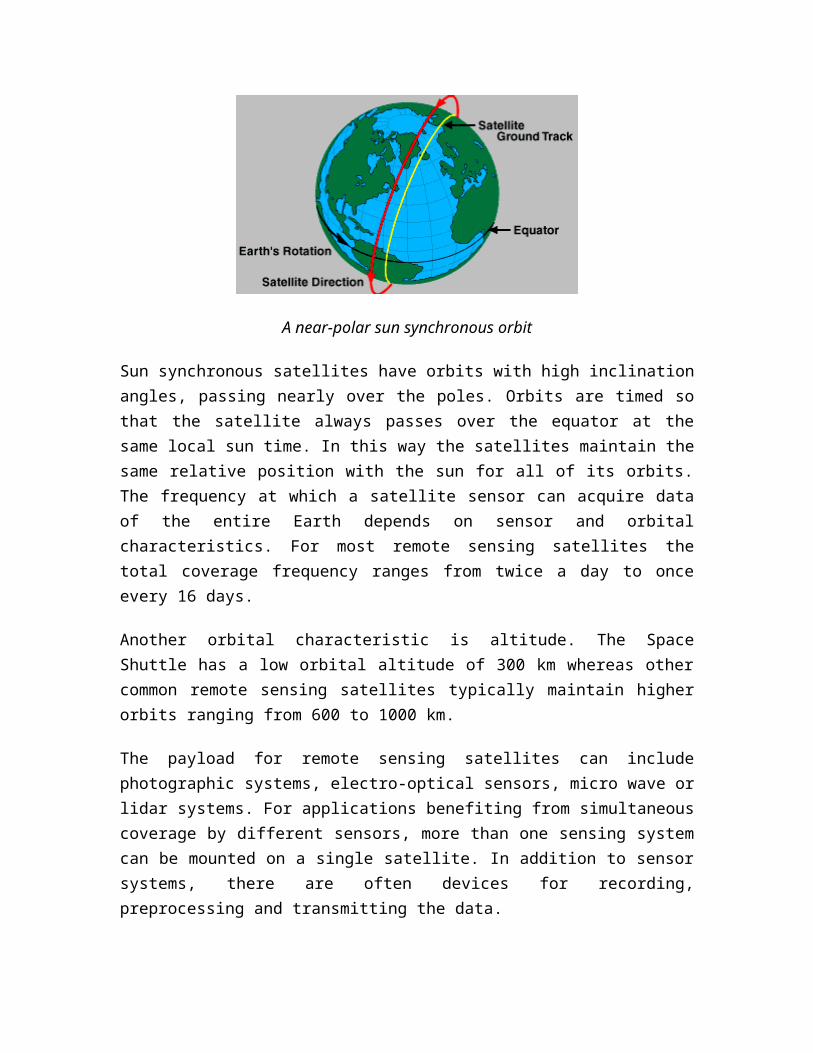
A near-polar sun synchronous orbit
Sun synchronous satellites have orbits with high inclinationangles, passing nearly over the poles. Orbits are timed sothat the satellite always passes over the equator at thesame local sun time. In this way the satellites maintain thesame relative position with the sun for all of its orbits.The frequency at which a satellite sensor can acquire dataof the entire Earth depends on sensor and orbitalcharacteristics. For most remote sensing satellites thetotal coverage frequency ranges from twice a day to onceevery 16 days.
Another orbital characteristic is altitude. The SpaceShuttle has a low orbital altitude of 300 km whereas othercommon remote sensing satellites typically maintain higherorbits ranging from 600 to 1000 km.
The payload for remote sensing satellites can includephotographic systems, electro-optical sensors, micro wave orlidar systems. For applications benefiting from simultaneouscoverage by different sensors, more than one sensing systemcan be mounted on a single satellite. In addition to sensorsystems, there are often devices for recording,preprocessing and transmitting the data.
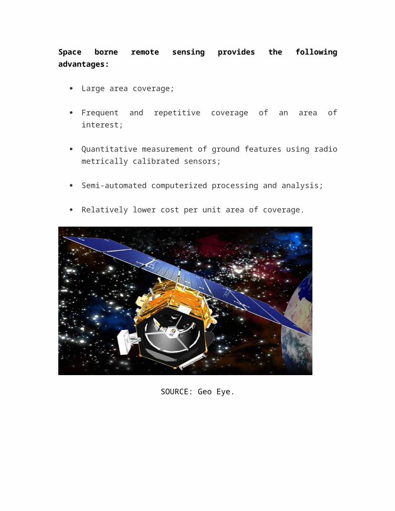
Space borne remote sensing provides the followingadvantages:
Large area coverage;
Frequent and repetitive coverage of an area ofinterest;
Quantitative measurement of ground features using radiometrically calibrated sensors;
Semi-automated computerized processing and analysis;
Relatively lower cost per unit area of coverage.
SOURCE: Geo Eye.
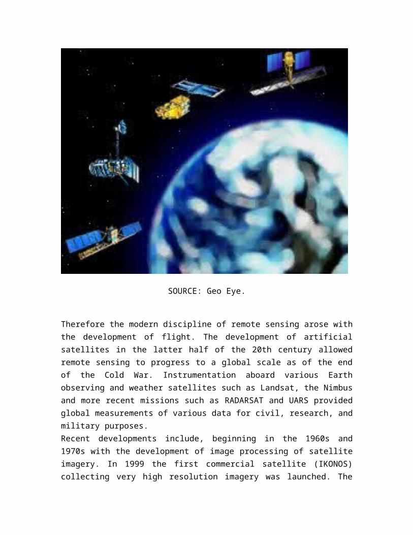
SOURCE: Geo Eye.
Therefore the modern discipline of remote sensing arose withthe development of flight. The development of artificialsatellites in the latter half of the 20th century allowedremote sensing to progress to a global scale as of the endof the Cold War. Instrumentation aboard various Earthobserving and weather satellites such as Landsat, the Nimbusand more recent missions such as RADARSAT and UARS providedglobal measurements of various data for civil, research, andmilitary purposes.Recent developments include, beginning in the 1960s and1970s with the development of image processing of satelliteimagery. In 1999 the first commercial satellite (IKONOS)collecting very high resolution imagery was launched. The
choice of platform to use depends on the purpose of thesurvey, geographical position, capital and technologicaladvancement reached.
REFERENCES:
Cracknel, A.P and Hayes. L.W.B (2008) Introduction to remotesensing, New York University Press
Ebner et. al.(1988).Remote sensing platforms, Dubai India
Seige et. al. (2000). Introduction to remote sensing, NewYork Printers
Schroeder et. Al. Seige et. al., (2000): Satellites andsensors
University Center for Atmospheric Research (2009).Facilities Assessment Database