Embed Size (px)
Citation preview

THE QUATERNARY OF THE LAKE DISTRICT
Field Guide
Edited byDerek A. McDougall & David J.A. Evans
2015

ii
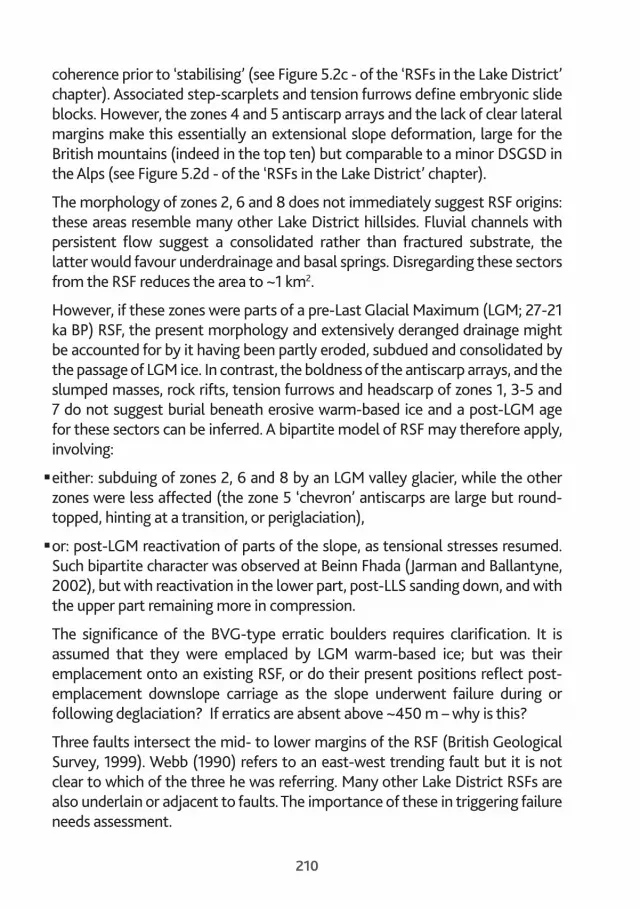
Cover Photograph: Stony Cove Pike, looking towards Brothers Water and Ullswater (D. McDougall).
Produced to accompany the QRA Annual Field Meeting based at Blencathra Field Studies Centre, 21-24 May 2015.
© Quaternary Research Association, London, 2015.
All rights reserved. No part of this book may be reprinted or utilized in any form or by any electronic, mechanical or other means, now known or hereafter invented, including photocopying and recording or in any information storage or retrieval system, without permission in writing from the publisher.
Printed by:
Adlard Print & Reprographics Ltd., The Old School, The Green, Ruddington, Nottinghamshire, NG11 6HH.
Recommended reference:
McDougall, D.A. and Evans, D.J.A. (eds) (2015) The Quaternary of the Lake District: Field Guide. Quaternary Research Association, London.
ISSN: 0261 3611
ISBN: 0 907 780 164
QRA contribution to The Geological Society’s Year of Mud.

201
13The Robinson rock slope failureP. Wilson and D. Jarman
IntroductionRobinson (737 m OD, NY 202169) is located on the watershed of the Buttermere and Newlands catchments in the northwest of the Lake District. The southern flank of the mountain falls from 700 m OD to 130 m OD, into Gatesgarthdale, over a distance of 1.5 km – an average gradient of 21º / 38%. It is on this slope that Webb (1990) and British Geological Survey (1999) record a relict rock slope failure (RSF) extending over an area of 1.7 km2. It is one of the largest RSFs in the Lake District by area (depth and thus volume cannot be estimated), and in the top ten in the British mountains; Clough Head (Davies et al., 2013) and Dove Crags (Jarman and Wilson, 2015) are of similar extent. The site is 3 km northwest (downstream) of the Honister Hause transfluent breach and on rocks of the Skiddaw Group (SG), specifically the Buttermere Formation – an “olistostrome of disrupted sheared and folded mudstone, siltstone and sandstone” (British Geological Survey, 1999). The impressive rock chasm of Hackney Holes, near the head of the site, and the stepped terrain along Littledale Edge were illustrated and commented on by Wainwright (1964); Wilson and Smith (2006) provided more detail of several RSF components.
The site is best approached from the parking area at 150 m OD (NY 209149) immediately west of where the B5289 crosses Gatesgarthdale Beck. To gain the full RSF experience involves ~5 km of sometimes steep fell-walking with a total ascent of 550 m. Spring and autumn are the best times to visit, to avoid the dense bracken of summer. The recommended route ascends northwest from the road bridge for 1.25 km to an antiscarp array, then northeast along the crest of a cranked antiscarp. At its end continue by the easiest line to gain Littledale Edge. Keep south of the fence along the Edge and ascend northwest towards the summit of Robinson; Hackney Holes is a short distance from the fence near the crest of the slope. Wainwright-baggers will proceed north for a further 500 m to claim the summit (Figure 13.1).

202

203
DescriptionEight zones, each of distinct morphology, have been recognised on the RSF (Figures 13.1 and 13.2). Although zone boundaries are not necessarily as sharp as Figure 13.1 might imply, such division facilitates description of this complex site. Zones are described as encountered by following the proposed walking route.
Zones 8 and 6Both zones have very few, if any, unequivocal indicators for RSF. The lower margin of the putative failure is a prominent bluff but it is not clear whether this represents the original RSF toe, a ‘normal’ river-cut hillside bank, or an RSF toe truncated and steepened by fluvial erosion.
Zone 8 (East bay) is stream-coursed with some channels beginning high on the slope (~450-500 m OD); there are also several dry channels (Figure 13.1). Steep-sided, smoothly-rounded interfluves with some exposed SG outcrops characterise the between-channel areas. Zone 6, in contrast, is stream-free, and comprises a broad bulge with low amplitude surface undulations and SG
Figure 13.1. (opposite) The Robinson RSF showing the eight distinct zones (coloured), most prominent failed masses, drainage pattern, and sites with BVG-type erratics. Numbers represent scarp / antiscarp heights. Scale is given by marginal 1 km National Grid co-ordinates and contours are in metres (© Crown copyright Ordnance Survey. All rights reserved).
Figure 13.2. The Robinson RSF seen from Fleetwith Pike showing approximate mid-points (numbers) of the eight zones.

204
exposures (Figure 13.2). Erratic boulders of Borrowdale Volcanic Group (BVG) type rocks are scattered across both zones (Figure 13.3).
Close to the east margin of zone 8 (at NY 211157) a lobate outcrop with much fractured rock and many detached boulders is of BVG / dolerite intrusion character. This lies within the margin of the RSF as mapped by British Geological Survey (1999) and may be one source of the erratic boulders to the west.
Zones 4 and 5These zones, between ~300 m and ~450 m OD, are dominated by prominent antiscarp arrays (Figures 13.1 and 13.2). Antiscarps are on two alignments: most trend ~ESE–WNW, others ~NE–SW. In plan, the antiscarps are linear or segmented, up to 350 m in length, and rise up to 10 m above their backing depressions (Figure 13.4). Two of the boldest antiscarps in zone 5 meet as a V-chevron, where they are separated by the central hillside stream (Figure 13.5; this exemplifies the ‘deranged drainage’ indicative of large deep-seated RSFs), it is unusually powerful, emanating from a spring just above the gap (unusually high on the hill), and contrasts with adjacent dry channels. Erratics of BVG rocks are again present across the area.
Figure 13.3. Erratic boulder of BVG-type (top) perched on ‘outcrop’ of SG rock. Survey pole is 1 m in length.

205
Figure 13.4. Cluster of antiscarp ridges in zone 4. The antiscarp ‘knoll’ (left of centre) stands 10 m above the backing depression.
Figure 13.5. Parts of the V-chevron antiscarps where separated by the central hillside stream.

206
Zone 2This broad embayment (West bay) is characterised by generally ‘smooth’ slopes and springs. The area above the springs is suggestive of a collapse cavity, with the debris having been removed. Two low ridges in the lower part of the zone are puzzling - they may be antiscarps or discrete debris accumulations. A spring / stream is confined by the ridges.
Zones 3 and 7Slumped masses with steep fronts and gently-inclined upper surfaces, and tension furrows dominate here. With increasing height and passage into zone 7 slumped masses become bolder and more extensive (~500 m across slope and ~100 m downslope) immediately beneath the headscarp of Littledale Edge. In places their upper surfaces exhibit a low gradient backward tilt, and their edges are well-rounded. The backward tilt of the slumps is probably maintaining the pre-failure gradient of Little Dale head. No large BVG erratics have been found on these slump masses, although smaller ones may be hidden in the thick cover of heather.
The central headscarp at Littledale Edge comprises a sequence of obtuse-wedge failure cavities, their floors being the largest slumps. The talus-dominated scarp is 5-10 m high (Figures 13.6 and 13.7). To the east (above the top of the old wall), the headscarp becomes a crag 40 m high, but probably then cuts low across the main (100 m high) Hindscarth cliffs and returns south as a short flank scarp before fading.
A substantial (0.03 km2) headward extension of the failure into the already-beheaded open paleic valleyhead of Little Dale is indicated by a < 0.5 m-high step-scarplet / deep tension furrow 60 m behind the 610 m OD knoll on the present rim. This extends east for 250 m from the obtuse wedge apex, not quite intersecting a lineament across the valleyhead (Figures 13.7 and 13.8). Sub-parallel to this furrow is a shorter, 1.0-1.5 m-high step-scarplet / deep tension furrow 20 m behind the rim. A double similar feature extends north from the next west obtuse wedge apex and cuts Littledale Edge as it rises towards Robinson.
The Little Dale valleyhead lineament (Figures 13.1 and 13.9) extends up the slopes of both Robinson and Hindscarth ~100-200 m north of Littledale Edge. It may indicate deep-seated gravitational slope deformation (DSGSD) extending along the whole rim of the RSF and may be seen as an incipient future headscarp (cf. Jarman 2006).

207
Figure 13.6. View west along part of Littledale Edge showing a broad slump mass below the talus-dominated, obtuse-wedge headscarp (E on Figures 13.1 and 13.7). The surface of the slump dips slightly (<5 º) towards the headscarp and has an arcuate tension furrow near its outer edge. Another slump mass can be seen on the rising slope in the centre background.
Figure 13.7. View east along Littledale Edge. Headward extension of the failure is indicated by tension furrows on Littledale Edge. W and E are, respectively, the western and eastern obtuse-wedge failure cavities.

208
Figure 13.8. Part of a tension furrow due west of point 610 m at the eastern end of Littledale Edge. Rucksack is 0.6 m in length.
Figure 13.9. Littledale Edge and Robinson, with selected features indicated, as seen from point 610 m.

209
The steeper ground rising west from Littledale Edge towards Hackney Holes is also broadly stepped with extensive areas of fractured rock on both headscarp and outer slope (Figure 13.6); linear and sinuous fissures dissect the steps and ground above the headscarp. Hackney Holes (Figure 13.10), at the upper end of zone 3, is a ~5-10 m-wide chasm with ~15-20 m-high upslope wall and ~5-10 m-high downslope wall. A considerably smaller rift occurs between Hackney Holes and the boundary fence.
Zone 1West of Hackney Holes, 20-40 m-wide slump masses are once more prominent across the southern end of the Robinson summit dome, which is sharply cut, on the strike, by a typical RSF headscarp increasing in height from 4 m to 10 m as it descends westwards, with a secondary scarp between slumps also 10 m high. RSF evidence then fades downslope, until a short flank scarp ending above a dry gully and springs.
Discussion and future workIn its upper reaches the RSF conforms in character to an arrested translational slide; the broad masses of failed ground have travelled only short distances downslope from their headscarps or source cavities, retaining a high degree of
Figure 13.10. The Hackney Holes chasm seen from its upper (western) end. The Honister Hause transfluent breach is in the distance, right of centre.
210
coherence prior to ‘stabilising’ (see Figure 5.2c - of the ‘RSFs in the Lake District’ chapter). Associated step-scarplets and tension furrows define embryonic slide blocks. However, the zones 4 and 5 antiscarp arrays and the lack of clear lateral margins make this essentially an extensional slope deformation, large for the British mountains (indeed in the top ten) but comparable to a minor DSGSD in the Alps (see Figure 5.2d - of the ‘RSFs in the Lake District’ chapter).
The morphology of zones 2, 6 and 8 does not immediately suggest RSF origins: these areas resemble many other Lake District hillsides. Fluvial channels with persistent flow suggest a consolidated rather than fractured substrate, the latter would favour underdrainage and basal springs. Disregarding these sectors from the RSF reduces the area to ~1 km2.
However, if these zones were parts of a pre-Last Glacial Maximum (LGM; 27-21 ka BP) RSF, the present morphology and extensively deranged drainage might be accounted for by it having been partly eroded, subdued and consolidated by the passage of LGM ice. In contrast, the boldness of the antiscarp arrays, and the slumped masses, rock rifts, tension furrows and headscarp of zones 1, 3-5 and 7 do not suggest burial beneath erosive warm-based ice and a post-LGM age for these sectors can be inferred. A bipartite model of RSF may therefore apply, involving:
�either: subduing of zones 2, 6 and 8 by an LGM valley glacier, while the other zones were less affected (the zone 5 ‘chevron’ antiscarps are large but round-topped, hinting at a transition, or periglaciation),
�or: post-LGM reactivation of parts of the slope, as tensional stresses resumed. Such bipartite character was observed at Beinn Fhada (Jarman and Ballantyne, 2002), but with reactivation in the lower part, post-LLS sanding down, and with the upper part remaining more in compression.
The significance of the BVG-type erratic boulders requires clarification. It is assumed that they were emplaced by LGM warm-based ice; but was their emplacement onto an existing RSF, or do their present positions reflect post-emplacement downslope carriage as the slope underwent failure during or following deglaciation? If erratics are absent above ~450 m – why is this?
Three faults intersect the mid- to lower margins of the RSF (British Geological Survey, 1999). Webb (1990) refers to an east-west trending fault but it is not clear to which of the three he was referring. Many other Lake District RSFs are also underlain or adjacent to faults. The importance of these in triggering failure needs assessment.

211
As with all RSFs, the question ‘why here?’ can be posed. Several factors, either singly or in some combination, may have been influential:
�The site is downstream of the Honister transfluent breach – a location similar to that of several other Lake District RSFs – and as a consequence may have experienced more focussed glacial erosion of bedrock.
�The local SG rock is intensely sheared, disrupted and folded (Webb, 1990; British Geological Survey, 1999), suggesting inherent weaknesses.
�Faults cross the slope, denoting additional zones of potential weaknesses.
The significance of this very large RSF for landscape evolution is considerable. The Gatesgarthdale trough head is markedly asymmetric, with the RSF displacing the valley axis south by possibly 100 m – as observed at Gasgale Gill nearby (Jarman and Wilson, 2015). The RSF has also retreated the ‘wind gap’ head of Little Dale by ~200 m. This is on the flank of a markedly pronounced glaciated trough head, exploiting a fluvial incision into a paleic divide linking Fleetwith Pike and Dale Head (they share an open SE slope into Borrowdale). Rapid erosion in this trough head is attributable to augmentation of local ice by transfluent Borrowdale ice through the Honister Hause breach, the Buttermere valley offering a more direct and unimpeded outflow to the Irish Sea. The divide has migrated 1-2 km SE; similar breach-related displacements in the Scottish Highlands attain 5-20 km.

ISSN: 0261 3611ISBN: 0 907 780 164


