Embed Size (px)
Citation preview

889
In northern Laos, intensifi cation of cultivation on sloping land leads to accelerated erosion processes. Management of riparian land may counteract the negative impacts of higher sediment delivery rates on water quality. Th is study assessed water and sediment concentration trapping effi ciencies of riparian vegetation in northern Laos and the eff ect of cultivation of riparian land on water quality. Runoff fl owing in and out of selected riparian sites was monitored by means of open troughs. In 2005, two native grass, two bamboo, and two banana sites were monitored. In 2006, adjacent to steep banana, bamboo, and native grass sites, three upland rice sites were established and monitored. Water trapping effi ciency (WTE) and sediment concentration trapping effi ciency (SCTE) were calculated on an event basis; means and 95% confi dence intervals (CIs) were estimated with a bootstrapping approach. Confi dence intervals were large and overlapping among sites. Seepage conditions severely limited trapping effi ciency. Native grass resulted in the highest WTE (95% CI, −0.10 to 0.23), which was not signifi cantly diff erent from zero. Banana resulted in the highest SCTE (95% CI, 0.06–0.40). Bamboo had negative WTE and SCTE. Median outfl ow runoff from rice sites was nine times the infl ow. Median outfl ow sediment concentration from rice sites was two to fi ve times that of their adjacent sites and two to fi ve times the infl ow sediment concentration. Although low-tillage banana plantation may reduce sediment concentration of runoff , cultivation of annual crops in riparian land leads to delivery of turbid runoff into the stream, thus severely aff ecting stream water quality.
Trapping Effi ciencies of Cultivated and Natural Riparian Vegetation of Northern Laos
Olga Vigiak* International Water Management Institute
Olivier Ribolzi and Alain Pierret Institut de Recherche pour le Développement
Oloth Sengtaheuanghoung National Agriculture and Forestry Research Institute
Christian Valentin Institut de Recherche pour le Développement
Southeastern Asian countries are experiencing a rapid change
of land use, entailing the intensifi cation of cultivation on
sloping land and the reduction of forest and secondary vegetation
cover (Roder et al., 1997; Ziegler et al., 2004). In northern Laos,
the traditional shifting cultivation system consists of clearing off a
fi eld by slashing and burning natural vegetation at the beginning
of the rainy season, cultivating for 1 yr with annual crops (mostly
upland rice, Oryza sativa L.), then abandoning the fi eld to natural
vegetation regrowth for several years (fallow period) to restore soil
fertility. No external inputs are usually applied. In the last two
decades, however, restricted access to land coupled with a sustained
increase of population has forced farmers to shorten the fallow
period from 15 to 20 yr to 3 to 5 yr while protracting the cultivation
period from 1 yr to almost 2 yr (Saito et al., 2006; Lestrelin and
Giordano, 2007). Th e reduction of fallow period and the concurrent
intensifi cation of cultivation of annual crops cause losses of soil
fertility and crop yield (Roder et al., 1997; Saito et al., 2006) and
accelerate erosive processes on the slopes, leading to higher sediment
delivery rates (Ziegler et al., 2004; Chaplot et al., 2005).
Th e impact of accelerated erosion from sloping land on sediment
concentration of water bodies could be reduced by trapping sedi-
ments in the riparian areas. Research conducted in temperate climates
showed that riparian land can retain up to 70 to 99% of incoming
pollutant loads, and proper management of riparian areas is among
the most recommended practices for water quality improvement
(Karssies and Prosser, 1999; Dosskey, 2001). However, there is a lack
of information about riparian land in tropical environments (Karssies
and Prosser, 1999). In the wet tropics, McKergow et al. (2004) report-
ed lower sediment trapping effi ciencies (37–46%) and even negative
values when exfi ltration in the riparian area was observed. In northern
Laos, cultivation systems and environmental conditions are diff erent
from those in which most riparian trapping effi ciency studies have
been conducted (e.g., Dosskey, 2001). Moreover, growing demand for
fresh vegetables in urban centers attracts farmers to cultivate riparian
Abbreviations: SCTE, sediment concentration trapping effi ciency; WTE, water
trapping effi ciency.
O. Vigiak, International Water Management Inst., IWMI-Laos, P.O. Box 811 Vientiane,
Lao PDR (current address: DPI Rutherglen Centre, RMB 1145 Chiltern Valley Road,
Rutherglen, VIC 3685, Australia); O. Ribolzi and A. Pierret, Institut de Recherche pour
le Développement, IRD, P.O. Box 5992, Vientiane, Lao PDR, seconded to IWMI; O.
Sengtaheuanghoung, National Agriculture and Forestry Research Inst., P.O. Box 811,
Vientiane, Lao PDR; C. Valentin, Insitut de Recherche pour le Développement, IRD, 32,
av H. Varagnat, 93143 Bondy cedex, France, seconded to IWMI.
Copyright © 2008 by the American Society of Agronomy, Crop Science
Society of America, and Soil Science Society of America. All rights
reserved. No part of this periodical may be reproduced or transmitted
in any form or by any means, electronic or mechanical, including pho-
tocopying, recording, or any information storage and retrieval system,
without permission in writing from the publisher.
Published in J. Environ. Qual. 37:889–897 (2008).
doi:10.2134/jeq2007.0251
Received 21 May 2007.
*Corresponding author ([email protected]).
© ASA, CSSA, SSSA
677 S. Segoe Rd., Madison, WI 53711 USA
TECHNICAL REPORTS: SURFACE WATER QUALITY

890 Journal of Environmental Quality • Volume 37 • May–June 2008
land, where irrigation is easier. Vegetable gardens are mainly a dry-
season activity; however, reaches of headwater catchment streams
are also put under cultivation for vegetables or upland rice during
the rainy season. Th e eff ects brought about by cultivation of ripar-
ian land use are largely unknown.
Th e objectives of this research were to assess (i) the water and
sediment concentration trapping effi ciencies of riparian vegeta-
tion of northern Laos and (ii) the potential eff ect of cultivation of
riparian land on these trapping effi ciencies and water quality.
Materials and Methods
Study AreaTh e study was conducted in the Houay Pano catchment (Lu-
ang Prabang Province, northern Lao PDR). Rainfall amounts are
on average 1259 mm yr−1, more than 90% of which falls during
the monsoon season from mid-May to mid-October. Th e geo-
logical substrate consists of argillites, siltstones, and fi ne-grained
sandstones from Permian Upper Carboniferous (Rumpel et al.,
2006). Soils prevailing along the slopes are deep (2.5–4.5 m) and
clayey Alfi sols (Rumpel et al., 2006).
Th e catchment is representative of the no-input slash and burn
system of Southeast Asia, but the fallow periods have been short-
ened from 10 to 15 yr to 2 to 5 yr (de Rouw et al., 2005; Chaplot
et al., 2005). Th e most common annual crop is upland rice (Oryza sativa L.). Th e term “upland” refers to rainfed cultivation as dif-
ferent from paddy rice cultivation. Preparation of sowing bed and
weeding operations are conducted by hand, often by hoeing. On
average, farmers clear the upland rice fi elds four to fi ve times dur-
ing the rice cultivation (de Rouw et al., 2002). Hoeing entails dis-
turbance of the top 7 to 10 cm of soil, causes severe tillage erosion,
and facilitates the formation of soil seals and crusts, which inhibit
water infi ltration (Janeau et al., 2003). Tillage can also cause reduc-
tion of saturated hydraulic conductivity in the soil profi le, which
may result in enhanced generation of lateral subsurface fl ow during
rainstorms (Ziegler et al., 2004). Cultivation of annual crops may
be repeated a second year, before the fi eld is abandoned to second-
ary vegetation (fallow). In the fi rst and second year of fallow, satu-
rated hydraulic conductivity is still low, but over time, the growth
of secondary vegetation is strong enough to recover infi ltration and
reduce overland fl ow generation to levels comparable to undis-
turbed surfaces (Ziegler et al., 2004).
Recently, parts of the catchment have been taken out of the
slash and burn system. Approximately 13% of the catchment area
has been converted to perennial crops (mainly banana [Musa sp.]),
tree plantations (mainly teak [Tectona grandis L.]), or vegetable
gardens, cultivated on a continuous basis (Lestrelin and Giordano,
2007). Th e cultivation of banana in Houay Pano is a low-input
farming activity. Farmers plant bananas, sometimes burn the un-
dergrowth at the onset of the rainy season, and cut single stems
carrying casks ready to be sold at the market. Th ey do not till the
soil, and vegetation cover remains high throughout the year. Such
a low-labor, low-input management system must not be confused
with the intensive banana plantations of other tropical areas. Teak
plantation is also a low-labor system: After plantation, farmers limit
their activities to cultivating the fi elds for 2 yr with annual crops
before the teak crowns become too large. No cover crop is used.
Cultivation of vegetables is similar to other annual crops; land is
cleared by burning, no drainage system is put in place, no fertiliza-
tion is applied, and soil preparation and weeding operations during
the crop growth are done by manual hoeing.
Th e 64-ha catchment of Houay Pano feeds a 1200-m-long,
second-order perennial stream of irregular topography with
an average slope gradient of 0.19 m m−1 (Ribolzi et al., 2005).
Riparian areas are mainly of convex or convex-concave morphol-
ogy, steep (10–130%), and narrow (4–23 m). Riparian soils are
mainly Dystrochrepts with redoximorphic features and clay loam
topsoil (Rumpel et al., 2006). More than 43% of the Houay
Pano riparian land is covered with grass and shrub vegetation
dominated by the grass Microstegium ciliatum A. Camus (hereaf-
ter referred to as “native grass”). Bamboos (mainly Dendrocalamus sp. and Cephalostachium virgatum) cover 19% of riparian areas.
Cultivation of banana extends over 15% of the riparian areas.
Th e remaining riparian areas are covered with forest (15%), cas-
sava (Manihot utilissima Phol., 5%), and elephant grass (Pennis-etum purpureum, 3%). For the past few years, patches of riparian
land have been cleared of the natural vegetation and cultivated
with vegetables (chili, watercress) or upland rice (Fig. 1).
Experimental SettingIncoming and outgoing fl ows across riparian sites were moni-
tored using 0.50-m-wide Gerlach troughs (Gerlach, 1967) con-
nected by PVC tube to PVC water buckets. Each site (approx. 20
m wide), characterized by homogeneous vegetation, was instru-
mented with three troughs placed at the upper rim of the riparian
area and three troughs placed at the lower rim. Th e upper rim was
established immediately below the upslope fi eld border; the lower
rim was established close to the stream at approximately 1 m above
the stream water level to avoid water from the stream entering the
buckets. Th e total width of riparian sites therefore varied from 3
m to almost 12 m (Table 1). After each rainfall event, the total
volume of runoff collected in the buckets was measured. After
energetic stirring, a 1-L sample was collected from each bucket to
measure average runoff sediment concentration. Th e sample was
fi ltered, oven-dried at 105°C for 24 h, and weighed to obtain the
Fig. 1. In northern Laos, cultivation of upland (rainfed) rice on steep slopes may be extended to the riparian land of headwater streams.

Vigiak et al.: Trapping Effi ciencies of Riparian Vegetation in Northern Laos 891
sample’s sediment amount. Trapping effi ciency was calculated for
runoff water volumes (water trapping effi ciency [WTE]) and for
sediment concentration (sediment concentration trapping effi cien-
cy [SCTE]) as the portion of infl ow trapped between the upper
and the lower rim (e.g., McKergow et al., 2004):
TE in out
in
X X
X
−=
[1]
where Xin is the water fl ow amount in liters per linear meter
of contour line (L m−1 for WTE) or the average sediment
concentration (g L−1 for SCTE) of the three upper troughs
(infl ow), and Xout
is the water fl ow amount (for WTE) or the
average sediment concentration (for SCTE) of the three lower
troughs (outfl ow).
Six sites were monitored during the 2005 and 2006 monsoon
seasons, but the riparian sites diff ered among the seasons (Table 1).
In 2005, we assessed WTE and SCTE of the most frequent ripar-
ian vegetation types occurring in the catchment (i.e., native grass,
bamboo, and banana). More than 75% of Houay Pano riparian
land is very steep (slope >40%); however, to assess the vegetation
performances on diff erent topographic settings, for each vegetation
type we selected a gentle sloping site (slope <20%) and a steep site
(slope ?60%). Conversely, in 2006 we assessed the eff ect of culti-
vation of annual crops on steep riparian land. Sites BB2 and BA2
(Table 1) were kept as representative sites for bamboo and banana
in steep conditions. However, the placement of Gerlach troughs
changed and defi ned slightly diff erent areas, so the sites cannot be
considered exactly the same in the two seasons and are named 3BB
and 2BA, respectively. Adjacent to 3BB, 2BA, and a newly selected
site of native grass, we cleared the vegetation and established three
upland rice sites. Upland rice was chosen because it is the most
frequent annual crop and because its cultivation in riparian land
has been observed in the upper reaches of the Houay Pano stream.
Moreover, given that vegetable cultivation is similar to upland rice,
we considered the eff ect of upland rice cultivation as representative
of annual crop cultivation in general. Th e four vegetation types
diff ered in canopy and ground cover (Table 2) and in species com-
position (Appendix 1).
Rainfall was measured with a tipping-bucket rain guage
located in the middle part of Houay Pano catchment at a dis-
tance of approximately 100 m from most sites up to a maxi-
mum distance of approximately 500 m for site NG2.
Data AnalysisPrevious studies showed that event trapping effi ciencies are
not normally distributed (McKergow et al., 2004; Sheridan et al.,
1999; Lowrance and Sheridan, 2005). Th e WTE and SCTE dis-
tributions we measured could not be satisfactorily described using
simple model distributions, so we used a nonparametric statistical
approach for the data analysis. We computed means and 95% con-
fi dence intervals (CIs) by nonparametric bootstrapping (Efron and
Tibshirani, 1993). A 20% trimmed mean was used to estimate the
center of symmetry of each distribution. First, we generated 999
independent and identically distributed realizations of the empiri-
cal distribution of the actual data (i.e., 999 independent samples of
the data, with replacement). Th is was achieved using the “sample”
function of the freeware R statistical package (R Development
Core Team, 2005). Th e sorted values of these samples were used
to derive empirical quantiles of the bootstrap approximation of the
distribution’s center of symmetry, the k-th value in sorted order
being equivalent to the k/(nboot
+ 1) quantile. Th ese quantiles were
used to calculate the bootstrap CI with α = 0.05 by the so-called
percentile method (i.e., using the α/2 and 1 − α/2 percentiles of
the bootstrap distribution to defi ne the interval).
ResultsSome of the meteorological and hydrological data collected in
2005 and 2006 are shown in Table 3. In 2005, the observations
started half-way through the rainy season (end of July) and ac-
counted for only 60% of total rainfall of the season (1100 mm),
whereas in 2006, observations started at the beginning of May
and covered the whole monsoon season. In terms of number of
events, maximum event rainfall amounts, and maximum rainfall
intensity, the 2005 and 2006 data collection campaigns were
comparable. Th e distributions of infl ow water runoff and infl ow
sediment concentration were log-normal. Th e geometric mean of
incoming water runoff was higher during the 2006 season than
during the 2005 season, but this refl ected the diff erent choice of
sites rather than diff erences in catchment hydrological conditions.
Table 1. Characteristics of the riparian sites instrumented with Gerlach troughs, Houay Pano catchment, Lao PDR.
Year Site
Vegetation
type Slope Width†
Upper/buff er
ratio‡
Upslope
land use
% m
2005 NG1 native grass 16 11.6 6.3 3 yr fallow
NG2 native grass 58 10.4 5.9 teak
BB1 bamboo 20 8.8 6.7 2 yr fallow
BB2§ bamboo 70 7.9 11.1 banana
BA1 banana 13 9.5 7.7 banana
BA2¶ banana 52 7.5 9.1 banana
2006 1NG native grass 75 5.1 5.5 2 yr fallow
1R upland rice 65 7.0 6.0 2 yr fallow
2BA (BA2)¶ banana 57 3.3 5.8 banana
2R upland rice 65 5.5 7.2 banana
3BB (BB2)§ bamboo 49 3.9 7.5 banana
3R upland rice 48 5.2 6.9 banana
† Width is the horizontal distance from the upper to the lower Gerlach
trough rims.
‡ The upper/buff er ratio is the ratio of the watershed contributing
surface divided by the riparian area surface (e.g., Dosskey et al., 2002).
§ Sites with the same symbol were almost the same in 2005 and 2006.
However, the placement of Gerlach troughs changed and defi ned
slightly diff erent areas, so the sites’ topographic characteristics changed.
¶ Sites with the same symbol were almost the same in 2005 and 2006.
However, the placement of Gerlach troughs changed and defi ned
slightly diff erent areas, so the sites’ topographic characteristics changed.
Table 2. Vegetation characteristics of selected vegetation types, Houay Pano catchment, Lao PDR.
Native grass Bamboo Banana
Upland rice
Canopy cover, % 85 70 70 30
Ground cover, % 90 40 40 50
Grass stem density, n m−2 355 64 185 127

892 Journal of Environmental Quality • Volume 37 • May–June 2008
Student t tests comparing the lognormal distribution of water
infl ow in site BB2/3BB and site BA2/2BA (i.e., the only sites that
were almost identical in the two seasons) indicated no signifi cant
diff erences among the samples. Infl ow sediment concentration
ranged from 0.03 g L−1 to 16.34 g L−1 but was generally low, with
a geometric mean of 1.32 g L−1 across the two seasons.
Th e estimated means and 95% CIs of WTE in 2005 and 2006,
sorted from the worst to the best performing site, are shown in
Fig. 2 (values are reported in Appendix 2). In 2005, WTE was
comparable in four sites out of six, with values between −2 and 0.
NG1 was the only site with positive WTE (0.20–0.56). Th e worst
performer was BA1, with a mean WTE of −5, meaning that water
runoff fl owing out of the site was around six times the water runoff
infl ow. In this site, we repeatedly observed seepage occurrence; in
some cases, we continued to collect water in the lower rim buckets
even a day or two after the rainfall event. In 2006, WTE was large-
ly negative in all upland rice sites and 3BB; WTE was positive only
at sites 2BA and 1NG. In the banana site BA2/2BA, which was
monitored throughout the campaign, WTE did not diff er between
2005 and 2006, whereas the bamboo site BB2/3BB performed
worse during the 2006 rainfall season. During both seasons, native
grass sites were among the best performers, either crossing the zero
line or being completely positive, which suggest that native grass
may be the most eff ective vegetation to retain surface runoff . How-
ever, the 95% CIs show that most sites performed similarly.
Th e estimated means and 95% CIs of SCTE in 2005 and
2006 are shown in Fig. 3 (values are reported in Appendix 3). In
2005, all riparian sites performed similarly, and SCTE ranged
from −2 to 0.7. Th ere seemed to be a trend (but not signifi cant at
α = 0.05) related to topographic settings, with the worst SCTE
occurring on gentle sloping sites rather than on steep sites. In
2006, upland rice sites exhibited very negative SCTEs. In the ba-
nana site BA2/2BA, SCTE was higher in 2006 than in 2005, but
in both seasons the site was the best performer, with mainly posi-
tive SCTE values. In the bamboo site BB2/3BB,
SCTEs were comparable in 2005 and 2006.
Means and 95% CIs estimated from all sites
per vegetation type (Table 4) indicated that native
grass had the best WTE, which was, however, not
signifi cantly diff erent from zero. In terms of net
infi ltration, native grass riparian sites did not con-
tribute water to the runoff infl ow they received but
did not retain water either. Banana and bamboo had
mean WTE around −1 (i.e., the runoff outfl ow was
around two times the runoff infl ow); in these sites,
riparian land contributed water to the runoff out-
fl ow as much as the sloping land above it. Th e mean
WTE of upland rice was −8: Th e surface runoff
outfl ow from rice in riparian land was nine times the
runoff infl ow received from the slope above it.
Banana sites consistently reduced the sedi-
ment concentration of surface runoff , with mean
SCTE of 0.28. Native grass and bamboo had
slightly negative SCTEs, and outfl ow sediment
concentration was approximately 30 to 40%
higher than the infl ow sediment concentration.
Upland rice sites showed a mean SCTE of −3:
Th e sediment concentration in the outfl ow was
four times higher than the infl ow.
Th e sediment concentration in the outfl ow is
of particular concern because riparian outfl ow di-
rectly reaches the stream and therefore immediately
aff ects stream water turbidity. Infl ow sediment
concentration in 2006 was homogeneous (geomet-
ric mean = 1.6 g L−1) across all sites but two (sites
2BA and 3R), which received more turbid surface
runoff (geometric mean = 2.6 g L−1). Median out-
fl ow sediment concentration diff ered signifi cantly
Table 3. Summary of 2005 and 2006 data collection campaigns.
2005 2006
Start observation period date 20 July 1 May
End observation period date 15 Oct. 15 Oct.
Number of rainfall events 23 19
Total rain, mm 657 1003
Max. rainfall event amount, mm 72 122
Max. 30-min rainfall intensity, mm h−1 68 74
Geometric mean of infl ow runoff , L m−1 2.8 6.5
Geometric mean of infl ow sediment concentration, g L−1 1.11 1.64
Fig. 2. Riparian site water trapping effi ciency (WTE) mean and 95% confi dence interval for 2005 and 2006, Houay Pano catchment, Lao PDR. Note the diff erent scale of y axes in the two seasons. Site values are reported in Appendix 2.

Vigiak et al.: Trapping Effi ciencies of Riparian Vegetation in Northern Laos 893
among riparian sites (Table 5). In the riparian
sites converted to upland rice, outfl ow sediment
concentration was two to fi ve times the sediment
concentration of their adjacent sites and two to fi ve
times the sediment concentration of the infl ow.
DiscussionInfl ow and outfl ow measurements with Gerlach
troughs are prone to errors. Th e area draining into
the troughs cannot be easily identifi ed and probably
changes from one event to the next. Hillslope over-
land fl ow is also highly variable in time and space
(e.g., Kirkby, 1988). Because of this, we considered
the three 0.50-m Gerlach troughs of each rim as a
unique system that eff ectively monitored 1.5 m of
contour line, disregarding the variation observed
among the three troughs and referring to water fl ows
in terms of liters per linear meter of contour line.
In some cases, buckets were found full, and bucket
overfl ow probably occurred. Full buckets were found
in 2005 in site BB1 (three cases, lower rim), BB2
(two cases, lower rim), BA2 (two cases, upper rim),
and especially in BA1 (11 cases, lower rim). Despite
increasing the number of buckets to collect water
for each trough, in 2006 full buckets were observed
in sites 2BA (one case, upper rim), 3BB (eight cases,
lower rim), 2R (one case, lower rim), 3R (one case,
lower rim), and 1R (seven cases, lower rim). Th e
probable overfl ow means that WTE was underesti-
mated where full buckets were found in the upper
rim (site 2BA/BA2) and overestimated where full
troughs were found in the lower rim.
Given the high variability of hillslope fl ows in
space and time and the measurement errors, WTE
estimations should be considered an explorative
assessment. Water trapping effi ciency depends
on water runoff infl ow and outfl ow, but the origin of the water
runoff outfl ow is diffi cult to identify, being composed of water
runoff infl ow, overland fl ow generated in the riparian land, and
return fl ow that may exfi ltrate in the riparian land (seepage).
Seepage was frequently observed in Houay Pano riparian land
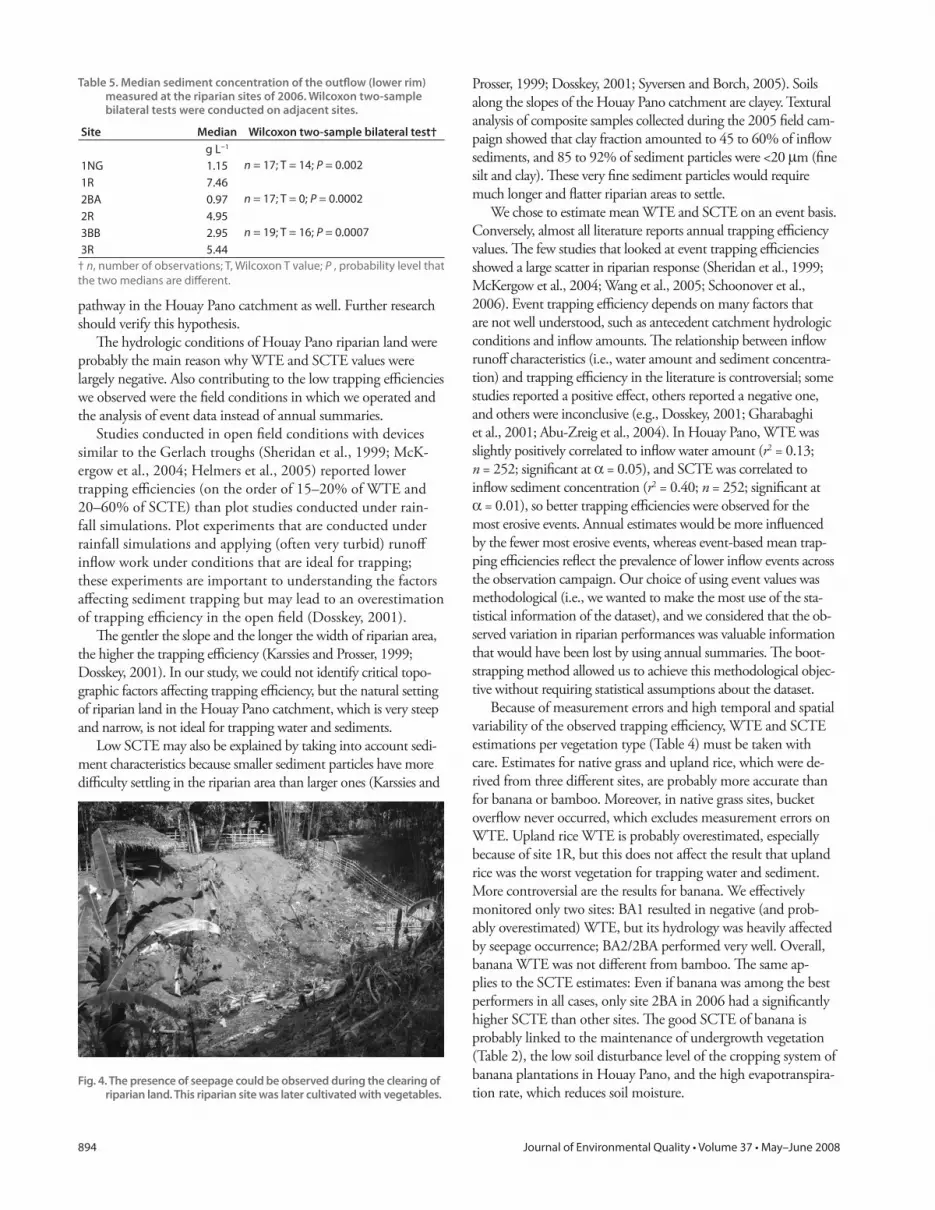
on gentle sloping sites such as BA1 and on steeper areas (Fig. 4).
Th e locations of places where return fl ow inputs to streams are
important cannot be identifi ed simply from riparian topography
in Houay Pano because of the complex geological structure of the
catchment (Ribolzi et al., 2005). Depending on the geological
setting of the site and hydrological conditions, which may change
from one event to the next, seepage may occur above the riparian
land, within it, or not at all. Seepage creates saturation of soils,
which inhibits infi ltration, reduces soil resistance to detachment
and transport, and may trigger landslide movements and stream
bank collapses. Under these hydrologic conditions, riparian land
cannot eff ectively trap infl ows in situ; instead, these sites may
become important sources of runoff water and sediment to the
stream (e.g., McKergow et al., 2006). Indeed, trapping effi cien-
cies observed in the Houay Pano catchment agree with the work
of McKergow et al. (2004), who found low trapping effi ciencies
of riparian land and negative trapping when seepage occurred.
Ziegler et al. (2004) reported that in Northern Vietnam return
fl ow is a dominant component of catchment hydrology, espe-
cially at the footslope of recently abandoned fi elds. Our study
verifi ed that, in at least one site, seepage in riparian land was the
common situation. We suspect that return fl ow is a major water
Fig. 3. Sediment concentration trapping effi ciency (SCTE) site mean and 95% confi dence interval in 2005 and 2006, Houay Pano catchment, Lao PDR. Note the diff erent scale of y axes; SCTE y-axis is discontinued below −10 to allow comparison among sites. Site values are reported in Appendix 3.
Table 4. Estimated mean and 95% confi dence interval of trapping effi ciencies for water (WTE) and sediment concentration (SCTE) for the four vegetation types of riparian land (data from two seasons and all sites per vegetation type), Houay Pano catchment, Lao PDR.
Native grass Bamboo Banana
Upland rice
WTE
Lower 95% boundary −0.10 −1.89 −2.05 −11.62
Mean 0.06 −1.17 −1.10 −7.75
Upper 95% boundary 0.23 −0.67 −0.45 −4.83
SCTE
Lower 95% boundary −0.61 −0.68 0.06 −4.92
Mean −0.27 −0.45 0.28 −2.84
Upper 95% boundary −0.03 −0.24 0.40 −1.71
894 Journal of Environmental Quality • Volume 37 • May–June 2008
pathway in the Houay Pano catchment as well. Further research
should verify this hypothesis.
Th e hydrologic conditions of Houay Pano riparian land were
probably the main reason why WTE and SCTE values were
largely negative. Also contributing to the low trapping effi ciencies
we observed were the fi eld conditions in which we operated and
the analysis of event data instead of annual summaries.
Studies conducted in open fi eld conditions with devices
similar to the Gerlach troughs (Sheridan et al., 1999; McK-
ergow et al., 2004; Helmers et al., 2005) reported lower
trapping effi ciencies (on the order of 15–20% of WTE and
20–60% of SCTE) than plot studies conducted under rain-
fall simulations. Plot experiments that are conducted under
rainfall simulations and applying (often very turbid) runoff
infl ow work under conditions that are ideal for trapping;
these experiments are important to understanding the factors
aff ecting sediment trapping but may lead to an overestimation
of trapping effi ciency in the open fi eld (Dosskey, 2001).
Th e gentler the slope and the longer the width of riparian area,
the higher the trapping effi ciency (Karssies and Prosser, 1999;
Dosskey, 2001). In our study, we could not identify critical topo-
graphic factors aff ecting trapping effi ciency, but the natural setting
of riparian land in the Houay Pano catchment, which is very steep
and narrow, is not ideal for trapping water and sediments.
Low SCTE may also be explained by taking into account sedi-
ment characteristics because smaller sediment particles have more
diffi culty settling in the riparian area than larger ones (Karssies and
Prosser, 1999; Dosskey, 2001; Syversen and Borch, 2005). Soils
along the slopes of the Houay Pano catchment are clayey. Textural
analysis of composite samples collected during the 2005 fi eld cam-
paign showed that clay fraction amounted to 45 to 60% of infl ow
sediments, and 85 to 92% of sediment particles were <20 μm (fi ne
silt and clay). Th ese very fi ne sediment particles would require
much longer and fl atter riparian areas to settle.
We chose to estimate mean WTE and SCTE on an event basis.
Conversely, almost all literature reports annual trapping effi ciency
values. Th e few studies that looked at event trapping effi ciencies
showed a large scatter in riparian response (Sheridan et al., 1999;
McKergow et al., 2004; Wang et al., 2005; Schoonover et al.,
2006). Event trapping effi ciency depends on many factors that
are not well understood, such as antecedent catchment hydrologic
conditions and infl ow amounts. Th e relationship between infl ow
runoff characteristics (i.e., water amount and sediment concentra-
tion) and trapping effi ciency in the literature is controversial; some
studies reported a positive eff ect, others reported a negative one,
and others were inconclusive (e.g., Dosskey, 2001; Gharabaghi
et al., 2001; Abu-Zreig et al., 2004). In Houay Pano, WTE was
slightly positively correlated to infl ow water amount (r2 = 0.13;
n = 252; signifi cant at α = 0.05), and SCTE was correlated to
infl ow sediment concentration (r2 = 0.40; n = 252; signifi cant at
α = 0.01), so better trapping effi ciencies were observed for the
most erosive events. Annual estimates would be more infl uenced
by the fewer most erosive events, whereas event-based mean trap-
ping effi ciencies refl ect the prevalence of lower infl ow events across
the observation campaign. Our choice of using event values was
methodological (i.e., we wanted to make the most use of the sta-
tistical information of the dataset), and we considered that the ob-
served variation in riparian performances was valuable information
that would have been lost by using annual summaries. Th e boot-
strapping method allowed us to achieve this methodological objec-
tive without requiring statistical assumptions about the dataset.
Because of measurement errors and high temporal and spatial
variability of the observed trapping effi ciency, WTE and SCTE
estimations per vegetation type (Table 4) must be taken with
care. Estimates for native grass and upland rice, which were de-
rived from three diff erent sites, are probably more accurate than
for banana or bamboo. Moreover, in native grass sites, bucket
overfl ow never occurred, which excludes measurement errors on
WTE. Upland rice WTE is probably overestimated, especially
because of site 1R, but this does not aff ect the result that upland
rice was the worst vegetation for trapping water and sediment.
More controversial are the results for banana. We eff ectively
monitored only two sites: BA1 resulted in negative (and prob-
ably overestimated) WTE, but its hydrology was heavily aff ected
by seepage occurrence; BA2/2BA performed very well. Overall,
banana WTE was not diff erent from bamboo. Th e same ap-
plies to the SCTE estimates: Even if banana was among the best
performers in all cases, only site 2BA in 2006 had a signifi cantly
higher SCTE than other sites. Th e good SCTE of banana is
probably linked to the maintenance of undergrowth vegetation
(Table 2), the low soil disturbance level of the cropping system of
banana plantations in Houay Pano, and the high evapotranspira-
tion rate, which reduces soil moisture.
Table 5. Median sediment concentration of the outfl ow (lower rim) measured at the riparian sites of 2006. Wilcoxon two-sample bilateral tests were conducted on adjacent sites.
Site Median Wilcoxon two-sample bilateral test†
g L−1
1NG 1.15 n = 17; T = 14; P = 0.002
1R 7.46
2BA 0.97 n = 17; T = 0; P = 0.0002
2R 4.95
3BB 2.95 n = 19; T = 16; P = 0.0007
3R 5.44
† n, number of observations; T, Wilcoxon T value; P , probability level that
the two medians are diff erent.
Fig. 4. The presence of seepage could be observed during the clearing of riparian land. This riparian site was later cultivated with vegetables.

Vigiak et al.: Trapping Effi ciencies of Riparian Vegetation in Northern Laos 895
Bamboo sites were sources of water and sediment to the
stream. Th e low undergrowth cover of bamboo sites (Table 2)
probably limited the sediment retention. Our results diff er from
those reported by Schoonover et al. (2006), who found that the
bamboo species giant cane (Arundinaria gigantea Chapm.) is an
eff ective fi lter of water and sediment already at a riparian width
of 3.3 m. Although some species of bamboo are probably more
eff ective than others, the Schoonover et al. (2006) study area had
high infi ltration rates in riparian land, which is very diff erent from
Houay Pano conditions. We could not fi nd other studies on the
eff ectiveness of bamboo in trapping sediments. In Southeast Asia,
bamboos are multipurpose species whose products are important
for household consumption and market (de Beer and McDermott,
1996; Belcher, 1998); therefore, further research should assess their
eff ect on soil and water conservation. Although banana cultiva-
tion in Houay Pano does not negatively aff ect the riparian fi ltering
of sediment and seems to reduce sediment concentration in the
outfl ow, cultivation of upland rice in riparian areas results in a very
clear detriment to water quality in the stream.
Th e sampling method we used for measuring average sediment
concentration underestimated the real sediment concentration of
water runoff . Th e magnitude of the error depended on (i) lag time
between the end of stirring and the sample collection, (ii) the set-
tling velocity of sediments, (iii) the vigor exercised while stirring the
water, and (iv) the utensils used for sampling (Bagarello and Ferro,
1998; Ciesiolka et al., 2006). Although this error may have led to
underestimating sediment concentrations by a factor of two to four
(Bagarello and Ferro, 1998; Ciesiolka et al., 2006), we believe that
this did not aff ect the estimation of SCTE because the same error
applies uniformly to the upper and lower rim troughs. However,
the median sediment concentrations reported in Table 5 probably
underestimated the sediment concentration of runoff water exiting
riparian areas and directly entering into the stream. Moreover, sedi-
ment concentrations were event averages; peak sediment concen-
trations were probably much higher. Gentry et al. (2006) found a
strong correlation between fecal bacteria contamination and water
turbidity. Higher sediment concentration in the streams may thus
negatively aff ect population livelihood and health. In northern
Laos, less than 40% of households have access to safe water, and
the link between land degradation, contaminated water, and pov-
erty is undeniable (Dasgupta et al., 2005). Given that most rural
populations rely on surface water for household consumption, the
higher contamination risk brought about by cultivation of annual
crops in riparian land may negatively aff ect human health.
ConclusionsTrapping effi ciencies of riparian vegetation measured in the
Houay Pano catchment were largely negative. Th e natural set-
tings of riparian land in this steep, narrow, and clayey headwater
catchment limit the possibility of trapping sediment and pollut-
ants in situ. Moreover, in Houay Pano, like in other humid and
wet tropic environments (Ziegler et al., 2004; McKergow et al.,
2004; Sidle et al., 2006), seepage in riparian land is commonly
observed. Seepage inhibits infi ltration and reduces soil resistance
to detachment and transport. In these hydrologic conditions, the
negative impacts on water quality resulting from the more in-
tense use of sloping land cannot be counteracted by interventions
limited to the riparian areas. On the contrary, under such cir-
cumstances, riparian land is more susceptible to erosion process-
es. Th erefore, proper management of riparian land cannot replace
proper management of sloping land, and proper management of
riparian land is also necessary to avoid erosion taking place in the
immediate proximity of streams.
In northern Laos, riparian land off ers important opportunities
for income-generating activities for the rural population. Relatively
gentler slopes and the presence of water for irrigation make ripar-
ian land particularly apt for the cultivation of vegetable gardens
from which produce can fetch high prices on the market. However,
because of its proximity to streams, riparian land use heavily aff ects
water quality. Native grass was the best vegetation in terms of in-
fi ltrating runoff infl ows, thus reducing sediment mass delivered to
the stream. However, it can generate income only if grazed, which
would increase the risks of water contamination by fecal bacteria.
Although bamboos, whether naturally occurring or planted, are
important sources of nontimber forest products, they were not
eff ective in reducing sediment pollution to the streams. Conversely,
bamboo sites were sources of water and sediment. Th is study in-
dicates that more research is needed to assess the eff ect of bamboo
on soil and water conservation. Cultivation of banana off ers good
opportunities: Casks are a profi table cash product, and, when
plantations are managed with little tillage while maintaining good
ground cover, banana may reduce surface runoff sediment concen-
trations. On the contrary, the cultivation of upland rice on riparian
land led to two- to fi ve-fold increases in sediment concentration of
surface runoff fl owing to streams.
Our study addressed only one aspect of the relationship be-
tween riparian vegetation and water quality (i.e., the effi ciency
of trapping sediments fl owing from the slopes via nonconcen-
trated water fl ows). Other ecological aspects may be equally
or more important. Given the importance of subsurface water
fl ows highlighted during the study, fi ltering of dissolved nutri-
ents and prevention of stream bank collapses may be important
aspects to be addressed by further research to thoroughly assess
the infl uence of riparian vegetation on water quality.
AcknowledgmentsTh e research was conducted within a post-doc fellowship
issued by International Water Management Inst. of Colombo.
We thank the colleagues of the National Agricultural Forest
Research Inst. of Lao PDR (NAFRI) for their useful assistance
during the study. Th e research was part of the Management of
Soil Erosion Consortium (MSEC) program. Dr. Anneke de
Rouw (IRD-Laos) and Dr. J.F. Maxwell (Herbarium, Faculty
of Science, Chiang Mai Univ.) assisted in the identifi cation of
the species reported in Appendix 1. Th e work of Mr. Inpaeng
DuangVong, Ms. Nora van Breusegem, Mr. Khankham
Aphaivong, Mr. Rudolf van der Helm, and the collaboration
of all MSEC fi eld assistants were essential to this research and
are gratefully acknowledged. We also thank the review team of
the journal, whose comments helped improve the manuscript.

896 Journal of Environmental Quality • Volume 37 • May–June 2008
ReferencesAbu-Zreig, M., R.P. Rudra, M.N. Lalonde, H.R. Whiteley, and N.K. Kaushik.
2004. Experimental investigation of runoff reduction and sediment removal by vegetated fi lter strips. Hydrol. Processes 18:2029–2037.
Bagarello, V., and V. Ferro. 1998. Calibrating storage tanks for soil erosion measurements from plots. Earth Surf. Processes Landforms 23:1151–1170.
Belcher, B. 1998. A production-to-consumption system approach: Lessons from the bamboo and rattan sectors in Asia. p. 57–84. In E. Wollenberg and A. Ingles (ed.) Incomes from the forest: Methods for the development and conservation of forest products for local communities. CIFOR, Bogor, West Java.
Chaplot, V., E. Coadou le Brozec, N. Silvera, and C. Valentin. 2005. Spatial and temporal assessment of linear erosion in catchments under sloping lands of northern Laos. Catena 63:167–184.
Ciesiolka, C.A.A., B. Yu, C.W. Rose, H. Ghadiri, D. Lang, and C. Rosewell. 2006. Improvement in soil losses estimation in the USLE type experiments. J. Soil Water Conserv. 61:223–229.
Dasgupta, S., U. Deichmann, C. Meisner, and D. Wheeler. 2005. Where is the poverty-environment nexus? Evidence from Cambodia, Lao PDR, and Vietnam. World Dev. 33:617–638.
de Beer, J.H., and M.J. McDermott. 1996. Th e economic value of non-timber forest products in Southeast Asia. 2nd ed. Netherlands Committee for IUCN, Amsterdam, Th e Netherlands.
de Rouw, A., P. Baranger, and B. Soulidad. 2002. Upland rice and Jobs’ Tears cultivation in slash and burn systems under very short fallow periods in Luang Prabang province. Lao J. Agric. For. 5:1–10.
de Rouw, A., B. Soulilad, K. Phanthavong, and B. Dupin. 2005. Th e adaptation of upland rice cropping to ever-shorter fallow periods and
its limit. p. 139–148. In B. Bouahom et al. (ed.) Poverty reduction and shifting cultivation stabilisation in the uplands of Lao PDR. NAFRI, Vientiane, Lao, People’s Democratic Republic.
Dosskey, M.G. 2001. Toward quantifying water pollution abatement in response to installing buff ers on crop land. Environ. Manage. 28:577–598.
Dosskey, M.G., M.J. Helmers, D.E. Eisenhauer, T.G. Franti, and K.D. Hoagland. 2002. Assessment of concentrated fl ow through riparian buff ers. J. Soil Water Conserv. 57:336–343.
Efron, B., and R.J. Tibshirani. 1993. An introduction to the bootstrap. Monographs on statistics and applied probability. Chapman & Hall, New York.
Gentry, R.W., J. McCharty, A. Layton, L.D. McKay, D. Williams, S.R. Koirala, and G.S. Sayler. 2006. Escherichia coli loading at or near base fl ow in a mixed-use watershed. J. Environ. Qual. 35:2244–2249.
Gerlach, T. 1967. Hillslope troughs for measuring sediment movement. Rev. Géomorphol. Dyn. 4:173–174.
Gharabaghi, B., R.P. Rudra, N. Gupta, and S. Sebti. 2001. Sediment removal effi ciency of vegetative fi lter strips. ASAE Meeting 2001 paper 012071. ASAE, St. Joseph, MI.
Helmers, M.J., D.E. Eisenhauer, T.G. Franti, and M.G. Dosskey. 2005. Modelling sediment trapping in a vegetative fi lter accounting for converging overland fl ow. Trans. ASAE 48:541–555.
Janeau, J.L., J.P. Bricquet, O. Planchon, and C. Valentin. 2003. Soil crusting and infi ltration on steep slopes in northern Th ailand. Eur. J. Soil Sci. 54:543–553.
Karssies, L.E., and I.P. Prosser. 1999. Guidelines for riparian fi lter strips for Queensland irrigators. CSIRO Land and Water Technical report 32/99, Canberra, Australia.
Appendix 1. Species composition of vegetation types as assessed on a 3 × 3 m plot at the middle of monsoon season (12 July 2005 and 21 July 2006).
SpecieNative grass Bamboo Banana
Upland rice
Bahunia viridescens 1†
Biophytum sensitivum + + +
Chromolaena odorata 1 +
Cratoxylum cochinchinense +
Dendrocalamus sp (Mai hok) 3
Dimocarpus longan +
Dioscorea alata +
Dyospiros rubra +
Erigerum sumatrensis + + +
Ficus heterophilla +
Lygopodium fl exuosum 1 +
Mai lord (local name, Graminea bambusoidee)
2
Mallotus barbatum +
Microstegium ciliatum 3 + 2
Mimosa invisa 1 + +
Mimosa pudica +
Momordica charantia +
Morulgo pentaphilla + + +
Musa sp 3
Oryza sativa 2
Panicum sp +
Paranephelium macrophylla +
Passifl ora foetida +
Peperonia pellucida +
Pueraria phaseoloides +
Sida rhombifolia +
Sphilantes paniculata + + +
Thunbergia grandifl ora + +
† Abundance codes: 6 = >75% cover, 5 = 50–75% cover, 4 = 25–50% cover,
3 = 10–25% cover, 2 = 5–10% cover, 1 = 1–5% cover, + = <1% cover.
Appendix 2. Riparian sites’ water trapping effi ciency (WTE) means and 95% confi dence intervals (CI). The values are presented in Fig. 2.
Year Site Lower 95% CI limit Mean WTE Upper 95% CI
2005 BA1 −8.92 −5.16 −3.36
BB2 −1.68 −0.51 −0.11
BB1 −1.28 −0.47 0.01
BA2 −0.84 −0.42 0.00
NG2 −0.55 −0.15 0.13
NG1 0.20 0.39 0.56
2006 1R −28.66 −20.31 −13.31
2R −13.10 −8.72 −5.21
3BB −4.20 −3.11 −2.03
3R −2.65 −1.80 −1.08
1NG −0.46 −0.16 0.11
2BA −0.55 0.28 0.53
Appendix 3. Riparian sites’ sediment concentration trapping effi ciency (SCTE) means and 95% confi dence intervals (CI). The values are presented in Fig. 3.
Year Site Lower 95% CI limit Mean SCTE Upper 95% CI
2005 NG1 −1.83 −0.90 −0.38
BB1 −1.42 −0.68 −0.31
BA1 −1.39 −0.43 0.06
BB2 −0.46 −0.26 −0.03
NG2 −0.10 0.15 0.31
BA2 −0.06 0.22 0.39
2006 1R −22.71 −7.60 −3.60
2R −7.05 −3.04 −1.24
3R −2.32 −1.23 −0.51
3BB −0.98 −0.56 −0.13
1NG −1.59 −0.44 0.24
2BA 0.49 0.56 0.66

Vigiak et al.: Trapping Effi ciencies of Riparian Vegetation in Northern Laos 897
Kirkby, M.J. 1988. Hillslope runoff processes and models. J. Hydrol. 100:315–339.
Lestrelin, G., and M. Giordano. 2007. Upland development policy, livelihood change and land degradation: Interactions from a Laotian village. Land Degrad. Dev. 18:55–76.
Lowrance, R., and J.M. Sheridan. 2005. Surface runoff water quality in a managed three zone riparian buff er. J. Environ. Qual. 34:1851–1859.
McKergow, L.A., I.P. Prosser, R.B. Grayson, and D. Heiner. 2004. Performance of grass and rainforest riparian buff ers in the wet tropics, Far North Queensland: II. Water quality. Aust. J. Soil Res. 42:485–498.
McKergow, A.L., I.P. Prosser, D.M. Weaver, R.B. Grayson, and A.E. Reed. 2006. Performance of grass and eucalyptus riparian buff ers in a pasture catchment, Western Australia, part 1: Riparian hydrology. Hydrol. Processes 20:2309–2326.
R Development Core Team. 2005. R: A language and environment for statistical computing. R Foundation for Statistical Computing, Vienna. Available at http://www.R-project.org (verifi ed 9 Jan. 2008).
Ribolzi, O., N. Silvera, K. Xayyakummanh, K. Latchachak, S. Tasaketh, and K. Vanethongkham. 2005. Th e use of pH to spot ground water infl ows along the stream of a cultivated catchment in the northern Lao P.D.R. Lao J. Agric. For. 10:74–84.
Roder, W., S. Phengchanh, and S. Maniphone. 1997. Dynamics of soil and vegetation during crop and fallow period in slash-and-burn fi elds on northern Laos. Geoderma 76:131–144.
Rumpel, C., V. Chaplot, O. Planchon, J. Bernadou, C. Valentin, and A.
Mariotti. 2006. Preferential erosion of black carbon on steep slopes with slash and burn agriculture. Catena 65:30–40.
Saito, K., B. Linquist, B. Keobulapha, K. Phanthaboon, T. Shiraiwa, and T. Horie. 2006. Cropping intensity and rainfall eff ects on upland rice yields in northern Laos. Plant Soil 284:175–185.
Schoonover, J.H., K.W.J. Williard, J.J. Zaczek, J.C. Mangun, and A.D. Carver. 2006. Agricultural sediment reduction by giant cane and forest riparian buff ers. Water Air Soil Pollut. 169:303–315.
Sheridan, J.M., R. Lowrance, and D.D. Bosch. 1999. Management eff ects on runoff and sediment transport in riparian forest buff ers. Trans. ASAE 42:55–64.
Sidle, R.C., M. Tani, and A.D. Ziegler. 2006. Catchment processes in Southeast Asia: Atmospheric, hydrologic, erosion, nutrient cycling, and management eff ects. For. Ecol. Manage. 224:1–4.
Syversen, N., and H. Borch. 2005. Retention of soil particle fractions and phosphorous in cold-climate buff er zones. Ecol. Eng. 25:382–394.
Wang, X.H., C.Q. Yin, and B.Q. Shan. 2005. Th e role of diversifi ed landscape buff er structures for water quality improvement in an agricultural watershed, North China. Agric. Ecosyst. Environ. 107:381–396.
Ziegler, A.D., T.W. Giambelluca, L.T. Tran, T.T. Vana, M.A. Nullet, J. Fox, T.D. Vien, J. Pinthong, M.F. Maxwell, and S. Evett. 2004. Hydrological consequences of landscape fragmentation in mountainous northern Vietnam: Evidence of accelerated overland fl ow generation. J. Hydrol. 287:124–146.


