Embed Size (px)
Citation preview
San FransiscoSan Fransisco
Earthquakes are the shaking, rolling or sudden shock of the earth’s surface.
They happen along "fault lines" in the earth’s crust.
Felt over large areas Usually last less than 1 minute Cannot be predicted
The intensity of an earthquake can be measured using the Richter scale
A magnitude 7.0 on a Richter scale is a major earthquake.
6.0 is considered strong 5.0 can cause damage Below 4.0 usually does not cause damage Anything below 2.0 usually can’t be felt
San Francisco, CAApril 18, 19065:12 a.m.Magnitude: 8.25Length of time: 40 secondsDeaths: 700 to 2,500 people
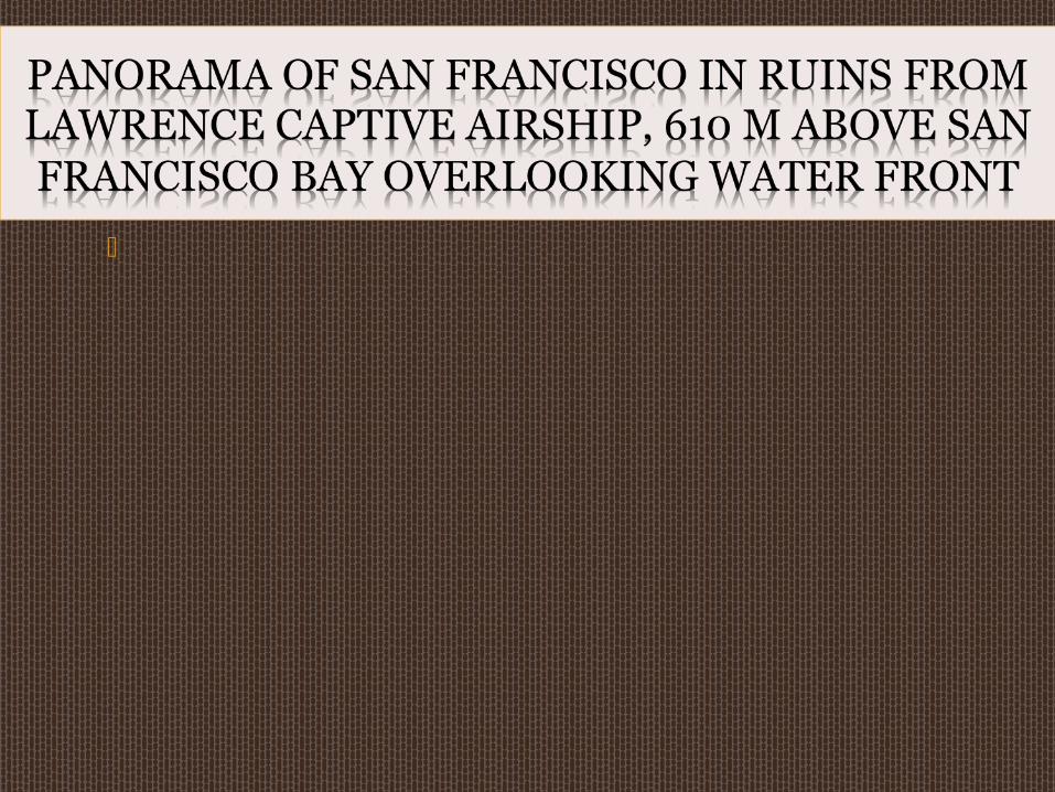
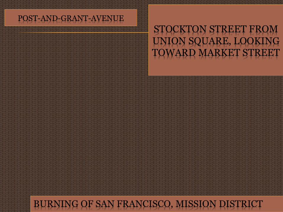
Note: The "Great San Francisco Earthquake" is one of the strongest ever recorded in North America. Much of the city was destroyed by the strong shaking, which toppled buildings, and by the fires that followed.
It was a major earthquake that struck San Francisco, California and the coast of Northern California.
The main shock epicenter* occurred offshore about 3 km from the city.
It ruptured along the San Andreas Fault for a total length of 477 km.
The earthquake and resulting fire one of the worst natural disasters in U.S. history.
Death toll: above 3,000
The fires that burned out of control afterward the earthquake were much more destructive.
Subsequent fires caused 90% of destruction.
Structures either collapsed (poor building standards) or burnt down (ruptured natural gas pipes).
One landmark building lost in the fire was the Palace Hotel, subsequently rebuilt, which had many famous visitors, including royalty and celebrated performers.
Nearly 1,500 specimens at the California Academy of Sciences, including the entire type specimen collection for a newly discovered and extremely rare species were saved, before the remainder of the largest botanical collection in the western United States was consumed by fire.

The entire laboratory and all the records of Benjamin R. Jacobs, a biochemist who was researching the nutrition of everyday foods, was lost.
Another treasure lost in the fires was the original California flag used in the 1846 Bear Flag Revolt at Sonoma, which at the time was being stored in a state building
Property losses been estimated to be more than $400 million.
In the rush to rebuild the city, building standards were lowered instead of strengthened.
Why the rush to rebuild? To host an international exposition in 1915.
Building codes first came into use to protect communities from potential earthquake damage (1930’s).
These standards ensure the quality of construction before a disaster.
A code is a body of laws that must be obeyed by contractors.
A building code requires that a building be safe for all occupants.
1. Human casualties
2. Loss of livestock in rural areas
3. Property damage or homelessness
4. Medical services are disrupted (no
doctor or medication available)
5. Job loss if company moves away
6. Temporary unemployment
7. No transportation services 8. Damage to infrastructure (bridges, roads &
buildings) 9. Economy suffers due to job losses.10. Billions of dollars spent to clean up and repair city.11. Home insurance increases12. Emergency services are disrupted or overwhelmed
with rescue efforts.
1. Build earthquake resistant homes, buildings and bridges.
2. Invest in high-technology equipment which can detect earthquakes before they occur.
3. Set in place a warning system to give enough to prepare (if time permits of course!)
4. Set in place of crisis management team with a good action plan.
5. Train emergency services to (police officers, 911 operators, firefighters and paramedics) deal with crisis.
Quito is a city in Ecuador (country).
It is found in South America.
http://www.youtube.com/watch?v=iL_vxvGYNC4
http://www.youtube.com/watch?v=YMUtyA7wNXI
http://www.youtube.com/watch?v=mn79_2ZDmSQ
http://www.youtube.com/watch?v=-MpelQA2ZAU
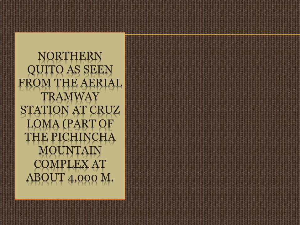
The city of Quito is divided into three zones,
separated by hills
a) Central part:
This is the historical, colonial part of the city
Tourist zone
b) Southern part: This area is mainly industrial and residential, a
working-class neighborhood.
c) Northern part: This is modern Quito, with high-rise buildings,
shopping centers, the financial district and upper class (affluent) neighborhoods, and some working-class neighborhoods
Mariscal Sucre International Airport is in the northern part.
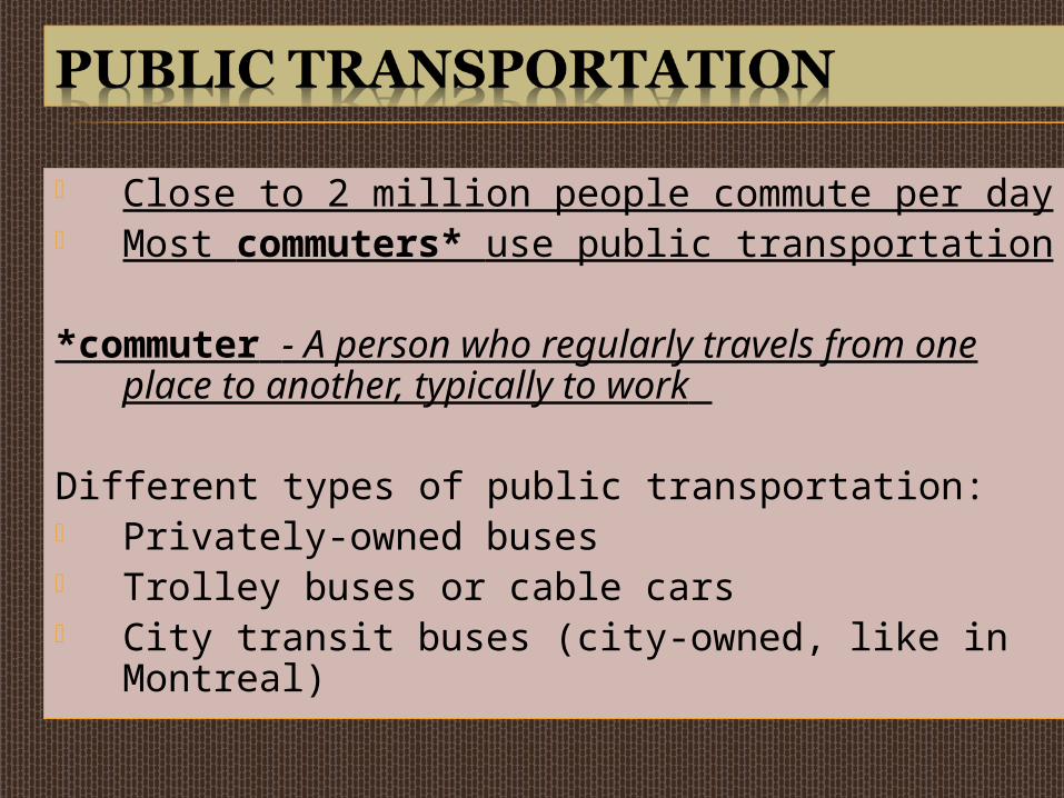
Close to 2 million people commute per day Most commuters* use public transportation
*commuter - A person who regularly travels from one place to another, typically to work
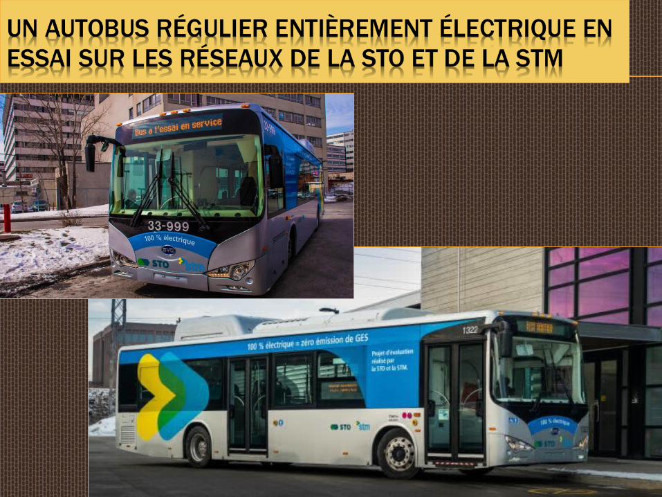
Different types of public transportation: Privately-owned buses Trolley buses or cable cars City transit buses (city-owned, like in
Montreal)
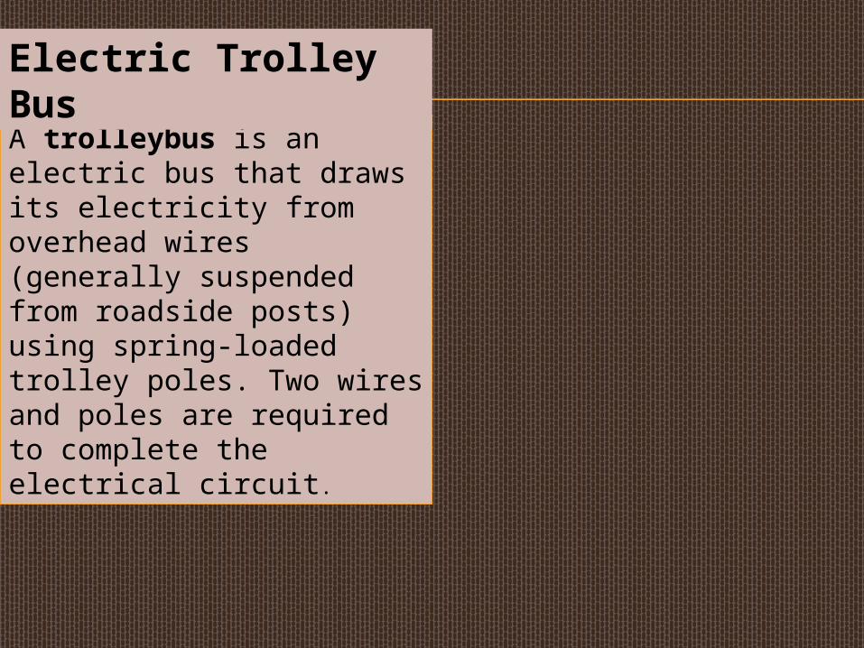
A trolleybus is an electric bus that draws its electricity from overhead wires (generally suspended from roadside posts) using spring-loaded trolley poles. Two wires and poles are required to complete the electrical circuit.
Electric Trolley Bus
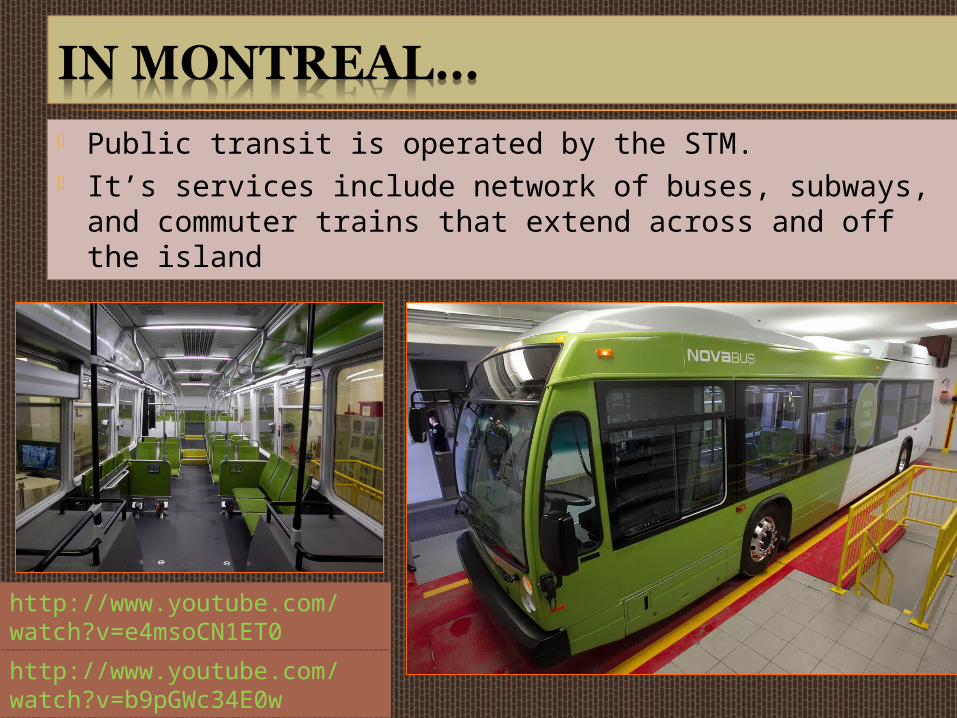
Public transit is operated by the STM. It’s services include network of buses, subways, and
commuter trains that extend across and off the island
http://www.youtube.com/watch?v=e4msoCN1ET0
http://www.youtube.com/watch?v=b9pGWc34E0w
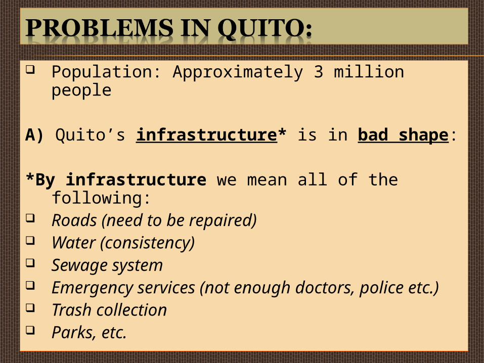
Population: Approximately 3 million people
A) Quito’s infrastructure* is in bad shape:
*By infrastructure we mean all of the following:
Roads (need to be repaired) Water (consistency) Sewage system Emergency services (not enough doctors,
police etc.) Trash collection Parks, etc.

The Issue of Having Consistent Water Supply
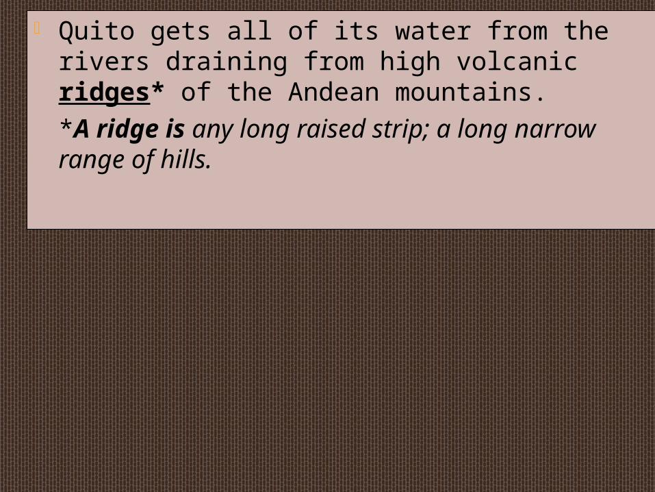
Quito gets all of its water from the rivers draining from high volcanic ridges* of the Andean mountains. *A ridge is any long raised strip; a long narrow range of hills.
Water pipes transport this water from the mountains to Quito.
The “threat” to Quito is having a consistent supply of water.
This means making sure there is enough water to continue to supply Quito’s needs.
Quilotoa is beautiful crater lake.
B) There is a lot of poverty, particularly among indigenous people like the Andeans.
http://filipspagnoli.files.wordpress.com/2008/11/slum_in_quito.jpg
Despite the poverty and disrepair of many buildings, the churches and cathedrals are really beautiful.
Most people use public transportation (buses) and taxis to travel around the city.
More and more people are buying private vehicles (cars!) even though the cost is twice the price in the United States.
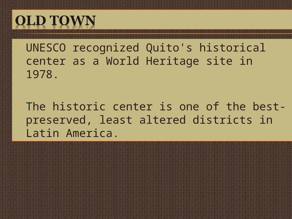
UNESCO recognized Quito's historical center as a World Heritage site in 1978.
The historic center is one of the best-preserved, least altered districts in Latin America.
Strictly controlled development has kept it wonderfully preserved.
Pululahua is a volcano near Quito. Its crater is visible. It is believed to be one of only craters in the
world with human inhabitants.
Quito lies at the foot of the Pichincha volcano, and has been damaged several times by the area's frequent earthquakes.
Quito is the only capital in the world to be directly menaced (threatened) by an active volcano.
Guagua Pichincha, only 21 km west, has continuing activity and is under constant monitoring.
The largest eruption occurred in 1660 when over 25 cm of ash covered the city.
The latest eruption was recorded on October 5 and 7, 1999, when a large amount of ash was deposited on the city.
The eruption caused significant disruption of activities, including closing of the international airport.
Nearby volcanic eruptions can also affect Quito.
The city was showered with ash for several days after an eruption occurred in the Reventador volcano (2002).
The region also is vulnerable to earthquakes. The worst-known earthquake to have hit Quito
occurred in 1797 and killed 40,000 people. In 1987, an earthquake with a magnitude of 7
on the Richter scale, occurred in 1987 with an epicenter about 80 km from the city.
It killed an estimated 1,000 near the epicenter, but Quito itself suffered only minor damage.
The intensity of an earthquake can be measured using the Richter scale
A magnitude 7.0 on a Richter scale is a major earthquake.
The Northridge Earthquake, which hit Southern California in 1994, was magnitude 6.7
6.0 is considered strong 5.0 can cause damage Below 4.0 usually does not cause damage Anything below 2.0 usually can’t be felt
The point of the earth's surface which is directly above the focus* of an earthquake
Focus point of origin of an earthquake.
http://www.youtube.com/watch?v=Kg-6whkbZXs


![Earth Science at a Glance 2016.pptx [Autosaved]wynbrookees.dekalb.k12.ga.us/Downloads/Earth... · • Earthquakes, the violent shaking of Earth’s crust, vary in magnitude. • Seismic](https://img.pdfslide.net/doc/110x75/5fdd932d08ecf337e2706871/earth-science-at-a-glance-2016pptx-autosaved-a-earthquakes-the-violent-shaking.jpg)