Embed Size (px)
Citation preview
1
NASIS 6.1 and WSS 2.3 Updates
Jim FortnerNational Soil Survey Center
April 20, 2011

2
NASIS 6.1 Release
• NASIS 6.1 came online – April 12
• Also released ––Updated SDV Rule Manager–Updated SC/OSD Maintenance tool

NASIS 6.1 Features• Improved editing performance• ~ 50 bugs fixed• Data tables and columns for RaCA & DSP
data• Excel spreadsheet imports• VNIR scan file imports• Run national reports in background• View reports, queries, etc. in grid• New drop down selection of child tables• Run multiple validations or calculations at
once
3

RaCA & DSP data
4

RaCA & DSP data
5

Spreadsheet Import
6
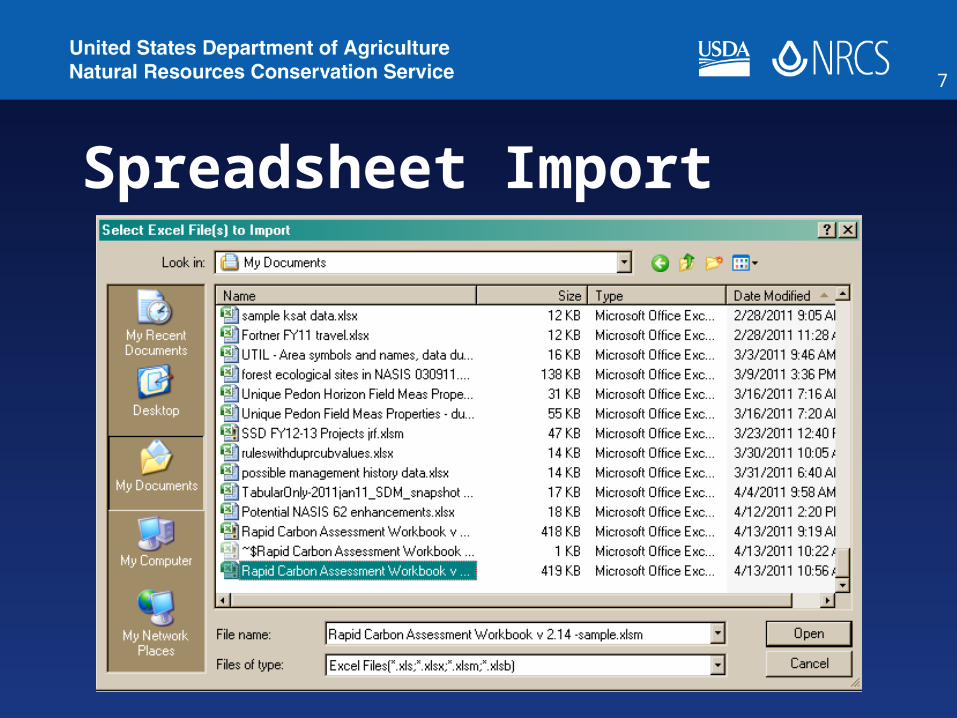
Spreadsheet Import
7

Import Requirements
• Worksheet mapping file has to be created by NSSC for each worksheet of each version of a workbook.
• Currently have these for RaCA versions 2.07 thru 2.14, and new 2.15
• DSP workbook being developed
8

RaCA import rules (& DSP)
• For RaCA & DSP, the import process APPENDS to existing Site and Pedon records.
• Corresponding Site, Site Assoc., & Pedon records MUST already be in NASIS.
9

RaCA import rules (& DSP)
• These MUST be checked out for the spreadsheet to import.
• User Site ID, User Pedon ID, Site Obs. Date, & horizon designation MUST agree between NASIS and spreadsheet.
• Multiple spreadsheets can be imported at once.
10

Local Plant Issue
• Plant symbols and names on the spreadsheets MUST already be in the Local Plants table in NASIS
• Symbols and names MUST match EXACTLY!
• Any mismatch will abort the import
11

VNIR Scan file import
• VNIR scan filename MUST match that recorded on the spreadsheet
• If file(s) are stored in same directory as the spreadsheet, they are automatically imported with the spreadsheet file
12

VNIR Scan file import
• Files can also be imported from NASIS Pedon Horizon VNIR Scan table
• Click in VNIR File Name column• Click Open button• Browse for desired file
13

VNIR Scan file import
14

15

Run National Reports Offline
16
• Avoids 10 minute timeout limit
• Could still hit memory limit

Reports, queries, etc. in grid
17
• Run appropriate query to bring desired objects into your Selected Set
• View the appropriate table.• Allows for • checking out/in a group of records at once• changing ownership of multiple records.
• Cannot edit the script in this mode; must open in normal tab mode.

Reports, queries, etc. in grid
18
Clicking in this column will open the report in normal tab mode.

Drop-down table selection
19

Run Multiple Validations
• Works for calculations too
20

Run on Highlighted or All Rows
21

SDV Rule Manager
• New URLhttps://sdvrulemanager.sc.egov.usda.gov/RuleManager.aspx
22

SDV Rule Manager
• Changes to reflect how rules are stored in NASIS 6.0 data structure
23

WSS 2.3 Status
• Currently in QA testing• Release date – end of
May/early June
24

WSS 2.3 New Features
• Import/export AOI boundary file
• Bookmark the AOI• Imbed location and/or AOI
coordinates in URL• Quick navigation in US
territories• New Lat/Long entry options
25

Export AOI boundary file
26

Export AOI boundary file
27

Import AOI Boundary file
• Can be from –file previously exported from WSS–File created using ArcGIS or other
software• Shapefile format
– .shp and .prj files needed• <10,000 acres; < 90 points;
<100 Mb
28

Import AOI Boundary file
29

Import AOI Boundary file
30
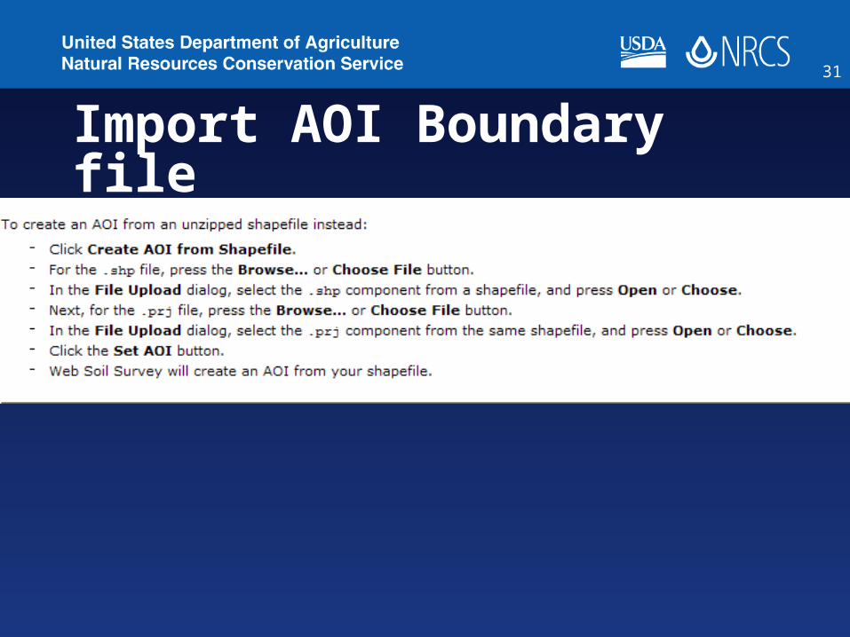
Import AOI Boundary file
31

Bookmark Your AOI
32

Save Target As …
33

US Territory Addresses
34
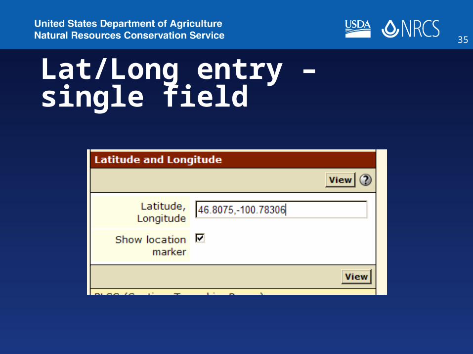
Lat/Long entry – single field
35

Lat/Long entry Options
36

Future - NASIS
• Point data model changes - SSO lab data
• Update Pedon PC to match• Move mustatus and farmland class
to legend mapunit• Add mapunit history and text
tables to Legend Mapunit• Customizable choice lists
37

Future – NASIS – cont’d
• Consider changing way data is downloaded from national to local database
• Local db management options• Store images and document files• Adjustable font sizes
38

Future – WSS / SDM
• Rebuilding backend operations – Moving from ESRI tools to SQL Server
tools• Use Bing imagery• Increase allowable AOI limit -
>100k ?• Combine functions of SDW
application into WSS – reports and downloads
• Add new data elements from NASIS to SDM database – available to WSS
39

Future – WSS / SDM – cont’d
• Handle line and point map units• Change SDM to WGS 84 –
accommodates PIA data• Display additional ESD content• Add in BIA land areas for quick
navigation
40

Questions ???
41