Embed Size (px)
Citation preview

1
Use and Benefit from SLIP -WALIS Forum
Tony SutherlandSLIP Program DirectorDepartment of Land Information15 September 2006
© Copyright The Department of Land Information, Perth, 2006
The document and its contents are confidential and intended only for use by authorised personnel directly involved in the Shared Land Information Platform or so indicated on the document’s distribution list. The document’s contents should not be disclosed to any unauthorised person.

2
AgendaAgendathe Shared Land Information Platform
by All, for All
Engagement
ExamplesDemo’s
Models:How to Use
SLIP
SLIP has…
SLIP is…
3
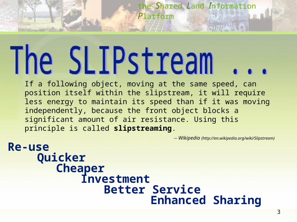
Re-use Quicker
Cheaper
Better ServiceInvestment
Enhanced Sharing
the Shared Land Information Platform
If a following object, moving at the same speed, can position itself within the slipstream, it will require less energy to maintain its speed than if it was moving independently, because the front object blocks a significant amount of air resistance. Using this principle is called slipstreaming.
-- Wikipedia (http://en.wikipedia.org/wiki/Slipstream)

4
the platform connecting WA
Government spatial
information Access Achievement
Business
e-GovernmentInvestment
Sharing & Collaboration
the Shared Land Information PlatformYour World, At Your Fingertips

5
the Shared Land Information PlatformYour World, At Your Fingertips
Department of Land InformationEnabling Framework
businessapplications

6
Department of Land Information
Security Zone
Application Zone
Data Zone
Remote Communications Zone
Reverse Proxy
eTrust SiteMinder
SLIP Portal
Central WMS/WFS Service
DLI WMS/WFS Service
Spatial Dissemination Database
VPN ConcentratorAgency
Spatial Data
Agency Infrastructure
SLIP Infrastructure Zone
Agency WMS/WFSService
DLI
DPI
DIA
DoE/DoW
CALM
FESA
DAF
PTA
DOCEP
DOIR
WaterCorporation
WesternPower Alinta
MRWA
Fisheries
Internet(ServiceNet)

7
the Shared Land Information PlatformYour World, At Your Fingertips
Department of Land InformationEnabling FrameworkInterest Enquiry
businessapplications

8

9
the Shared Land Information PlatformYour World, At Your Fingertips
Department of Land Information
Department of Agriculture and Food
Enabling FrameworkInterest Enquiry
Natural Resource Management
businessapplications

10

11
the Shared Land Information PlatformYour World, At Your Fingertips
Department of Land Information
Department of Agriculture and Food
Fire and Emergency Services Authority
Enabling FrameworkInterest Enquiry
Natural Resource Management
Emergency Management
businessapplications

12

13
the Shared Land Information PlatformYour World, At Your Fingertips
Department of Land Information
Department of Agriculture and Food
Fire and Emergency Services Authority
Department of Planning and Infrastructure
Enabling FrameworkInterest Enquiry
Natural Resource Management
Emergency Management
electronic Land Development Process
businessapplications

14

15
the Shared Land Information PlatformYour World, At Your Fingertips
Map Viewer
sharedcomponents

16

17
the Shared Land Information PlatformYour World, At Your Fingertips
Map Viewer
Catalogue
sharedcomponents

18

19
the Shared Land Information PlatformYour World, At Your Fingertips
Viewing Maps
Spatial Analysis
threemodels :
(inter alia)
Map Viewer – Web Browser
Multiple SLIP Layers
Local Datasets
Coarse Contextual Display
Display with Attributes – Assist with Analysis
Specific Data for Detailed Analysis
Application Development Special Purpose Application

20
Viewing MapsViewing MapsExamples / DemoExamples / Demo
• Assessing OH&S Sites• Epidemiology
• Incidence of Dengue Fever (Mosquito’s)• Incidence of Cancer relating to Soil types (etc)
• Housing and Works, and Local Government• Asset Management
• Education• Multiple Campuses• Source location of students• Better target services
• Statutory Boards• Regulatory Inspection Sites / Schedules
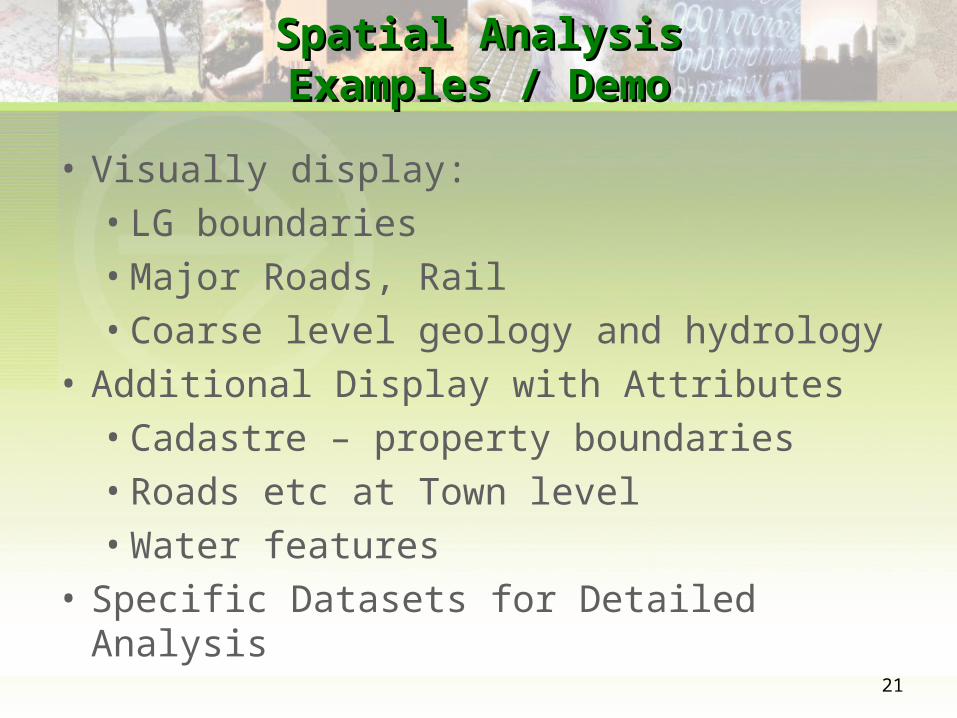
21
Spatial AnalysisSpatial AnalysisExamples / DemoExamples / Demo
• Visually display:
• LG boundaries
• Major Roads, Rail
• Coarse level geology and hydrology
• Additional Display with Attributes
• Cadastre – property boundaries
• Roads etc at Town level
• Water features
• Specific Datasets for Detailed Analysis

22
A Very Simple ExampleA Very Simple Example

23
Google Atom XMLGoogle Atom XML<feed><id>http://www.google.com/calendar/feeds/misterslip%40gmail.com/private-28fa426d69aec5a0064359f2a1aa1356/basic</id><updated>2006-09-06T06:42:21.000Z</updated><title type="text">Mr SLIP</title><subtitle type="text">Testing of Time to Spatial inter-operation</subtitle><link rel="http://schemas.google.com/g/2005#feed" type="application/atom+xml" href="http://www.google.com/calendar/feeds/misterslip%40gmail.com/
private-28fa426d69aec5a0064359f2a1aa1356/basic"/><link rel="self" type="application/atom+xml" href="http://www.google.com/calendar/feeds/misterslip%40gmail.com/private-
28fa426d69aec5a0064359f2a1aa1356/basic?max-results=25"/><link rel="next" type="application/atom+xml" href="http://www.google.com/calendar/feeds/misterslip%40gmail.com/private-
28fa426d69aec5a0064359f2a1aa1356/basic?start-index=26&max-results=25"/>−<generator version="1.0" uri="http://www.google.com/calendar">Google Calendar</generator><openSearch:itemsPerPage>25</openSearch:itemsPerPage><gd:where valueString="Western Australia"/><gCal:timezone value="Australia/Perth"/>−<entry><id>http://www.google.com/calendar/feeds/misterslip%40gmail.com/private-28fa426d69aec5a0064359f2a1aa1356/basic/jnfpasde5iurc53qpajlbso814</id><published>2006-09-06T06:42:21.000Z</published><updated>2006-09-06T06:42:21.000Z</updated><category scheme="http://schemas.google.com/g/2005#kind" term="http://schemas.google.com/g/2005#event"/><title type="text">Inspect Ngulupi</title><summary type="html">When: 2006-09-14 08:00:00 to 17:00:00 Australia/Perth<br><br>Where: Ngulupi<br>Event Status: CONFIRMED</summary><content type="text">When: 2006-09-14 08:00:00 to 17:00:00 Australia/Perth<br><br>Where: Ngulupi<br>Event Status: CONFIRMED<br>Event Description:</content><link rel="alternate" type="text/html" href="http://www.google.com/calendar/event?
eid=am5mcGFzZGU1aXVyYzUzcXBhamxic284MTQgbWlzdGVyc2xpcEBnbWFpbC5jb20" title="alternate"/><link rel="self" type="application/atom+xml" href="http://www.google.com/calendar/feeds/misterslip%40gmail.com/private-
28fa426d69aec5a0064359f2a1aa1356/basic/jnfpasde5iurc53qpajlbso814"/></entry>

24
WFS GMLWFS GML
<?xml version="1.0" encoding="ISO-8859-1"?><wfs:FeatureCollection xmlns:ms="http://mapserver.gis.umn.edu/mapserver" xmlns:wfs="http://www.opengis.net/wfs"
xmlns:gml="http://www.opengis.net/gml" xmlns:ogc="http://www.opengis.net/ogc" xmlns:xsi="http://www.w3.org/2001/XMLSchema-instance" xsi:schemaLocation="http://www.opengis.net/wfs http://schemas.opengis.net/wfs/1.0.0/WFS-basic.xsd http://mapserver.gis.umn.edu/mapserver https://www2.landgate.wa.gov.au/ows/wfspilot_4326?SERVICE=WFS&VERSION=1.0.0&REQUEST=DescribeFeatureType&TYPENAME=DIA-002&OUTPUTFORMAT=XMLSCHEMA">
<gml:boundedBy> <gml:Box srsName="EPSG:4326"> <gml:coordinates>113.693757,-33.653314 128.952072,-14.104835</gml:coordinates> </gml:Box> </gml:boundedBy> <gml:featureMember> <ms:DIA-002> <gml:boundedBy> <gml:Box srsName="EPSG:4326"> <gml:coordinates>113.693757,-24.874832 113.693757,-24.874832</gml:coordinates> </gml:Box> </gml:boundedBy> <ms:msGeometry> <gml:Point srsName="EPSG:4326"> <gml:coordinates>113.693757,-24.874832</gml:coordinates> </gml:Point> </ms:msGeometry> <ms:OBJECTID>1</ms:OBJECTID> <ms:SHAPE><shape></ms:SHAPE> <ms:COMMON_NAME>Mungullah</ms:COMMON_NAME> <ms:SE_ROW_ID>1</ms:SE_ROW_ID> </ms:DIA-002> </gml:featureMember>

25
GoogleEarth KMLGoogleEarth KML
<?xml version="1.0" encoding="UTF-8"?><kml> <Document> <open> 0 </open> <LookAt> <longitude>127.1702005286288</longitude> <latitude>-24.04701883293867</latitude> <altitude>0</altitude> <range>2688545.638801684</range> <tilt>1.927116807409823e-10</tilt> <heading>-1.984617008717568</heading> </LookAt>
<Placemark> <name>Ngulupi : Mon 14 Sep 2006</name> <description><![CDATA[When: 2006-09-14 08:00:00 to 17:00:00 Australia/Perth<br><br>Where: Ngulupi<br>Event Status: CONFIRMED<br>Event
Description:<br/><br/>http://www.google.com/calendar/event?eid=am5mcGFzZGU1aXVyYzUzcXBhamxic284MTQgbWlzdGVyc2xpcEBnbWFpbC5jb20<br/>]]></description>
<Style><IconStyle><color>ff339966</color><Icon><href>root://icons/palette-4.png</href> <x>224</x><y>224</y><w>32</w><h>32</h></Icon></IconStyle>
</Style> <boundedBy> <Box srsName="EPSG:4326"> <coordinates>128.899676,-20.526366,0 128.899676,-20.526366,0 </coordinates> </Box> </boundedBy> <Point srsName="EPSG:4326"> <coordinates>128.899676,-20.526366,0</coordinates> </Point> <ms:OBJECTID>291</ms:OBJECTID> <ms:SHAPE><shape></ms:SHAPE> <ms:COMMON_NAME>Ngulupi</ms:COMMON_NAME> <ms:SE_ROW_ID>291</ms:SE_ROW_ID> </Placemark>

26
EngagementEngagement
• Contact SLIP
• [email protected] or www.dli.wa.gov.au/slip
• Discuss concepts, ideas, needs
• Customer Support Officers
• Propose Integration Opportunity
• Integrate Map Viewer ( / Catalogue, etc) into organisation systems
• Become a SLIP Data Provider

27