Embed Size (px)
DESCRIPTION
Development of Earthquake Damage Forecasting System and Response Plans in Cooperation with Mie University and Mie Prefecture Government. 19th APAN Meetings @ Bangkok J. Kawaguchi, S. Morino, H.Hosono and S. Tanaka Mie University & Mie Prefecture, JAPAN. Background. - PowerPoint PPT Presentation
Citation preview
Development of Earthquake Damage Forecasting System and Response Plans in Cooperation with Mie Univers
ity and Mie Prefecture Government
Development of Earthquake Damage Forecasting System and Response Plans in Cooperation with Mie Univers
ity and Mie Prefecture Government
19th APAN Meetings @ Bangkok
J. Kawaguchi, S. Morino, H.Hosono and S. Tanaka
Mie University & Mie Prefecture, JAPAN
19th APAN Meetings @ Bangkok
J. Kawaguchi, S. Morino, H.Hosono and S. Tanaka
Mie University & Mie Prefecture, JAPAN
BackgroundBackground
QuickTime˛ Ç∆TIFFÅià≥èkǻǵÅj êLí£ÉvÉçÉOÉâÉÄ
ǙDZÇÃÉsÉNÉ`ÉÉÇ å©ÇÈÇΩÇflÇ…ÇÕïKóvÇ≈Ç∑ÅB
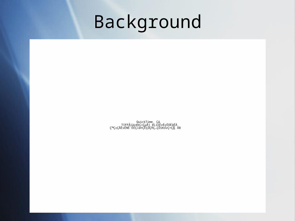
1995 South Hyogo-ken Earthquake1995 South Hyogo-ken Earthquake
1995 South Hyogo-ken Earthquake1995 South Hyogo-ken Earthquake
1995 South Hyogo-ken Earthquake1995 South Hyogo-ken Earthquake
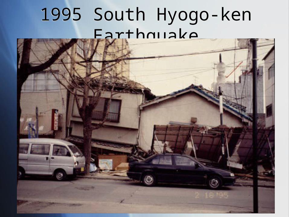
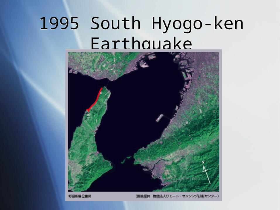
Caused by the active fault named “Nojima fault”.
Attached Kobe Metropolitan area. Approx. 6,000 people died.
Caused by the active fault named “Nojima fault”.
Attached Kobe Metropolitan area. Approx. 6,000 people died.
1995 South Hyogo-ken Earthquake1995 South Hyogo-ken Earthquake
2004 Niigata Chuetsu Earthquake2004 Niigata Chuetsu Earthquake
QuickTime˛ Ç∆TIFFÅià≥èkǻǵÅj êLí£ÉvÉçÉOÉâÉÄ
ǙDZÇÃÉsÉNÉ`ÉÉÇ å©ÇÈÇΩÇflÇ…ÇÕïKóvÇ≈Ç∑ÅB
QuickTime˛ Ç∆TIFFÅià≥èkǻǵÅj êLí£ÉvÉçÉOÉâÉÄ
ǙDZÇÃÉsÉNÉ`ÉÉÇ å©ÇÈÇΩÇflÇ…ÇÕïKóvÇ≈Ç∑ÅB
2004 Niigata Chuetsu Earthquake2004 Niigata Chuetsu Earthquake
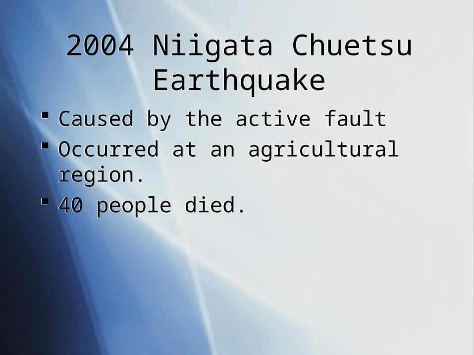
2004 Niigata Chuetsu Earthquake2004 Niigata Chuetsu Earthquake
Caused by the active fault Occurred at an agricultural region. 40 people died.
Caused by the active fault Occurred at an agricultural region. 40 people died.
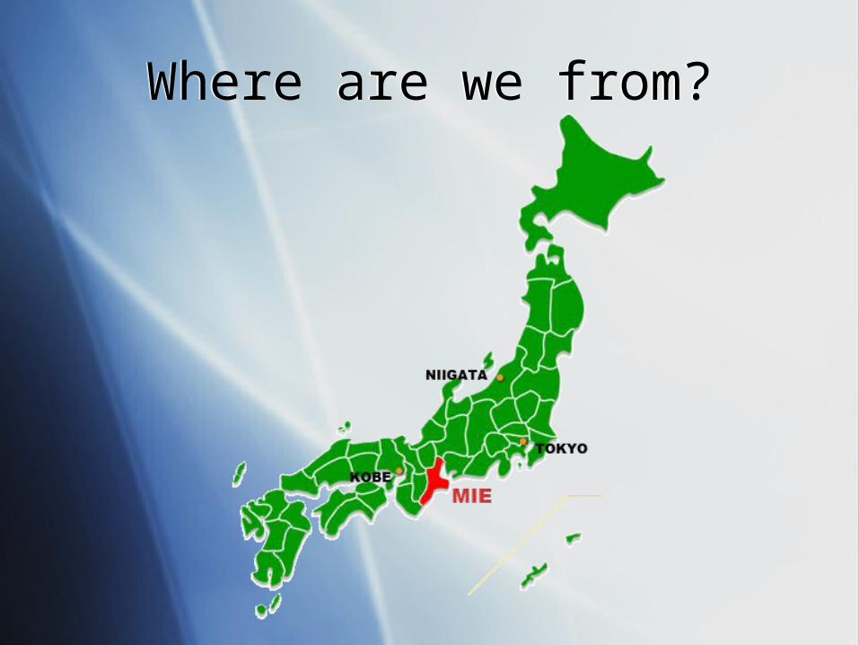
Where are we from?Where are we from?
QuickTime˛ Ç∆TIFFÅiLZWÅj êLí£ÉvÉçÉOÉâÉÄ
ǙDZÇÃÉsÉNÉ`ÉÉÇ å©ÇÈÇΩÇflÇ…ÇÕïKóvÇ≈Ç∑ÅB
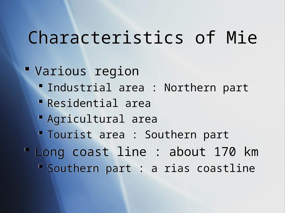
Characteristics of MieCharacteristics of Mie
Various region Industrial area : Northern part Residential area Agricultural area Tourist area : Southern part
Long coast line : about 170 km Southern part : a rias coastline
Various region Industrial area : Northern part Residential area Agricultural area Tourist area : Southern part
Long coast line : about 170 km Southern part : a rias coastline
HistoryHistory
QuickTime˛ Ç∆TIFFÅiLZWÅj êLí£ÉvÉçÉOÉâÉÄ
ǙDZÇÃÉsÉNÉ`ÉÉÇ å©ÇÈÇΩÇflÇ…ÇÕïKóvÇ≈Ç∑ÅB
QuickTime˛ Ç∆TIFFÅià≥èkǻǵÅj êLí£ÉvÉçÉOÉâÉÄ
ǙDZÇÃÉsÉNÉ`ÉÉÇ å©ÇÈÇΩÇflÇ…ÇÕïKóvÇ≈Ç∑ÅB
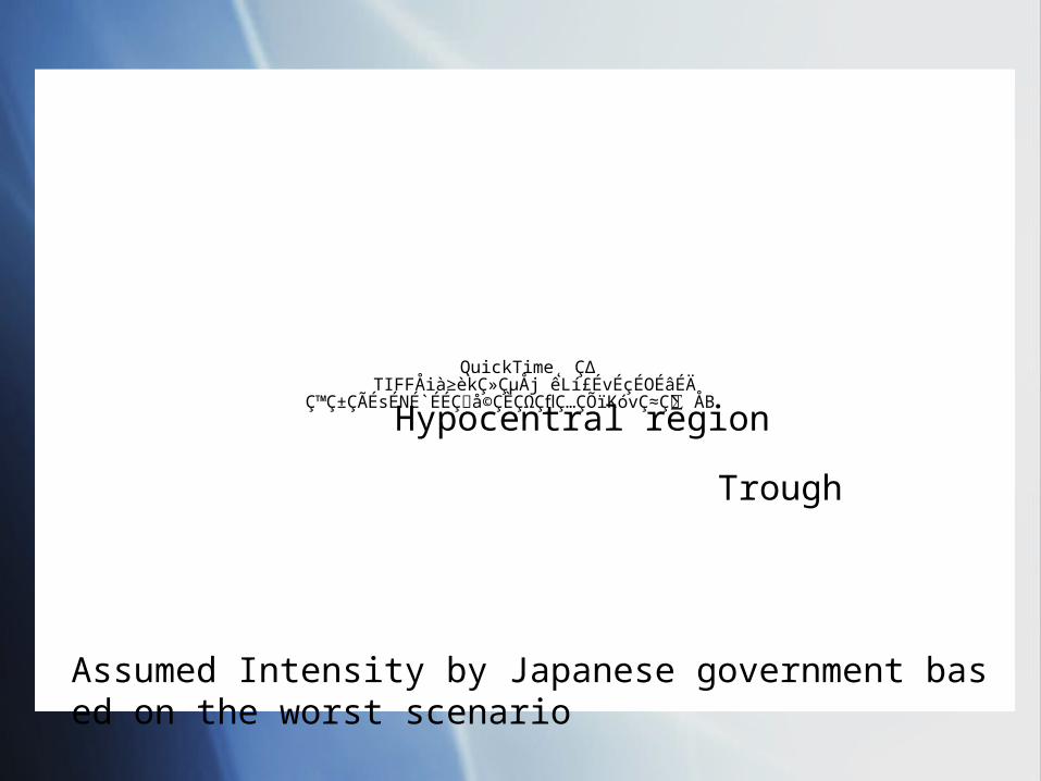
Trough
Hypocentral region
Assumed Intensity by Japanese government based on the worst scenario
QuickTime˛ Ç∆TIFFÅià≥èkǻǵÅj êLí£ÉvÉçÉOÉâÉÄ
ǙDZÇÃÉsÉNÉ`ÉÉÇ å©ÇÈÇΩÇflÇ…ÇÕïKóvÇ≈Ç∑ÅB
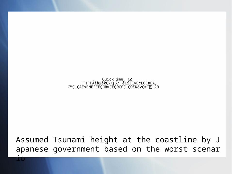
Assumed Tsunami height at the coastline by Japanese government based on the worst scenario
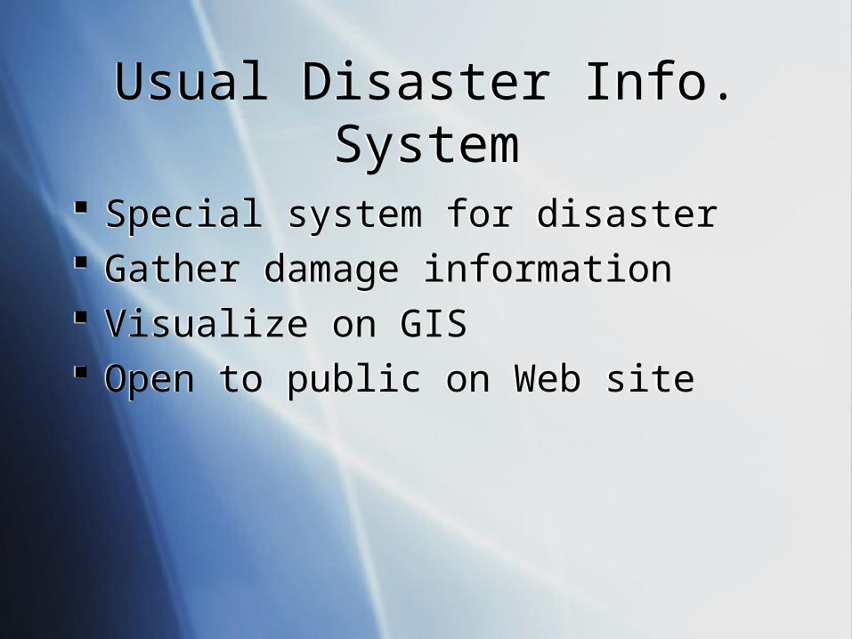
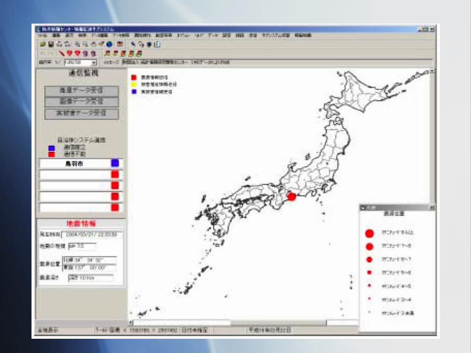
Usual Disaster Info. SystemUsual Disaster Info. System
Special system for disaster Gather damage information Visualize on GIS Open to public on Web site
Special system for disaster Gather damage information Visualize on GIS Open to public on Web site
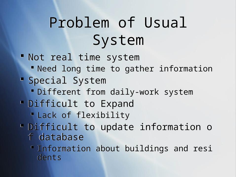
Problem of Usual SystemProblem of Usual System
Not real time system Need long time to gather information
Special System Different from daily-work system
Difficult to Expand Lack of flexibility
Difficult to update information of database Information about buildings and residents
Not real time system Need long time to gather information
Special System Different from daily-work system
Difficult to Expand Lack of flexibility
Difficult to update information of database Information about buildings and residents
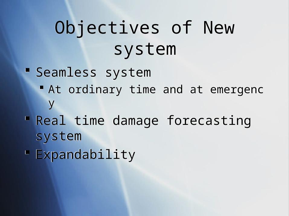
Objectives of New systemObjectives of New system
Seamless system At ordinary time and at emergency
Real time damage forecasting system Expandability
Seamless system At ordinary time and at emergency
Real time damage forecasting system Expandability
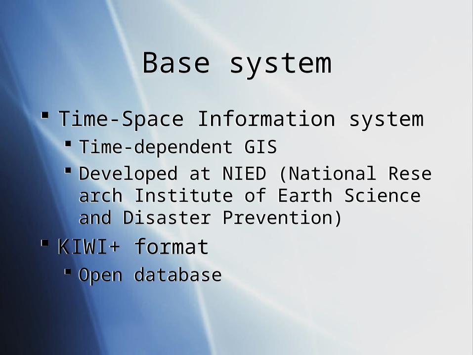
Base systemBase system
Time-Space Information system Time-dependent GIS Developed at NIED (National Research Institut
e of Earth Science and Disaster Prevention)
KIWI+ format Open database
Time-Space Information system Time-dependent GIS Developed at NIED (National Research Institut
e of Earth Science and Disaster Prevention)
KIWI+ format Open database
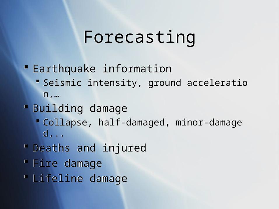
ForecastingForecasting
Earthquake information Seismic intensity, ground acceleration,…
Building damage Collapse, half-damaged, minor-damaged,..
Deaths and injured Fire damage Lifeline damage
Earthquake information Seismic intensity, ground acceleration,…
Building damage Collapse, half-damaged, minor-damaged,..
Deaths and injured Fire damage Lifeline damage
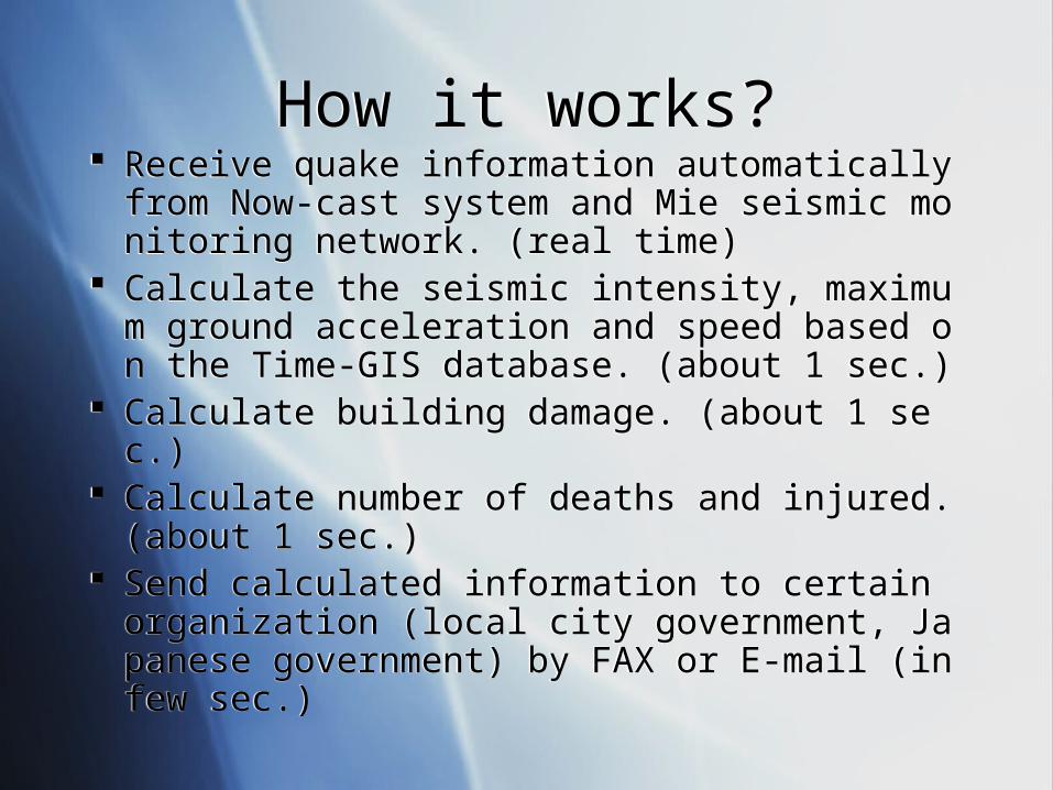
How it works?How it works? Receive quake information automatically from No
w-cast system and Mie seismic monitoring network. (real time)
Calculate the seismic intensity, maximum ground acceleration and speed based on the Time-GIS database. (about 1 sec.)
Calculate building damage. (about 1 sec.) Calculate number of deaths and injured. (about 1 s
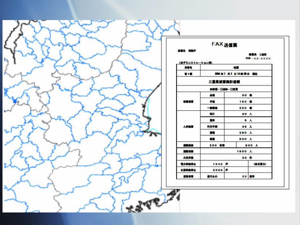
ec.) Send calculated information to certain organizatio
n (local city government, Japanese government) by FAX or E-mail (in few sec.)
Receive quake information automatically from Now-cast system and Mie seismic monitoring network. (real time)
Calculate the seismic intensity, maximum ground acceleration and speed based on the Time-GIS database. (about 1 sec.)
Calculate building damage. (about 1 sec.) Calculate number of deaths and injured. (about 1 s
ec.) Send calculated information to certain organizatio
n (local city government, Japanese government) by FAX or E-mail (in few sec.)

Other Investigation for Response Plan
Other Investigation for Response Plan
Investigation on the Counter-plan for the Refuge at Tourist Area
Investigation on the Counter-plan for the Refuge of the Weak
Investigation on the Counter-plan for the Refuge at Tourist Area
Investigation on the Counter-plan for the Refuge of the Weak
QuickTime˛ Ç∆TIFFÅià≥èkǻǵÅj êLí£ÉvÉçÉOÉâÉÄ
ǙDZÇÃÉsÉNÉ`ÉÉÇ å©ÇÈÇΩÇflÇ…ÇÕïKóvÇ≈Ç∑ÅB
Thank you very much.Thank you very much.
Mie UniversityMie University